

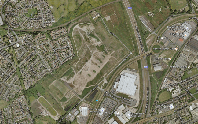
To the east of Manchester and the west of Ashton sits The Moss.
This area of low lying, deep peaty bog, just outside Ashton-under Lyne, was drained in the mid 1800’s to grow some of the best crops – It was world famous for its celery but also grew good cabbage, cauliflowers and lettuce, with cucumbers and tomatoes grown in glasshouses.
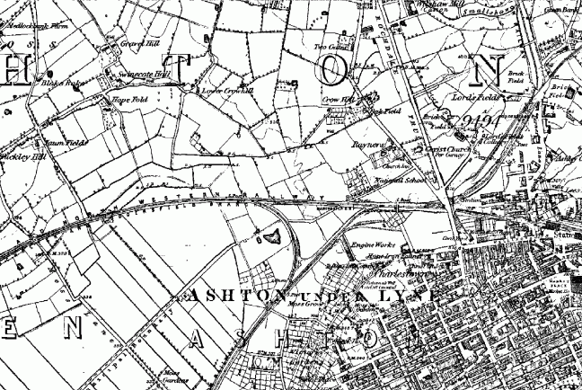
This map of 1861 shows an area criss-crossed with lanes, ditches and field boundaries.
A world that survived into the 1980s, captured here so beautifully by Brian Lomas, prior to the building of the M60.


Photographs from – Tameside Image Archive
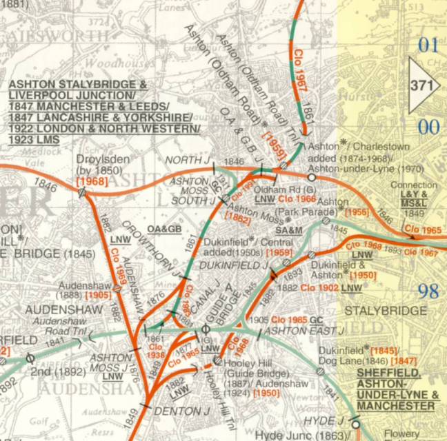
Then came the railways:

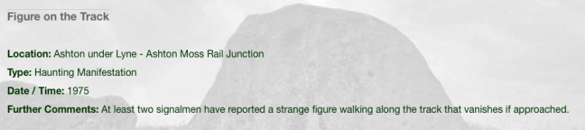
With an attendant ghost:
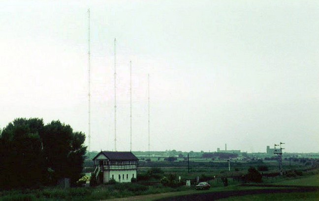
And telecommunications installation
Its location on the south east corner of the Lancashire Coalfield, and the burgeoning demands of the Industrial Revolution saw the further development of mining in the area.
As the demand for coal outstripped the output, a deeper mine was opened in 1875, at Ashton Moss. This new pit had its own railway branch and canal arm for efficient transportation of the coal. In 1882 a second shaft was sunk – at 2,850 feet, the deepest in the world at that time.
The New Rocher pit closed in 1887 and Broadoak pit closed in 1904, after which time Ashton Moss pit was the only coal mine still in operation in Ashton. Although it produced 150,000 tons of coal a year in the early 1950s and employed over 500 men, Ashton Moss colliery closed in 1959 and part of its site is now the Snipe Retail Park on the boundary with Audenshaw.
Seen here in this painting by local artist David Vaughan.

Colliery lamp token.


This tight little island of land was a contrasting mix of the agricultural and industrial, home also to the urgent demands of a leisured and growing working class.
The area boasted two motorcycle speedway tracks.
One located on the Audenshaw side, just behind The Snipe pub.
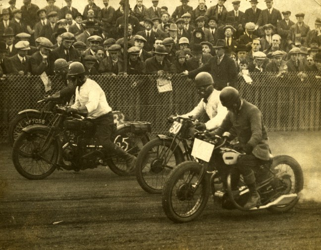
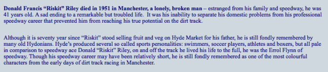
And one in Droylsden at the Moorside Stadium – home to local legend Riskit Riley:

The stadium later to become a horse trotting track, known locally as Doddy’s Trot
The Moss has also provided a home for Curzon Ashton football club

And Ashton Cricket and Bowling Club.

The cricket and the football have both survived the building of the Orbital Ring Road, and the development of the site as a light industrial, retail and leisure park.
The roar of Riskit Riley is heard no more.
