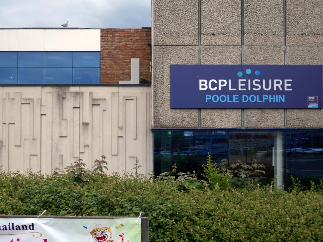
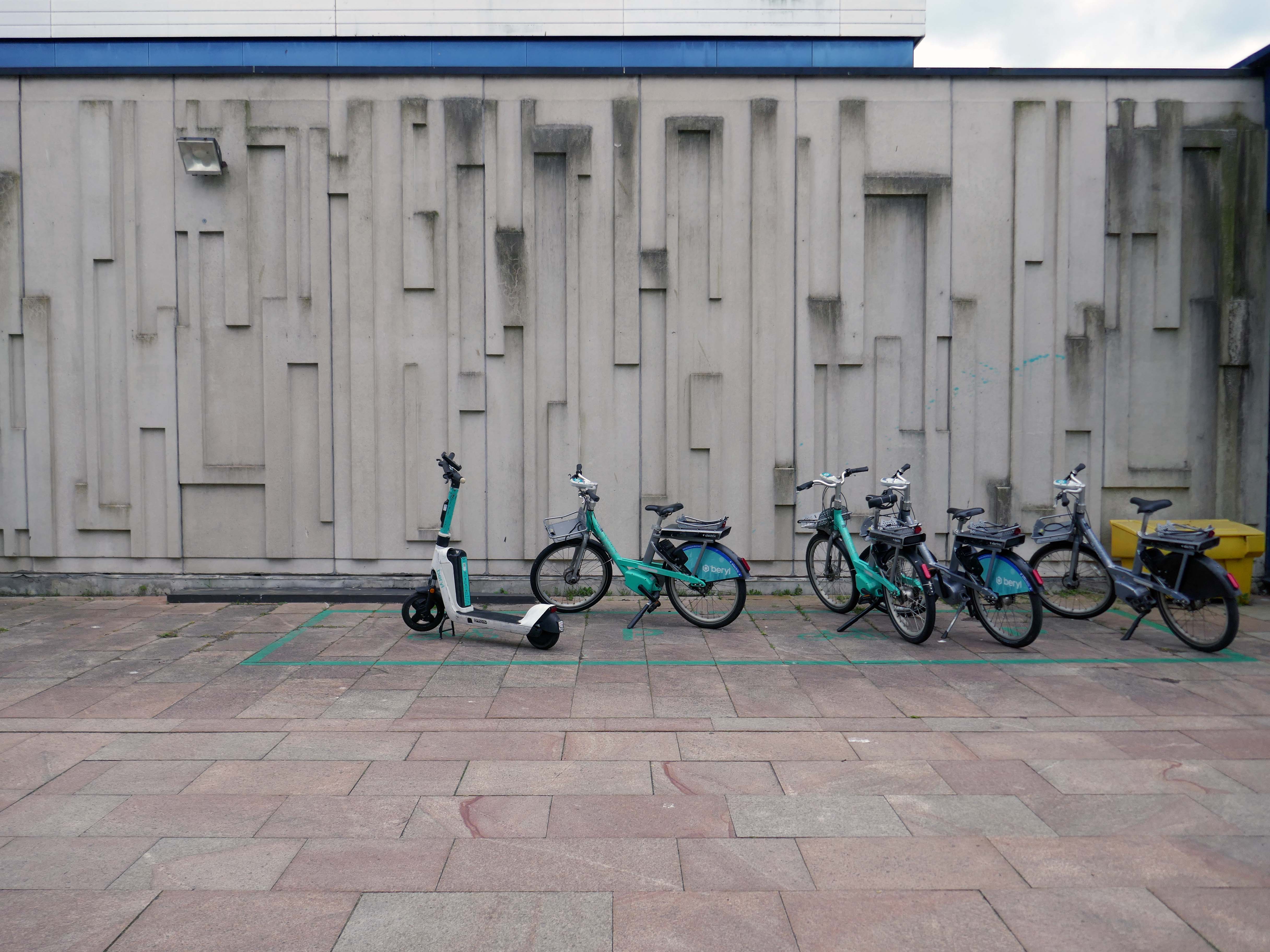
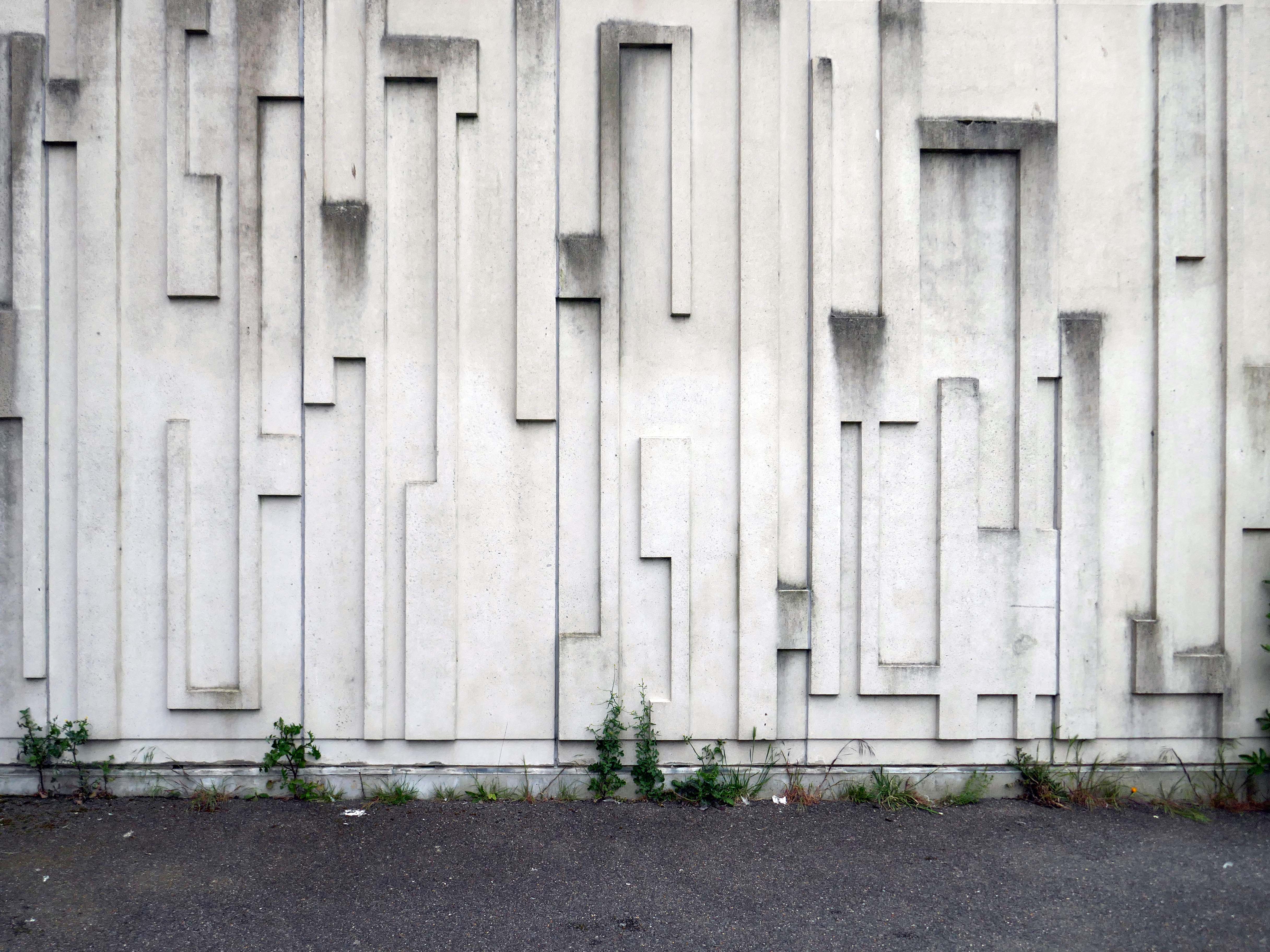
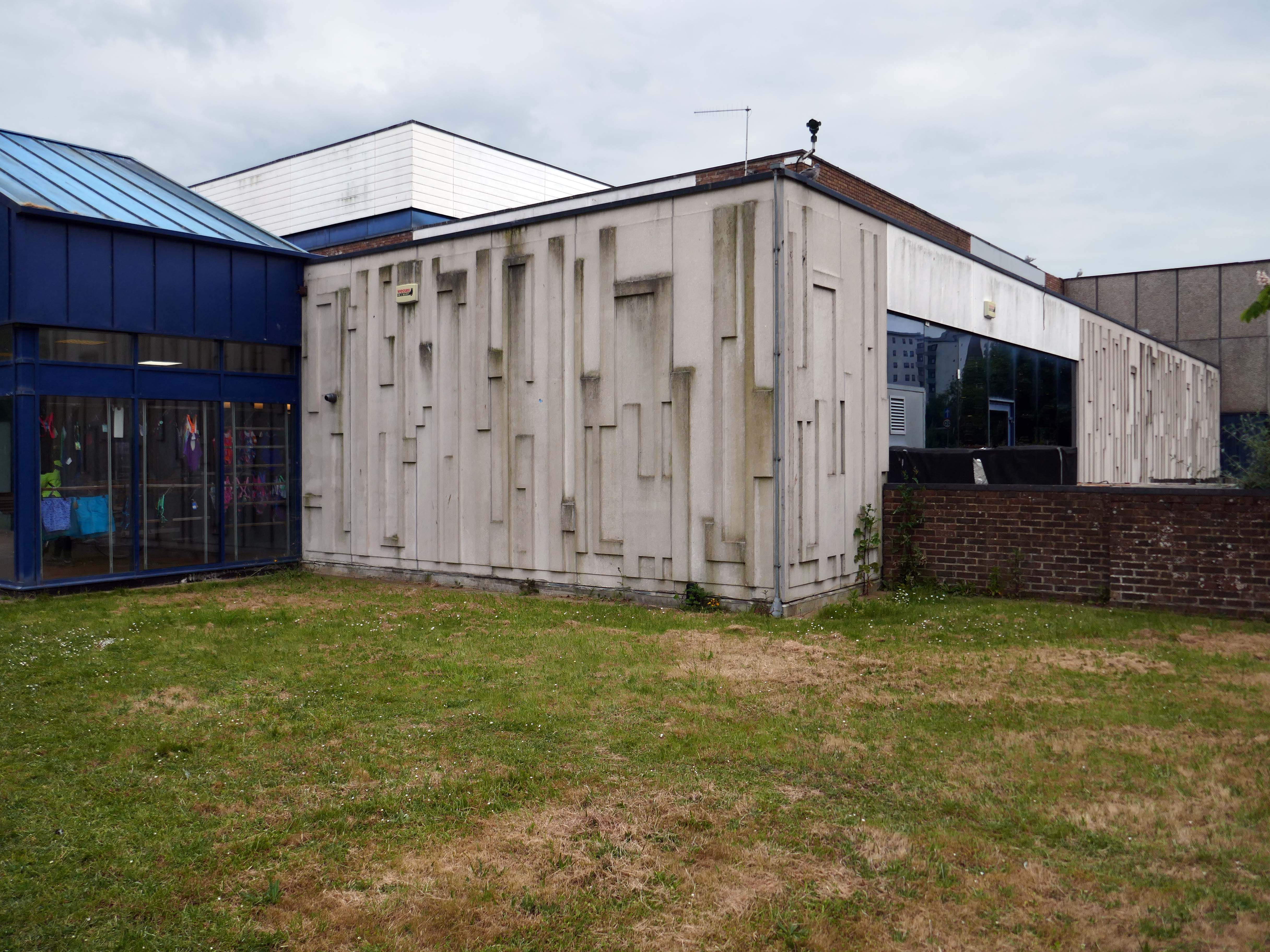
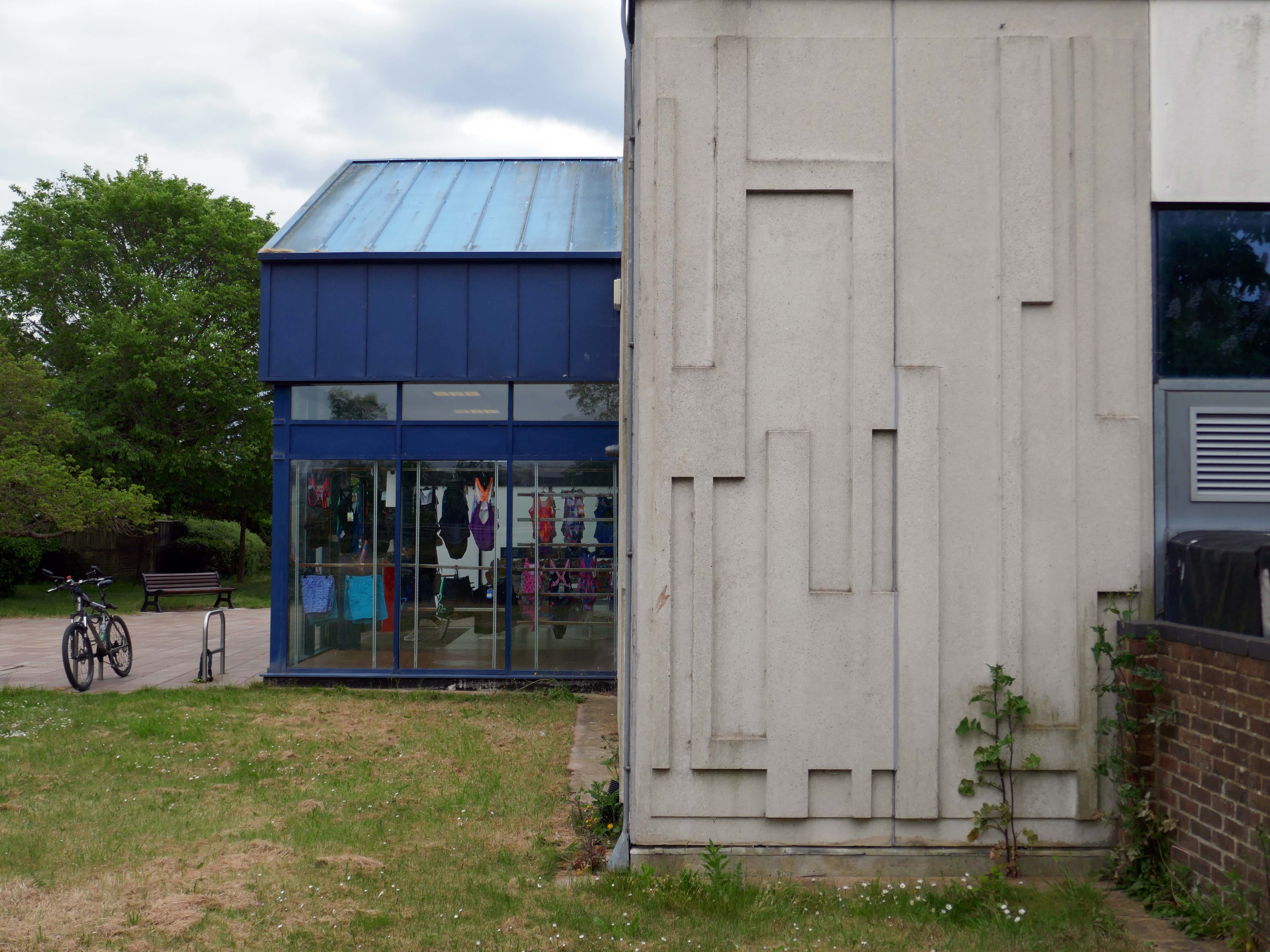
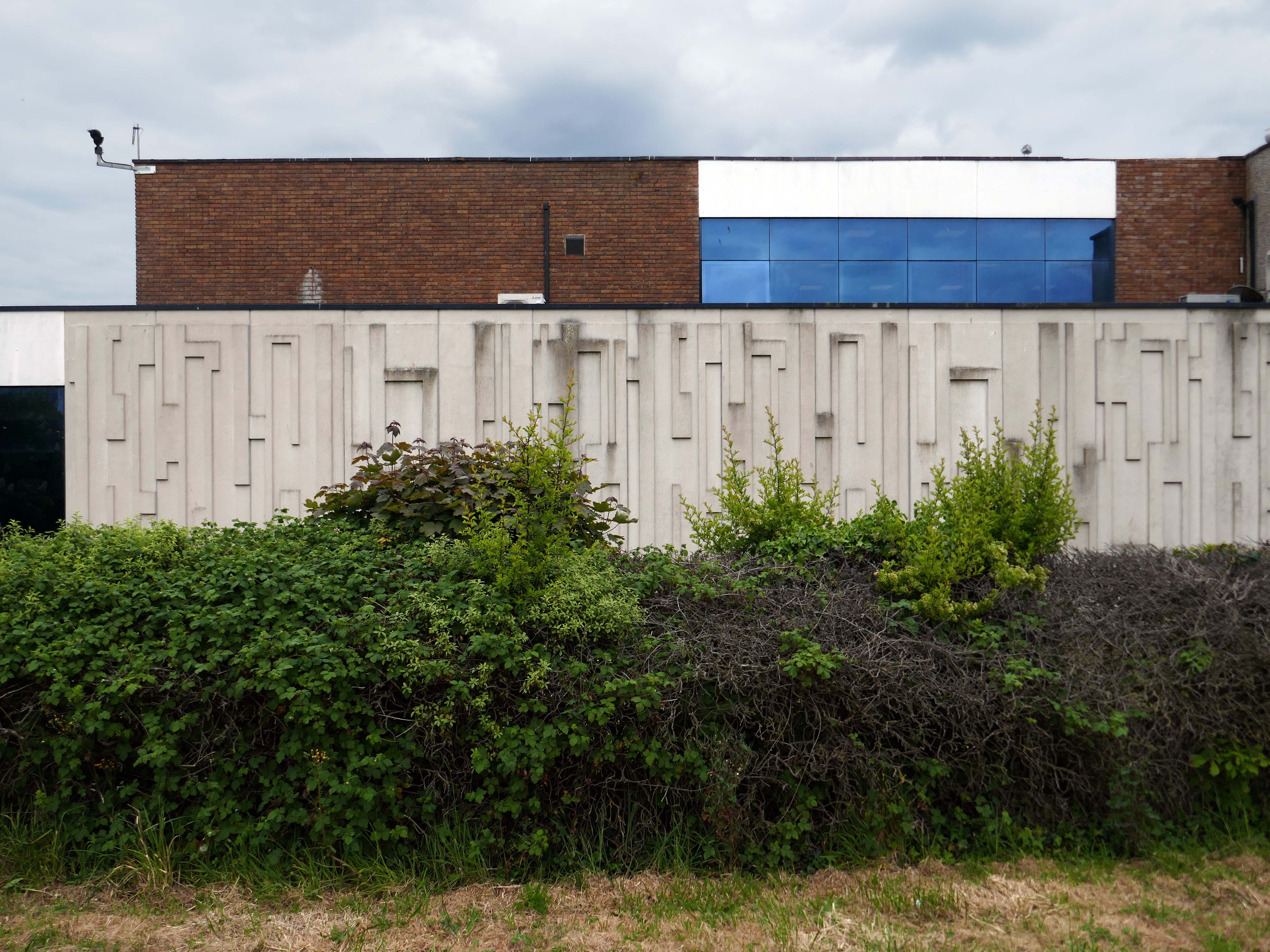
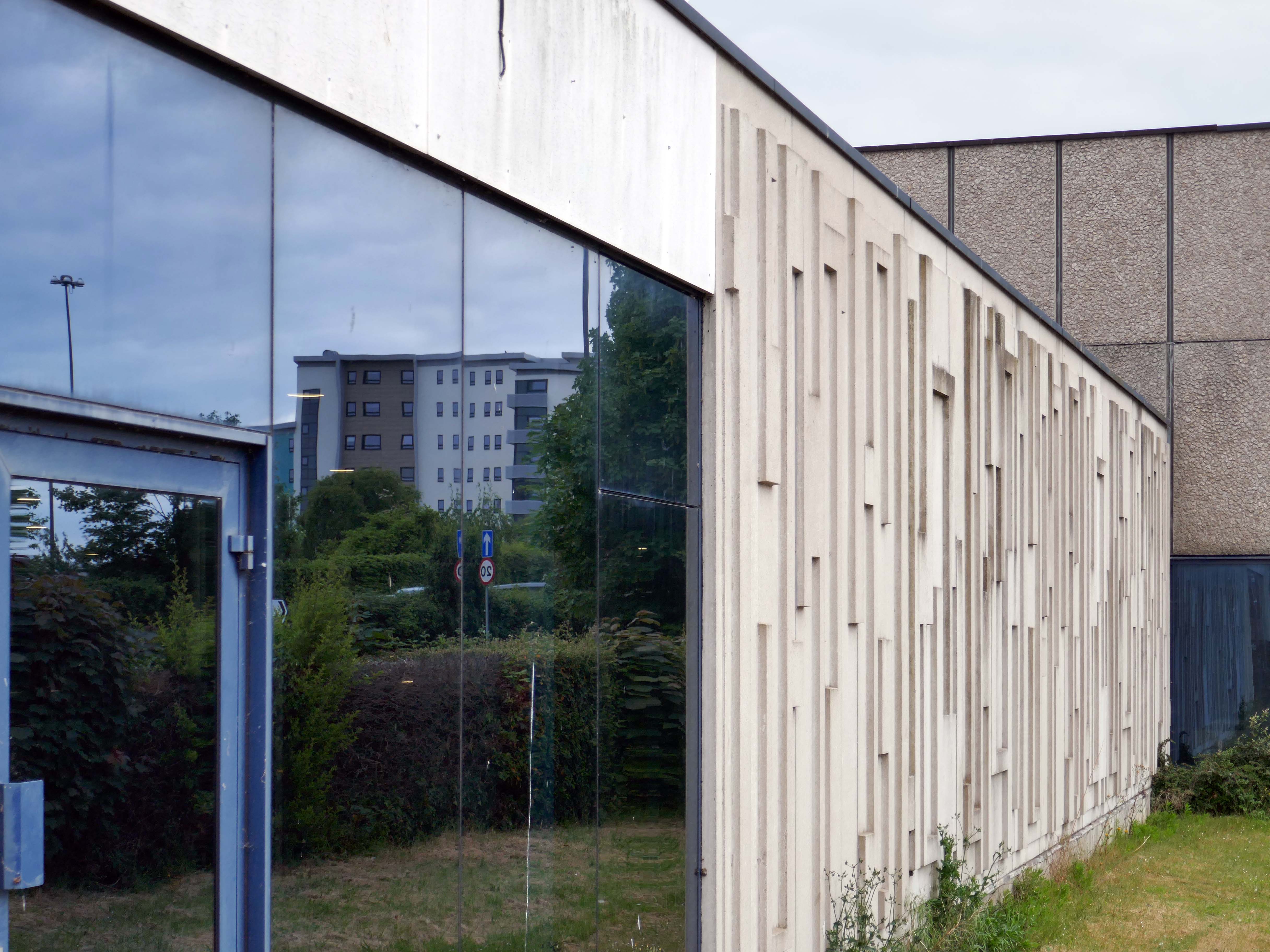
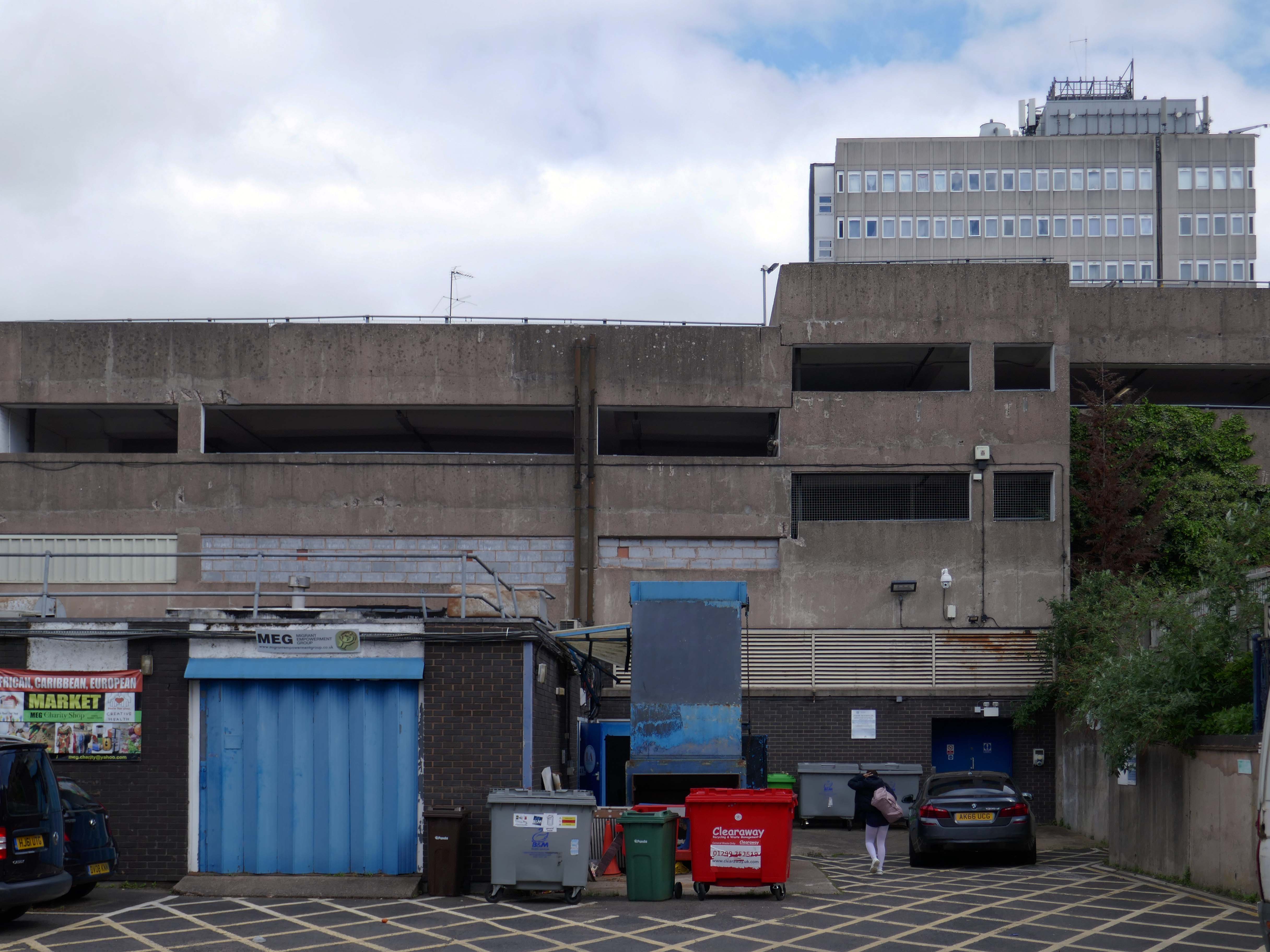
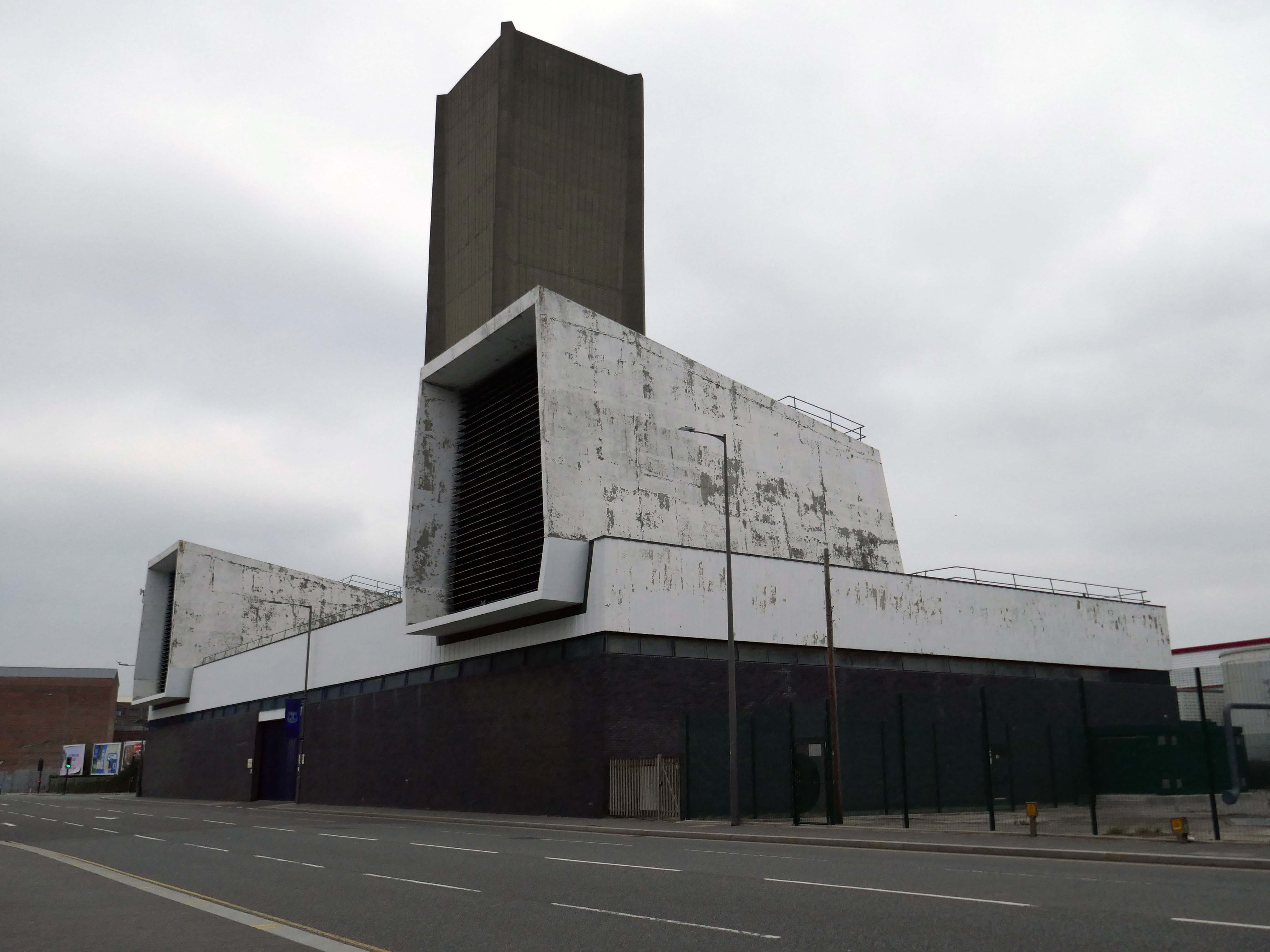
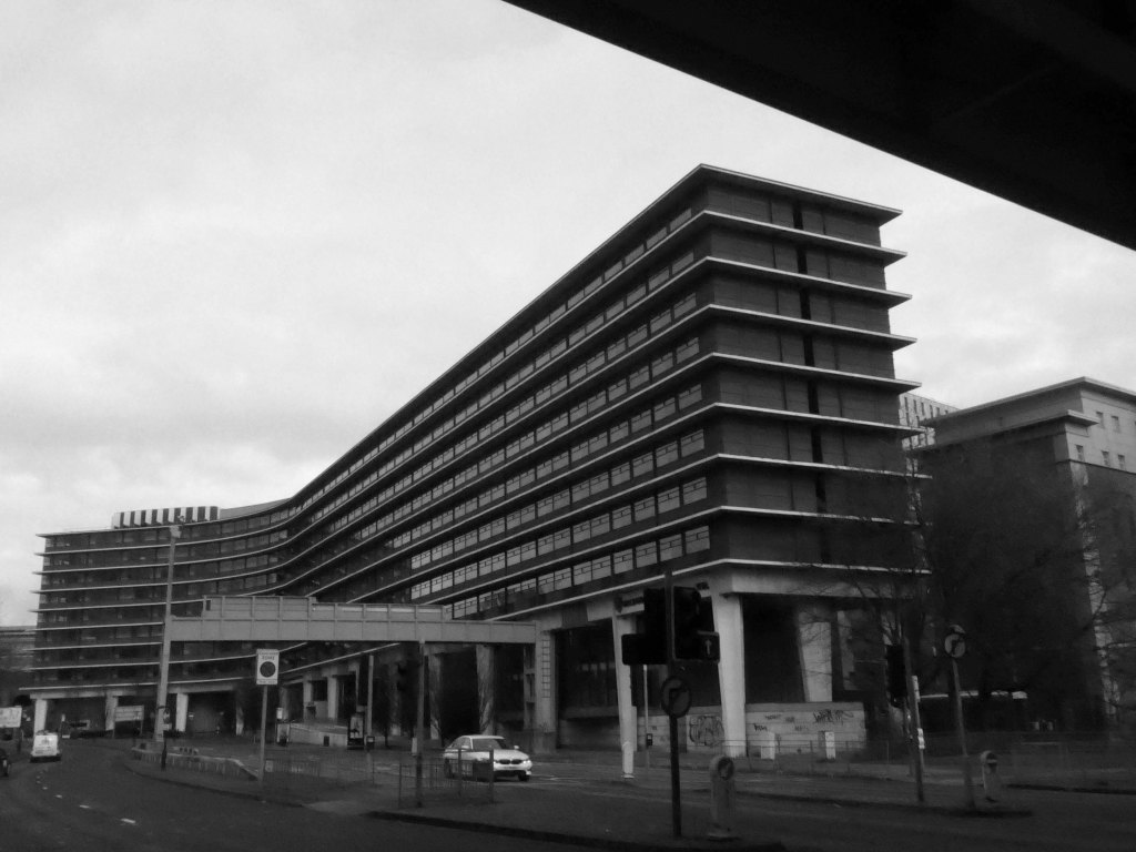
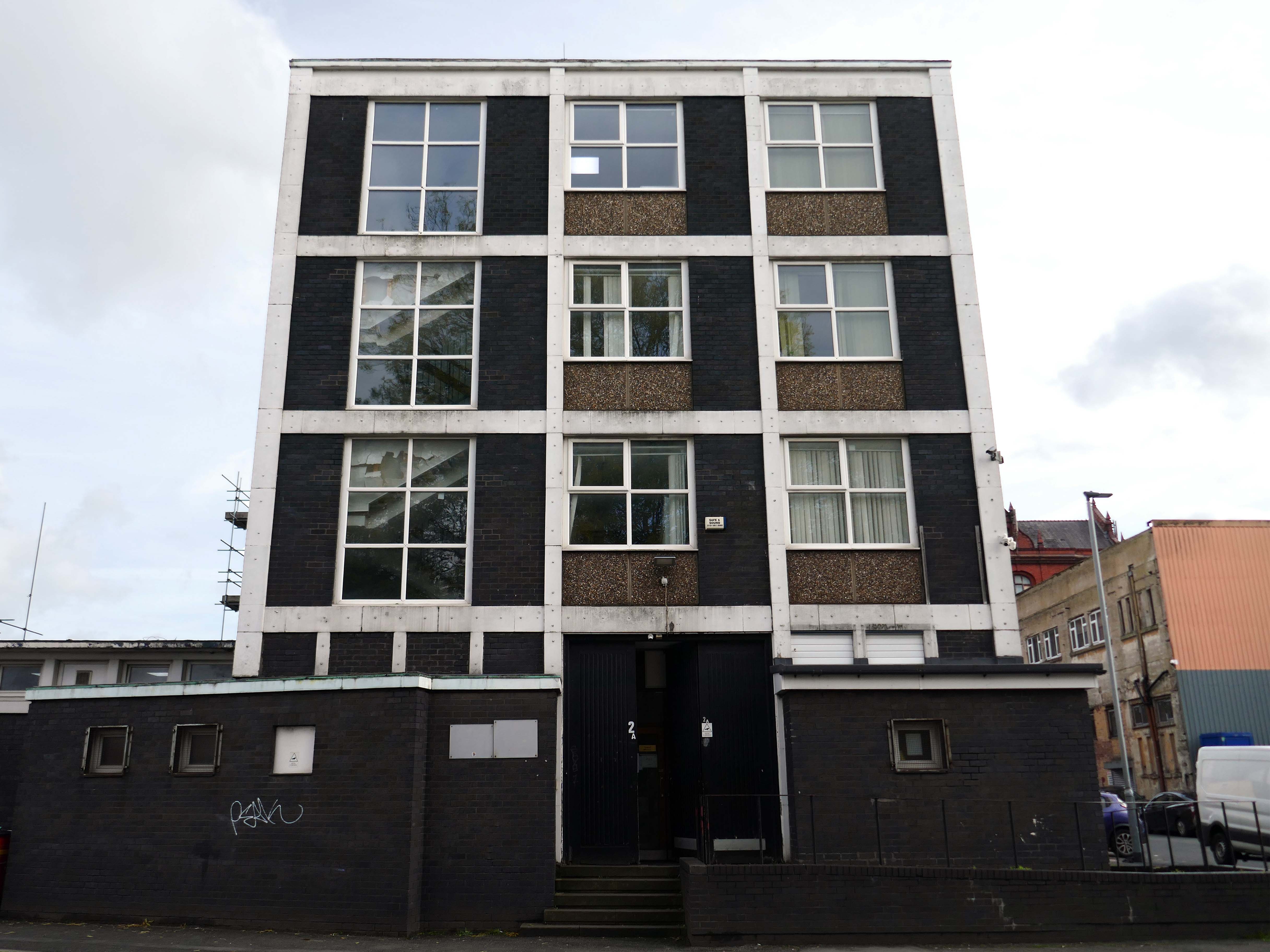
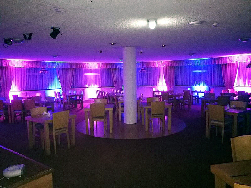
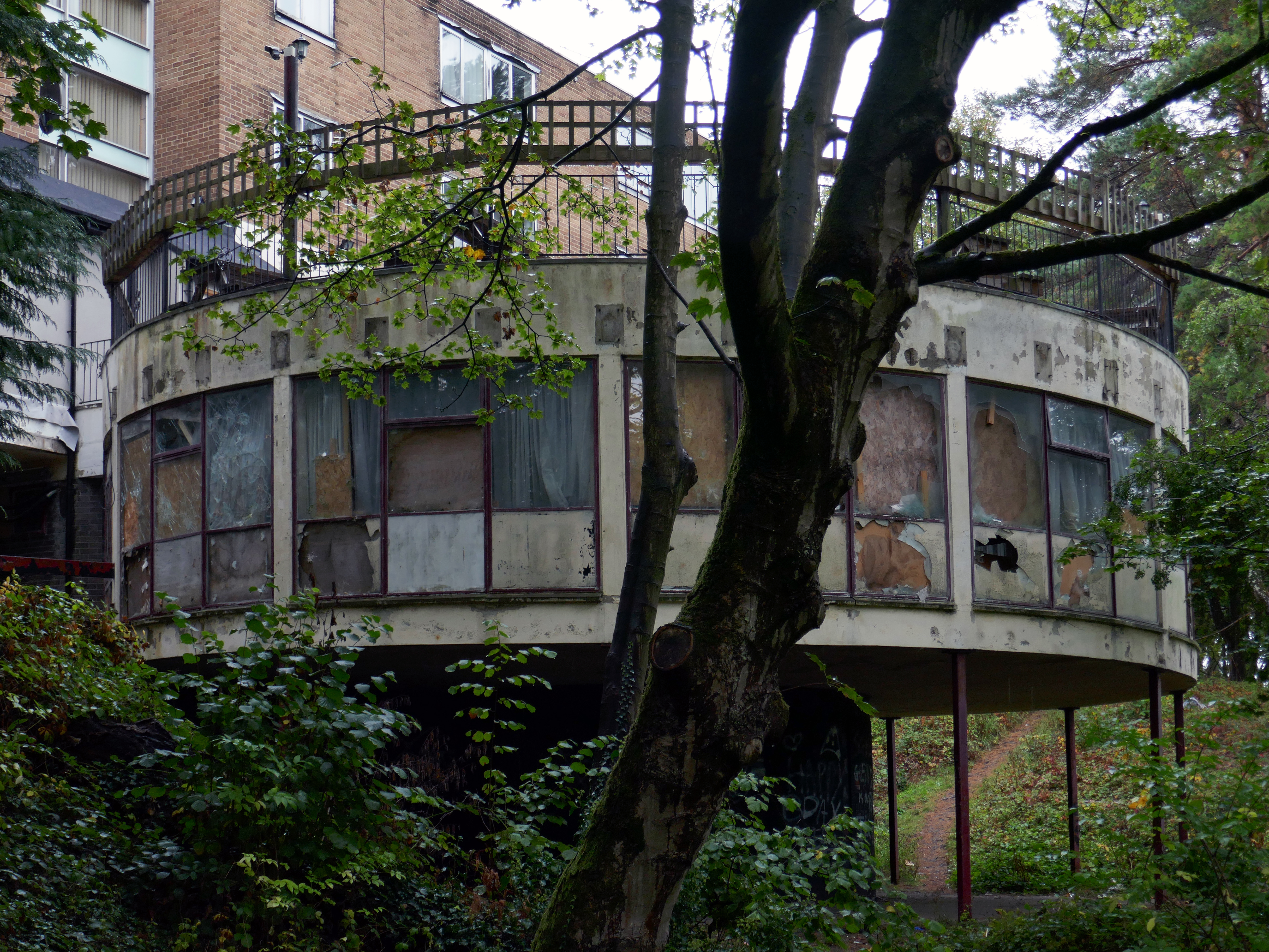
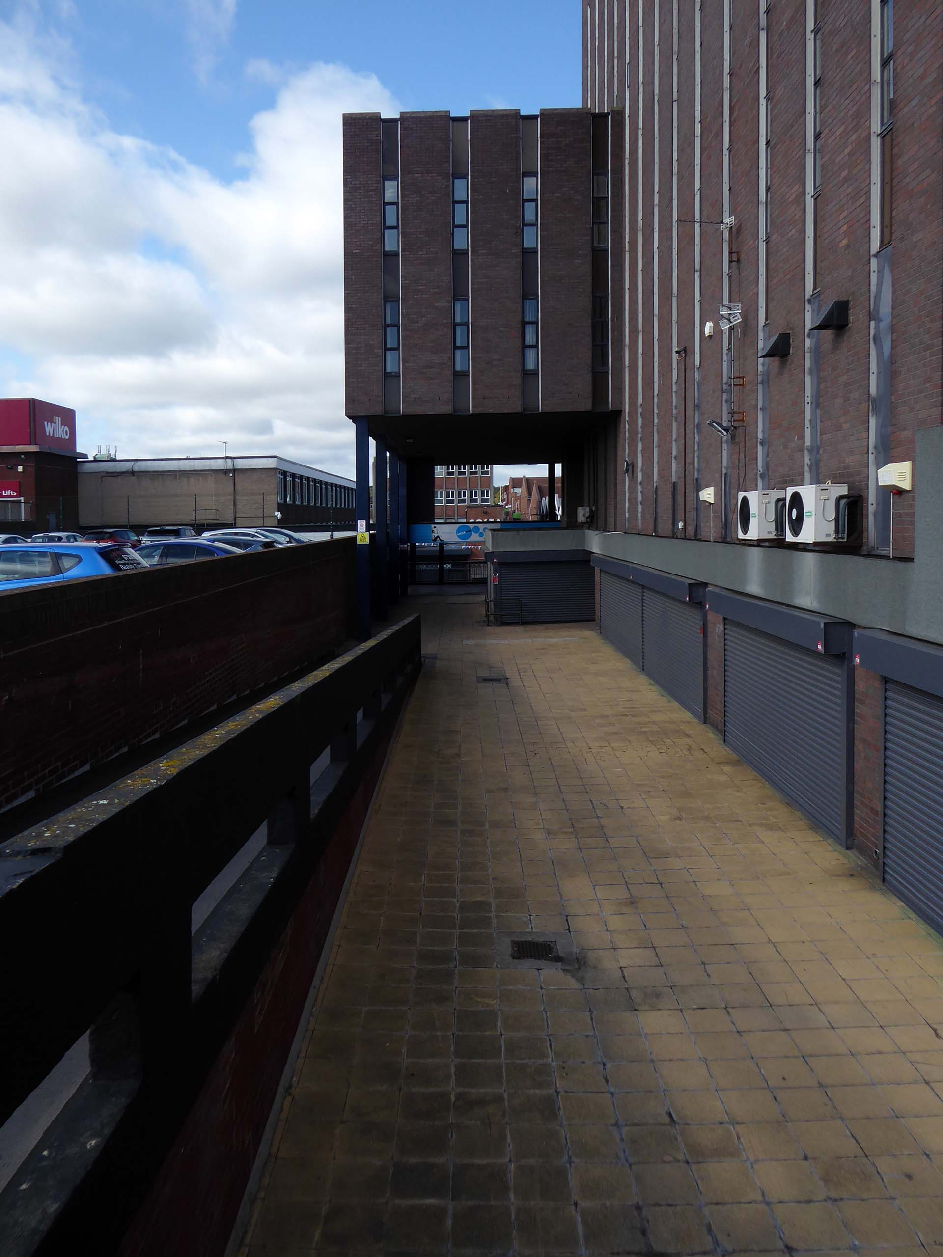
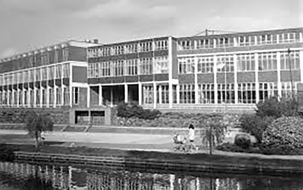
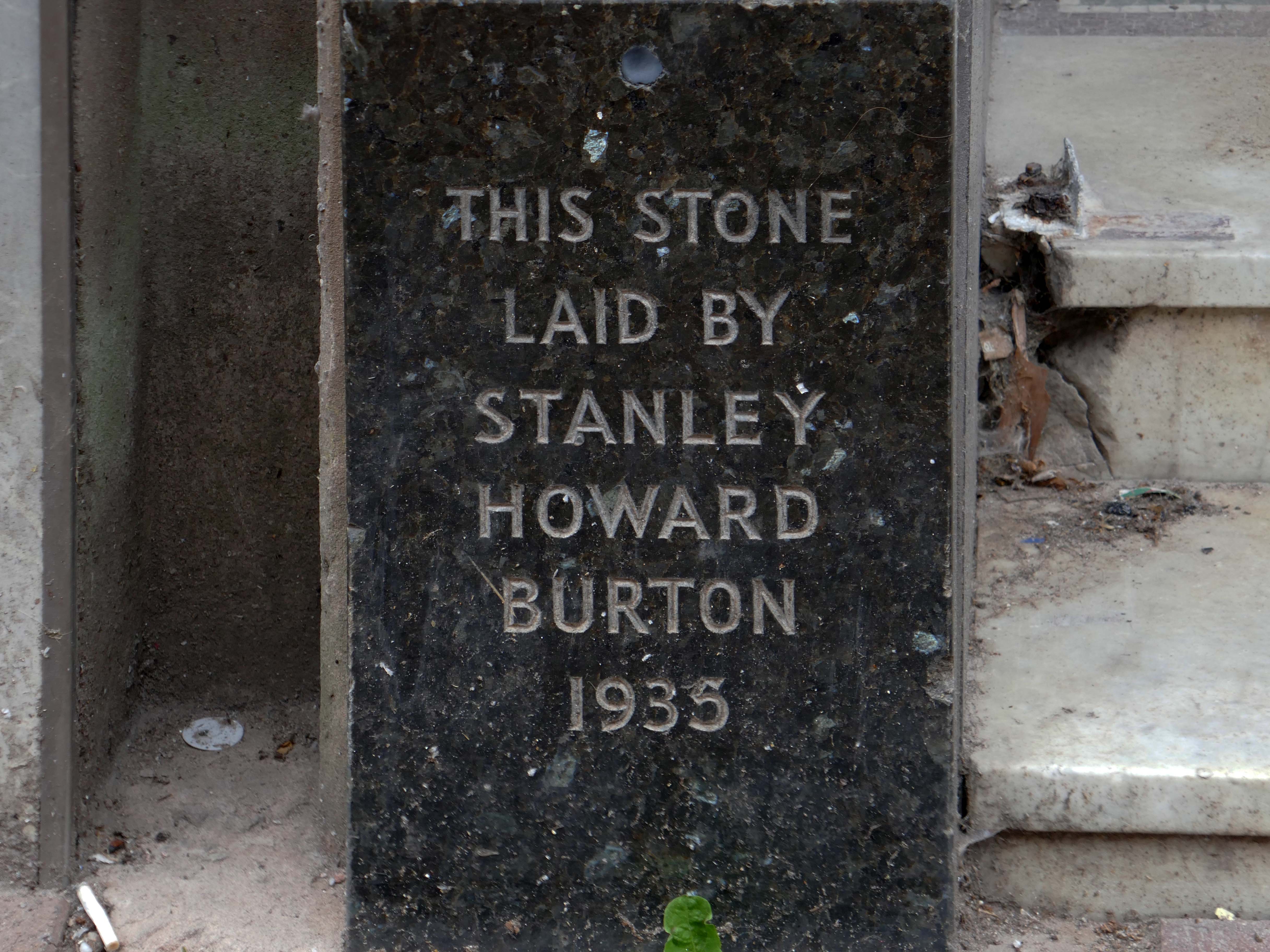
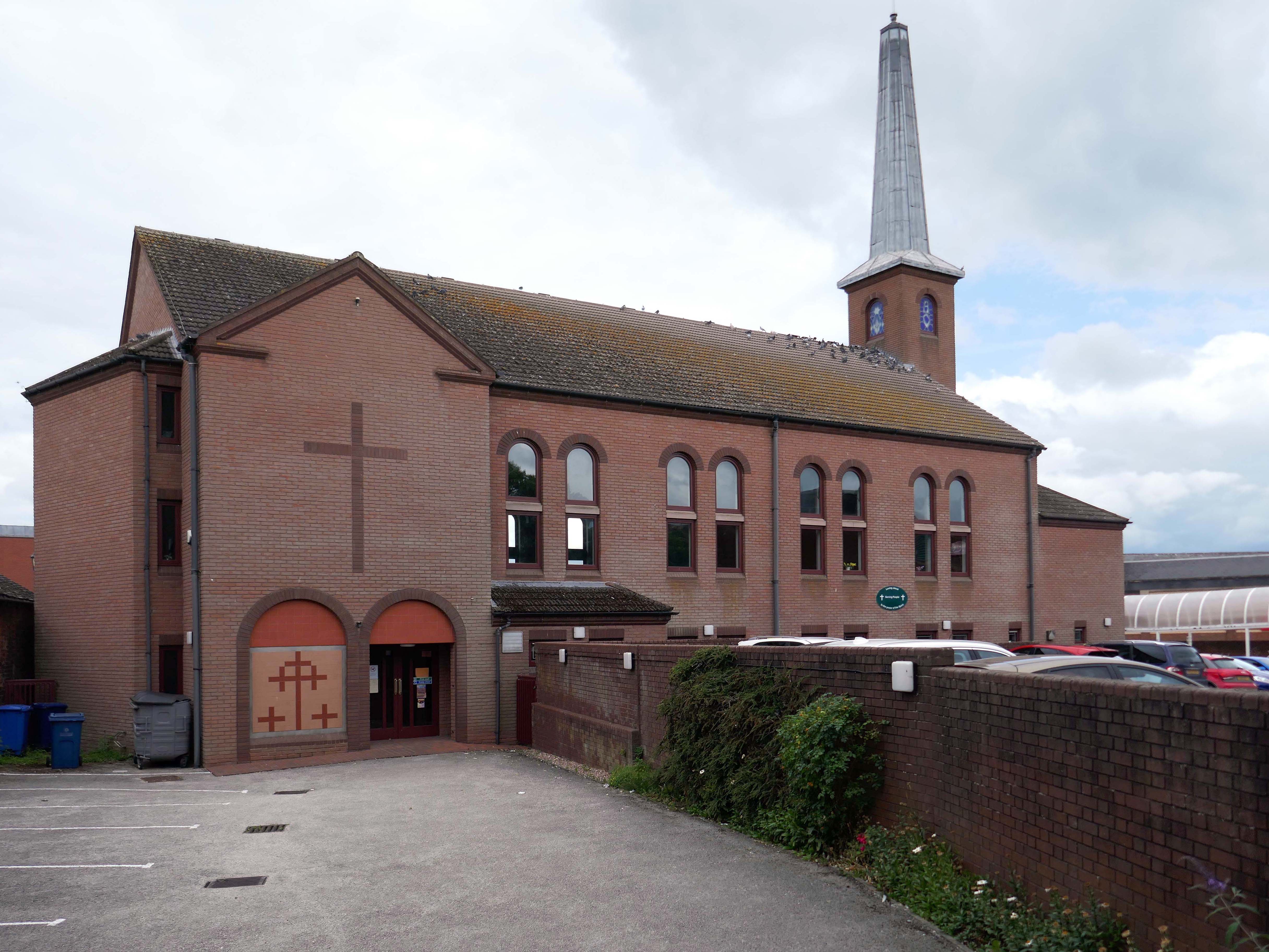
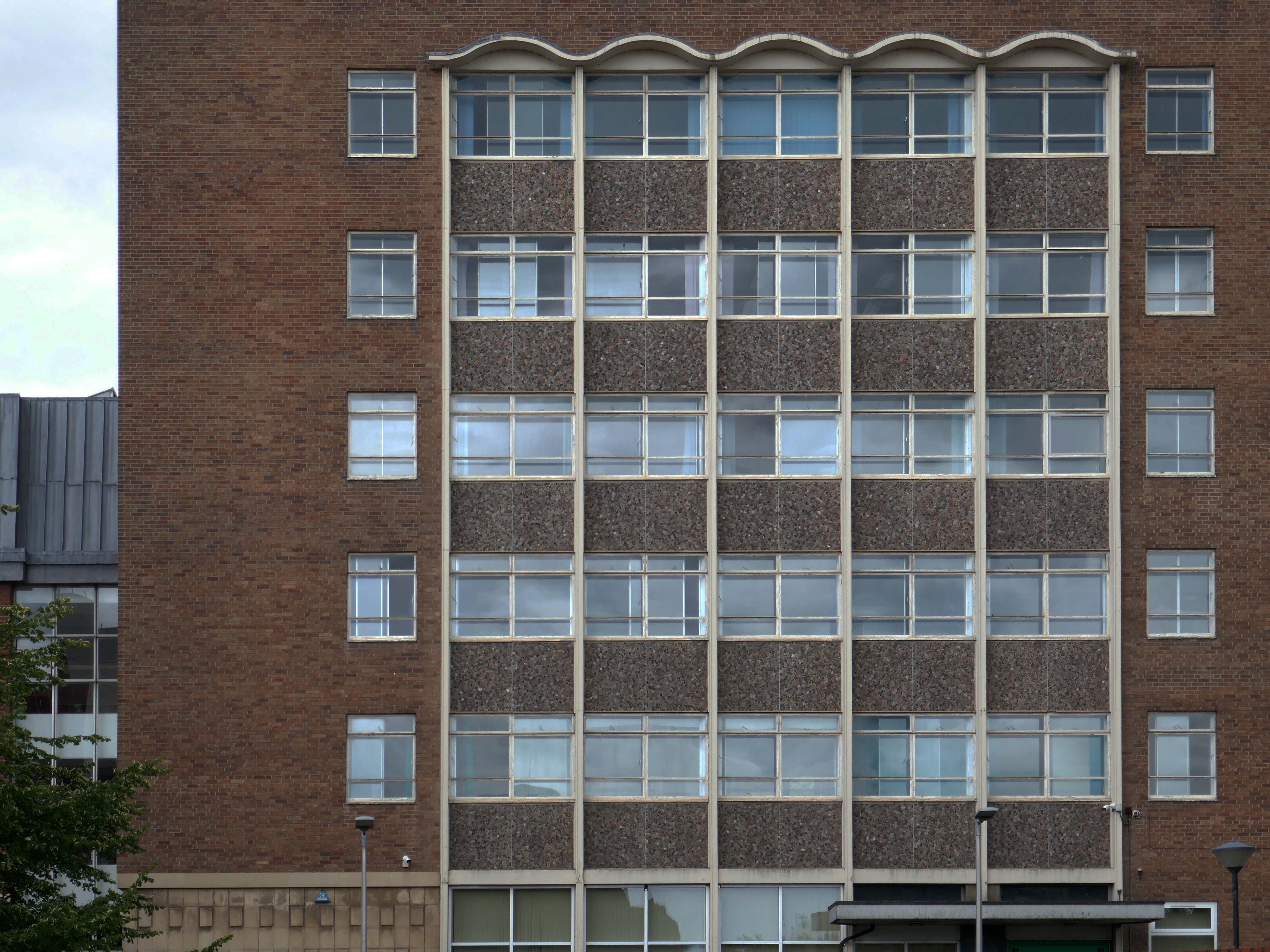
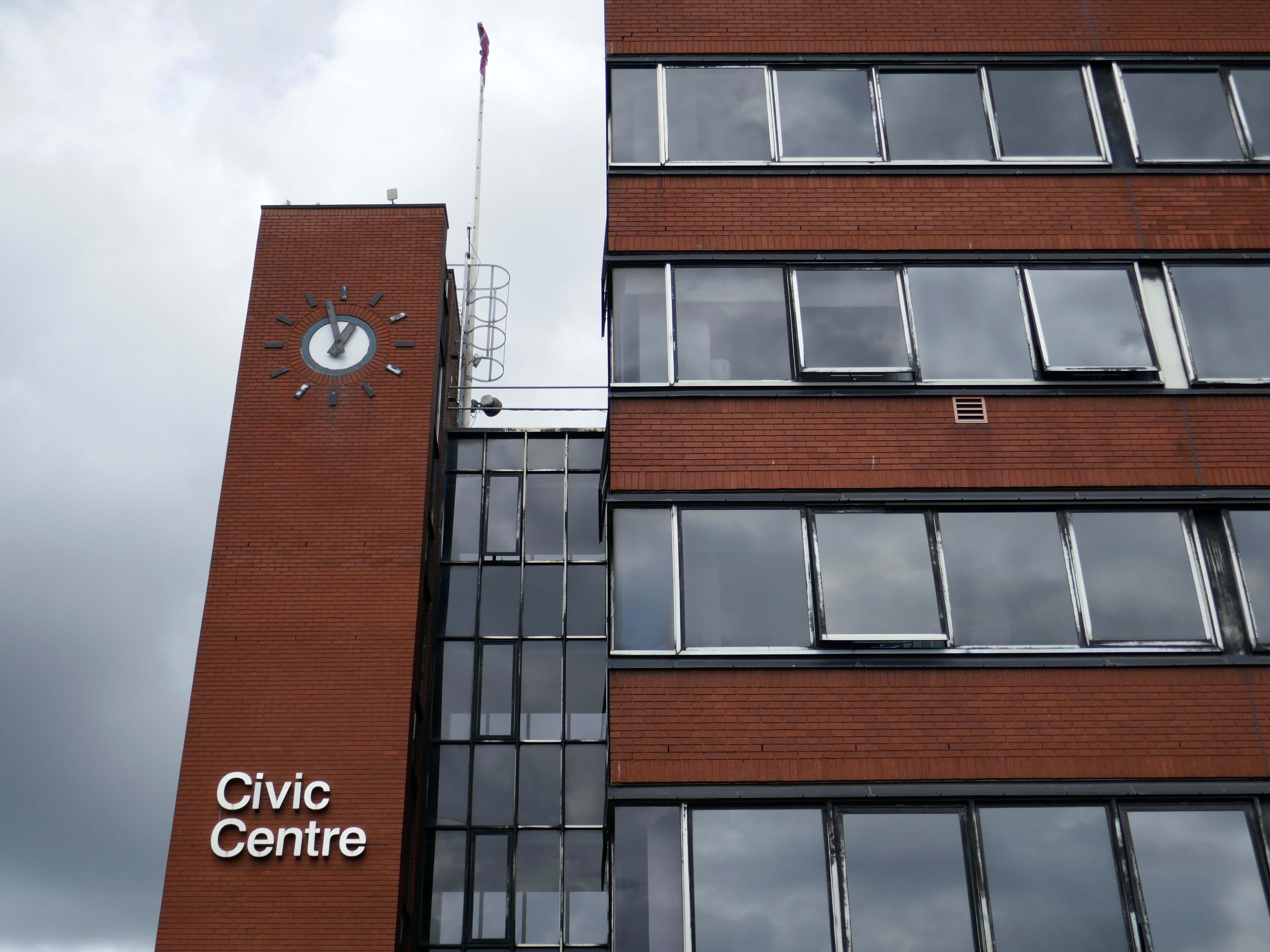
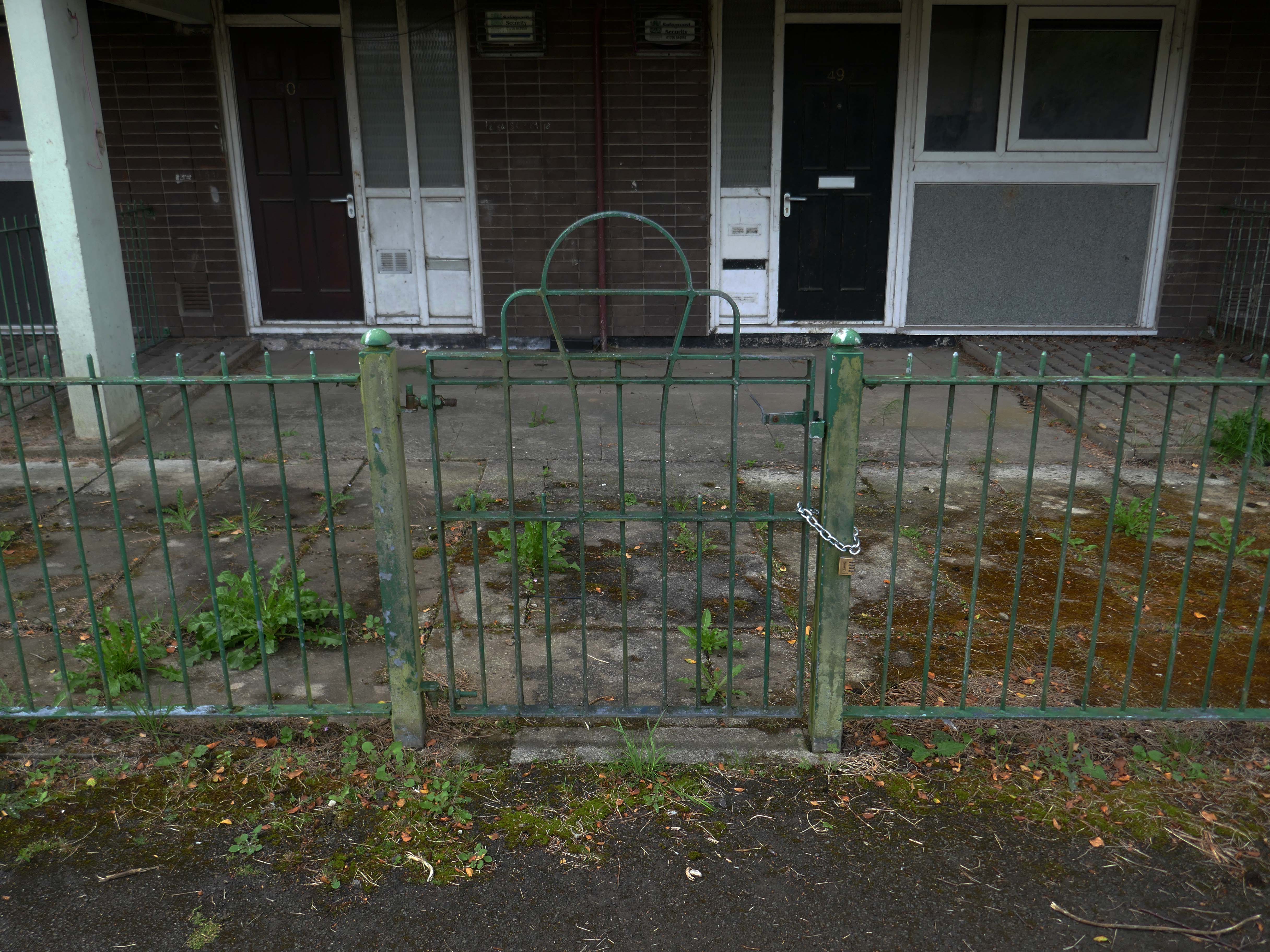
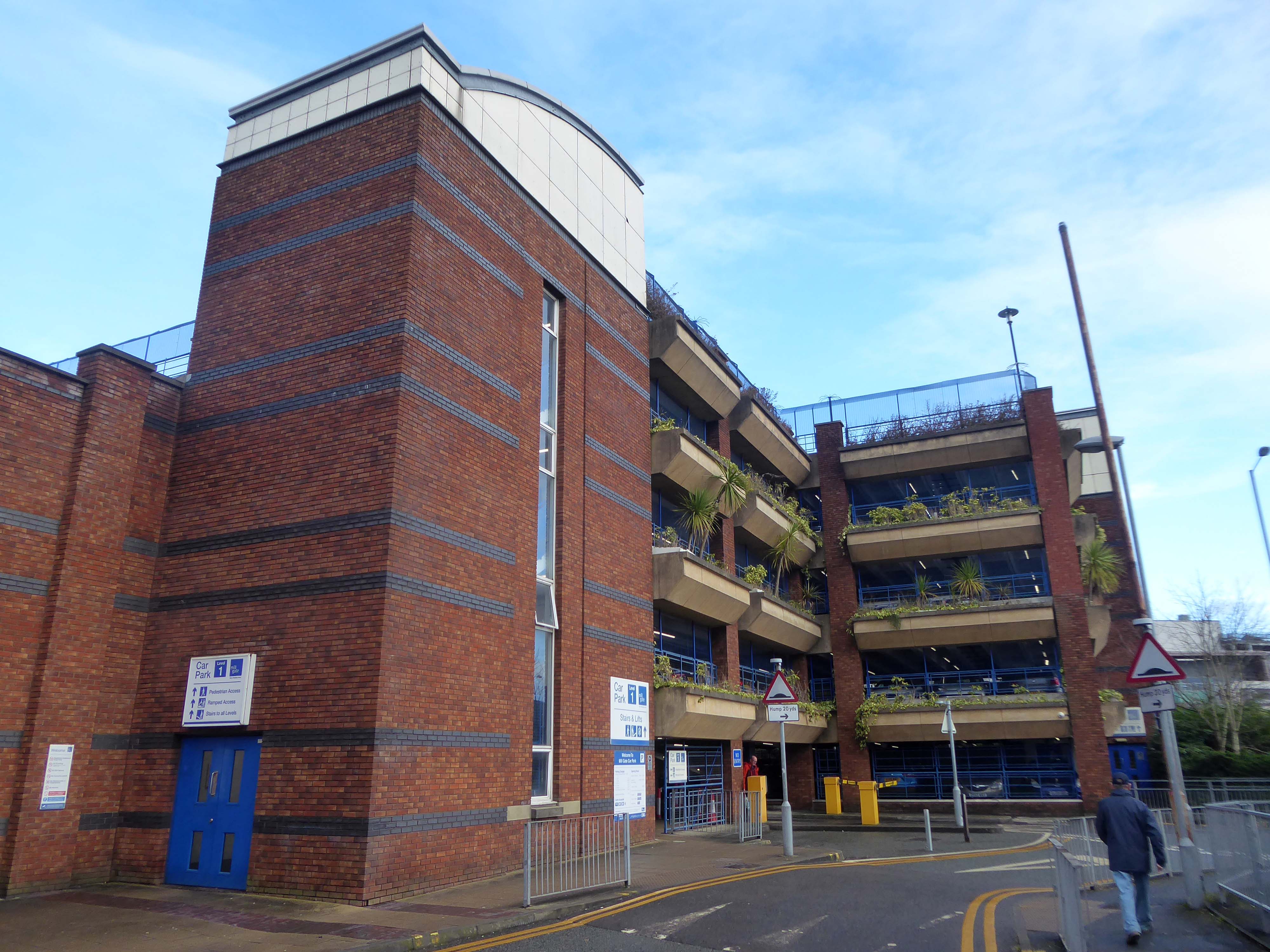
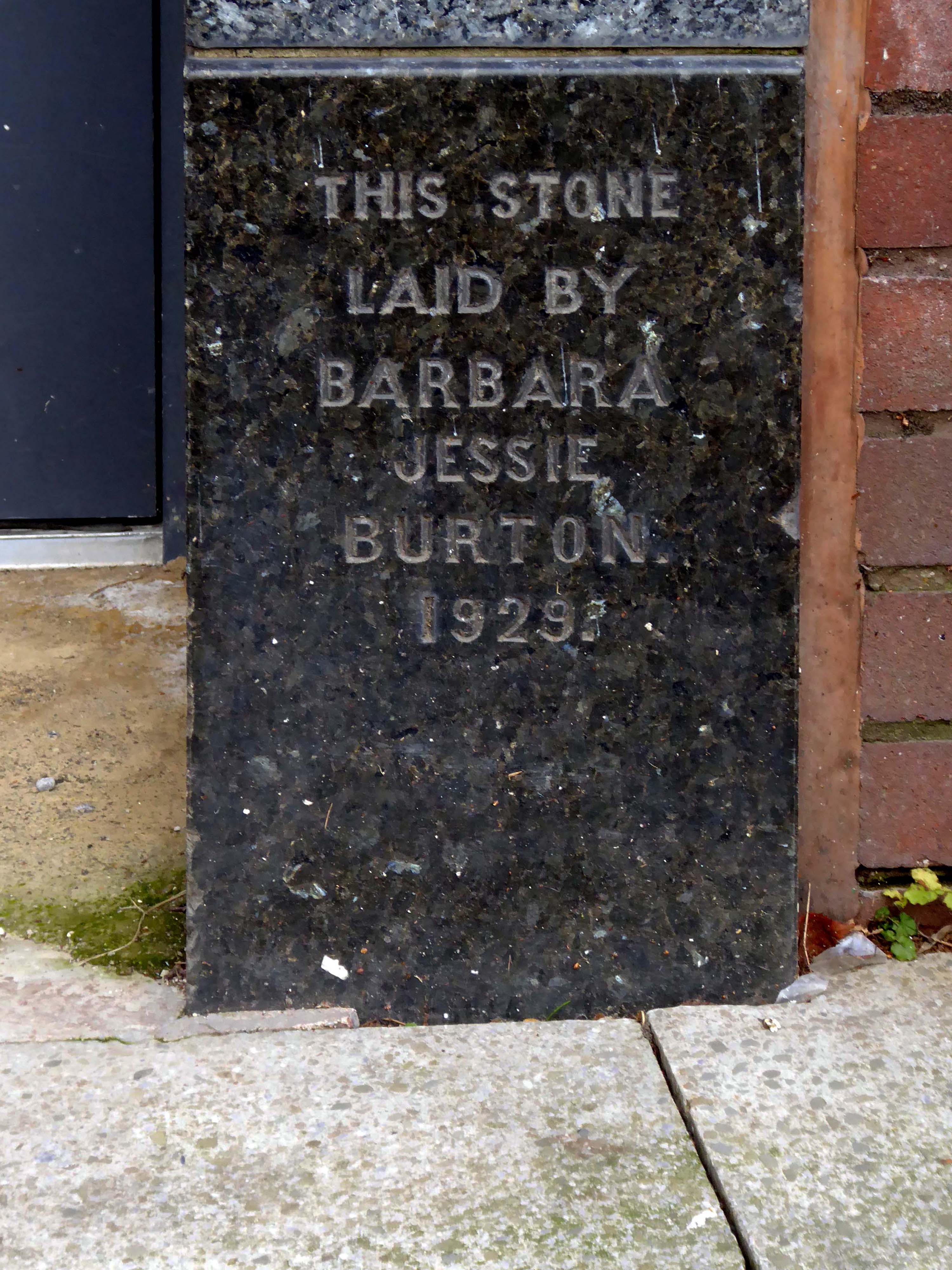
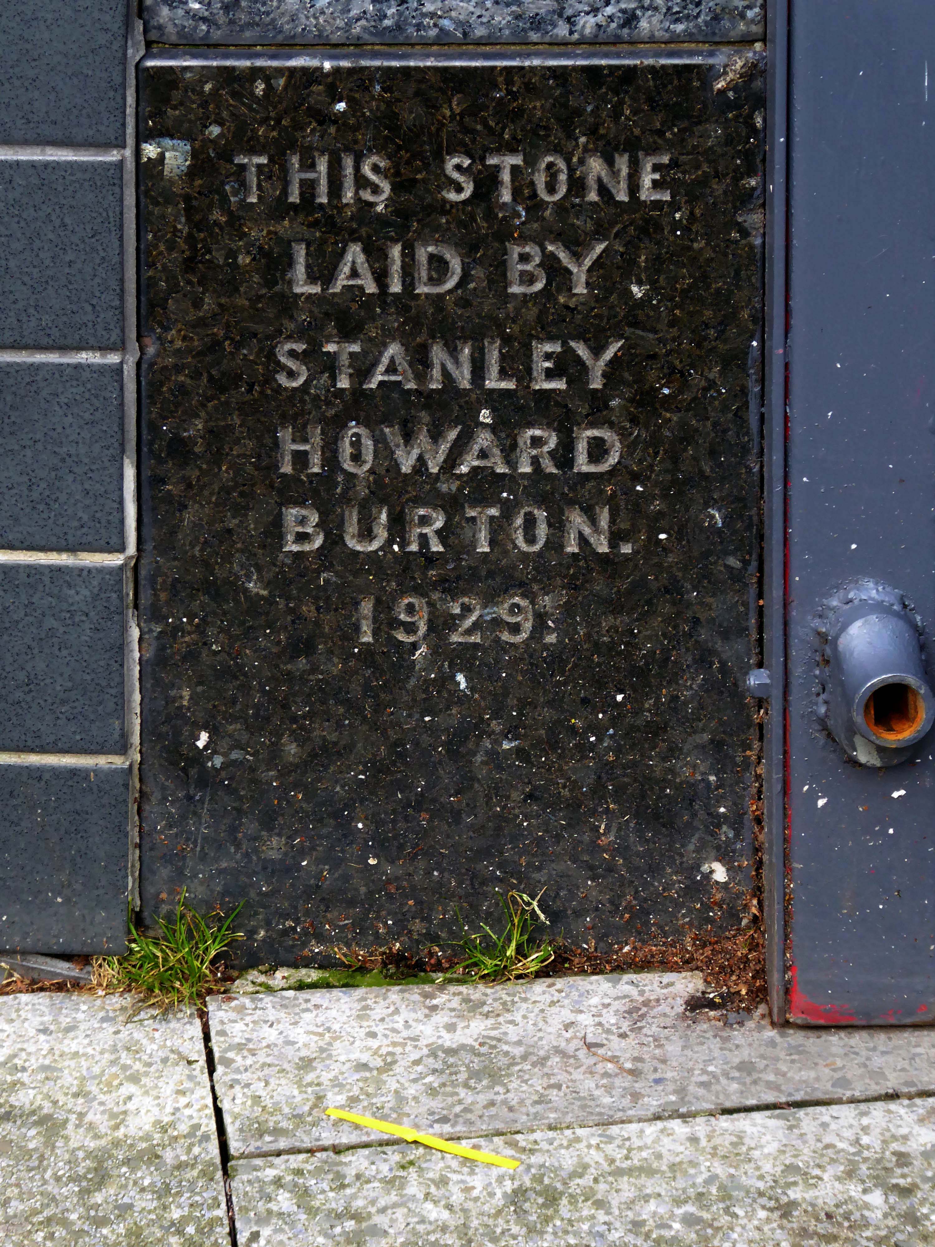
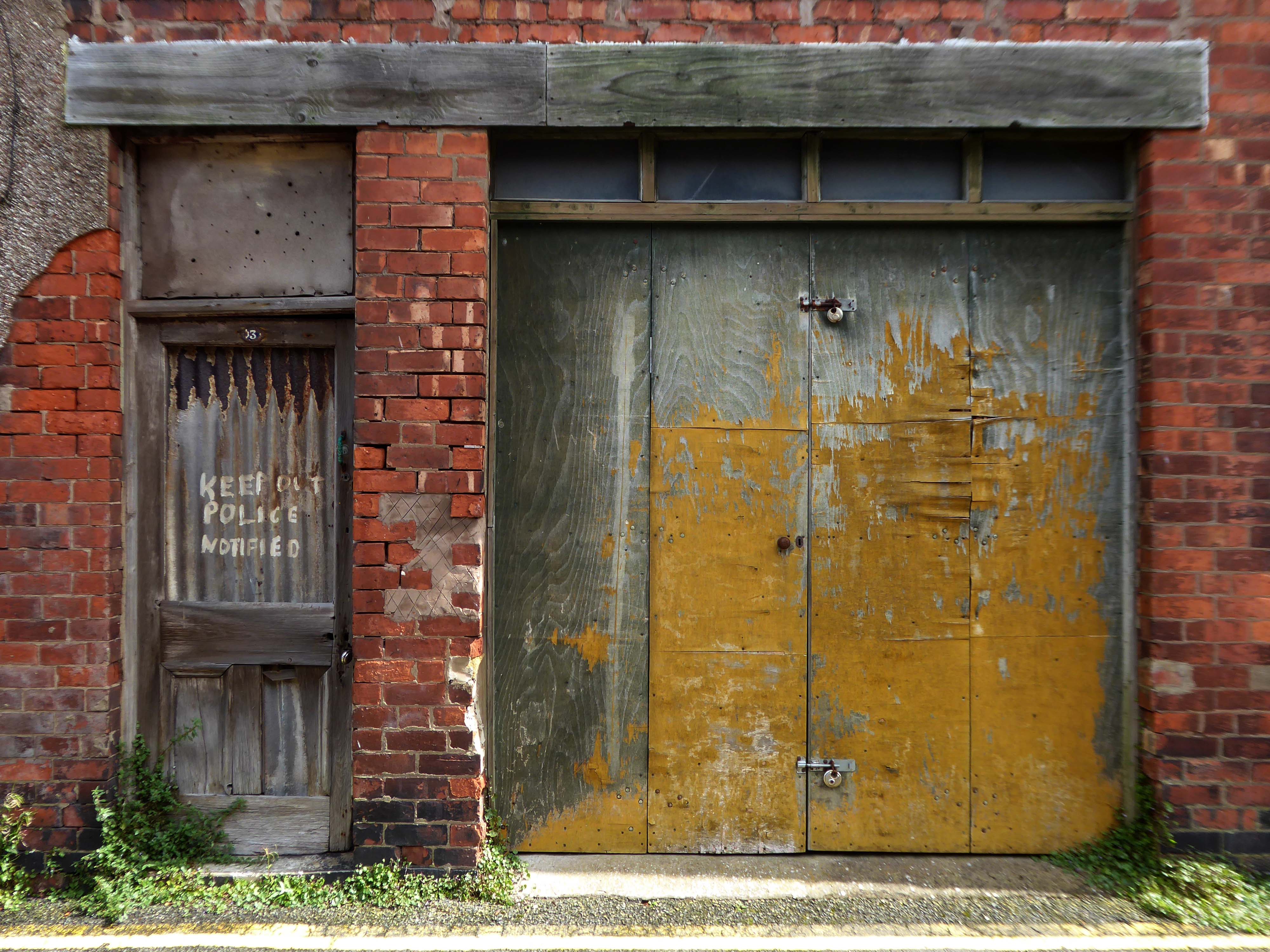
Poole Dolphin Leisure Centre offers a modern gym with sixty stations, four pools including a main, teaching and diving pool, plus award-winning swimming and diving lessons. Enjoy casual swims, fitness sessions and a wide range of group classes for all ages. After your workout, relax in our sauna and experience fitness, fun and wellbeing all in one place.
I can’t speak for the facilities, or their general cleanliness, I don’t swim or have much time for leisure.
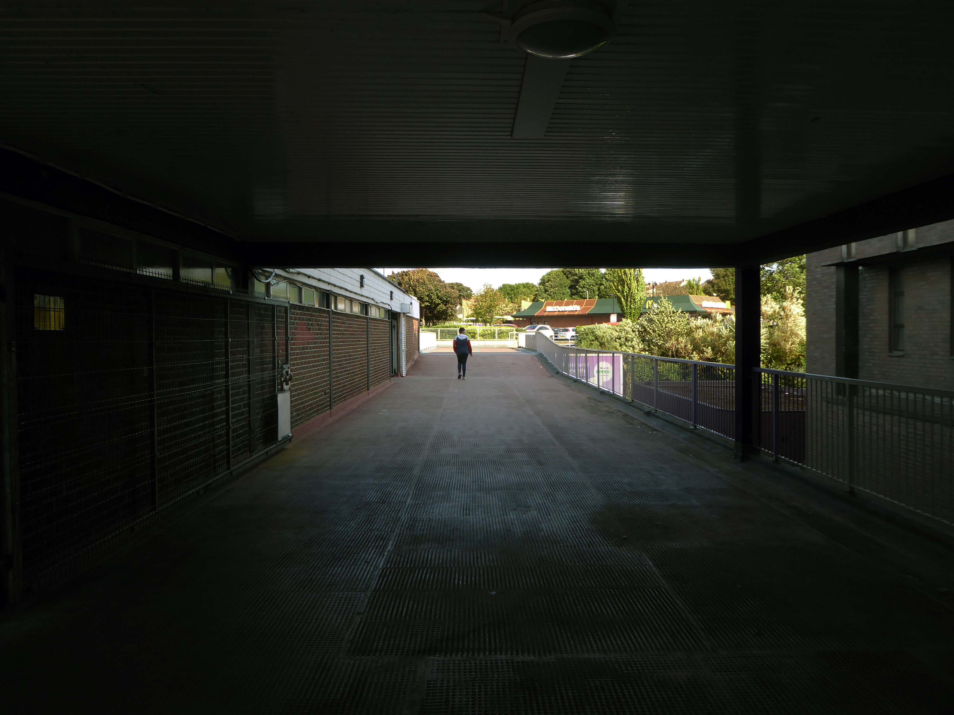
Walking around looking at things, taking pictures, chatting and such is my lifestyle choice and preoccupation.
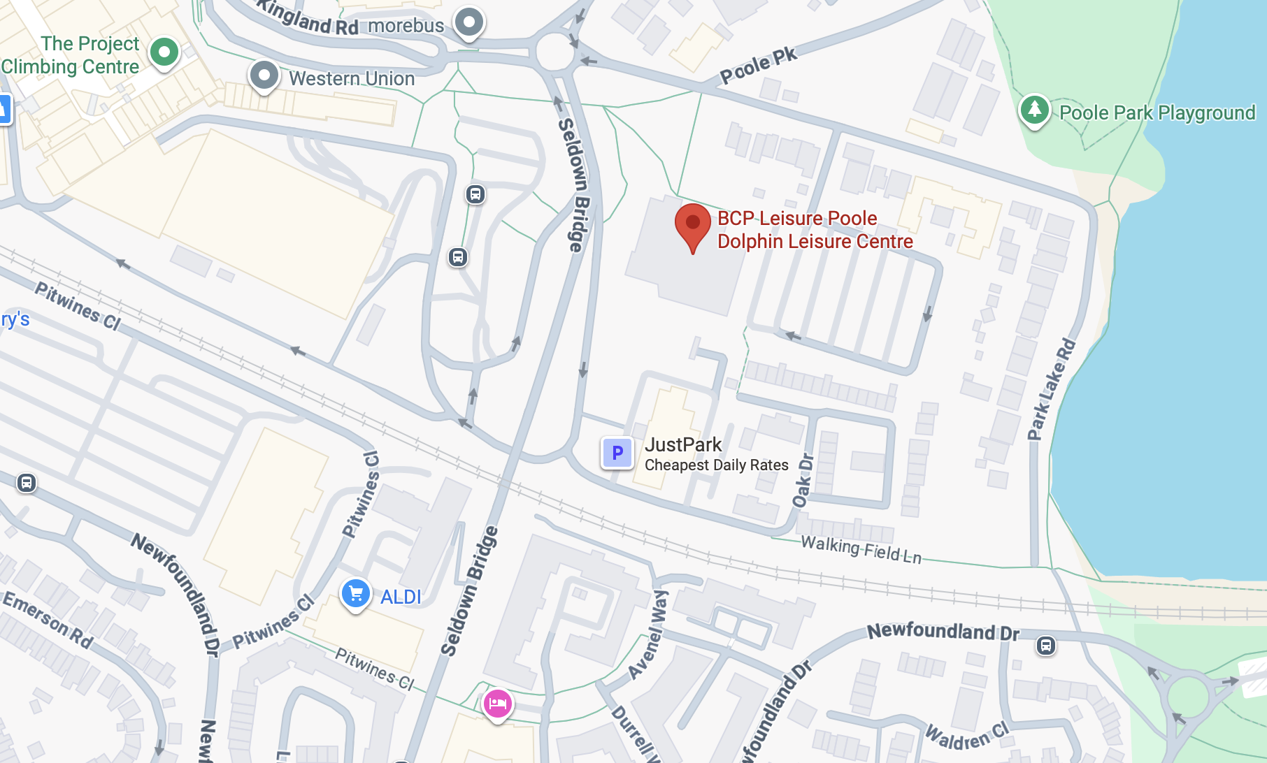
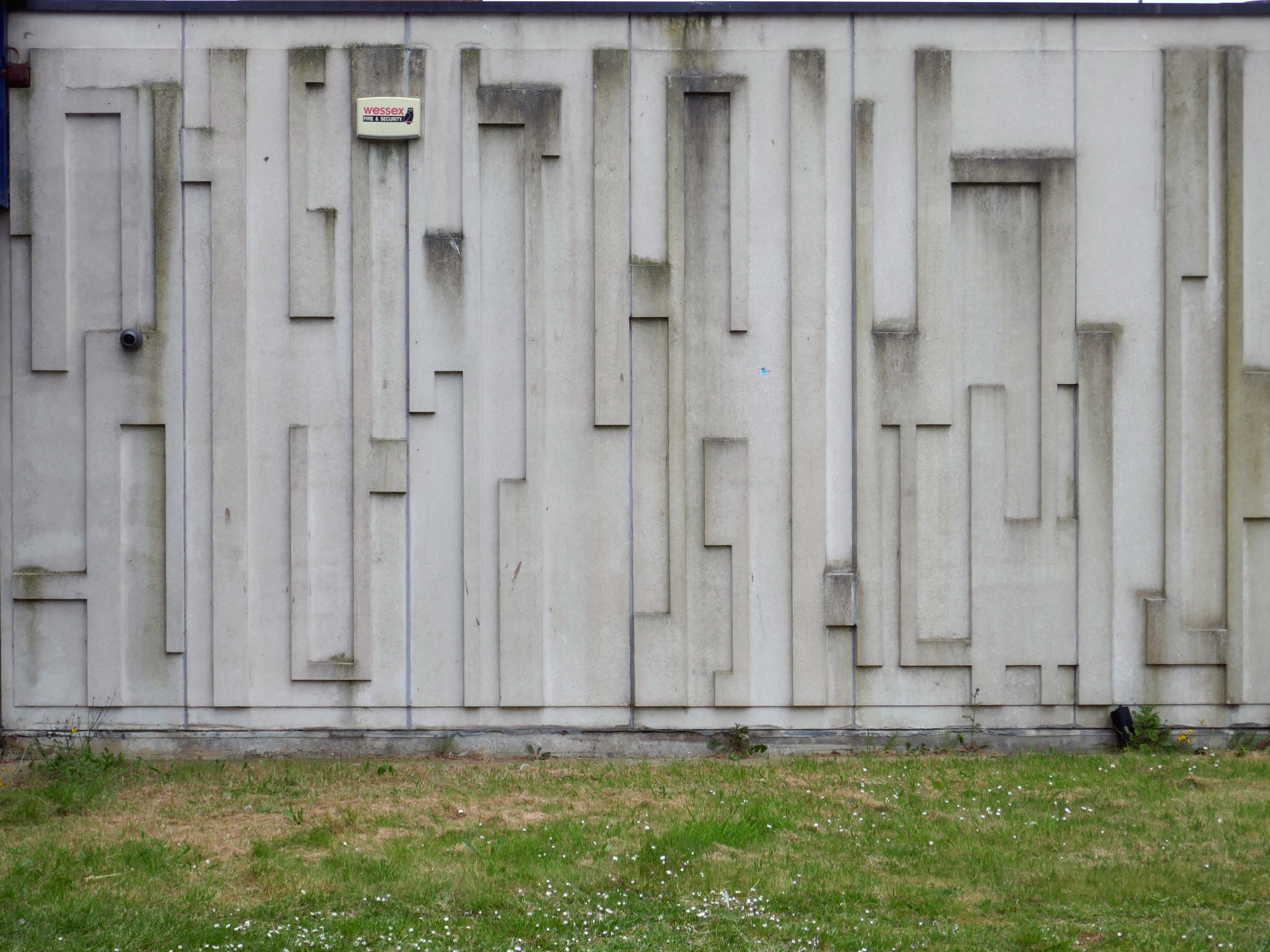
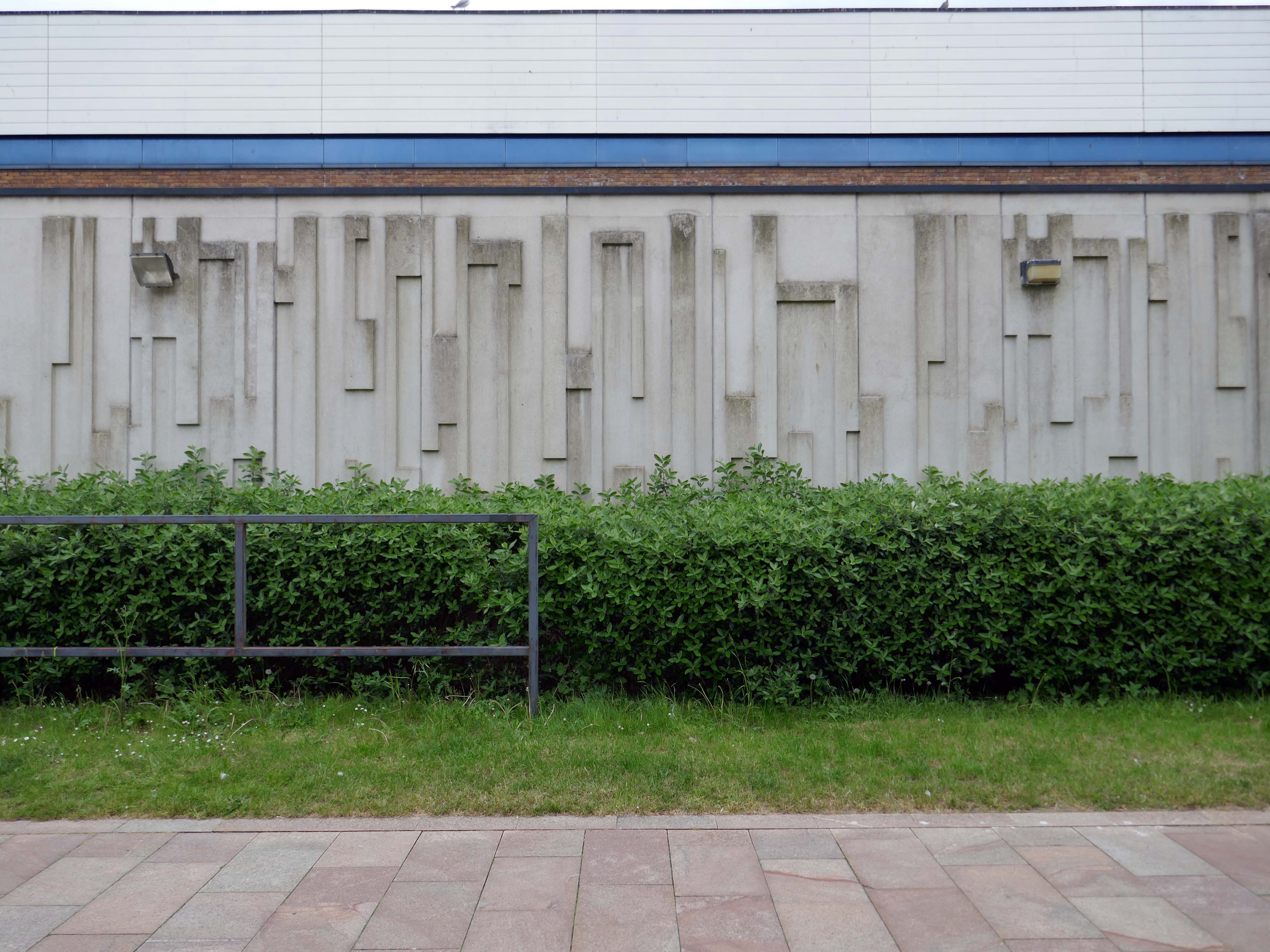
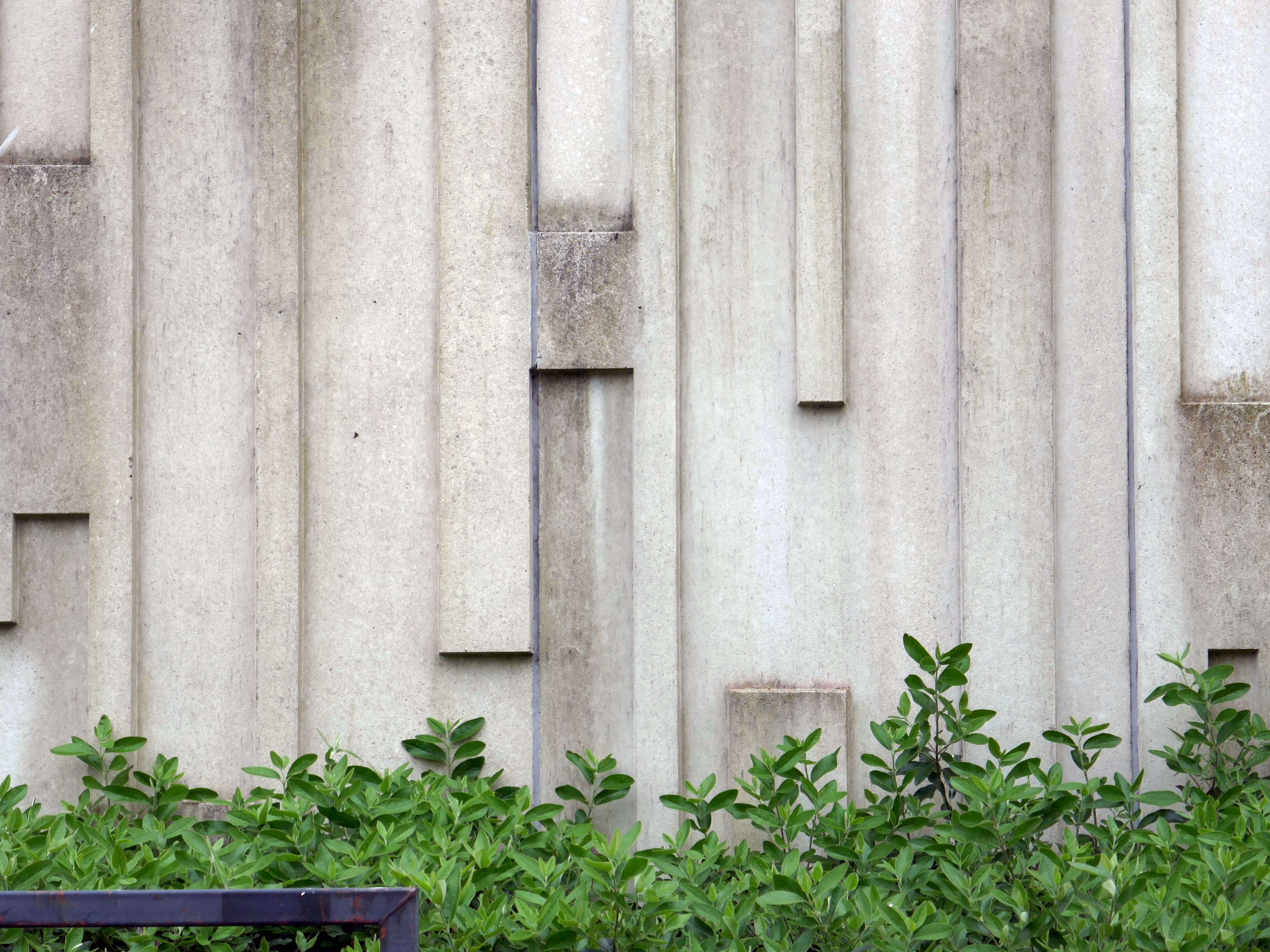
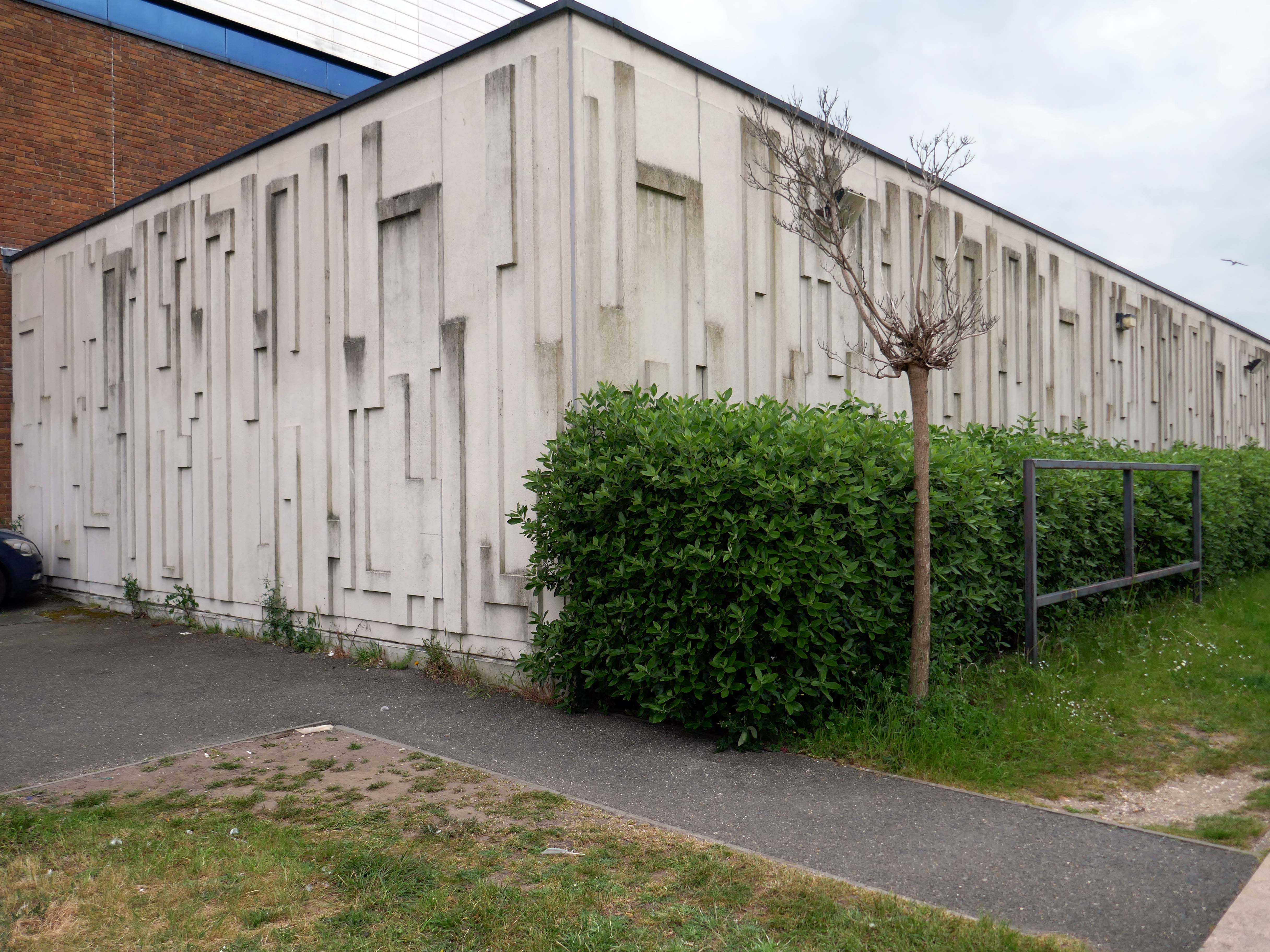
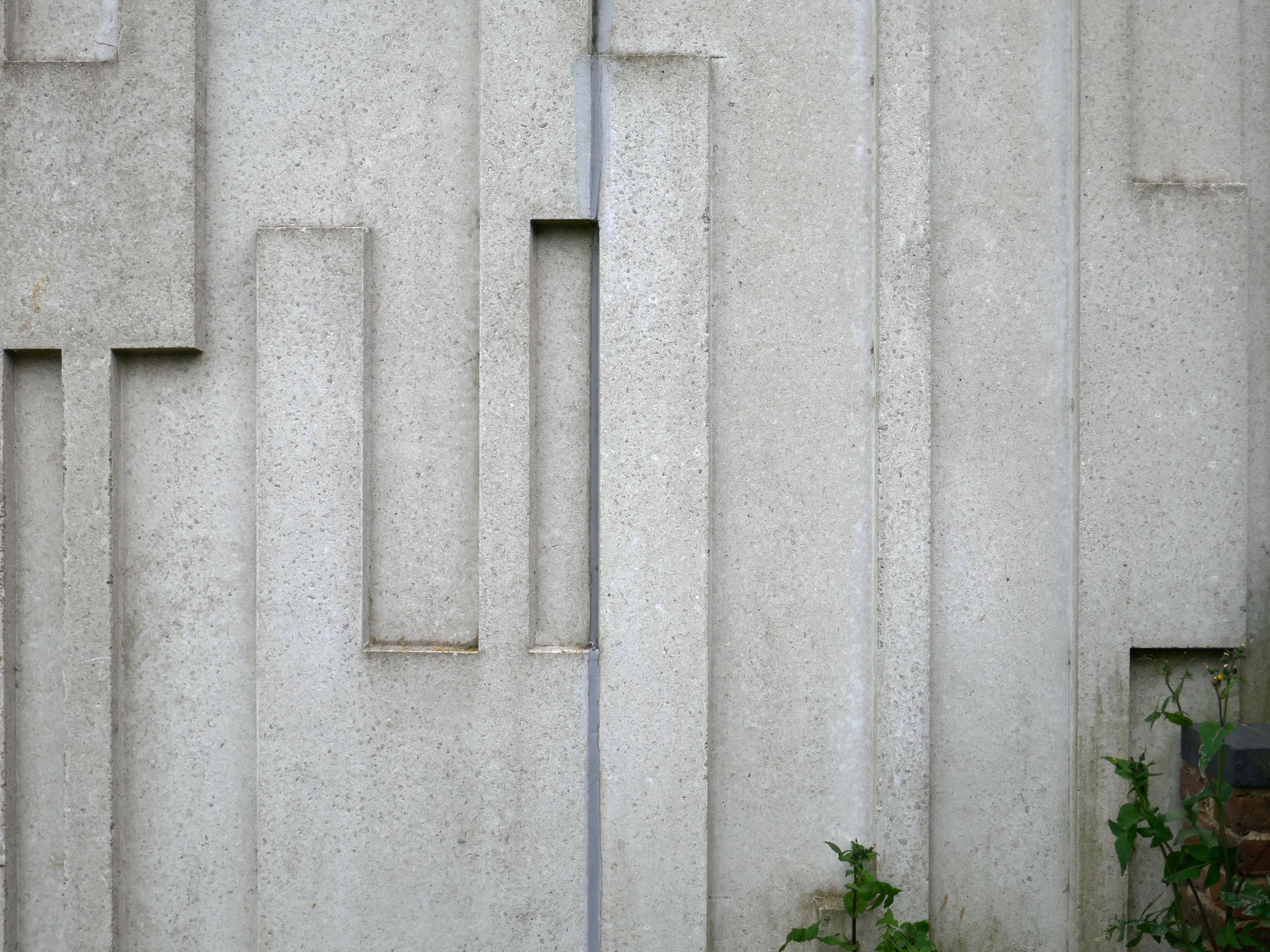
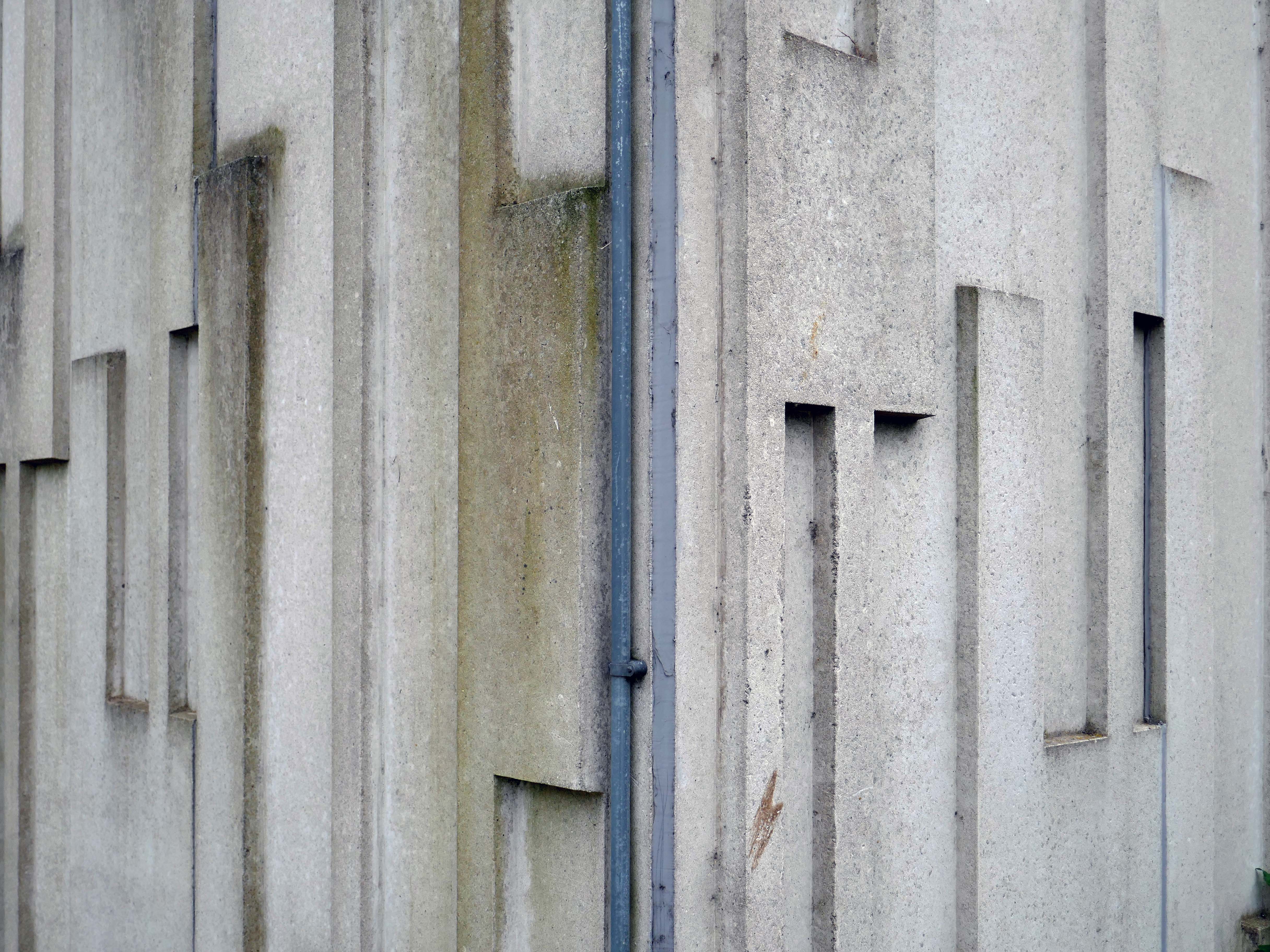
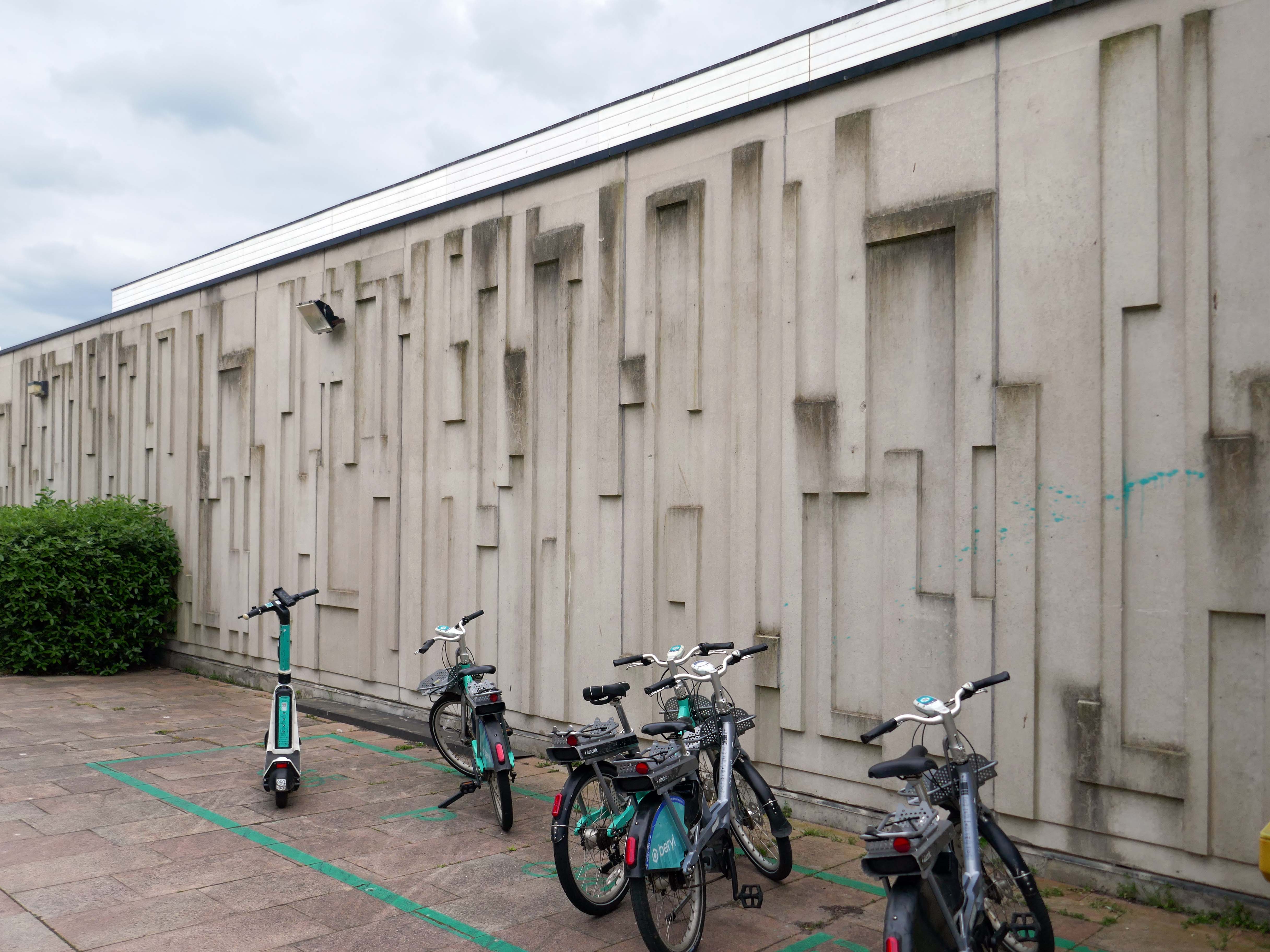
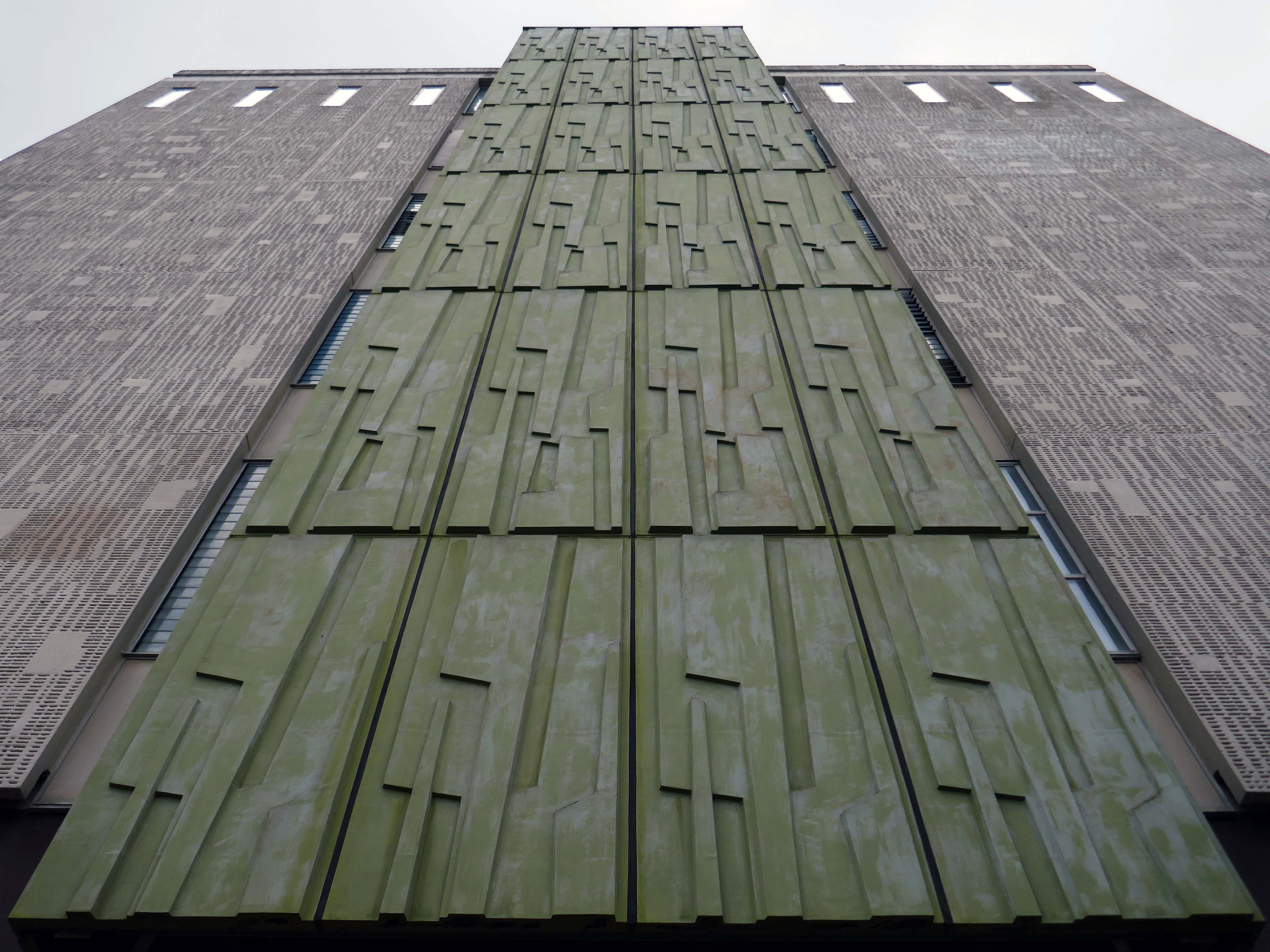
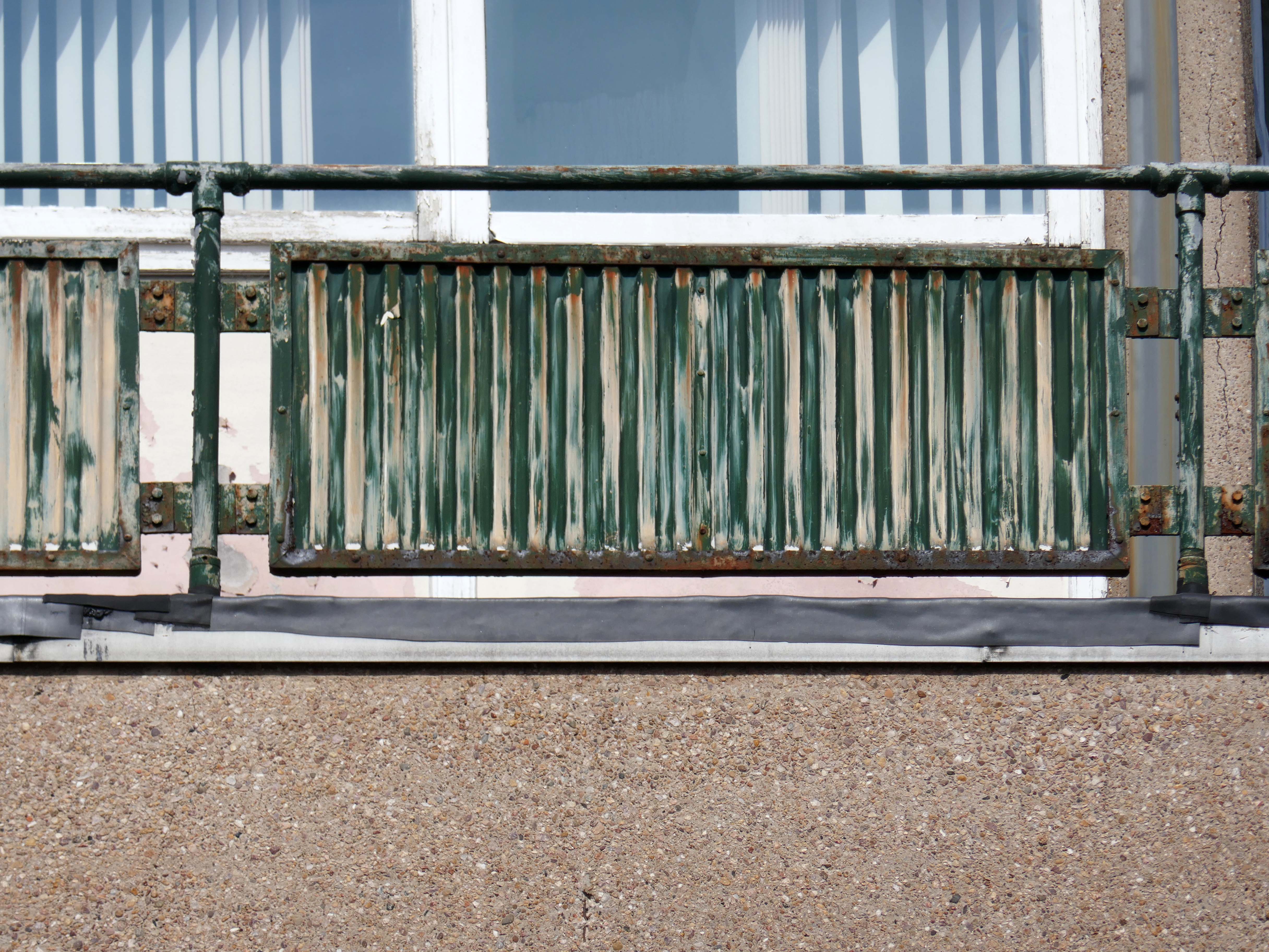
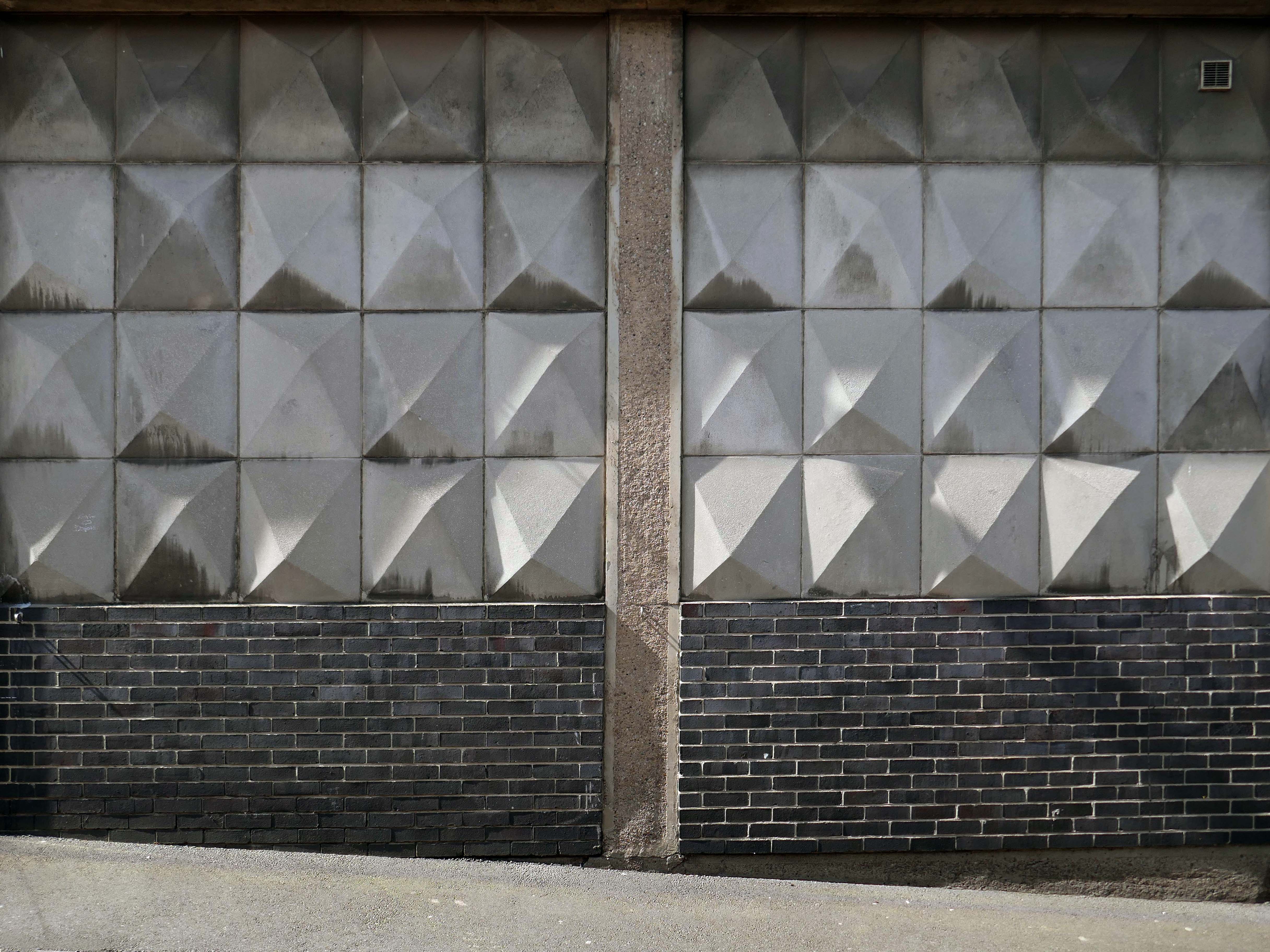
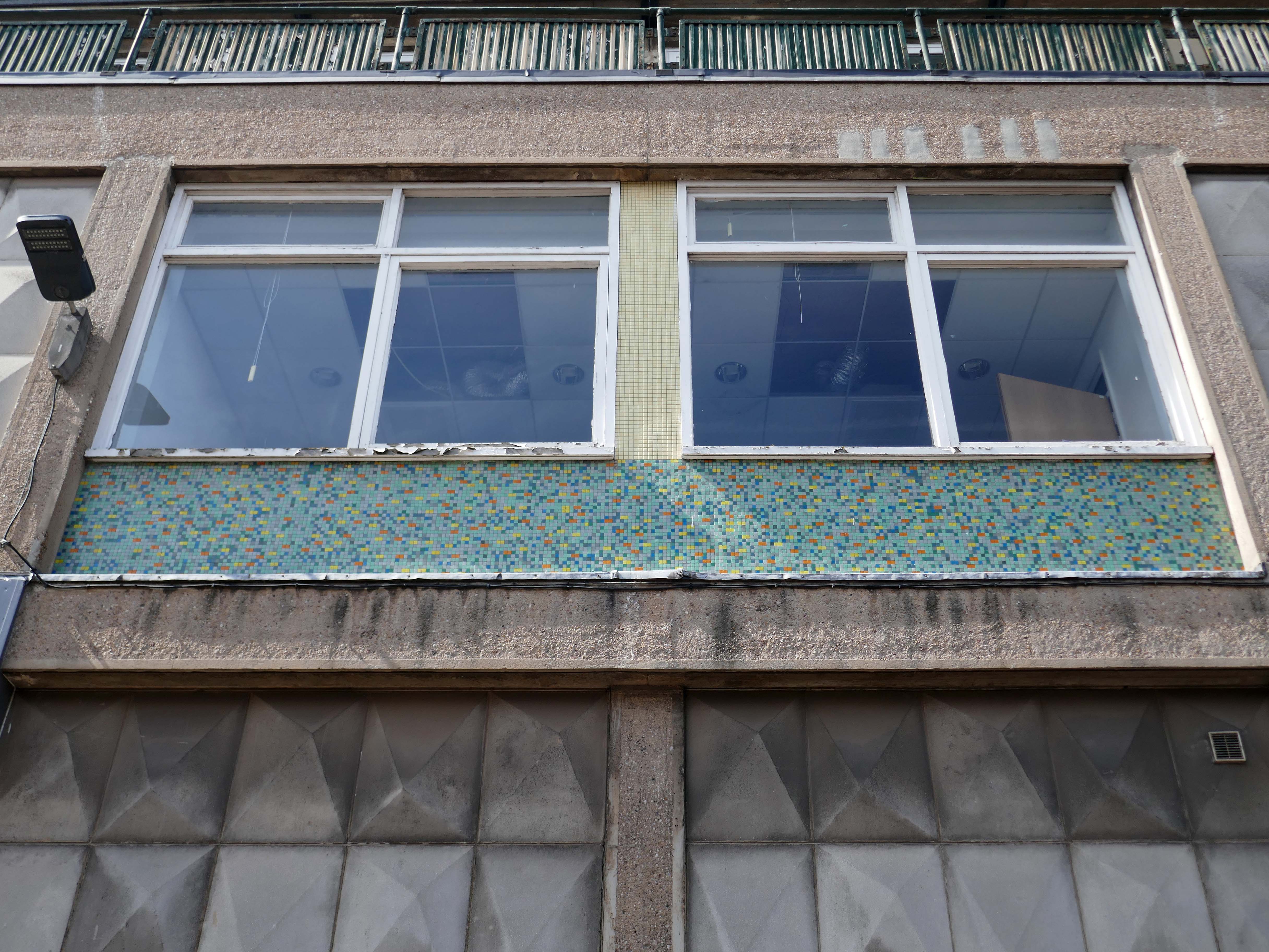
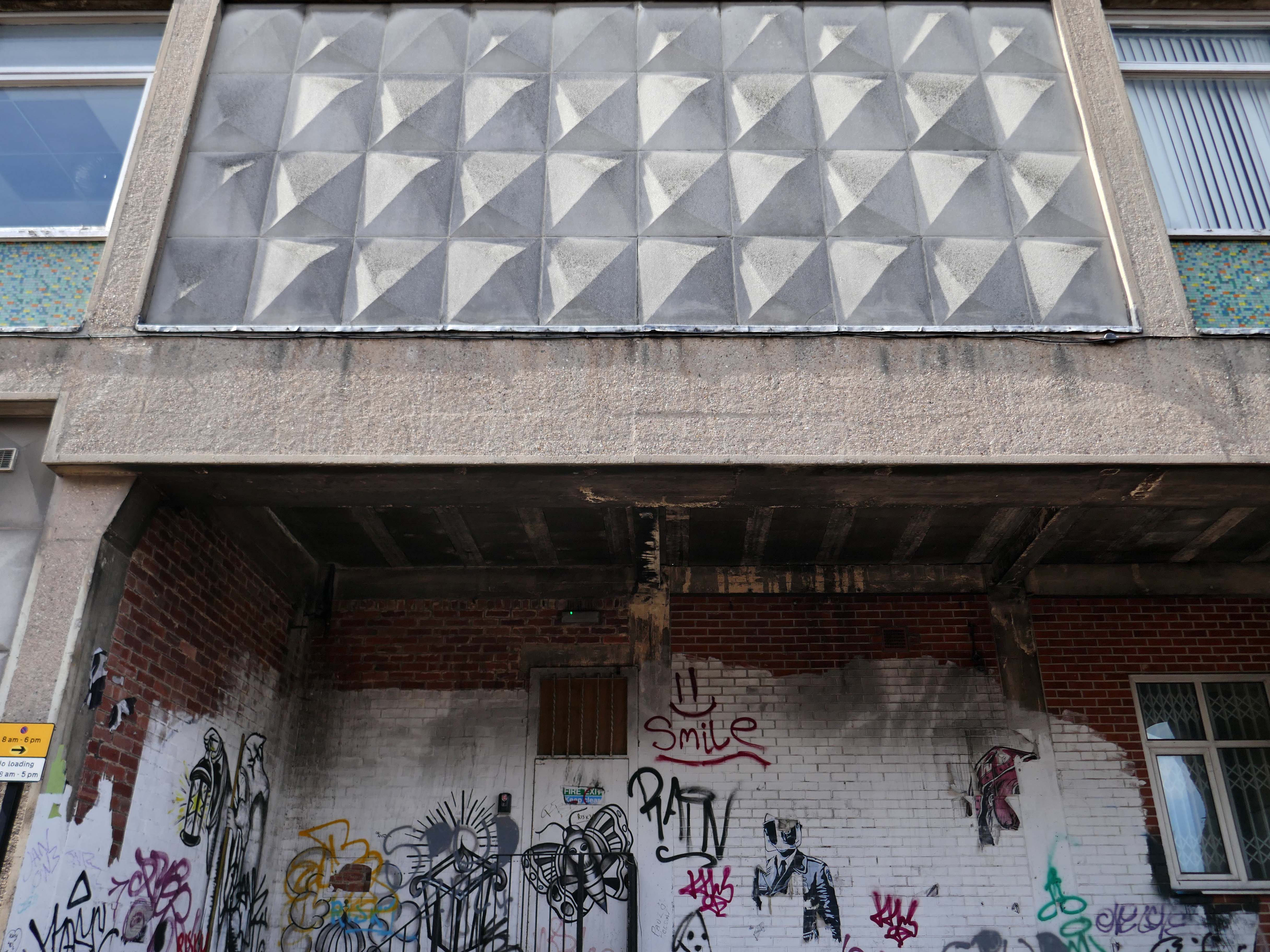
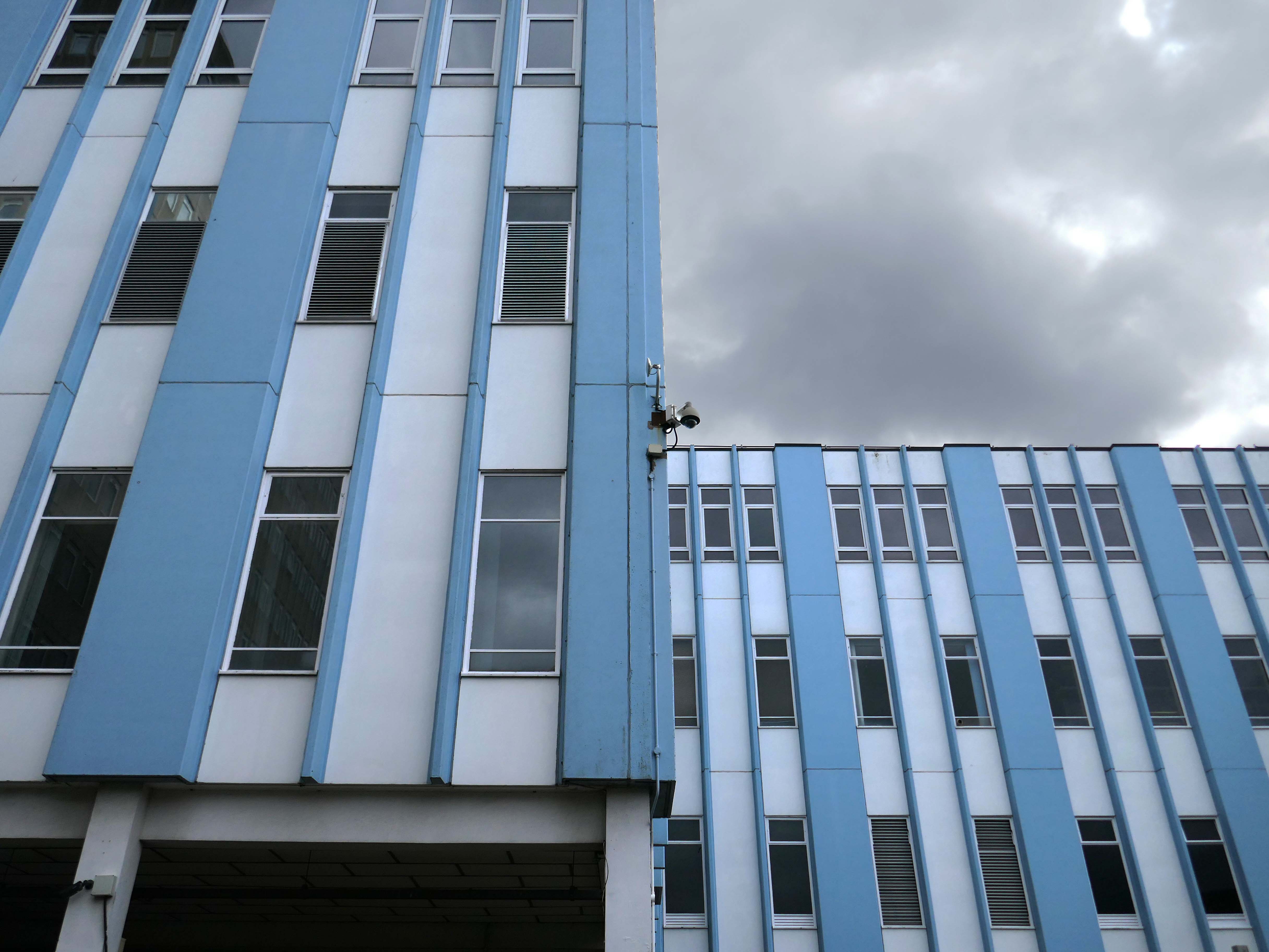
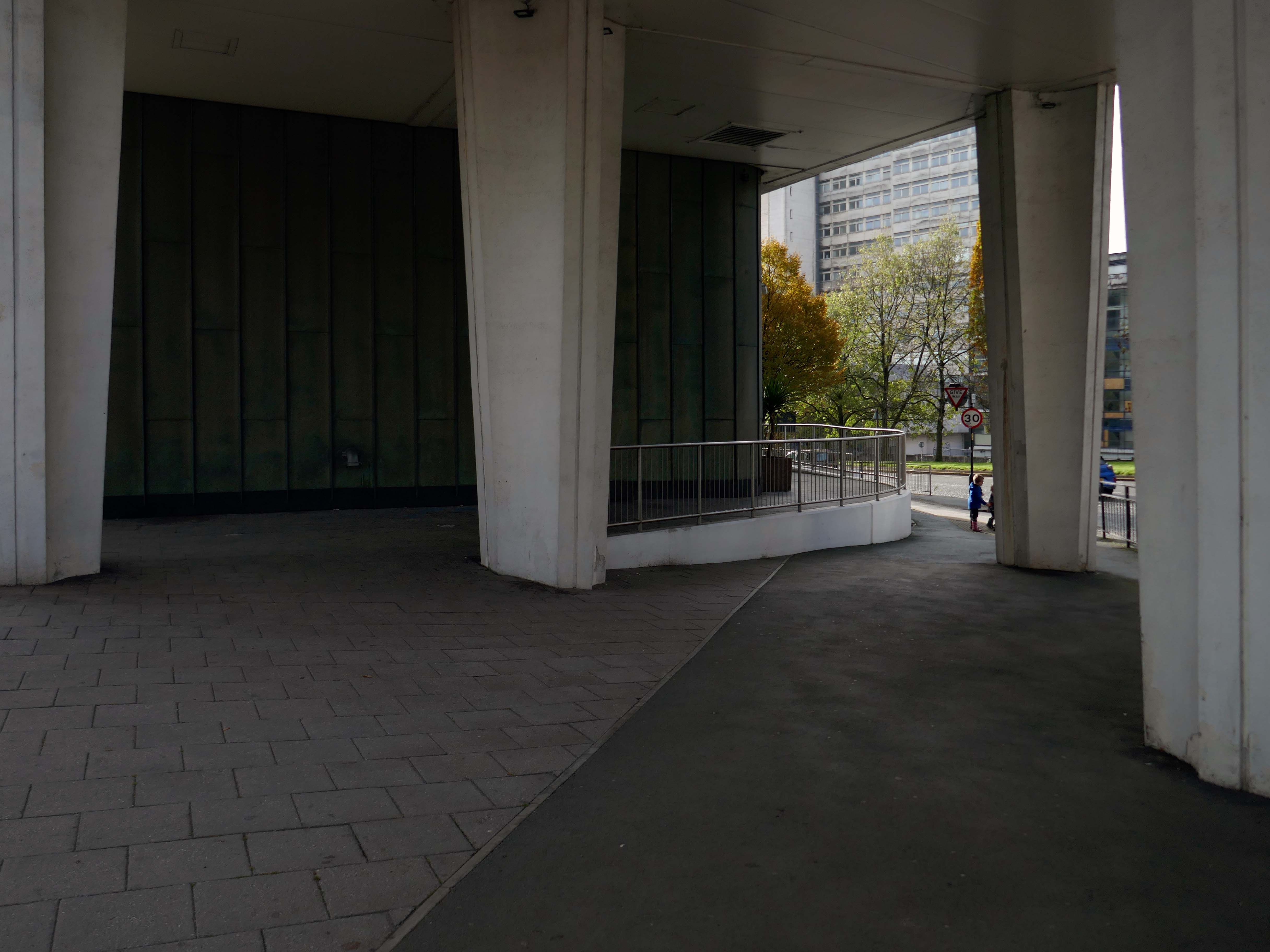
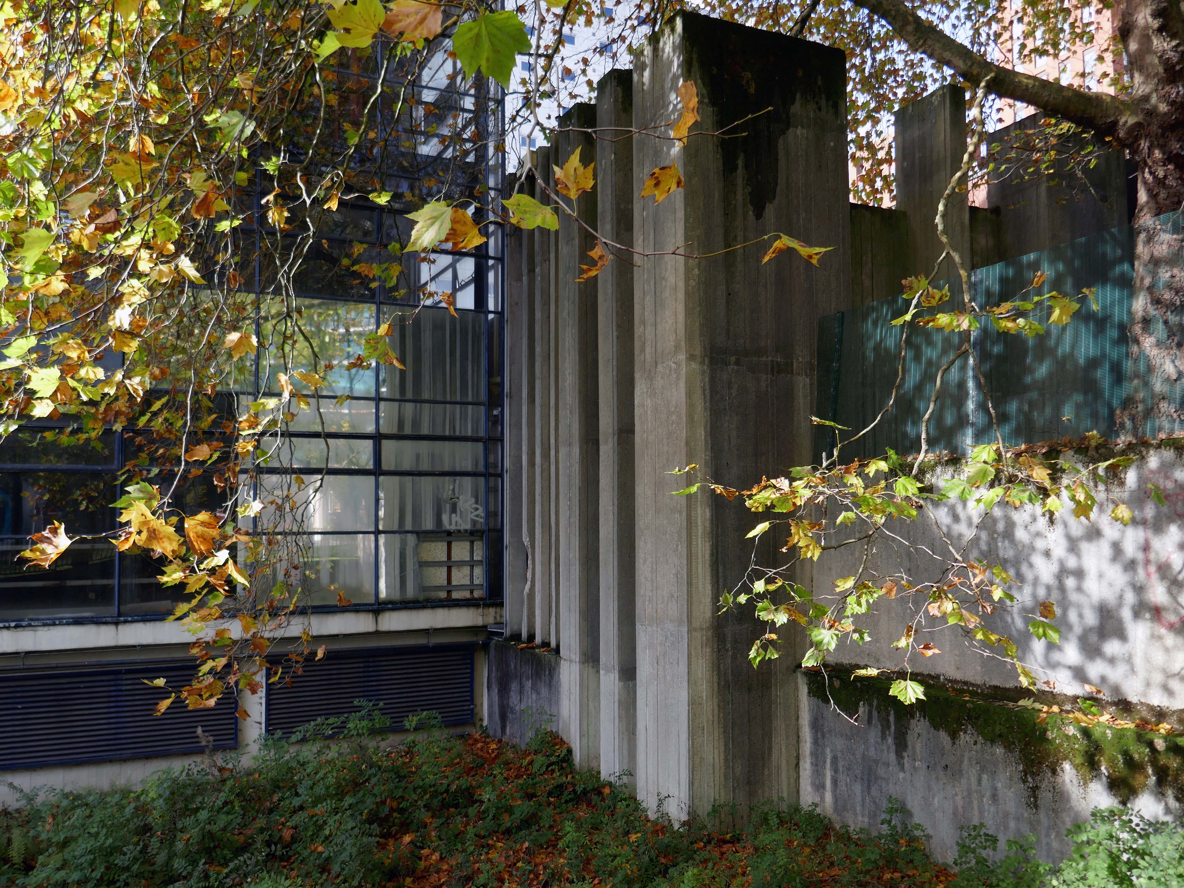
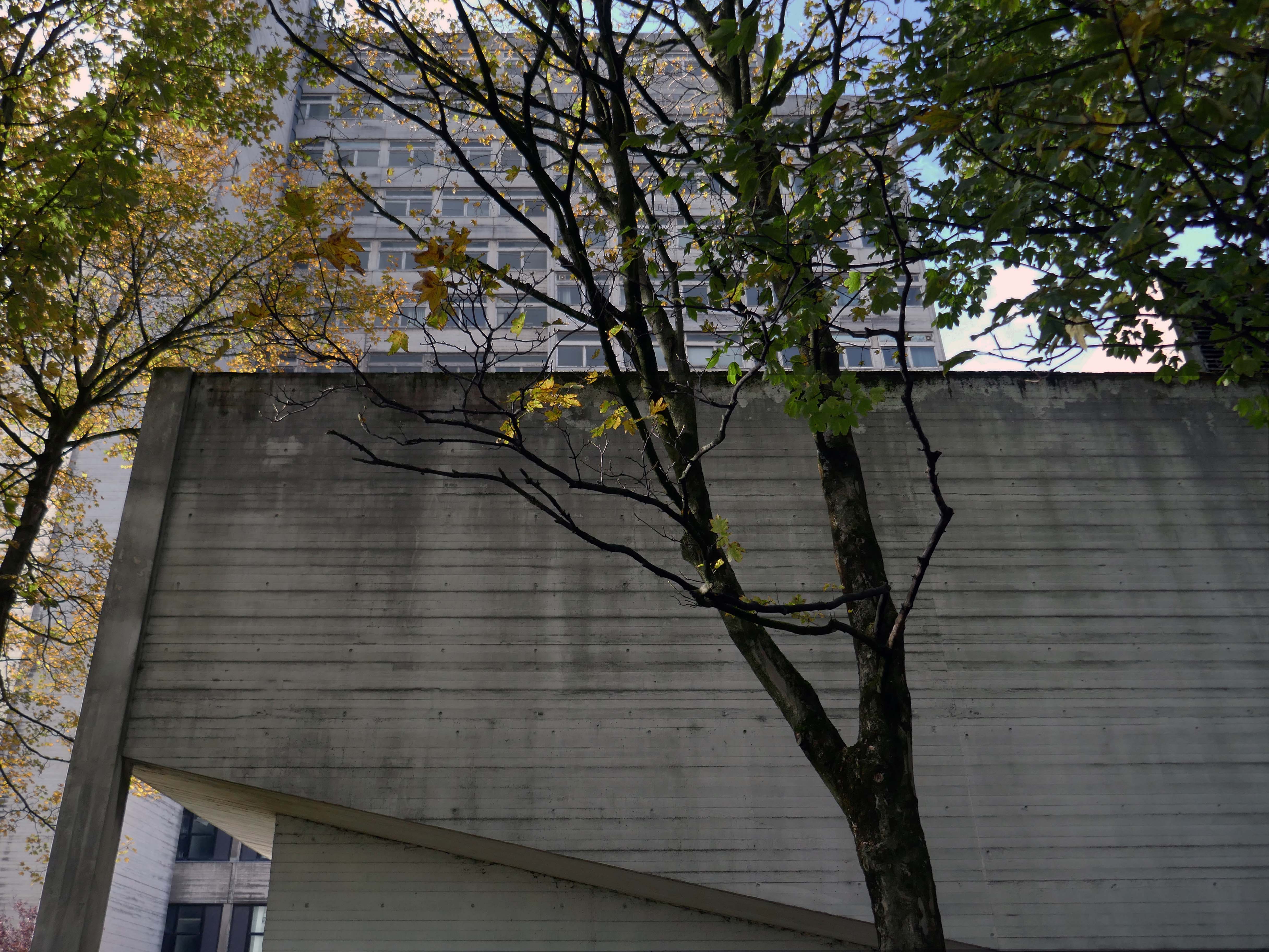
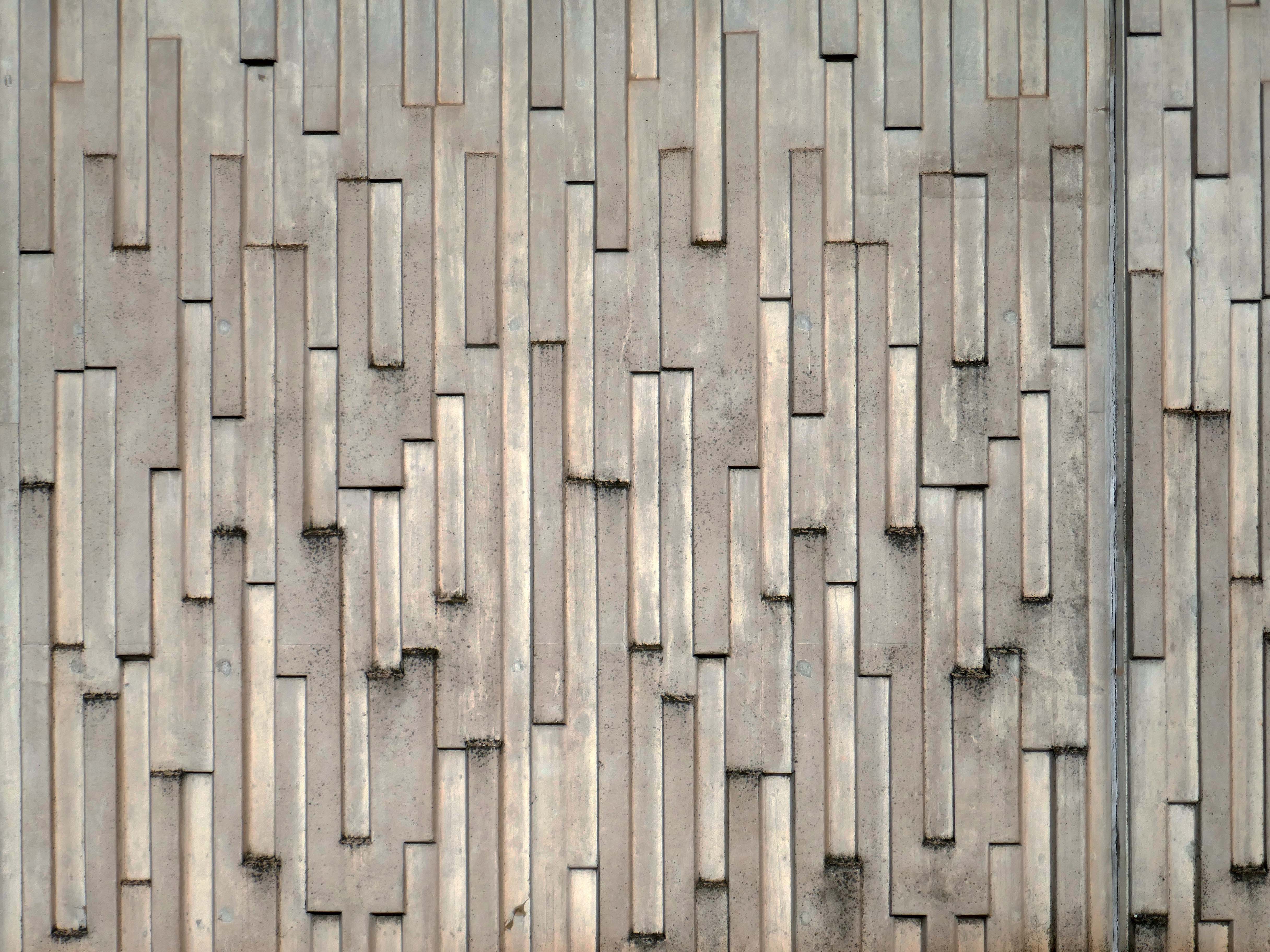
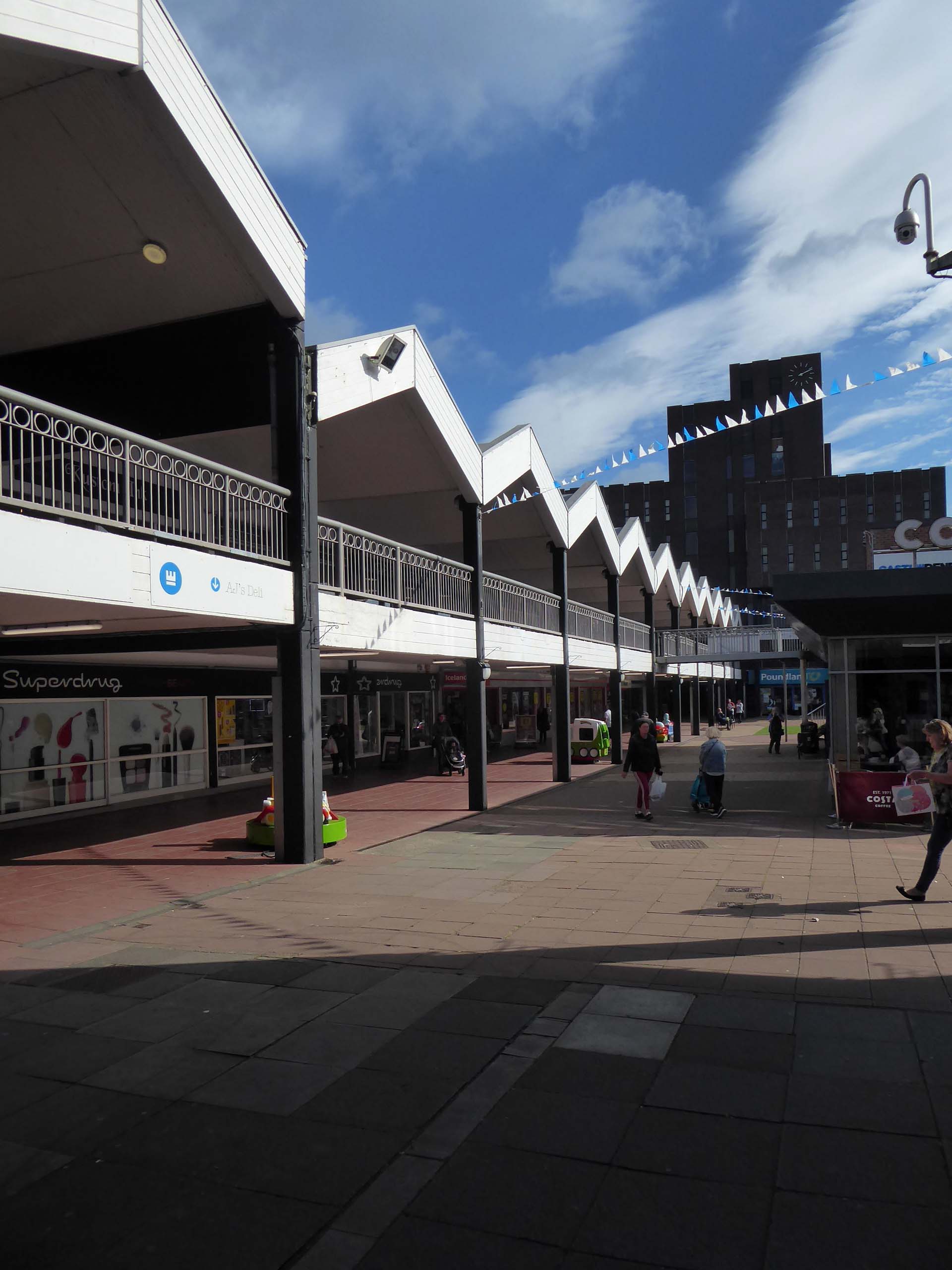
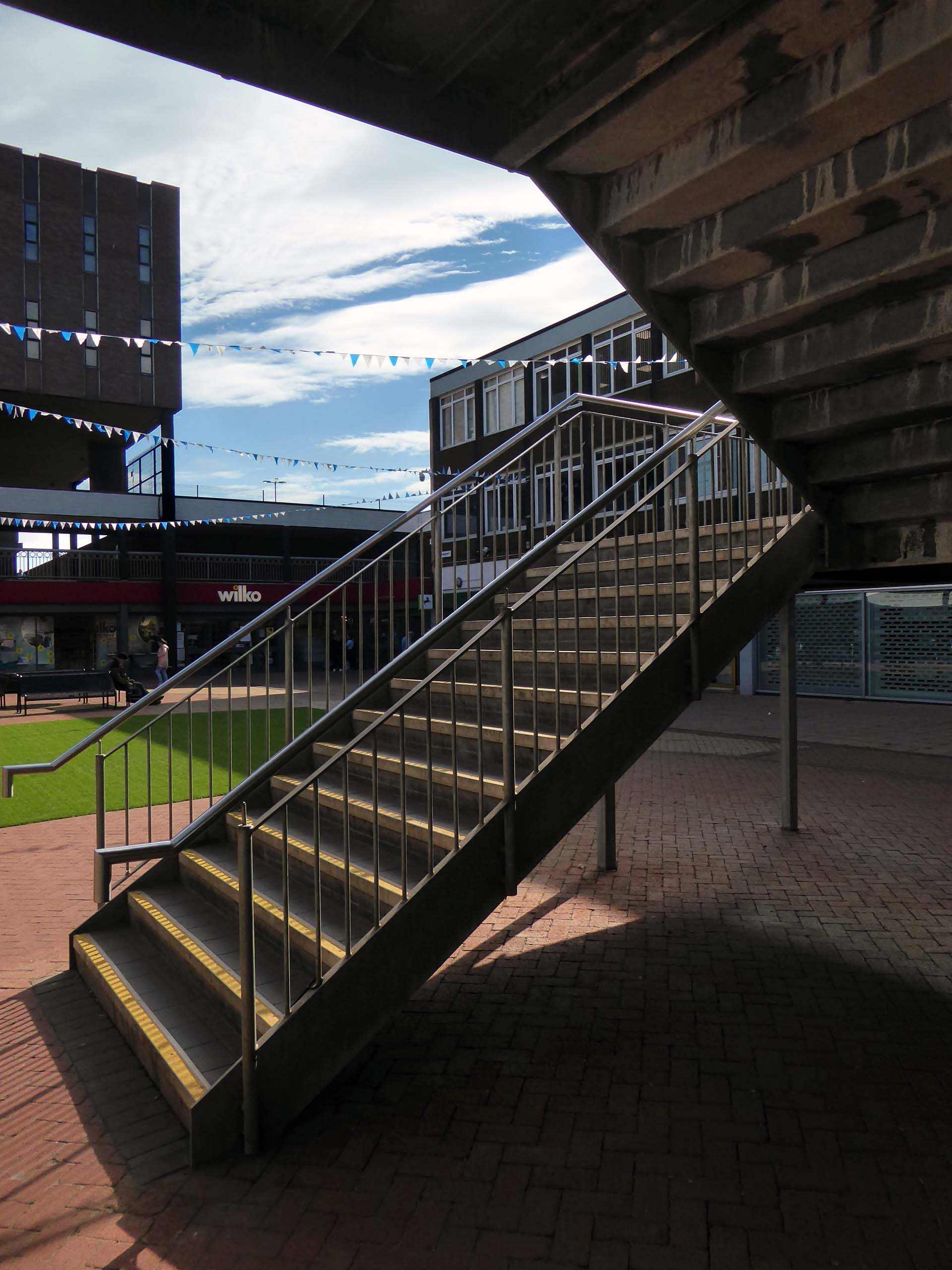
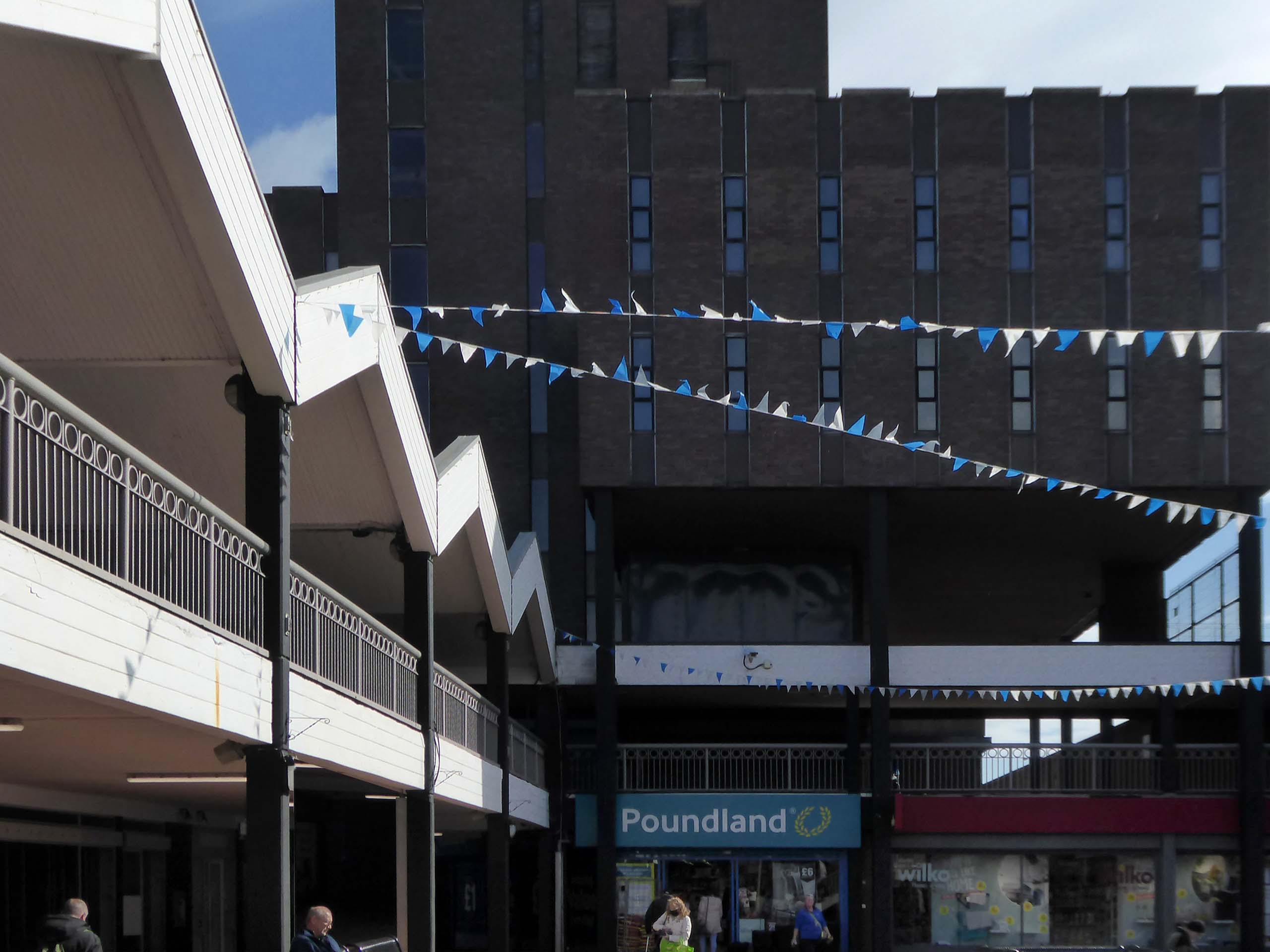
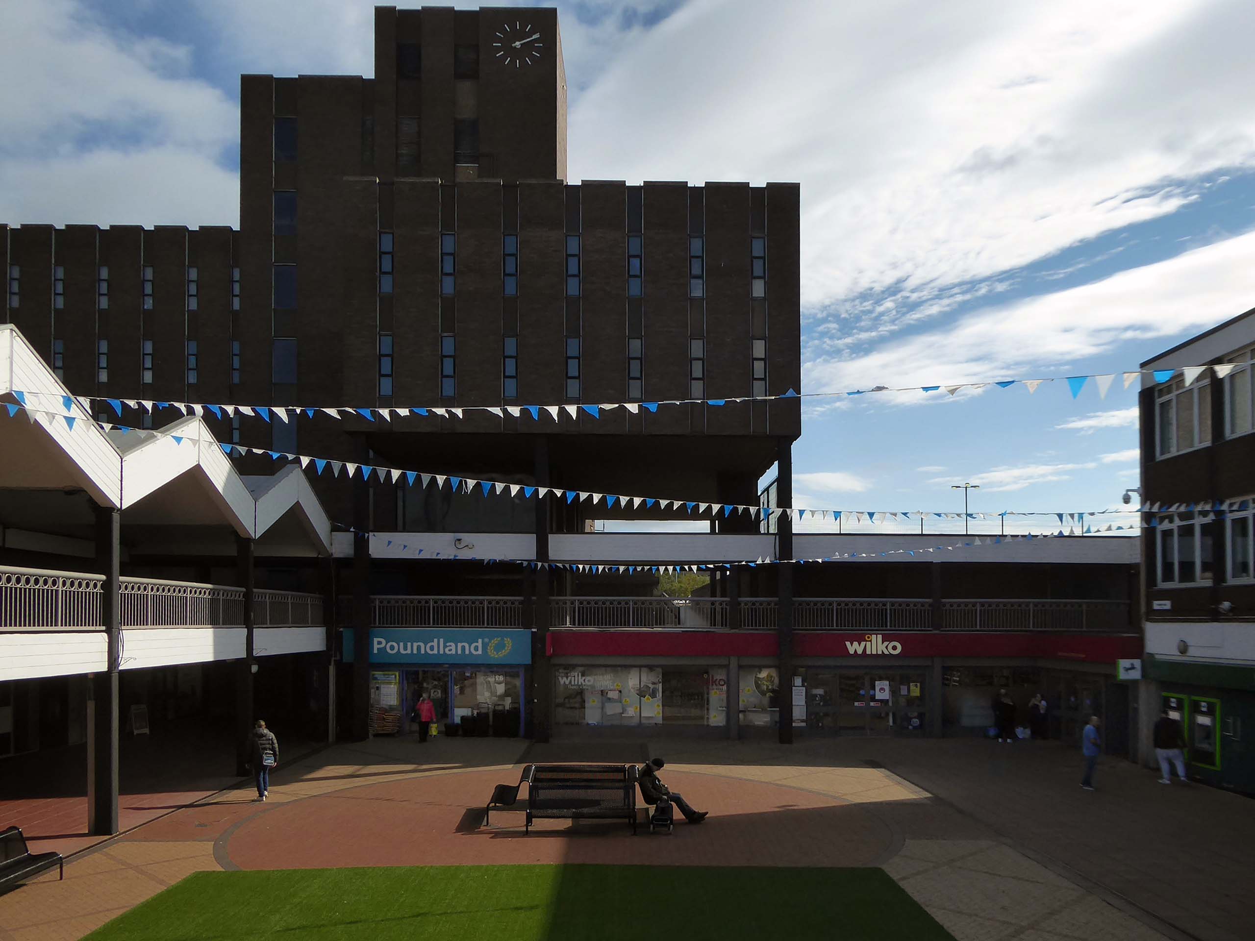
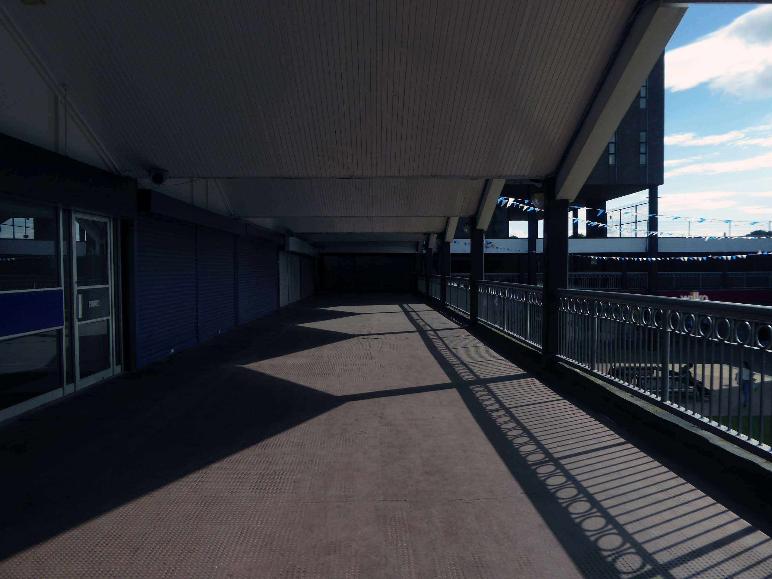
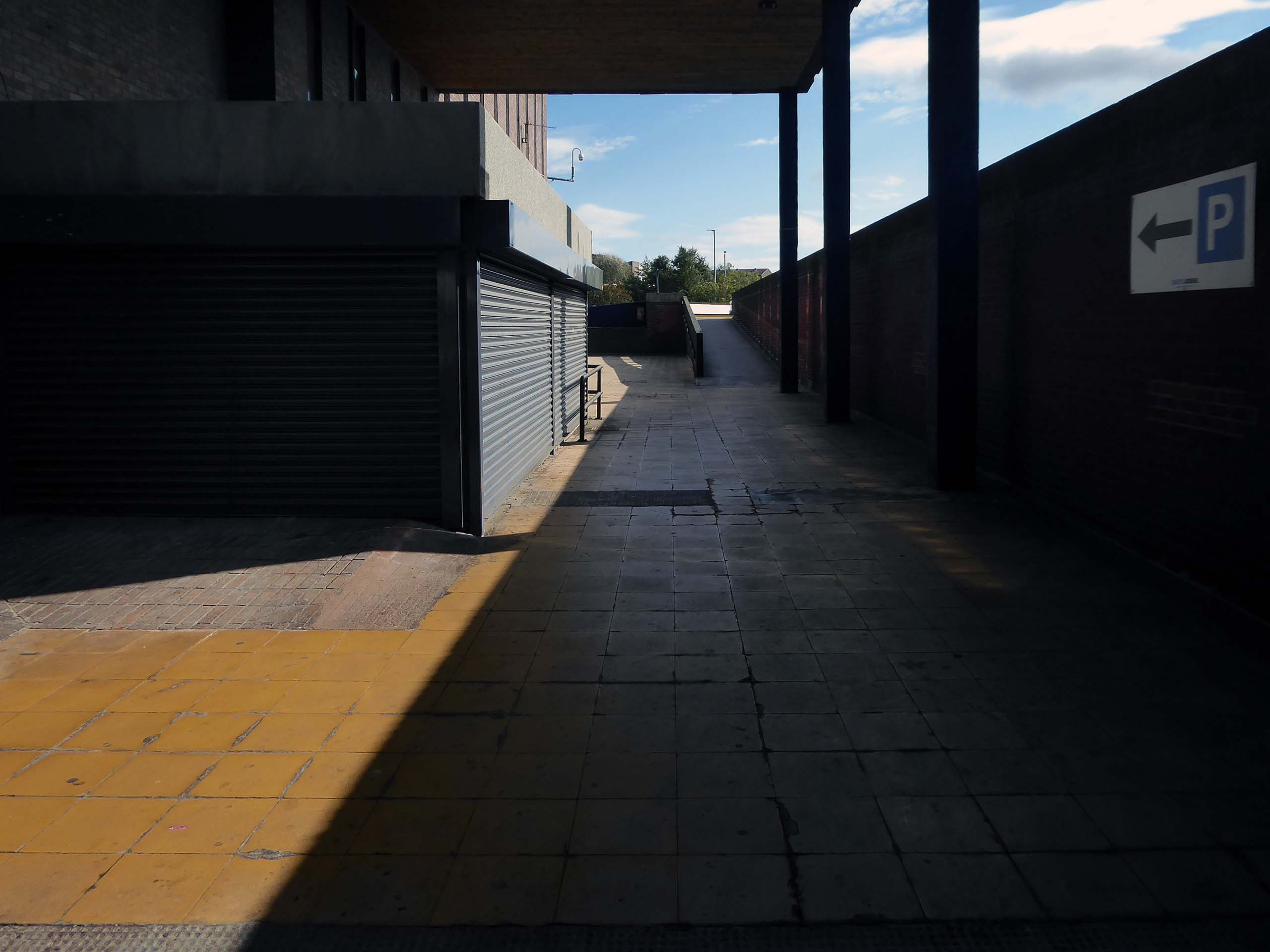
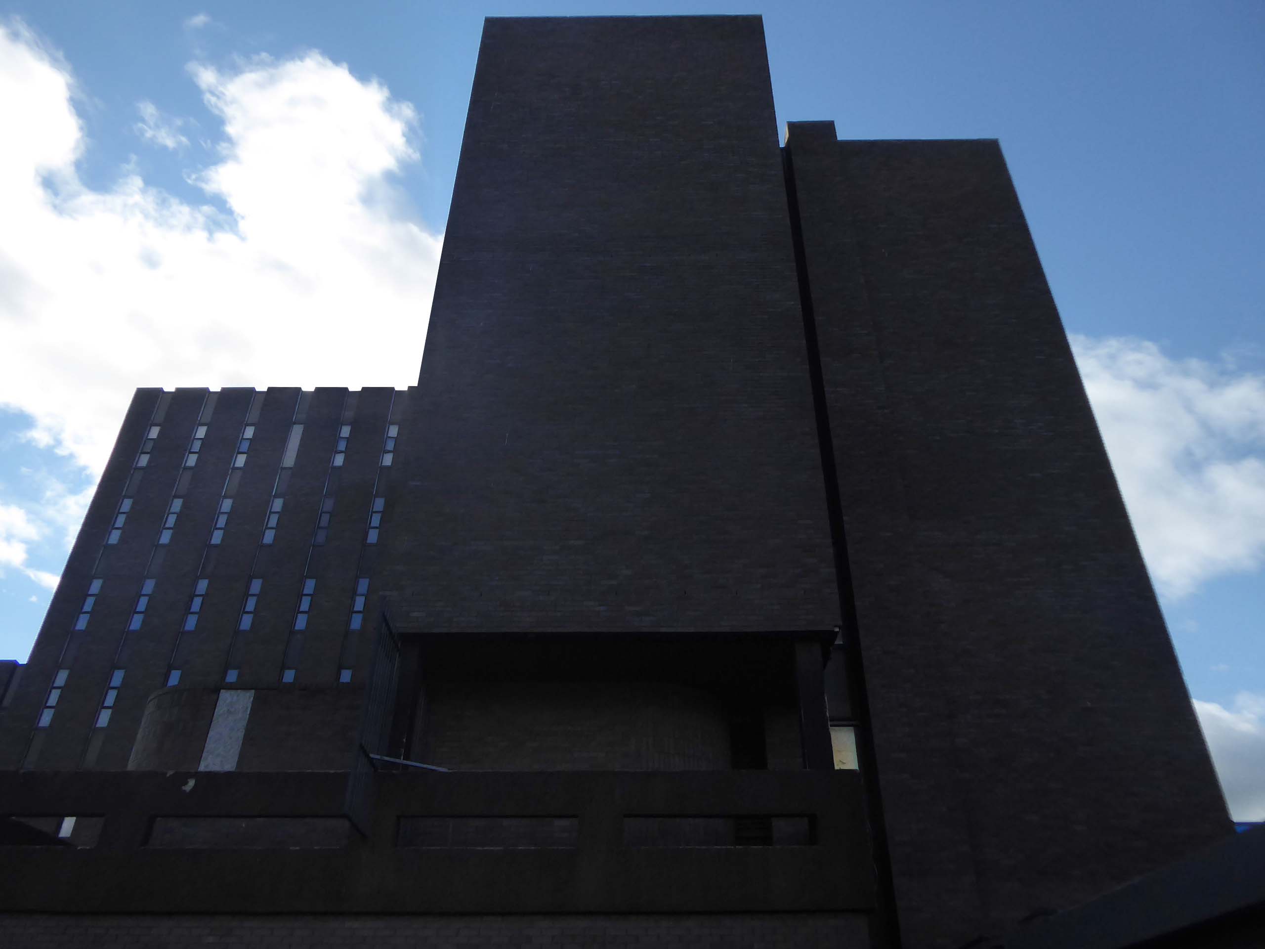
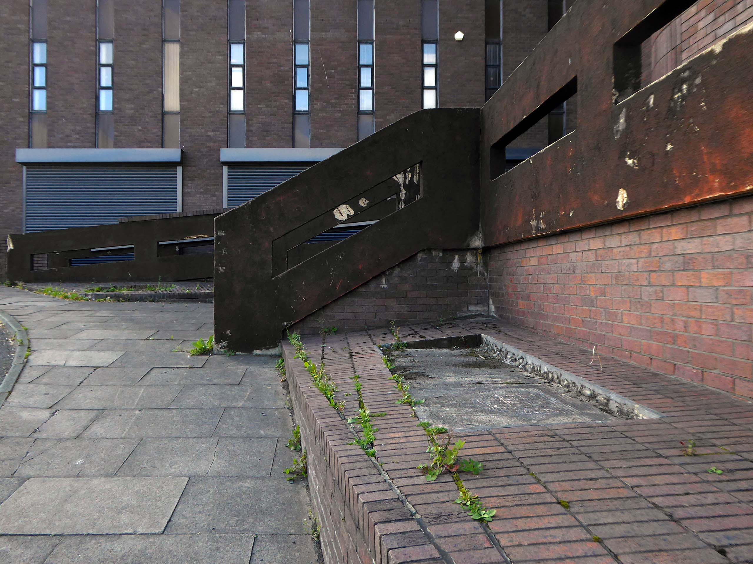
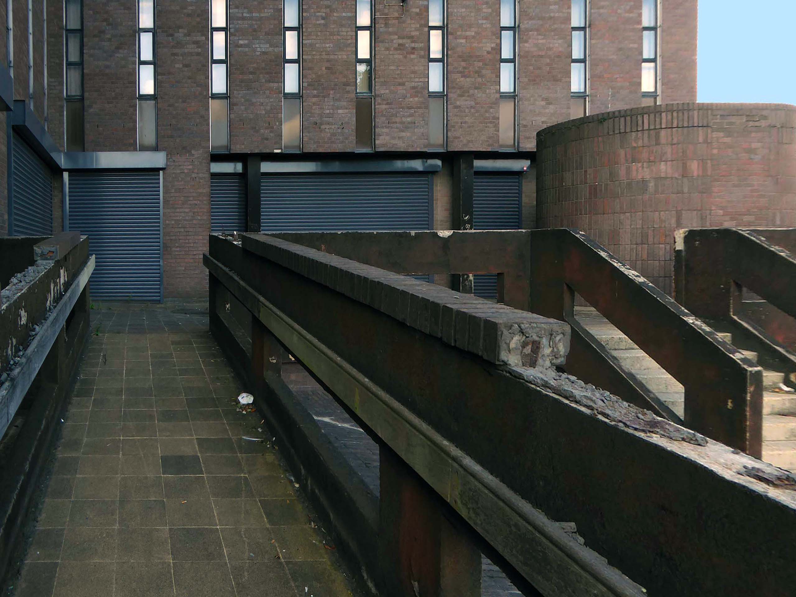
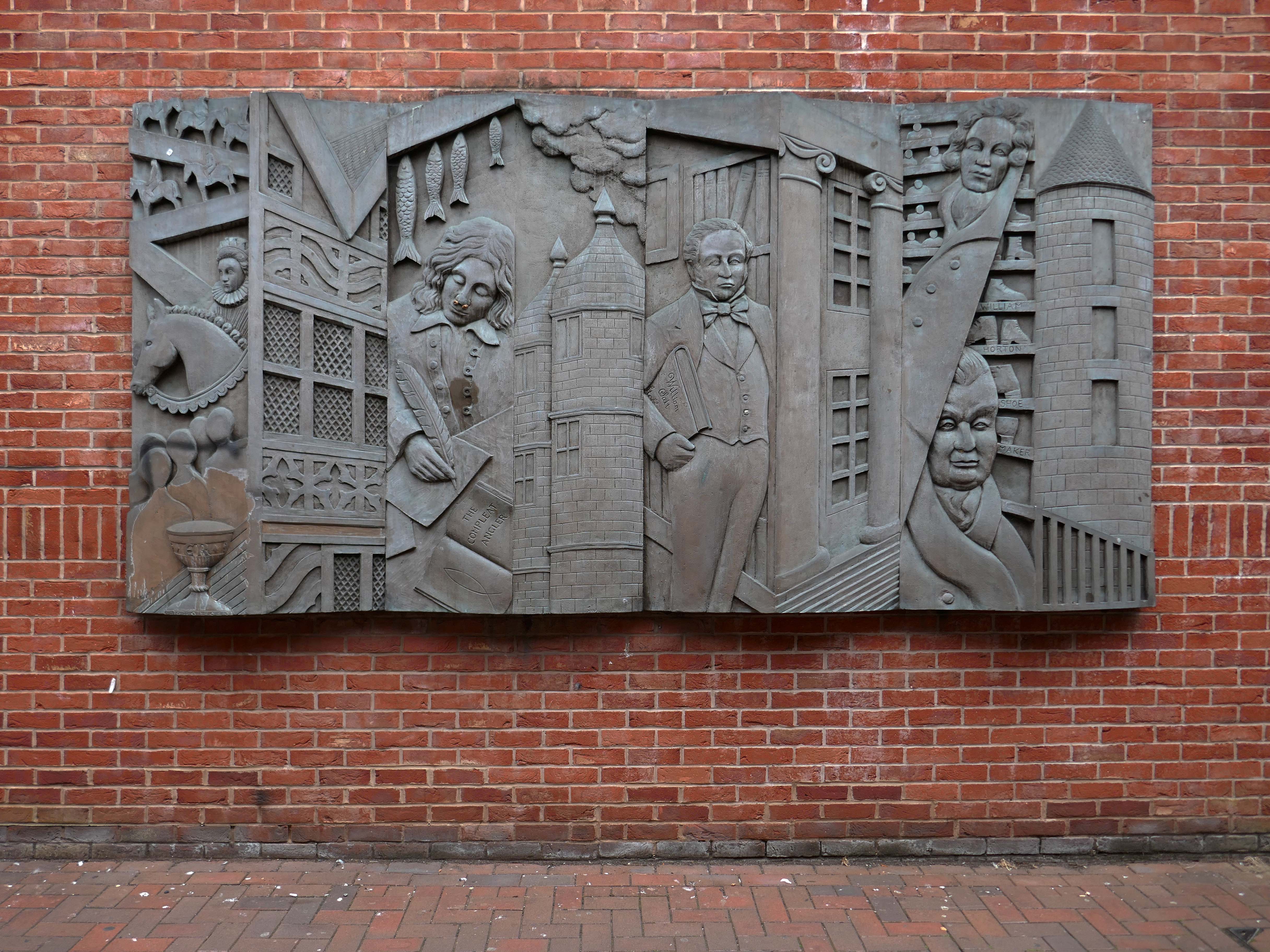
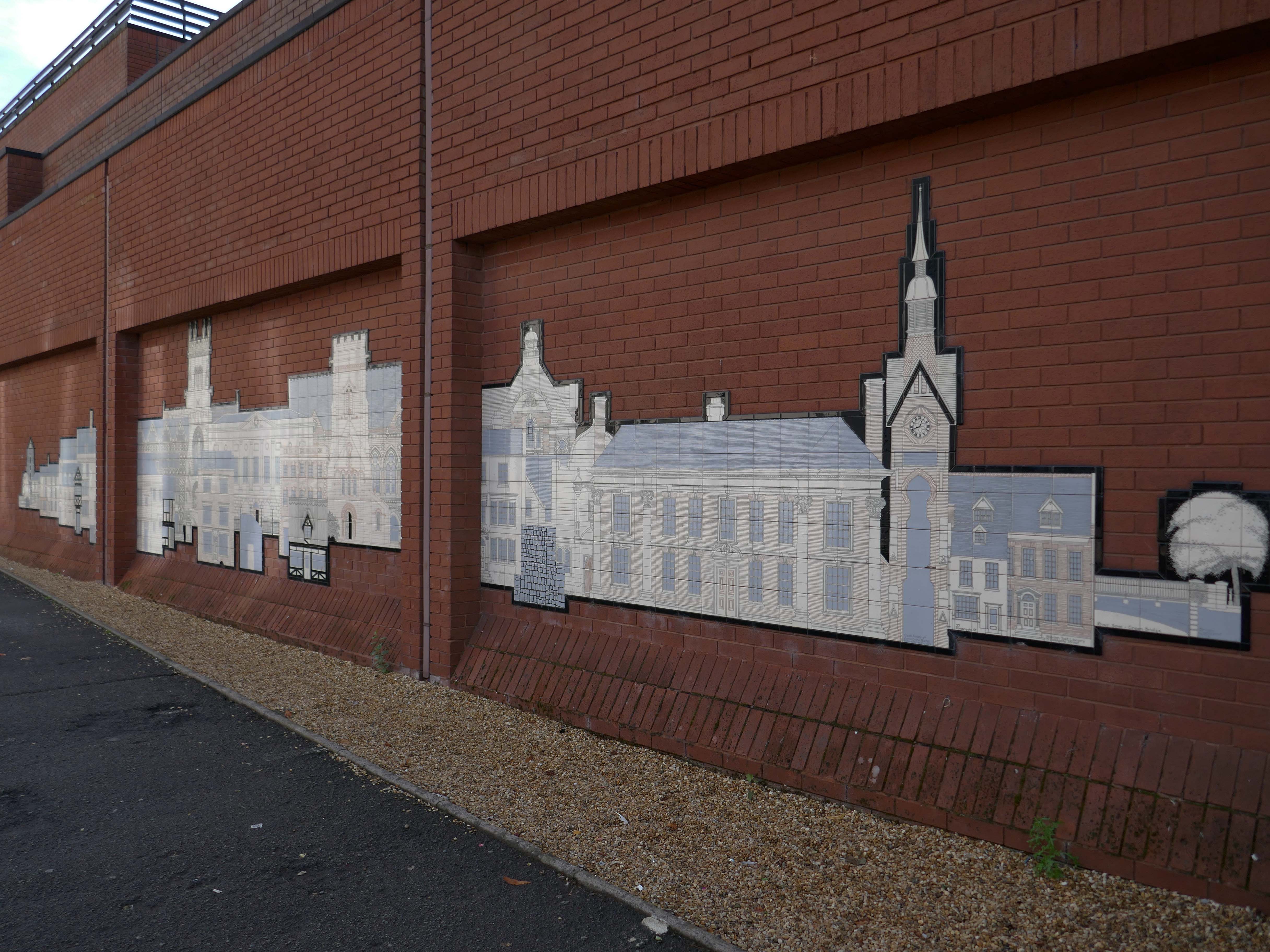
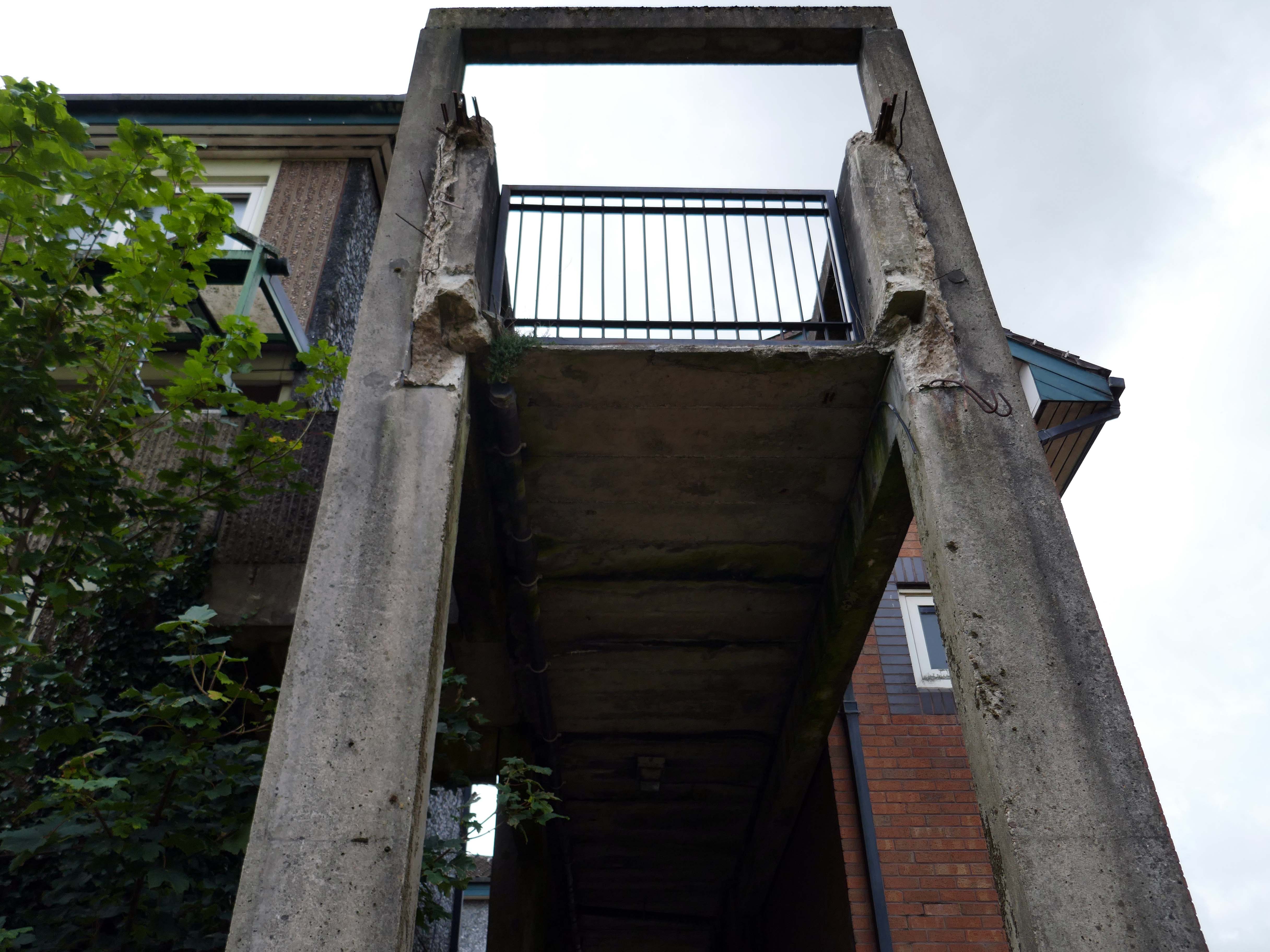
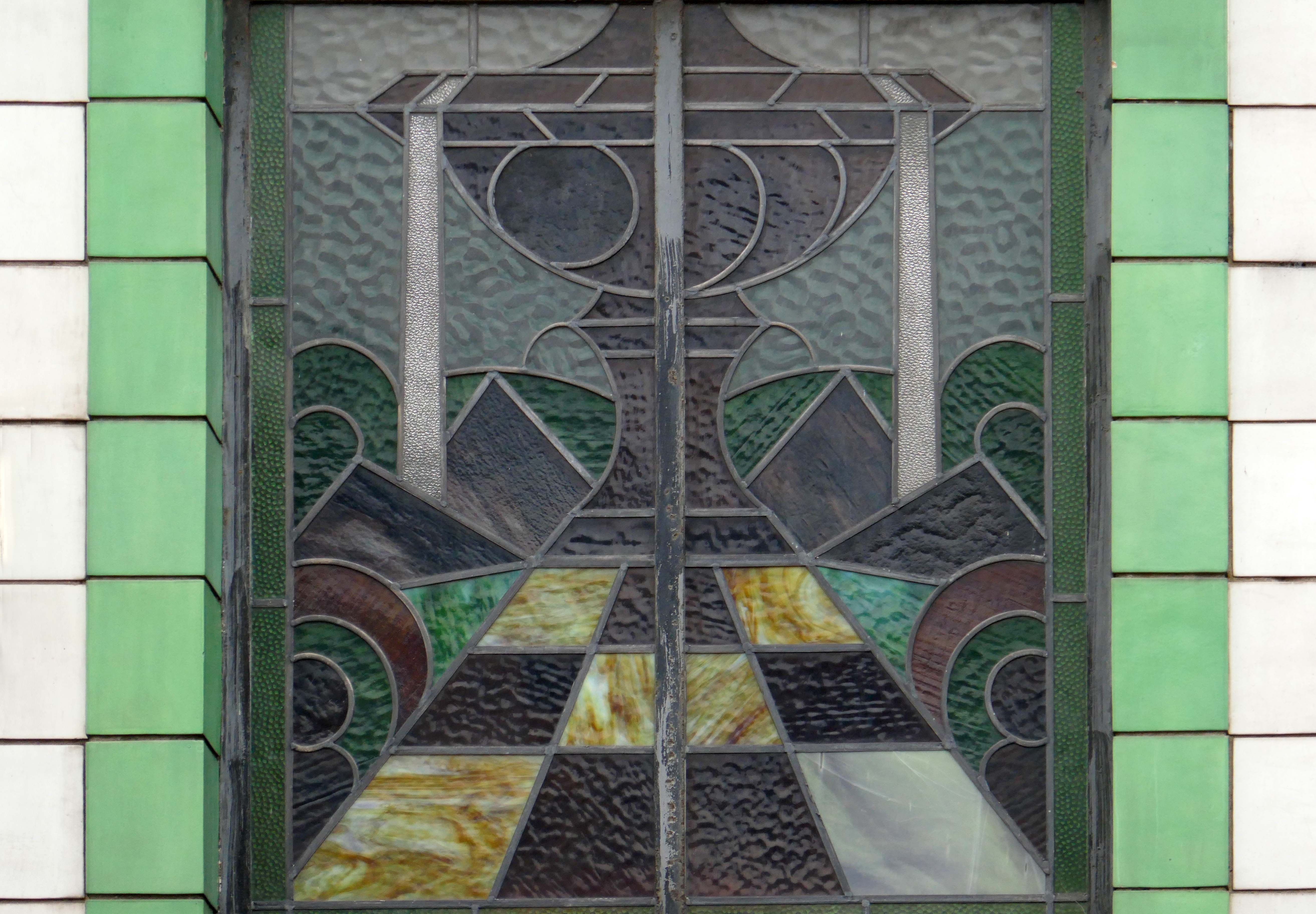
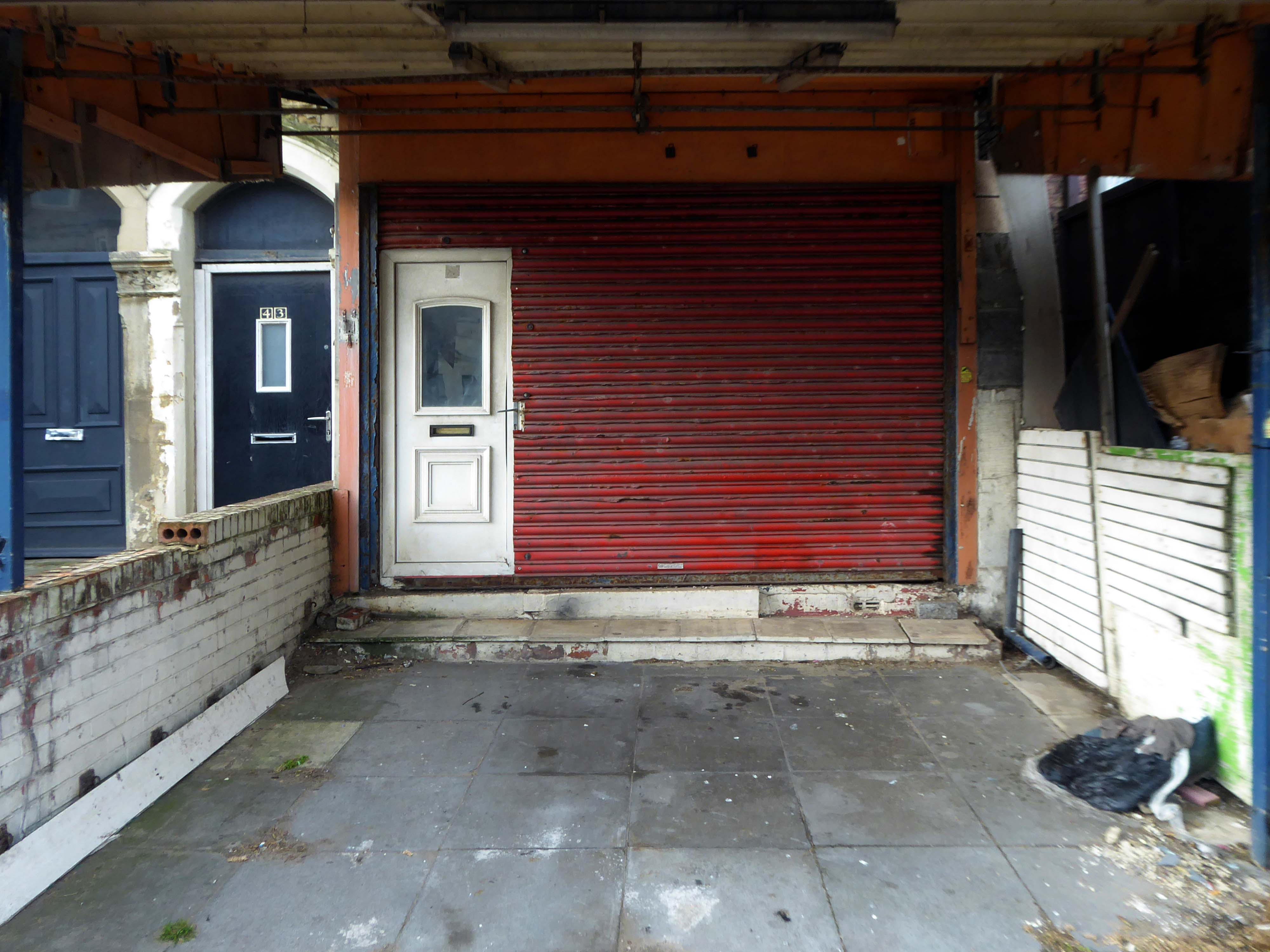
So here’s a snapshot of the centre’s exterior, with particular attention paid to the concrete relief.
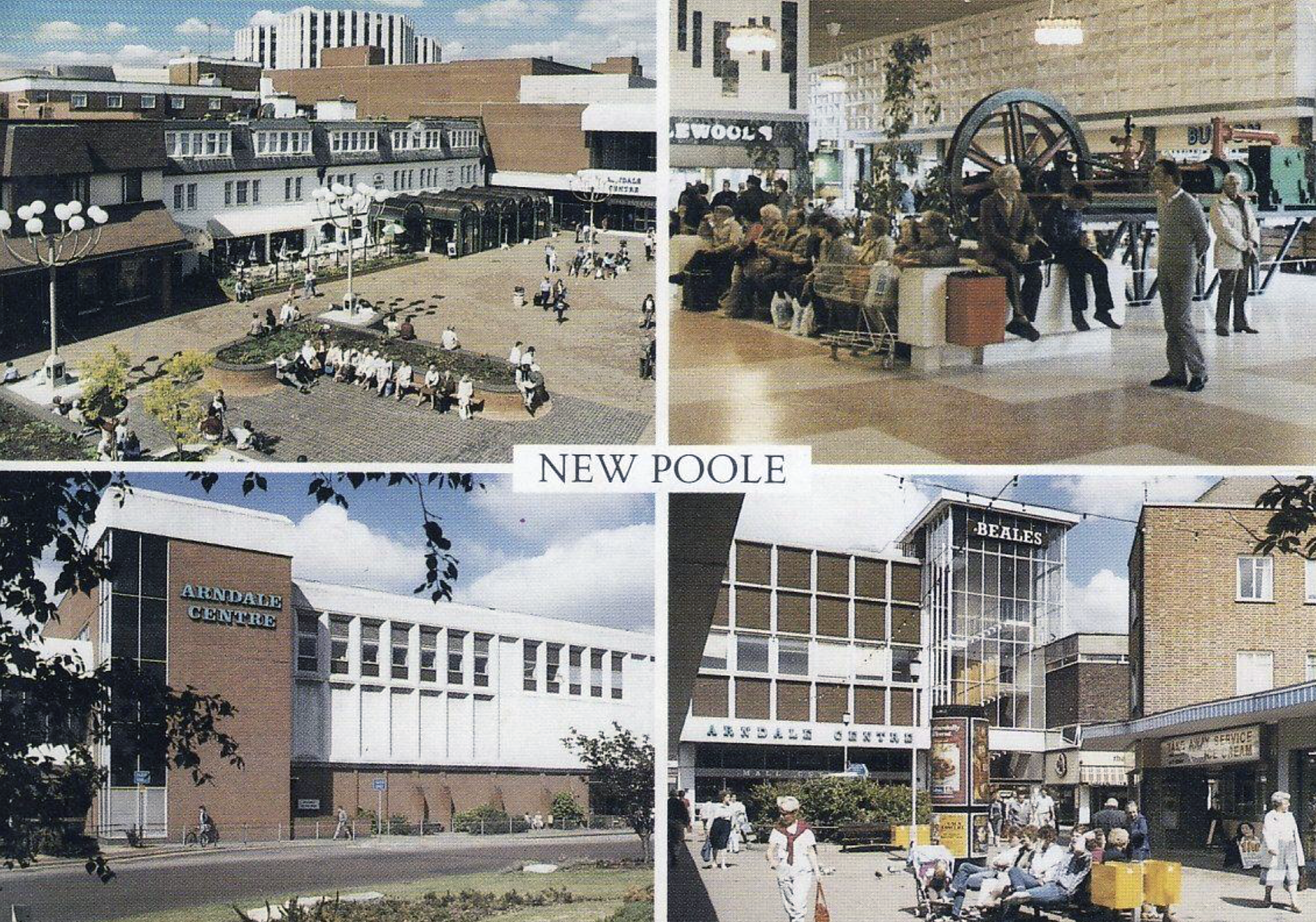
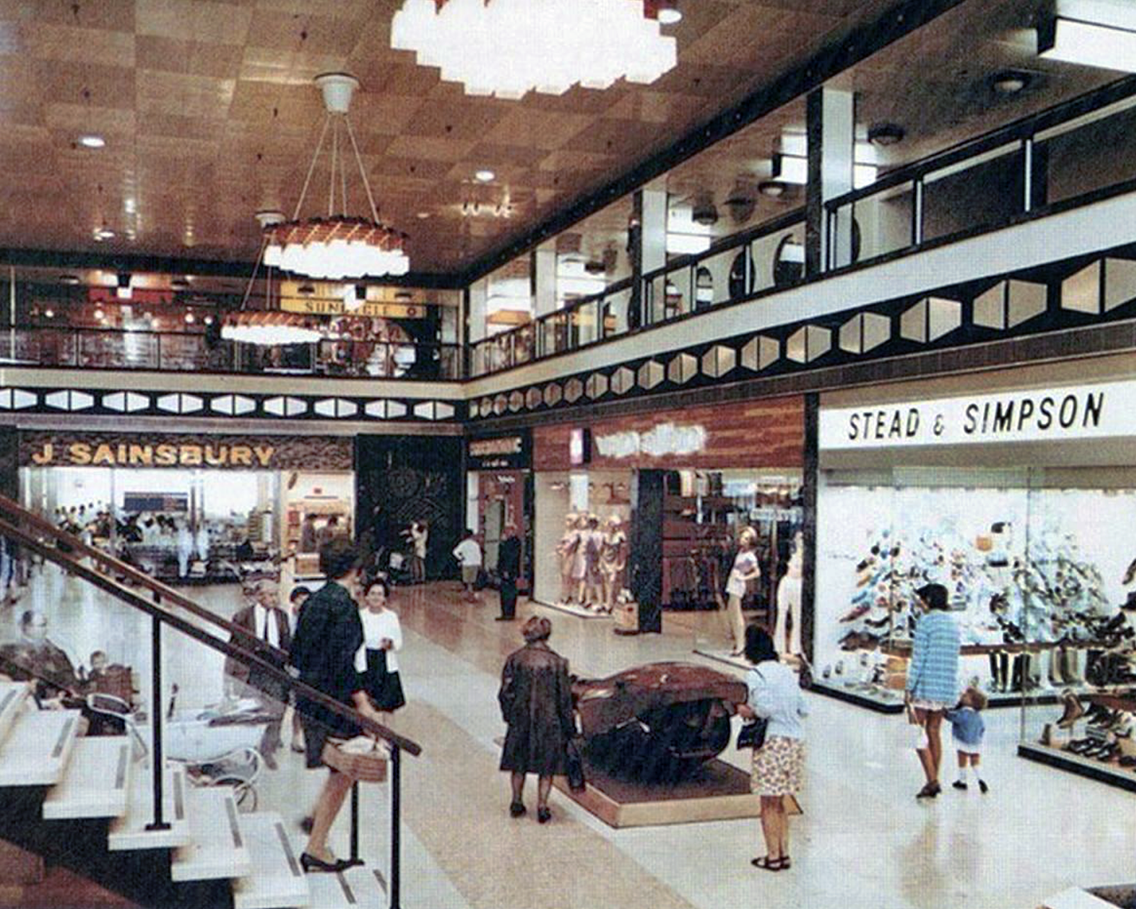
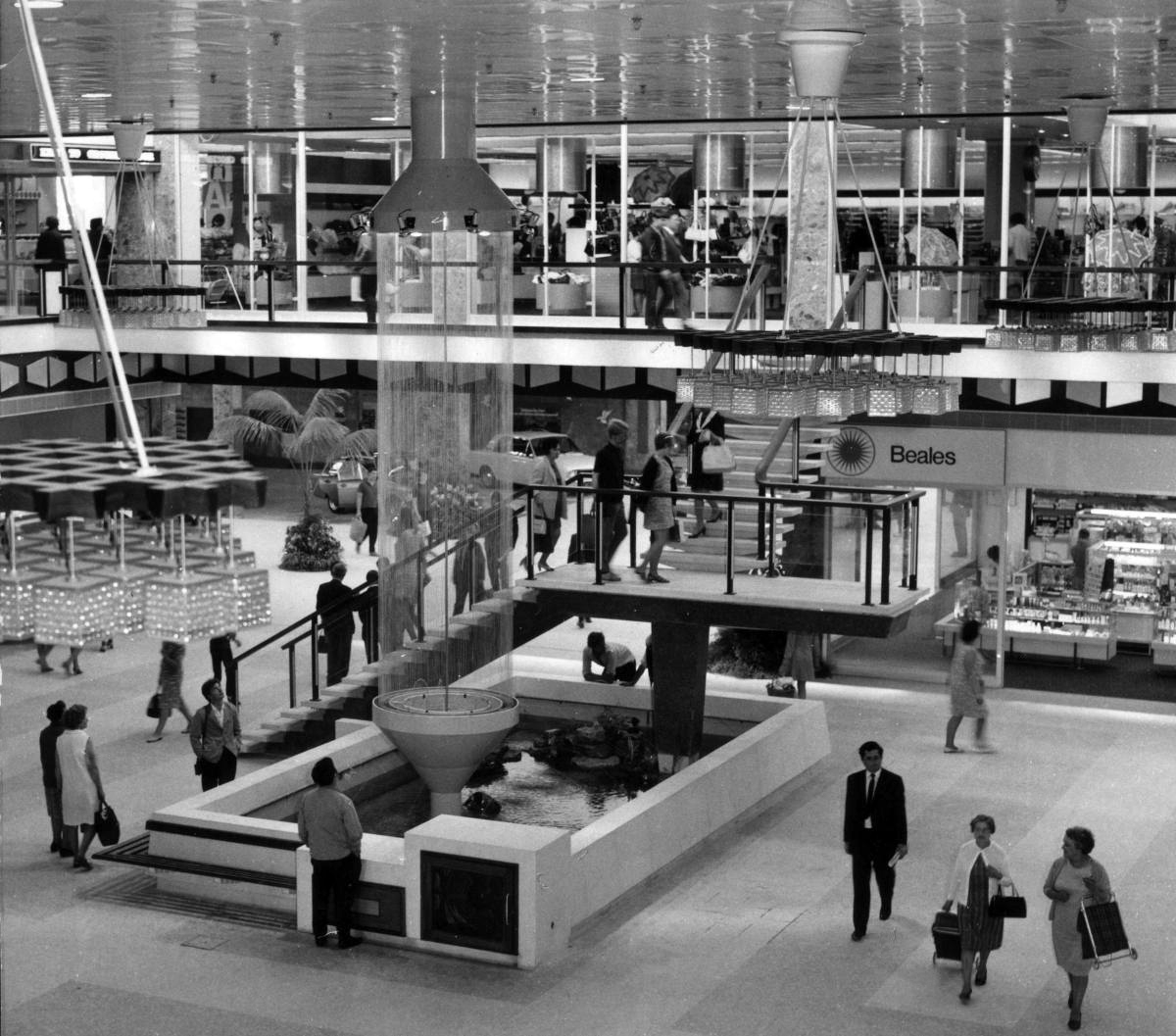
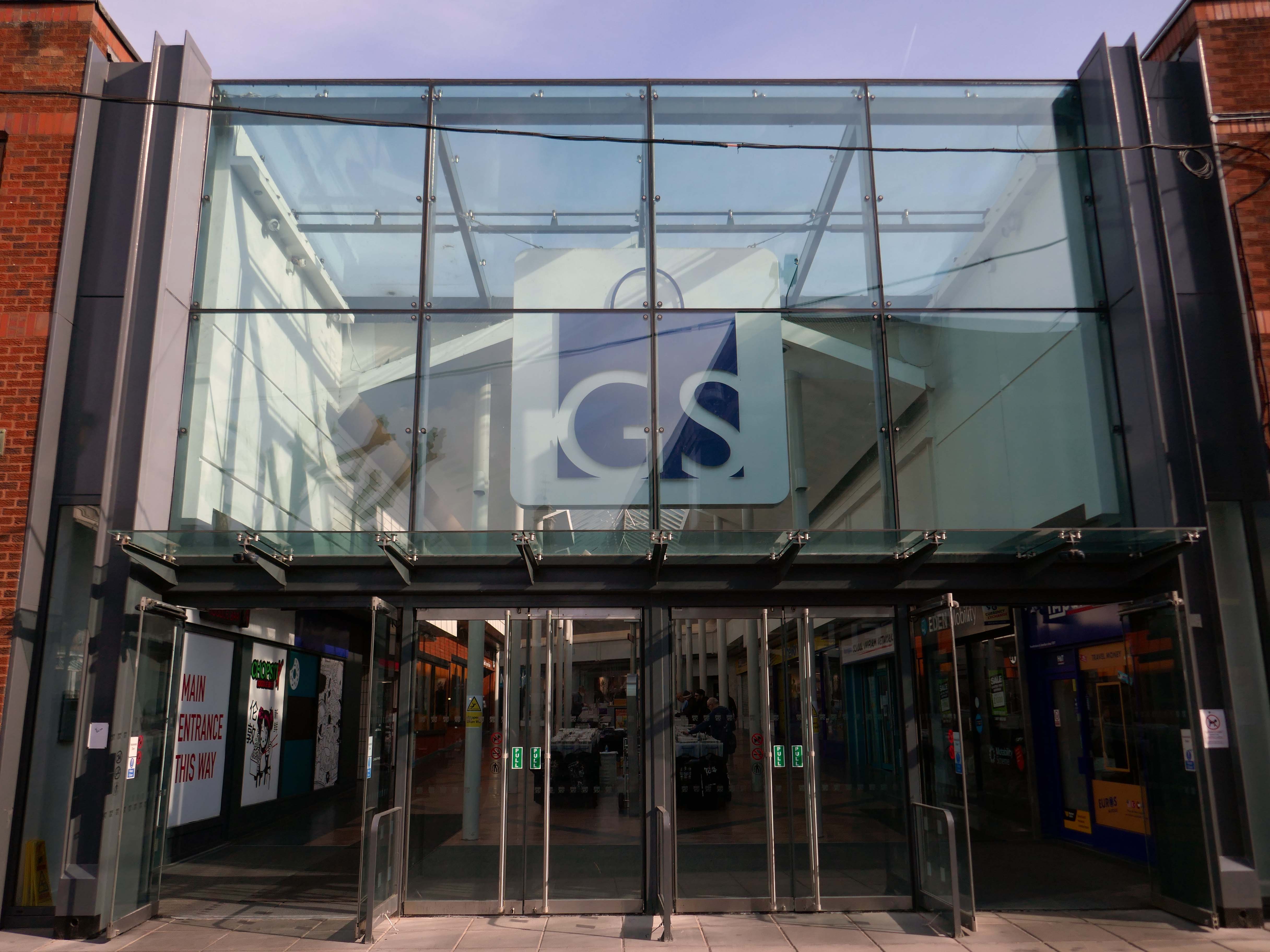
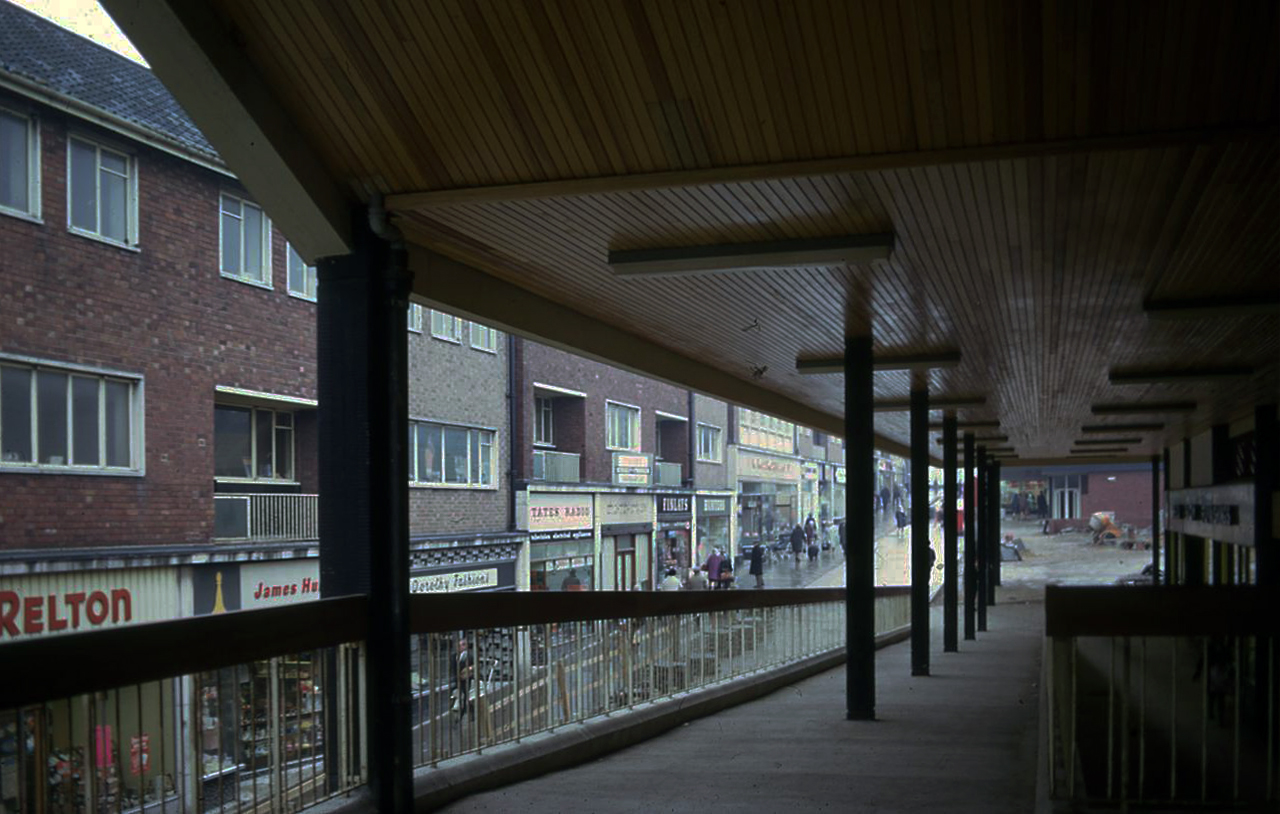
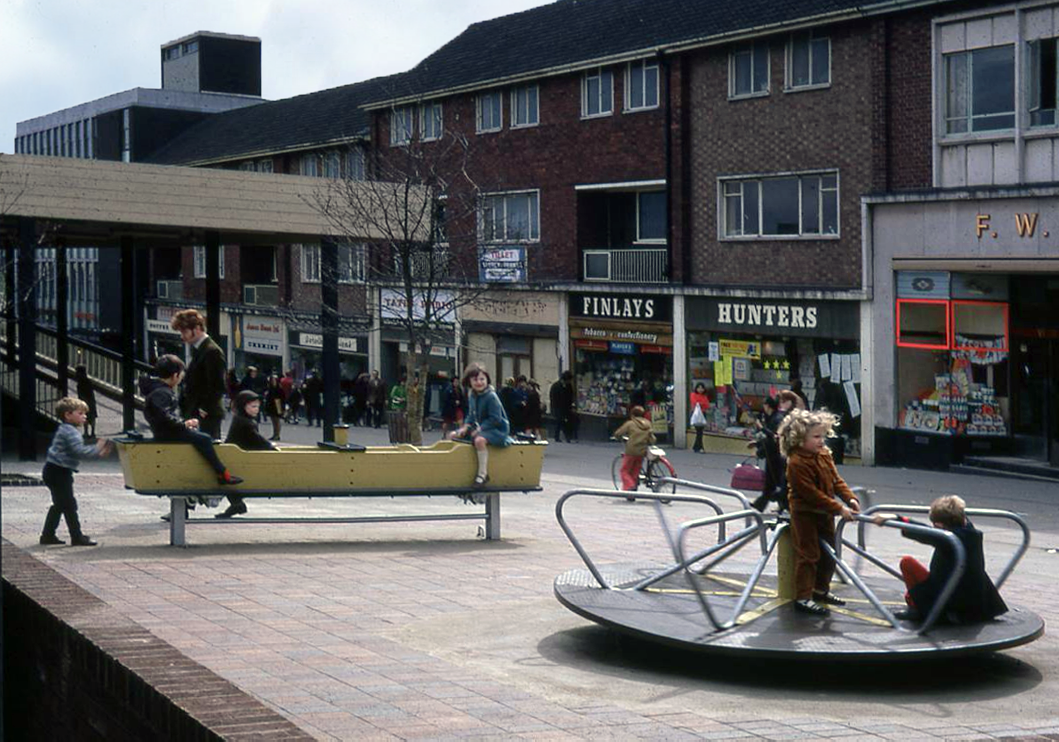
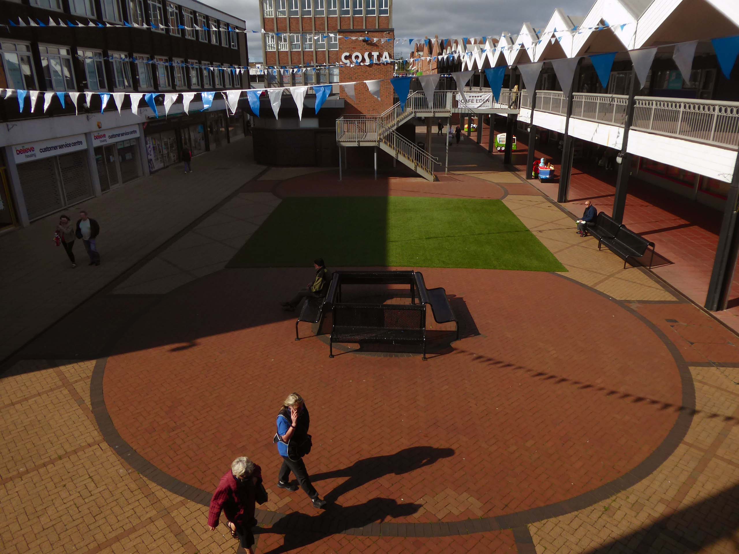
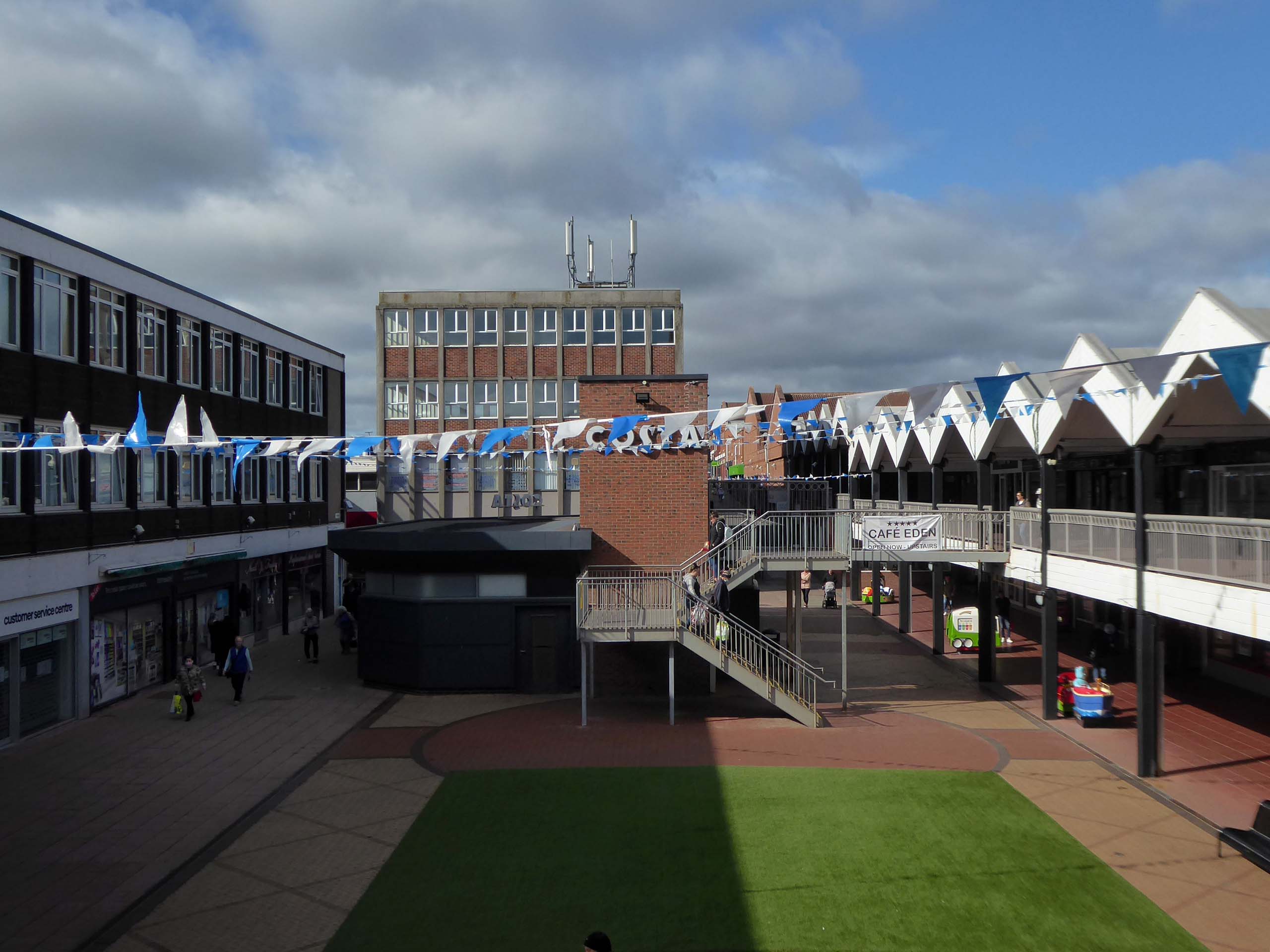
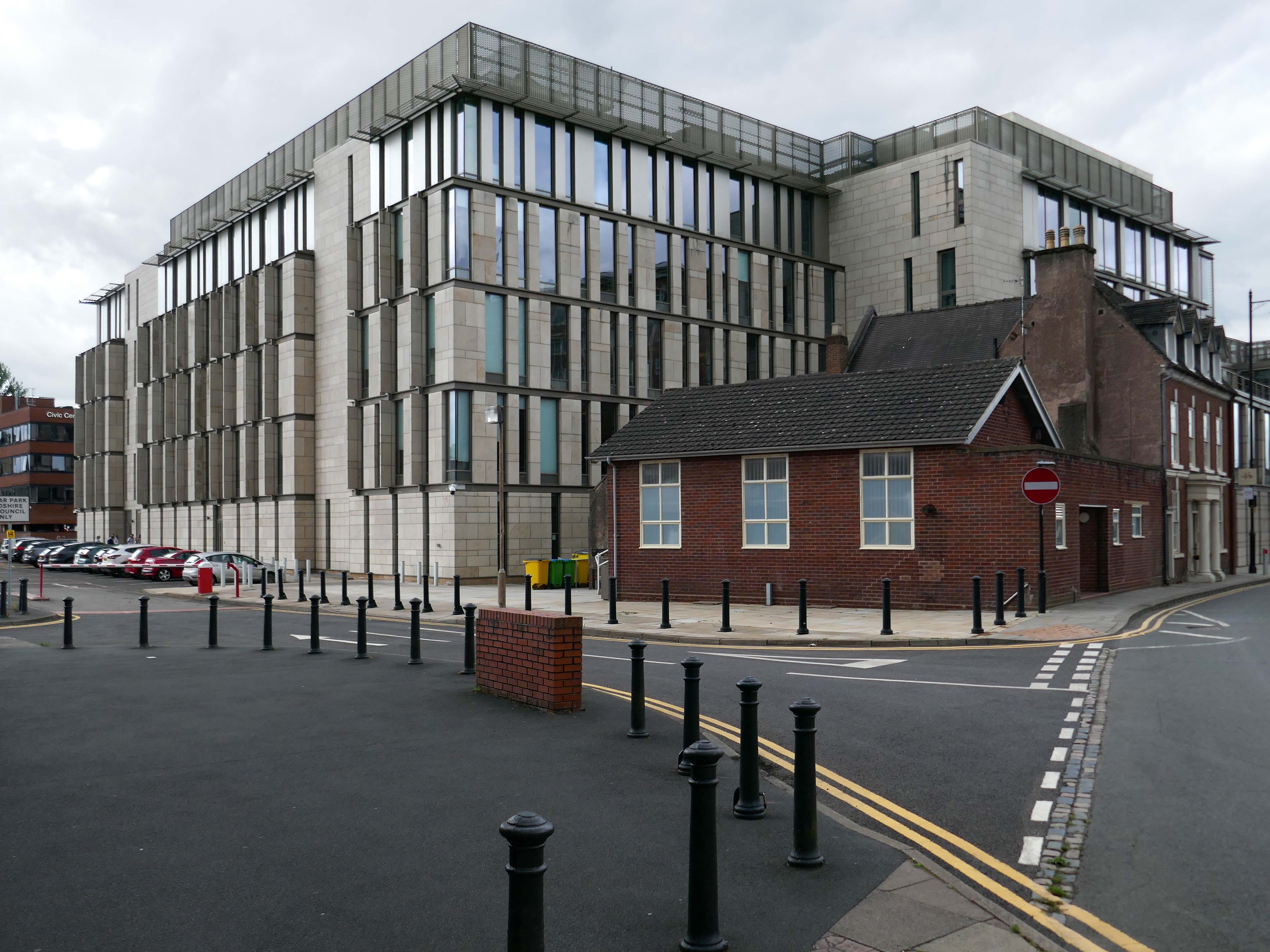
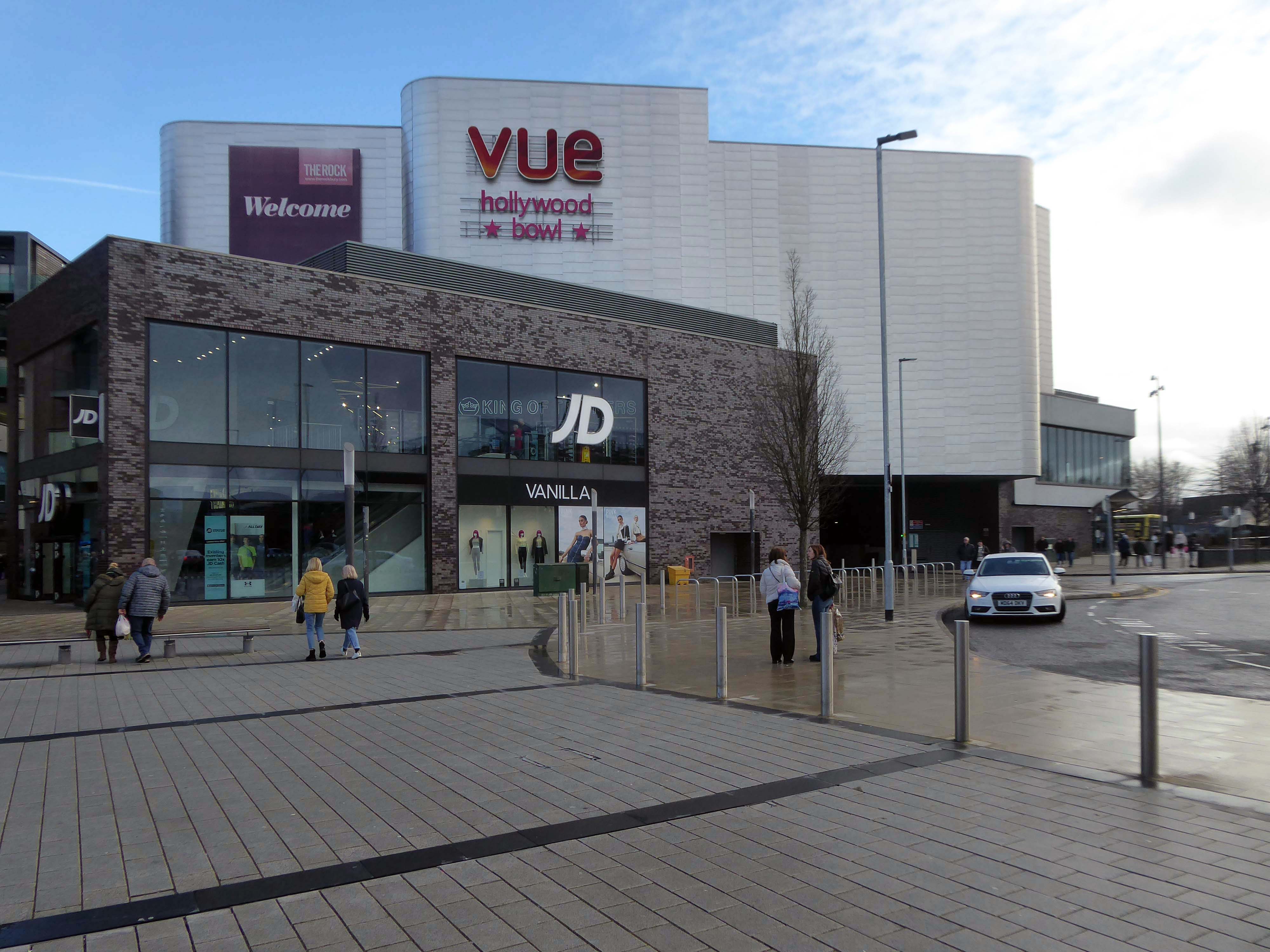
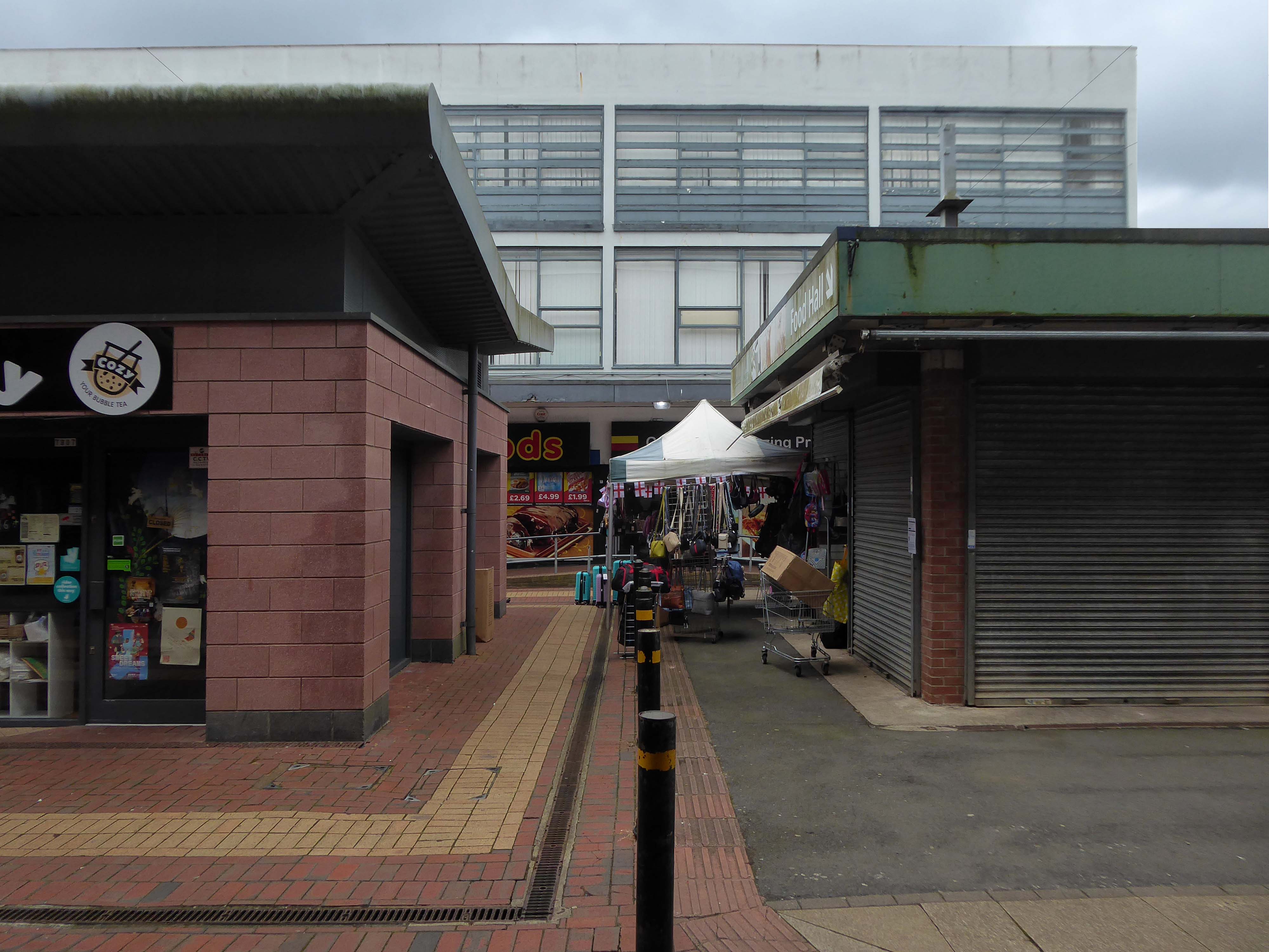
As an aside the nearby Dolphin Shopping Centre was once known as The Arndale.
In 1957 discussions began about creating a covered in shopping centre in the heart of Poole town centre, in a similar vein to those popular at the time in America. In 1963 property developers were invited by Poole Corporation to present schemes to develop this shopping centre as part of a redevelopment of the town.
The winning scheme was for a two million pound redevelopment by the Arndale Property Trust on land at High Street, Seldown Lane and Kingland Road] known as the Ladies Walking Field. One of the main reasons Arndale won was that their proposal incorporated a fully enclosed shopping centre. The scheme was to be designed by Leslie Jones and Partners in association with Geoffrey Hopkinson; Poole Borough Architect and Chief Planning Officer, the structural engineers were to be Bowden Sillett and Partners and the main contractors were to be Sir Lindsay Parkinson and Company.
The transformation of Poole Town Centre started in June 1966 when work began on a new road layout and construction of the shopping centre commenced in March 1967 when the then Mayor of Poole, Alderman Ron Hart, dug the first turf.
In 1989 an eight million pound refurbishment programme was carried out on the centre, which emerged with a new name ; The Dolphin Shopping Centre.
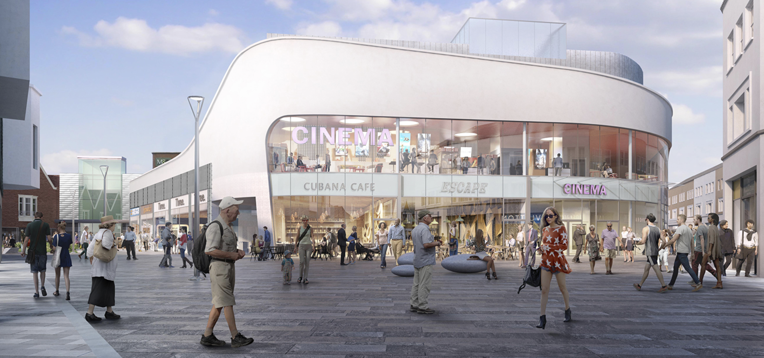
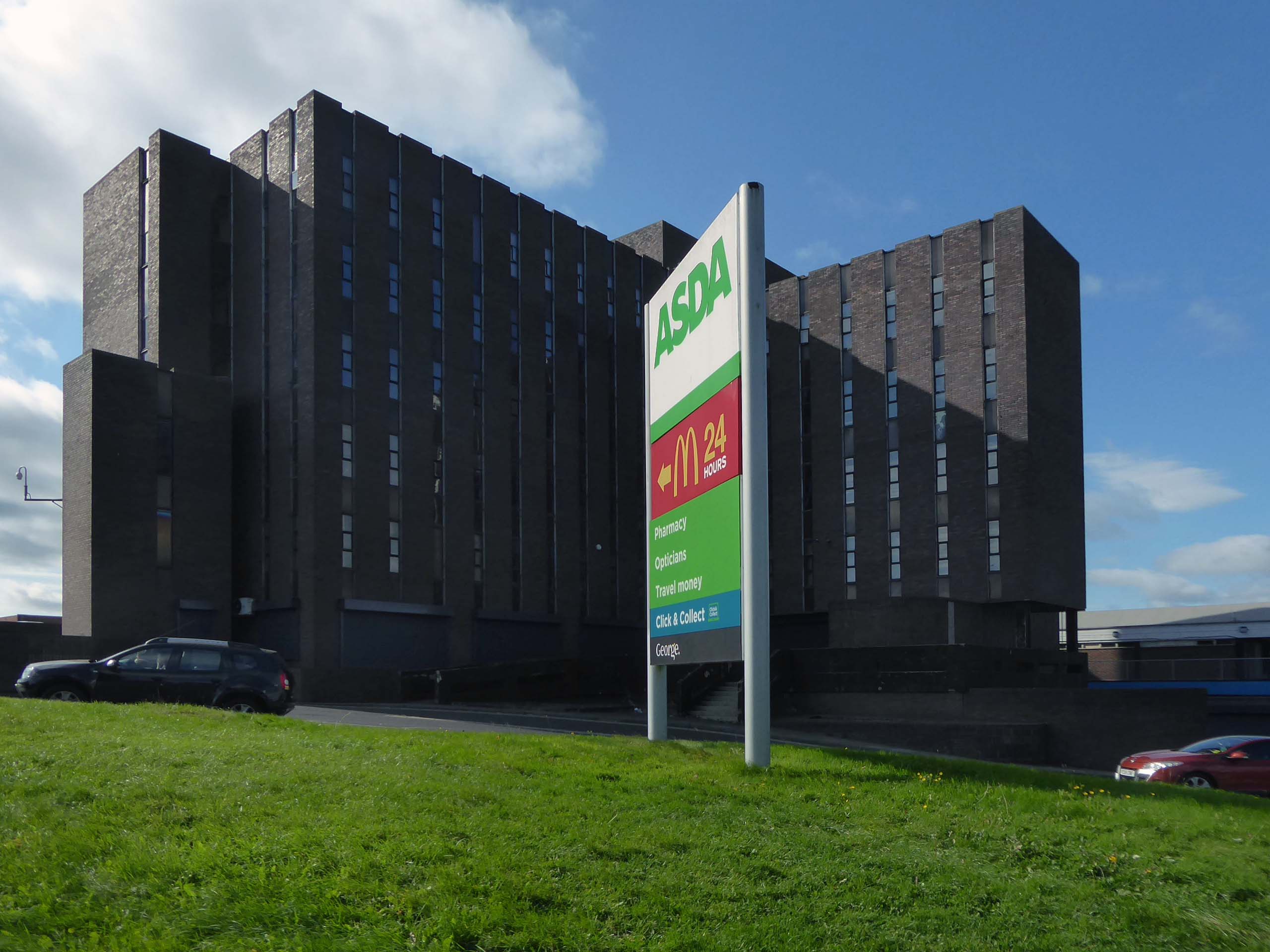
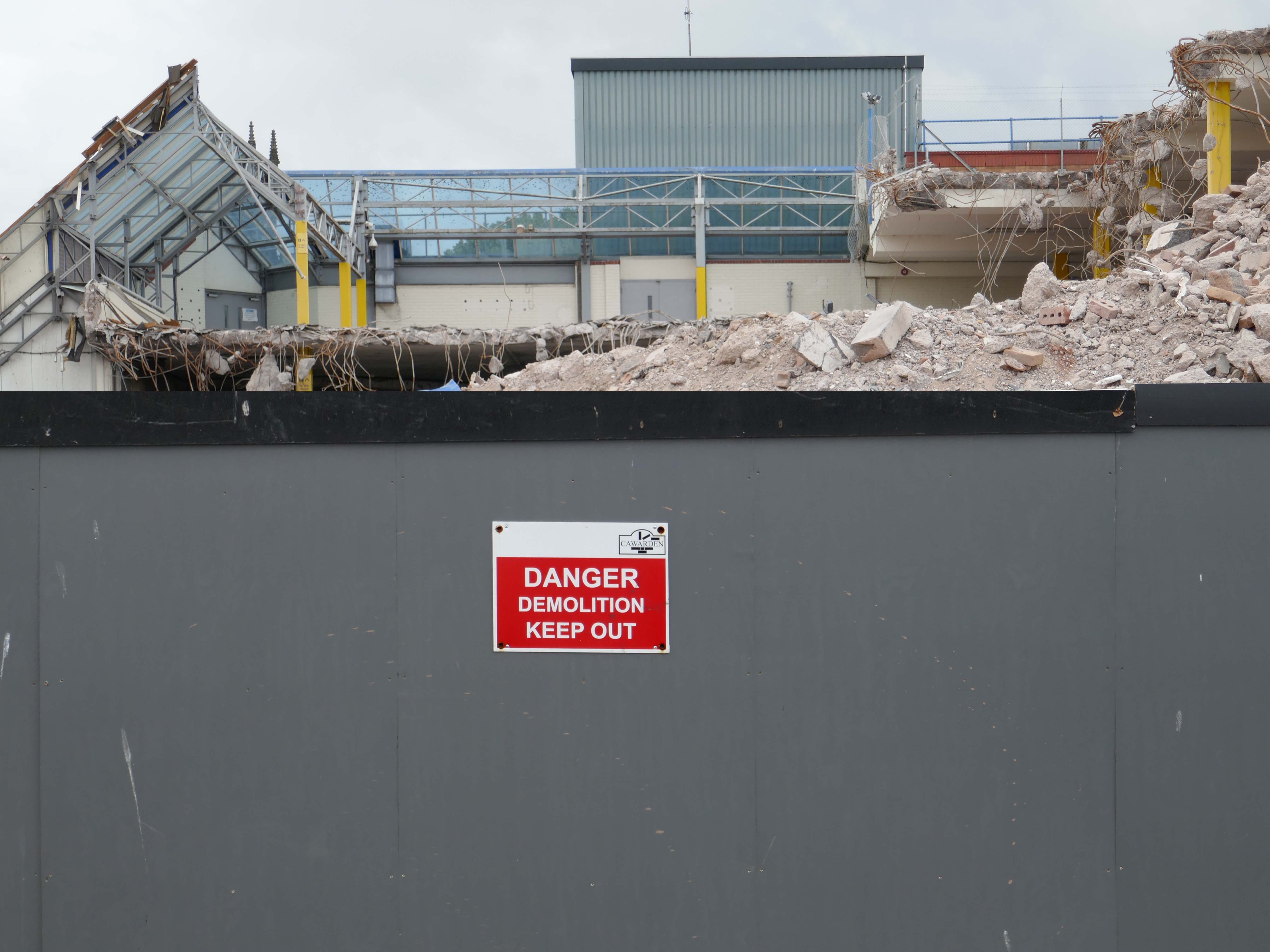
In February 2025, reinforced autoclaved aerated concrete RAAC was found at the shopping centre. The final Beales department store in the UK will close at the end of May 2025.
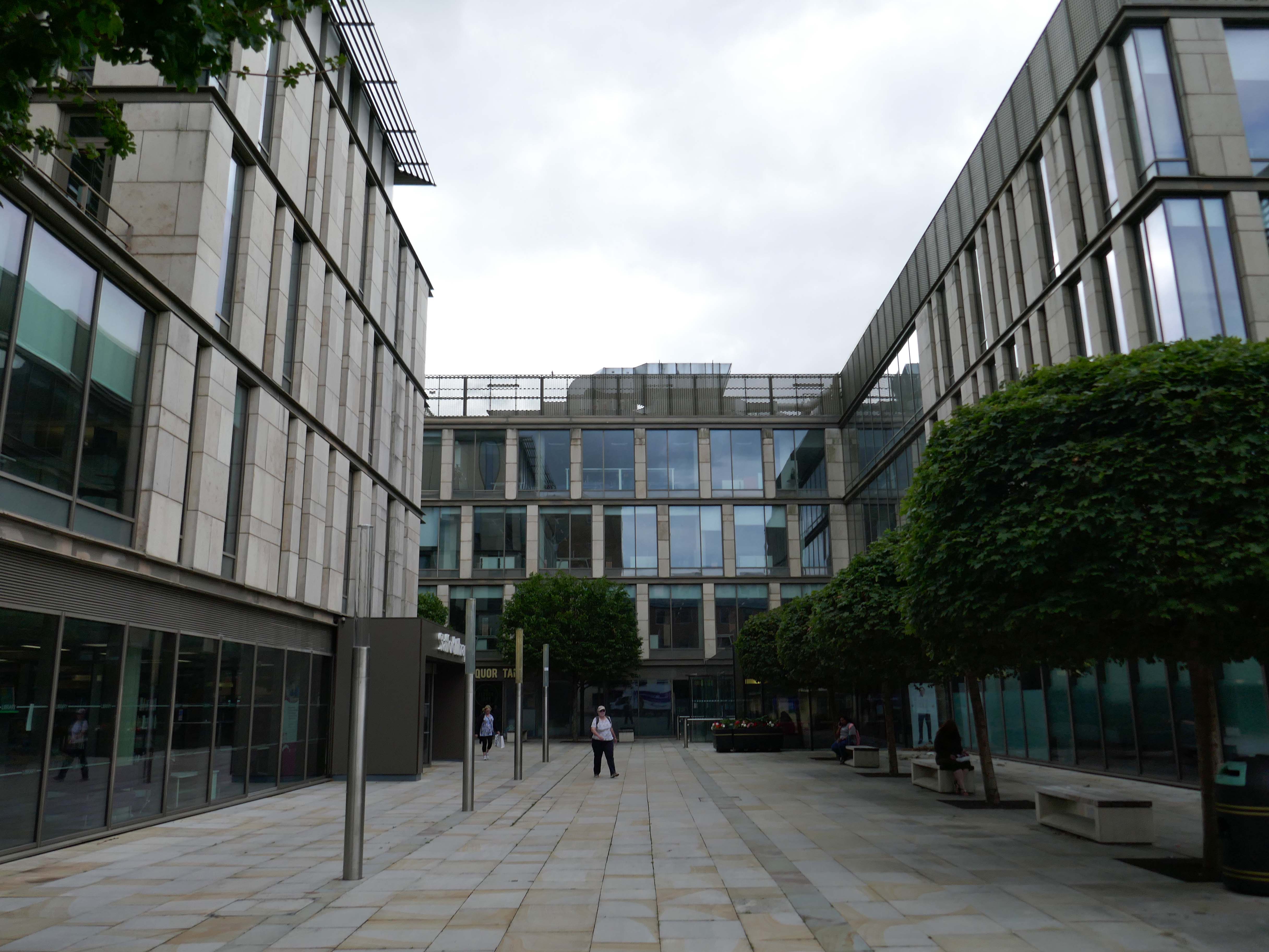
To ensure the shopping centre remains popular and well occupied, the owner LGIM Real Assets is investing in the redevelopment of the internal malls and various retail buildings within the site. Designed by tp bennett, a programme of refurbishment is underway with the aim of delivering a more exciting and modern retail experience to help attract shoppers and retailers. The scheme includes new stores for H&M, New Look and JD Sports as well a new mixed-use leisure development, with a multiplex cinema, restaurants and a refreshed public realm.
It will be a huge transformation and there is a real local desire for it.
Part of wider improvement works in Poole, it is hoped that this major investment will enhance the customer experience, and reinforce the centre as a popular, family-friendly retail and entertainment destination.
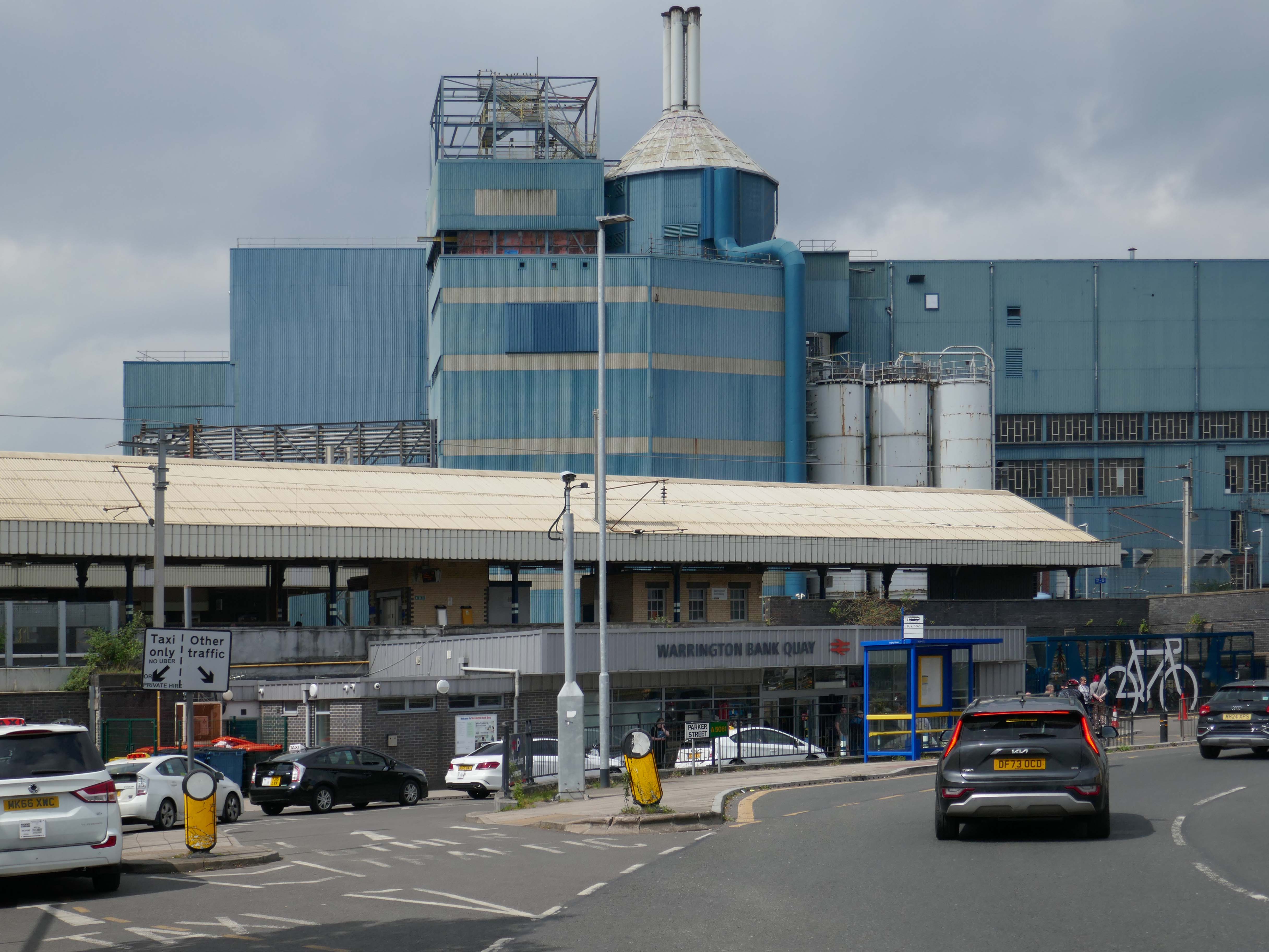
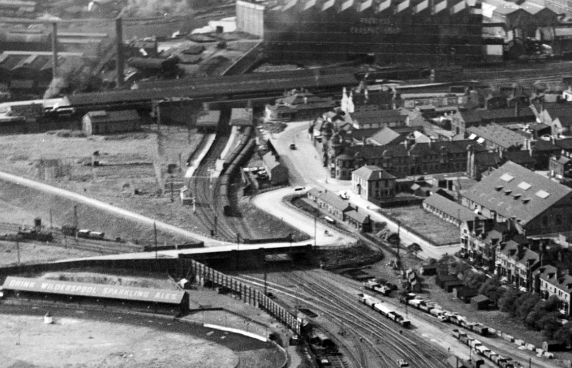
It’s a sunny day in May and we begin at Warrington Bank Quay station.
The first Warrington Bank Quay station opened on 4 July 1837.
The station was rebuilt when the line was electrified in 1973, a new power signal box covering an extended area was built east of the station for the electrification.
In 2009 a new entrance hall was completed, with a travel centre/ticket office and a shop.
The buffet on the London bound platforms was modernised.
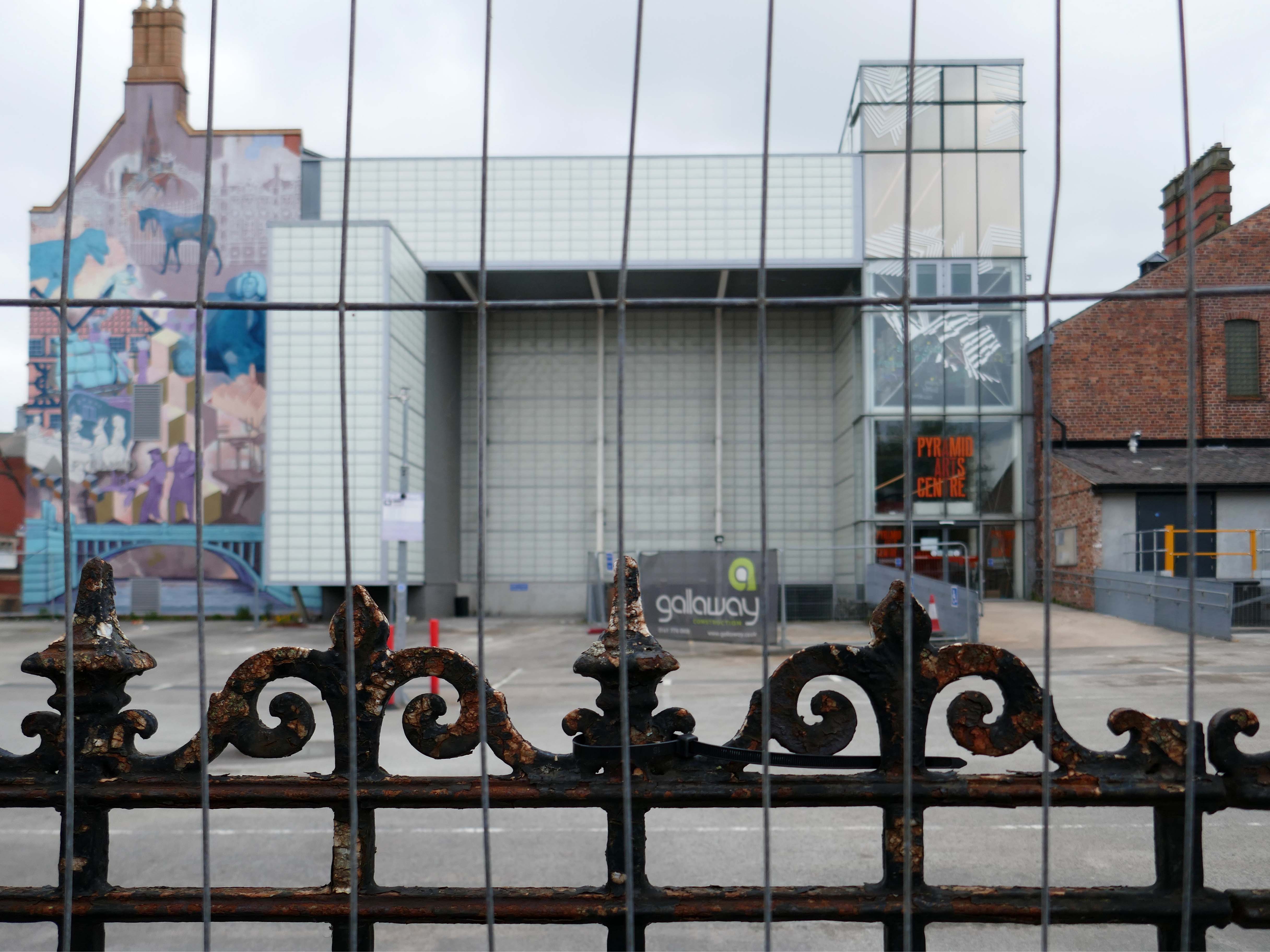
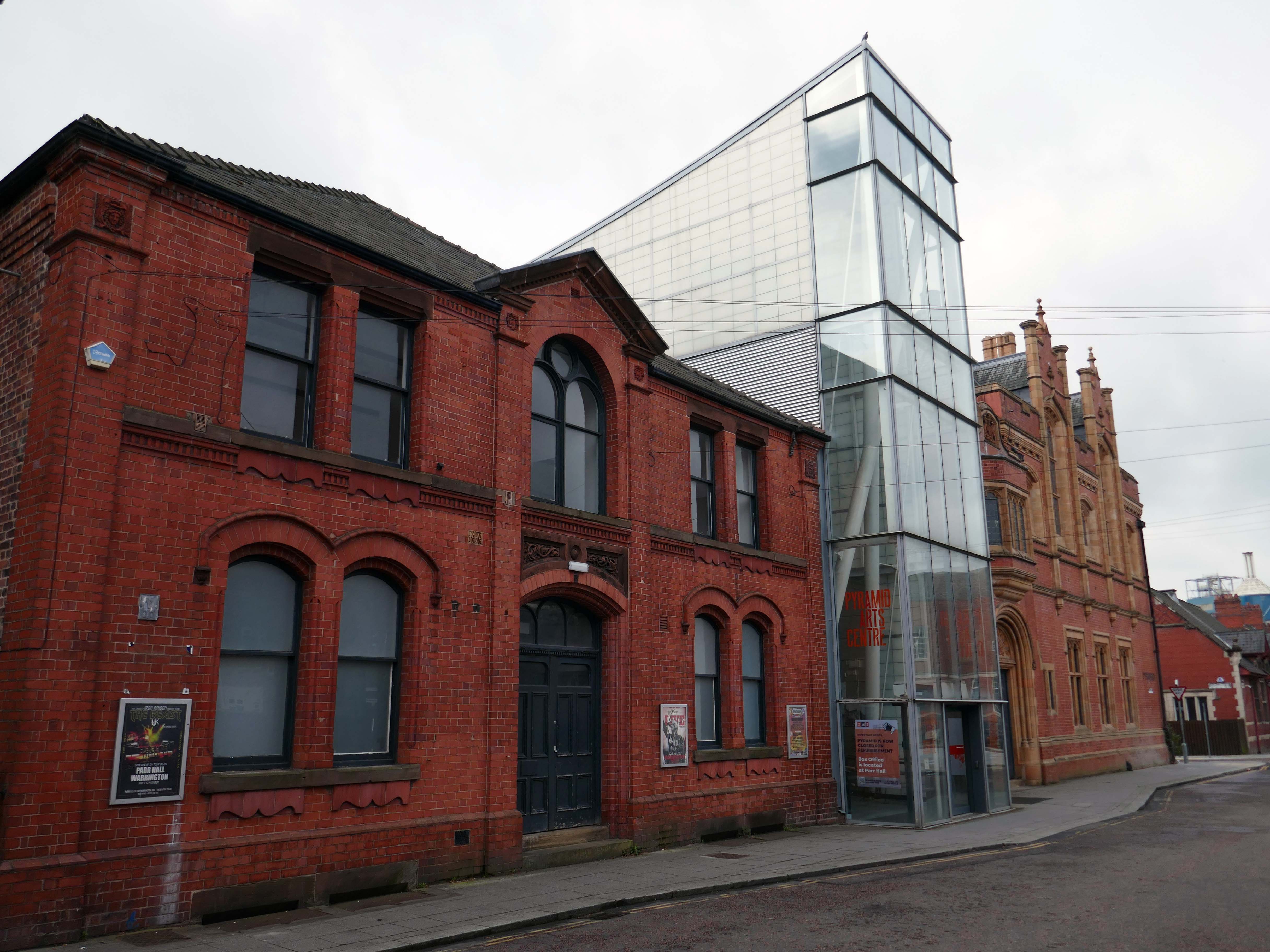
Next onwards to the Pyramid Arts extension 2002, a reworking by Studio BAAD of the former County Court and Inland Revenue Offices 1897-8 by Sir Henry Tanner.
Studio BAAD Ltd started winding up proceedings for a Creditors Voluntary Liquidation in April 2021 and the company was dissolved on 21 July 2021
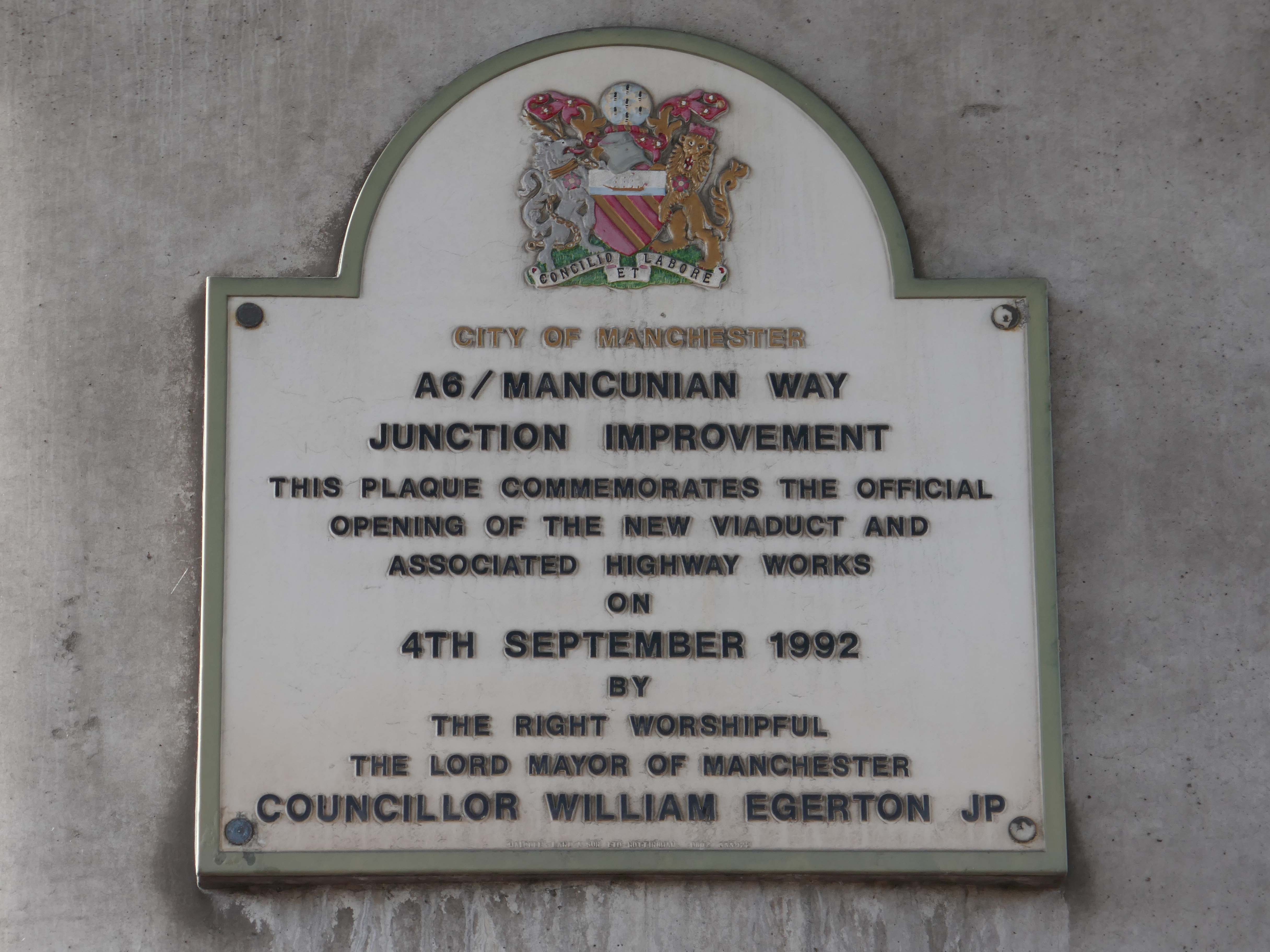
The centre is currently closed – work began on the redevelopment, which has been funded by a £5 million grant from the Government, in July 2024.
The project aims to make the building more modern, accessible and fit for the future.
The redevelopment includes the addition of a new café and bar area while the Exhibition Hall will become a bigger capacity venue.
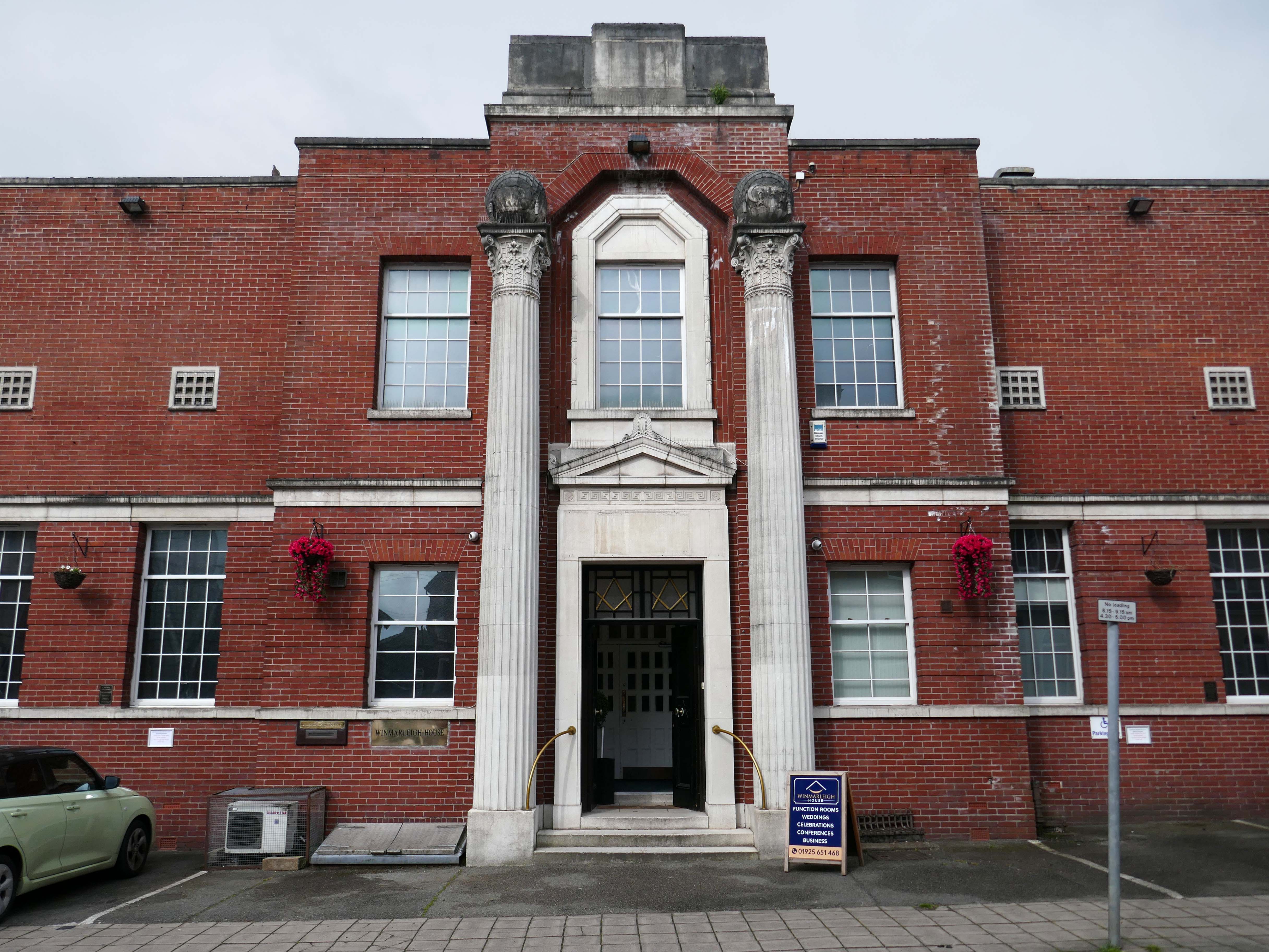
Across the way the Masonic Hall 1932-33 Albert Warburton.
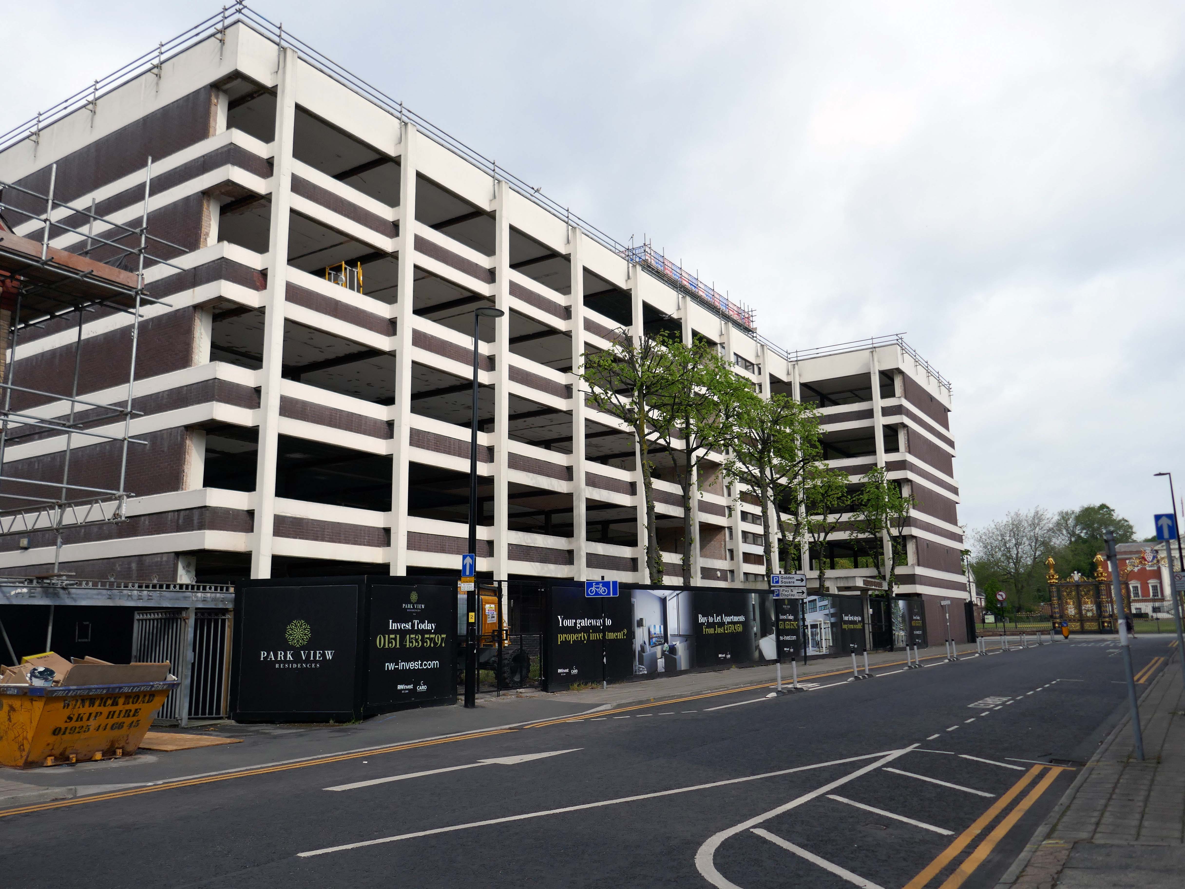
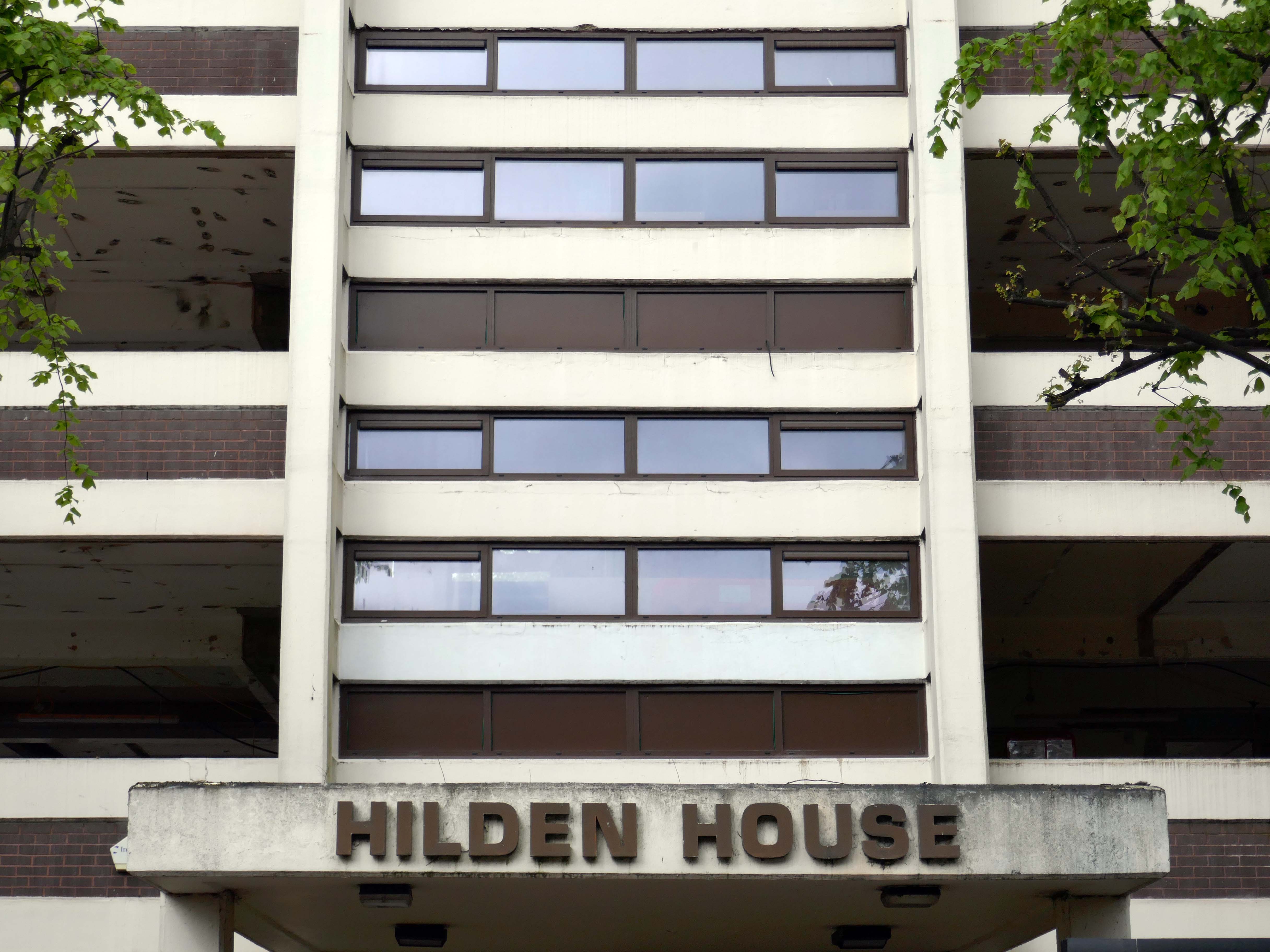
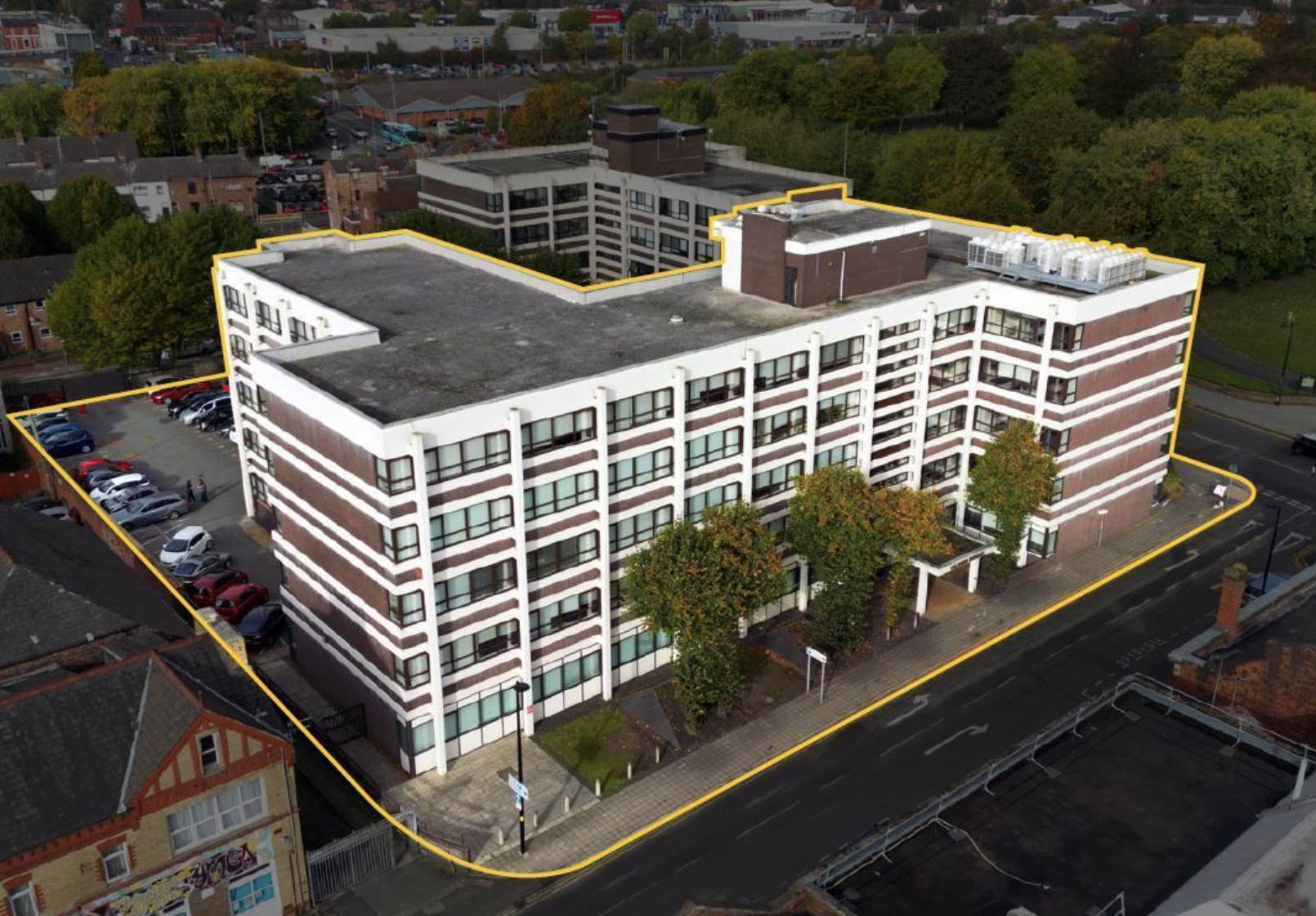
Further along to Hilden House a former Department of Works and Pension building, currently undergoing a transformation into a residential block.
The £18m office to residential reset of the 52,400 sq ft building will offer a mix of one- and two-bedroom apartments in plans now approved by the local authority.
Caro Developments, working in tandem with architectFalconer Chester Hall, hopes to start construction later this year.
According to a planning statement submitted on the developer’s behalf by Savills, once complete, the five-storey block will offer residents a concierge service, a gym and wellness facility, a resident’s lounge, and a co-working area.
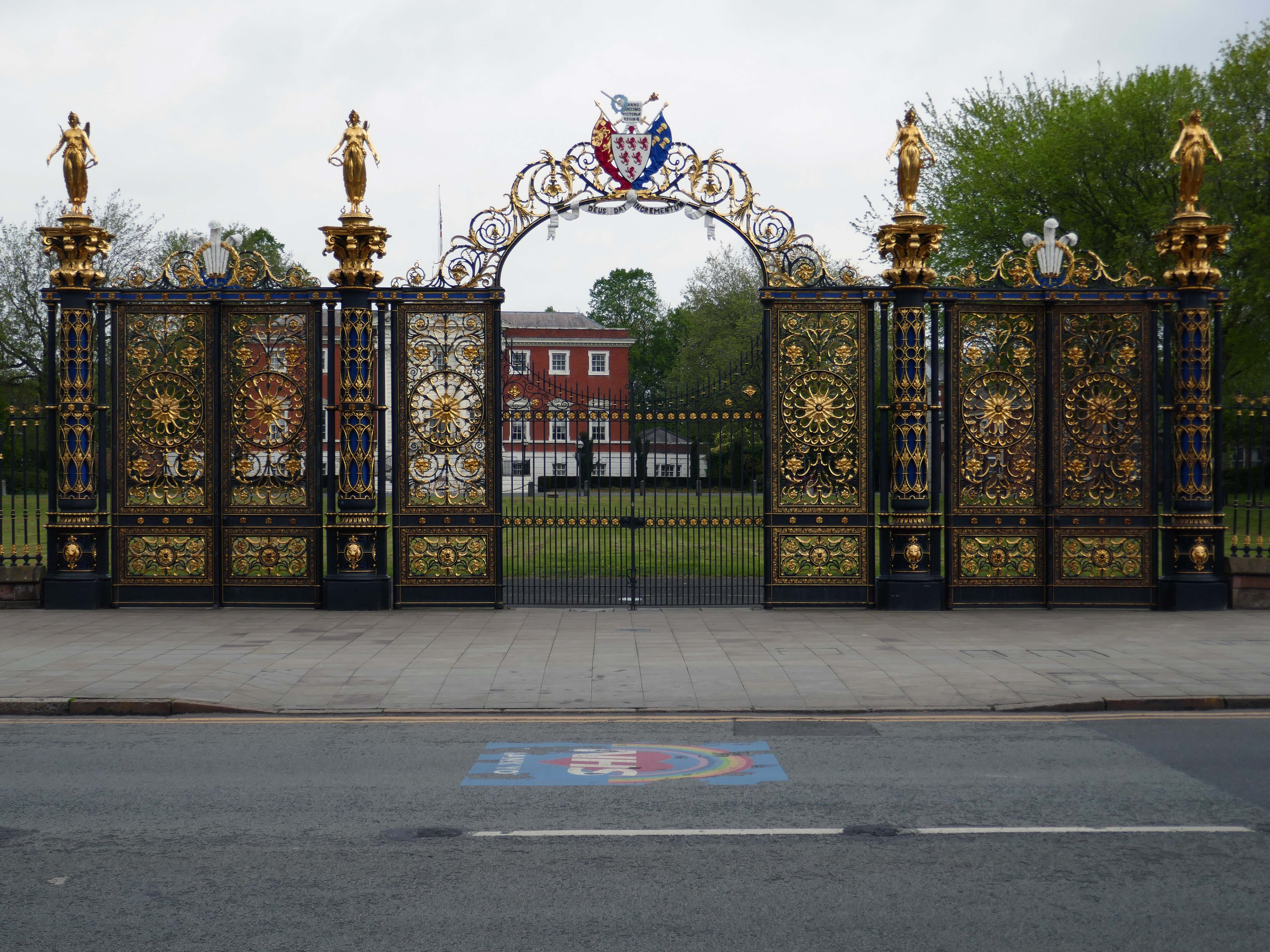
Way out of period but a notable Warrington landmark are the Golden Gates designed in 1862.
The gates were made for the International Exhibition of 1862, and then intended for Queen Victoria’s Sandringham home in Norfolk. Coalbrookdale found it hard to find a buyer for such grand gates, so Frederick Monks, one of the town’s earliest councillors, was able to buy and bring them to Warrington to stand at the front of the town hall lawn. Monks also presented the cast iron Cromwell statue, designed by John Bell, to Warrington in 1899.
The Golden Gates are Grade II* Listed, along with the gate piers and the lamps which line the driveways at either side of the town hall
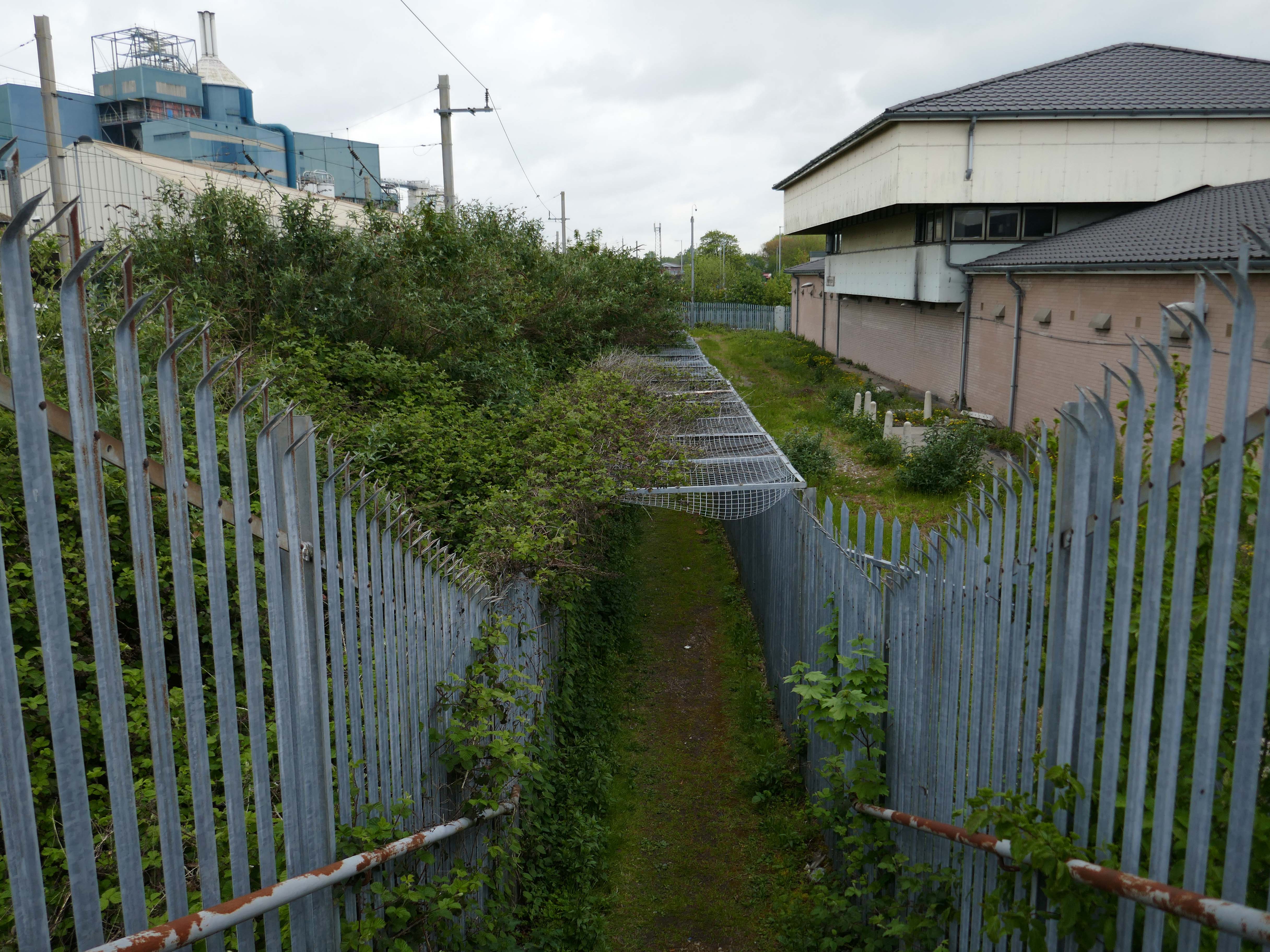
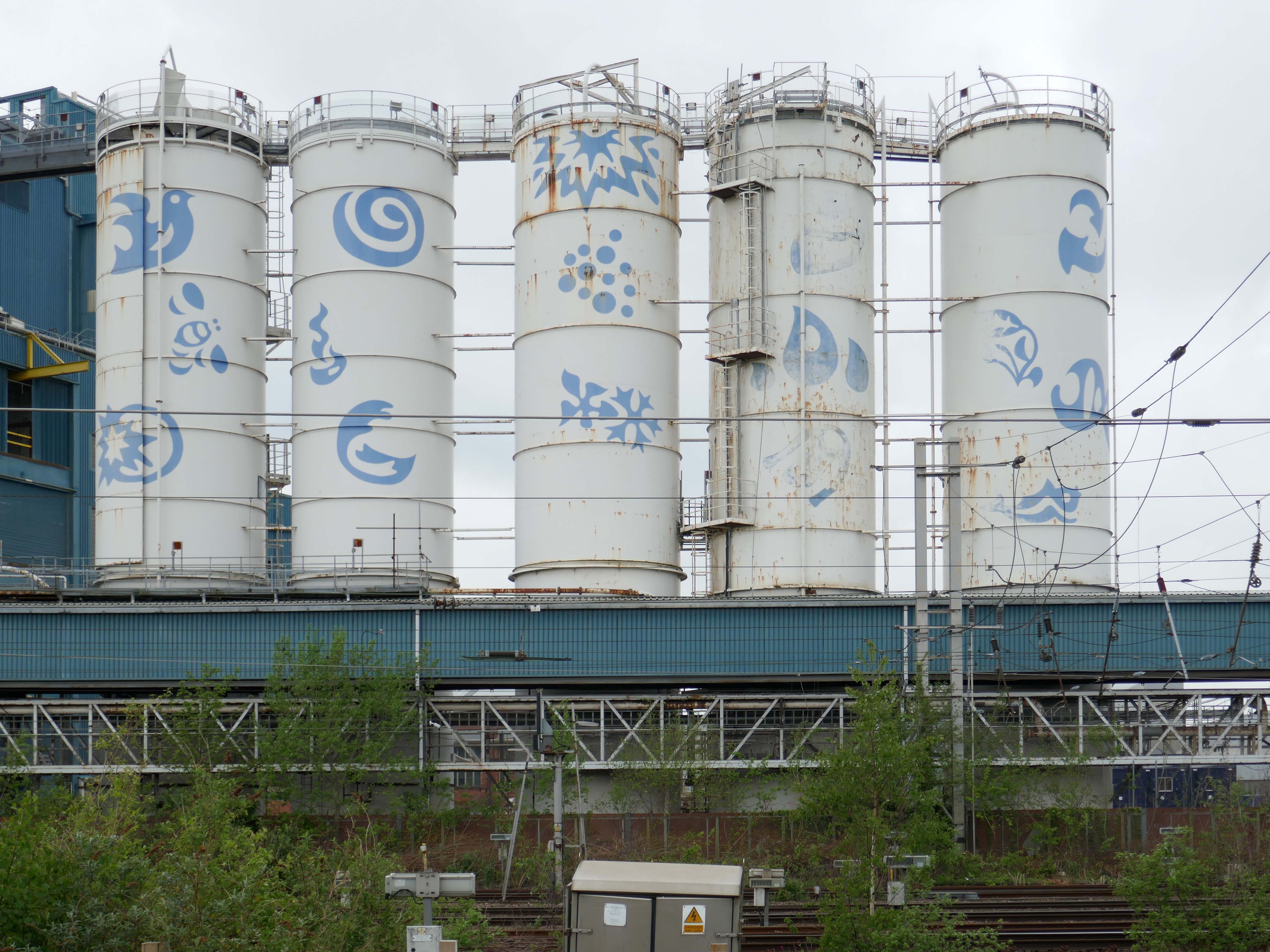
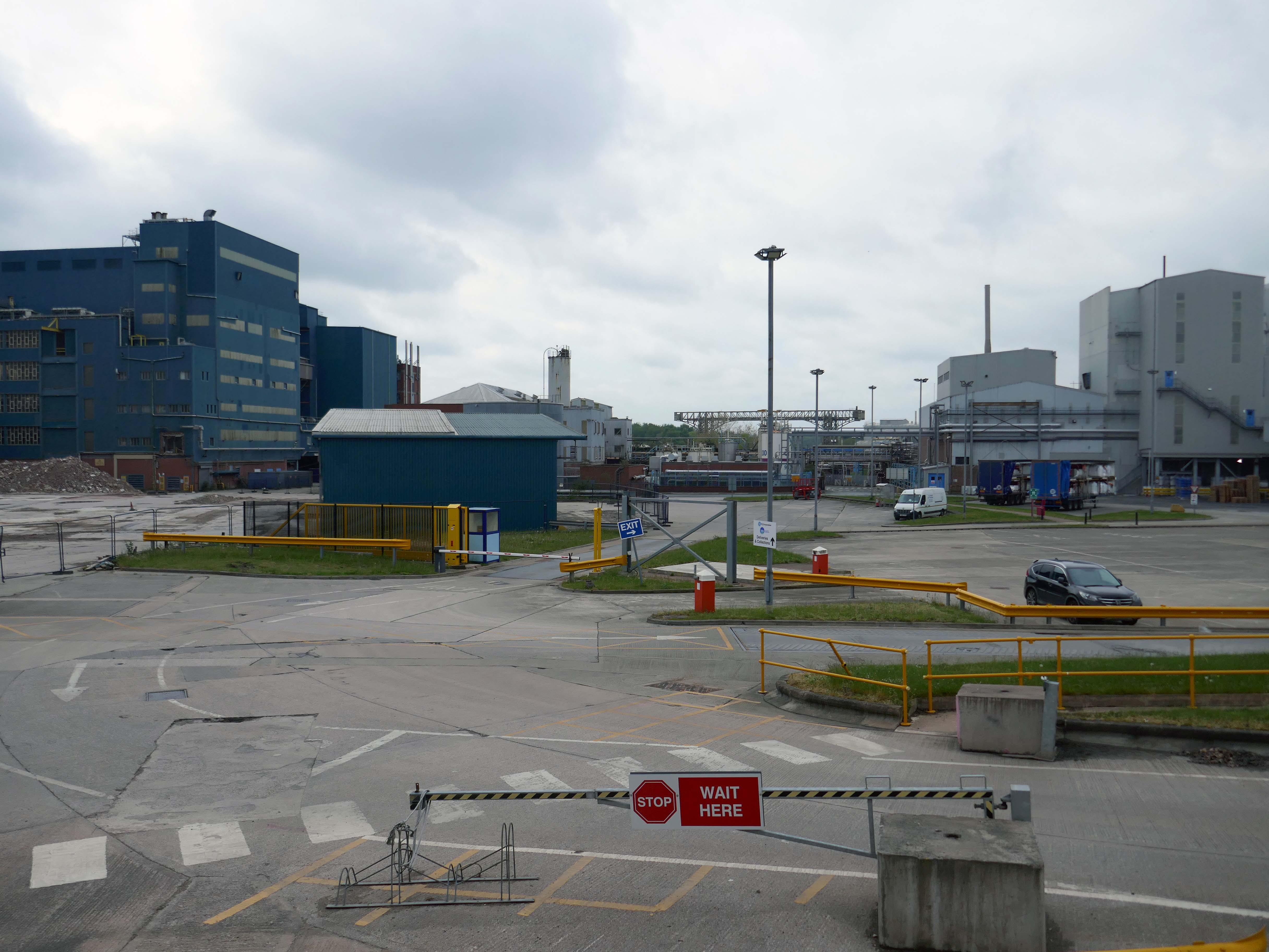
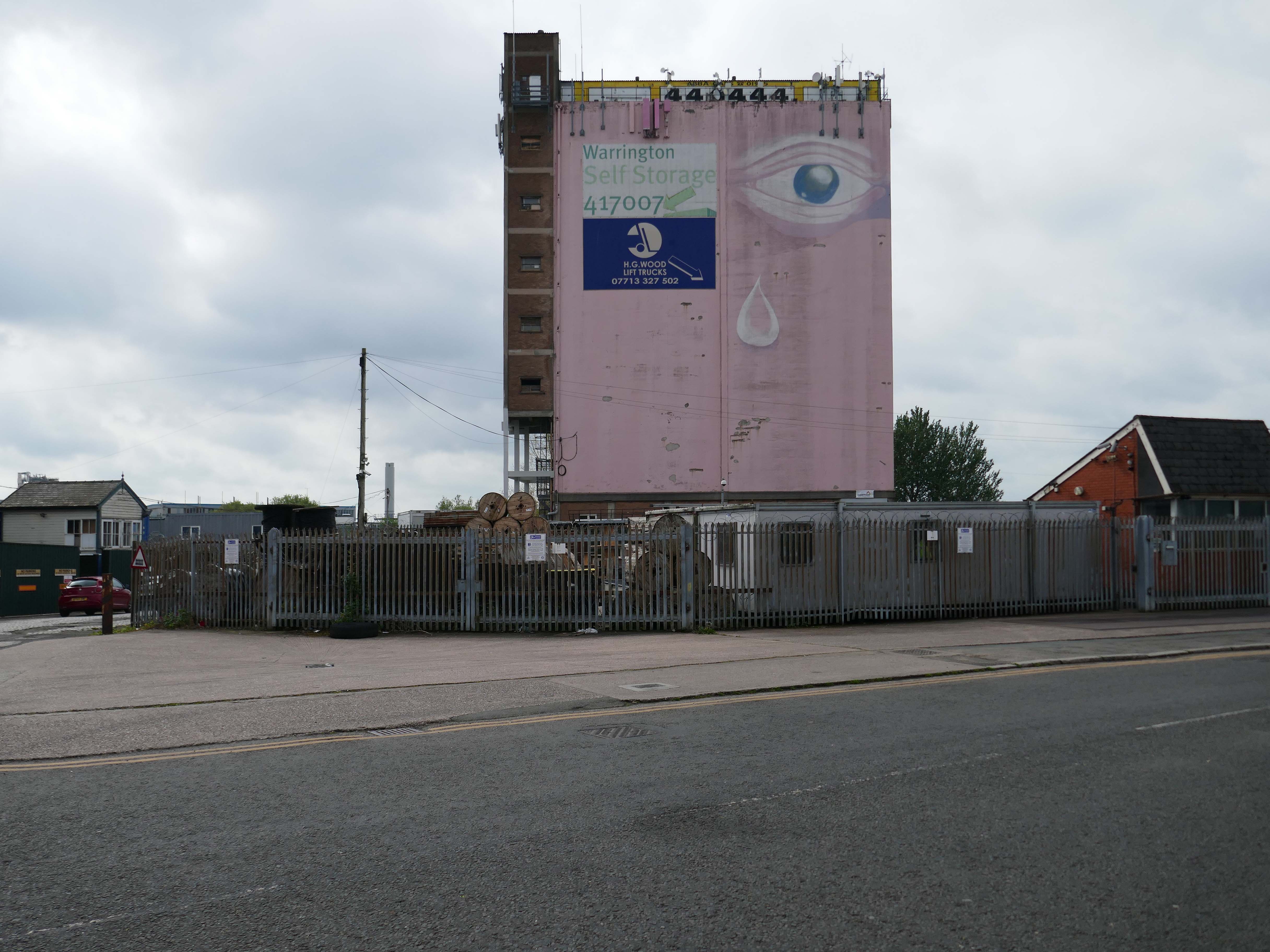
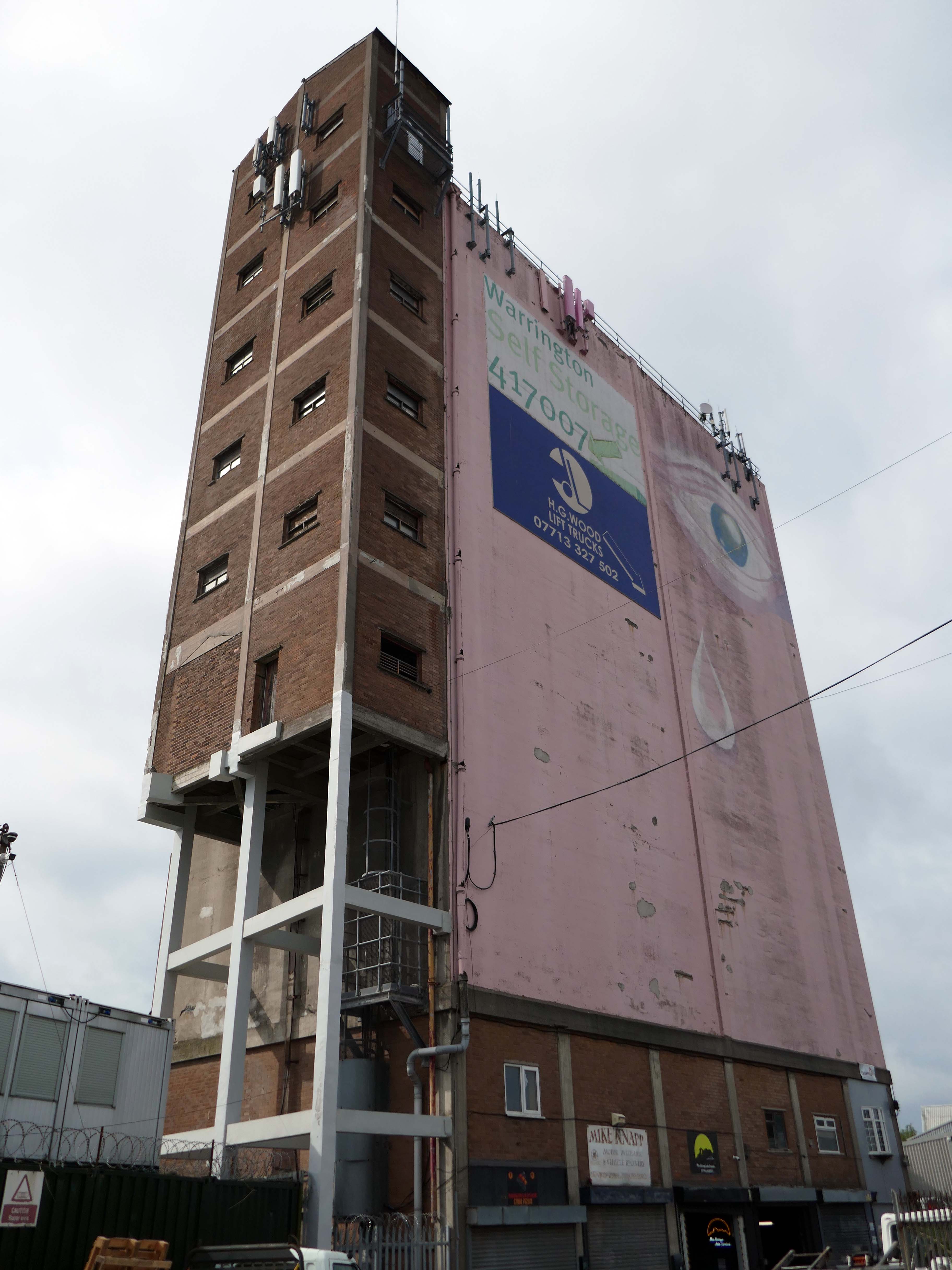
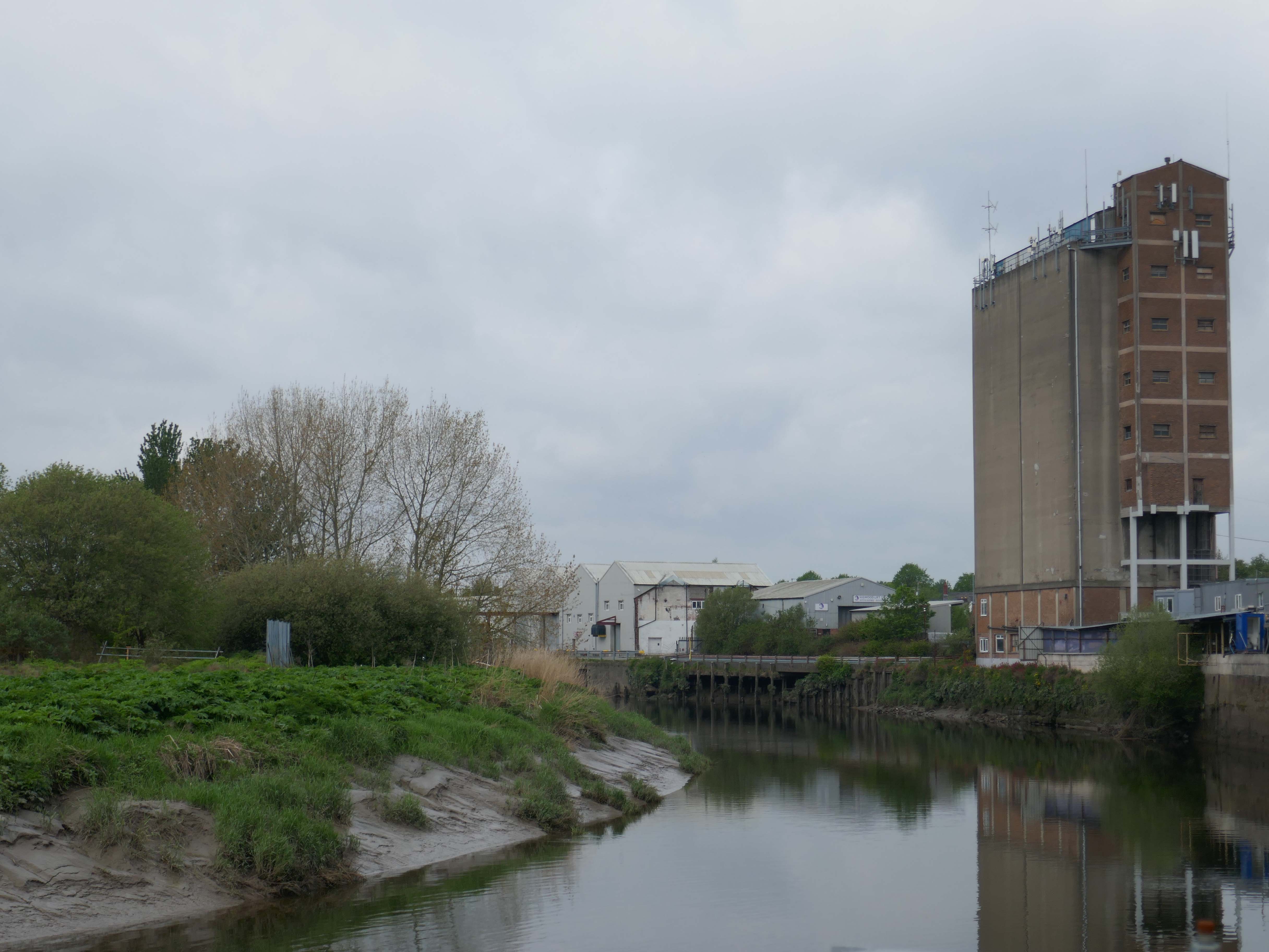
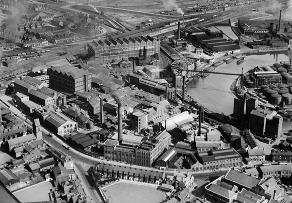
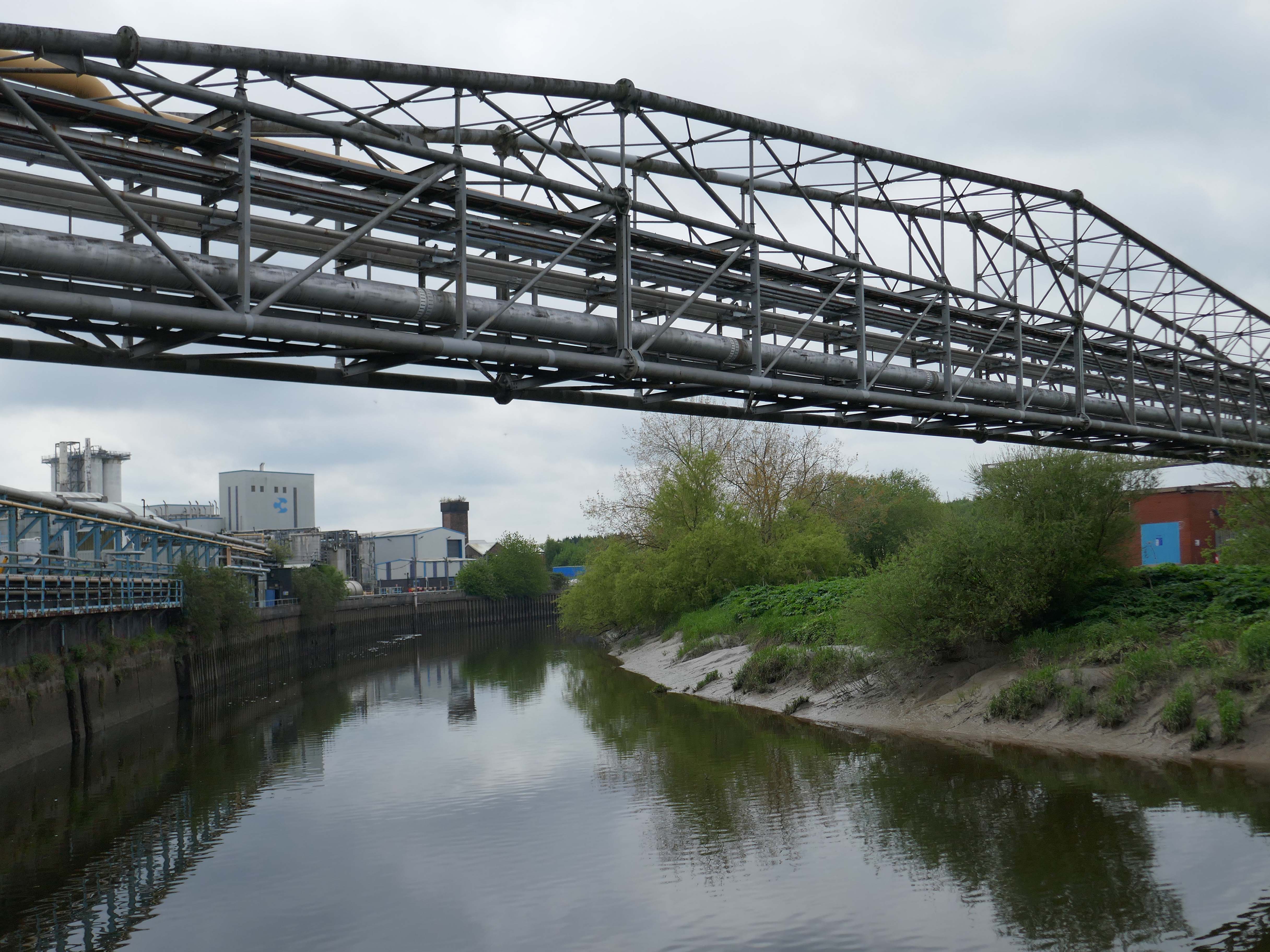
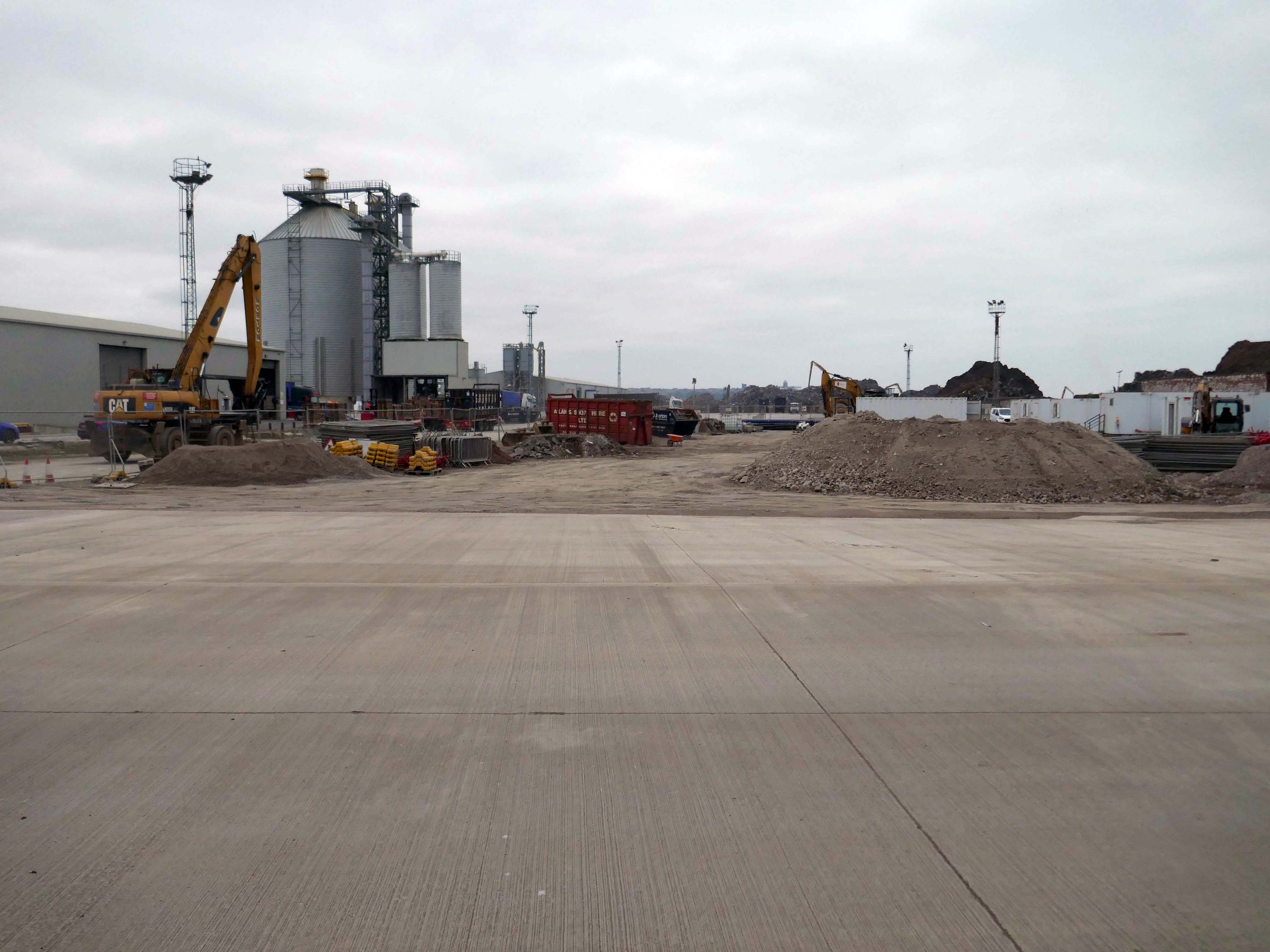
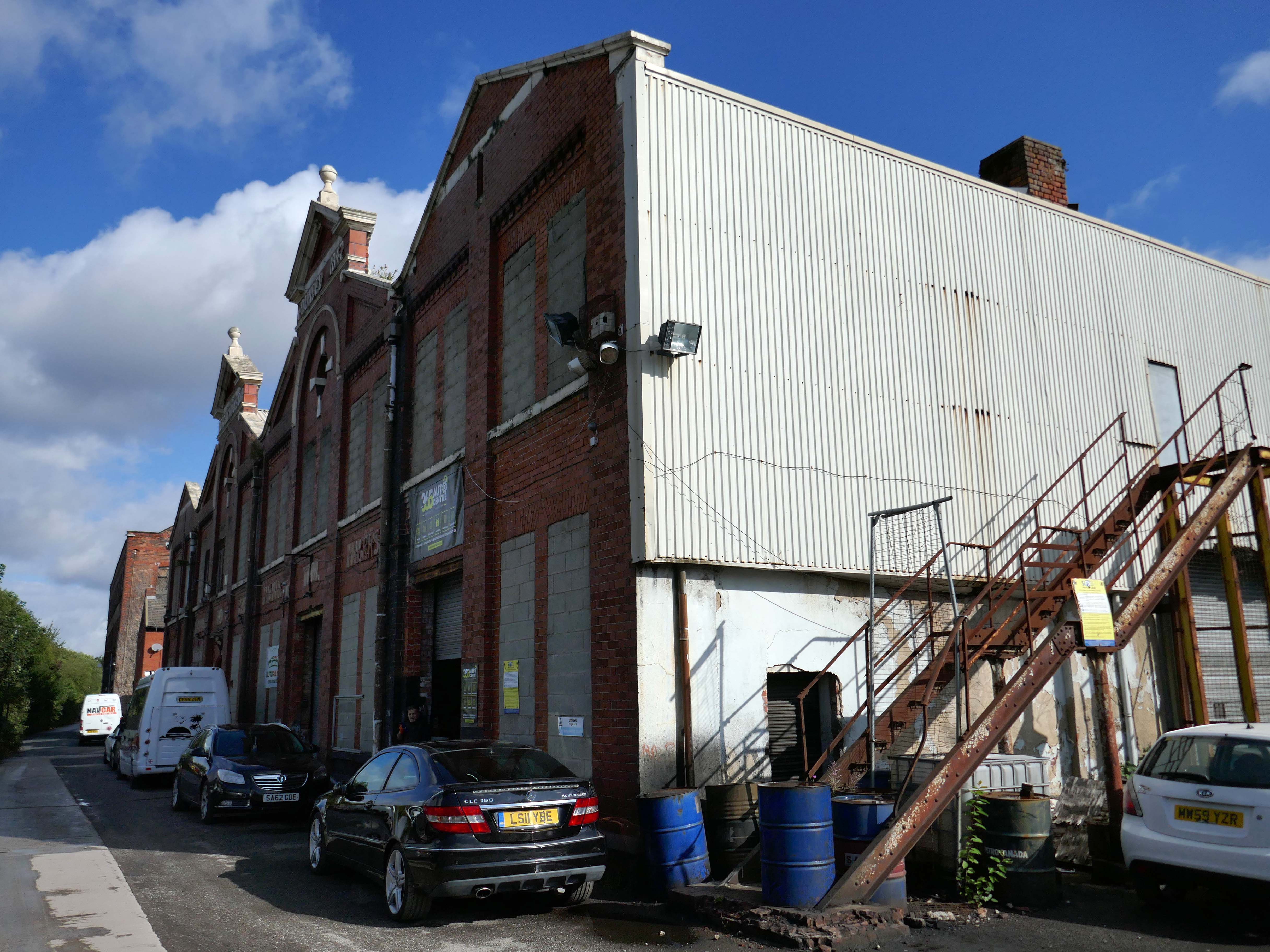
Up the road now to the Soap Works – first views from across the railway tracks.
Then over the bridge.
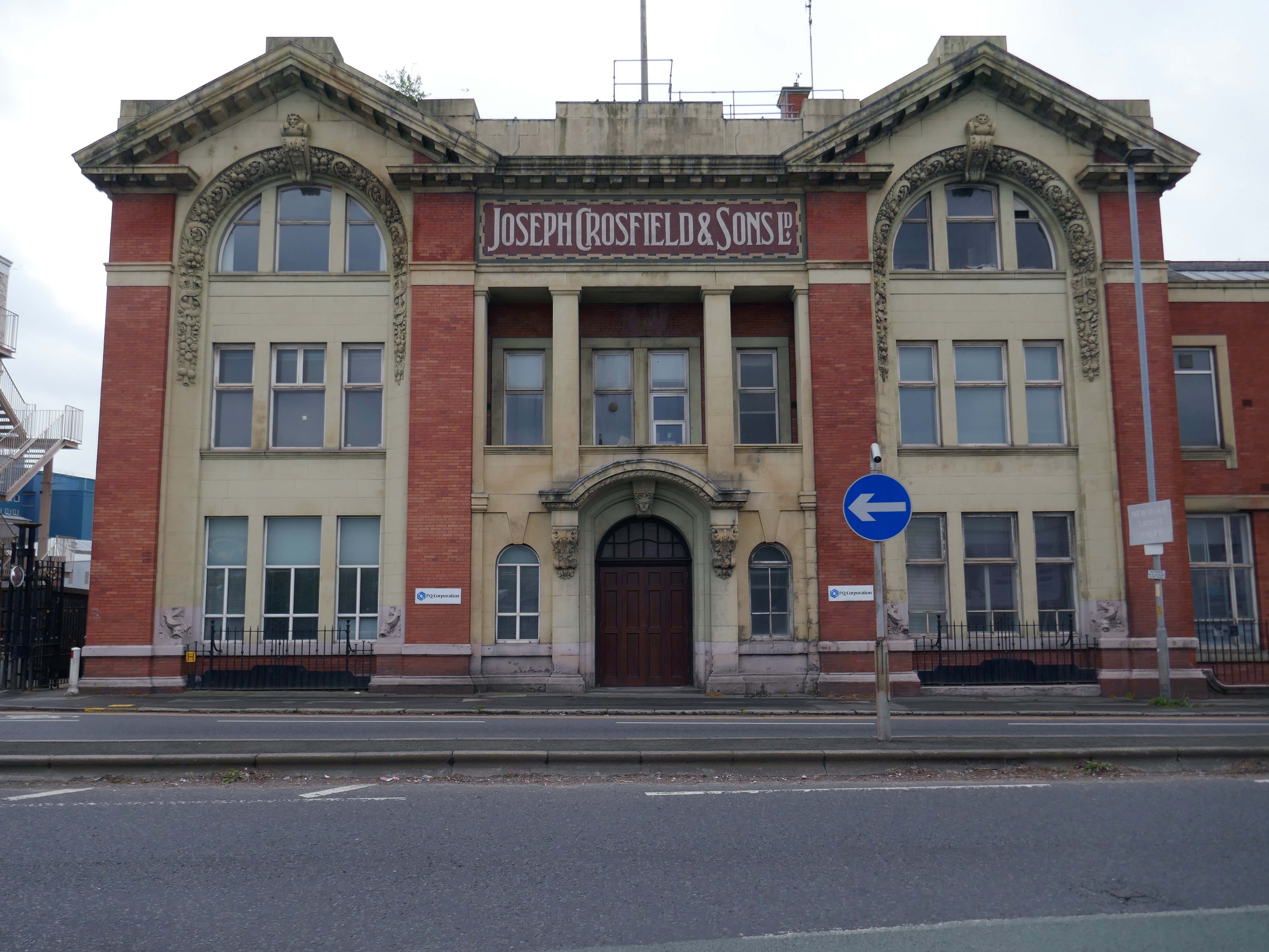
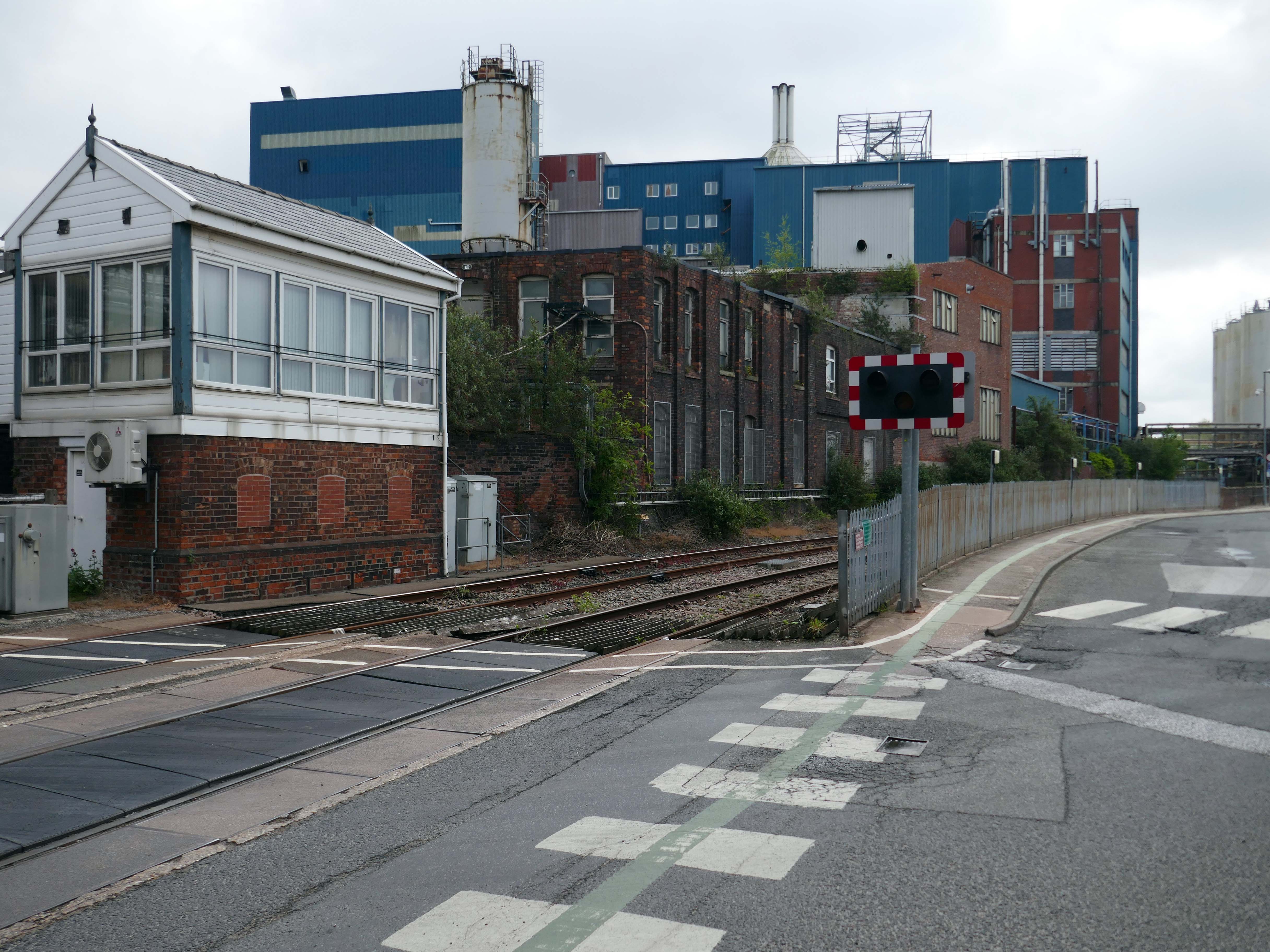
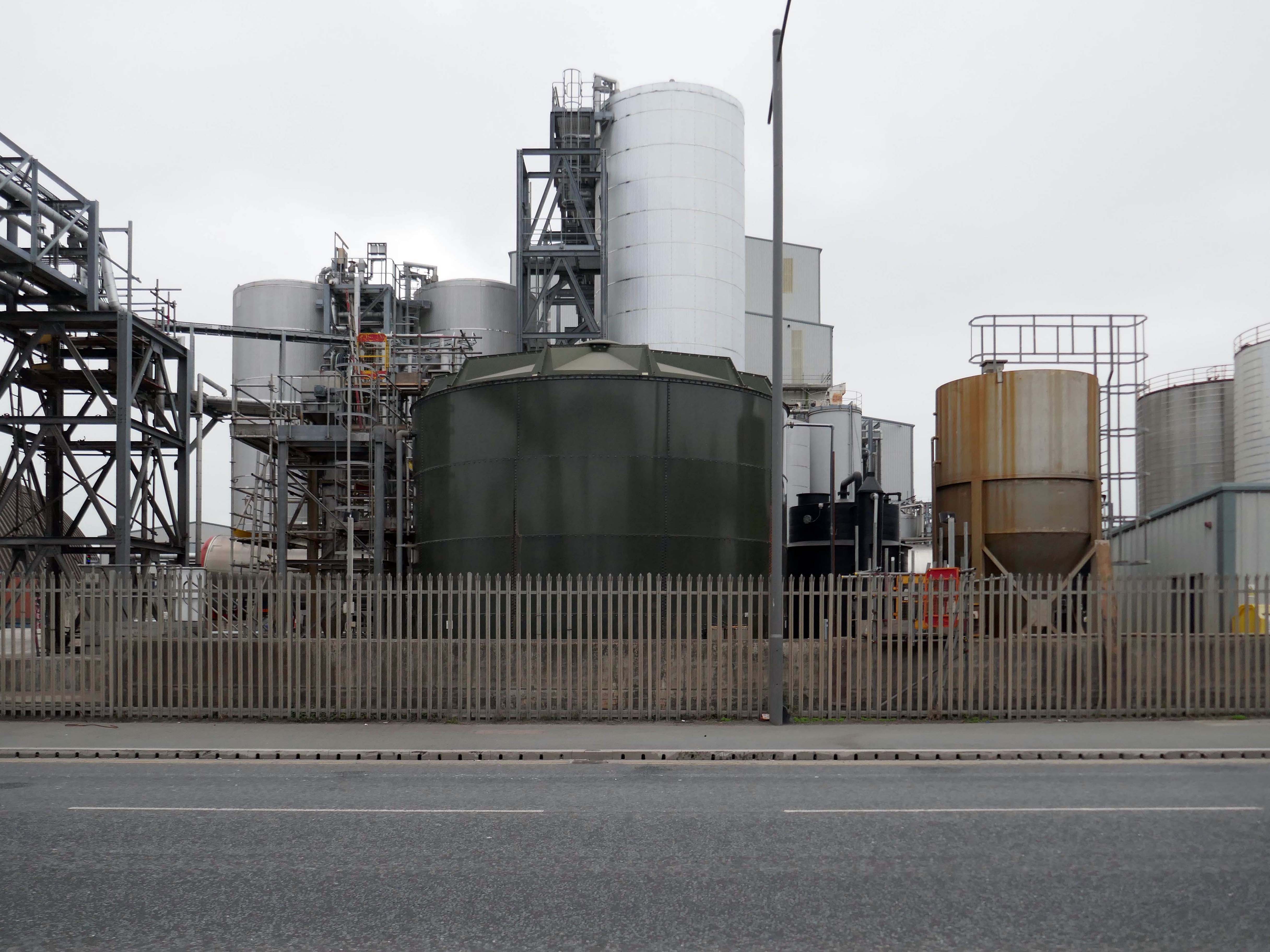
Joseph Crosfield was born in Warrington, the fourth son of George Crosfield and his wife Ann née Key. In 1814, Joseph’s apprenticeship having finished, at the age of 21 he decided to establish his own soap making business in Warrington.
In 1911 the company was purchased by Brunner, Mond & Company and 1919 it was absorbed into Lever Brothers. From 1929 Crosfield was a subsidiary of Unilever. In 1997 its Warrington speciality chemicals division that made ingredients for detergents and toothpastes was acquired by ICI and in 2001, Ineos Capital purchased the company. The name Crosfield was finally lost as it was renamed Ineos Silicas. In 2008 Ineos Silicas was merged with PQ Corporation, with the new company retaining the name of PQ Corporation.
The Crosfield’s factory closed for good in October 2020.
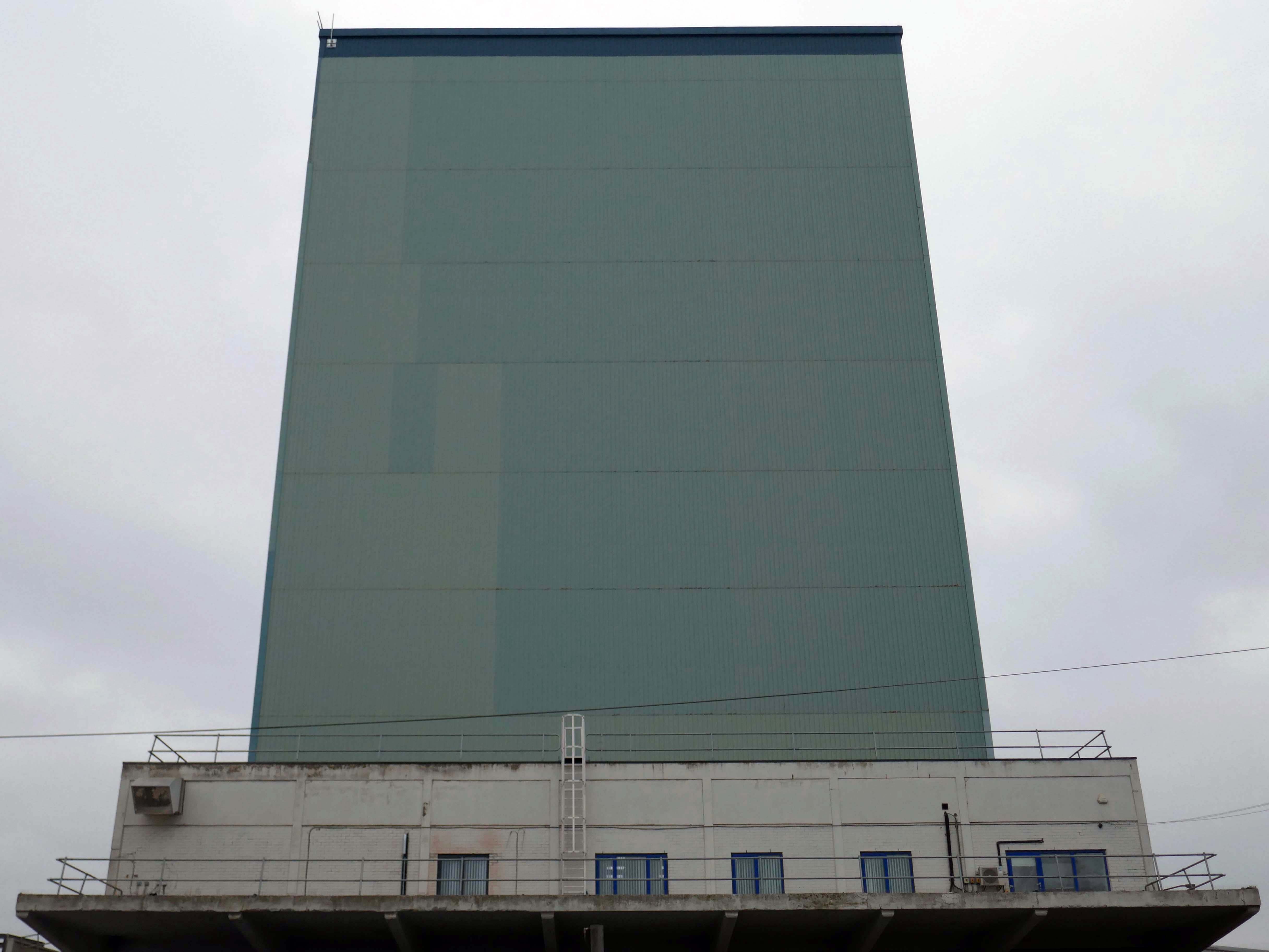
Dante FS Group formally acquired four acres of the site this month for an undisclosed fee from EcoVyst.
The latter firm will continue to operate from sections of the site, as will PQ Corporation, with Dante buying land closest to the train station, including the visible blue buildings and white Unilever tanks.
Renamed Platform at Bank Quay, the ‘next-generation, state-of-the-art modular data centre’ is ‘set to power the UK’s growing AI economy’ and bring high-tech jobs to the town.
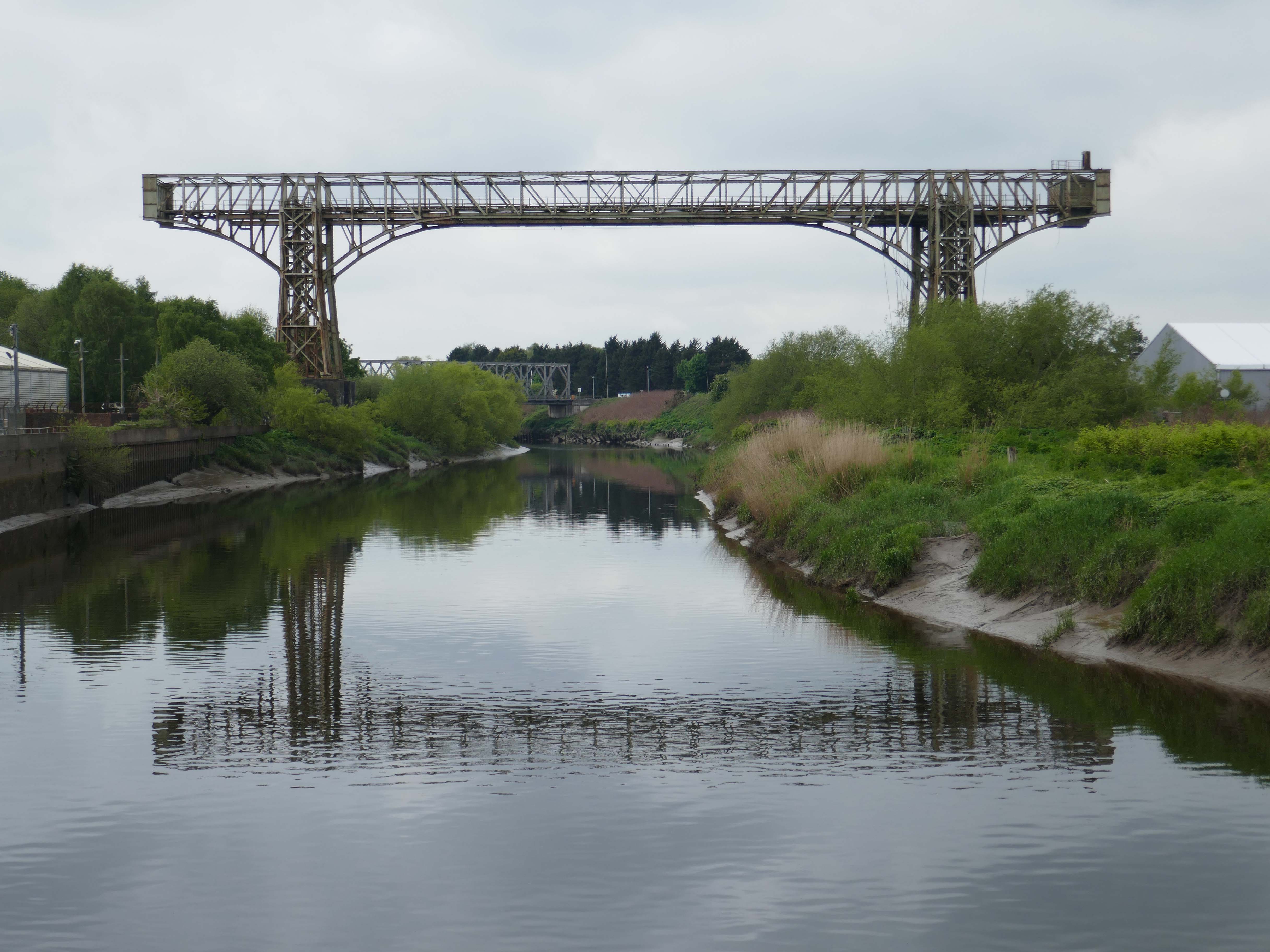
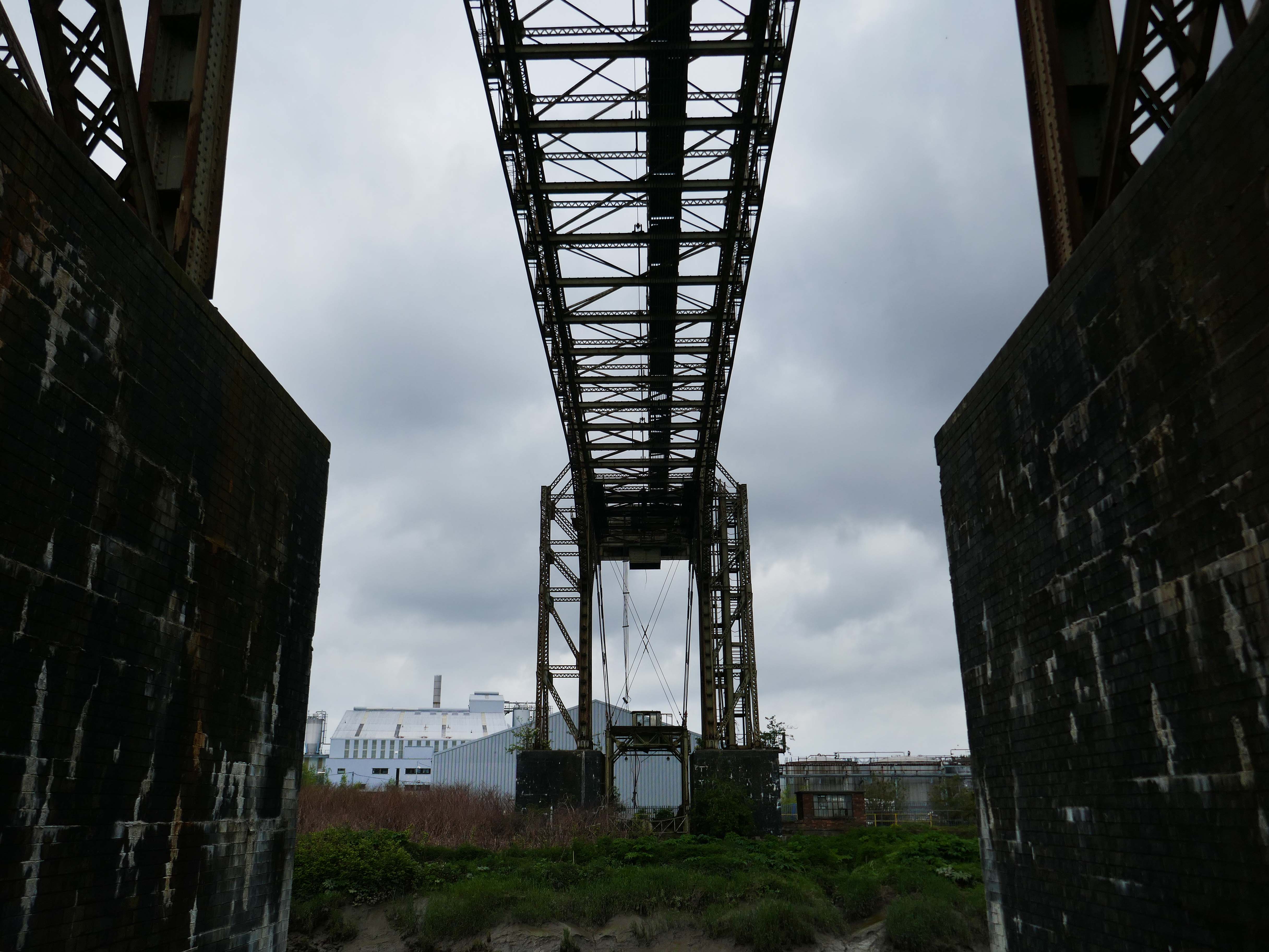
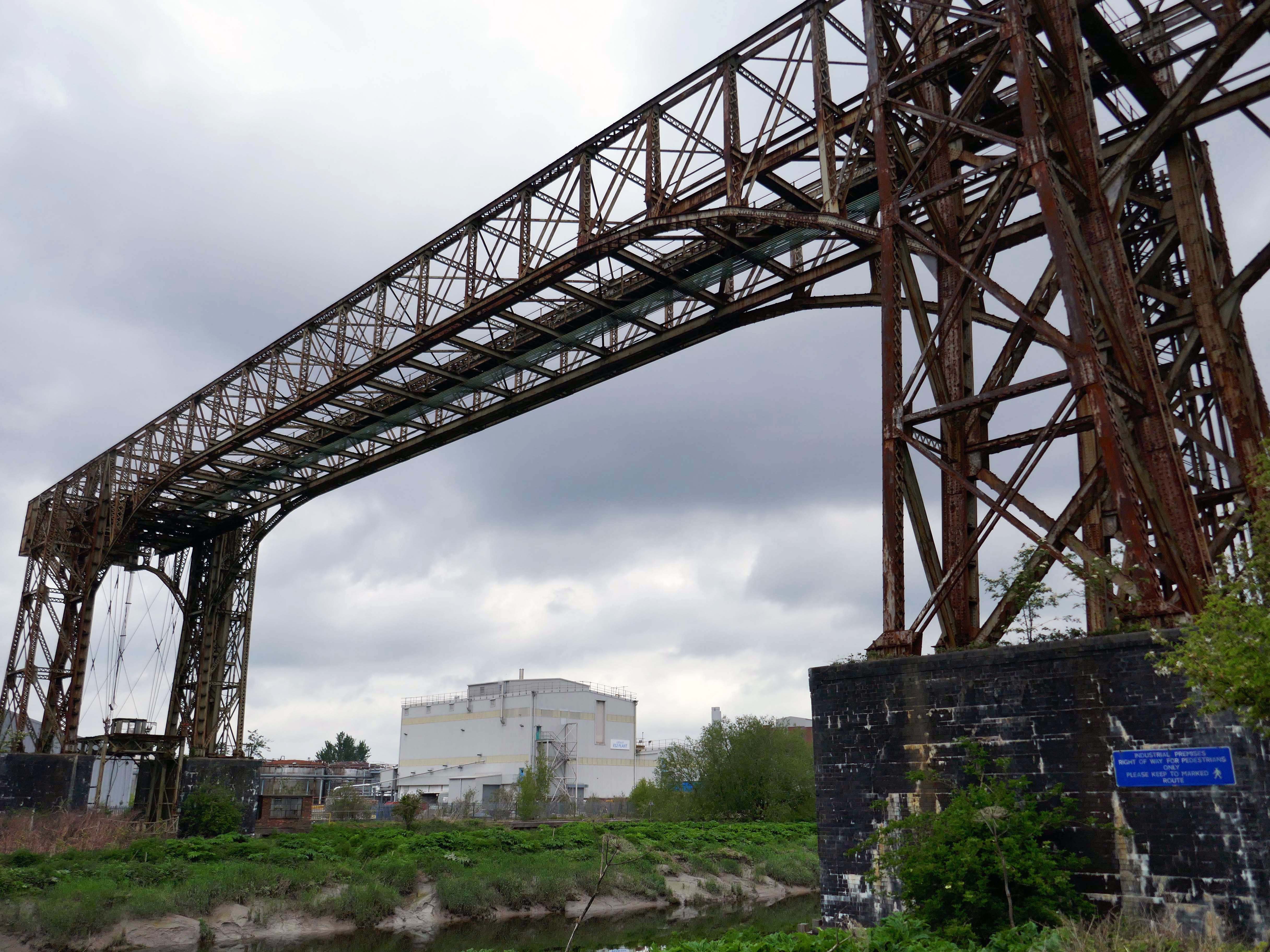
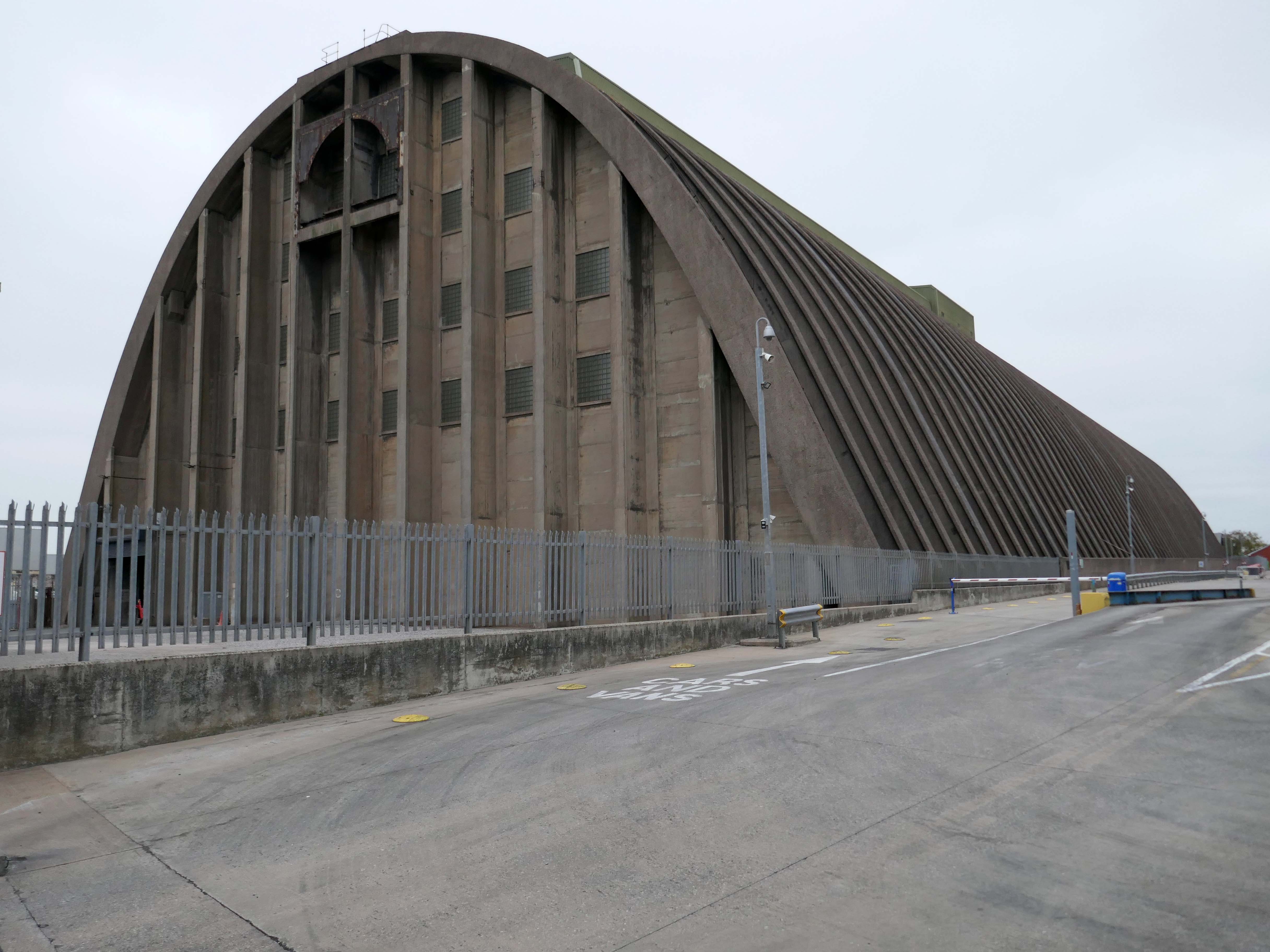
Warrington Transporter Bridge aka Bank Quay Transporter Bridge or Crosfield’s Transporter Bridge across the River Mersey is a structural steel transporter bridge with a span of 200 feet.
It is 30 feet wide and 76 feet above high water level, with an overall length of 339 feet.
It was commissioned in 1916 and, although it has been out of use since about 1964, it is still standing. It was designed by William Henry Hunter and built by William Arrol and Co.
The Transporter Bridge was built to despatch finished product from the cement plant that had been built on the peninsula. It was originally designed to carry rail vehicles up to eighteen tons loaded weight.
The bridge was converted for road vehicles in 1940, and was certified to carry loads of up to thirty tons in 1953.
This was my first visit in 2017 – recorded on Modern Mooch.
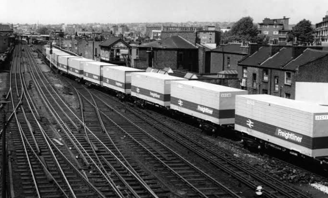
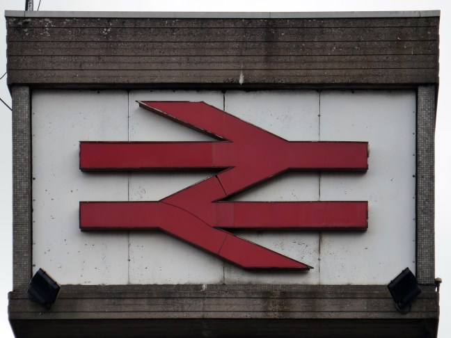
Highlight on any day out anywhere is the discovery of arcane British Rail typography.
There’s a brief history of Freightliner history right here.
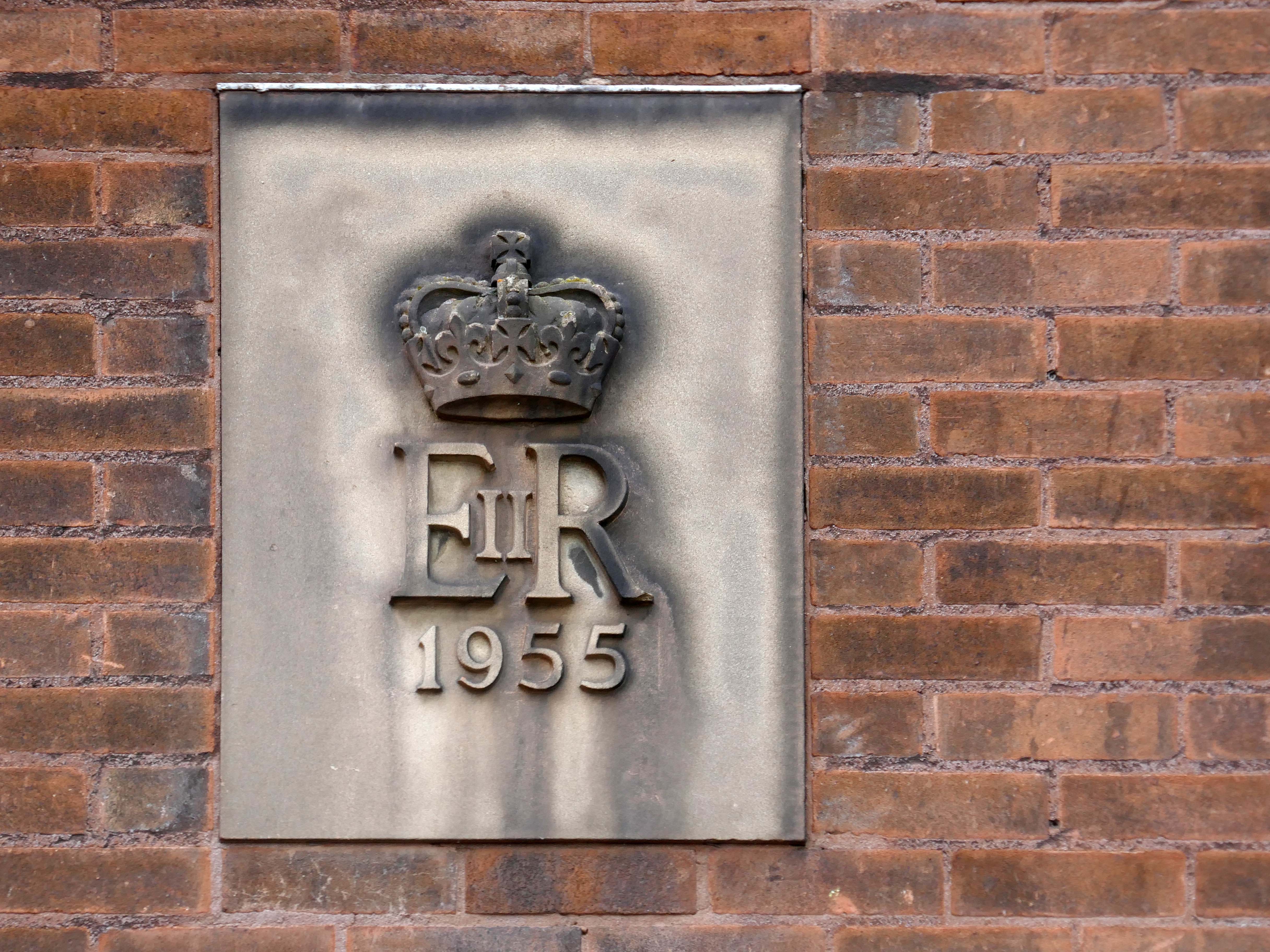
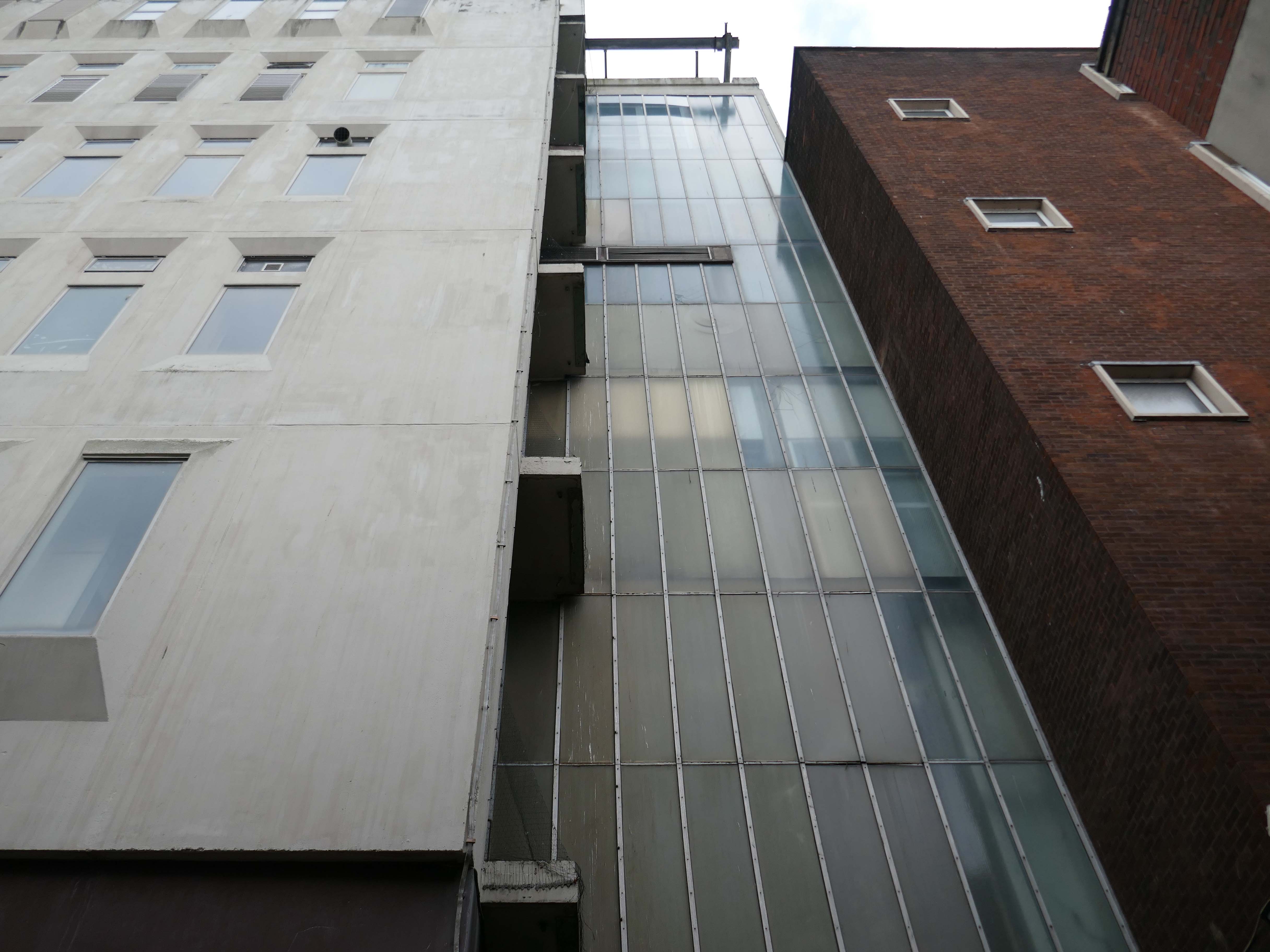
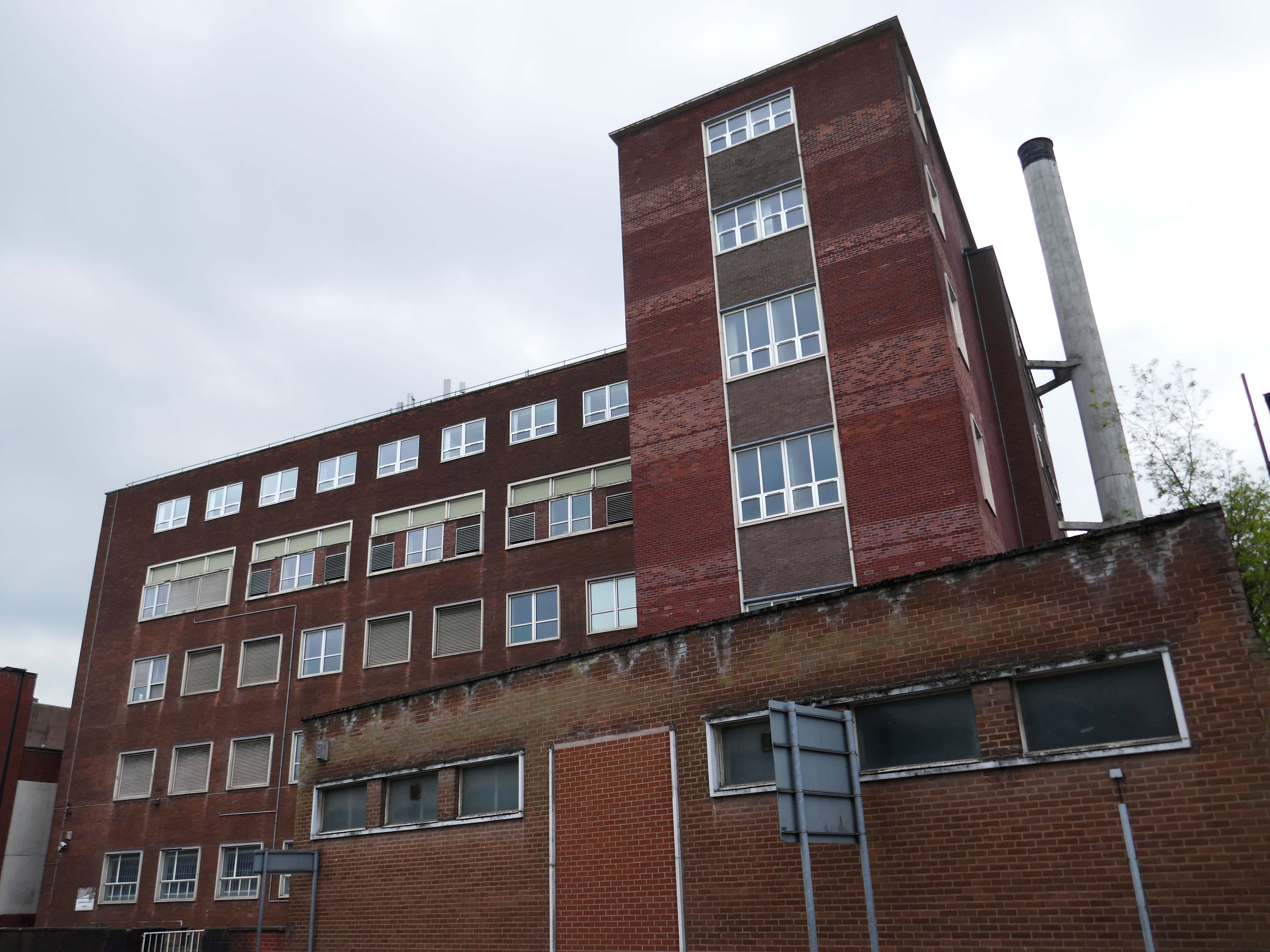
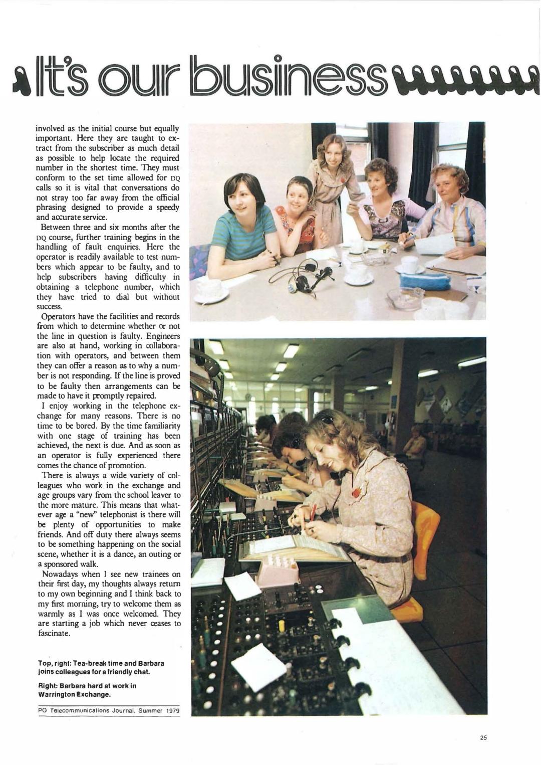
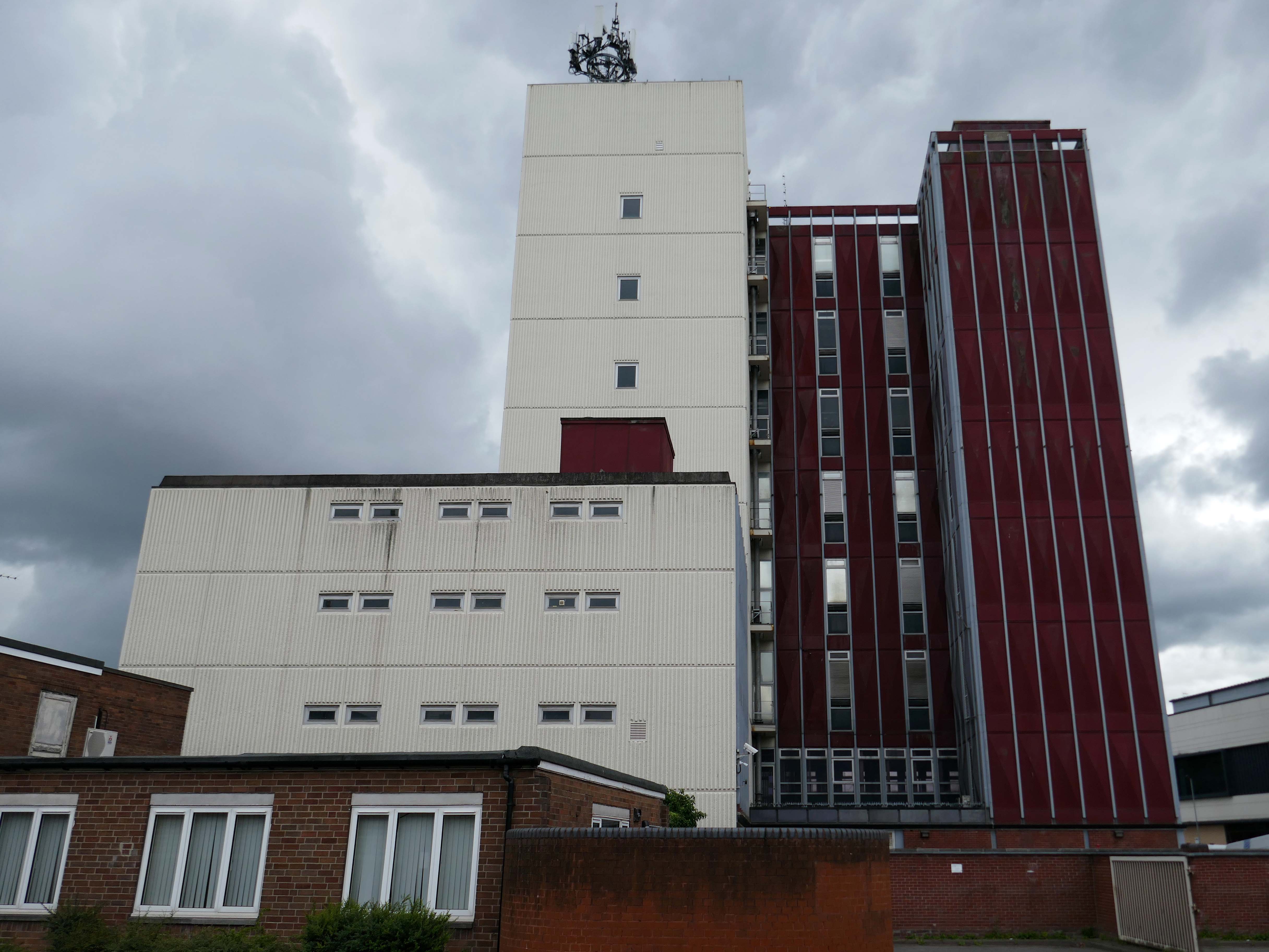
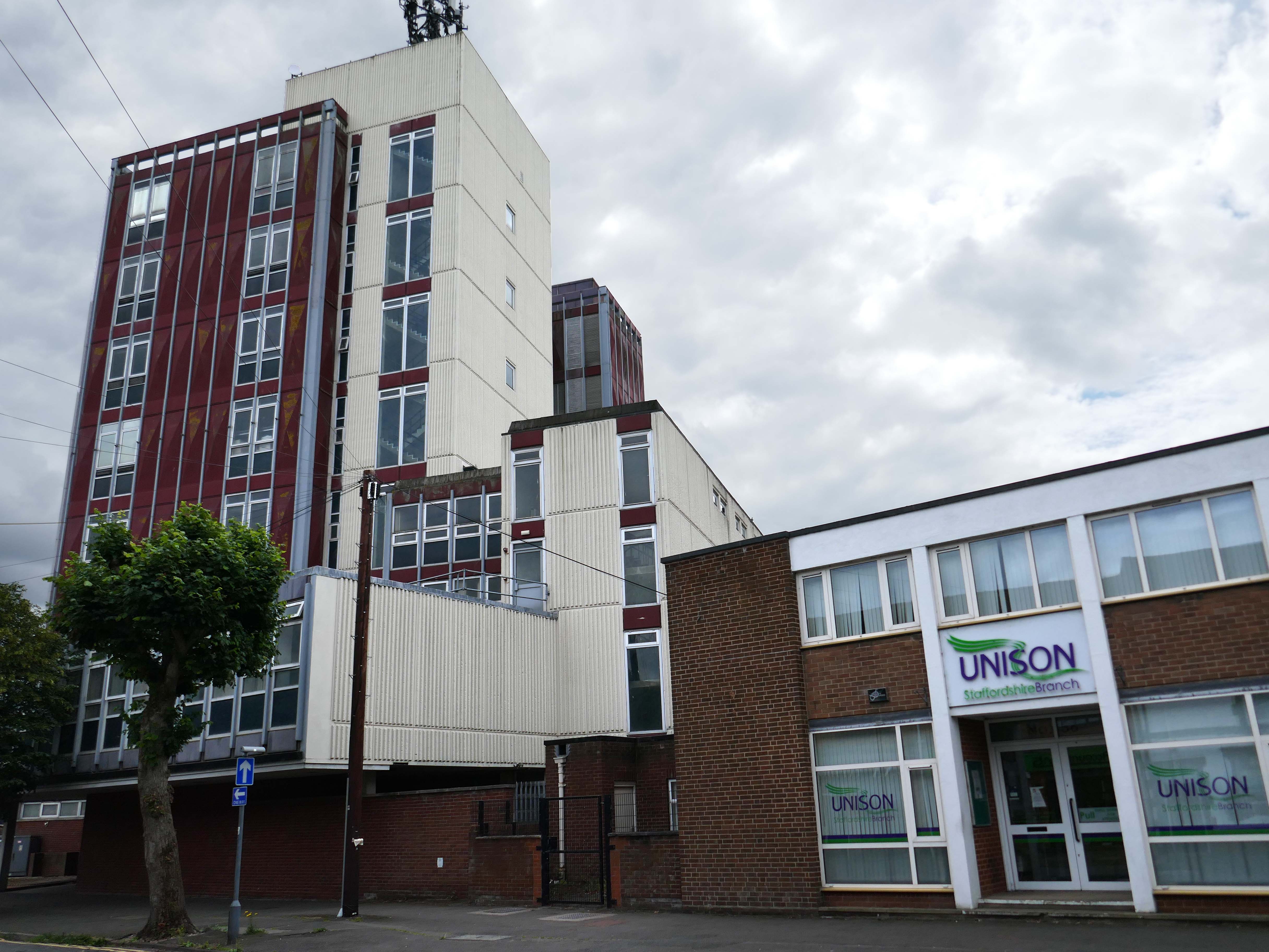
Back now to Bank Quay and off to the Telephone Exchange.
This is the 1969 building designed by the MODBW, Reginald Norman Dixon with lead architect P Clinton.
Linked to the 1955 building designed by John Onslow Stevens.
Biggest thanks to Lisa Kinch who can be found over on Instagram, for all her informative research into telephone exchanges.
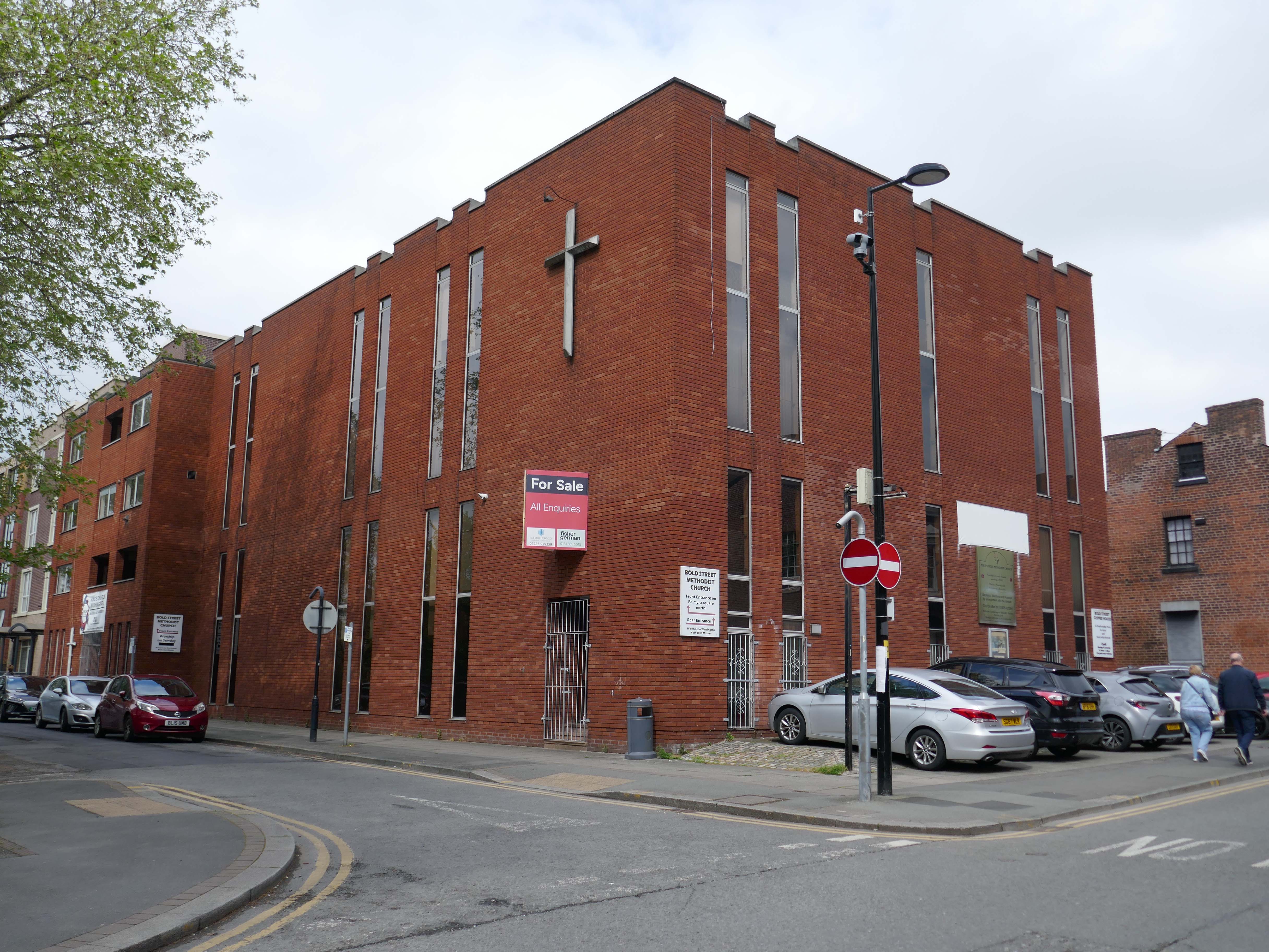
Toward the town centre and we pass the Bold Street Methodists Church – 1973-75.
Currently closed and for sale.
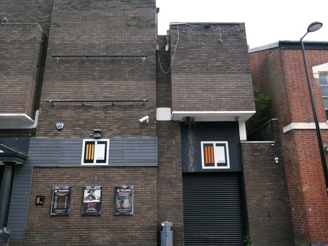
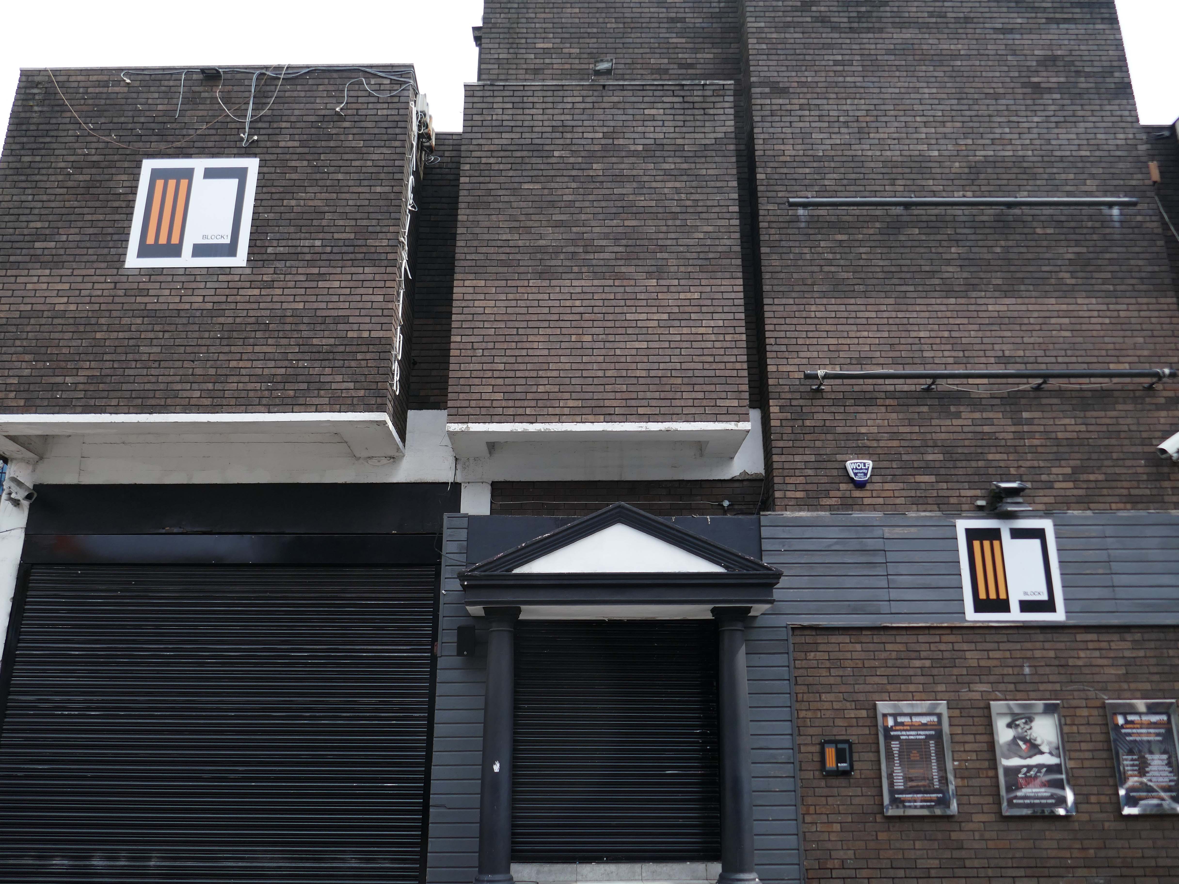
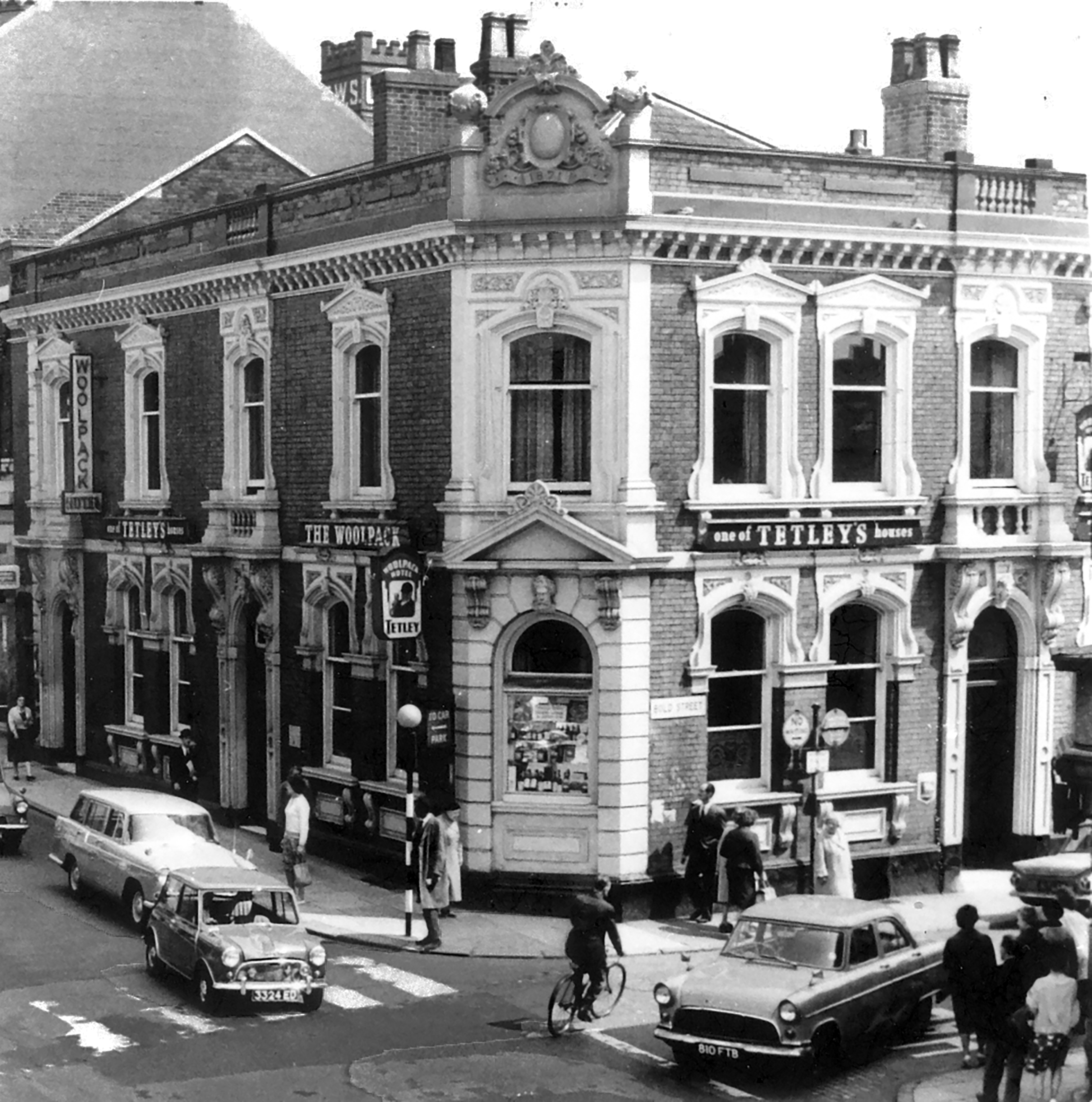
Thence to the Block 1 nightclub.
Medicine night club early 2000s.
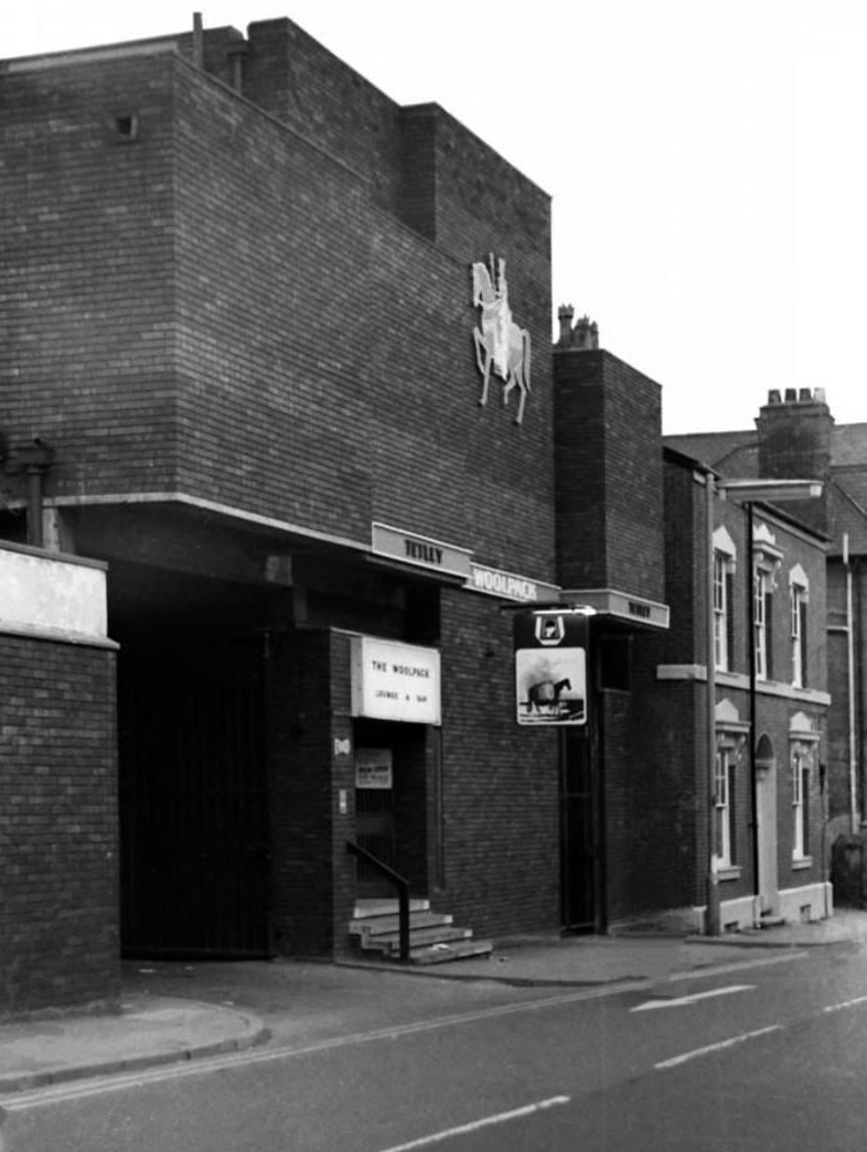
Originally a Tetley’s house named The Woolpack.
Got served my first pint in there, I was only 14.
Karl Beckett
Coming down those stairs, I slipped and the heel came off my boot, I’d only had one drink – loved those boots.
Sue Duncan
This was the original Woolpack on the site.
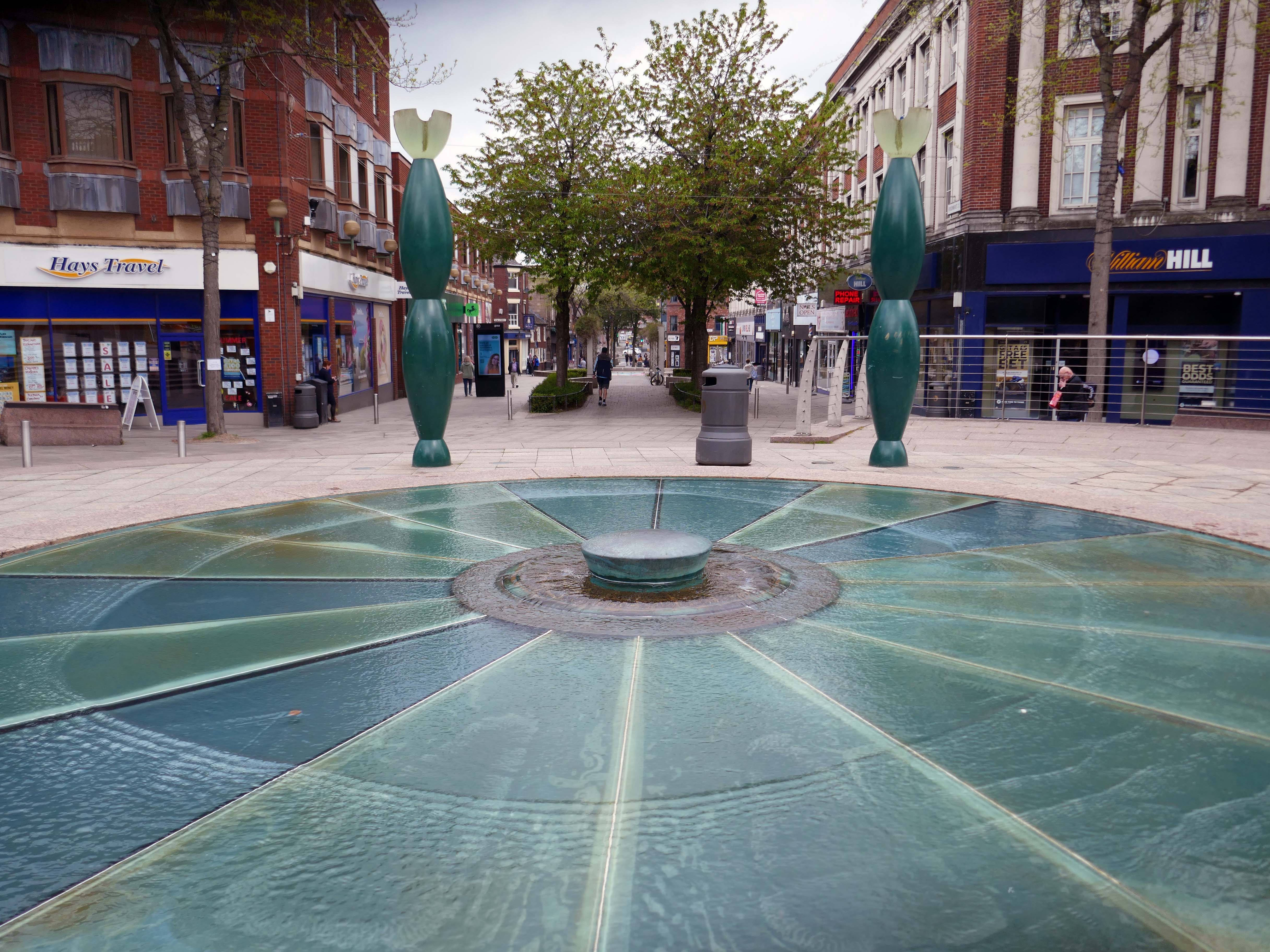
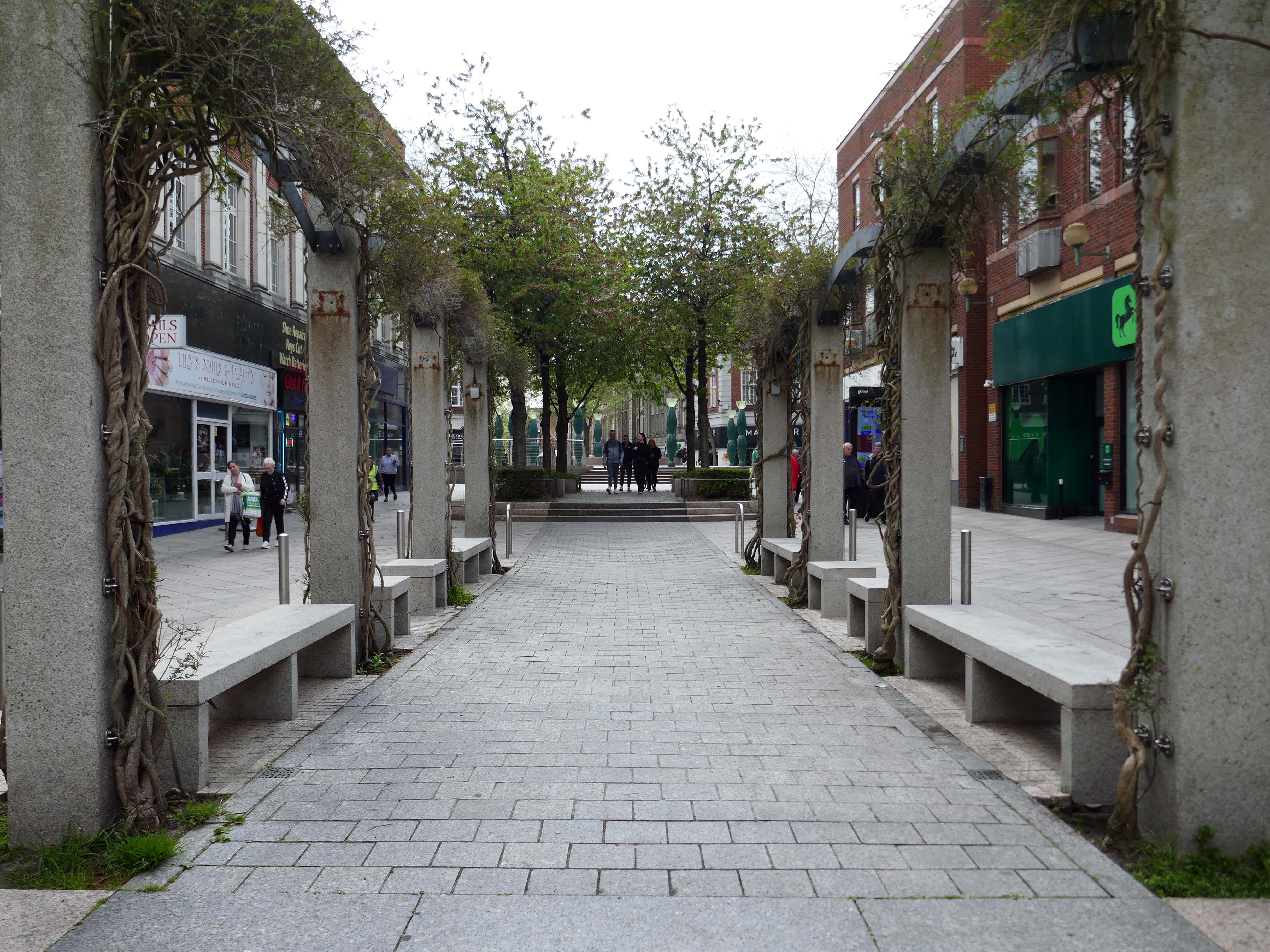
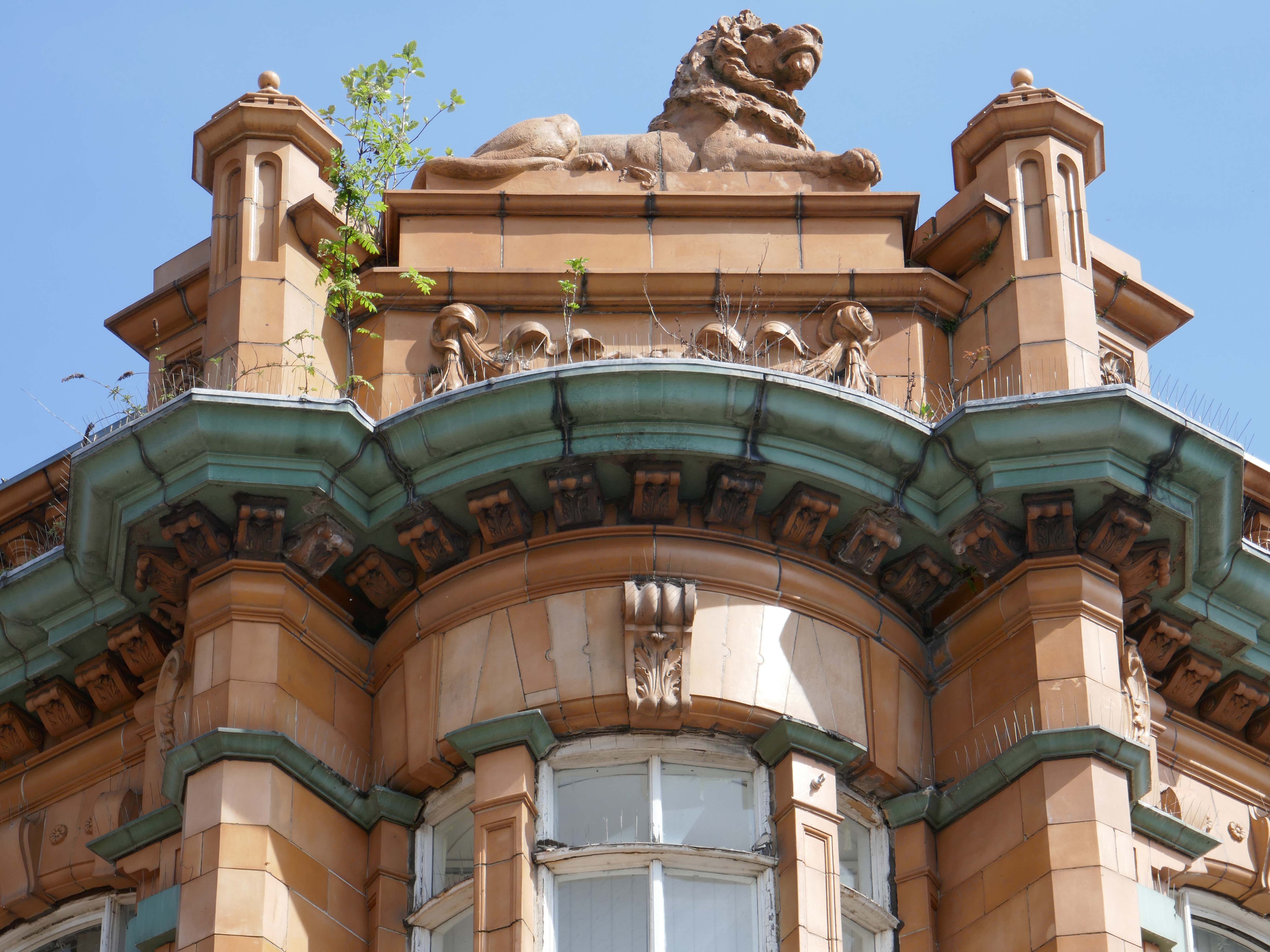
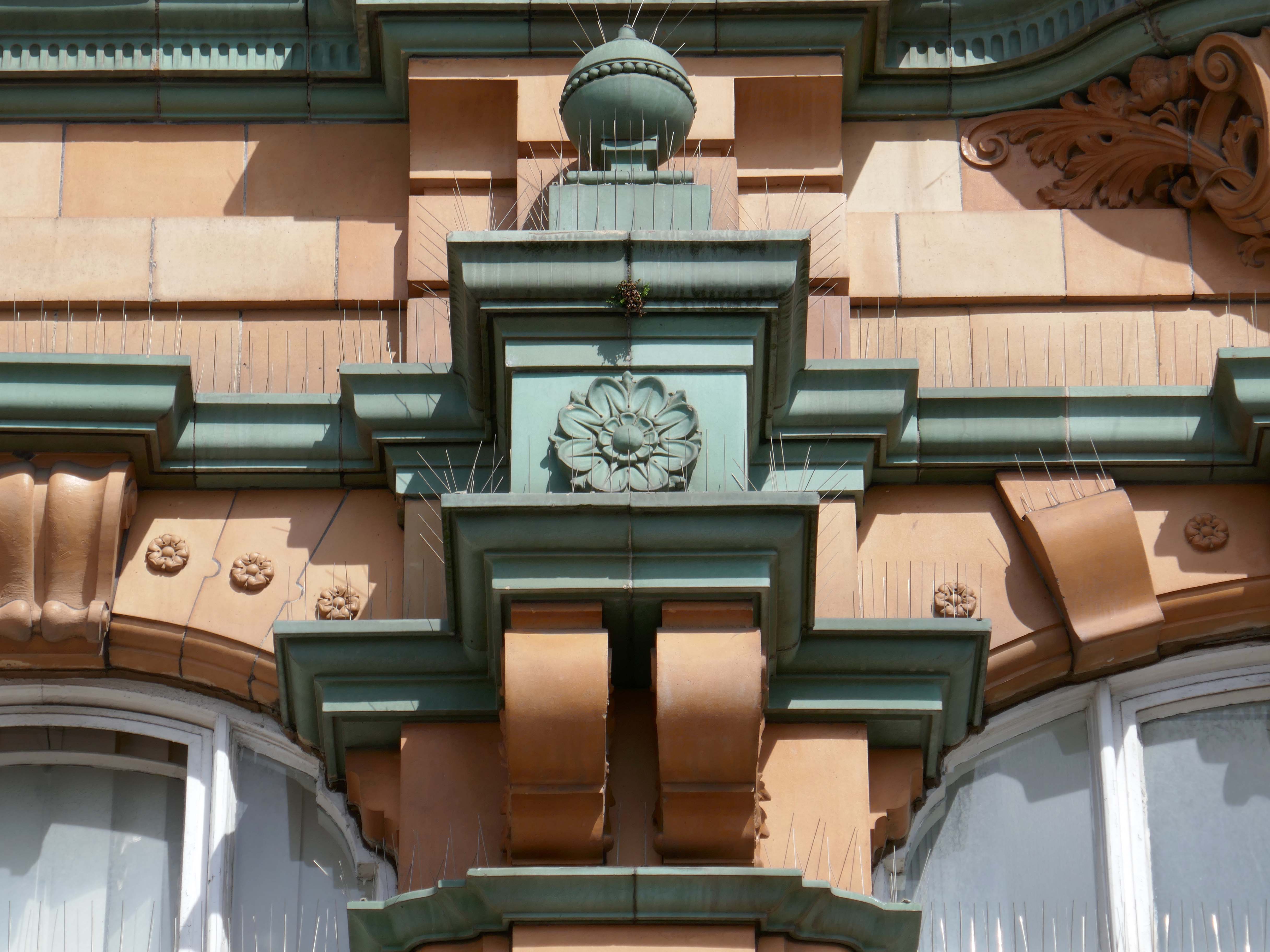
Much of the town centre is dominated by the Golden Square shopping centre.
Designed in 1974 by Ardin and Brookes and Partners, since enlarged.
There is also extensive pedestrianisation and hard landscaping on the surrounding streets, carried out in 2002 by Landscape Design Associates with sculptural works by Howard Ben Tre.
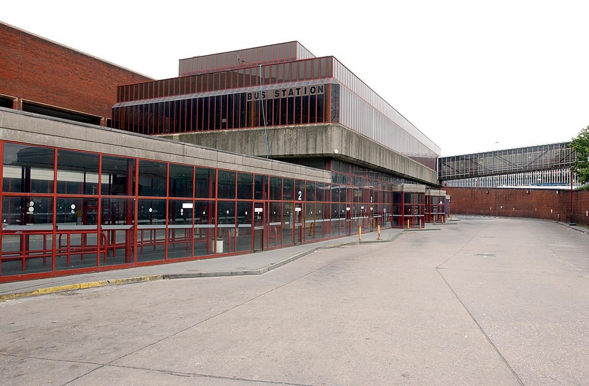
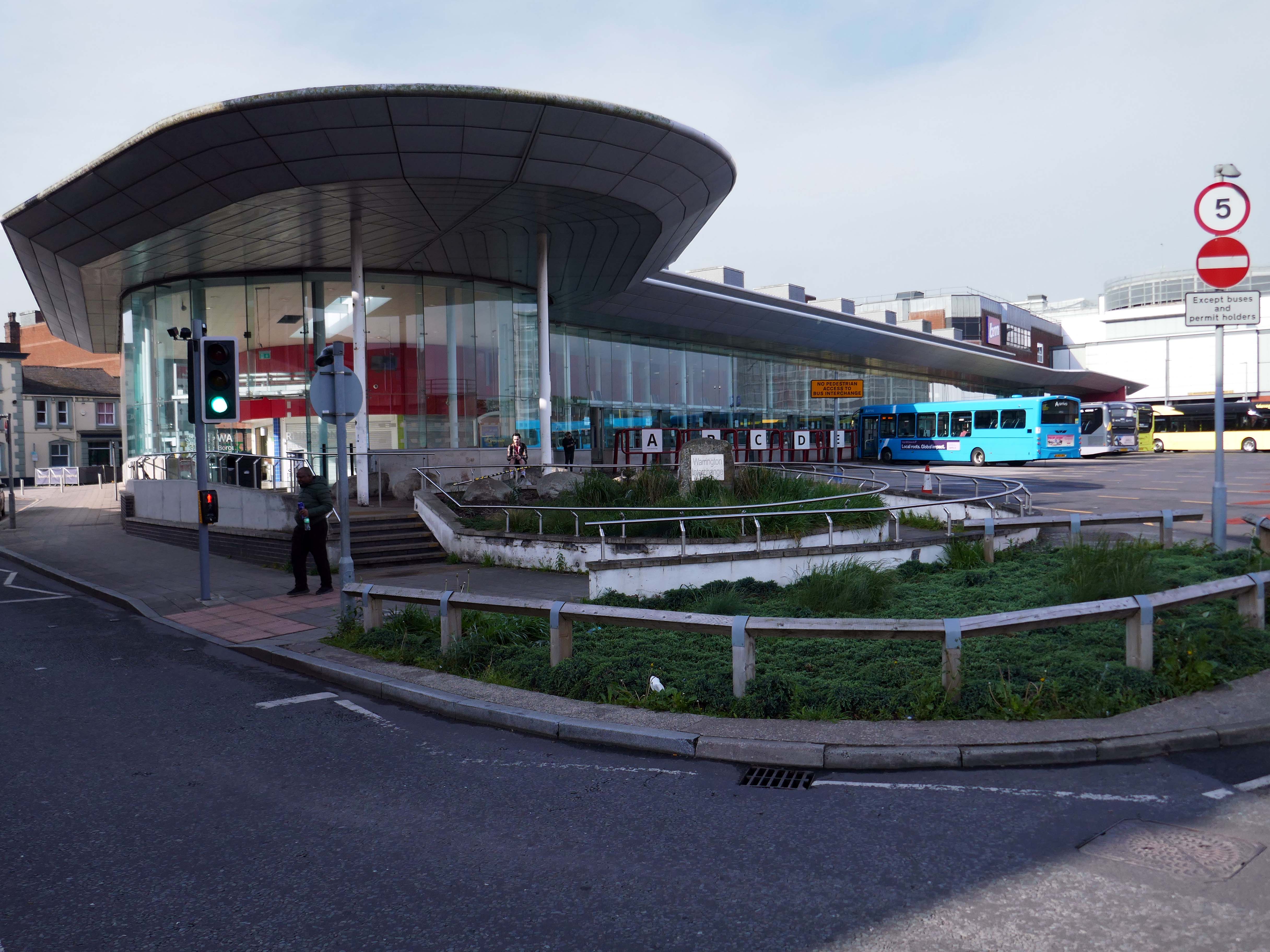
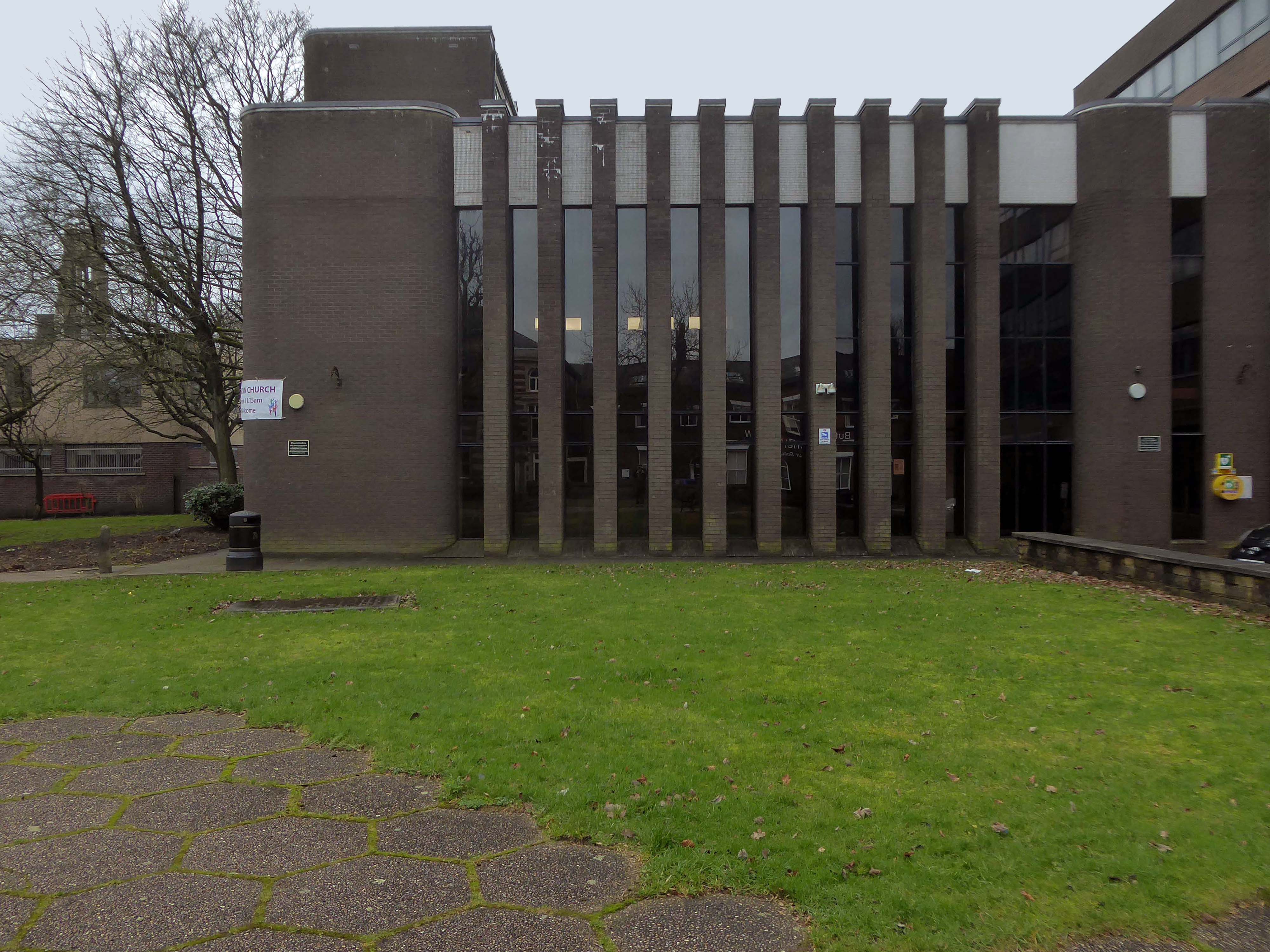
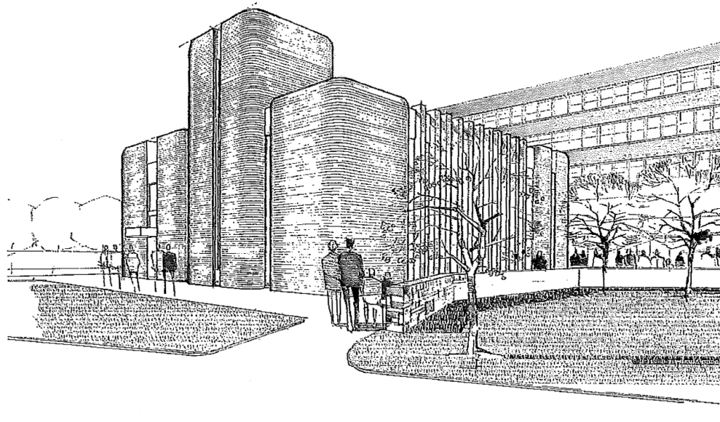
Finally to the Bus Station which used to look like this:
Until it became an Interchange and looks a lot like this.
Warrington’s new bus interchange was opened on 21 August 2006. From 1979, bus users travelled from a facility on Golborne Street, but it was very unpopular due to its very dreary appearance.
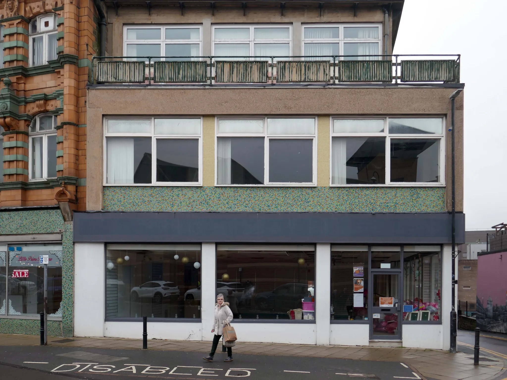
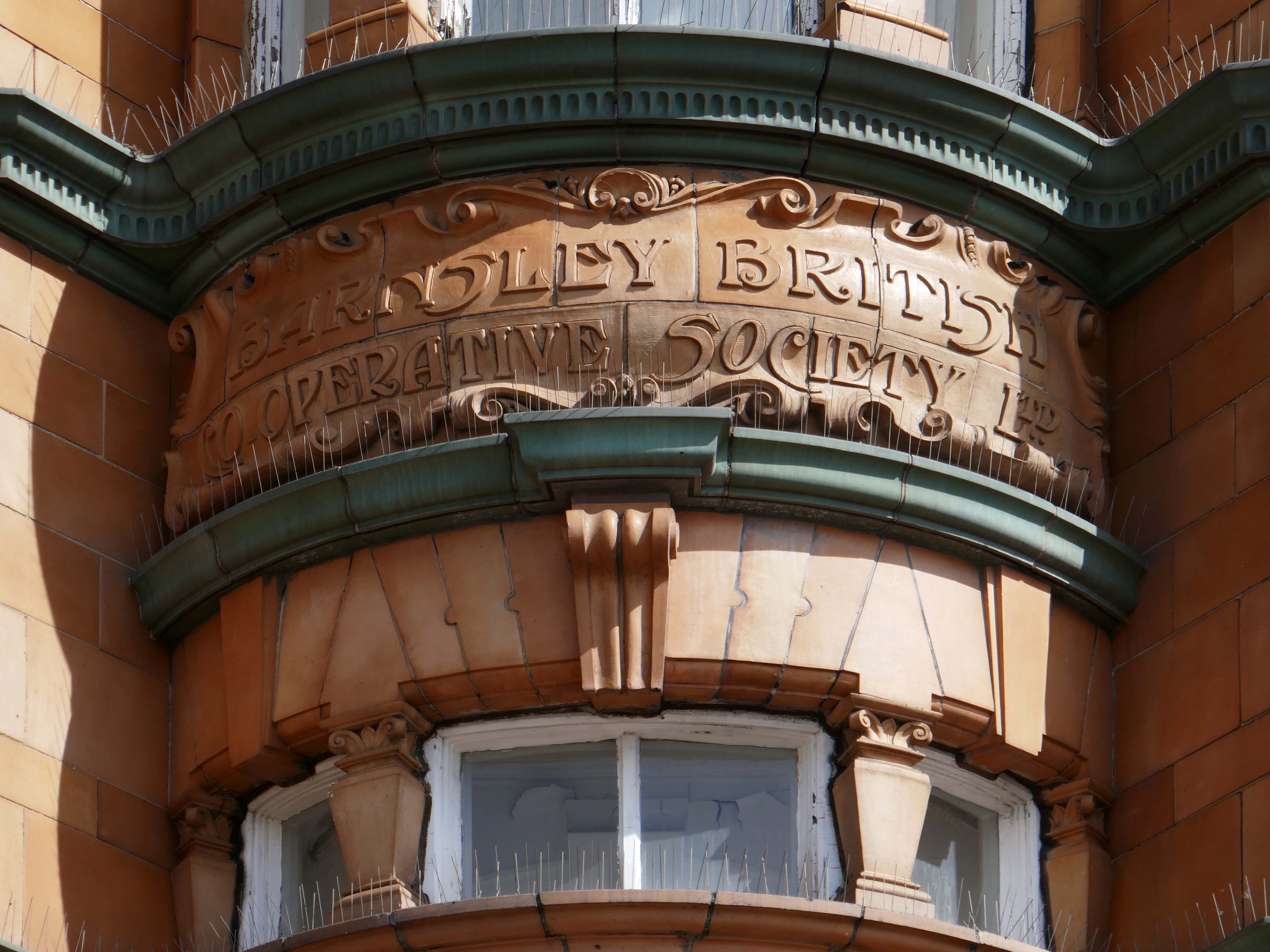
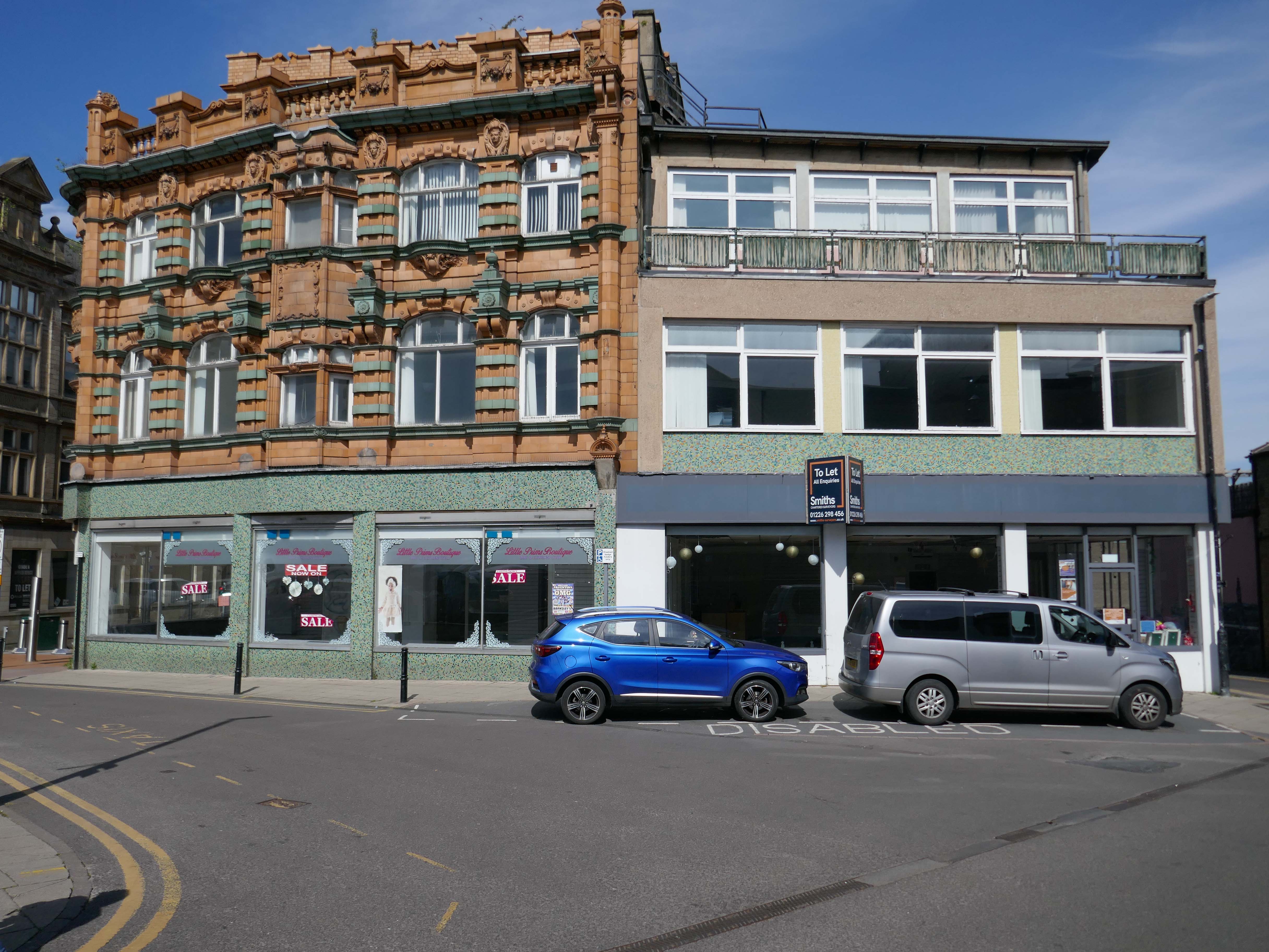
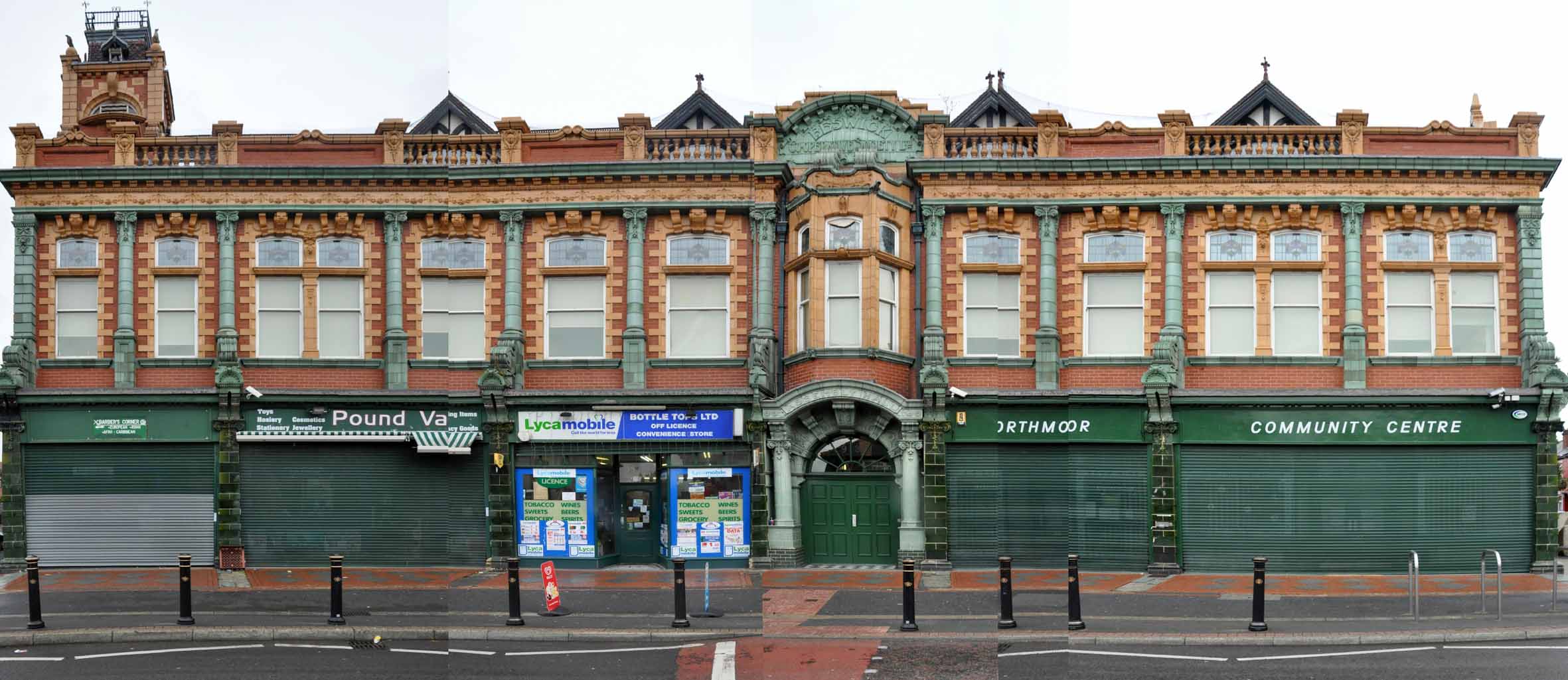
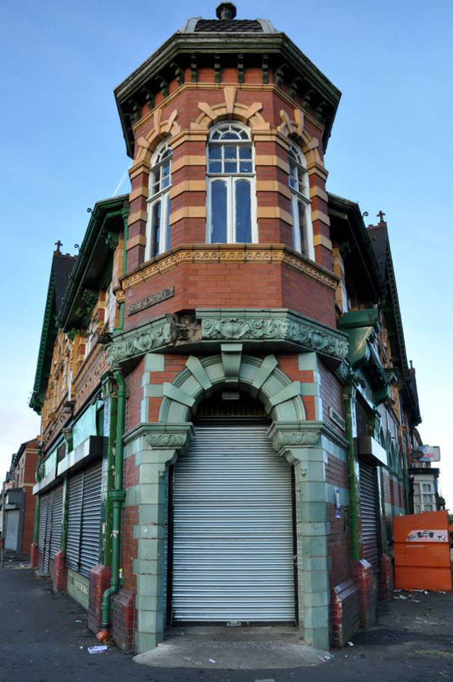
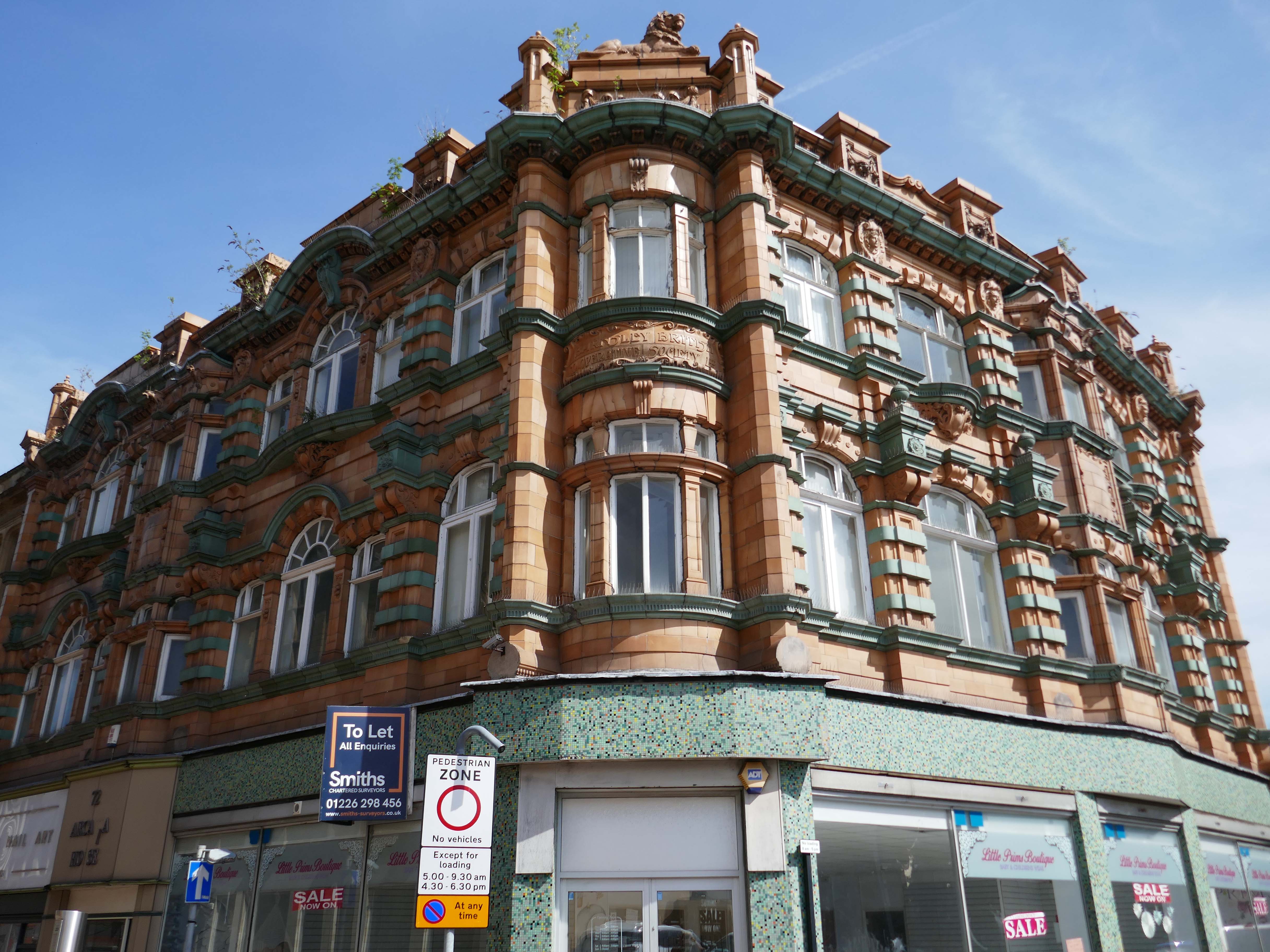
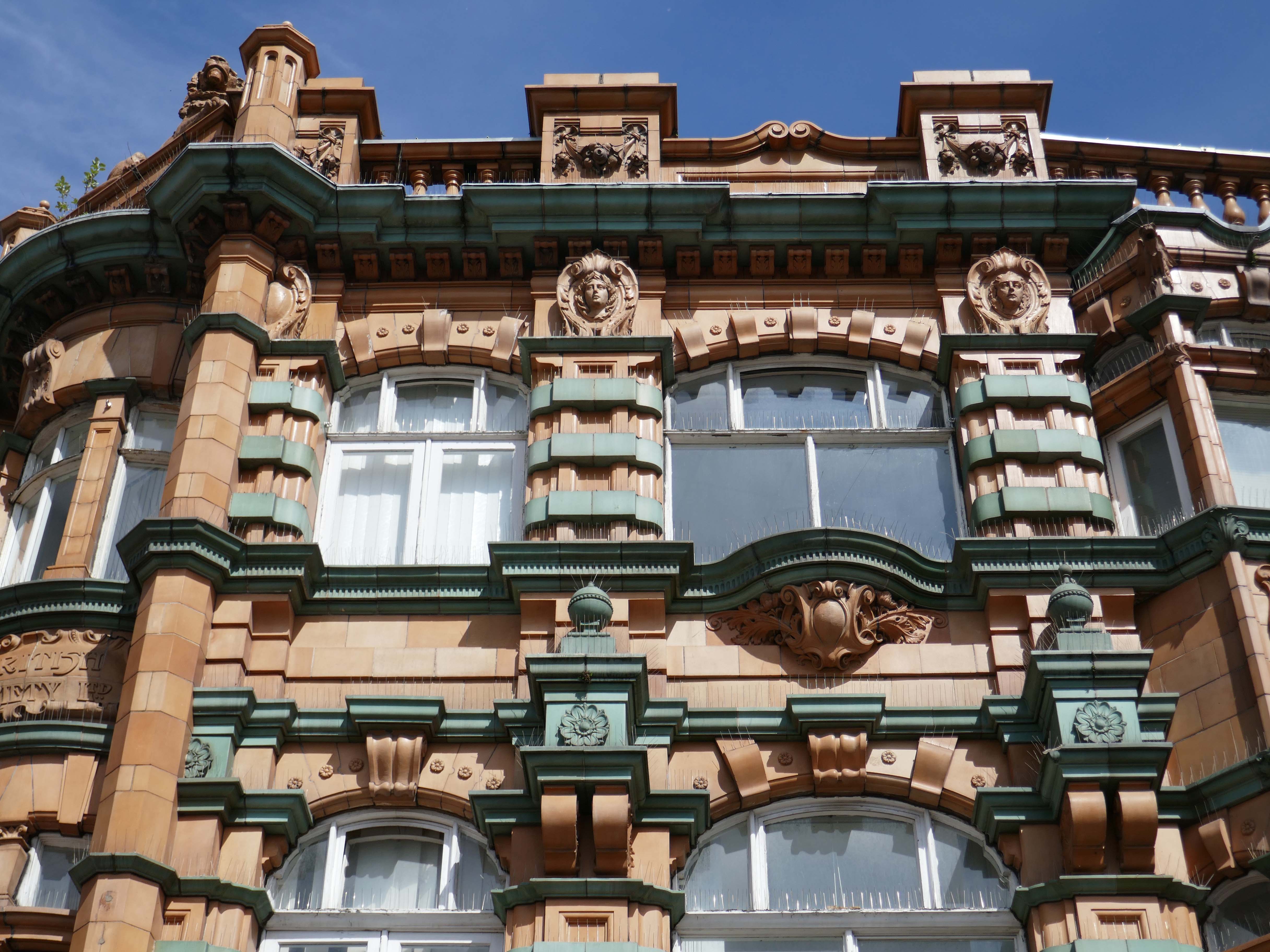
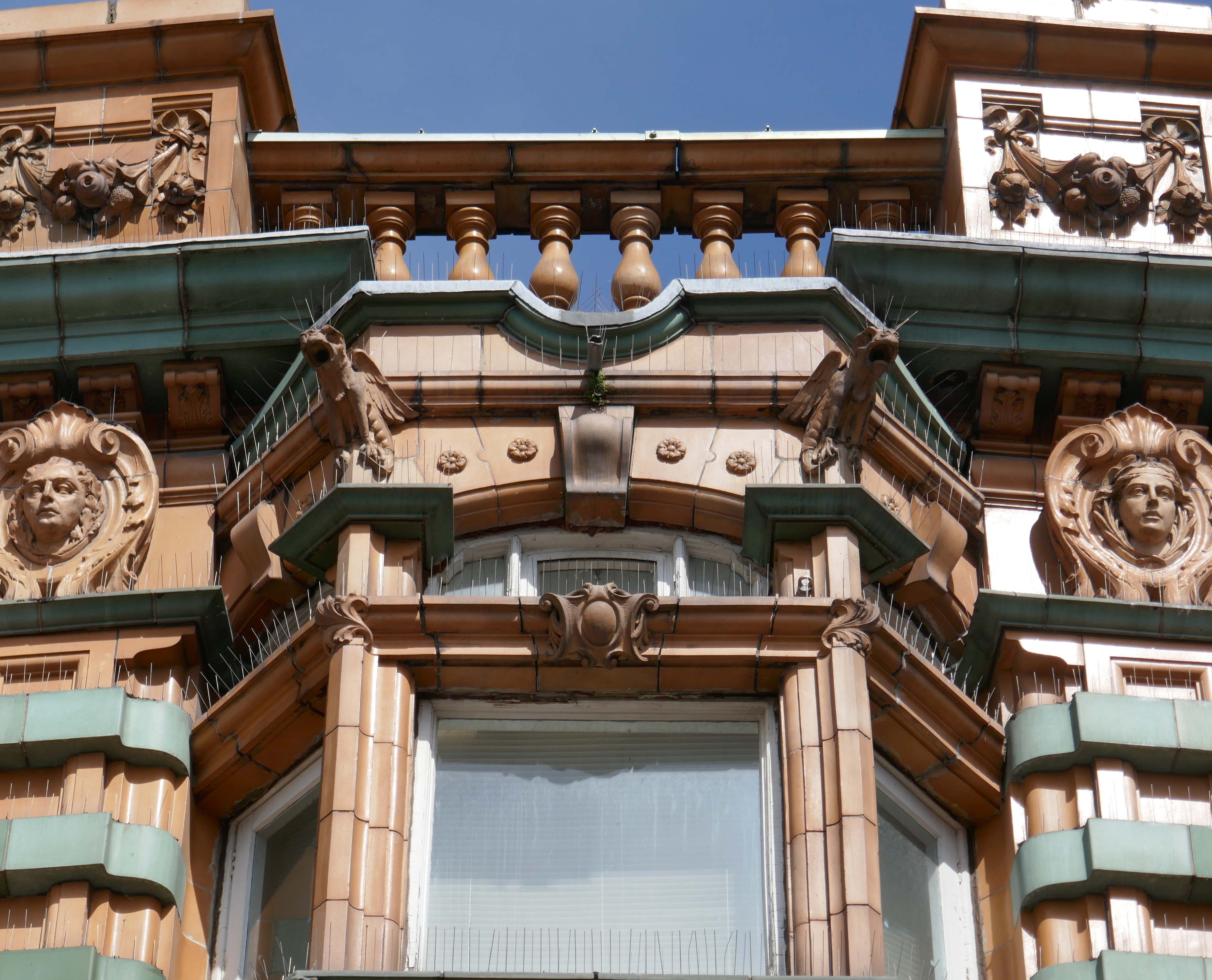
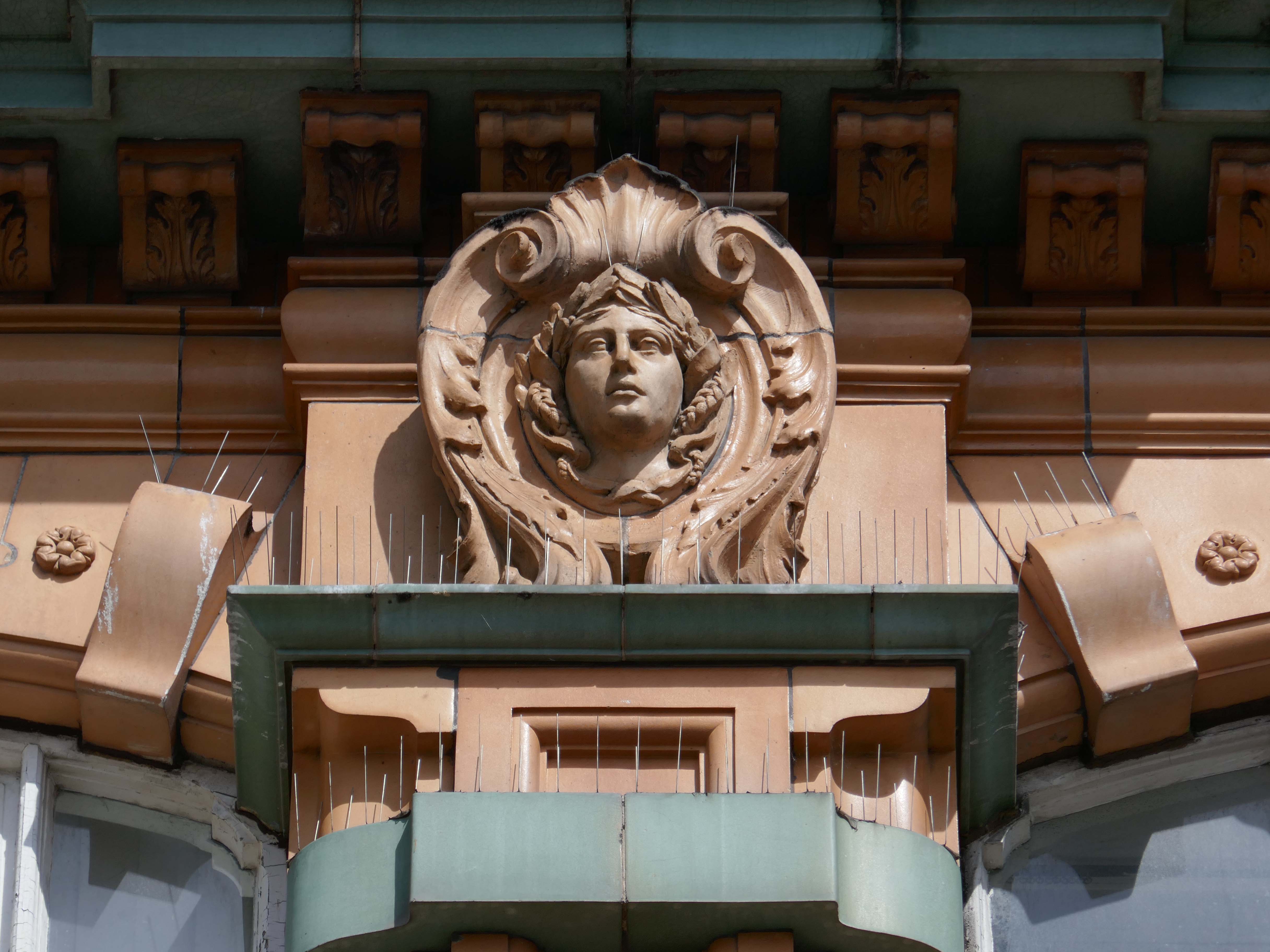
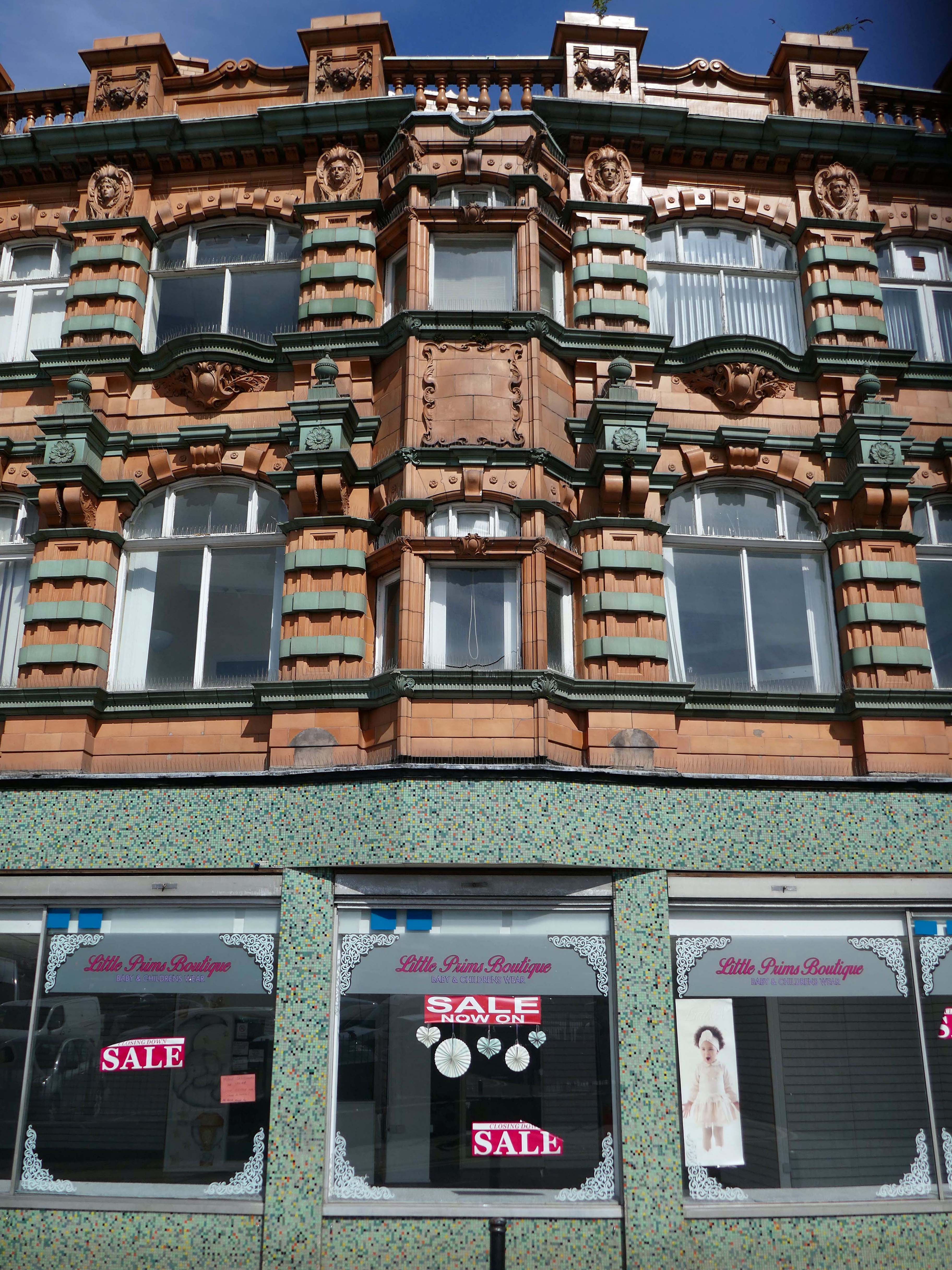
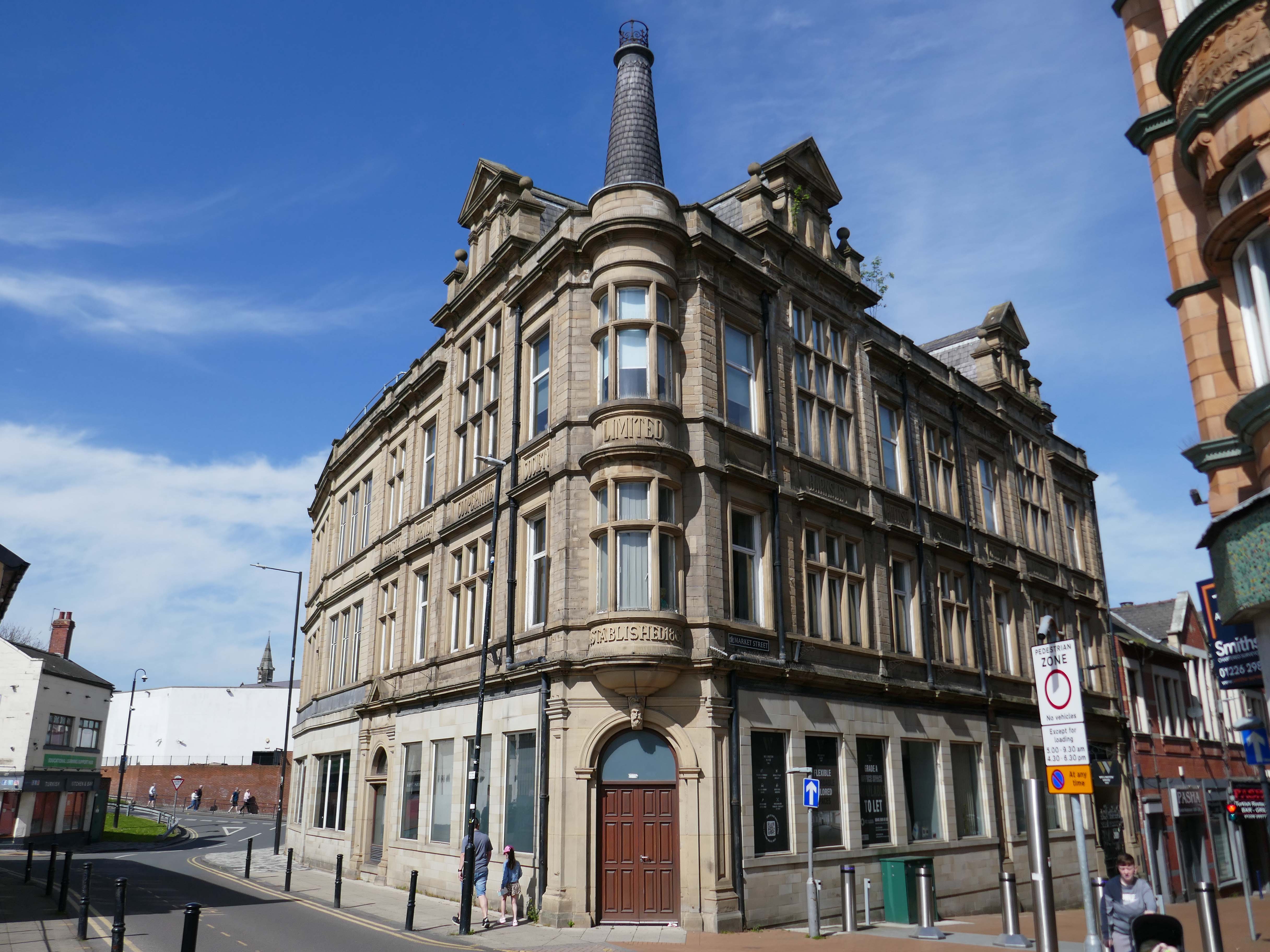
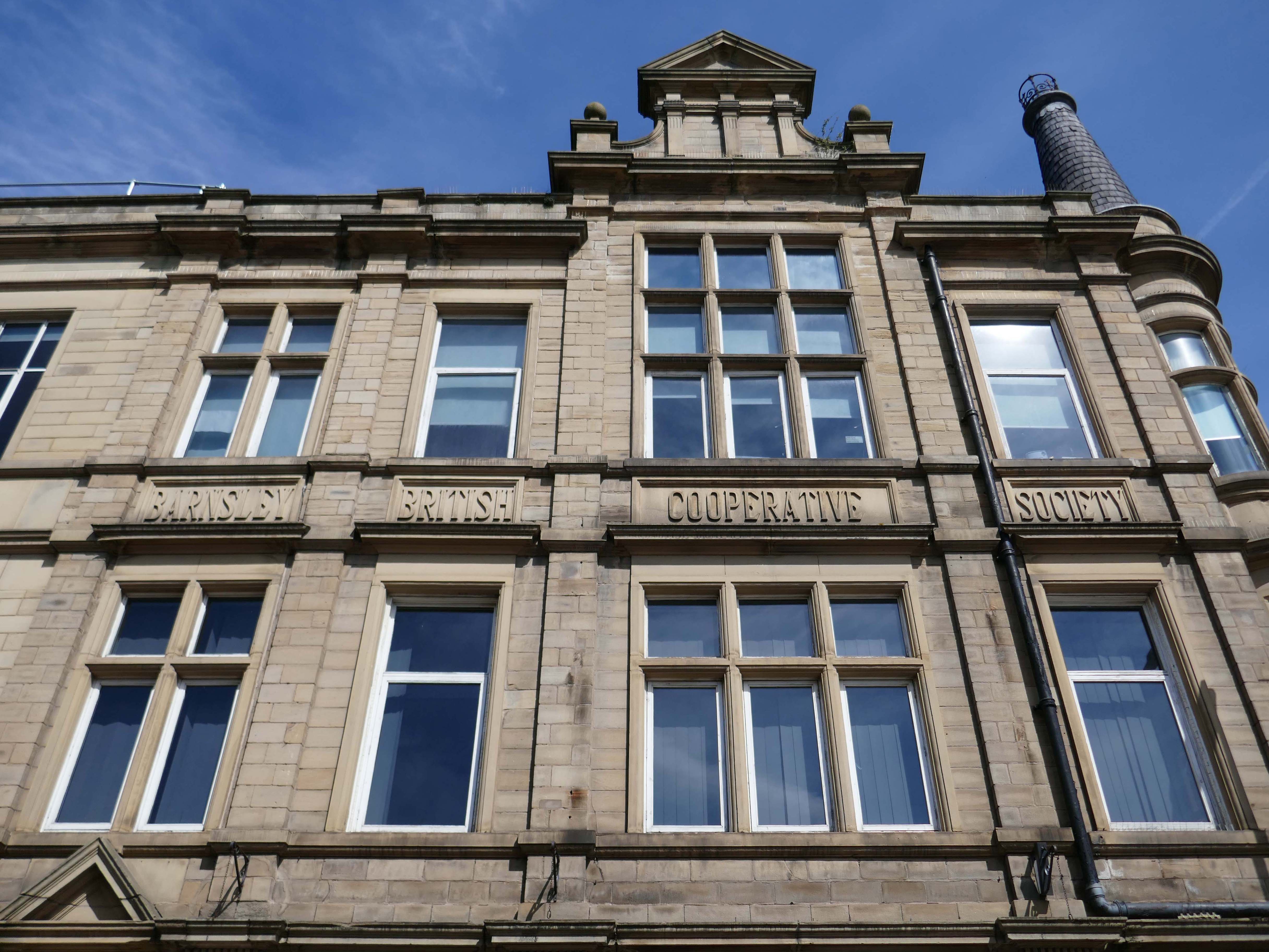
Subsequent observation and research revealed it to be an extension to a group of Barnsley Co-operative buildings.
I should have noted that the building of 1910, was the work of architect Arthur Walshingham, the terracotta and green faience, very much in the style of Northmoor Road.
The building housed grocery and footwear shops, an elegant marble floored entrance hall, a restaurant and assembly room. Its original shopfronts were mahogany with metal sills on a granite base, the windows were divided by columns with green faience shafts.
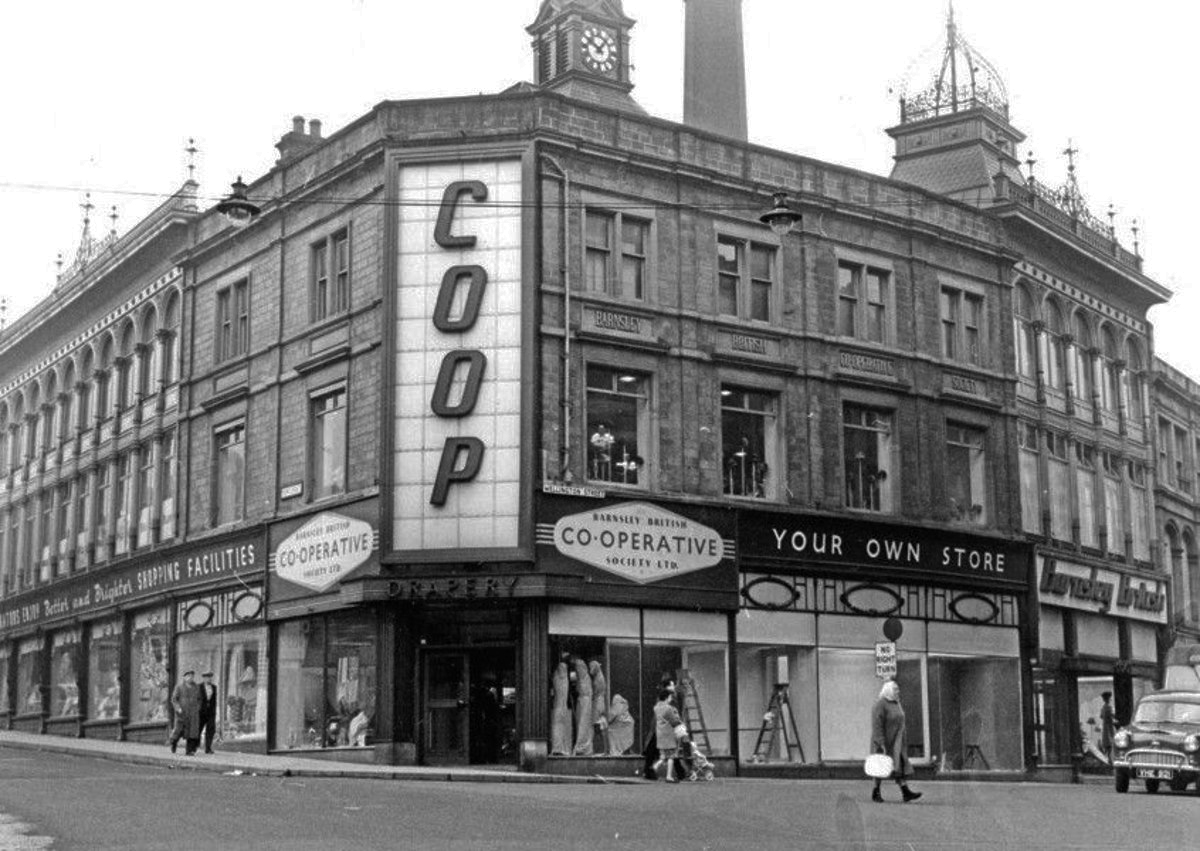
In 2016 the Barnsley British Co-operative building, sited opposite the existing buildings, suffered a large fire and unfortunately had to be demolished due to safety concerns.
For more than a century it had been considered the place to shop in town. Many will recall it as the Co-op’s toy department where, every year, excited children would queue with mums and dads to meet Santa in his grotto at Christmas.
It closed in the 1980s.
In 1993 the plan was to turn the imposing Victorian Grade II listed building into a ’high class’ venue which it was anticipated would be aimed at a clientele in the 25-plus age group.
The name Walsall is derived from Walh halh, meaning valley of the Welsh, referring to the British who first lived in the area. Later, it is believed that a manor was held here by William FitzAnsculf, who held numerous manors in the Midlands. By the first part of the 13th century, Walsall was a small market town with a manor house; the weekly market was introduced in 1220 and held on Tuesdays. The mayor of Walsall was created as a political position in the 14th century.
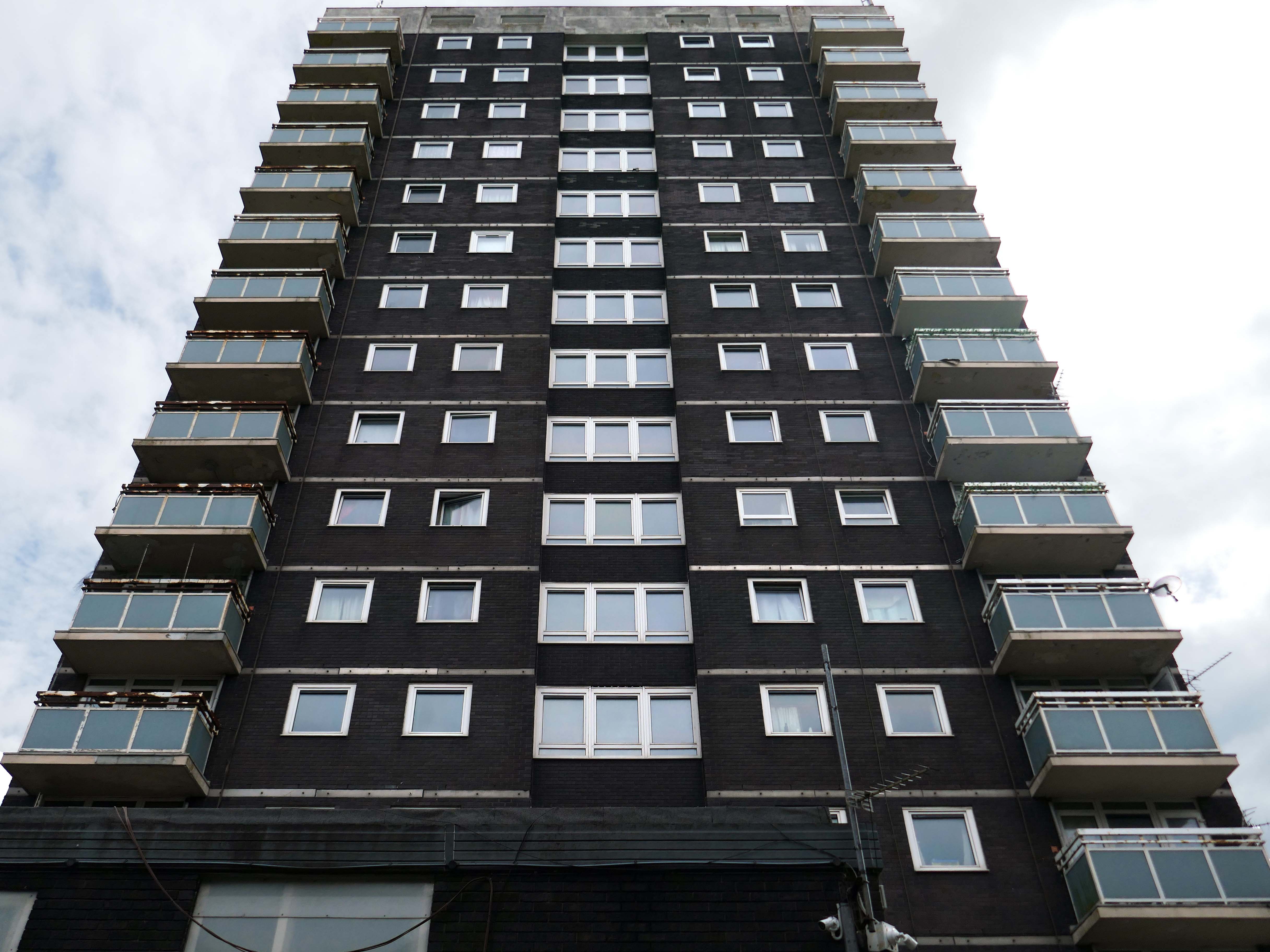
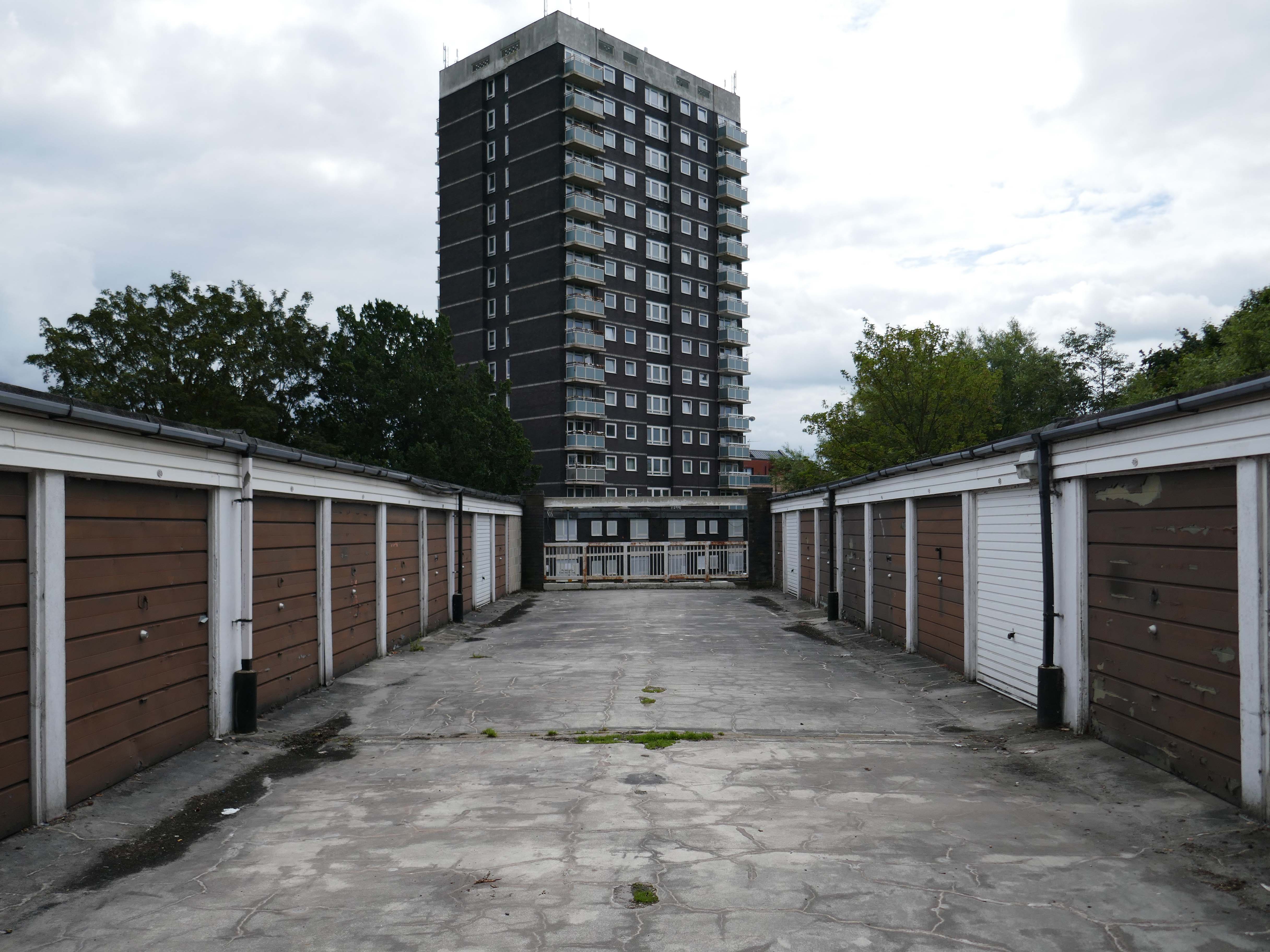
Significant developments also took place nearer to the town centre, particularly during the 1960s when a host of tower blocks were built around the town centre; however, most of these had been demolished by 2010.
The Memorial Gardens opened in 1952, in honour of the town’s fallen combatants of the two world wars. The Old Square Shopping Centre, a modern indoor shopping complex featuring many big retail names, opened in 1969.
Much of the reconstruction of the post-war period was quickly reconsidered as ugly and having blighted the town. In 1959, John Betjeman advised that with sensitive restoration the old buildings of the High Street could become:
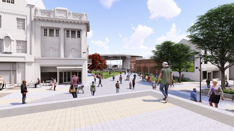
There is to be further demolition on the High Street, to open up the vista between the Bus and Railway stations.
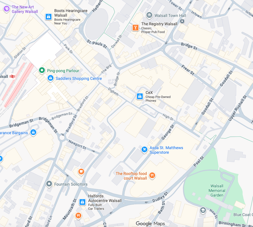
In 2021 Walsall secured funding of £11.4m from the Future High Street Fund. With further investment from Walsall Council we are now delivering the early phases of the Town Centre Masterplan, through the Walsall Connected Gateway Project.
Approval has been granted to remodel the Saddlers Centre to create a more open and attractive arrival experience for train passengers whilst also opening up Park Street. Butler’s Passage, which has in the past been the centre of antisocial behaviour, will disappear as some of the buildings are removed to create a large open walkway, connecting the rail and bus hubs.
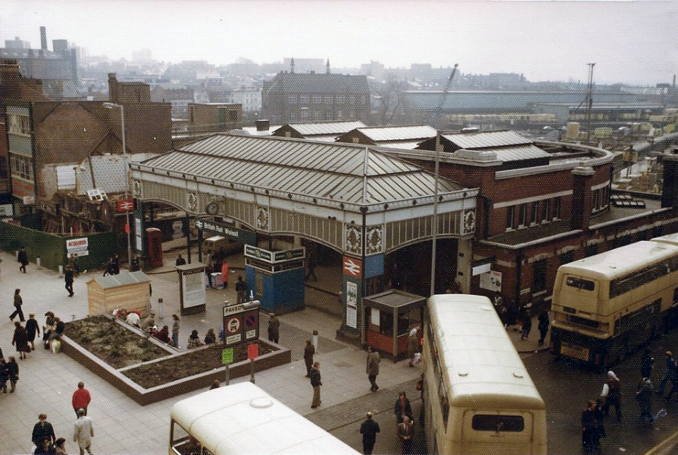
Former Railway station 4th March 1978 – photo by Walsall 1955
The station was about to be closed, demolished and replaced by a new Marks & Spencers and the Saddlers Centre.
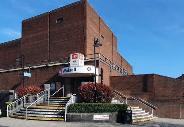
The existing entrance to the railway station on Station Street.
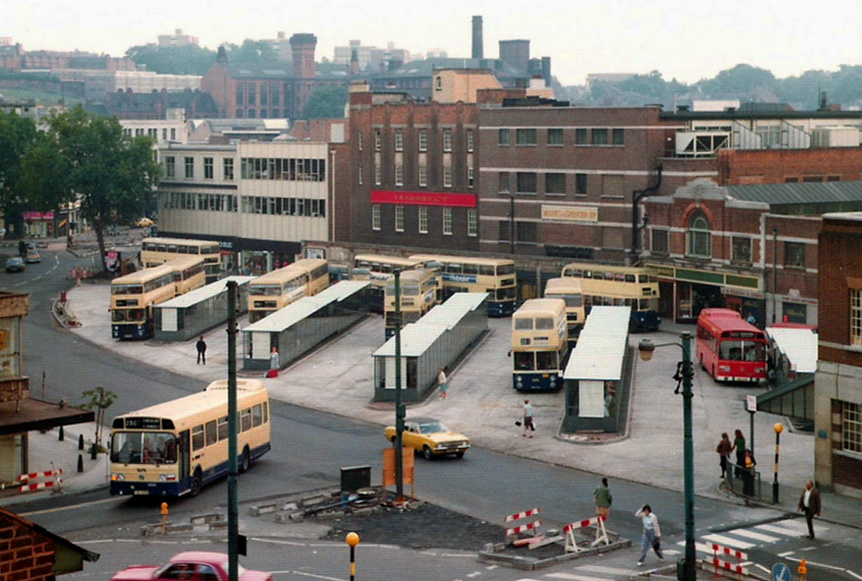
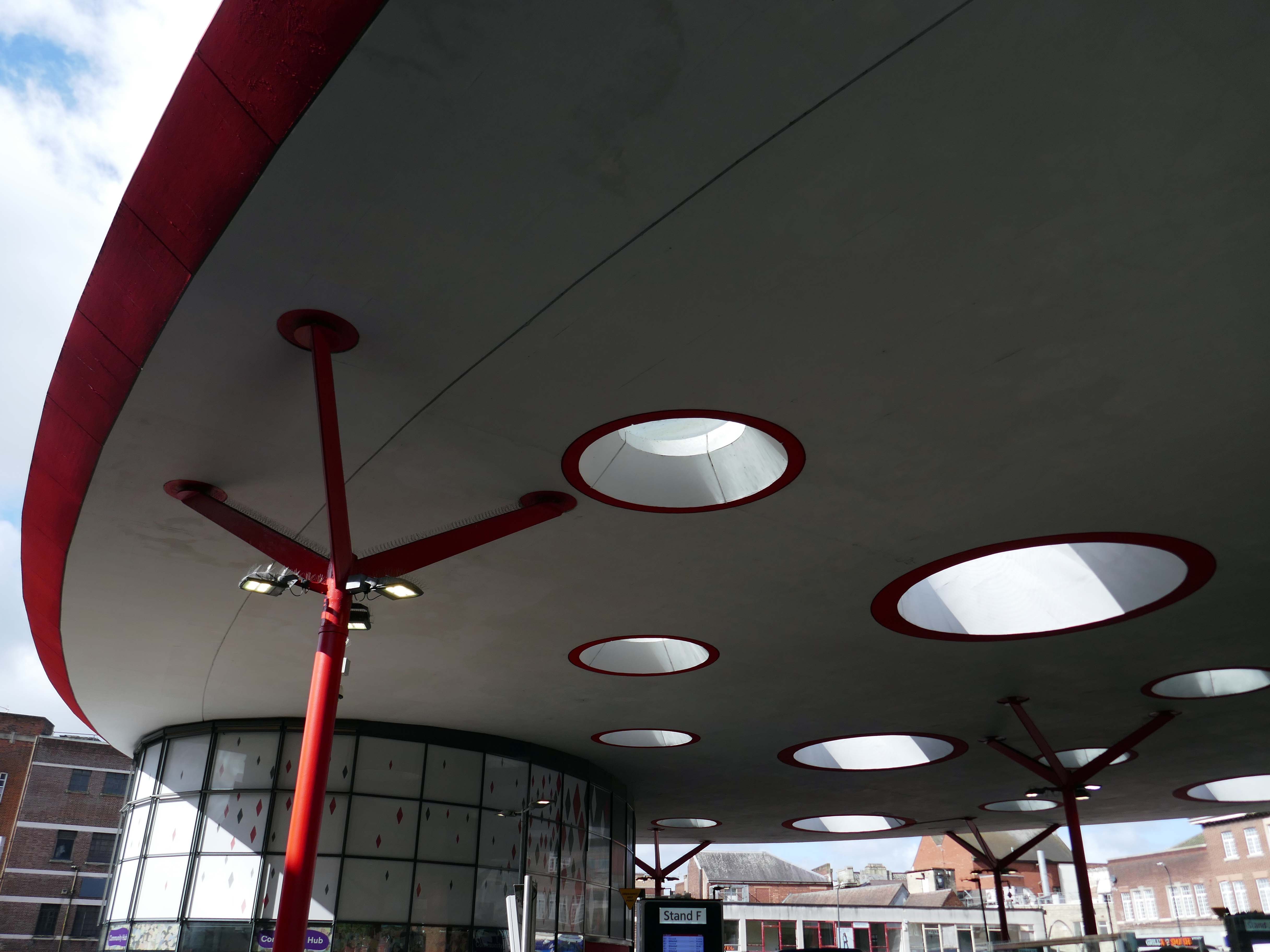
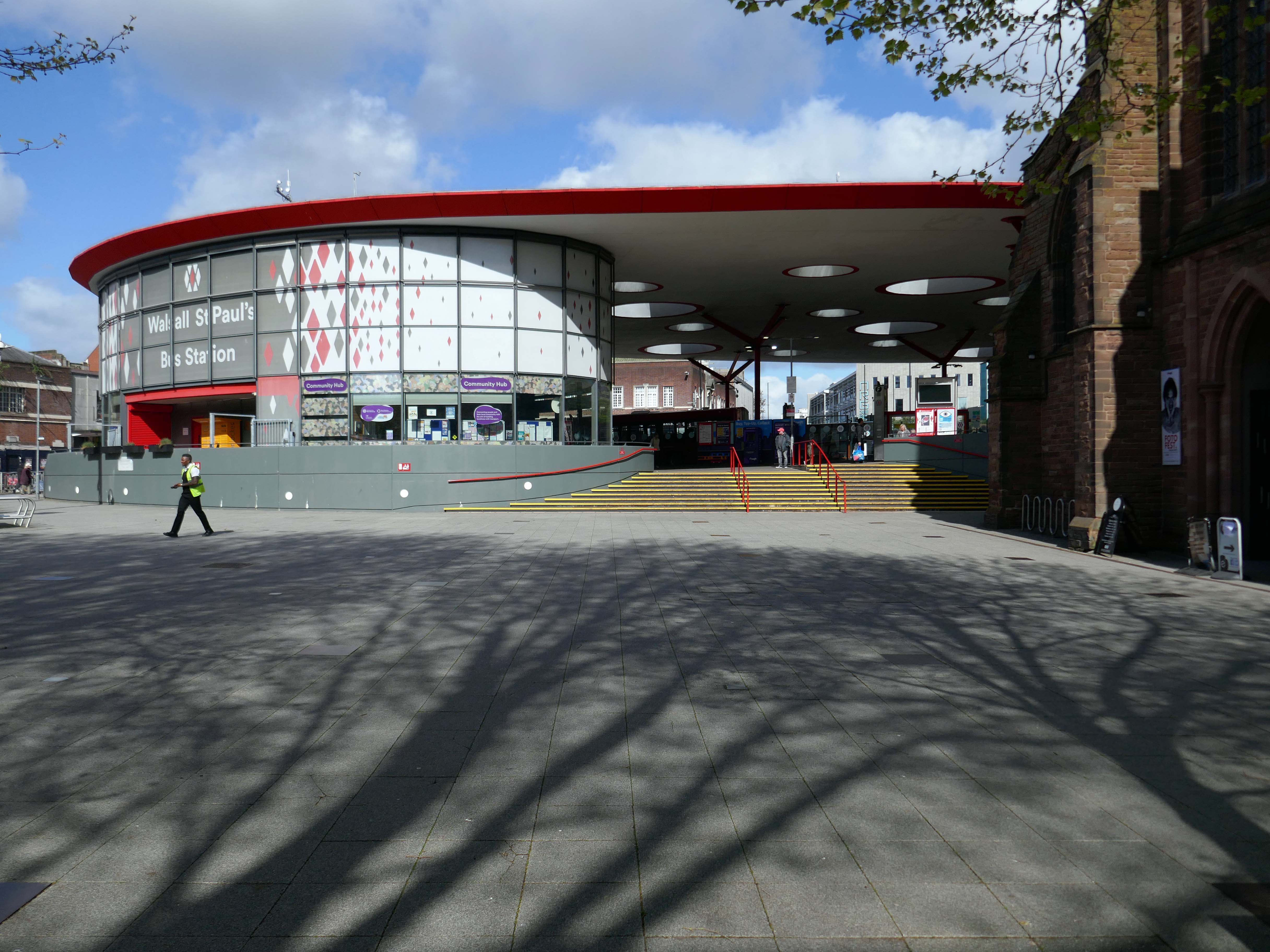
Let’s begin at the St Paul’s bus station or Hub – if you will, complete in September 2000.
The 1936 St Pauls Street bus station closed in February 1975, and was completely demolished, rebuilt and opened in August 1975.
Photo by: Walsall 1955
Allford Hall Monaghan Morris designed the building for Centro. The structural engineers were Atelier One, Shepherd Construction Ltd were the contractors, Watkins Dally were the landscape architects and Clark Smith Partnership were the civil engineers.
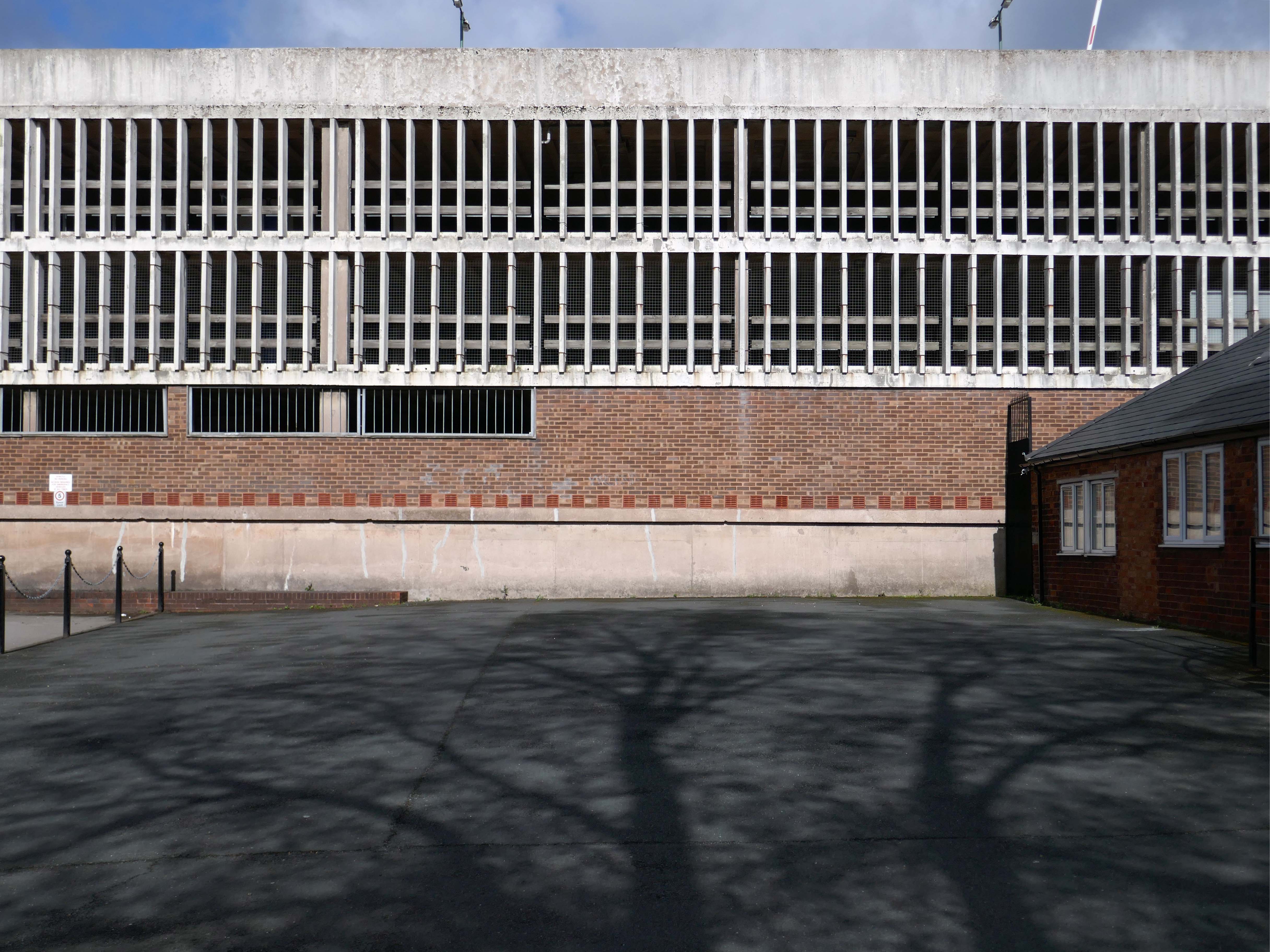
Next, a glimpse of Hatherton Road multi-storey car park.
Though it appears to be closed.
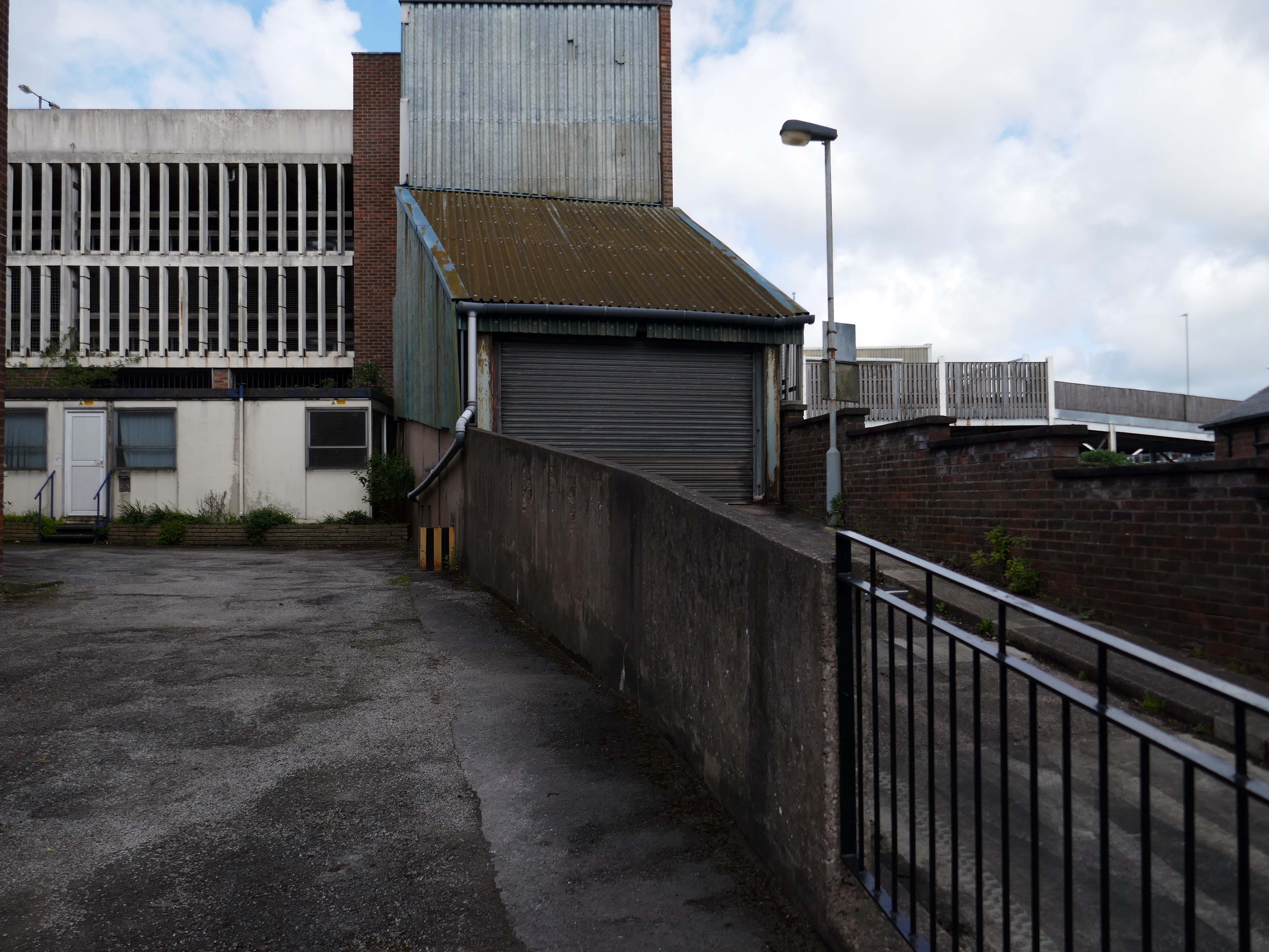
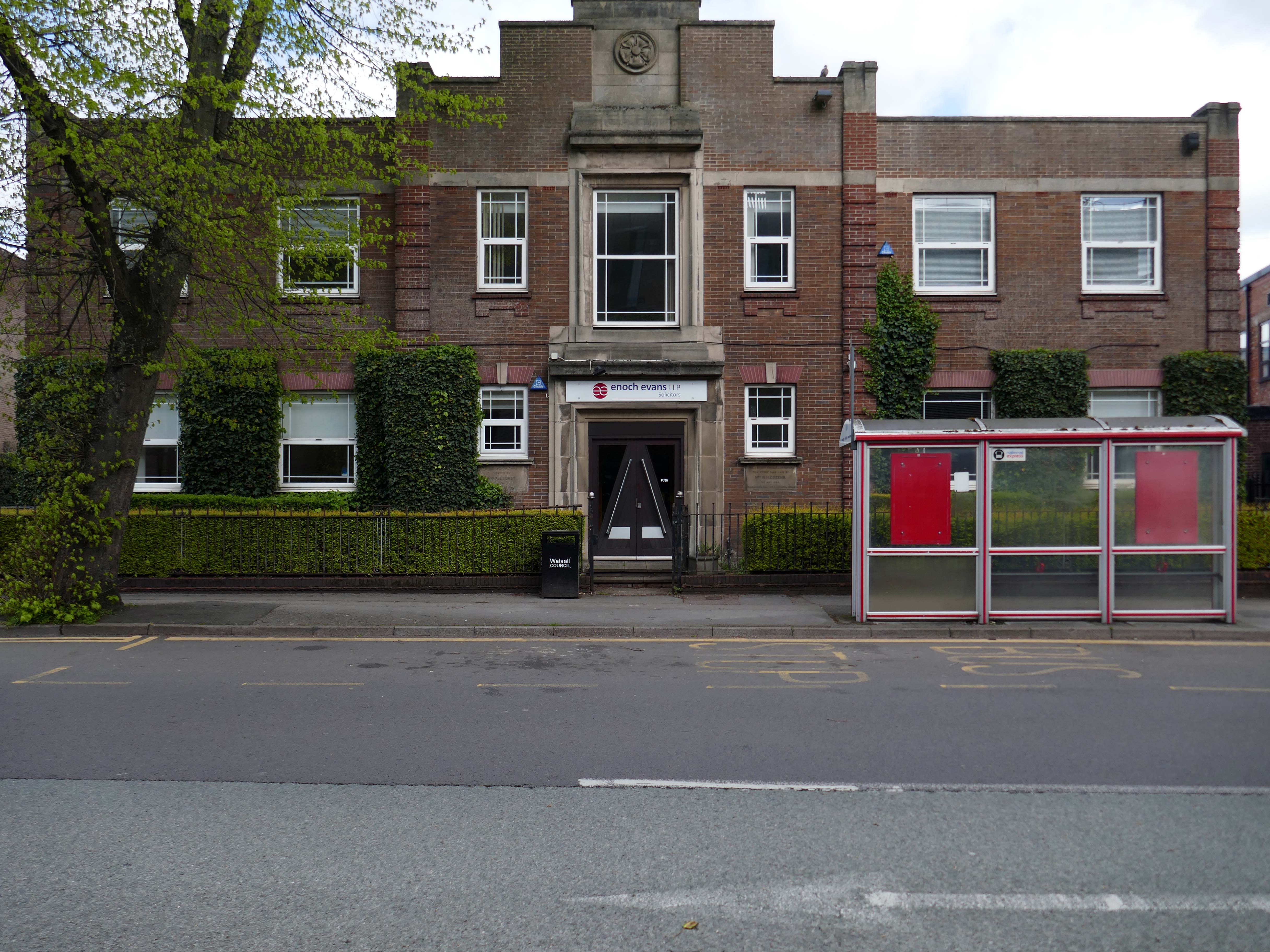
Adjacent to Enoch Evans Solicitors, their offices housed in one of the many imperious inter-war buildings dotted around the town.
Which faces onto the back of the Civic Centre.
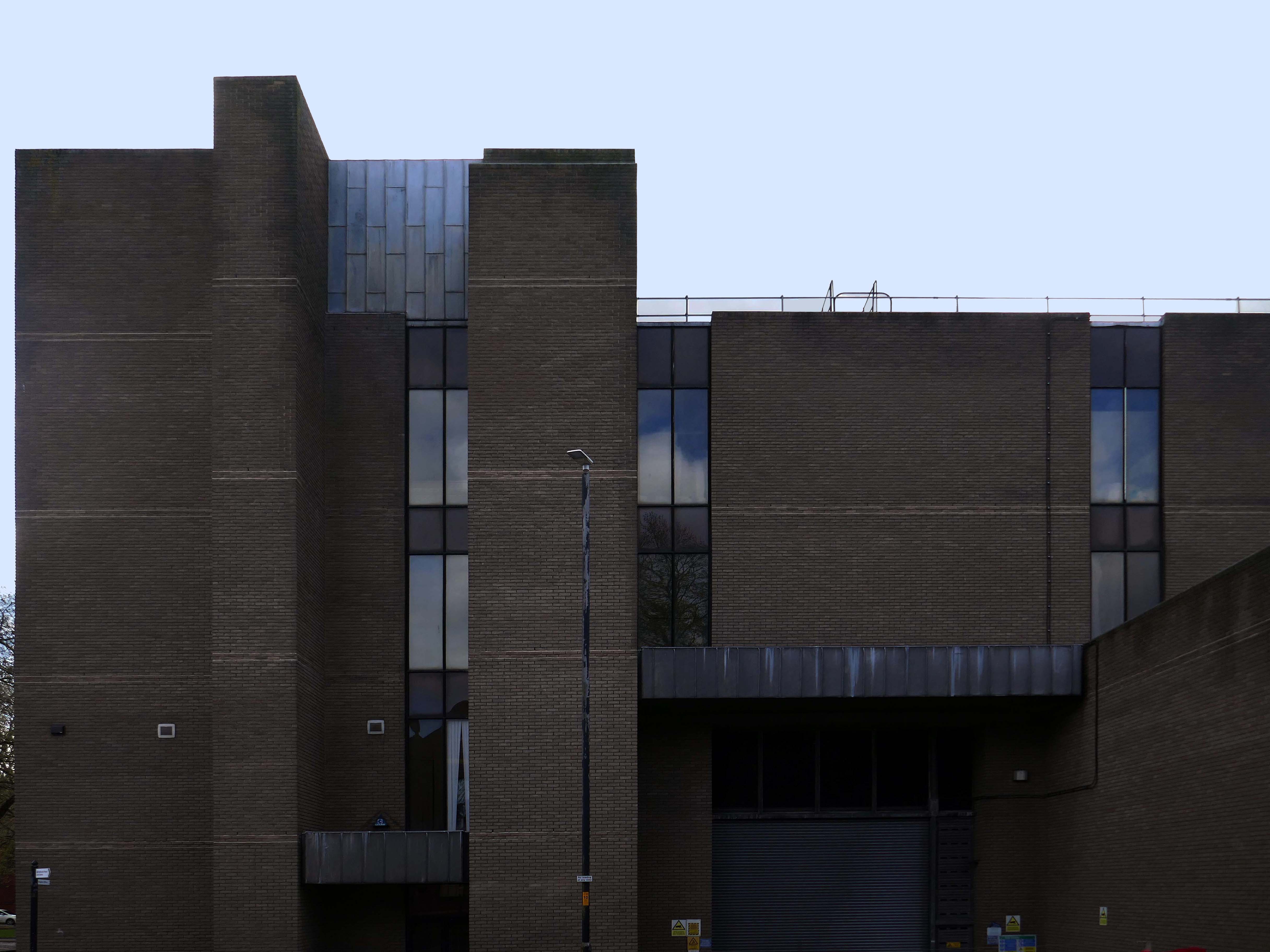
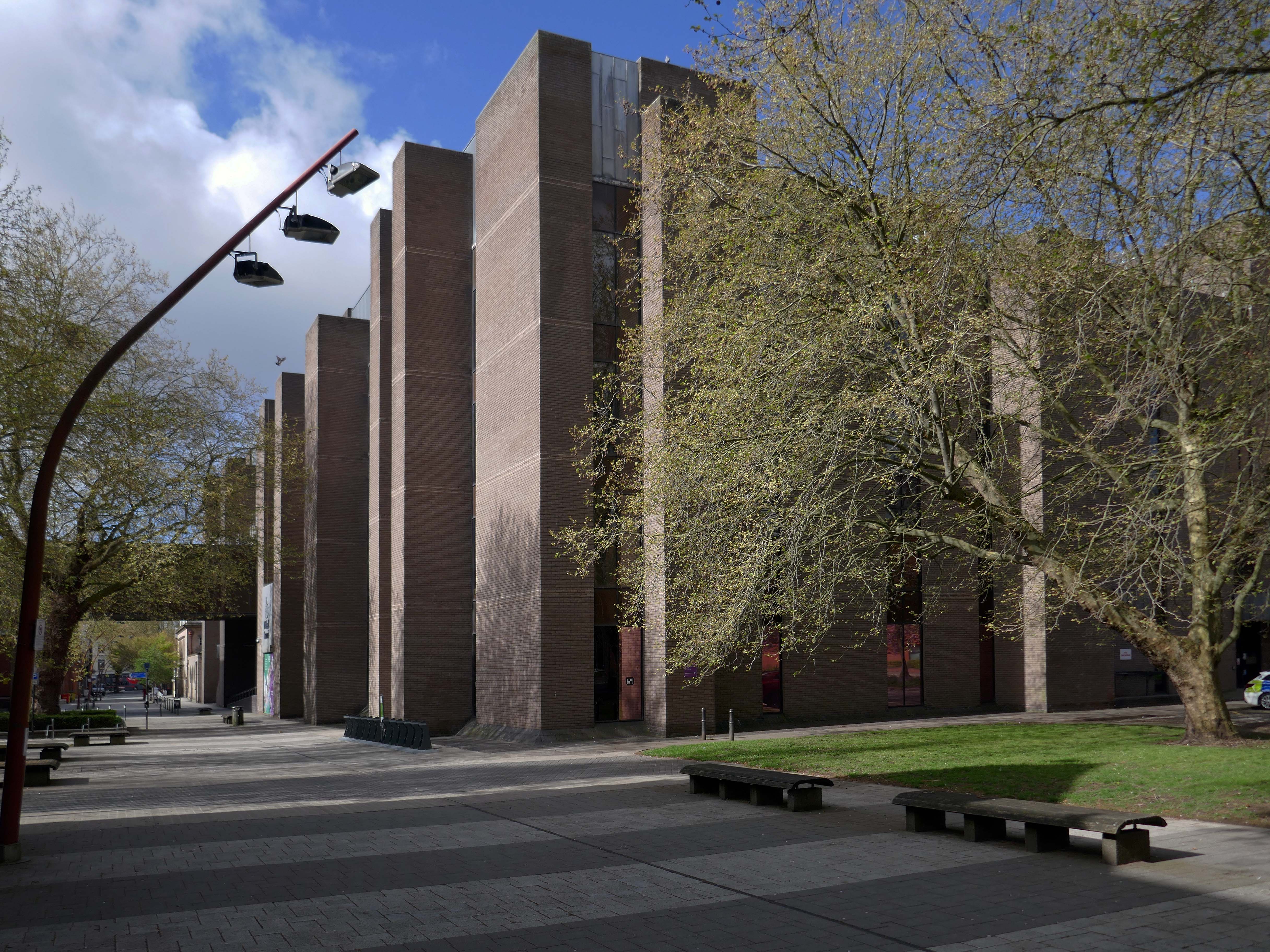
Following the formation of the Metropolitan Borough, the new Civic Centre in Darwall Street opened in 1976, architect Stanley W Bradford Walsall MBC Director of Architecture.
Central roof garden.
Leaving the Civic Quarter on the left is the Imperial
The Imperial started life as an agricultural hall, constructed in 1868-69, and designed by the architect GB Nichols of West Bromwich. At that time, it was used for a variety of community activities including shows and dancing, it was also hired out to travelling film showmen. The main feature of the early building was a principal ground floor hall.
In June 1914, the Imperial was closed to allow for conversion to a cinema, designed by West Midlands-based architects Hickton & Farmer.
The Imperial was converted to a bingo club in 1968, and in 1996 it was converted into a pub, which closed in 2016.
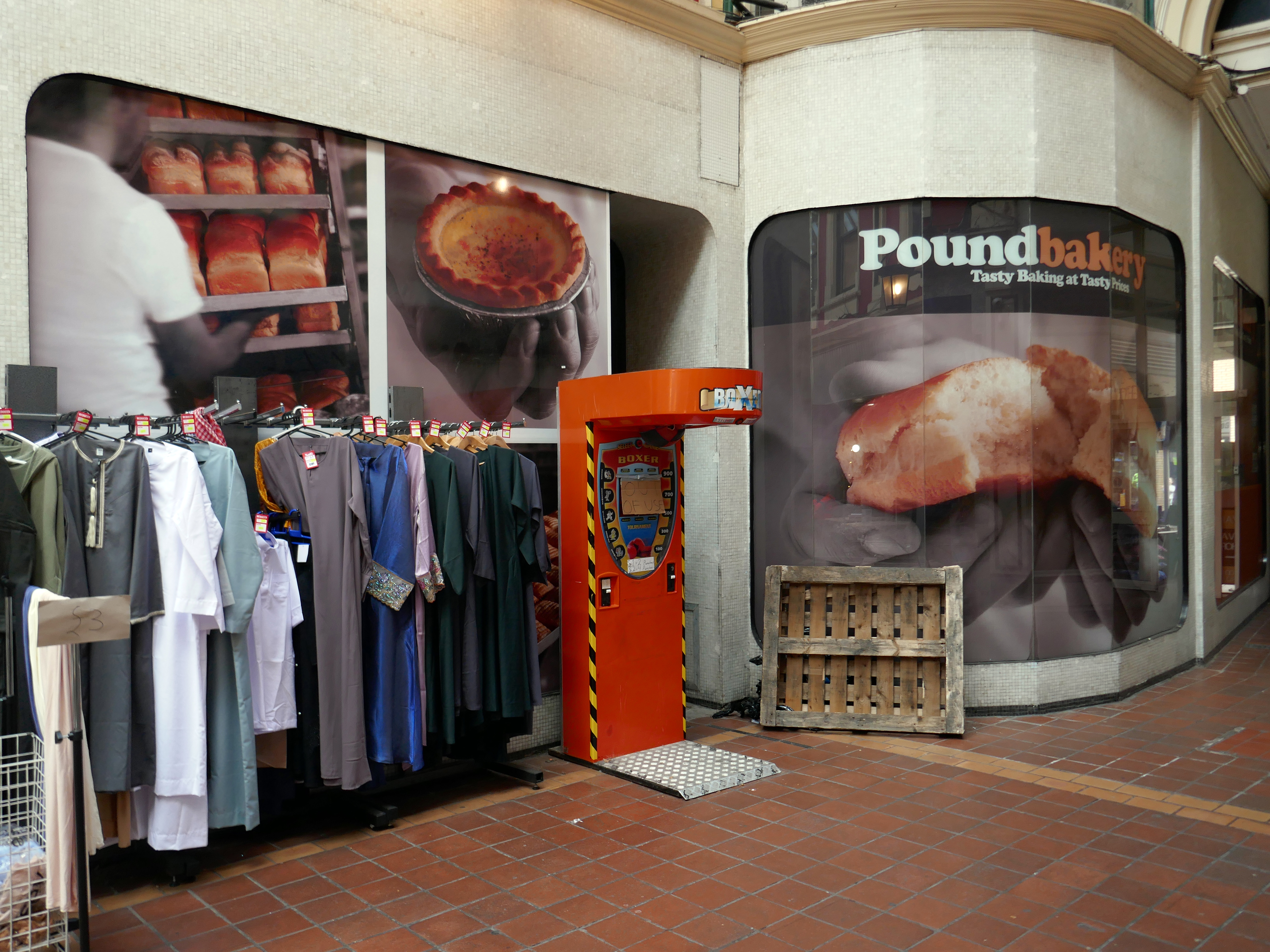
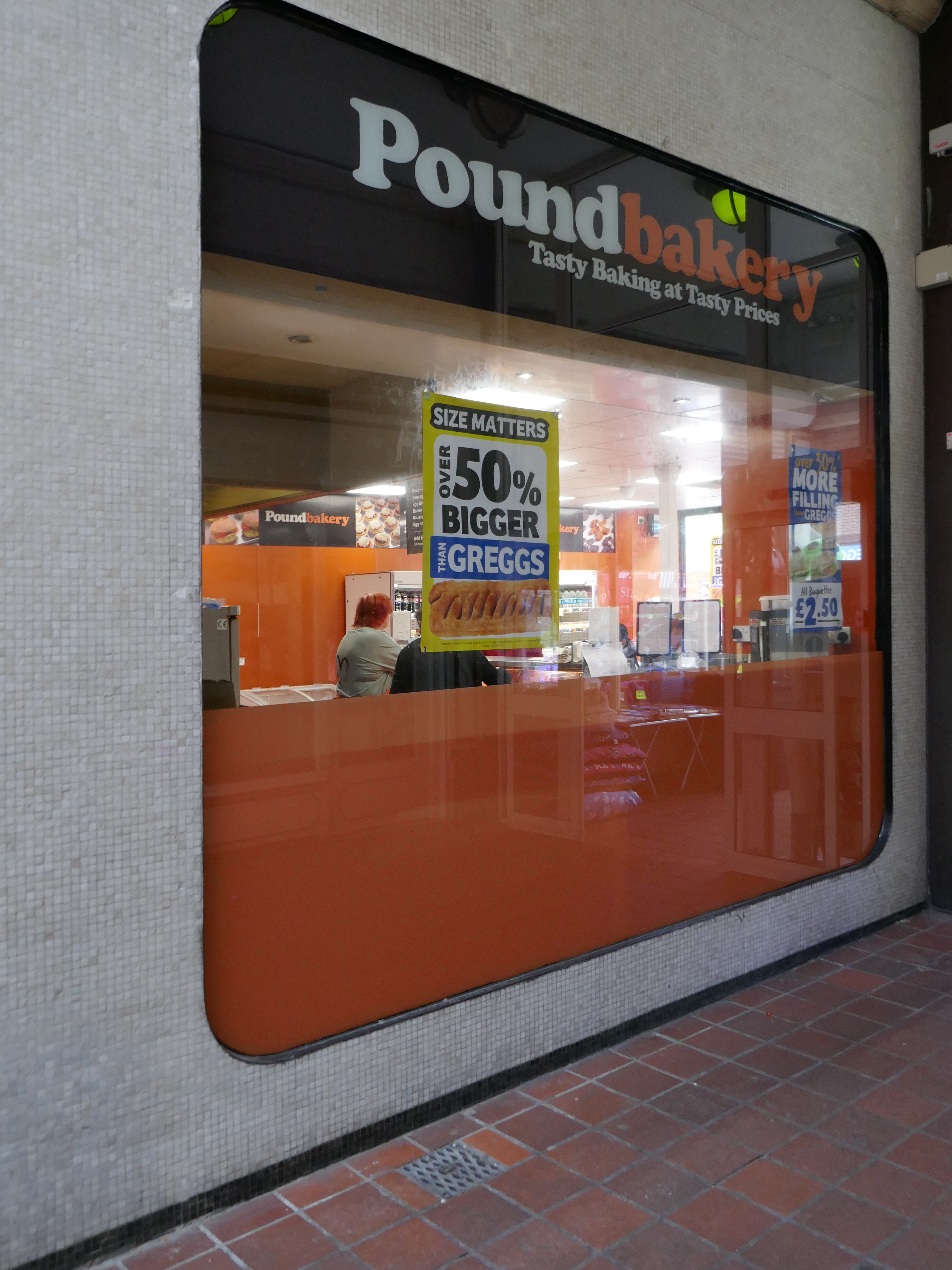
At the end of the otherwise period correct Victorian Arcade is a space age Pound Bakery.
Across the way a former Barclays Bank architects: John HD Madin & Partners.
Next door an anomalous disco themed fascia.
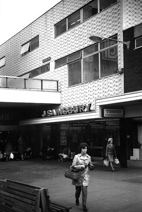
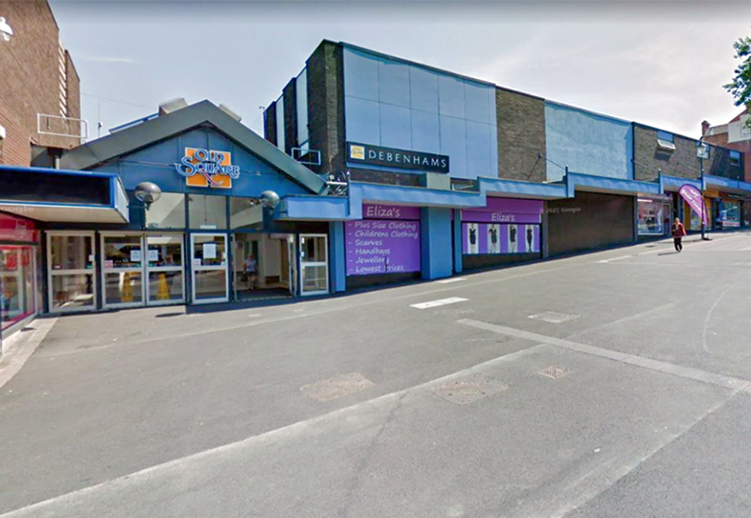
From here up the hill to the Old Square.
Sainsbury’s Old Square store in the early 1970s photo Will Parker.
The majority of the Shopping Centre was demolished in 2014.
I remember when I was about fifteen in 1990, Coca-Cola were doing these yo-yos and if you went upstairs by the cafe, I think it was you could earn a gold coloured yo-yo. You just had to perform three tricks with it to earn one. I did walk the dog, the sleeper and I think it was around the world! Proud as punch with that I was. I know my uncle was Father Christmas for a few years on the bounce as well, when they used to have a grotto.
Dan Bracknall
These are the remnants.
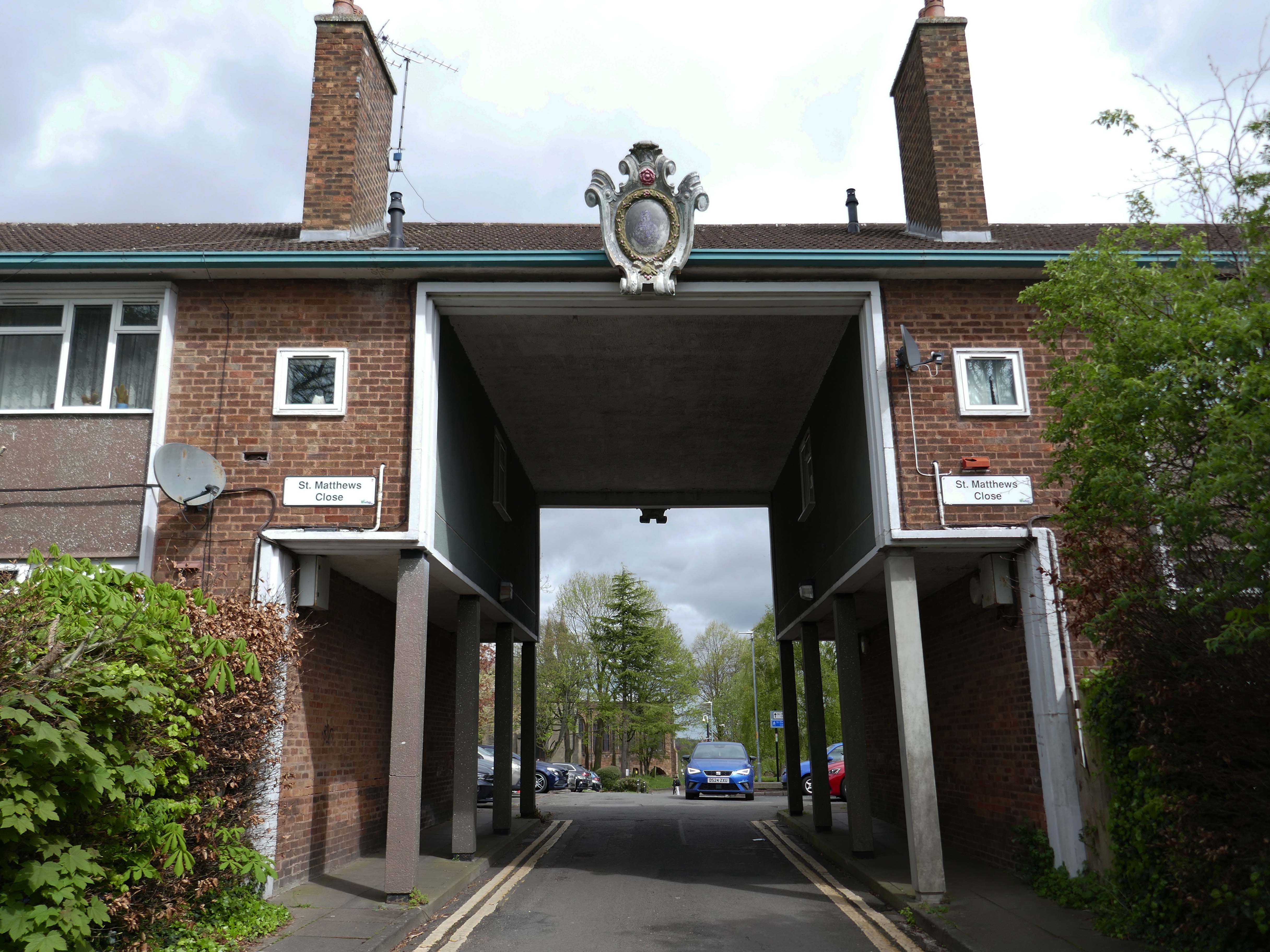
Ascending to the dizzy heights of the Grade II Listed Memorial Gardens 1953 by Geoffrey Jellicoe designed as a memorial to the dead of the two World Wars and said to mark a significant stage in the evolution of his principles of design.
Sir Geoffrey Jellicoe was one of the century’s greatest landscape architects. His contribution to landscape design has been described as equal to the 18th-century gardener Capability Brown. He was educated at Cheltenham College and then trained to be an architect at the Architectural Association. It was while at the AA that his interest in landscape was first kindled.
The second phase, comprising the building of the memorial chapel in the Memorial Garden, and the flats and Brotherhood or Church Hall to the south of the open space known as St Matthew’s Close, was completed c 1960
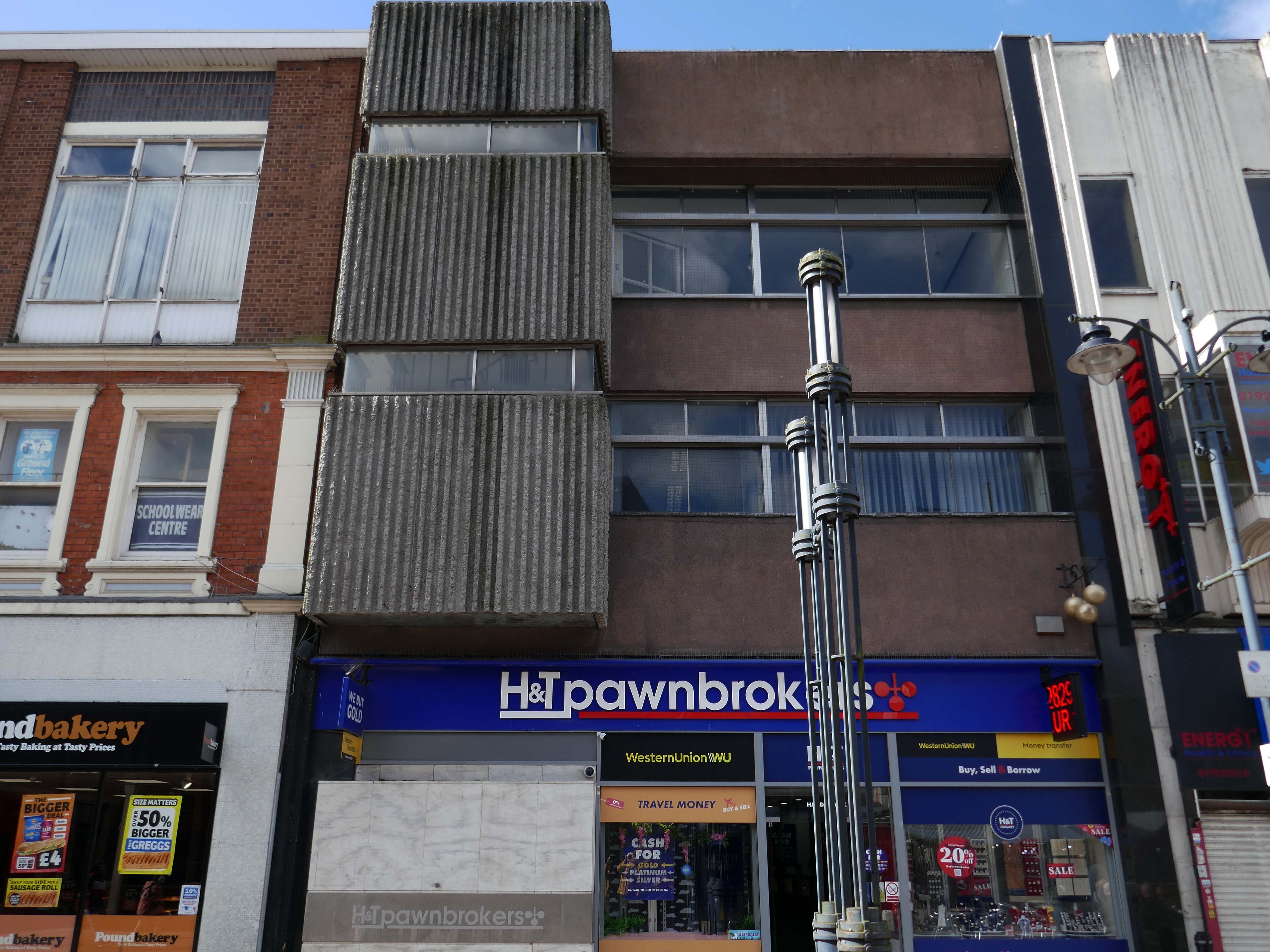
Of back down the hill onward to the Walsall School of Art.
Walsall’s art school’s history is a story of gradual growth and change, evolving from evening classes in a chapel to a modern art college. The Walsall School of Design and Ornamental Art, founded in 1854 as an evening class, operated from 1861 at the Goodall Street Baptist Chapel and eventually became the Walsall College of Art.
To celebrate Queen Victoria’s Golden Jubilee, the Walsall Science and Art Institute was opened in 1888 at Bradford Place. In 1897, it was transferred to the Town Council and renamed the Walsall Municipal Science & Art Institute. In 1926, the institute was renamed Walsall Technical College. Post-war demand led to the establishment of the Walsall and Staffordshire Technical College at Wisemore – now St Paul’s Street, in 1952. The Walsall College of Art officially merged with the College of Technology in 1992 to form Walsall College of Arts and Technology – now simply Walsall College. The college maintains strong historical ties to local industries, such as the leather trade.
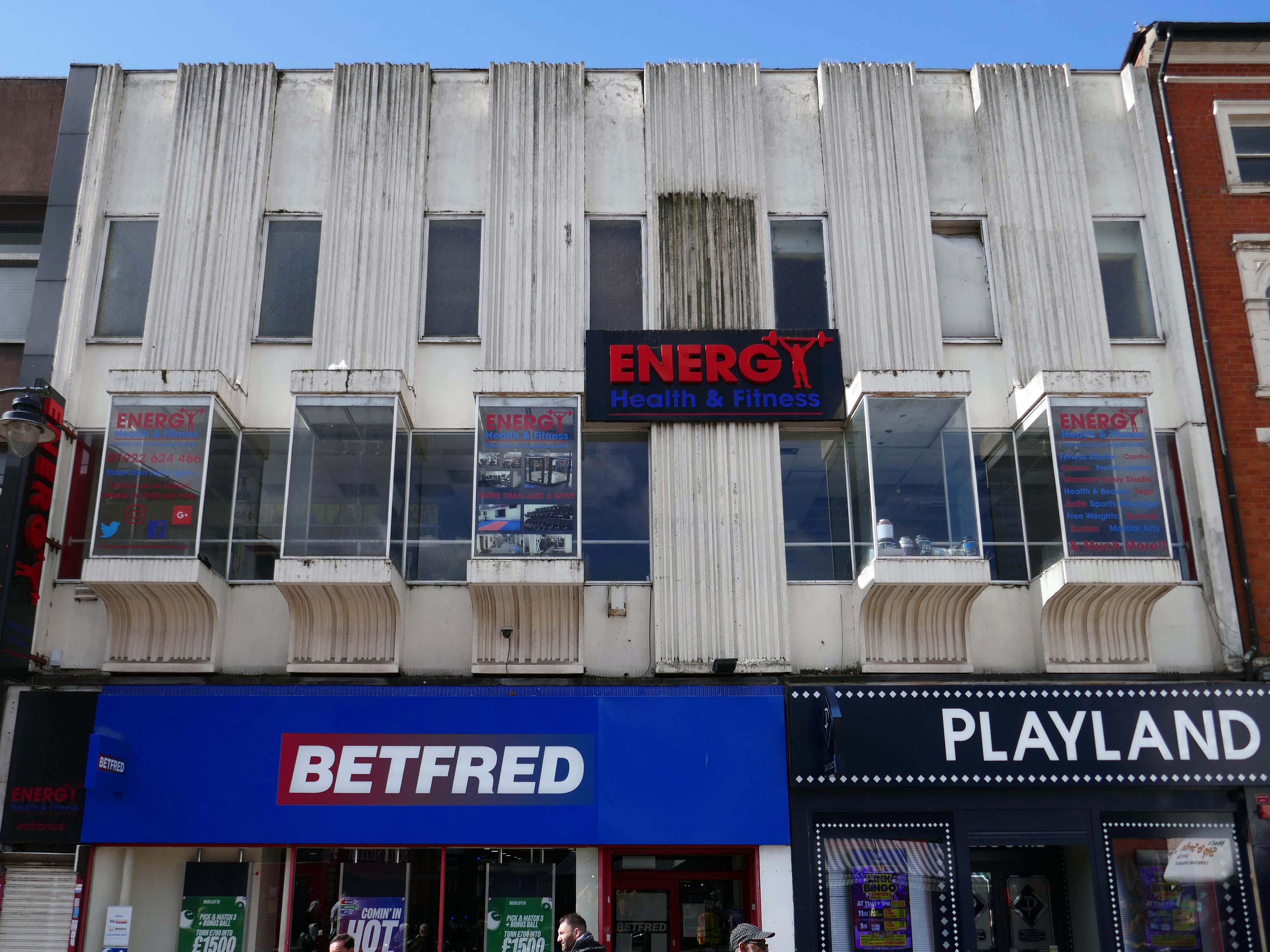
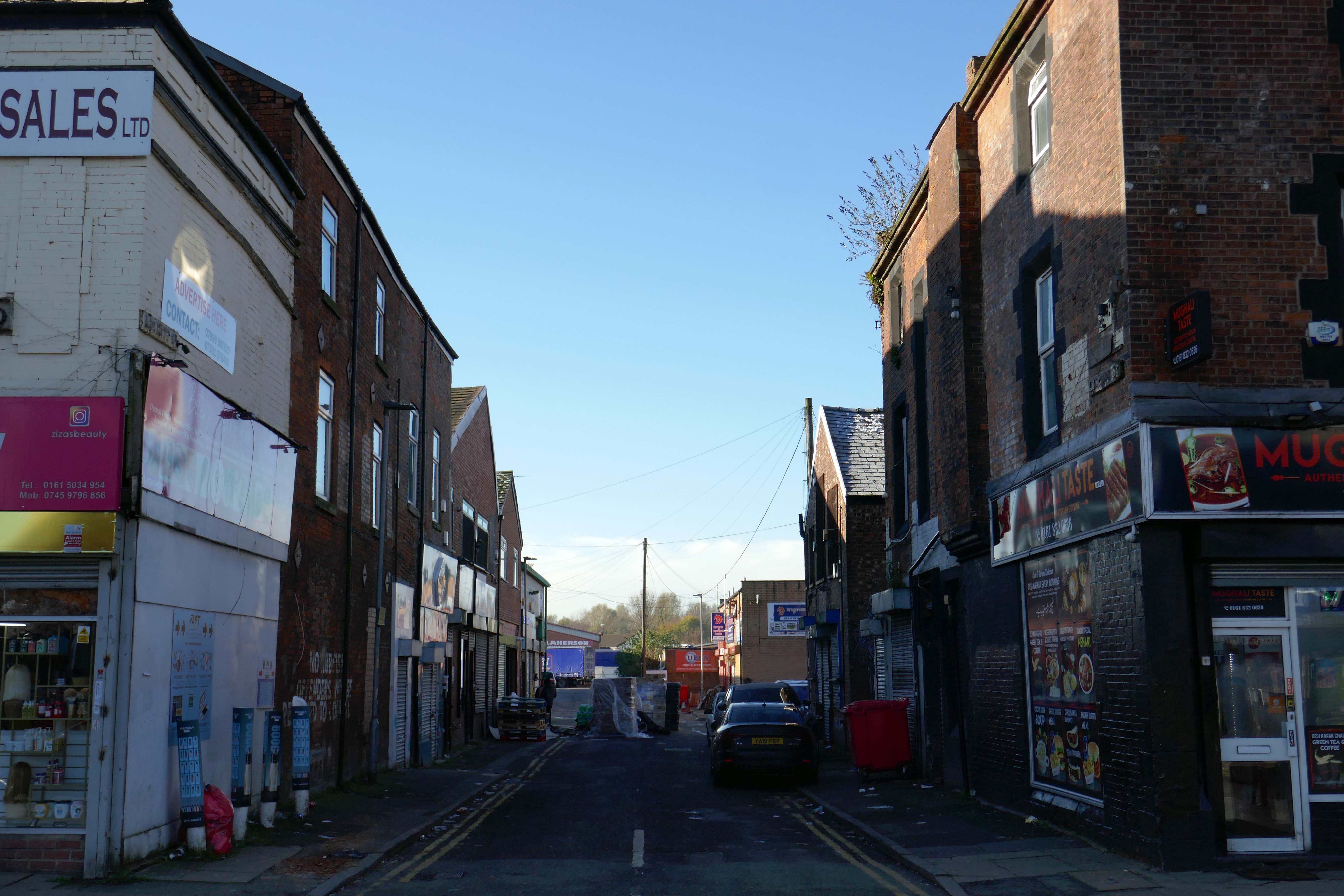
Further on there’s an enormous Telephone Exchange comprising fifties and seventies buildings.
Across the way a large system built block on a podium base.
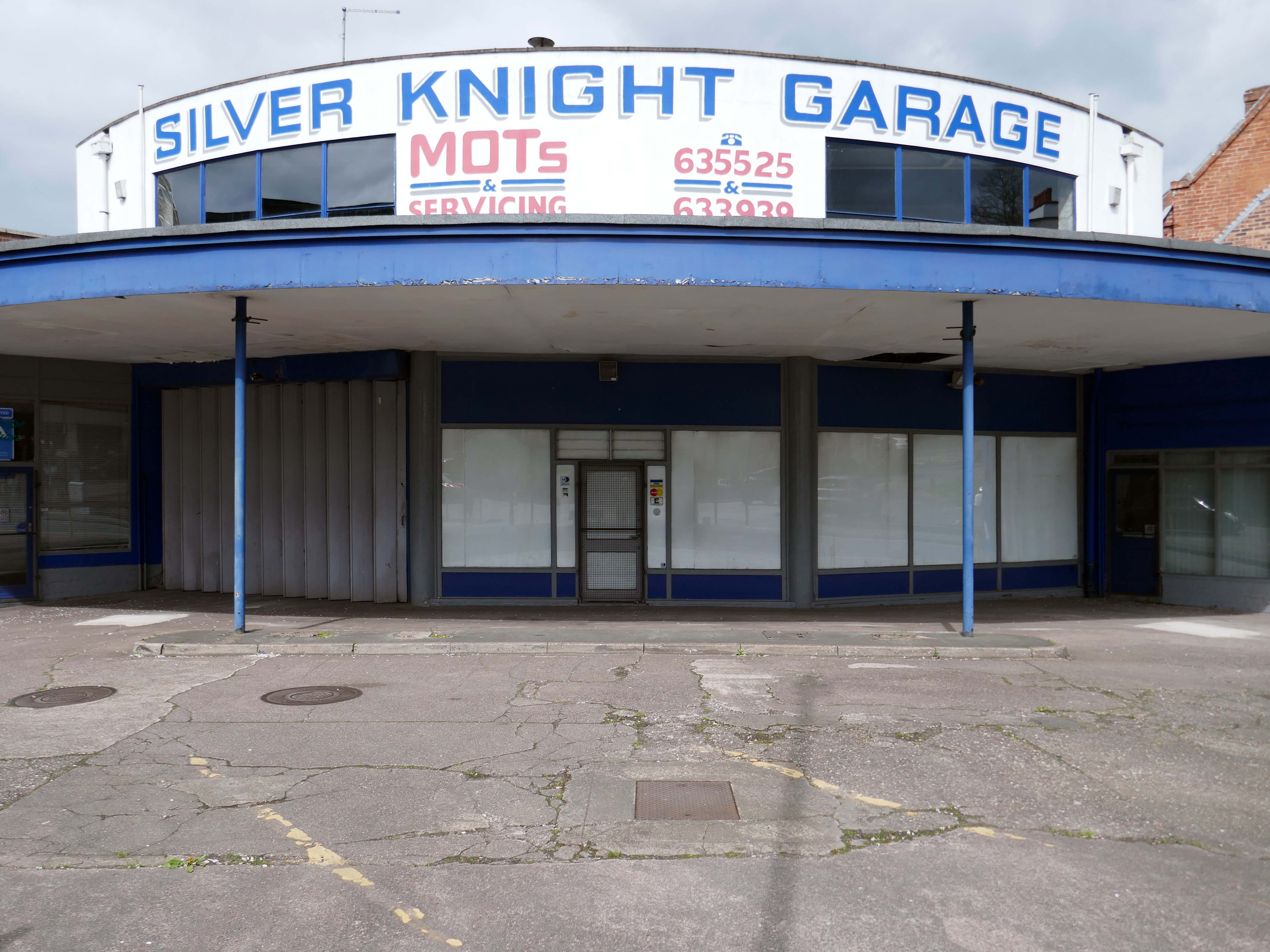
Standing on the corner where it has always stood the Silver Knight Garage.
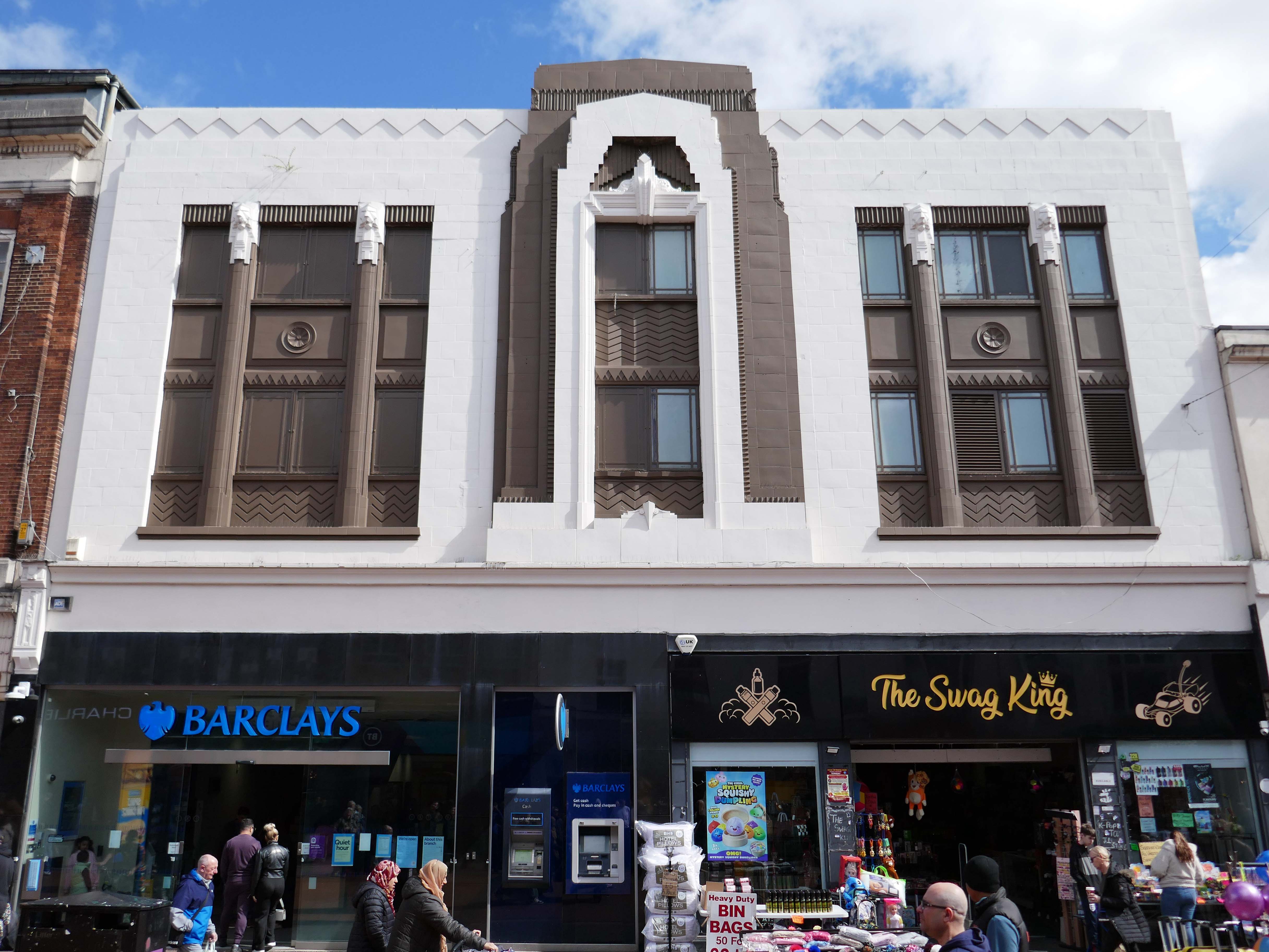
Heading back into the town centre, picking up on there’s a former Woolworths that looks like a Burton’s that thinks it’s a Barclays Bank, and also improbably a Swag King.
1933 by FW Woolworth Construction Dept – H Wimbourne
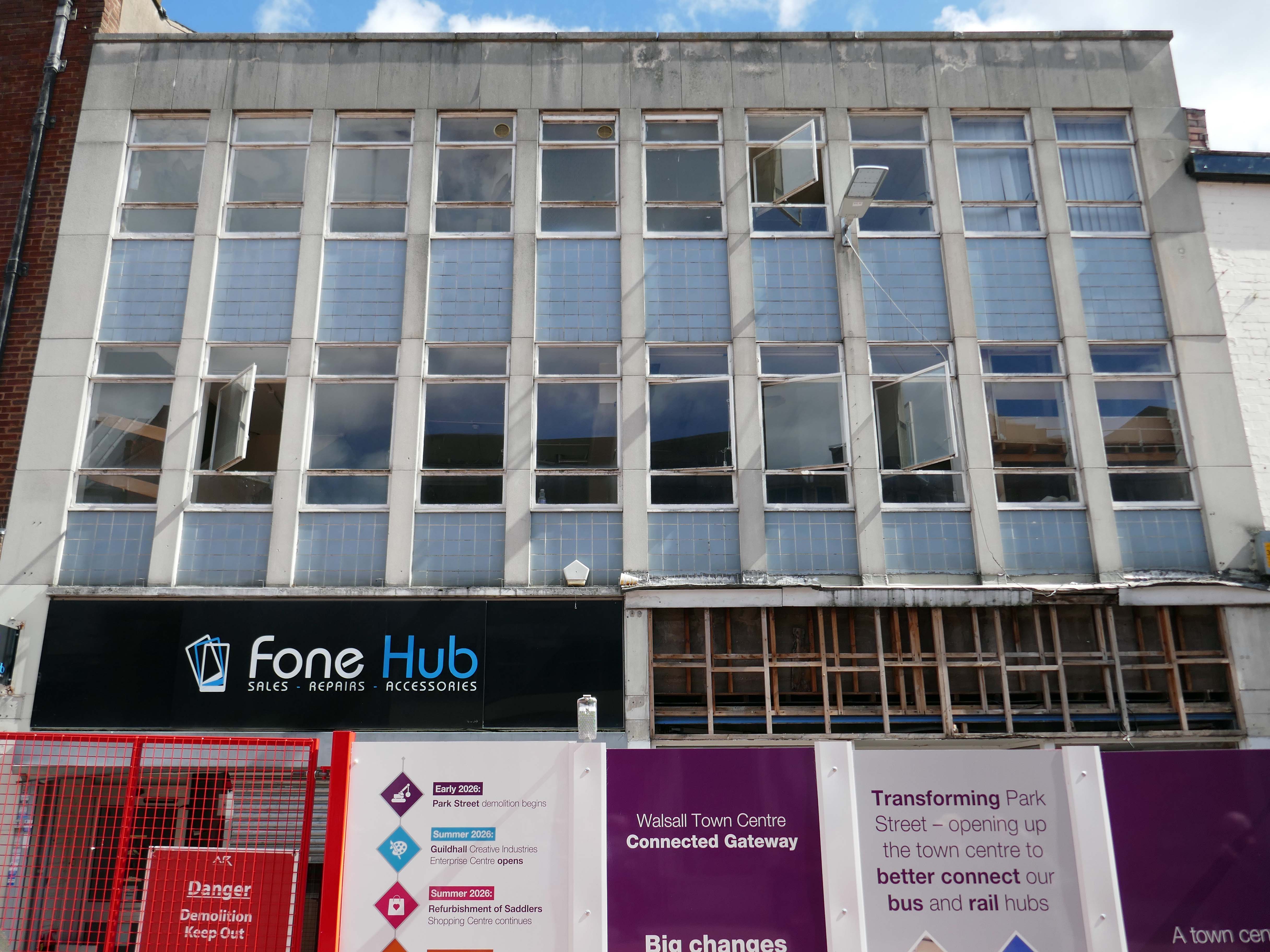
Next an indeterminate infill with pale blue panels and central pivoting metal window frames, soon to be demolished along with its neighbours, as part of the Connected Gateway Project.
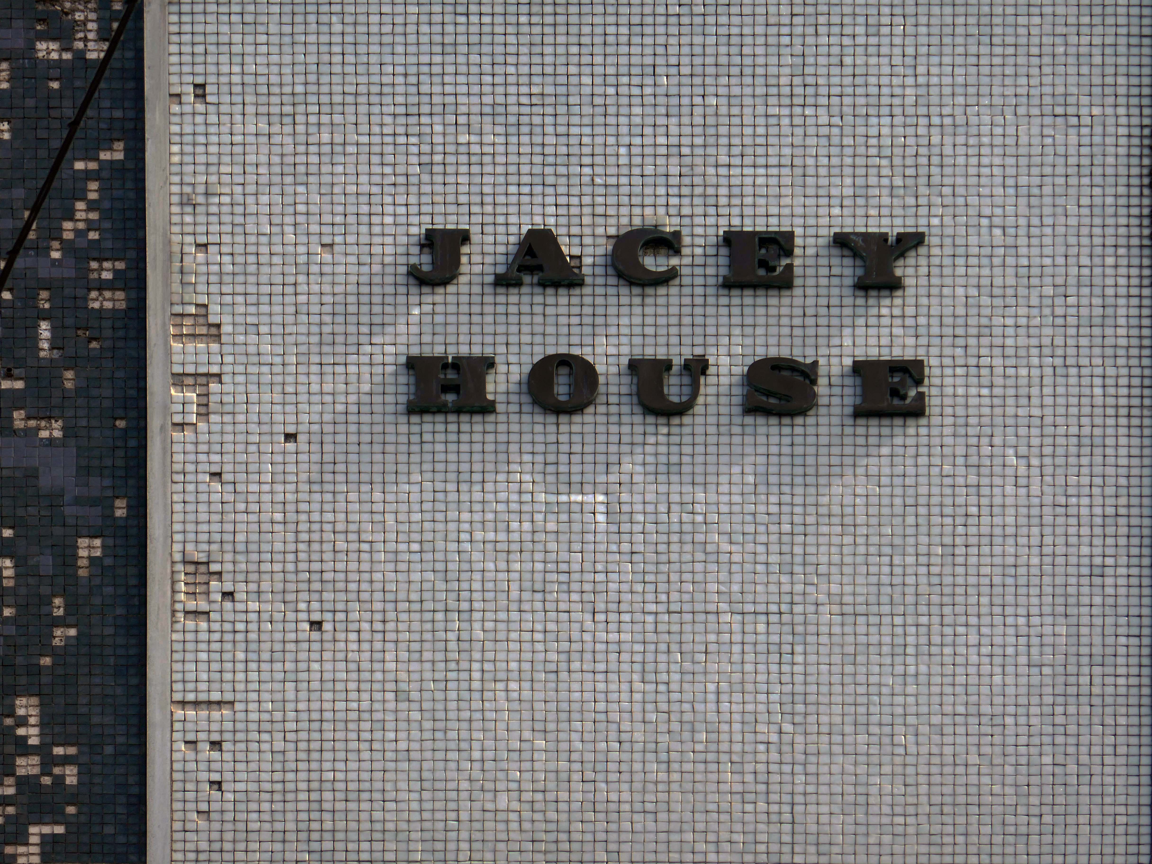
Possibly a former BHS – known as Jacey House.
Next up Park Place.
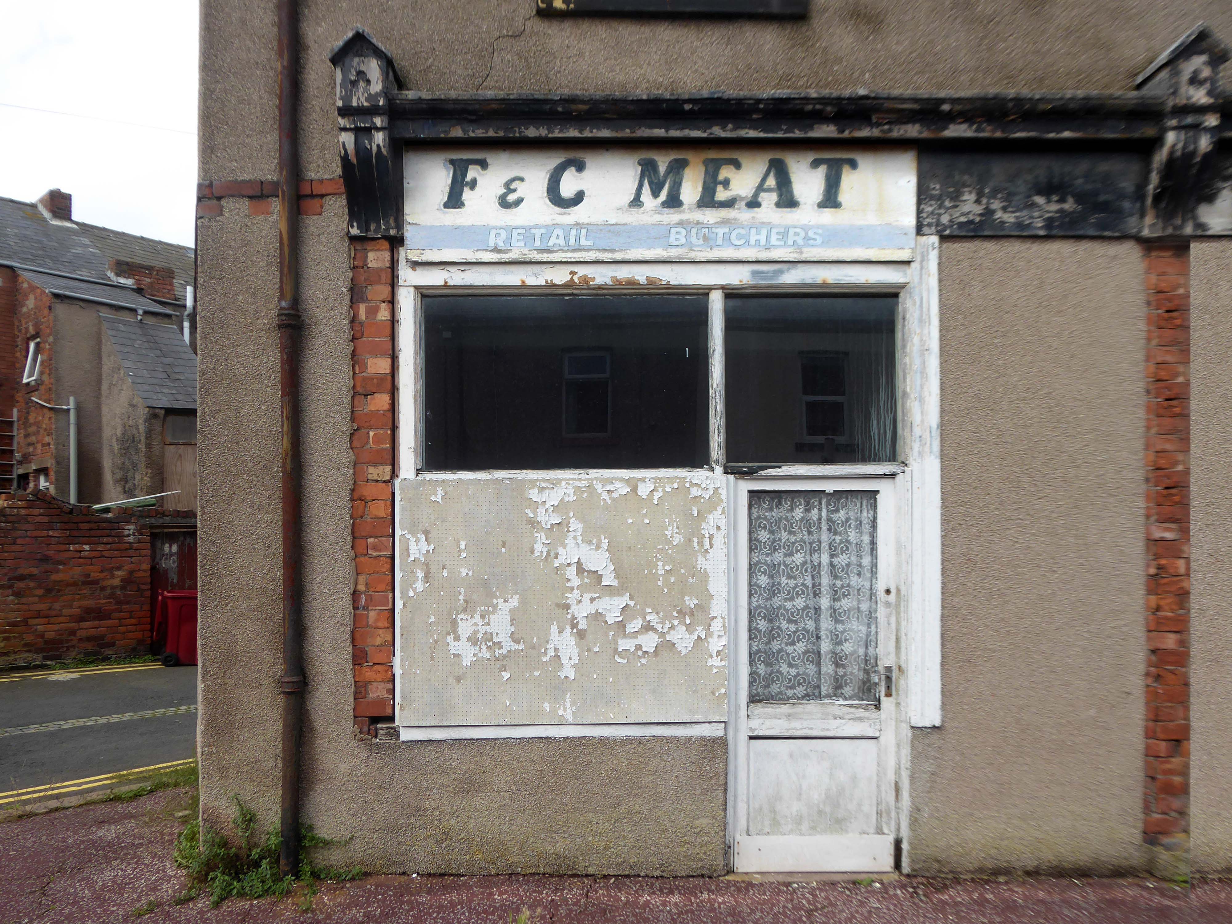
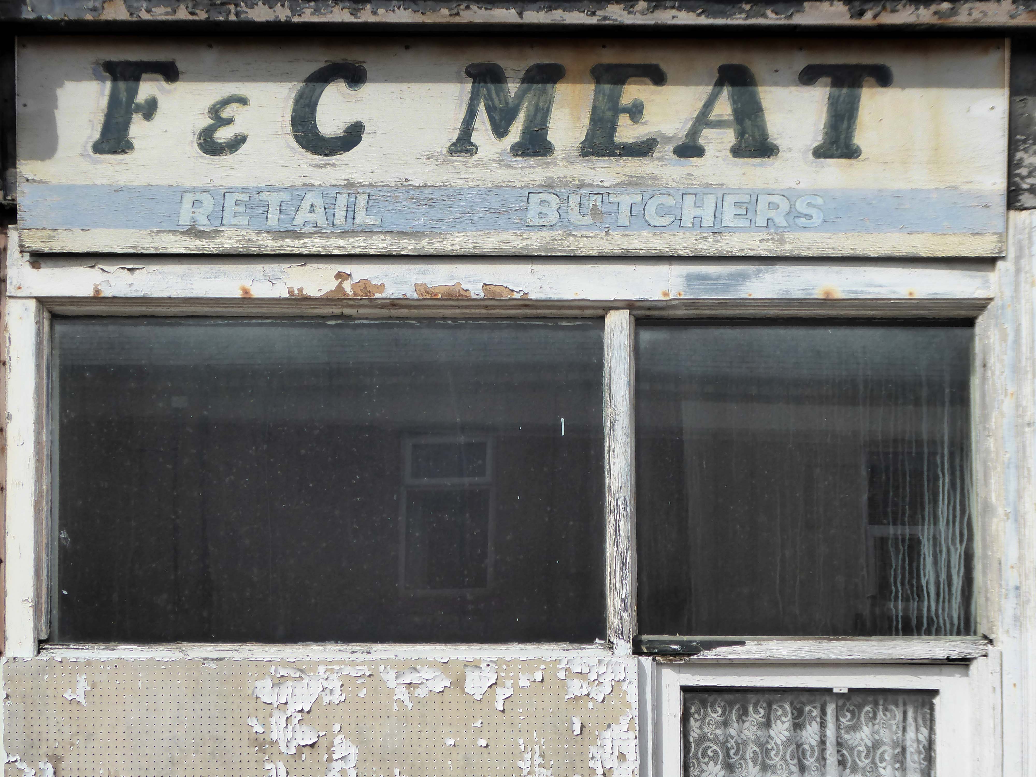
Ai says – notable features include Park Place Meats – a town centre butcher, and Park Place Shoe Repairs, which offers engraving and key-cutting services.
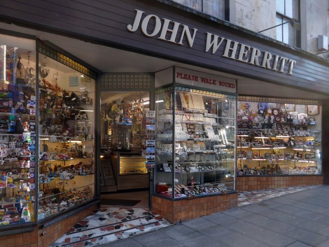
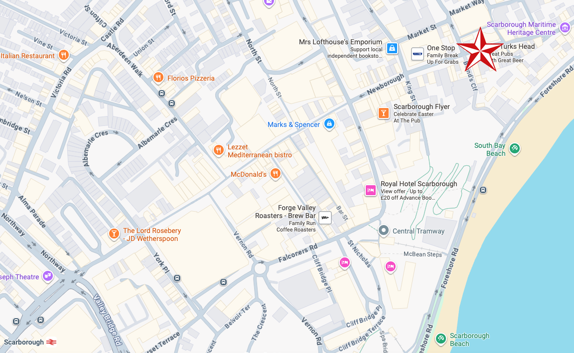
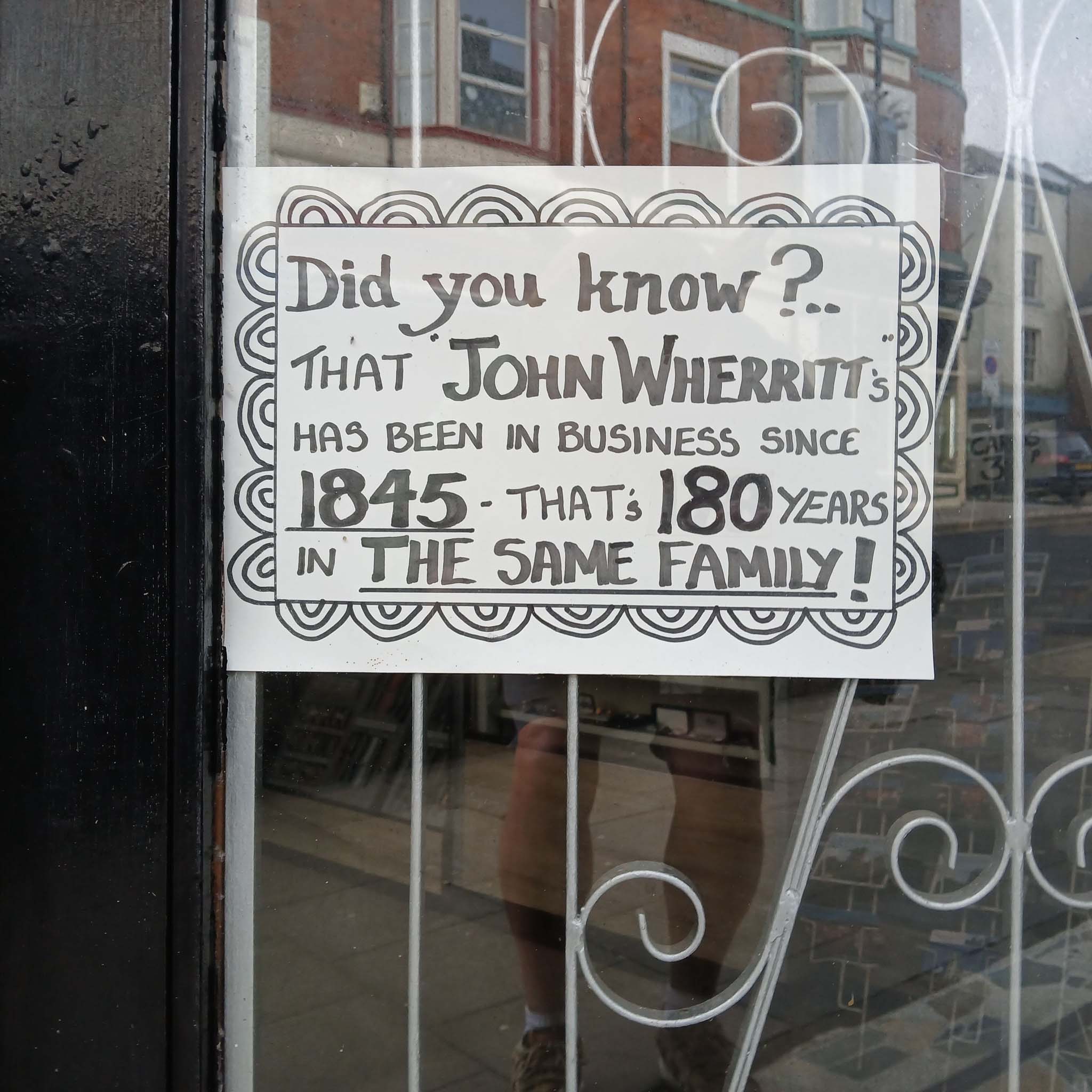
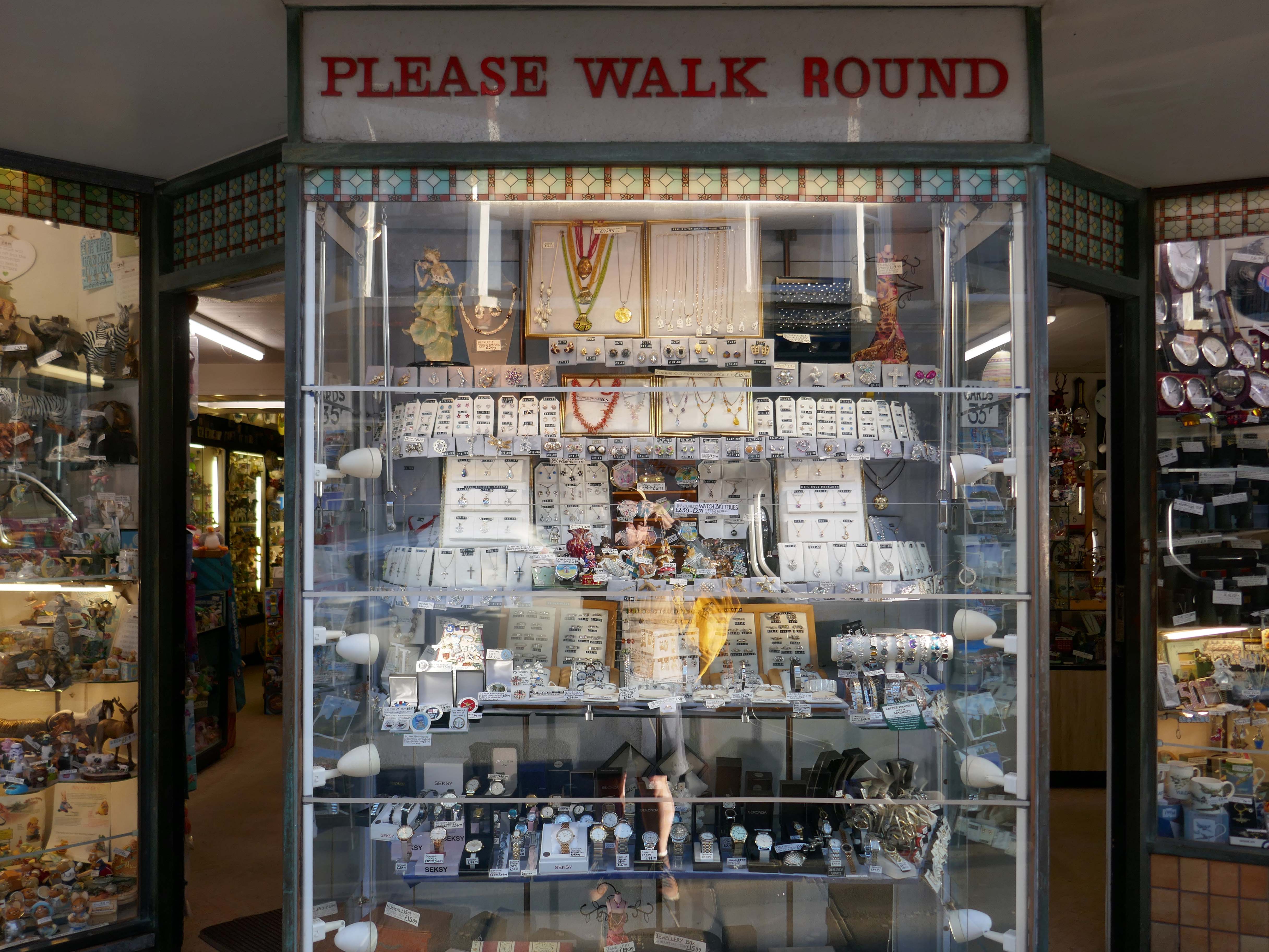
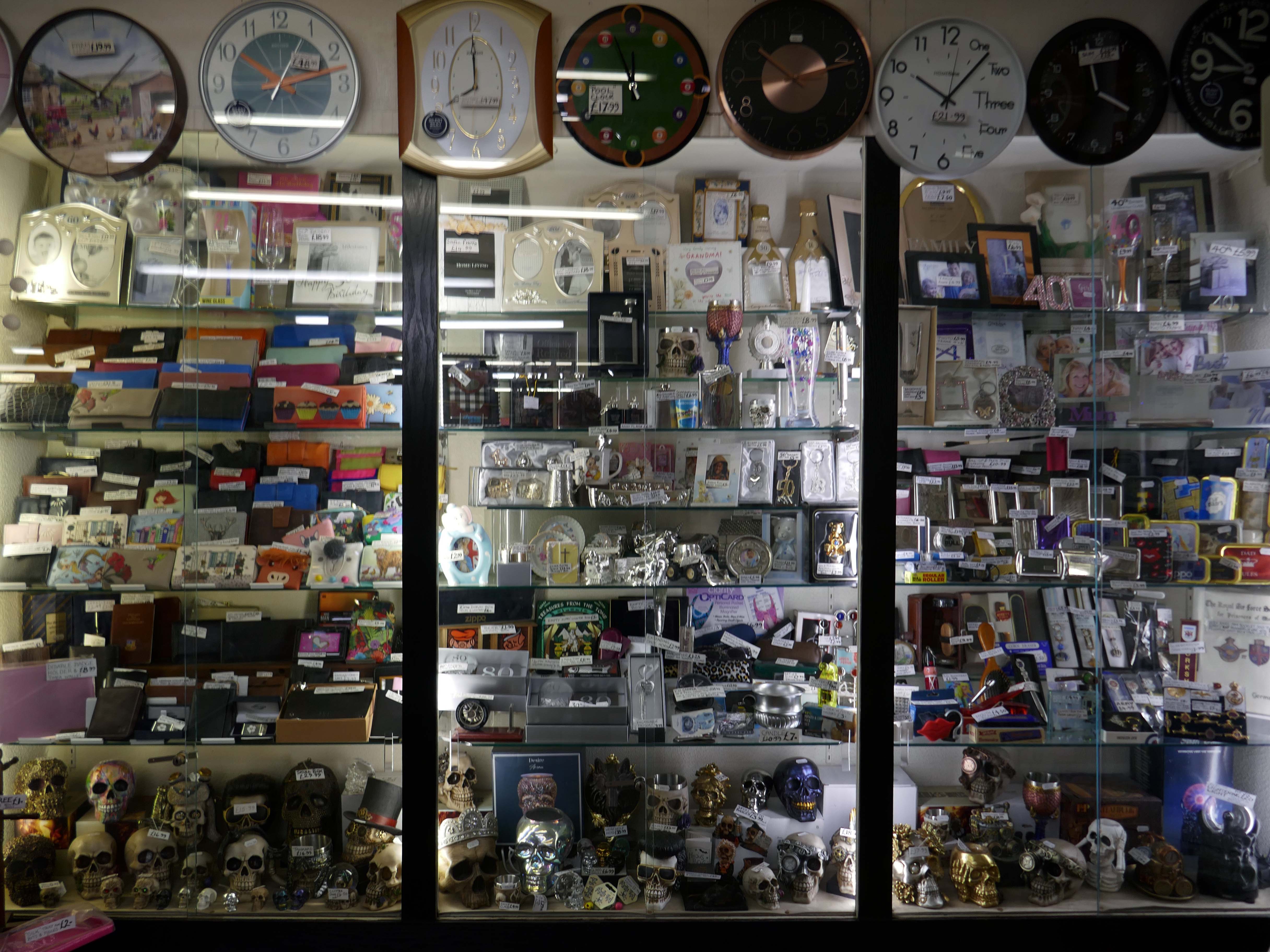
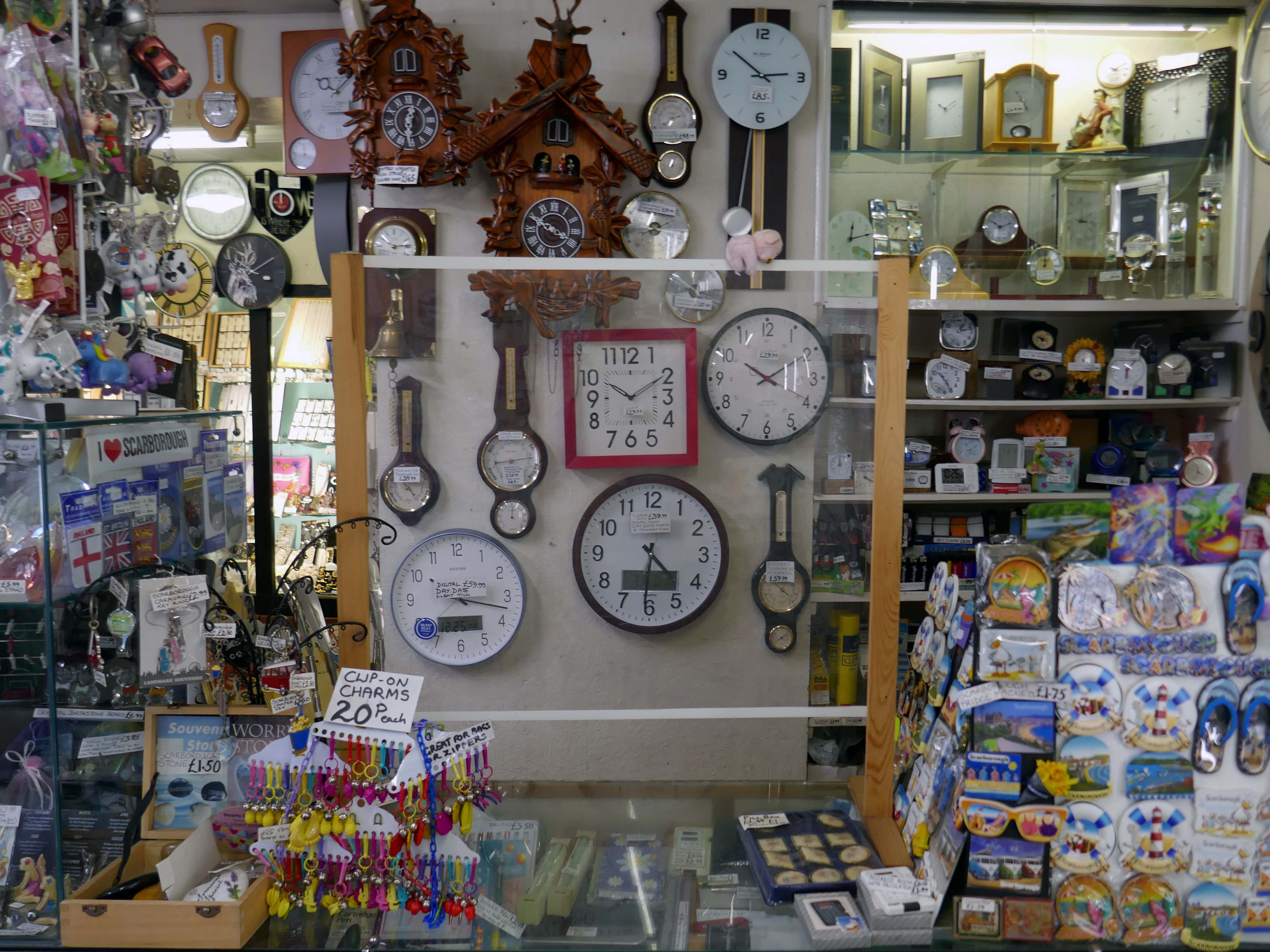
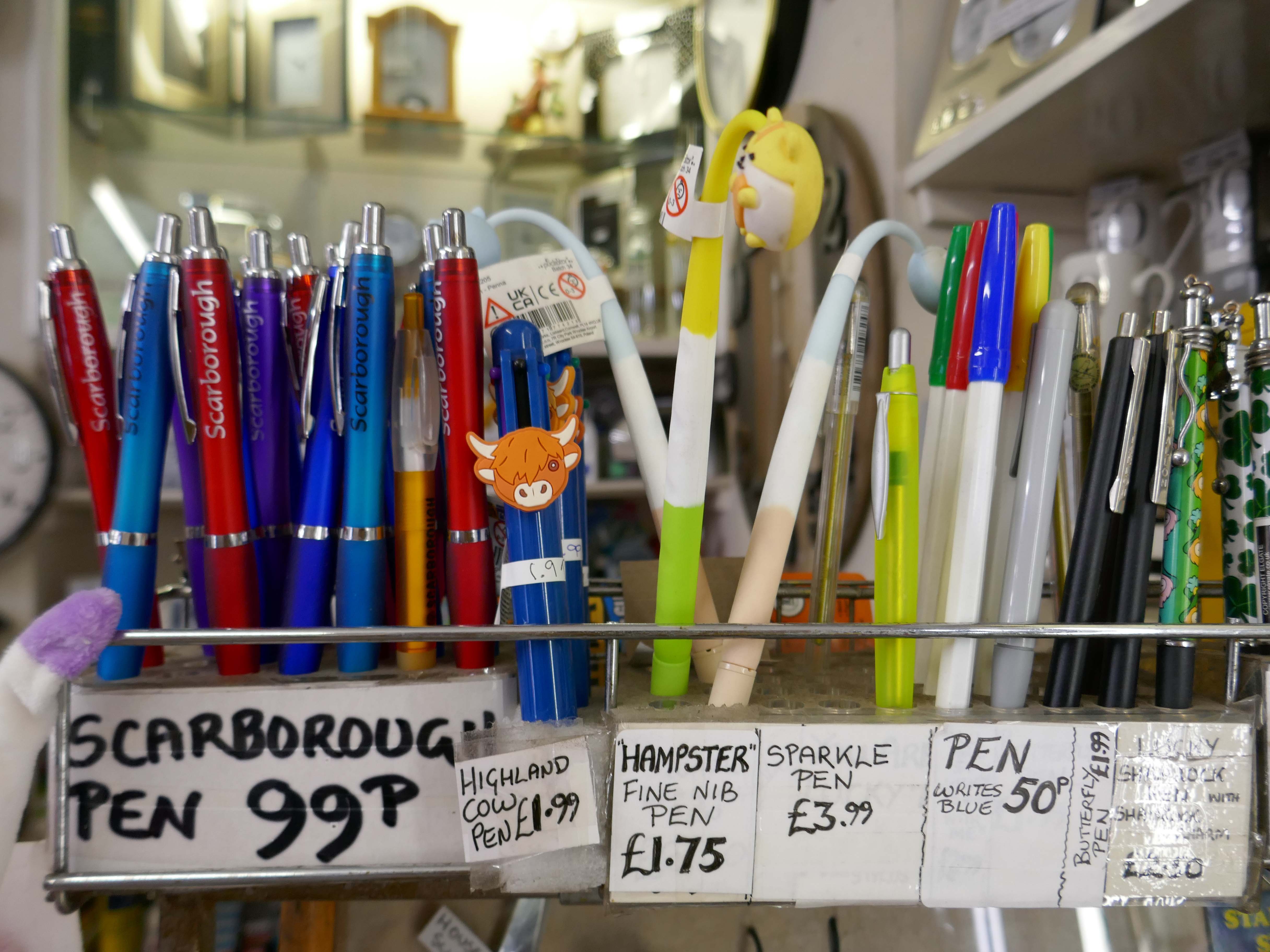
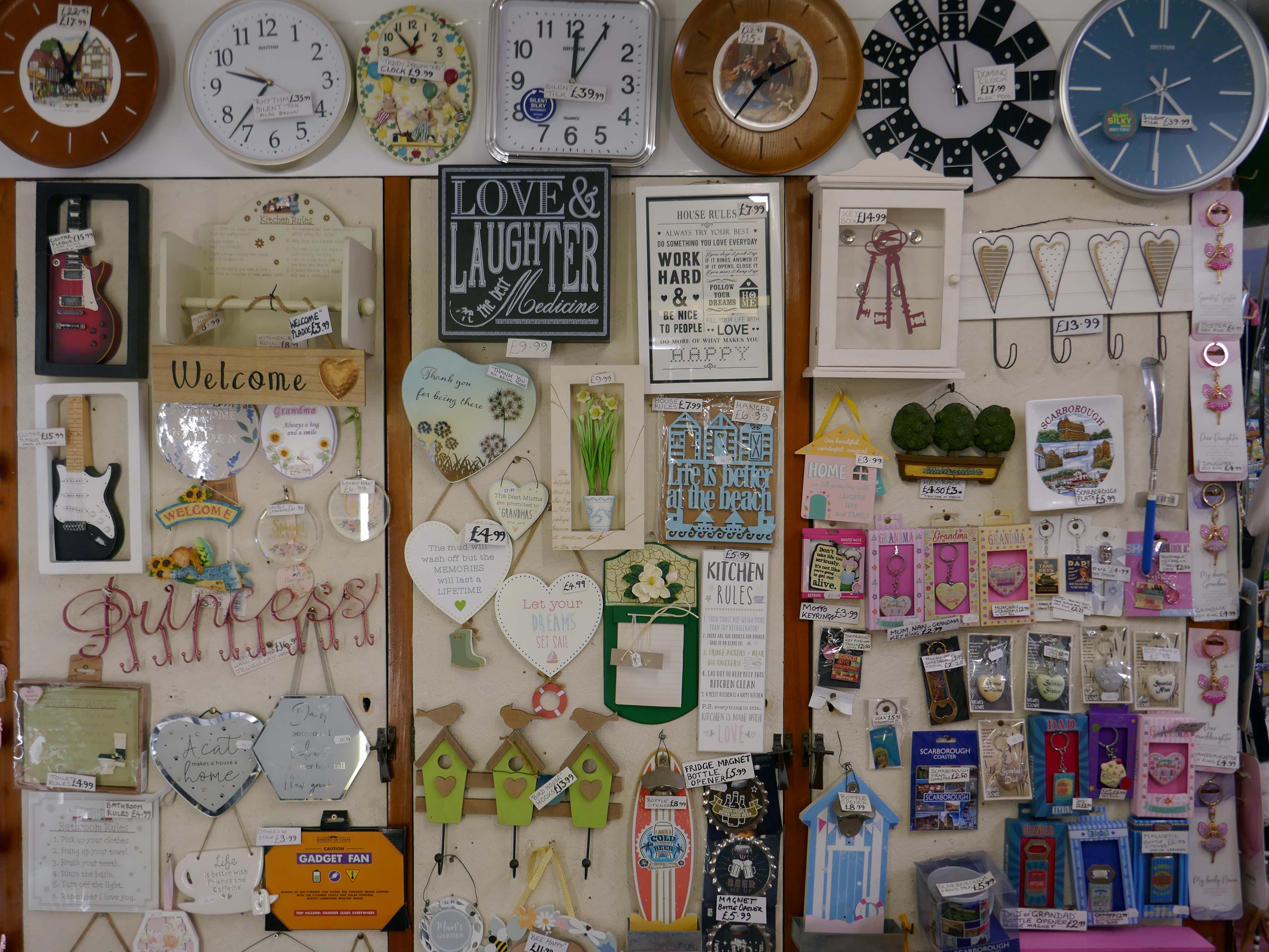
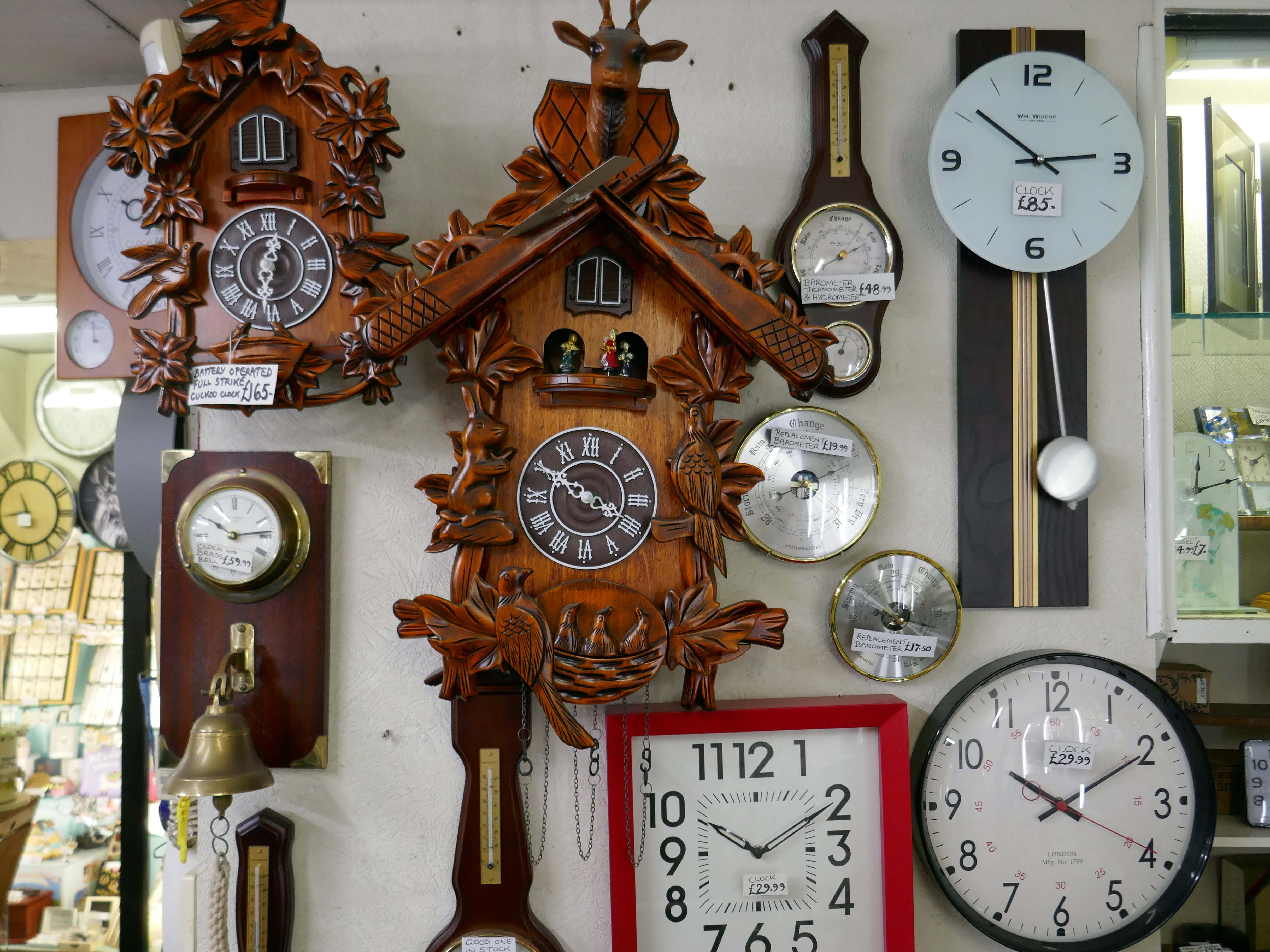
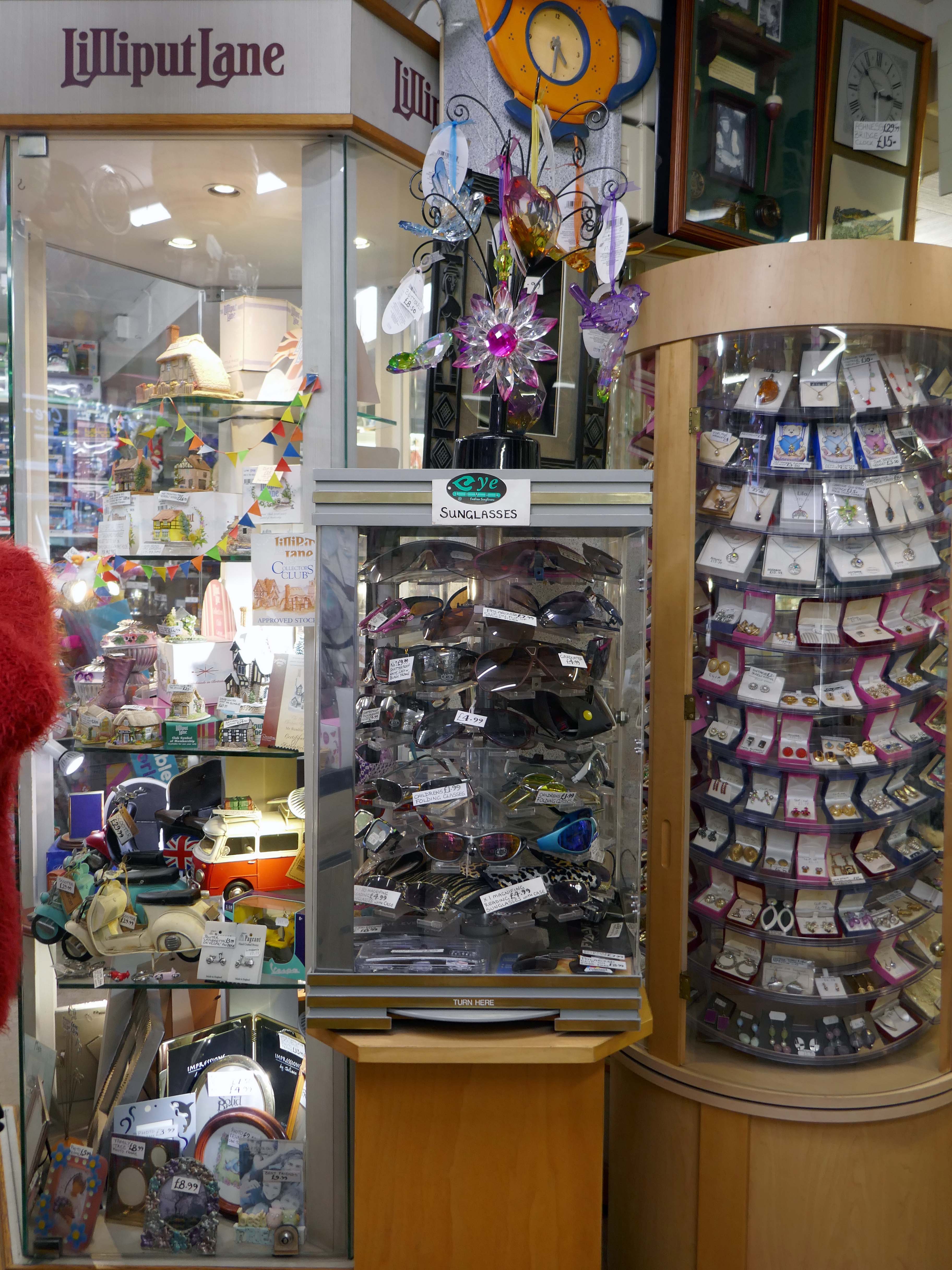
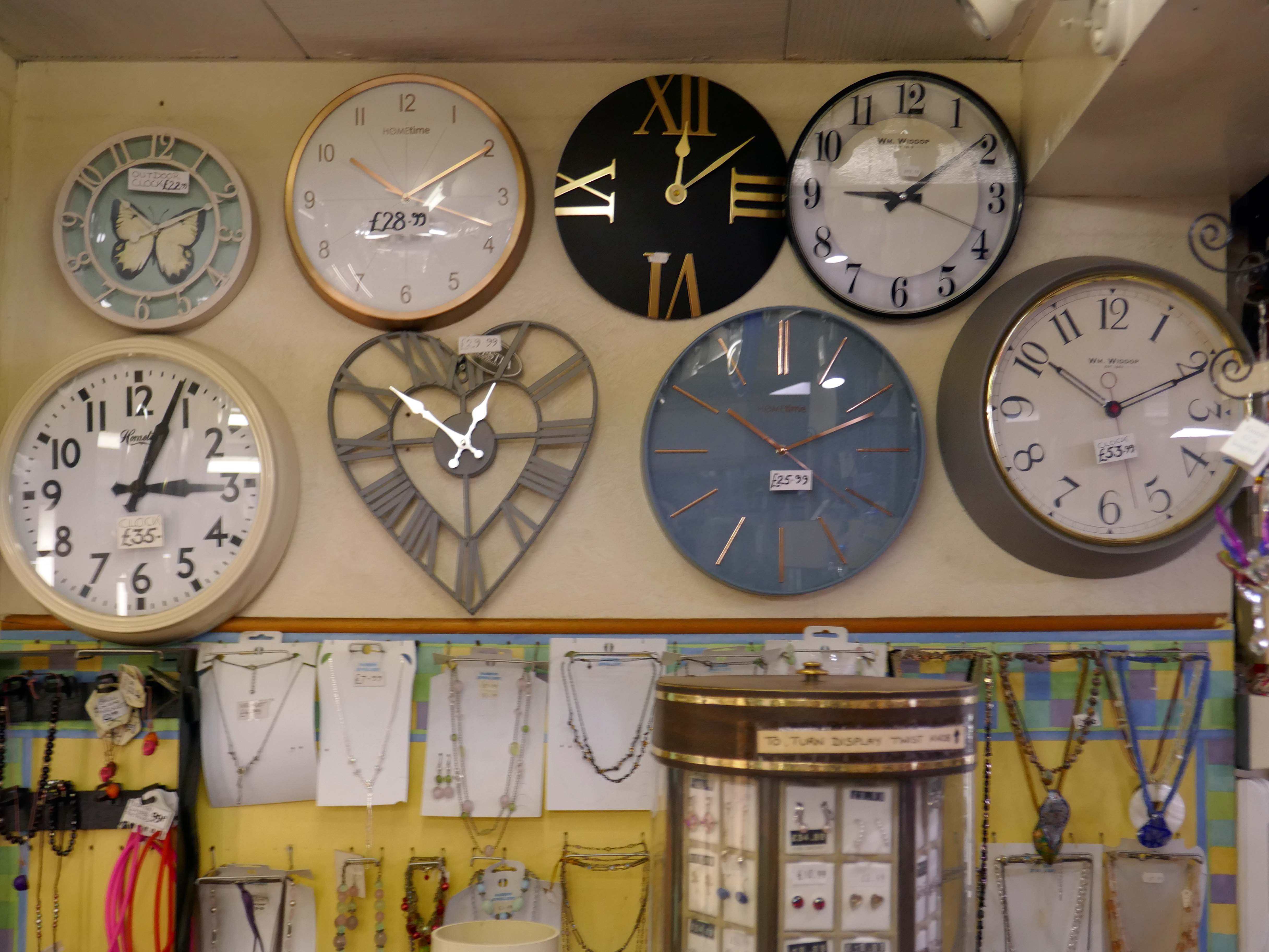
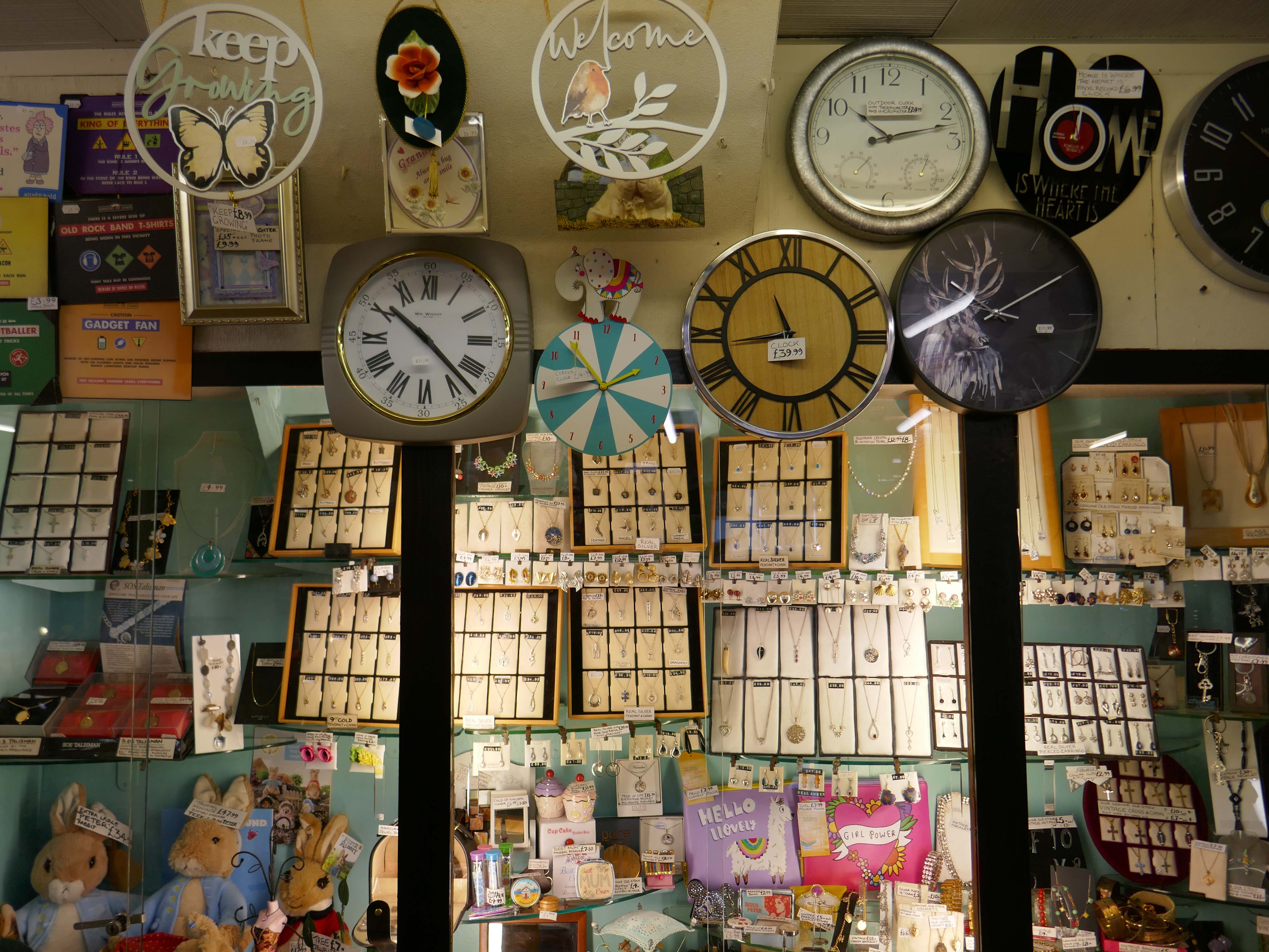
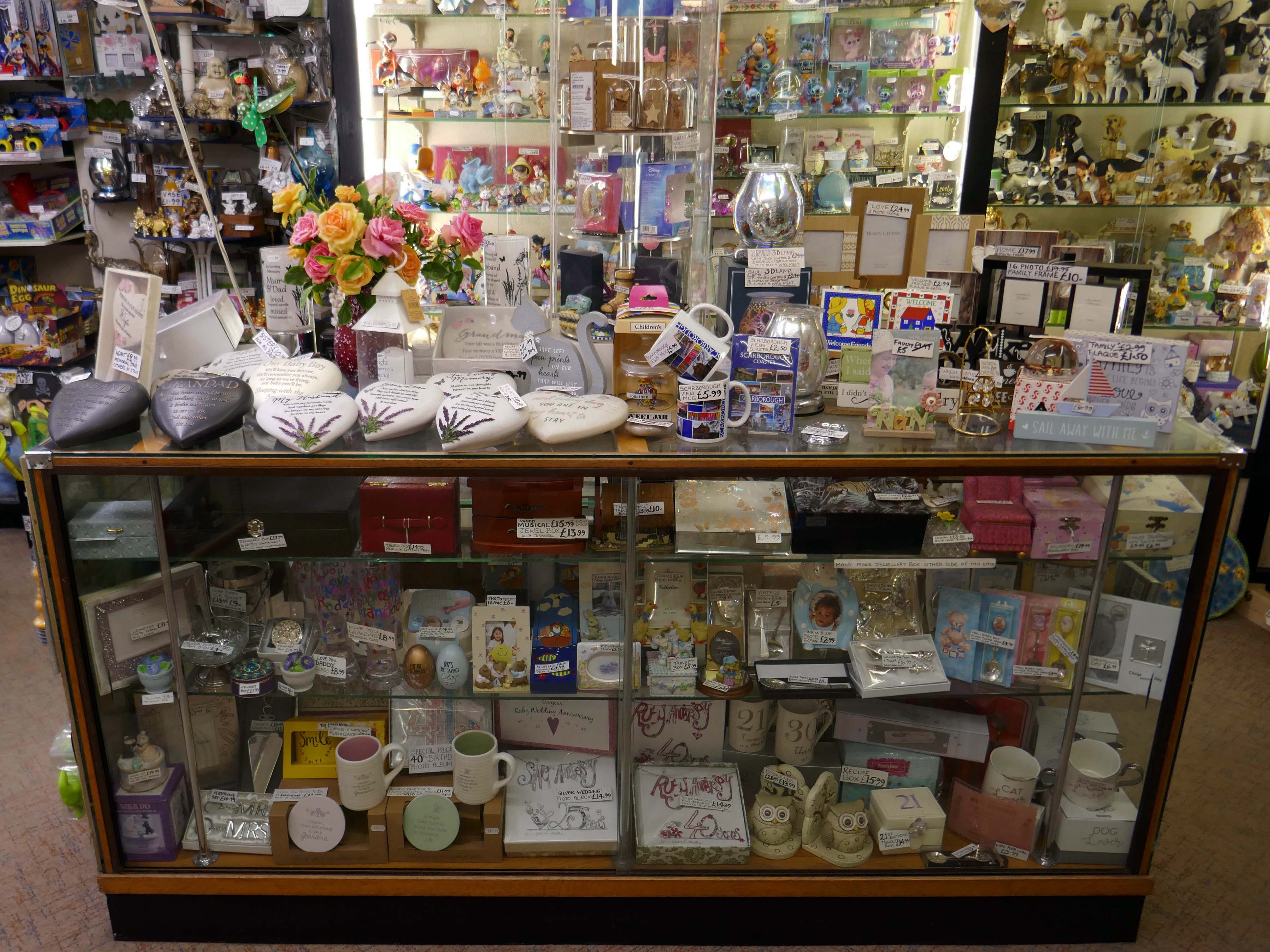
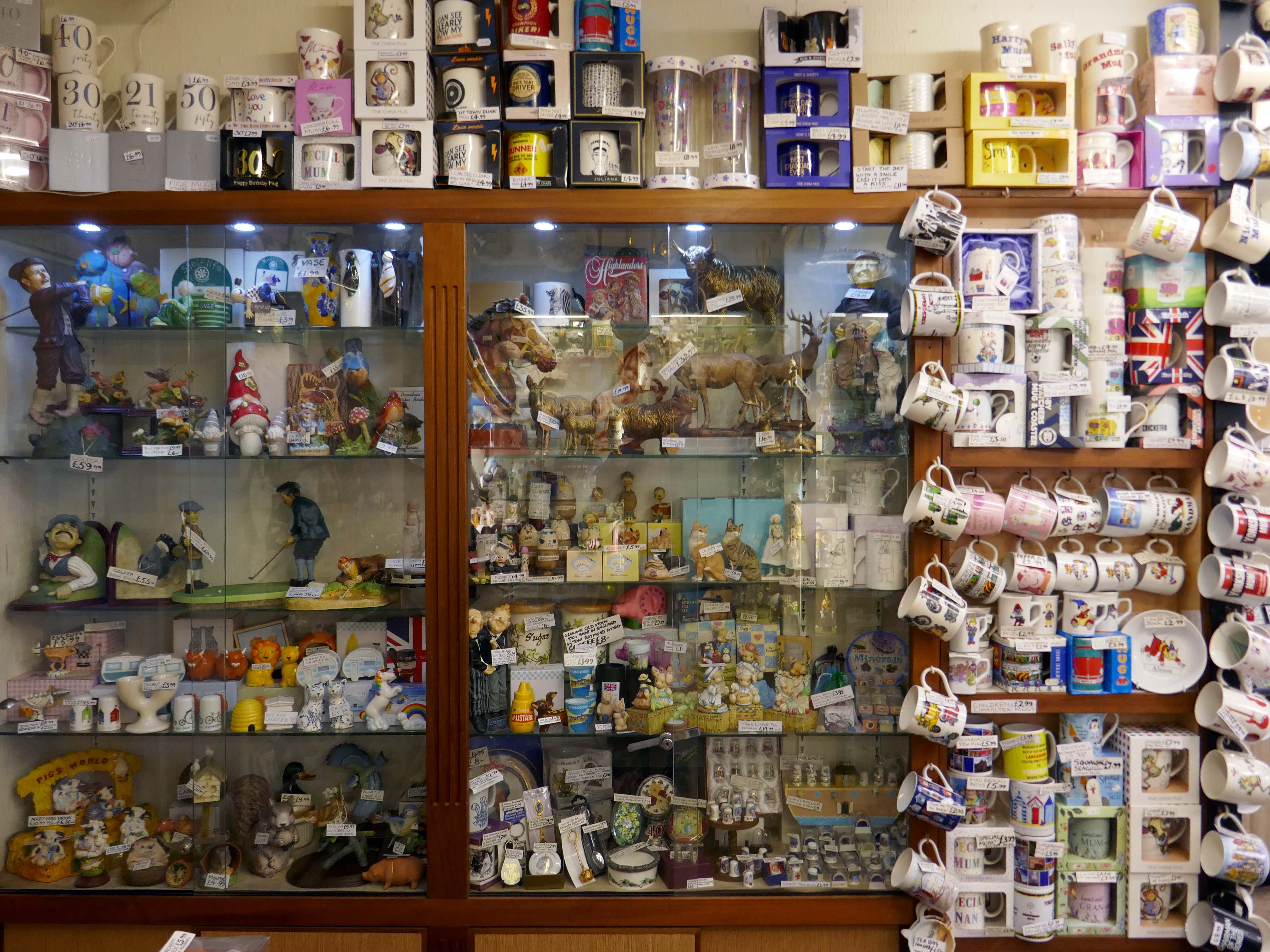
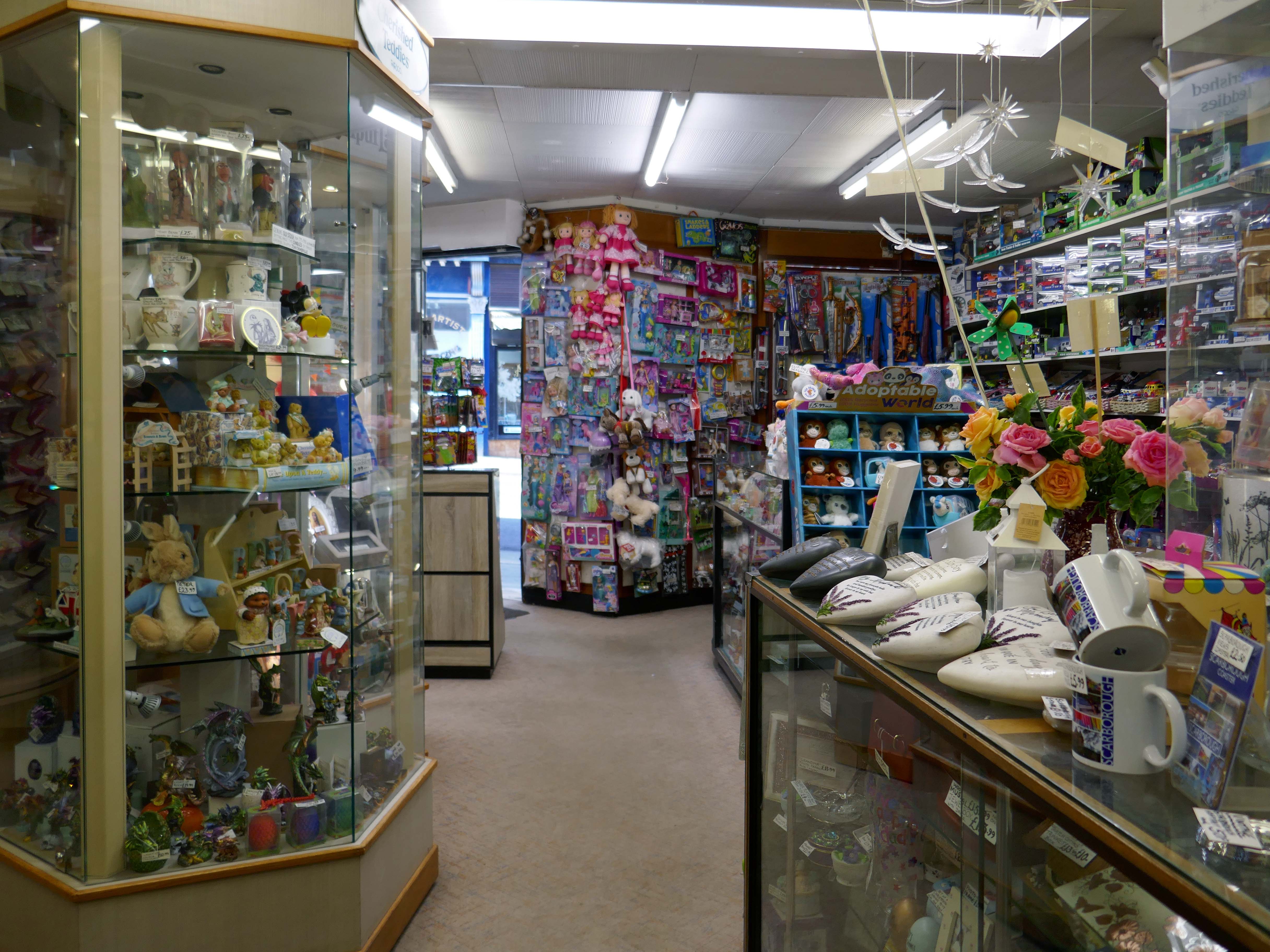
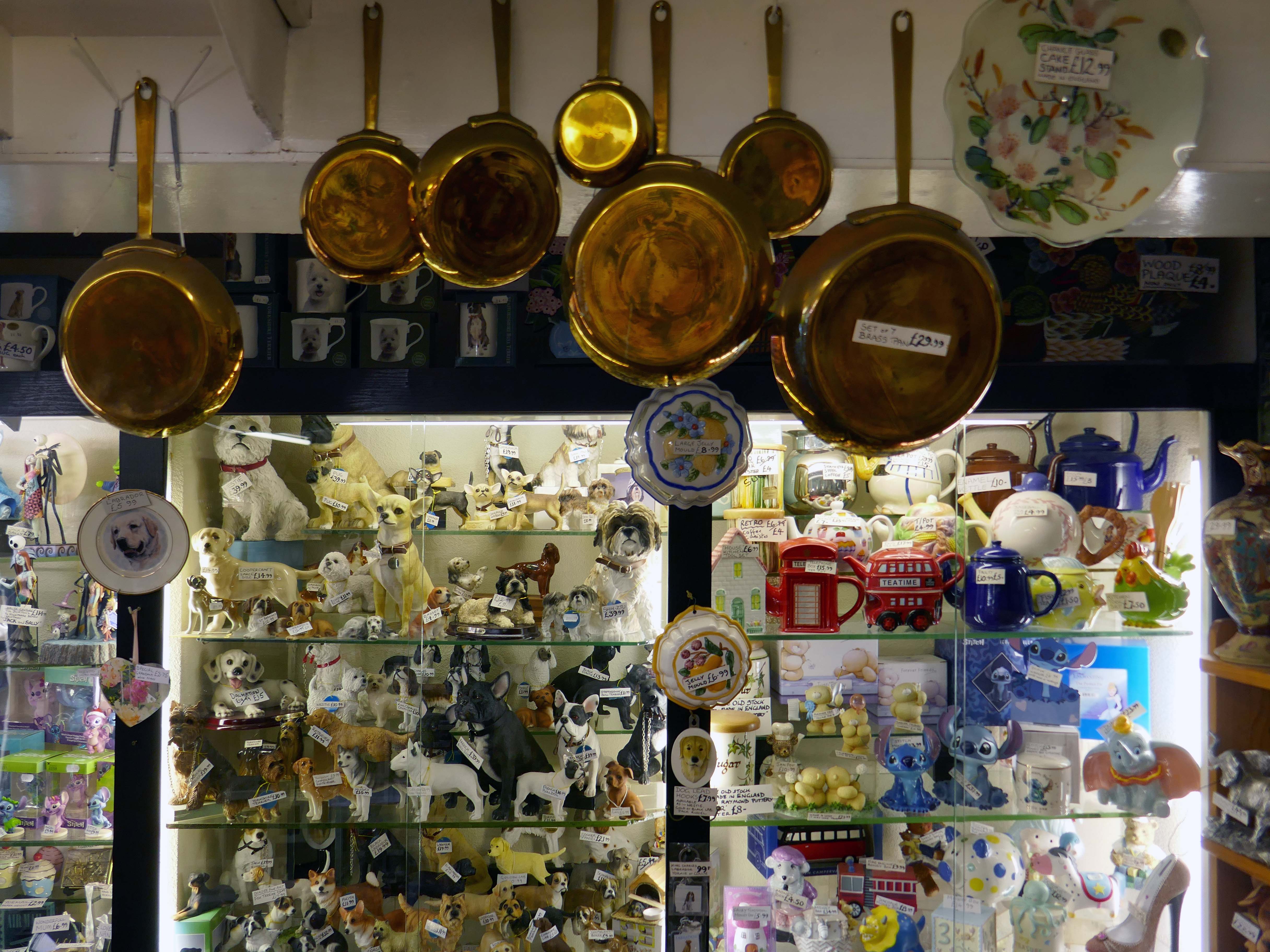
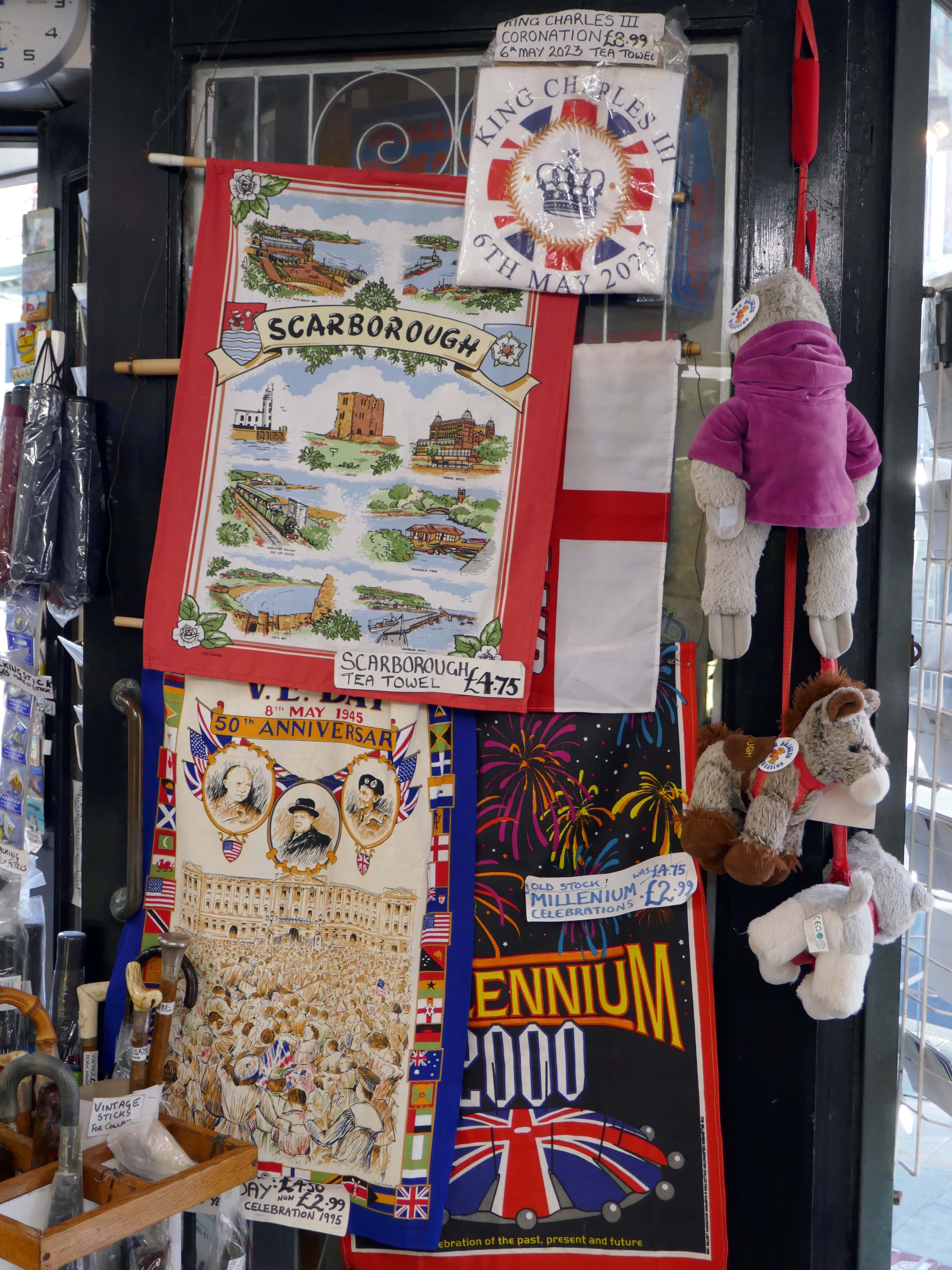
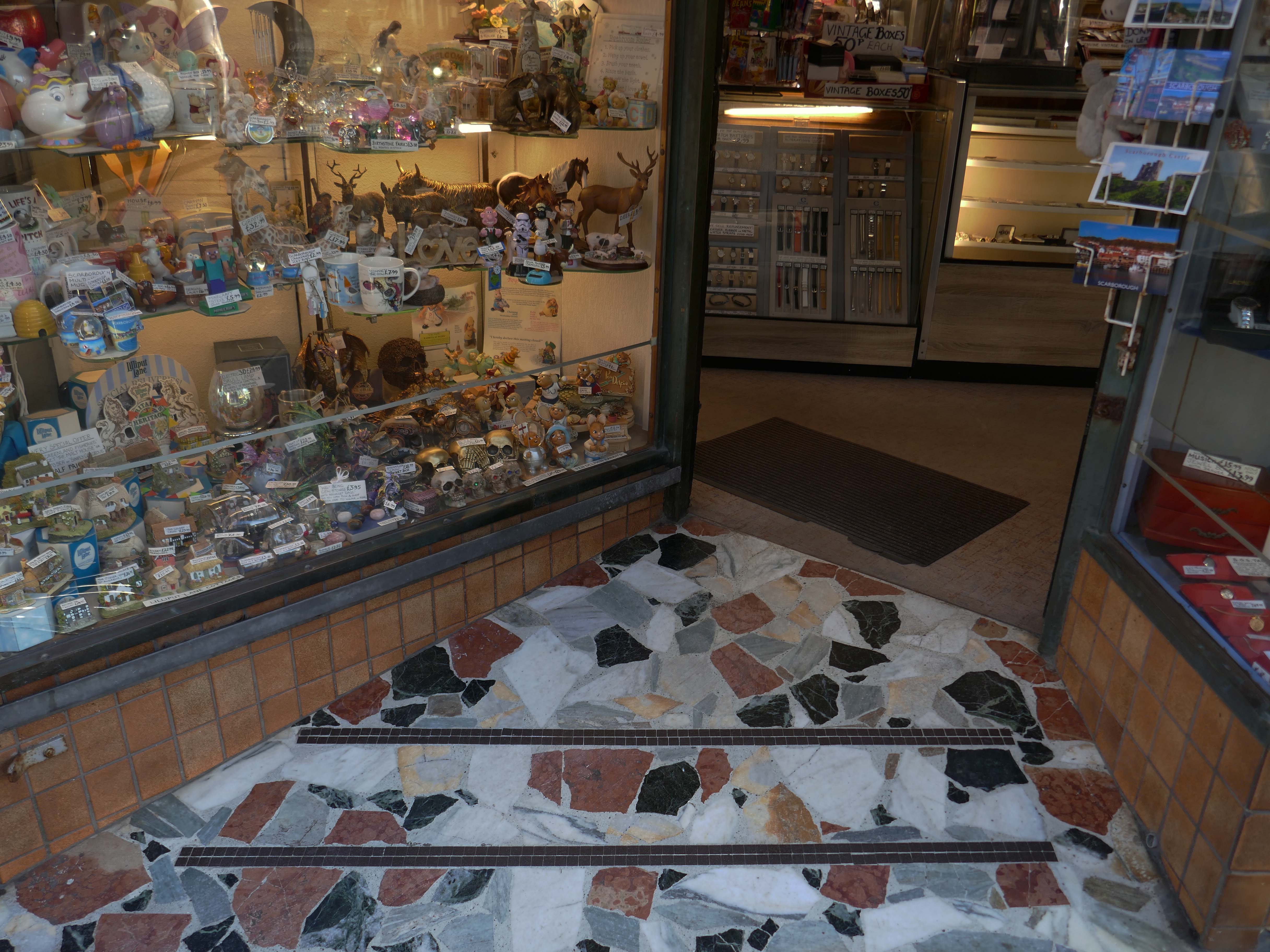
J H Wherritt is a cherished gift shop located at 5-7 Eastborough in the heart of Scarborough. Known as a hidden gem and a fantastic treasure trove by visitors, this highly-rated establishment boasts an impressive 5/5 stars from numerous positive reviews. It’s the perfect place to discover a diverse range of gifts, souvenirs, toys, watches, and clocks, catering to all tastes and ages.
Customers consistently praise the shop for its extensive selection of goods, often finding unique items that are not widely available elsewhere. The dedicated team at J H Wherritt is renowned for being lovely, kind, helpful, and obliging, ensuring a pleasant and satisfying shopping experience for everyone. Visitors frequently highlight the reasonable prices and excellent value offered on all purchases.
Yorkshire.com
From being a very young youngster I have always adored the seaside souvenir shops. The dazzling array of knick-knacks and gee gaws, and Wherritt’s truly merits the sobriquet Aladdin’s Cave.
Sadly the shop is now for sale:
•Business & stock available by separate negotiation
•Upper floors in need of major refurbishment
• Very inviting shop frontage with 2 entrance doors
•Shop located on busy tourist route
Guide price £175,000
We can only hope that whosoever takes the business on will maintain the wide range of stock and friendly welcome.
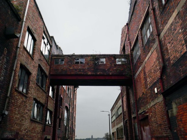
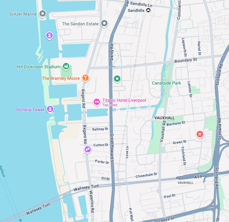
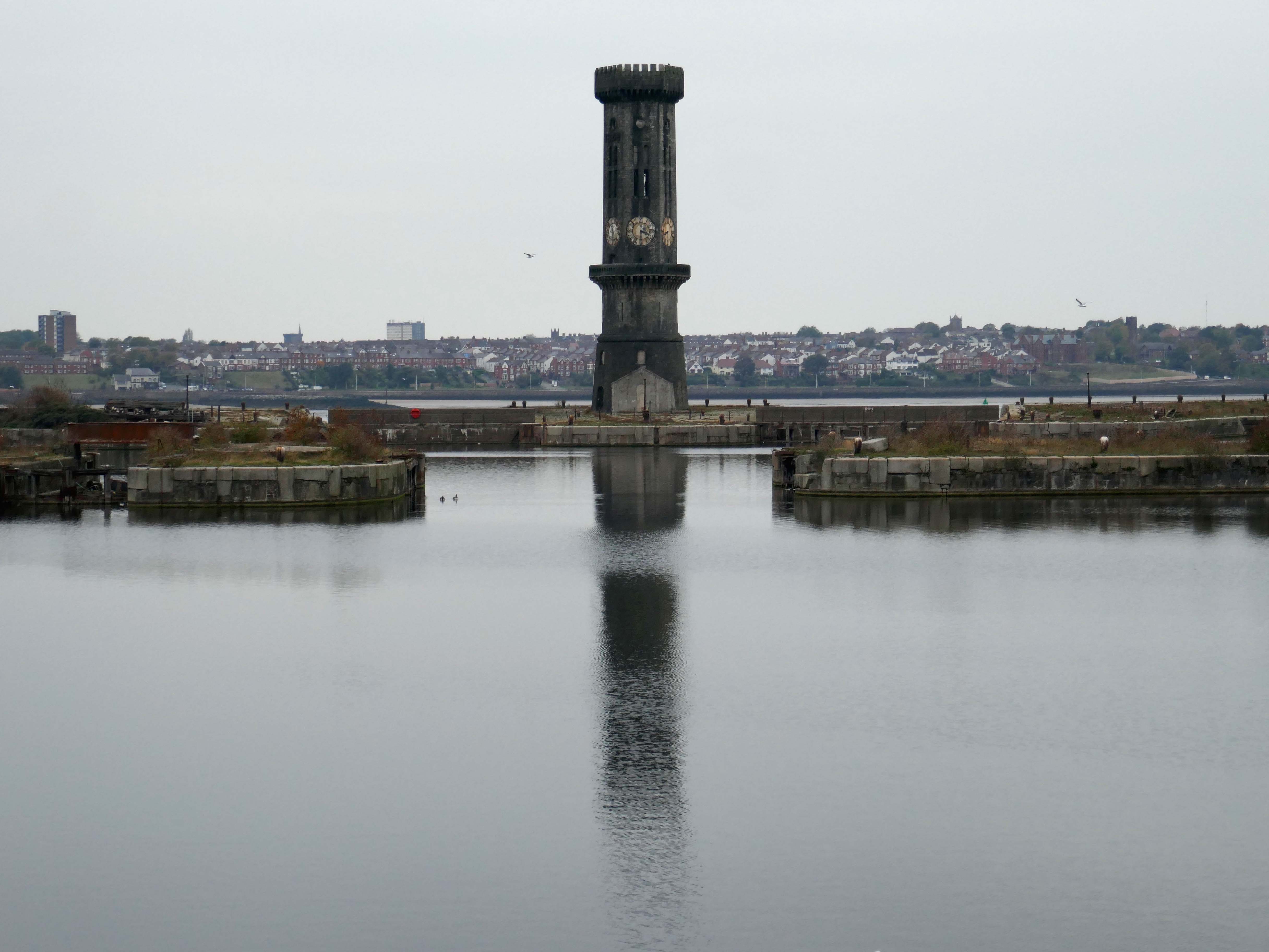
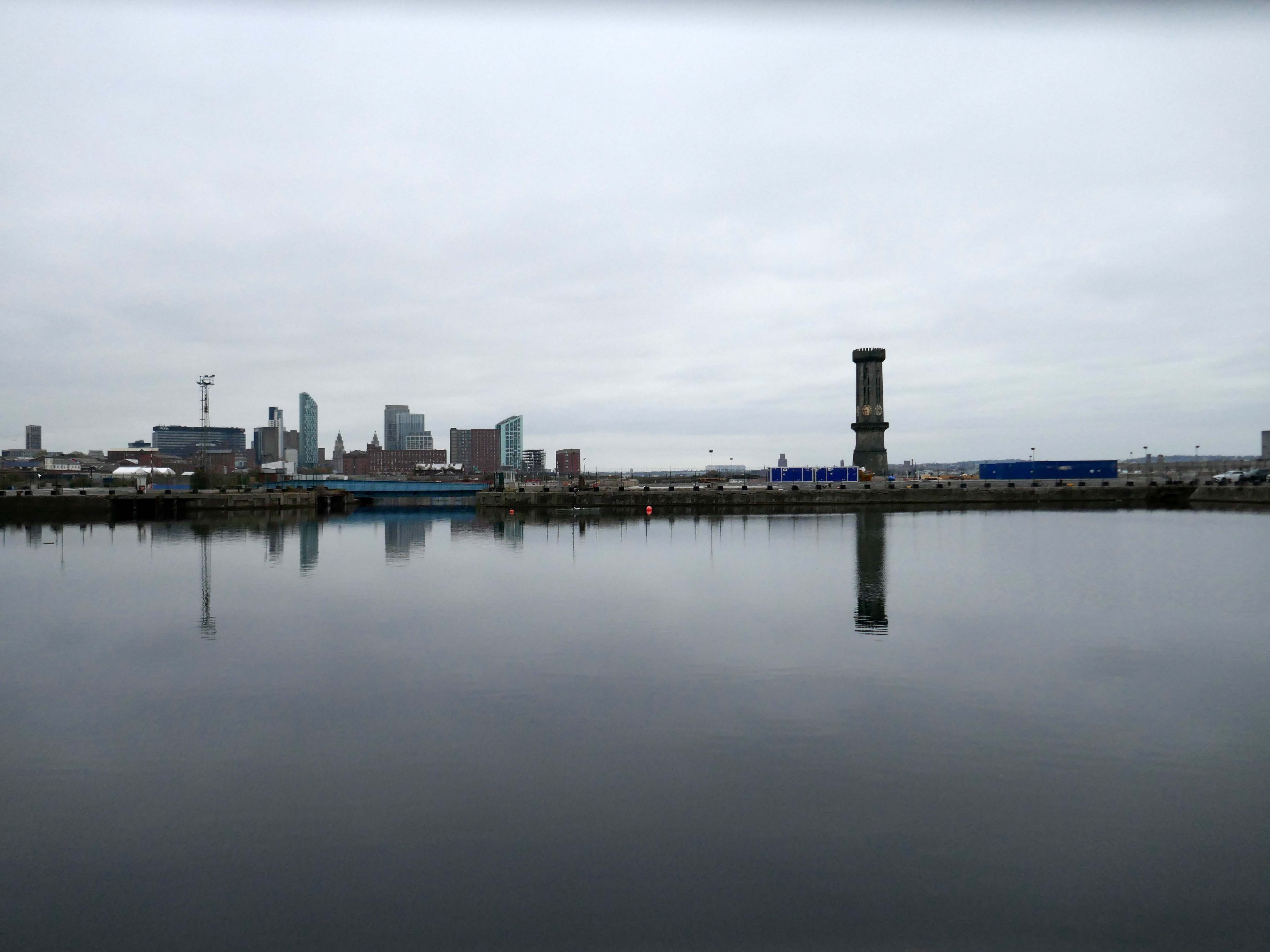
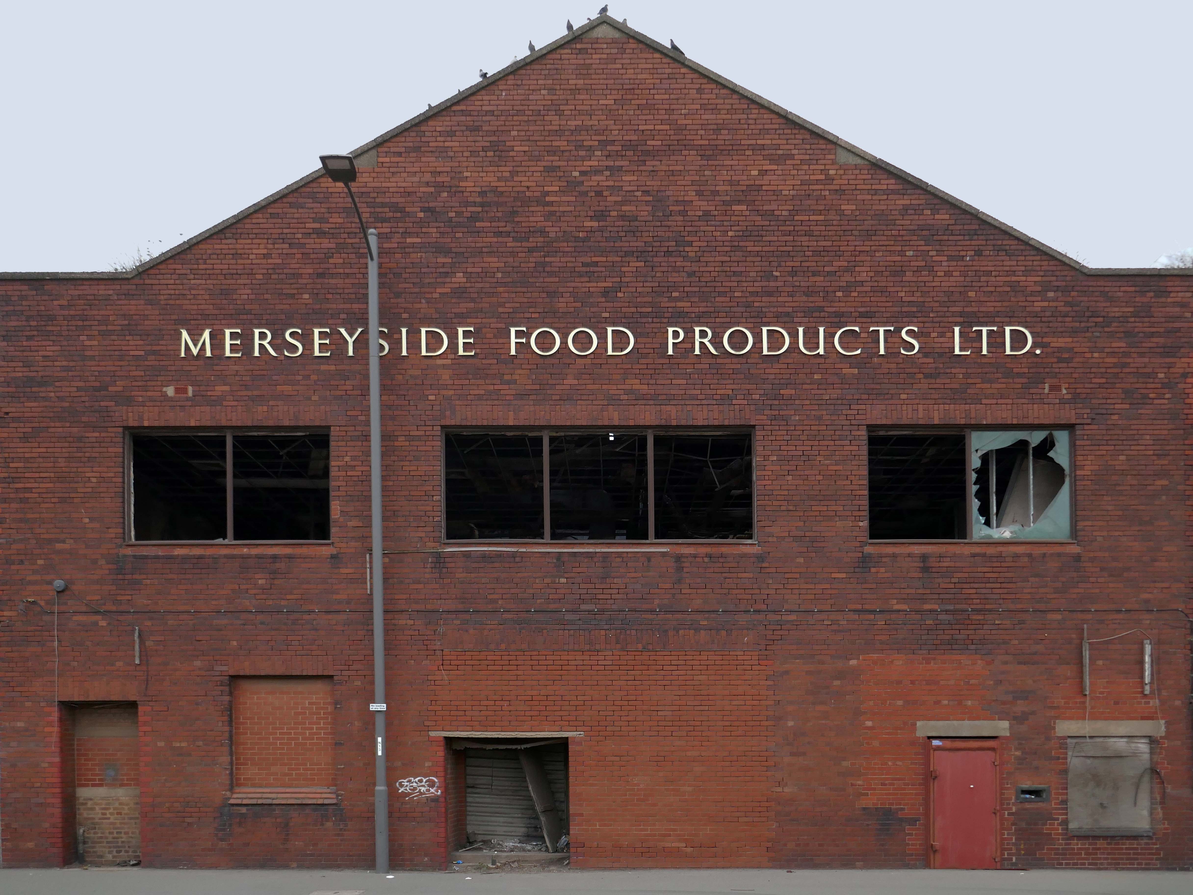
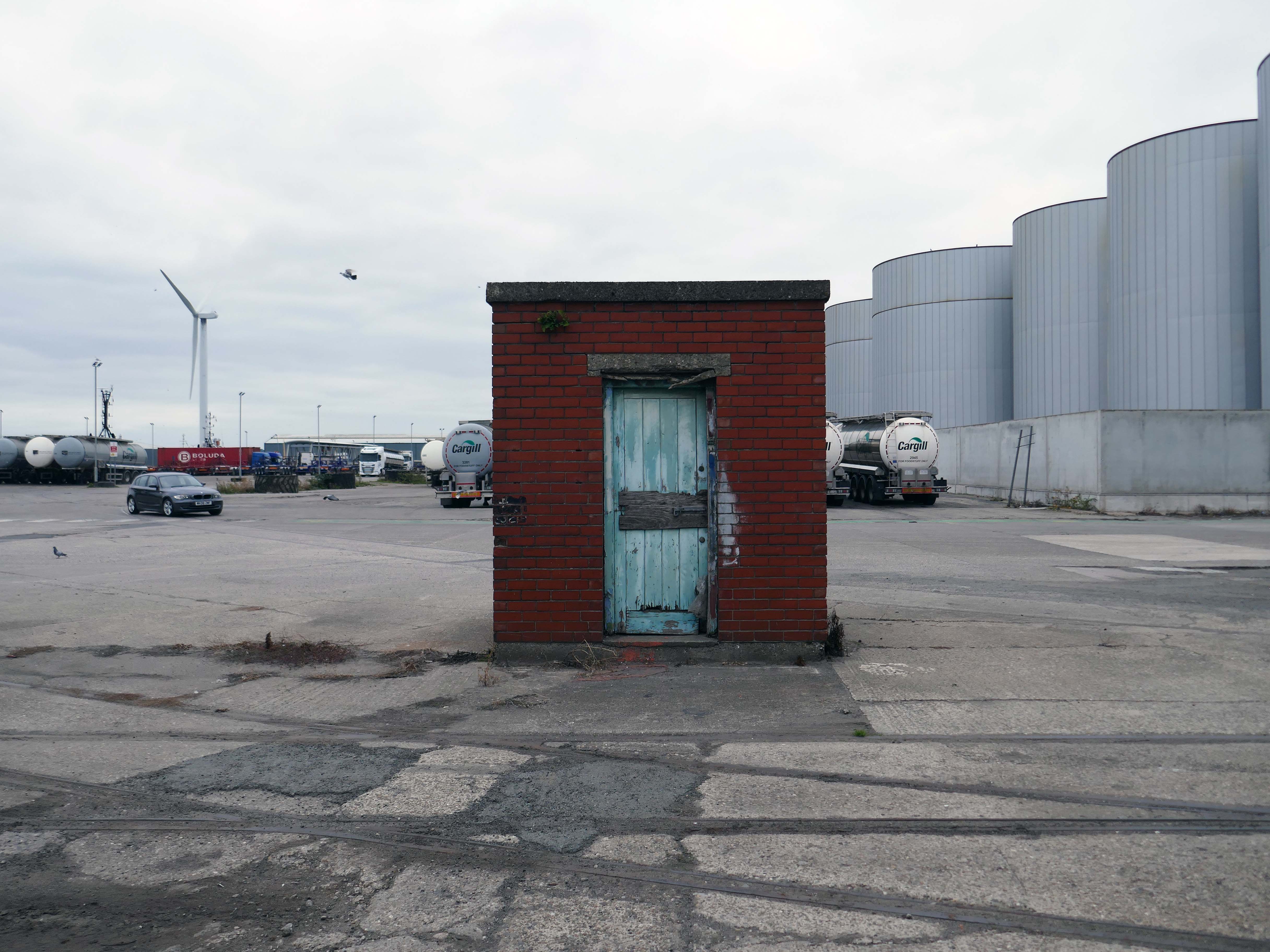
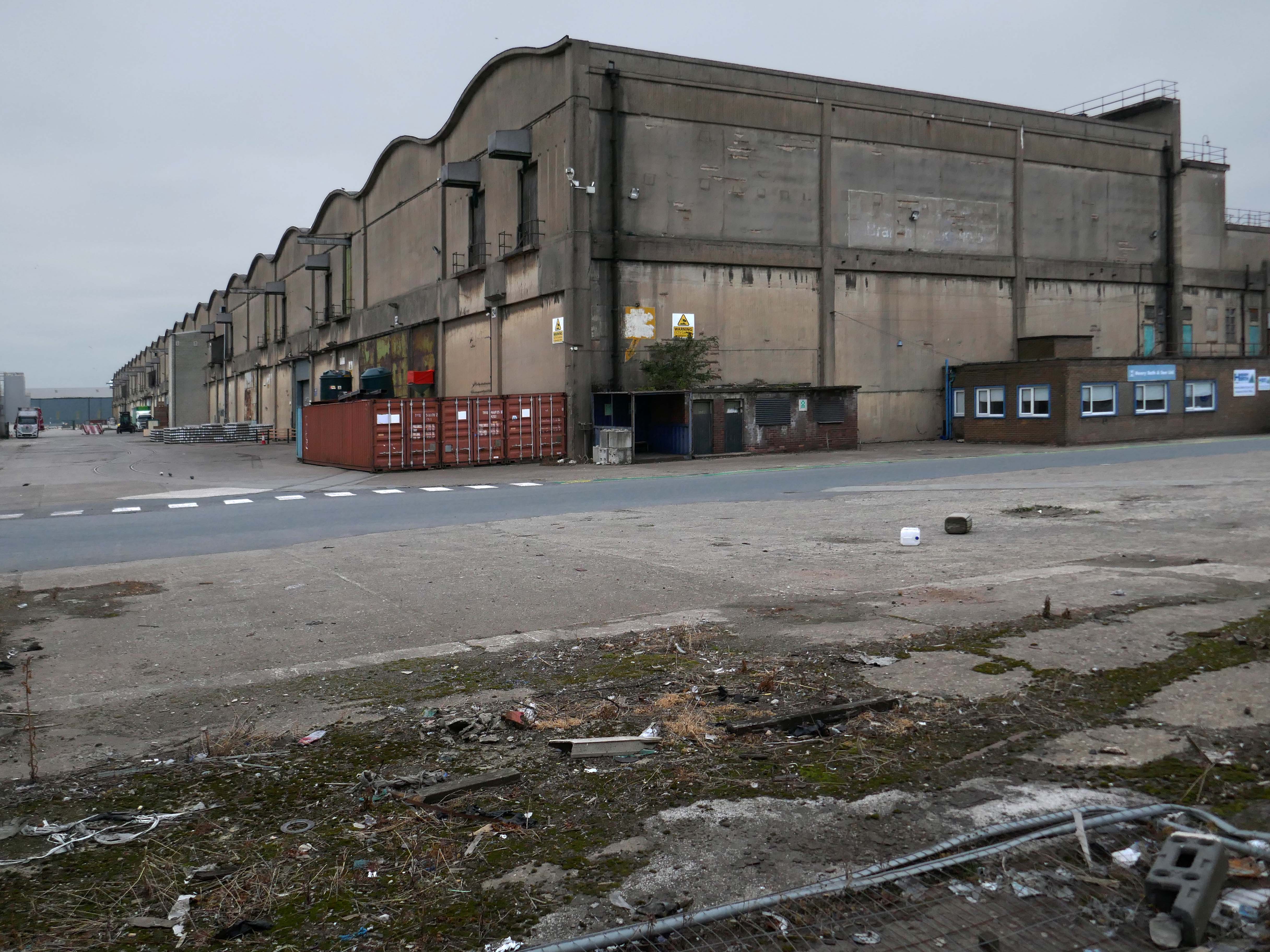
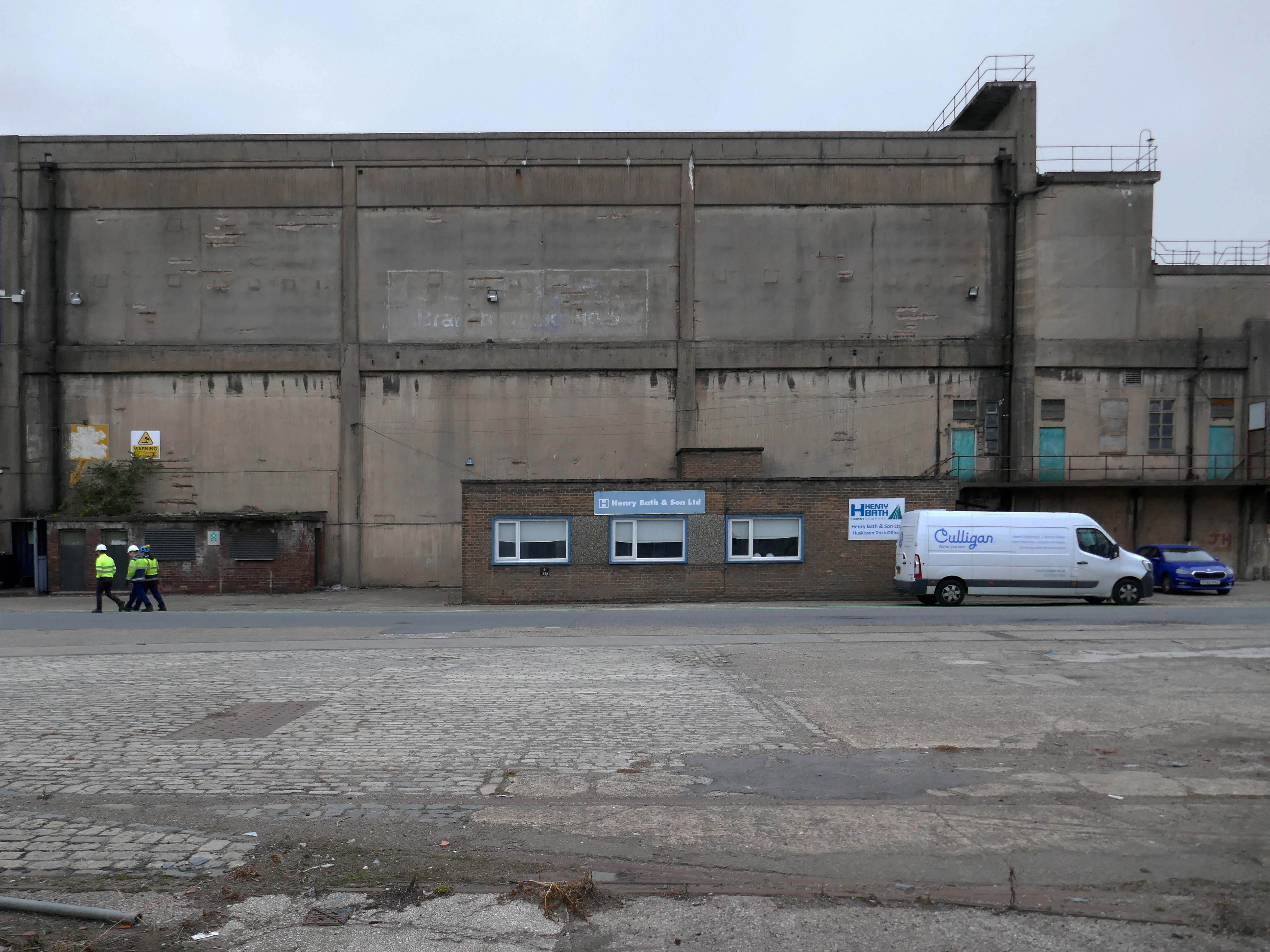
The days when a vast multitude of things came and went have been and gone.
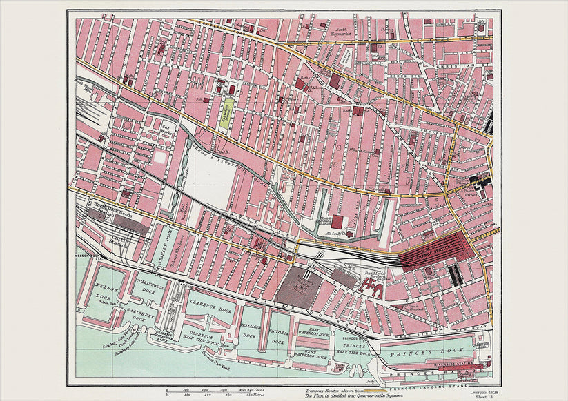
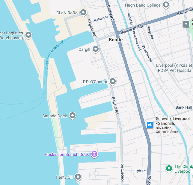
The docks as they were are no more.
Yet in 2023, the Port of Liverpool was the UK’s fourth busiest container port, handling over 30 million tonnes of freight per annum. It handles a wide variety of cargo, including containers, bulk cargoes such as coal, grain and animal feed, and roll-on/roll-off cargoes such as cars, trucks and recycled metals. The port is also home to one of the largest cruise terminals in the UK which handles approximately 200,000 passengers and over 100 cruise ships each year.
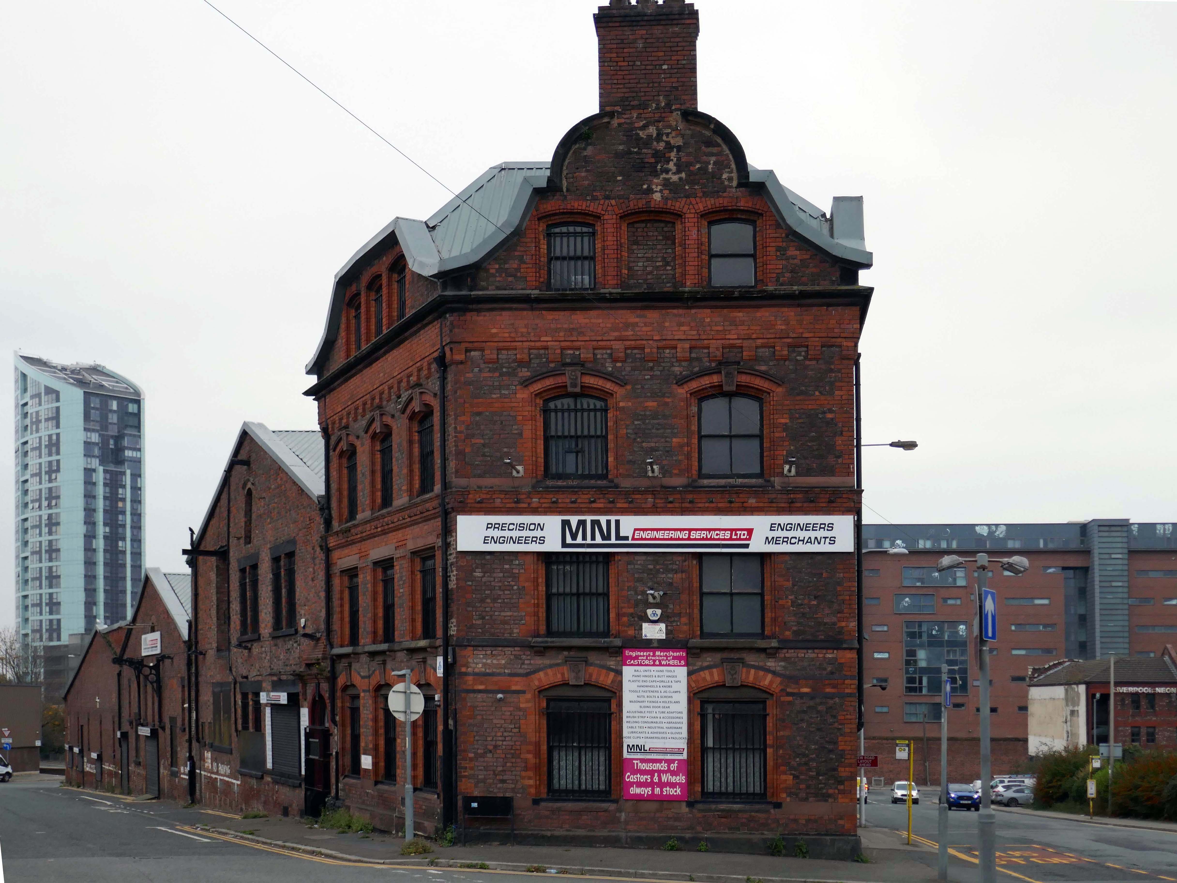
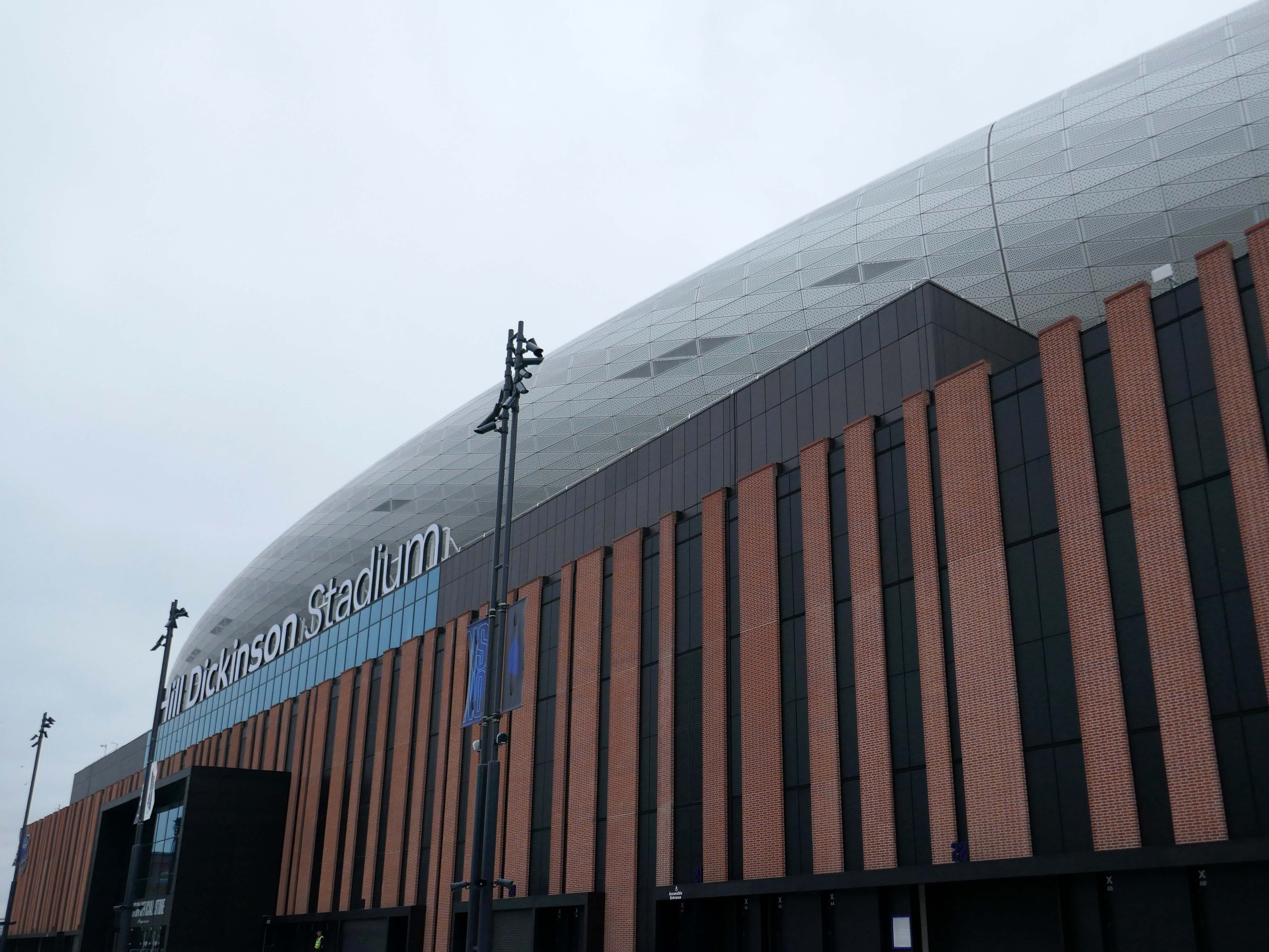
Now with the opening of the Titanic Hotel in the Stanley Dock and the arrival of the Toffees just up the road at the Hill Dickinson Stadium, the whole area is slowly being transformed into a destination, as they say in modern parlance.
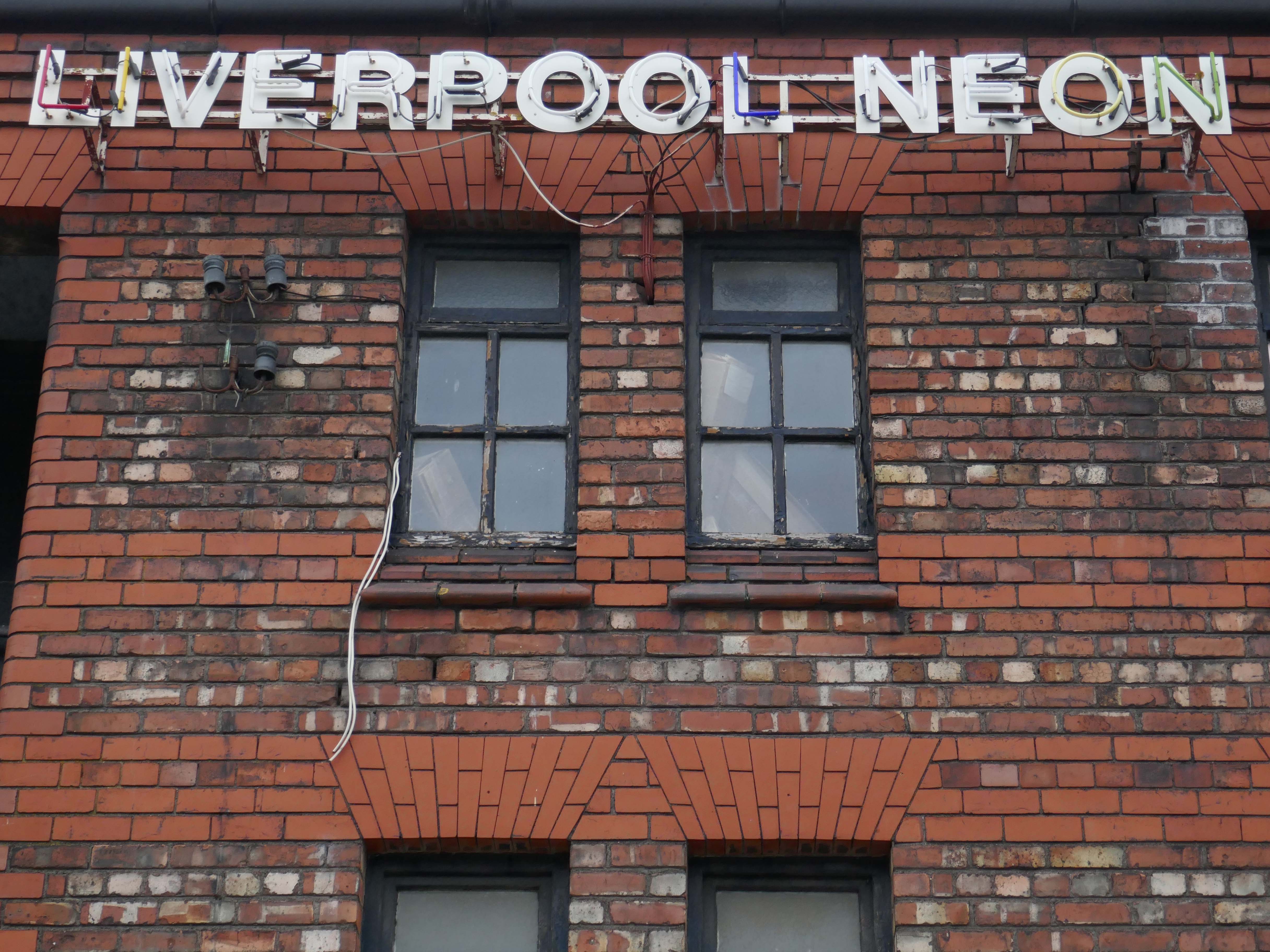
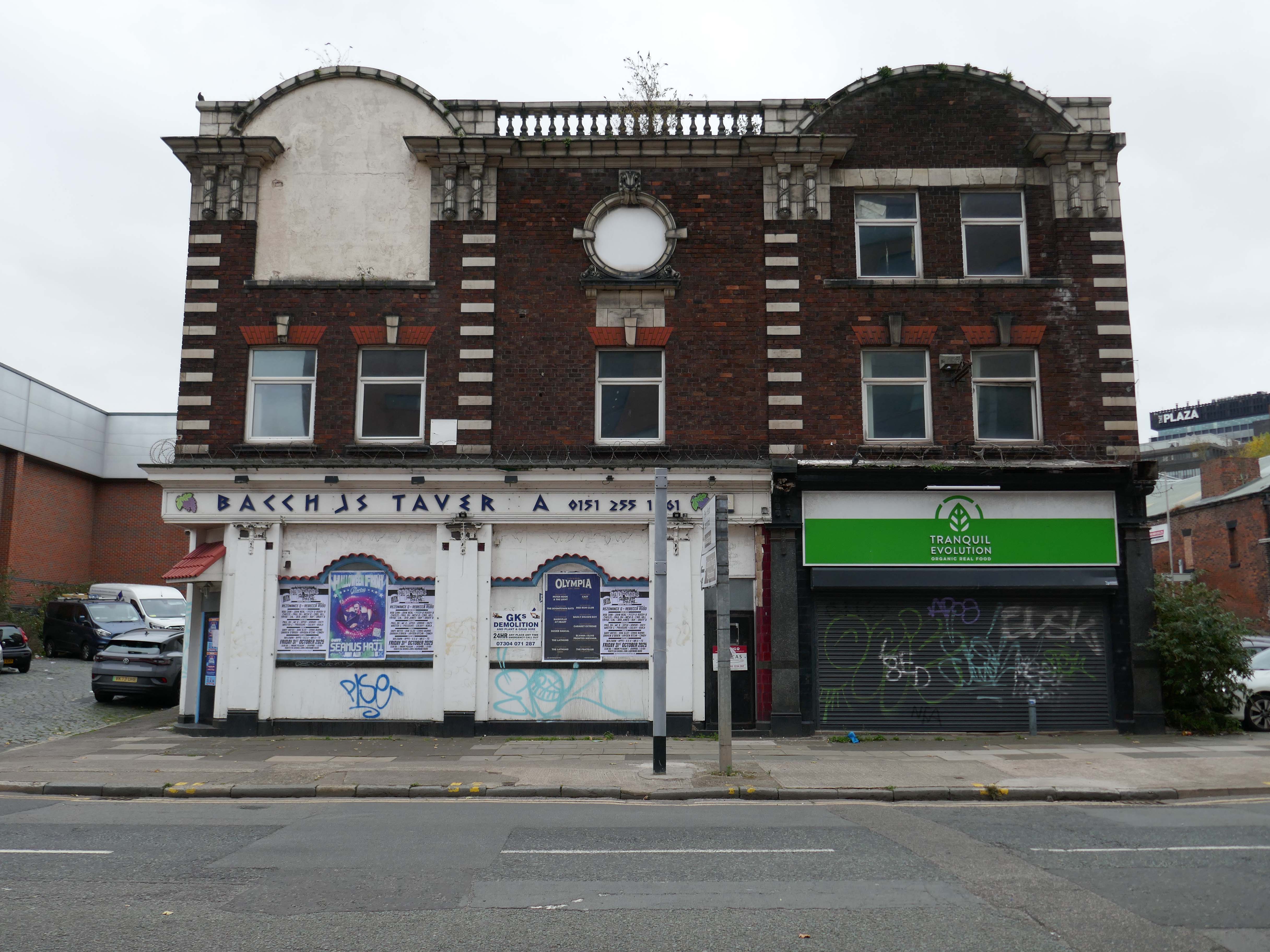
However much of the Industrial heritage remains in various states of disarray, used and possibly disabused, but hanging on in there.
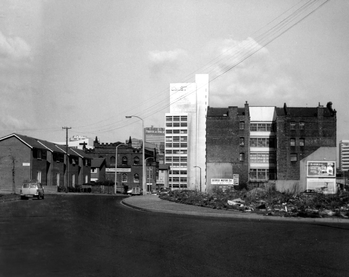
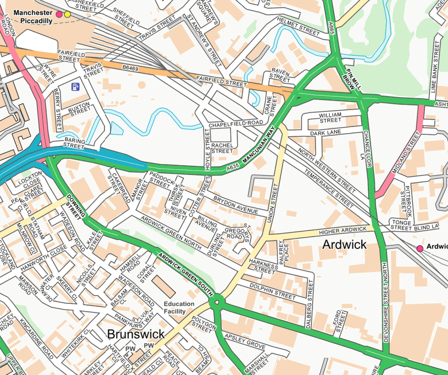
I was walking around town, with a view to updating my Ardwick Walk.
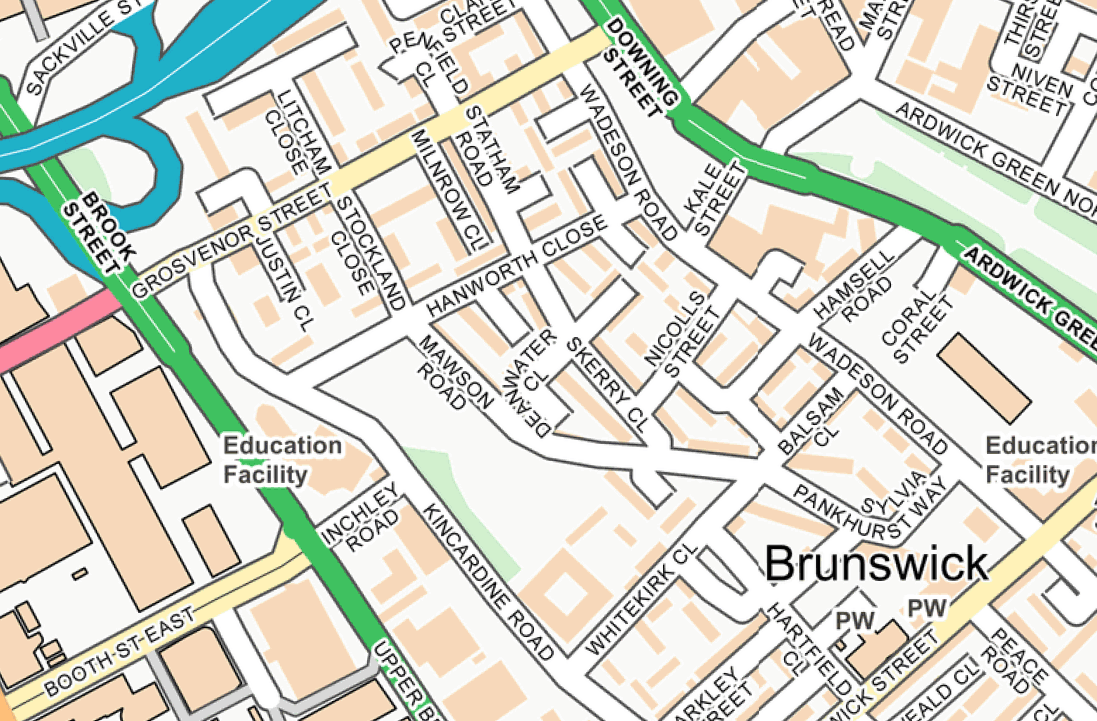
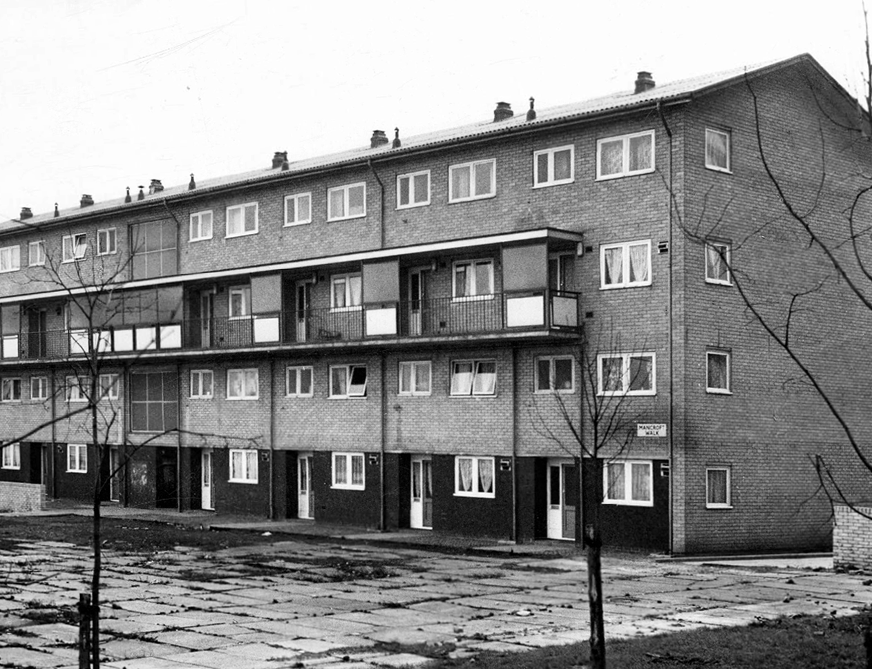
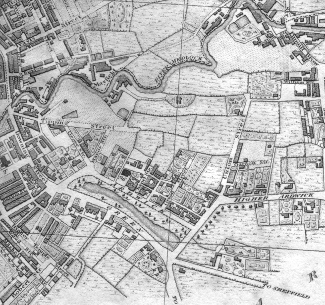
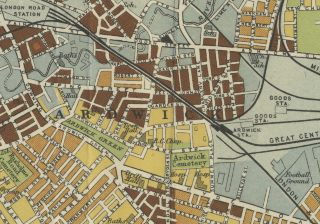
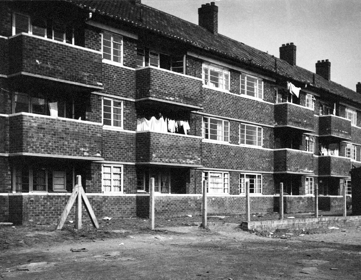
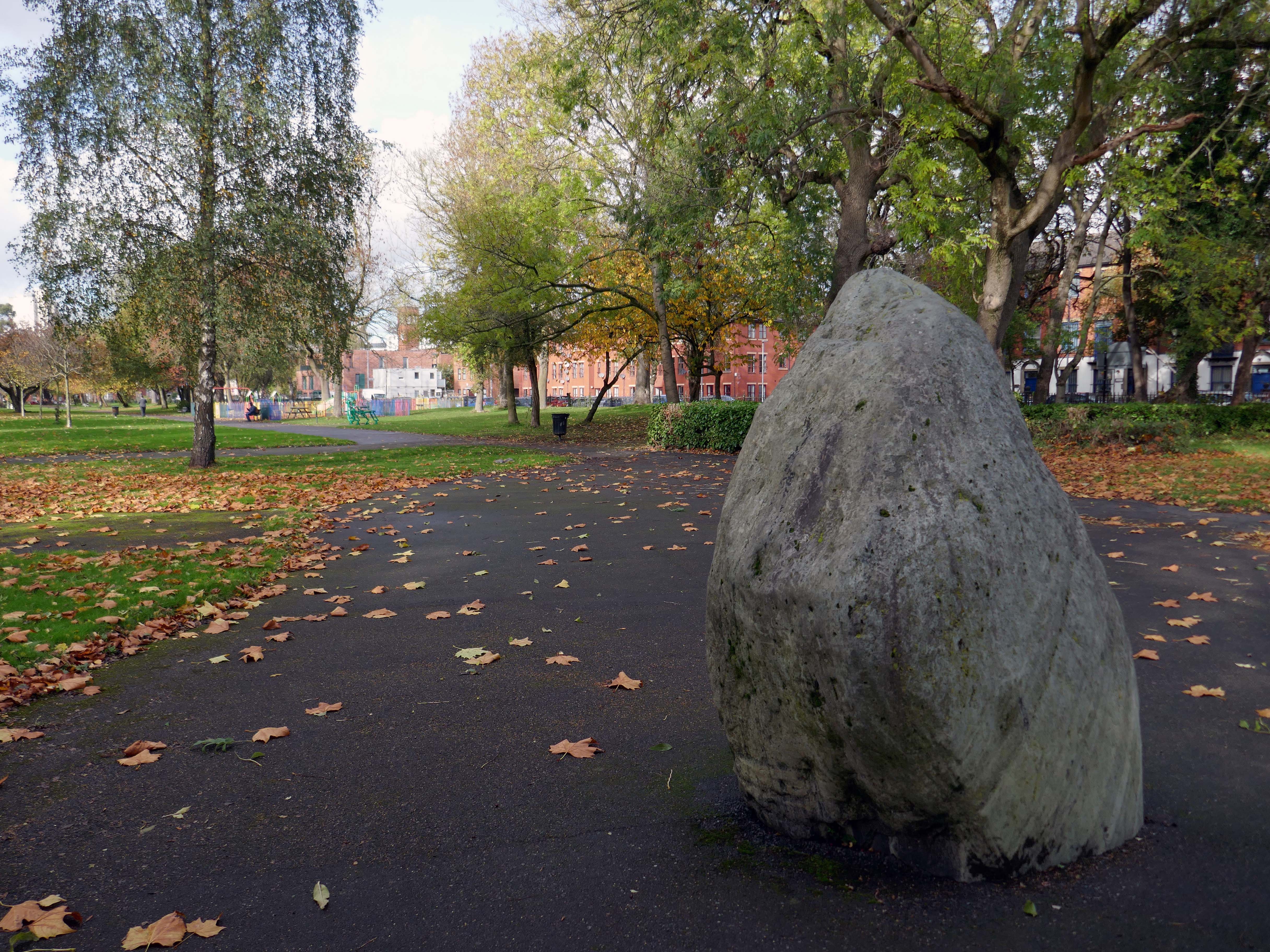
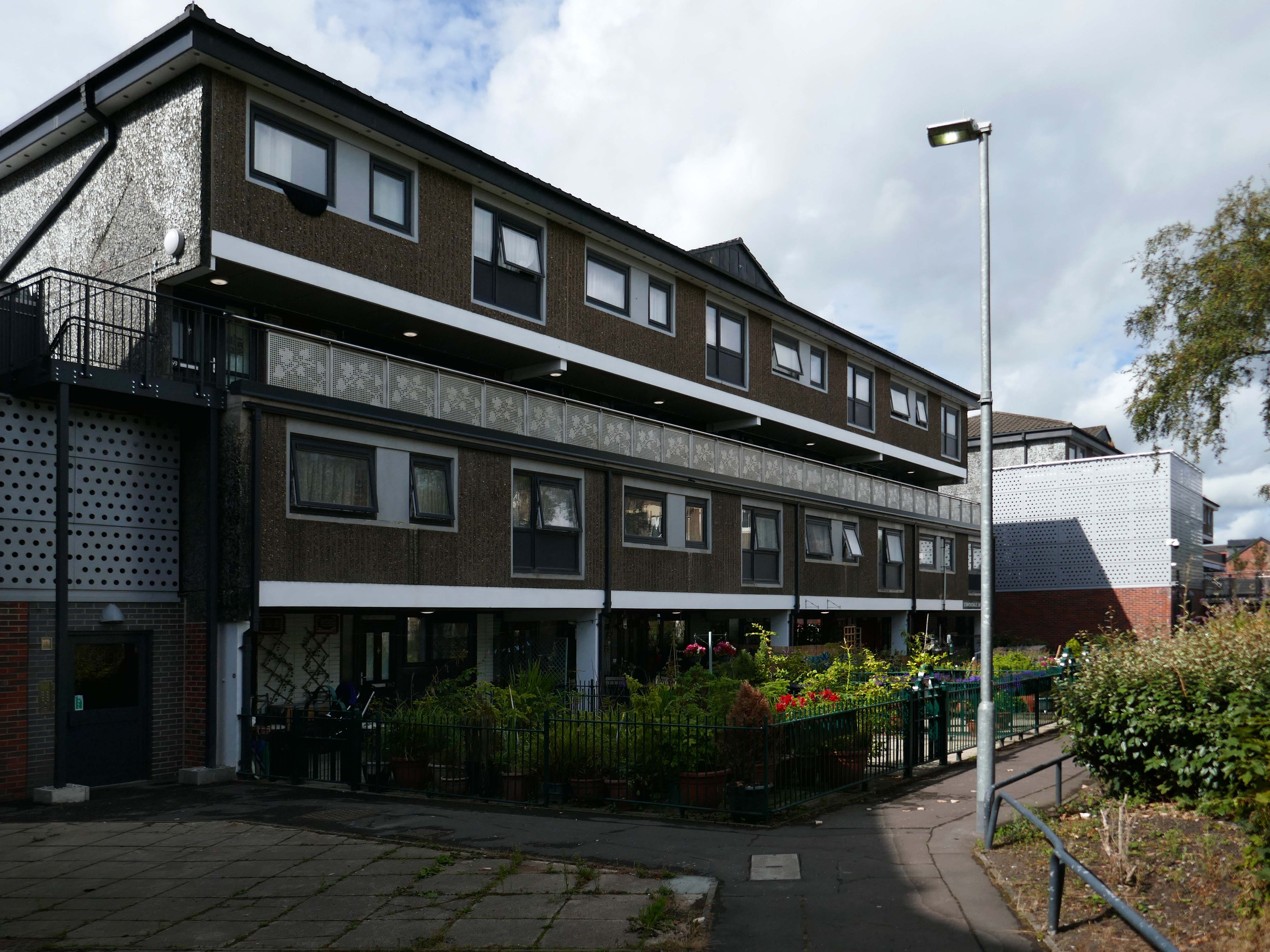
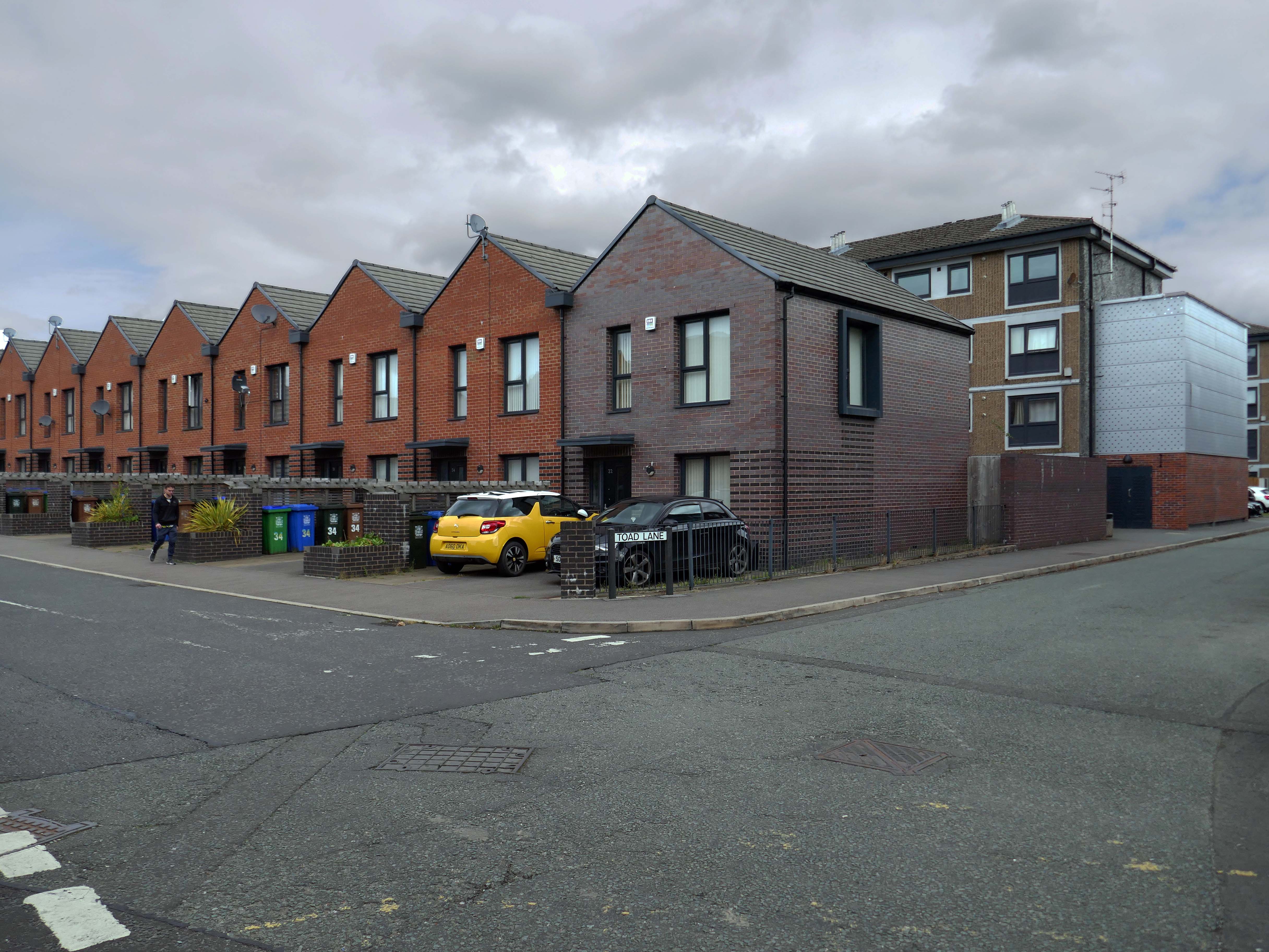
Idle curiosity took me toward the Brunswick Estate – that pocket of housing nestle twixt the Mancunian Way/River Medlock, Ardwick Green, Brunswick Street and Upper Brook Street.
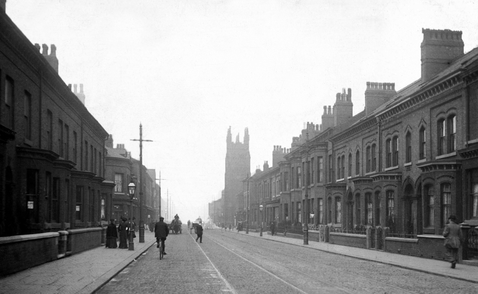
Back in 1813, a web of streets and enclosed fields, and more fields, along with small groups of higher status housing, but by the early 20th century it was very much a working class district, within which industry began to grow.
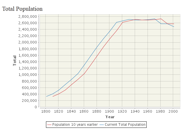
The population of Manchester expanded unstoppably throughout the nineteenth century.
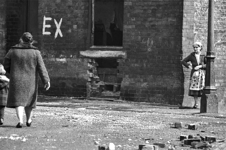
Extensive slum clearance in the nineteen sixties saw the area and its street names change, some erased forever in the new build.
In Manchester, in a vast belt immediately outside the central area of the city, there still exist all too many remnants of a planless, knotted chaos of dark, dismal and crumbling homes. Many of these crossed the verge of uninhabit-ableness long before their most elderly inhabitants were born.
St Paul’s and St Luke’s Brunswick Street W Higham 1970
Lamport Court W Higham 1970
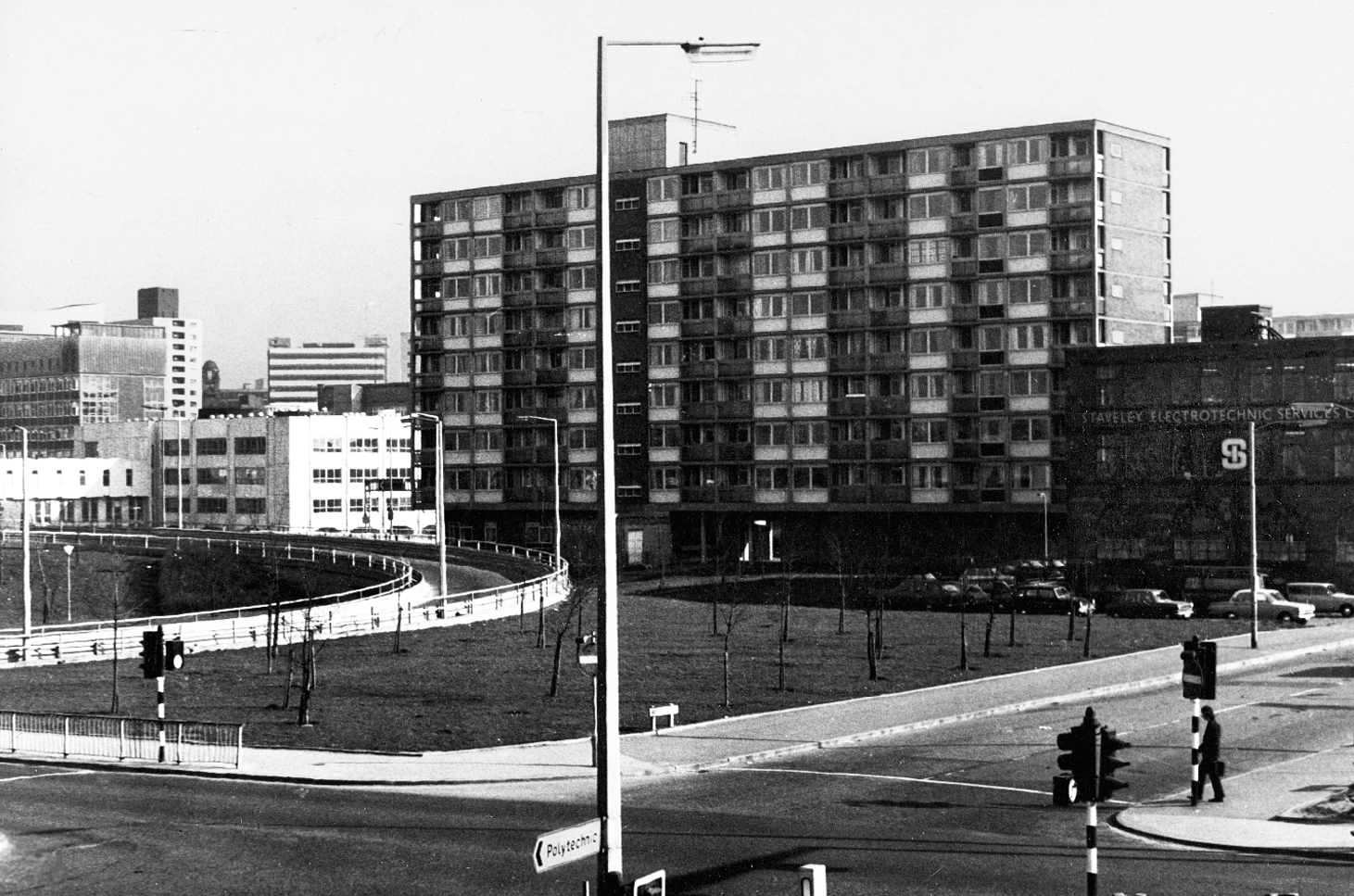
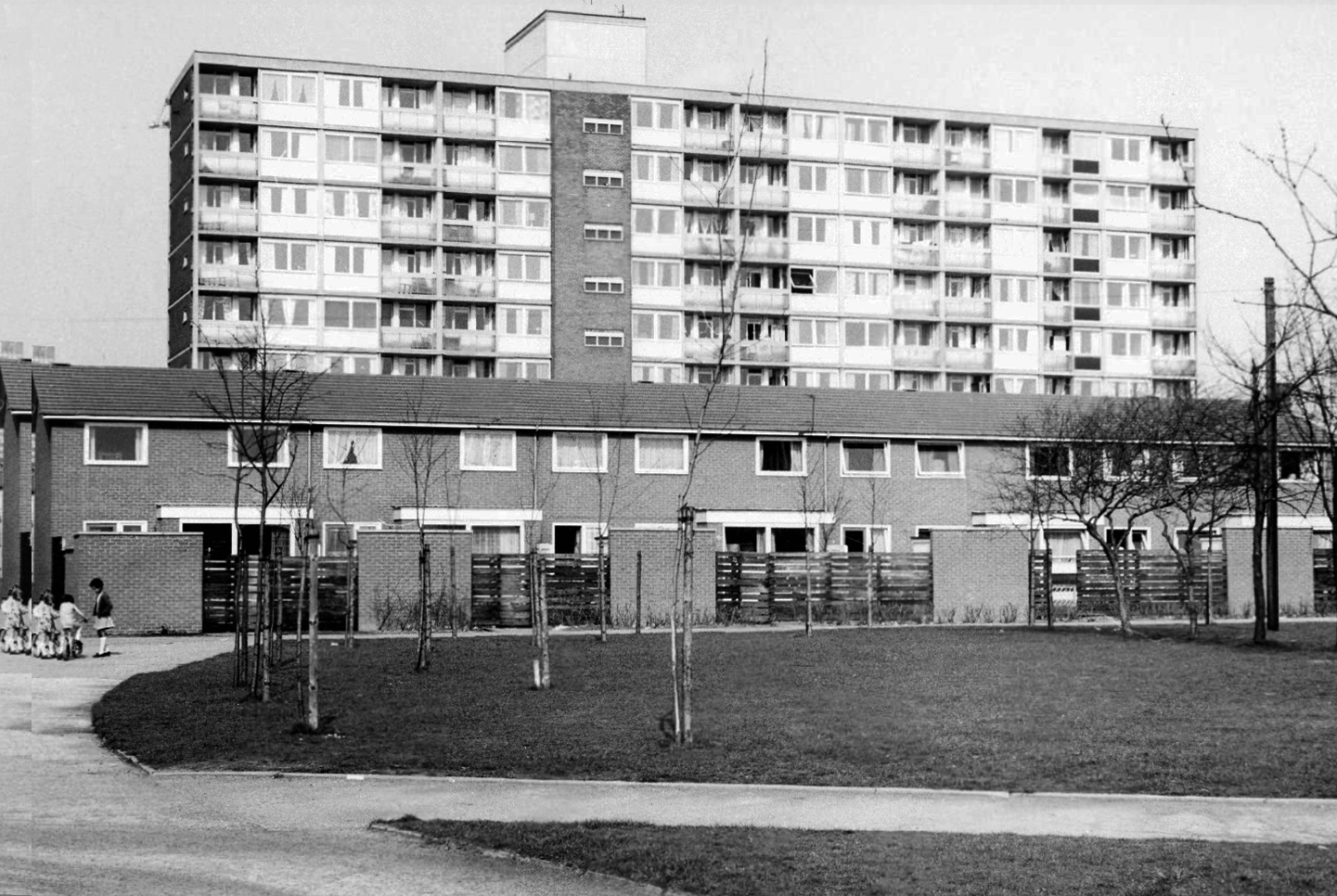
One of three nine-storey blocks, containing two hundred and nineteen dwellings; also including SilkinCourt and Lockton Court.
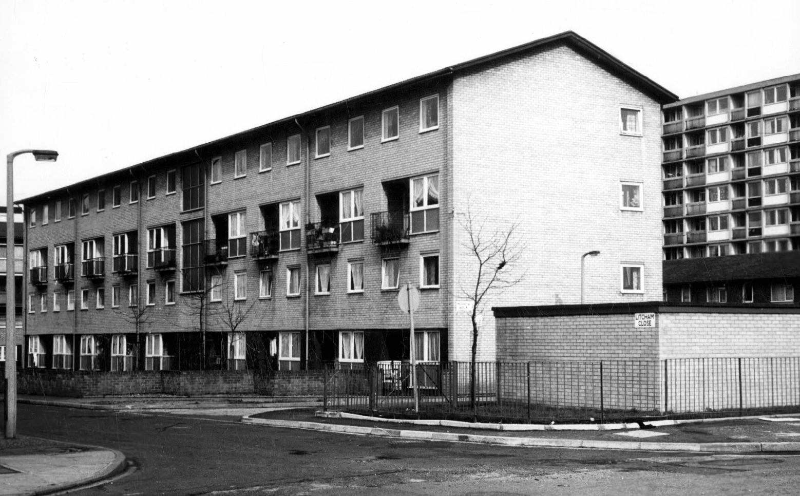
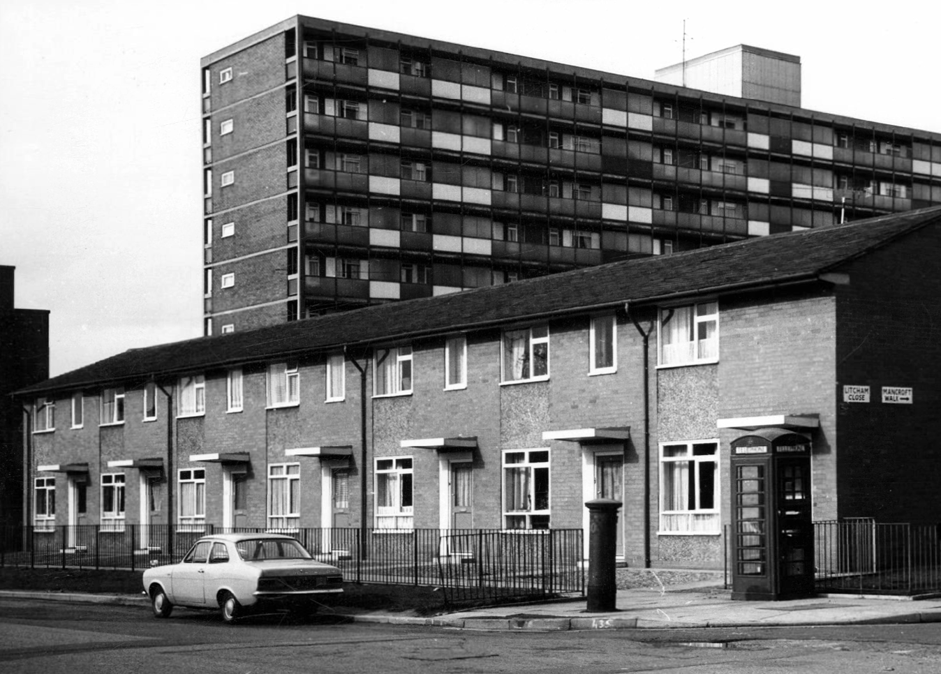
Litcham Close W Higham 1970
Harry Milligan 1903 – 1986 worked as the photographer at Manchester Central Library until his retirement in around 1968. He was instrumental in setting up the Manchester Region Industrial Archaeology Society in 1965. He volunteered at the North Western Museum of Science and Industry from 1968, assisting with reprographics requests. His knowledge of the history of photography in Manchester and the UK led to him taking on the role of Honorary Curator of Photography at the museum.
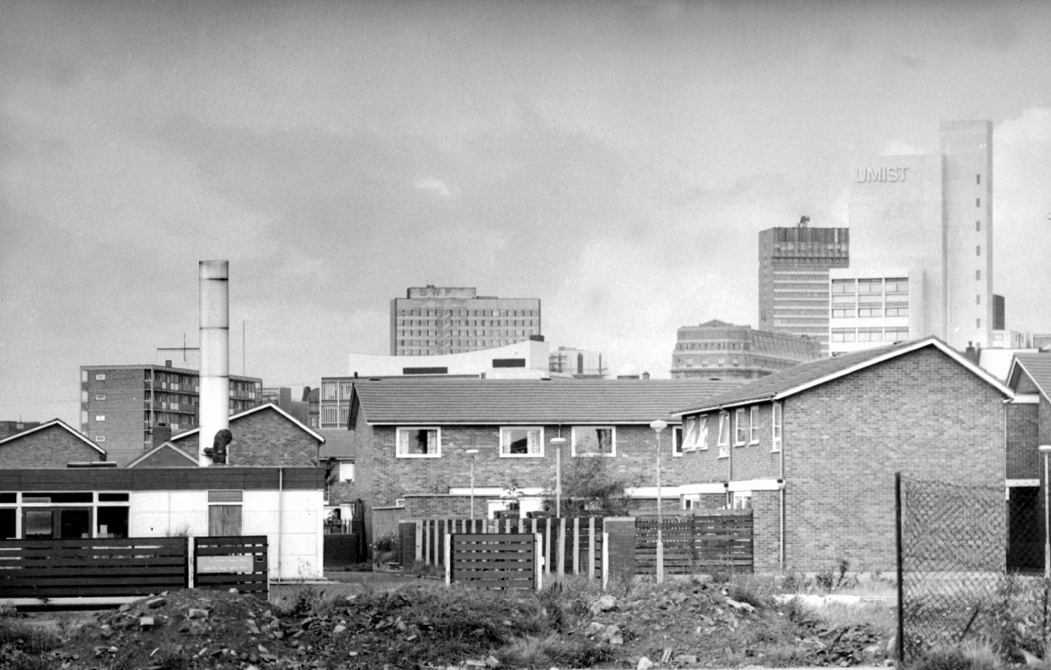
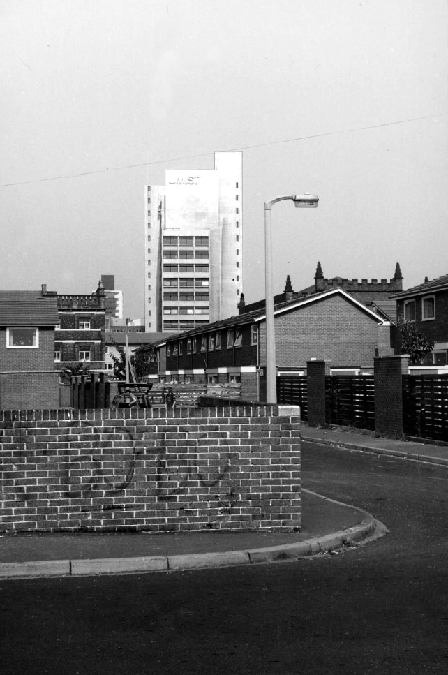
Panorama of Brunswick with UMIST in the background.
Hanworth Close area terraced housing and flats 1972.
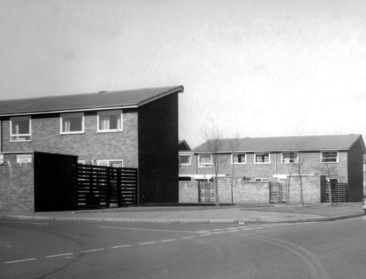
Staverton Close
Melcroft Close
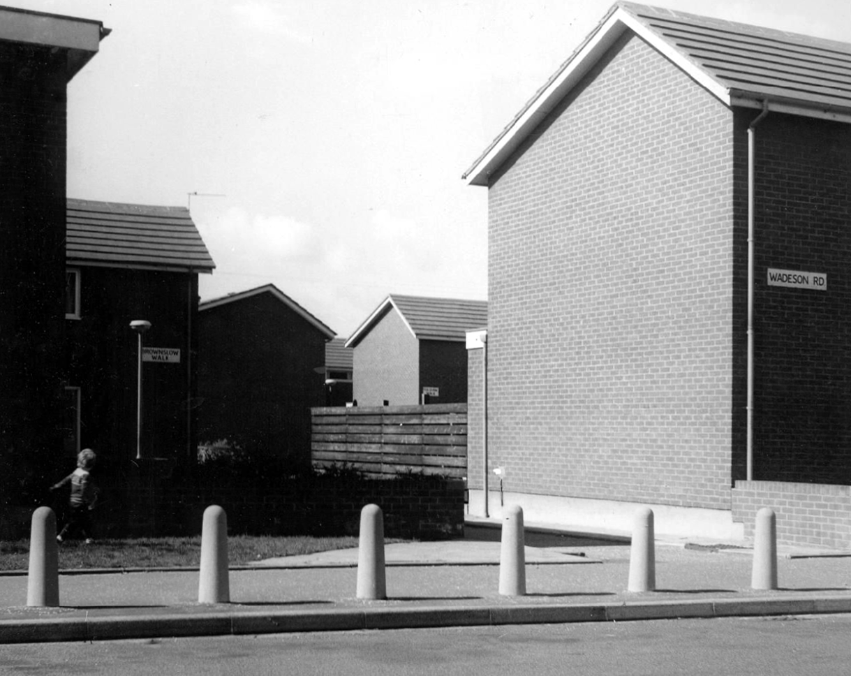
Wadeson Road
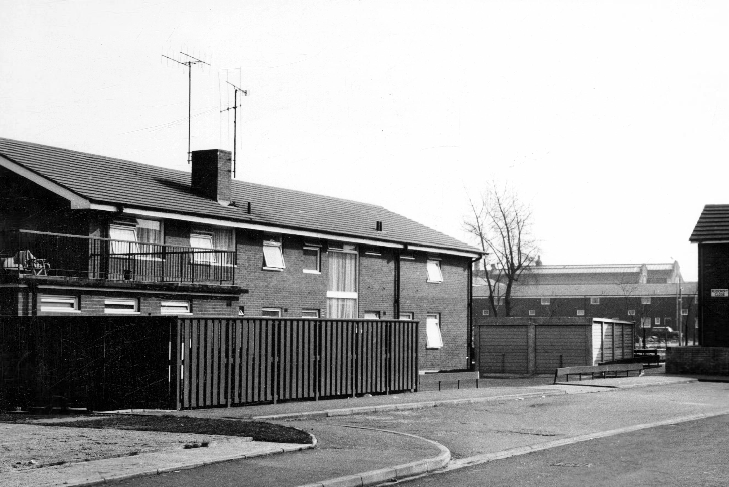
Helmshore Walk – Skerry Close
Cherryton Walk
Cray Walk
Wadeson Road
Hanworth Close
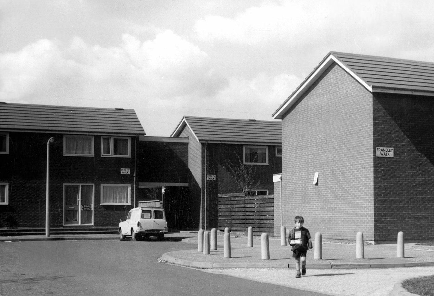
Pedley Walk
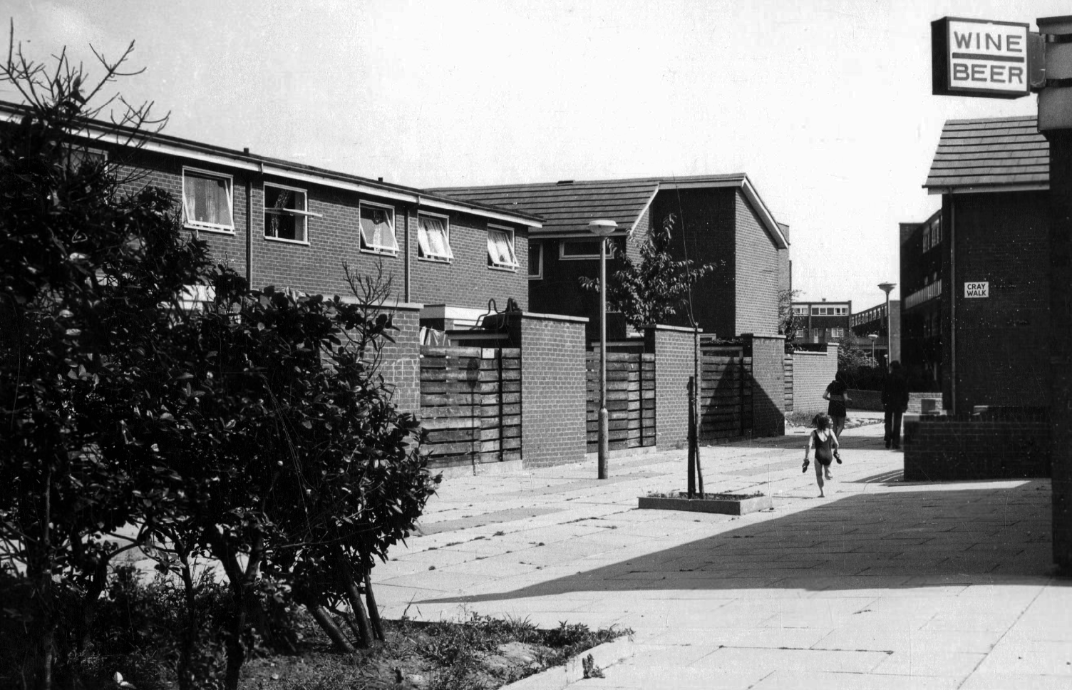
Cray Walk – note the decorative brick relief
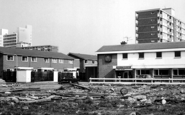
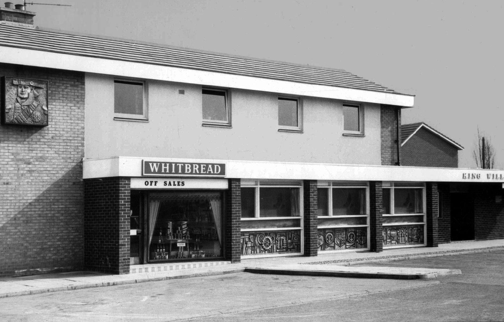
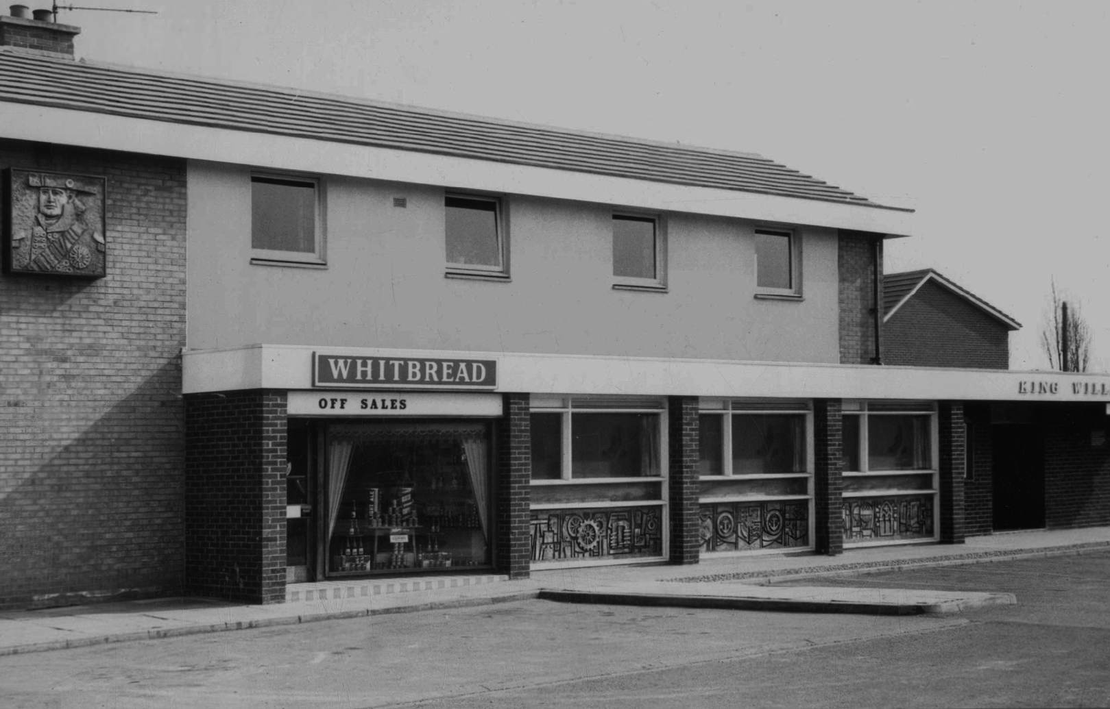
King William IV
Former Chesters then Whitbread estate pub was built in 1967. Closed in 1996 when it was converted to residential property. It had a brief spell 1991 to 1995 as brewery premises for the Dobbin’s West Coast Brewery, during this period the interior was stripped out to accommodate the brewery paraphernalia.
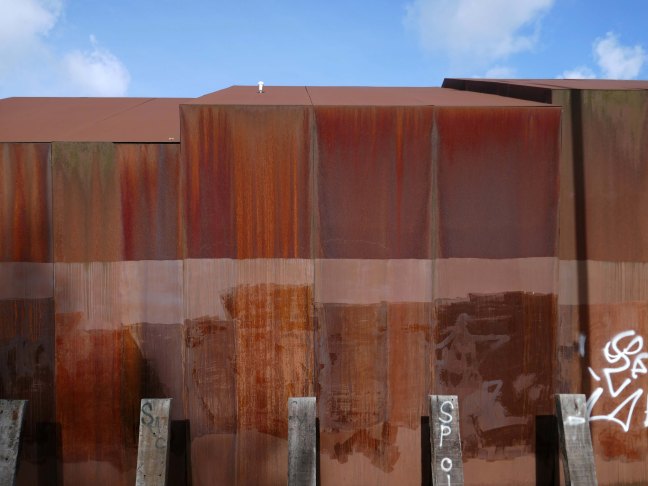
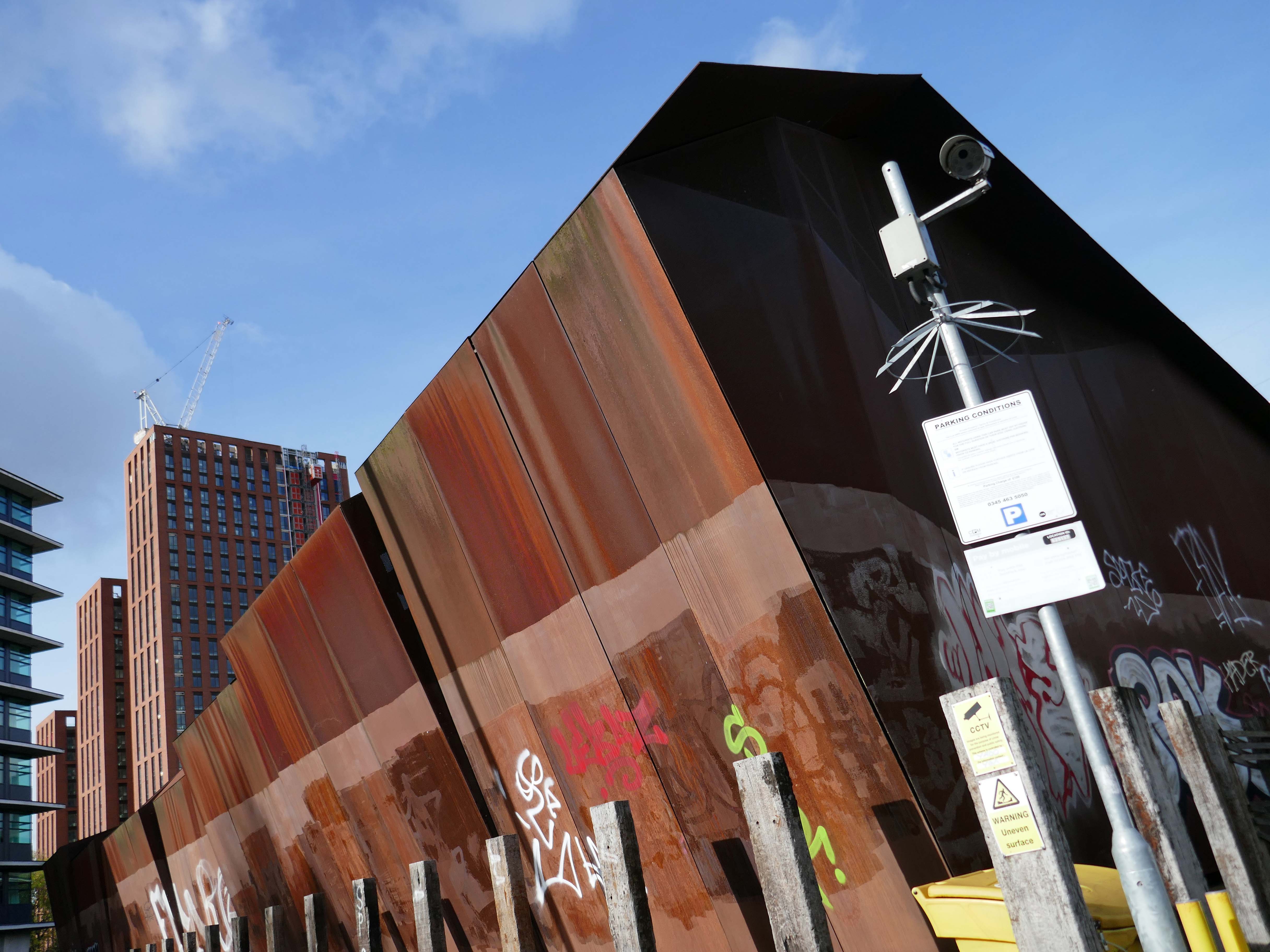
The building was cladded with a COR-TEN® steel envelope, the nature of which was relatively complex.
Corten steel sets itself apart due to the inclusion of unique alloying elements: chromium, nickel, copper and added phosphorous which gives the steel its self-protecting properties.
Platform 14 is primitive, I understand totally from an infrastructure standpoint because it’s on a bypass line on a bridge, but it gets too overcrowded and is windswept. The rest of the station is ok. Platforms 13/14 have not changed in 40 years, grim.
We the pass to the former BT Building – architects JW Hammond 1973.
Originally conceived as a hotel, there were no takers at the time, so it became the BT HQ.
Comprising 338 rooms, Manchester Marriott Hotel Piccadilly is near a shopping district, a 10-minute ride from Etihad Stadium. Offering a location right in the centre of a beautiful neighbourhood, this comfortable hotel boasts a lounge bar along with city views.
The developer’s architects now propose to ‘reimagine’ the artwork and incorporate it into the foyer of the new office building. However, this ‘reimagining’ requires large sections of the artwork to be removed by cutting away and ‘folding’ around 30% of the sculpture.
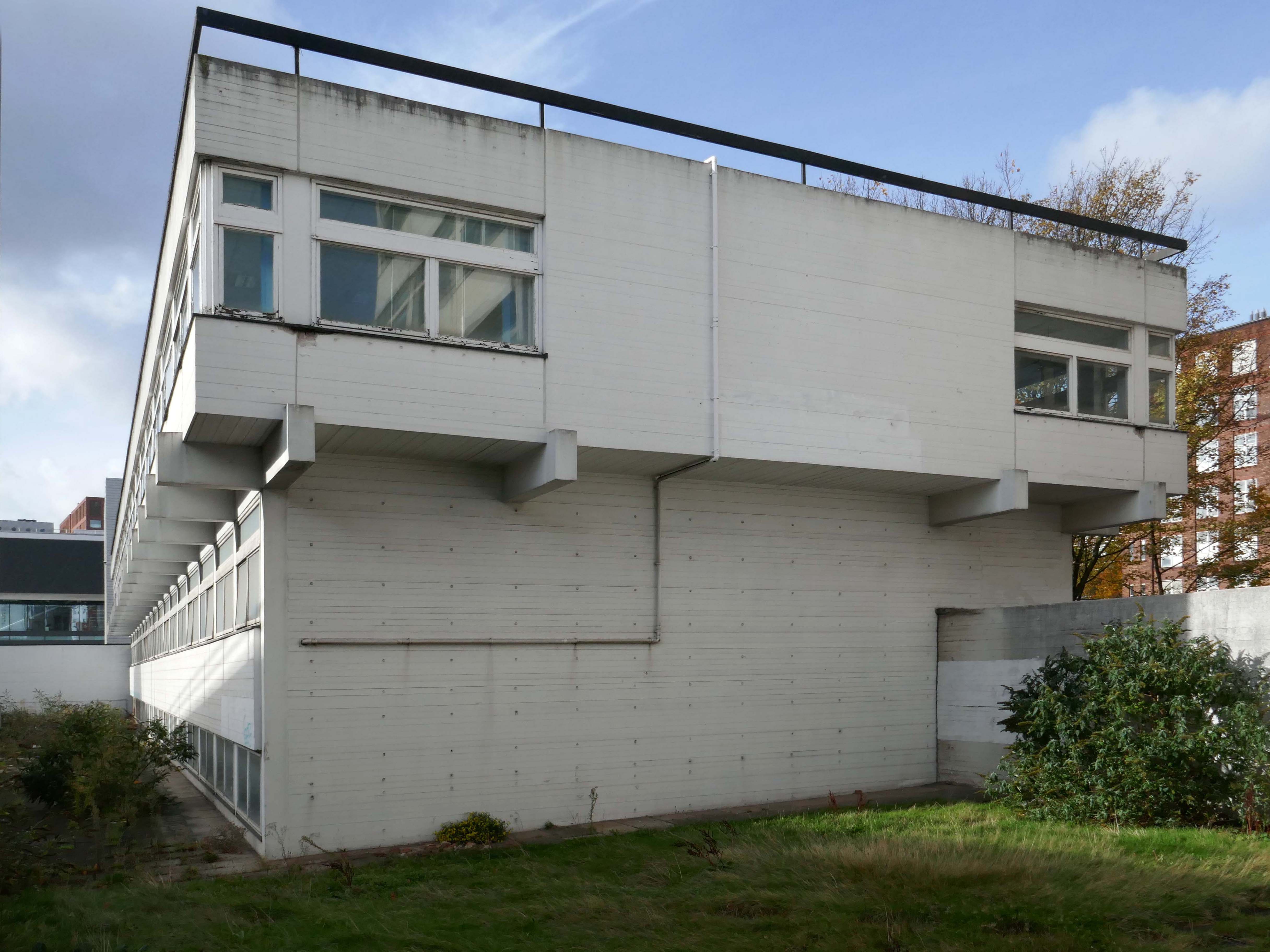
From beneath the roadway we can see the Ferranti Building.
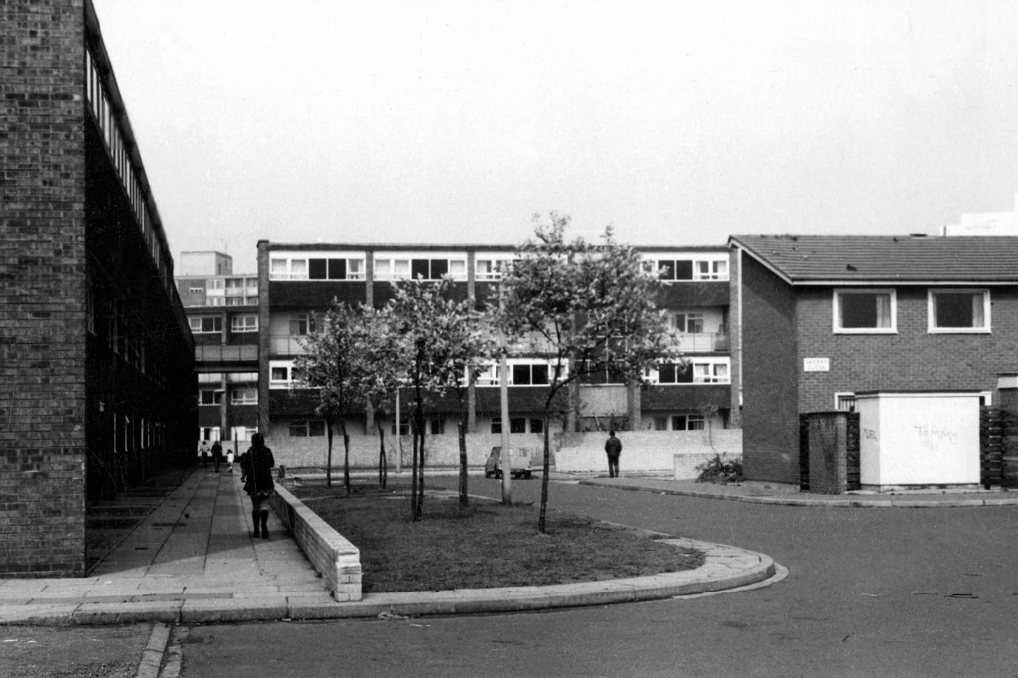
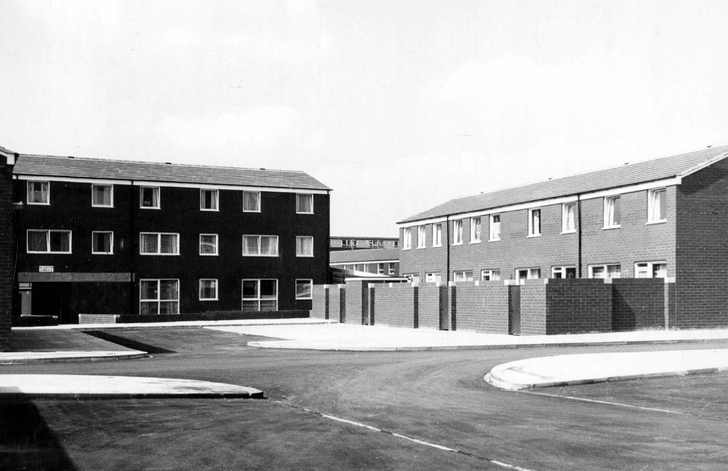
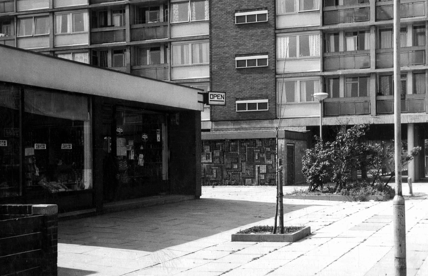
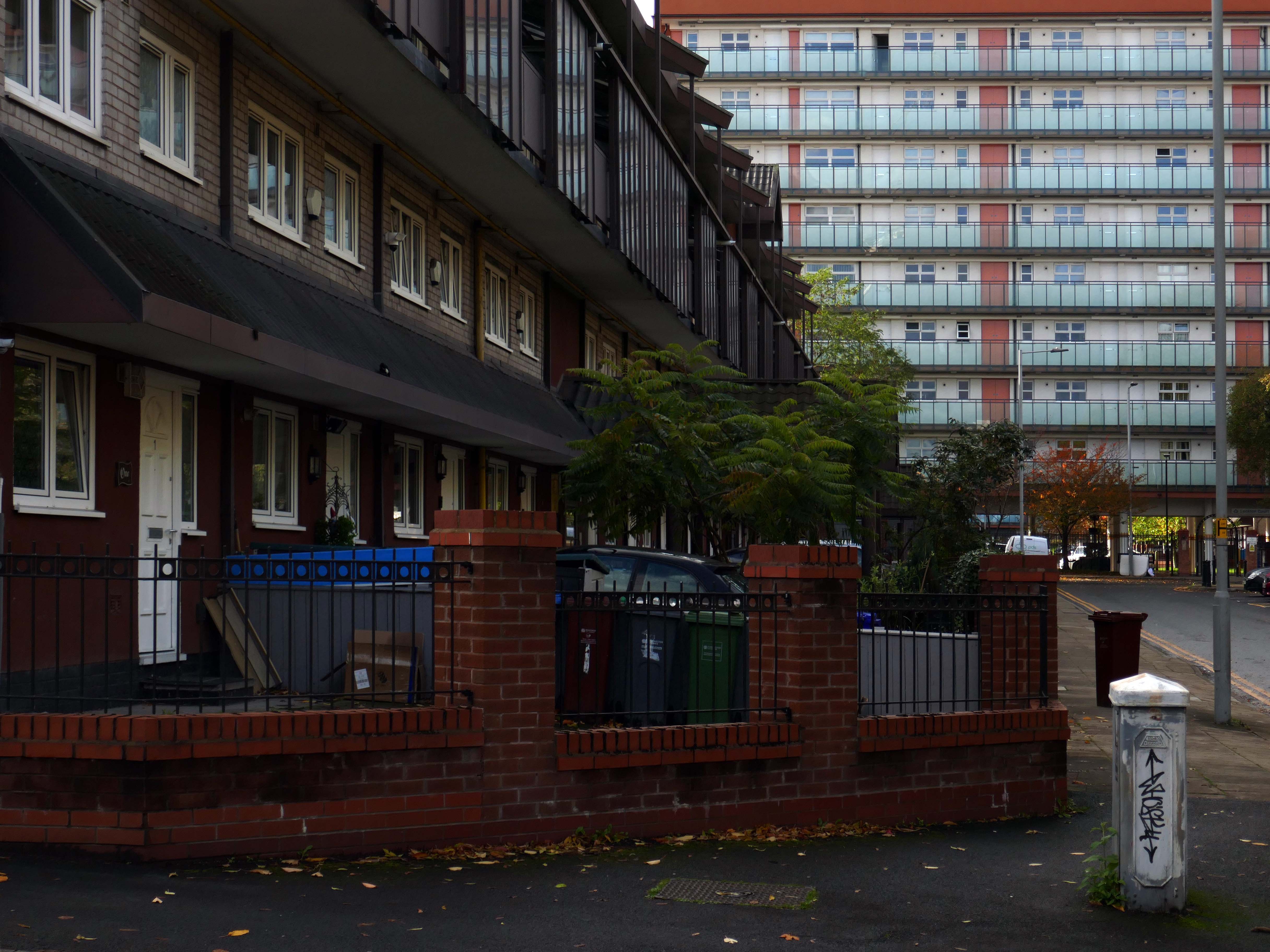
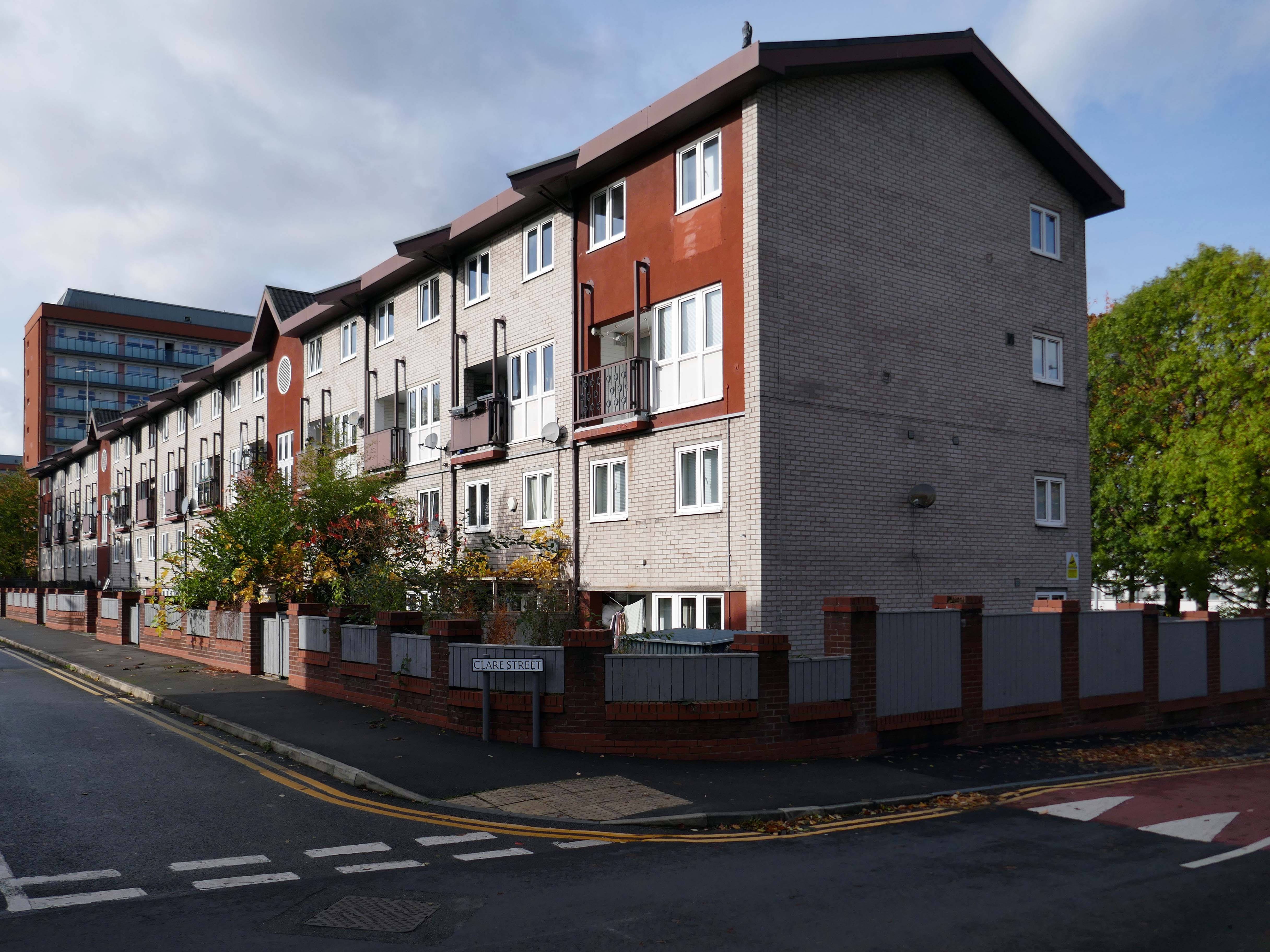
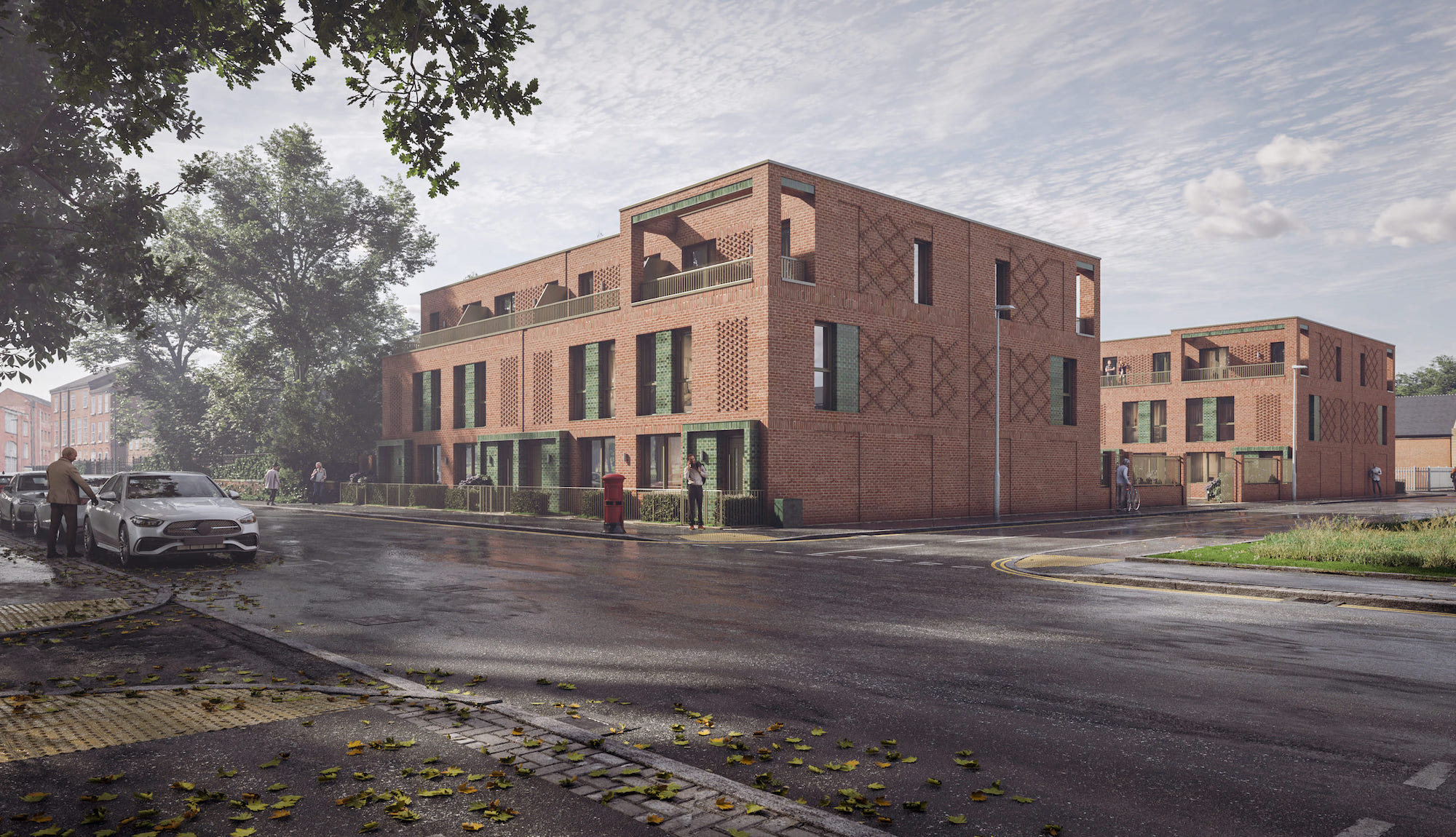
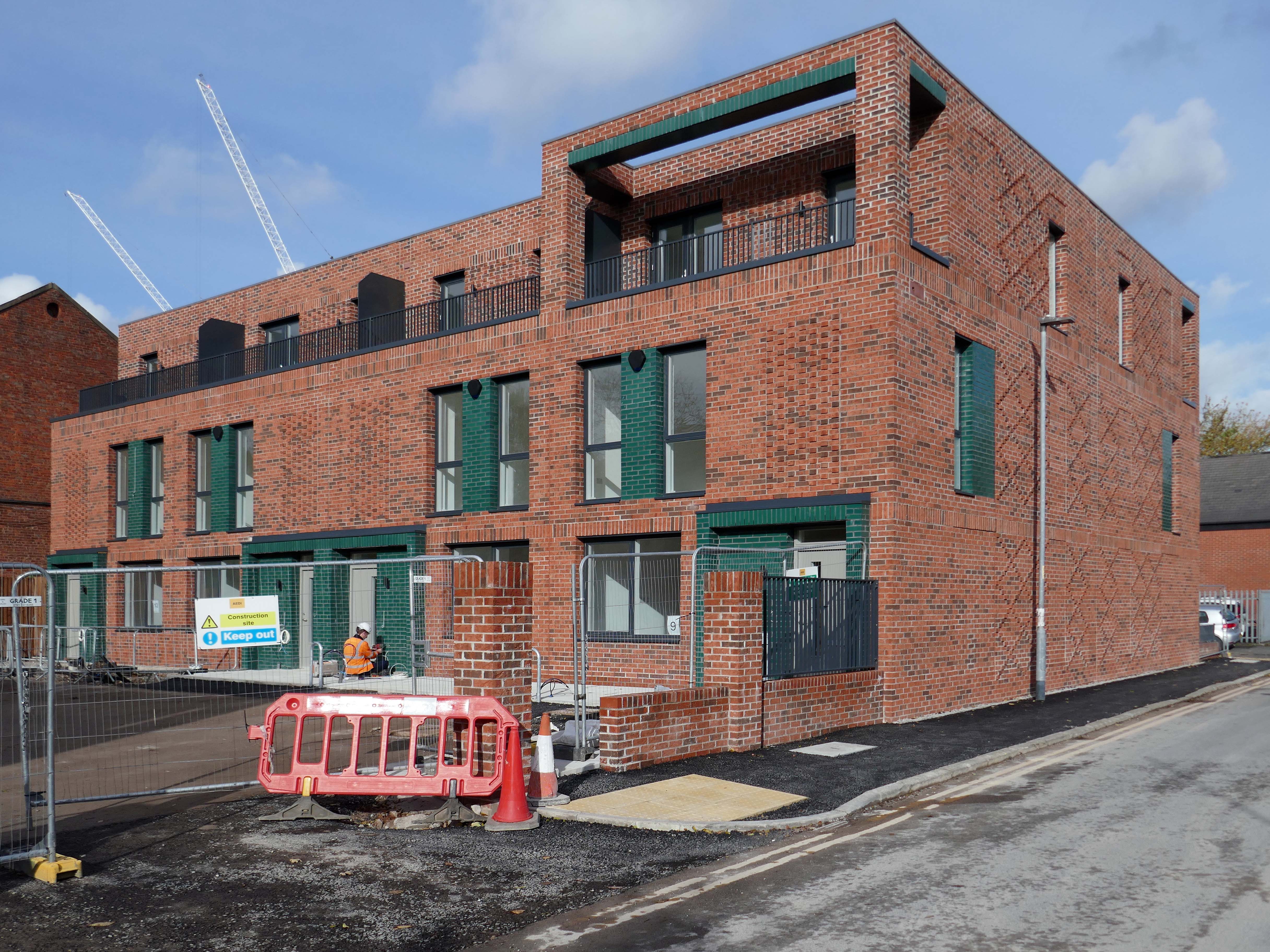
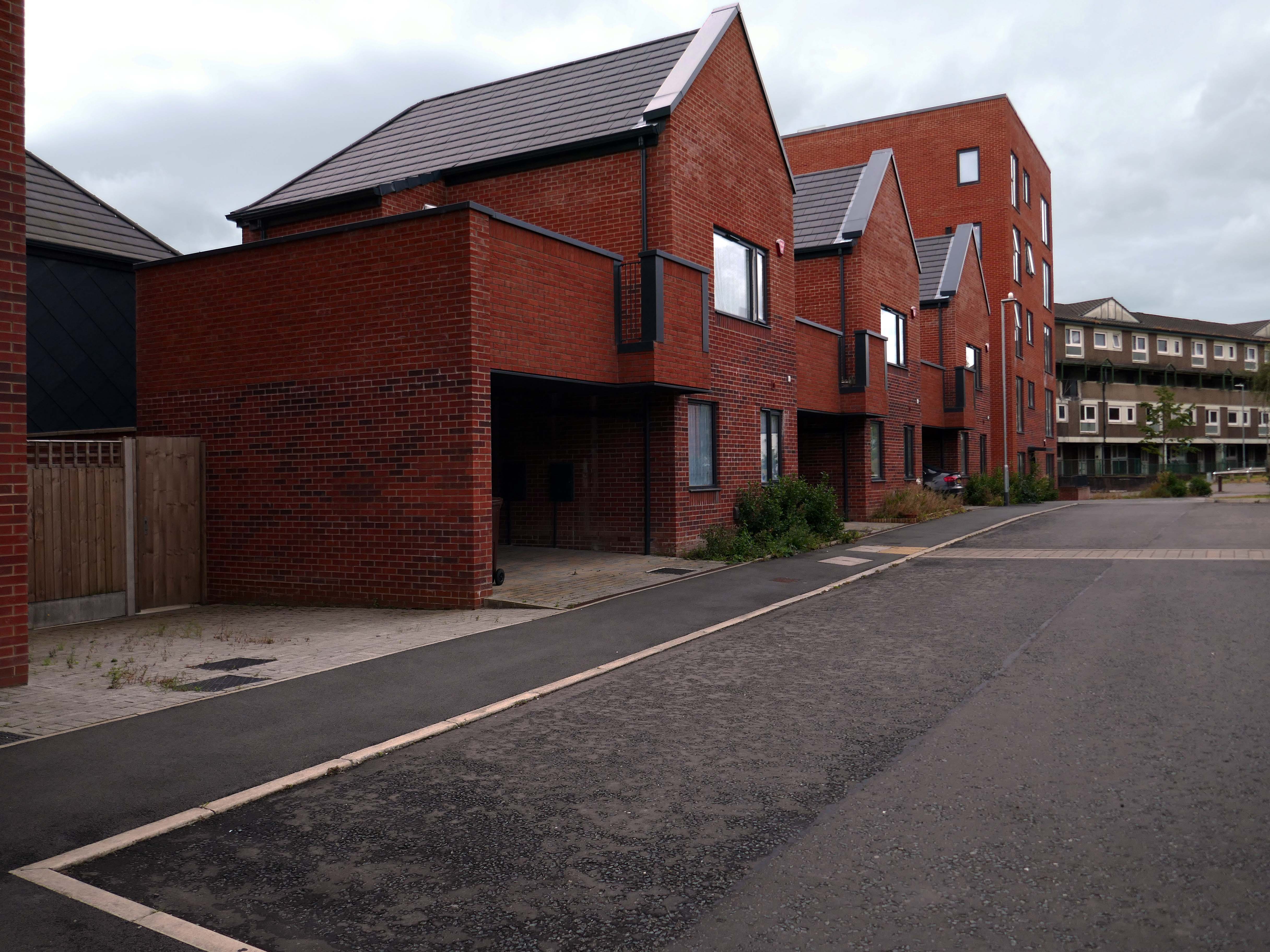
Crossing over to see the Brunswick Estate, built in the Sixties and Seventies and recently refurbished.
S4B is a partnership leading the £106m regeneration of Brunswick, Manchester. The Brunswick Regeneration PFI is a combination of government funding, private investment and expertise that will revitalise Brunswick. Improvements will include council home refurbishments, new homes for sale and to rent and an improved neighbourhood design.
Long gone lost estate pub from the estate – King William IV a former Chesters then Whitbread estate pub was built in 1967. Closed in 1996 when it was converted to residential property. It had a brief spell 1991 to 1995 as brewery premises for the Dobbin’s West Coast Brewery, during this period the interior was stripped out to accommodate the brewery paraphernalia.
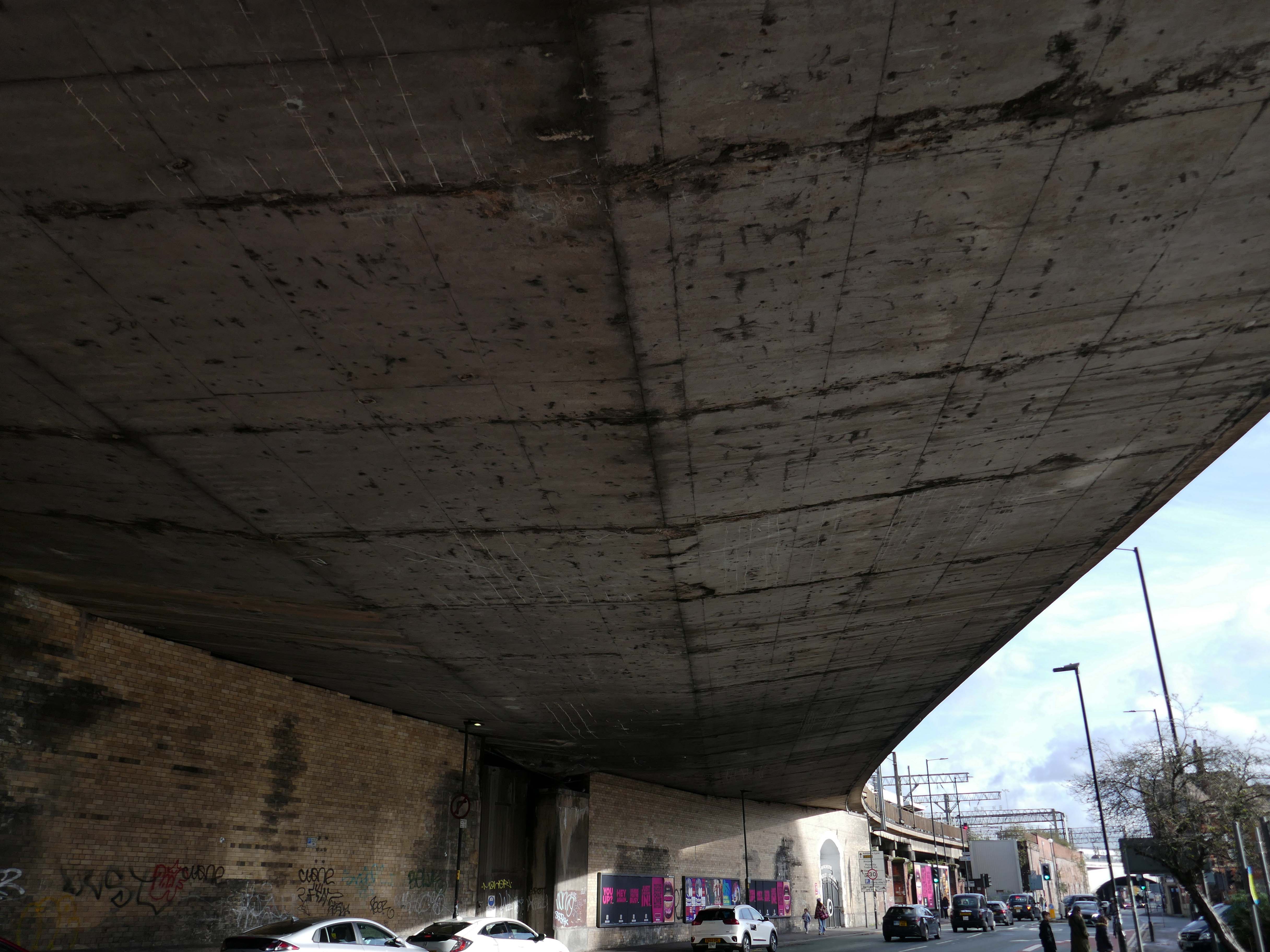
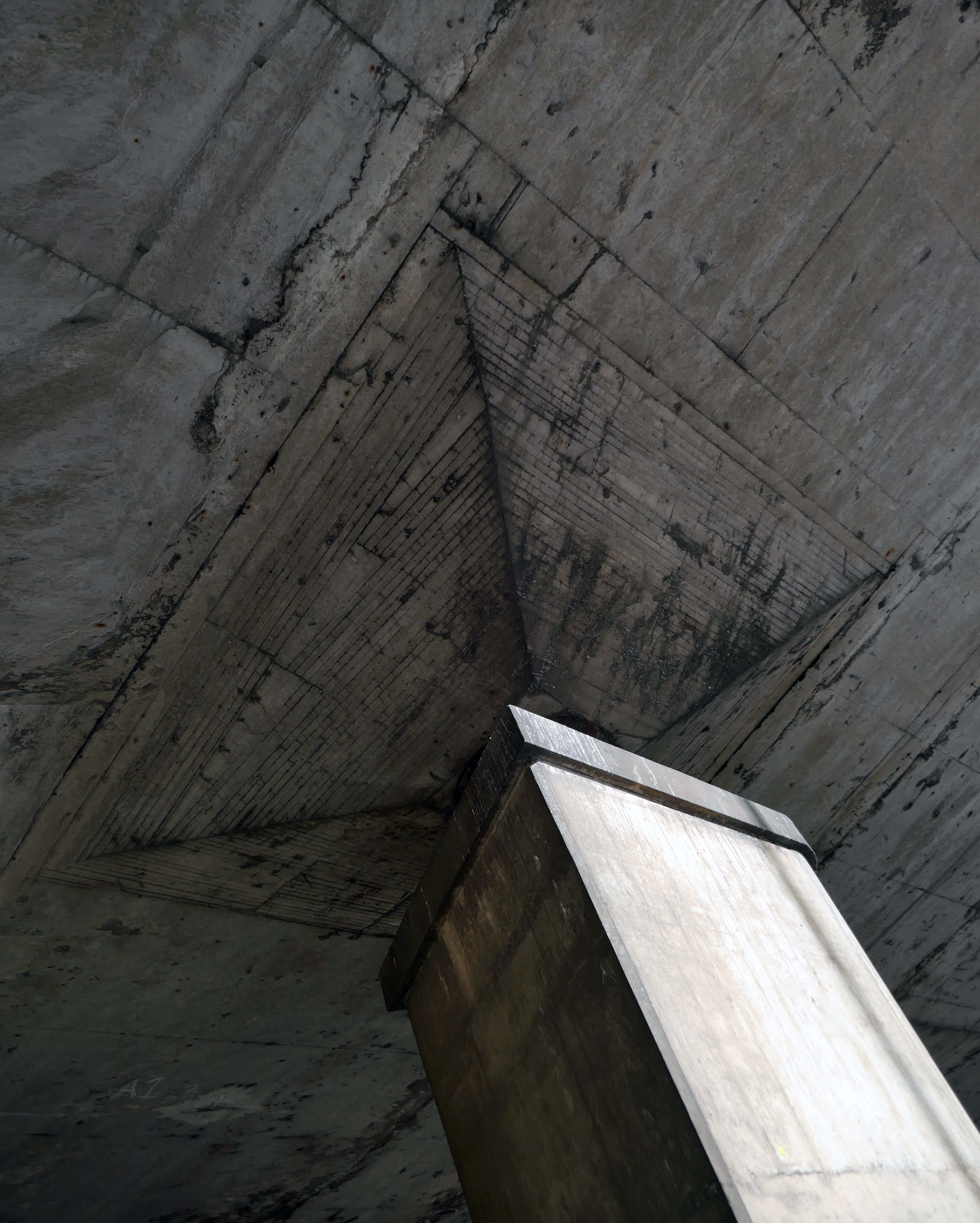
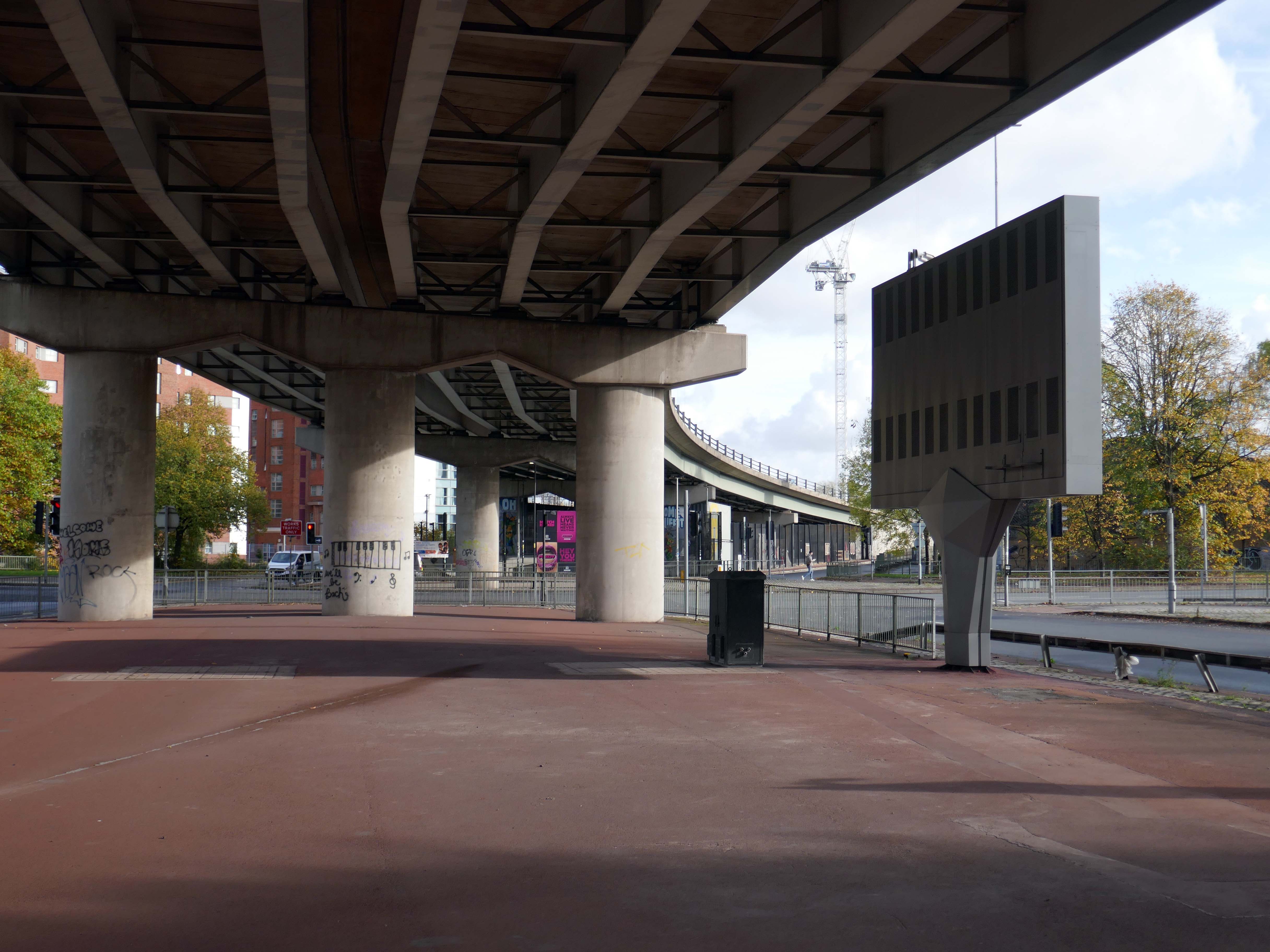
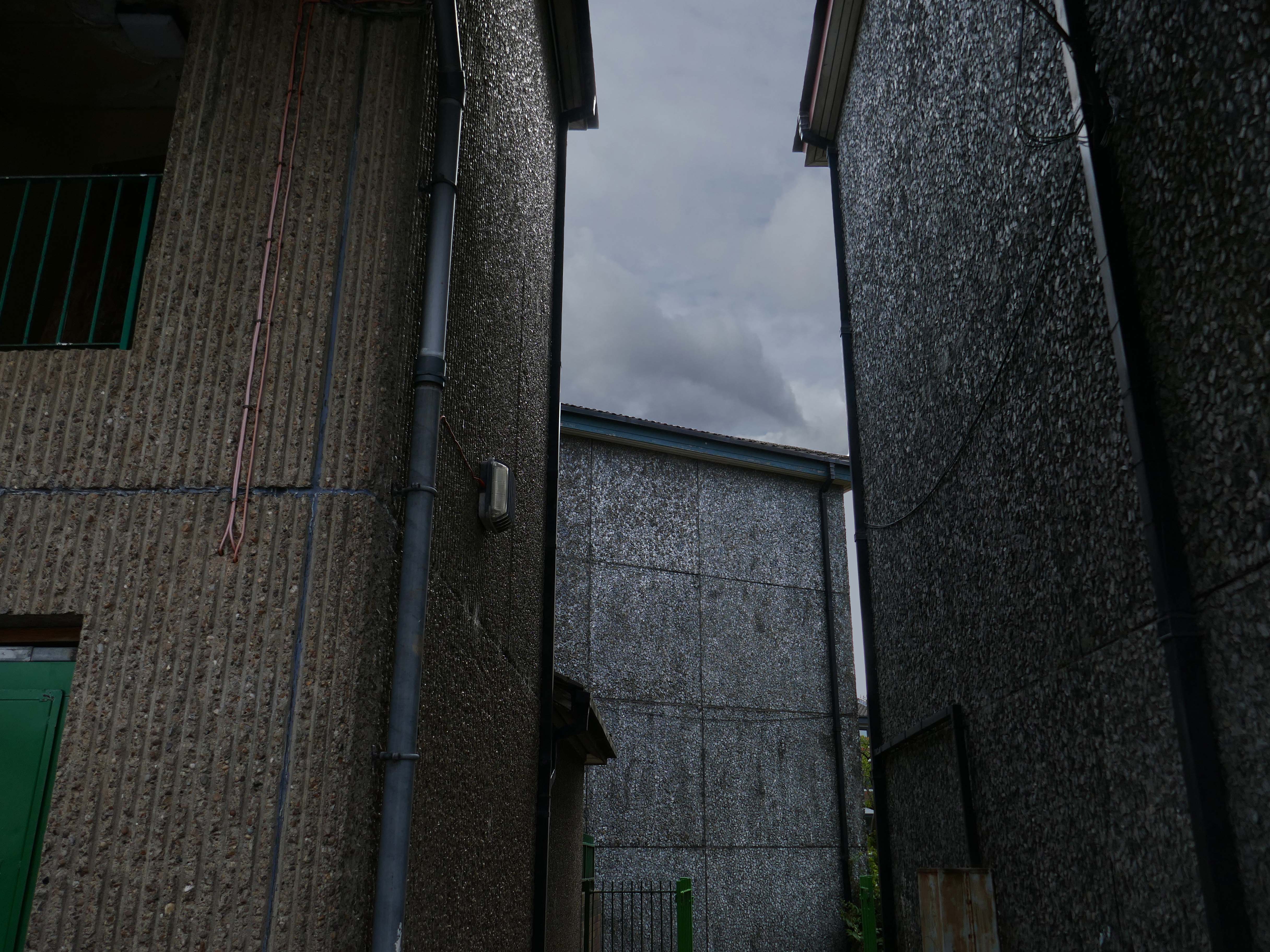
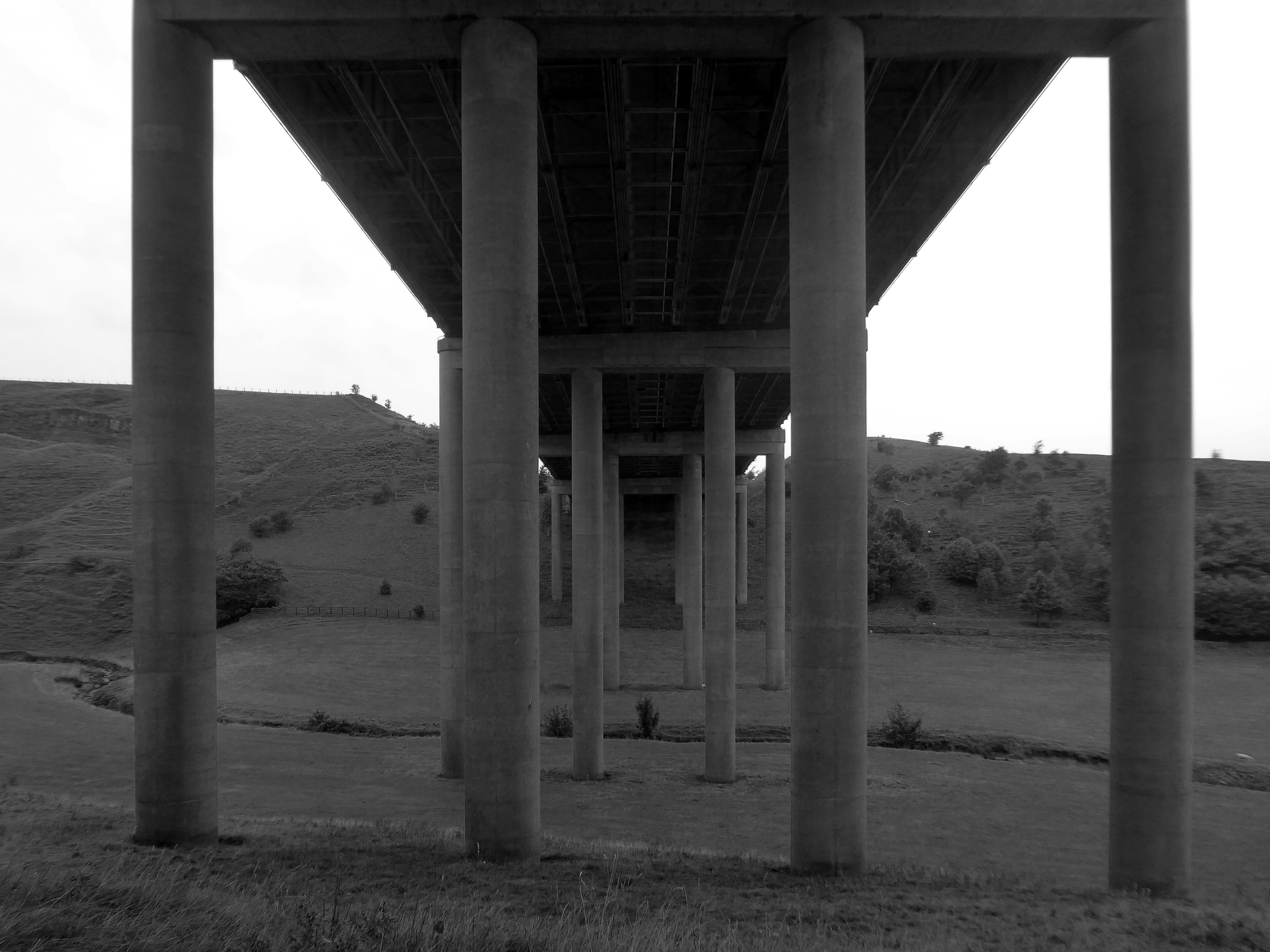
We take a jog around the block to see the concrete relief that clads the road ramp.
Where there was once a giant Cooperative Store there is now a light industrial and retail estate.
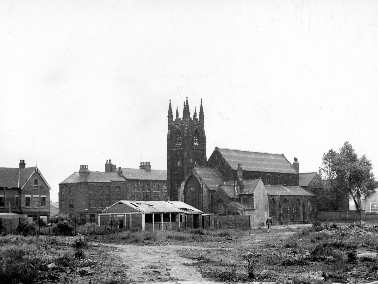
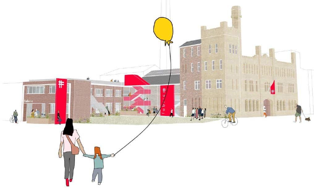
The Diocese of Manchester has been working in partnership with the Church Revitalisation Trust to open Fabric Church and refurbish the building, following a successful bid to the Church of England’s Strategic Mission and Ministry Investment Board.
We’re excited to be working alongside Fabric Church on the transformation of the Grade II listed former Ardwick Barracks in Manchester. This ambitious refurbishment project will see the historic site reimagined as a vibrant community hub, featuring a new worship hall, community café, offices, meeting spaces, and more.
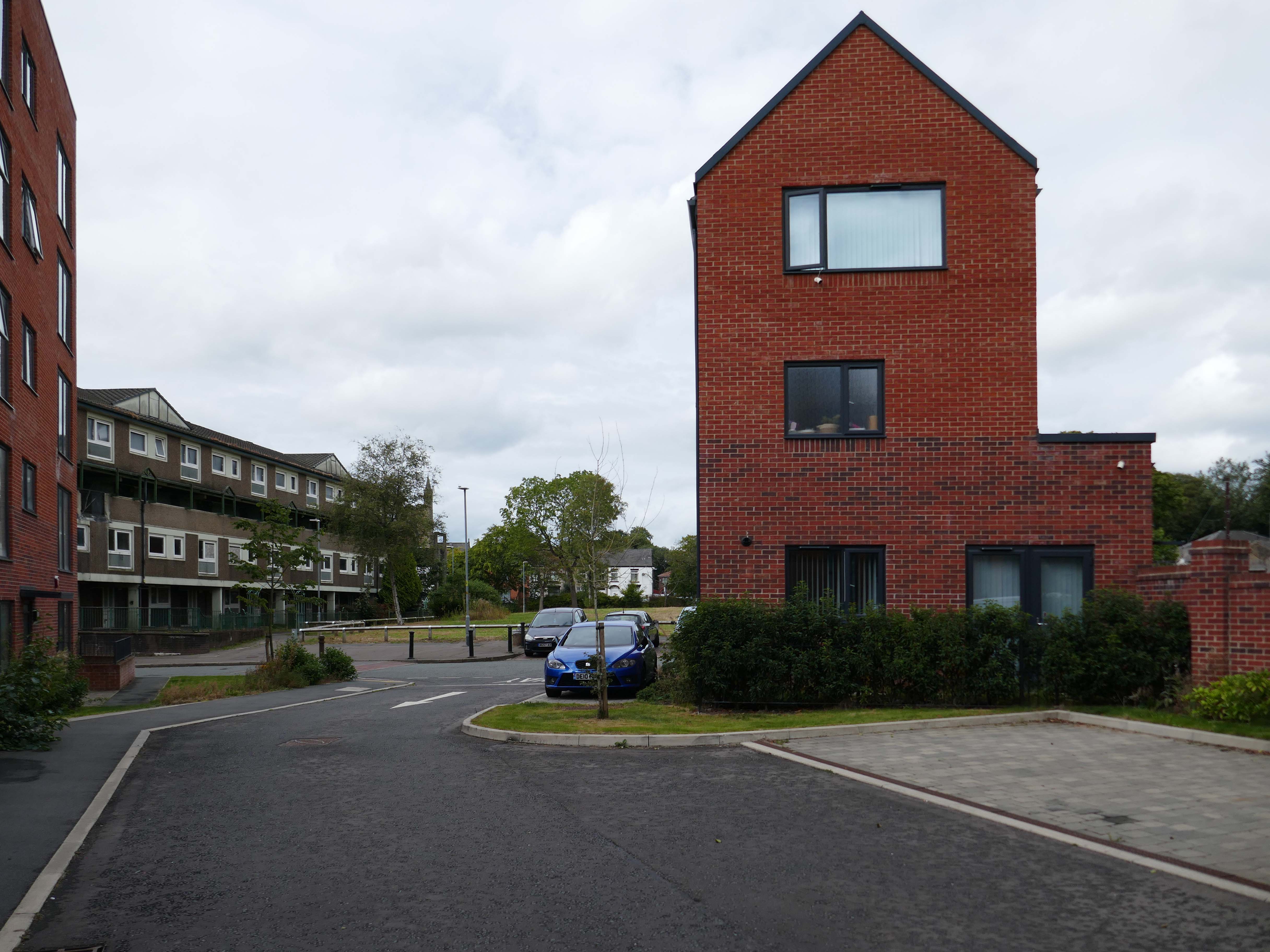
Alongside Ardwick Green Park there are new housing developments nearing completion.
Ardwick Green combines contemporary design with great light infused spaces, offering stylish homes with a modern twist, private parking, outdoor spaces and a welcoming community atmosphere an urban retreat that truly feels like home.
With the city just moments away, living at Ardwick Green will give homeowners easy access to Manchester City Centre and beyond with its vibrant social scene, bustling business landscape and extensive transport network on your doorstep.
Without which much of what we understand as the modern age would possibly not now exist.
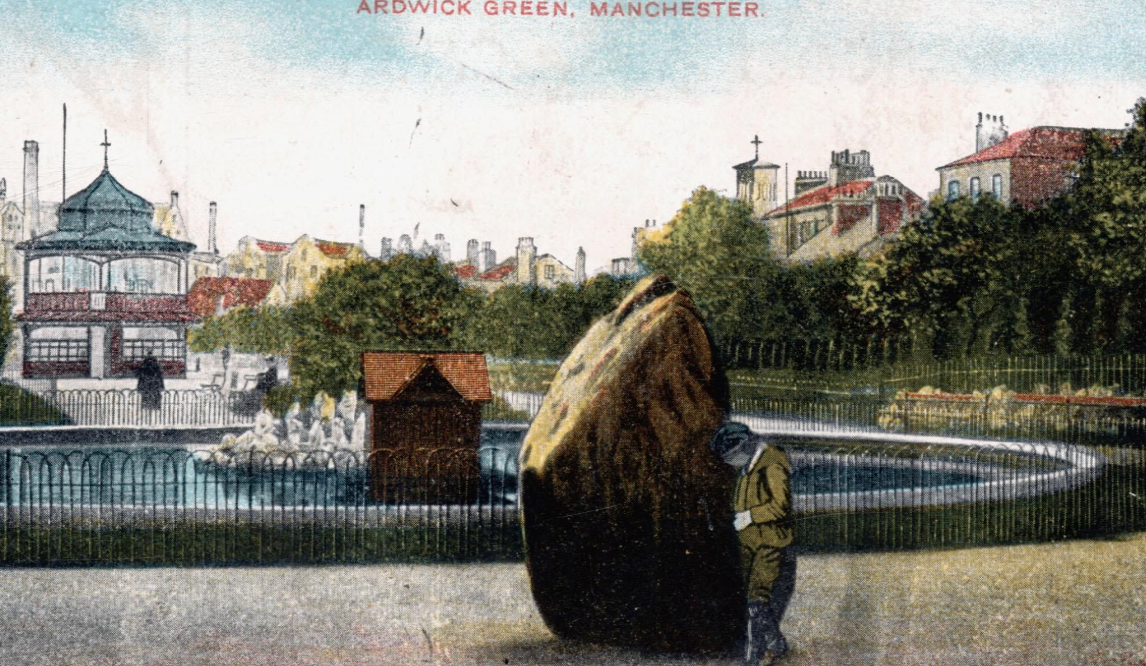
It appears to be green slate from the Lake District, the native underlying rock in this part of Manchester is a red sandstone.
Postcard of 1906
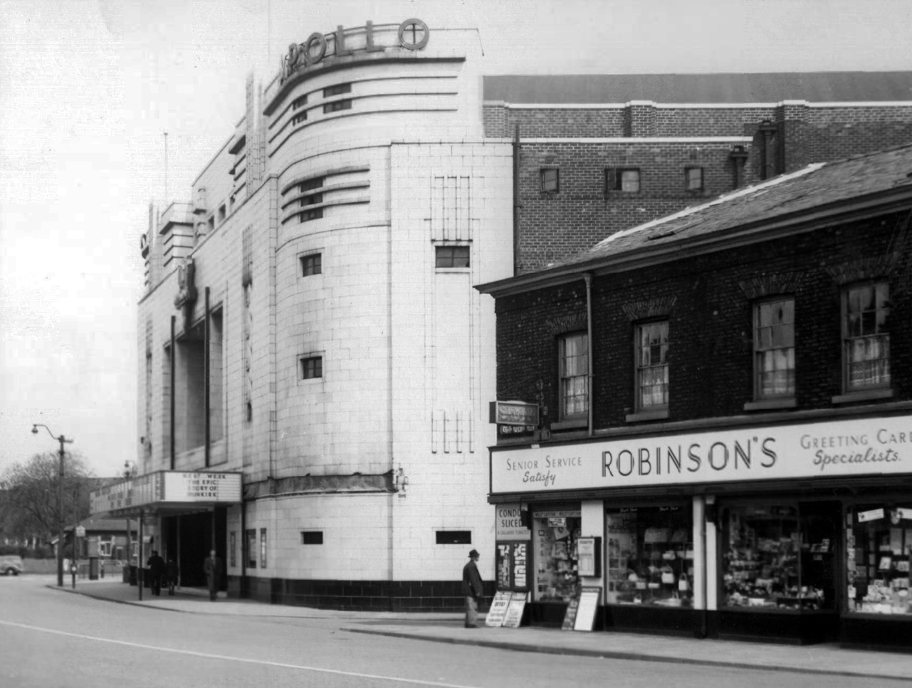
The Apollo of course prevails. – seen here in 1958
Architects: Peter Cummings Alex M Irvine
Opened on 29th August 1938 the interior decorations were carried out by noted interior designers Mollo & Egan with the Holophane lighting designed by R Gillespie Williams.
This Sixties municipal building remains a mystery.
Actor Harry H Corbett visiting his childhood area in 1969, he lived on Earl Street and later in Wythenshawe.
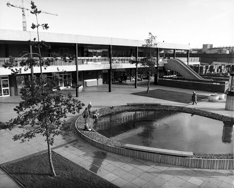
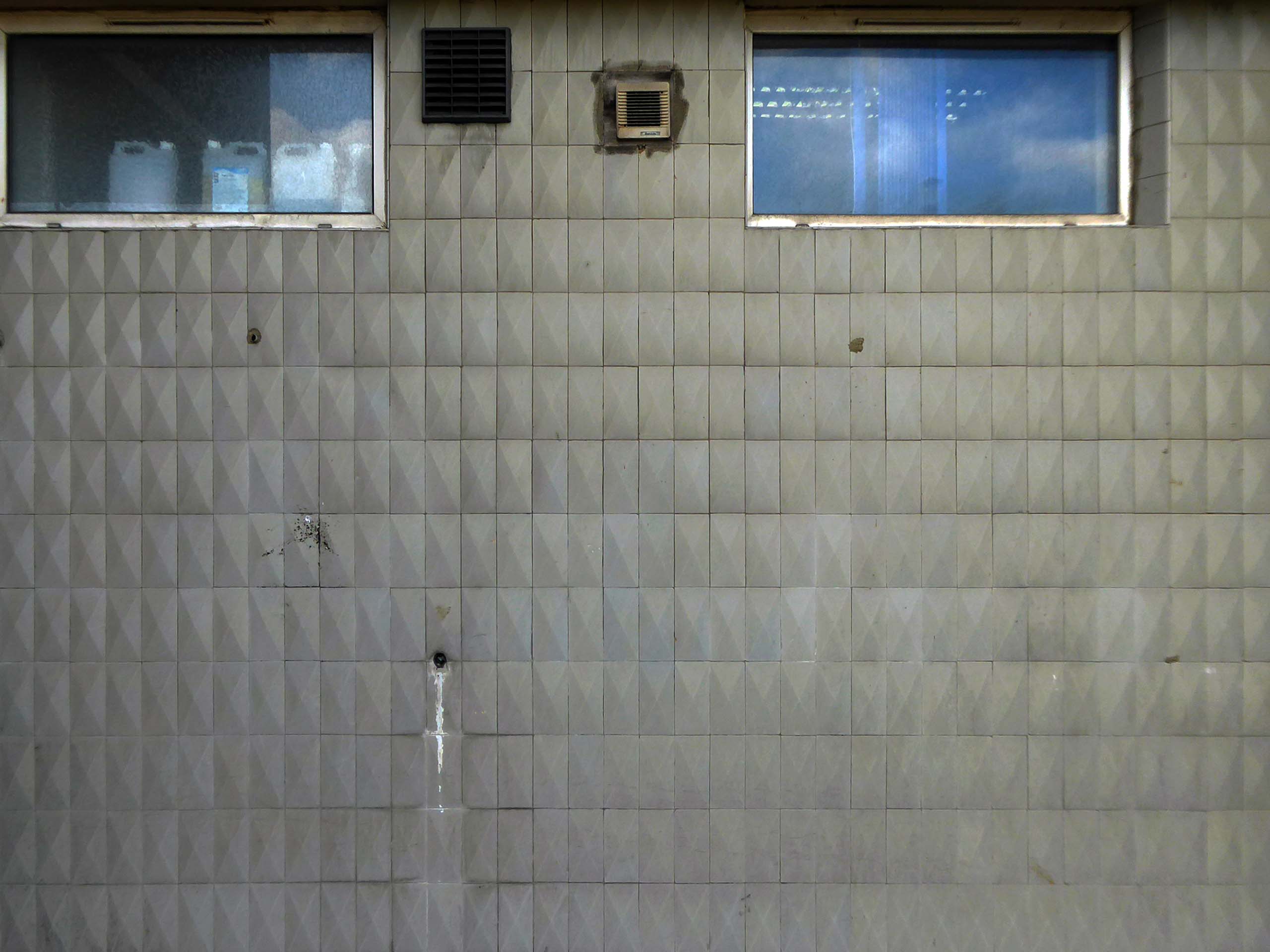
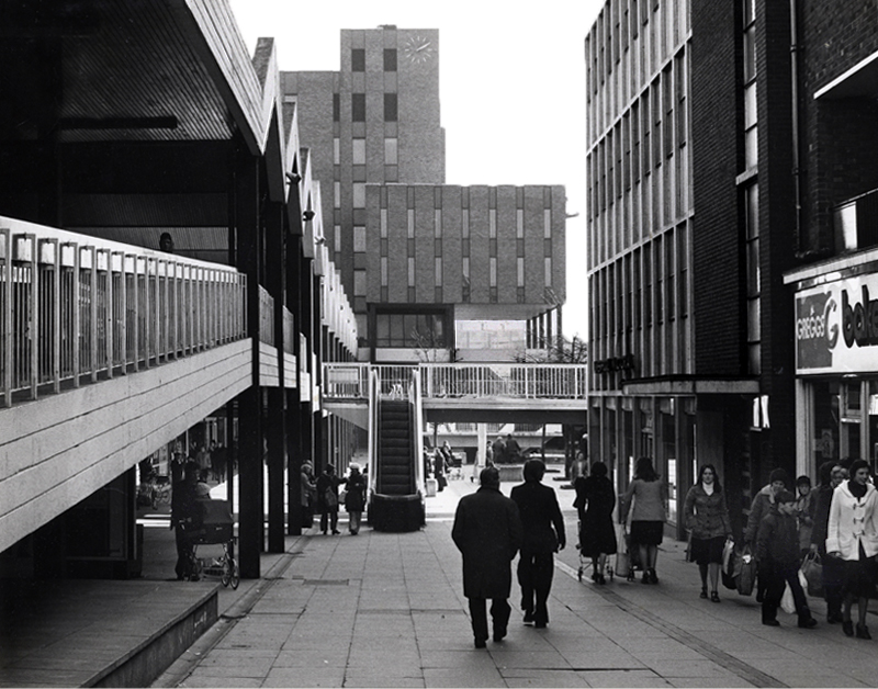
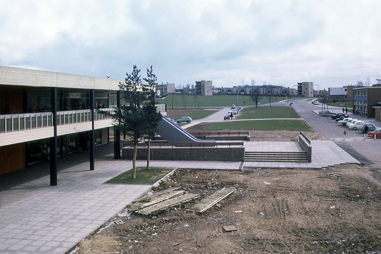
Plans for the new town centre started to be developed in 1960 by Chief Architect Roy Gazzard. The process would go through eight sets of revisions before they were finally approved in 1968. Yoden Way was then pedestrianised, and the small row of shops built in 1950’s was incorporated into the new shopping precinct, forming the north western end of Yoden Way. Like many other town centres across Britain undergoing modernisation, the high-street was split onto two levels, with ramps providing access to raised walkways.
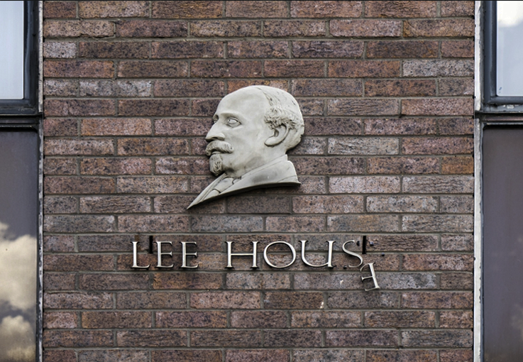
The construction of Lee House – named after Peter Lee, started in 1974. Once completed, the Development Corporation moved its Headquarters from Old Shotton Hall to Lee House in 1976, occupying the building until it was sold in 1984 and remaining staff relocated to Newton Aycliffe.
Enhancing the built environment, Peterlee Town Centre was furnished with play equipment, an ornamental pond, open air escalators, and a sculpture by John Pasmore – son of Victor.
These features were later removed after the town centre was sold to Teesdale Investments – Peterlee Limited in 1985.
Access ramp at the bottom end of Yoden Way, prior to the construction of Lee House in 1973.
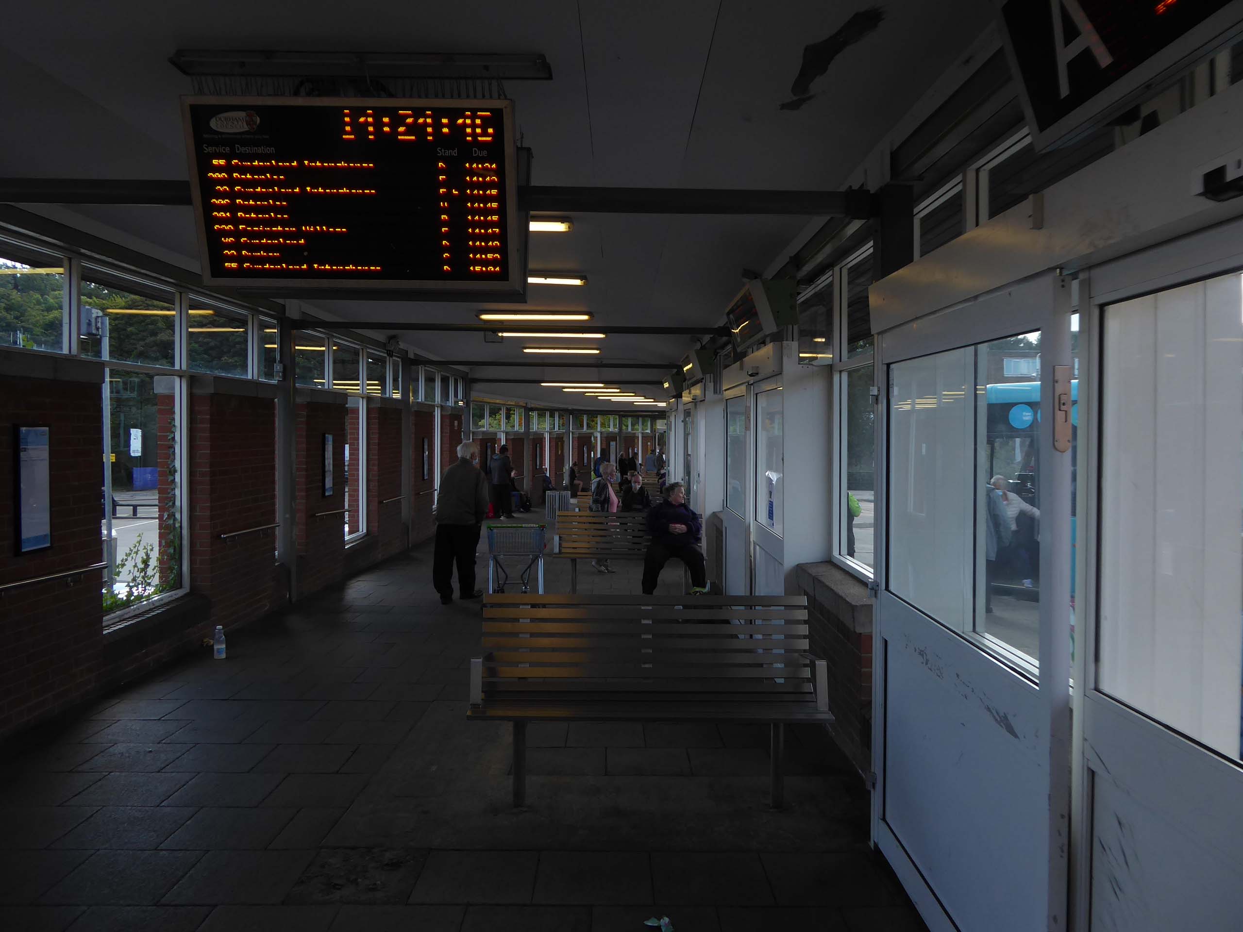
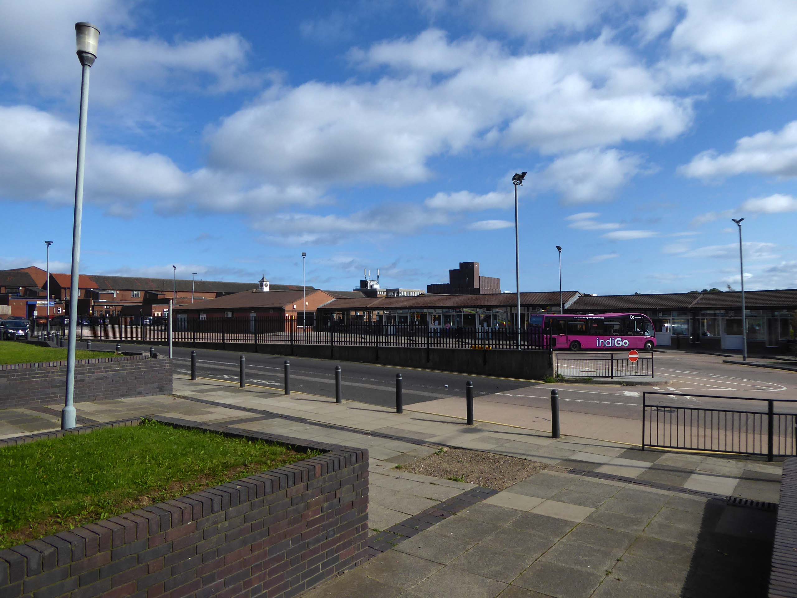
It’s 2021 and I arrive at the Bus Station.
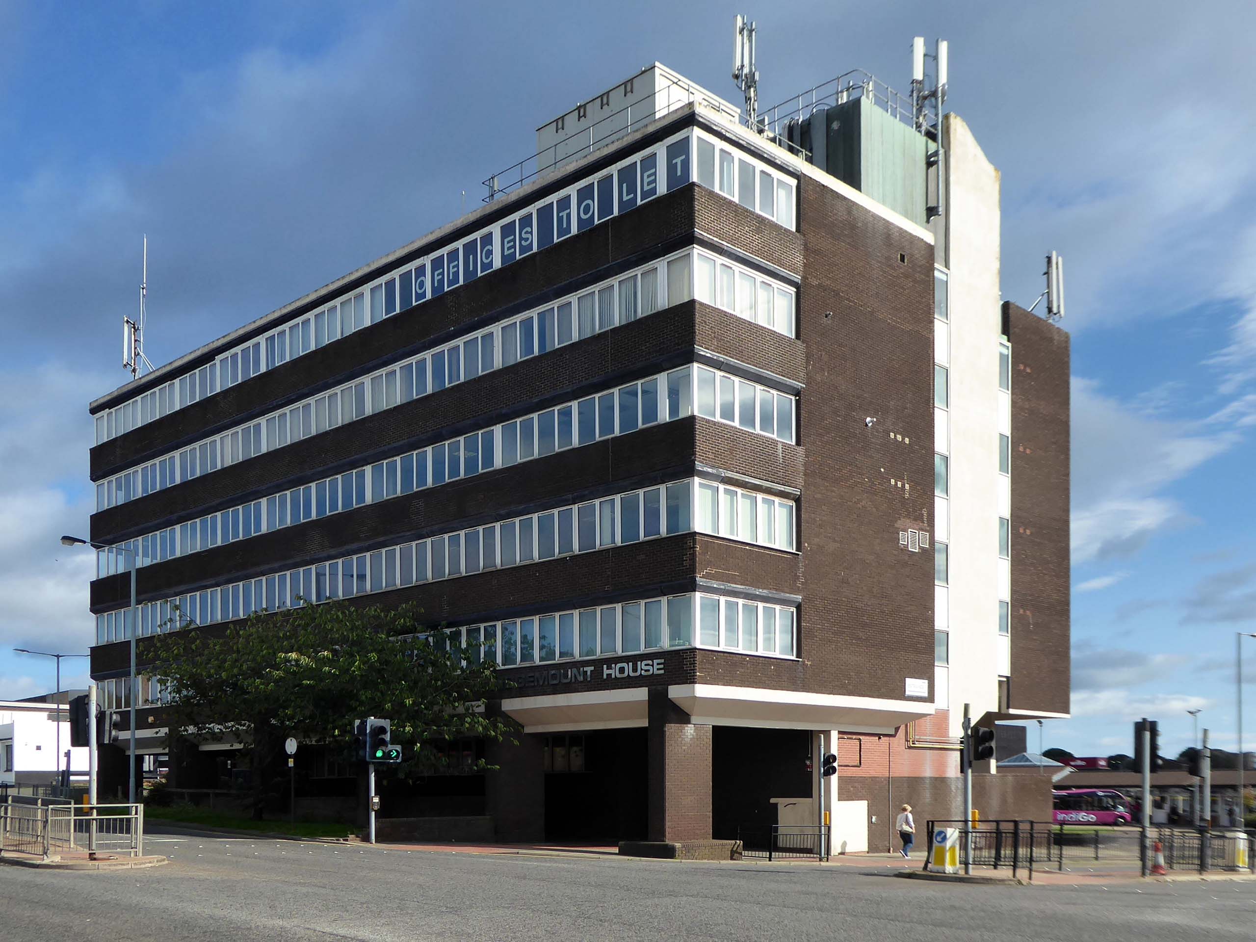
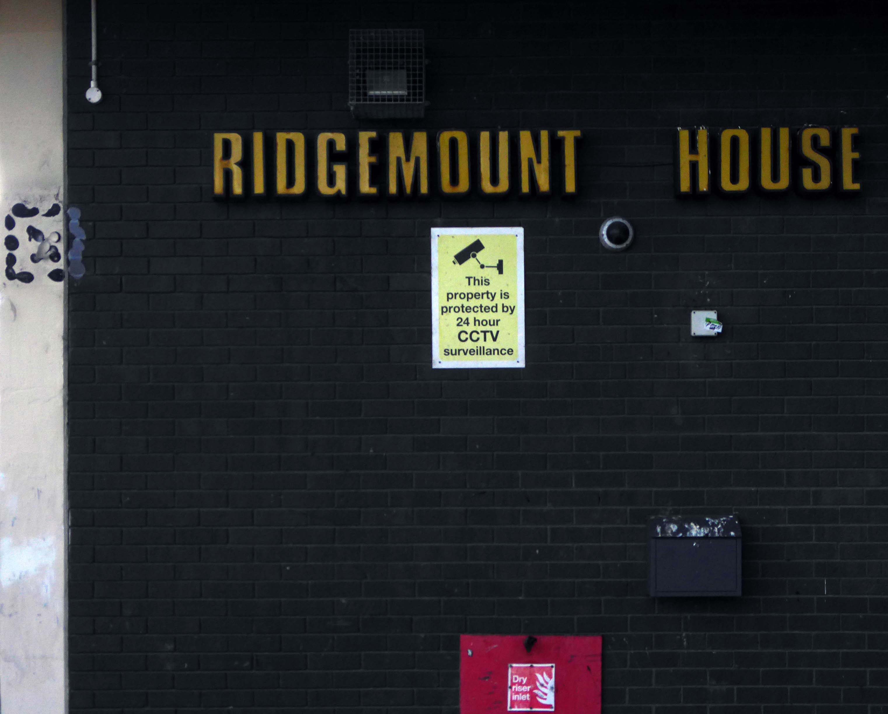
Immediately adjacent is Ridgemount House. – once home to the Job Centre.
Firefighters were called to the disused Ridgemount House on Bede Way in Peterlee on Wednesday August 16th 2023 at about 8.20pm after reports of a blaze.
Crews found a fire had broken out in the first floor of the building, which was found to be the home of thousands of pounds worth of cannabis plants back in 2020, after a man converted two floors for use as a drug farm.
Tarlochan Singh, owner of Ridgemount House, has been prosecuted following the discovery of several serious fire safety breaches at the property.
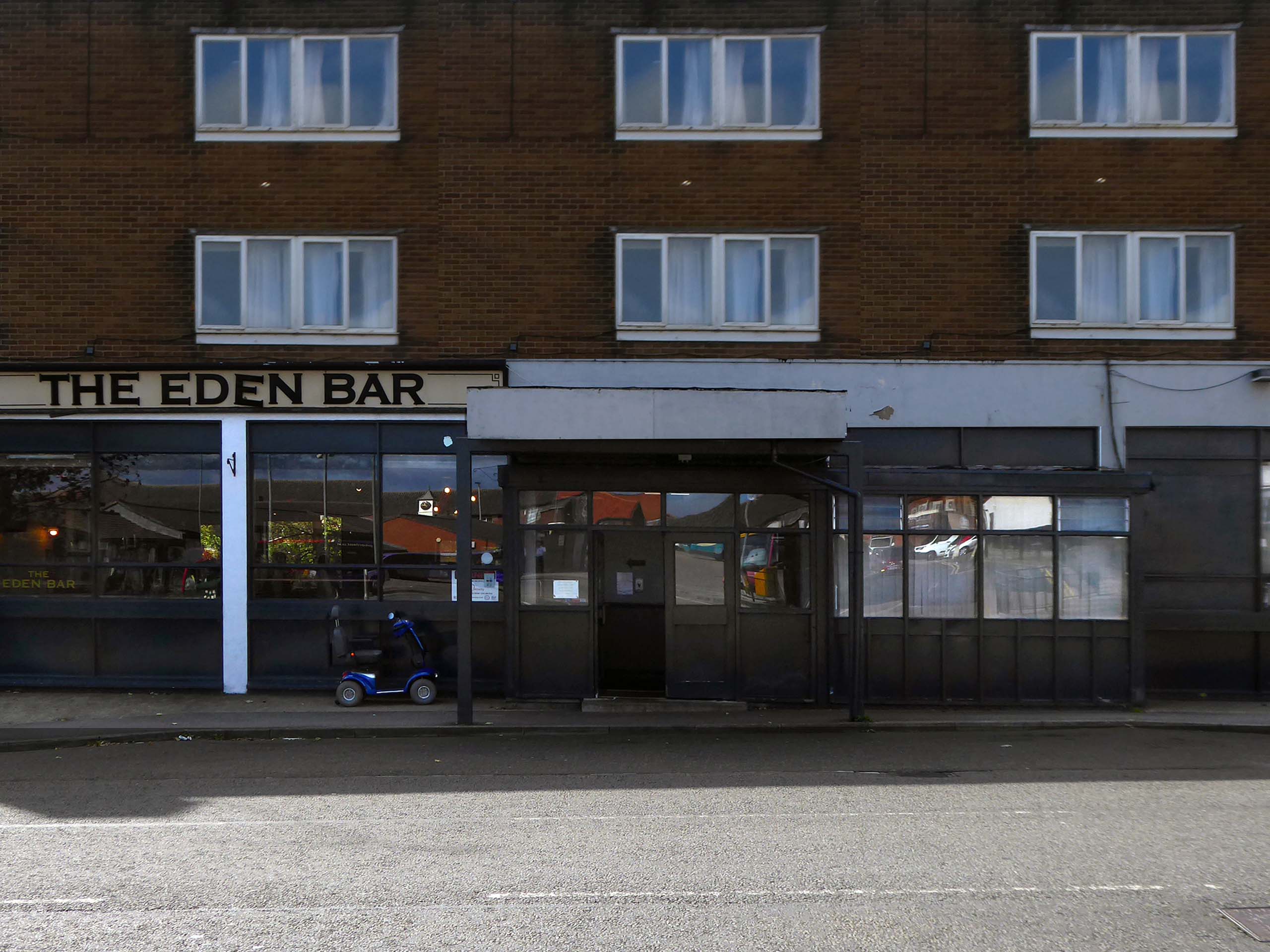
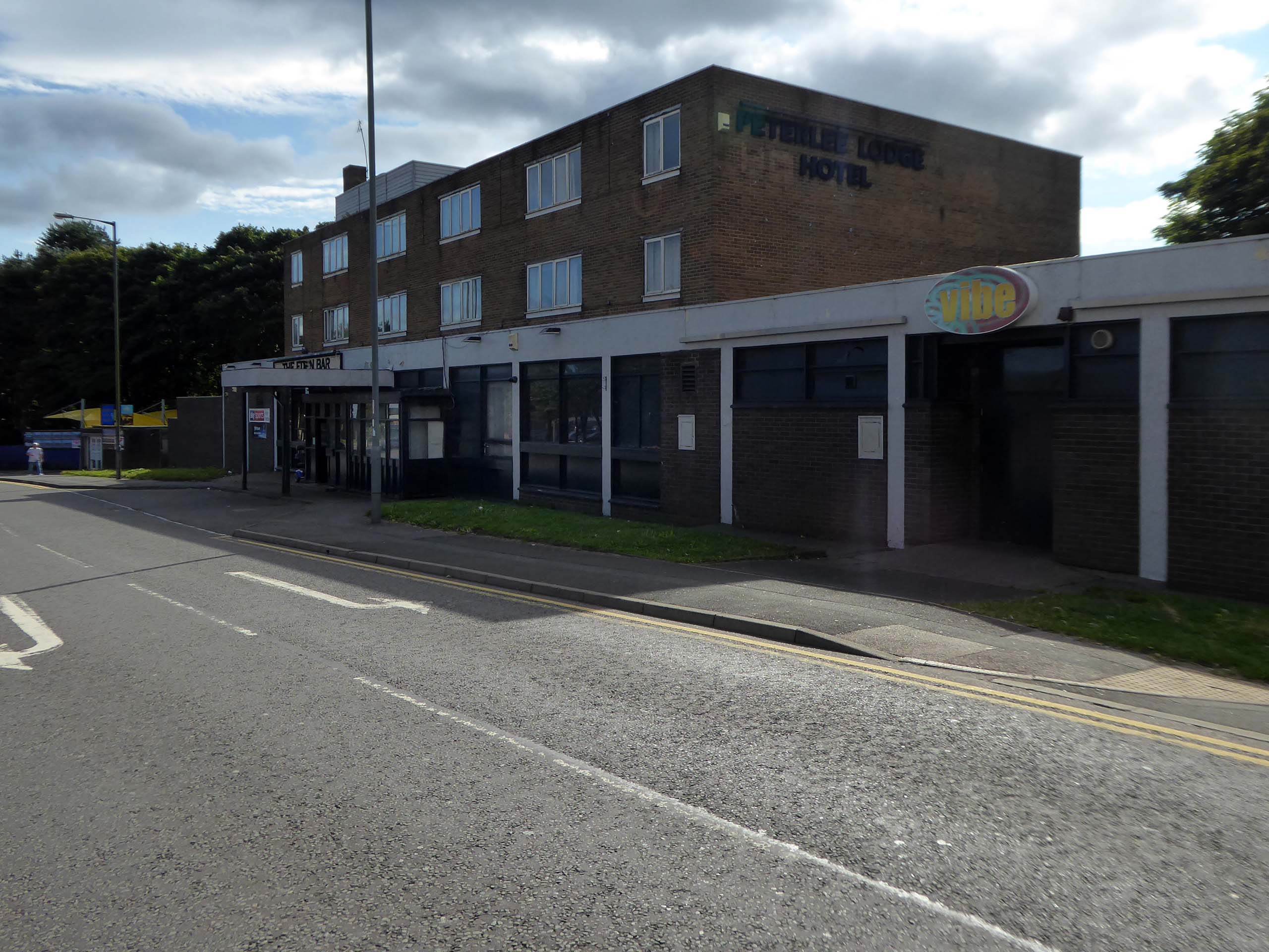
Readers have voted Peterlee nightspot Vibe as the ‘most tragic hometown club’ in the North East
Formerly known as The Dance Factory, Vibe, in Peterlee town centre, is a place famous for it’s almost impossible to get off ‘tramp stamp’ and next door neighbour The Lodge, where many locals will go for pre-drinks and some karaoke before heading to the club.
The bar which once boasted a bijou rotunda with an exclusive upper terrace, has now closed.
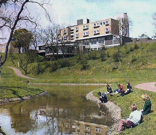
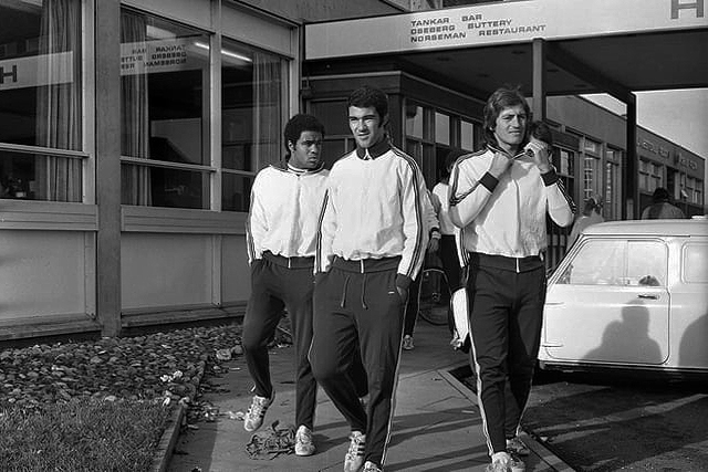
Back in 1973 the hotel was badged as the Norseman.
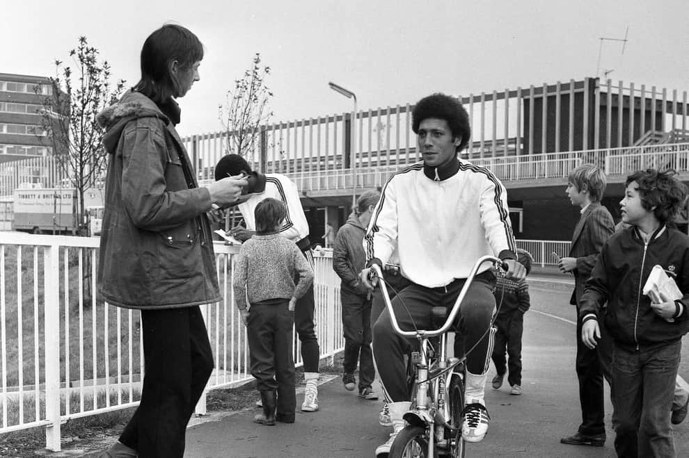
The giants of Sporting Lisbon faced Sunderland in the European Cup Winners Cup and they spent the build-up to the tie in the Norseman Hotel. They met local children, took a walk in the dene, signed autographs and even tried riding a Chopper bike. The side lost 2-1 at Roker Park to a talented Sunderland team before overcoming the Black Cats 2-0 back in Portugal.
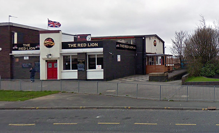
Back in 2021 Sambuca was the other town centre bar – badged with Olde English type.
Formerly the Red Lion a Cameron’s estate pub.
April 20th 2014 – Happy Easter everyone. We are open today all the way to 10pm – £2 bottles VHFs, house spirits only £3 double, buckets £4, Corona £2.50 selected shots 50p, cider cans £1 + £2 Karaoke – from now on everyone who sings gets a free shot Then we have the best in all your favourite dance ‘n’ house tunes to take you into Monday.
Onward to the Shopping Centre.
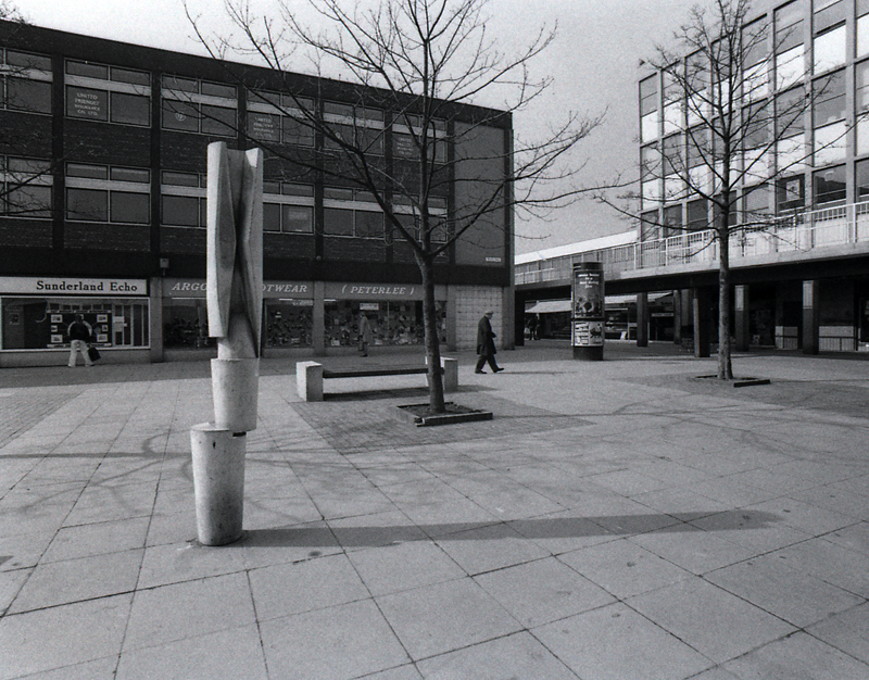
Yoden Way looking towards Lee House in 1977.
Photographs: JR James
The 1950’s shops are still in situ.
Though some of the original architectural detailing and features are no more.
Lee House is still standing but vacant.
Lee House was once home to charity and community groups, but in 2015 the building owners ordered them to vacate the property.Even the building’s clock has stopped working and has been stuck on the same ten-past-two reading.
However, Durham County Council has now confirmed the building is in new hands. Economic development manager Graham Wood said: “We have worked with the previous owner to try to ensure the building is secured while we await proposals for its long-term future.
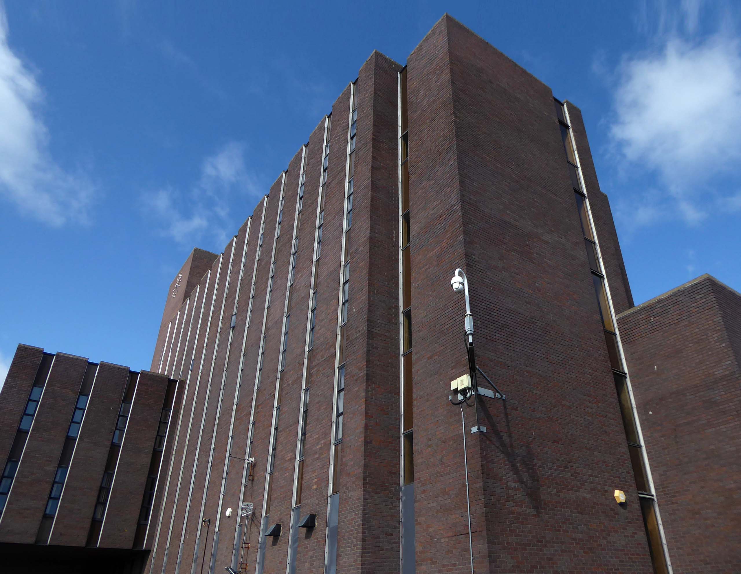
Four fire engines rushed to Lee House on Upper Yoden Way in Peterlee on Friday afternoon September 19th 2025 after a fire broke out on the first floor of the seven floor building.
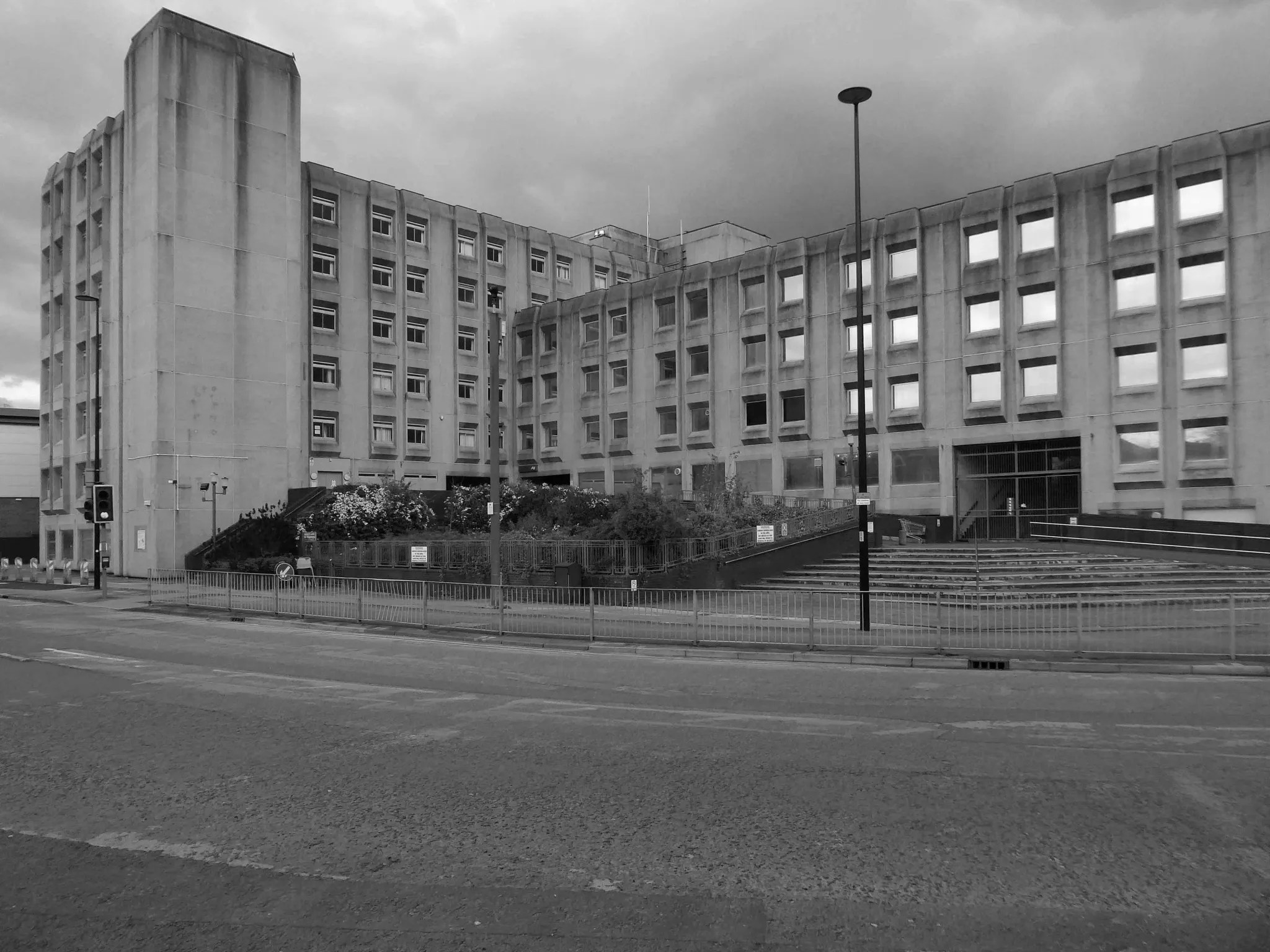
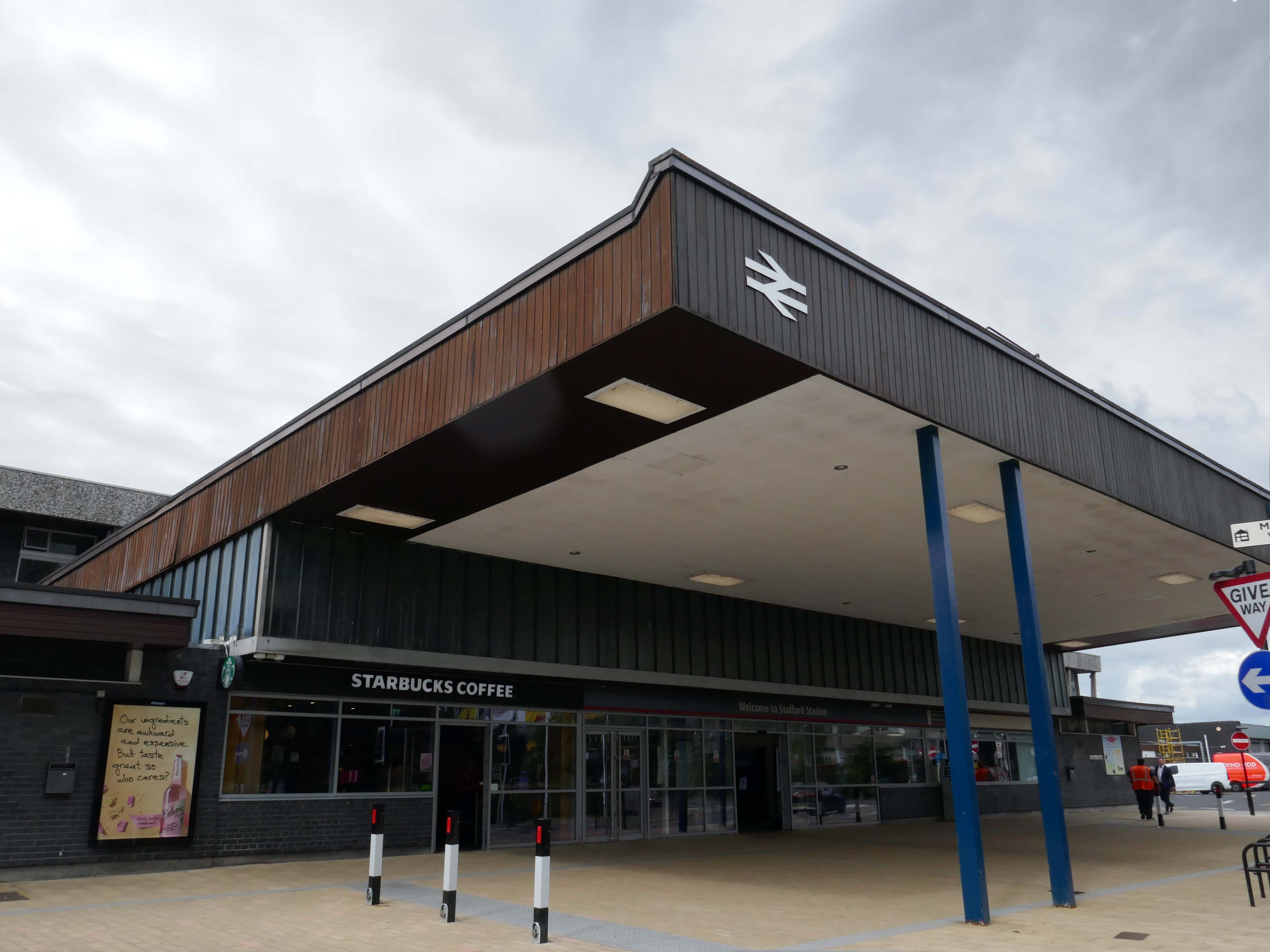
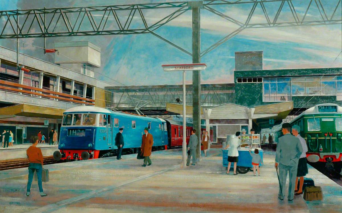
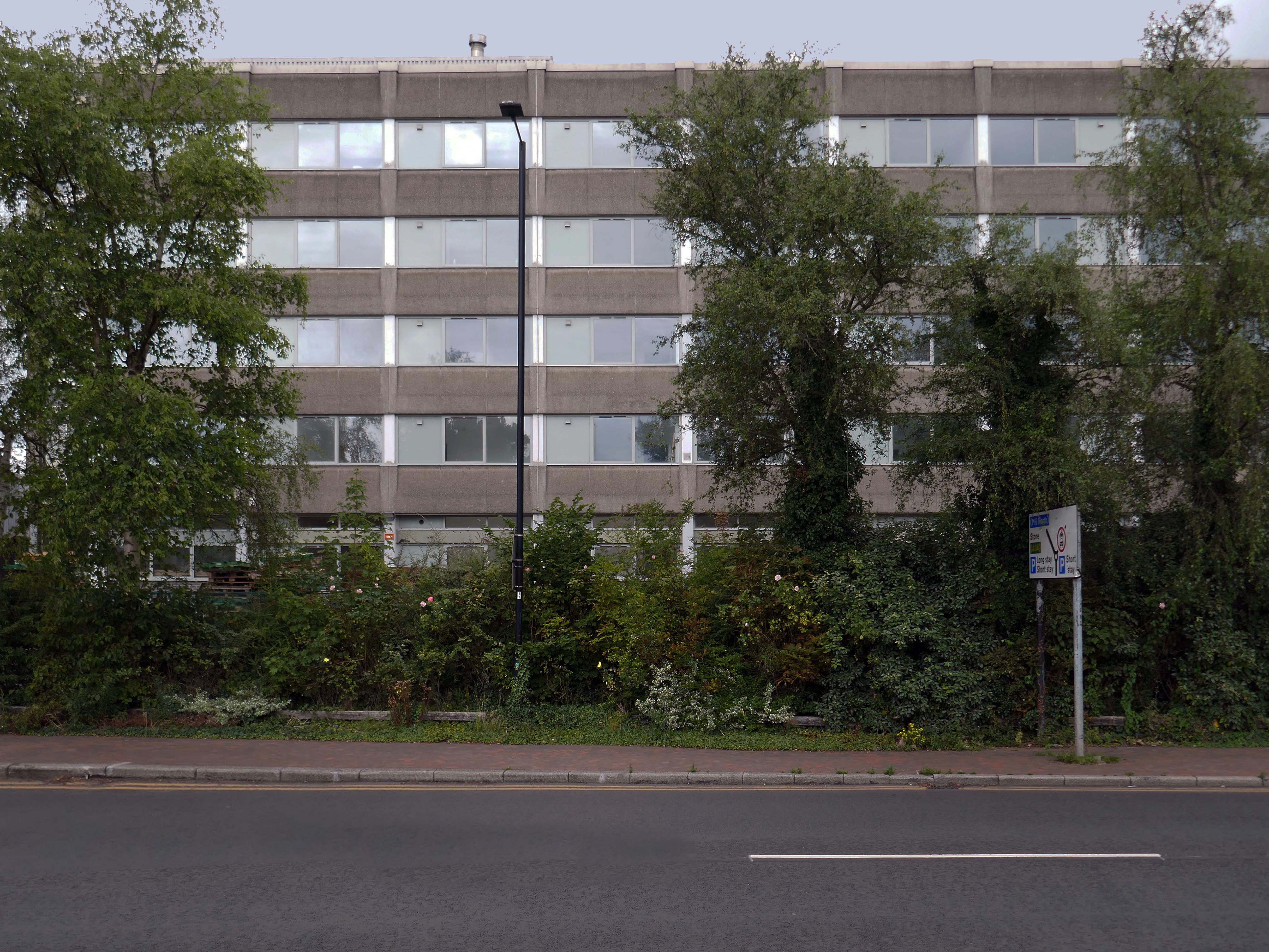
The current station was built in 1962, by the architect William Robert Headley, as part of the modernisation programme which saw the electrification of the West Coast Main Line.
On leaving the station there is an as yet partially un-let Sixties office block to let – Victoria Park House.
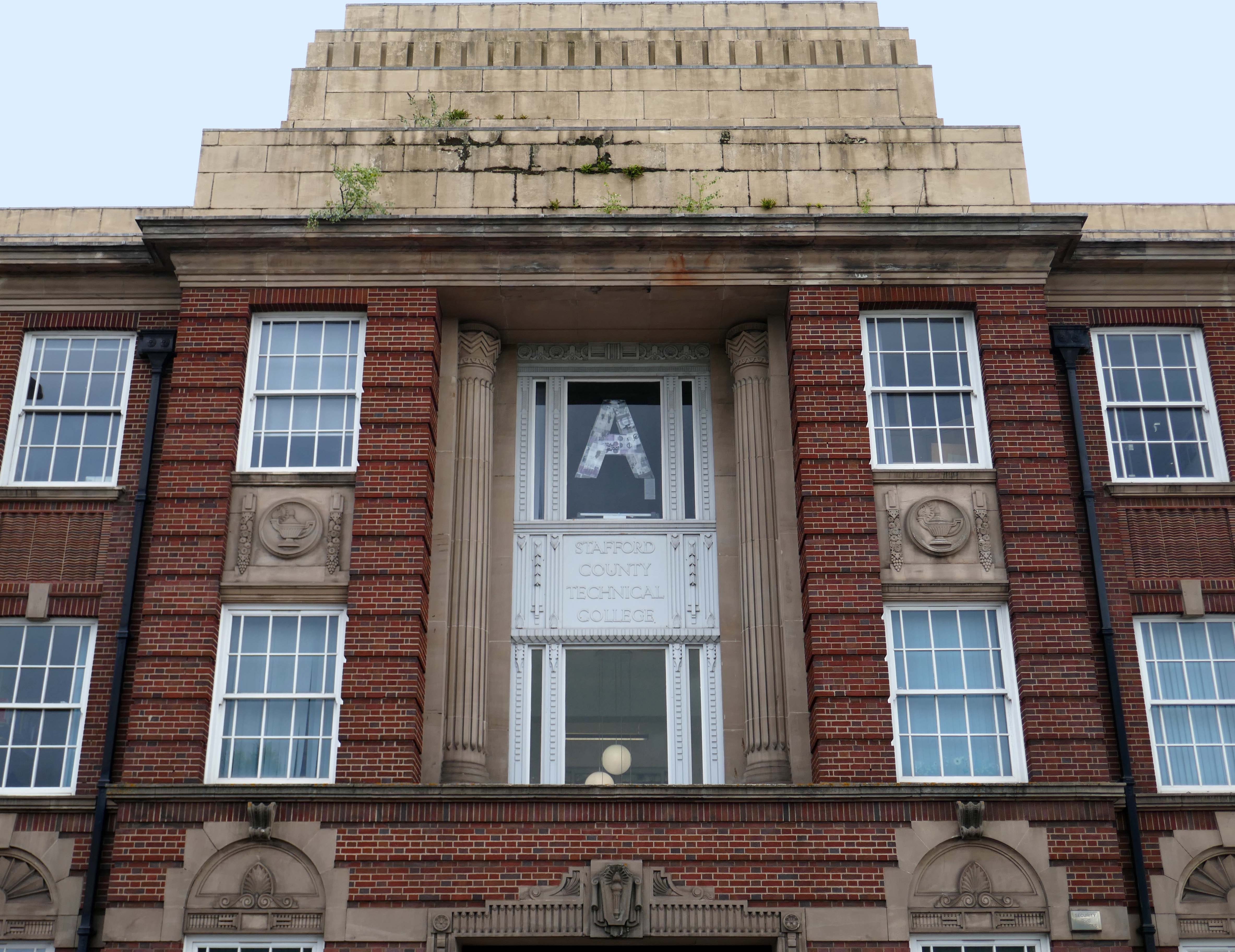
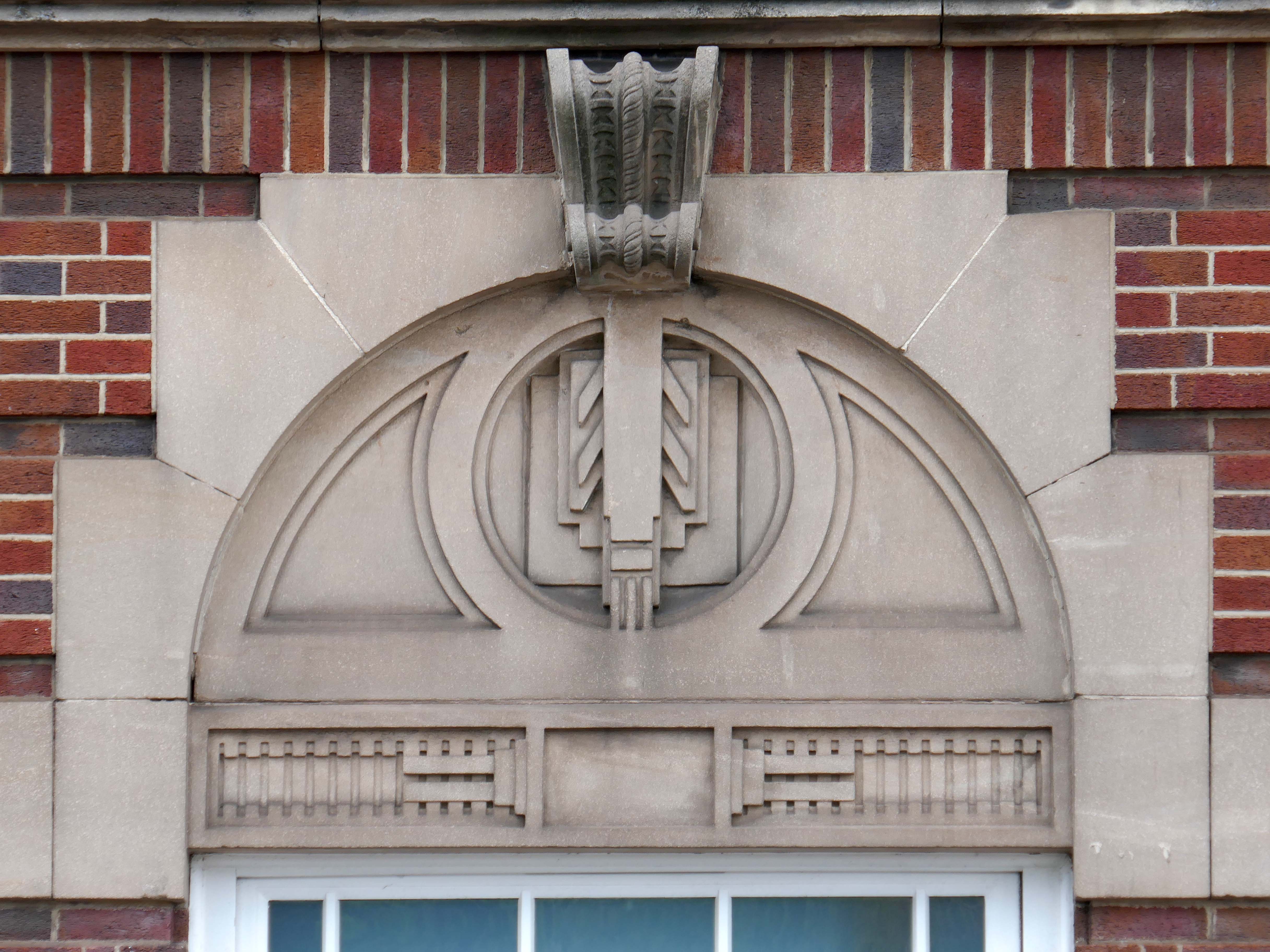
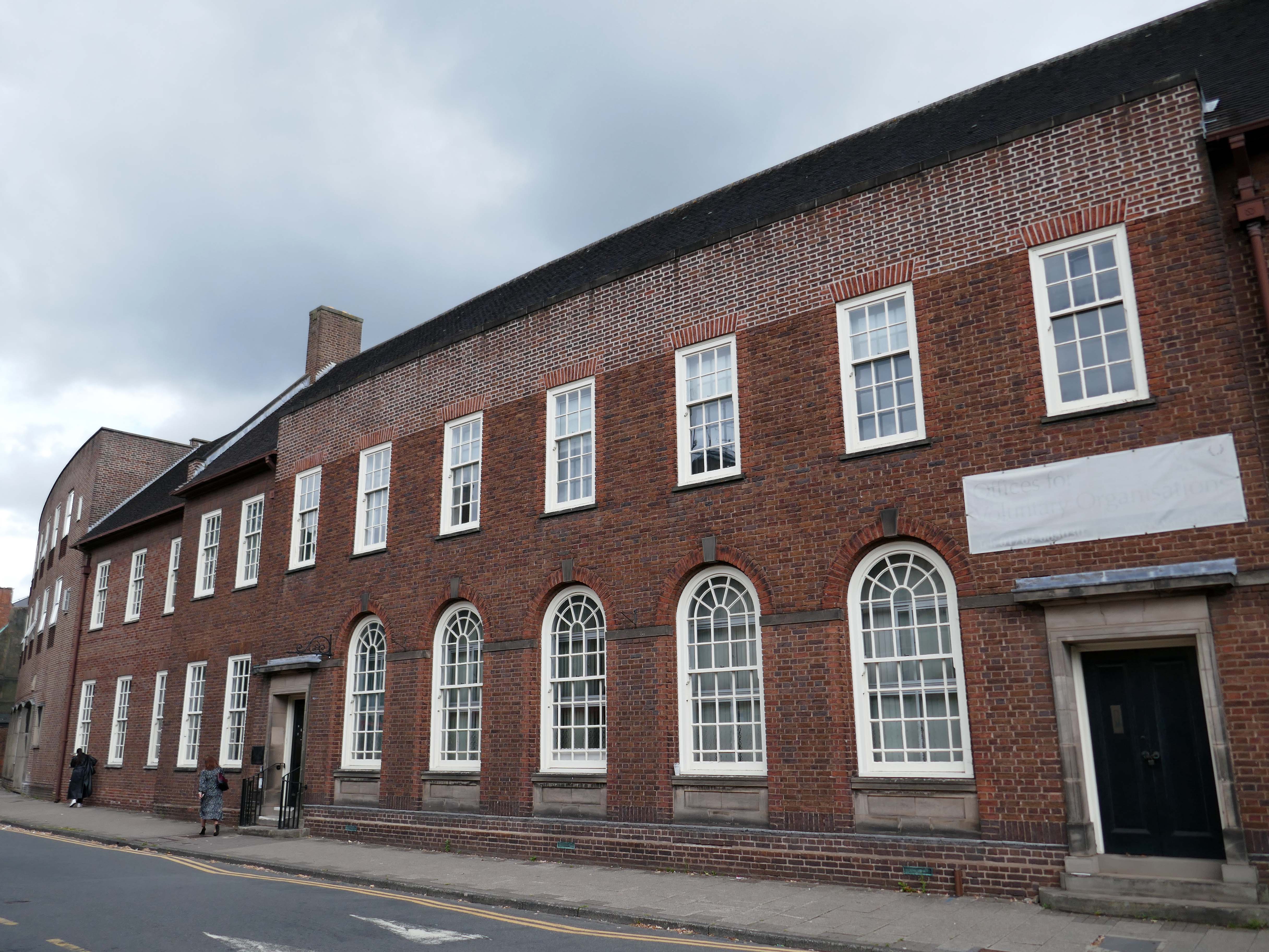
Onward to the County Technical College 1937 Grade II Listed – interior completed 1946.
The shell of the building was completed in 1937, after which it was used as an American army hospital during the war, then completed afterwards.
Heavily loaded with Art Deco details.
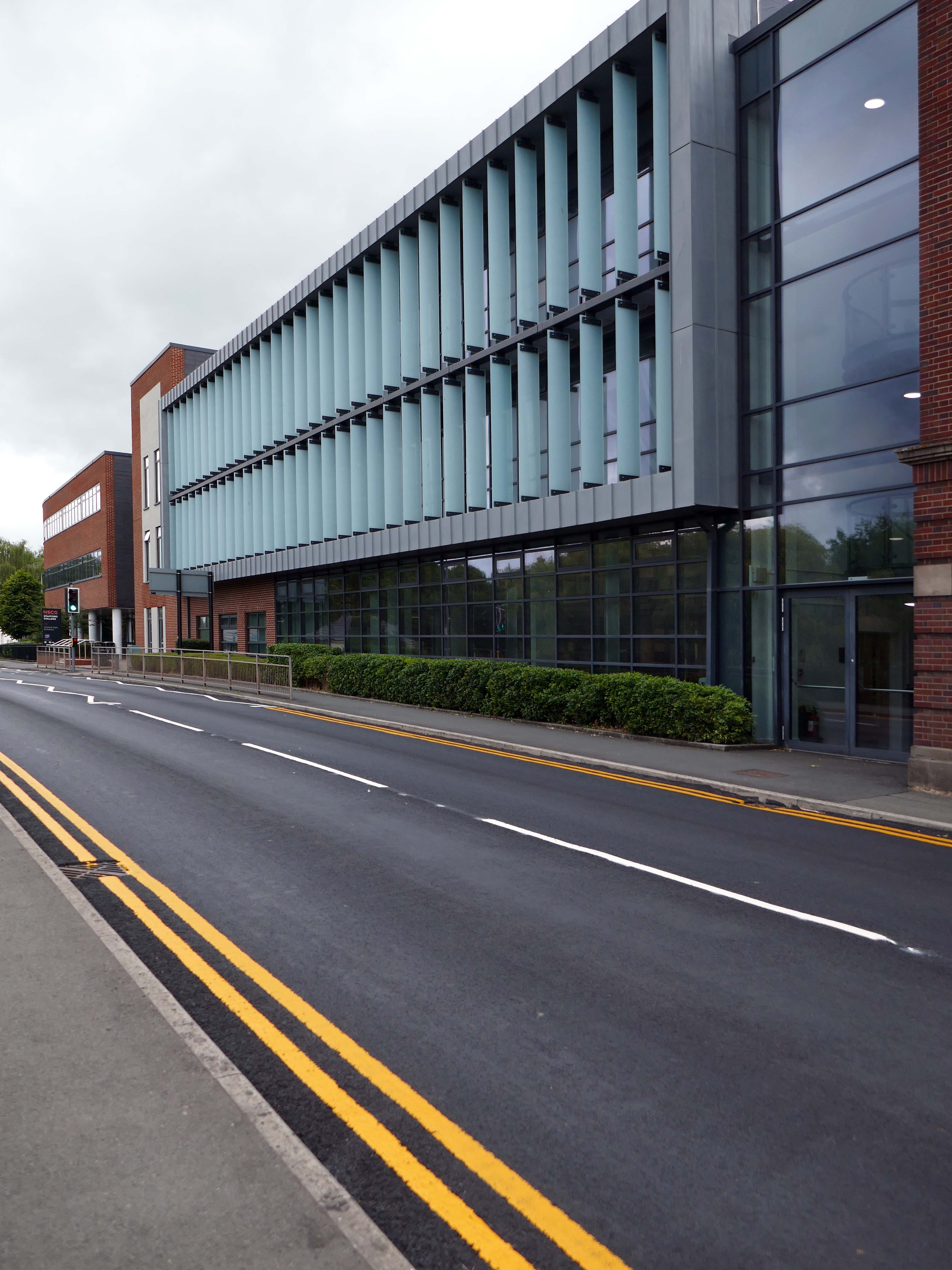
The new £28m three-storey Skills & Innovation Centre at Stafford College, completed in August 2023, was one of the first further education college schemes to be delivered under the DfE framework and a pathfinder scheme for delivery in accordance with the Further Education Output Specification. The new Centre is equipped with cutting-edge equipment and state-of-the-art facilities for construction, engineering and hybrid / electric vehicle maintenance facilities, as well as IT rich seminar suites and open learning break-out spaces along with a 4-court sports hall, a fully-equipped gym and a flexible 300-seat auditorium.
A 1970’s block was demolished to make way for the new development.
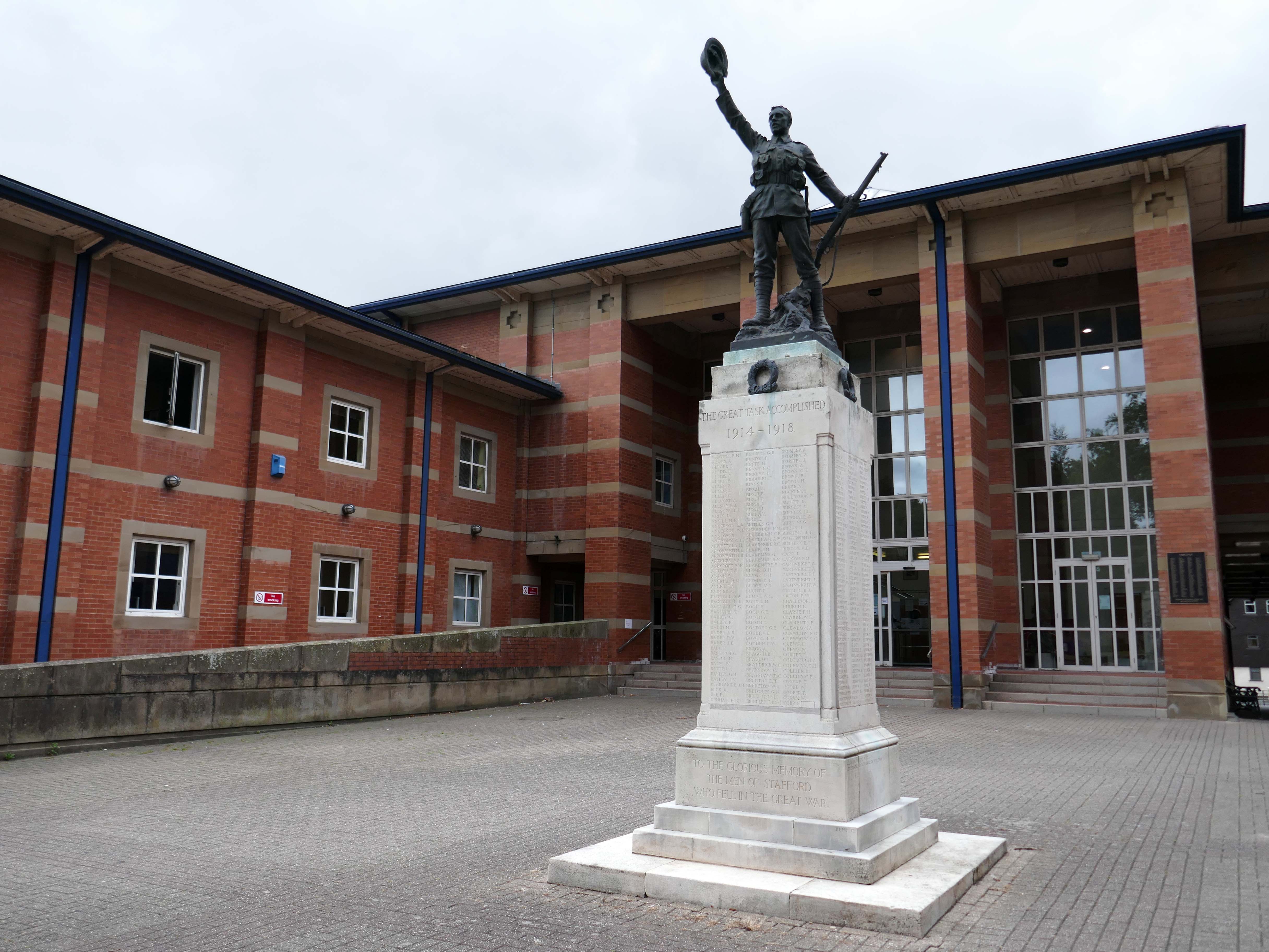
Almost everywhere we go we find a PoMo Crown Courts 1991 – architects: Associated Architects of Birmingham, cost of £10.4 million.
The war memorial of 1922 is by Joseph James Whitehead.
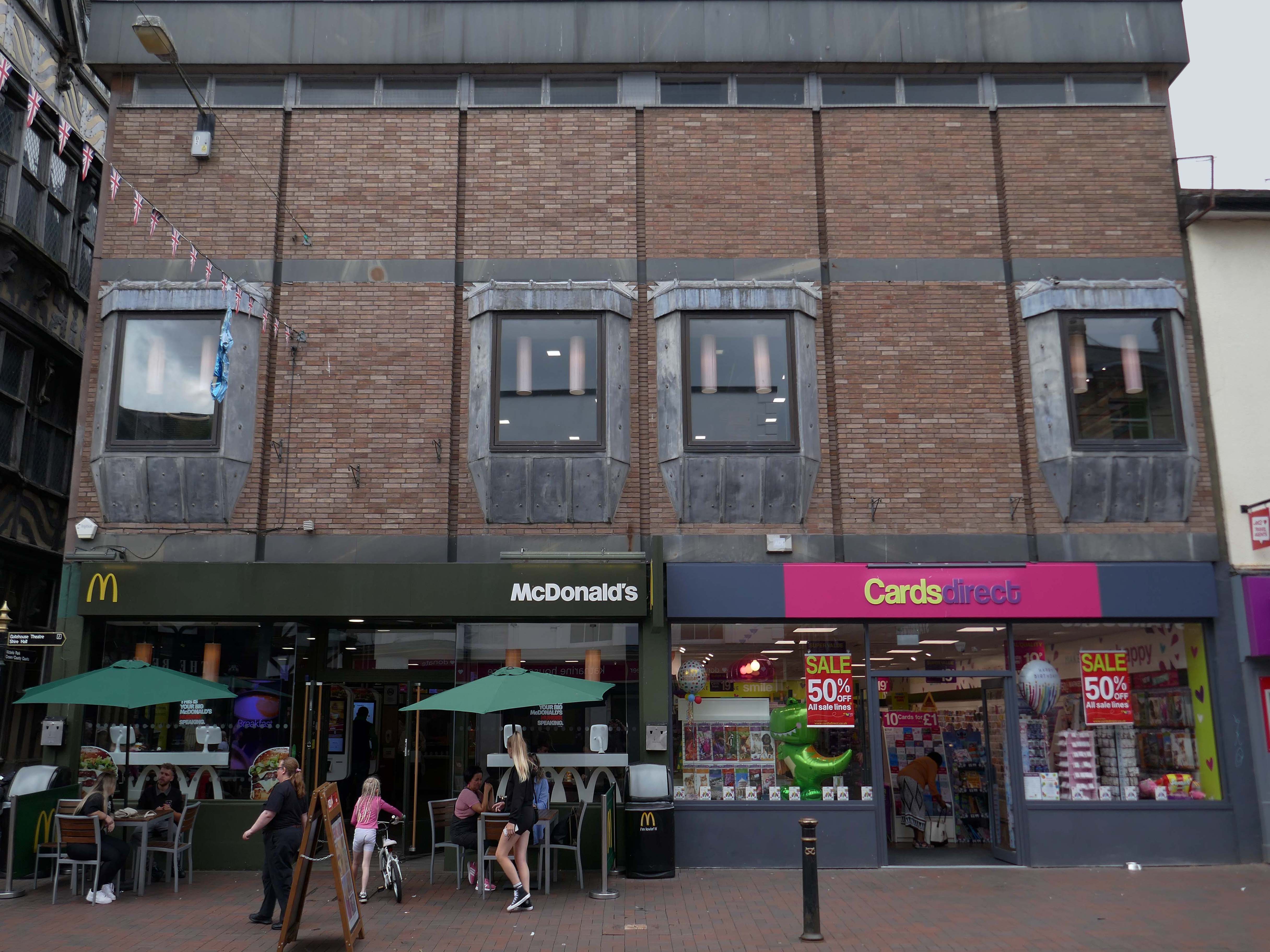
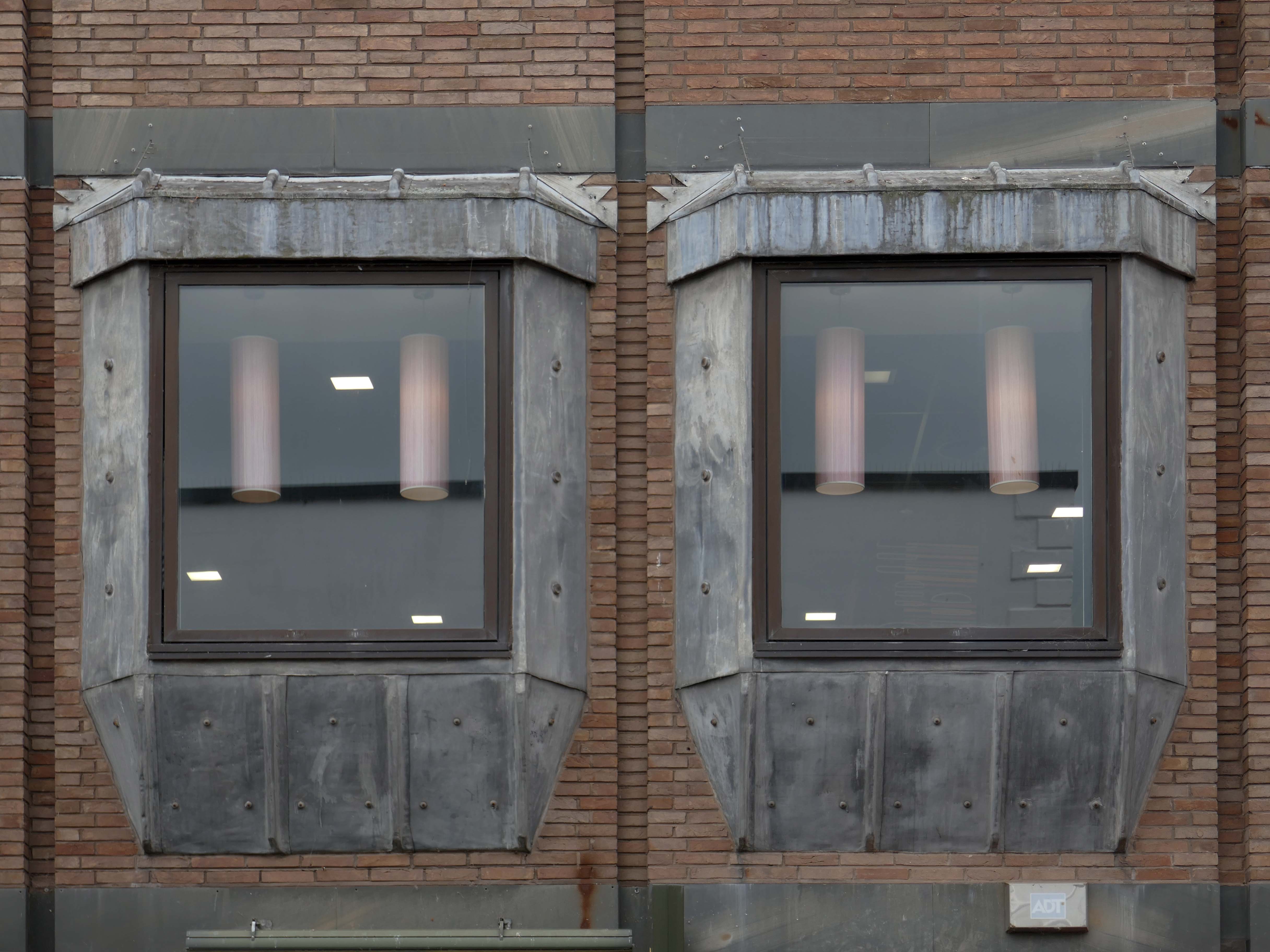
Sneaking through the alley to and before the McDonalds – one many more recent buildings with jetted lead clad bays.
Keeping the town Tudor one bay at a time..
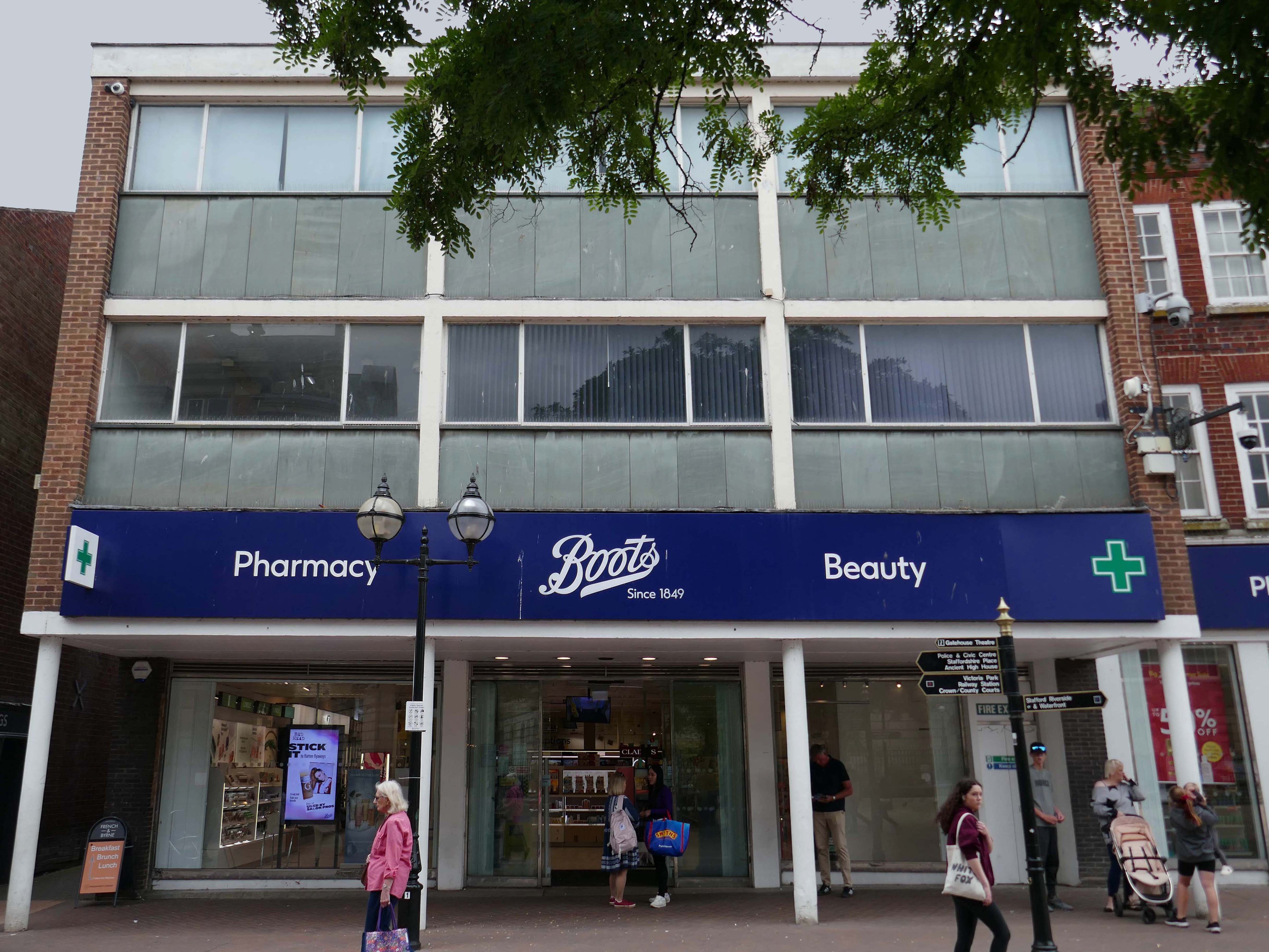
Further along a Sixties Boots.
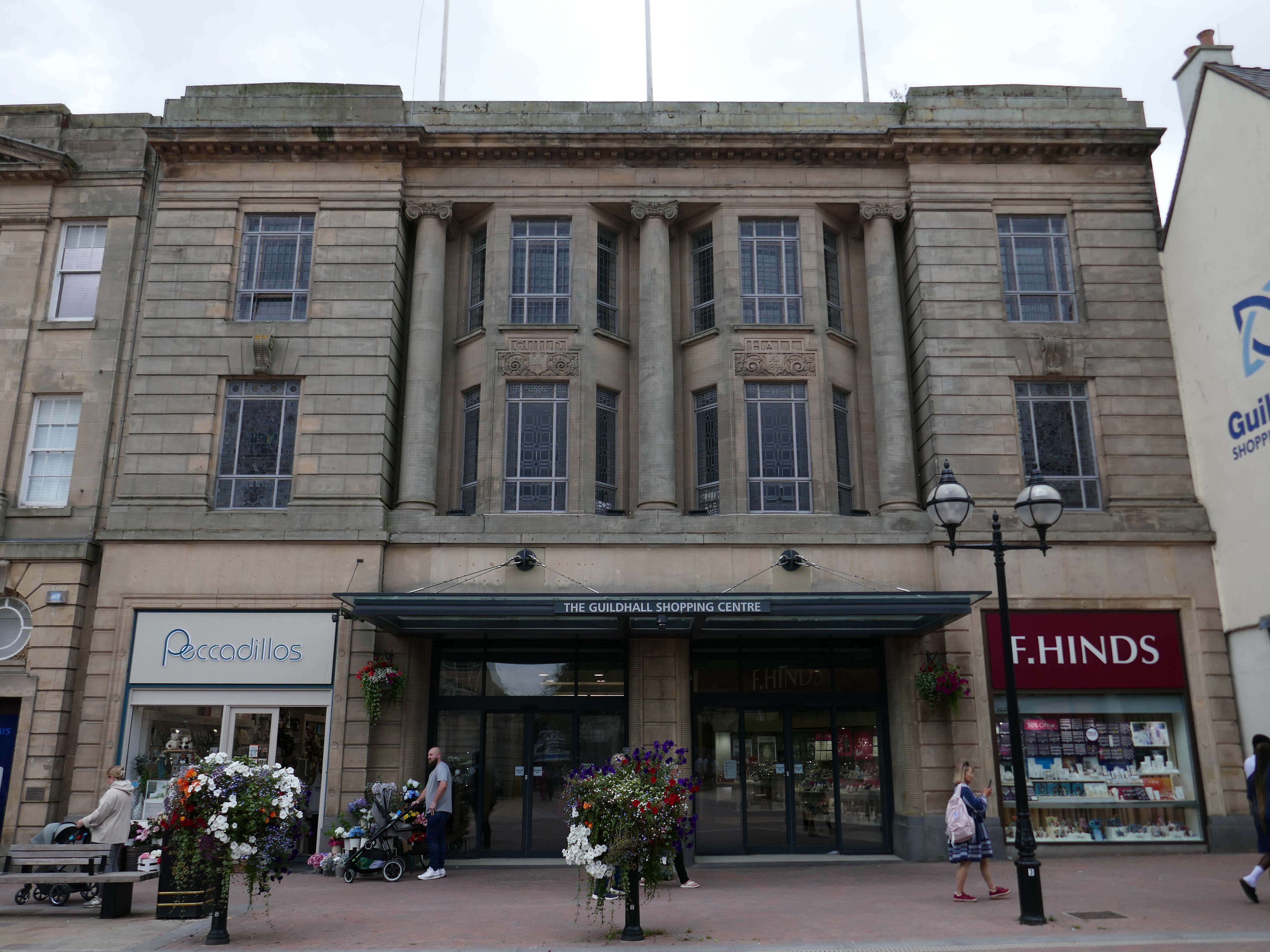
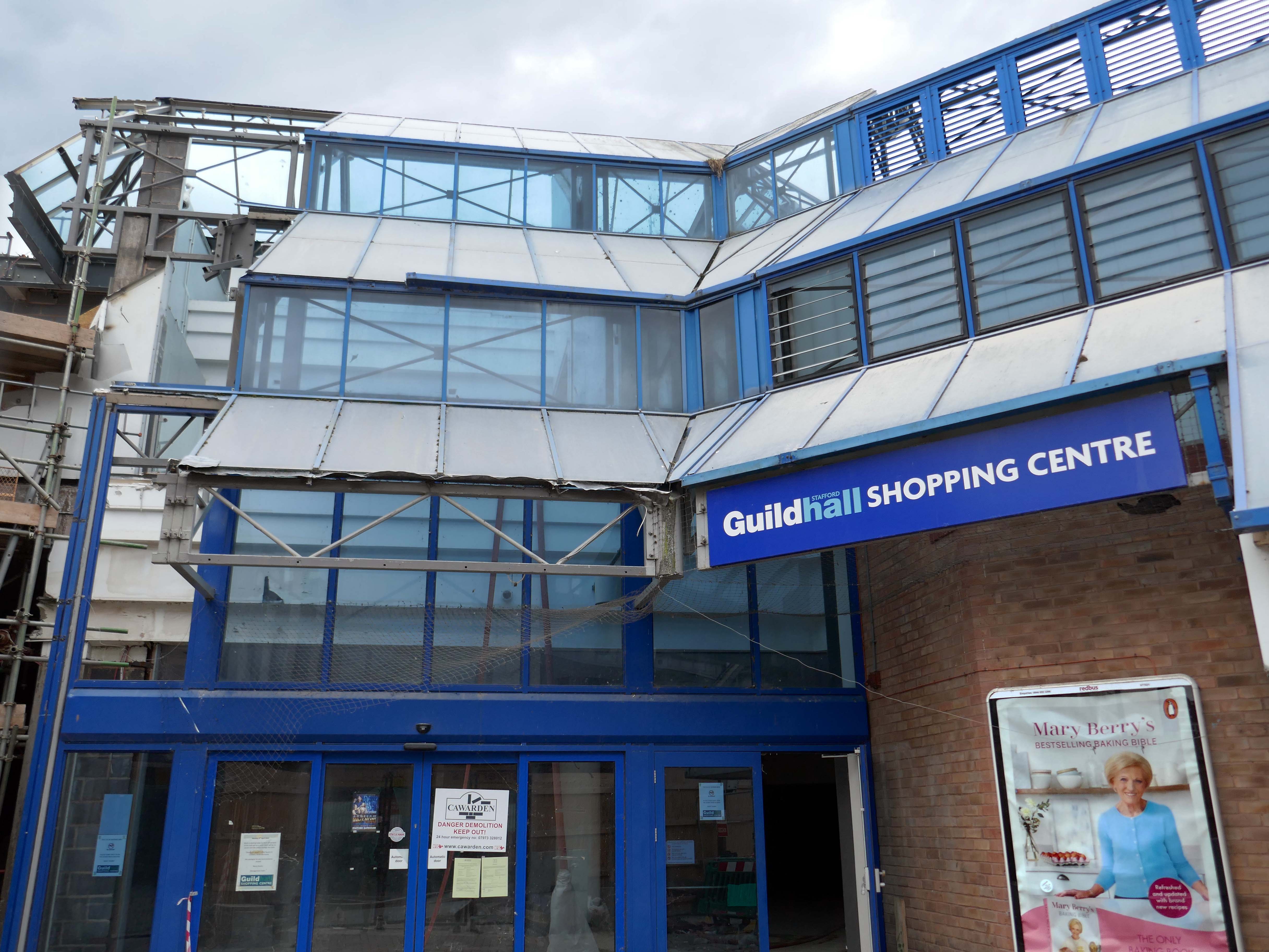
The Classical stone frontage of the Guildhall Shopping Centre.
Working with Mercia Real Estate, Glancy Nicholls Architects have designed a contextual mixed-use scheme in the heart of Stafford Town Centre, within the footprint of a disused shopping centre. This includes the regeneration of the 1930’s Guildhall building that serves as the main entrance to the shopping centre and the listed Market Square building.
Around the corner a somewhat neglected retail development.
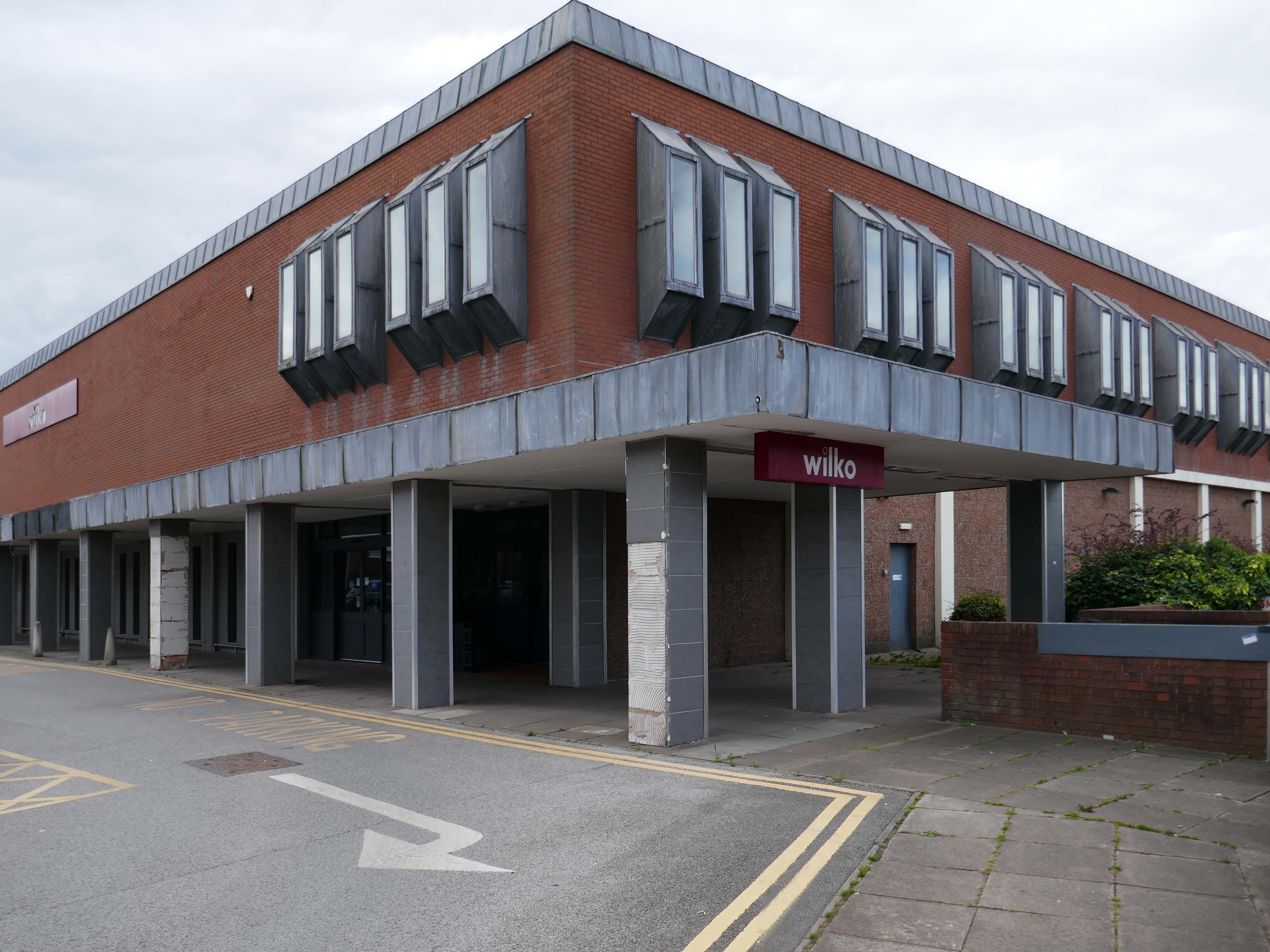
And a long lost Wilko.
Amidst it all the curious time warp that is Trinity Church 1988.
It is used by Methodist and United Reformed Church congregations.
Tucked away in a minor maze of retail a piece of figurative commemorative public art by Glynis Owen Jones, entitled Stafford Faces.
Around the corner a big B&M.
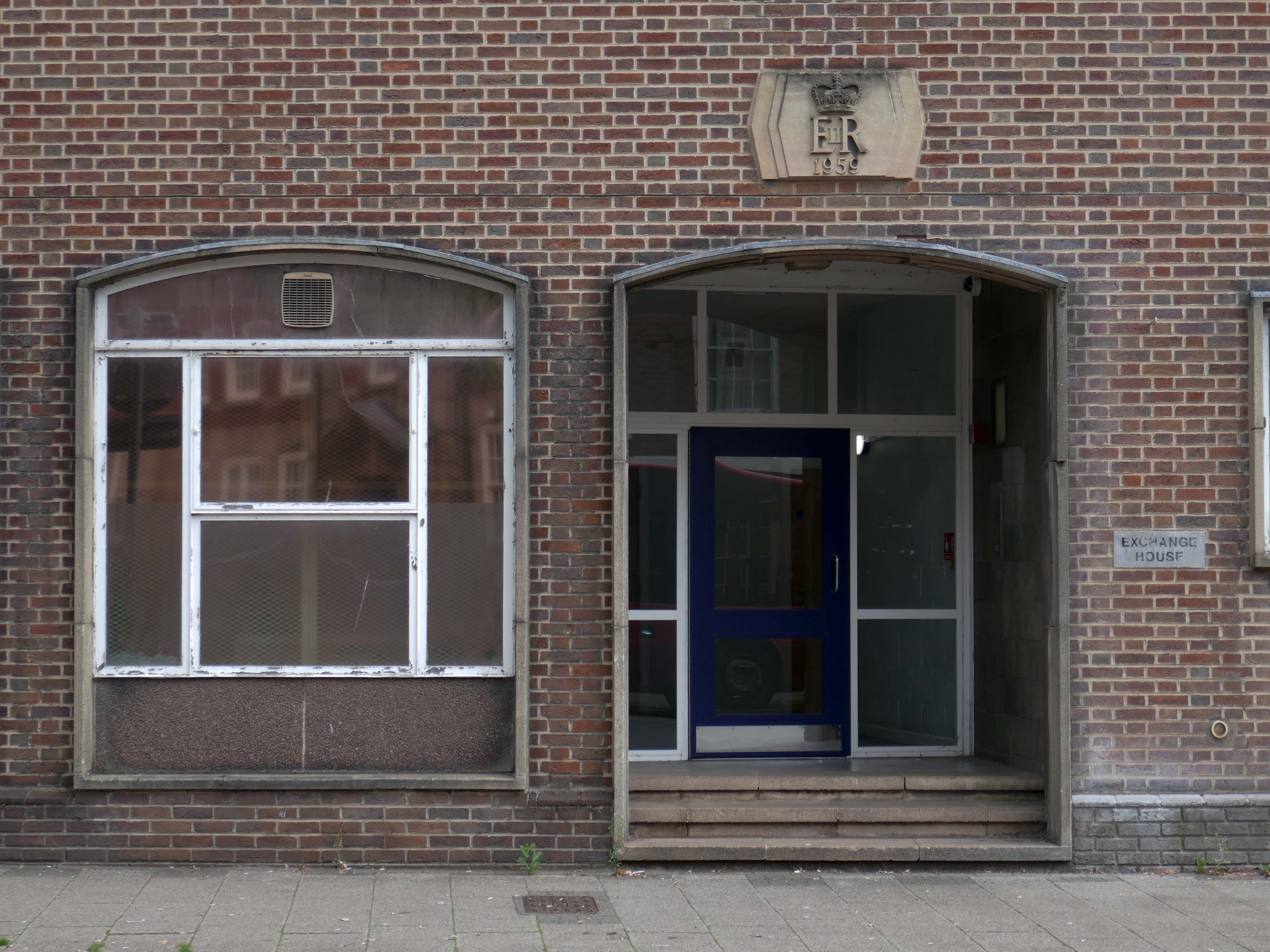
Further along a brick FoB Telephone Exchange of 1959.
Adjoined by the County Records building.
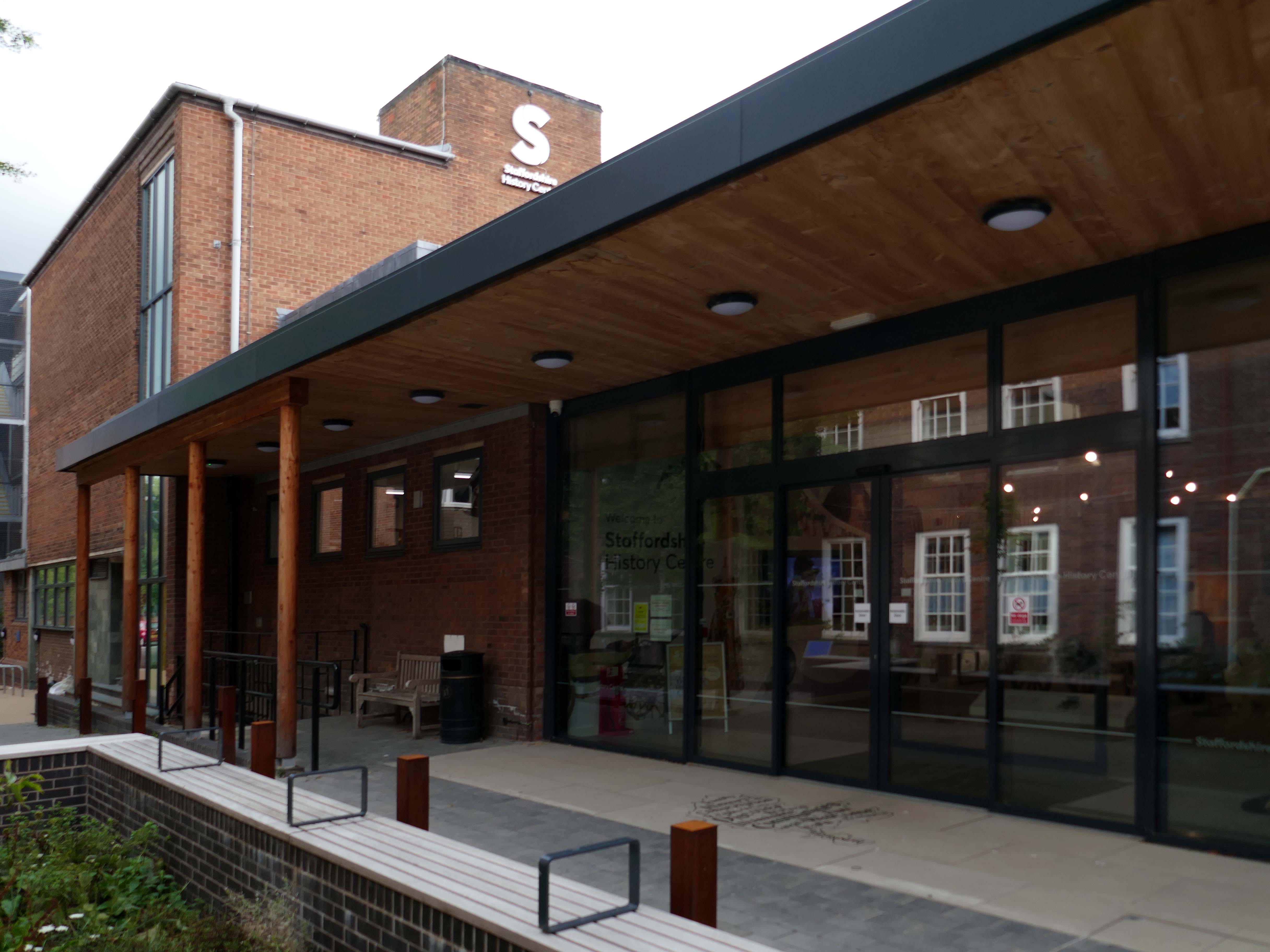
Pringle Richards Sharratt Architects have been appointed by Staffordshire County Council to create a new History Centre for Staffordshire and Stoke on Trent.
The new £4m centre will be located on Eastgate Street in Stafford and will hold historical records and collections up to 1,000 years old.
The scheme will help to provide a rejuvenated service combining the existing Records Office building and William Salt Library, in Stafford and provide a welcoming destination for all of those with an interest in local history. This will include bringing on to the Stafford site the Lichfield Records Office and aspects of the County museum.
Further FoB in the Civic Building.
Close by the Staffordshire Place a civic and retail mixed use development.
Our scheme delivers 135,000 ft2 of high quality contemporary office space across two buildings linked by a new town square. The ground floor incorporates a mix of retail and leisure uses around a sequence of smaller public spaces to maximise the amount of visible active frontage and create a natural extension to the town centre.
Sustainability issues fundamentally informed the design approach, from mitigating energy consumption to ‘future proofing’ the finished building. The building achieves a BREEAM ‘Excellent’ rating and a European Energy Performance of Buildings Directive Rating ‘A’.
Surprise surprise another retail development Riverside.
£70m riverside town centre retail and leisure development in the heart of Stafford. The 230,000 sq. ft. scheme anchored by M&S will deliver 18 retail units arranged over ground and first floors, five leisure units and a six-screen cinema to complement and strengthen the town centre economy and create new businesses and jobs.
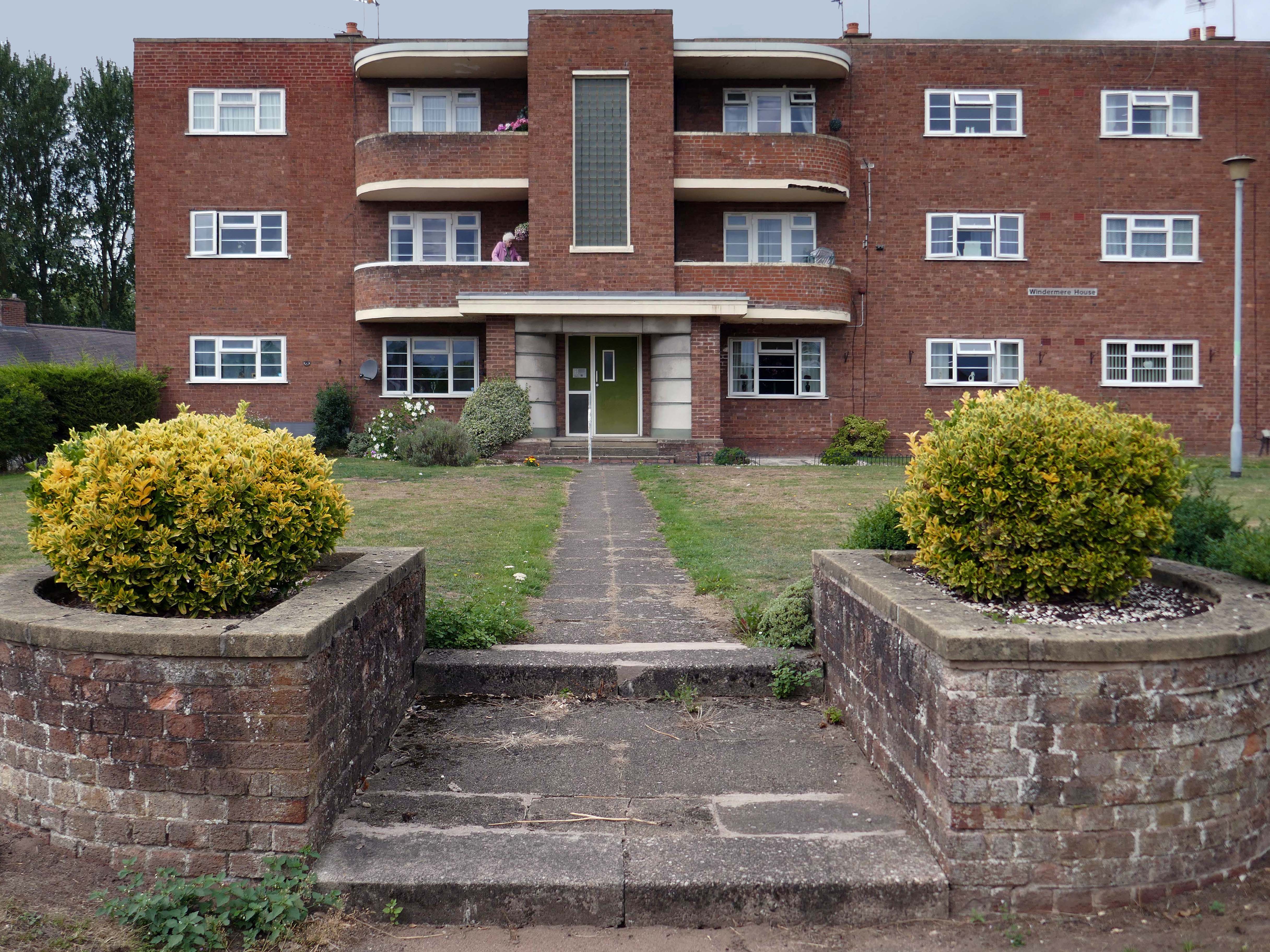
Coniston, Windemere and Rydal were among the first council homes to be built in Stafford, between 1951-52, under the direction of County Architect CM Coombes.
The flats were built as a result of The Housing – Financial and Miscellaneous Provisions Act 1946, which gave subsidies to local authorities to provide social housing. The expansion of the Borough Council’s civic duties included the employment of County Architects, in this case CM Coombes FRIBA, to whom these flats are attributed.
54 flats were built in total, to a distinctly Modernist design, and their appearance and setting are very well preserved.
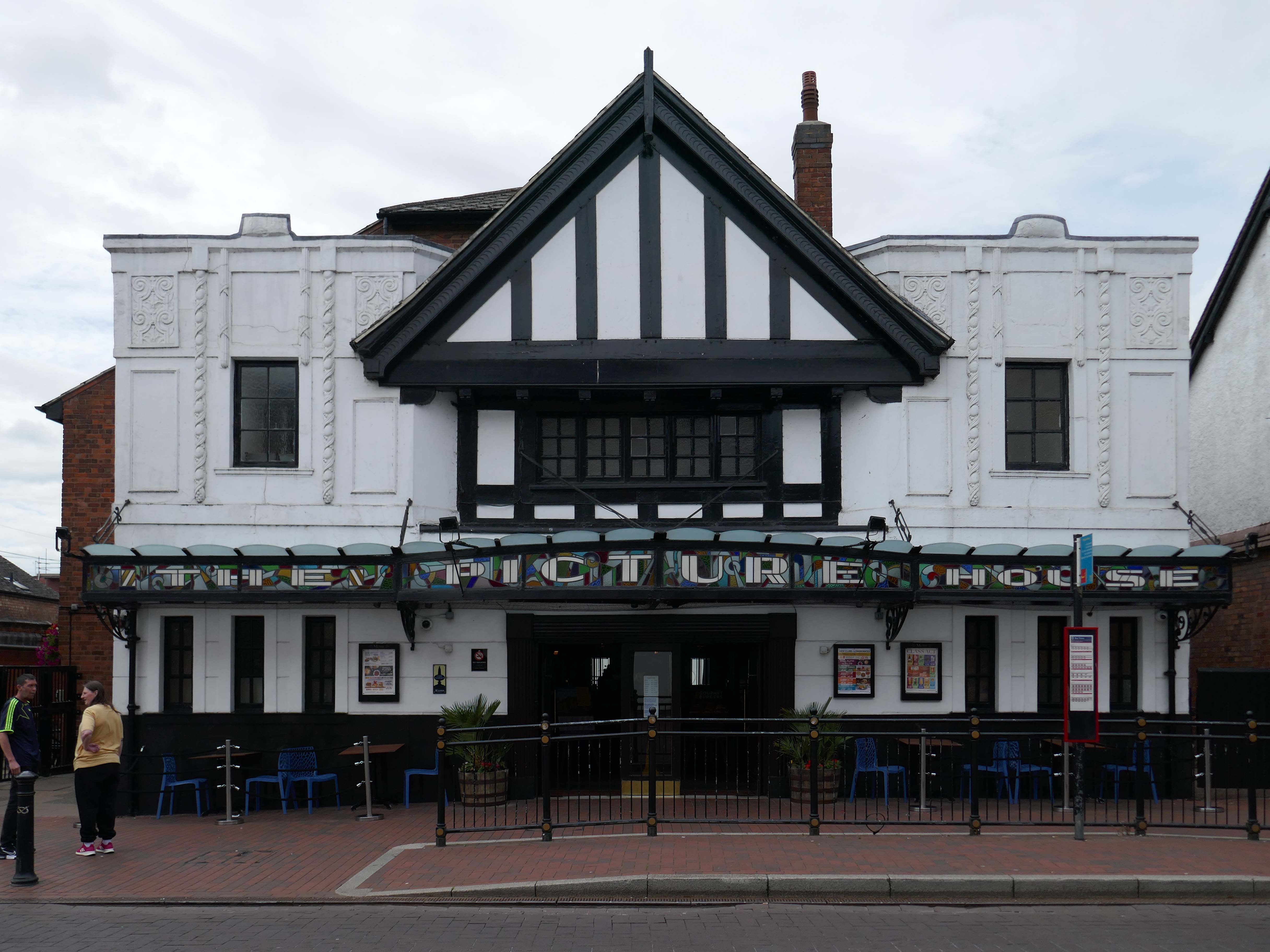
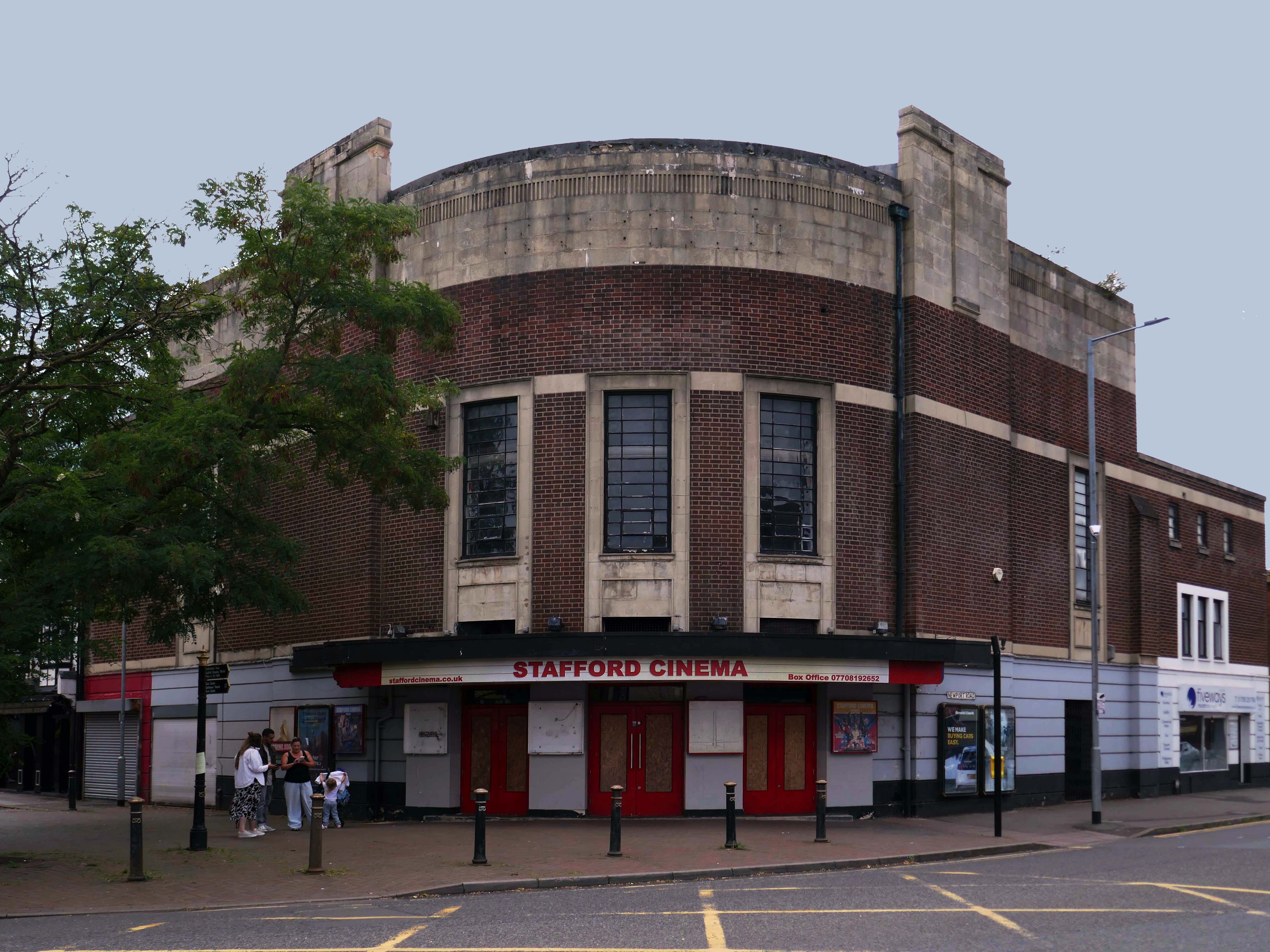
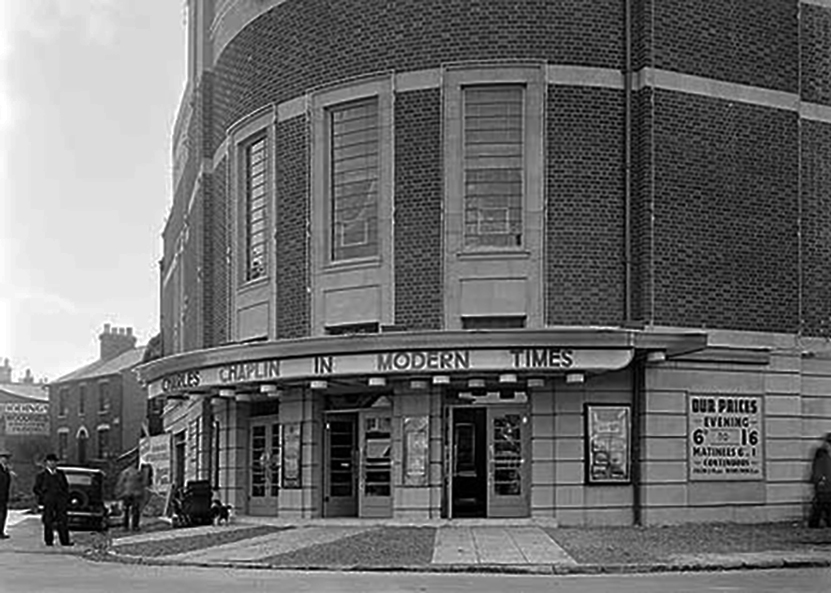
Let’s head back into the town centre – to the Grade II ListedPicture House 1914
The Picture House was closed on 30th March 1995 after a three week run of Disclosure starring Michael Douglas, there were seventy eight attending the final performance.
It was disposed of by the Rank Organisation in July 1981 and was taken over by the Hutchinson Leisure Group who re-named it Astra Cinema. In December 1981 it was tripled with 435 seats in the former stalls and two mini cinemas in the former circle seating 170 and 168.
In 1988 it was taken over by Apollo Cinemas and re-named Apollo Cinema. The downstairs cinema was closed and became a bingo club for a couple of years, during which time the two mini cinemas in the former circle remained open. The bingo operation gave way to films again in 1990 and all three screens were again open, with seating for 305, 170 and 164. In January 2014 it was taken over by the Curzon Cinemas chain and renamed Stafford Cinema.
It was closed on 18th December 2017 with Star Wars:The Last Jedi.
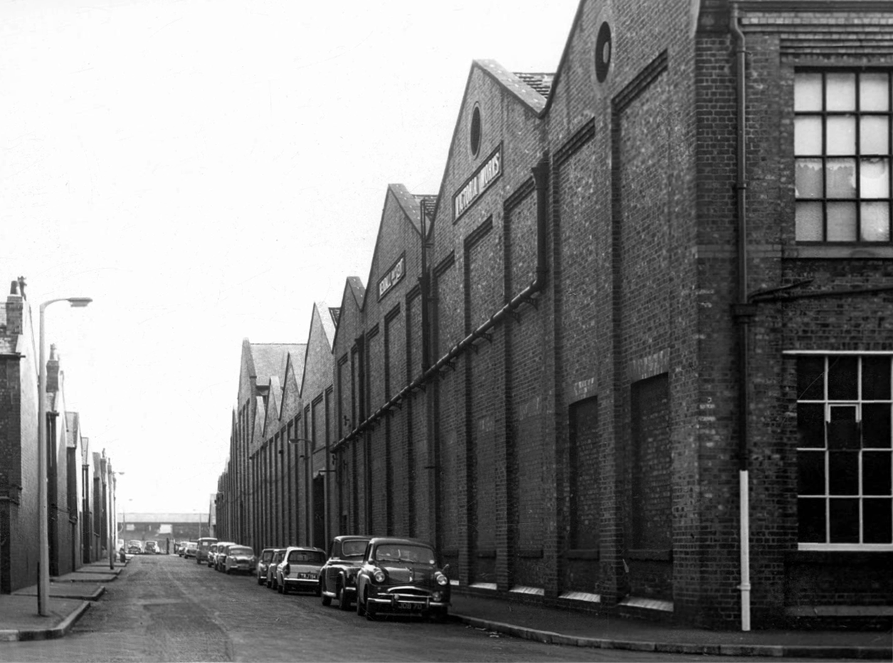
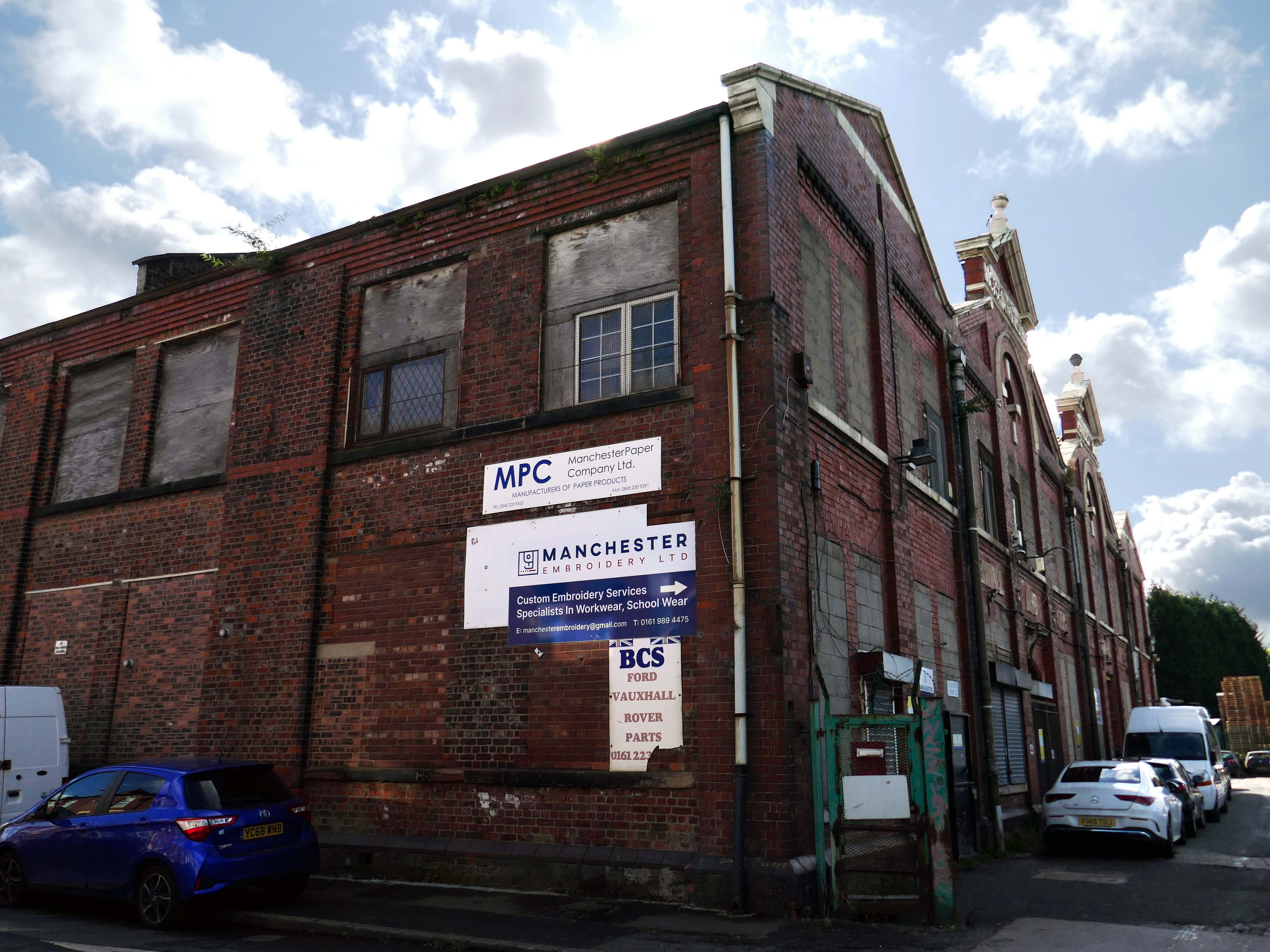
This was a world of heavy and light engineering, which reached in a broad swathe across Greater Manchester, from Stockport to Cheetham Hill and beyond.
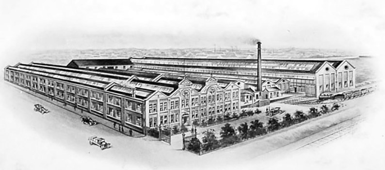
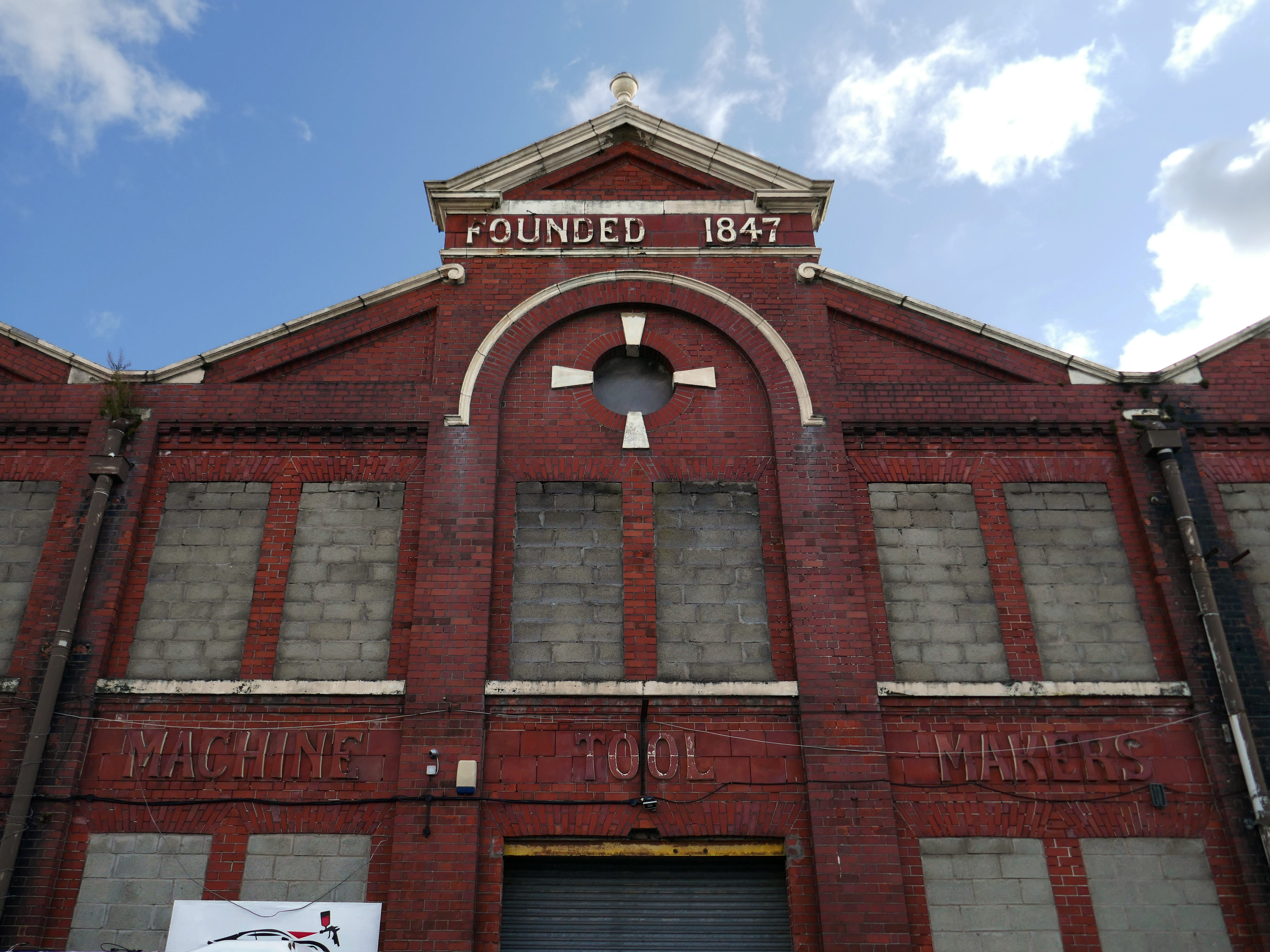
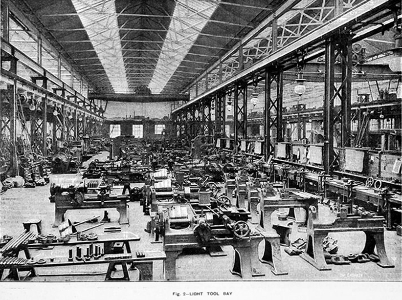
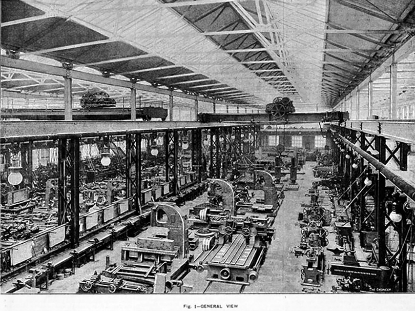
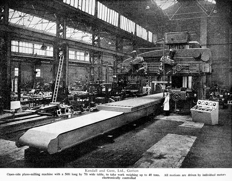
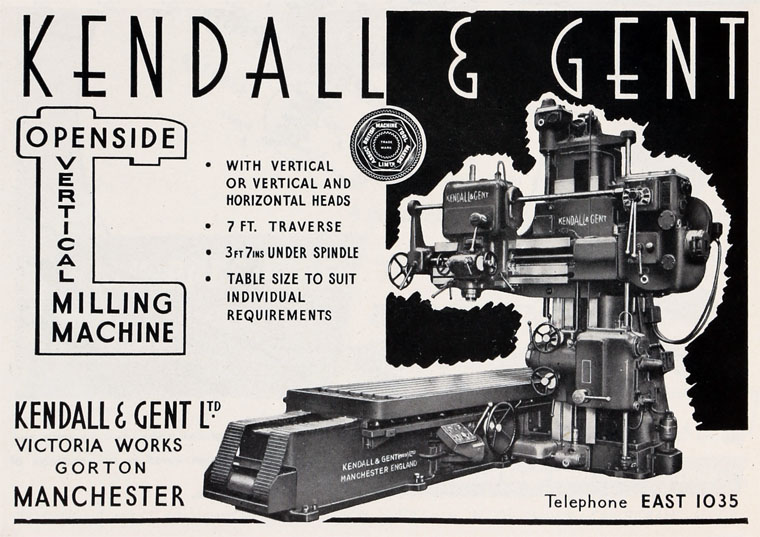
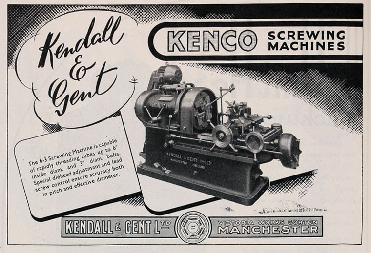
This is the Gorton Works – illustrations taken from Graces Guide.
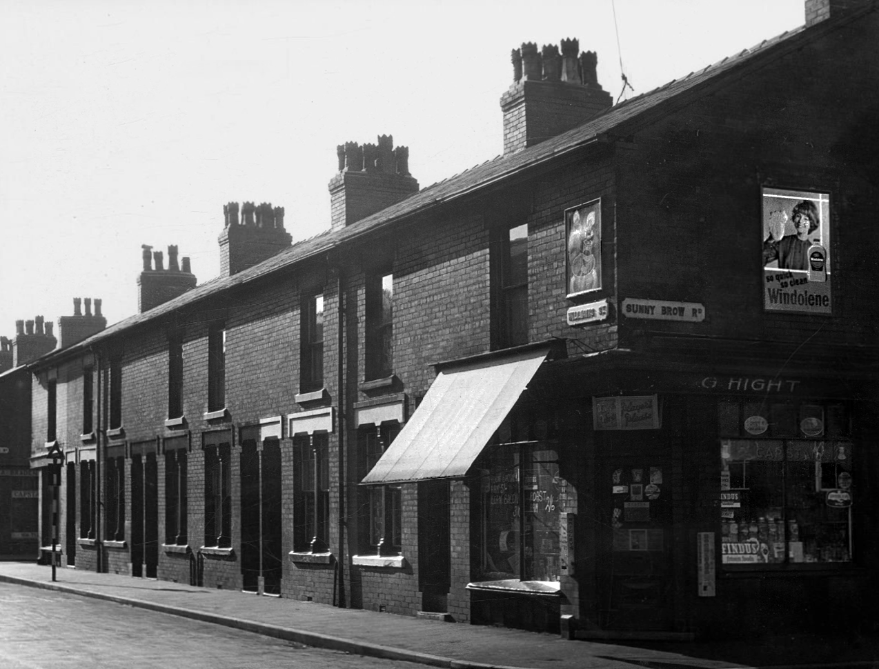
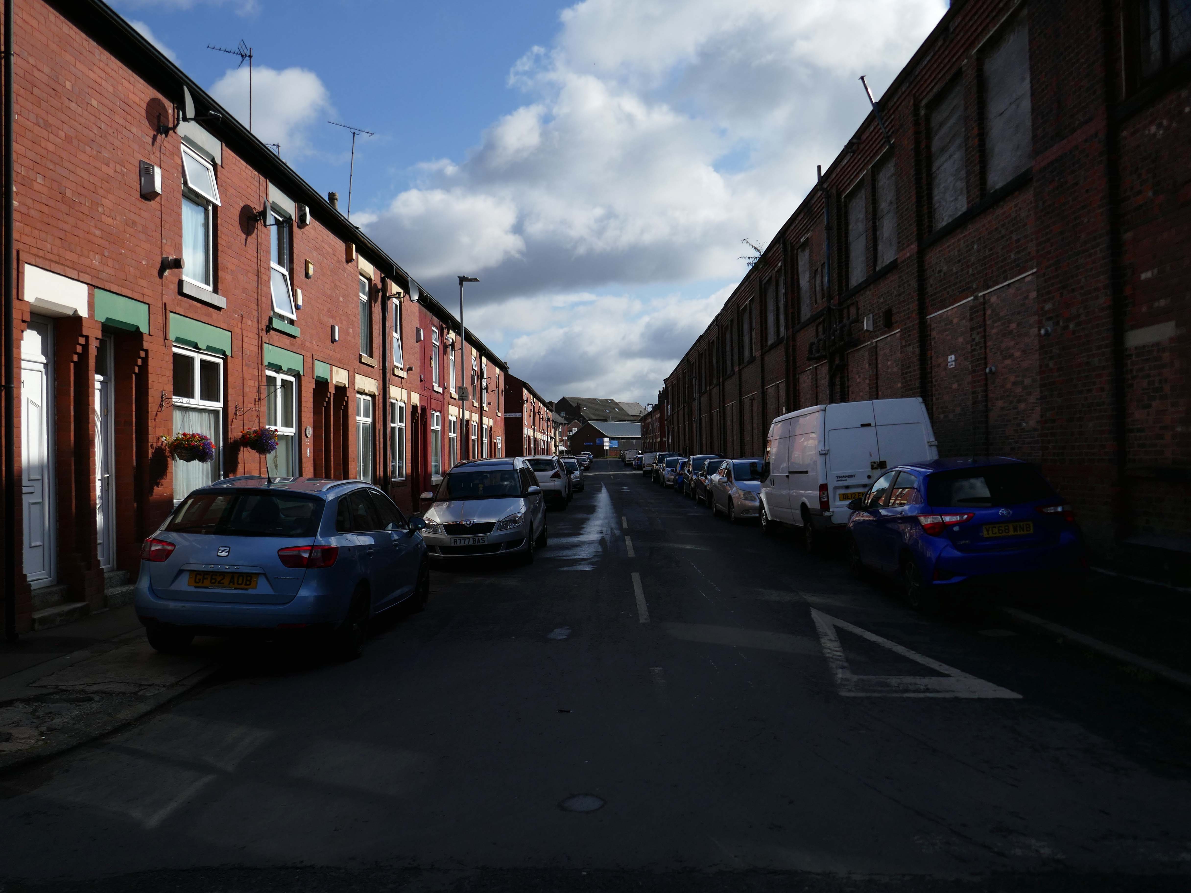
This was a world of terraced houses and corner shops, side by side with the local works.
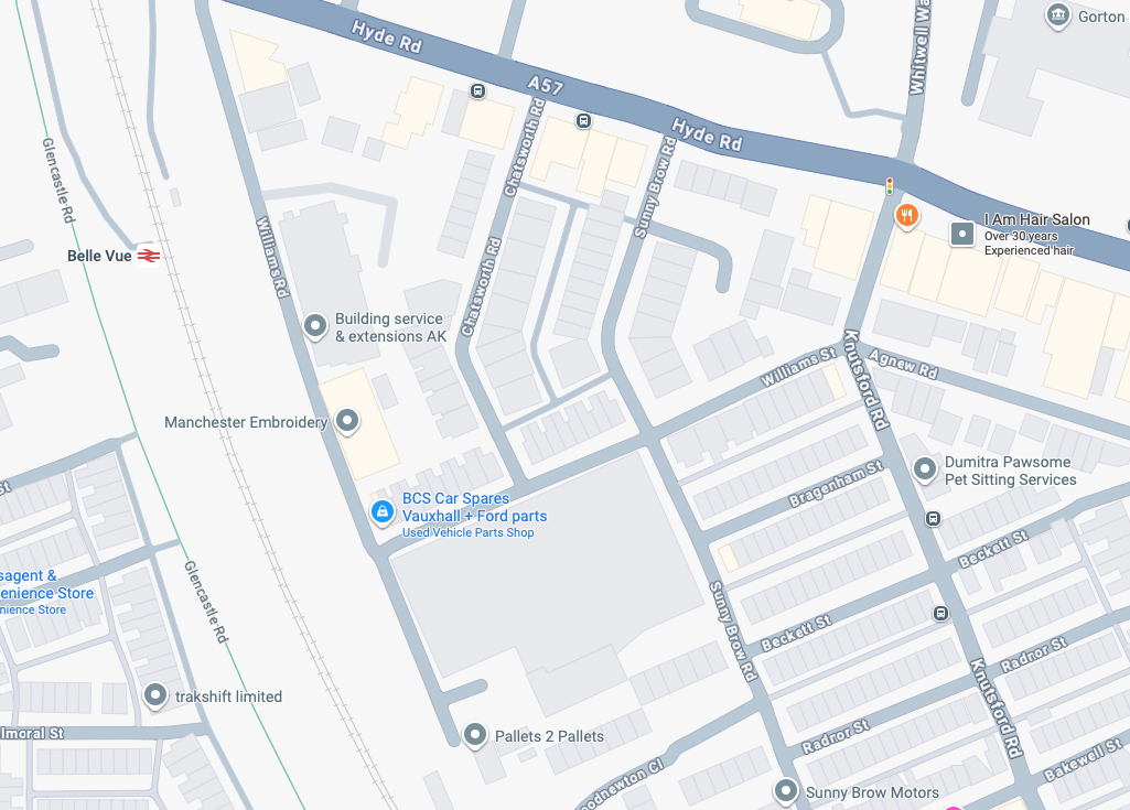
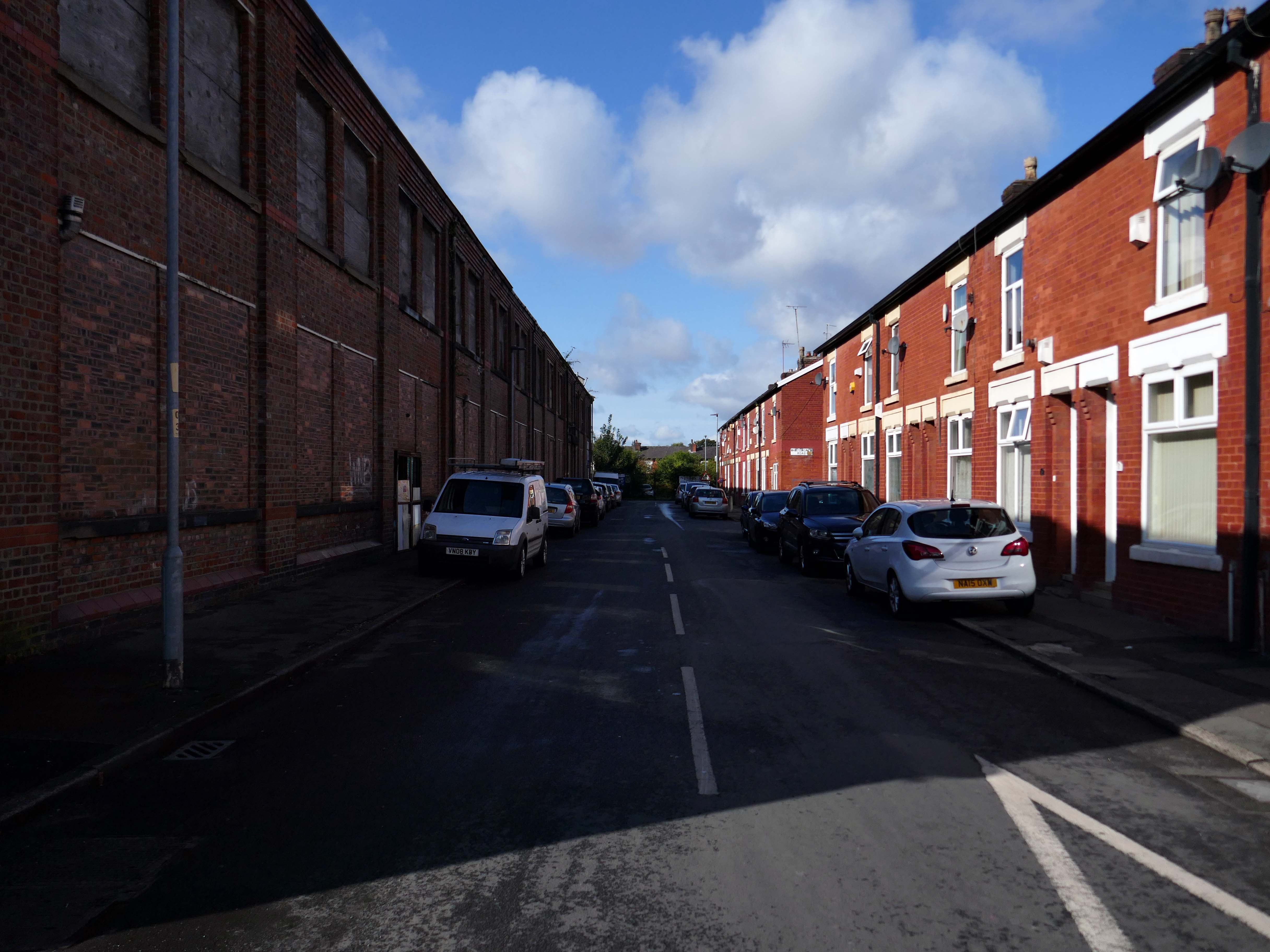
This is that corner of Williams Street and Sunny Brow Road today.
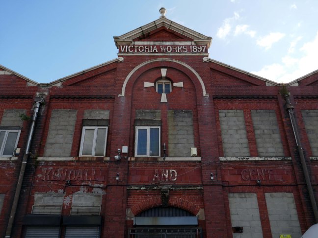
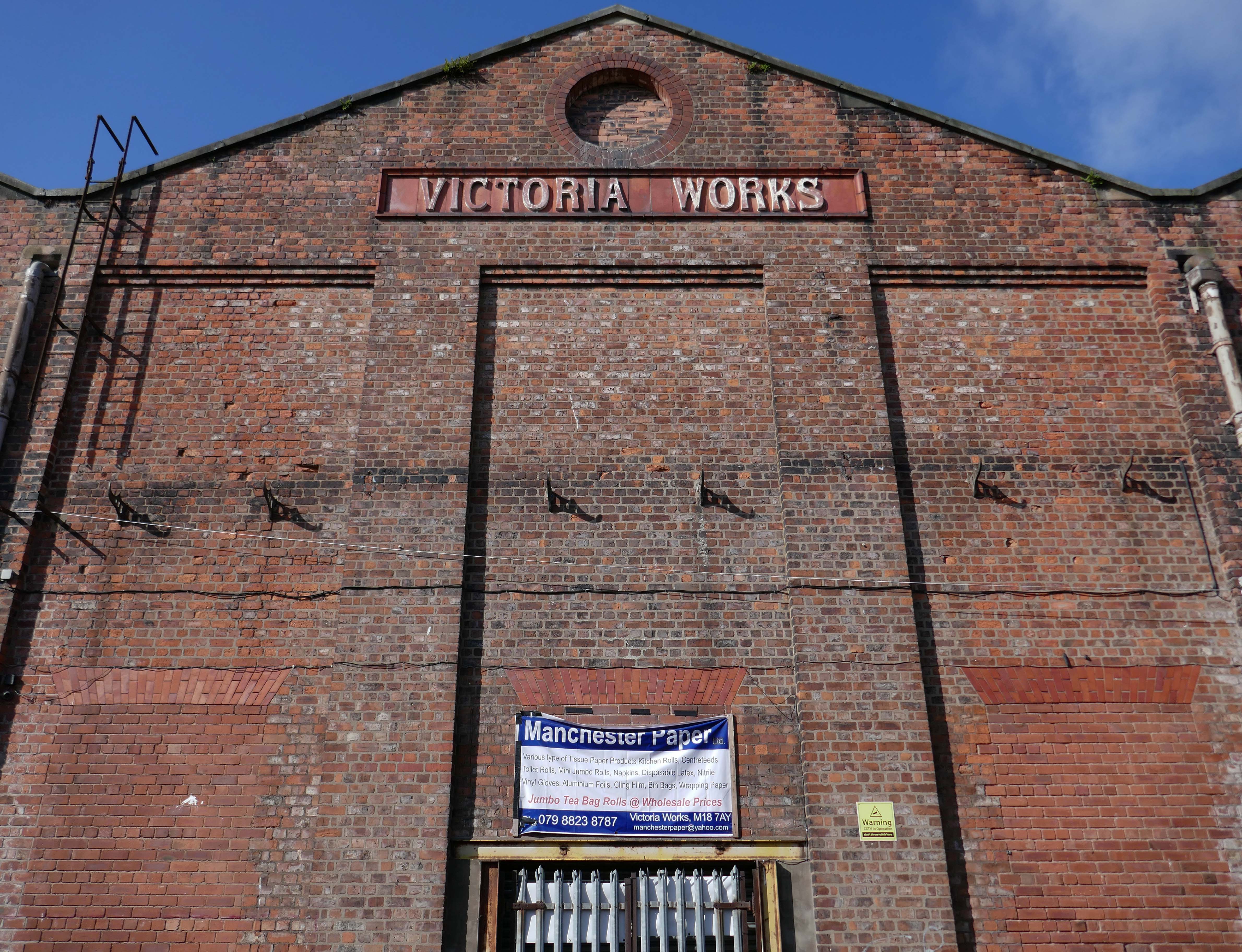
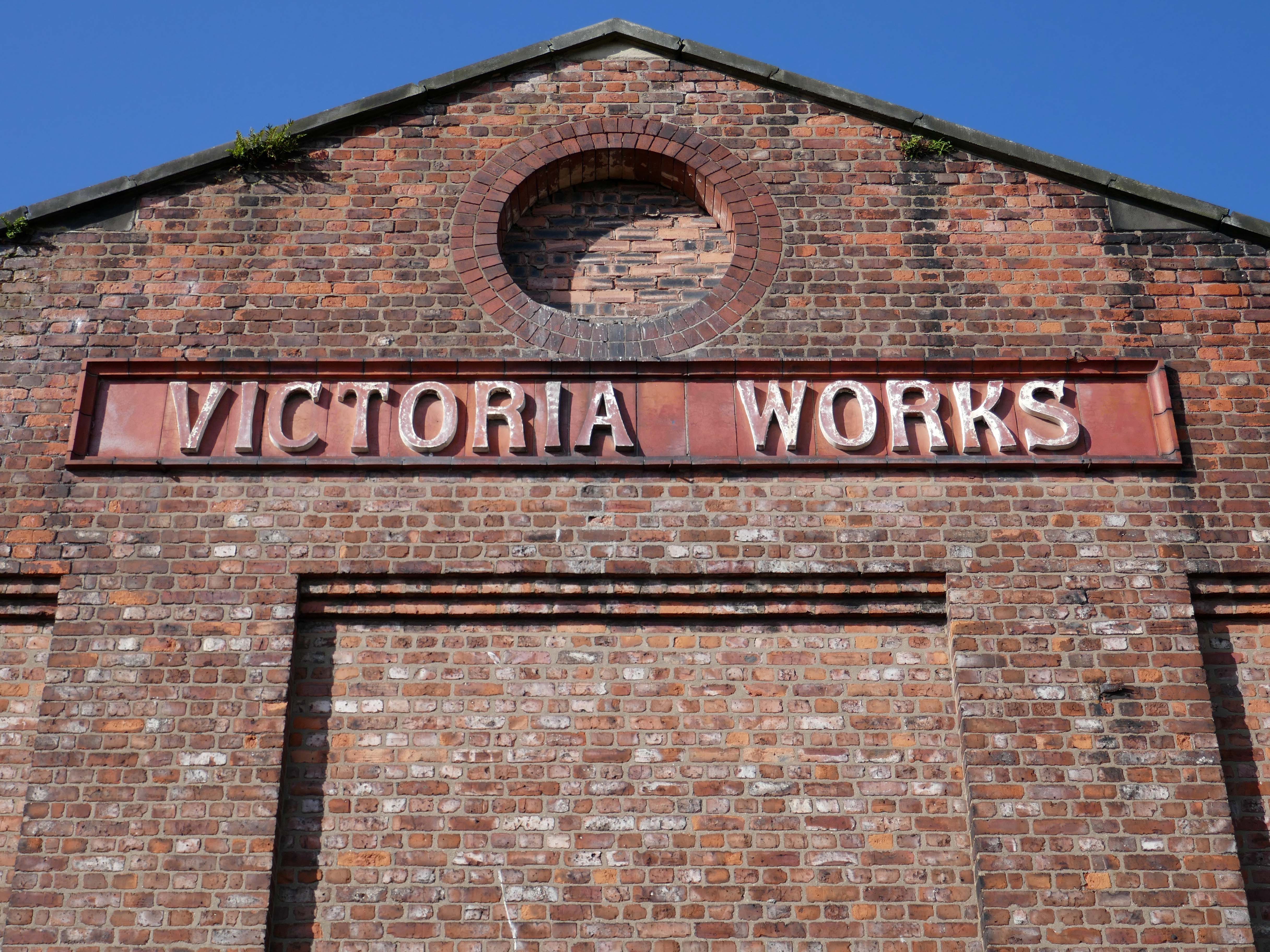
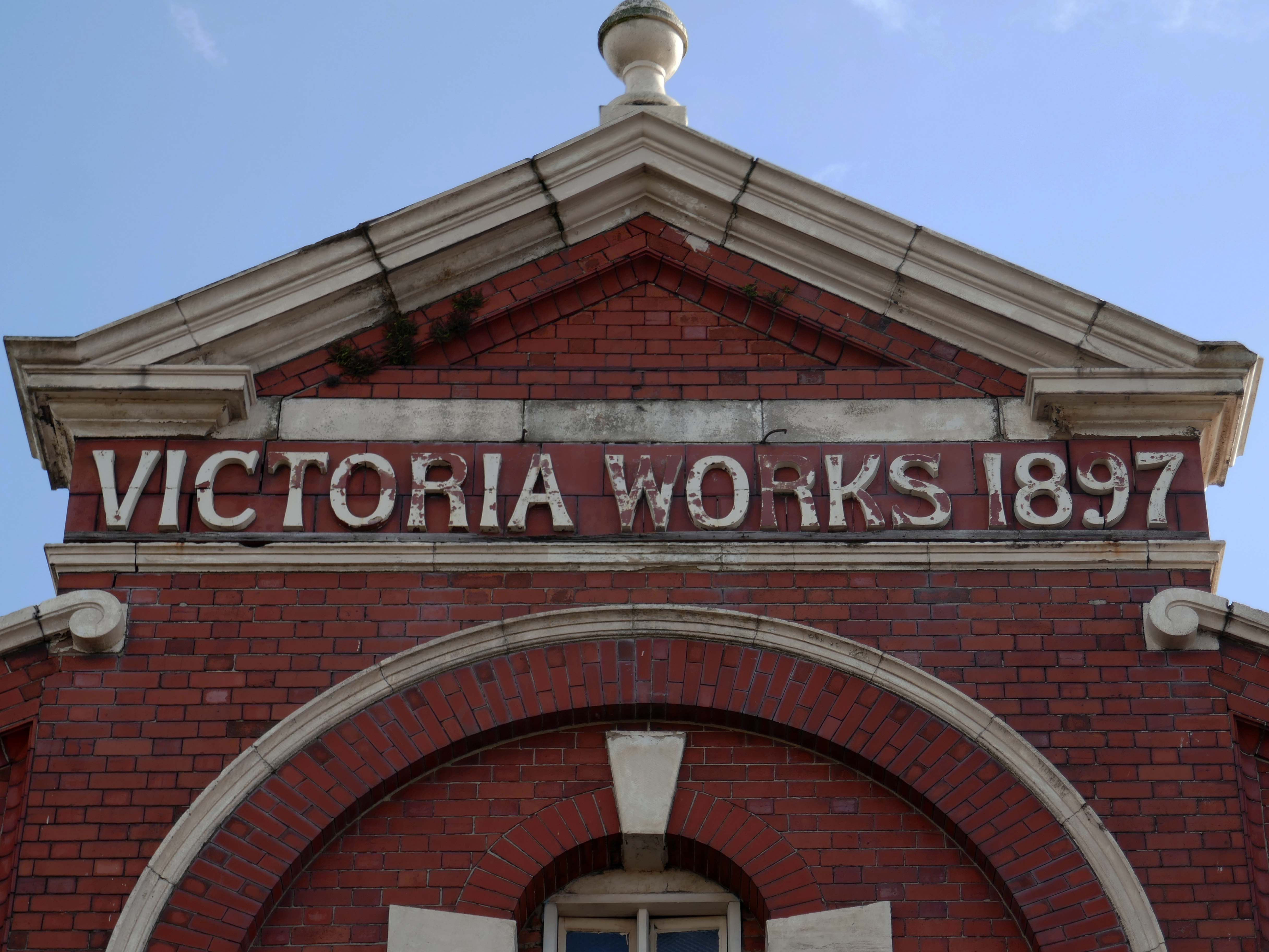
Victoria Works Sunny Brow Road.
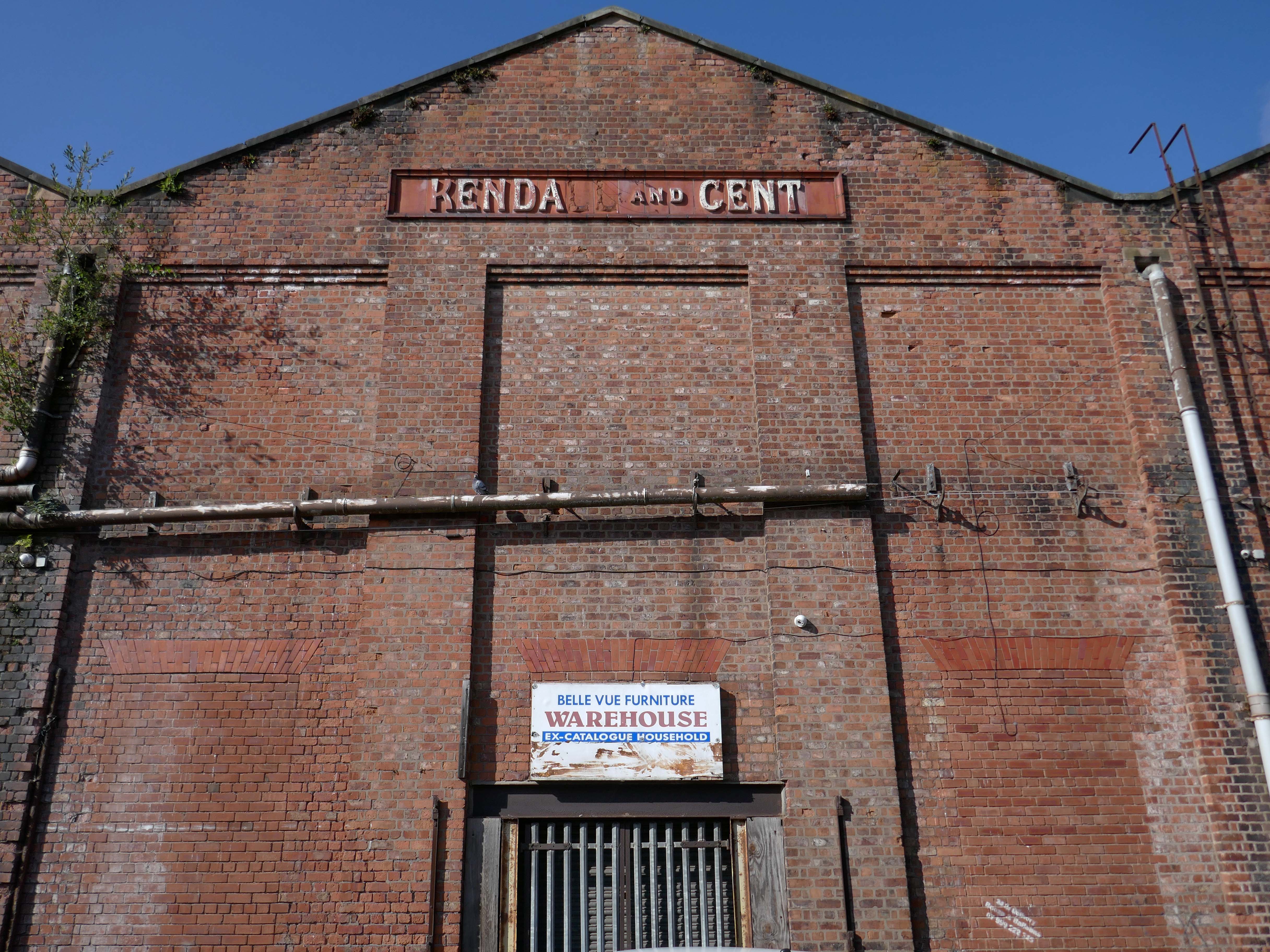
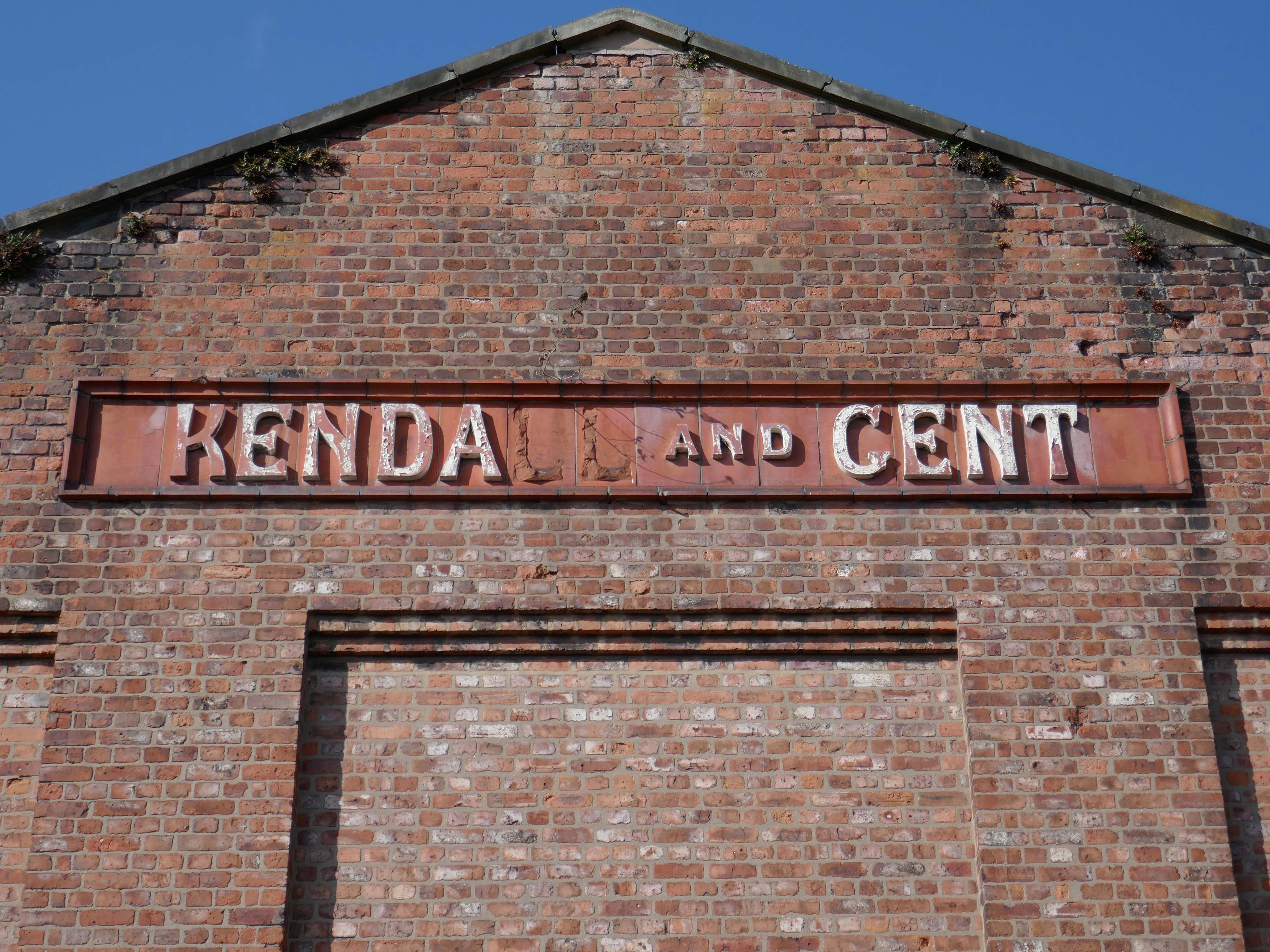
Victoria Works Williams Street
Victoria Works Williams Road
Manchester’s engineering industry has subsequently been seriously diminished.
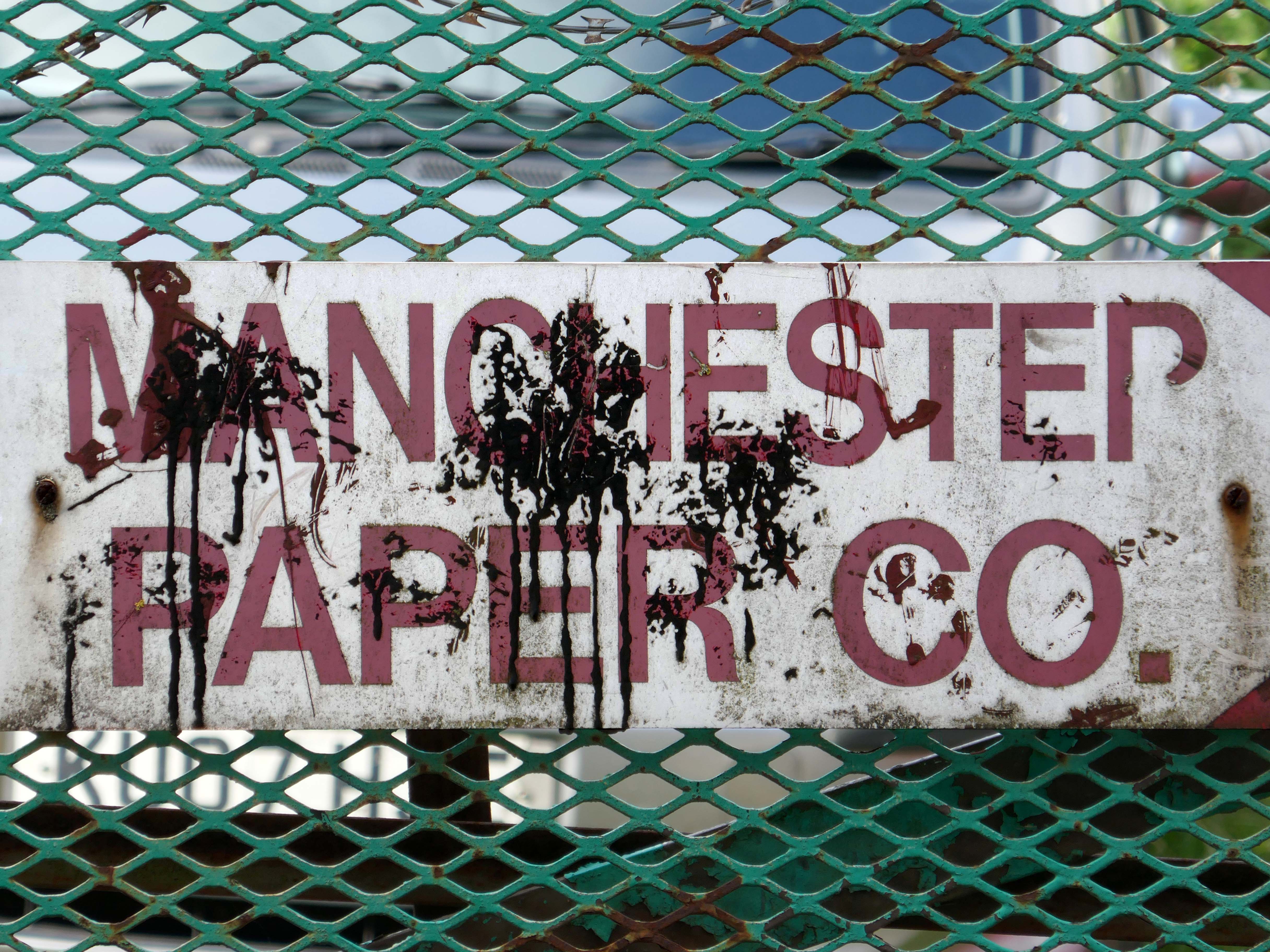
The building became a base for toilet paper manufacturing and distribution.
But the metal beat goes on in both Wolverhampton and Florida.
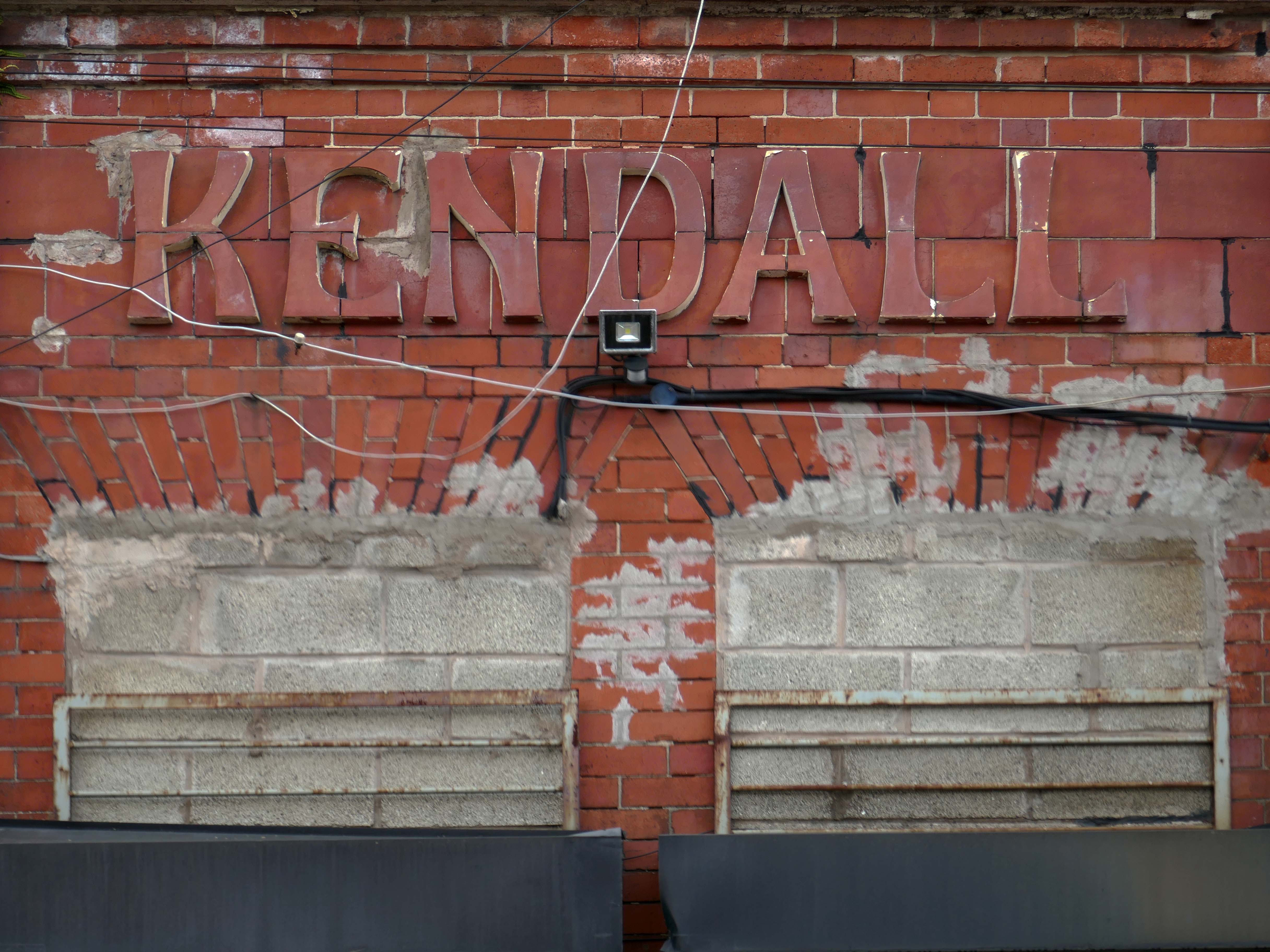
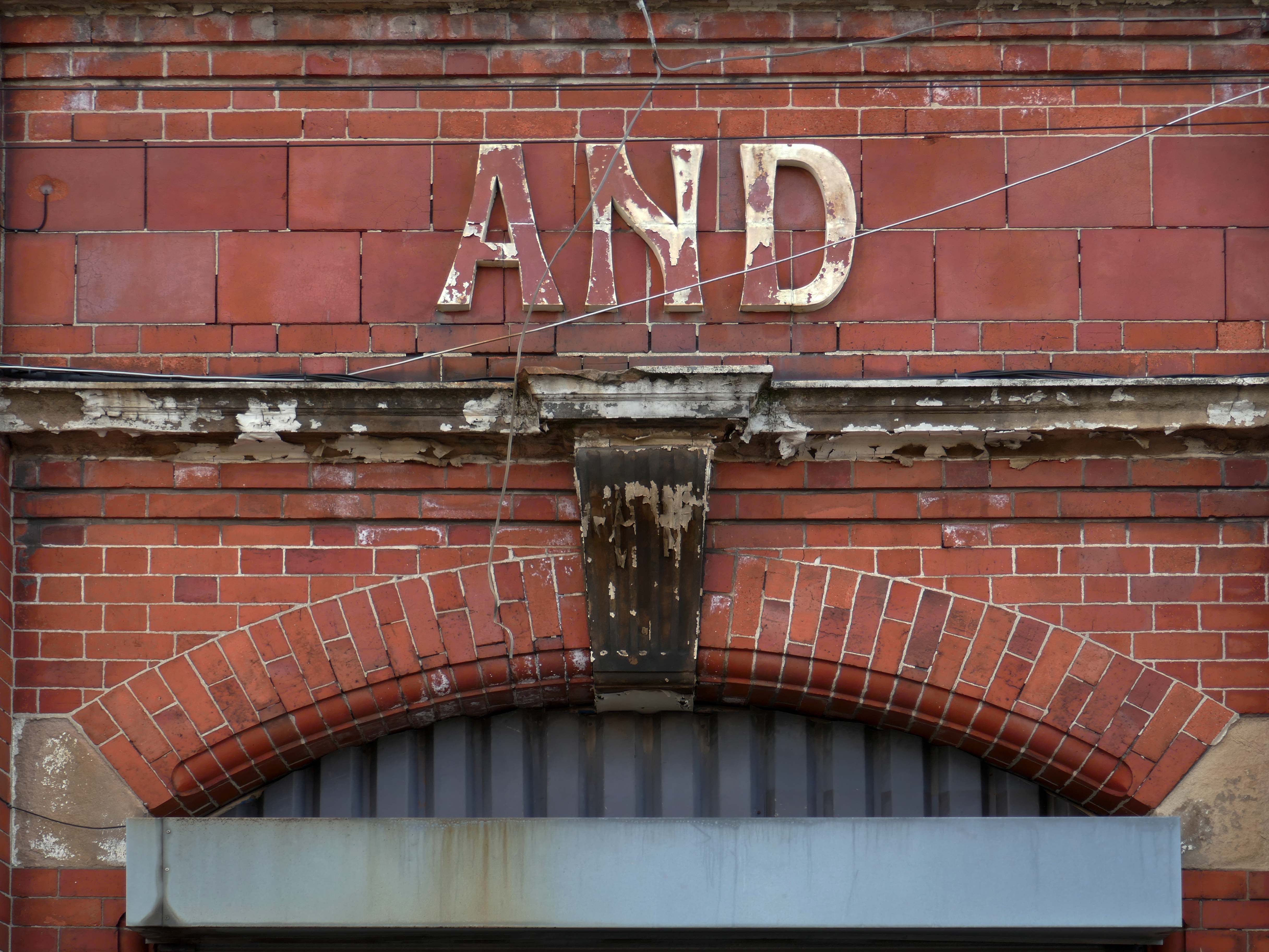
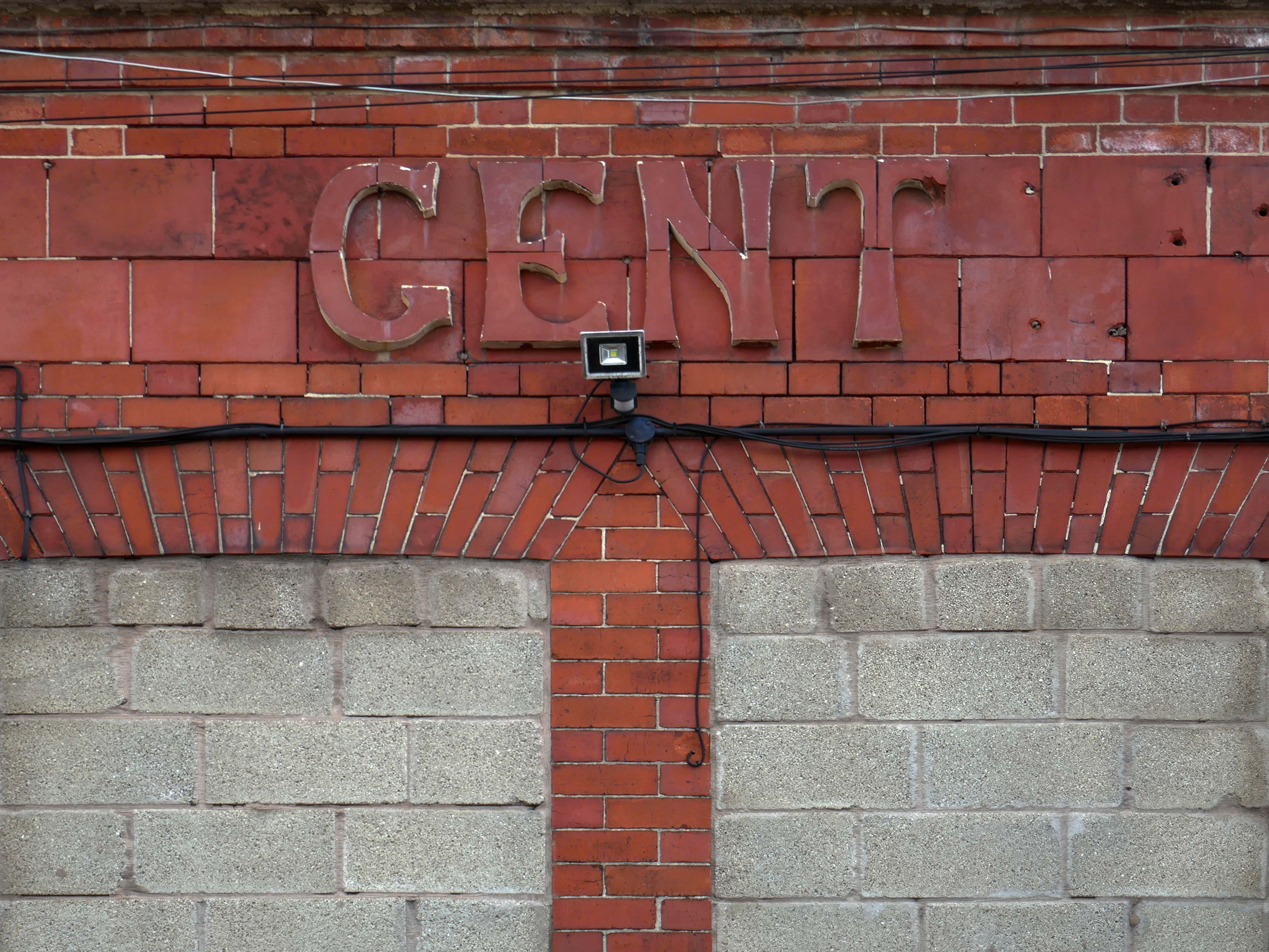
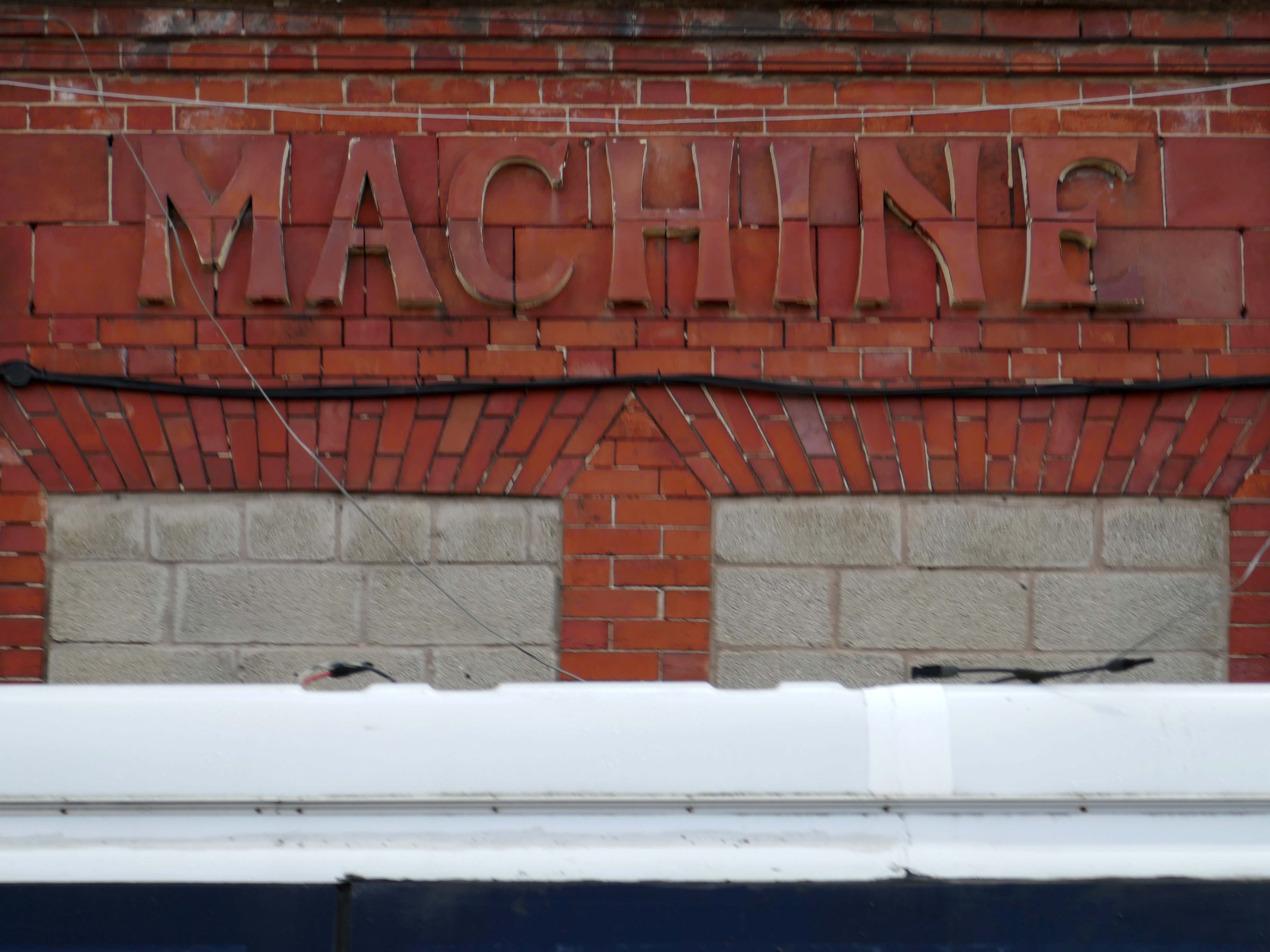
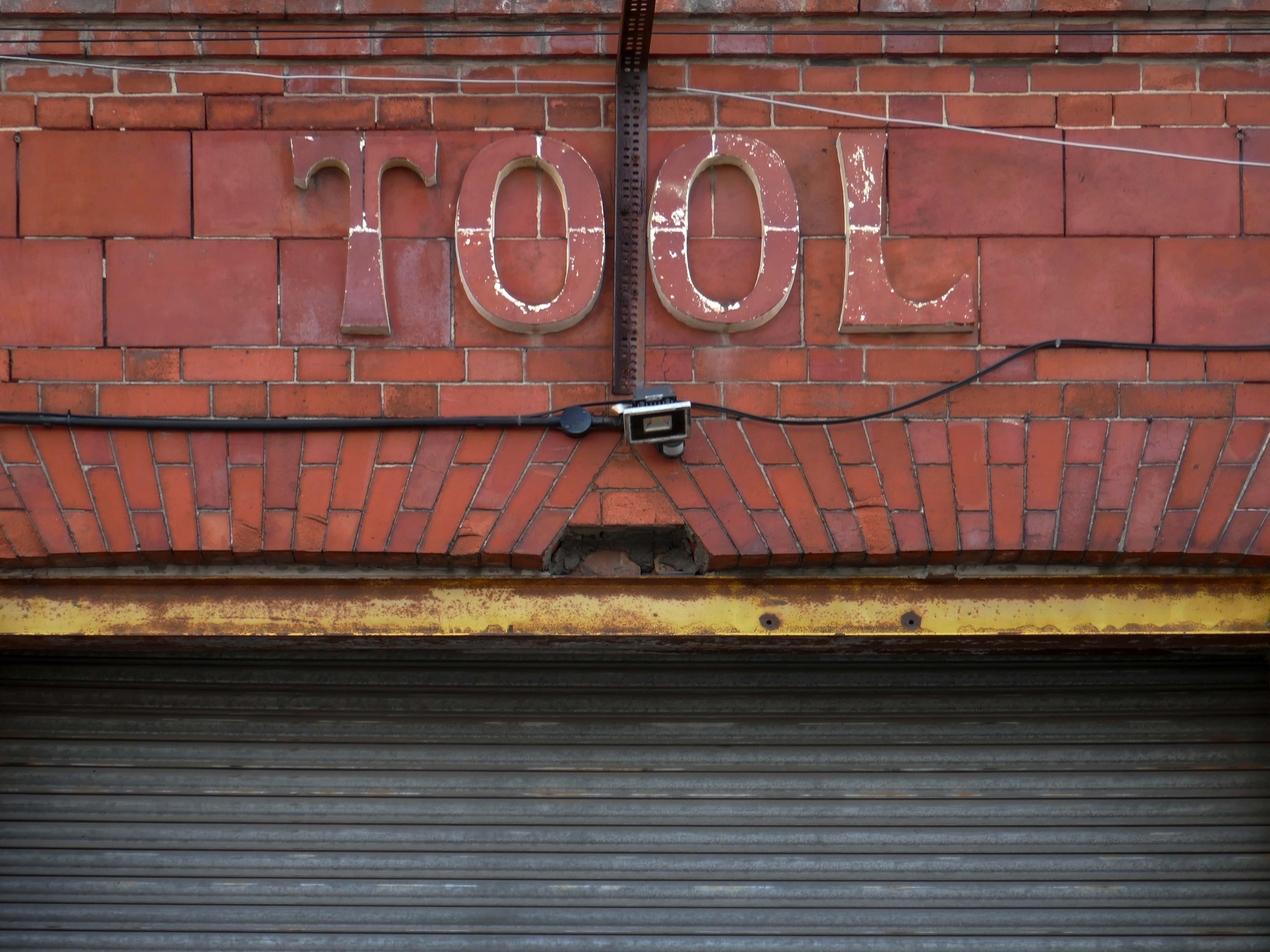
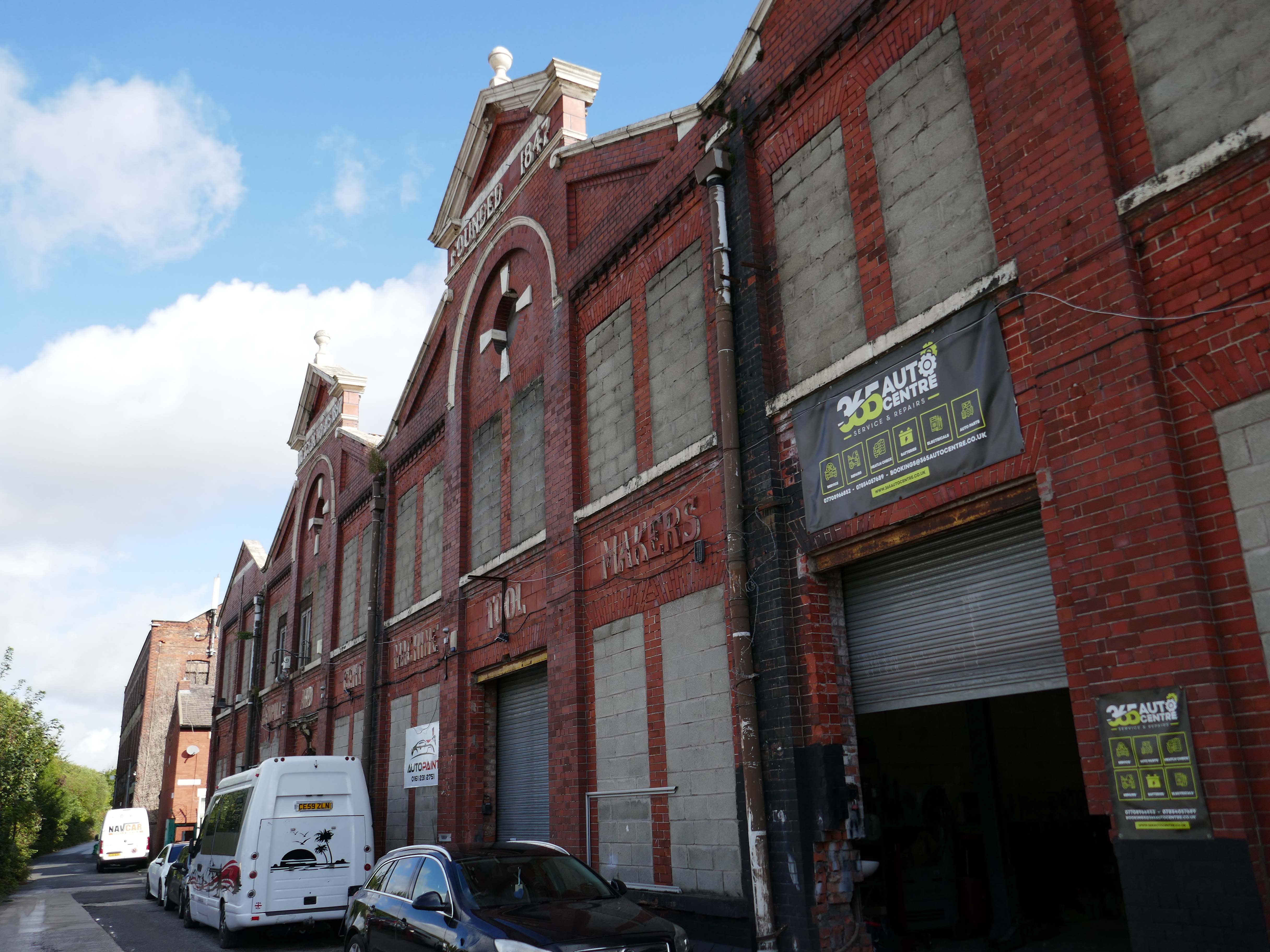
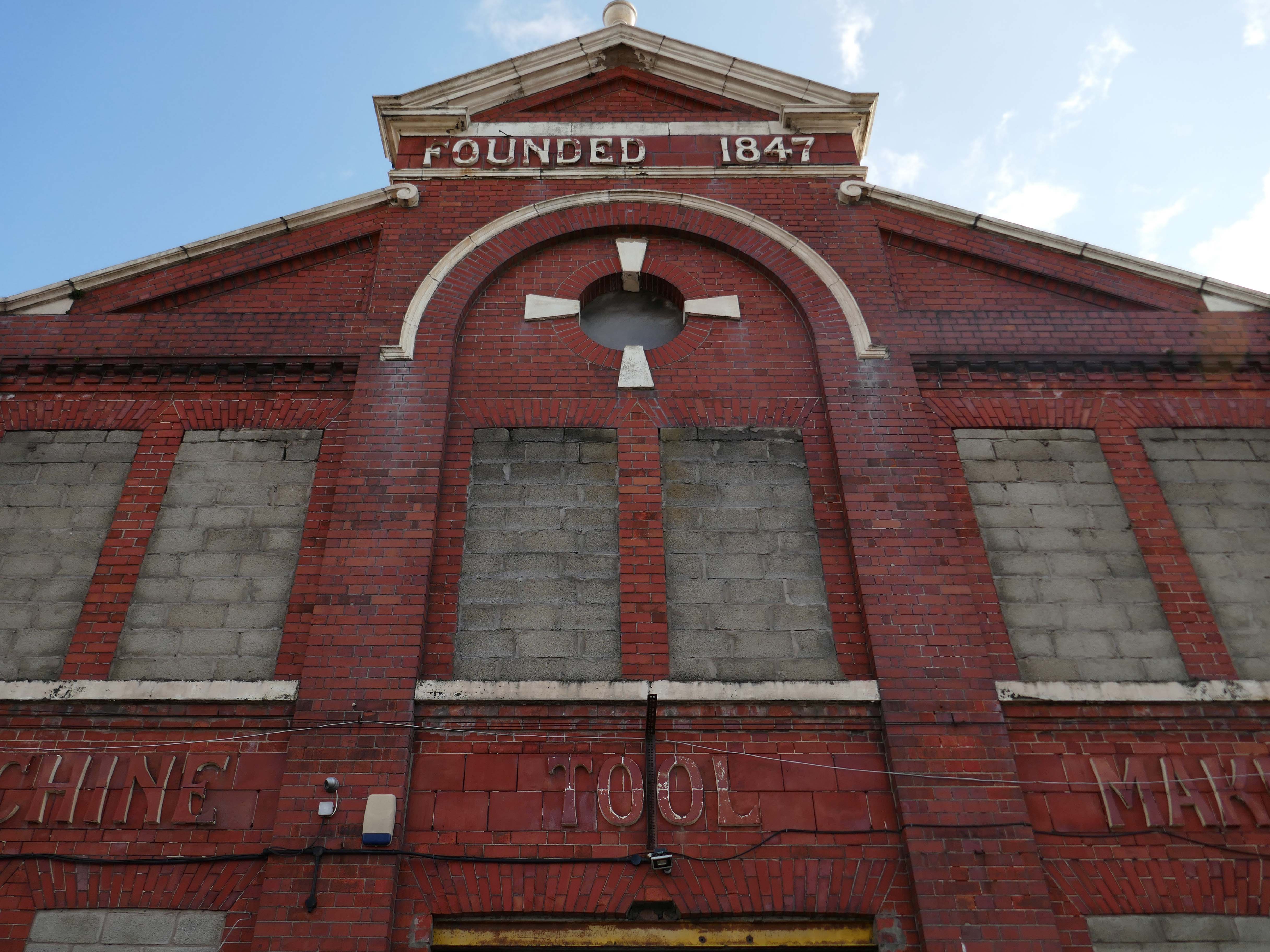
Originally formed in 1847, Kendall and Gent enjoyed many years as one of the biggest machine tool manufacturers in the UK, producing many large machines which are still in production today. Many of the tangential threading machines are still used in pipe, bolt and stud threading.
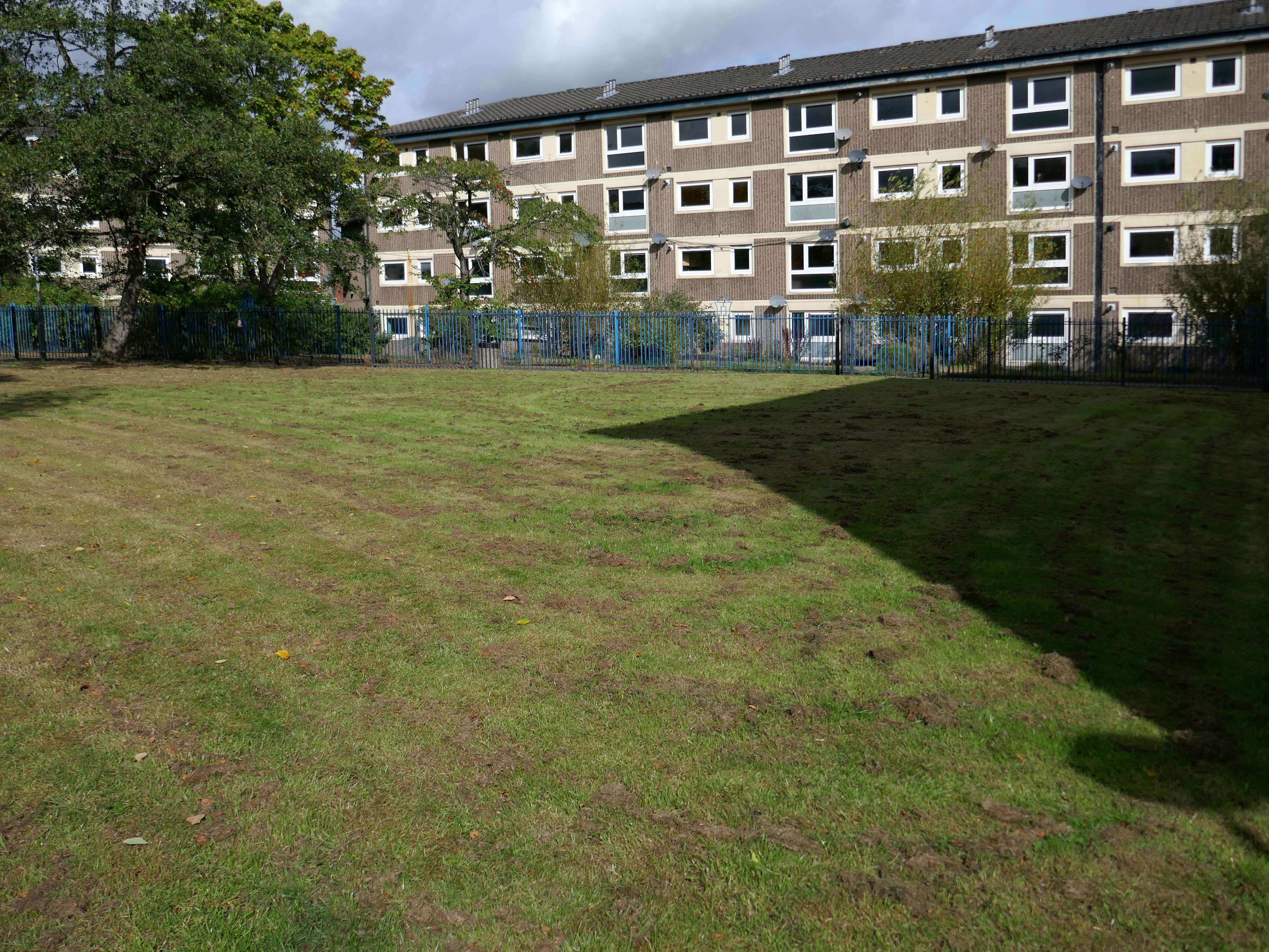
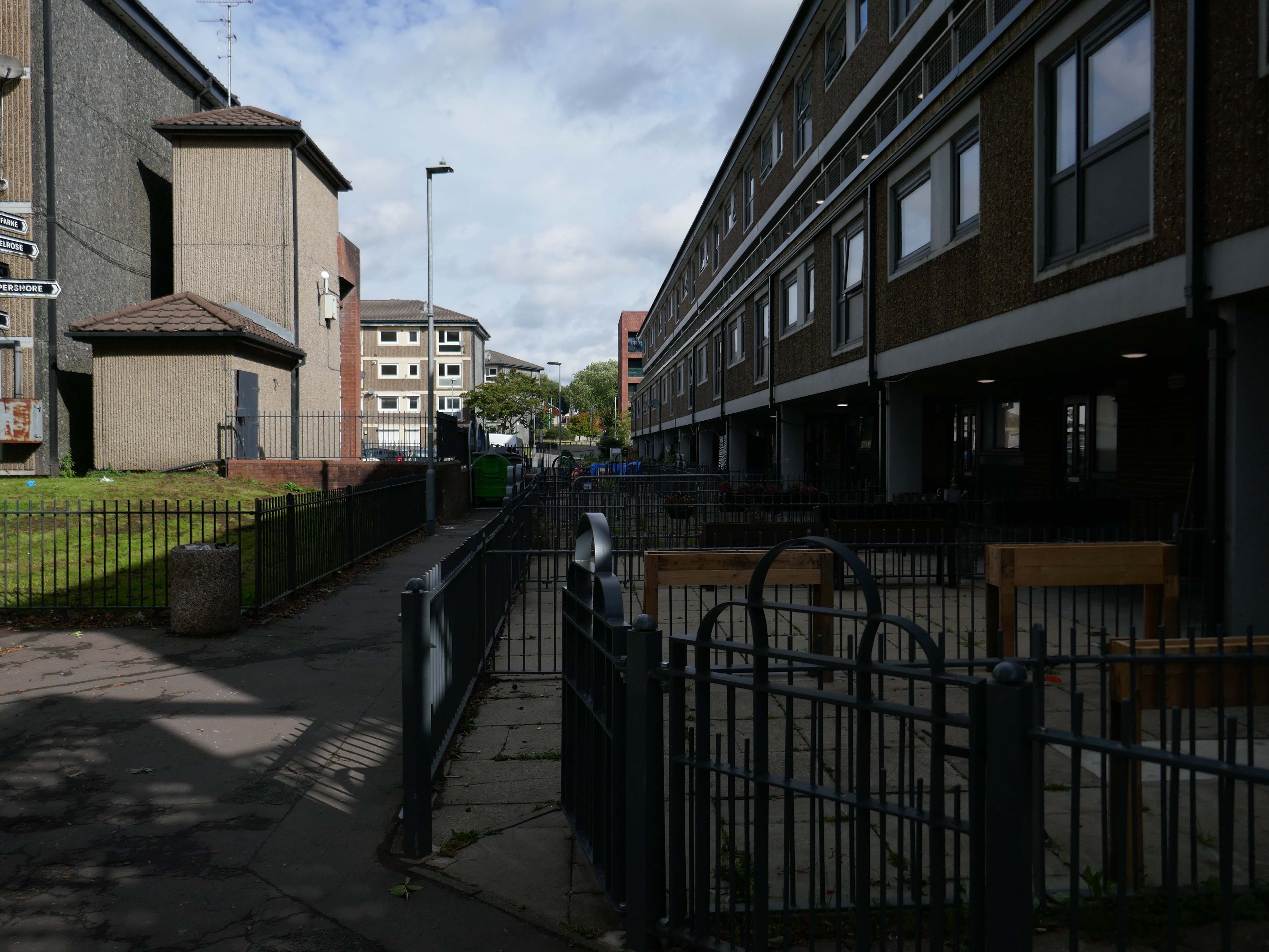
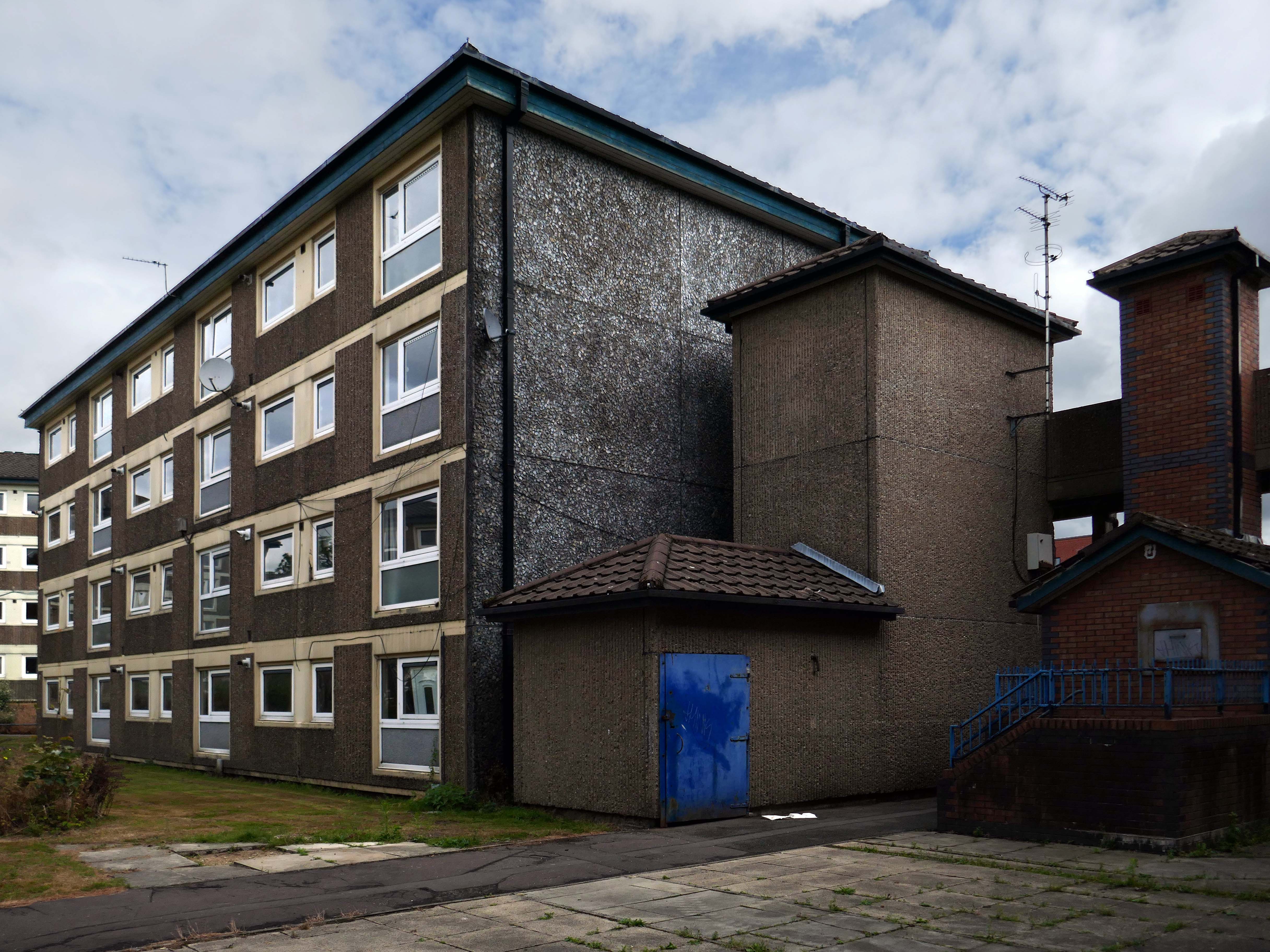
I came along to take a look aroundin 2017 – at this point all of the homes are occupied.
Fast forward to 2025 and the estate looks very different, a minority of the blocks have been refurbished.
The remainder have been, or are to be demolished.
Rochdale’s 2021 planning statement for Lower Falinge is beguiling in its talk of ‘a better quality and mix’ of housing, better public space and better links with surrounding areas. It goes on to say that the ‘the delivery of market housing within this area is required to deliver this diversification and to ensure the sustainability of retained affordable housing in the area’ – a sentence containing the claim that a tenure mix of public and owner-occupied housing is a good in itself, whilst also acknowledging contradictorily that affordable housing (how affordable?) is only possible by cross-subsidy from market sales’
Some 560 new homes were proposed in Lower Falinge. The plans as a whole proposed the loss of 720 primarily social rent homes and their replacement by 560 new homes of indeterminate tenure.
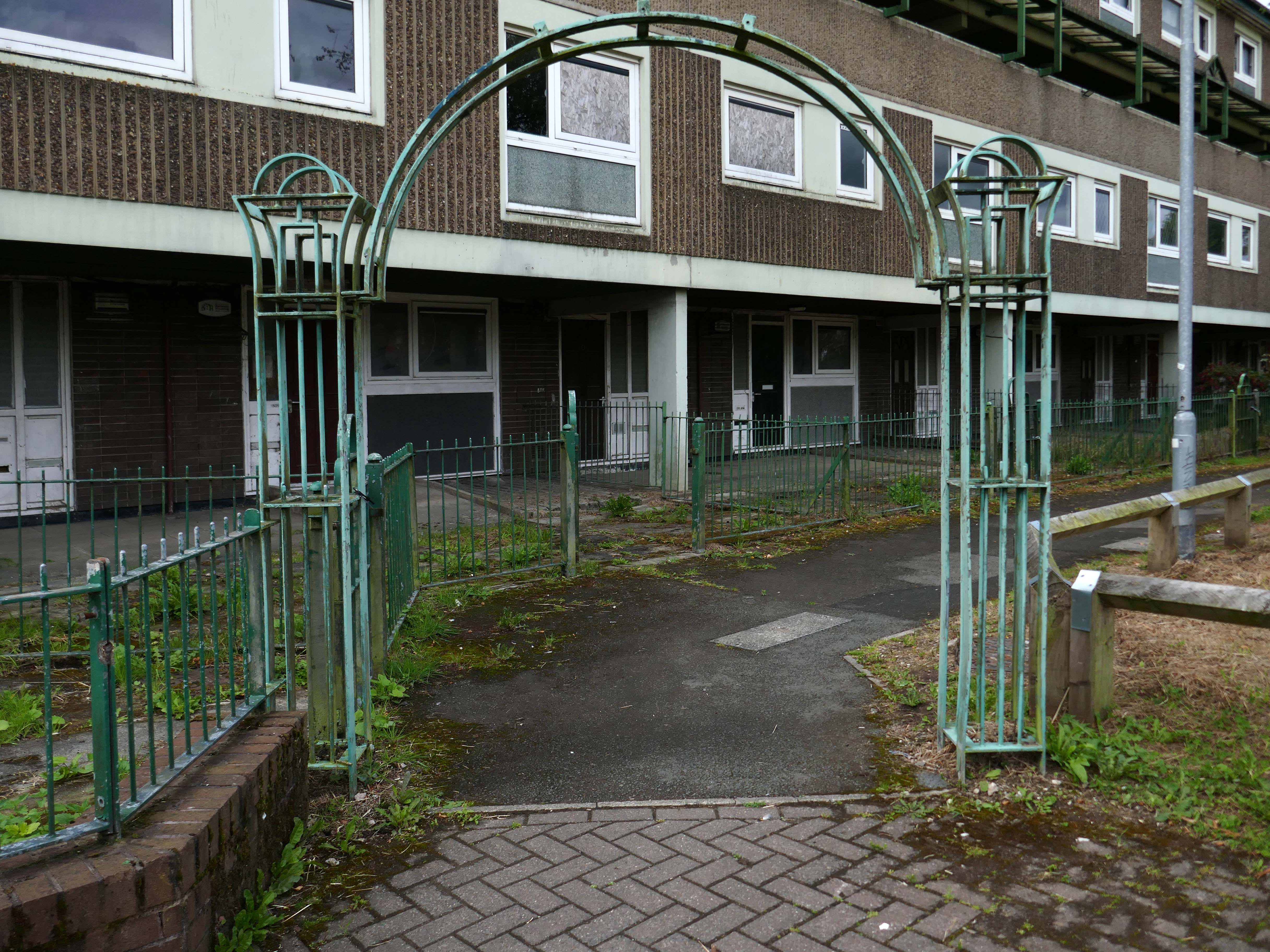
The tenants in the refurbished blocks with whom I chatted were convinced that demolition was not the answer, further renewal could take place, Rochdale Boroughwide Housing, despite a well prepared save our homes campaign thought not.
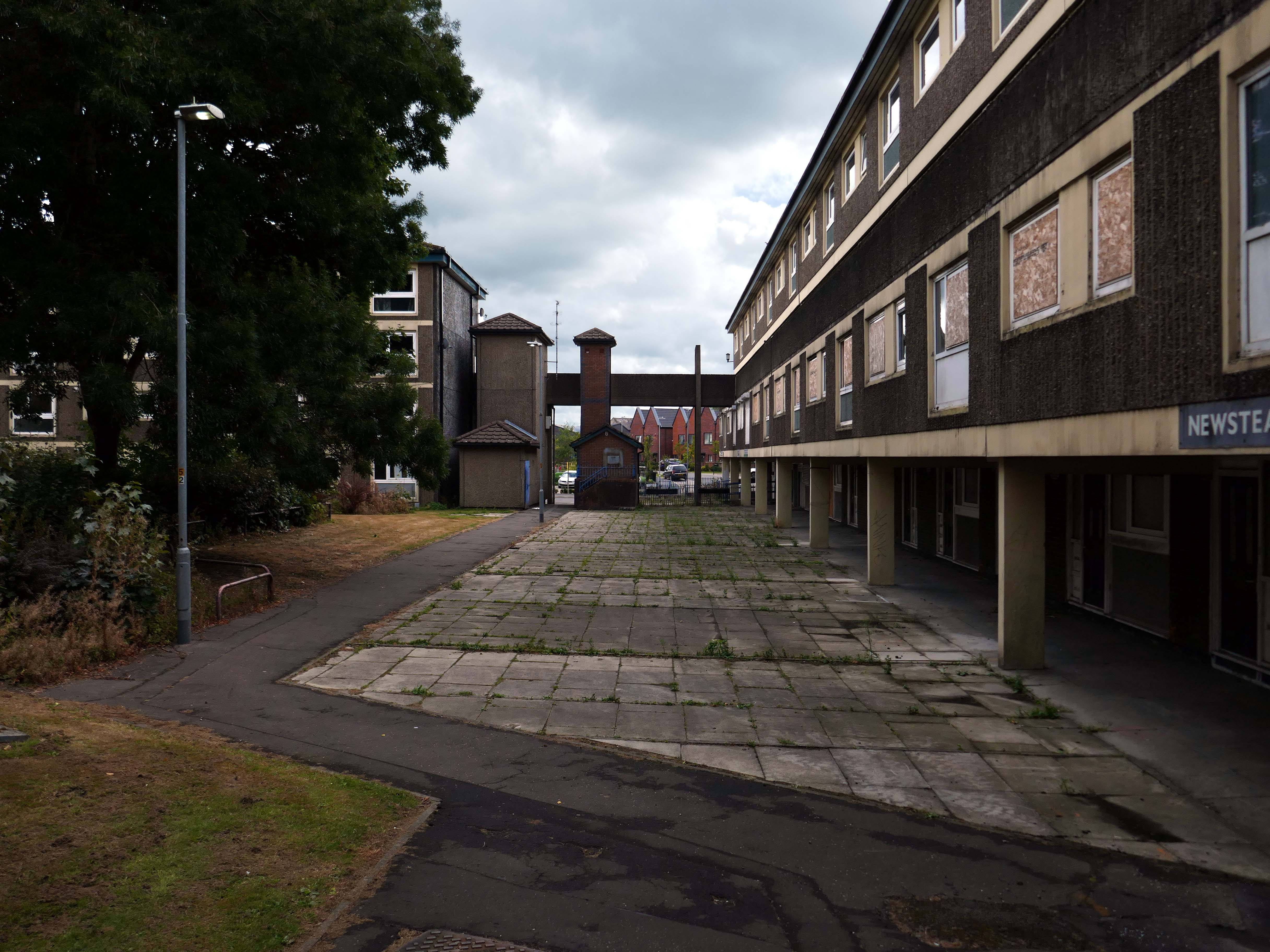
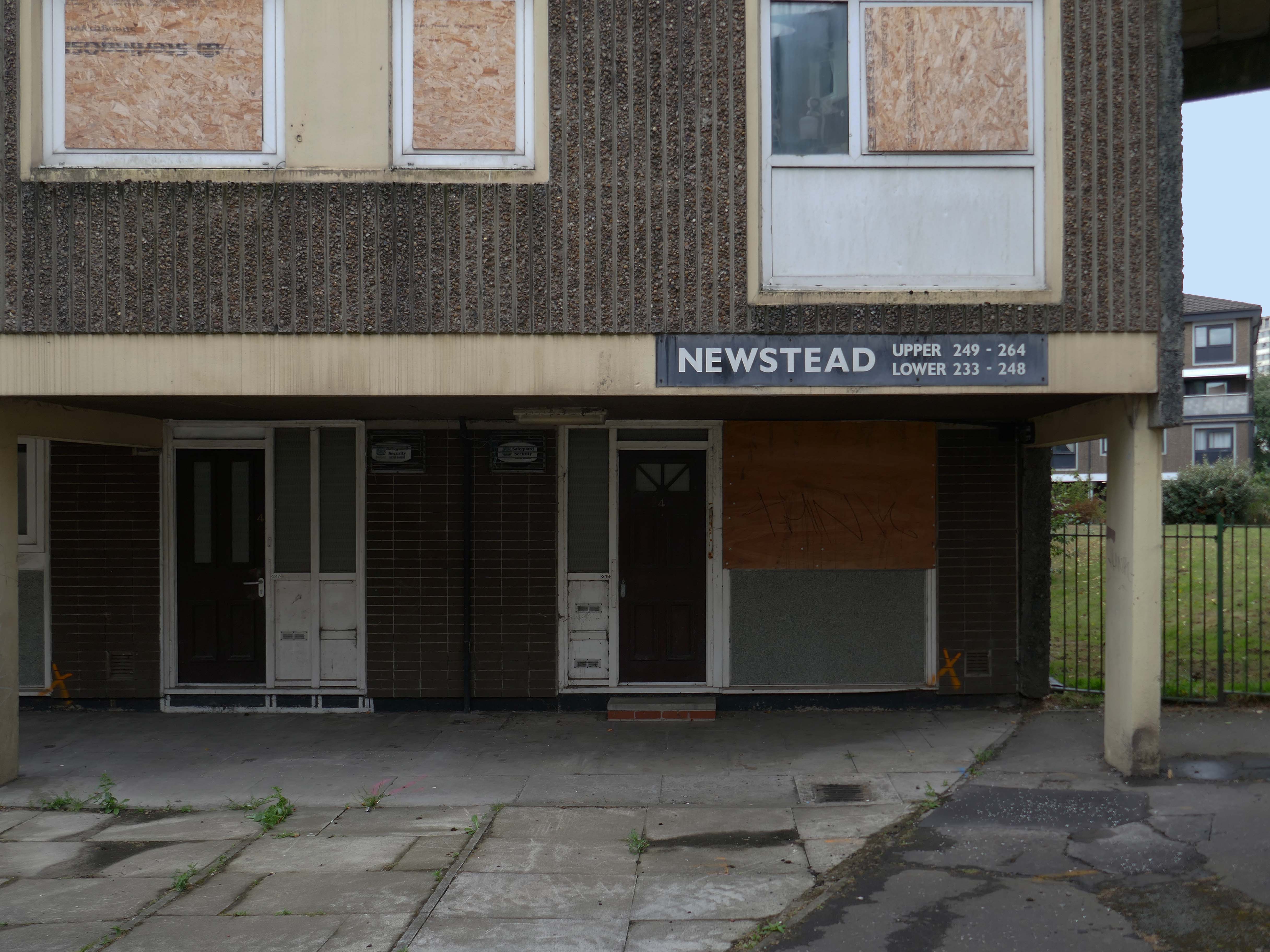
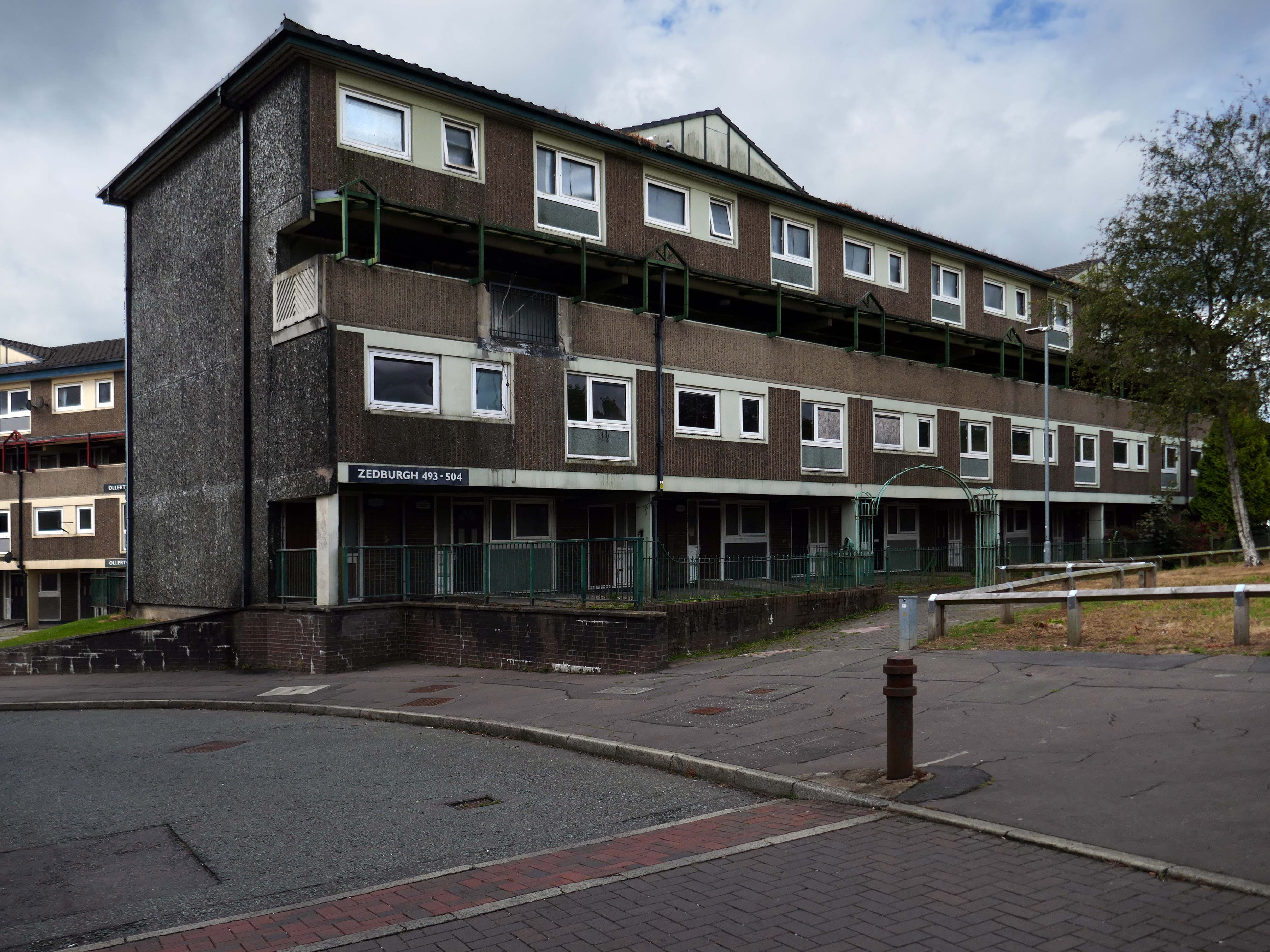
In March, we told you that we planned to demolish the six empty maisonette blocks – Ollerton, Newstead, Romsey, Quinton, Ullesthorpe, and Vaynor, in Lower Falinge, as well as the former RSPCA buildings and the former car wash on High Street, within the next 12 months. This will make way for the development of new family homes across a larger site that we will work with the community on designing.
Our beautiful mature greenery here on Lower Falinge is showcased in this wonderful video. We are proud of living here surrounded by all this nature – it really is like living in a park.
Unfortunately our urban oasis of calm is at risk of being destroyed if RBH demolish 128 homes and eventually build on the land.
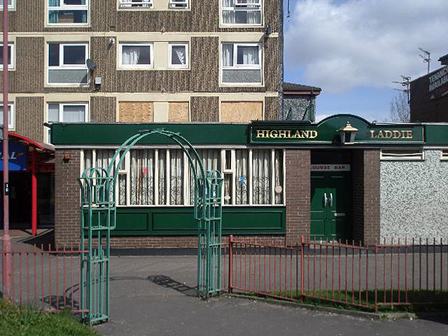
Once home to the Highland Laddie pub which closed in 2010.
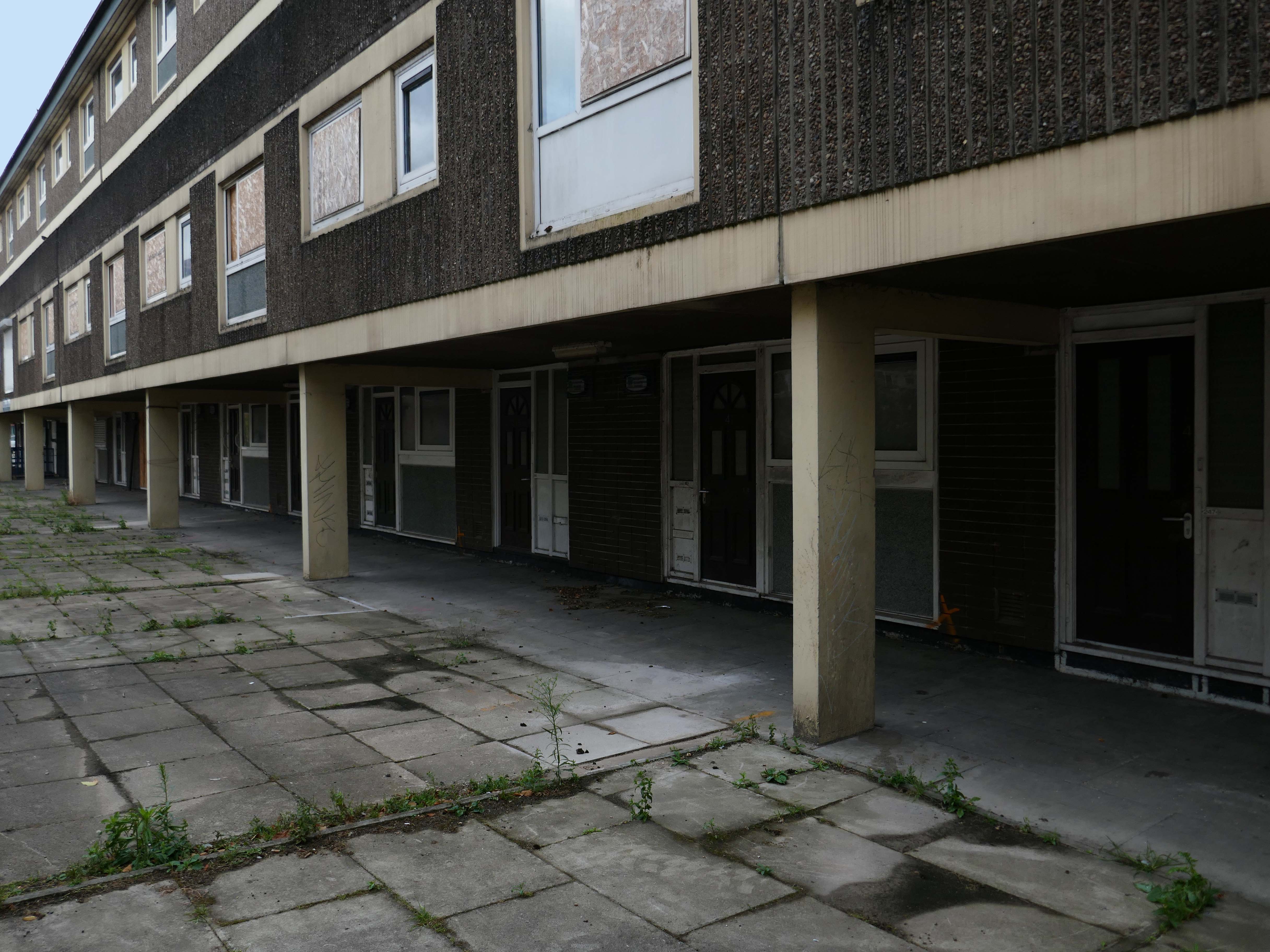
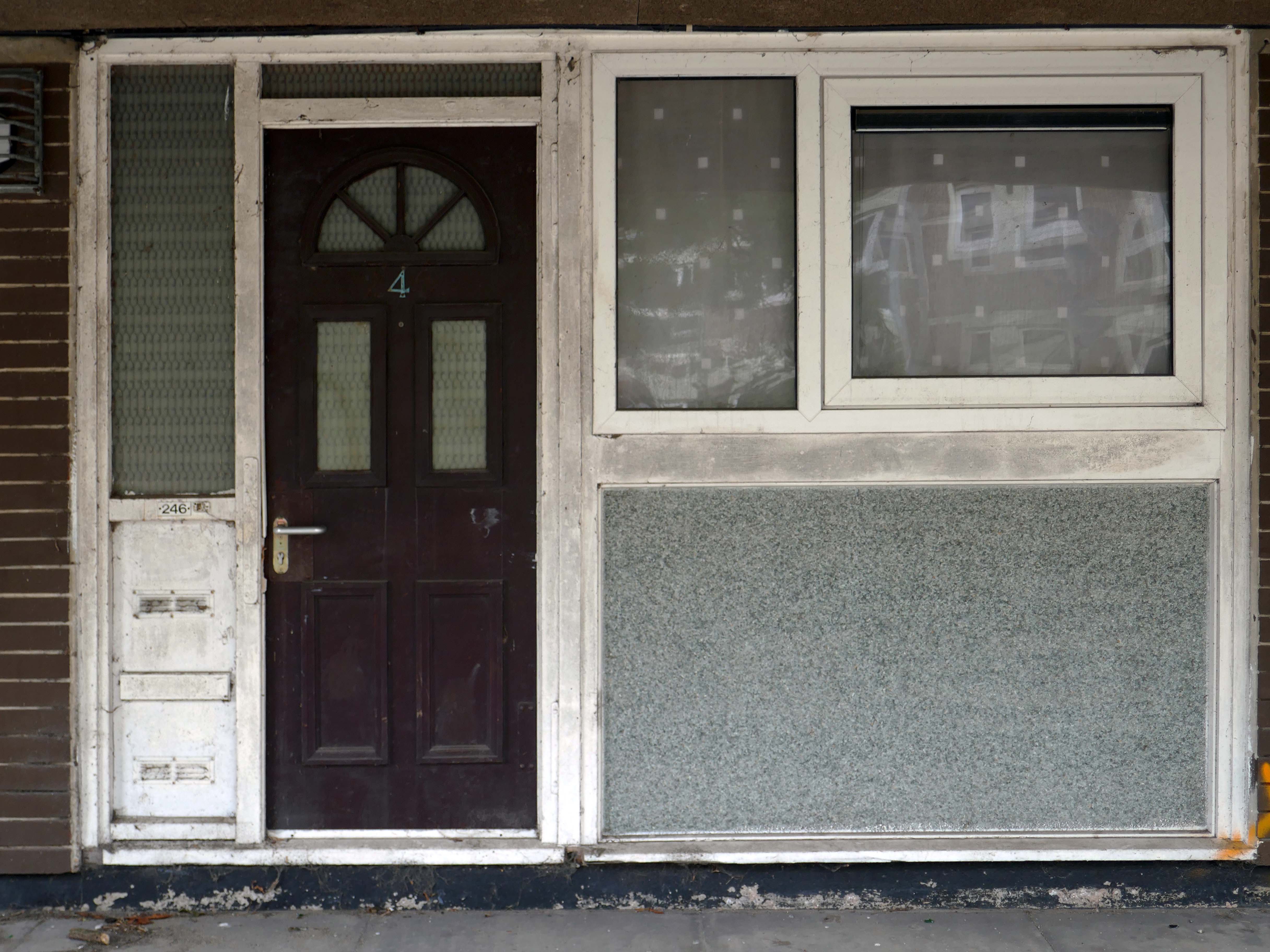
The remainder of the estate remains in limbo.
Next door the new homes have been built.
A major housing regeneration scheme which includes the construction of 30 energy efficient, affordable homes is breathing new life into the Lower Falinge neighbourhood in Rochdale.
The project is being carried out for Rochdale Boroughwide Housing by Rochdale-based main contractor The Casey Group with OMI Architects. This is the largest of 3 schemes that Casey has carried out for RBH.
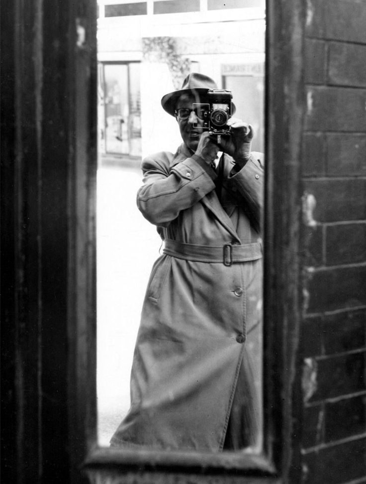
Thanks to L Kaye and the Manchester Local Image Collection there is a photographic record of Tib Street through the years.
Shot on 35mm black and white film, cautiously clad in gaberdine and trilby. The legwork aside the processing and printing of a whole heap of exposures was a gargantuan task.
The river’s source is a spring in Miles Platting , from where it flows underneath Oldham Road and the eponymous Tib Street to reach the city centre. After flowing underneath West Mosley Street, the Tib crosses Princess Street to flow underneath the Manchester Town Hall Extension, the Central Library and the Midland Hotel’s dining room, before joining the Medlock at Gaythorn (now First Street, close to Deansgate railway station.
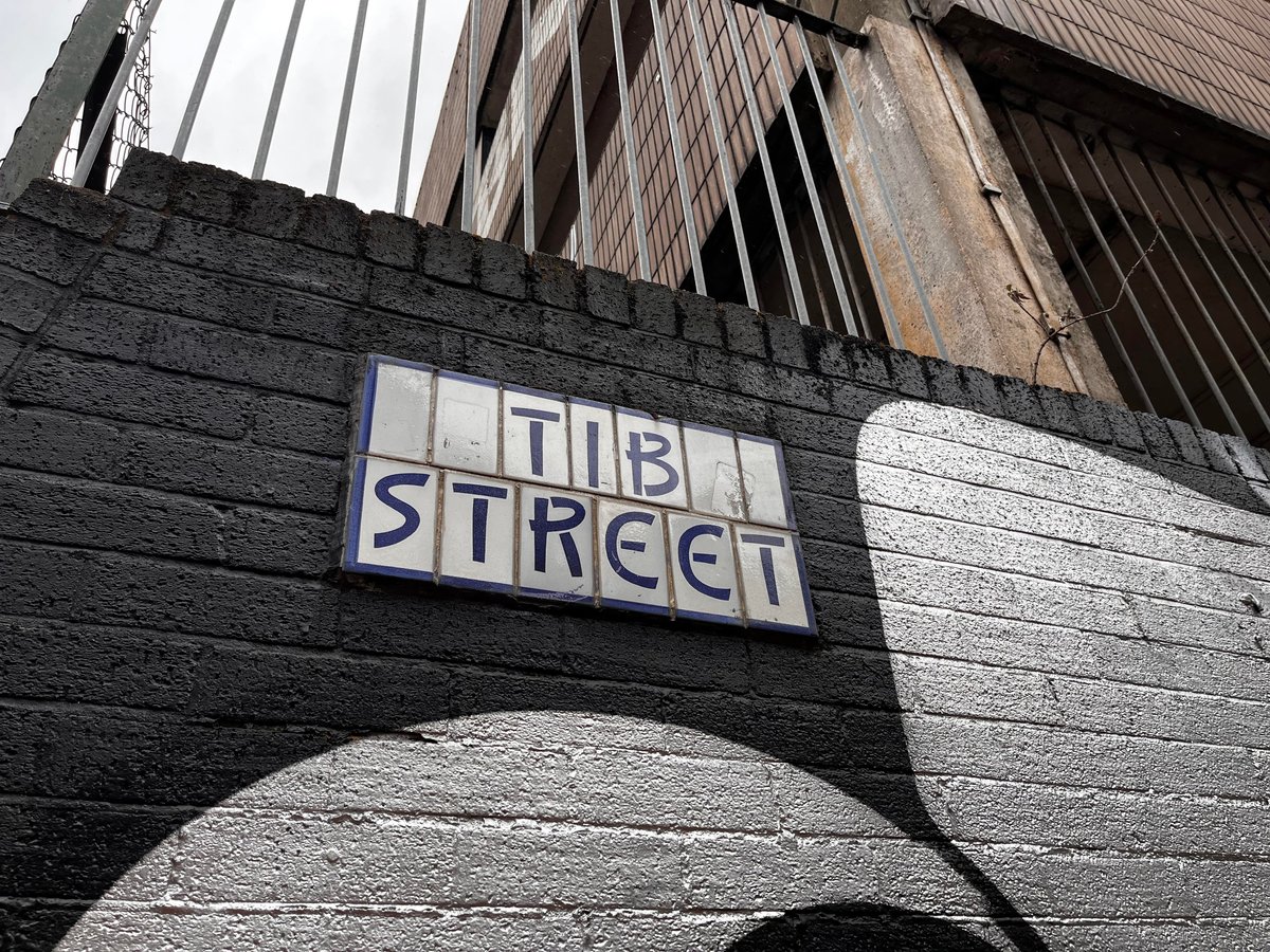
The distinctive street signs the work of my old pal Tim Rushton.
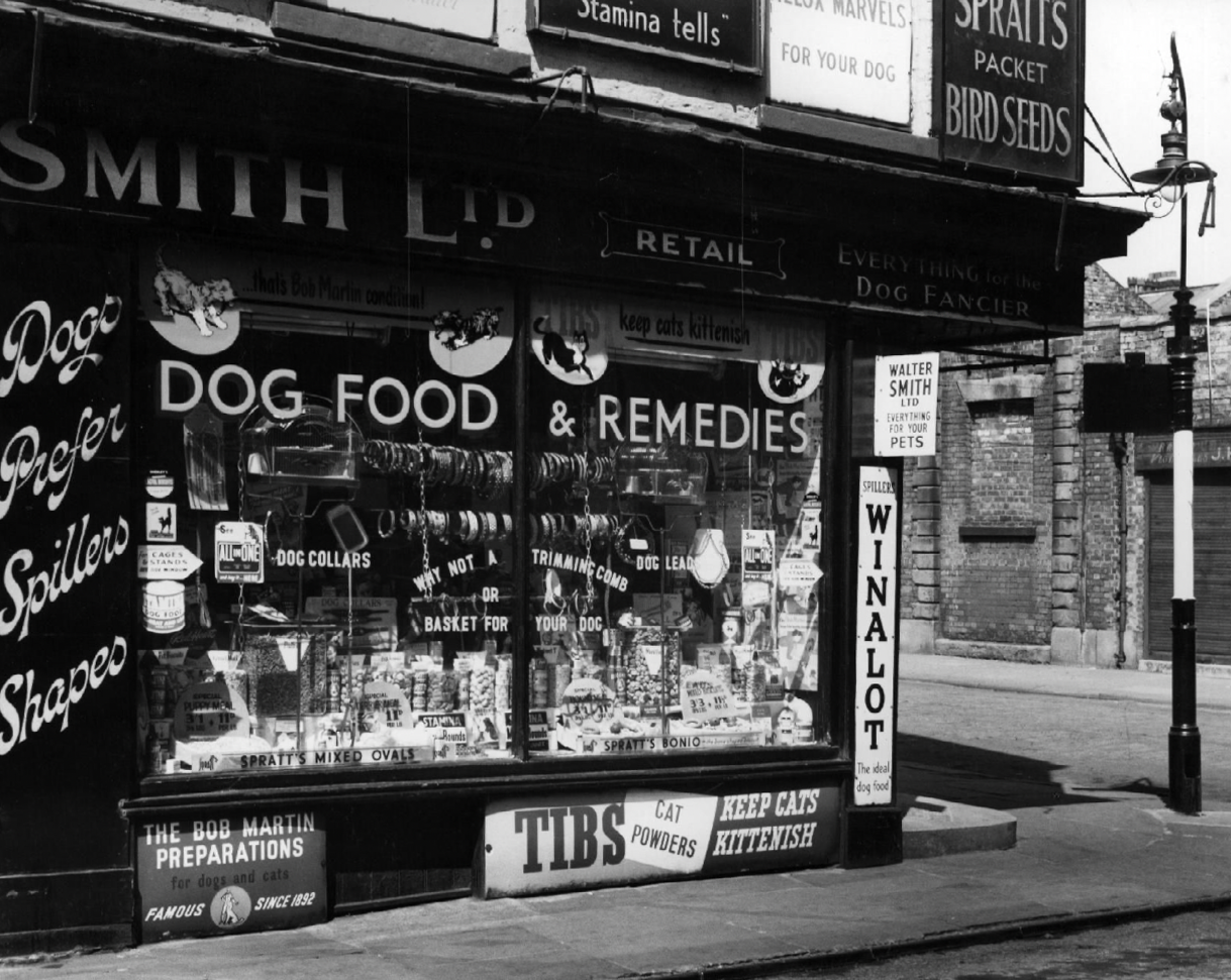
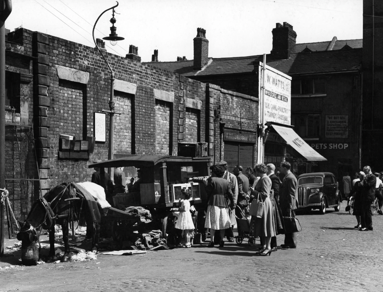
There are those who will remember Tib Street, as a street of pet shops.
Whilst on Sundays the area was transformed into an al fresco menagerie – a land of caged birds and cuddly coneys.
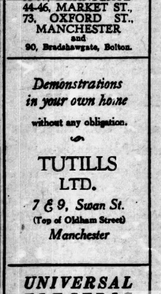
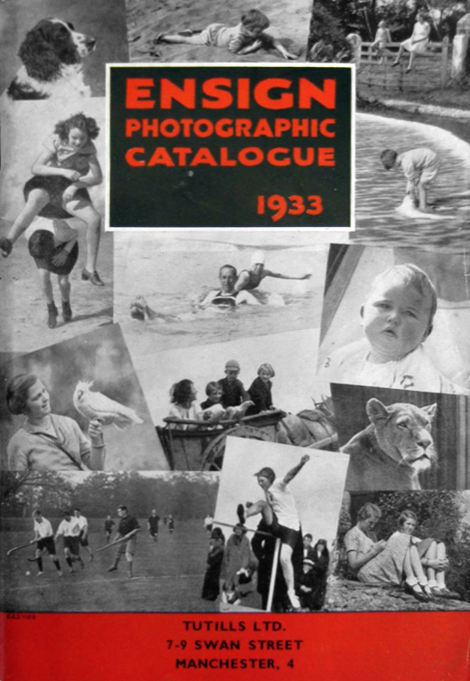
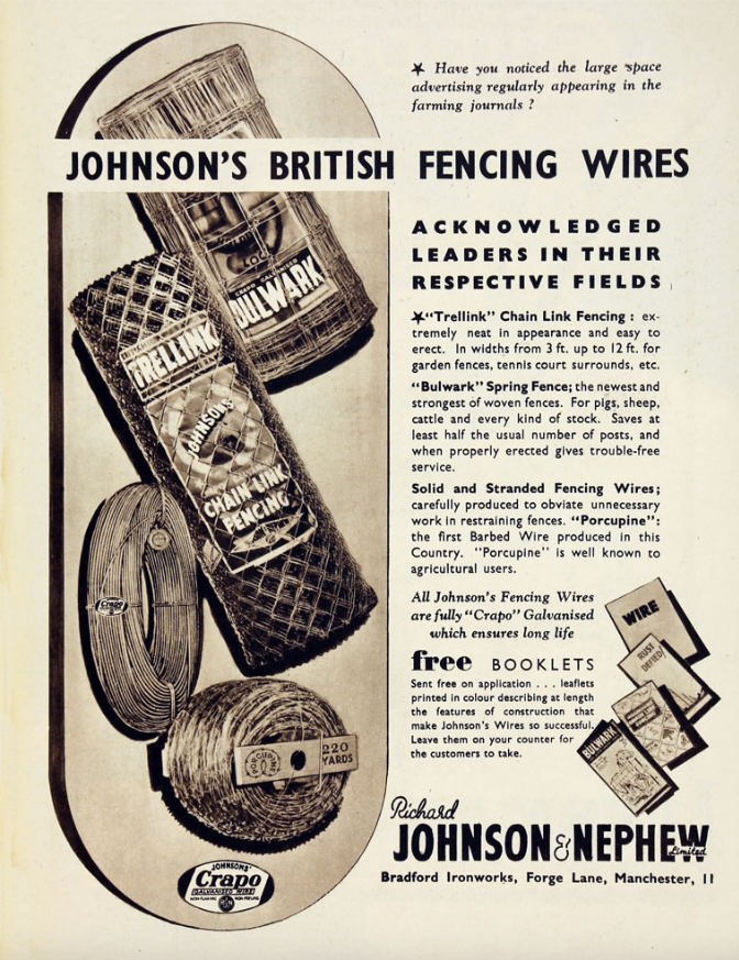
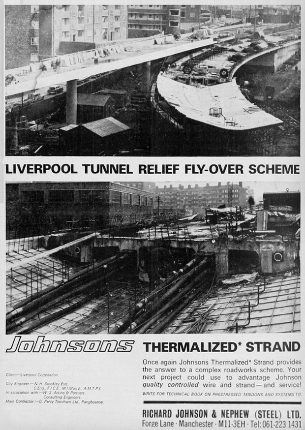
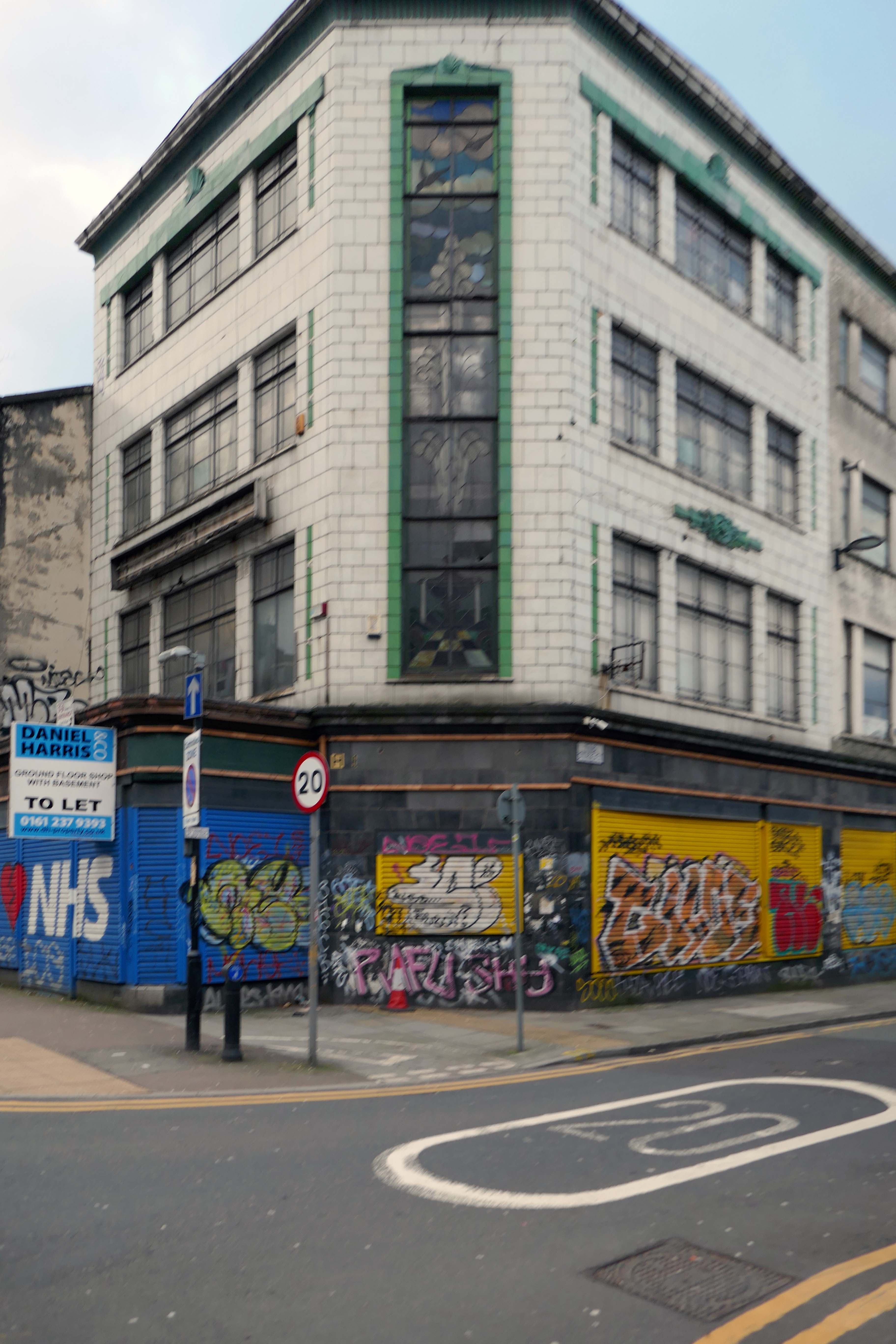
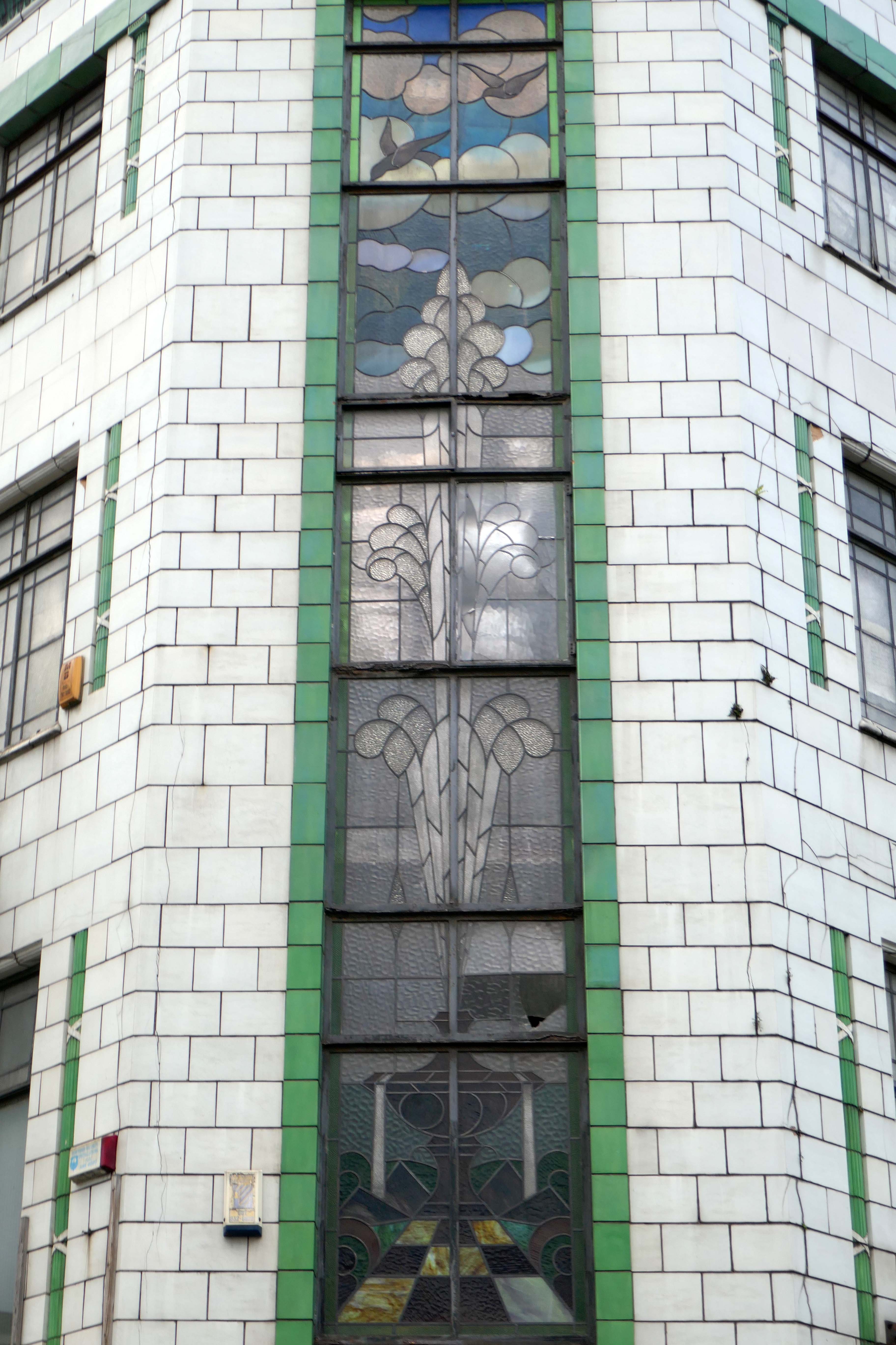
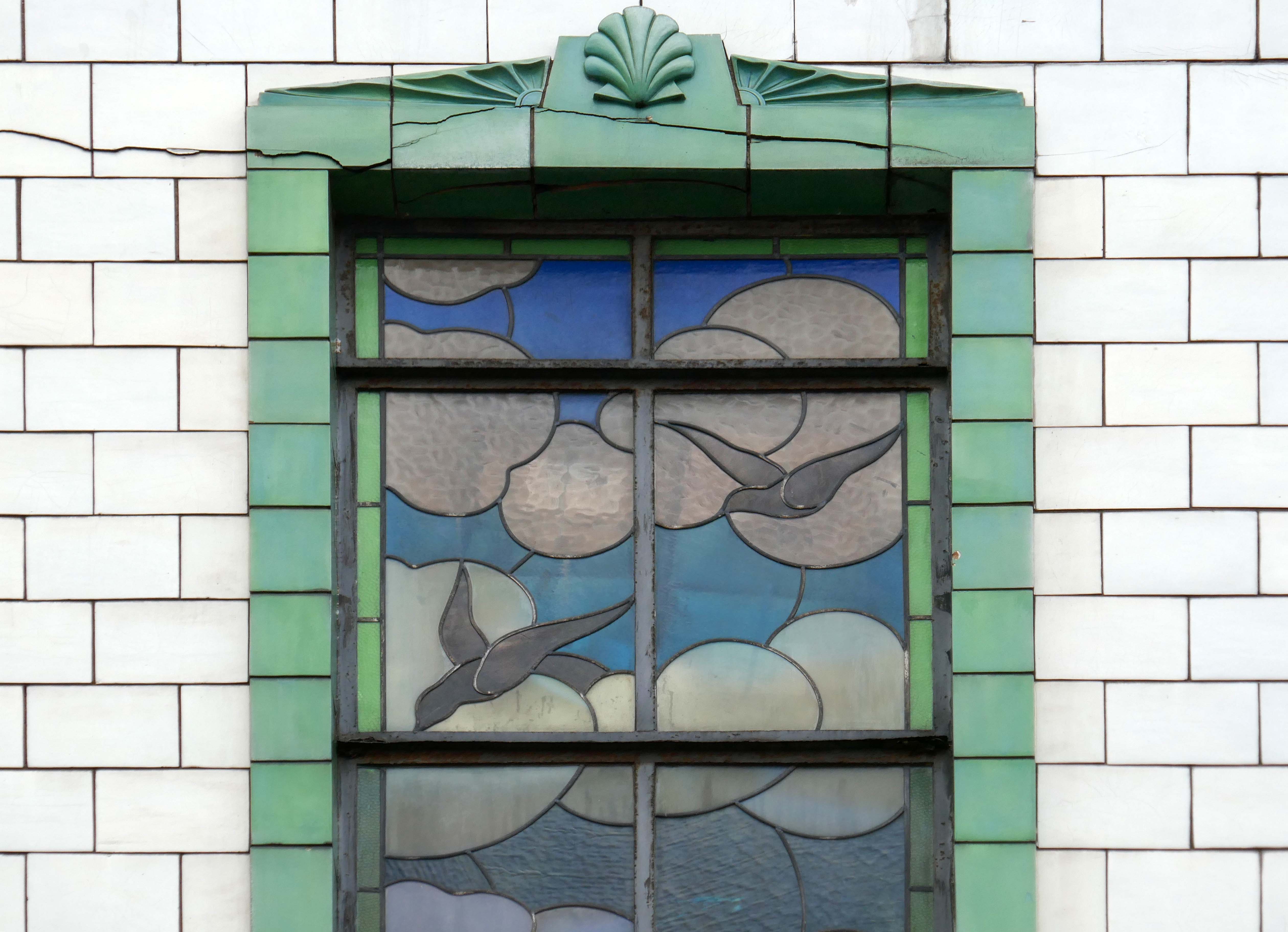
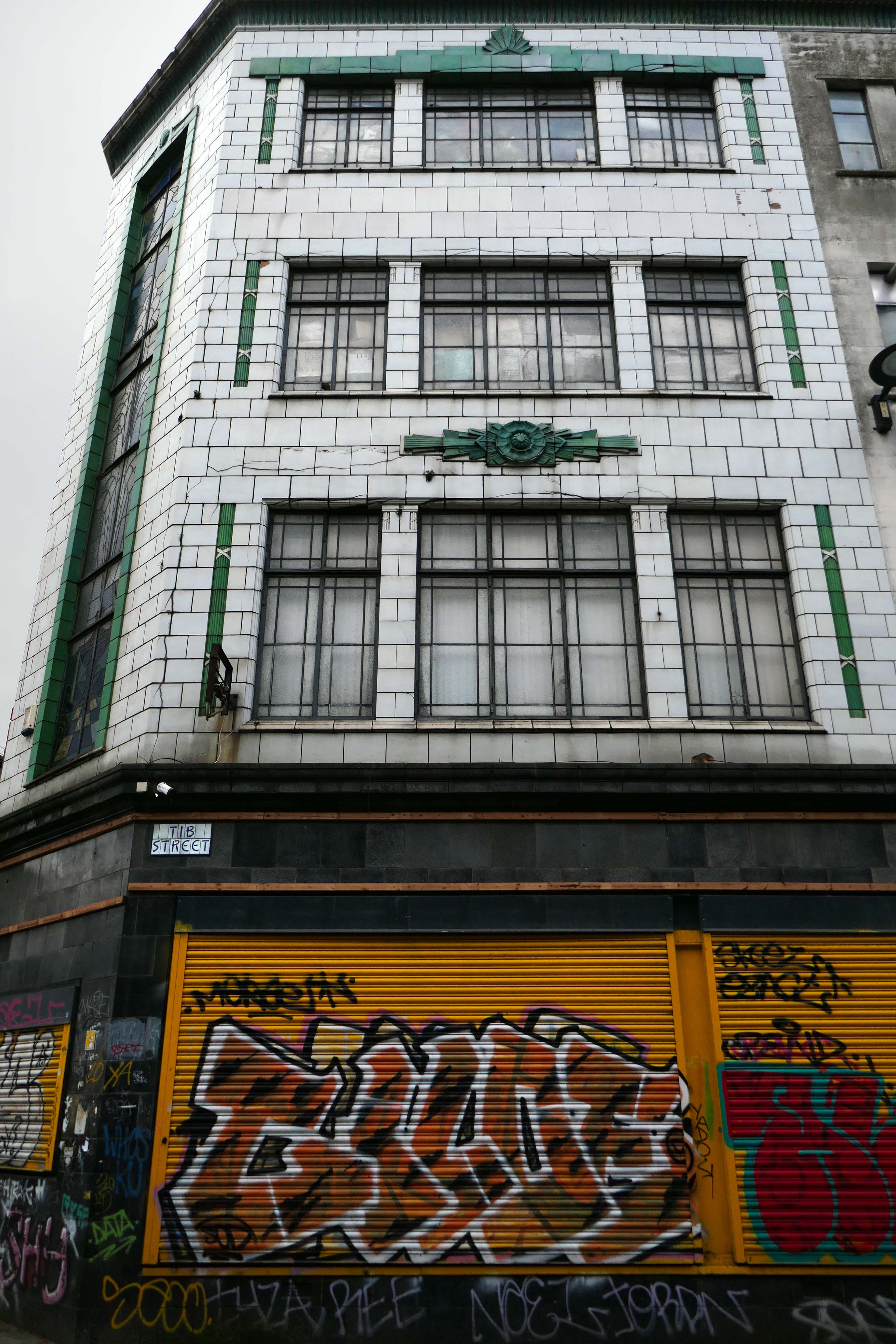
I have long been curious about the faience fronted shop on the corner of Tib and Swan Streets, it featured on my modernist mooch around the north of the city centre.
I have been informed by Lee Hutchings that it had originally been home to Tuttils Ltd.
It was also, formerly the showrooms for local manufacturers Johnson & Nephew.
Here it is in 1959 – with a Burton’s for a neighbour.
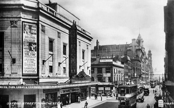
Pragmatic Manchester is far from awash with Art Deco – the lost Paramount/Odeon of Oxford Street comes to mind, demolished in 2017.
The Paramount Theatre was built in 1930 to the designs of architects Frank T. Verity & Samuel Beverley for the U.K. arm of the American Paramount Theatres Ltd. chain. The Manchester Paramount Theatre was a sumptuous American import.
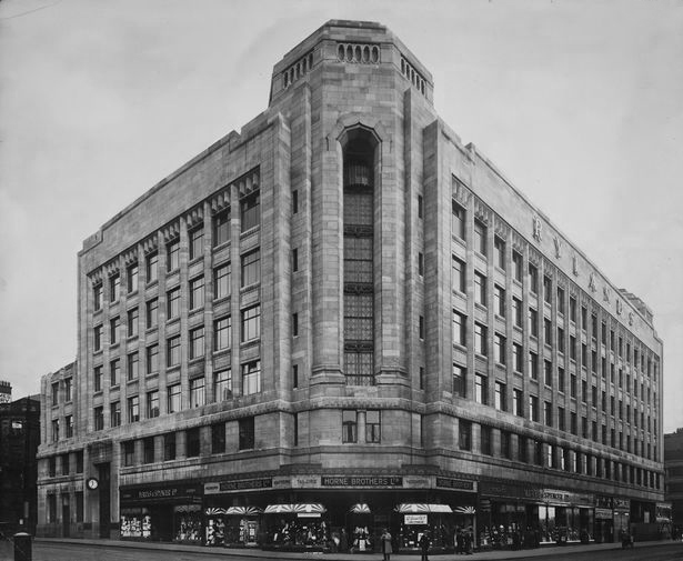
Along with the Rylands Building on High Street – currently receiving a facelift following the demise of Debenhams.
The building was originally built as a warehouse by J. Gerrard & Sons of Swinton for the Rylands textile company, which was founded by the entrepreneur John Rylands. That firm had occupied warehouses in High Street ever since 1822; its west-facing side is on High Street. The building was designed by the eminent Manchester architects, Fairhursts – Harry S. & P. G. Fairhurst, in an Art Deco style. It is clad in Portland stone and features a decorative corner tower and eclectic ‘zig zag’ window lintels. The work was completed in 1932.
Rylands will be sensitively restored to its elegant past. The building will comprise workspace, retail and leisure, creating an exciting new destination in Central Manchester.
I began walking when quite young, then like Felix, I kept on walking, walking still.
The photograph was taking during the Whit Walks in 1958 – aged three, I was engaged in religious pilgrimage, as we know there are many reasons for walking, this is but one.
I was fortunate to grow up at a time when youngsters were permitted to roam freely, less traffic, less anxiety, gave me access to a wider axis of exploration.
The photograph would have been taken I assume, by my mam, on the Brownie 127. When aged nine I wandered alone through the local woods and exposed twelve frames of 44mm 127 film, the prints are long gone, yet I remember each of the photographs and locations clearly.
I went to school, then I didn’t, then I went to Art School, eventually becoming a teenage Constructivist, tutored by Jeffrey Steele, a leading light in the British Systems movement.
The rigidity of the grid, symmetry and orthogonal framing have stayed with me.
Then I went to work for a very long time indeed, then all of a sudden I didn’t. Taking early retirement aged 59 some ten years ago, subsequently taking to the roads, streets and hills of Britain in search of nothing in particular.
In recent years there has been a rapid development in the culture of walking, theories, films, guides, songs and literature. I am fully cognisant of such, yet believe at heart that walking can be free of such baggage, we can stride unhindered, atavistic and carefree/less.
Walk tall, walk straight and look the world right in the eye.
Getting lost is about the unfamiliar appearing.
In my own small way, I have become part of that baggage, having been asked to lead a walk around Stockport by the the modernist neé Manchester Modernist Society.
The photograph depicts Alan Boyson’s concrete screen wall, attached to the former Cooperative super store designed by Philip Andrew. The two worked to gather on the Hull Cooperative store, which is adorned by Alan’s huge Three Ships mosaic.
Philip was a childhood friend of Alan Boyson and it was Alan’s father, manager of the Marple Co-operative Society, that recommended Philip for an apprenticeship job in 1951 to the chief architect at the CWS in Manchester HQ.
In preparation for the tour, I visited the town’s Local Heritage Library and read extensively from serendipitous charity shop finds.
The two hour route was designed around an economy of distance and elevation, allowing time for others to take in, what may be for them unfamiliar surroundings. A group of around twenty or so folk became sociable and engaged, with a suitably concise and apposite contribution from myself. There are those who busied themselves taking snaps along the way, chatting amiably or simply gazing in amazement.
The service building above the former Debenham’s store.
Famed as an imaginary TV police station, this civic building is a civic building I simply can’t resist. I return on a regular basis to wander and snap. This is an open public space that seems little loved and has few visitors.
From then onwards I have been taking folks on Modernist Mooches on a regular basis, two or so a month, during the less inclement times of year.
At about the same time I was asked to exhibit my photographs in Stockport, I chose to mooch about at night. Walking around an almost deserted town, avoiding the glare of streetlights, there is a mild frisson to be about when nobody else is about. The air feels different, exposures are longer, the almost waking world feels arrested, by the low available light.
My local shopping centre and as such part of my weekly walking and shopping life.
NCP Car Park located on Stockport Station approach.
Regent House
Asda superstore
I found a copy of Charlie Meecham’s book Oldham Road in a charity shop.
Inspiring me in 2014, to walk in mostly straight lines, though often as not zig zagging along the main arterial roads of Manchester.
Taking pictures on Sunday mornings, in order to avoid traffic, mildly amused to be ignoring the primary function of the routes.
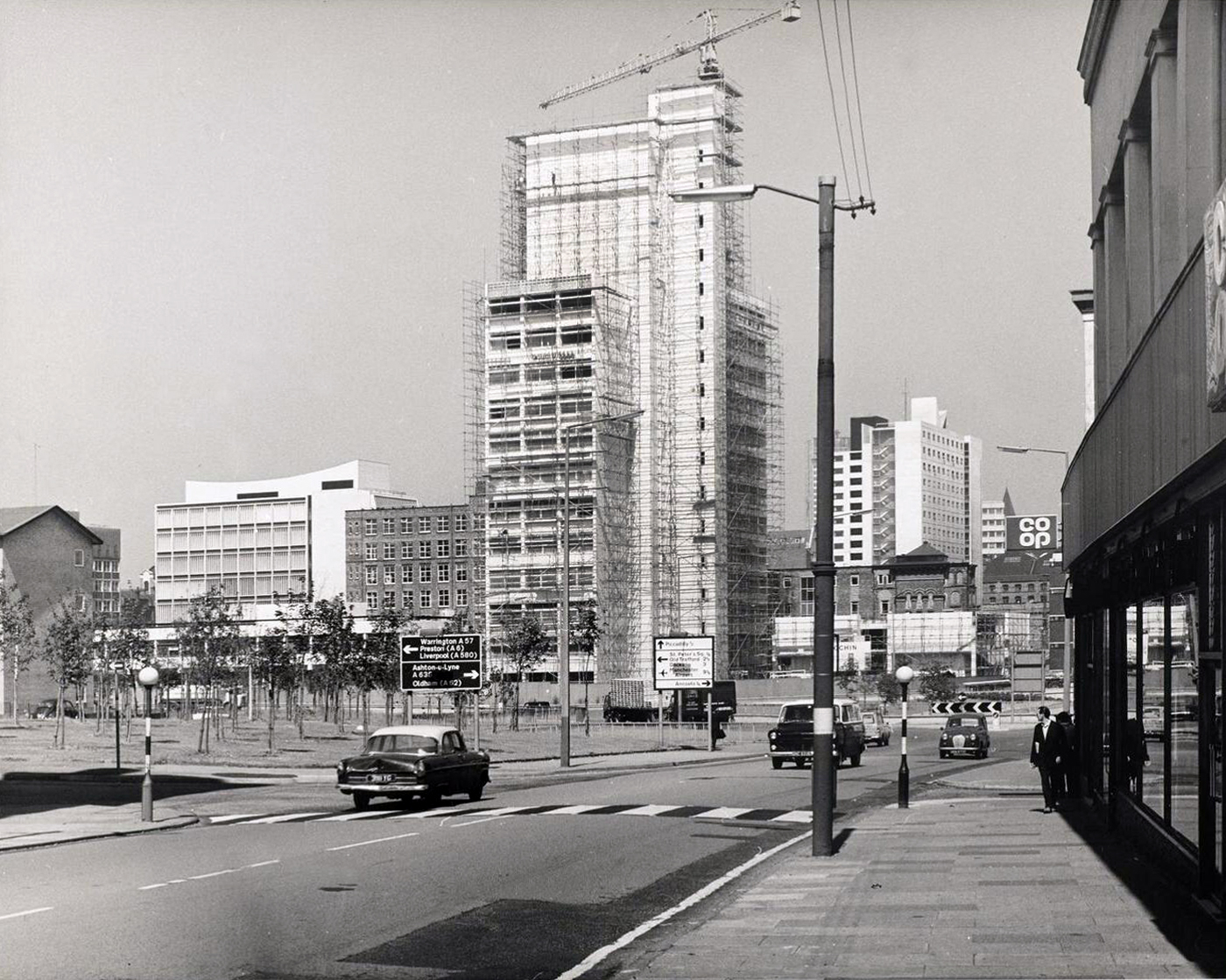
This is one of the more familiar roads, having walked up and down several times over several years. It was to have been an extension of the Mancunian Way, forming a trans-pennine motorway. Much of the property lining the route was cleared in preparation, it was never built, and for years a strange semi-deserted ambience hung over the A57.
Bus Depot
Railway Bridge
The car showrooms which later became an African Evangalist church.
Having cleared away both Victorian and Sixties housing, new architectural forms arose in West Gorton.
Now, everywhere I go, I see launderettes – so arriving in Hanley with time on my hands, wandering around I found this exemplary example.
Having a blog entitled Manchester Estate Pubs, the national media became interested in my photographs. I had spent quite some time, wandering around in search of this endangered architectural typology.
This was Billy Greens in Collyhurst, named for a local boxer, now demolished.
Which in turn became the second modernist calendar.
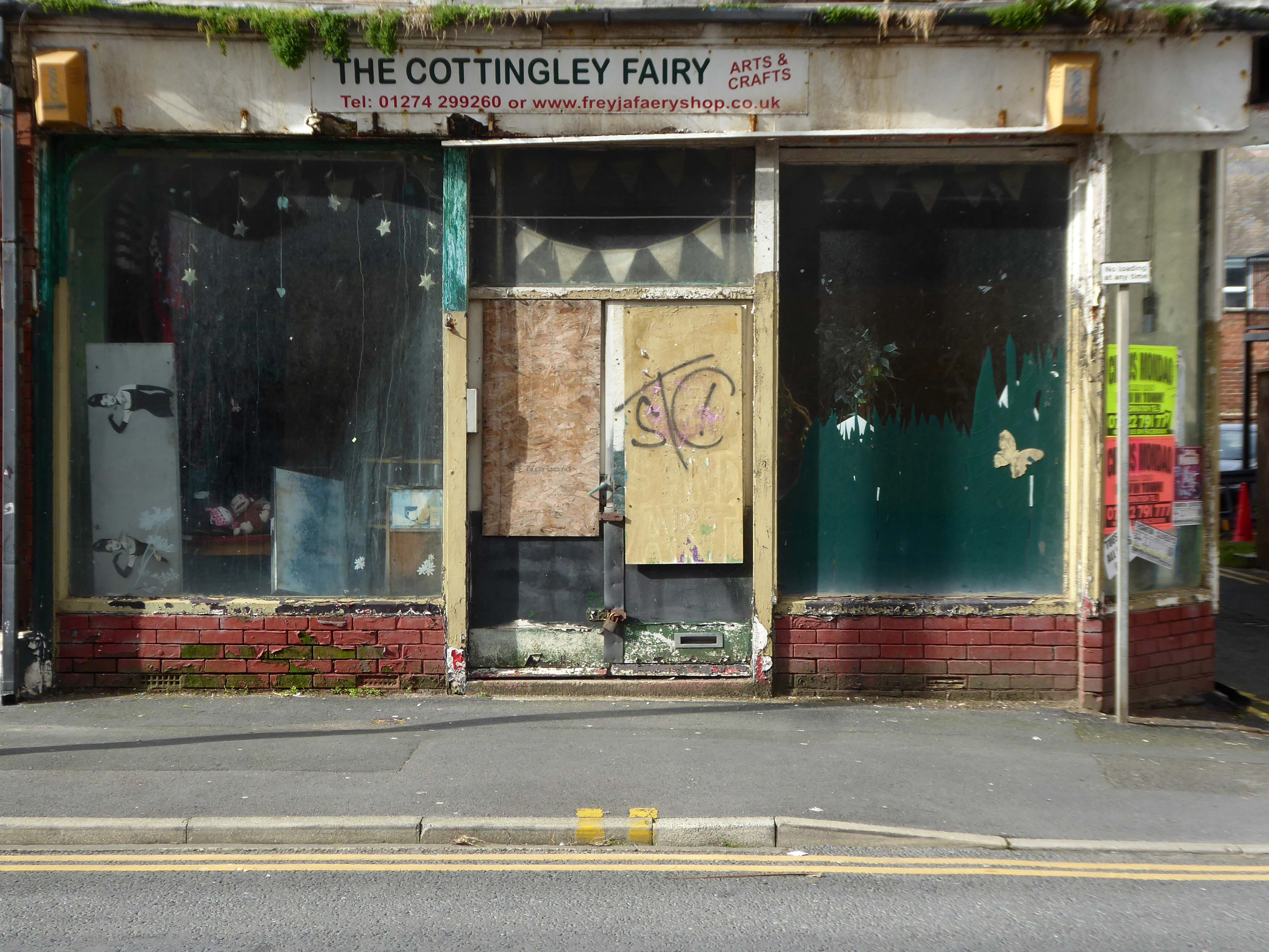
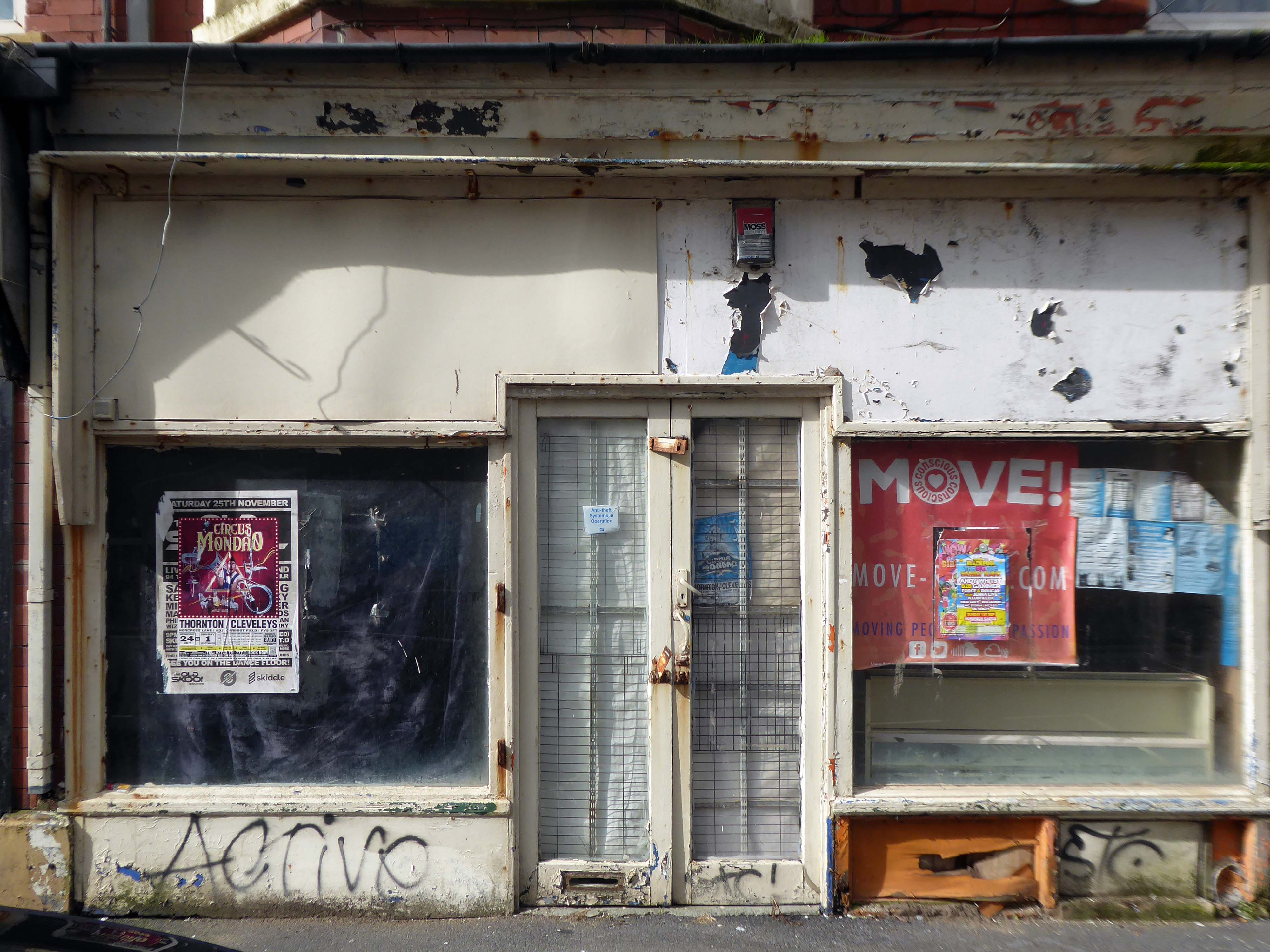
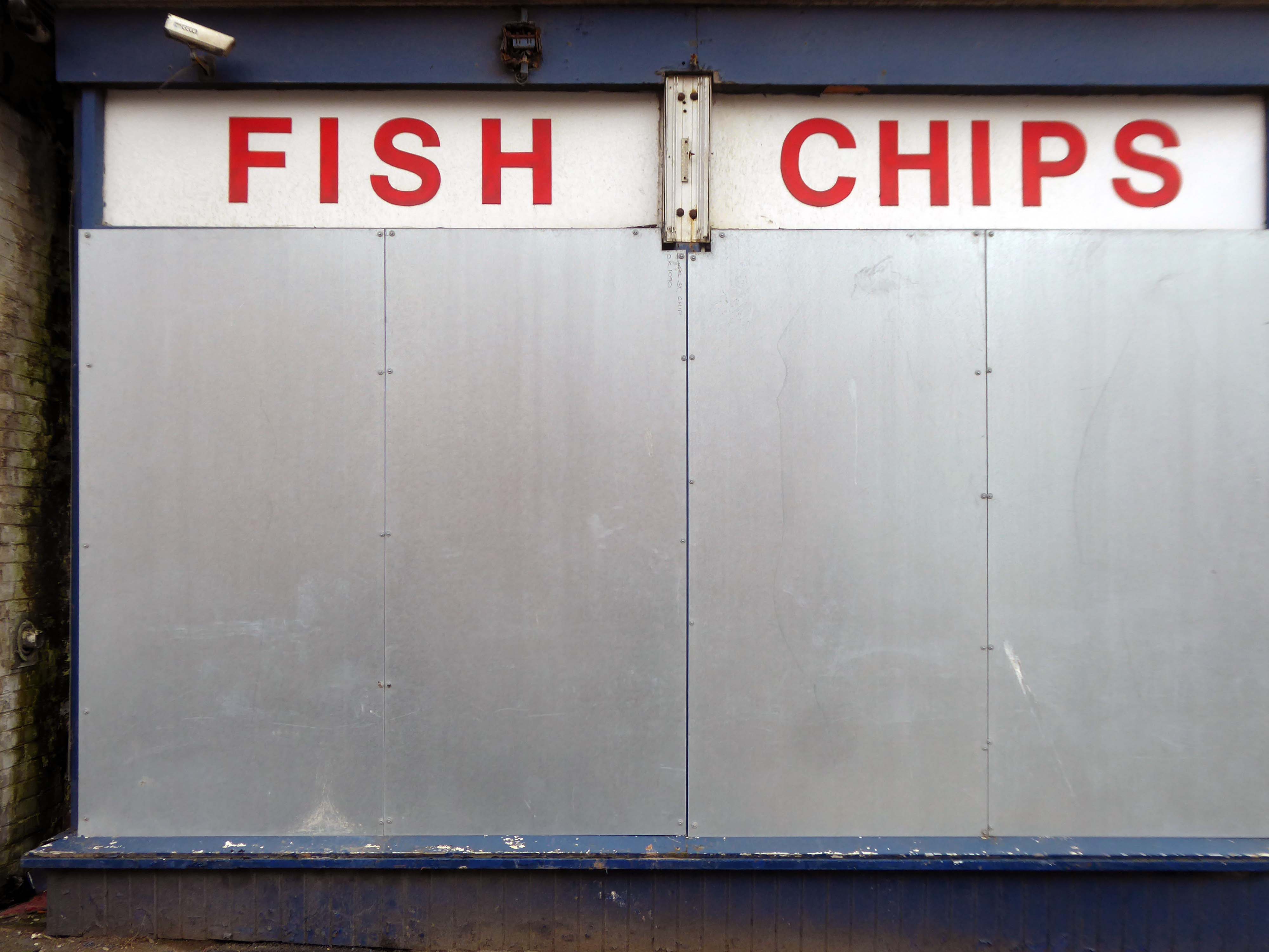
Followed the following year by fish and chip shops.
So building a vocabulary for my mooching, discovering yet another chippy, laundry, pub, Burton’s, telephone exchange, glazed stairway or underpass.
These things find you, yearning for some small amount of attention and affection.
The Trawl – my favourite peg board menu, my favourite Bridlington chippy.
We are now coming to the end of the car park year – seen here on the wall of my command centre.
Home to William Mitchell’s Totem, the homes long gone and the Council pledged to move the totem too.
The state of play this week, the detritus removed and the base filled in, repaved and safe for a while.
Off now to the Weaver Valley another day another river, passing under Weaver Viaduct
The looking toward KouraGlobal – leader in the development, manufacture, and supply of fluoro products and technologies, opened a new HFA 152a production facility at their Runcorn site in the UK.
Further rural Modernism as we pass under and traverse the M62, whilst walking around the Piethorn Valley
The newest of the Modernist Mooches was to Burnley where we visited the Keirby Hotel.
The former GUS Offices with a mural by Diane and William Morris.
Plus the Charles Anderson concrete relief at the Crow Wood Hotel.
Finally a little light relief – a visit to the Boots factory in Nottingham.
Having innocently board a bus outside the station with a Boots head code , I alighted within the factory gates. Then innocently walking around taking snaps, unheeded until the men in the van stopped me in my tracks.
Who are you, what are you doing?
I am the Modern Moocher going about my business – well it turns out this was not permitted and I was red carded by the earnest security guards and asked to leave forthwith. Suitably rebuked, I politely bade them farewell and headed for the gates.
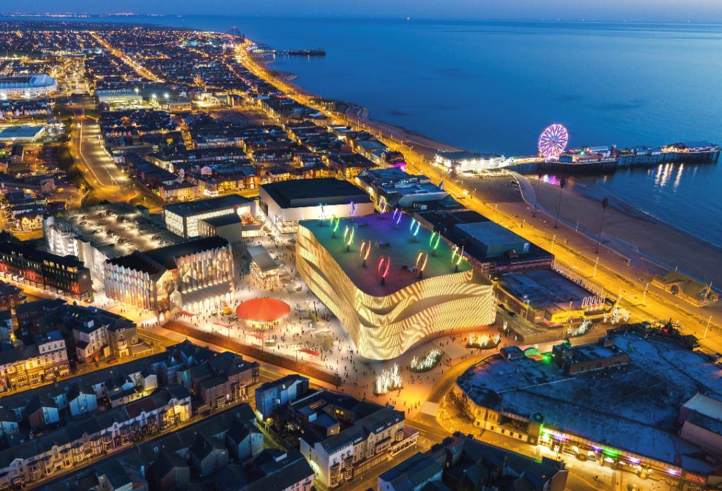
Blackpool Council says it remains committed to the Blackpool Central project amid the potential collapse of the developer leading the works.
But warning alarms sounded this week when Nikal – which was hired to oversee the project – filed a notice of intent to appoint administrators.
The £300m Blackpool Central development is billed as the biggest single investment in the town in more than a century and is planned to involve a “world-class leisure development” which would create 1,000 new jobs, bring an extra 600,000 visitors per year, and boost annual spend in the town by around £75m.
A spokesperson for Blackpool Council told the Blackpool Lead:
We have been working on the enabling phase of Blackpool Central over the last few years. The new multi-storey car park opened earlier this summer and we are currently completing preparations to demolish the old police station and courts building early in the New Year.
The proposals for the Bonny Street area can be seen here.
Plans for the area have hit further problems.
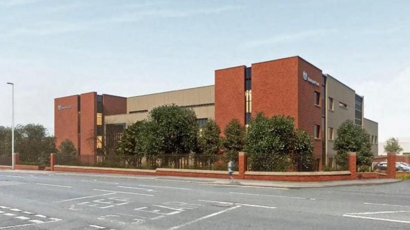
A new £40m magistrates courthouse is facing building delays after the project’s main contractor collapsed.Blackpool’s magistrates court was one of twenty two projects belonging to construction giant ISG, which was working on the scheme for the Ministry of Justice.
But the firm went into administration in September, leaving two thousand two hundred workers at risk of redundancy, the Local Democracy Reporting Service said.
Work was due to start early next year with a completion date expected in 2026.
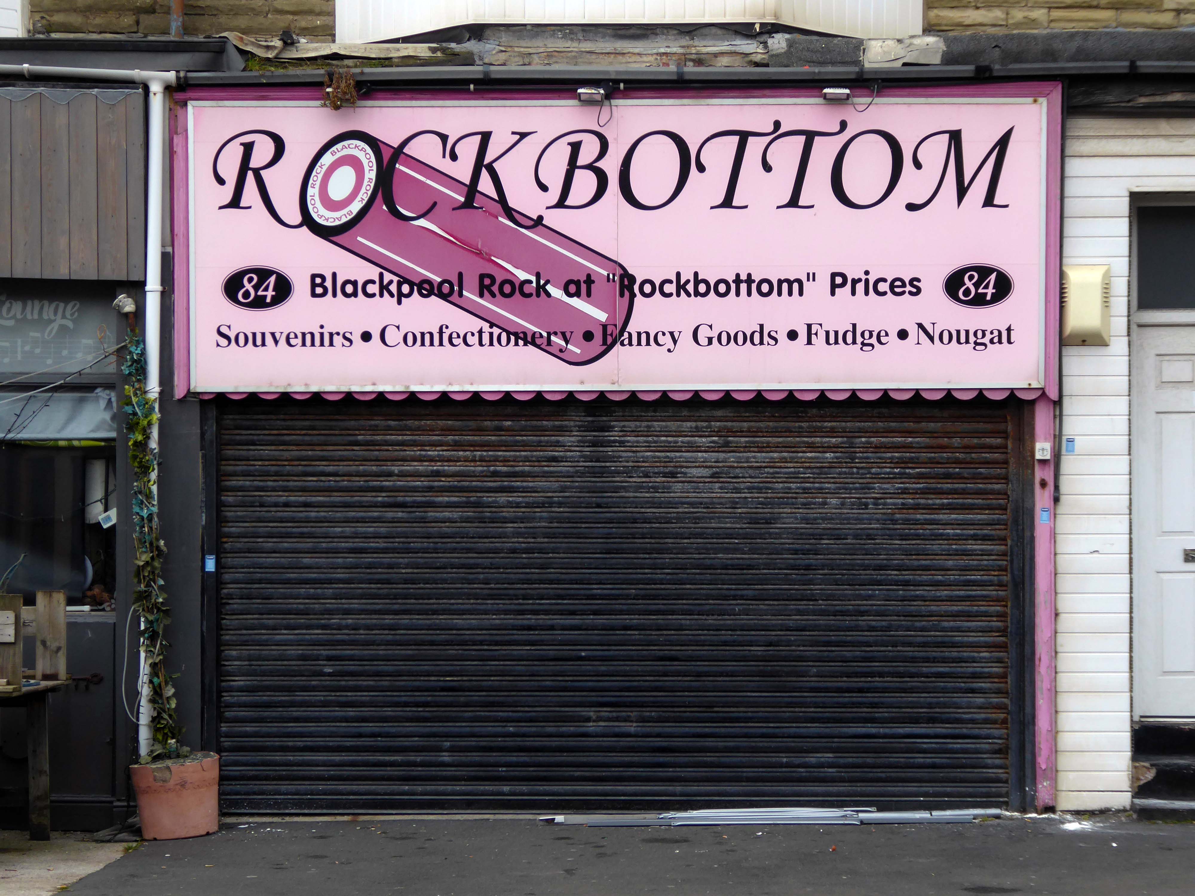
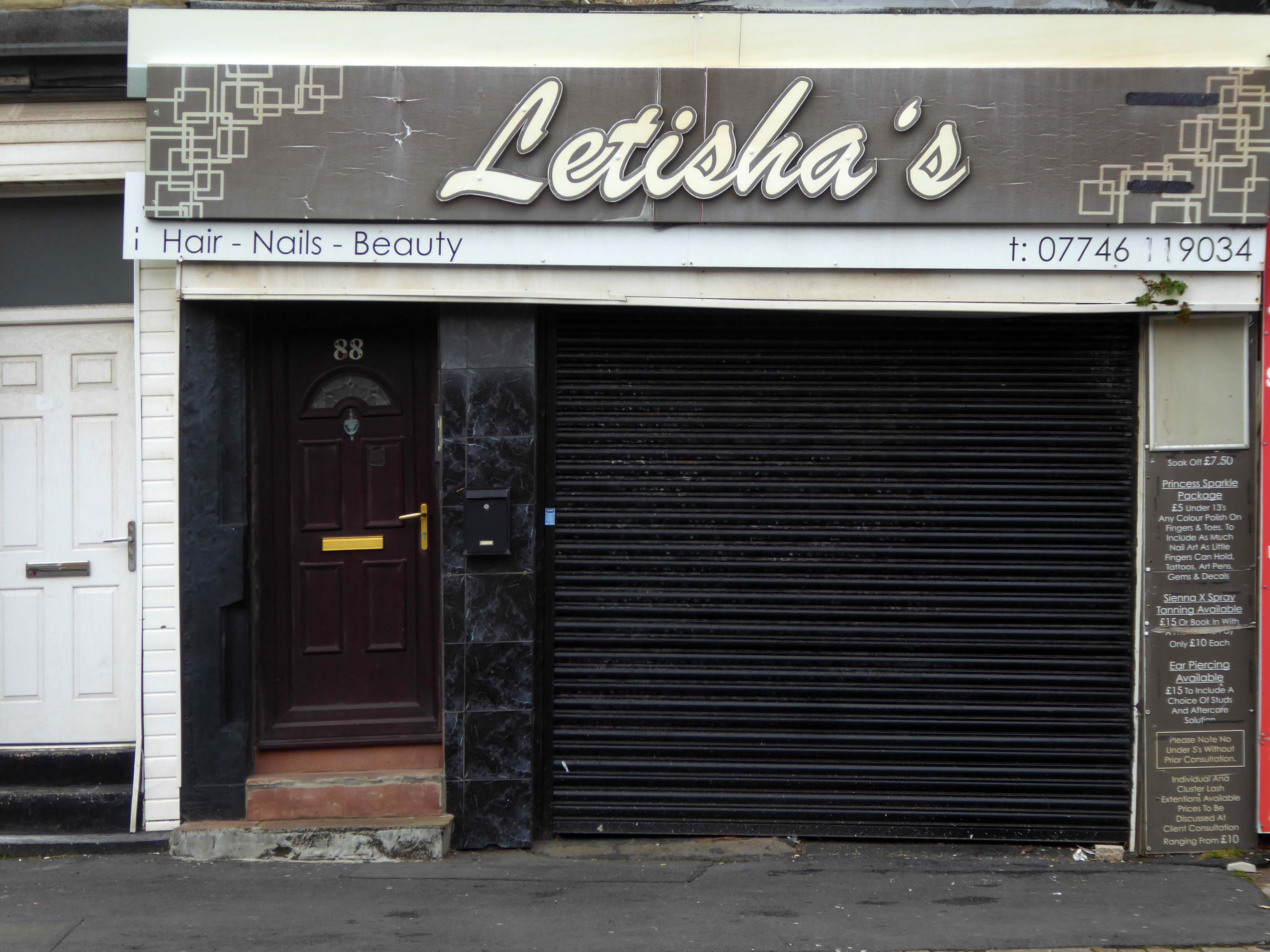
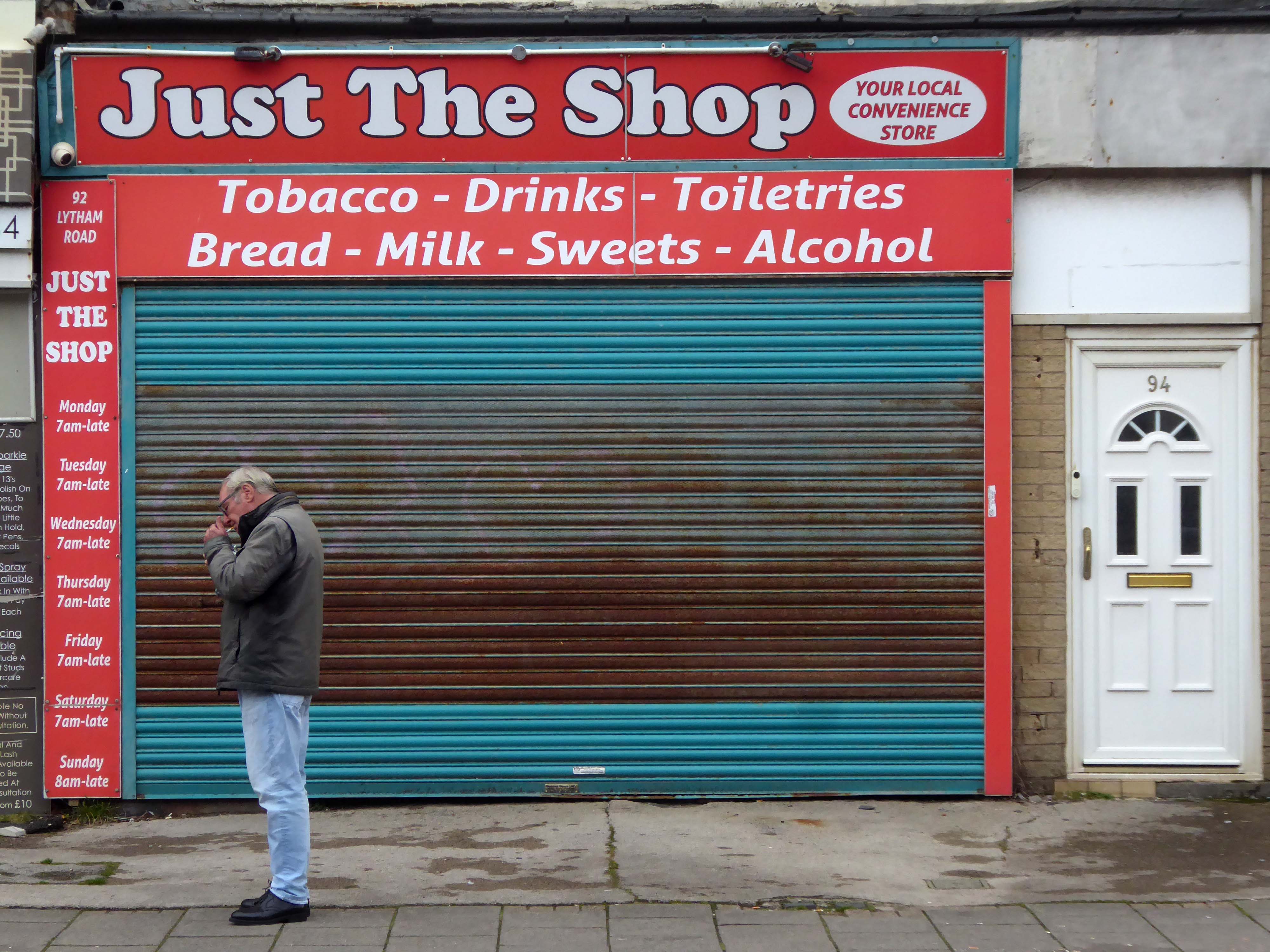
The town needs all the help it can get, time has not been too kind, whilst efforts have been made to invigorate the area around Blackpool North and the promenade, the back streets reflect the legacy of years of deprivation.
Blackpool ranks as one of the most deprived areas in the UK. Many people were already in poverty, and the cost of living pressures are having the biggest impact on this group, who need to spend a greater proportion of their incomes on household essentials. It is also affecting people on low and middle incomes, often surviving by having several jobs, who are being pushed into poverty. More people are turning to services for support, and as the winter progresses this is a serious concern.
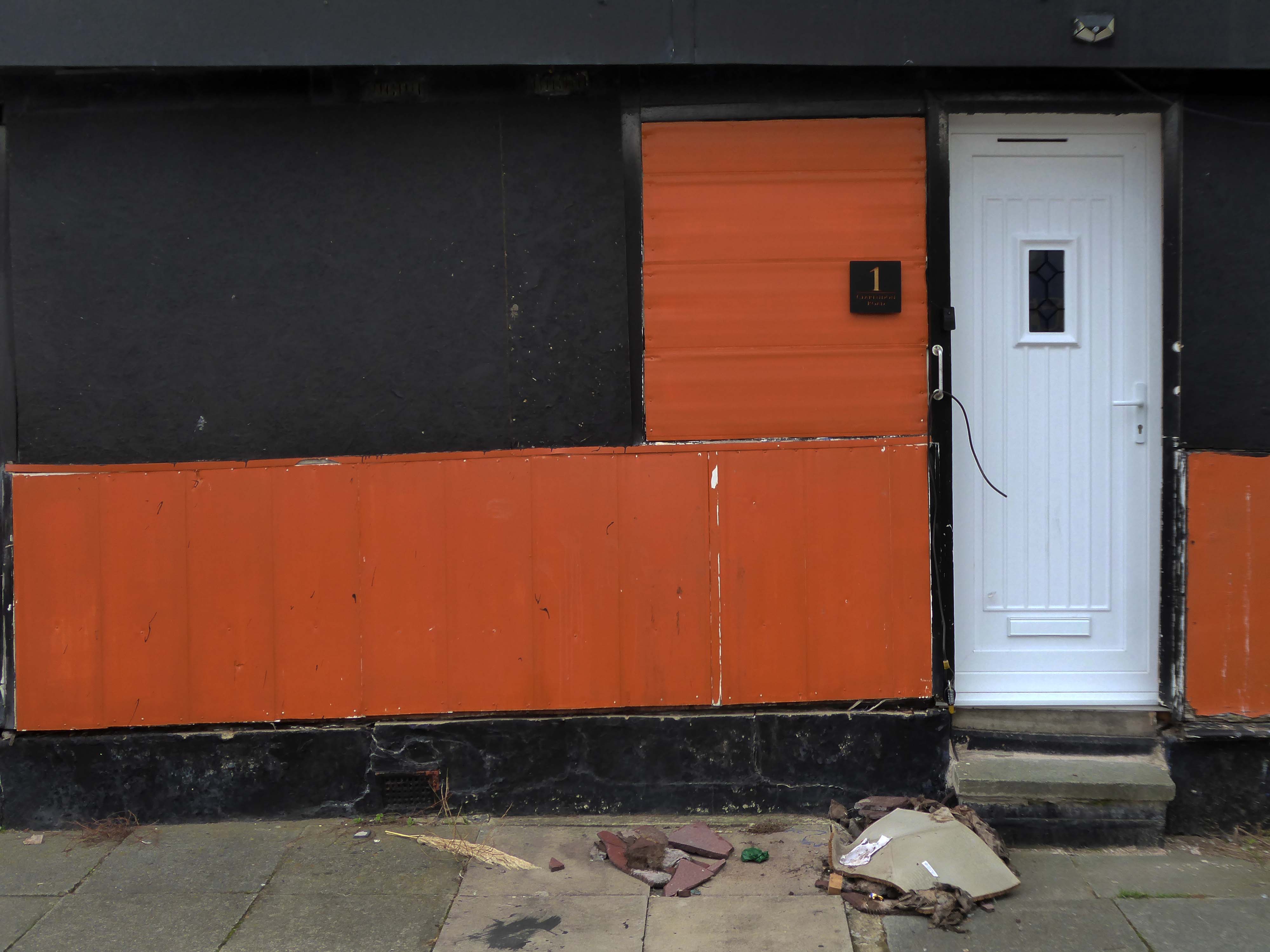
I have no wish to poor scorn on the area – but a short walk around the streets approximate to the coast tells a tale of failed businesses, decay and decline.
Happily there are the seeds of recovery in evidence, in the form of newly built housing.
The executive report outlines an area of regeneration to the South of the town centre. It lies broadly between Chapel Street and Rigby Road, and the Promenade and Central Drive. These have been identified as the initial areas of focus for detailed scheme development, community engagement and property acquisitions in preparation for future development.
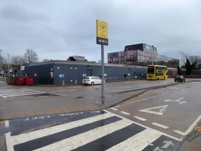
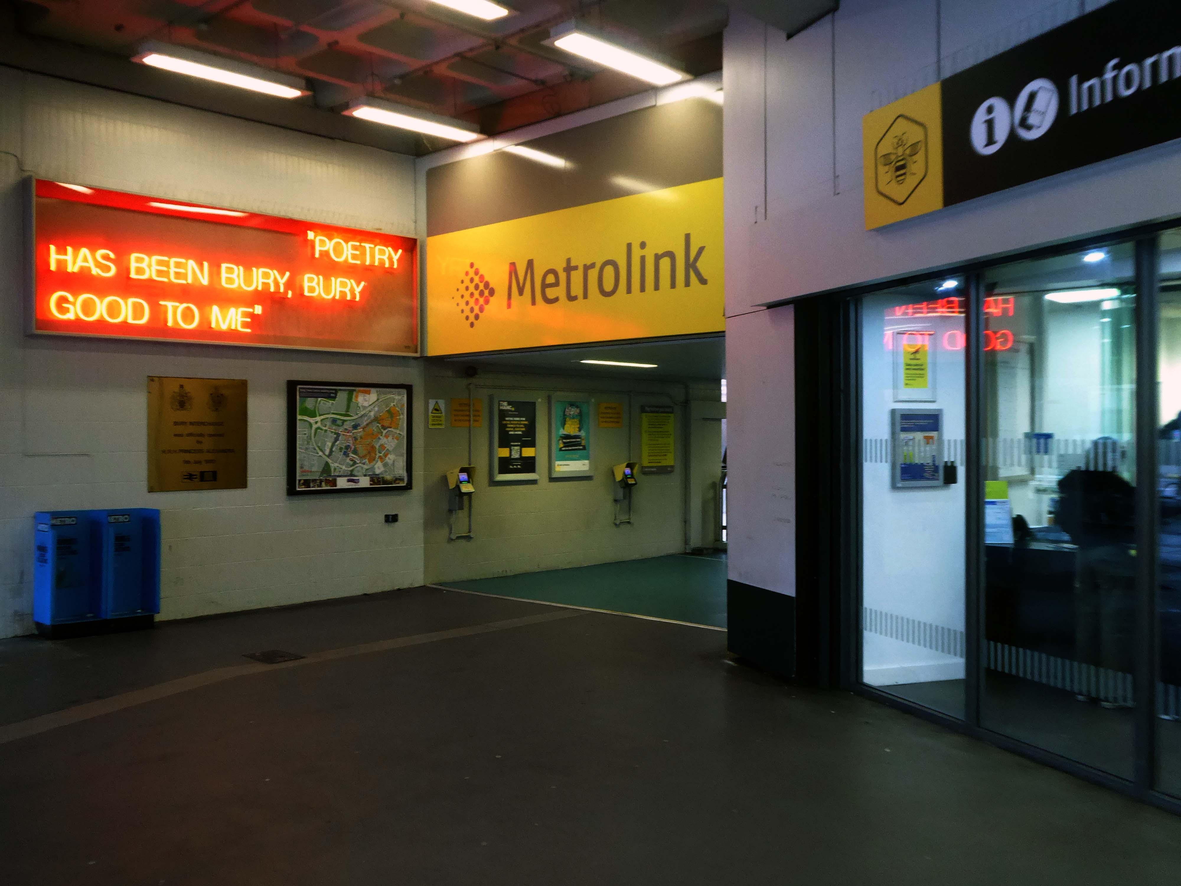
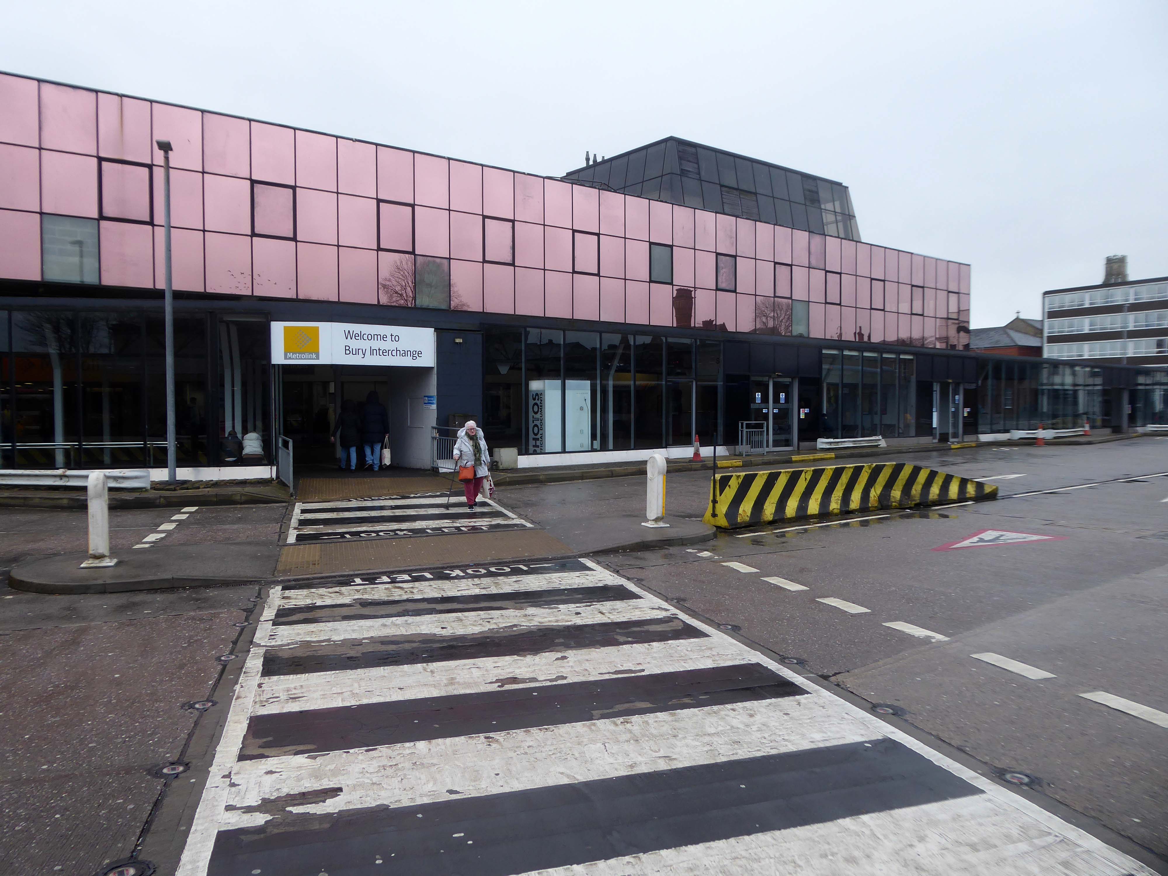
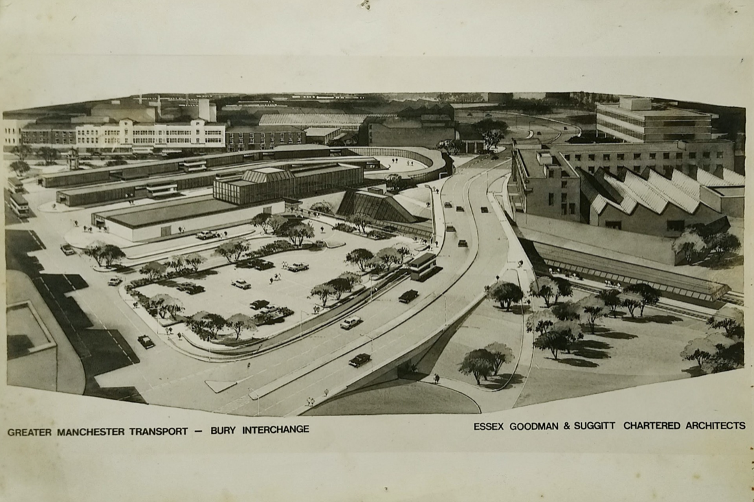
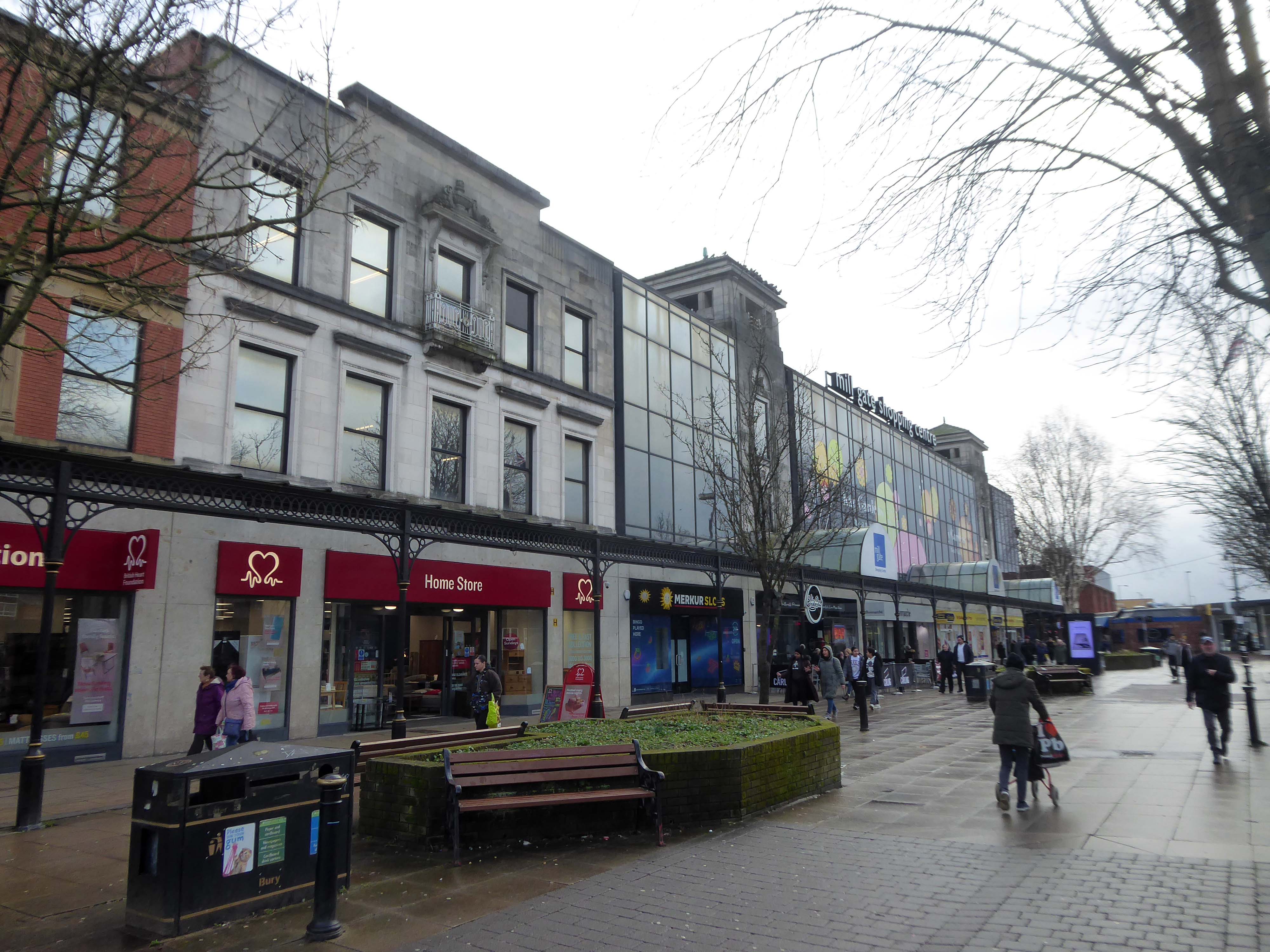
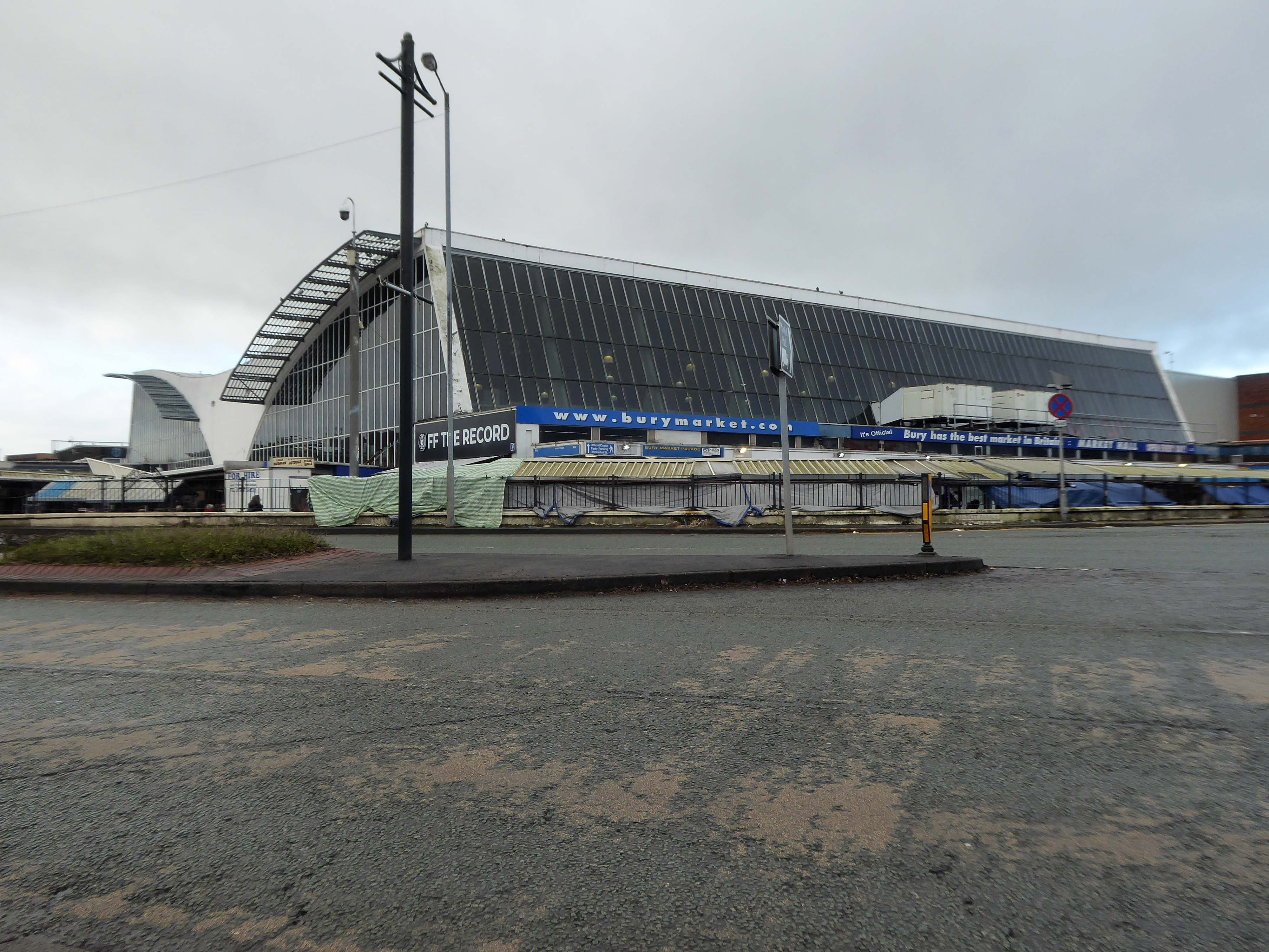
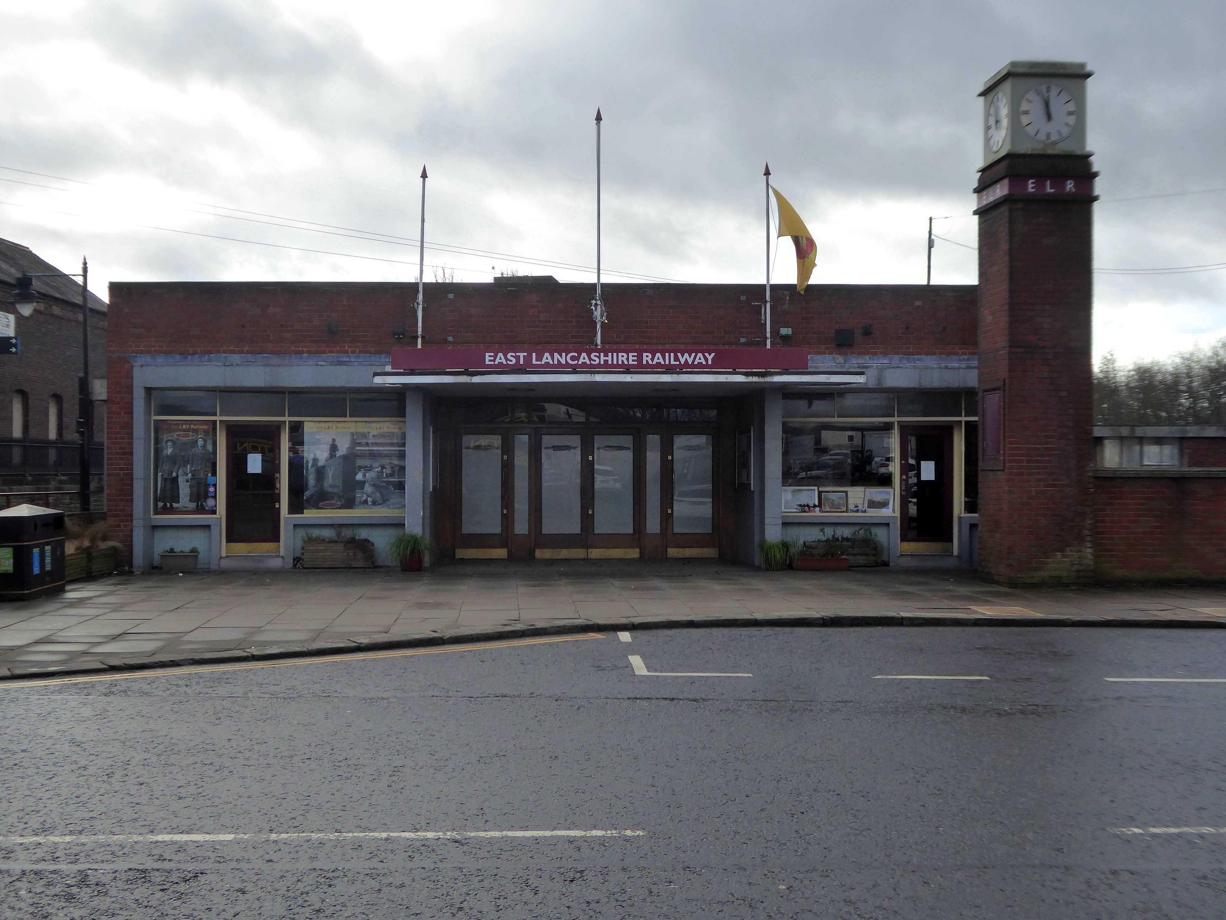
Arriving at and looking around the Interchange – 1980 architects: Essex Goodman & Suggitt
It is the northern terminus of the Manchester Metrolink’s Bury Line, which prior to 1992 was a heavy-rail line.
A new short spur line was constructed to connect the new station. The railway had originally run into Bury Bolton Street which was further away from the town centre, and was closed by British Rail on the same day that Bury Interchange opened.
It also incorporates a bus station.
Bury Interchange replaced the bus termini scattered around Bury town centre, notably around Kay Gardens.
An £80m transformation is coming to the Bury Interchange, which will see step-free access at the Metrolink, a “vertical circulation core” to better connect the Metrolink with the bus facility, and an integrated travel hub with spaces for cycle storage.
The work is much-needed, explained Transport for Greater Manchester’s Alan Lowe, he said that the interchange was built in the 1980s and very much is of its time.
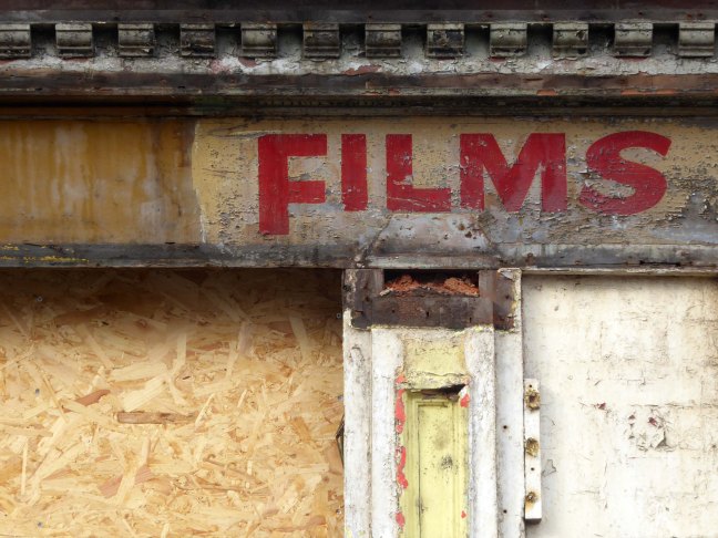
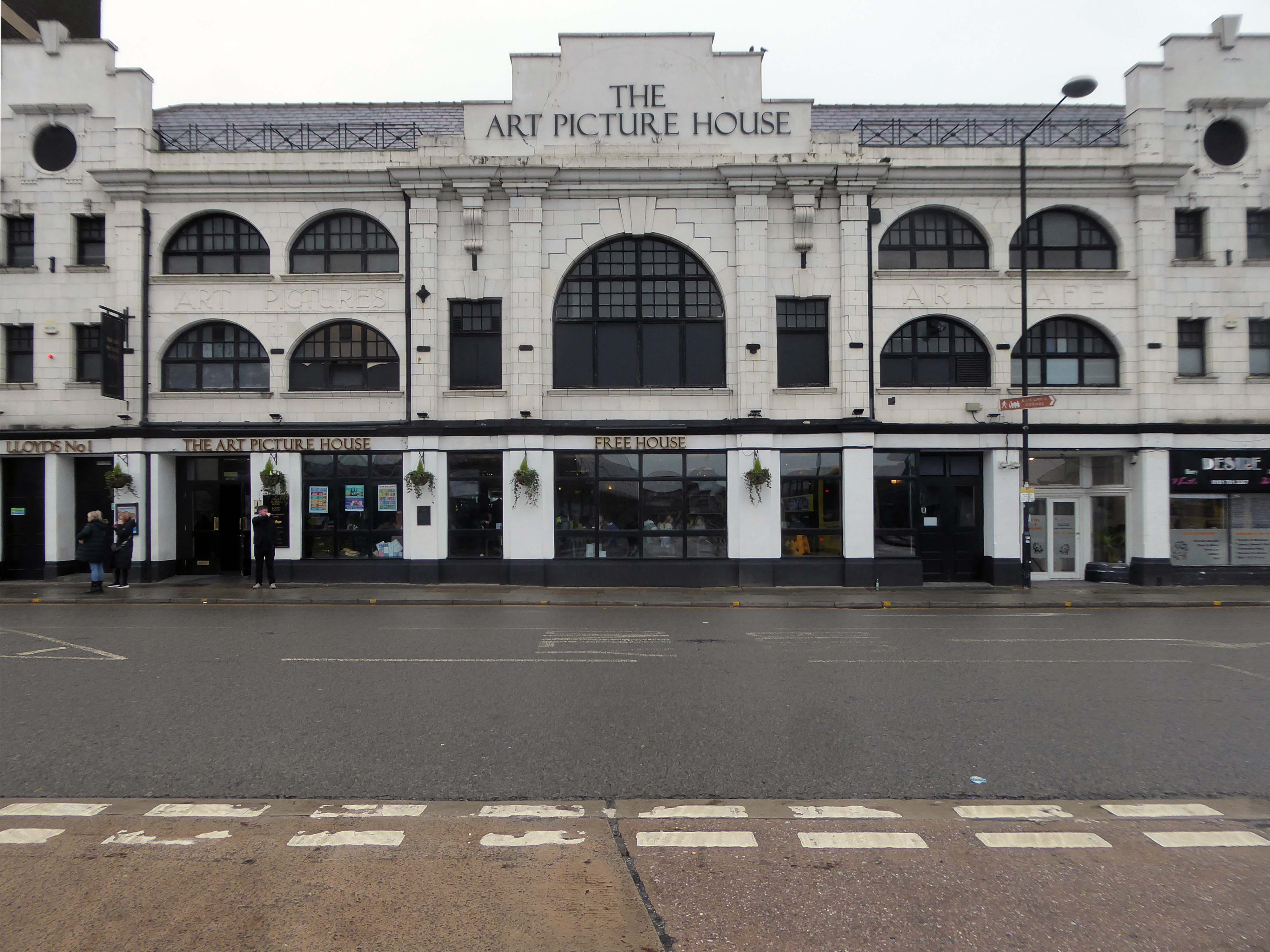
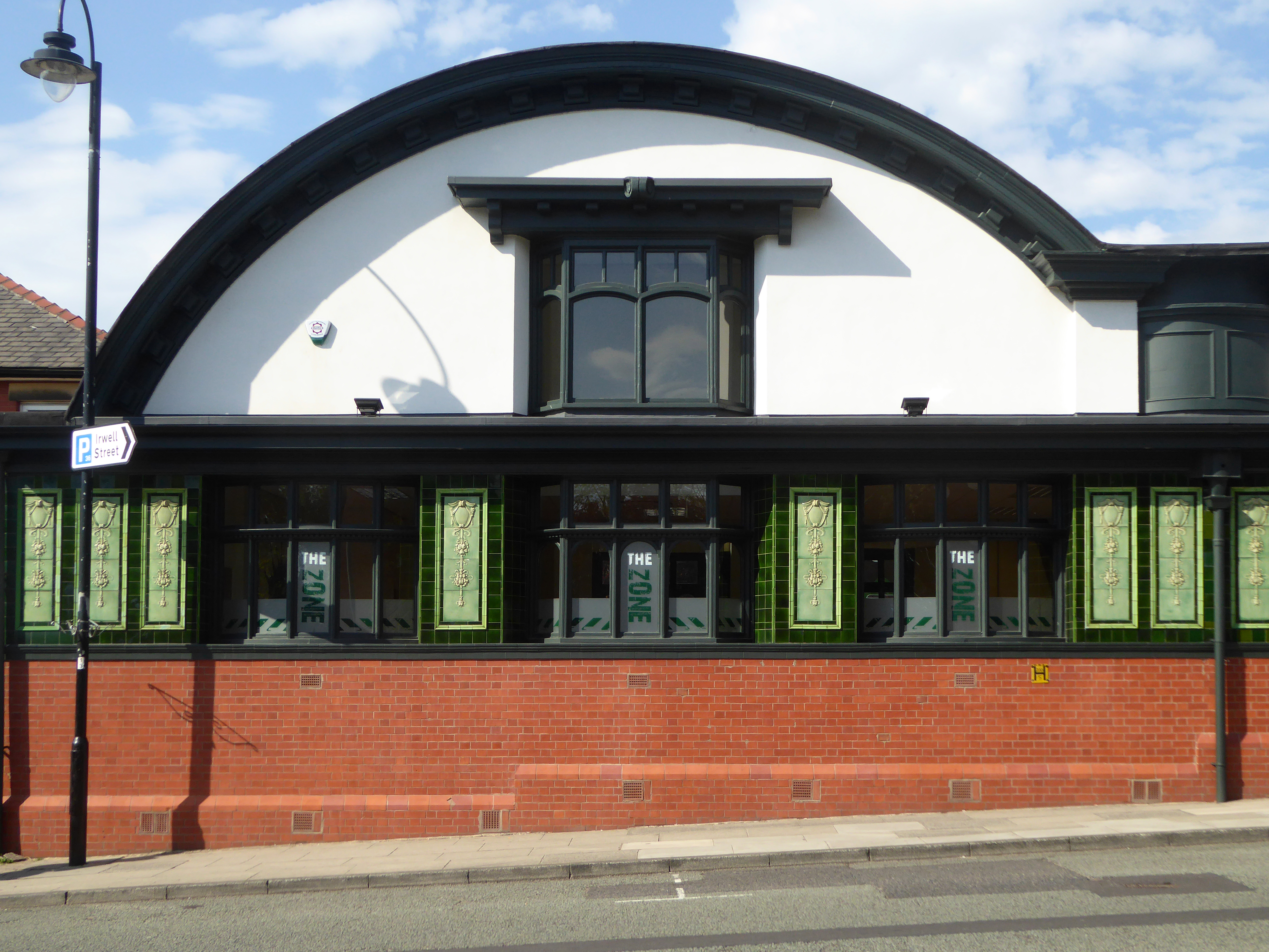
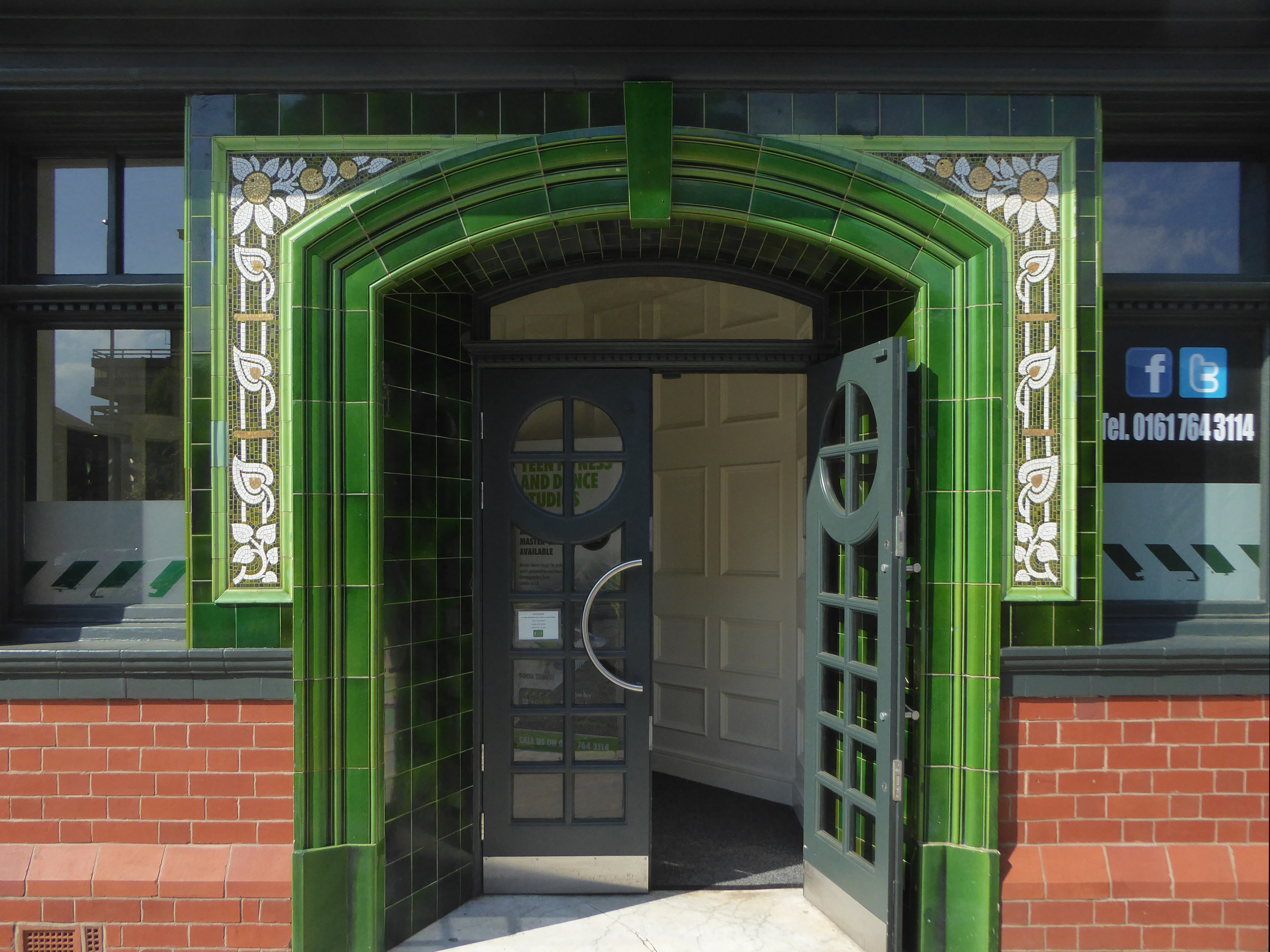
The Art Picture Palace was a 1923 rebuild of the earlier Art Picture Hall both designed by architect Albert Winstanley. The Art Picture Palace was opened on 26th January 1923. A remarkably complete survivor of a 1920’s cine-variety house executed in an elaborate style.
Films ceased in February 1965 and it became a bingo club. Later converted into a billiard hall until 19th May 1991 when it became a bingo club again, it later became a Chicago Rock Cafe.
Cinema Treasures
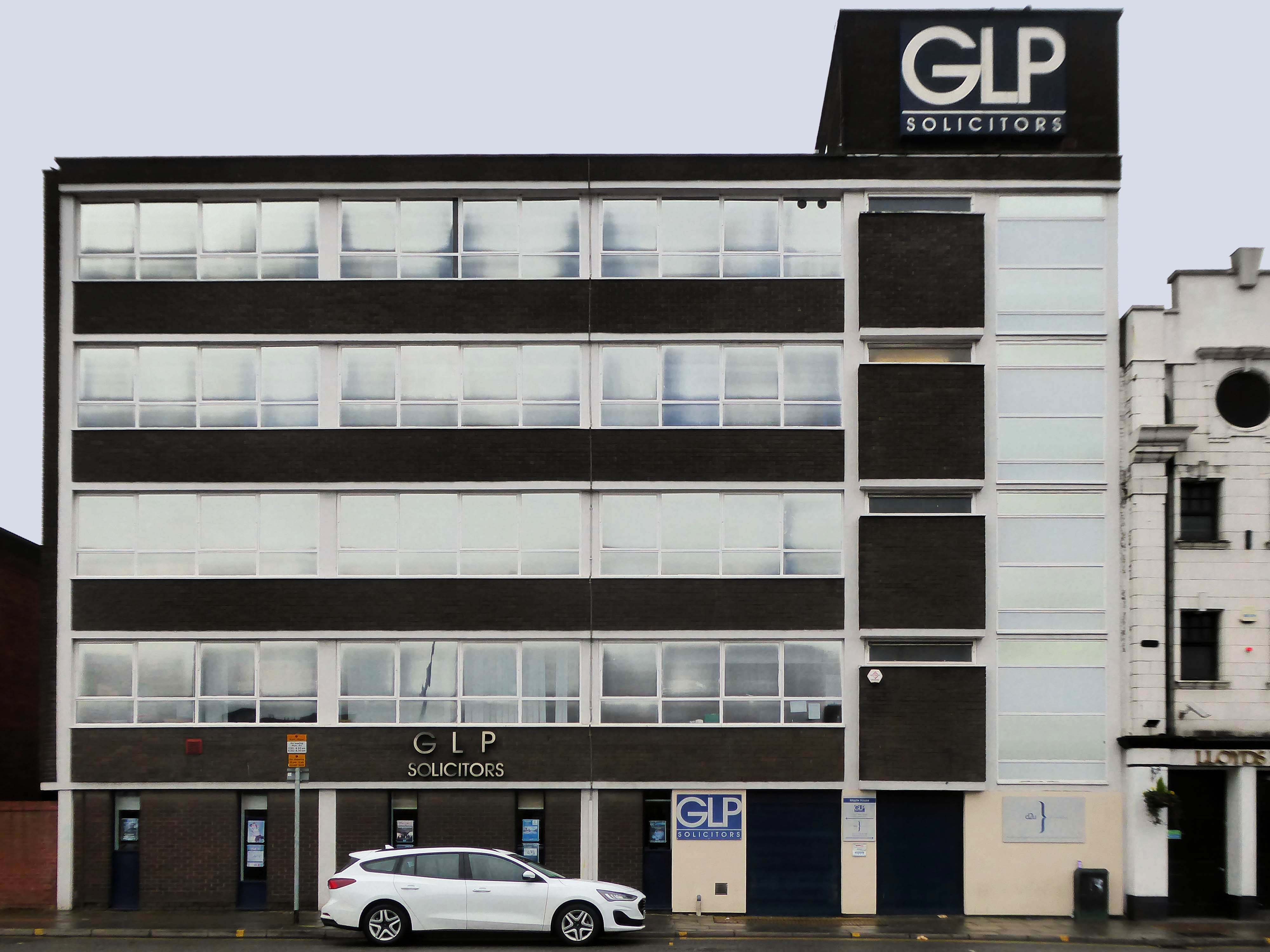
Next door a typical steel glass and brick banded office block Maple House.
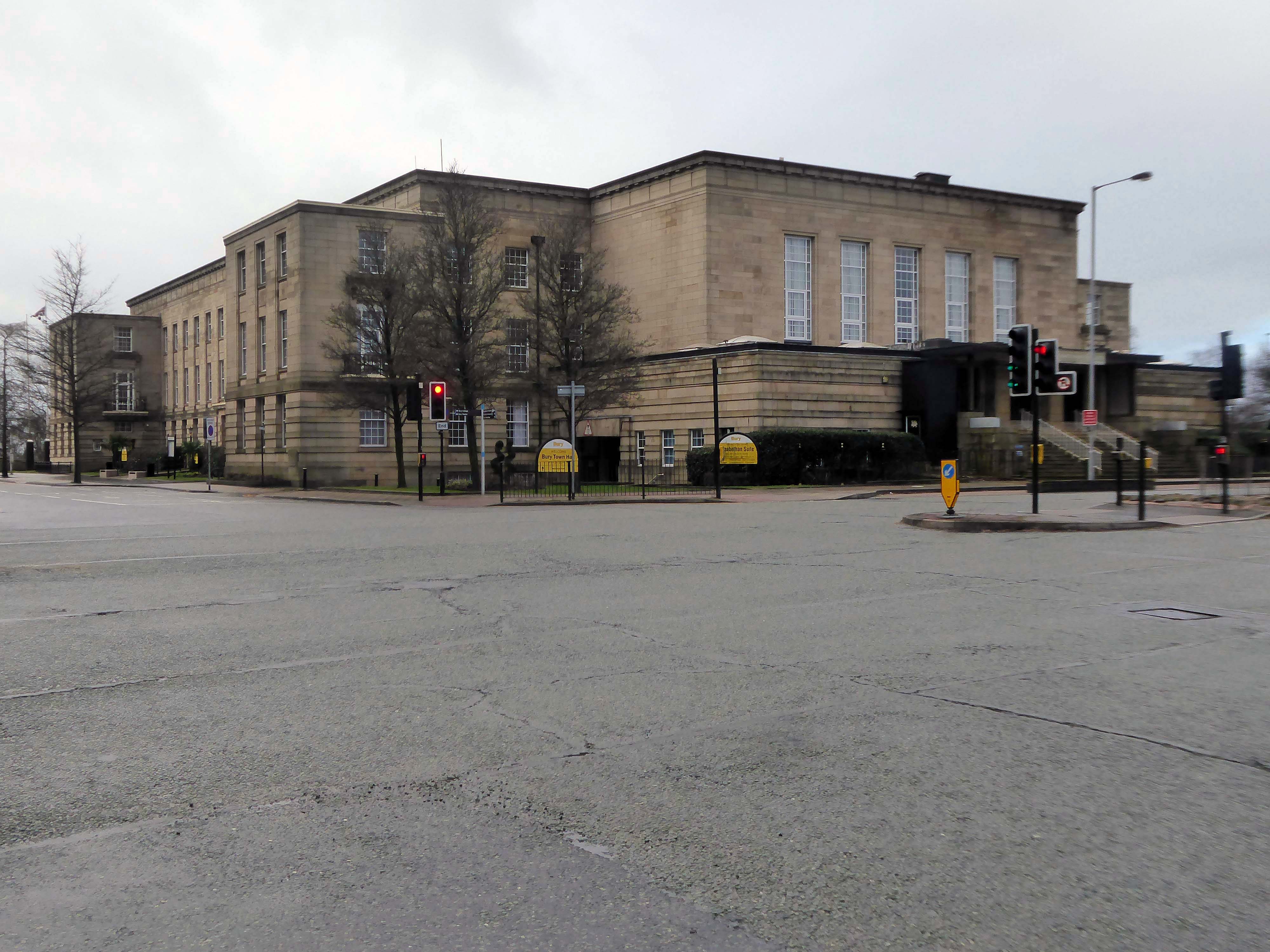
Around the corner and over the road to the Town Hall 1939-40 architects: Reginald Edmonds of Jackson & Edmonds then 1947-54.
Large and Dull – Niklaus Pevsner.
Back through the Interchange to the former Cooperative Store of the 1930’s.
The Portland Stone towers still visible – the elevation largely retro-clad in glass.
Passing through the Millgate Shopping Centre of the 1980’s.
Unambitious but successful, the floors cheerfully tiled – Niklaus Pevsner.
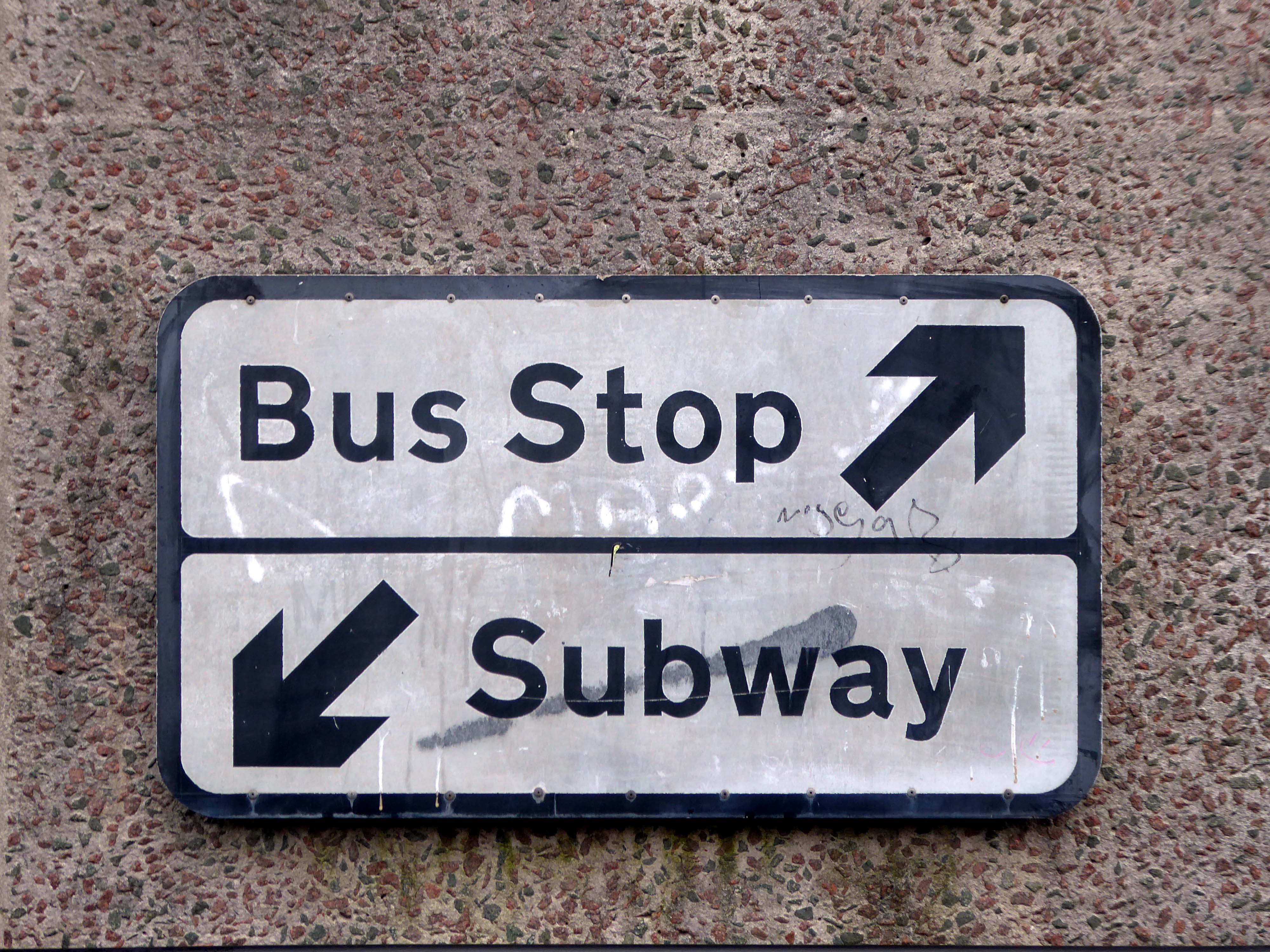
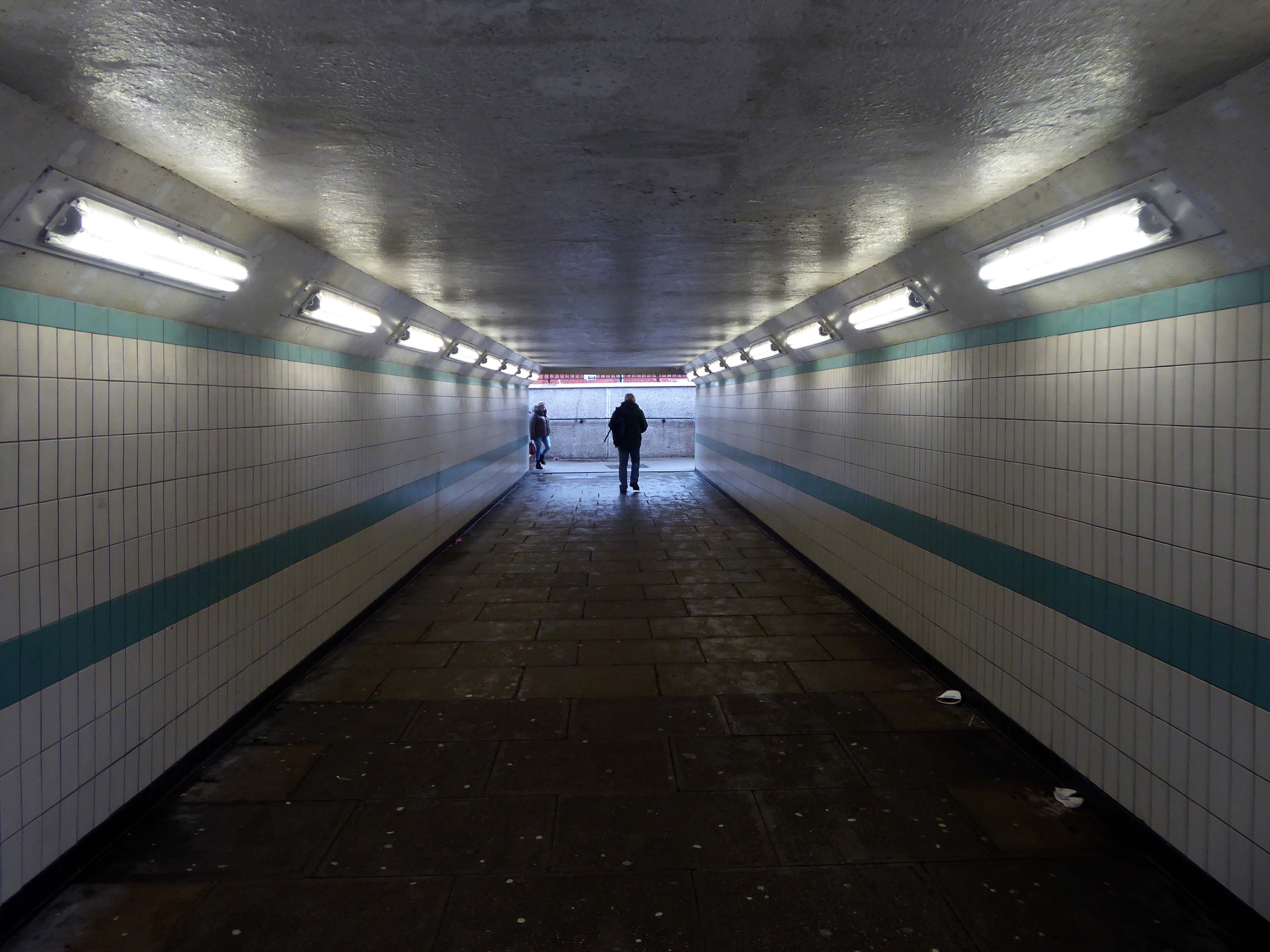
Down in the subway at midday.
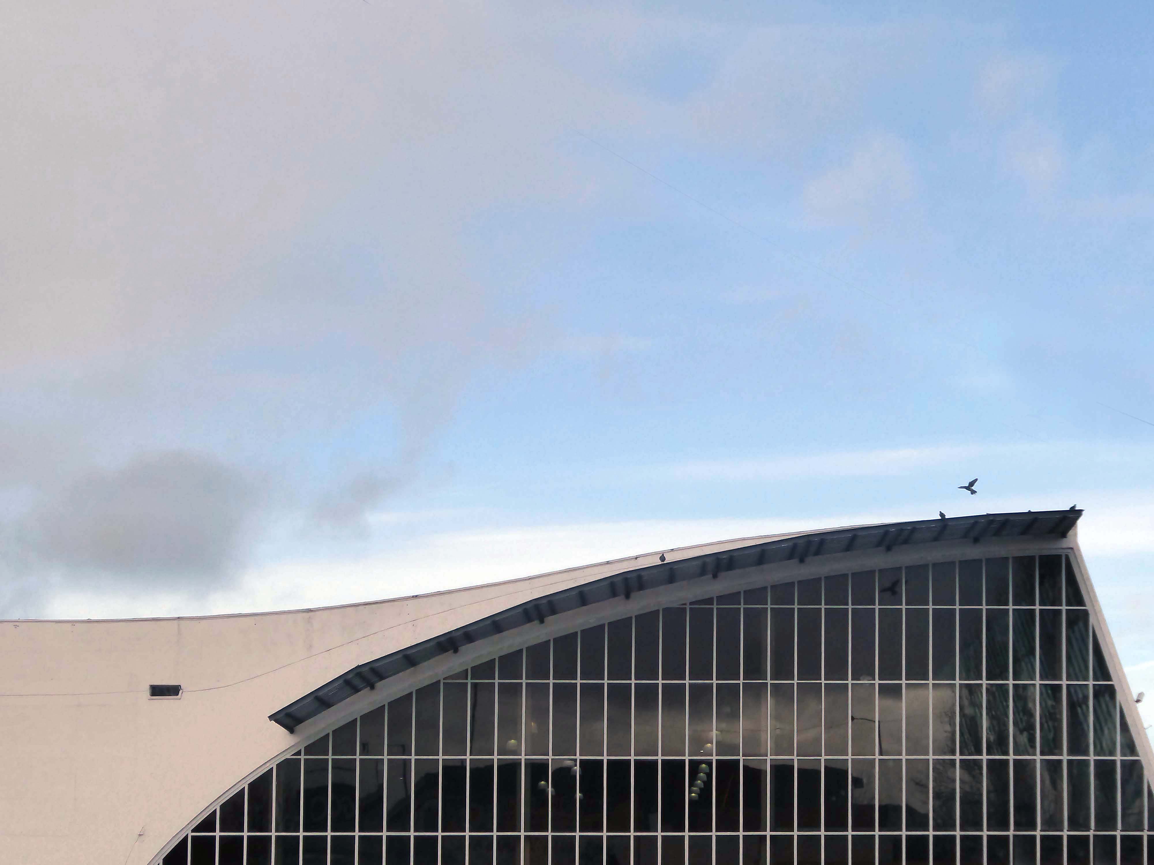
The better to get a view of the Market Hall 1971 – architects: Harry S Fairhurst.
The Indoor Market Hall is currently closed due to the discovery of Reinforced Autoclaved Aerated Concrete – within the building structure. RAAC is a lightweight type of building material that was used between the 1950s and 1990s.
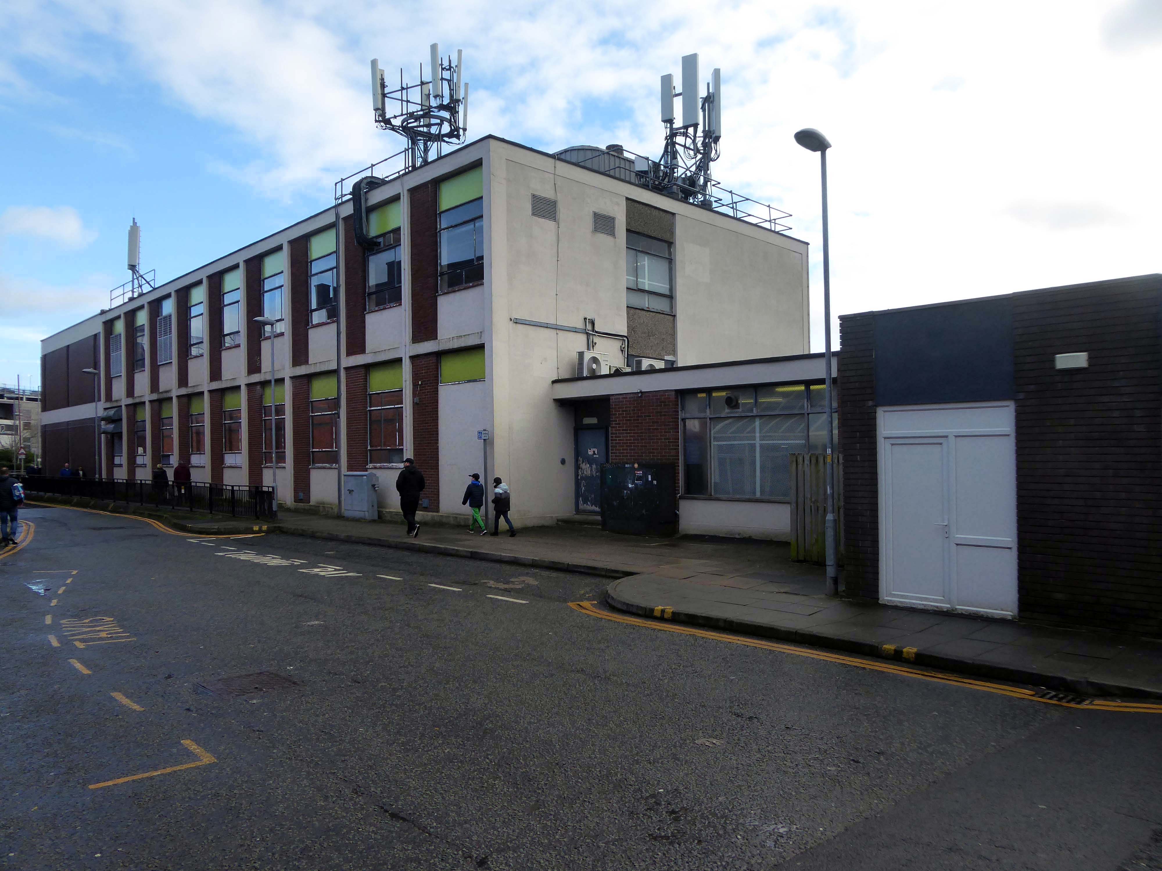
Back under the road – where we find a delightful Telephone Exchange.
The Rock is a vibrant retail and leisure centre which is home to a range of high street fashion brands, independent retailers, tantalising eateries and fantastic entertainment – it’s the perfect place to visit any day of the week.
It is the work of architects BDP – completed in 2010 at a cost of £350 million.
Our masterplan for The Rock took into account the historical street pattern and public realm context to give the scheme its own identity, and make visual connections to local landmarks.
The retail and leisure scheme brings many exciting brands to Bury for the first time.
New pedestrian streets rejuvenate and improve connections to adjacent areas stitching the town back together.
The development will also contain 408 one and two-bedroom apartments.
Back to basics at a former Burton’s hiding its faience facade.
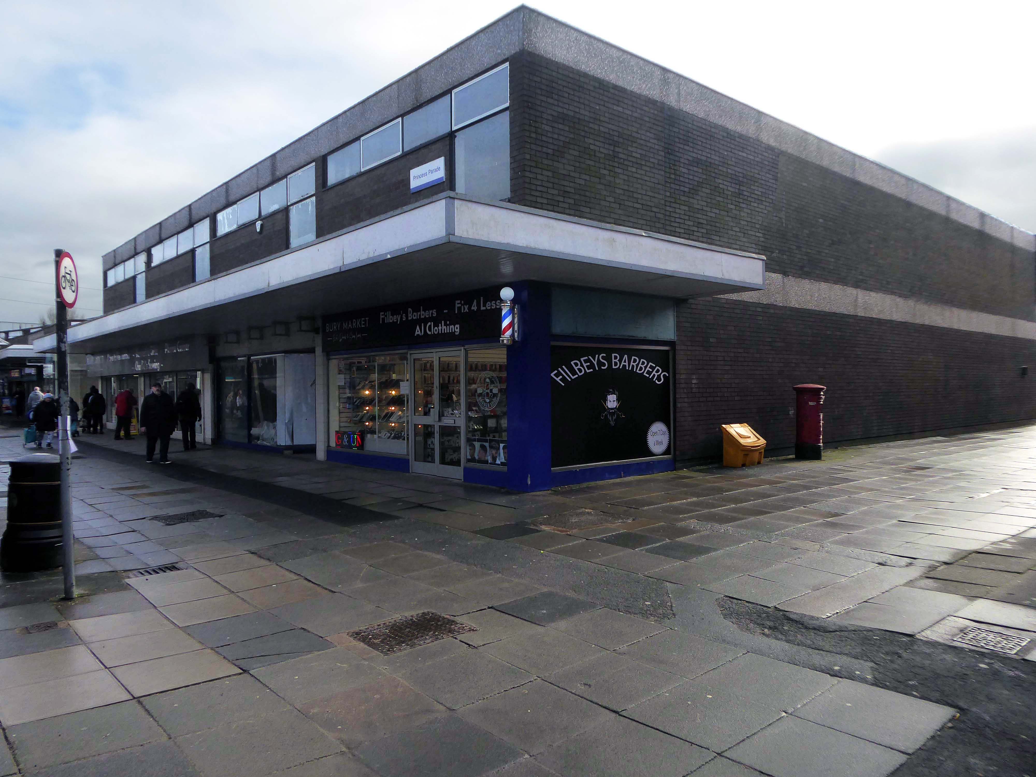
Typical inter-war infill on our crazy mixed up mongrel high streets.
Ribblesdale House
Application by Shop and Store Developments Ltd submitted August 1965. Architect on application was Samuel Jackson and Son of Ocean Chambers in Bradford but during the application process this changed to John Brunton & Partners – Brunton was a partner in Jackson’s firm, at the same address. It had a restaurant and shops on the first floor.
The street level buildings were destroyed by fire on 14 May 1947 and were replaced with a new brick and concrete entrance and footbridge in 1952.
British Rail closed the station on 17 March 1980, when it was replaced by a new bus/rail interchange station further east into the town centre. Bury Interchange railway station served up until 1991 before the entire Bury Line was converted to light rail operation. It reopened in 1992 for Metrolink operation.
Bury was once the centre of multiple train links and the lost station of Knowsley Street.
Over the road the former Temperance Billiard Hall 1910 architect Norman Evans.
Planning application January 1965 – work started in June 1965. The architectural firm was Richard Byrom, Hill and partners. Richard Byrom was submitting building applications in the 1930s in Bury and locally.
The rendering on the building is original but the windows have been changed. The Job Centre took over the building in 1993. It is in a conservation area and the Civic Trust had some concerns!
Many thanks to David French for the above information.
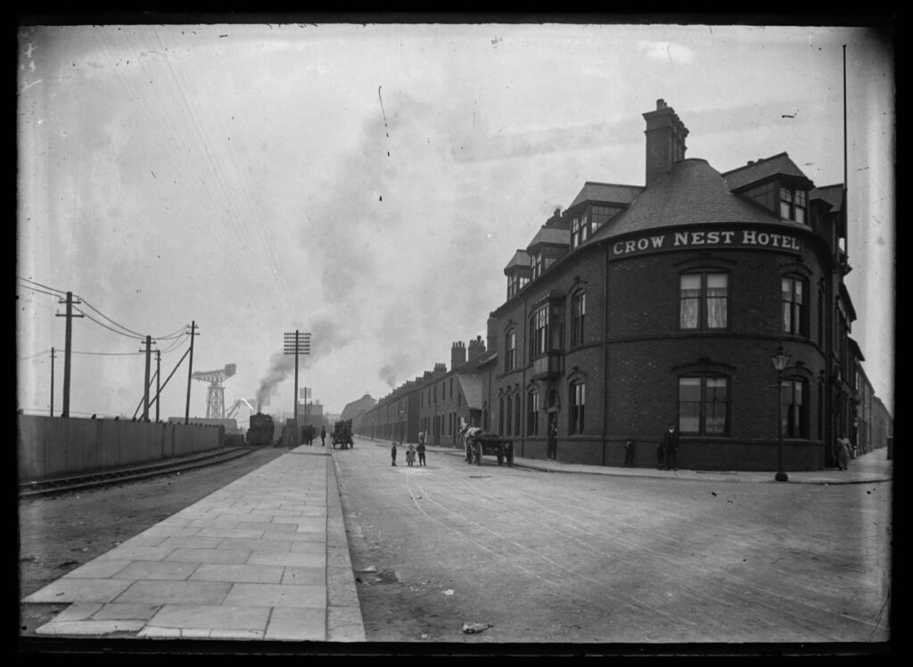
Far, far away from the mad, rushing crowd, Please carry me with you. Again I would wander where memories enfold me, There on the beautiful Island of Dreams.
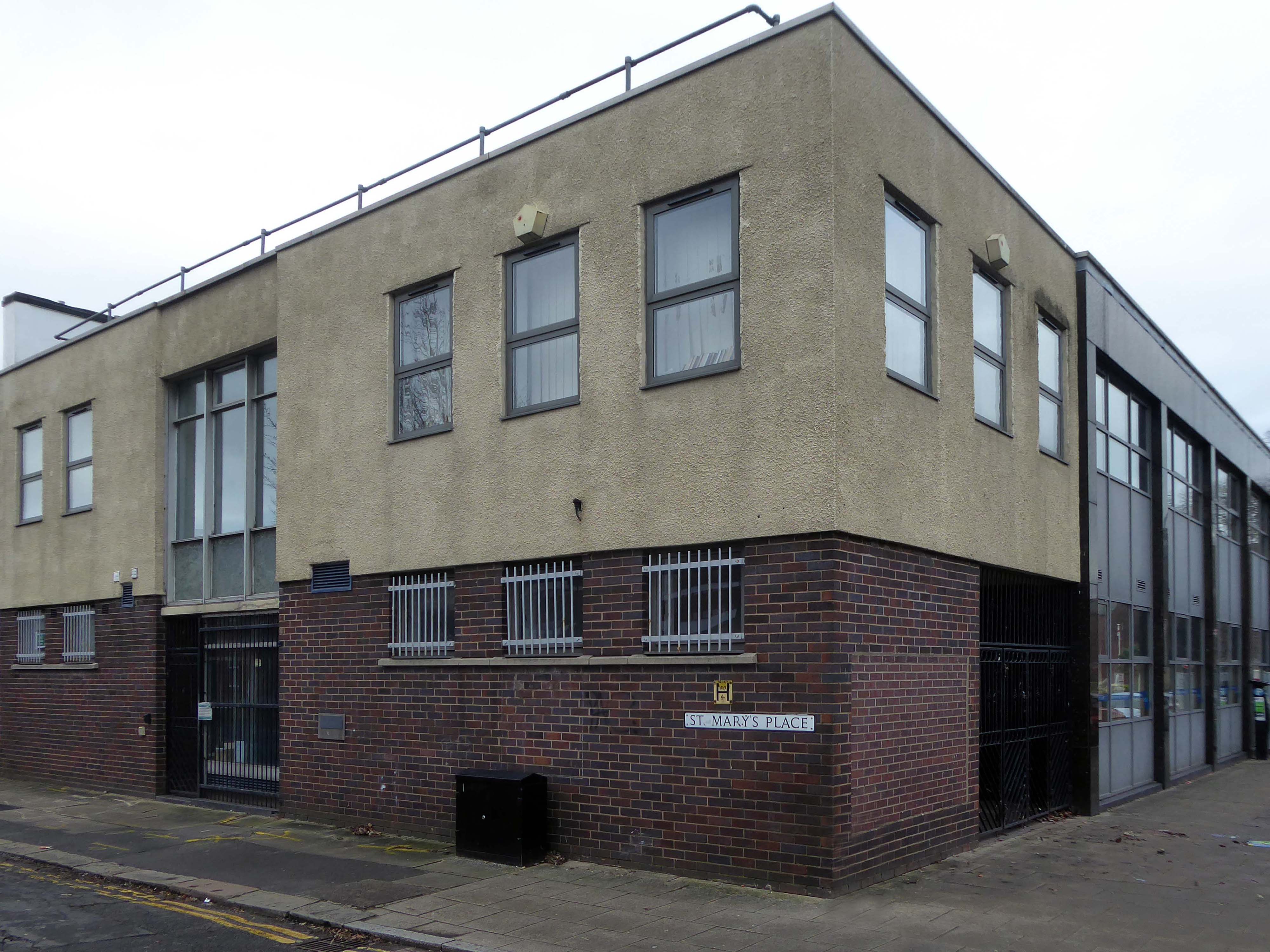
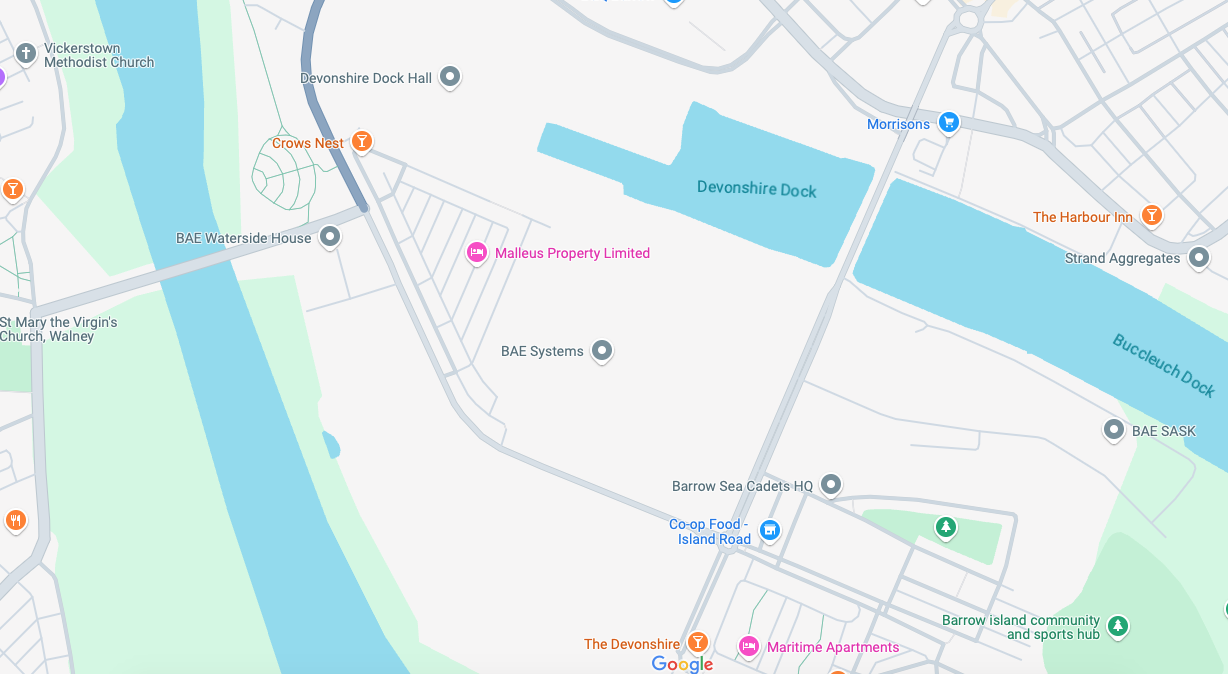
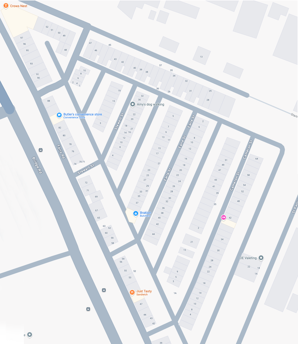
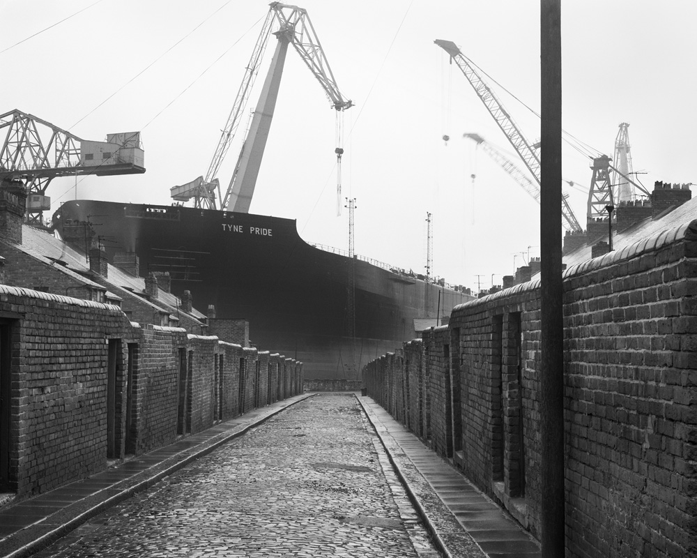
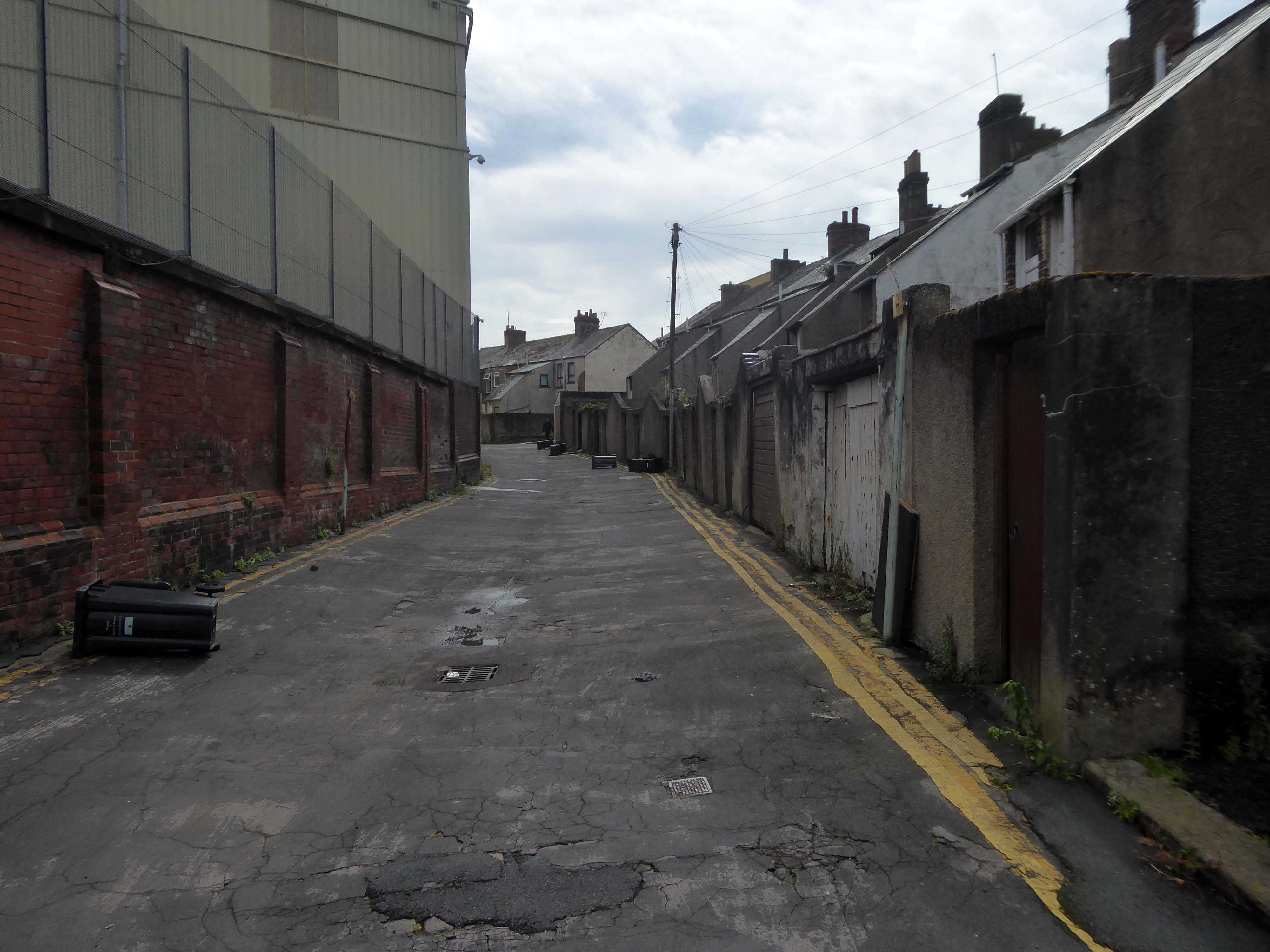
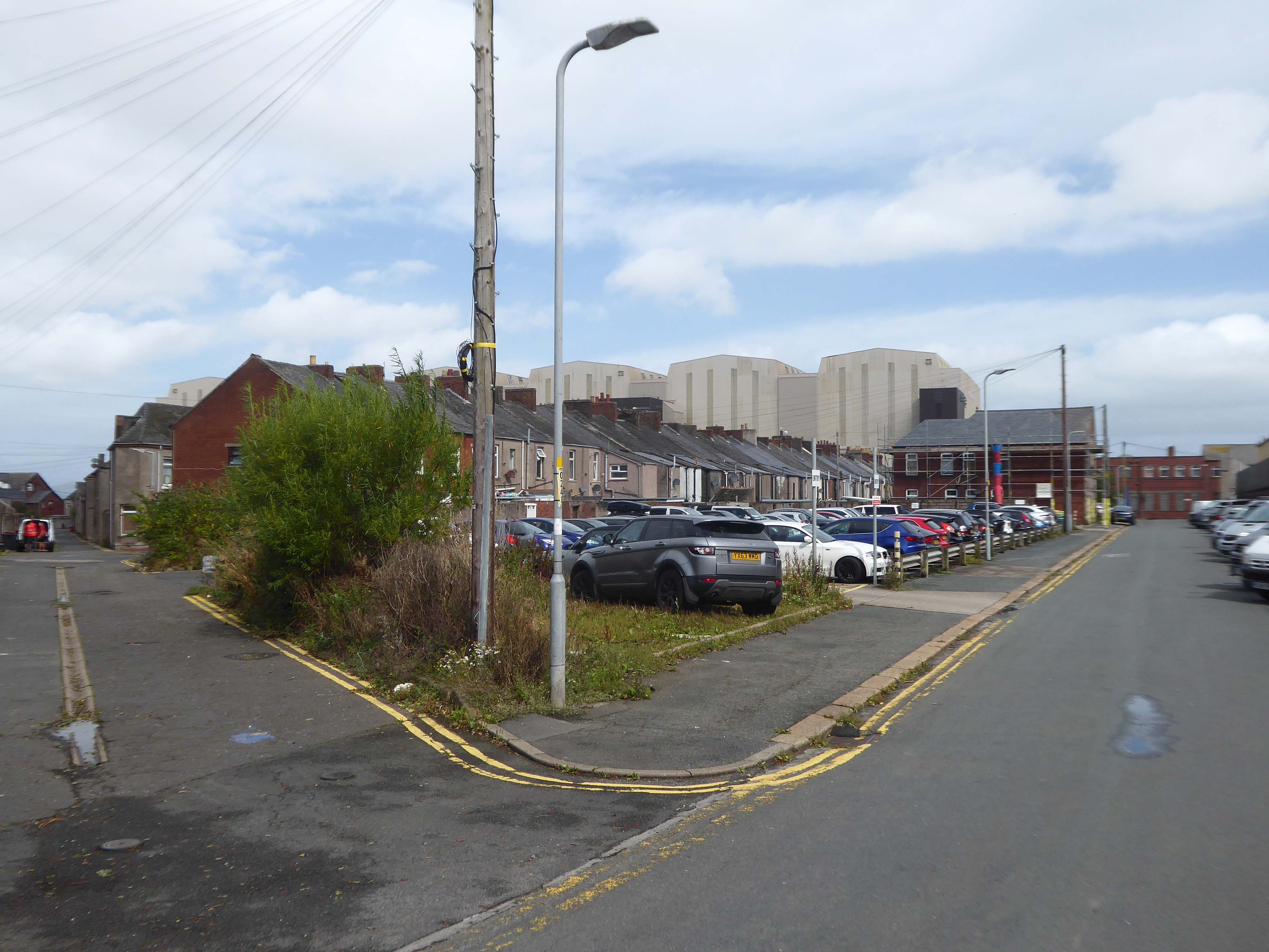
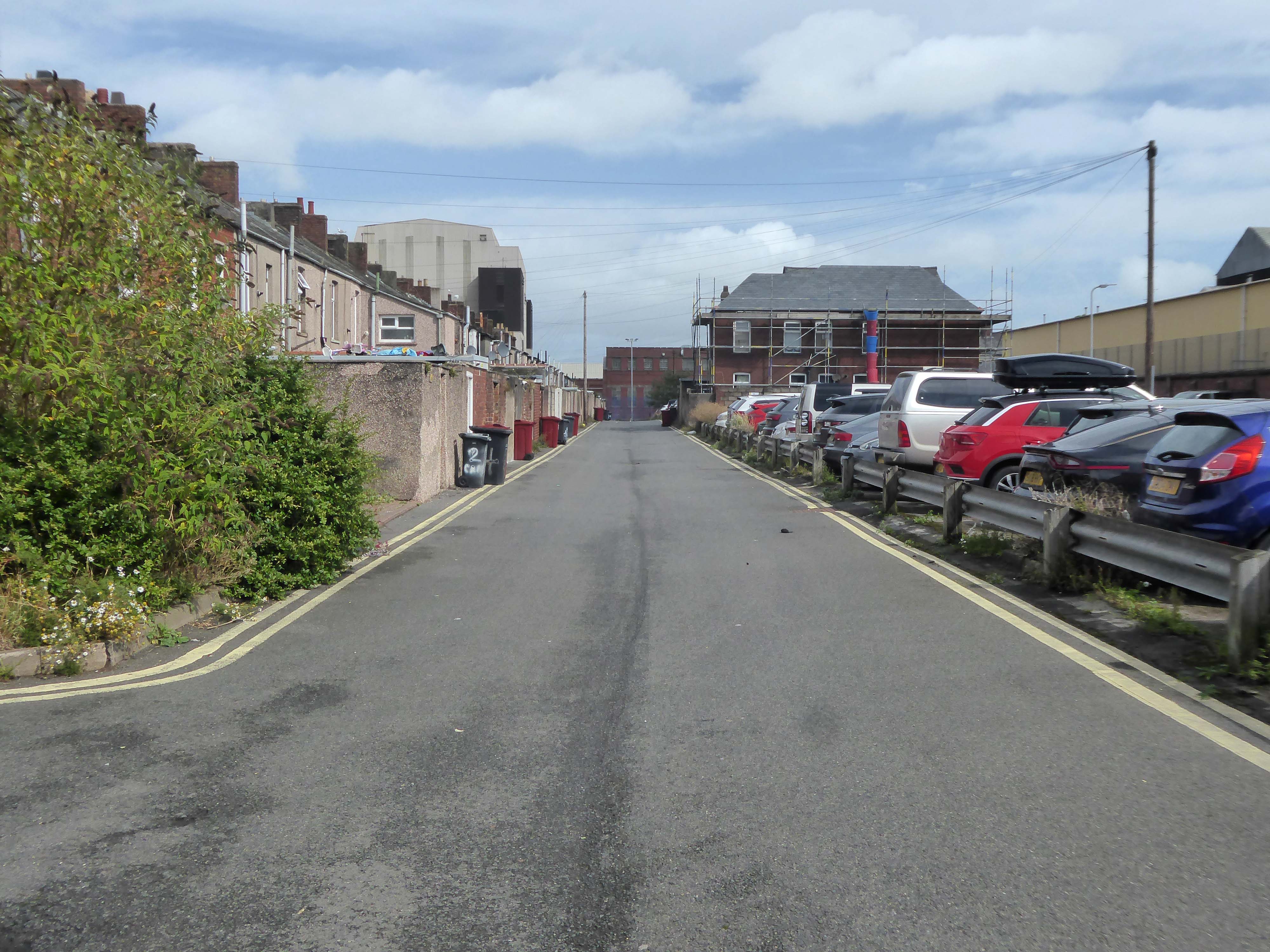
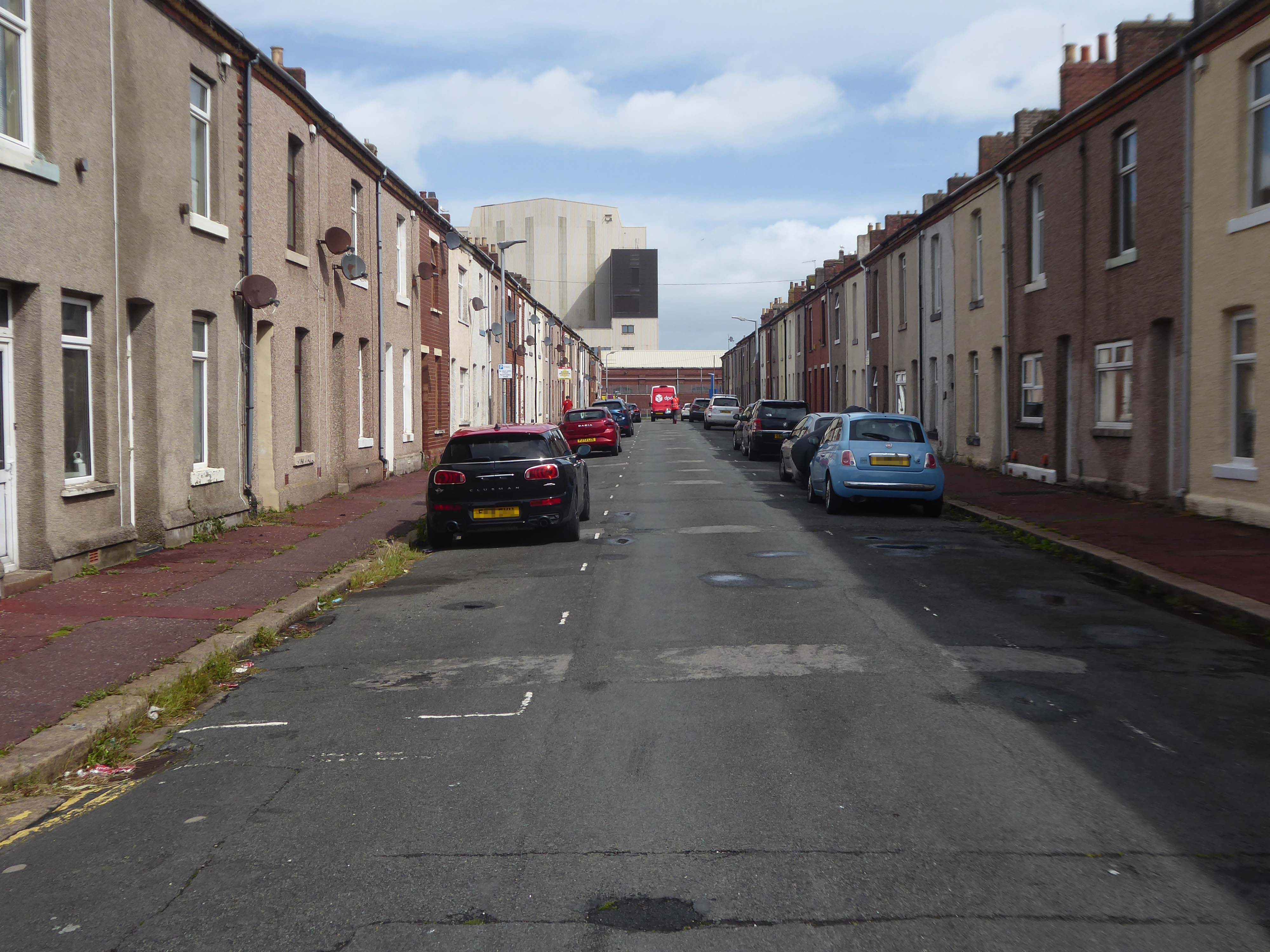
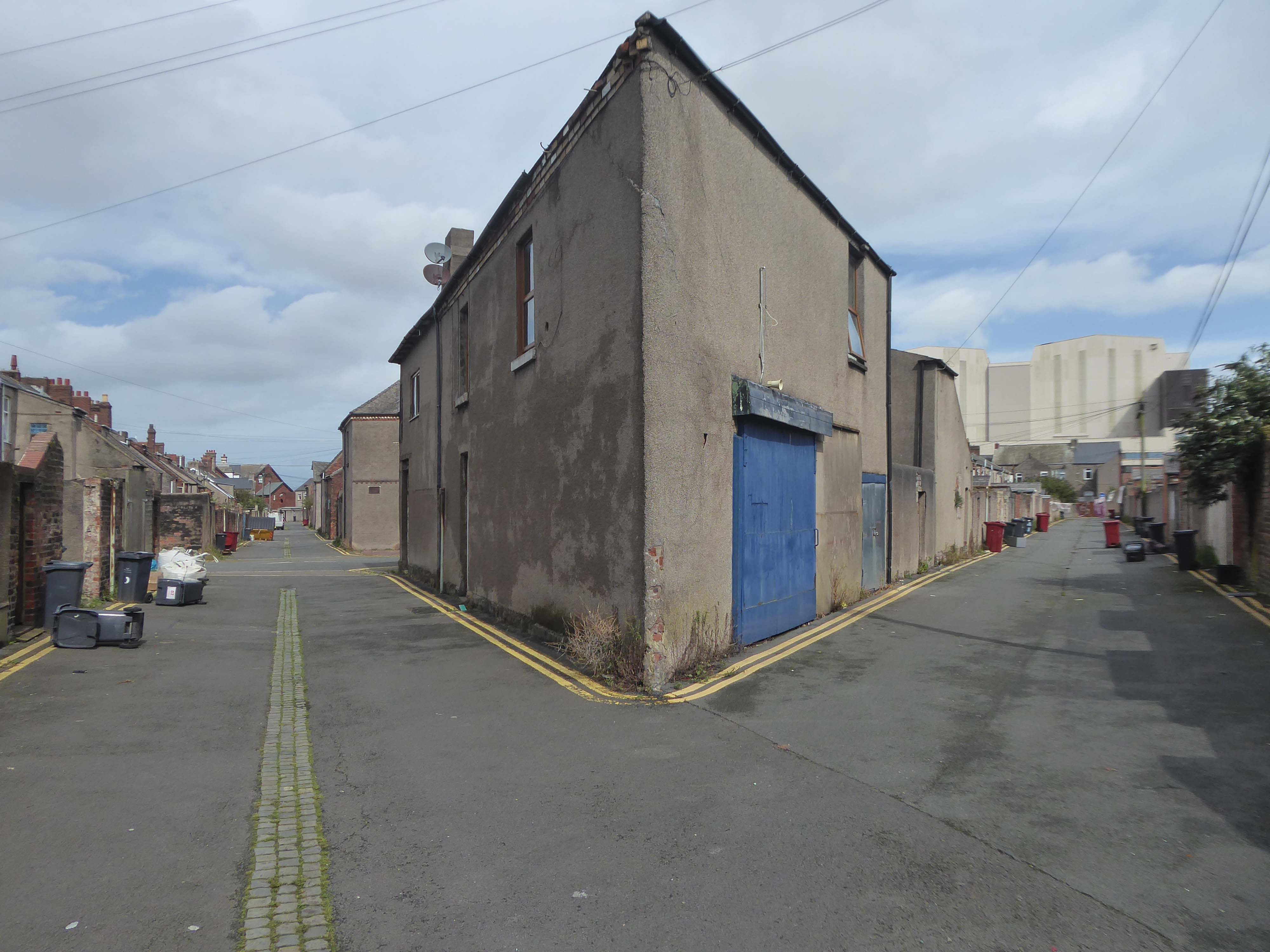
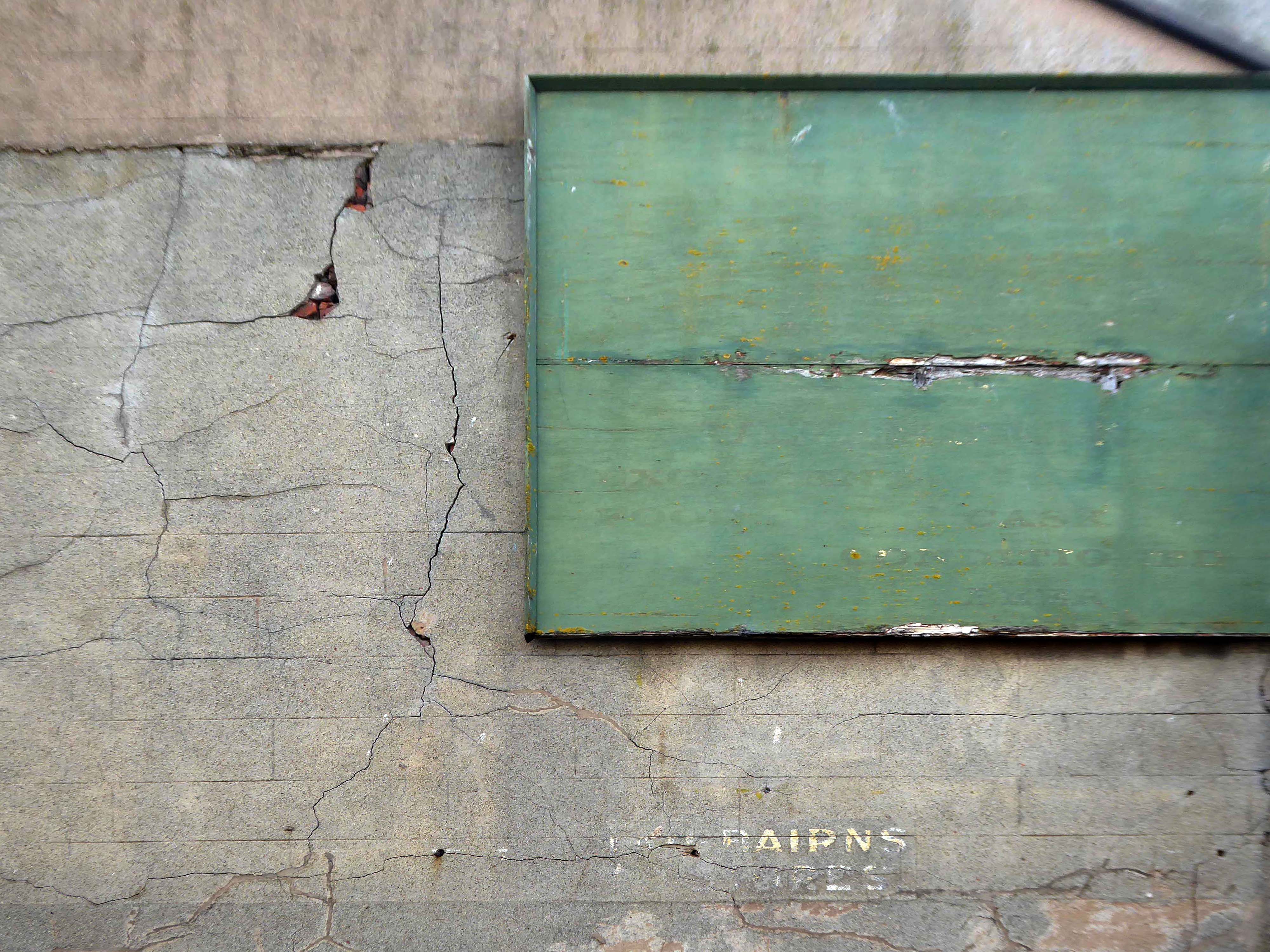
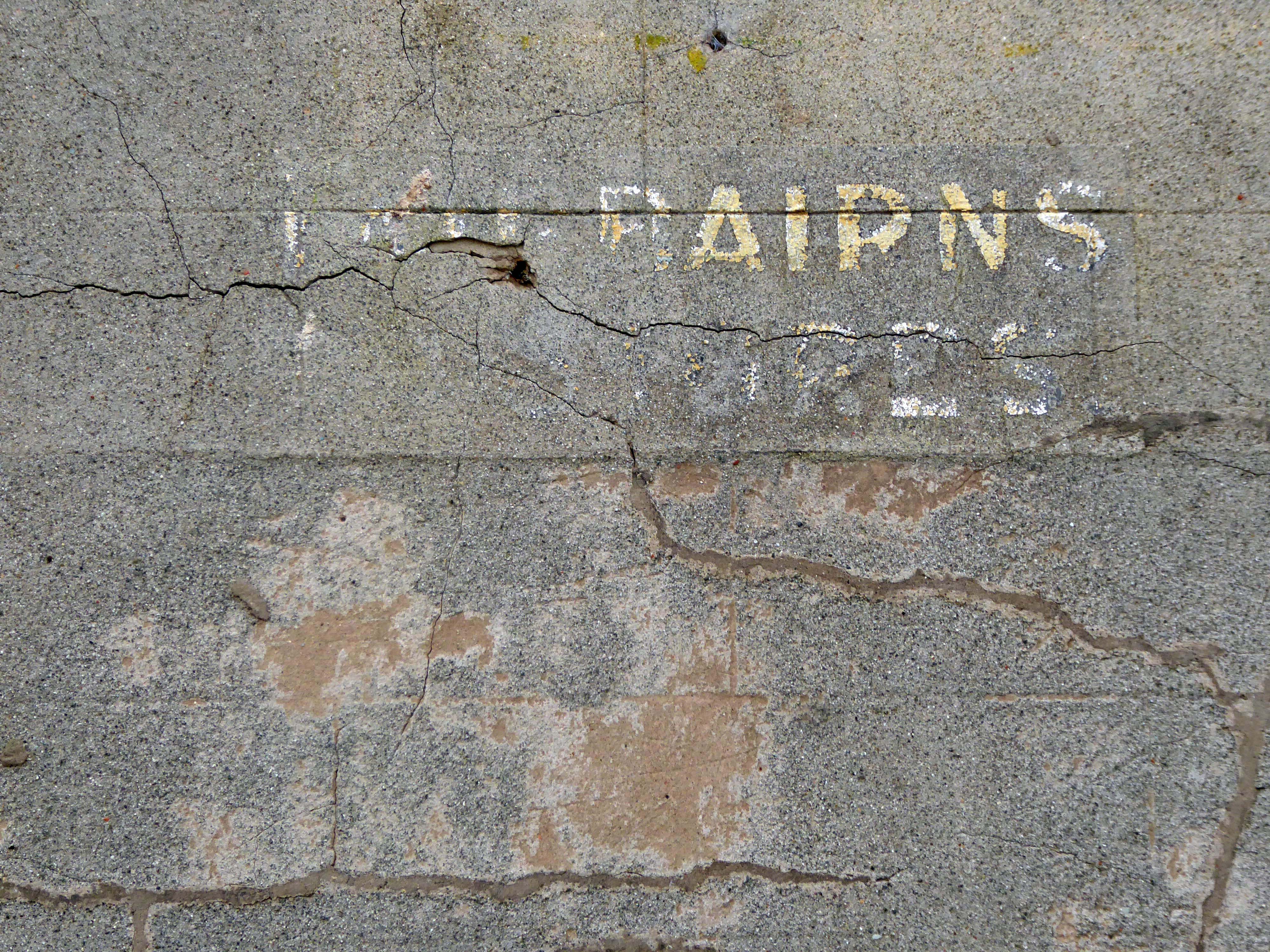
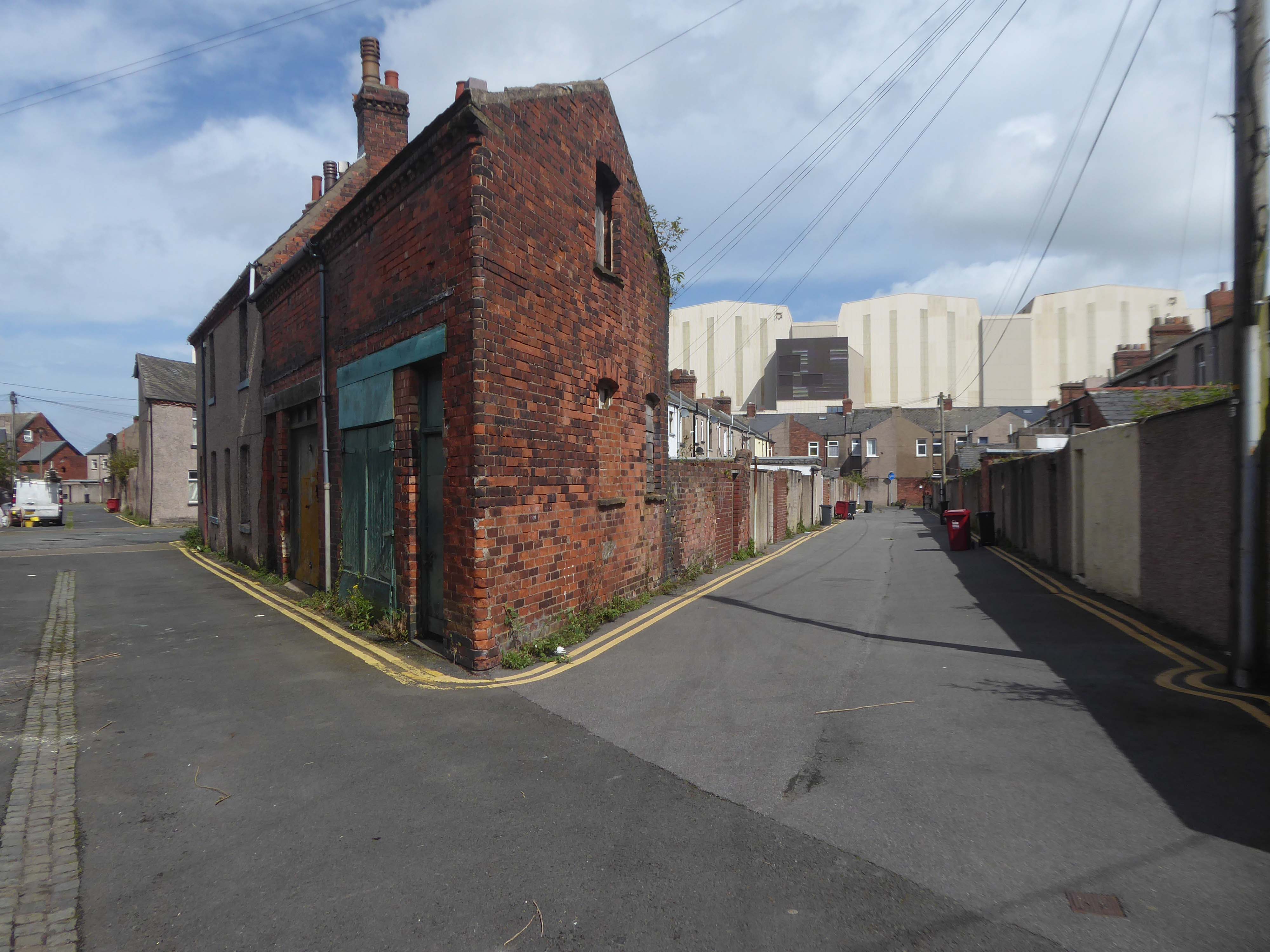
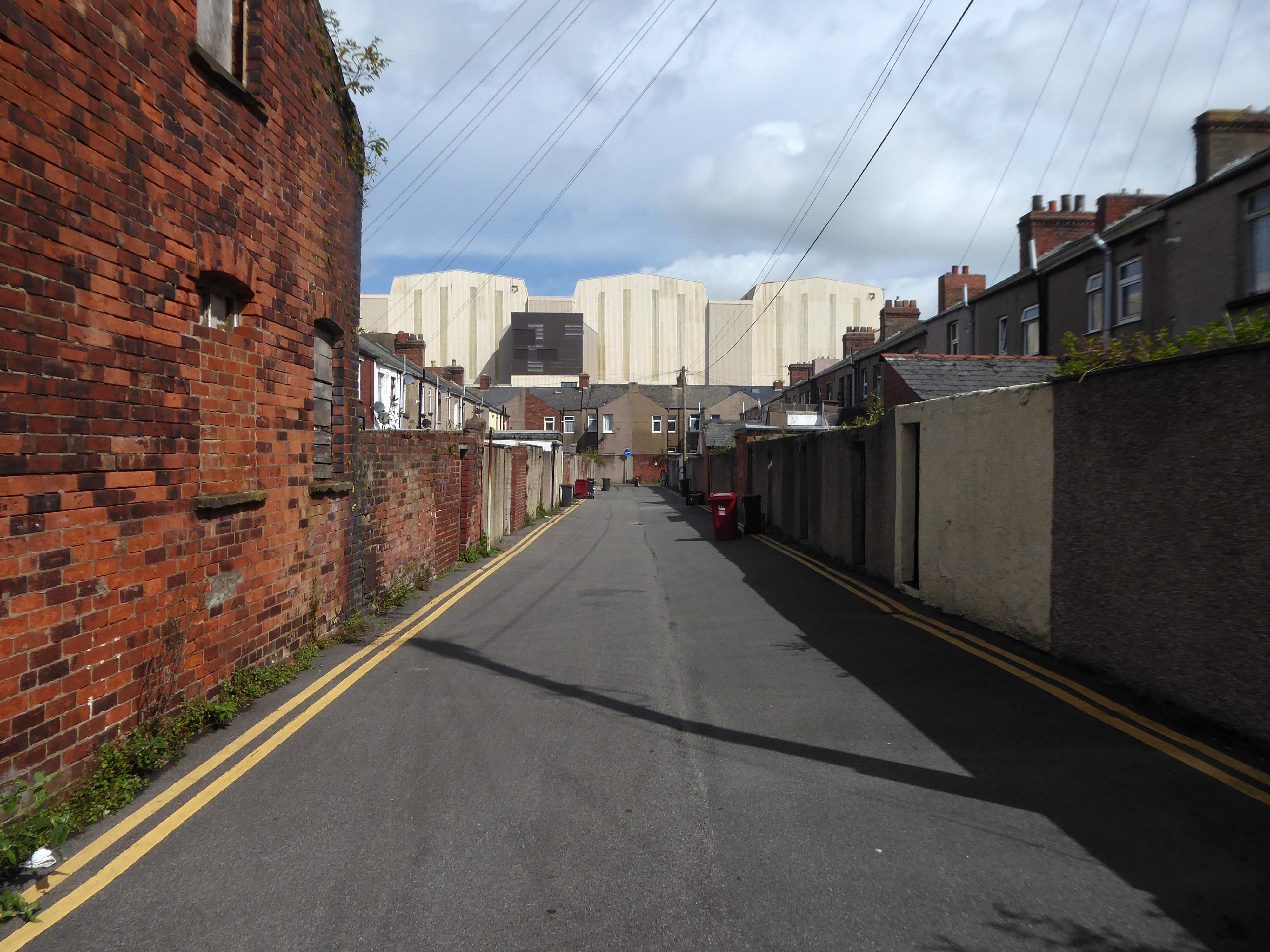
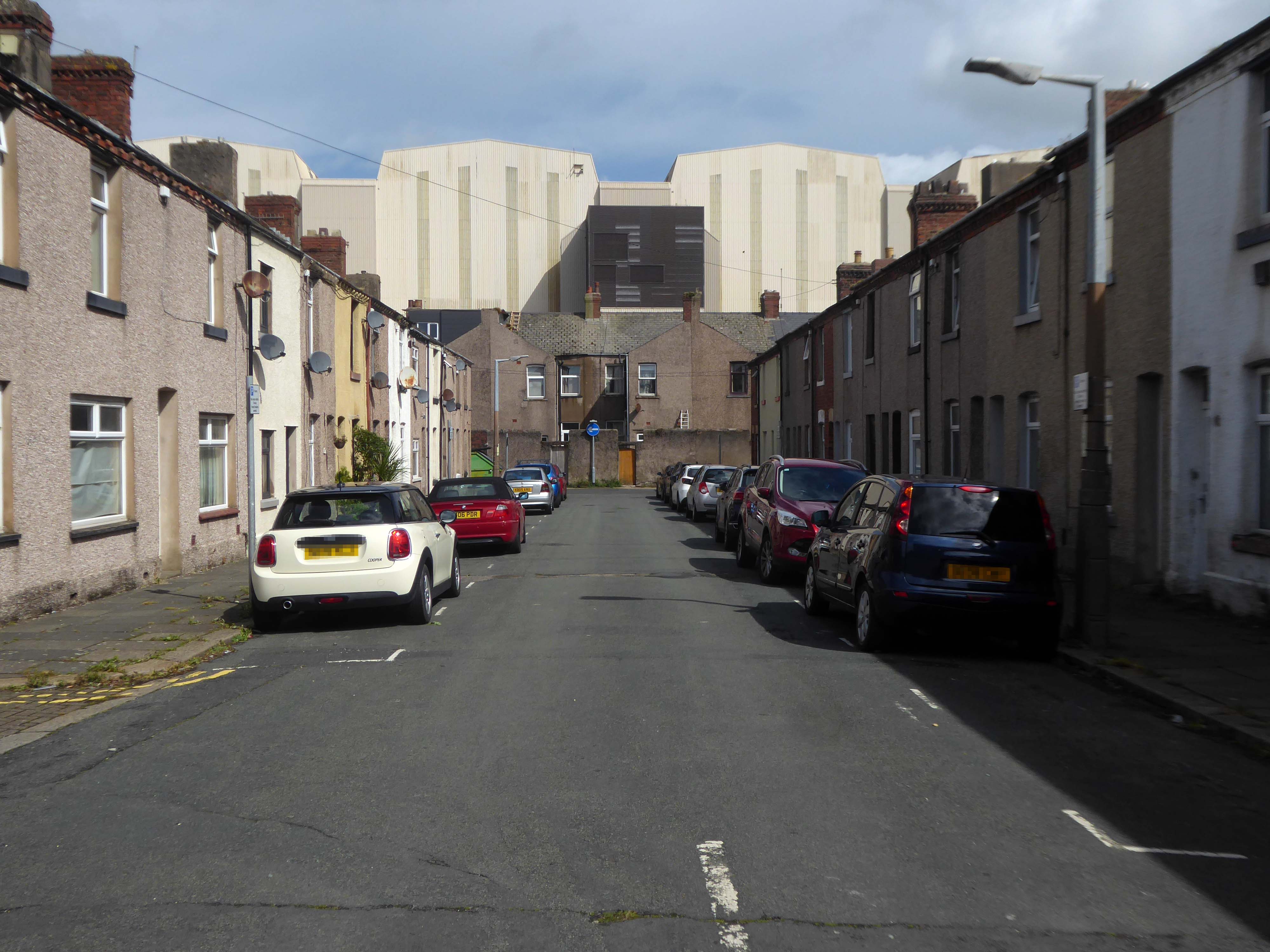
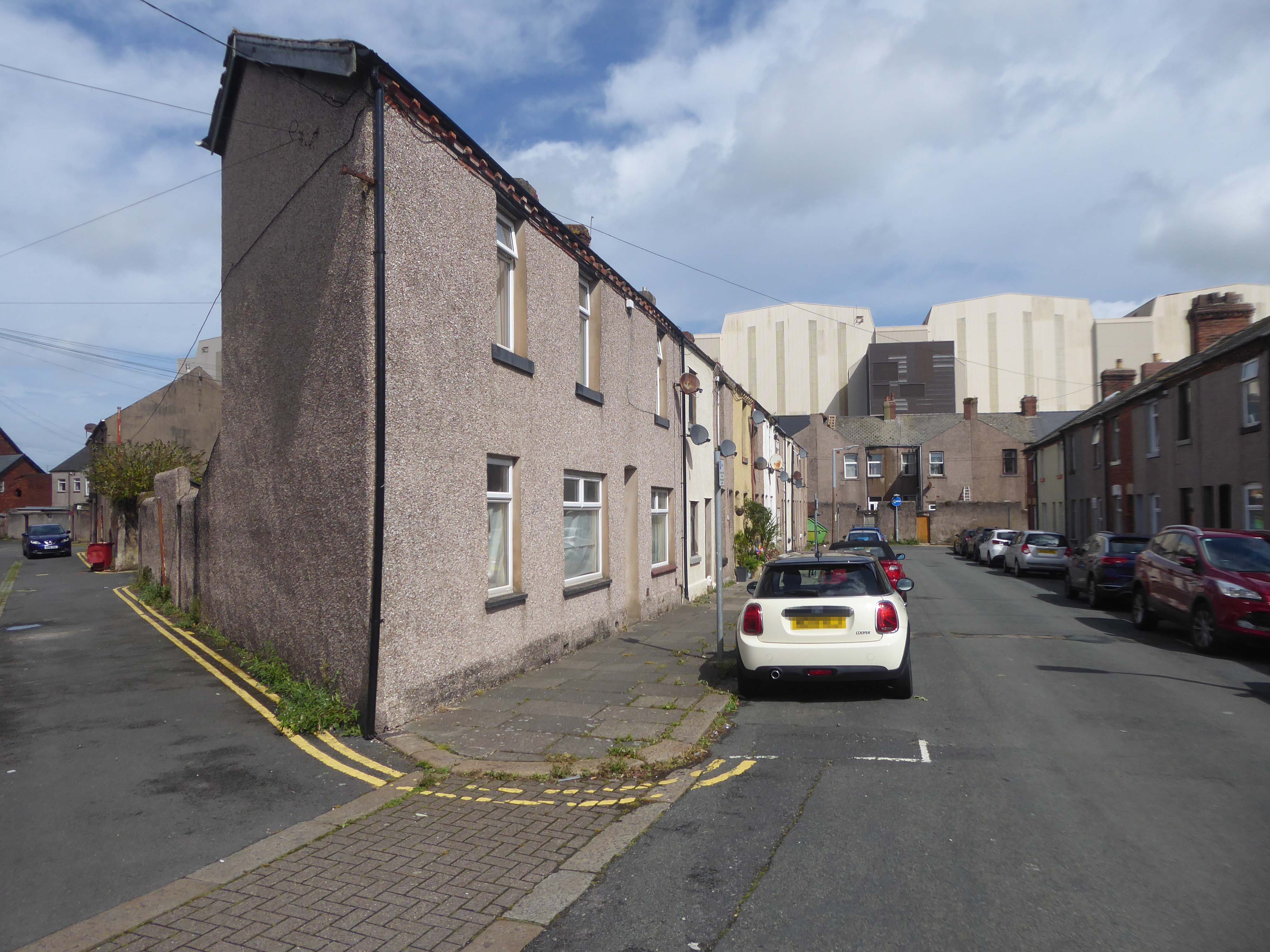
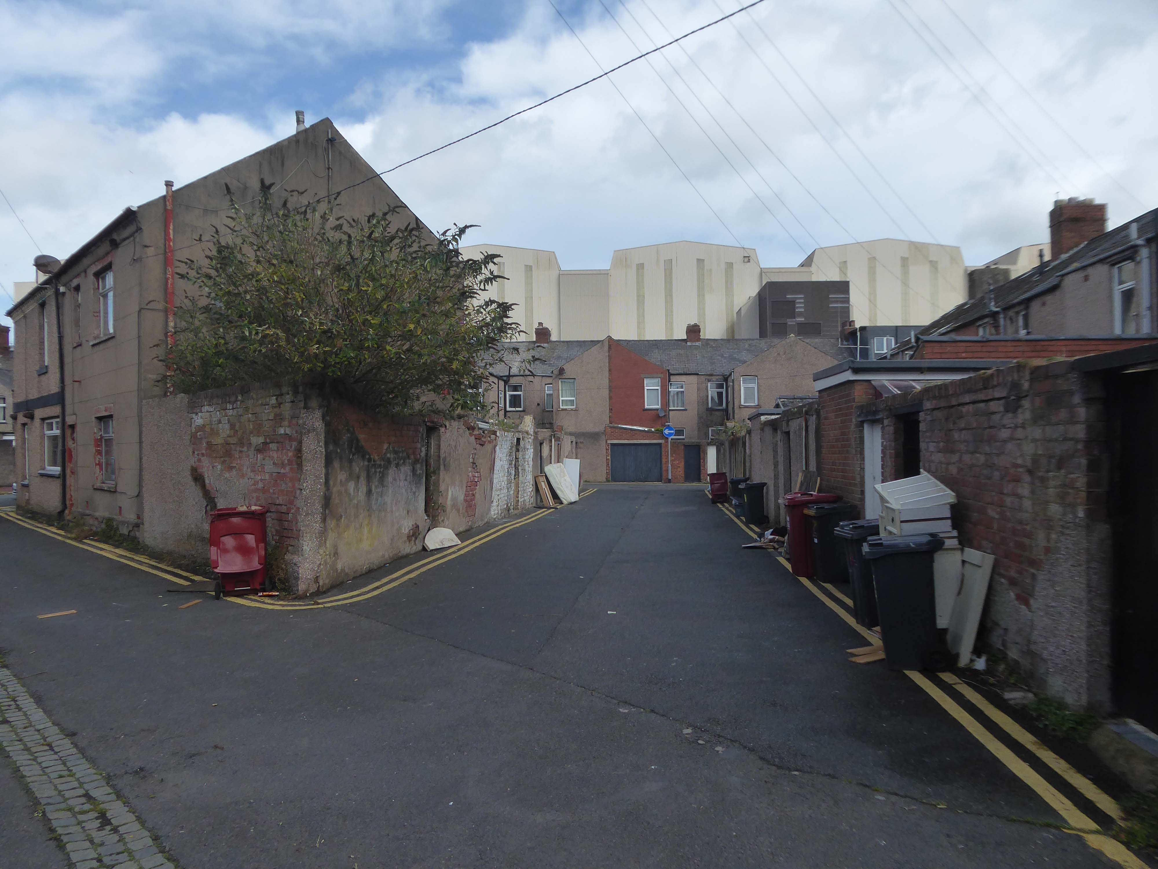
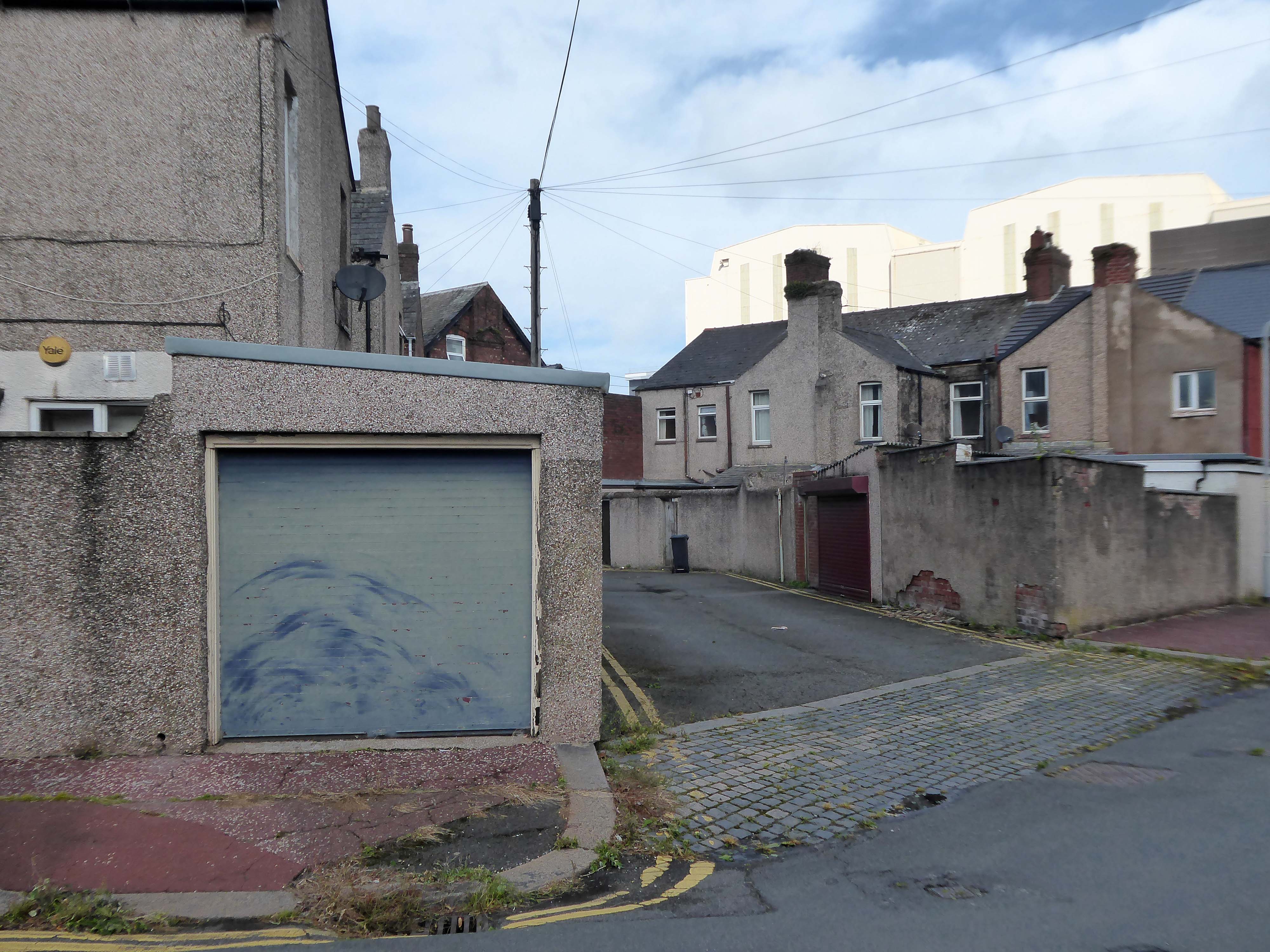
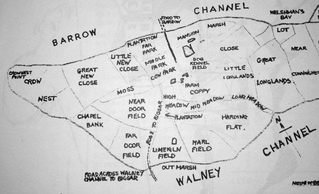
At the northern end of Barrow Island lies the Ferry Road Triangle. Covering an area formerly known by the field names, Crow Nest, Great New Close, Little New Close, Moss, Cow Park and Middle Park; the Ferry Road area has always been known as the Triangle, because the shape of the estate is truly a triangle.
I had arrived in Barrow in Furness and taken to wandering the streets, hastily in search of nothing in particular.
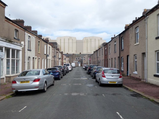
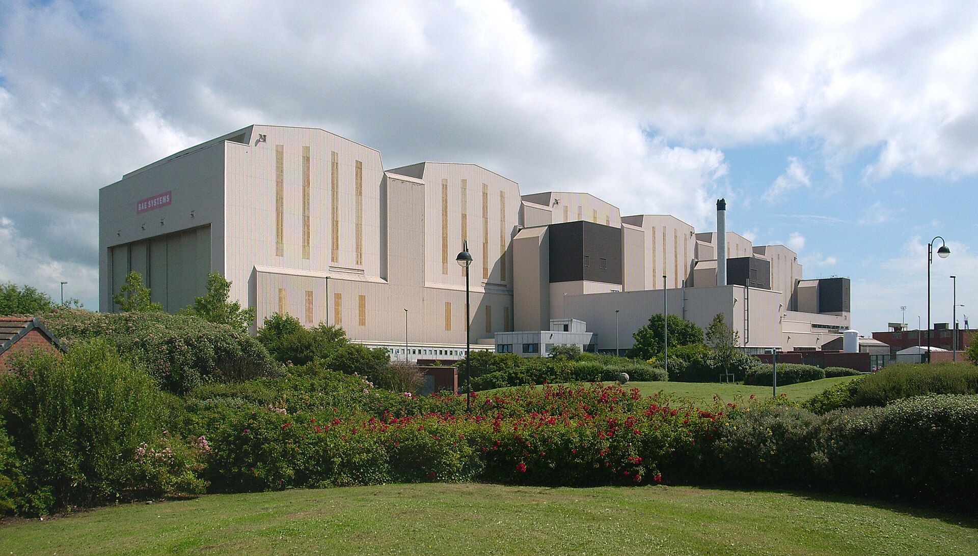
I came upon a neat triangle of terraced housing, which abutted the huge BAE Systems sheds.
The collision of scale created by the low lying domestic buildings, and the gargantuan industrial nuclear submarine homes, immediately put me in mind of Chris Killip’s photographs.
He had recorded the last days of a dying industry, whilst the BAE contracts represent a long term lifeline to a once dying town.
The Ministry of Defence has awarded £3.95 billion of funding to BAE Systems for the next phase of the UK’s next-generation nuclear-powered attack submarine programme, known as SSN-AUKUS.
The funding follows the AUKUS announcement in March by the leaders of Australia, the UK and the United States. This will eventually see Australia and the UK operate SSN-AUKUS submarines, which will be based on the UK’s next generation design, incorporating technology from all three nations, including cutting-edge US submarine technologies.
Having started early design work in 2021, the £3.95bn funding will cover development work to 2028, enabling BAE Systems to move into the detailed design phase of the programme and begin to procure long-lead items. Manufacture will start towards the end of the decade with the first SSN-AUKUS boat due to be delivered in the late 2030s.
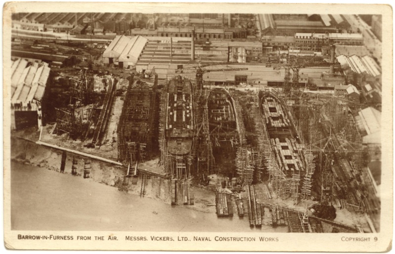
It has been said of Barrow: A rich mineral district was the cause, a railway was the effect, and an important manufacturing town the result.
The dramatic growth of Barrow-in-Furness in the late 19th and early 20th Centuries was fuelled by the ready availability of Furness iron ore. Significant investments were made in developing the town to exploit this resource. The various ironworks, steelworks, foundries, shipyards and docks required a huge influx of population to support them. This in turn led to the rapid building of rows of good quality mass-produced terraced housing for the workers, and substantial sandstone villas for the management.
I stopped to chat with a local lad – I had thought Barrow to be a hard town, he thought not.
There’s not much trouble, though we have hard times – how so?
The Tories – now my kids have all got jobs for the next twenty years.
There were no reported crimes in June 2024
Devonshire Dock Hall is a large indoor shipbuilding and assembly complex that forms part of the BAE Systems shipyard.
Constructed between 1982 and 1986 by Alfred McAlpine plc for Vickers Shipbuilding and Engineering, DDH was built on land that was created by infilling part of Devonshire Dock with 2.4 million tonnes of sand pumped from nearby Roosecote Sands.
Opened in May 1888 it was described by the Barrow News as one of the best-appointed hotels in Barrow. From this start, Walton Lee, elected Town Councillor in 1886 envisaged an estate for the workers literally within spitting distance of their workplace.
A section of Career of Evil was filmed at The Crow’s Nest.
Barrow shipyard’s Devonshire Dock Hall, The Crow’s Nest pub, Barrow Island streets, including Stanley Road and Stewart Street, and Michaelson Road Bridge, all featured in episode one of Career of Evil on Sunday night.
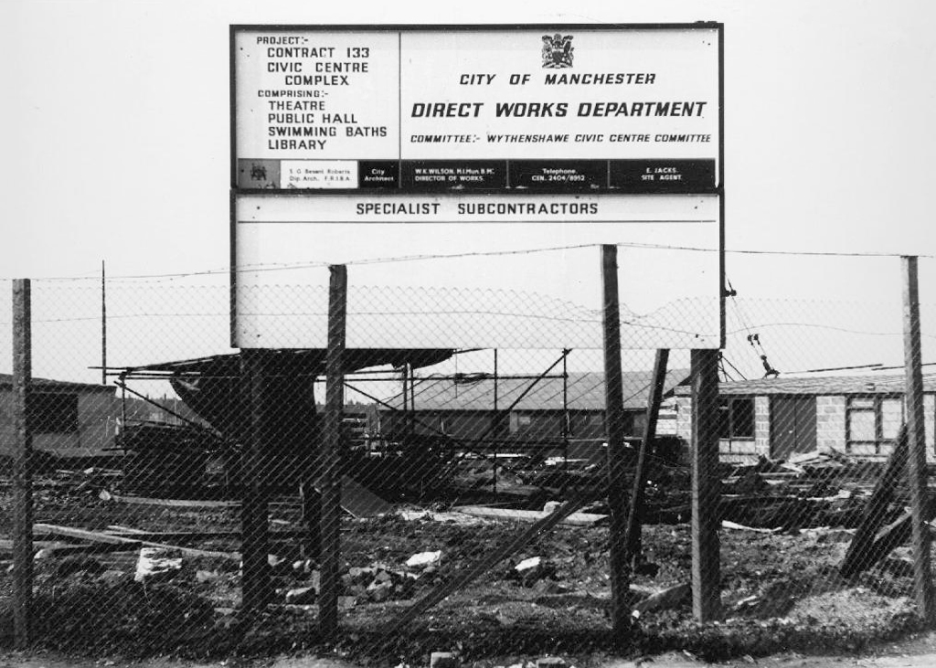
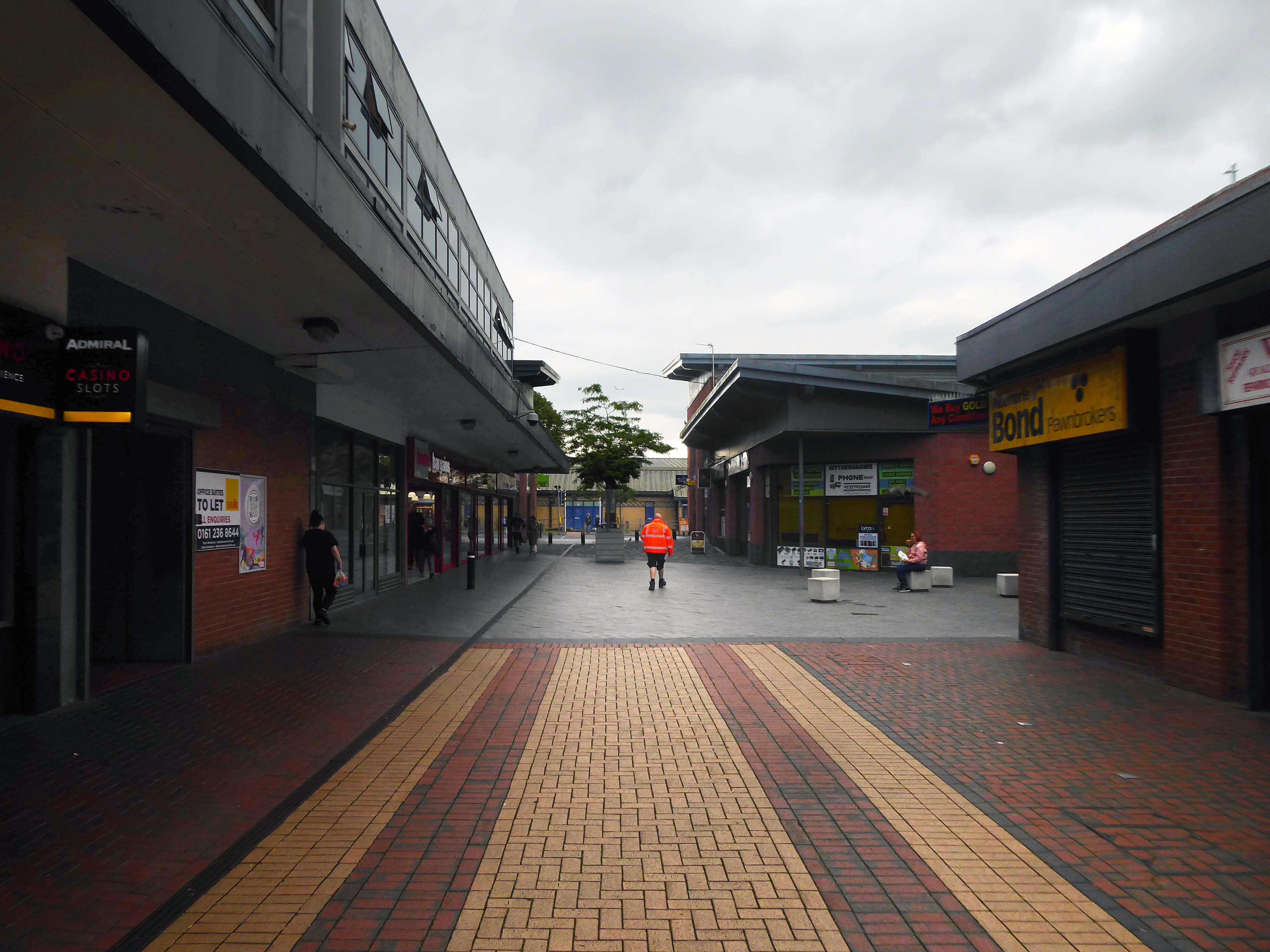
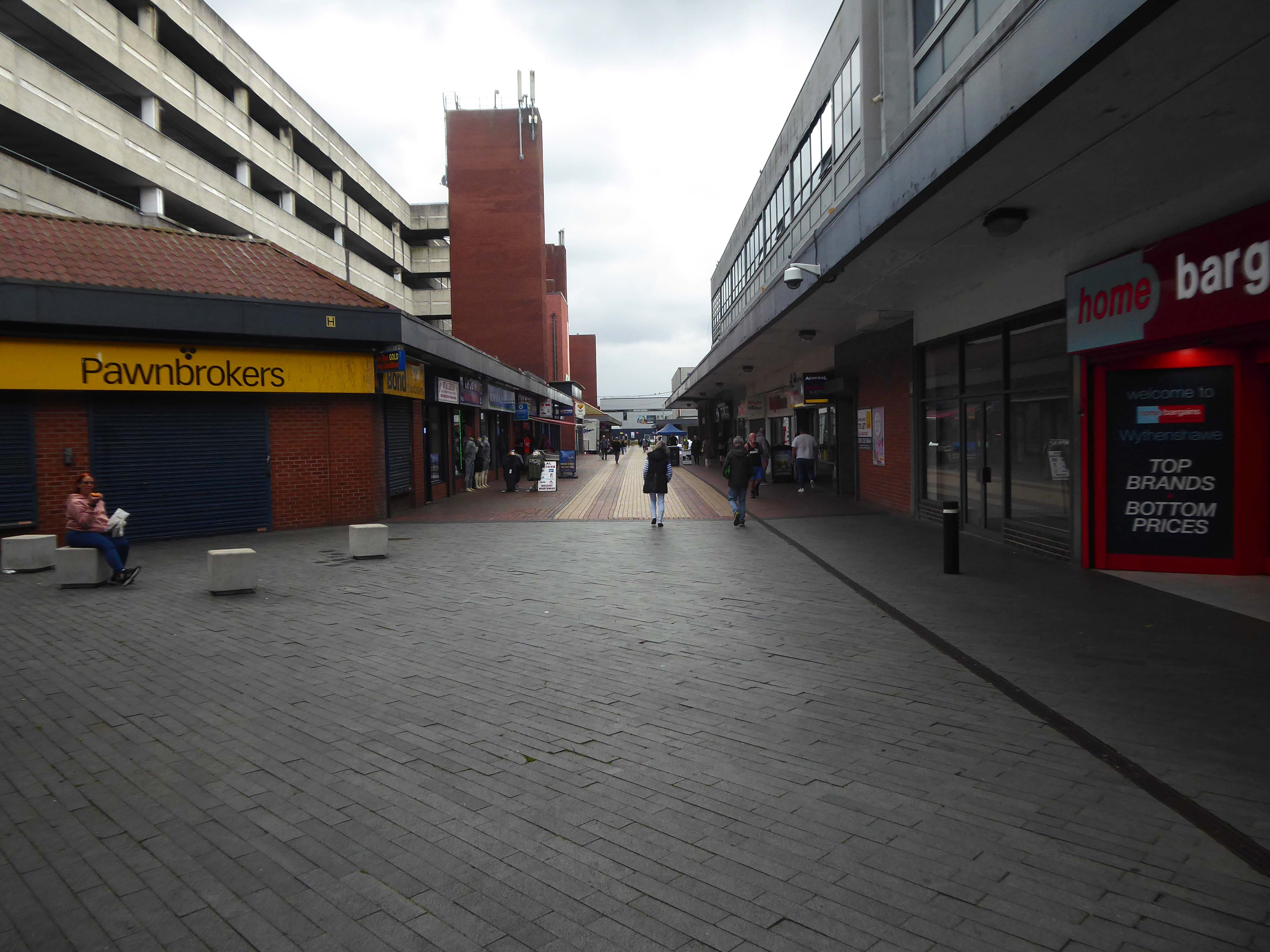
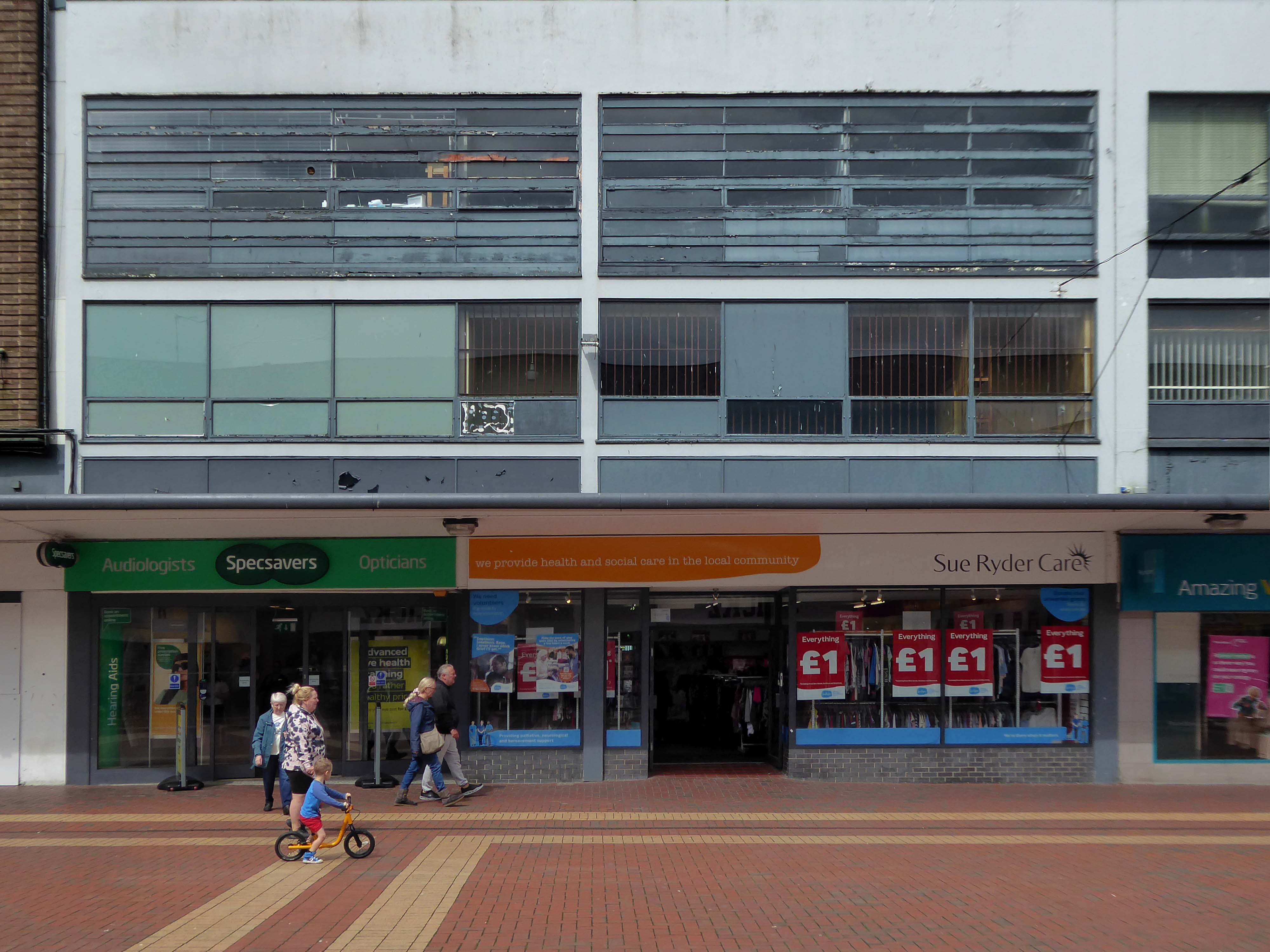
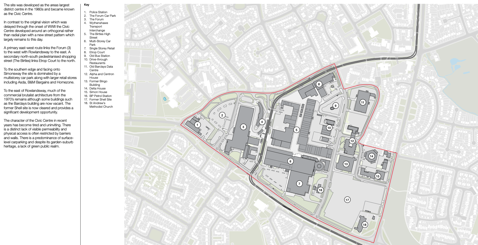
Work began in the interwar years, and continued following the hiatus of 1939-45. The shopping centre named the Civic Centre was open in 1963, the actual Civic Centre containing a swimming pool, theatre, public hall and library in 1971.
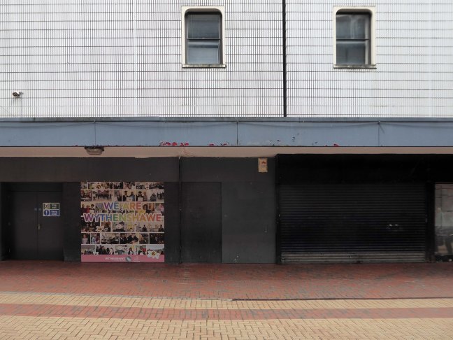
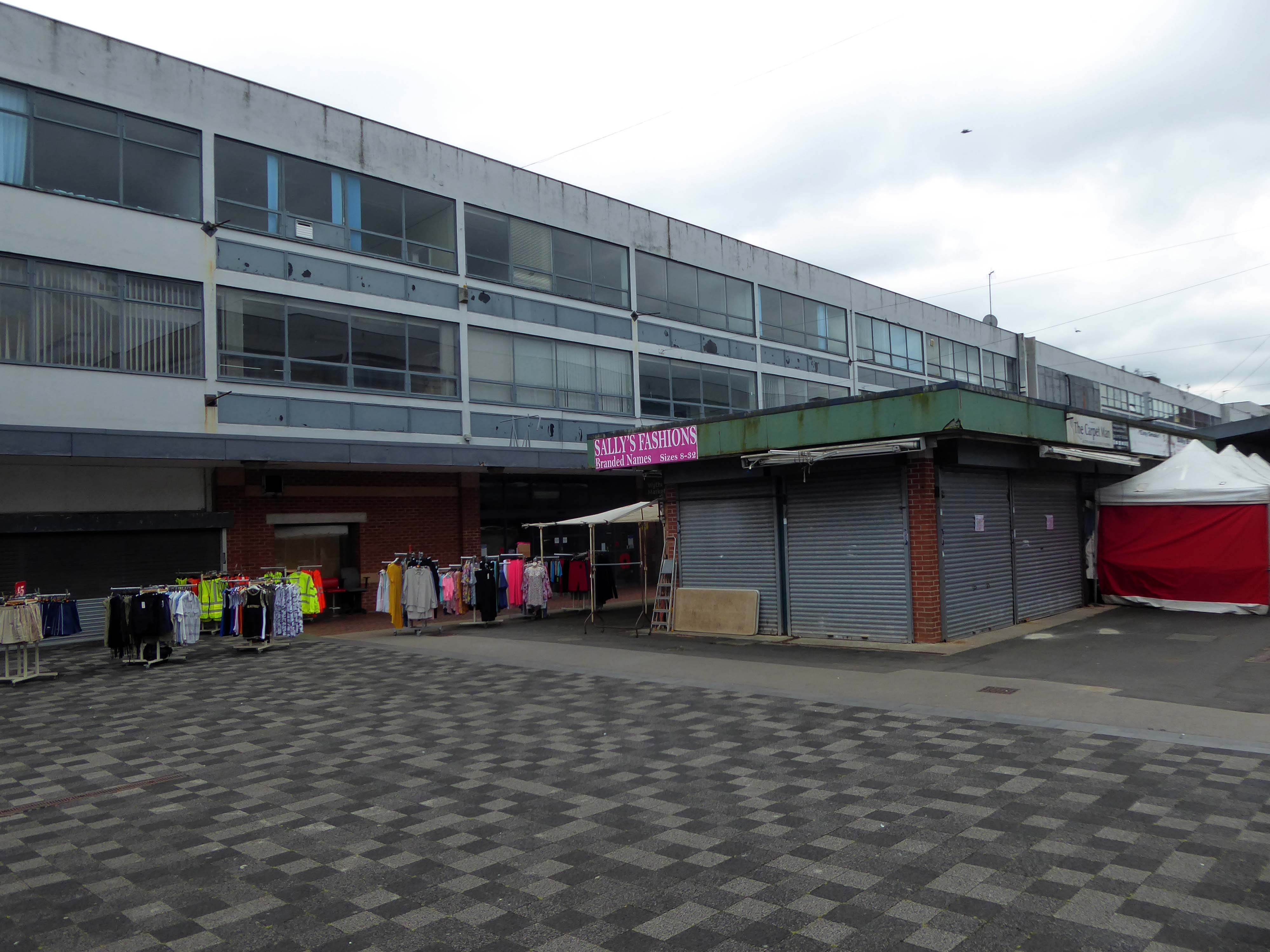
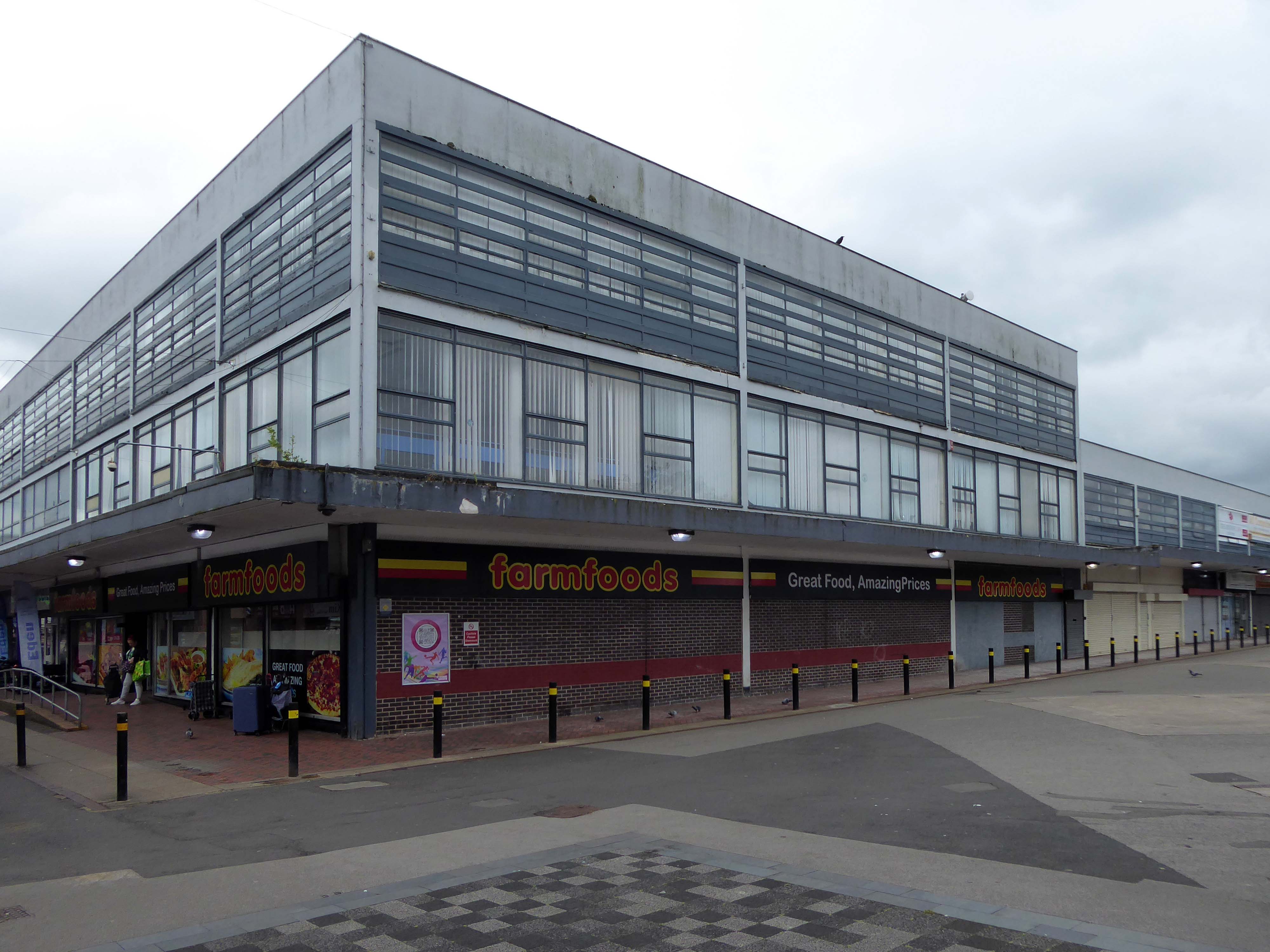
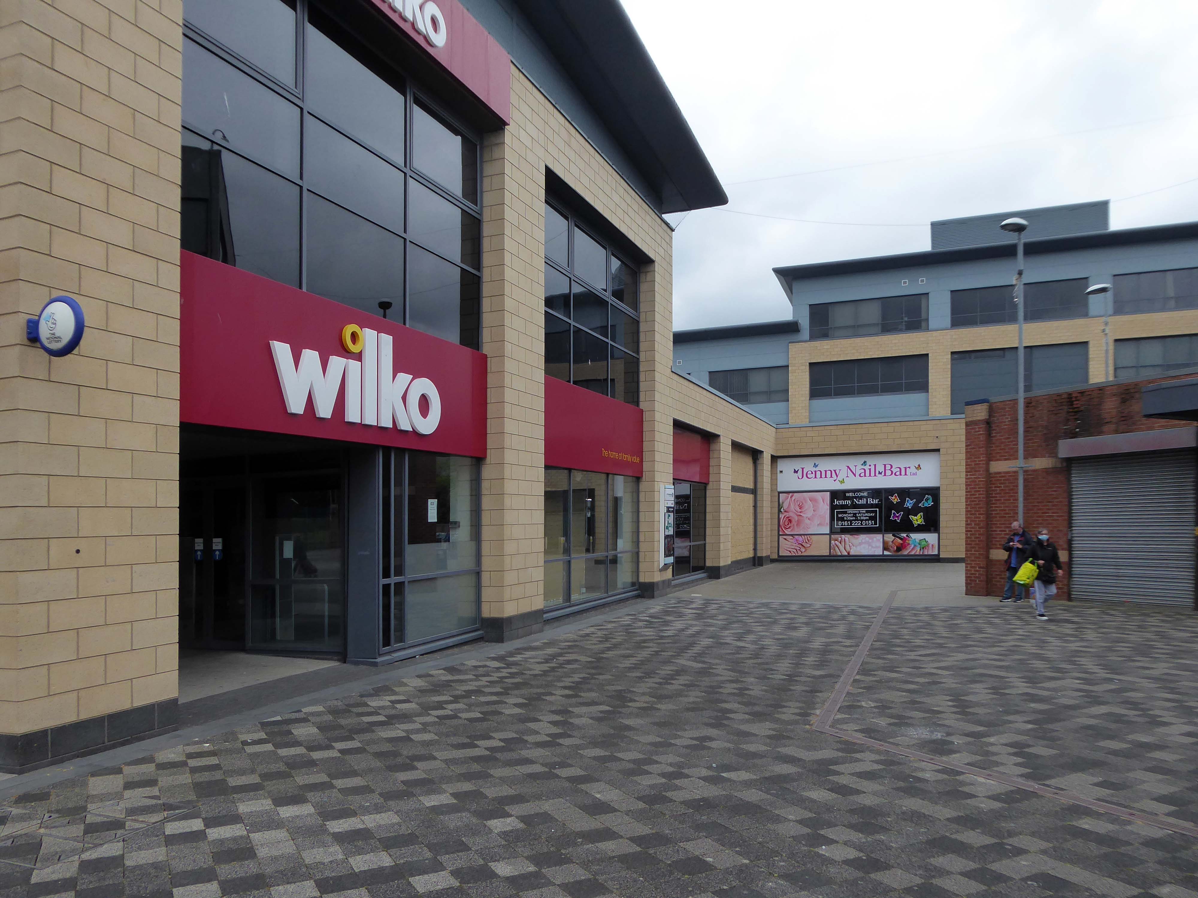
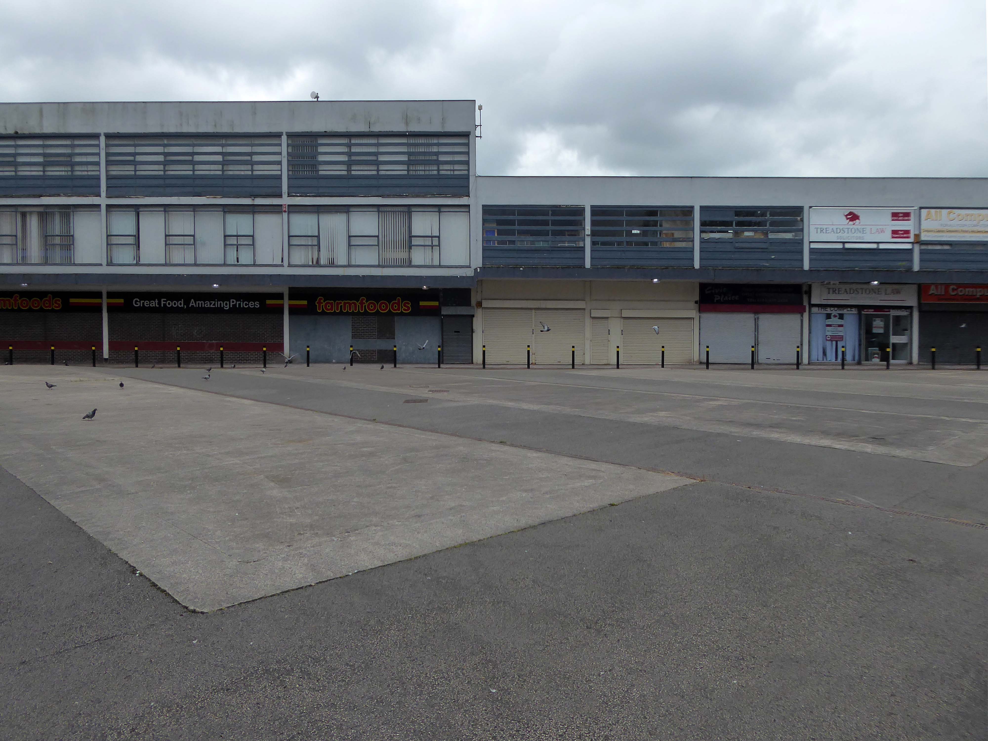
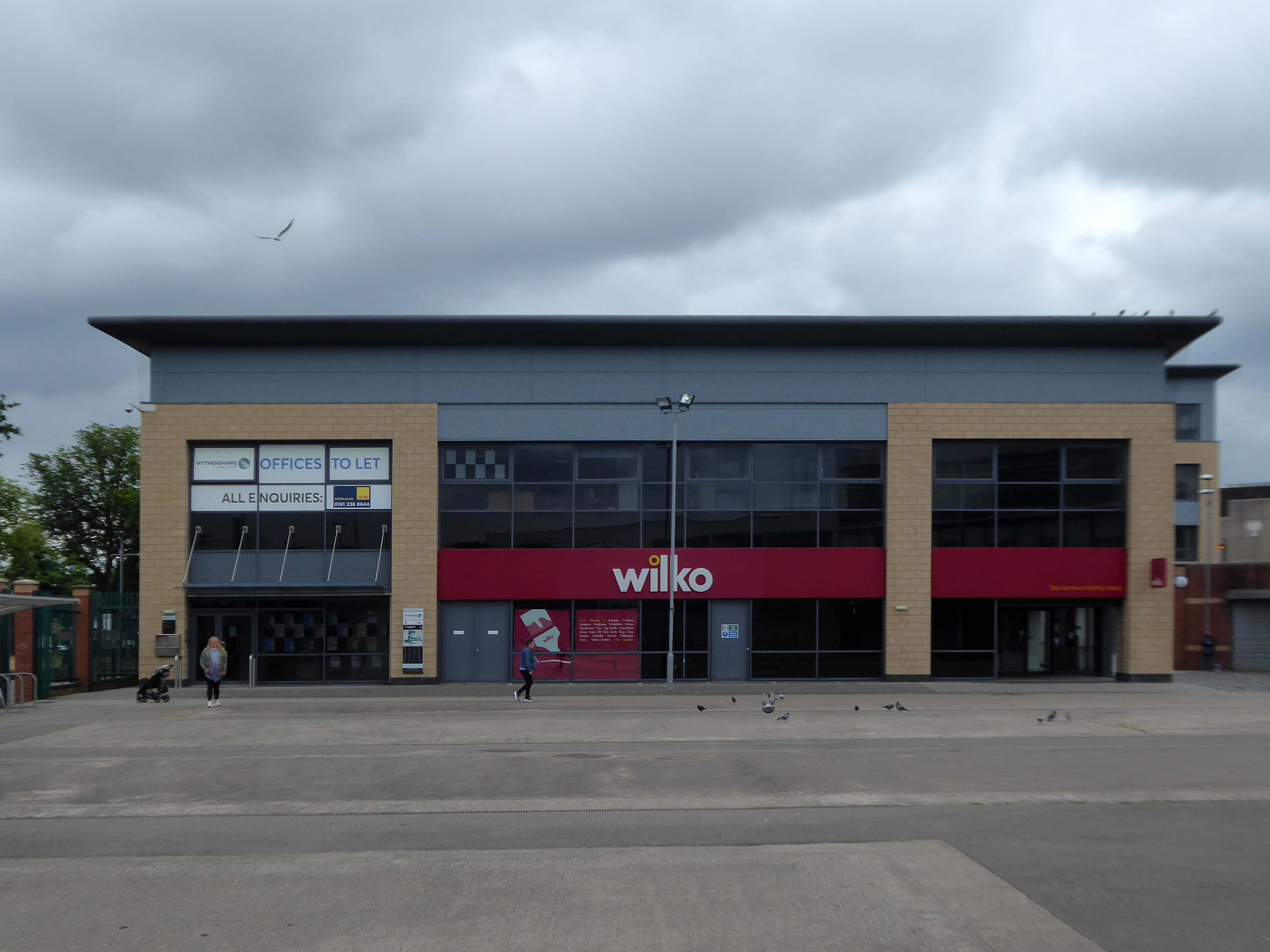
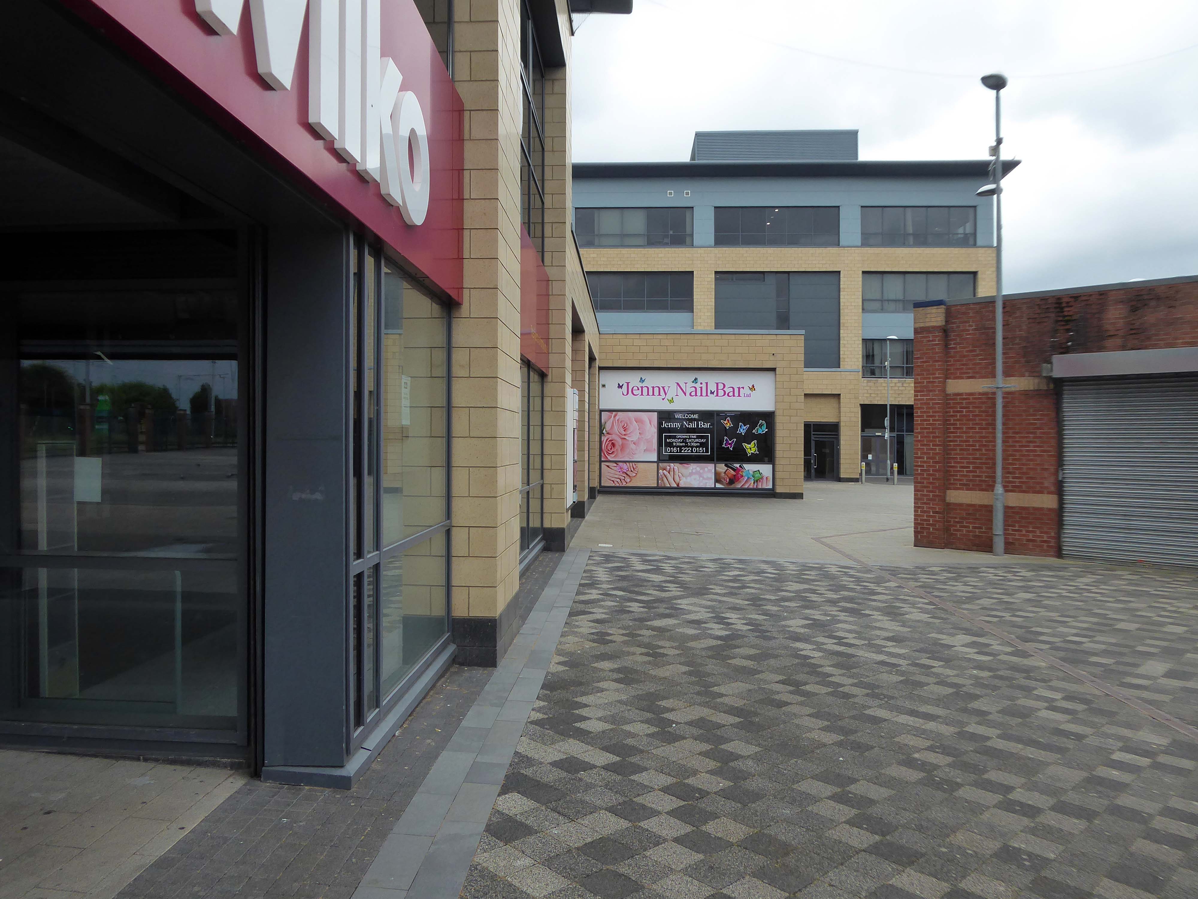
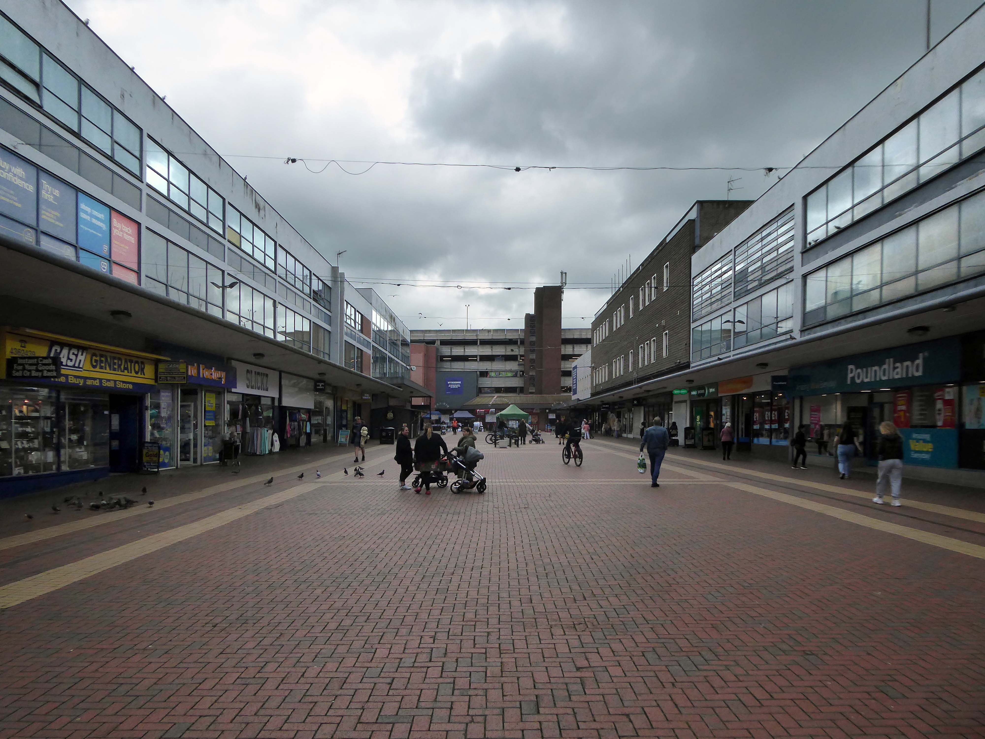
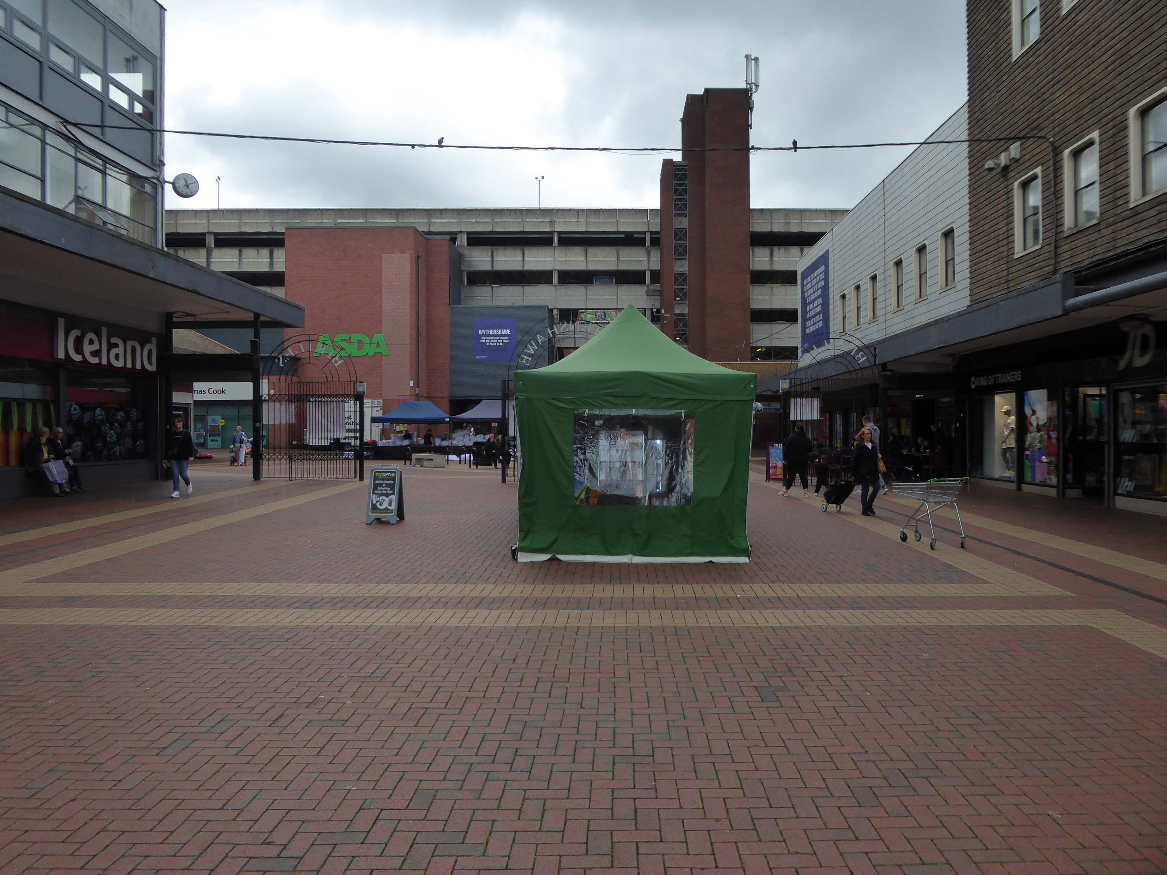
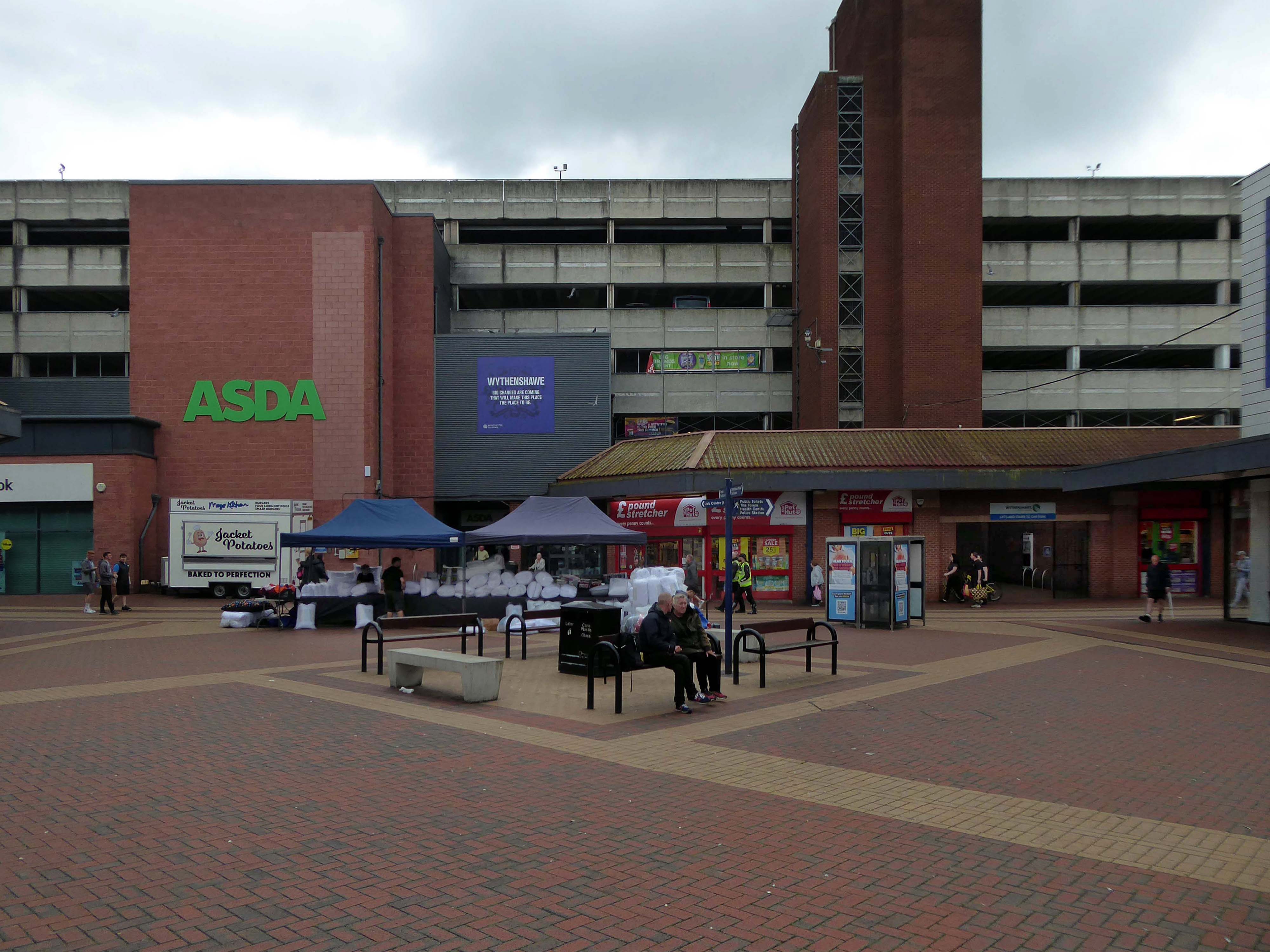
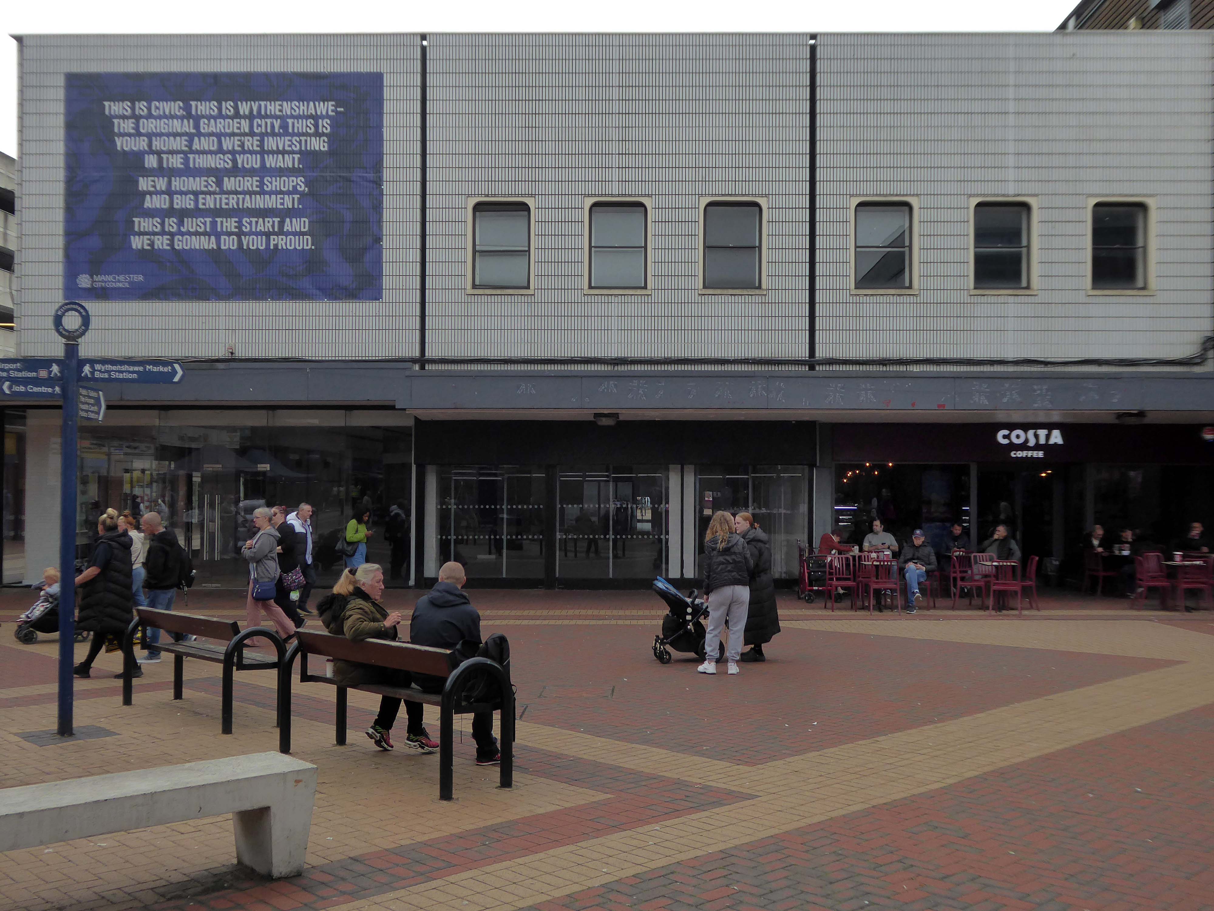
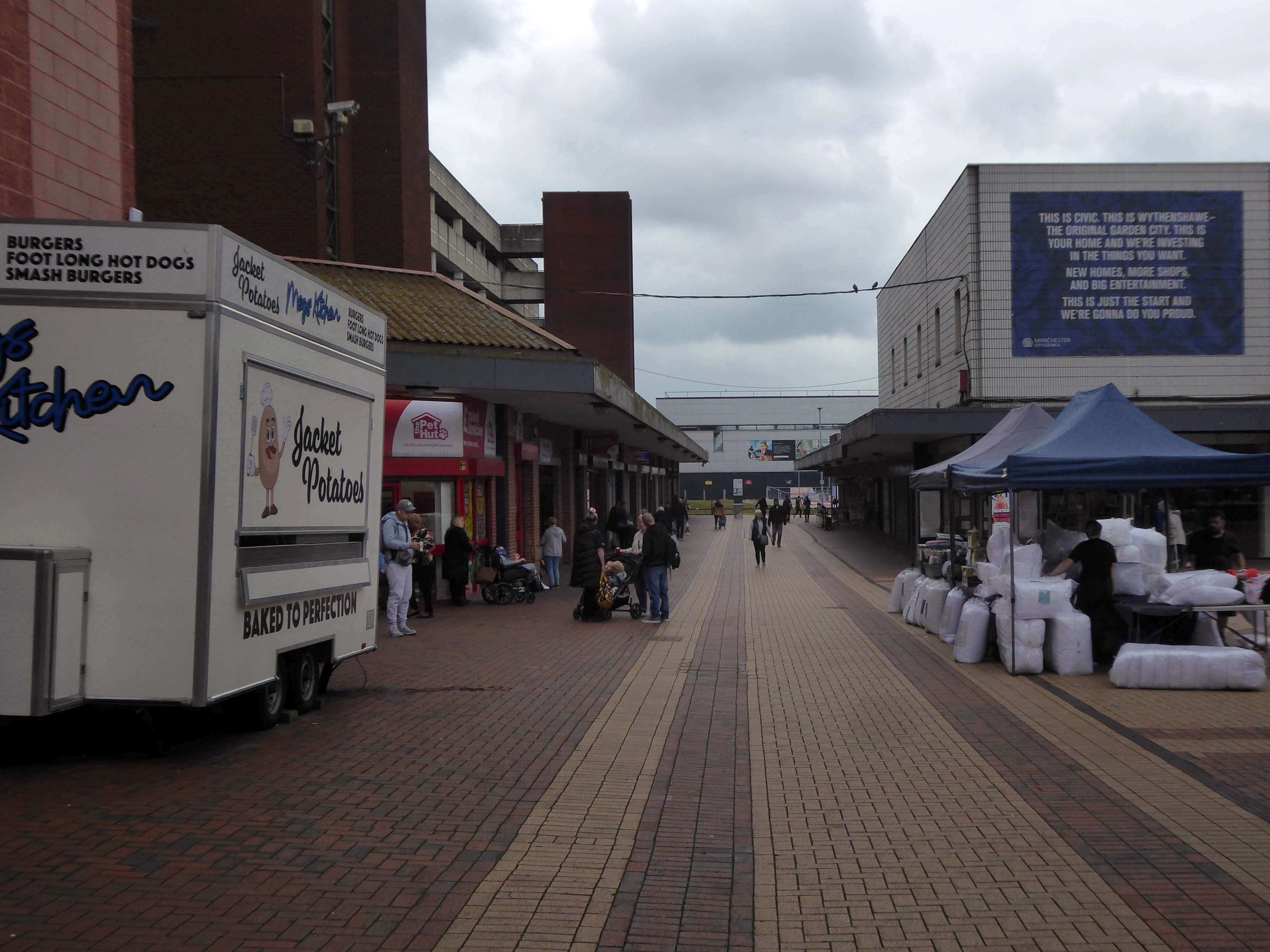
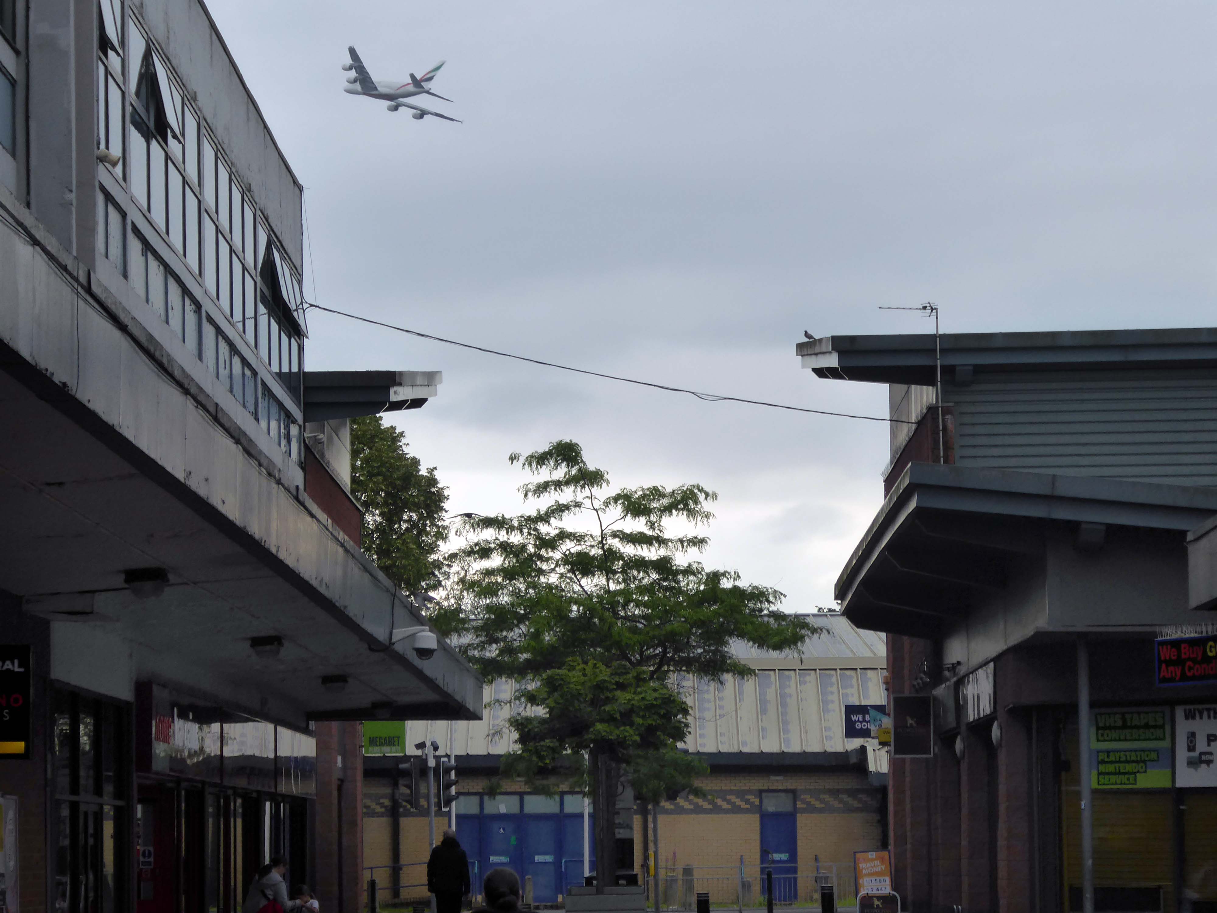
Here I am again four years later, taking a look at how it looks today.
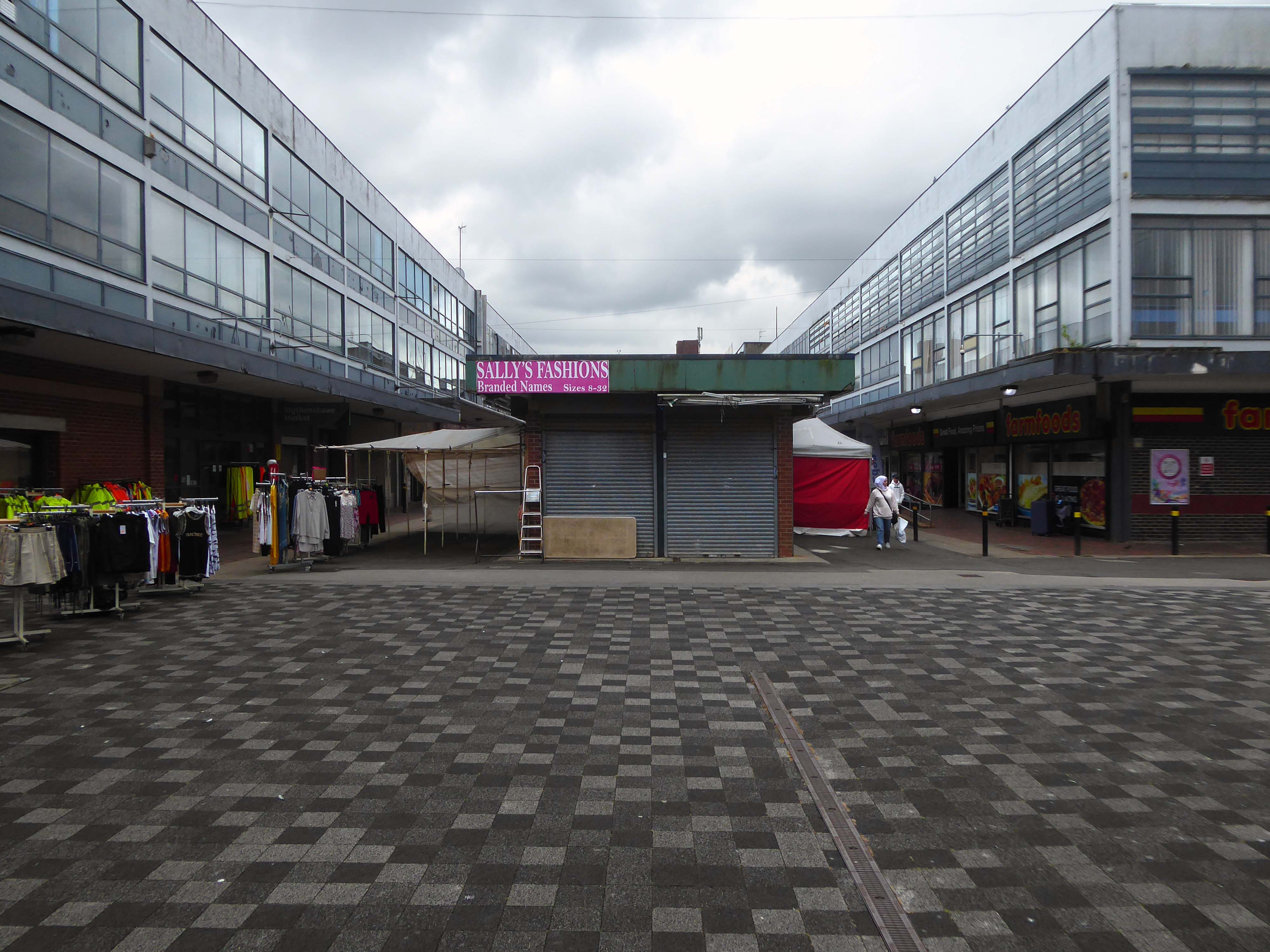
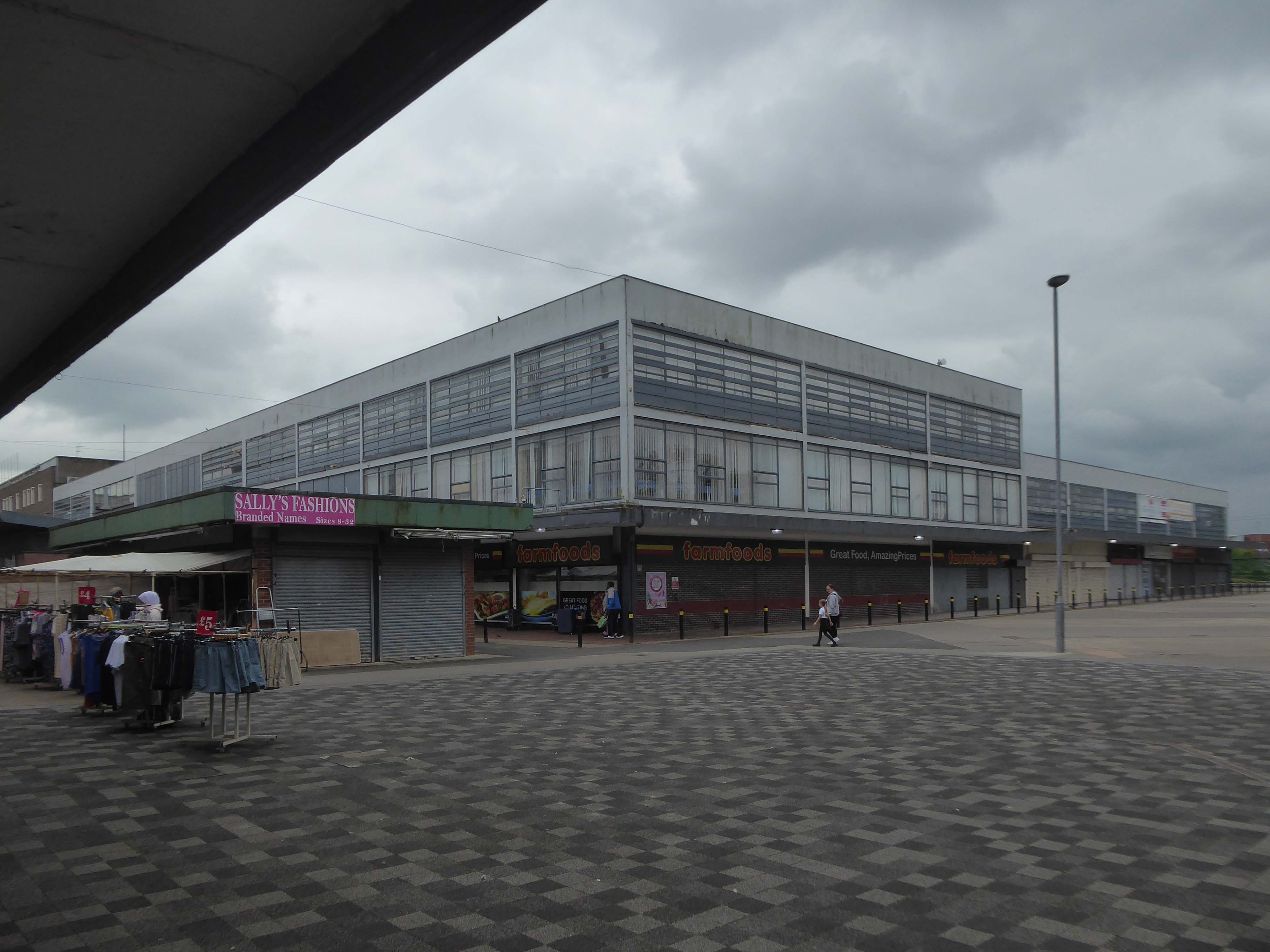
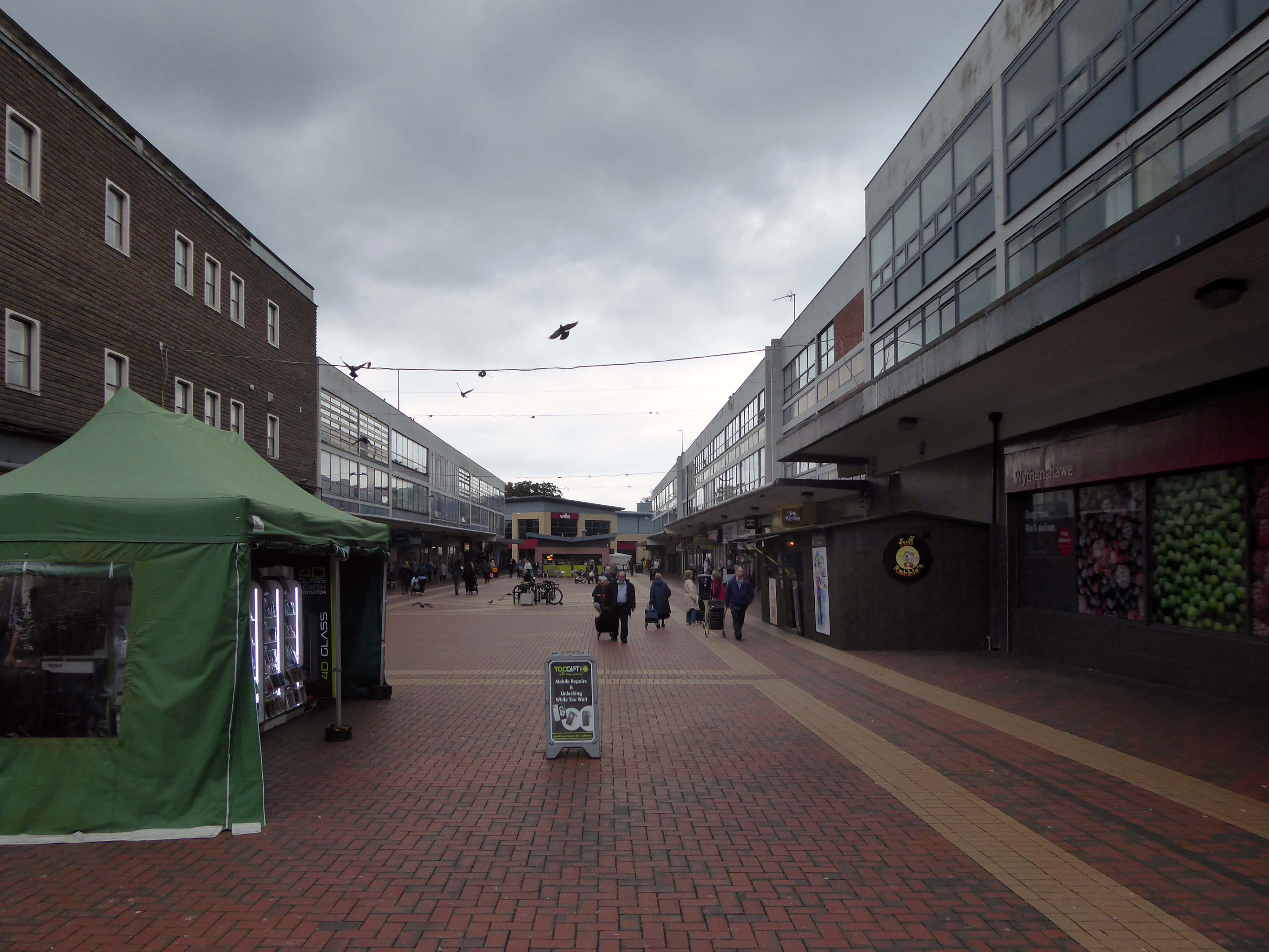
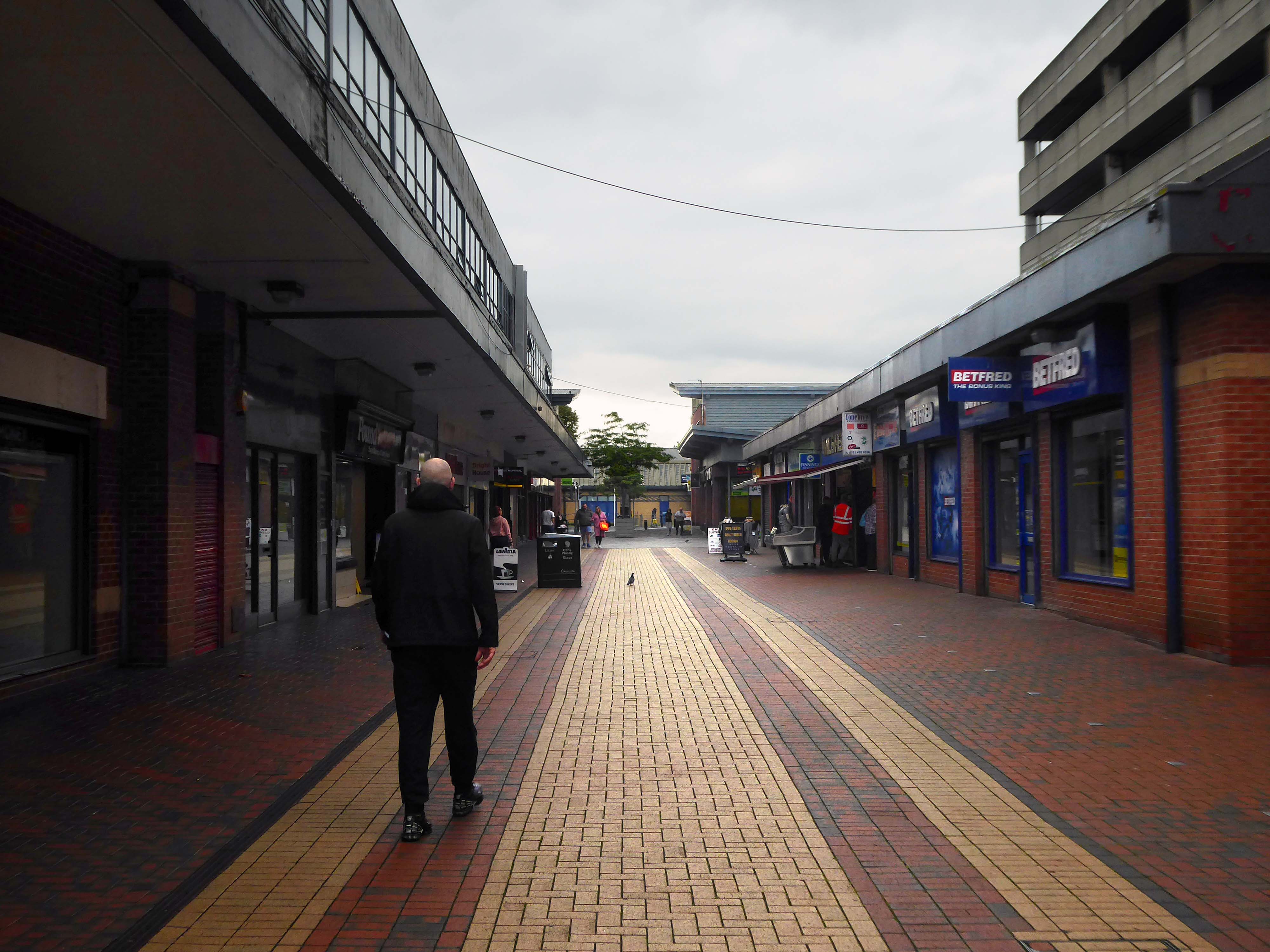
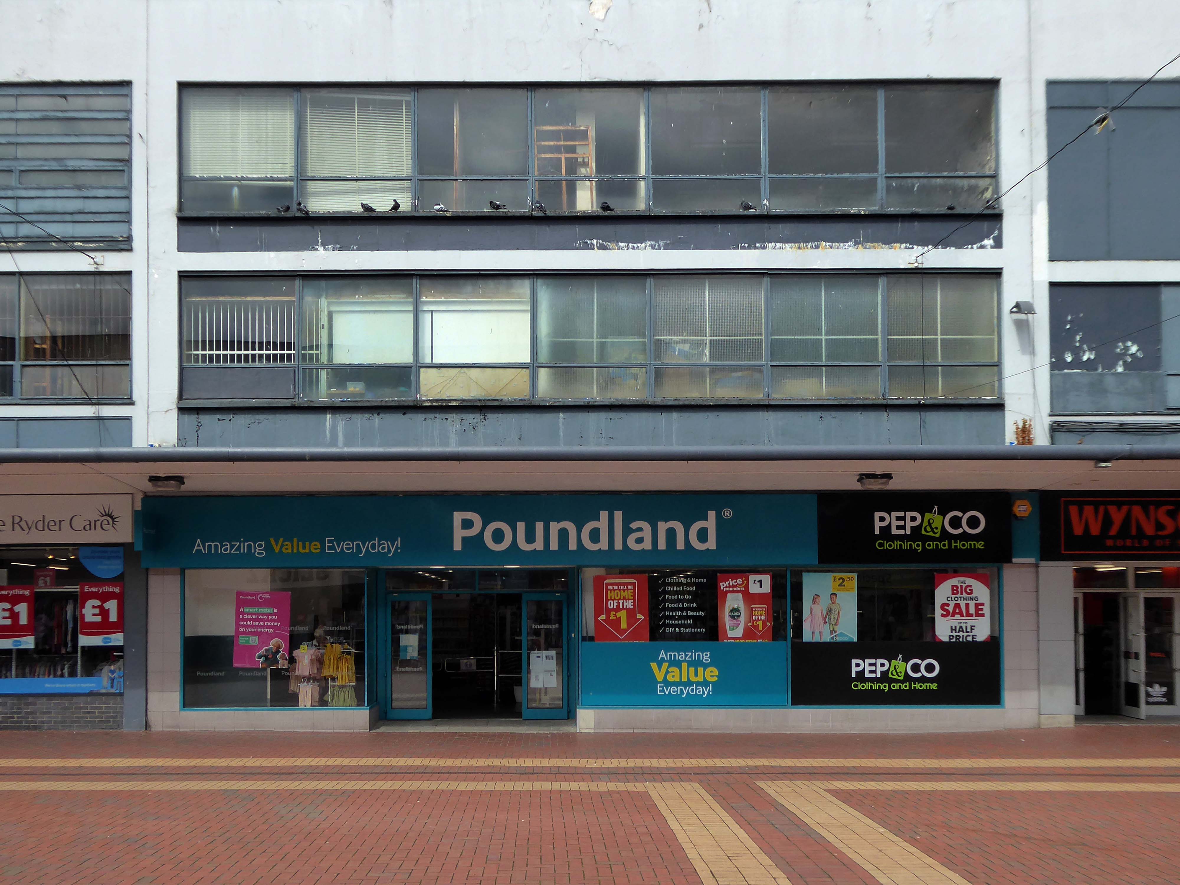
ASDA remains the anchor store, Wilko having left a Wilko sized hole in the precinct. On an overcast Friday morning there was sufficient footfall to sustain the wide variety of smaller shops and larger retail chains. As with many other towns within the central Manchester orbit, the easy proximity fills those busy trams and buses, which are leaving the area.
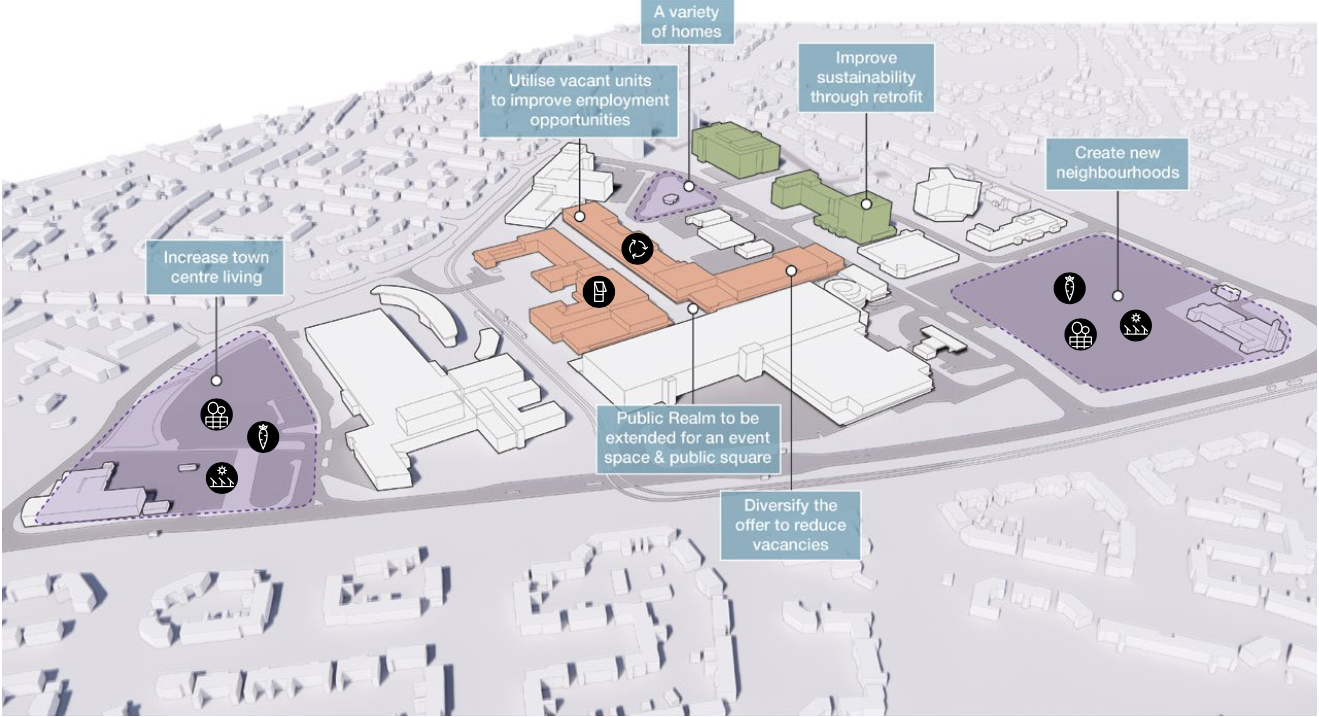
There are plans in place to regenerate the area, in the form of a Masterplan – which can be downloaded here.
Between 1991-2002 there have been some architectural changes, including new stores and office developments. Some of the interventions included significant adaptions which further increased retail into the existing buildings high street.
The interventions included significant adjustments to the multi-storey car park with the aim of reducing parking numbers whilst providing additional lettable space. Further Transport Hub Arrival commercial development was created to the north of the site with the construction of Etrop Court, despite there being significant commercial vacancy across other parts of the estate.
Whilst there has been significant incremental intervention, the character of the area has not fundamentally changed from its founding concept. However the cumulative impact of the various changes have had a negative impact on the functionality and suitability of place, so much so that the centre is in many ways no longer fit- for purpose.
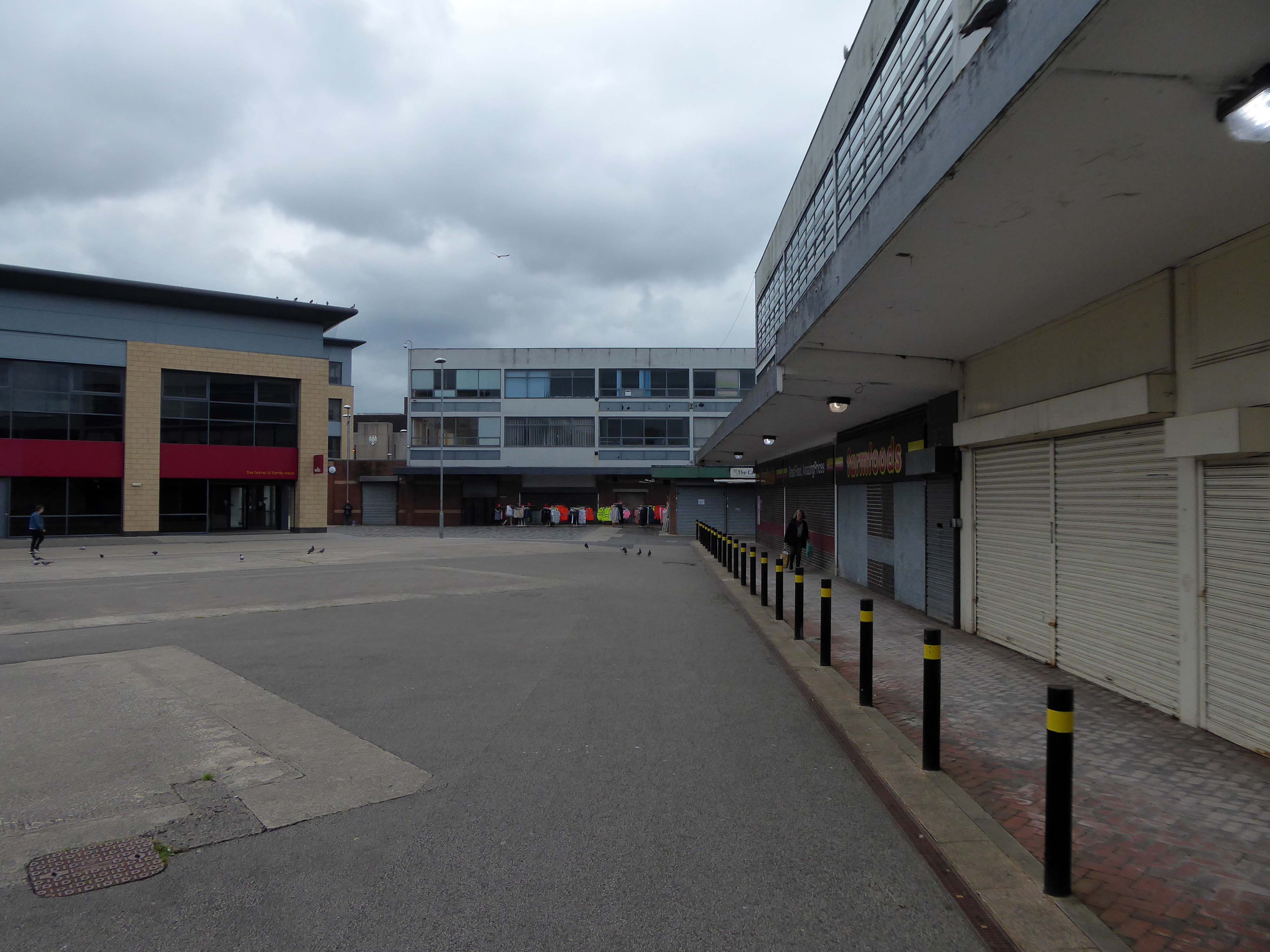
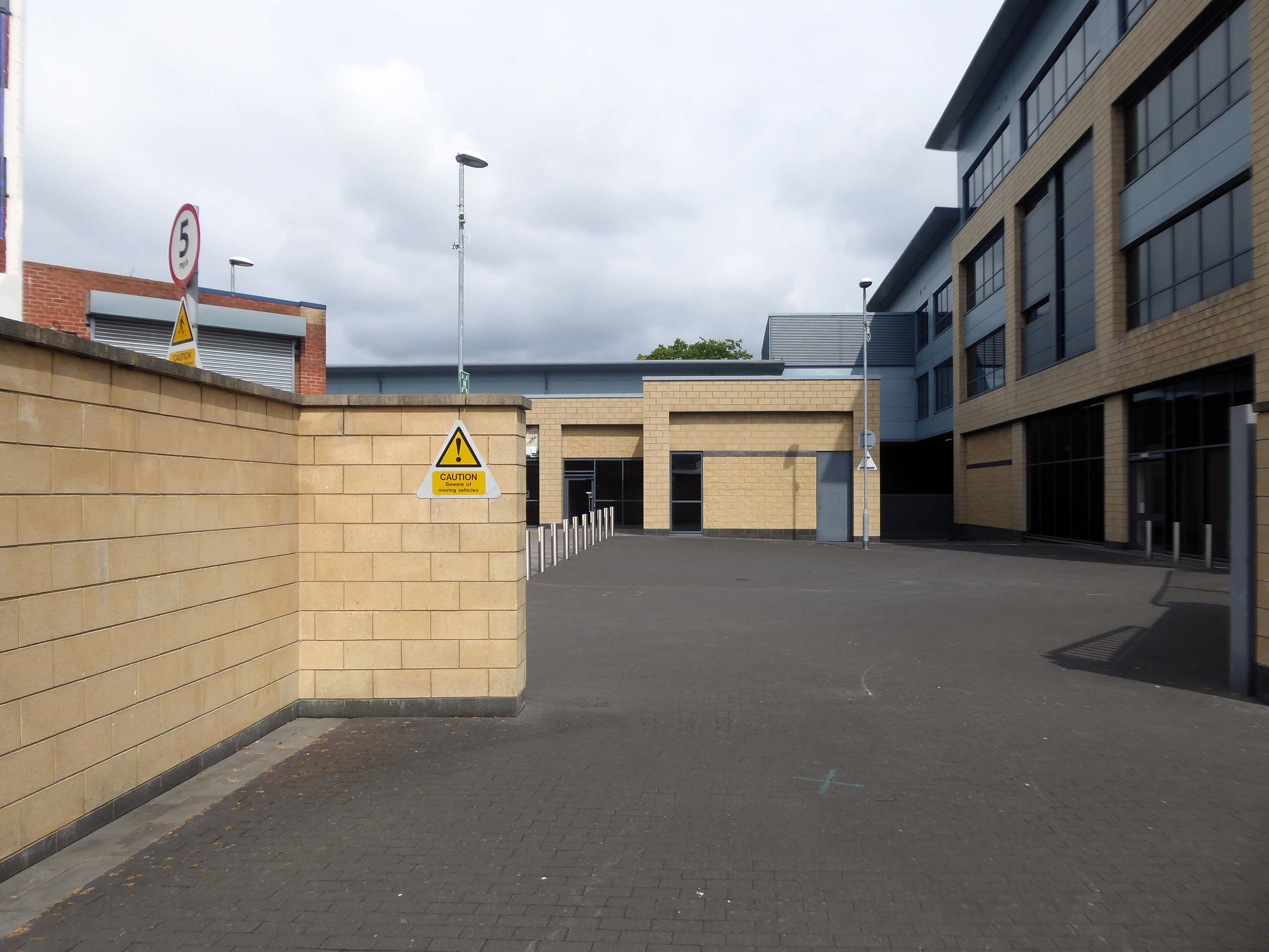
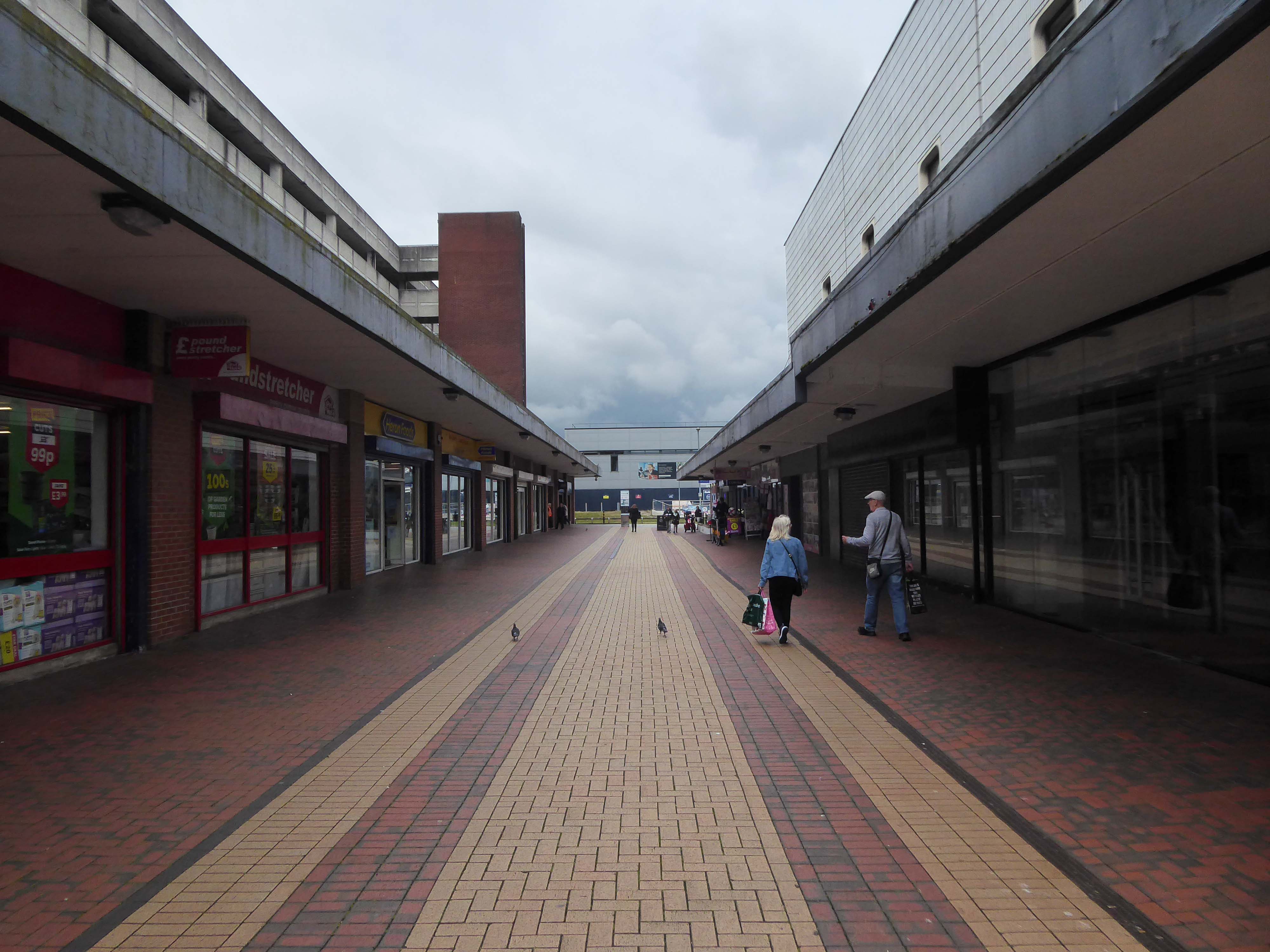
The site today is surrounded by surface car parks, with a total of around 2,500 car parking spaces, 1,700 of which are contained within the multi-storey car park. Many of the retail units, the upper floor office spaces along the Birtles and Hale Top, and buildings to the east are vacant.
Typically, the levels of vacancy are consistent with the changing demands of the high street, where typically modern and successful retail centres are now more diversified and focussed on creating a visitor or destination-based experience. In this sense, we anticipate a need to diversify the high street and to promote a smaller more concentrated retail core, whilst supplementing the offer with more meanwhile and permanent uses and activities based on culture, food and creative workplace.
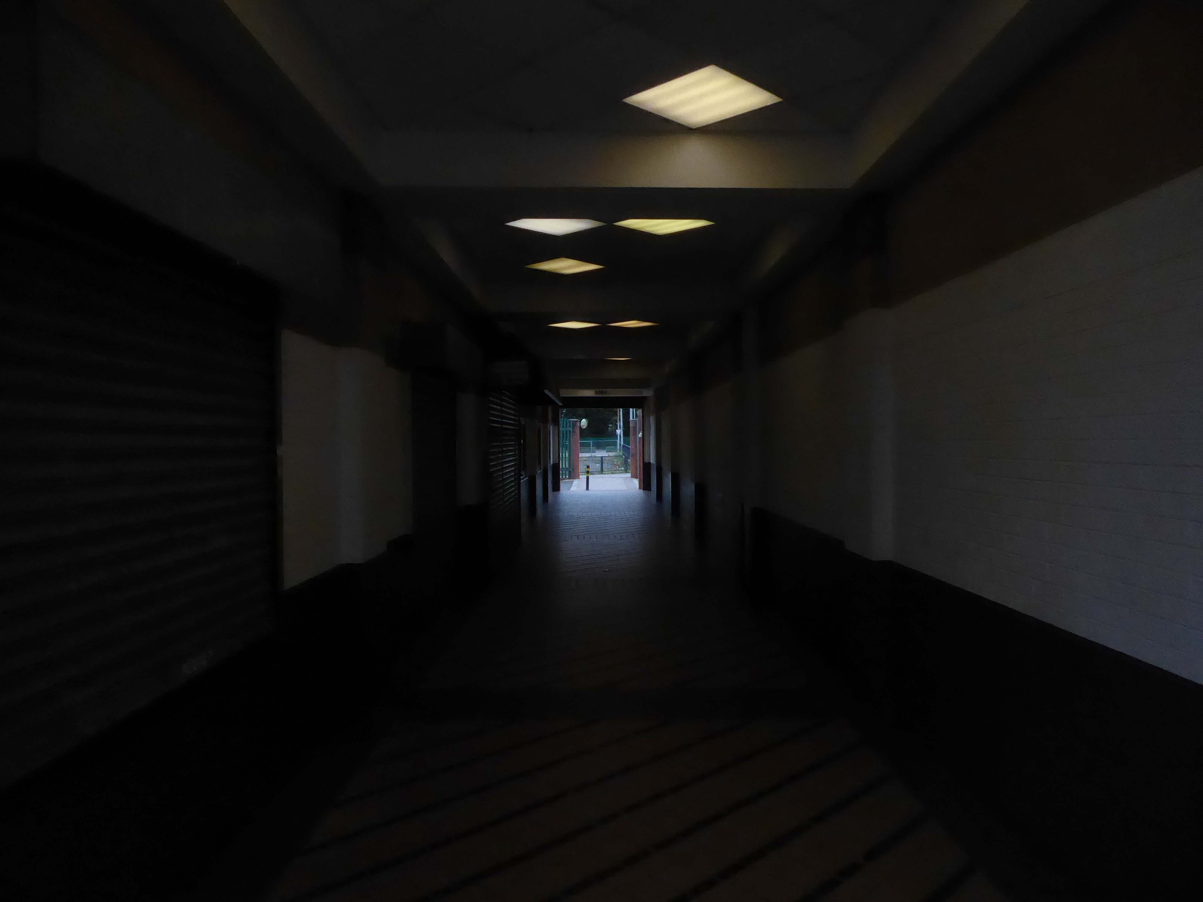
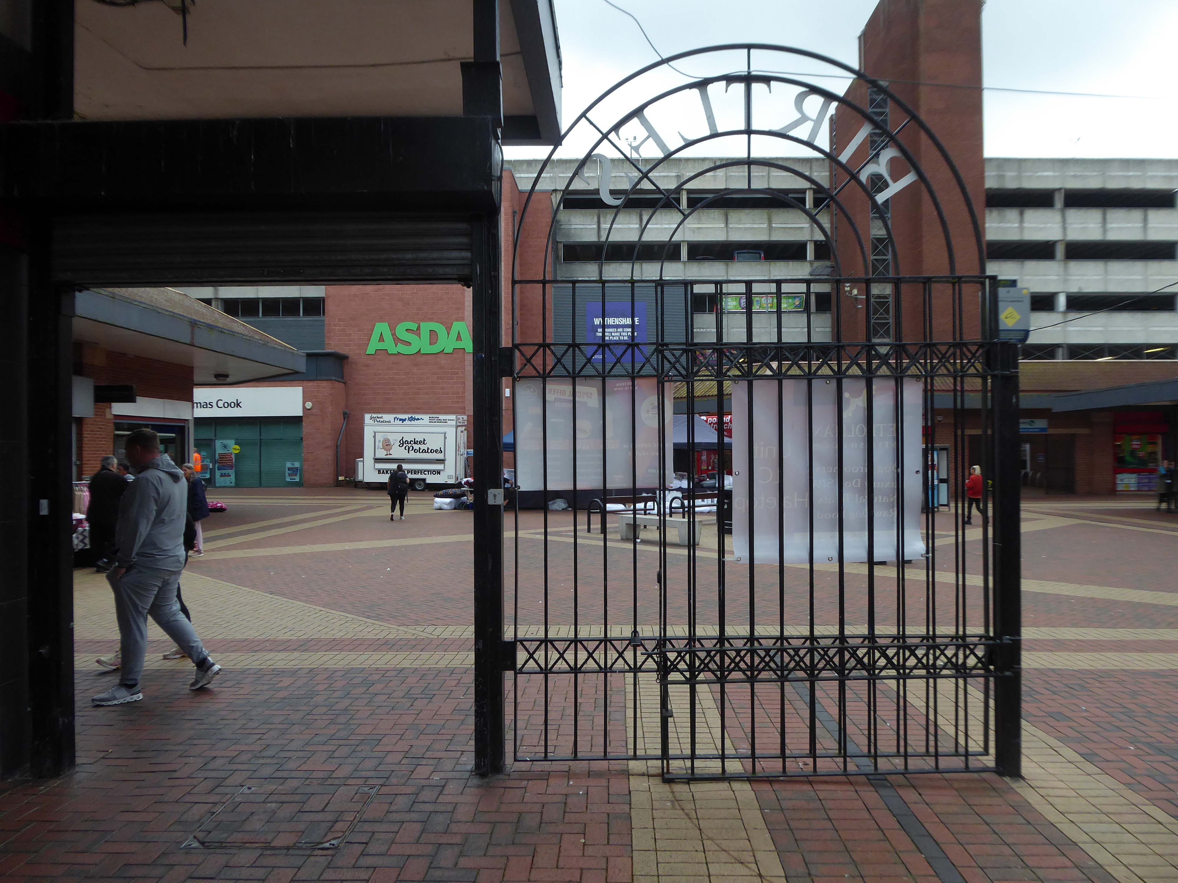
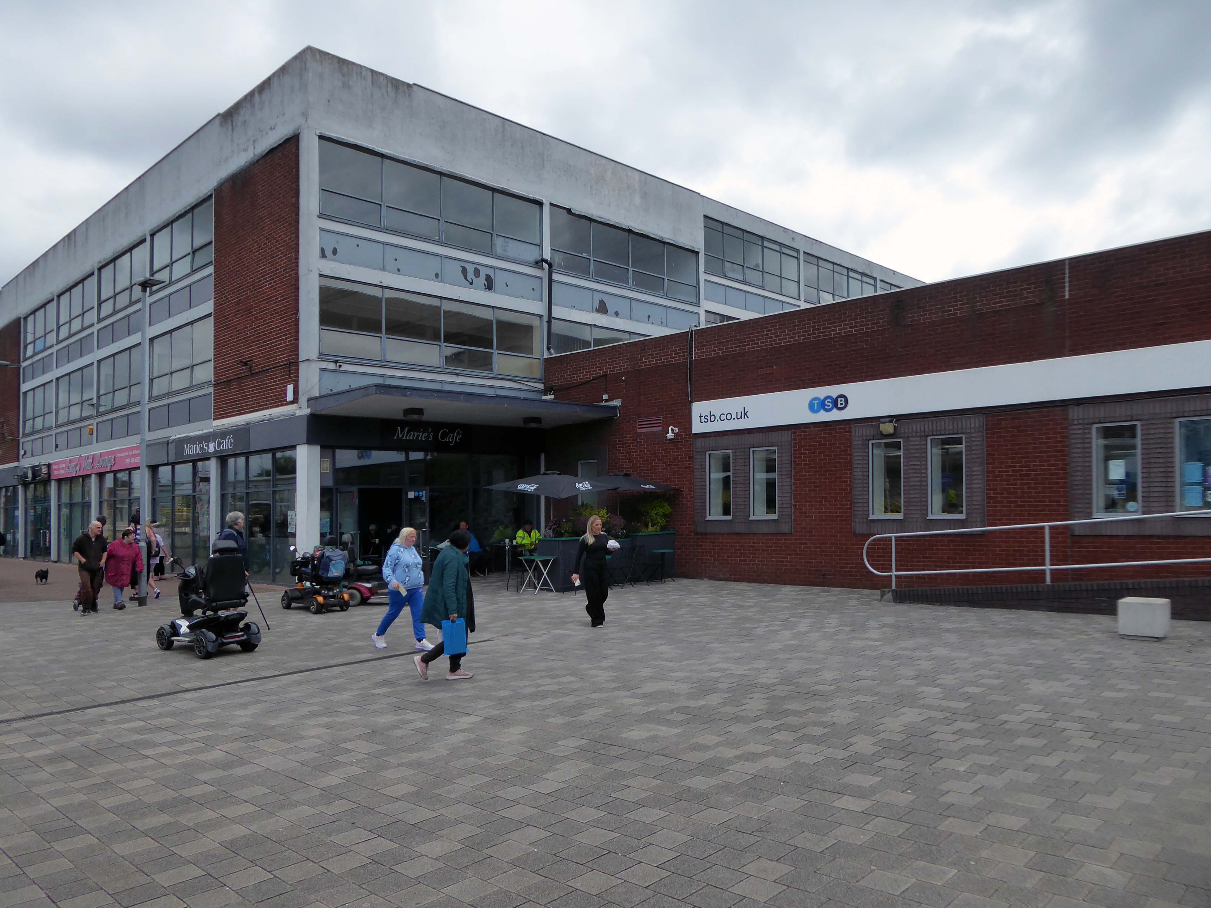
The gateway to the Civic Centre on arrival from the Transport Interchange is very poor. Access to the high street isn’t obvious and the route through to the high street isn’t clear. Much of the site is surrounded by fencing, barrier and gates and whilst they are open during the day, they are locked at night to prevent vandalism. This barricaded aesthetic does nothing to promote an easily accessible and family friendly environment as well as preventing any opportunity to promote a much needed night- time economy.
Currently, the Civic Centre appears to only cater for those with a need to visit for a particular purpose, rather than capitalising on an opportunity to create a place to visit and dwell.