
Having photographed the arterial roads of Manchester in 2014, I have resolved to return to the task in 2024.
Some things seem to have changed, some things seem to have stayed the same.


Having photographed the arterial roads of Manchester in 2014, I have resolved to return to the task in 2024.
Some things seem to have changed, some things seem to have stayed the same.
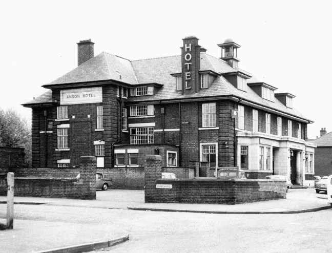
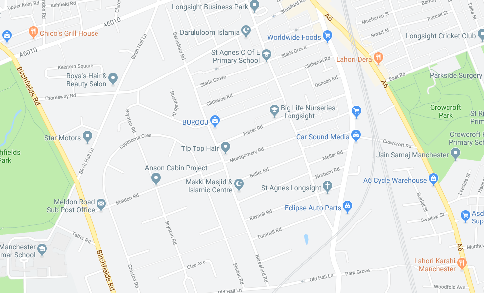
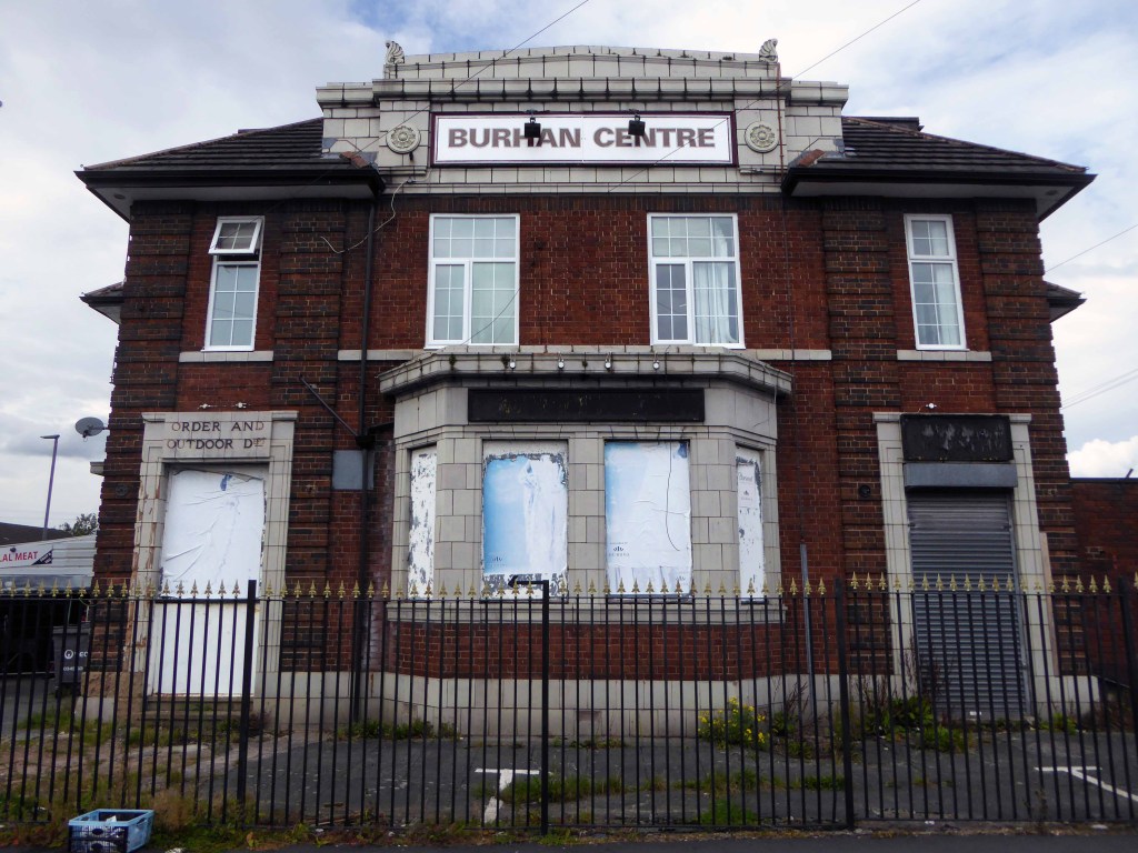
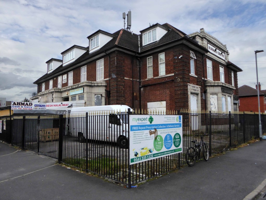
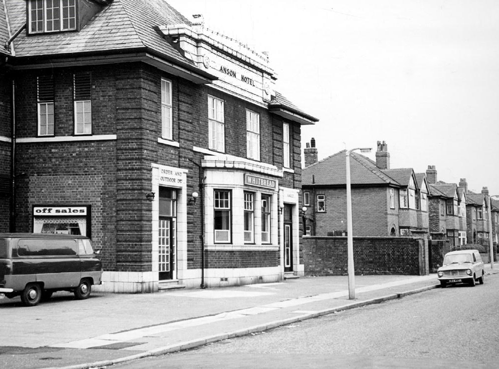
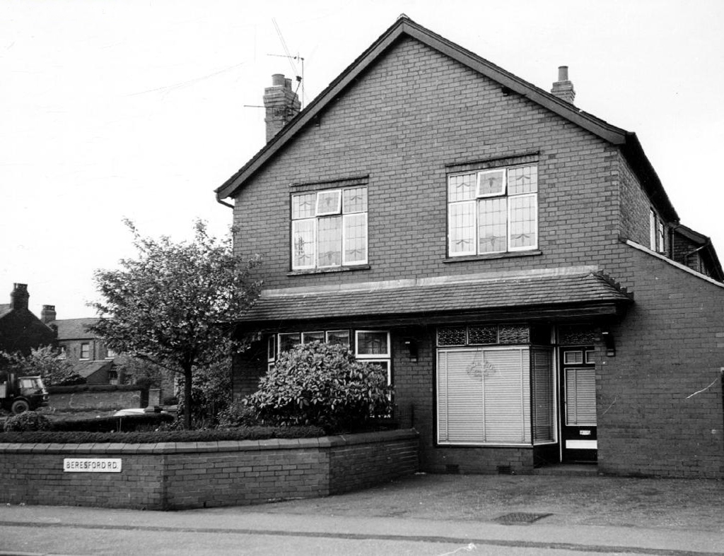
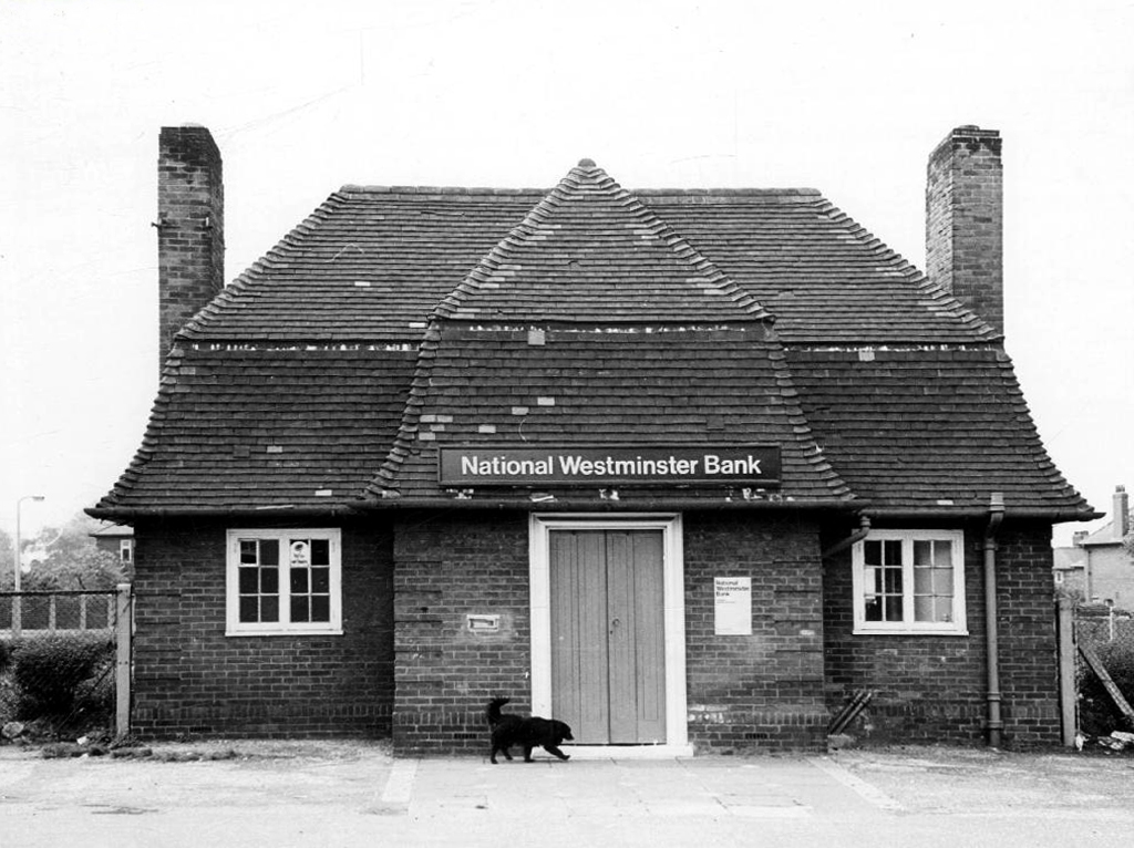
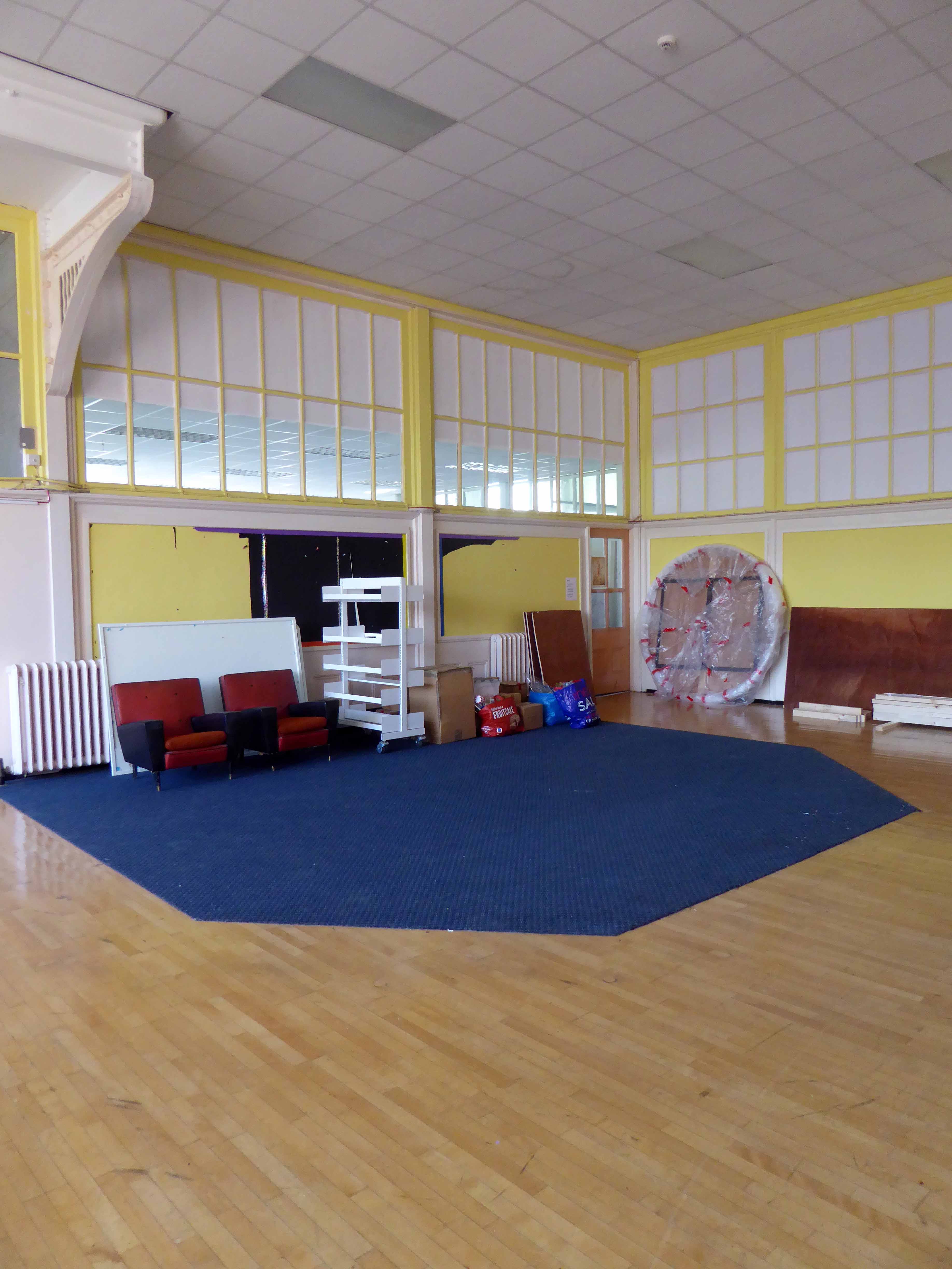
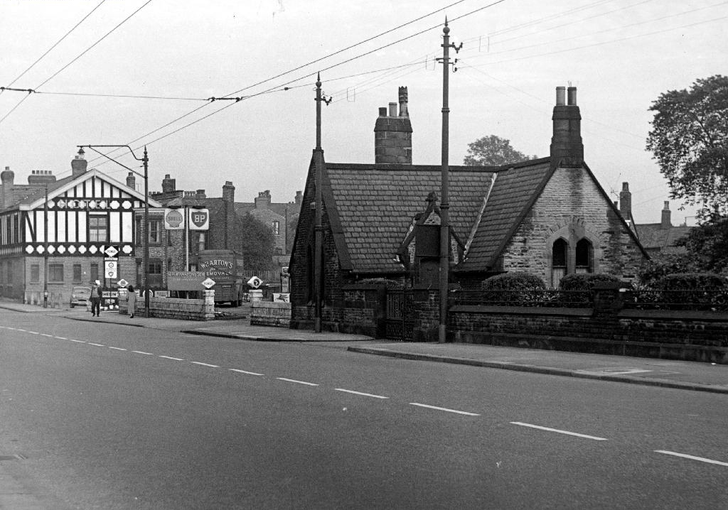
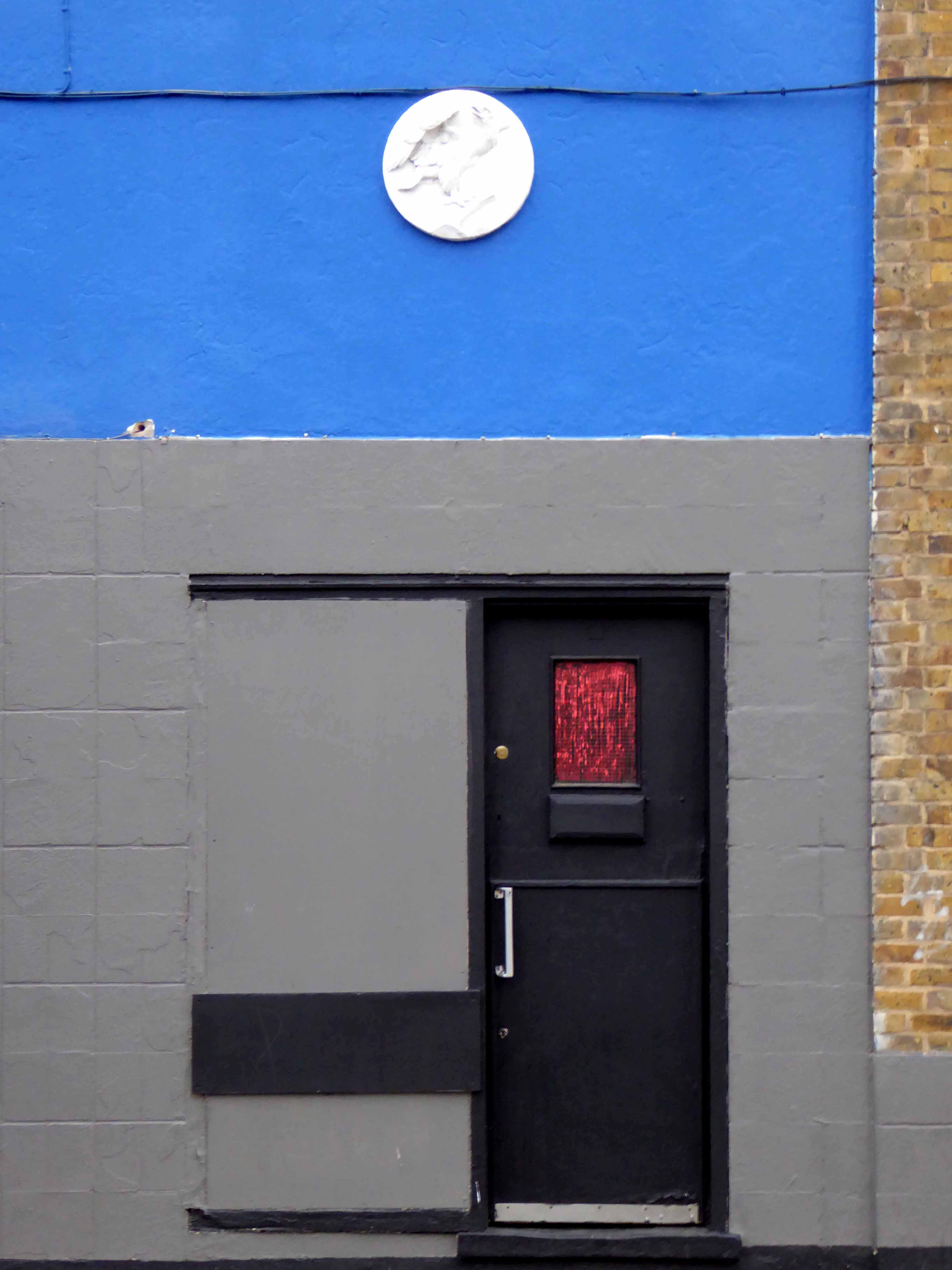
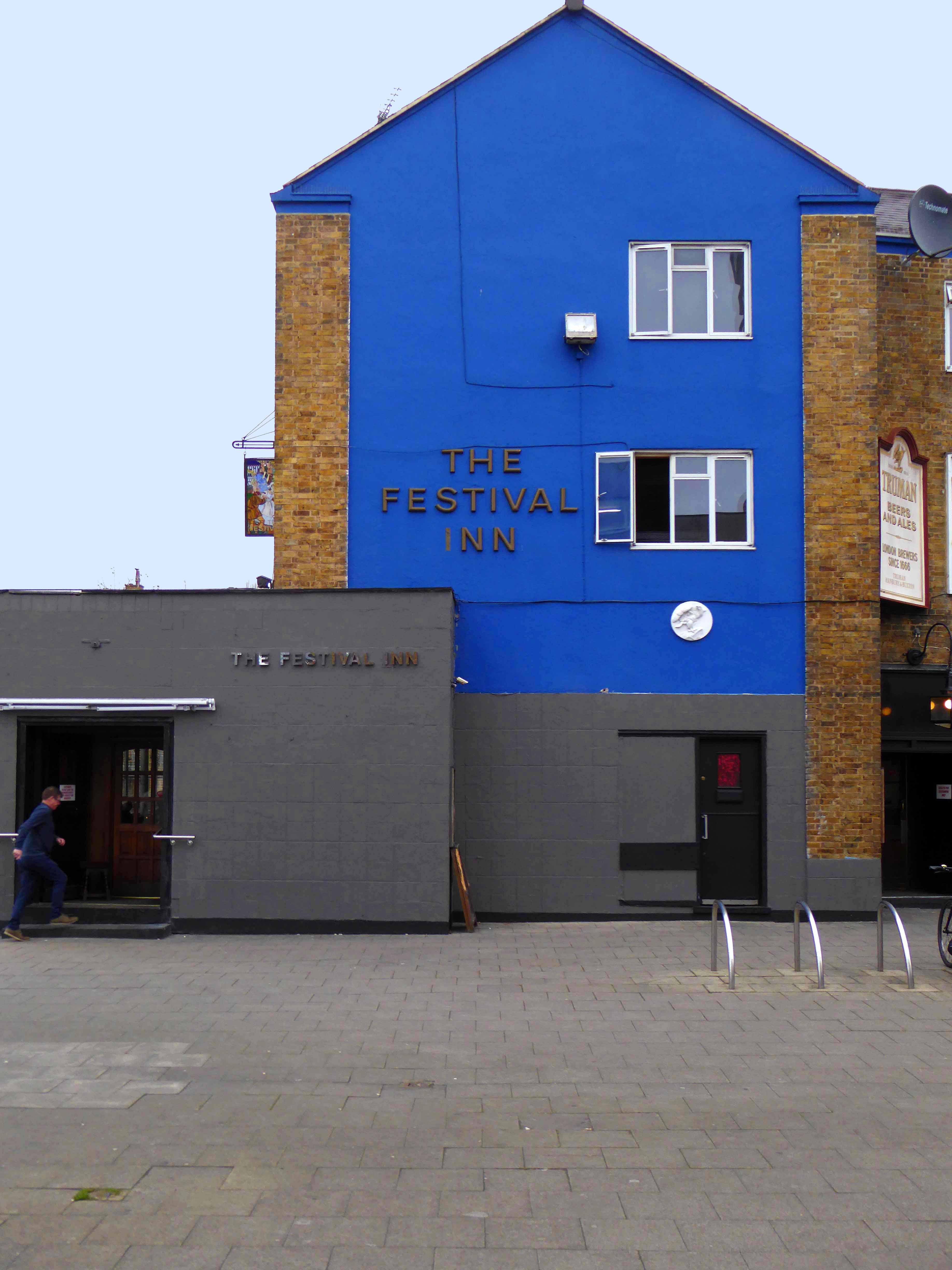
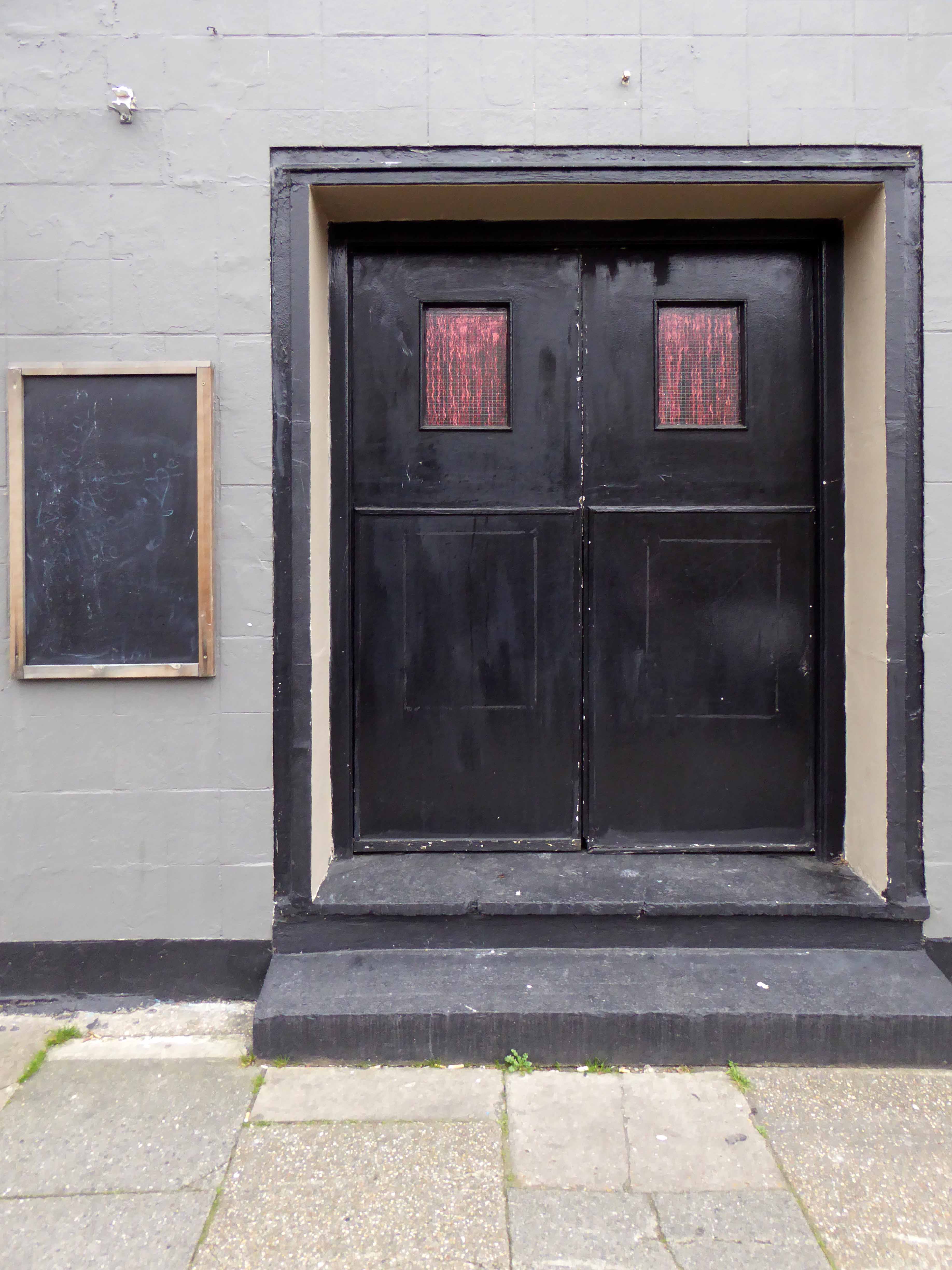
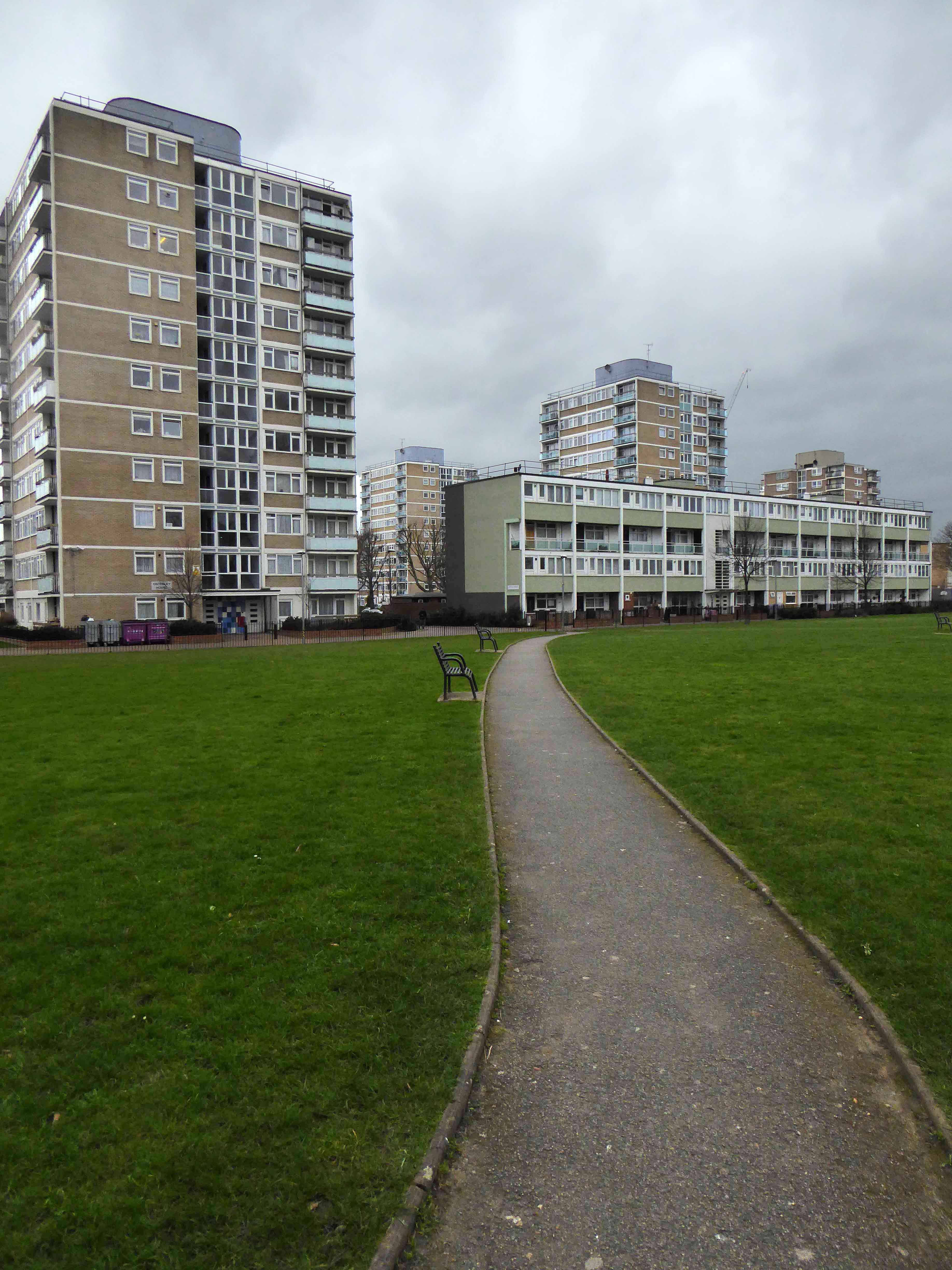
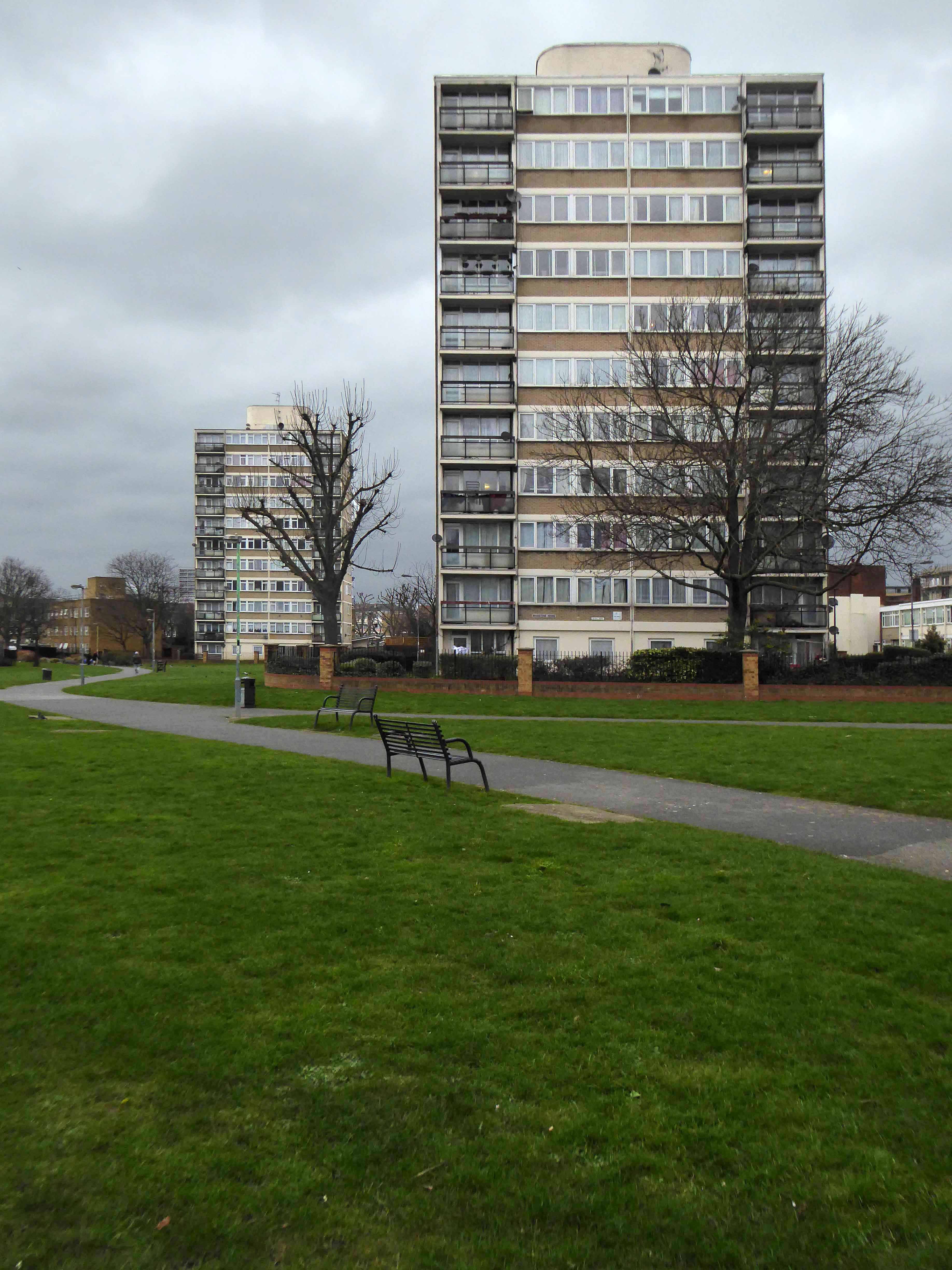
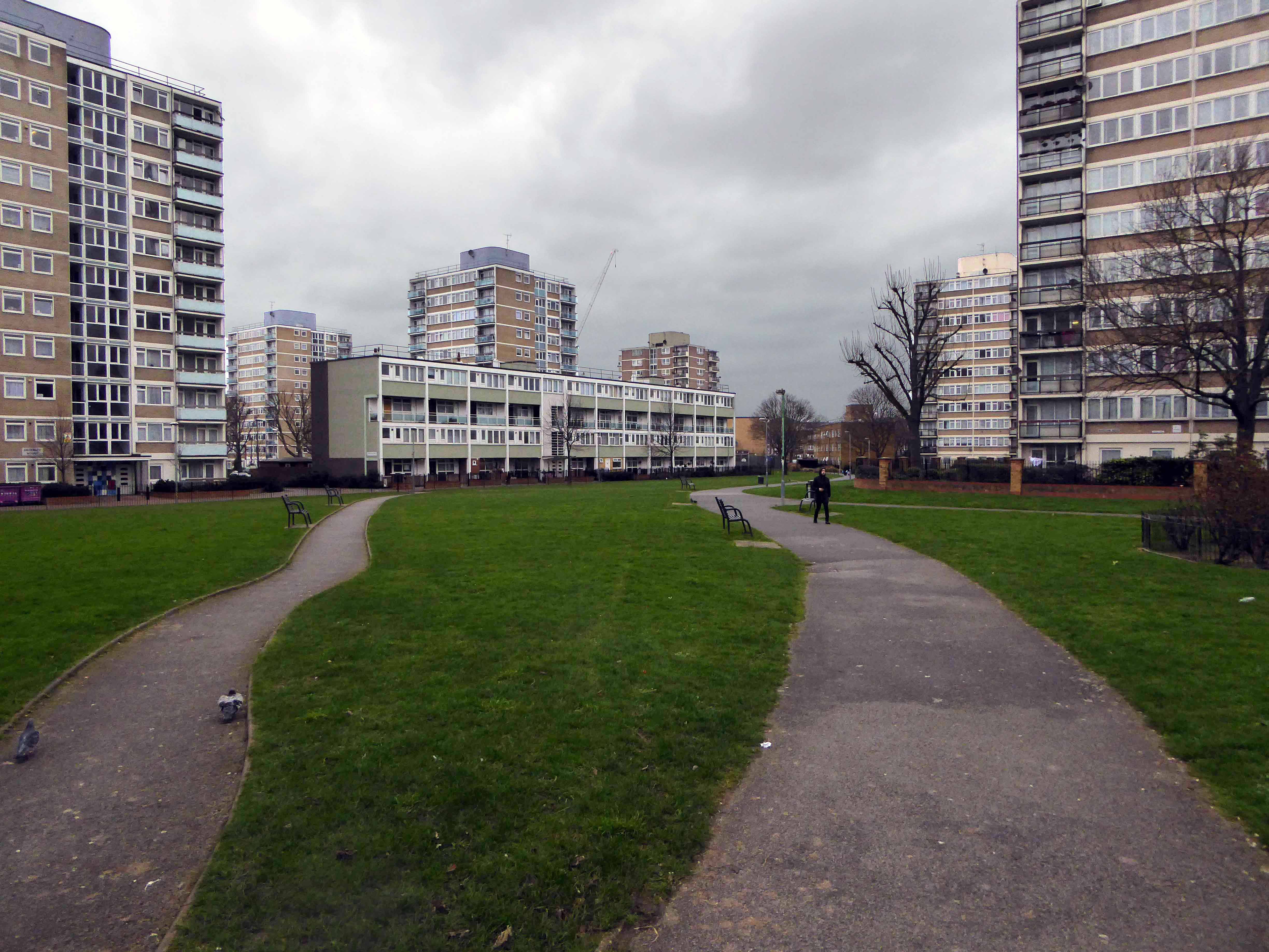
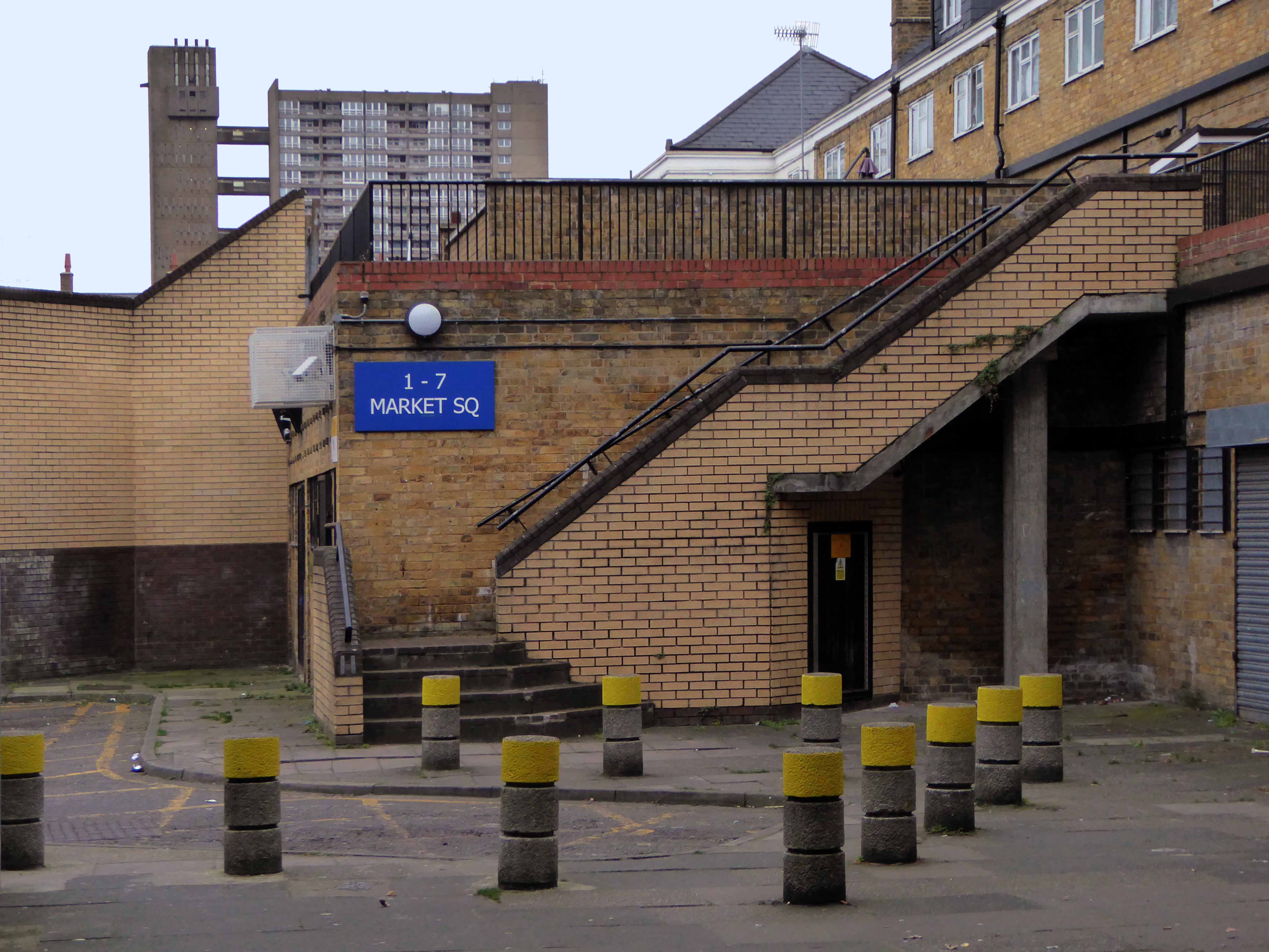
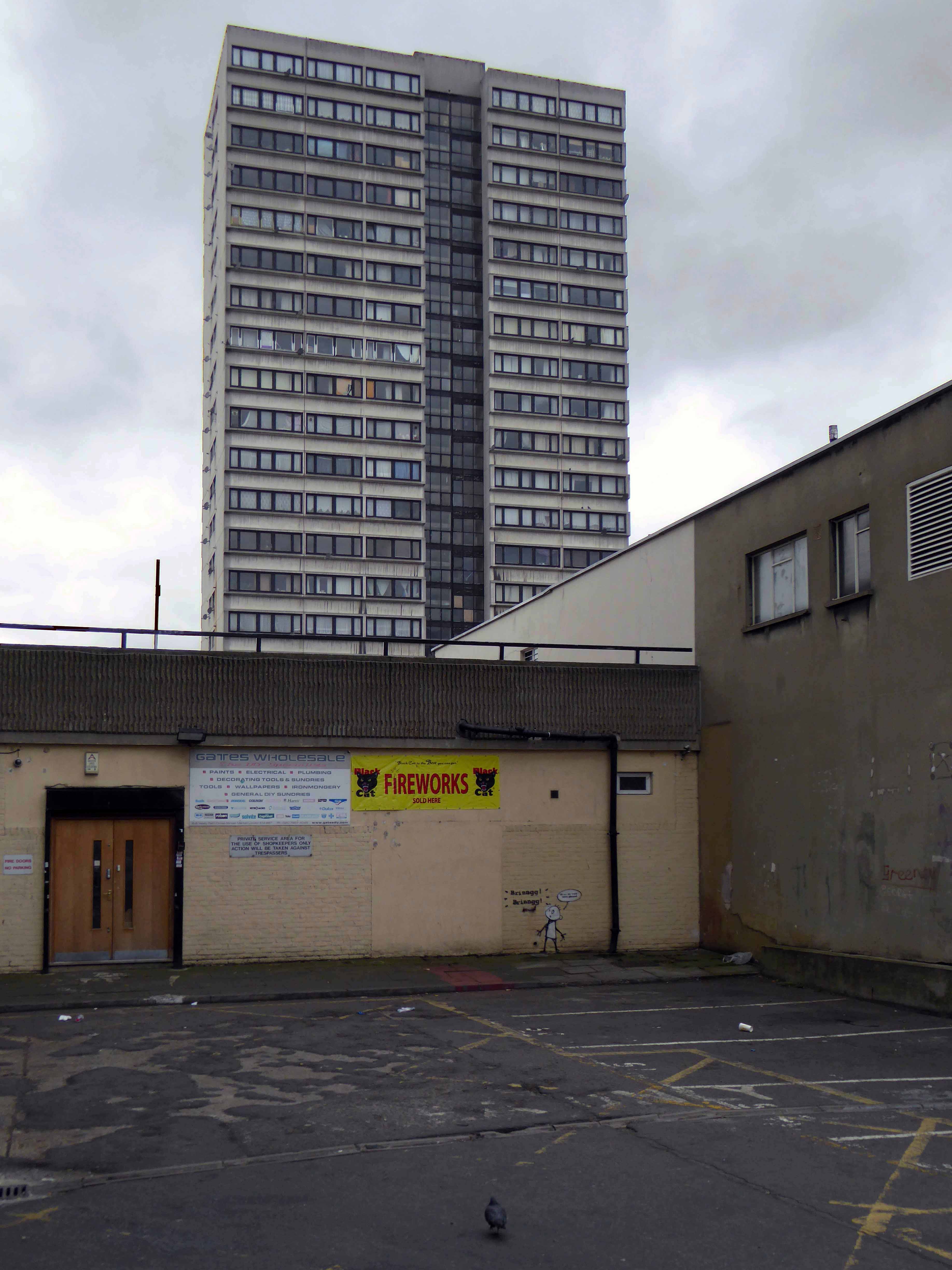
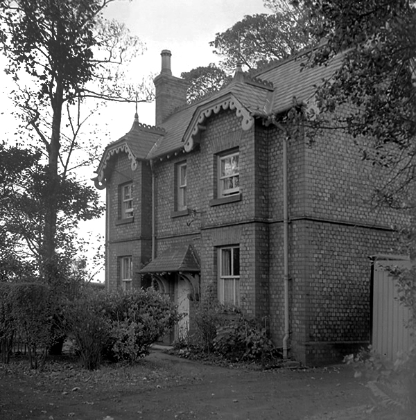
Cycling back from Town, zig zagging between the A6 and Birchfields Road, I headed down Beresford Road and bumped into a behemoth.
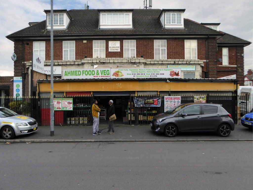
A huge inter-war Whitbread boozer long since closed, now a retail food outlet and badged as the Buhran Centre, also trading as Burooj.
This change of use is far from uncommon, the demographics, socio-economic conditions and drinking habits which shape this and countless other pubs, have since shifted away from the lost world of this immense, roadhouse-style palace of fun.
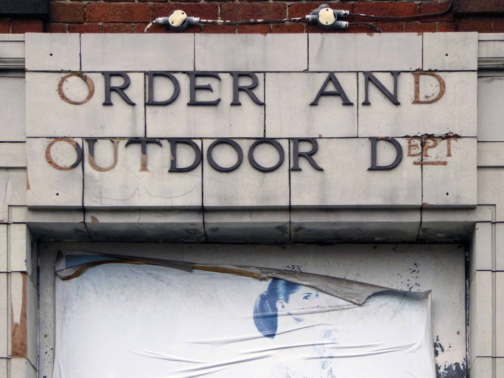
No more outdoor or orders here – the supermarket now supplies the supplies for the self satisfied home drinker.
The sheer scale of the building guaranteed its demise, a three storey house with no more stories to tell.
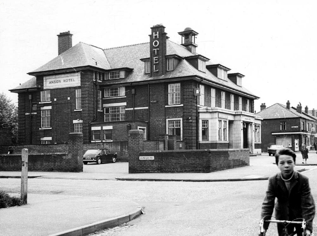
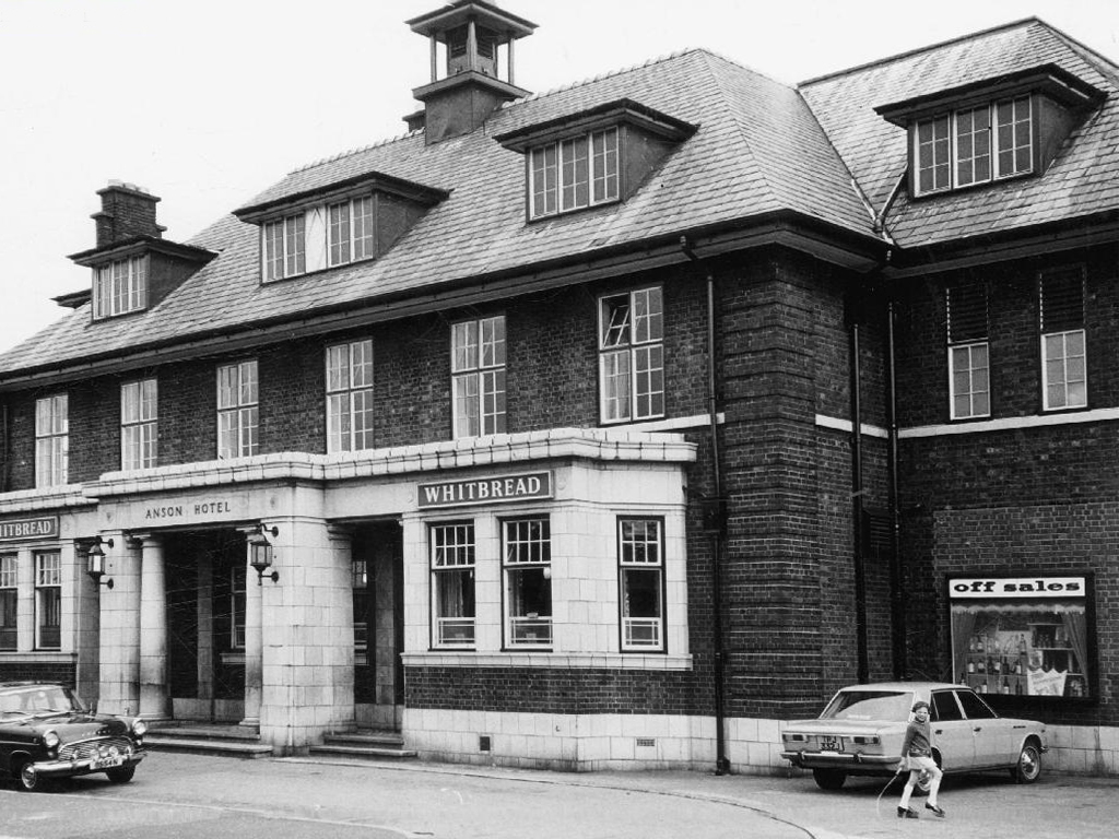
Searching online for some clues as to its history there is but one mention, on the Pubs of Manchester:

This is my attempt, in some small way, to redress the balance, snapping what remains of this once top pub.
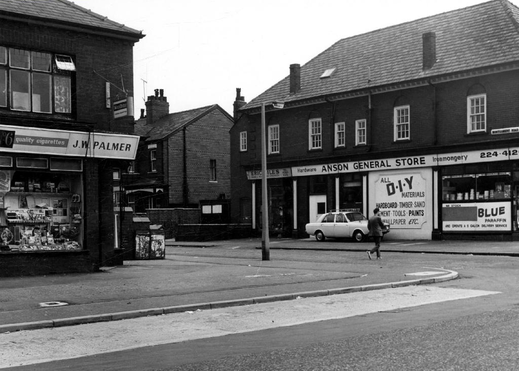
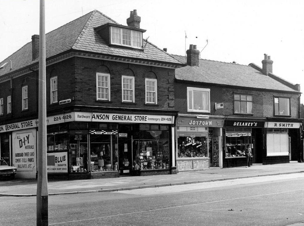
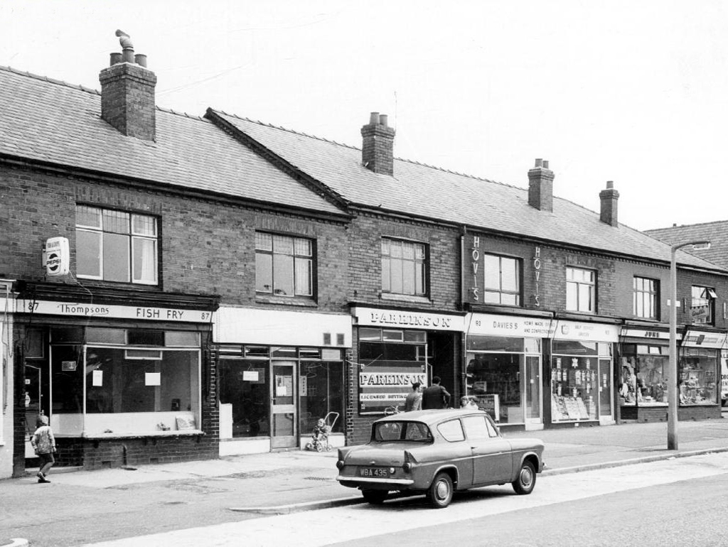
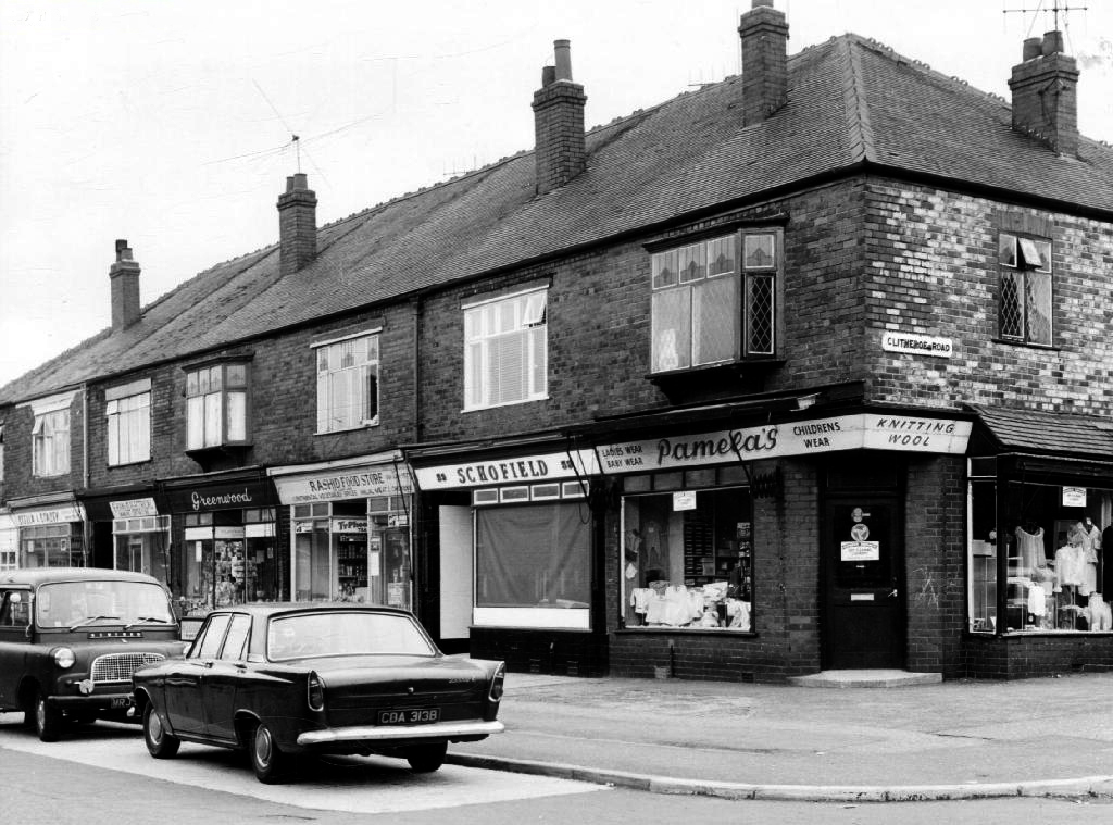
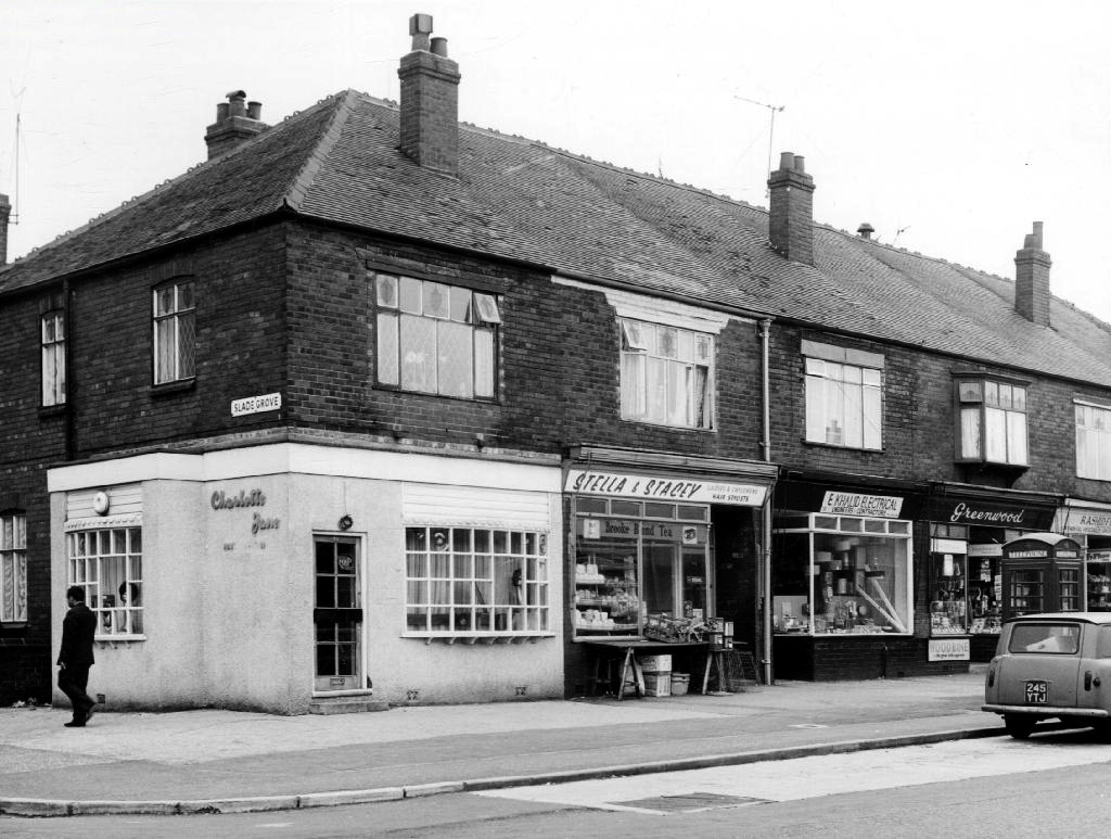
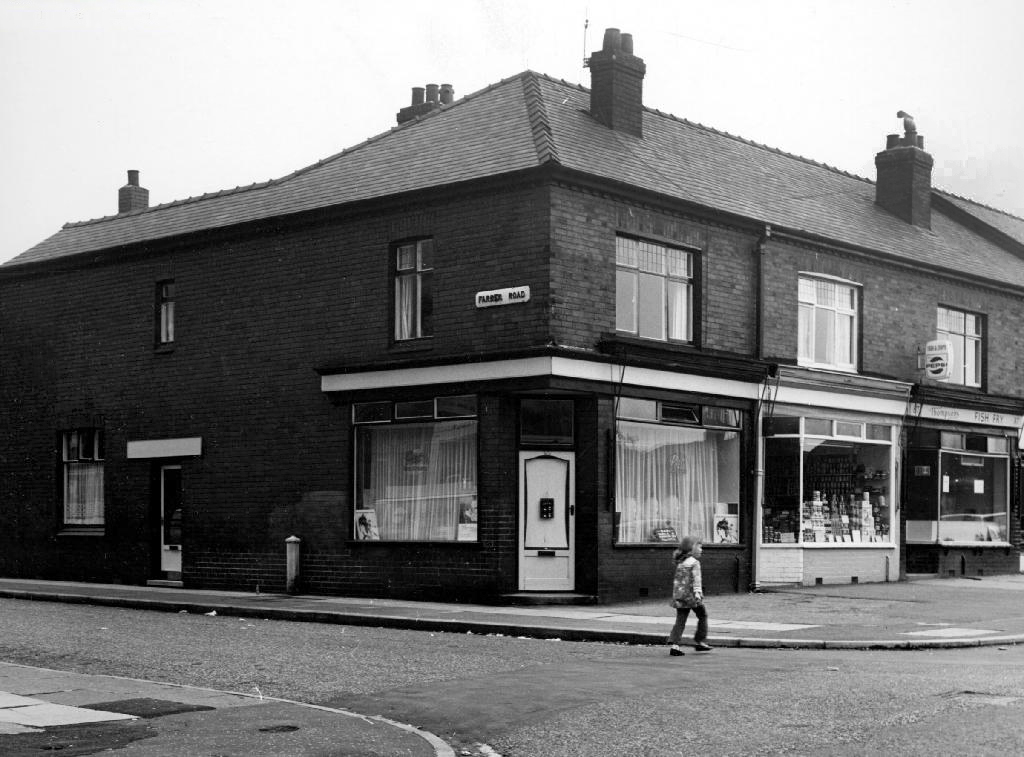
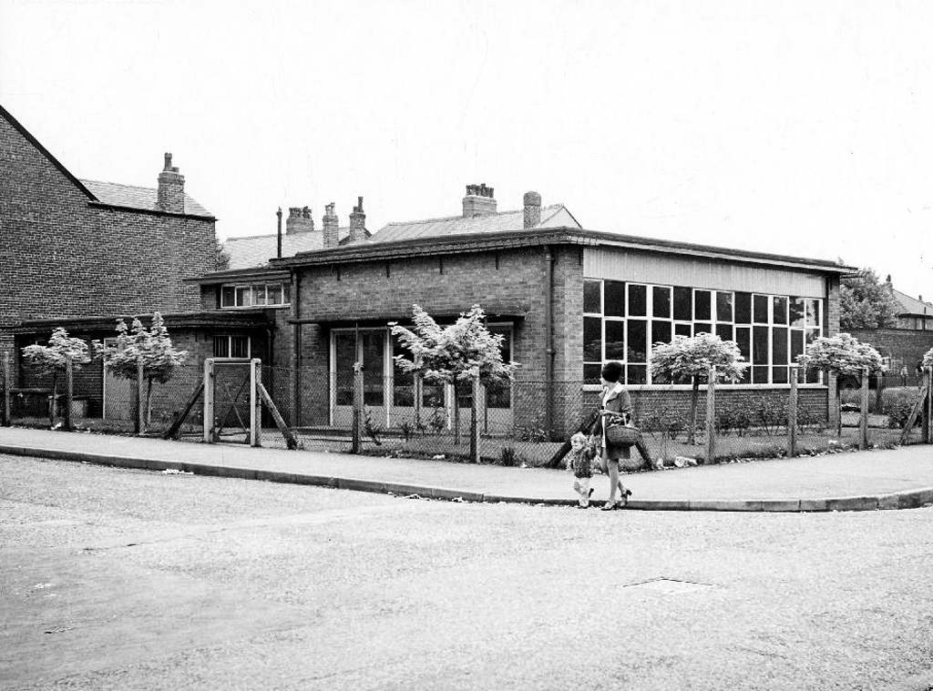
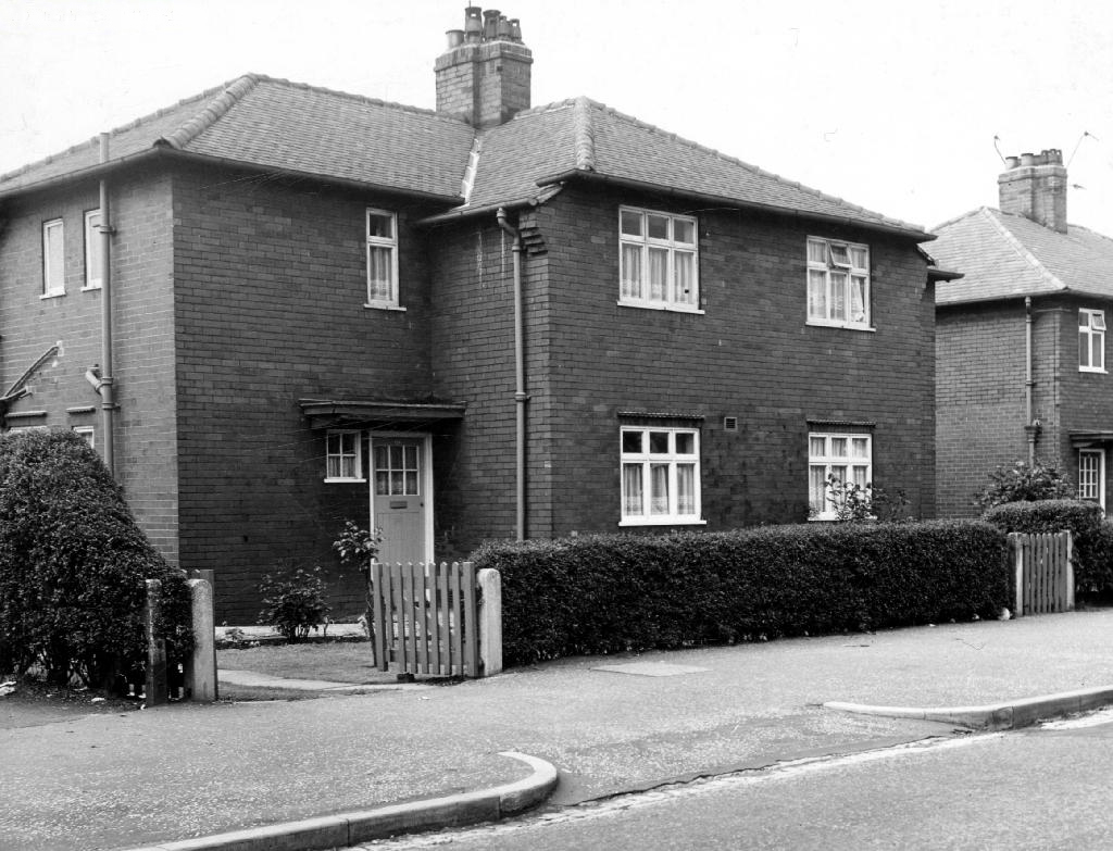
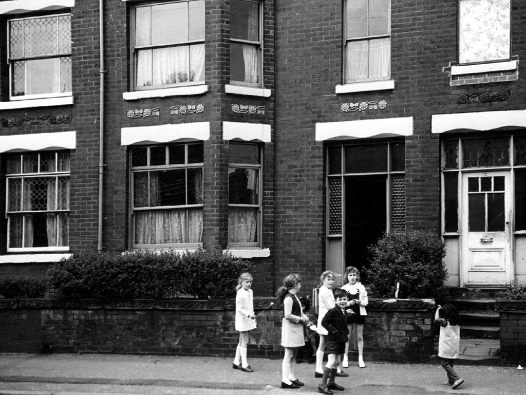
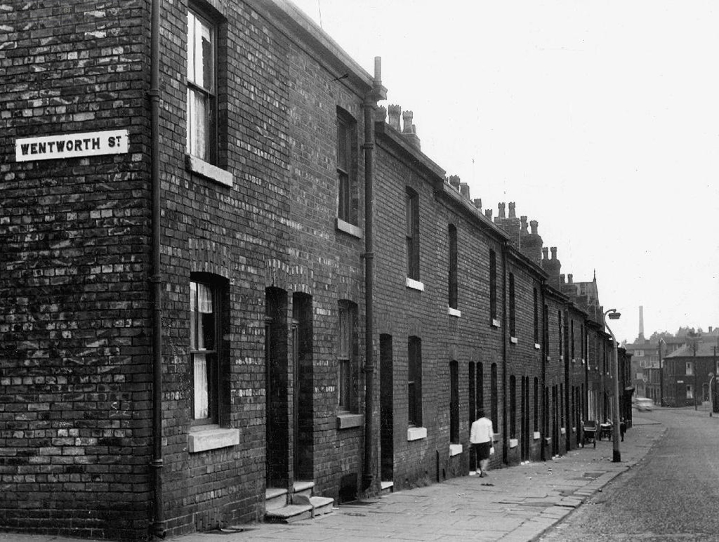
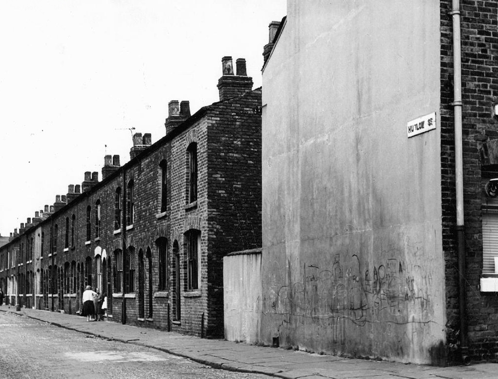
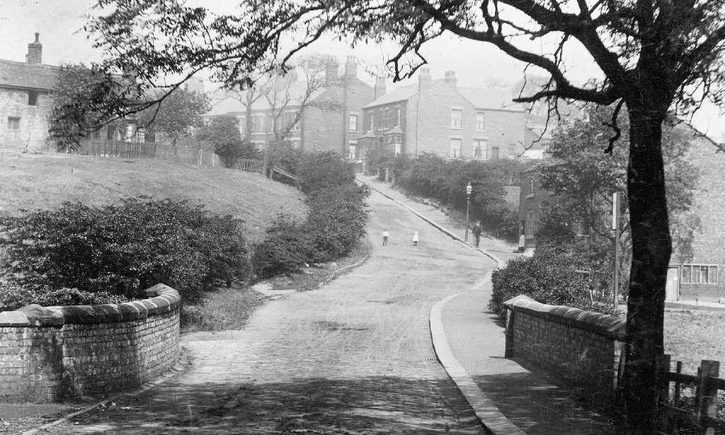
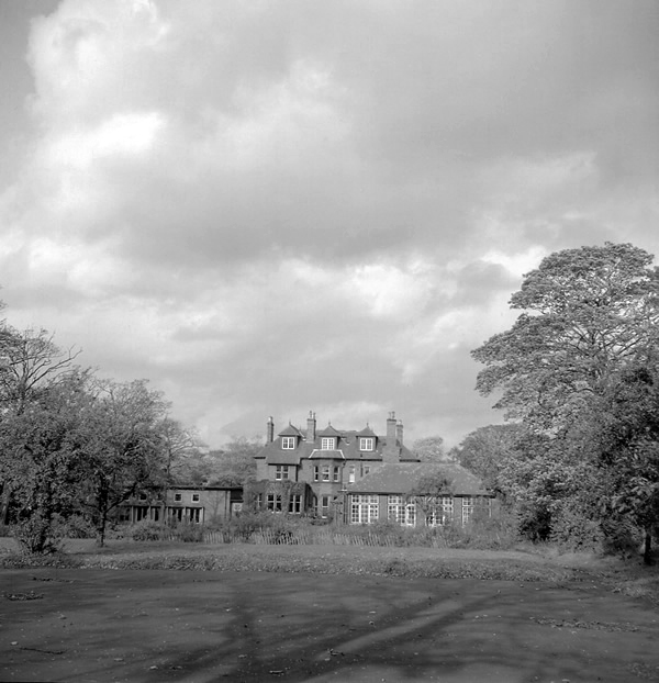
Safe home I searched the Manchester Local Image Collection, hoping to find some clues and/or images elucidating Beresford Road and the Anson in times gone by.
I found a typical inner Manchester suburban thoroughfare, a healthy mix of homes socially and privately owned, industry, independents shops, schools and such. Kids at play, passers-by passing by, captured in 1971 by the Council’s housing department photographers.
This was not a Golden Age – wasn’t the past much better, brighter, cheerier and cleaner reminiscence – simply a series of observations.
Things change.
Including the Anson Hotel.


Once upon a time there was almost nothing, as there often is.
Green fields, sylvan glades and a pleasant park in Grosvenor Square.
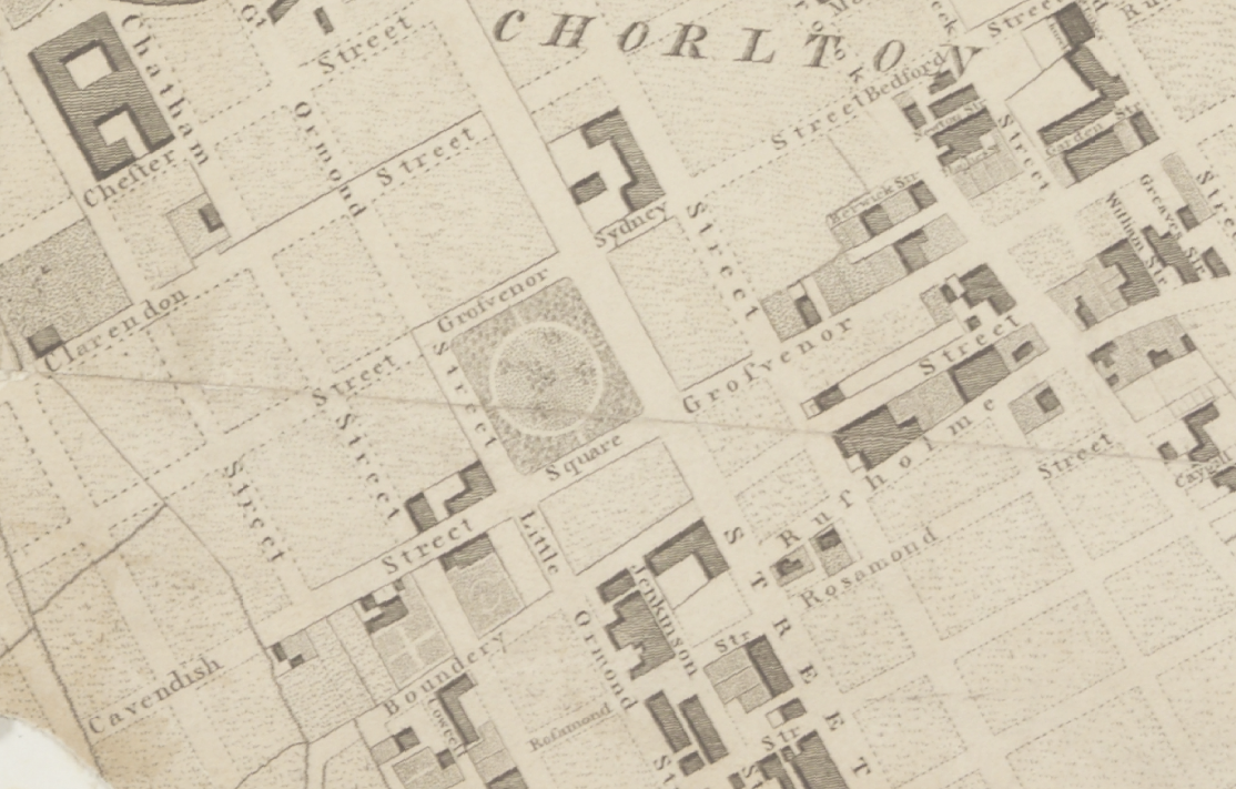
Then all of a sudden, at the heart of the Square sat All Saints Church.
Underneath Manchester’s All Saints Park is a hidden history – an estimated 16,000 bodies. For this was the site of a former Victorian Cemetery, set up to cater for the parishioners of All Saints.
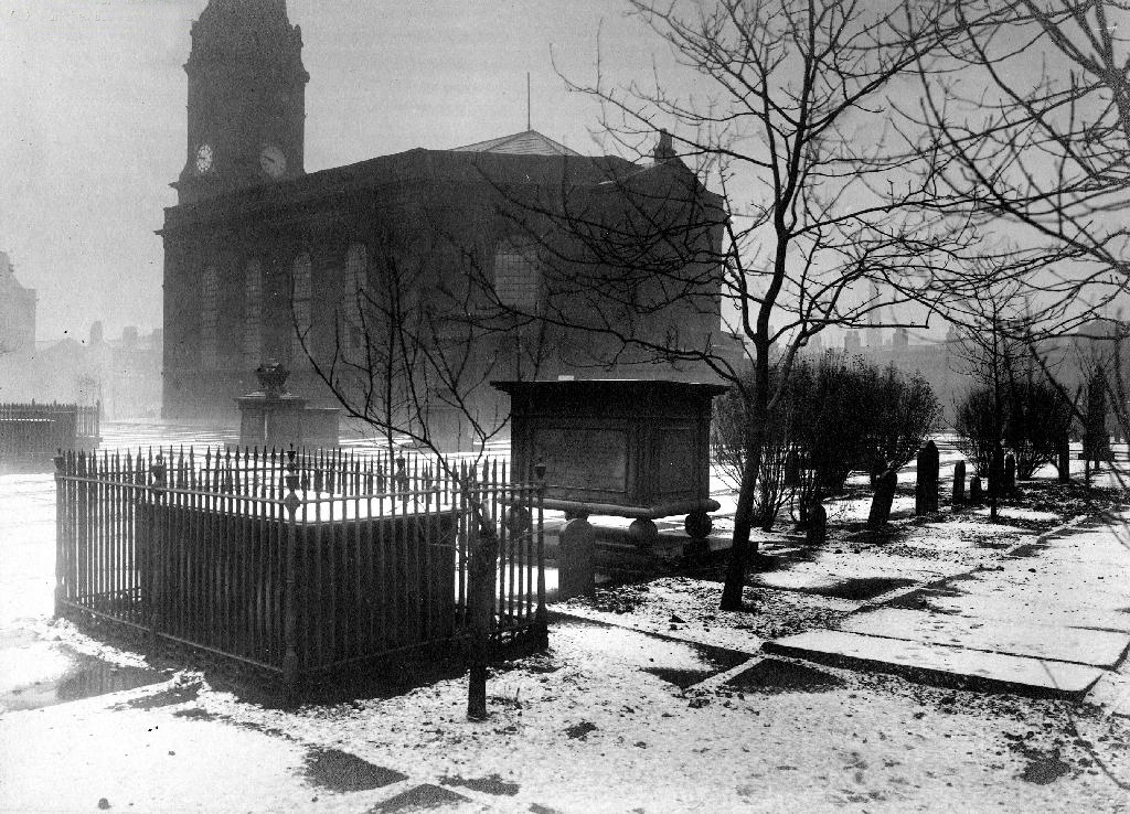
All Saints Burial Ground officially opened on Wednesday 19 April 1820. The first interment was that of twenty-one-year-old Fanny Knowles, who lived on London Road. Her funeral was conducted by the founder himself, Charles Burton. It would be another month before the next interment took place. In the first year burials were slow with only 55 interments, however, by 1851 the number had increased to over 600 per annum.
Bombed in the Blitz the damaged structure was demolished – and a play area established which lasted until the 1980s

The whole area having been a centre of housing, education, entertainment, commerce, public services and worship, was becoming the fiefdom of first the Polytechnic and subsequently the Manchester Metropolitan University.
But formerly there were peoples’ homes here.
Then the 1960s saw a huge programme of slum clearance in Manchester and whole communities across the Square and nearby Hulme were moved, rehoused in a thoroughly modern milieu.
Shops came and went.
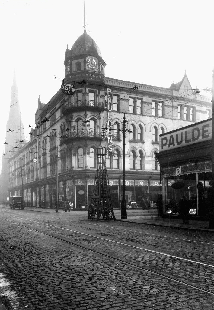
Paulden’s magnificent store was destroyed by fire in 1957
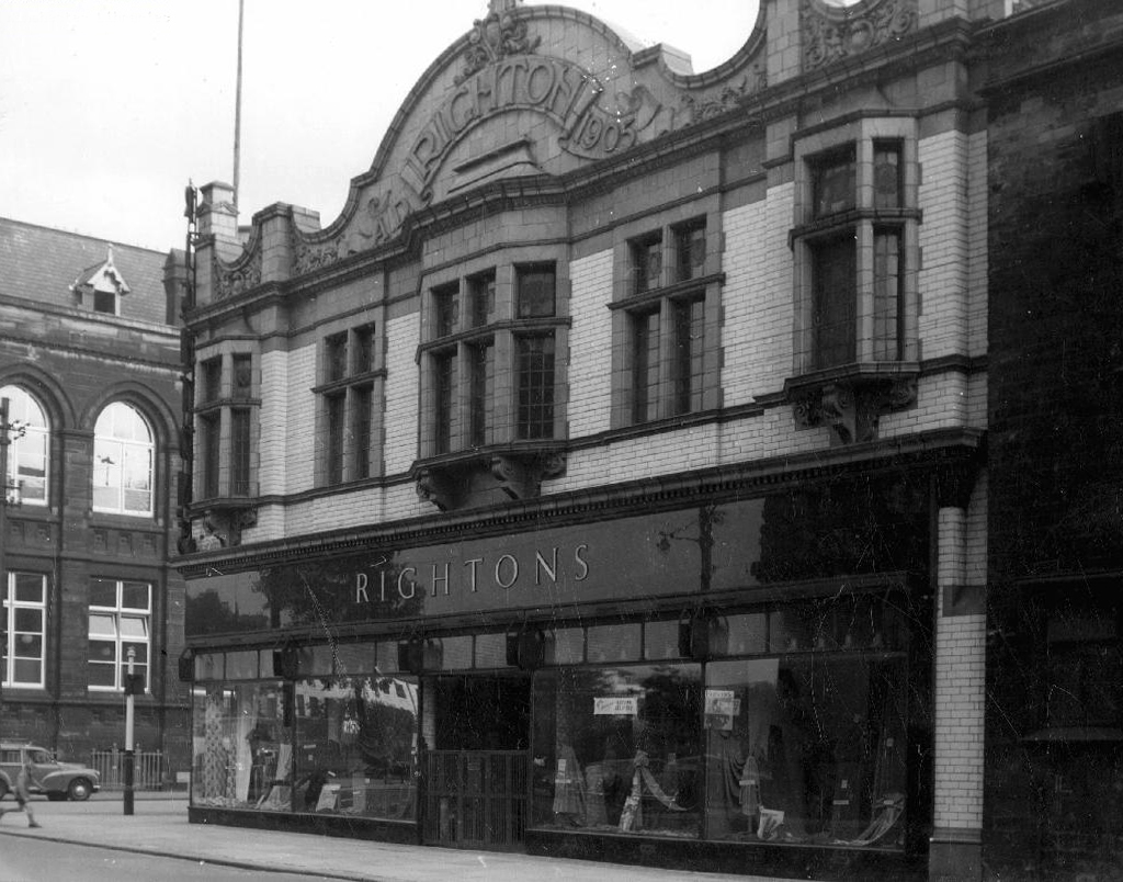
Rightons haberdashers has survived though no longer haberdashing, having been amalgamated into MMU.


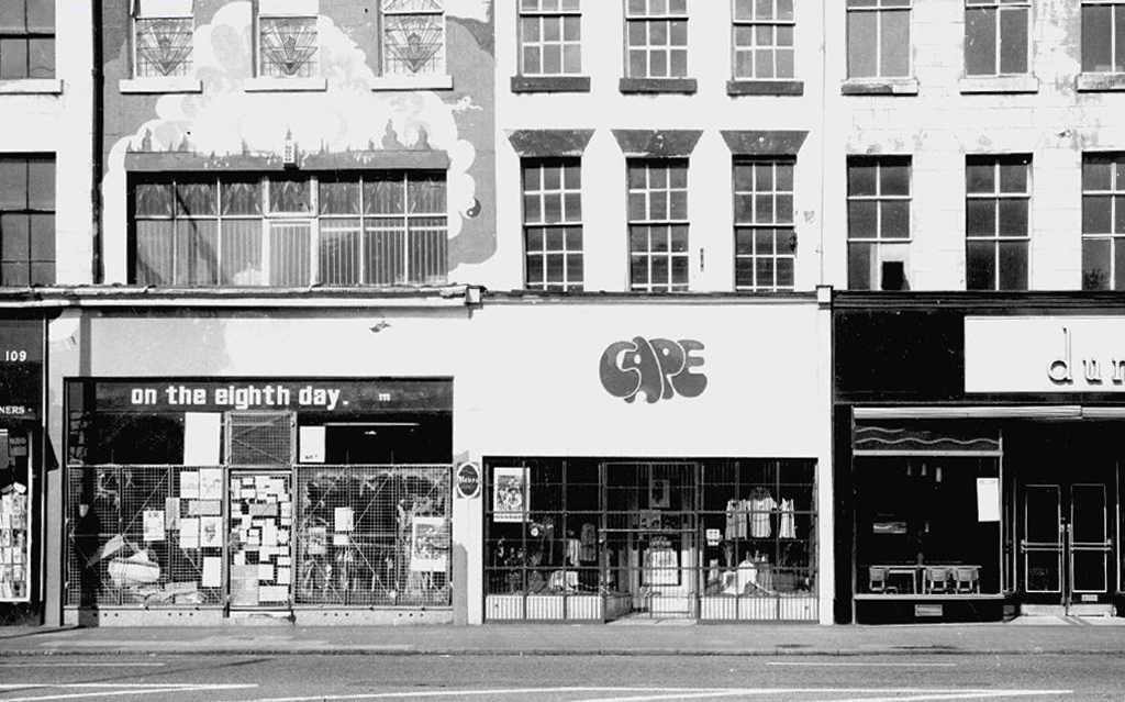
One day On The Eight day moved a little to the left
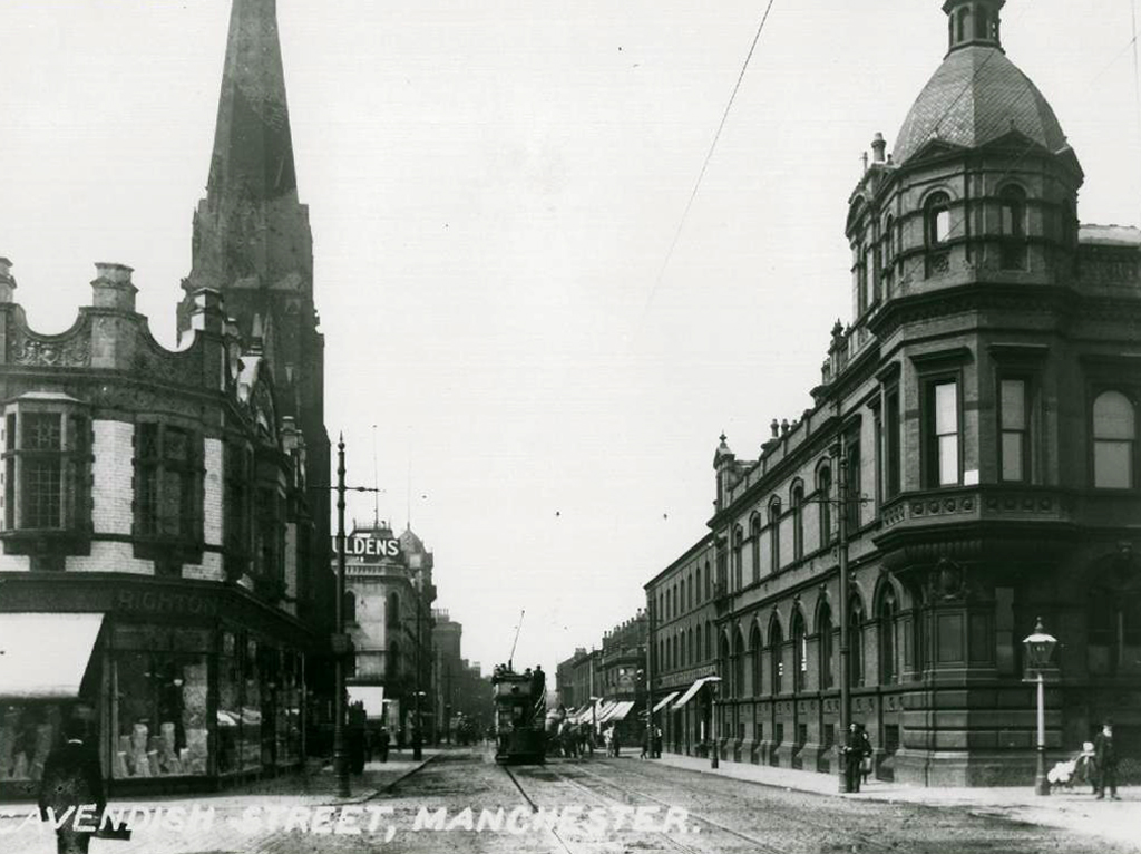
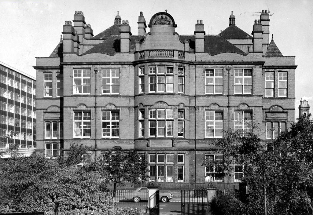
The Manchester Municipal School of Art was built in Cavendish Street in 1880–81 to the designs of G.T.Redmayne.
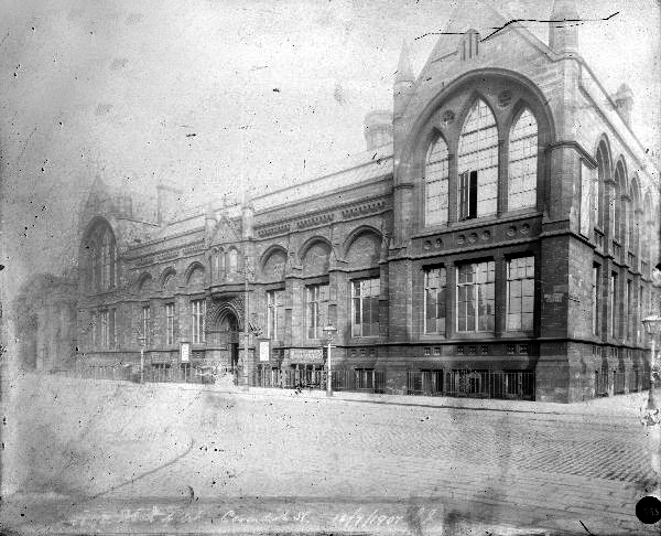
The fascia has been retained but the name has not been changed to protect the innocent.
Next door the Chorlton on Medlock town hall still has its portico in place, the adjacent Adult Education building has been surgically removed.
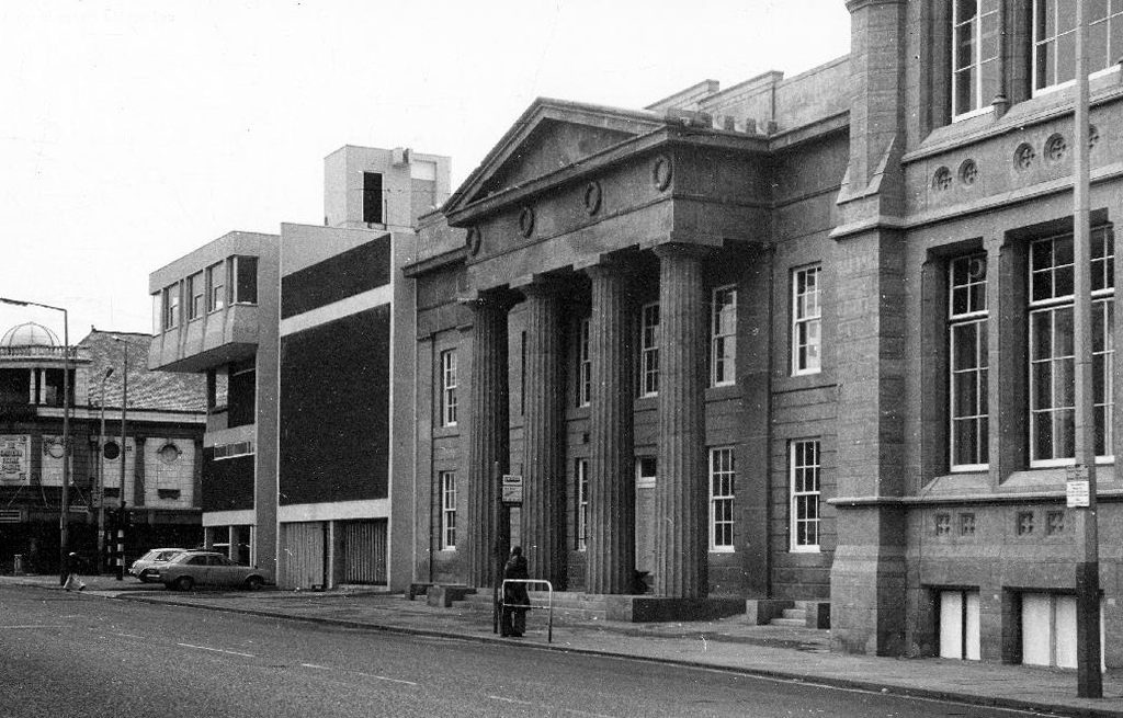
Richard Lane, the architect of the Friend’s Meeting House on Mount Street, designed the Chorlton-on-Medlock Town Hall on Grosvenor Street. It continued in that role from 1831 until 1838 when Chorlton-on-Medlock became part of the city of Manchester. In the years that followed it was used by the local community for a variety of functions but the redevelopment of the area meant that the local population diminshed and the building became redundant. In 1970, the interior was removed, a new structure added to the rear and it became part of the Polytechnic which became the Manchester Metropolitan University.
The Fifth Pan African Conference was held there between October 15th and 21st in 1945. Ninety delegates from across Africa, Europe and the Caribbean, attended the meeting and among the delegates were a number of men who went on to become political leaders in their countries including: Hastings Banda, Dr Kwame Nkrumah, Obafemi Awolowo and Jomo Kenyatta.
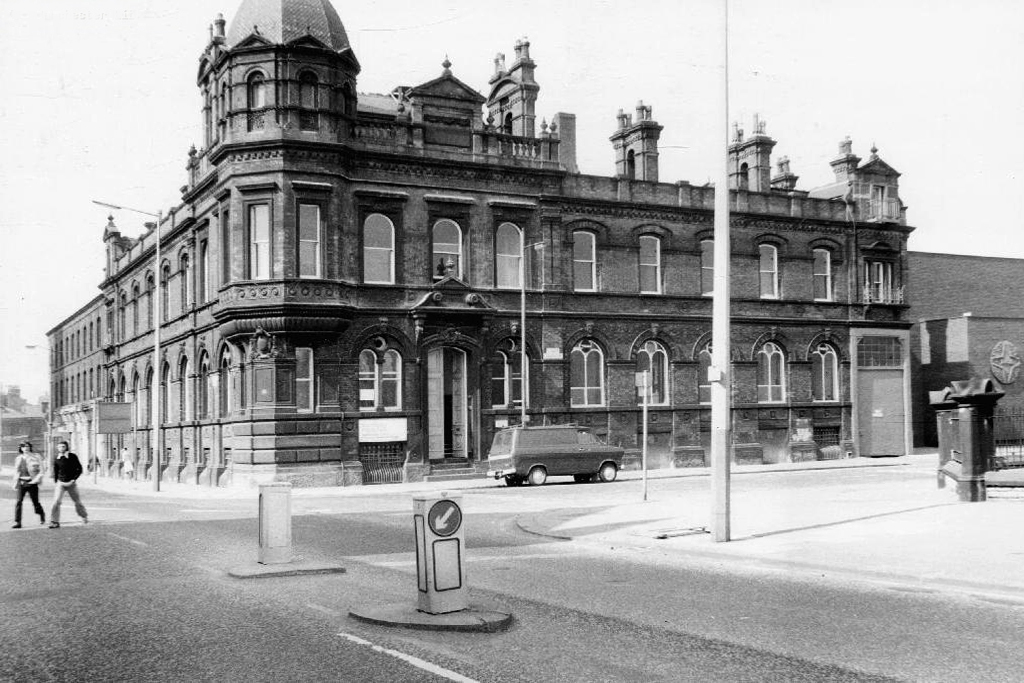
Former Chorlton Poor Law Guardian’s HQ then Registry Office, now the Ormond Building of Metropolitan University – and at the far right edge St Augustine RC.
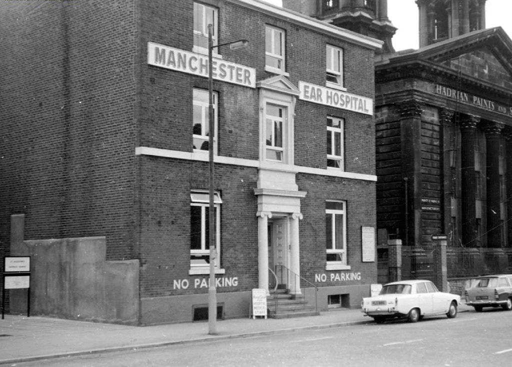
The Manchester Ear Hospital on Lower Ormond Street, shortly before being transferred to Manchester Royal Infirmary. Most of the building was demolished, but the facade retained as part of MMU’s Bellhouse Building.
To the right the Presbyterian Church.
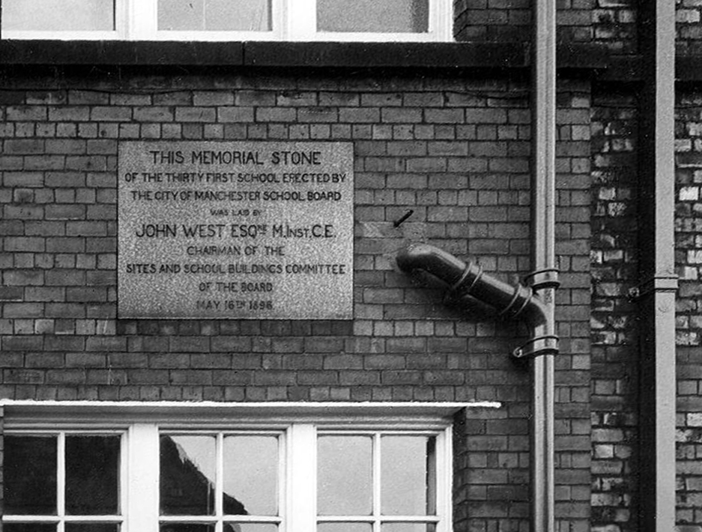
Cavendish Street School
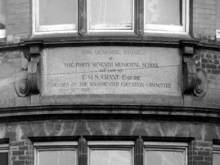
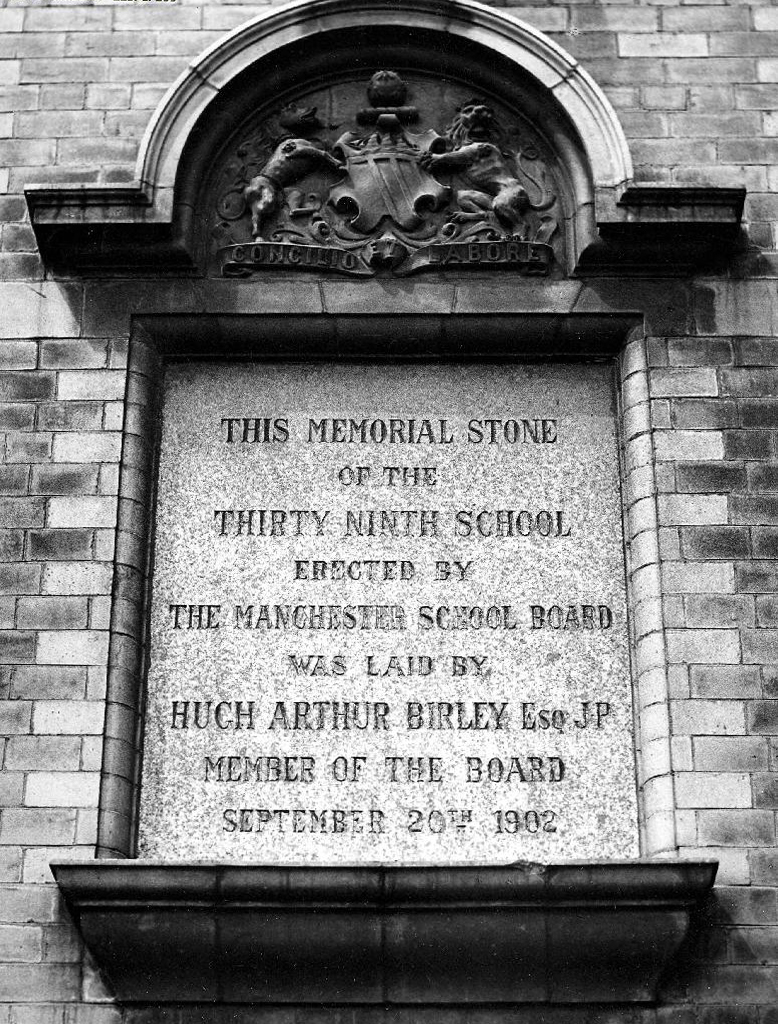
The memorial stone on the front of the school, laid on June 17th, 1908, declared that it was the Forty Seventh Municipal School. Strangely, it seems that it was called the Cavendish Street School despite the fact that it wasn’t on Cavendish Street.
Manchester History
It was subsequently utilised by the Polytechnic sculpture department – then demolished to make way for something else of an educational nature.
Some or all of our social and architectural history has been overwritten, lost or swept aside by the tide of history.
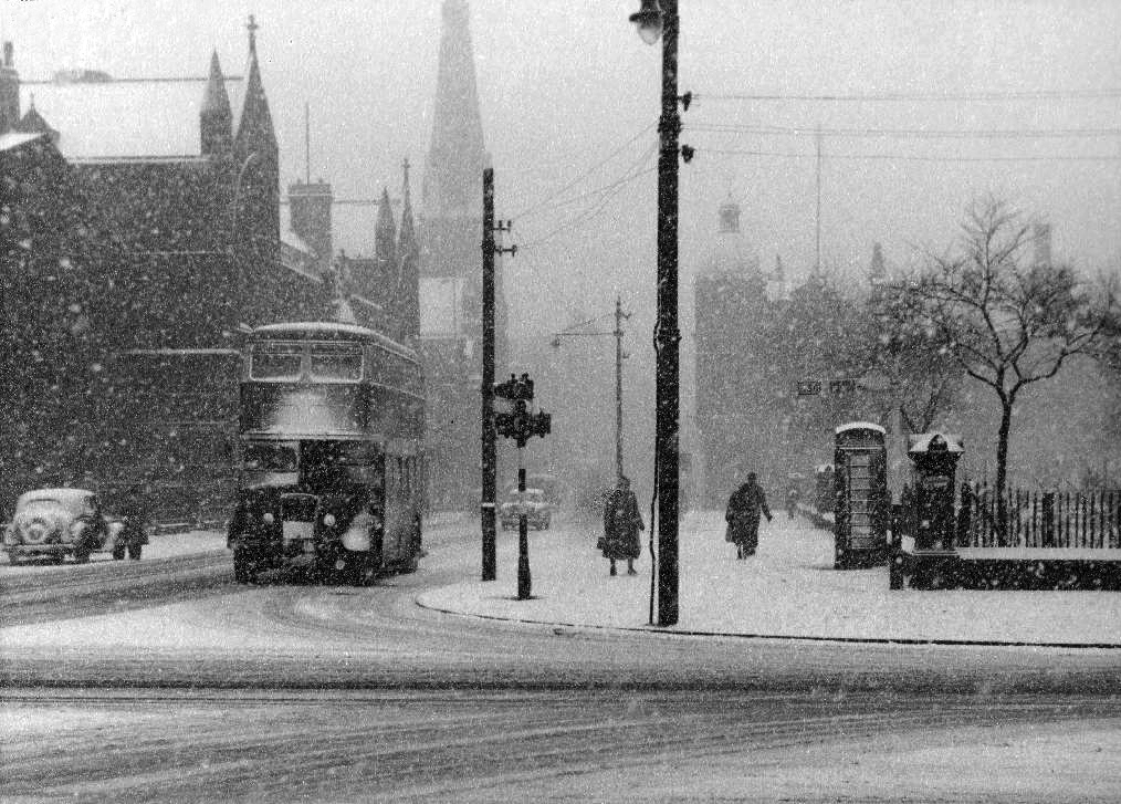
Though on a dark snowy night you can still make out the bright red corporation buses, passing by in a dark cloud of diesel.
Room on top.
Archive images Local Image Collection
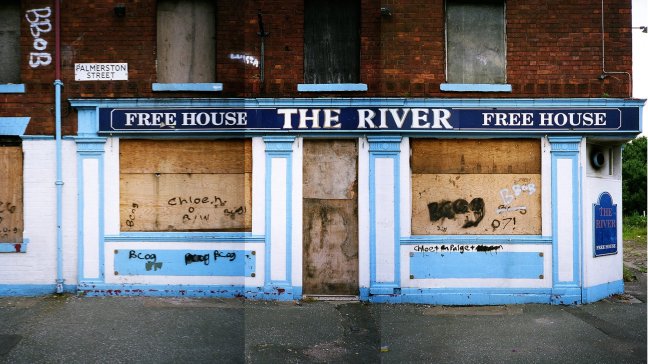
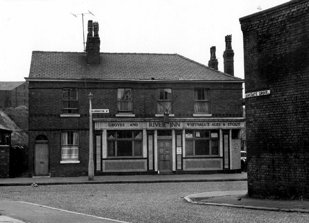
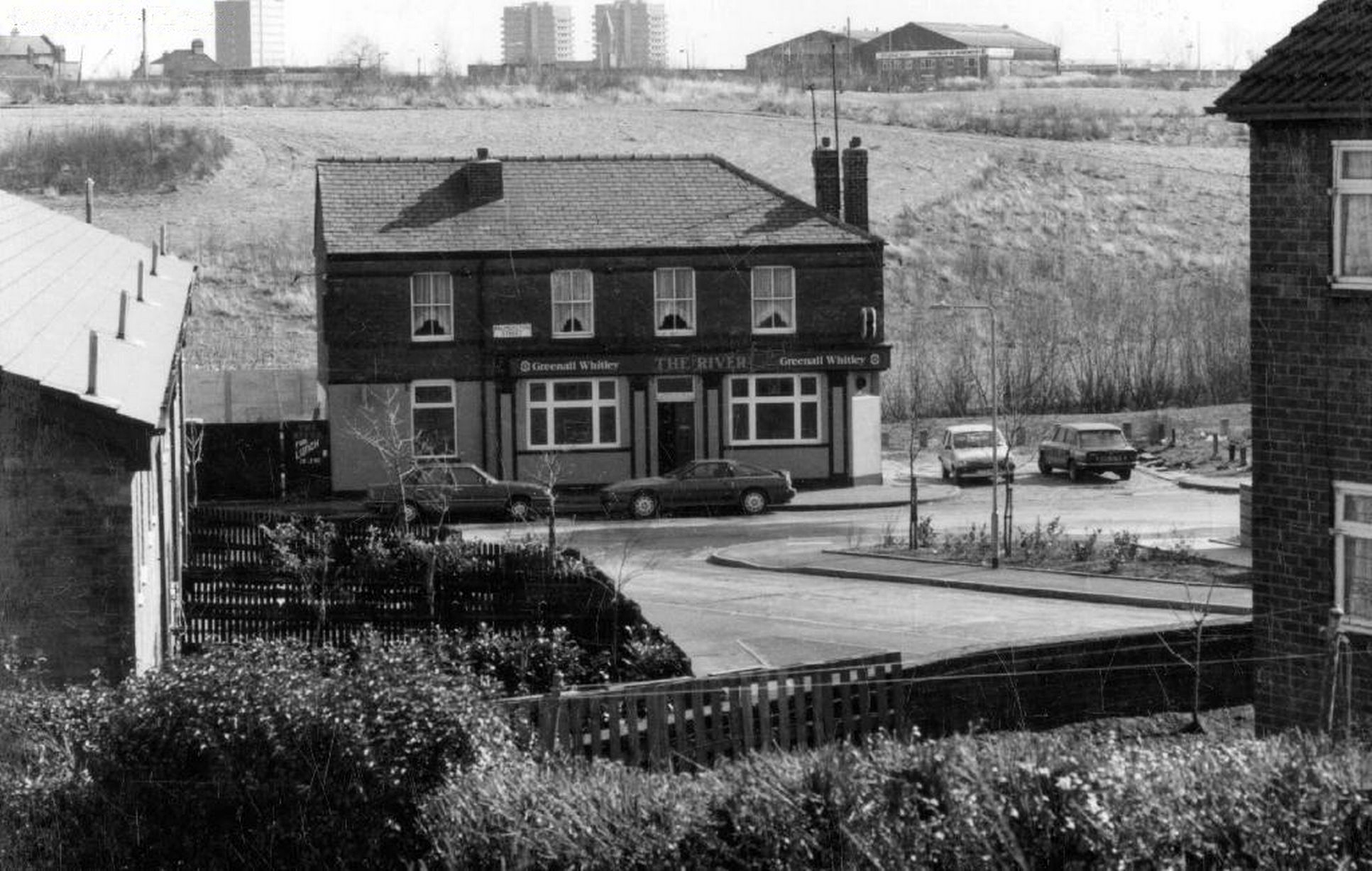
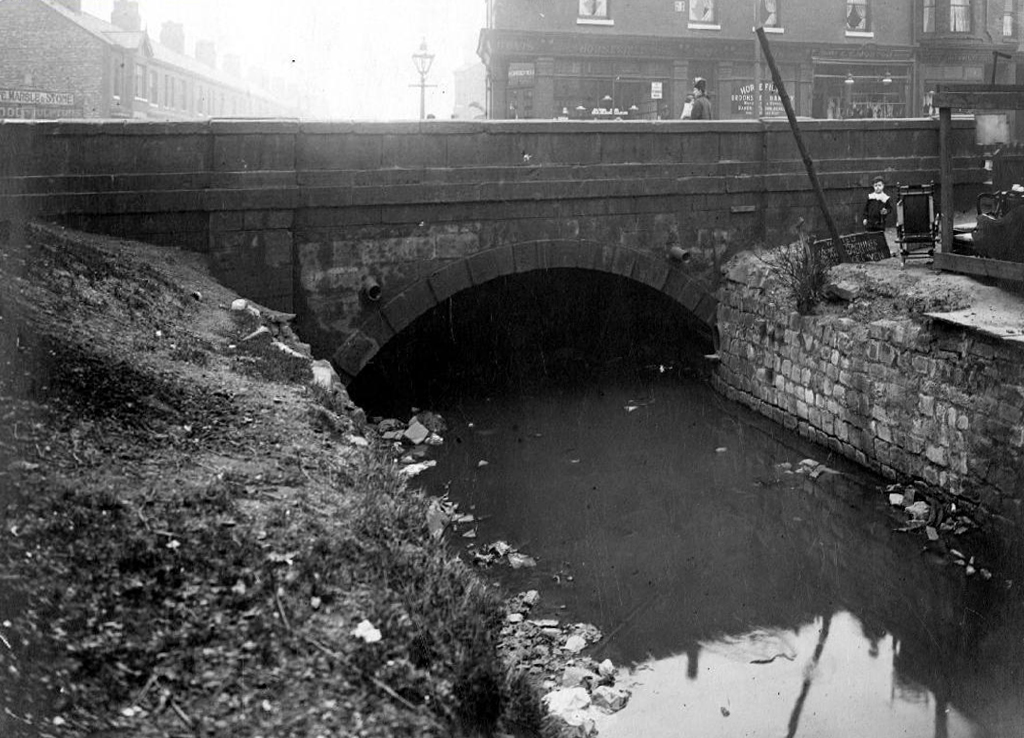
To begin at the beginning – some years ago I traced the route of the River Medlock, I chanced upon a forlorn pub called The River, all alone, desolate and boarded up, presiding over an area that I assumed, would once have supplied ample trade to a busy boozer.
I returned last week in search of some rhyme or reason, for such a seemingly sad and untimely decline.
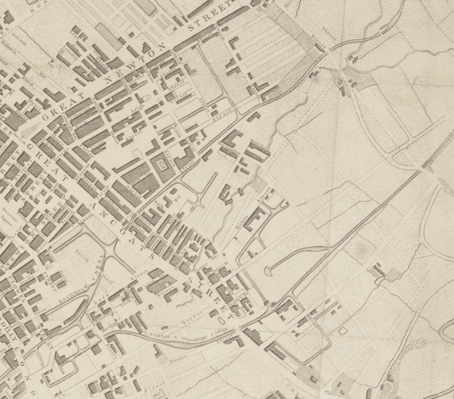
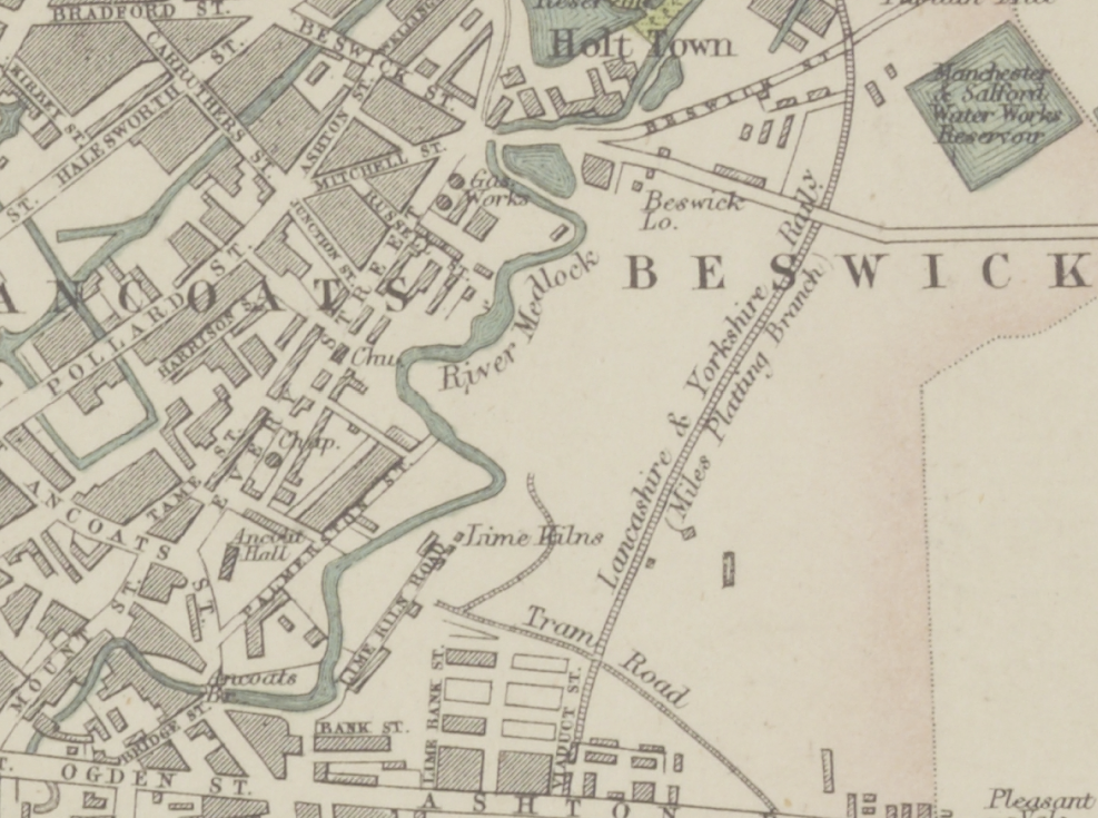
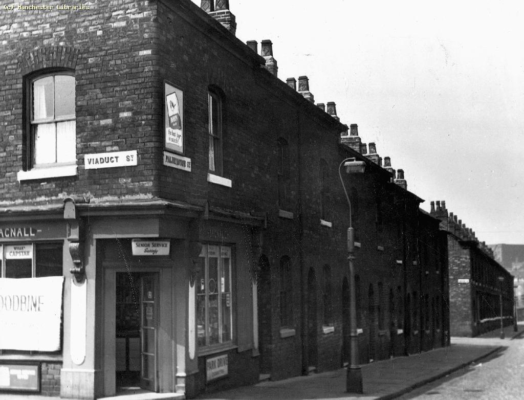
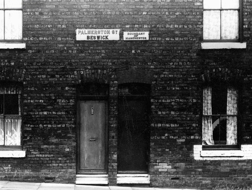
So here we are back at in Manchester 1813, the seeds of the Industrial Revolution sewn in adjacent Ancoats, the fields of Beswick still sewn with seeds, the trace of Palmerston Street nought but a rural track.
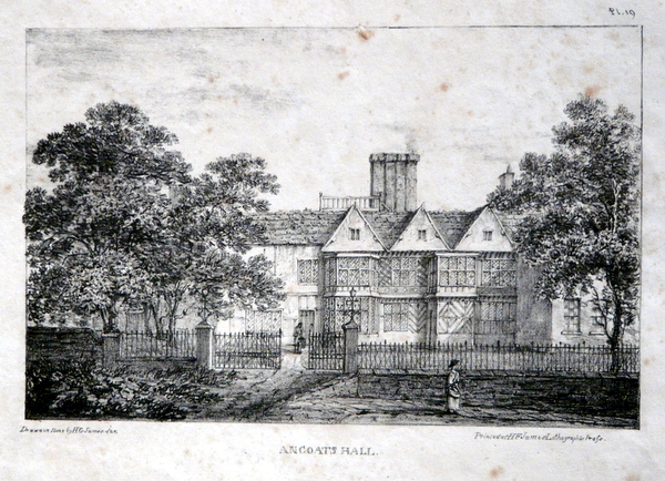
Sited on land between Great Ancoats Street and Every Street was Ancoats Hall, a post-medieval country house built in 1609 by Oswald Mosley, a member of the family who were Lords of the Manor of Manchester. The old timber-framed hall, built in the early 17th century, and demolished in the 1820s was replaced replaced by a brick building in the early neo-Gothic style.
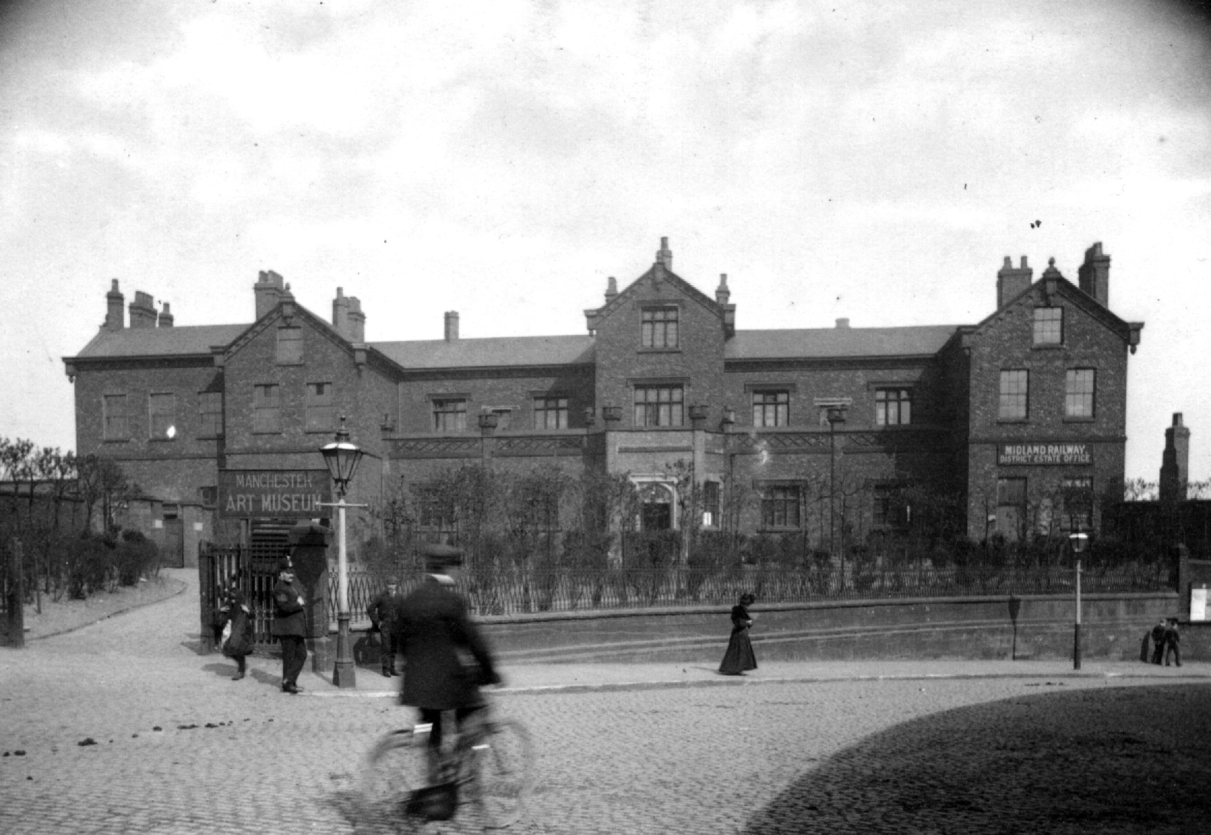
This would become the Manchester Art Museum, and here the worst excesses Victorian Capitalism were moderated by philanthropy and social reform.
When the Art Museum opened, its rooms, variously dedicated to painting, sculpture, architecture and domestic arts, together attempted to provide a chronological narrative of art, with detailed notes, labels and accompanying pamphlets and, not infrequently, personal guidance, all underlining a sense of historical development.
Housing and industry in the area begins to expand, railways, tramways, homes and roads are clearly defined around the winds of the river.
In 1918 the museum was taken over by the city, it closed in 1953 and its contents were absorbed into the collection of Manchester City Art Gallery, as the State increasingly took responsibility for the cultural well being of the common folk.
The building was finally demolished in the 1960’s – just as the area, by now a dense warren of back to back terraces, was to see further change.
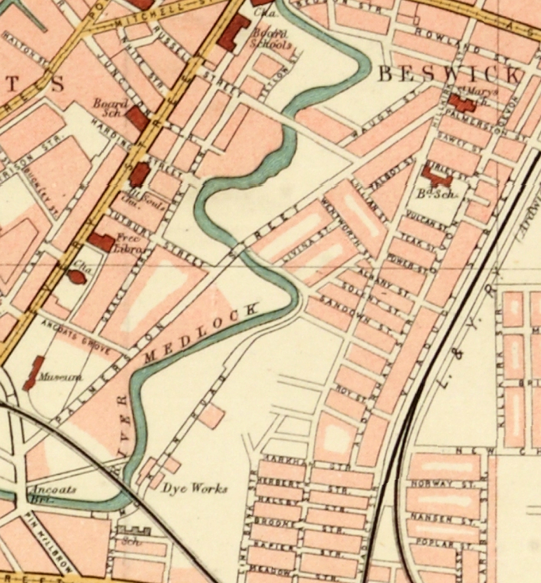
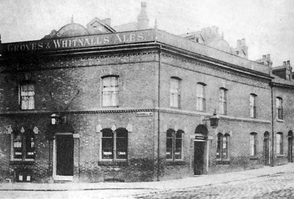
Along the way was the the River Inn, seen here with a fine Groves and Whitnall’s faience tiled frontage.
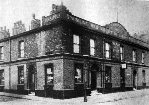
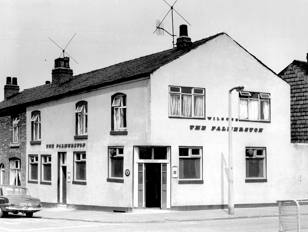
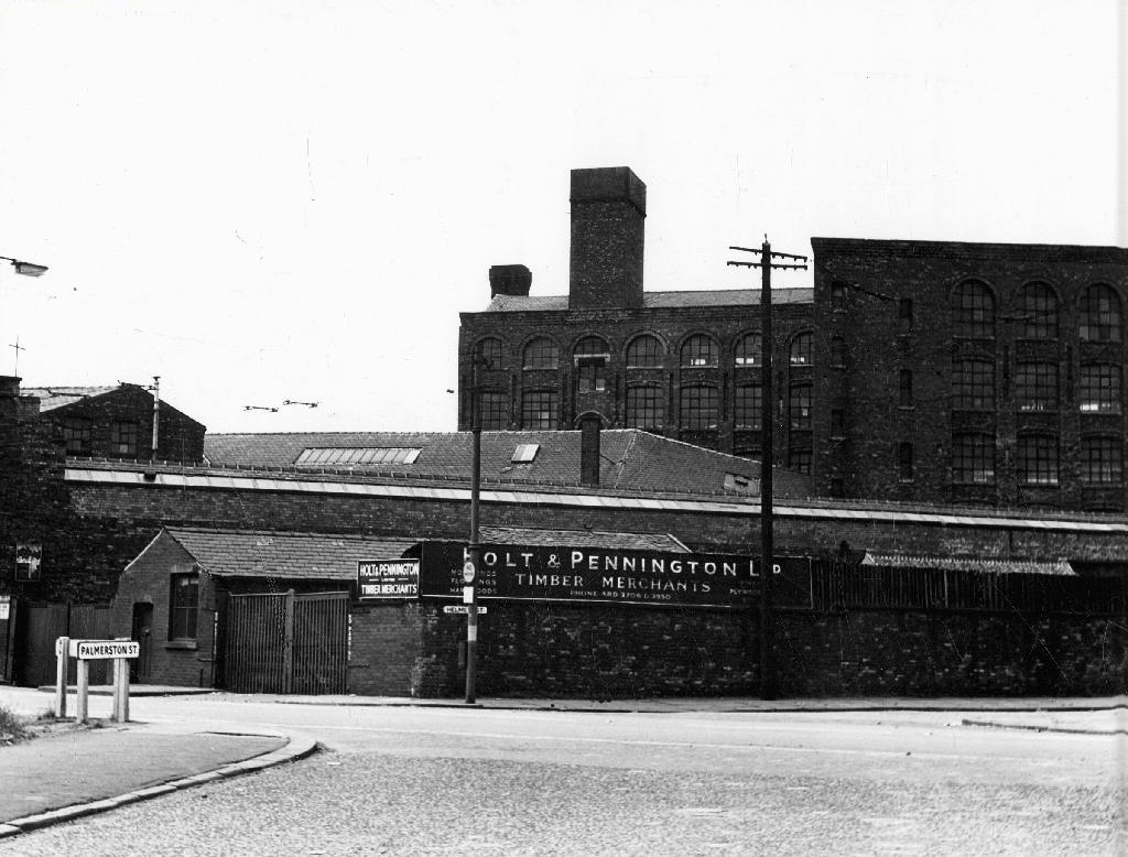
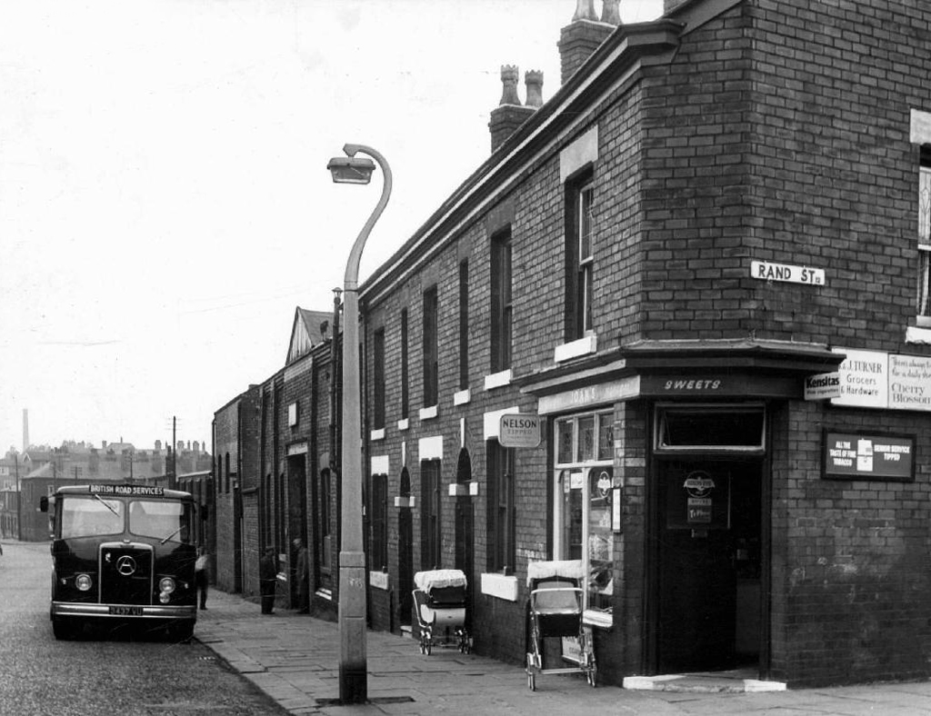
The street also offered rest, relaxation and refreshment through the Church, Pineapple and Palmerston pubs, as recored here on the Pubs of Manchester blog.
The River seen here in the 1970’s struggled on until 2007.
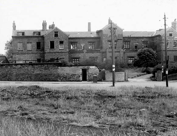
Further along we find the Ardwick Lads Club, further evidence of the forces of social reform, that sadly failed to survive the forces of the free market and the consequent Tory cuts in public spending and wilful Council land-banking.
The Ardwick Lads’ and Mens’ Club, now the Ardwick Youth Centre, opened in 1897 and is believed to be Britain’s oldest purpose-built youth club still in use [and was until earlier in 2012]. Designed by architects W & G Higginbottom, the club, when opened, featured a large gymnasium with viewing gallery – where the 1933 All England Amateur Gymnastics Championships were held – three fives courts, a billiard room and two skittle alleys (later converted to shooting galleries). Boxing, cycling, cricket, swimming and badminton were also organised. At its peak between the two world wars, Ardwick was the Manchester area’s largest club, with 2,000 members.
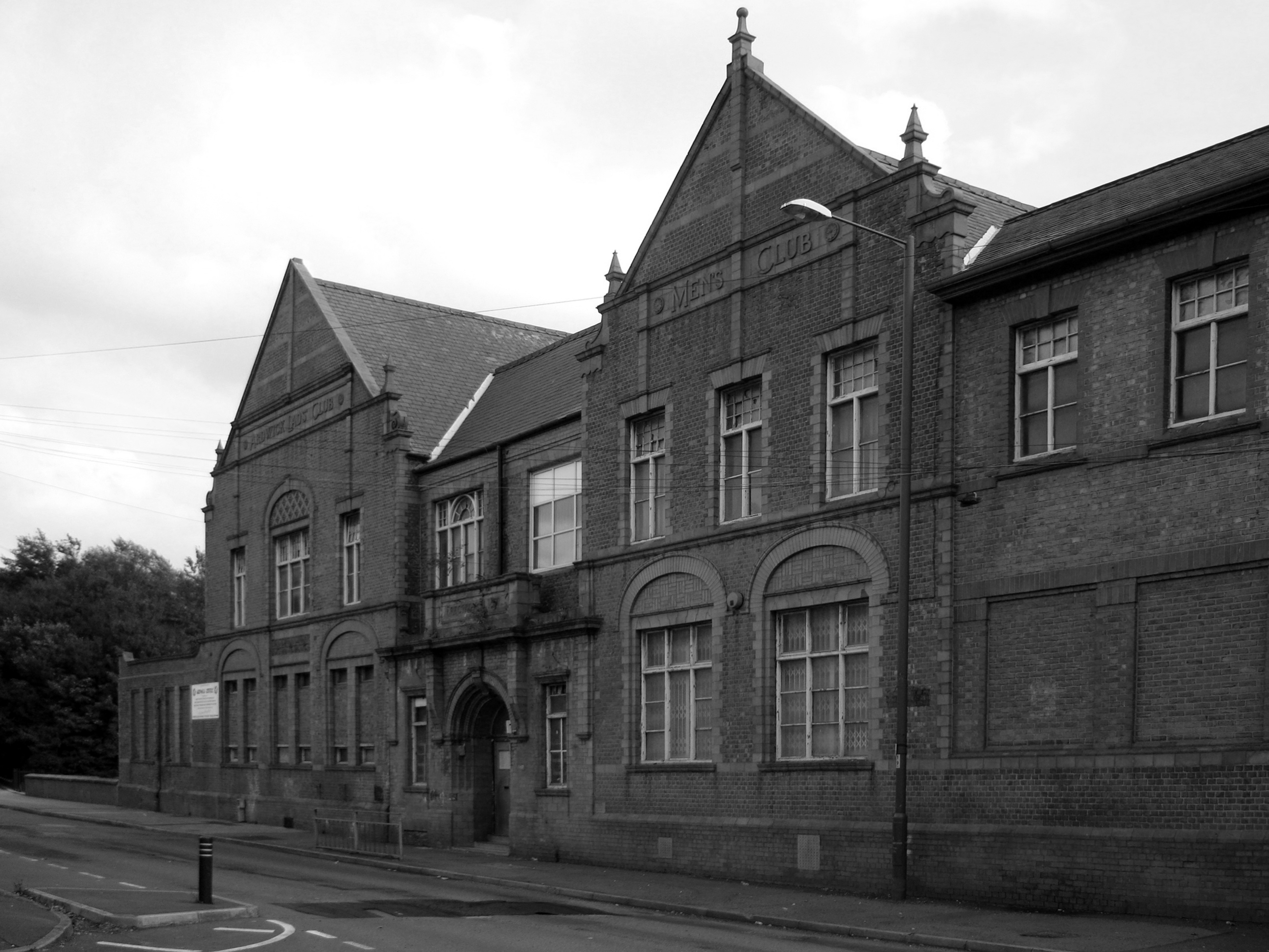
On the 10th September 2012 an application for prior notification of proposed demolition was submitted on behalf of Manchester City Council to Manchester Planning, for the demolition of Ardwick Lads’ Club of 100 Palmerston Street , citing that there was “no use” for the building in respect to its historic place within the community as providing a refuge and sporting provision to the young of Ancoats.
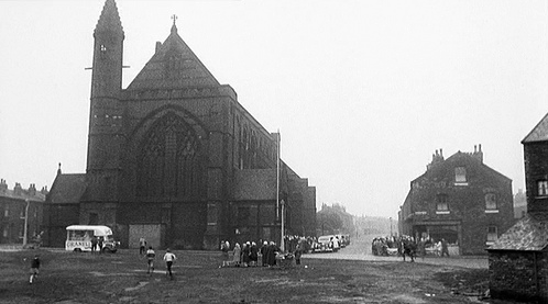
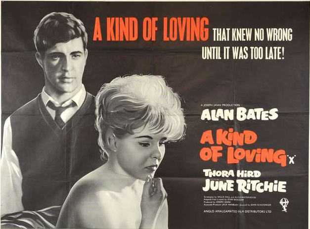
At the top turn of the street stood St Mary’s – the so called Lowry church.
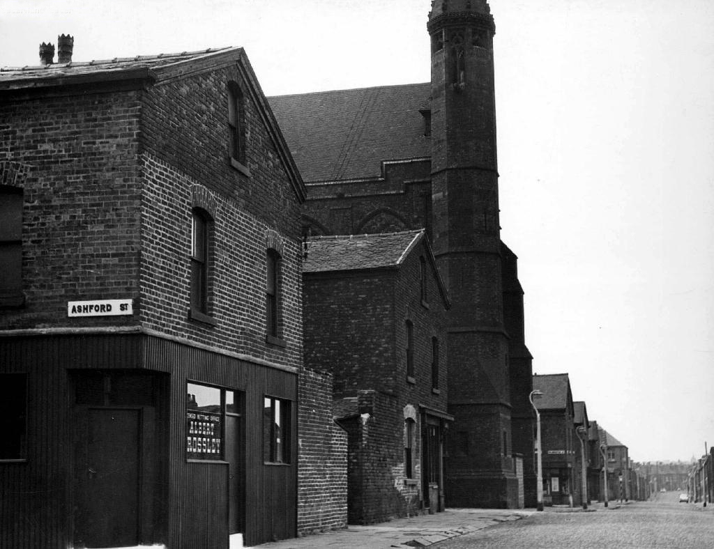
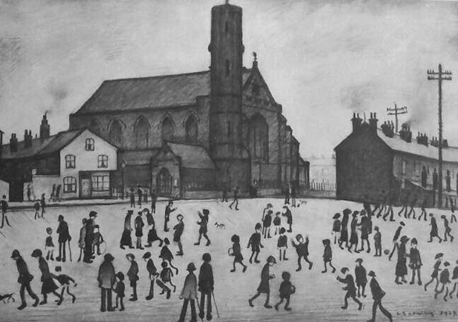
Used as a location for the film adaptation of Stan Barstow’s A Kind Of Loving
The homes and industry attendant schools and pubs were soon to become history, all that you see here is more or less gone. Slum clearance, the post-war will to move communities away from the dense factory smoke, poor housing stock and towards a bright shiny future elsewhere.
Whole histories have subsequently been subsumed beneath the encroachment of buddleia, bramble, birch and willow.
The land now stands largely unused and overgrown, awaiting who knows what, but that’s another tale for another day.
Archive images from the Manchester Local Image Collection.
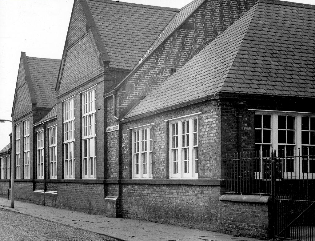
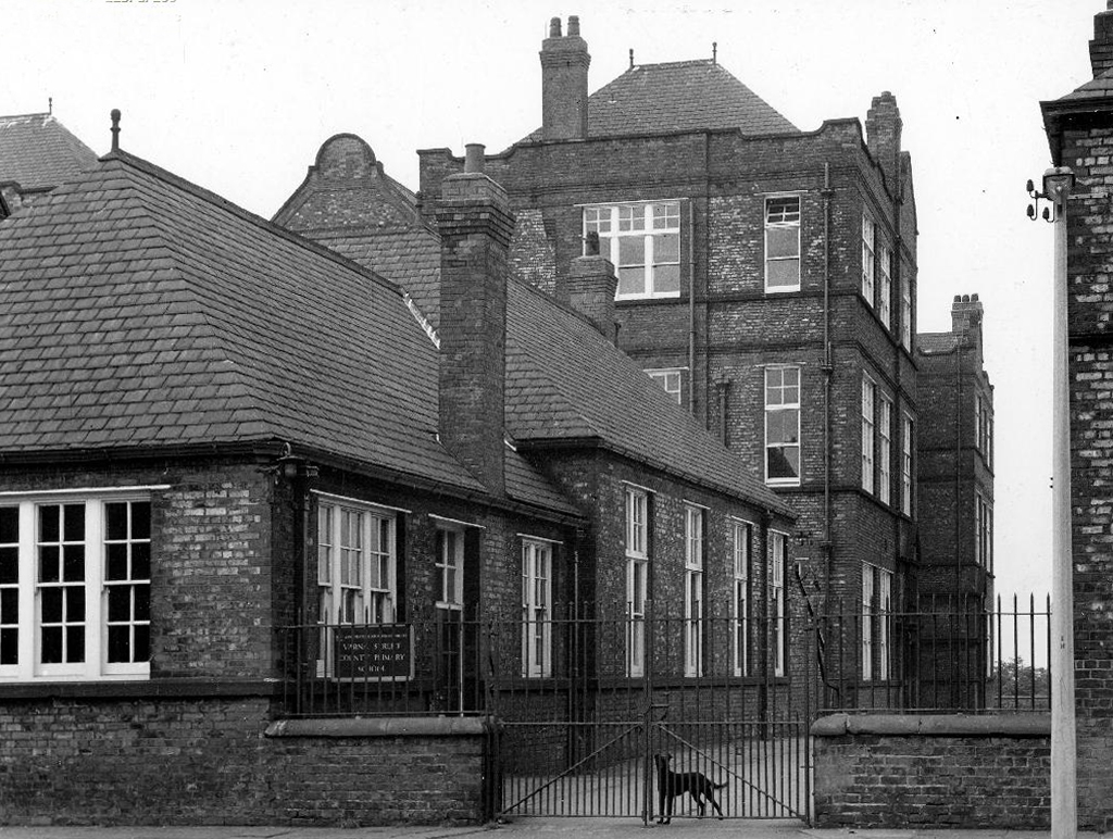
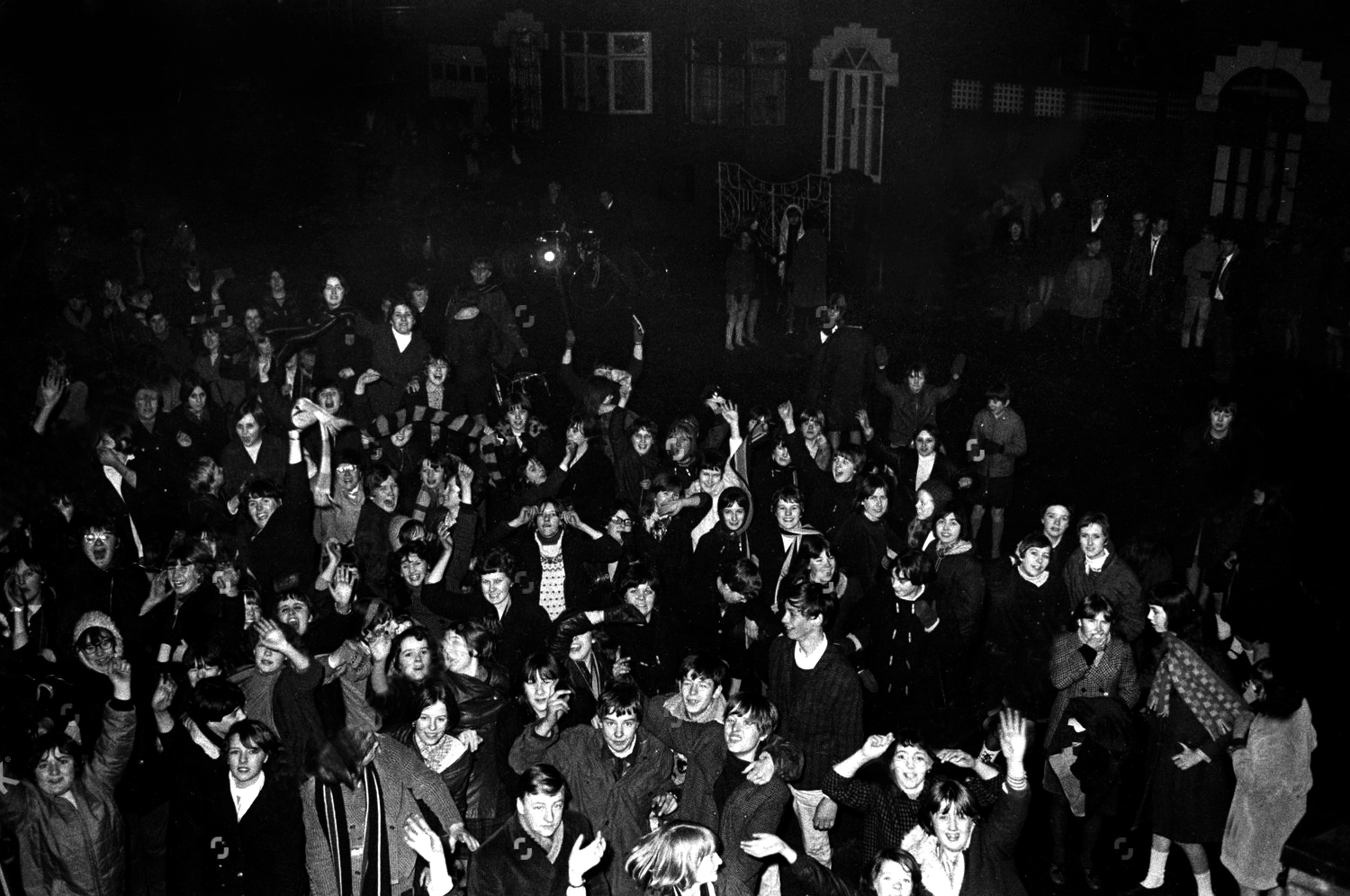
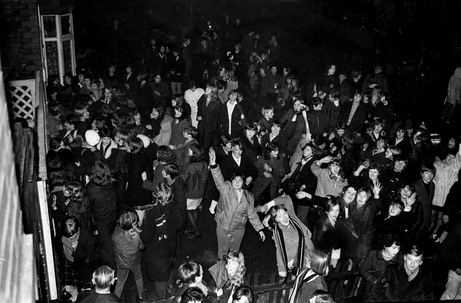
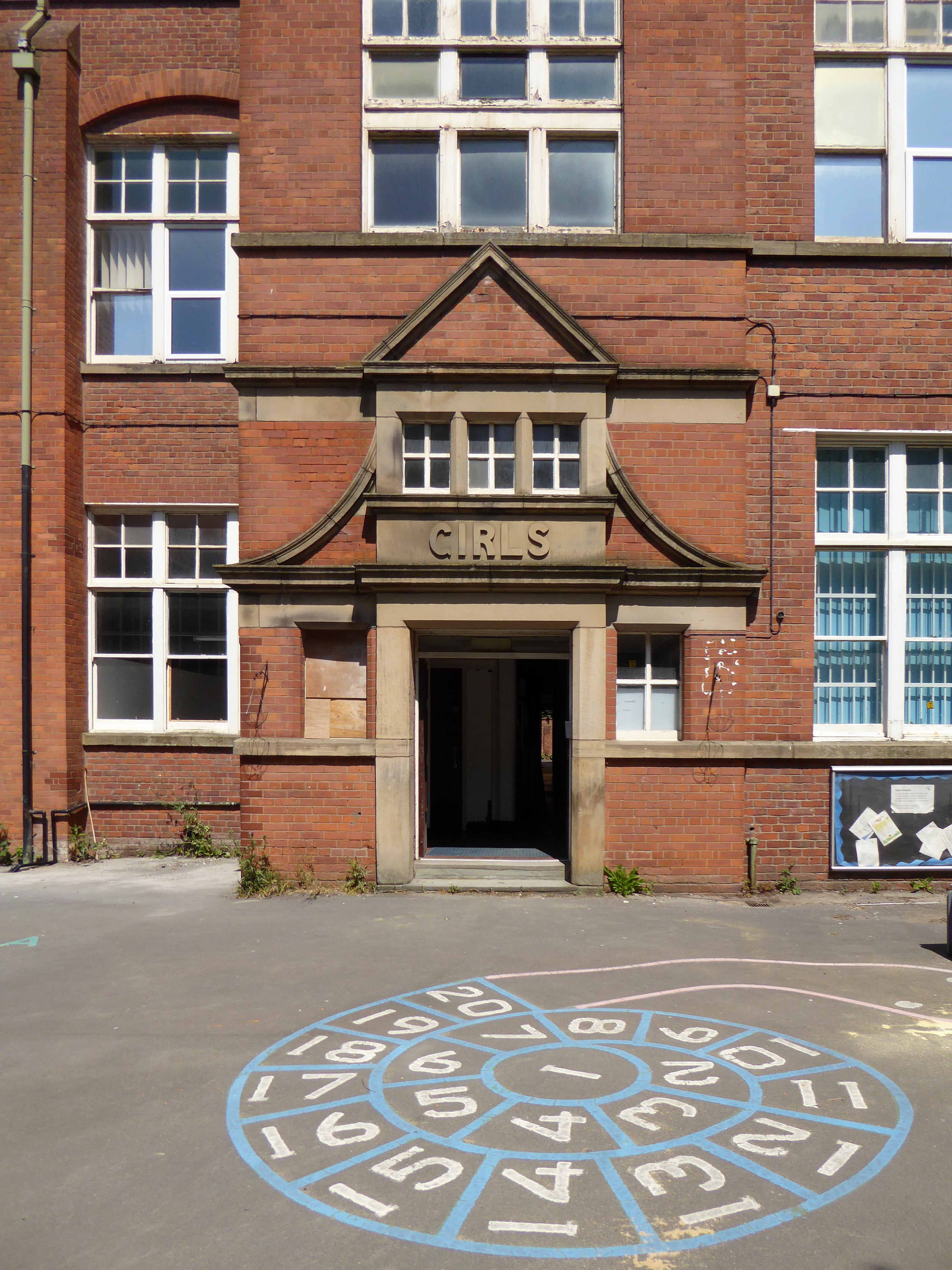
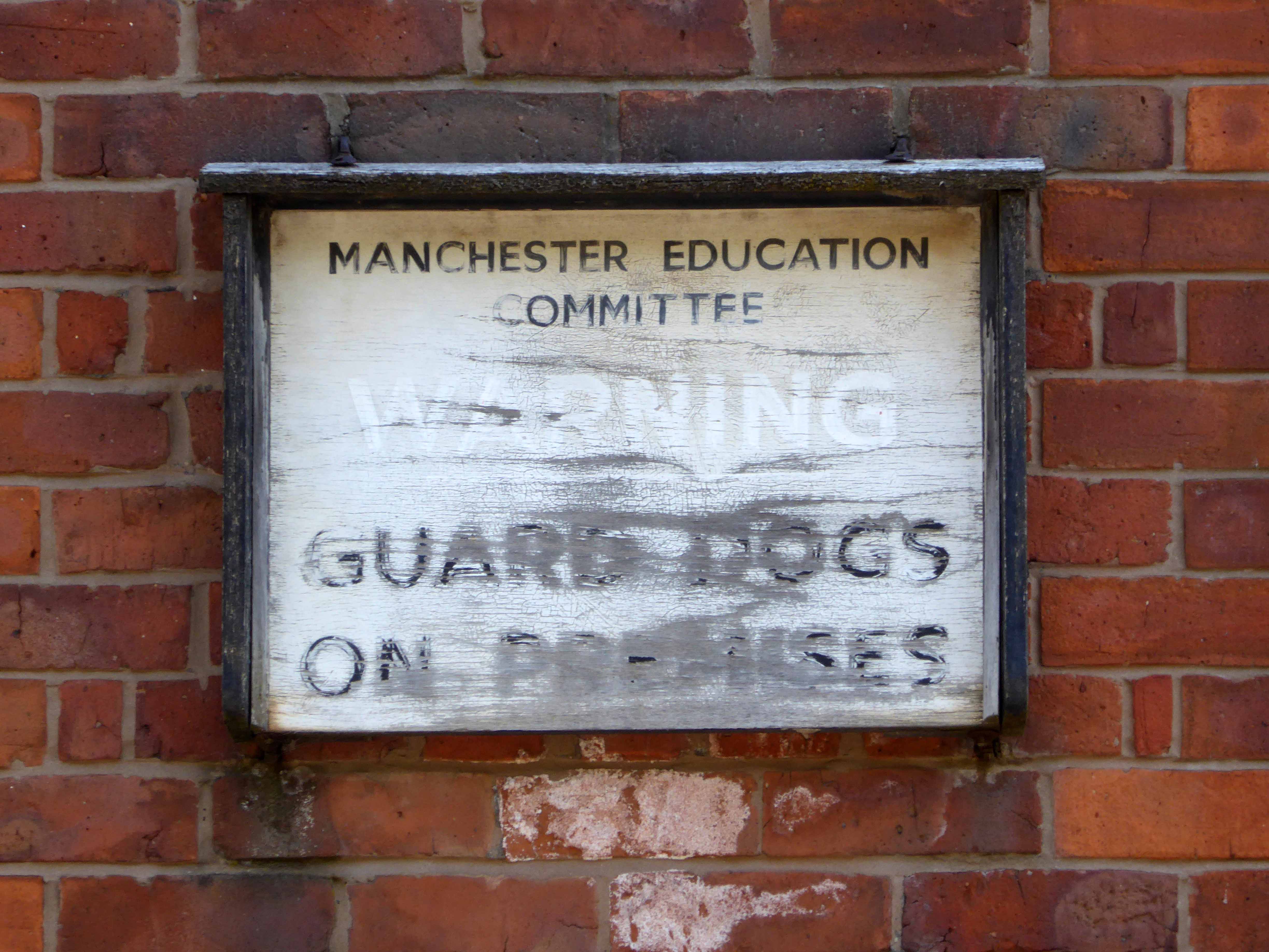
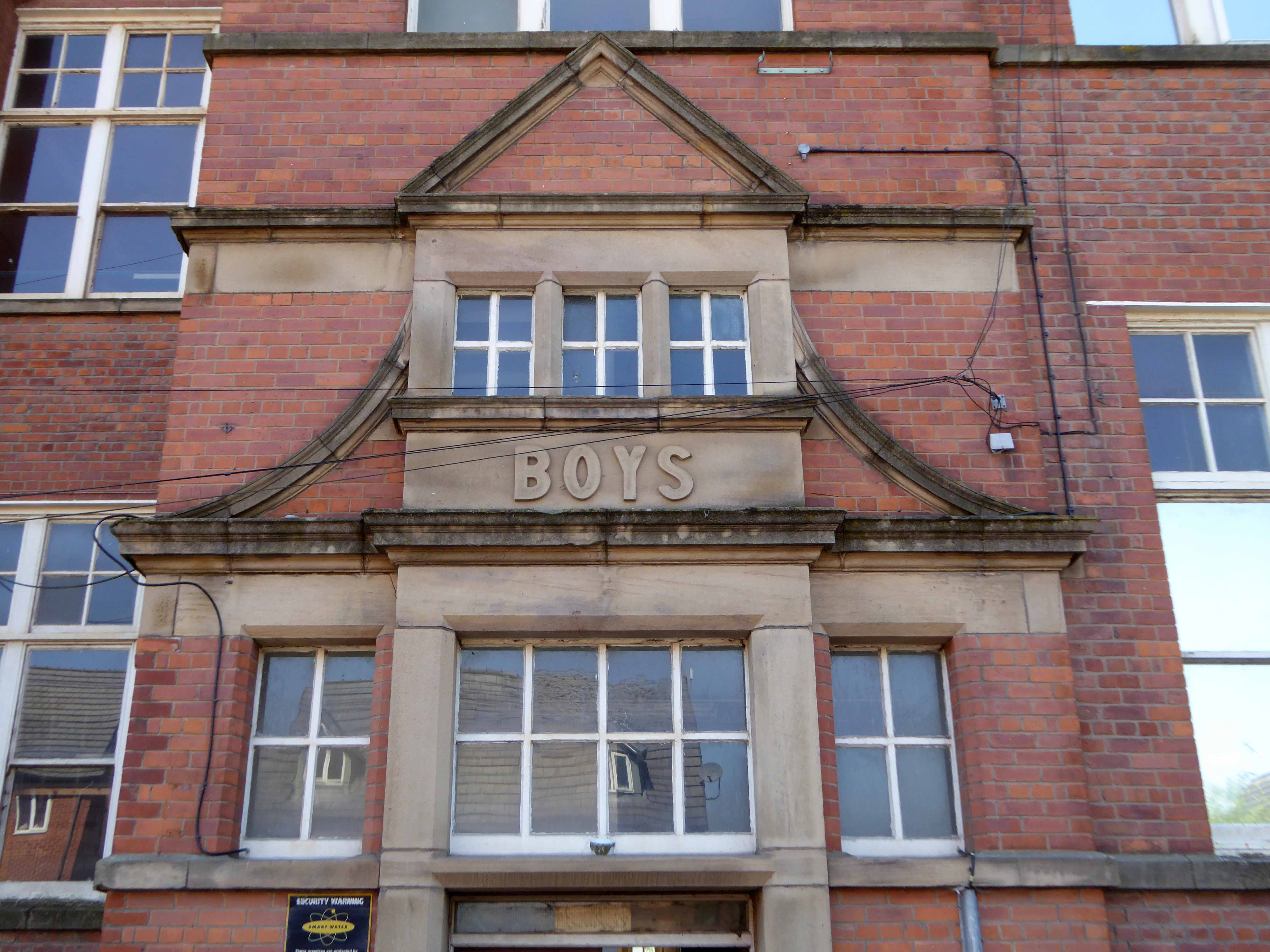
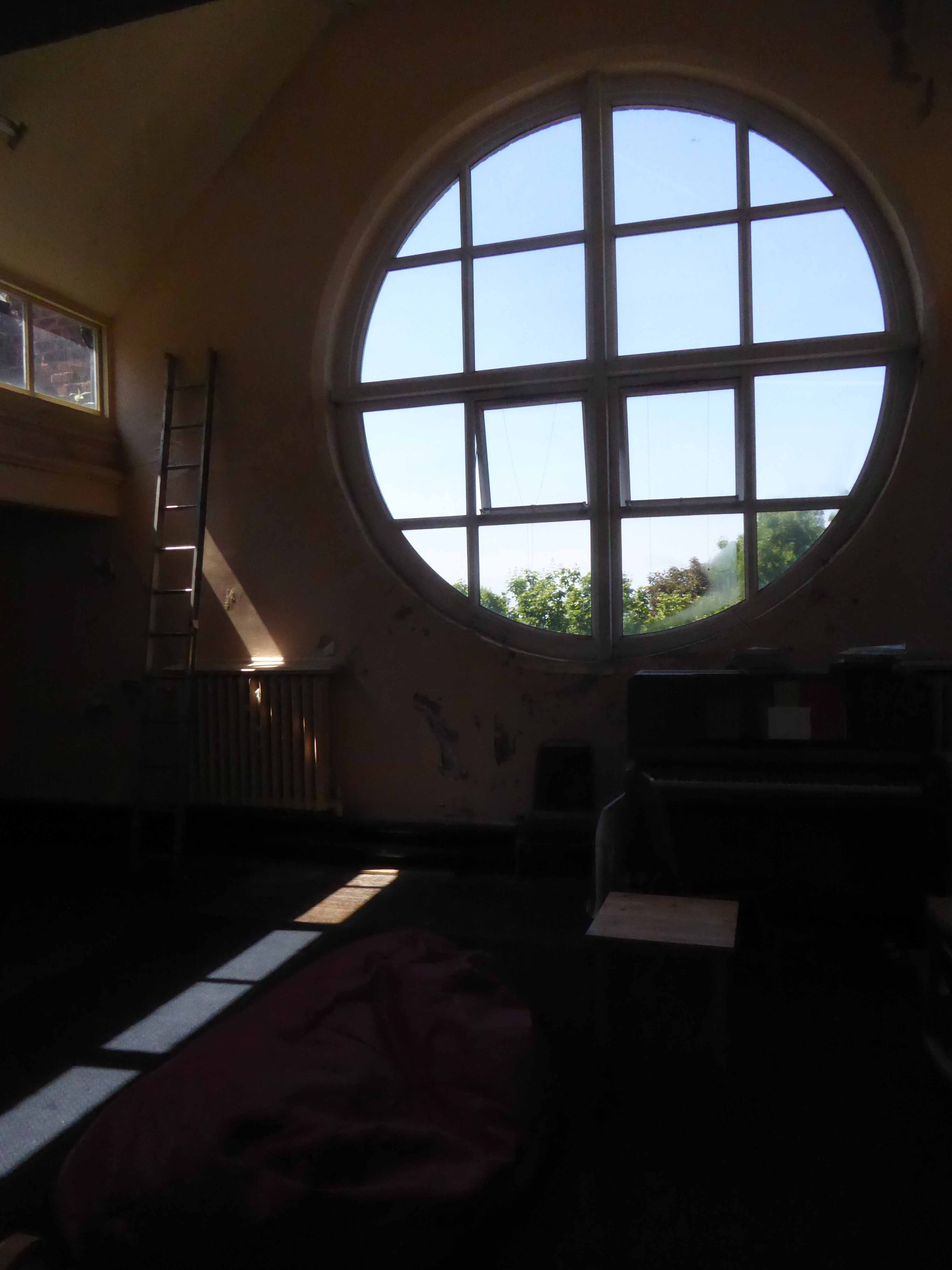
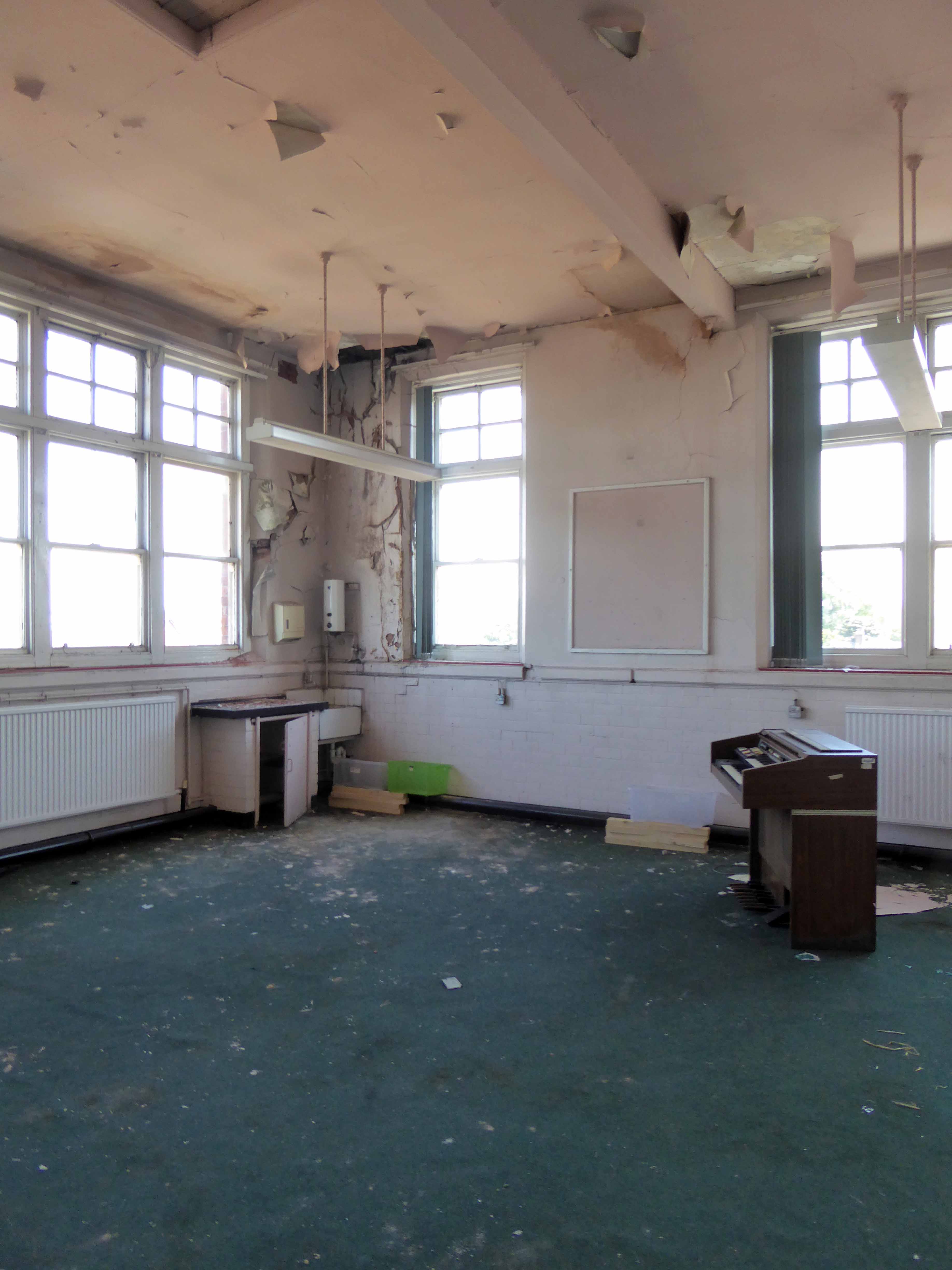
Once there was a school – from May 16th 1898, there was a school.
One of many Manchester School Board schools built in an imposing functional, triple storied style, they often seemed several times too big, for the infants which they contained.
With one thousand five hundred pupils, it was dubbed the largest school in Lancashire.
Nestled in a tight corner formed by the Lanky Cut and the train line below, surrounded by the huddled masses, in their manifold terraced homes.
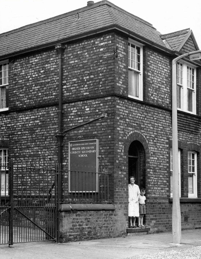
Once home to cheeky monkey, soon to be Monkee Davy Jones.
His runaway, overnight fame made his humble Gorton home a mecca for adoring fans.
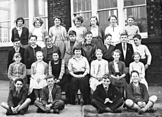
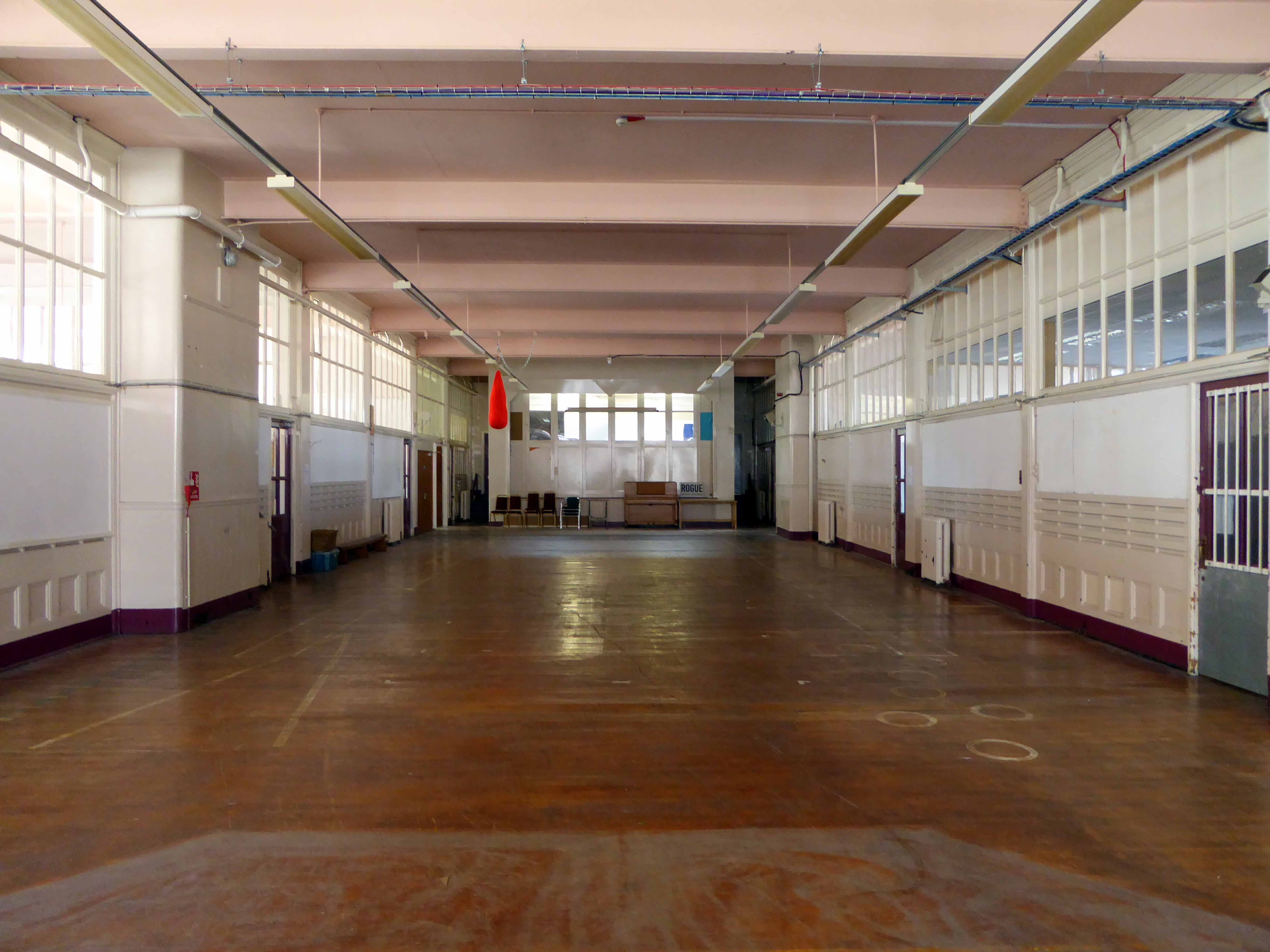
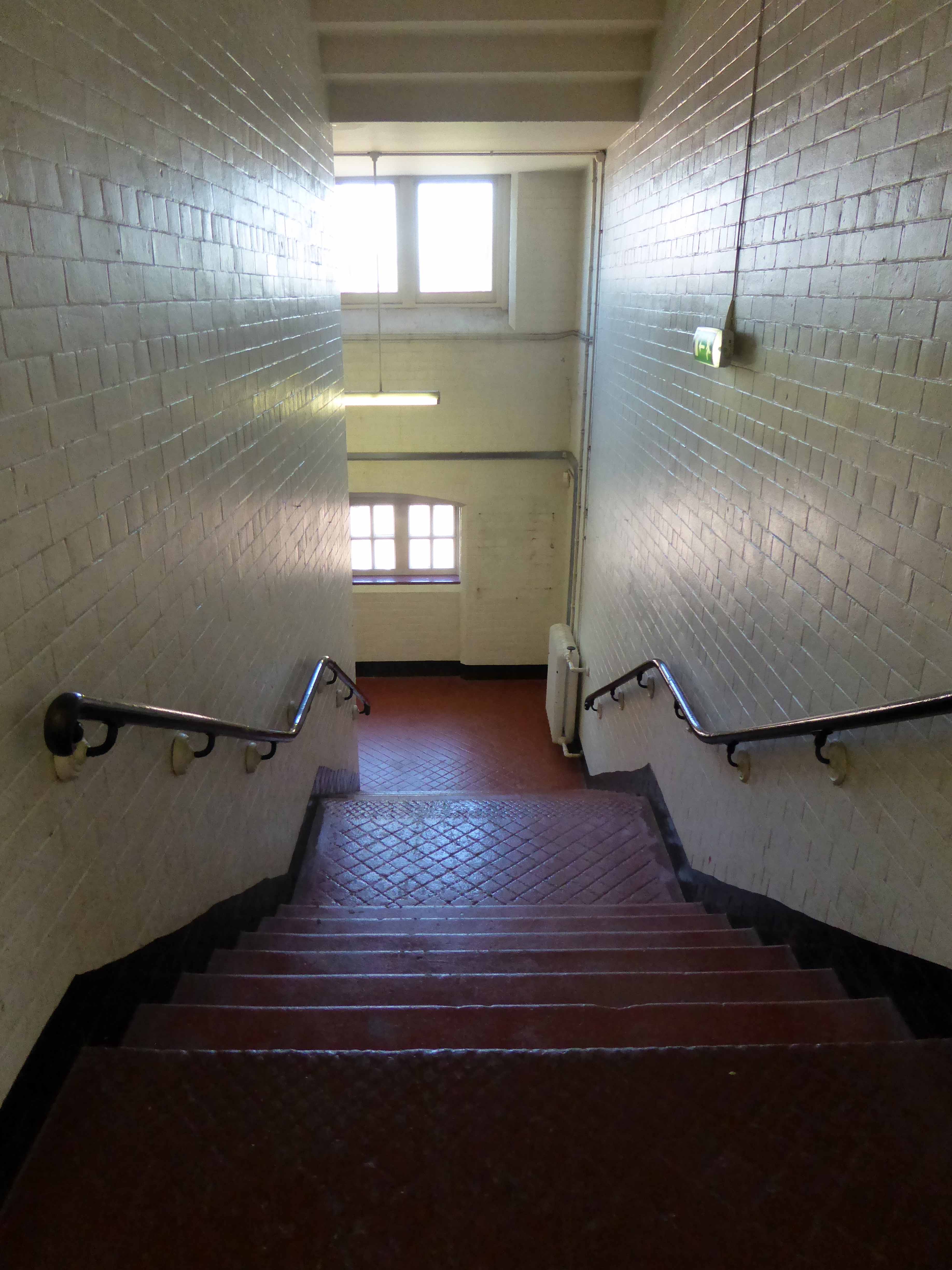
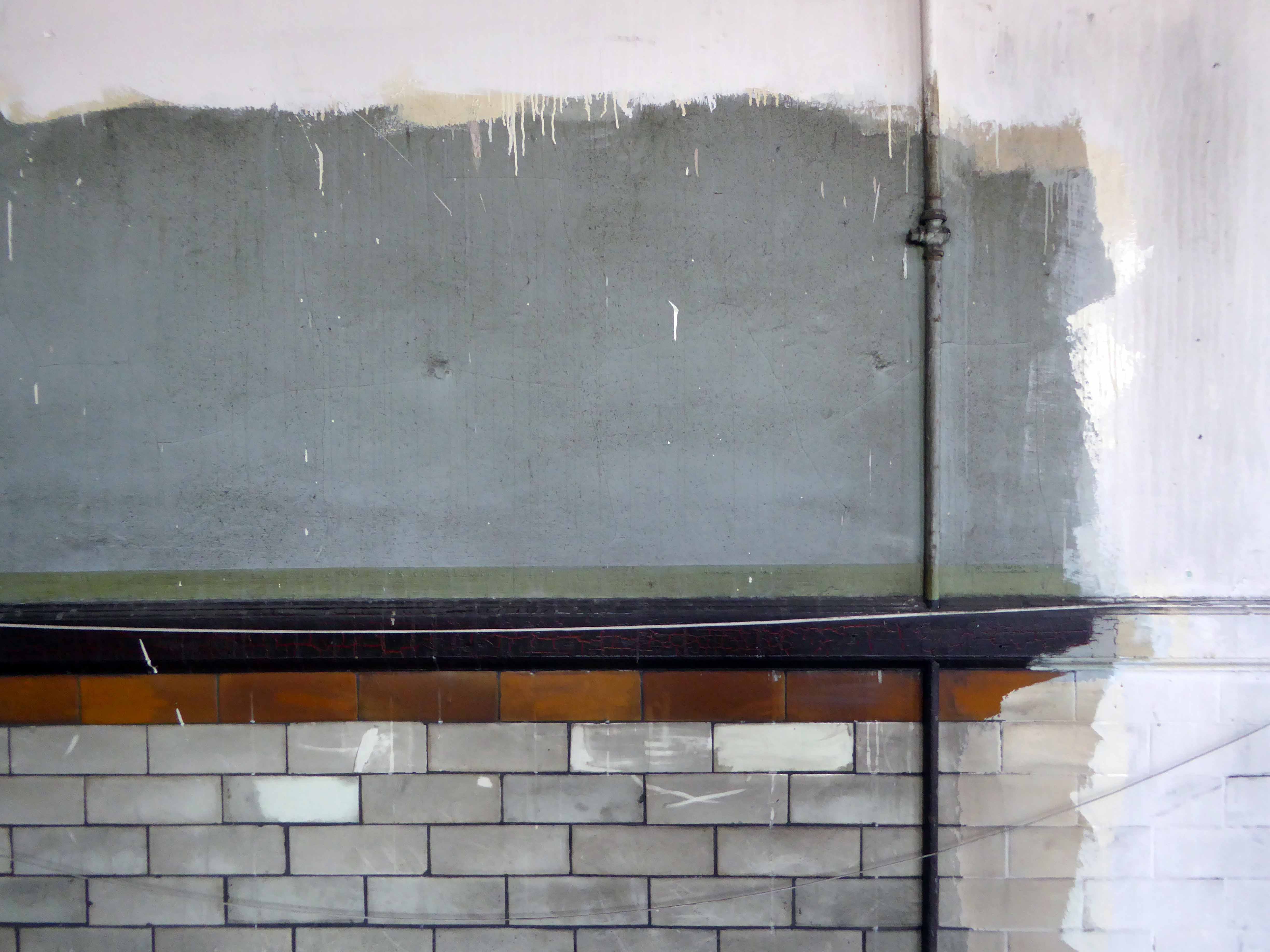
The school’s interior was a mix of wide open halls and closeted classrooms.
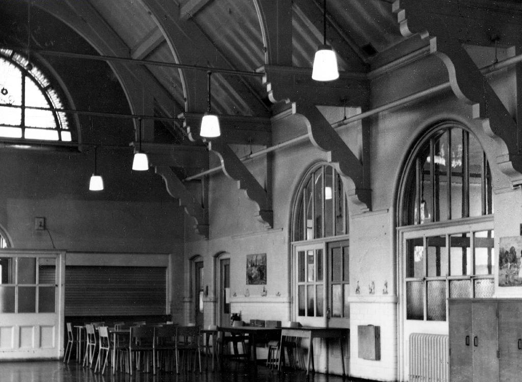
Archive photographs from the Manchester Local Image Collection
Eventually the school bell rang for the last time, and a newer brighter home was found for the little learners.
Lights were turned off and the doors of Varna Street were closed.
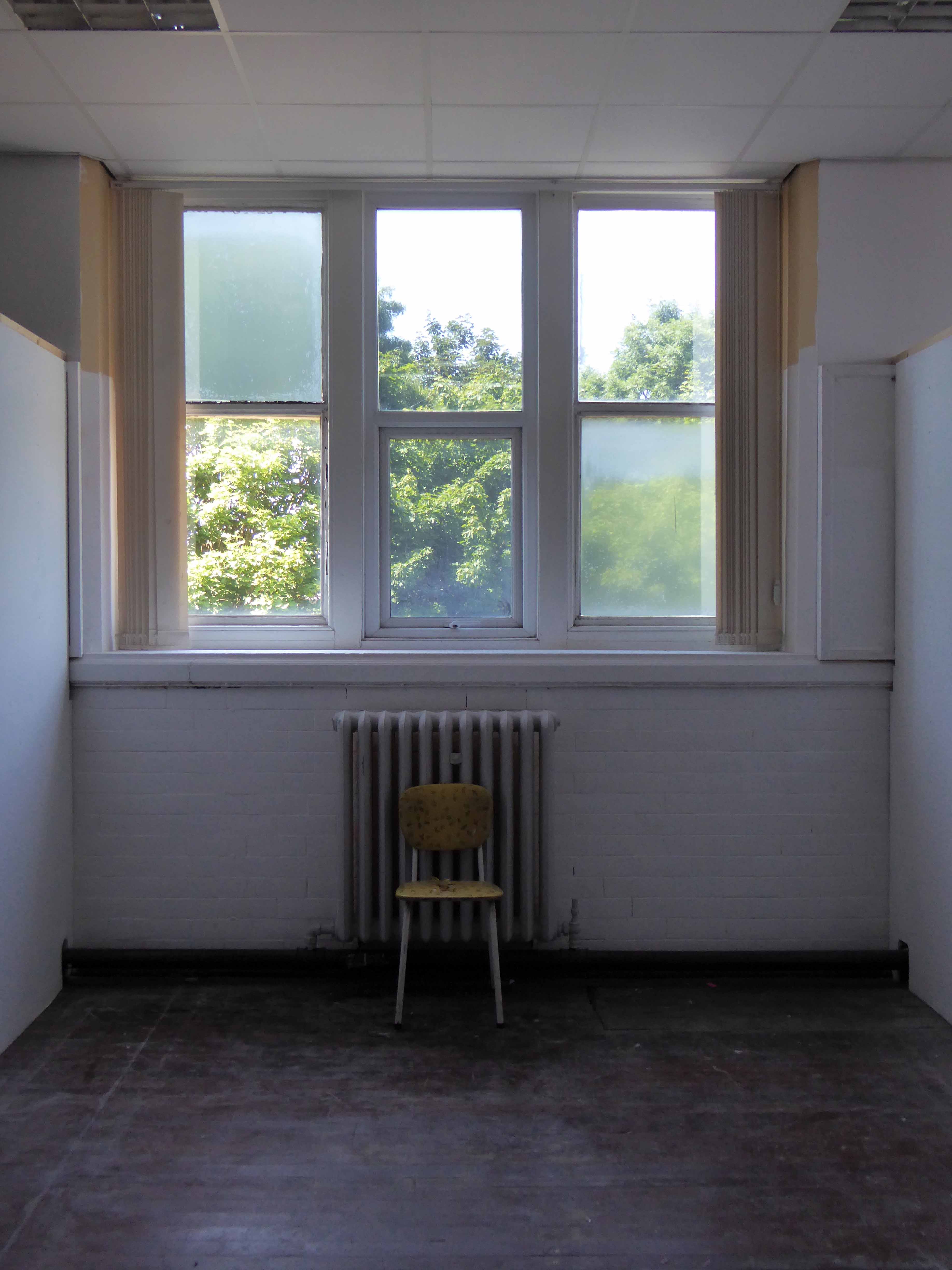
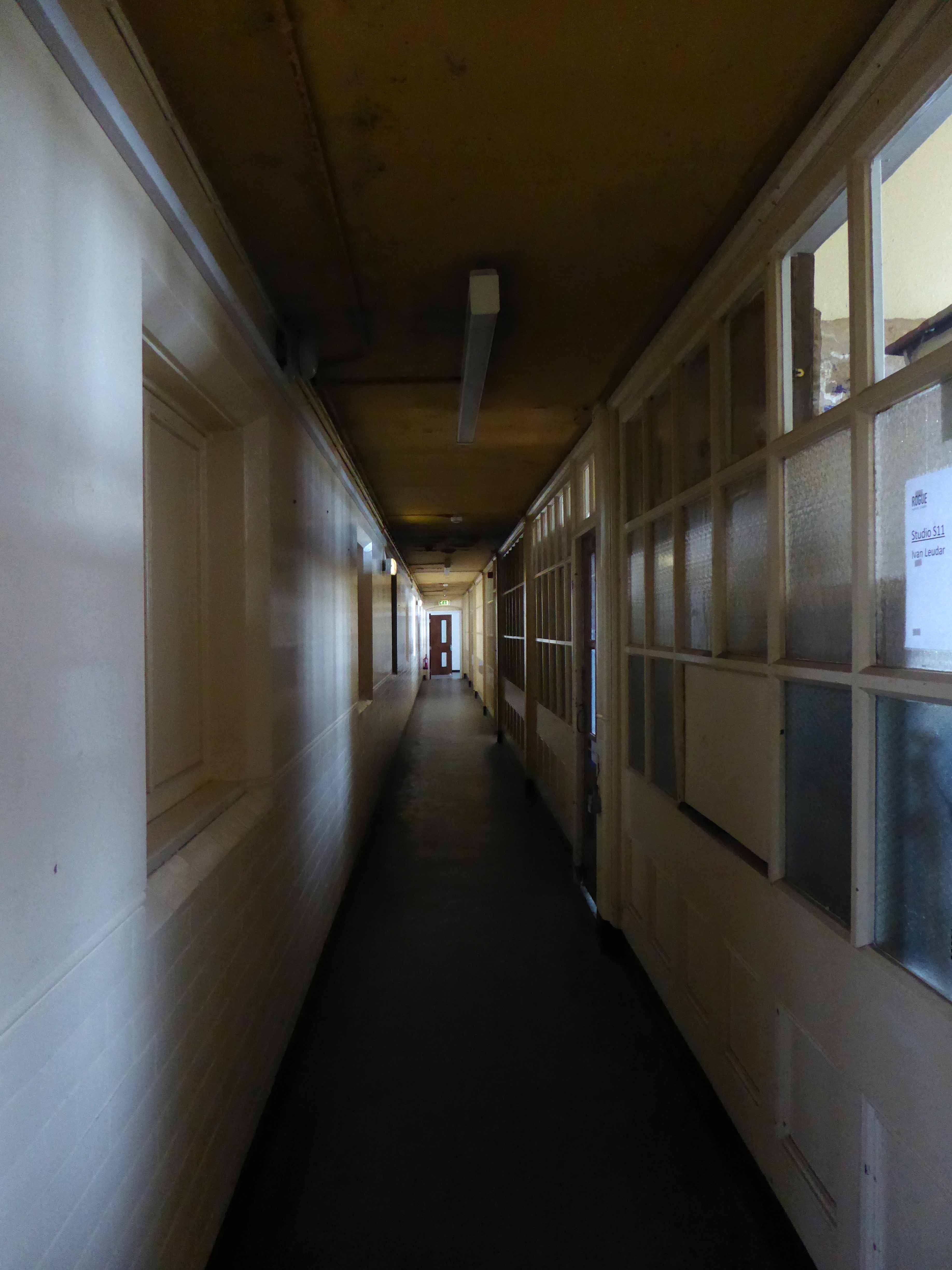
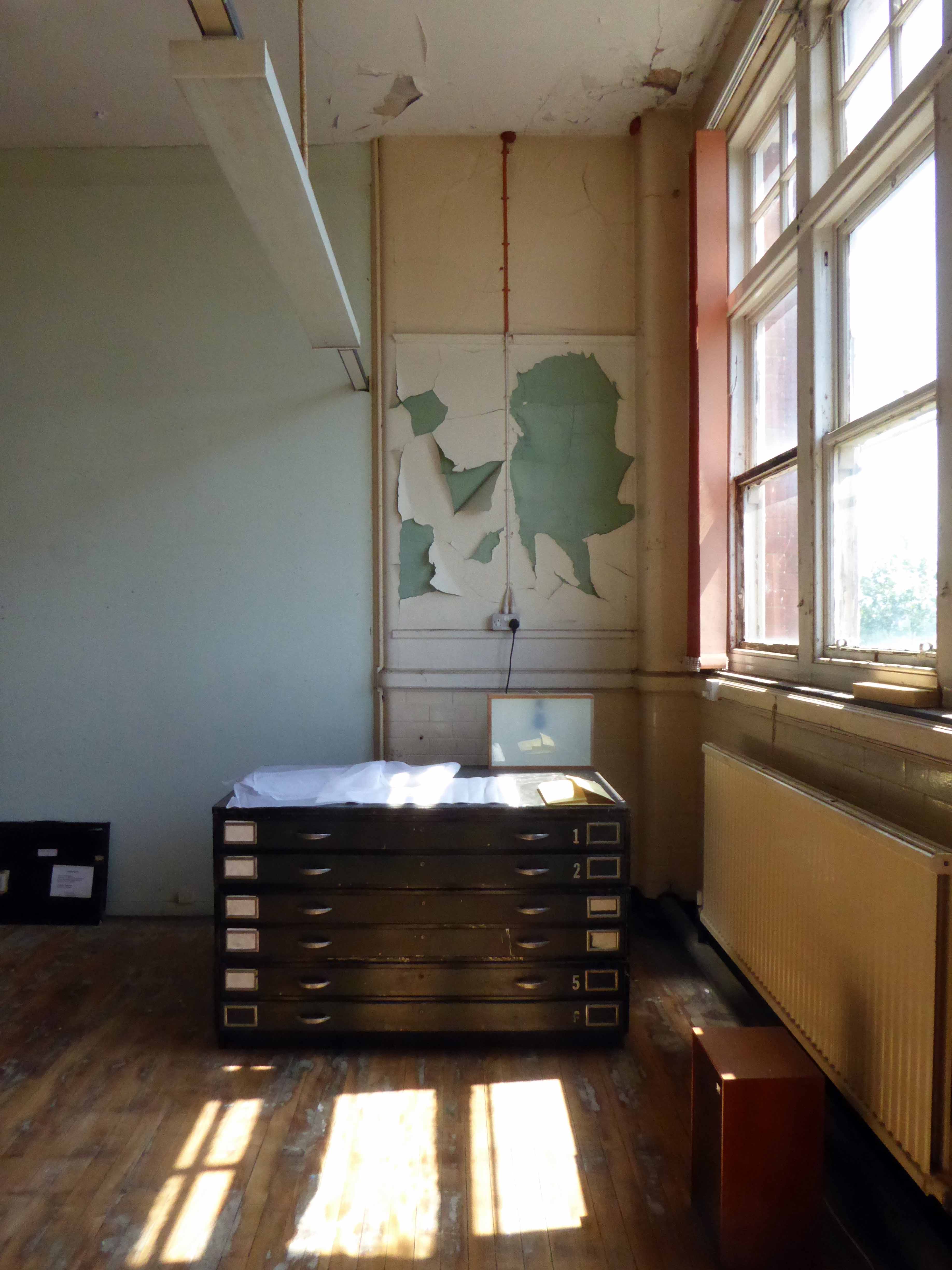
But not for the last time, a new use was found for this recently listed building.
Having lost their city centre base Rogue Studios were offered the site by the local authority, and in double quick time they have created a home for artists, a community resource and project space, which will continue to prosper for years to come.
Many thanks to Ms. Jenny Steele Rogue artist for my guided tour.


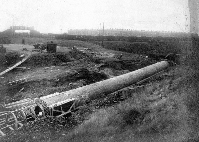
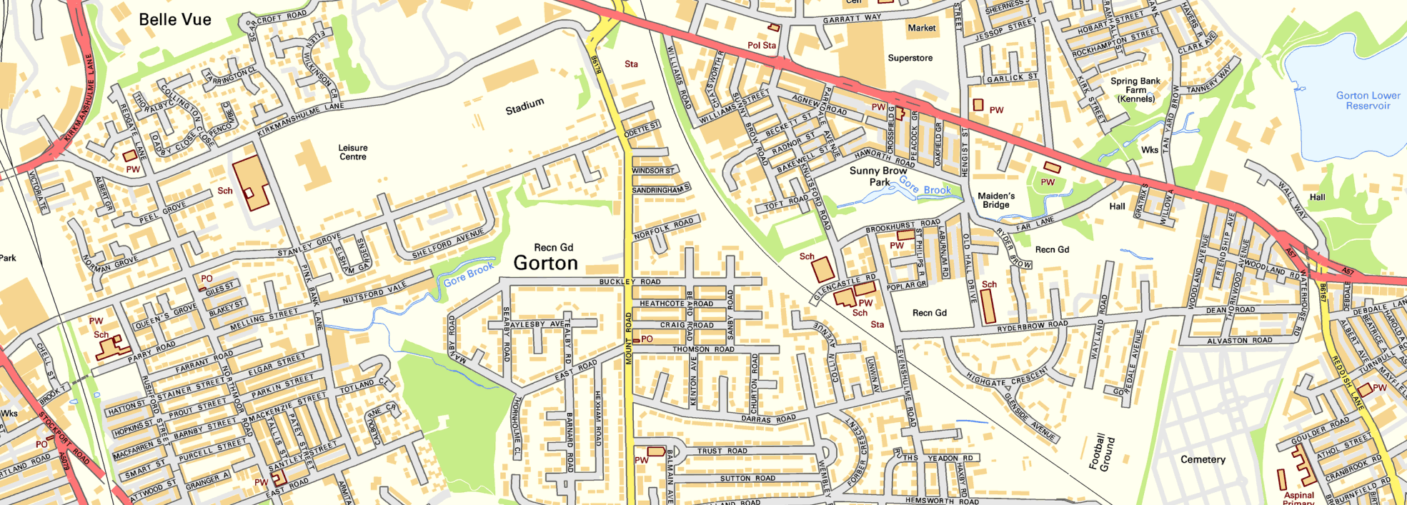
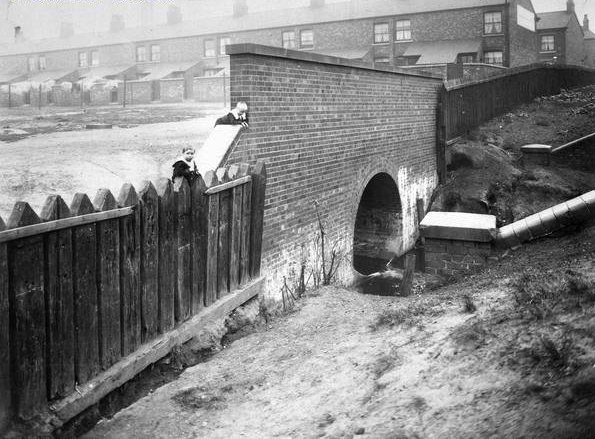
To begin at the beginning, well actually to begin in the middle and walk to the current beginning. The Gore Brook flows from the Lower Gorton Reservoir and from there onwards to meet the Chorlton Brook in the west, though I should imagine that prior to the construction of the waterworks, it was fed by more distant moorland waters.
Manchester being on the eastern edge of the Lancashire Plain and the western edge of the Pennines is riddled with rivers, rivers which now wriggle in an under and overground web, across heavily developed urban areas. Following the Industrial Revolution former meadow, common and farmland was overwritten by factories, housing and roads, the rural character of the rivers and brooks soon becoming darkened and polluted by the surrounding industries.
I was lead here by my search for a lost pub The Garratt on Pink Bank Lane, then drawn in further by this site The Red Path of Longsight.
The Red Path is a pedestrian link between Pink Bank Lane and the Gorton boundary at Buckley Road. It roughly follows the course of Gore Brook. The original footpath, running from Buckley Road to the bank of the brook, was made using black cinders. It was probably made in the 1940s to provide access to the allotments located on either side. In the early 1950s , a concrete bridge was laid across Gore Brook and the footpath extended to Pink Bank Lane. This section used red bricks in it’s construction, probably supplied by Jacksons brickworks . Crushed bricks were then used as a topping to make the path smoother and fill in any cracks. The thoroughfare soon became known as the Red Path.
So wide eyed and mapless I bowled up at Brook Terrace, just off Stockport Road Longsight, in search of The Gore and its source.

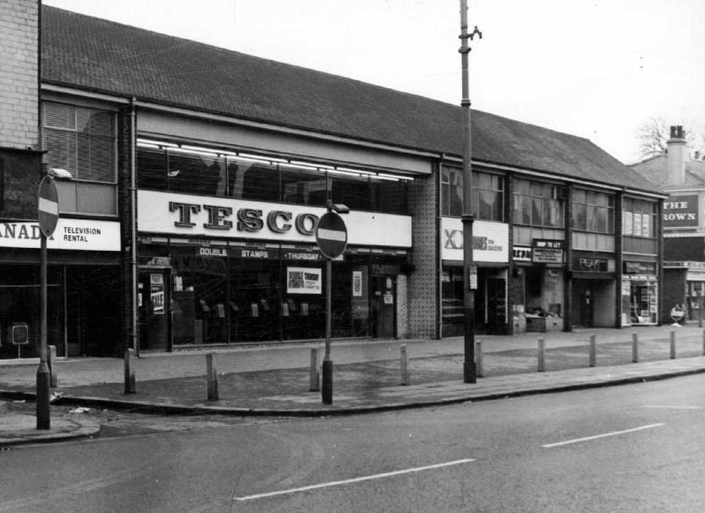
In the early 1900’s the river was still open and bridged, here at Stockport Road, later culverted and covered – anticipating the arrival of Tesco’s and Granada TV Rentals.
From there we pass under the railway along Brook Terrace and into Parry Road.
The underpass is still there and very much in use, as is Stanley Grove School – the Manchester Central Schools’ Kitchens are long gone, along with the food filled, insulated aluminium cases, that fed the hungry mouths of many, with semolina, pink custard, meat pies and lumpy mash.
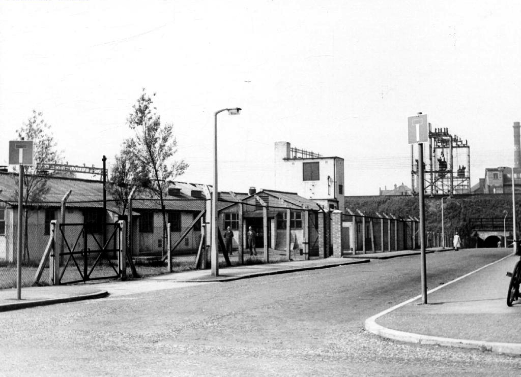
Onwards to Elgar Street and still no sign of the river, hidden beneath our feet, the corner of Northmoor Road, can be seen on the corner, no longer distributing dividends, but now providing social housing.
We arrive at Pink Bank Lane, a rich mix of terraced homes, flats and factories – and the long lost Garratt, and the long lost Gore.
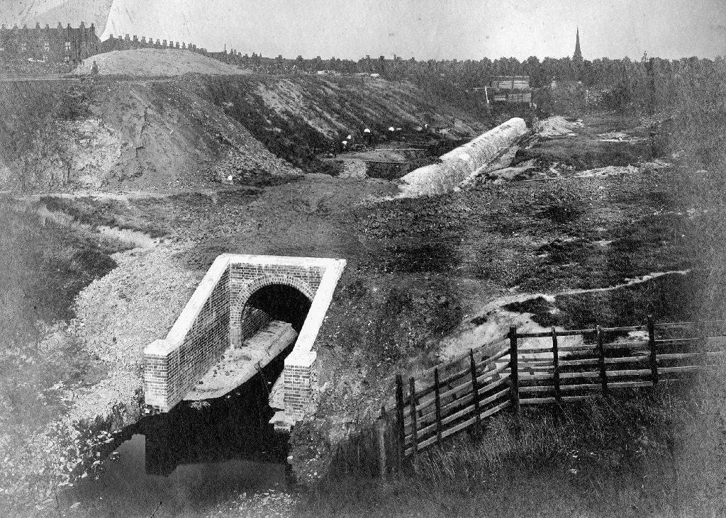
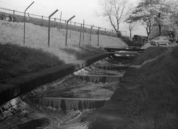
Though the lazy, lazy river has been confined in a brick lined wind, to meet the ever pressing needs of the Gorton Sewage Works.
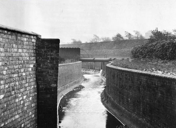
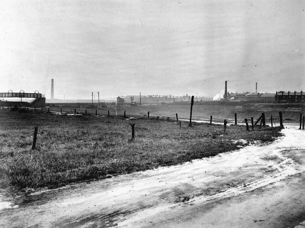
The river then hugs the edge of Annie Lea Playing fields on Buckley Road, until it disappears again as it meets Mount Road, the playing fields are still open ground – the Manchester Cleansing Department, seen on the left – is no more.
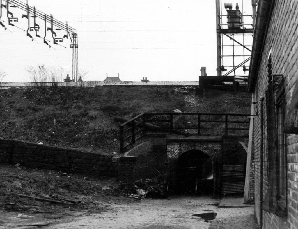
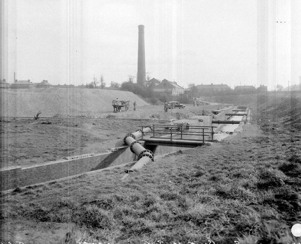
Here on Knutsford Road we see the construction of the tunnels and culverts, the footbridge to the left spanning the railway, is still there.
1907
1911
1914
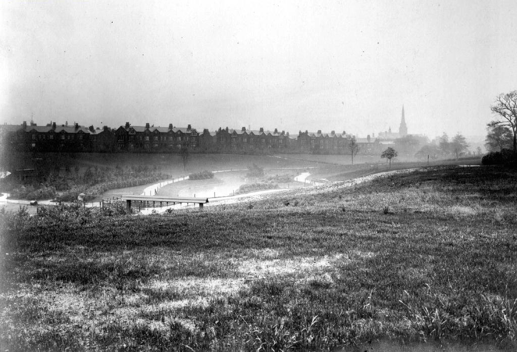
Finally we see The Gore reemerging clear, clean, wide, proud and resplendent in Sunny Brow Park, where it is still maintained as a decorative, duck-filled lake.
1907
1910
1964
Briefly underground again and into the back of Far Lane, skirting the Brookfield Church graveyard.
1920
1937
1964
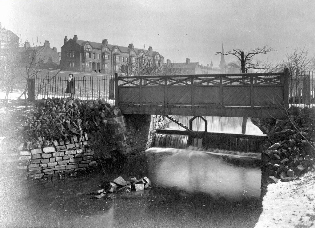
Then tunnelling under Hyde Road at the back of the church lodge, appearing once again alongside Tan Yard Brow.
1904
1922
1964
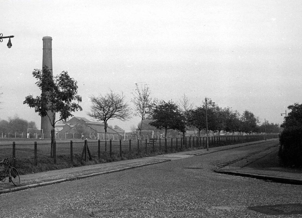
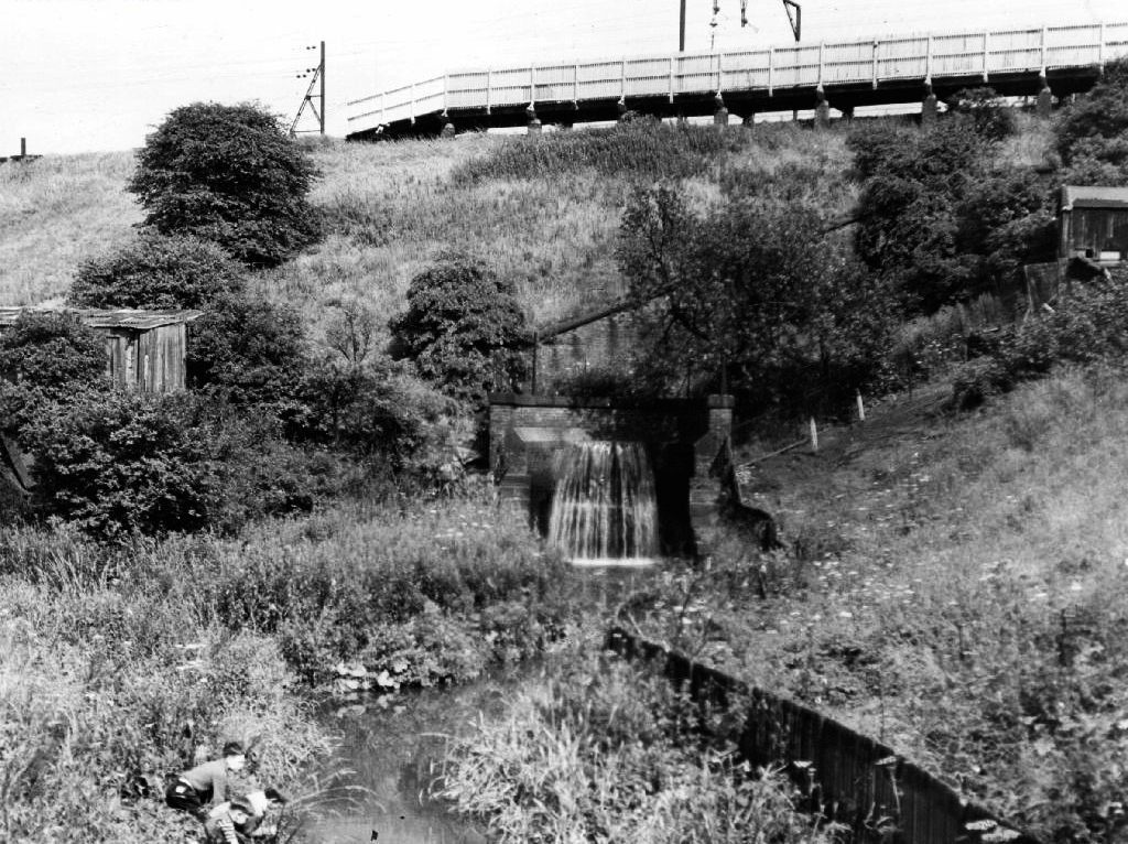
The manmade waterfall continues to cascade, the Fairfield to Old Trafford railway is now the Fallowfield Loop, Manchester Cycleway, young lads no longer mess about in wellies and torn Tek Sac jeans on the bank, the Tannery no longer tans.
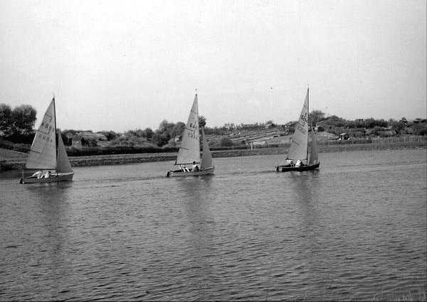
Then we end our journey by the broad expanse of the Lower Gorton Reservoir, implausibly dotted with jolly yachts, and home to a now absent stepped outflow stream. Look up to the east, and there you’ll see the moors, you could go further.
All archive photographs from Manchester Local Image Collection.
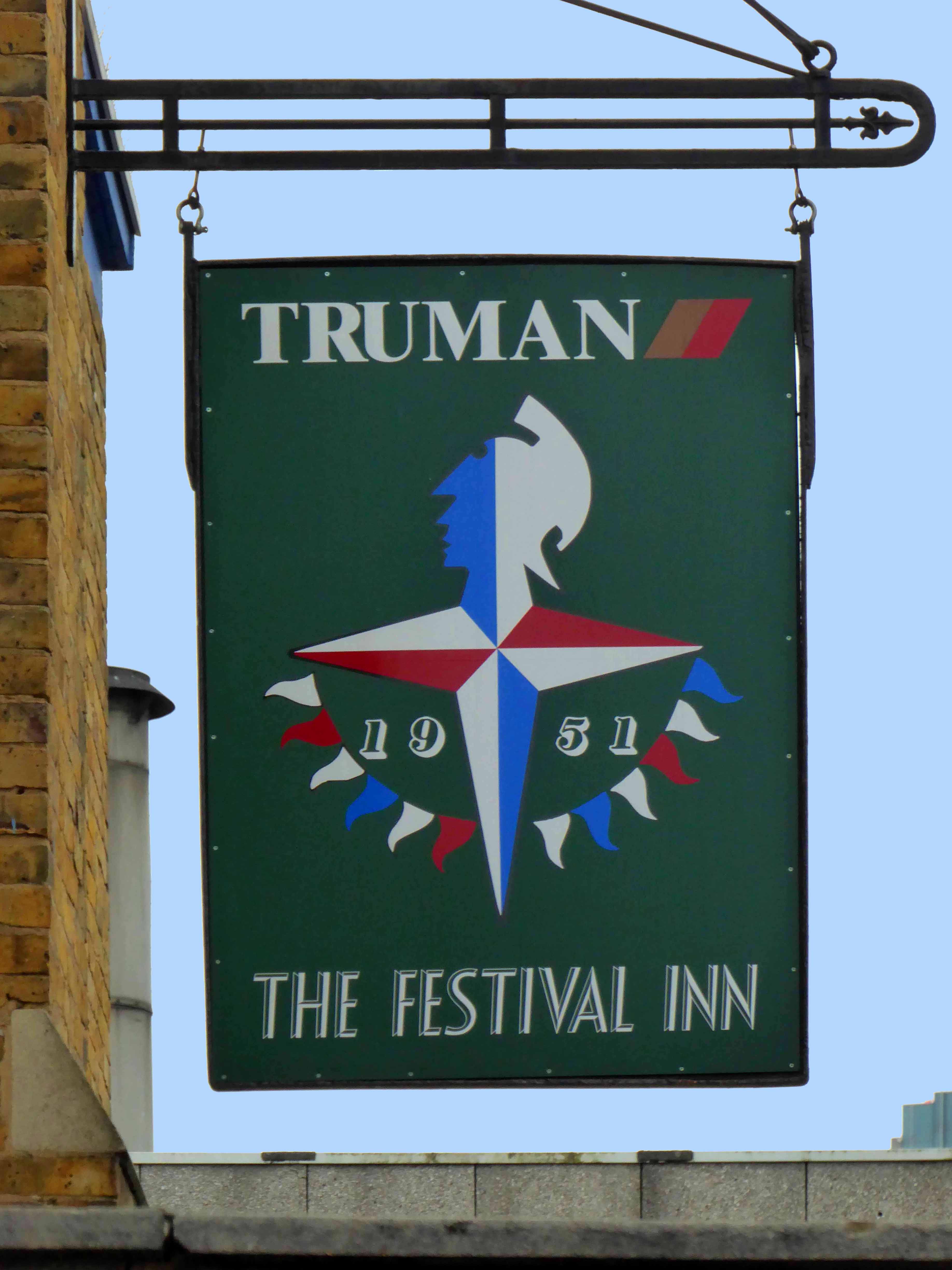
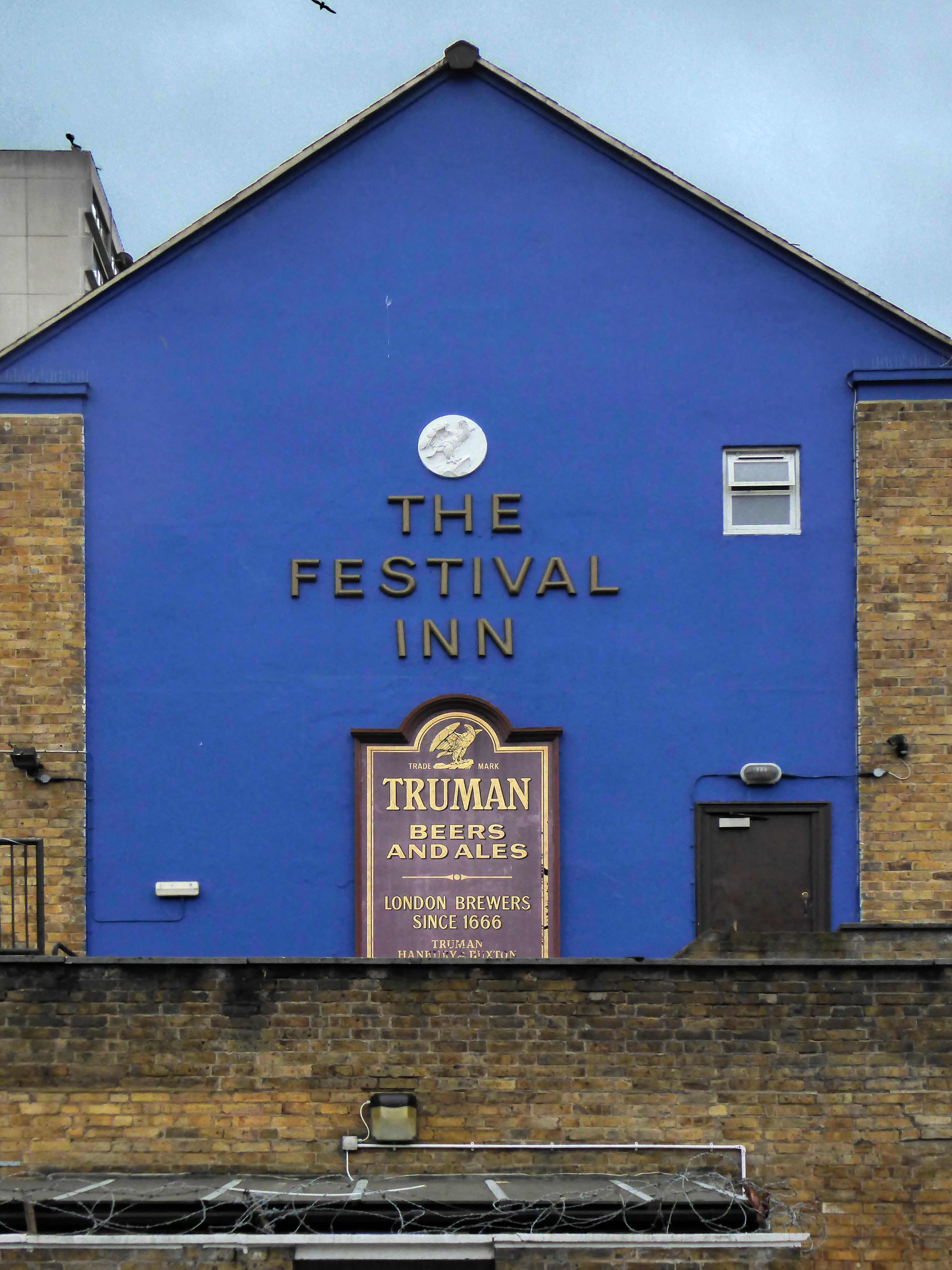
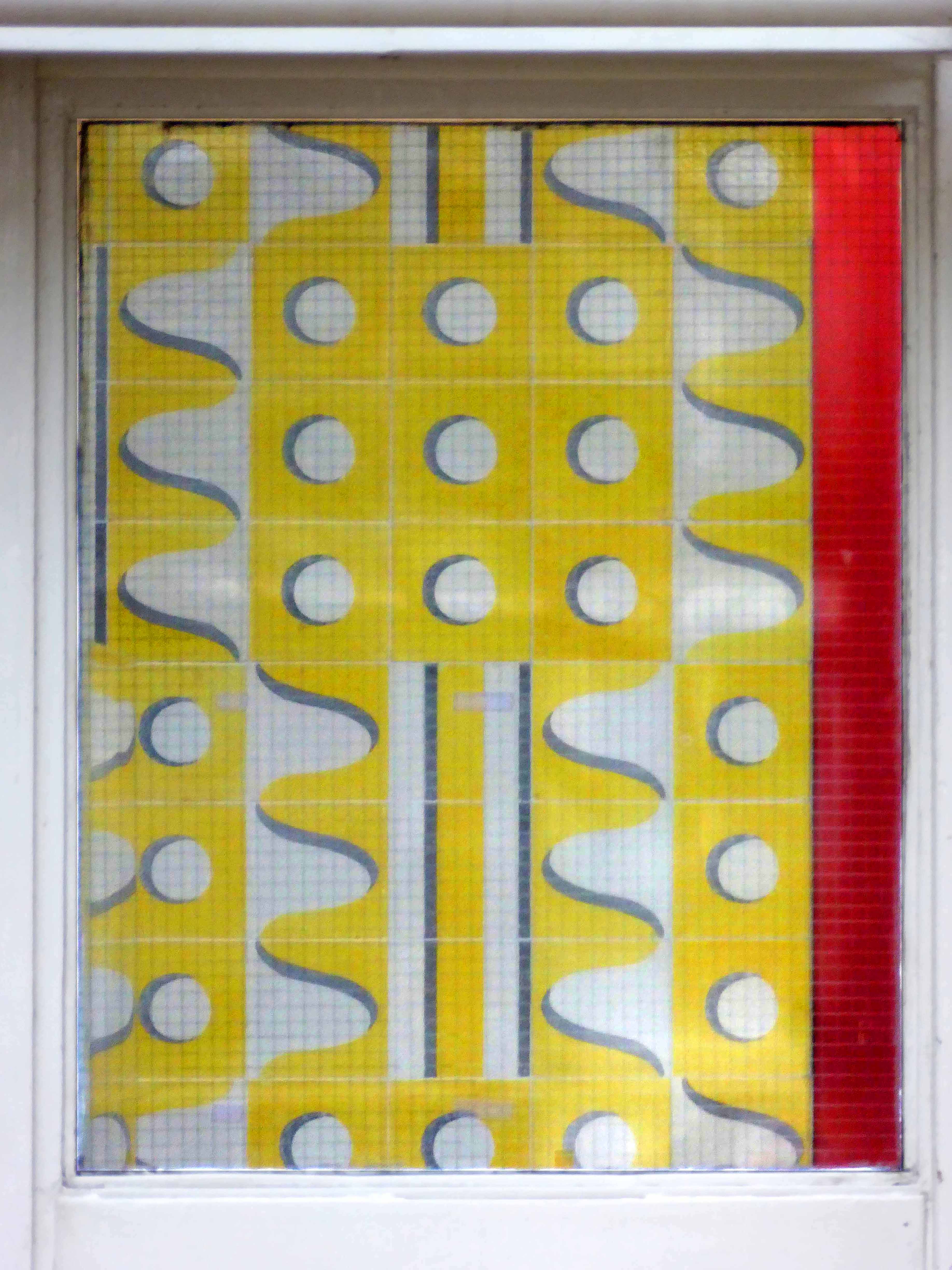
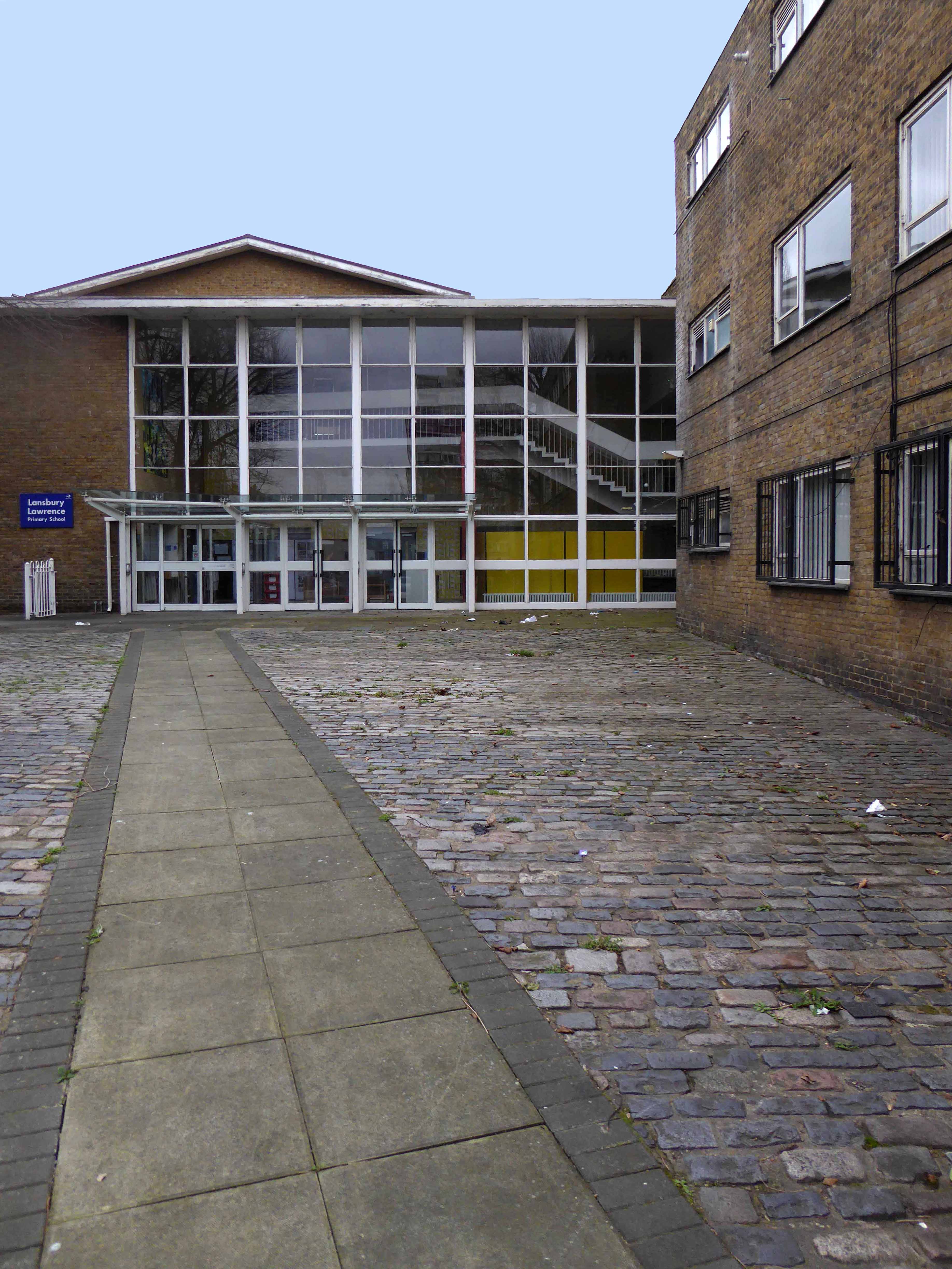
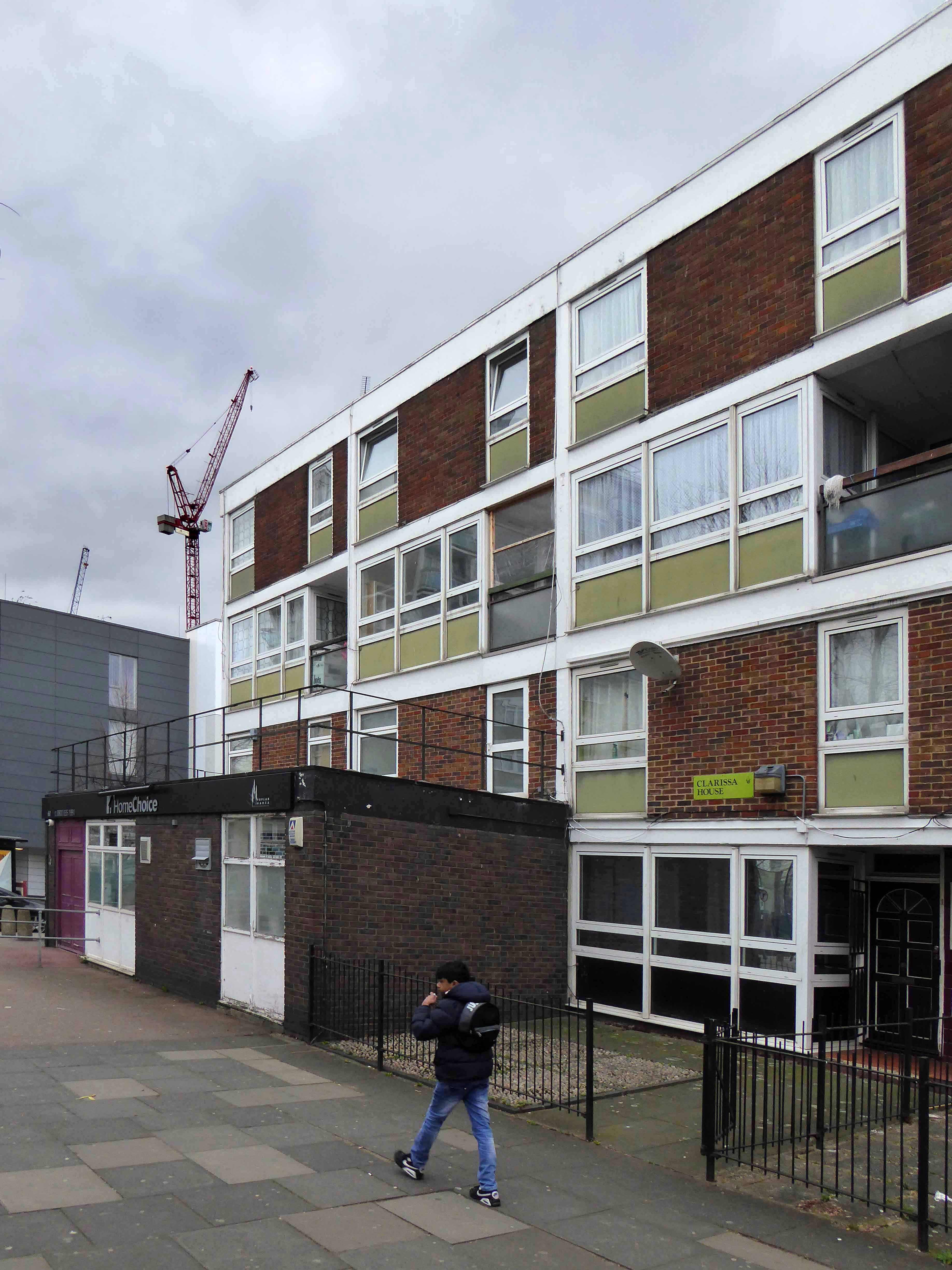
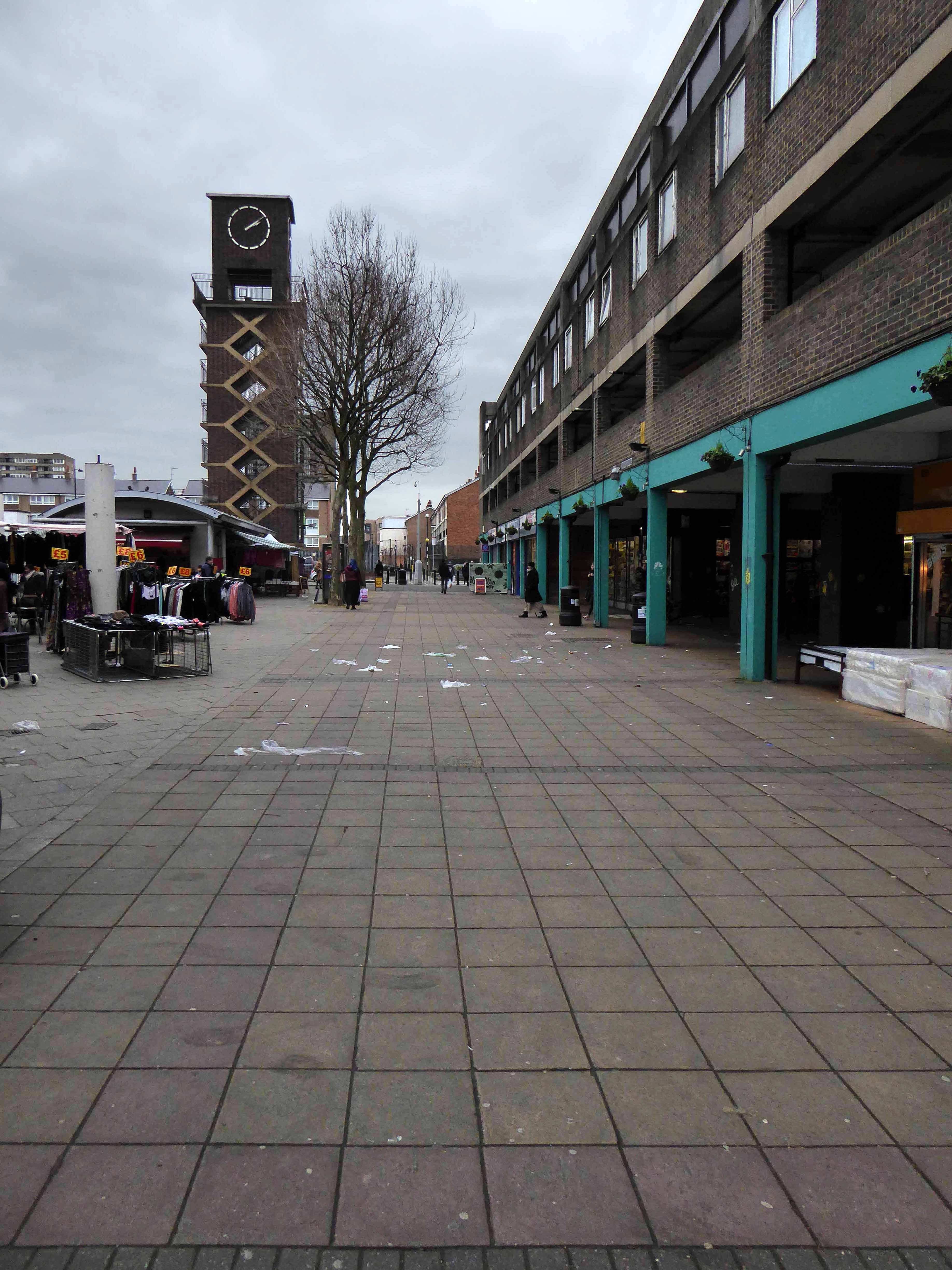
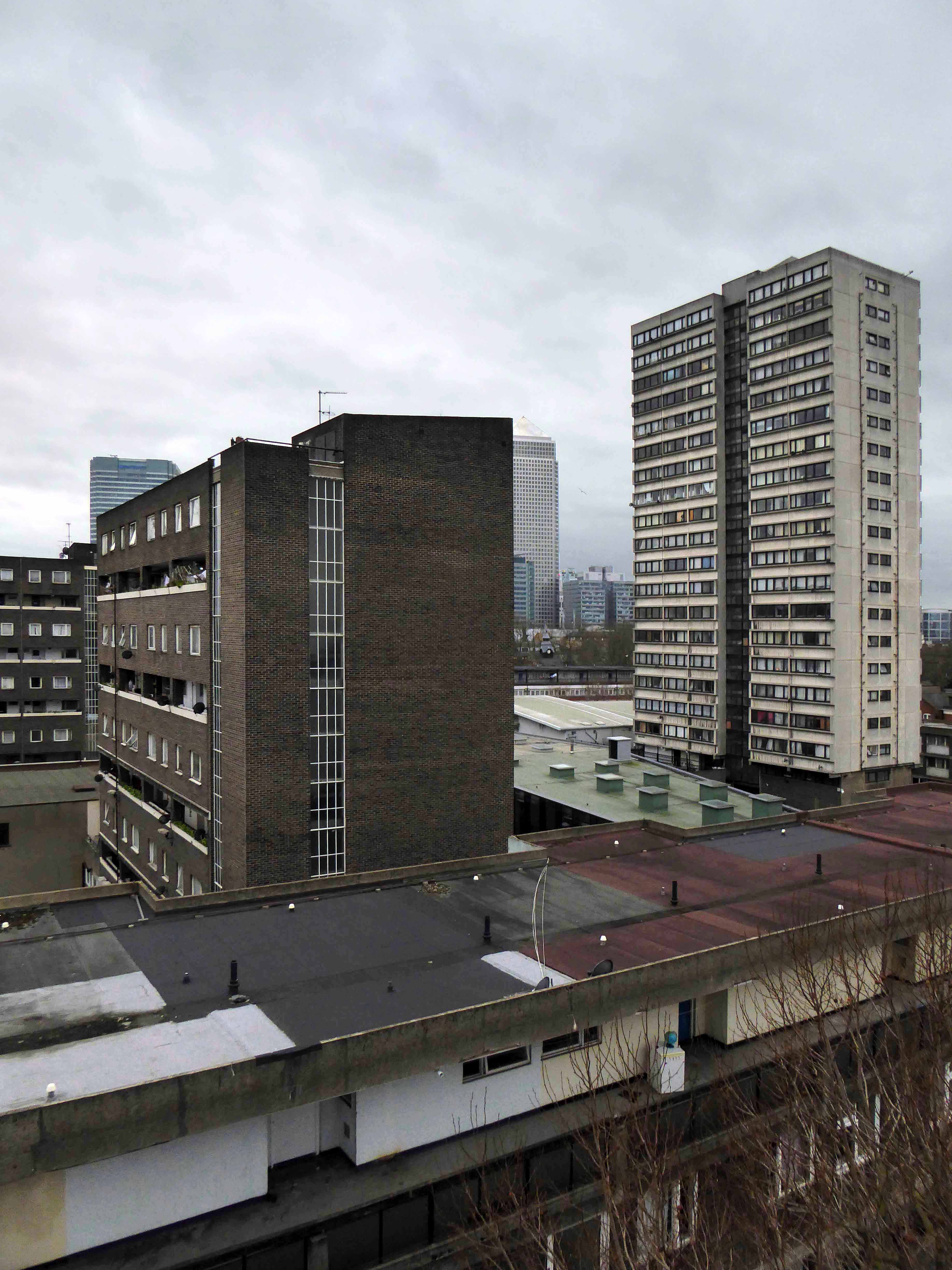
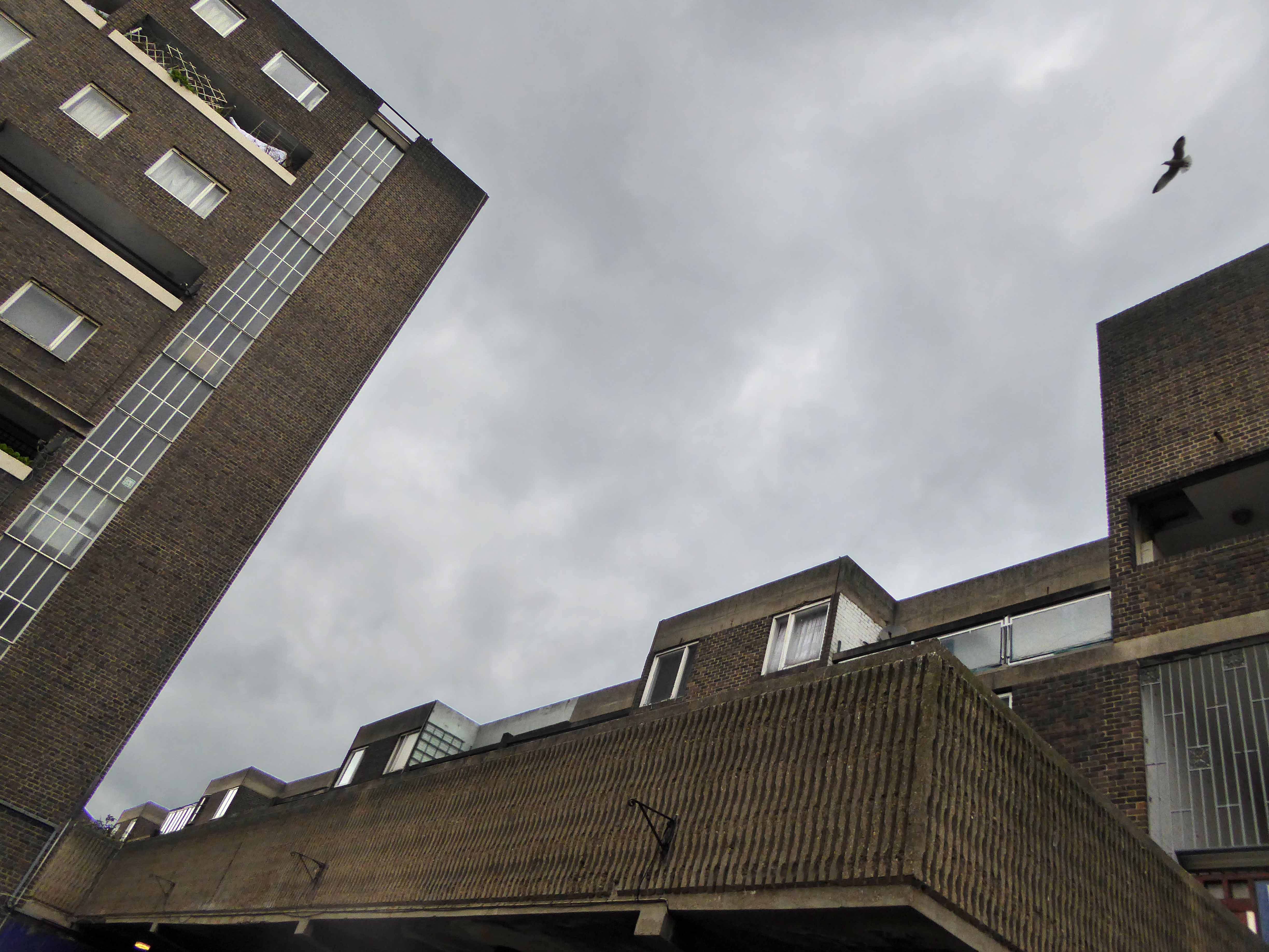
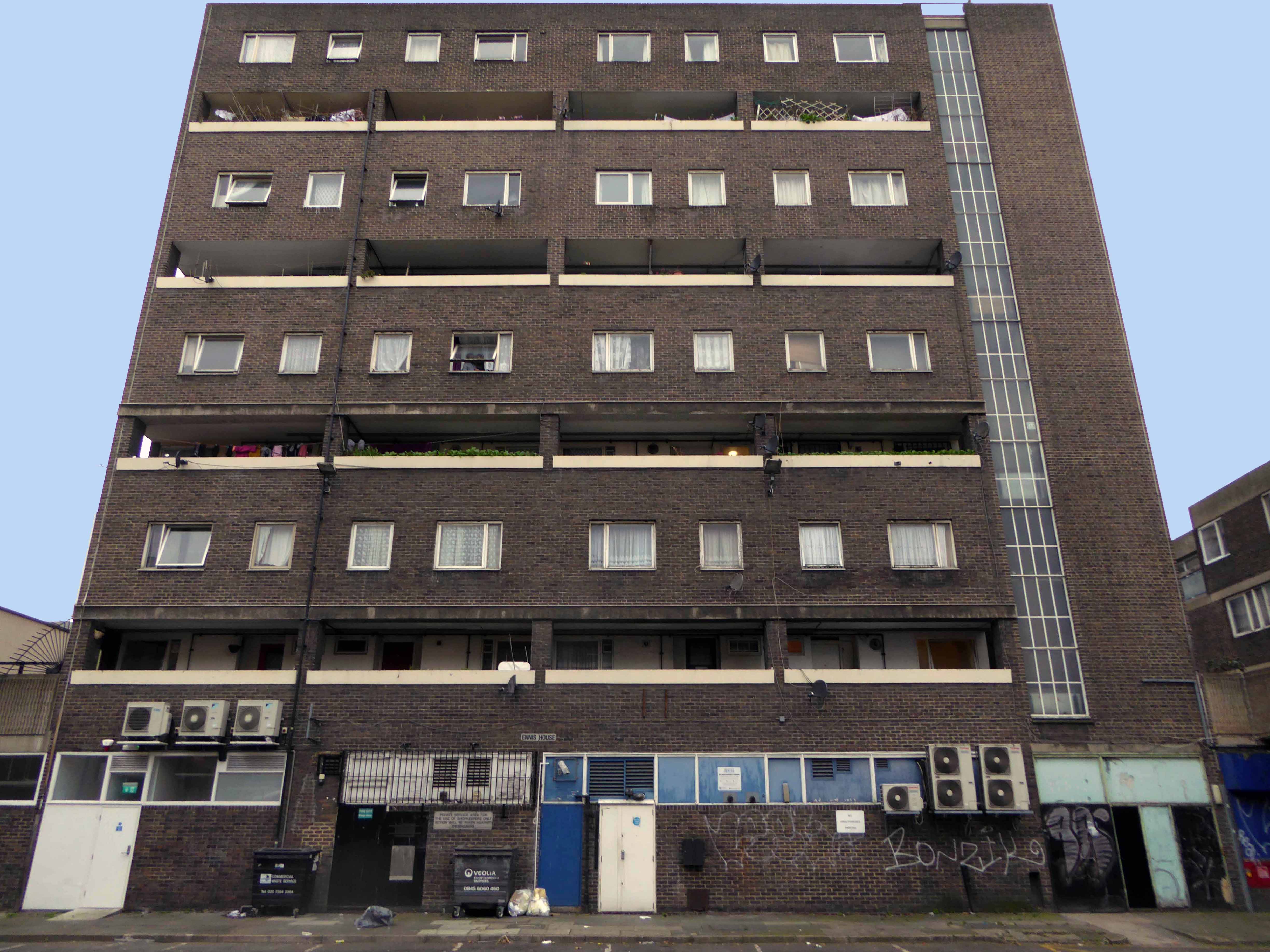
The Lansbury Estate, to the north of East India Dock Road, is the most important, largest and best-known council estate in Poplar. It demonstrates the different trends in post-war council house design and layout. The interest of the estate lies as much, if not more, in the story of its planning and construction, as in what was actually built. This is especially true of its first phase, which formed the basis of the Live Architecture Exhibition in the 1951 Festival of Britain.
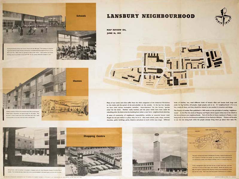
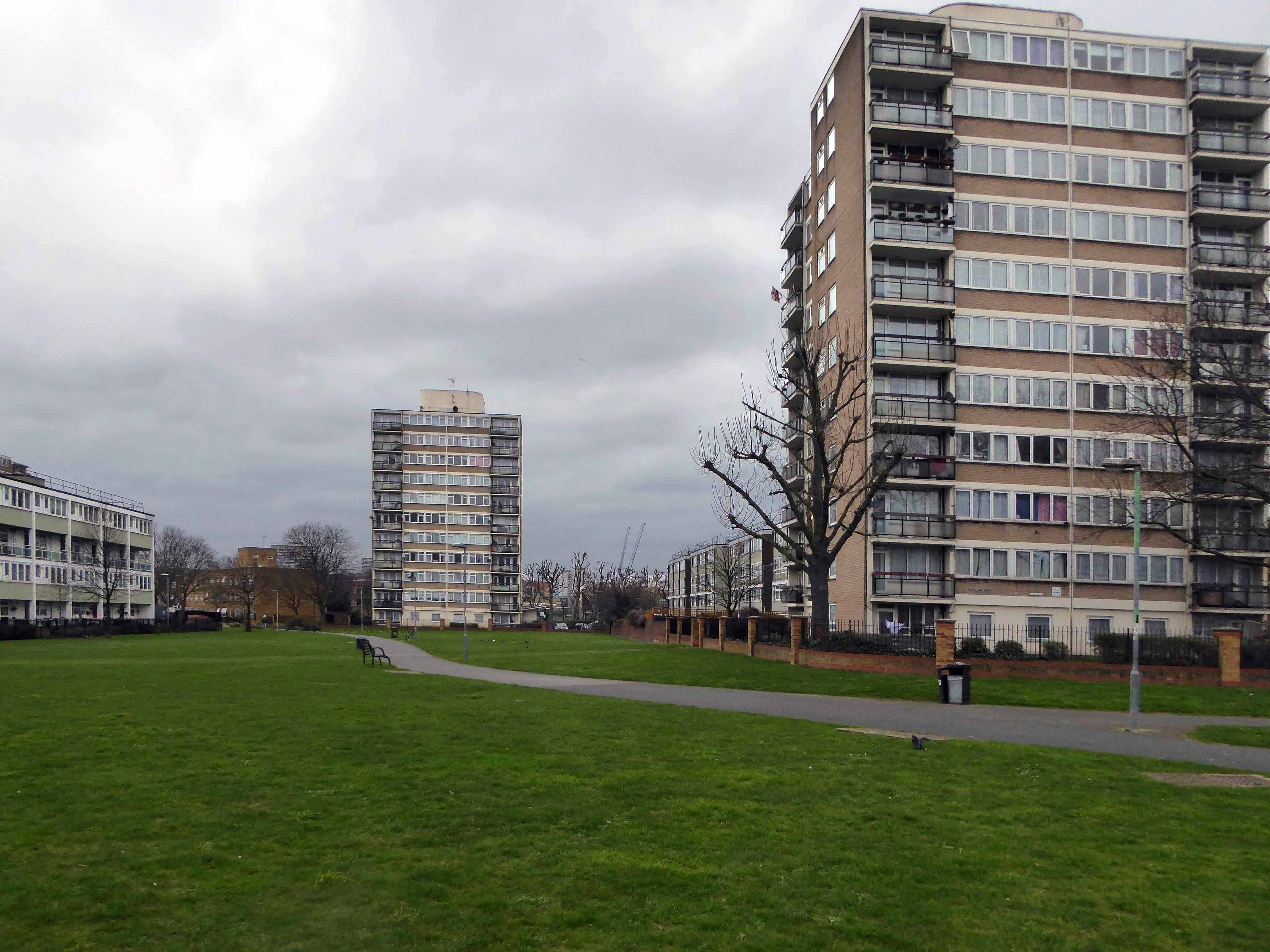
Originally outlined in the 1943 plan for London, replacing the bomb damaged homes of displaced dockers, the estate has weathered well enough, though changes in demographics, the ever greater engulfing tide of gentrification and the containerisation of all ports, brings a fresh set of challenges and changes.
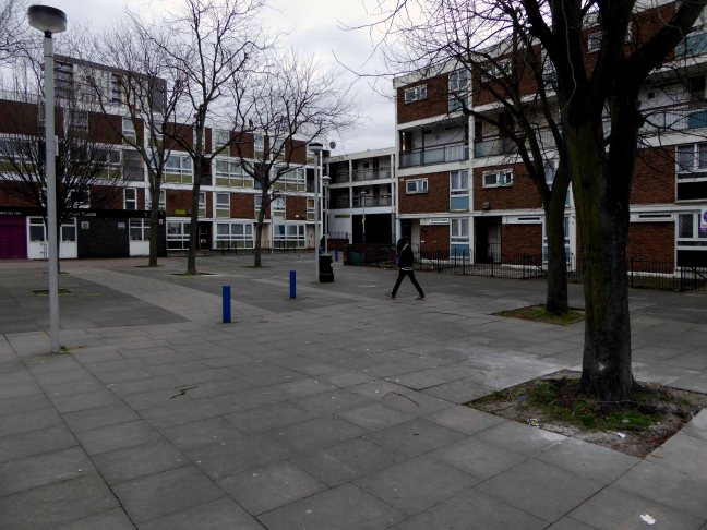
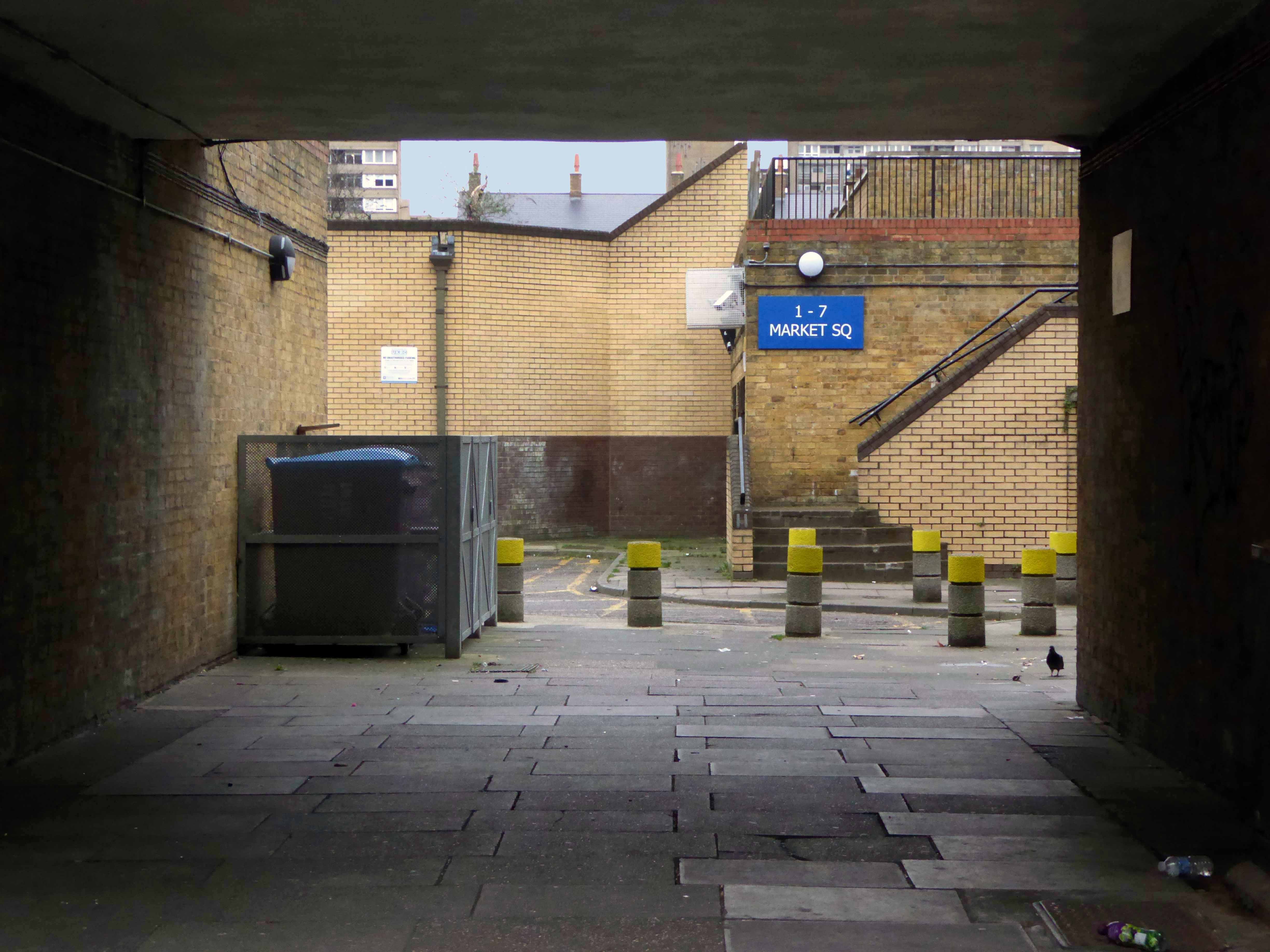
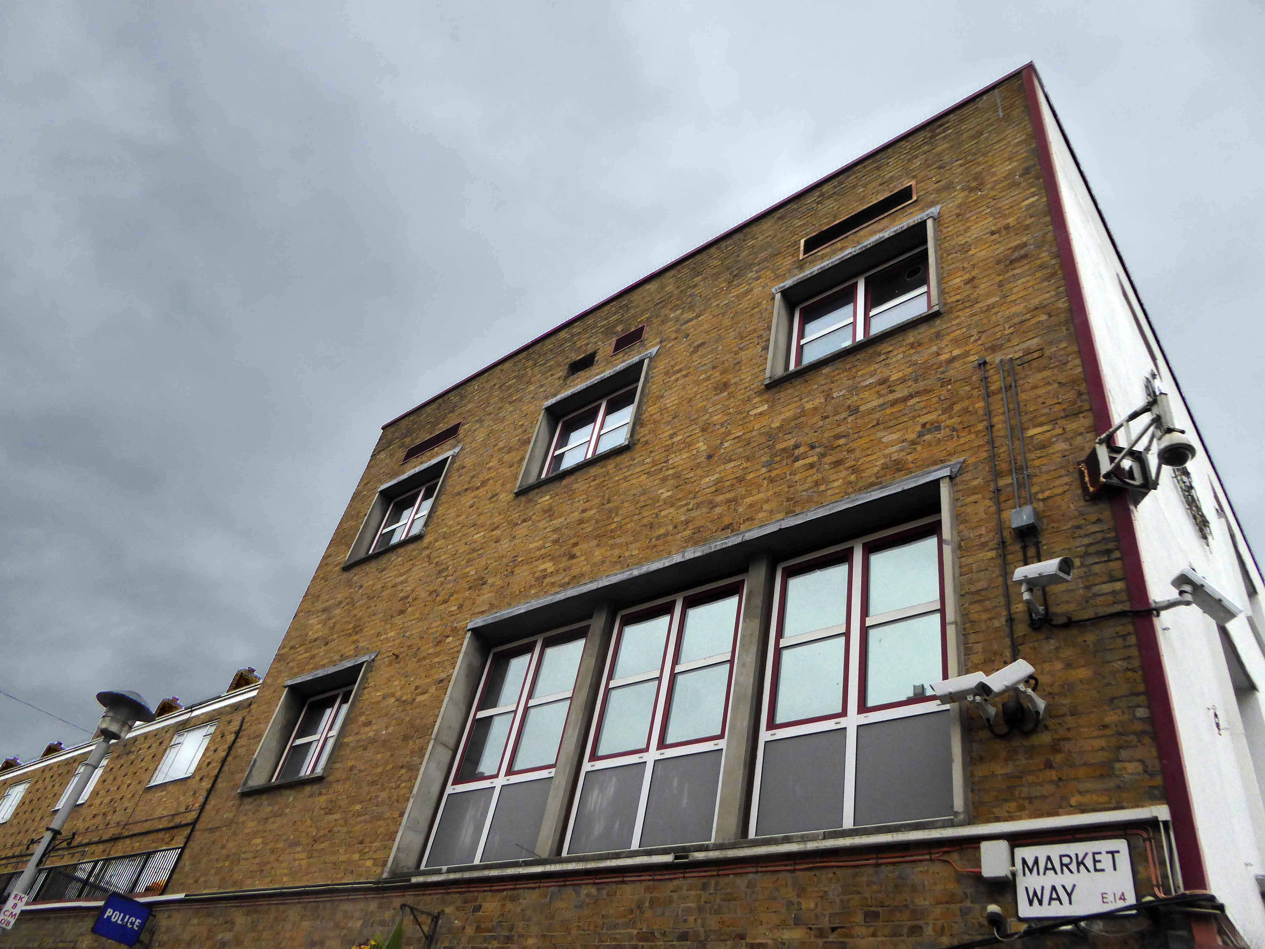
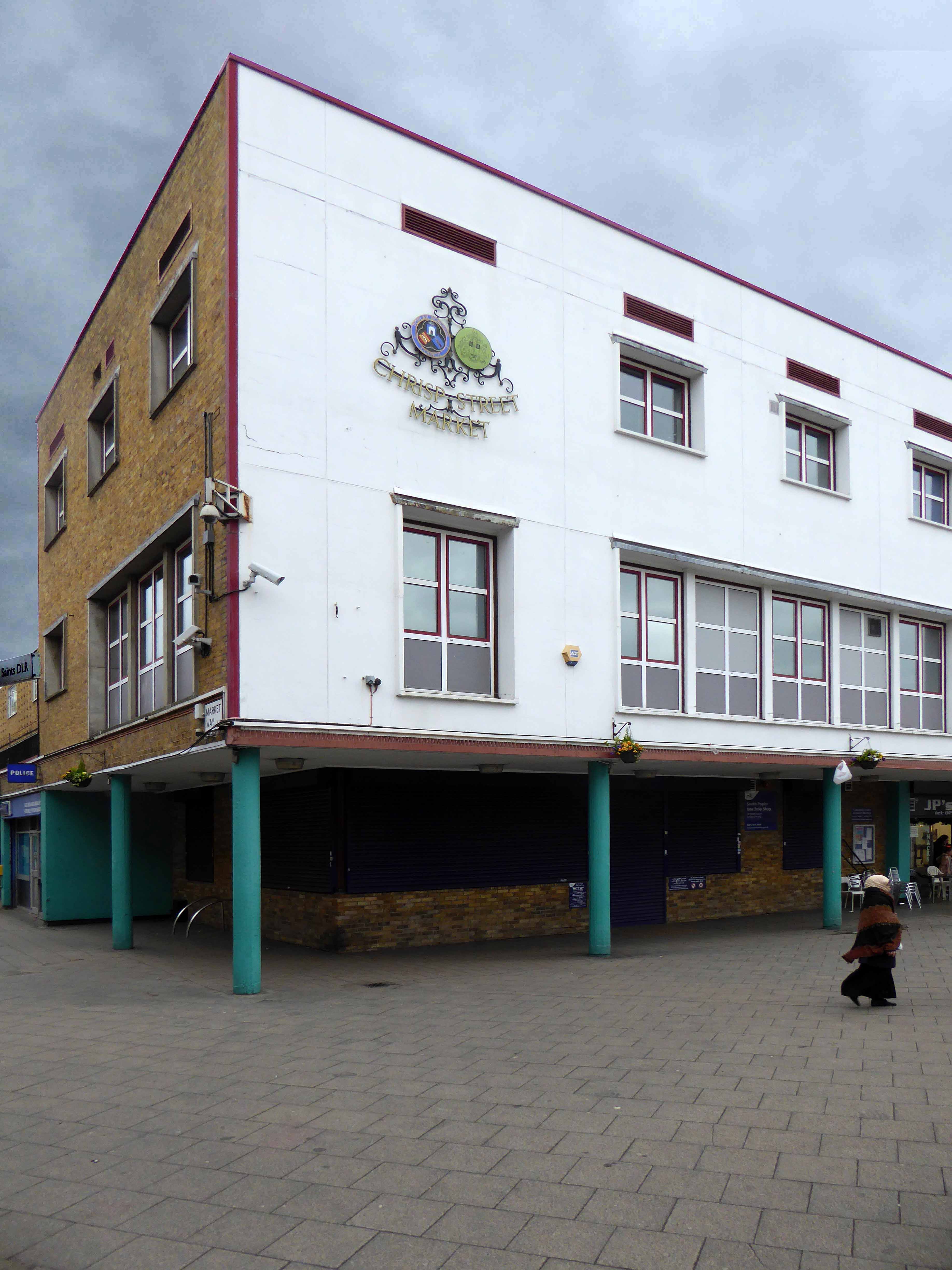
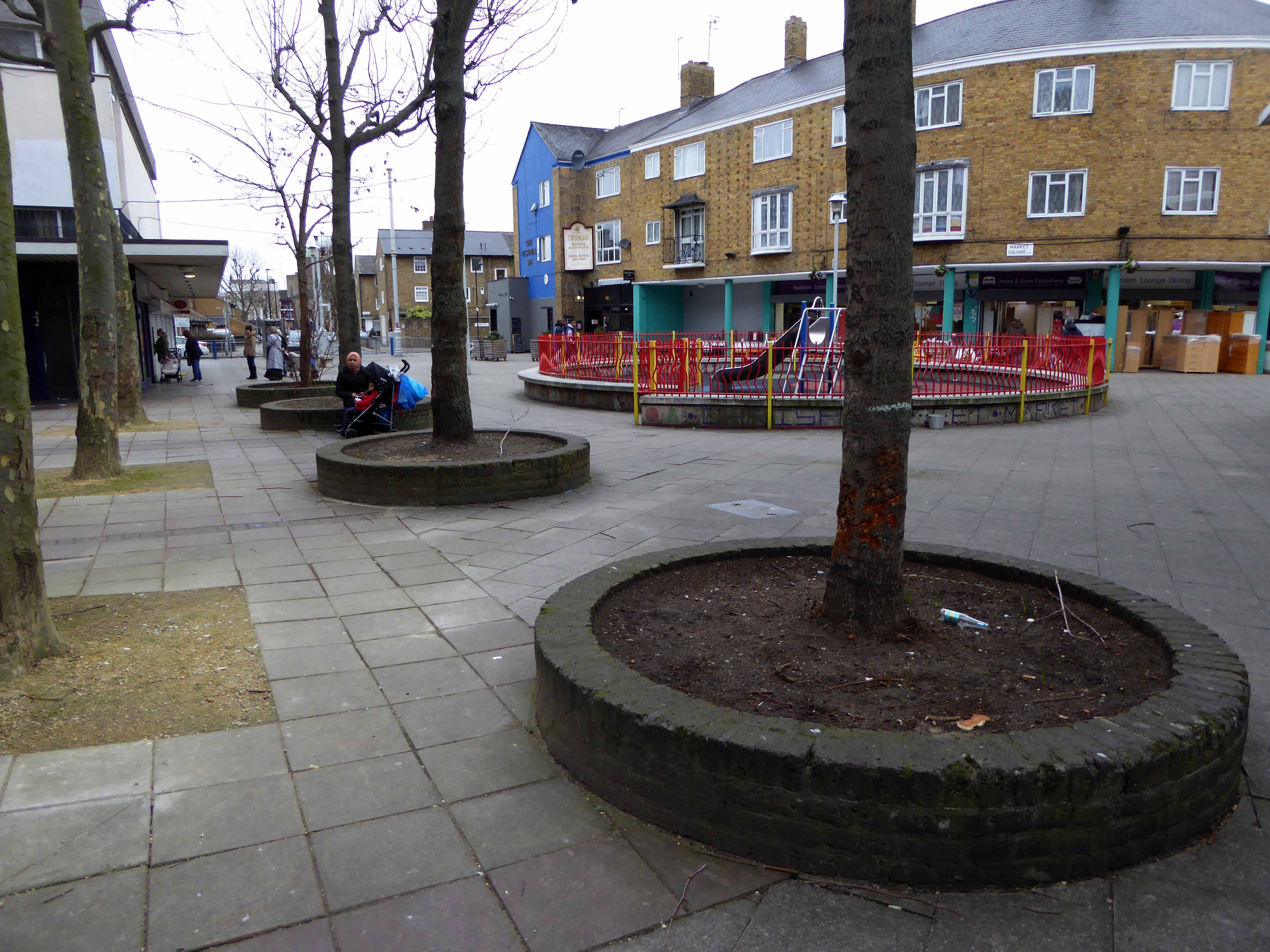
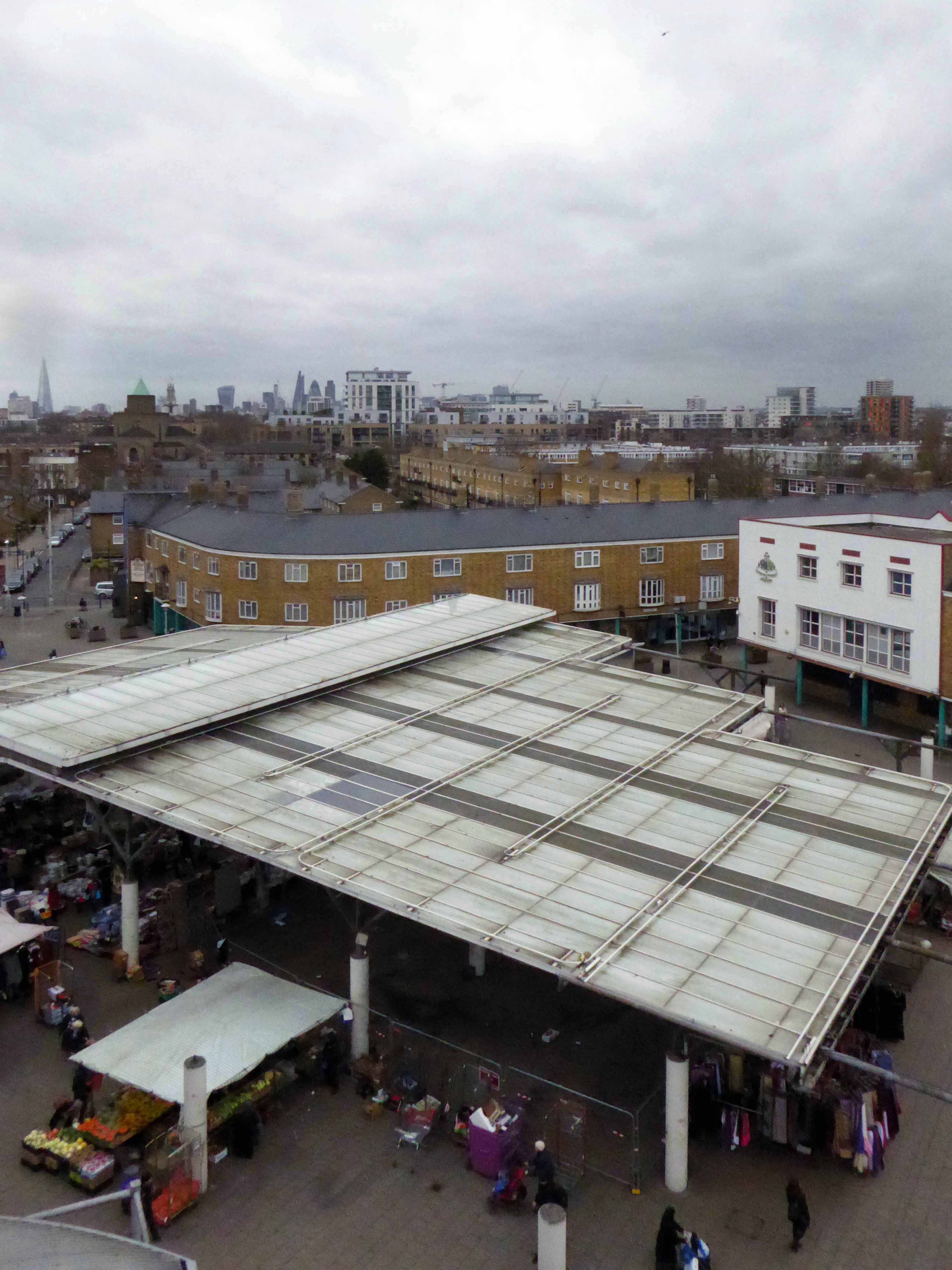
Go east – I visited the V&A Micro Museum, which has become a focus for residents’ and visitors’ memories and projections of a certain uncertain past and future. Arriving by the Docklands Light Railway, I was immediately drawn towards my destination, by the prominent Lansbury Tower, its clock patiently ticking away the time to and from 1951. Welcomed by staff and fellow travellers at the Chrisp Street Market site we began our tour at the heart of the Festival area – further details of which can be found here at Municipal Dreams.
A mix of market, shops, Festival pub, warm cream London brick terraces and low rise, later tower blocks, schools, churches and open grassed communal areas. On a cold and getting colder late winter’s day, a smattering of residents went purposefully about their business.
Life goes on.
Next time everything’s going to be different.

Happy days!
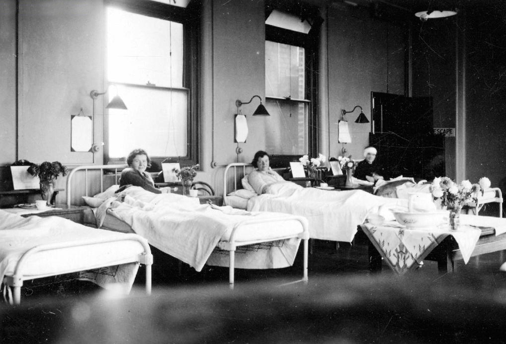
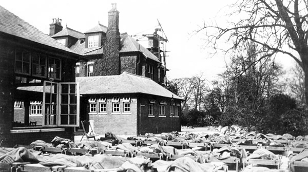
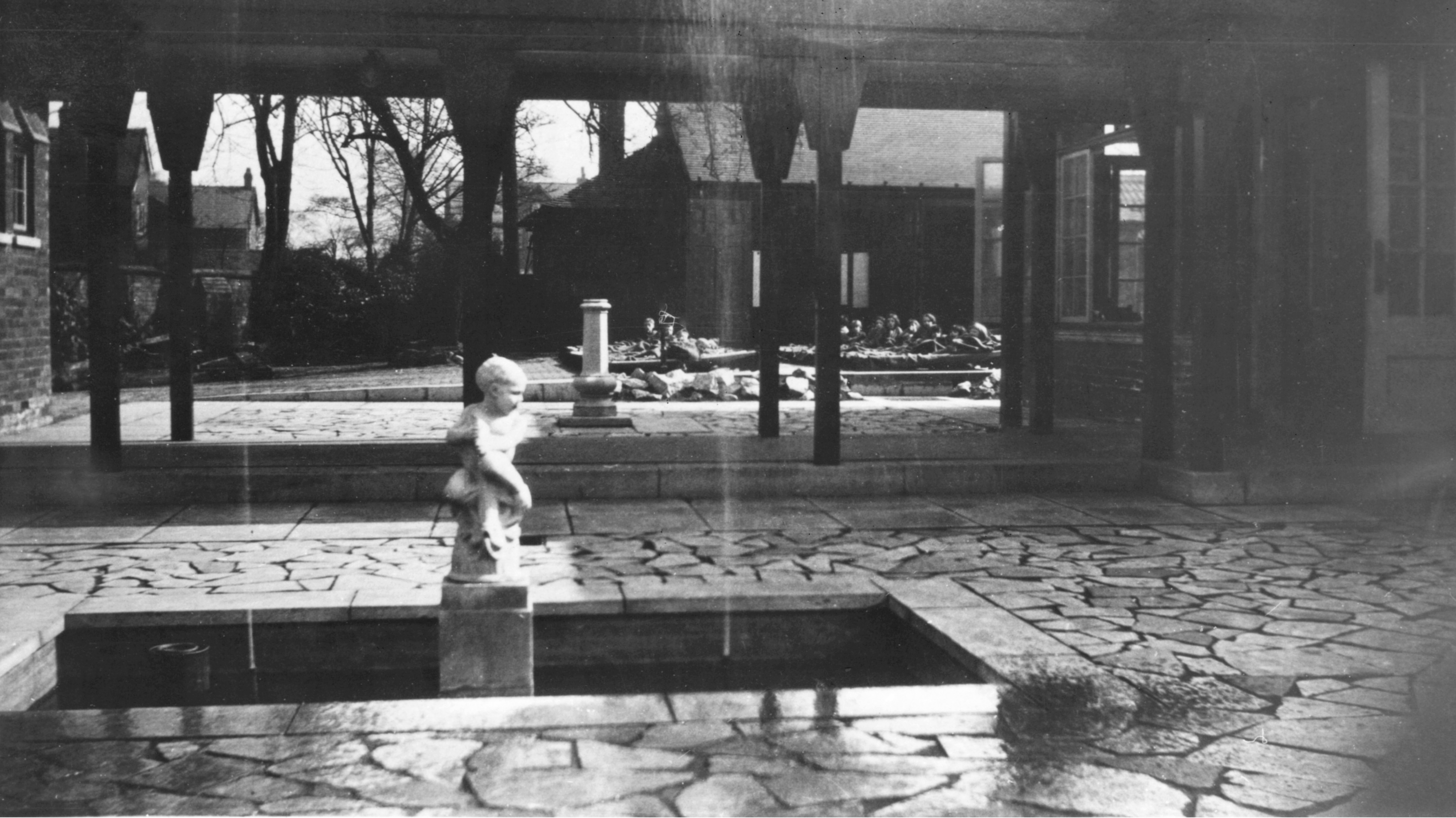
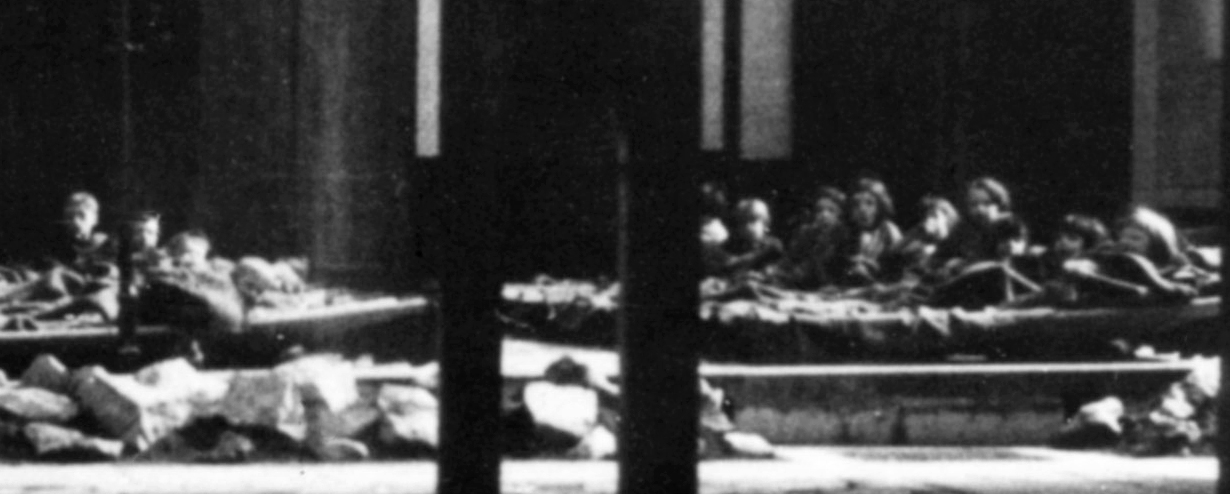
I was a delicate child with bronchitis, must have done me good as I went on to serve 39 years in the army!
We lay on camp beds for an hour in the afternoons, on bad days on blankets on the floor in the main building.
Michael Dooley 10/03/2013
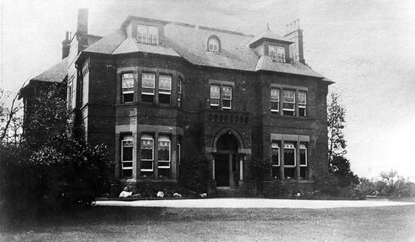
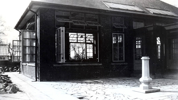
Tithe Barn school stands on land which was originally a house called Longfield, the house sign is on the wall near the side entrance to TBS, which was built around 1871 for John Brown who owned Afleck and Brown’s department store in the centre of Manchester. The gardener for the house lived at what is now known as Tithe Barn Cottage.
John later sold the house to his brother William whose wife sold it very cheaply to Stockport Education committee in 1929 to be used as an open air school for children who suffered ill health in the town, mainly through smoke pollution. This was called Longfield Open Air School. Pupils travelled there by bus before breakfast, from Portwood and other parts of the town. Most of them had a sleep outside in the afternoon so that they could take advantage of the clean air of Heaton Mersey. As the town became healthier and the chimneys stopped belching out black smoke, the need for an open air school lessened and it closed in 1968.
The original house was demolished and some of the beautiful wooden interior offered to museums in York where the original bath with its enameled sides and copper shower canopy is now on display in the Castle Museum. The only part kept and used by the architect was the Venetian glass bathroom window which Mrs Brown had made to remind her of the beautiful water scenes in Venice. This glass panel was installed outside the Headteacher’s office and is still there today.
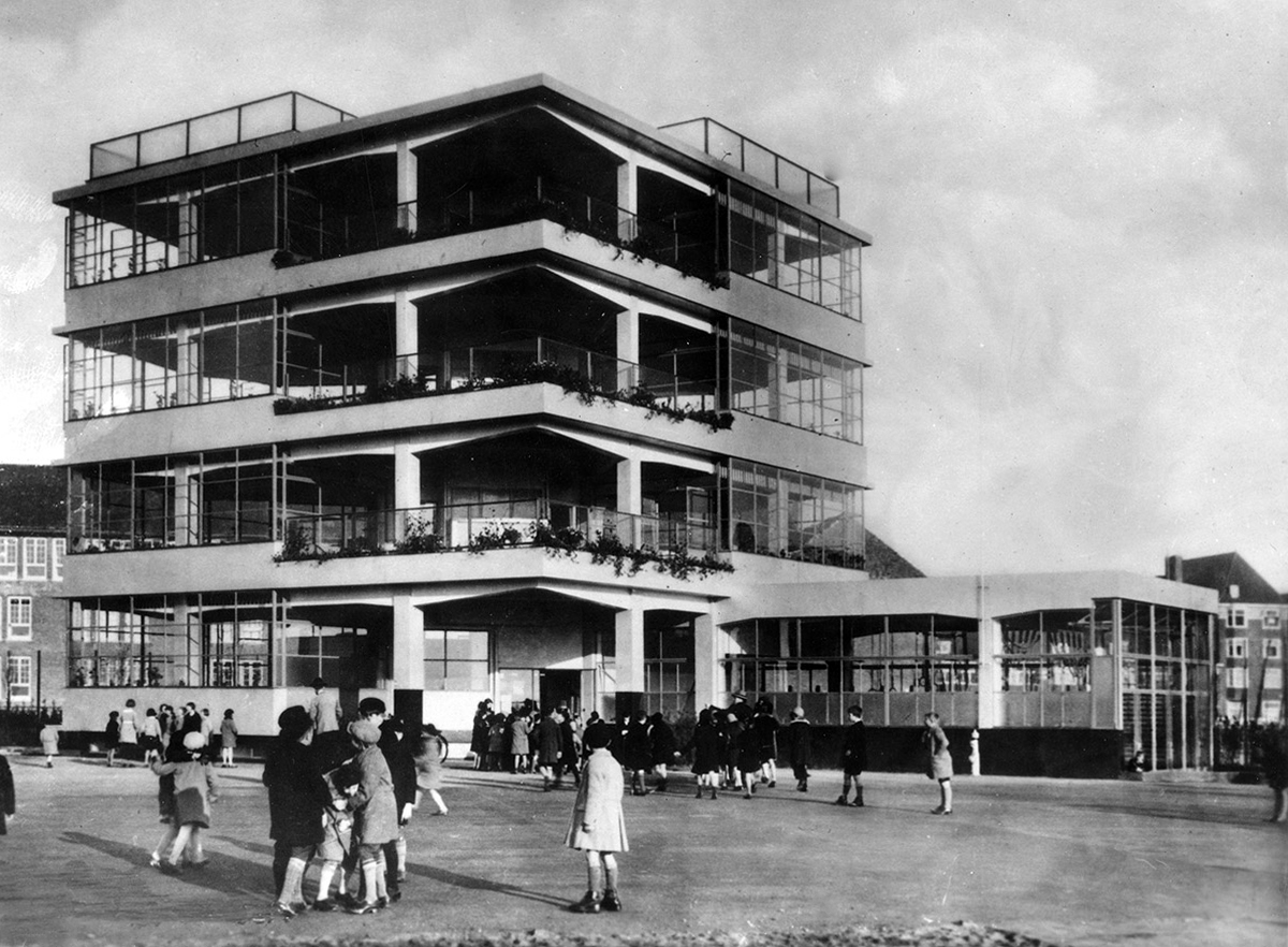
Penluchtschool – Open Air School
An idea that found its way from continental Europe to the British Isles.
Amsterdam – Johannes Duiker 1930
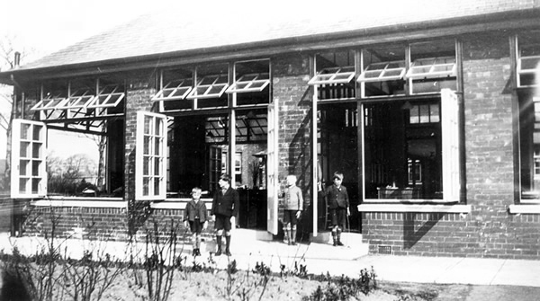
Longfield School in the 1930s
I was lead here on finding this print for sale in Stockport Local Studies Library.
Here are the pupils seen in detail.
The school in 1968
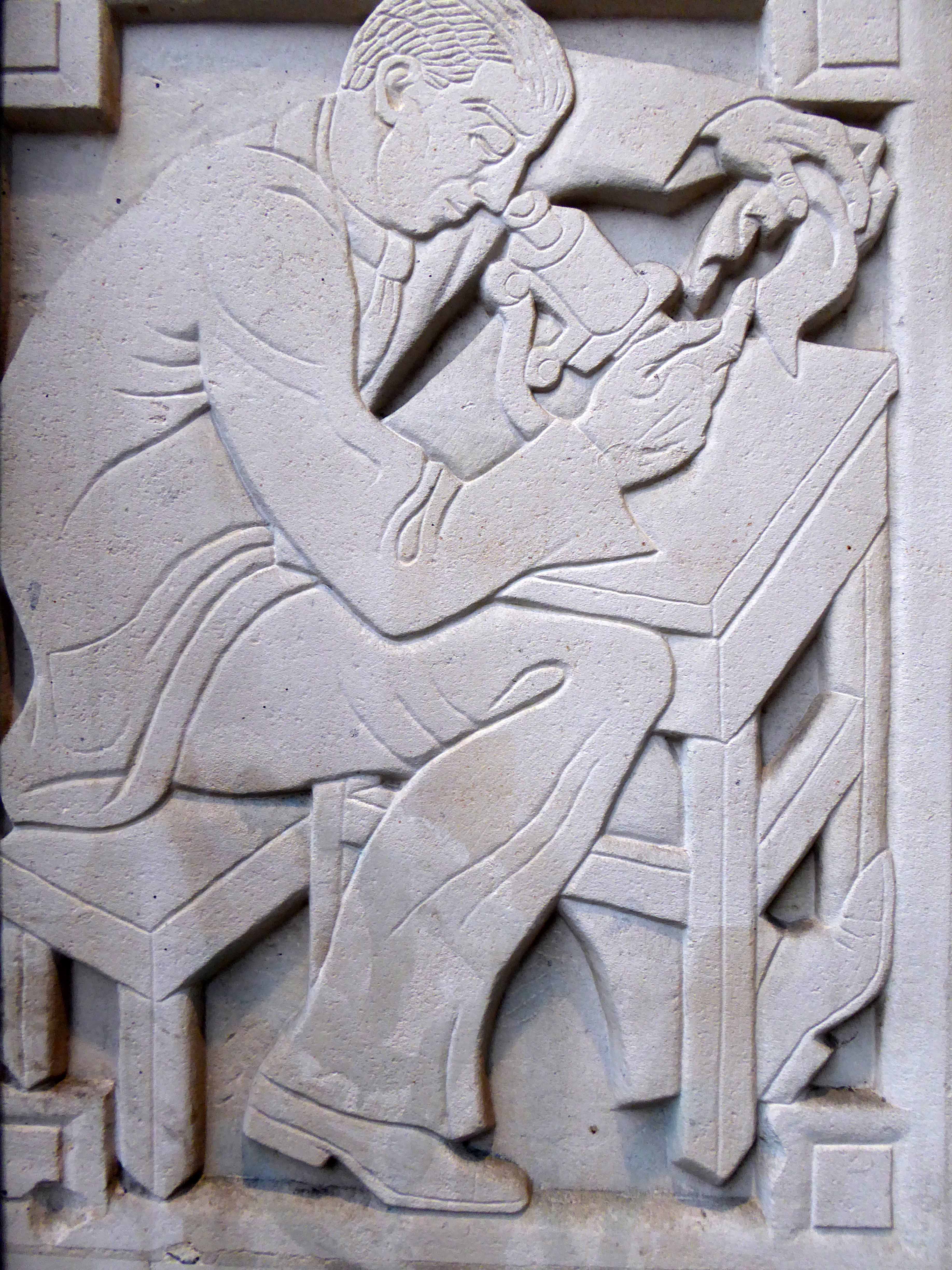
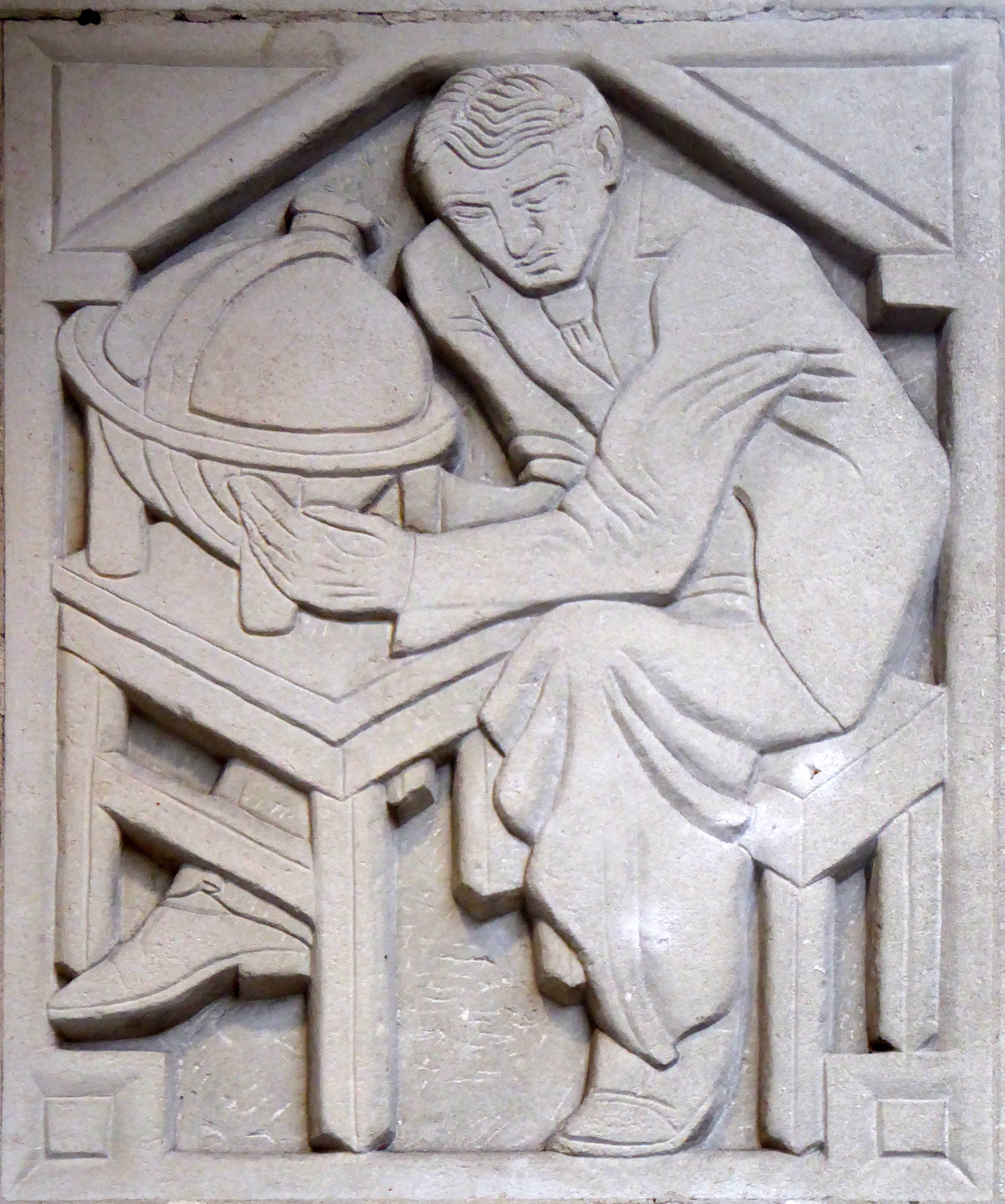
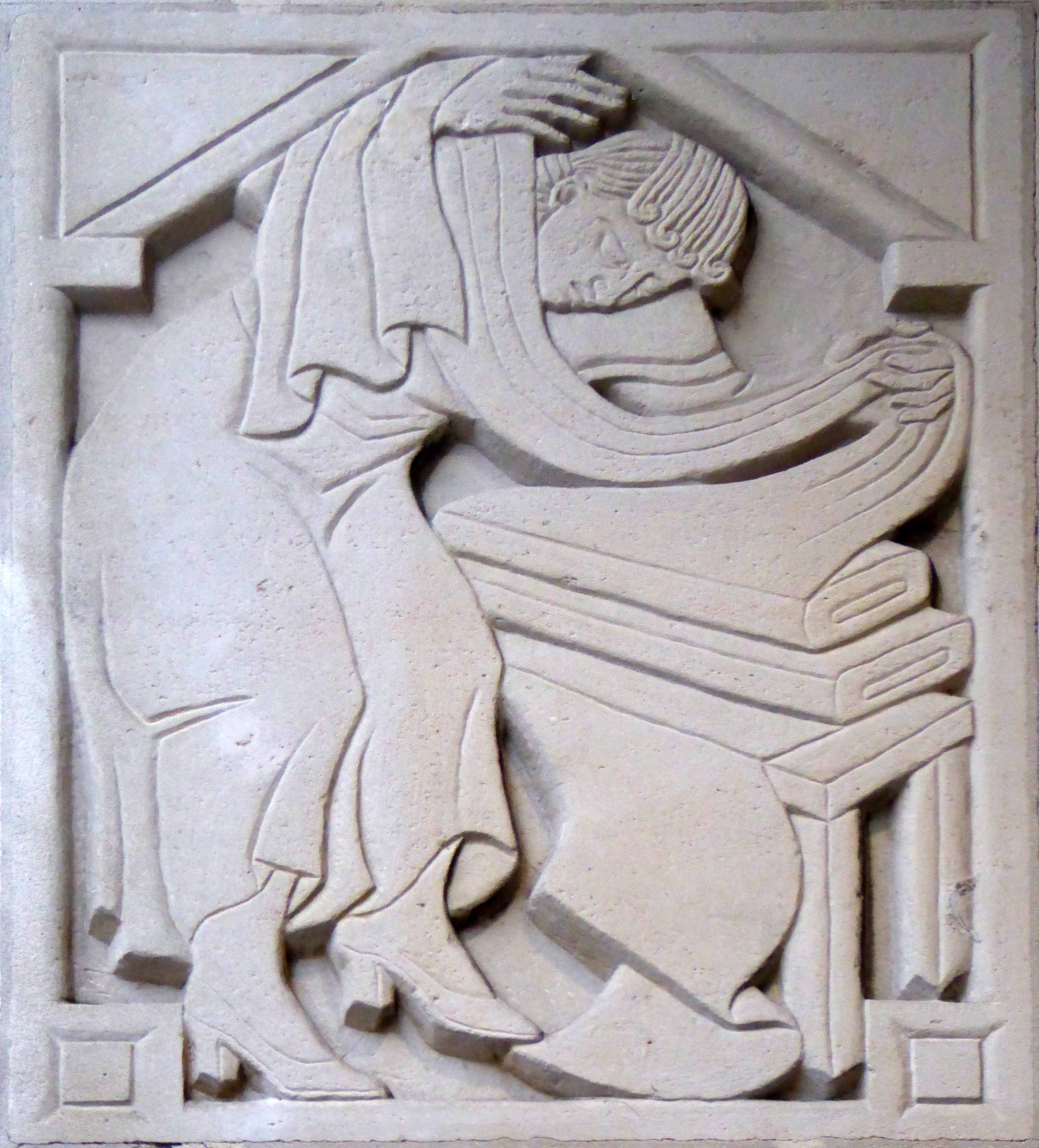
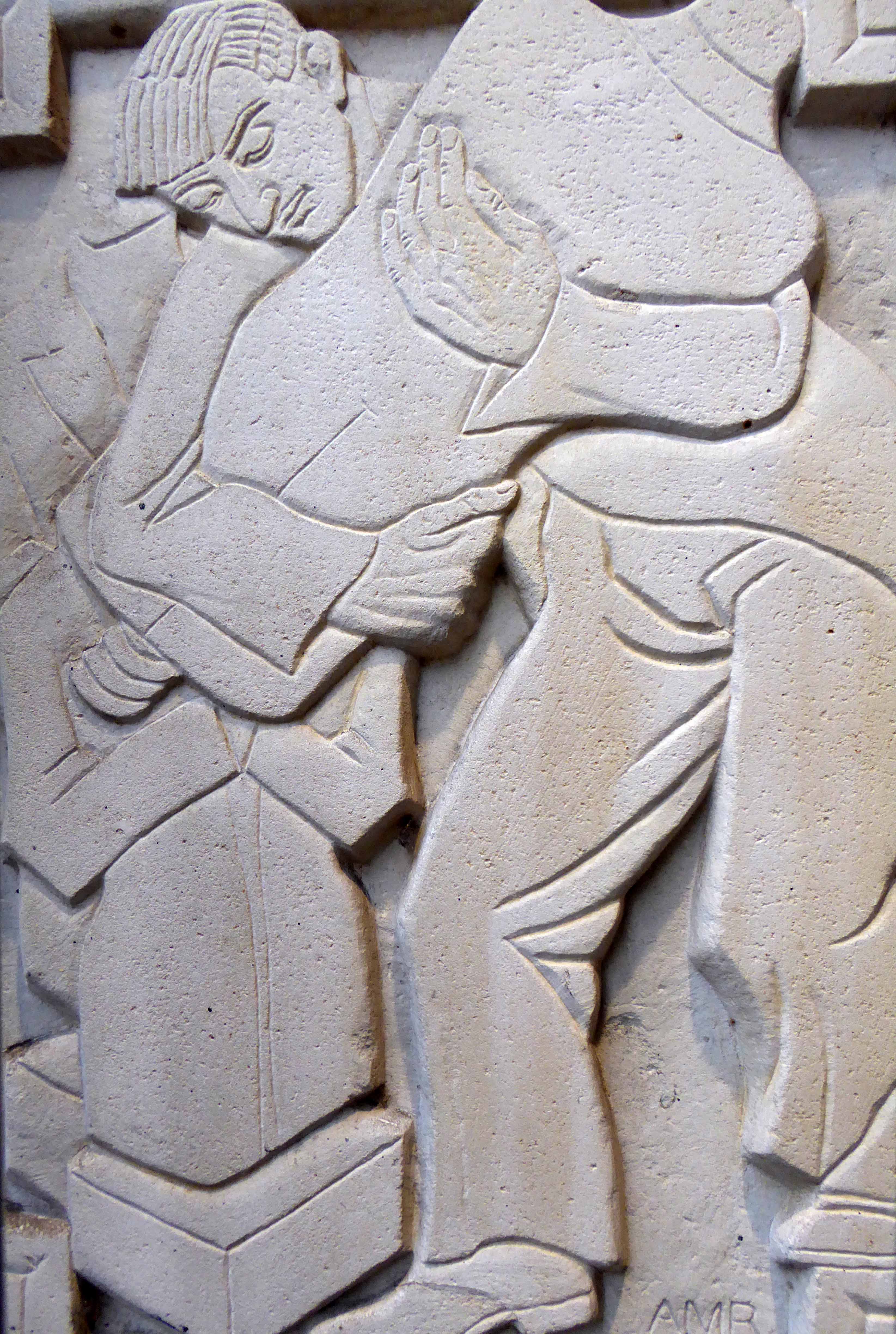
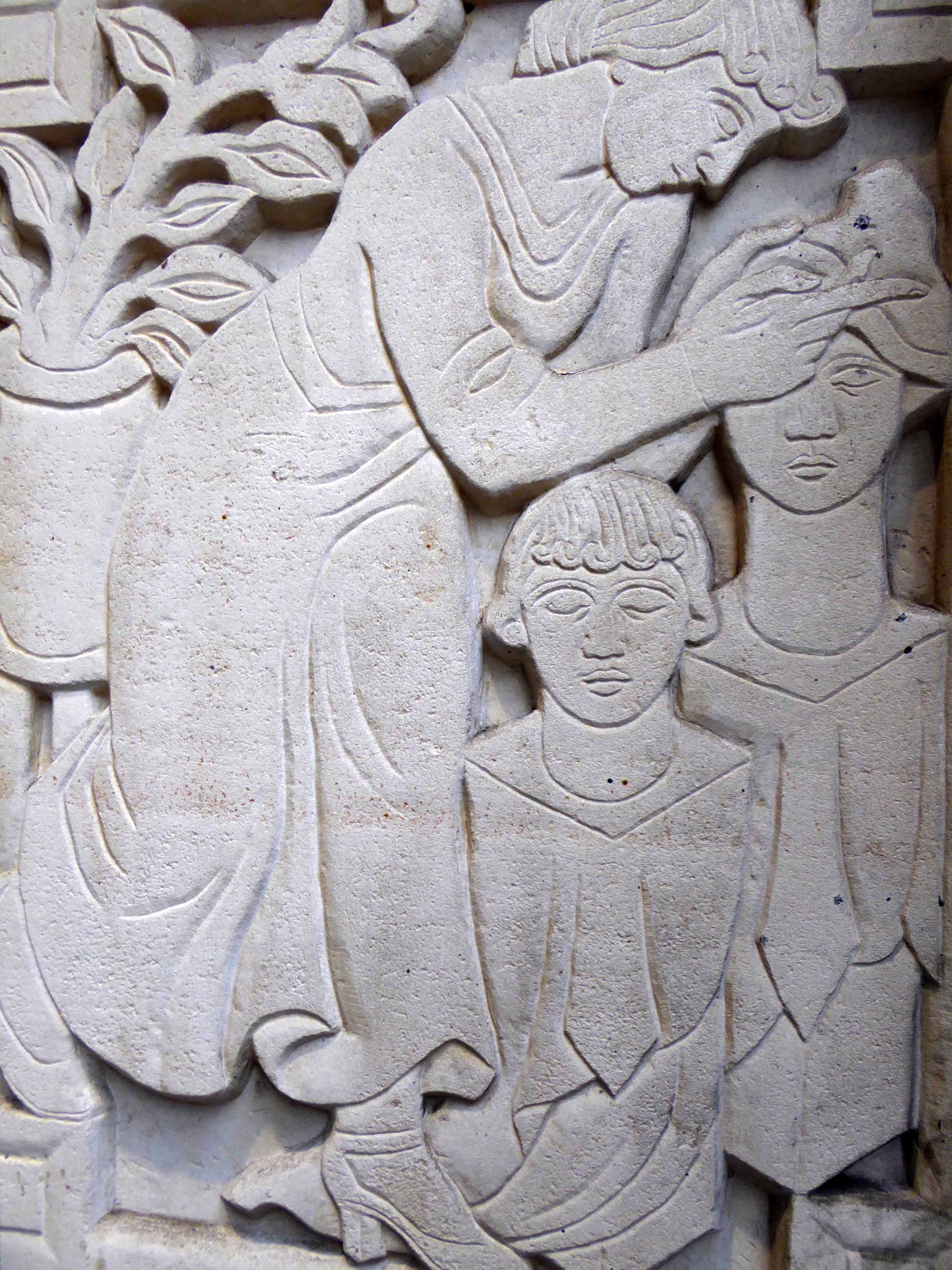
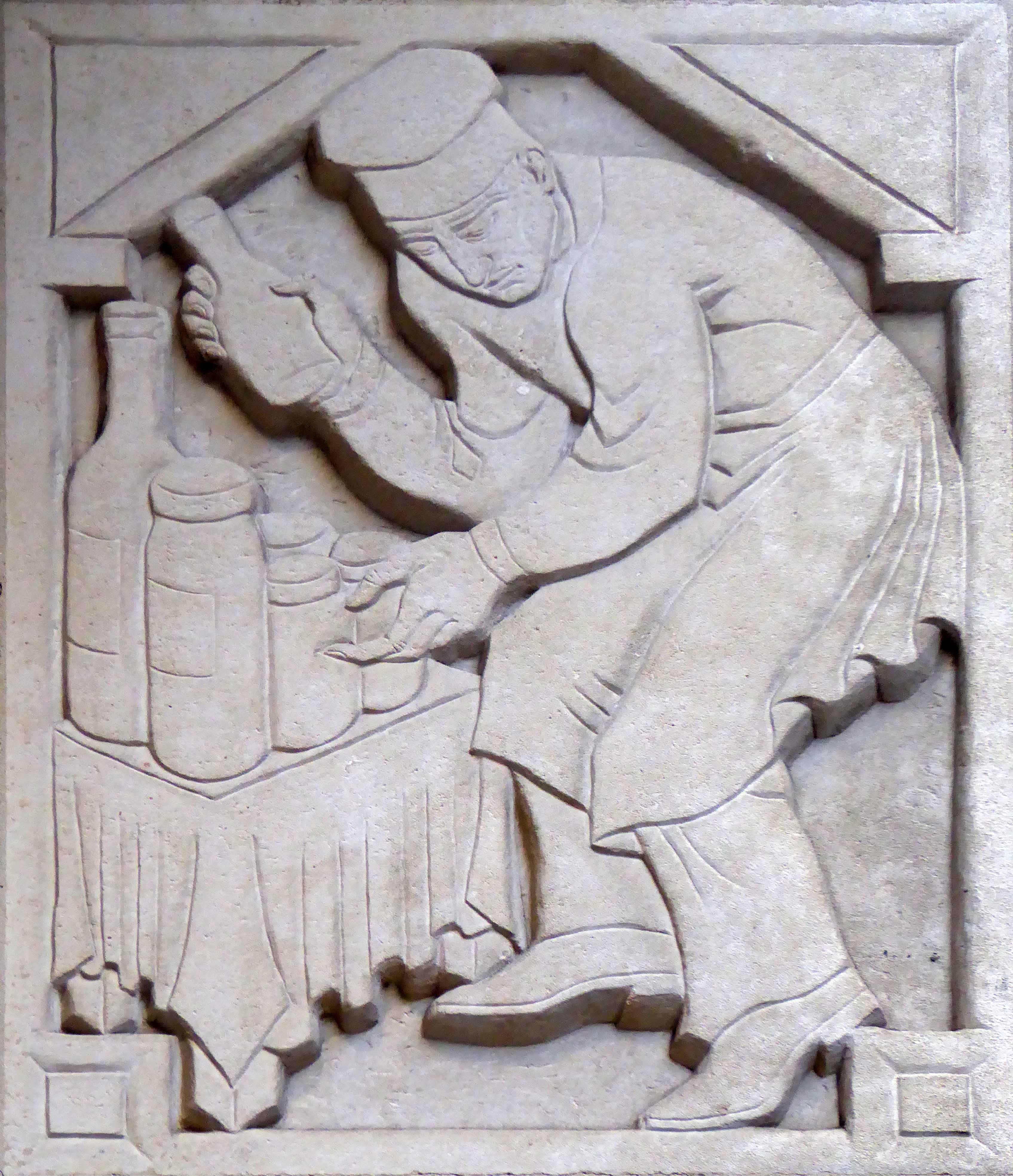
| Adolfine Ryland worked as a printmaker, sculptor, painter and designer. Her practice across these different media was united by her keen-edged, modern style and inventive graphics. She had studied at Heatherley’s and at the Grosvenor School of Modern Art under printmaker Claude Flight.
Ryland’s main exhibiting venue was the Women’s International Art Club, where she showed from 1927 onwards, becoming a member from 1936 to 1954. She also undertook public commissions, and worked for London County Council designing low reliefs for a number of buildings, among them the School of Butchers and St Martin’s School of Art. Her reliefs for the art school, which still decorate the entrance, show students at work. But Ryland’s work is not always easy to identify as she sometimes signed herself ‘Koncelik’, her mother’s maiden name. In 1987 the Michael Parkin Gallery in London held an exhibition Printmakers of the 20s and 30s and Adolfine Ryland. On show were Ryland’s paintings, drawings, prints, sculptures and designs for book jackets and posters. Amongst them were two designs advertising London Underground, which speak of an optimistic age of efficient, modern public transport to the new suburbs. |
It says so here
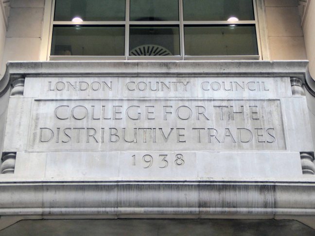
I was sauntering down Charing Cross Road on Saturday last, minding my own and everyone else’s business, then perchance I chanced upon a series of low reliefs, tucked neatly away in a nearby portal.
The London County College for the Distributive Trades – rightfully adorned with appropriate public art depicting the lasses and lads, going about their very practical business.
These are the work of Adolfine Ryland.
The building is currently in use as Foyles Bookshop.
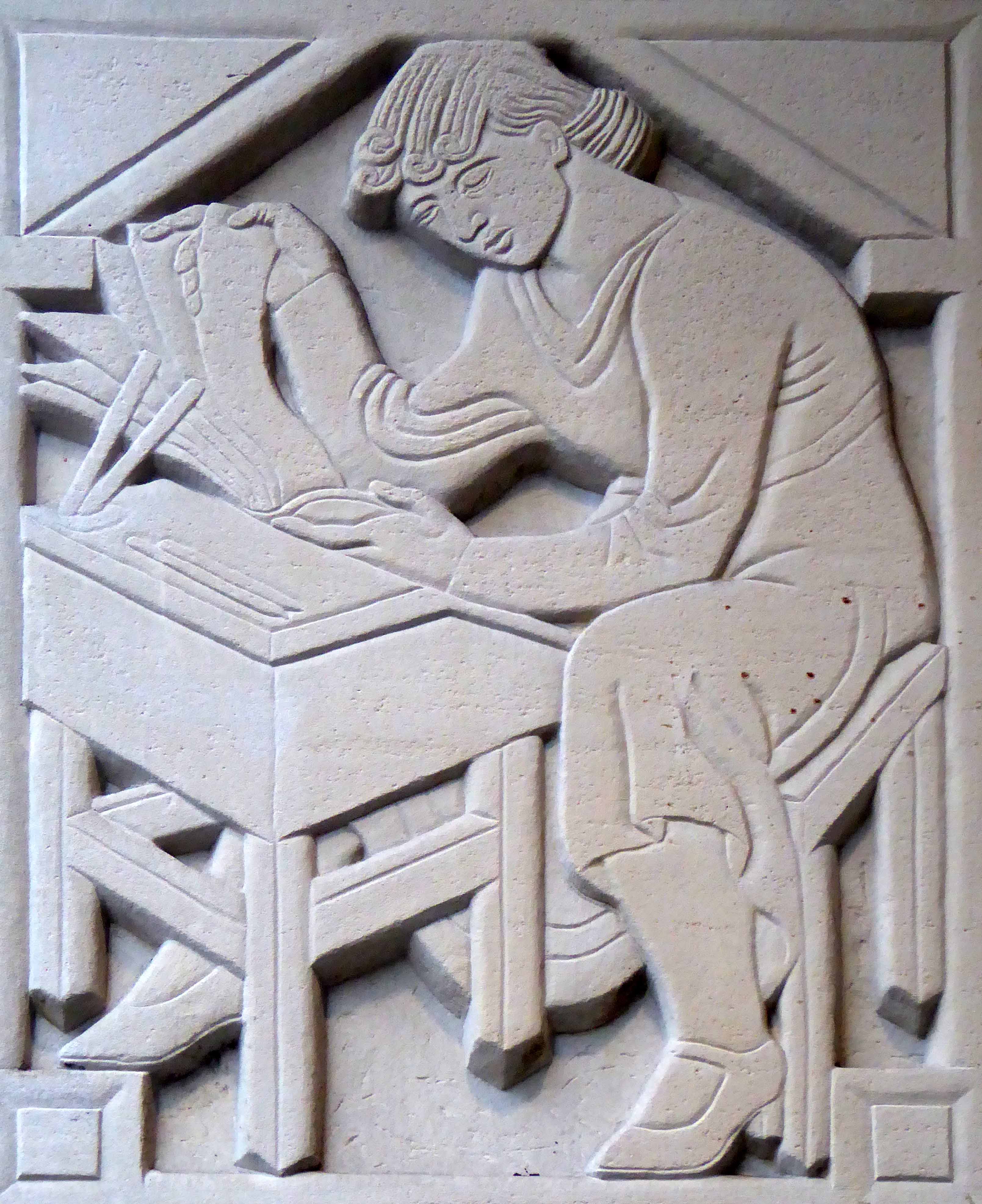

Returning home, I did a little online research, turning these examples of her work. As is often the case with those figures considered to be on the margins of the big bad Art World, time and the subsequent neglect, conspire to leave little by way of evidence of their invaluable efforts.
This is our loss.

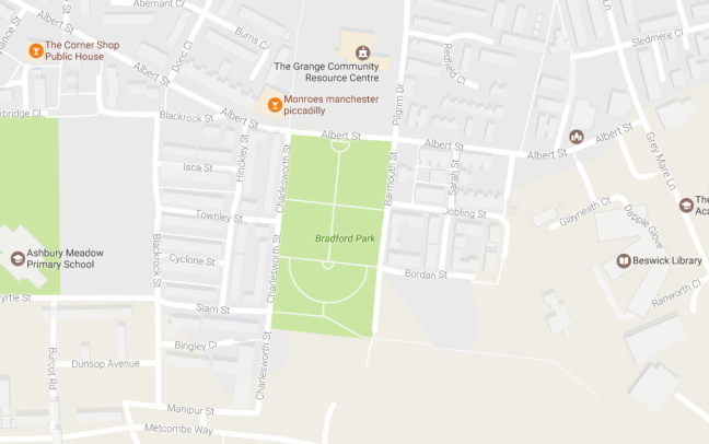
Once again I am following in the footsteps of Rita Tushinghan and the Taste of Honey film crew, this time my research has lead me to Barmouth Street, Manchester.

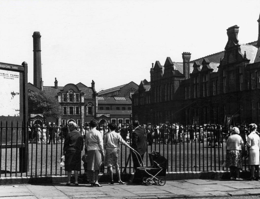
To the east of the city centre, Bradford Park School was the scene of the opening scene, Jo’s netball match. The school is now long gone, now the site of a much enlarged public park, as can be seen from the map above.
Shelagh Delaney, author of the original play on which the film was based, can be seen fleetingly in this opening scene, appearing momentarily over the games teacher’s shoulder.

I have found one archive image of the school, as the scholars prepare for the annual Whit Walks, this along with many other community traditions and conventions, have all but disappeared from the streets of the city.
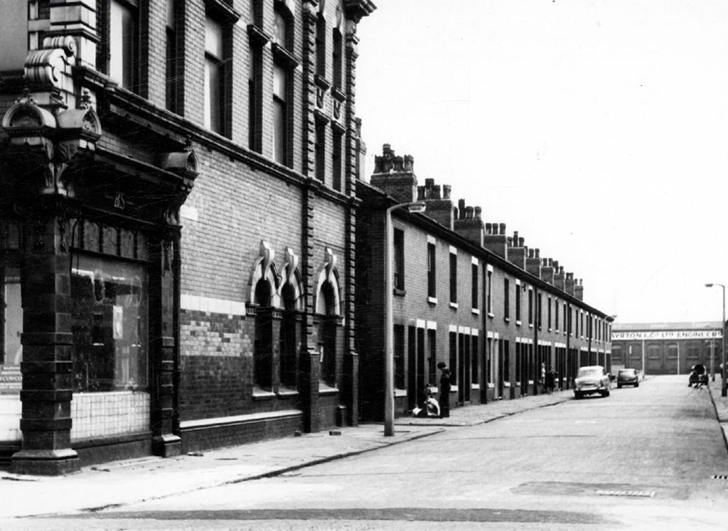
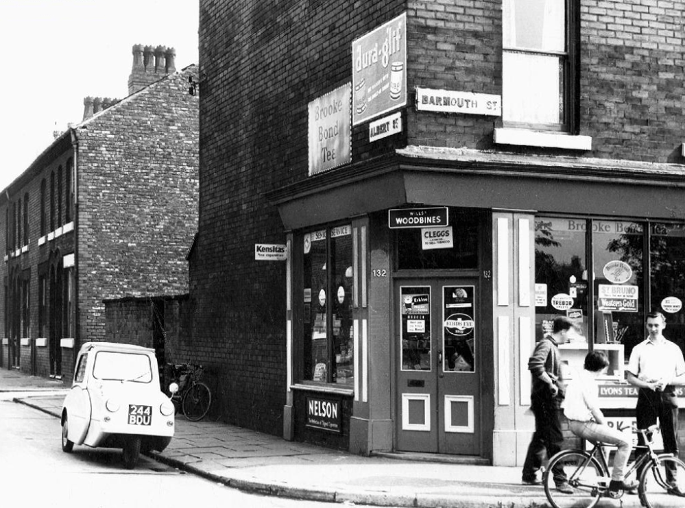
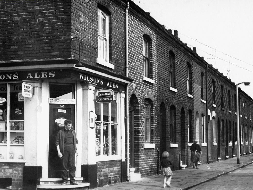
This was once a tight knit community, surrounded by industry, full employment and a short lived period of post-war growth and optimism.
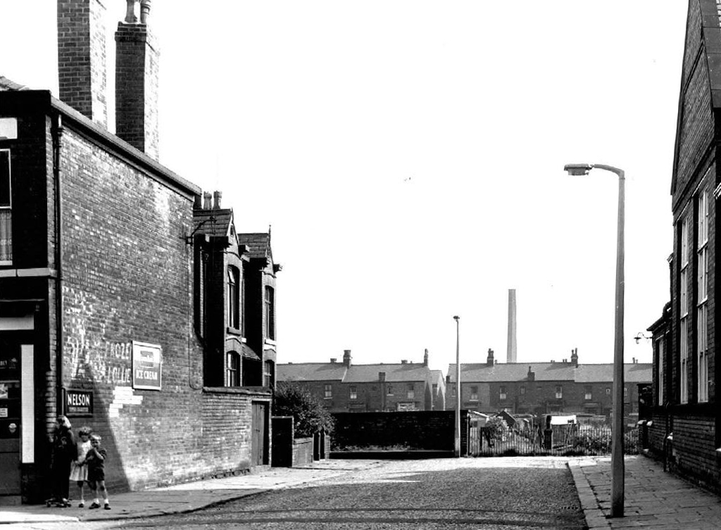
A corner shop on very corner, though by the time I worked as a Mothers Pride van lad in the late sixties, many were already on their last legs. A lethal cocktail of closing factories, incipient supermarkets, and an urban renewal programme, which lead to slum clearance, would change the character of the area forever.
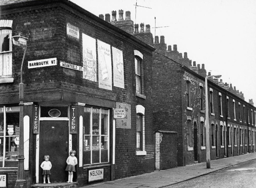
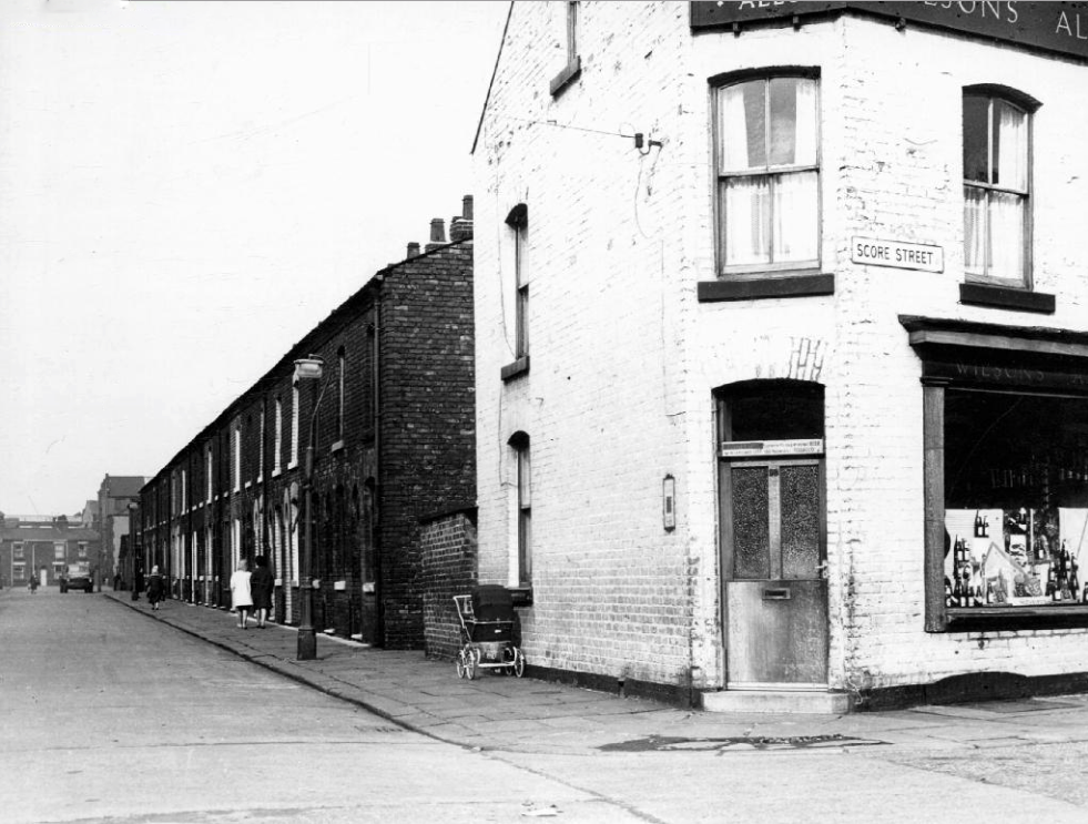
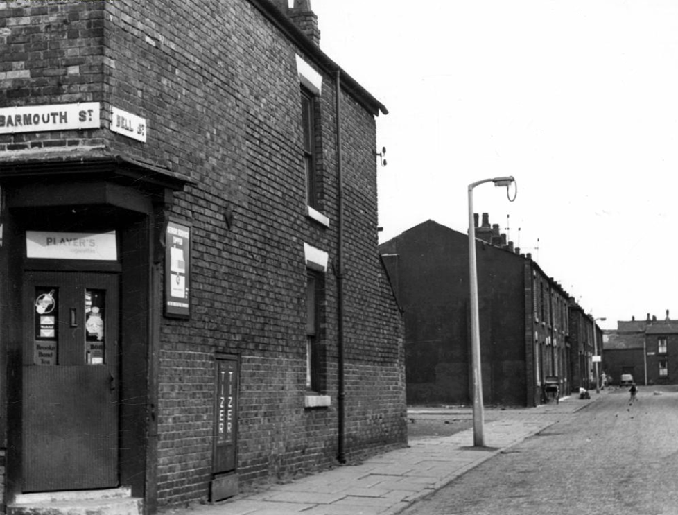
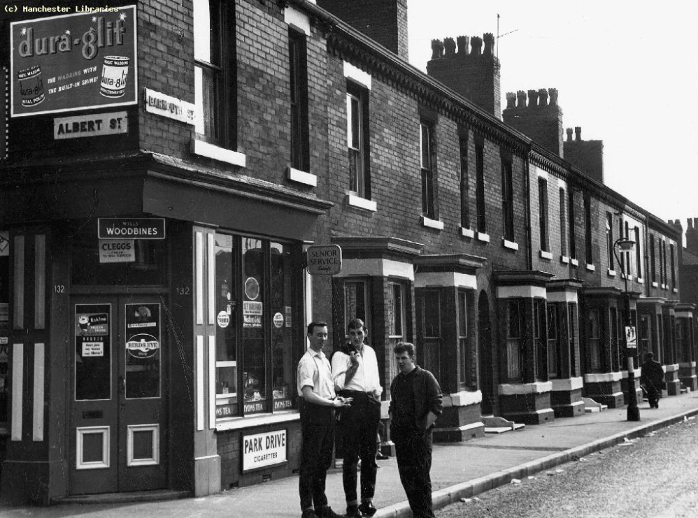

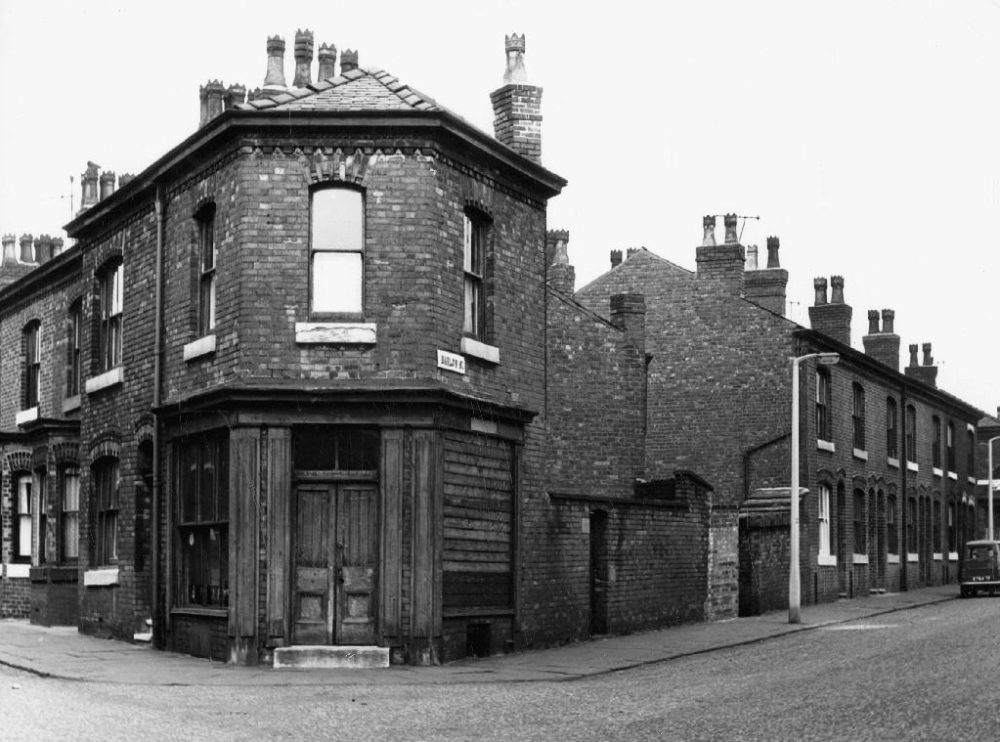
The man responsible for the majority of these archive photographs is Tommy Brooks of 56 Gransmoor Road, Higher Openshaw.
He is my hero, a member go the Manchester Amateur Photographic Society, cycling the streets of Manchester to produce a unique record of life in the Sixties.
The Manchester Image Collection is awash with his work.
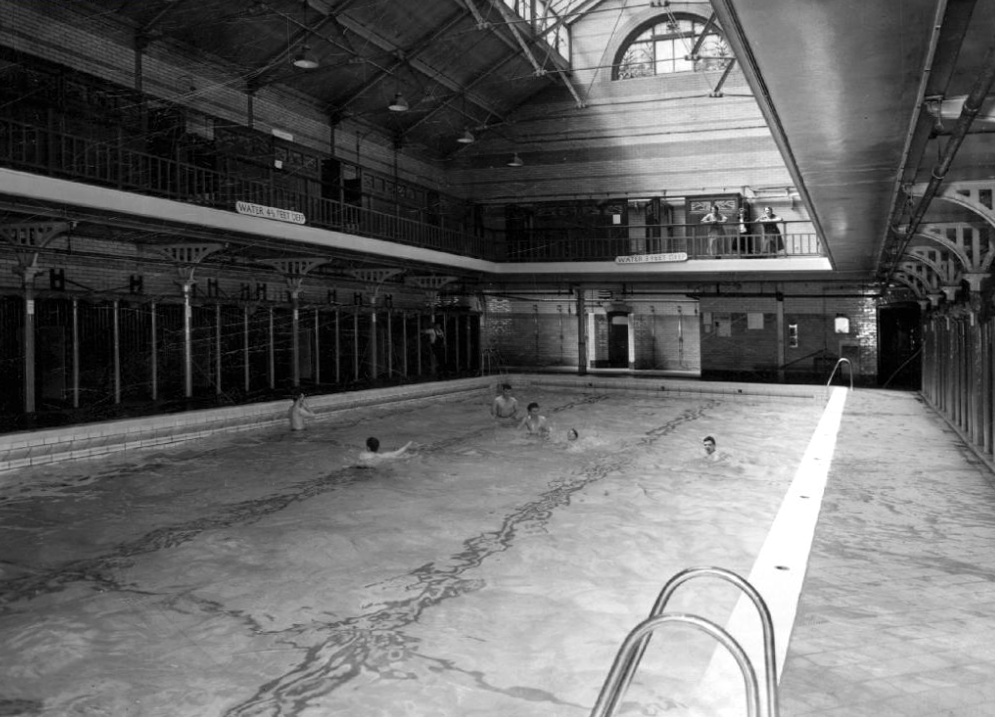
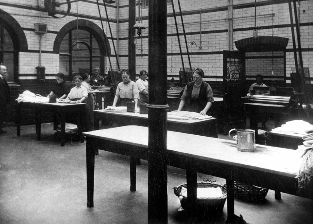
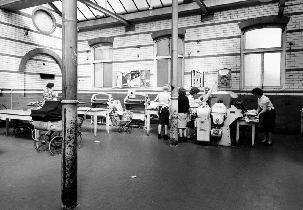
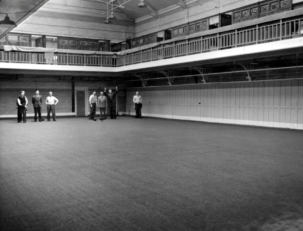
Central to the social and sanitary life of that that community were the Barmouth Street Baths and Washhouse, where citizens would swim, wash, dry, iron, chat convivially, and surprisingly – play bowls.
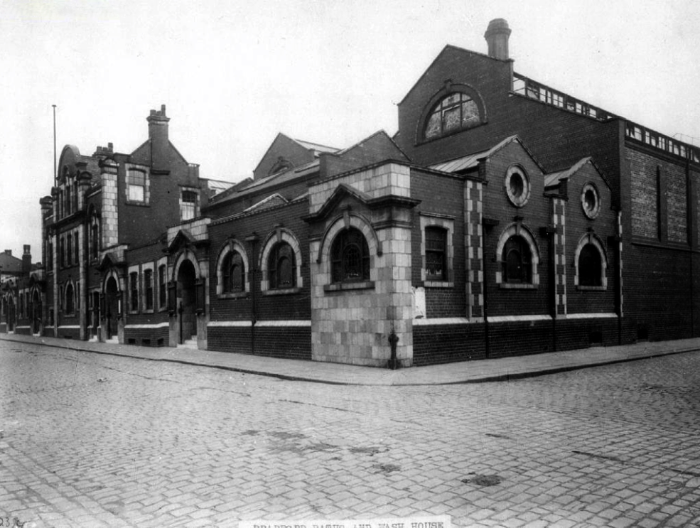
Now long gone, along with the provision of local authority nursery care. There were similar low level pre-fabricated buildings dotted all over the city. Built quickly and cheaply, to provide for a growing population, of largely working-class families, with no shortage of work opportunities.


This was a time of great social change, a time which the film attempts to anticipate -a more diverse, and hopefully more tolerant time, a time of possibilities and opportunities for all.
