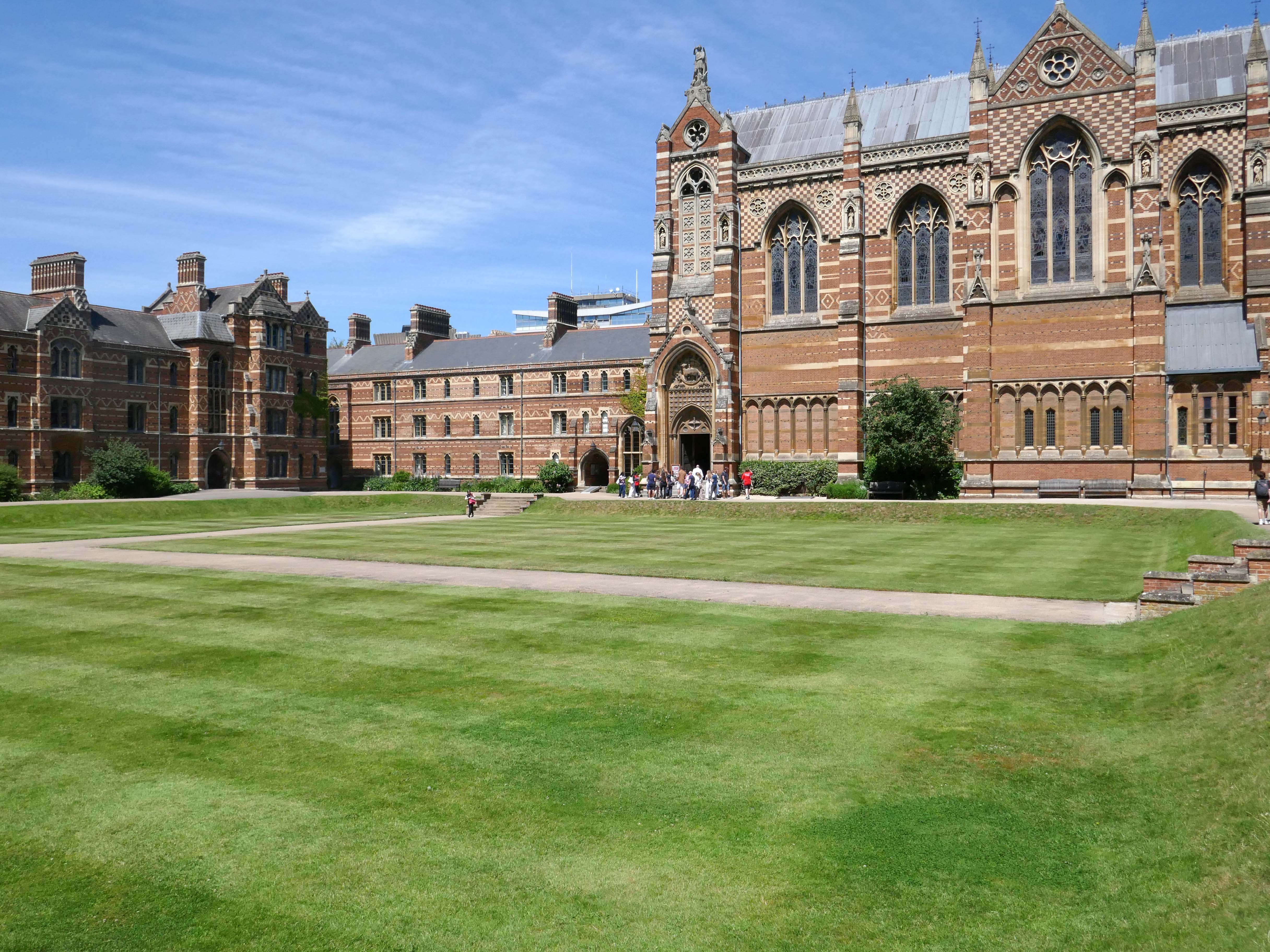
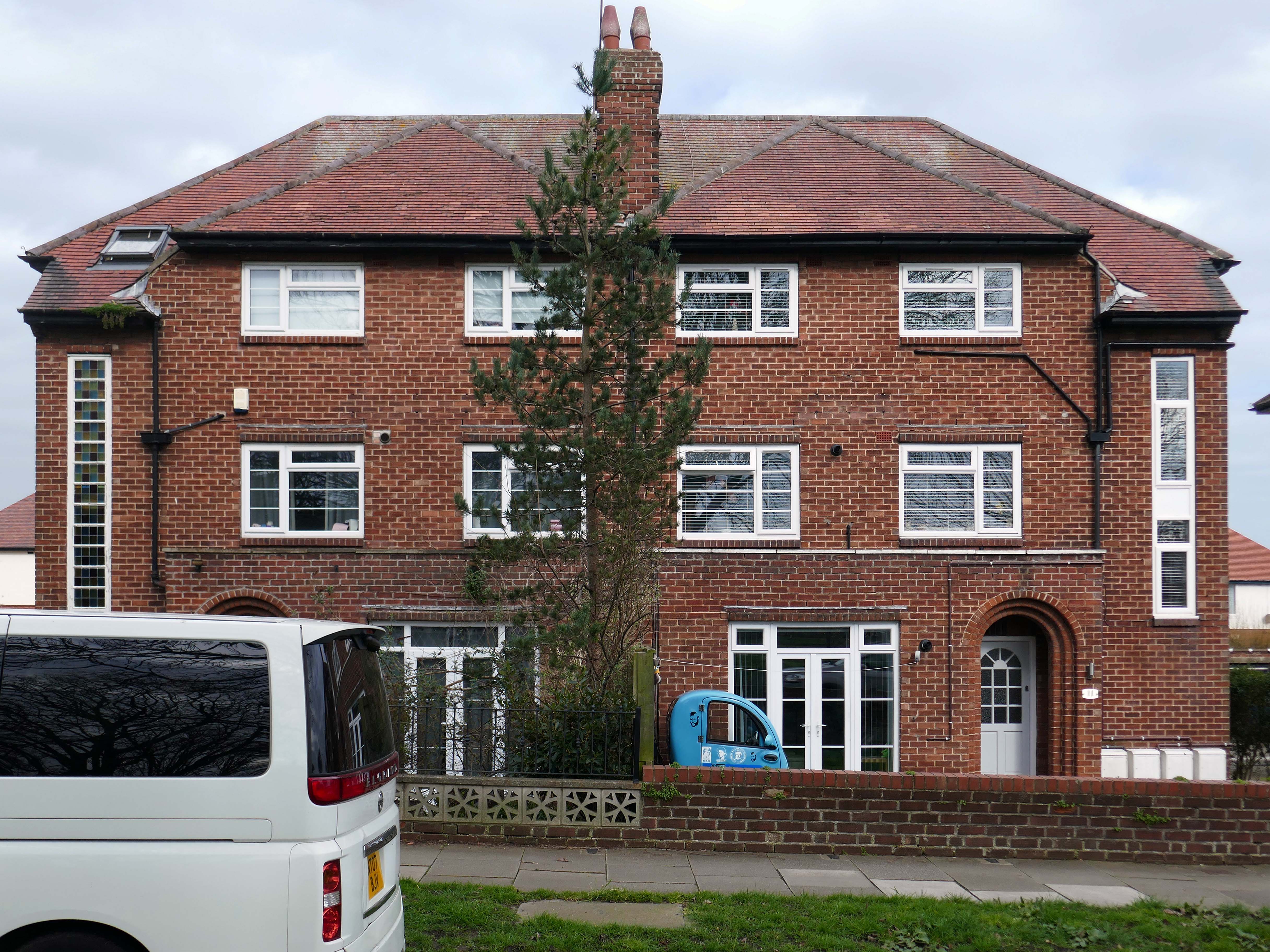
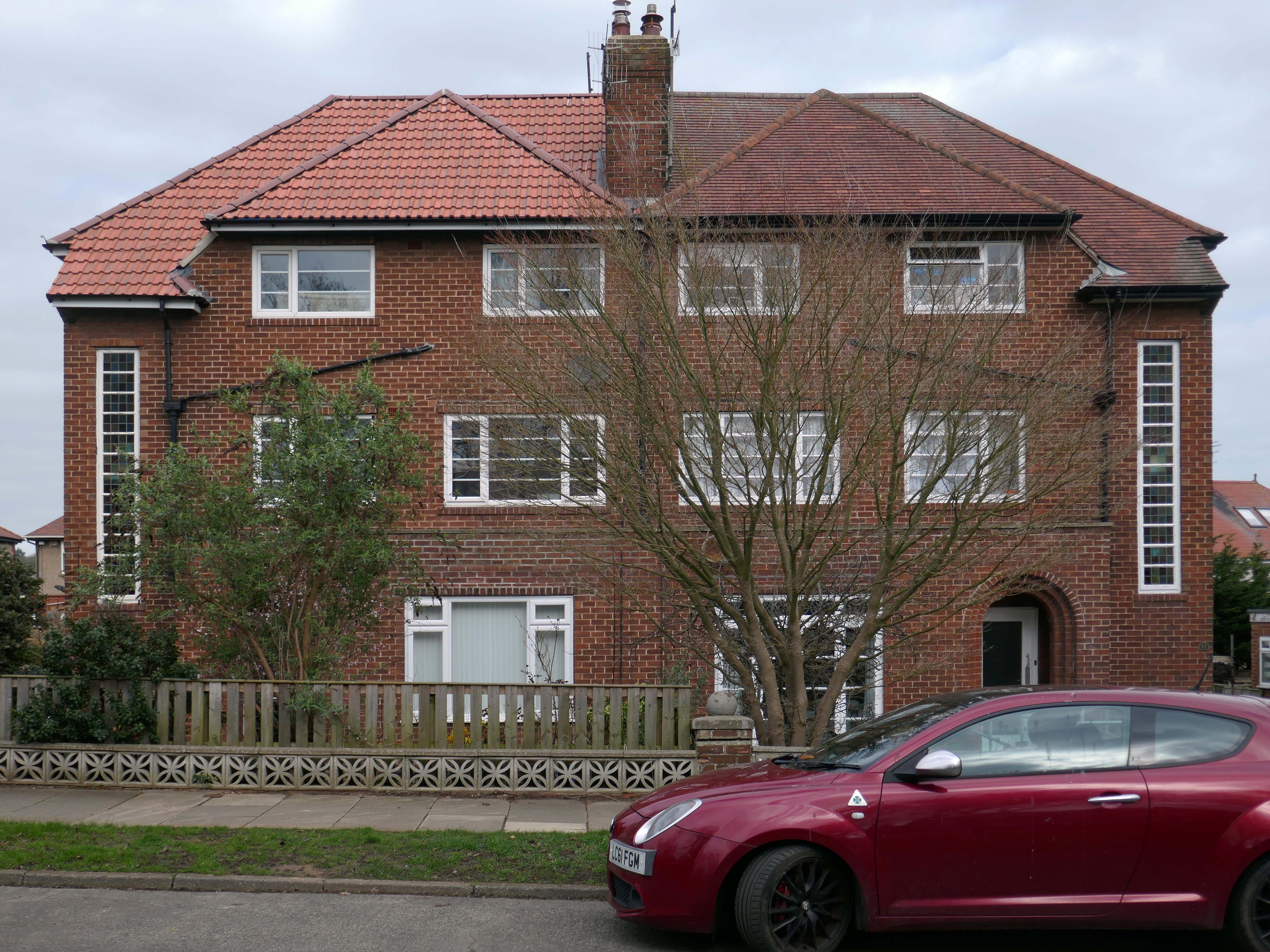
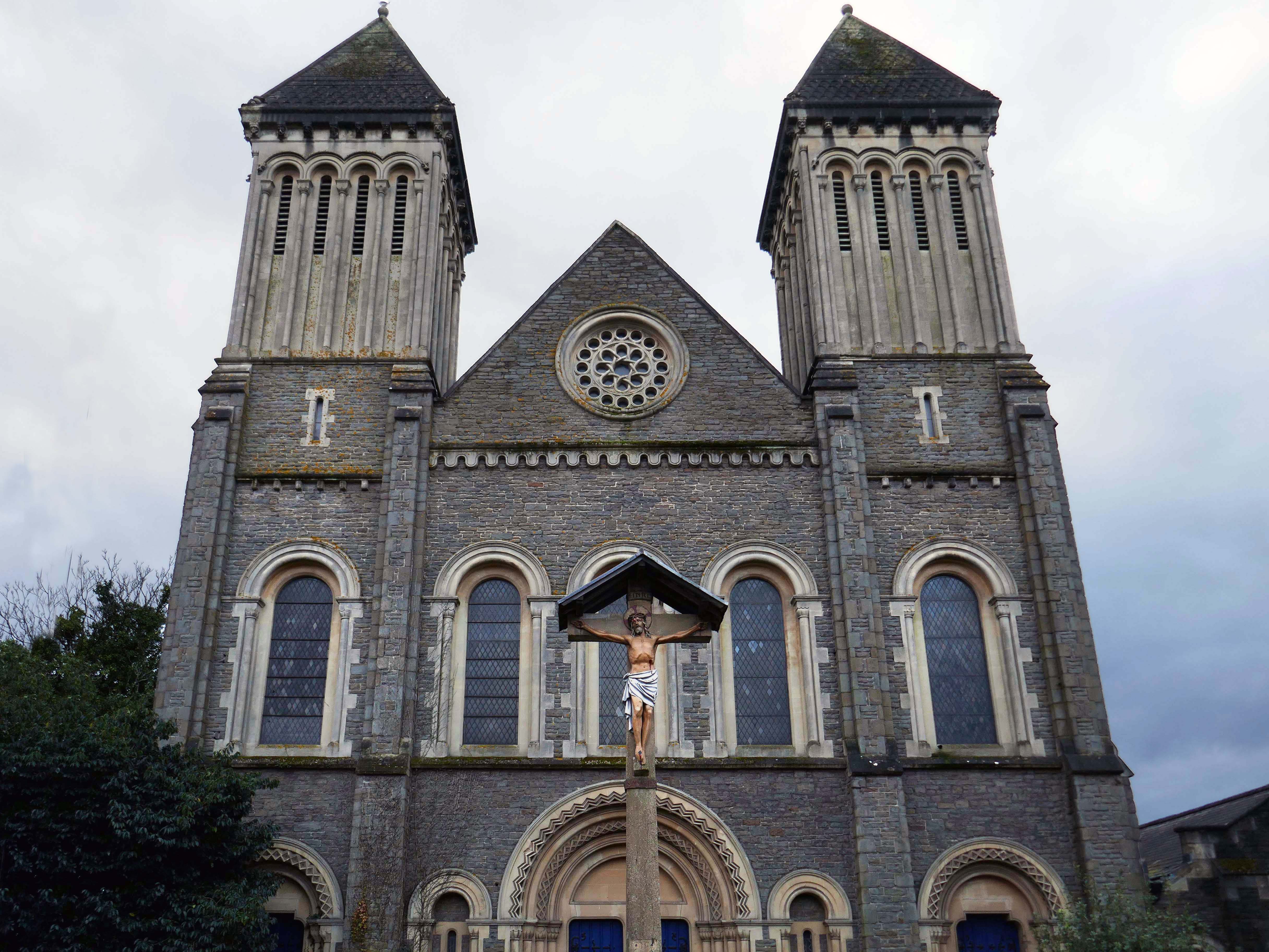
The original buildings of the College were designed by William Butterfield 1814-1900. Although the darling of the Tractarian movement, Butterfield was a controversial choice, as his style – a form of High Victorian Gothic had long provoked argument in Oxford. The original Gothic revival of the 1840s was purely imitative, seeking to blend new buildings with the pre-existing architecture of the city. However, this did not satisfy Butterfield, who “sought a new form of Gothic which would both convey eternal truths and would express the spirit of the age”.
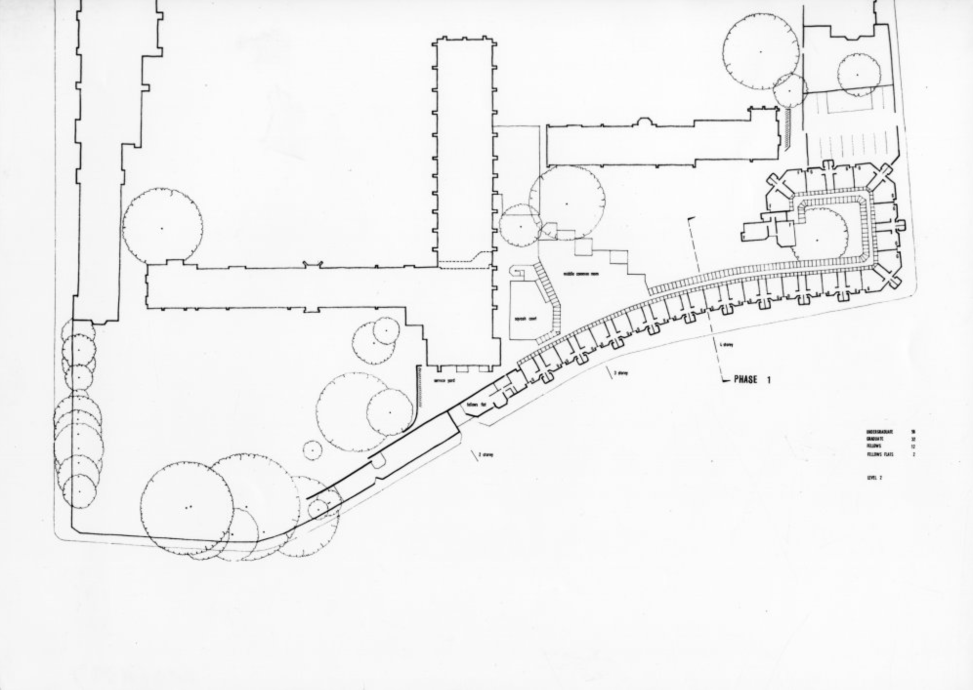
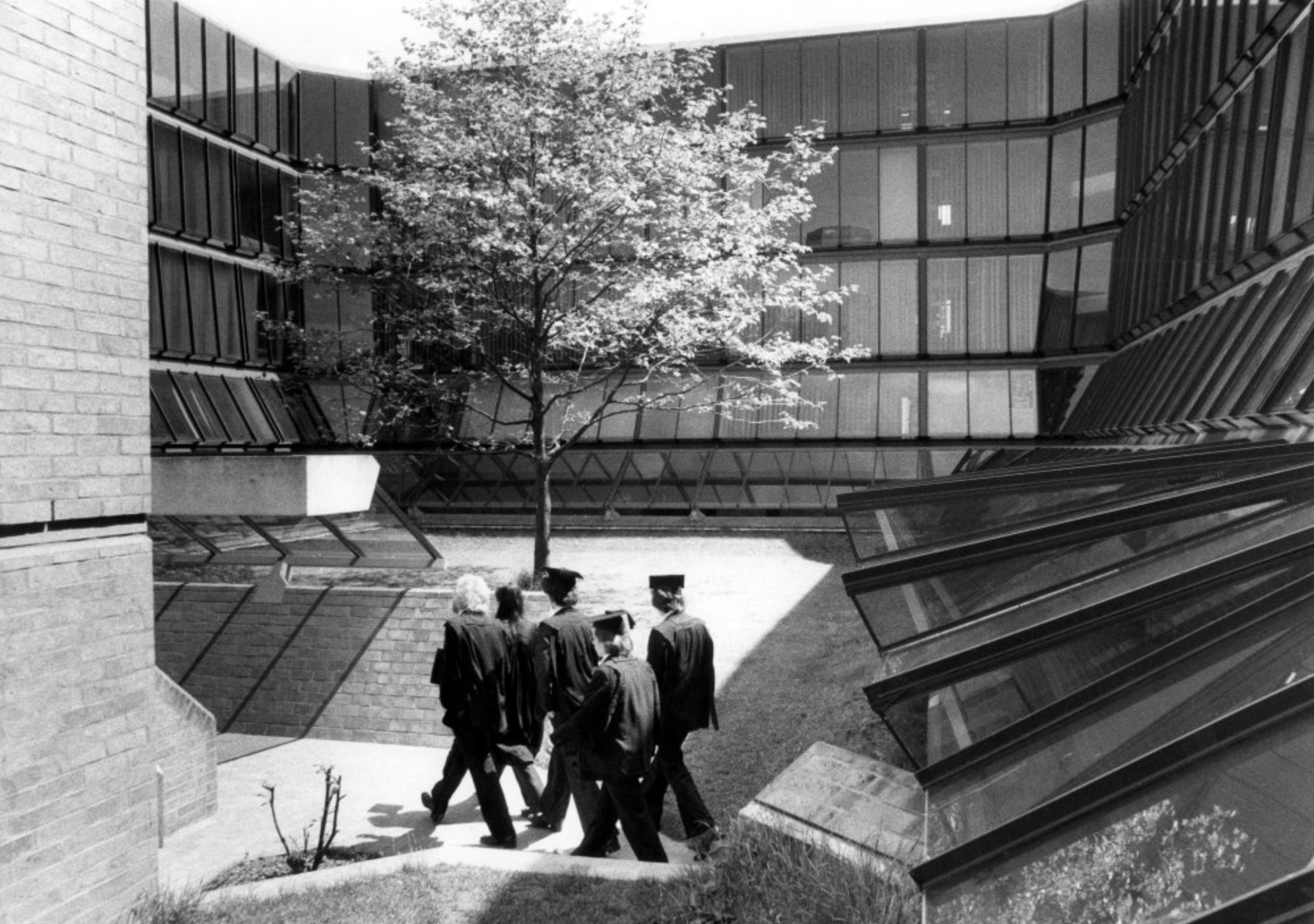
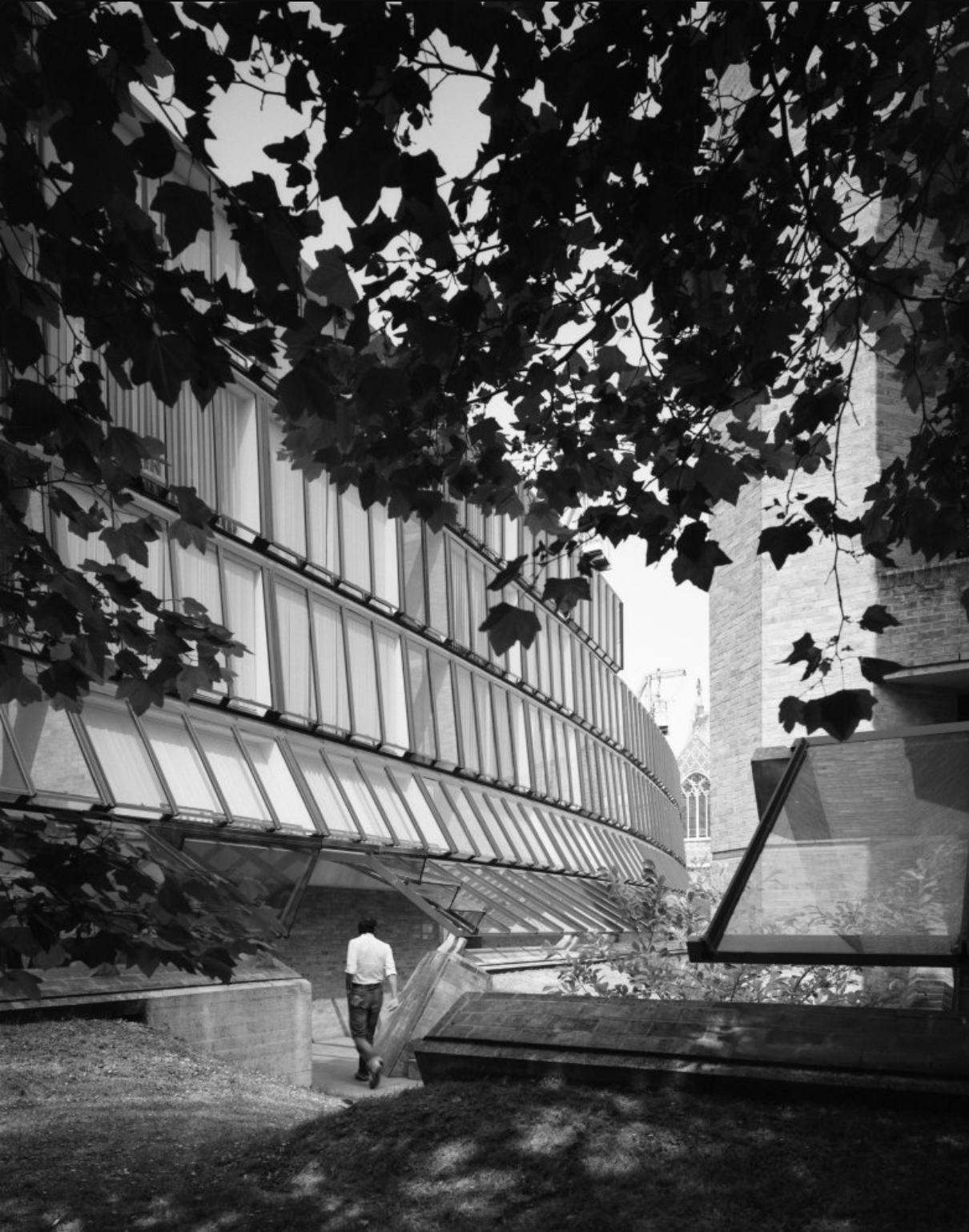
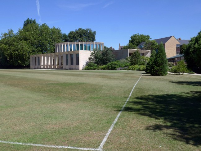
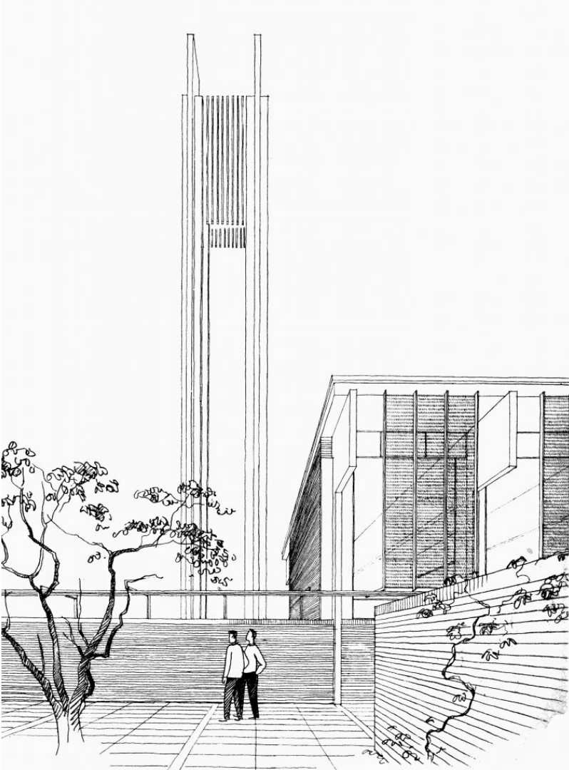
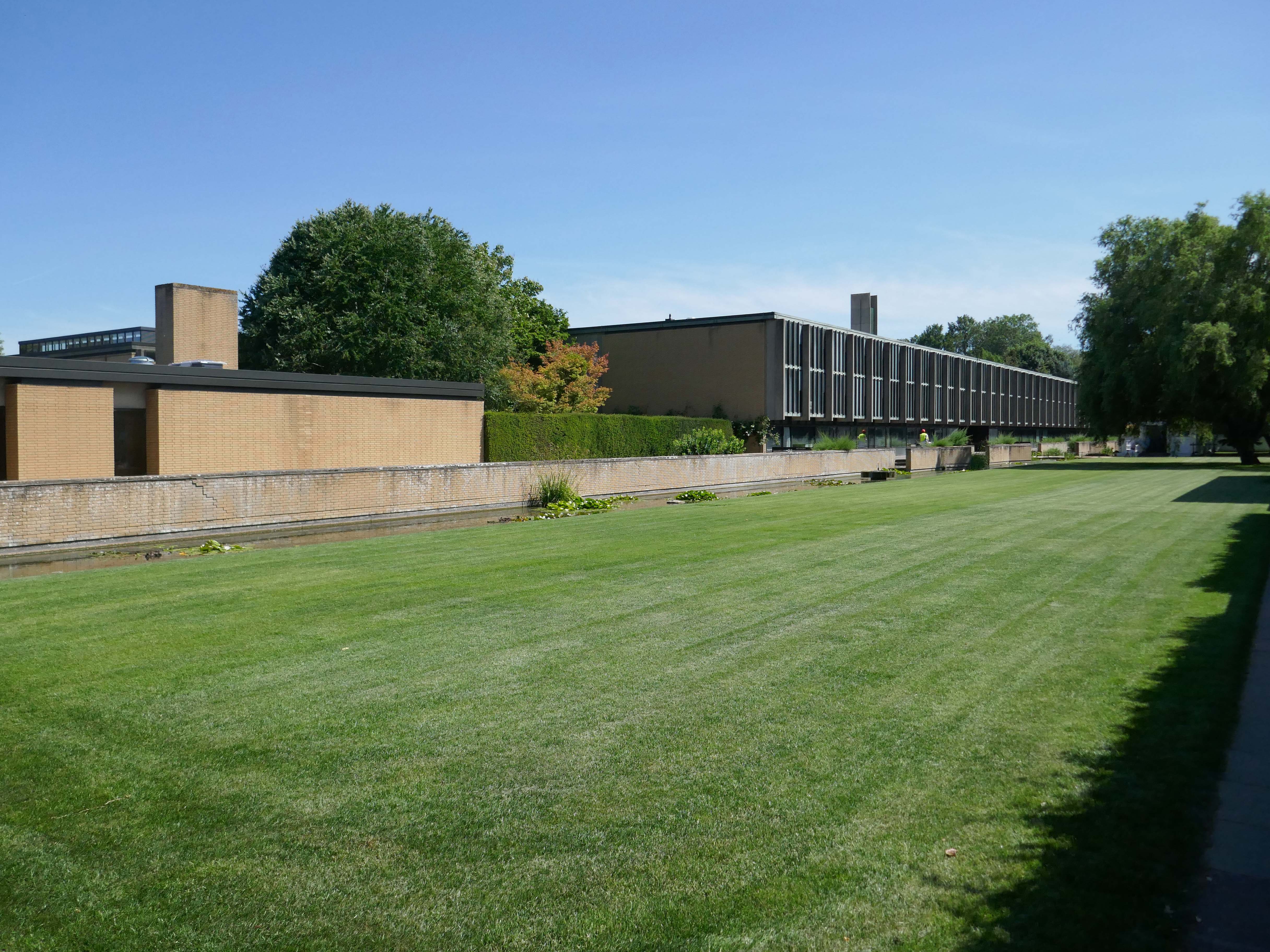
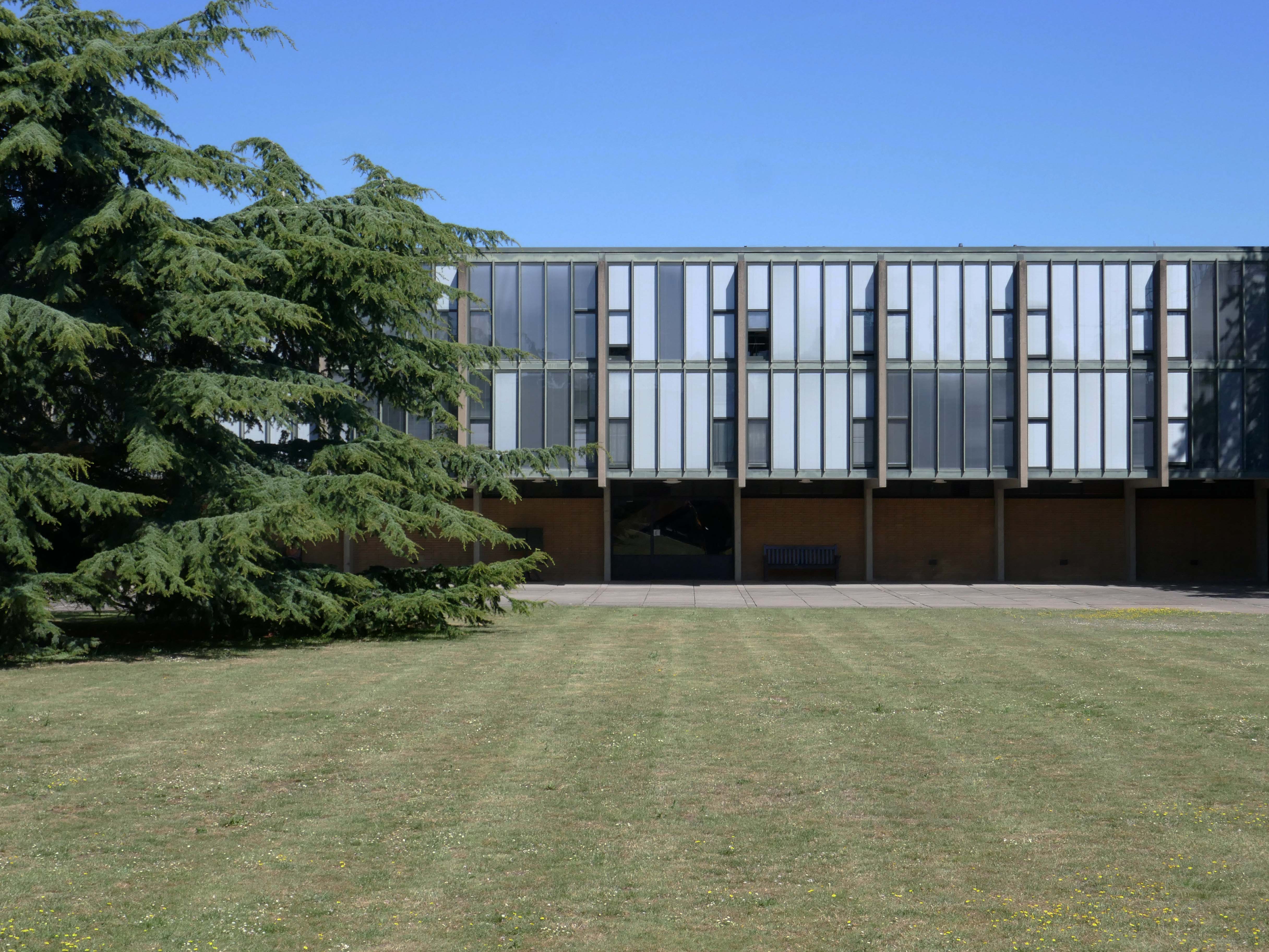
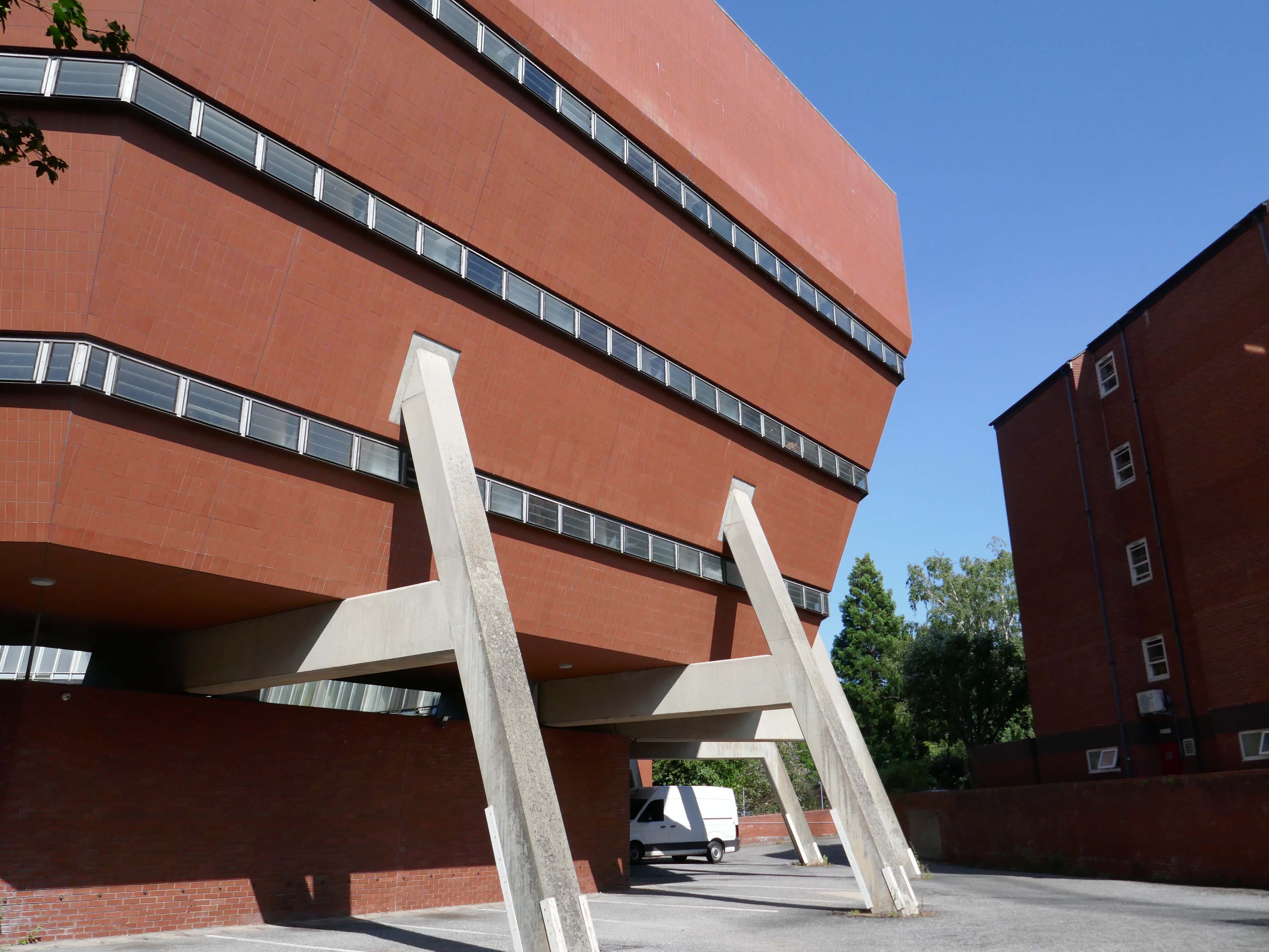
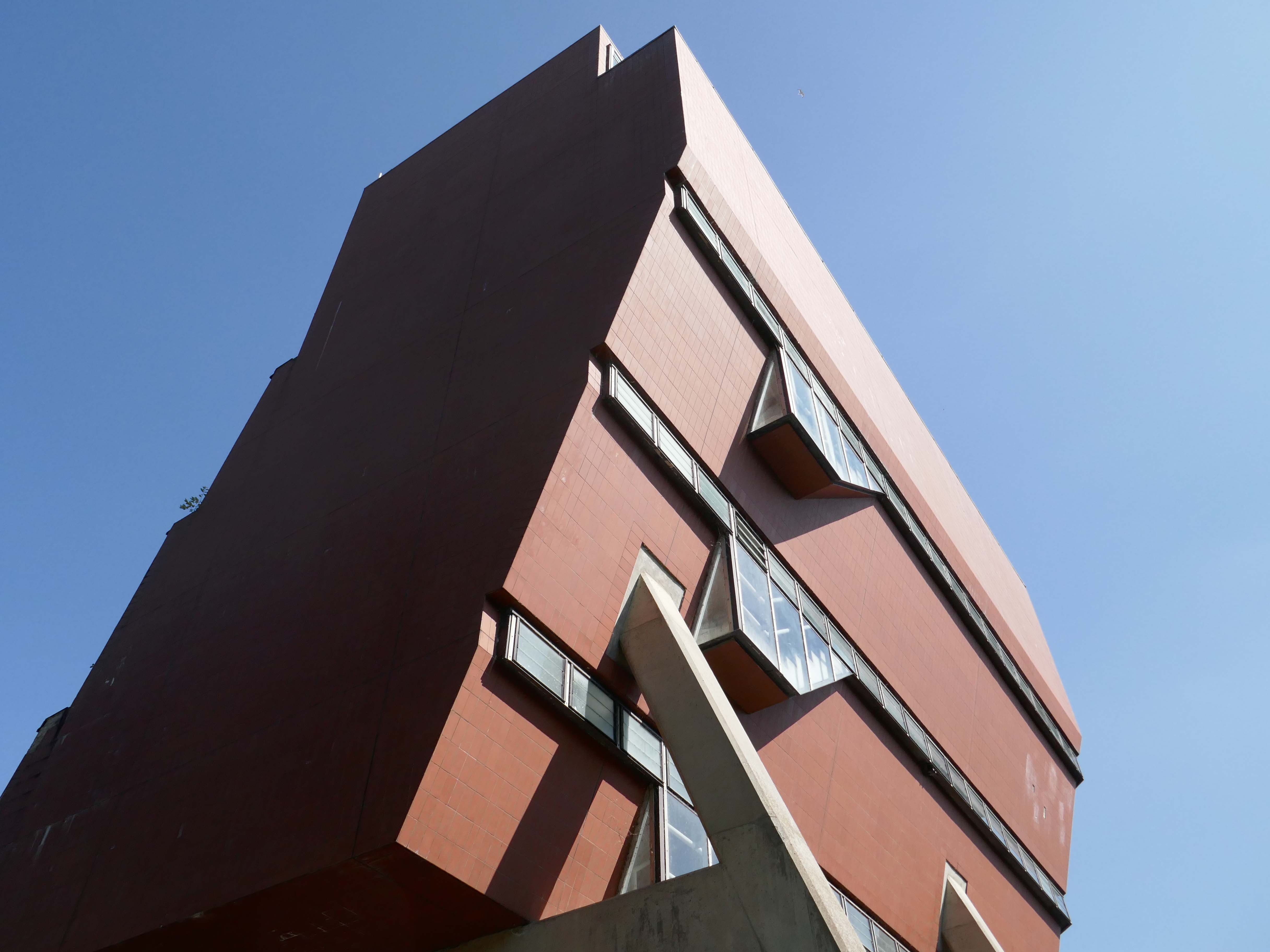
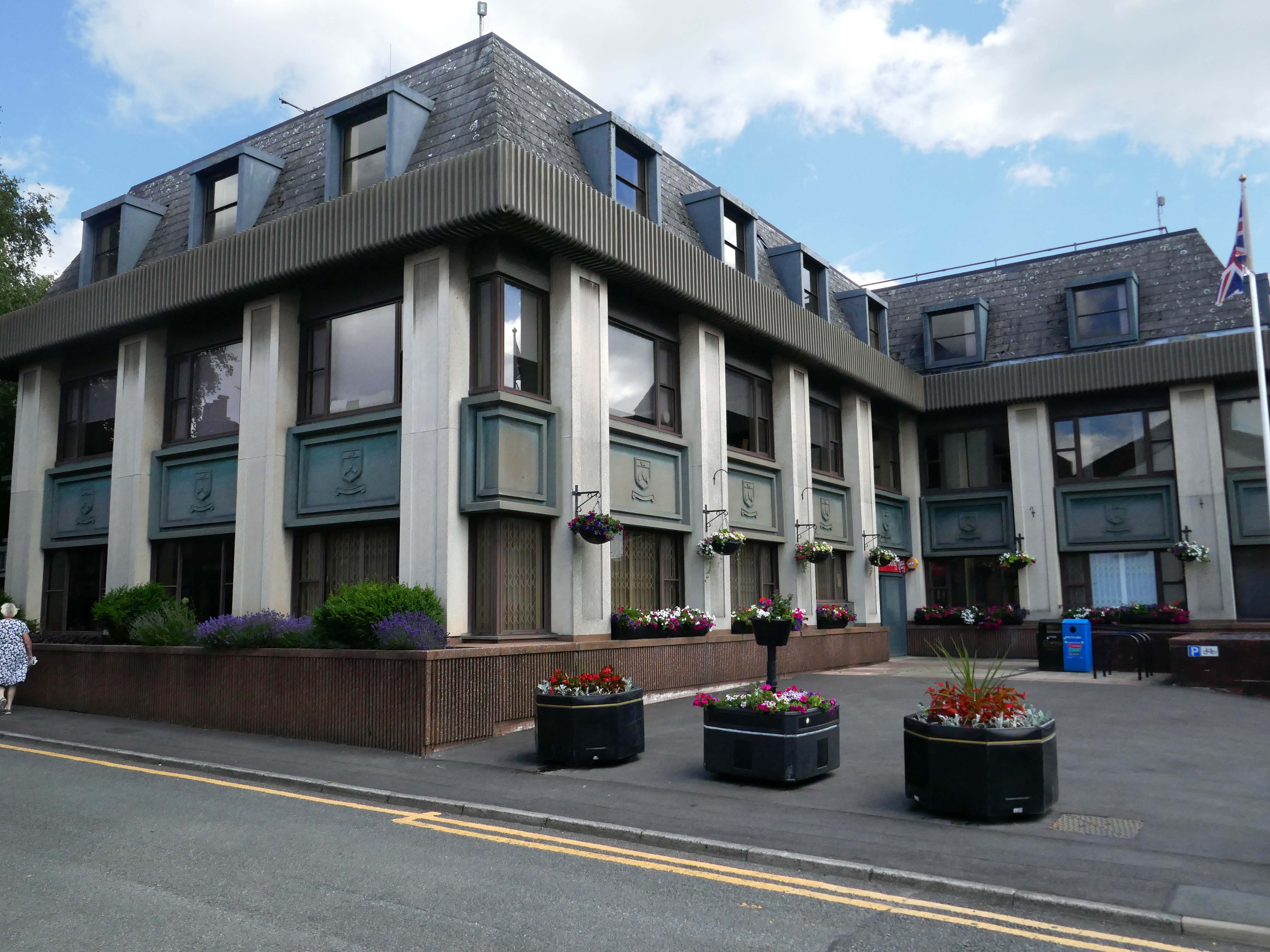
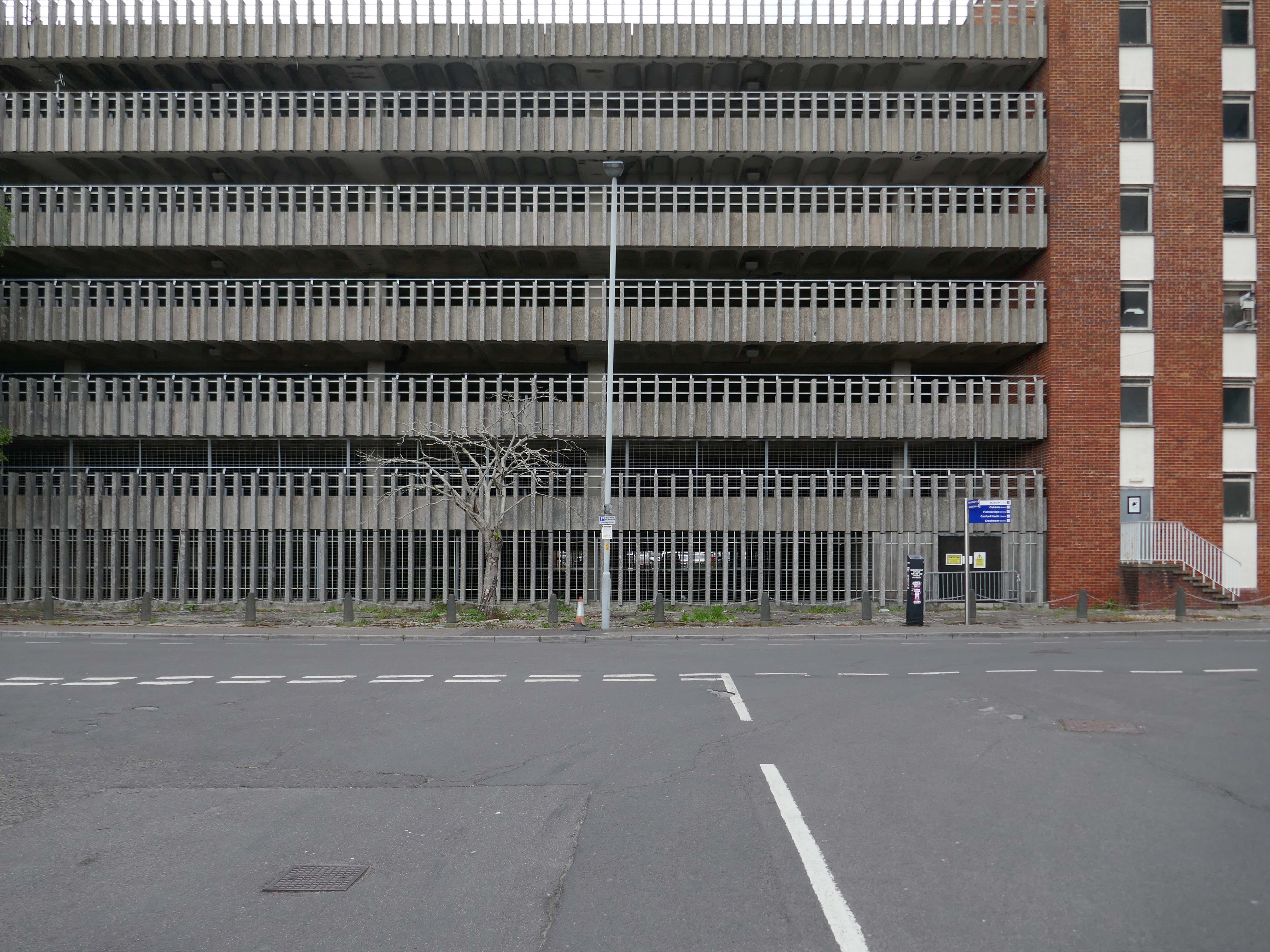
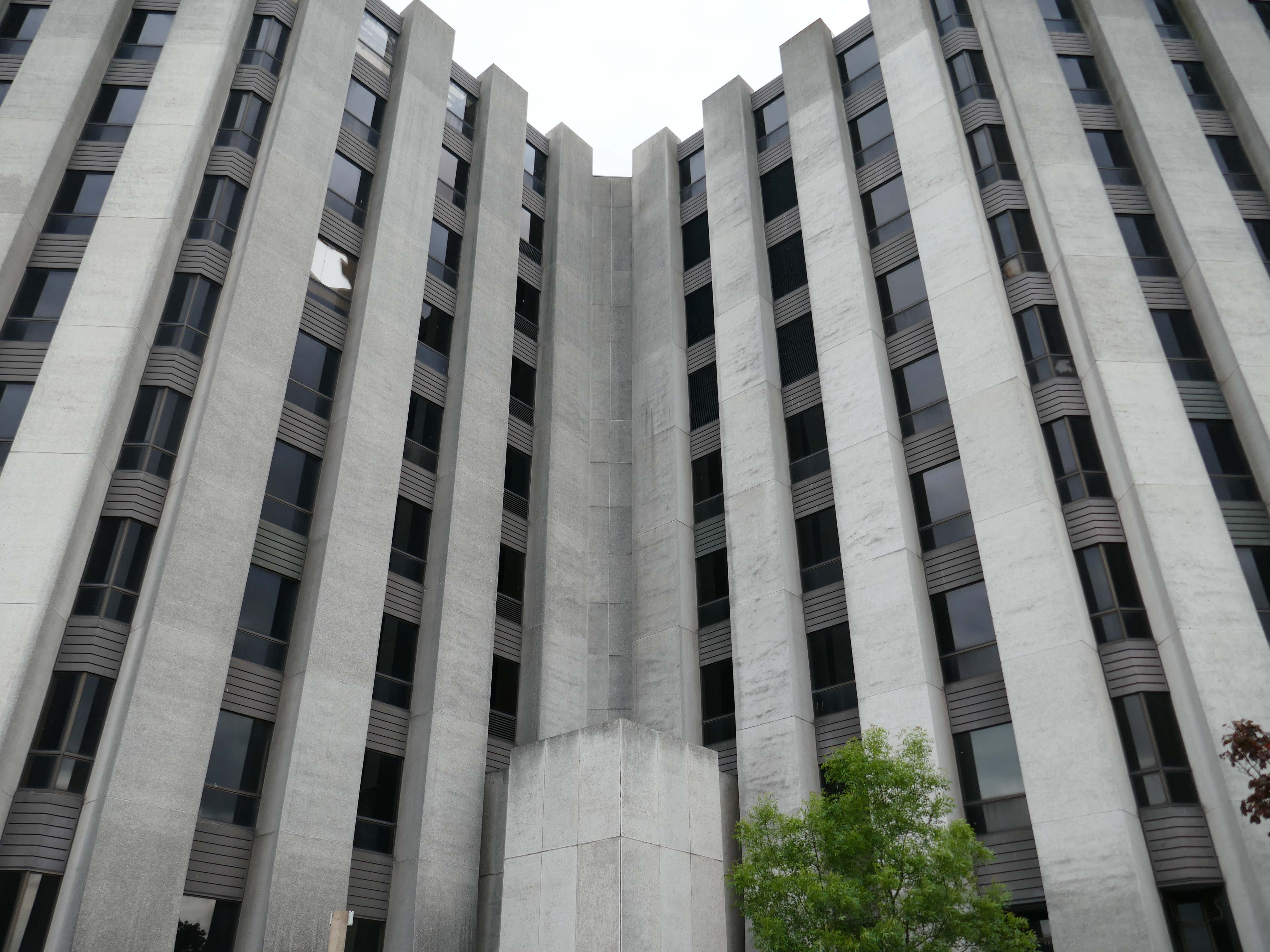
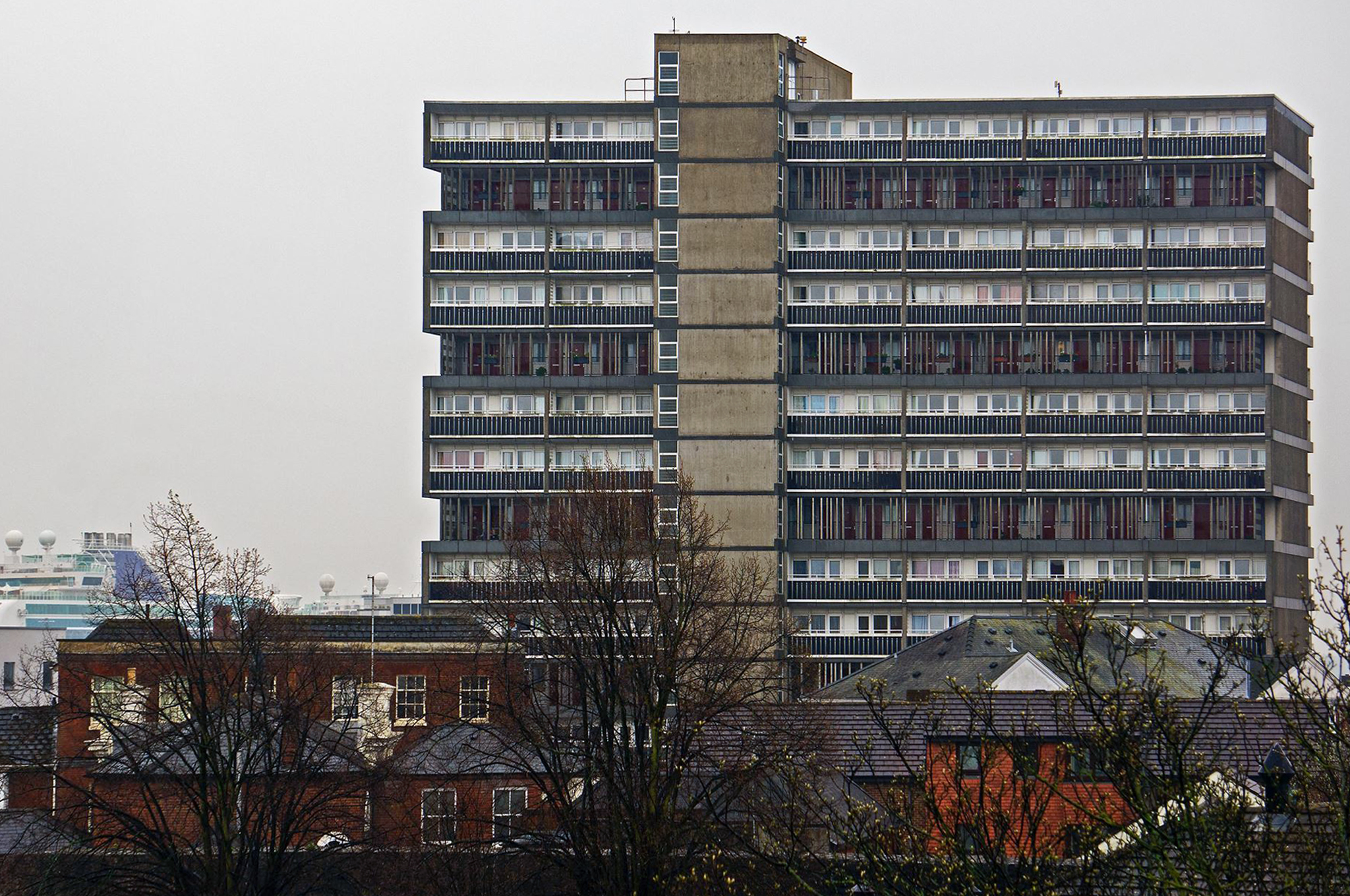
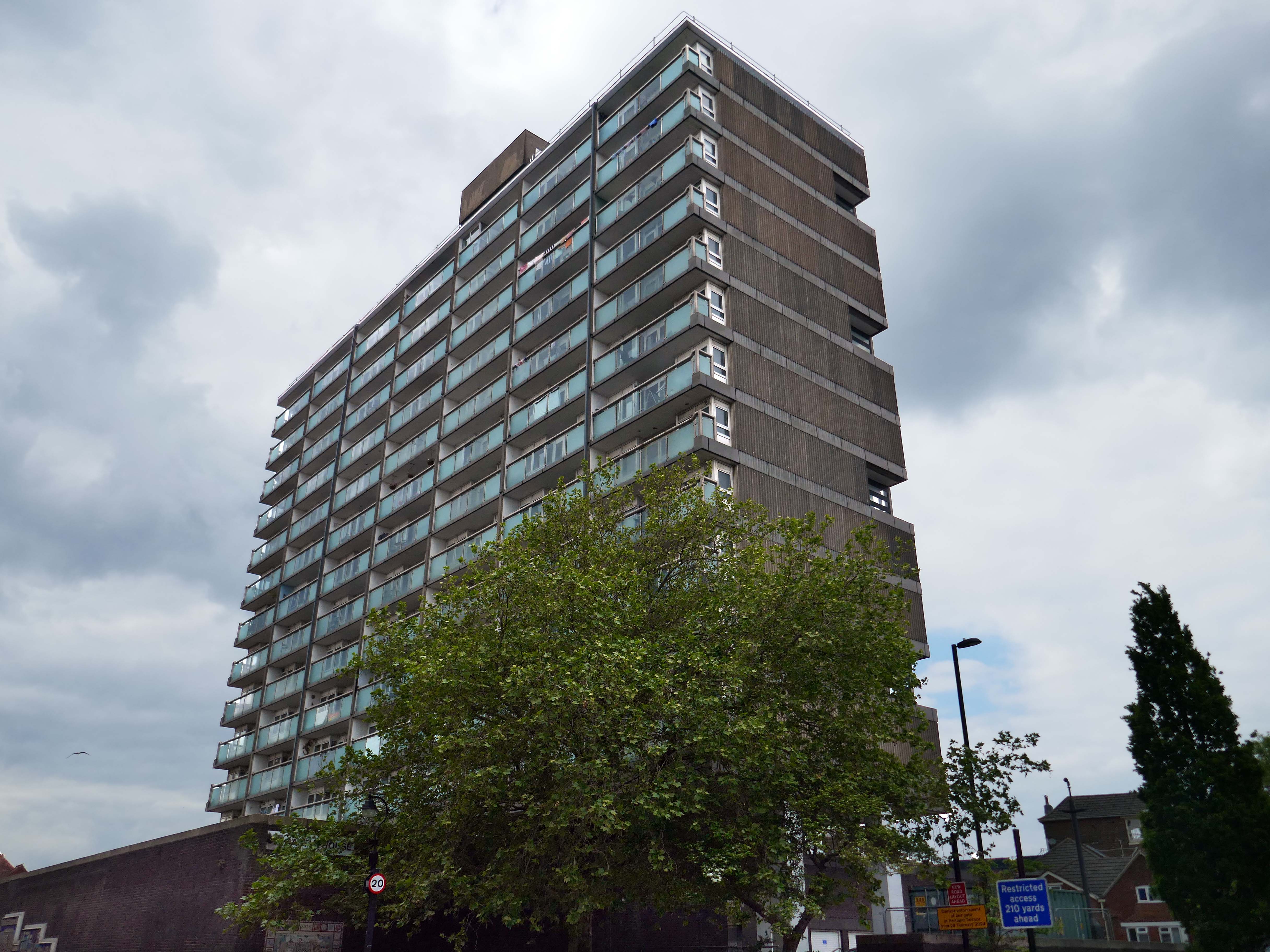
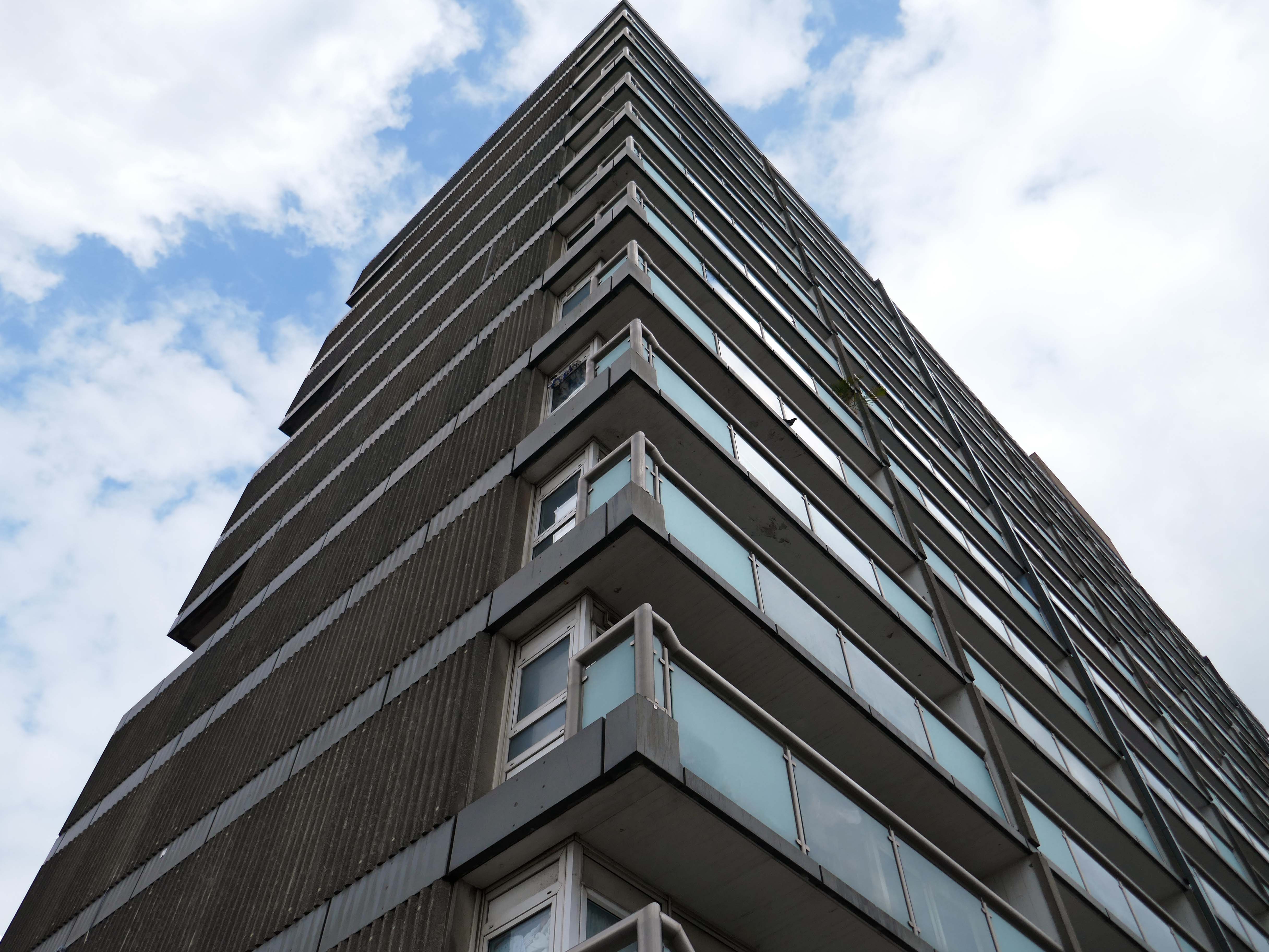
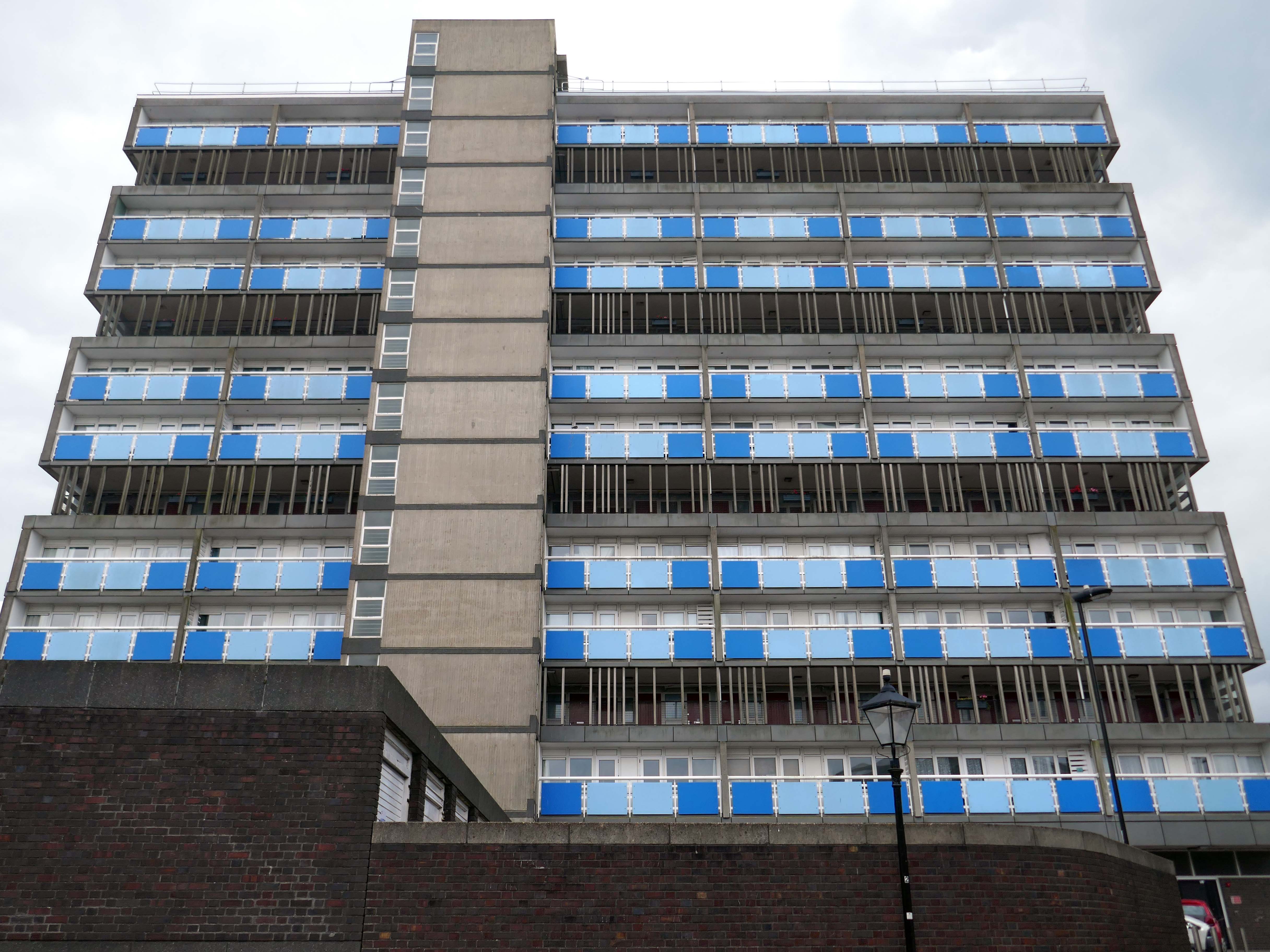
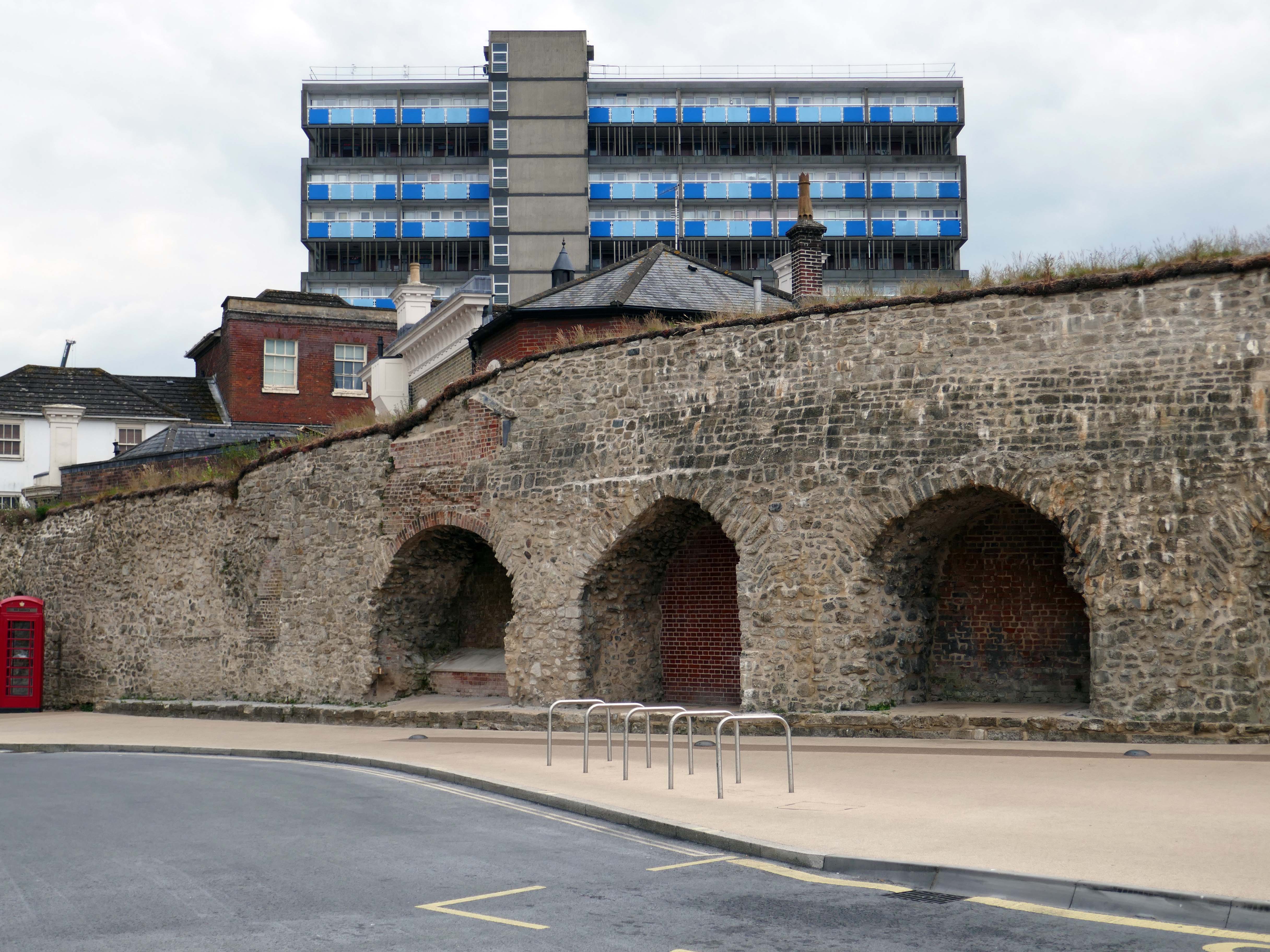
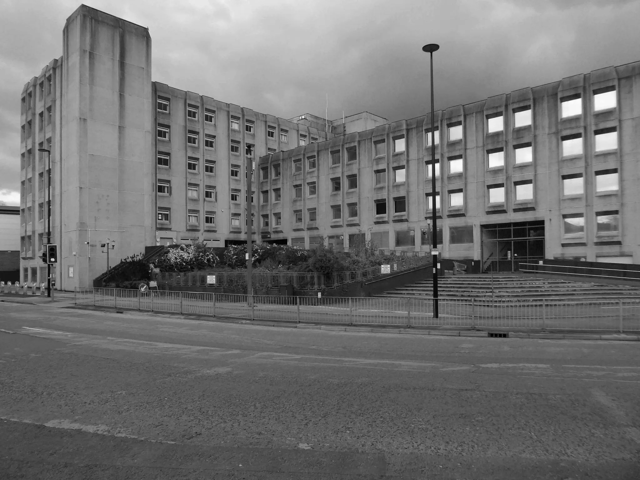
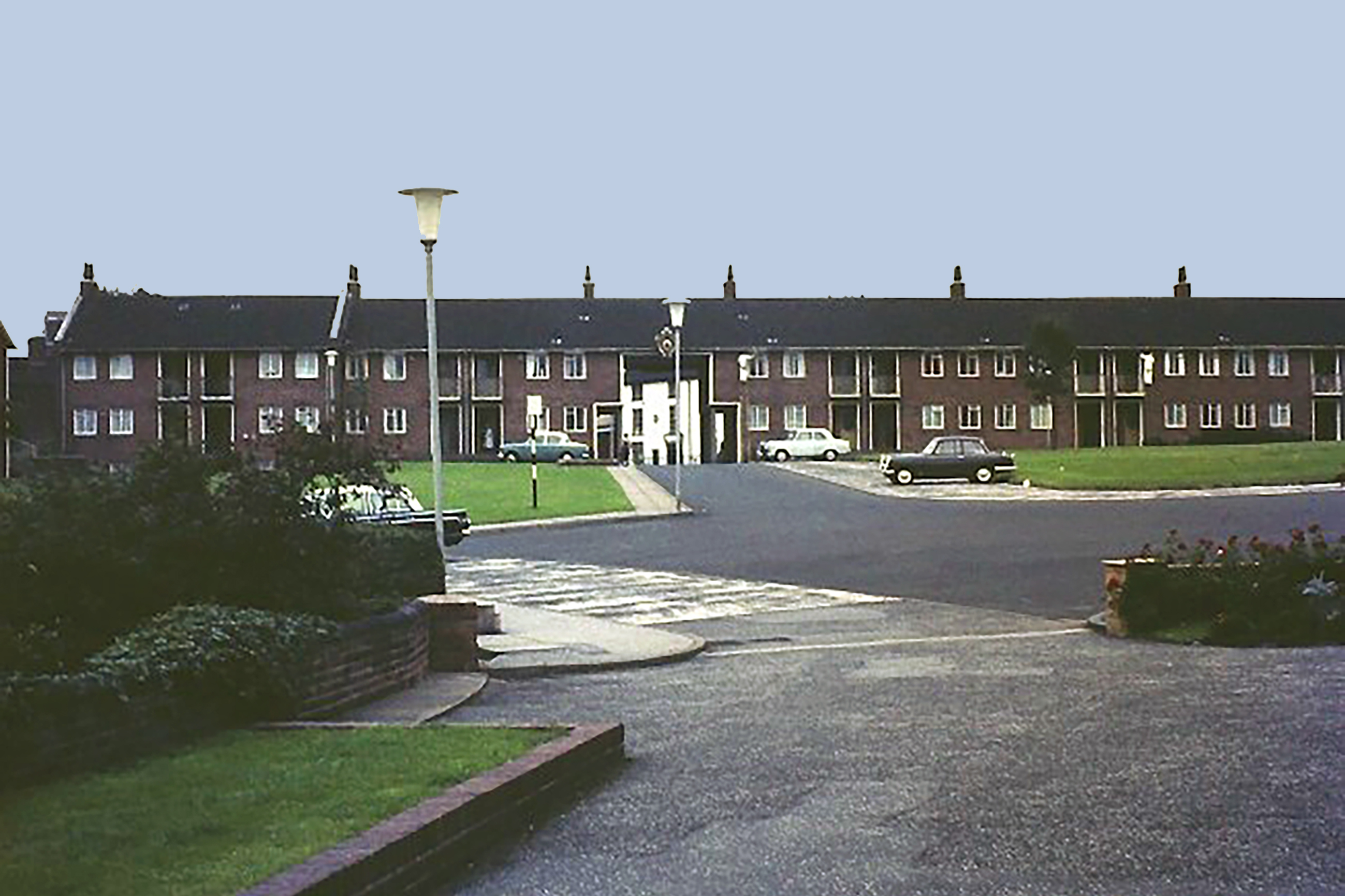
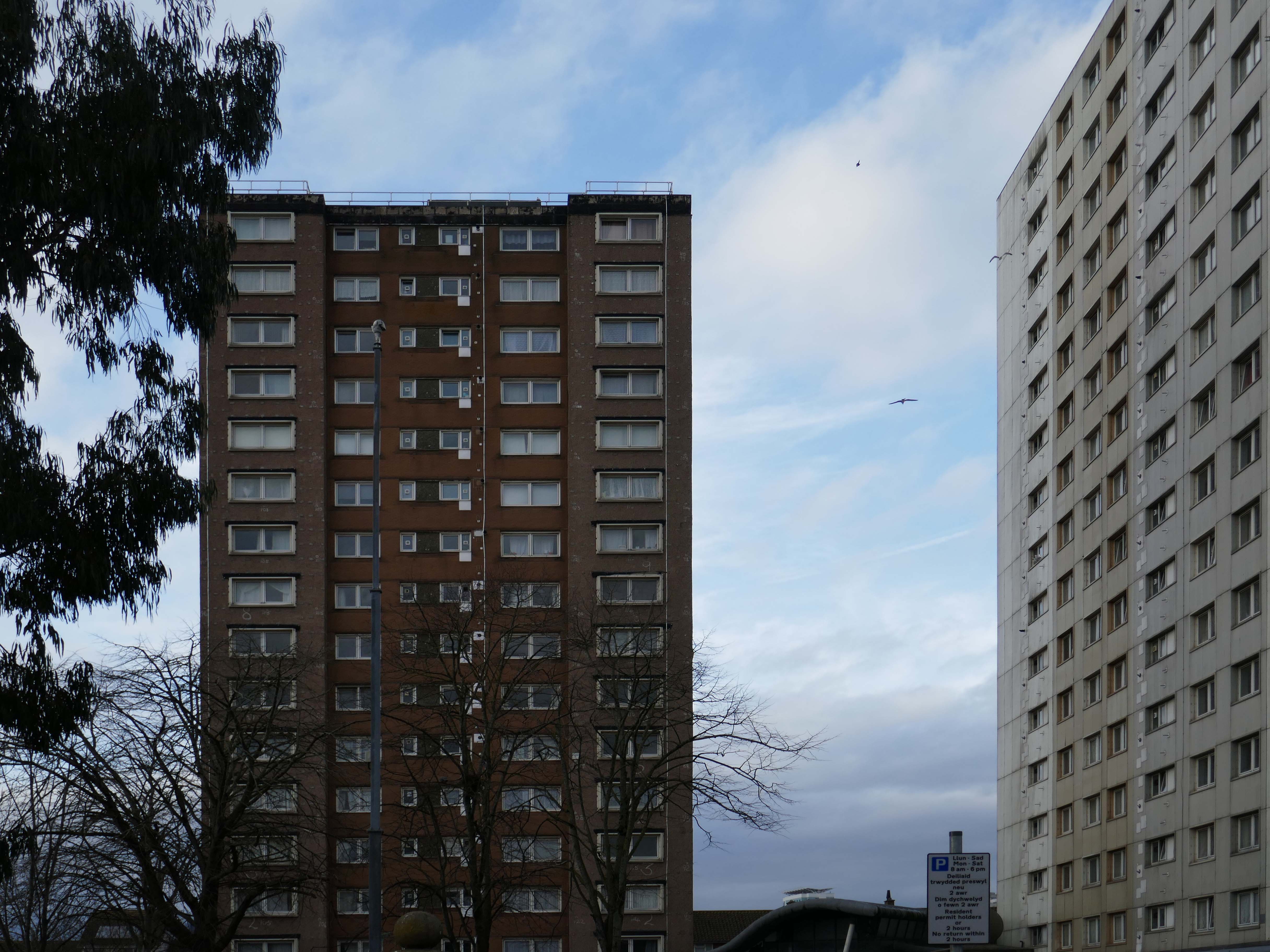
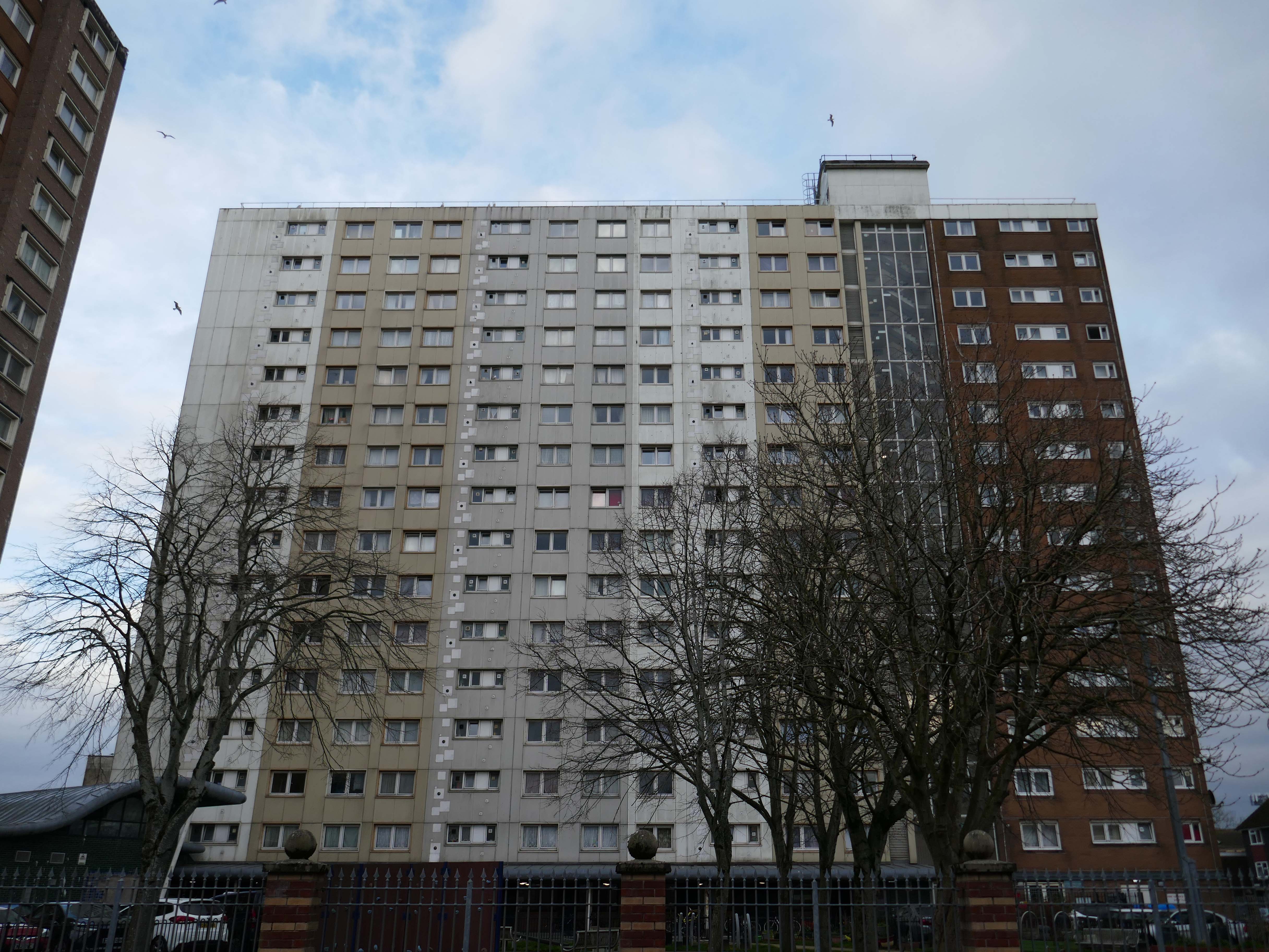
The College was lucky in that the ambitious vision of its founders allowed it to house the majority of its students for decades. However, by 1967, it had become clear to the College that there was a need to expand on a large scale. With the £500,000 cost funded via the Centenary Appeal, the project remained challenging – the site available was wedge-shaped, construction had to be phased, as funds became available, and the buildings had to stand next to Butterfield’s imposing work. To meet this challenge, the College chose an up-and-coming firm of architects, Ahrends, Burton and Koralek ABK.
Ahrends, Burton and Koralek – ABK was established in London in 1961 by three young AA graduates, Peter Ahrends, Richard Burton and Paul Koralek. By the 1970s, ABK was known as one of the most creative and versatile of Britain’s younger practices, its workload ranging from college buildings in Oxford and Chichester to housing, public libraries, retail and industrial buildings.
While influenced by High-tech, their buildings were characterised by a concern for strong form and materiality. Major projects of the 1980s included stations for the Docklands Light Railway and the pioneering St Mary’s Hospital on the Isle of Wight, as well as buildings at Hooke Park in Dorset designed in collaboration with Frei Otto.
ABK’s victory in the prestigious 1982 competition for an extension to the National Gallery in London reflected the firm’s standing but the scheme was abandoned following a controversial intervention by the Prince of Wales.
The College was lucky in that the ambitious vision of its founders allowed it to house the majority of its students for decades. However, by 1967, it had become clear to the College that there was a need to expand on a large scale. With the £500,000 cost funded via the Centenary Appeal, the project remained challenging – the site available was wedge-shaped, construction had to be phased, as funds became available, and the buildings had to stand next to Butterfield’s imposing work. To meet this challenge, the College chose an up-and-coming firm of architects, Ahrends, Burton and Koralek – ABK.
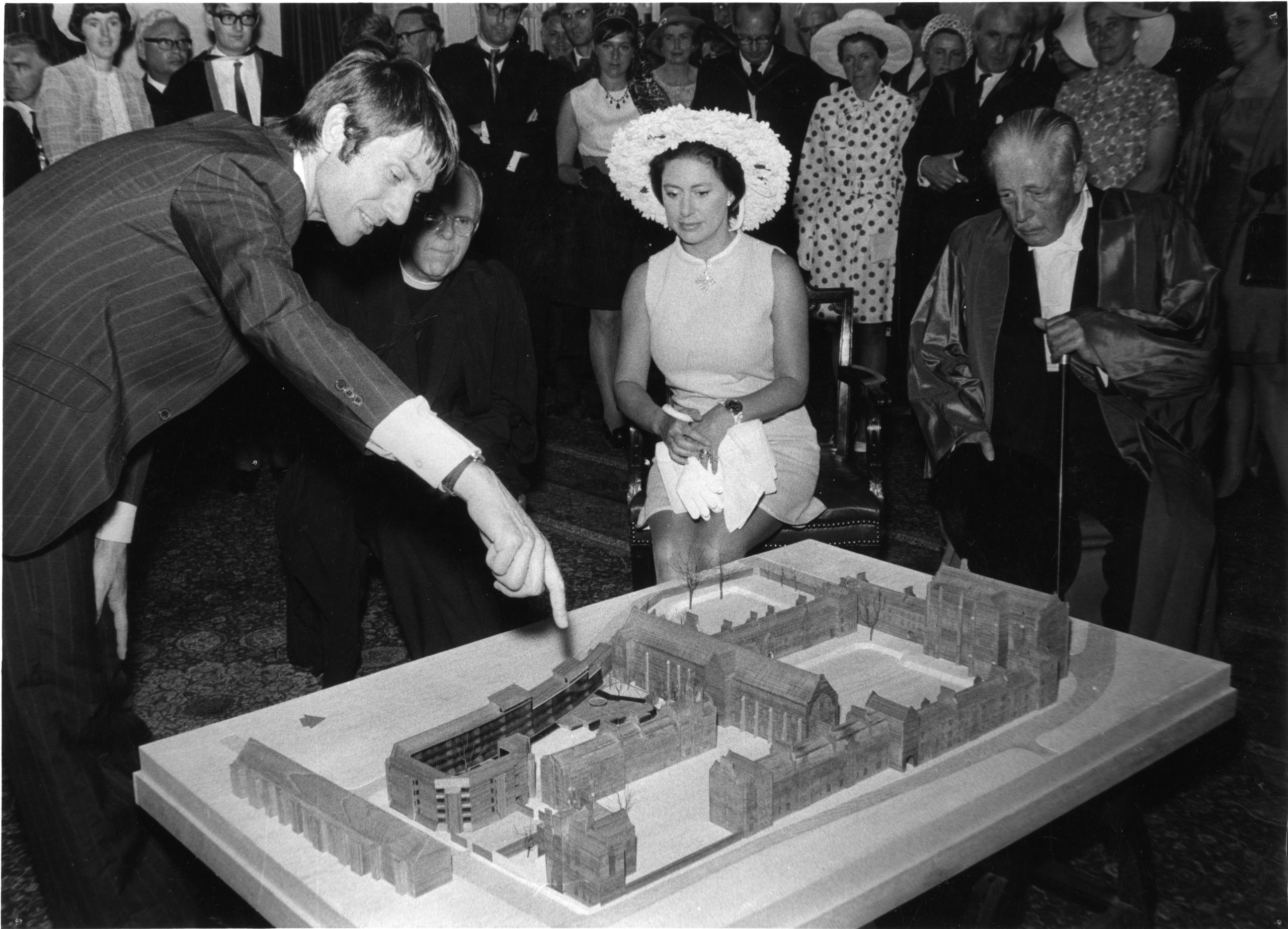
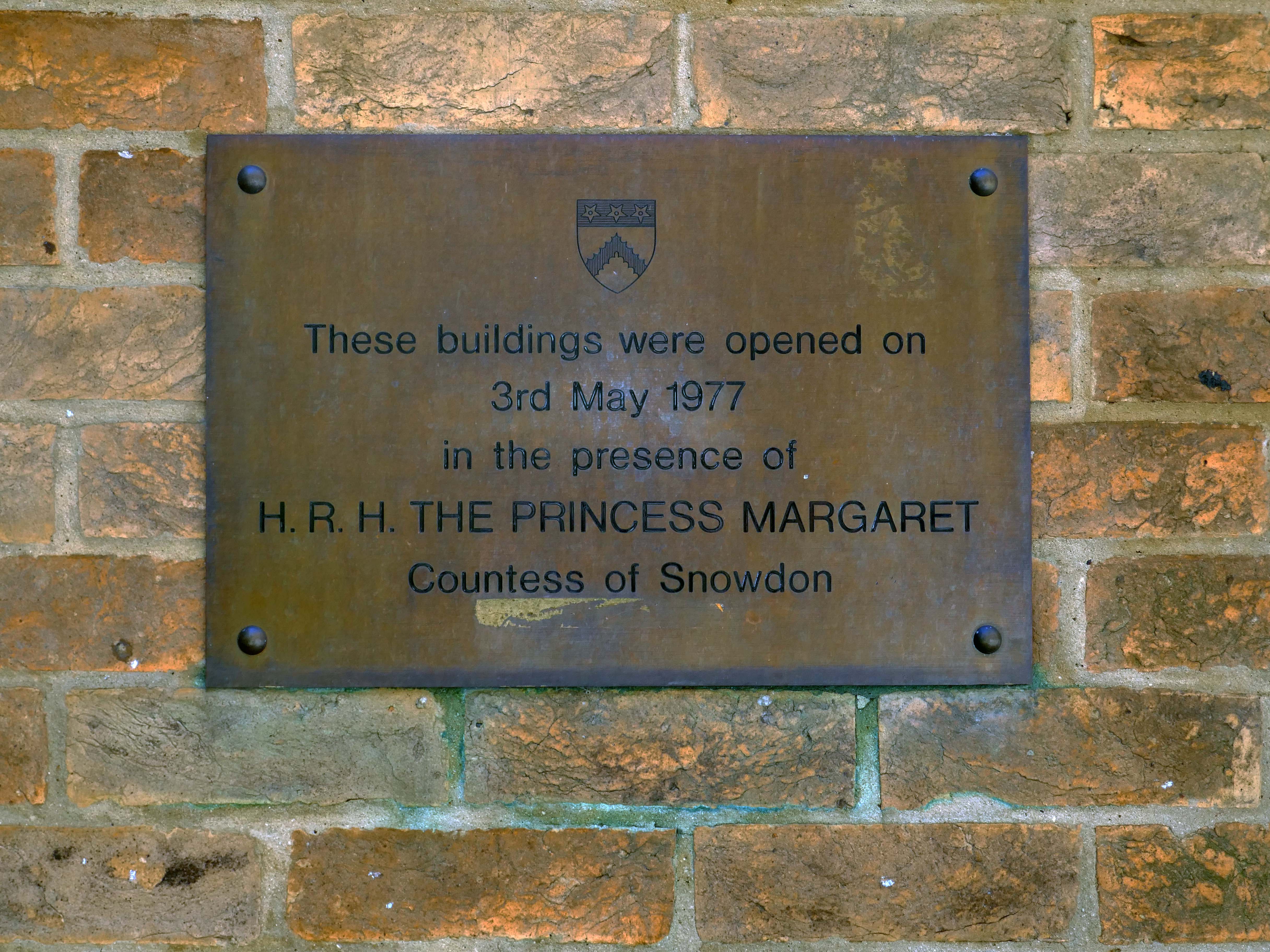
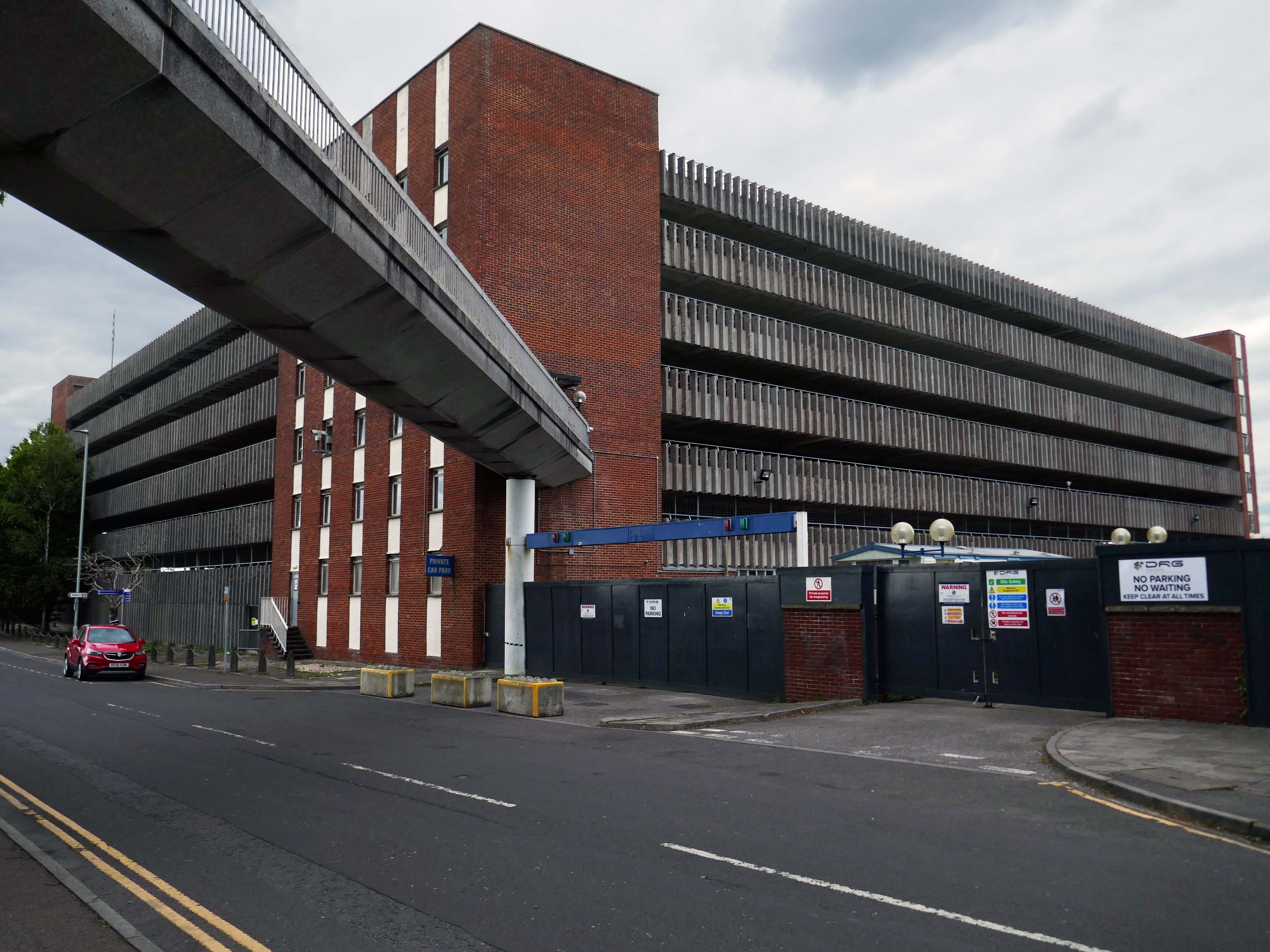
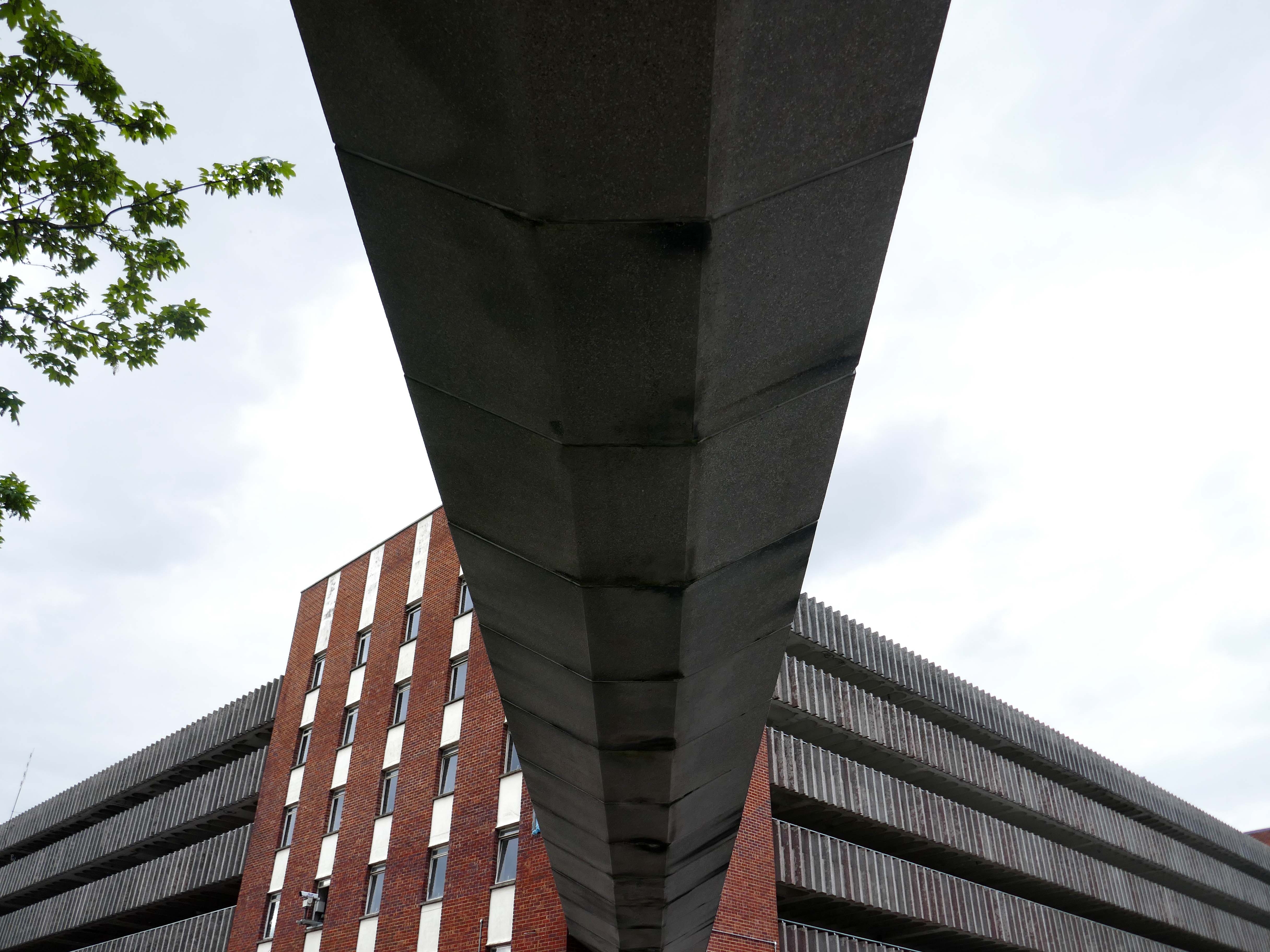
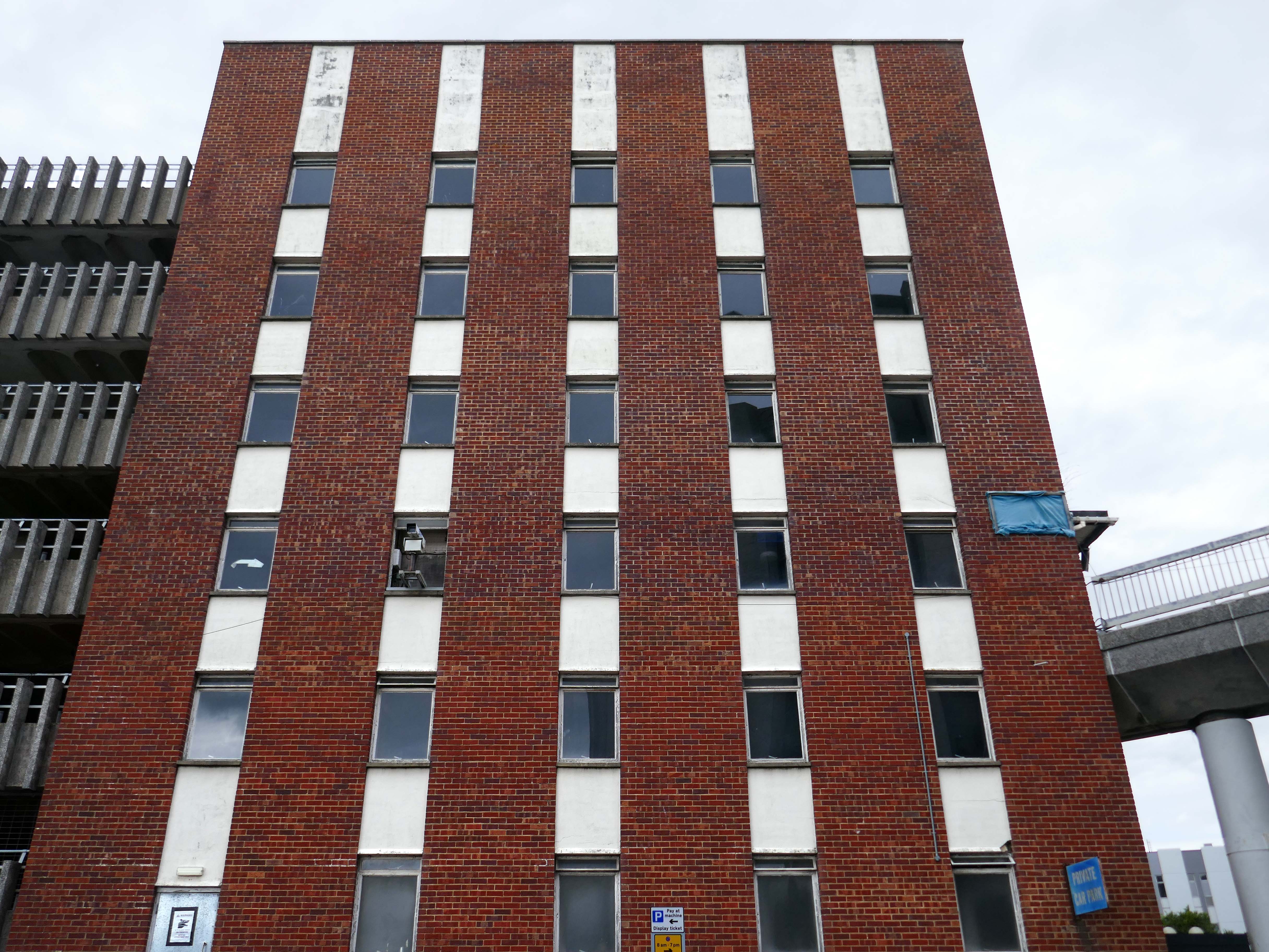
The construction was completed in two phases, the De Breyne quad – completed in 1972, was largely funded by the Adeby Trust. The second phase – completed in 1976, was primarily funded by the Hayward Foundation.
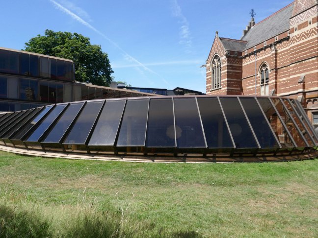
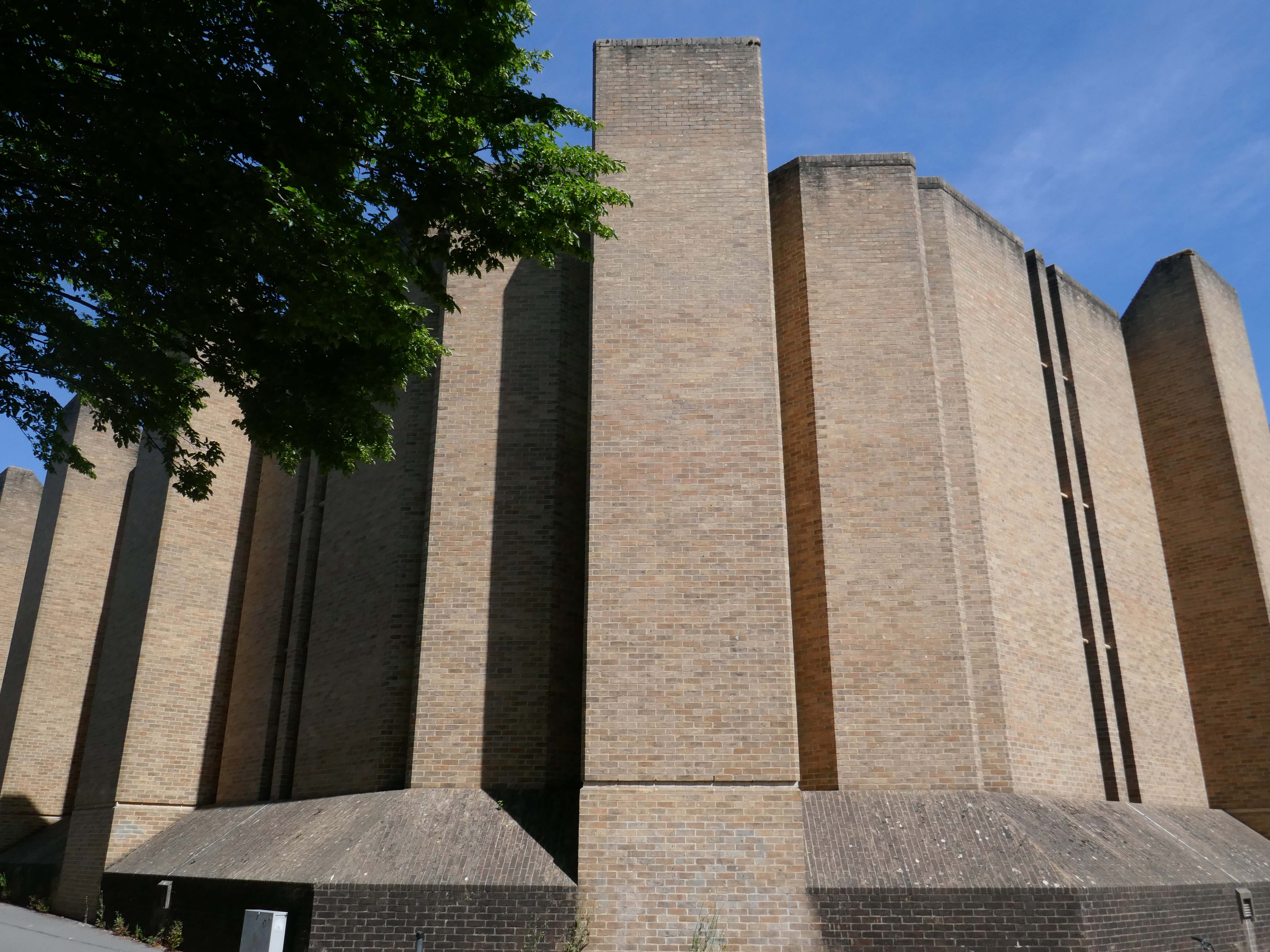
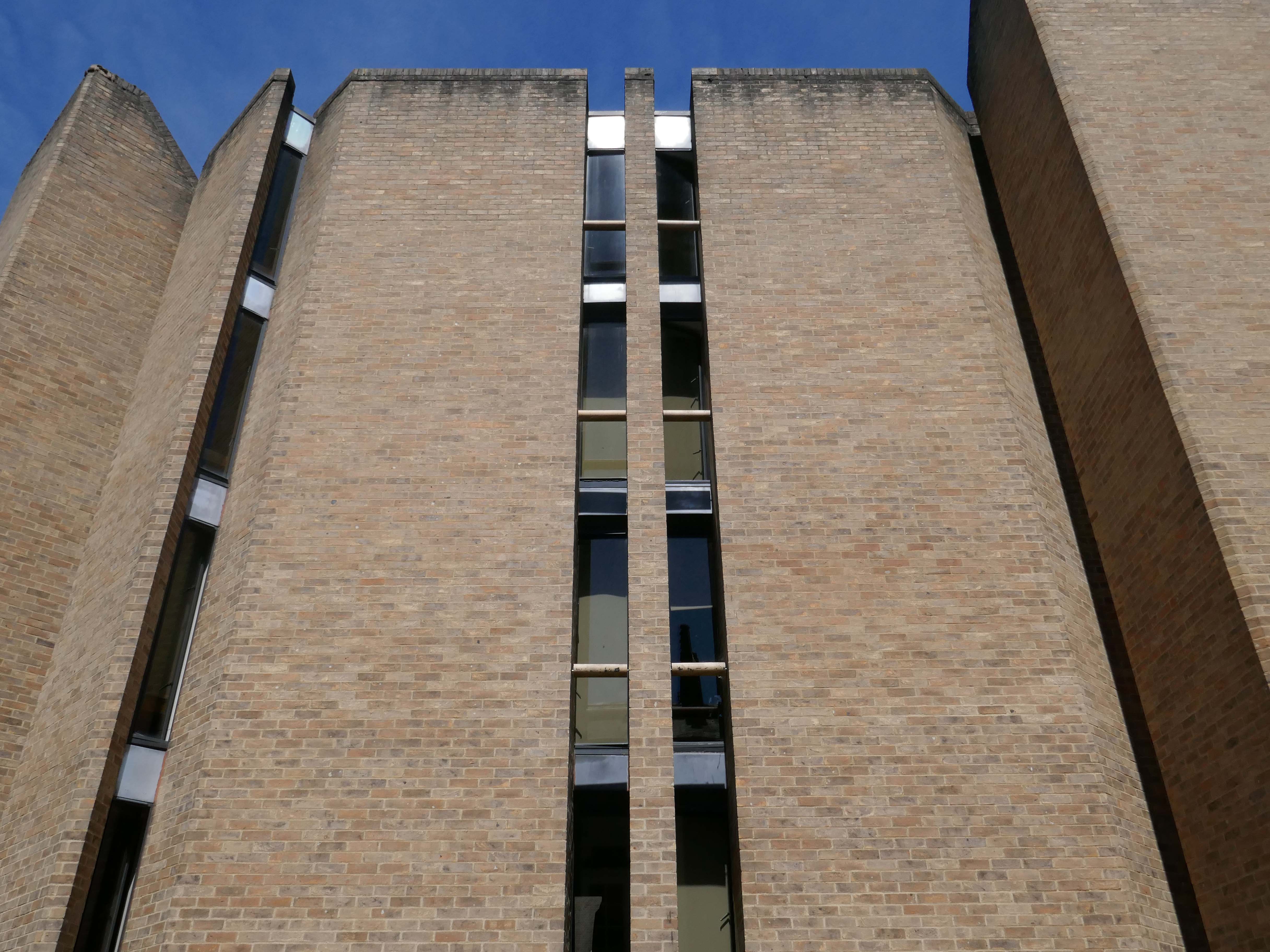
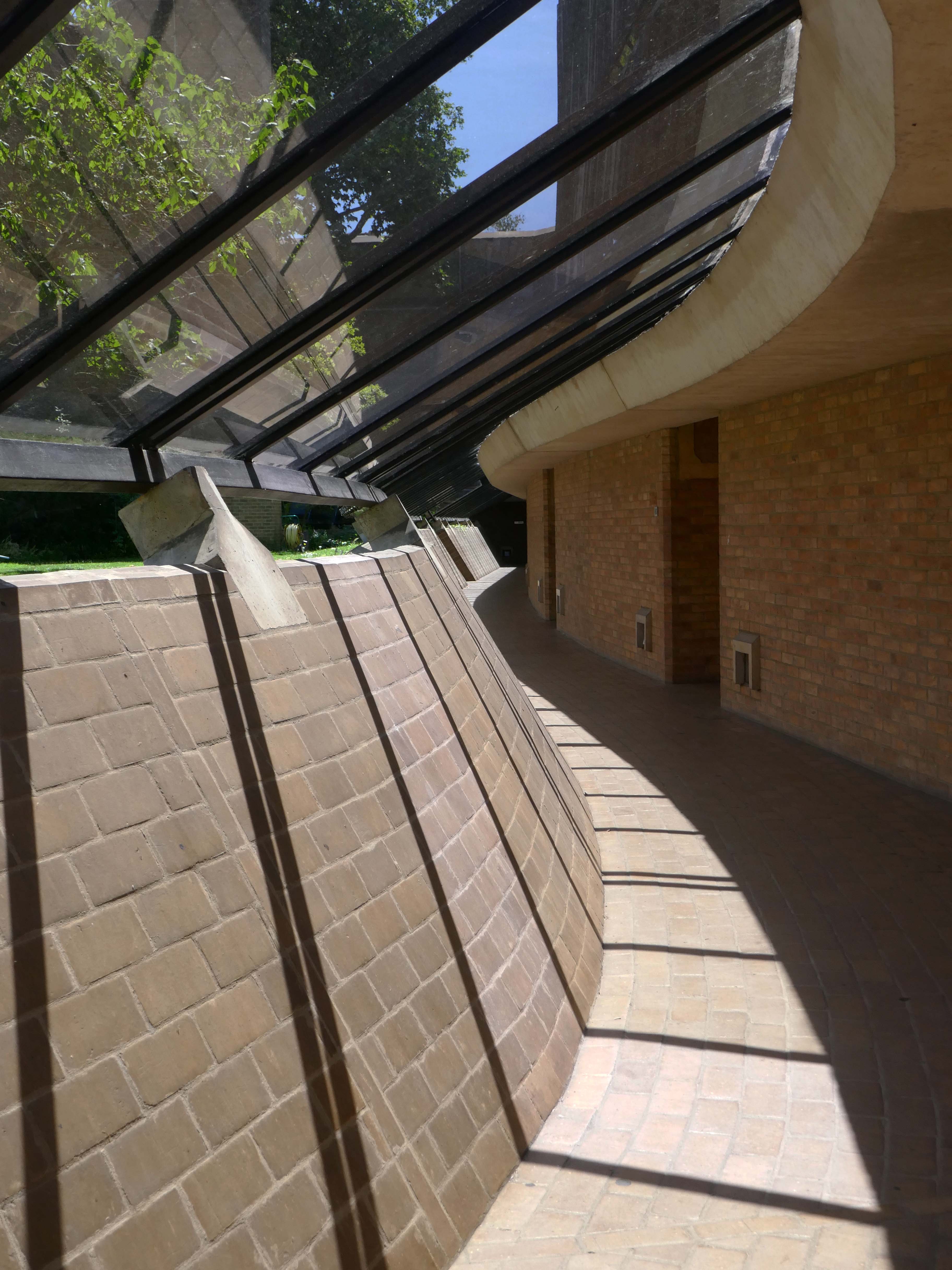
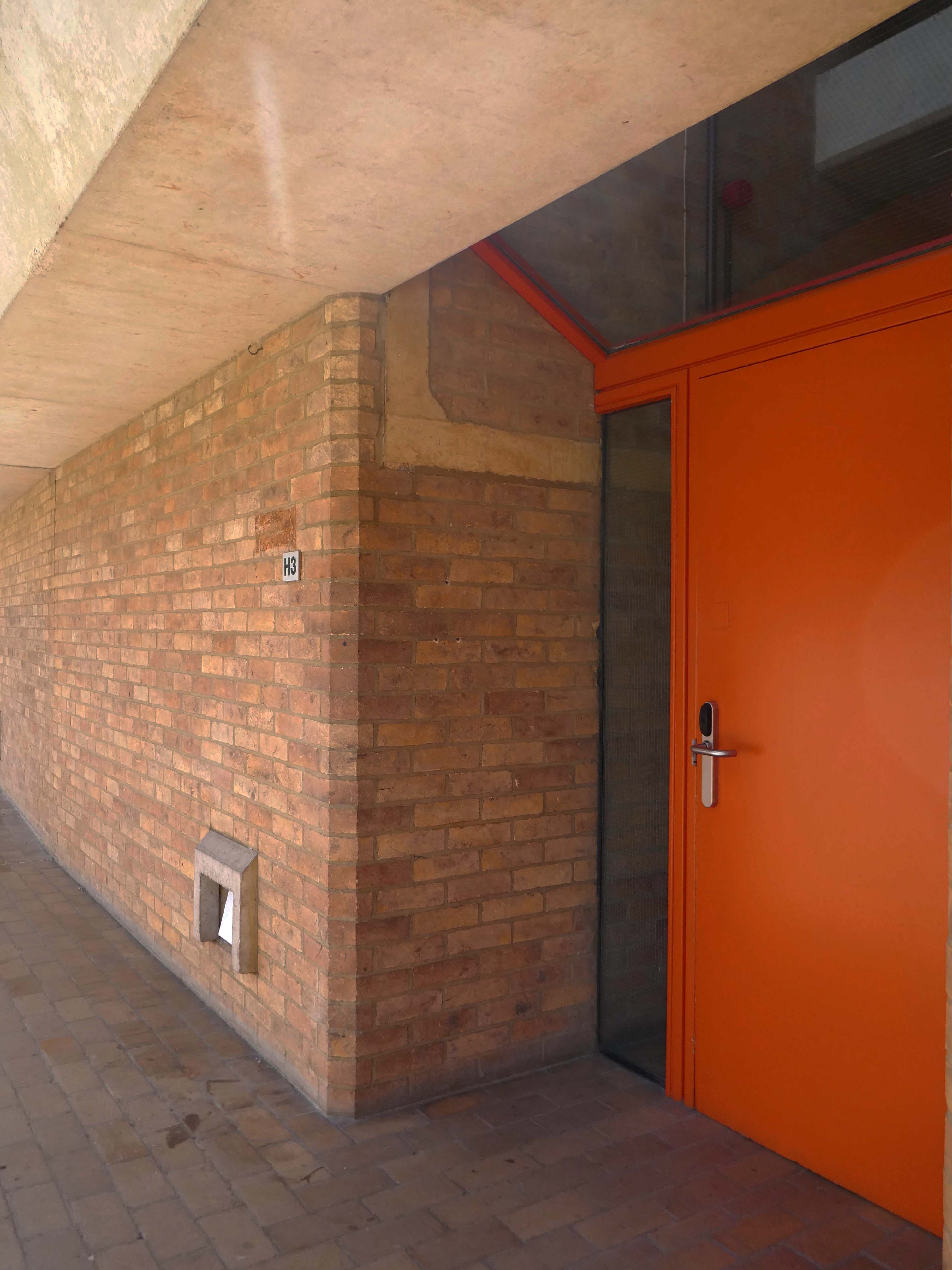
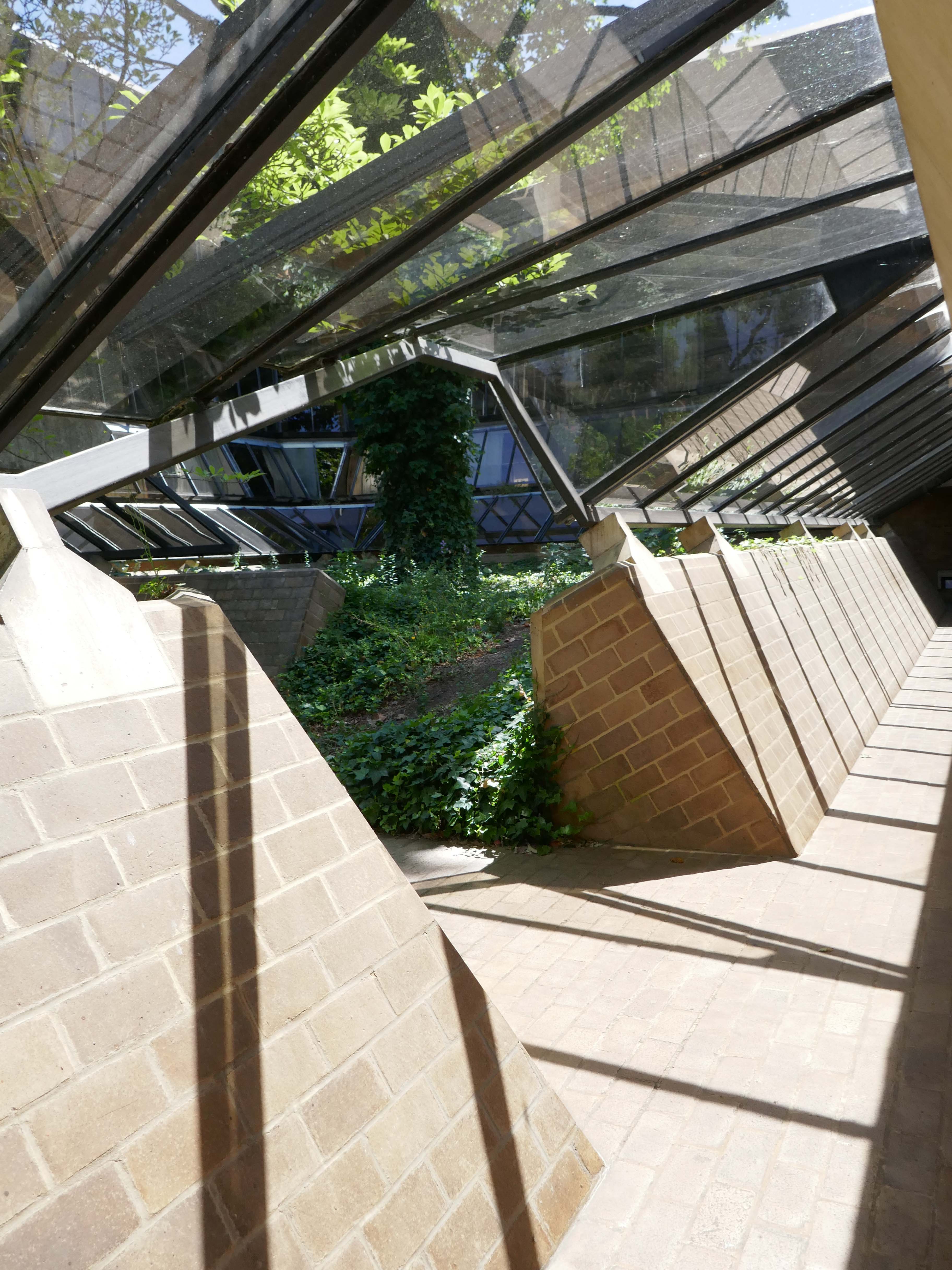
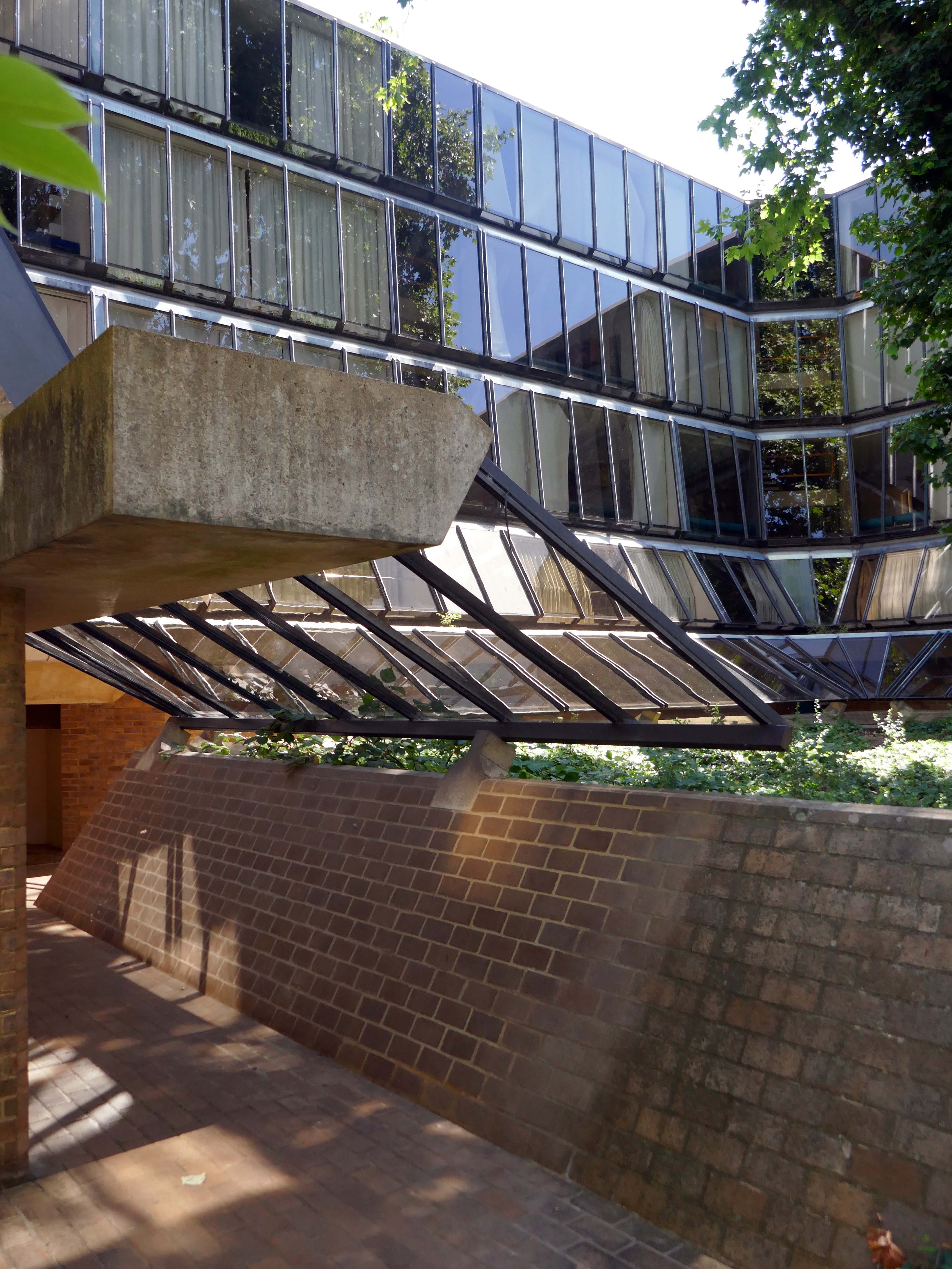
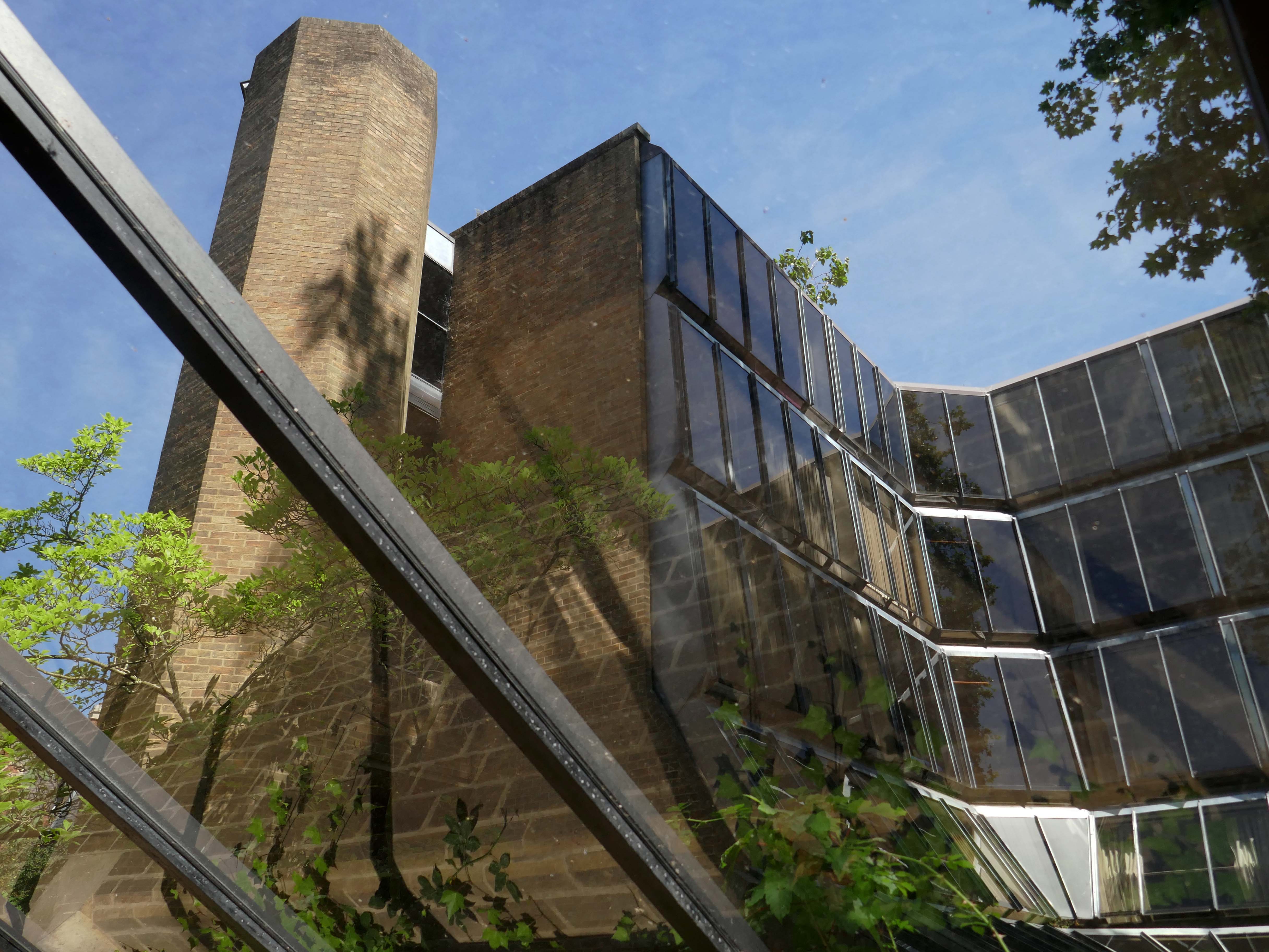
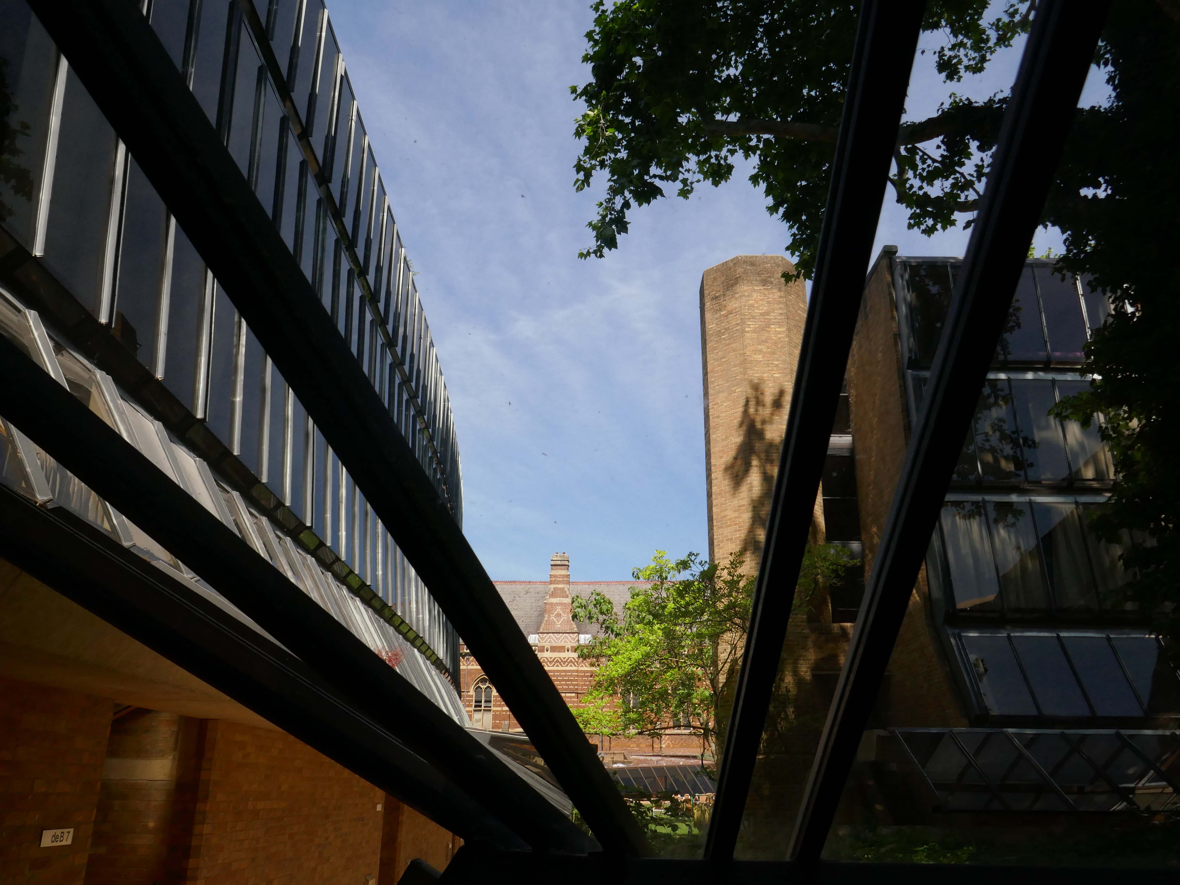
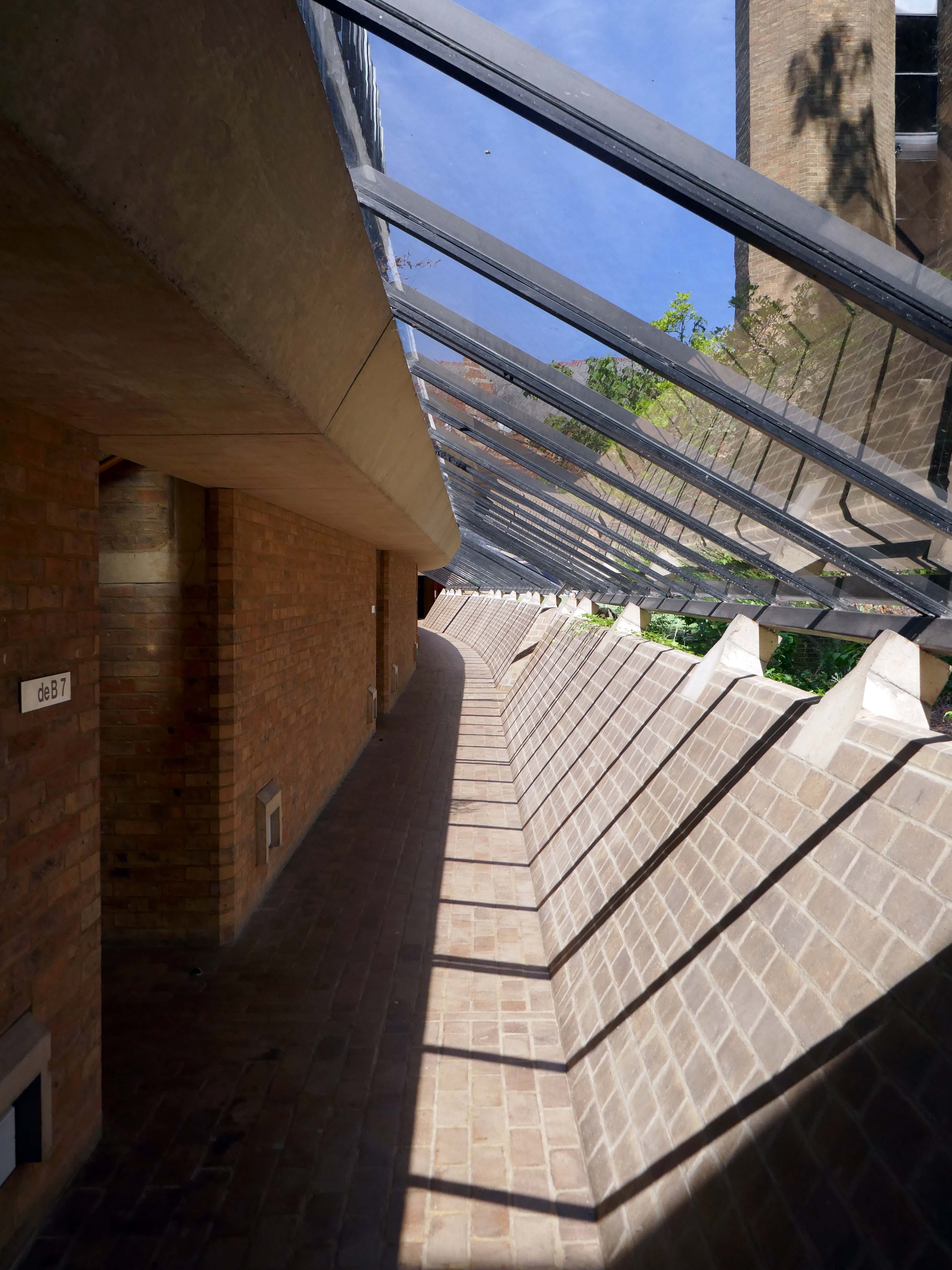
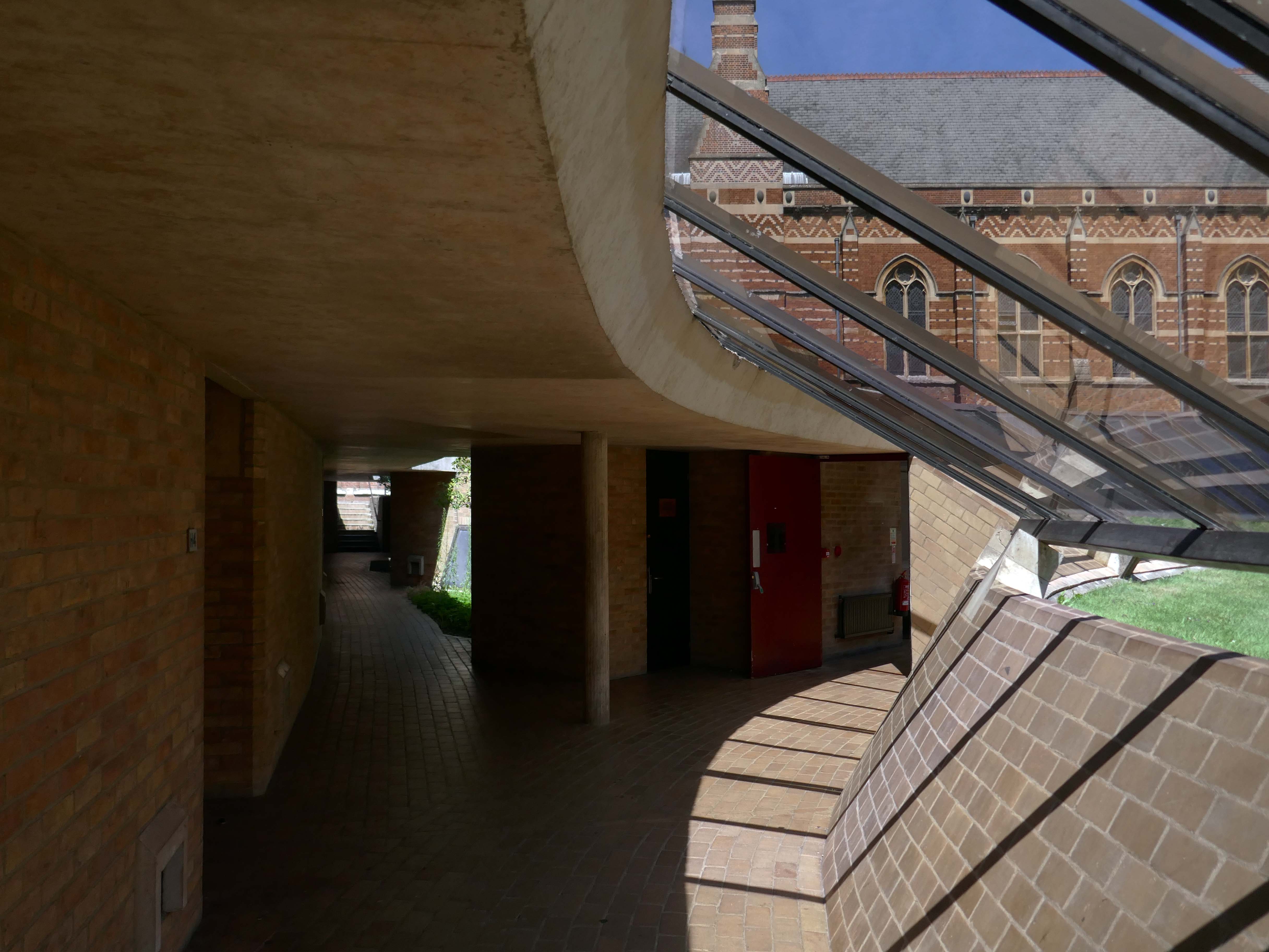
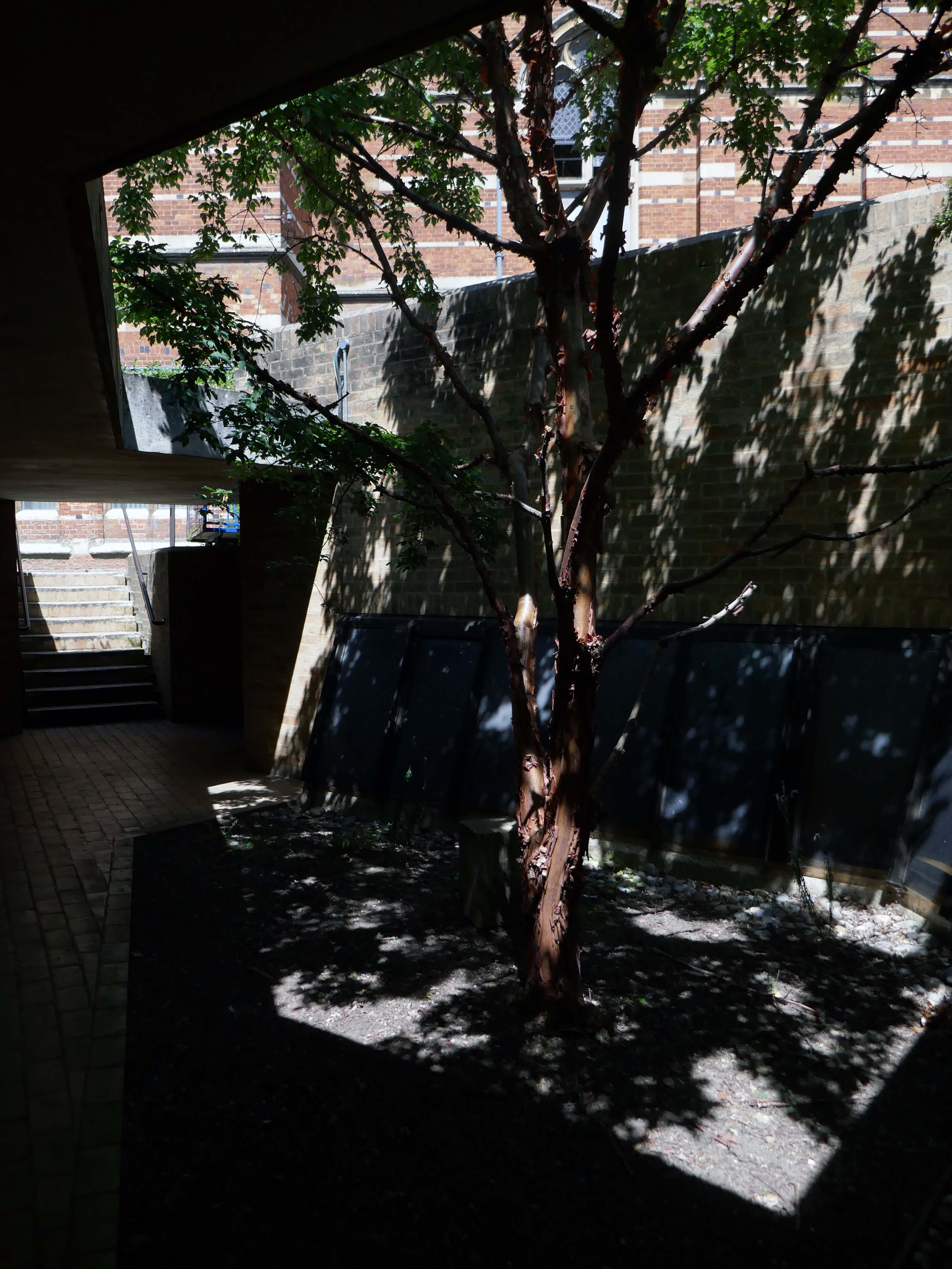
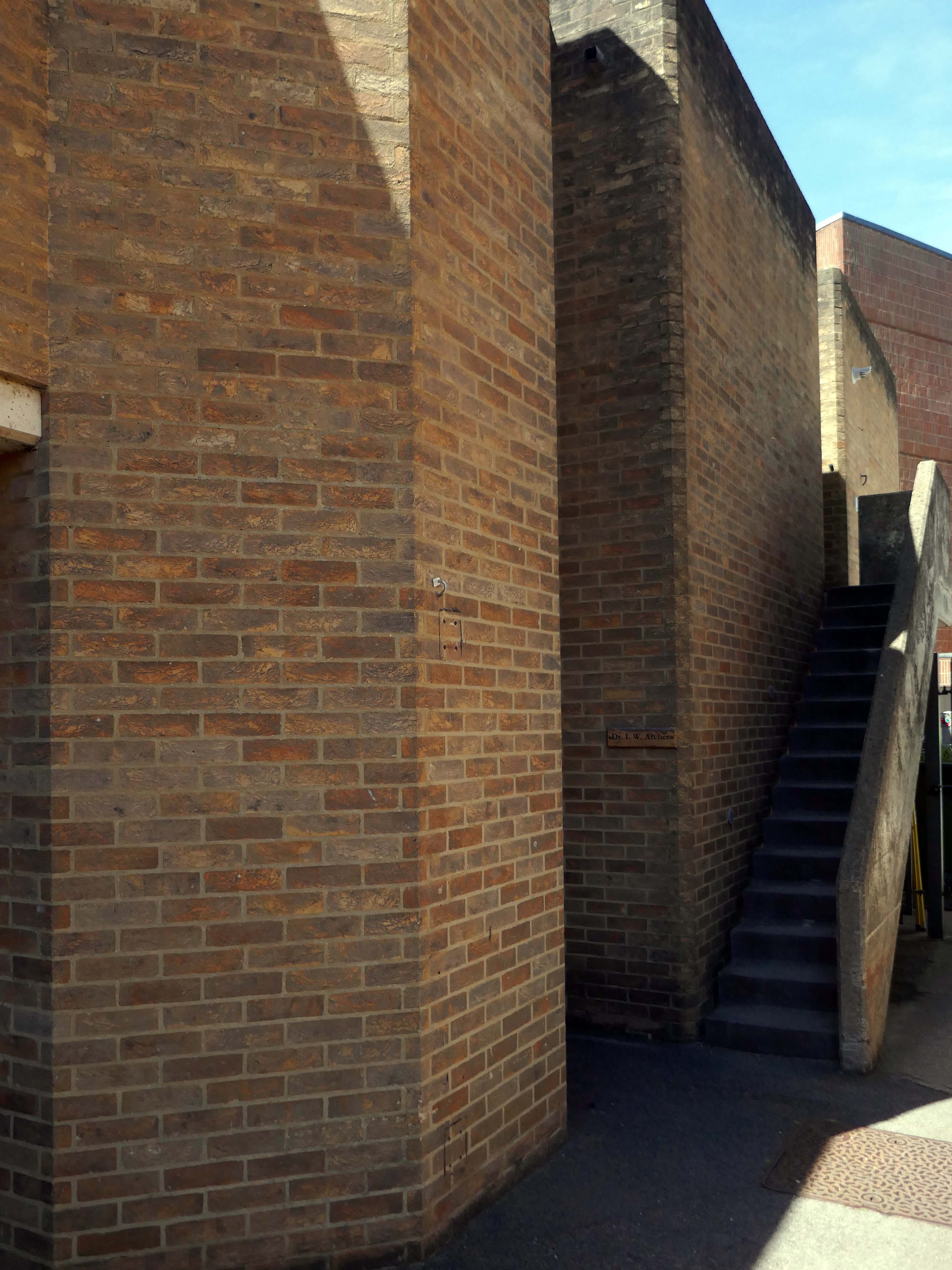
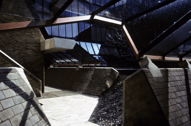
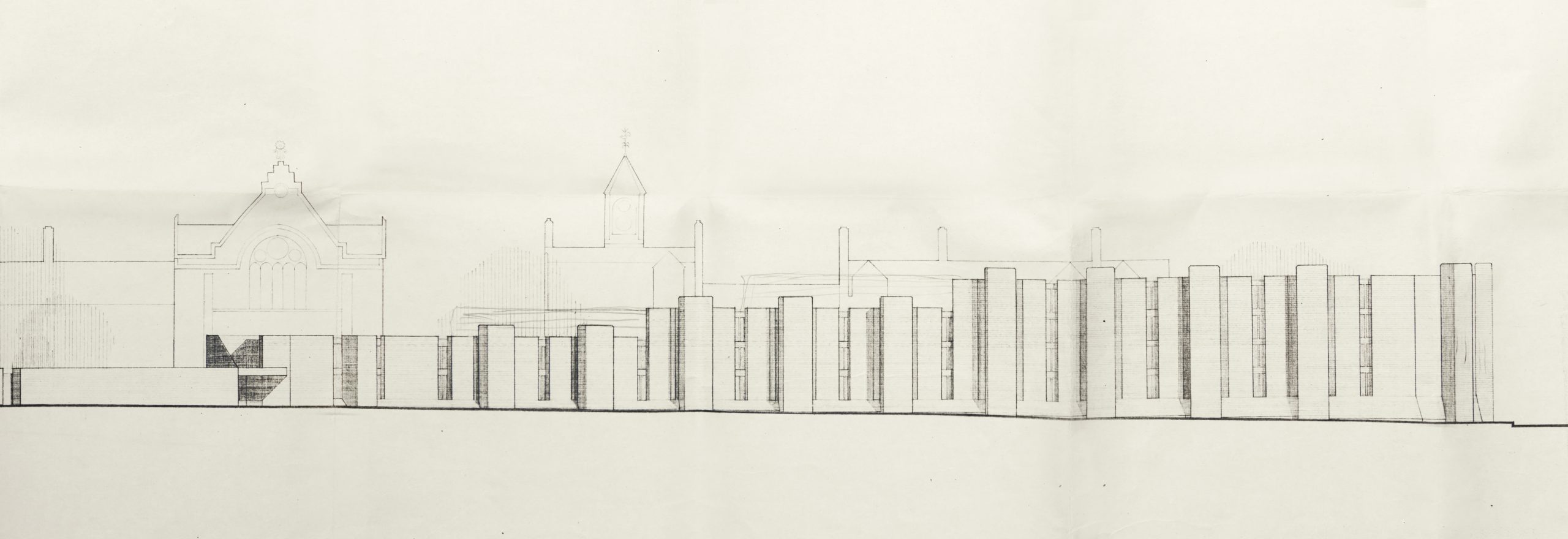
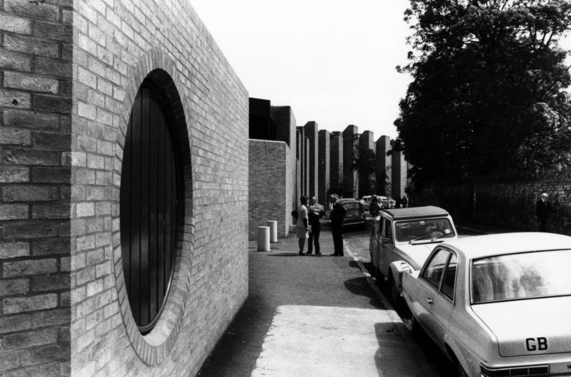
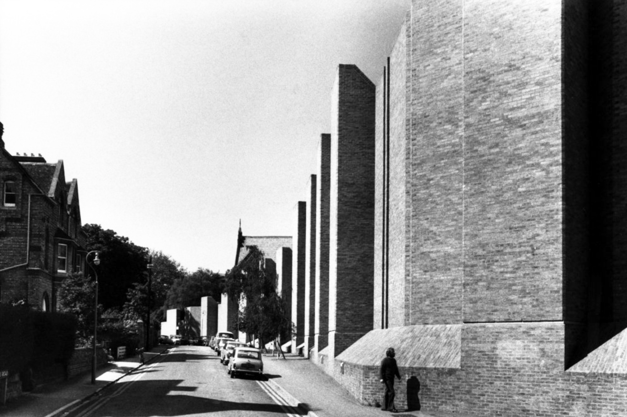
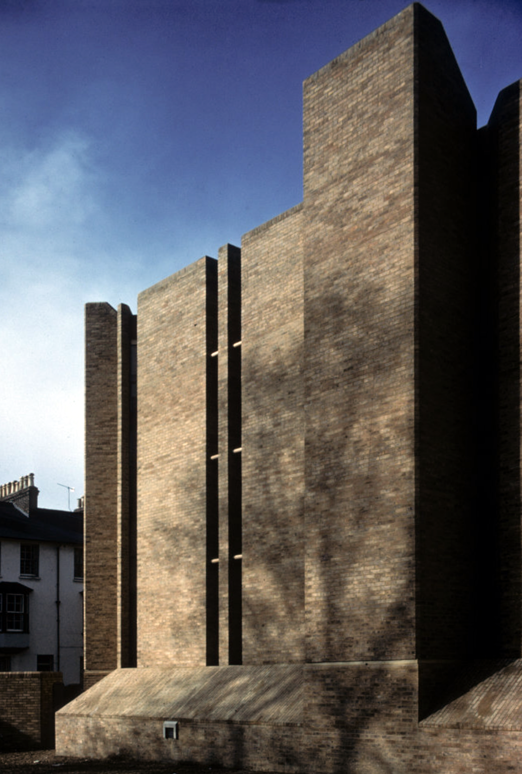
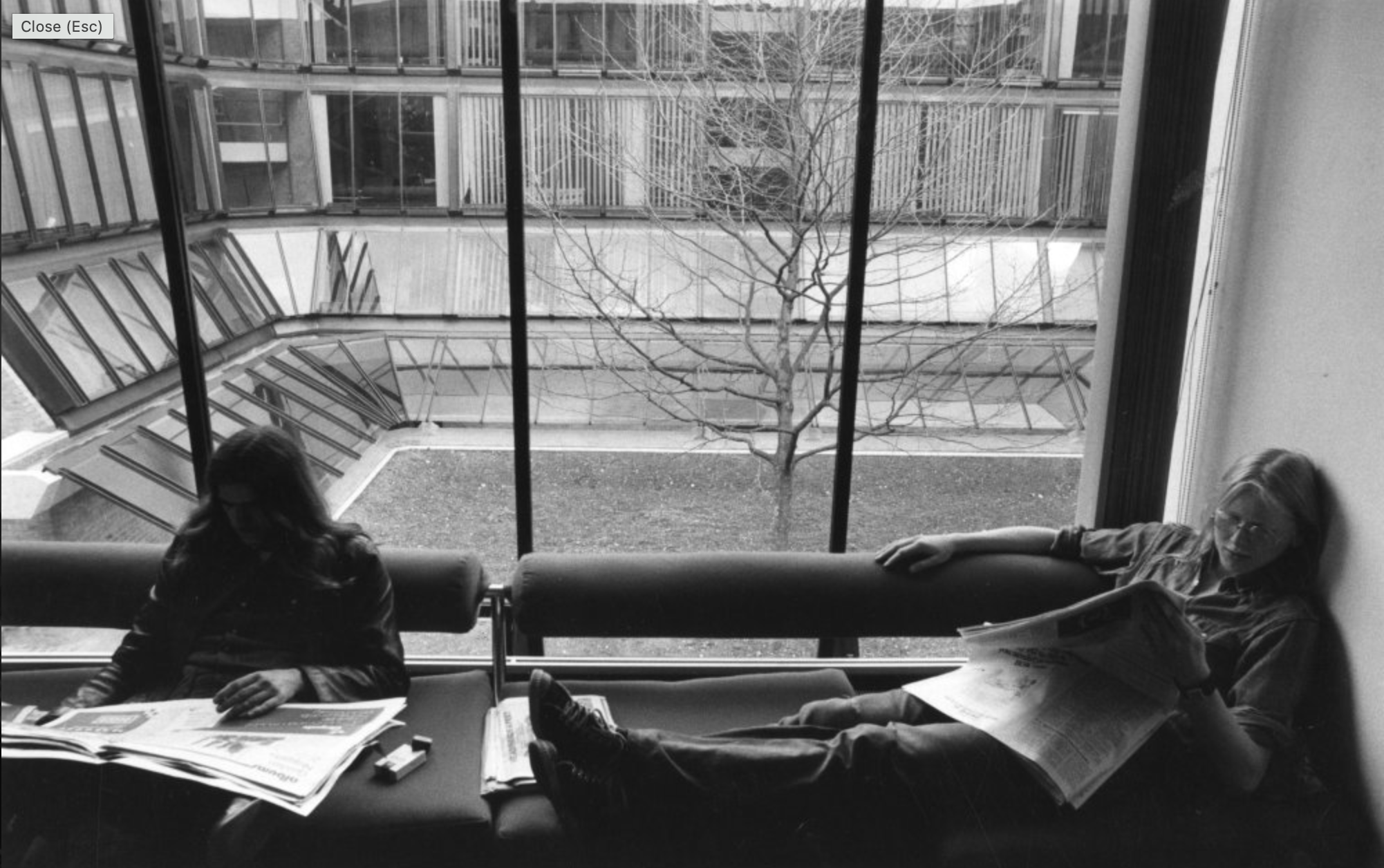
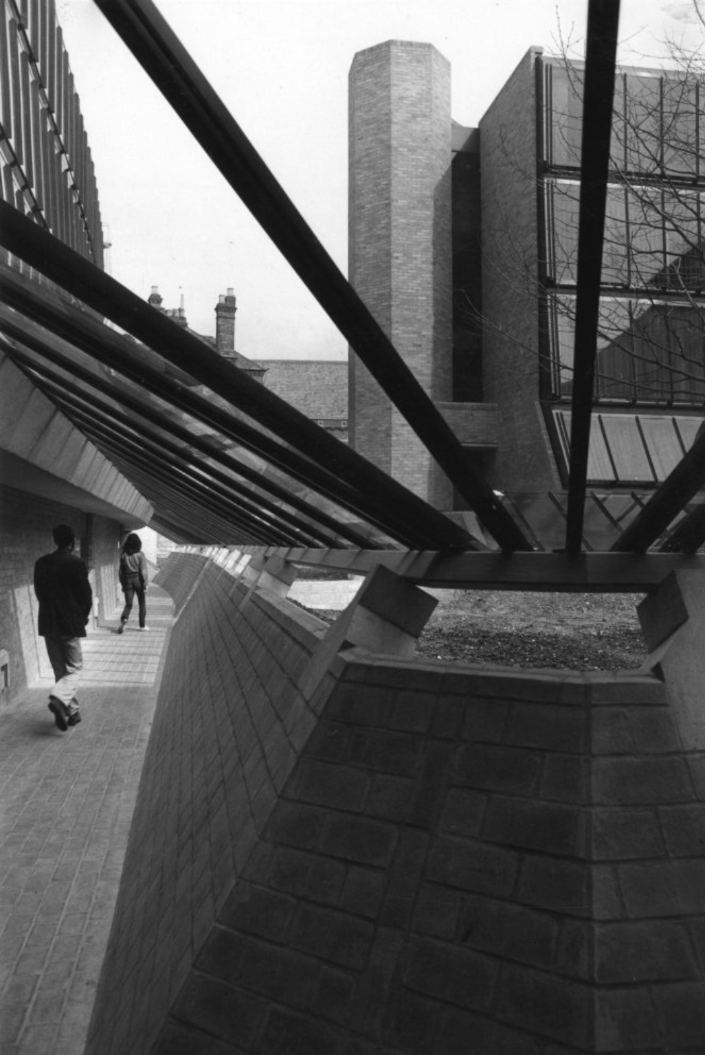
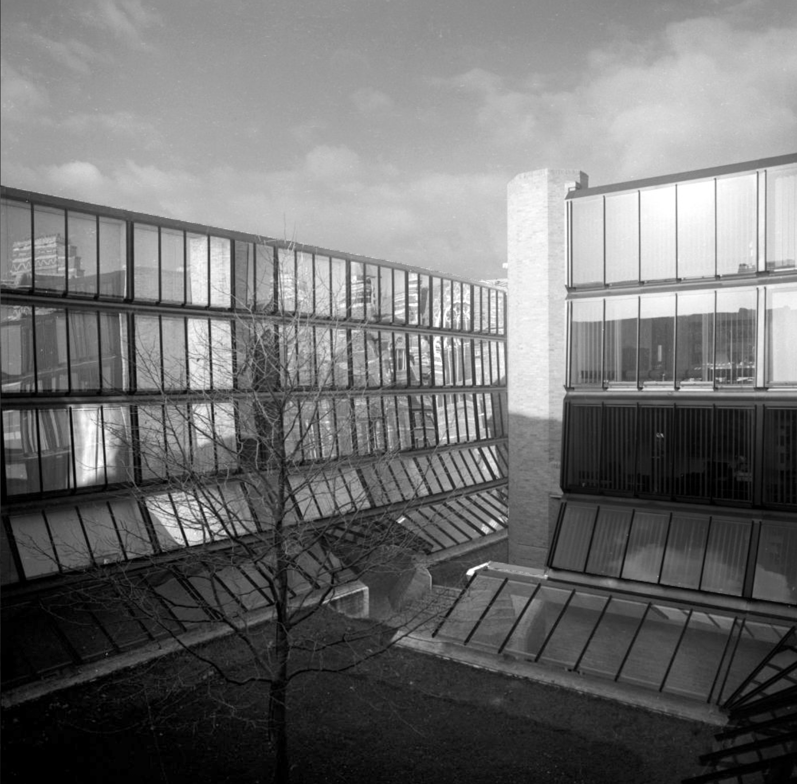
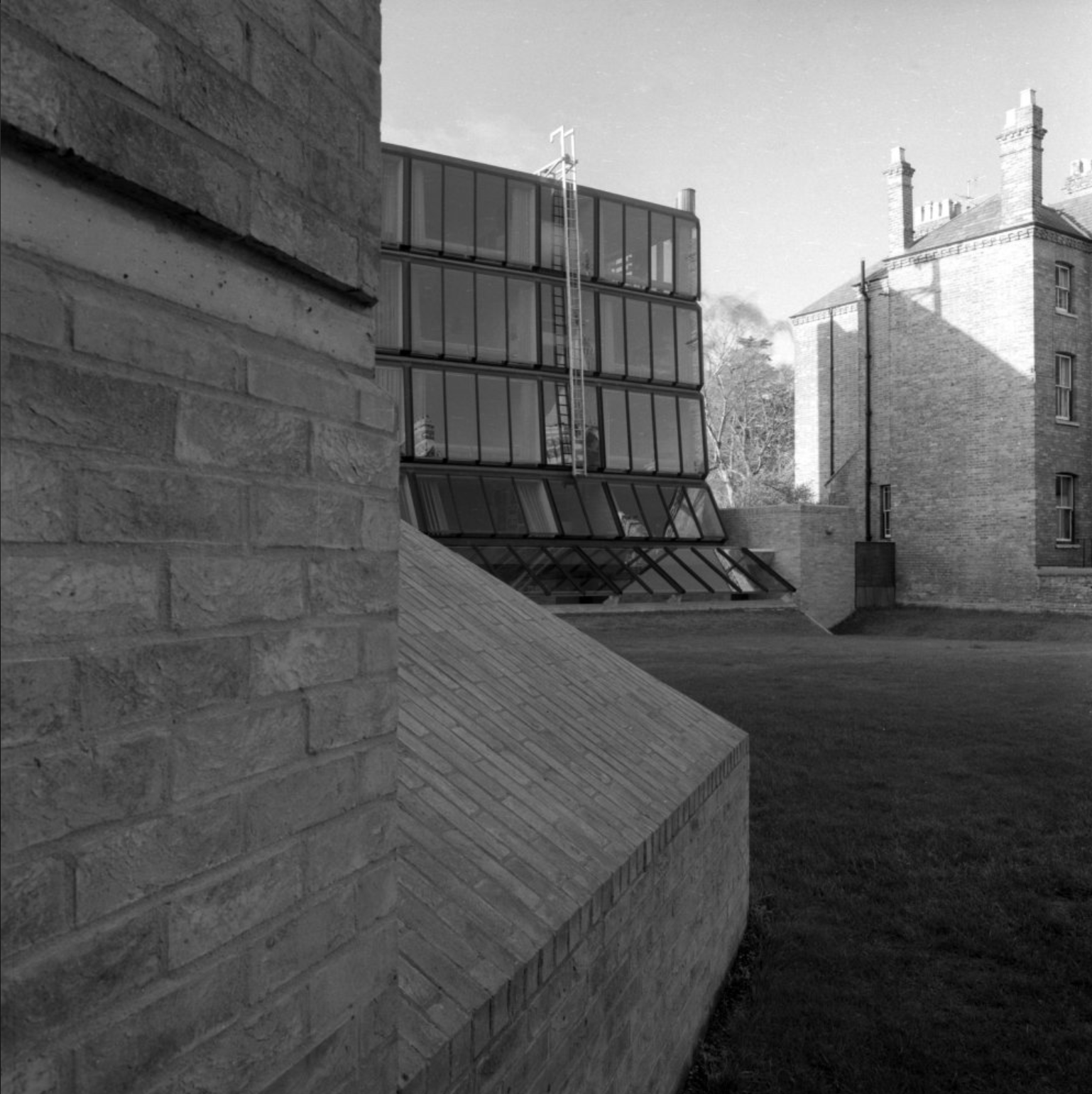
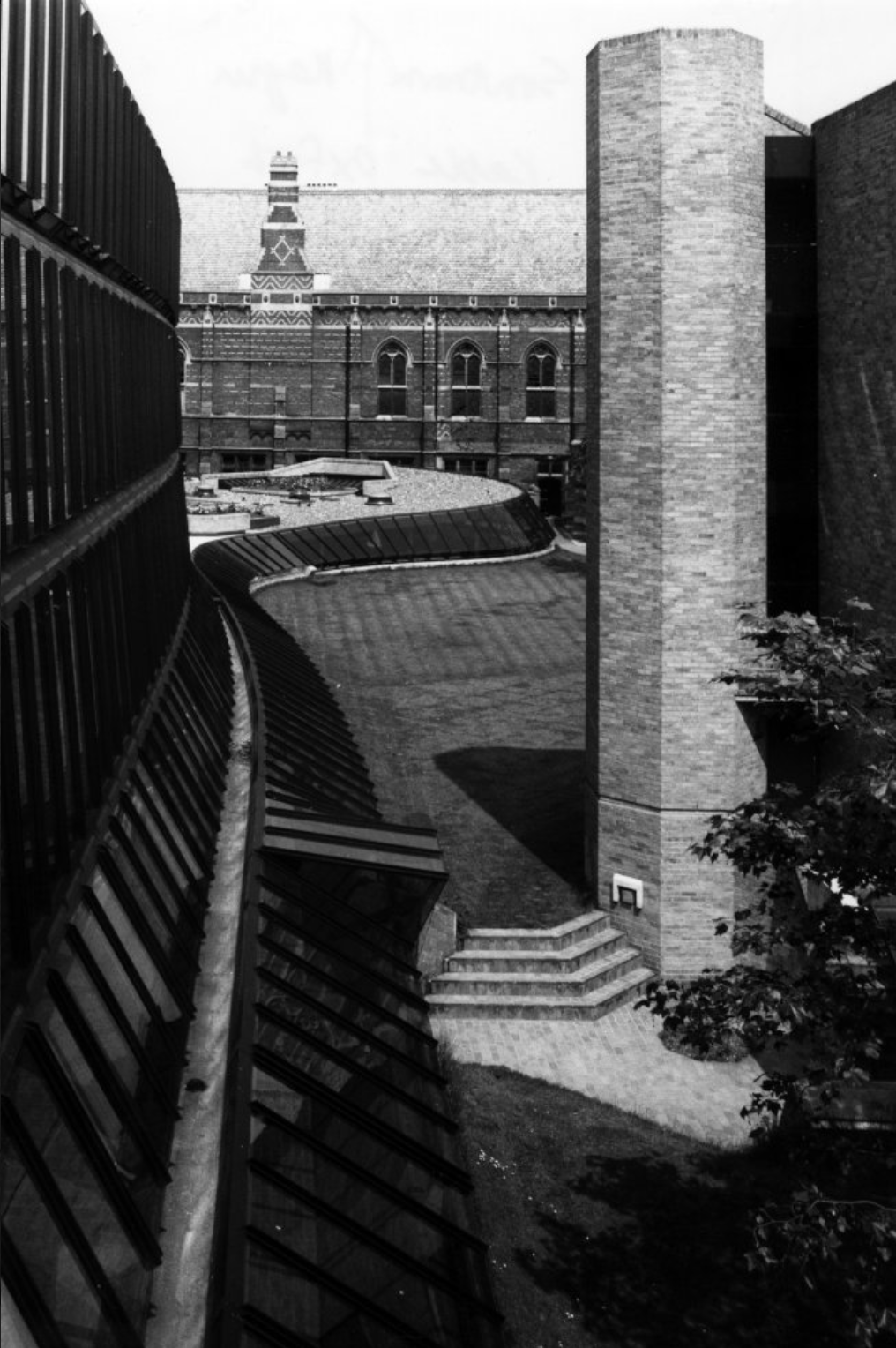
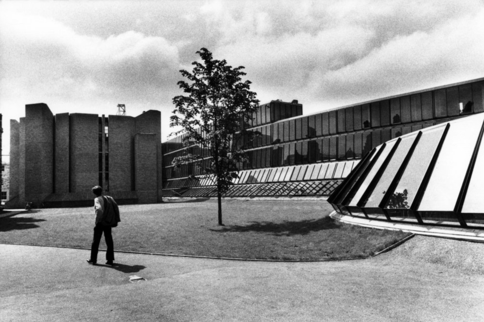
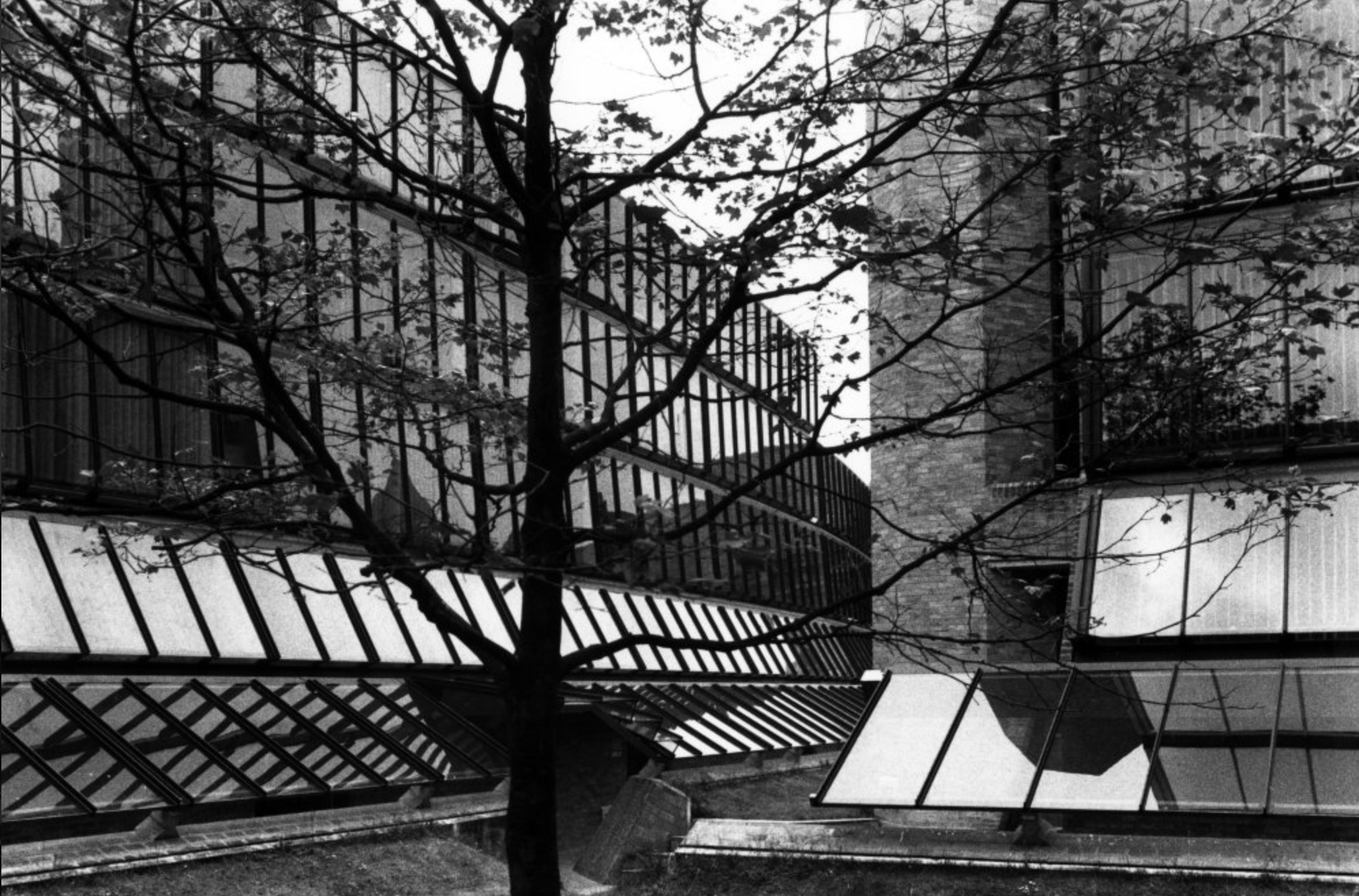
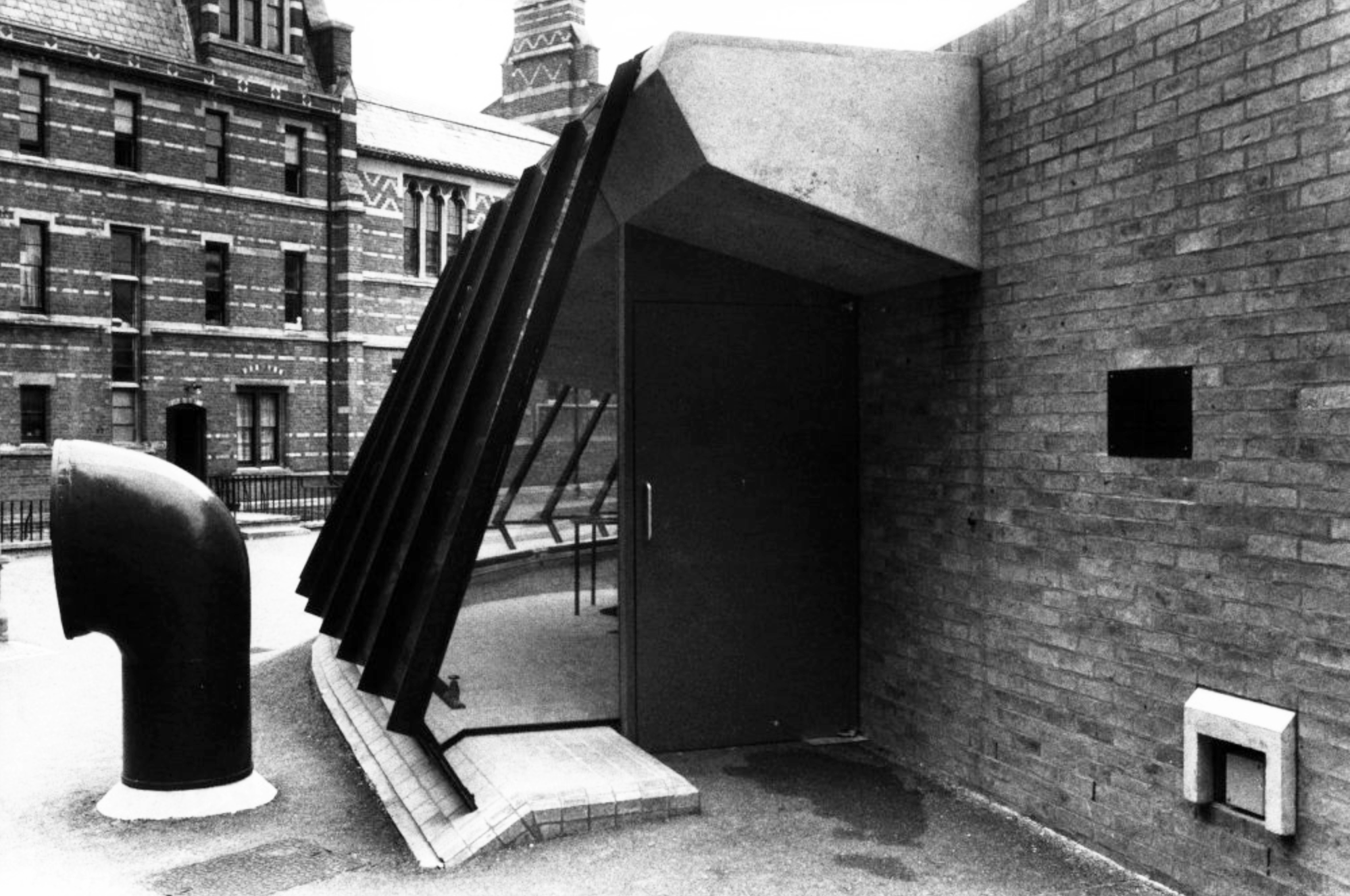
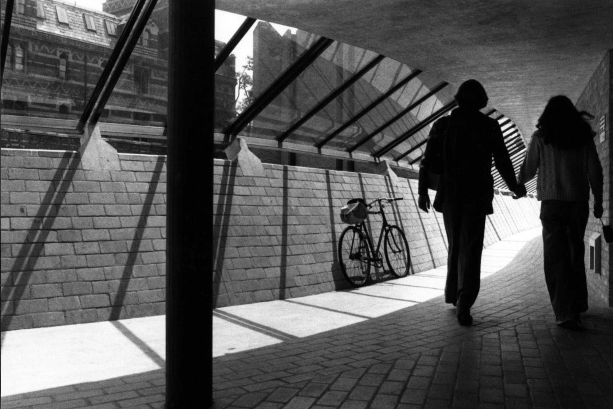
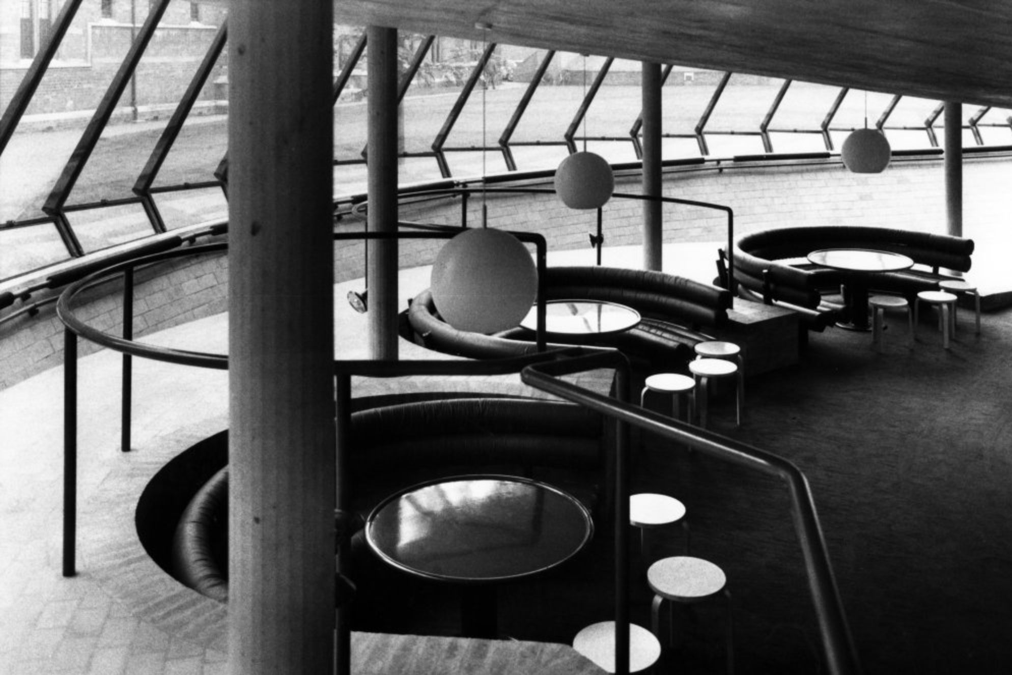
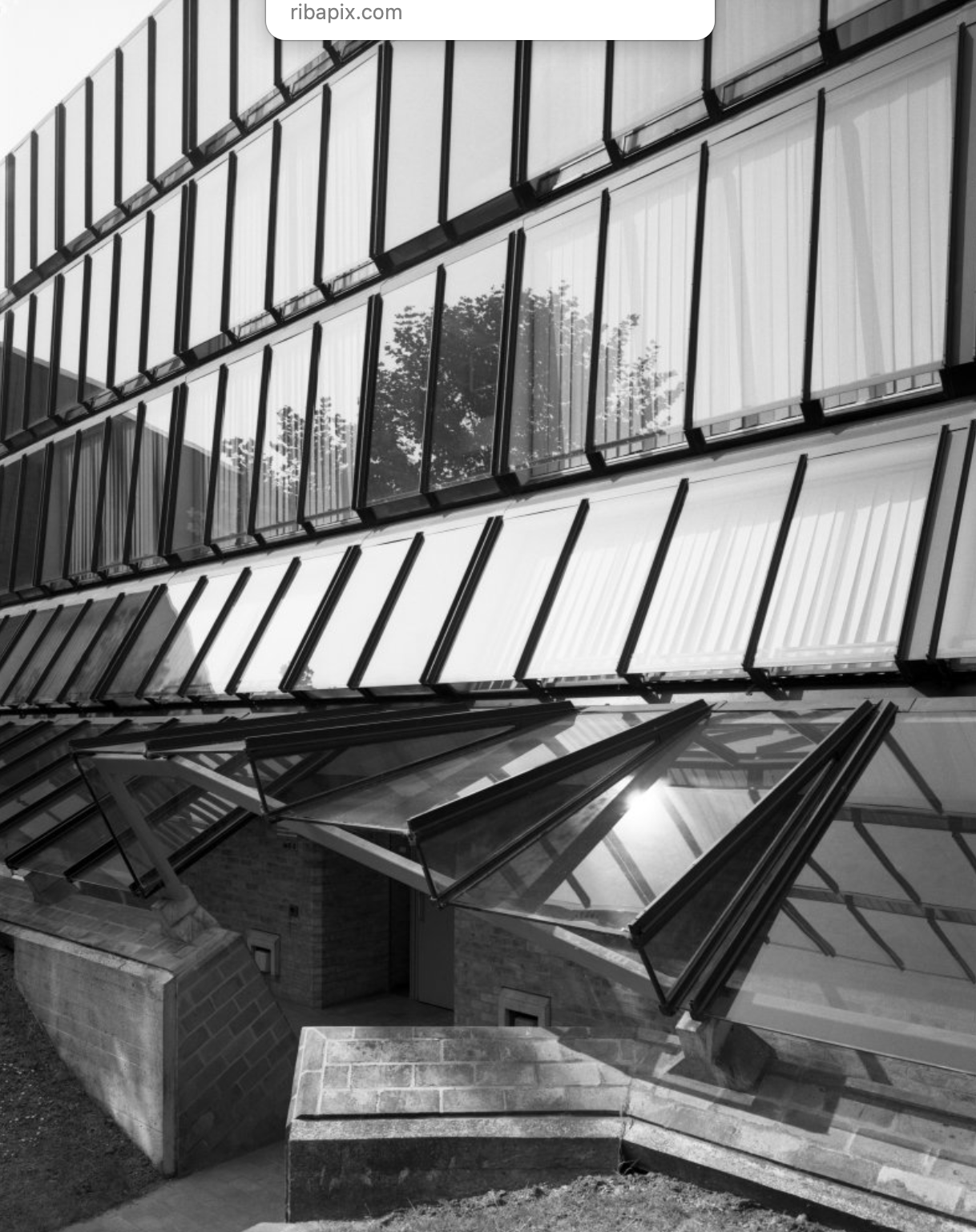
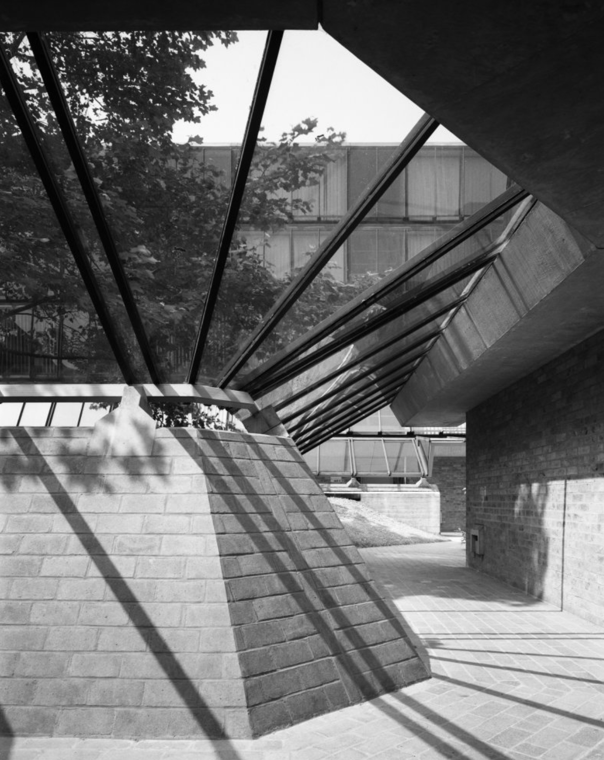
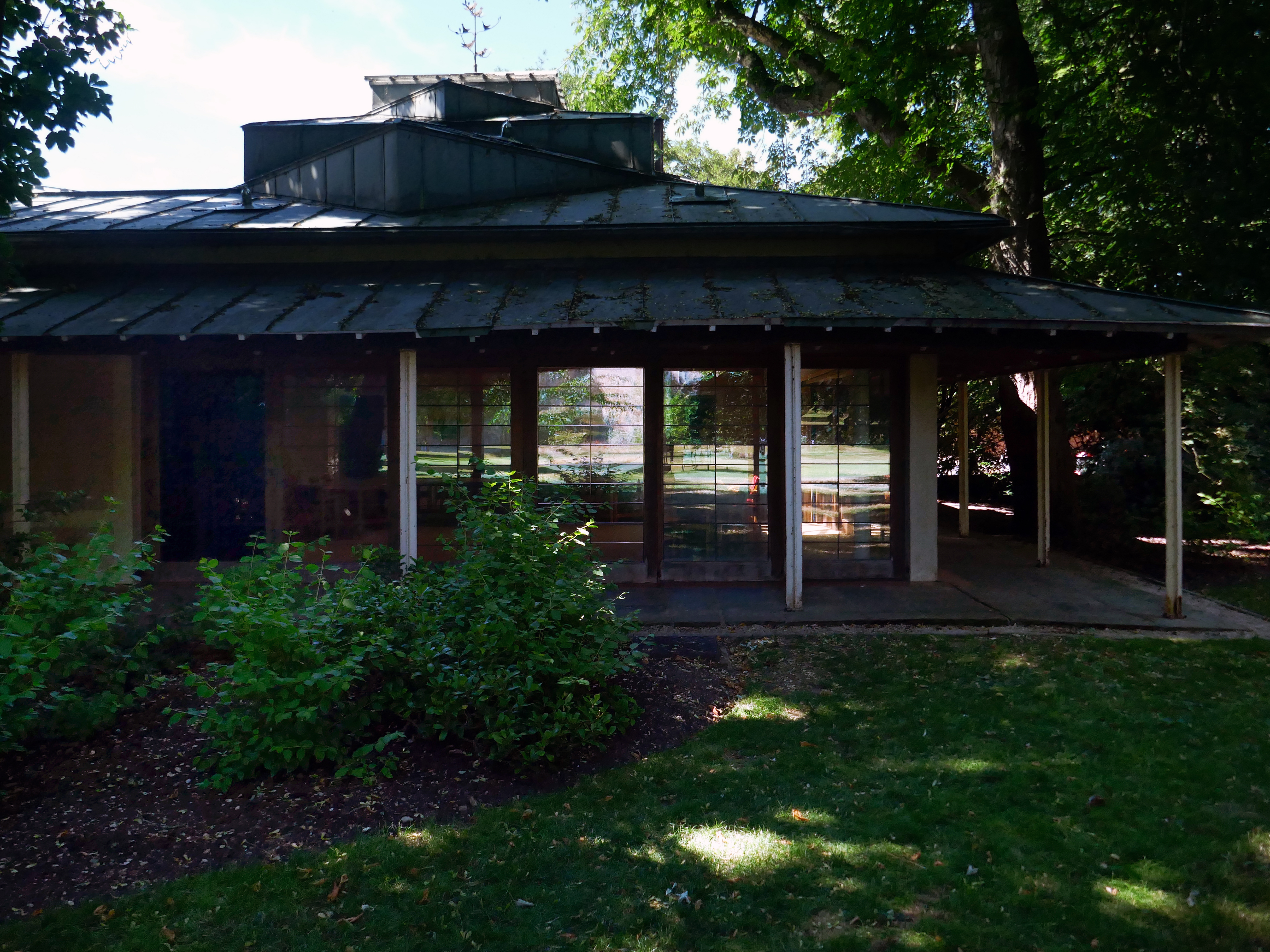
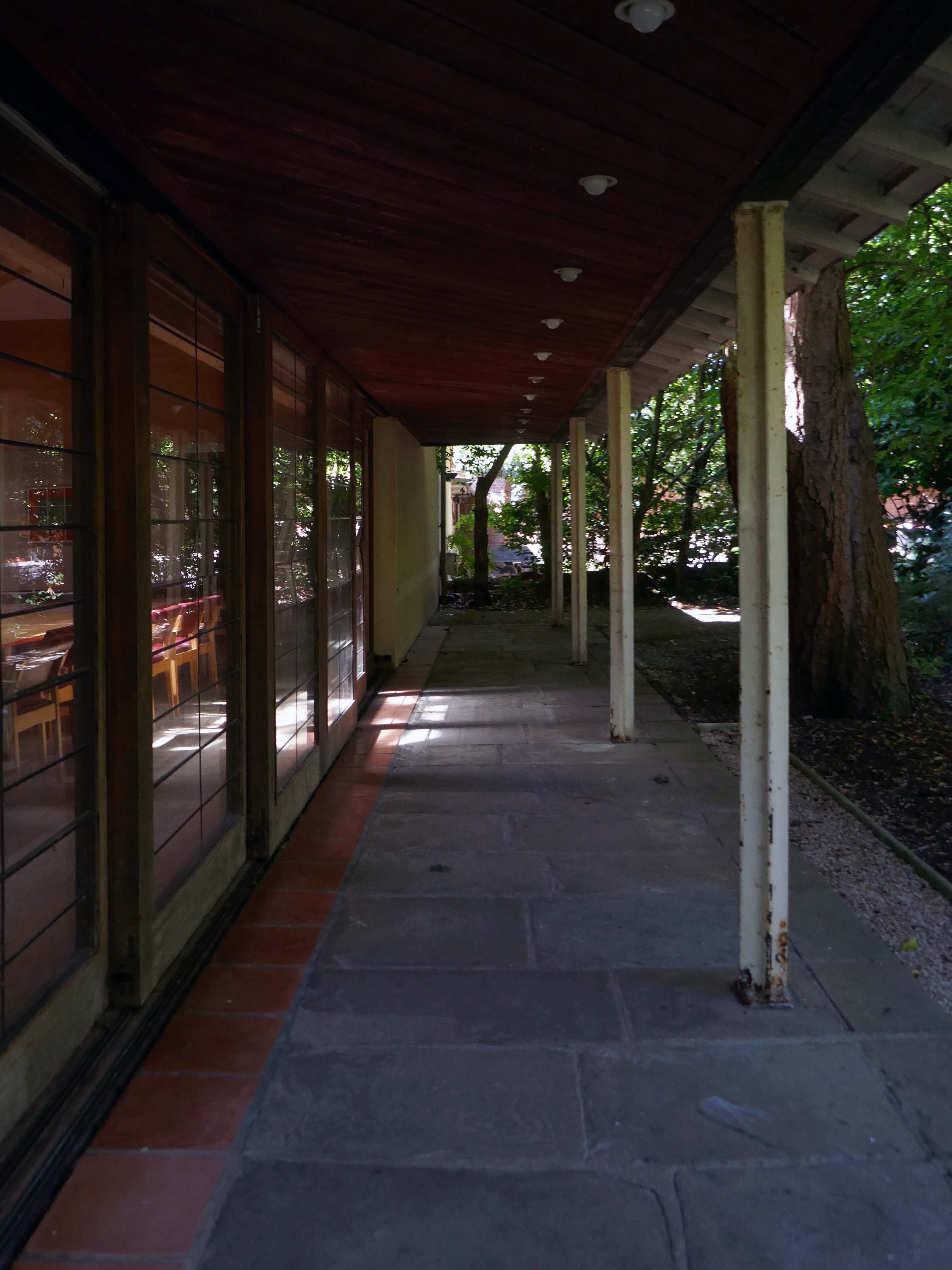
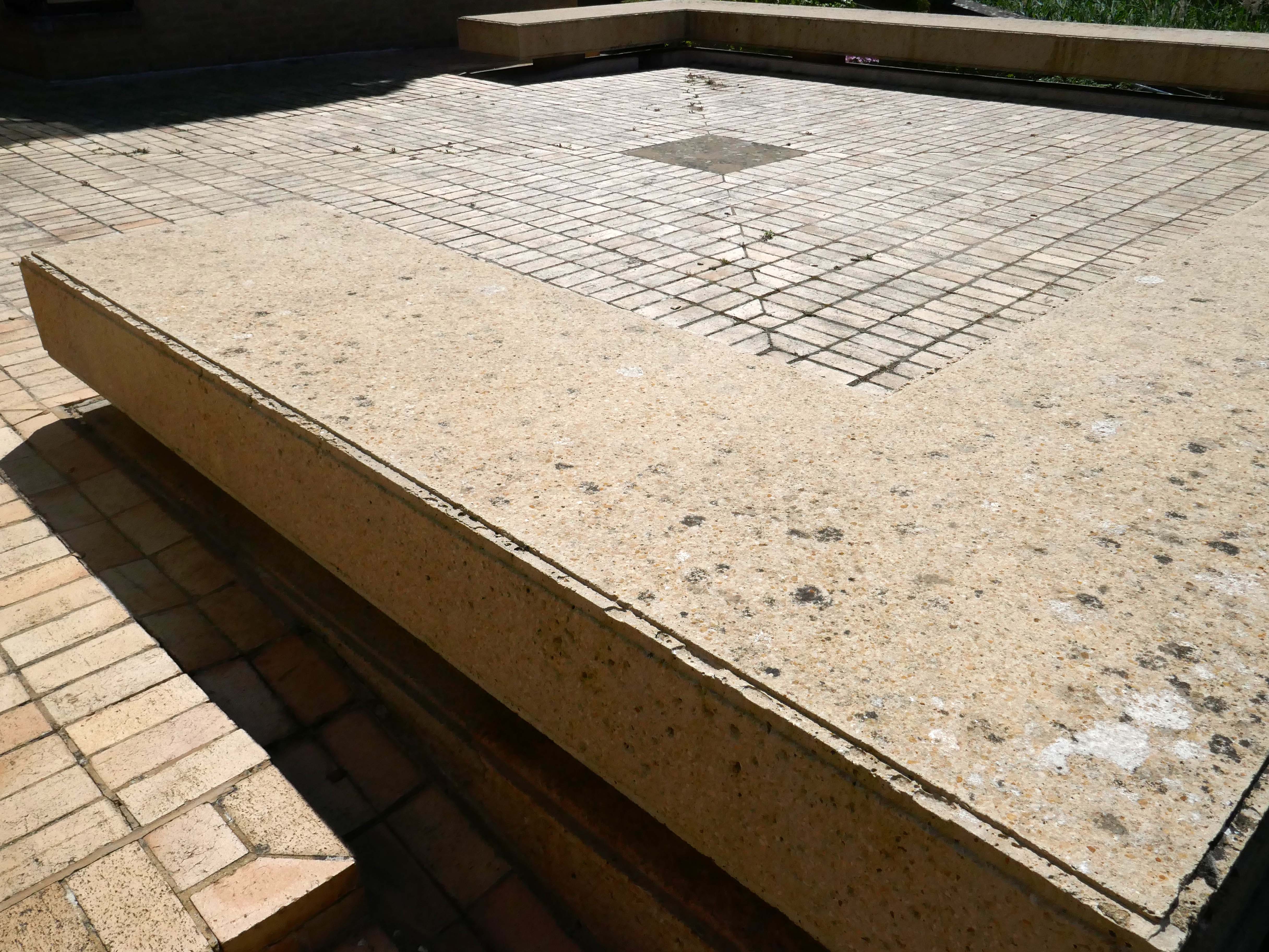
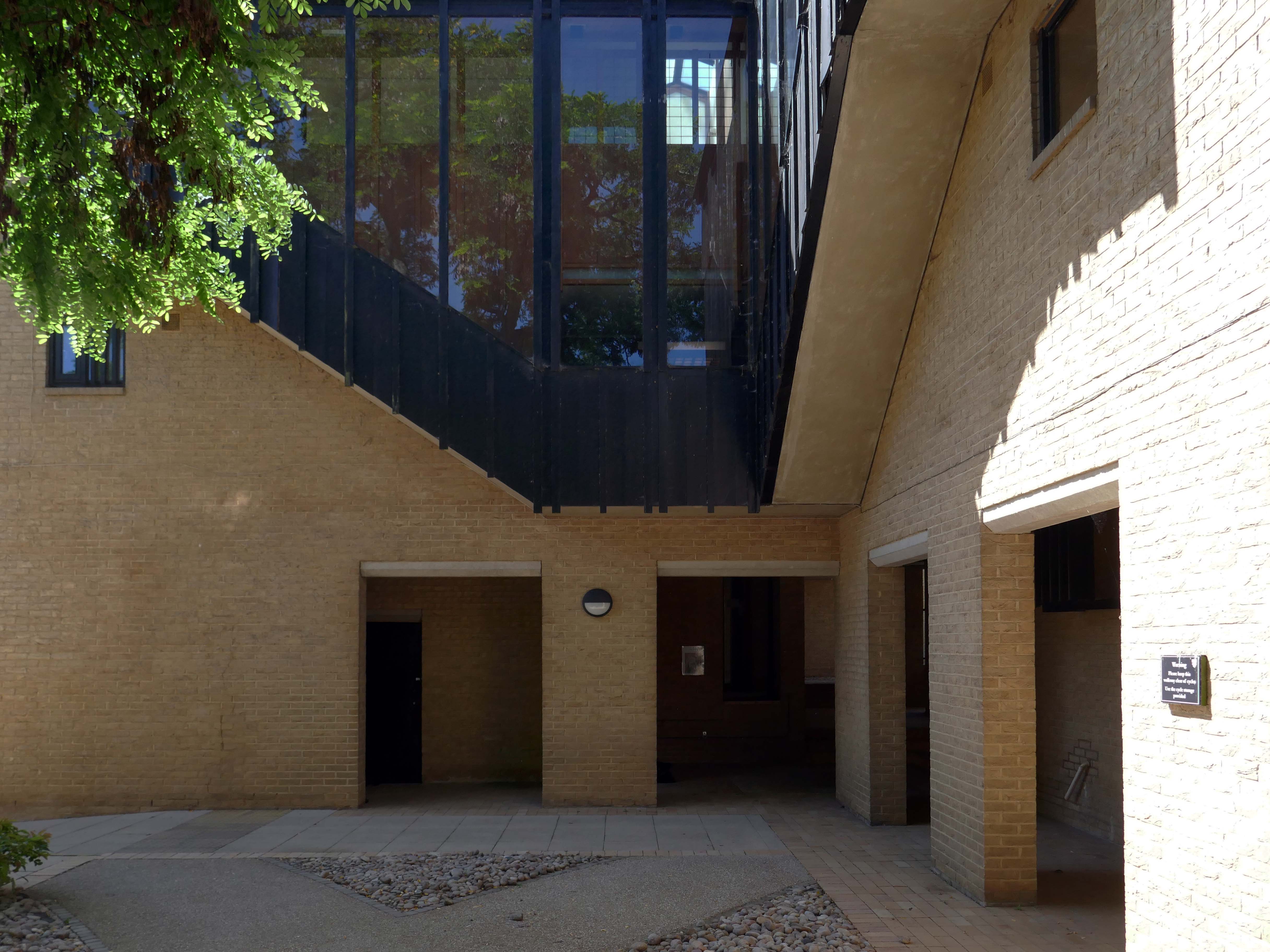
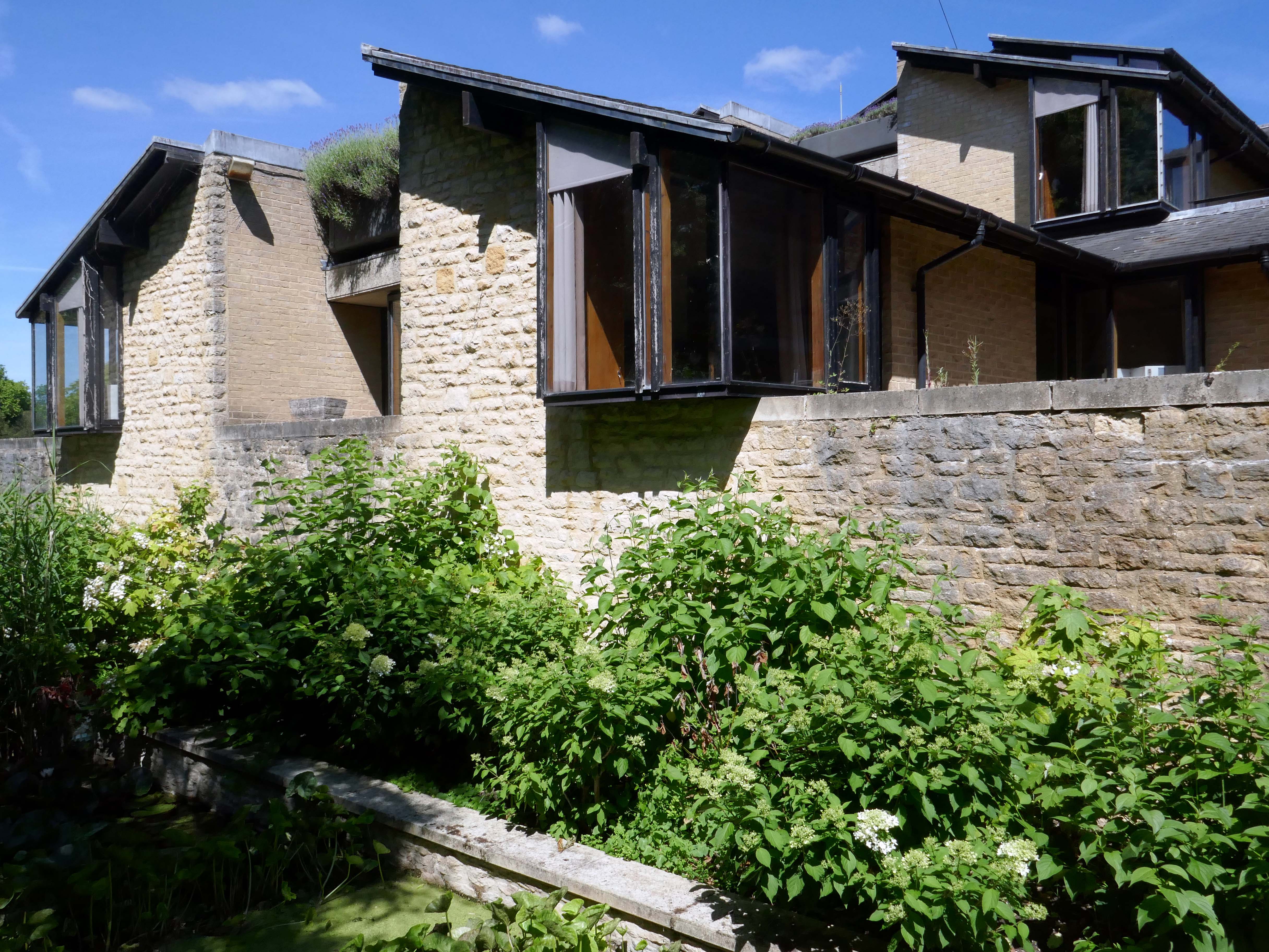
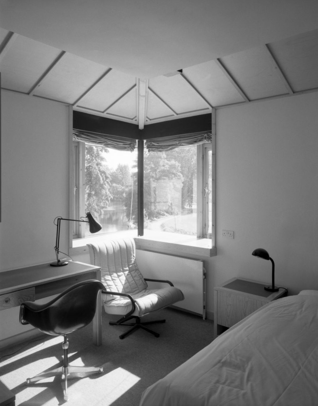
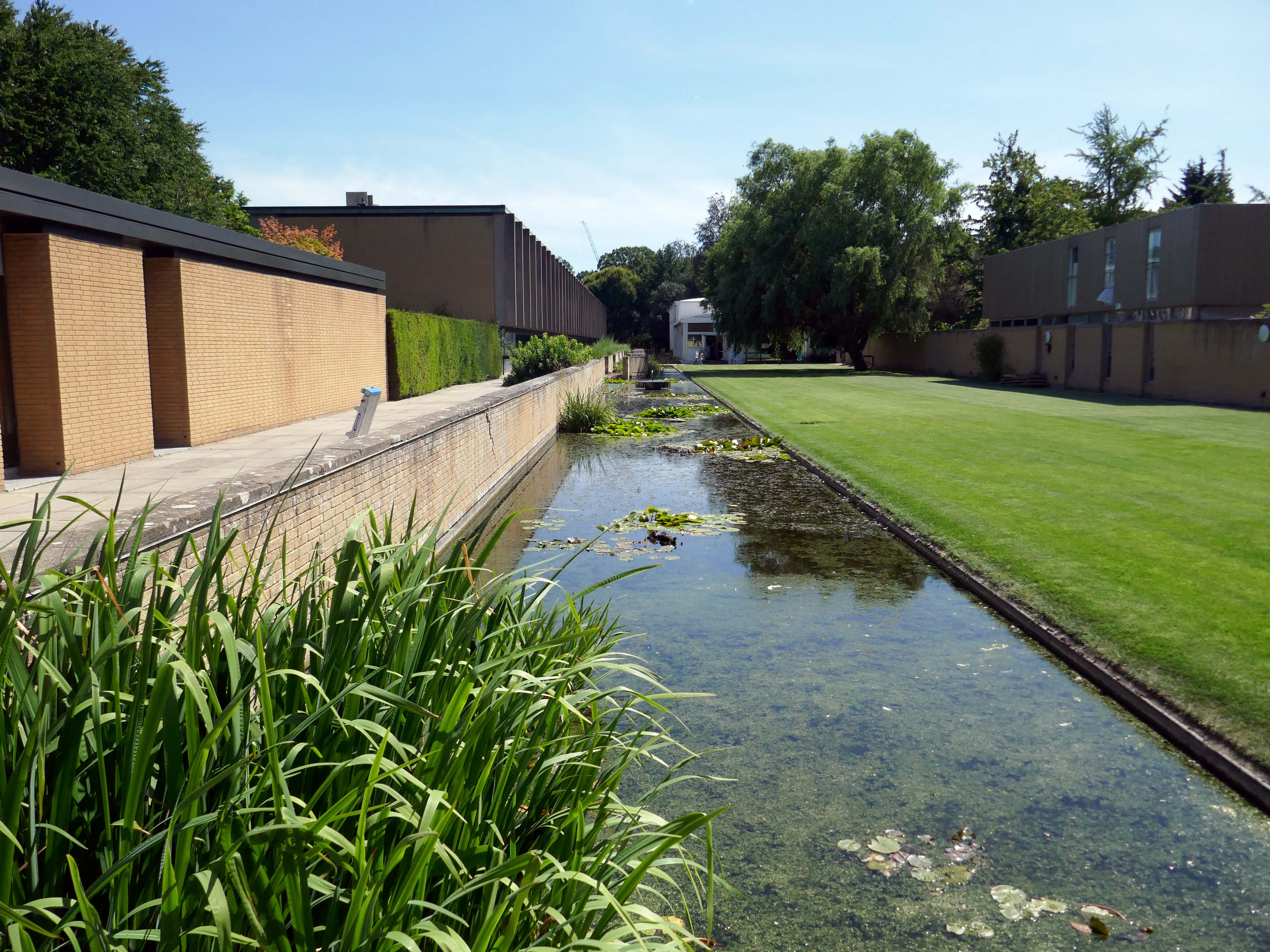
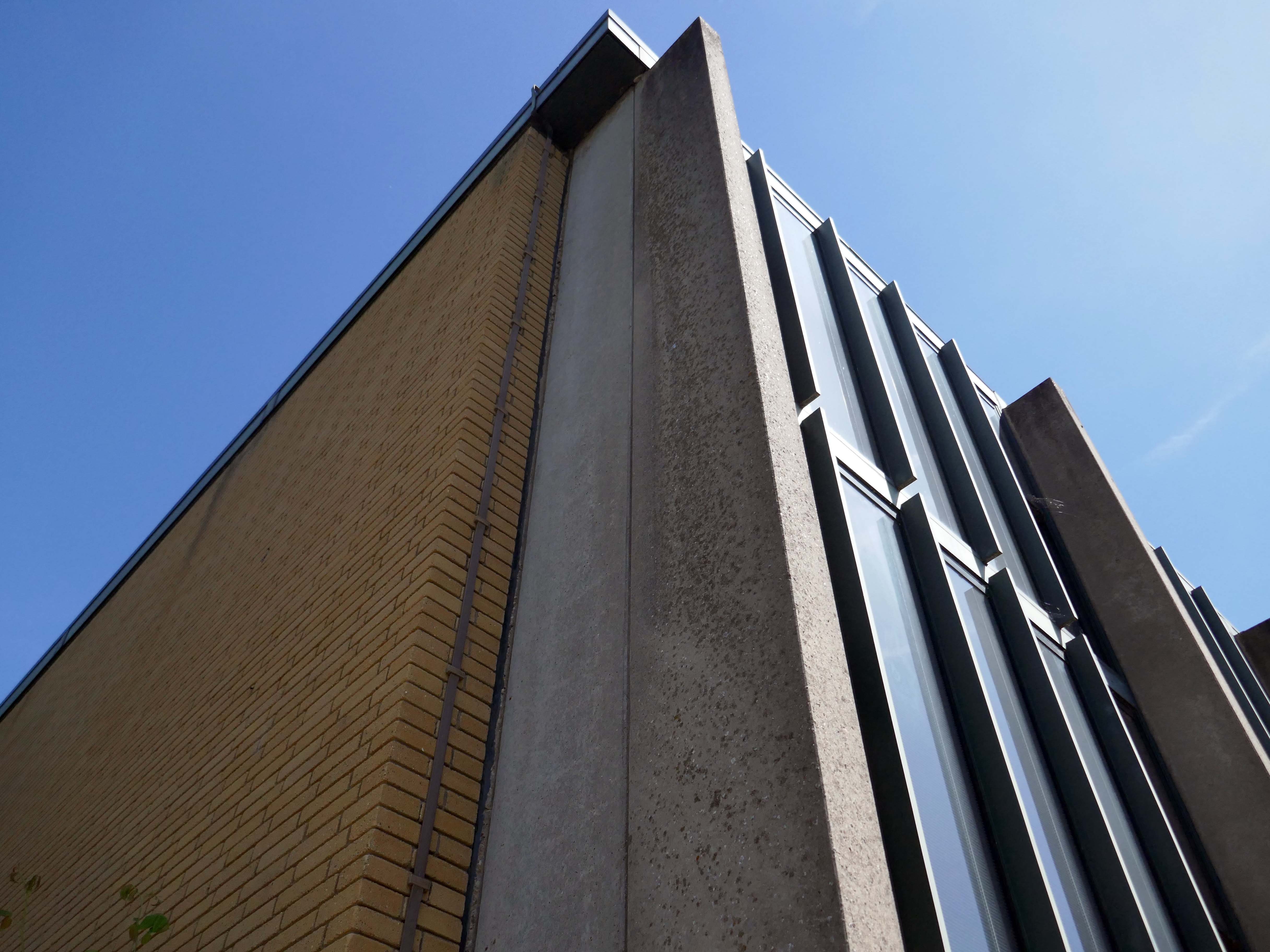
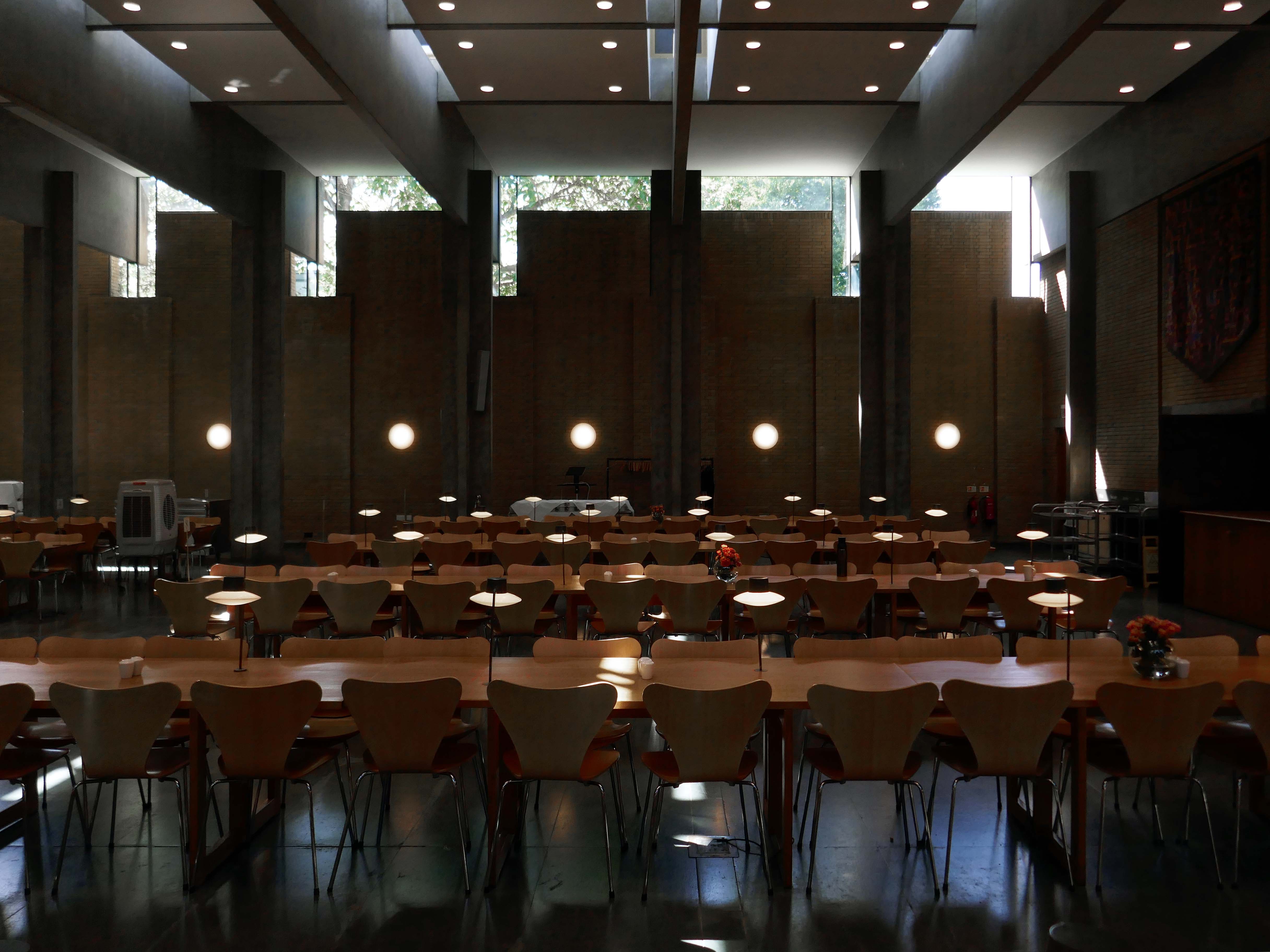
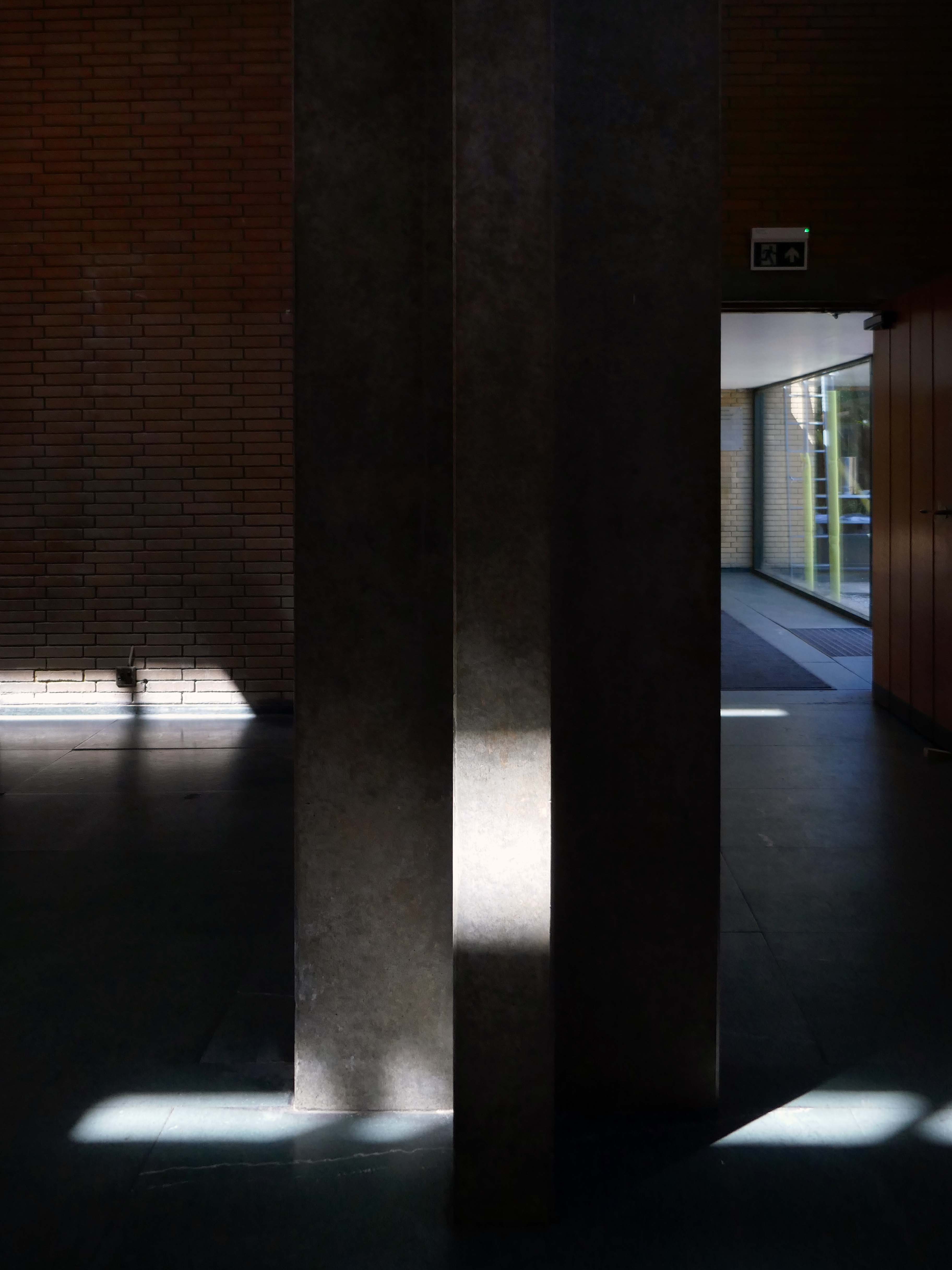
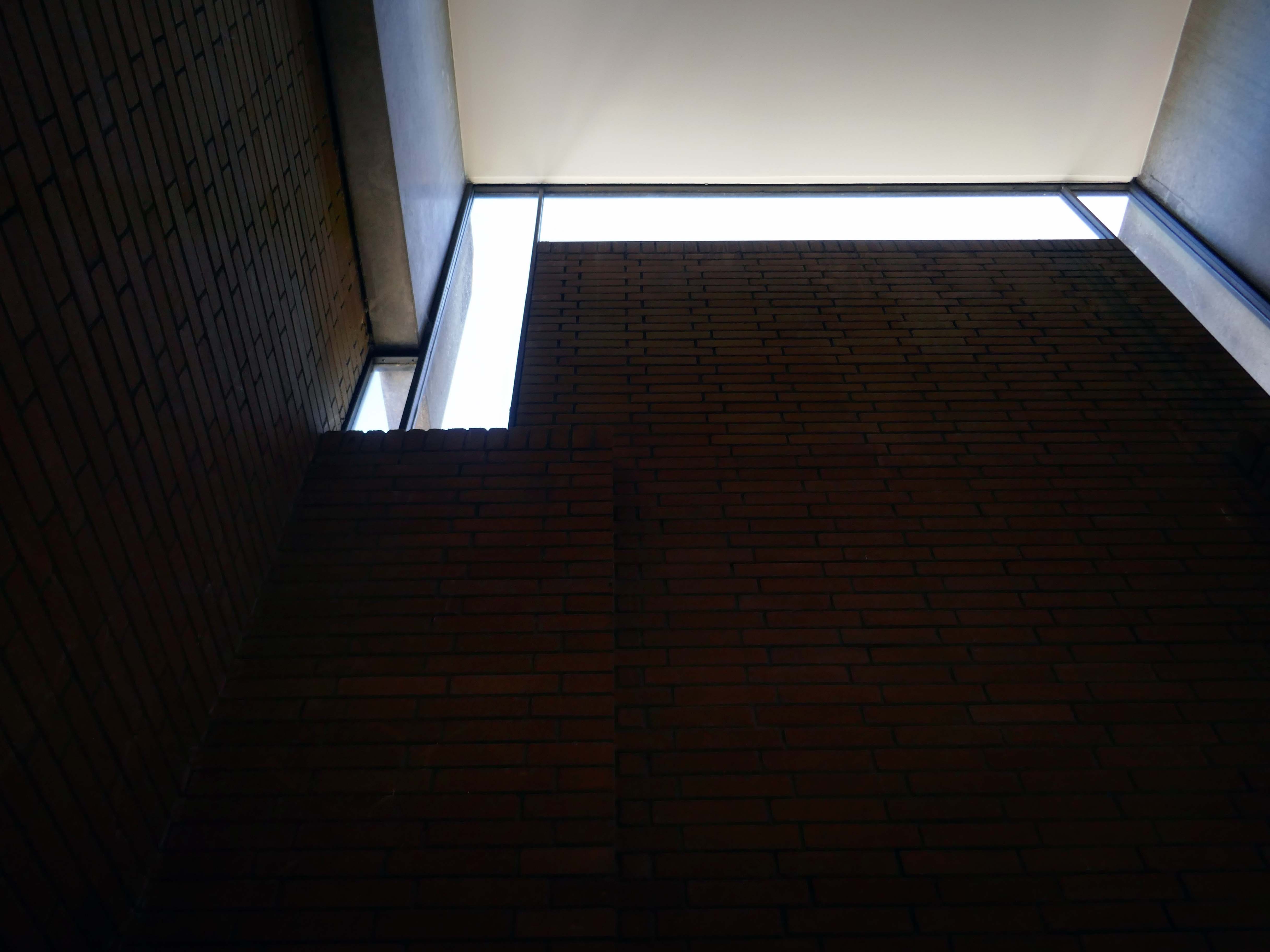
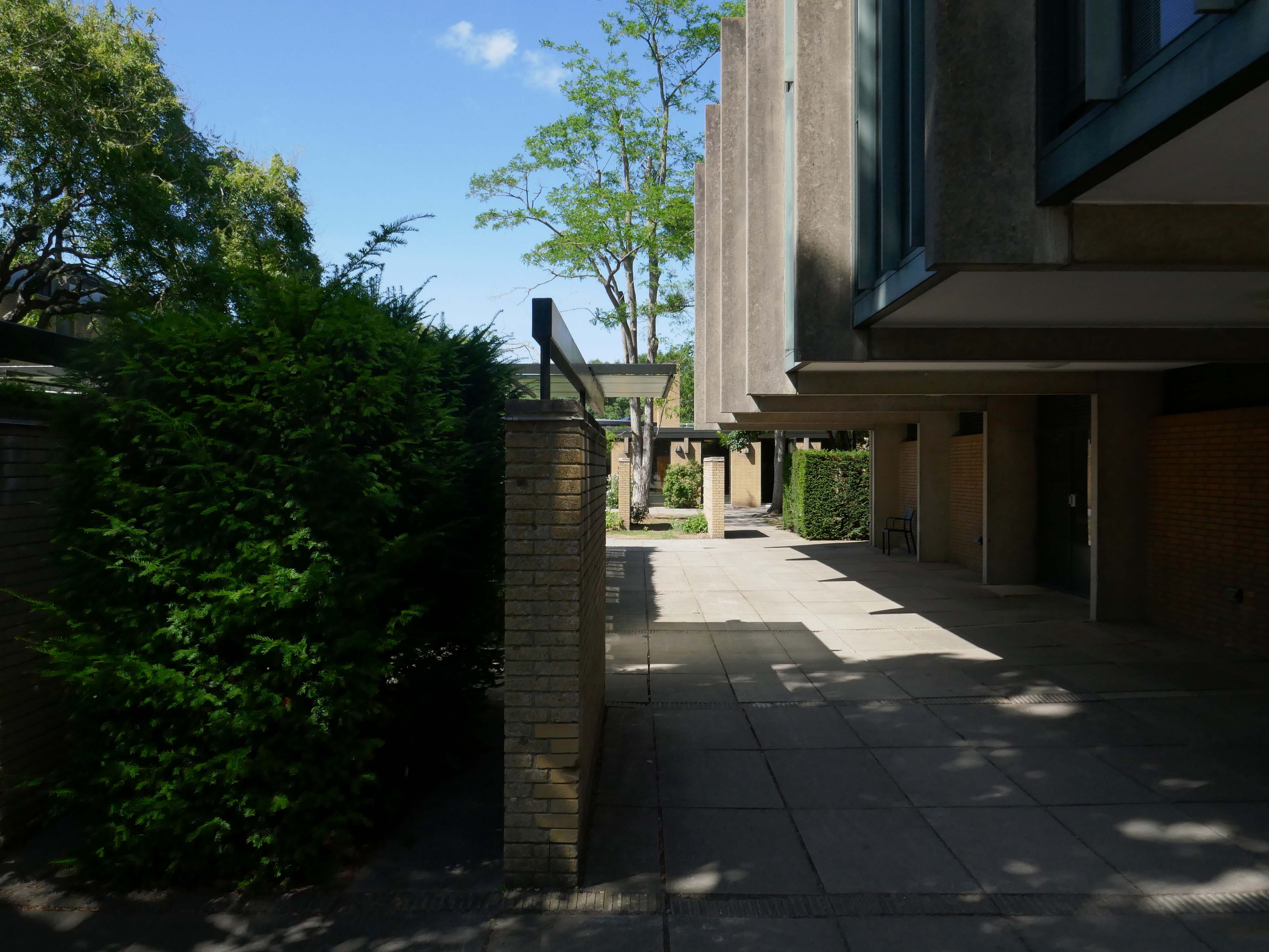
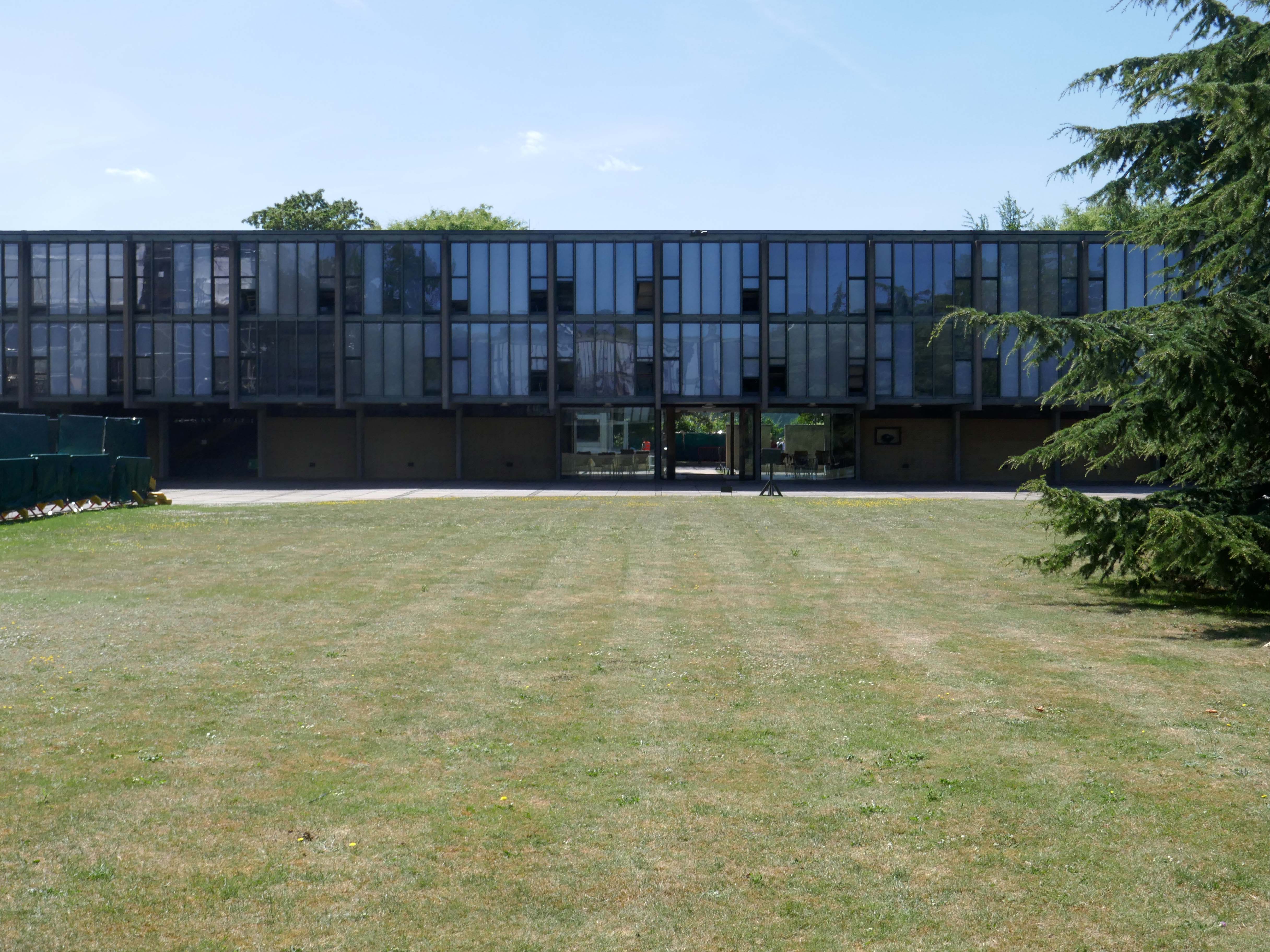
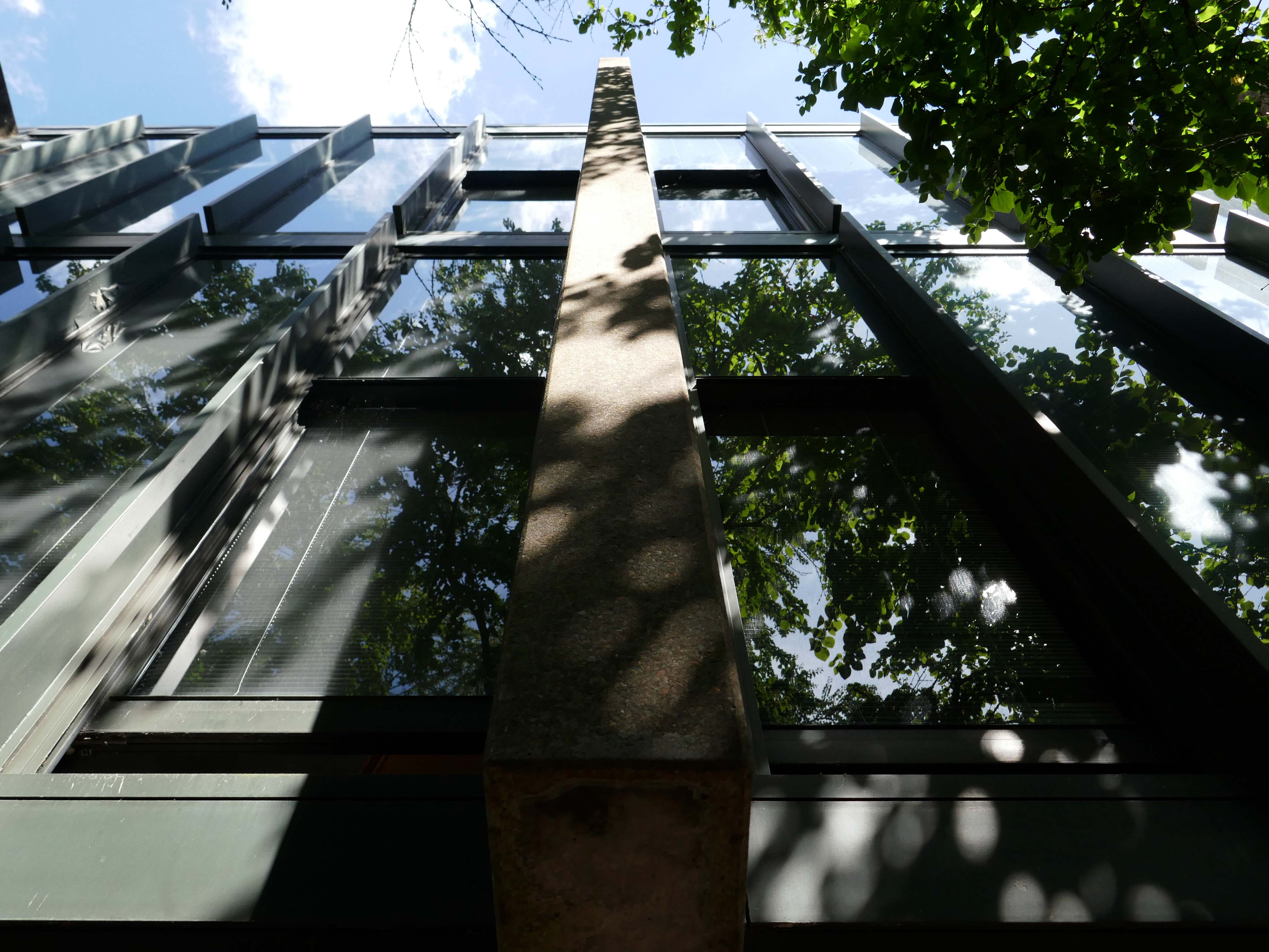
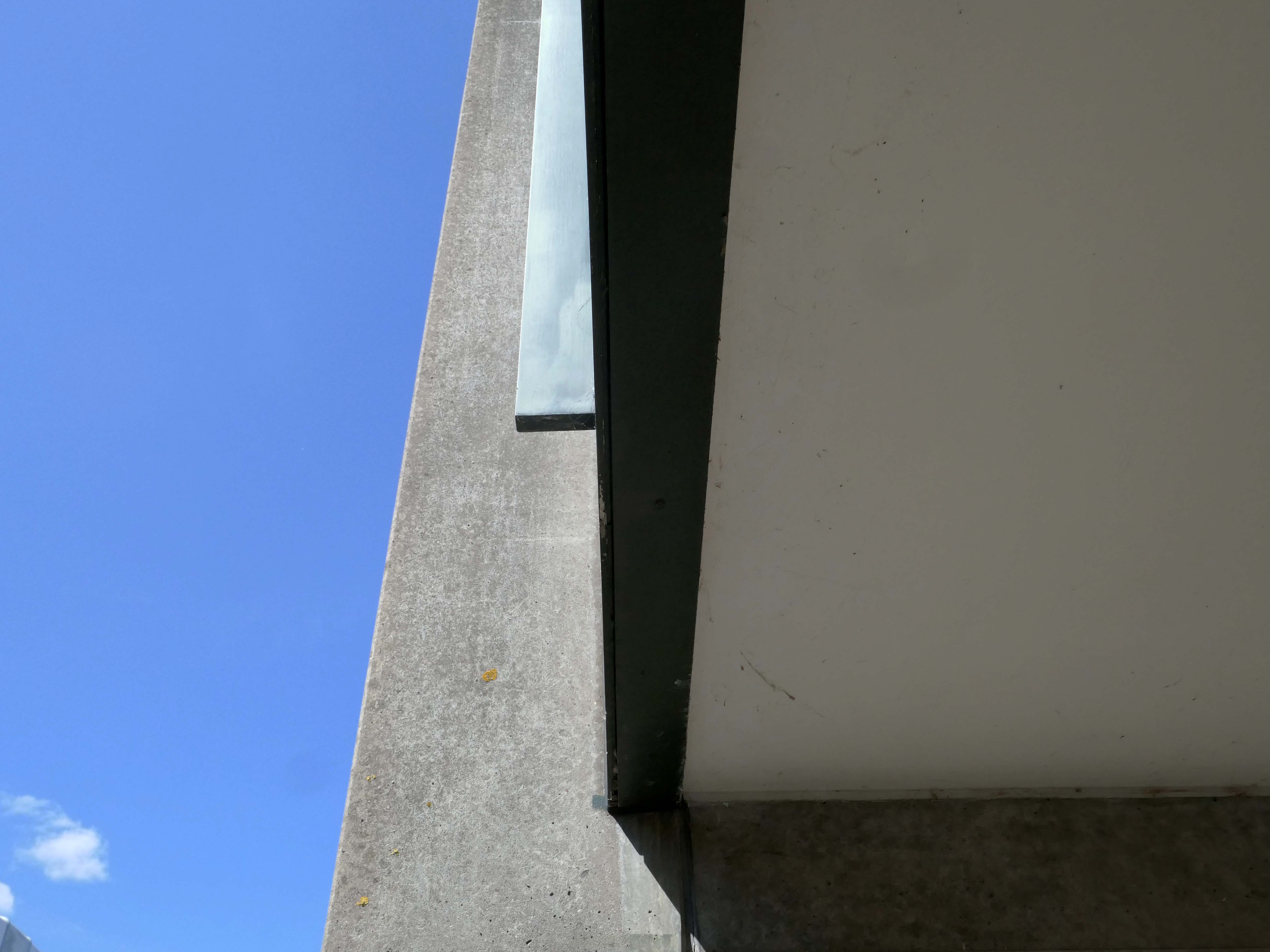
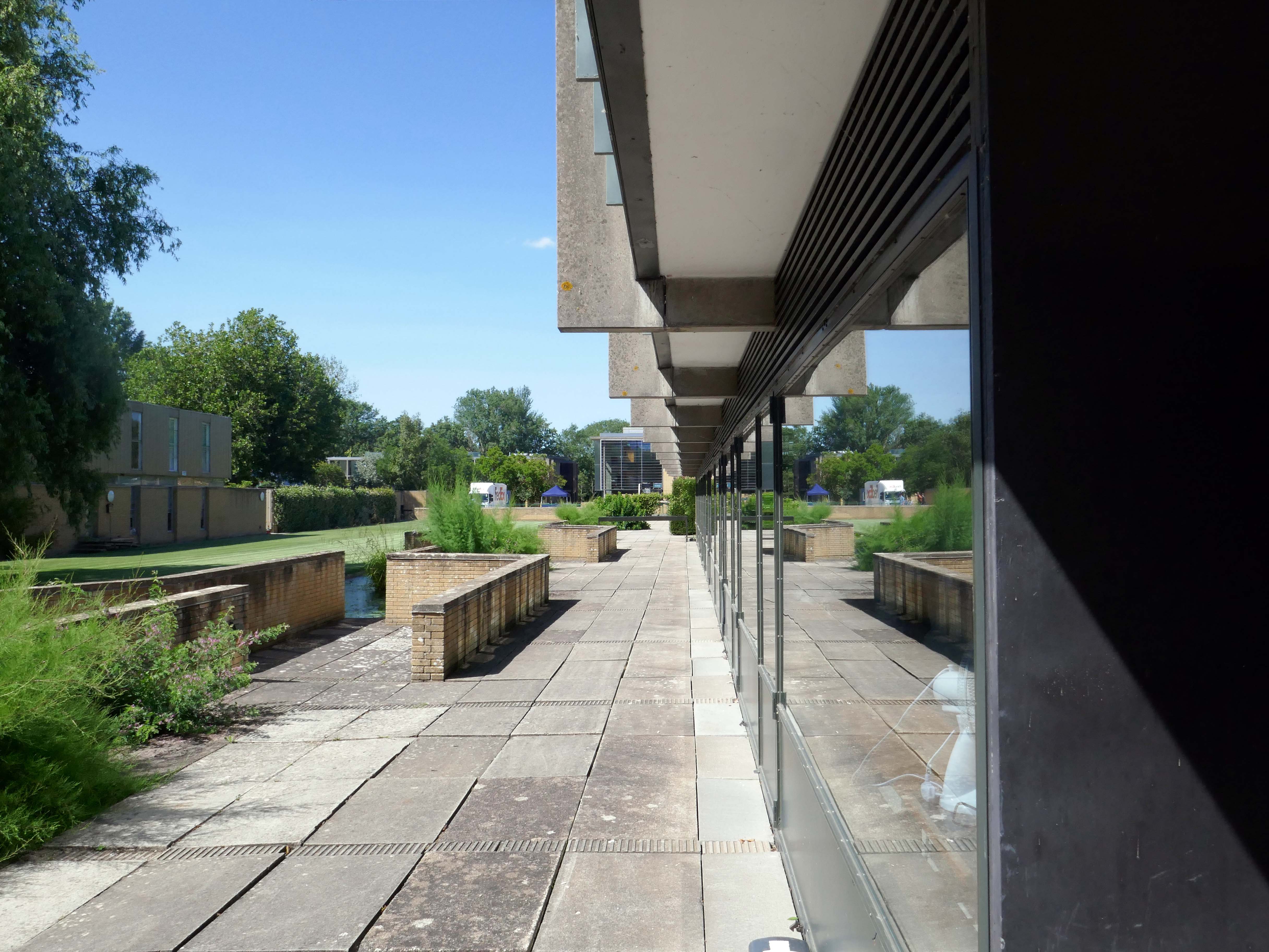
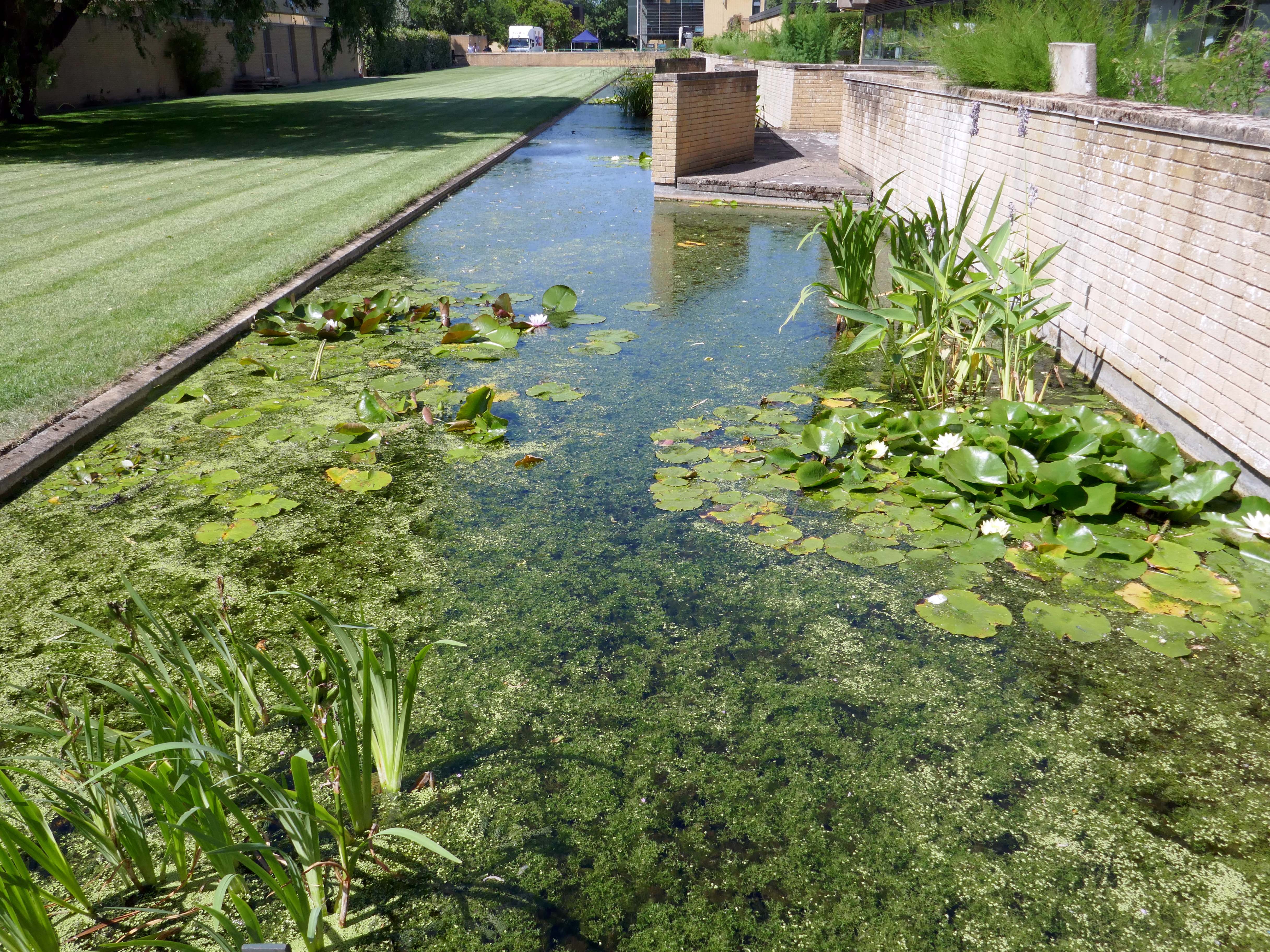
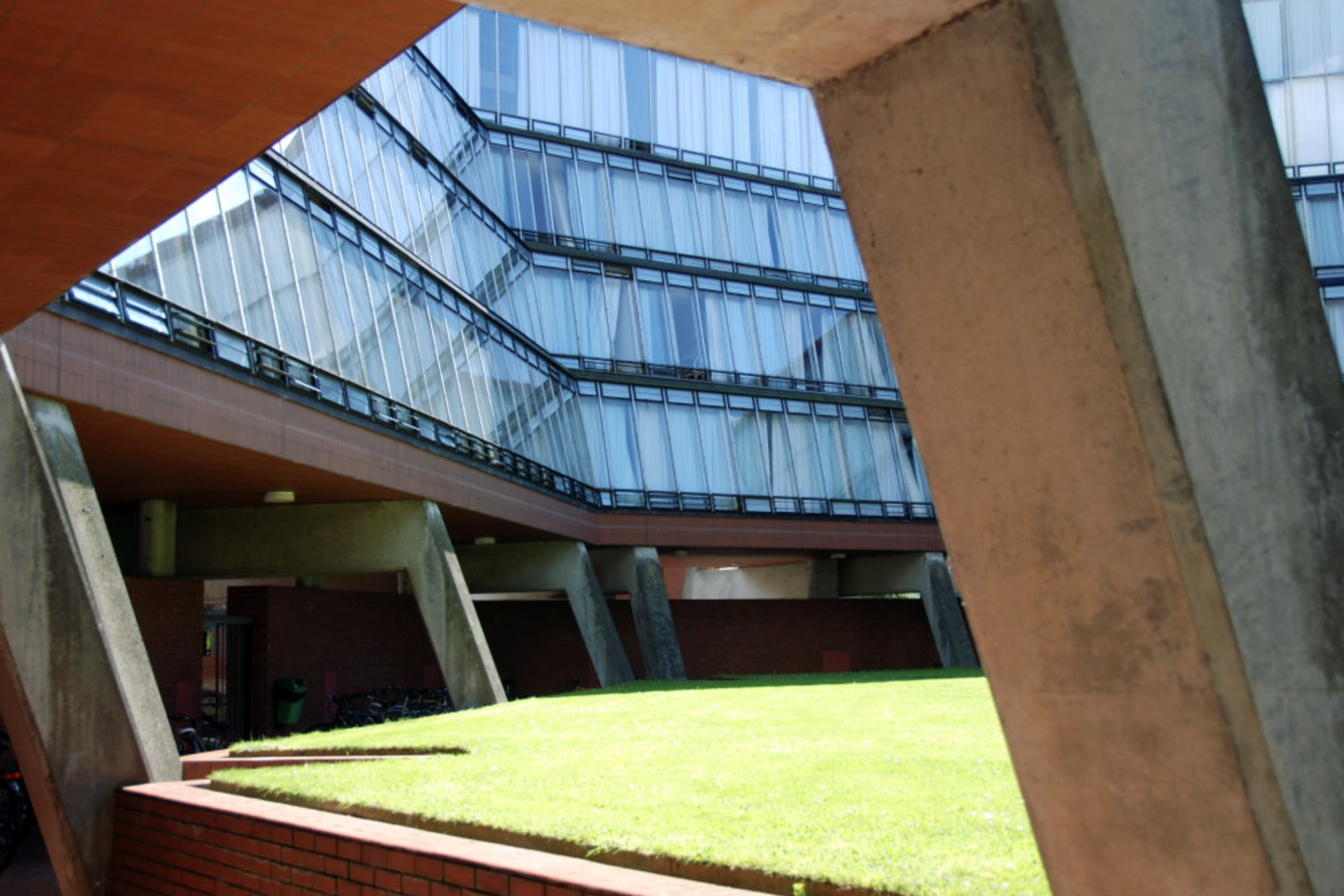
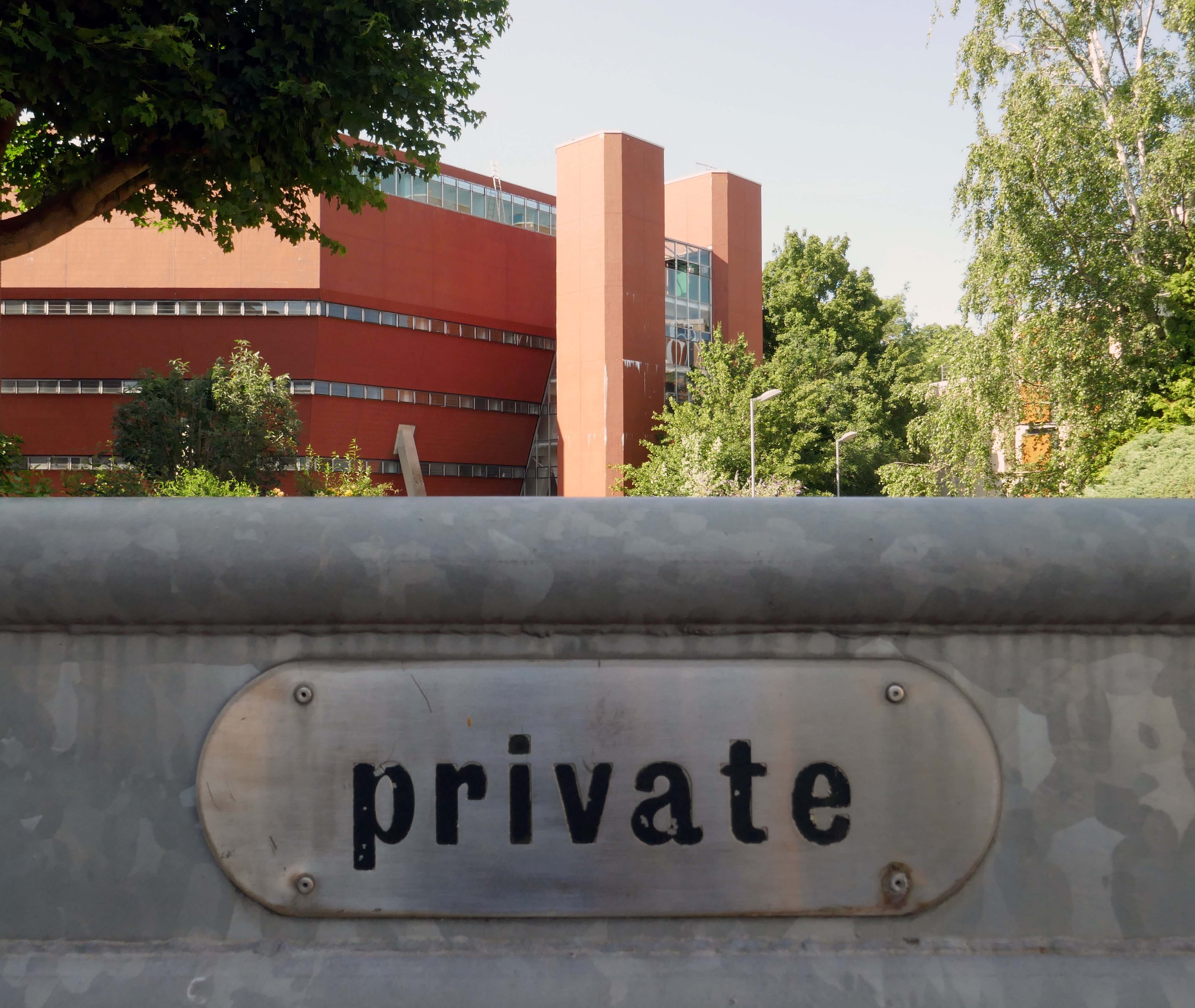
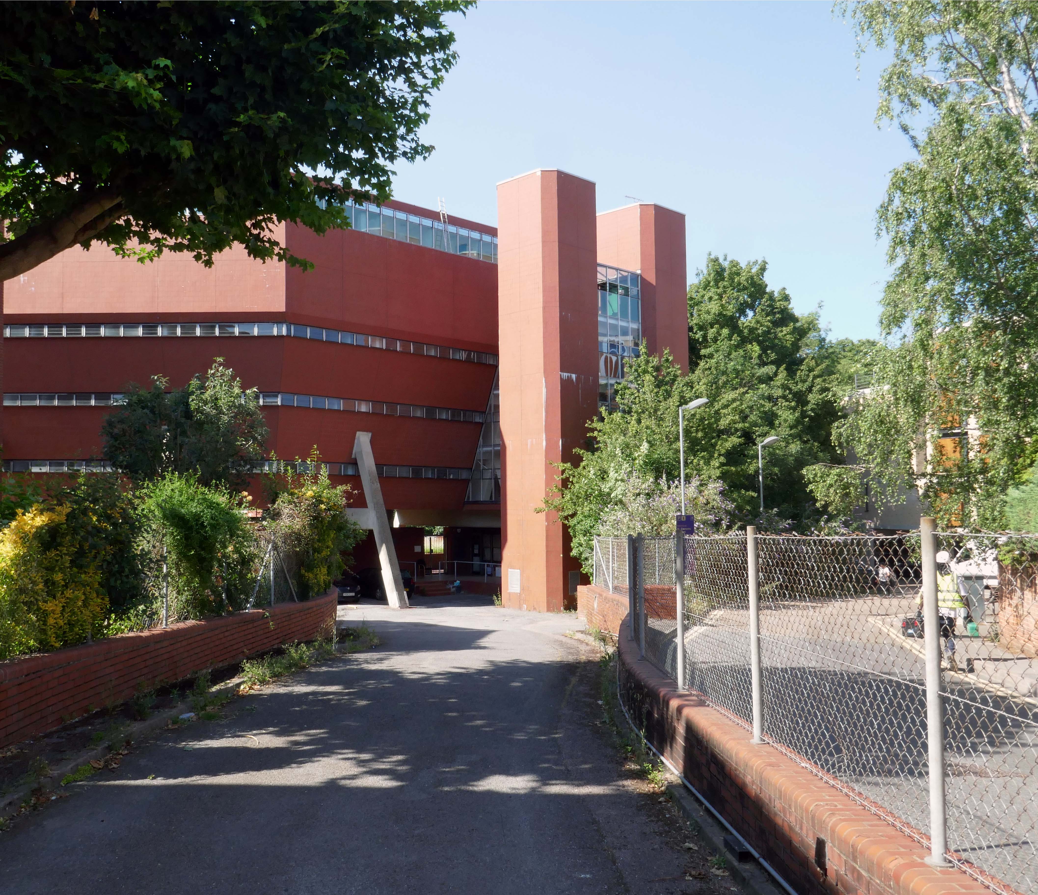
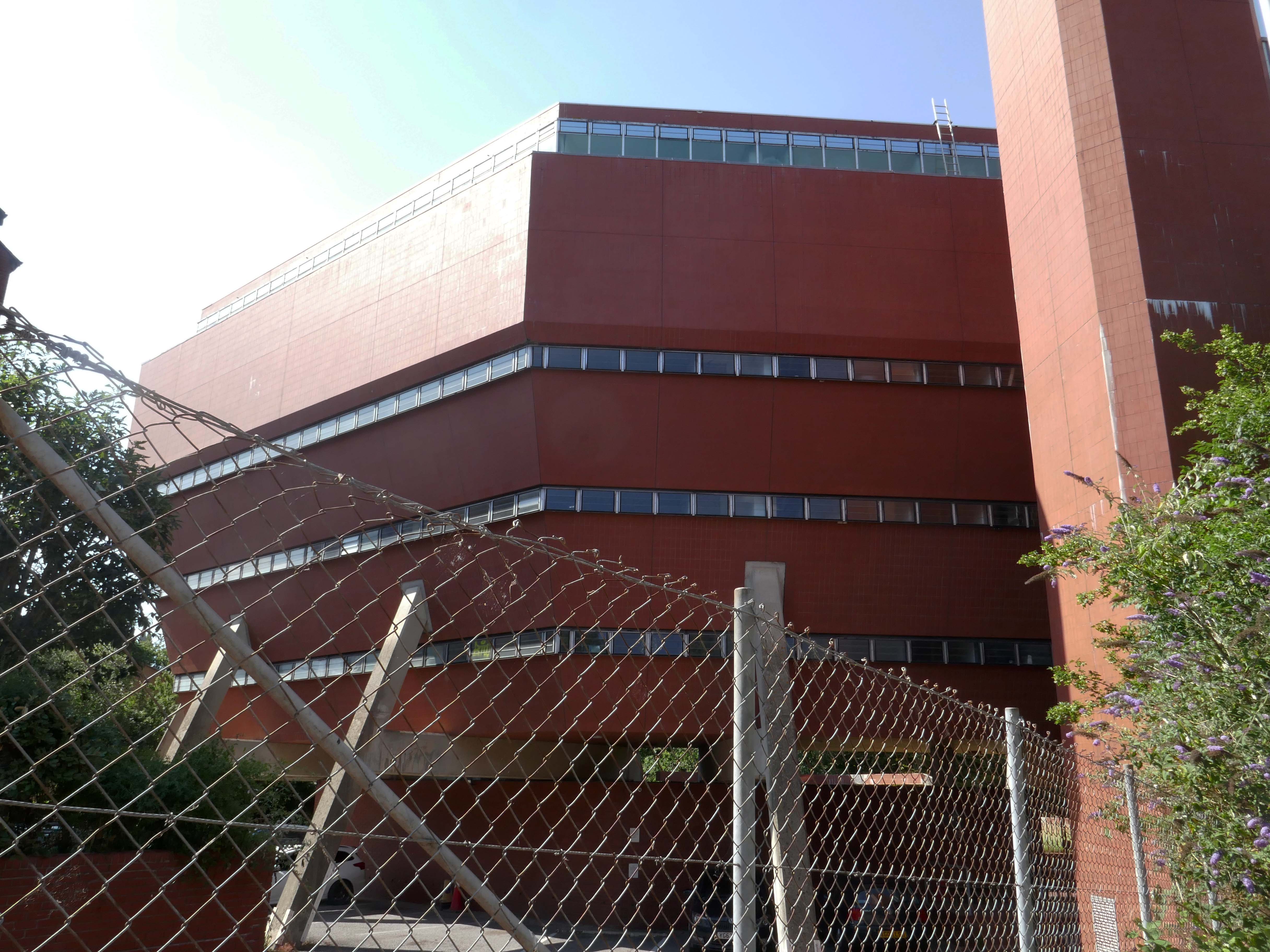
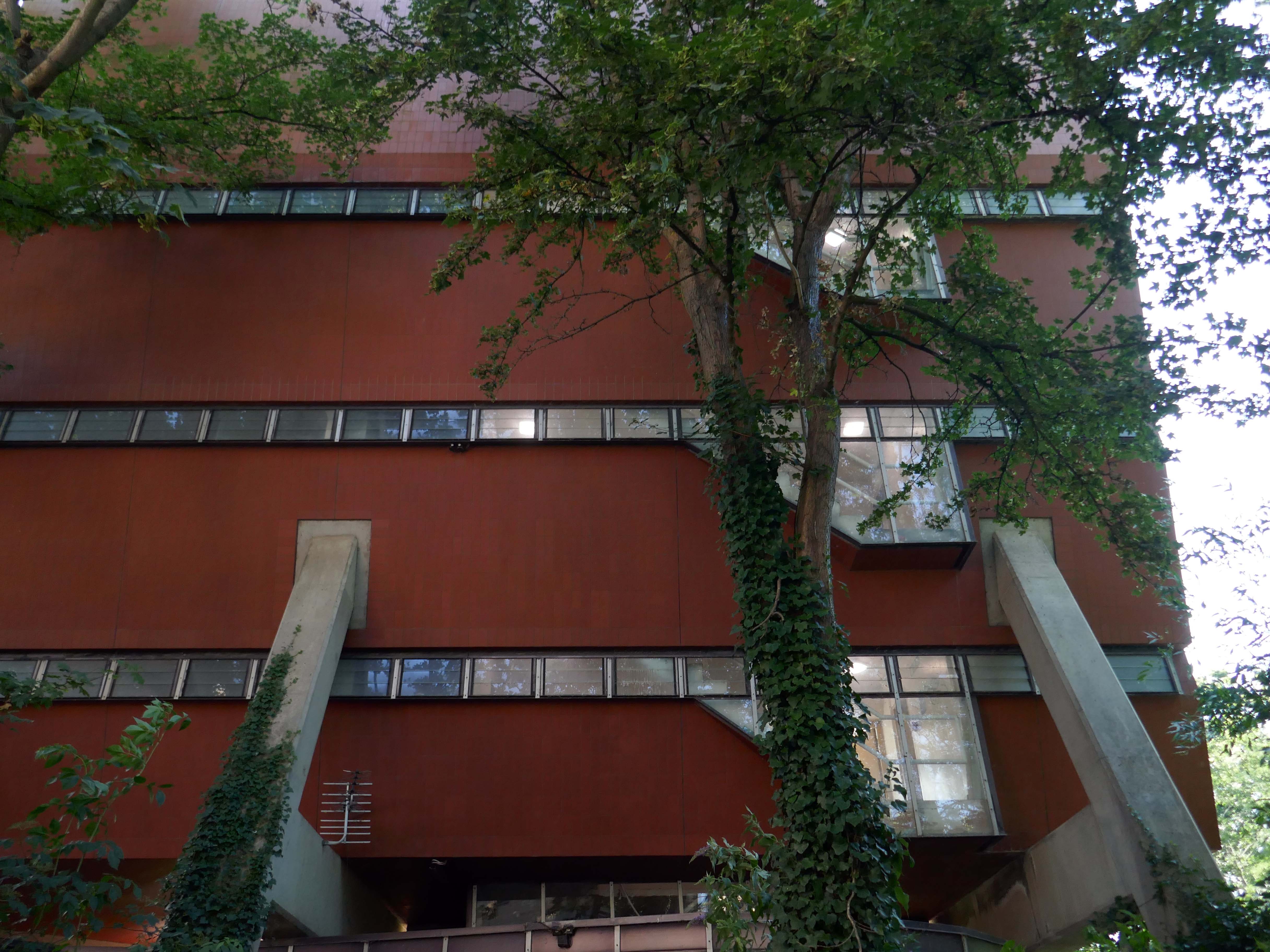
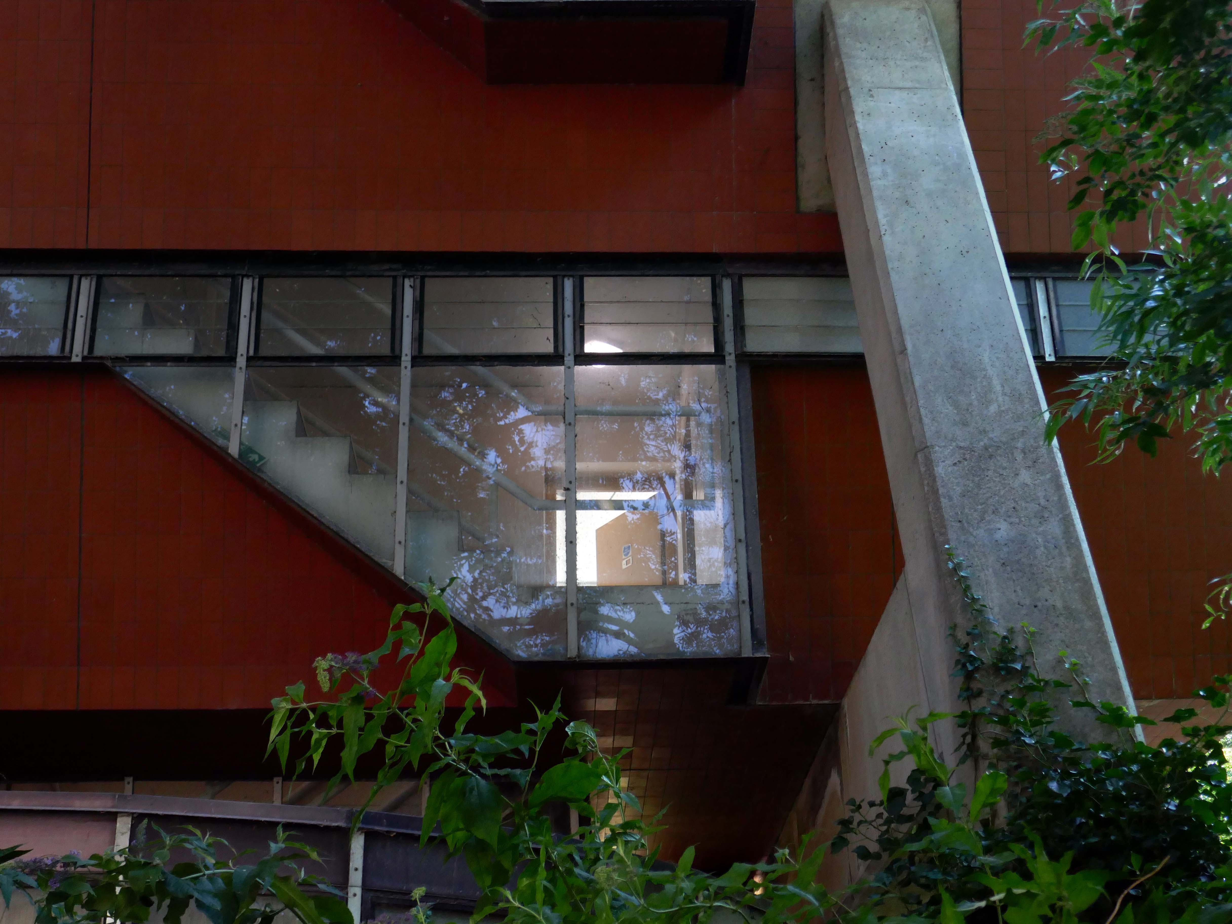
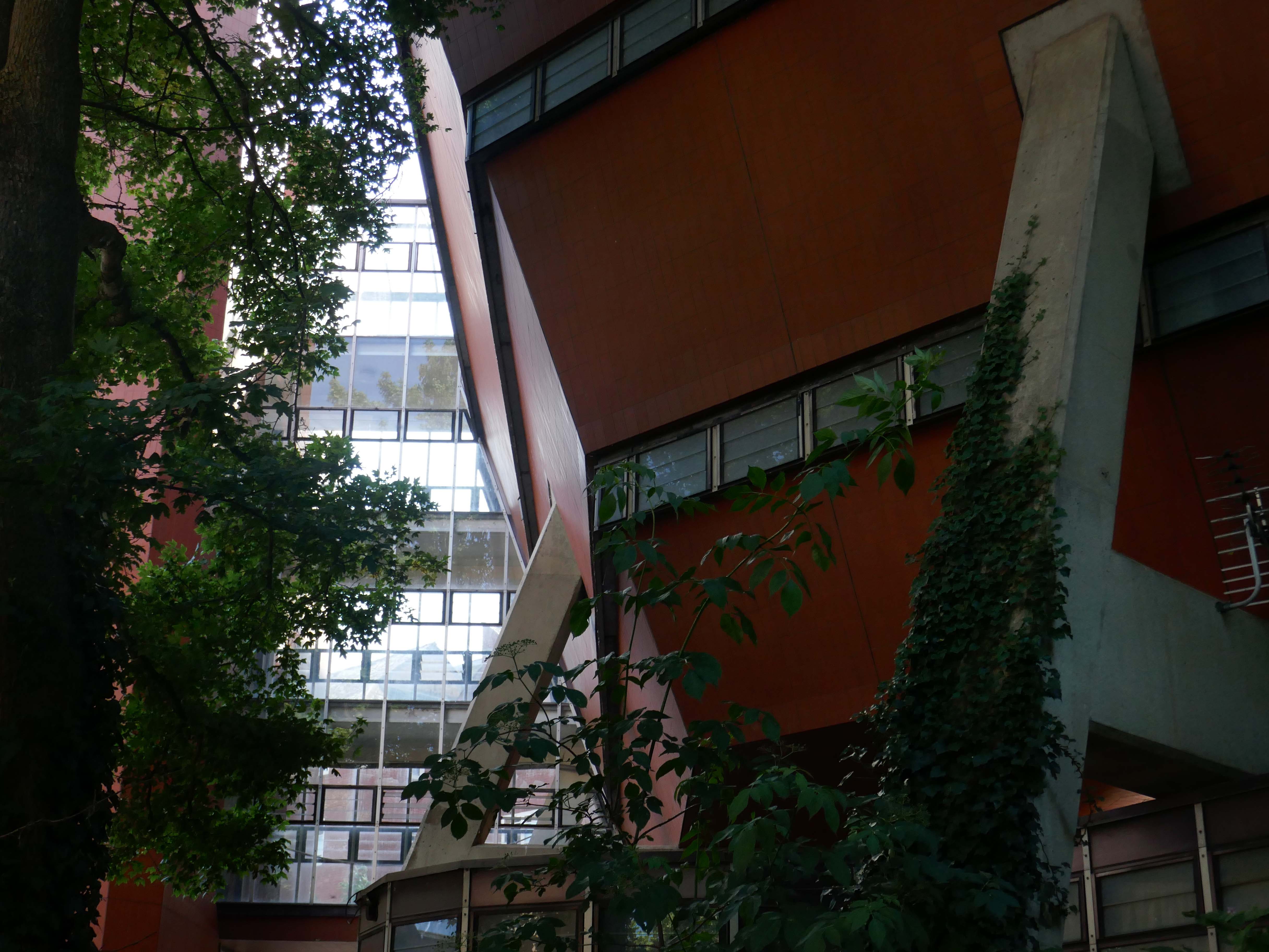
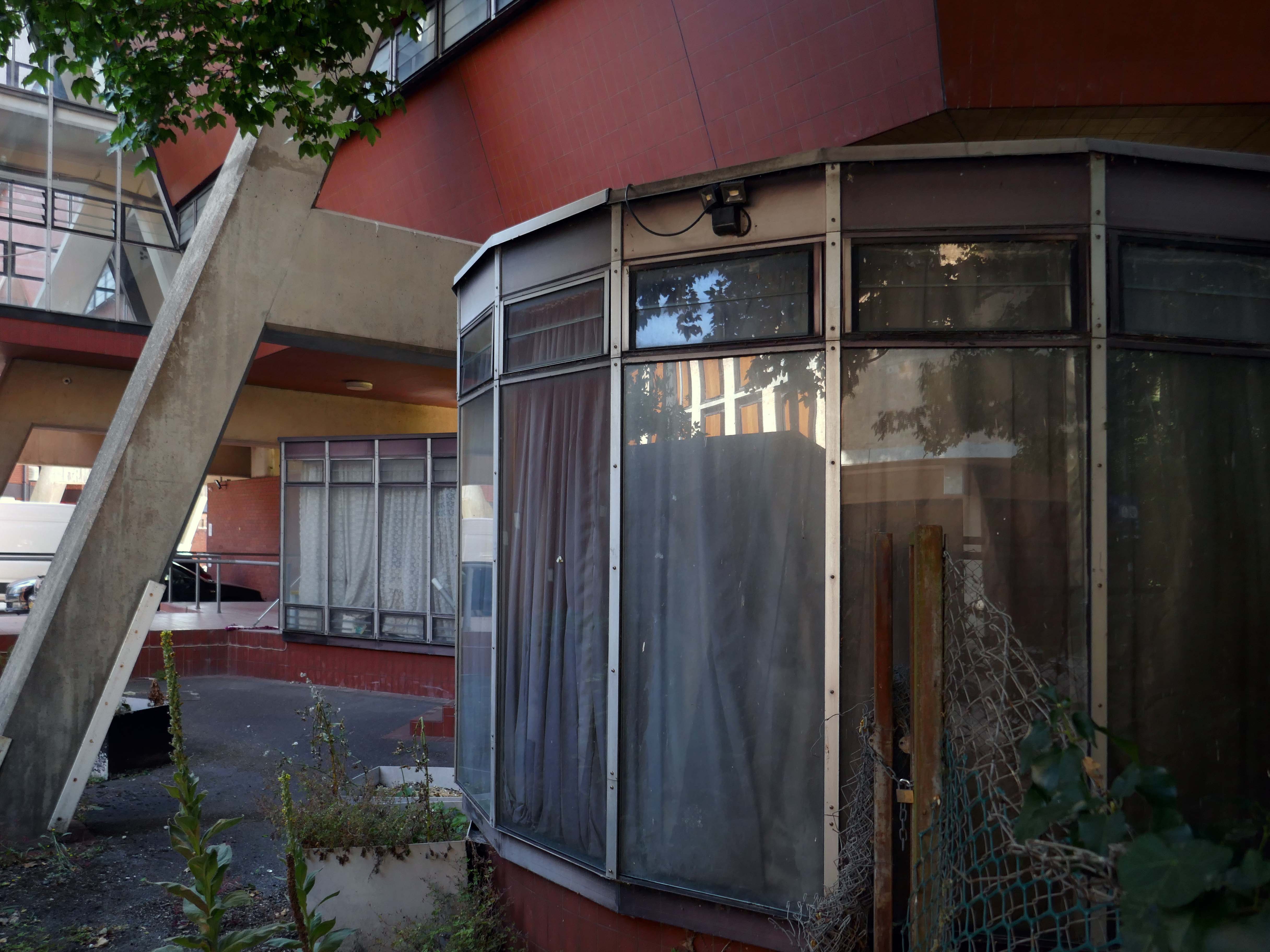
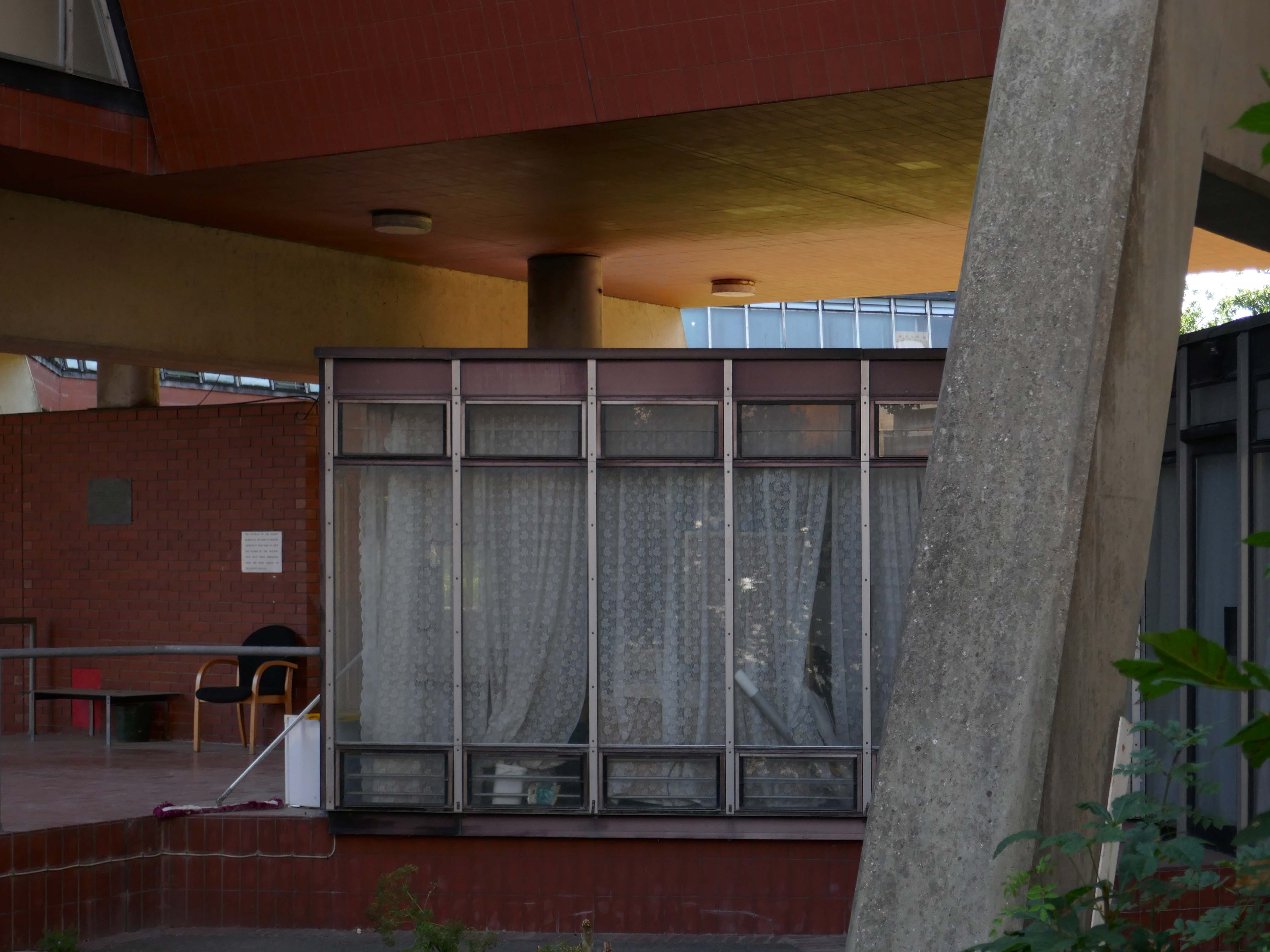
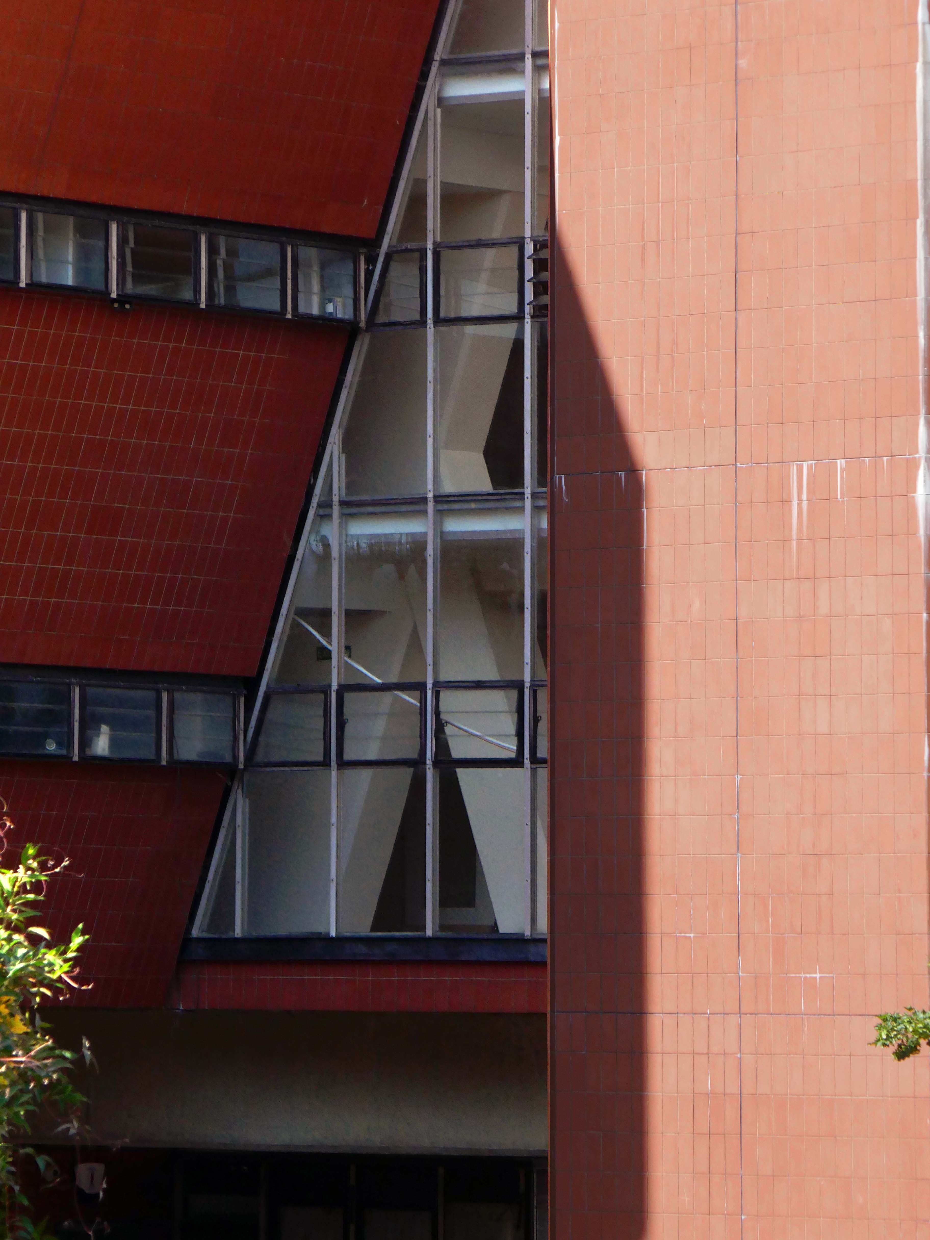
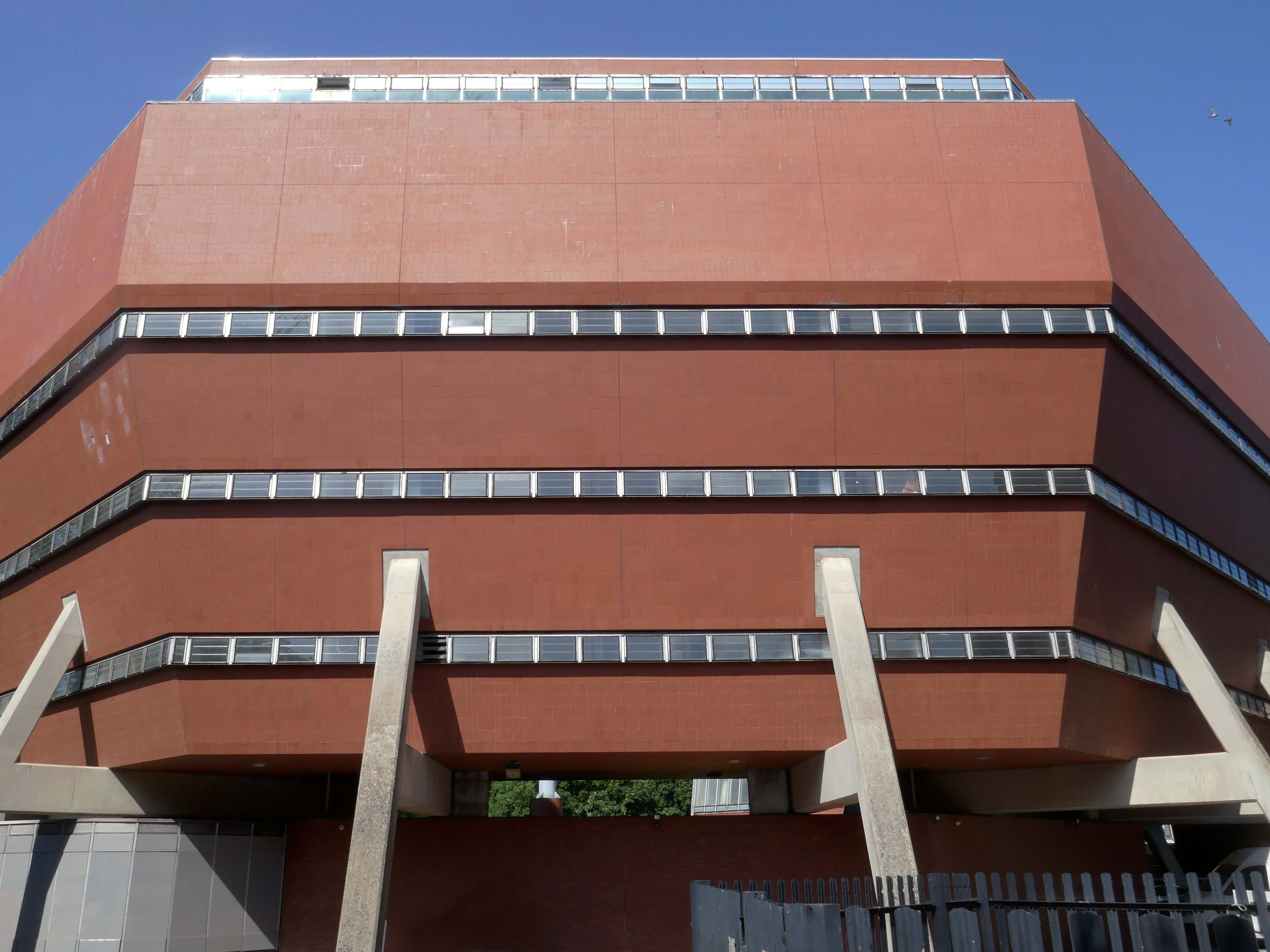
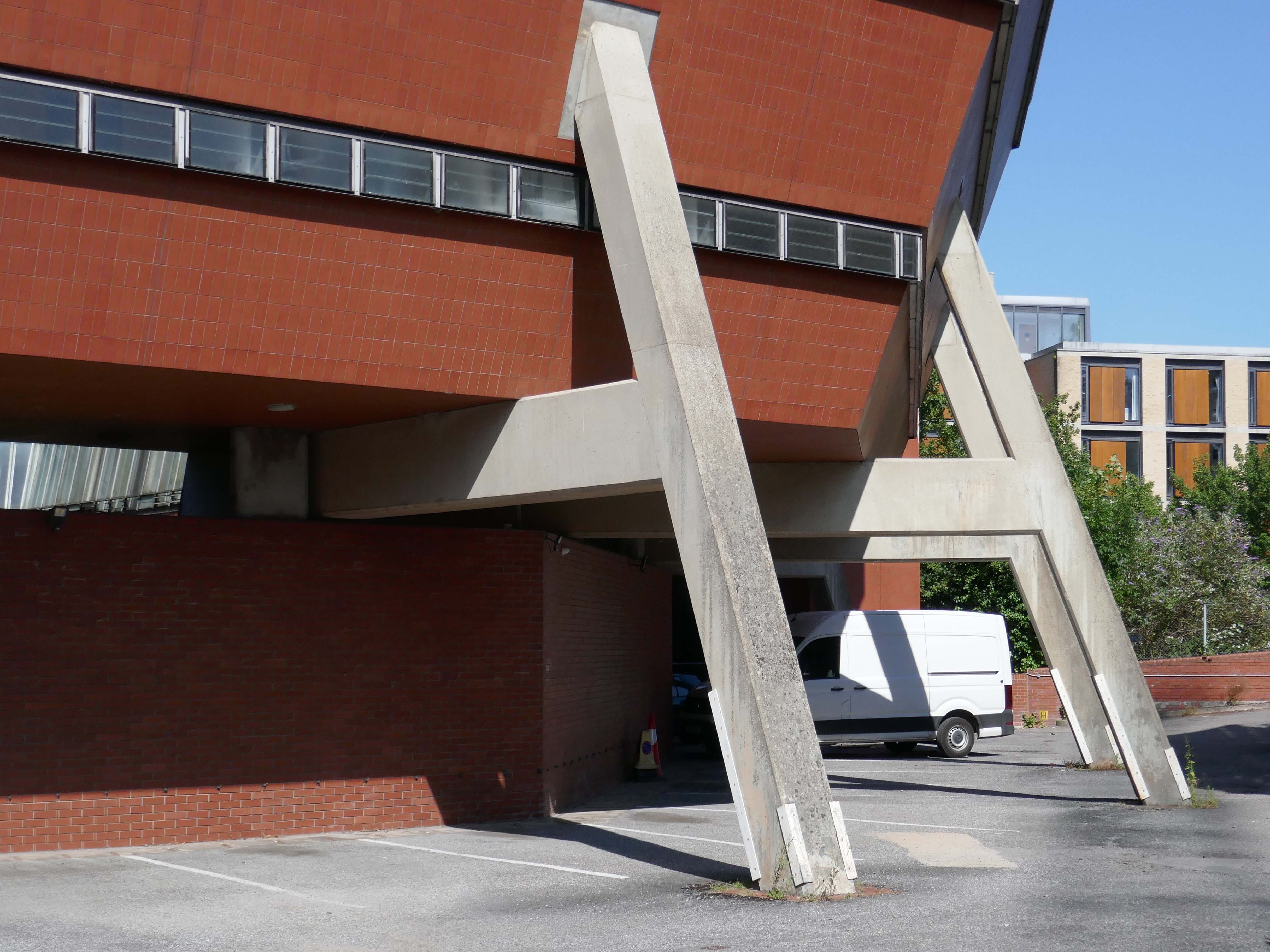
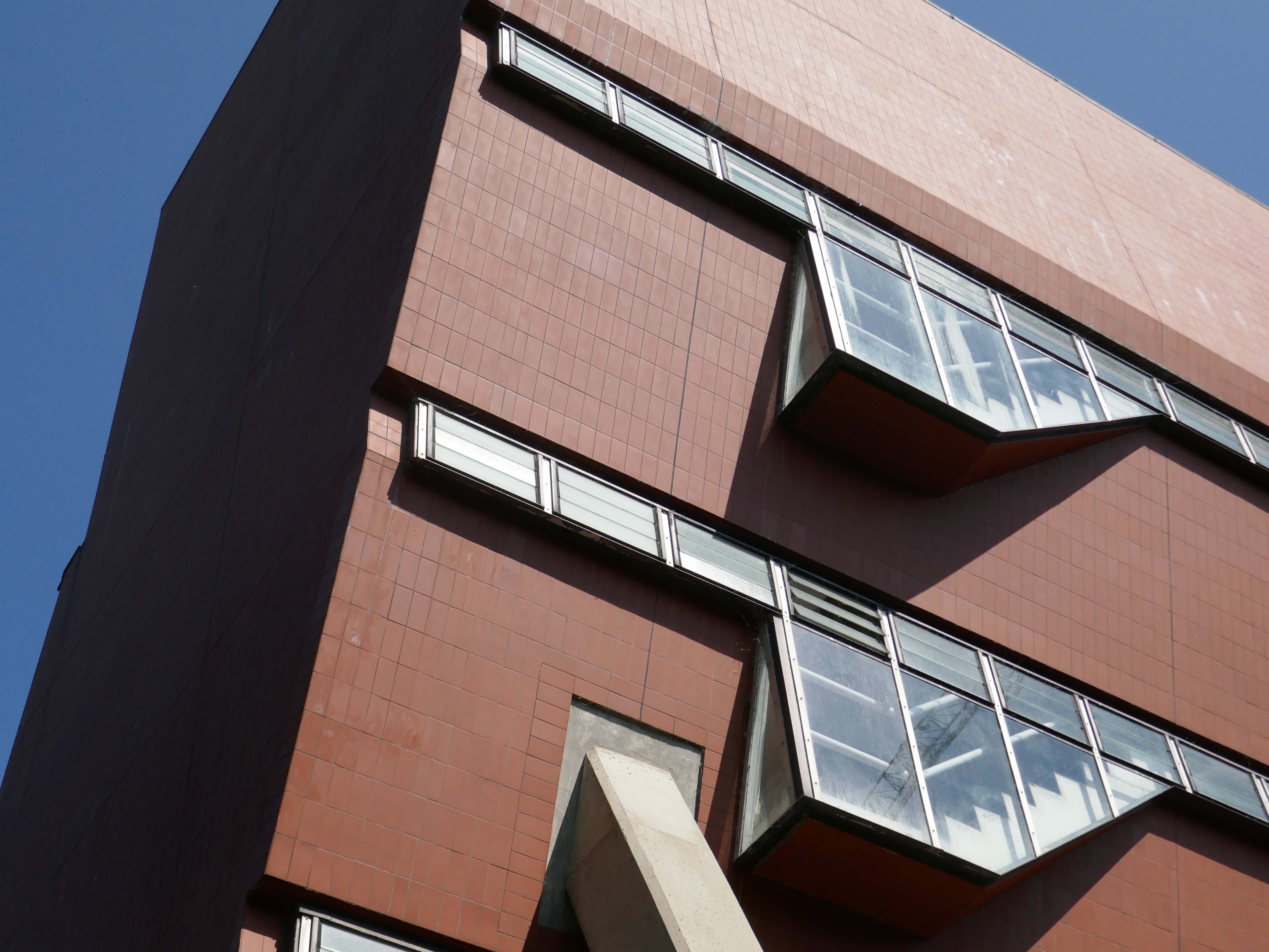
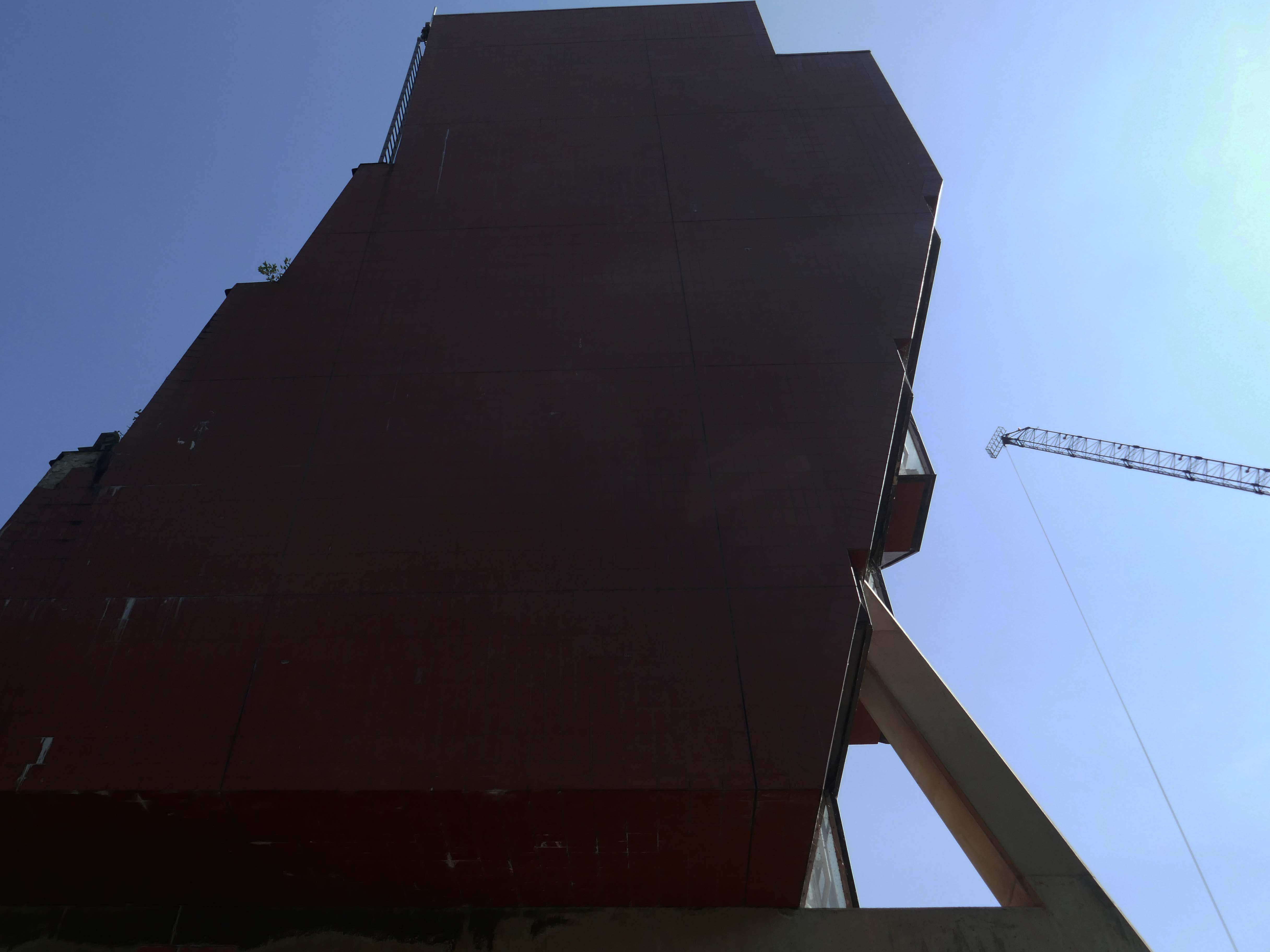
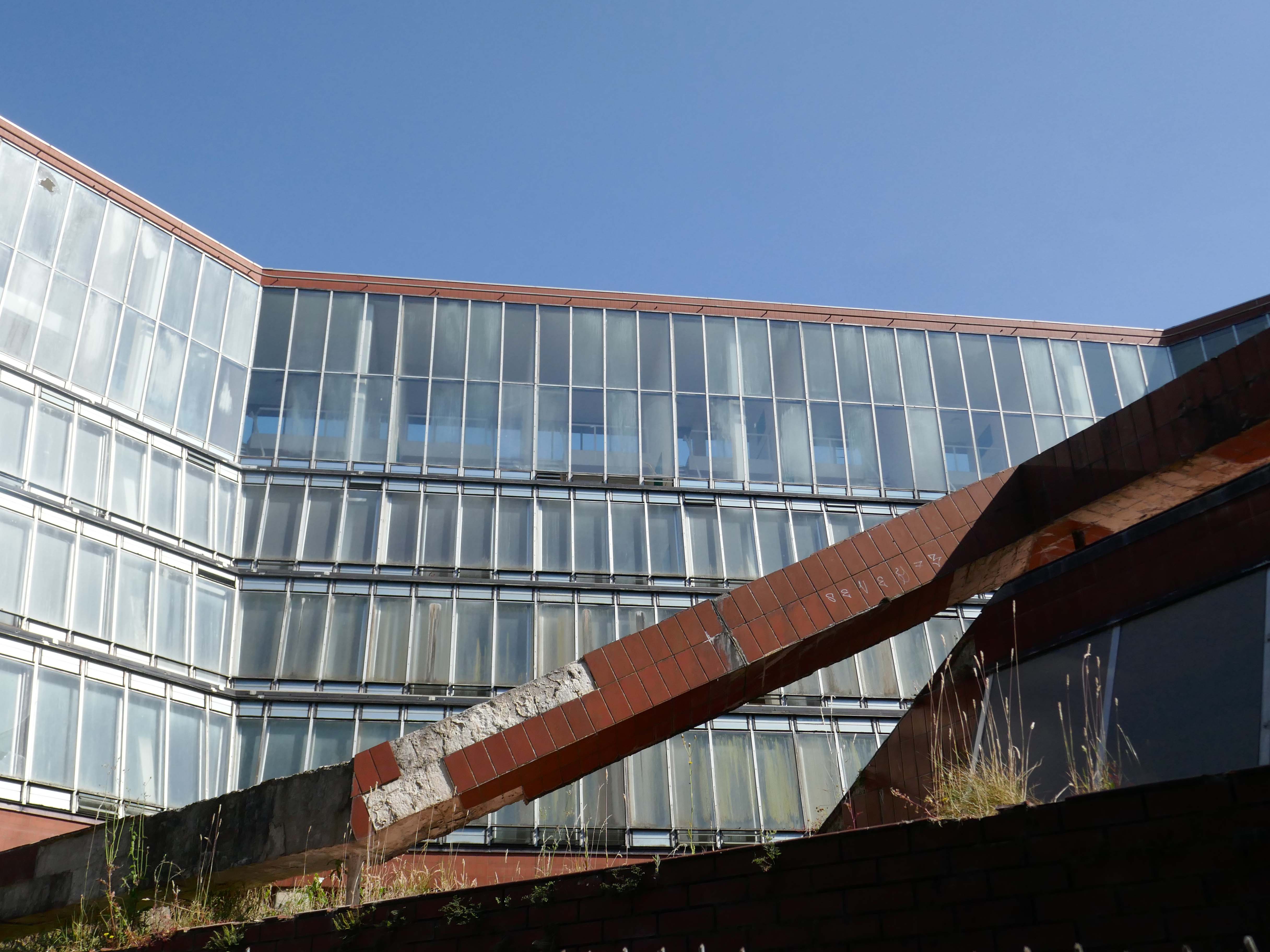
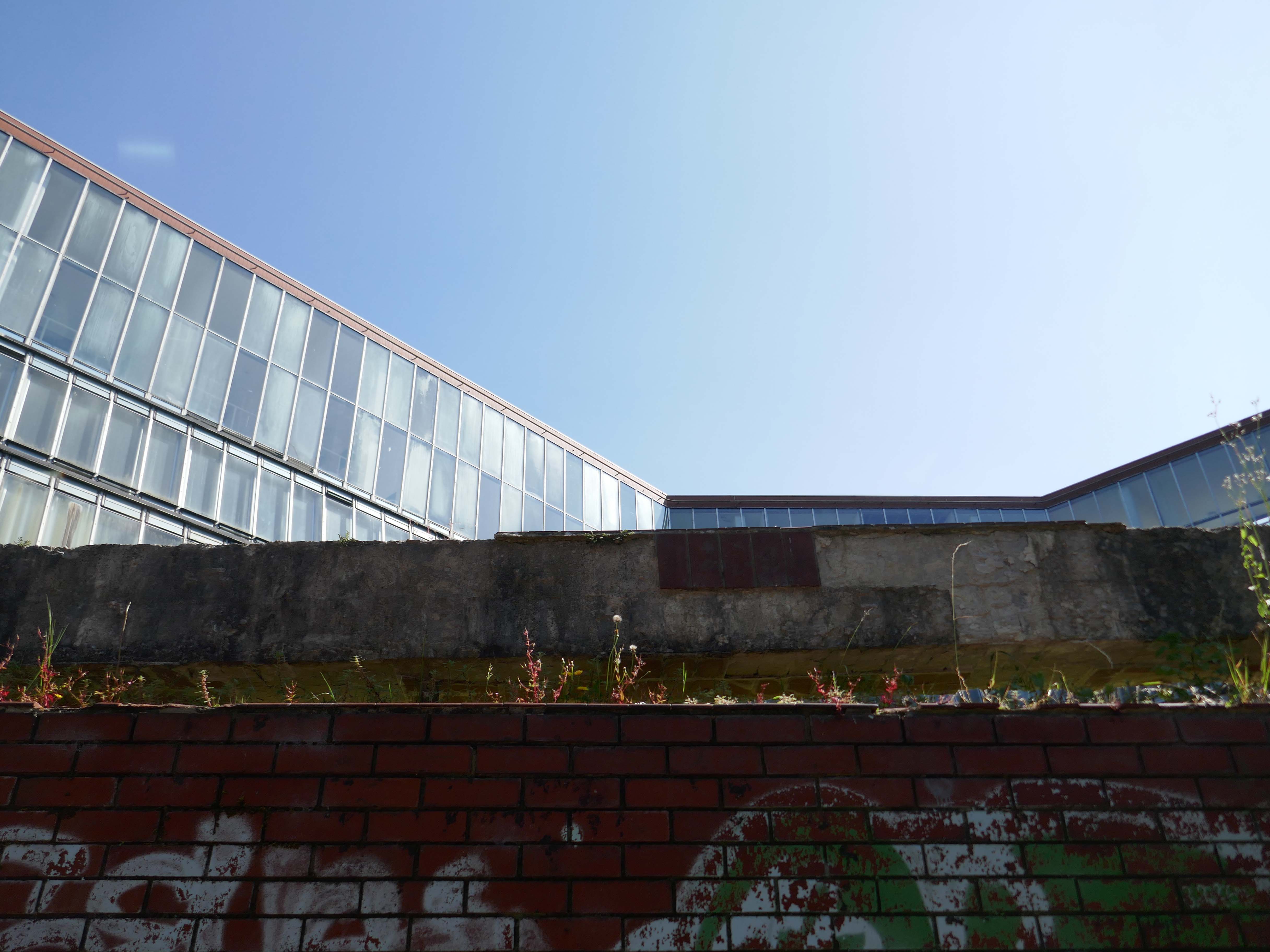
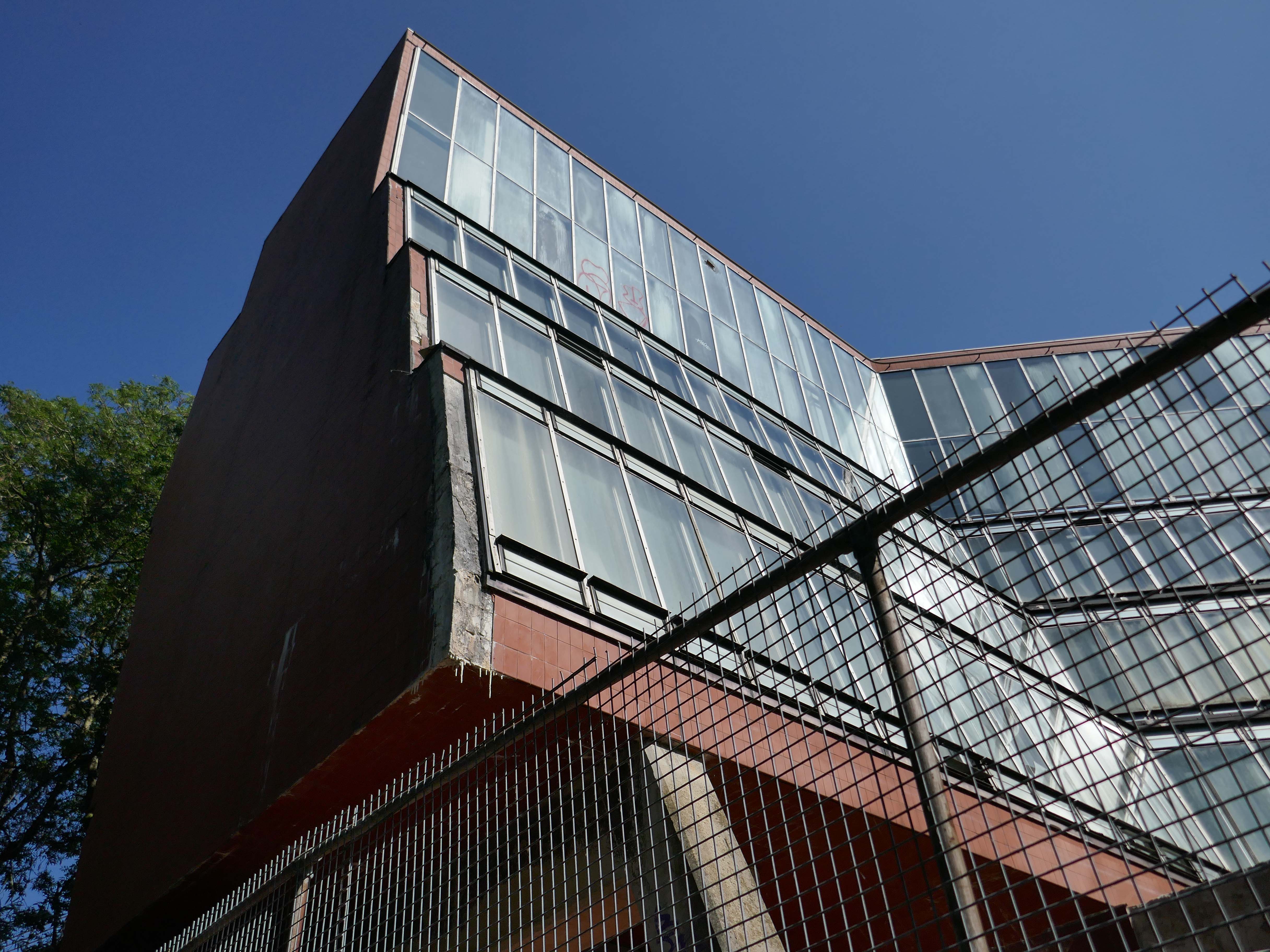
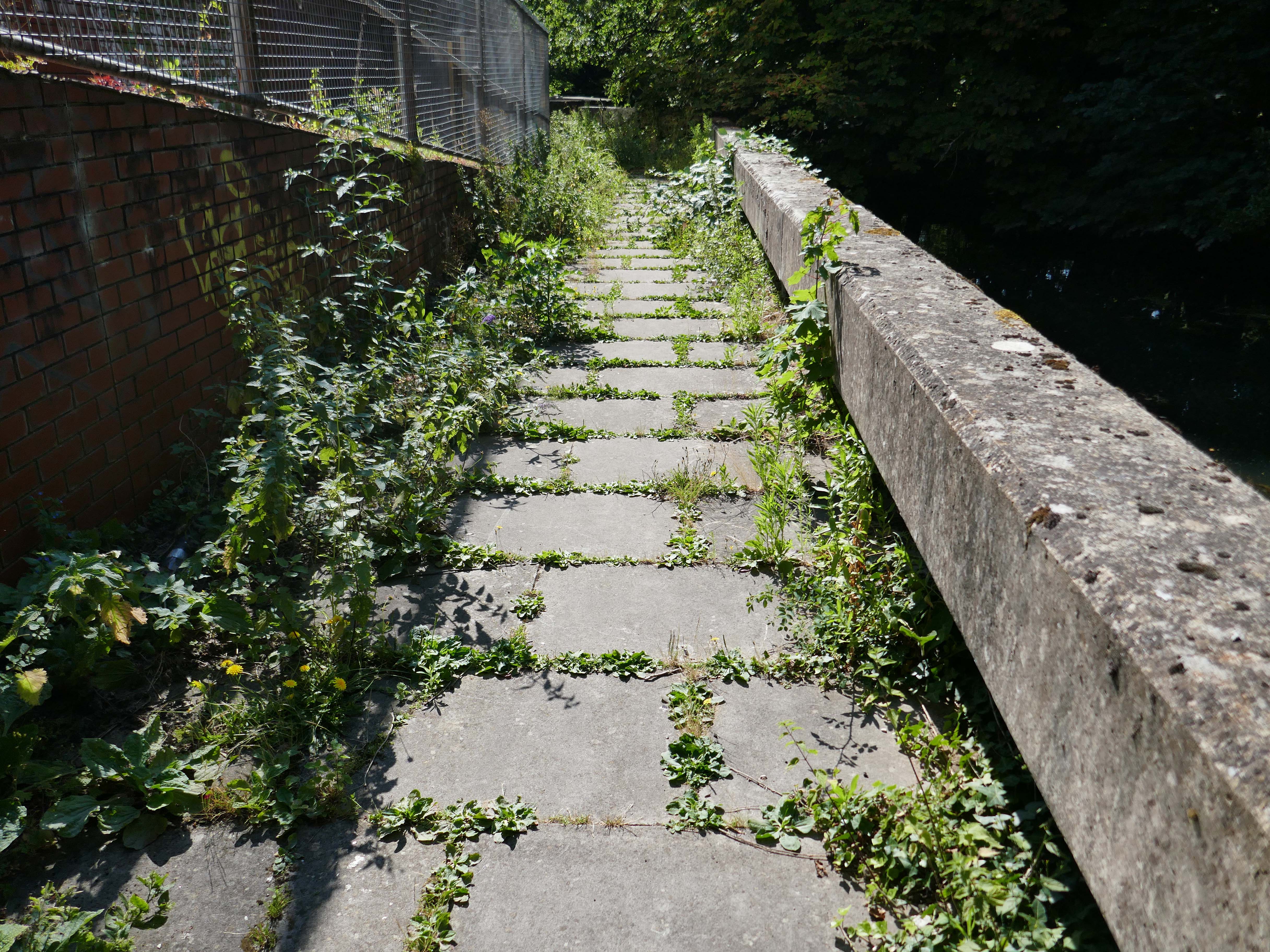
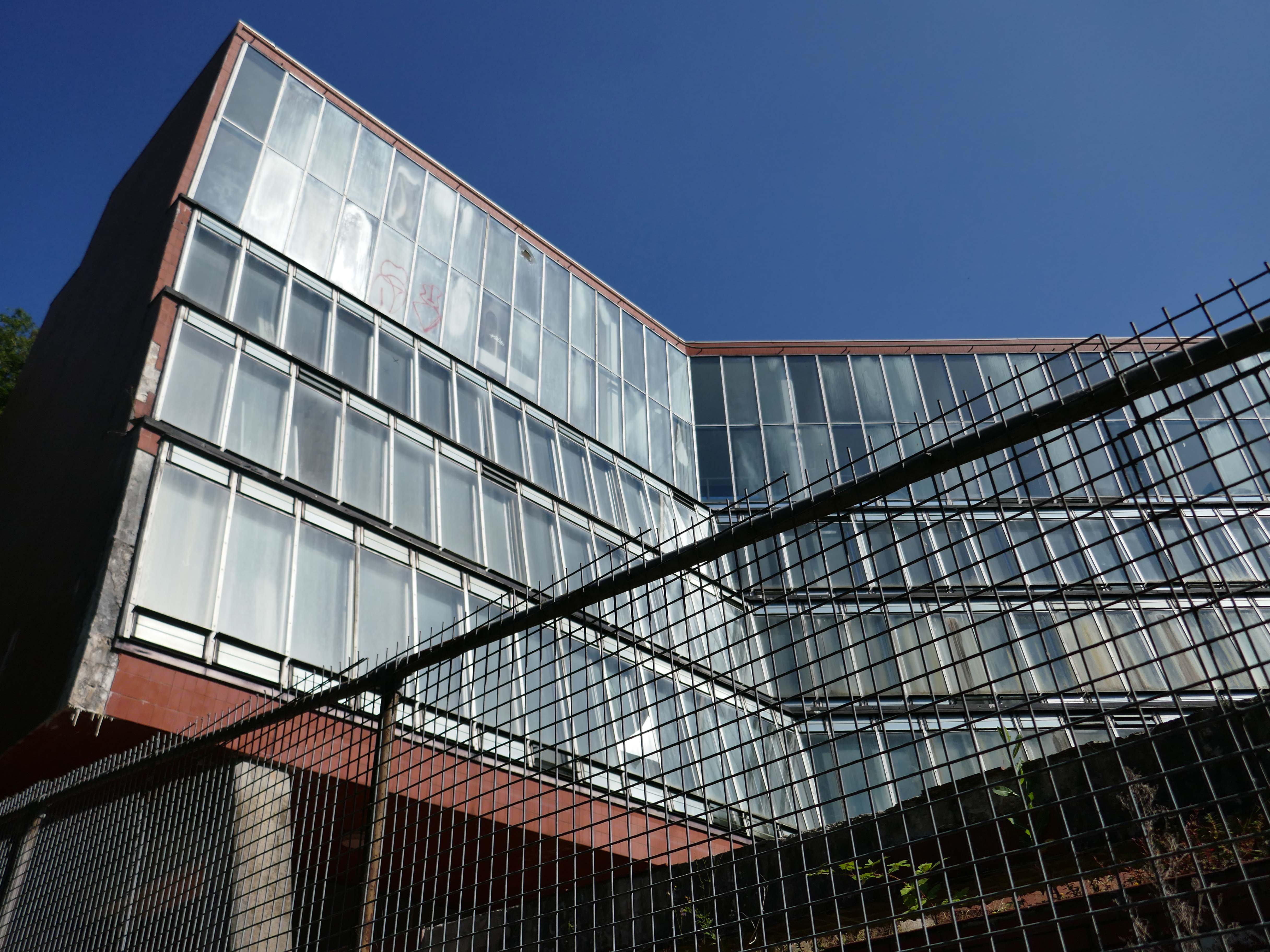
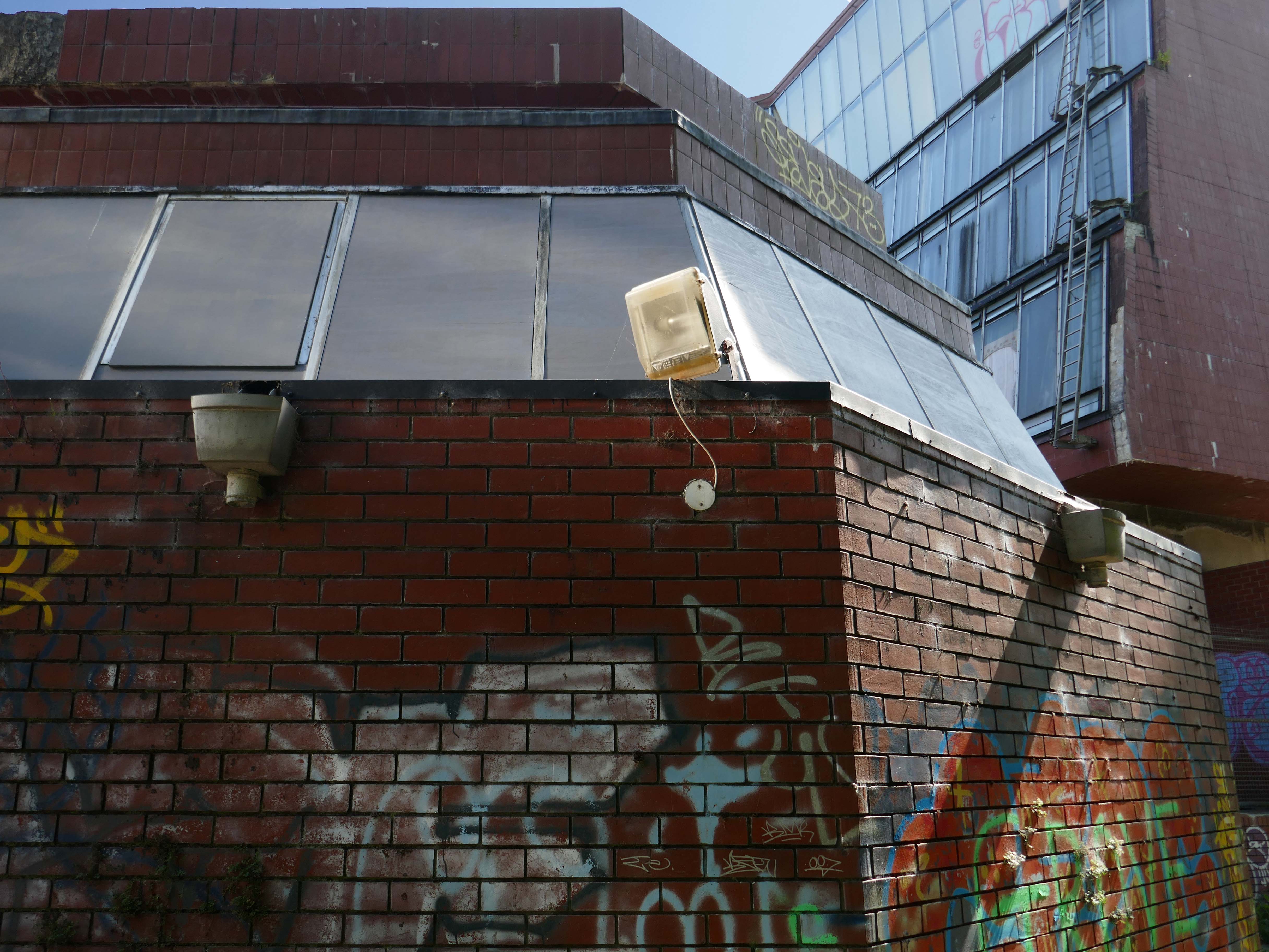
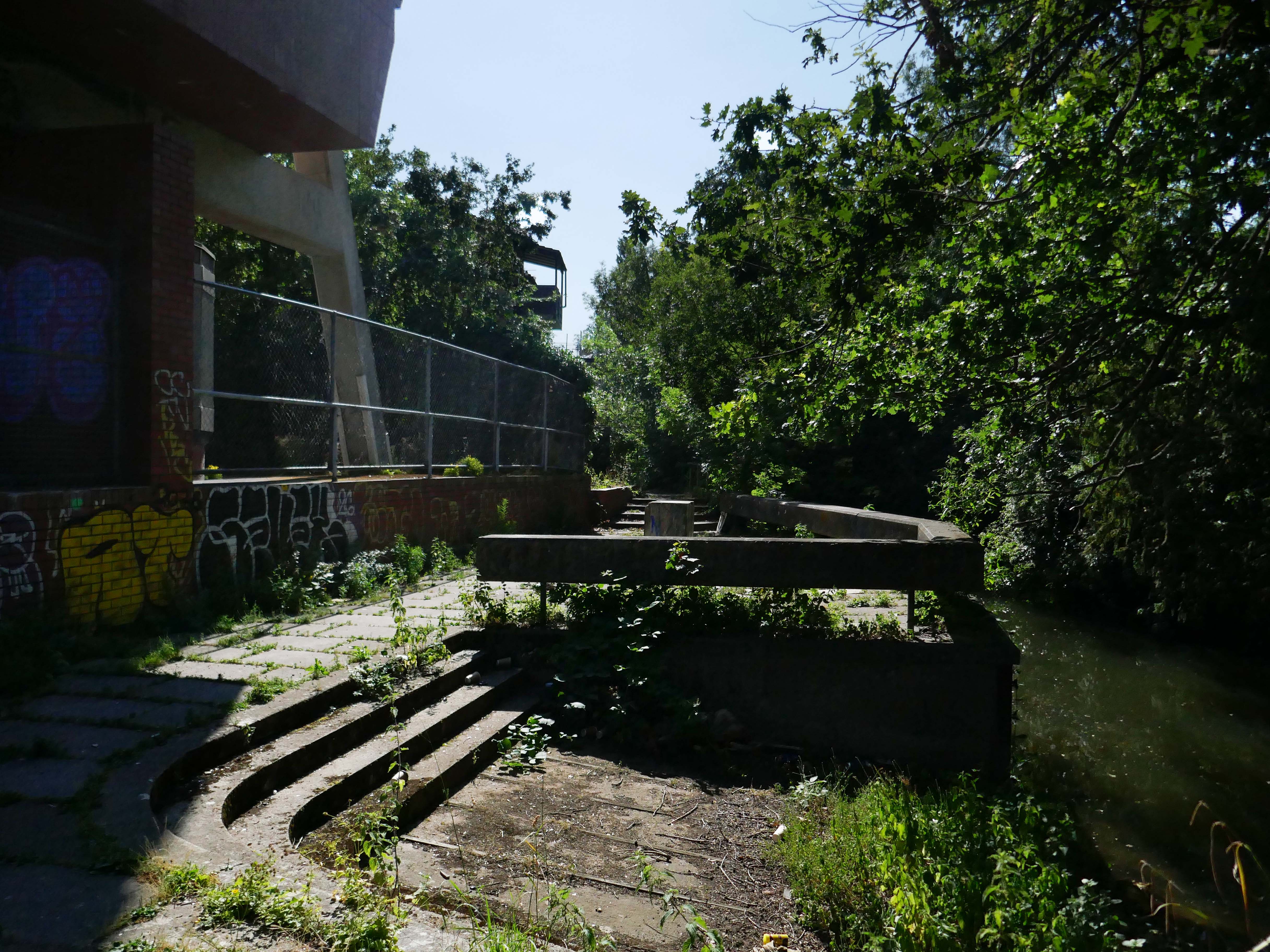
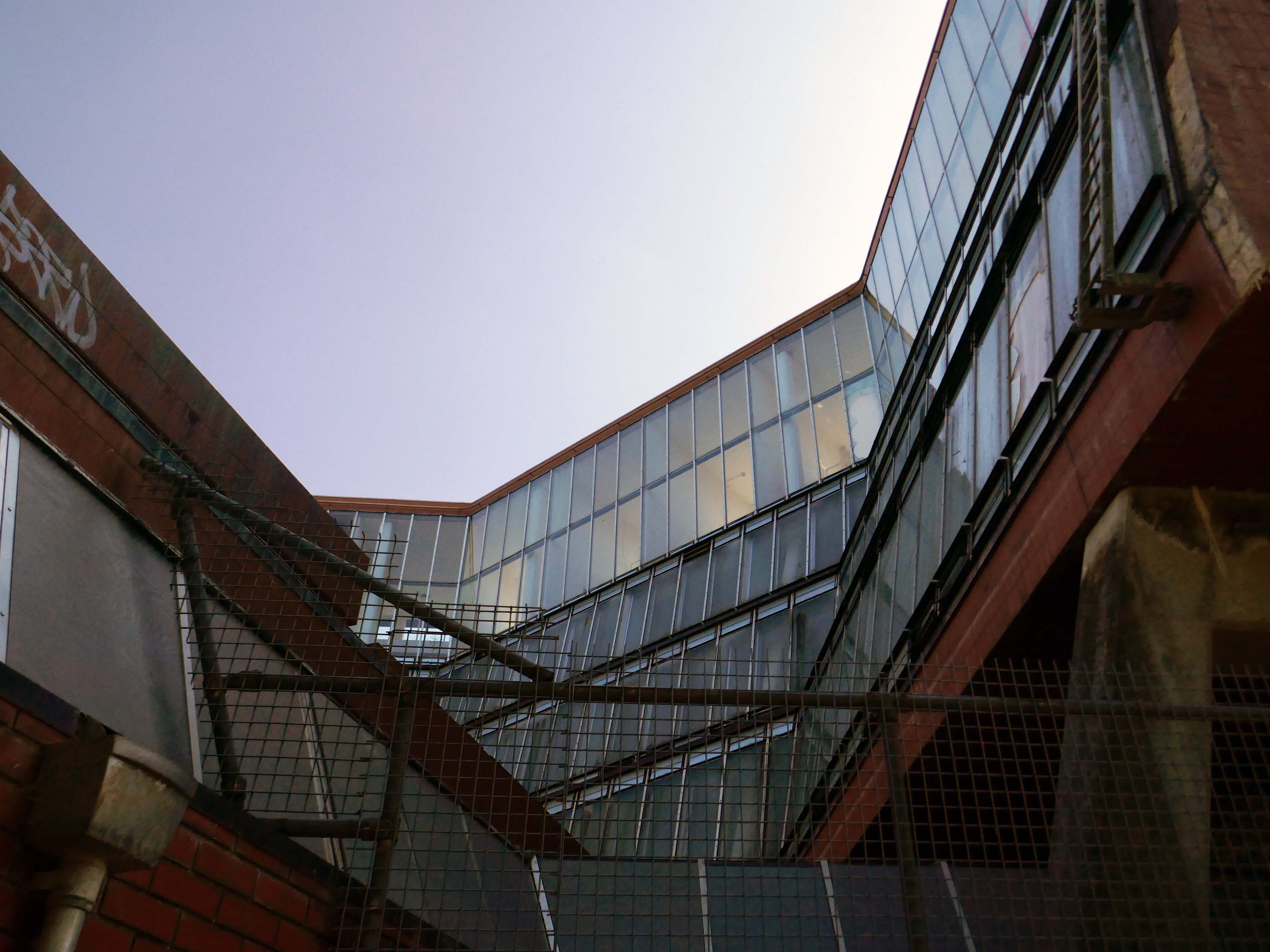
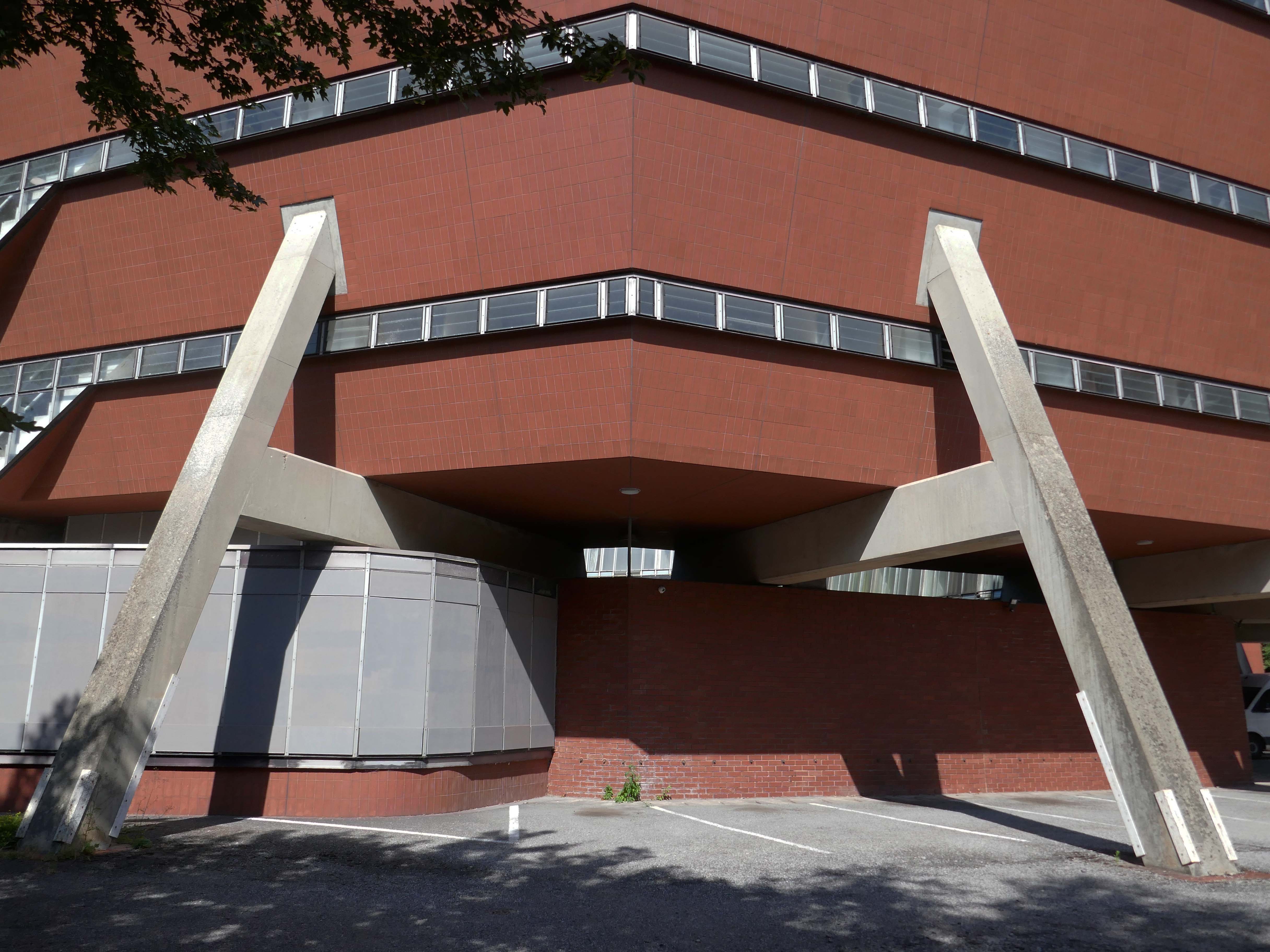
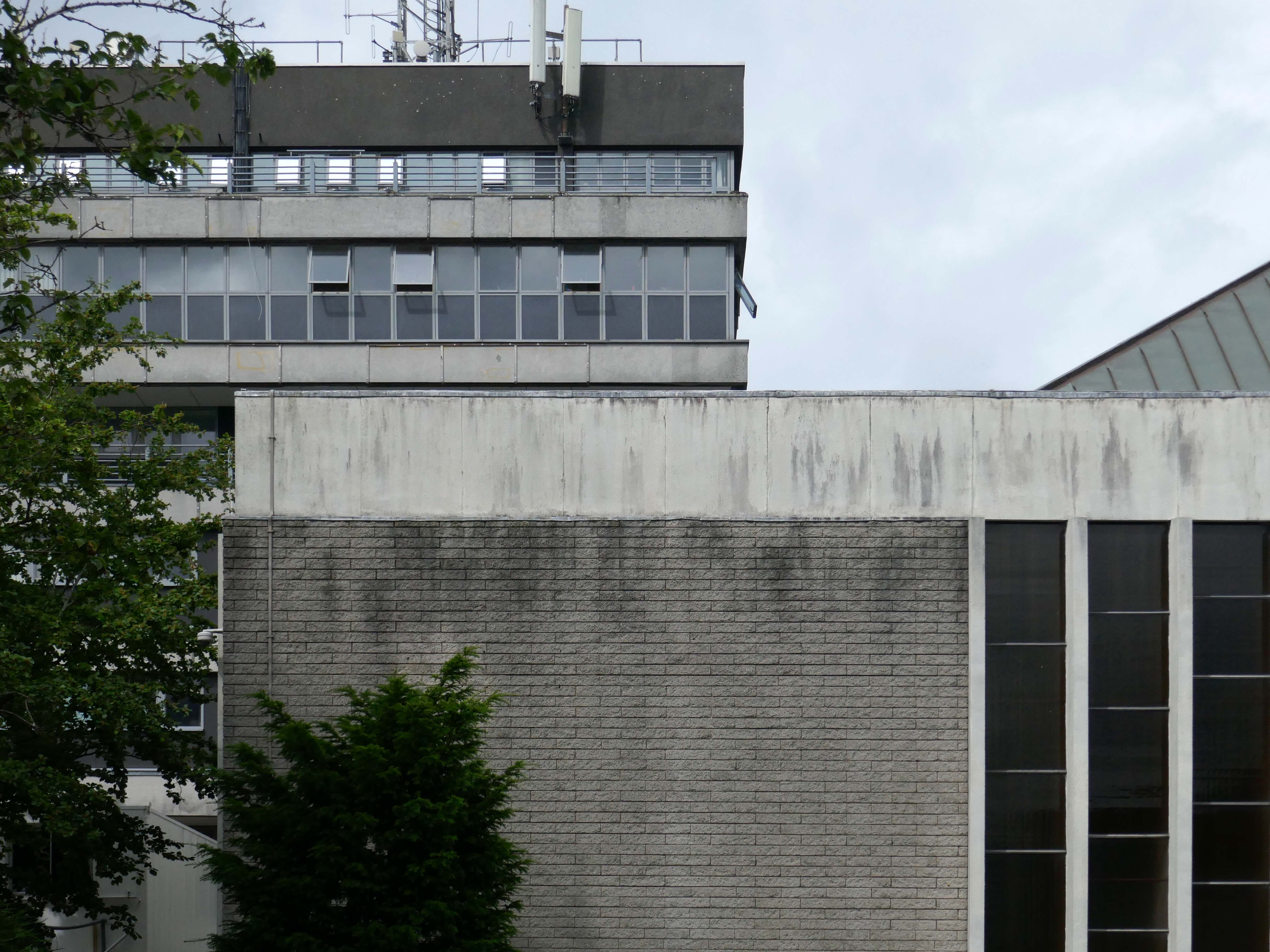
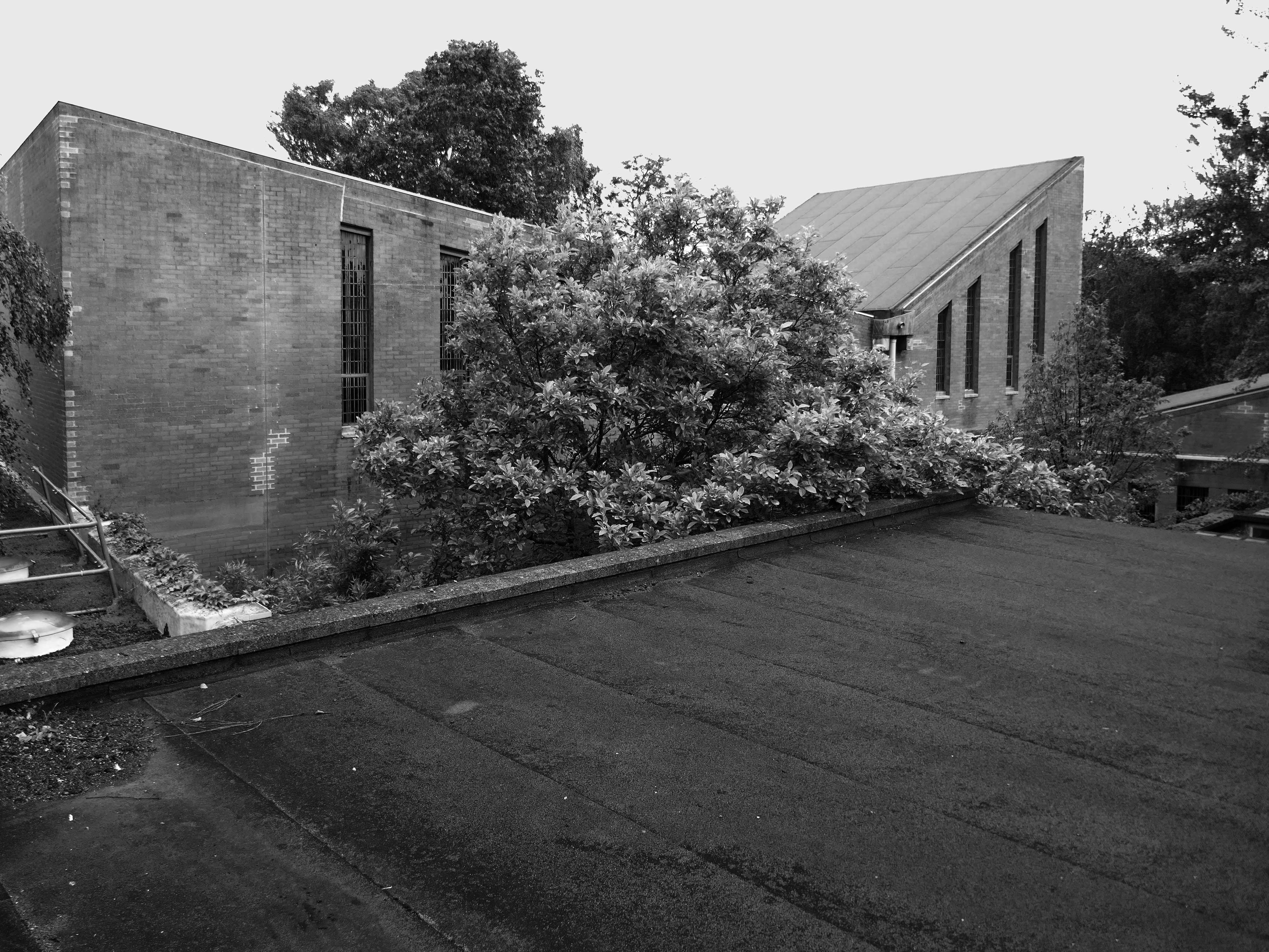
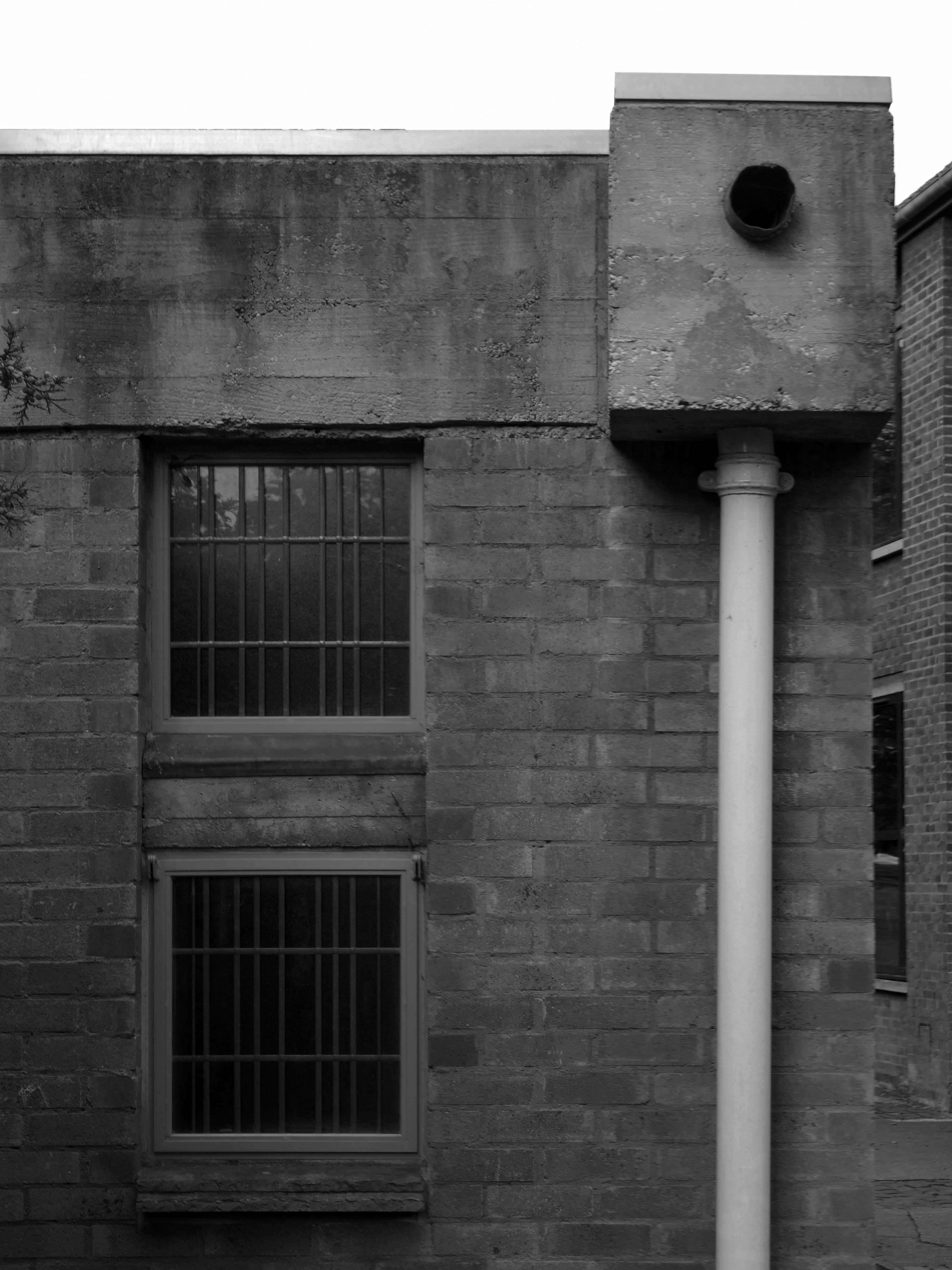
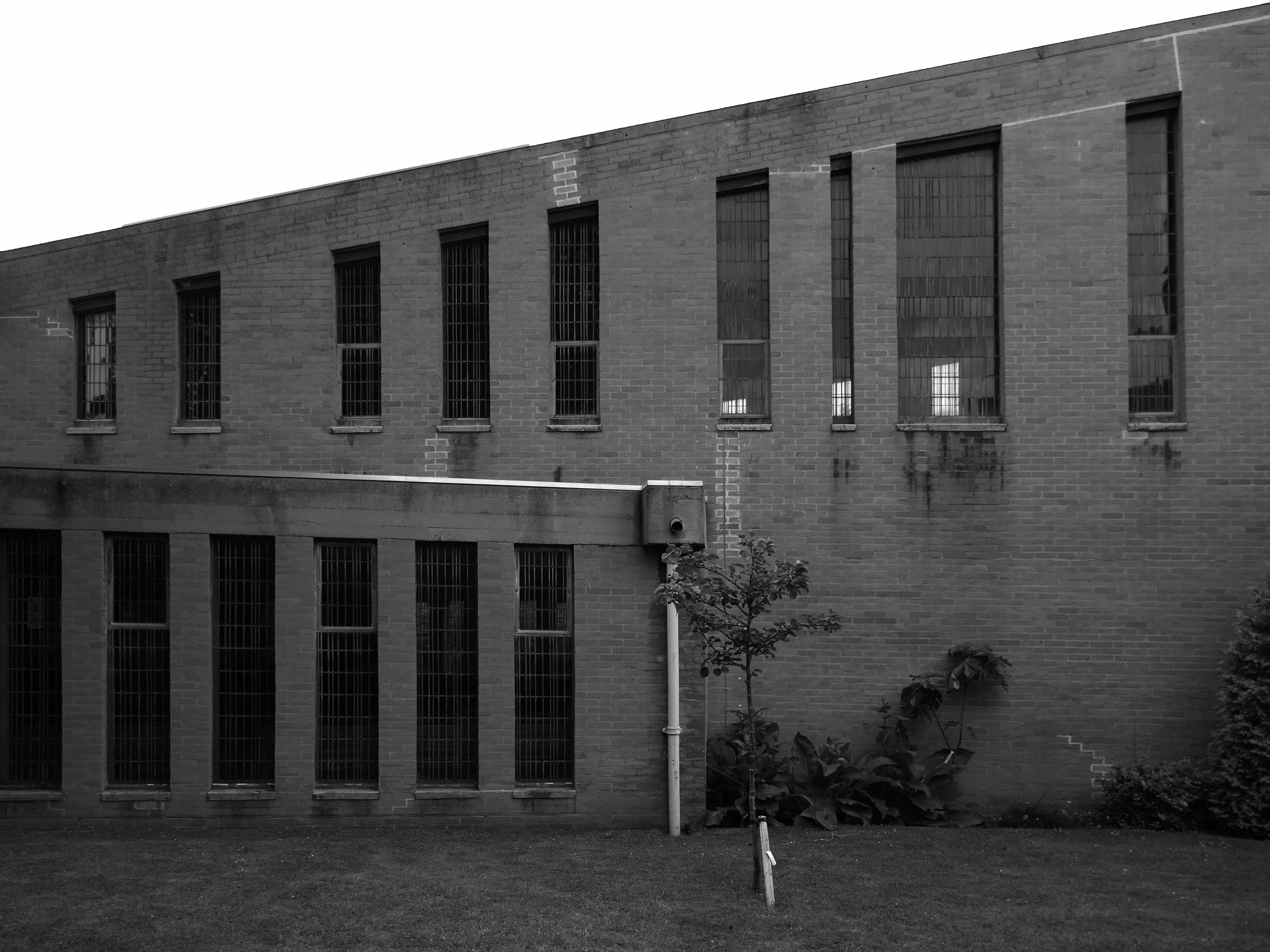
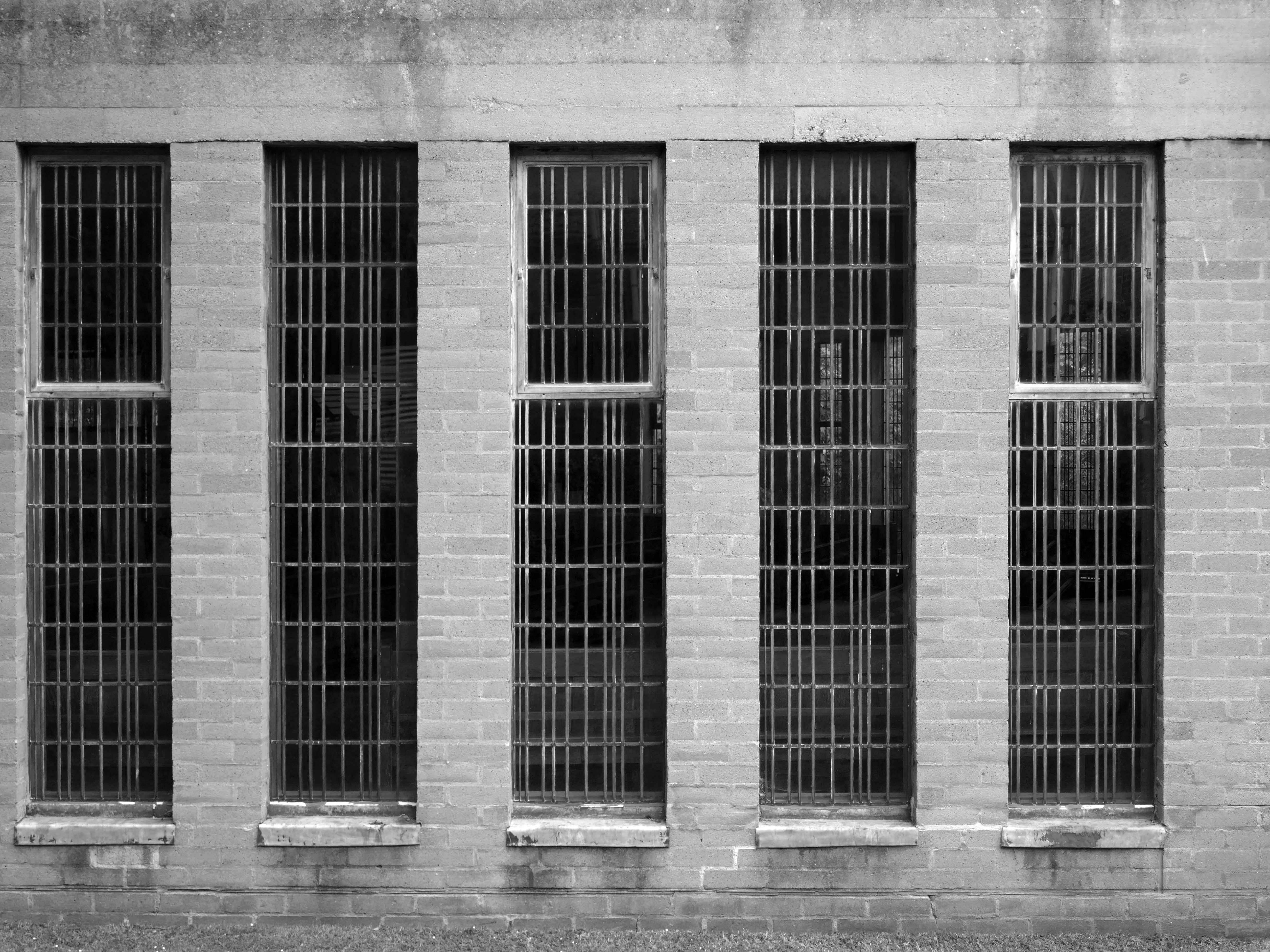
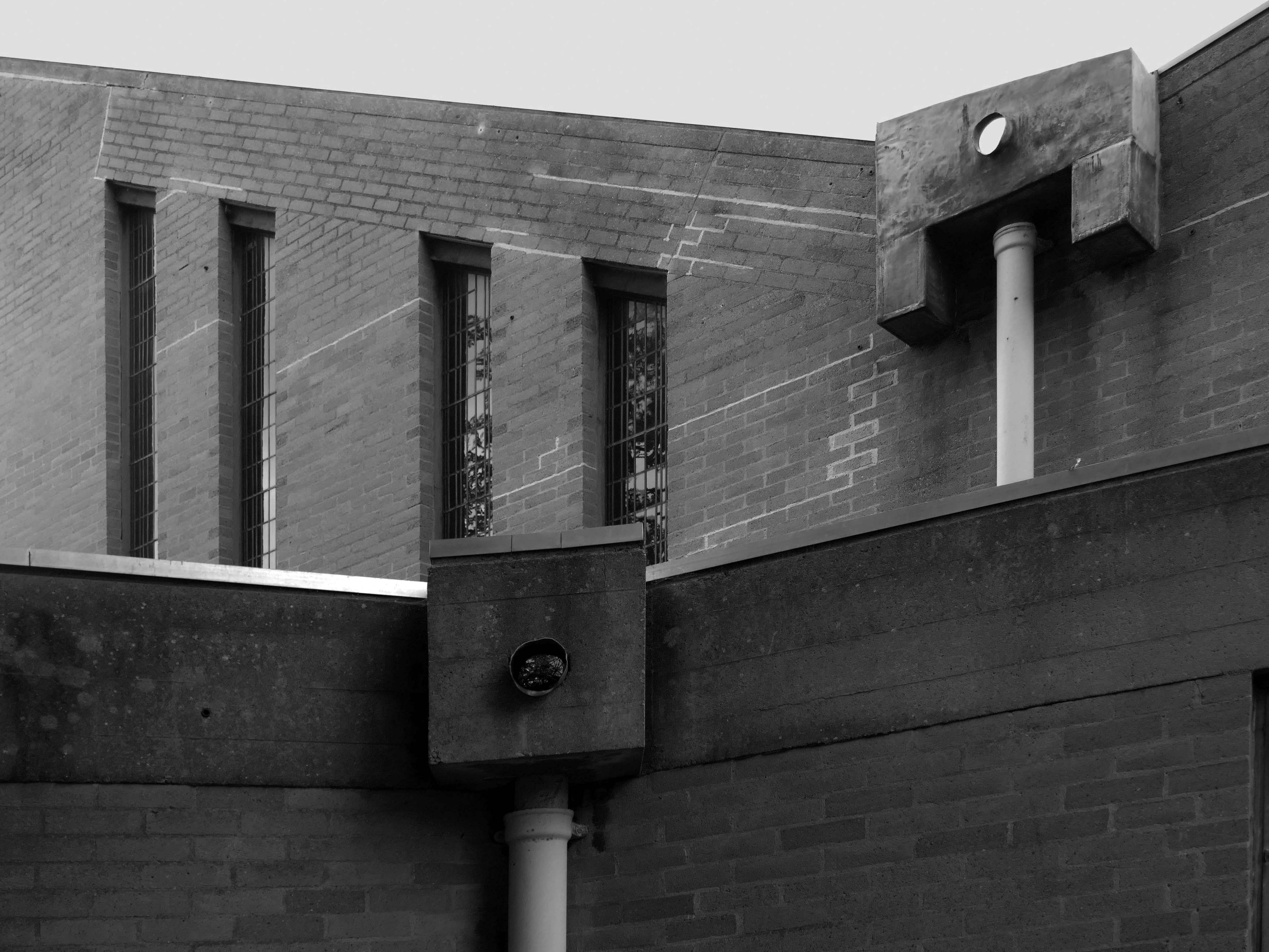
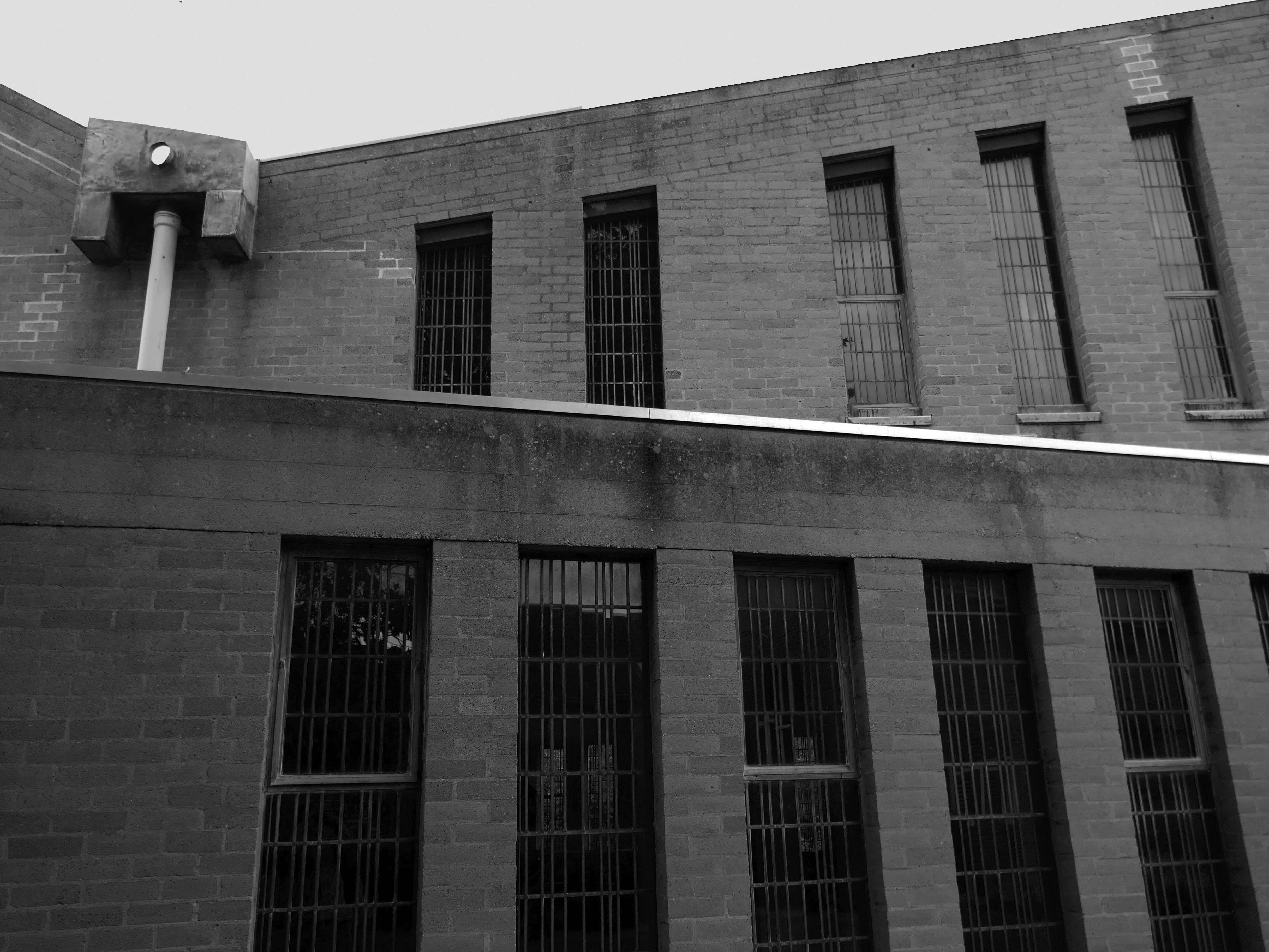
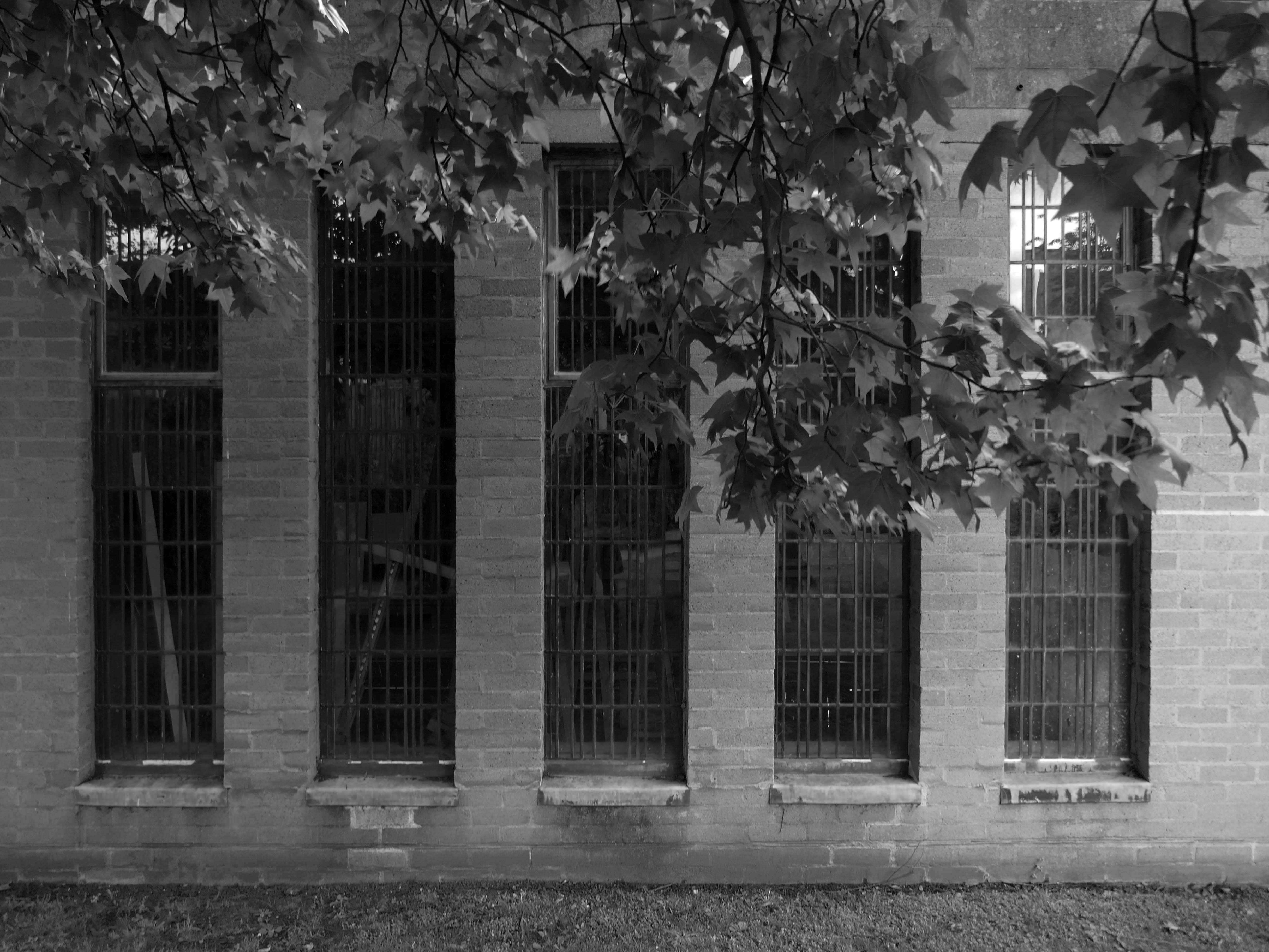
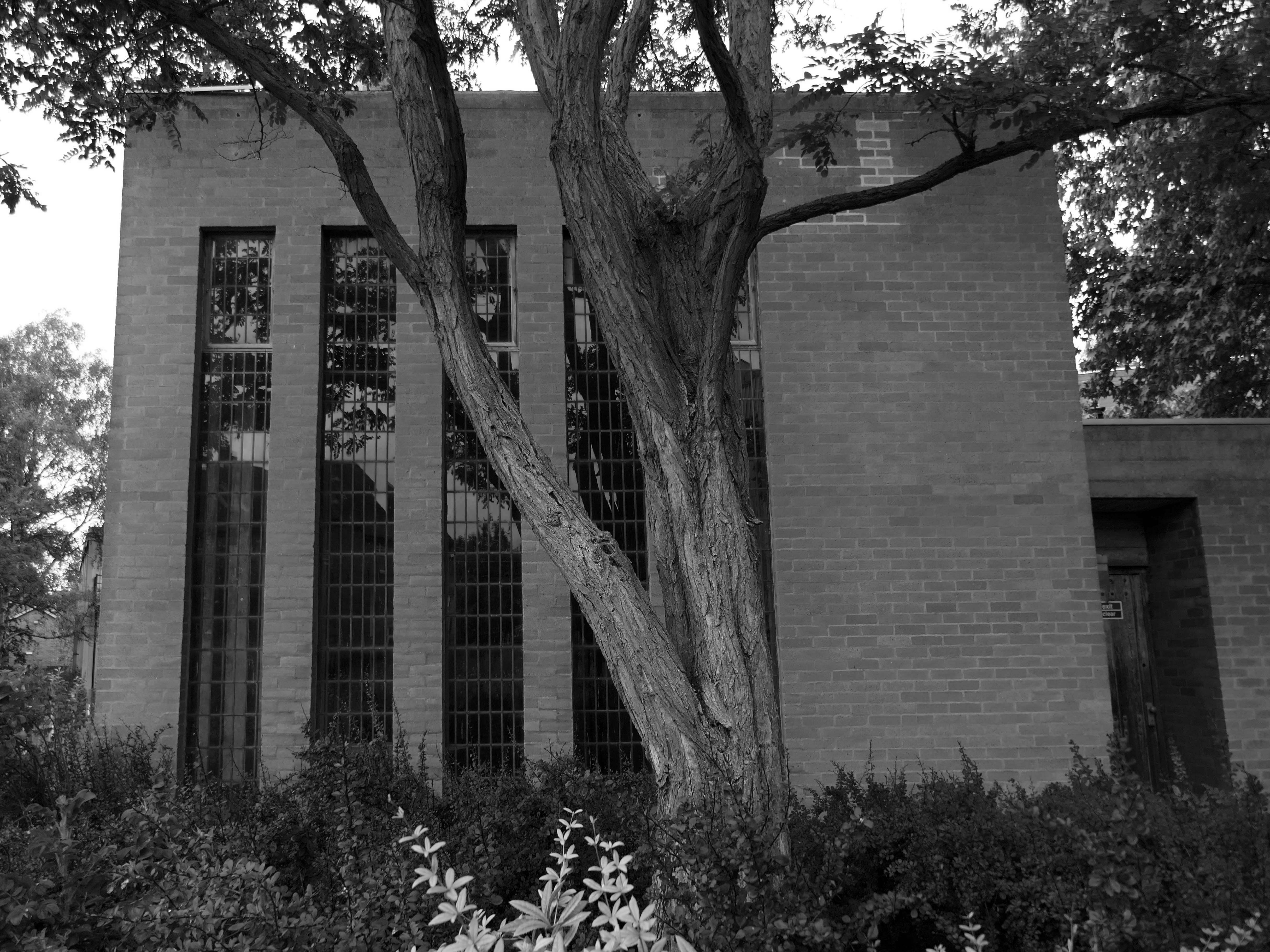
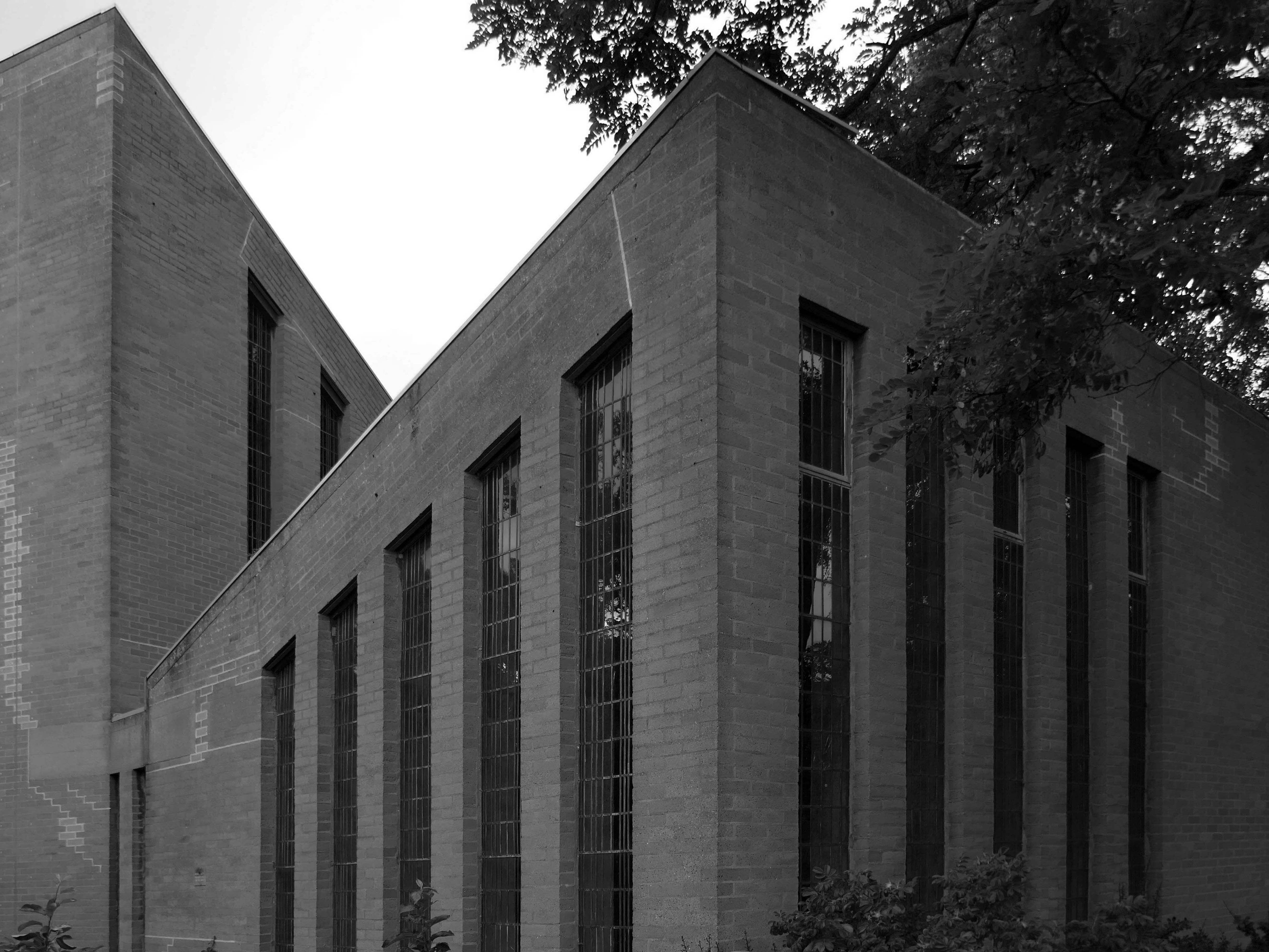
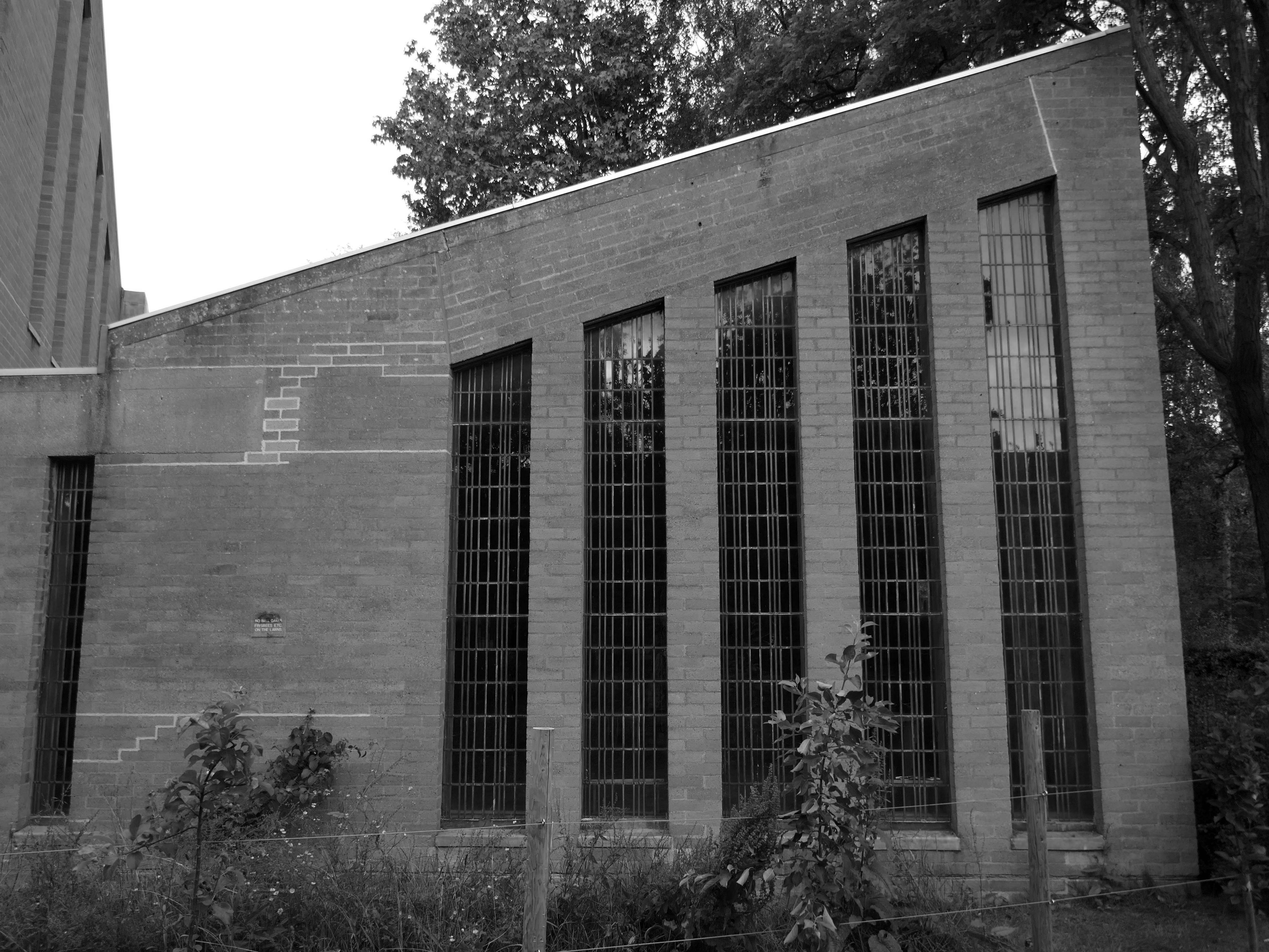
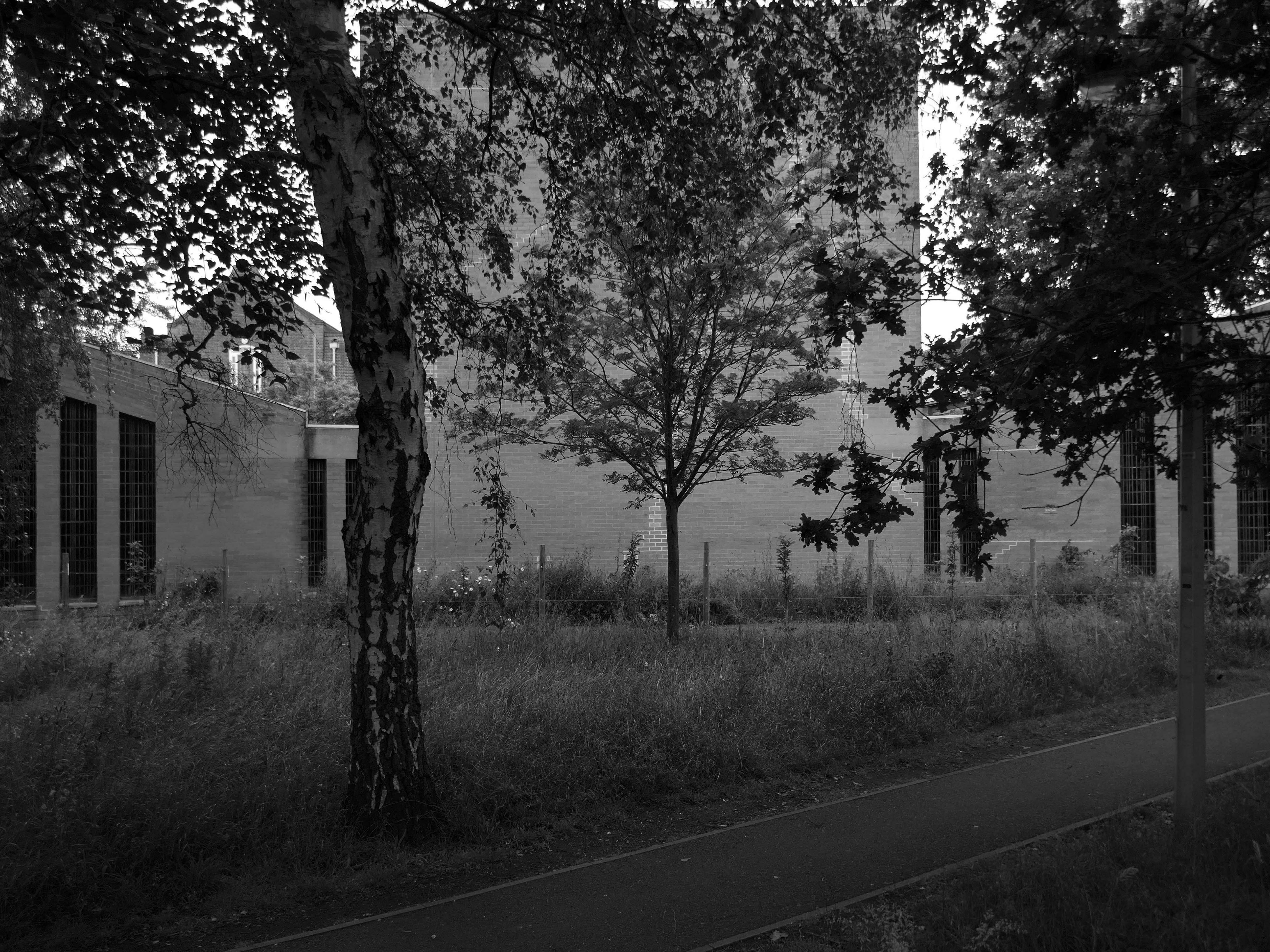
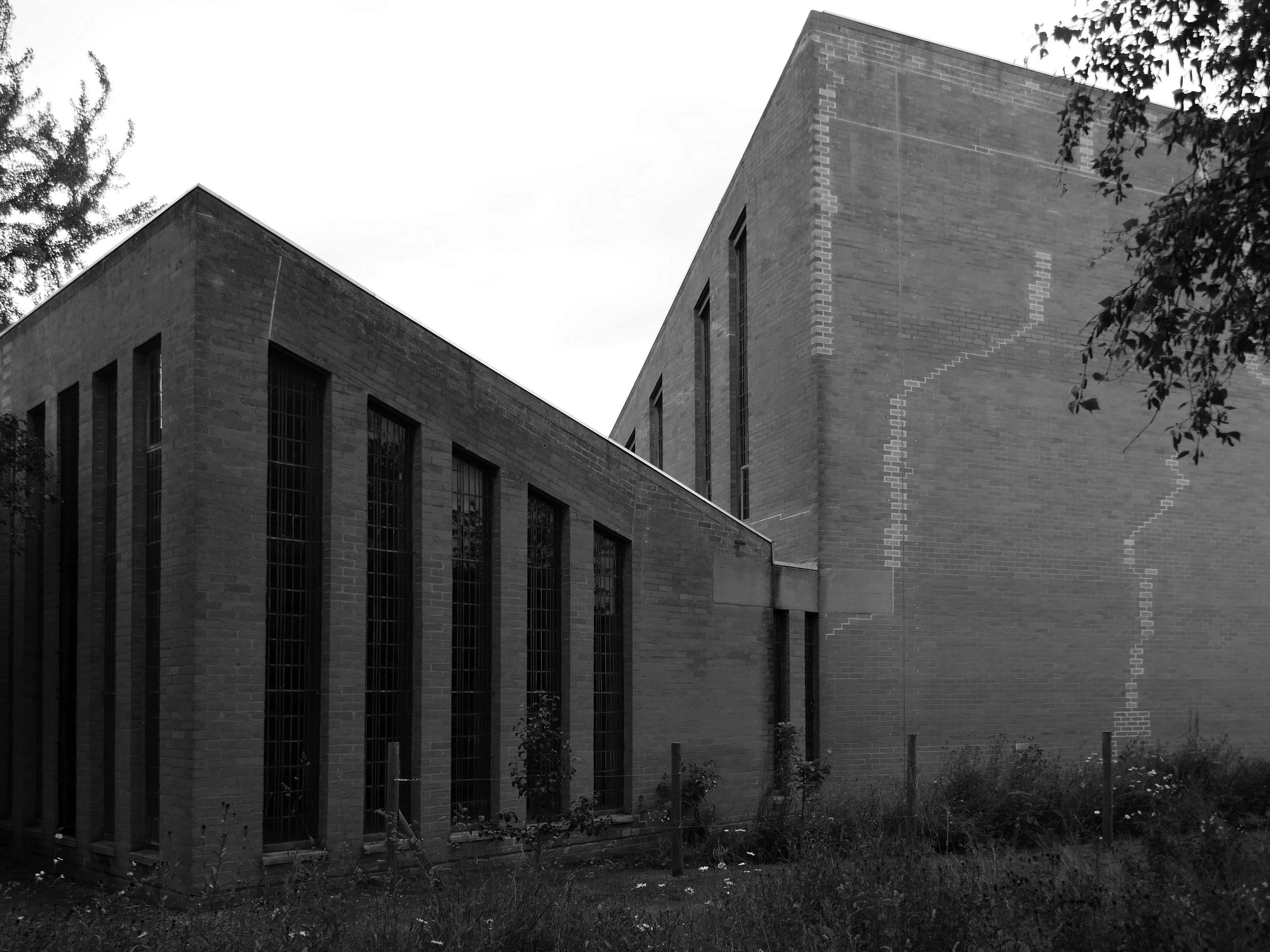
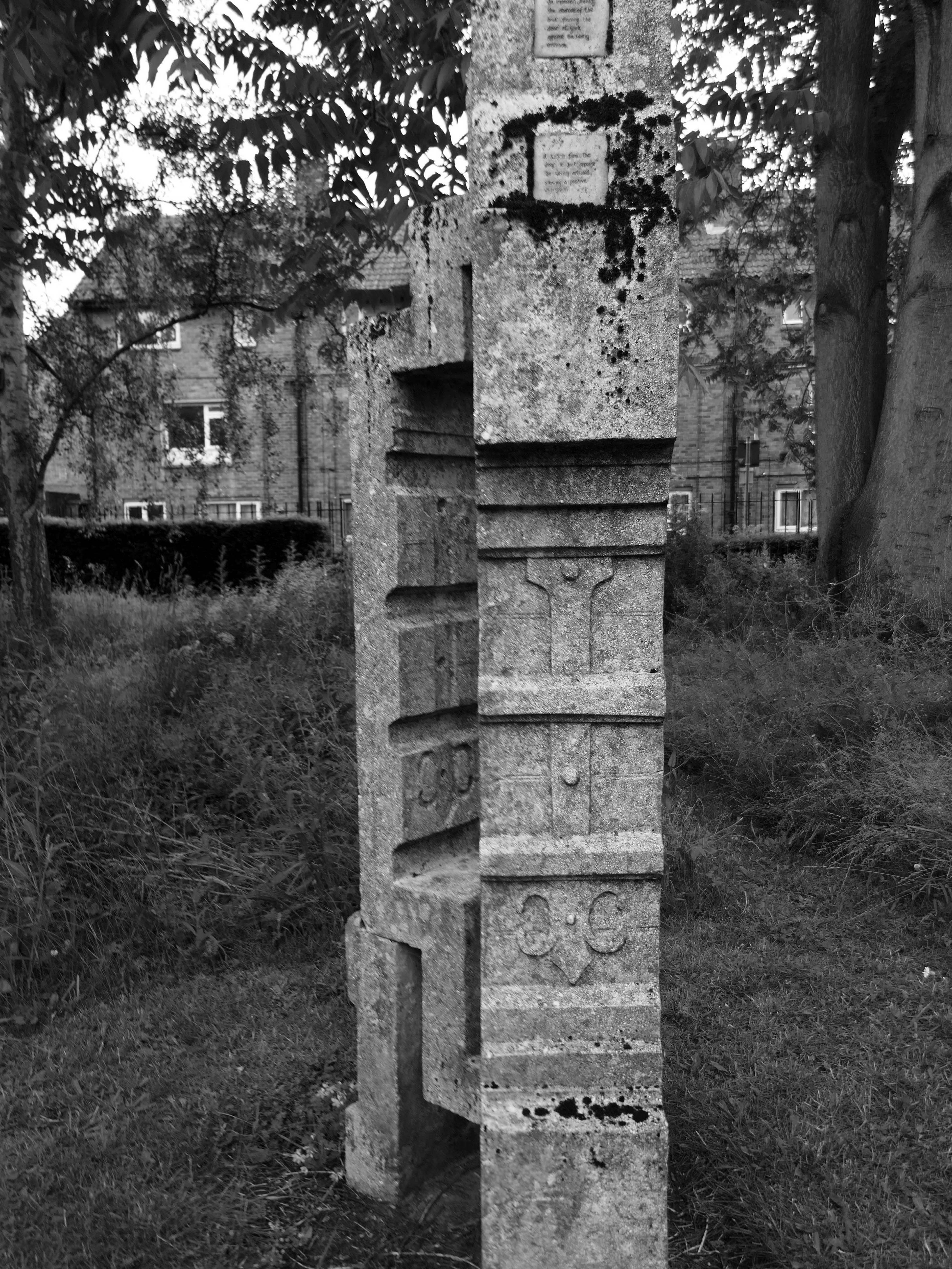
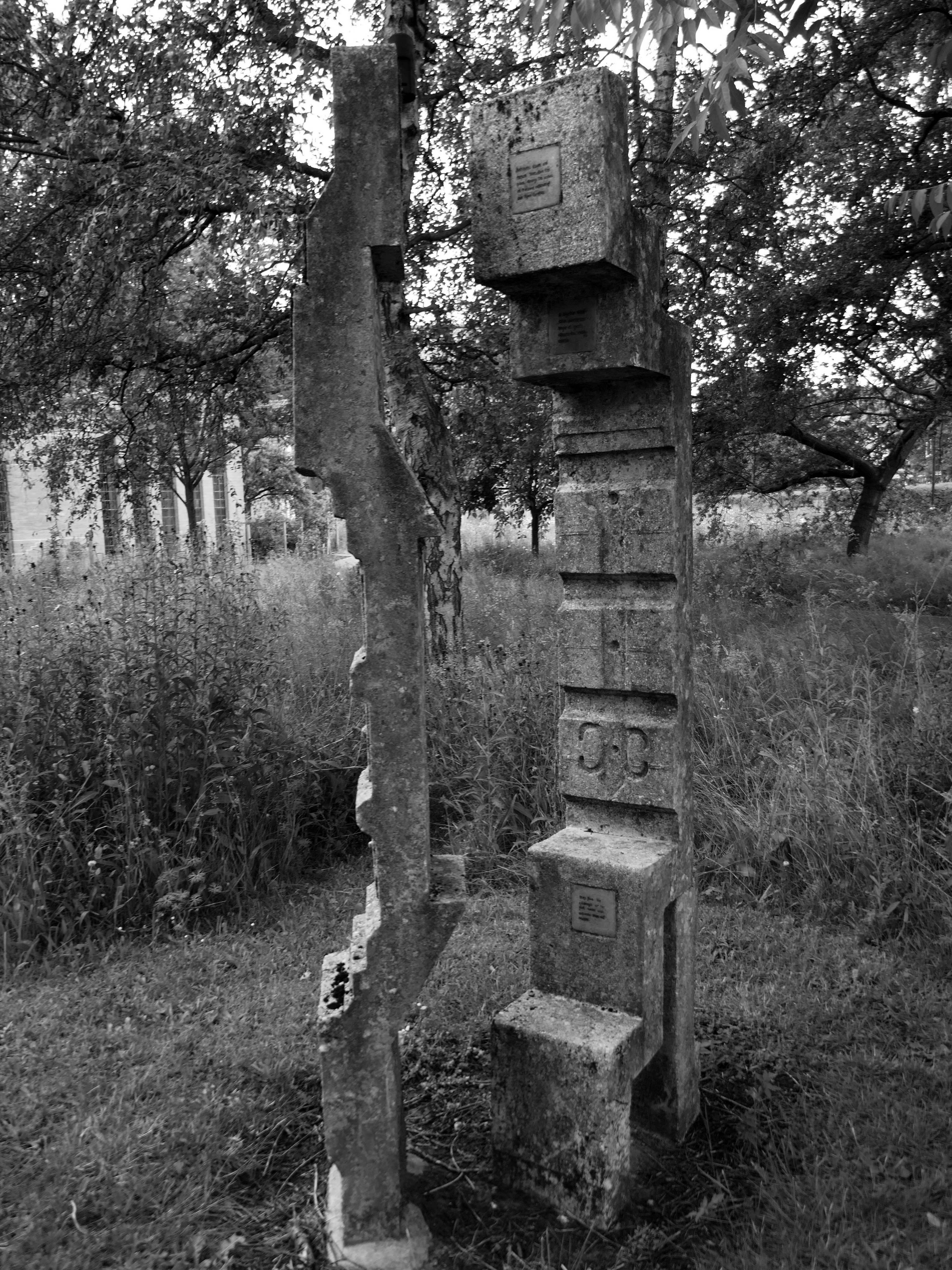
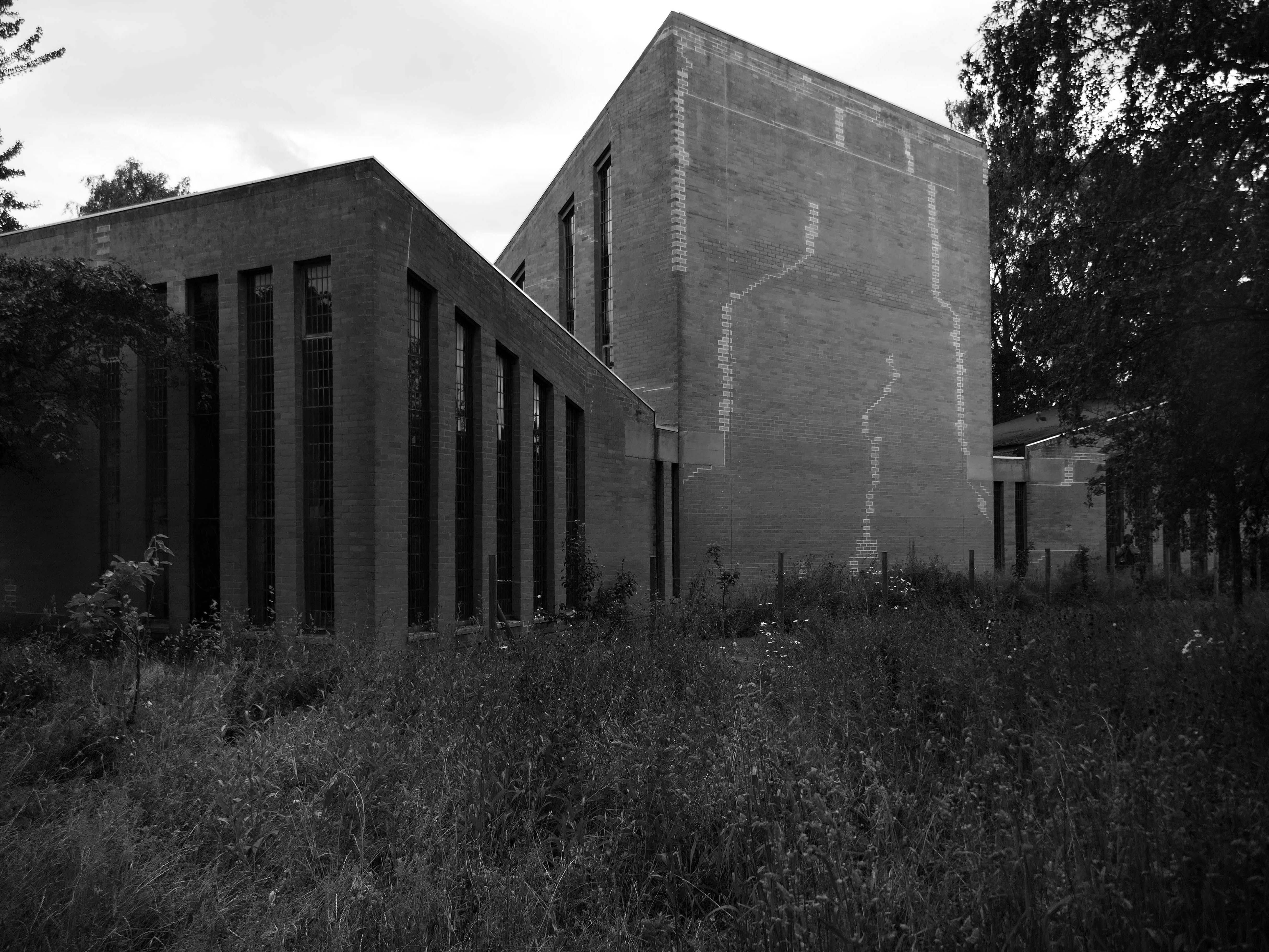
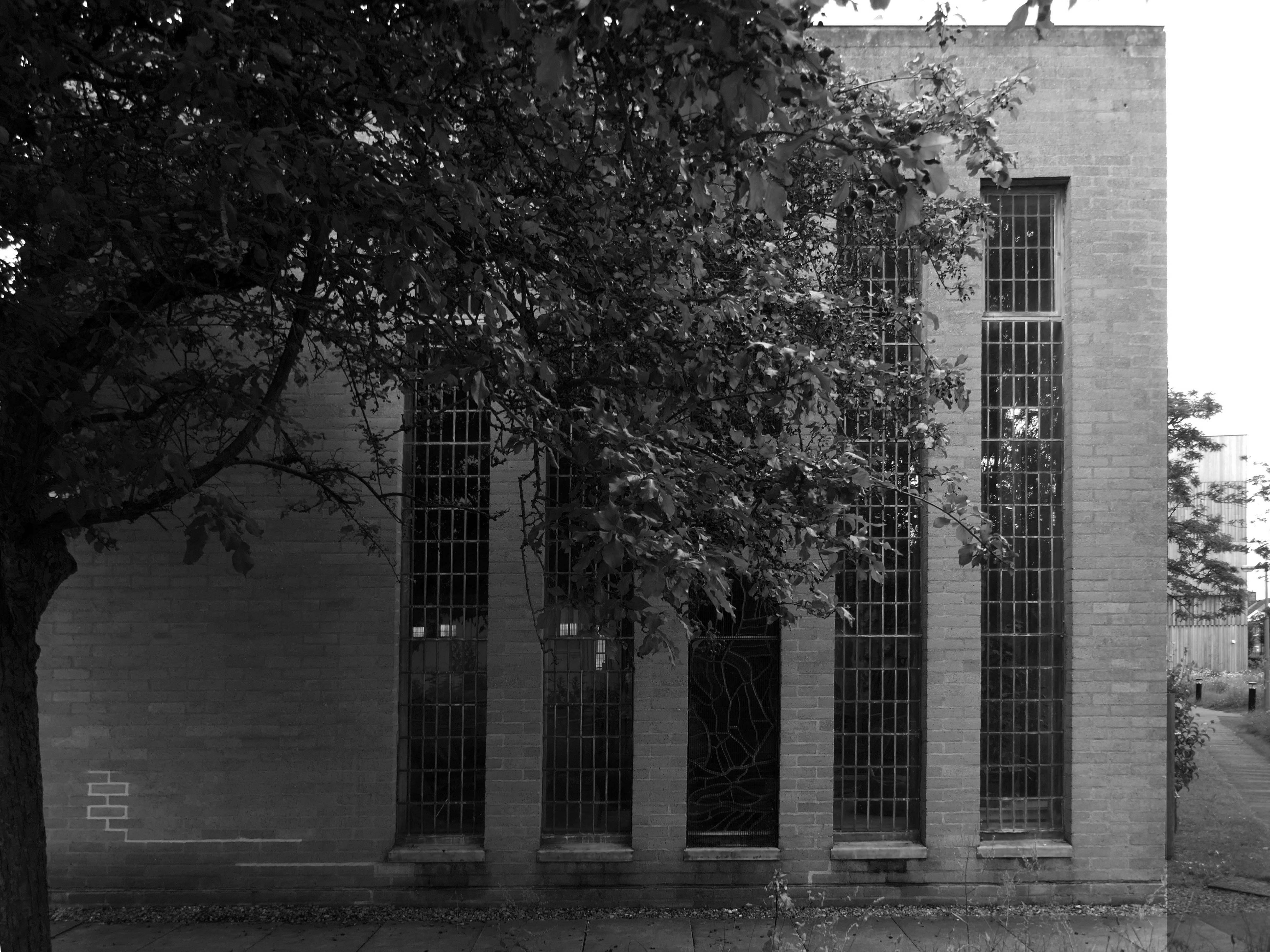
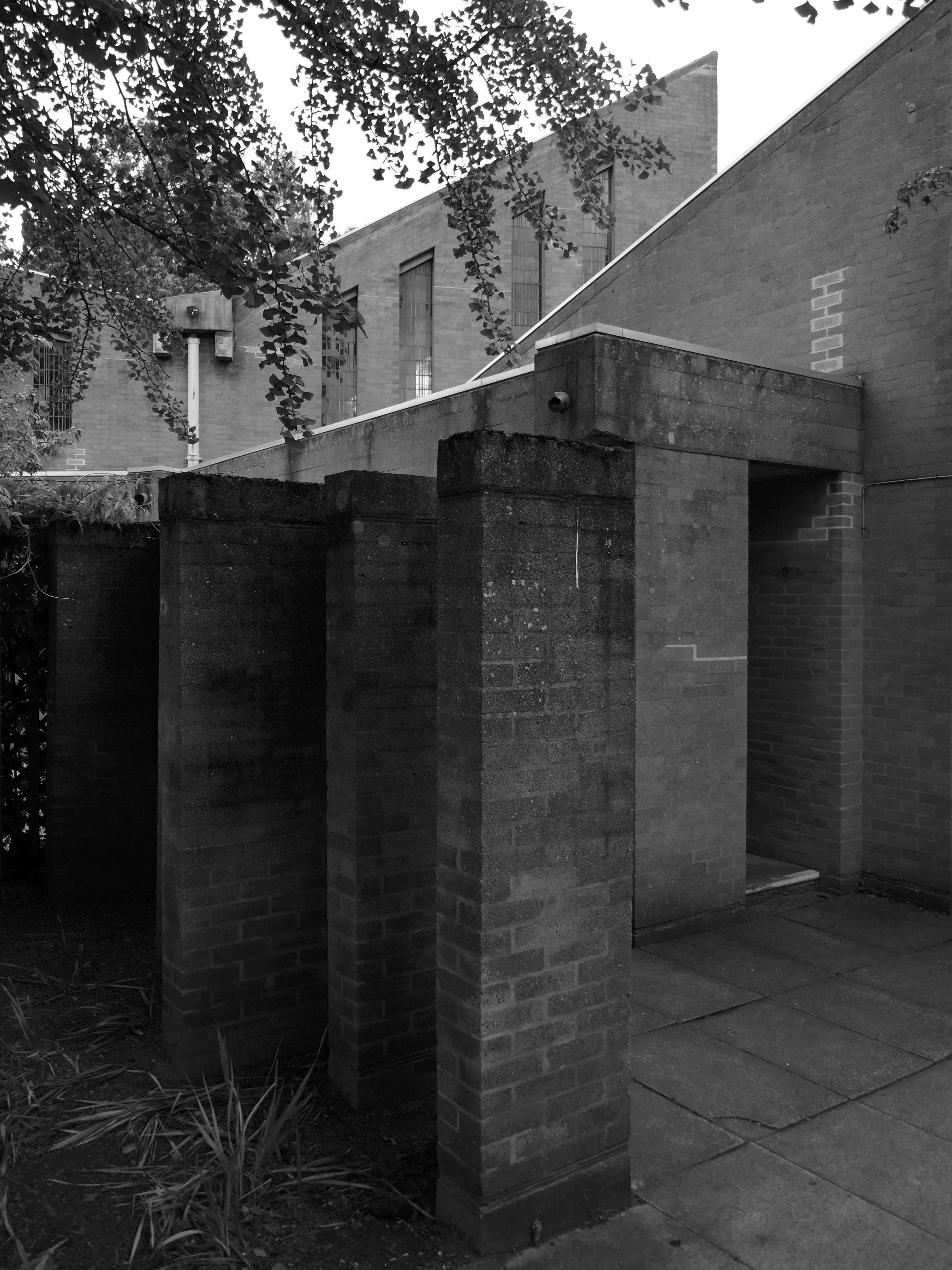
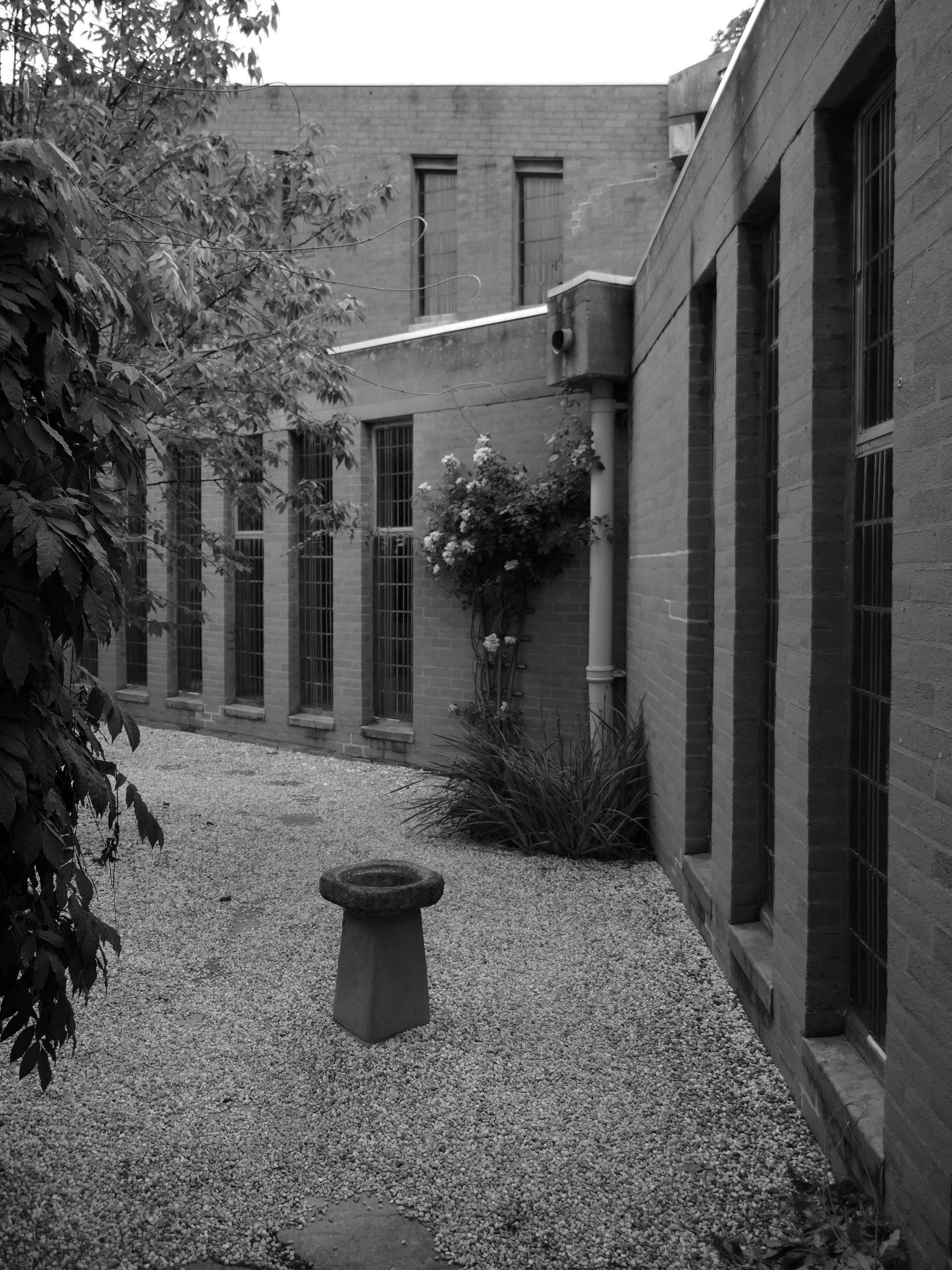
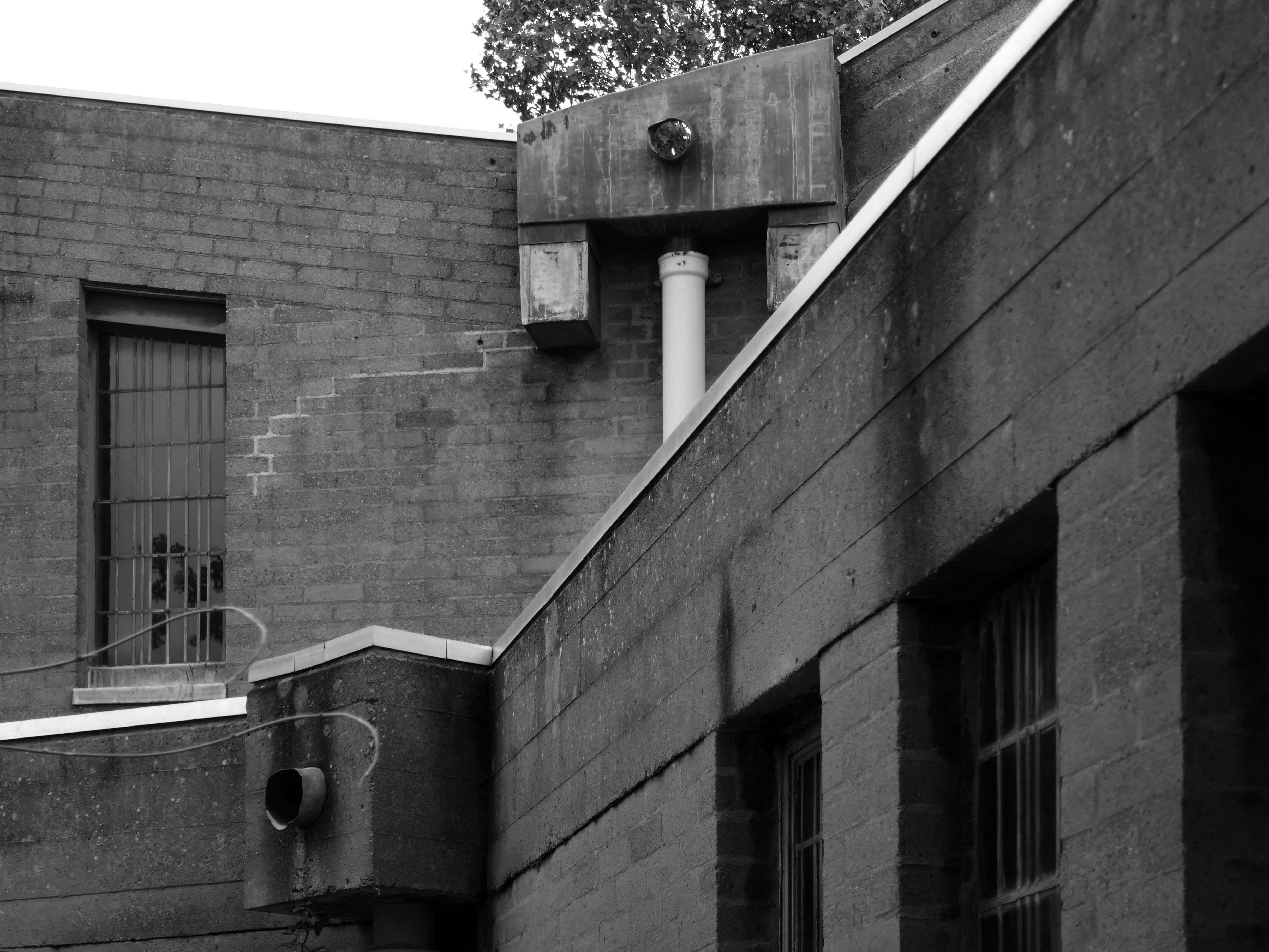
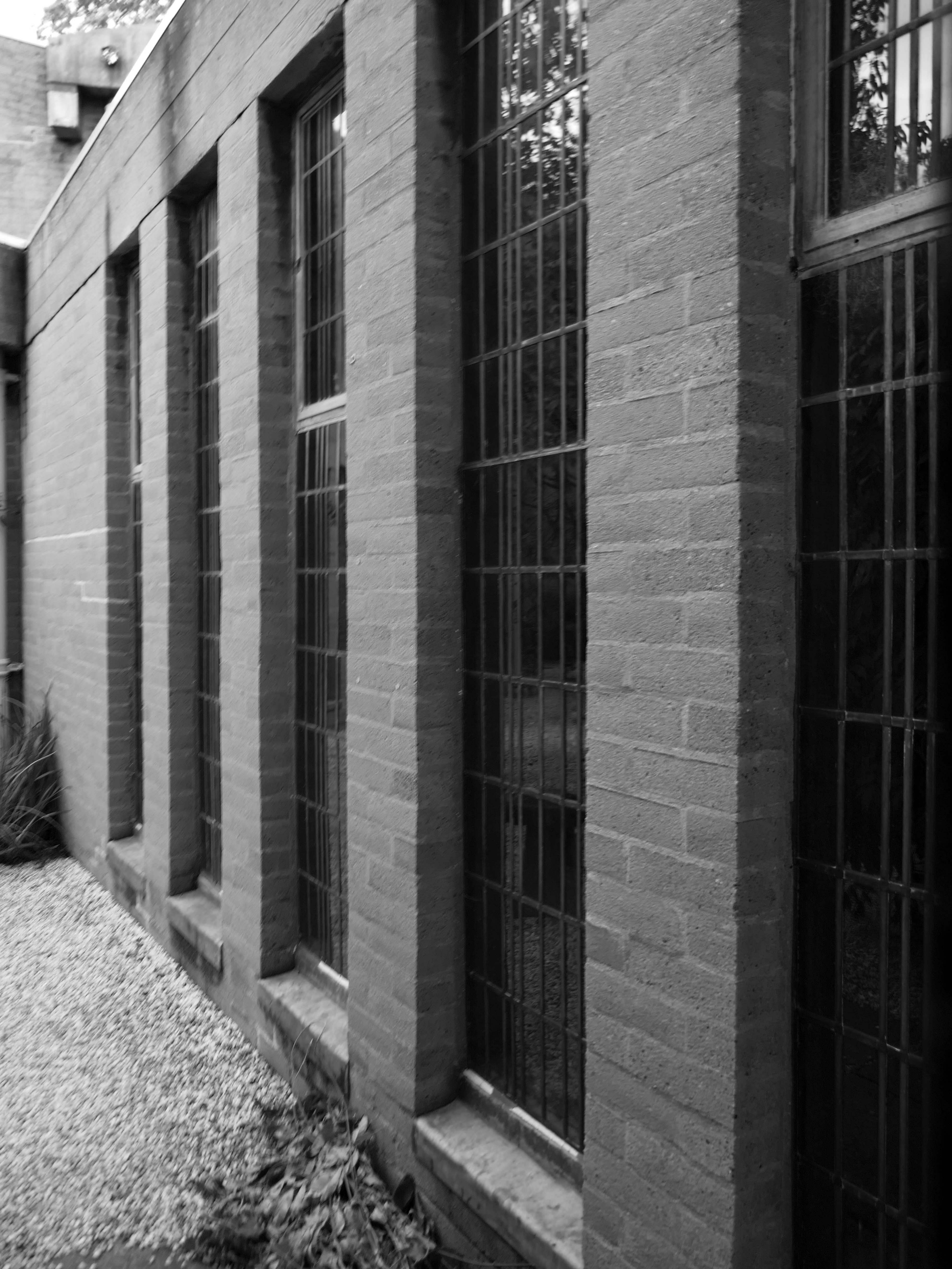
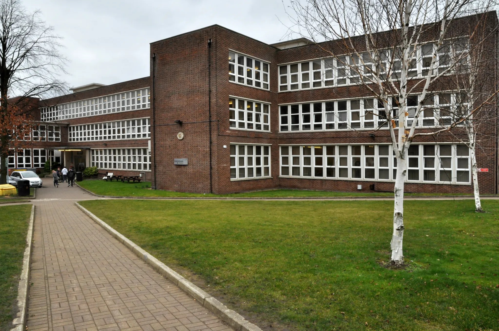
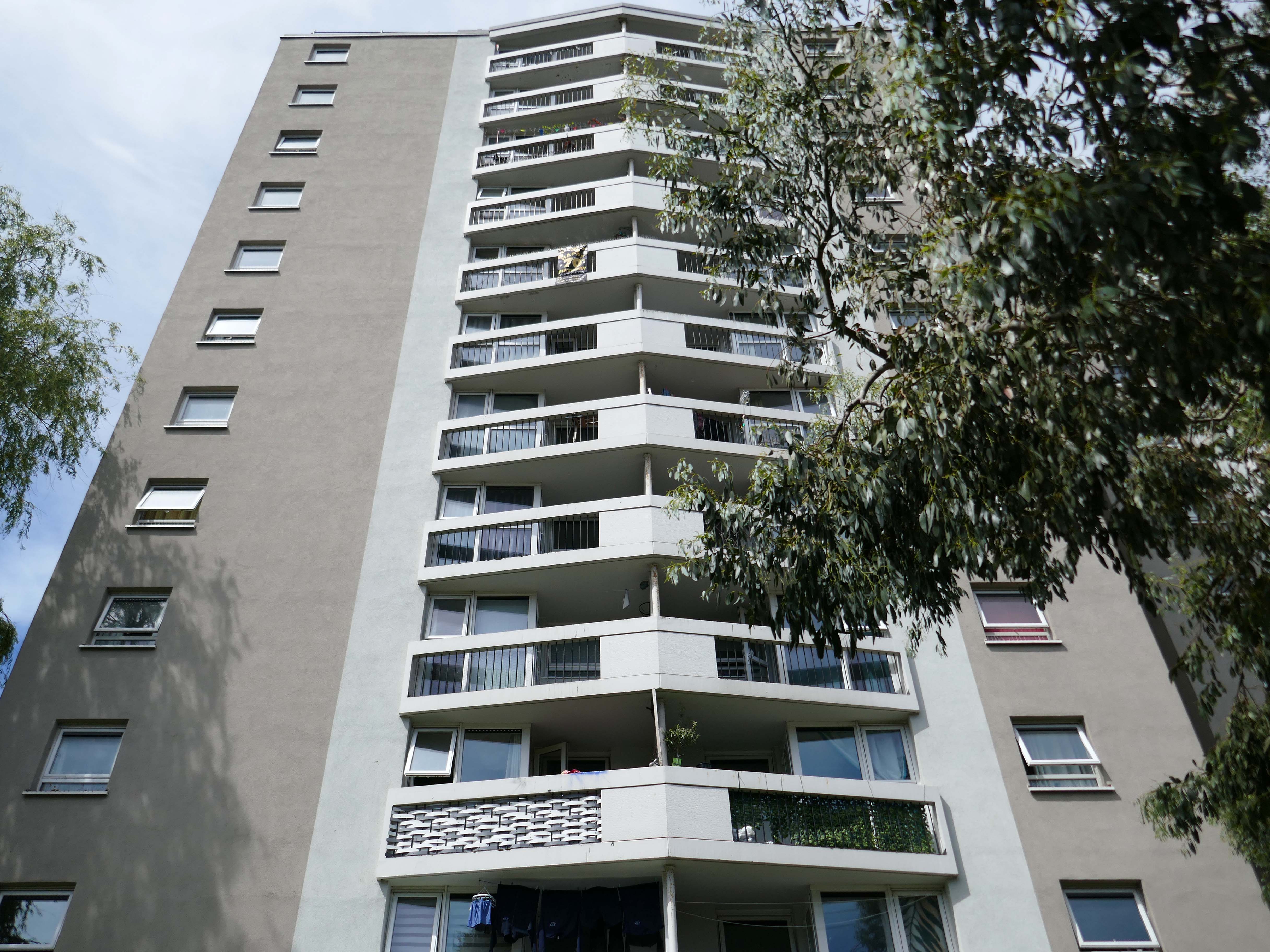
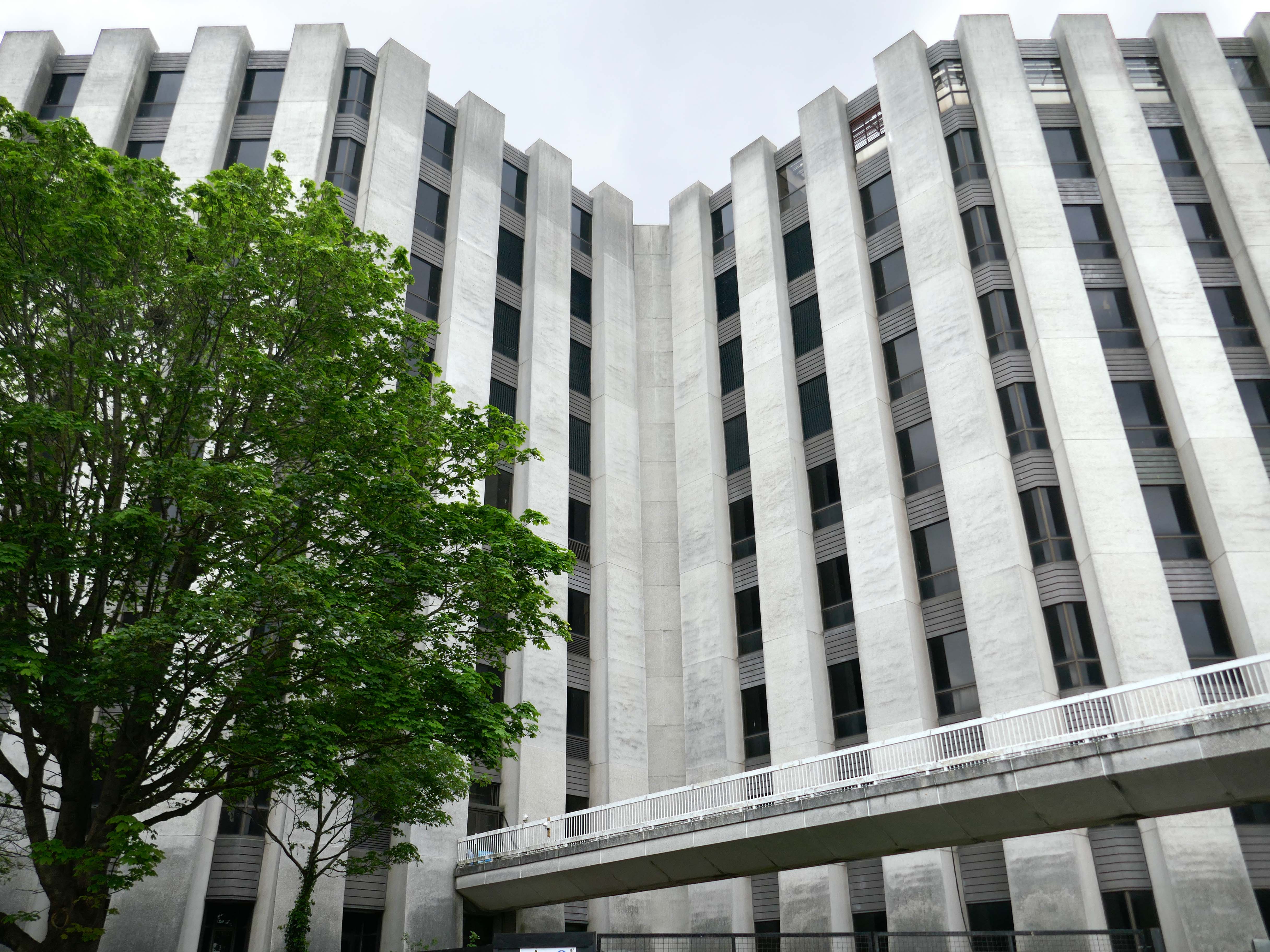
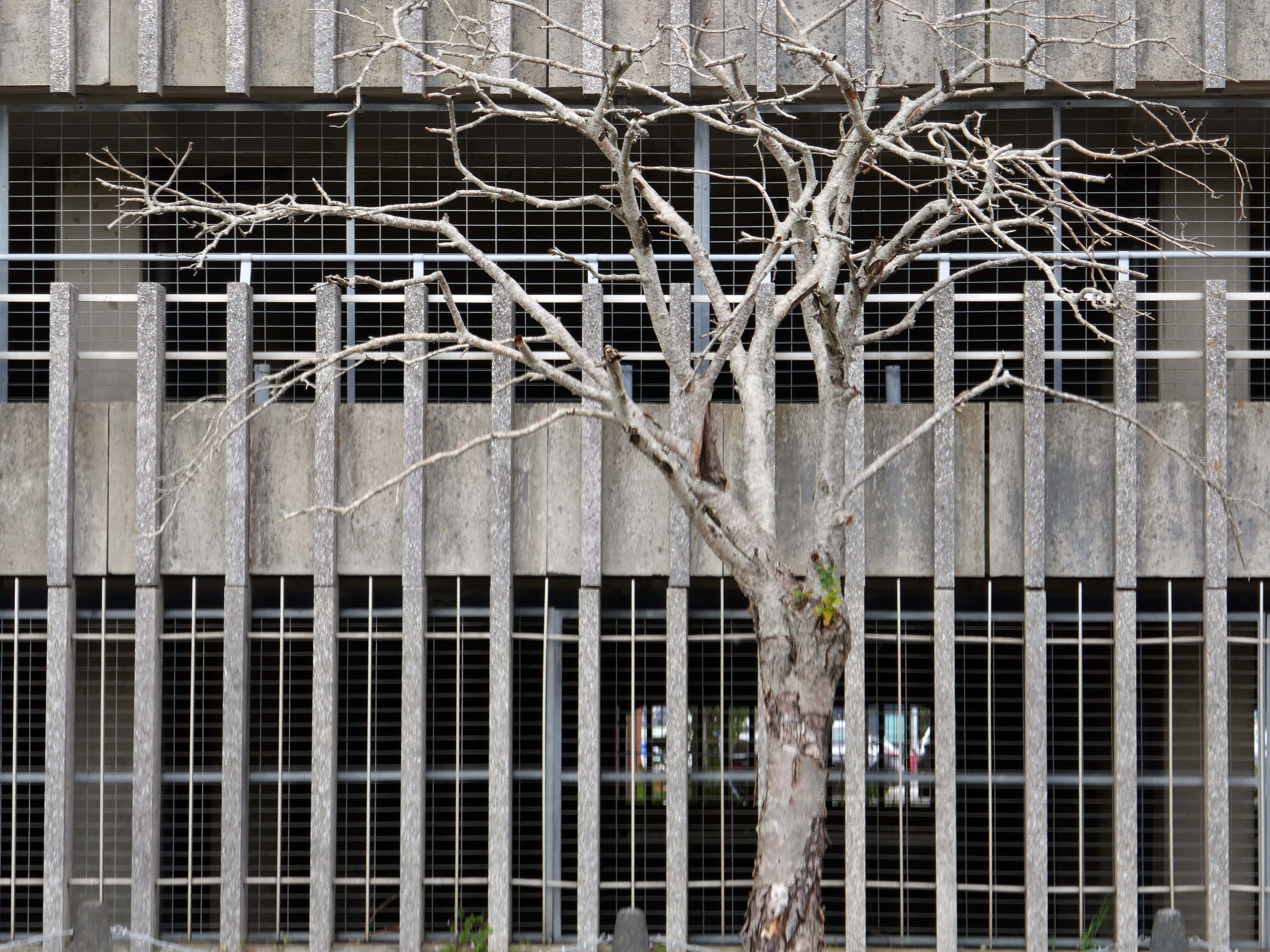
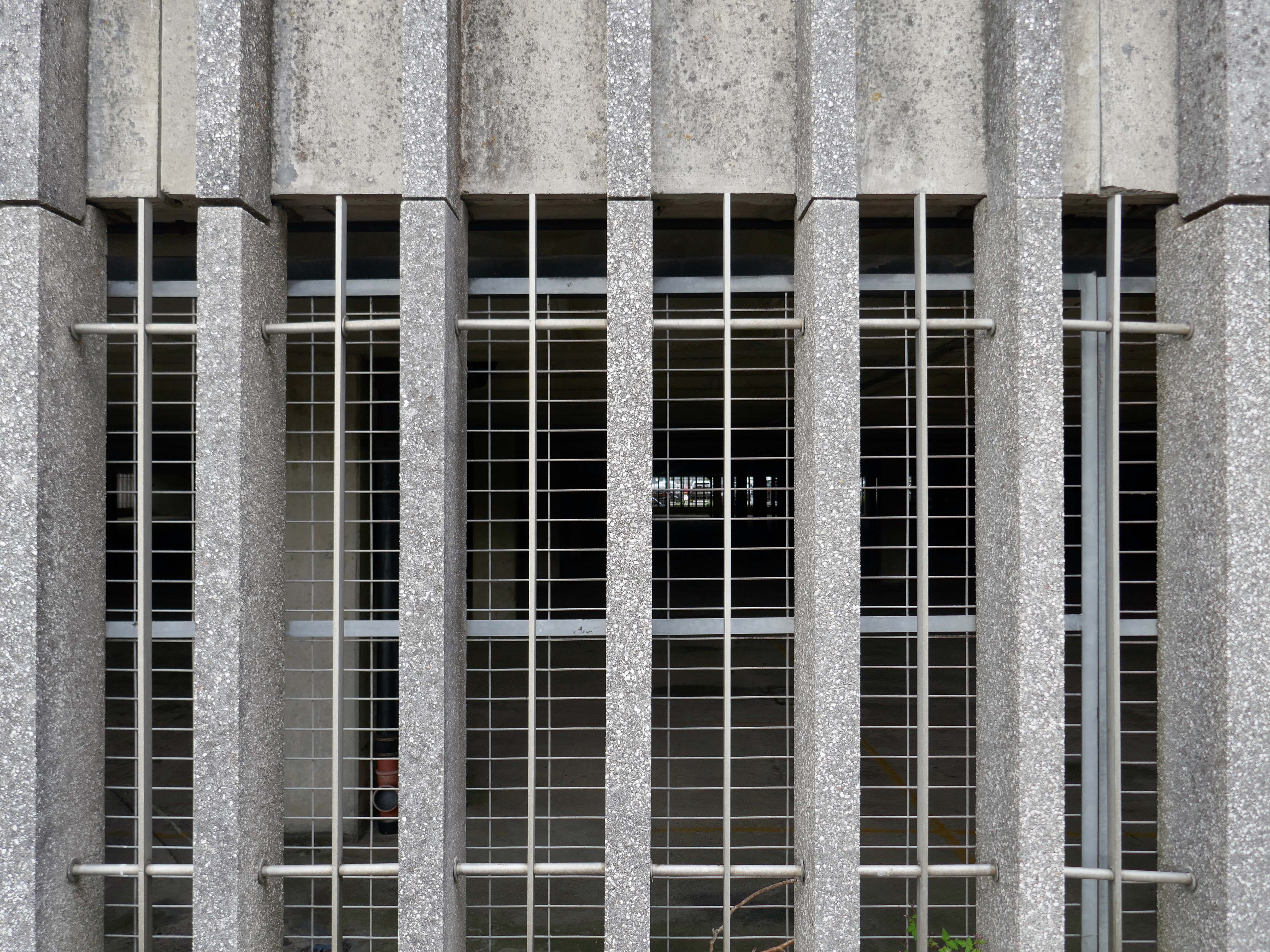
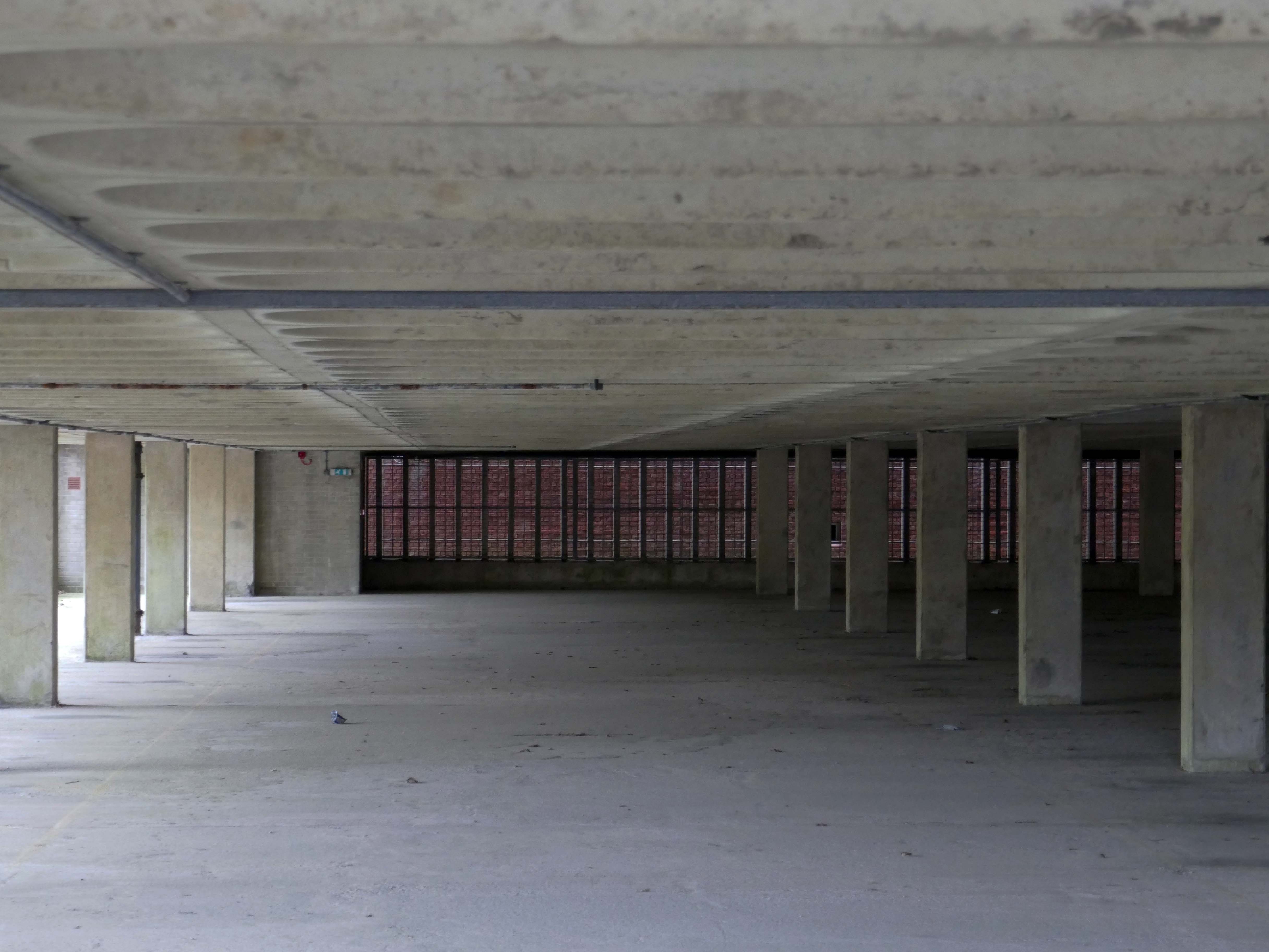
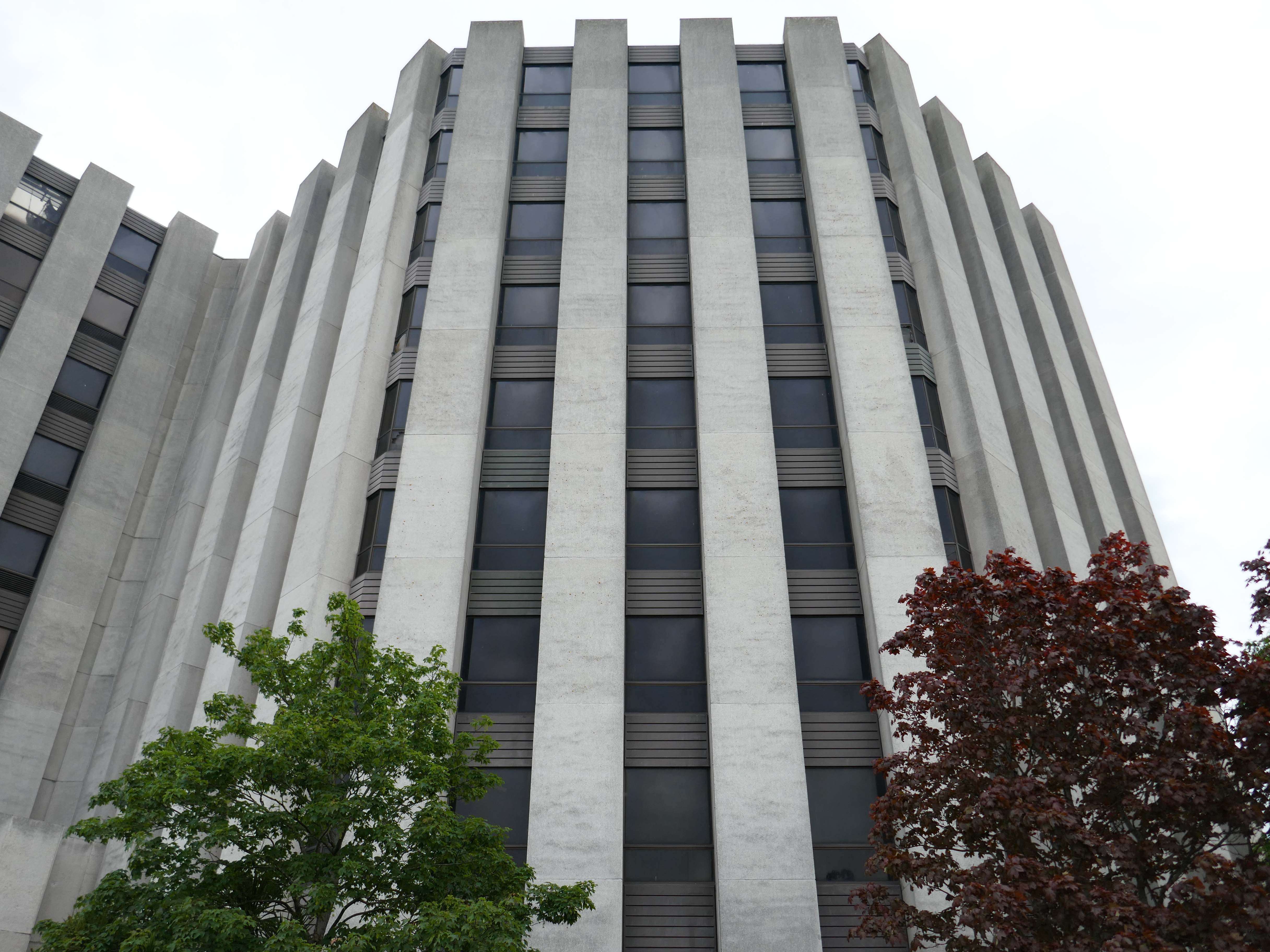
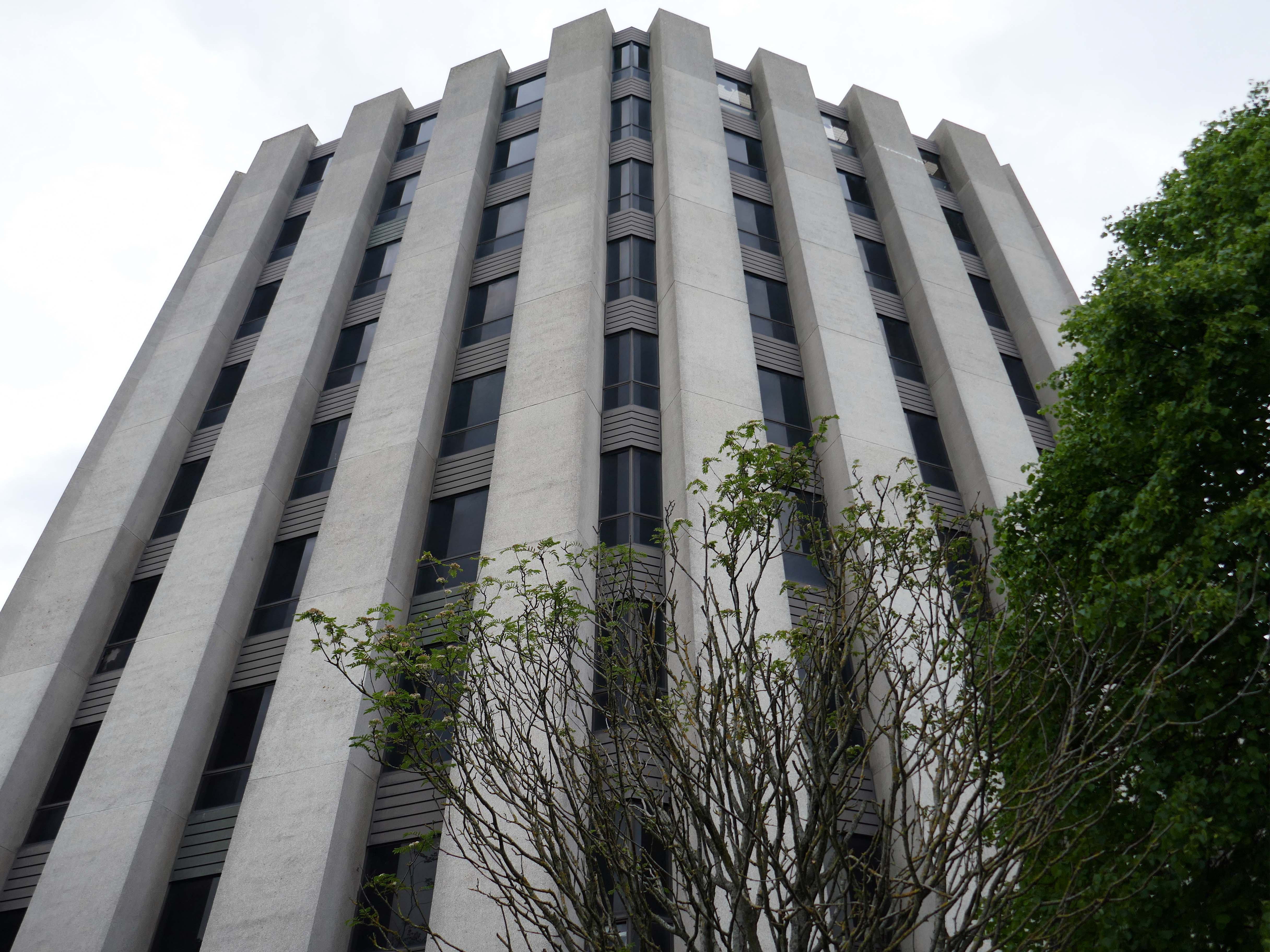
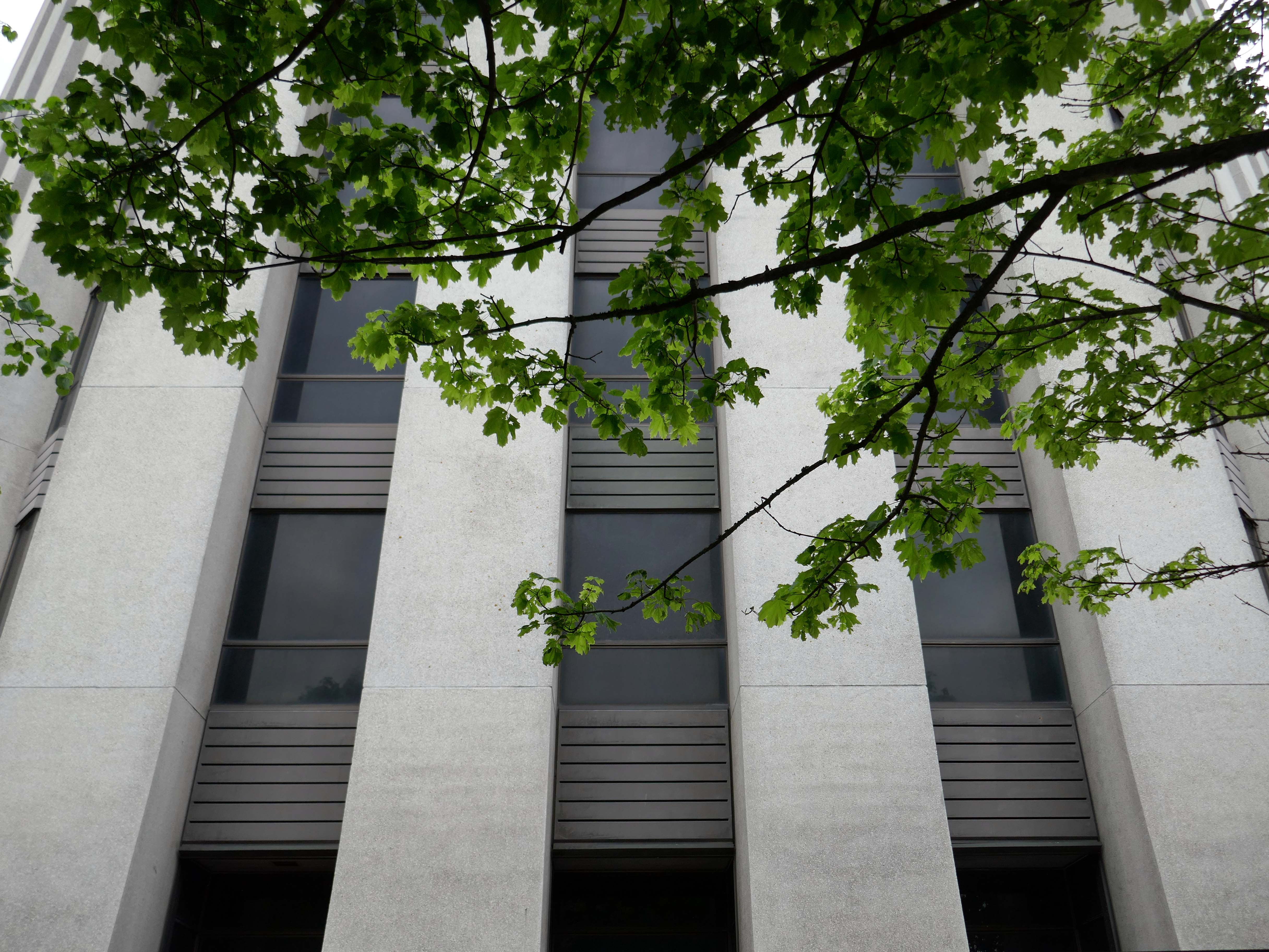
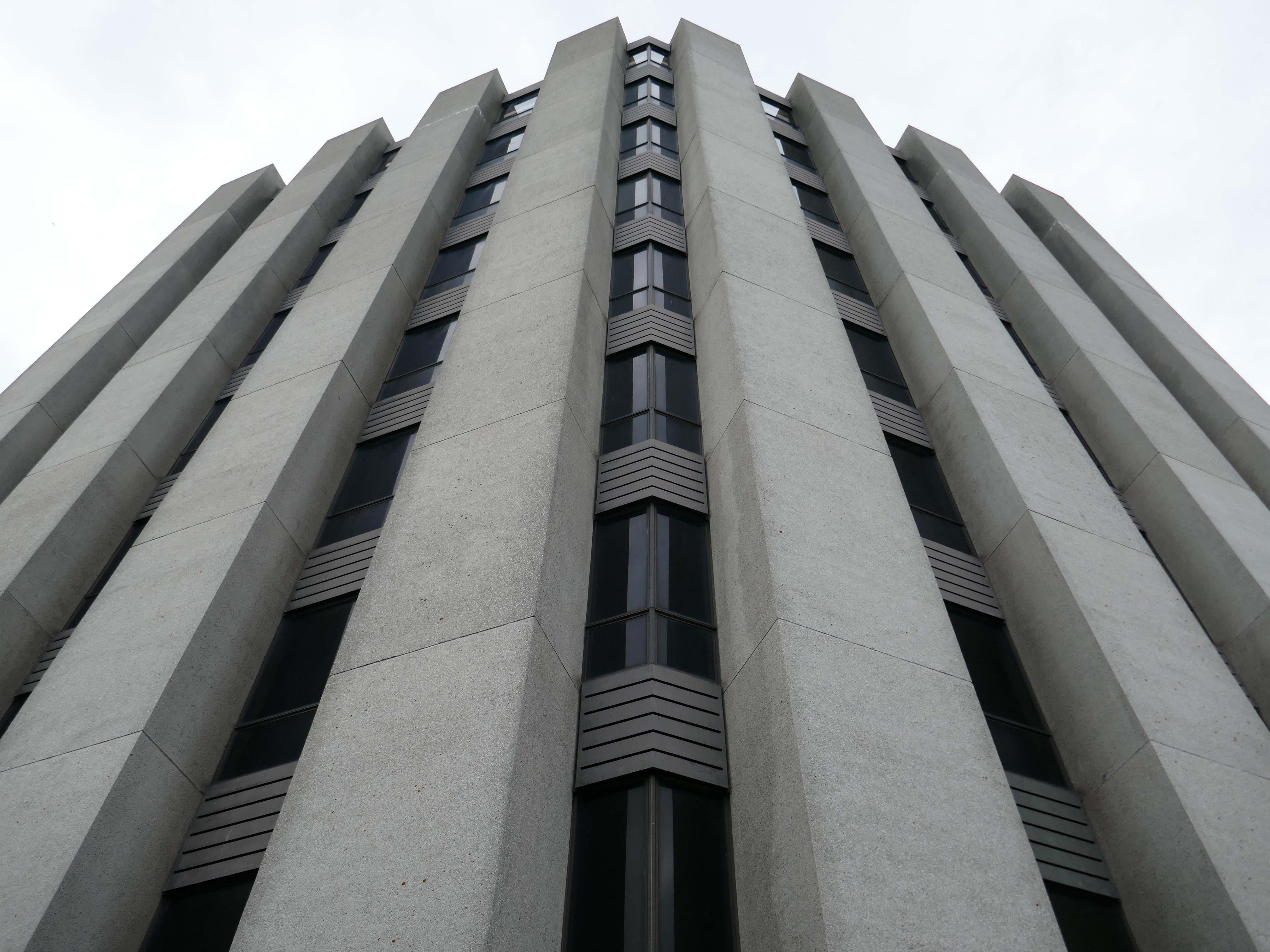
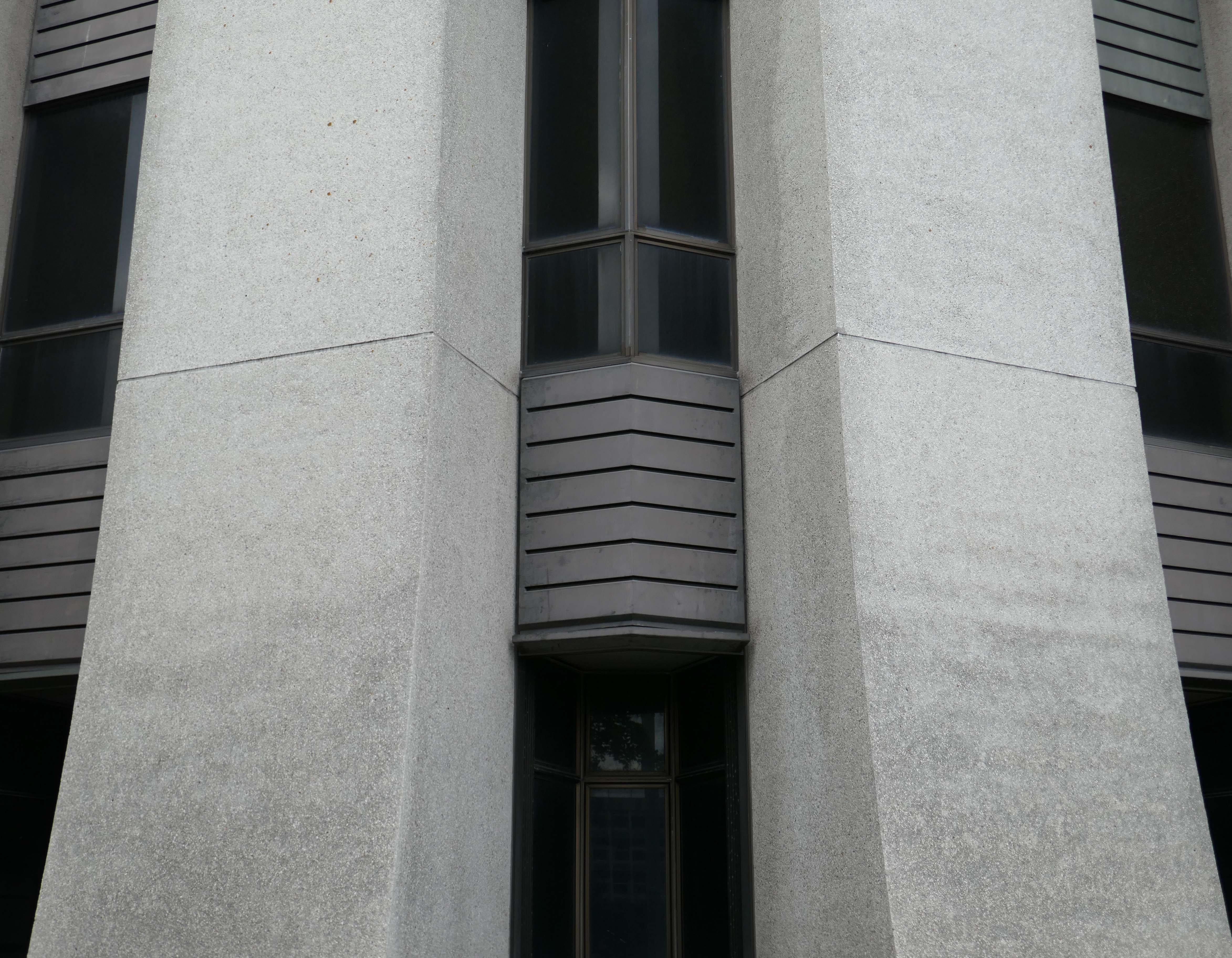
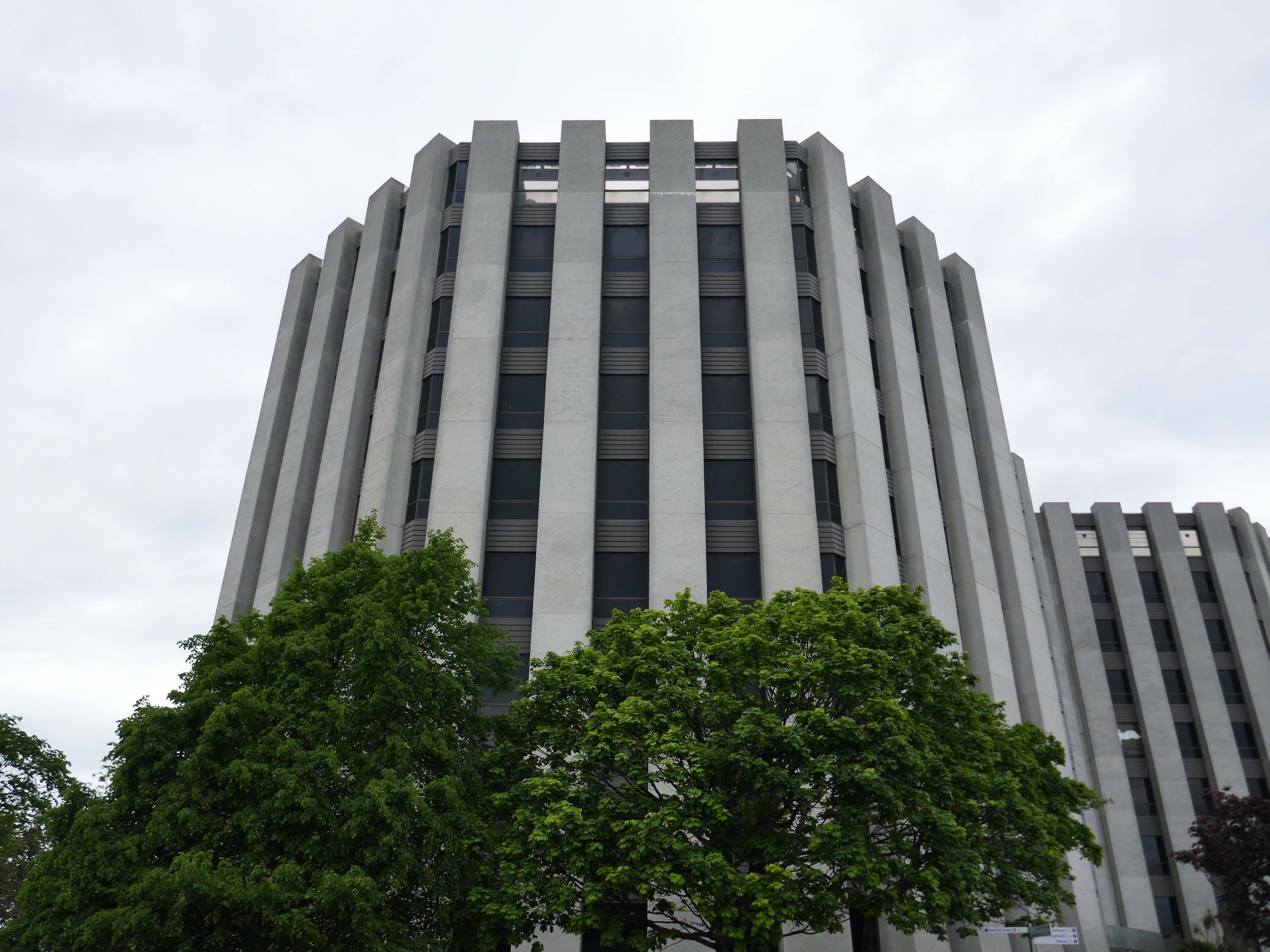
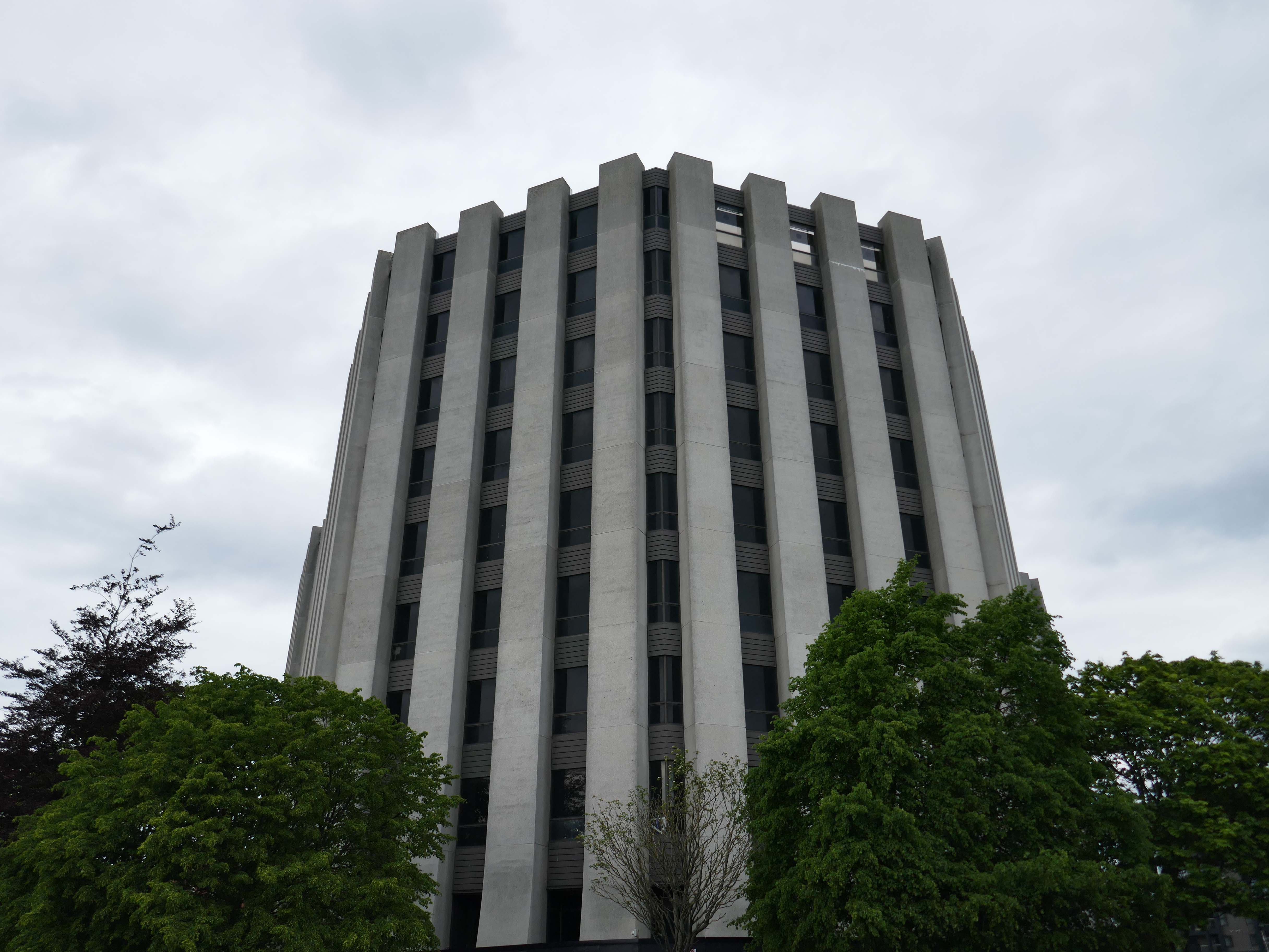
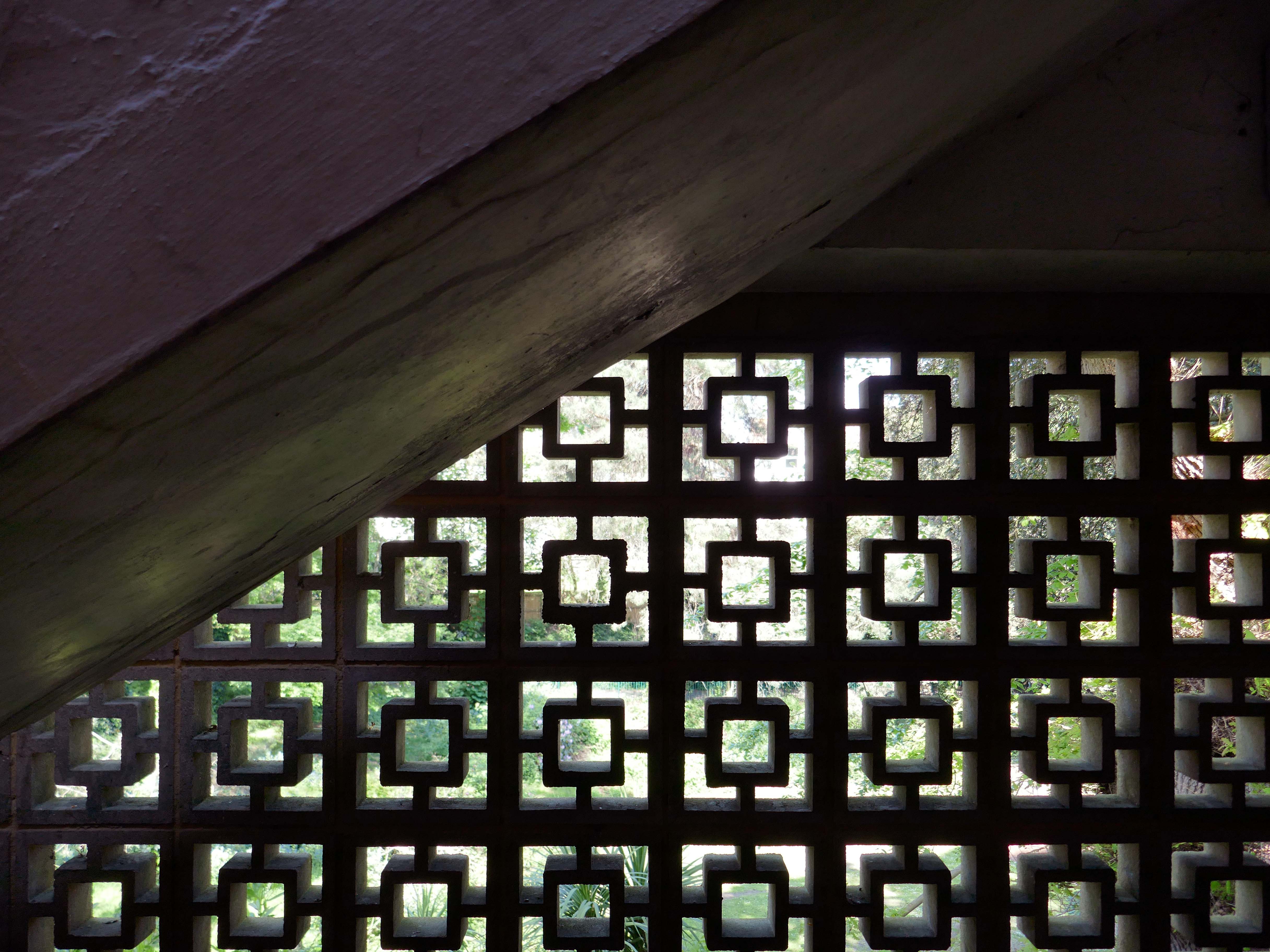
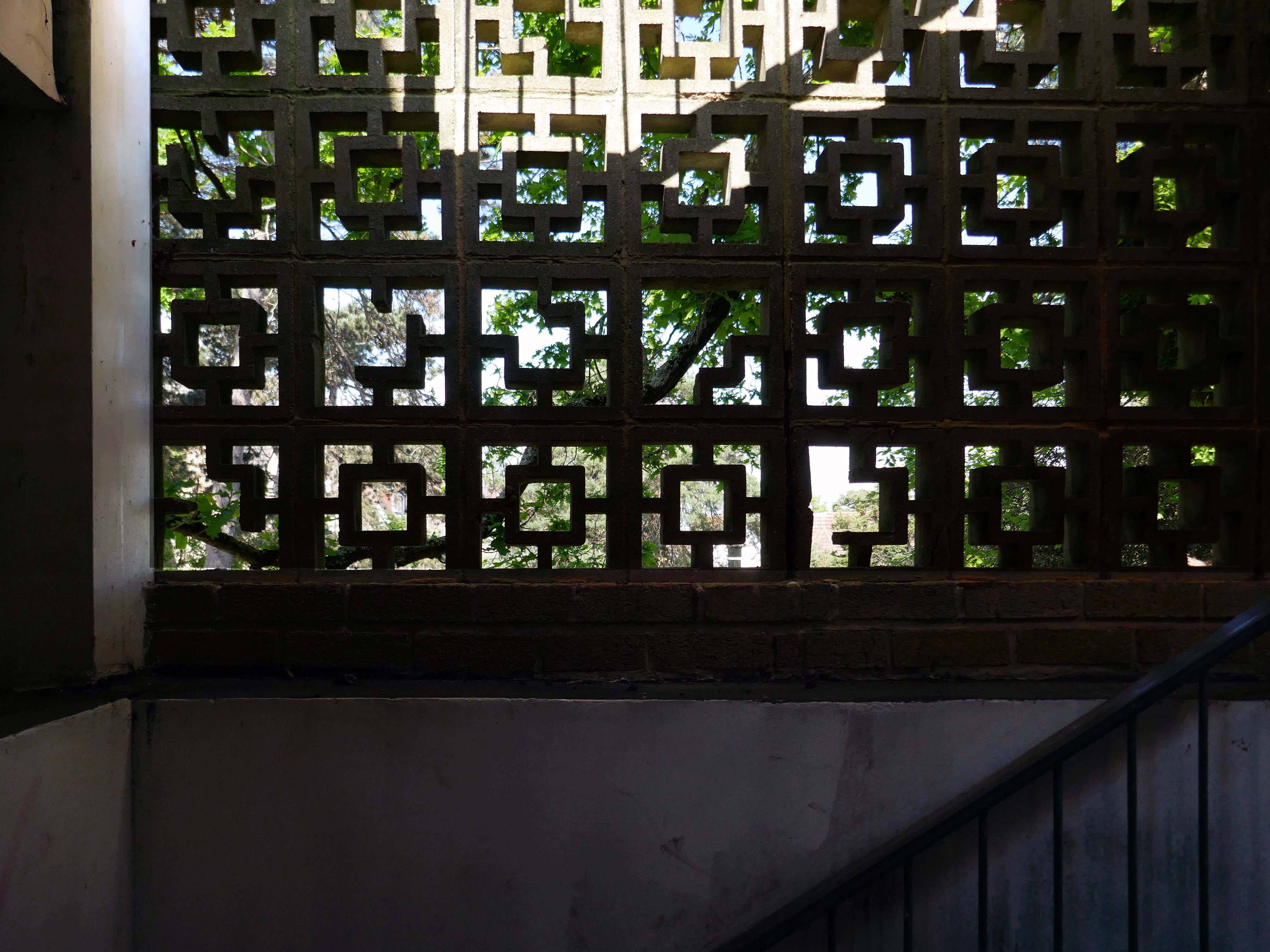
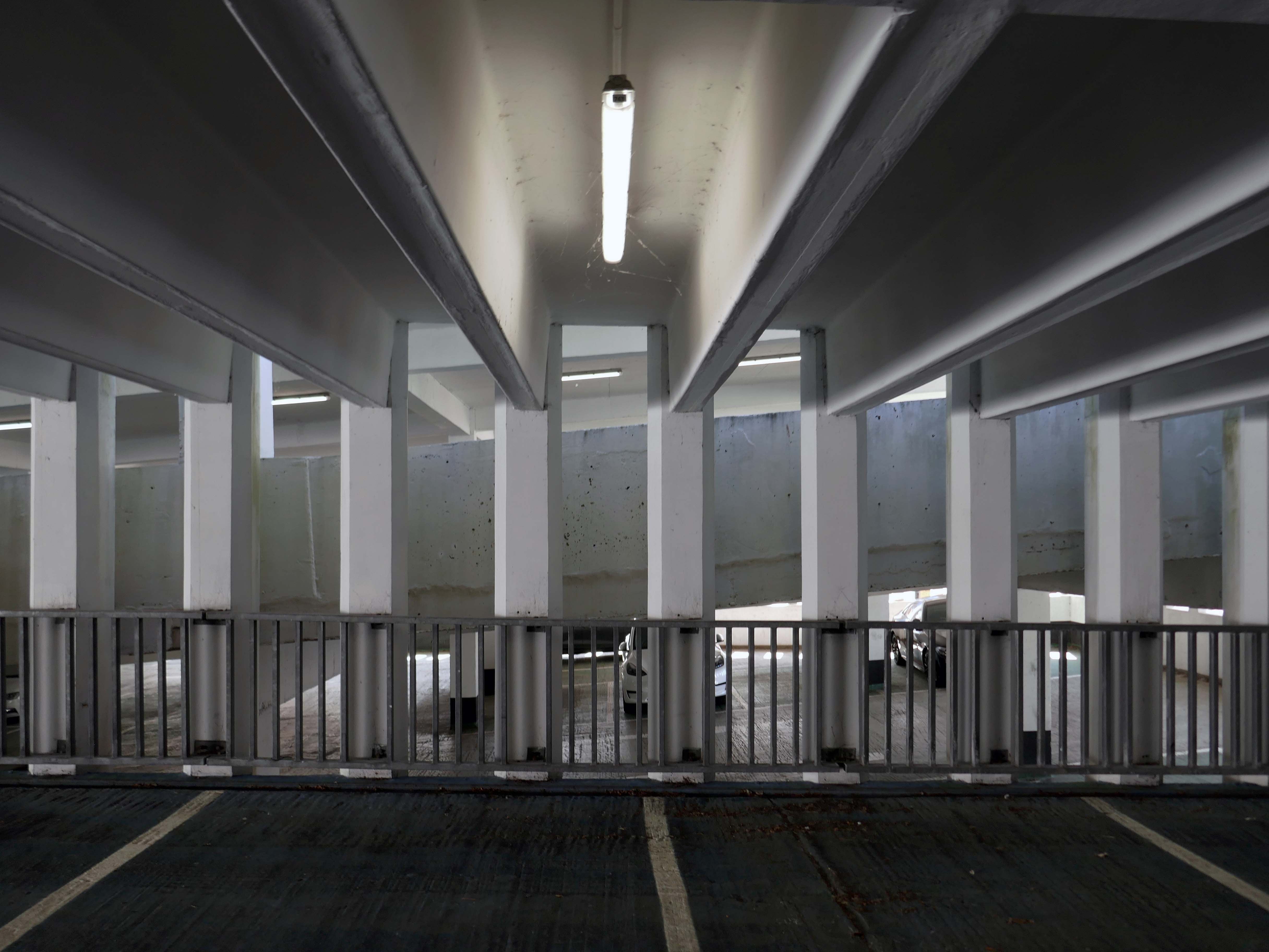
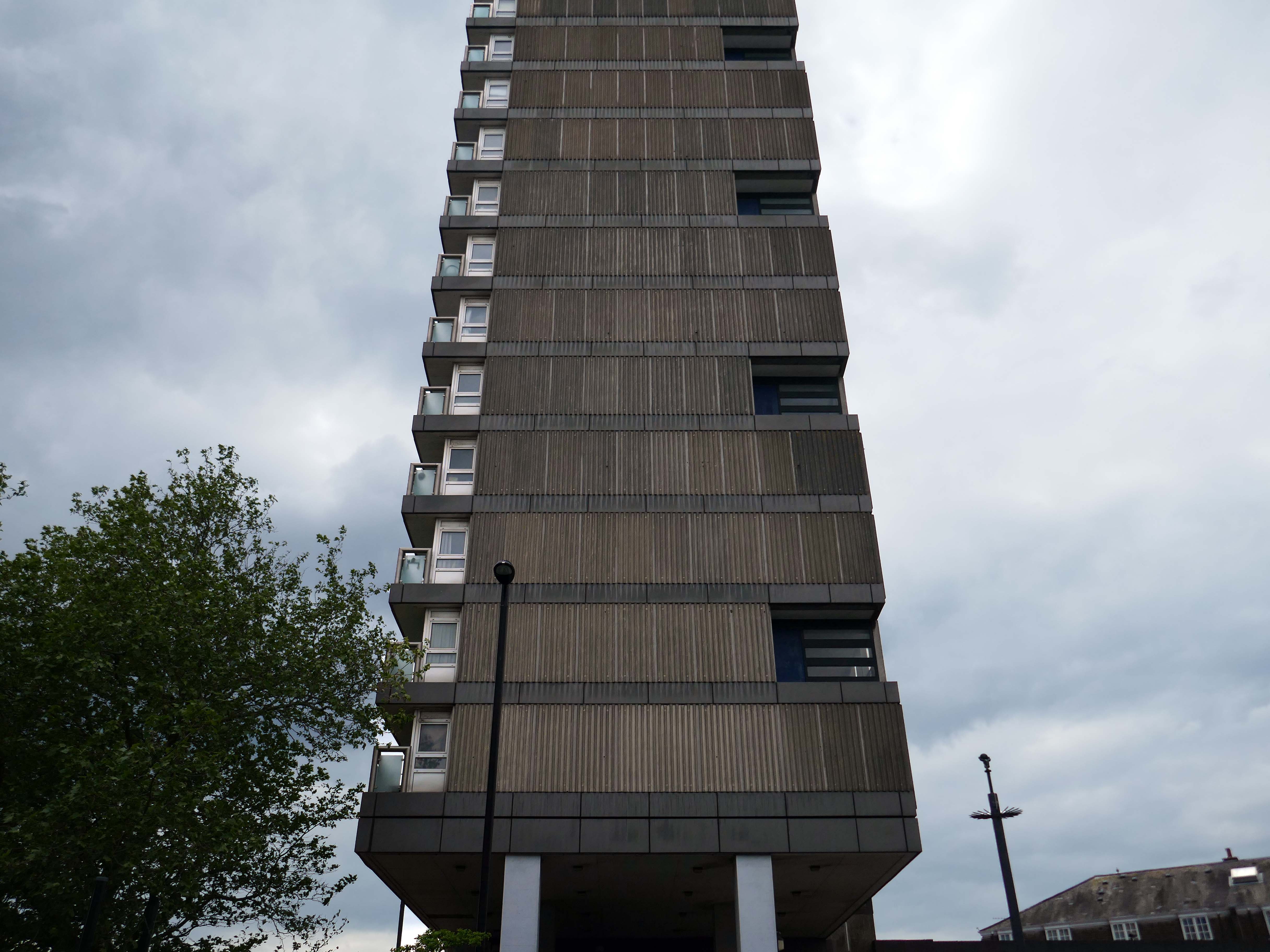
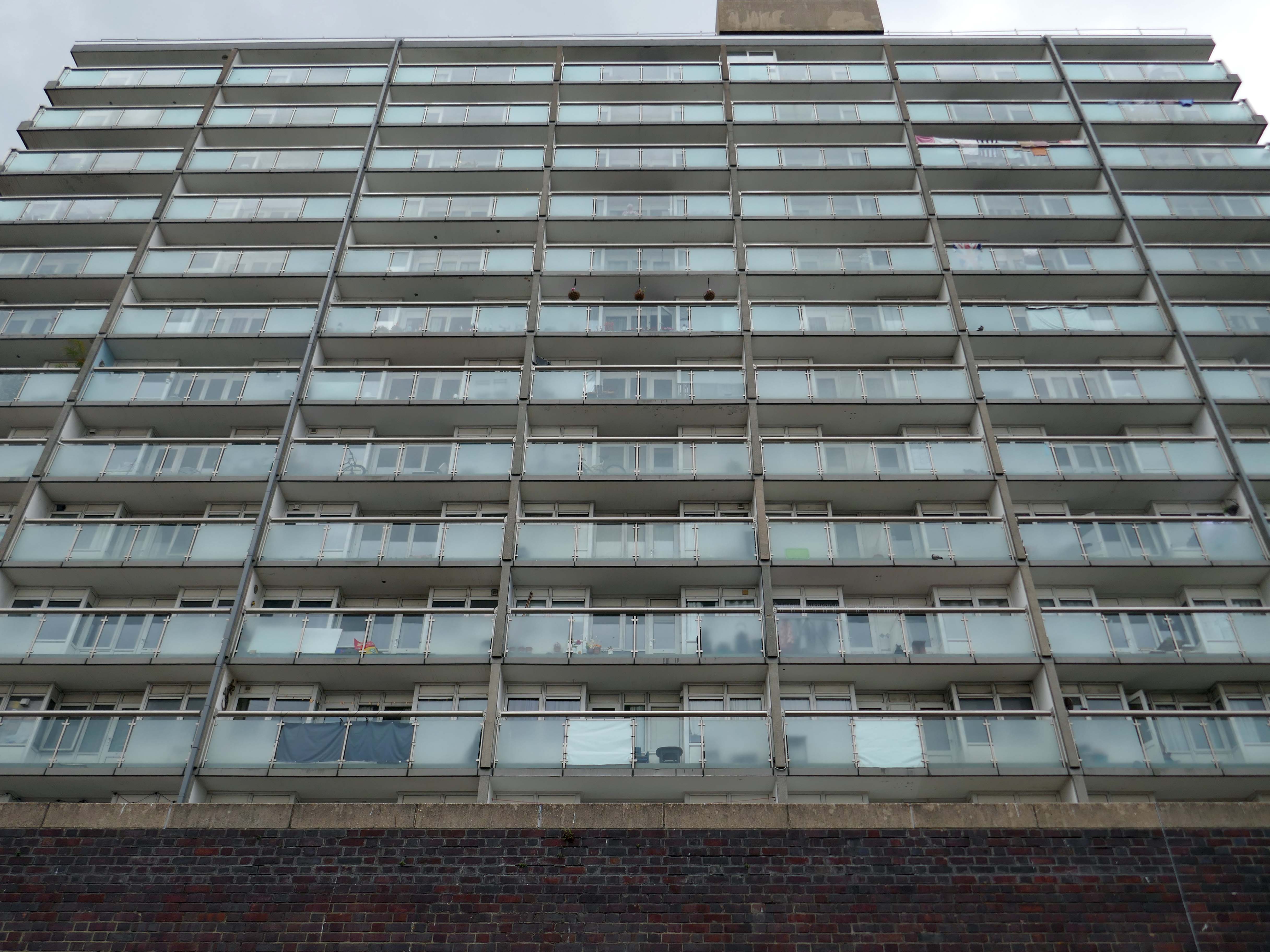
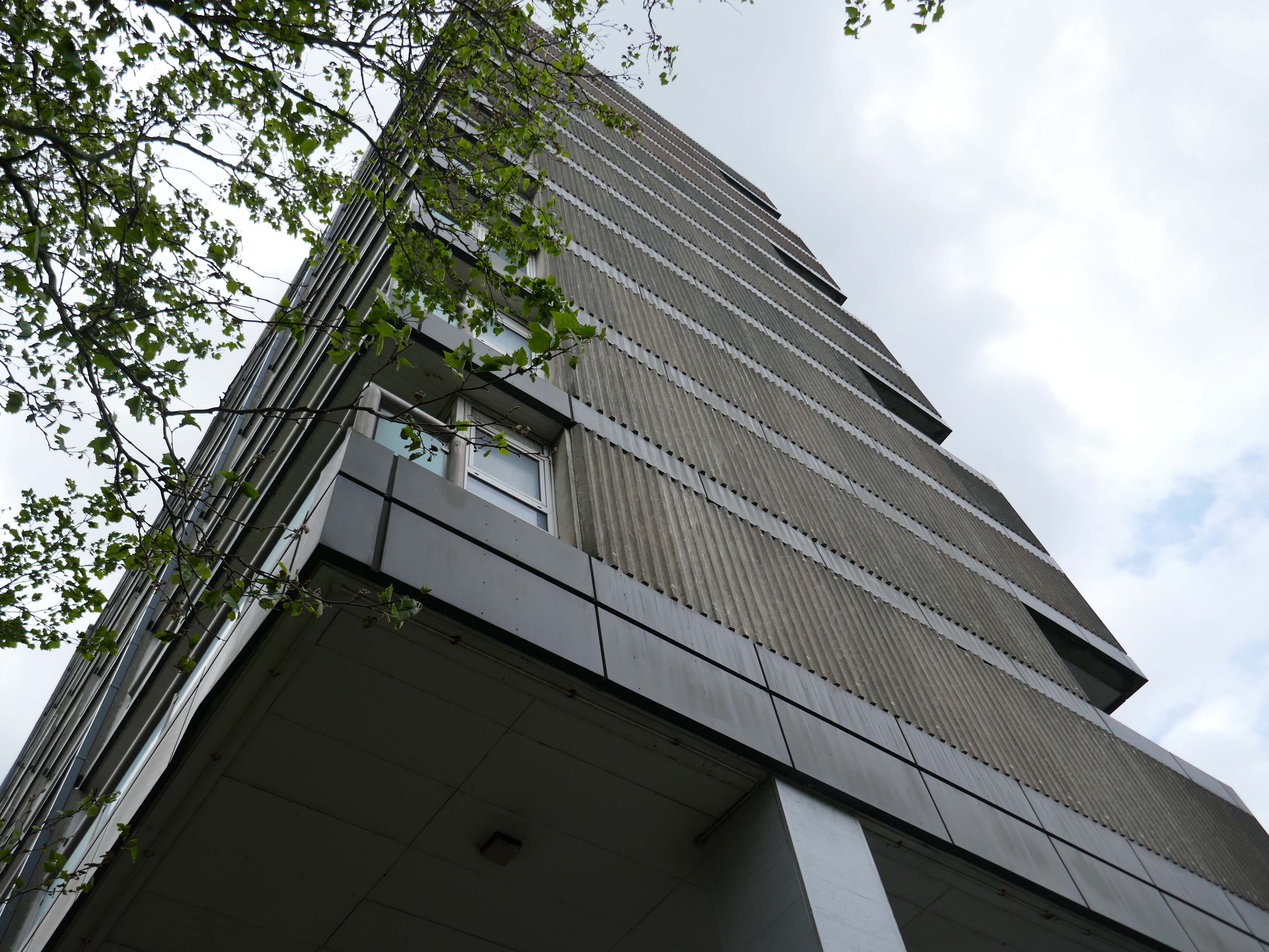
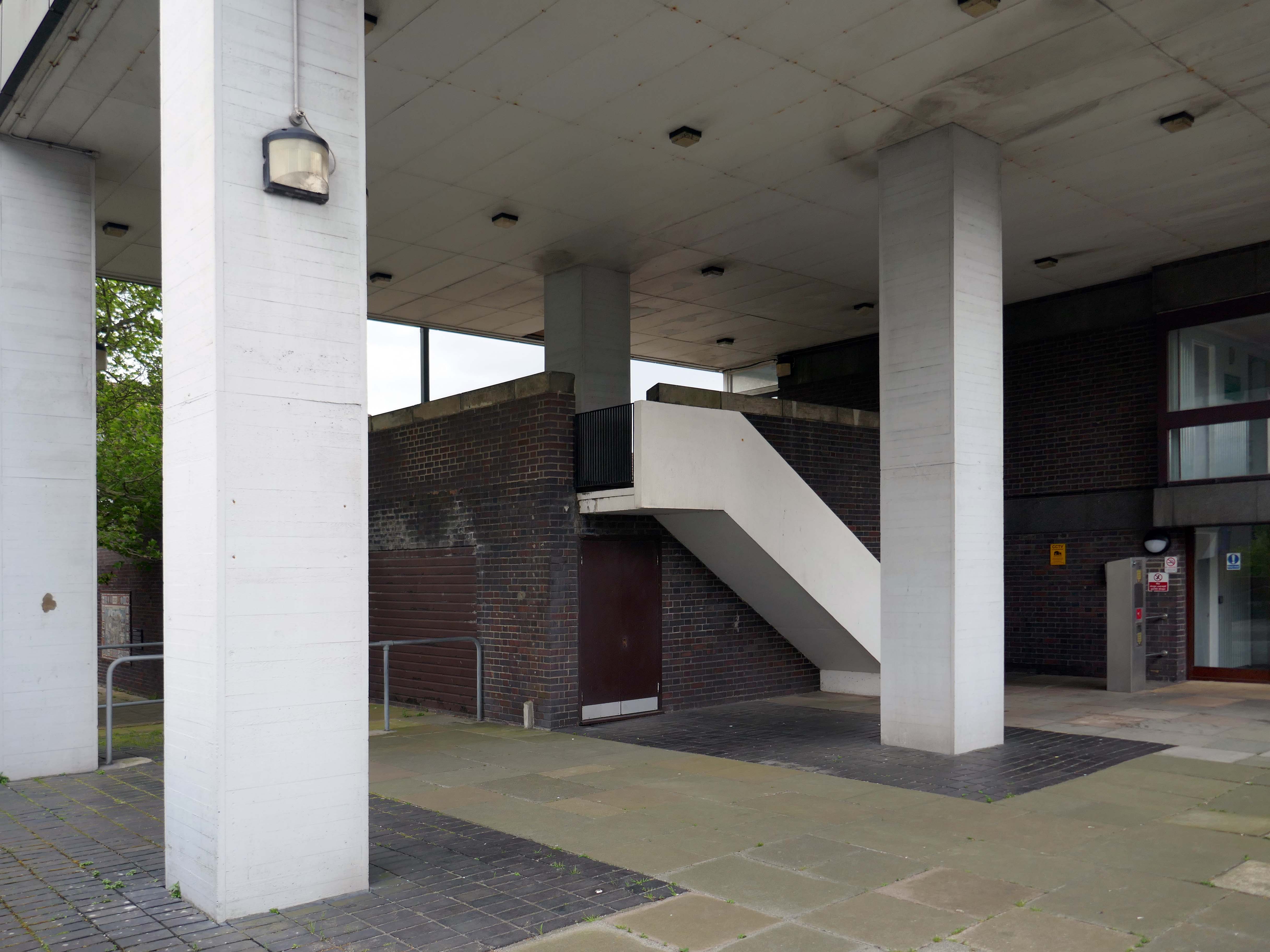
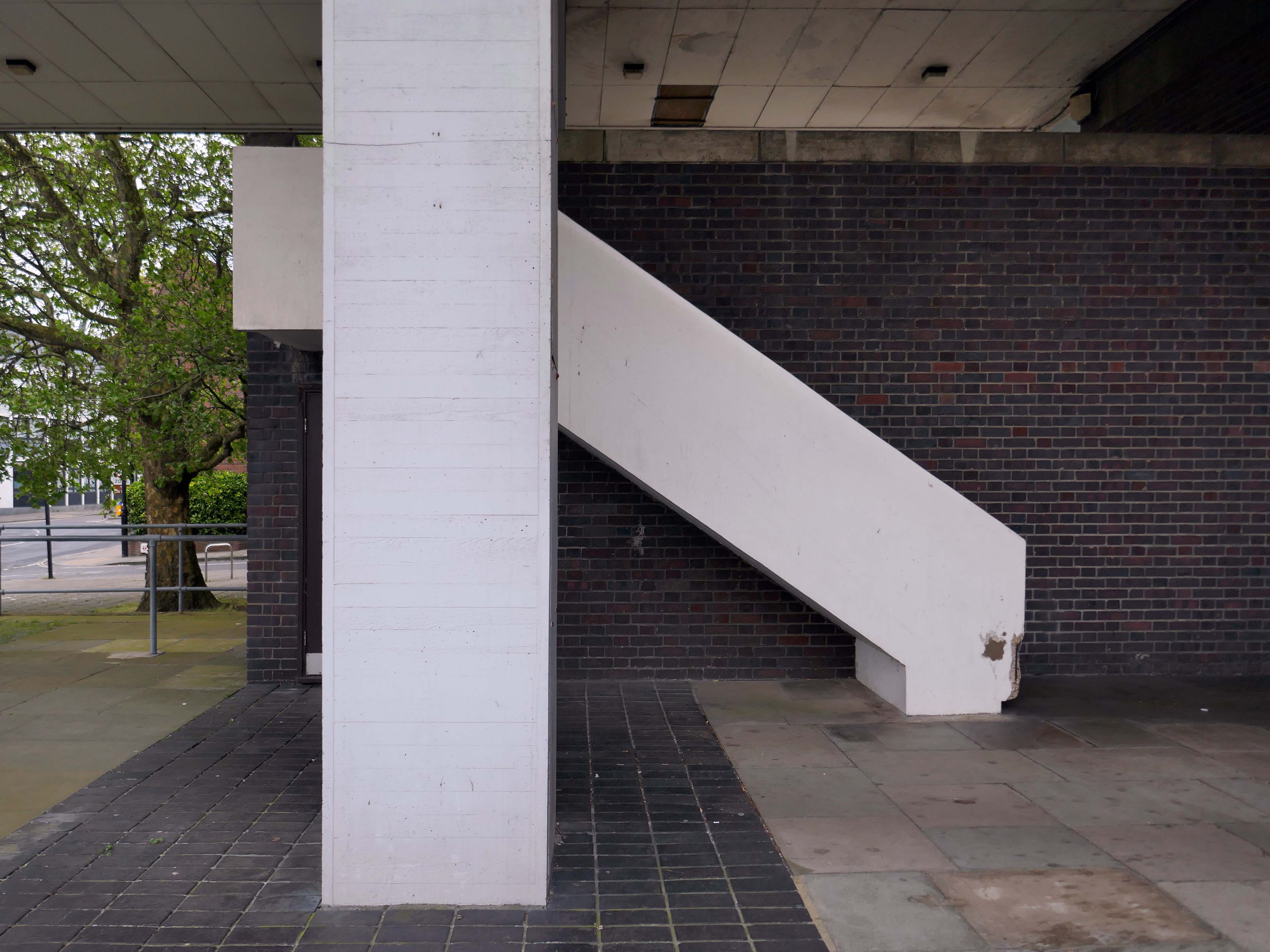
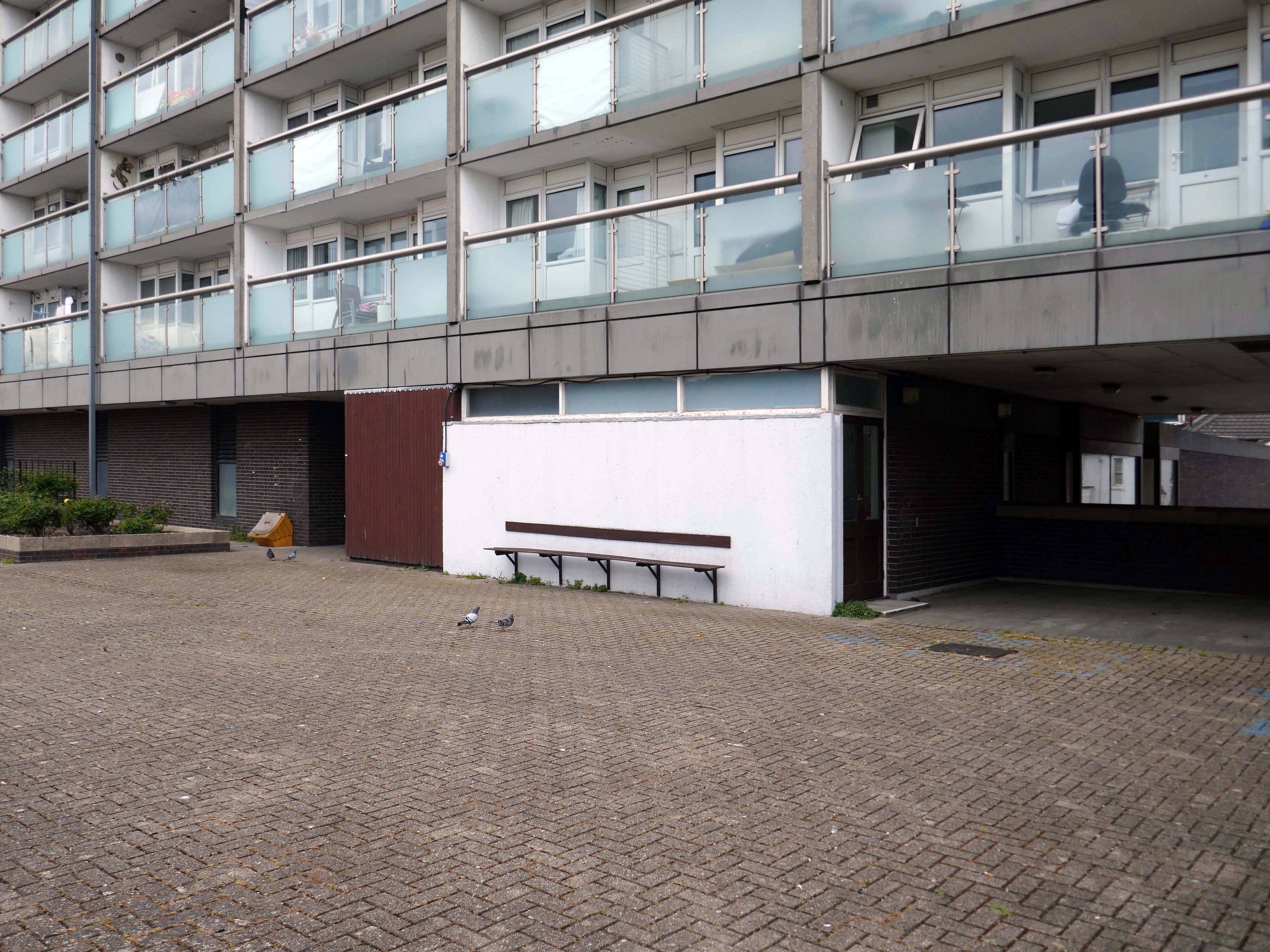
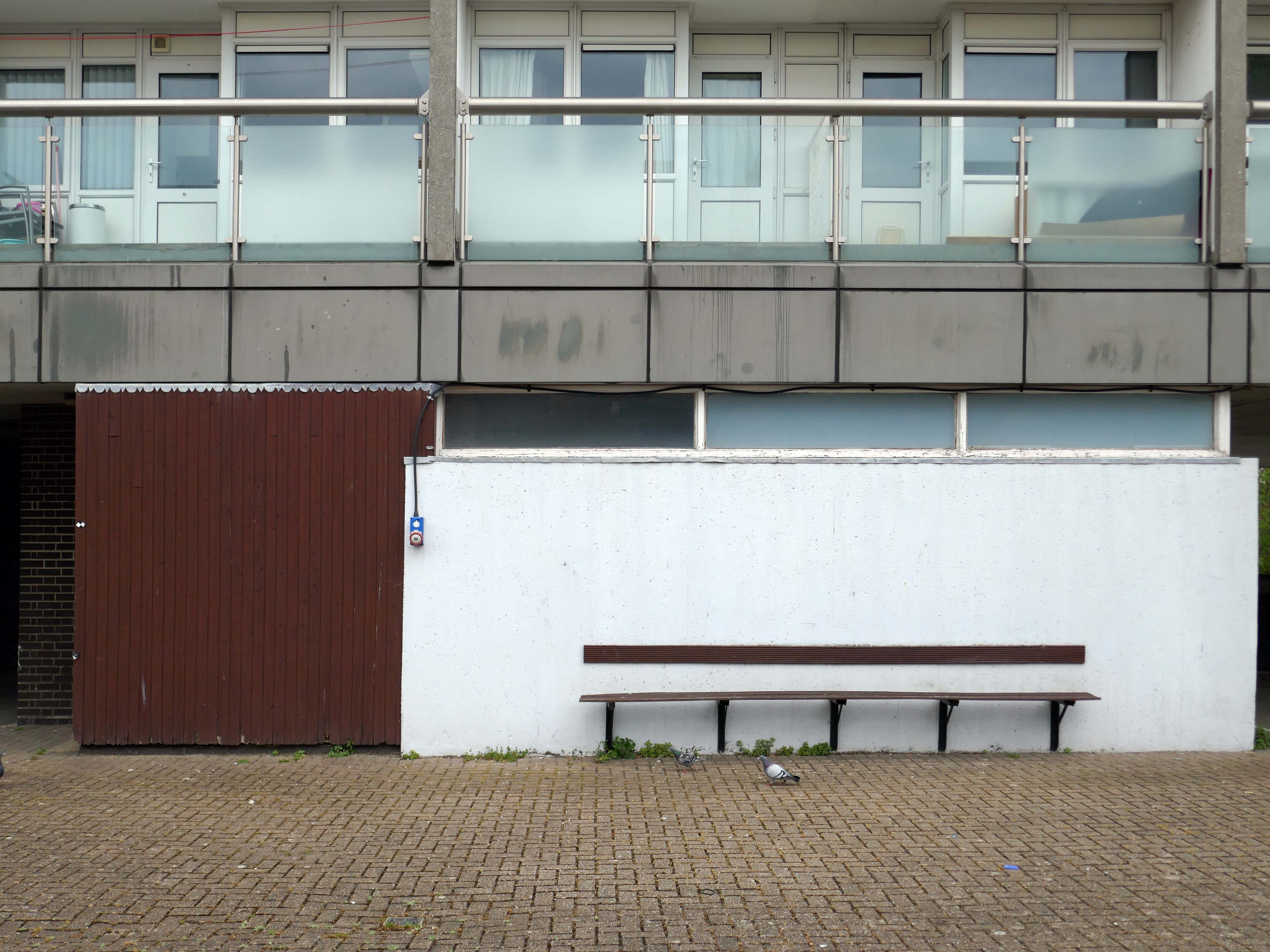
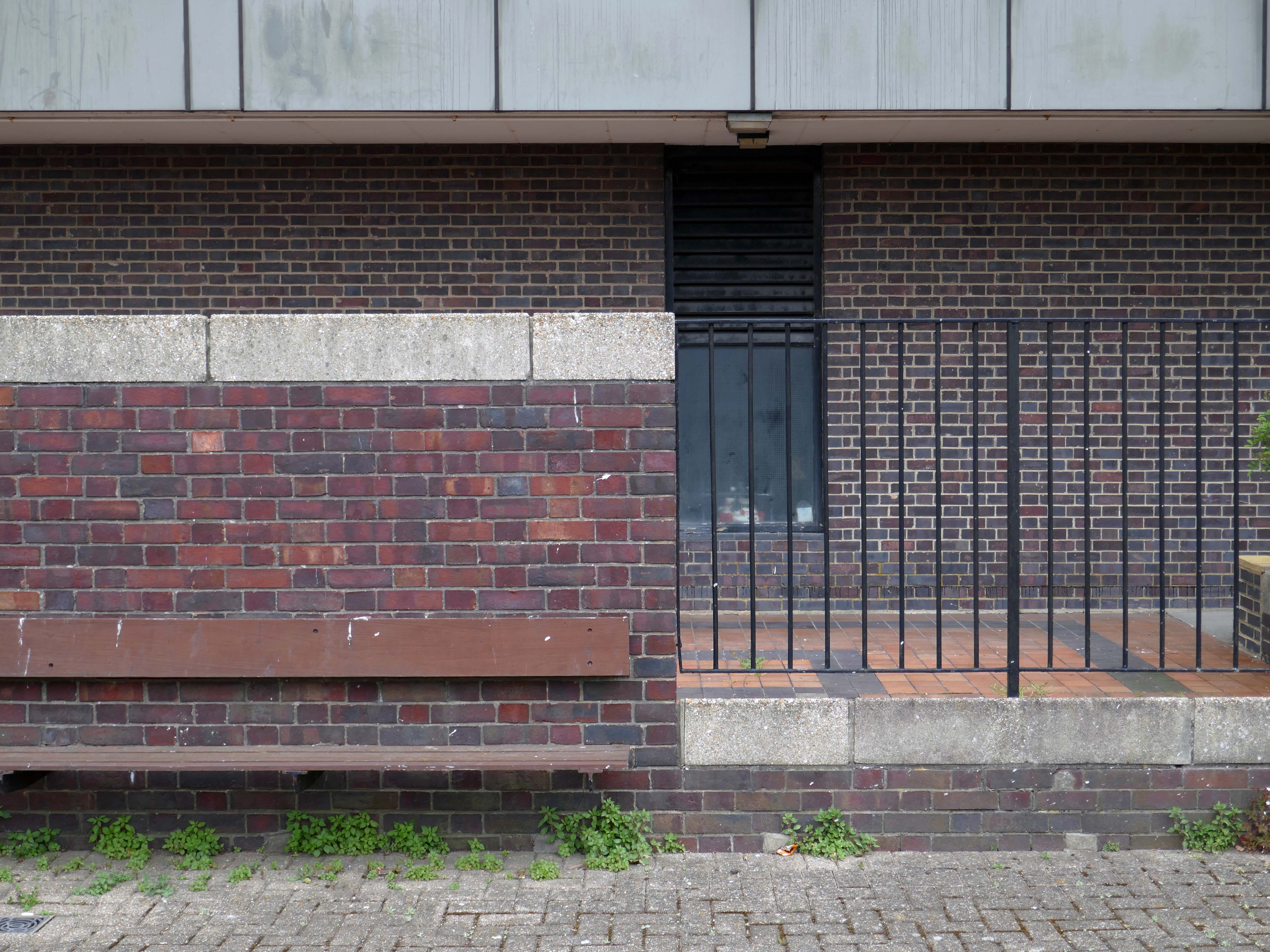
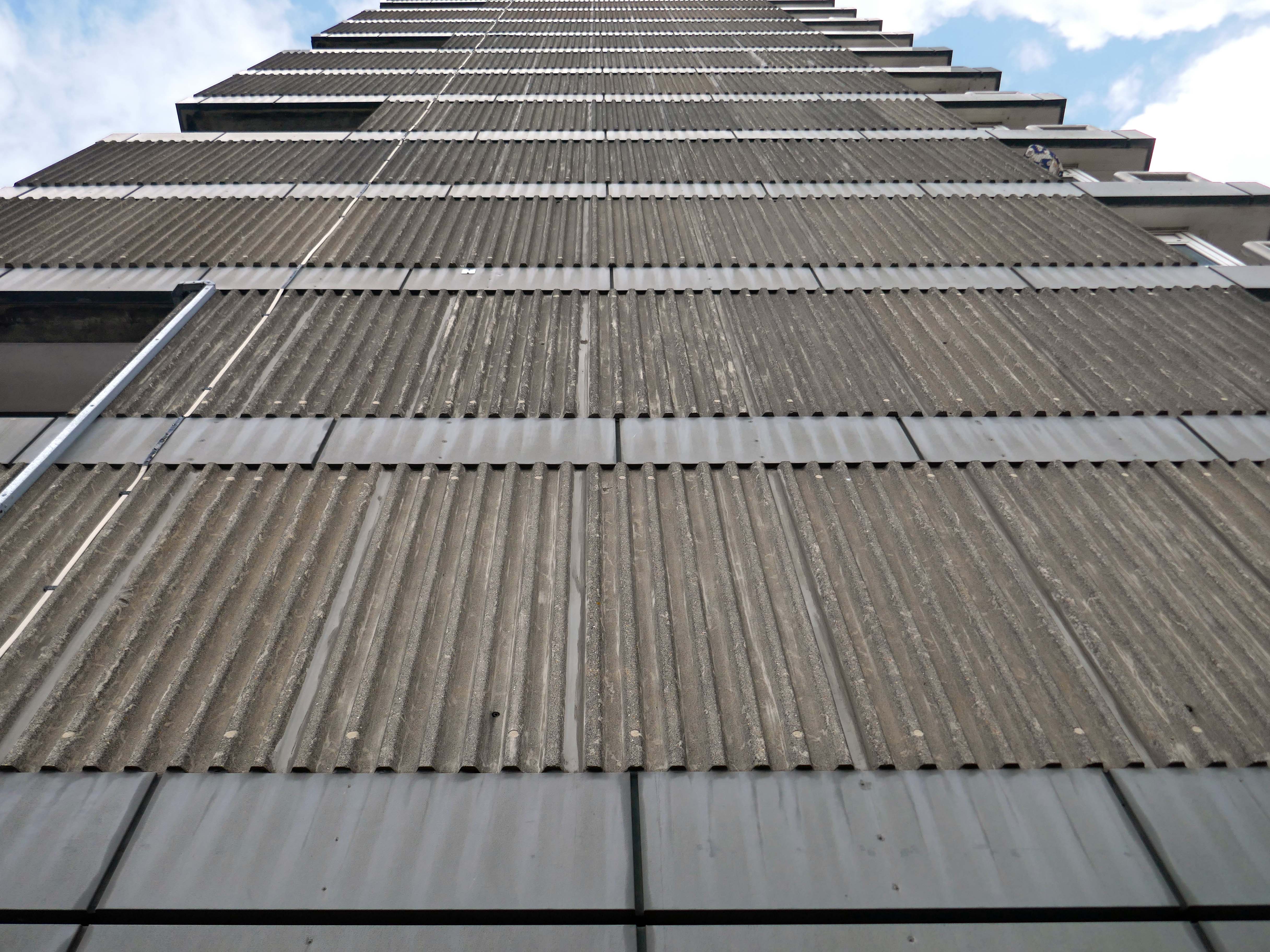
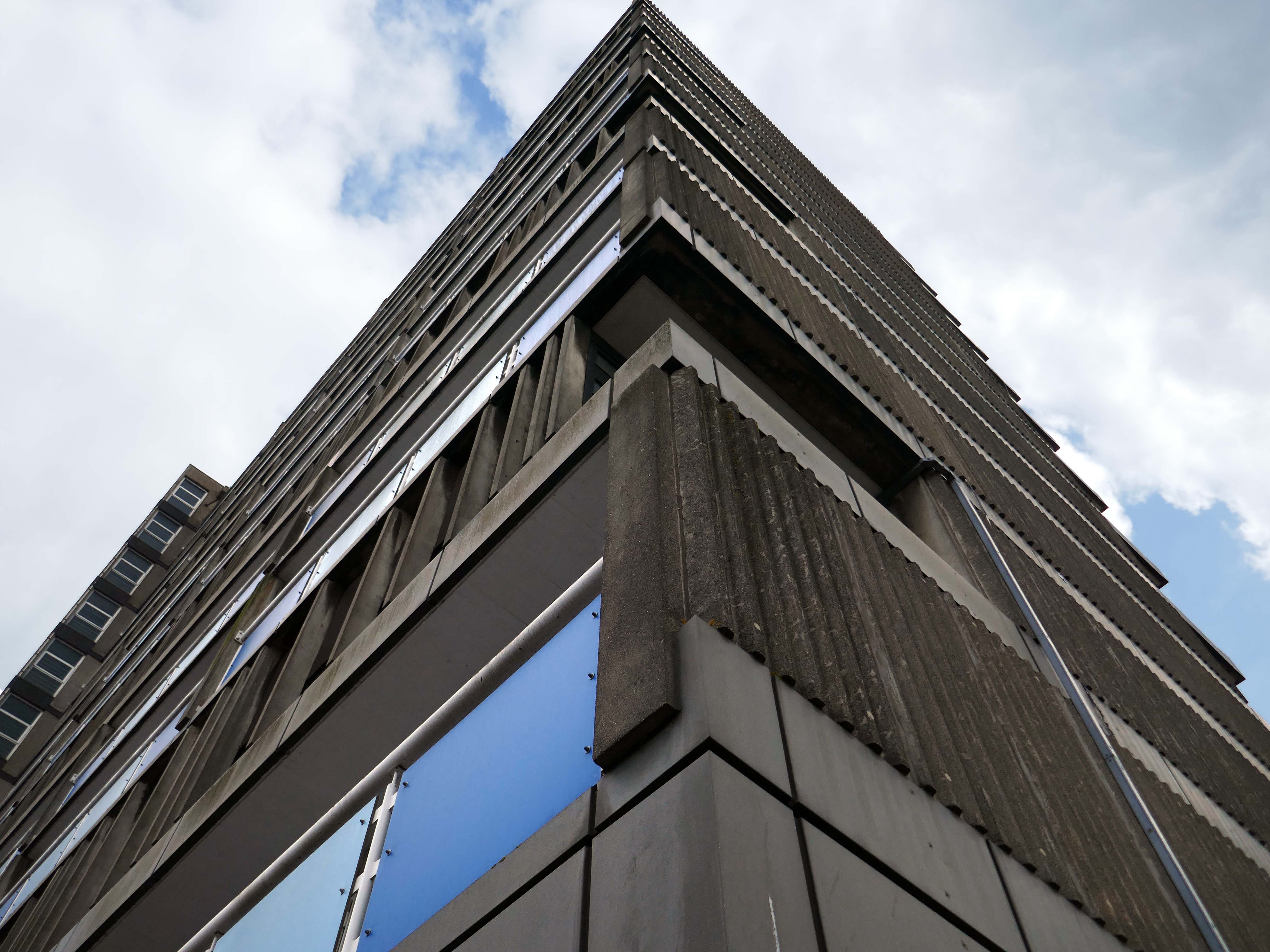
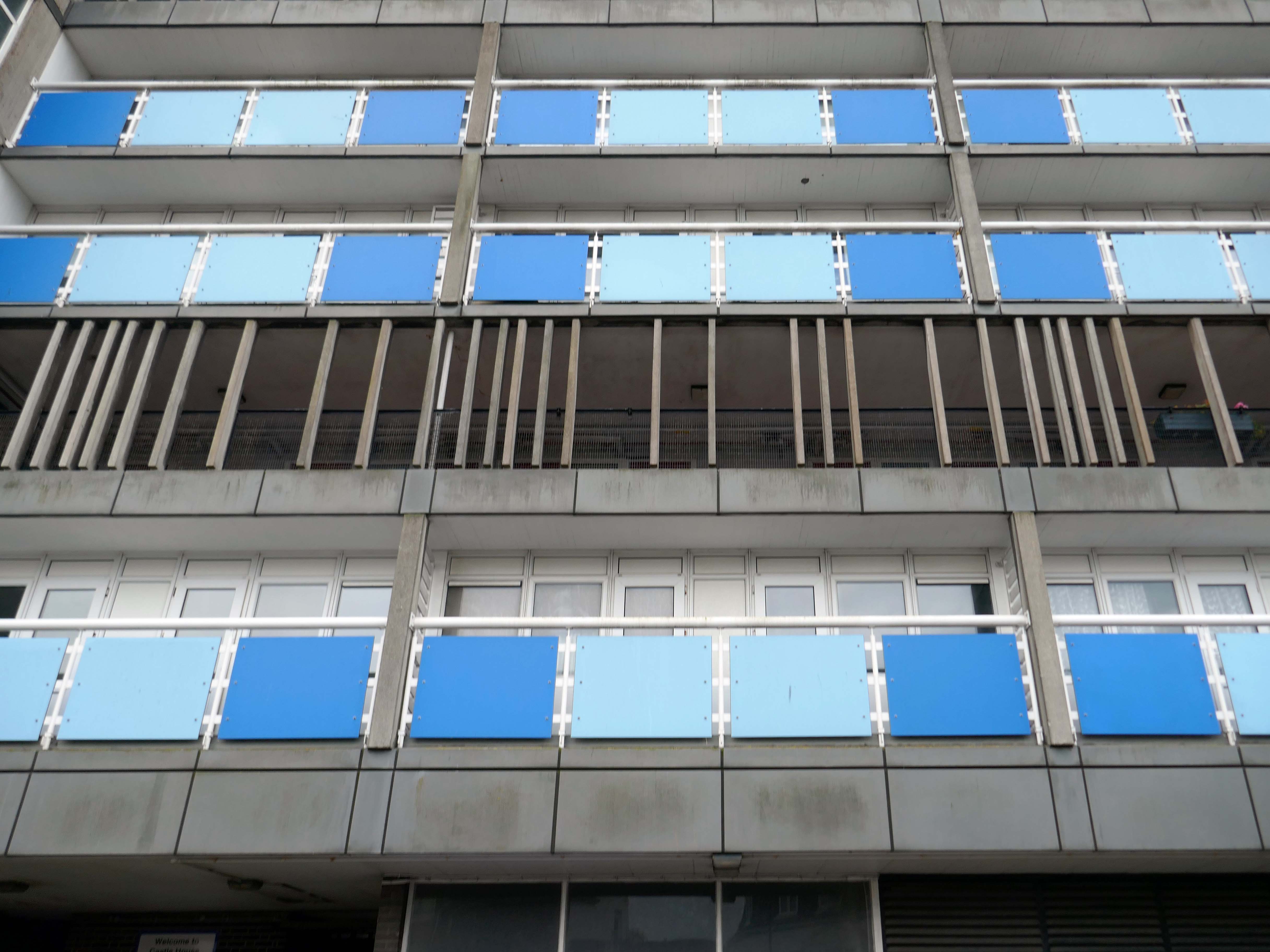
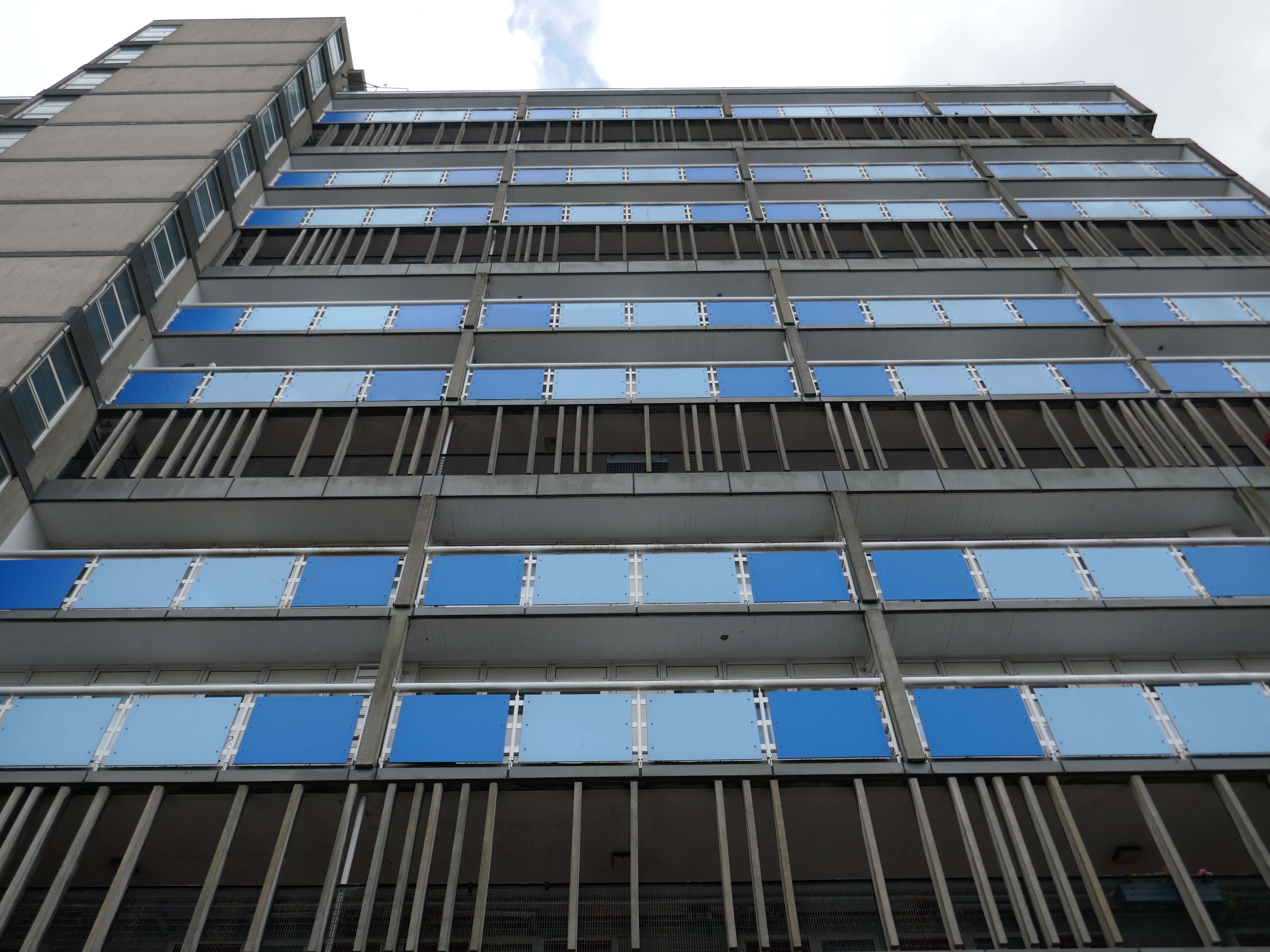
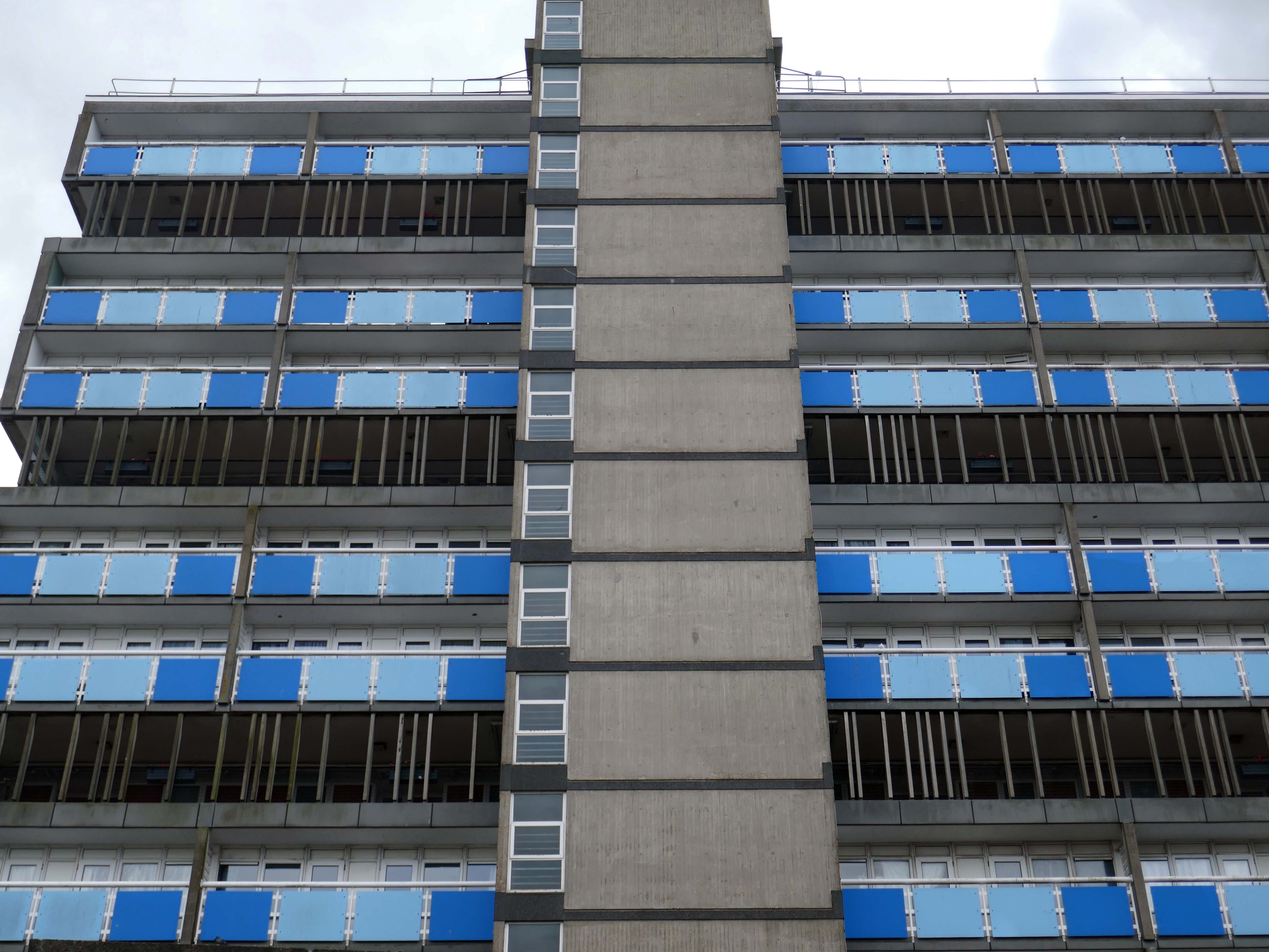
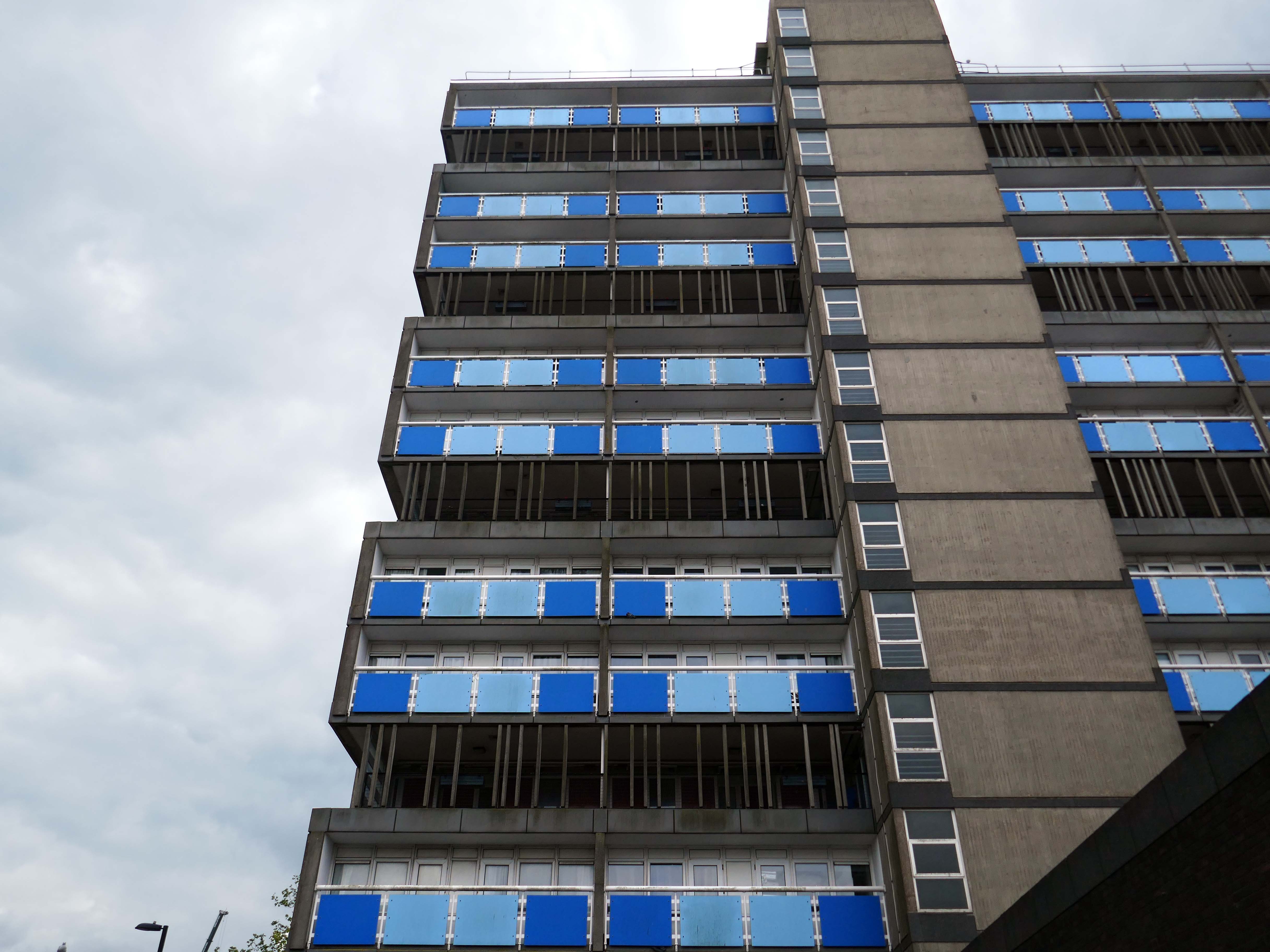
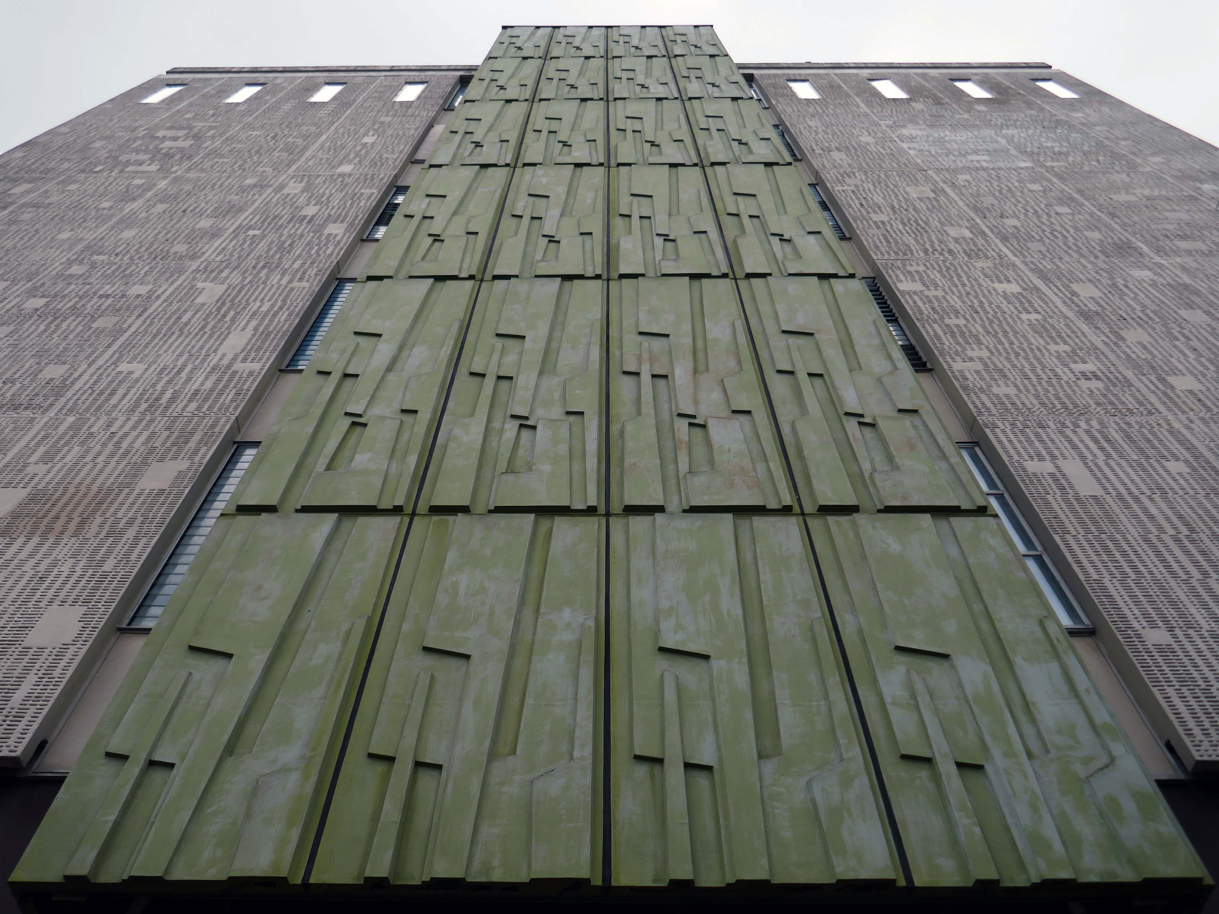
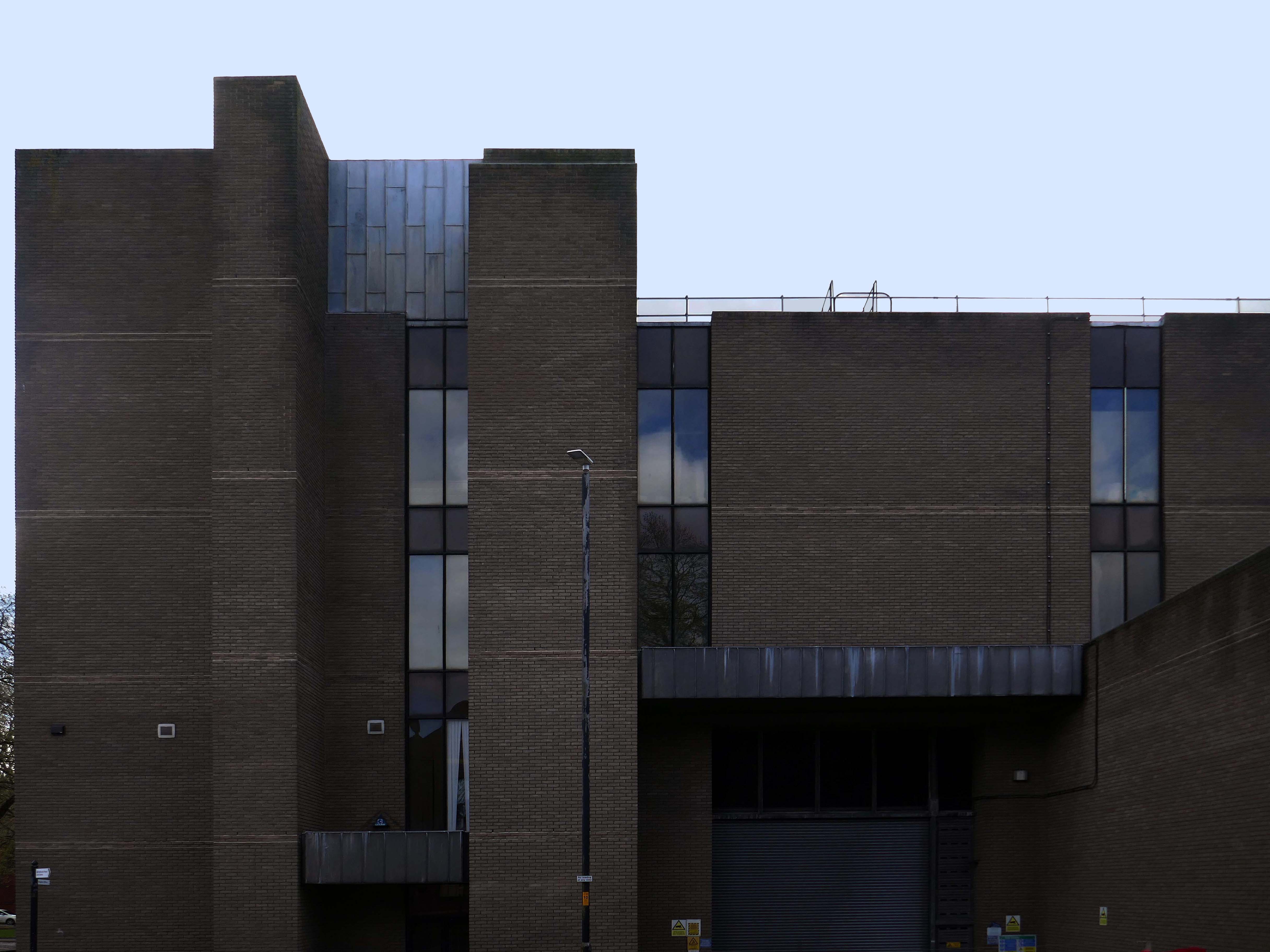
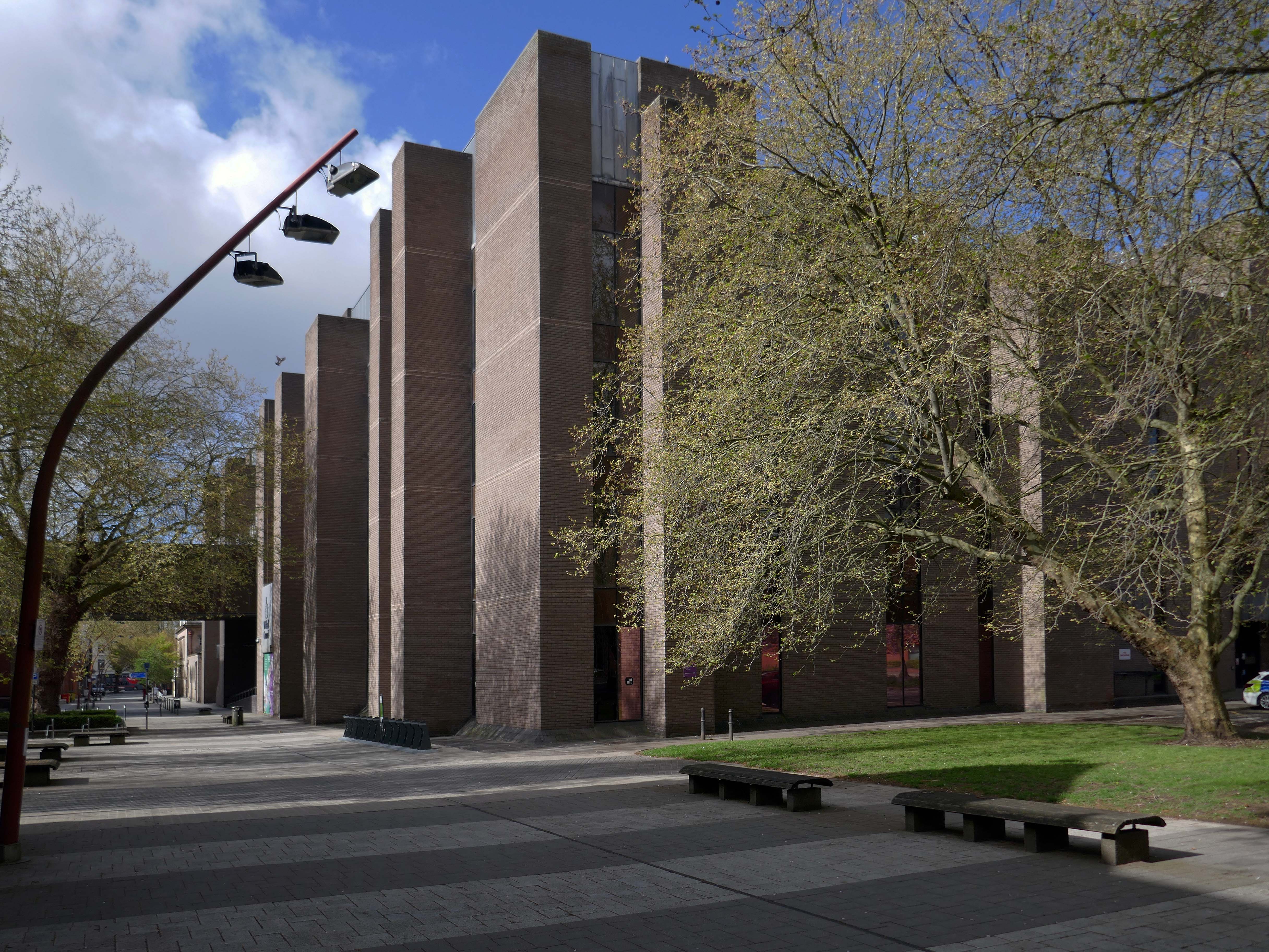
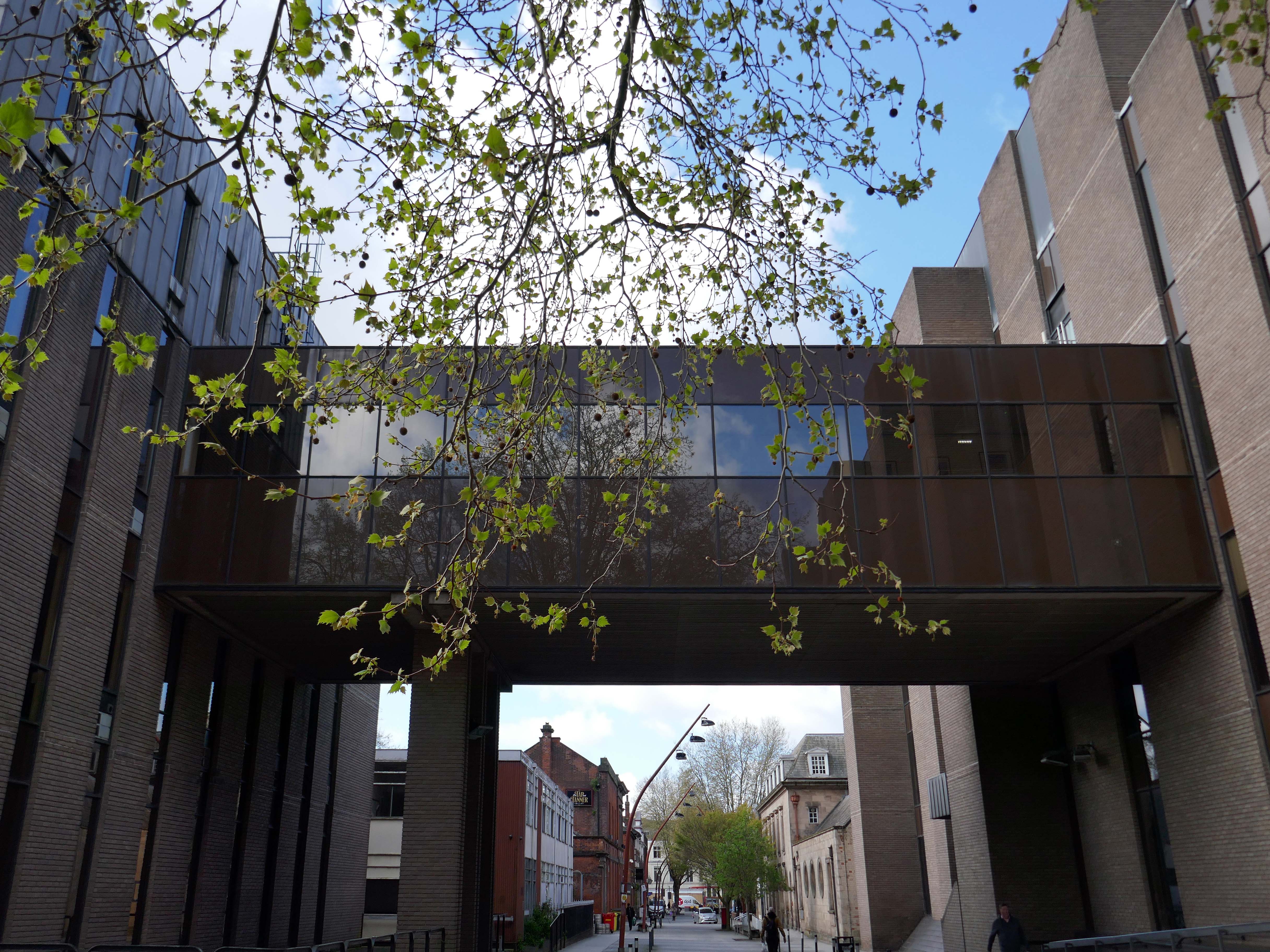
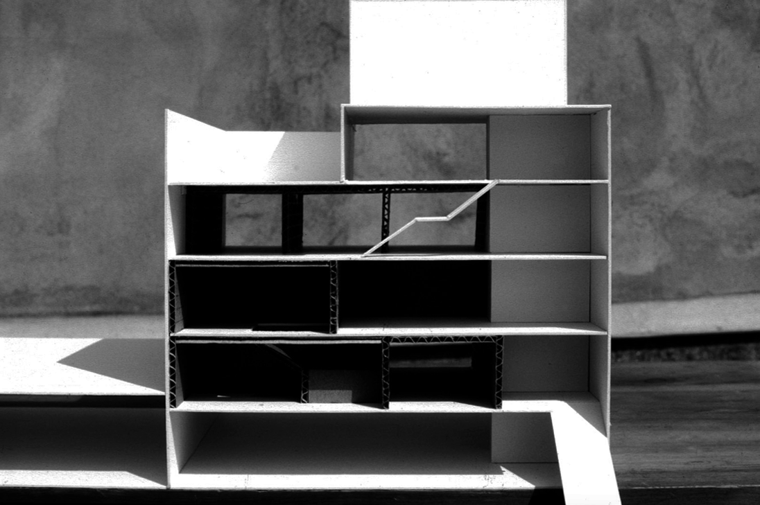
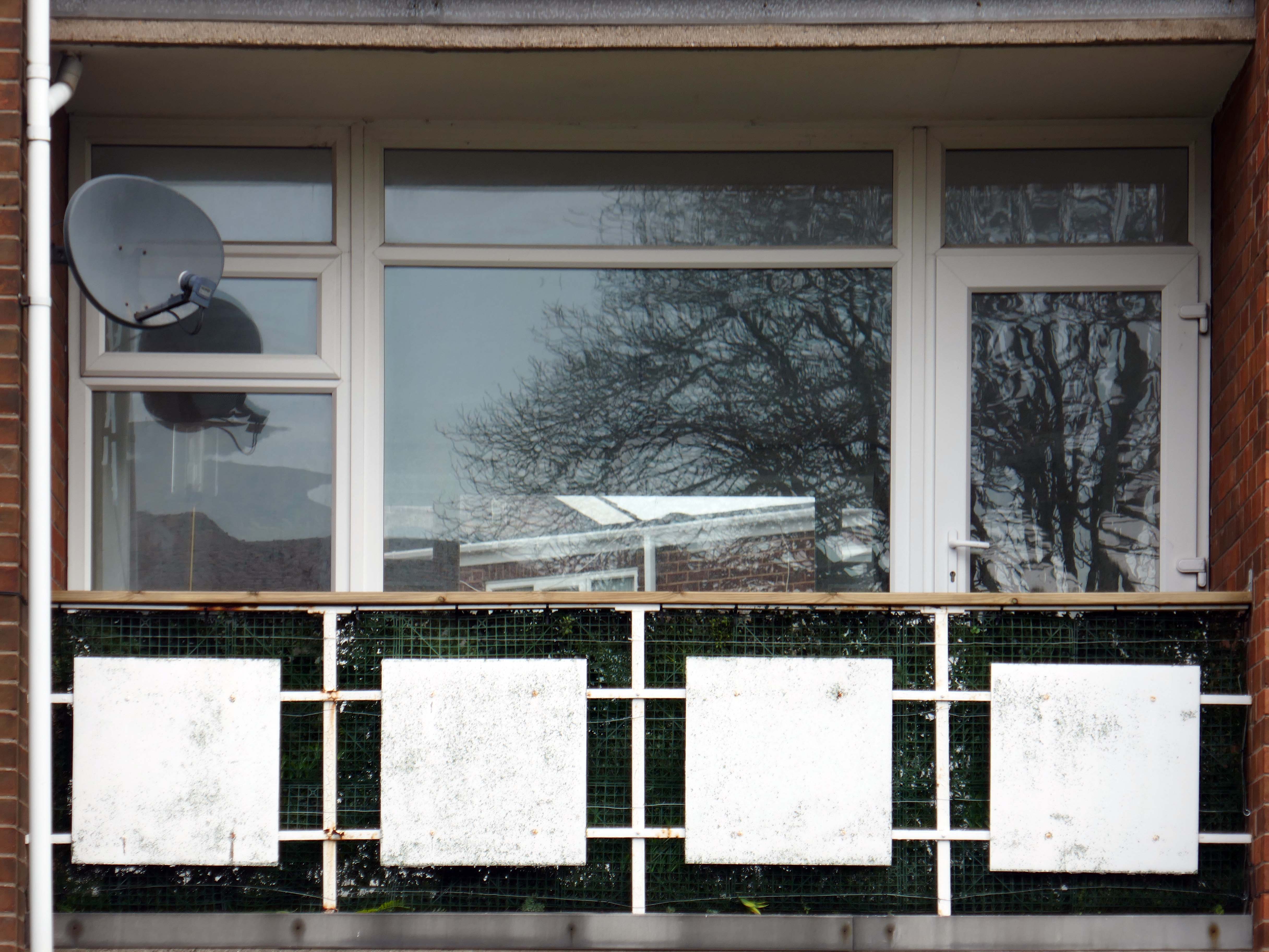
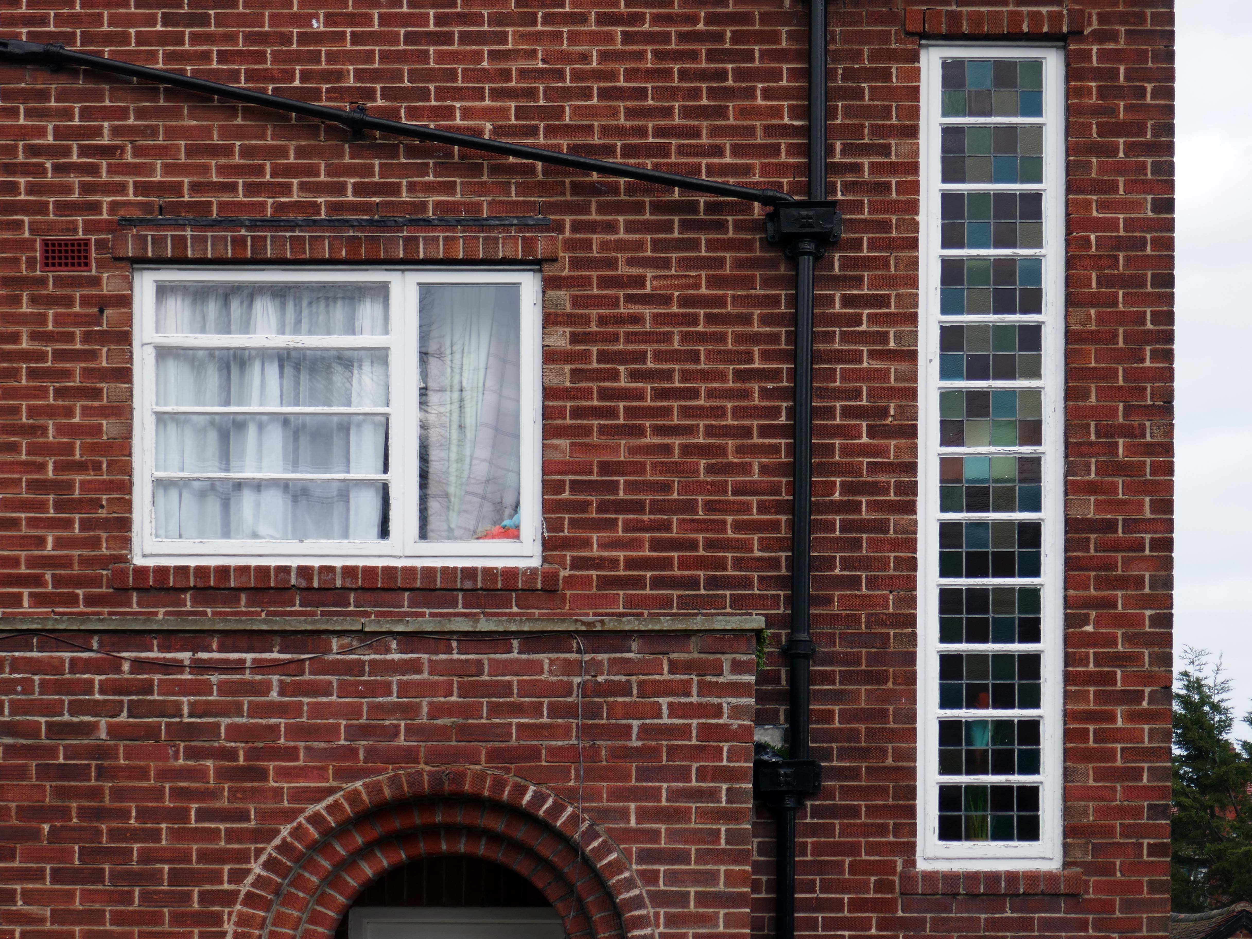
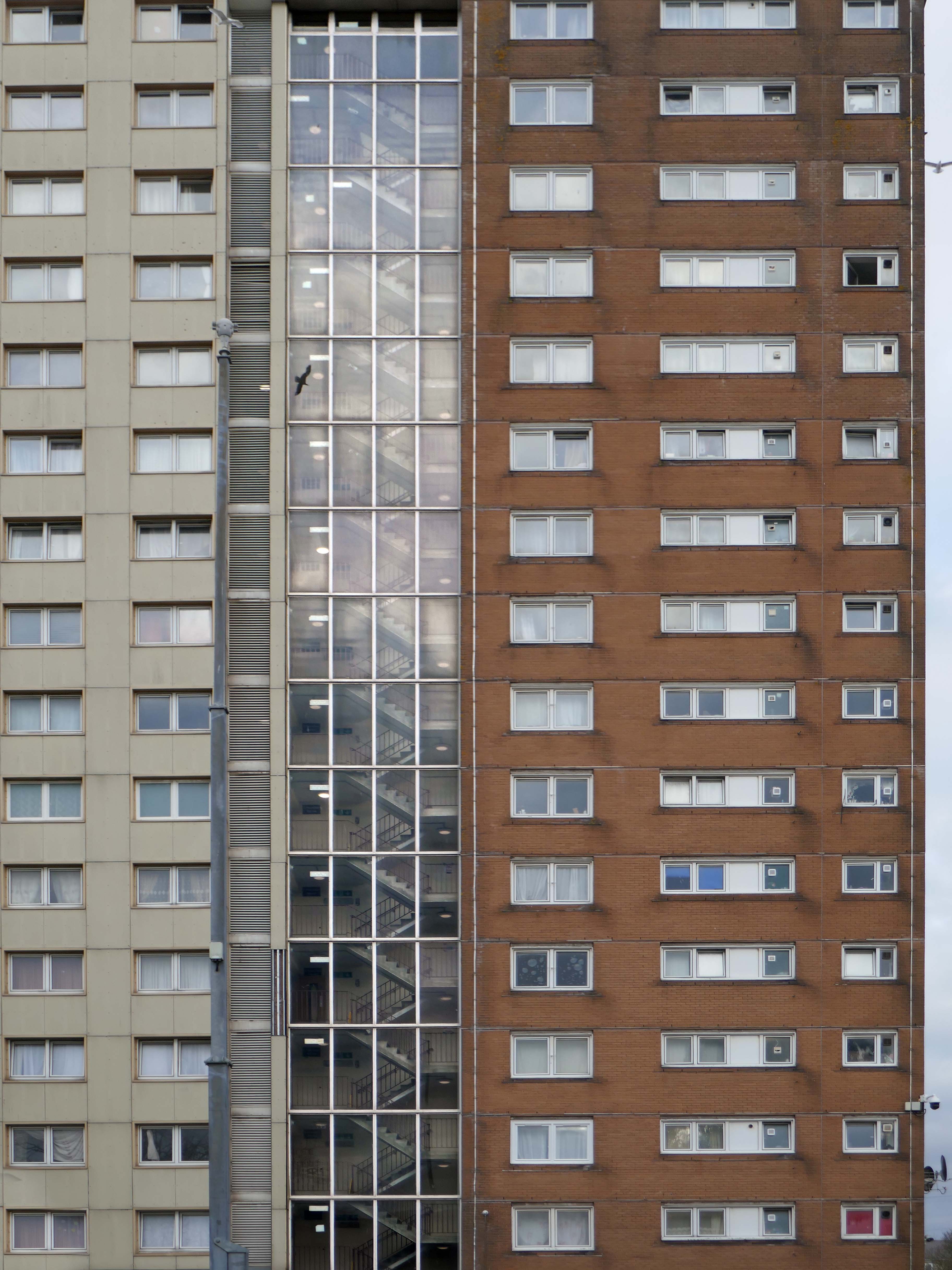
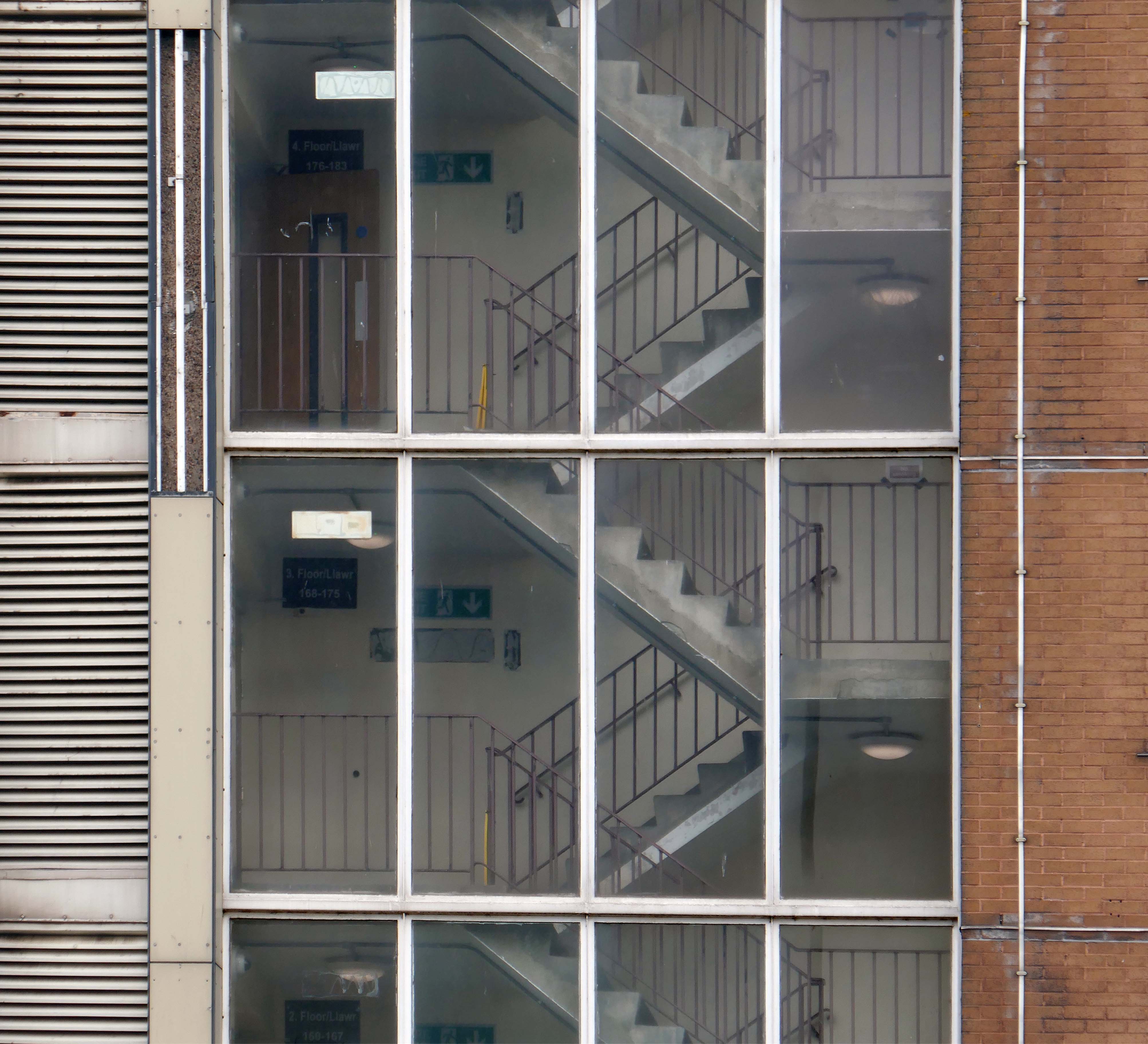
Whilst ABK’s architecture did not seek to imitate Butterfield, it nevertheless adopted elements from his work. The buildings follow the exterior line of the College and the roofline varies along its length, gradually decreasing as it approaches the Butterfield buildings. Yet, the architecture also manages to be innovative. The exterior is fortress-like, punctuated by slot windows, with the buff coloured brick forming a contrast to the red of the original buildings. Internally, the walls are formed by overlapping layers of glass, creating a “soft underbelly”, which mirrors Butterfield’s patterns in its reflective surface.
Once again, Keble’s choices proved to be controversial. The Architectural Review of 1977 claimed the walls “suggest the exterior of some strange zoo”, yet the Royal Institute of British Architects saw fit to award it their Southern region award in 1978 and in 2001 it became one of the youngest Grade 2* listed buildings, a ranking reserved for “particularly important buildings of more than special interest”.
I was walking from the railway station, a map of Oxford folded in my back pocket.
Having no real notion of anything really, I simply followed my intuition and ended up here.
Worcester College was founded in 1714 by the benefaction of Sir Thomas Cookes, 2nd Baronet 1648–1701 of Norgrove, Worcestershire, whose coat of arms was adopted by the college. Its predecessor, Gloucester College, had been an institution of learning on the same site since the late 13th century until the Dissolution of the Monasteries in 1539.
Founded as a men’s college, Worcester has been coeducational since 1979.
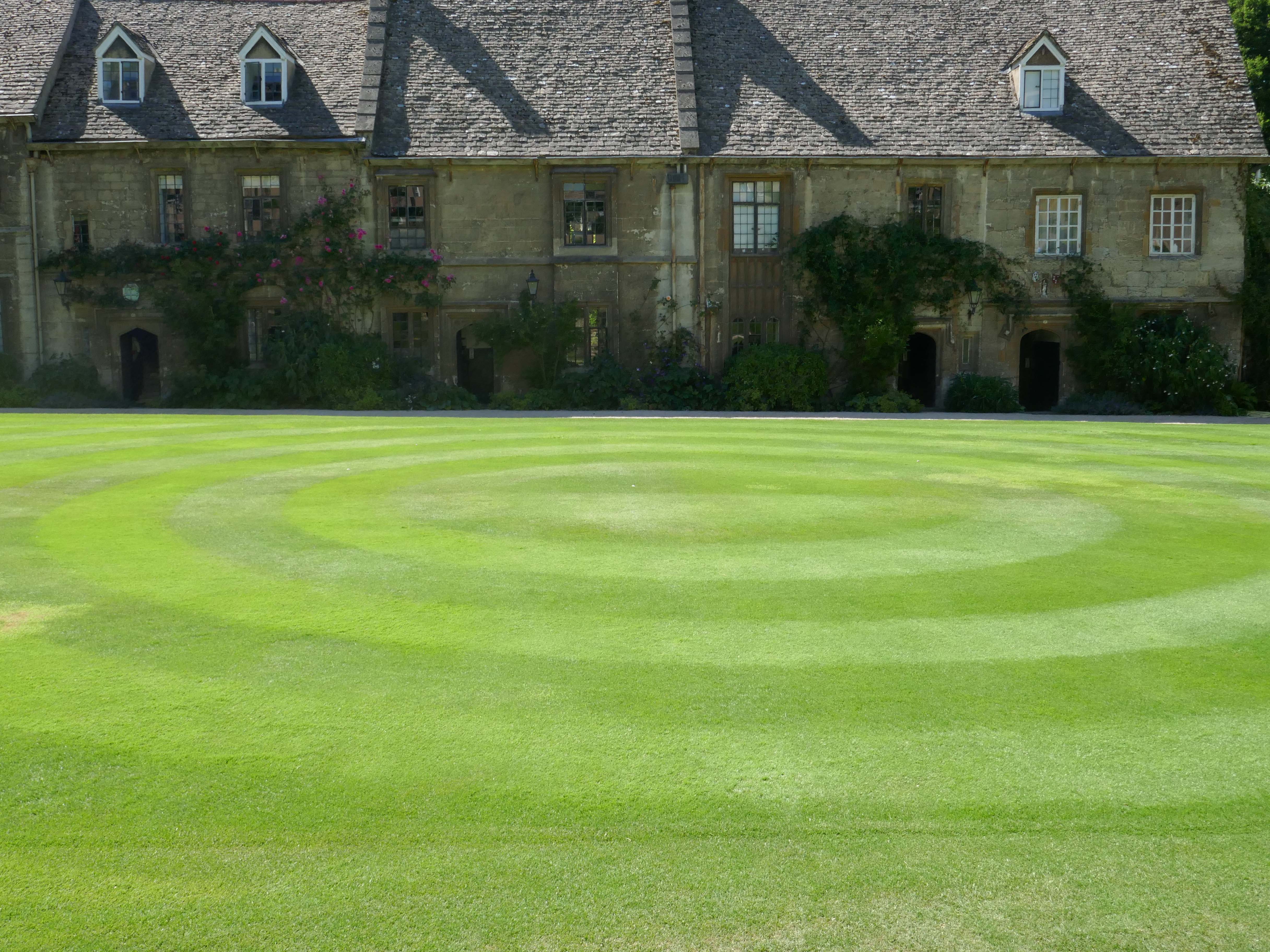
This Mediaeval terrace is thought to be the oldest surviving domestic building in the city, known as the cottages – forming one side of the Quad.
This is the Casson Building – undergraduate accommodation.
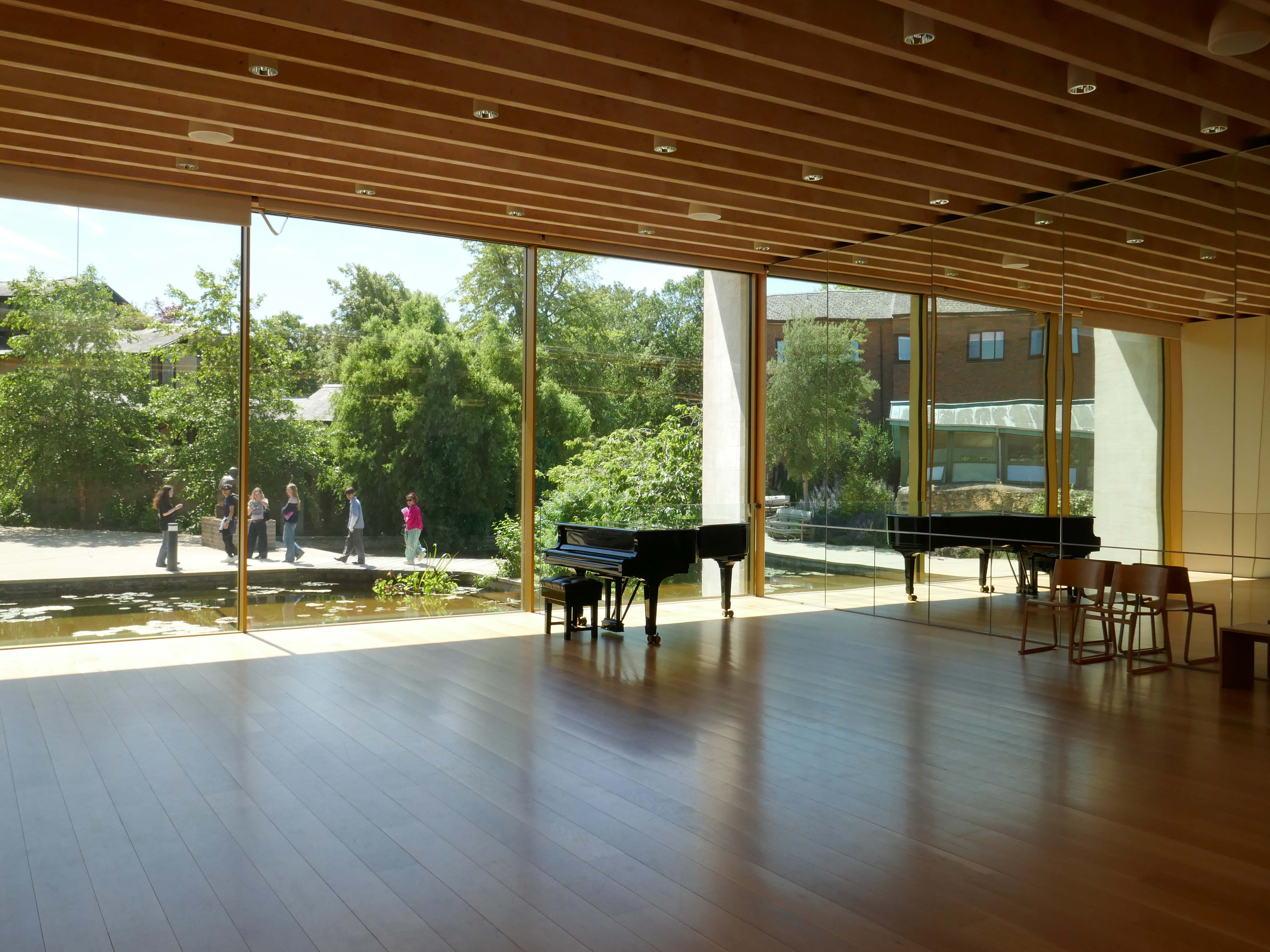
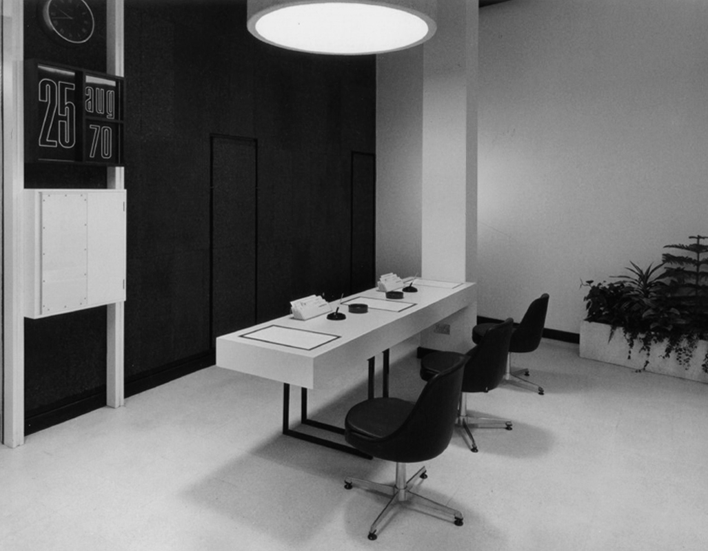
The Linbury Building is a dedicated conferencing and private dining venue enjoying a beautiful natural setting among mature trees and landscaped lawns.
Accommodating up to one hundred guests for receptions or forty eight on a fully-catered basis, the Linbury Building offers the perfect venue for your mid-sized event. Set among the College’s award-winning gardens, the Linbury allows you to enjoy our unique natural setting thanks to floor-to-ceiling glazing which can be retracted to create an al fresco space in the summer.
With its own bespoke furniture made from English oak and College-crested leather chairs, the main conferencing space can be adapted into a wide variety of configurations, from seminar, cabaret or theatre to private dining and drinks receptions. The adjacent foyer area is a perfect space for delegate registration, break-out coffee and pastries or buffet lunch service.
John Davan Sainsbury – Baron Sainsbury of Preston Candover 1927 – 2022 was a British businessman and politician. He served as the President of Sainsbury’s, and sat in the House of Lords as a life peer and member of the Conservative Party
Robert Alfred Maguire 1931–2019 was an influential British modernist architect and leading thinker in the British liturgical architectural movement of the Church of England. Maguire and Keith Murray formed an architectural practice in 1959.
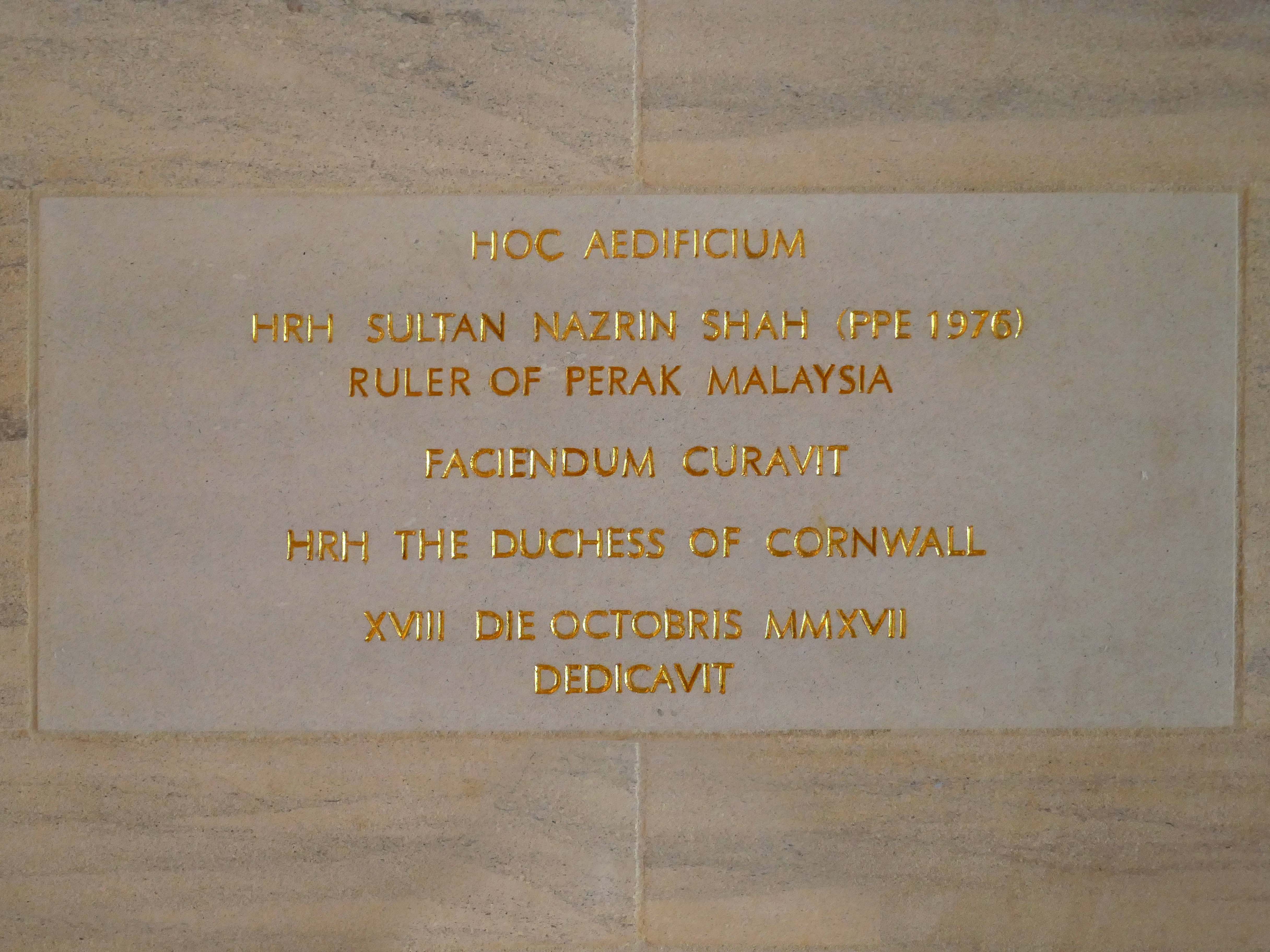
Nazrin Shah ascended the throne of Perak in 2014. As Sultan of Perak, he has been a strong advocate for education, Islamic moderation, and national unity. He has served as deputy king under Sultan Muhammad V of Kelantan, Sultan Abdullah of Pahang, and Sultan Ibrahim of Johor.
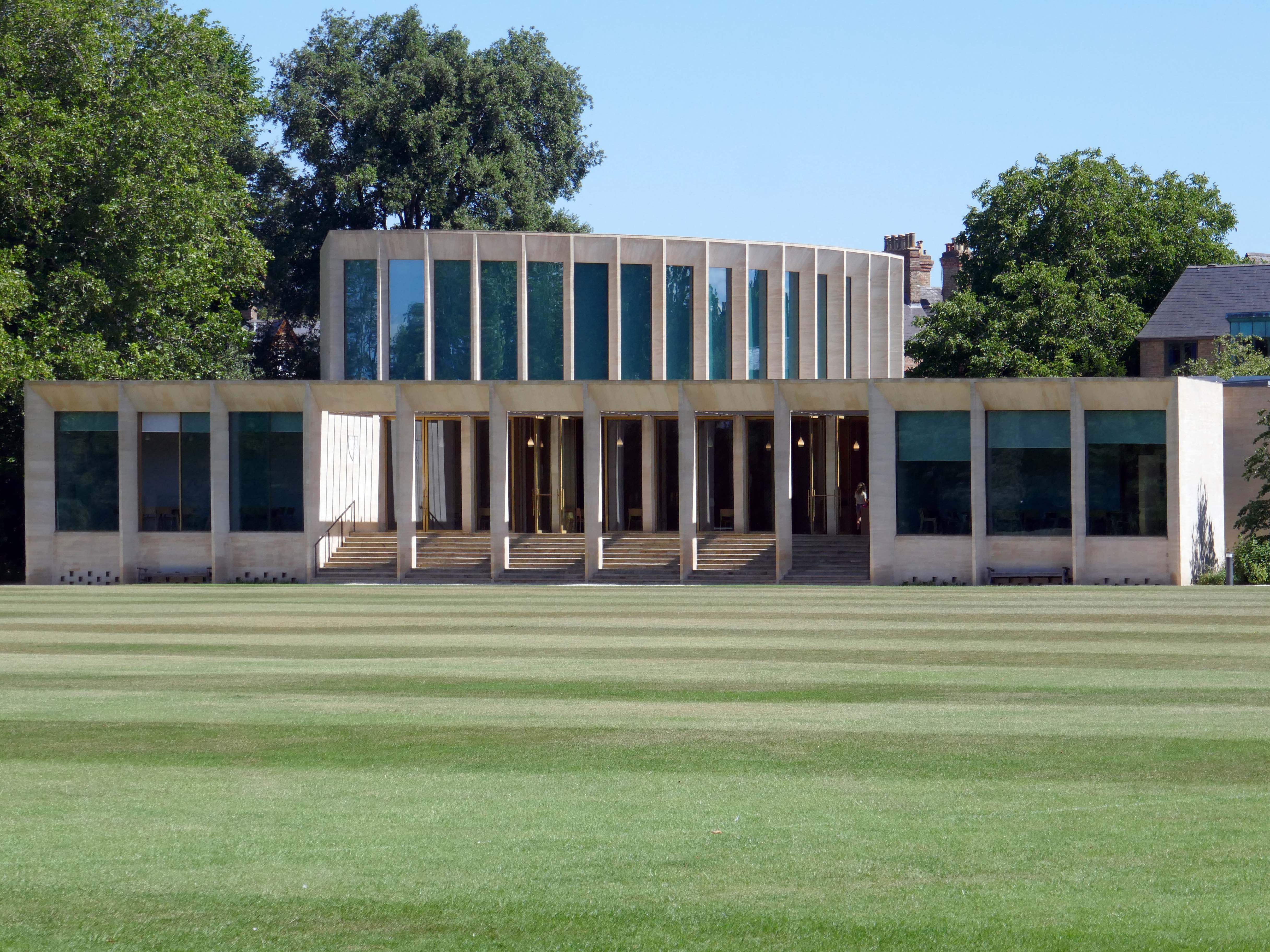
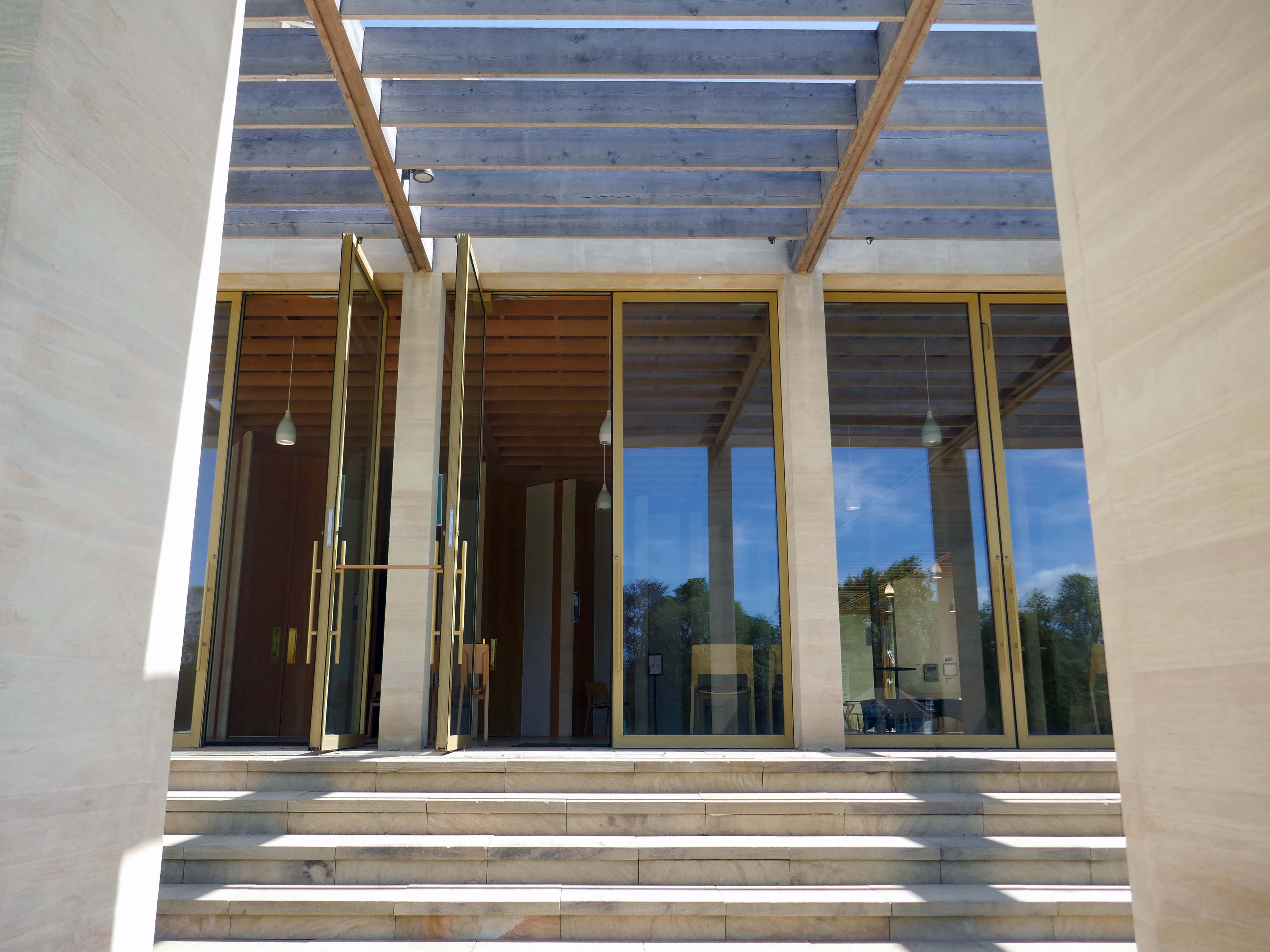
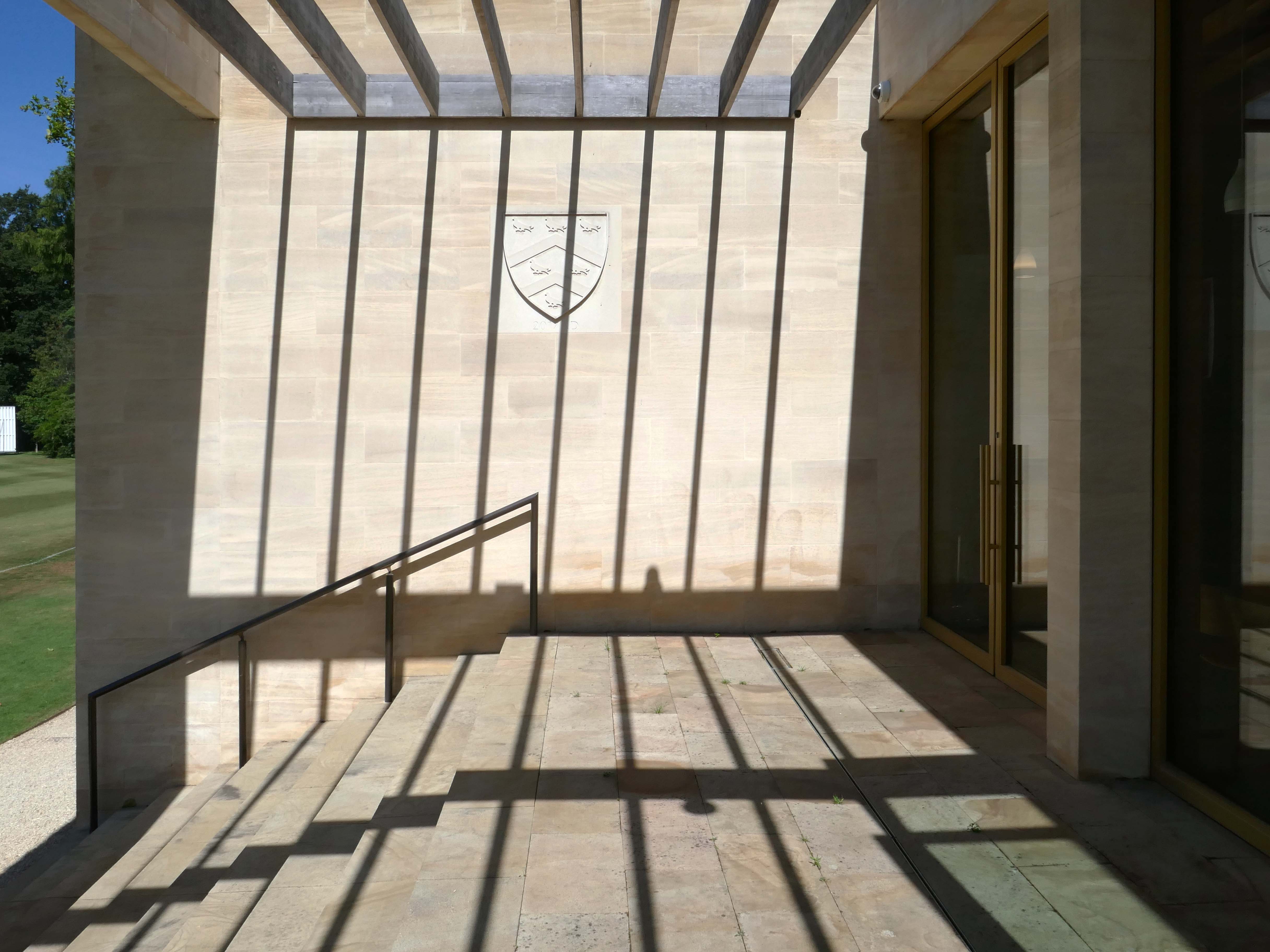
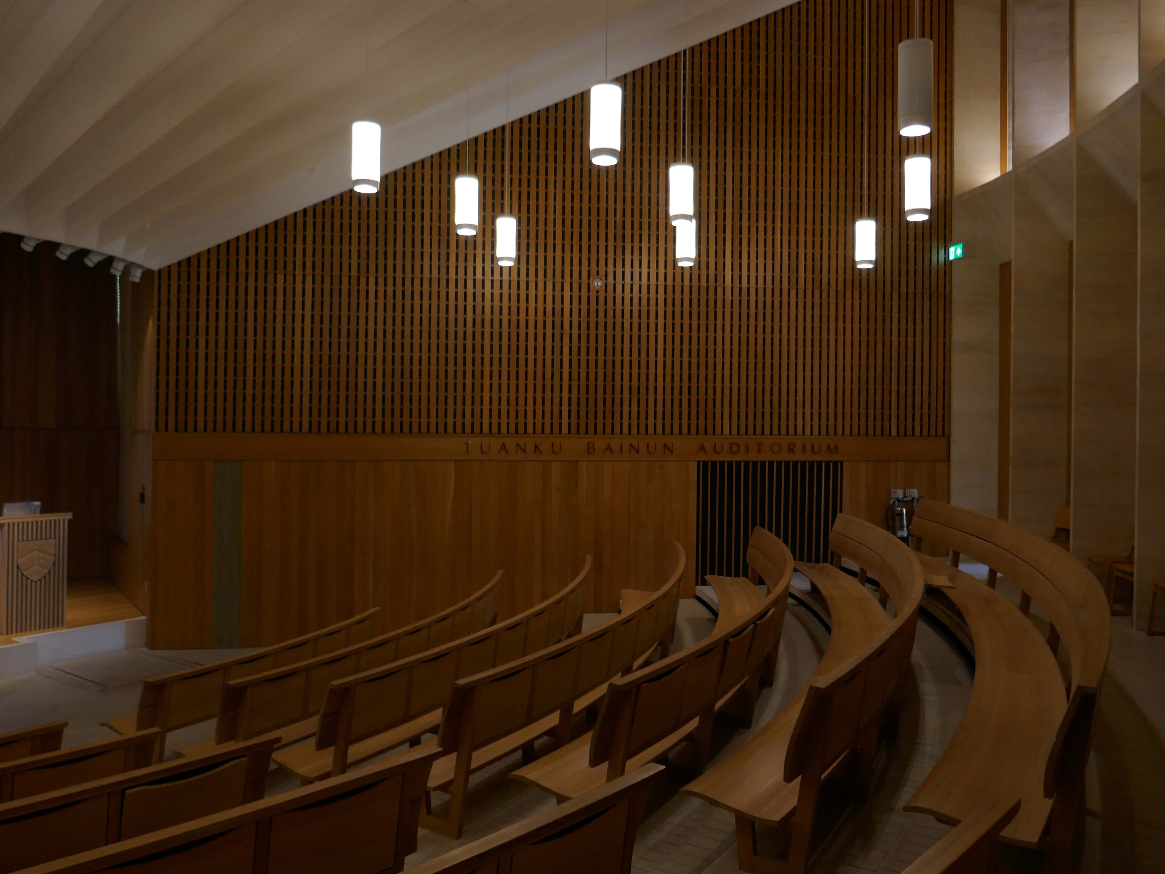
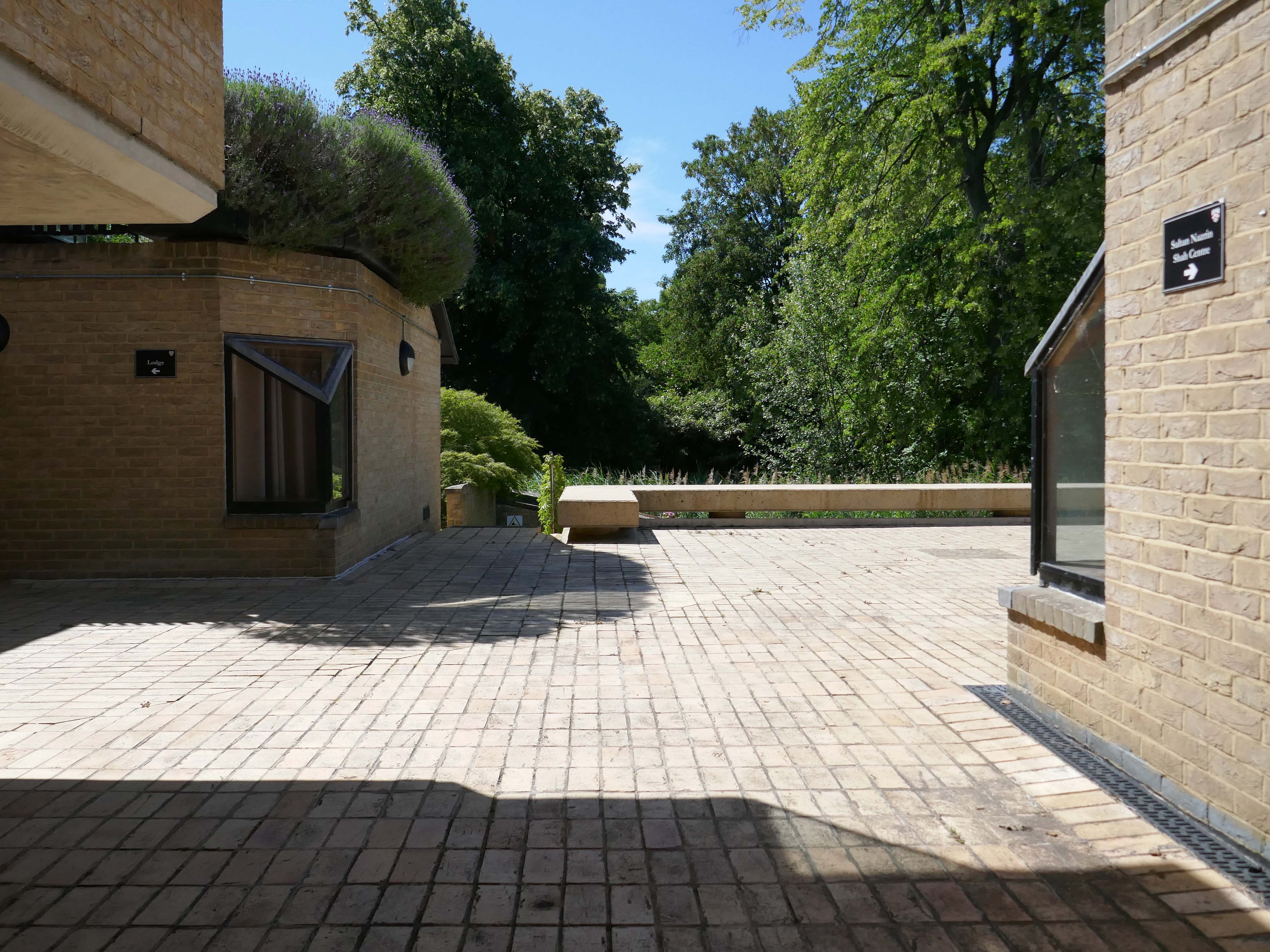
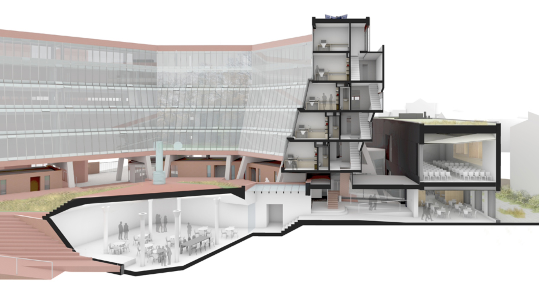
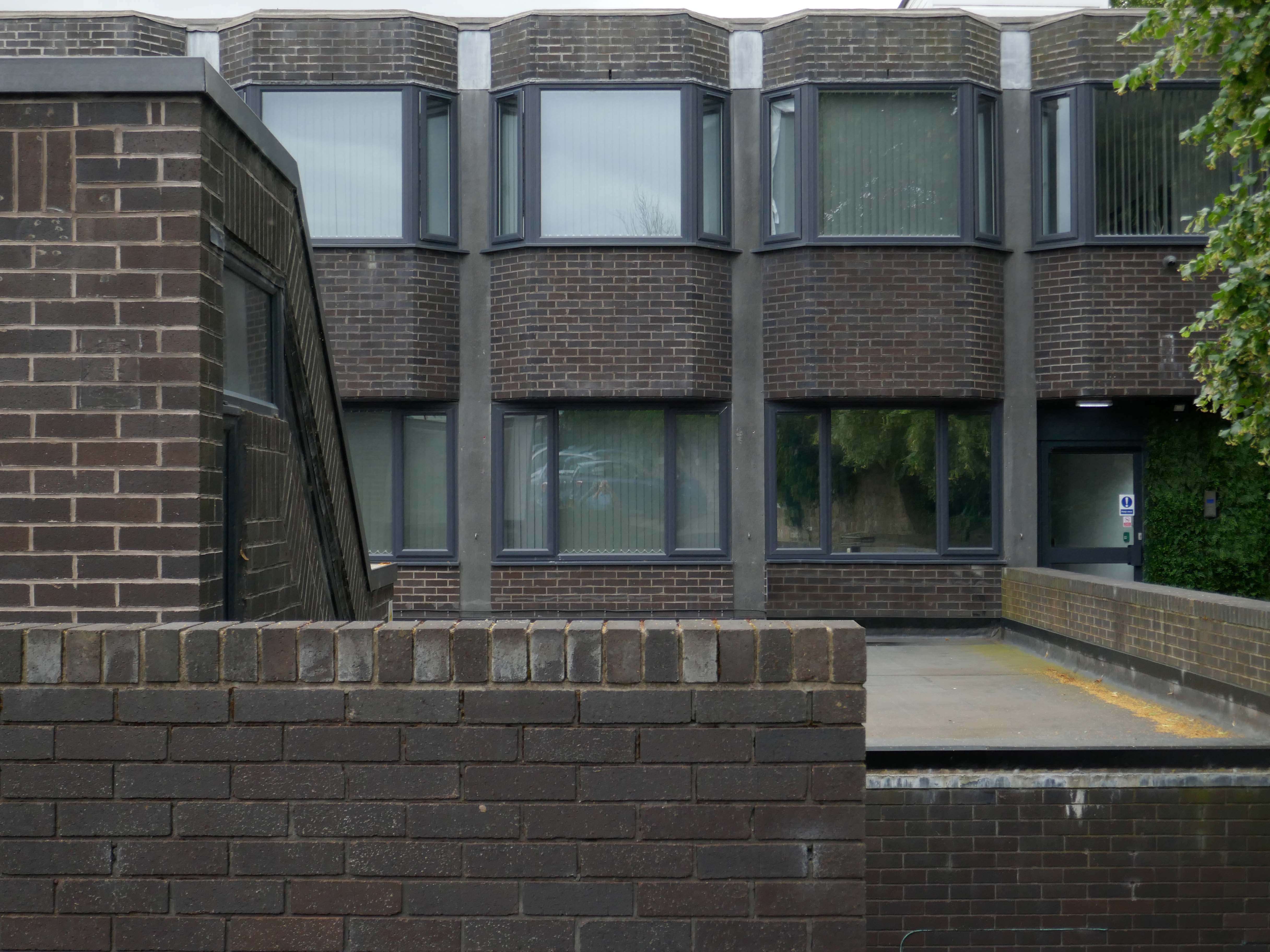
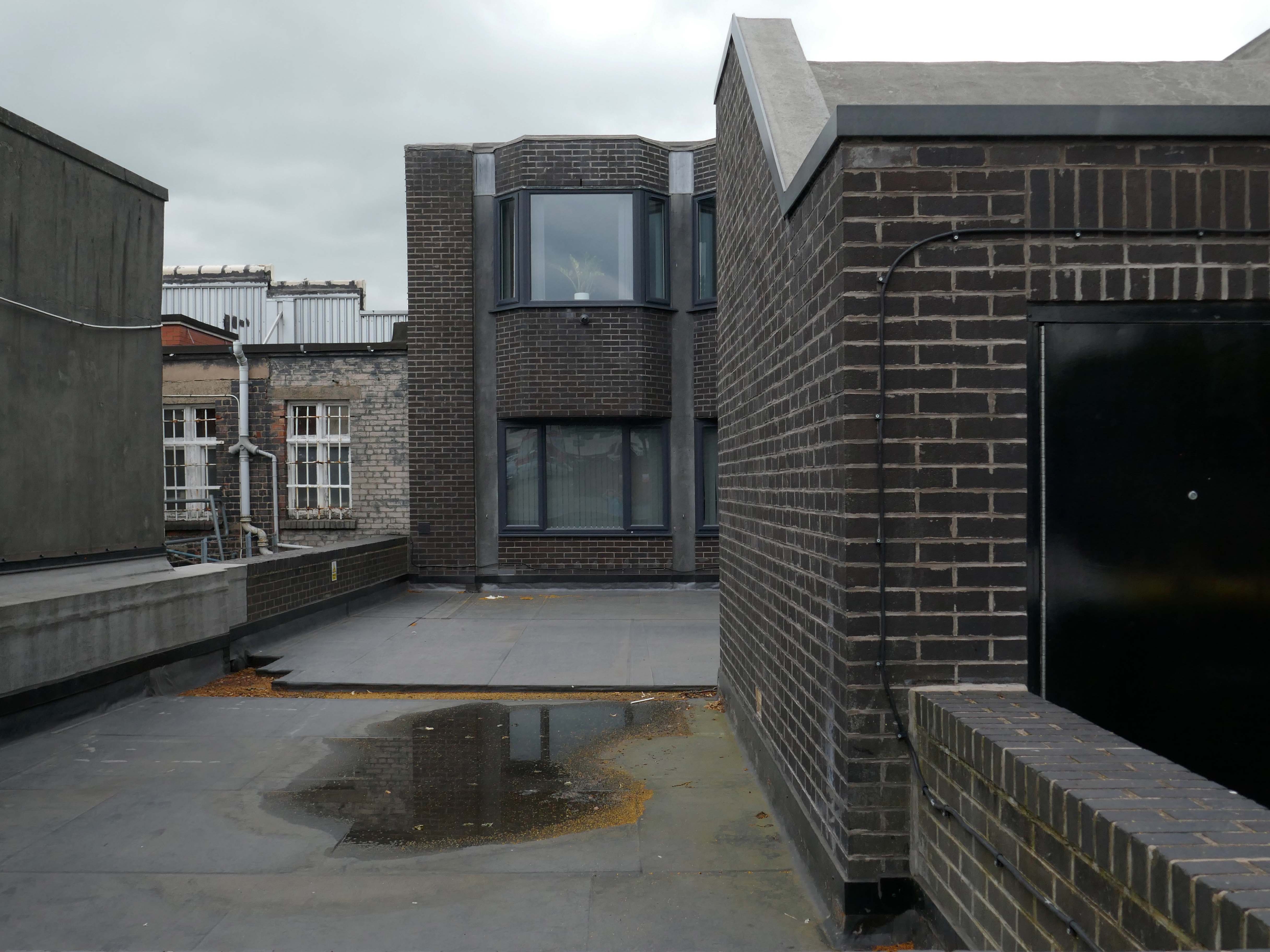
The Sultan Nazrin Shah Centre is a new building of 2017 housing a large lecture theatre, a student learning space, seminar rooms and a dance studio. The project is not simply the provision of new facilities, but also the development and enhancement of the setting of this significant part of the College site. Whilst the relationship between the new buildings and the listed parkland is important, it is only one part of a complex arrangement.
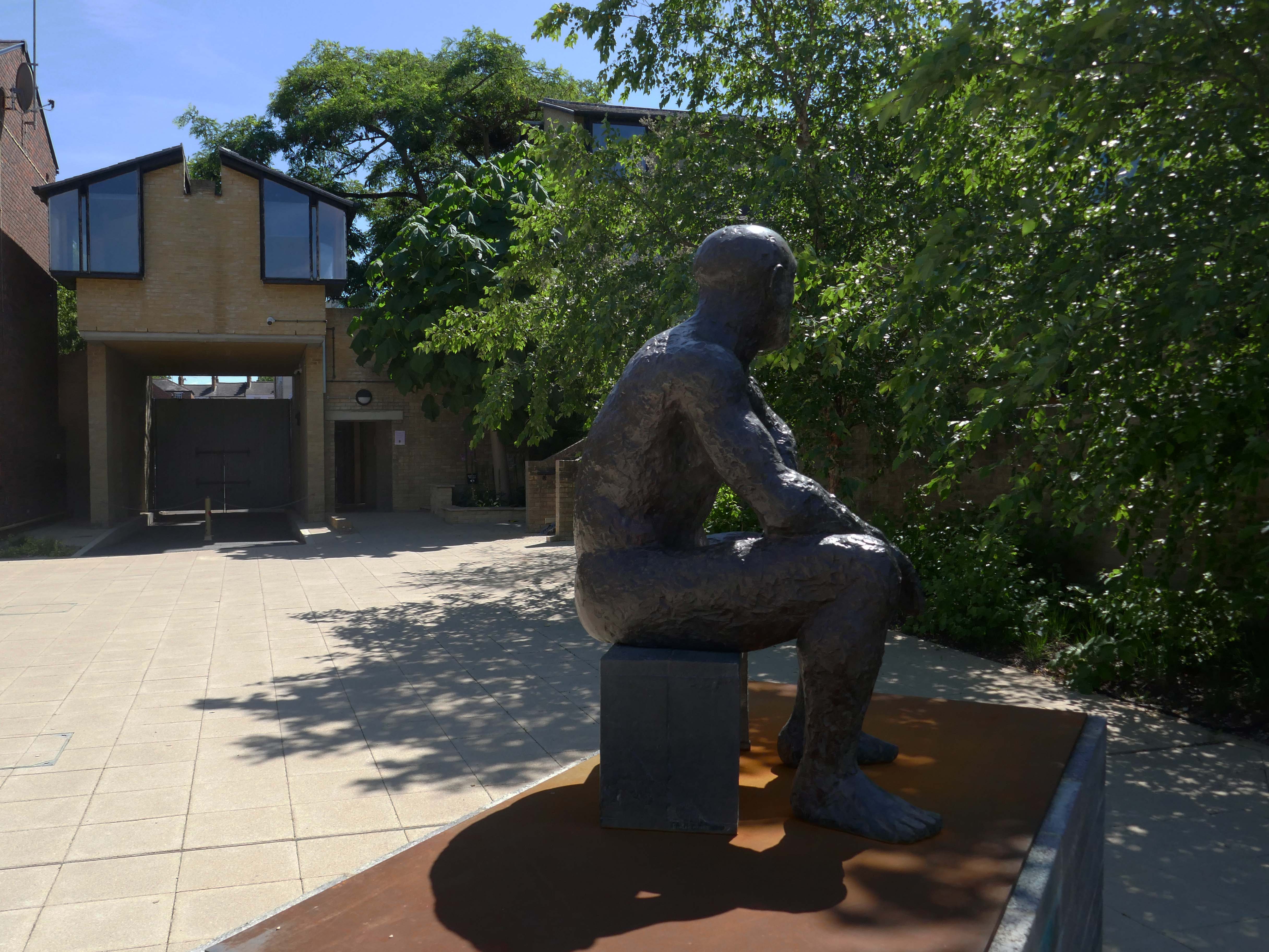
Elizabeth Frink’s sculpture Seated Man II – on loan from Yorkshire Sculpture Park, in accordance with the wishes of the artist’s late son, Lin Jammet, 2020.
He overlooks The Sainsbury Building student accommodation – 1983 Architect: Richard MacCormac
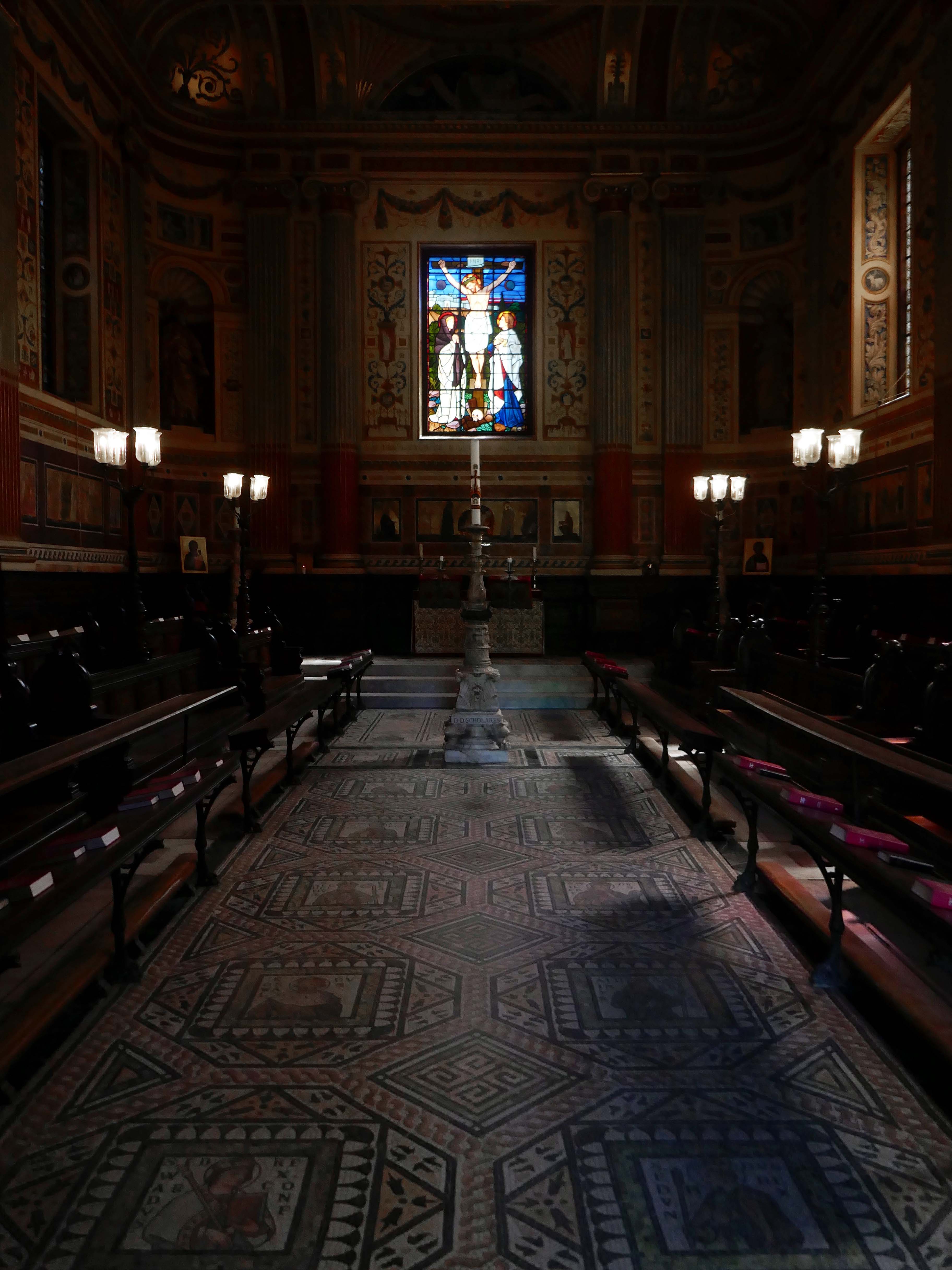
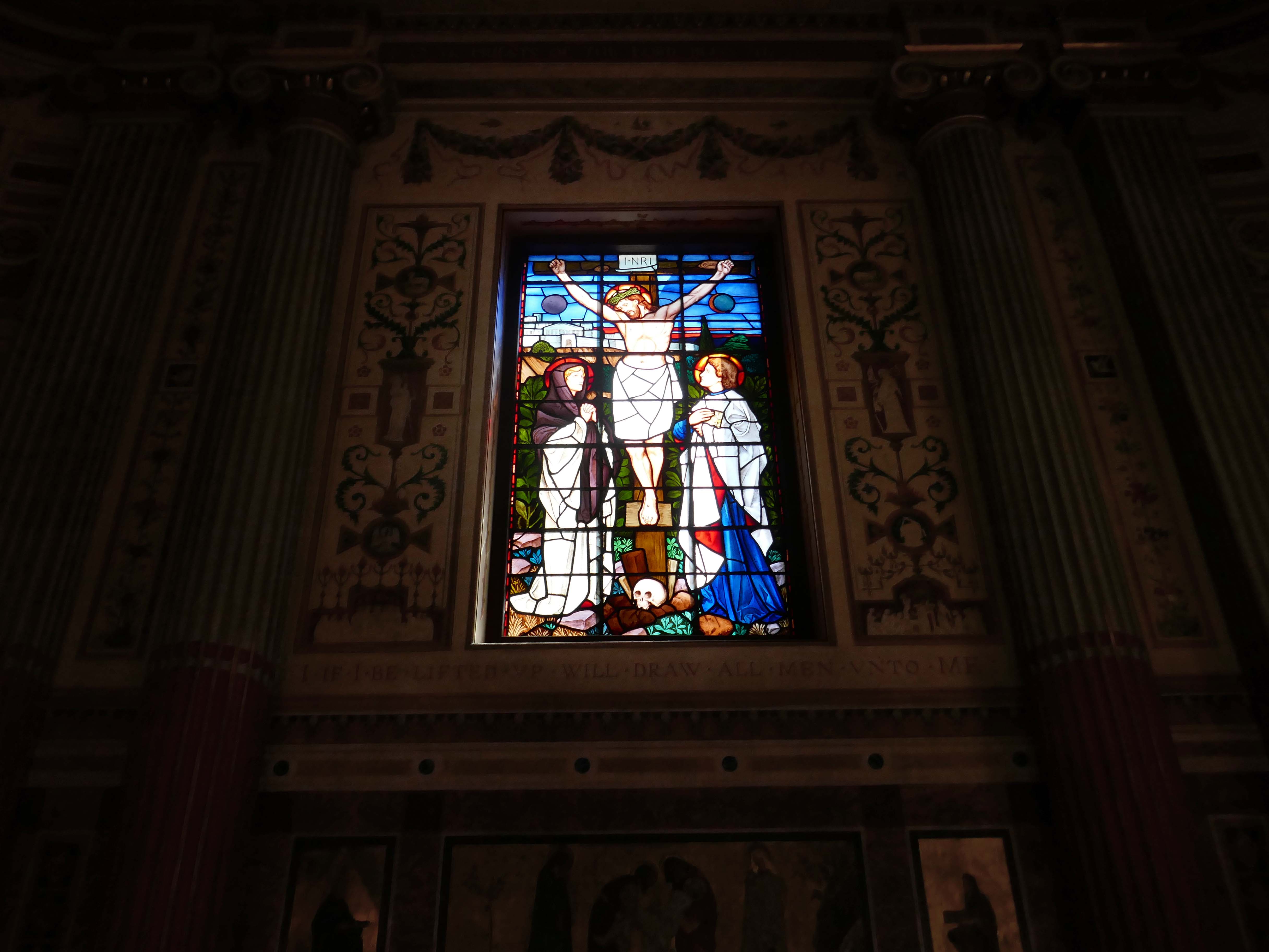
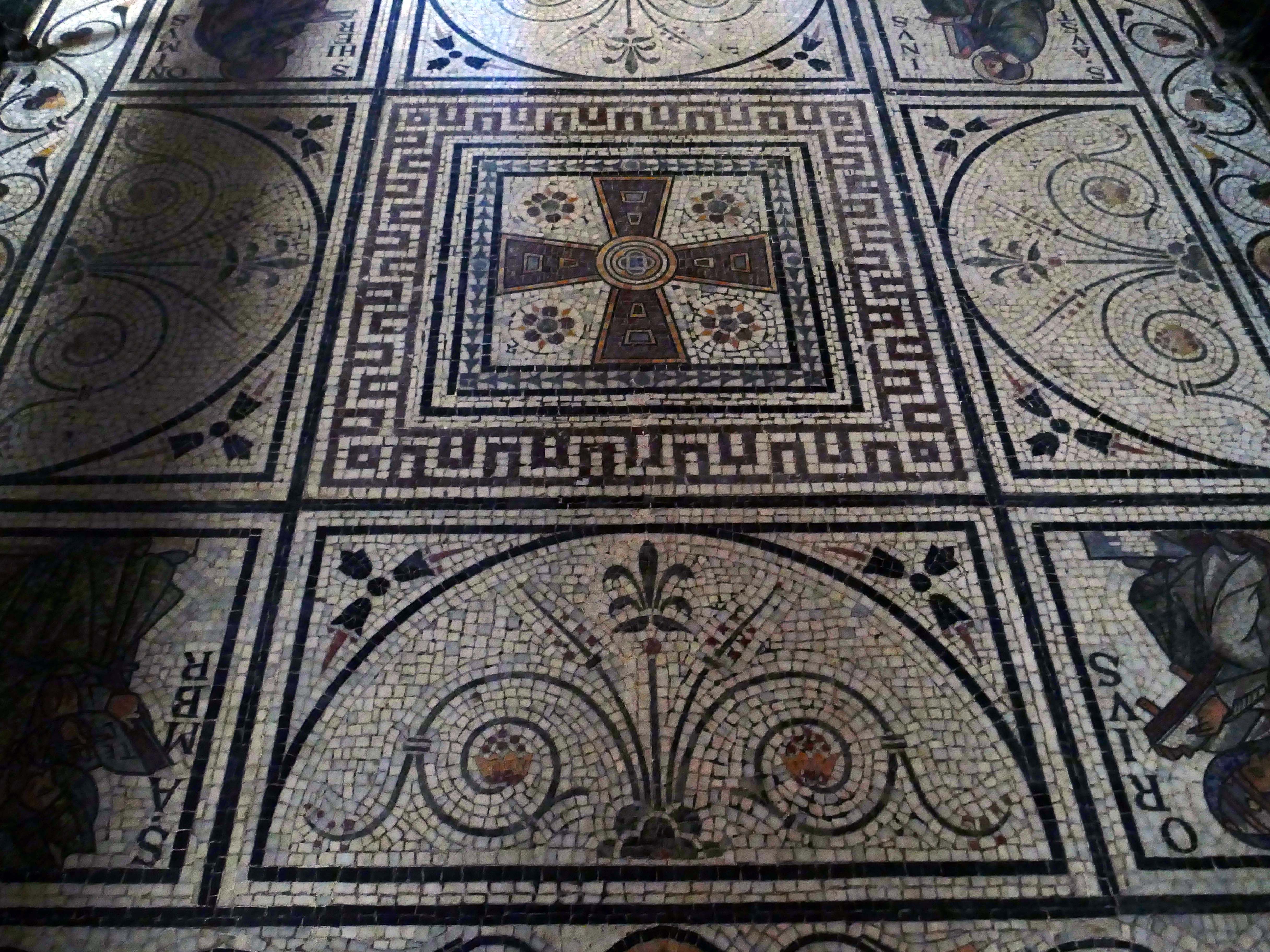
The College Chapel was built in the 18th century. George Clarke, Henry Keene, and James Wyatt were responsible for different stages of its lengthy construction 1720–1791, owing to a shortage of funds. The interior columns and pilasters, the dome, and the delicate foliage plastering are all Wyatt’s work. His classical interior was insufficiently emphatic for the tastes of militant Victorian churchmen, and between 1864 and 1866 the chapel was redecorated by William Burges.
It is highly unusual and decorative; being predominantly pink, the pews are decorated with carved animals, including kangaroos and whales, and the walls are riotously colourful, and include frescoes of dodos and peacocks. Its stained glass windows were to have been designed by John Everett Millais, but Burges rejected his designs and entrusted the work to Henry Holiday.
Wikipedia
My first visit to Oxford and the centuries wide cornucopia of architectural styles and fashion.
In 1956, with University considering plans for expansion, Alan Bullock obtained approval to transform St Catherine’s Society into a fully residential college – the search for a site and funding began.
An ambitious fundraising campaign began, focusing on the national shortage of scientists and on Bullock’s proposal of an increased number of science students at St Catherine’s than was usual for an Oxford college. In 1960 almost eight acres of Holywell Great Meadow was acquired from Merton College and the College’s chosen architect, Arne Jacobsen of Denmark, began to implement his design. His modernist masterpiece was to become the most important 20th-century collegiate buildings in Oxford, and is now Grade I listed.
In 1962 St Catherine’s College opened its doors – while still under construction, with Alan Bullock as its Master. The first undergraduates were admitted, and were quickly dubbed the ‘Dirty Thirty’ owing to the lack of running hot water. 1964 saw the ceremonial opening of the College by the then Chancellor of the University, Harold Macmillan, and ten years later in 1974, staying true to its forward-looking ethos, it became one of the first colleges to admit women.
As a footnote – it’s possibly not a great idea to rush around an unfamiliar city trying to snap as much as possible on a very hot day time limited by budget train bookings largely underfed and thirsty.
St Catherine’s College: 1961-66. Arne Jacobsen – Grade I Listed
Podium and all buildings upon it. GV I College buildings, raised on a podium, including dining hall, common room blocks; two residential blocks; library; Bernard Sunley Lecture Theatre; bell tower; piers and covering to walkways to east and west of library and east and west of hall; bridge adjoining west side of podium; brick walls enclosing canal and patio areas on western edge of podium; brick walls to patio areas to eastern edge of podium; twenty five short stretches of garden wall all running east-west, some incorporating seats; paving to podium surface and steps to east and south sides.
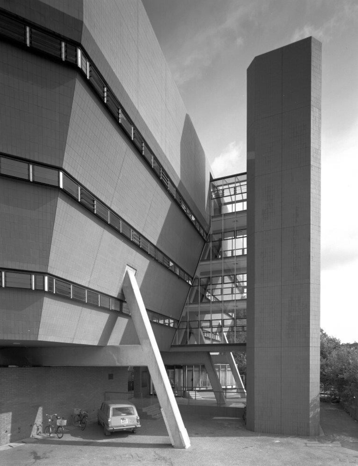
Designed by James Stirling and Partners in 1966-1967 for Queen’s College, Oxford, and built 1968-1971, with Roy Cameron as associate, and Frank Newby of F J Samuely and Partners as engineer.
RIBA pix 2005 Jeremy Harrison
Listed at Grade II* for the following principal reasons:
* as a highly significant work by Sir James Stirling, one of Britain’s foremost post-war architects;
* as the last of a triumvirate of university buildings that are without doubt amongst Stirling’s most significant works in England;
* as a highly creative re-working of a familiar formal language, executed with masterful handling of form and colour, characteristic of Stirling’s style;
* for the high degree of survival of the original plan form, fixtures and fittings, which have been little altered since the building’s completion, including but not limited to the bedrooms, porter’s lodge, and breakfast room;
* as a distinctive and popular piece of post-war university architecture.
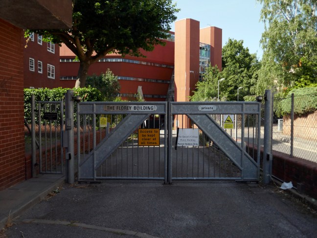
On the day of my visit the building was secured and in a state of semi-dereliction, mothballed by the owners TheQueens College Oxford.
There have been plans and a competition for refurbishment:
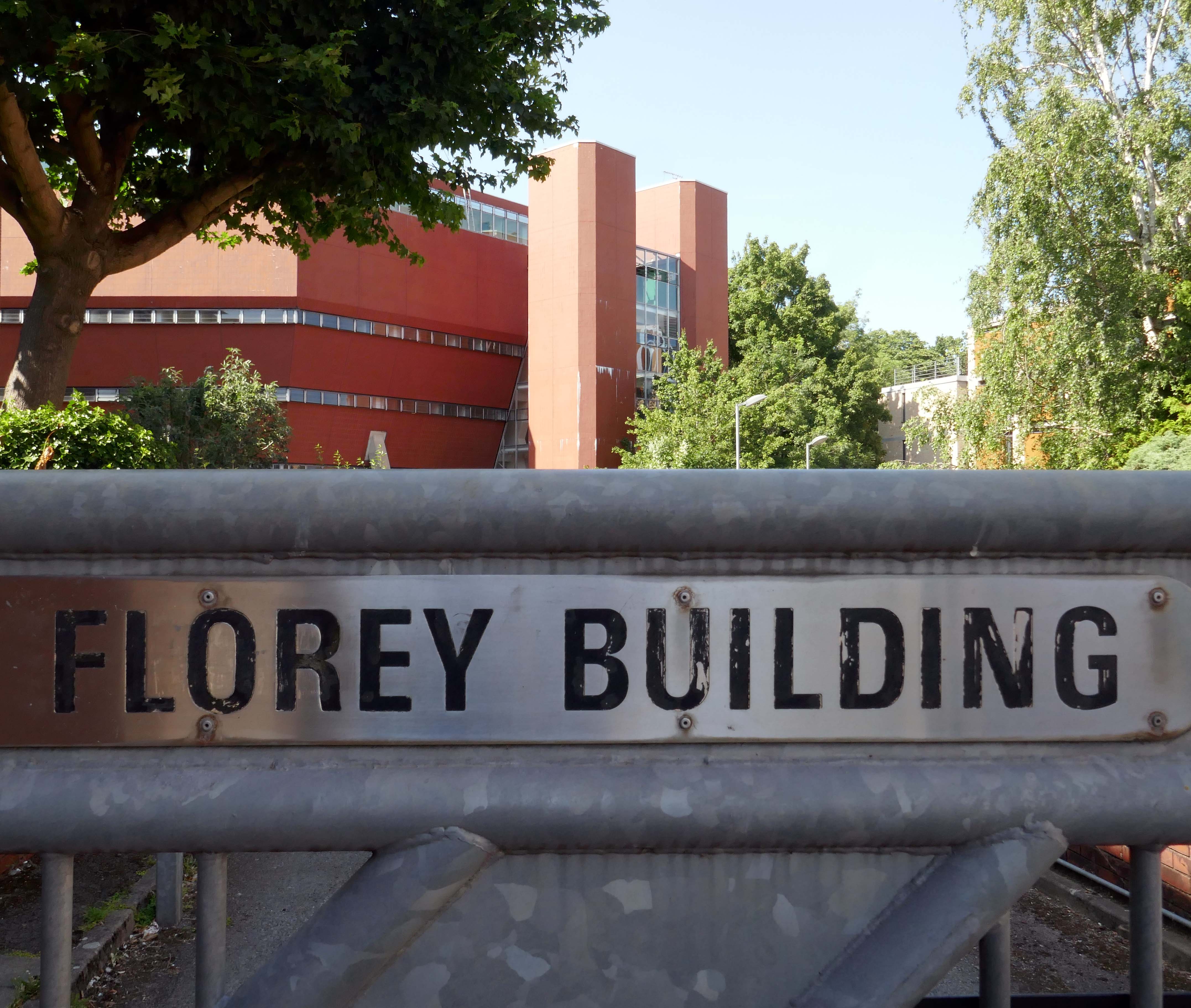
Perhaps the most charismatic of James Stirling’s surviving buildings; the Florey Building is hugely admired worldwide for its boldness and heroism.
Despite some practical and infamous failings, the Florey has a cult presence in Oxford: a modernist’s riposte to a city defined by traditional architectural masterworks.
The Queen’s College Fellows seek a dedicated team who are inspired by Stirling’s exhilarating vision. The challenge: to use advances in technology to update the building, provide modern facilities and achieve exemplary energy design.
The competition has now concluded — 27th February 2014
The Queen’s College, Oxford is delighted to announce that the team led by Avanti Architects has won the design competition to update the Grade II listed Florey building, widely regarded as an emblem of modernism. Avanti will now work to develop their scheme for the project and determine construction priorities.
The plans however were poorly received:
Alas the proposal for Florey lets down the practice, the college and most importantly Jim Stirling and the Modernist corpus, with a design that all but wrecks the essence of this unique building.
Alan Berman – founding partner at Berman Guedes Stretton
These proposals must be thrown out and consigned with distaste to the dustbin as a gross violation of Stirling’s intentions.
If permitted, they would constitute the comprehensive betrayal, by alteration, of one of the internationally most important buildings of the 20th century.
Thomas Muirhead – Stirling’s friend and former colleague.
Furthermore there has been a history of criticism of the building:
At the official opening in 1971, the Queen Mother was rumoured to have said it was the ugliest building she had ever seen.
College bursar AA Williams described it as – a structure revolting and inhuman in its hideousness and defective in practically every aspect of its functioning.
Just a year later, students were complaining that it leaked, was noisy, too hot in summer, too cold in winter, they couldn’t stand up straight in the showers, and there were no baths.
Lord Florey, the pioneer of penicillin after whom the building is named put up the money, and was almost the architect’s sole supporter in the college.
This culminated in a legal battle, an intense dislike of the building throughout the college, a reluctance to spend anything but the minimum on maintenance, and decades later, to the possibility of demolition.
Oxford Mail.
So with little institutional love and a soupçon of general loathing, we are left with a Listed building in limbo.
Happily Leicester University are taking care to care for their Stirling building.
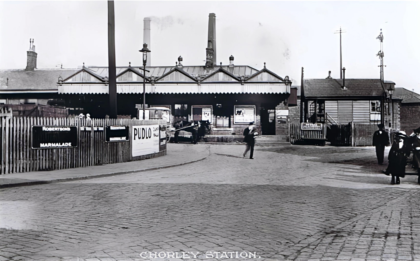
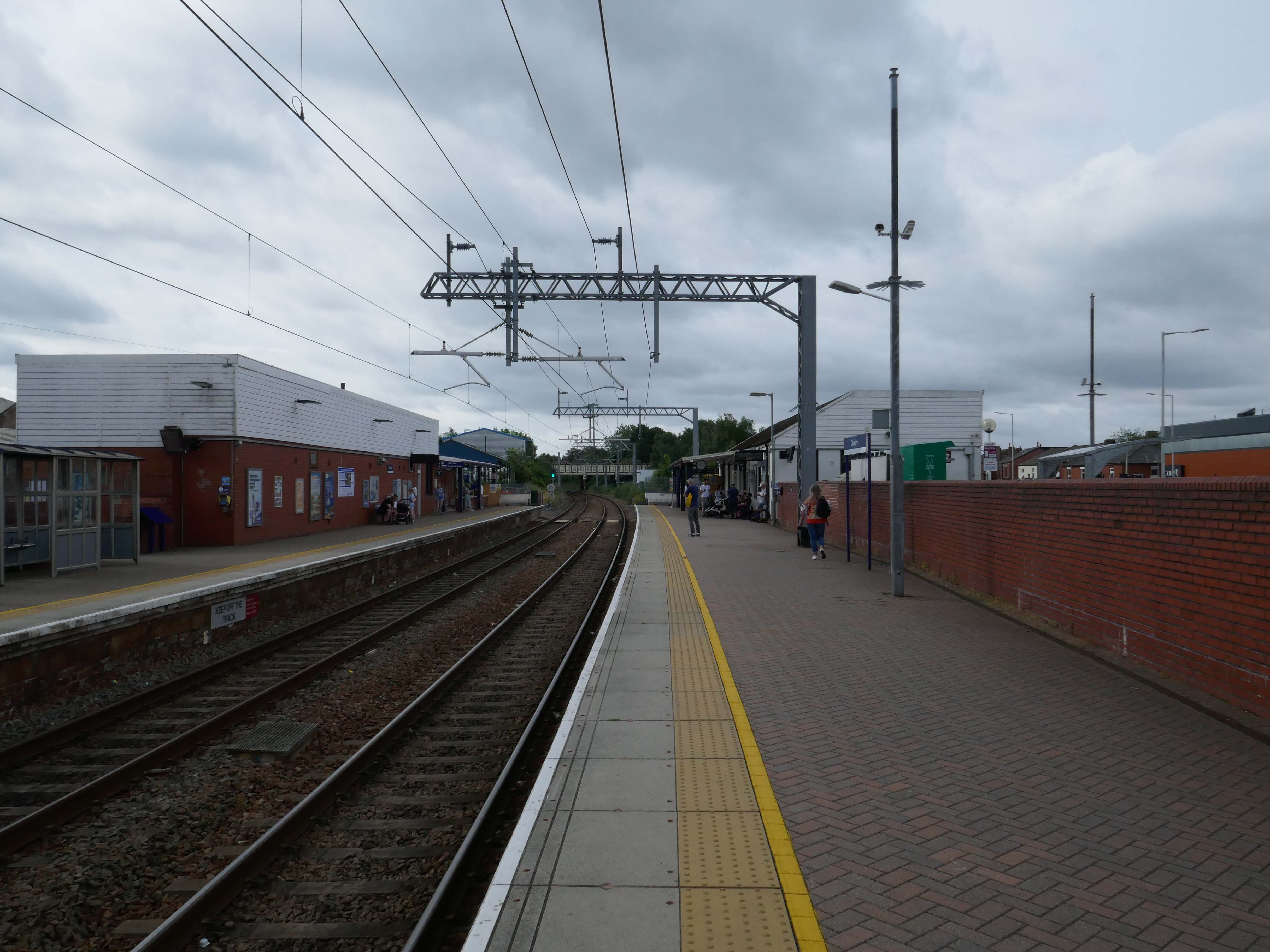
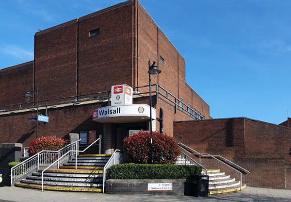
The current railway station is a modern version from the 1980s that was built on top of the original station – it is entirely functional, but more than somewhat undistinguished.
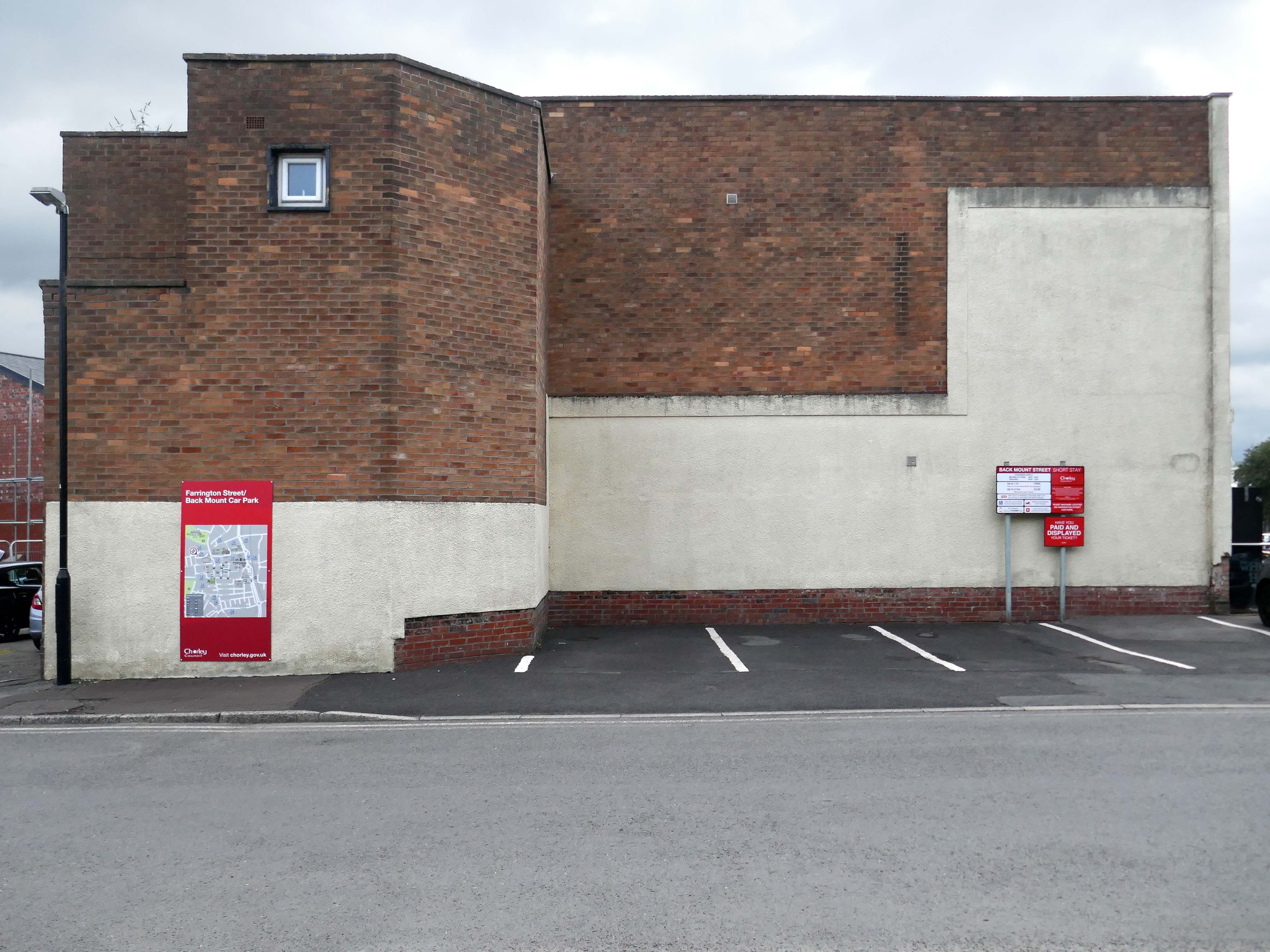
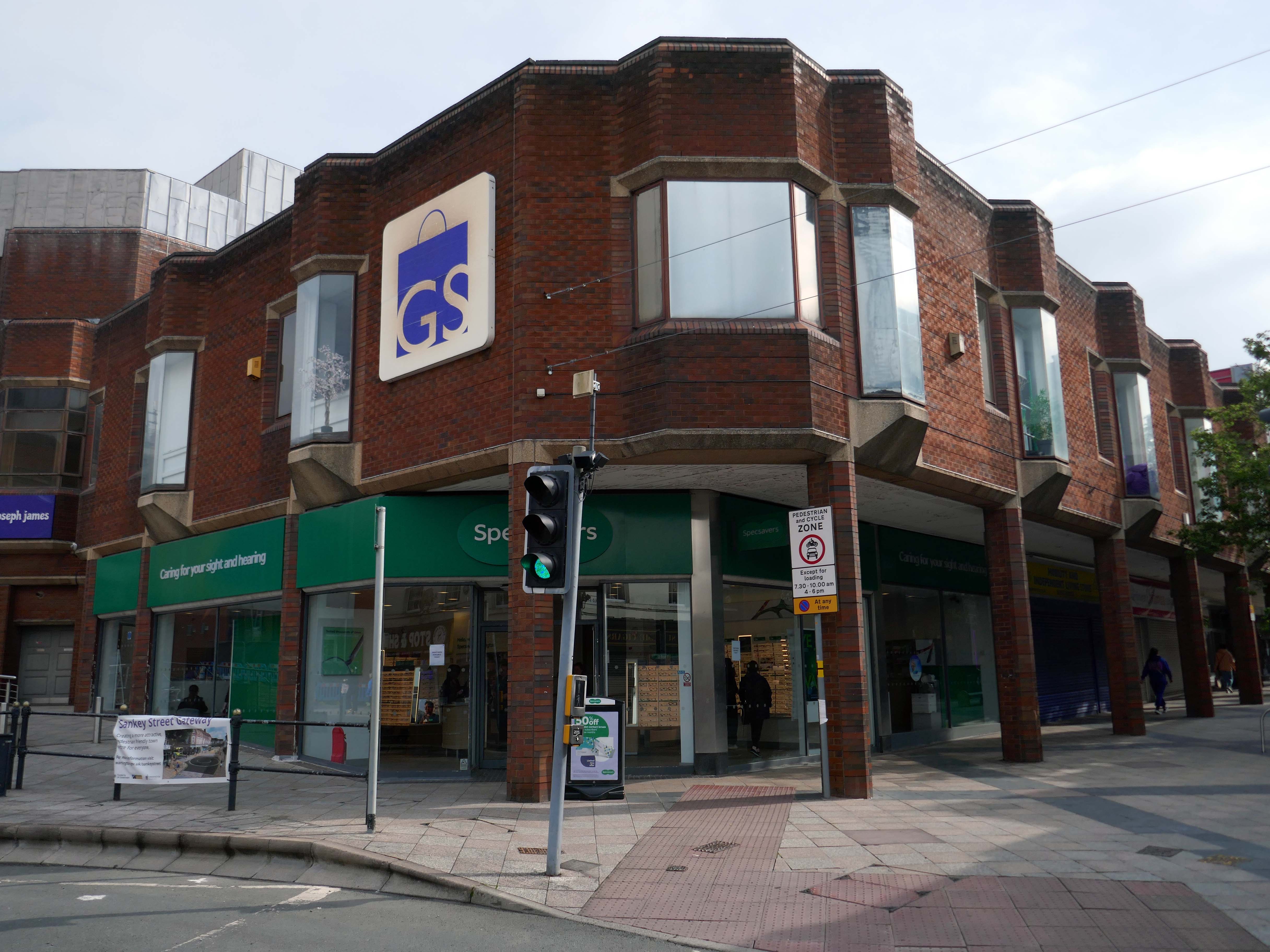
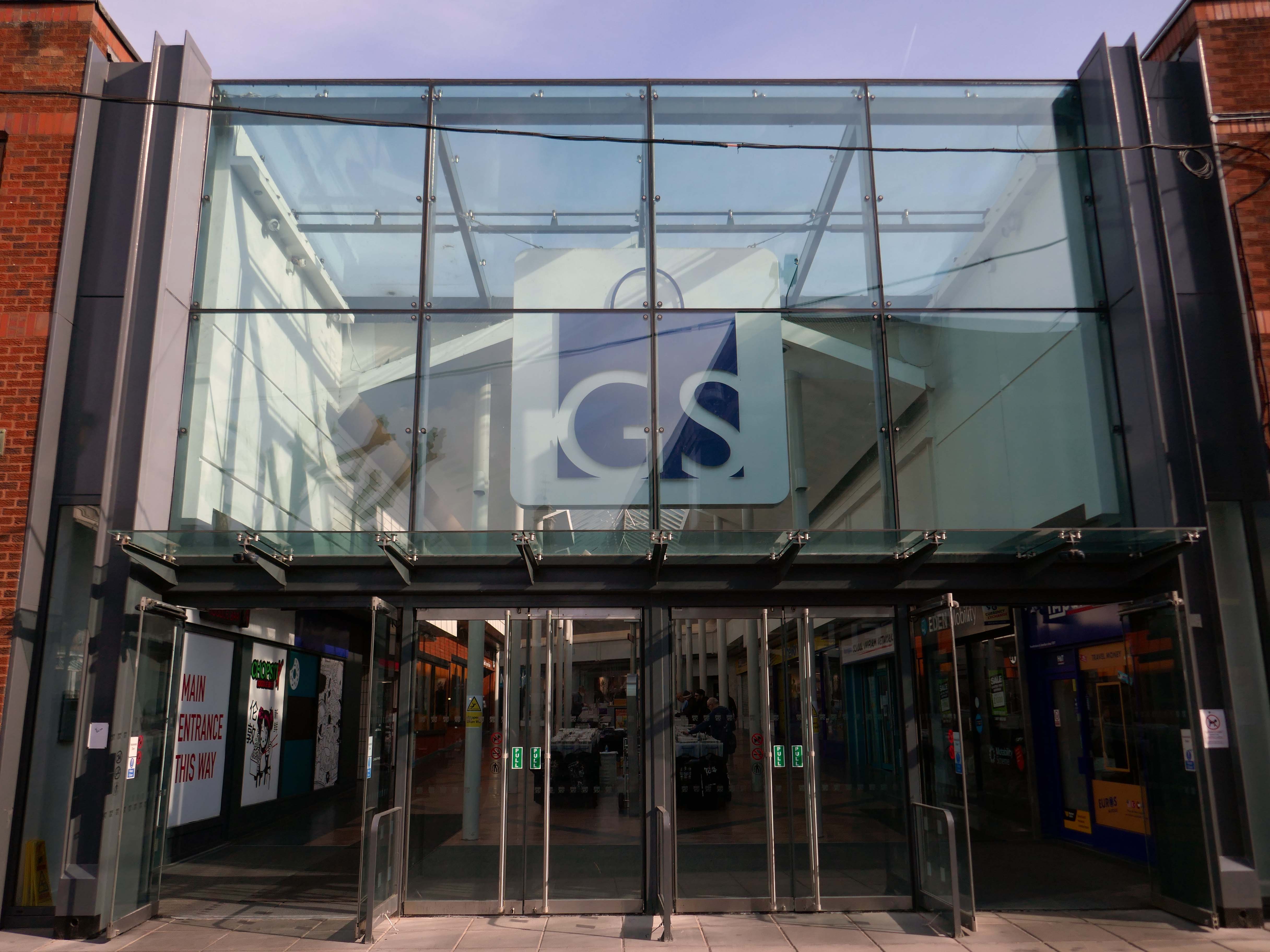
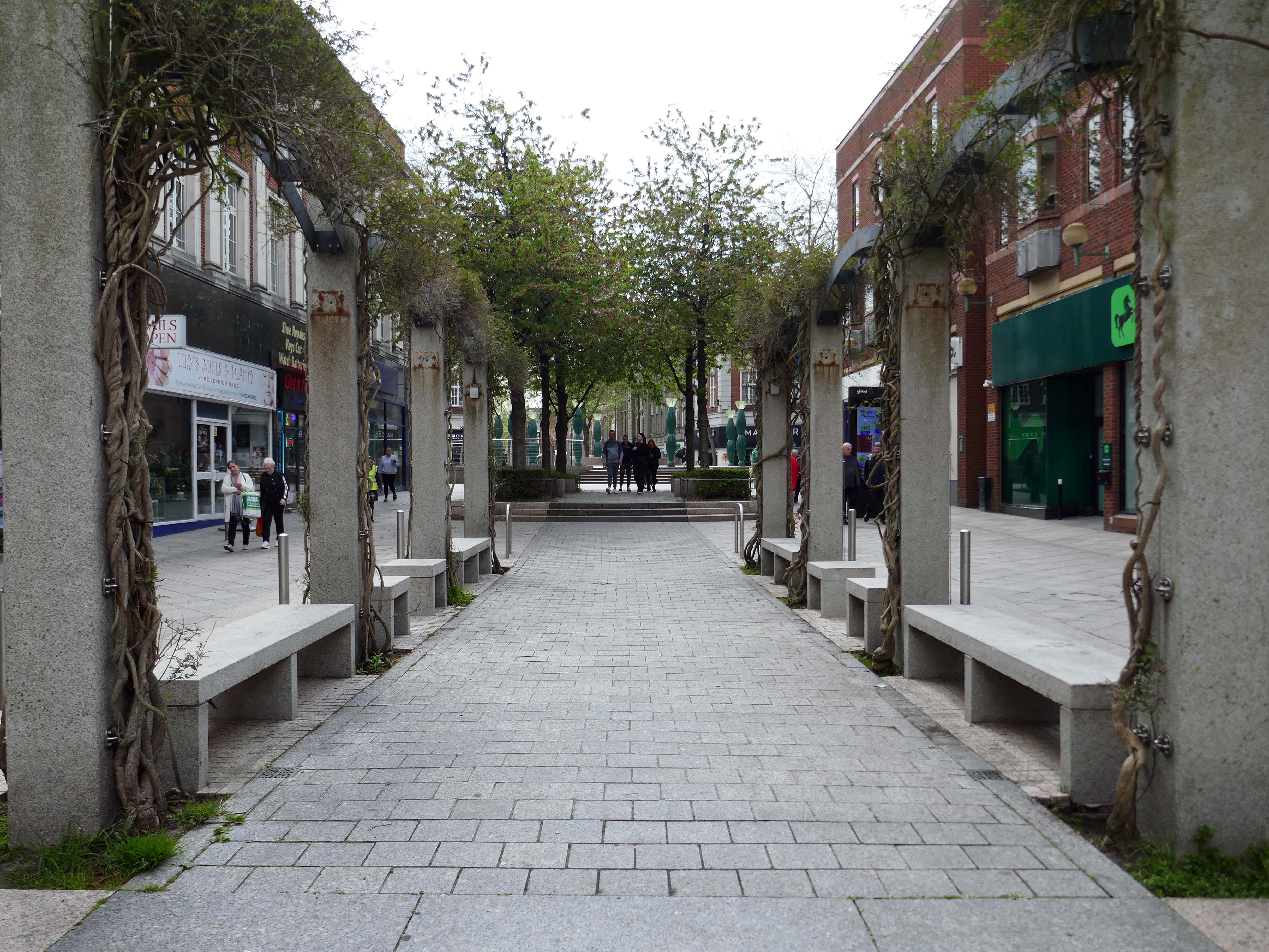
Whether it’s fashion, gifts, everyday essentials or an entertaining day out that you’re after, Market Walk has it all. With over thirty shops along an outdoor parade, plus entertainment and hospitality venues, there’s something for everyone.
AEW Architects were appointed by Chorley Council in 2015 as Architects for the Market Walk Scheme.
The Council’s aspiration was to breathe life back into the town centre by enhancing Chorley’s retail and leisure offer and refocusing Chorley’s centre as a destination for local residents and surrounding towns. The development needed to entice new, and retain existing, businesses in the town. Aesthetically, the development also needed to be a landmark for, and create a modern gateway into, the town – driving footfall towards Chorley’s commercial centre.
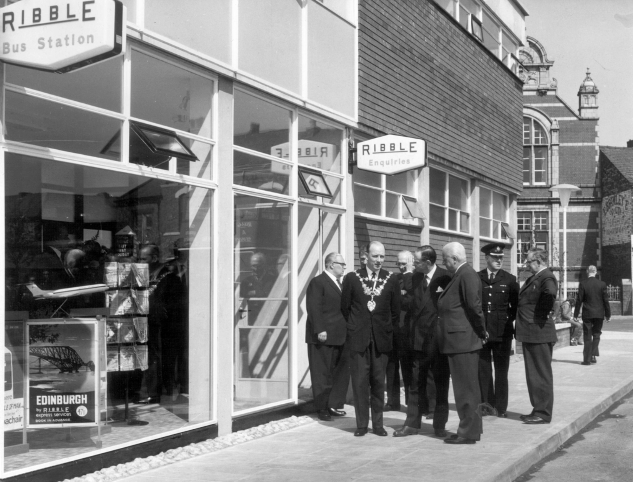
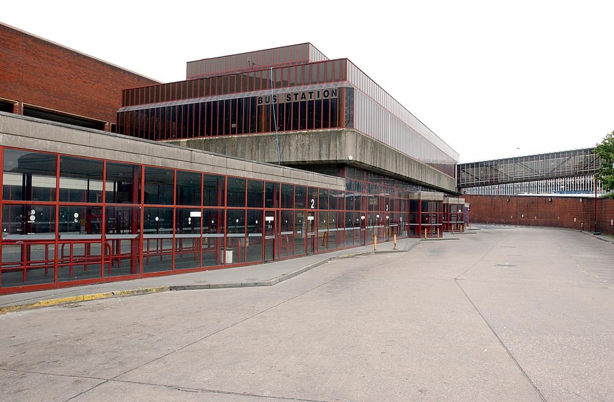
Next door is the Bus Station, opened in February 2003 replacing the previous structure.
Opening of the previous Bus Station – Ribble the area’s operators, before the Stagecoach arrived.
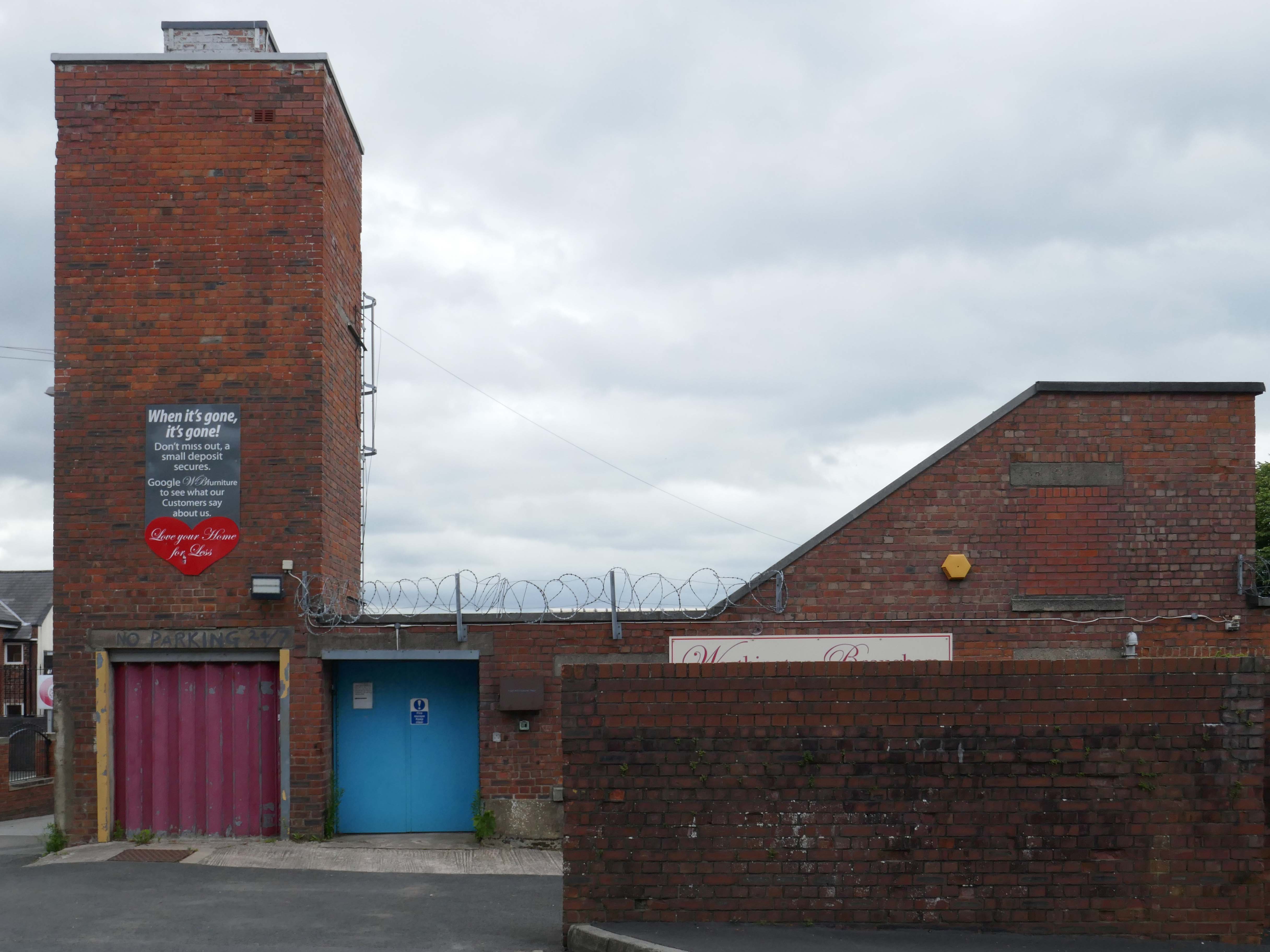
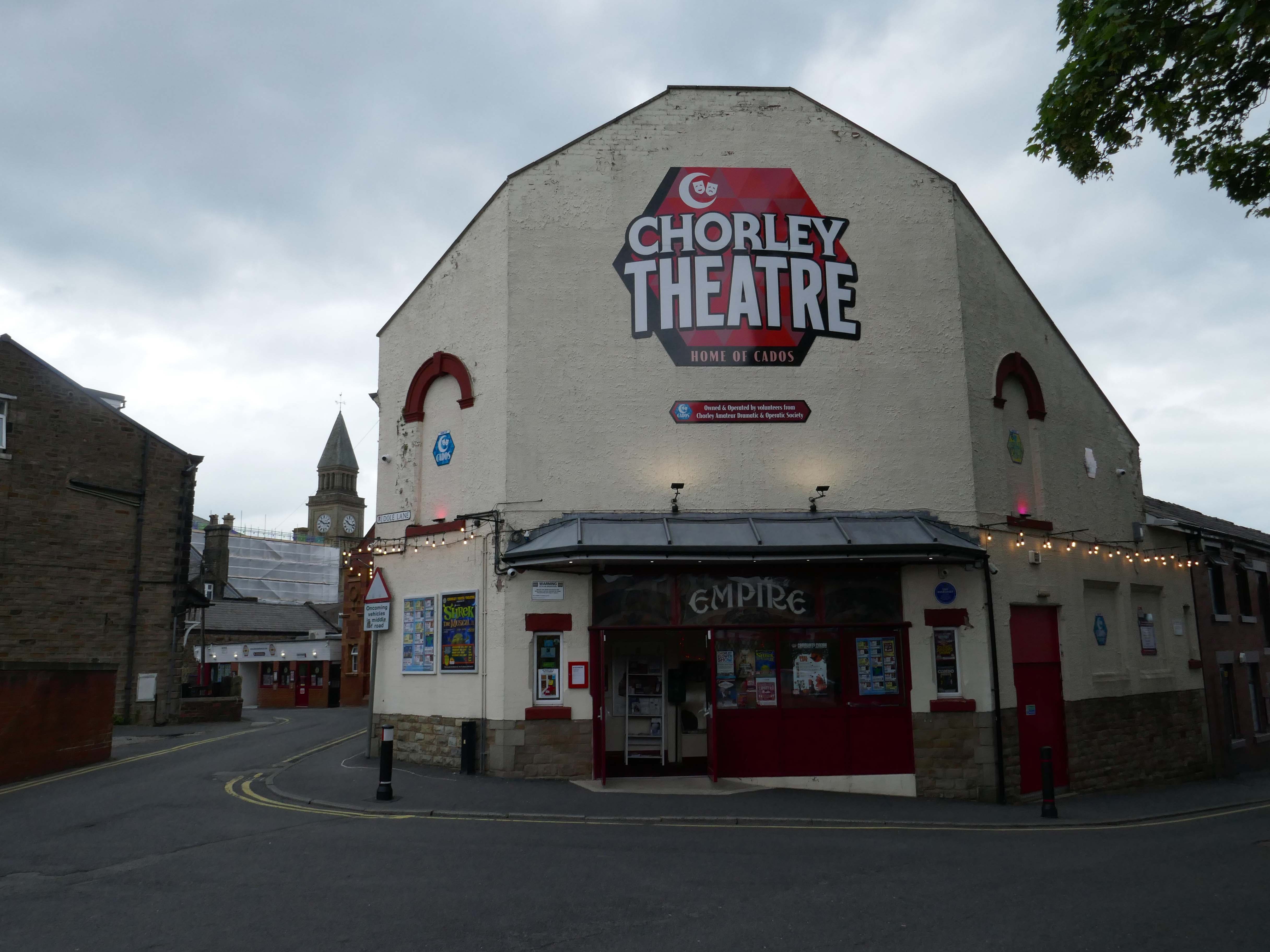
Opened on on 3rd September 1910, one of the nation’s longest continuously running cinemas.
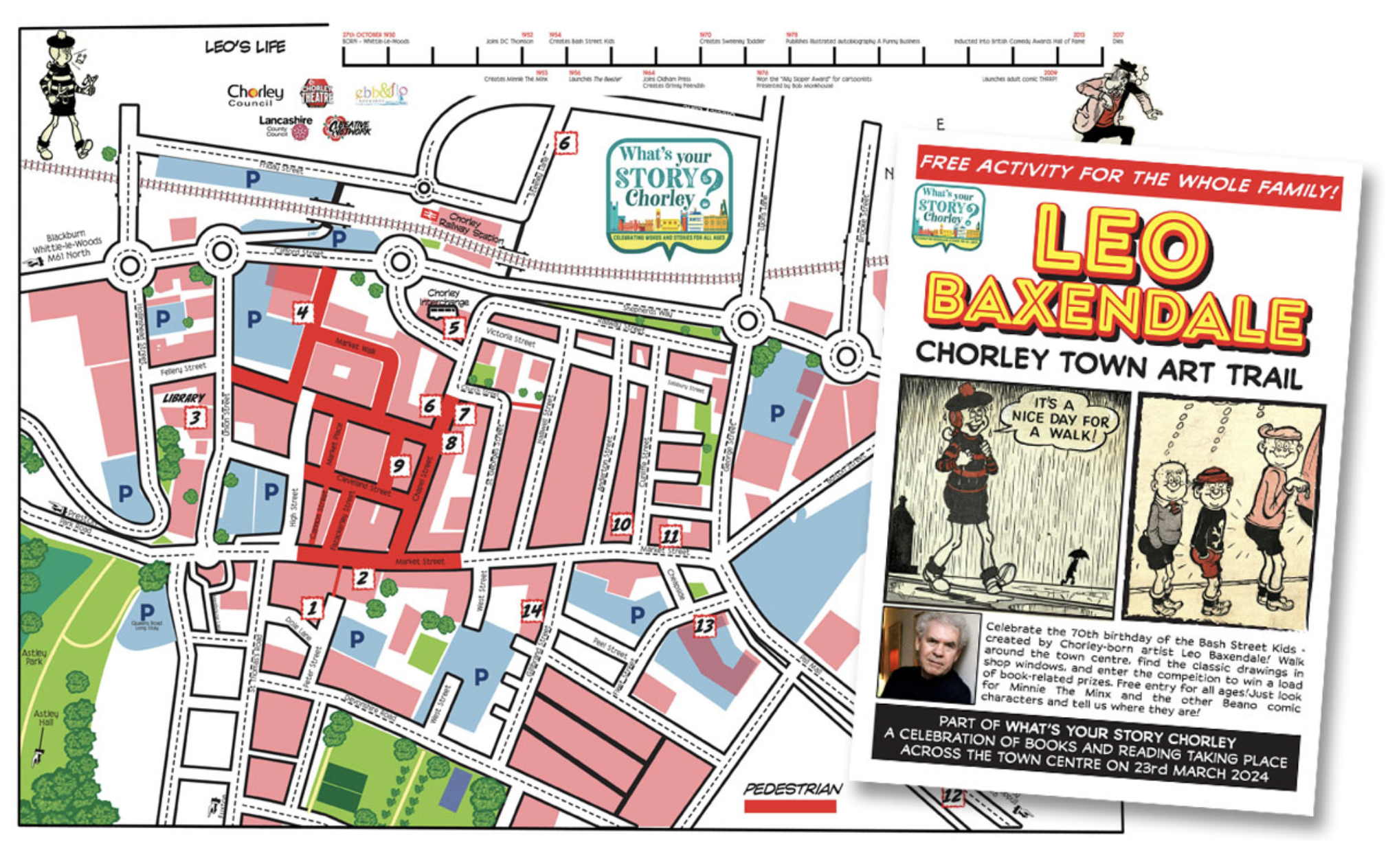
I spent some time chatting to the chatty guardian of the booking office, I learnt that the recently installed blue plaque commemorates the areas links to esteemed Beano artist Leo Baxendale.
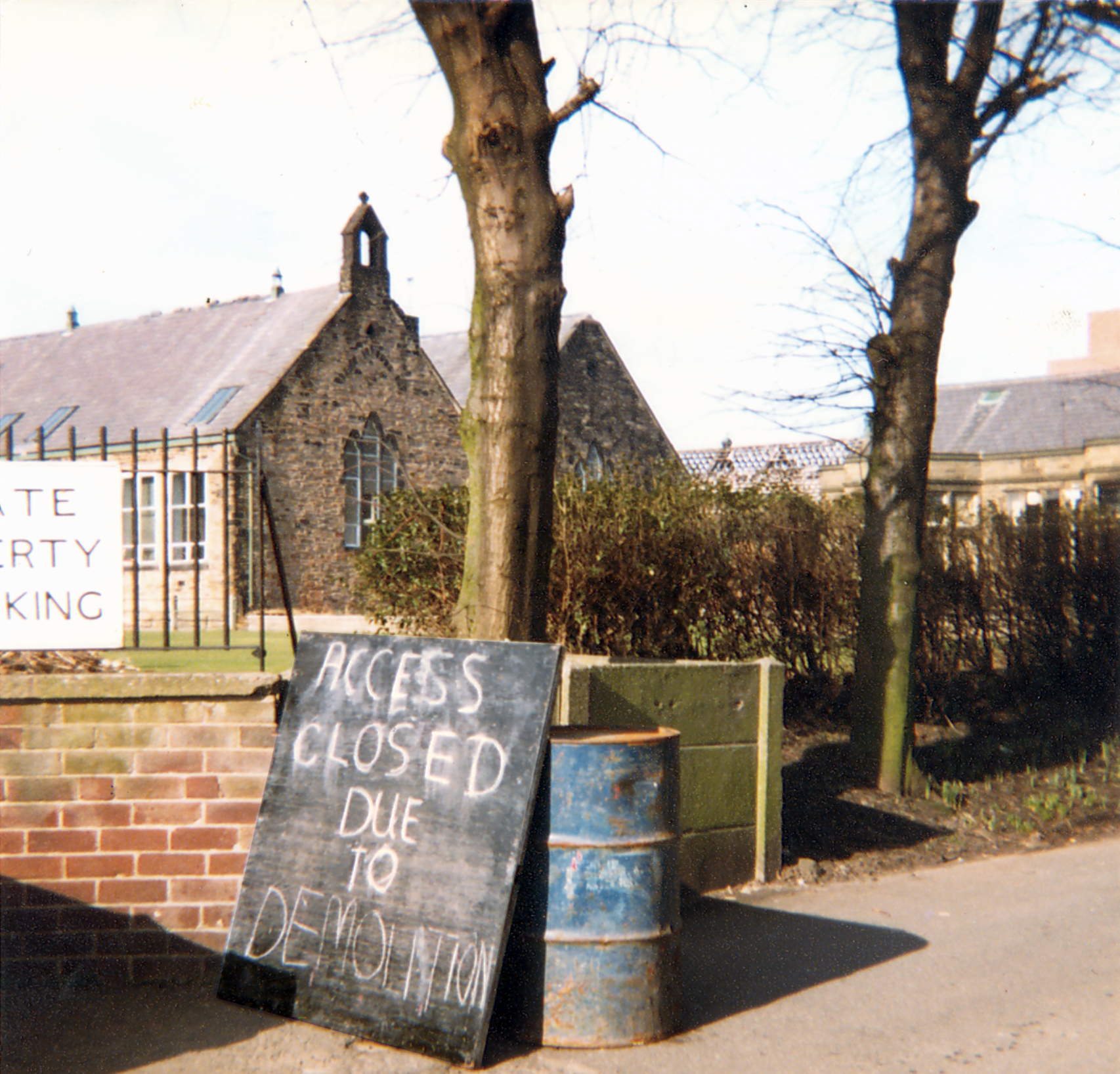
Leo attended St Mary’s School which was sited opposite the theatre, he had a miserable time there, an experience which formed the basis for the famed Bash Street Kids.
He may well now chuckle to himself in comic book heaven, knowing that the school was demolished in 1982.
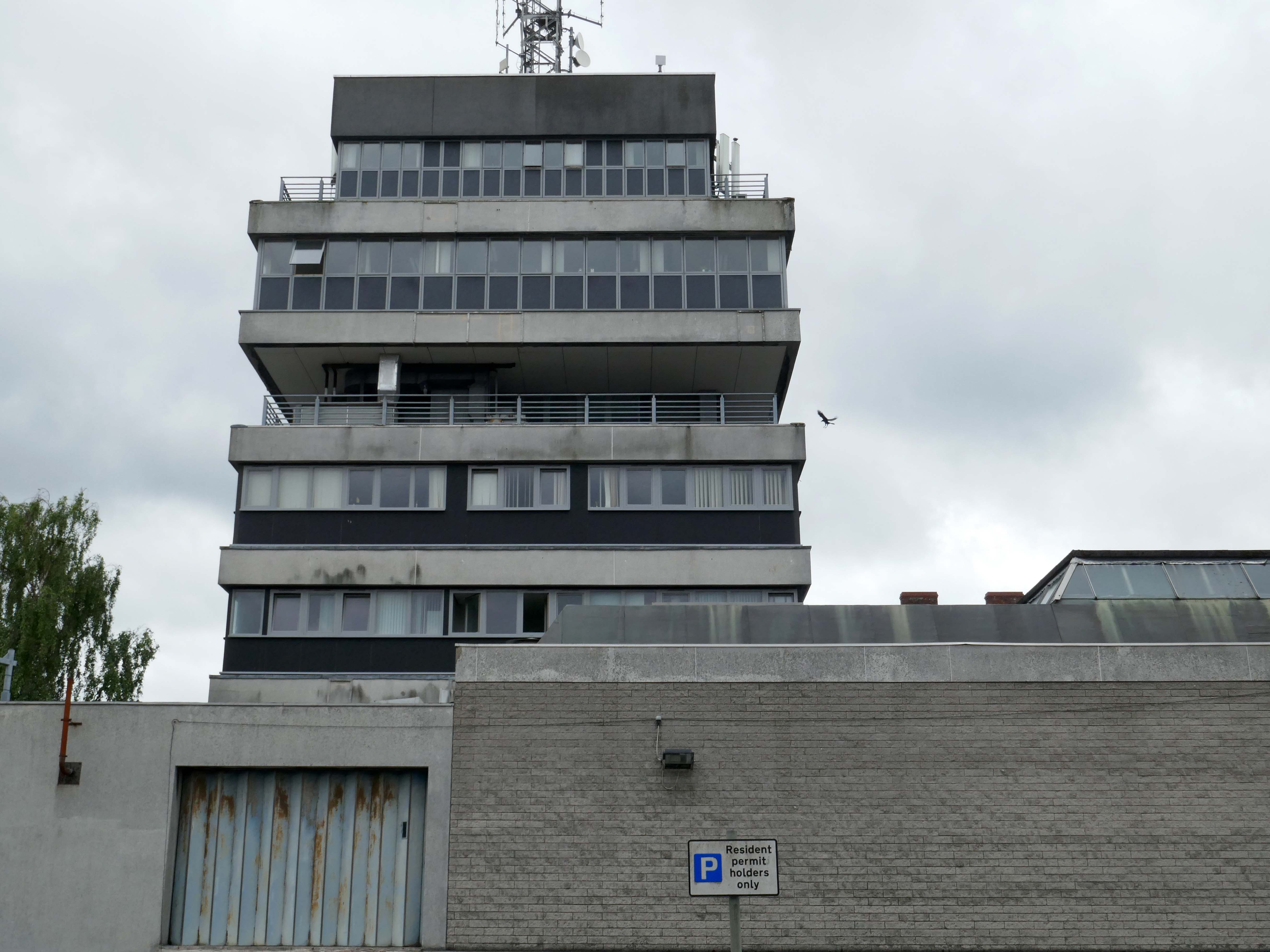
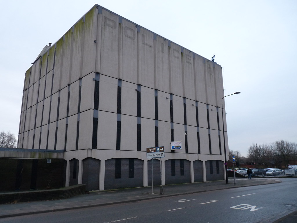
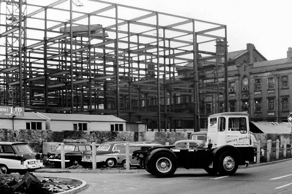
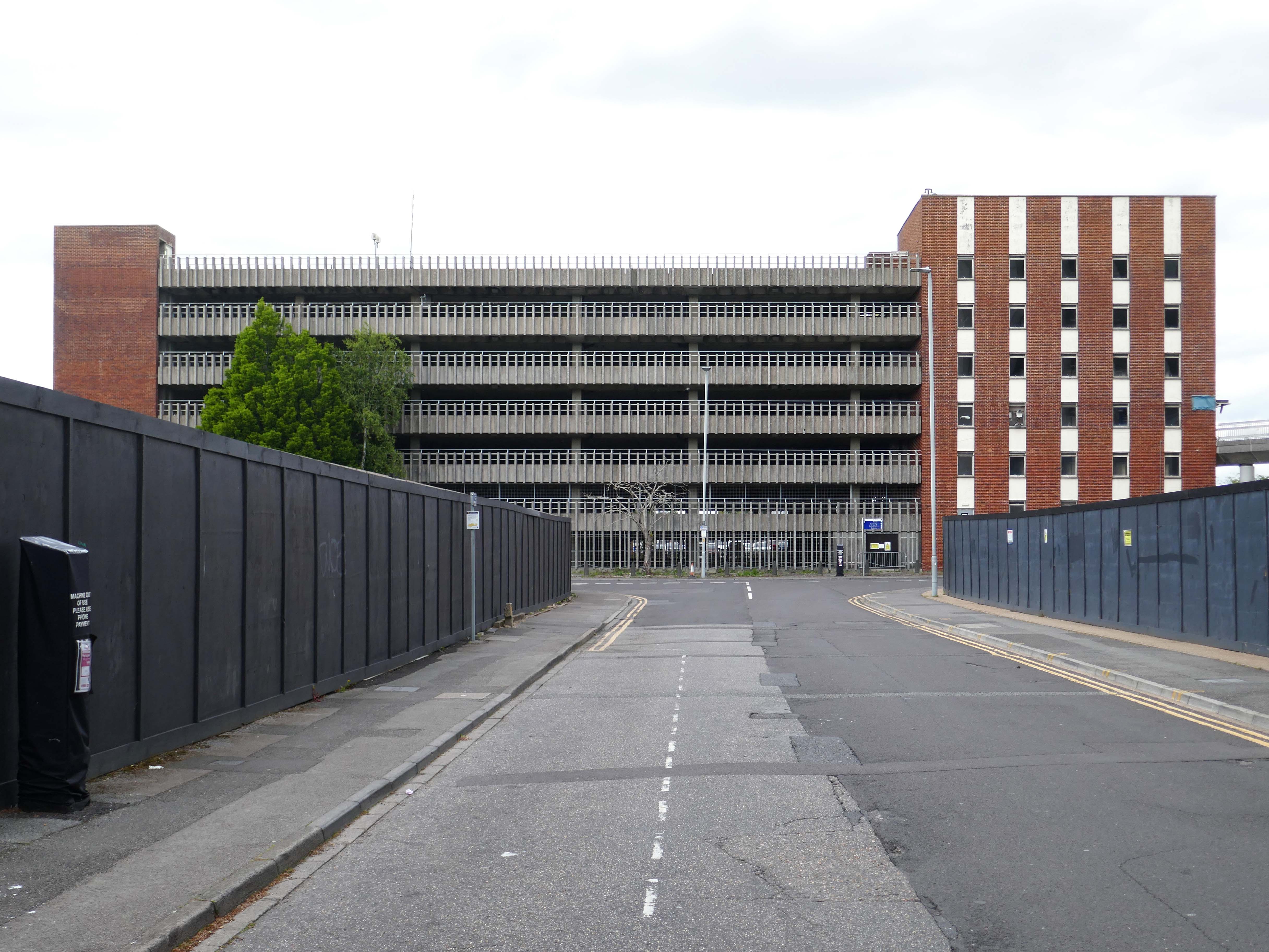
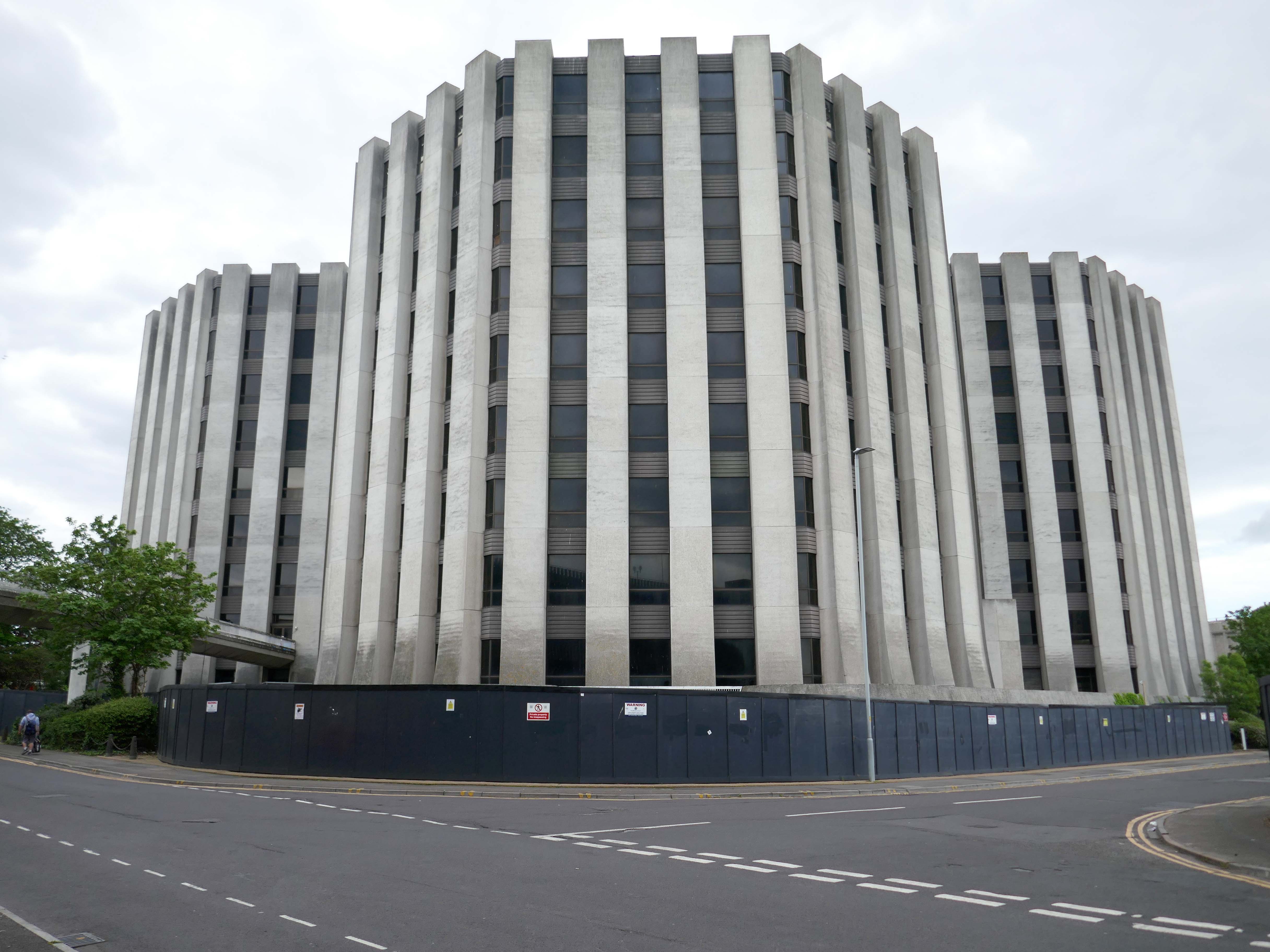
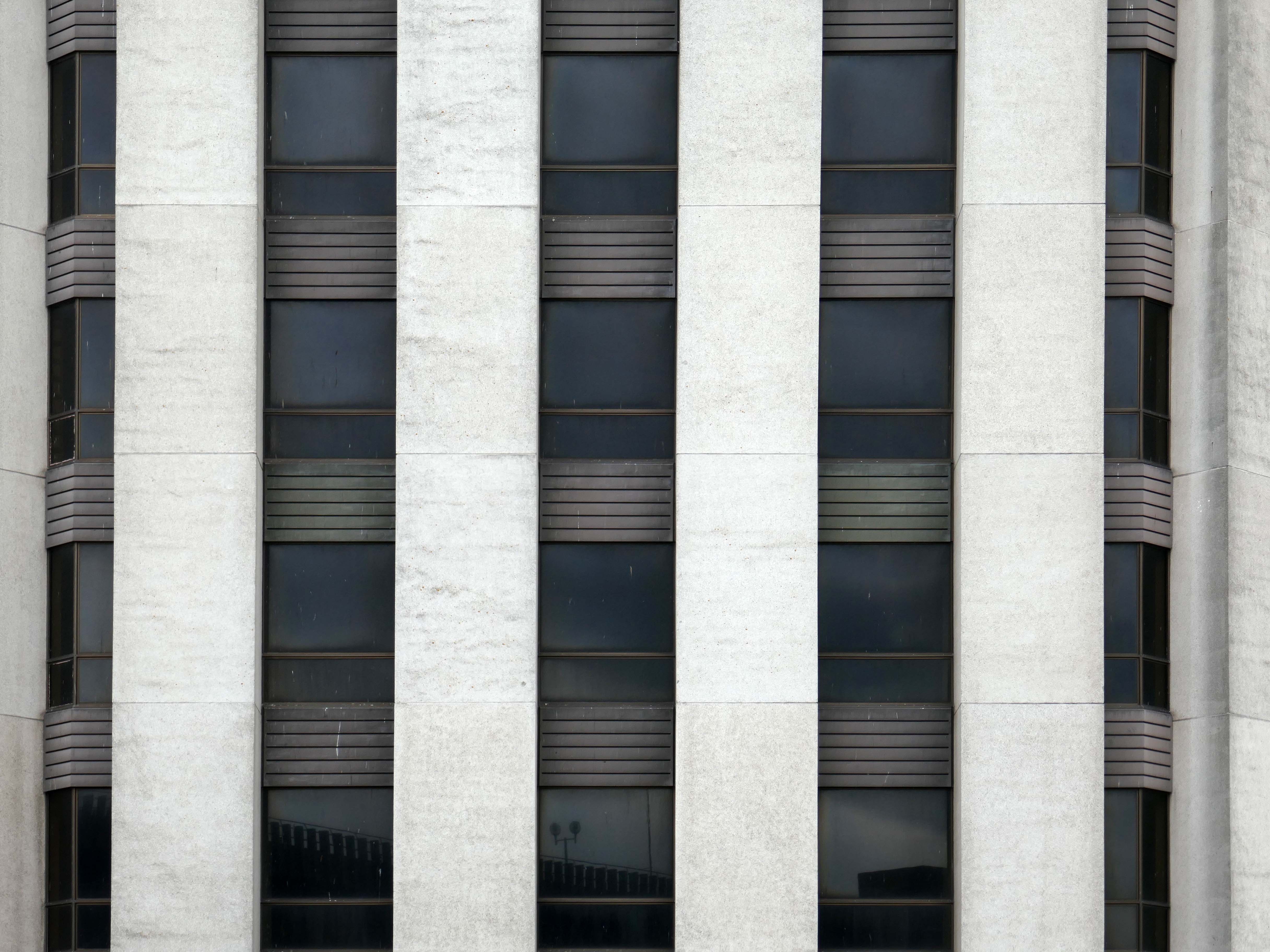
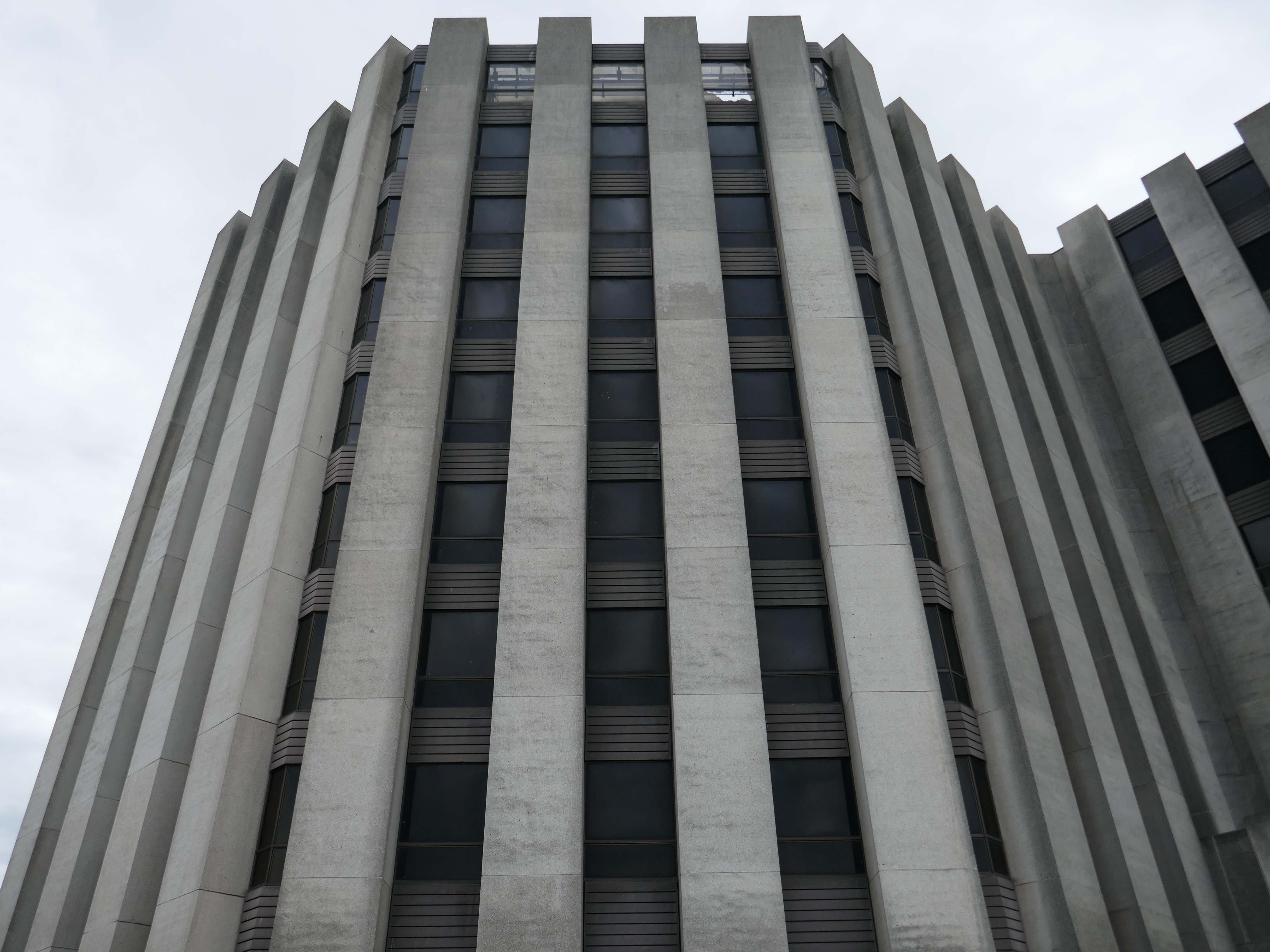
The design team was Roger Booth, Lancashire County Architect; CA Spivey, Assistant County Architect; DB Stephenson, Design Architect; and DG Edwards, AG Gass, responsible for the detailed design and construction. The seven-storey in-situ concrete framed main block was the last bespoke police station to be built in Lancashire, following this the department developed a systemised concrete construction method which was deployed across the county. The dramatic cantilevers gave the new building a stature and presence that signalled authority. The lower levels were accessed by ramps and provided space for police vehicles. To enter the police station one ascended a set of external stairs across a pool that once contained koi carp – fittingly, one boy described the new building as a ‘fishtank’ upon its completion. The magistrates’ court was finished externally in a grey brick and carried the signature pyramid rooflights that were synonymous with the Department.
Next door its partner in crime the Magistrates Courts.
Opened in 1968.
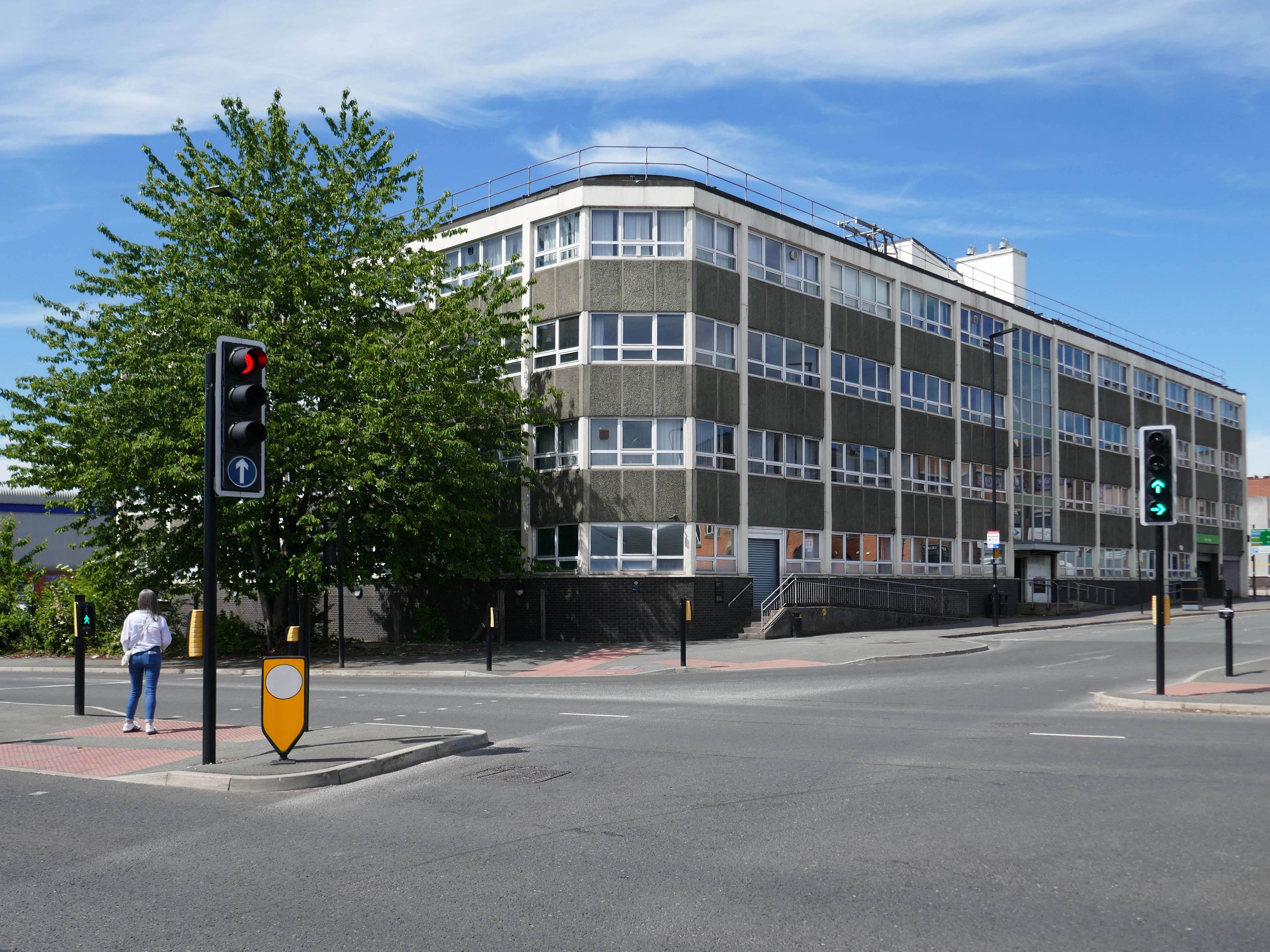
The courts are up for sale – offers in the region of £800,000 – the property has planning permission for an eleven storey apartment building with fifty two flats, three ground floor retail units and roof terrace.
The disused court building was last sold in 2022 for £300,000, according to the Land Registry.
Designs for the scheme were drawn up by FWP Group.
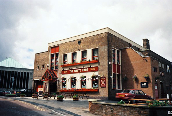
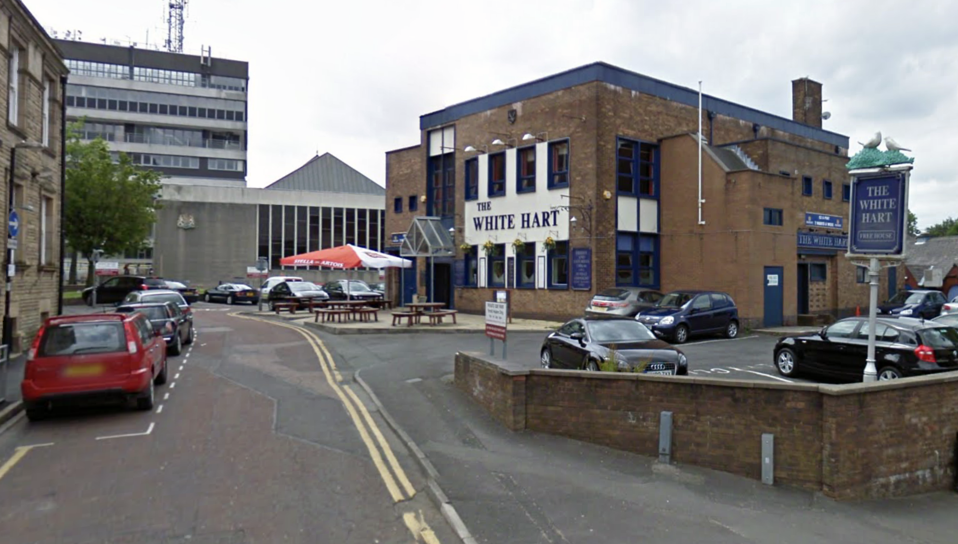
Next door is a pub no longer a pub.
Once upon a time a Vaux Brewery house the White Hart – implausibly renamed the Snooty Fox for a brief period.
The pub was decent enough inside with a large room which was empty on our Friday dinner visit, the pub was a Vaux tied house so we were well pleased as we had not done many of them.
We had a drink of Vaux bitter which went down well.
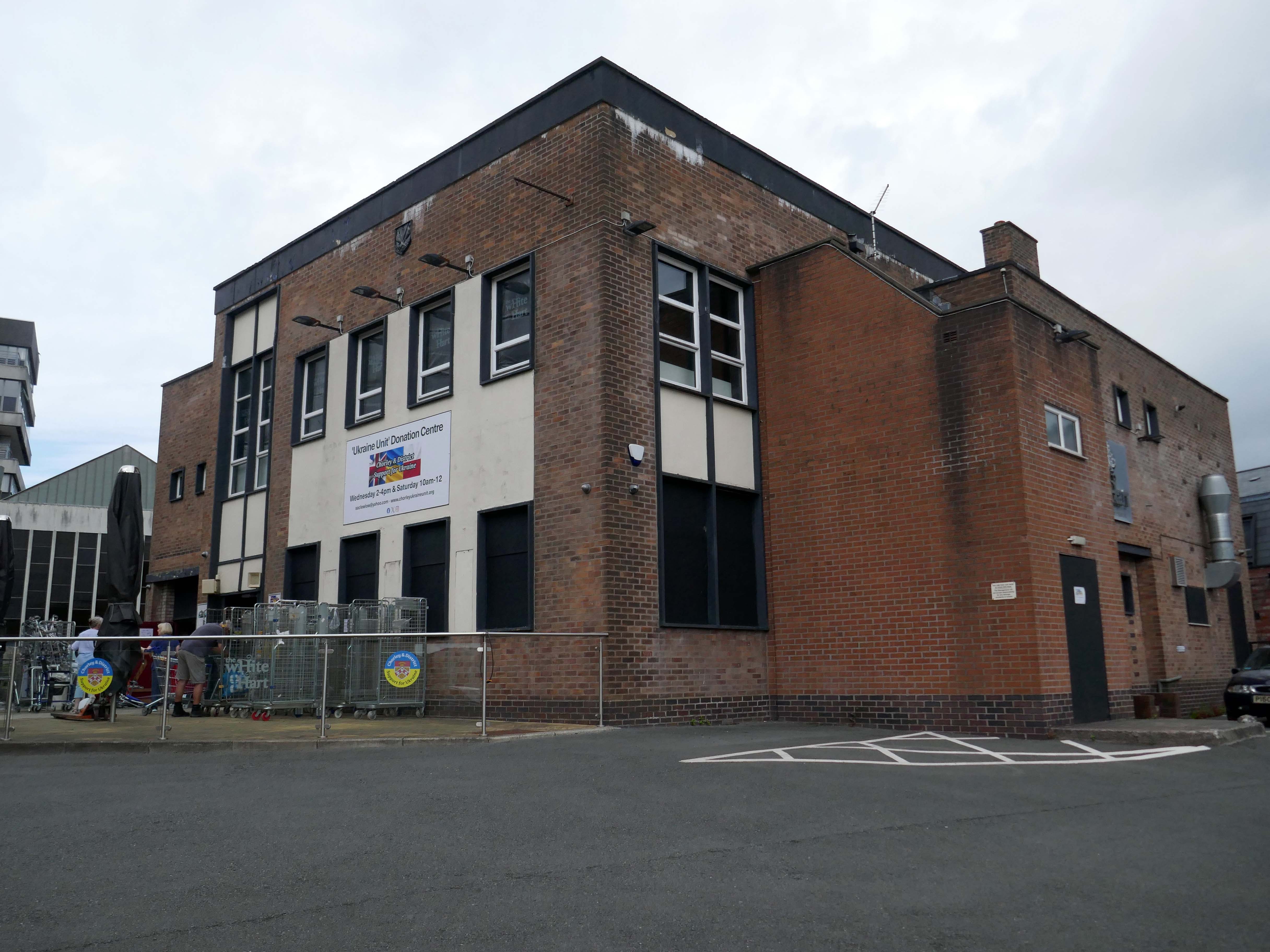
Our group was created in February 2022 to try and help raise awareness of the crisis in Ukraine and to help organise and coordinate local efforts to send support from across the Borough of Chorley in Lancashire. We have since grown into a major hub for donations.
Across Chorley & District multiple educational facilities, community groups and organisations reacted and began to spread awareness and collect donations. In order to sift and sort a lot of local donations, a unit has been loaned by Chorley Council. A large percentage of the region’s aid has come into this unit and we are regularly packaging aid and supplies in preparation for the next leg of the journey to Ukraine, whether it’s transported there by us or other charitable organisations.
Our philosophy is that if we can all do a little bit, together we can make a big difference.
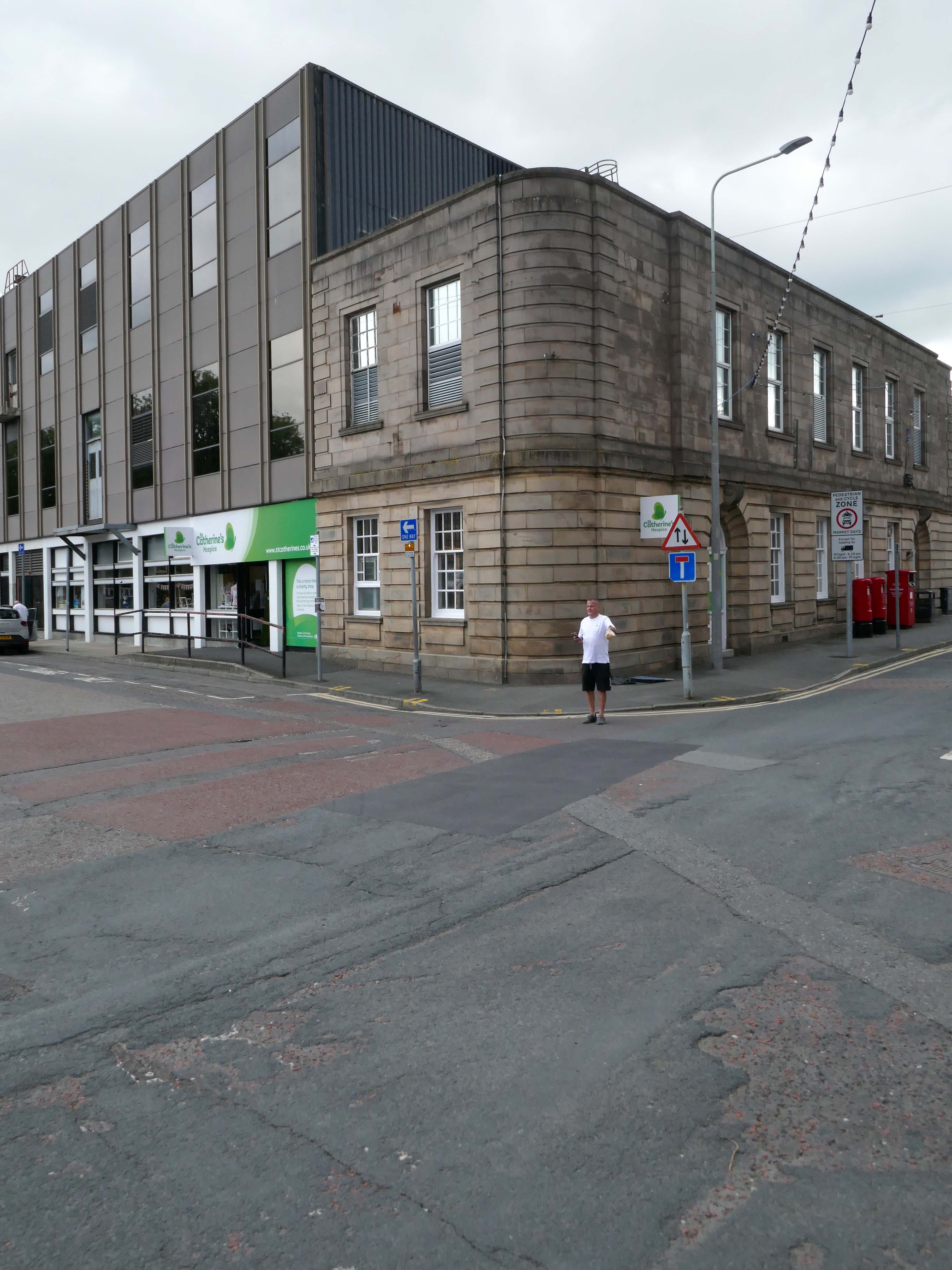
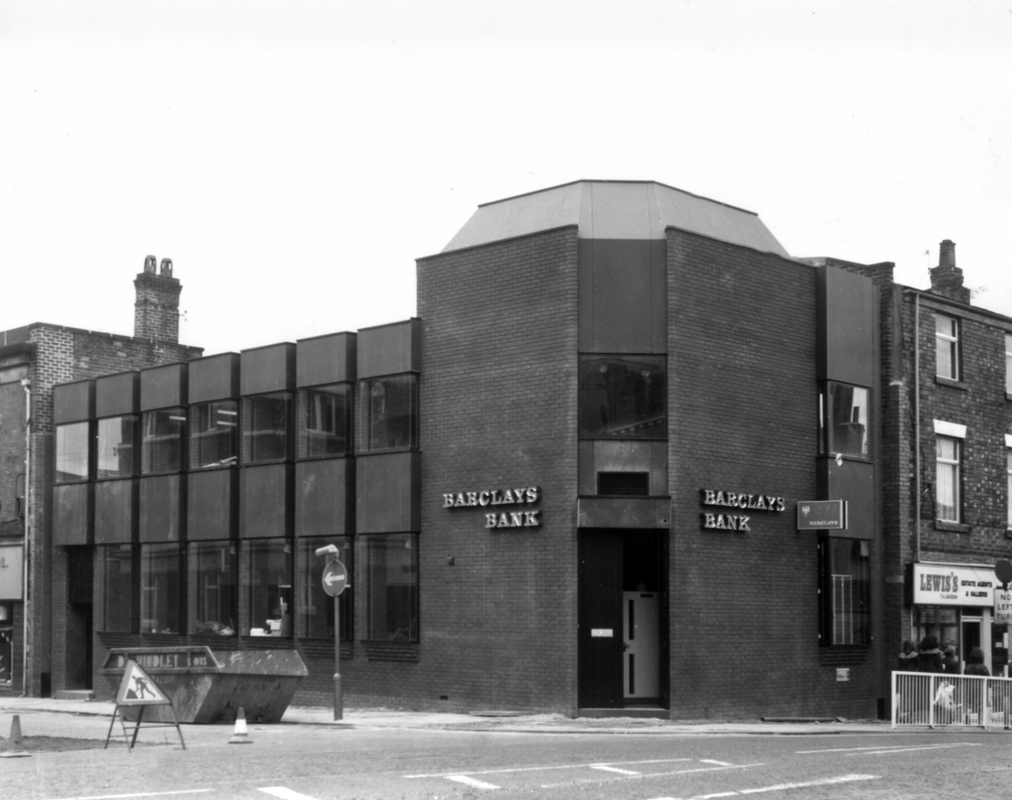
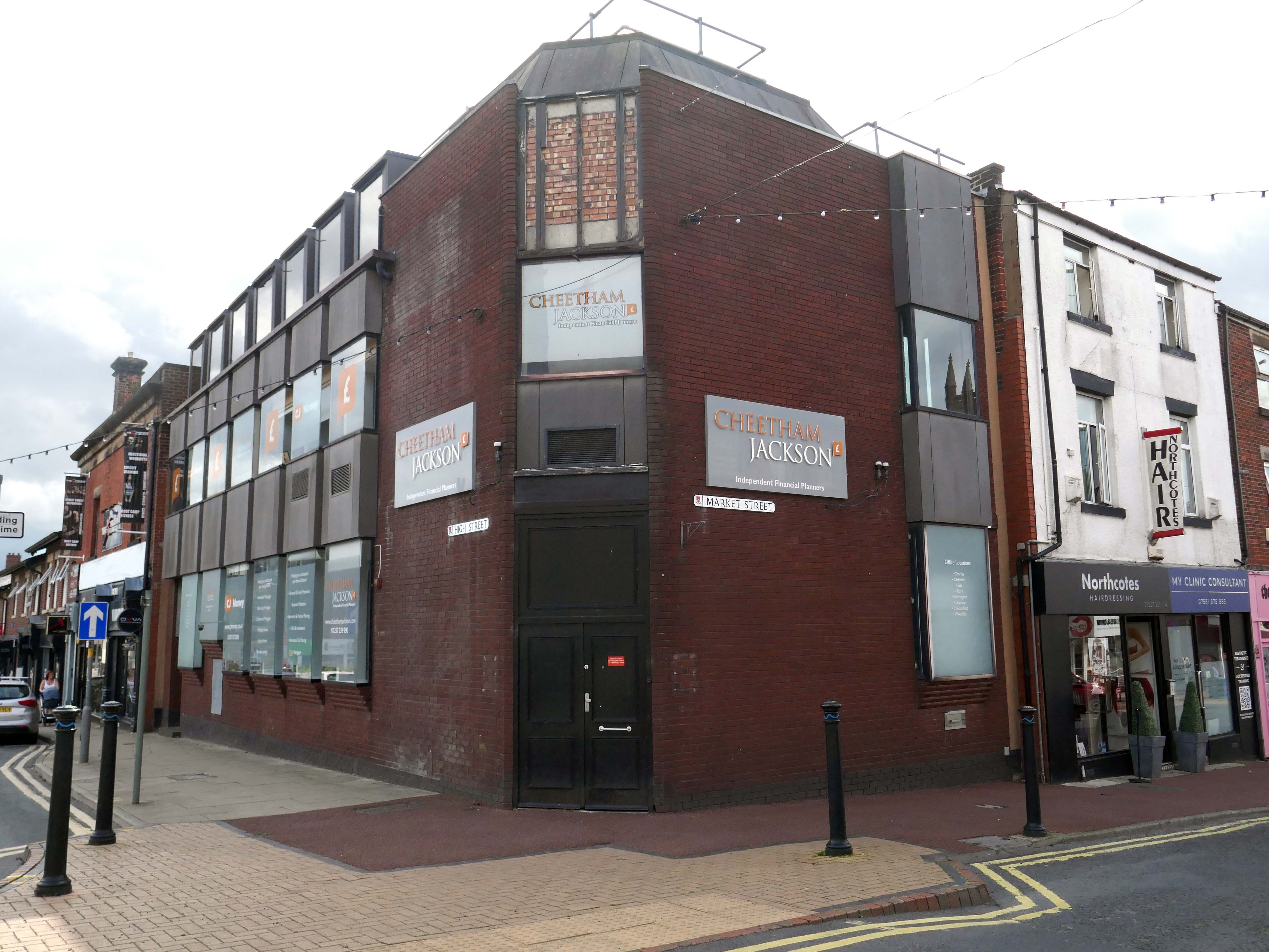
Bouncing back to what was and never shall be no more Barclays Bank.
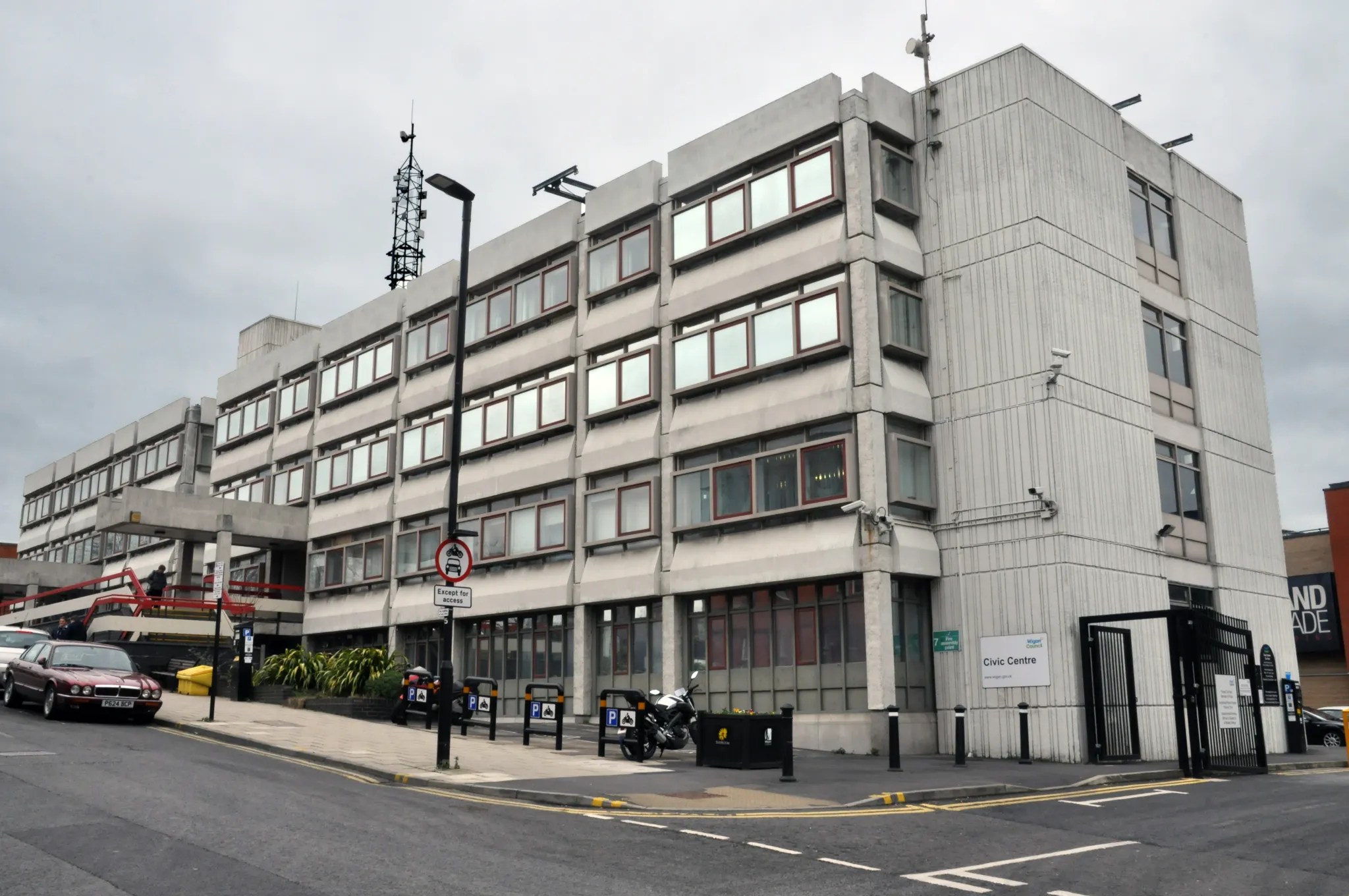
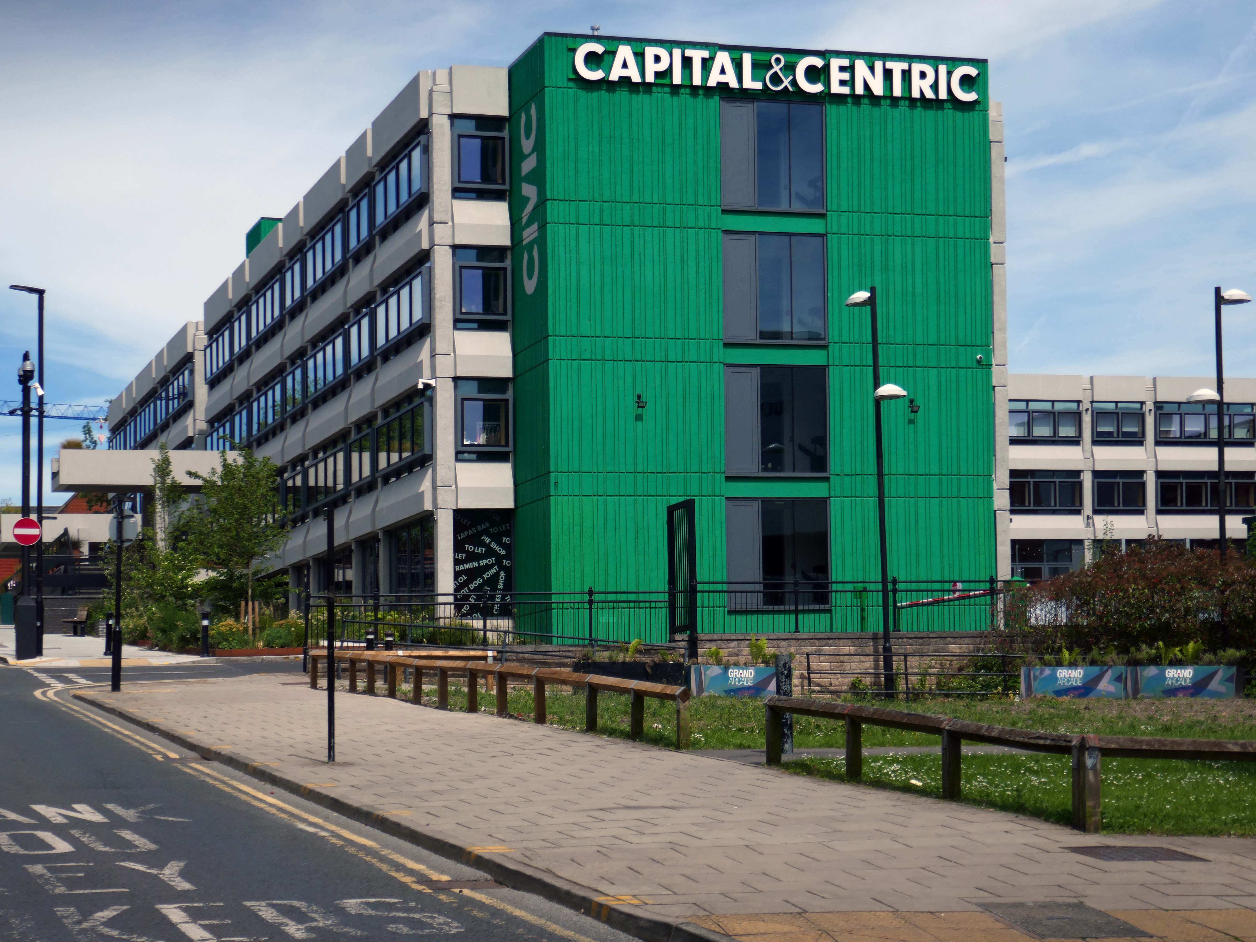
Almost finally we find ourselves at the Council Offices 1982.
You will be delighted to hear that Chorley Council has a Masterplan
Self Architects generated a high level Masterplan for this prominent site. The scheme proposes a boutique hotel, offices, restaurants/bars, along with apartments, aiming to transform the town centre by intervention to enhance the overall vision by:
Establish a series of formal/informal public spaces
Diagonally link public spaces
Greening pedestrian streets
Reducing dominance of cars
Improving evening economy
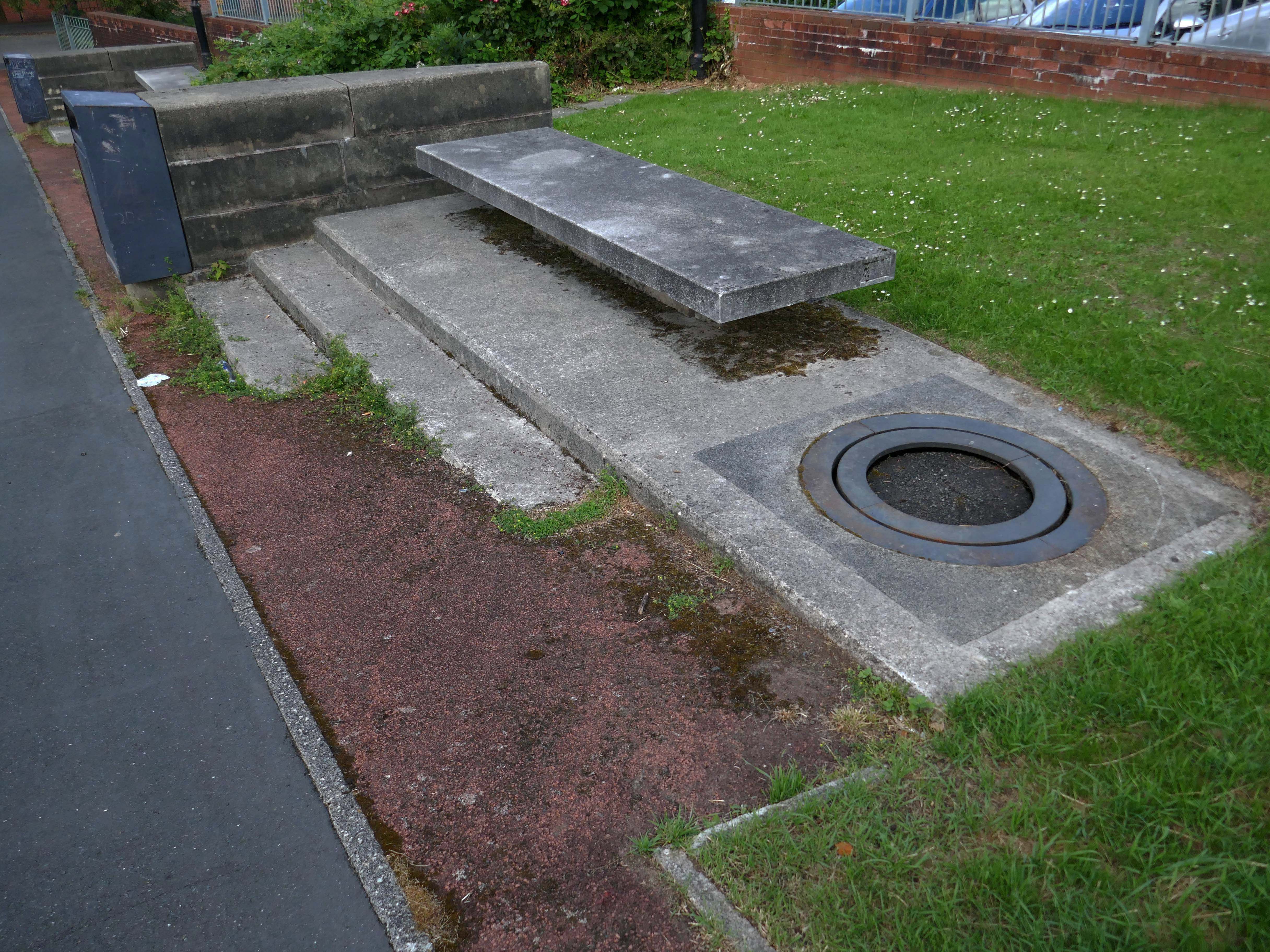
Having a moment or two on my hands I ventured to the land beyond beyond – the land of the concrete bench, bin and planter combo.
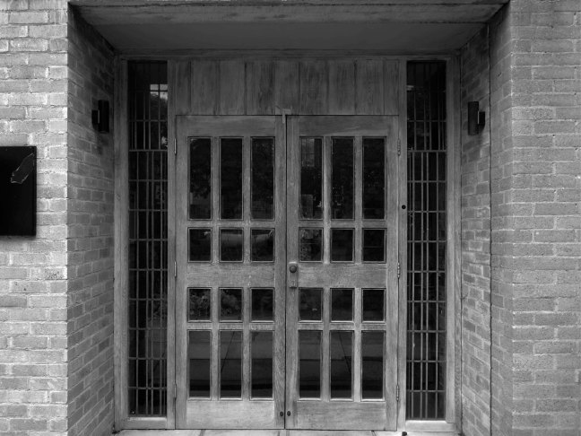
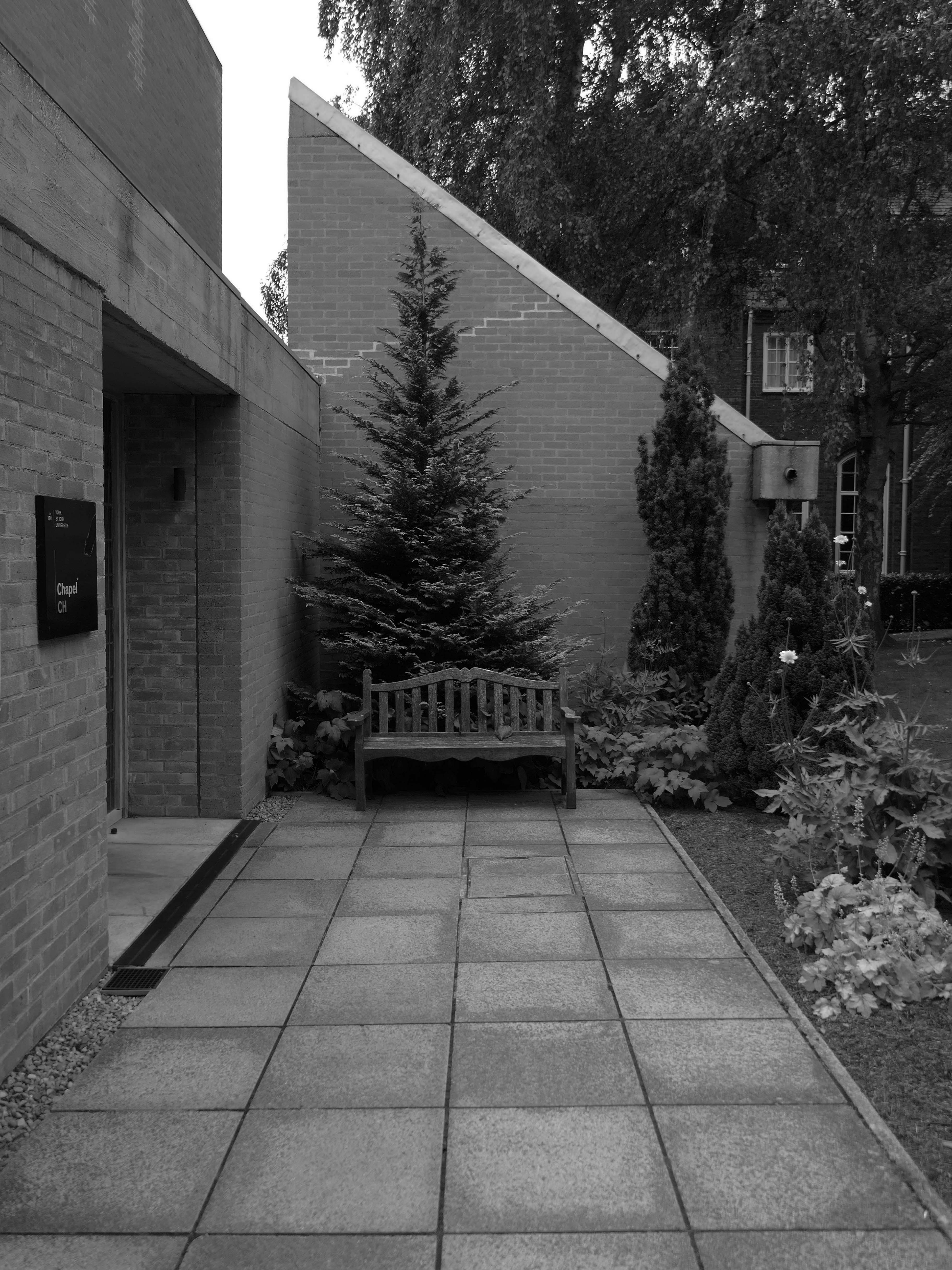
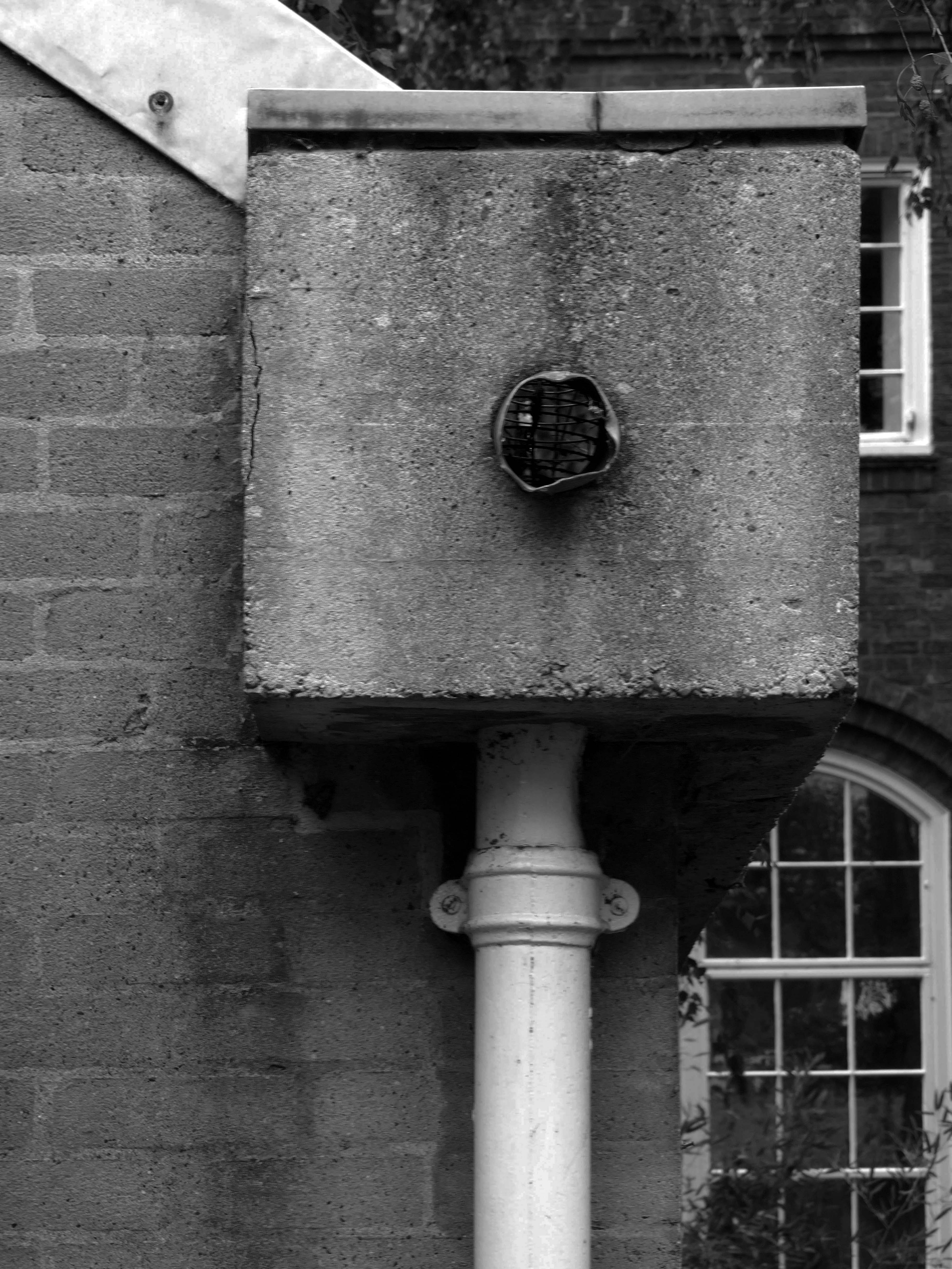
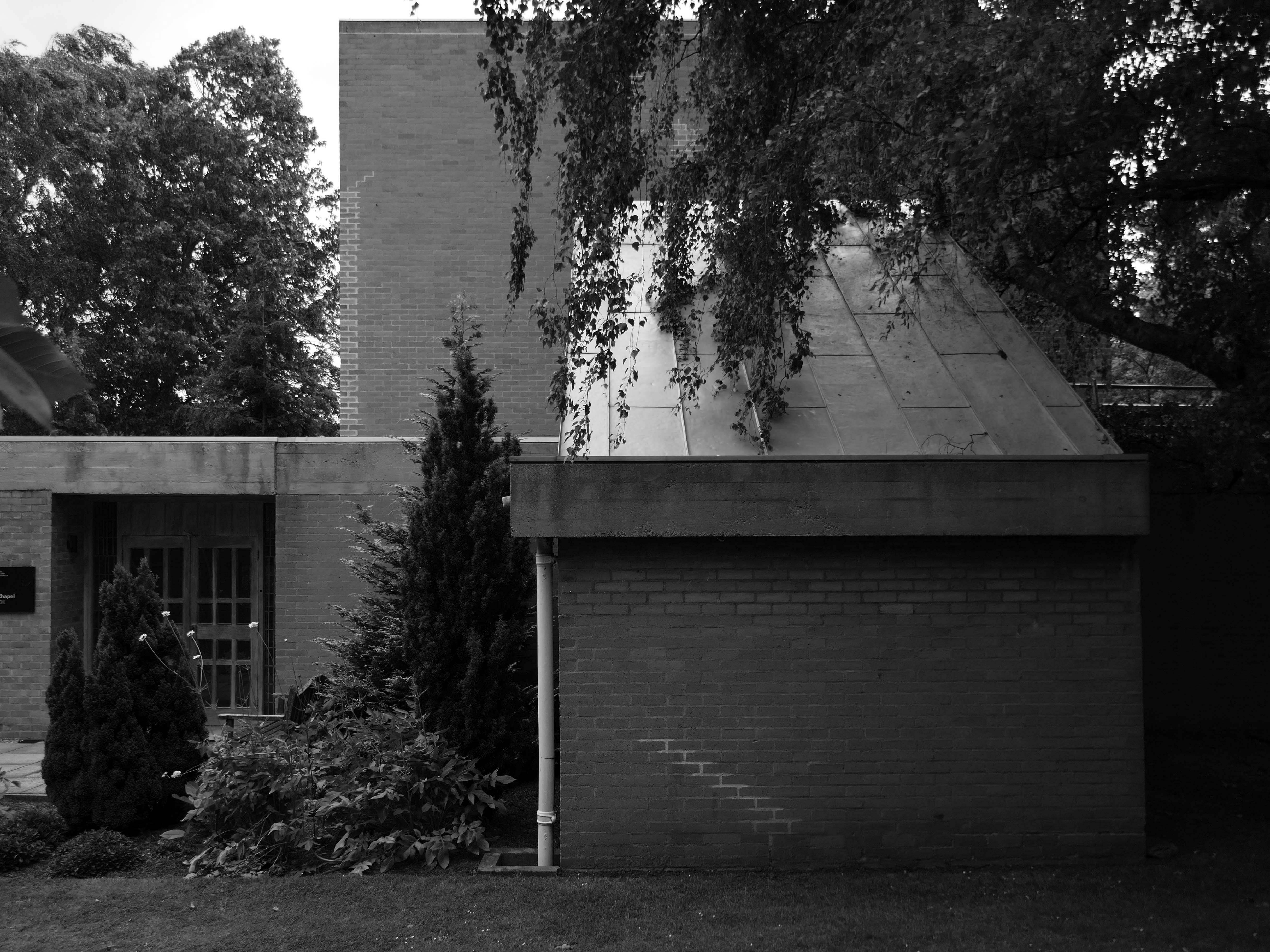
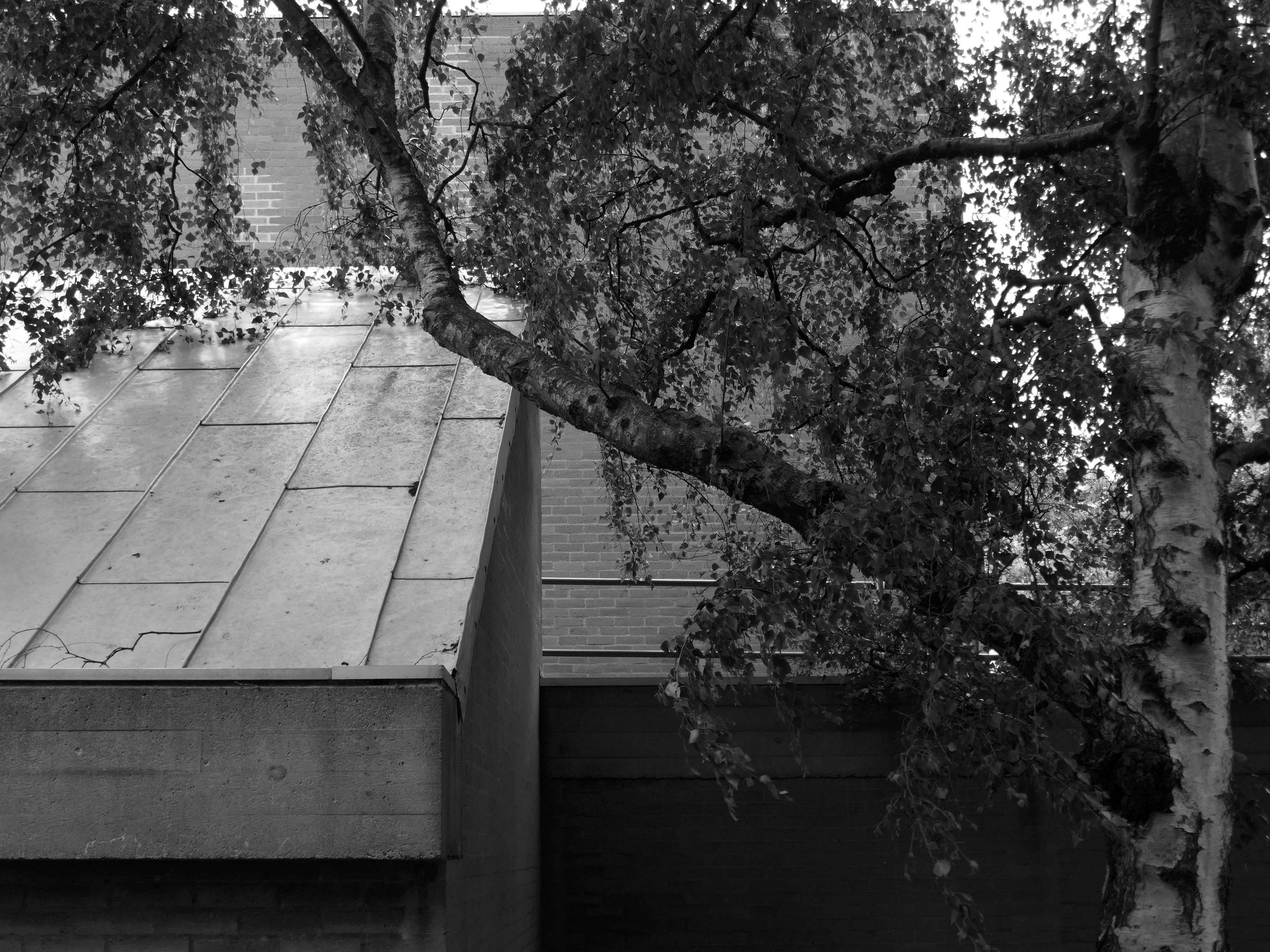
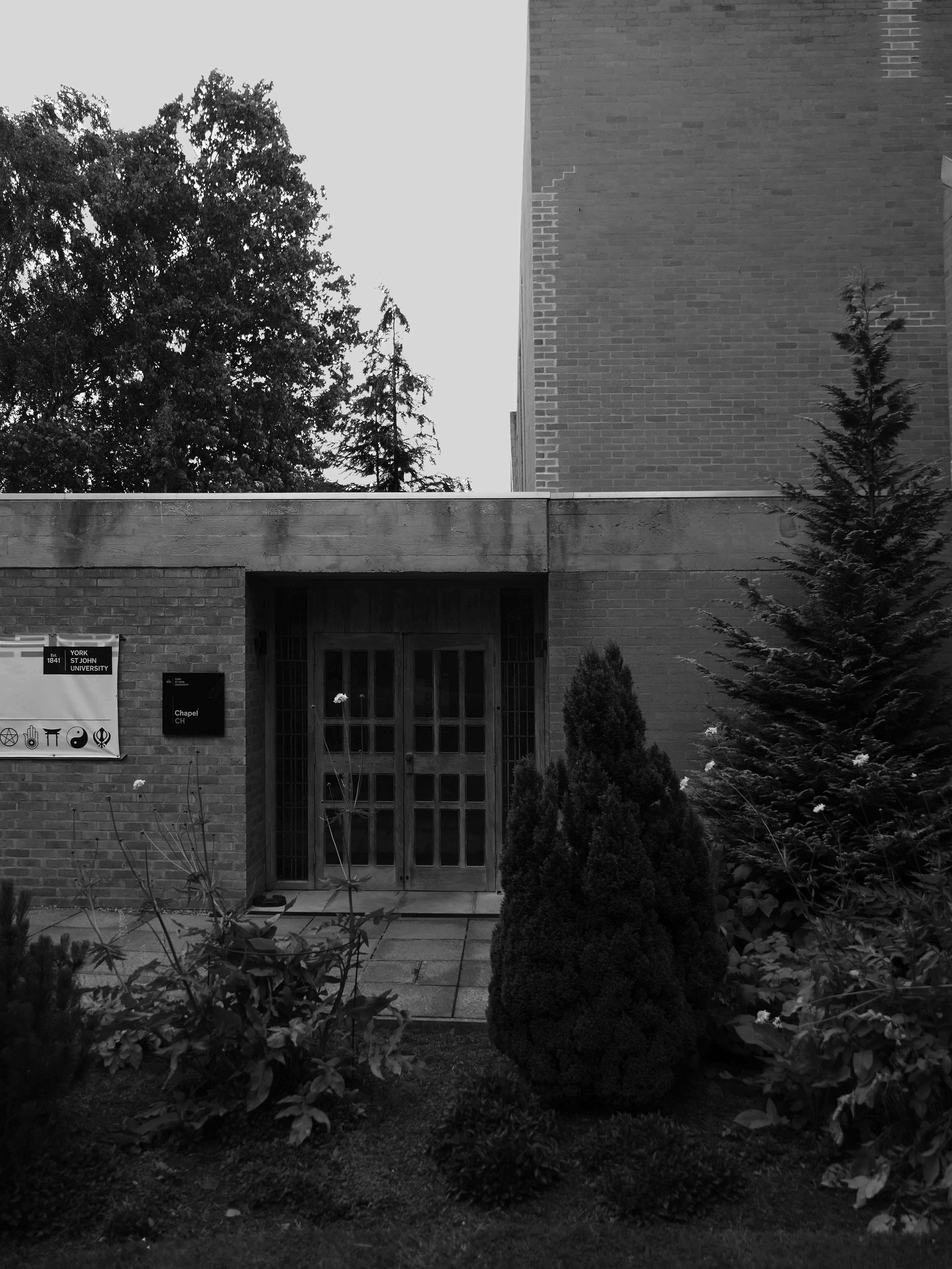
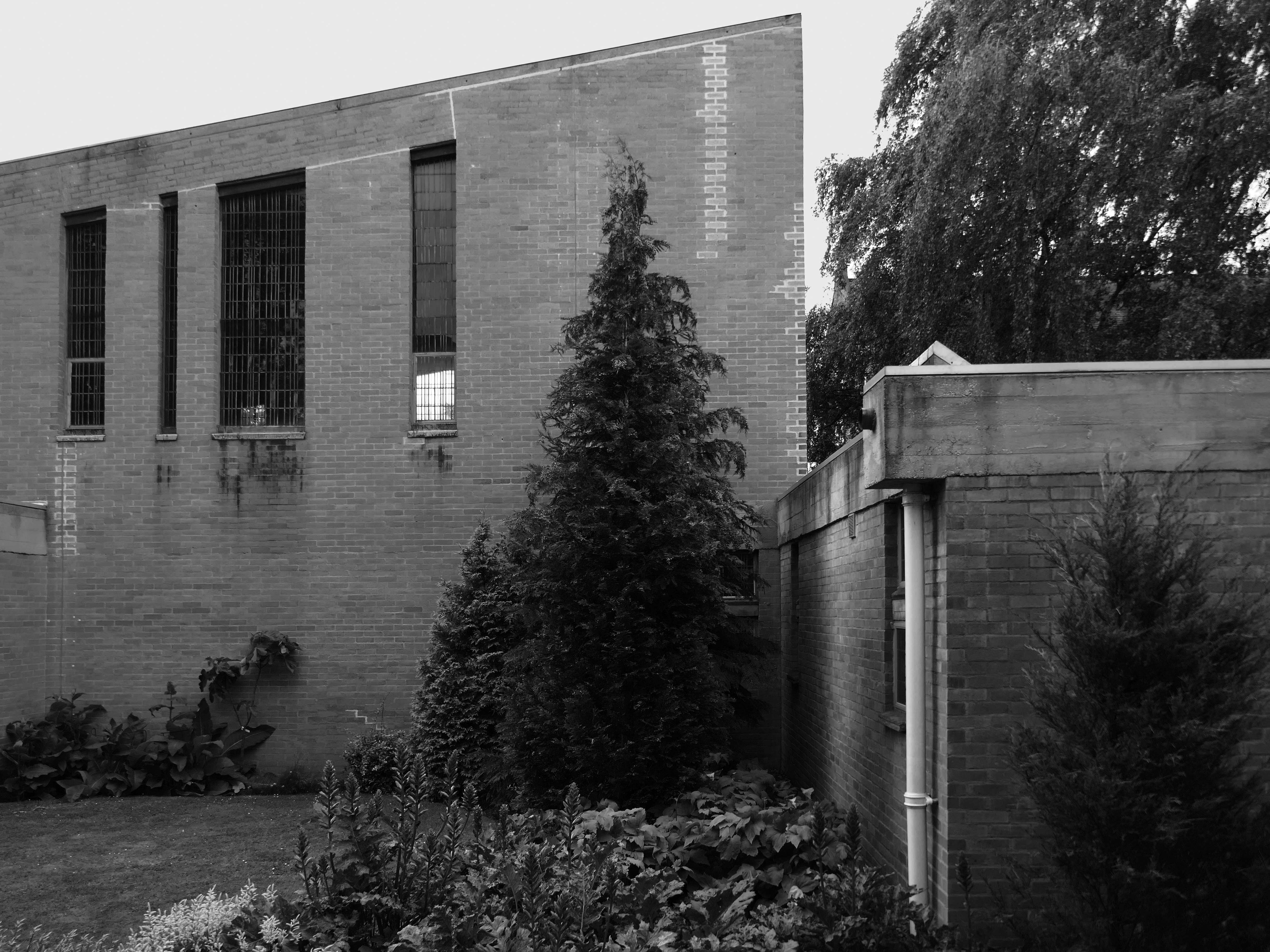
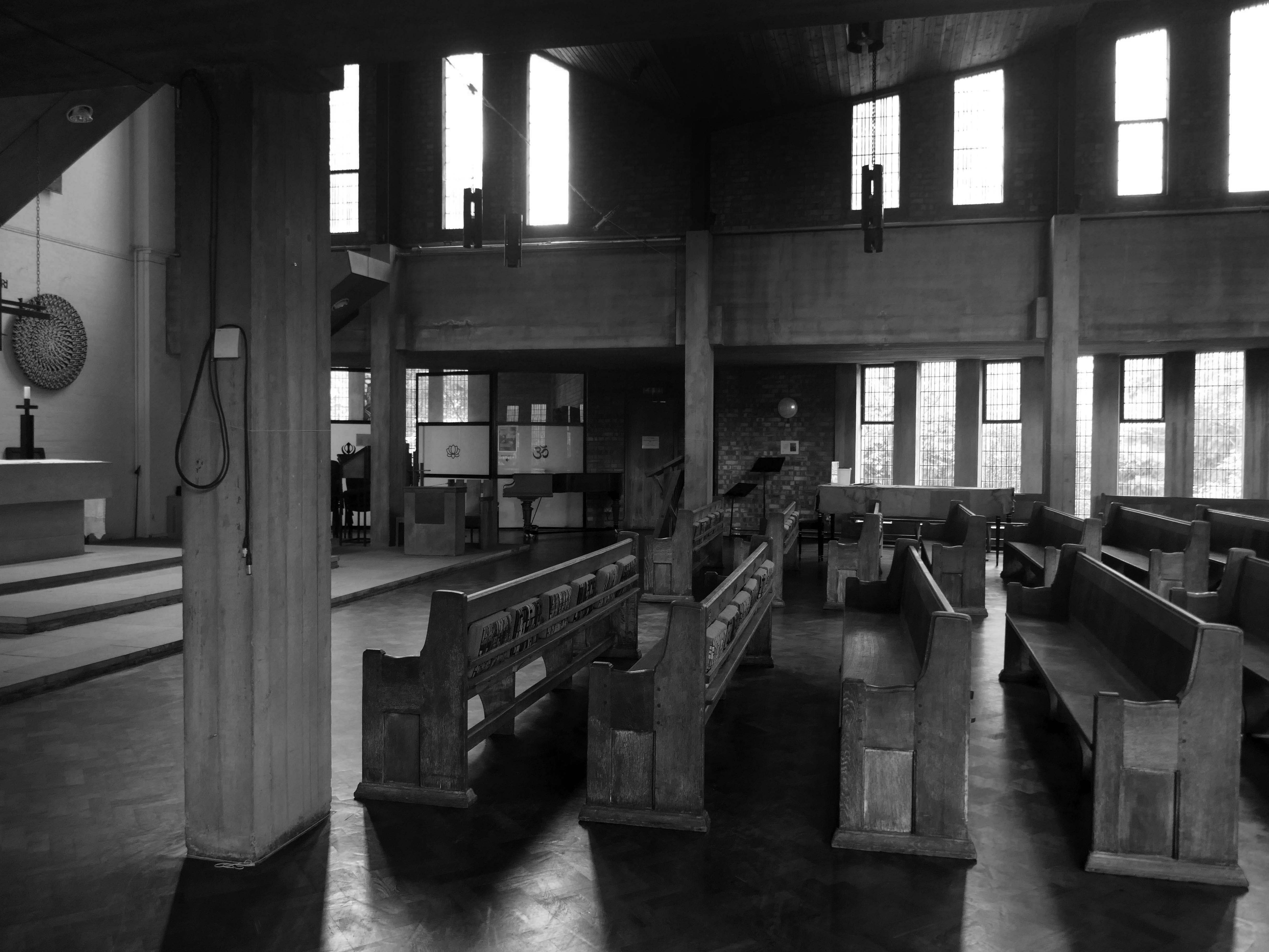
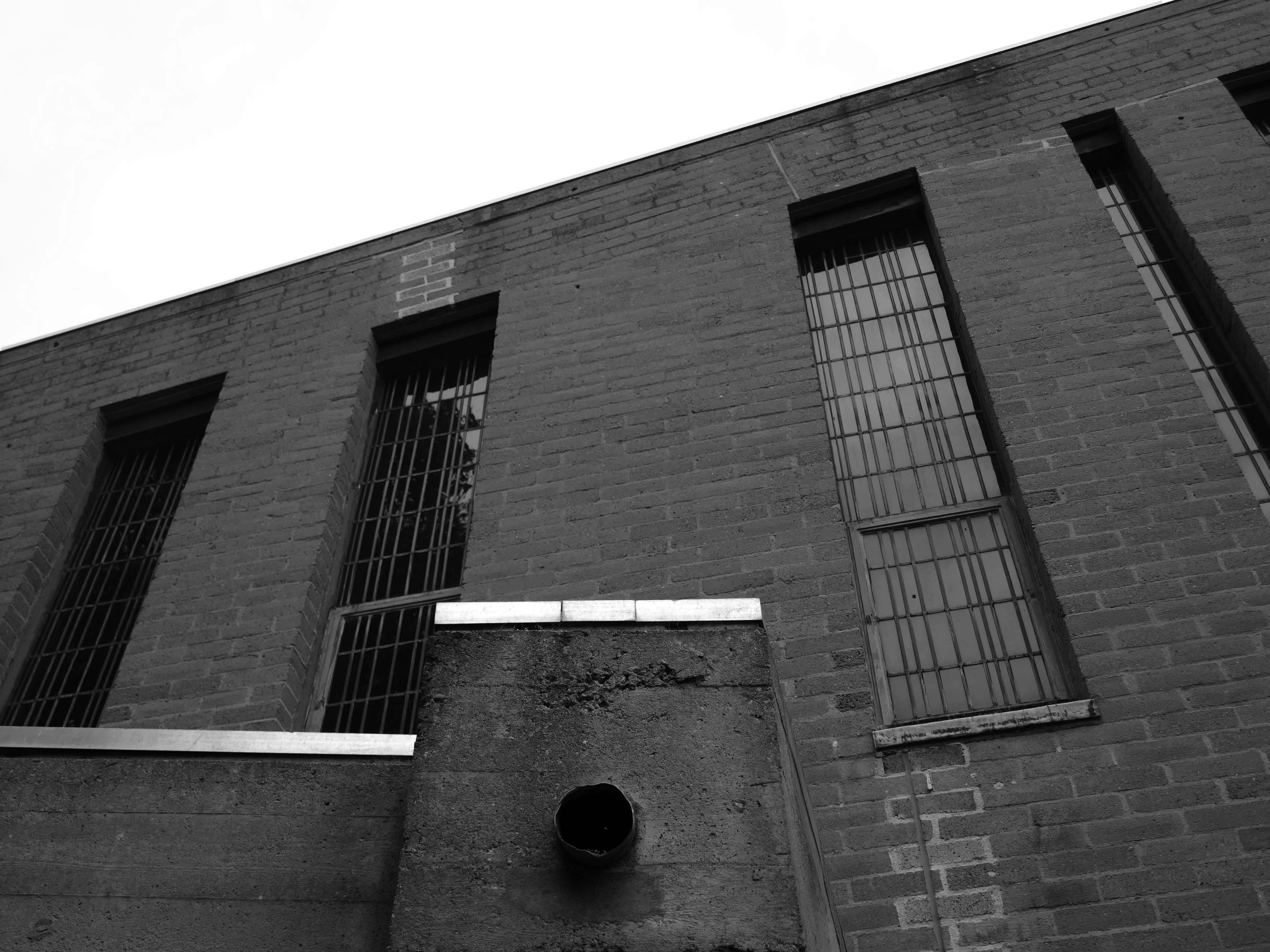
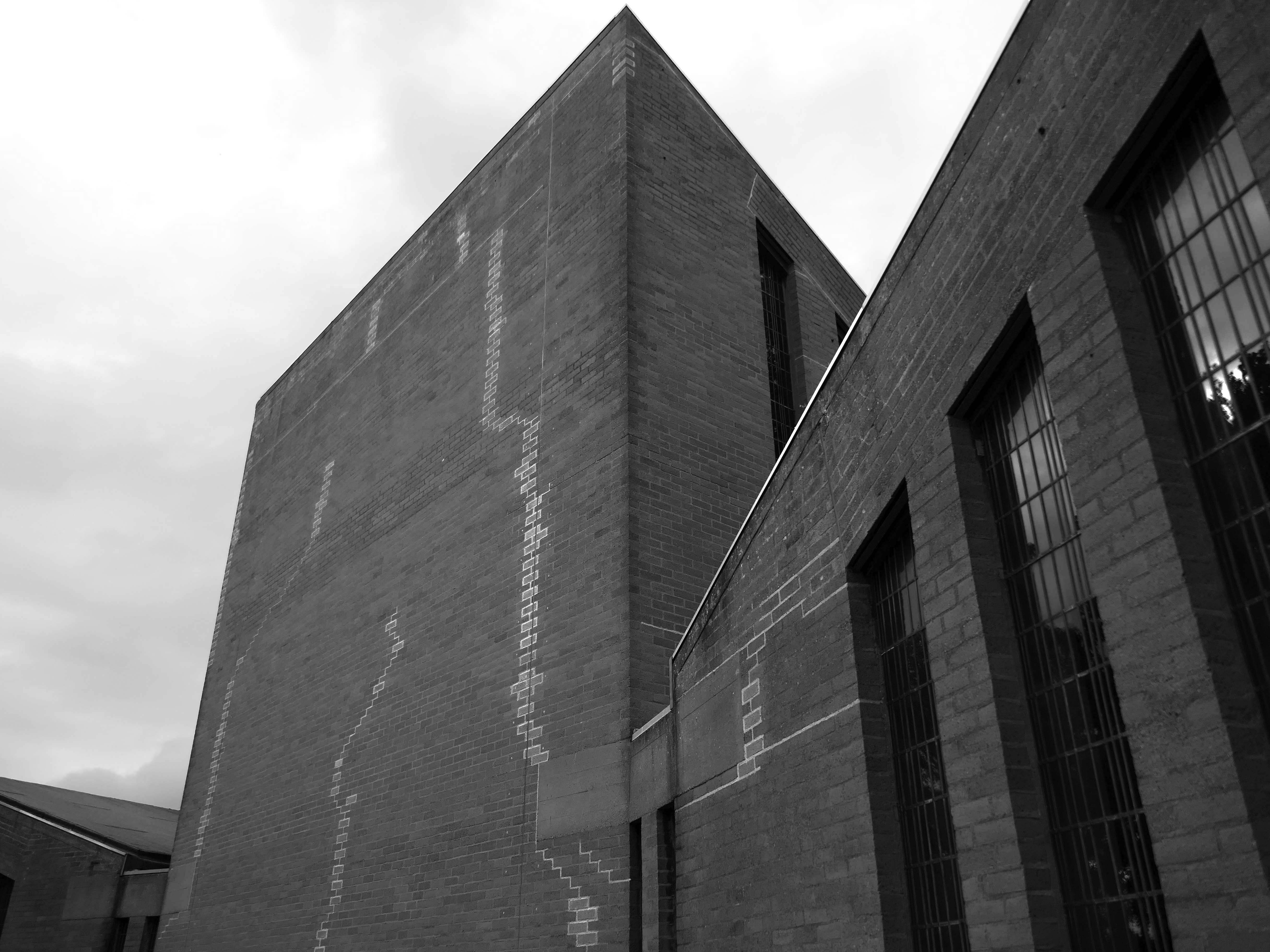
The chapel was closed on a Saturday so we wandered around outside, peering curiously through the windows. Surrounded by mature planting, the bare brick and glazing is more than somewhat softened, the planting however does inhibit the intrepid photographer.
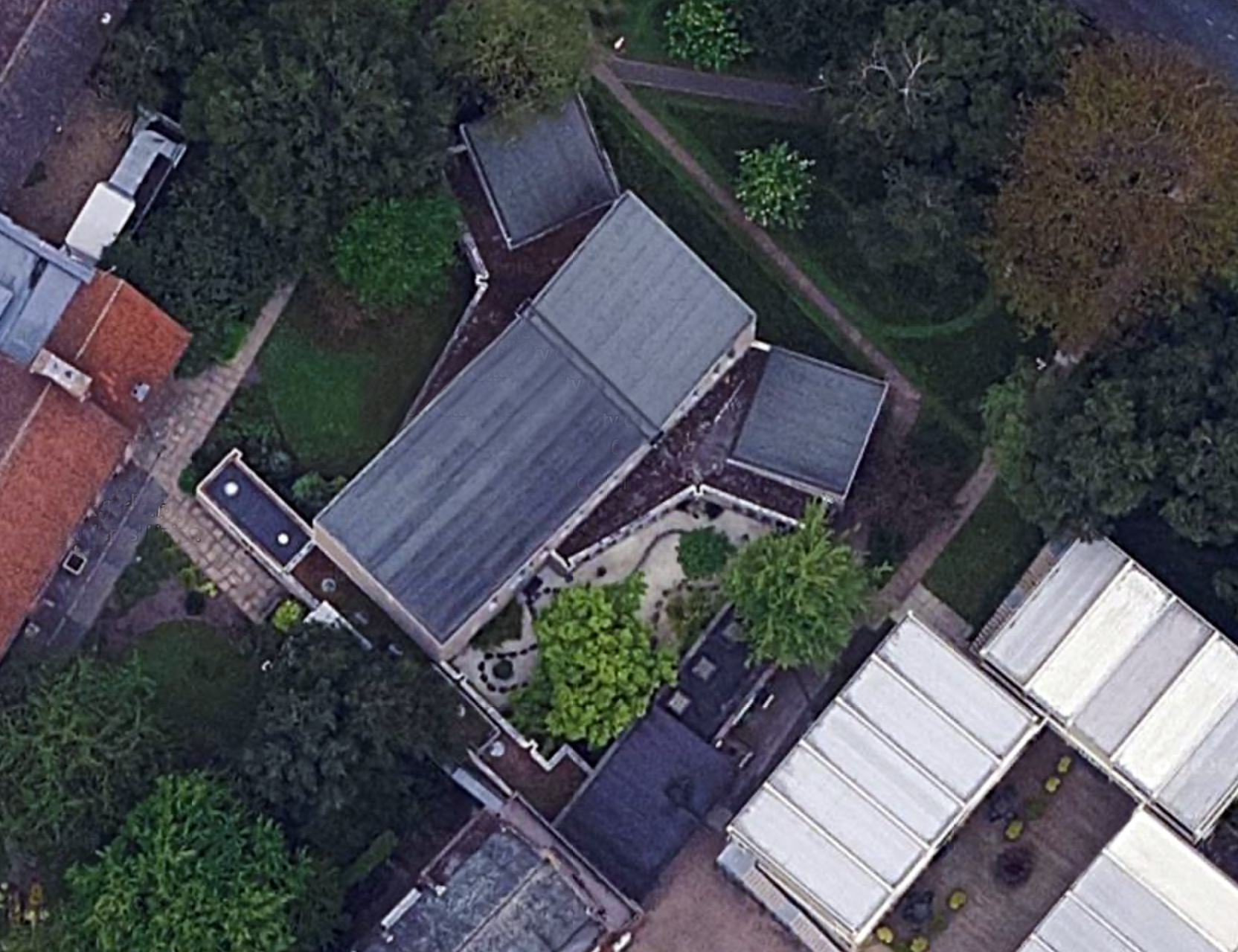
Designed 1965, built 1966-7; architect George Gaze Pace, executant assistant Ronald Sims.
Reinforced concrete frame, partly left exposed, clad in pale brick. Monopitched roofs. Low flat roofs to entrances and between the three main elements with thick board-marked eaves. Central space flanked by angled transepts, with organ loft to (liturgical) west end and wing of offices behind. Long narrow flat-headed windows between brick mullions, timber doors. Attached walls and steel gate lead to inner garden, intended for contemplation.
Interior with exposed concrete frame, including piers and thick ring beam at gallery level, with brick infill. Boarded timber ceiling to main space; board-marked ceilings to low side aisles. Choir gallery with organ, designed by Pace, set behind timber lattice screen also to his designs, and reached via narrow spiral stair. Ceramic piece to balcony front 1999 by Helen Batty. Some pews, brought from the college’s former chapel of 1858 remodelled by Pace in the 1950s.
Hanging pendant light-fittings to Pace’s designs. Altar, lectern and altar seating all by Pace; pulpit designed 1998. Windows – internally the concrete of the mullions is exposed, all originally clear leaded lights, but now stained glass is being incorporated, most notably ‘The Water of Life’ by Cathy Nutkins, a 1990 graduate, in right-hand transept.
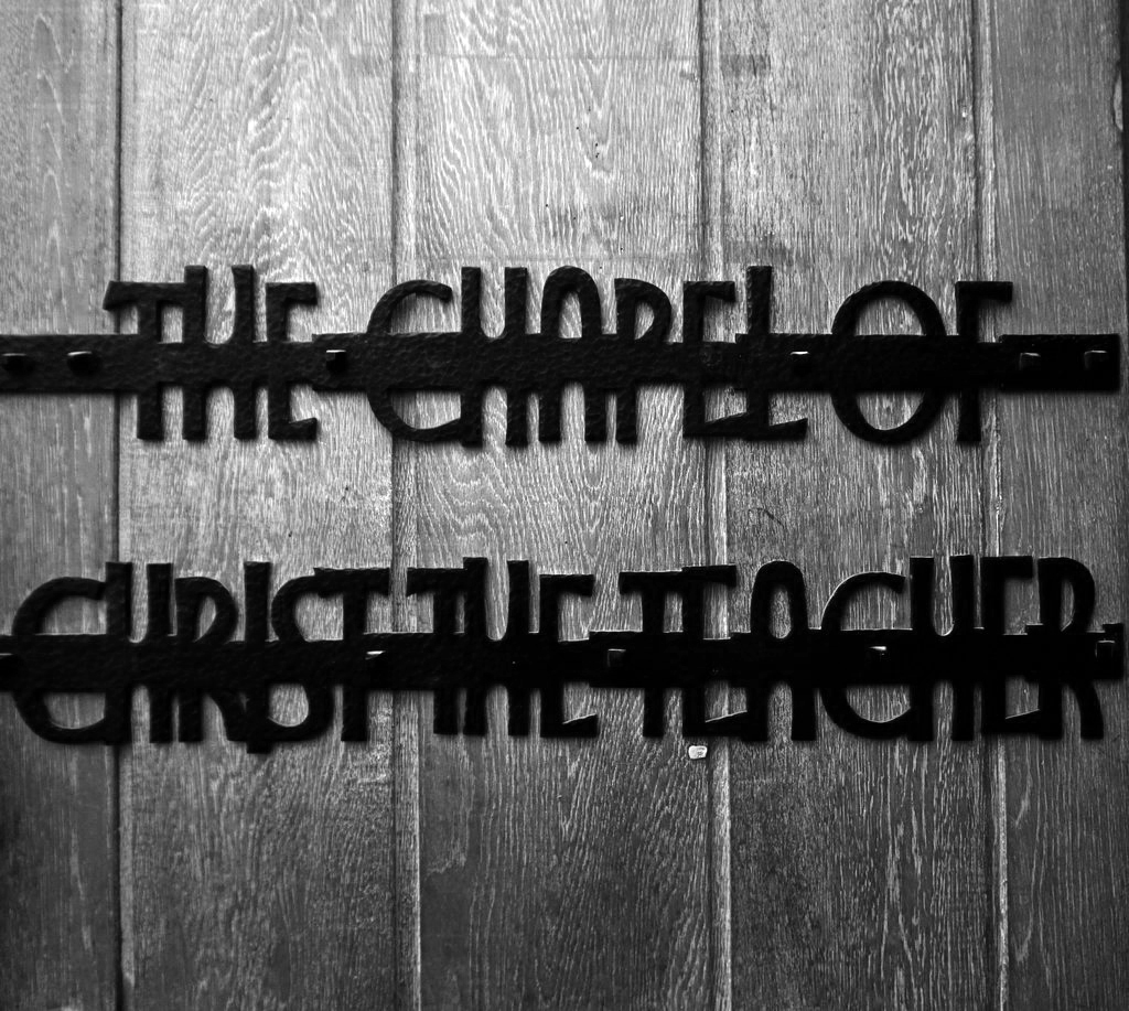
Chapel of Christ the Teacher to rear, by foyer, refurbished 1994 by Helen Turner, textile artist. The building is well-suited to the incorporation of student works of art, some temporary, some permanent, and additions are continually being made to the collection.
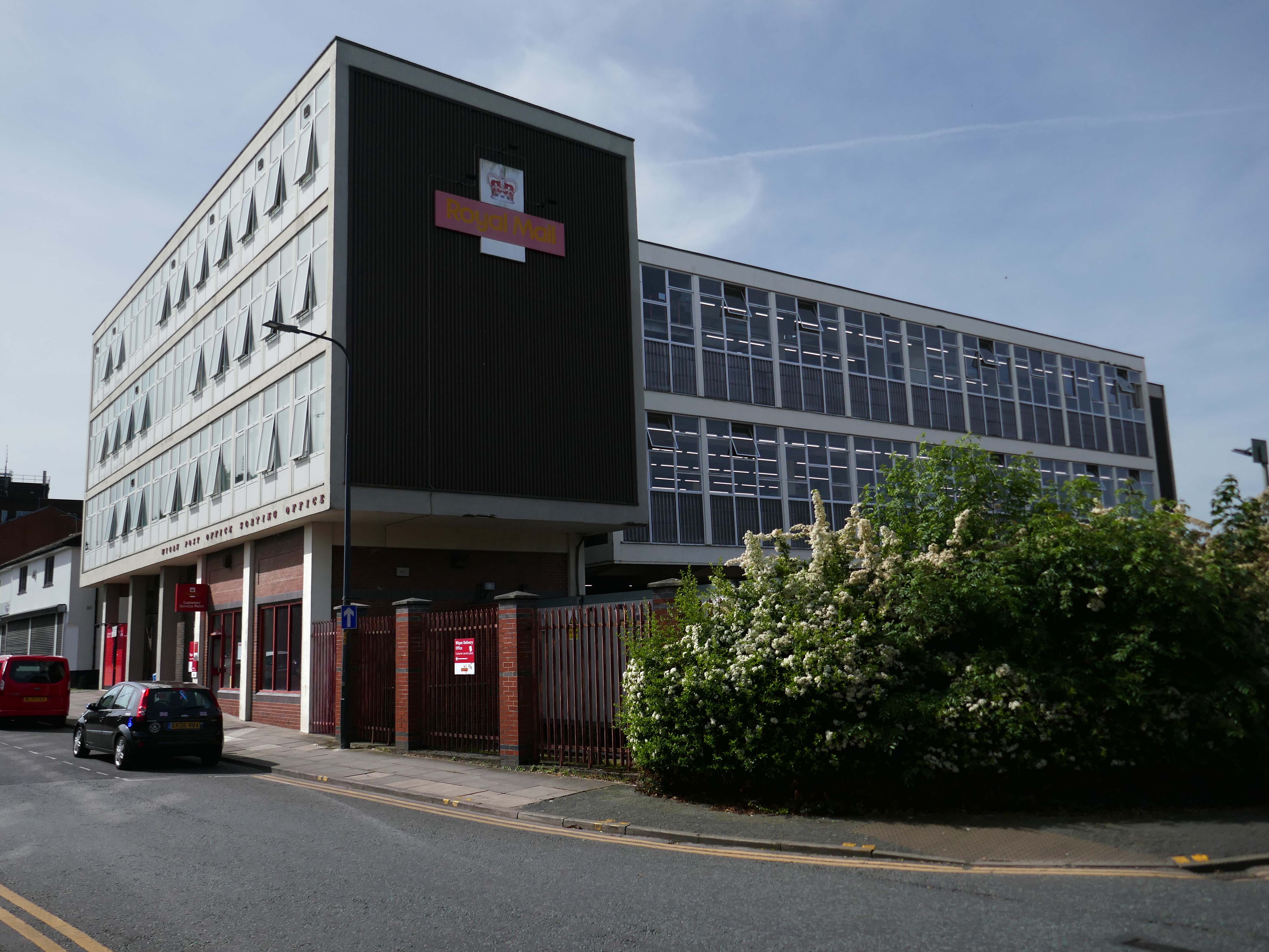
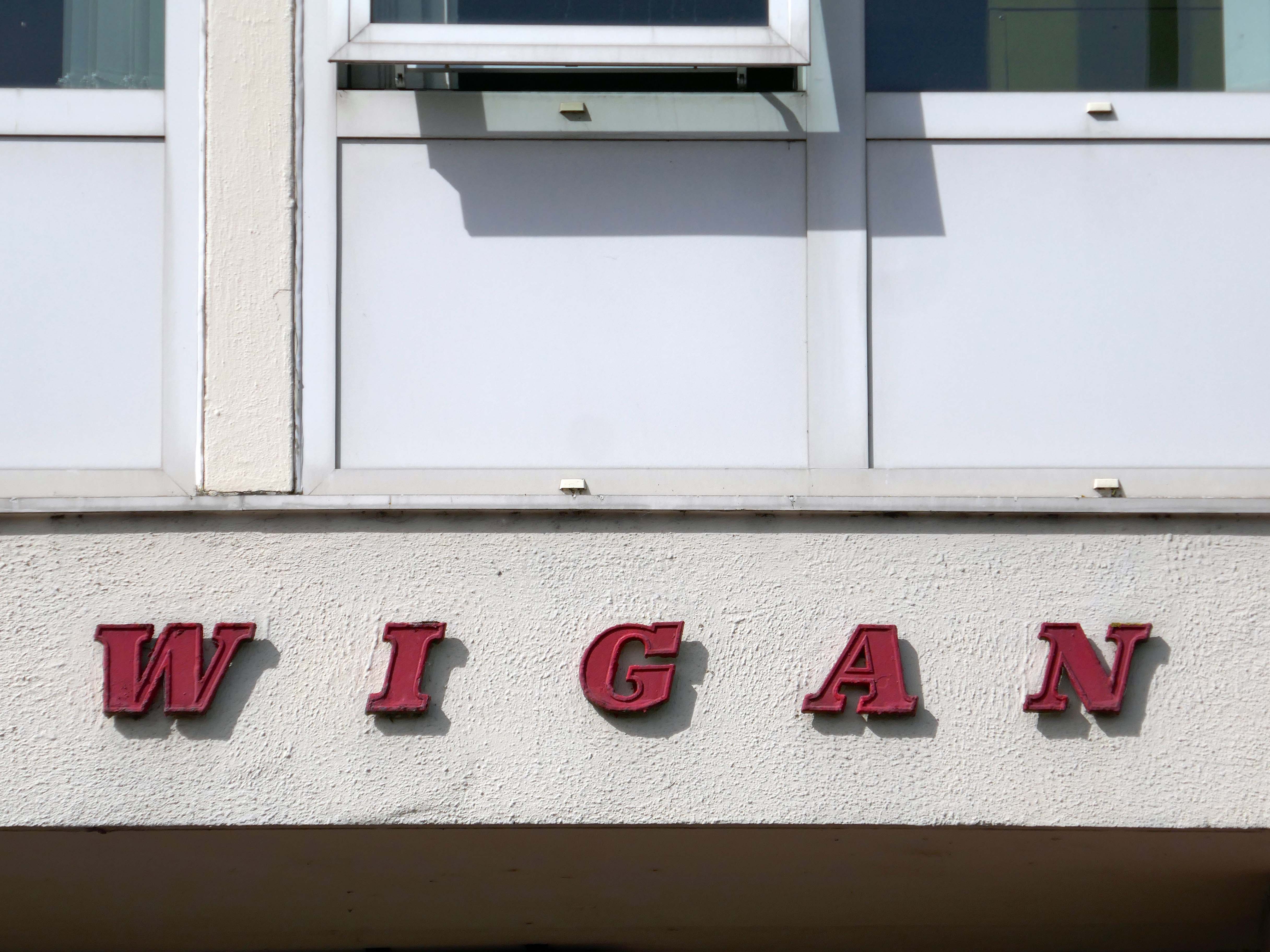
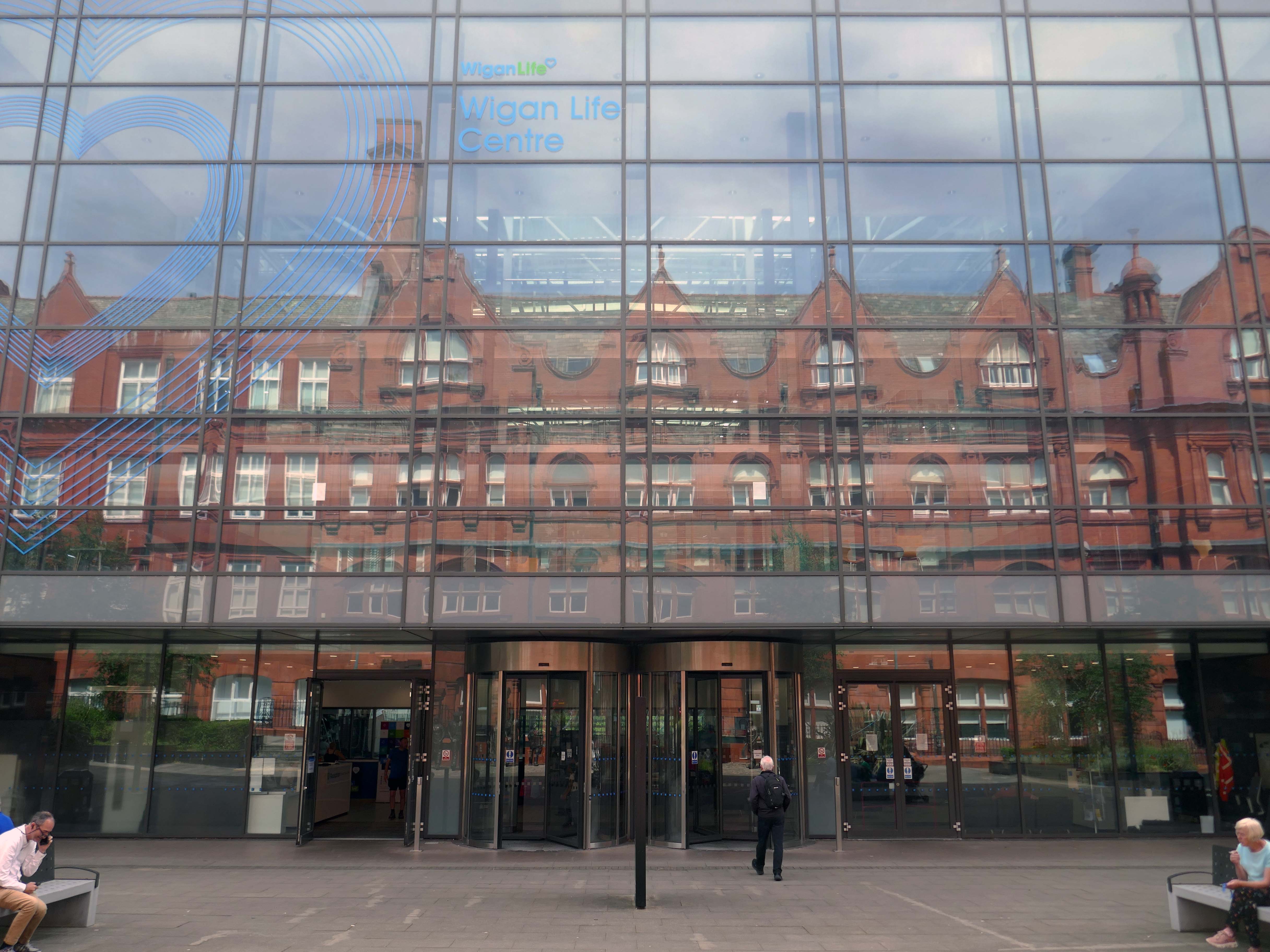
It’s been four years since our 2022 Wigan Walk – so time to see if there has been a refreshing change.
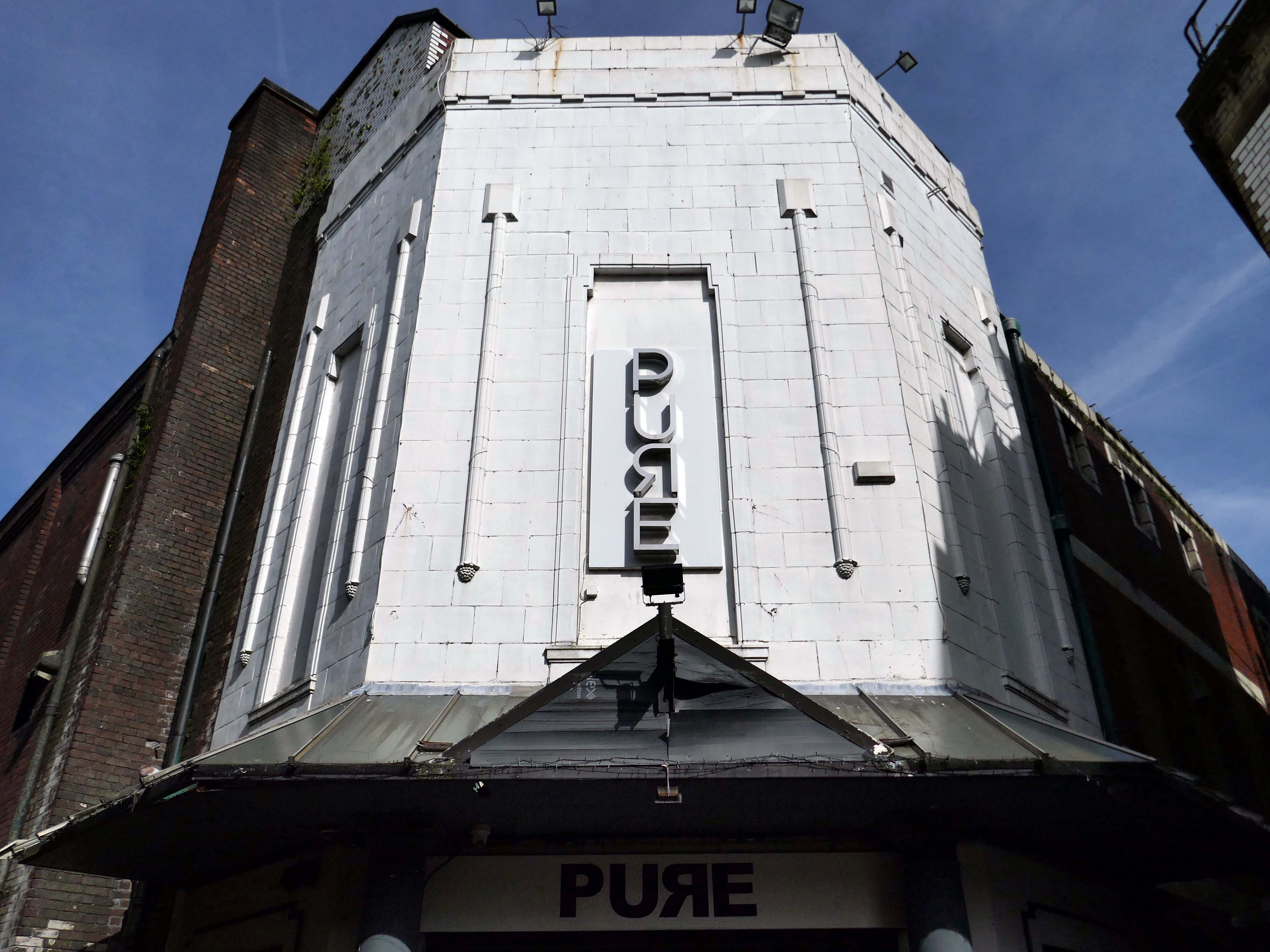
Beginning with a trip to the former flicks, the Princes Cinema now trading as Pure nightclub, sometimes home to Singo Bingo.
Originally the site of New Princes Theatre, opened on the 1st May 1911, the cinema was demolished and replaced, on an adjacent plot, by Princes Cinema in 1933.
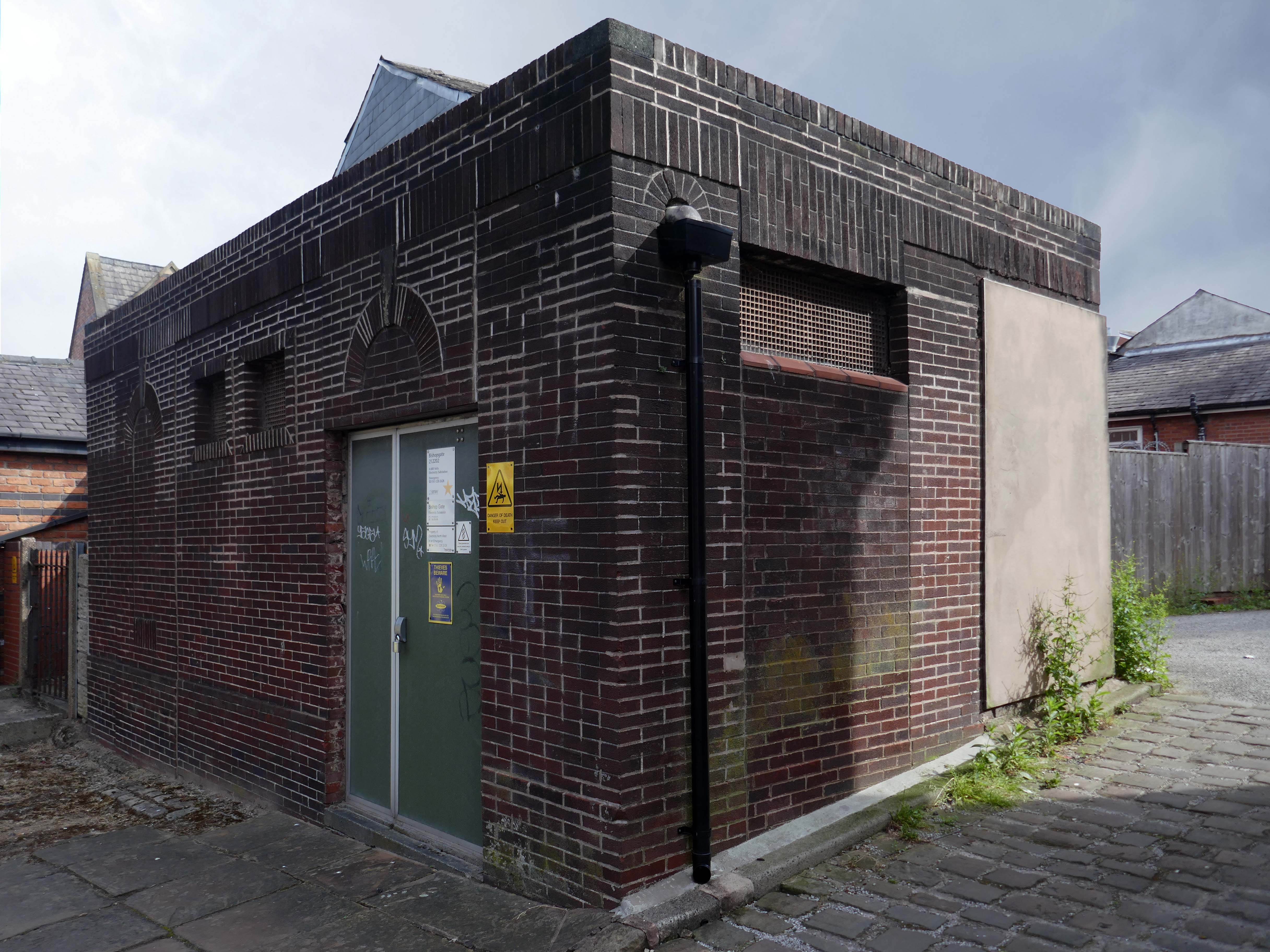
Ofd special note the adjacent Electrical Substation of the day.
Plus extra added military history.
Seventies
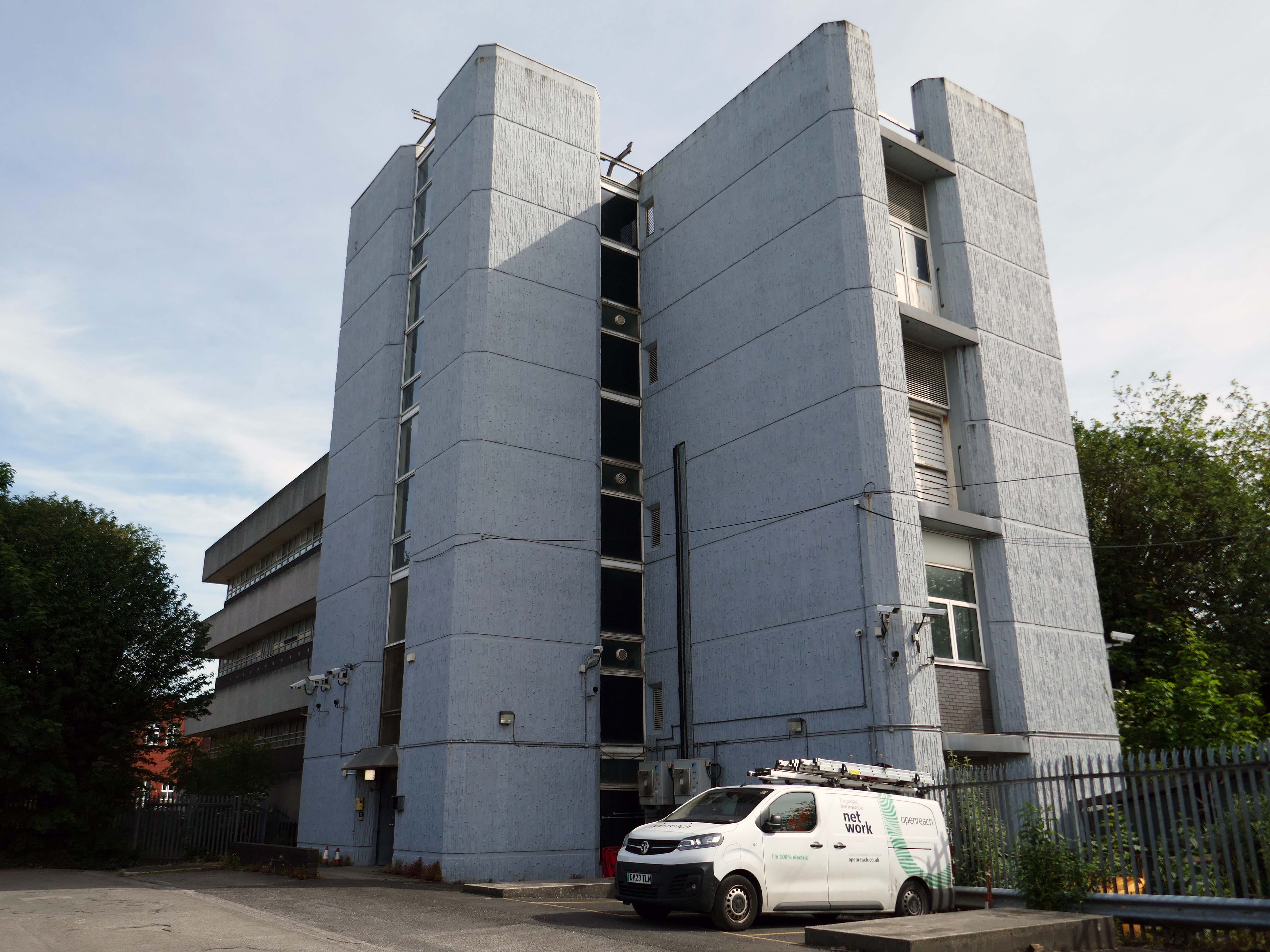
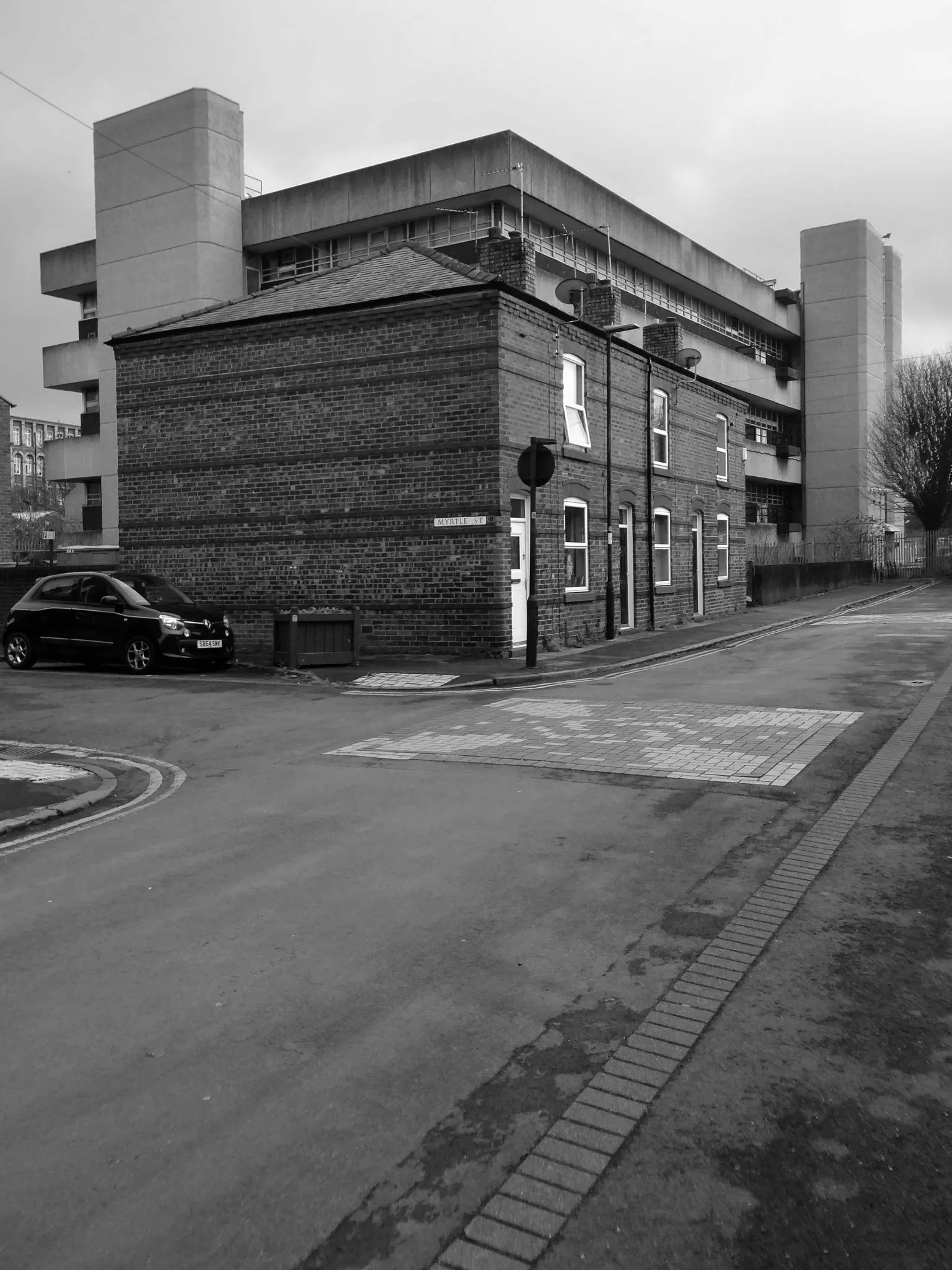
Tucked in behind the Telephone Exchange are several streets of Edwardian social housing – the Spring Gardens Scheme of 1905.
The property is practically paying its way, and all the present generation has to find is a small sum of ninety odd pounds for sinking funds. For this we get fifty-nine families decently housed, the rateable value of the town increased, a slum abolished, an eyesore removed, the health of the inhabitants remarkably improved, their environment made clean, refined, and elevating, whilst our successors in 1959 will inherit an unencumbered estate.
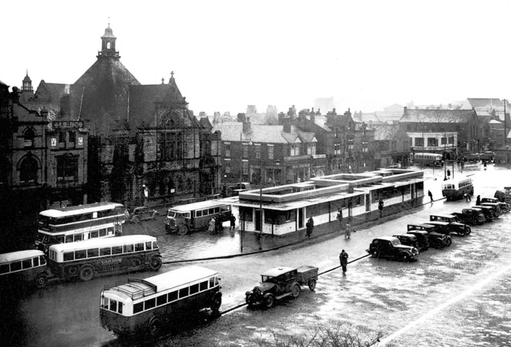
It was demolished in 1985 as part of a wider redevelopment of the town centre to make way for the Galleries Shopping Centre. A new bus station, built at a cost of £2.3 million, began construction in April 1986, and opened in November 1987.
Wikipedia
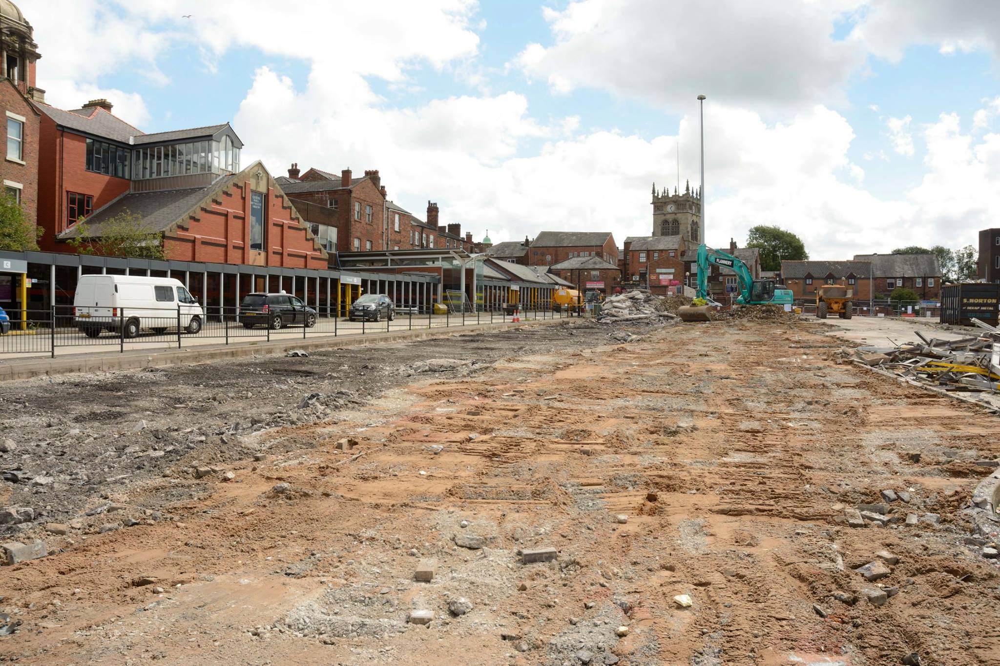
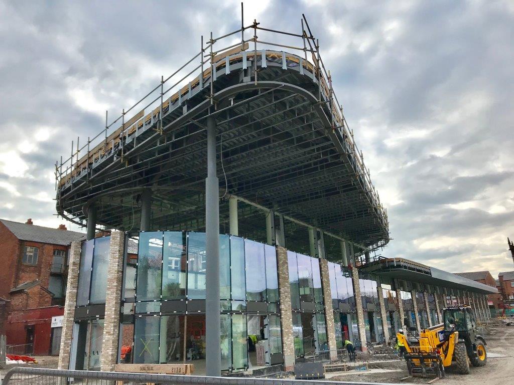
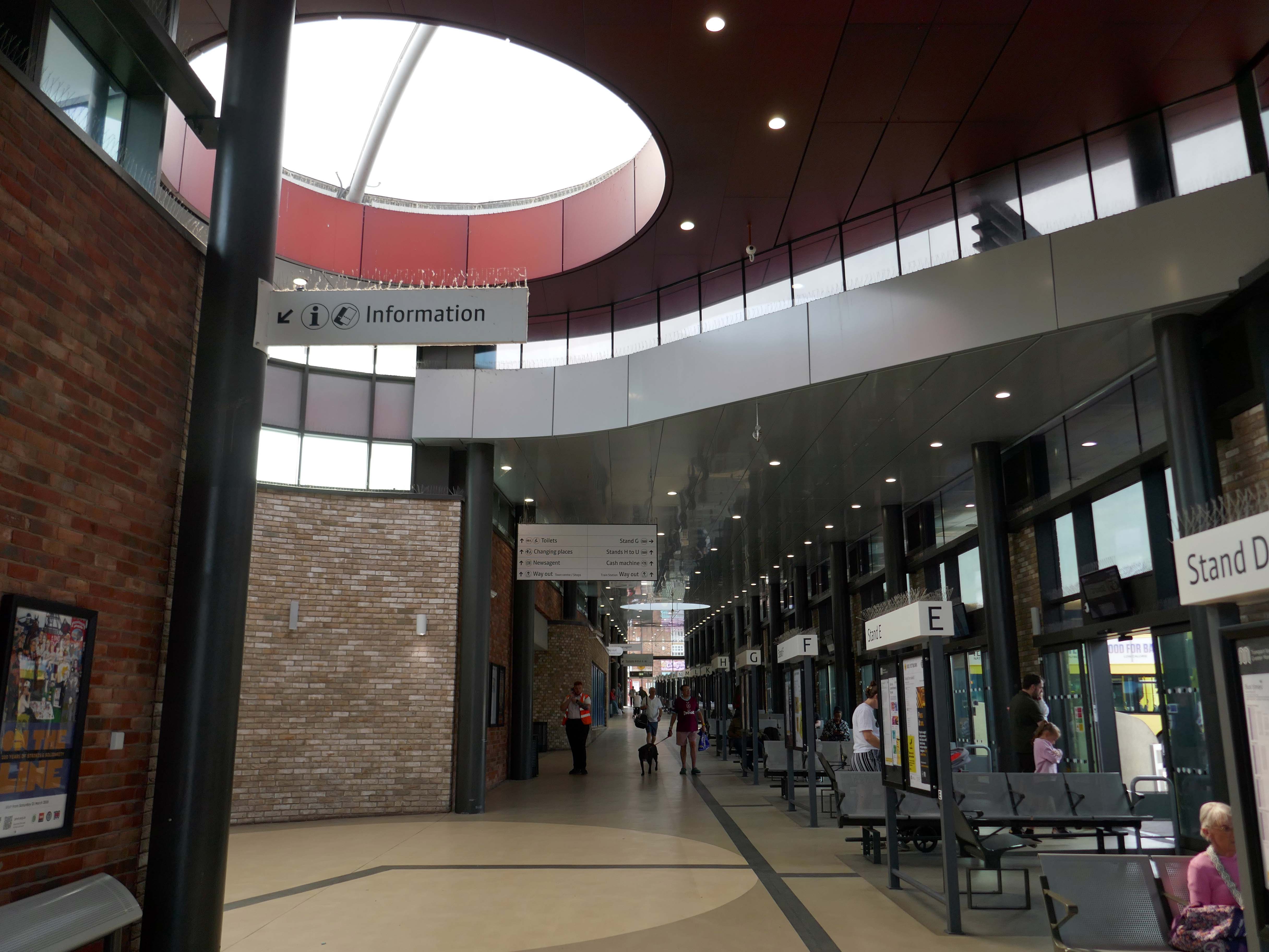
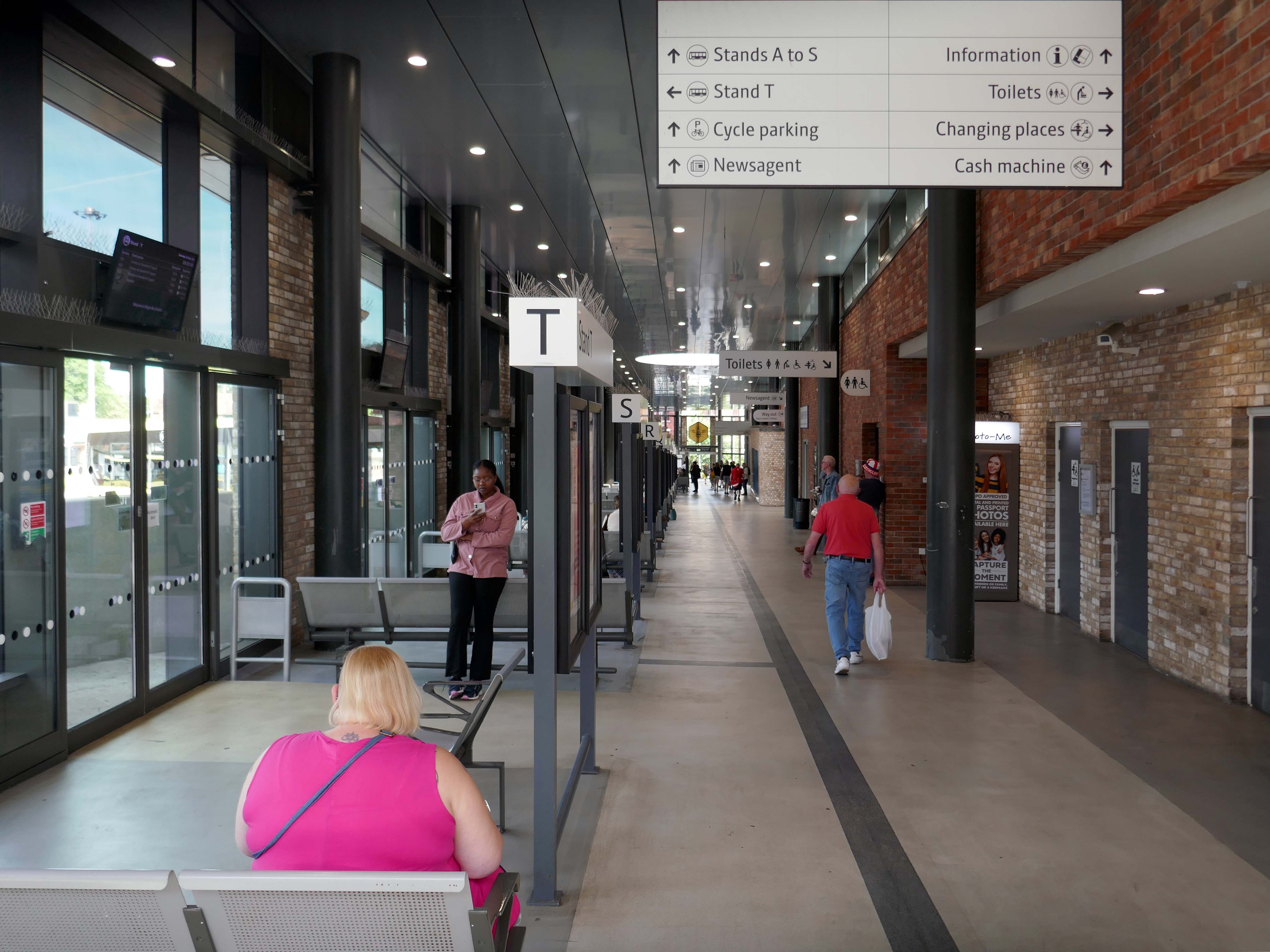
Transport for Greater Manchester commissioned Austin-Smith:Lordto design a replacement nineteen stand £15.7m bus station in Wigan Town Centre, the project was completed in October 2018.
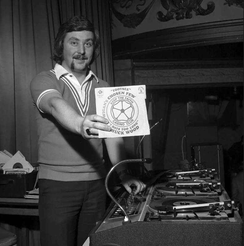
DJ Russ Winstanley was a former pupil, here he is in 1975 at the Wigan Casino holding up a copy of Footsee by Wigan’s Chosen Few b/w Seven Days Too Long by Chuck Wood.
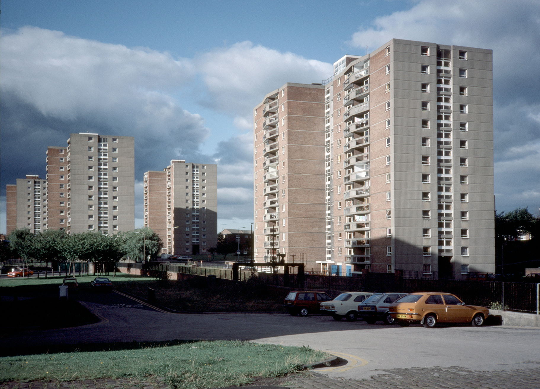
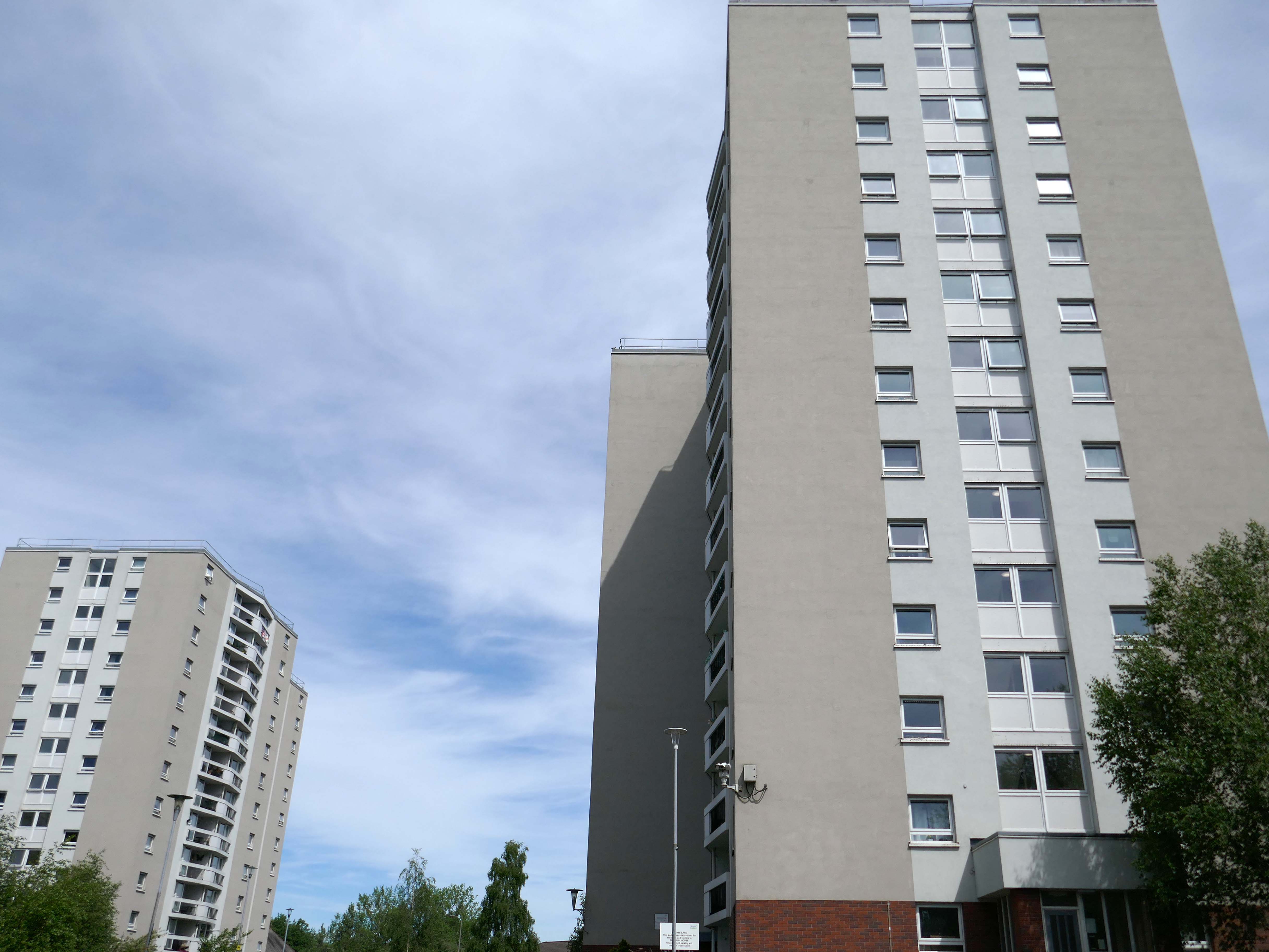
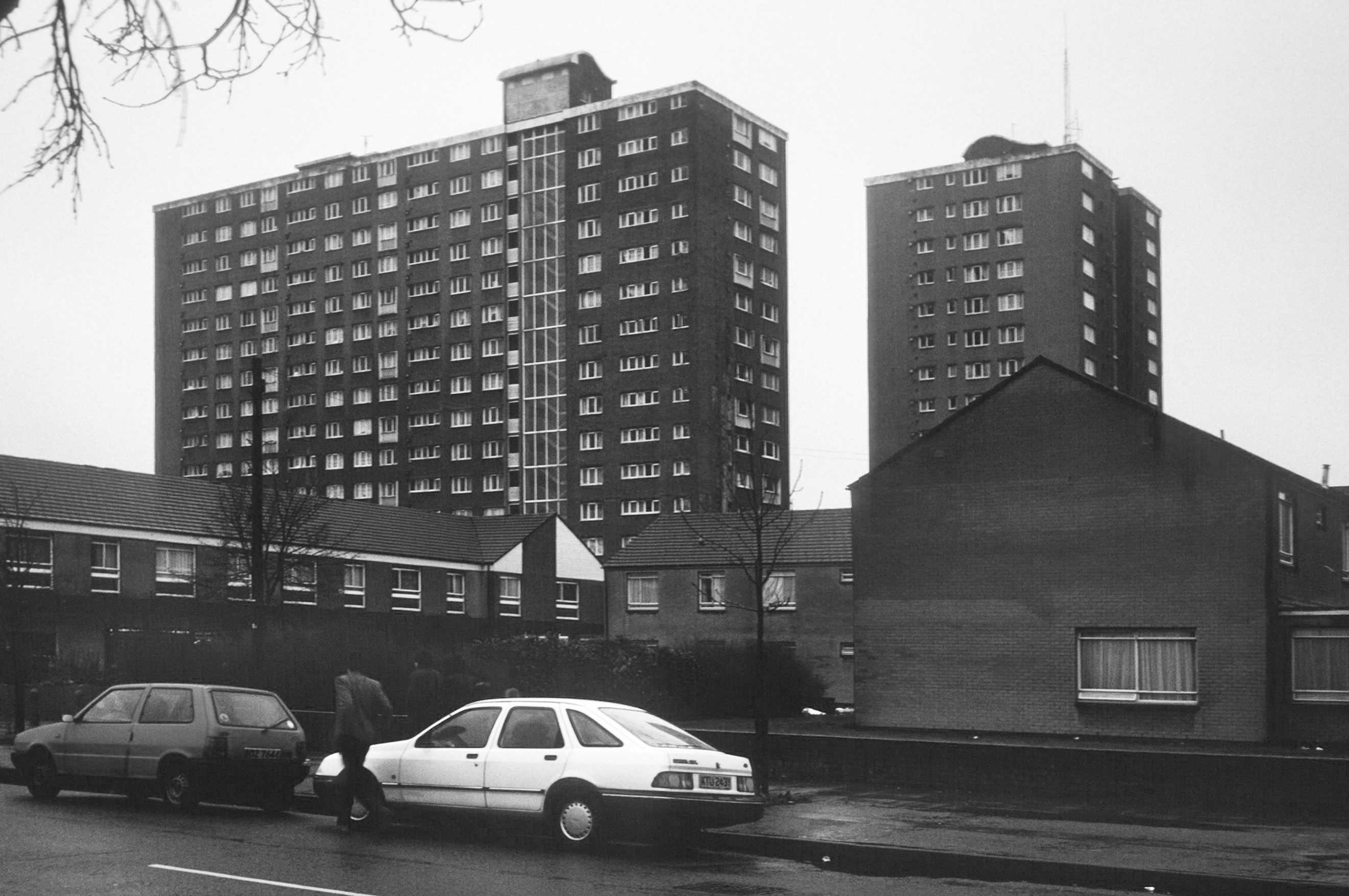
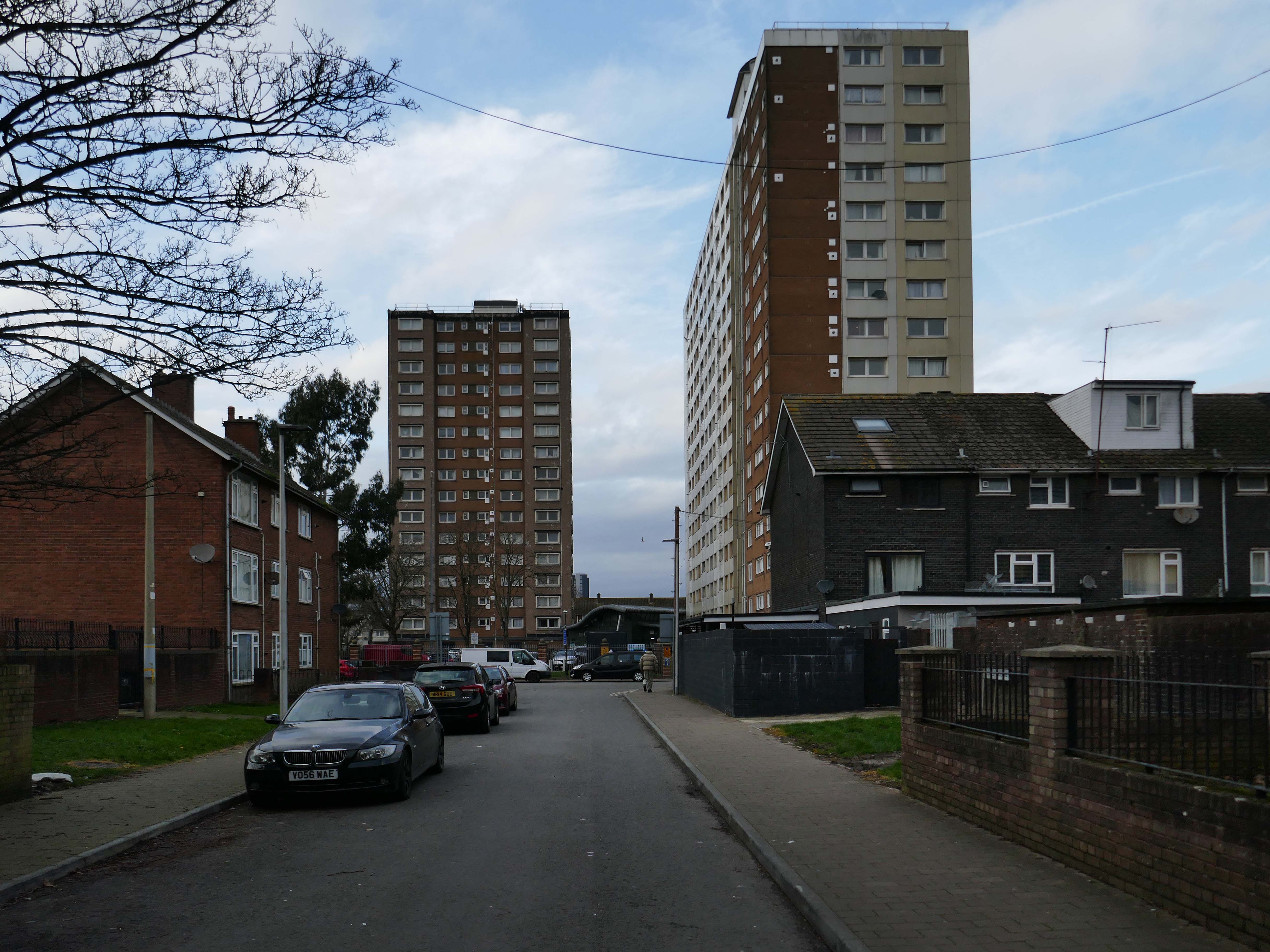
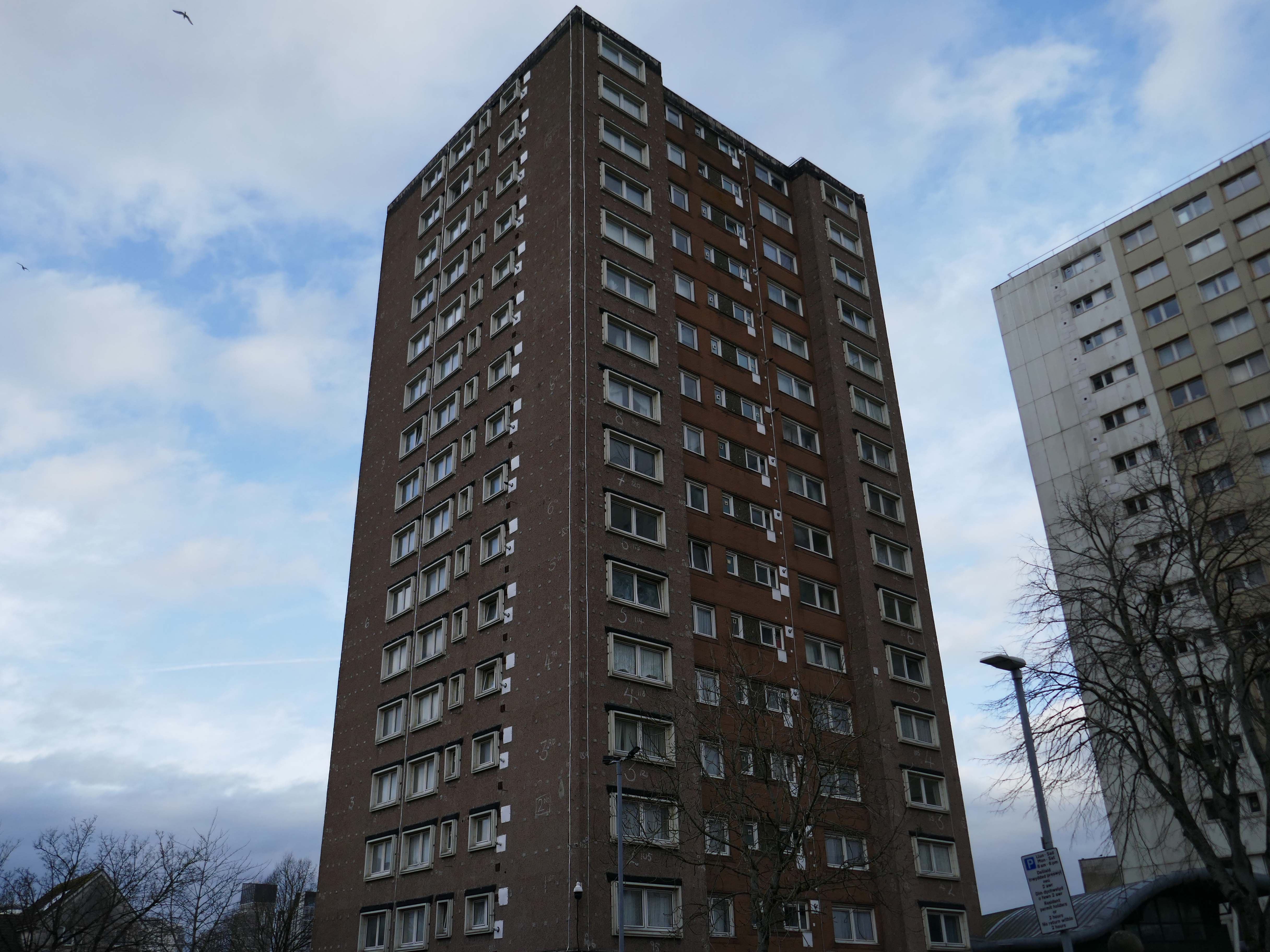
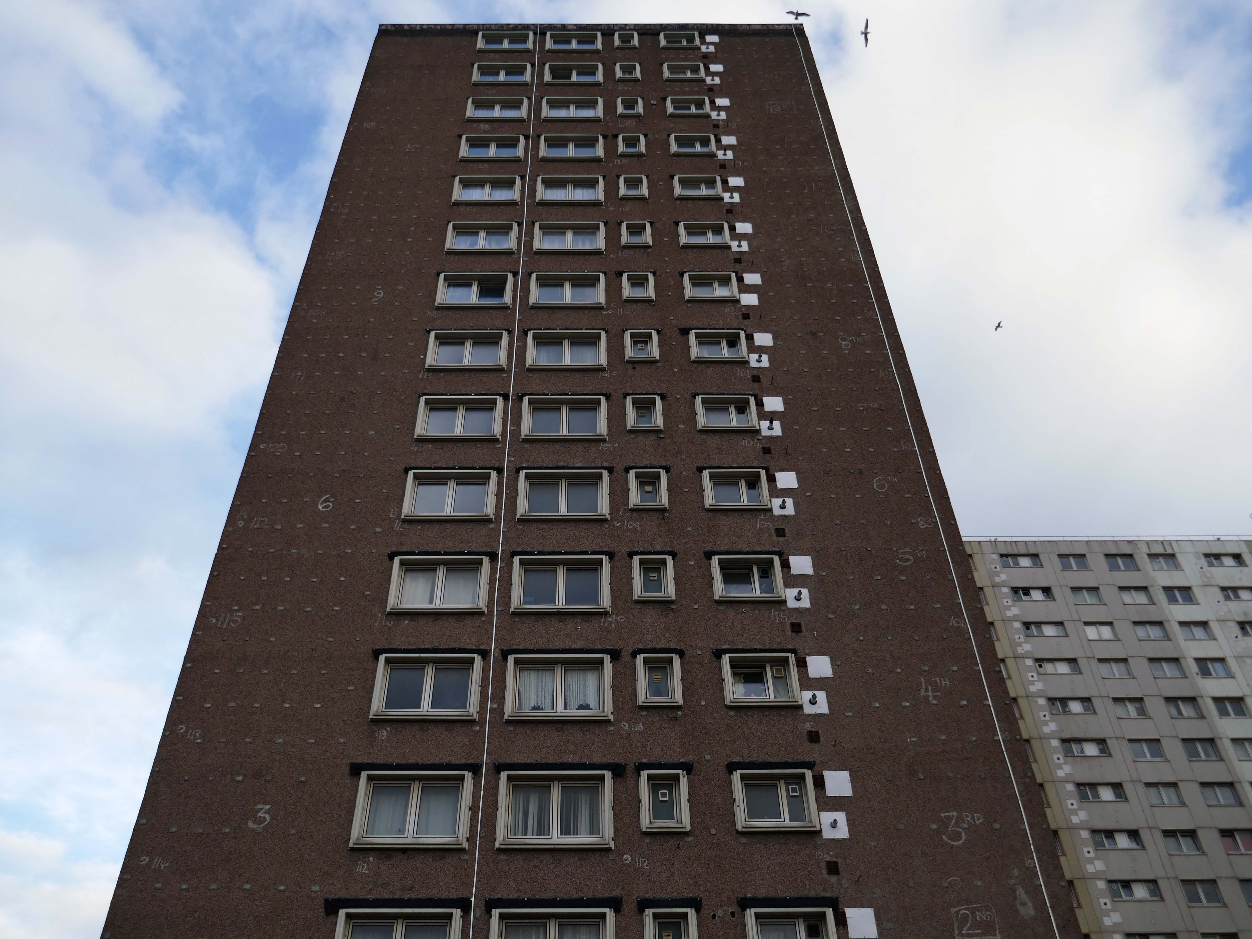
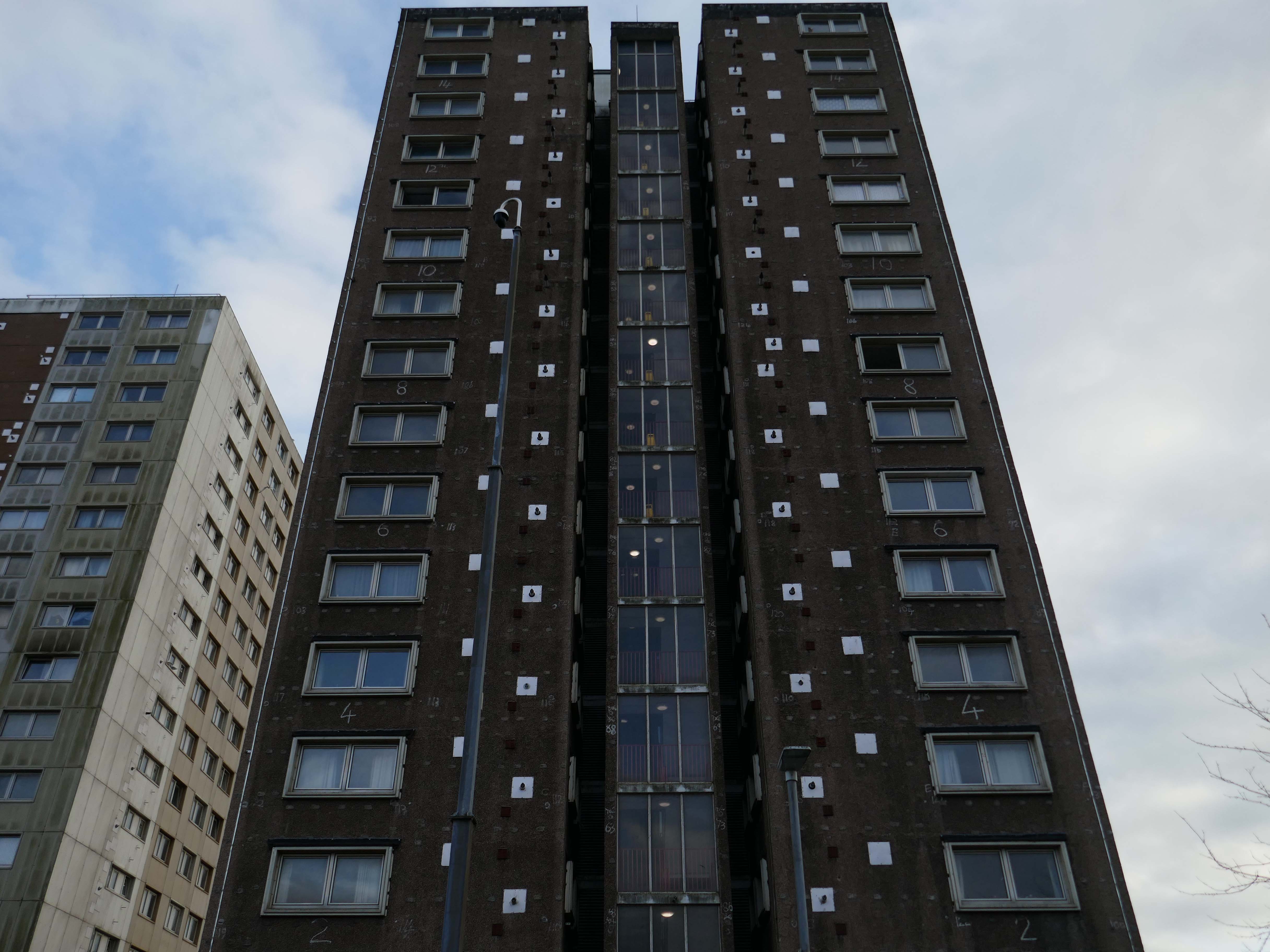
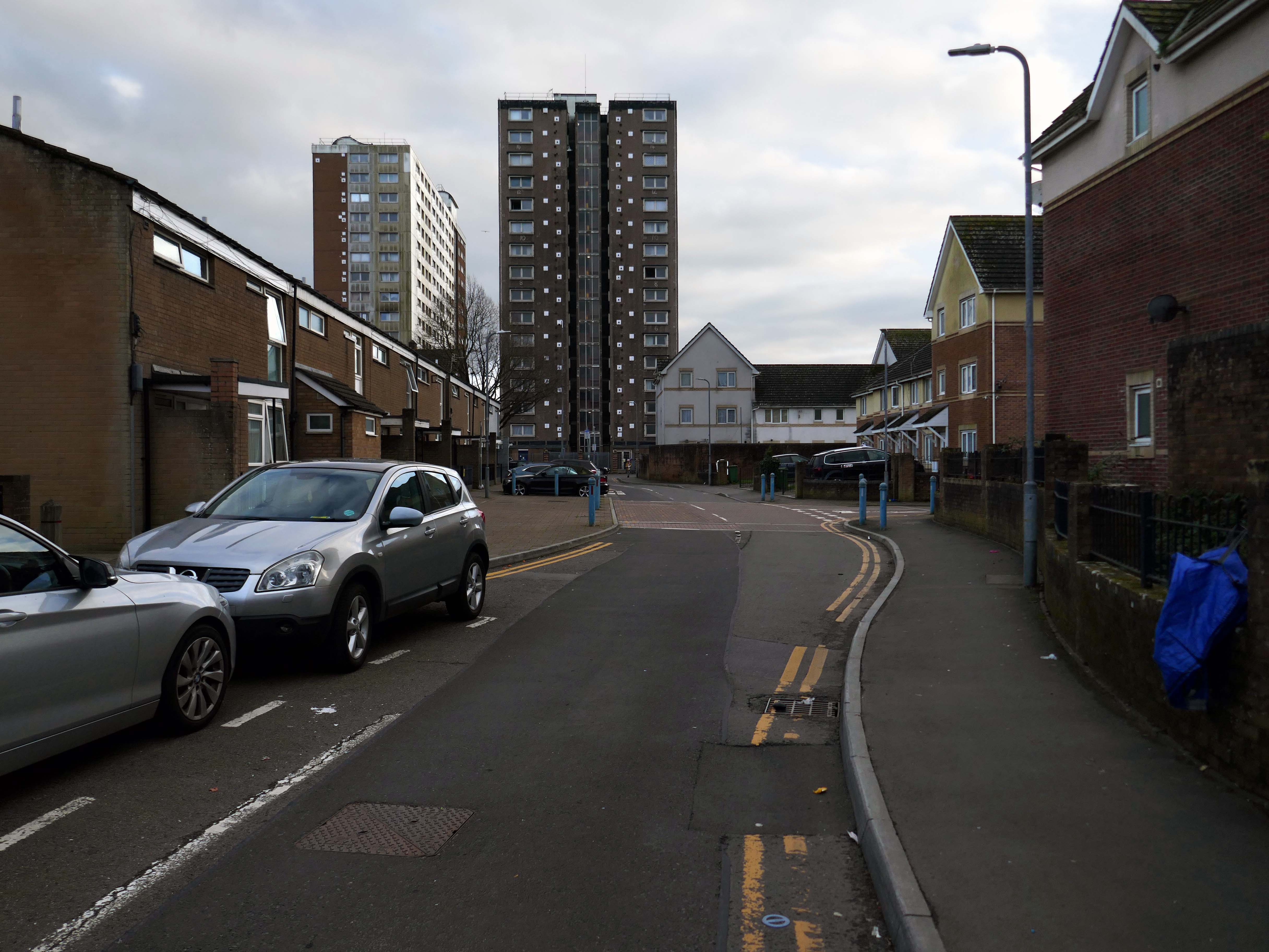
Across the way to Scholes Comprehensive Development 1964
Five thirteen-storey tower blocks adjacent to Douglas House in Scholes were approved in 1964. Lower-rise housing and flats spread to the east. In 1968, a further 13-storey block, Boyswell House, was built at this eastern end of the Scholes Comprehensive Development Area. Almost 500 slum houses, housing 566 families, were demolished that same year and 581 new council homes completed.
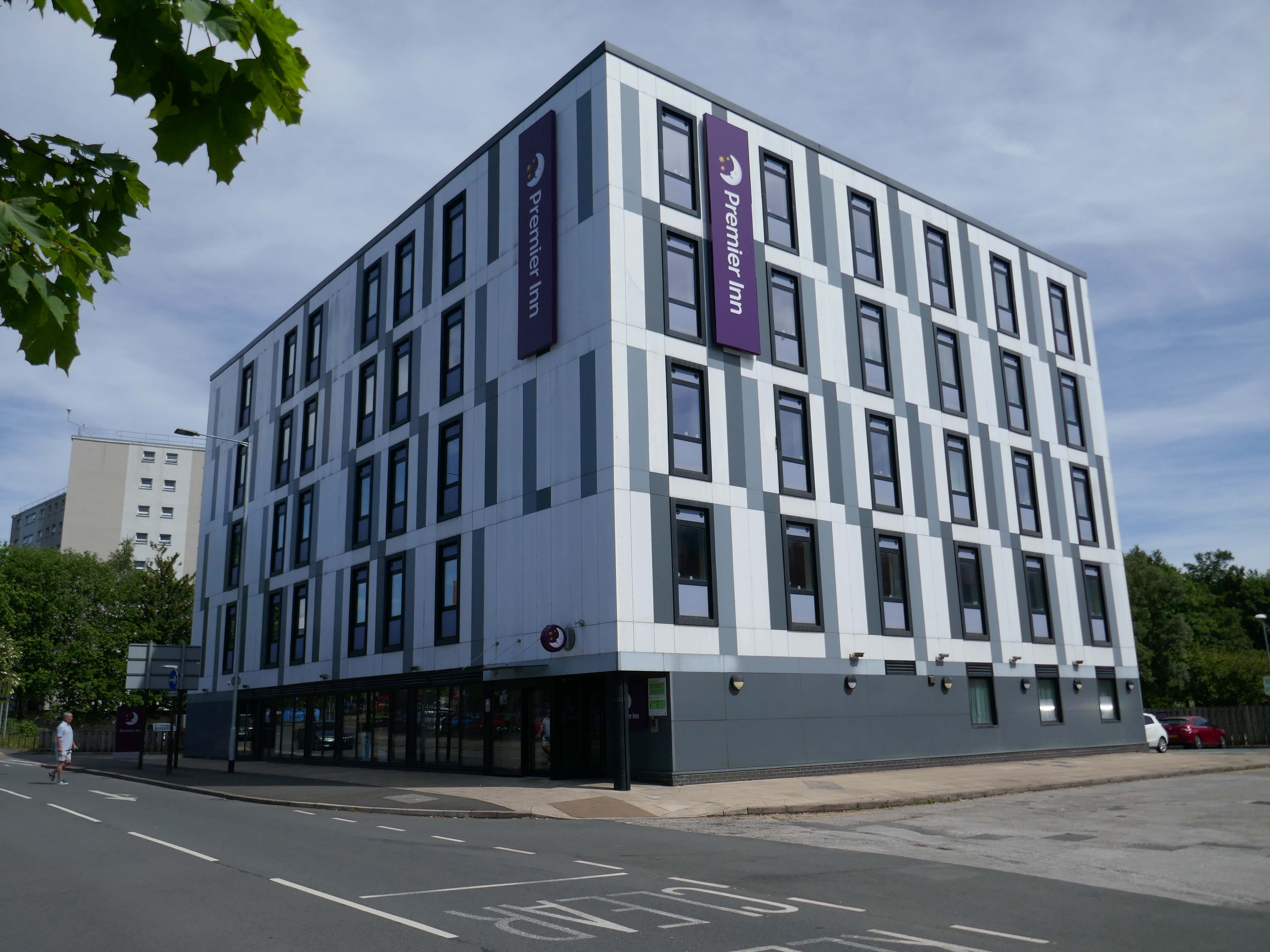
Next to the Roger Booth cop shop that became a Premier Inn.
A super-comfy bed, blackout curtains, a powerful shower and free Wi-Fi – our double rooms have everything you’ll need for a great night’s sleep.
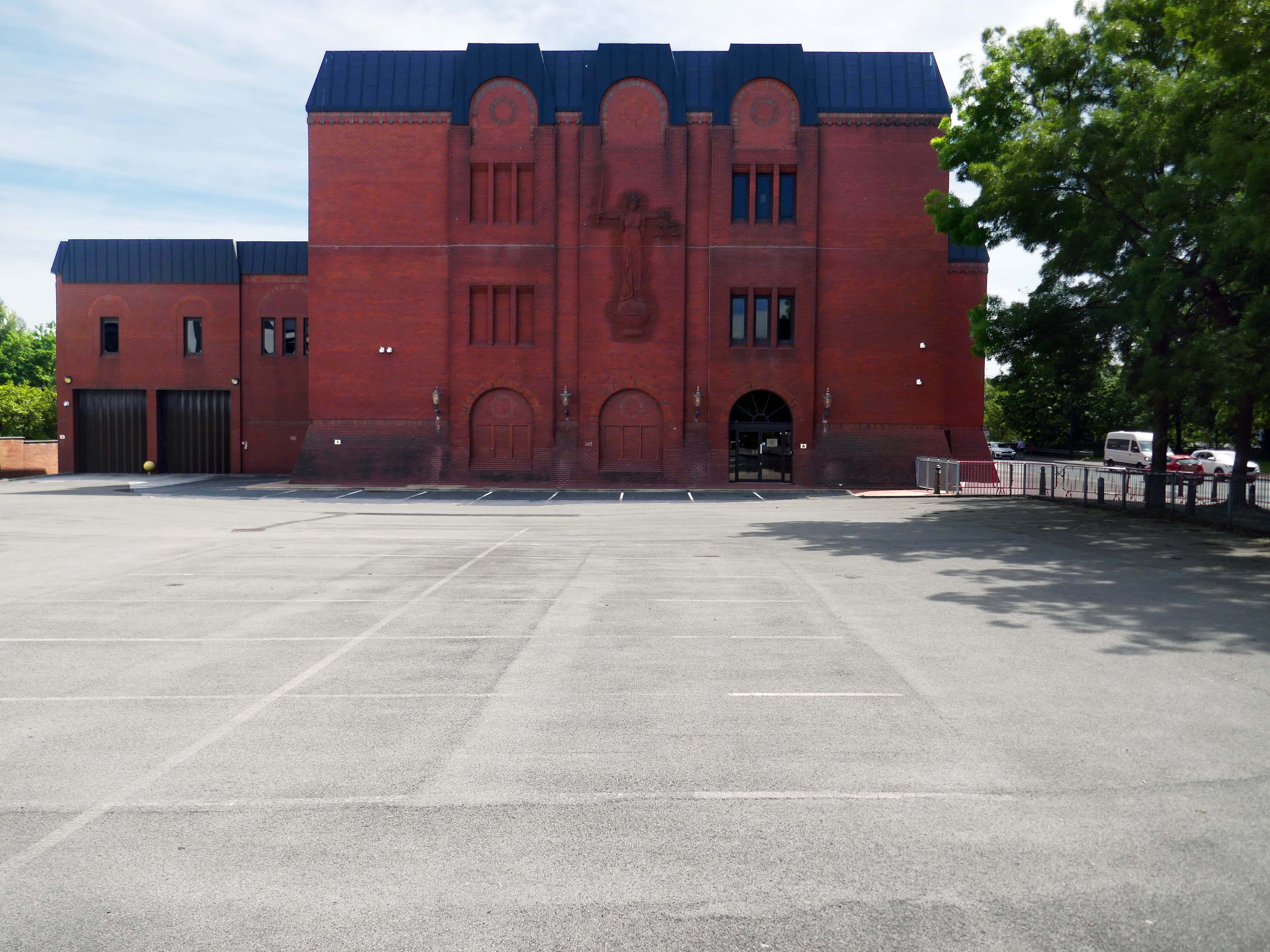
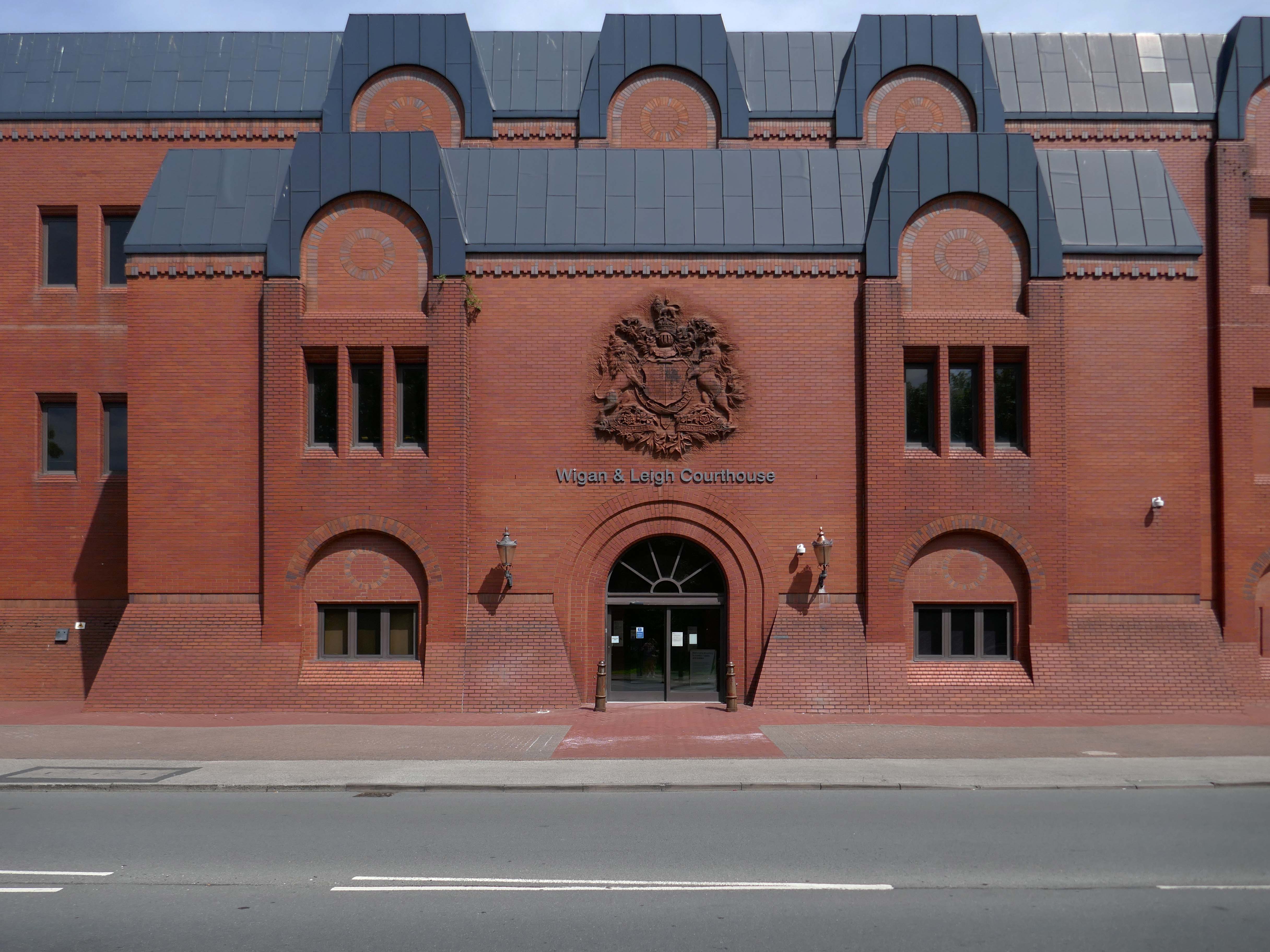
Next door the Wigan & Leigh Courthouse 1992 Wigan MBC Architect.
Relief figure of justice by Christine Ward.
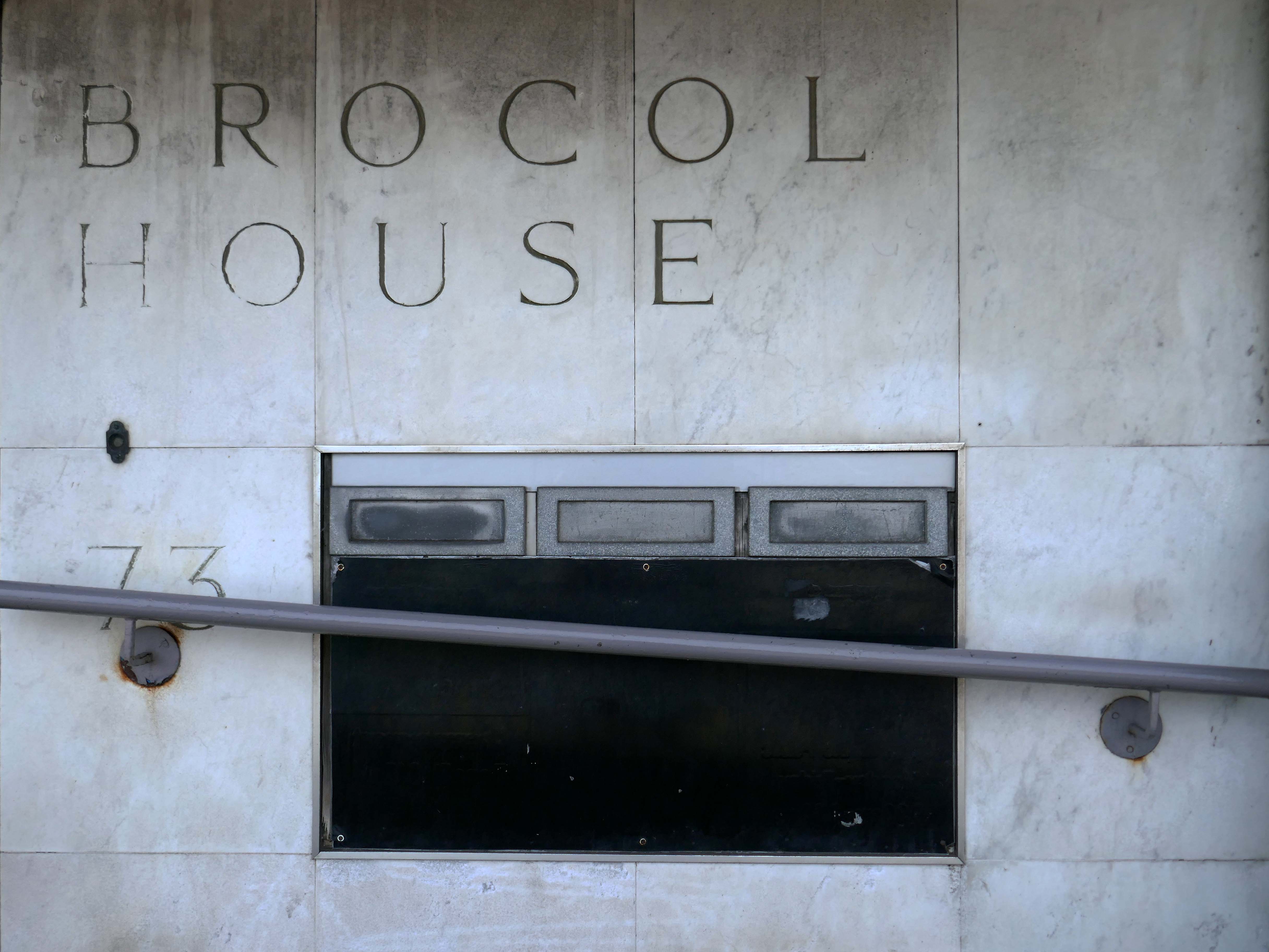
Onward to Brocol House – currently home to the Job Centre
Image – Wigan Peers
Originally built for the Inland Revenue one the site of the Brewers Arms – has the welcoming charm shared by the majority of Ministry of Works buildings of the period.
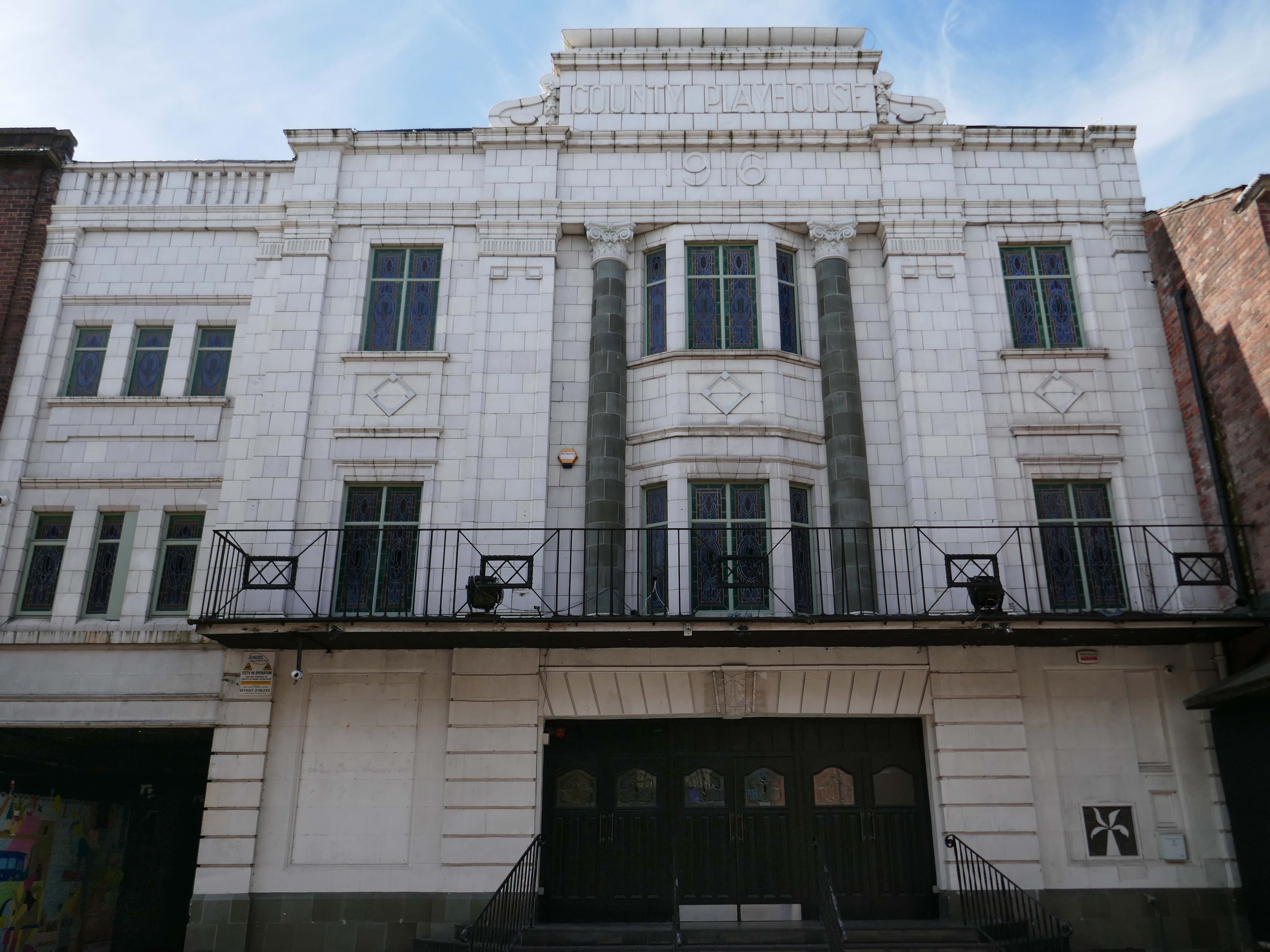
Nearly done – up the road to the County Playhouse.
The club’s atmosphere is defined by thumping musicand a vibrant crowd eager to dance and celebrate. Its modern interior design complements the lively ambience, creating an inviting space for locals and visitors alike.
Construction began on the County Playhouse in 1916. However, due to a shortage of materials and labour during World War I, it was not completed until 1919.
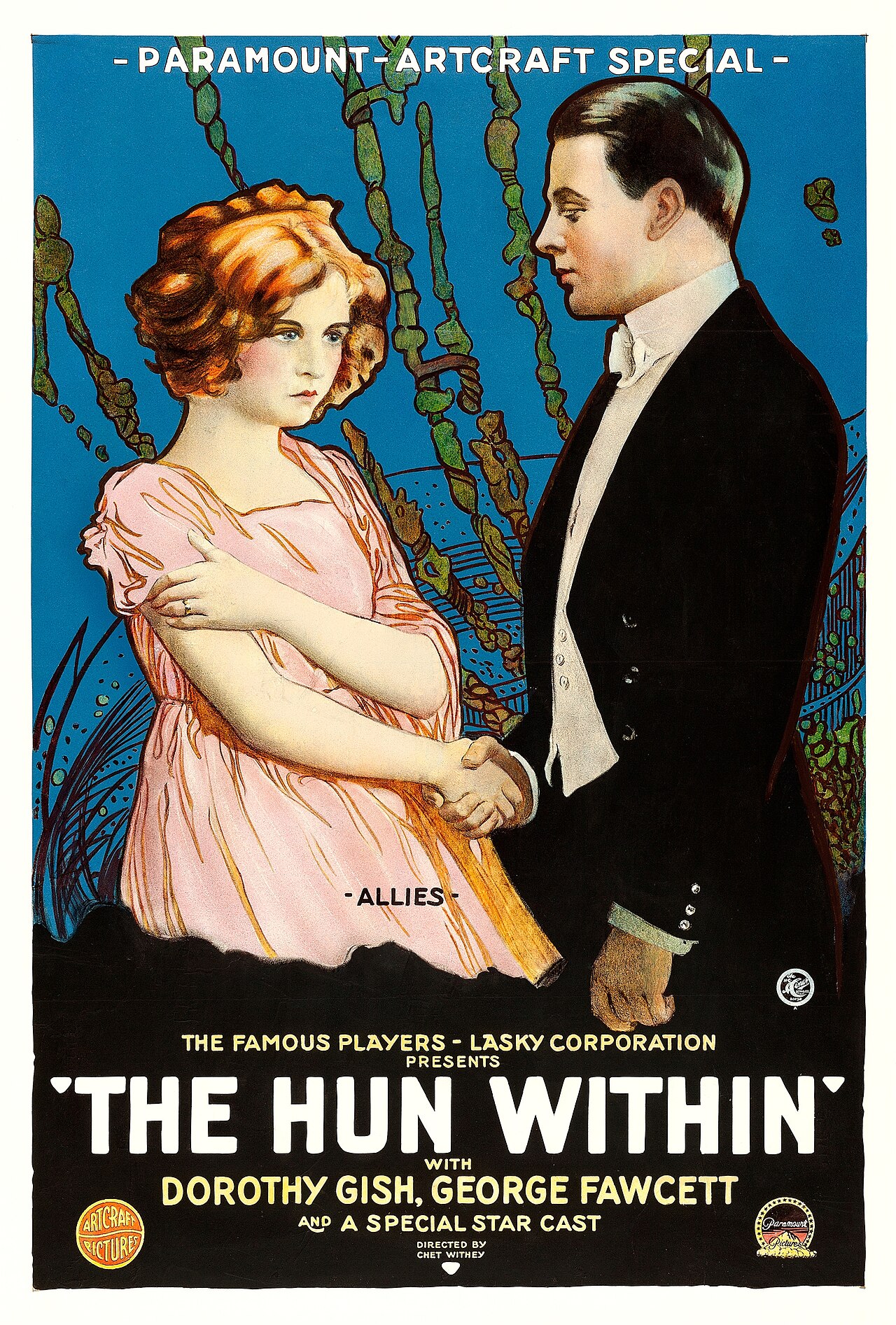
Finally opened on 22nd December 1919 with The Hun Within – starring Dorothy Gish.
The County Playhouse closed on Sunday 13th November 1966 with Disney’s “The Sword and the Stone”. It was taken over by the Leeds Based Star Cinemas chain and they converted it into Star Bingo and Social Club opened on 24th November 1966.
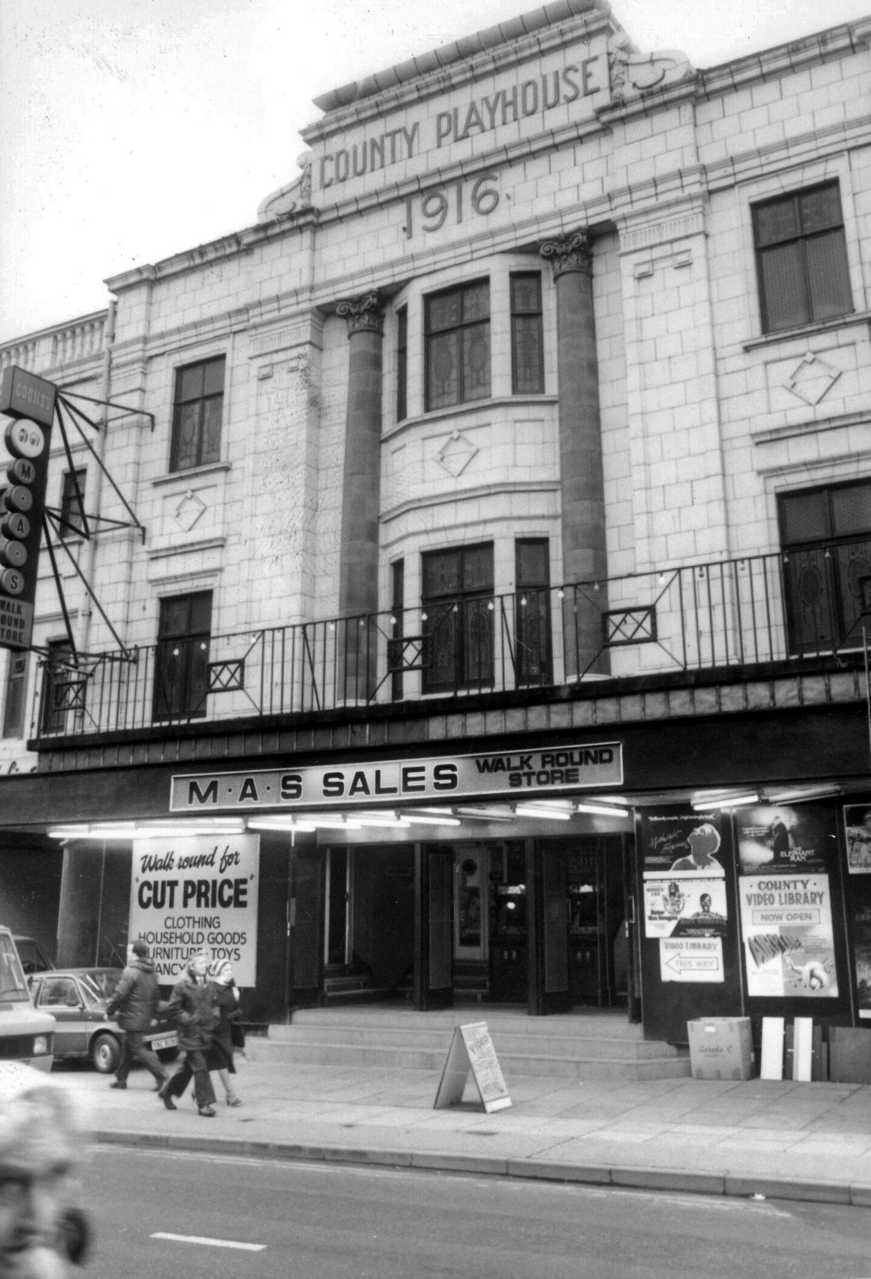
MAS sales store 1982 – Frank Orrell Photography
The building has since been used as a discount store and Playhouse Club Café. It then became home to the 1,200 capacity Pure Nightclub. In the early-2000’s it became the Ibiza nightclub. The Pure nightclub move into the former Princes Cinema
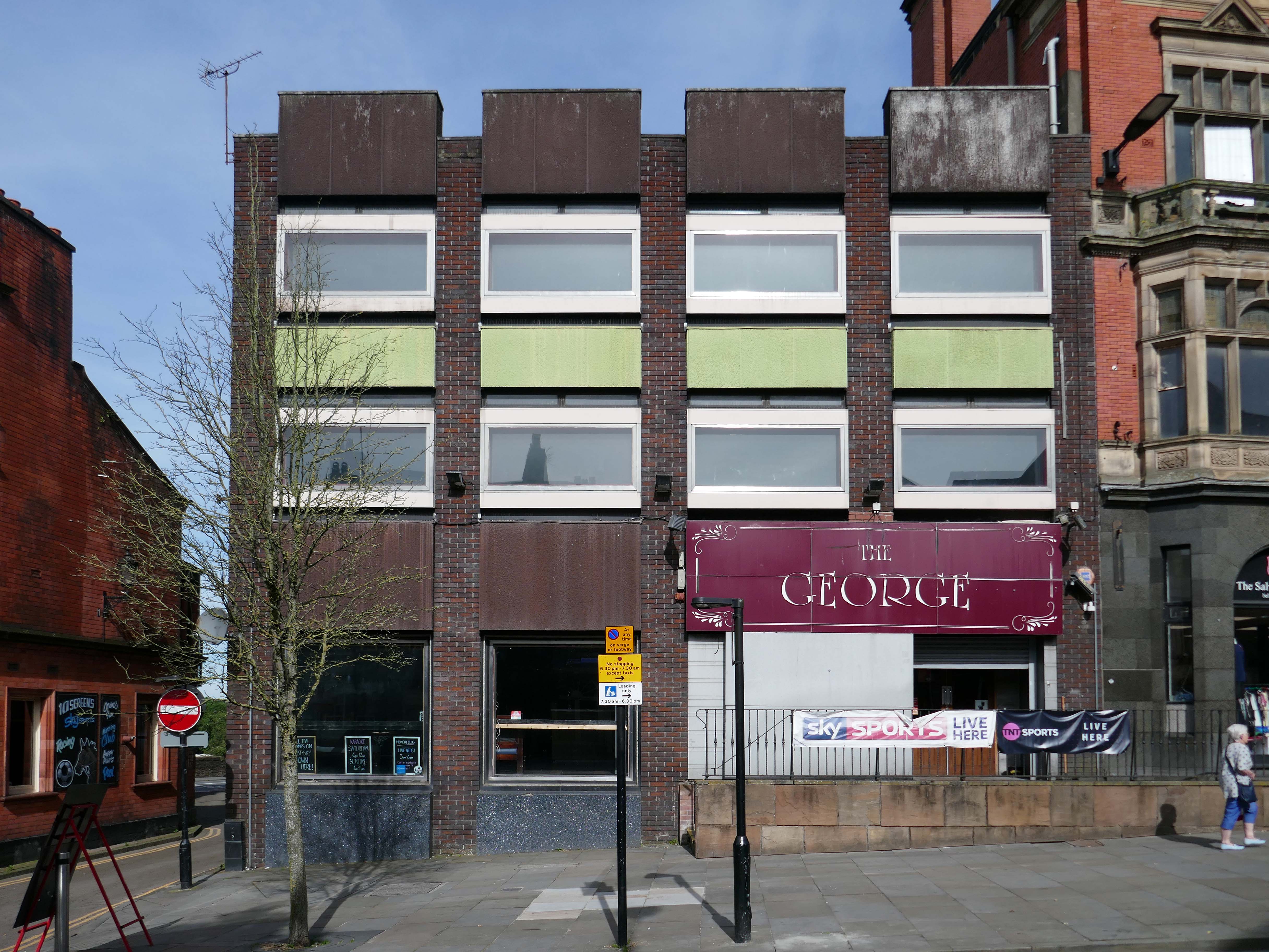
Time for a swift half in The George to end your tour?
Great for a local pint one of the cheapest in Wigan I believe, slightly rough at times but no fights just real local people who are generally friendly. Proper drinking gaff, and karaoke on certain nights.
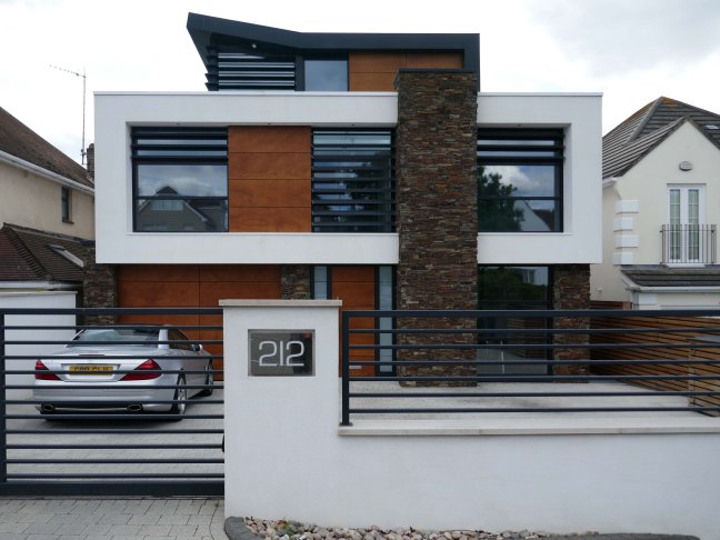
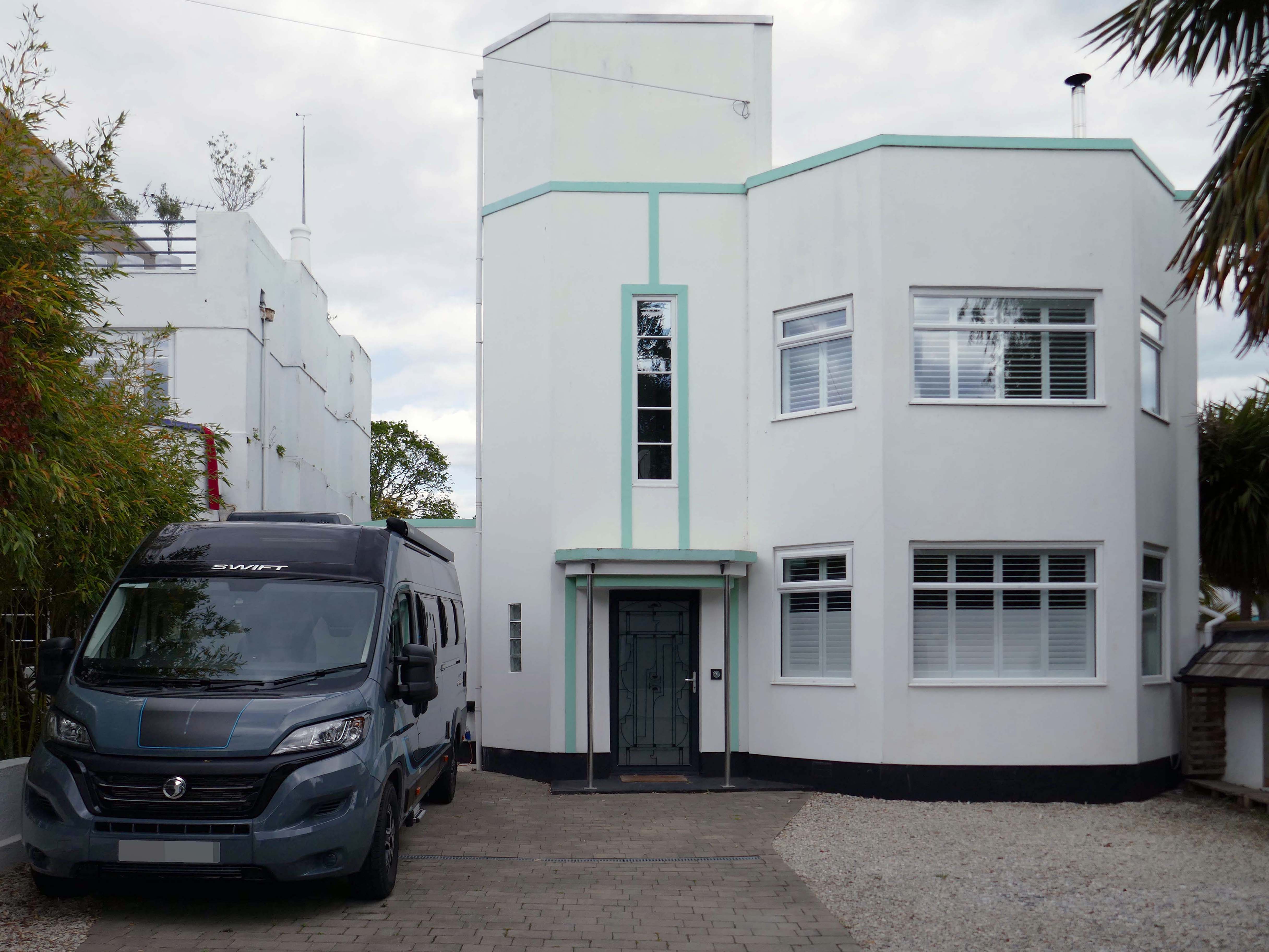
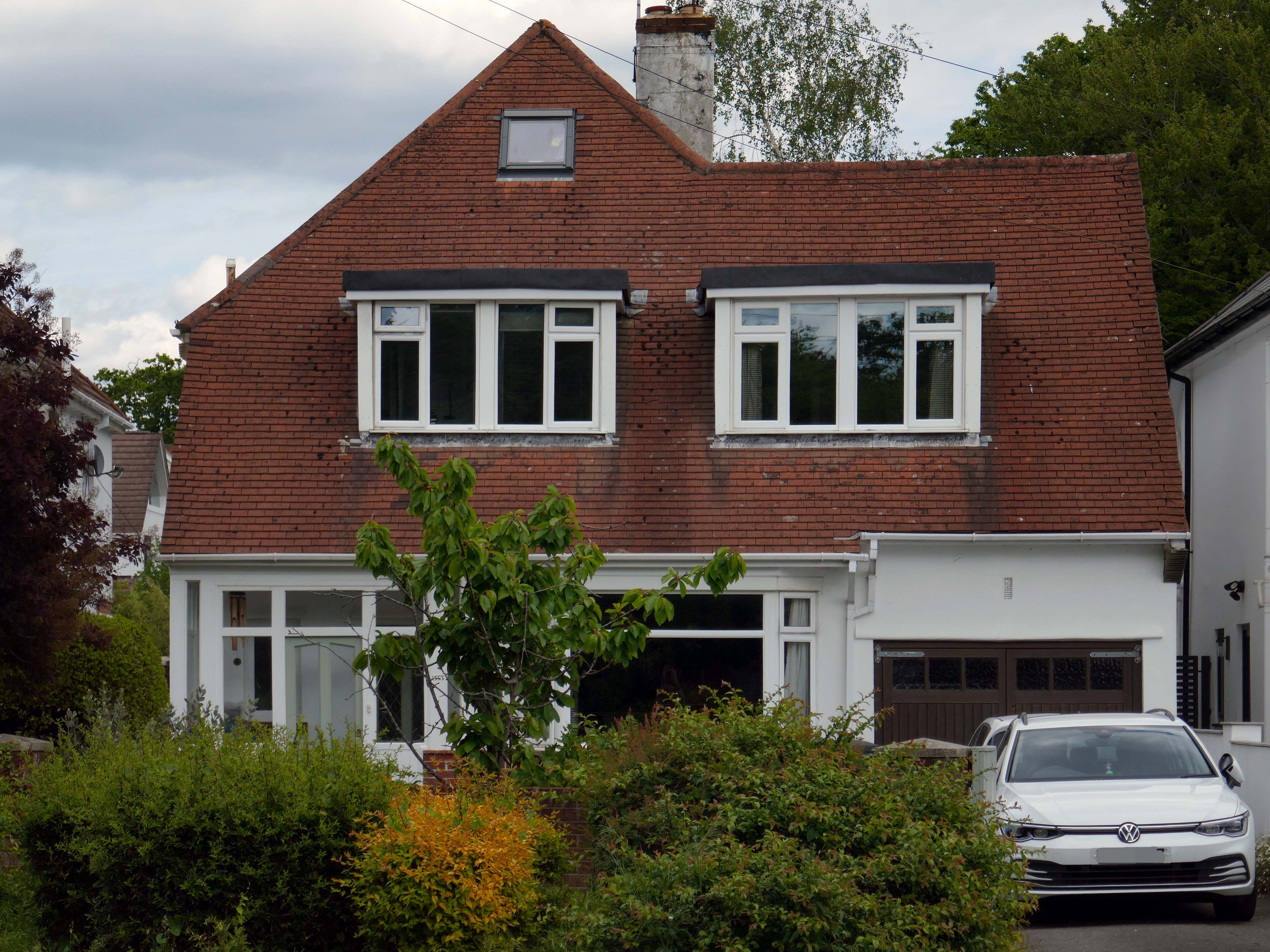
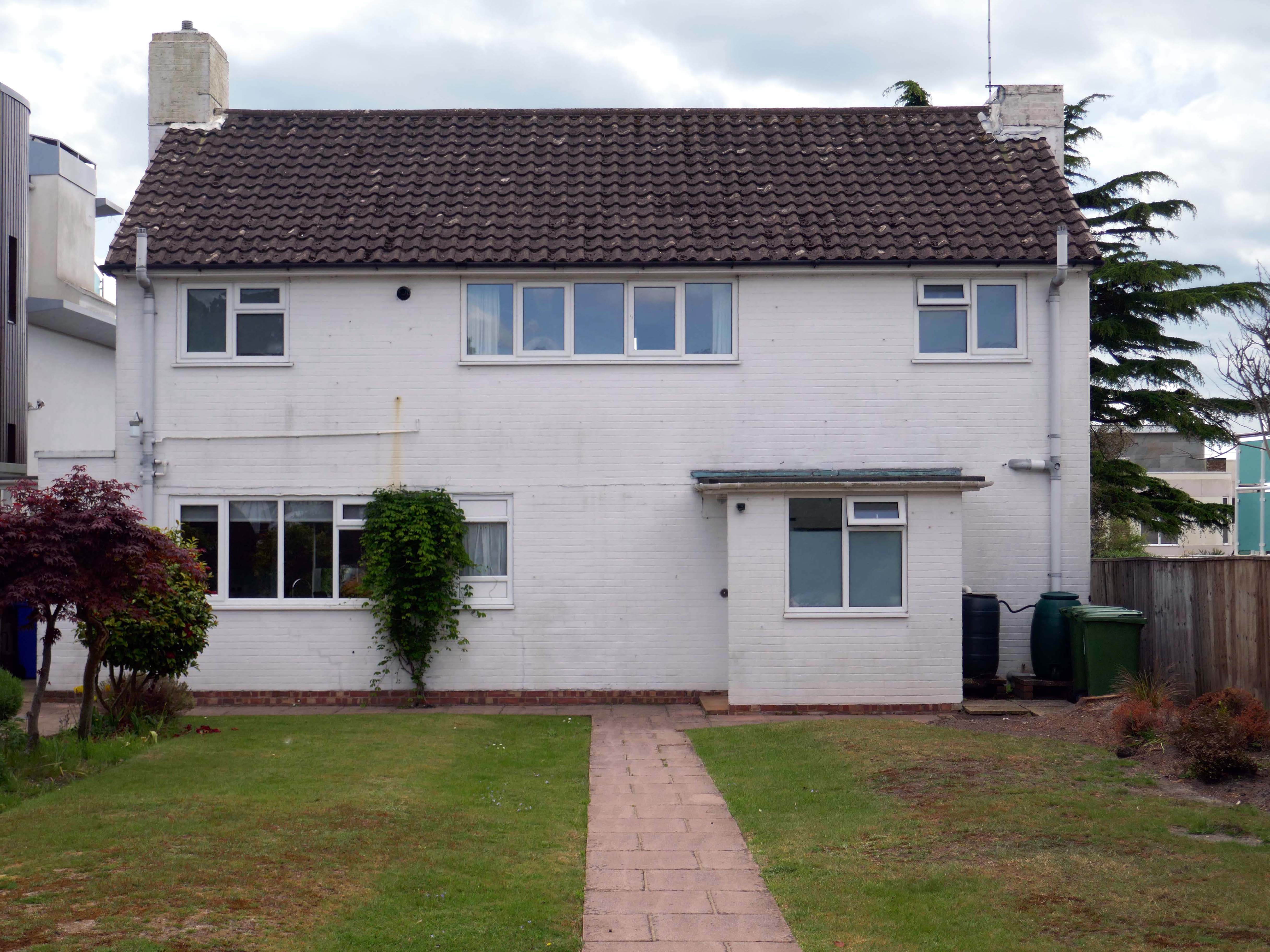
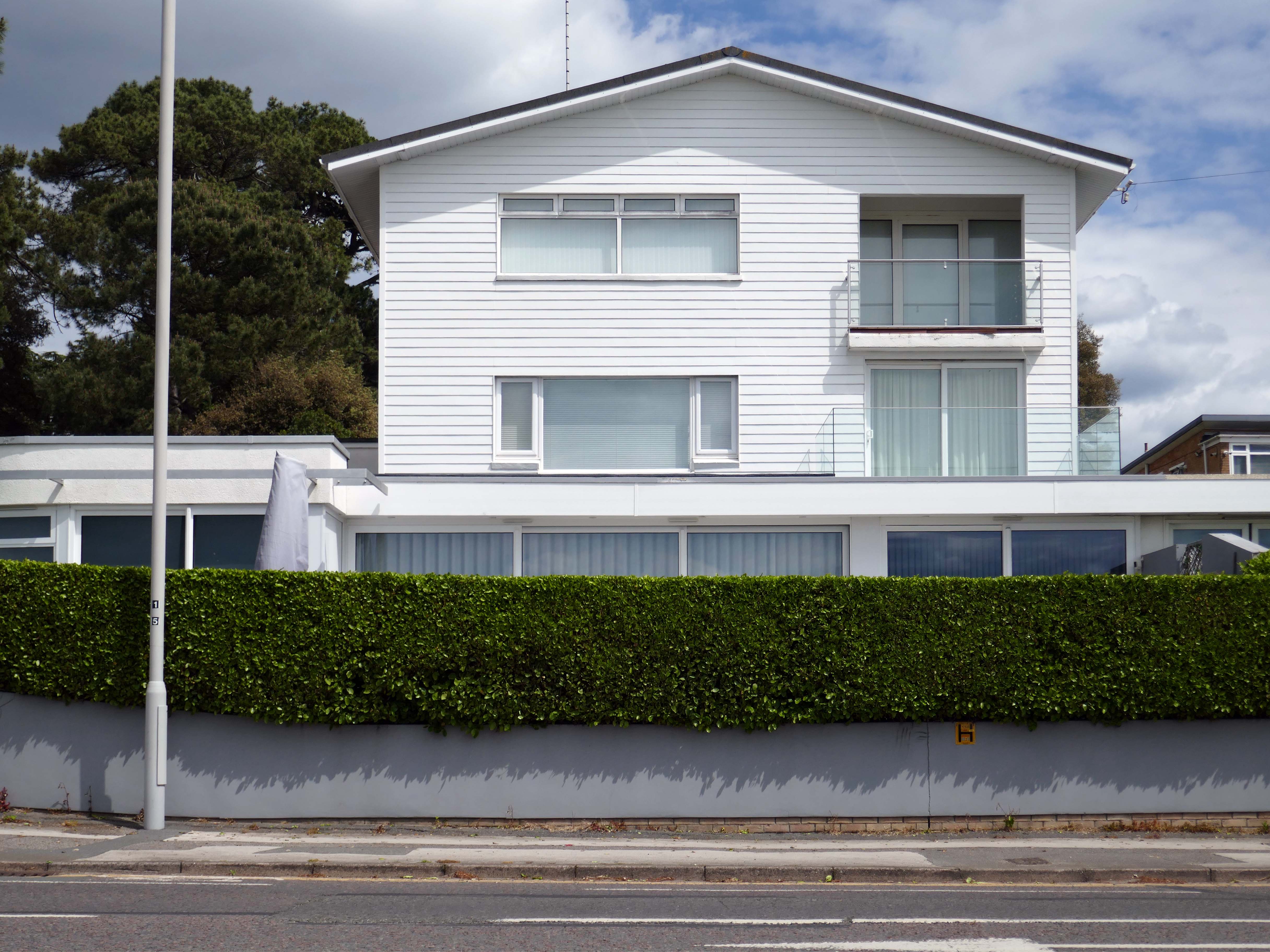
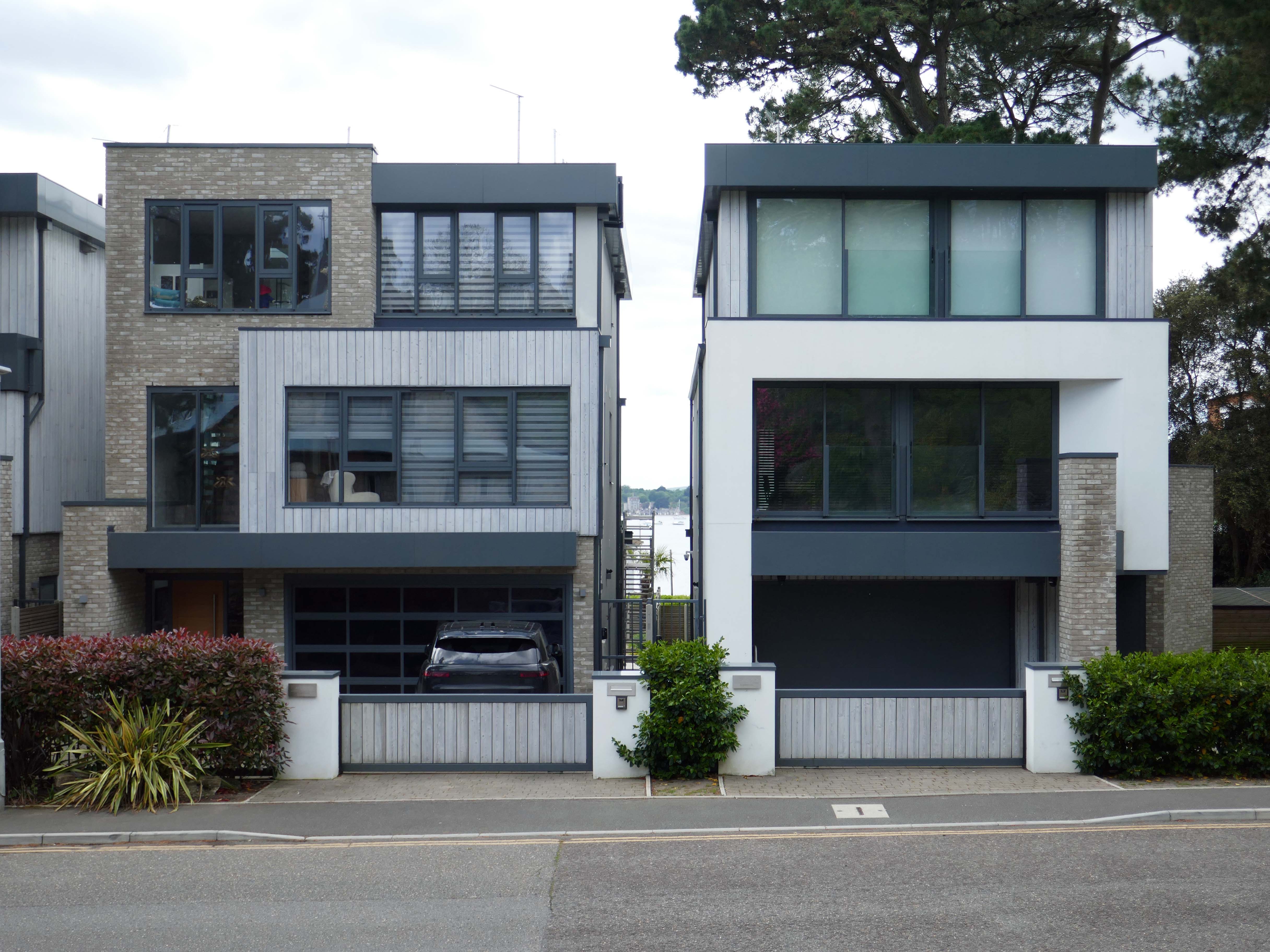
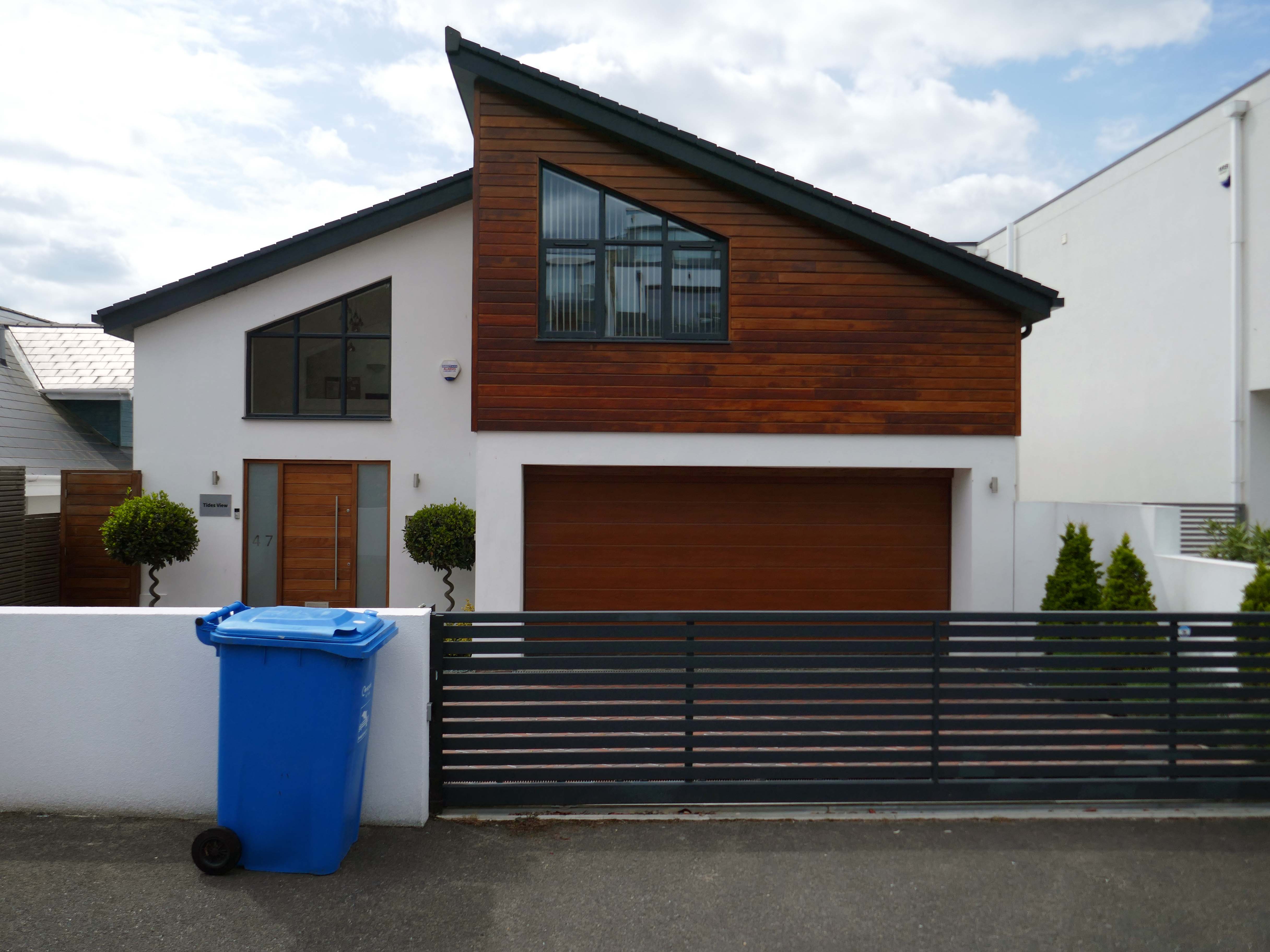
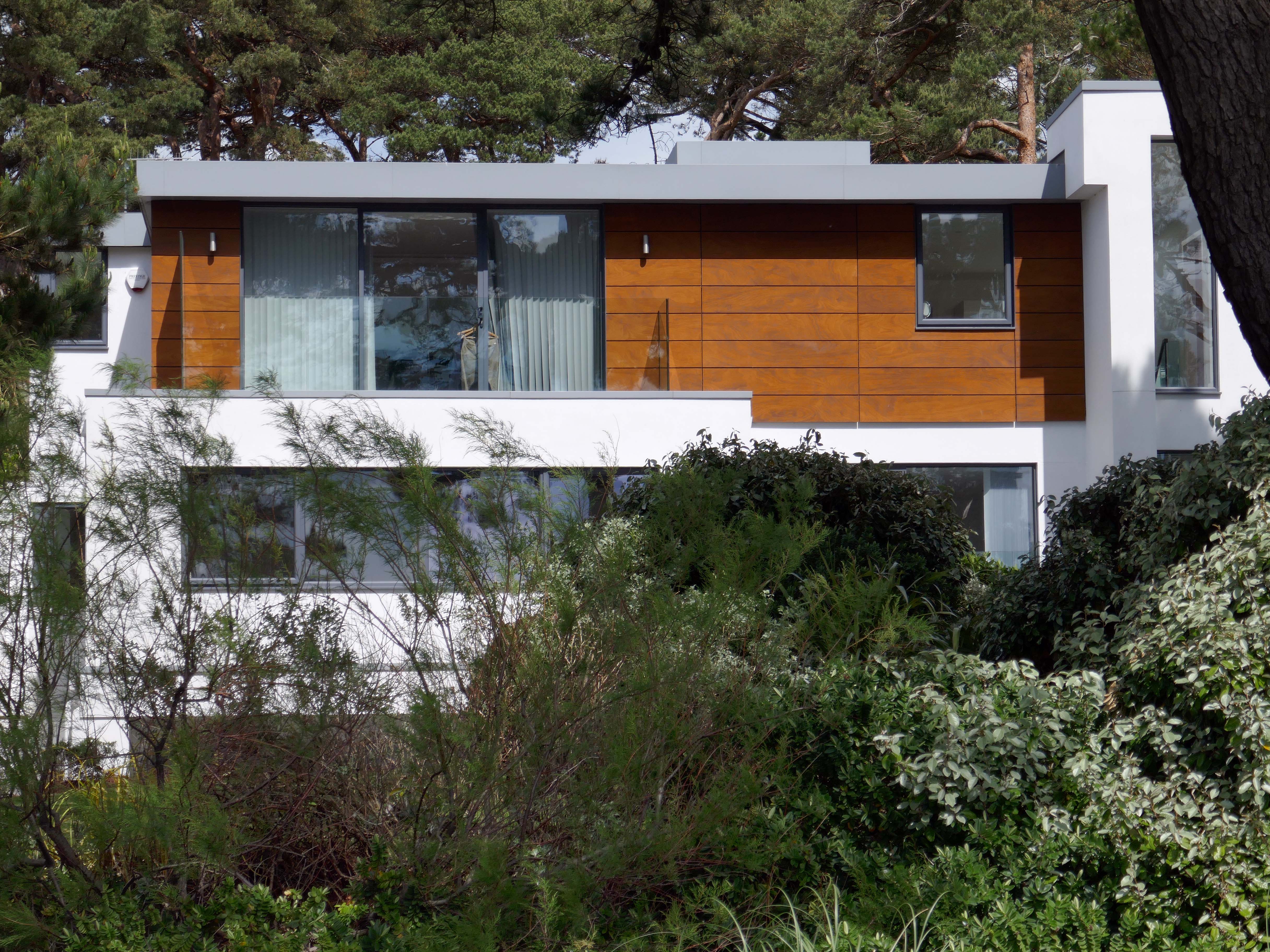
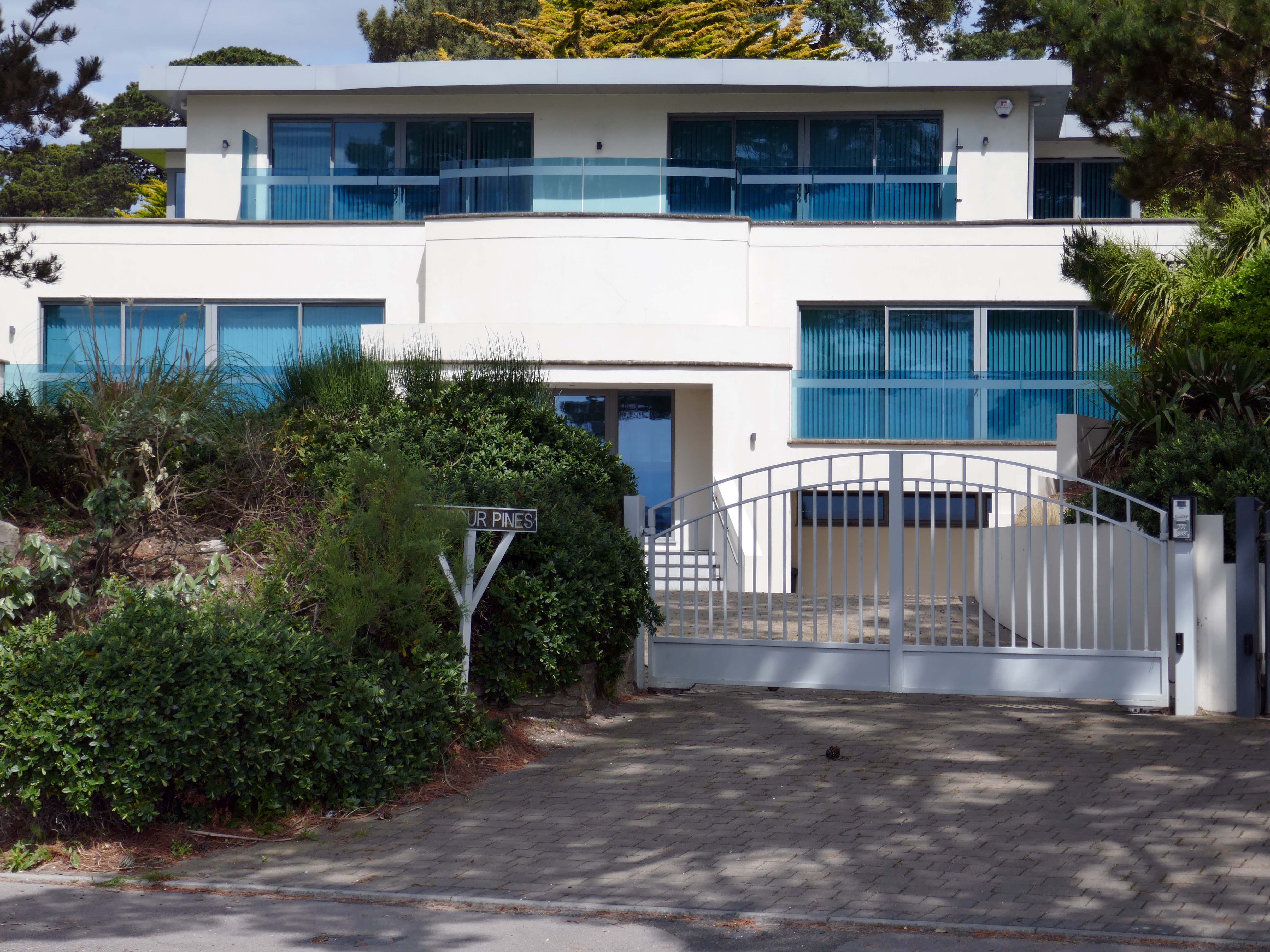
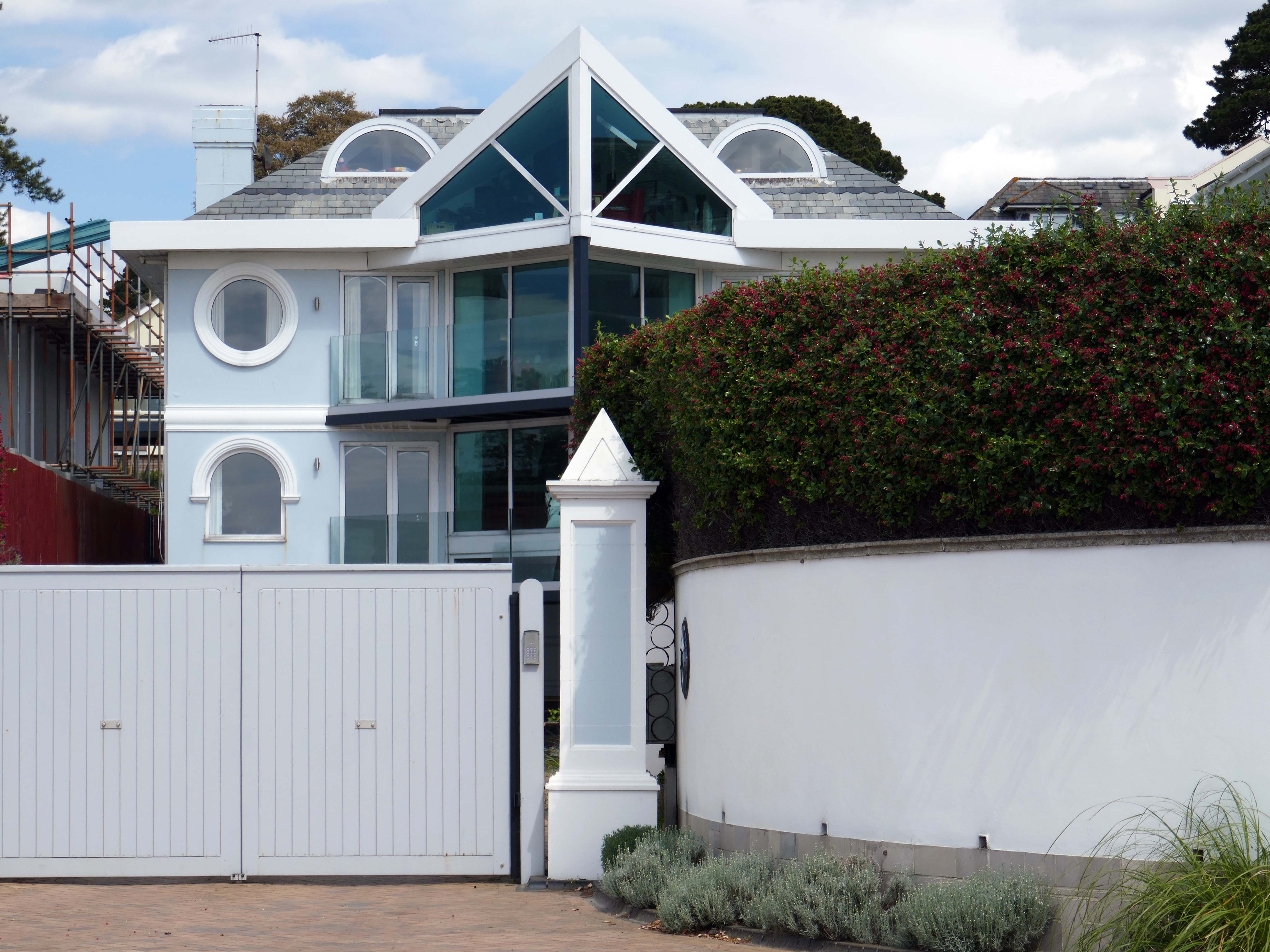
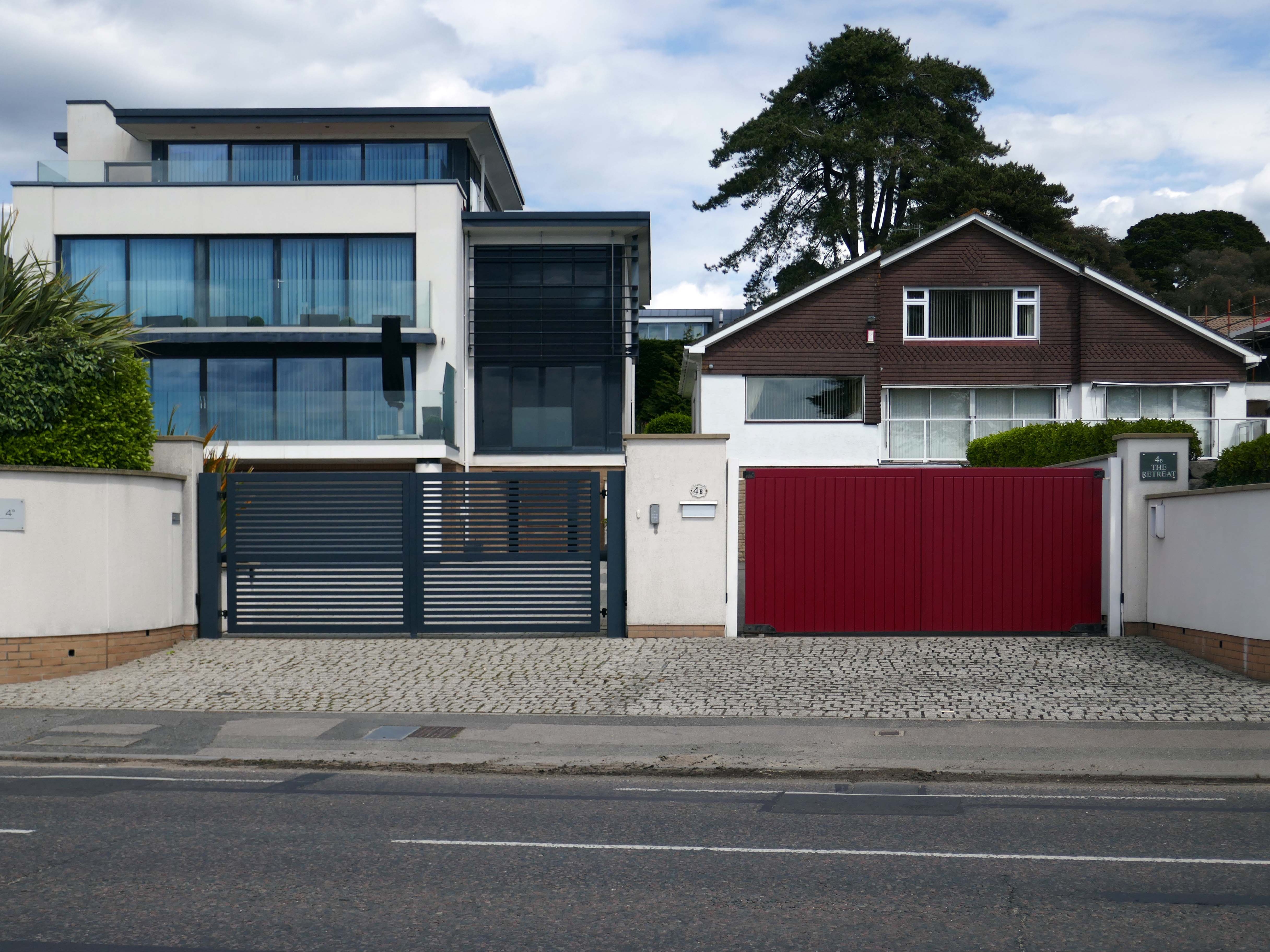
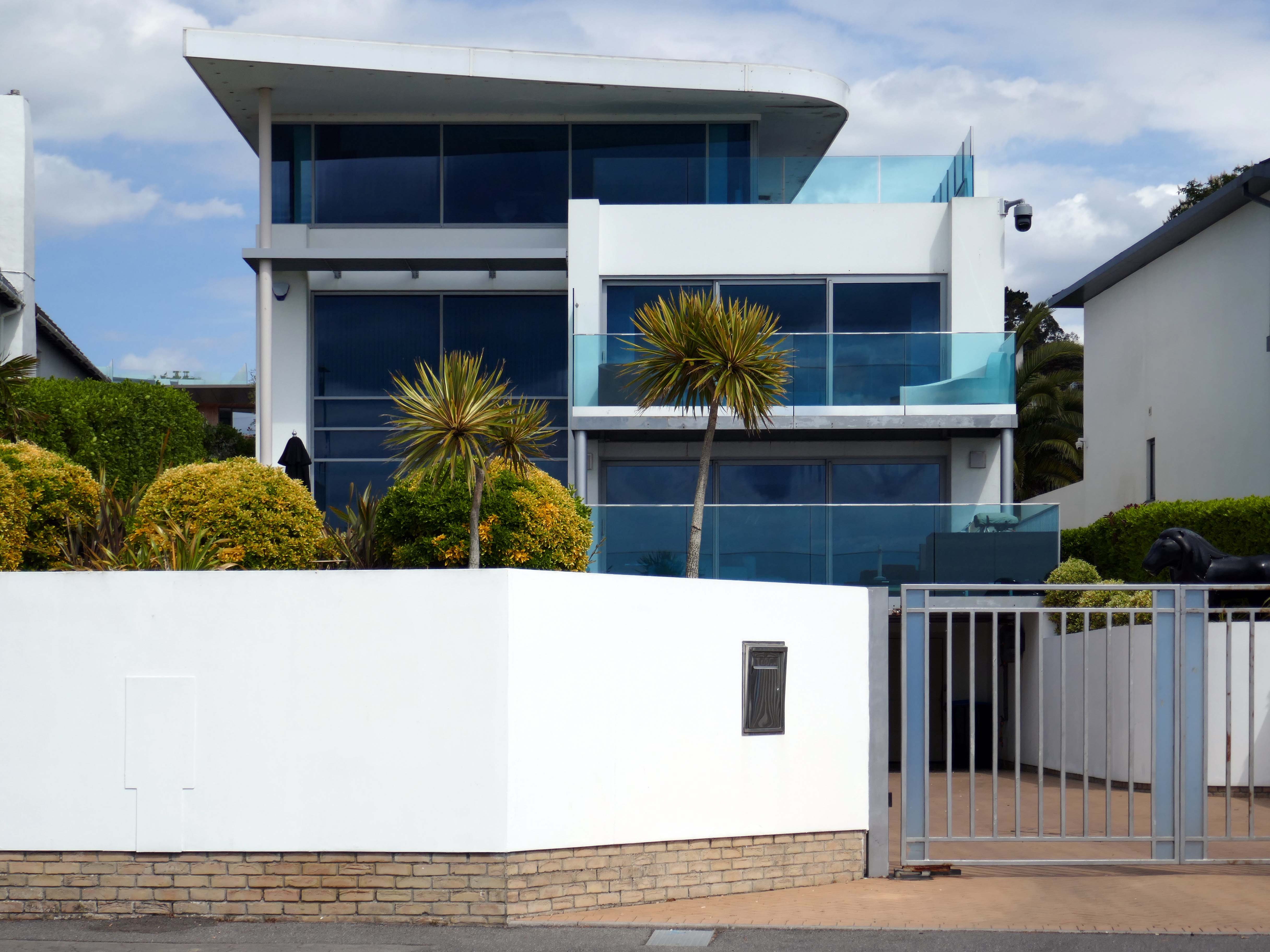
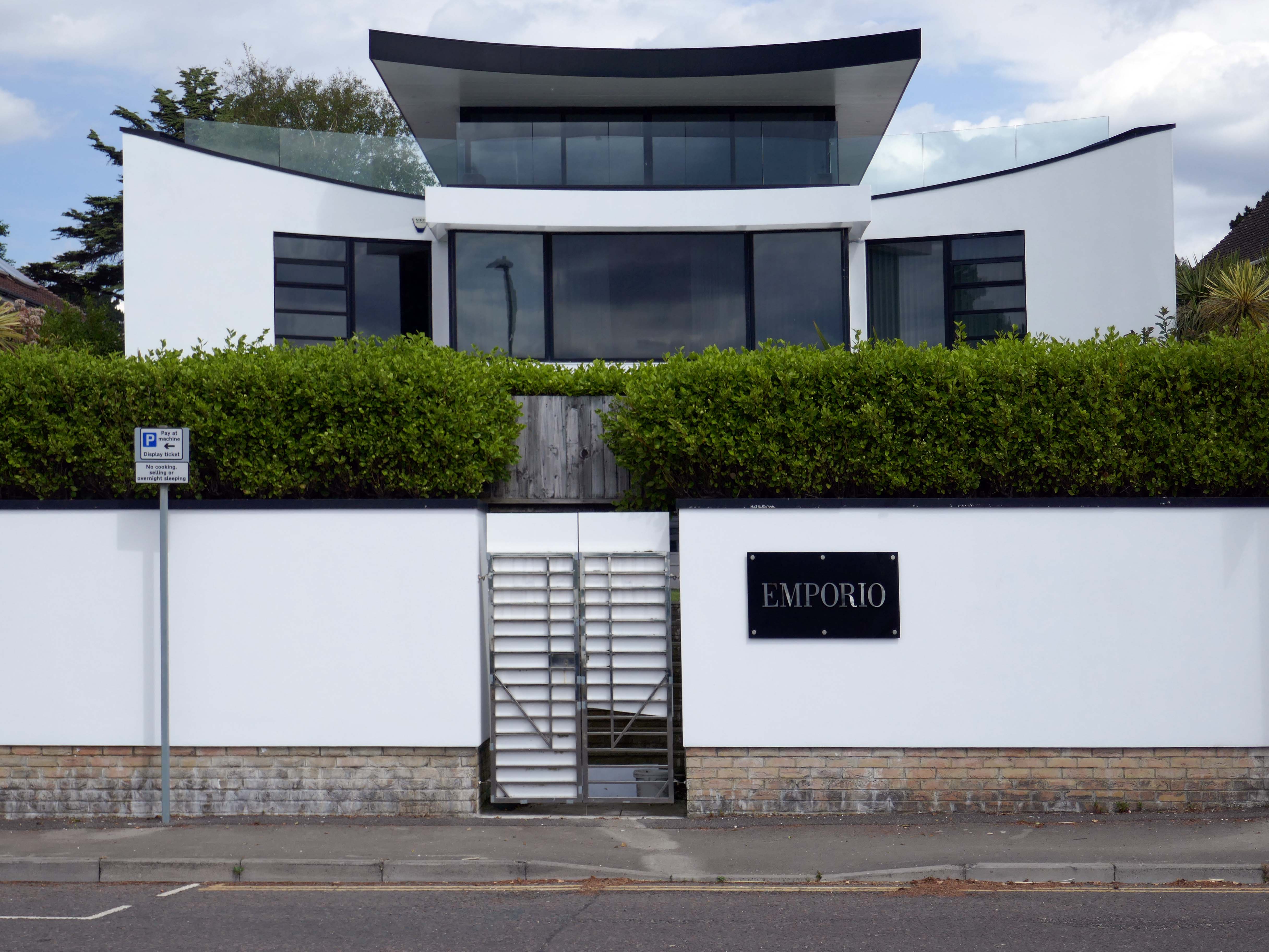
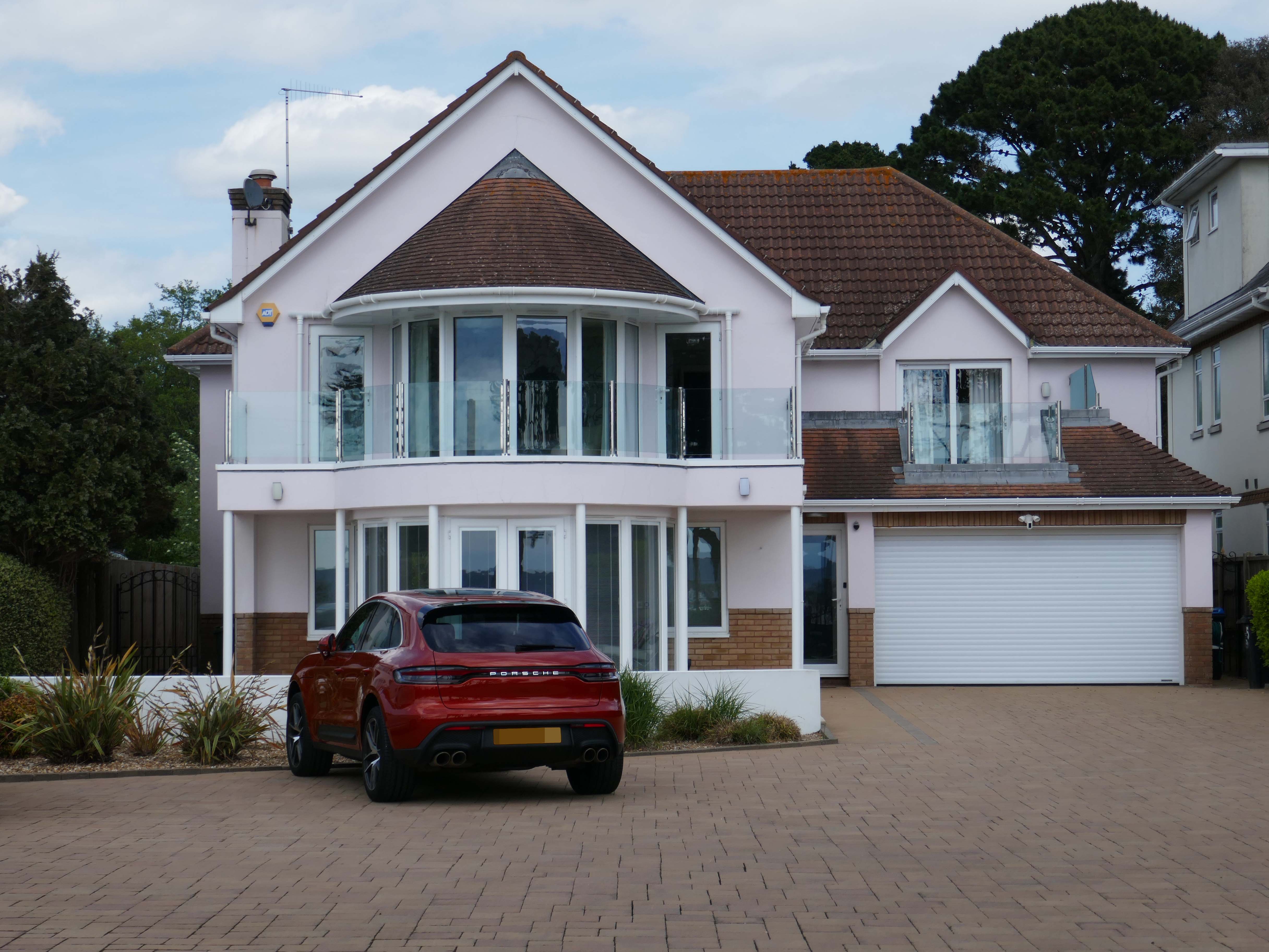
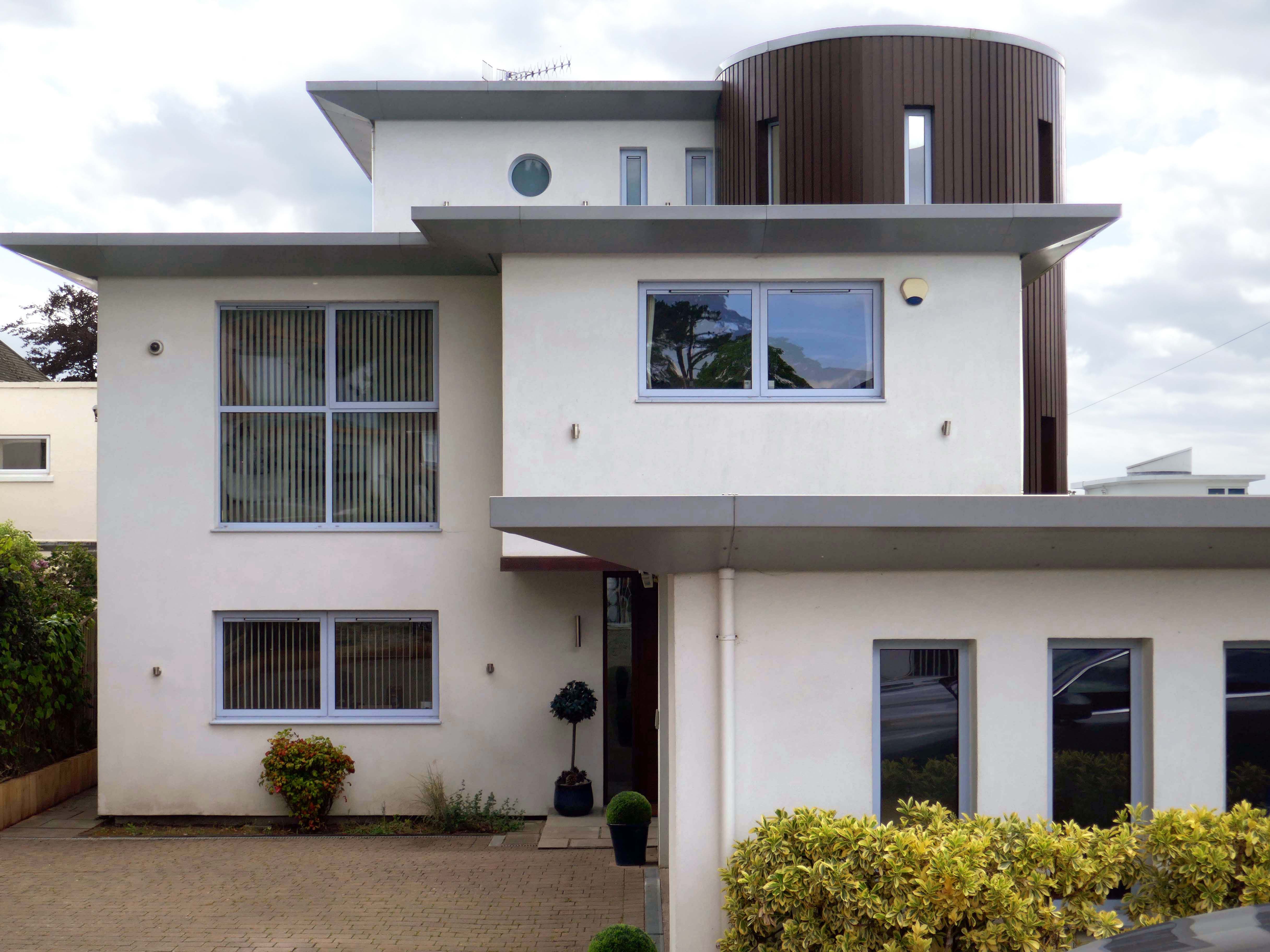
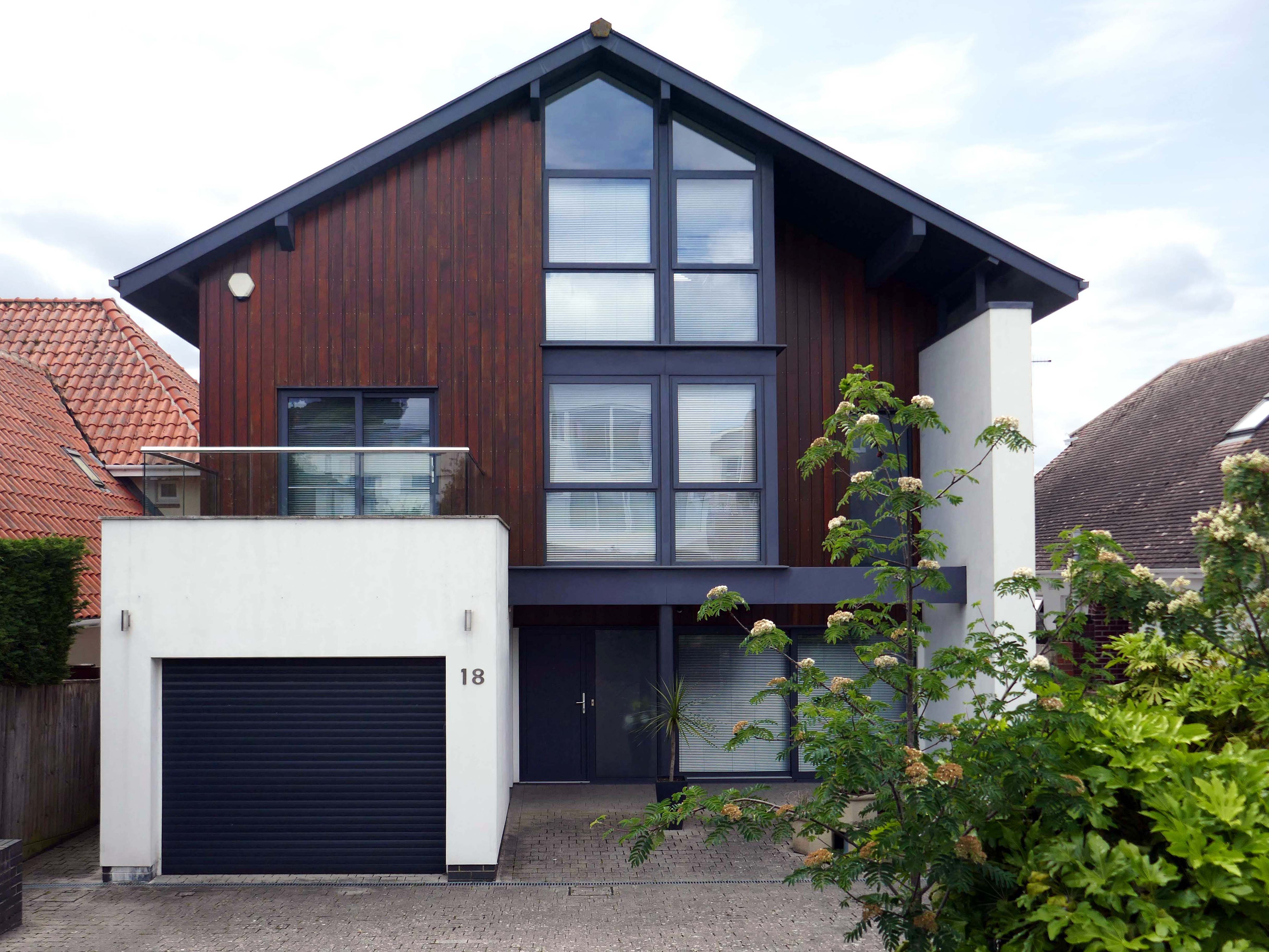
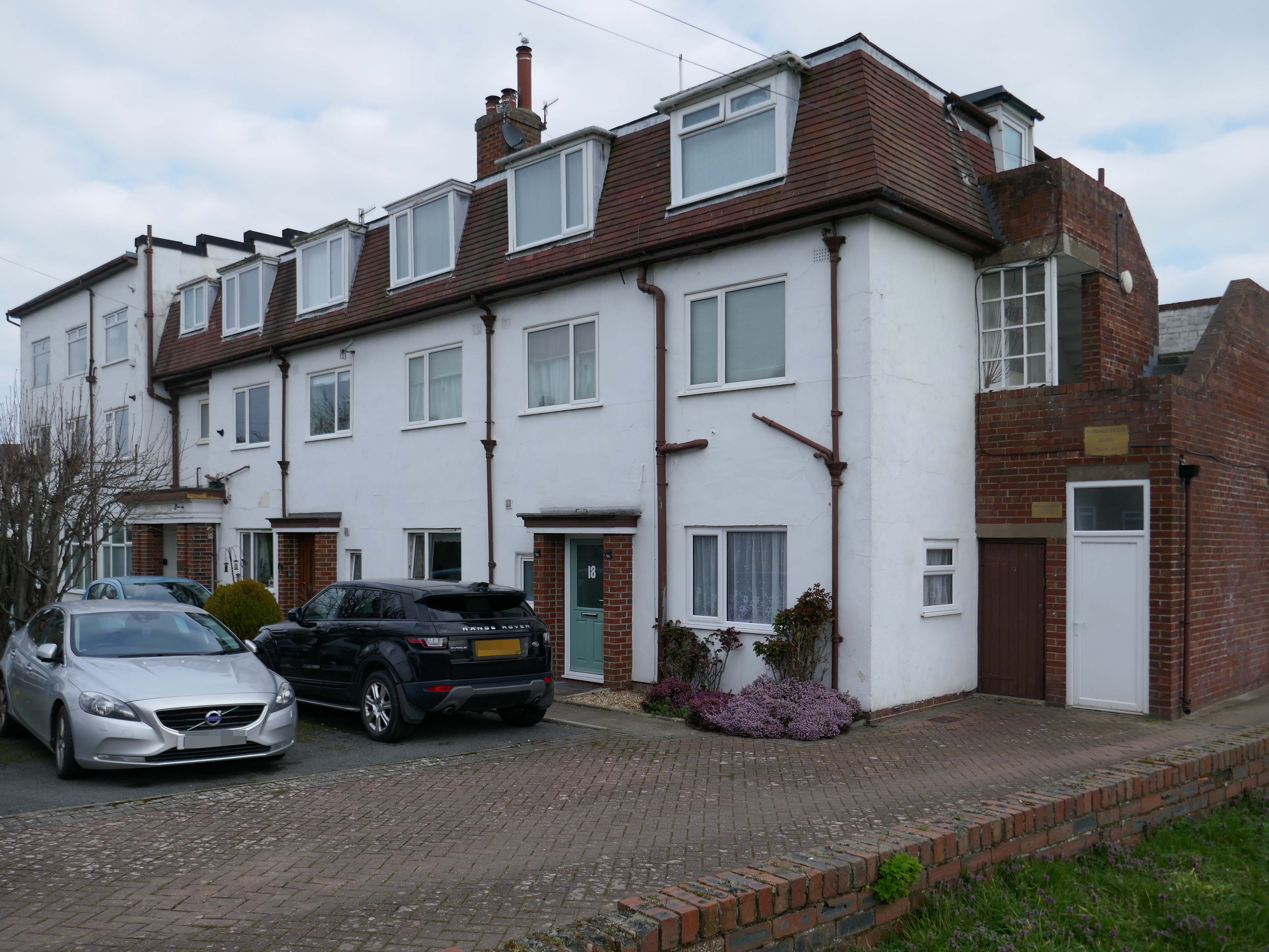
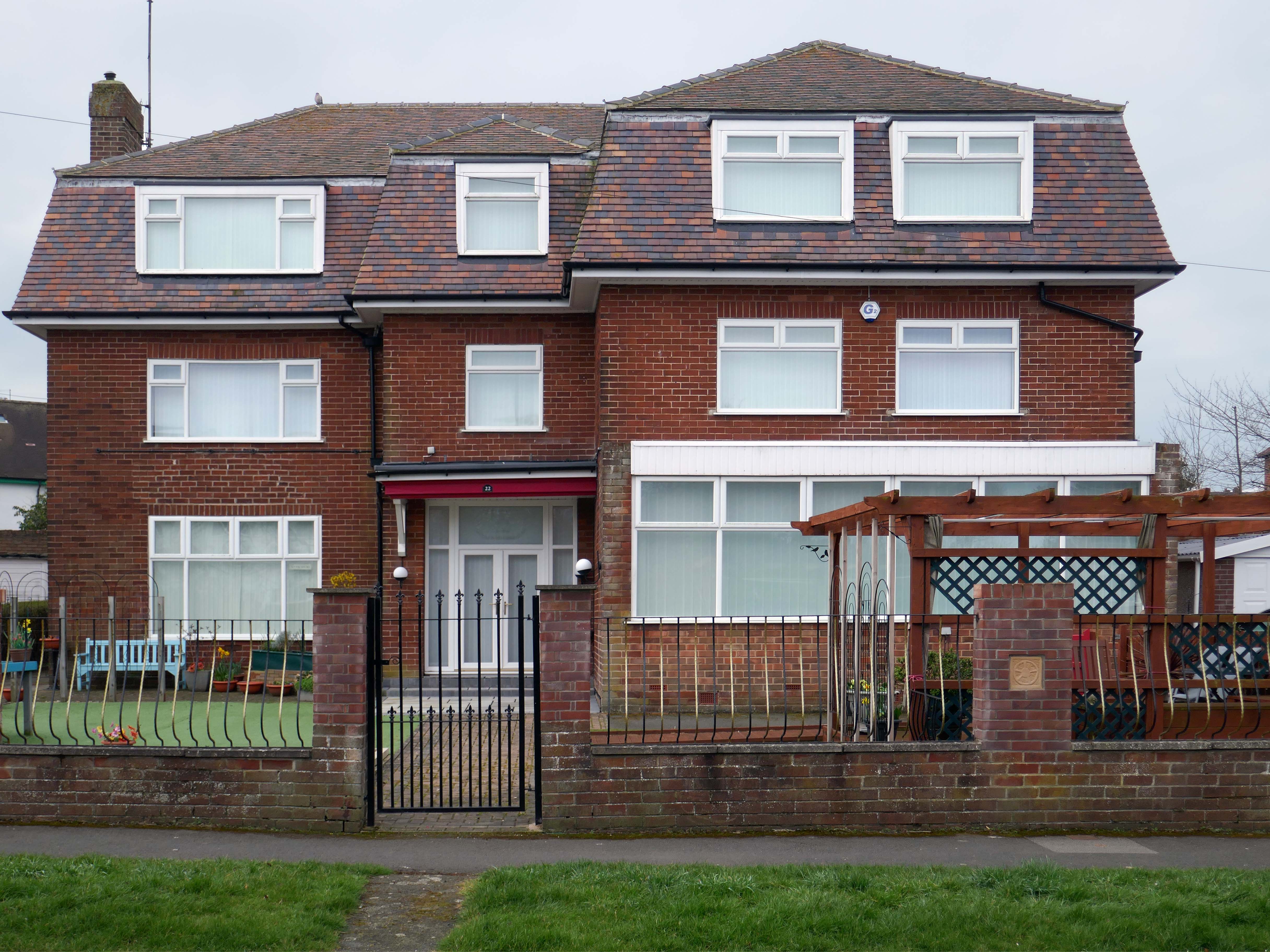
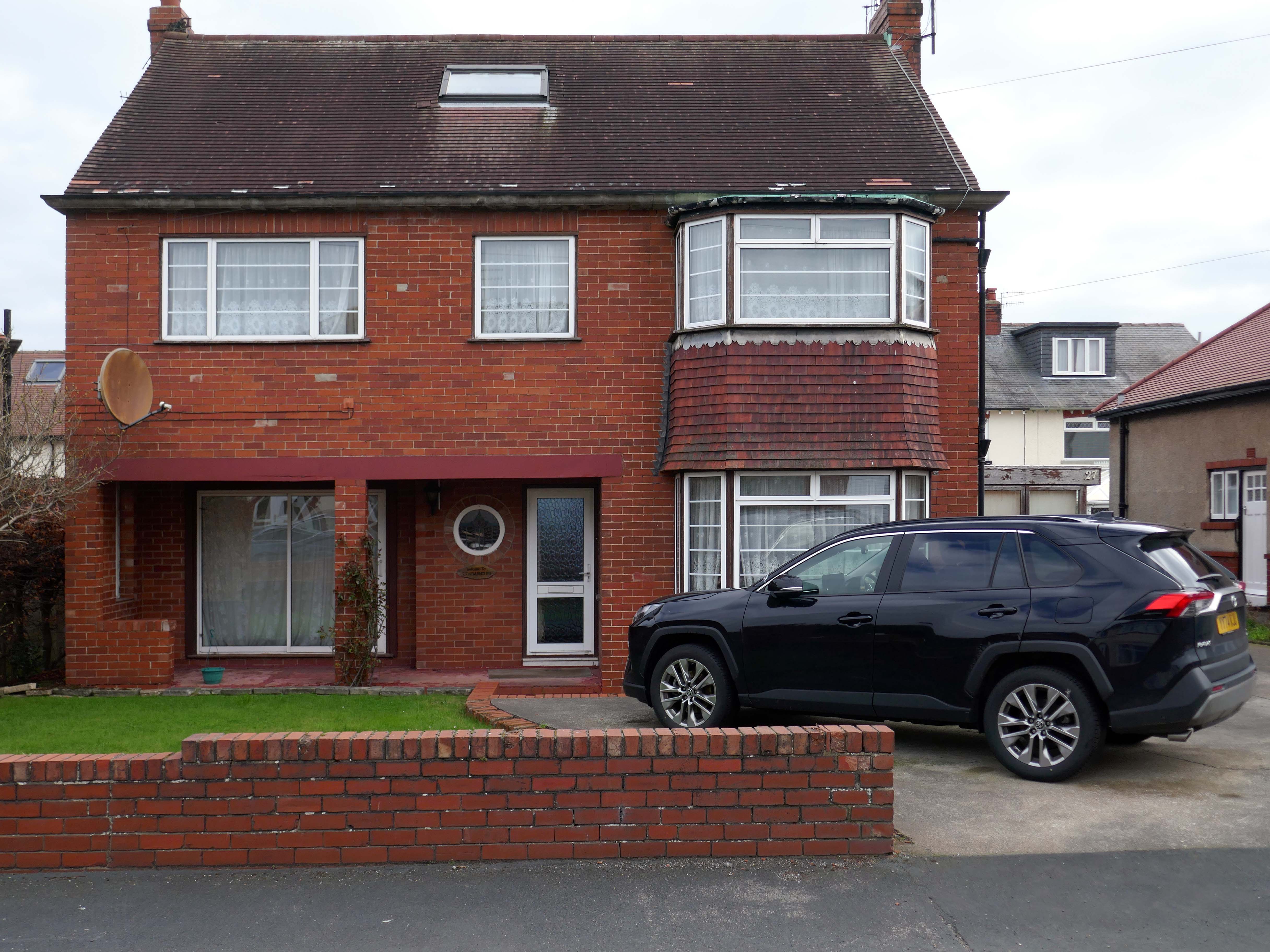
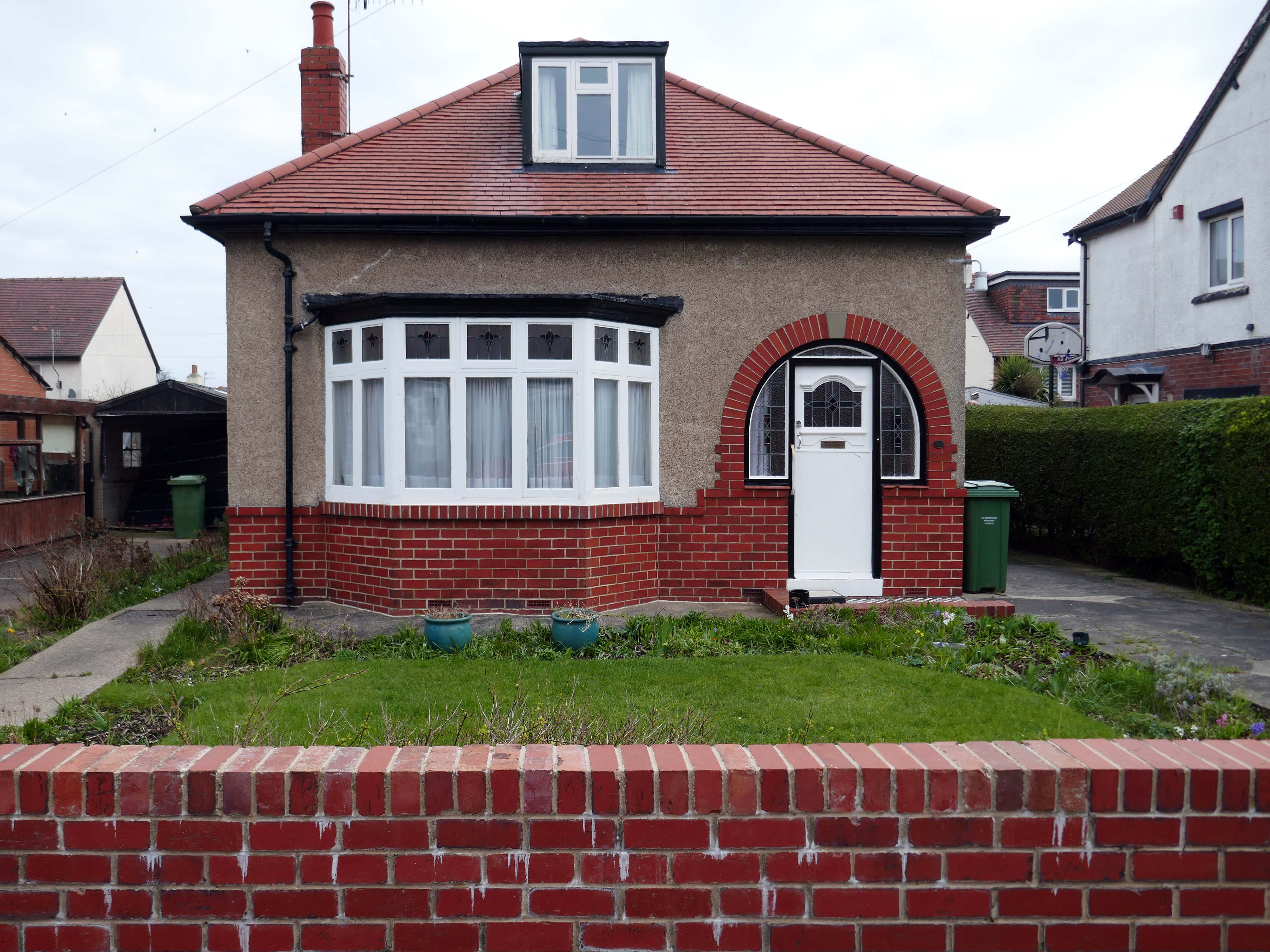
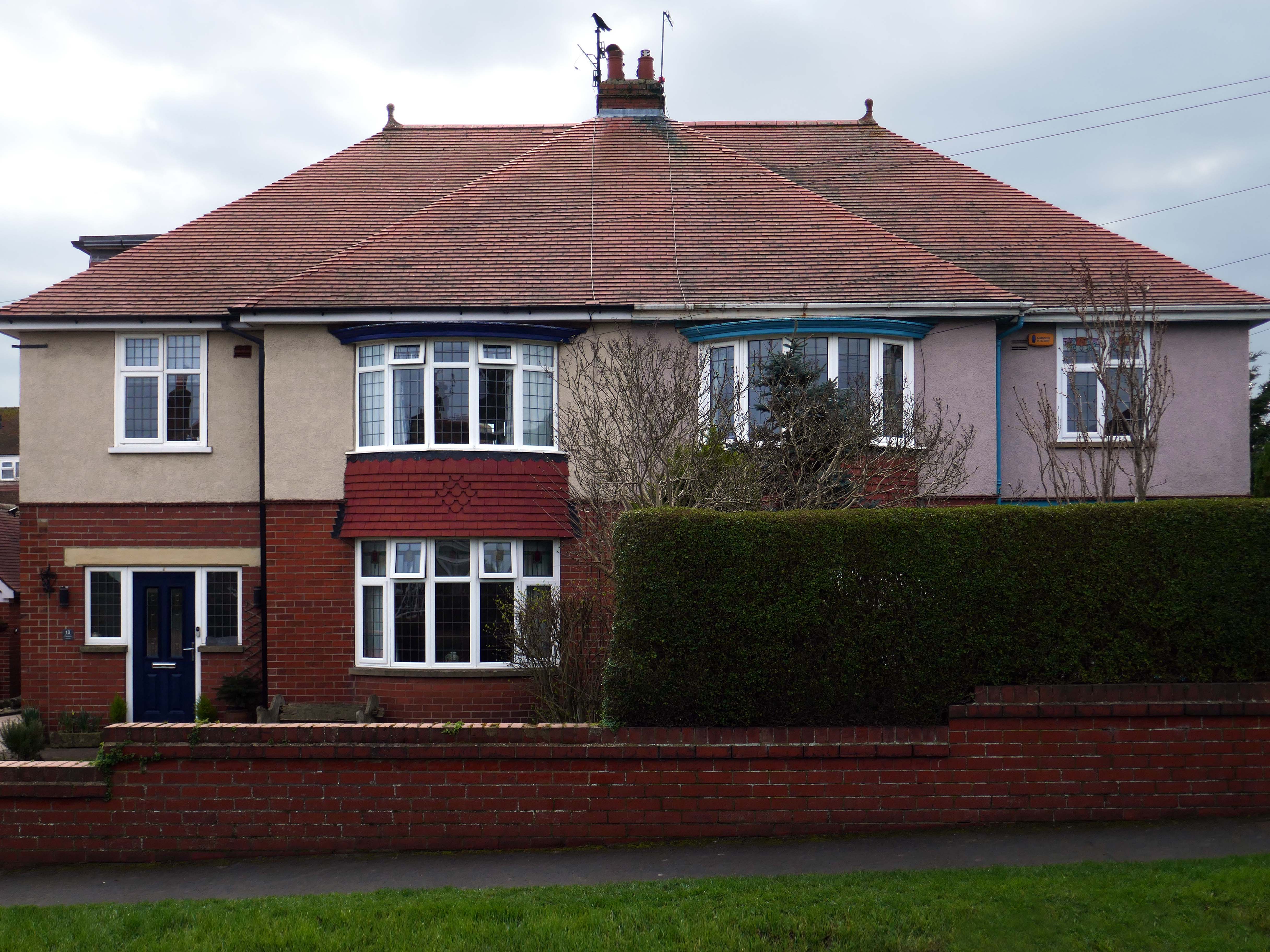
To begin at the middle, the middle of the Twentieth Century, houses may have looked like this:
Or possibly these:
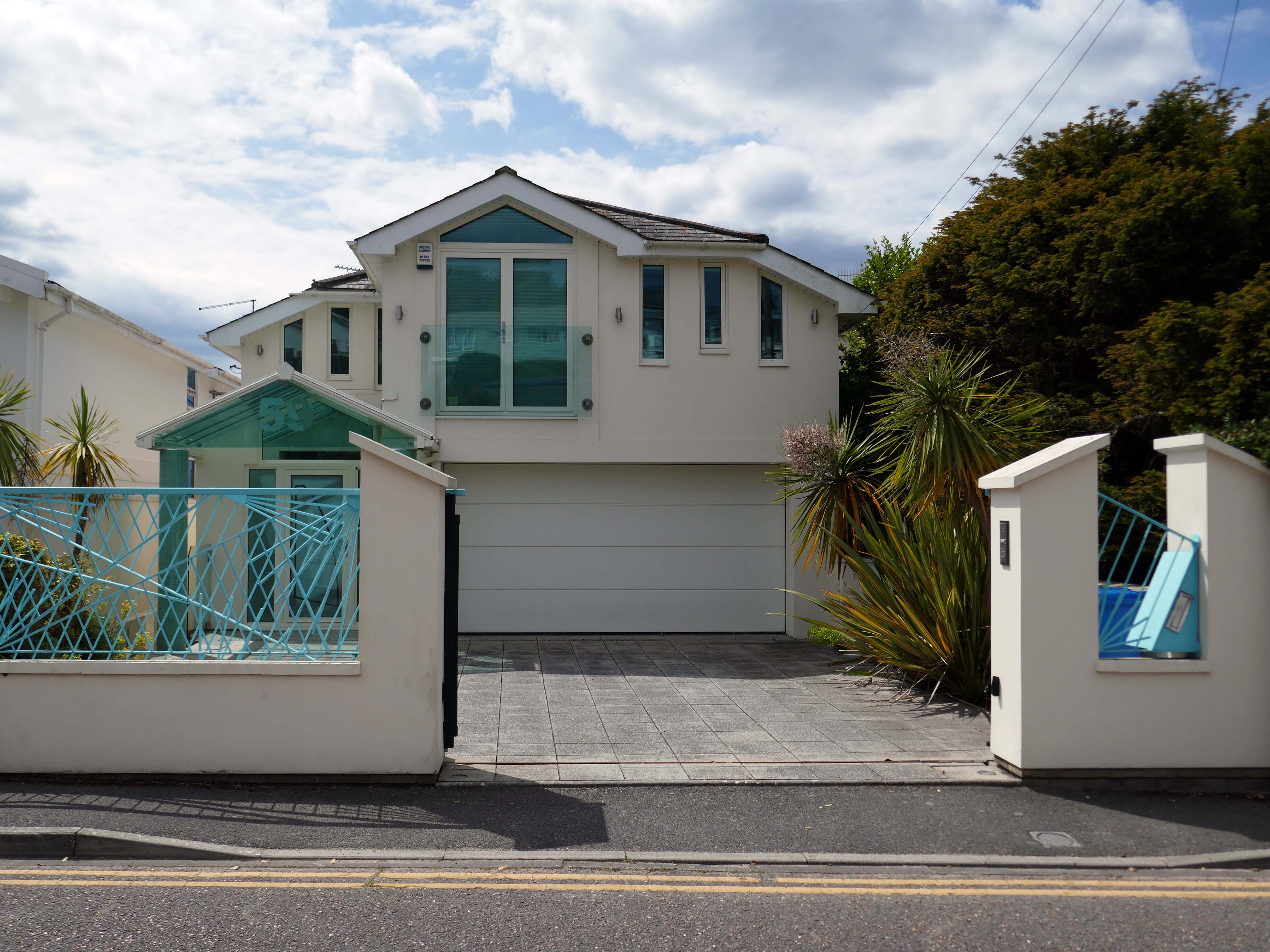
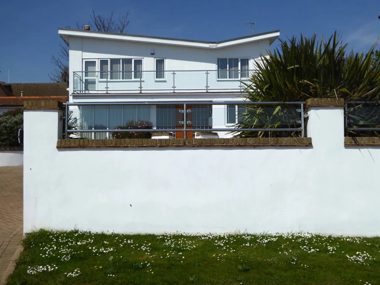
These Shore Road survivors have resisted the charm of redevelopment, the demolition and new build, or the uPVC over cladding, relentless render or reglaze.
So what happened to houses that look like houses?
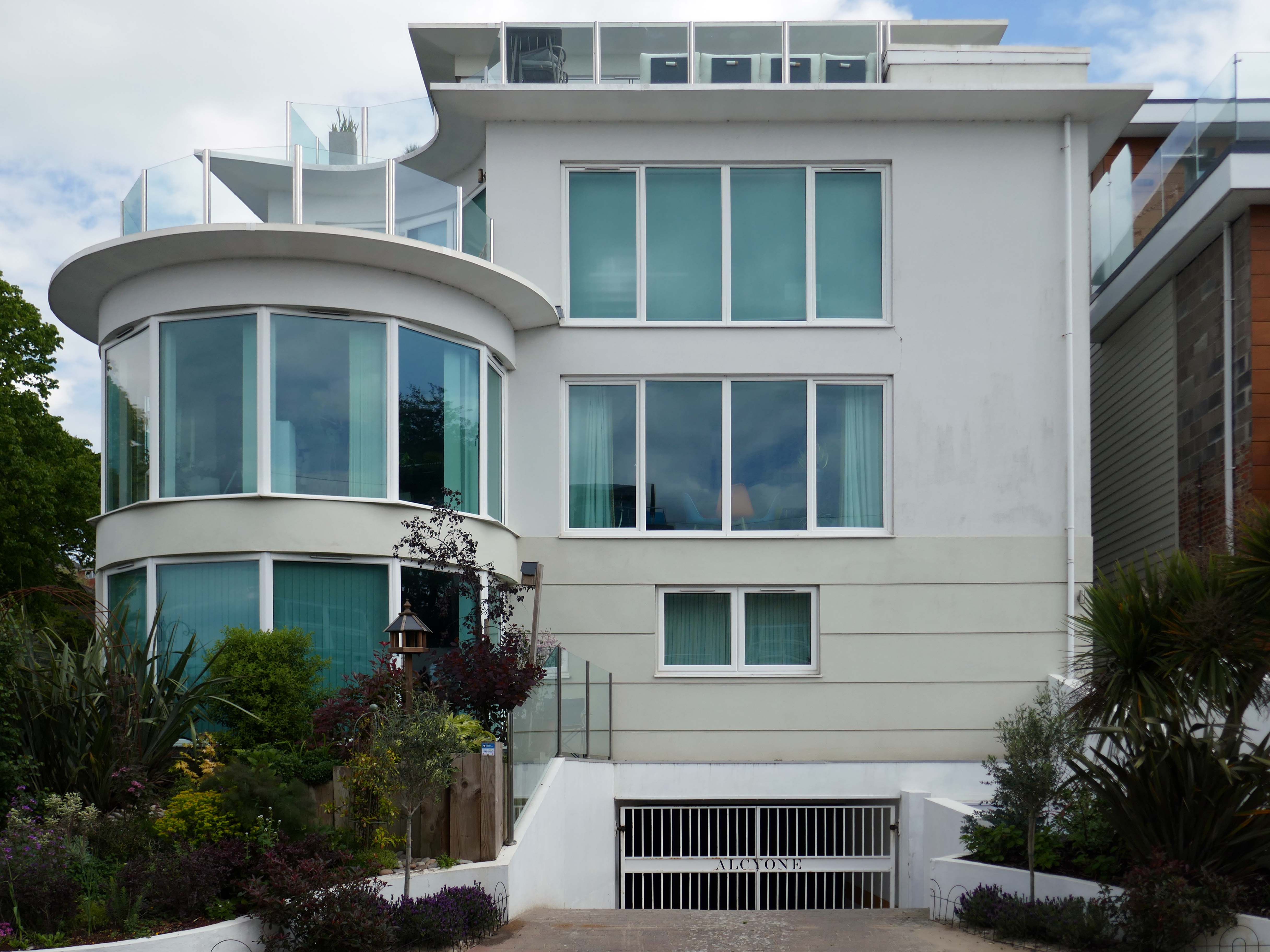
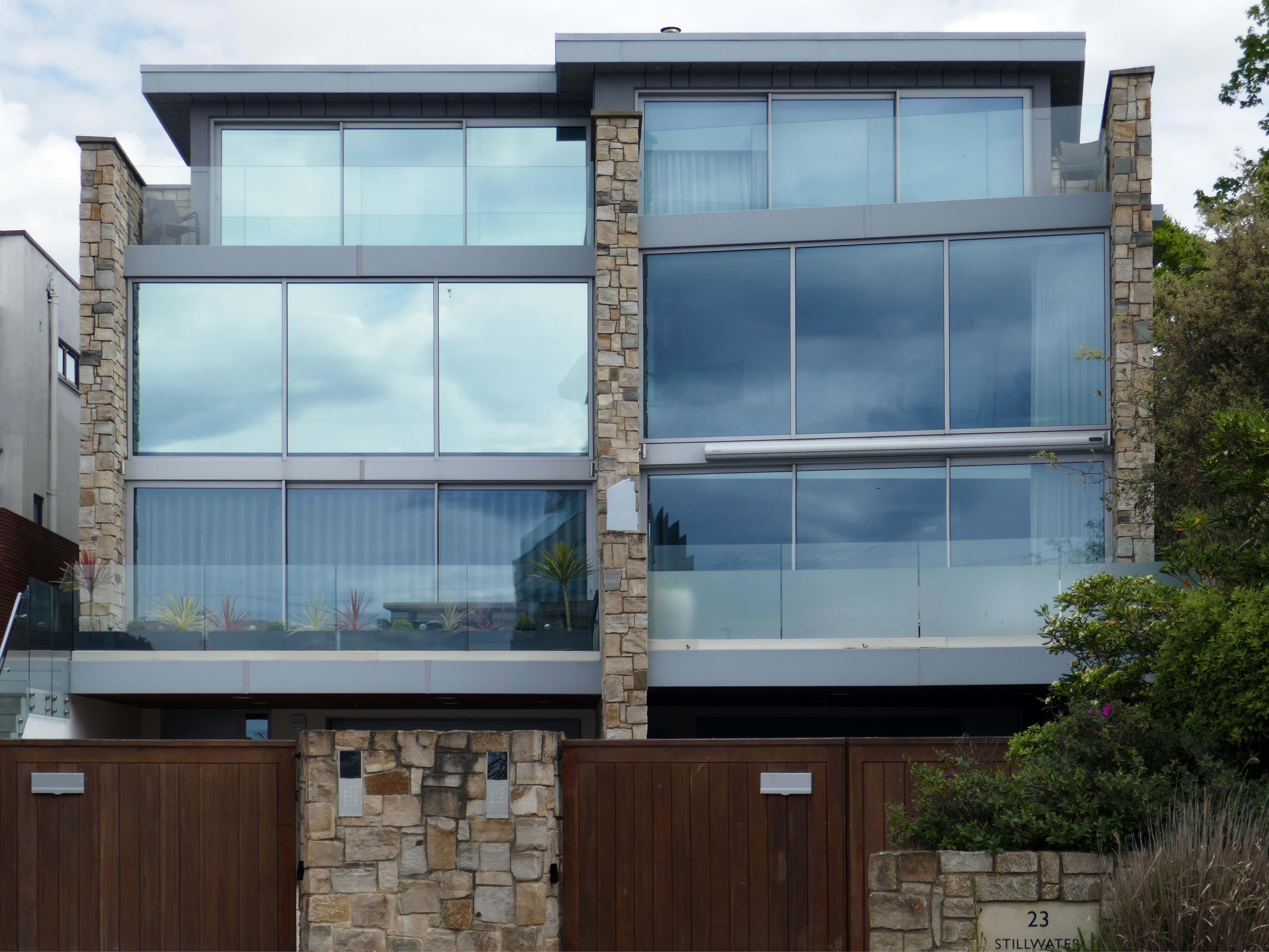
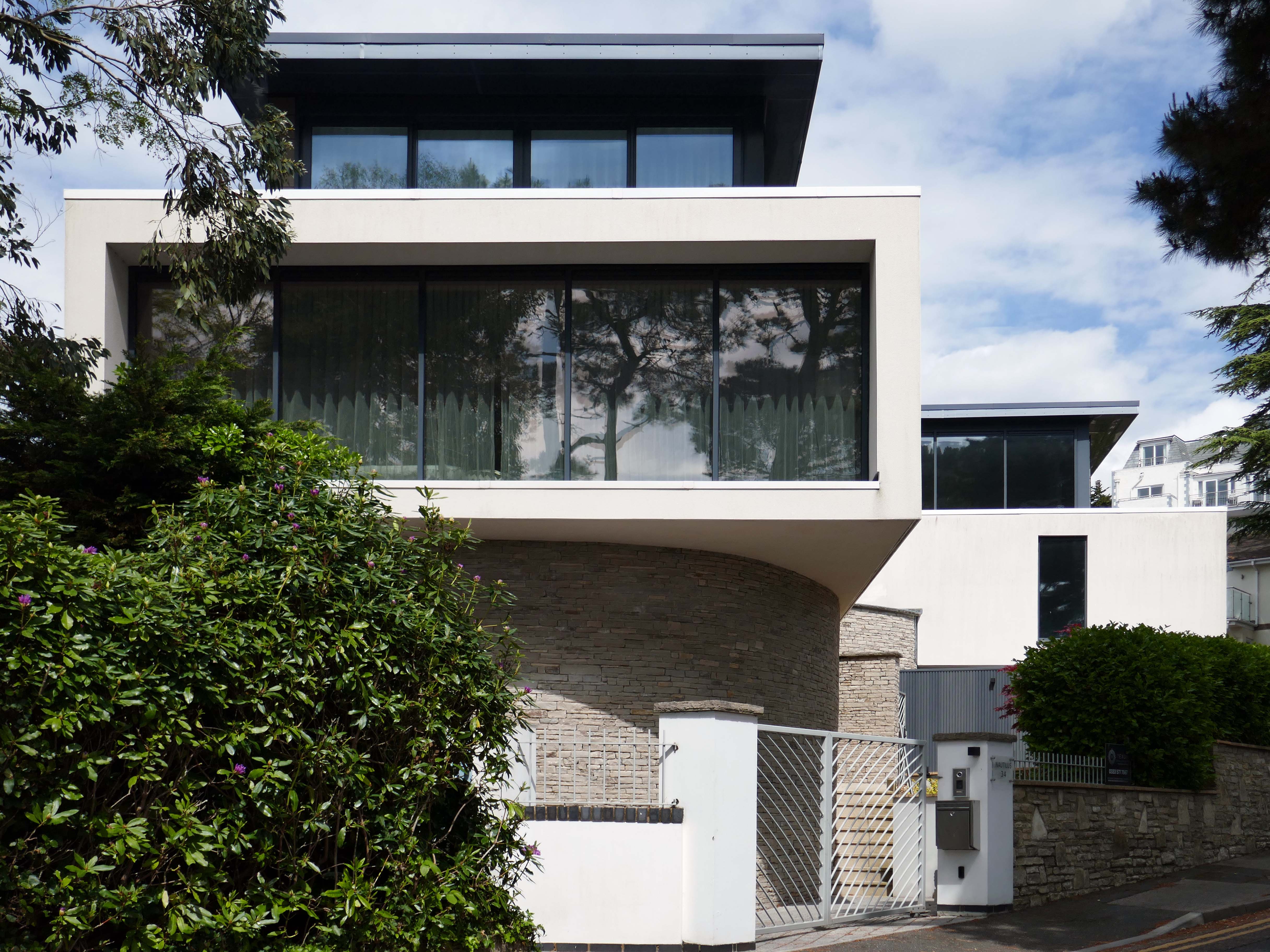
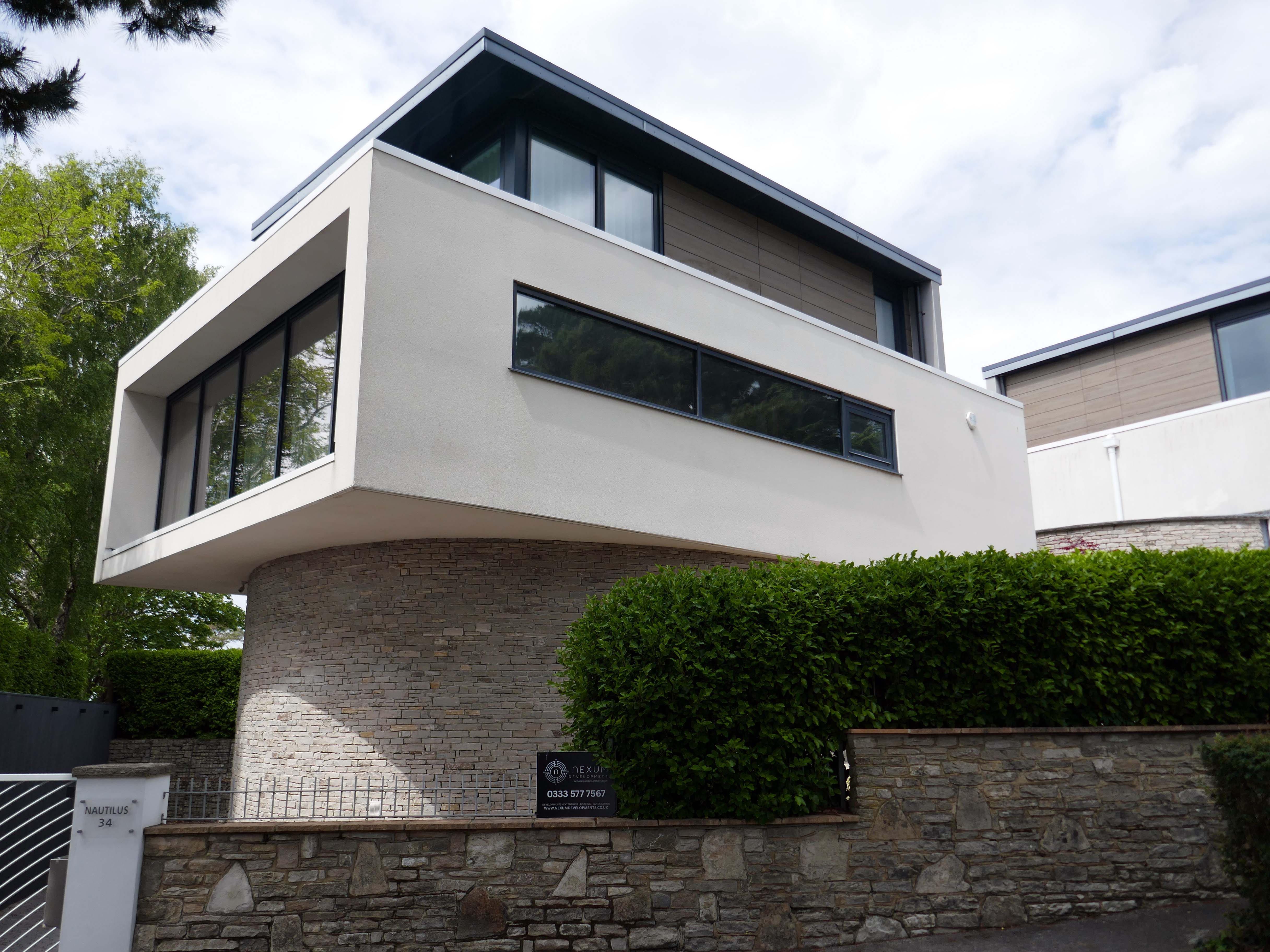
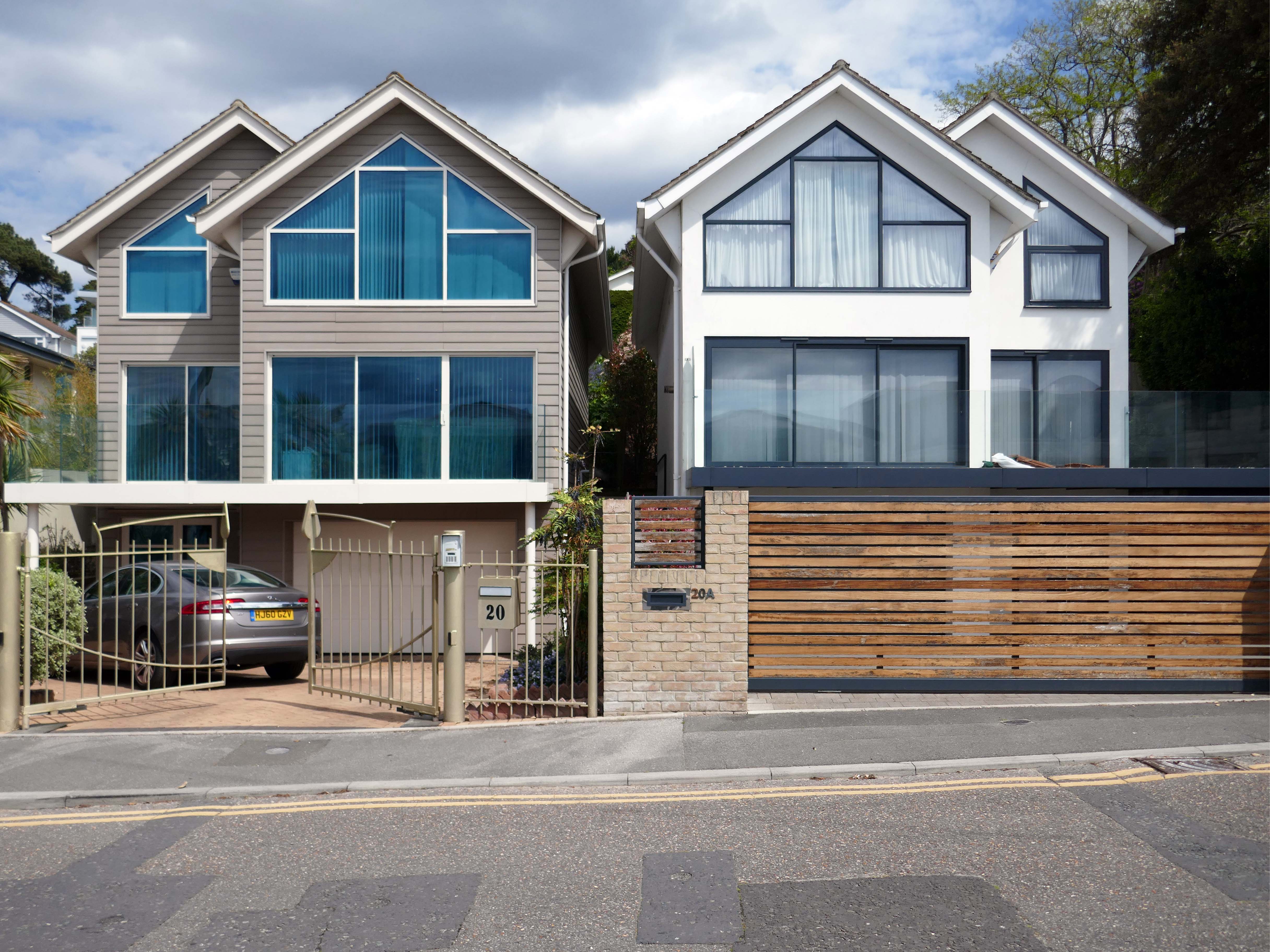
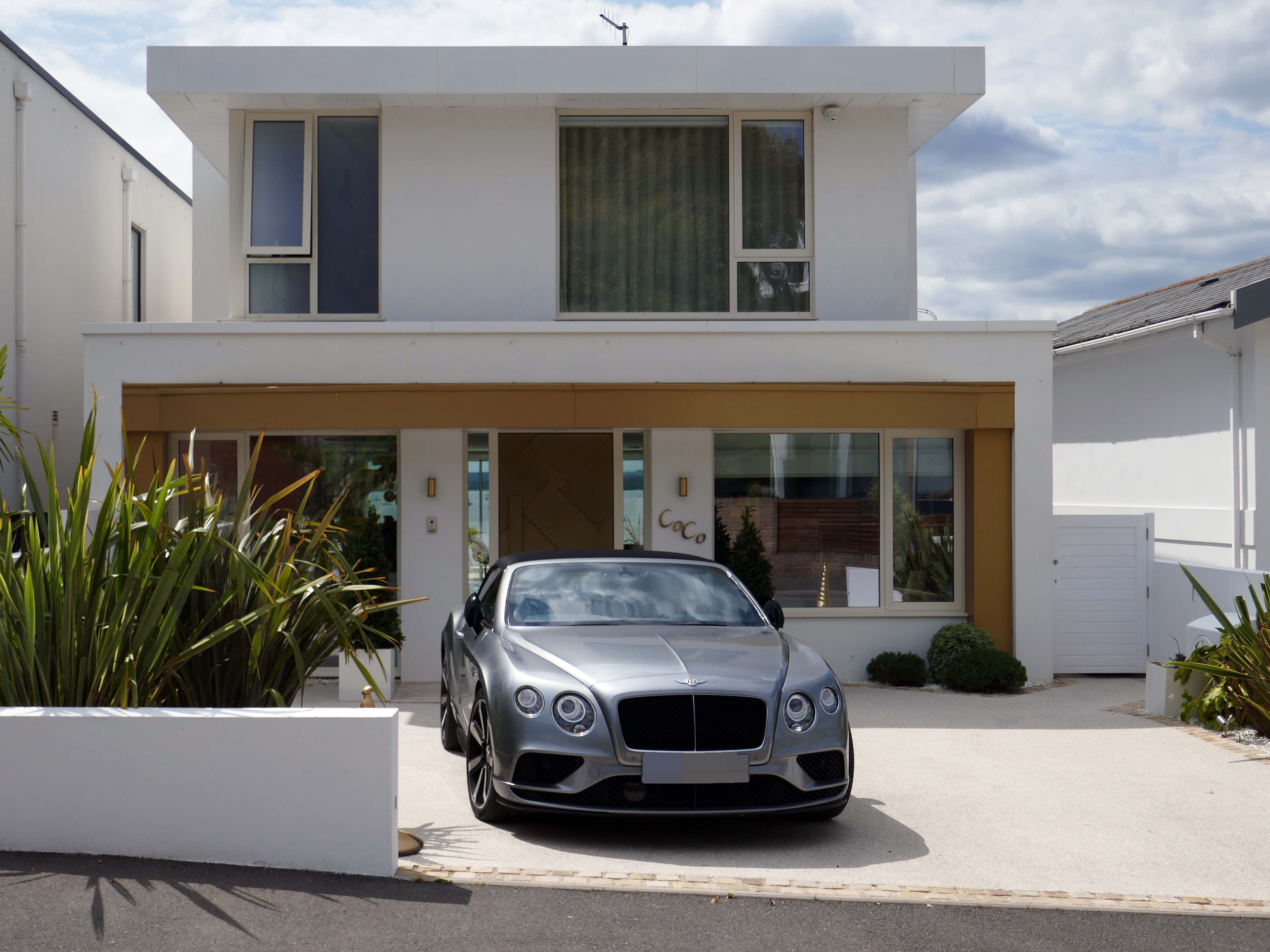
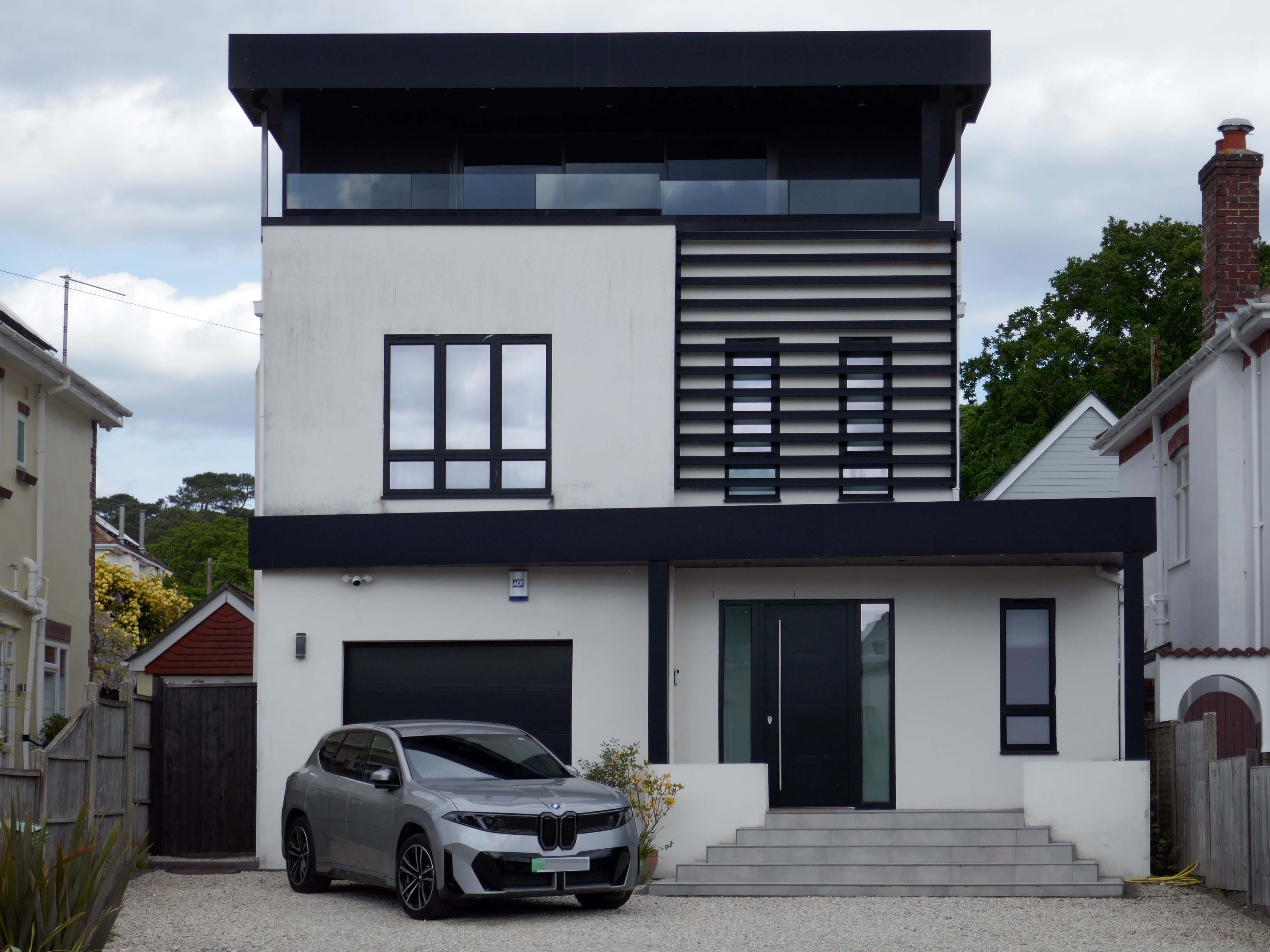
This upwardly mobile trend, fuelled by the rakish progress on the so called property ladder, fanned by 80’s Thatcherite tax cuts, and the ever so irresistible allure of conspicuous consumption.
Architectural historian Virginia Savage McAlester, coined the term Millennium Mansion, though these houses are also referred to as a McMansion, Persian Palace, Garage Mahal, Starter Castle, and Hummer House.
Marketing parlance often uses the term tract mansions or executive homes.
Let’s take a closer look at the look of luxury, is it playful and witty pastiche or Post Modern mumbo jumbo – un repas de chien.
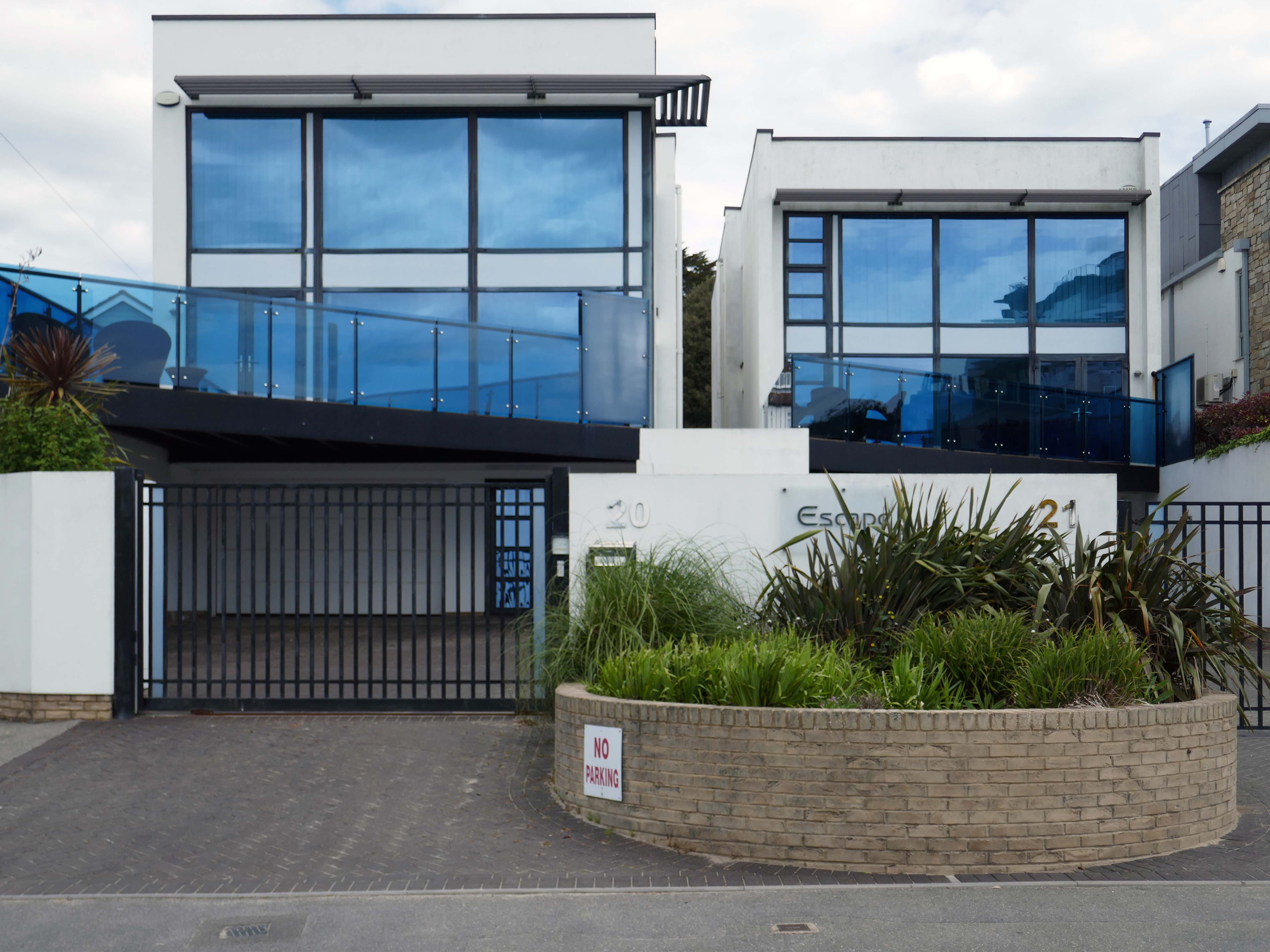
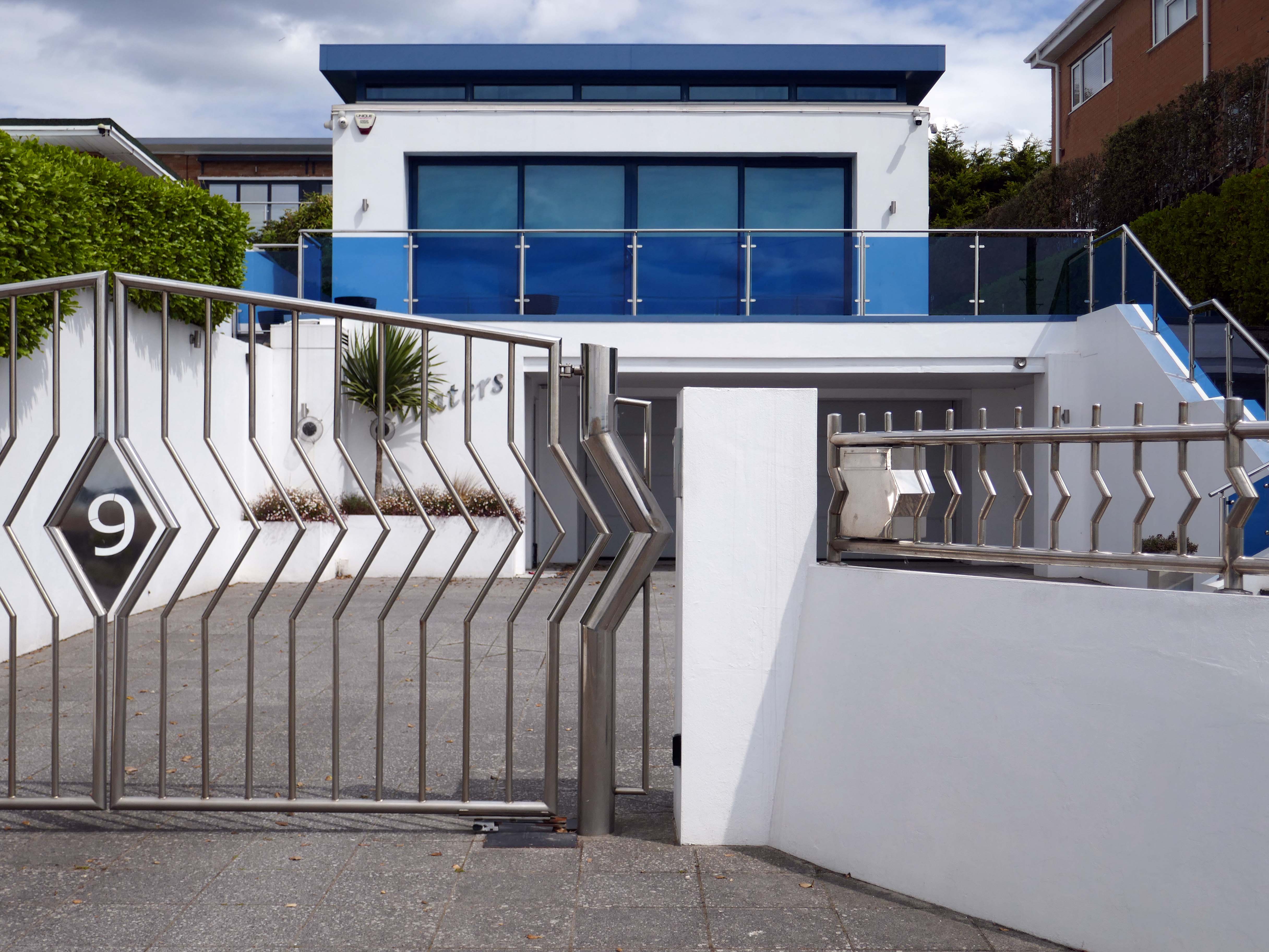
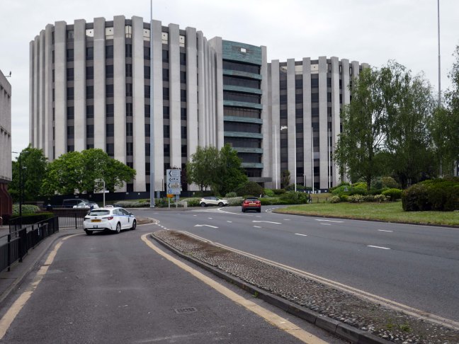
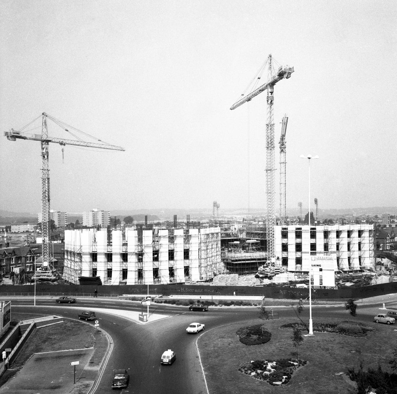
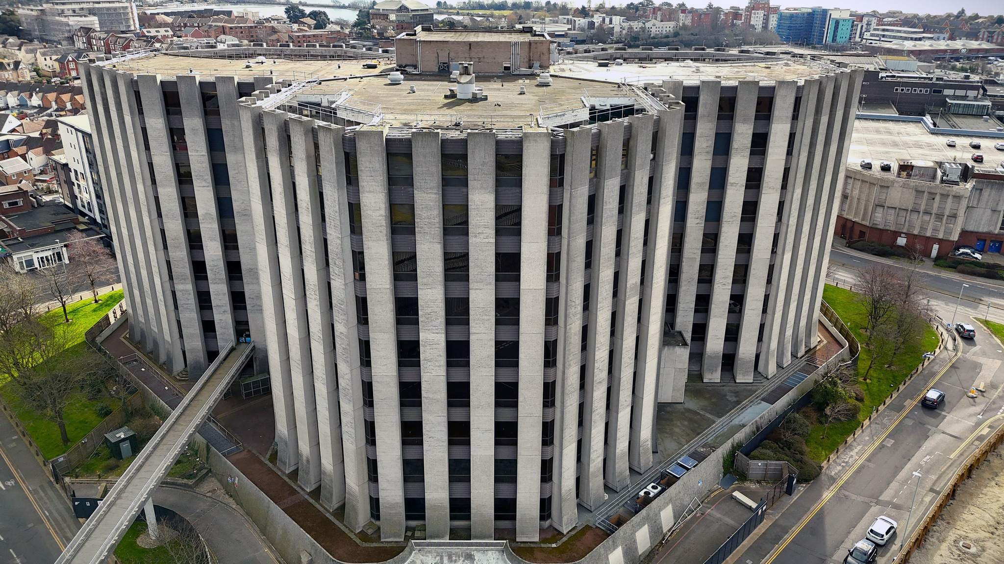
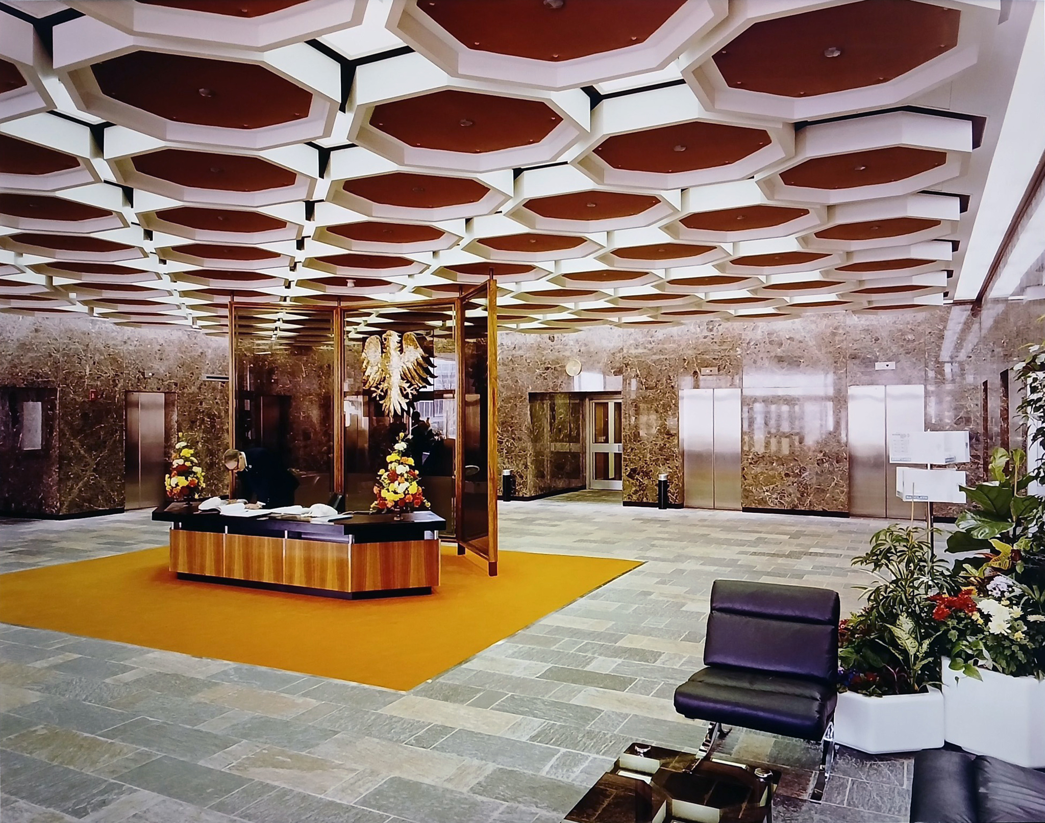
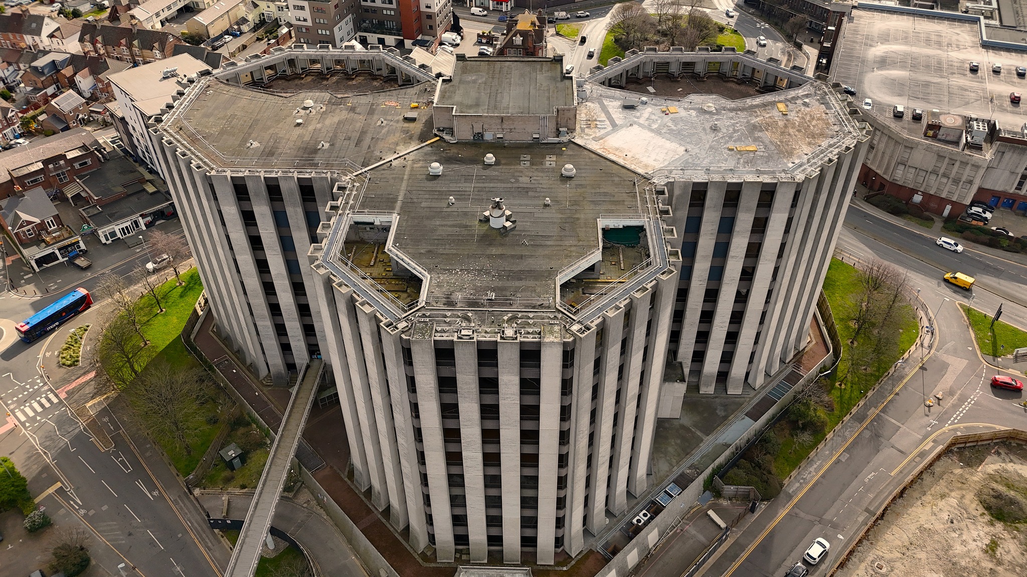
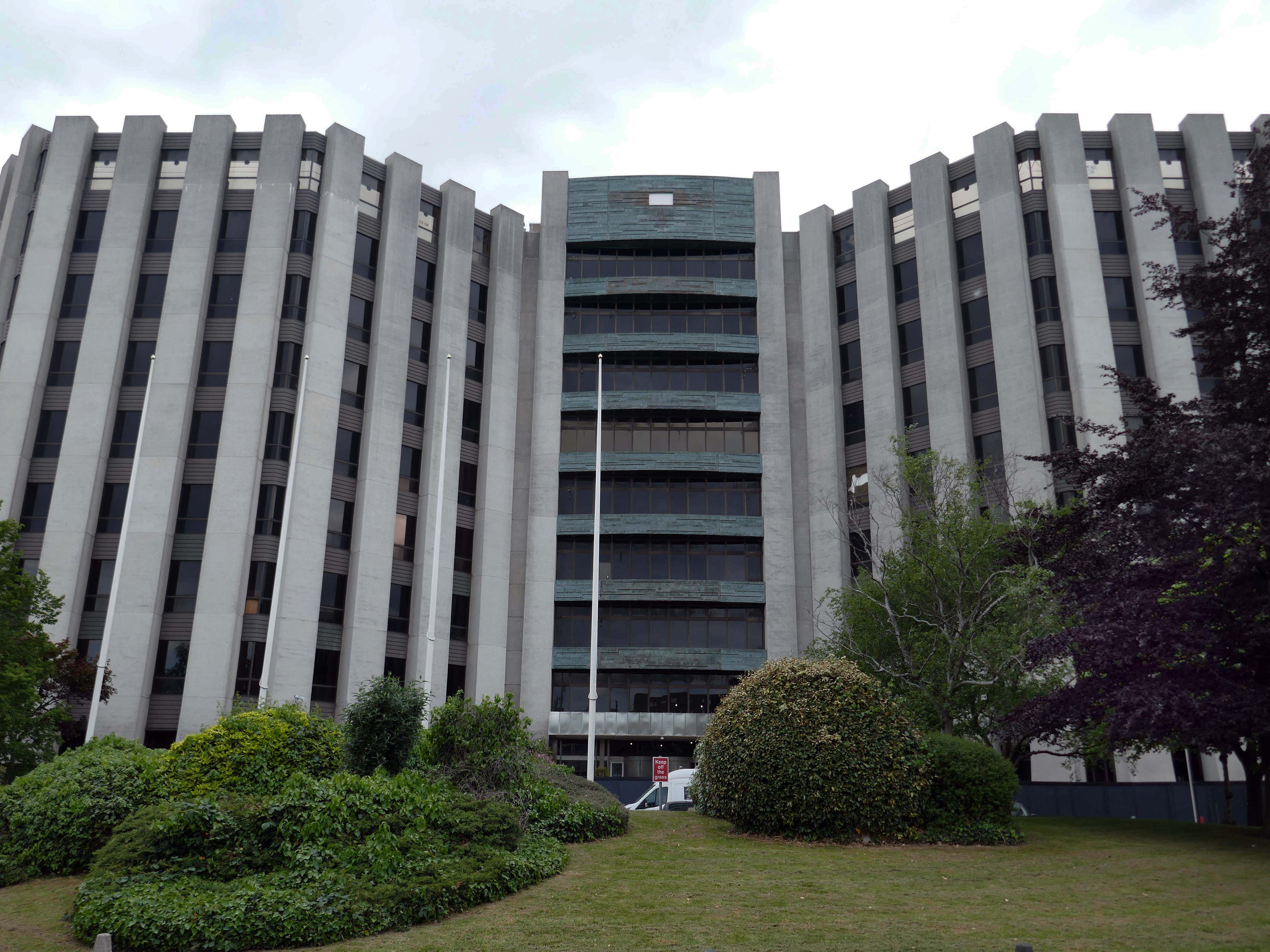
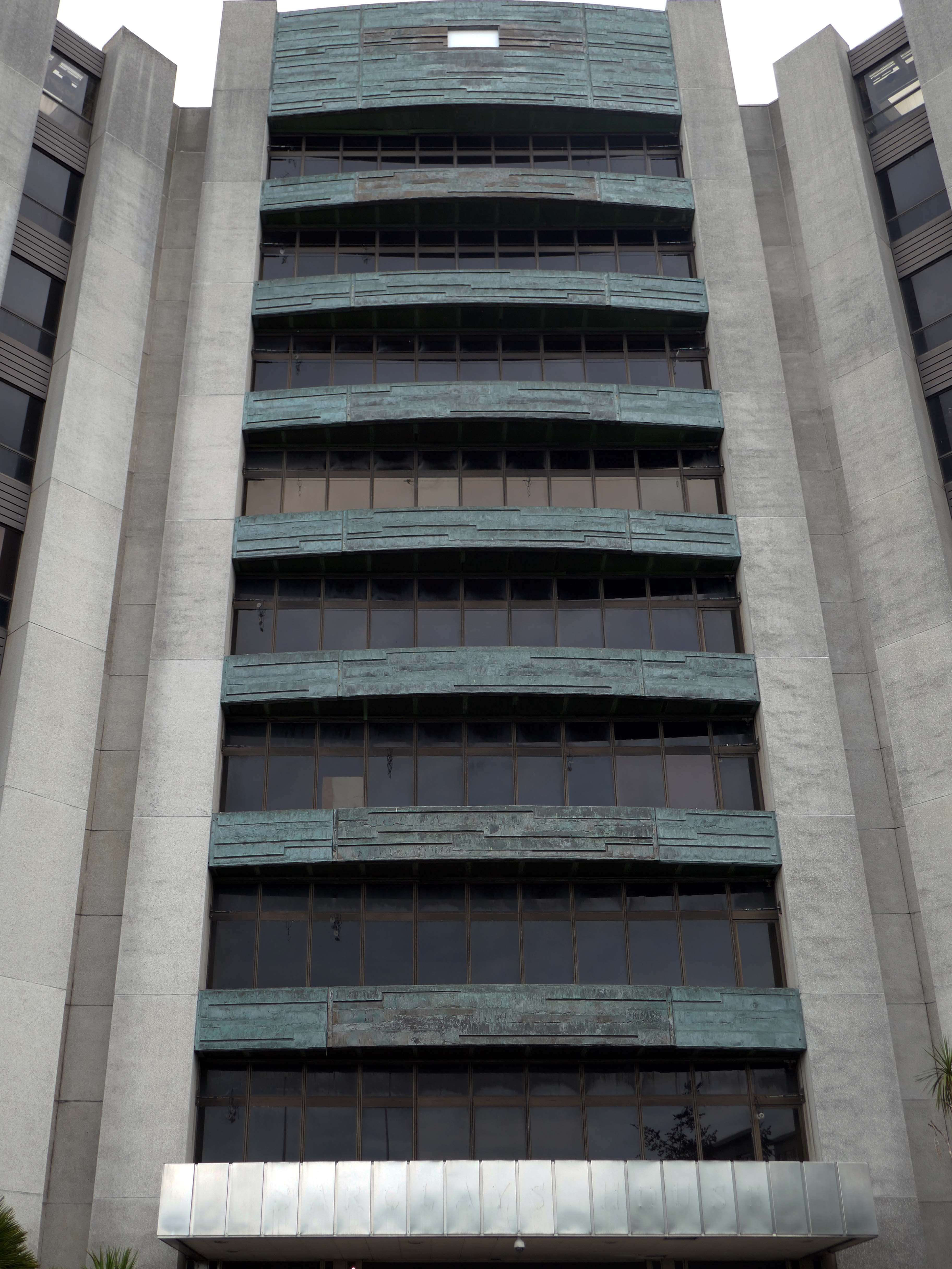
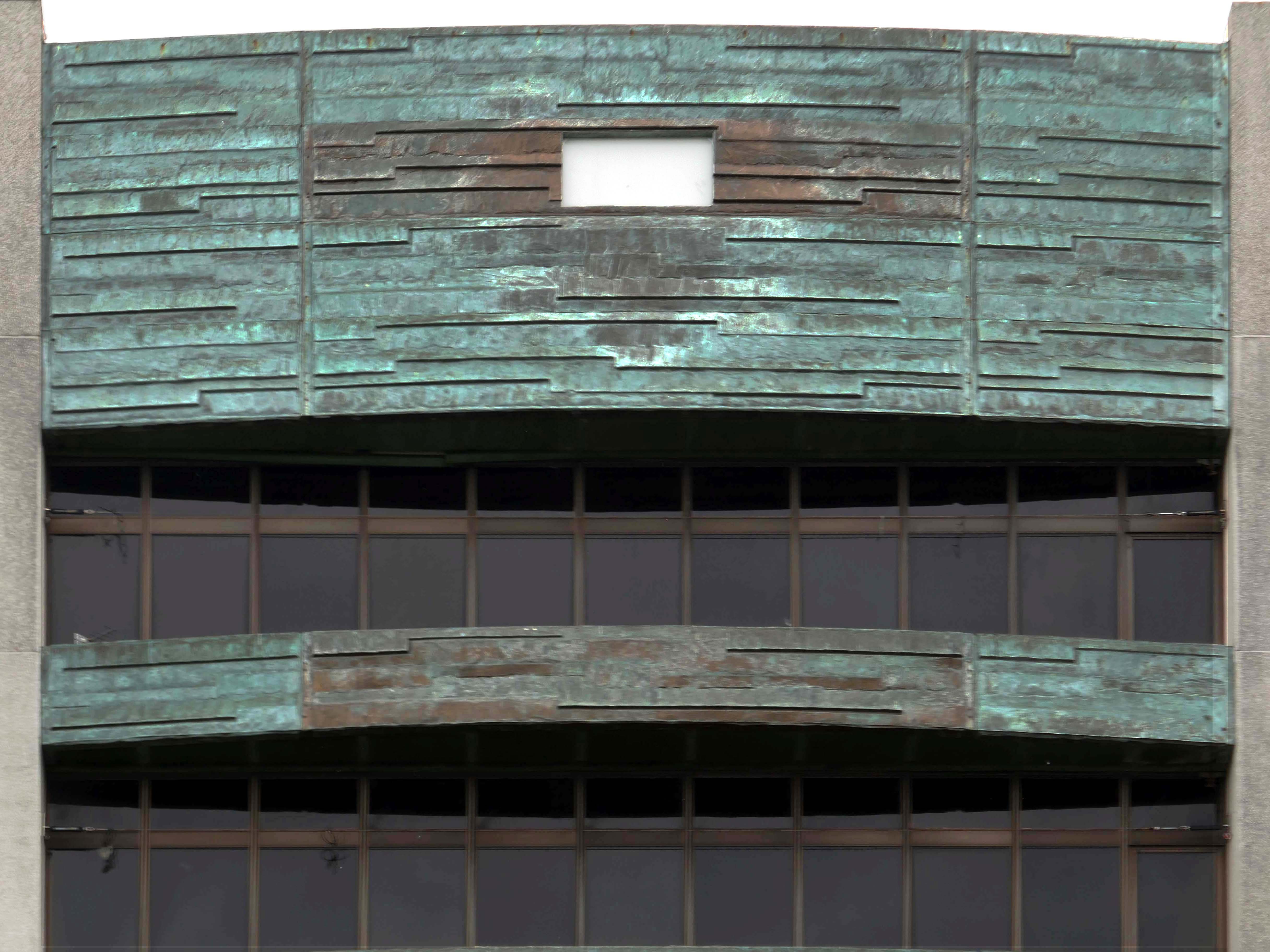
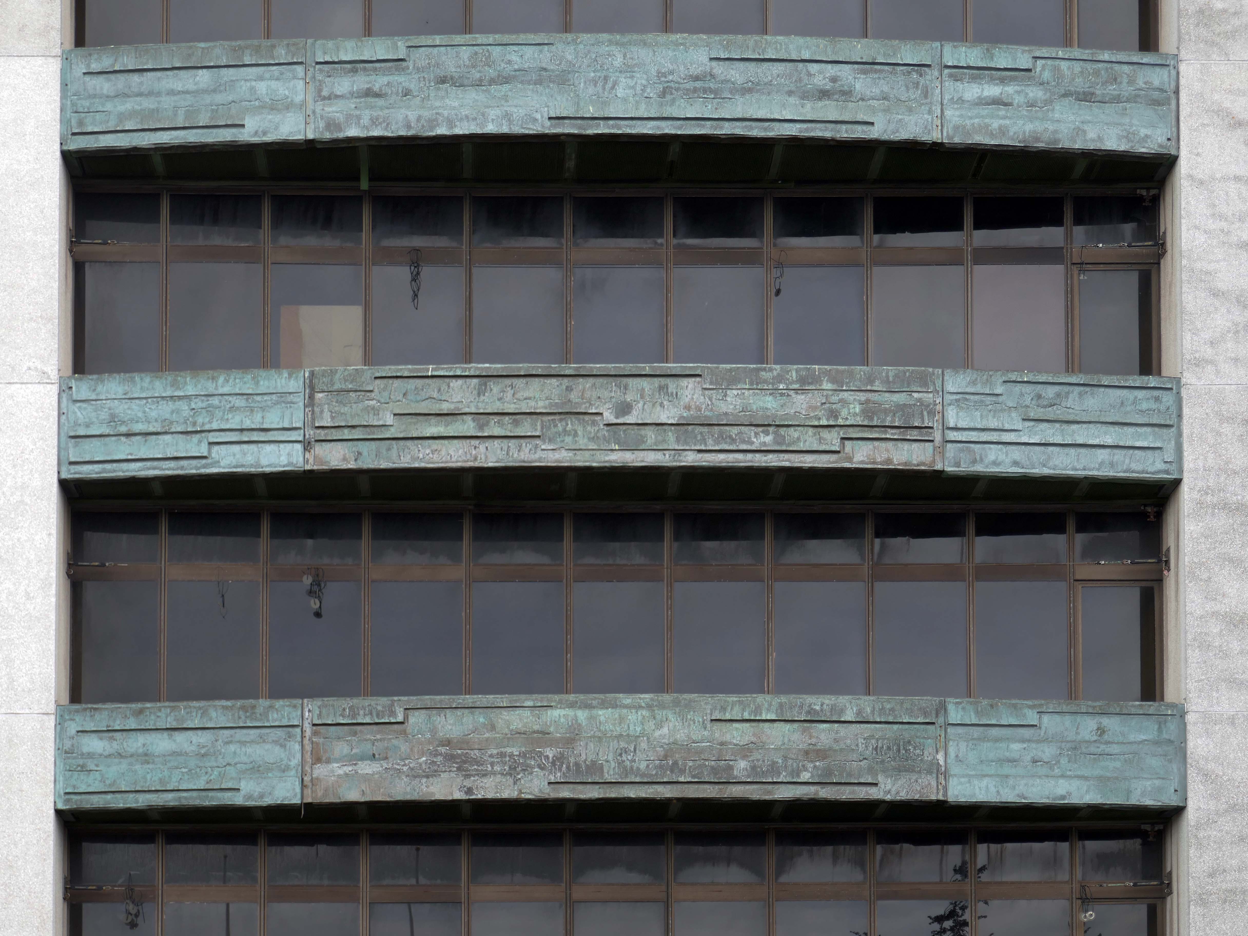
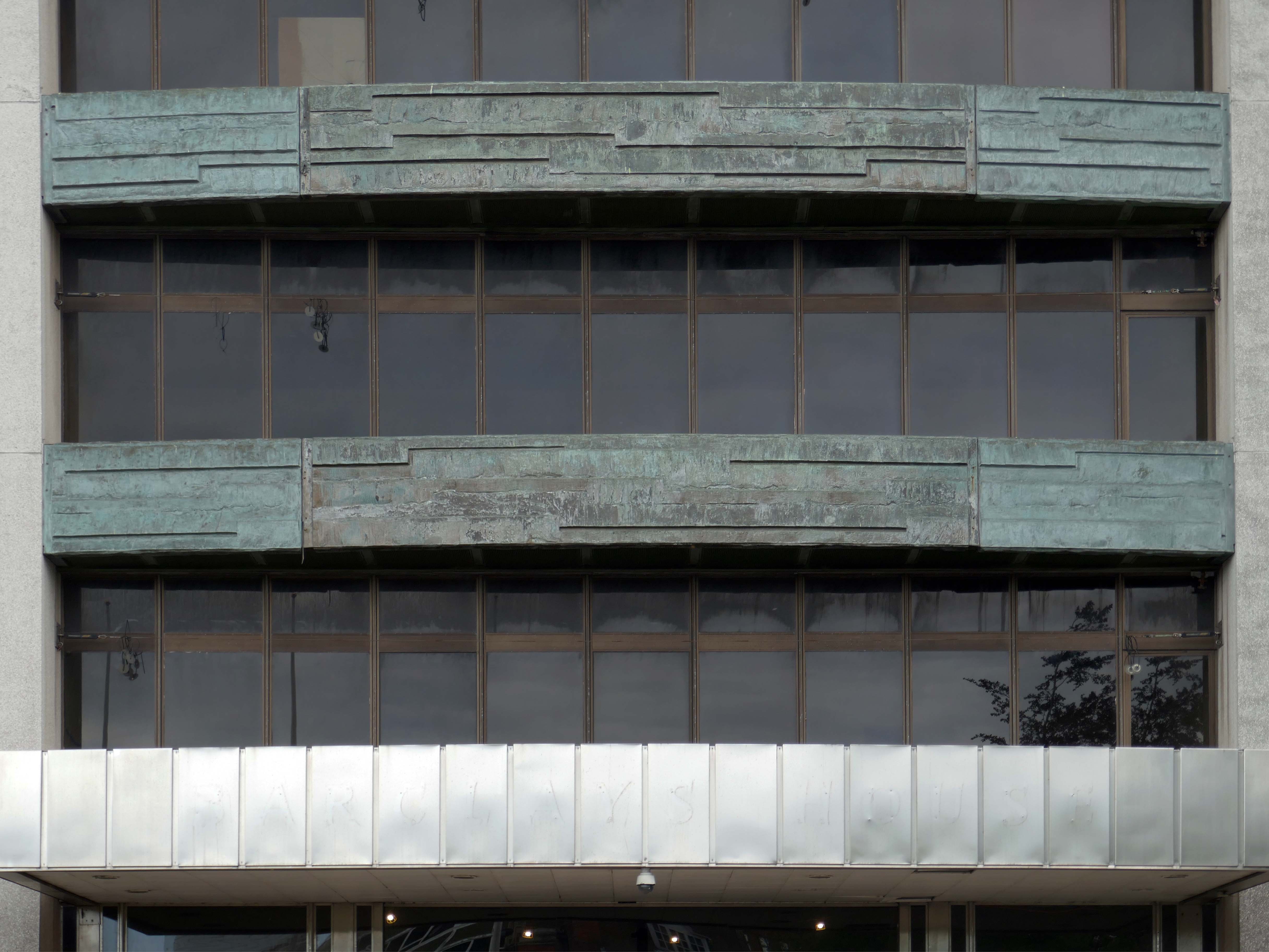
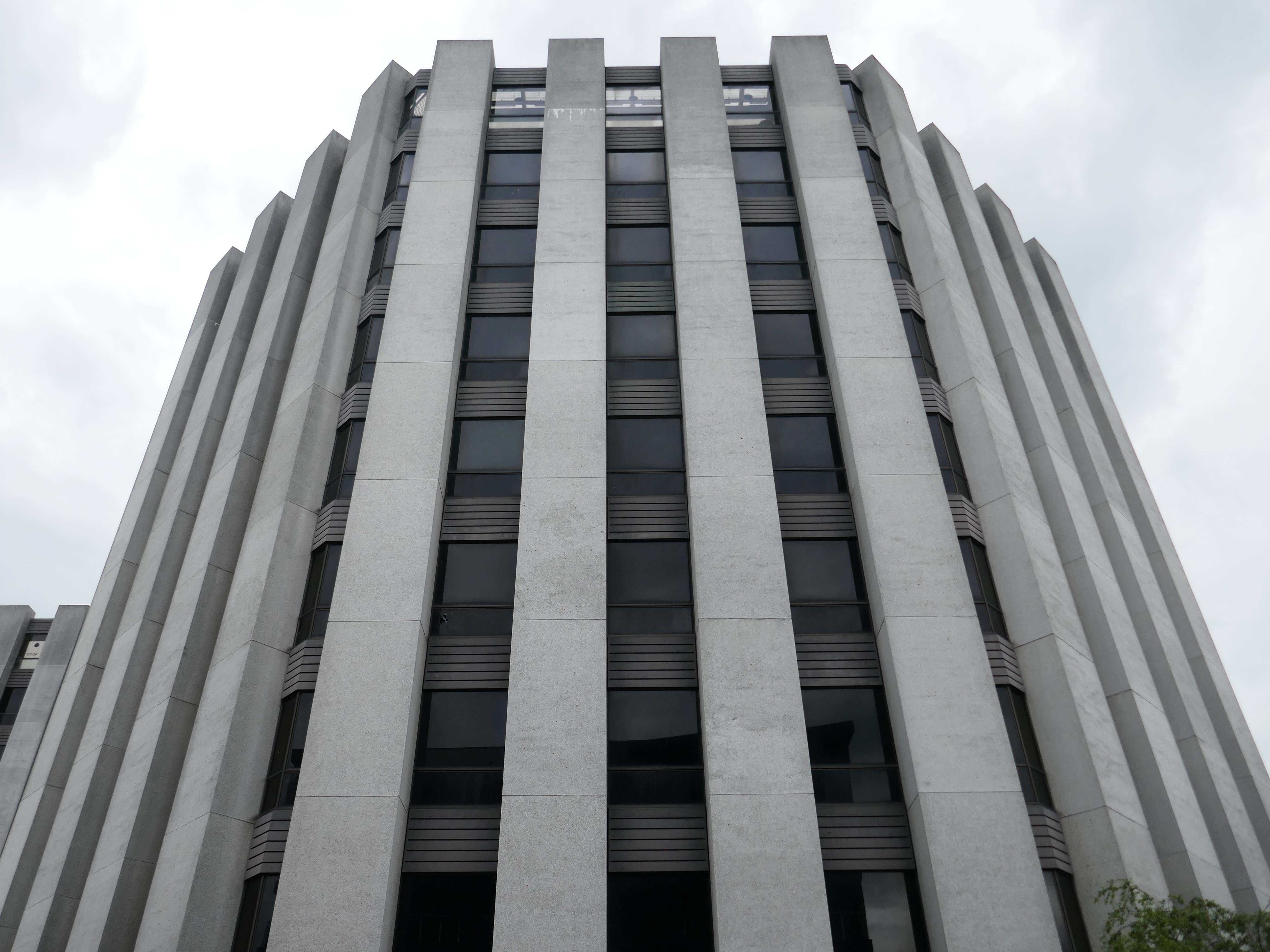
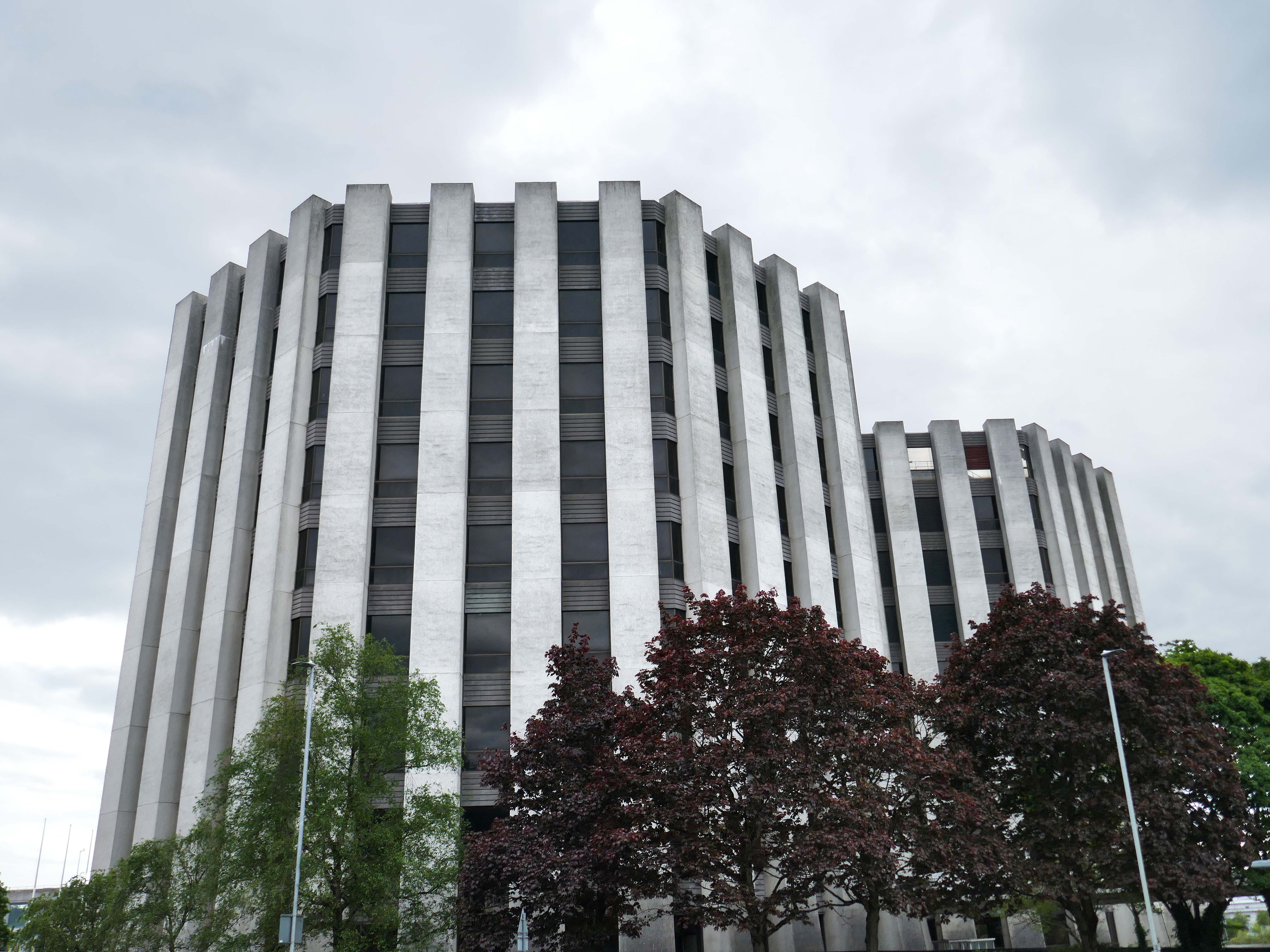
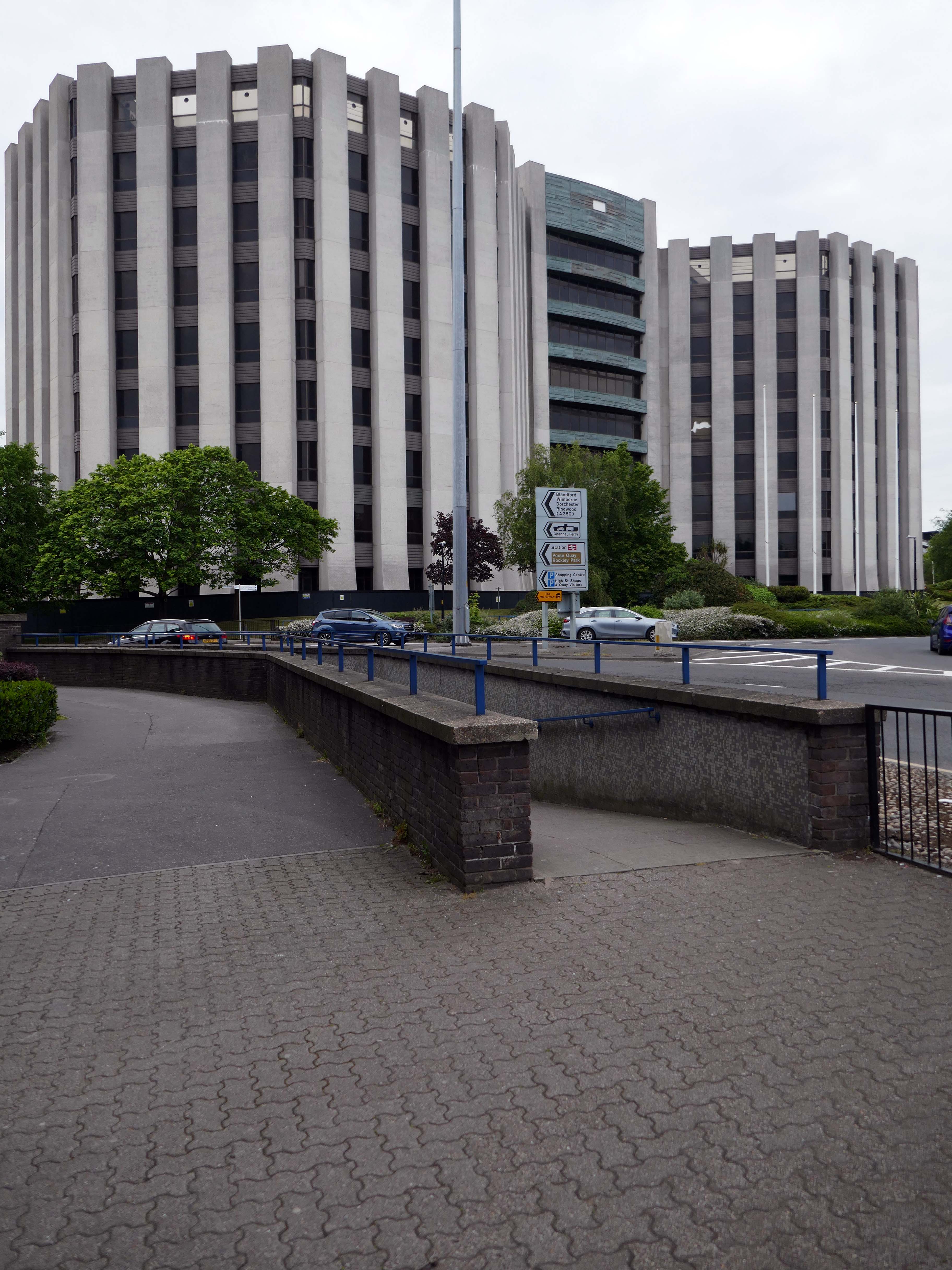
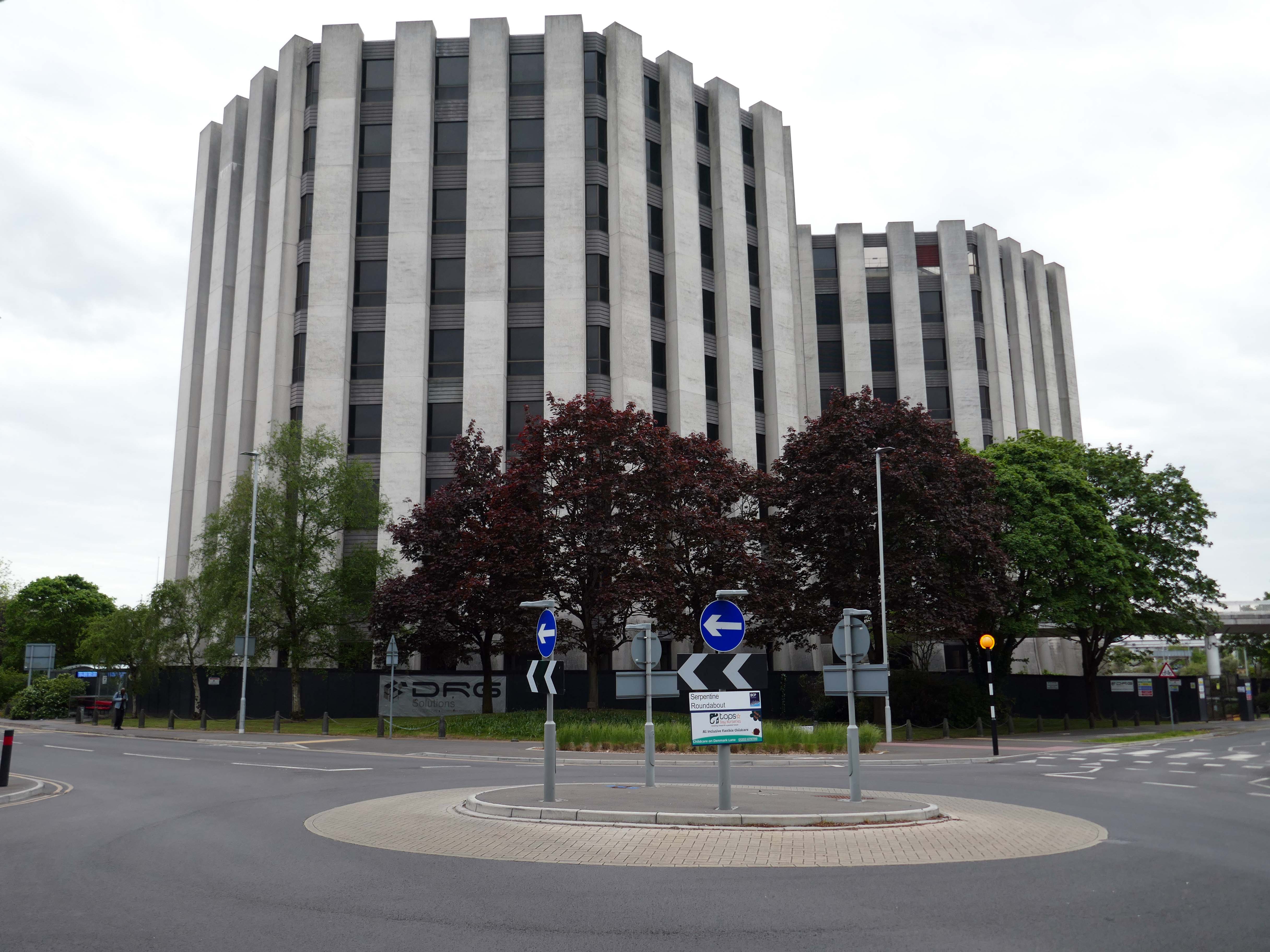
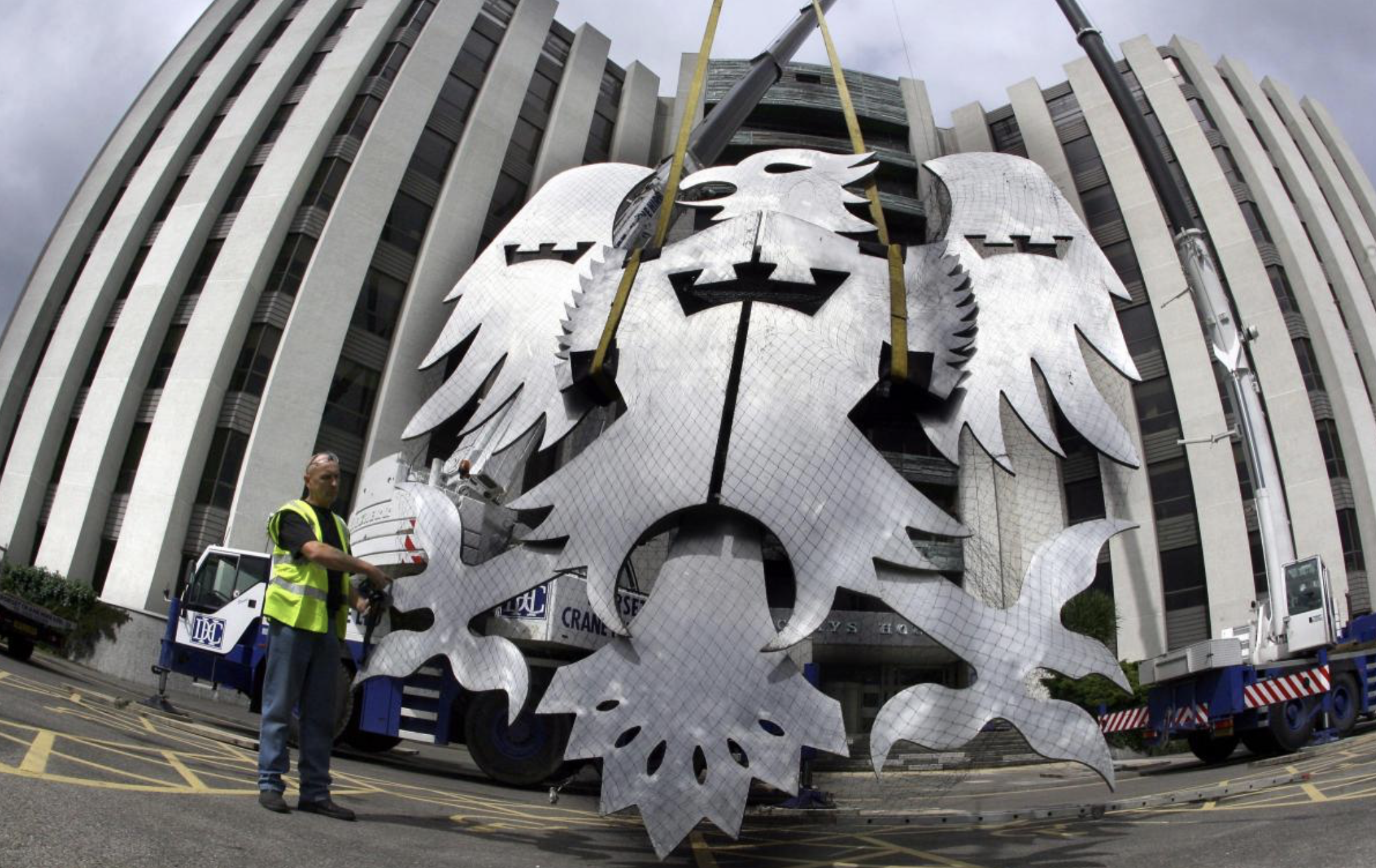
Barclays House was constructed by Barclays bank from 1972 to 1975 as part of a move to decentralise its offices from London.
The structure, was designed in the Brutalist style by architects Wilson, Mason and Partners. It consists of three main wings, each octagonal in plan, and dominates the town centre skyline.
Barclays first occupied the office in January 1976. The building’s basement is below sea level and is often flooded or damp, which prevented its use by the bank for storage. The structure has also sunk over time due to its significant mass
Barclays left the site in January 2022 and put the structure up for sale by sealed bid auction. The highest bidder was Bournemouth, Christchurch and Poole Council but they withdrew from the purchase in September 2022.
BCP offered £17 million, almost three times more than the next highest bidder, thought to be Fortitudo at £6.5 million, who wanted to demolish the structure and build three apartment towers.
In February 2023, boarding was put up around the building and the Bournemouth Daily Echo reported that a new buyer had been found. In November 2023, proposals for redevelopment to residential use were announced, 362 flats are proposed for the building.
Town hall planner Gareth Ball has given the go-ahead for VCRE Four Poole Limited to convert the historic building into a 362-bedroom apartment block.
No parking spaces will be available for the future residents, as noted by BCP case officer Mr Ball as being in accordance with the council’s rules. Instead, the development will come with 488 cycle spaces – or one space for every resident. The scheme will feature a gym, communal workspace, squash courts, a games room with table tennis, pool, video games, surfboard storage and a rooftop garden.
Barclays House was bought last year for £5.3 million, according to documents.
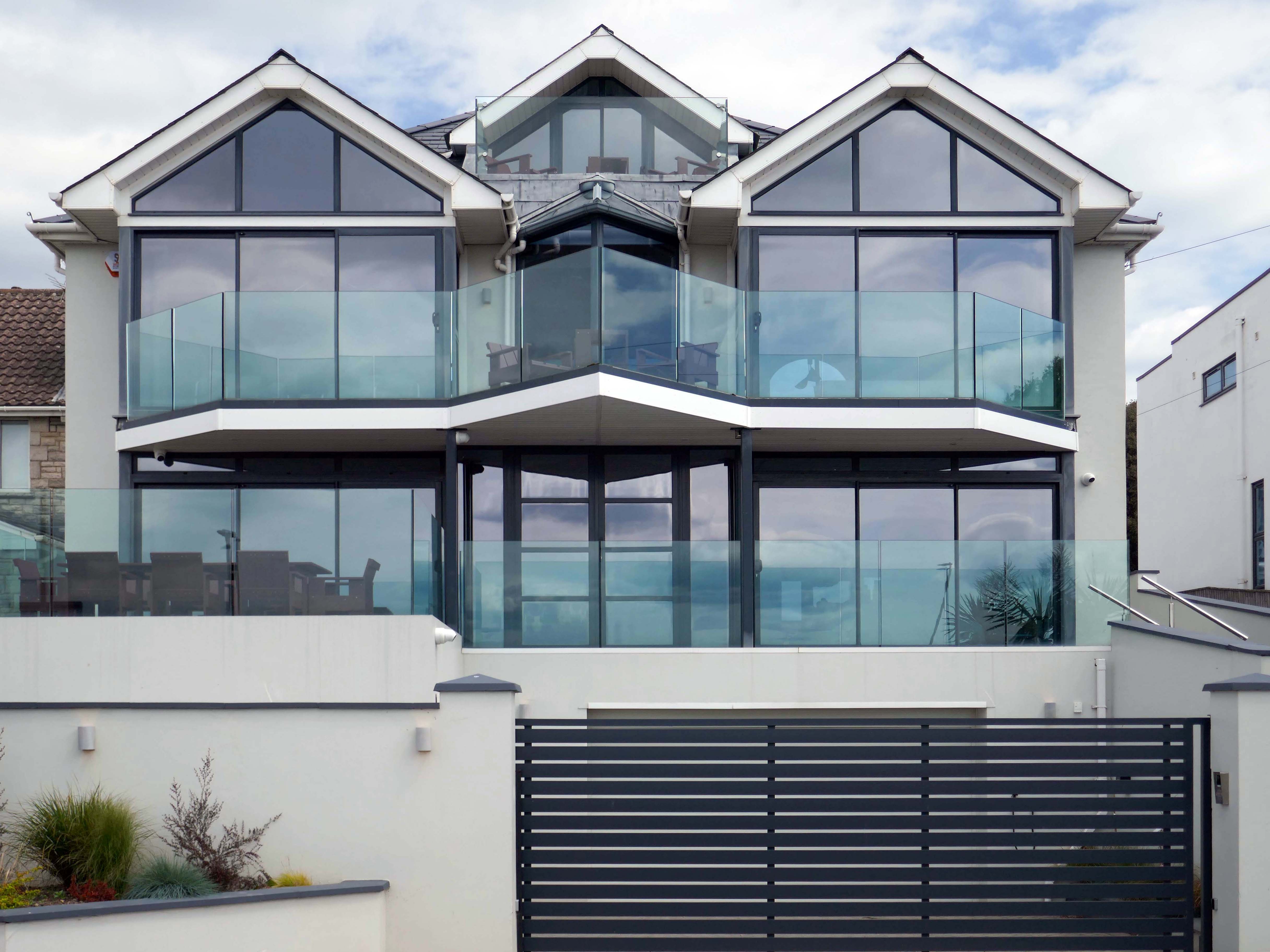
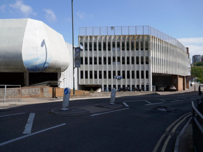
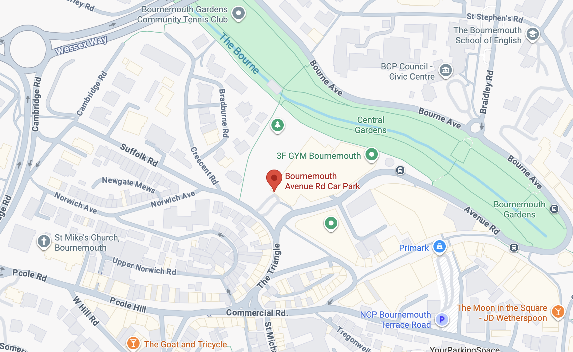
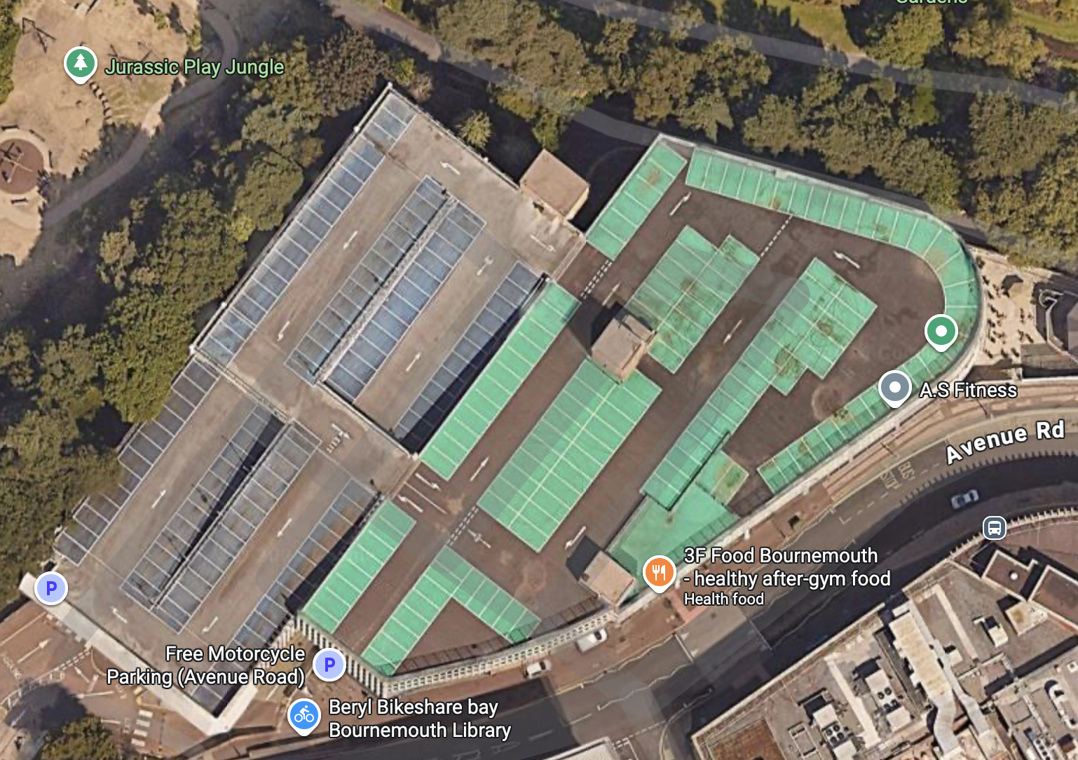
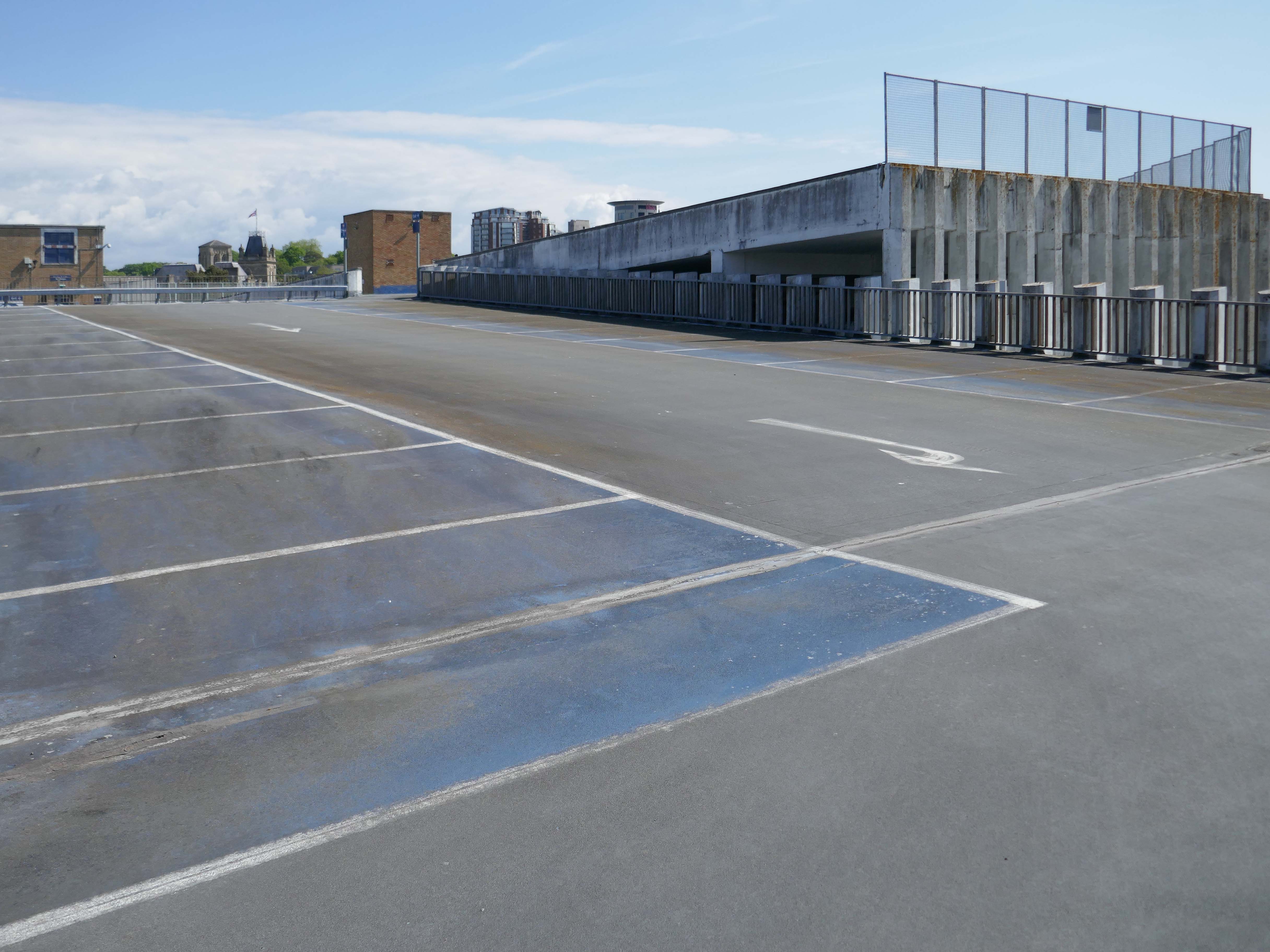
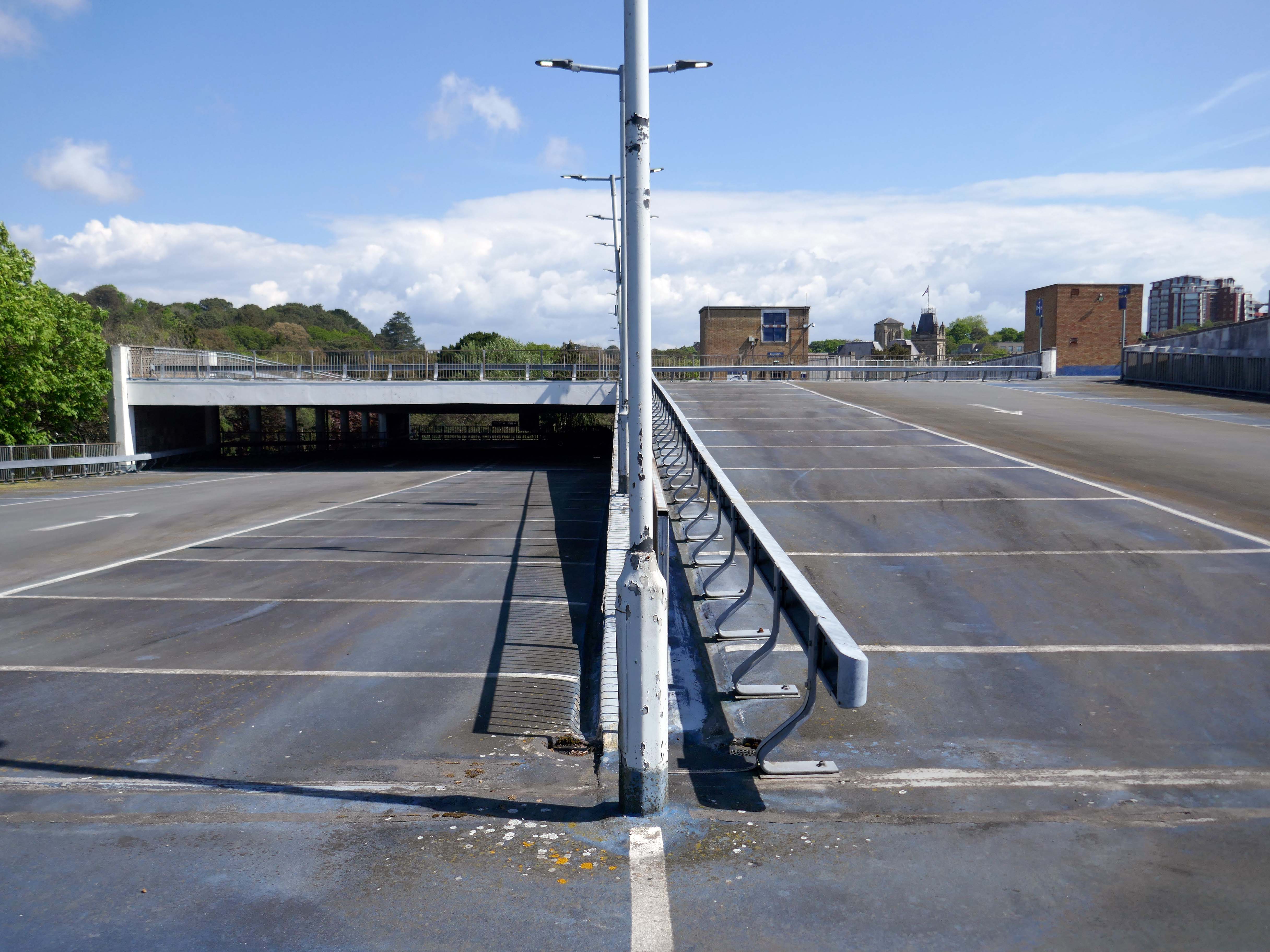
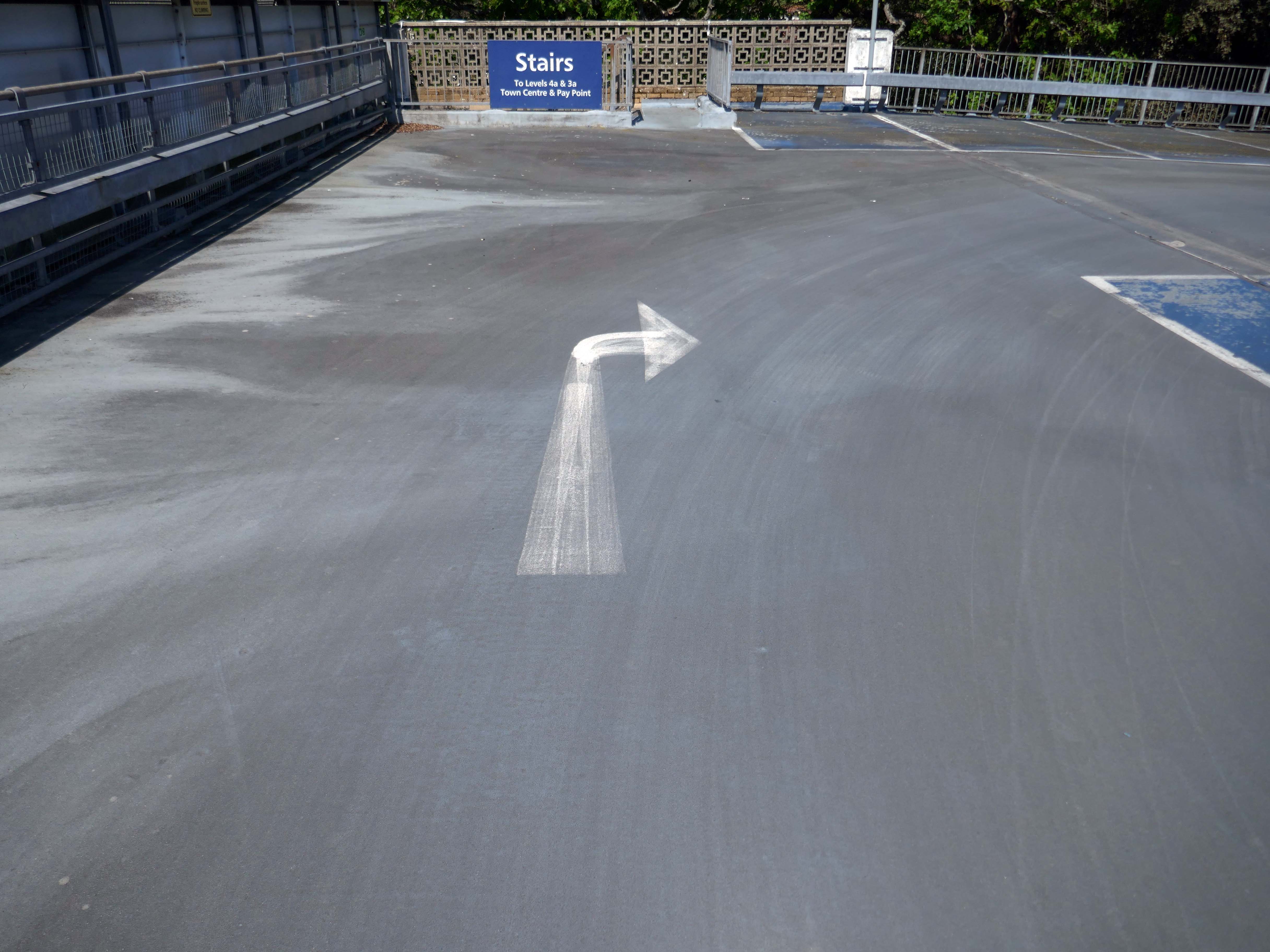
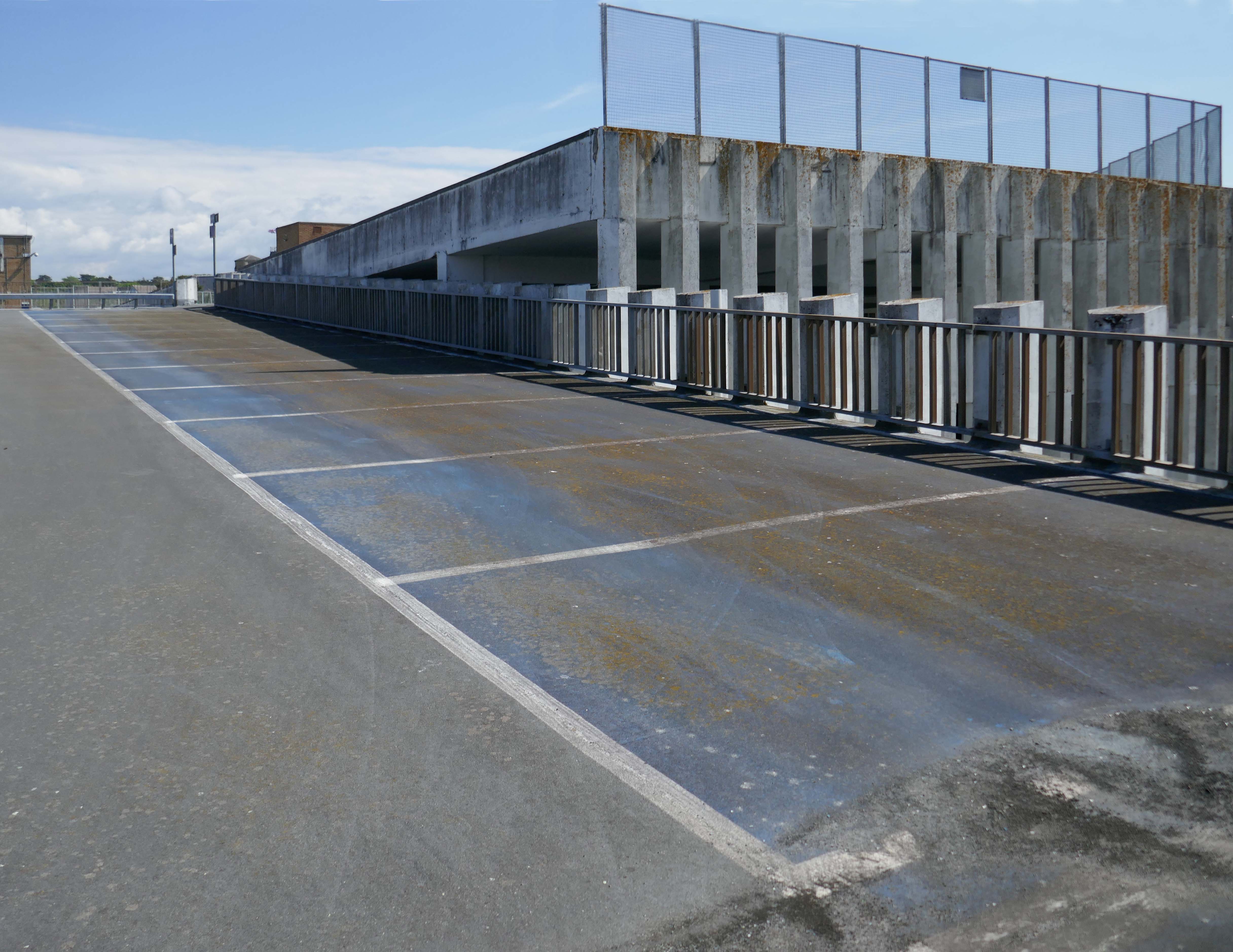
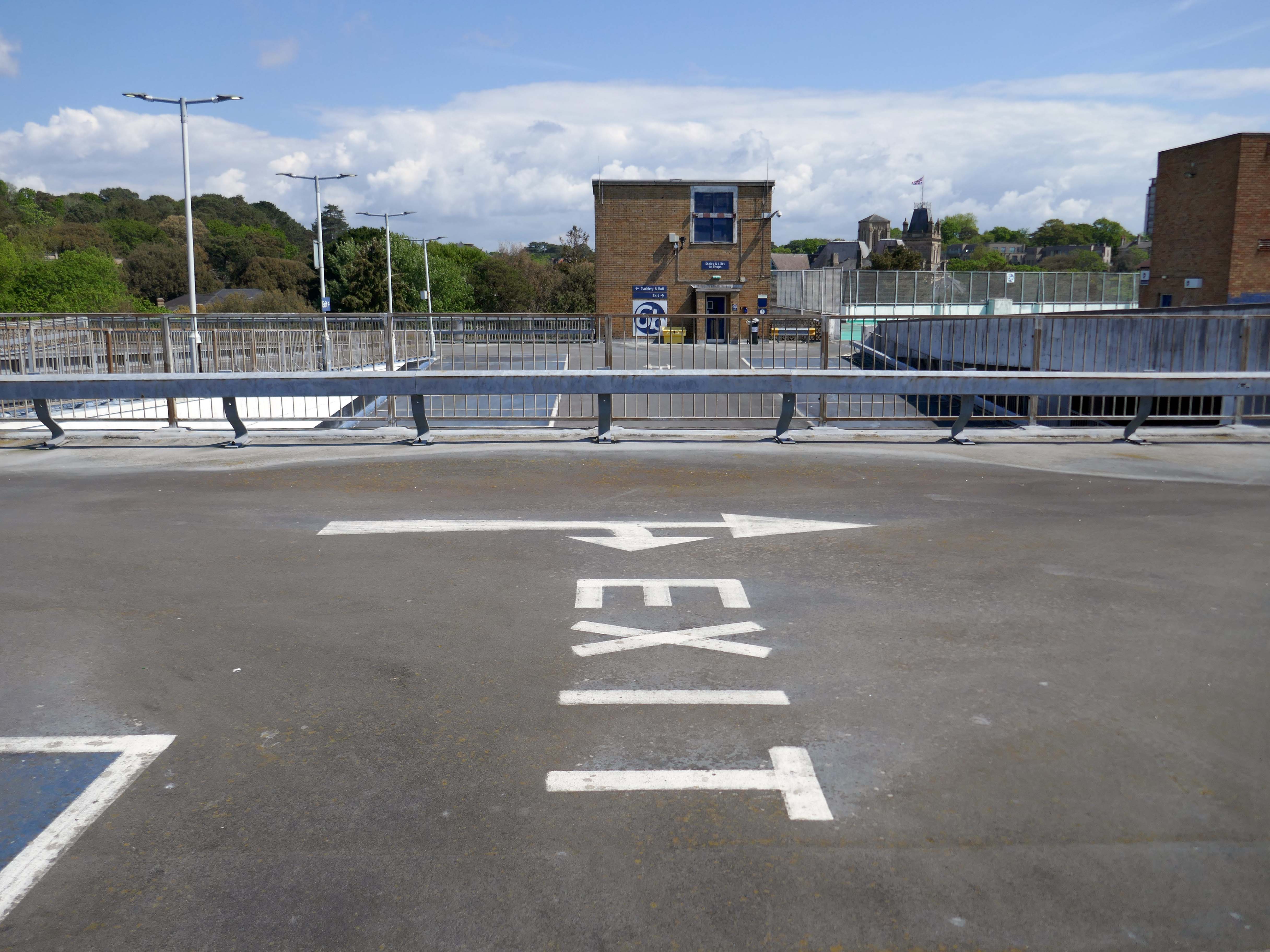
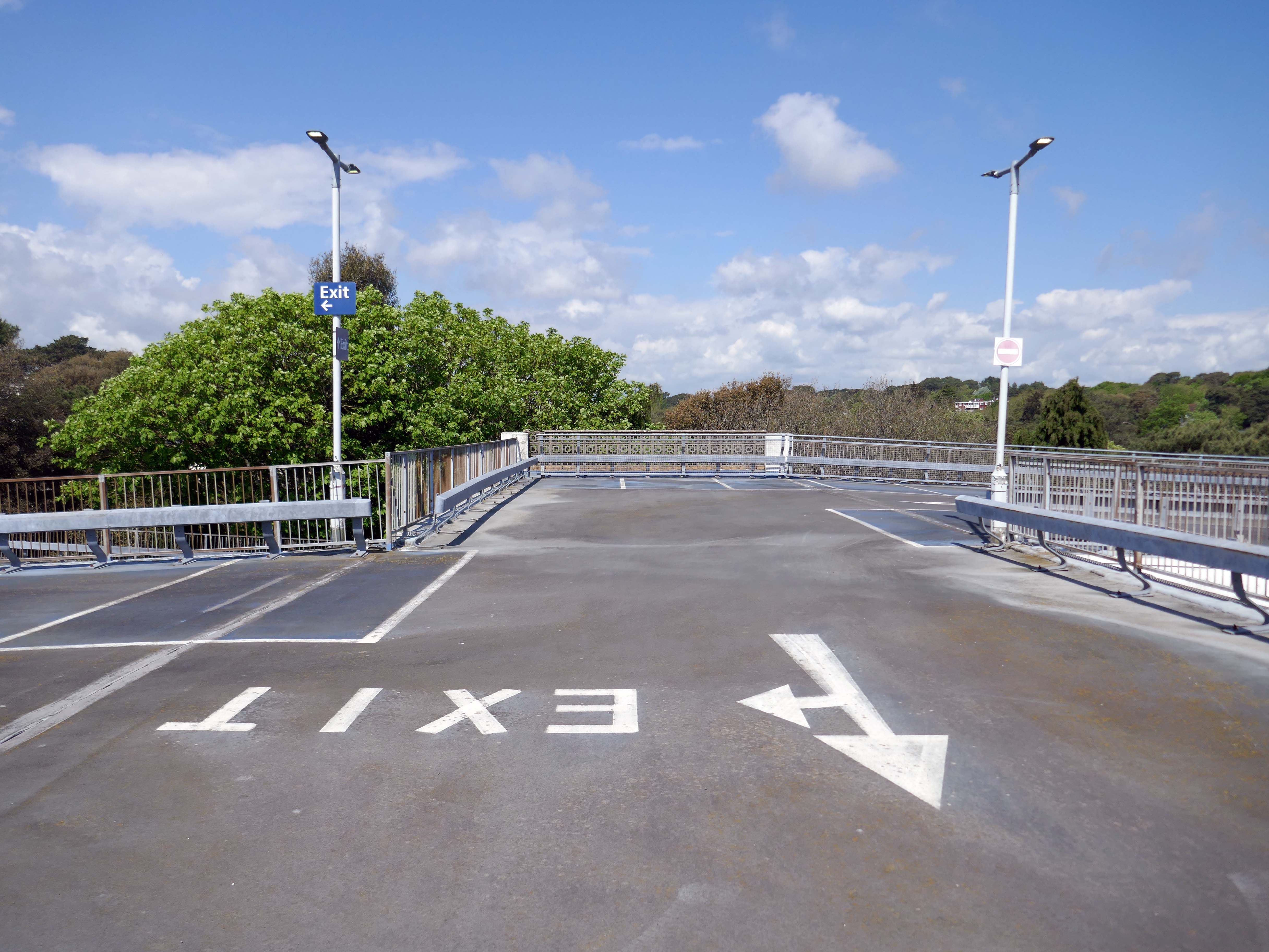
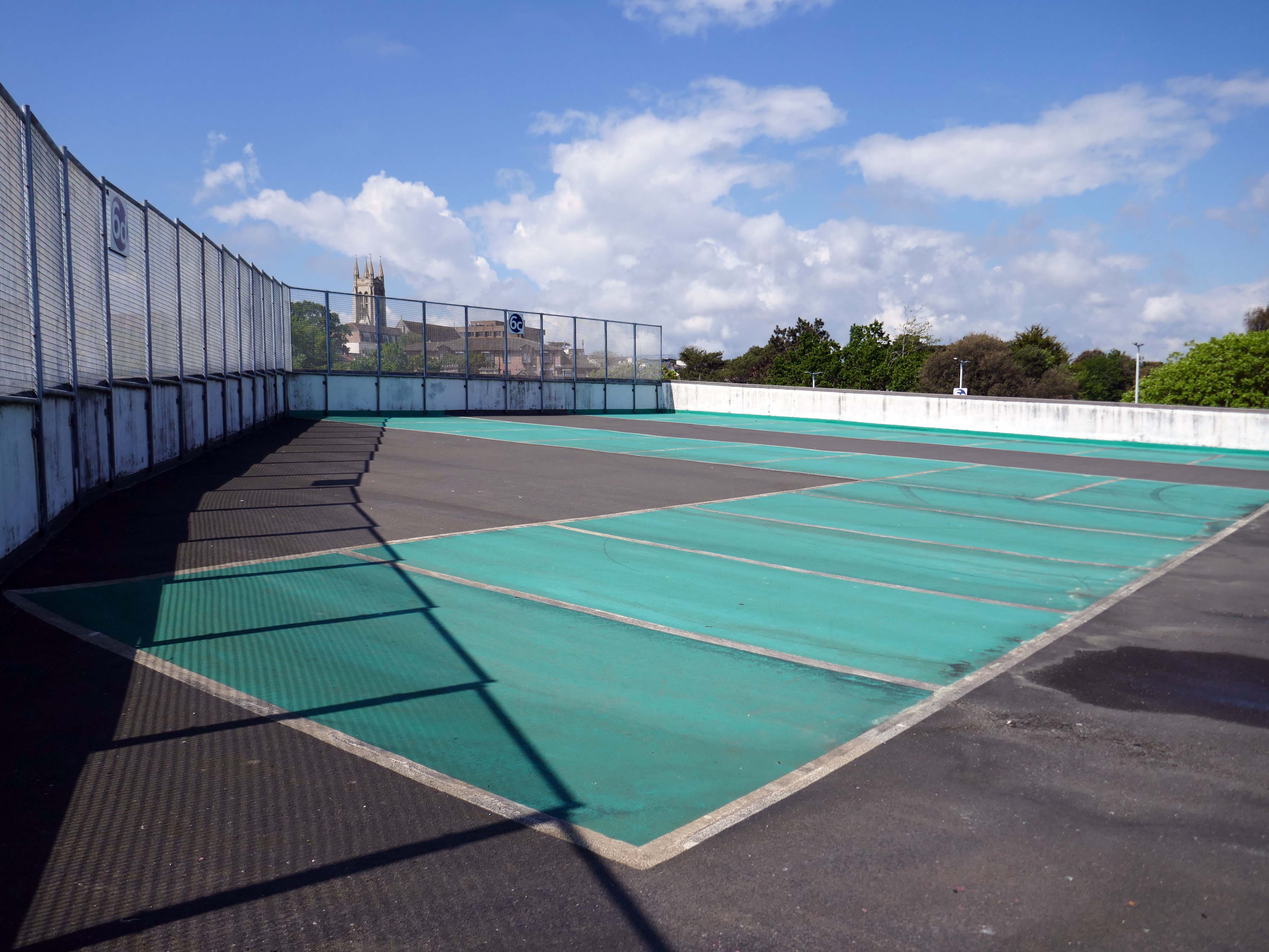
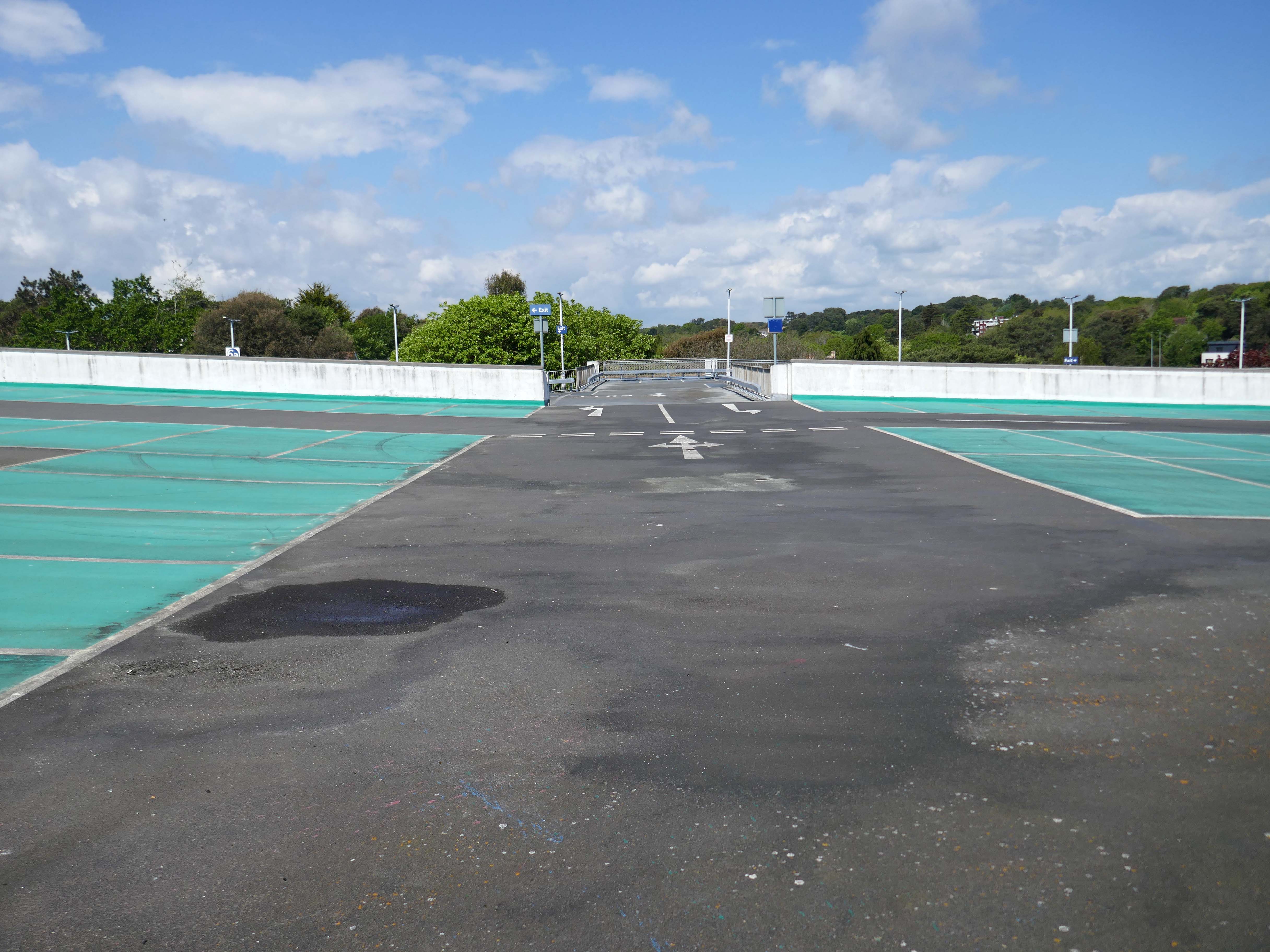
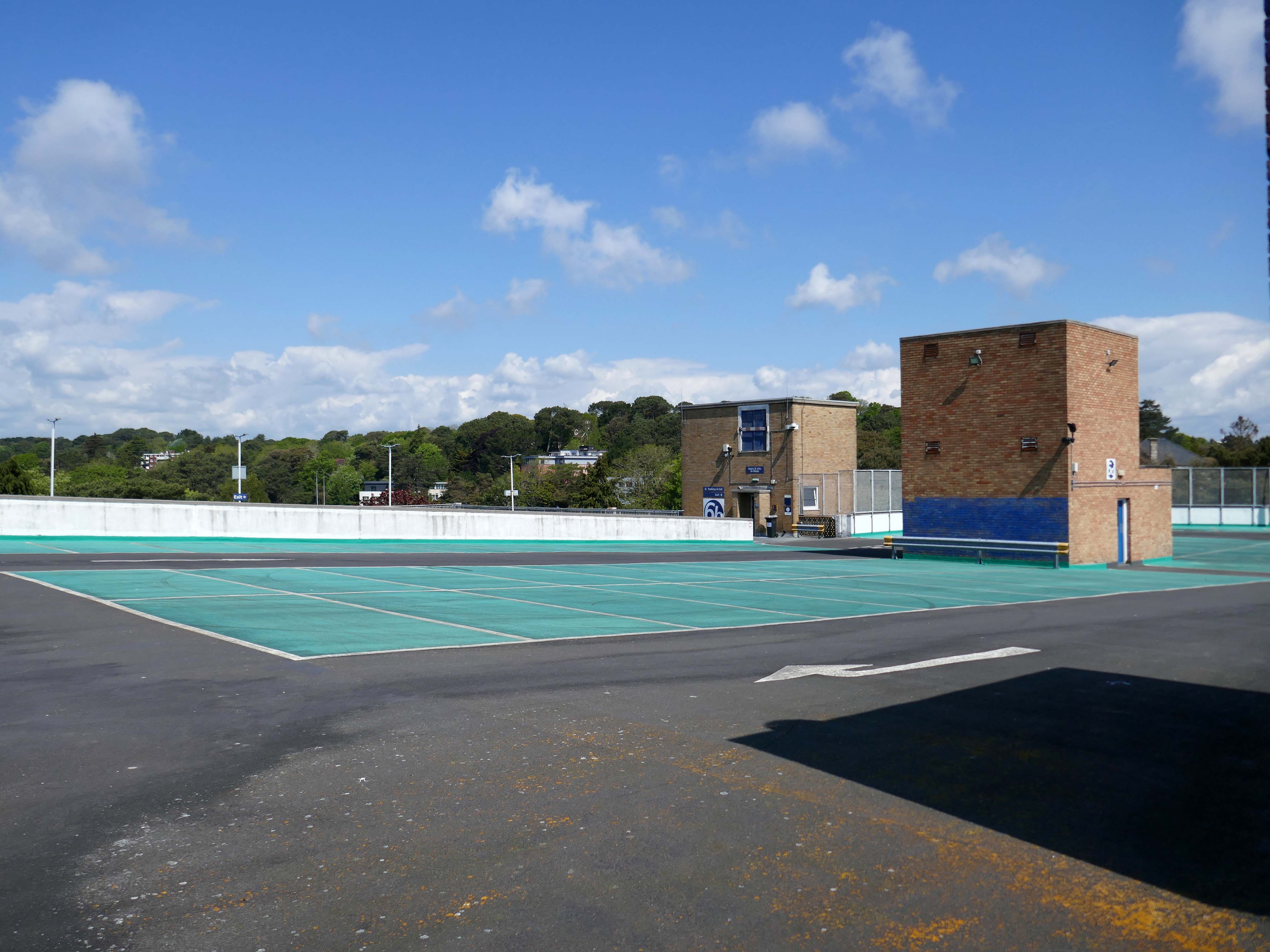
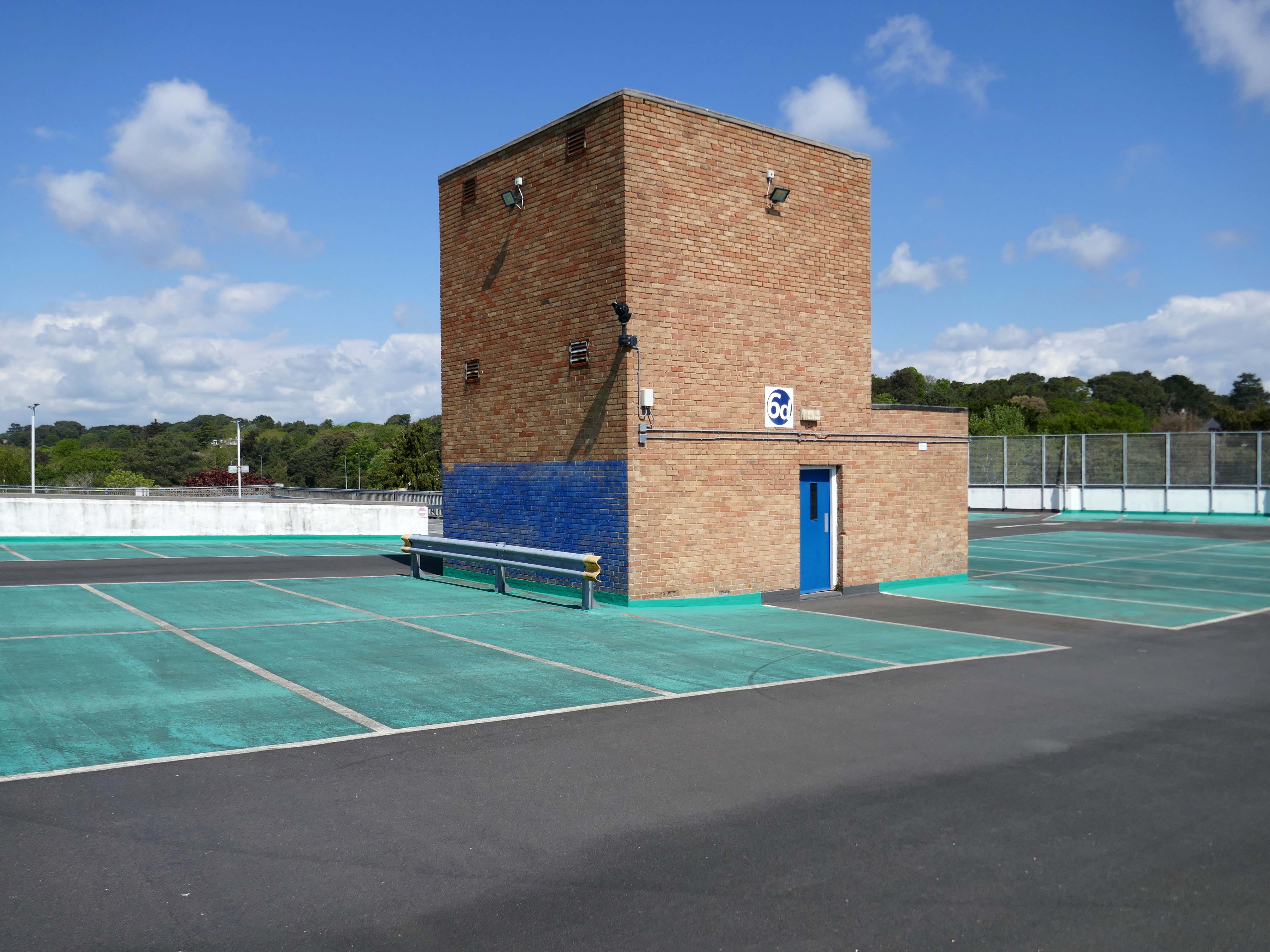
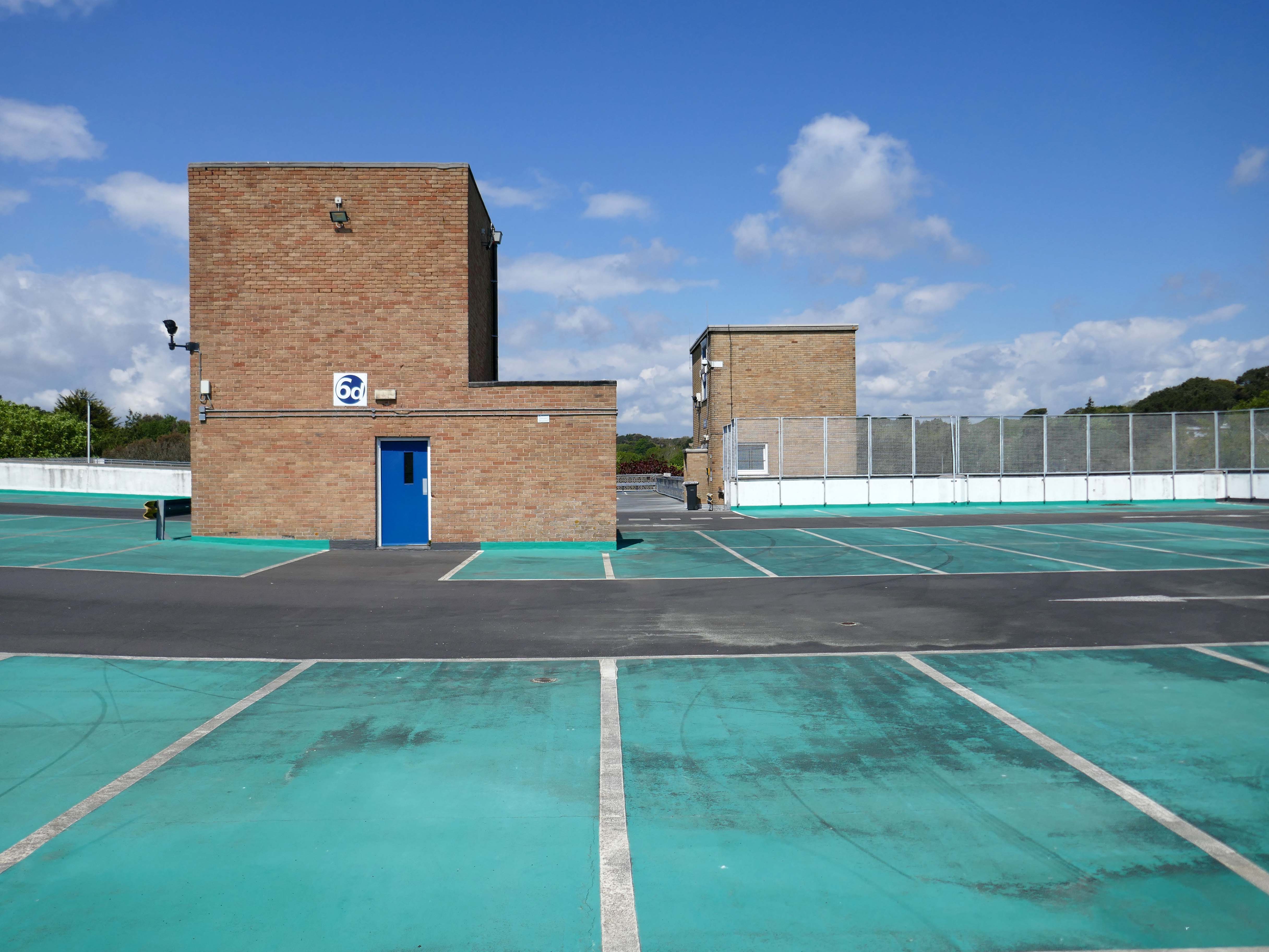
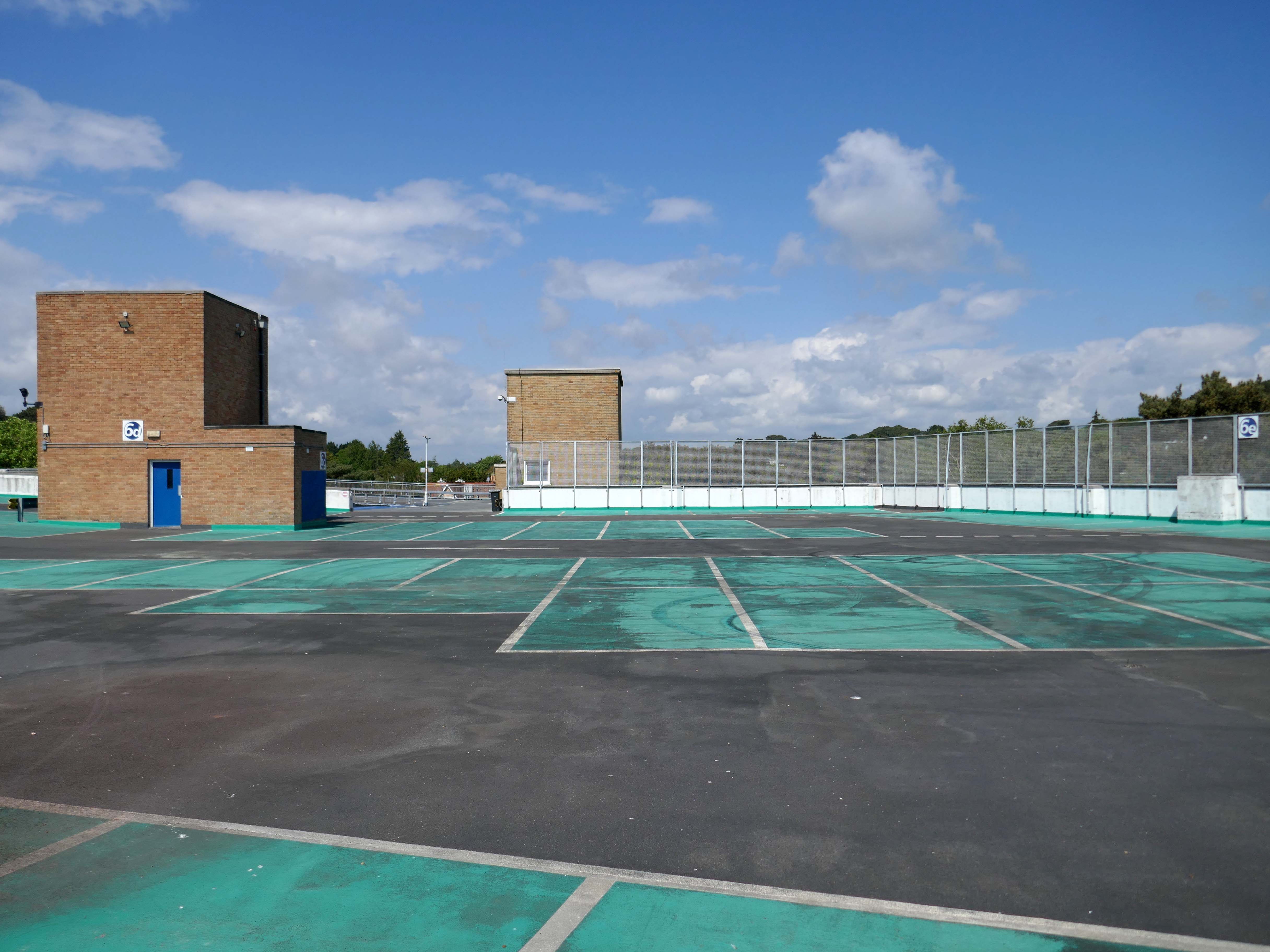
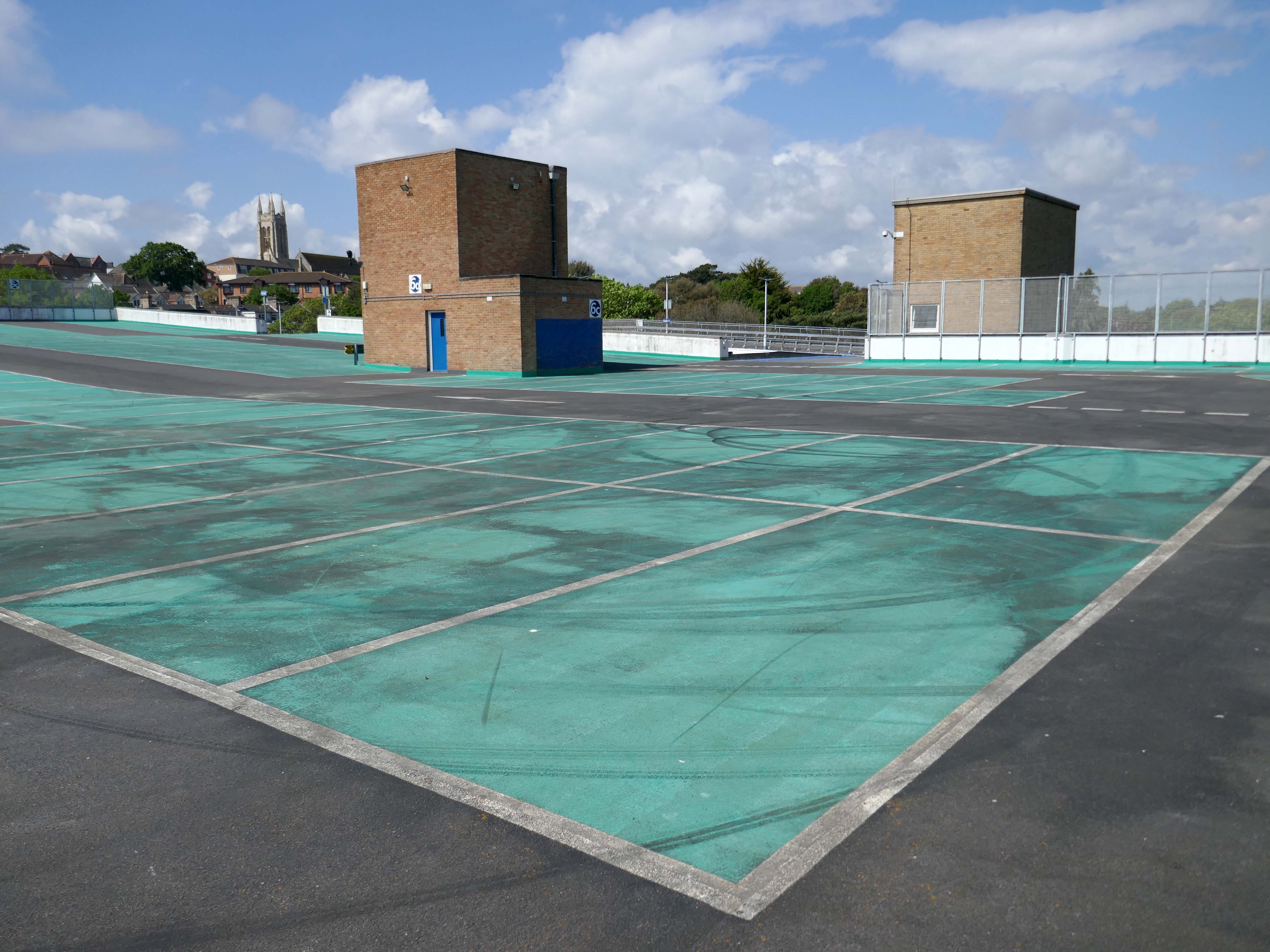
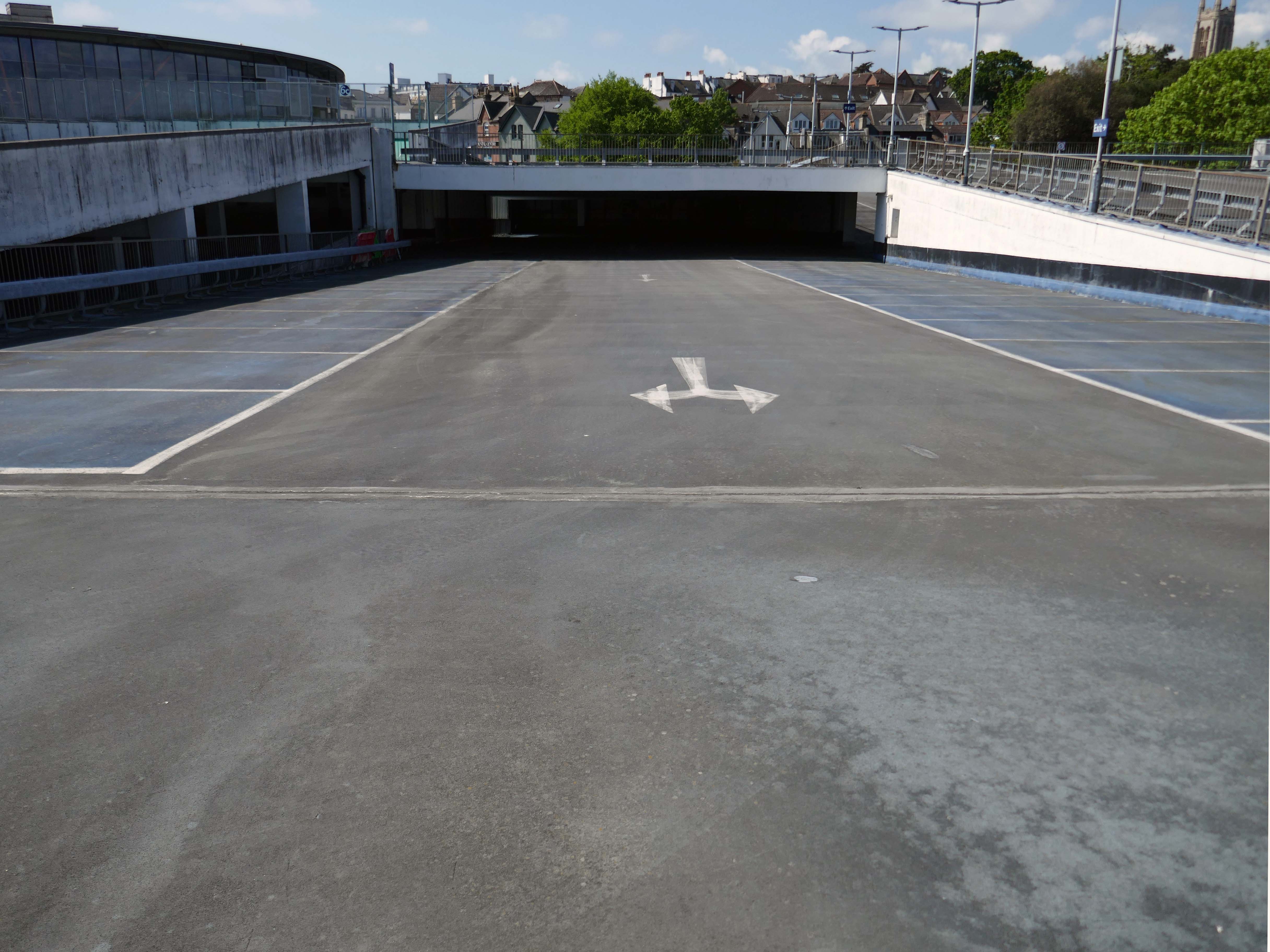
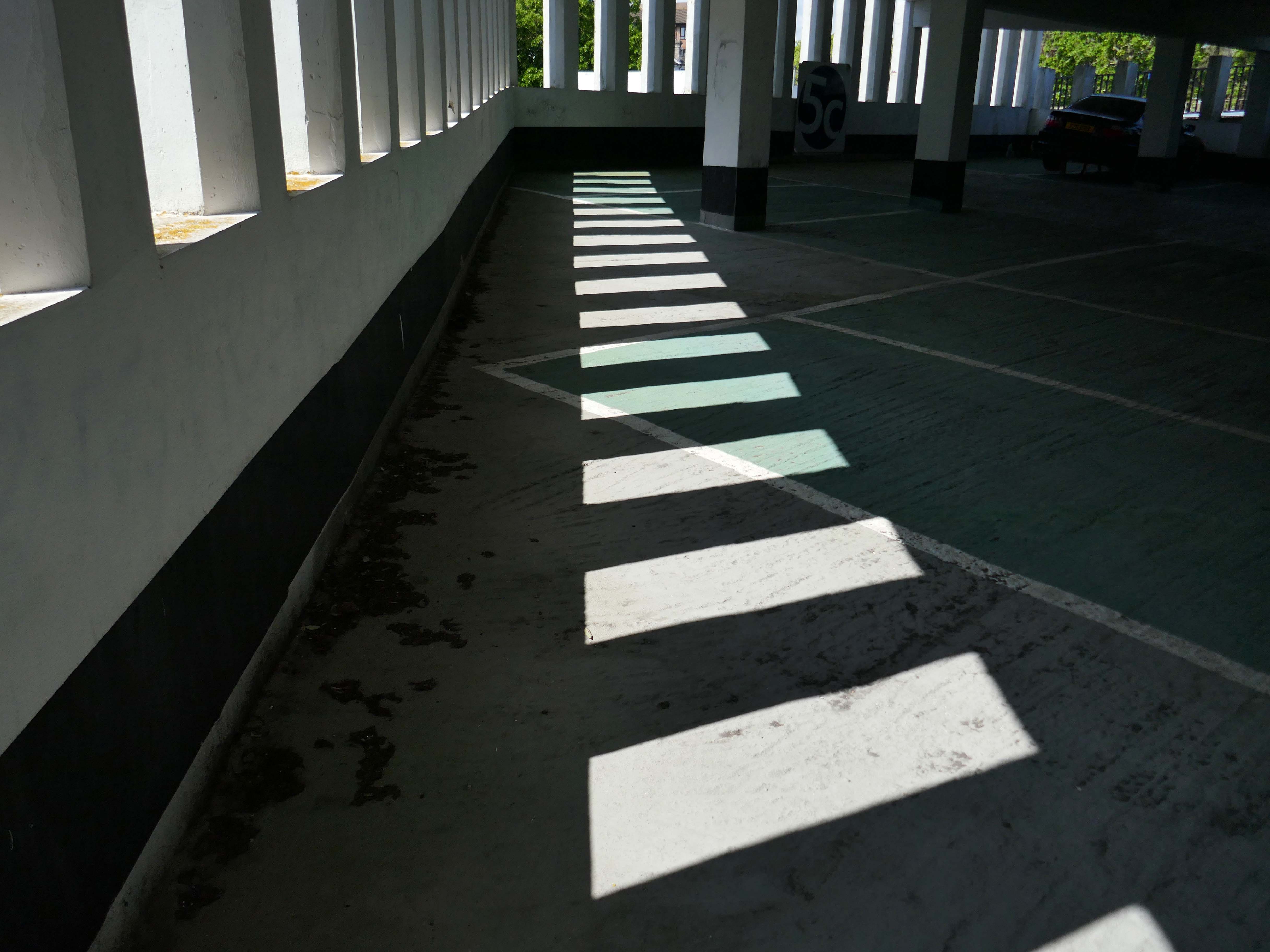
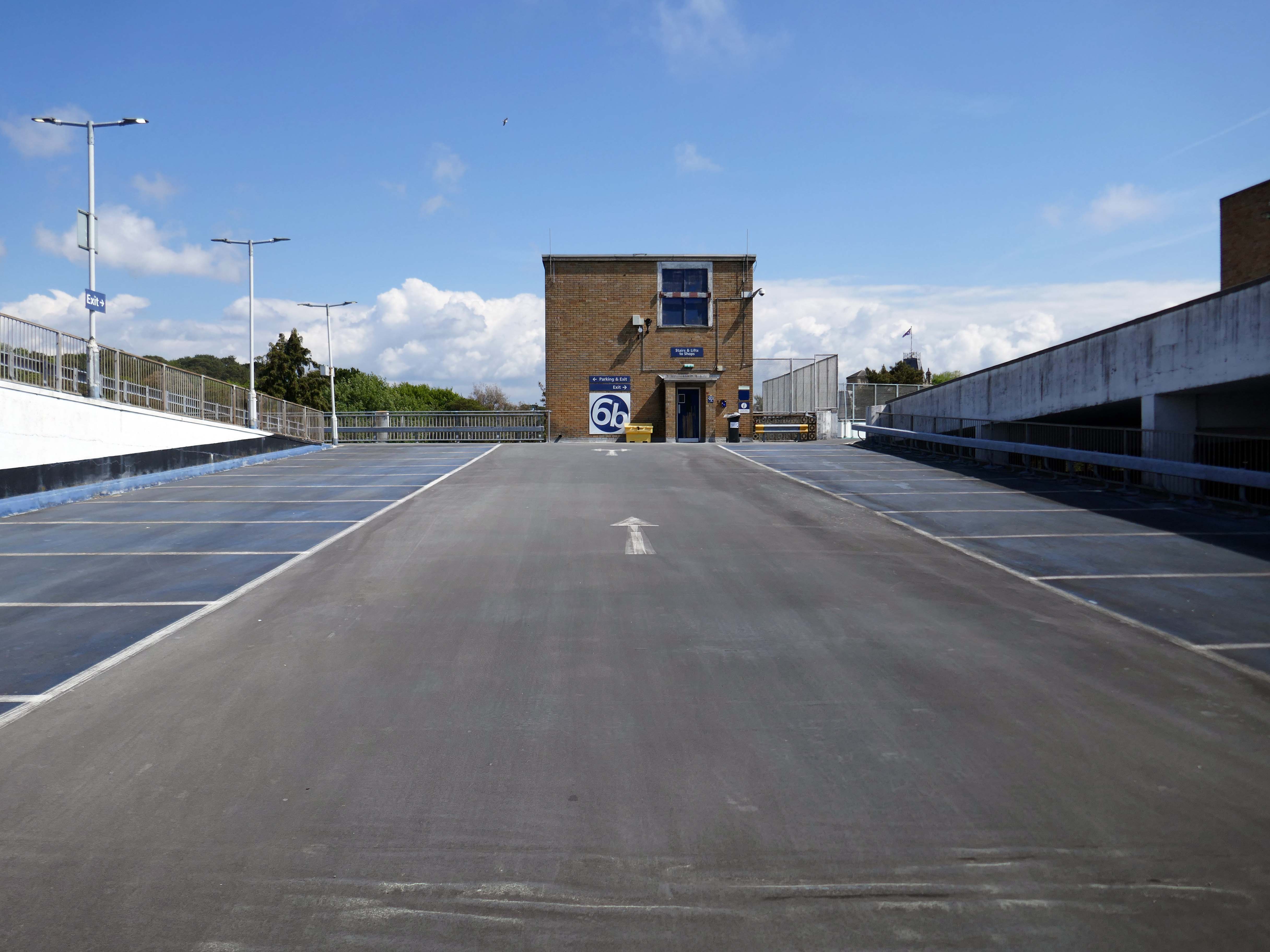
Here are the photographs I took in May 2026 – incorporating the multi storey car park.
But what of the future?
This recent ARC projectinvolves transforming the former Barclays building in Poole into 362 modern residential flats while preserving the existing building’s façade. This project focuses on revitalising a heritage landmark by repurposing it with innovative designs that offer easy access to public transport, exceed space standards for comfort and practicality, and create a strong sense of community through shared internal and external amenities.
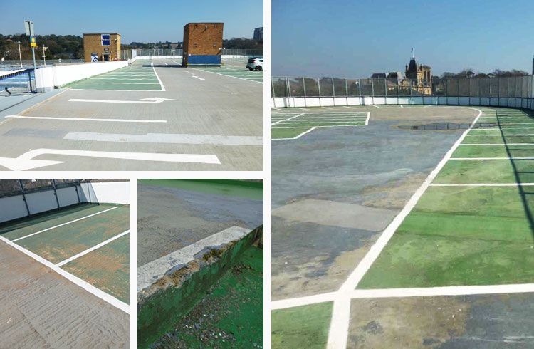
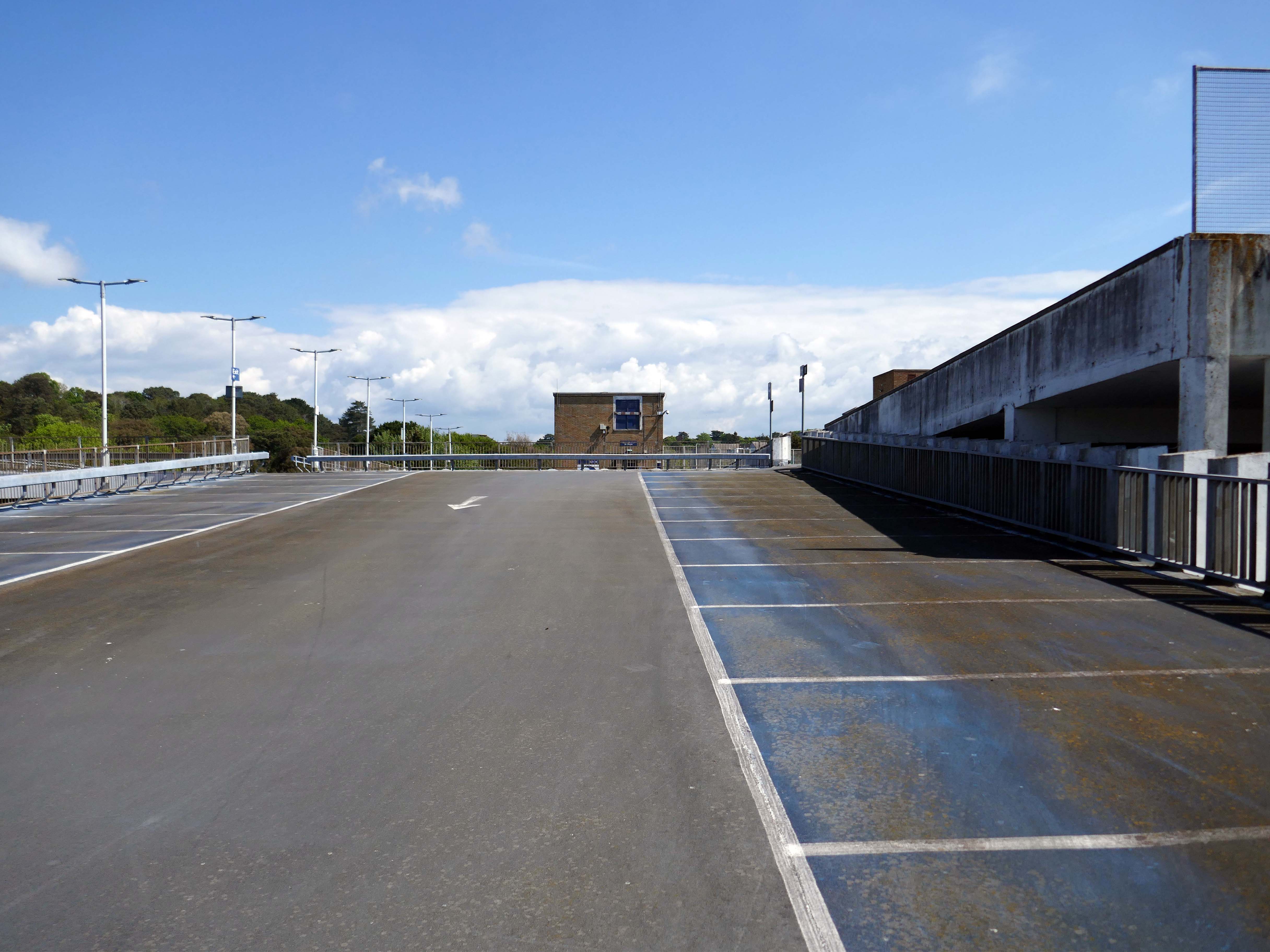
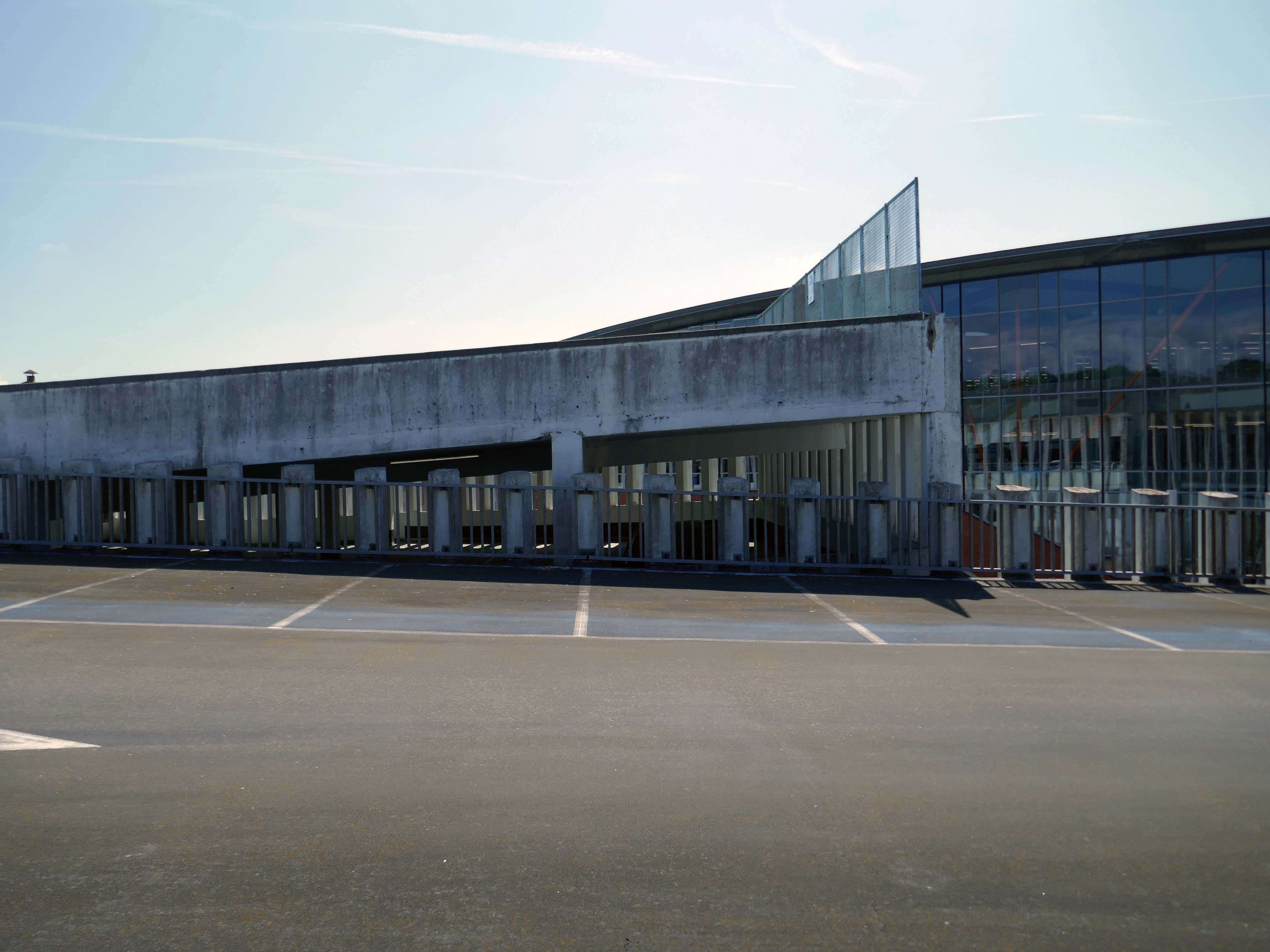
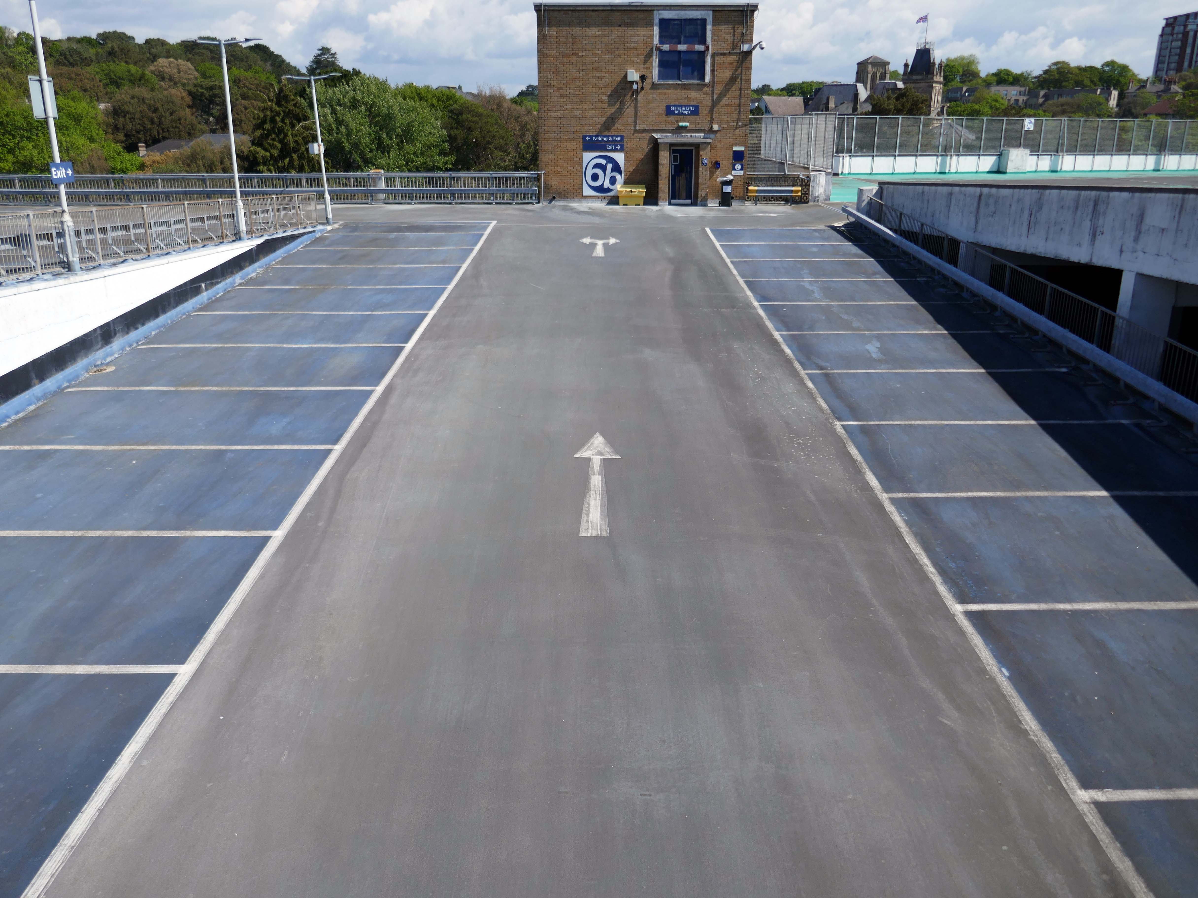
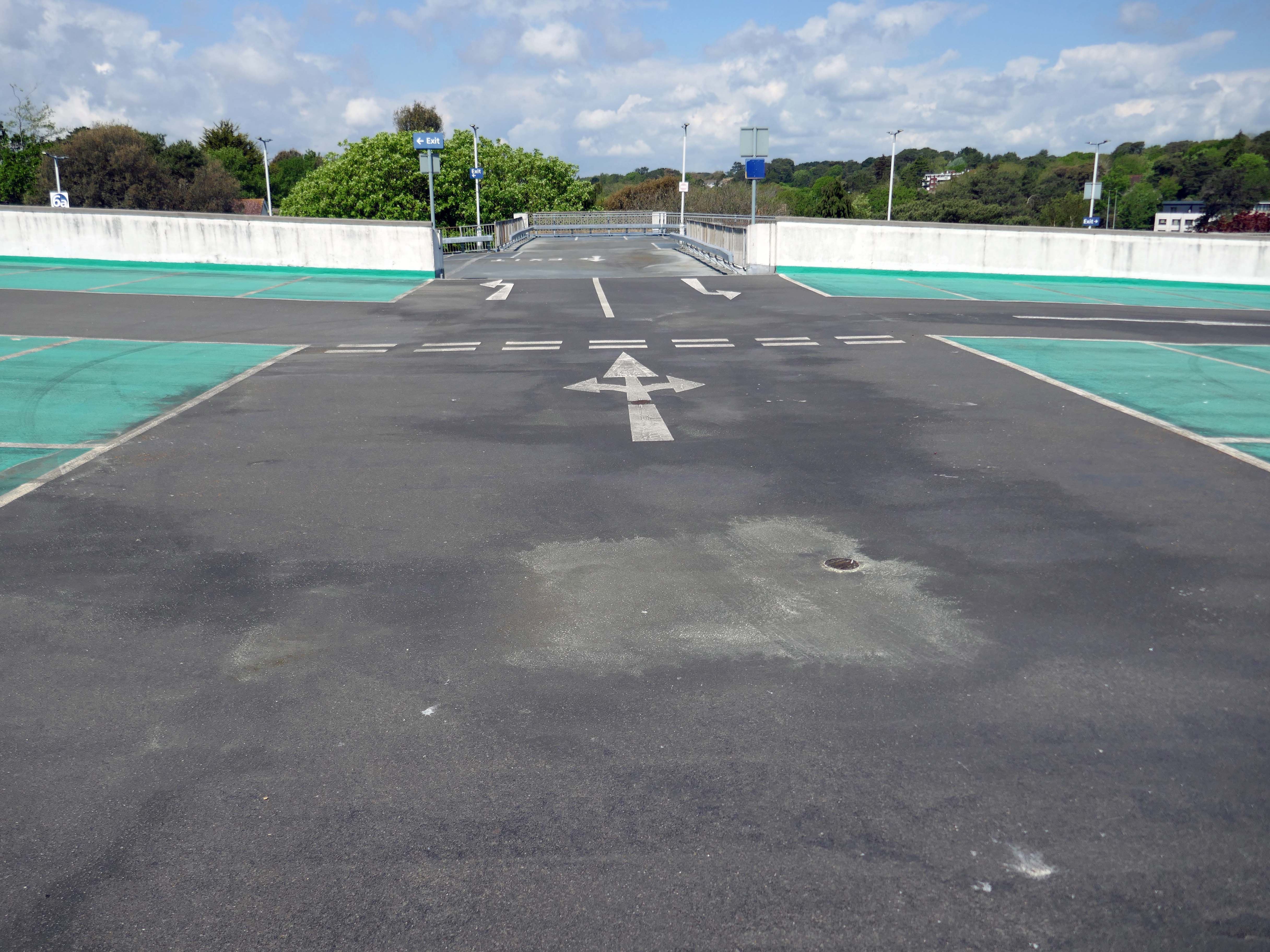
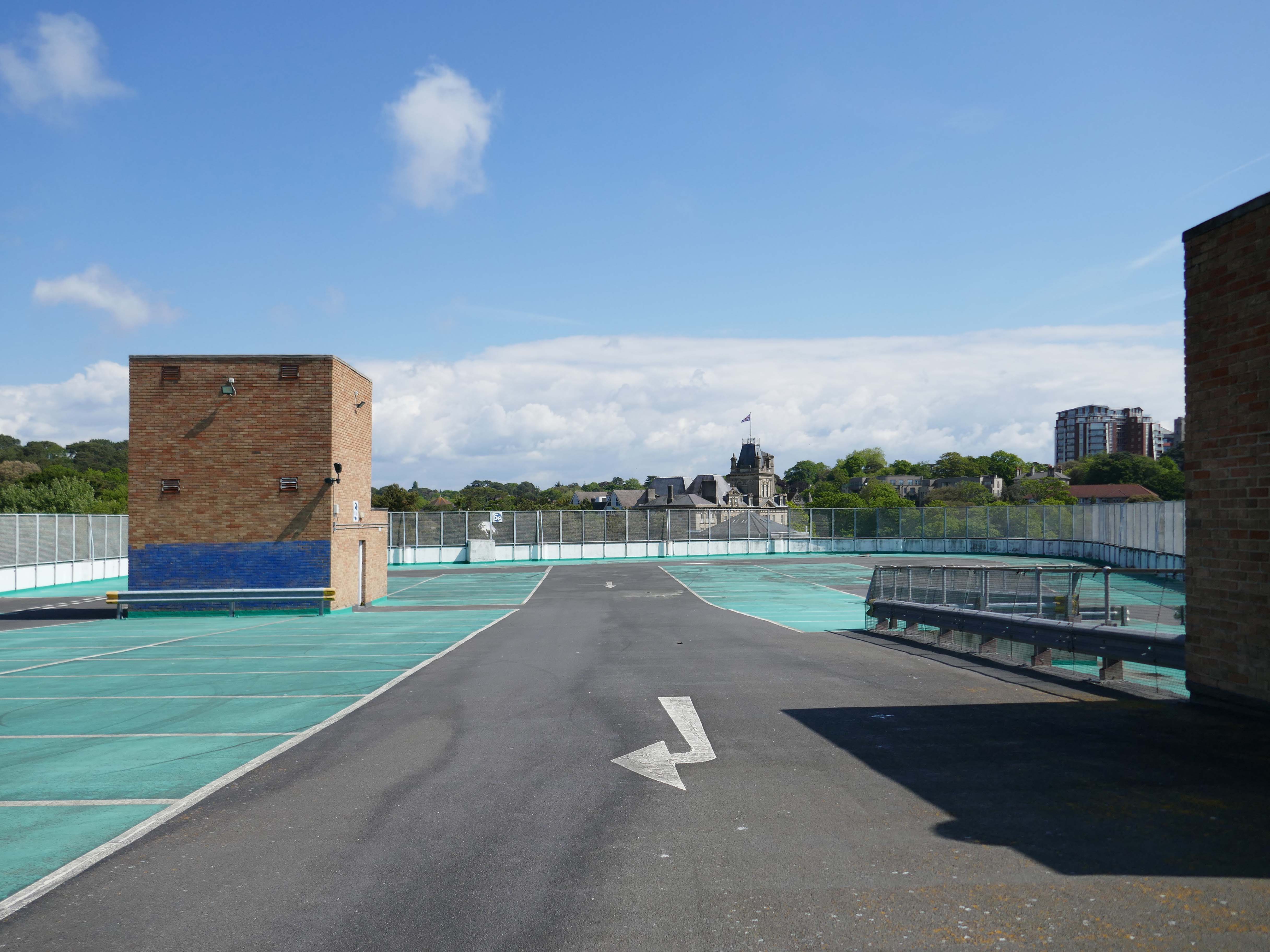
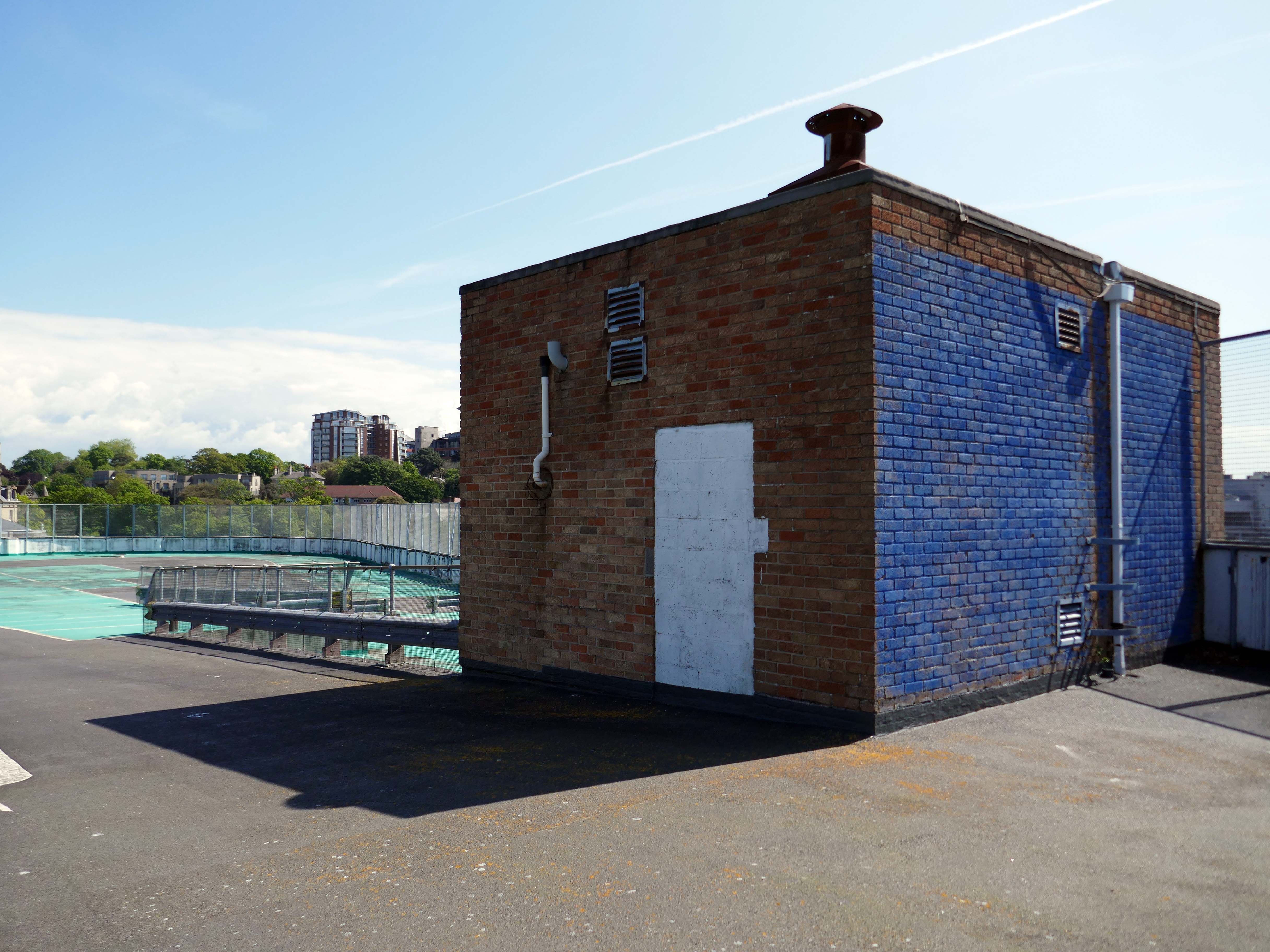
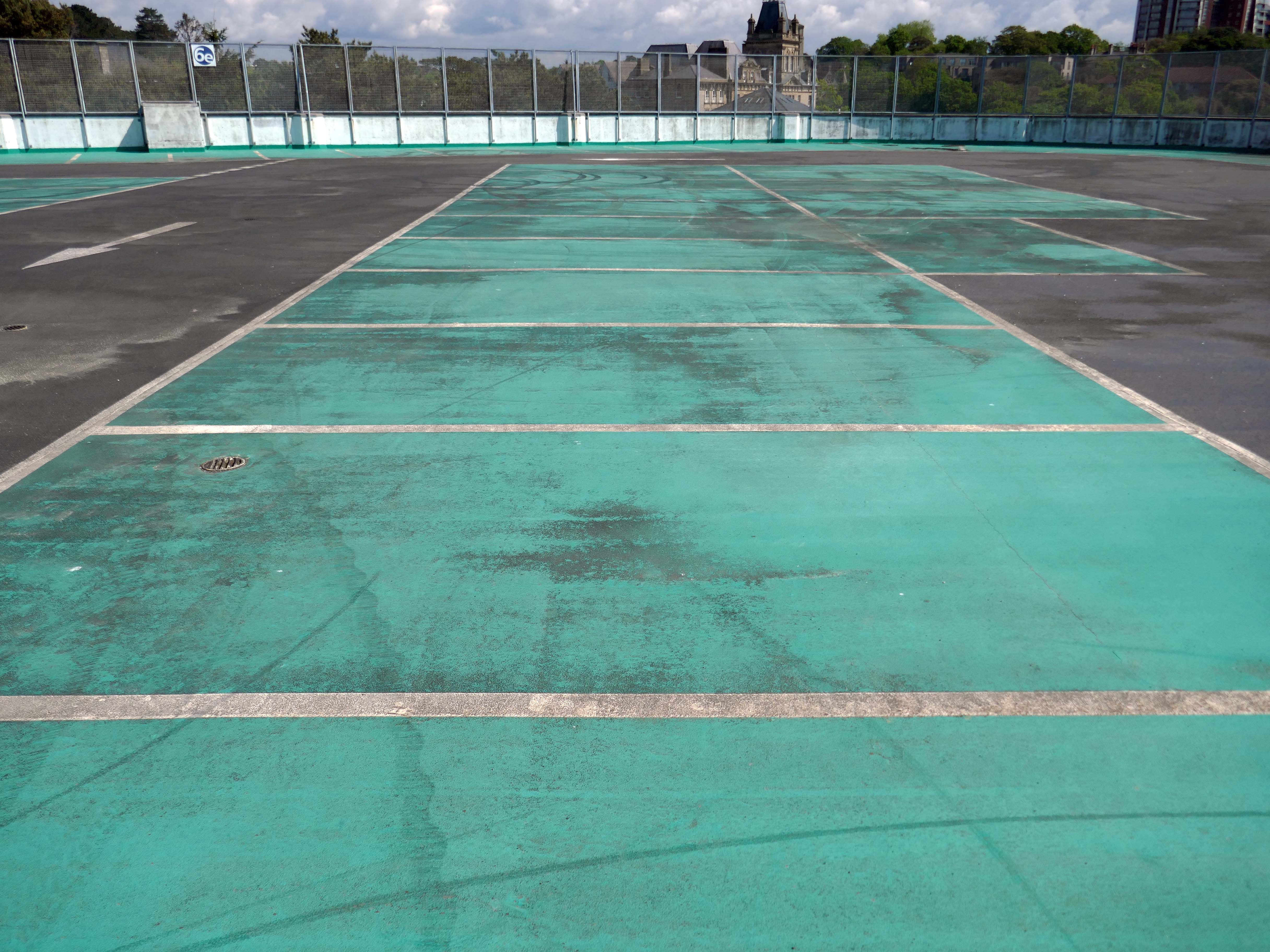
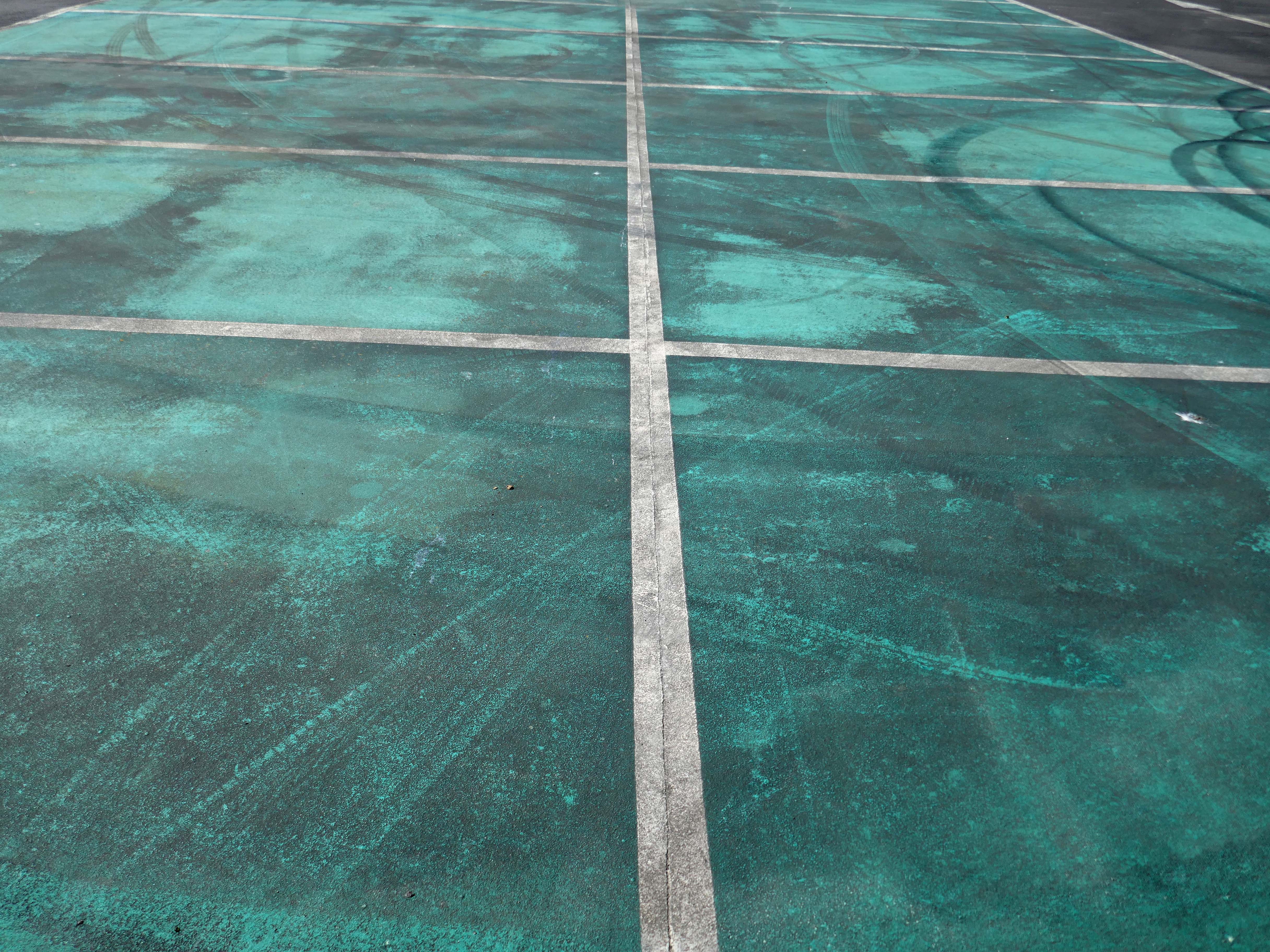
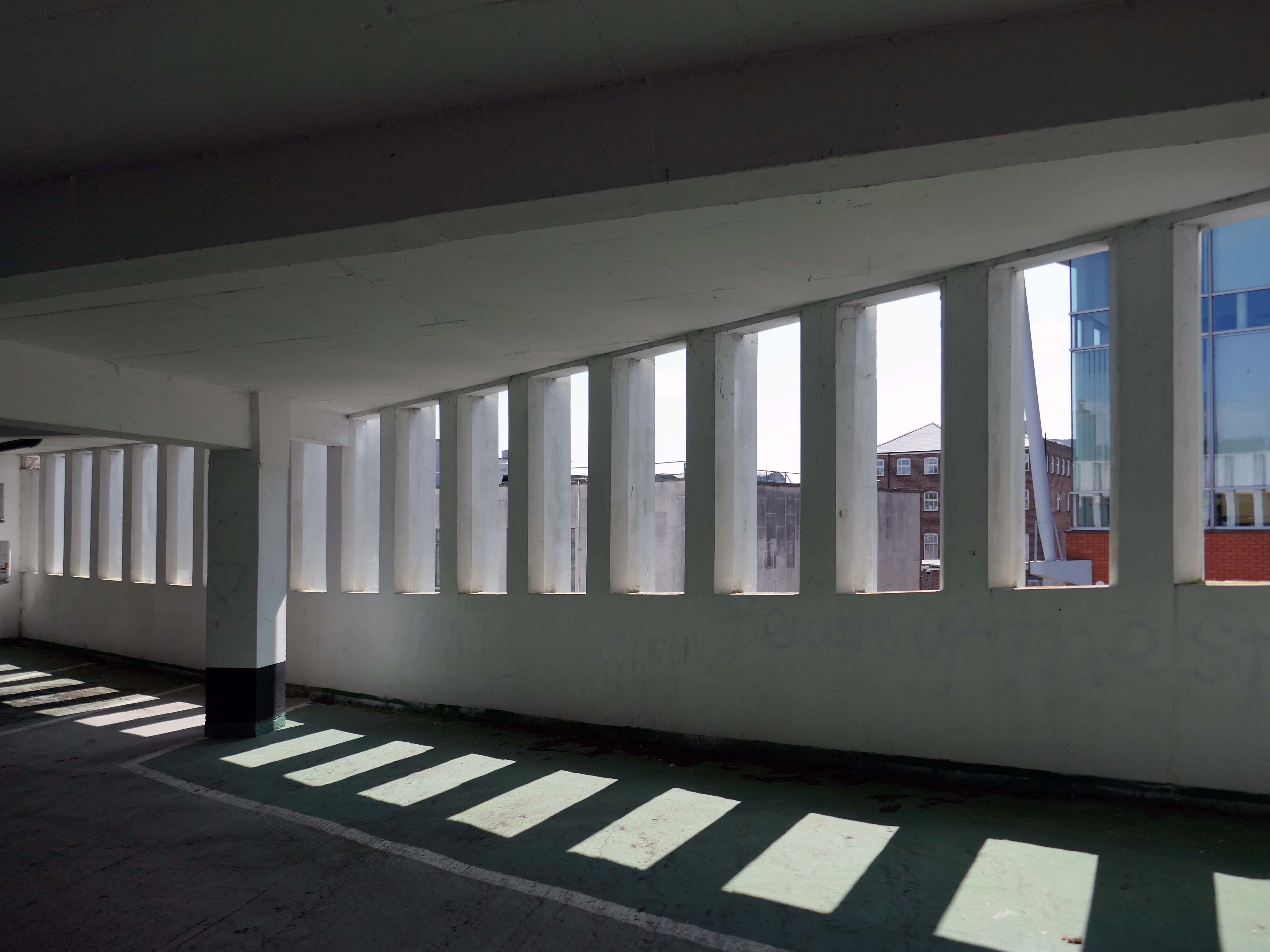
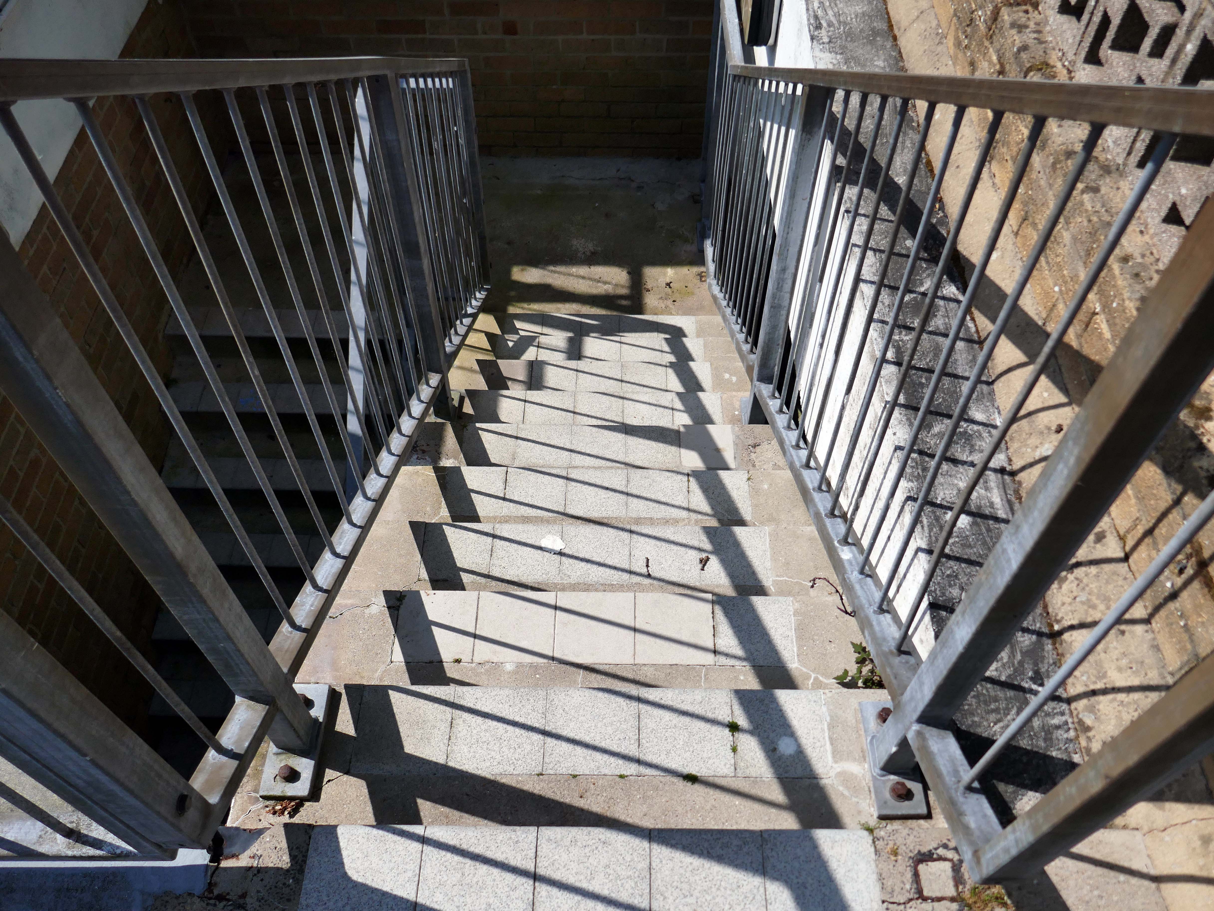
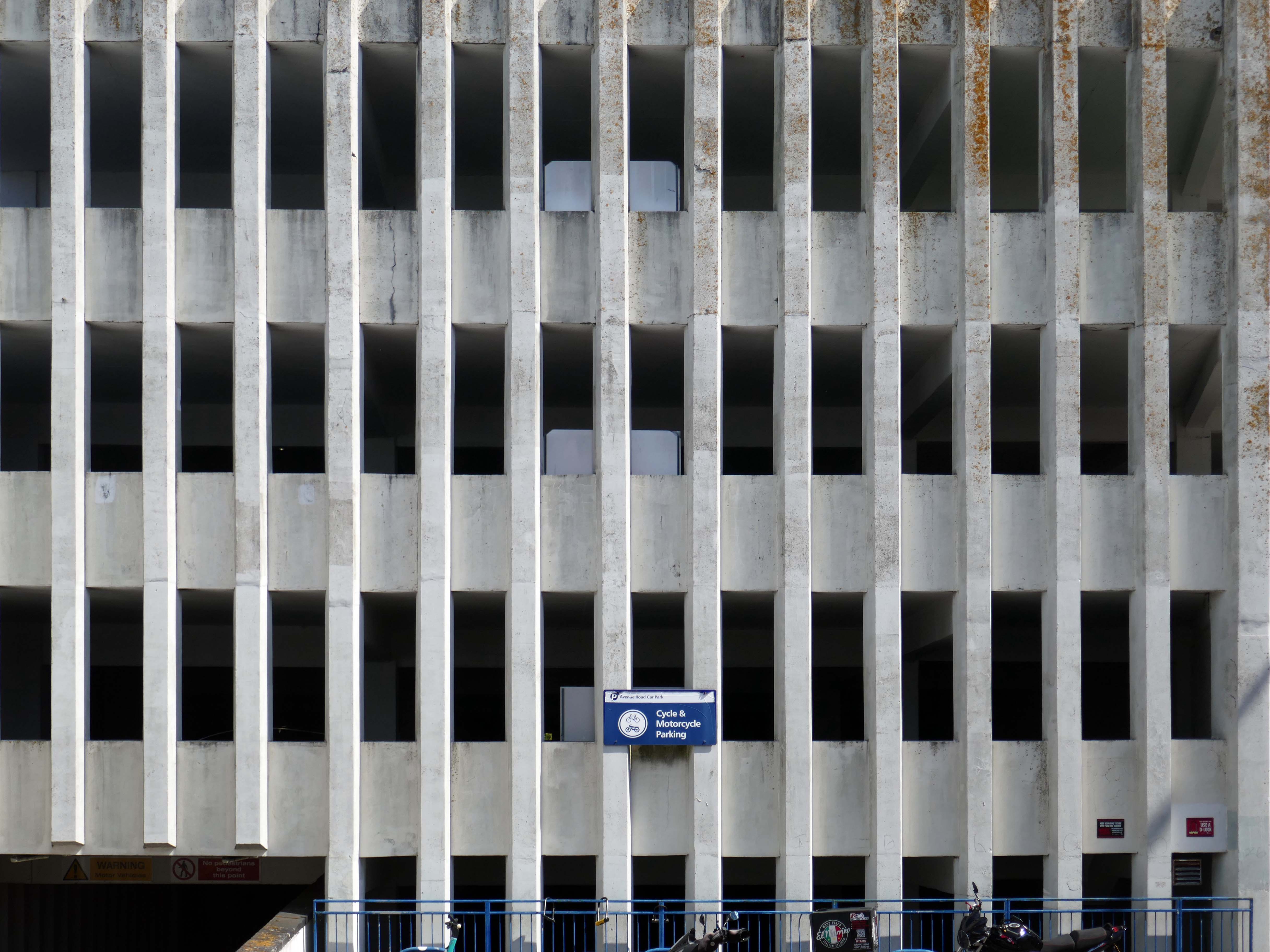
After twenty years, the waterproofing on the top deck of the busy Avenue Road council car park in Bournemouth was failing. Water was penetrating the structure and dripping onto users’ cars on the lower levels and also into a tenant’s offices situated below. More importantly, this was affecting the structural integrity of the car park.
Being close to the sea, the car park is subjected to highly corrosive moisture and salt levels, which if left unprotected could cause long term structural damage. And indeed, further investigation by the contractors Concrete Repairs Ltd. and Triflex’s Technical Team revealed that part of the concrete substrate was cracking and failing causing potential health and safety issues.
As a result, the council needed to refurbish the car park and have a reliable waterproofing solution that would extend the car park’s service life. In addition, this work needed to be finished before the start of the busy summer tourist period.
Concrete Repairs Ltd. and the Triflex Technical Team visited the site to complete an extensive site survey. Testing was also conducted to determine the suitability and compatibility of the substrate and the requirements for its preparation. Triflex DeckFloor was specified for the decks with DeckFloor Ramp System to provide a more aggressive aggregate was to the ramps and inclined areas of the car park. The ramp system incorporates emery aggregate which provides additional traction for those harder wearing areas.
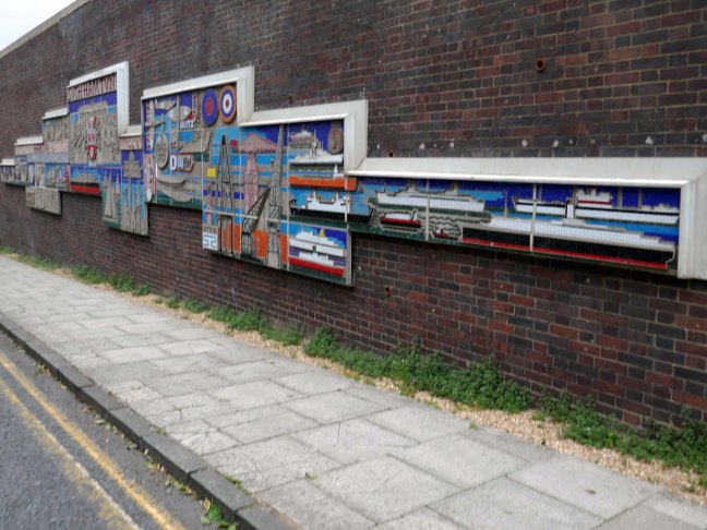
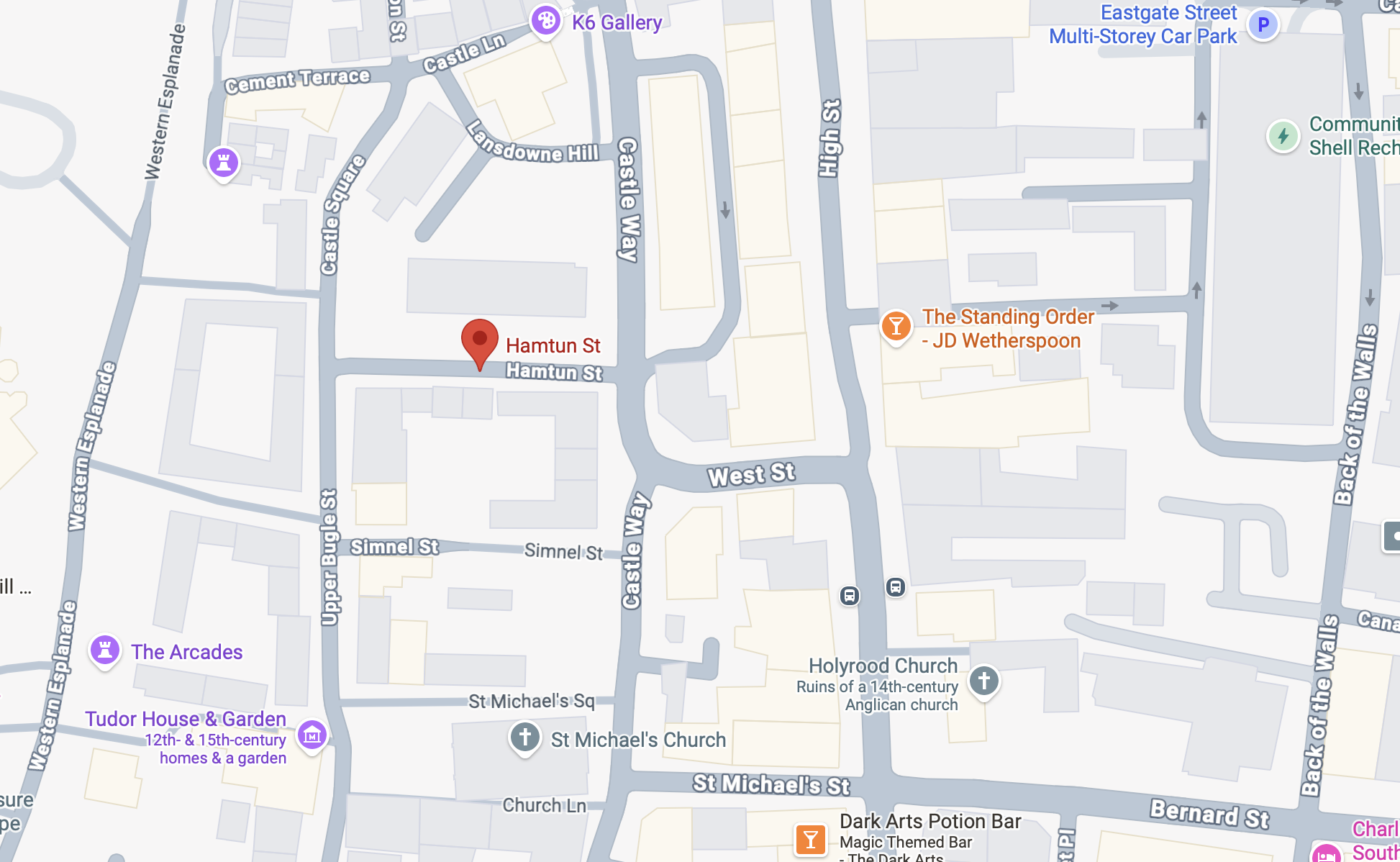
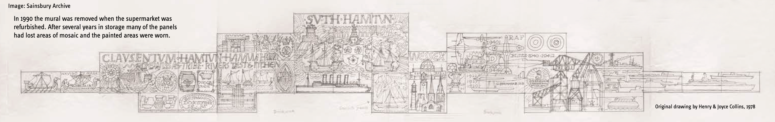
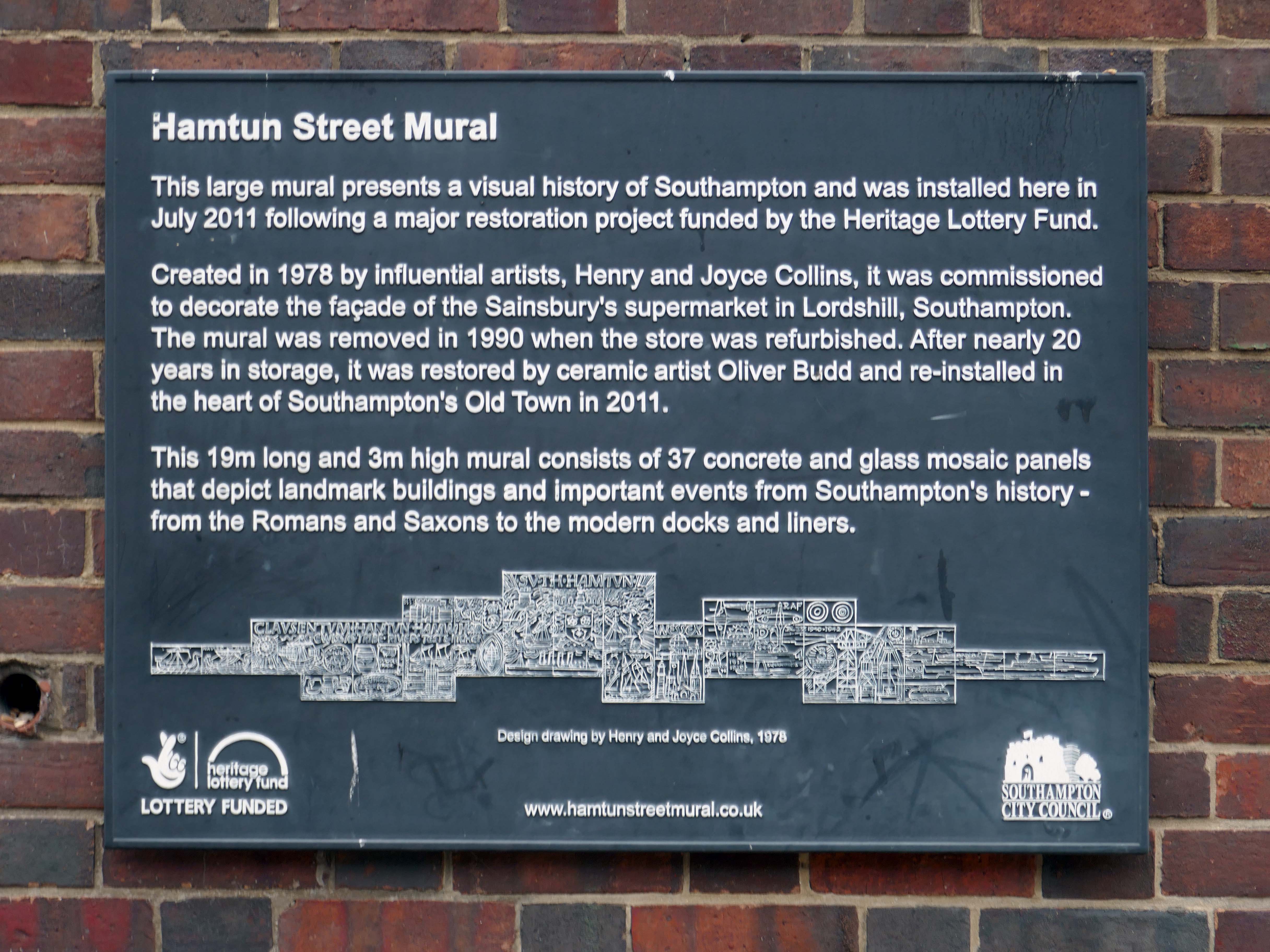
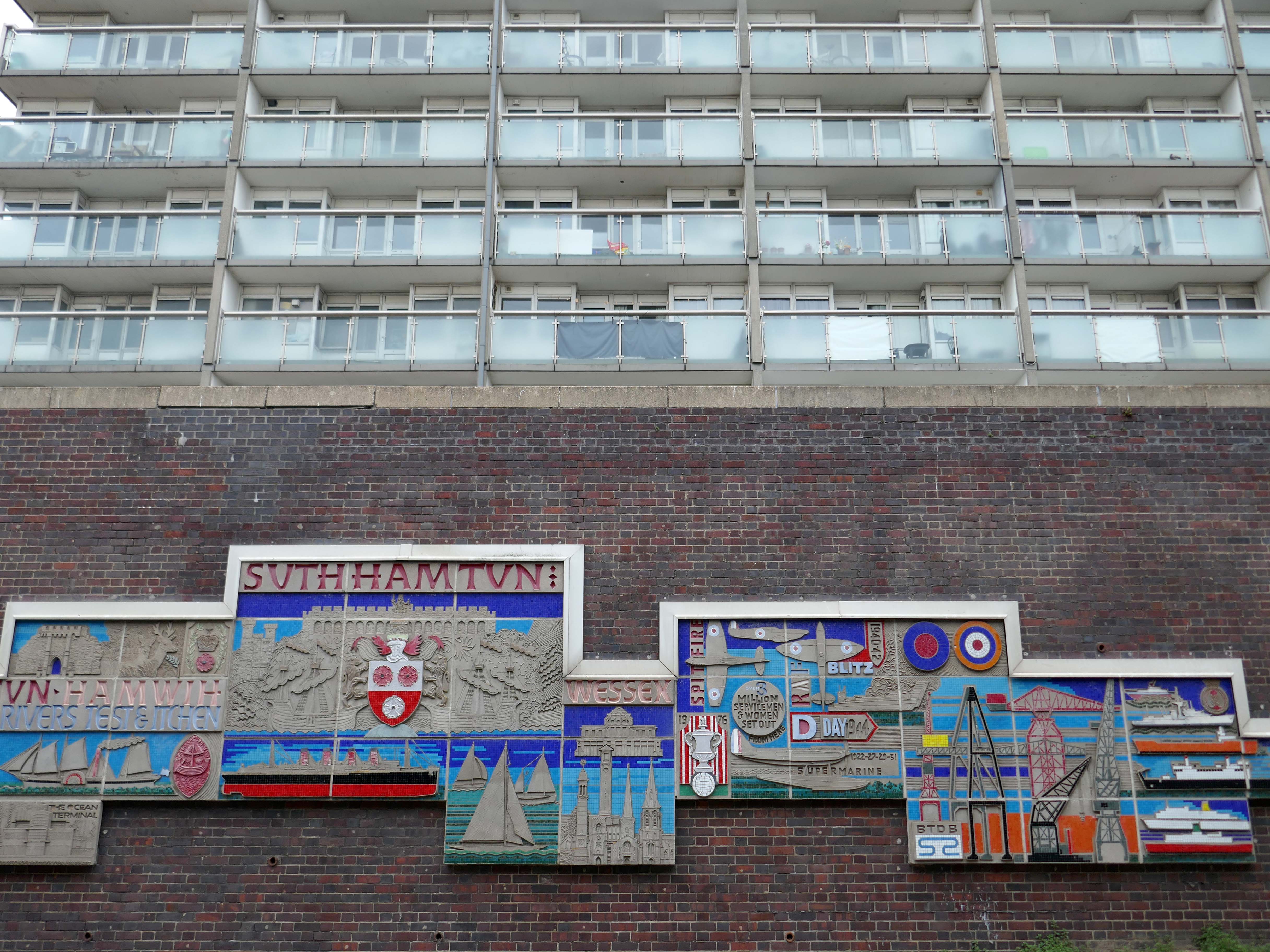
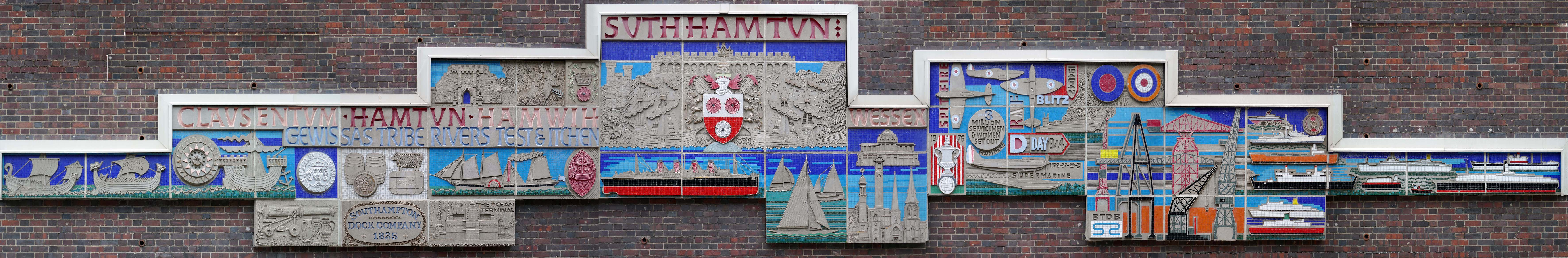
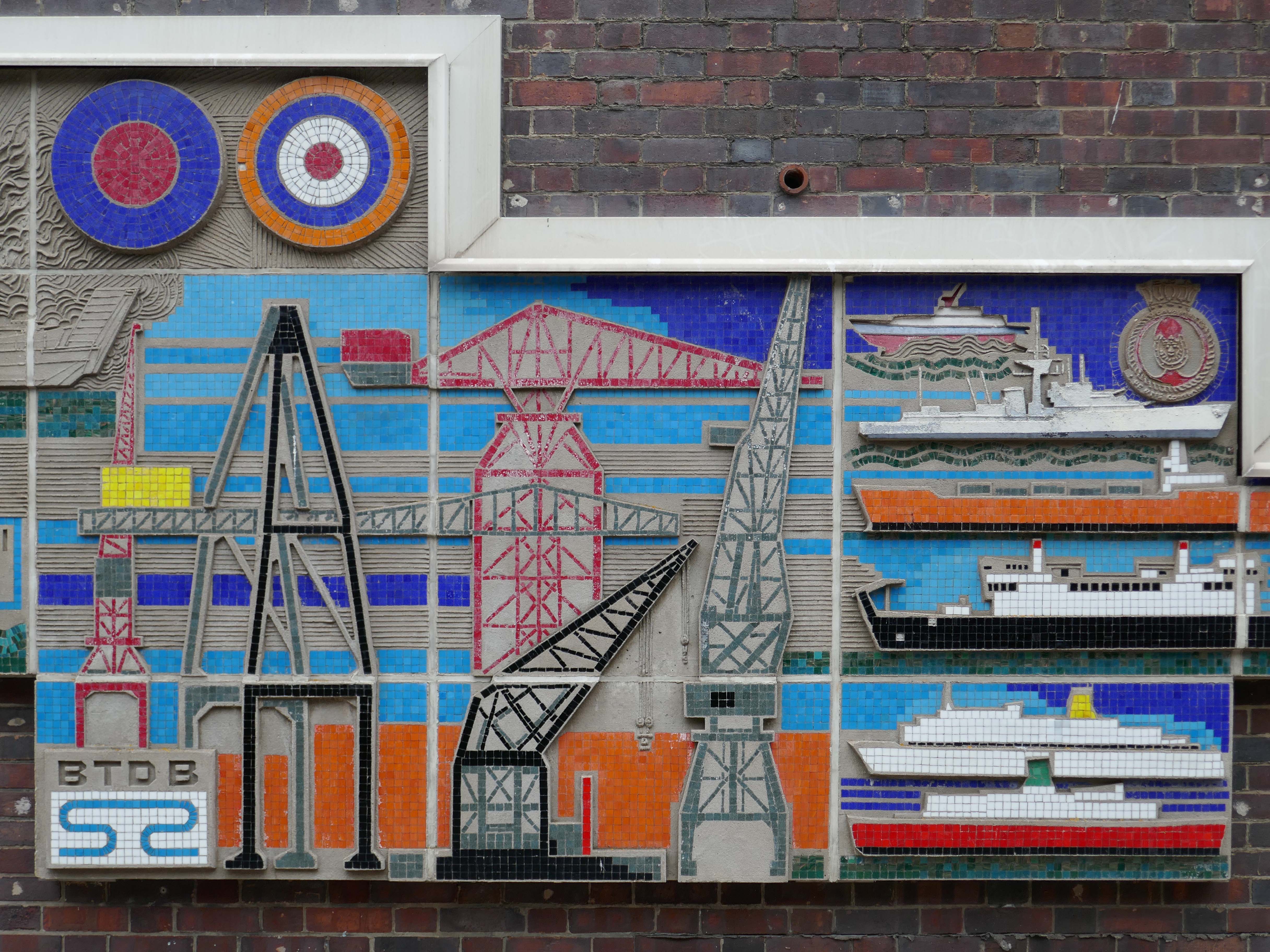
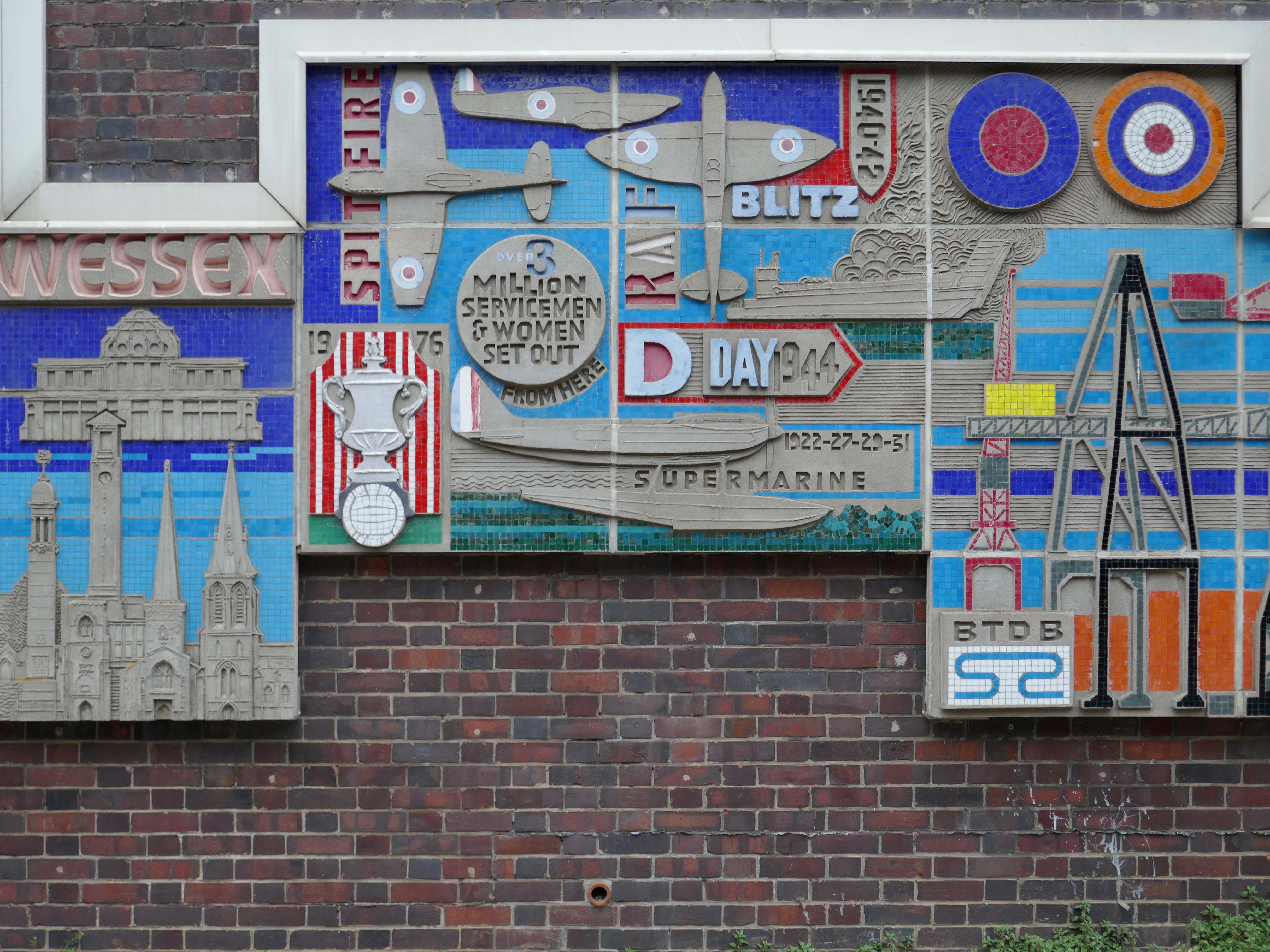
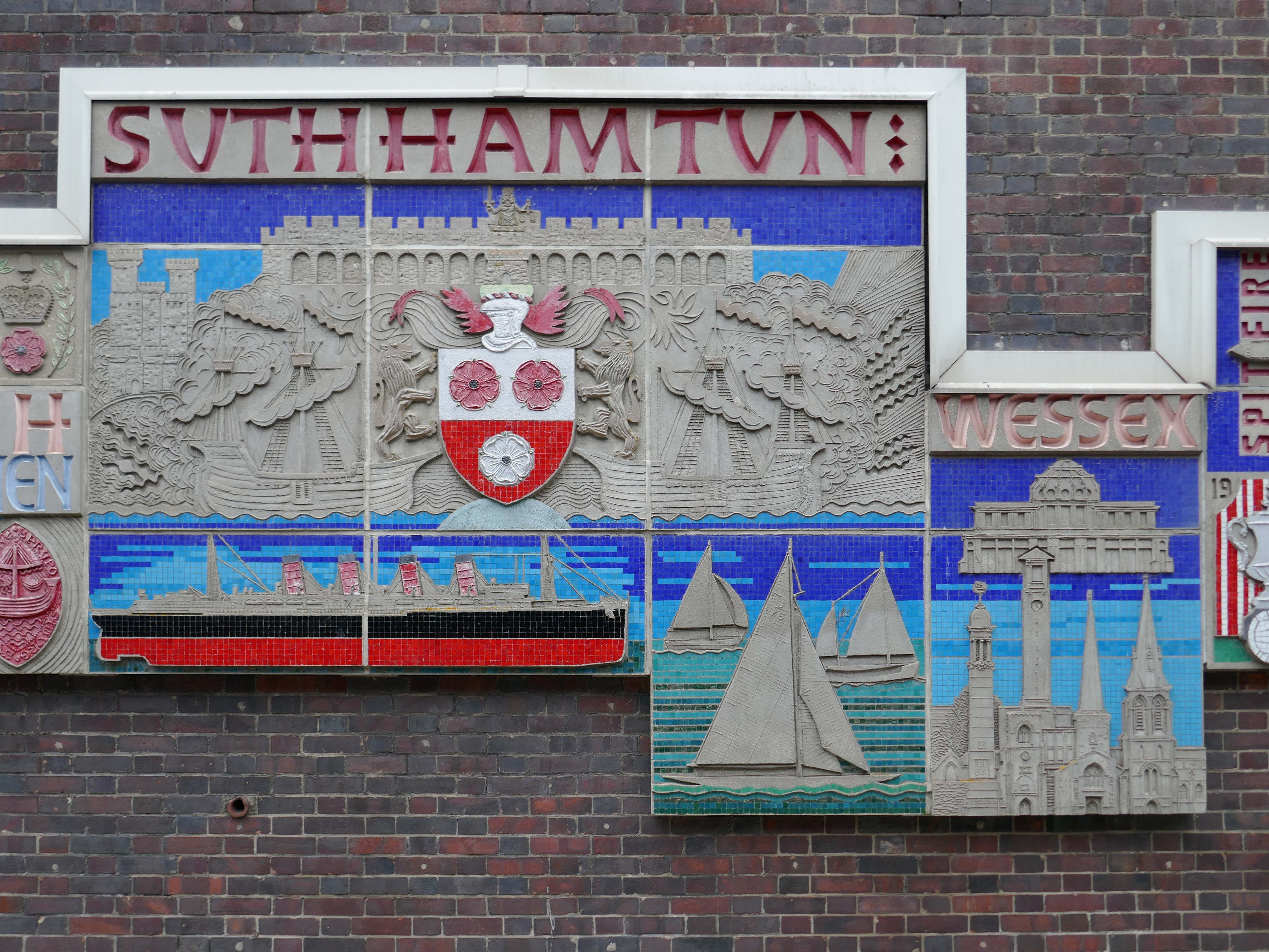
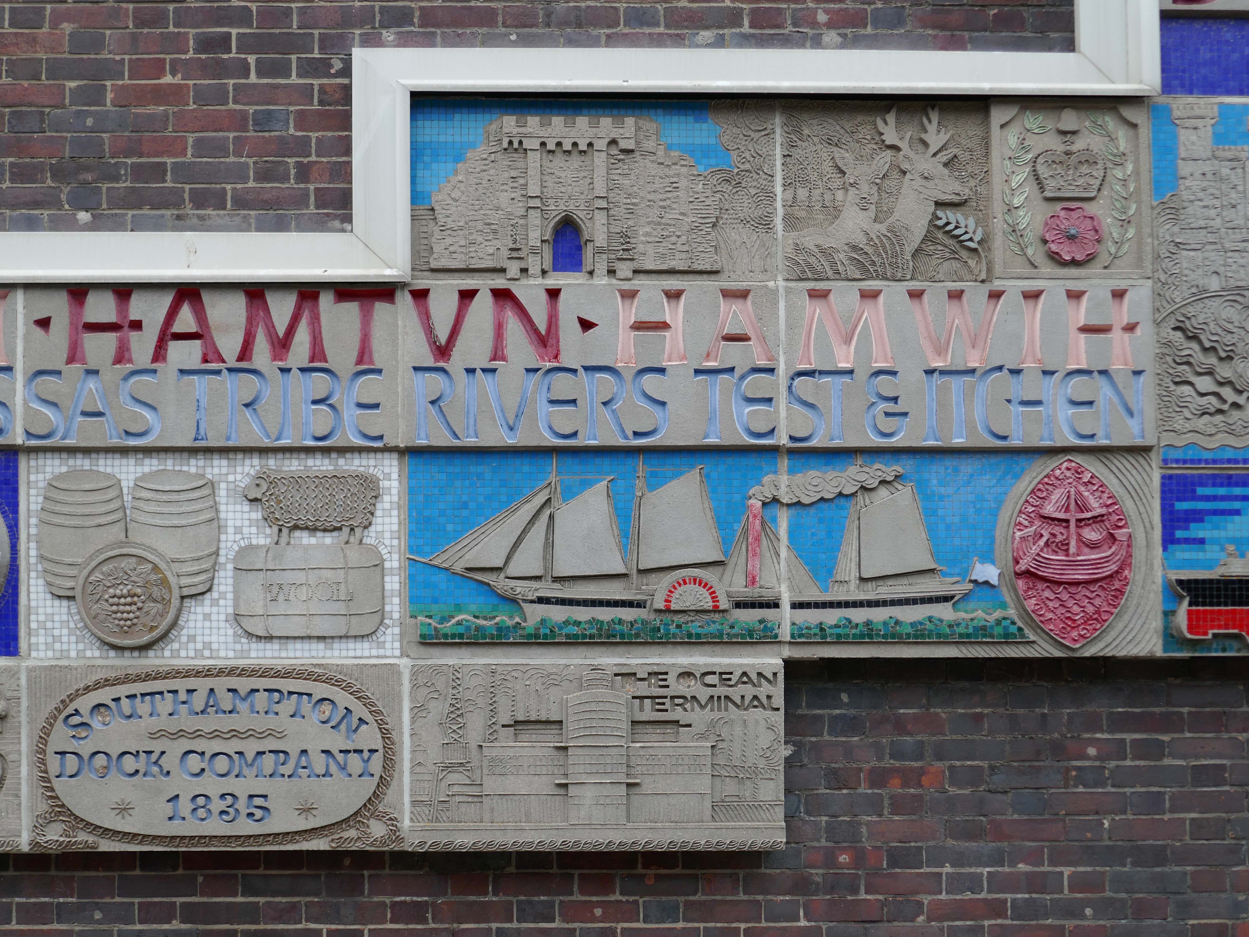
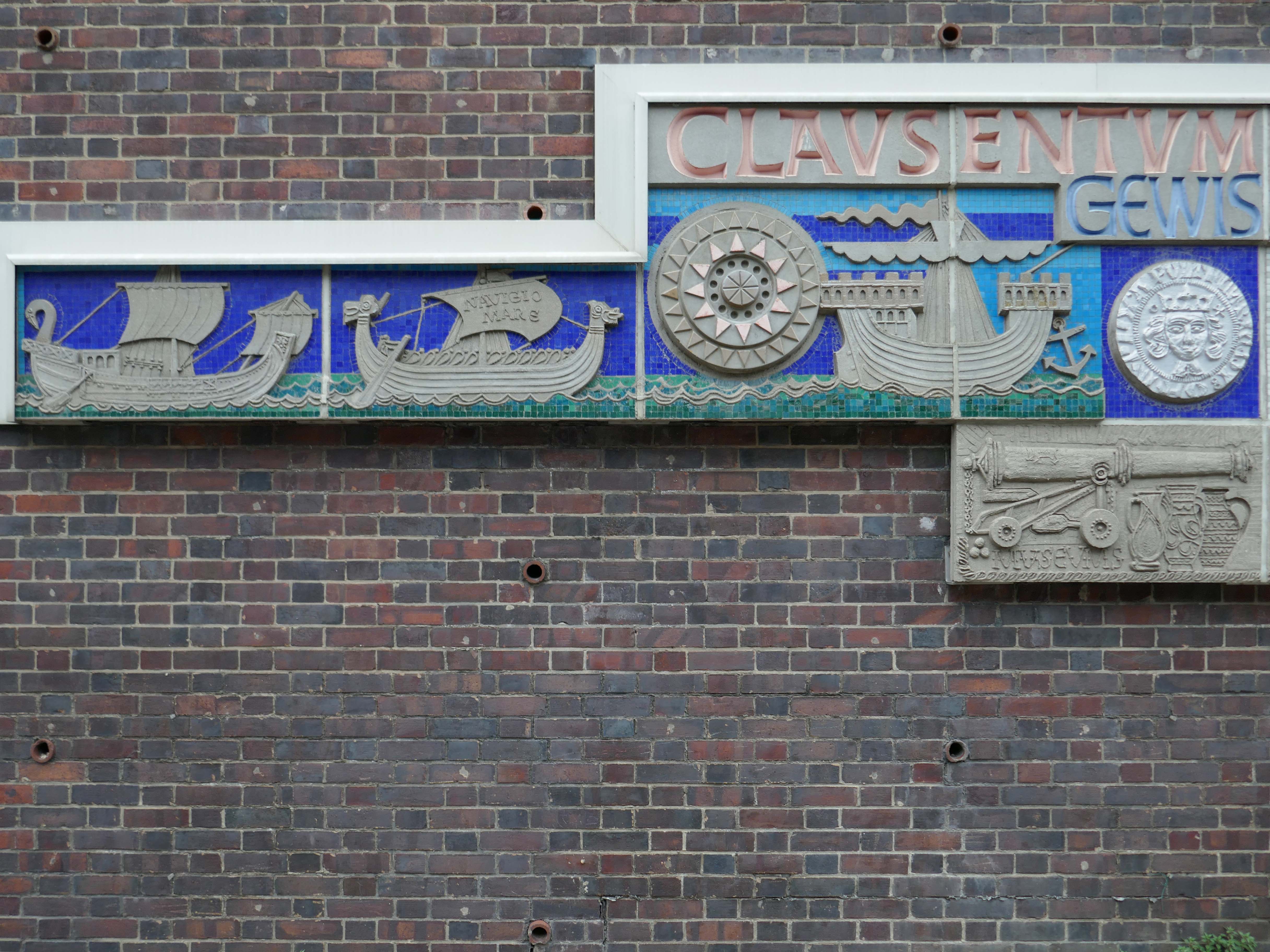
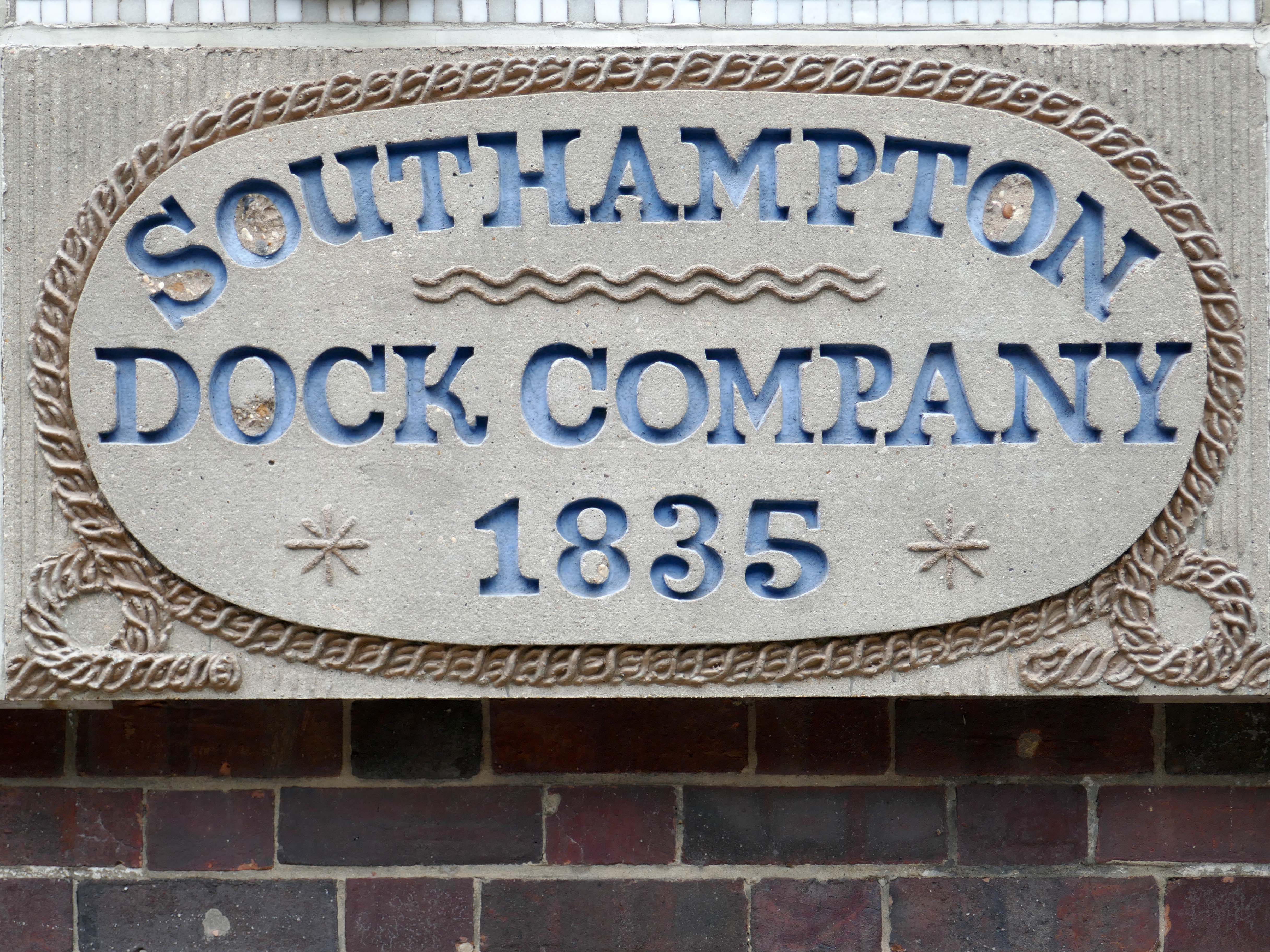
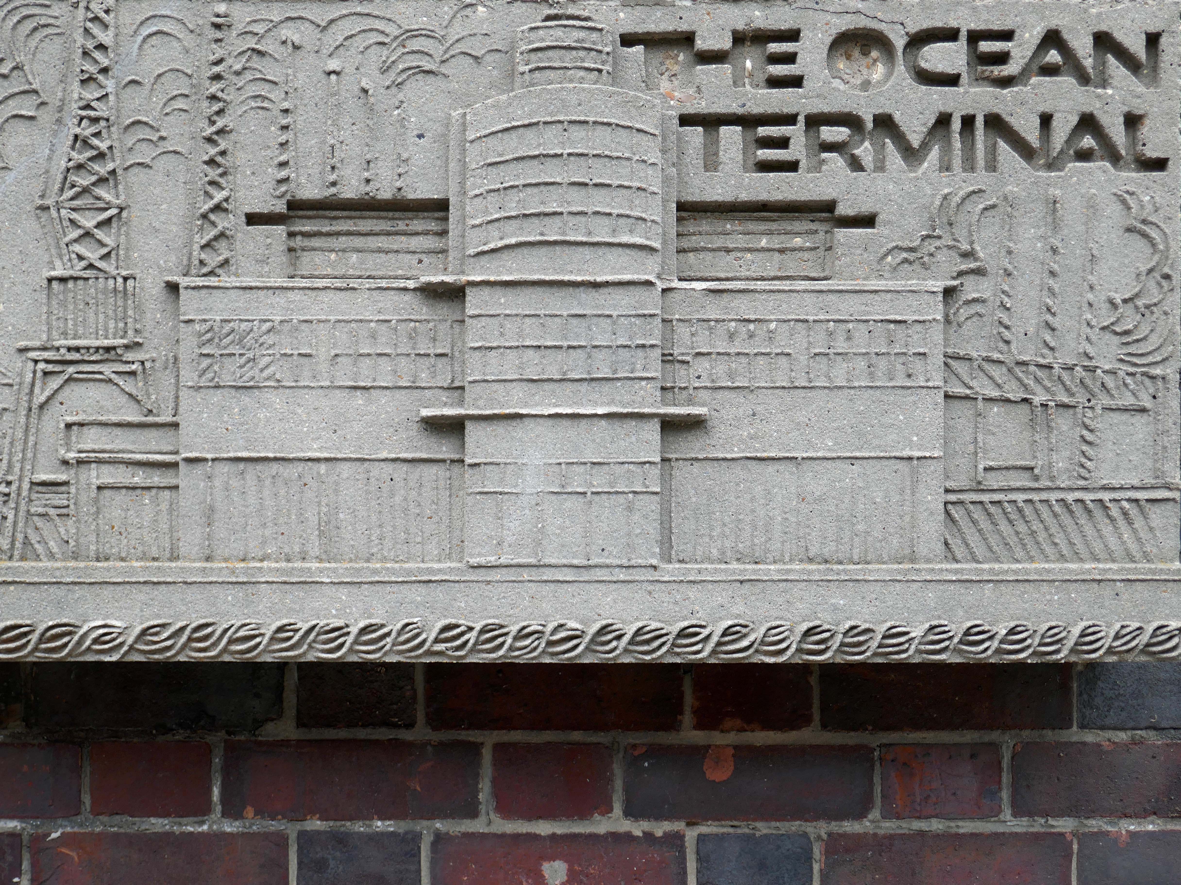
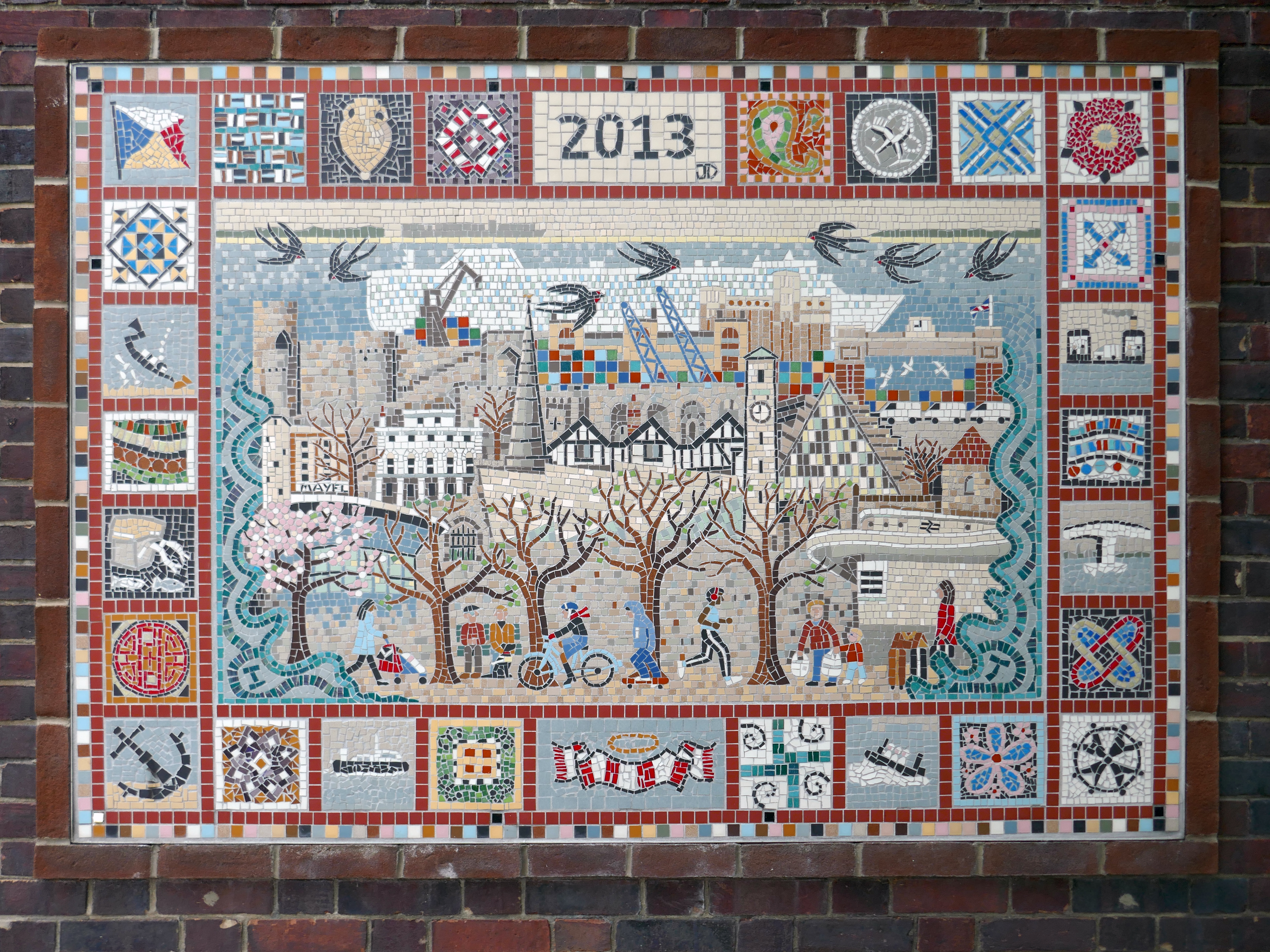
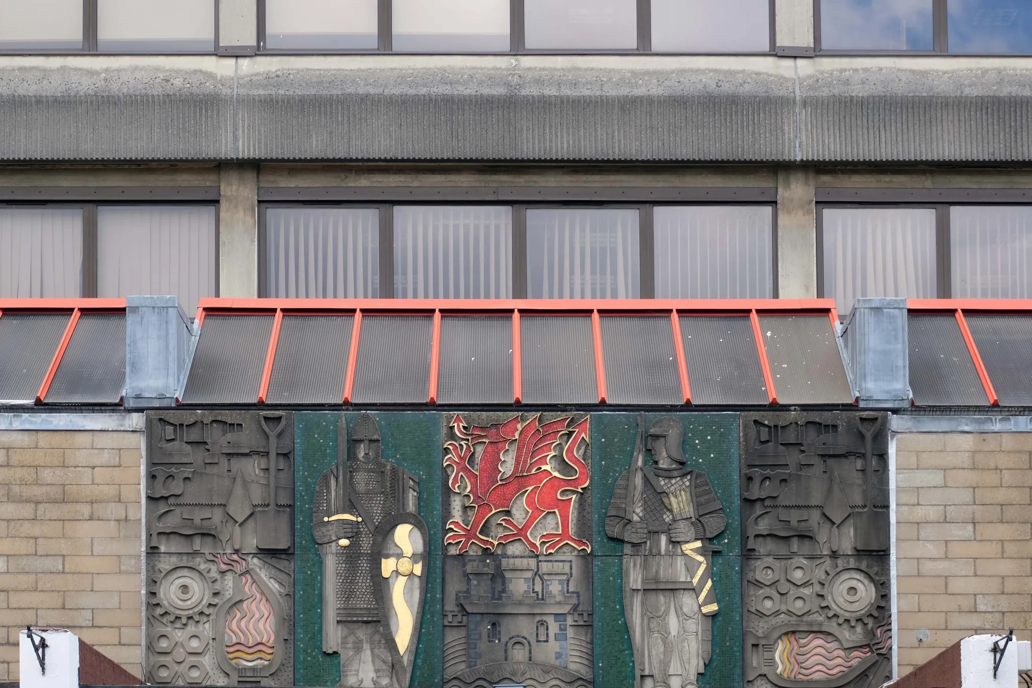
The large and colourful mural in Hamtun Street in Southampton’s Old Town charts the history of the city from Roman Clausentum and Saxon Hamwic, to the modern docks and football.
The mural was commissioned by Sainsbury’s to decorate the façade of their supermarket in Lordshill, Southampton.
The 19m long and 3m high mural consists of thirty seven concrete and glass mosaic panels depicting landmark buildings and iconicevents from Southampton’s history.
Thanks to a grant from the Heritage Lottery Fund, the mural was cleaned and restored by ceramic artist Oliver Budd.
Artist and conservator Oliver Budd creates and restores mosaics for public and private commissions. Budd Mosaics was set up in 1960 by Kenneth Budd, a contemporary of Henry and Joyce Collins. Kenneth invented the technique of prefabricating mosaics in the studio on aluminium mesh panels.
By July 2011 it was installed at Hamtun Street in the heart of the Old Town.
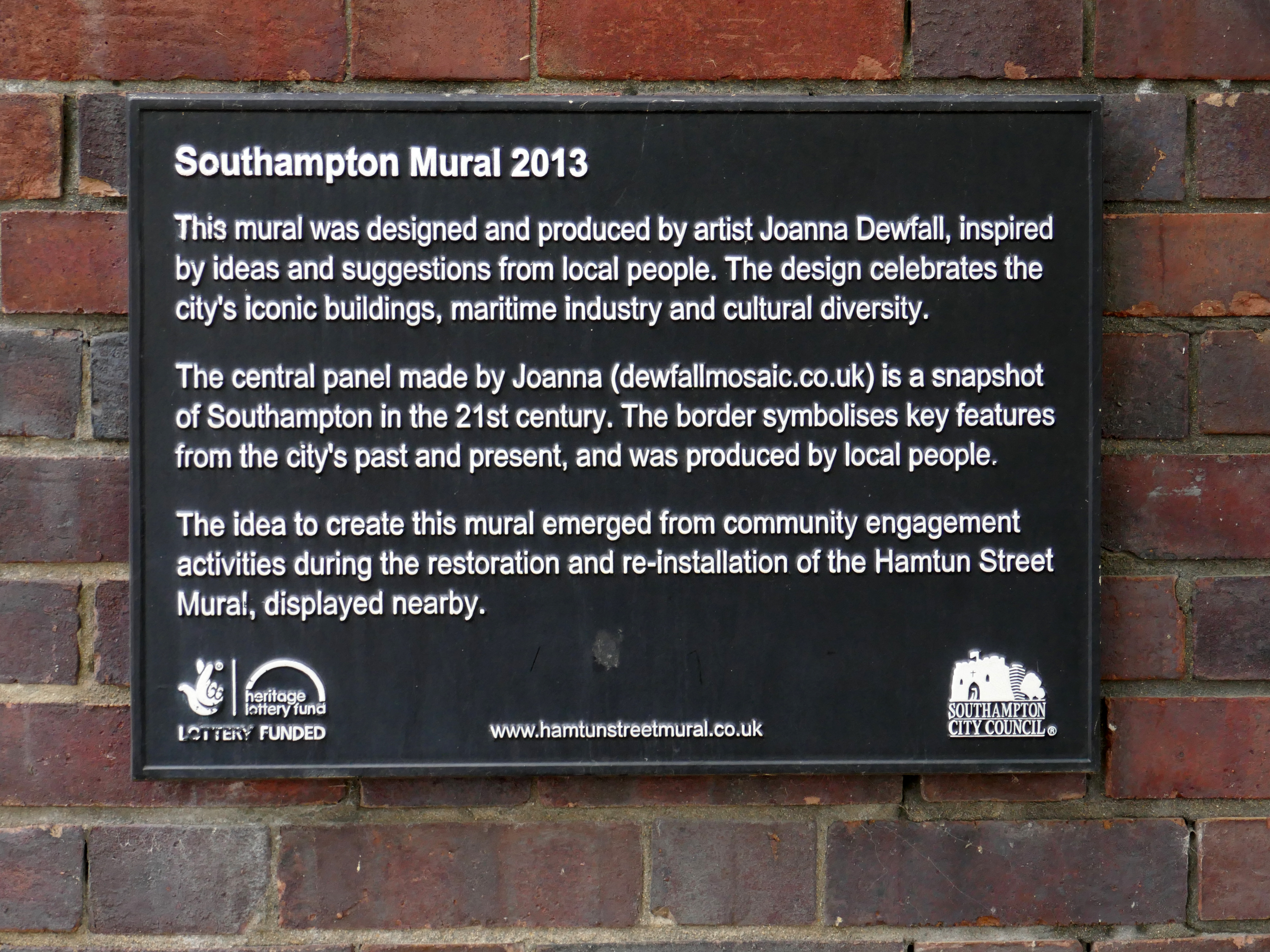
A cross-section of the local community helped create a new mural depicting contemporary Southampton. The design was inspired by ideas from young people at Prince’s Trust, residents of Ironside Court, parents from St. John’s School and local people who attended mosaic workshops led by artist Joanna Dewfall.
Joanna Dewfall’s design captures the city’s iconic buildings, maritime industry and present-day life. The border, made during mosaic workshops, contains themes from past and present celebrating Southampton’s cultural diversity.
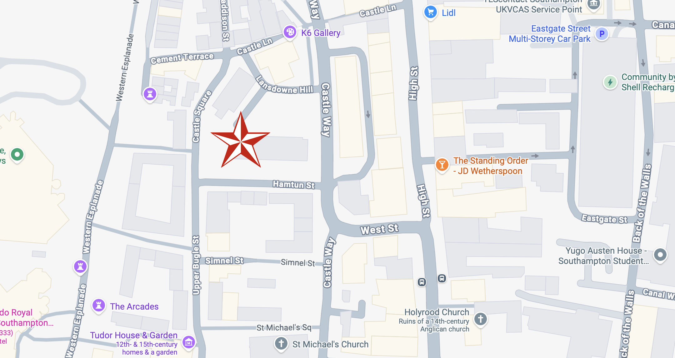
The new mural is located on Castle Way, round the corner from the Hamtun Street Mural.
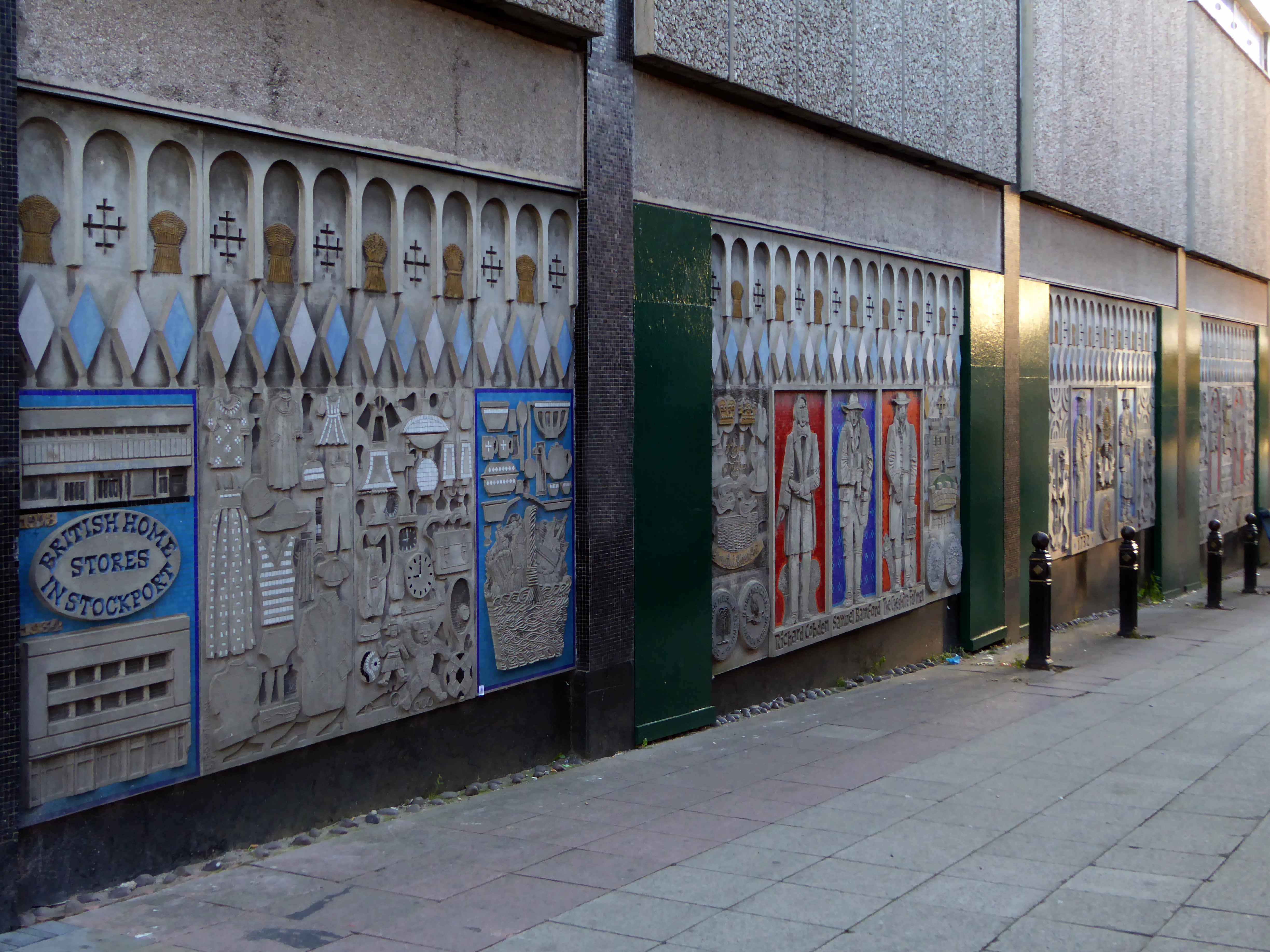
My first encounter with the work of Henry and Joyce Collins, was on the side of the former BHS in Stockport.
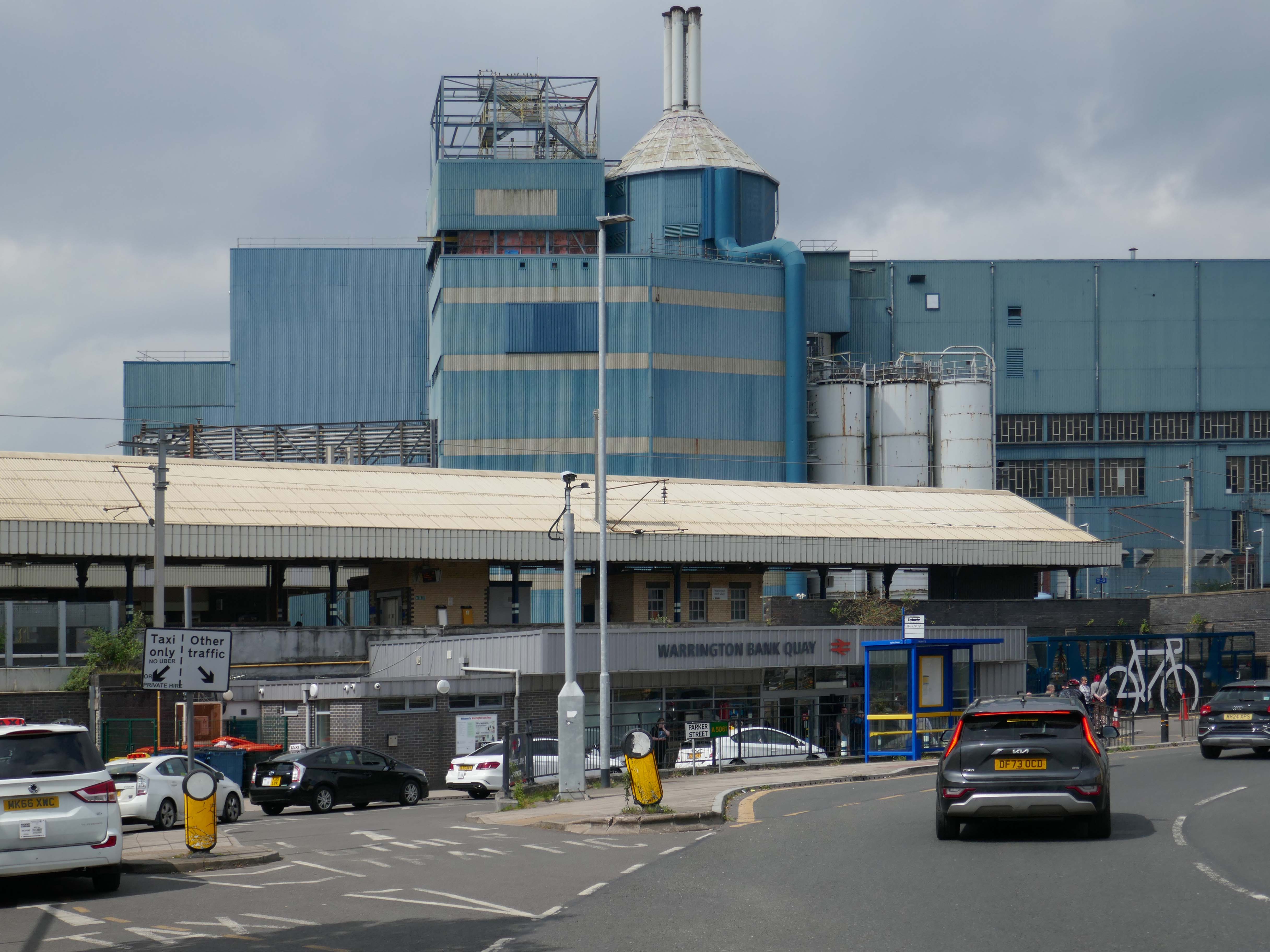
It’s a sunny day in May and we begin at Warrington Bank Quay station.
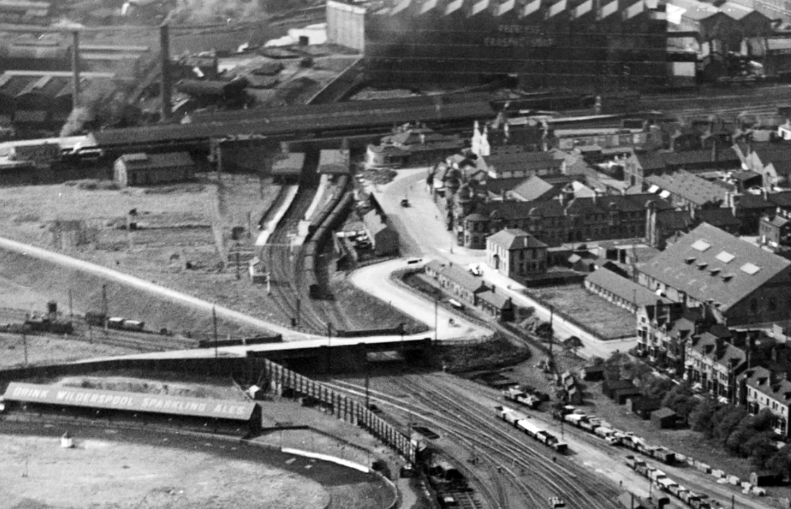
The first Warrington Bank Quay station opened on 4 July 1837.
The station was rebuilt when the line was electrified in 1973, a new power signal box covering an extended area was built east of the station for the electrification.
In 2009 a new entrance hall was completed, with a travel centre/ticket office and a shop.
The buffet on the London bound platforms was modernised.
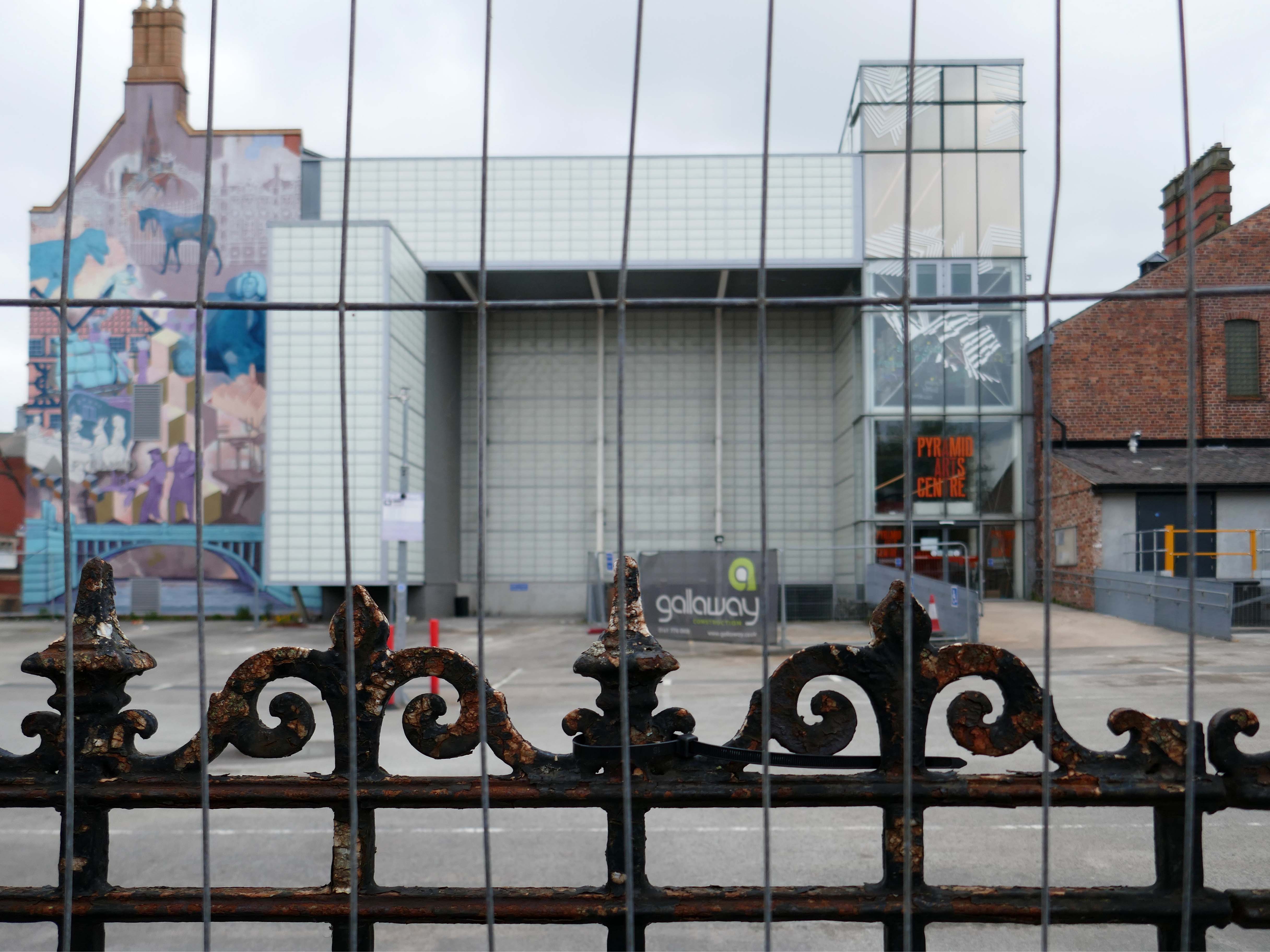
Next onwards to the Pyramid Arts extension 2002, a reworking by Studio BAAD of the former County Court and Inland Revenue Offices 1897-8 by Sir Henry Tanner.
Studio BAAD Ltd started winding up proceedings for a Creditors Voluntary Liquidation in April 2021 and the company was dissolved on 21 July 2021
The centre is currently closed – work began on the redevelopment, which has been funded by a £5 million grant from the Government, in July 2024.
The project aims to make the building more modern, accessible and fit for the future.
The redevelopment includes the addition of a new café and bar area while the Exhibition Hall will become a bigger capacity venue.
Across the way the Masonic Hall 1932-33 Albert Warburton.
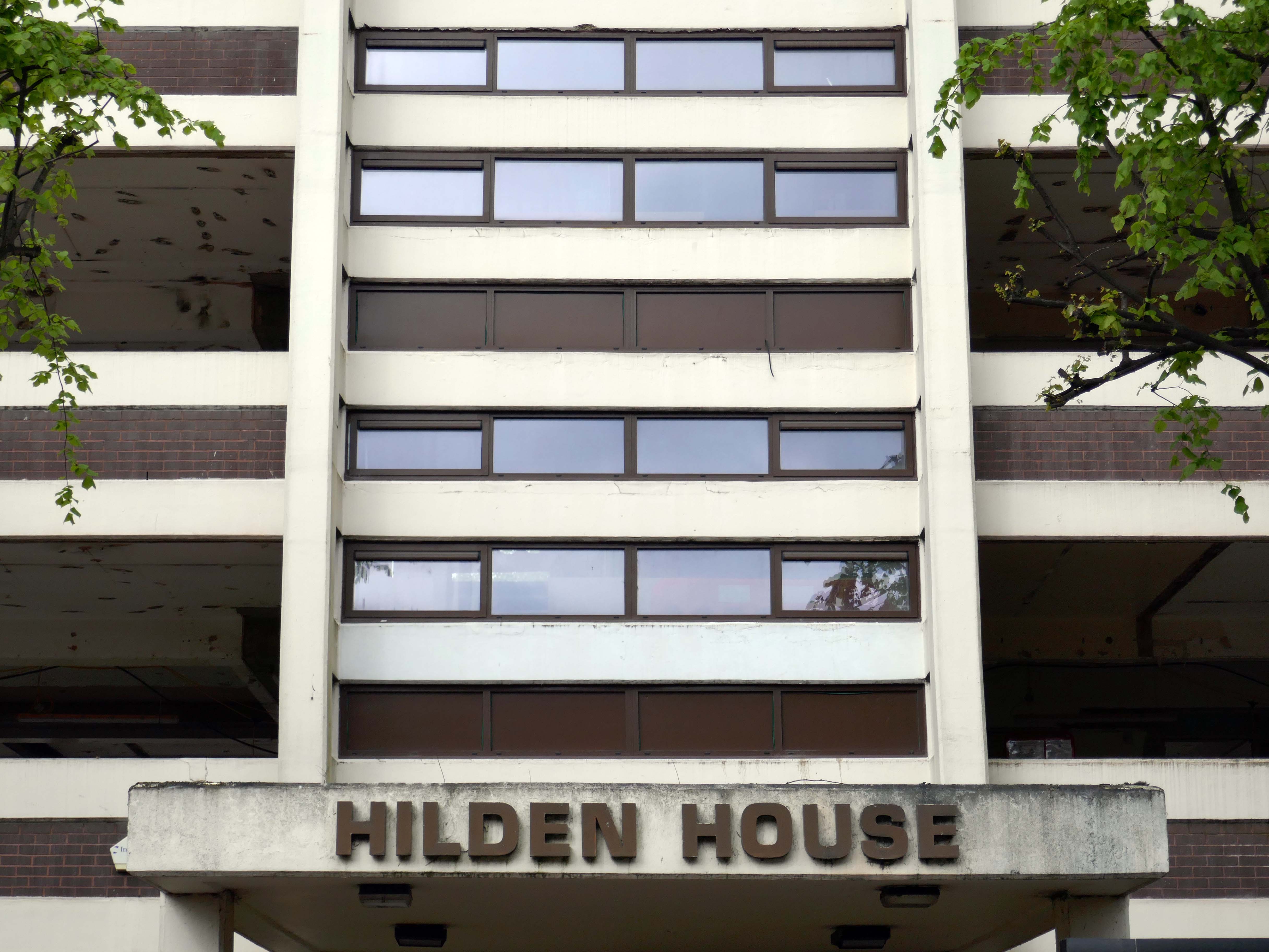
Further along to Hilden House a former Department of Works and Pension building, currently undergoing a transformation into a residential block.
The £18m office to residential reset of the 52,400 sq ft building will offer a mix of one- and two-bedroom apartments in plans now approved by the local authority.
Caro Developments, working in tandem with architectFalconer Chester Hall, hopes to start construction later this year.
According to a planning statement submitted on the developer’s behalf by Savills, once complete, the five-storey block will offer residents a concierge service, a gym and wellness facility, a resident’s lounge, and a co-working area.
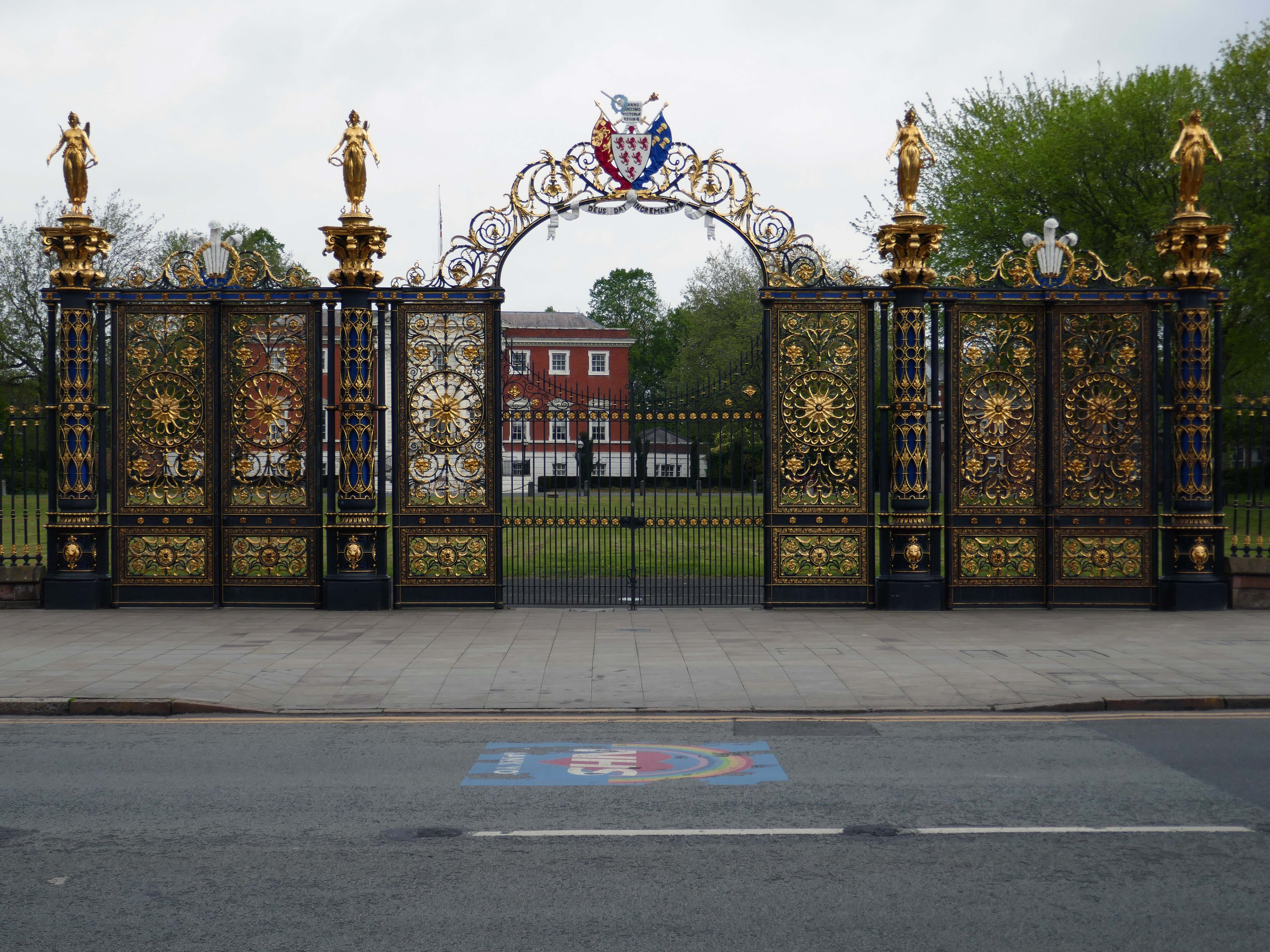
Way out of period but a notable Warrington landmark are the Golden Gates designed in 1862.
The gates were made for the International Exhibition of 1862, and then intended for Queen Victoria’s Sandringham home in Norfolk. Coalbrookdale found it hard to find a buyer for such grand gates, so Frederick Monks, one of the town’s earliest councillors, was able to buy and bring them to Warrington to stand at the front of the town hall lawn. Monks also presented the cast iron Cromwell statue, designed by John Bell, to Warrington in 1899.
The Golden Gates are Grade II* Listed, along with the gate piers and the lamps which line the driveways at either side of the town hall
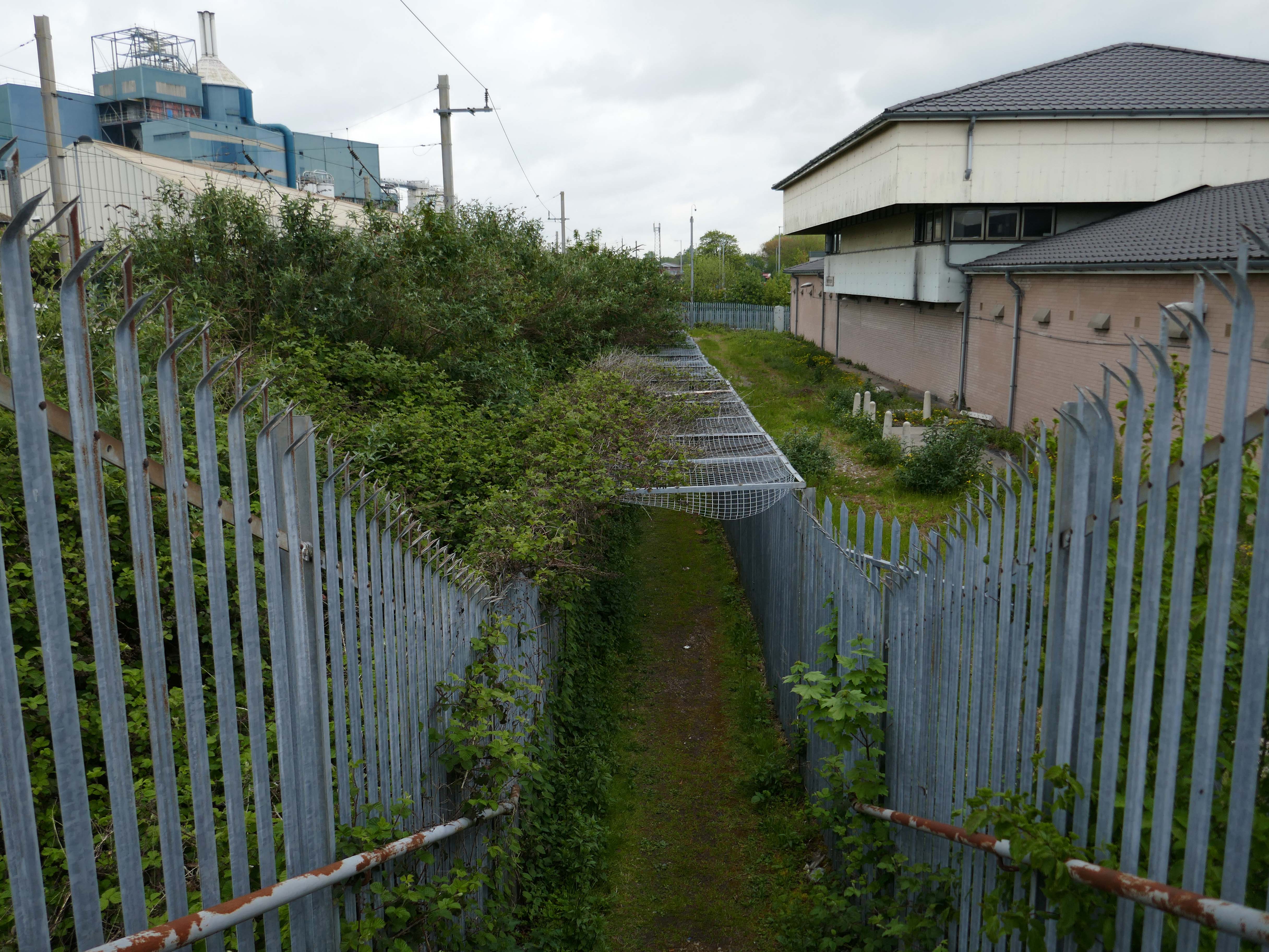
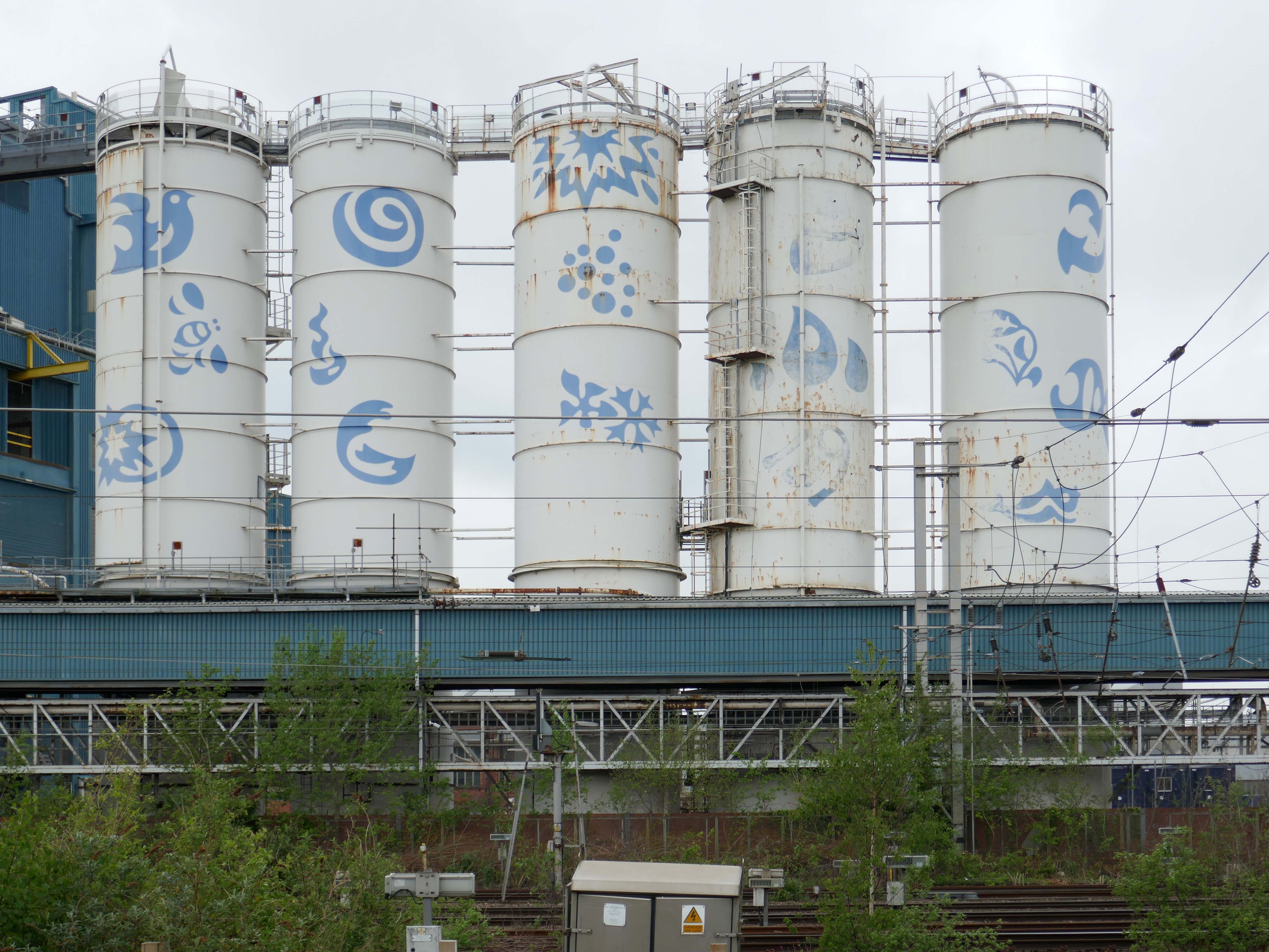
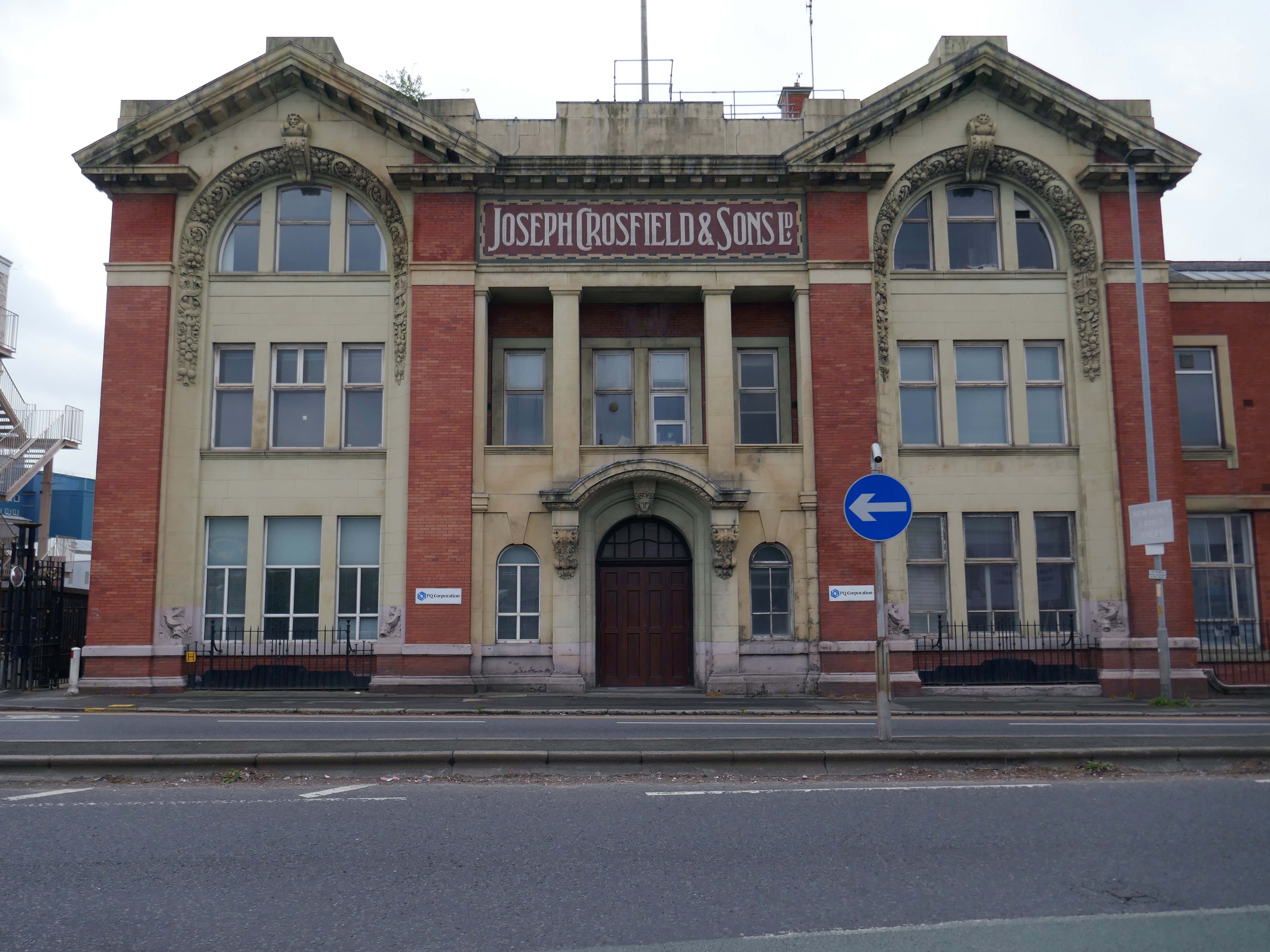
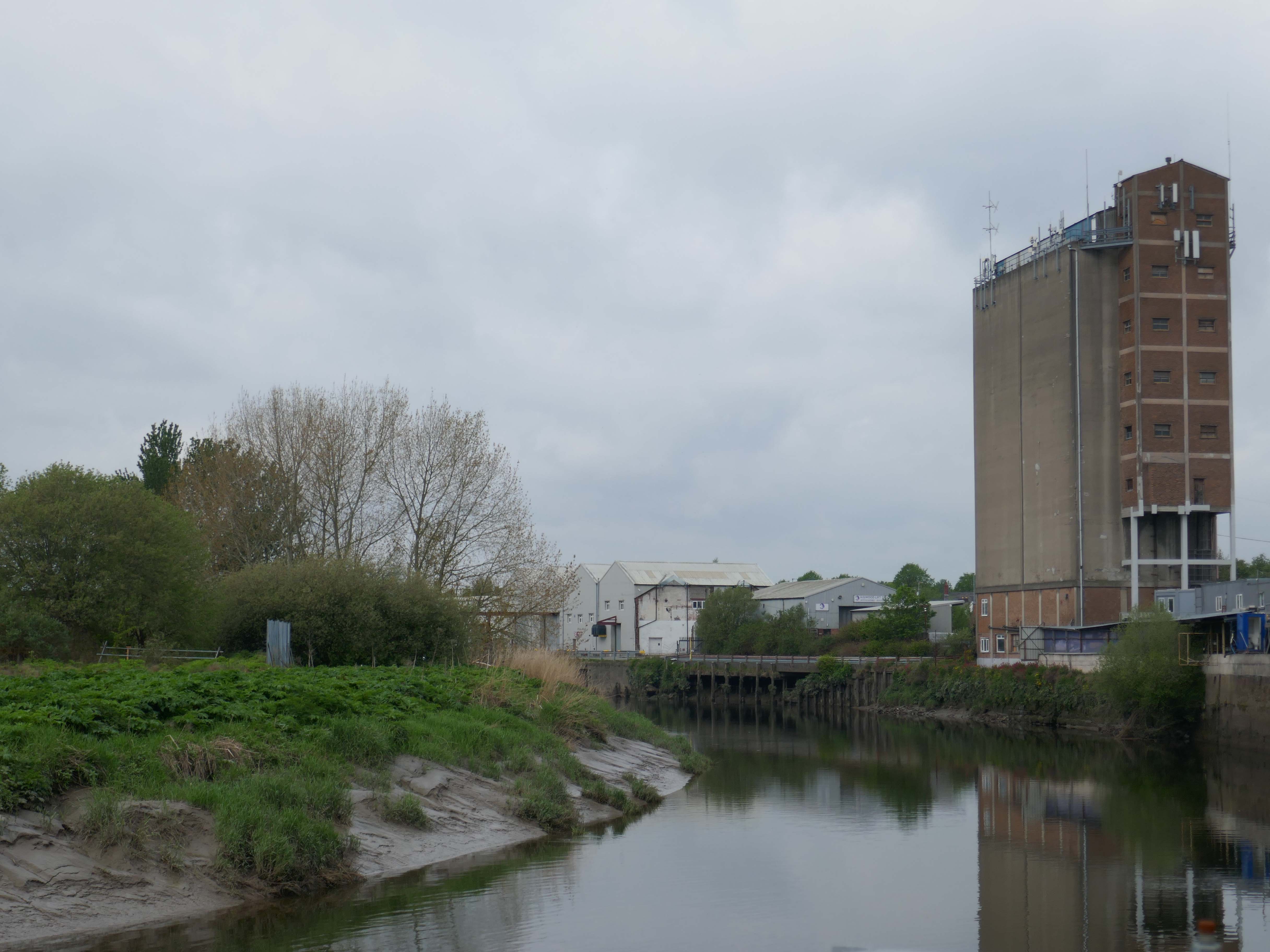
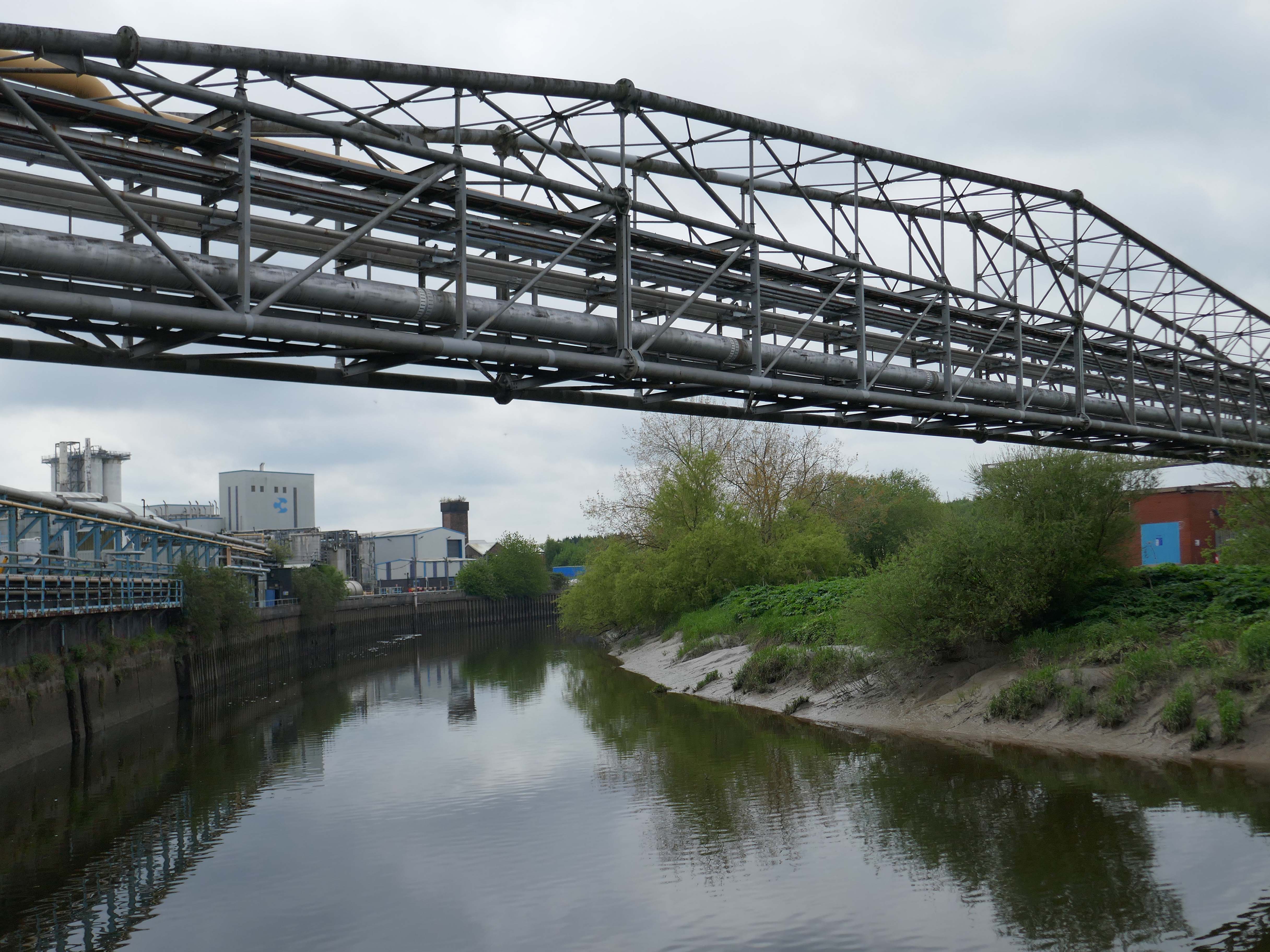
Up the road now to the Soap Works – first views from across the railway tracks.
Then over the bridge.
Joseph Crosfield was born in Warrington, the fourth son of George Crosfield and his wife Ann née Key. In 1814, Joseph’s apprenticeship having finished, at the age of 21 he decided to establish his own soap making business in Warrington.
In 1911 the company was purchased by Brunner, Mond & Company and 1919 it was absorbed into Lever Brothers. From 1929 Crosfield was a subsidiary of Unilever. In 1997 its Warrington speciality chemicals division that made ingredients for detergents and toothpastes was acquired by ICI and in 2001, Ineos Capital purchased the company. The name Crosfield was finally lost as it was renamed Ineos Silicas. In 2008 Ineos Silicas was merged with PQ Corporation, with the new company retaining the name of PQ Corporation.
The Crosfield’s factory closed for good in October 2020.
Dante FS Group formally acquired four acres of the site this month for an undisclosed fee from EcoVyst.
The latter firm will continue to operate from sections of the site, as will PQ Corporation, with Dante buying land closest to the train station, including the visible blue buildings and white Unilever tanks.
Renamed Platform at Bank Quay, the ‘next-generation, state-of-the-art modular data centre’ is ‘set to power the UK’s growing AI economy’ and bring high-tech jobs to the town.
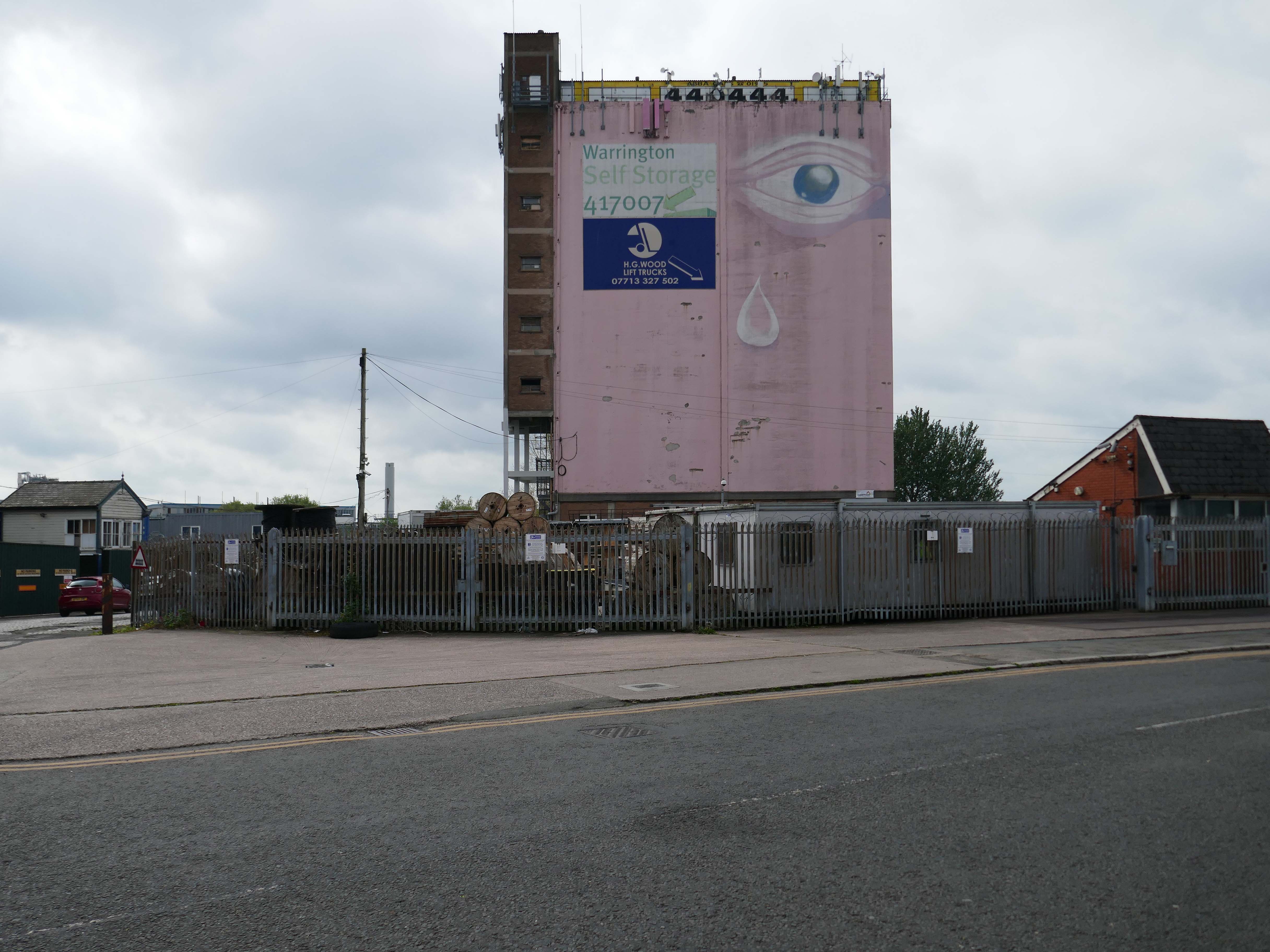
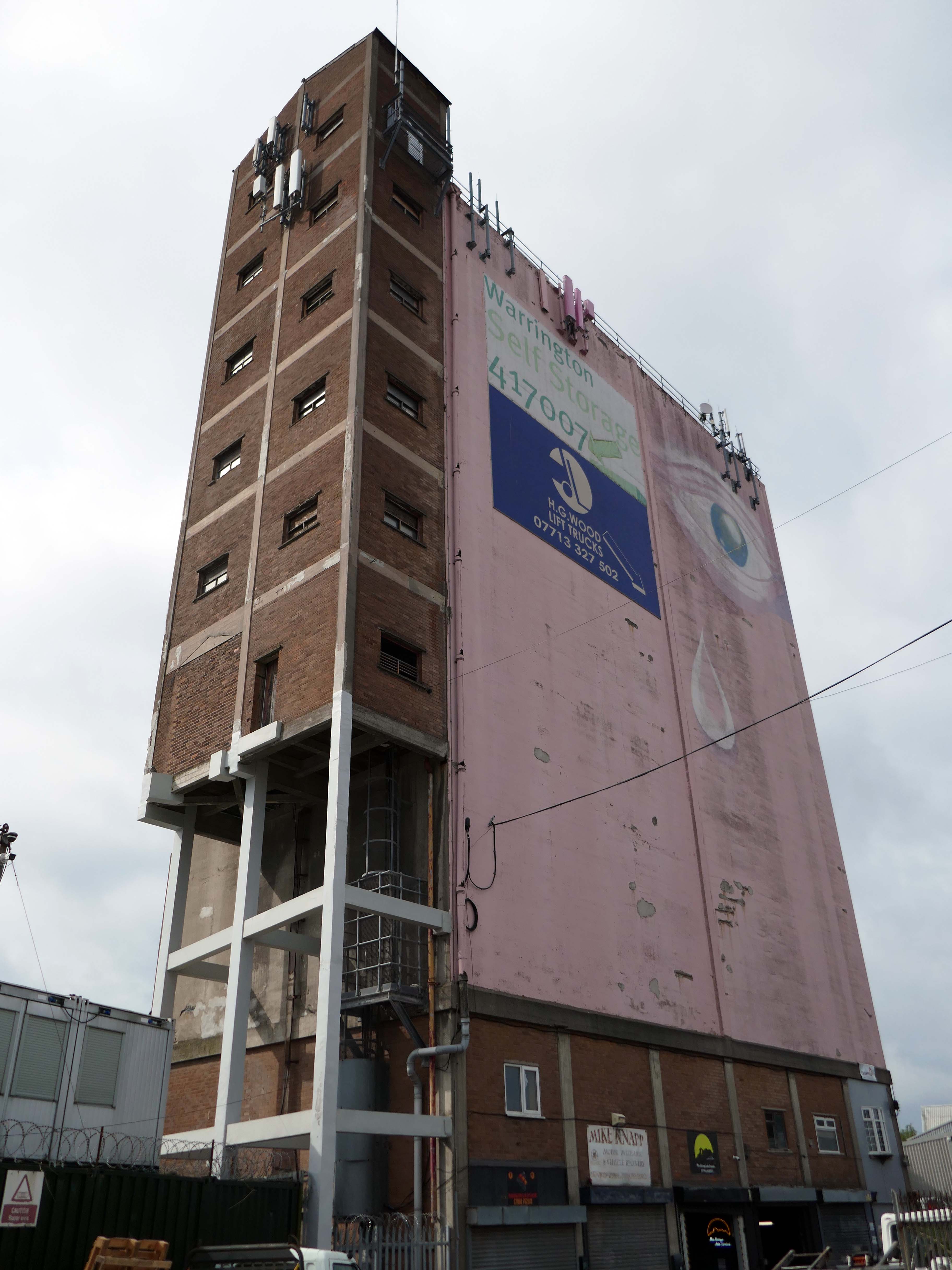
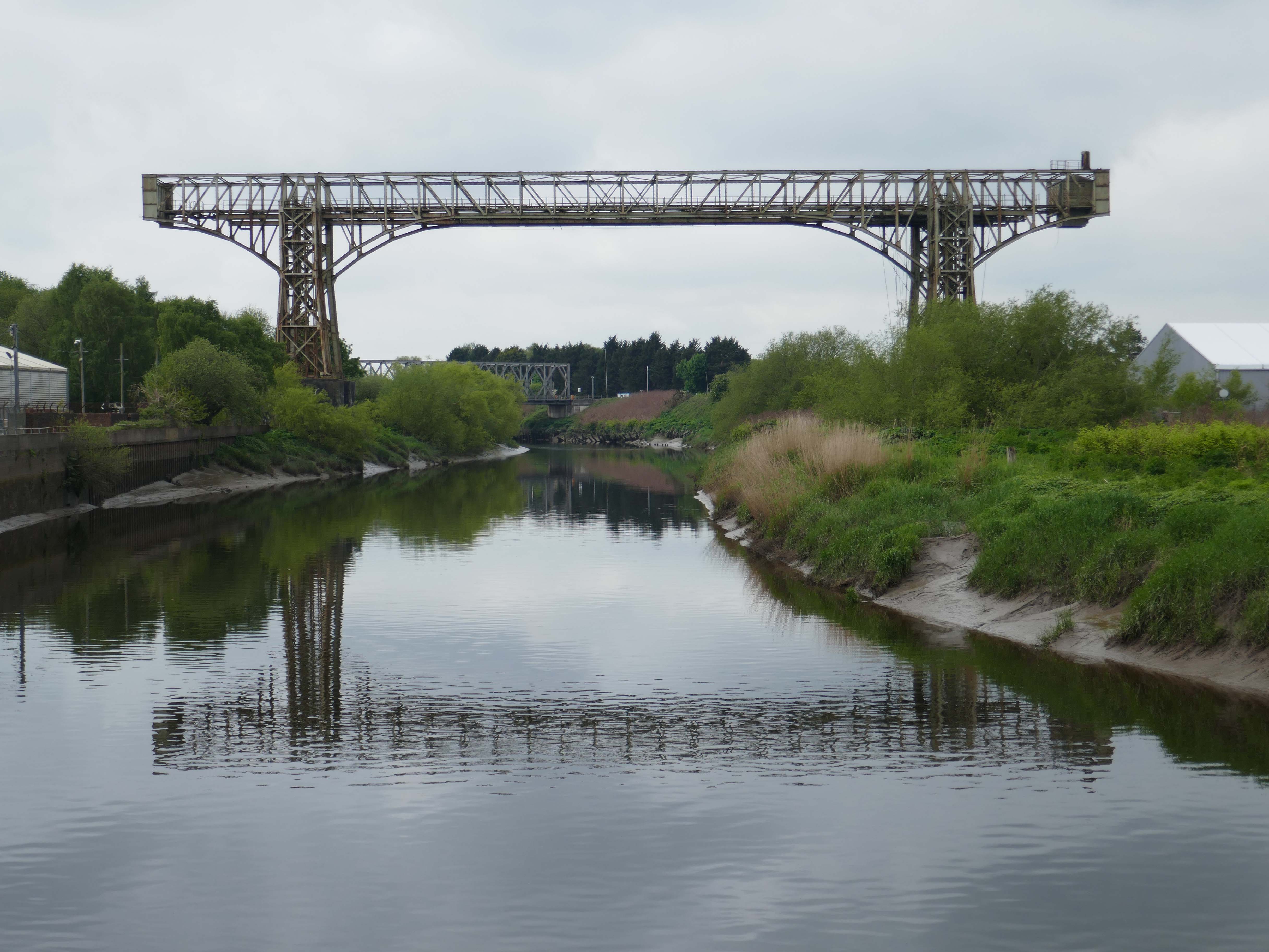
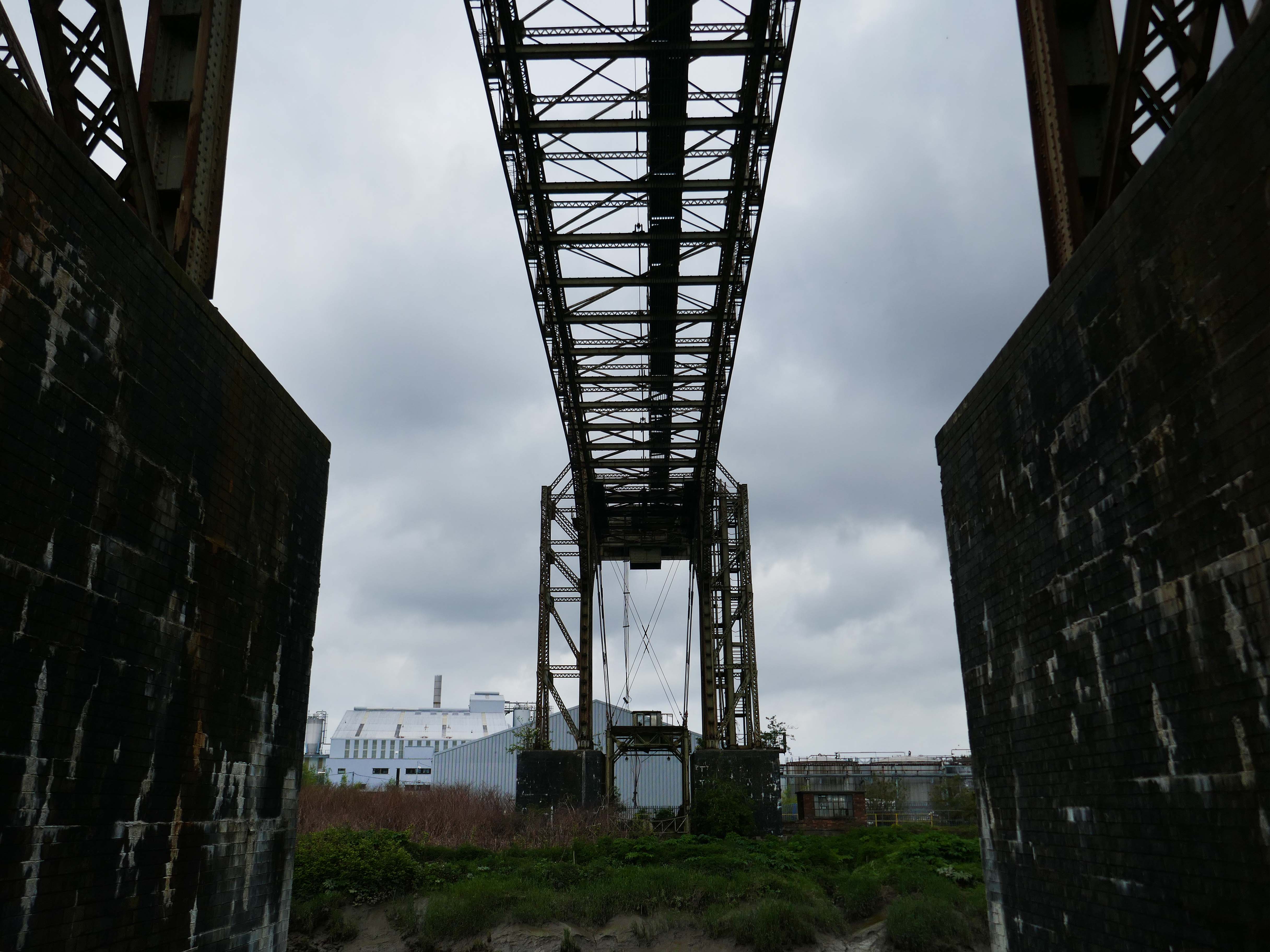
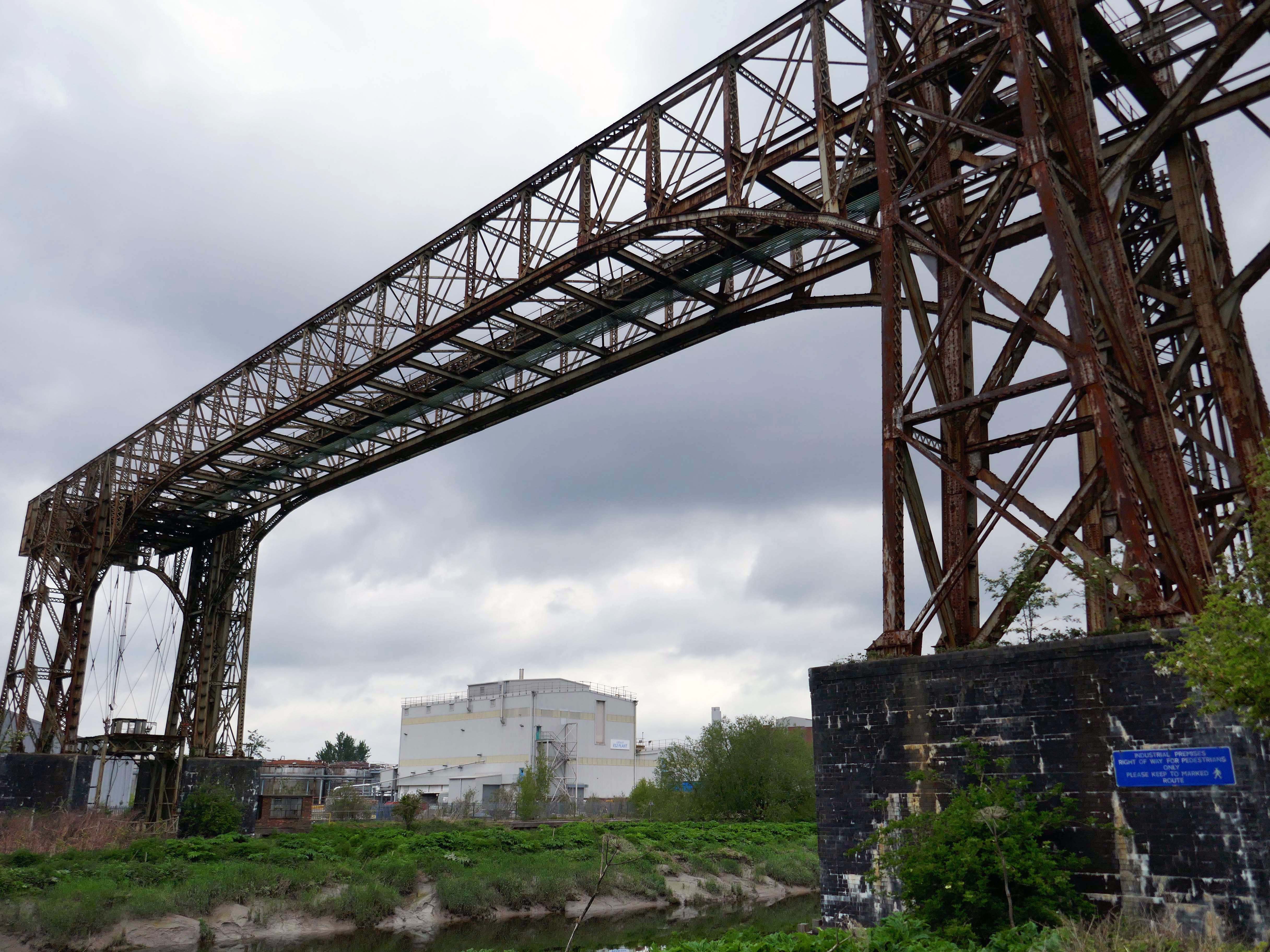
Warrington Transporter Bridge aka Bank Quay Transporter Bridge or Crosfield’s Transporter Bridge across the River Mersey is a structural steel transporter bridge with a span of 200 feet.
It is 30 feet wide and 76 feet above high water level, with an overall length of 339 feet.
It was commissioned in 1916 and, although it has been out of use since about 1964, it is still standing. It was designed by William Henry Hunter and built by William Arrol and Co.
The Transporter Bridge was built to despatch finished product from the cement plant that had been built on the peninsula. It was originally designed to carry rail vehicles up to eighteen tons loaded weight.
The bridge was converted for road vehicles in 1940, and was certified to carry loads of up to thirty tons in 1953.
This was my first visit in 2017 – recorded on Modern Mooch.
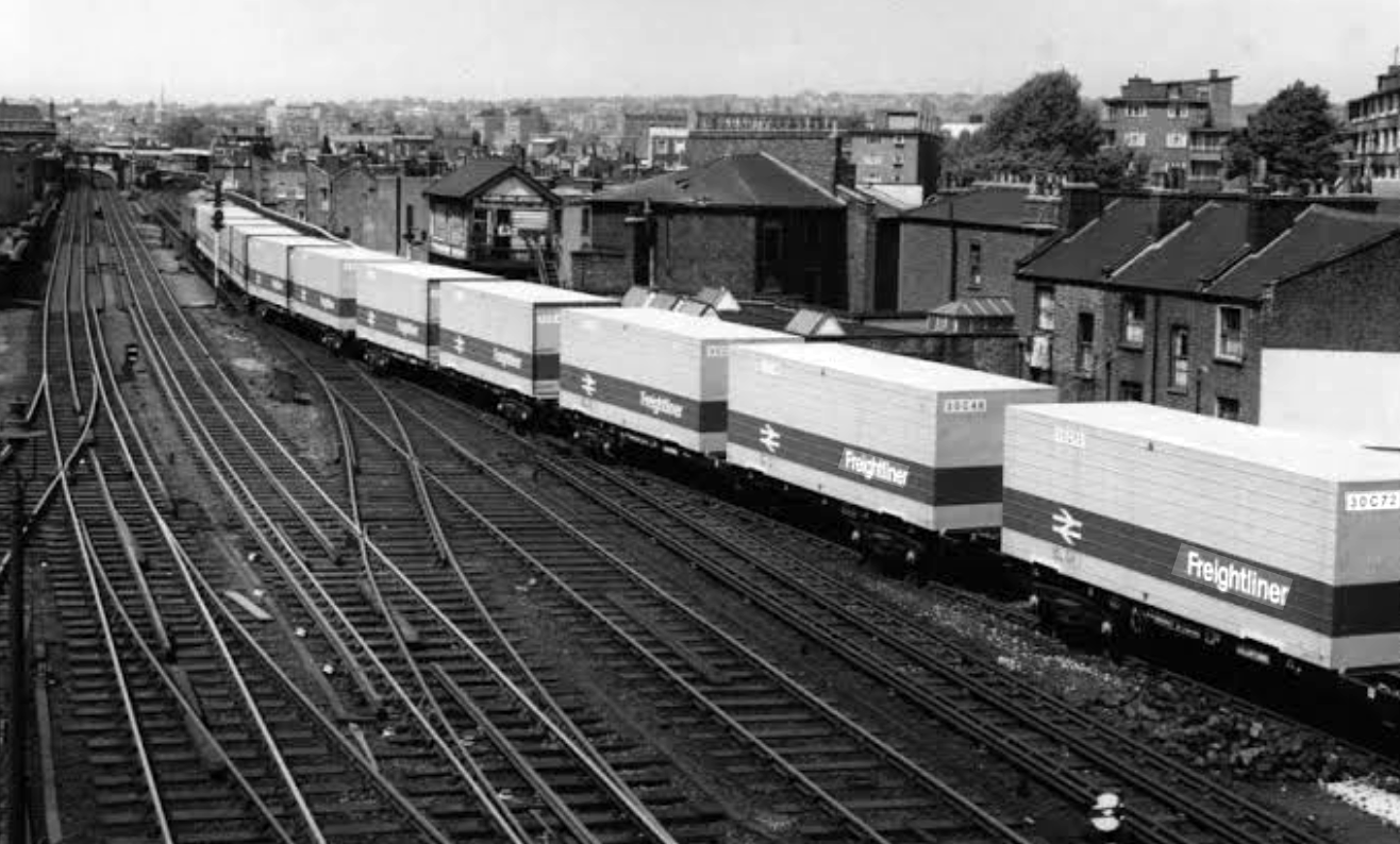
Highlight on any day out anywhere is the discovery of arcane British Rail typography.
There’s a brief history of Freightliner history right here.
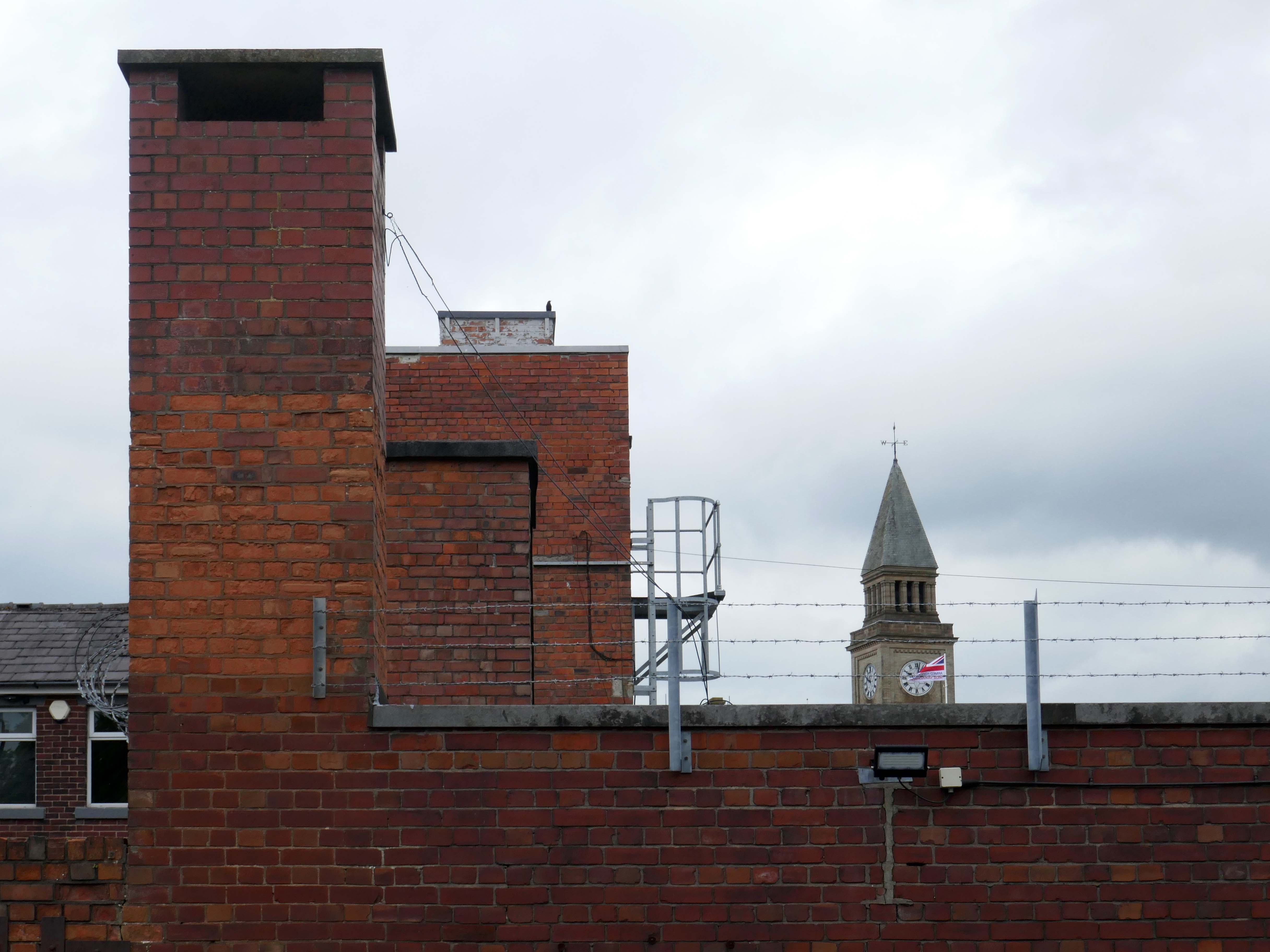
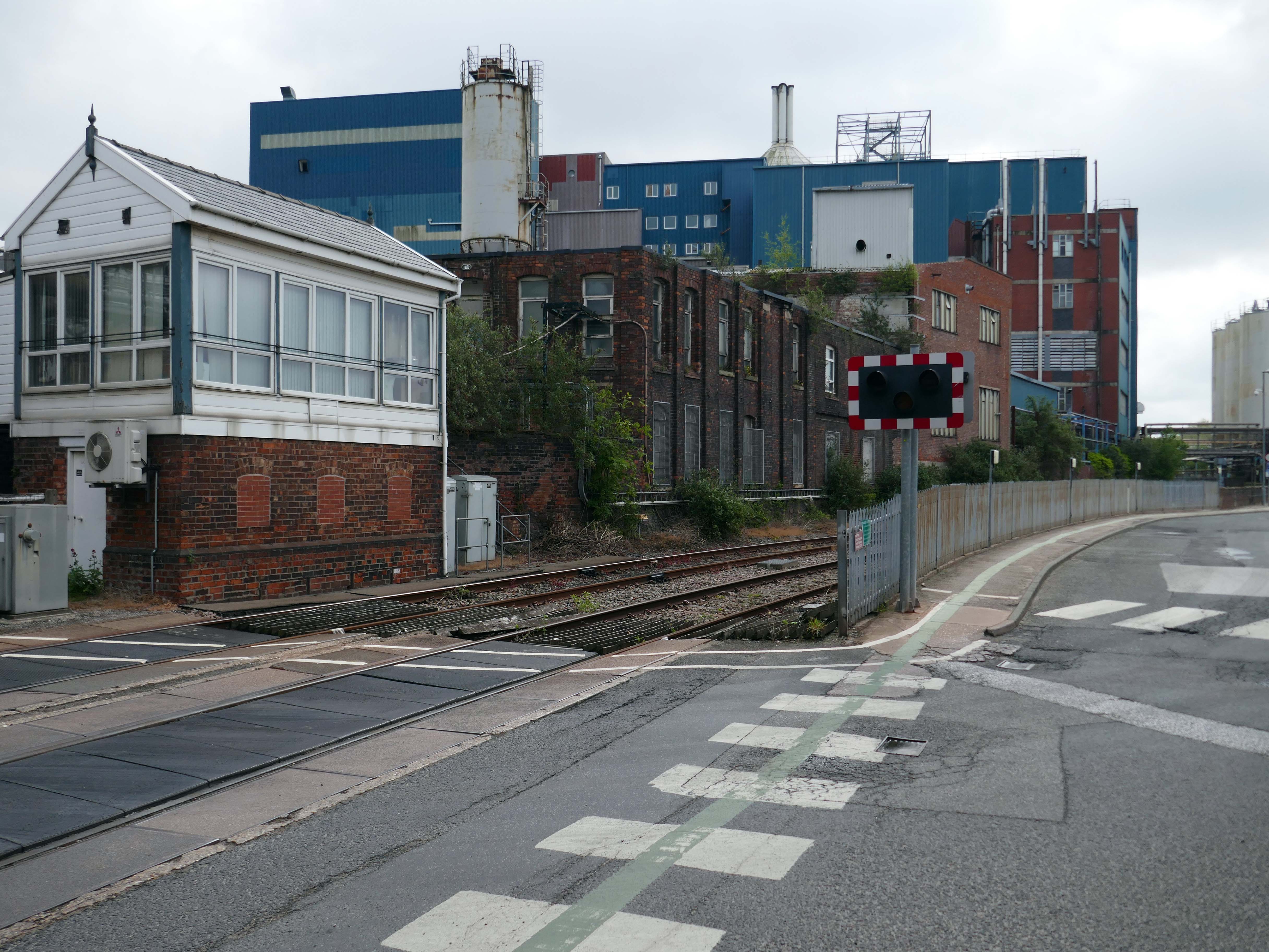
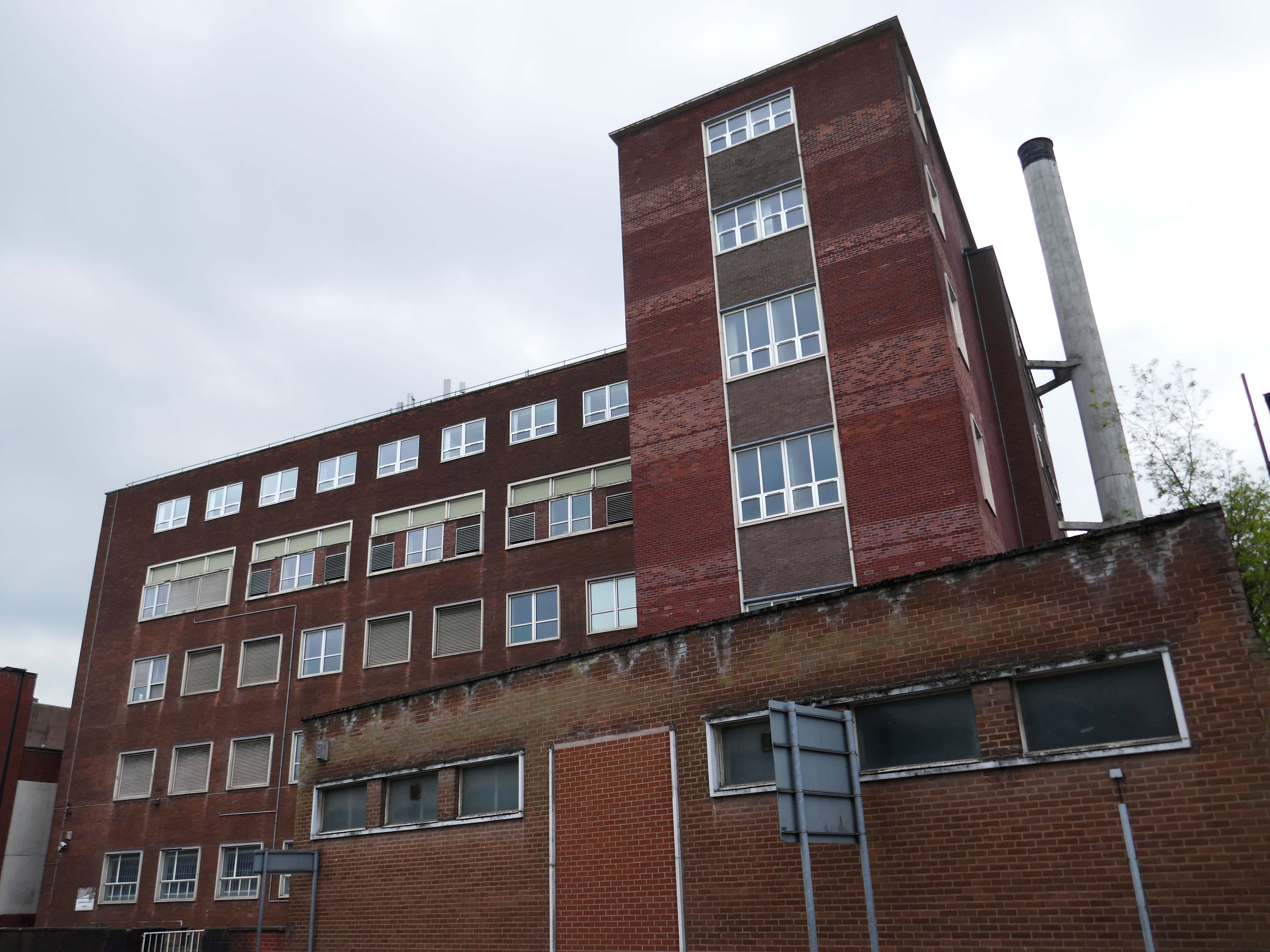
Back now to Bank Quay and off to the Telephone Exchange.
This is the 1969 building designed by the MODBW, Reginald Norman Dixon with lead architect P Clinton.
Linked to the 1955 building designed by John Onslow Stevens.
Biggest thanks to Lisa Kinch who can be found over on Instagram, for all her informative research into telephone exchanges.
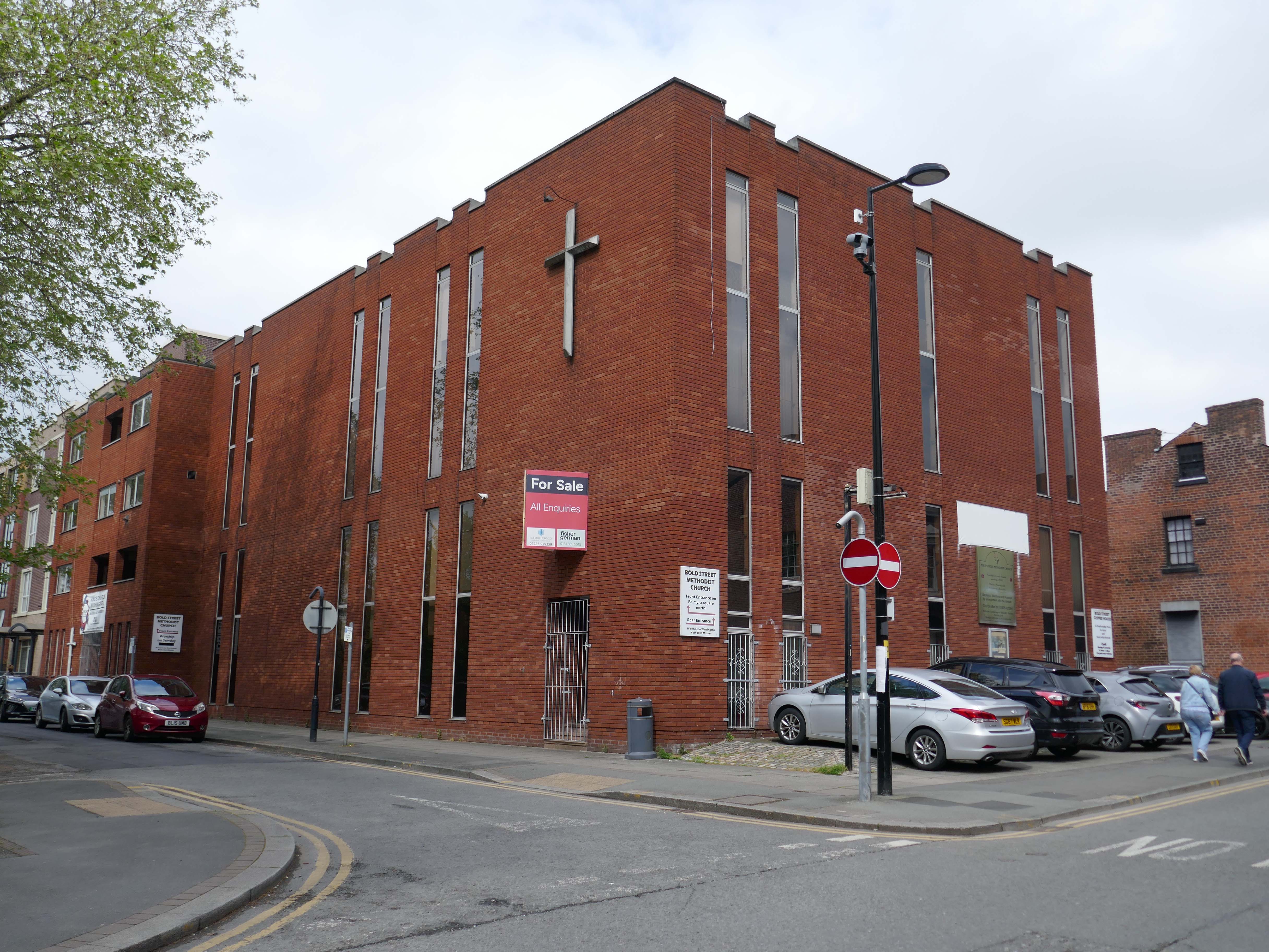
Toward the town centre and we pass the Bold Street Methodists Church – 1973-75.
Currently closed and for sale.
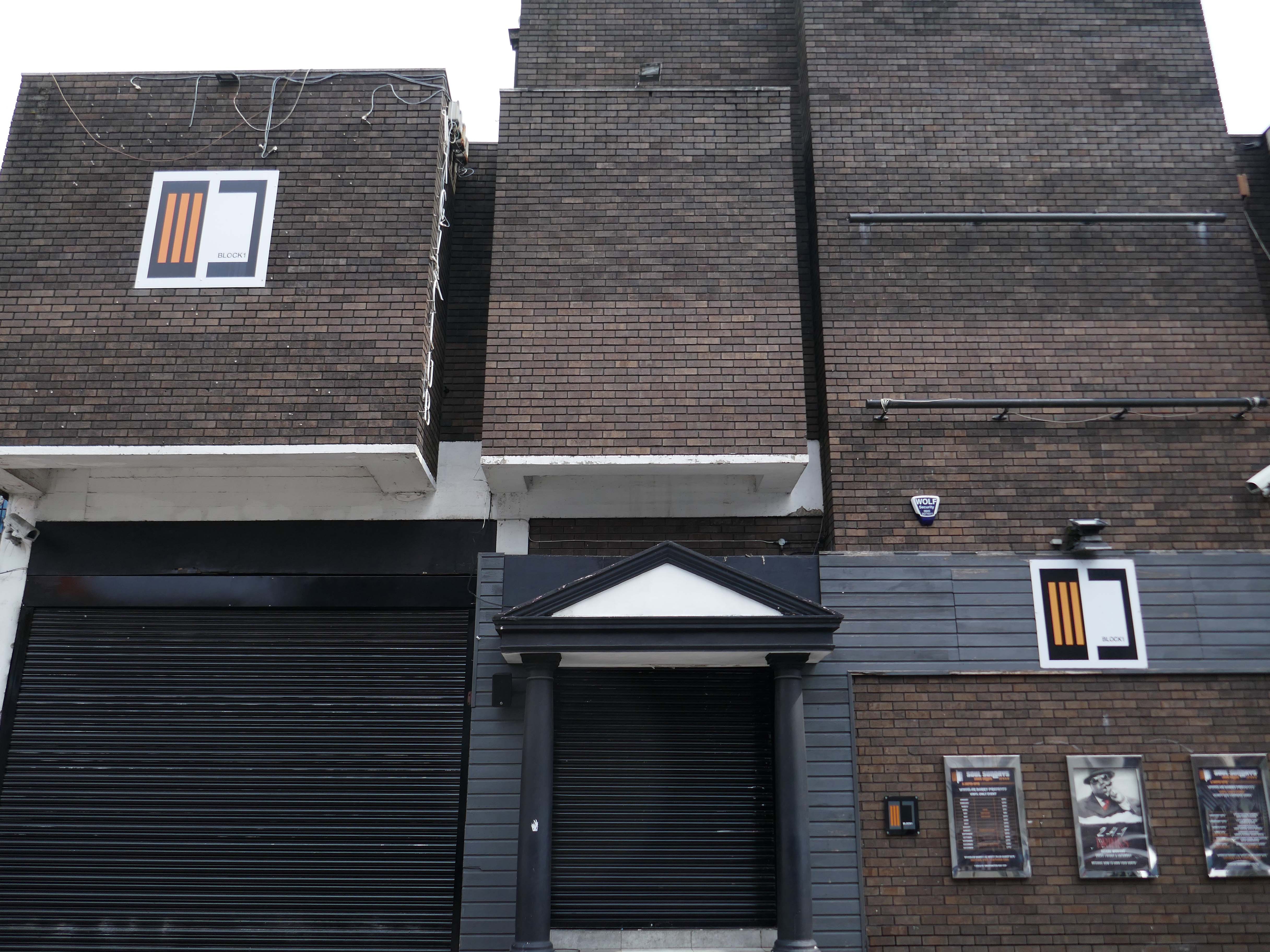
Thence to the Block 1 nightclub.
Medicine night club early 2000s.
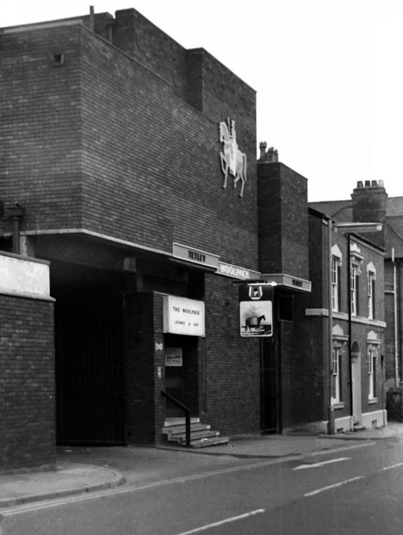
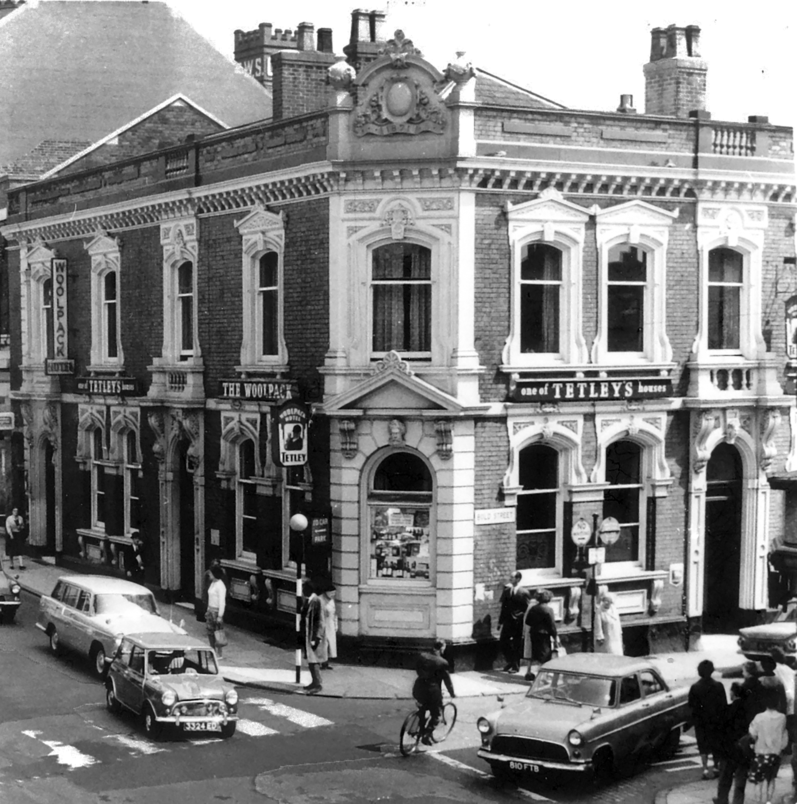
Originally a Tetley’s house named The Woolpack.
Got served my first pint in there, I was only 14.
Karl Beckett
Coming down those stairs, I slipped and the heel came off my boot, I’d only had one drink – loved those boots.
Sue Duncan
This was the original Woolpack on the site.
Much of the town centre is dominated by the Golden Square shopping centre.
Designed in 1974 by Ardin and Brookes and Partners, since enlarged.
There is also extensive pedestrianisation and hard landscaping on the surrounding streets, carried out in 2002 by Landscape Design Associates with sculptural works by Howard Ben Tre.
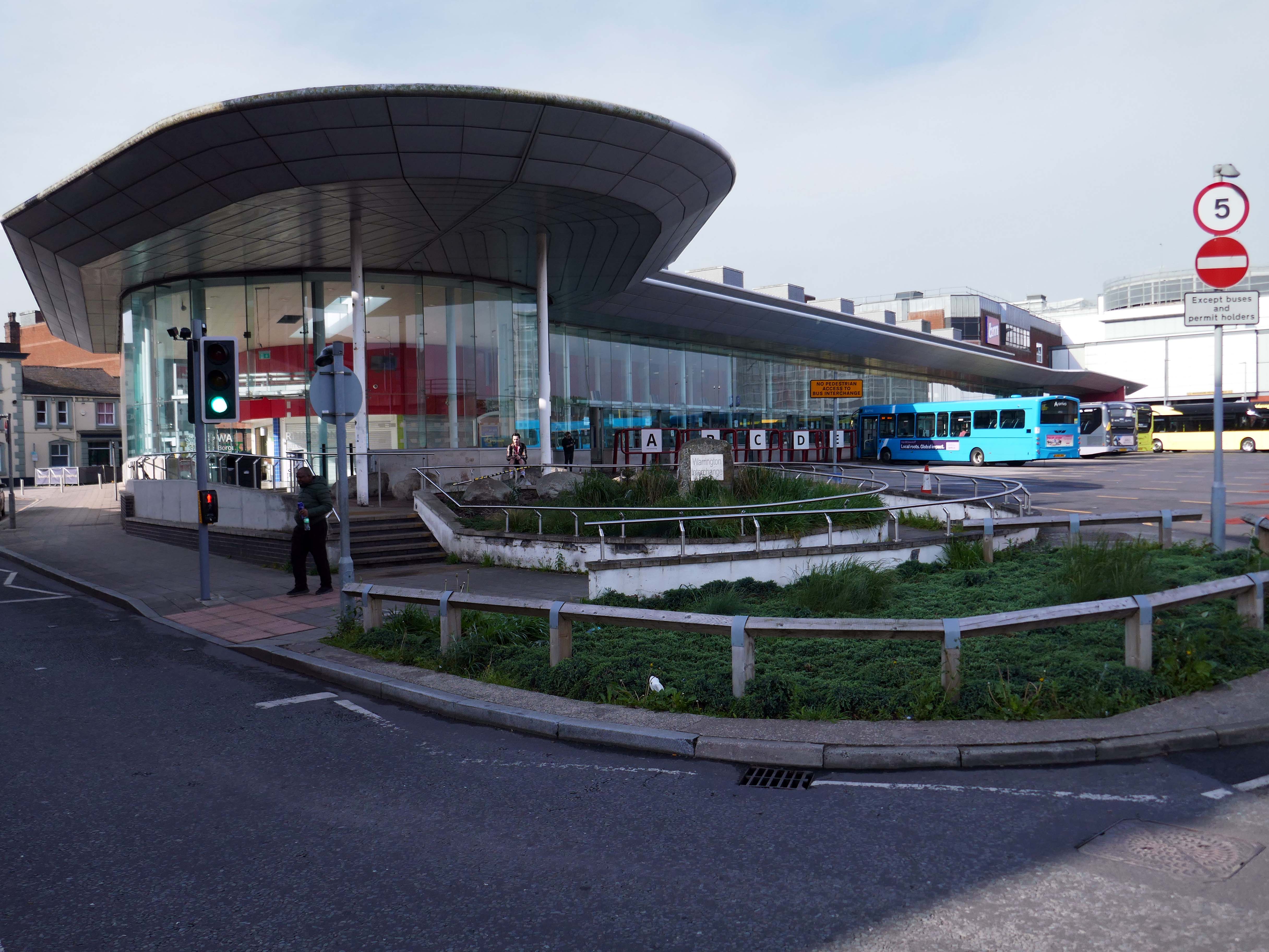
Finally to the Bus Station which used to look like this:
Until it became an Interchange and looks a lot like this.
Warrington’s new bus interchange was opened on 21 August 2006. From 1979, bus users travelled from a facility on Golborne Street, but it was very unpopular due to its very dreary appearance.
The name Walsall is derived from Walh halh, meaning valley of the Welsh, referring to the British who first lived in the area. Later, it is believed that a manor was held here by William FitzAnsculf, who held numerous manors in the Midlands. By the first part of the 13th century, Walsall was a small market town with a manor house; the weekly market was introduced in 1220 and held on Tuesdays. The mayor of Walsall was created as a political position in the 14th century.
Significant developments also took place nearer to the town centre, particularly during the 1960s when a host of tower blocks were built around the town centre; however, most of these had been demolished by 2010.
The Memorial Gardens opened in 1952, in honour of the town’s fallen combatants of the two world wars. The Old Square Shopping Centre, a modern indoor shopping complex featuring many big retail names, opened in 1969.
Much of the reconstruction of the post-war period was quickly reconsidered as ugly and having blighted the town. In 1959, John Betjeman advised that with sensitive restoration the old buildings of the High Street could become:
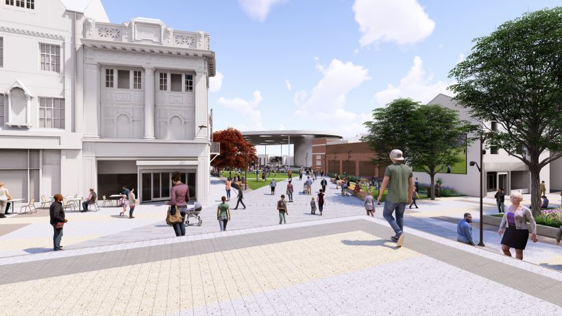
There is to be further demolition on the High Street, to open up the vista between the Bus and Railway stations.
In 2021 Walsall secured funding of £11.4m from the Future High Street Fund. With further investment from Walsall Council we are now delivering the early phases of the Town Centre Masterplan, through the Walsall Connected Gateway Project.
Approval has been granted to remodel the Saddlers Centre to create a more open and attractive arrival experience for train passengers whilst also opening up Park Street. Butler’s Passage, which has in the past been the centre of antisocial behaviour, will disappear as some of the buildings are removed to create a large open walkway, connecting the rail and bus hubs.
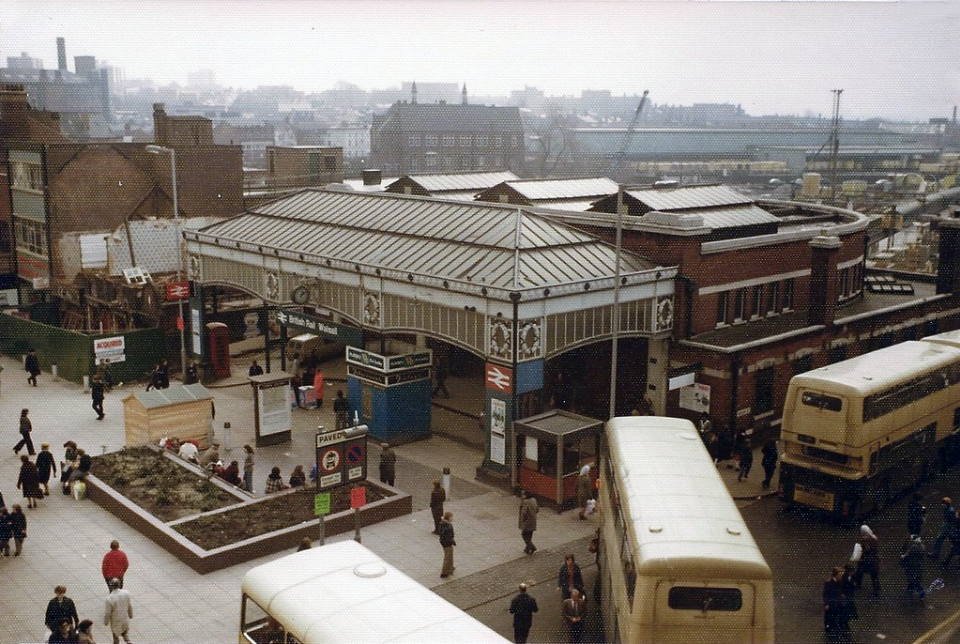
Former Railway station 4th March 1978 – photo by Walsall 1955
The station was about to be closed, demolished and replaced by a new Marks & Spencers and the Saddlers Centre.
The existing entrance to the railway station on Station Street.
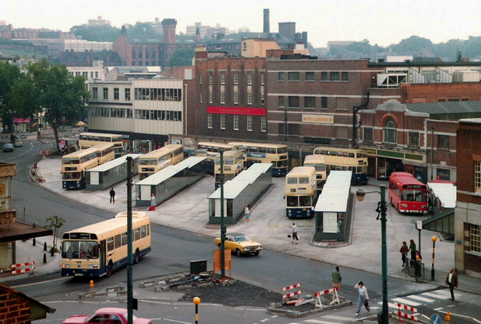
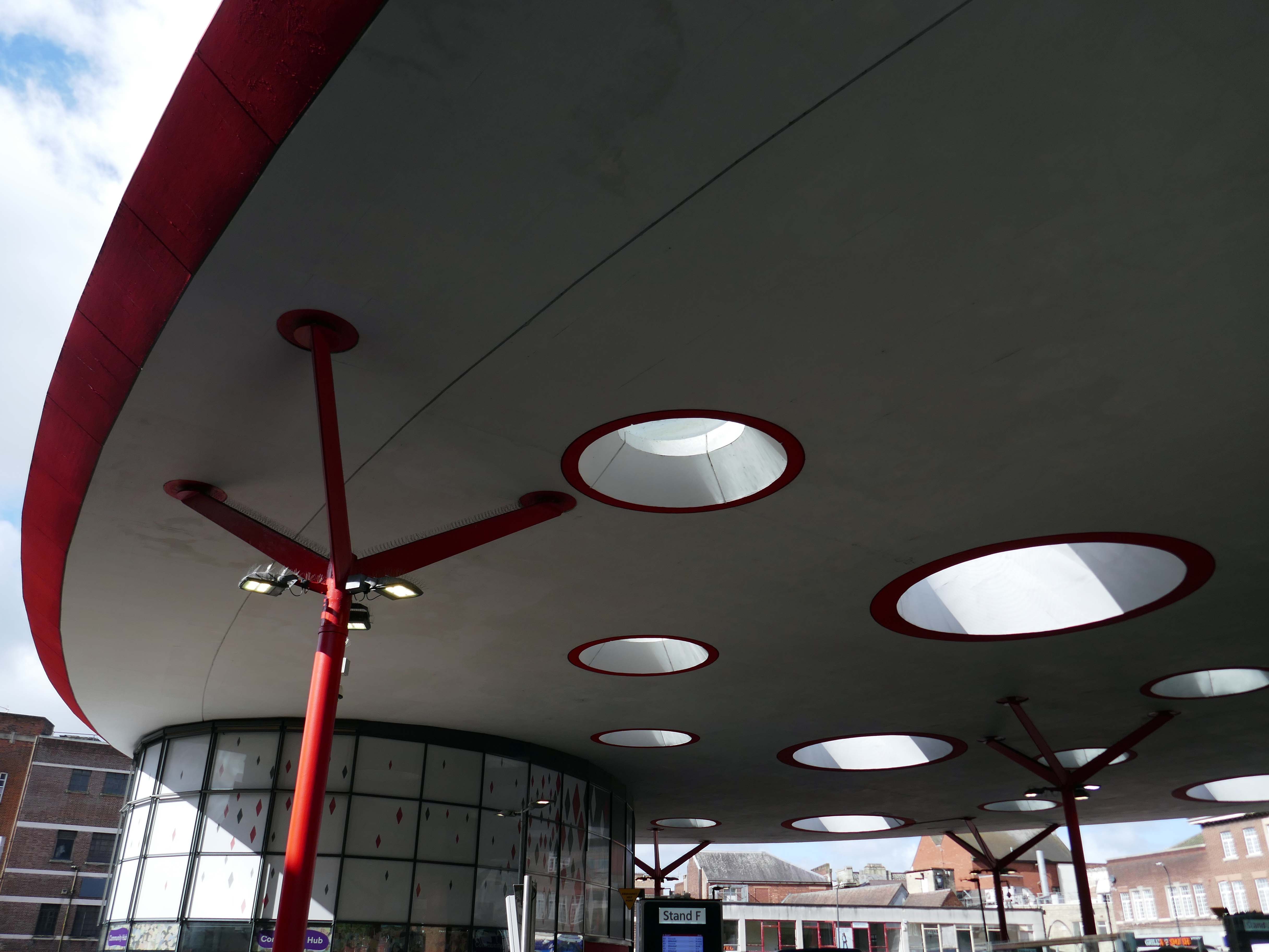
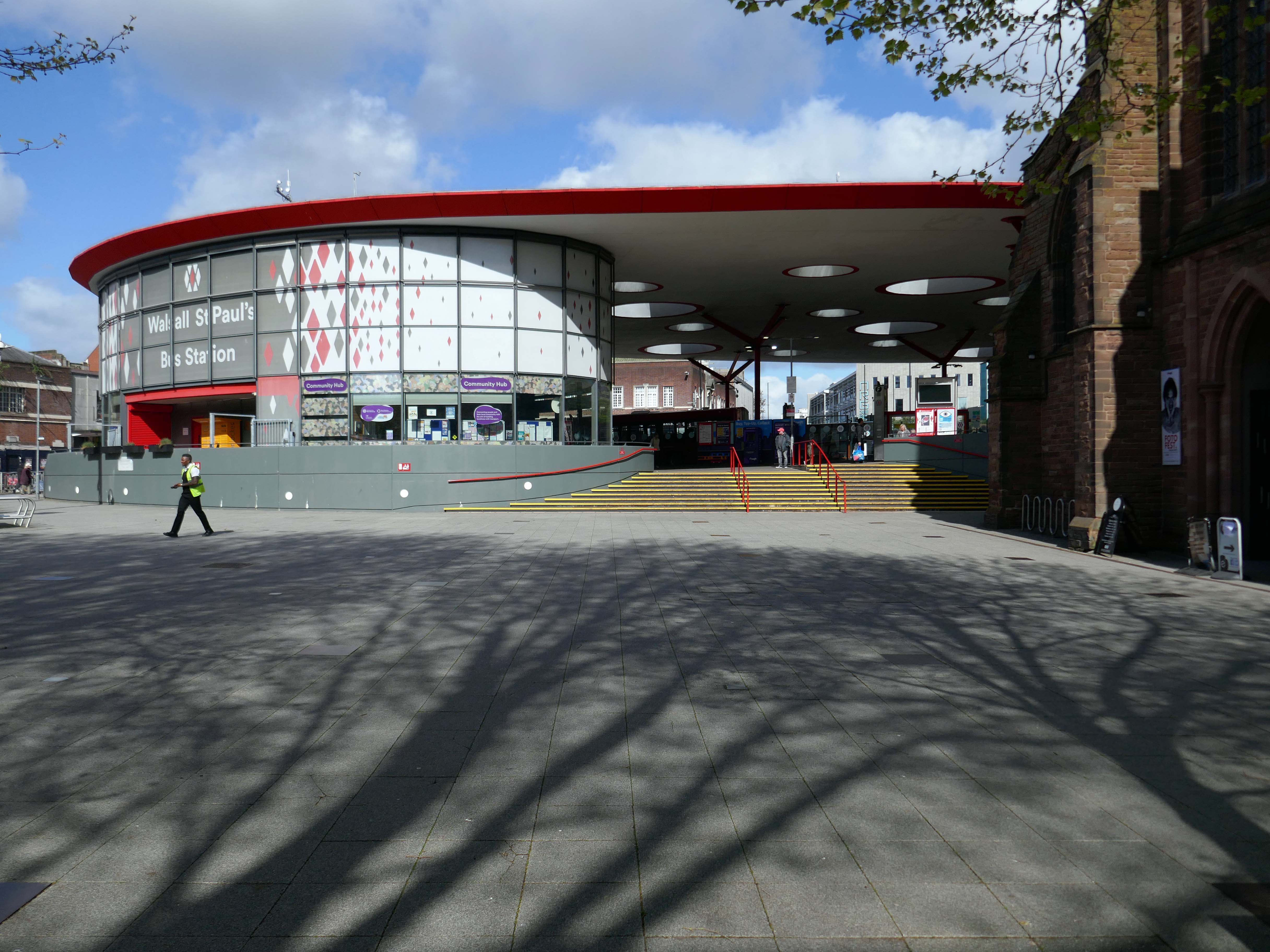
Let’s begin at the St Paul’s bus station or Hub – if you will, complete in September 2000.
The 1936 St Pauls Street bus station closed in February 1975, and was completely demolished, rebuilt and opened in August 1975.
Photo by: Walsall 1955
Allford Hall Monaghan Morris designed the building for Centro. The structural engineers were Atelier One, Shepherd Construction Ltd were the contractors, Watkins Dally were the landscape architects and Clark Smith Partnership were the civil engineers.
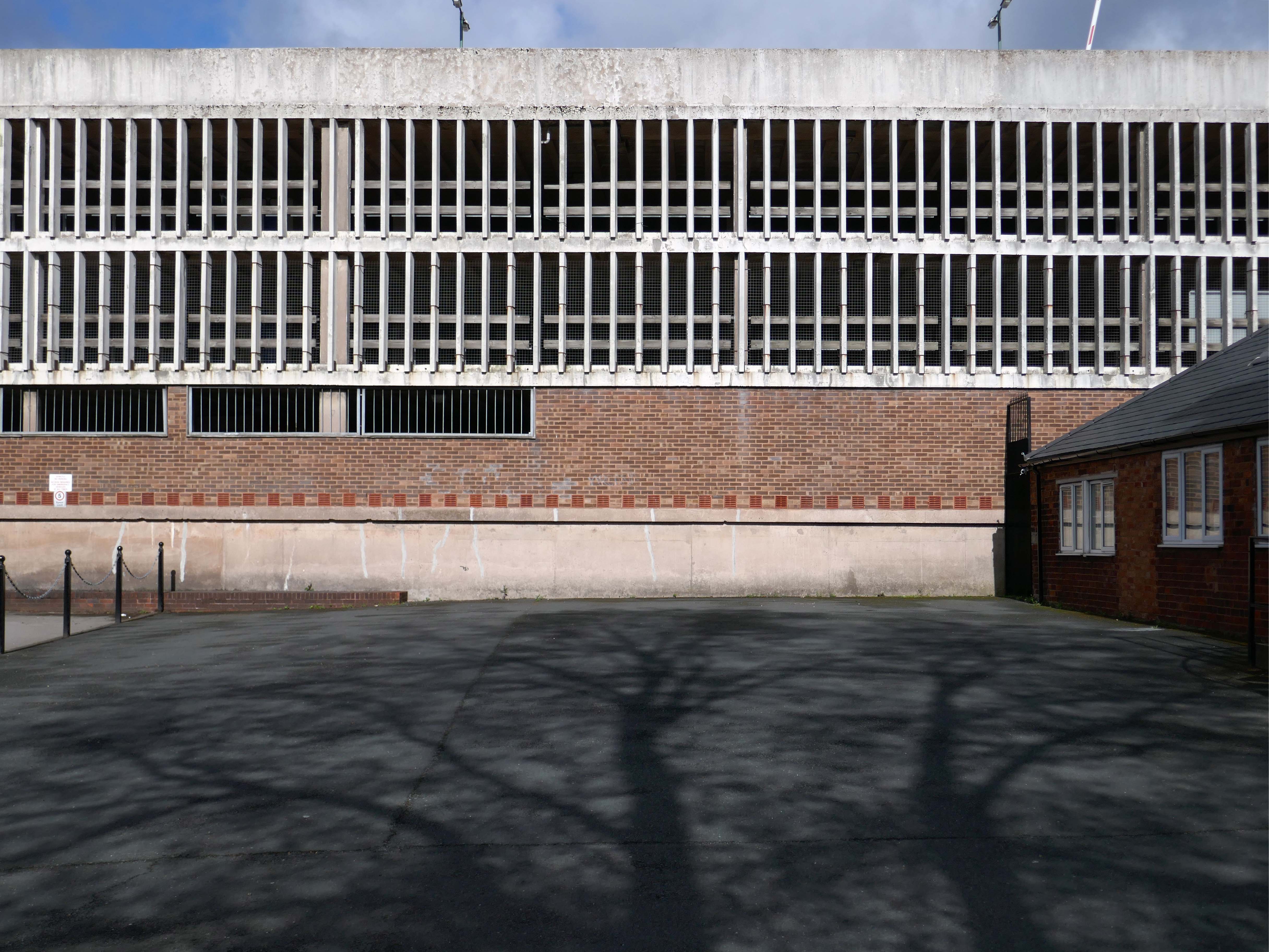
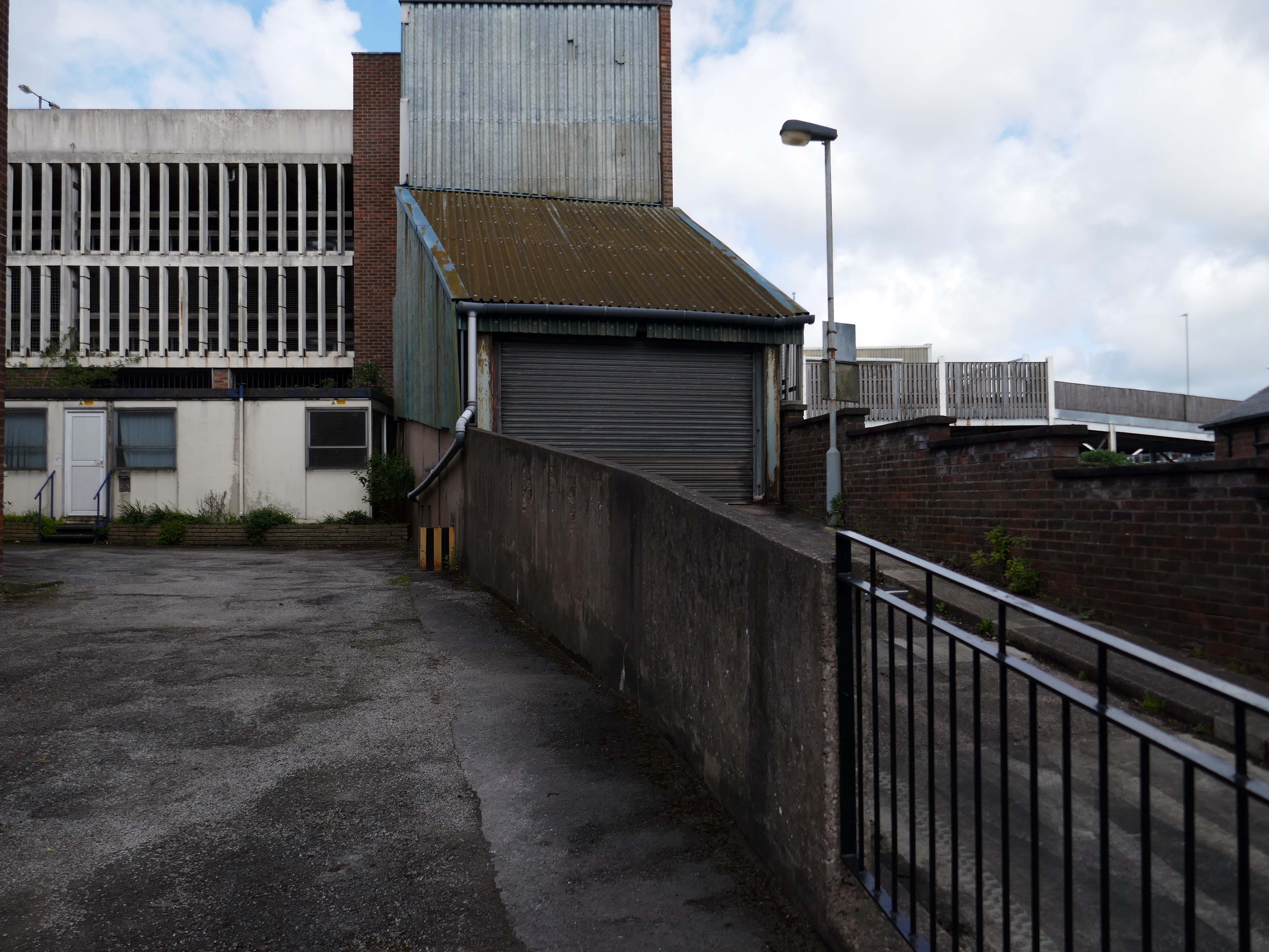
Next, a glimpse of Hatherton Road multi-storey car park.
Though it appears to be closed.
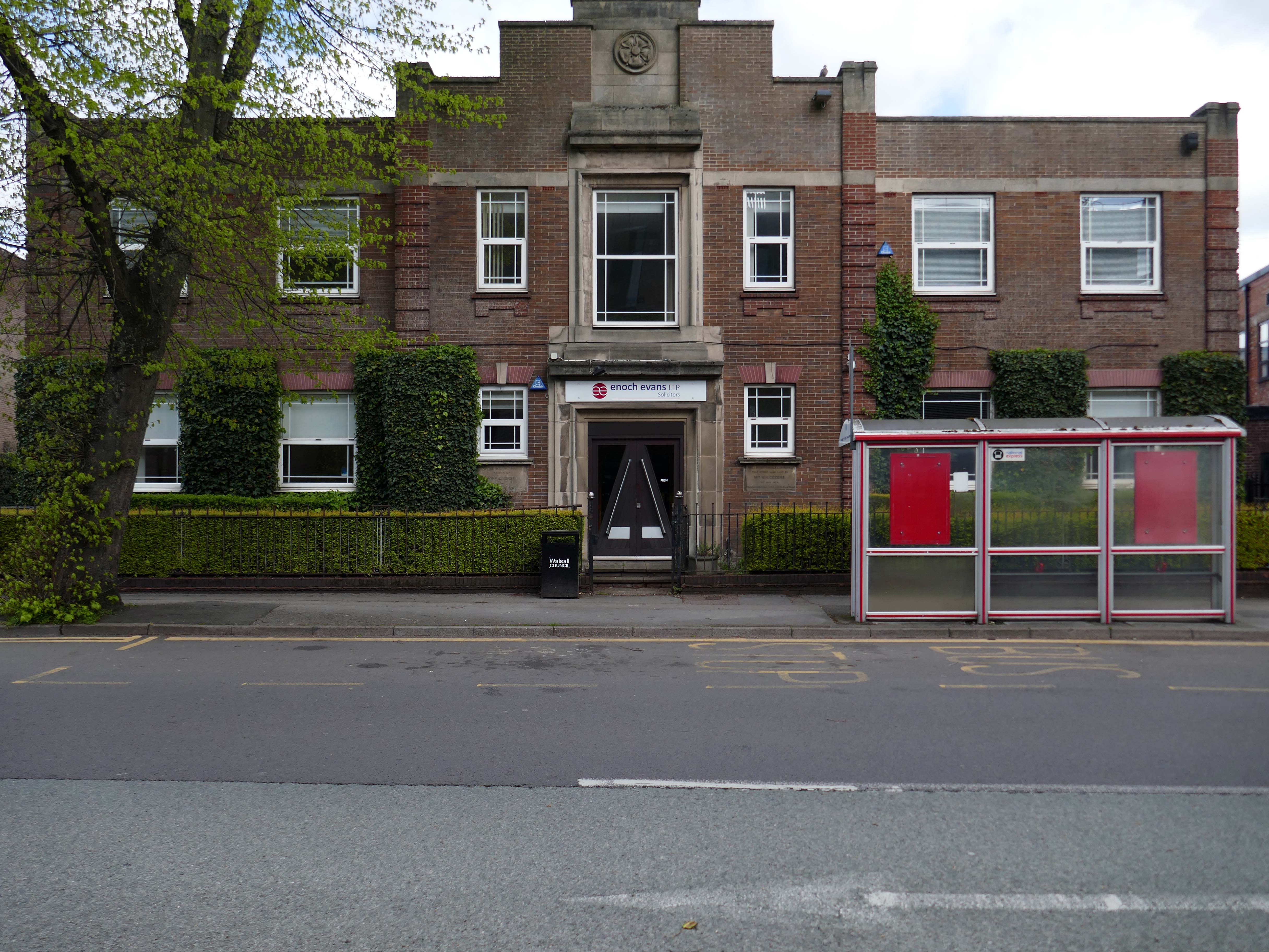
Adjacent to Enoch Evans Solicitors, their offices housed in one of the many imperious inter-war buildings dotted around the town.
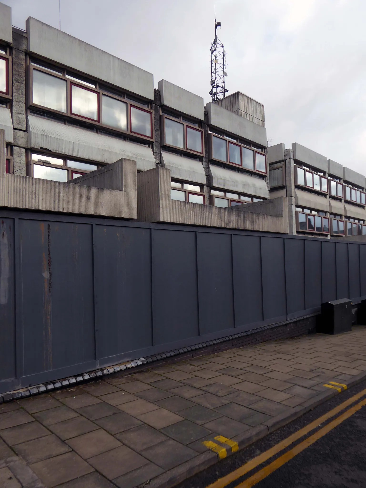
Which faces onto the back of the Civic Centre.
Following the formation of the Metropolitan Borough, the new Civic Centre in Darwall Street opened in 1976, architect Stanley W Bradford Walsall MBC Director of Architecture.
Central roof garden.
Leaving the Civic Quarter on the left is the Imperial
The Imperial started life as an agricultural hall, constructed in 1868-69, and designed by the architect GB Nichols of West Bromwich. At that time, it was used for a variety of community activities including shows and dancing, it was also hired out to travelling film showmen. The main feature of the early building was a principal ground floor hall.
In June 1914, the Imperial was closed to allow for conversion to a cinema, designed by West Midlands-based architects Hickton & Farmer.
The Imperial was converted to a bingo club in 1968, and in 1996 it was converted into a pub, which closed in 2016.
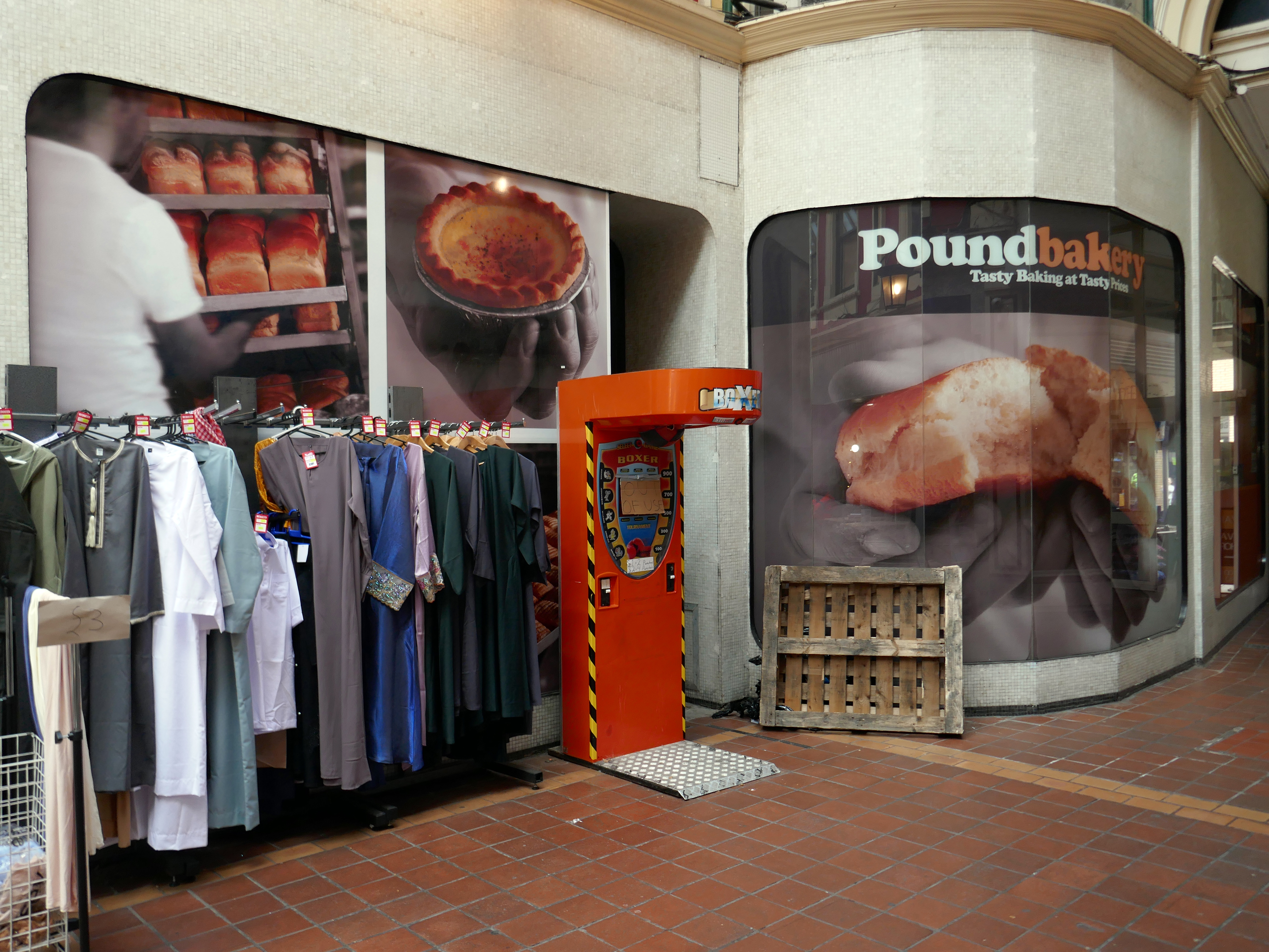
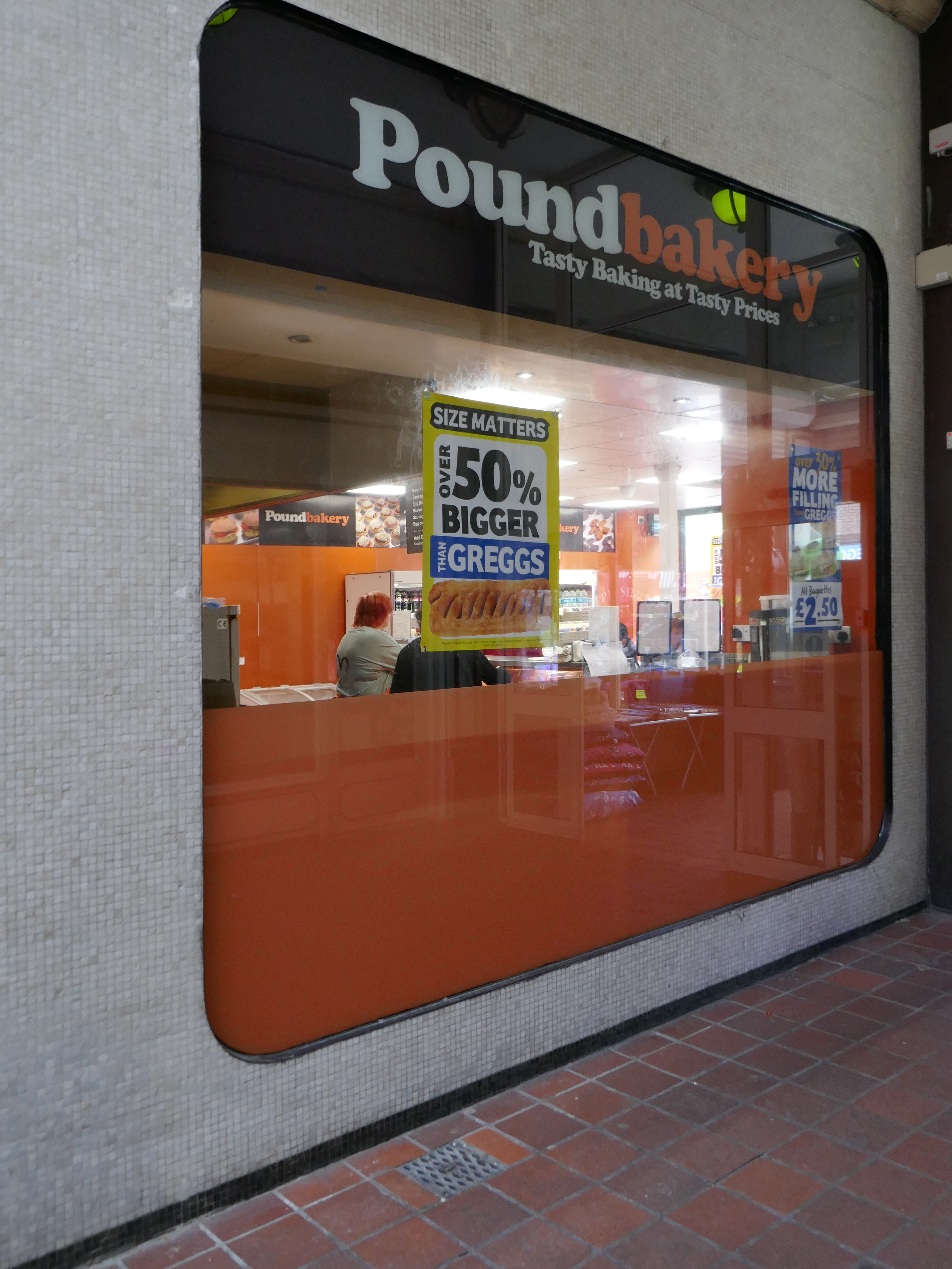
At the end of the otherwise period correct Victorian Arcade is a space age Pound Bakery.
Across the way a former Barclays Bank architects: John HD Madin & Partners.
Next door an anomalous disco themed fascia.
From here up the hill to the Old Square.
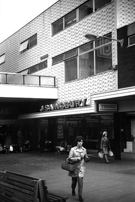
Sainsbury’s Old Square store in the early 1970s photo Will Parker.
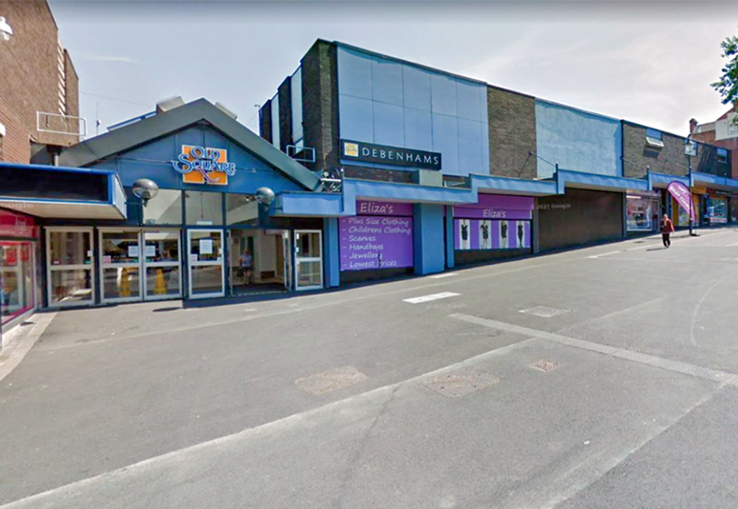
The majority of the Shopping Centre was demolished in 2014.
I remember when I was about fifteen in 1990, Coca-Cola were doing these yo-yos and if you went upstairs by the cafe, I think it was you could earn a gold coloured yo-yo. You just had to perform three tricks with it to earn one. I did walk the dog, the sleeper and I think it was around the world! Proud as punch with that I was. I know my uncle was Father Christmas for a few years on the bounce as well, when they used to have a grotto.
Dan Bracknall
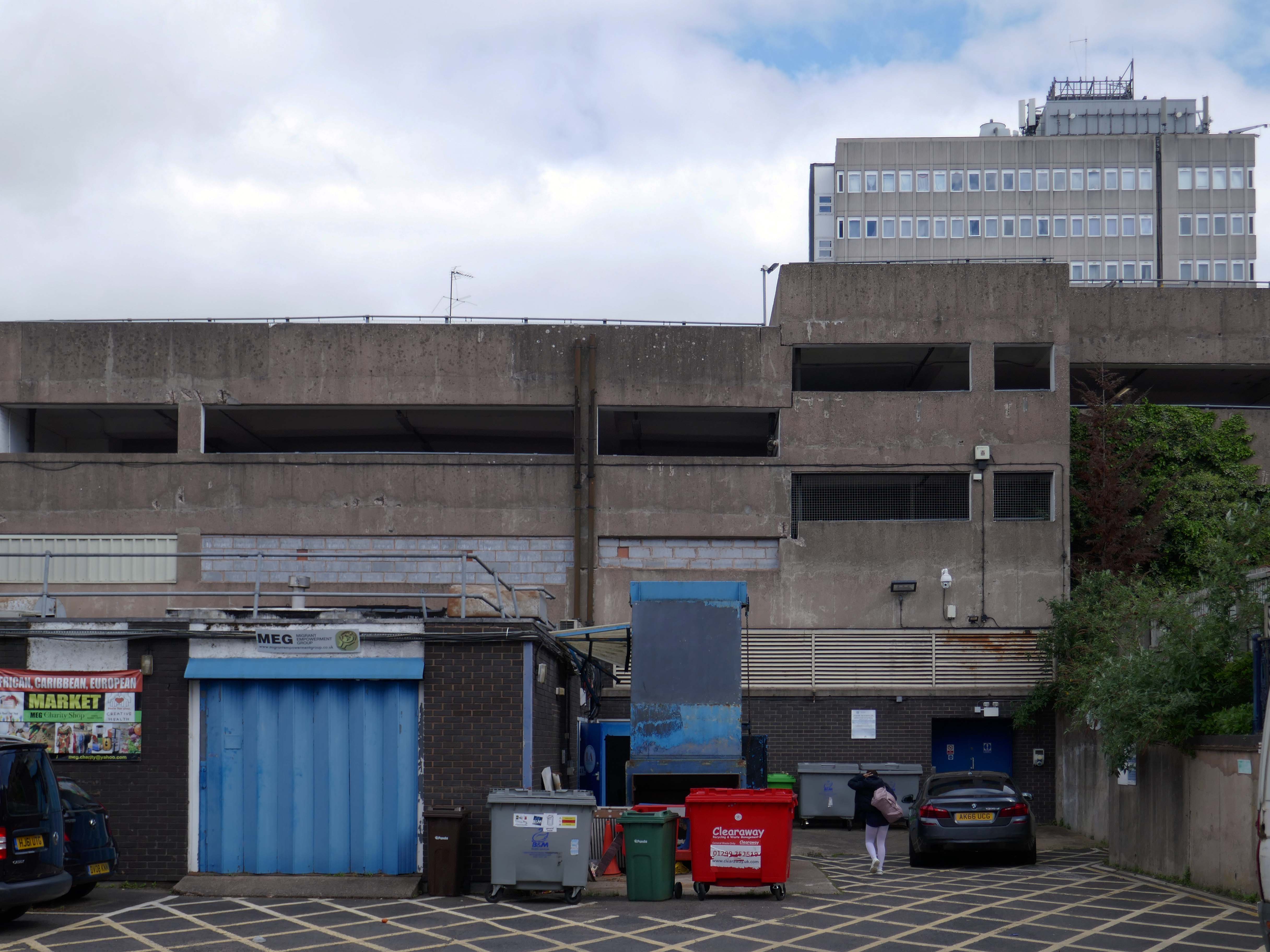
These are the remnants.
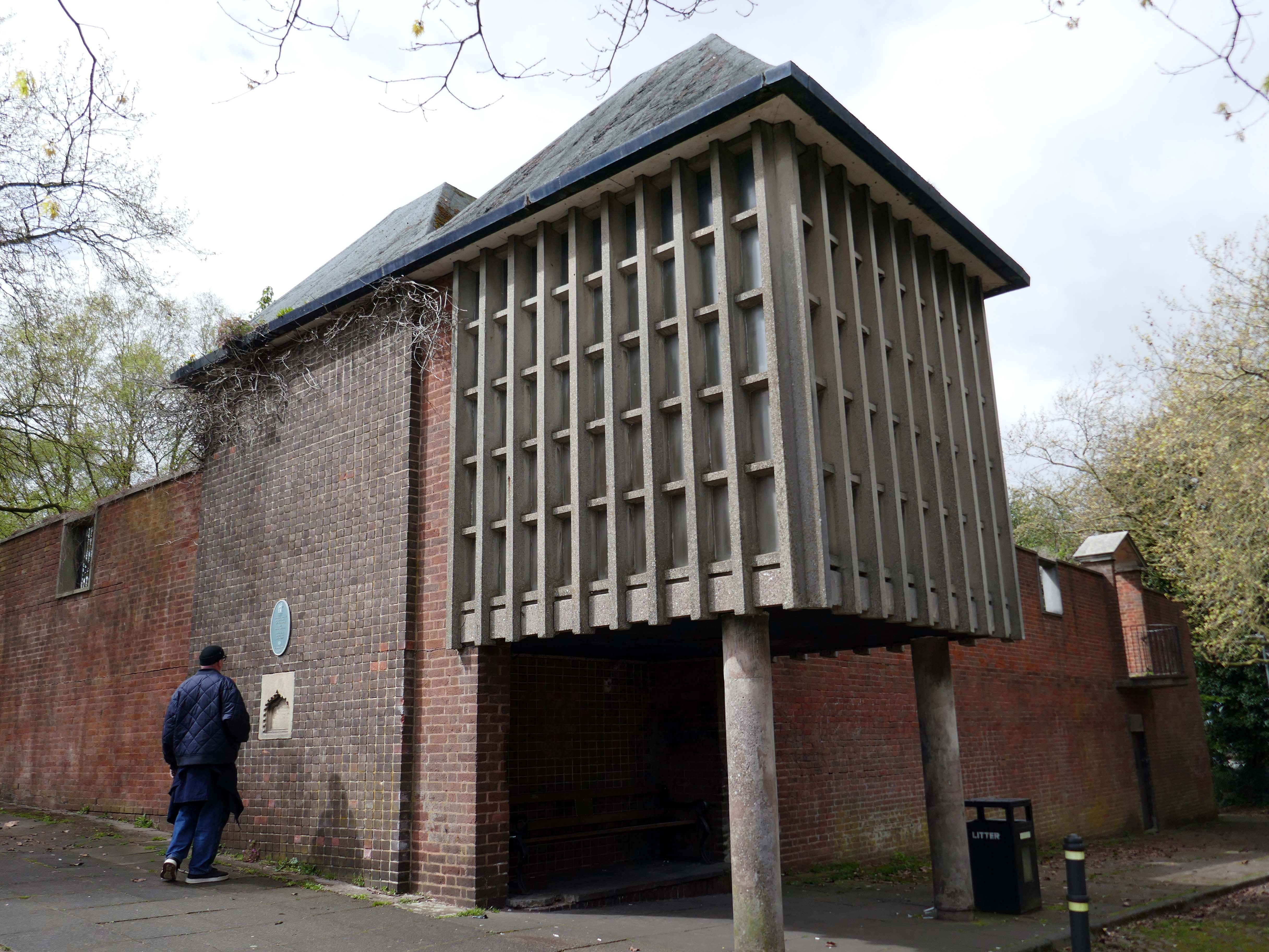
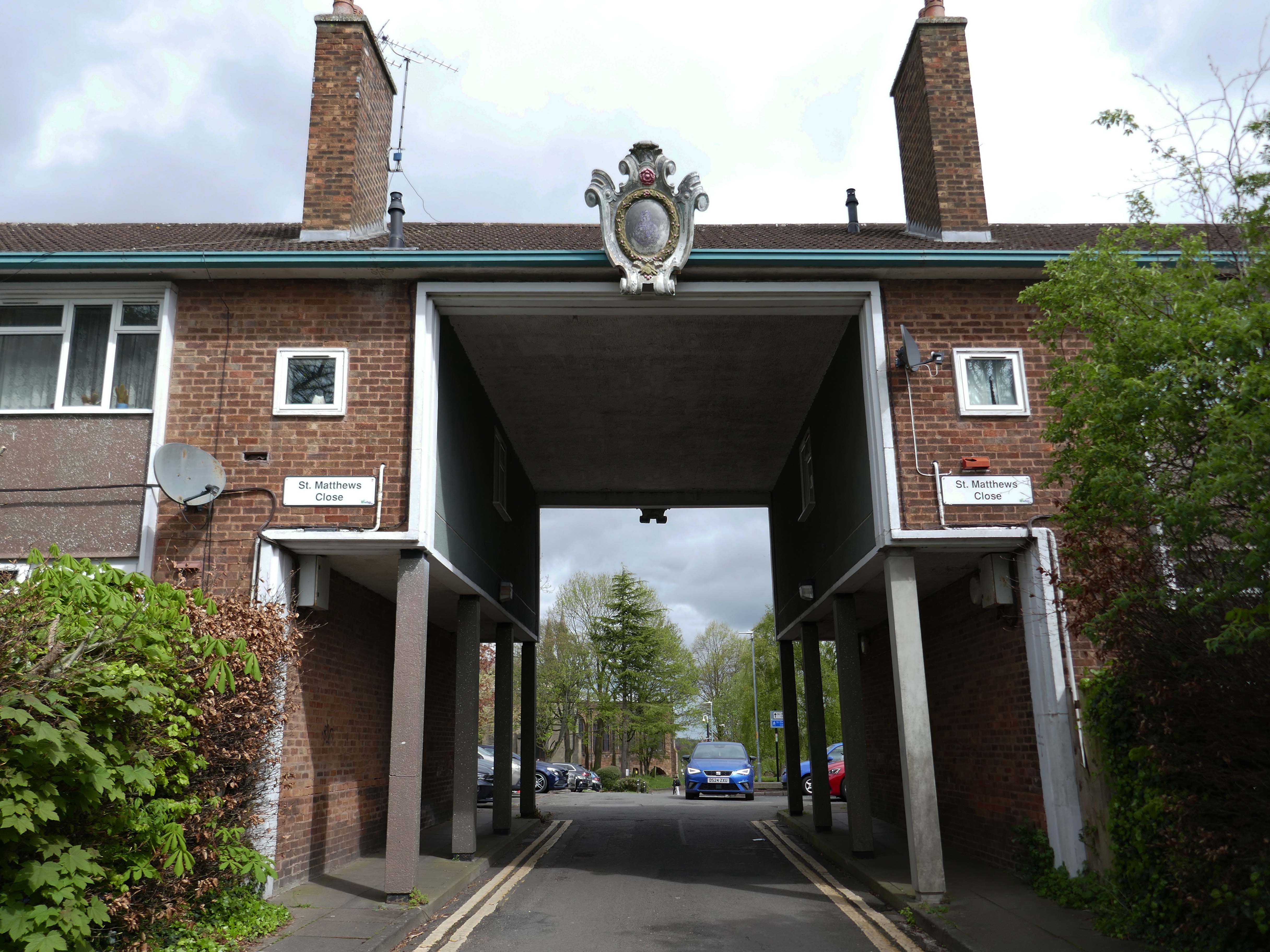
Ascending to the dizzy heights of the Grade II Listed Memorial Gardens 1953 by Geoffrey Jellicoe designed as a memorial to the dead of the two World Wars and said to mark a significant stage in the evolution of his principles of design.
Sir Geoffrey Jellicoe was one of the century’s greatest landscape architects. His contribution to landscape design has been described as equal to the 18th-century gardener Capability Brown. He was educated at Cheltenham College and then trained to be an architect at the Architectural Association. It was while at the AA that his interest in landscape was first kindled.
The second phase, comprising the building of the memorial chapel in the Memorial Garden, and the flats and Brotherhood or Church Hall to the south of the open space known as St Matthew’s Close, was completed c 1960
Of back down the hill onward to the Walsall School of Art.
Walsall’s art school’s history is a story of gradual growth and change, evolving from evening classes in a chapel to a modern art college. The Walsall School of Design and Ornamental Art, founded in 1854 as an evening class, operated from 1861 at the Goodall Street Baptist Chapel and eventually became the Walsall College of Art.
To celebrate Queen Victoria’s Golden Jubilee, the Walsall Science and Art Institute was opened in 1888 at Bradford Place. In 1897, it was transferred to the Town Council and renamed the Walsall Municipal Science & Art Institute. In 1926, the institute was renamed Walsall Technical College. Post-war demand led to the establishment of the Walsall and Staffordshire Technical College at Wisemore – now St Paul’s Street, in 1952. The Walsall College of Art officially merged with the College of Technology in 1992 to form Walsall College of Arts and Technology – now simply Walsall College. The college maintains strong historical ties to local industries, such as the leather trade.
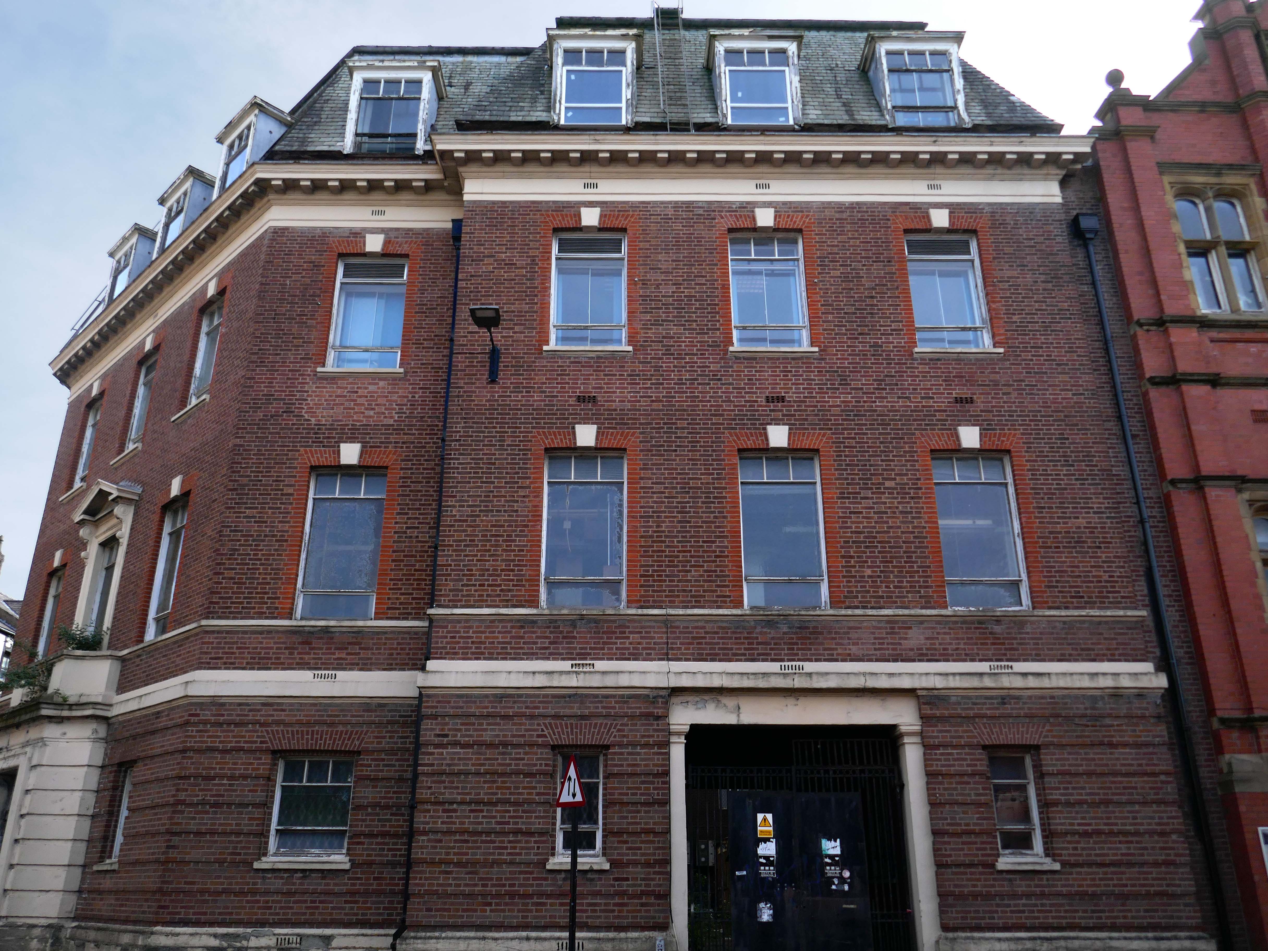
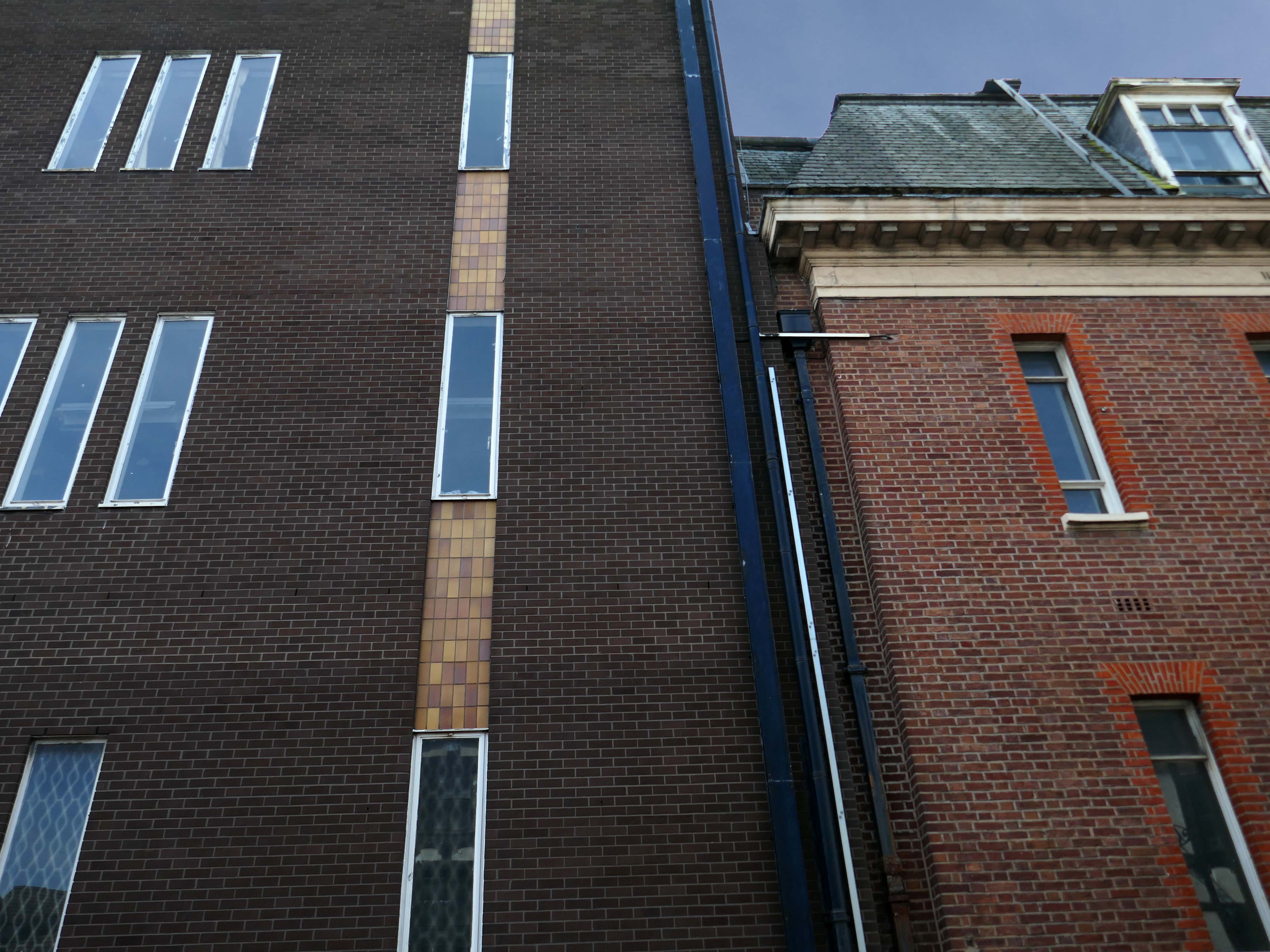
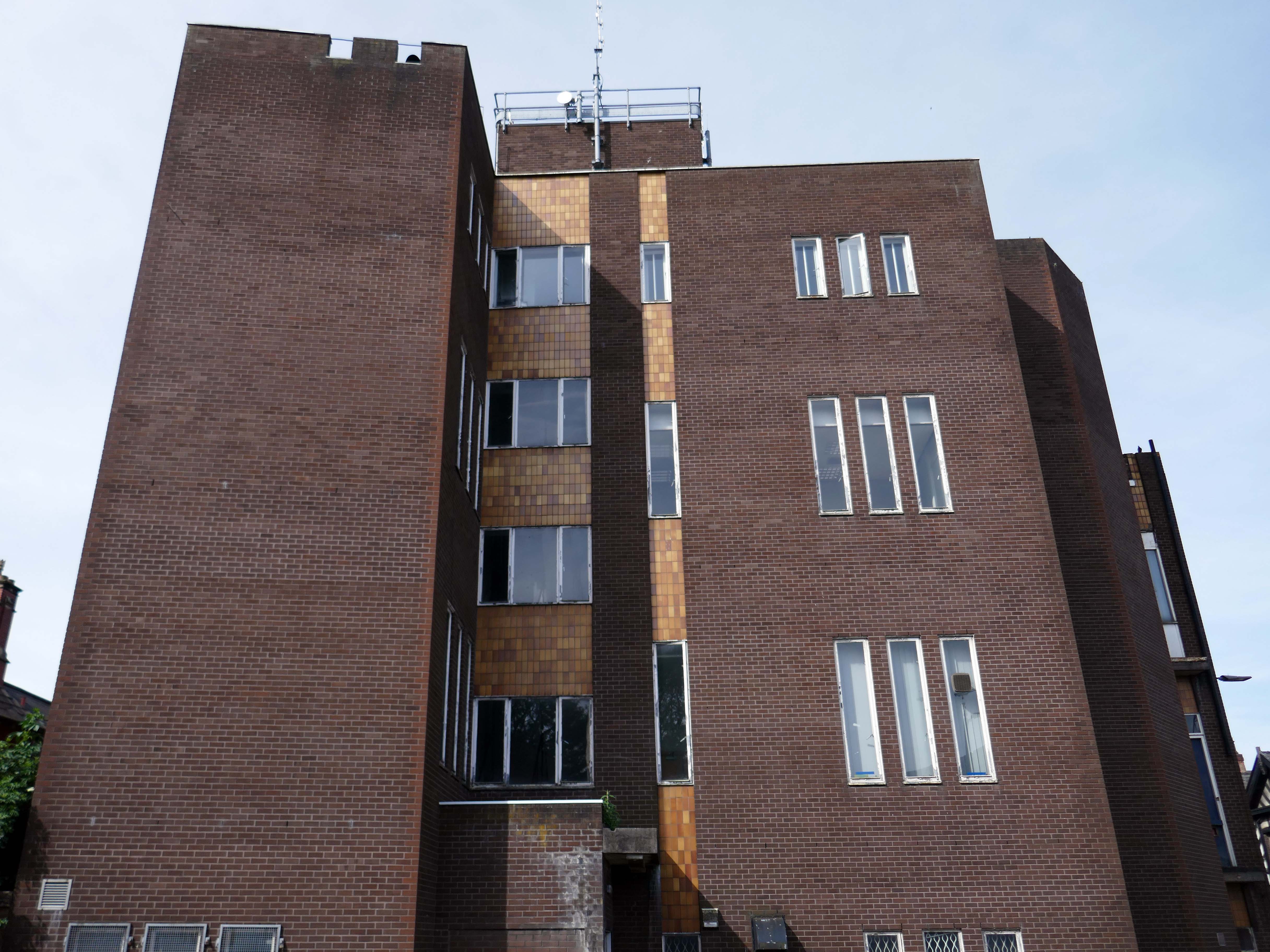
Further on there’s an enormous Telephone Exchange comprising fifties and seventies buildings.
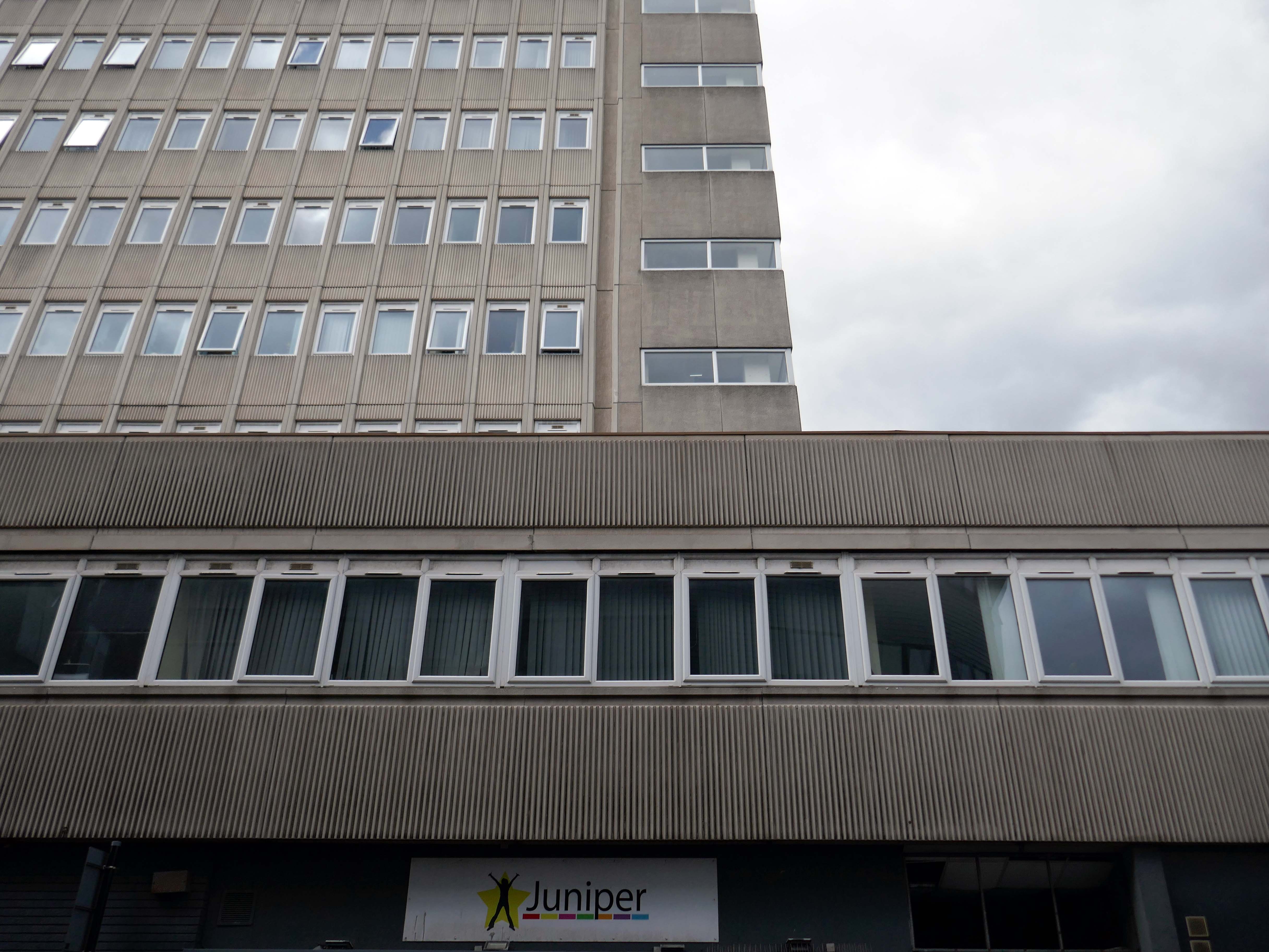
Across the way a large system built block on a podium base.
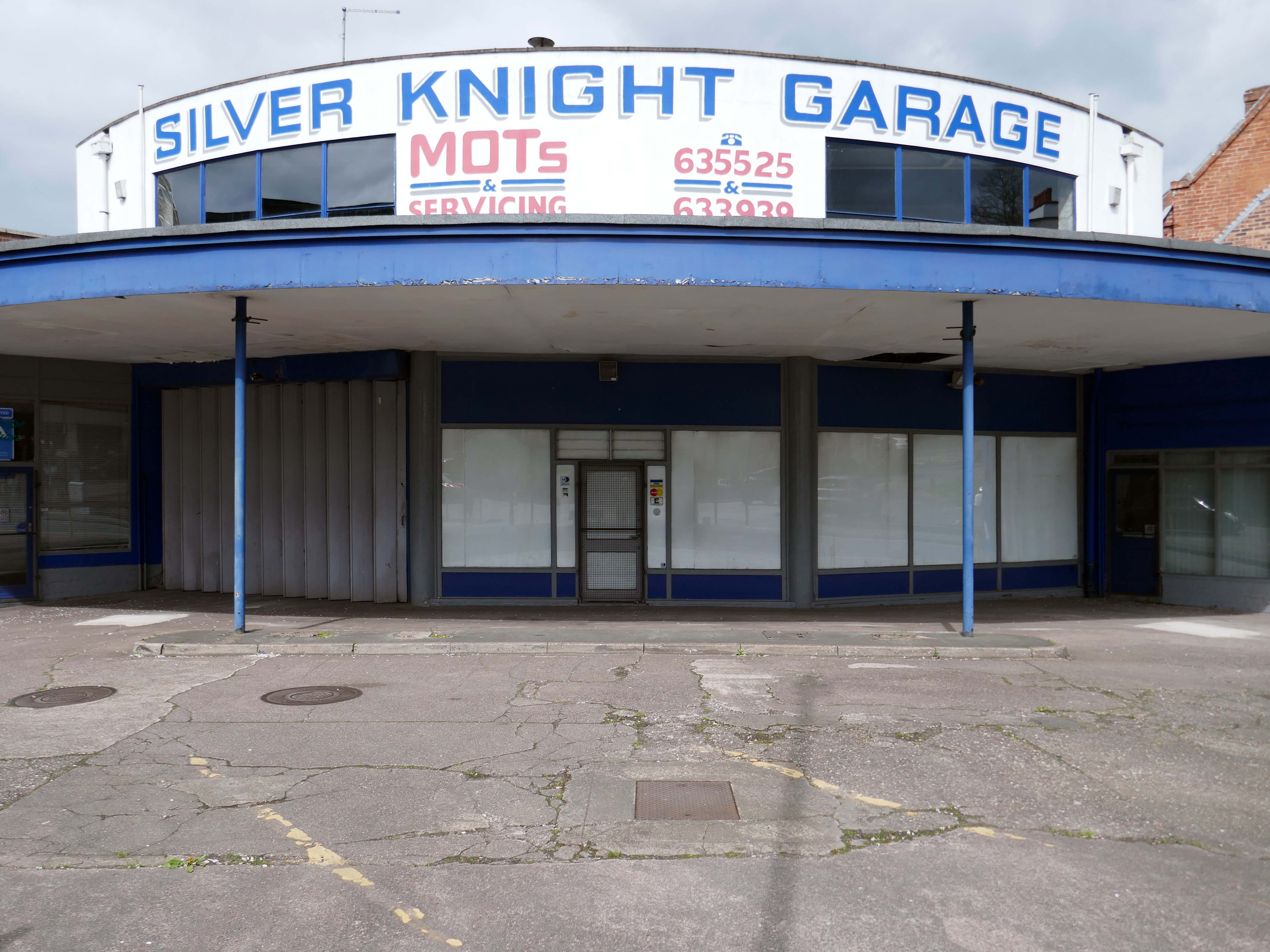
Standing on the corner where it has always stood the Silver Knight Garage.
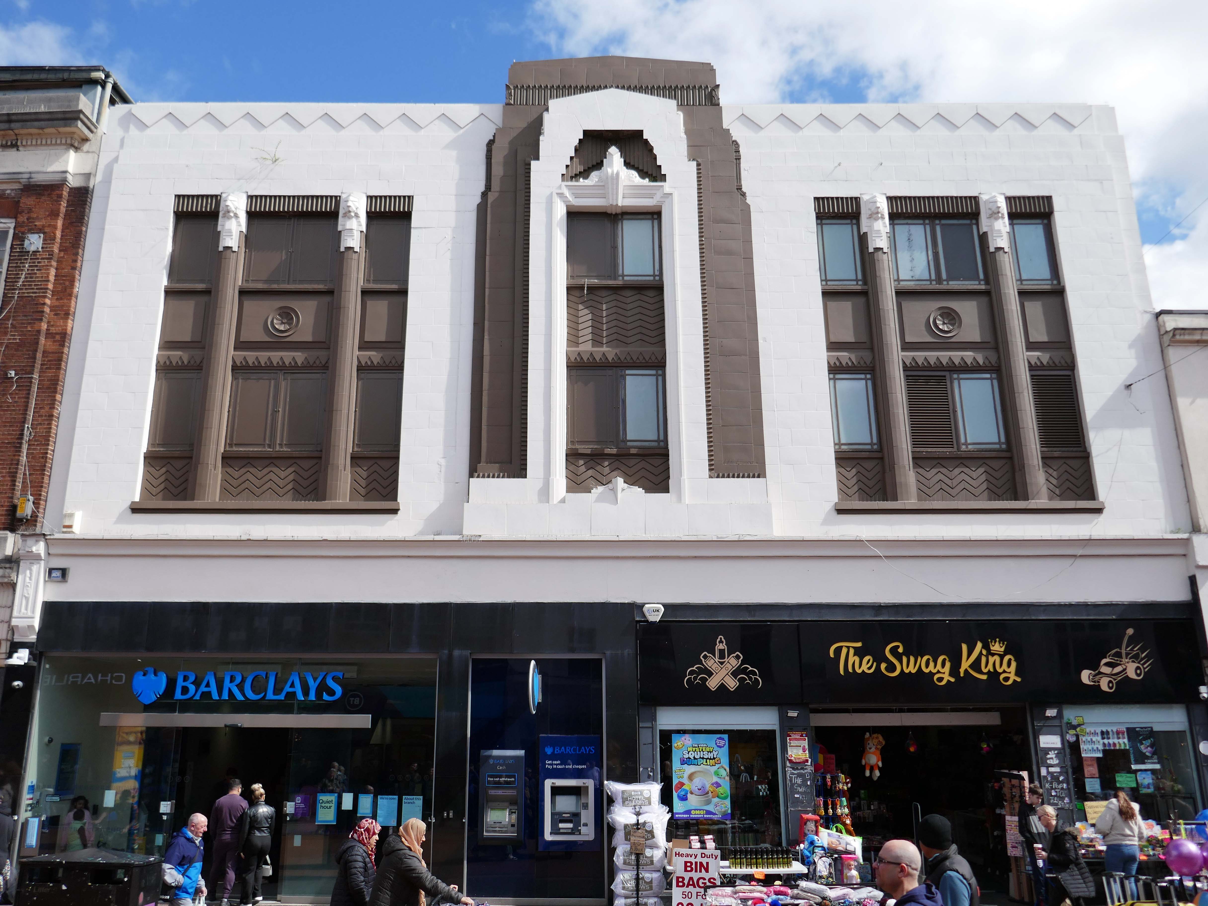
Heading back into the town centre, picking up on there’s a former Woolworths that looks like a Burton’s that thinks it’s a Barclays Bank, and also improbably a Swag King.
1933 by FW Woolworth Construction Dept – H Wimbourne
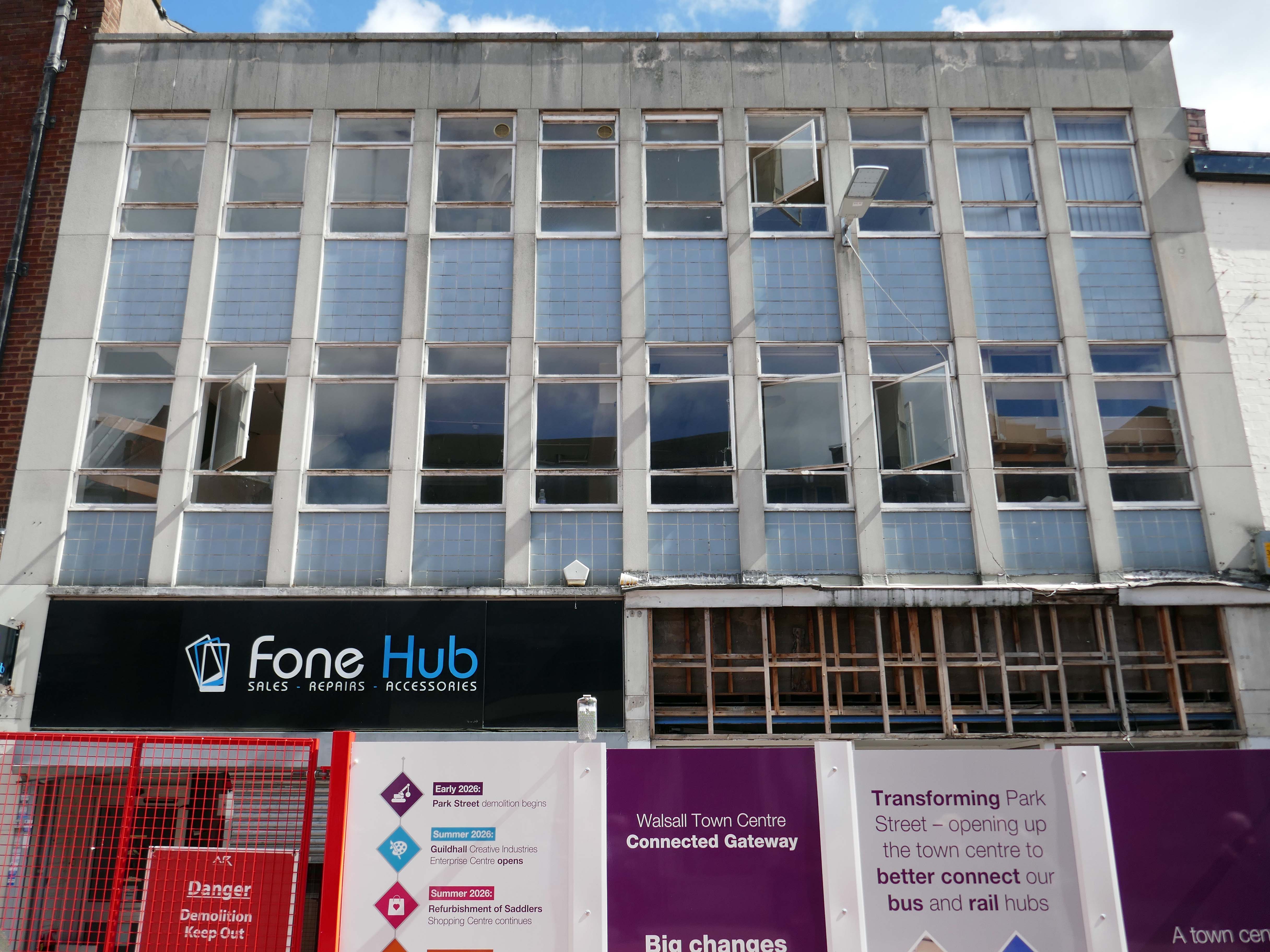
Next an indeterminate infill with pale blue panels and central pivoting metal window frames, soon to be demolished along with its neighbours, as part of the Connected Gateway Project.
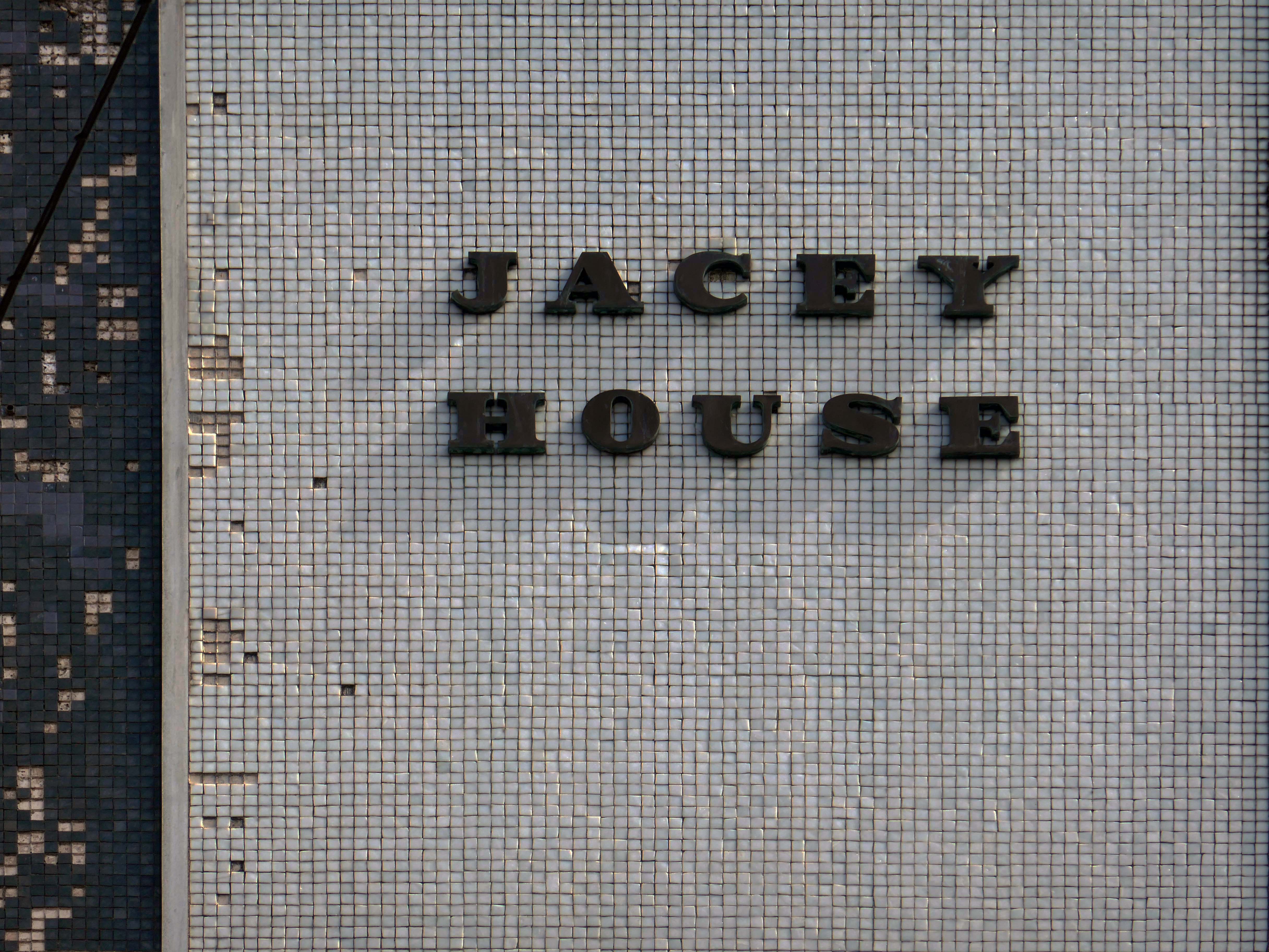
Possibly a former BHS – known as Jacey House.
Next up Park Place.
Ai says – notable features include Park Place Meats – a town centre butcher, and Park Place Shoe Repairs, which offers engraving and key-cutting services.
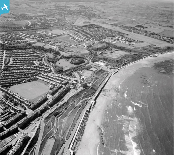
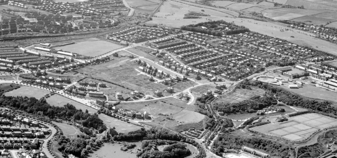
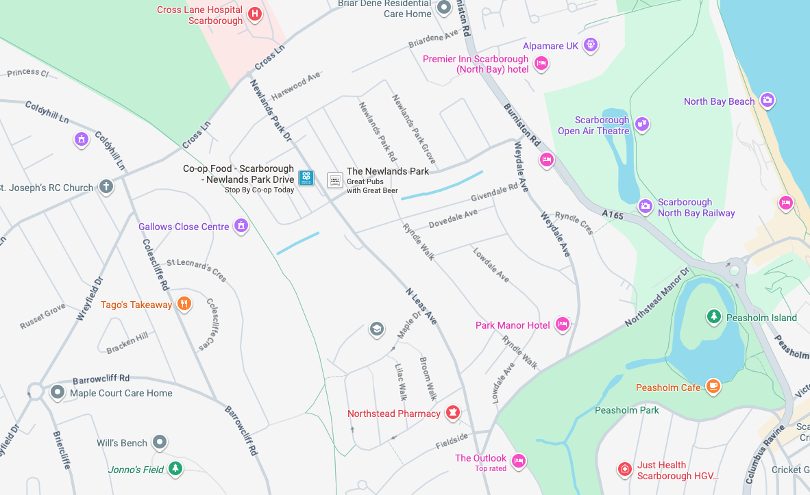
It’s 1892 and the Twentieth Century is about to overwrite the expansive green sward of Northstead and Newlands.
The Manor of Northstead consisted of a medieval manor house surrounded by fields and farms in the parish of Scalby in the North Riding of Yorkshire. The estate originally bordered the northern side of the ancient boundary of the Borough of Scarborough, following the line of Peasholm Beck. The estate passed into the ownership of the Crown during the reign of King Richard III. By 1600, the manor house had fallen into disrepair, being latterly occupied by Sir Richard Cholmeley’s shepherd until it finally collapsed
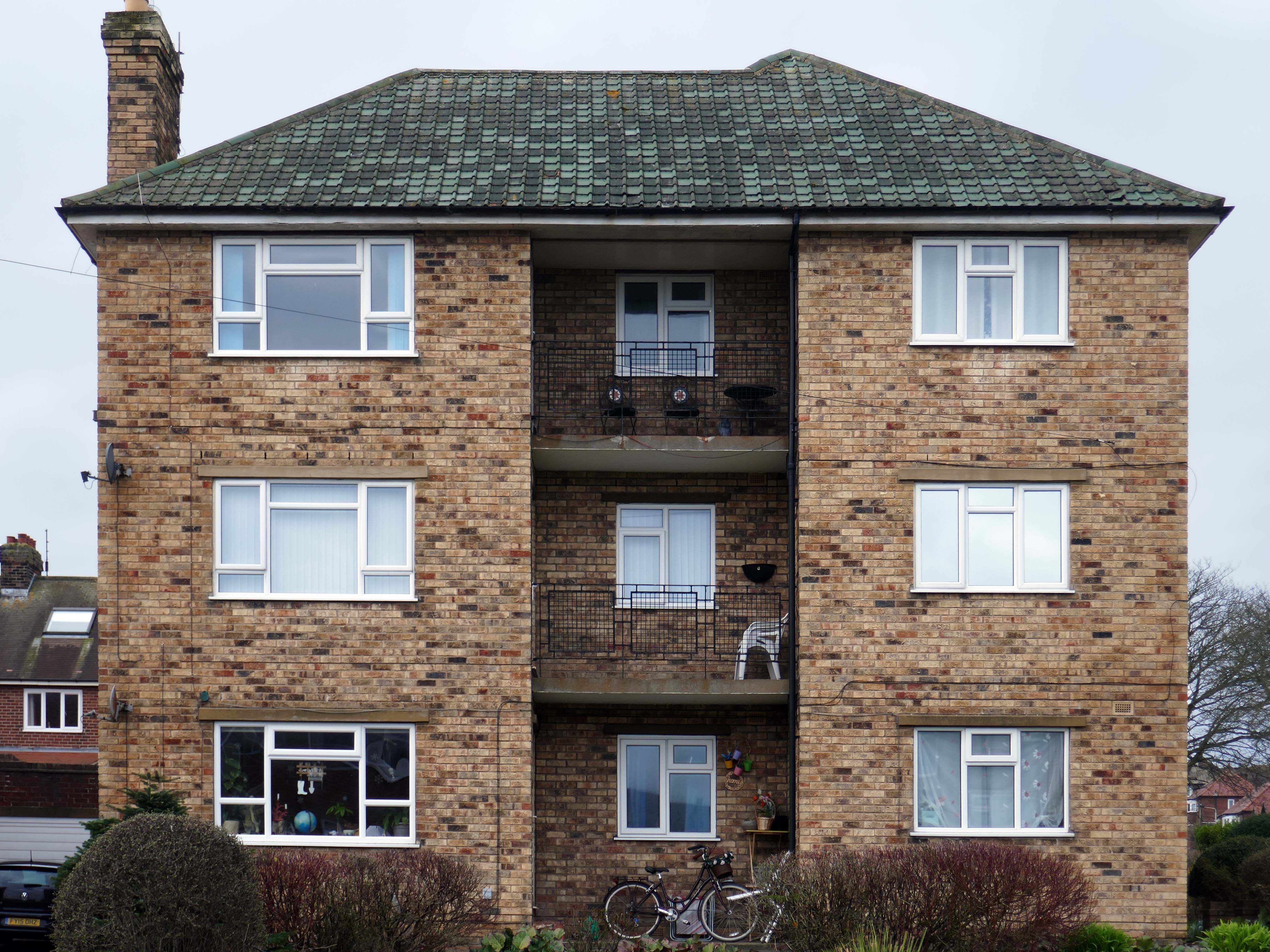
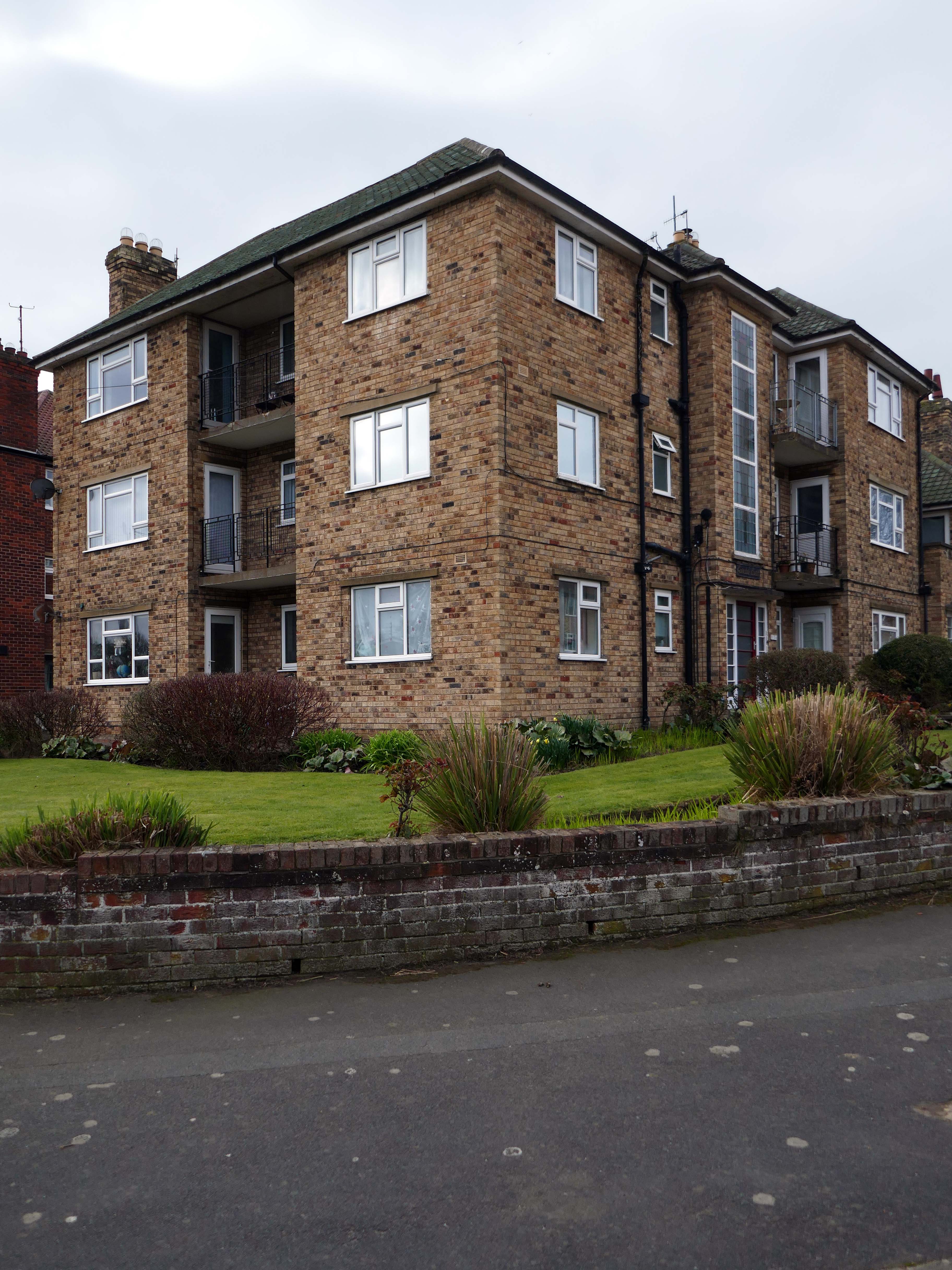
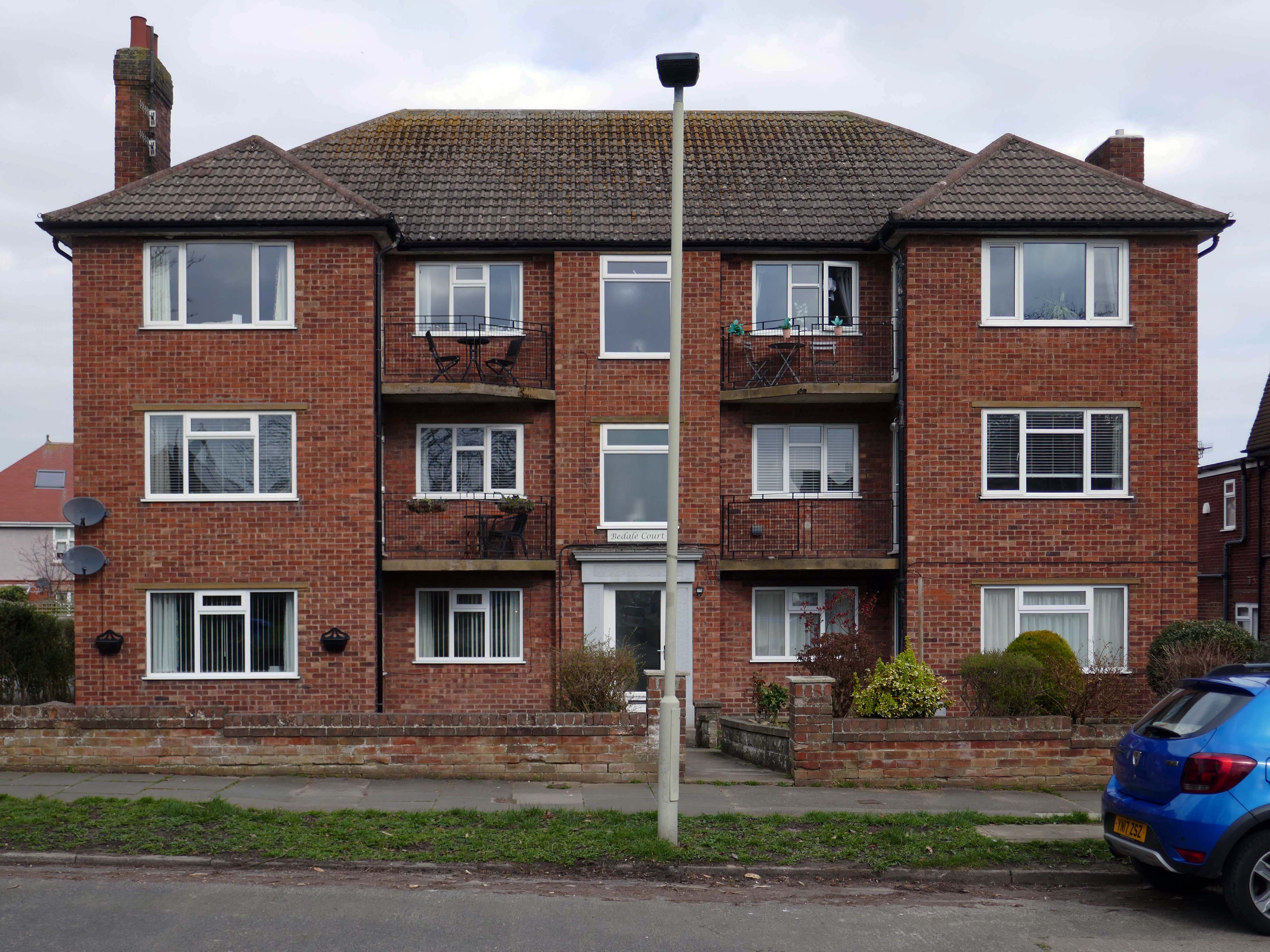
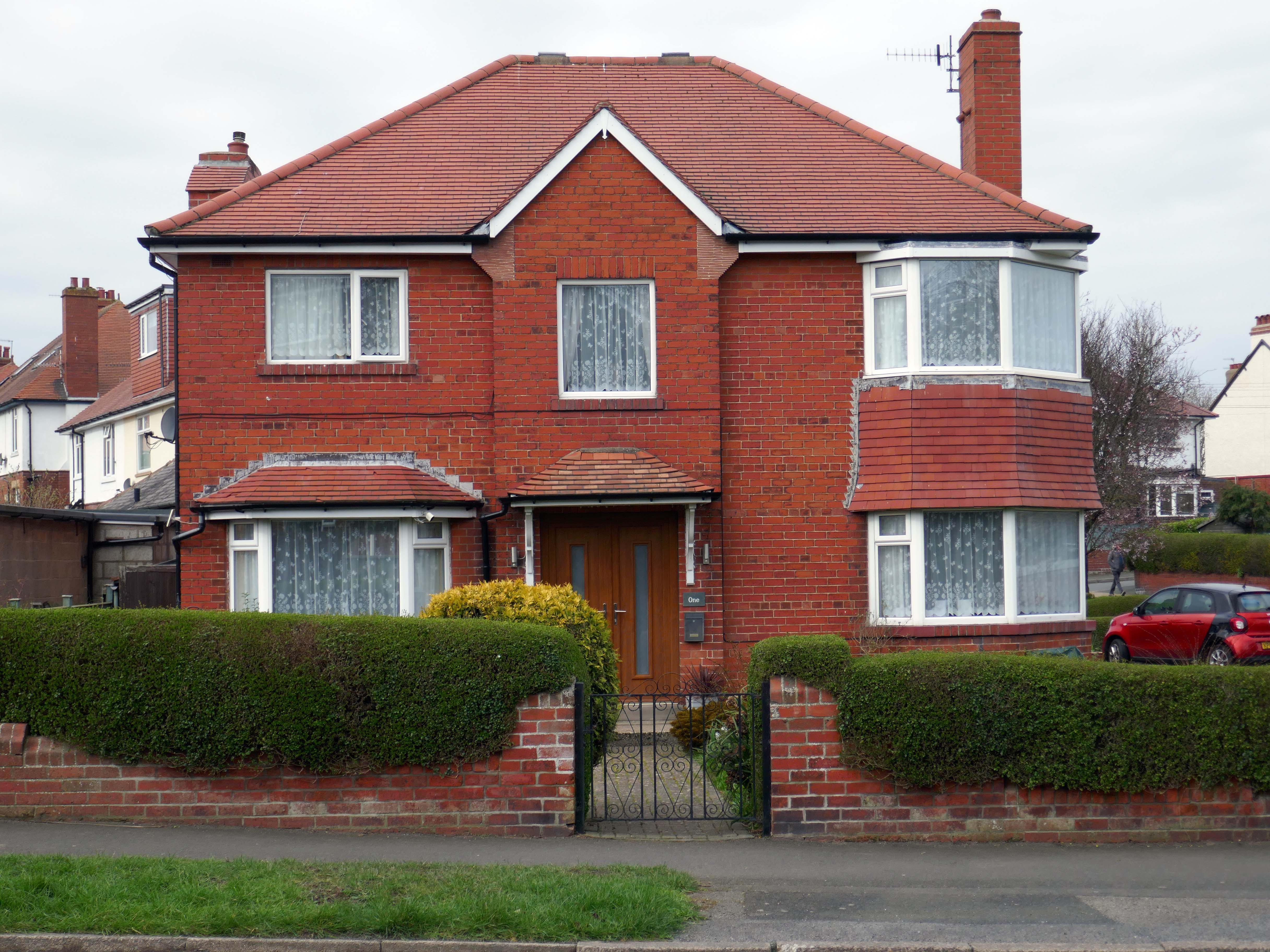
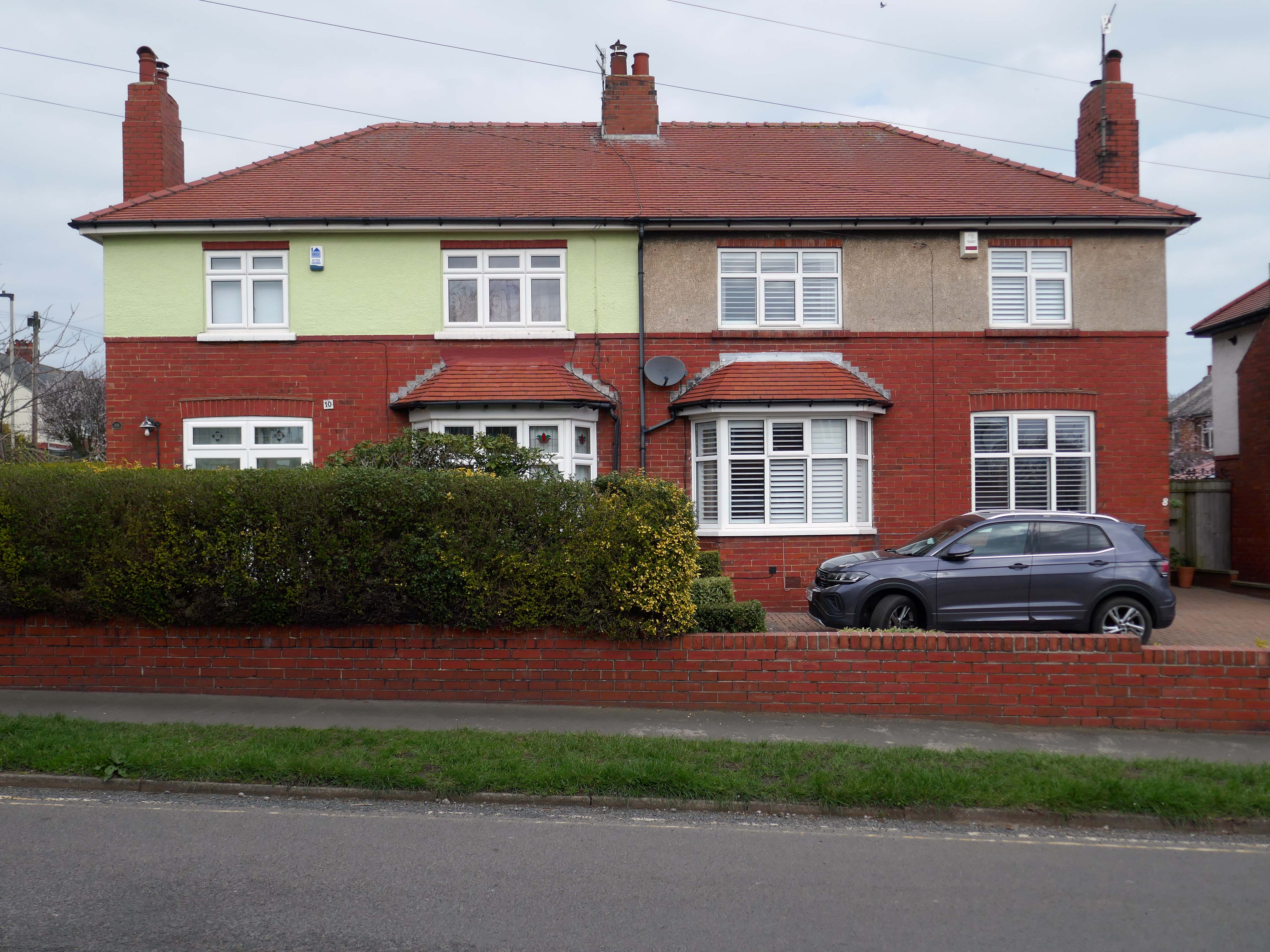
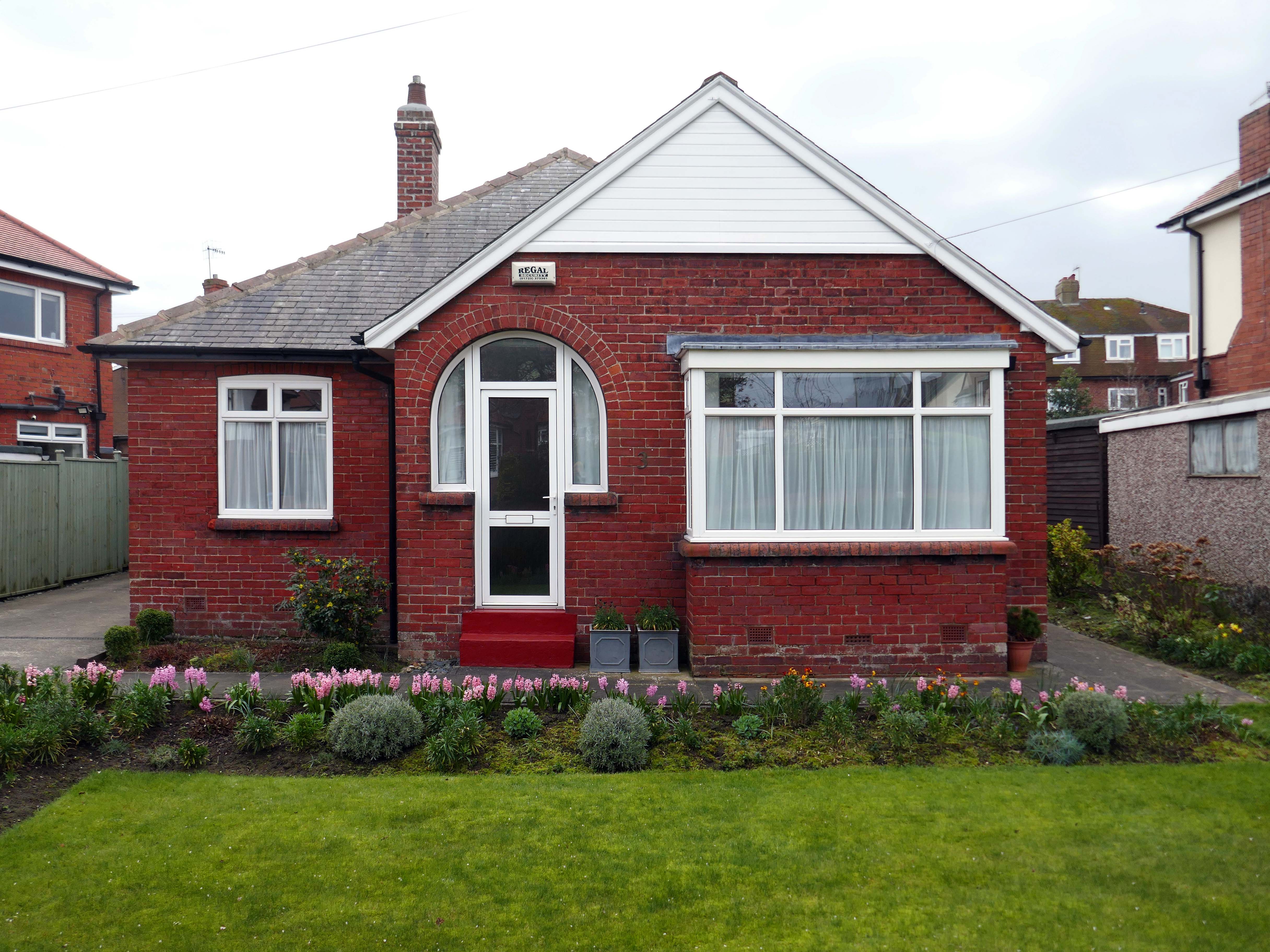
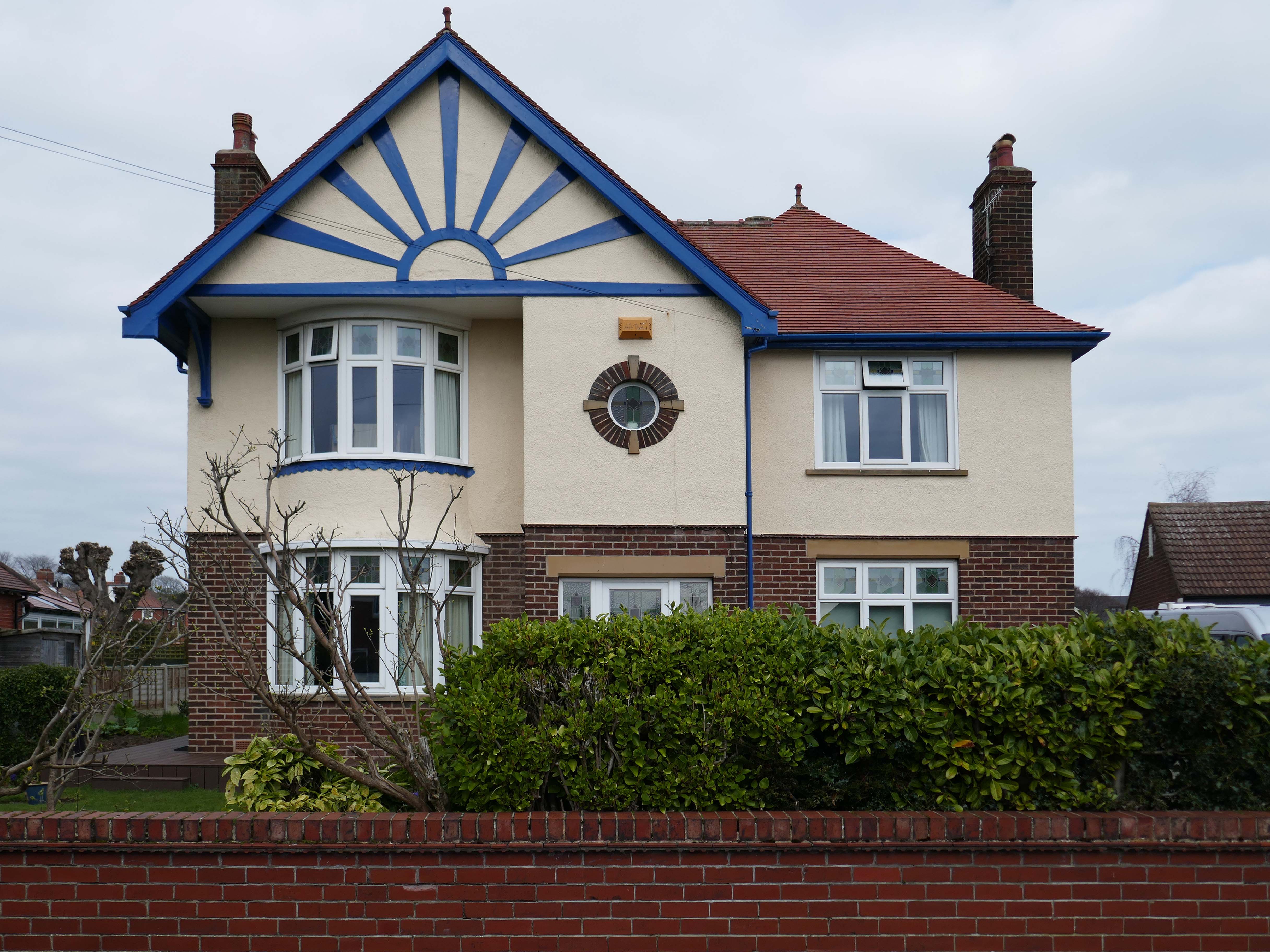
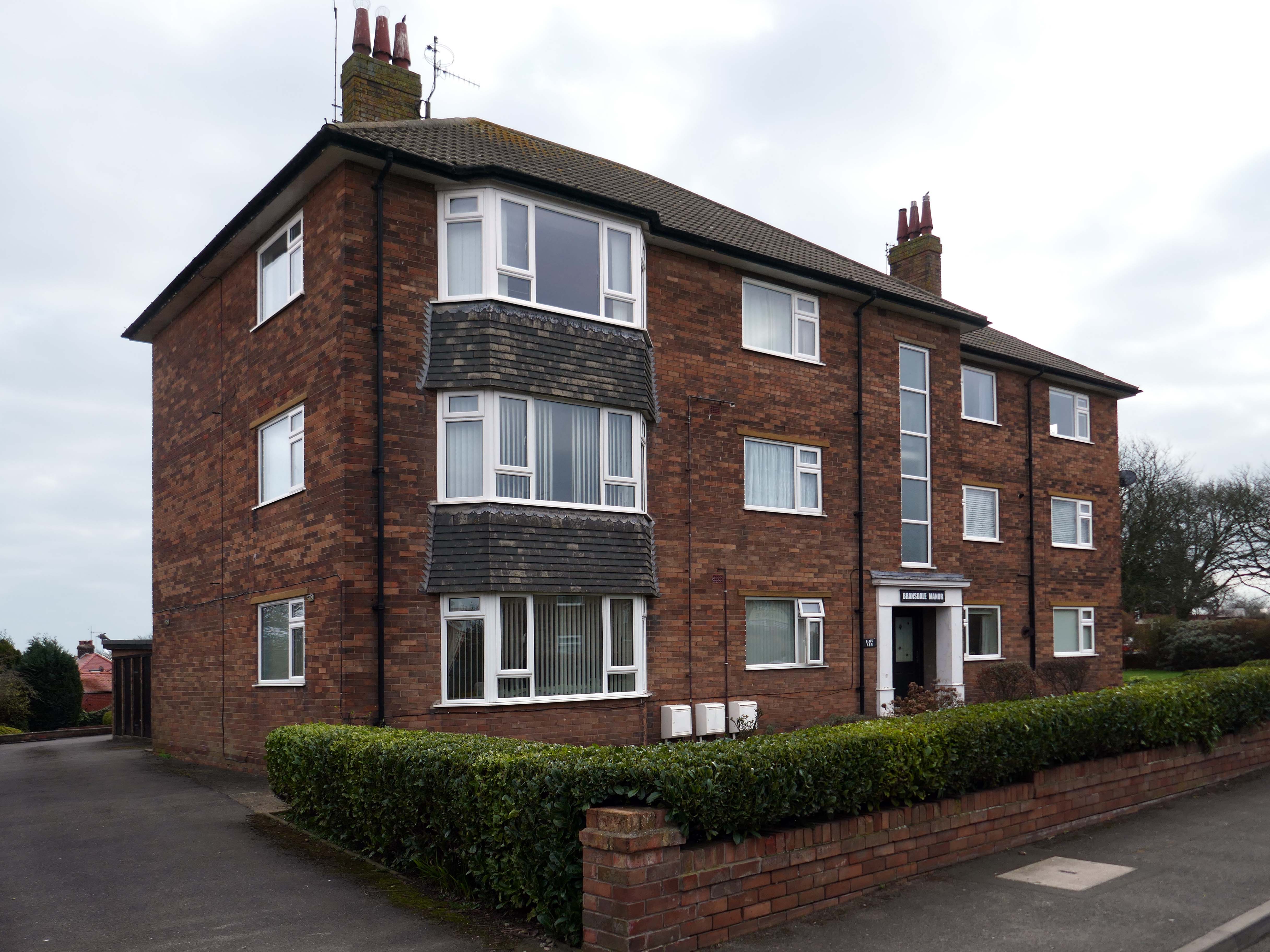
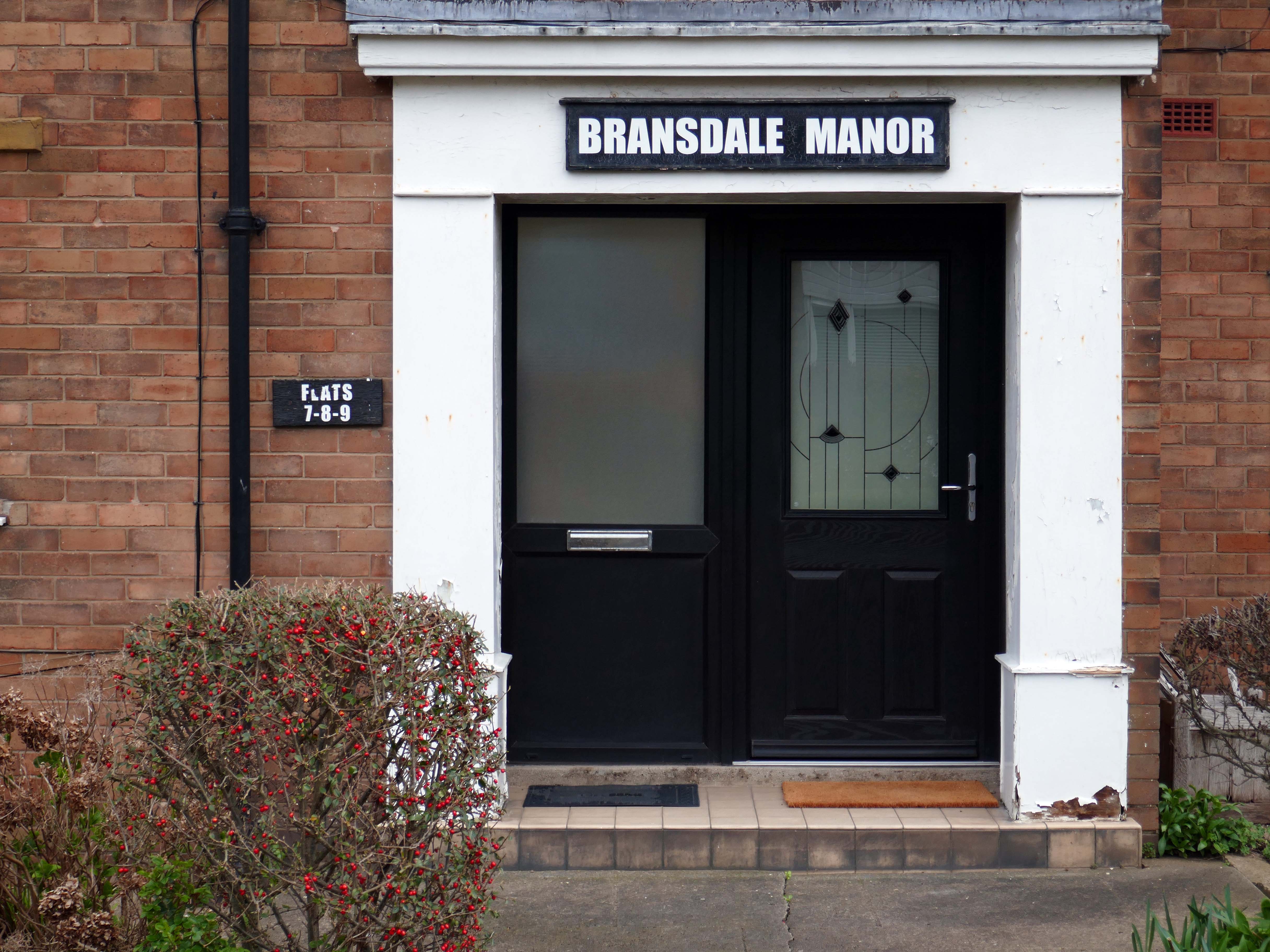
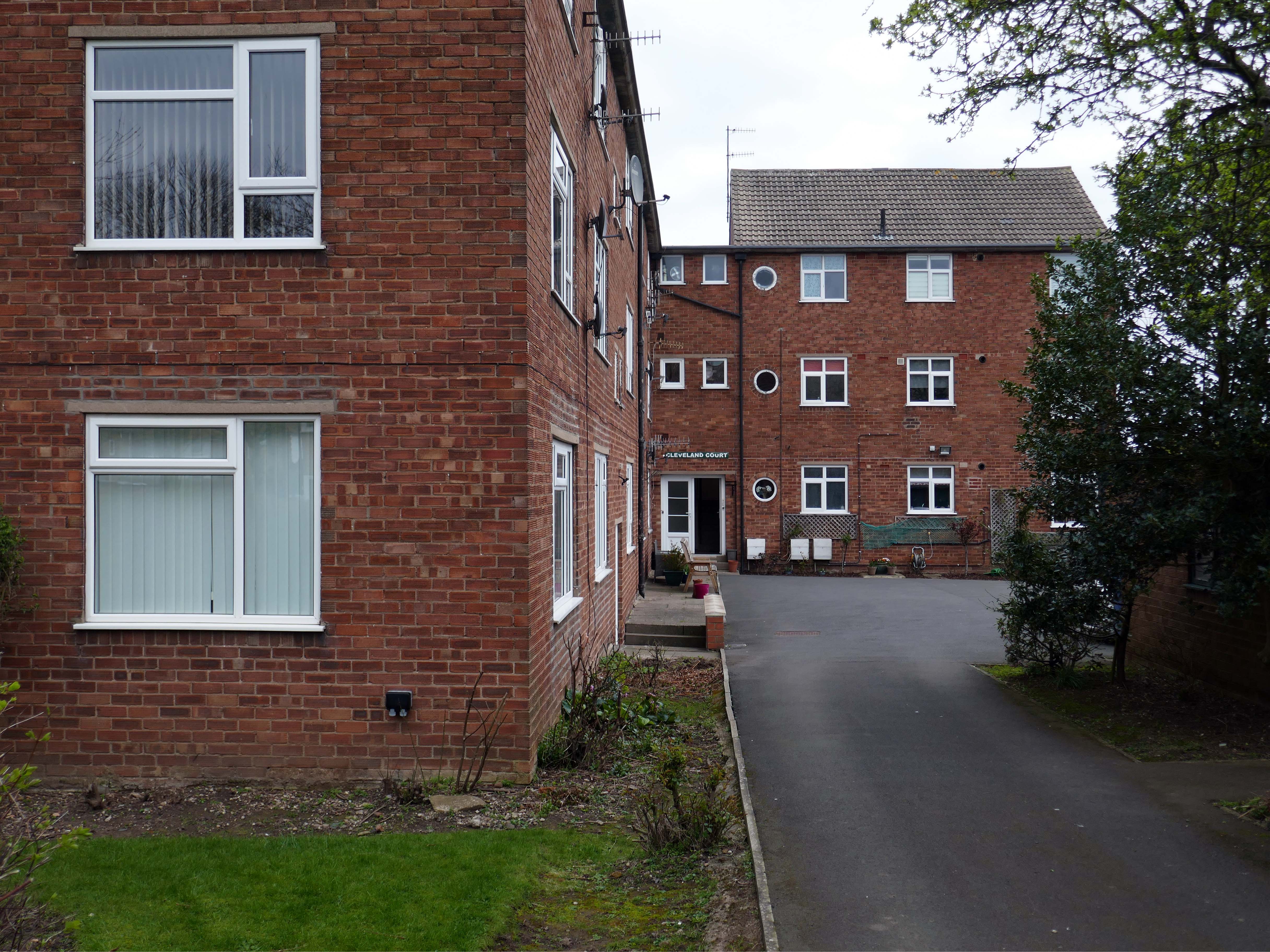
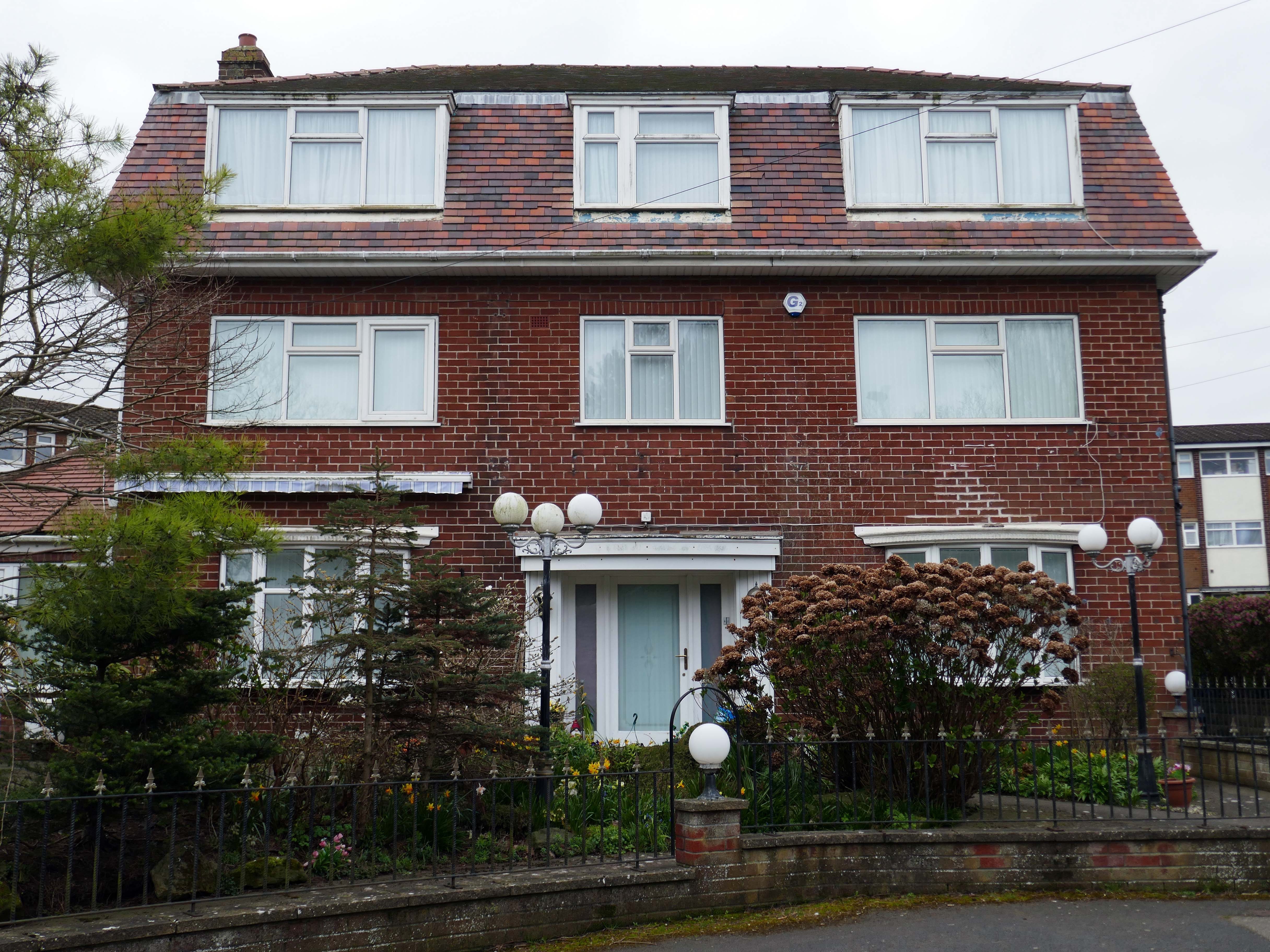
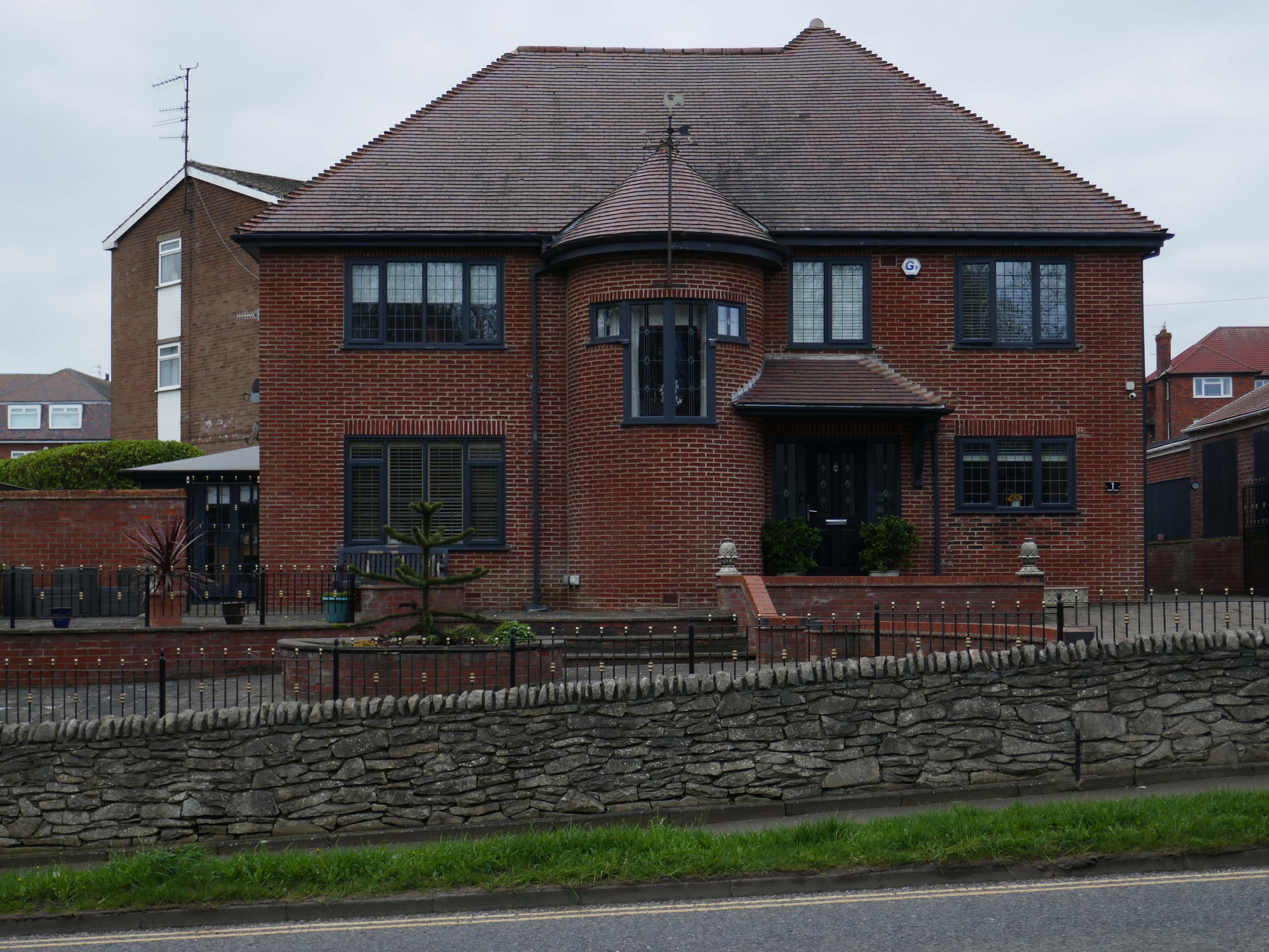
Walking the streets on a sunny Scarborough day, I was struck by the capricious cornucopia of interwar and postwar architectural styles. These are well kept well behaved homes, many of which were built as imposing apartment blocks, possibly for the seaside retirees, or the transient tourist.
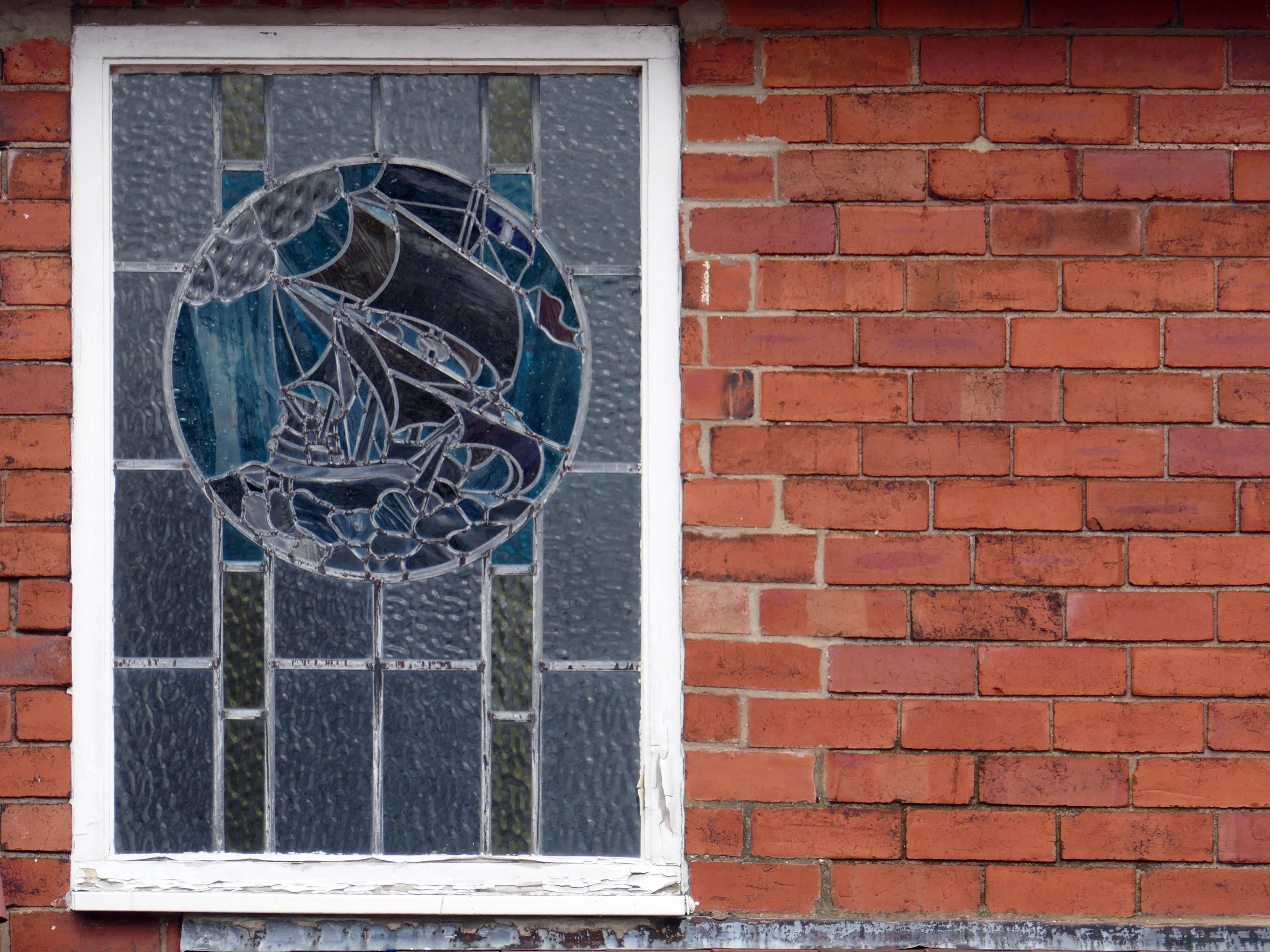
The coast encourages a playful sense of design, referencing vernacular styles and including several decorative devices.
So let’s take a wander around, see what we can see.
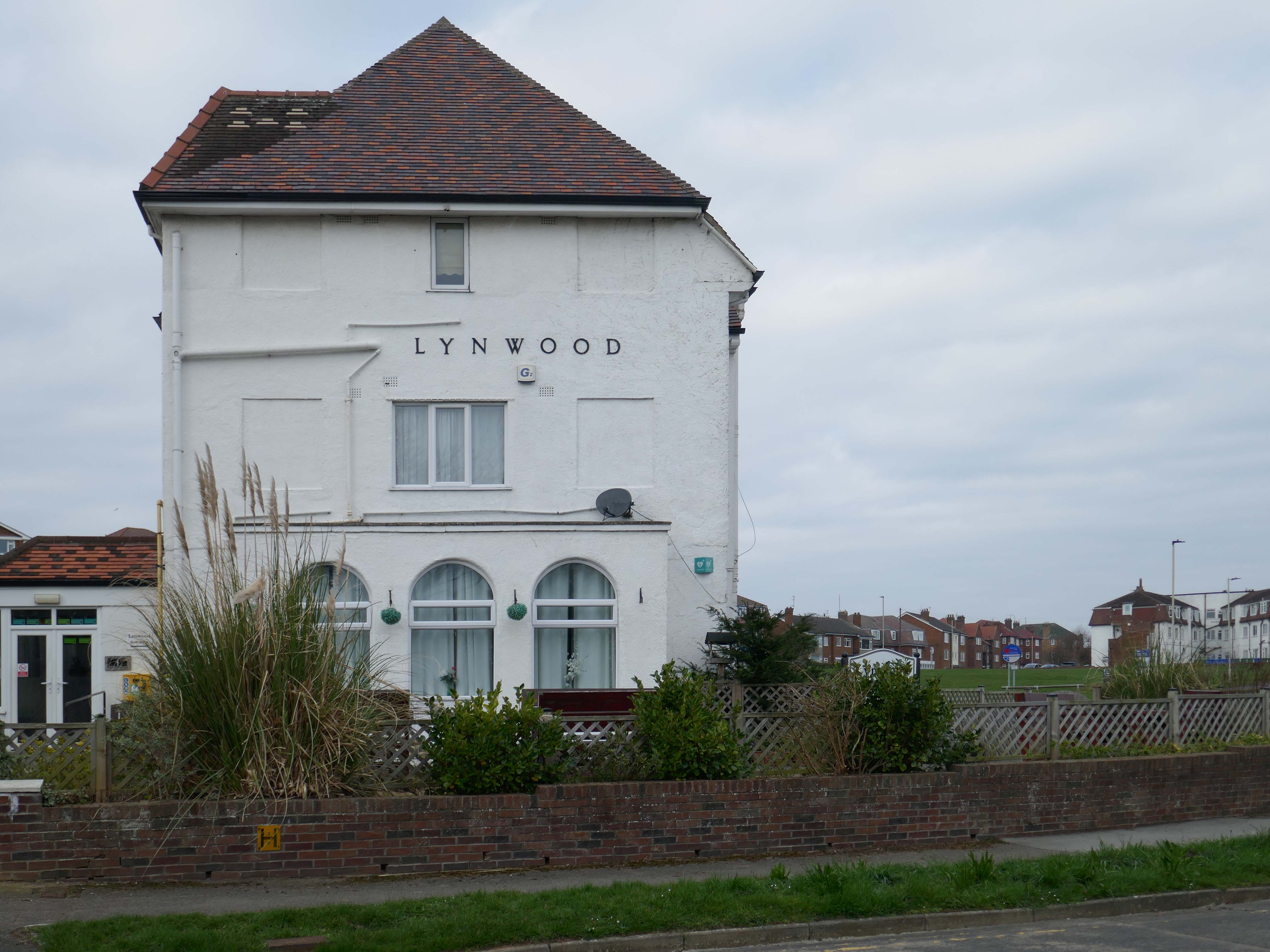
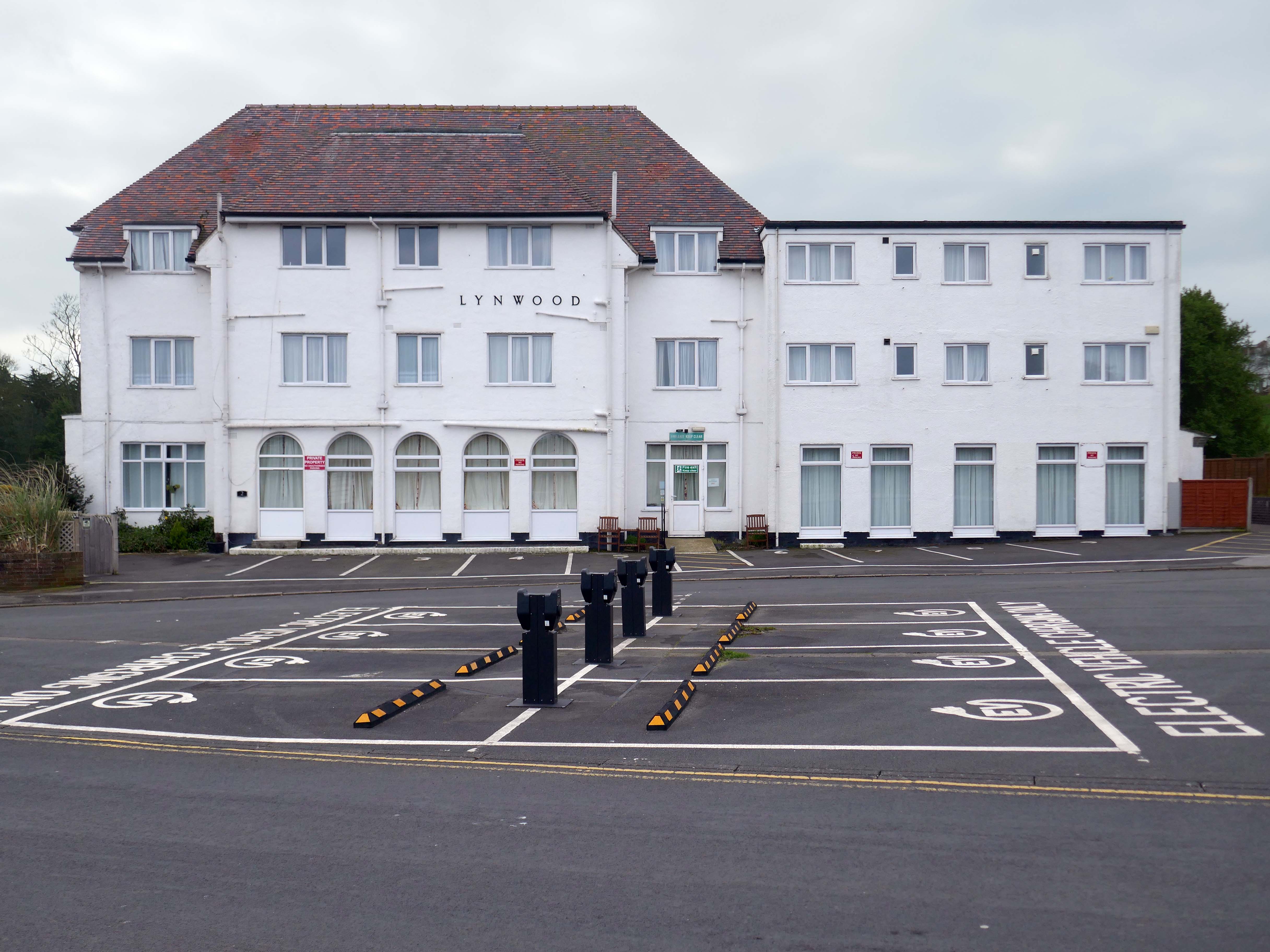
It is with deepest regret that despite the best efforts of everyone involved, it has now been confirmed that Lynwood Convalescent Home will close at the end of 2025. Whilst it was previously hoped that Lynwood could remain open for a further period, unfortunately, there are insufficient funds required to keep the Home operating and a sale of the building is progressing.
The Yorkshire Miners’ Welfare Convalescence Home charity who owns the home is continuing to support beneficiaries and staff during this difficult period. The trustees of the Home are currently discussing how the charity will use the funds from the property sale to support beneficiaries going forward and plans will be communicated in the coming weeks and months.
We fully understand the disappointment and impact this decision will have on our beneficiaries and staff. Please be assured that the trustees remain committed to keeping all stakeholders informed about the future of the charity.
Hi, there are a few point that we feel need addressing, the WiFi kept going off. Both shower heads were very high and we could not adjust them. The grouting in the bathroom floor was broken, which made the tiles loose and needs attention. The toilet in the bathroom was loose and felt insecure. The cooker was not properly secured to the housing, it felt loose in the housing. The TV kept loosing signal and the picture would break up – thank God for youtube, as that was pretty good
Apart from the points mentioned the apartment was clean and tidy and very nice.
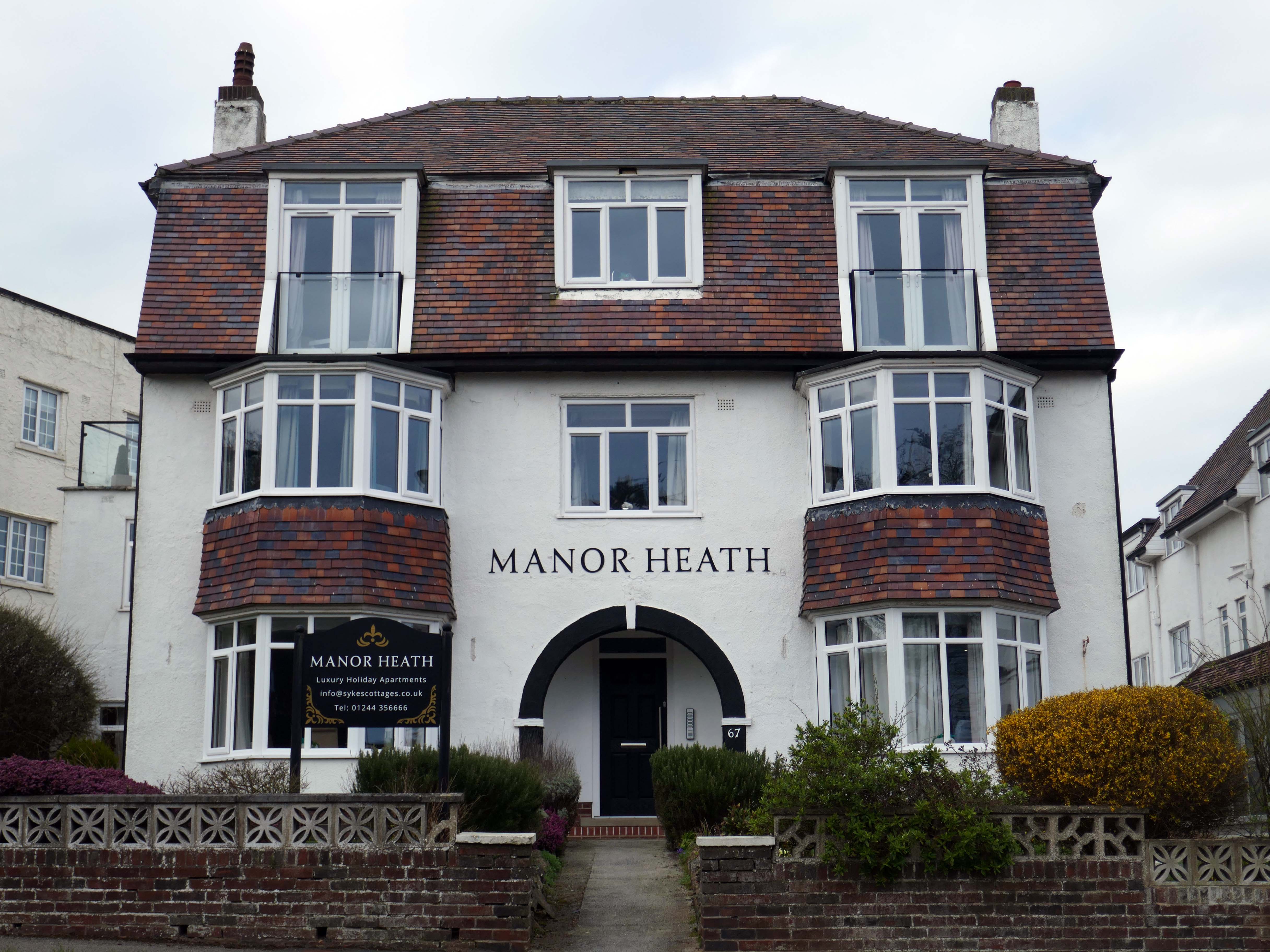
We have previously stayed at Manor Heath on four occasions and always enjoy it and look forward to our next visit. We stayed in apartment two, which was very comfortable, but would benefit from a coffee table or nest of tablets, so you could relax and put your drinks on it
Reviewed by Sharon 5.0 ★
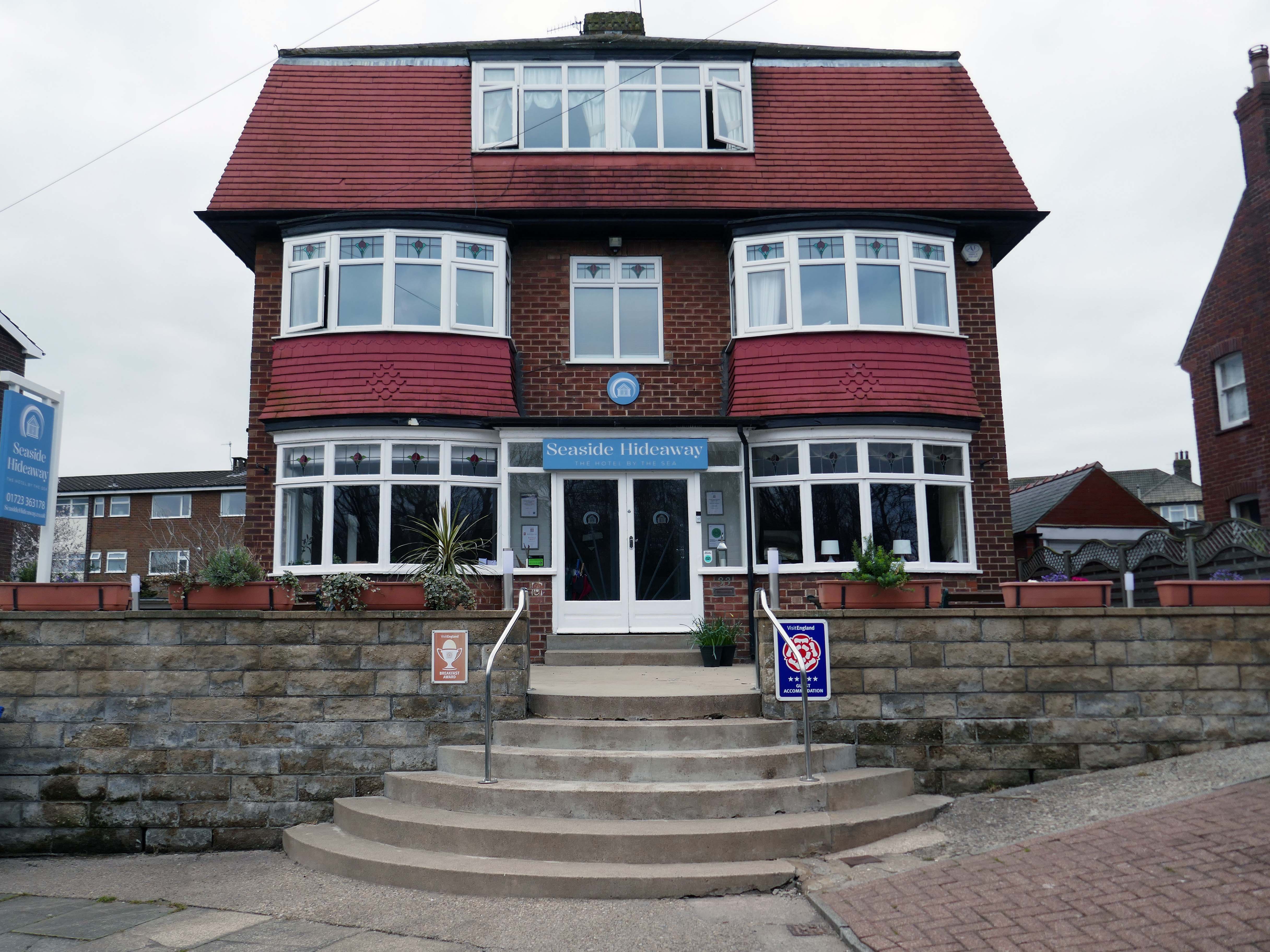
Seaside Hideaway combines a fantastic North Bay location with comfortable rooms, delicious breakfasts and a warm personal welcome from your hosts, Jim and Sarah.
If you’re thinking about a spring break by the coast, take a look at our spring breaks in Scarborough guide for ideas on where to stay and what to do.
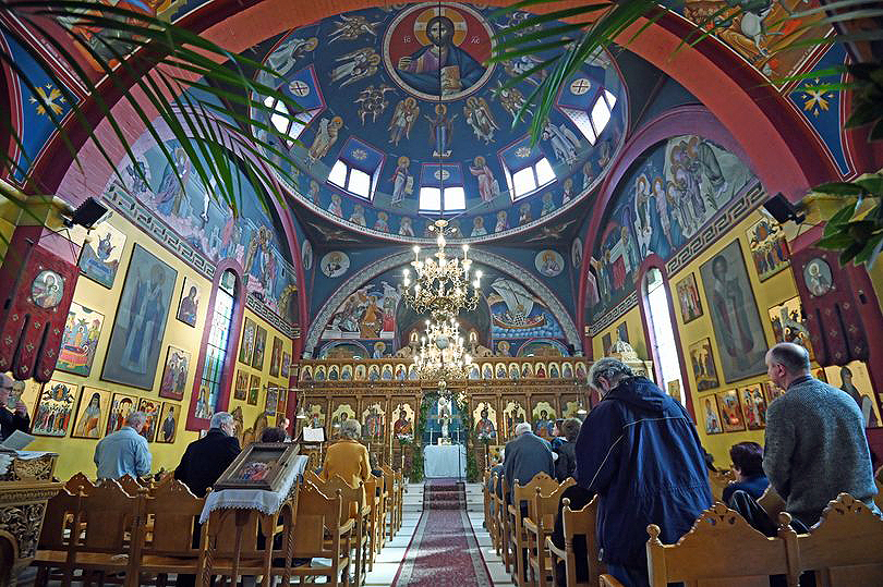
Butetown – or The Docks Tre-biwt is a district and community in the south of the city of Cardiff. It was originally a model housing estate built in the early 19th century by the 2nd Marquess of Bute, for whose title the area was named.
Commonly known as Tiger Bay, this area became one of the UK’s first multiculturalcommunities with people from over fifty countries settled here by the outbreak of the First World War, working in the docks and allied industries. Some of the largest communities included the Somalis, Yemenis and Greeks, whose influence still lives on today.
In 1906, work began on the present-day church, which also serves the Russian Orthodox community in south Wales. Designed by local architects, James and Morgan, it is located on a site provided by the 4th Marquess of Bute, to the west of Bute Street. The modestly-sized building is of Byzantine style with a domed nave and an apse at the east end. It retains the original dedication to StNicholas. The interior is very ornate, with a lot of carved woodwork. The dome and upper walls have painted Biblical scenes in vivid colours with gold decoration.
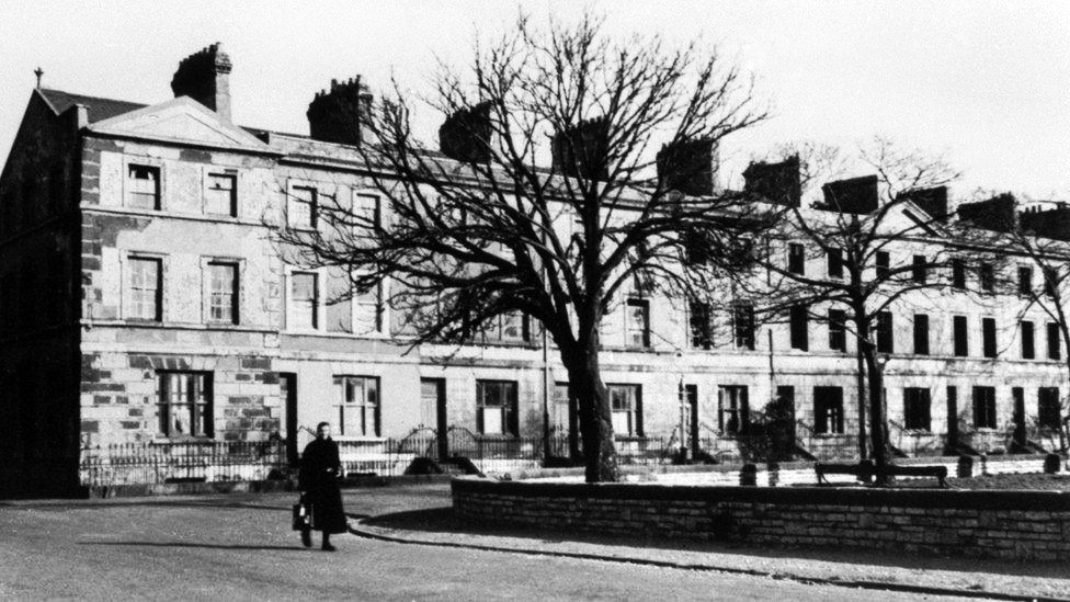
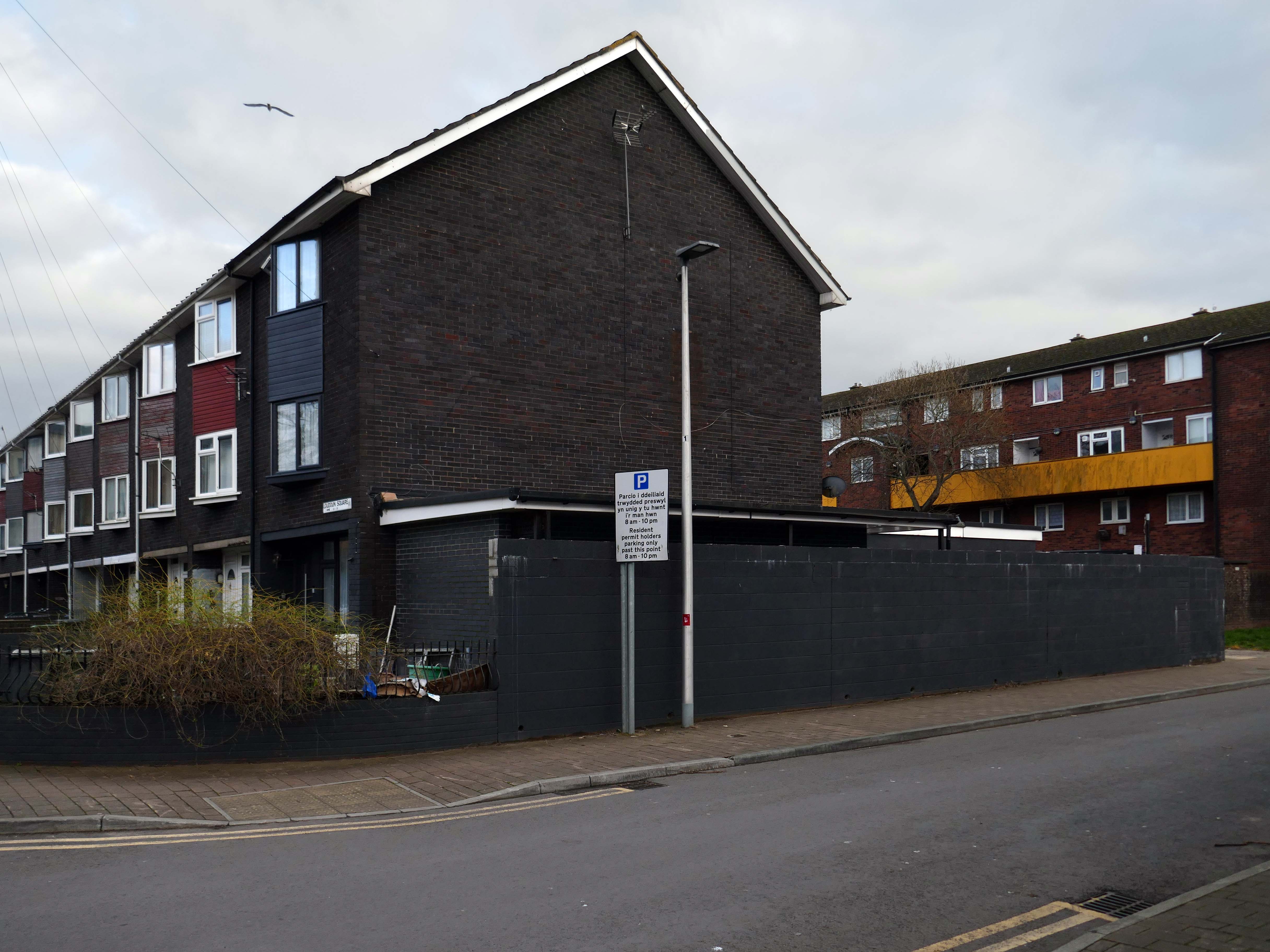
Loudoun Square was originally built in the mid-1850s as upmarket homes for merchants, mariners, ship brokers and the like around a central park.
Photo 1962
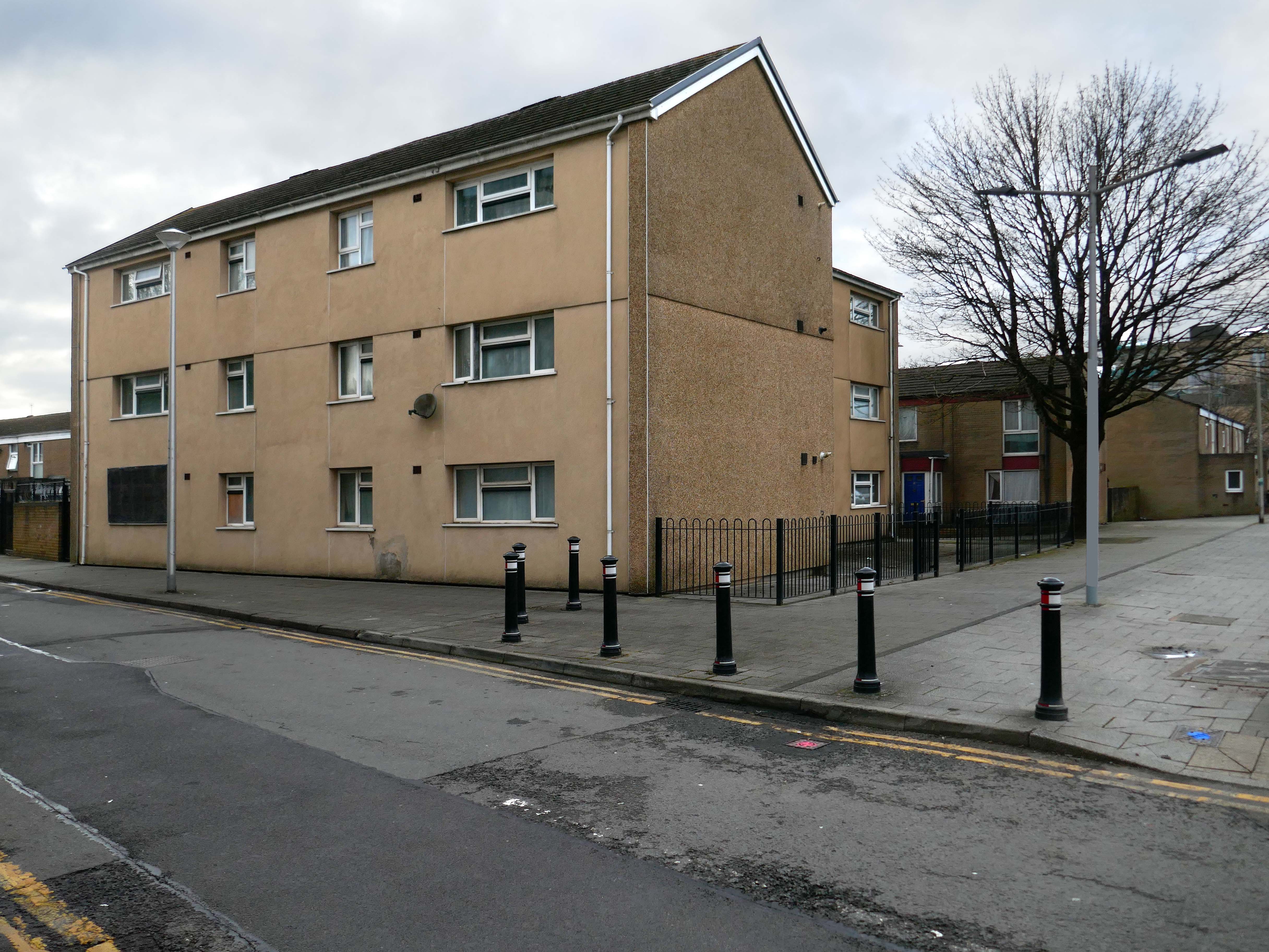
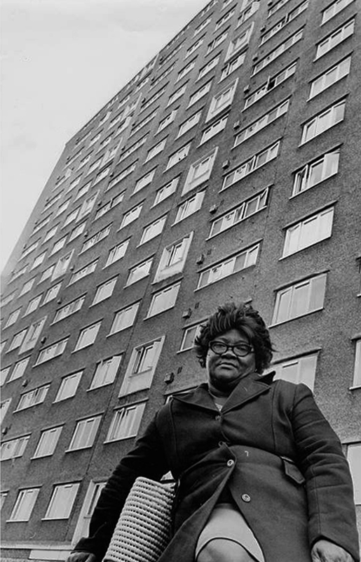
In the 1960s, most of the original housing was demolished including the historic Loudoun Square, the original heart of Butetown. In its place was a typical 1960s housing estate of low-rise courts and alleys, and two high-rise blocks of flats.
Between 1960 and 1966 two sixteen-storey tower blocks, Loudoun House and Nelson House, were built on the centre of Loudoun Square
The demolition of the old buildings in Bute Street gets under way in 1963.
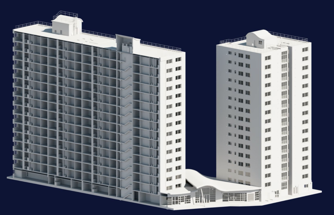
Surveybase have undertaken detailed scanning and modelling prior to the planned post Grenfell re-cladding.
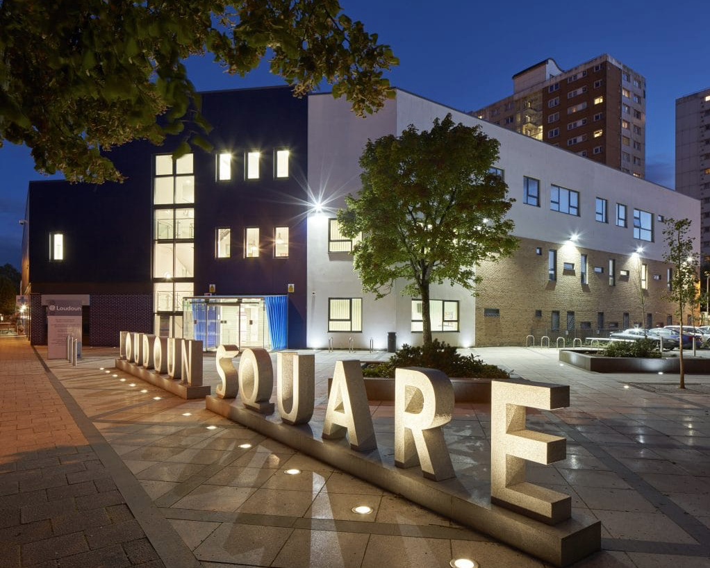
The Loudoun Square regeneration project is a collaboration between Cardiff City Council, Cardiff Community Housing Association, Cardiff Local Health Board and Cardiff and Vale NHS Trust. The site is located between Cardiff City Centre and Cardiff Bay, and was previously occupied by an existing health centre and local shops, together with a vacant area of land.
The area has been regenerated with the creation of new modern facilities to serve the local community and include a new health centre, shops, affordable homes and community facilities.
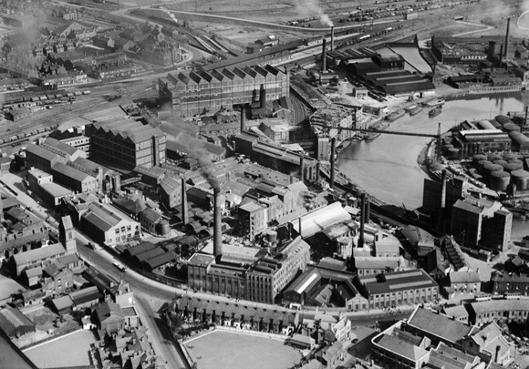
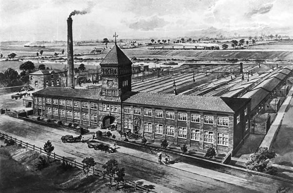
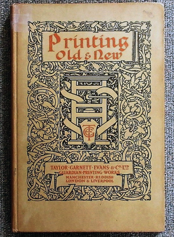
Manchester Guardian Printing Works owned by Taylor Garnett & Evans & Co. Ltd- a view of factory dated 1902.
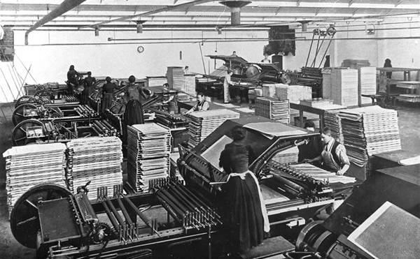
Lithographic Printing Dept 1902.
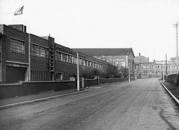
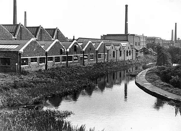
CWS Printing Works – formerly the Guardian Print Works showing a view from the road dated 1972.
CWS Printing Works showing a rear view with canal in the foreground.
The Stockport Branch Canal was a five mile branch of the Ashton Canal from Clayton to Stockport.
An important cargo was the supply of grain to William Nelstrop & Company’s Albion Corn Mill at Stockport Basin.
In its early days there was passenger carrying on the Ashton Canal and one of the routes was between Manchester and Stockport.
Commercial carrying ceased in the 1930s but it lingered on into the 1950s’ as a barely navigable waterway. At one stage in the 1950s it was dredged but this improvement did not attract any traffic. Stockport Basin was the first section to be filled in but it was not until 1962 that the canal was officially abandoned by the British Transport Commission, who had been responsible for it since 1948.
It took many years to fill in and this was a disagreeable procedure for people living along its length.
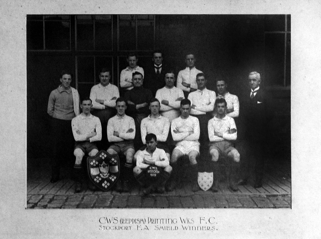
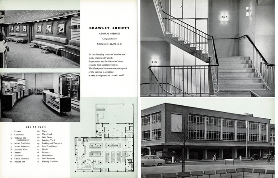
From a very lavish production, printed of course by the CWS’s own Printing Works at Reddish, is a description of the new flagship department store for the Crawley Co-operative Society that was opened in 1959. The elevations and facade are very much of their day, quite ‘Festival of Britain in style, and the store was a prominent feature of the planned New Town’s centre.
The wide variety of printed material which the CWS required, created a need that could not be met locally by a single source, another large print works was required in Longsight.
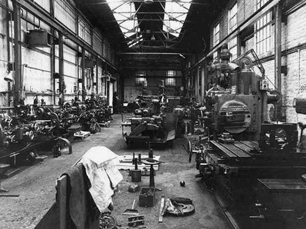
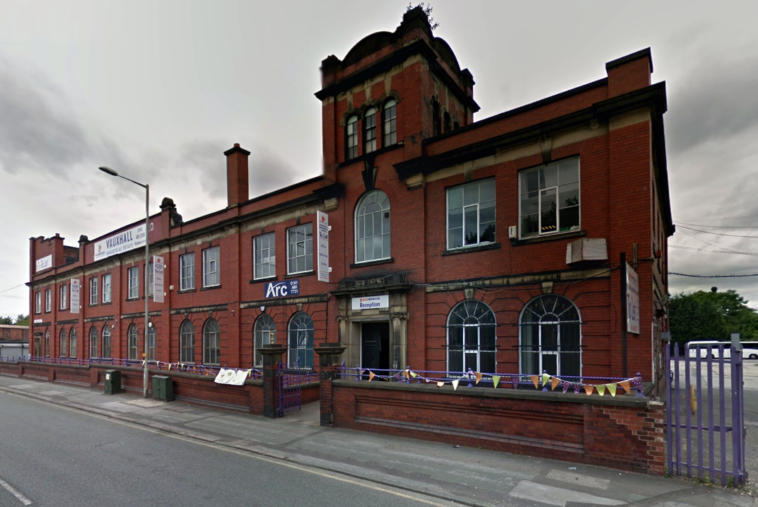
Craven Brothers Works 2008
1900 – Further growth prompted the construction of the Vauxhall Works at Reddish, near Stockport. The company kept the works at Osborne Street, Rochdale Road, with about 500 employees, open until 1920. The 1915 O.S. map shows Vauxhall Engineering Works with its south-east corner on Osborne Street, Collyhurst, and bounded on the north by streets of terraced houses and to the south by the L&YR Manchester-Normanton line.
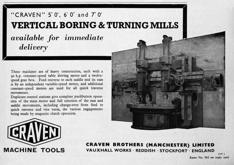
The Developement of Reddish – quite a number of Manchester firms are prospecting the neighbourhood of Reddish, writes a correspondent, while Messrs. Heywood are about to erect electrical engineering works in Sandfold-lane, and Messrs. Rowley and Co, boiler-makers, are fitting works in the neighbourhood. Messrs. Craven Brothers, engineers, of Salford, have purchased 14-acres of land near the Reddish Station, on the estate of Mr. H. P. Greg, on which they intend to erect large engineering works.
The first sod was cut on Thursday afternoon by Mr. William Craven, in the presence of his brother directors in 1900.
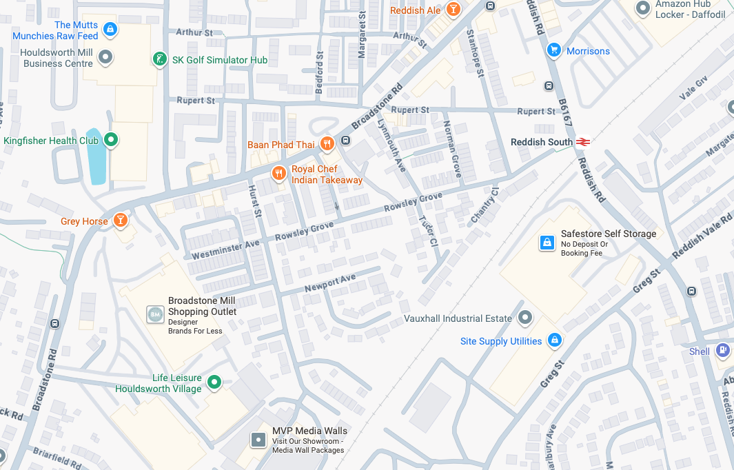
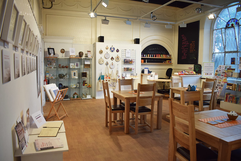
ARC began in 1995 at Greek Street, Stockport under the name of MAPS and moved to the Vauxhall Industrial Estate Craven Works building in early 1997. Arts for Recovery in the Community or ‘Arc’ was then launched in 2005. The Arc Centre in its current form, including gallery servung refreshments and public programme has been running since 2016.
Of course, we are sad to say goodbye to the old Craven Brothers factory and the Reddish community as our base. We are so grateful to the local residents and businesses who have supported us for so long. Please, don’t be strangers! We made the building our own over the years and take with us many, many great memories.
Looking to the future at Wellington Mill, we will have exclusive use of several rooms on the floor accessed via the A6 and Hat Works Museum shop. This will include a large art studio, ceramics studio, offices and storage spaces. We will also share the large cafe, events and retail space with the Hat Works museums team and work together to build a bigger audience for both organisations and hopefully a Stockport town centre creative arts hub.
And lo, it came to pass, from the onset of the Industrial Revolution to today, a whole world of work is dismantled. A transport infrastructure is literally filled in, and the former homes of industry demolished.
The CWS is no longer the global behemoth it once was, and print technology has changed beyond recognition.
With it goes a whole series of social relationships and identities bound up in shared occupations.
Our excavations at Vauxhall Industrial Estate, undertaken in advance of the redevelopment of the site by RECOM Solutions and Vauxhall Industrial Estate Ltd, revealed a number of features associated with the Craven Brothers’ Works. Two excavation areas were opened, targeted on features shown on historic mapping but no longer surviving: Area 1 in the north, targeting a small chimney and outbuildings adjacent to the machine shops; and Area 2 in the south targeting a chimney and part of the footprint of Building 3. In Area 1, the archaeological remains had been heavily truncated by the installation of chemical vats in the late 20th century after Craven Brothers closed; however, the foundations of the targeted outbuildings and the chimney were uncovered, as well as the remains of a railway track running alongside the machine shops, represented by in situ sleepers.
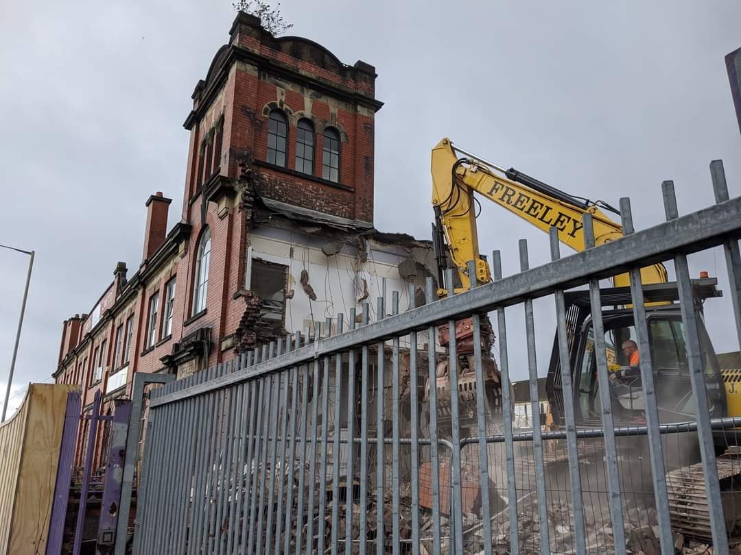
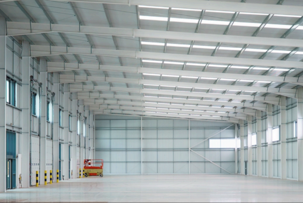
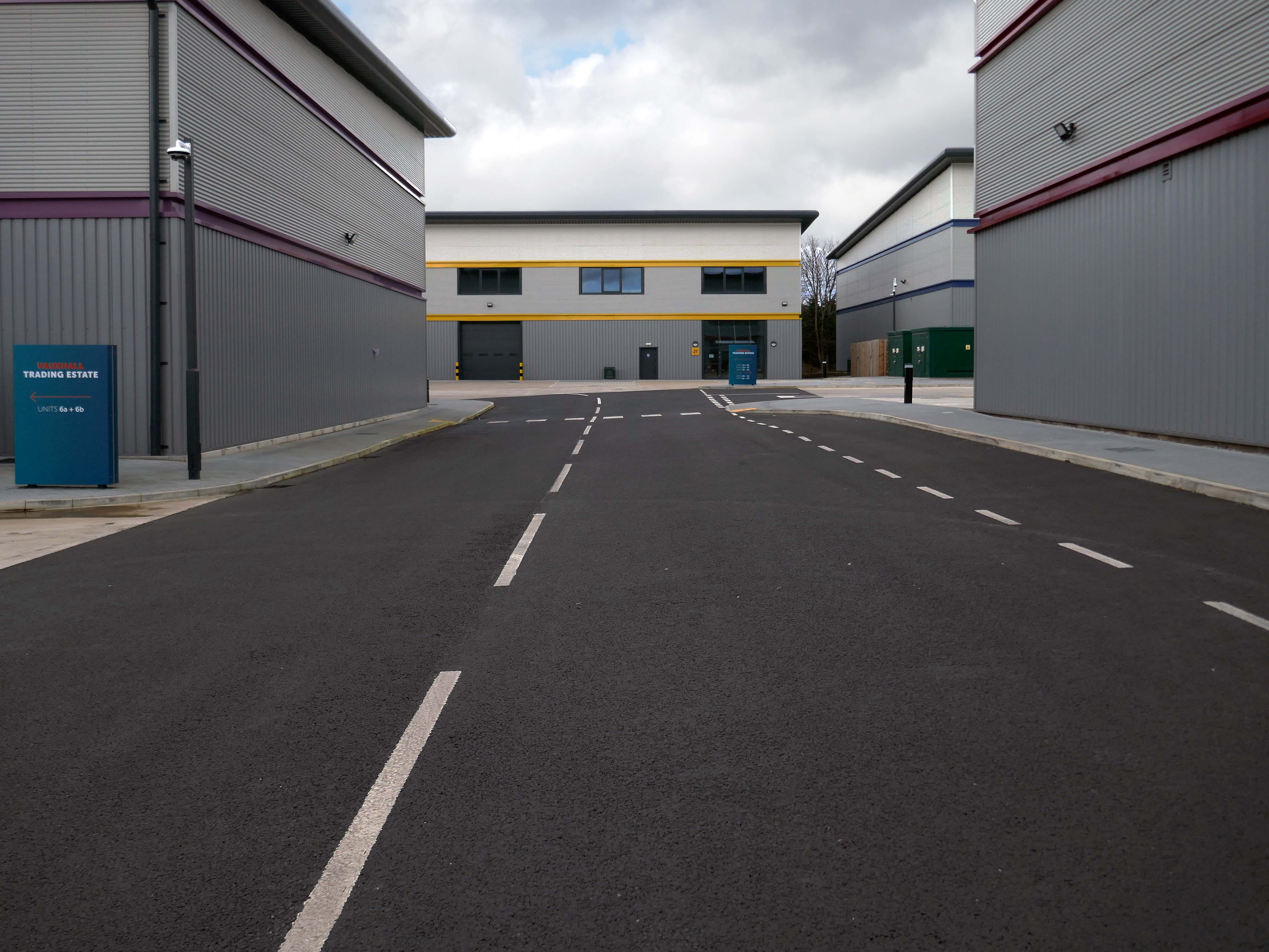
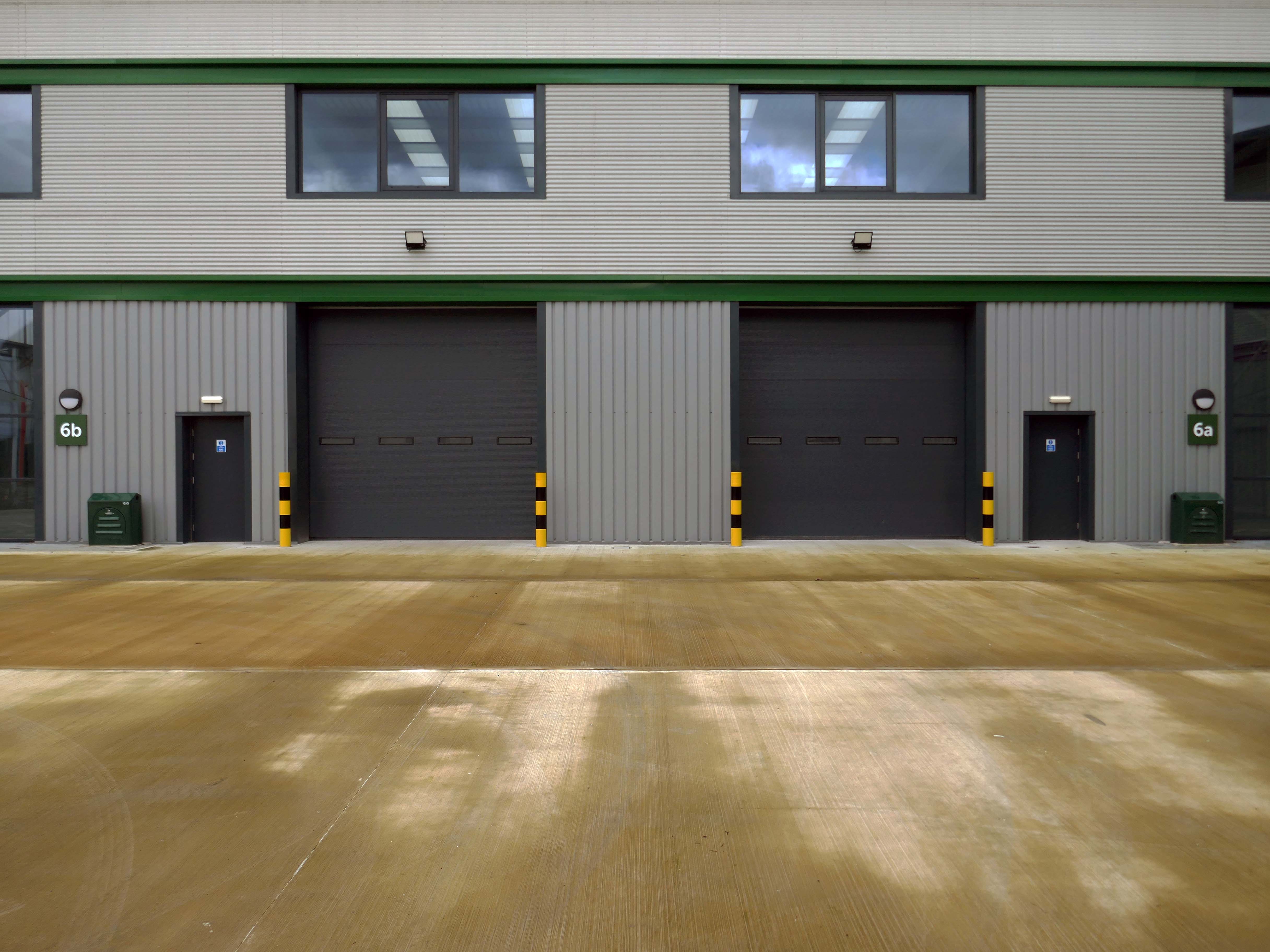
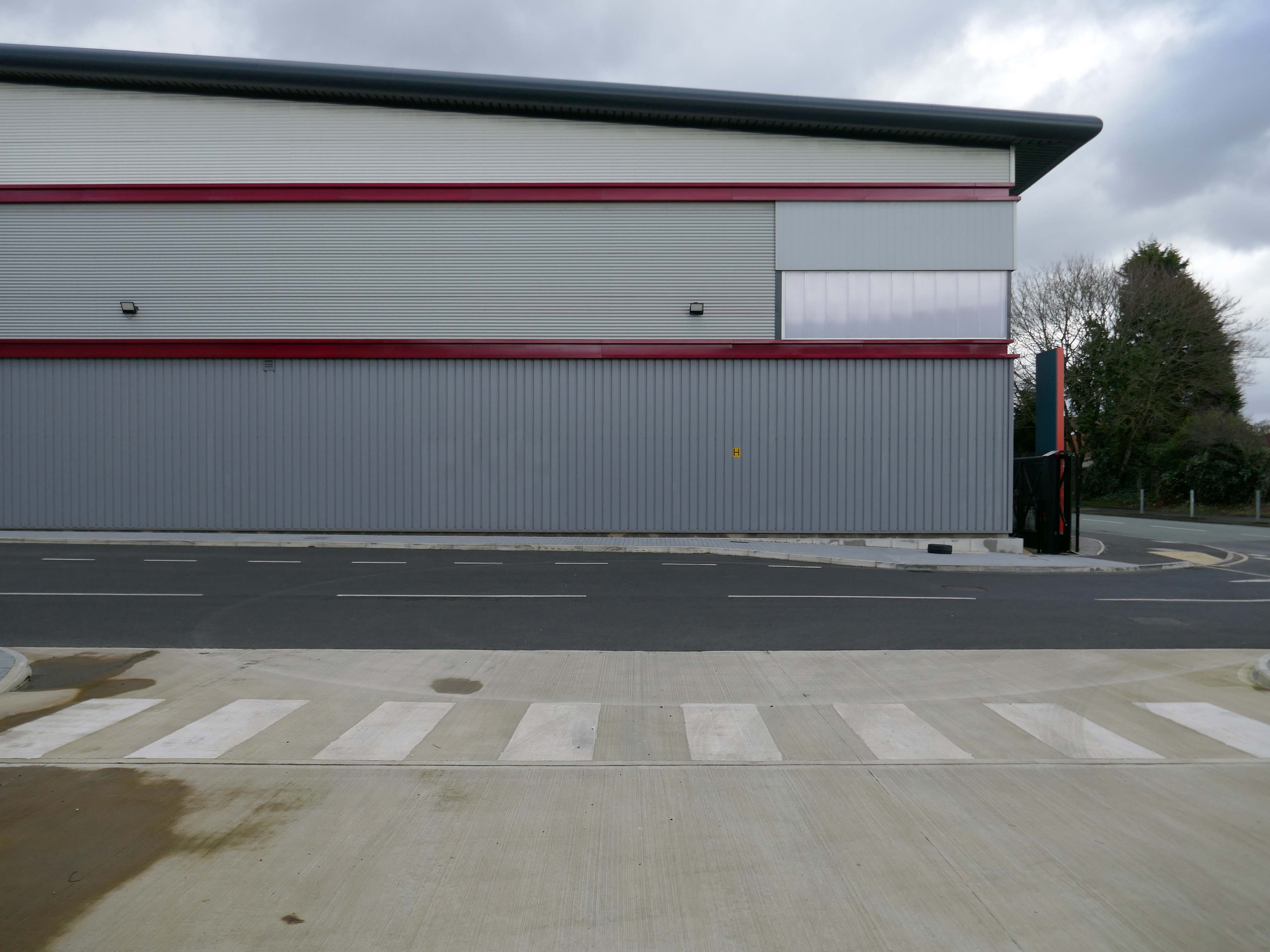
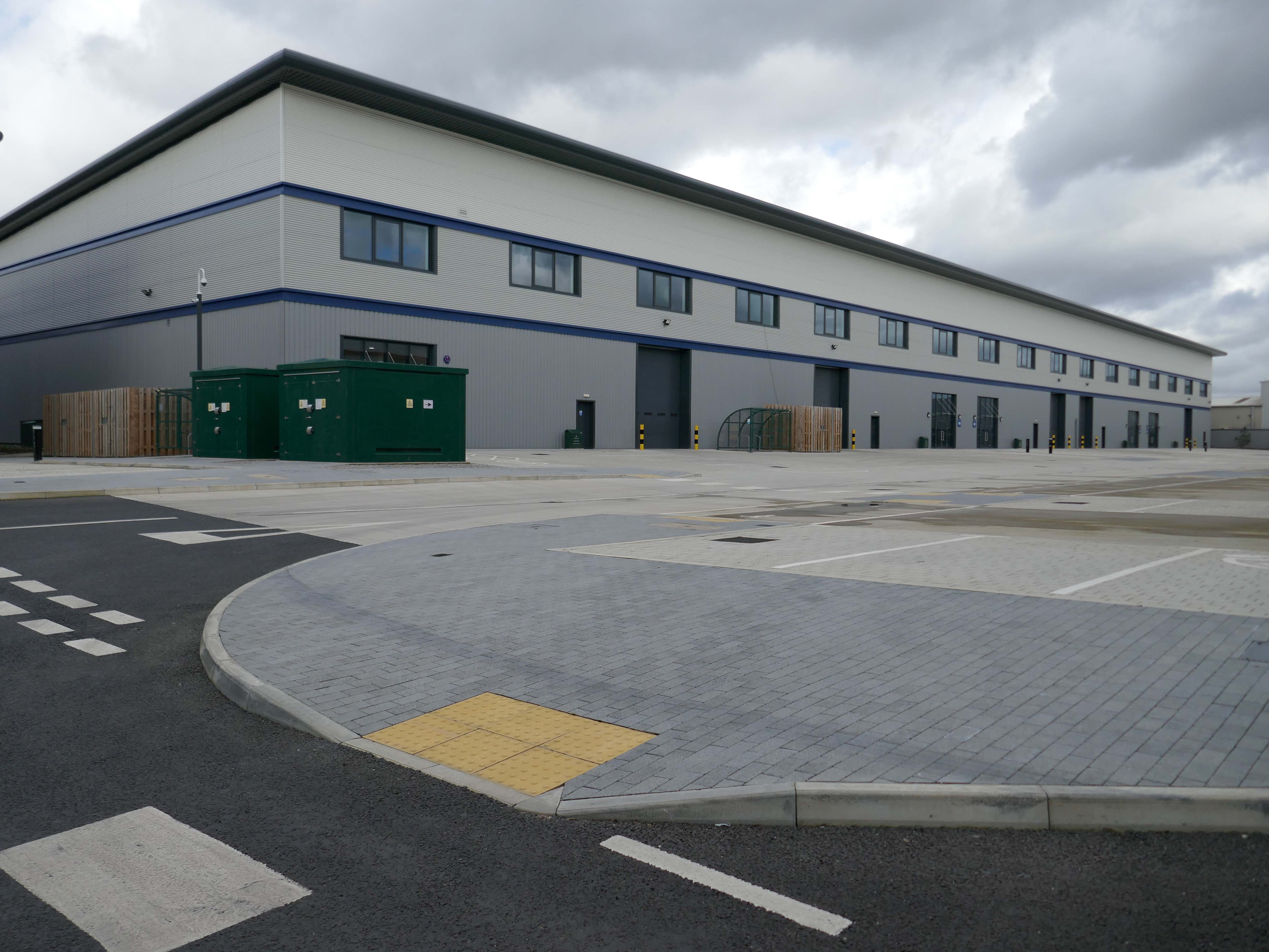
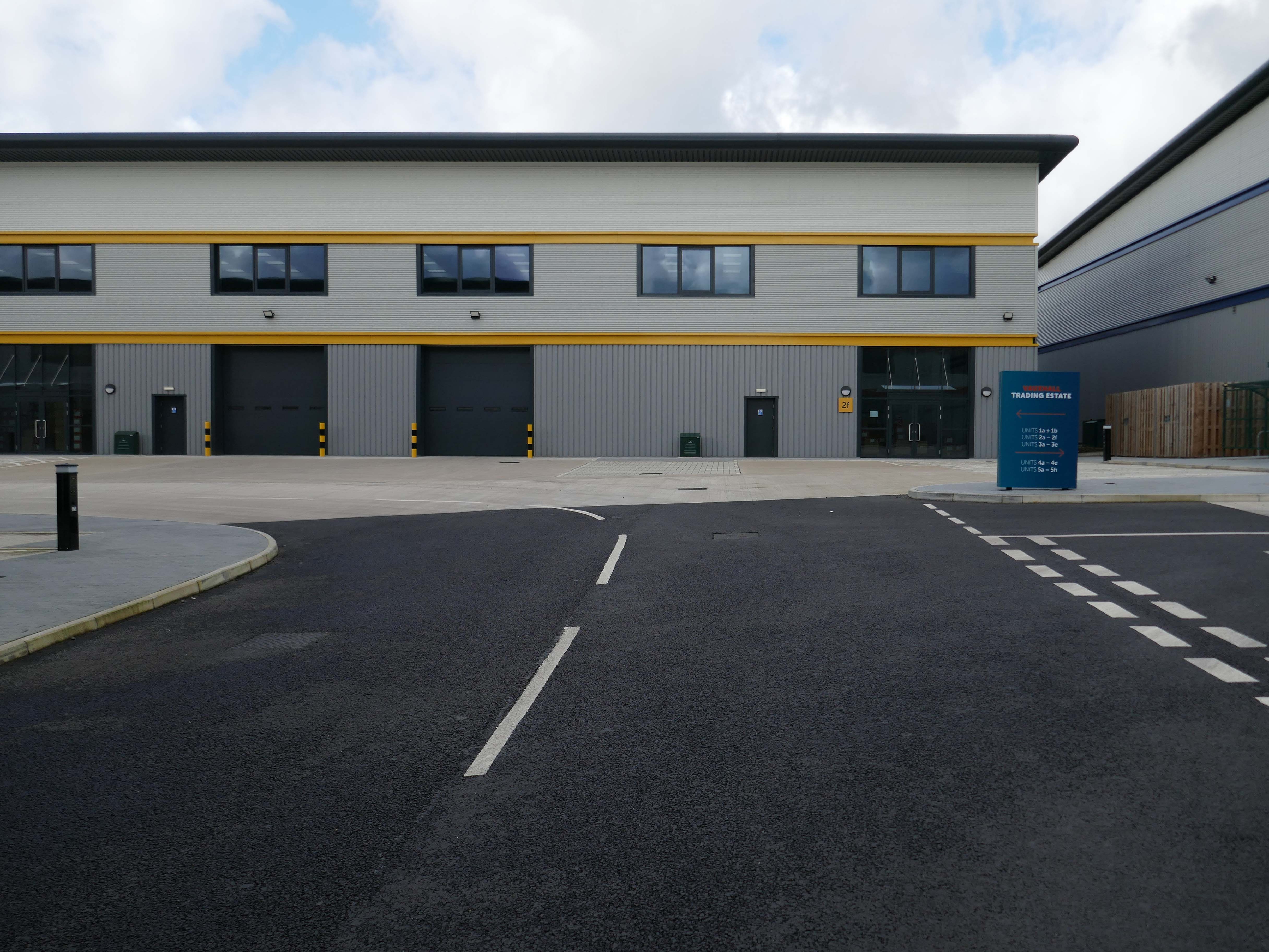
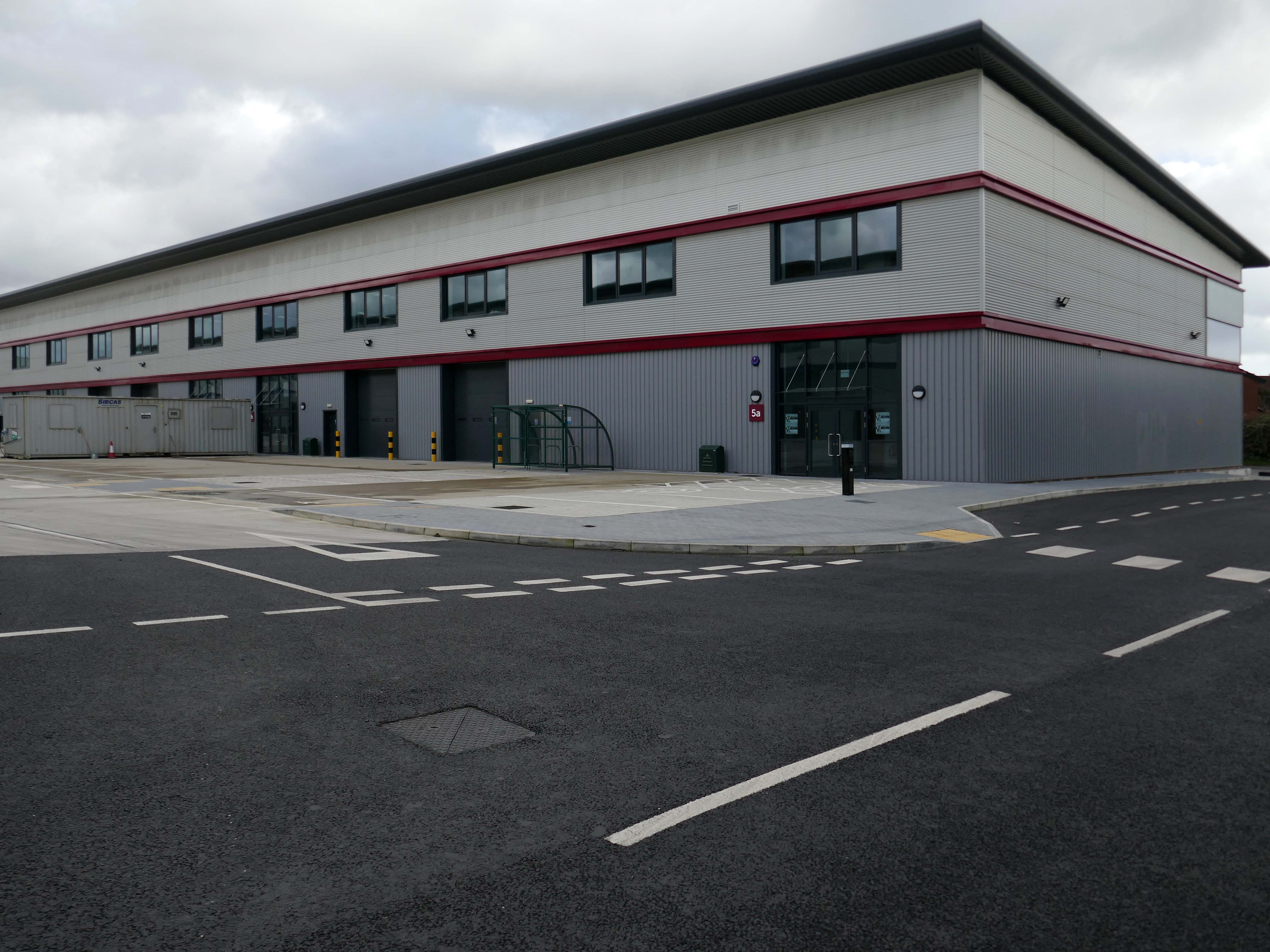
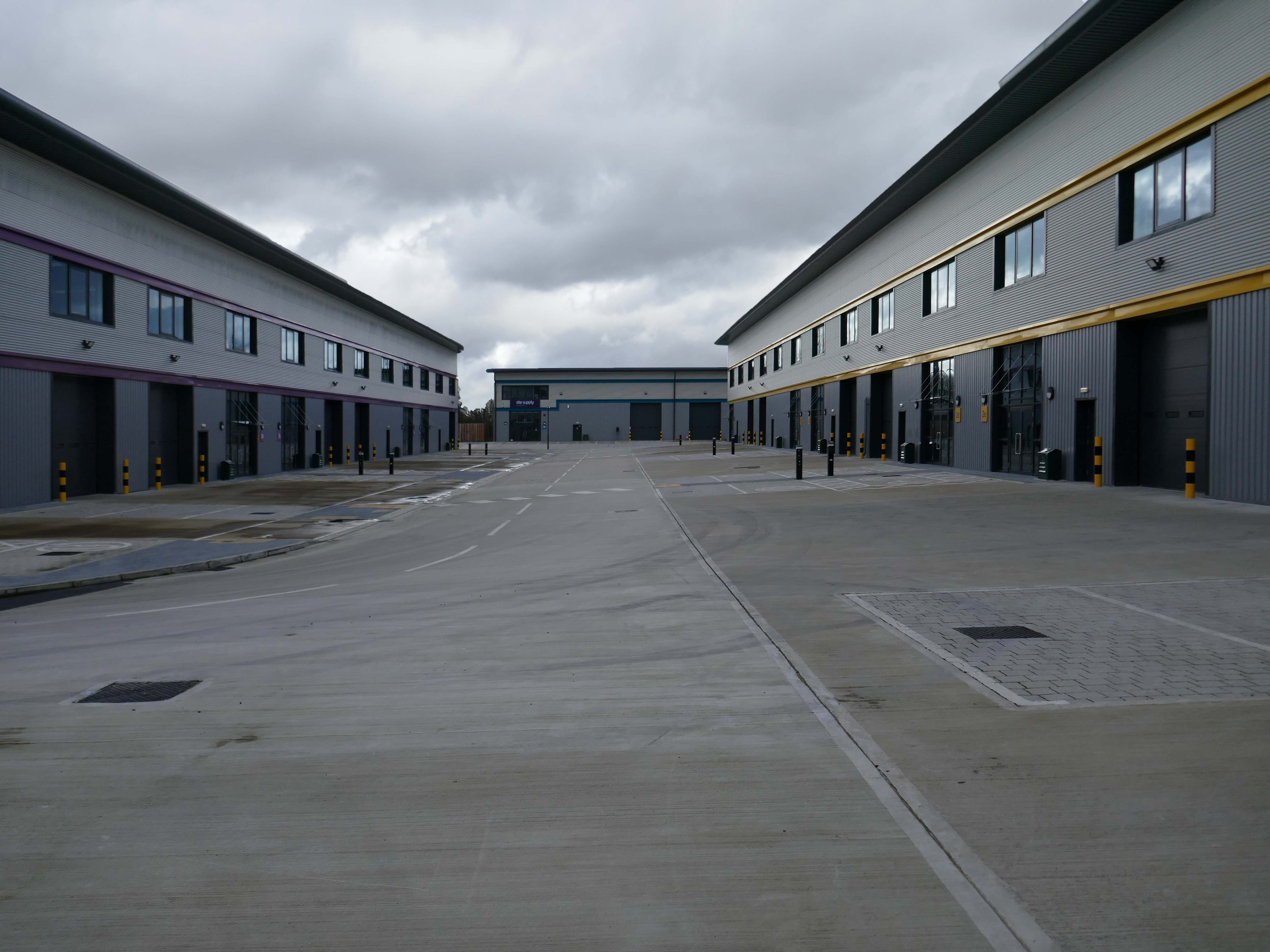
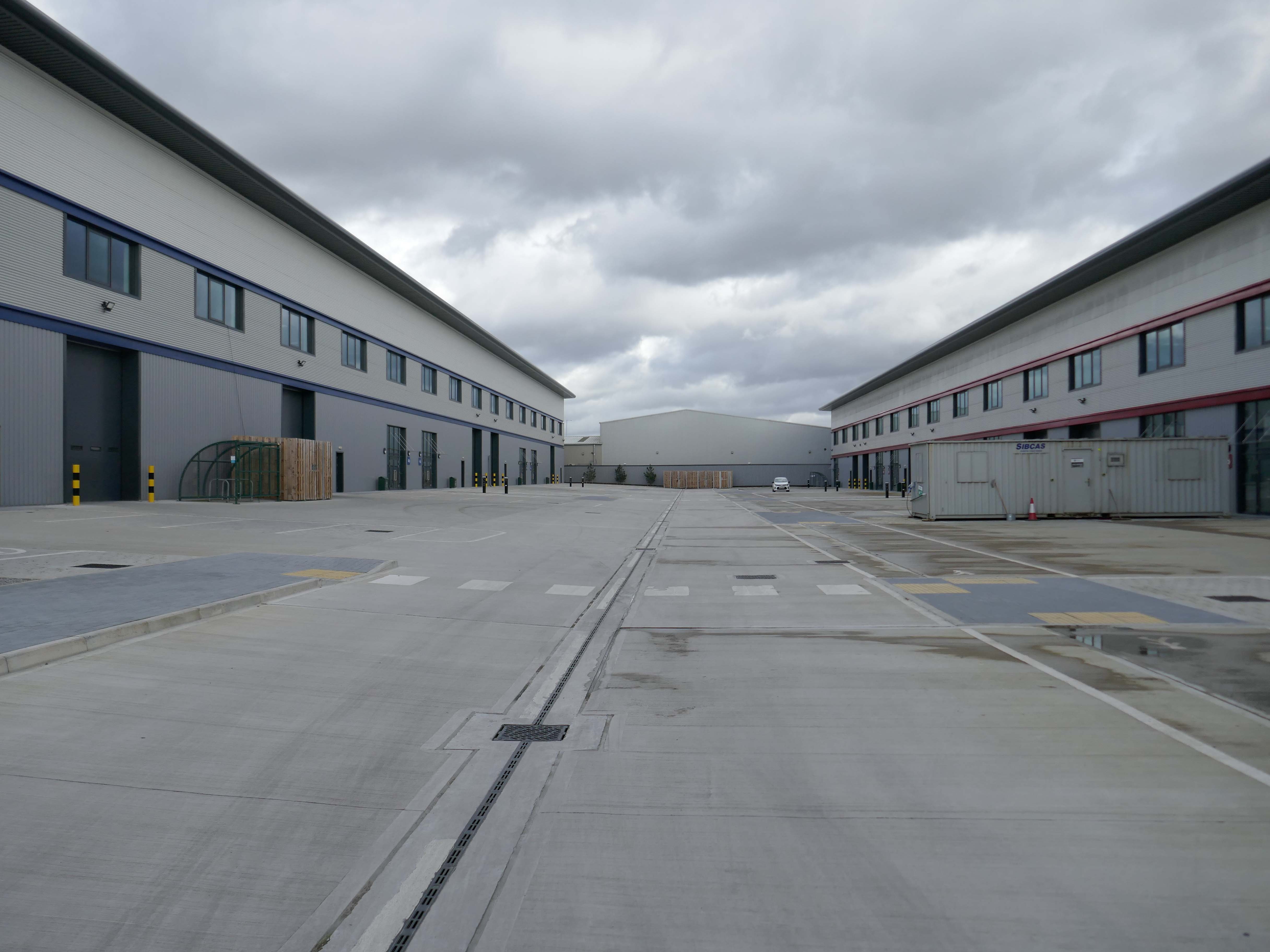
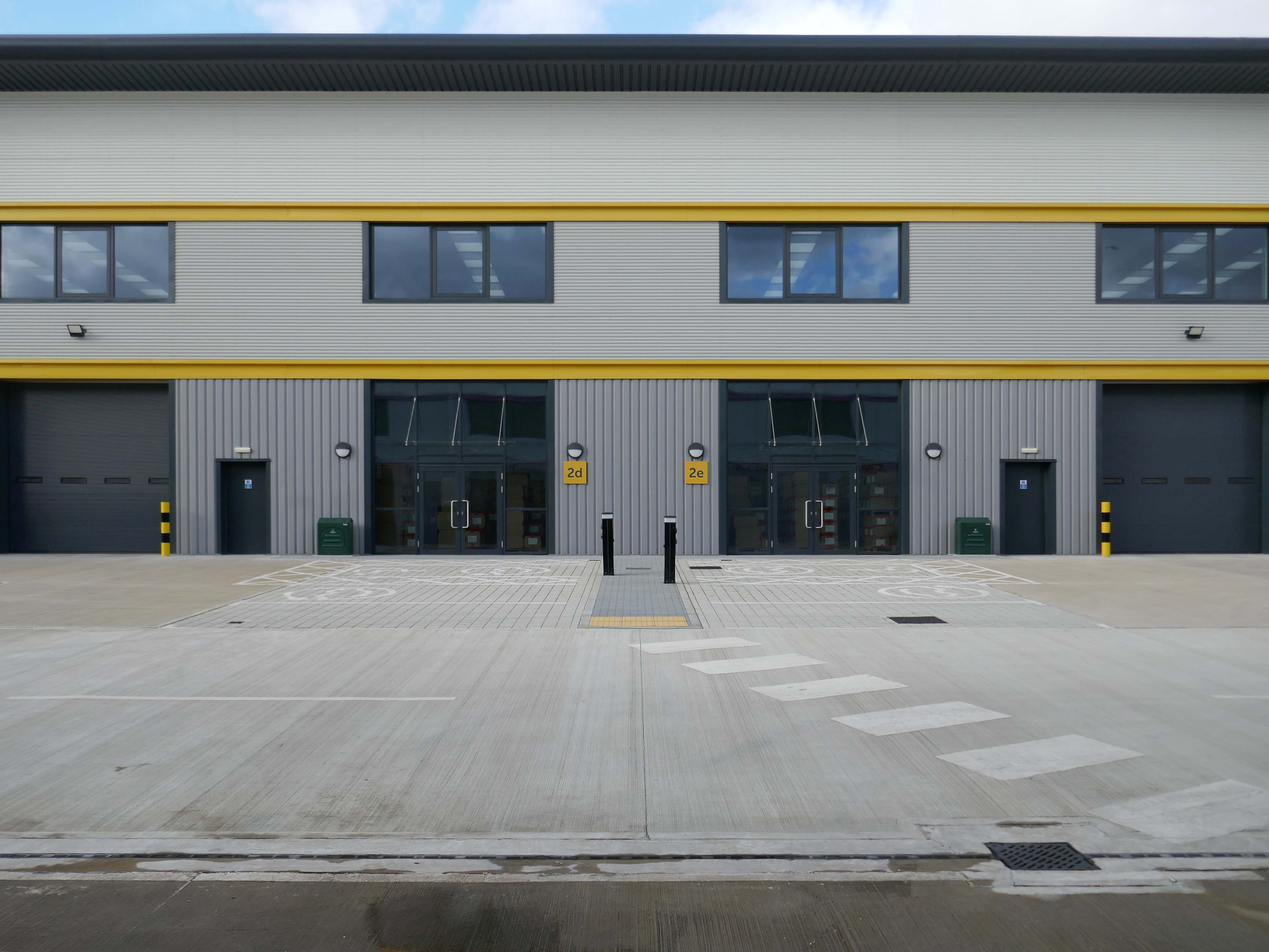
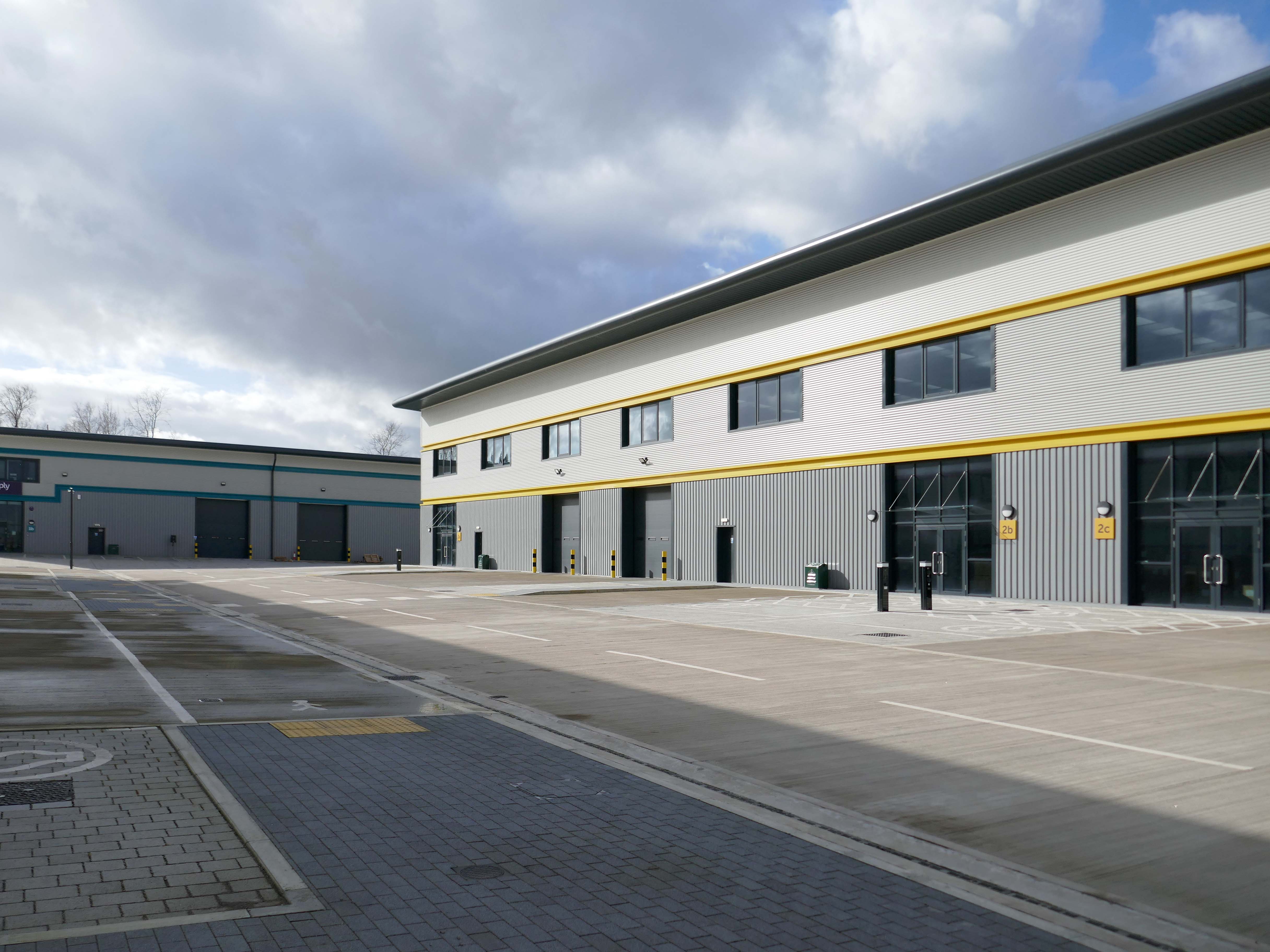
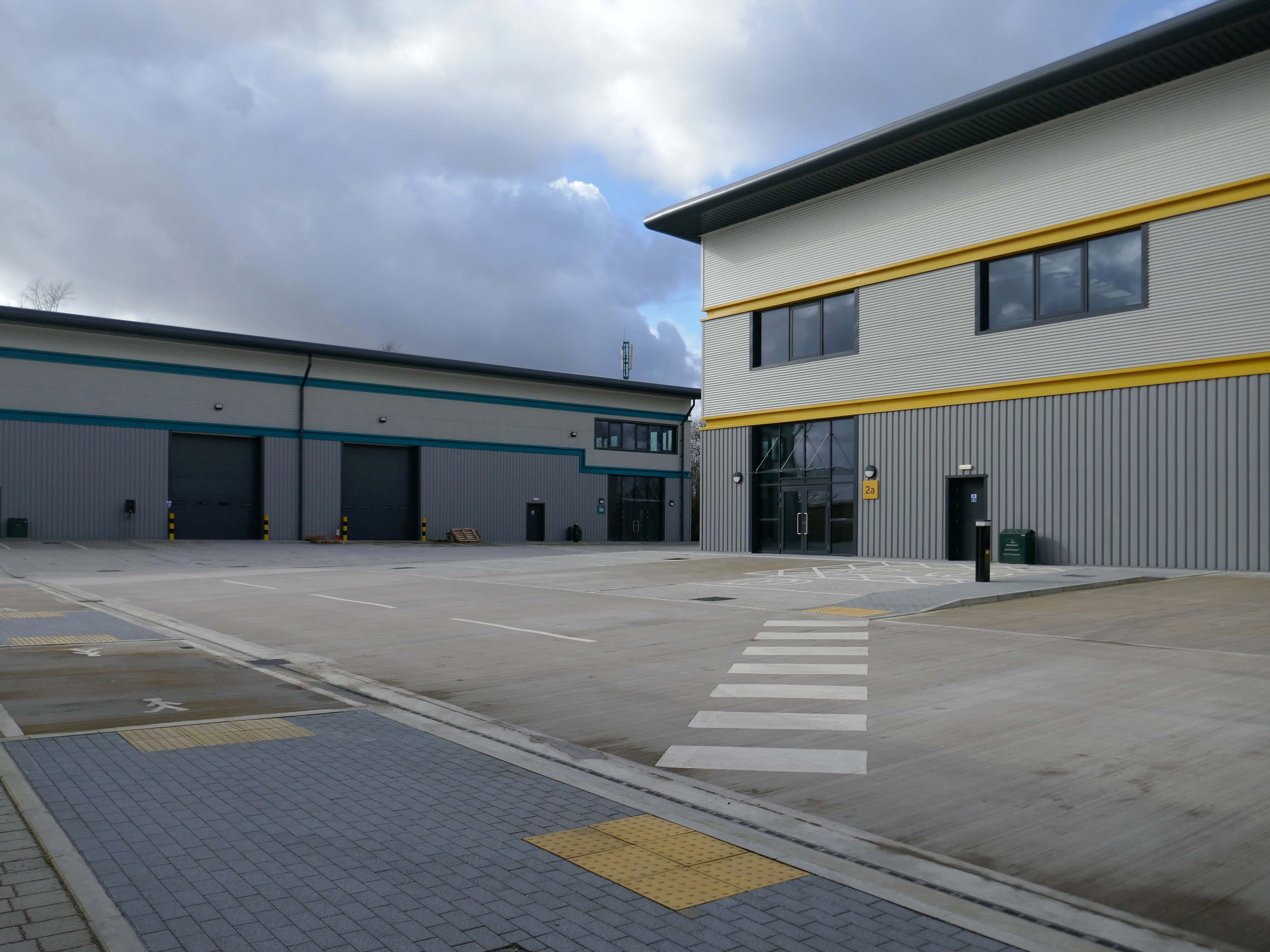
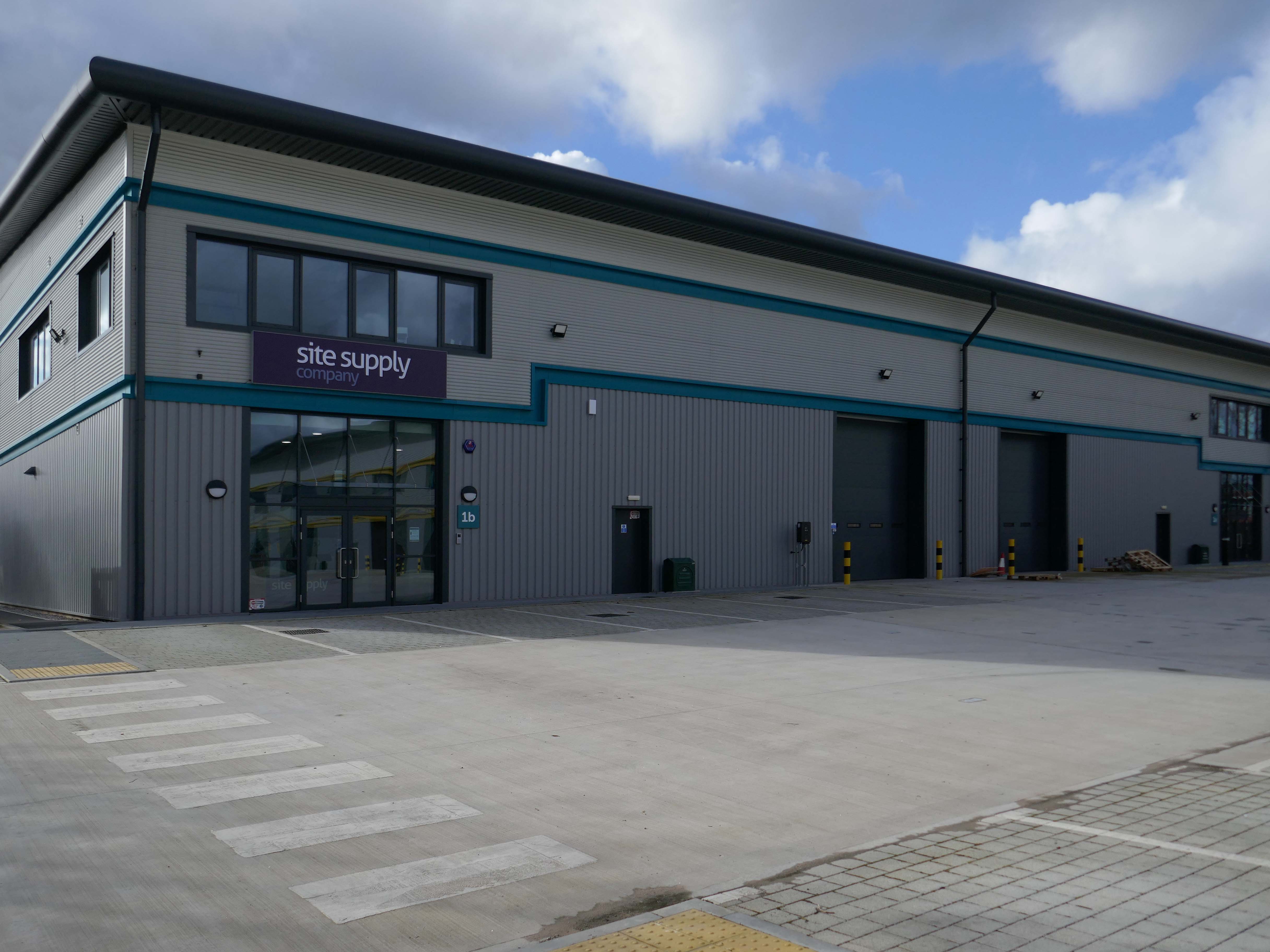
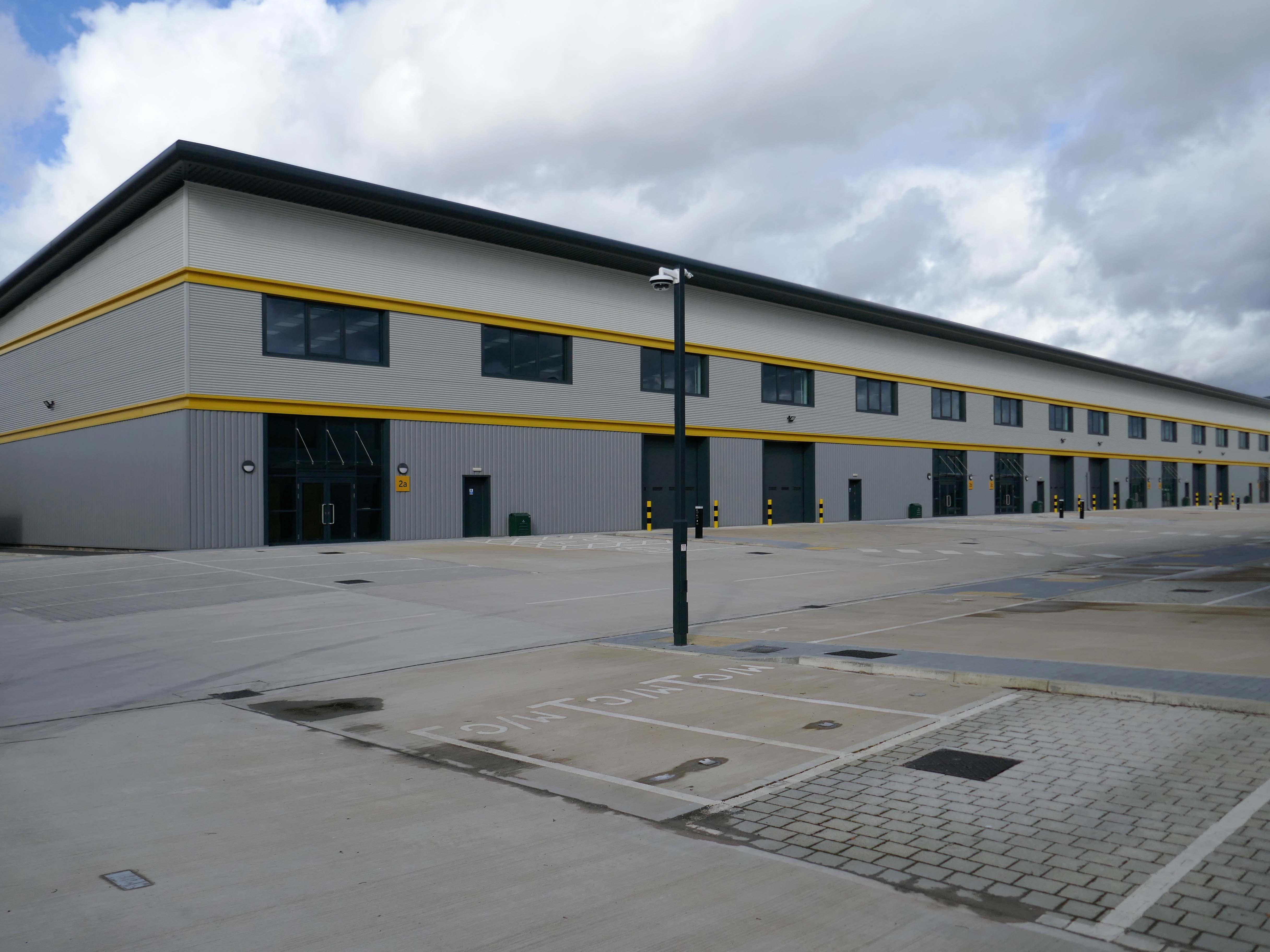
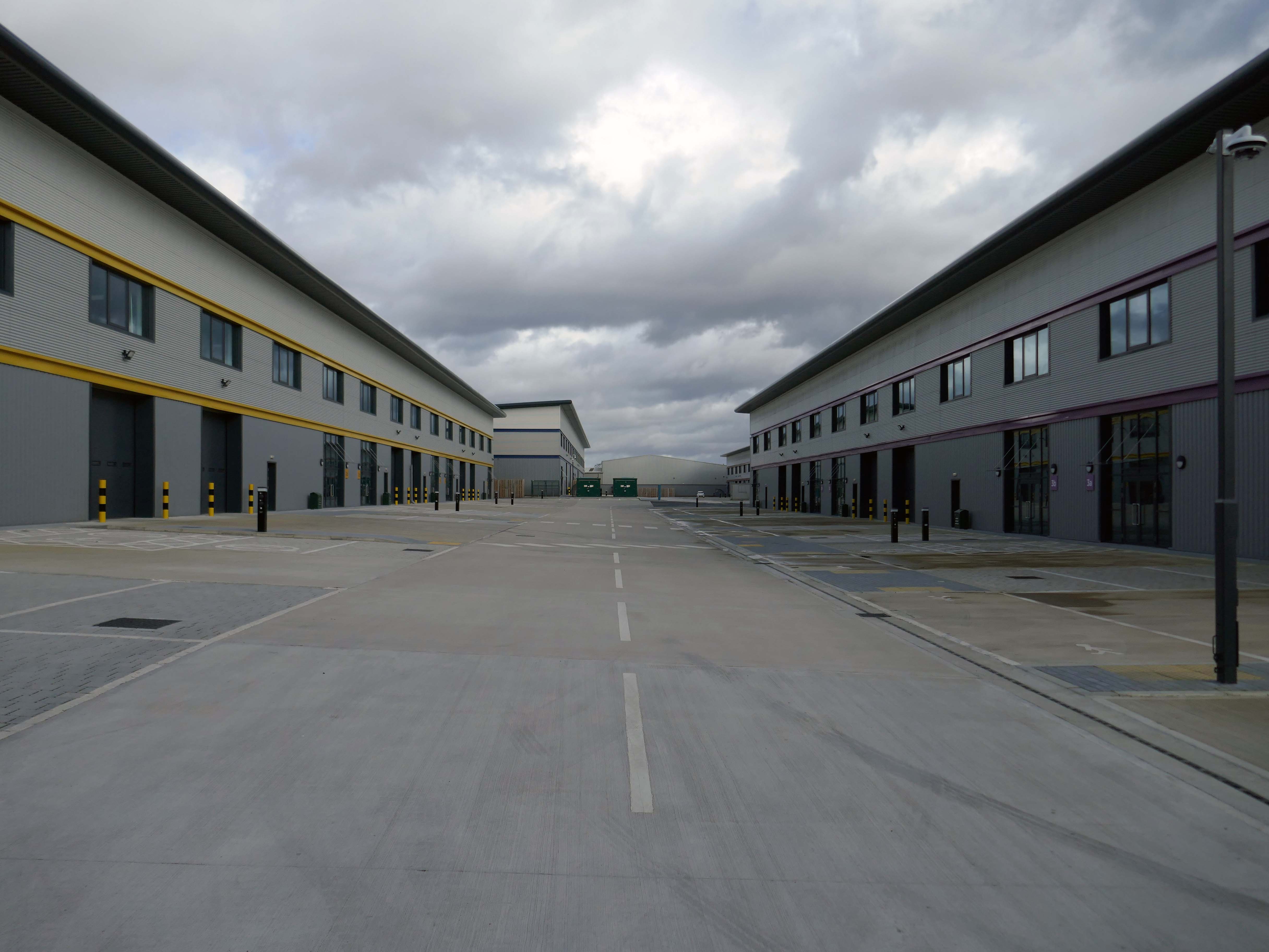
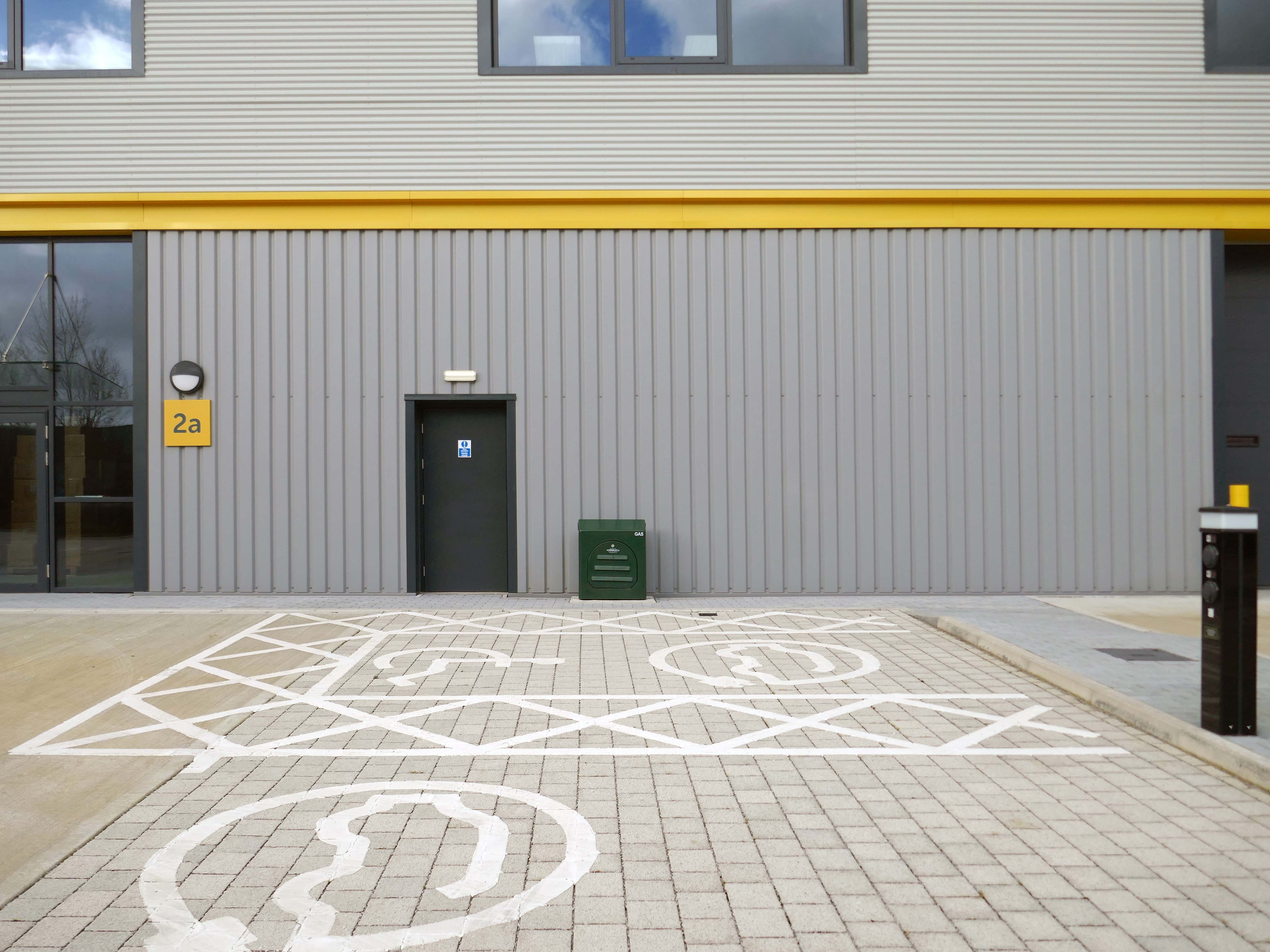
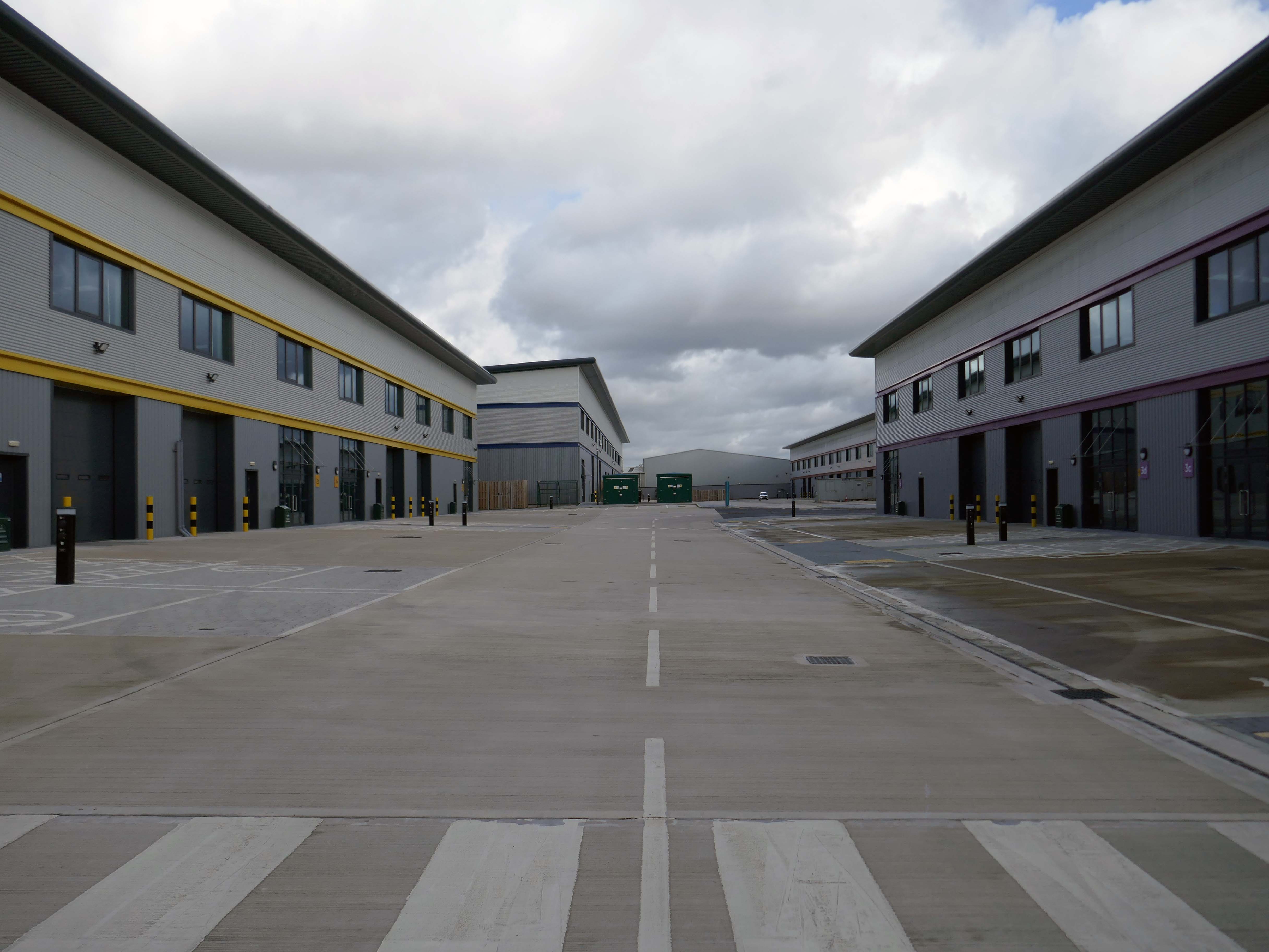
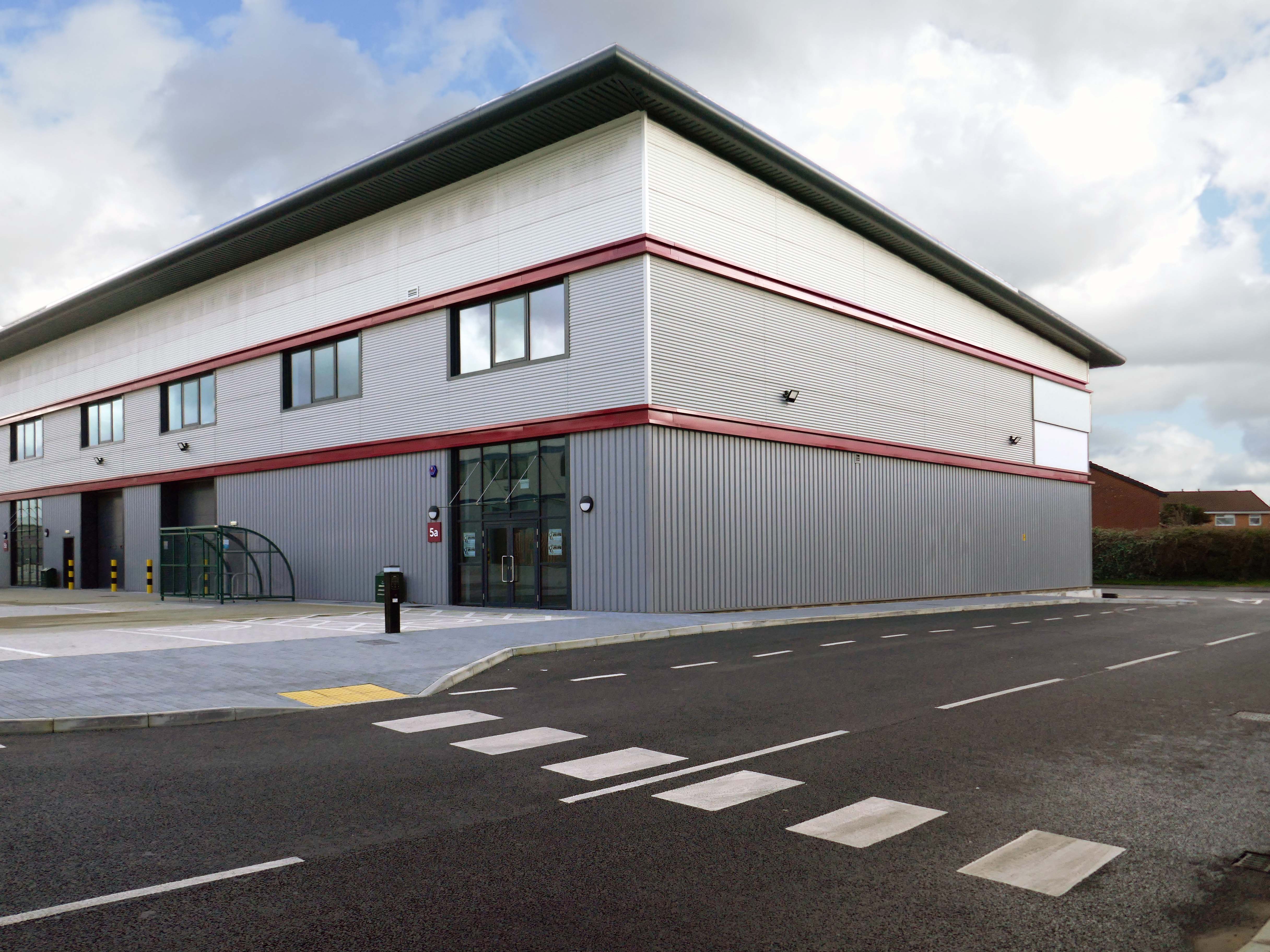
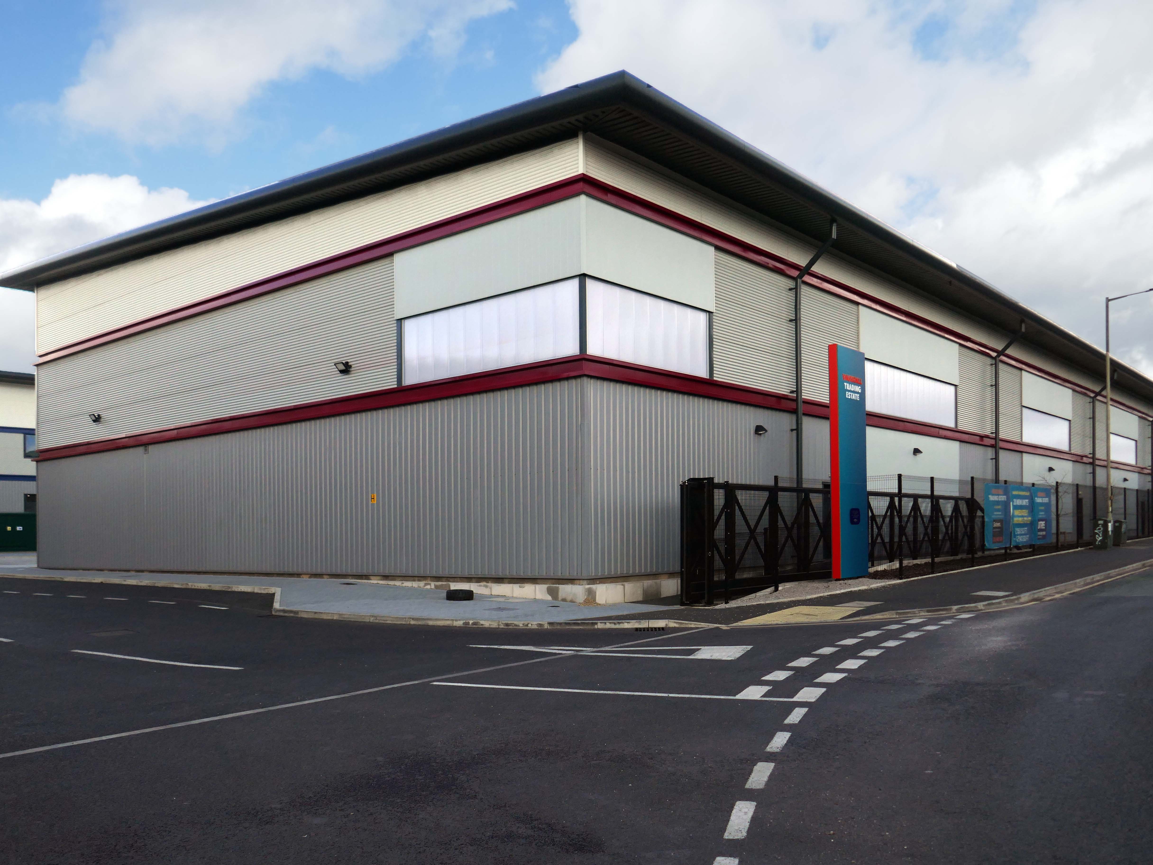
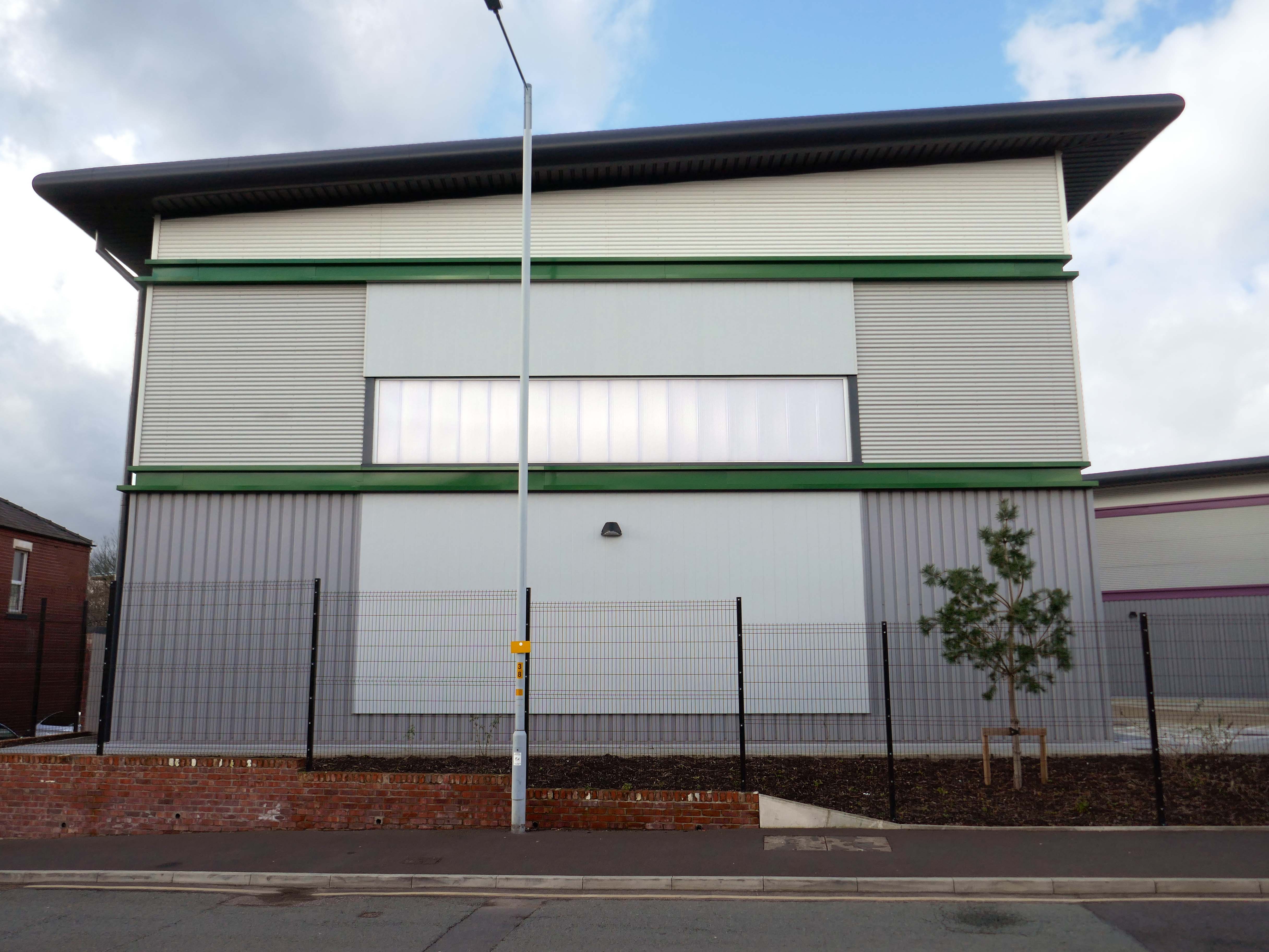
Vauxhall Trading Estate, formerly Vauxhall Industrial Estate, was a collection of dilapidated old industrial buildings, which have been demolished and new modern industrial units provided. RECOM provided project management services to demolish all previous buildings and prepare the site for the main contractor, achieve planning consent, enter a BAPA with Network Rail, tender and appoint the successful main contractor and then provide the Employer’s Agent service throughout the construction phase.
We worked with the design team to produce project specific Employer’s Requirements, ensuring that the client’s brief to provide high quality industrial units was delivered. We ensured the client’s interests were maintained throughout the project, making objective decisions that aligned with the client’s goals. In order to de-risk the project prior to entering into the main contract, we advised the client on what site investigations, enabling works and surveys needed to be undertaken. As the Employer’s Agent, we ensured that the conditions of the contract were adhered to, managing claims from the contractor,ensuring that the client’s position was protected.
Demolition works and embodied carbon created through construction works, is being offset against the sustainable energy created post occupation including: mix of air-source heat pumps and gas-fired radiant tube heating for heating and cooling, and photovoltaic solar panels installed on rooftops to generate green electricity for occupiers.