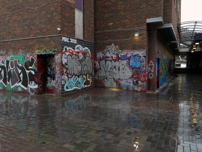
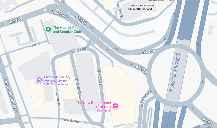
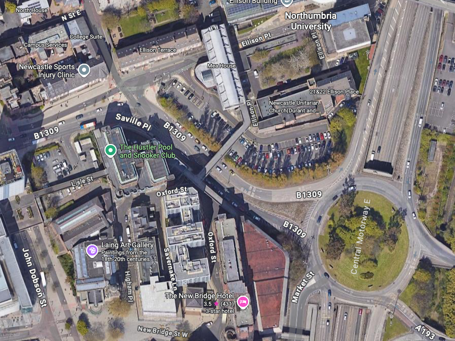
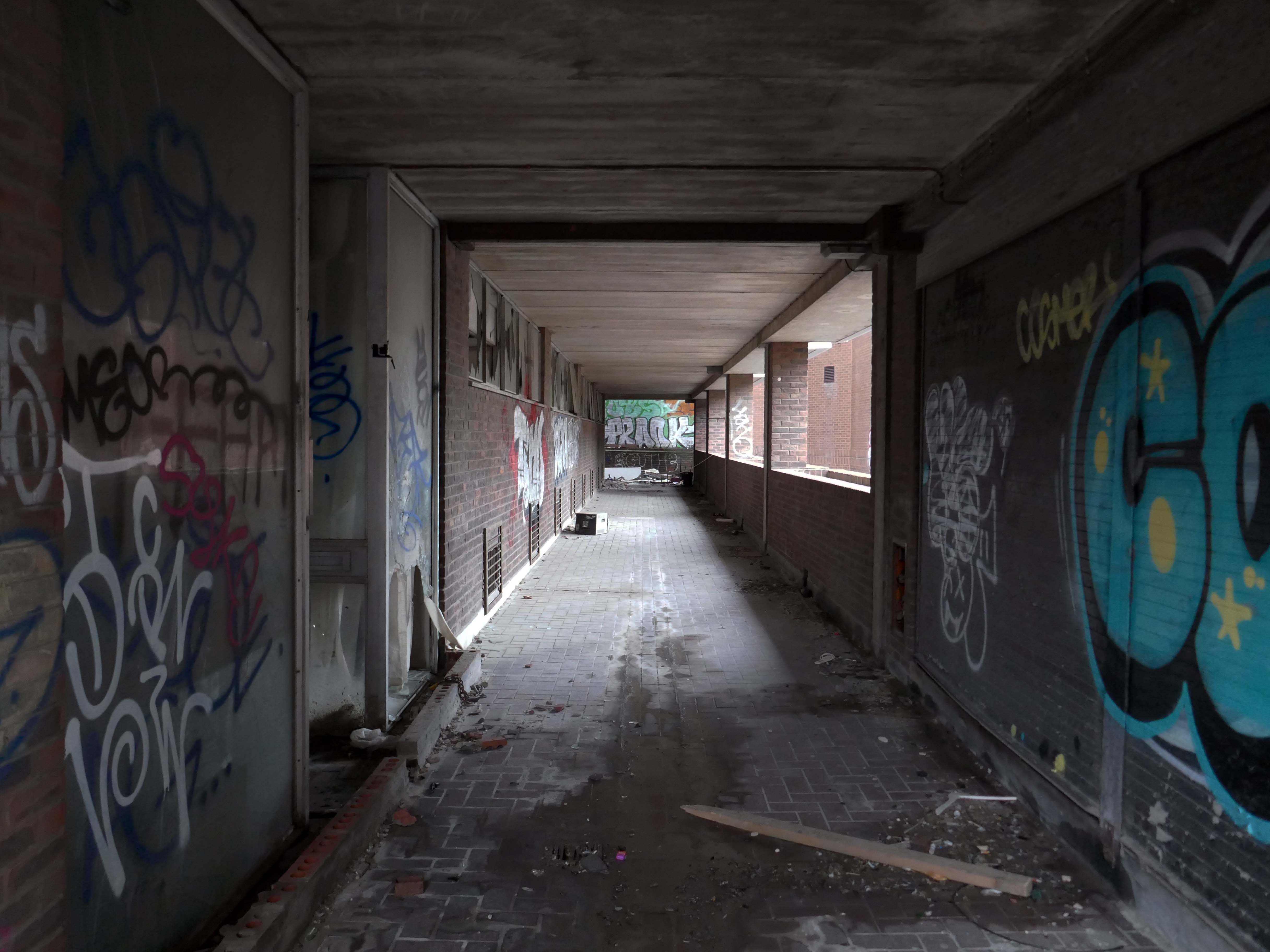
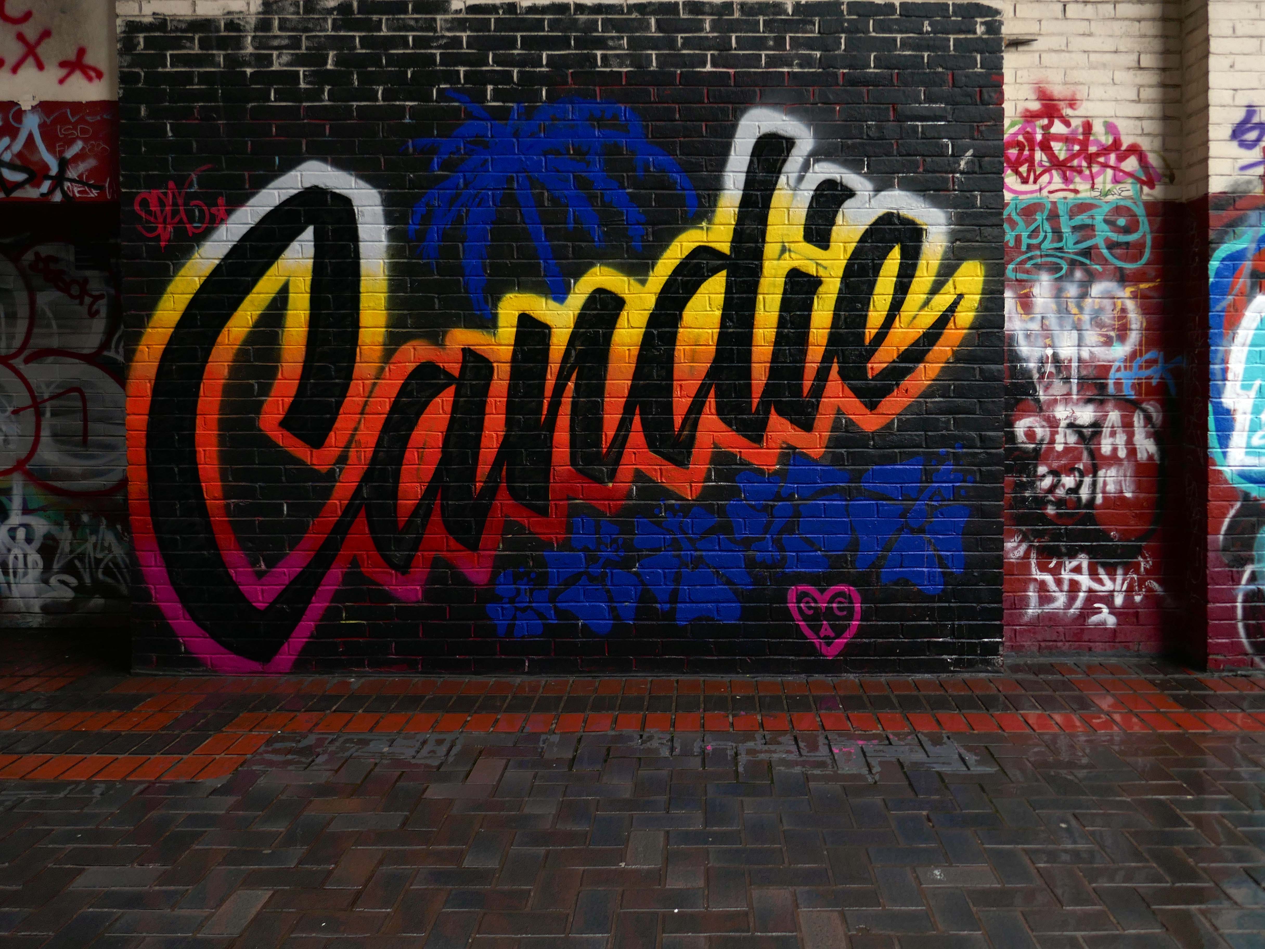
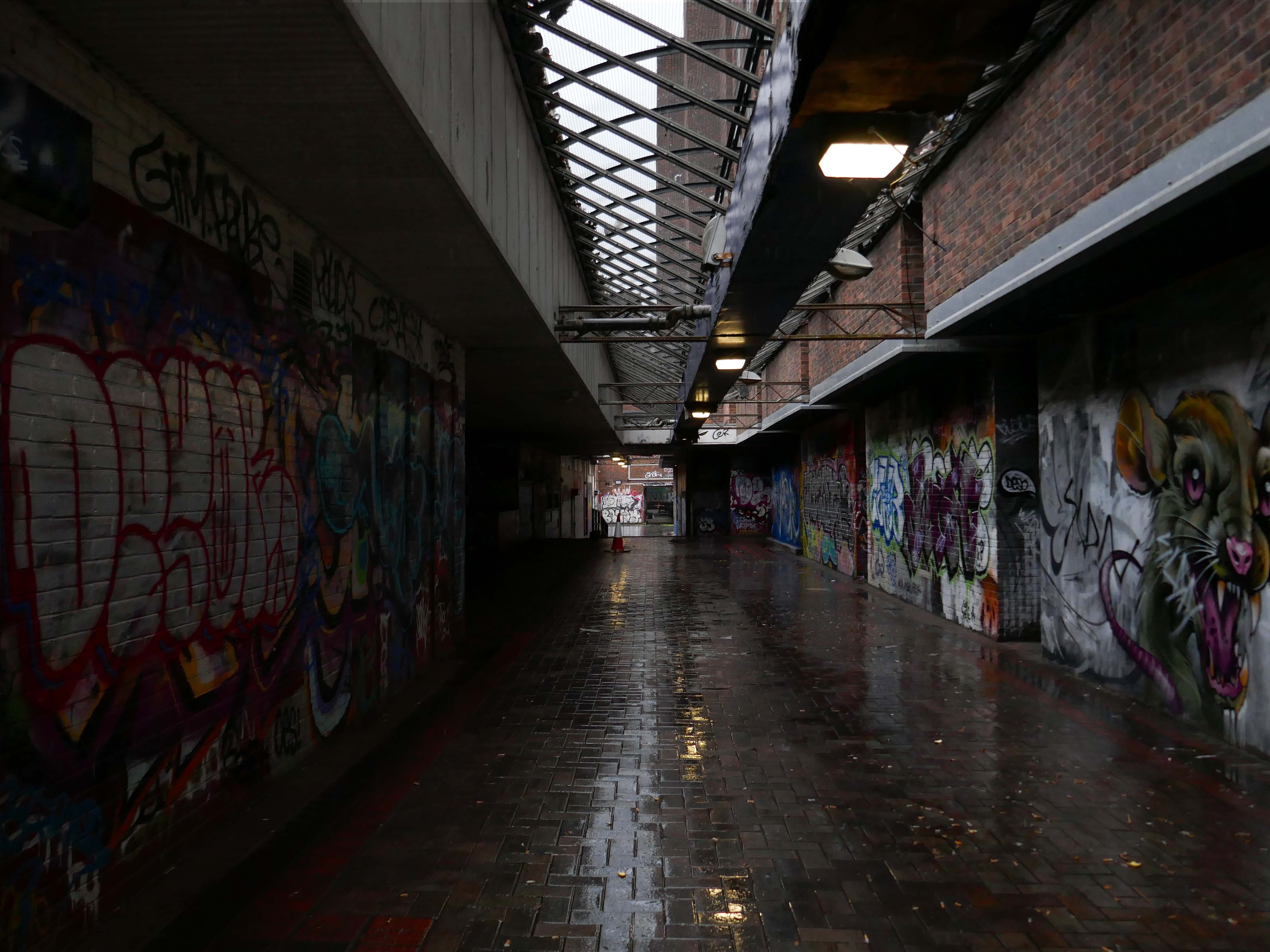
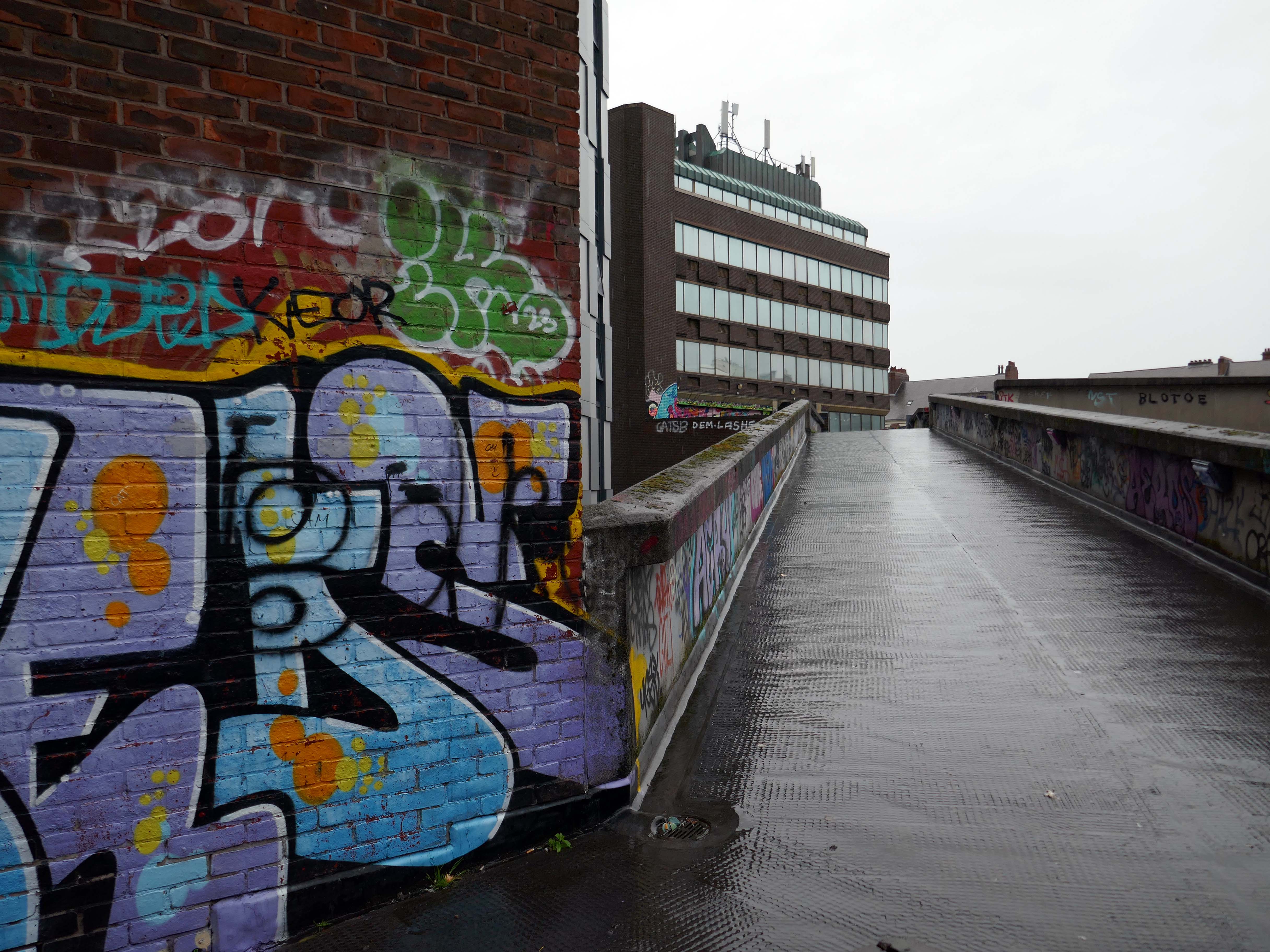
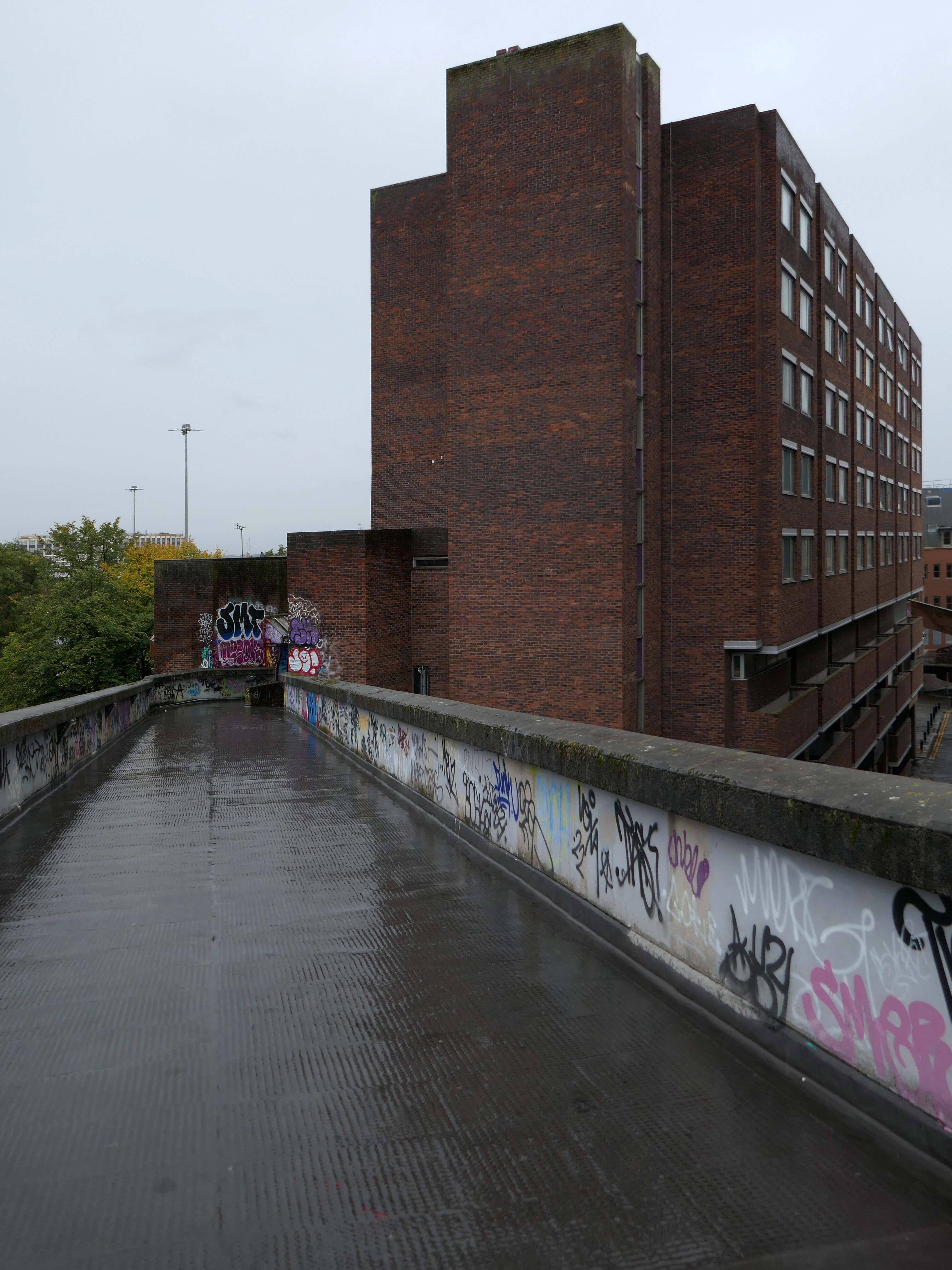
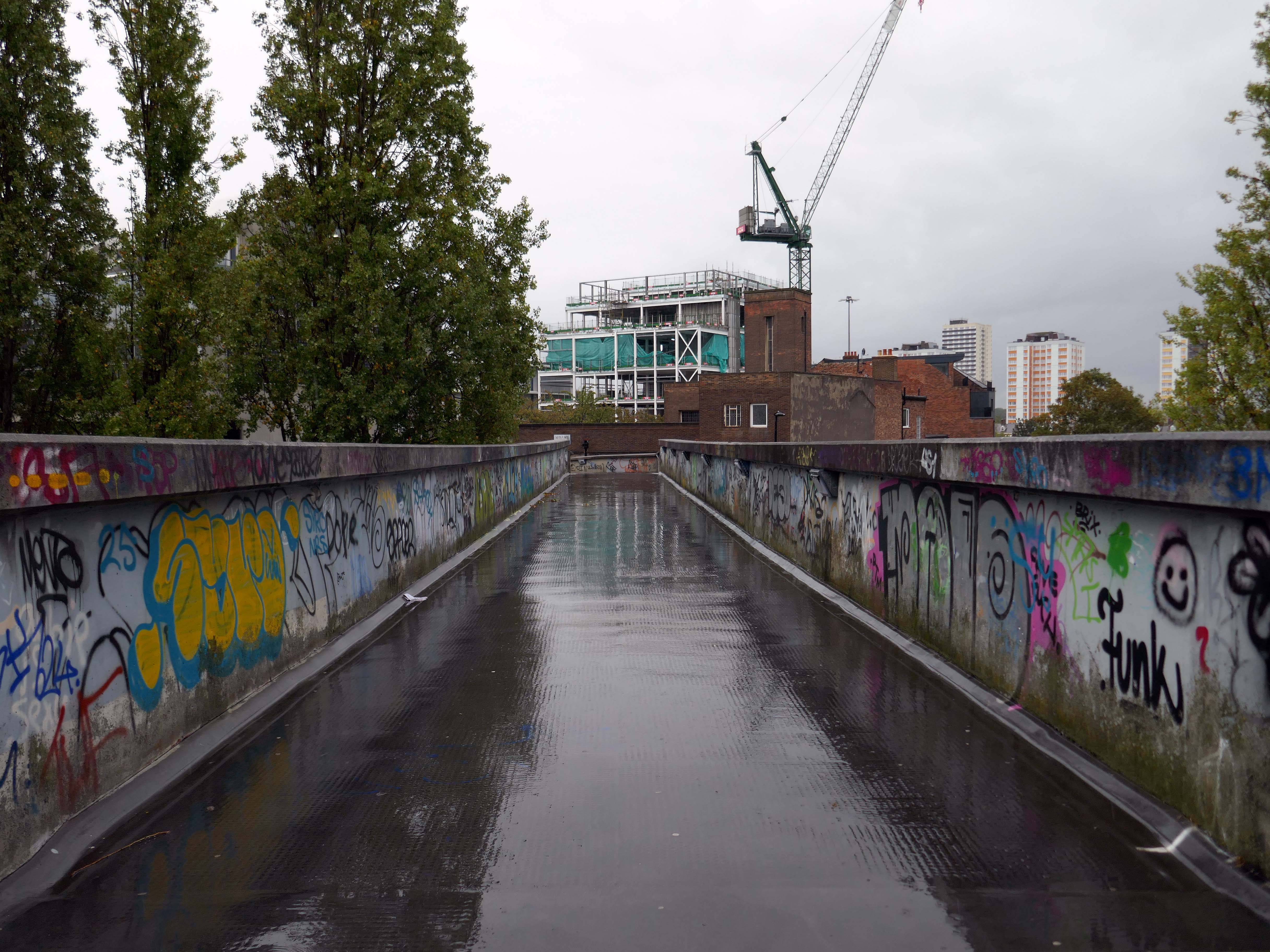
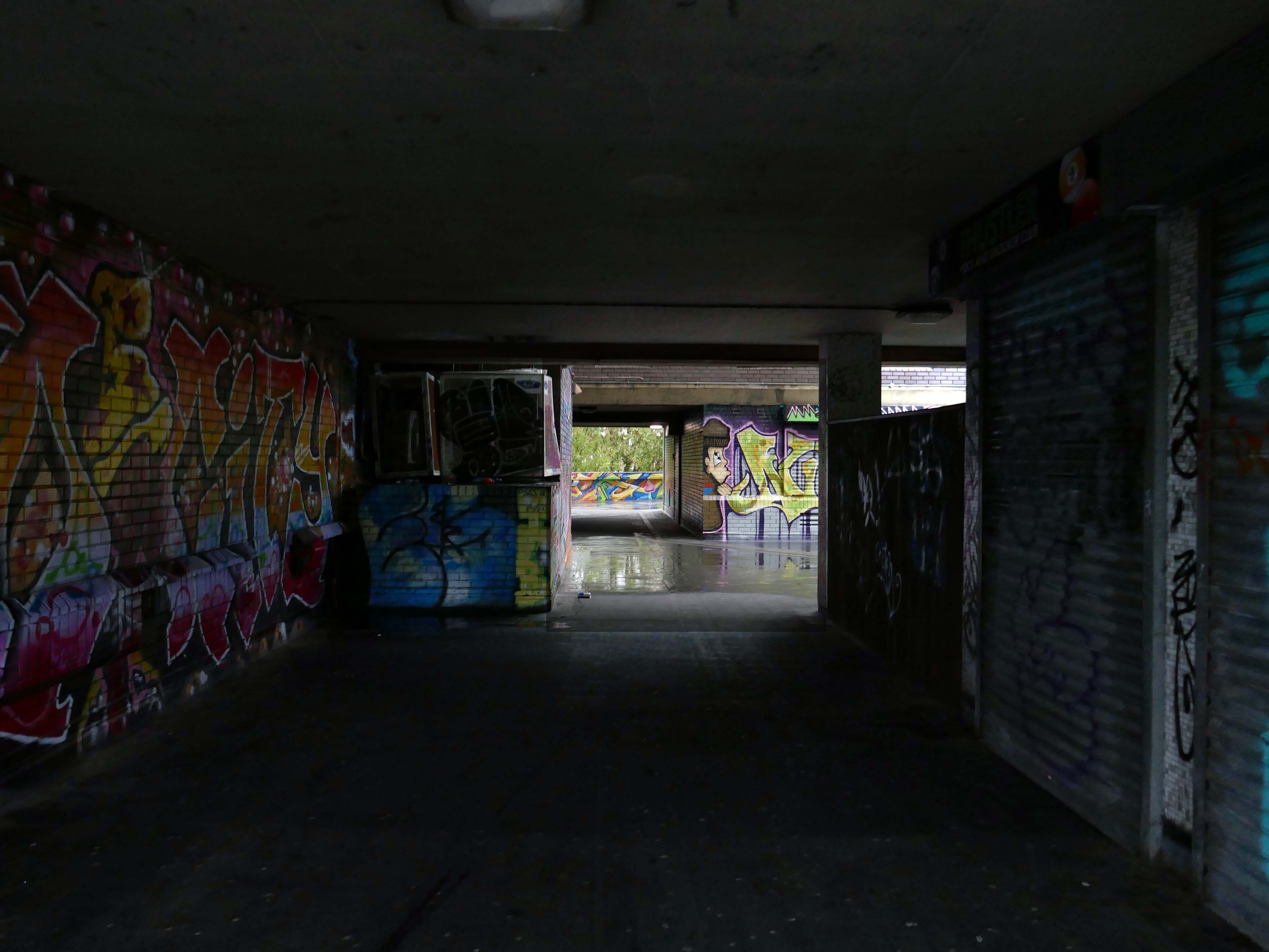
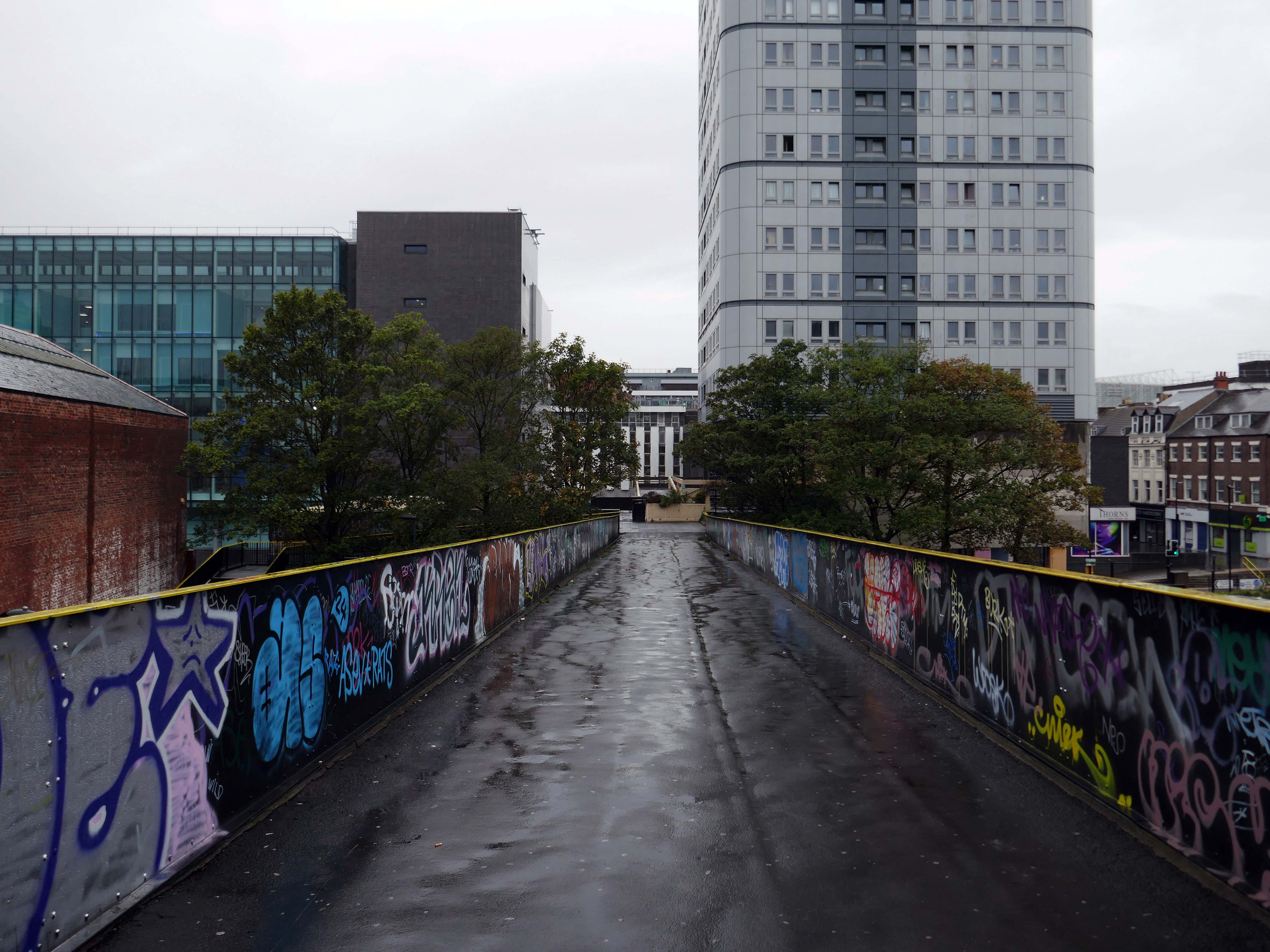
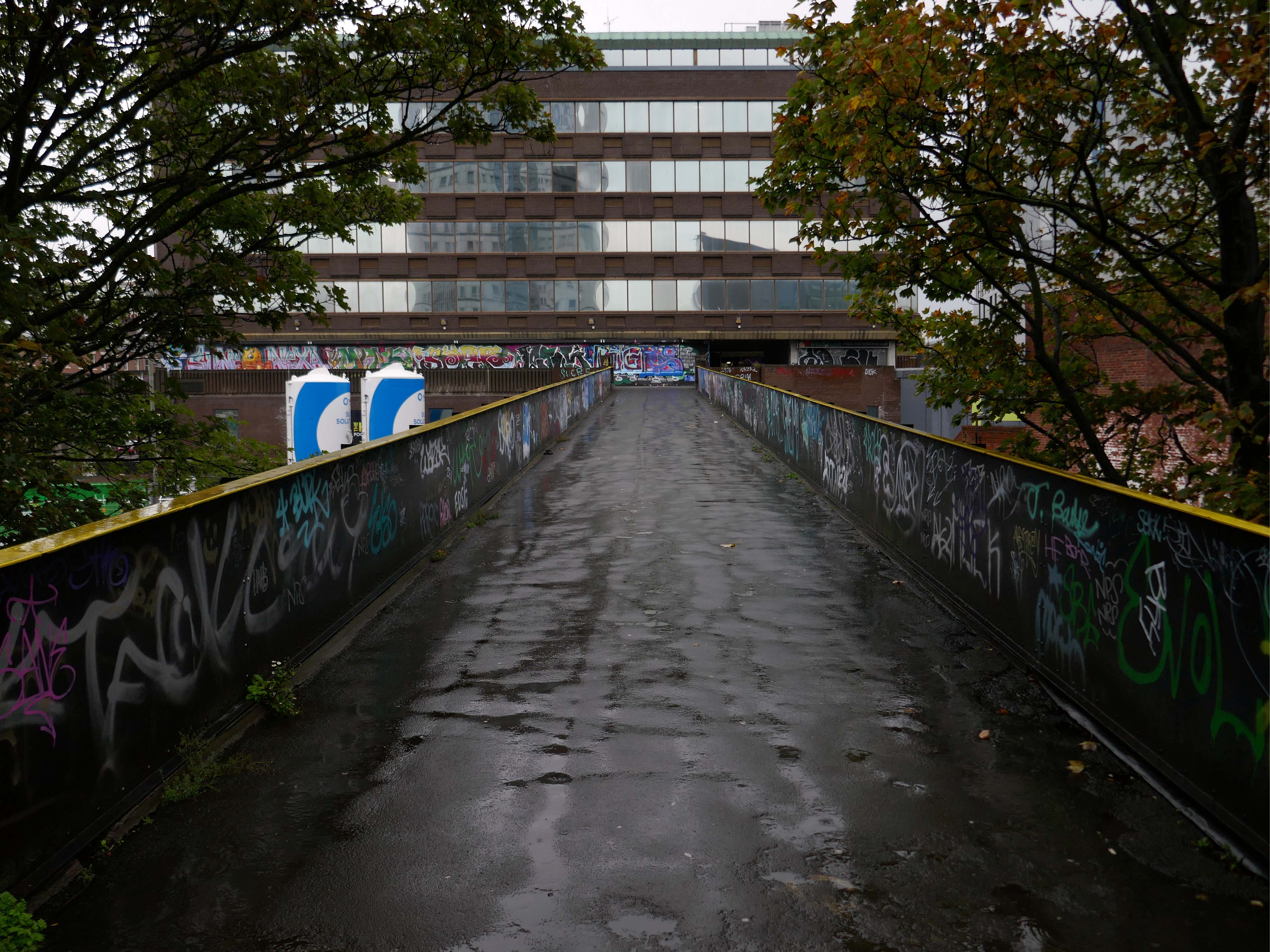
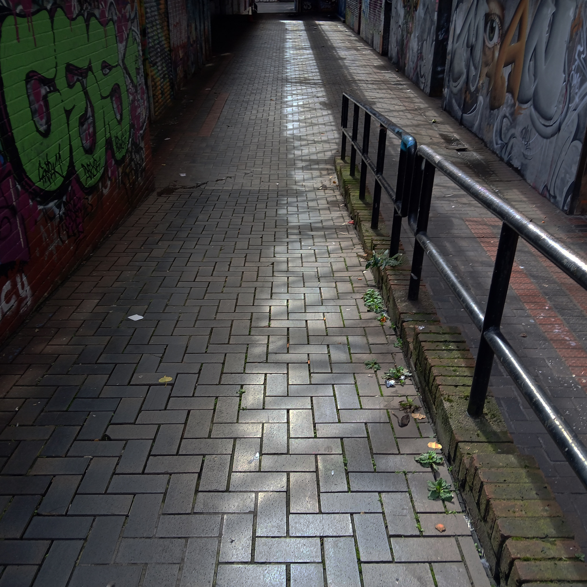
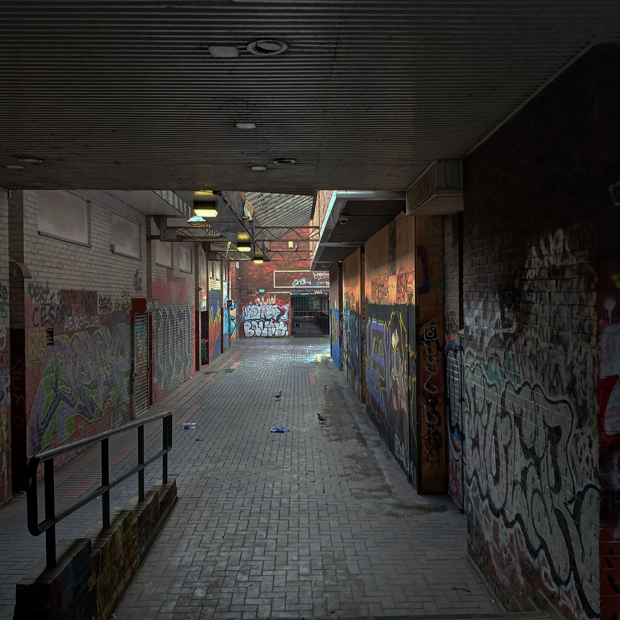
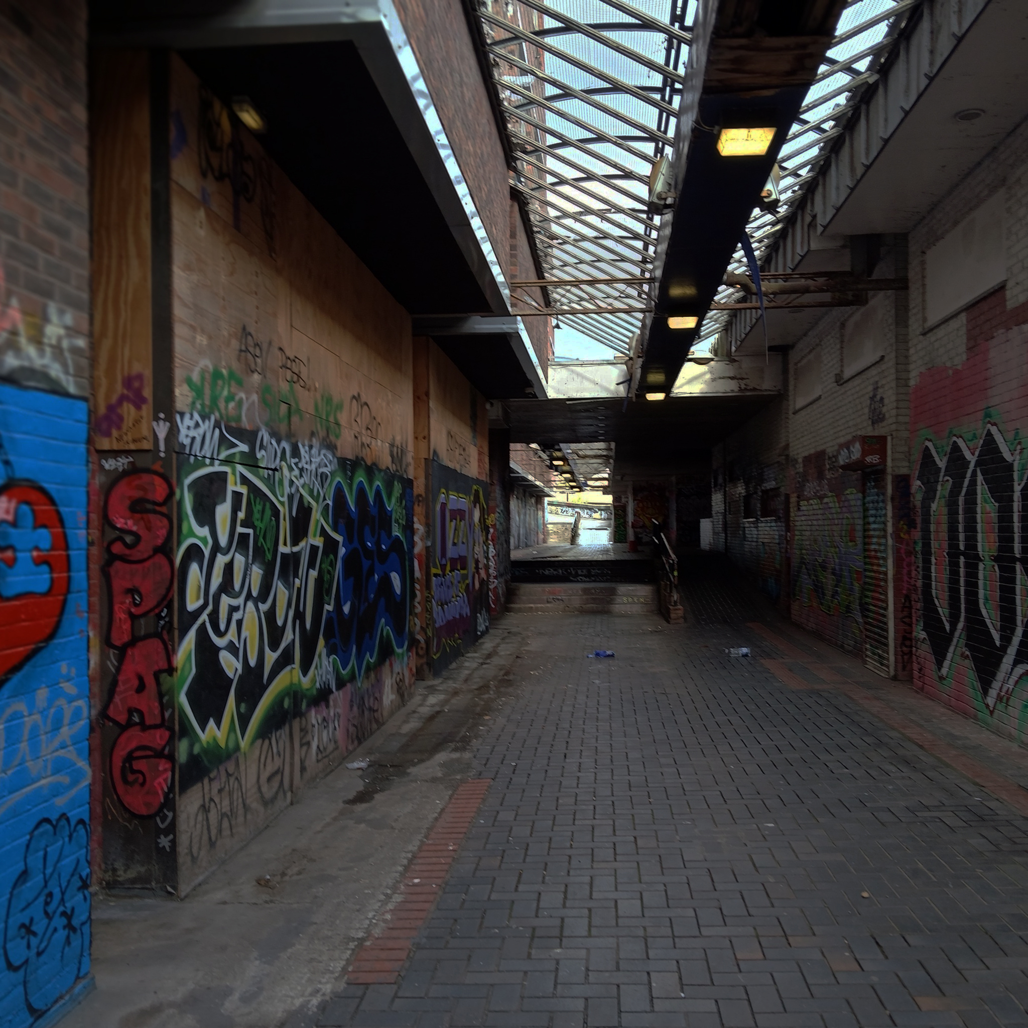
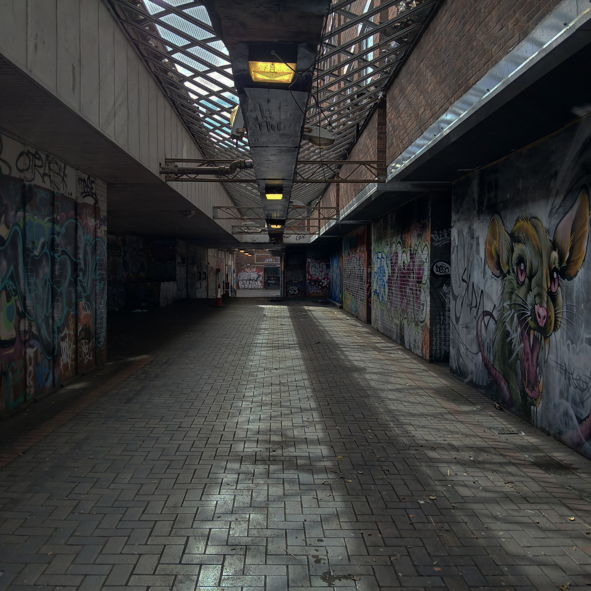
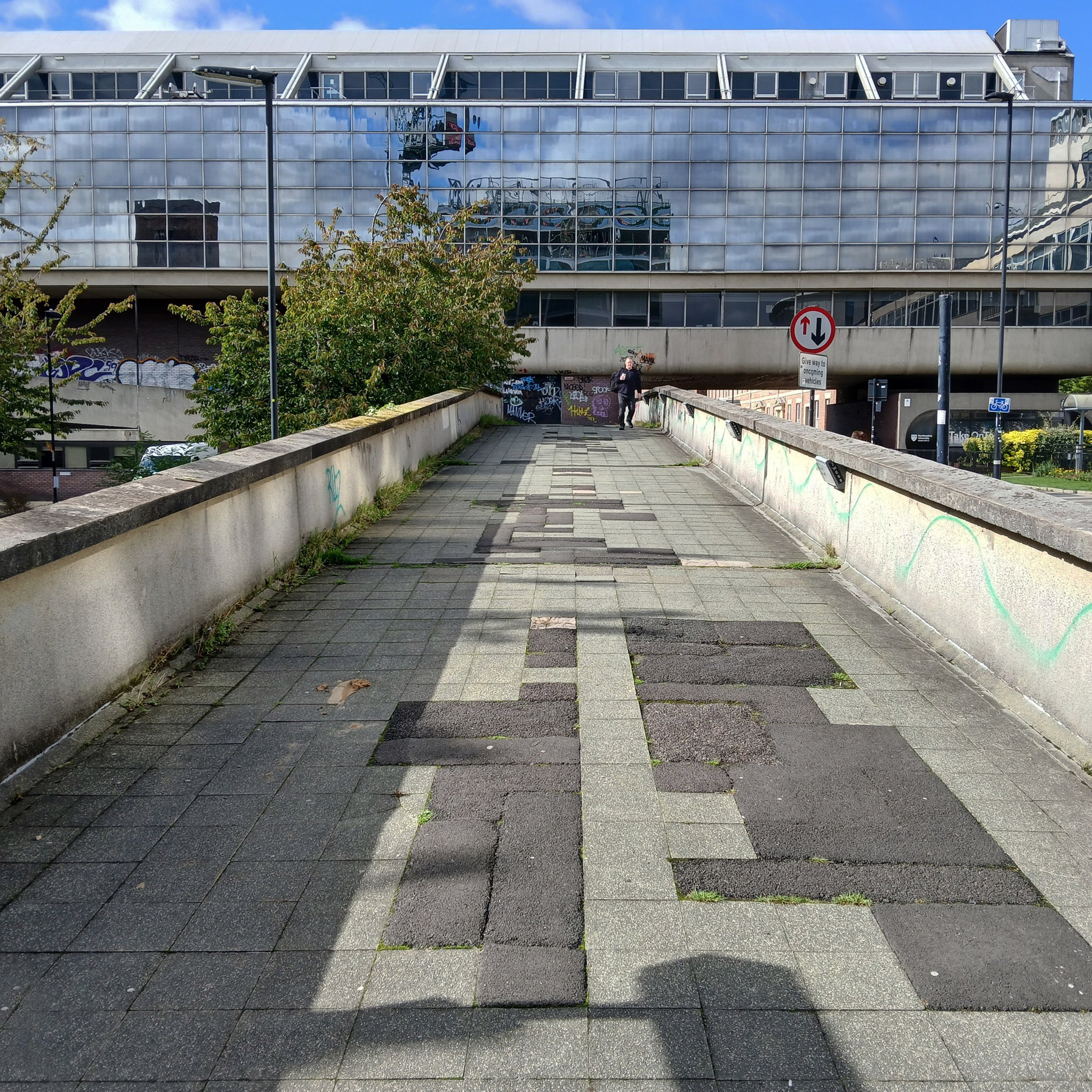
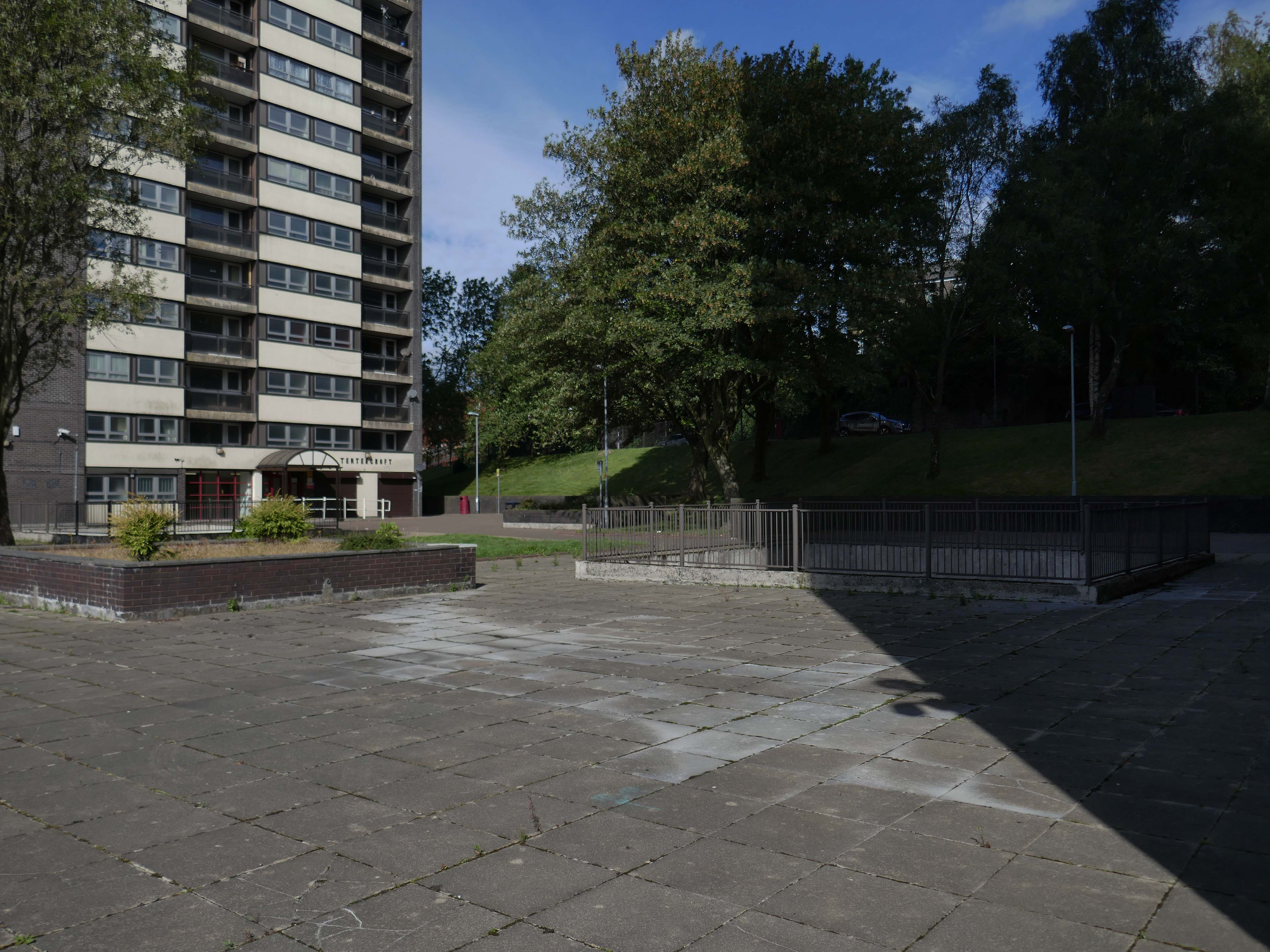
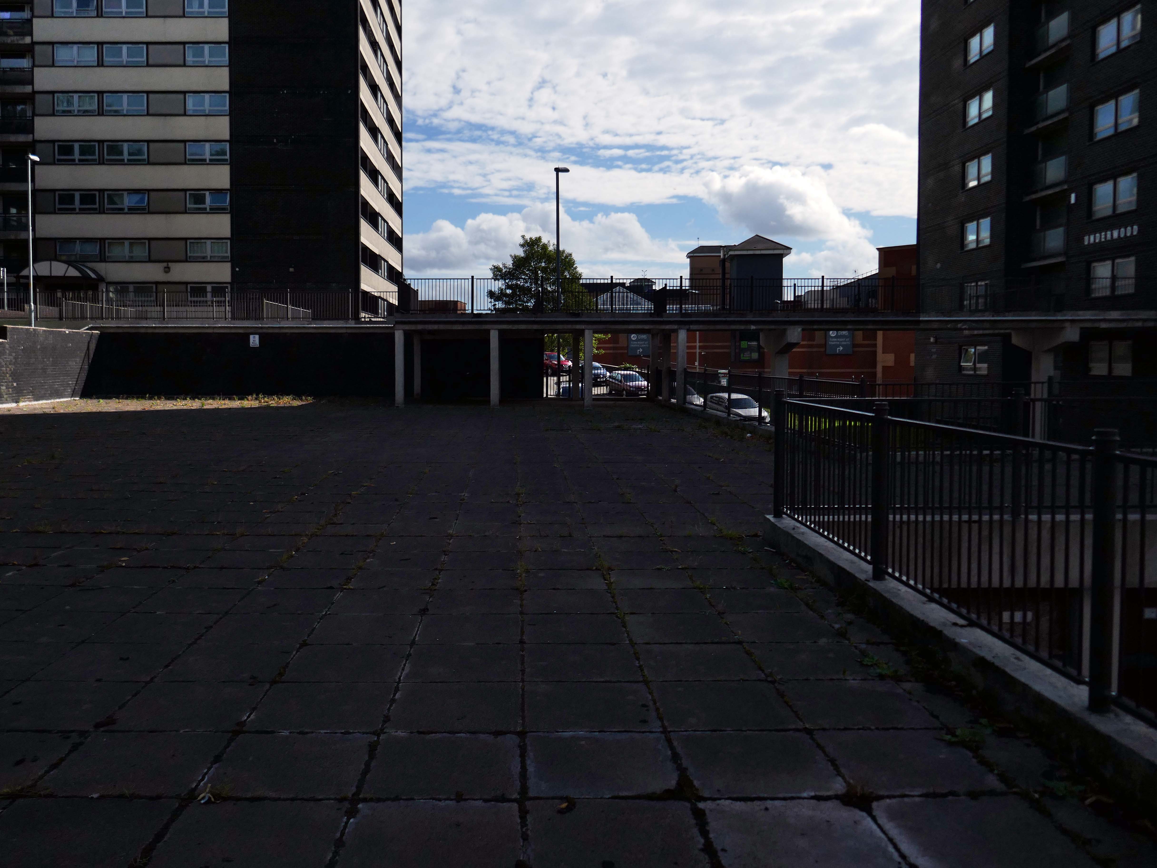
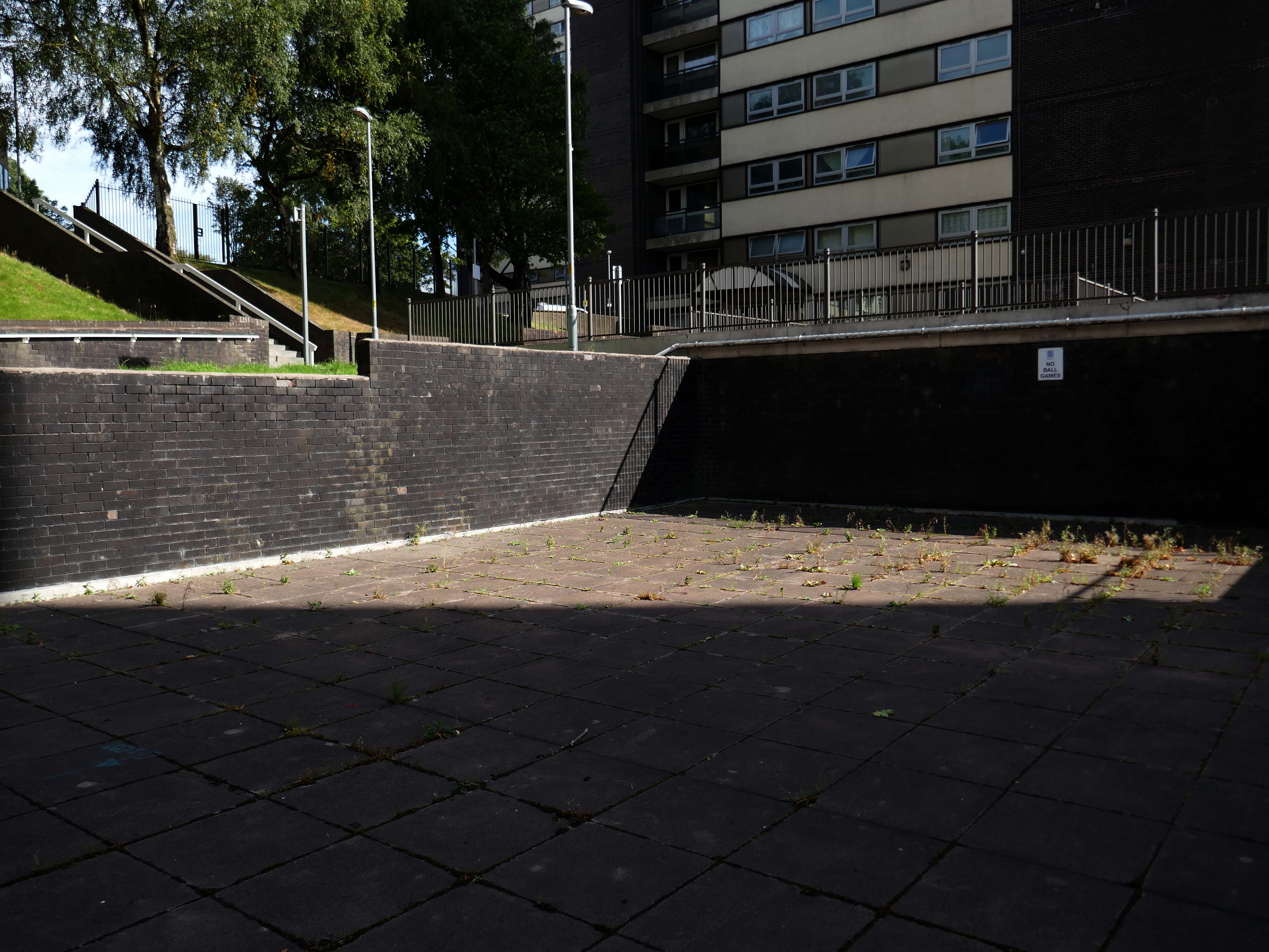
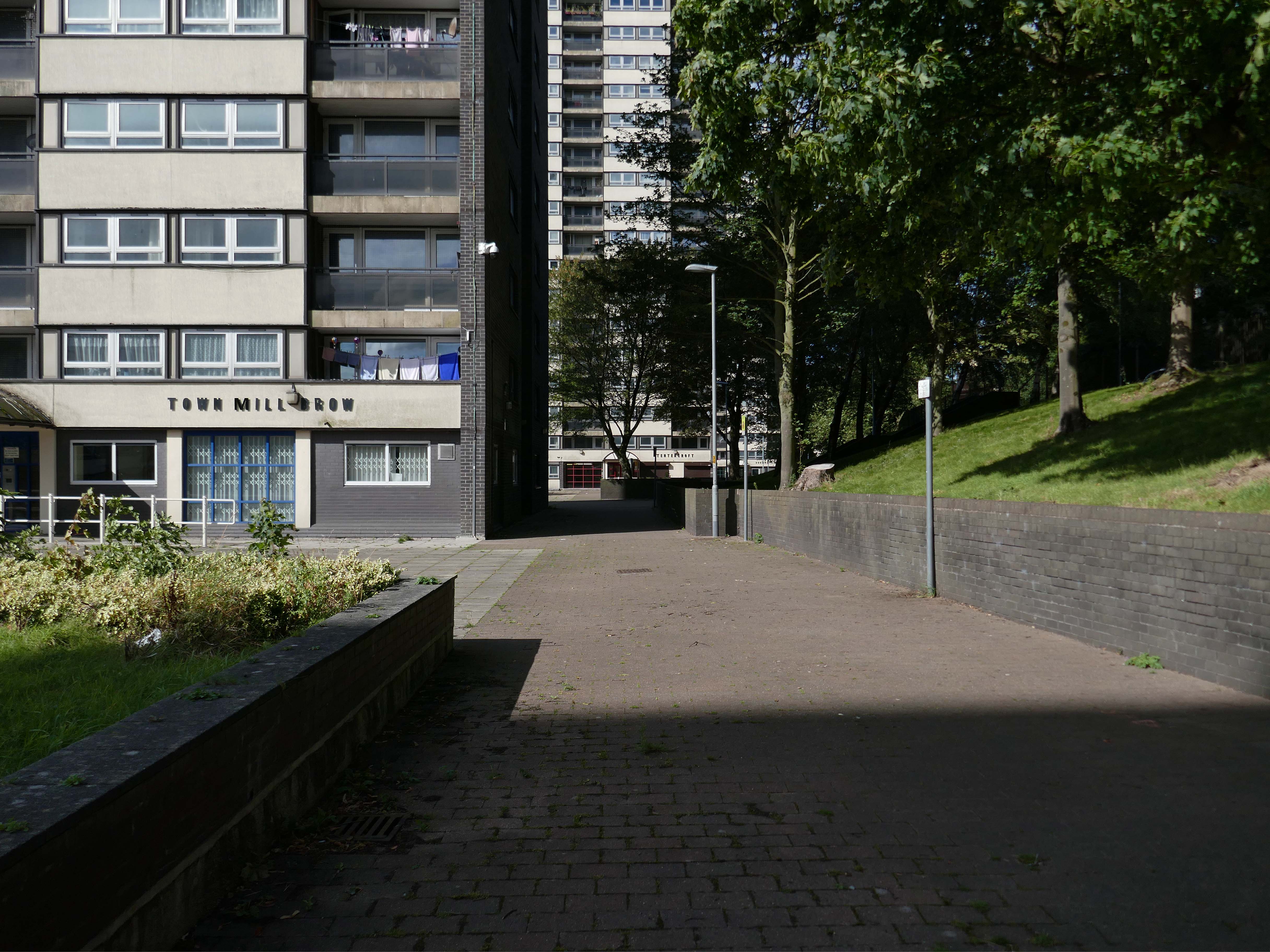
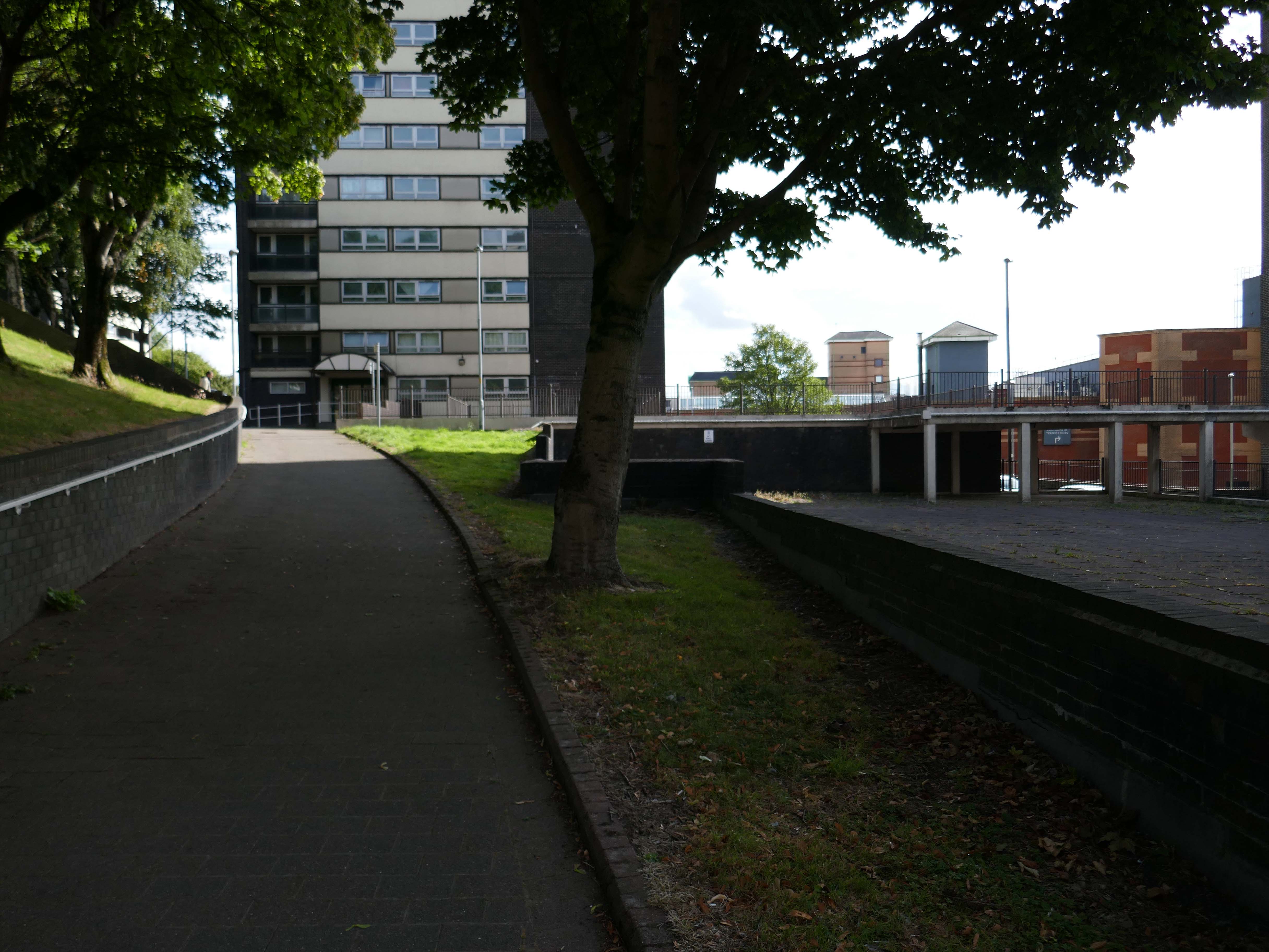
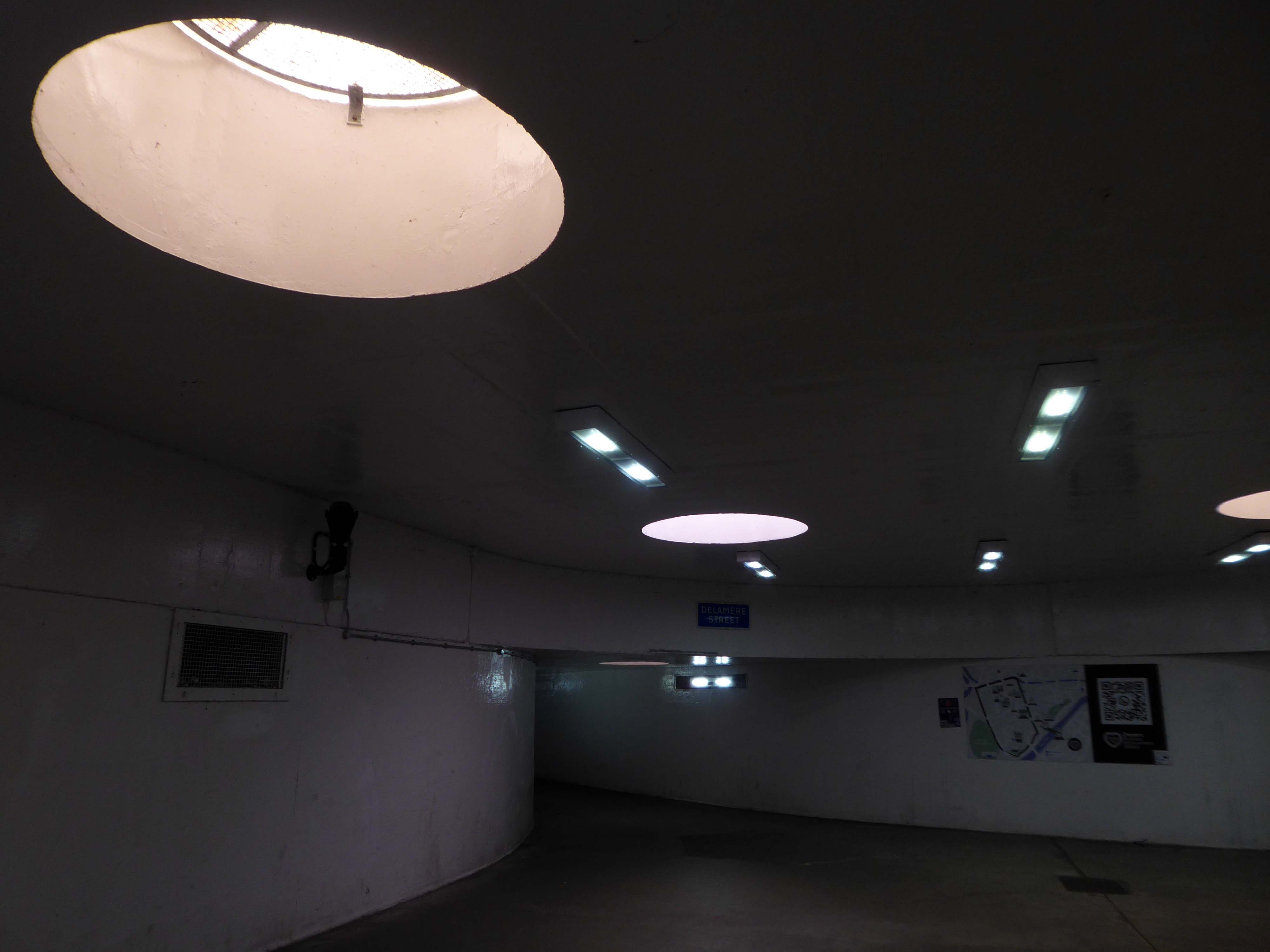
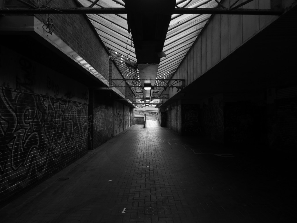
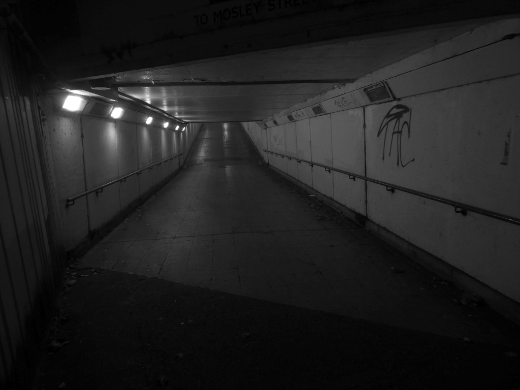
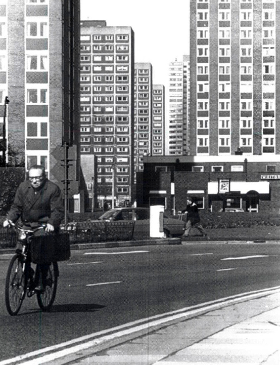
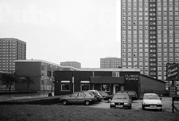
These are the streets in the sky passing between the Central Motorway, Saville Place and Oxford Street.
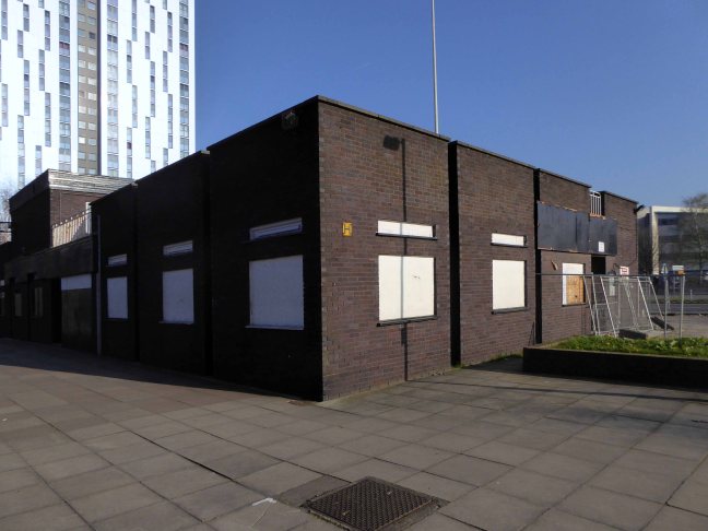
Streets constrained by infrastructure, a University and doomed leisure provision.
Welcome to Newbridge Hotel Newcastle upon Tyne – a charming oasis located in the heart of the vibrant city, just a short stroll from the renowned Theatre Royal and beautiful St James’ Park. Whether you’re visiting for business or leisure, the location ensures that you have easy access to the best of Newcastle, including fantastic shopping at Eldon Square and local attractions like the Metro Radio Arena.
Discover the essence of Newcastle from Newbridge Hotel, where every stay becomes a unique experience tailored to your needs.
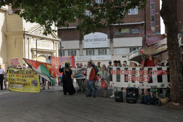
Two sets of protestors gathered outside the New Bridge Hotel in Newcastle, as “Newcastle Welcomes Refugees” stood up to “Send Them Back” protesters who want an end to migrants being housed in the hotel.
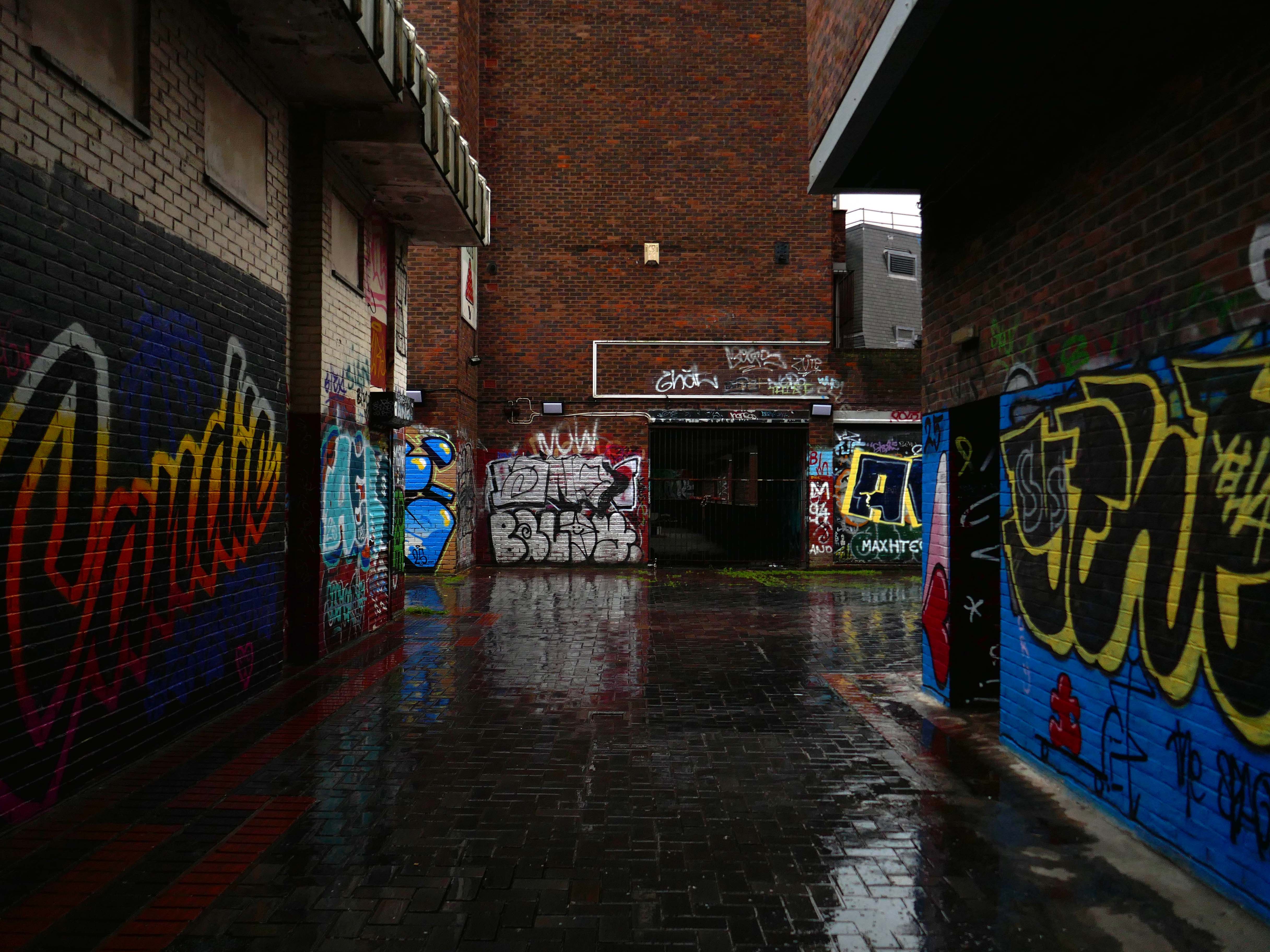
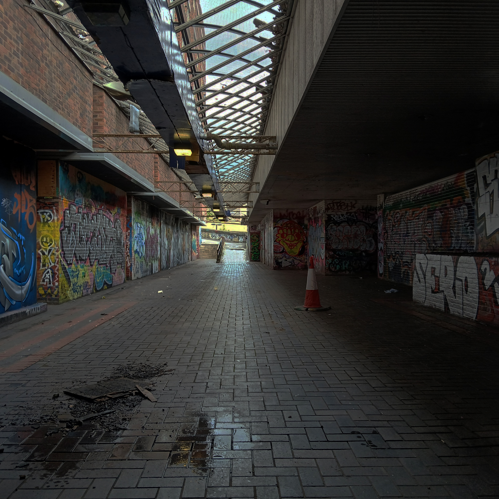
This is an inland island of anonymity, home to pigeons, shake can shakers and the terminally curious.
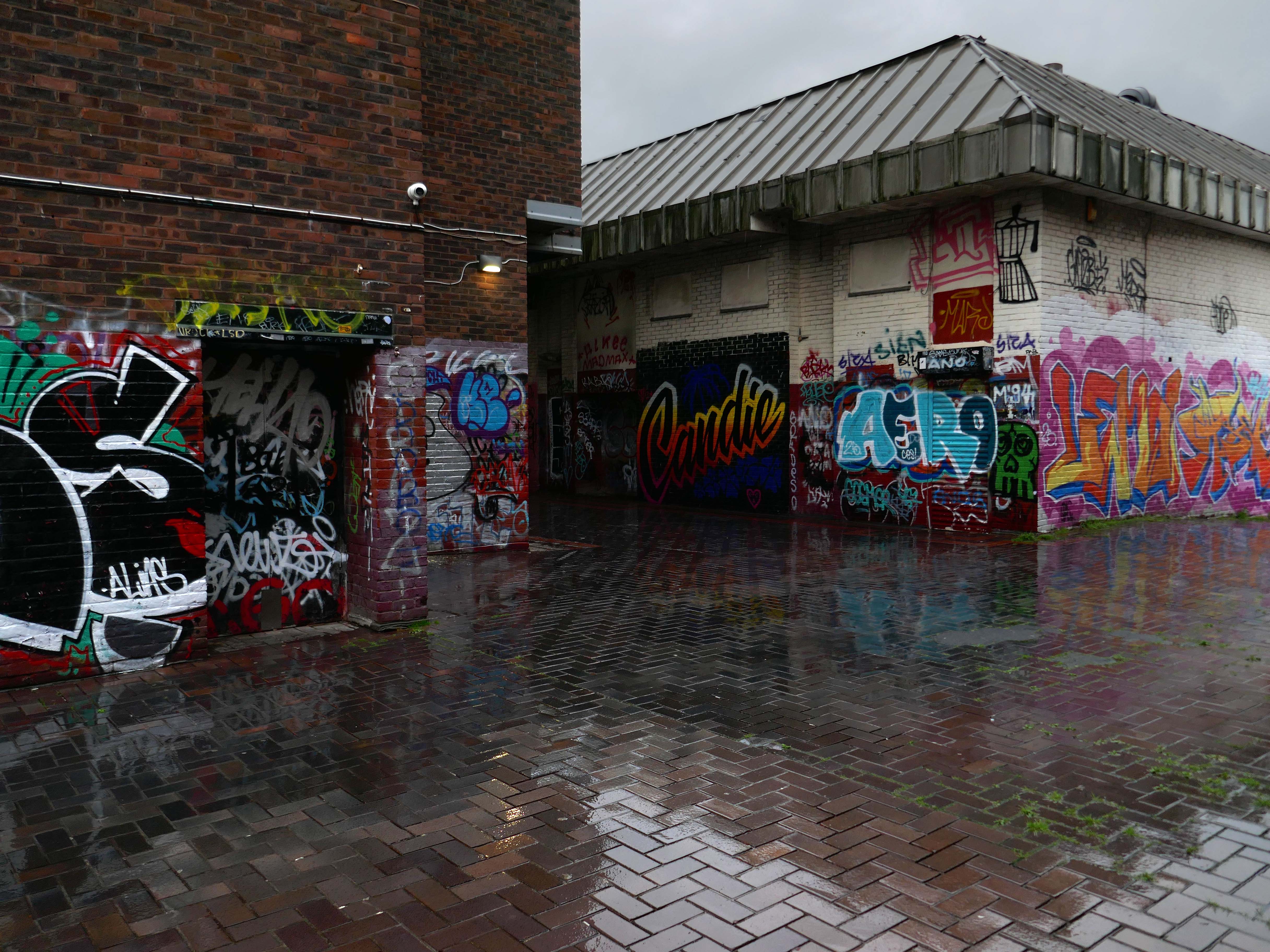
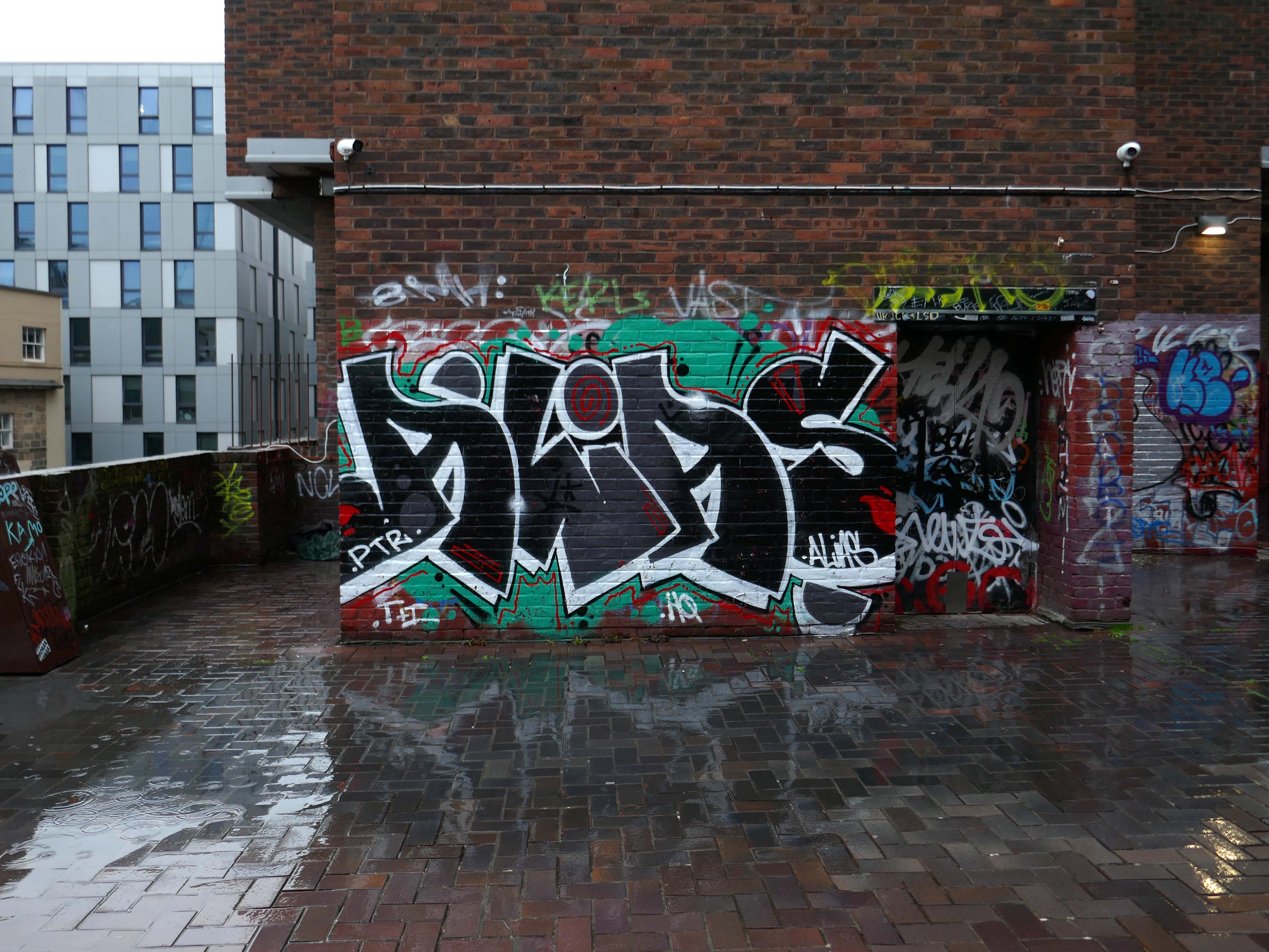
It always rains on Saturdays.
Happily, the sun always shines on Sunday.
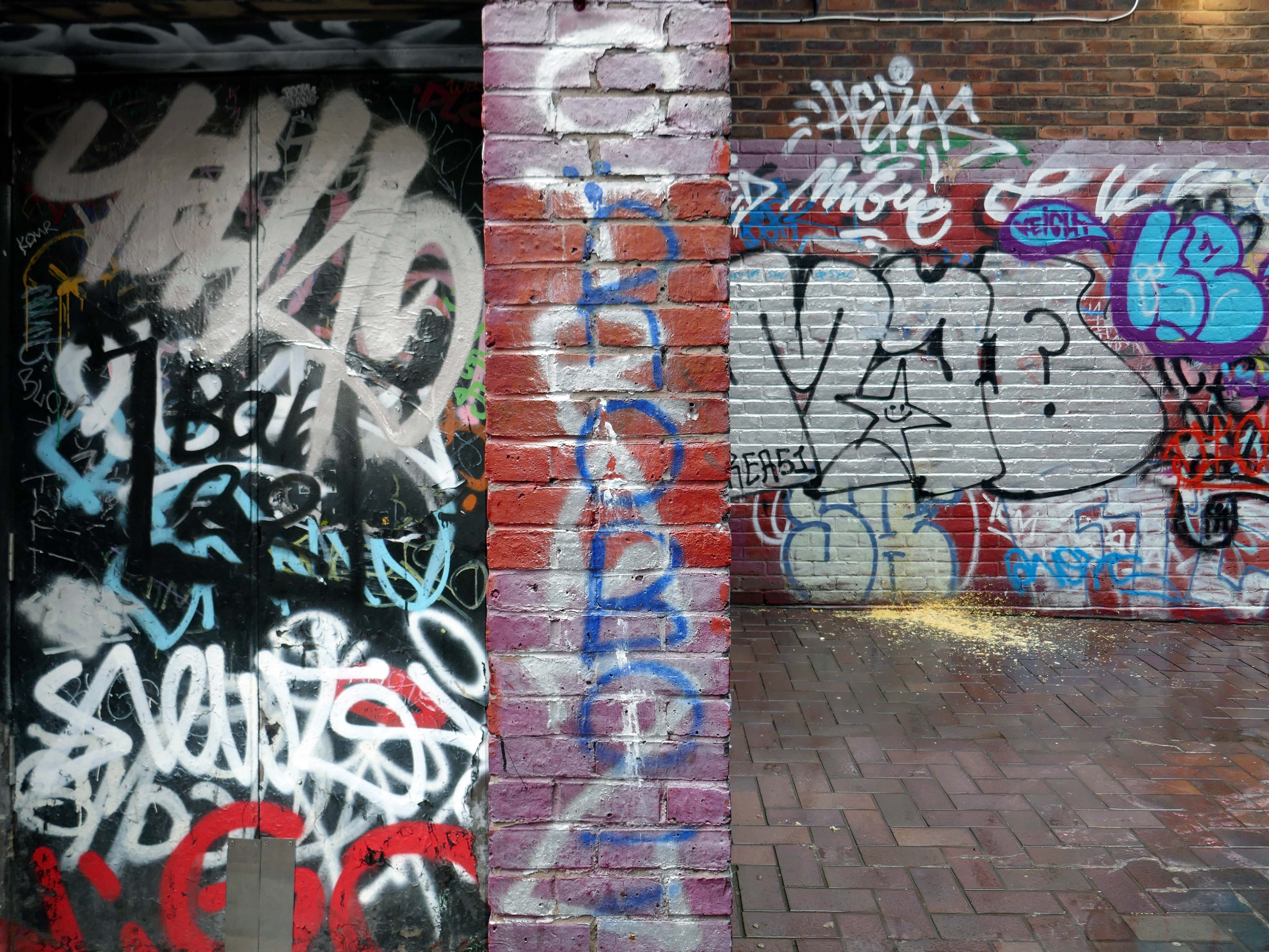
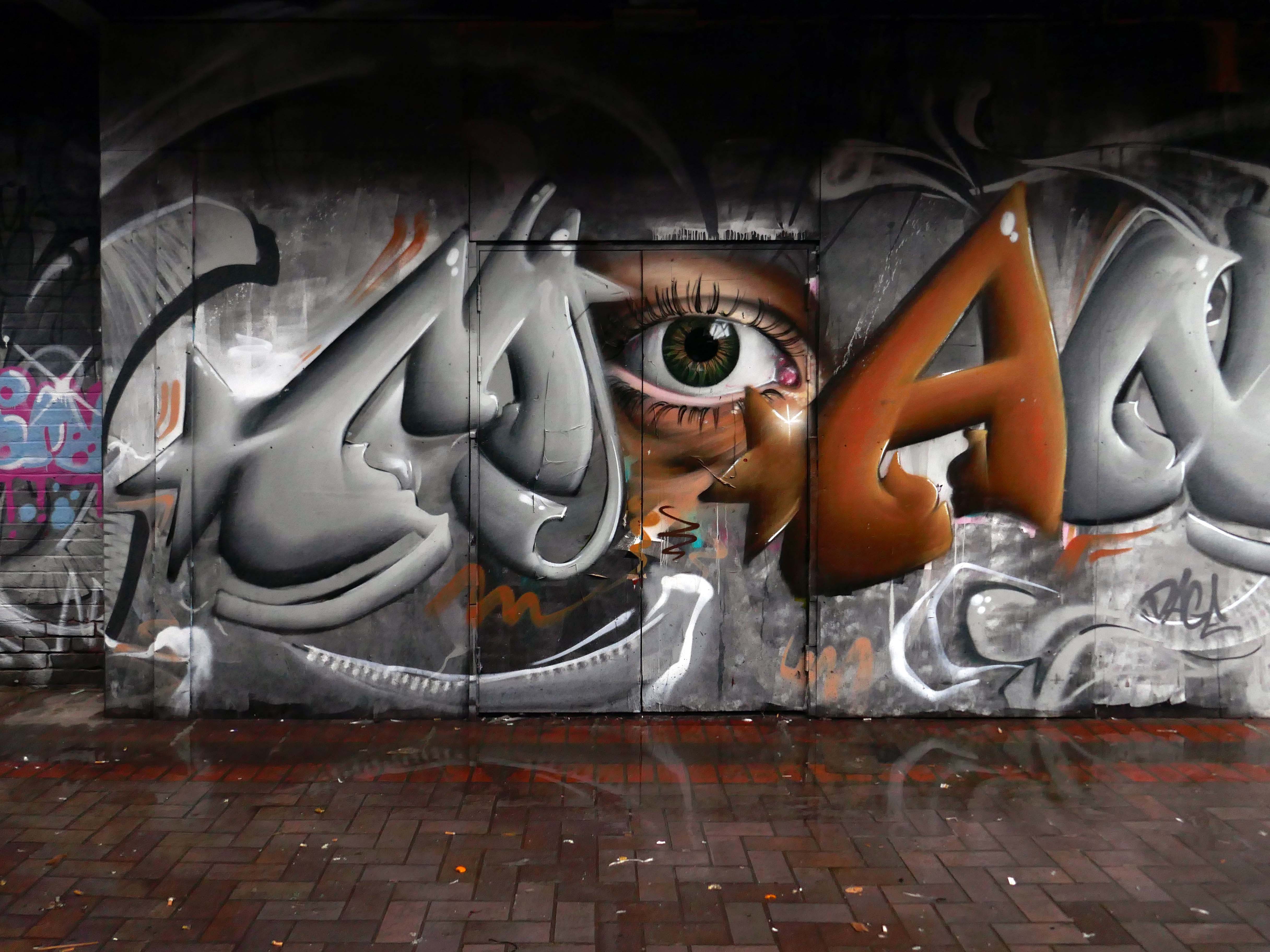
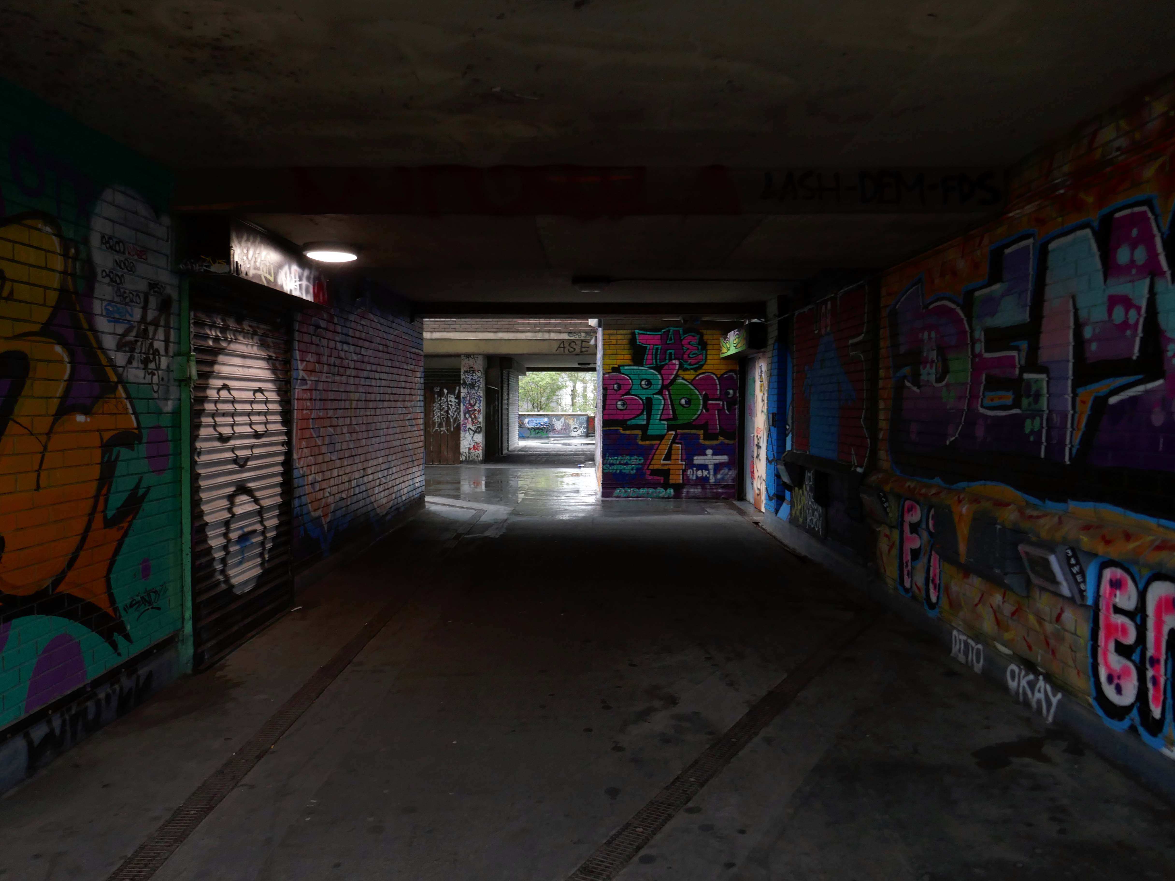
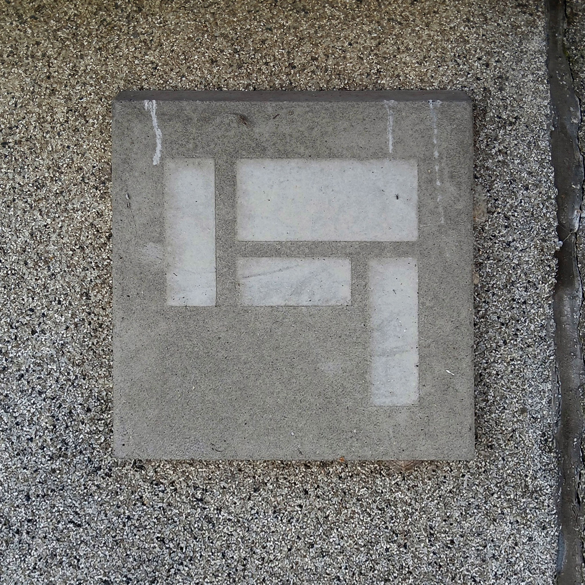
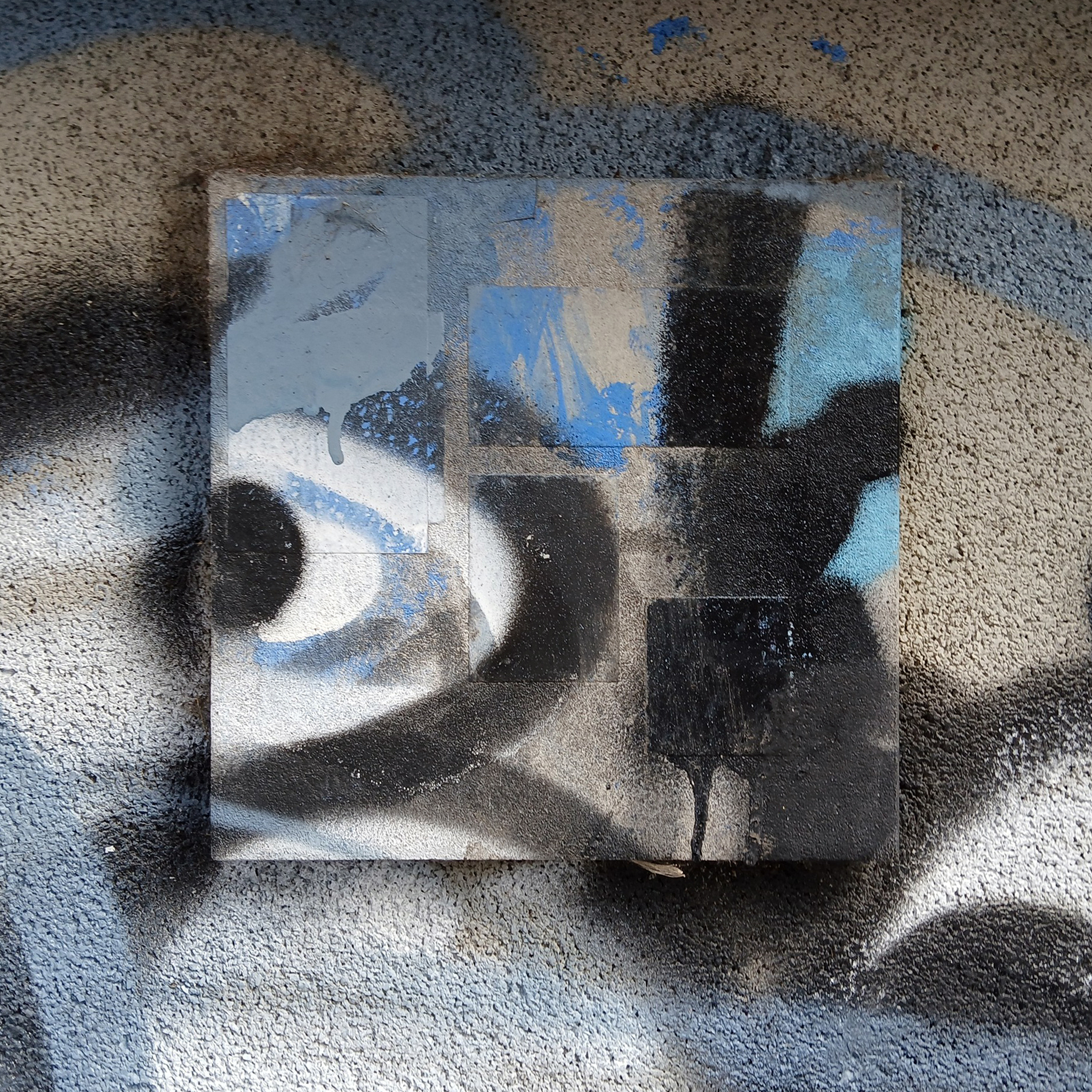
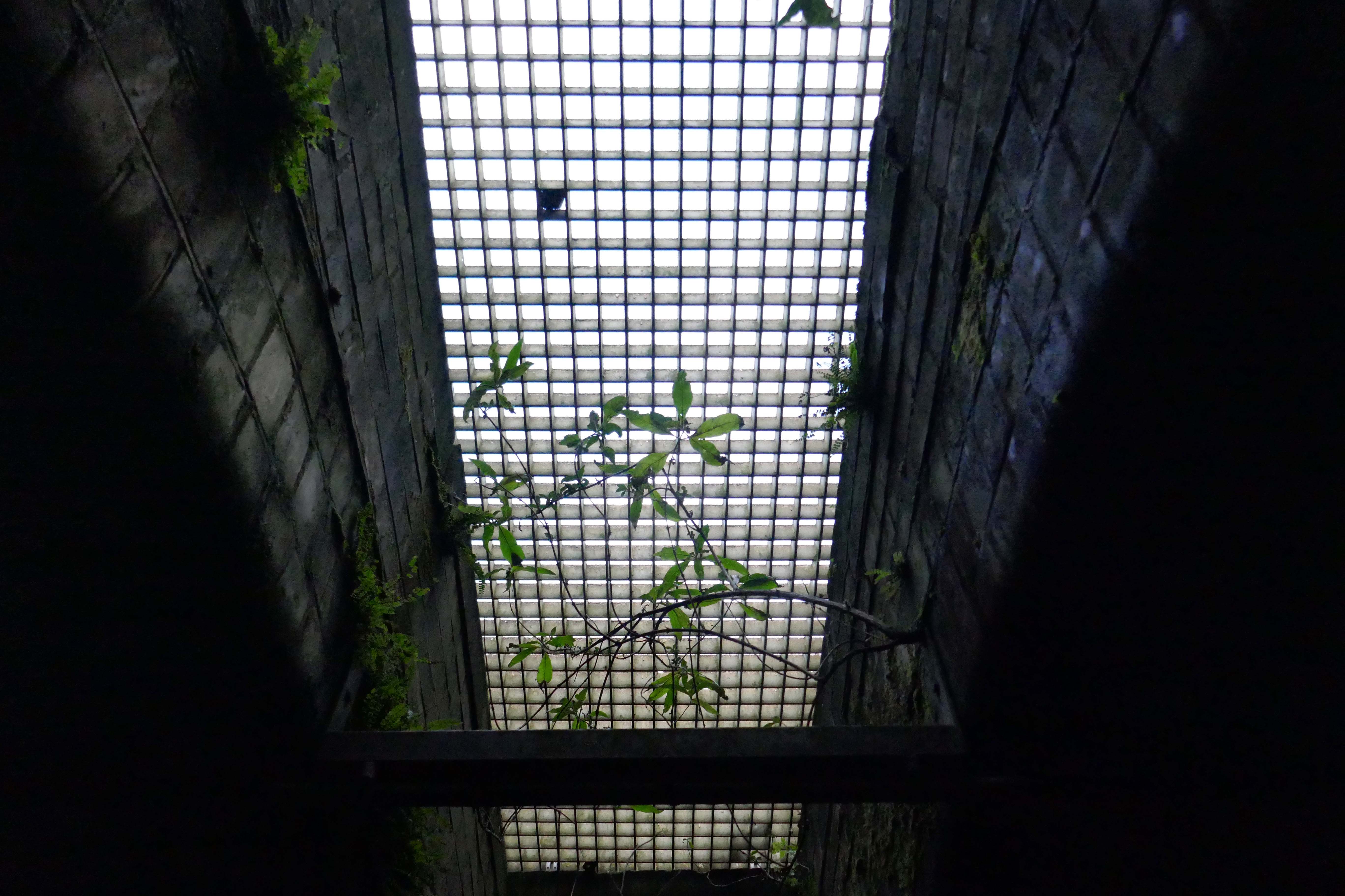
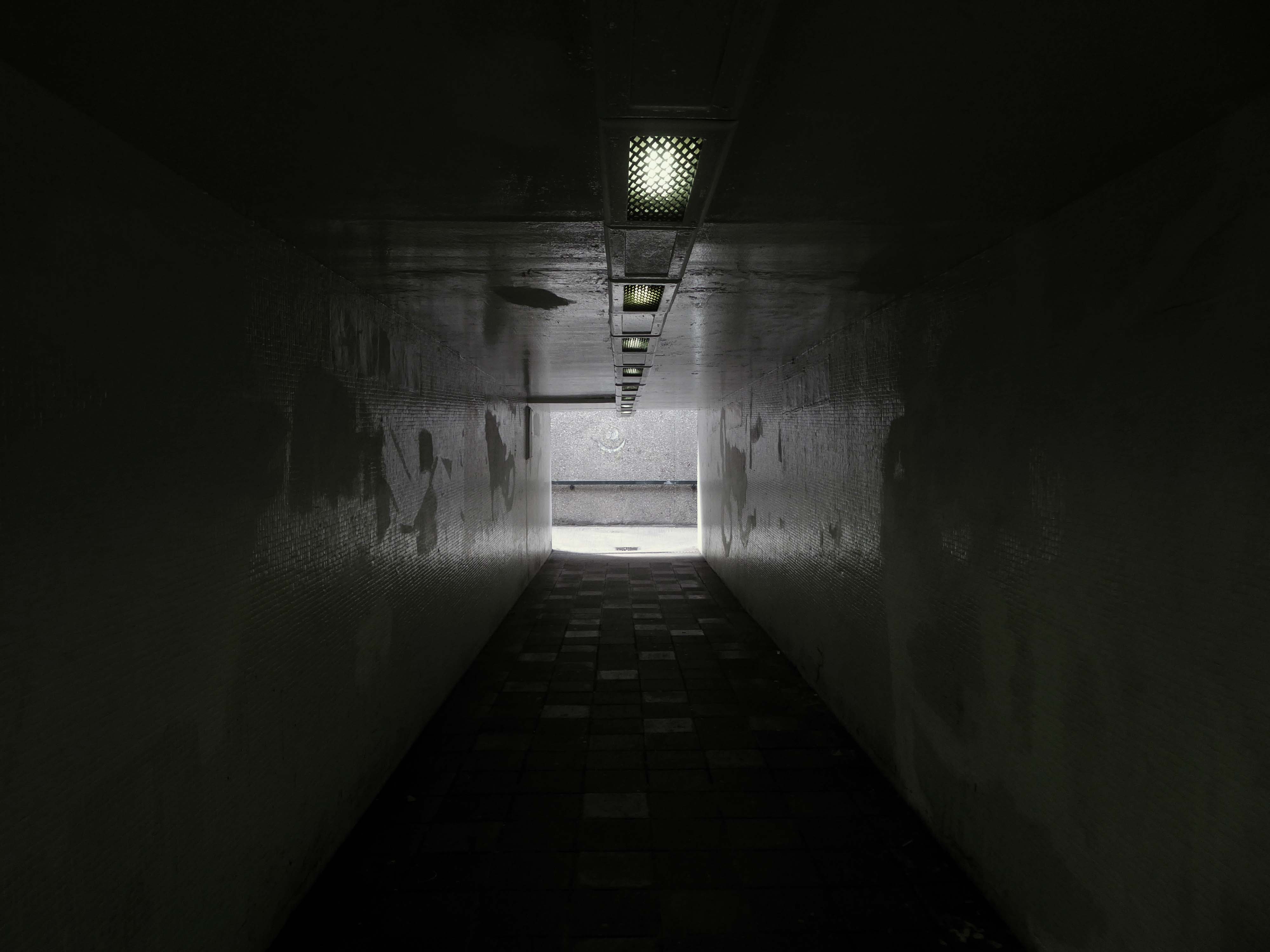
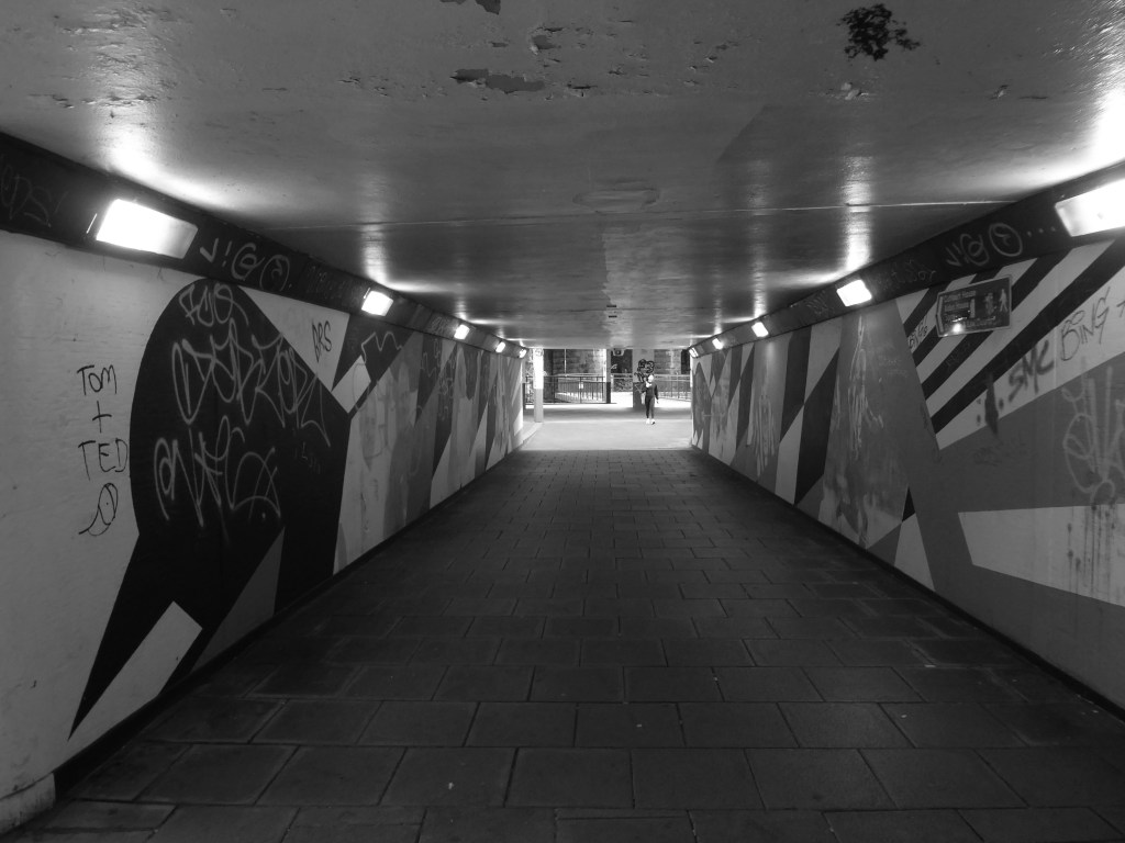
Hidden within and upon the walls of the walkways are these two cast concrete panels – the work of guerrilla artist Euan Lynn.
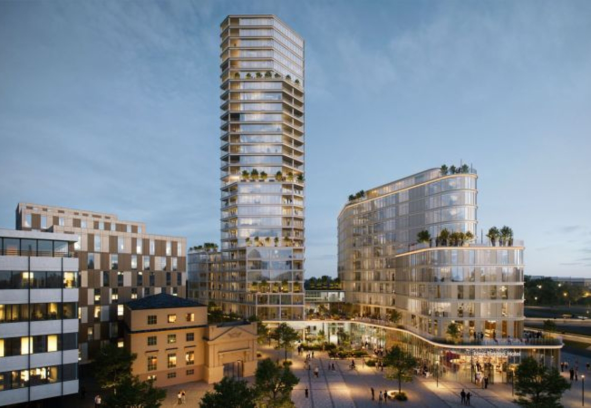
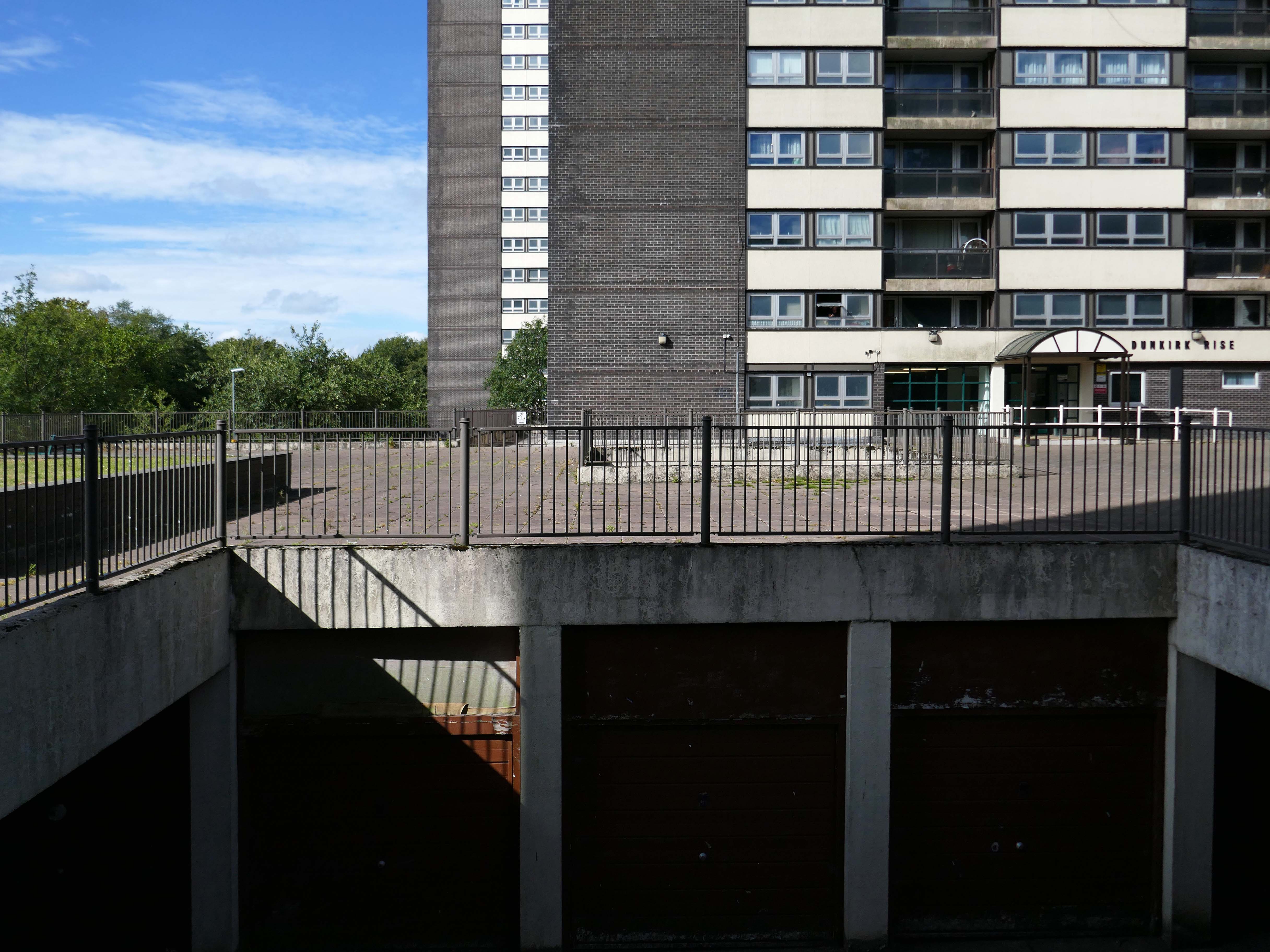
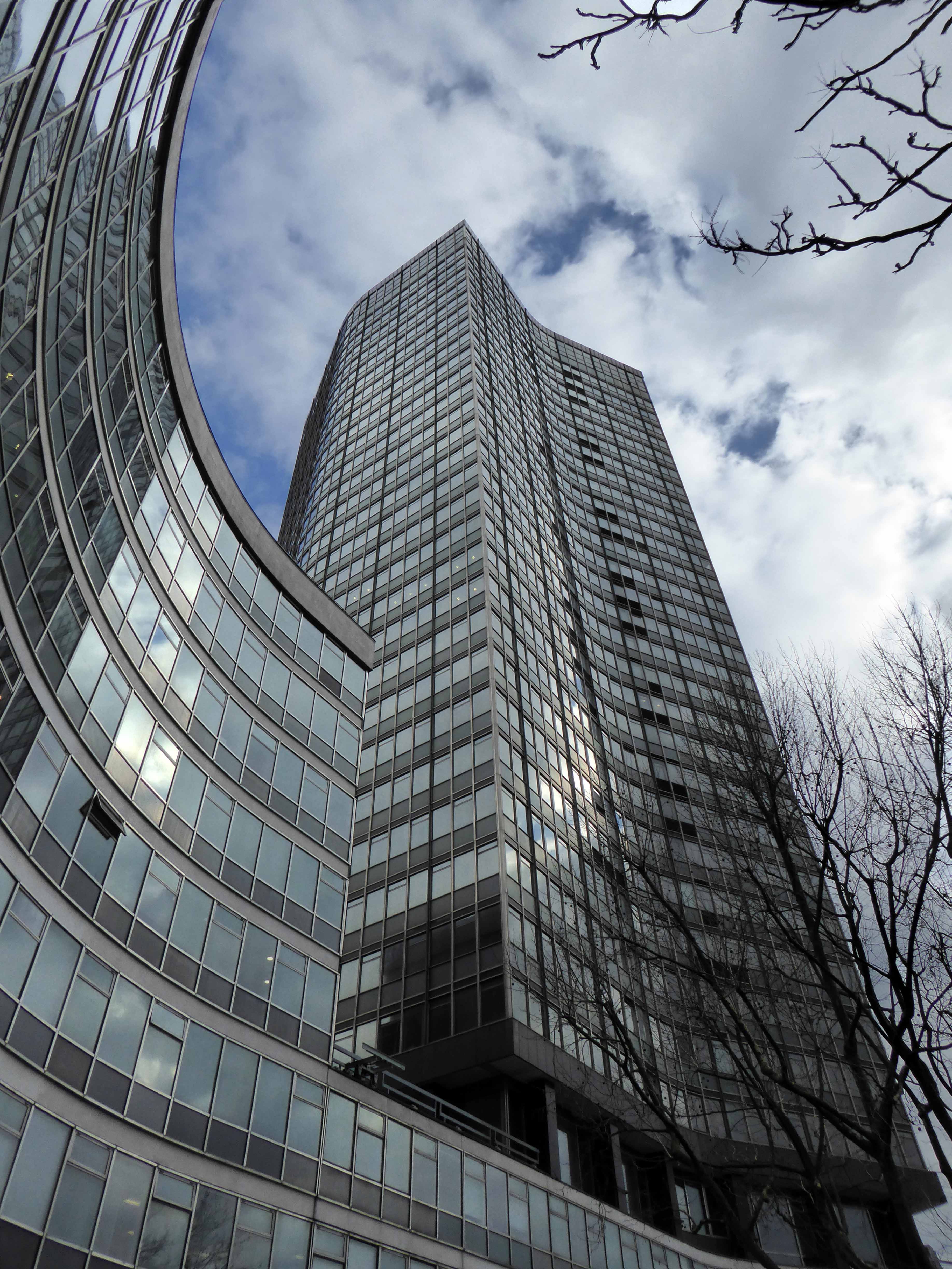
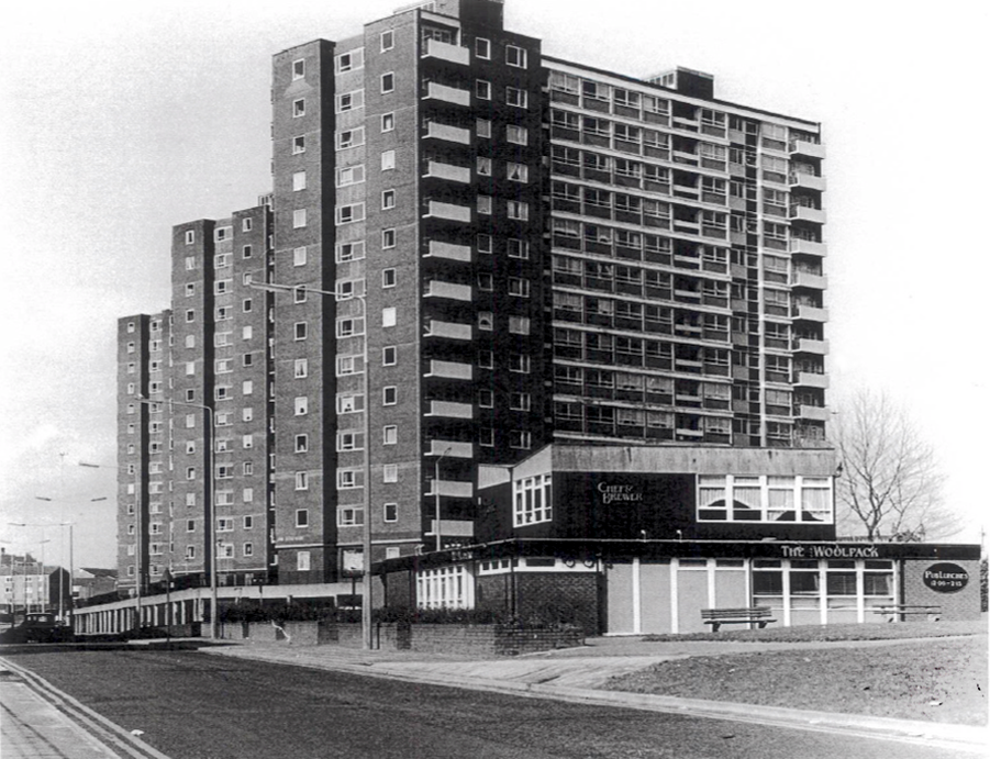
North east property group Gainford has unveiled its revised plan for a £170m residential and hotel project to transform Newcastle’s skyline.
It plans to redevelop a former Premier Inn site on New Bridge Street, with a 29-storey tower of 185 flats, alongside a separate 150-bedroom hotel, and bars, restaurants, and leisure space.
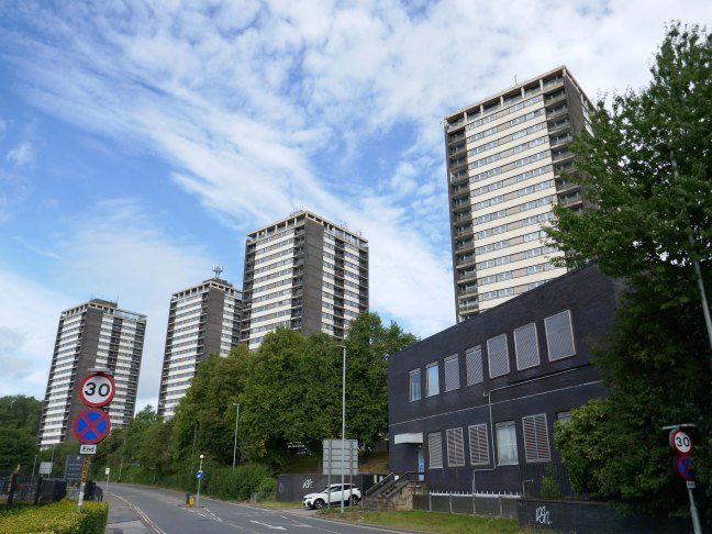
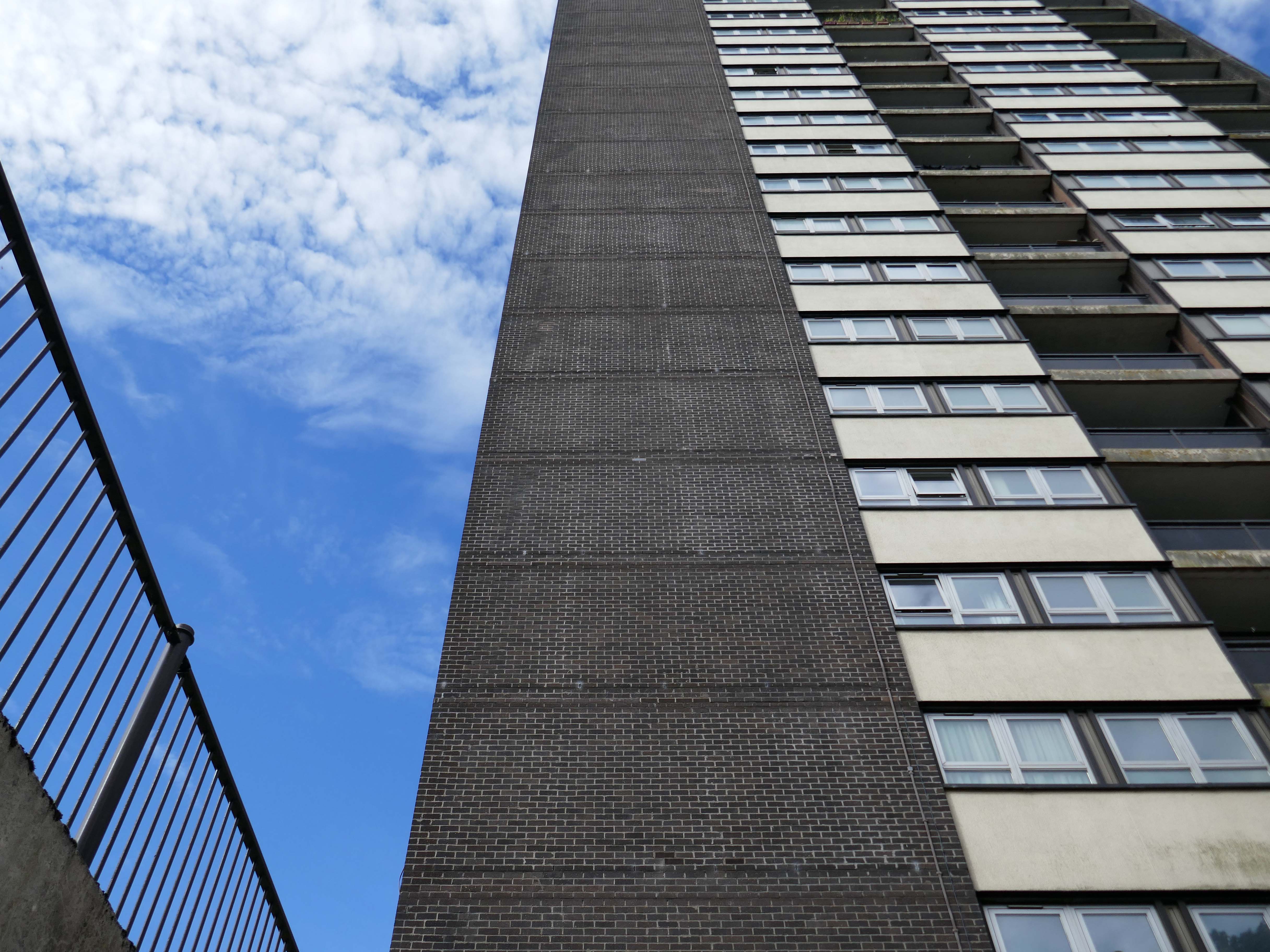
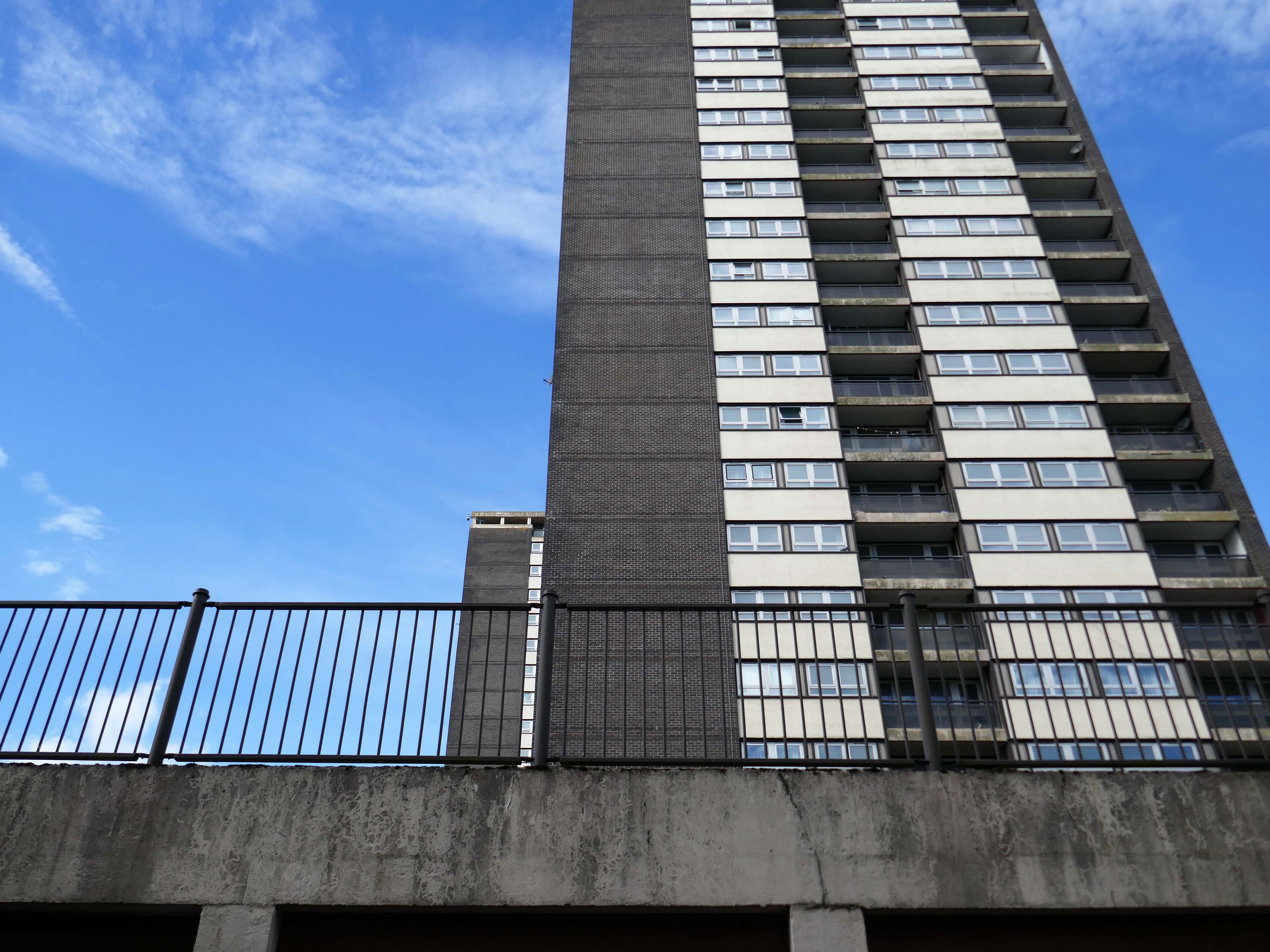
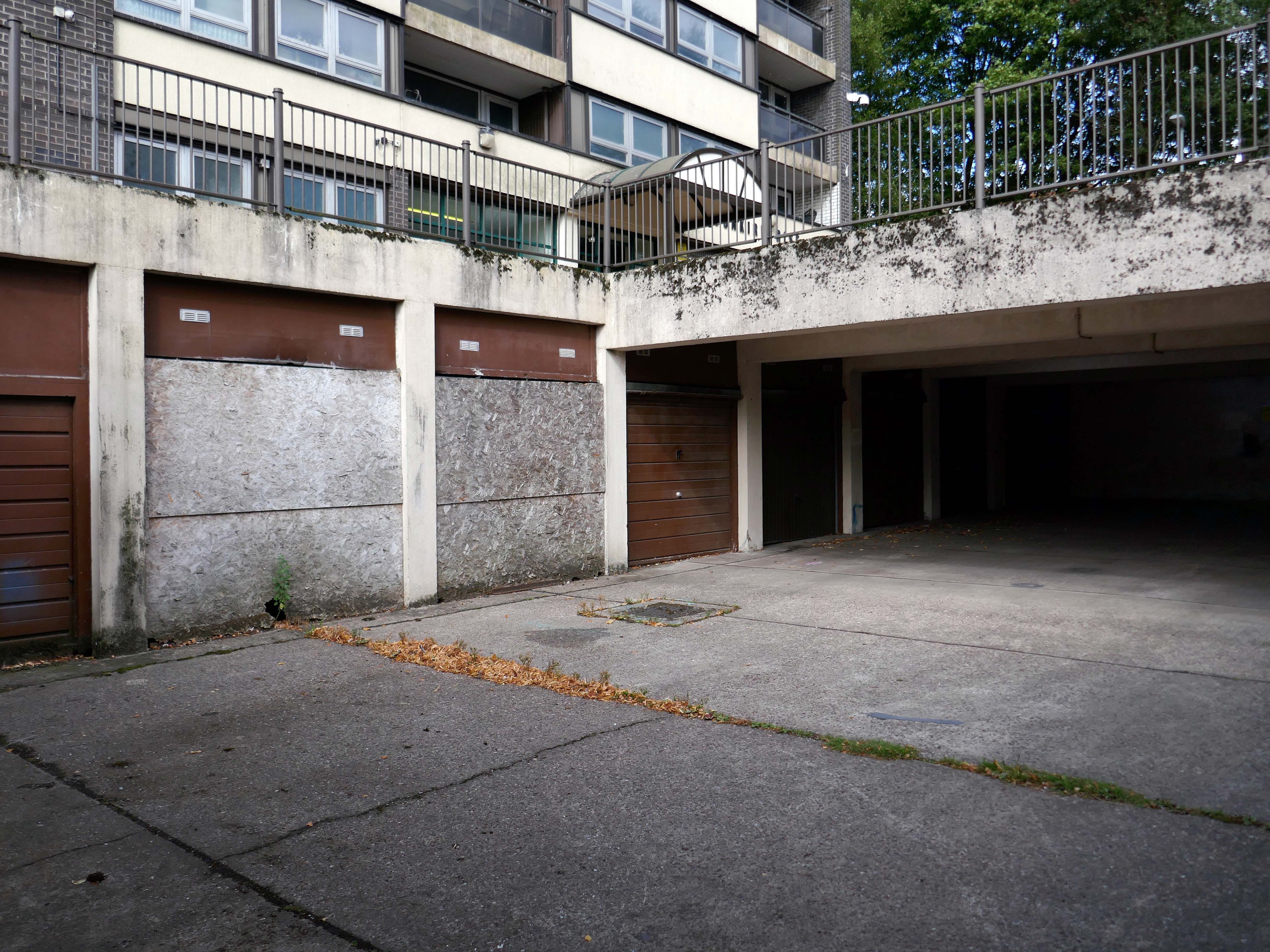
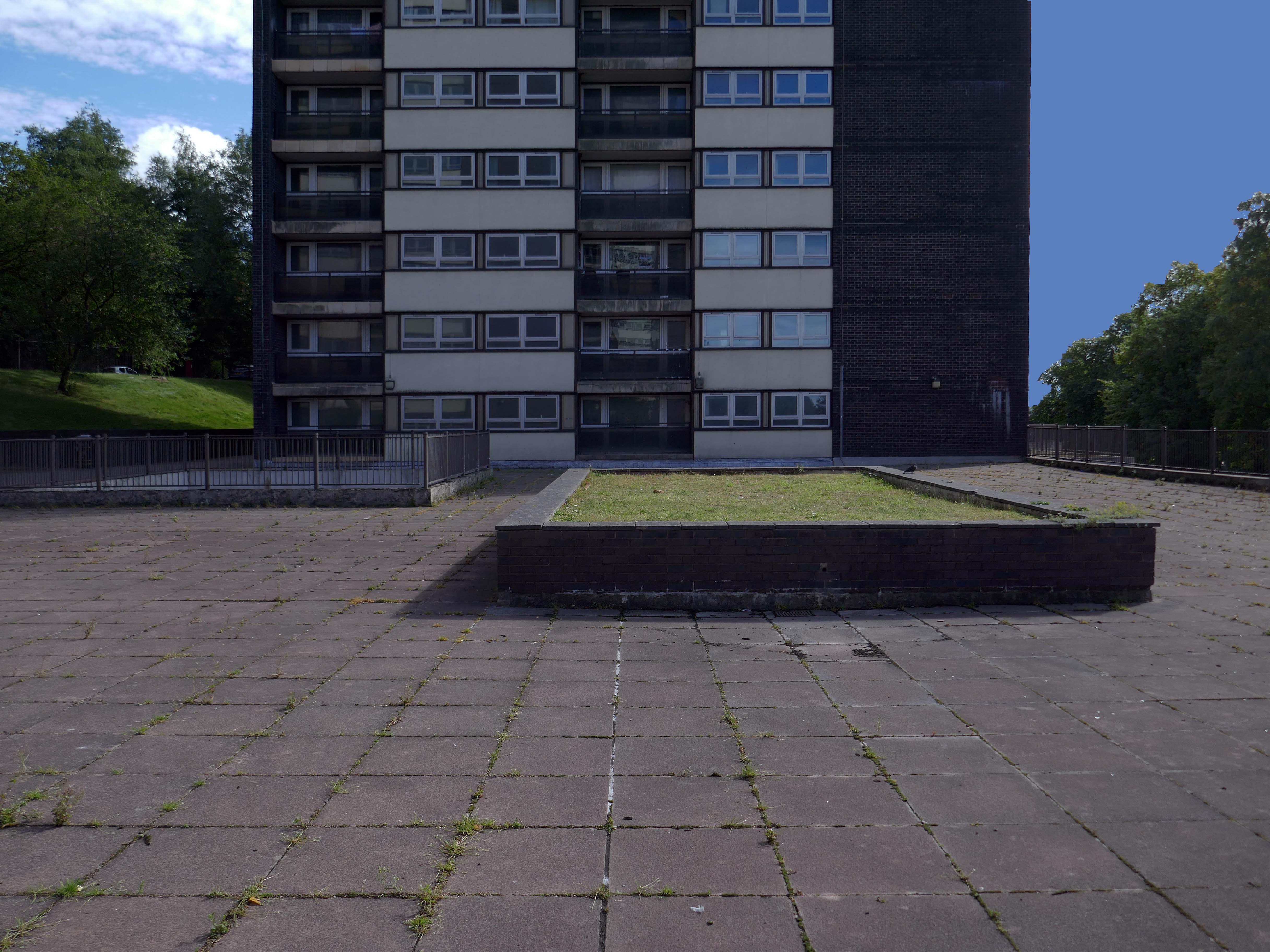
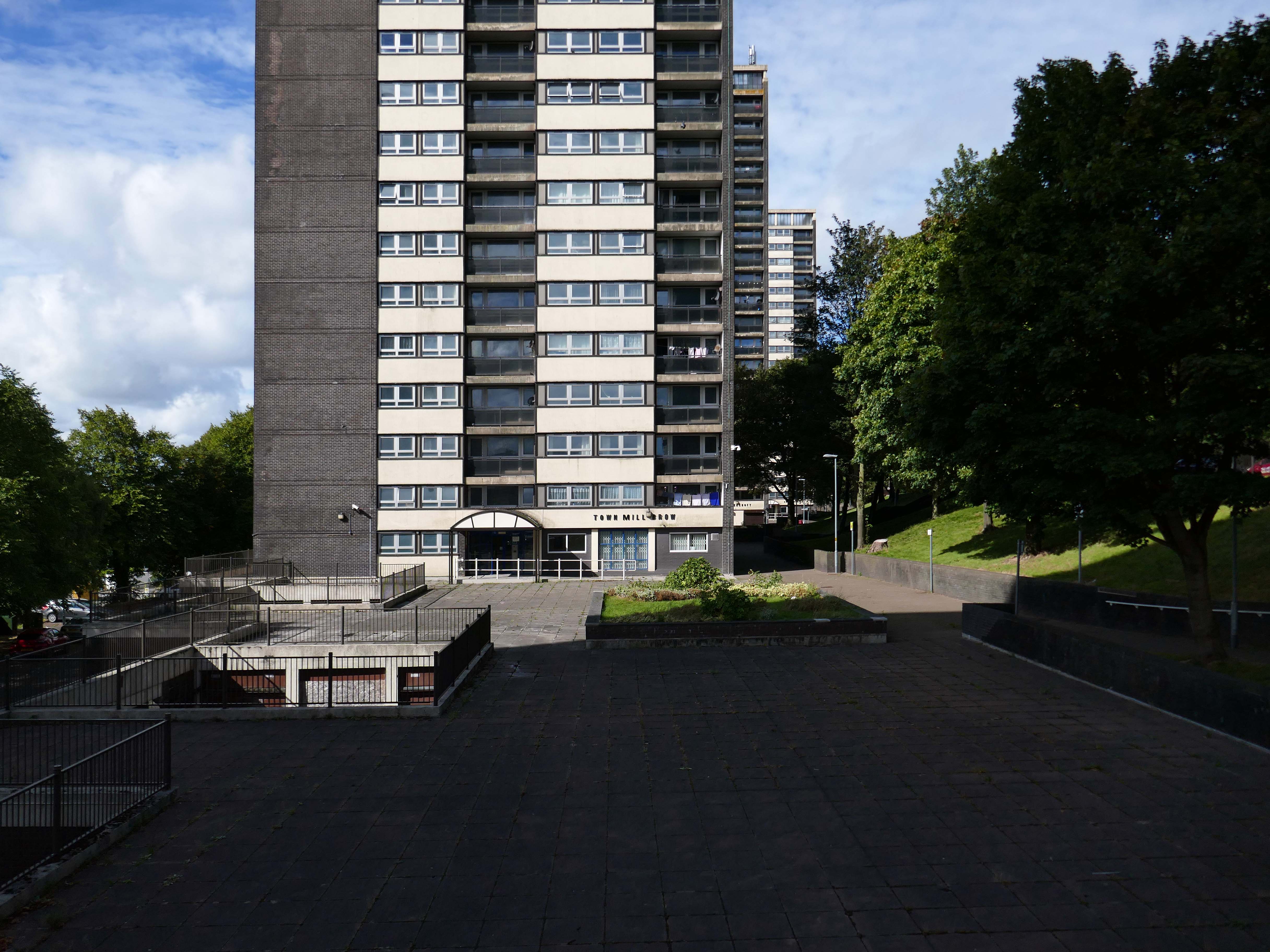
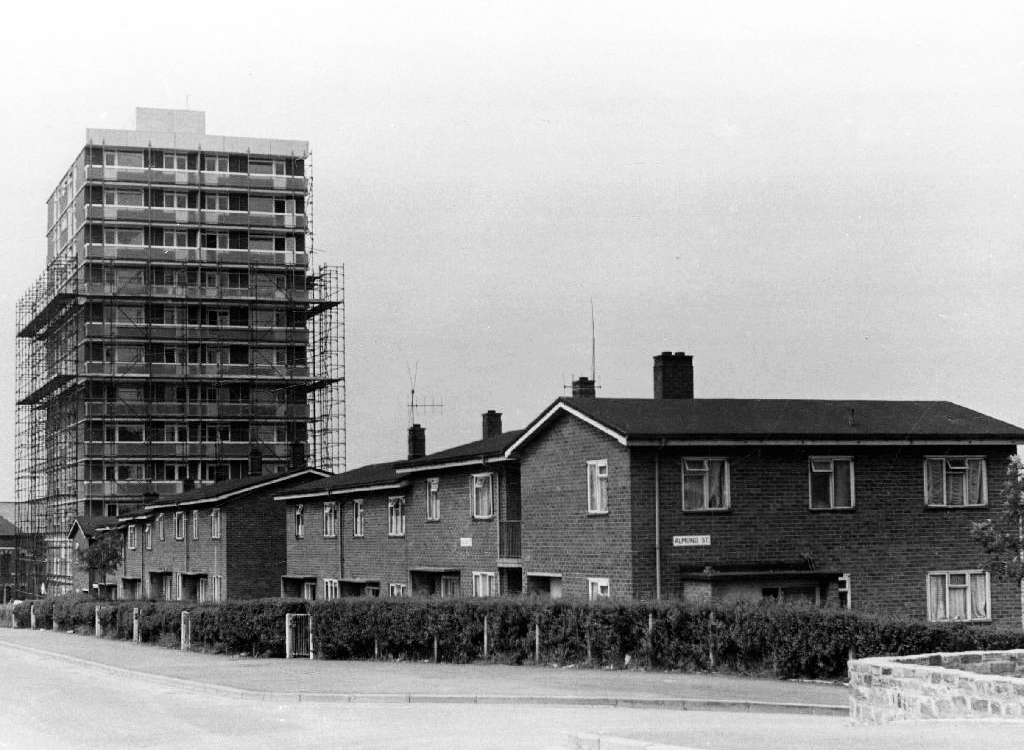
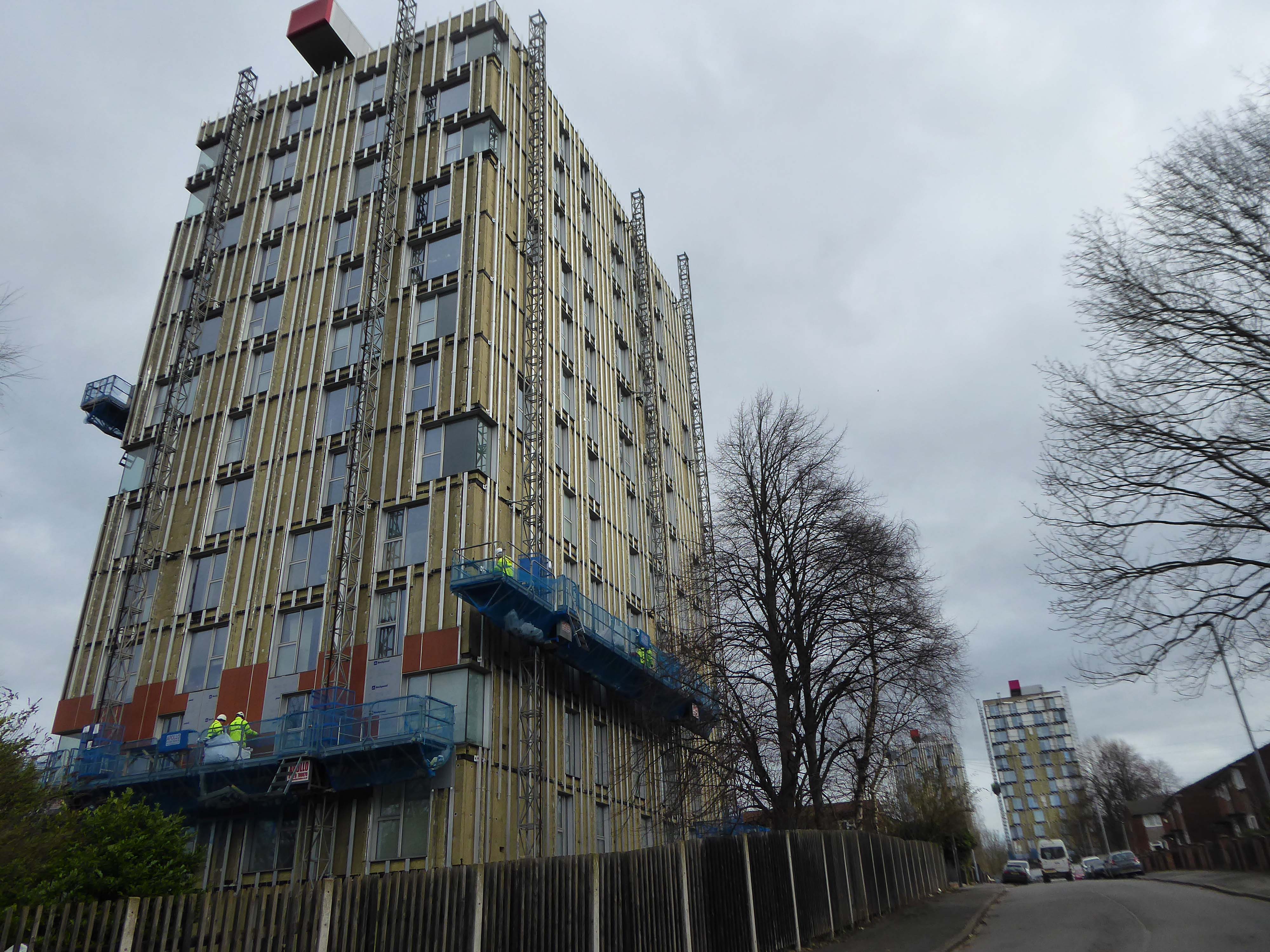
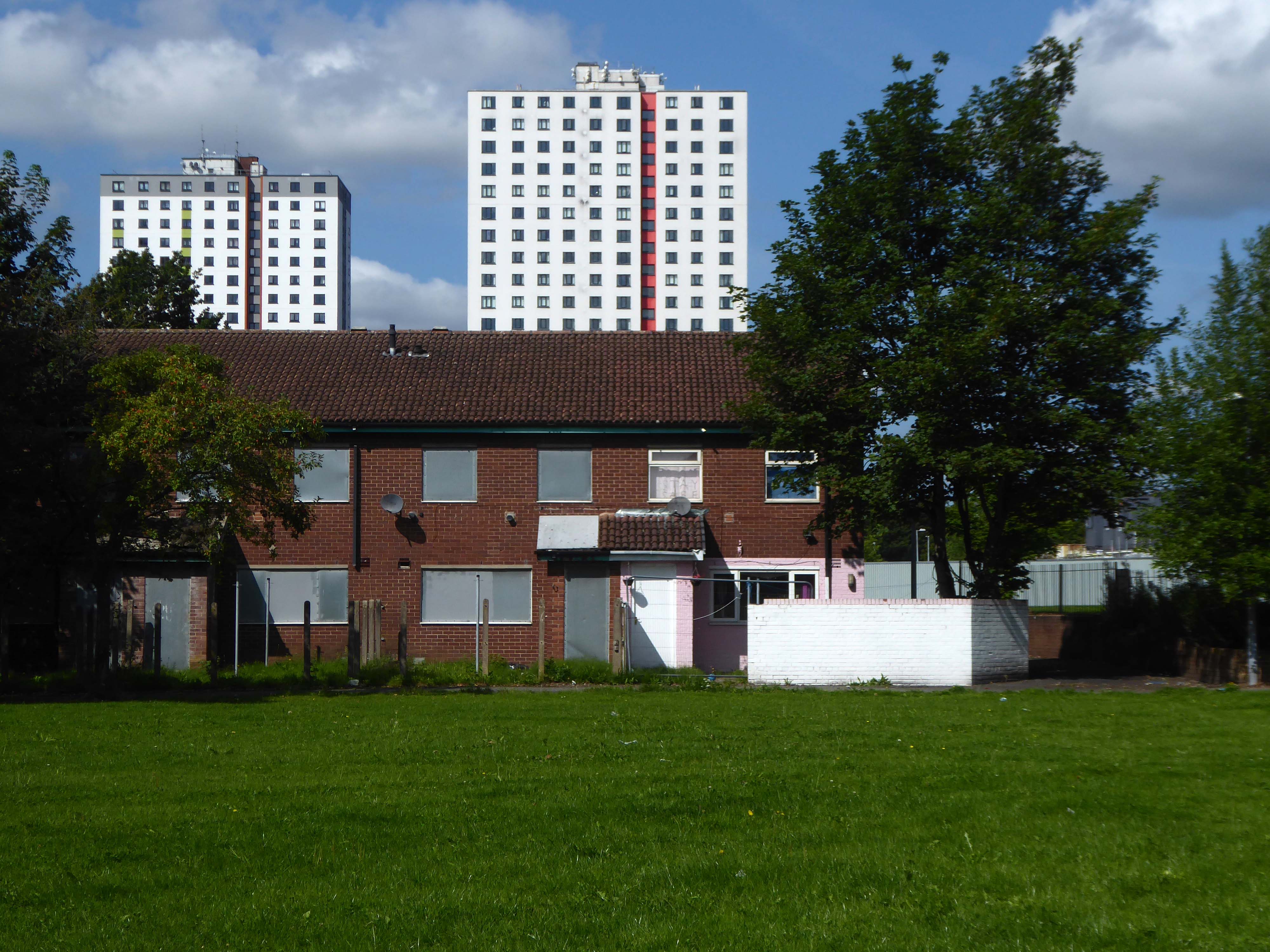
In recent years these homes have been under threat of both demolition and refurbishment.
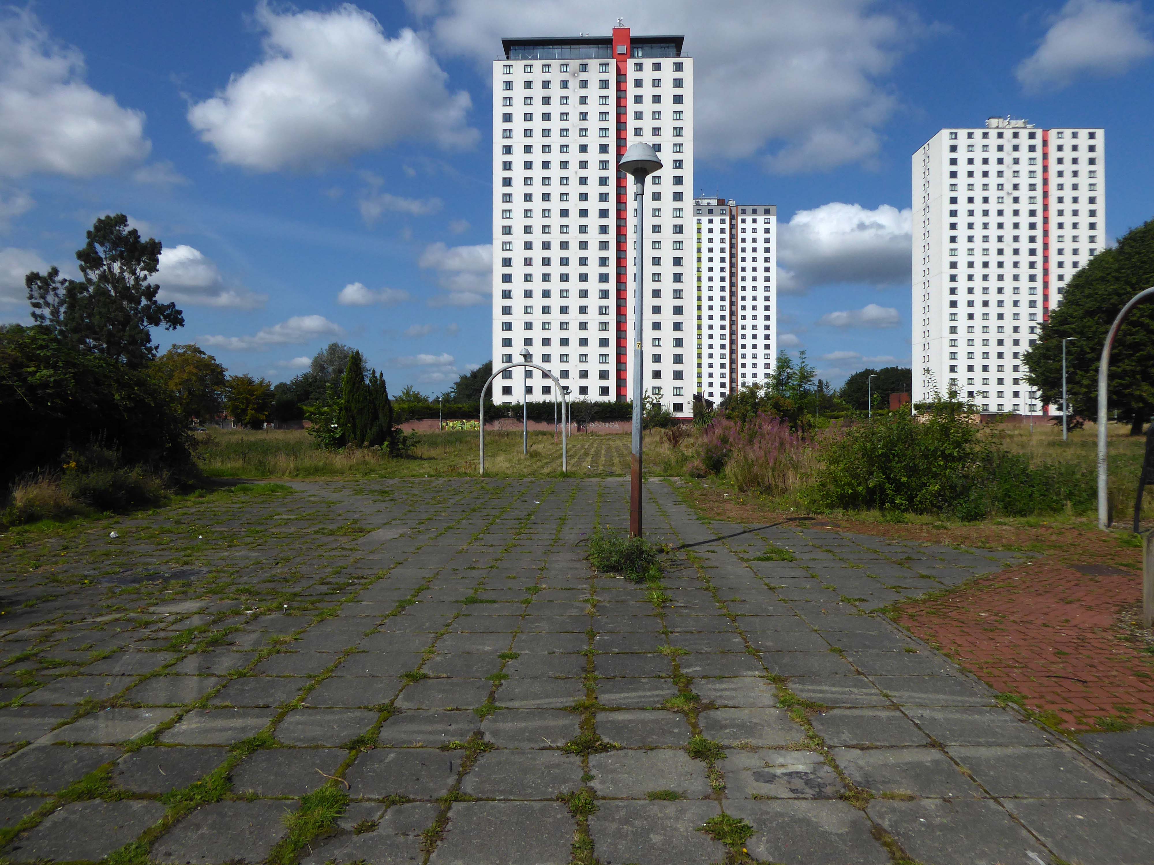
Rochdale Boroughwide Housing – RBH had sought help from a developer to pay for its £107m plans to refurbish the College Bank high-rise apartments, known in the town as the Seven Sisters.
But the social housing landlord has been unable to reach a commercially viable agreement to help improve the blocks where 250 people live.
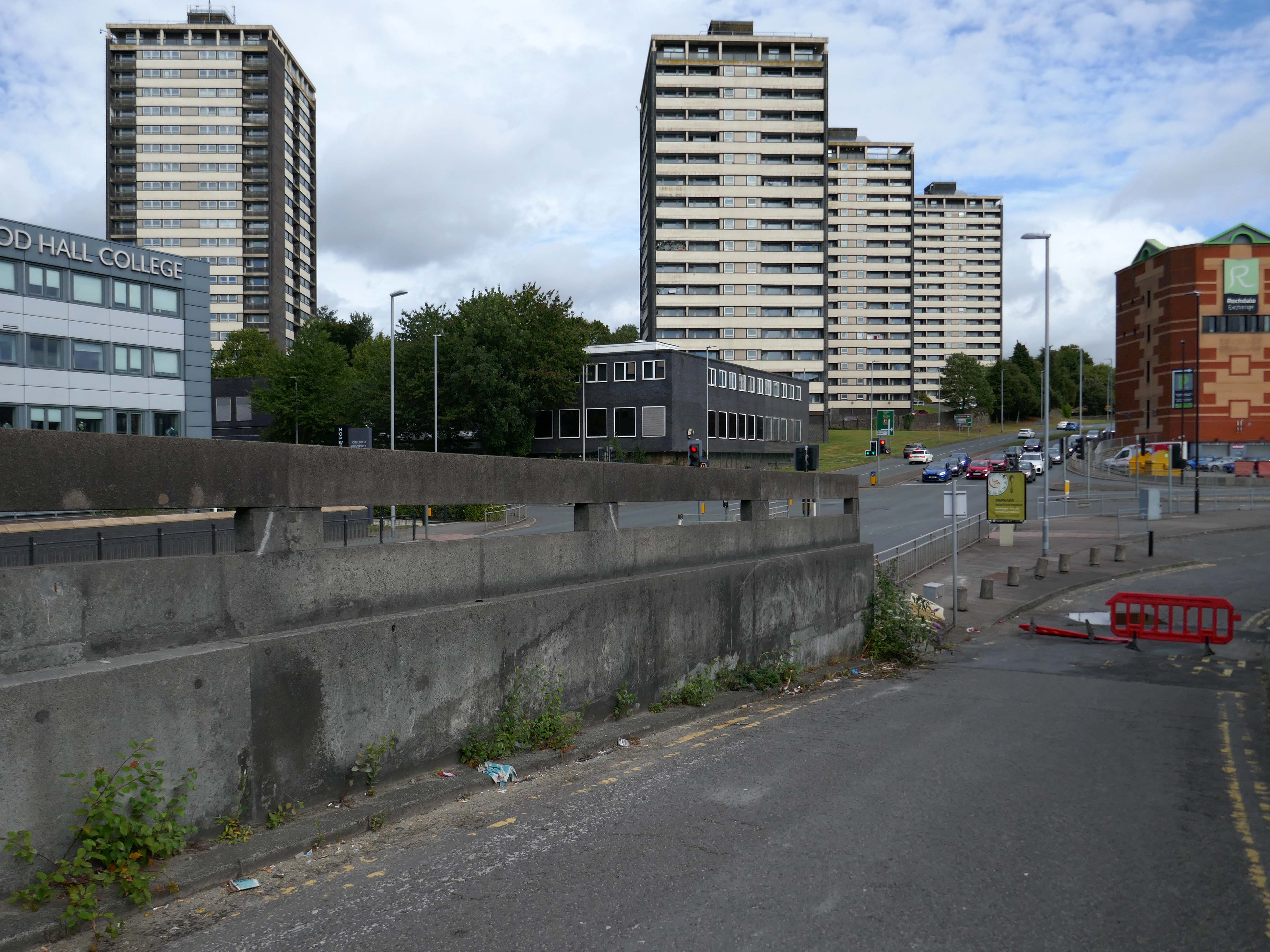
Amanda Newton, RBH chief executive said the lack of a deal was disappointing but all options for the future of the site would still be explored.
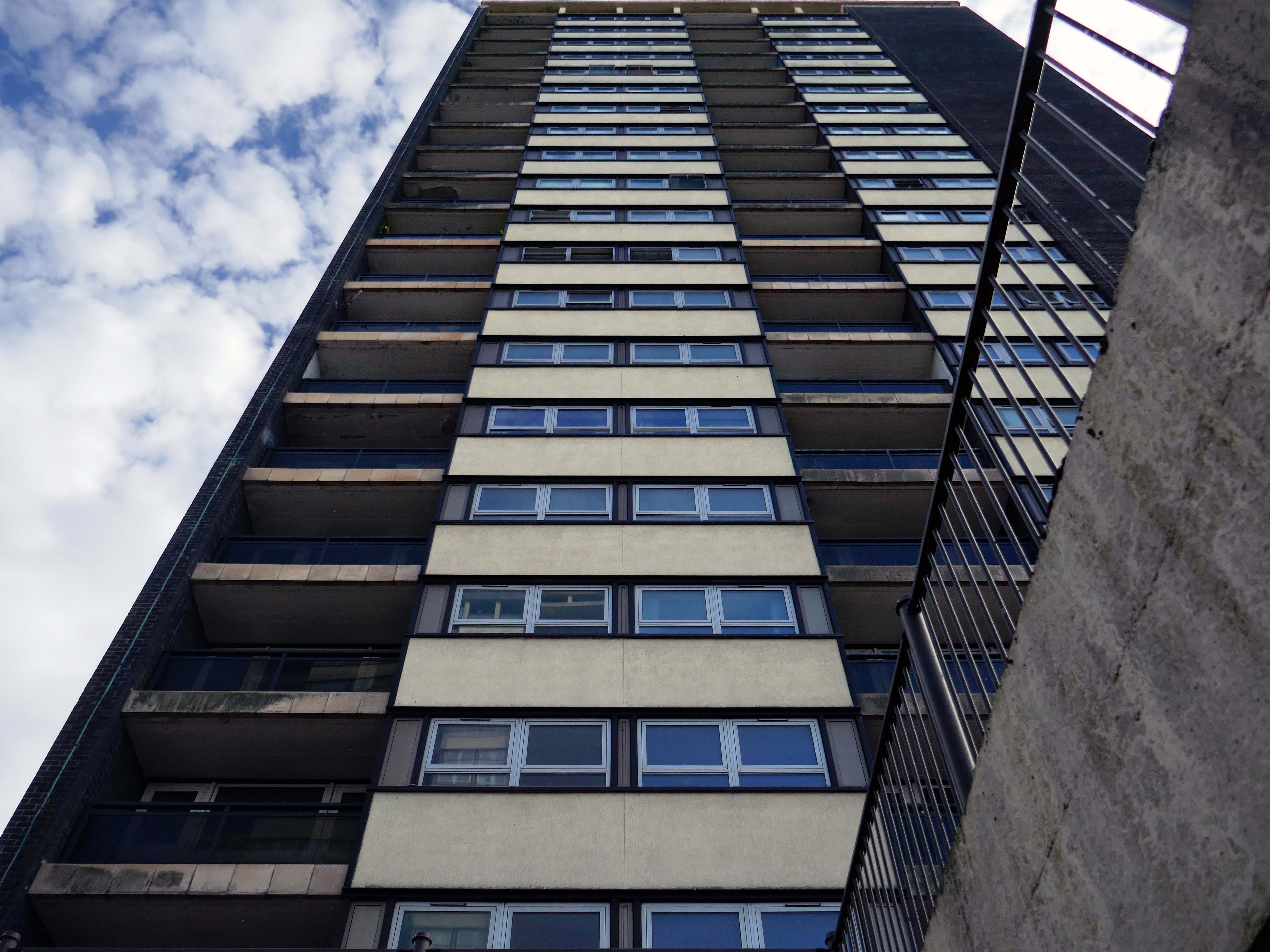
Many of the apartments spread across the Seven Sisters remain unoccupied after a plan was announced to demolish four of the blocks in 2017, leading to an exodus of hundreds of tenants. RBH later reconsidered the plan, and instead signed a deal with developer Legal & General Affordable Housing last year, to find a viable way of refurbishing the apartments.
All 700 flats in the 1960s blocks were set to be redeveloped under the plans, but the pair’s agreement has now come to an end without a solution emerging.
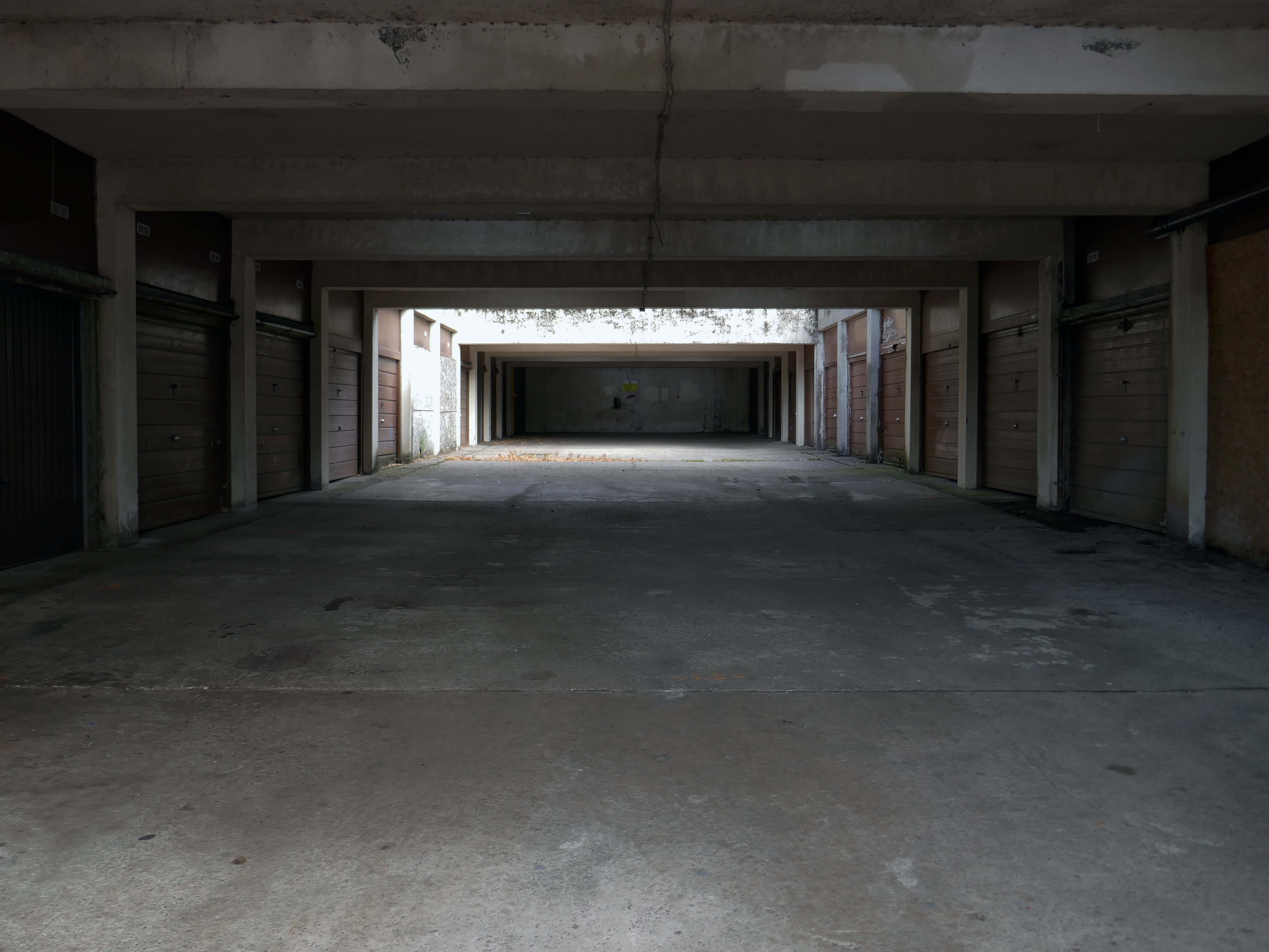
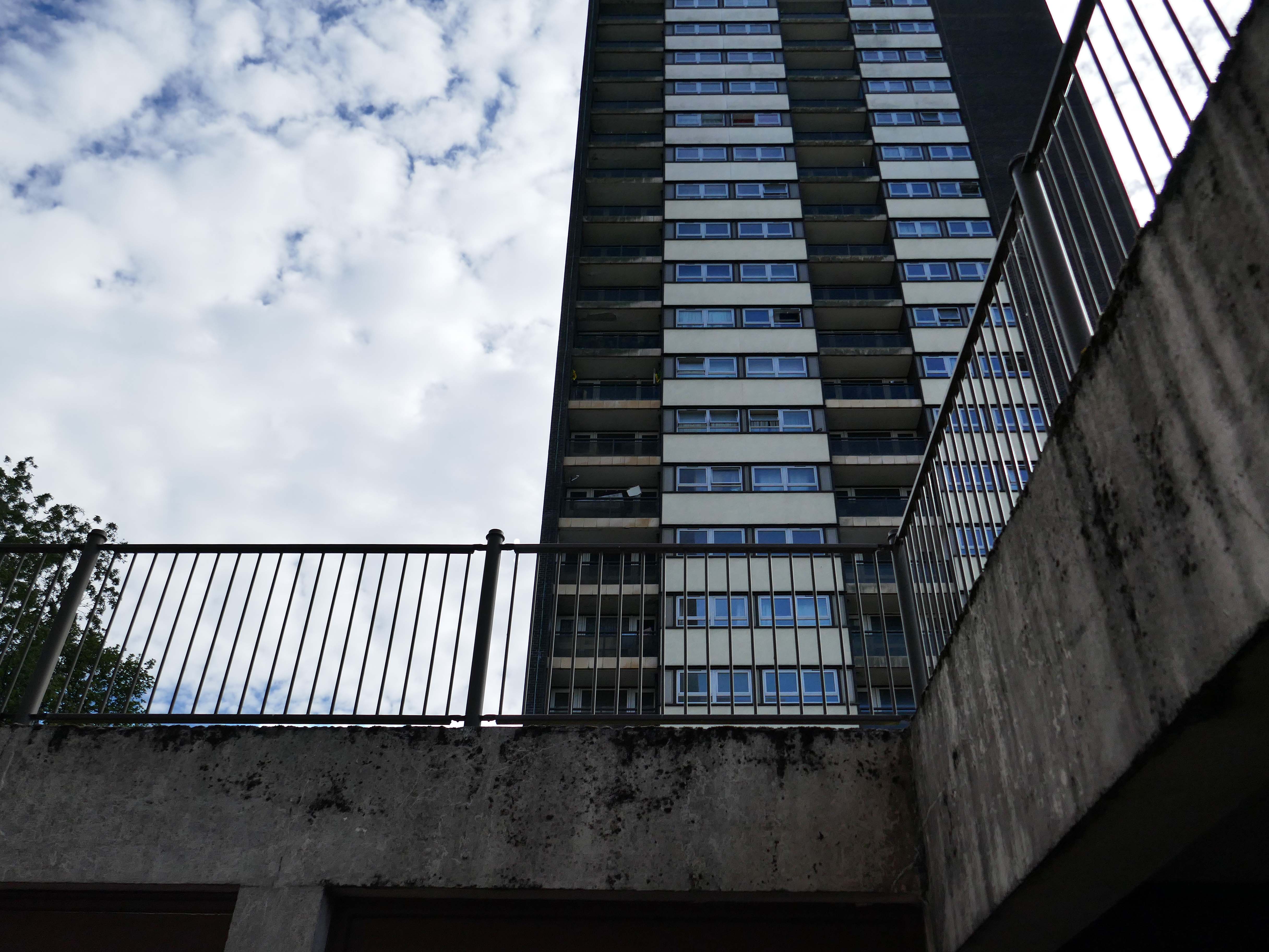
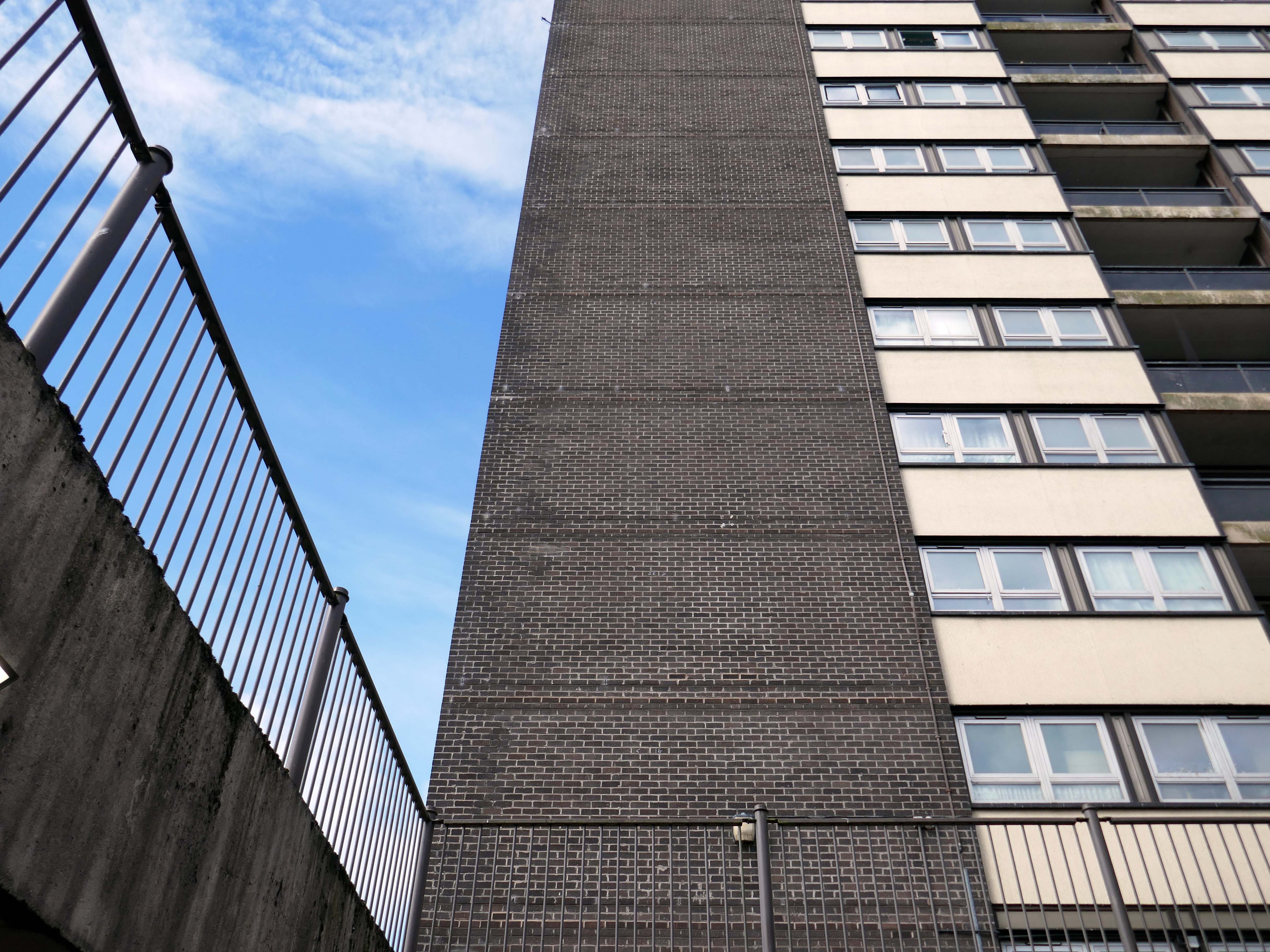
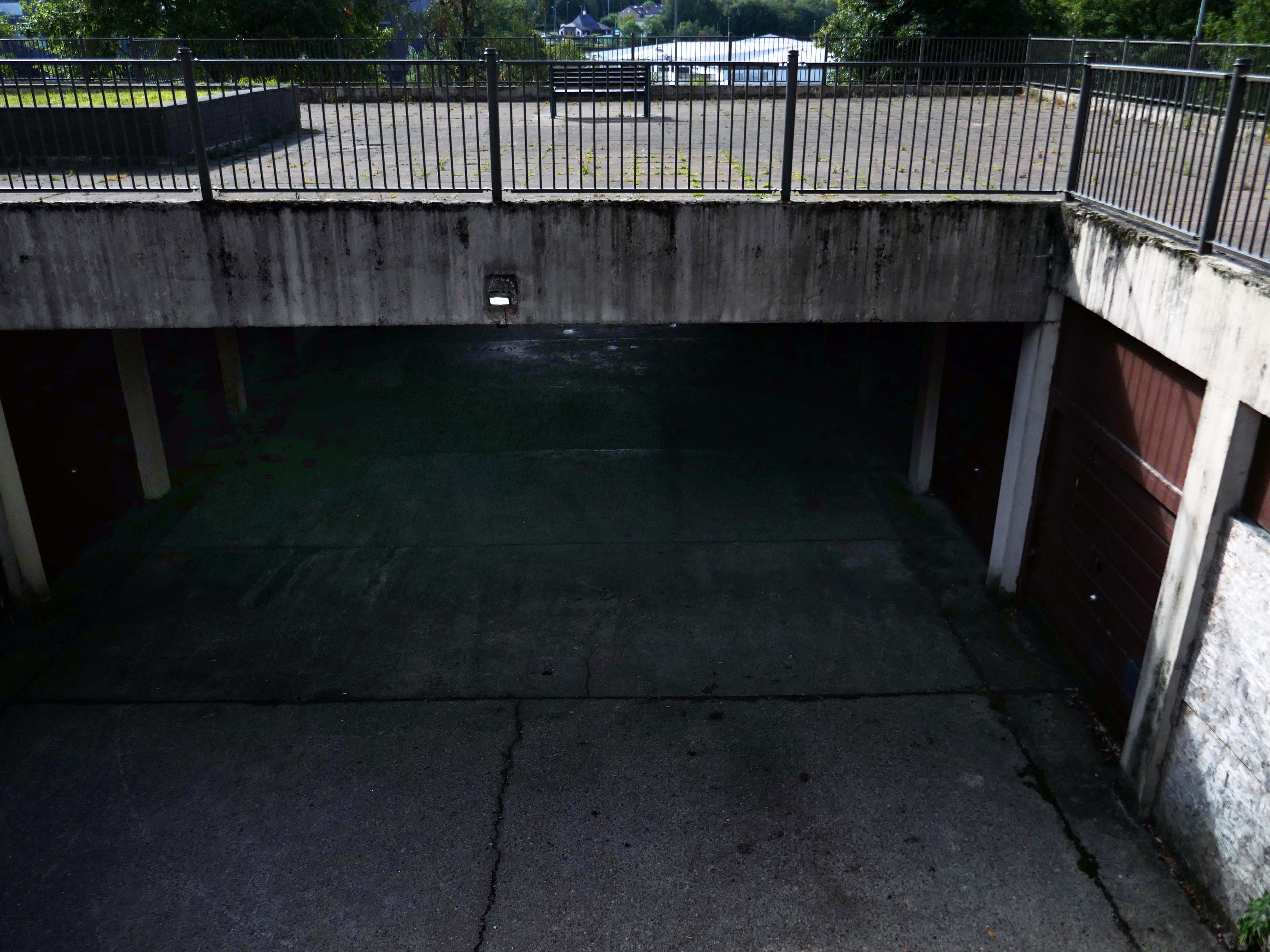
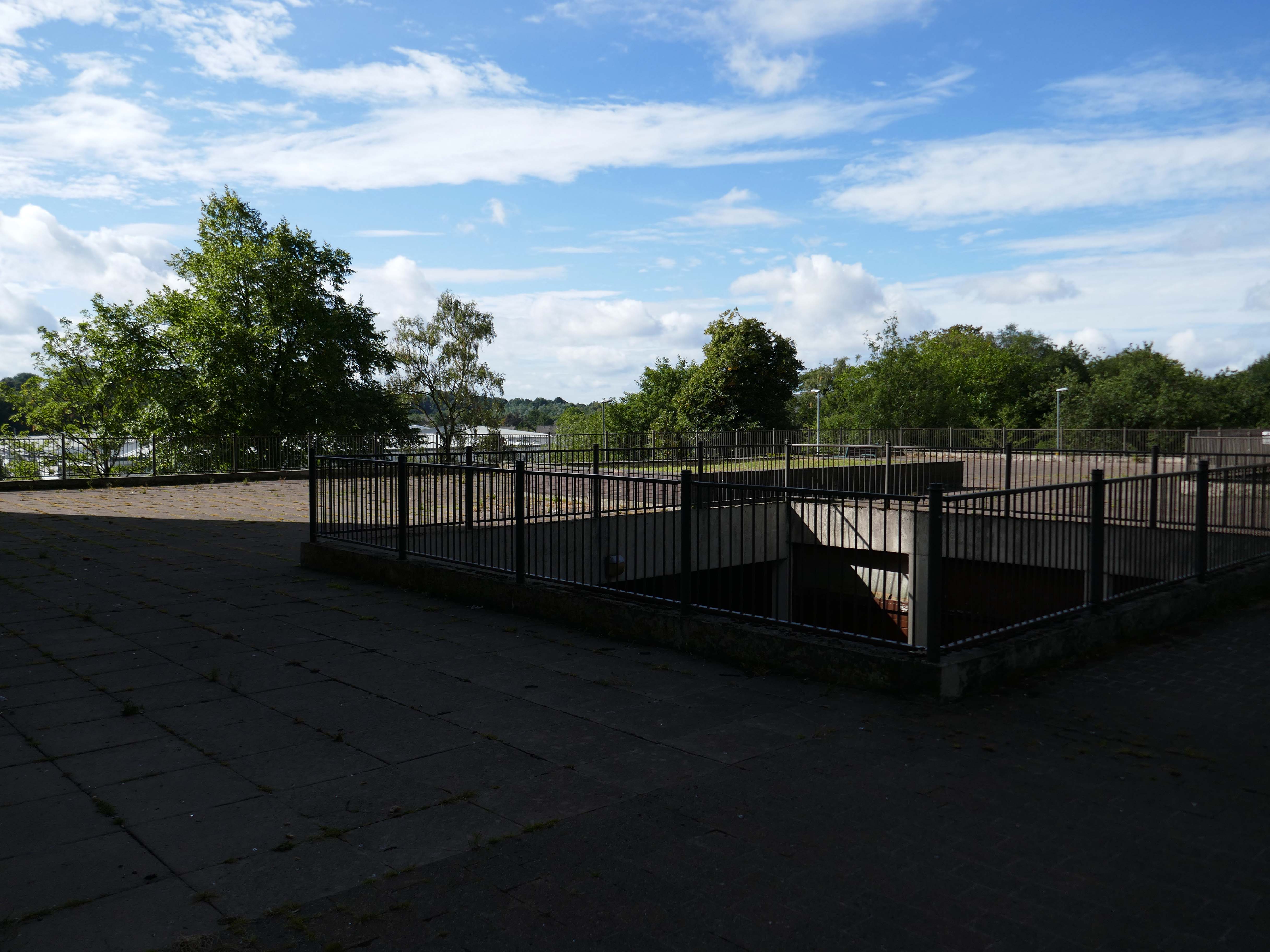
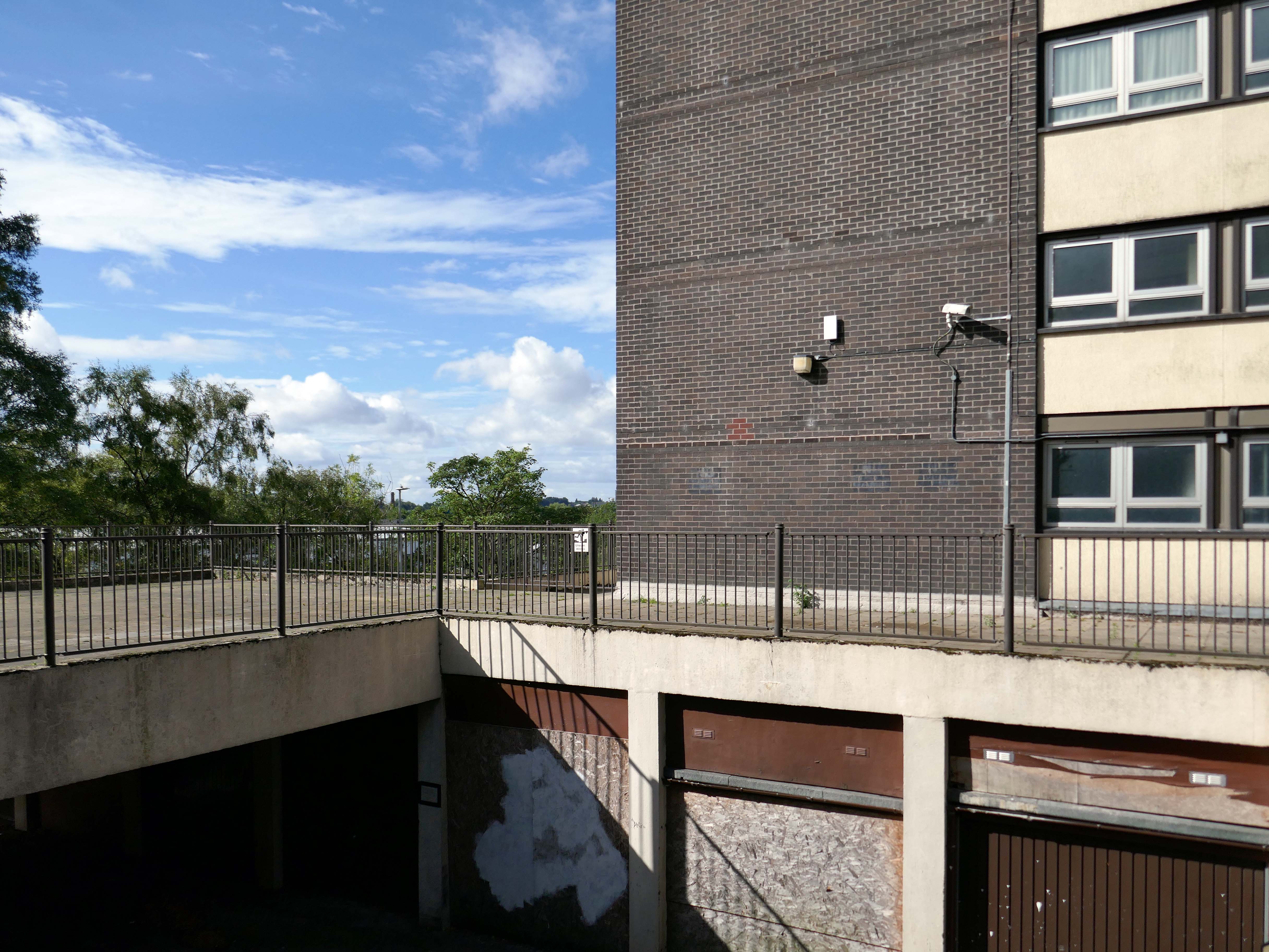
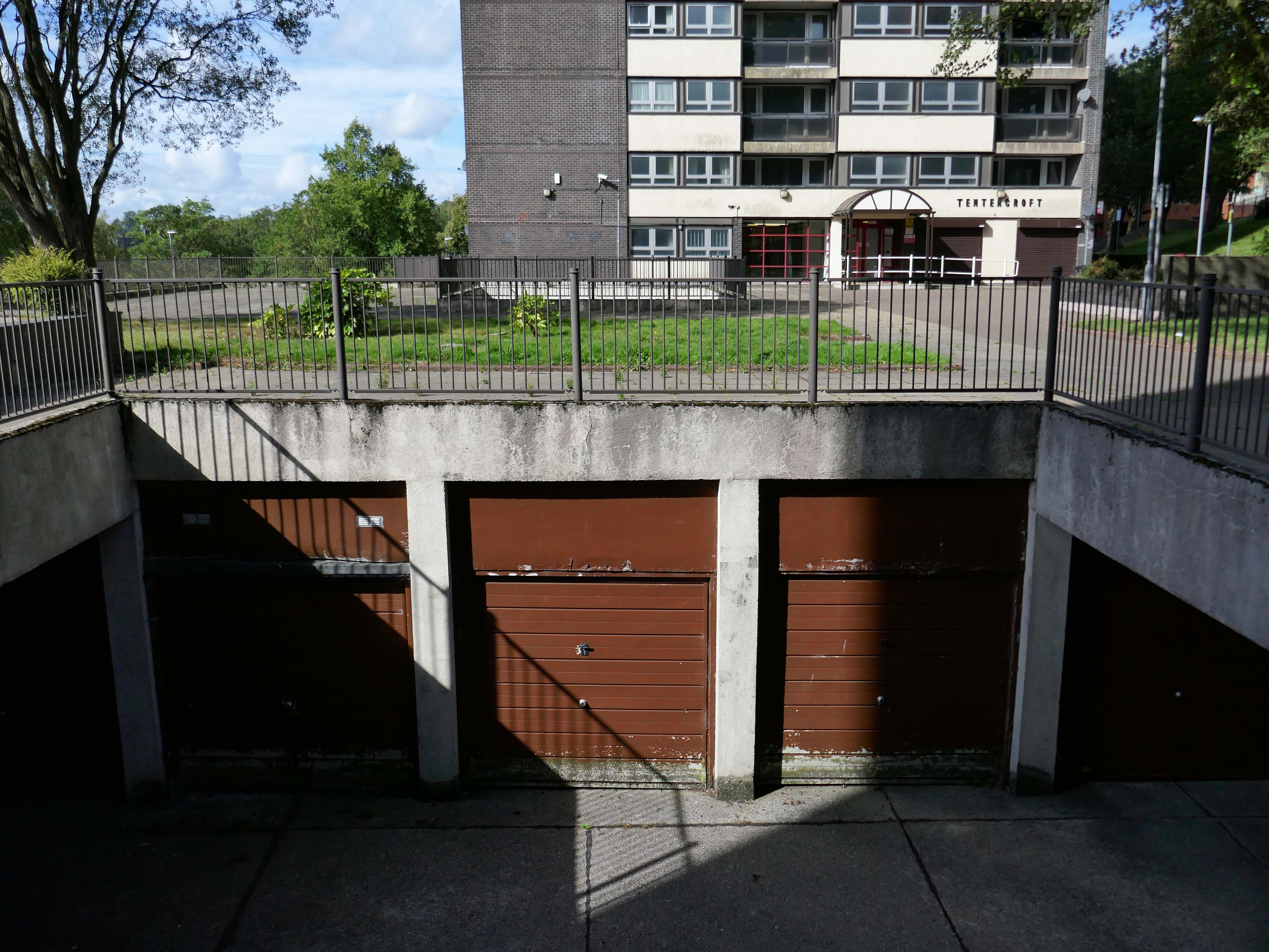
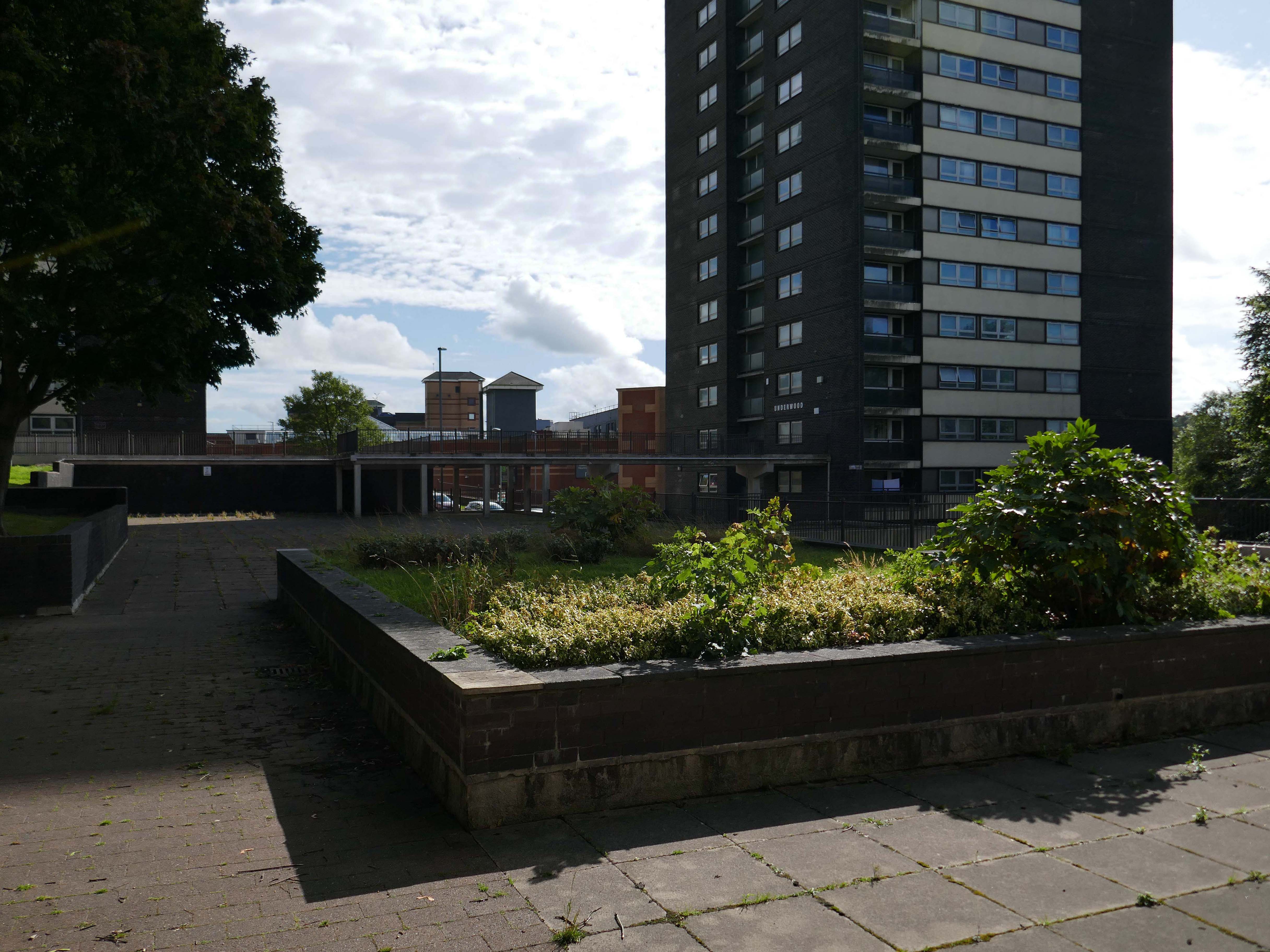
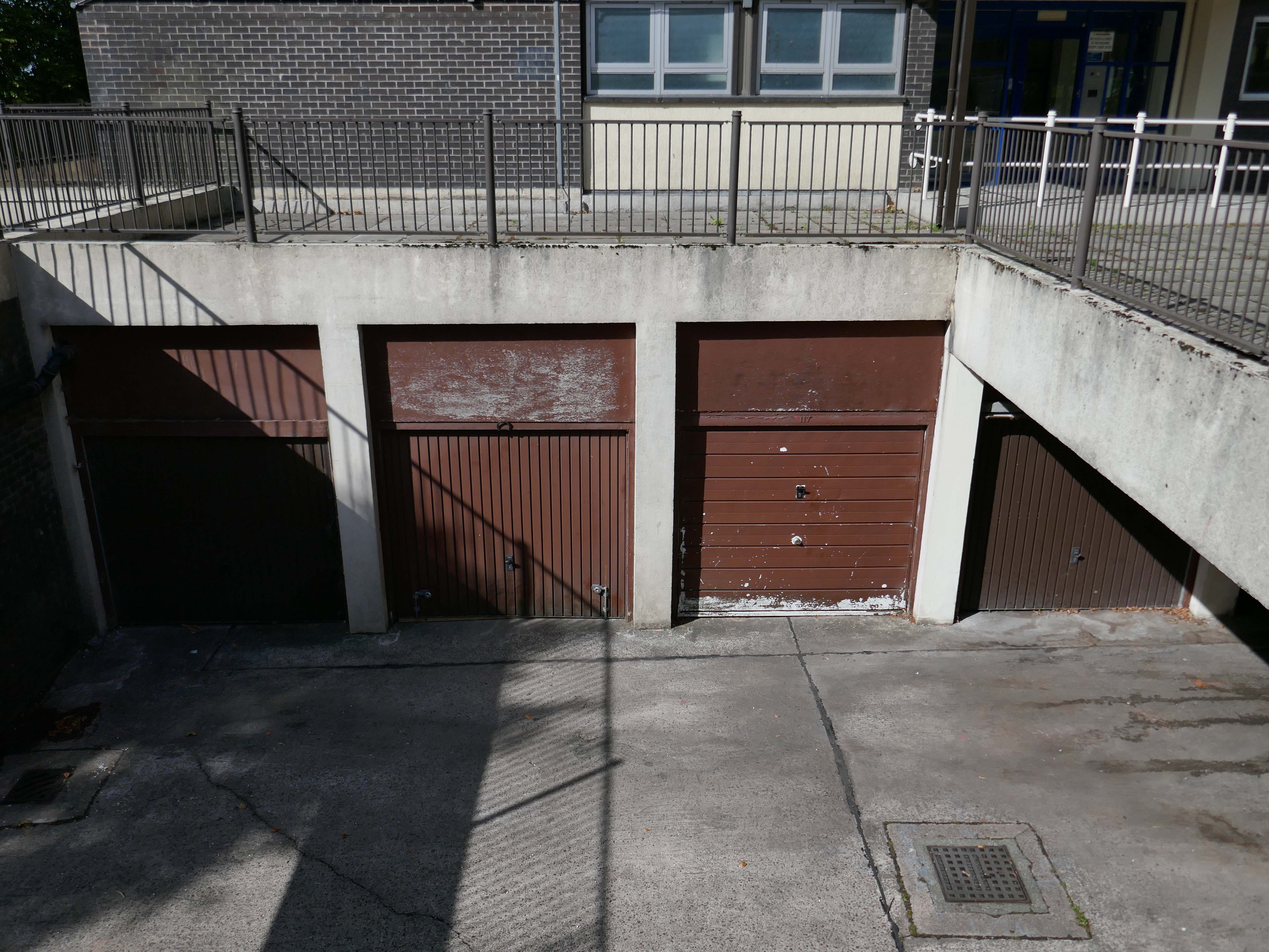
So an unsatisfactory stasis prevails across the windswept piazzas, podium garages and towering towers.
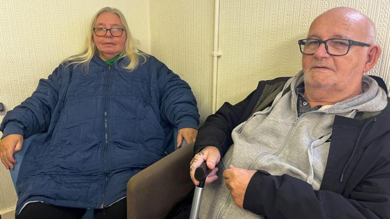
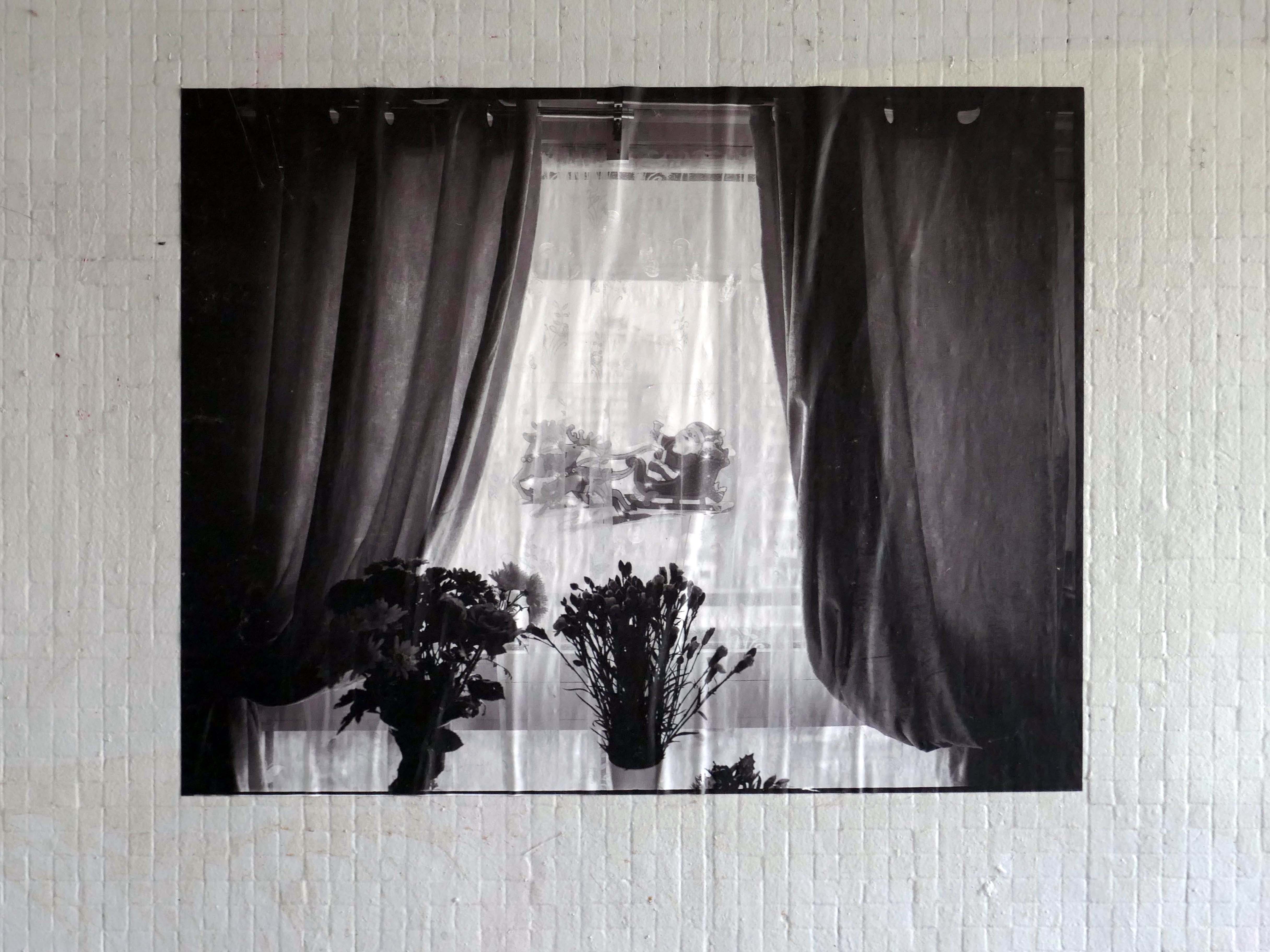
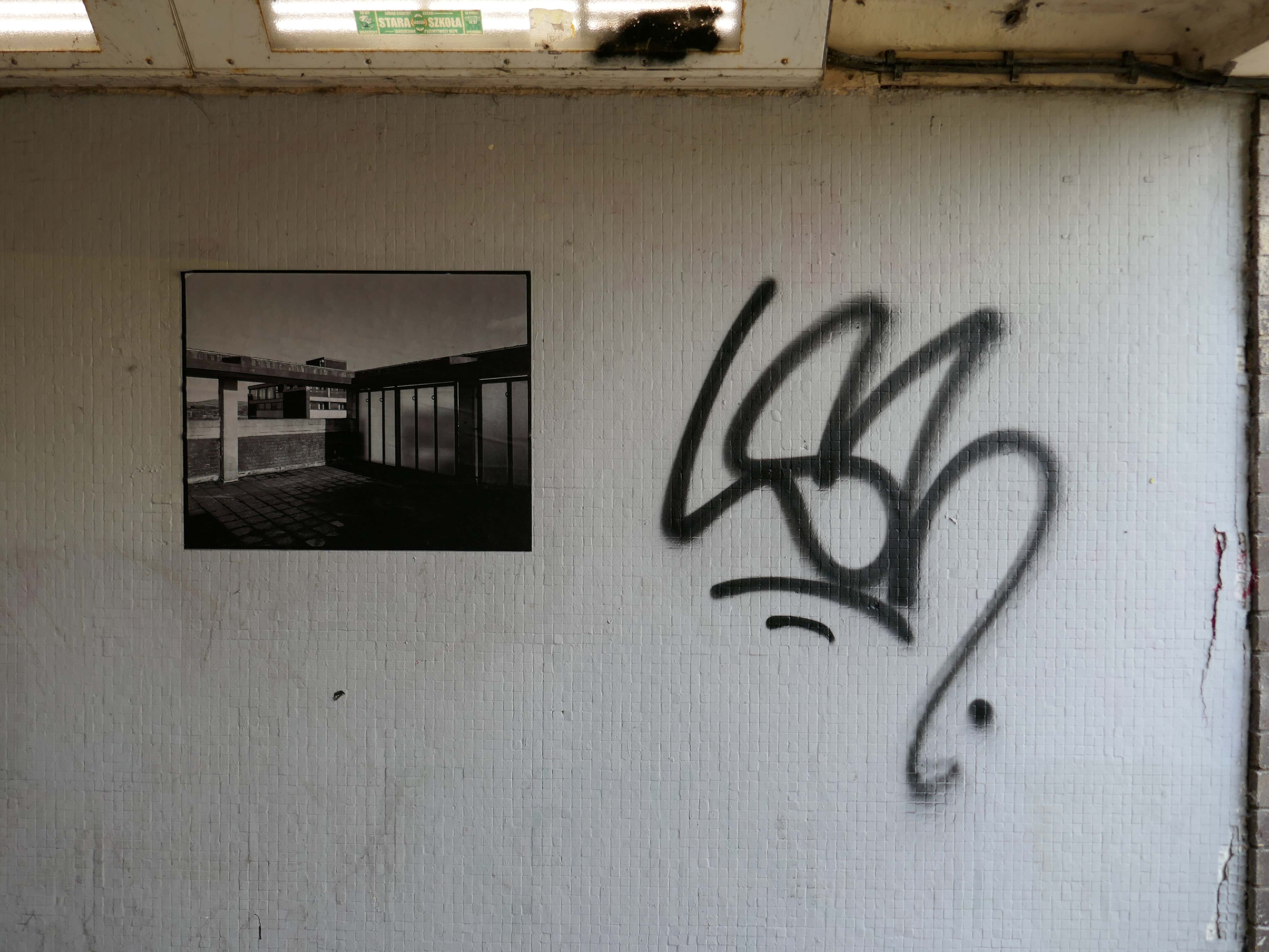
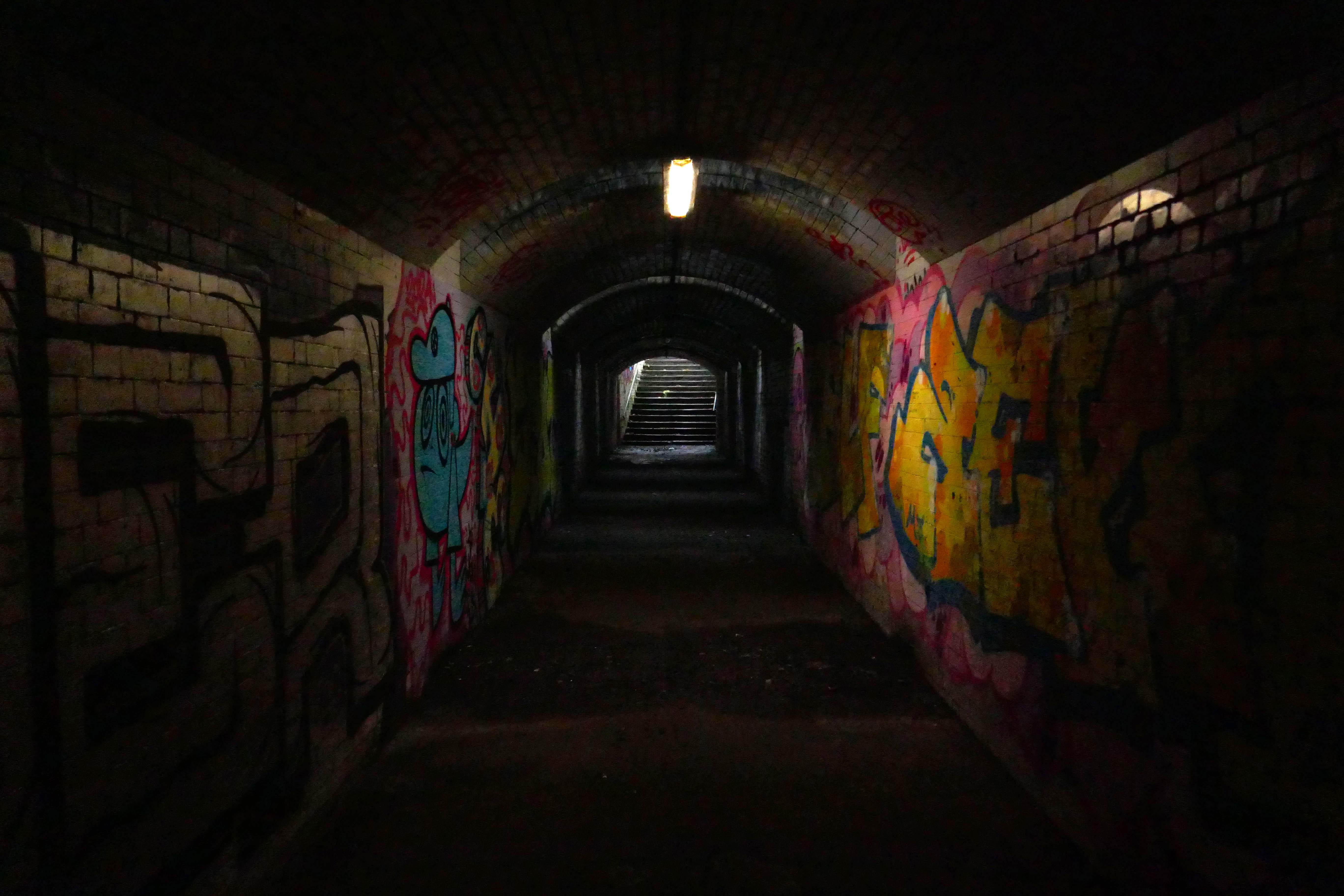
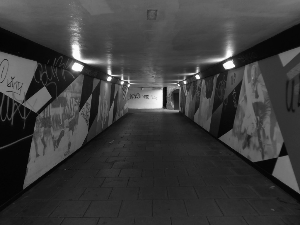
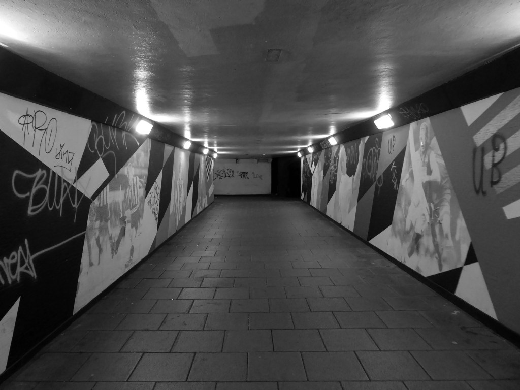
Local photographer Ellie Waters has her pictures of the flats displayed in the underpass.
Notes From College Bank is an ongoing project which documents the College Bank buildings in Rochdale, Greater Manchester. Known locally as ‘The Seven Sisters’, College Bank is formed of seven high-rise social housing blocks, four of which have come under recent threat of demolition.
Drawing from found imagery and photographs taken by my late Grandfather – M J Burgess – who like me grew up in Rochdale, I’ve been working with past and present residents to create a collective record of life in and around College Bank.
This project is ongoing, if you would like to share your stories of College Bank please get in touch via email – notesfromcollegebank@gmail.com
Here is a recent post from Municipal Dreams outlining the history state of play – Rochdale Housing Part II.
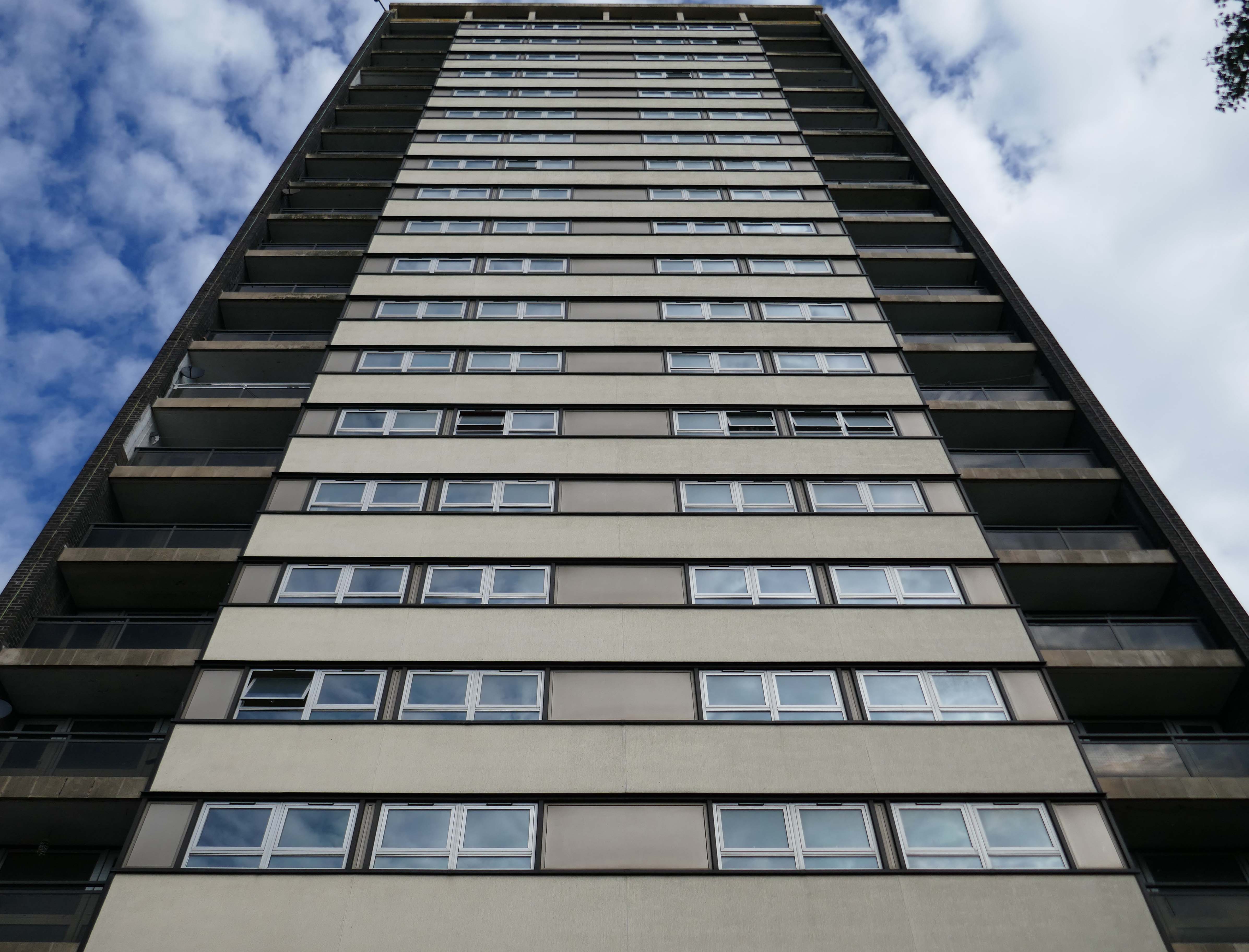
Fast forward to the present, the Seven Sisters still stand – an impressive architectural statement in the heart of Rochdale and, to my mind, as powerful a testament to municipal endeavour and aspiration as the town’s nearby town hall. But much has changed. In the slow evolution that affected council housing more broadly, the flats became less desirable, even, in some eyes, a ‘sink estate’. In Robin Parker’s view, the Council started re-housing people in the blocks ‘not suitable for high-rise living’ – a typical occurrence when the most vulnerable on the waiting list and those with least choice are allocated to so-called ‘hard to let’ estates.
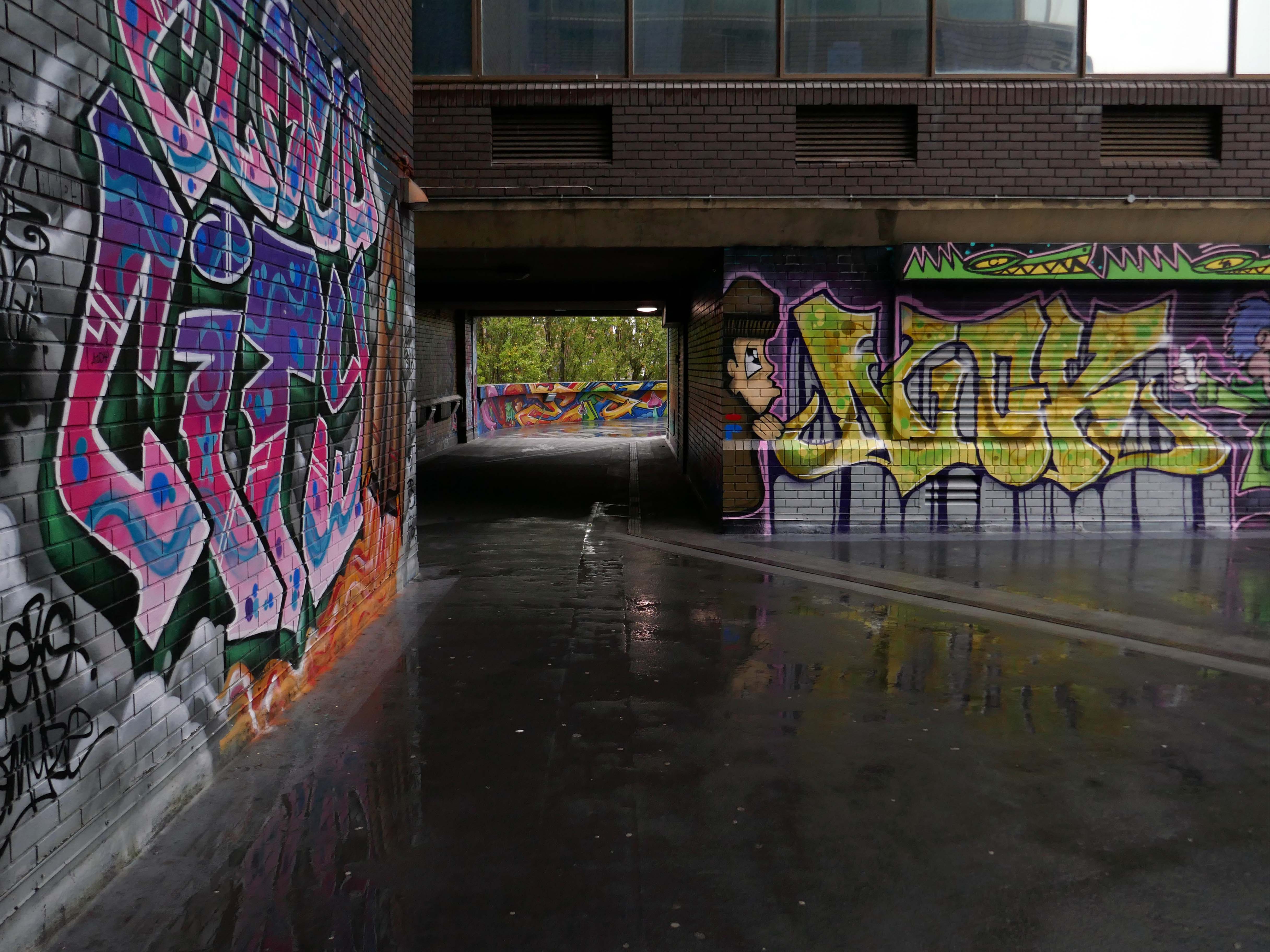
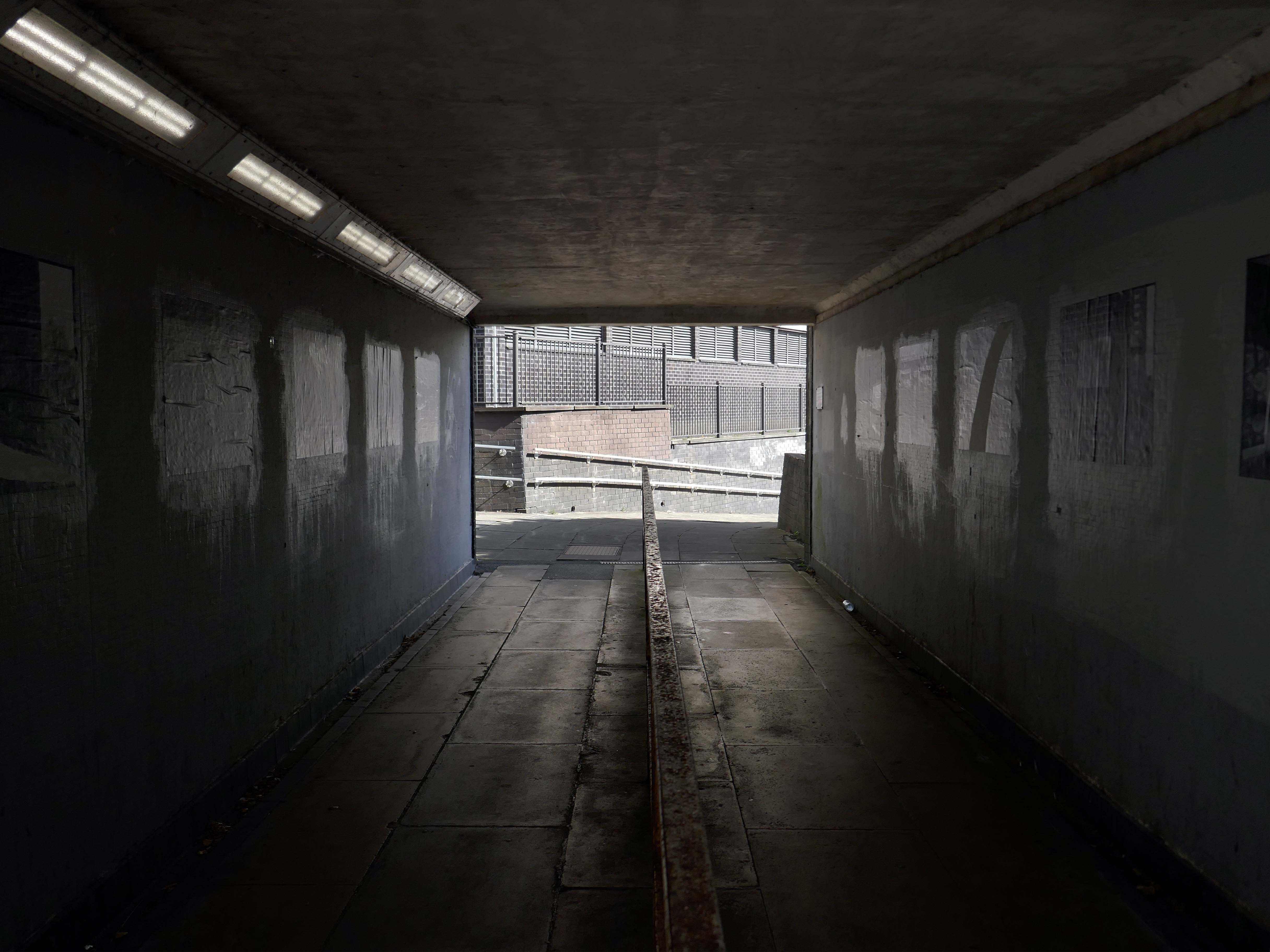
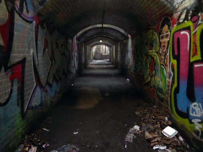
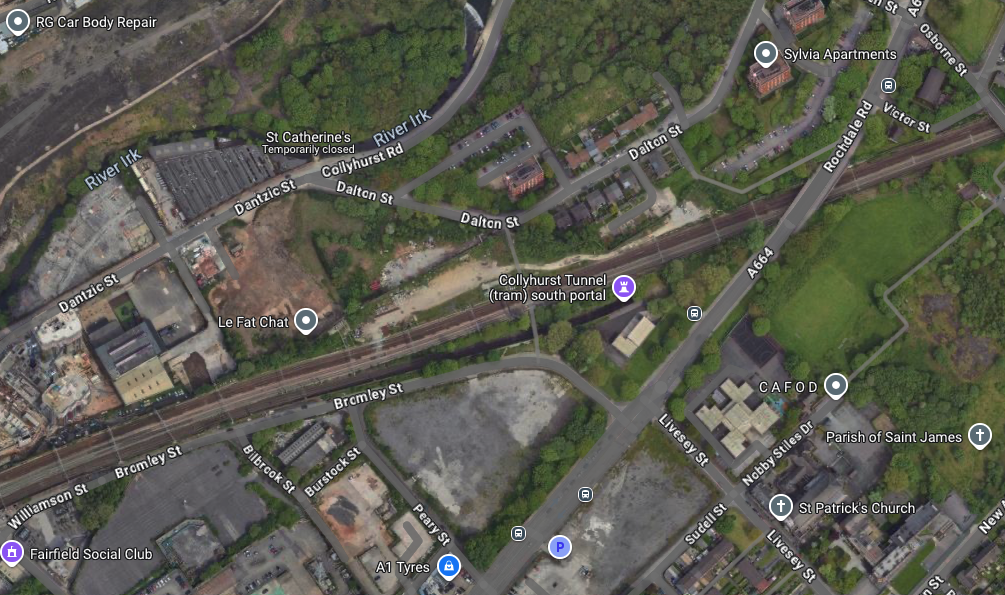
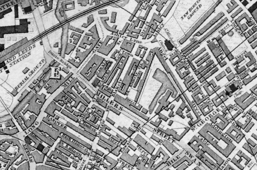
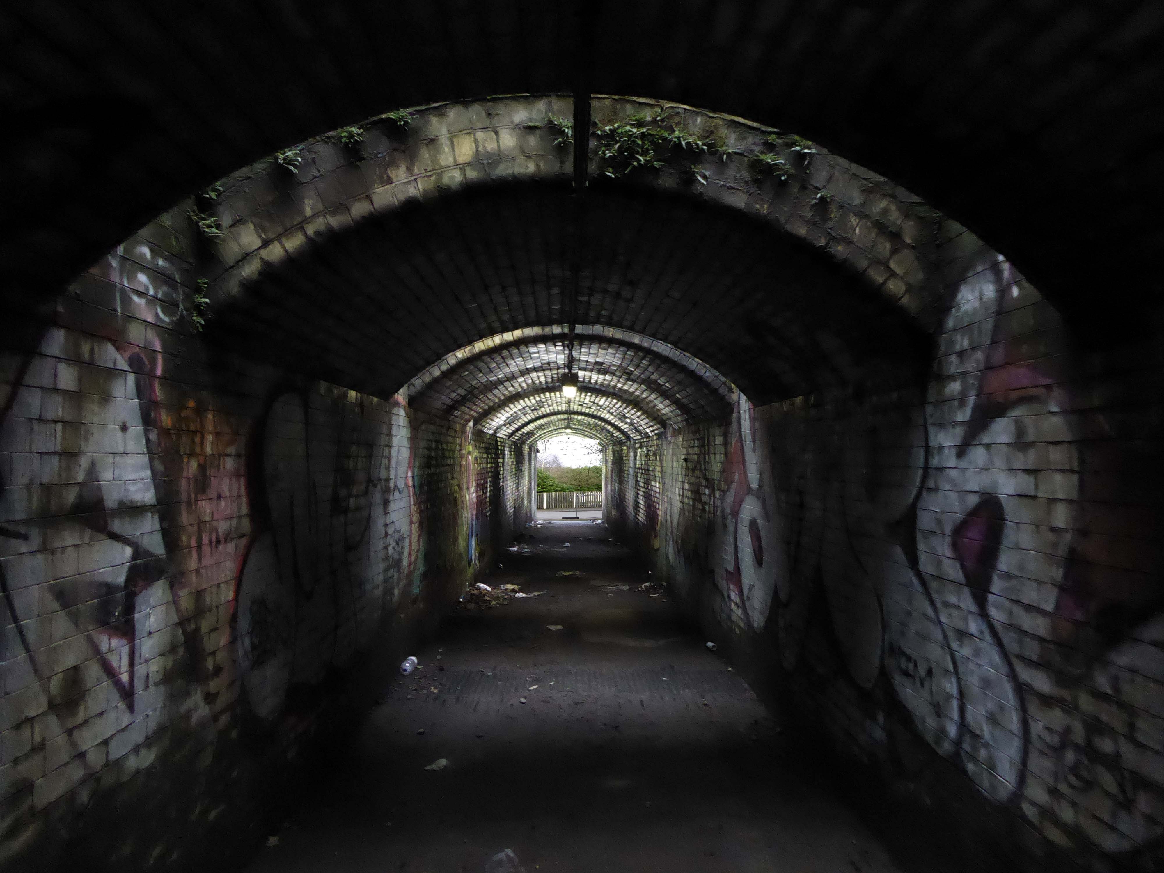
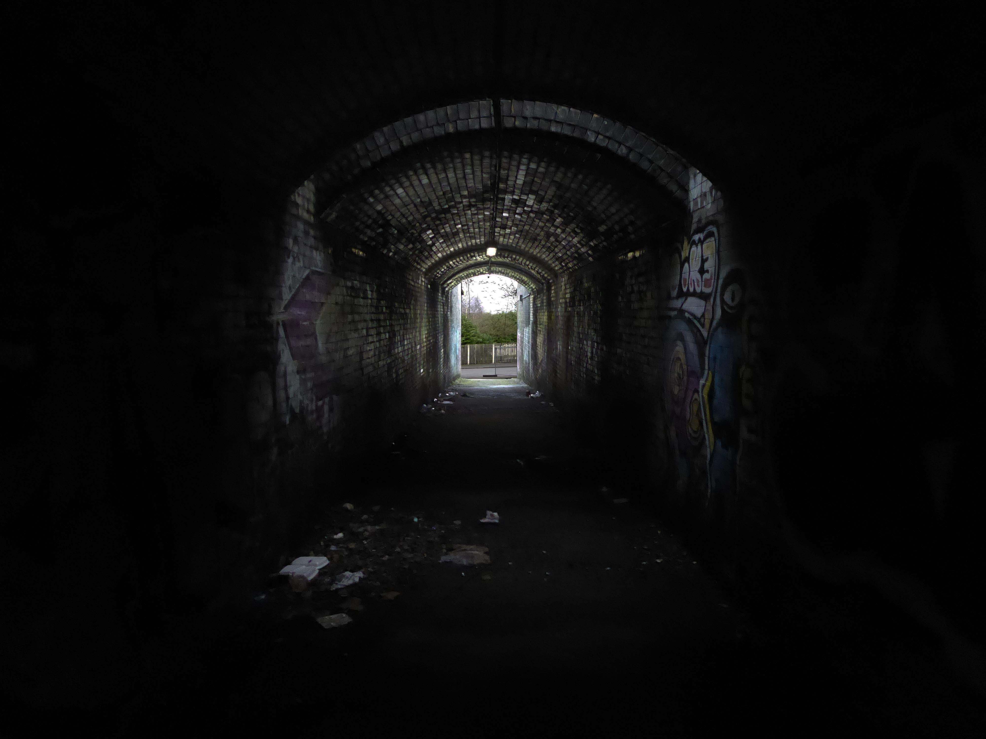
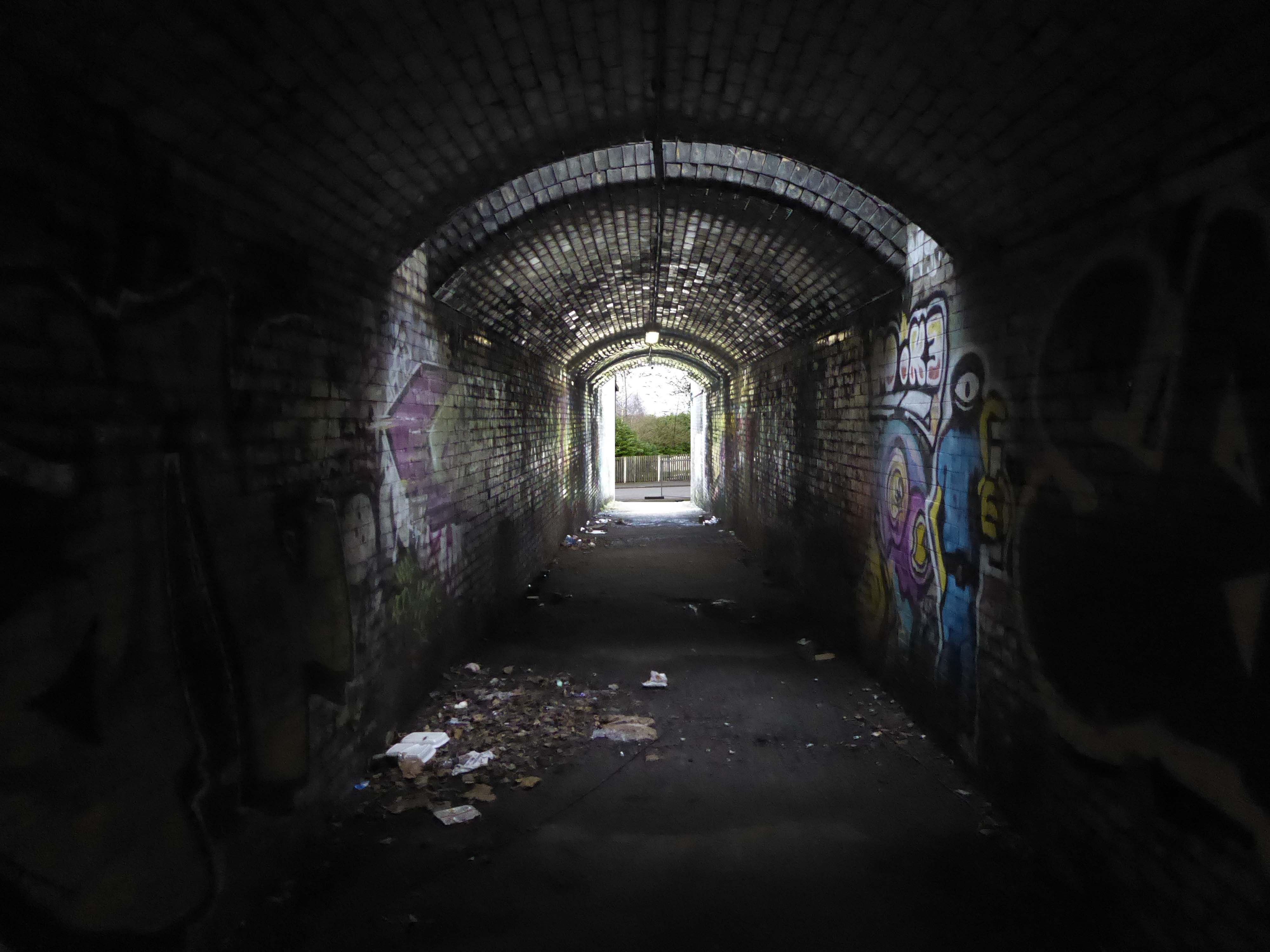
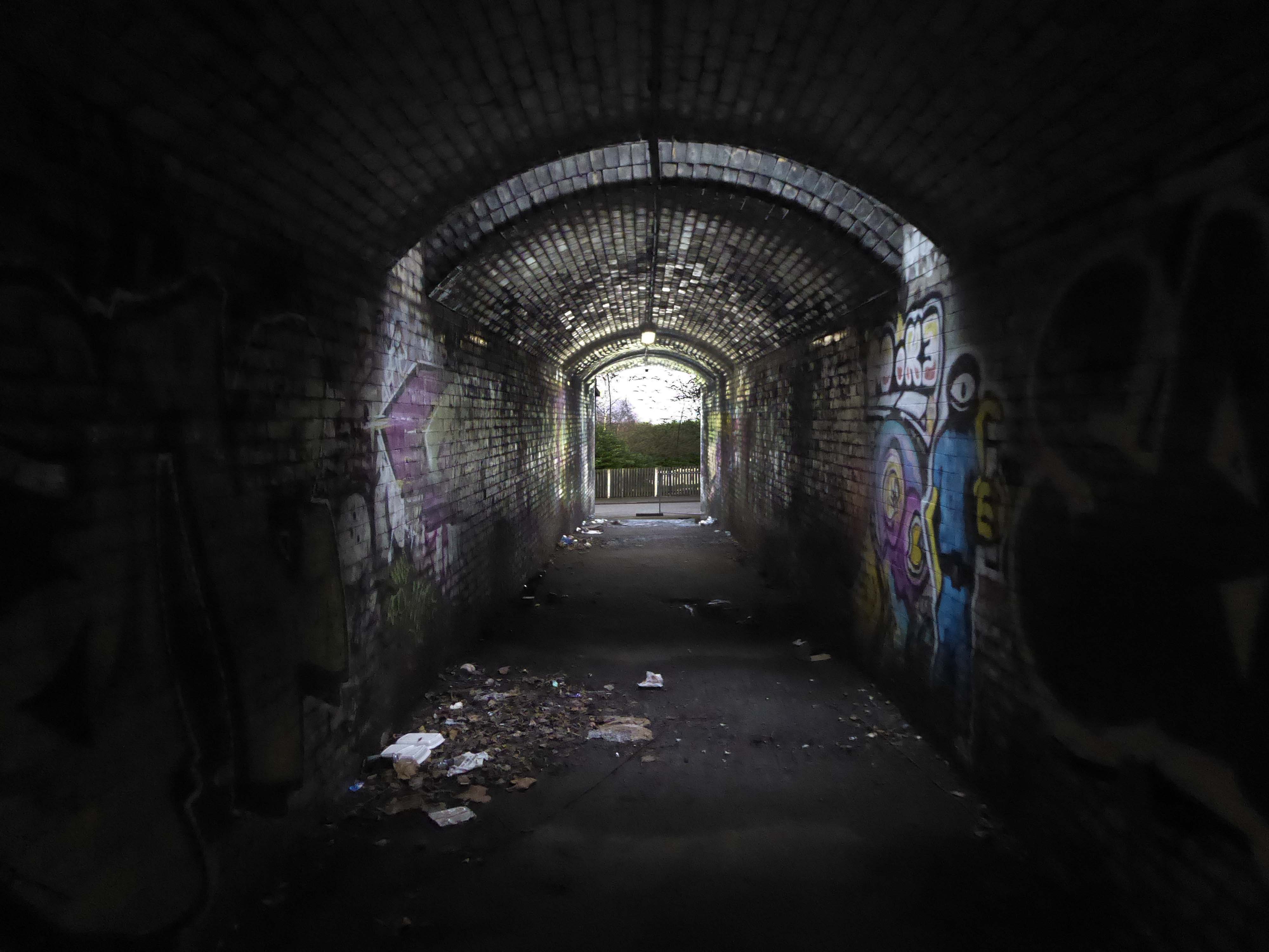
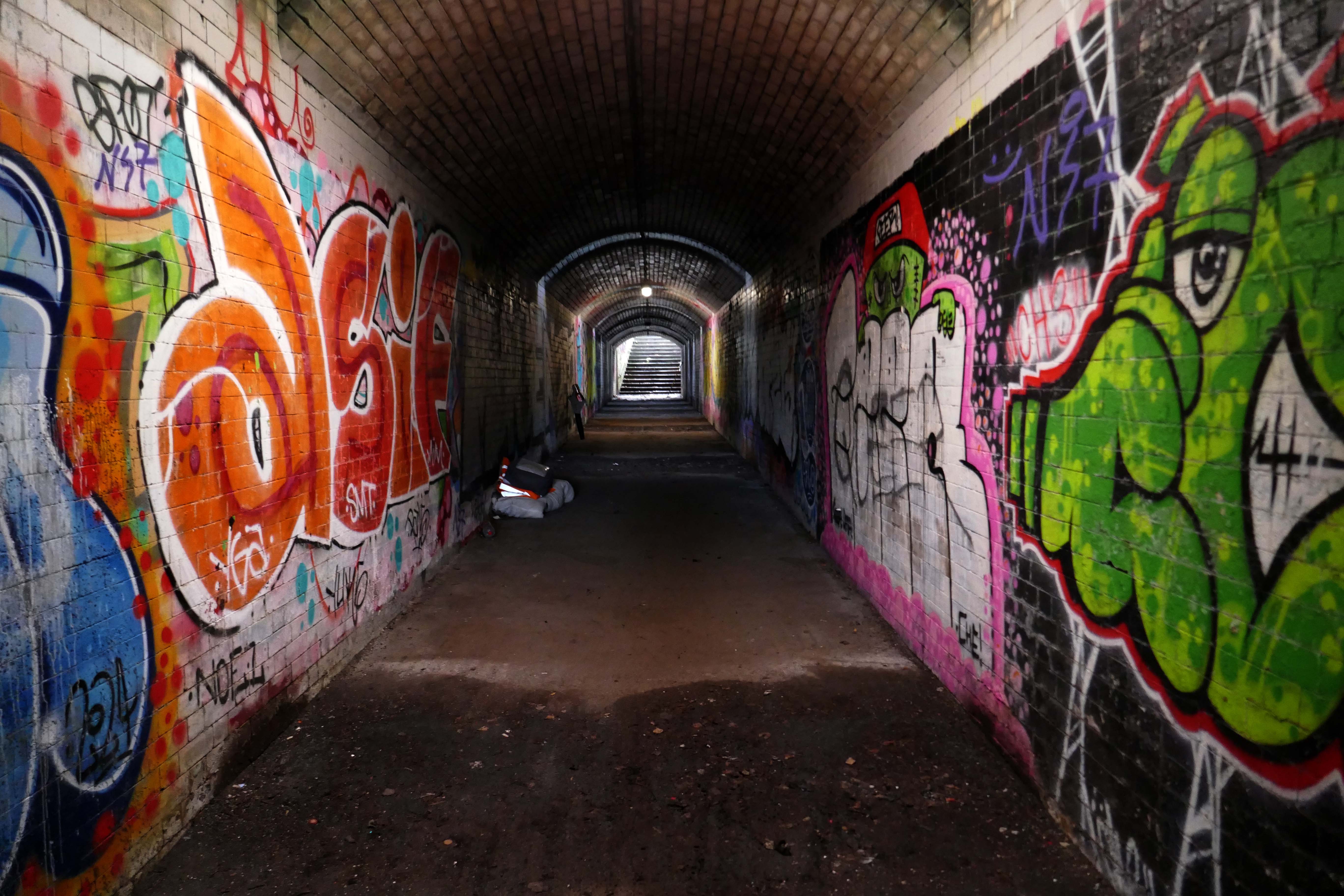
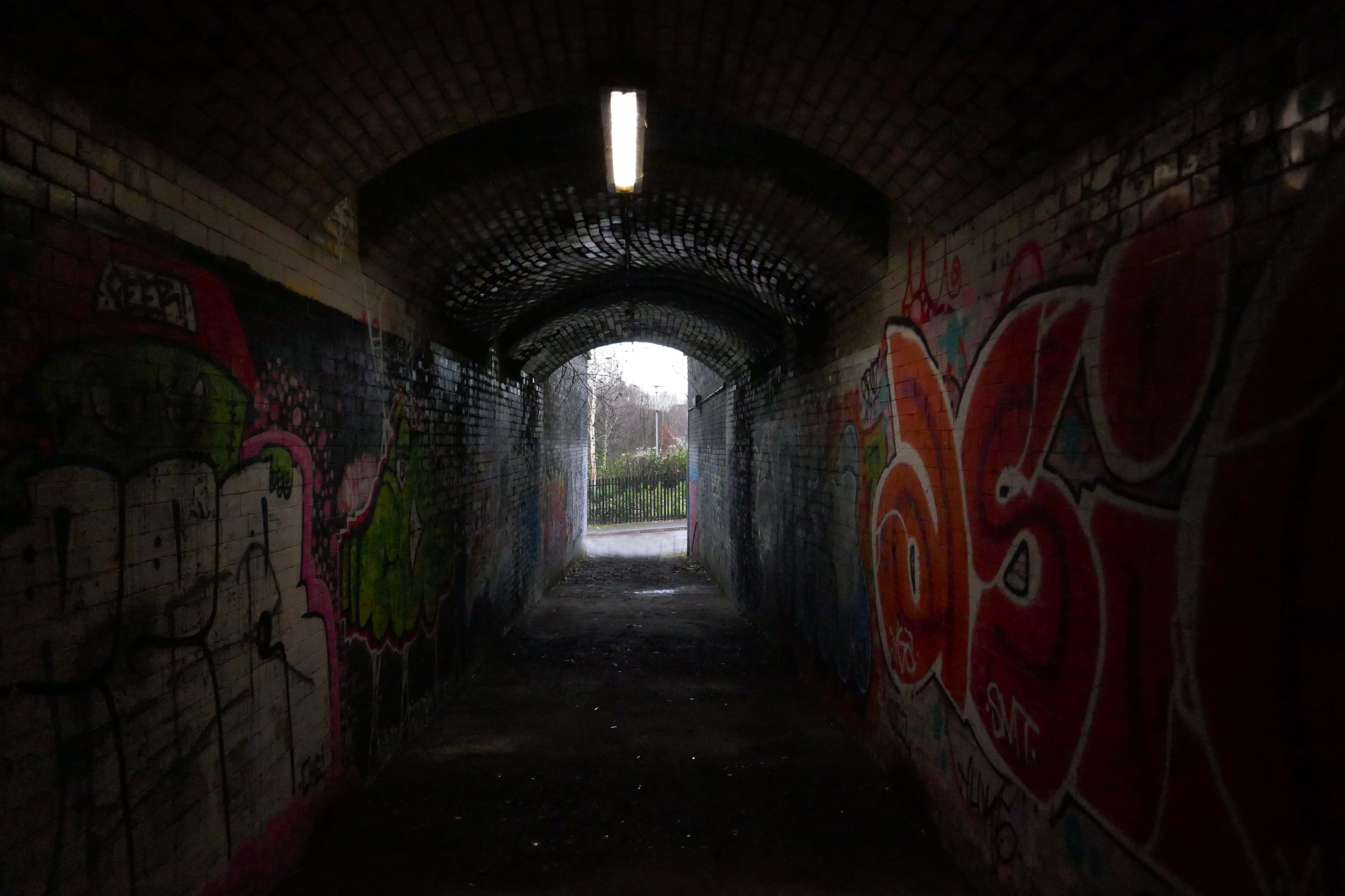
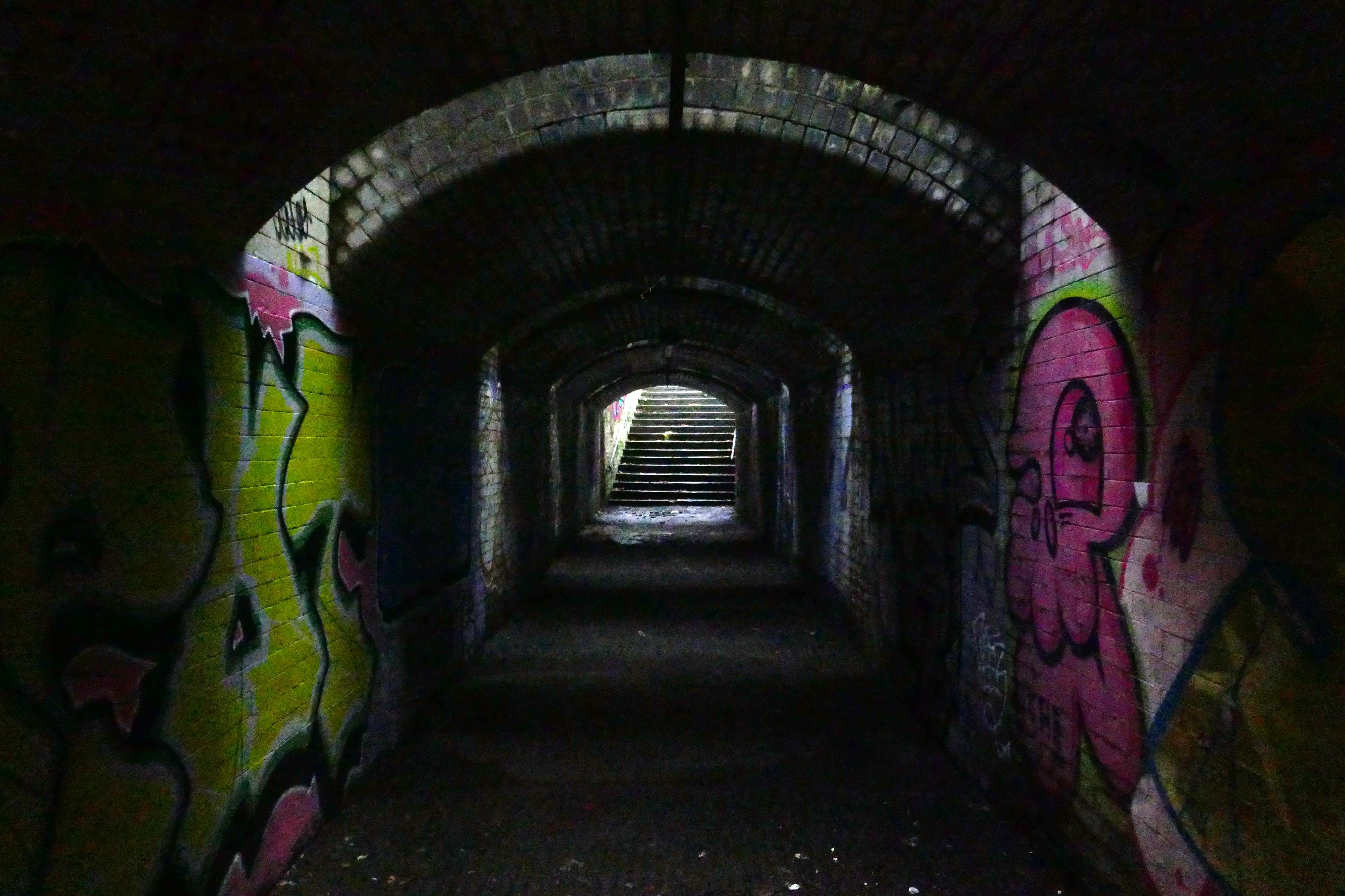
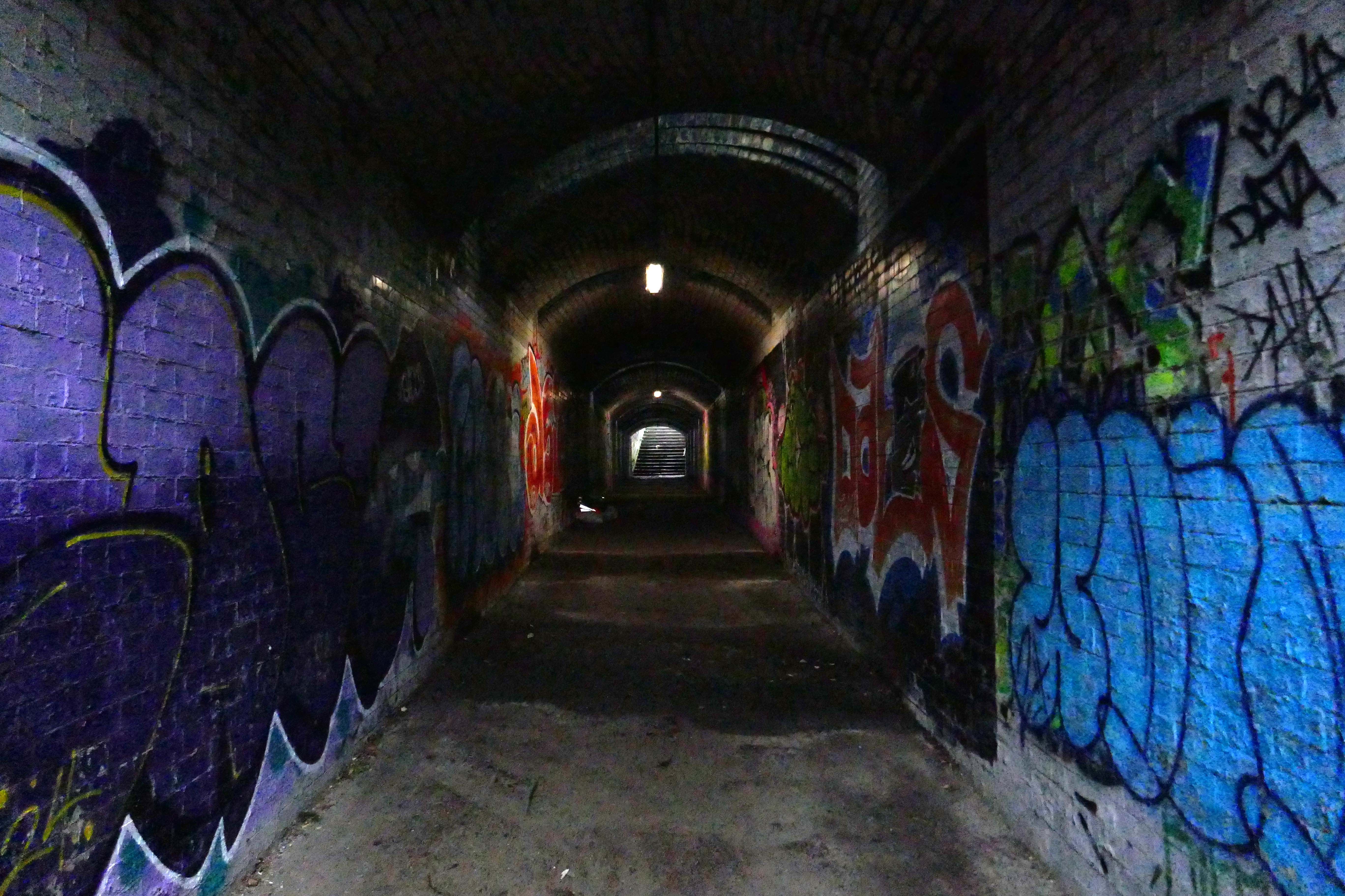
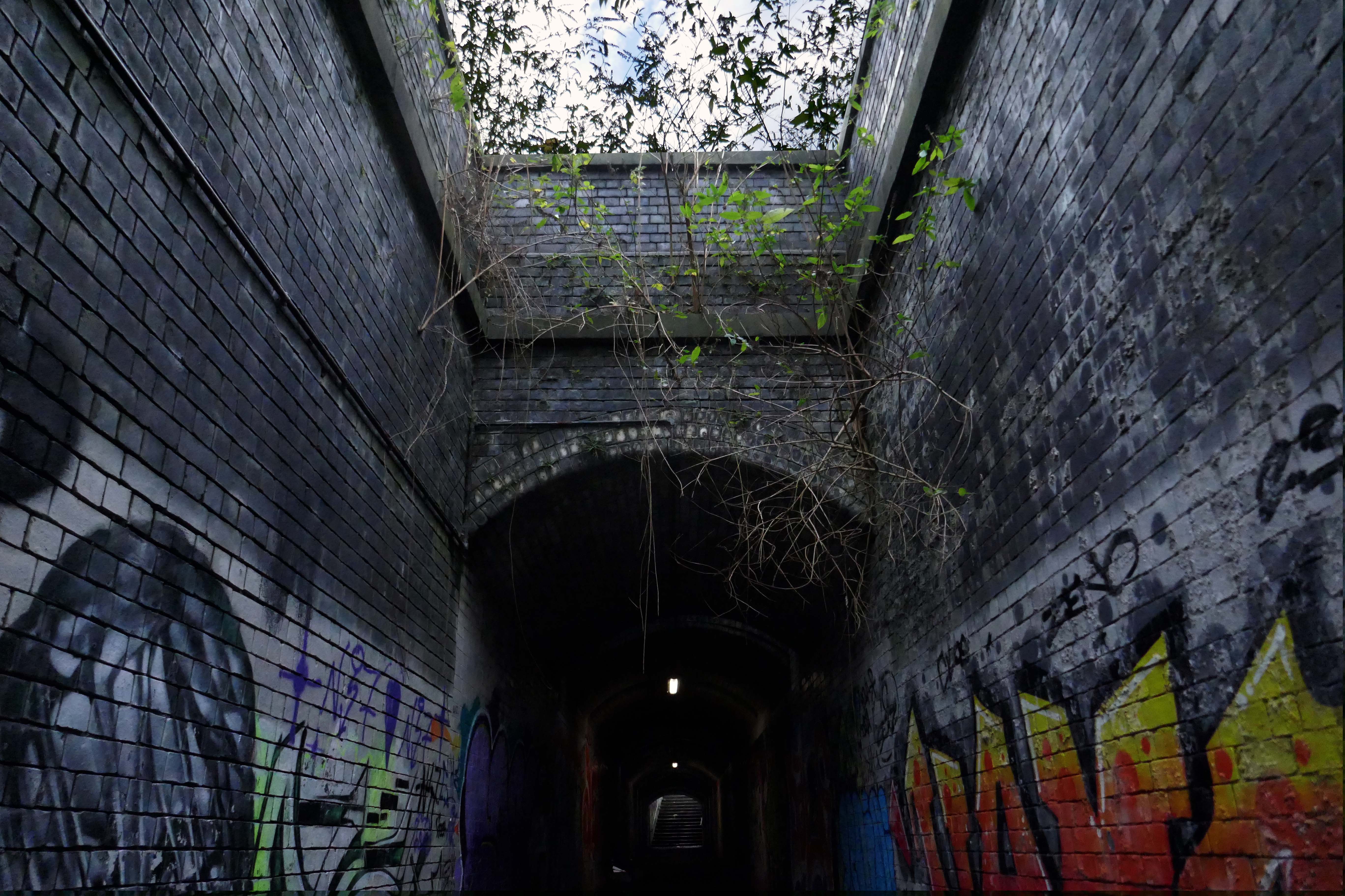
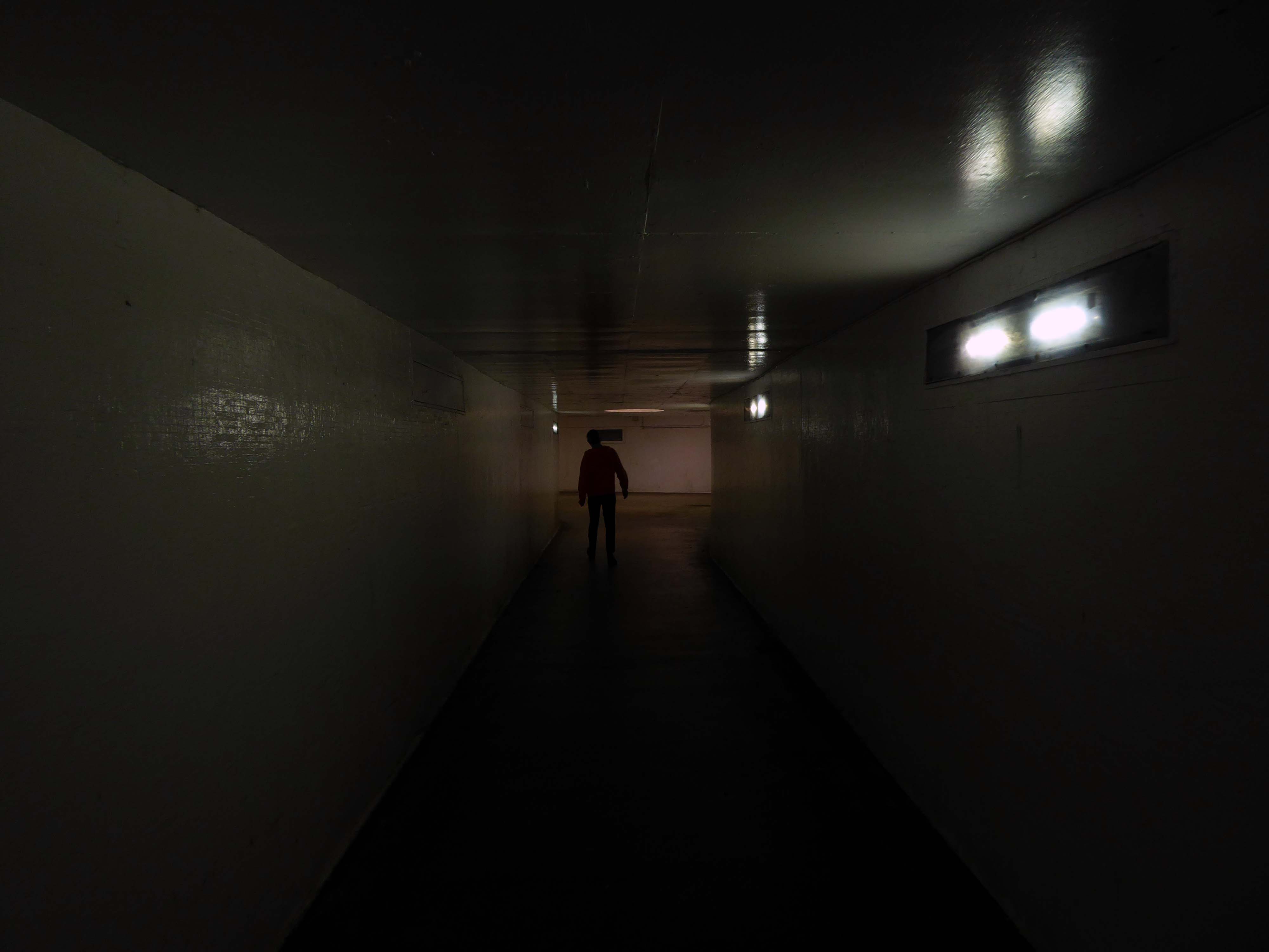
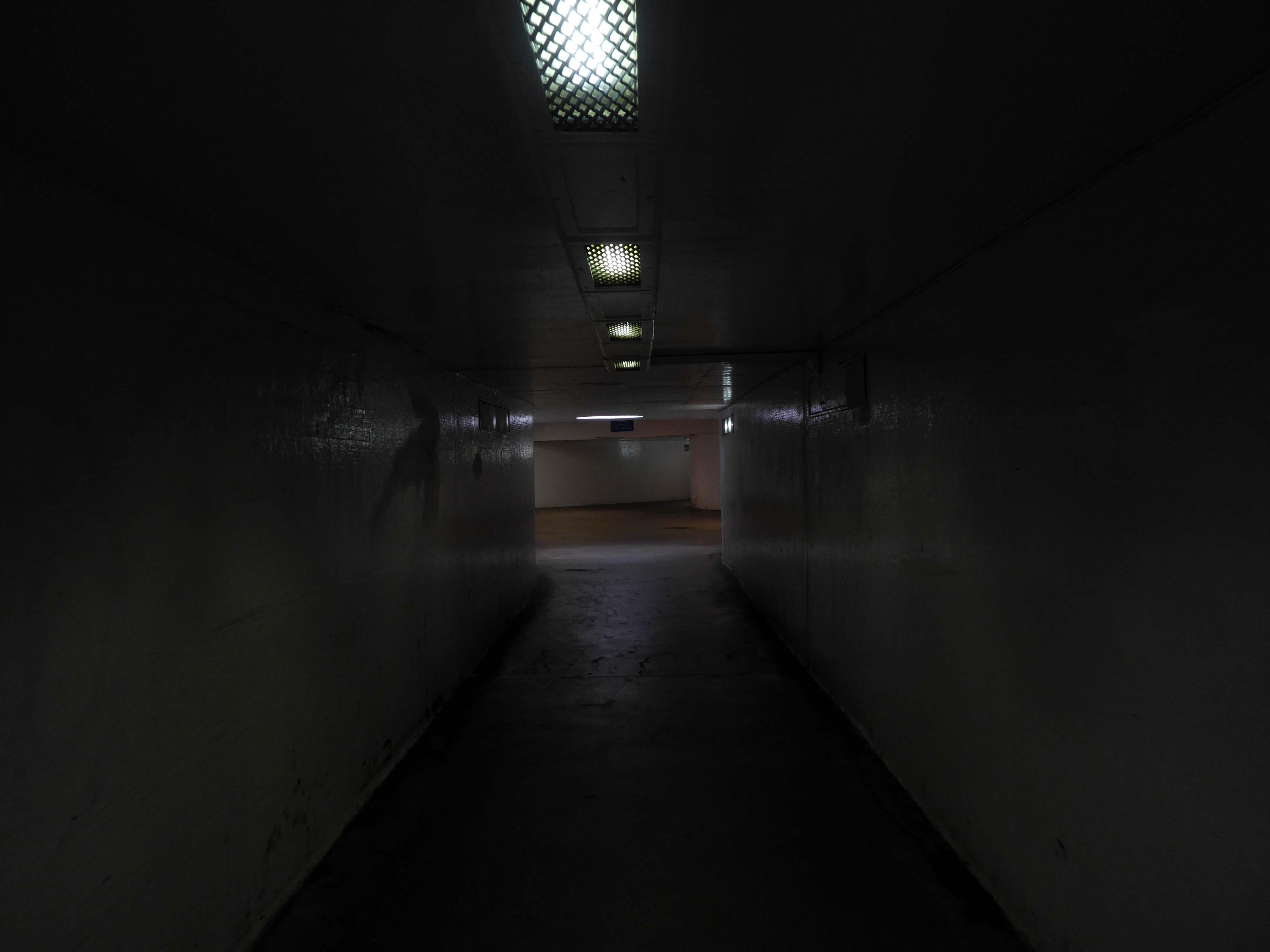
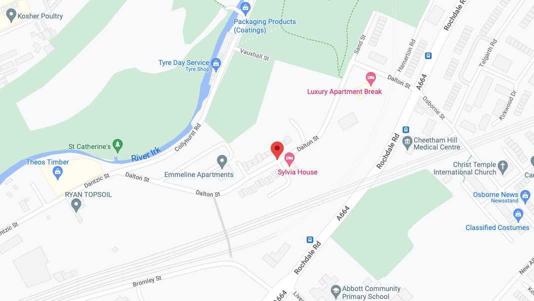
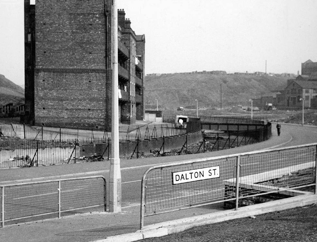
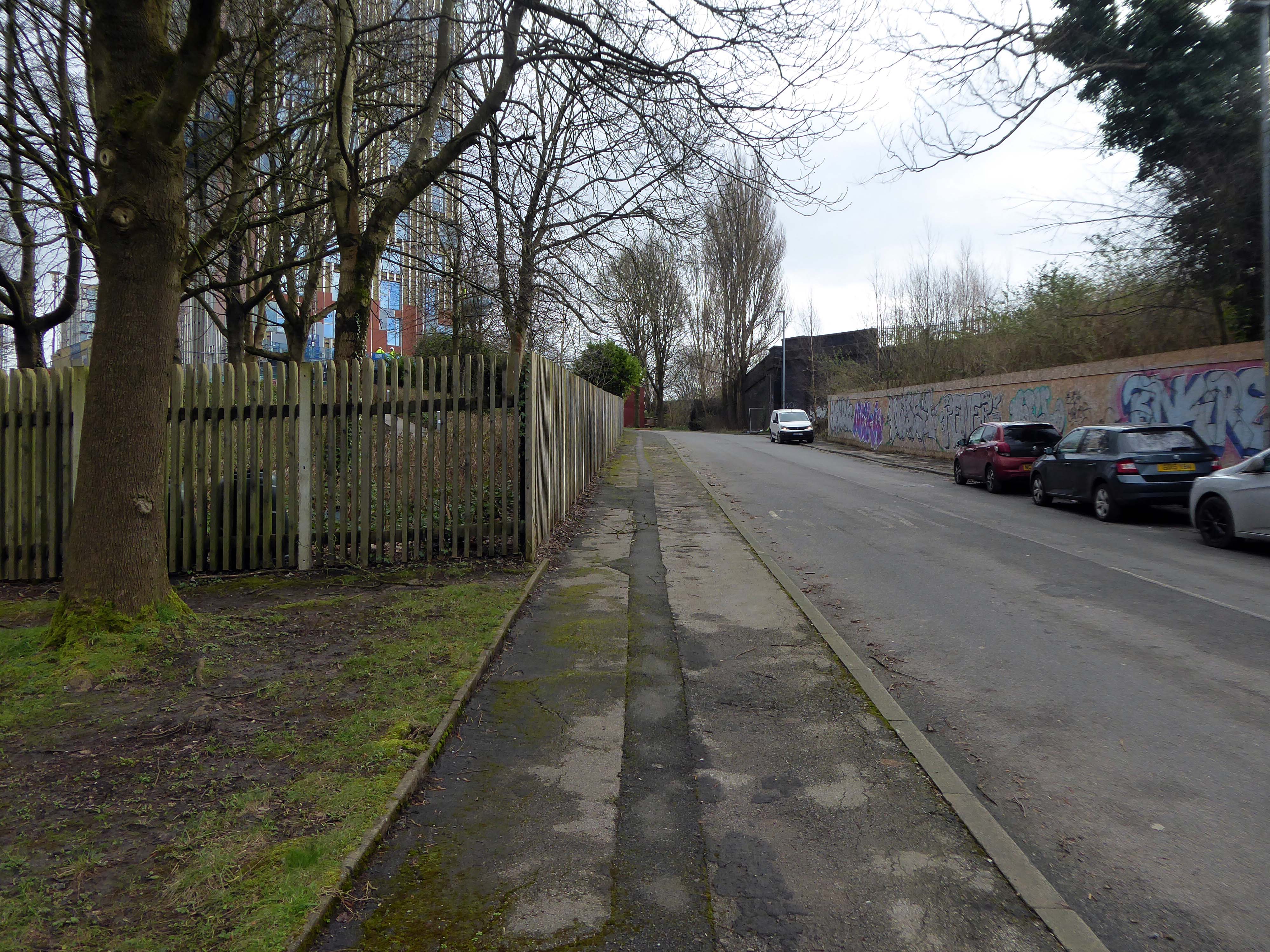
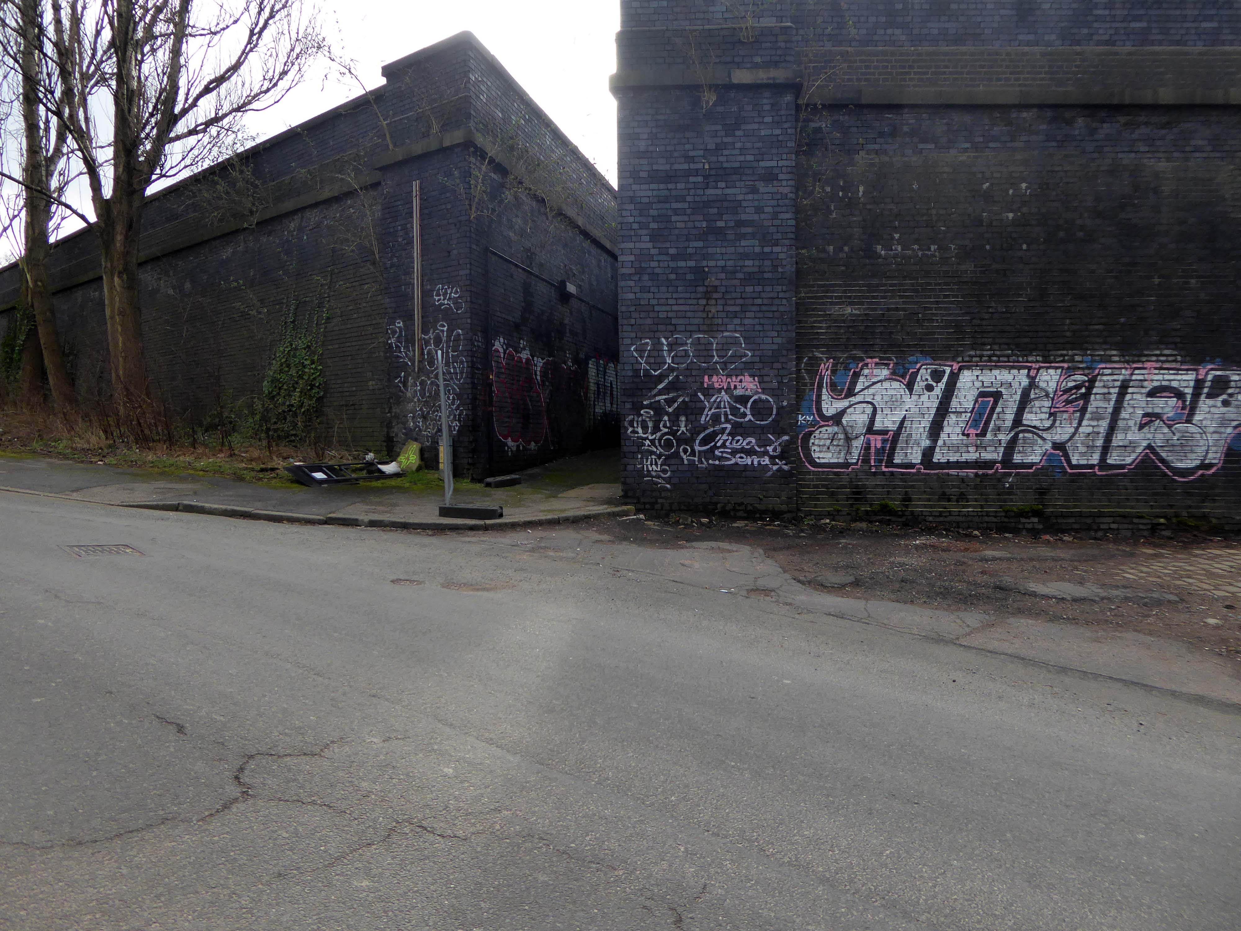
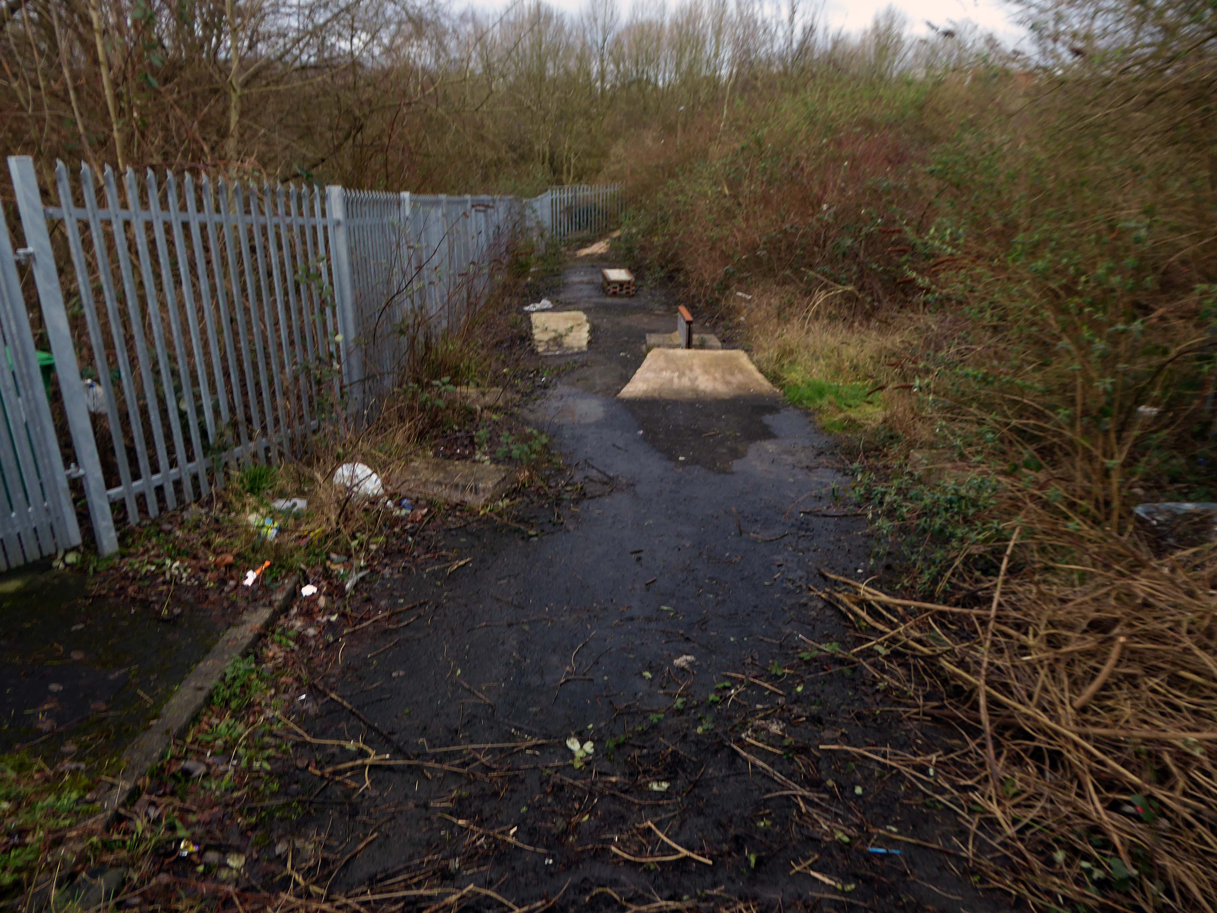
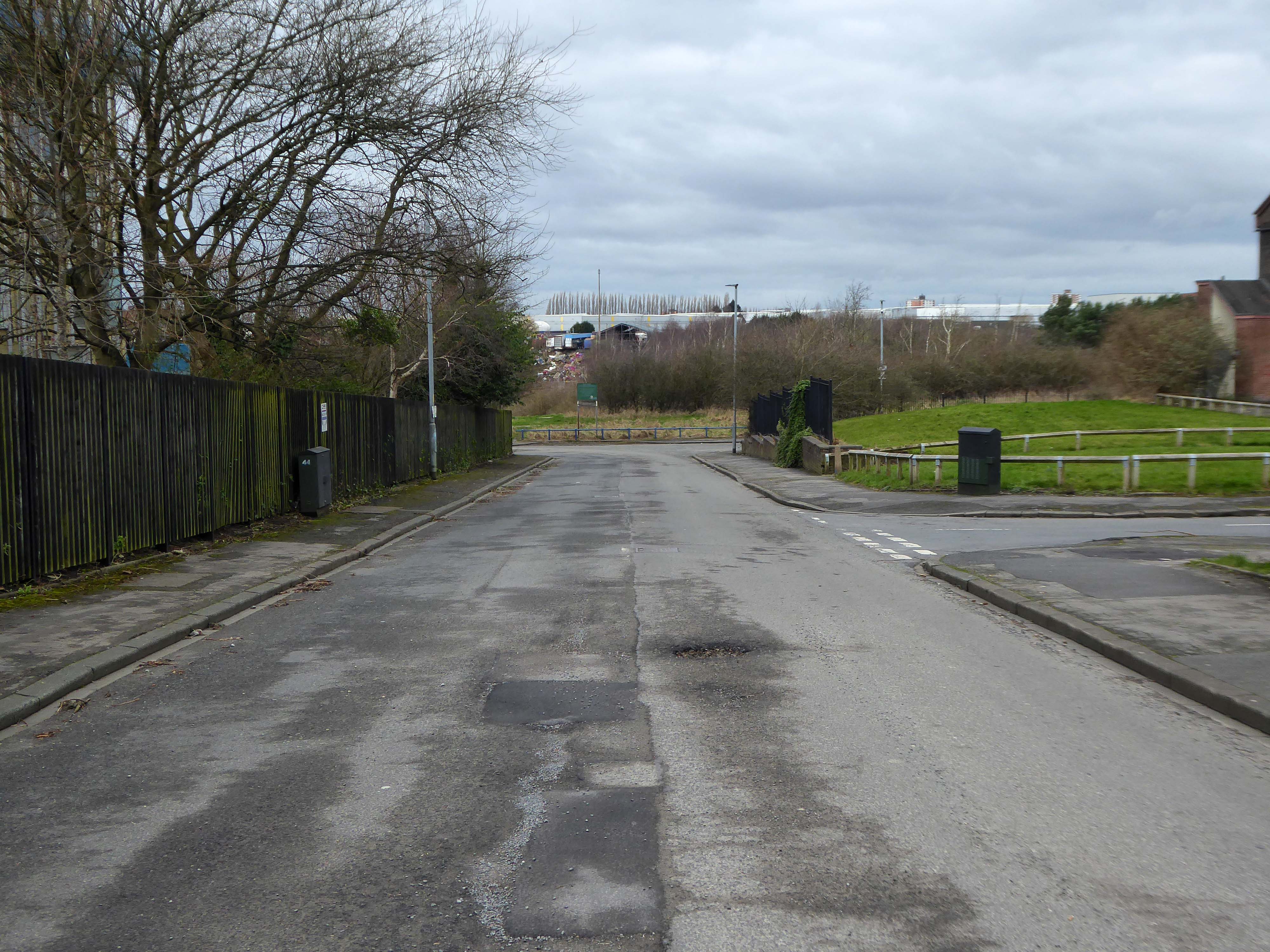
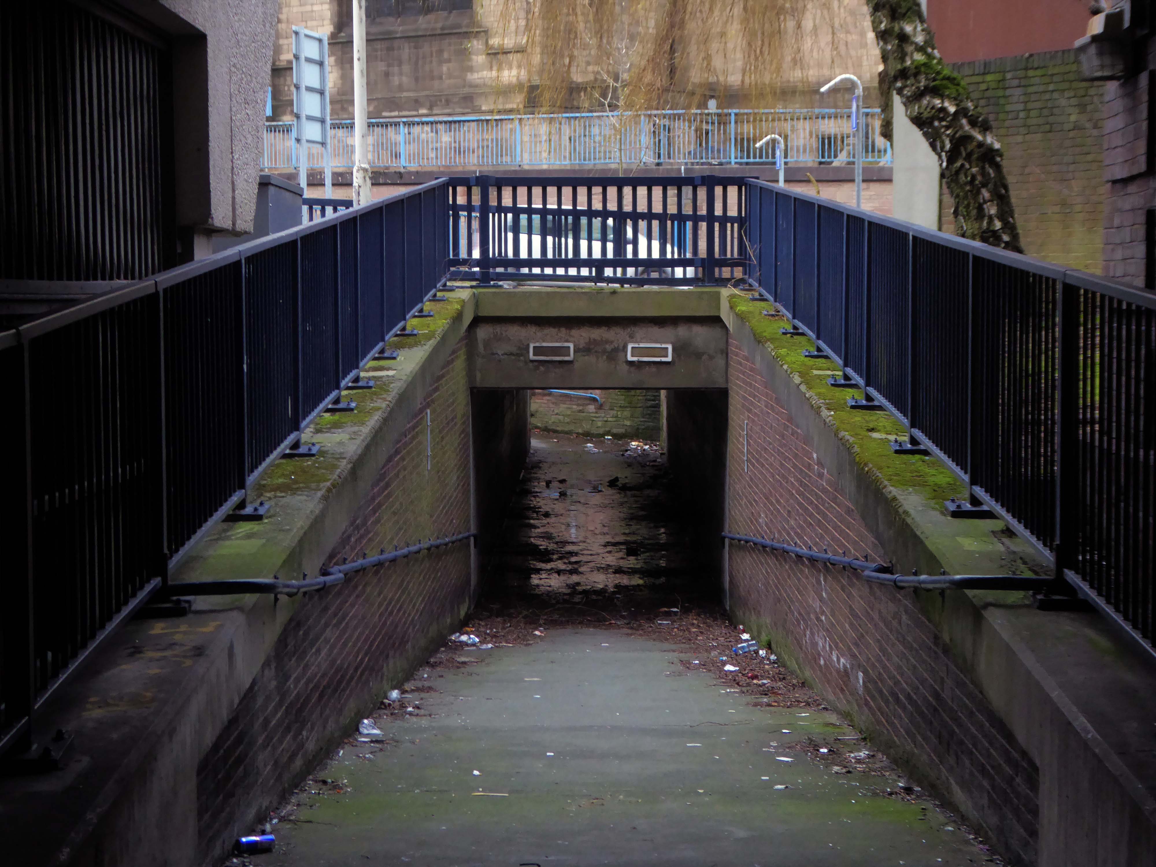
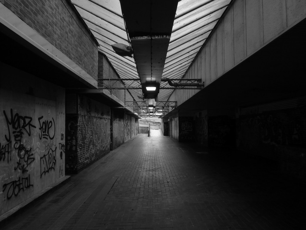
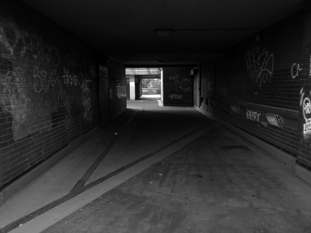
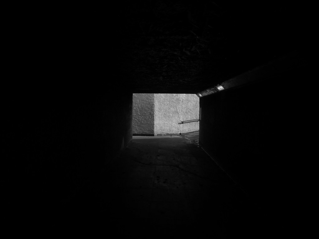
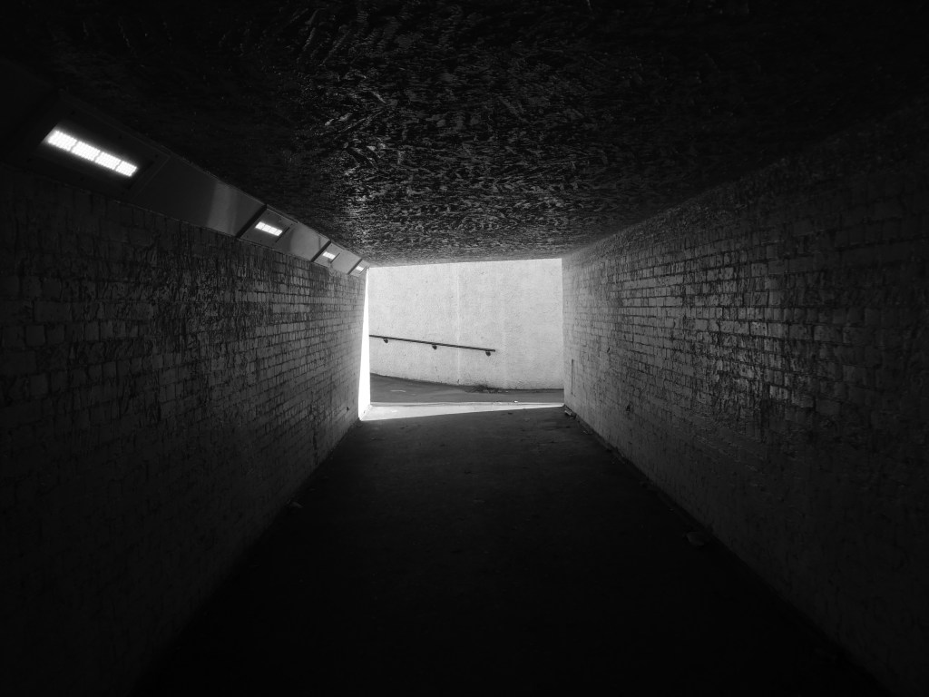
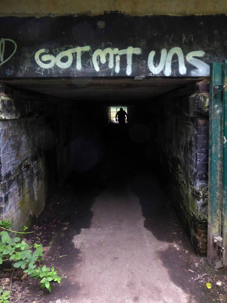
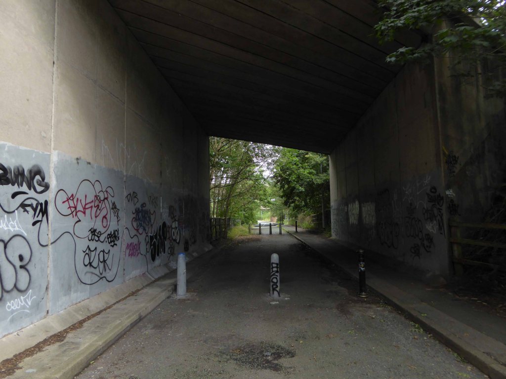
Passing between Dalton Street and Bromley Street is a pedestrian underpass, subway or tunnel.
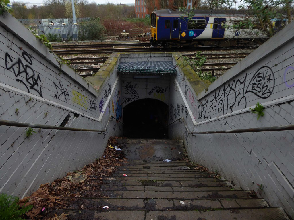
Beneath both the Bury and Rochdale tram lines.
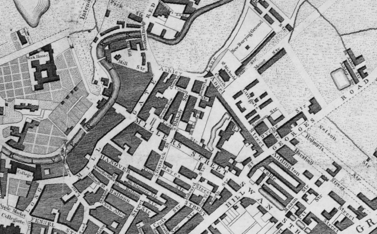
Once upon a time in 1807, it wasn’t there at all.
Then in 1848, it was there, as the L&Y had established a rail route.
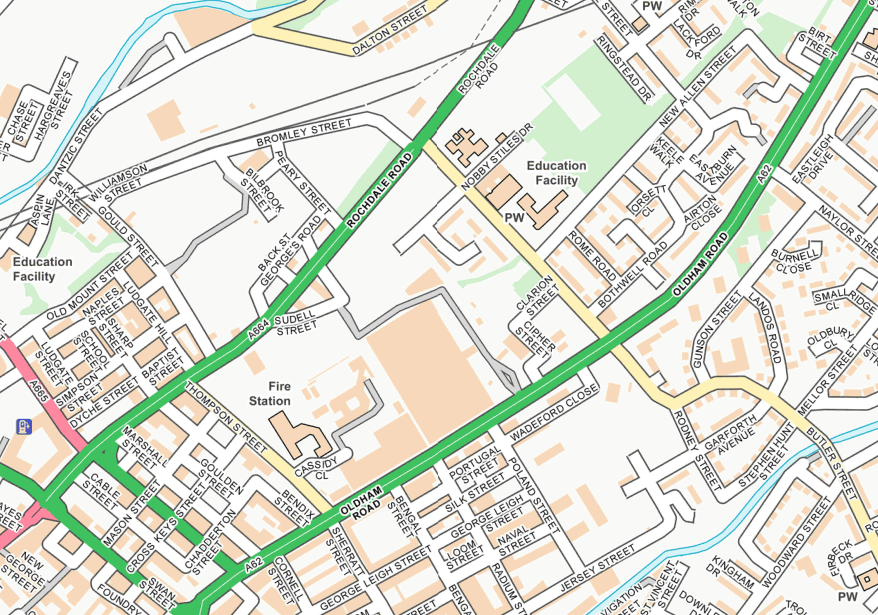
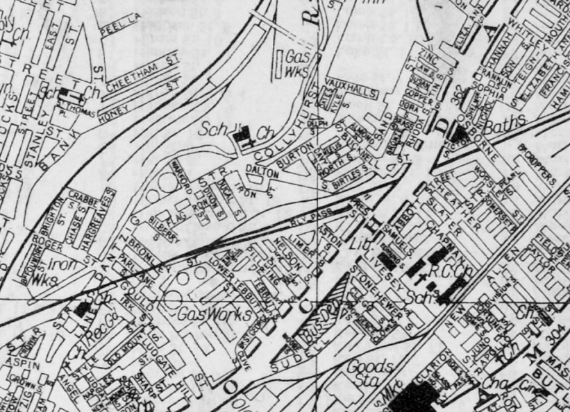
Studying historical maps, we can see the development of dense patches of housing, matching the city’s industrial growth, this is followed by a thinning of housing up to the present day – matching the city’s industrial decline.
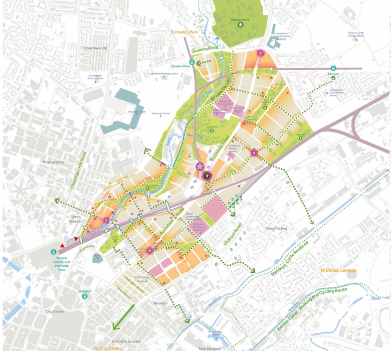
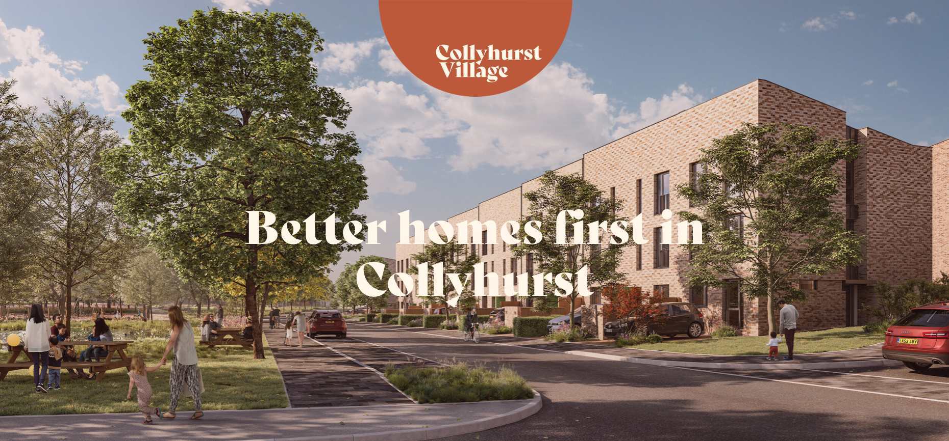
There is yet another twist in the tale, as the development of Collyhurst Village and Victoria North, are adding another layer of housing history.
I have walked this area for several years now, recording the relentless but gradual change.
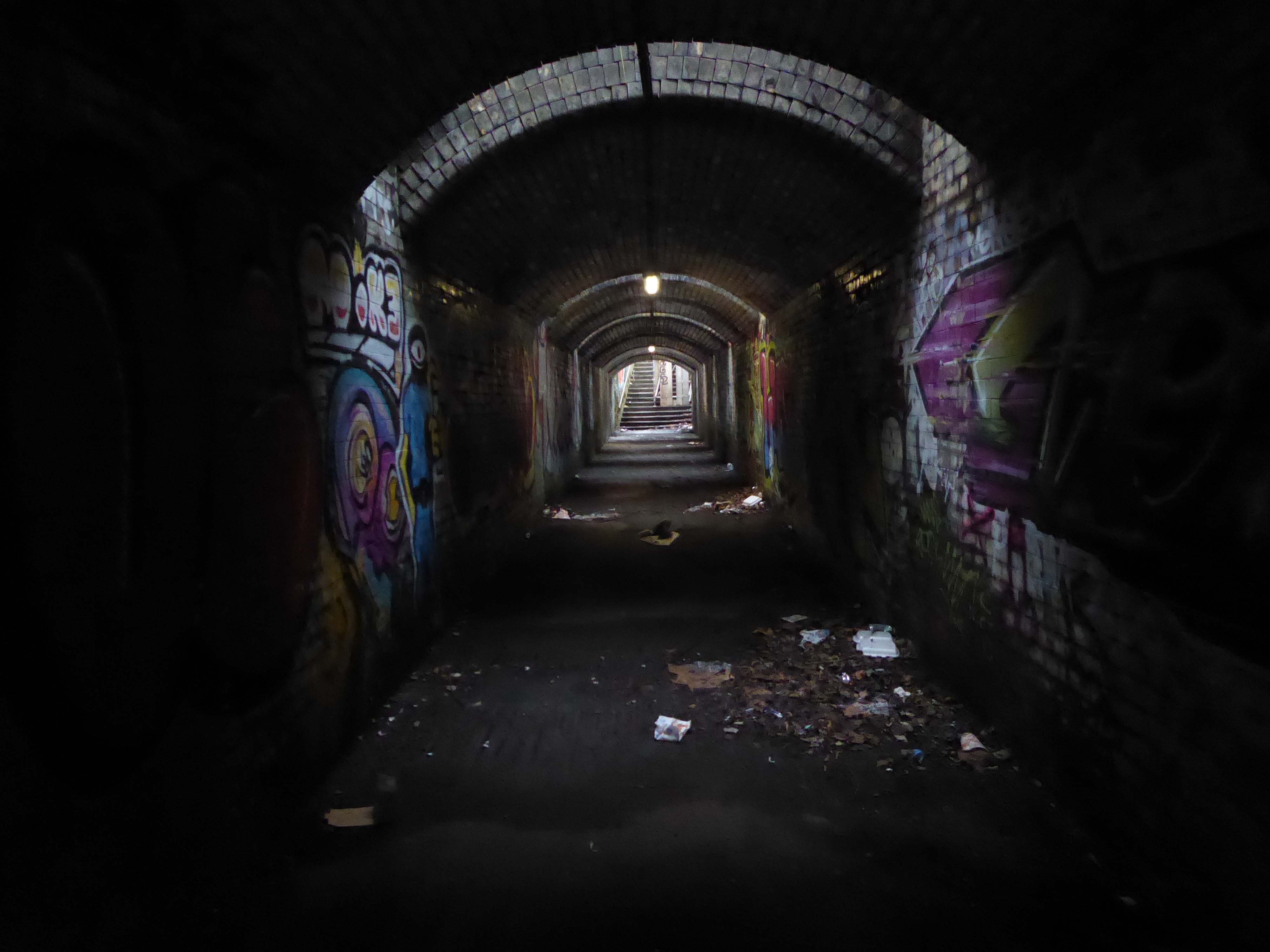
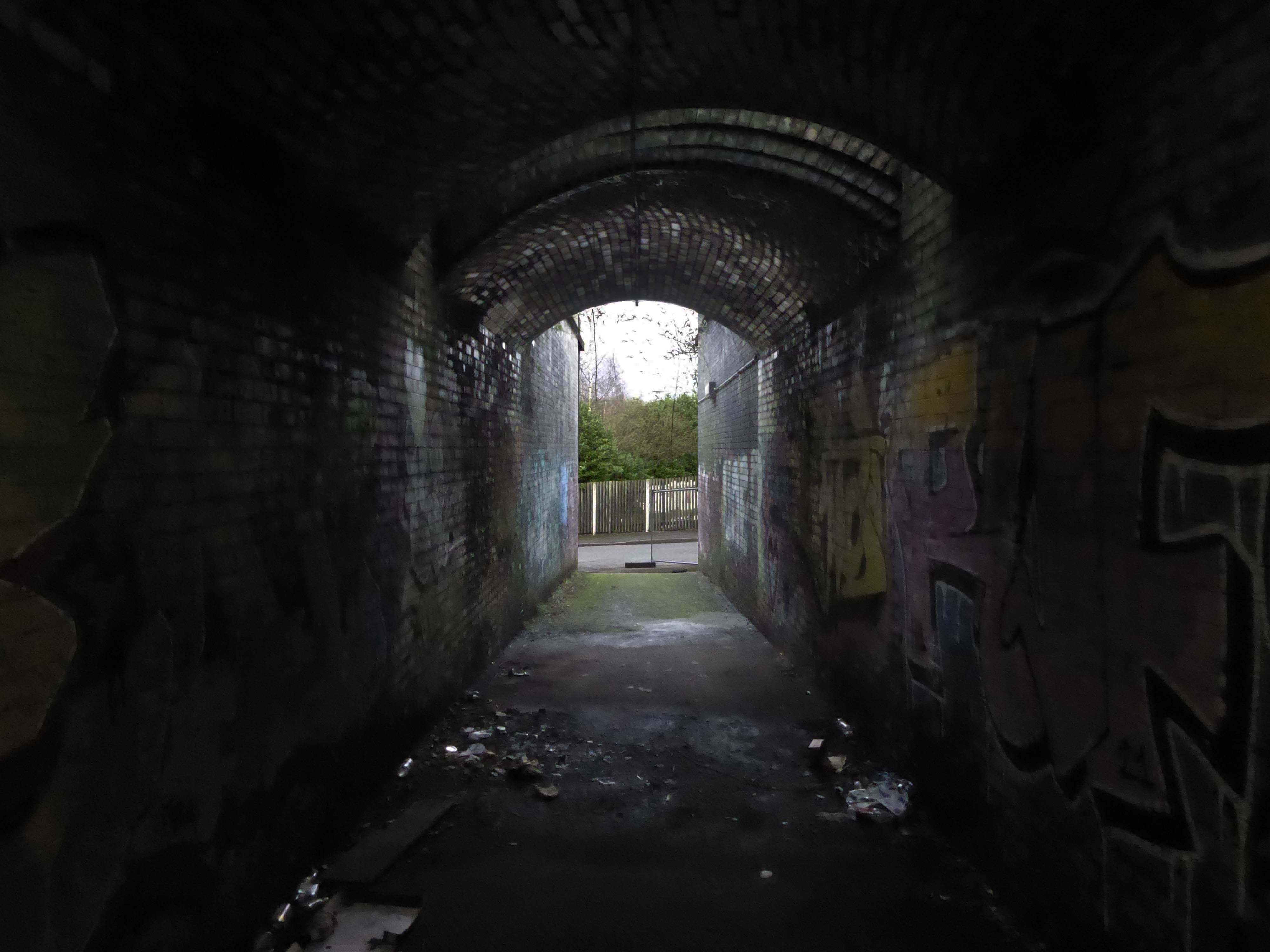
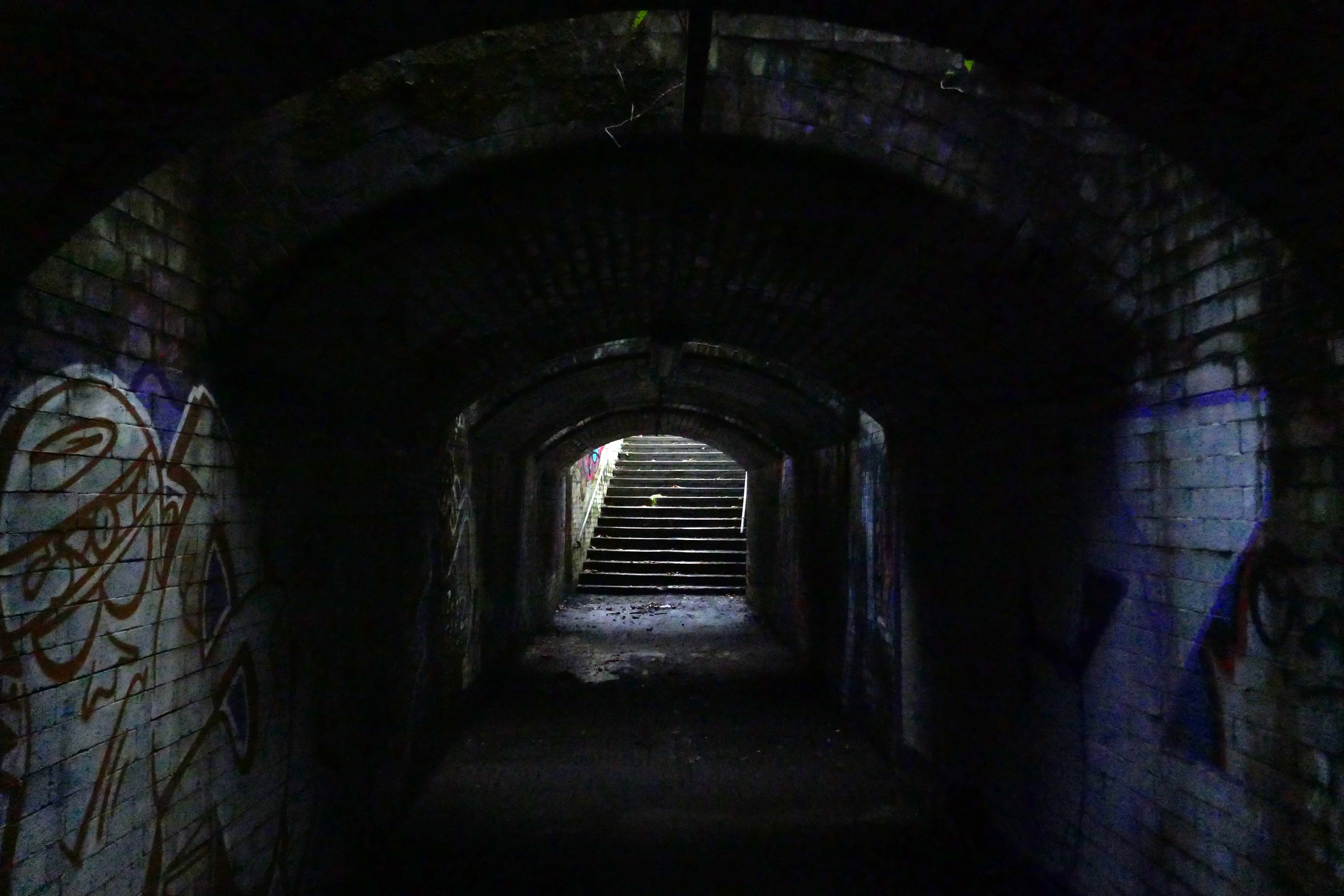
Including the pedestrian underpass, subway or tunnel.
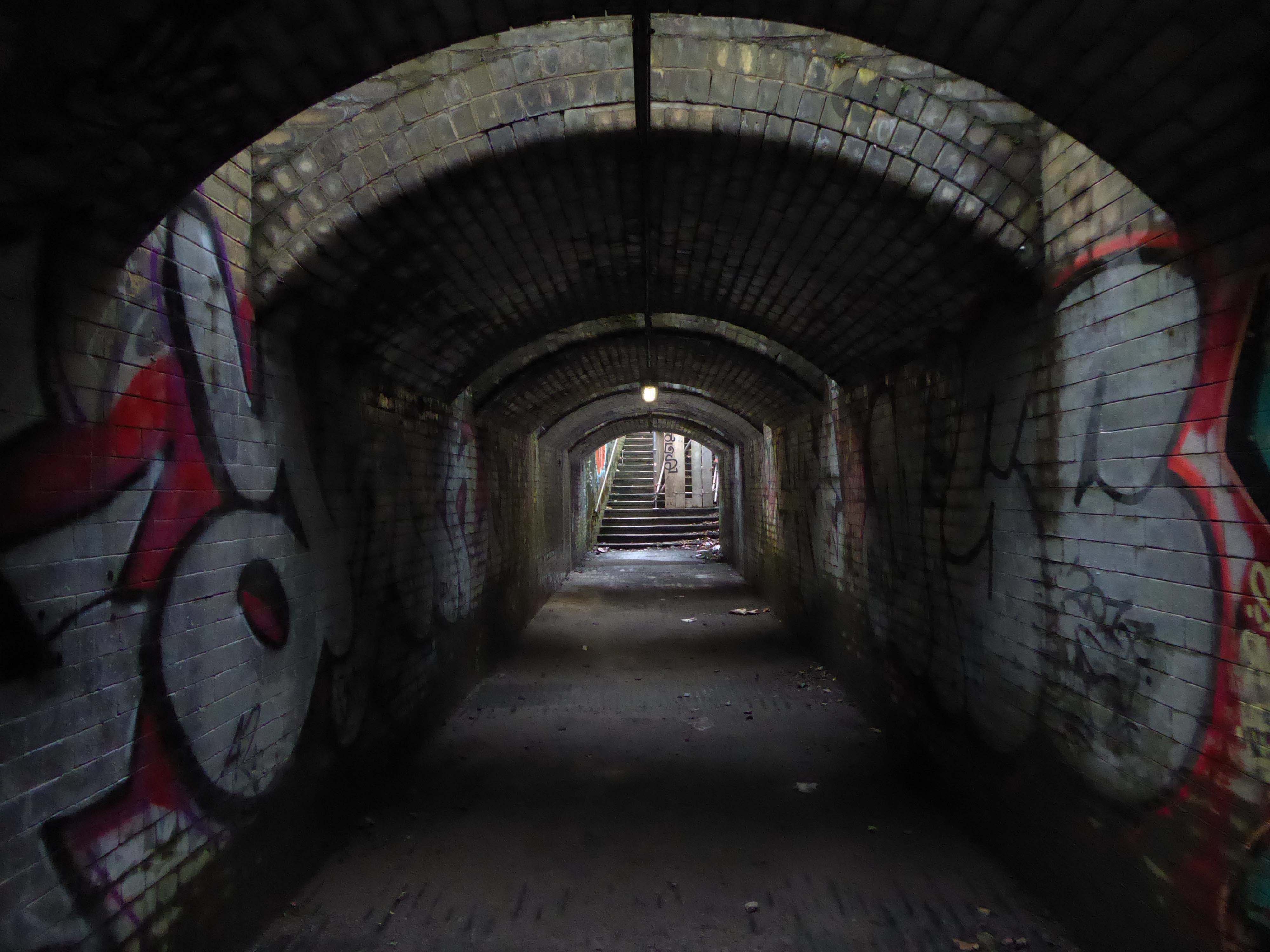
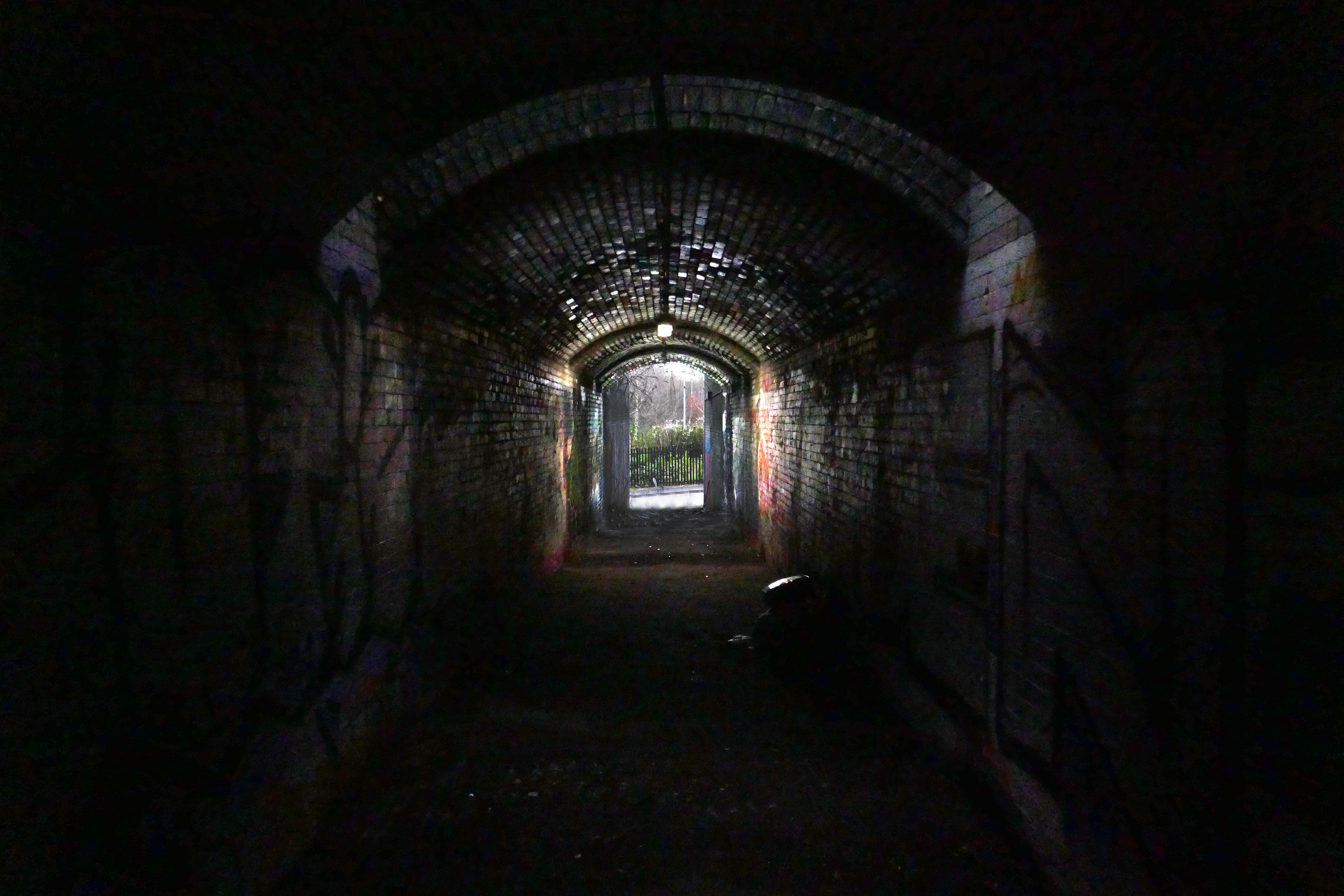
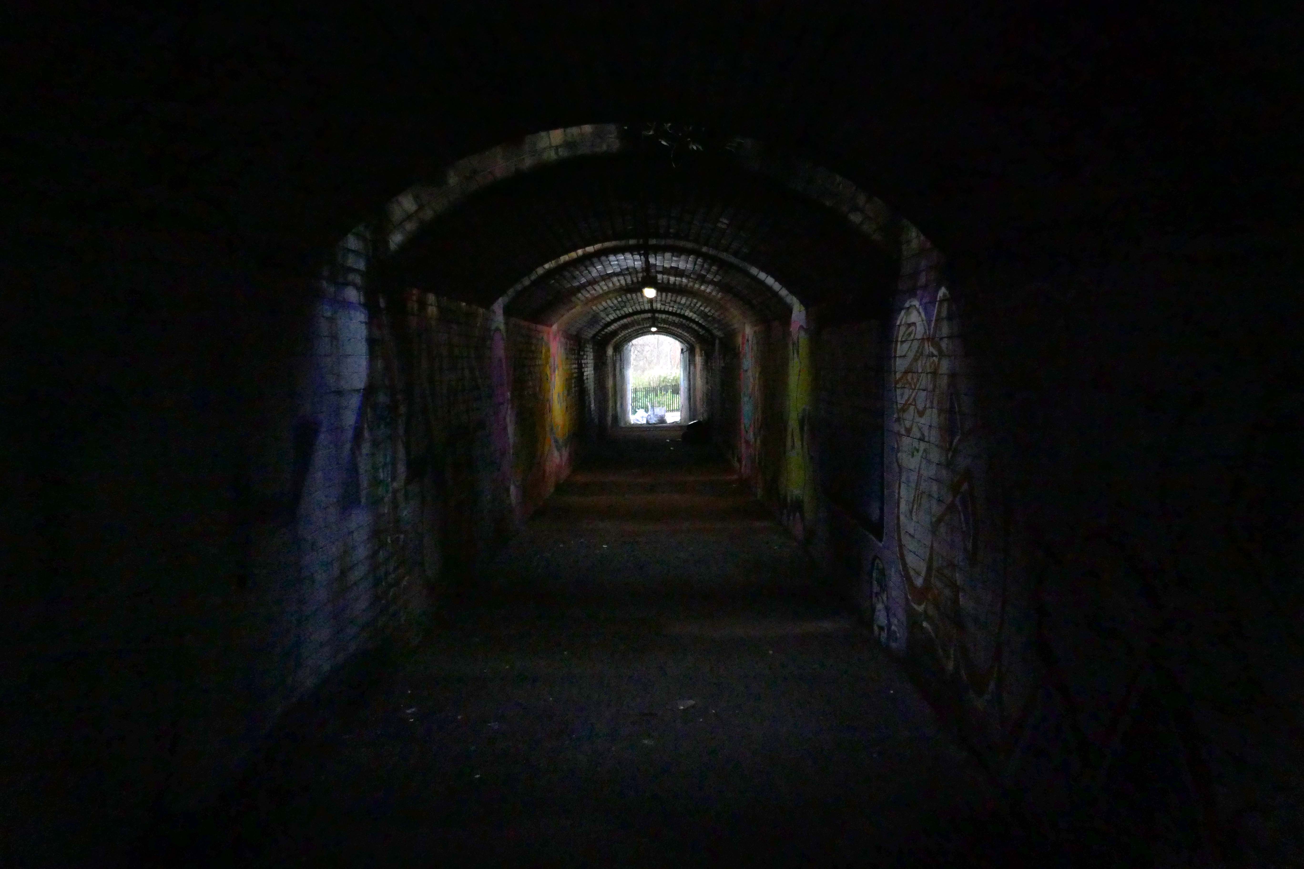
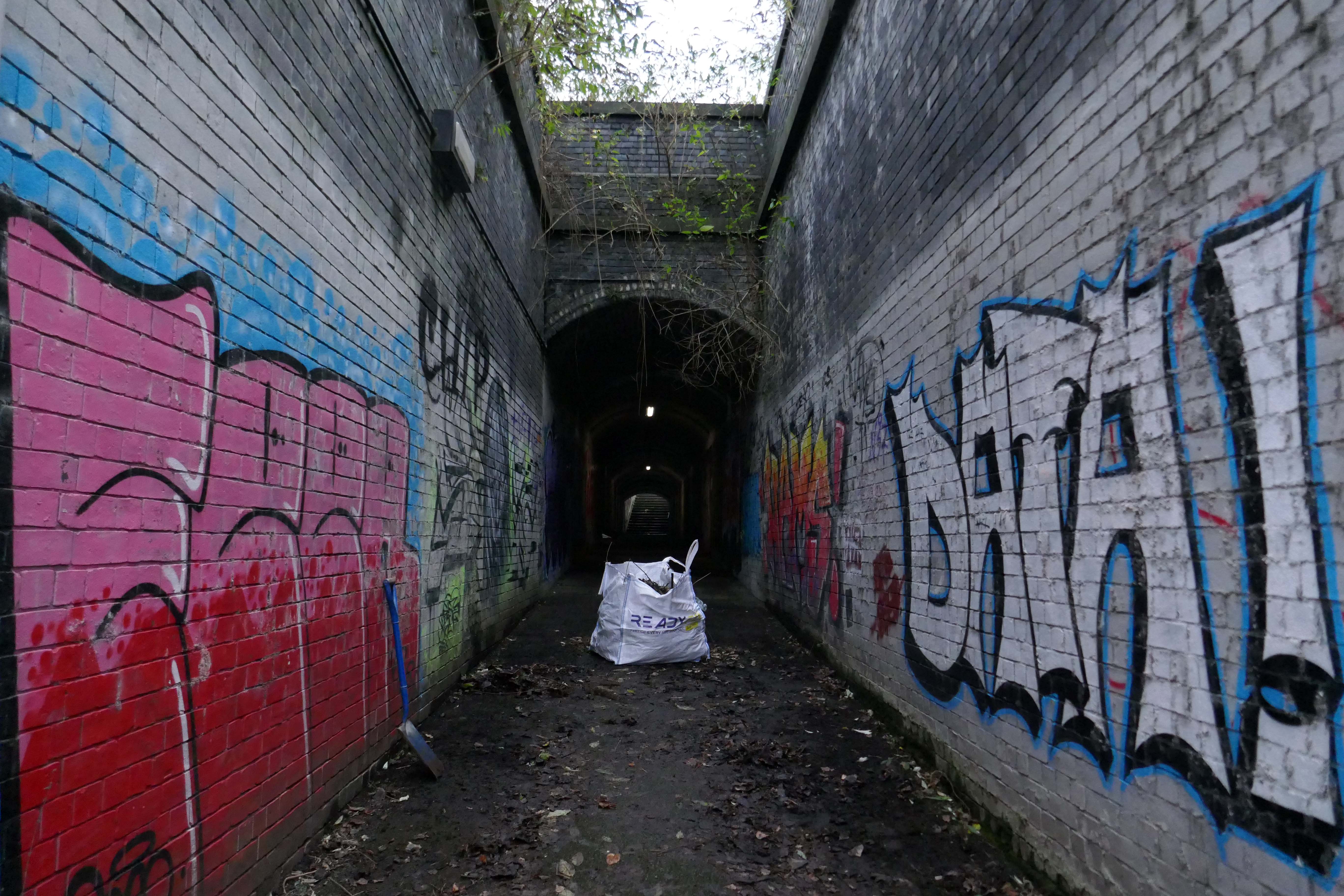
On my most recent visit there were works cleaning the pedestrian underpass, subway or tunnel.
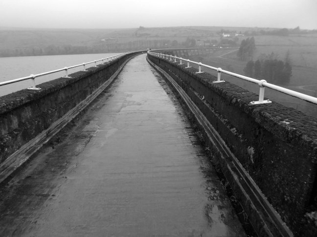
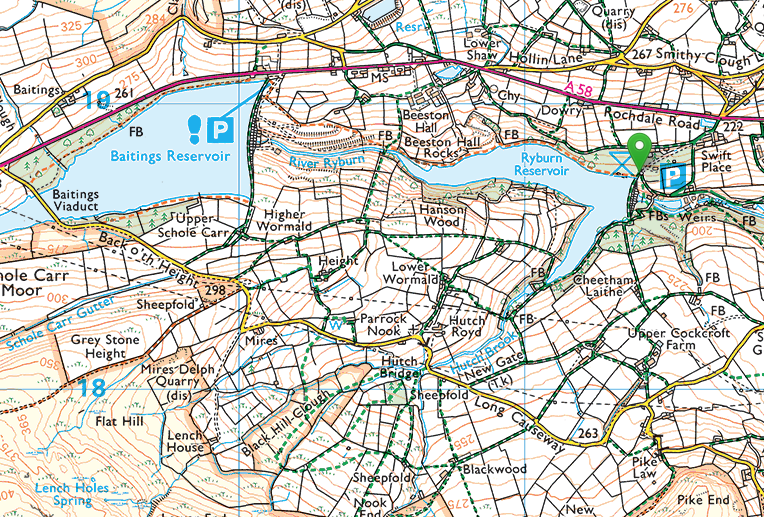
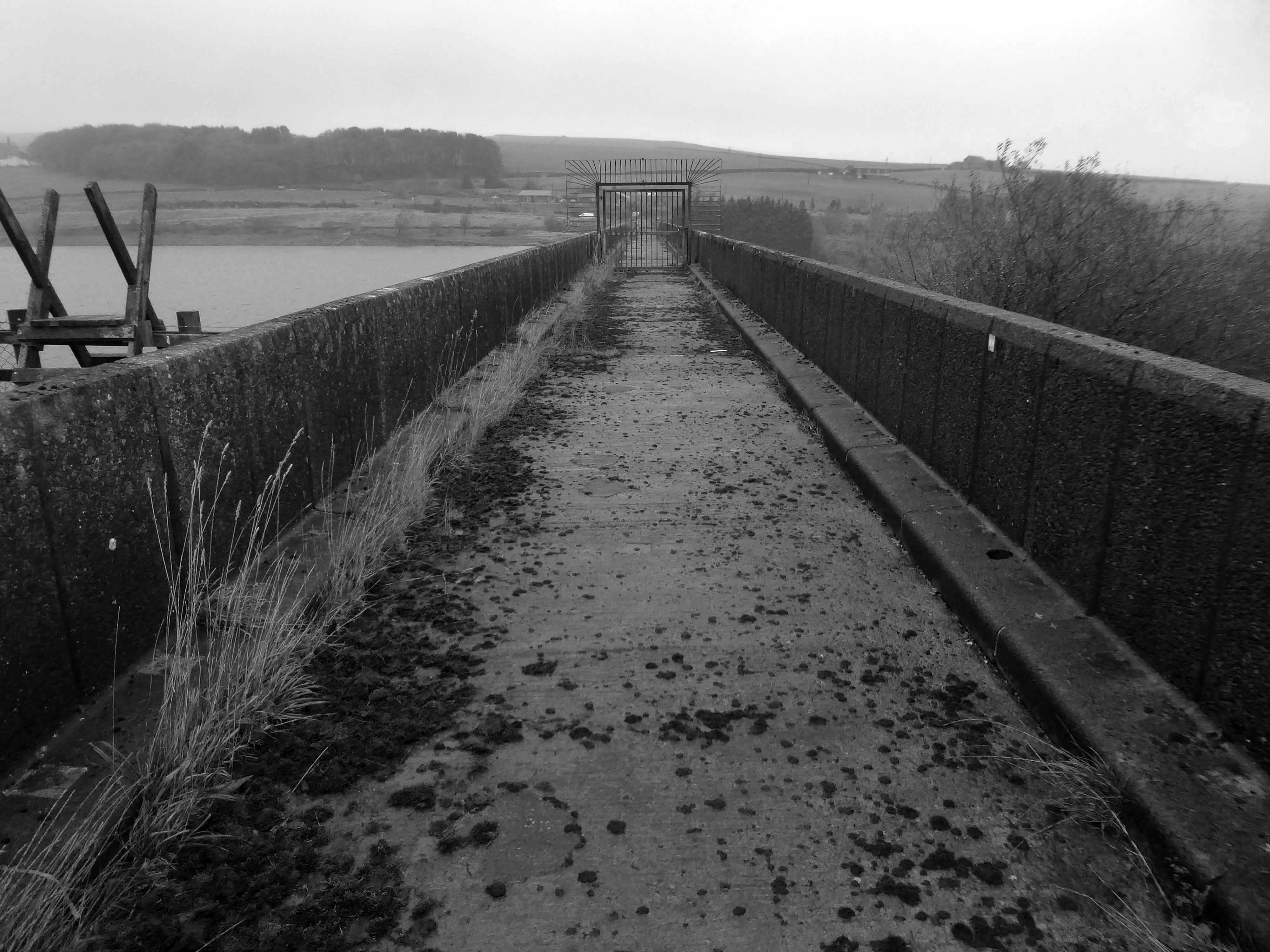
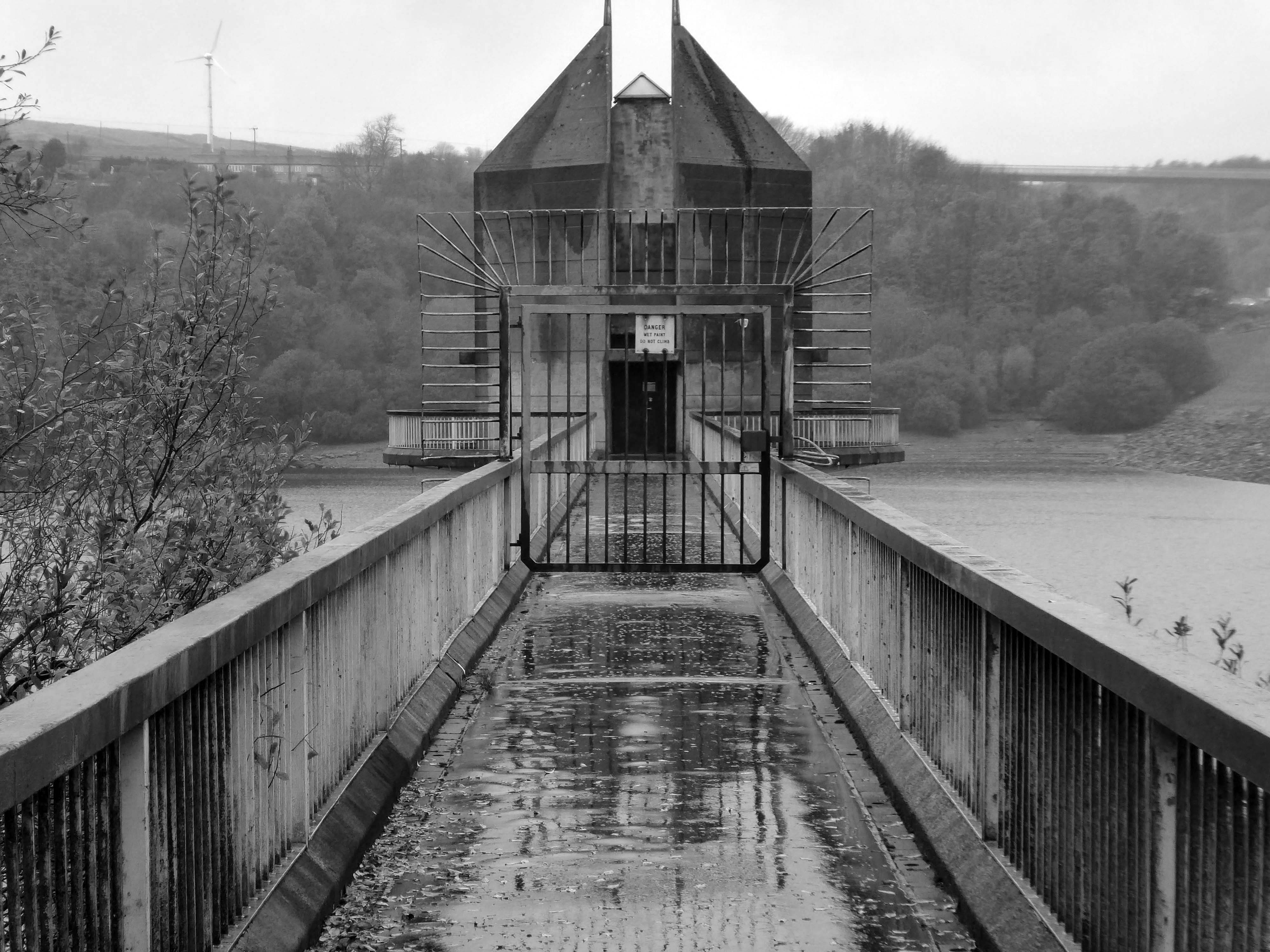
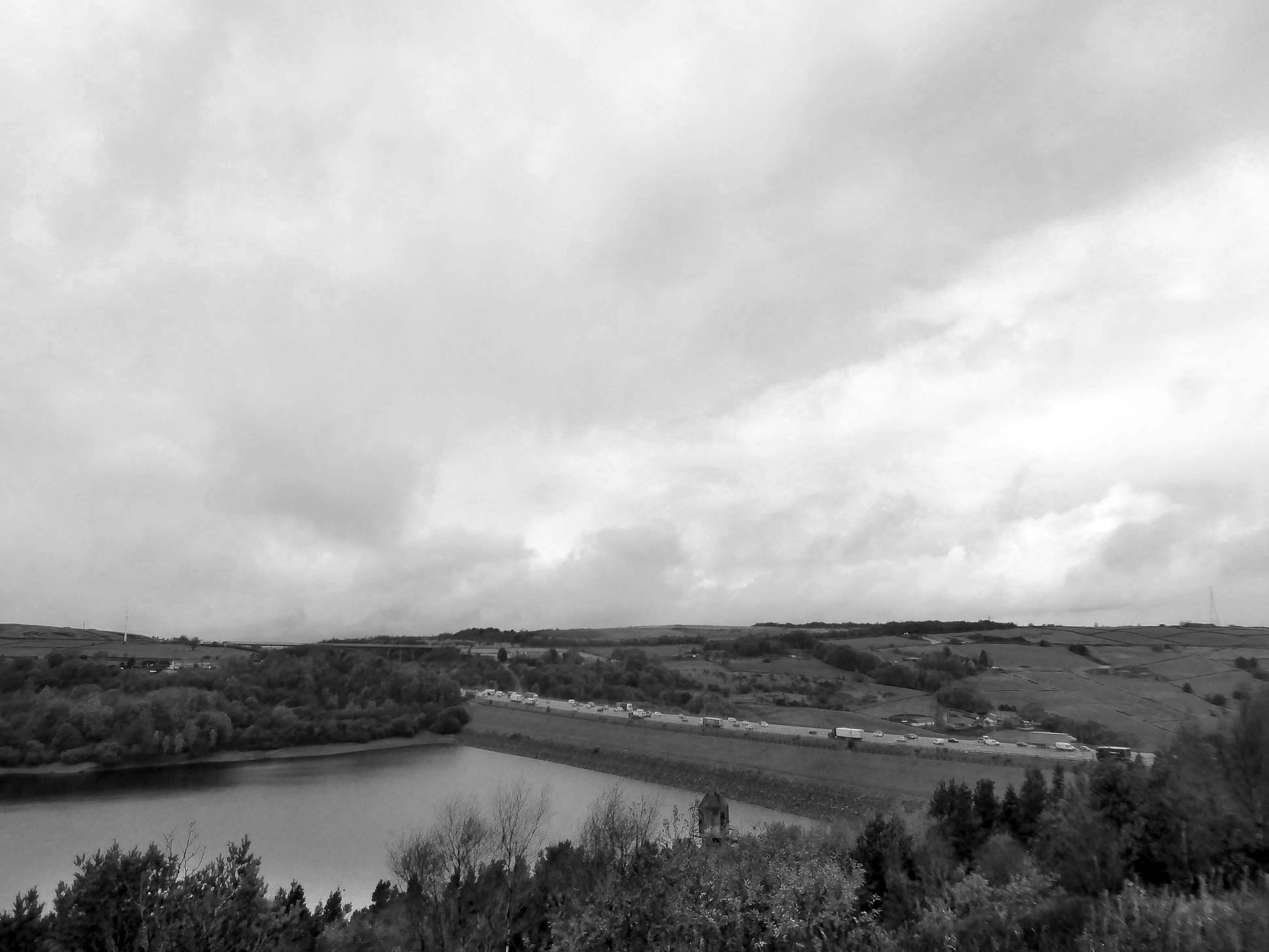
To begin at the beginning, to begin at Baitings Reservoir.
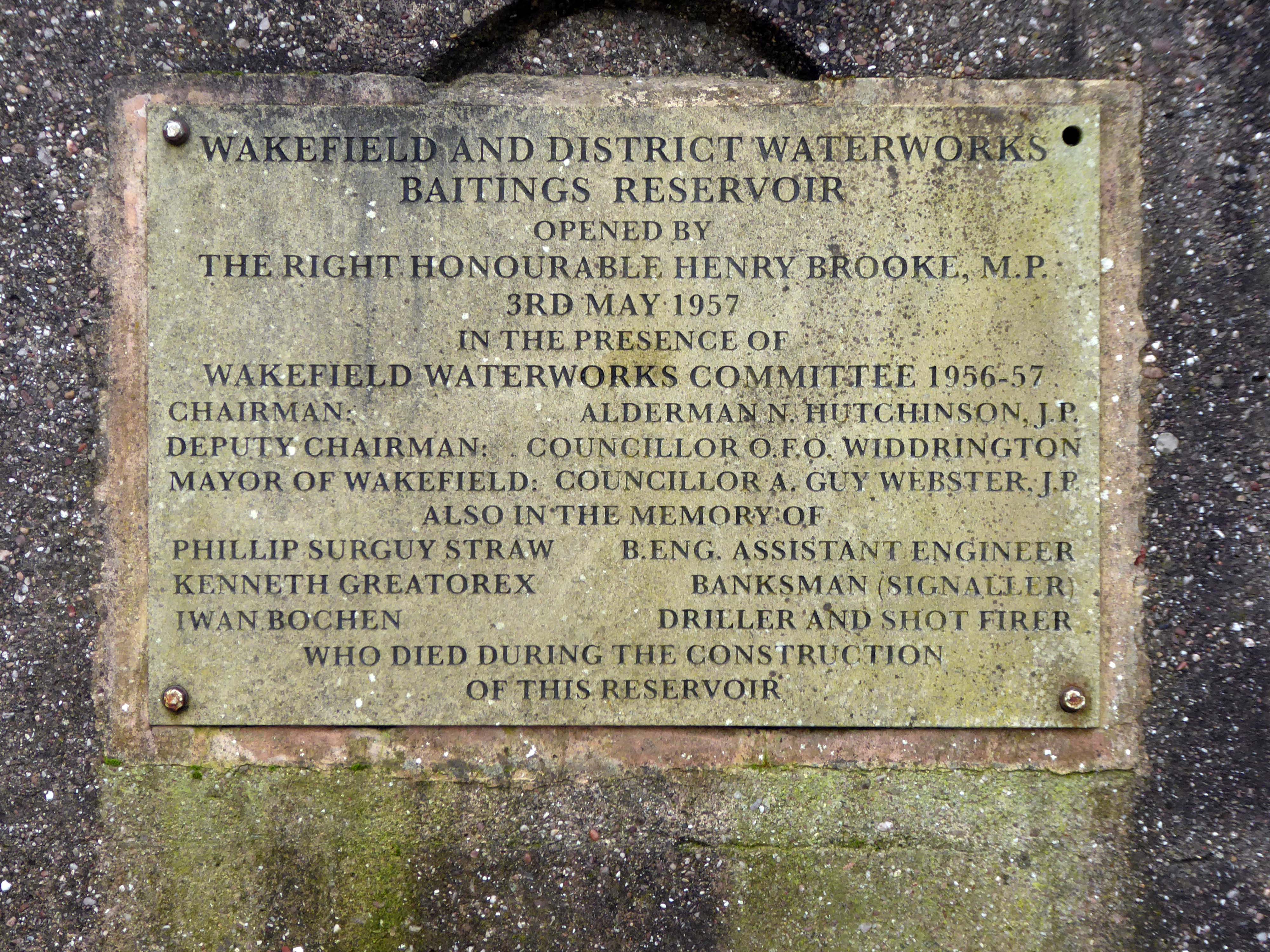
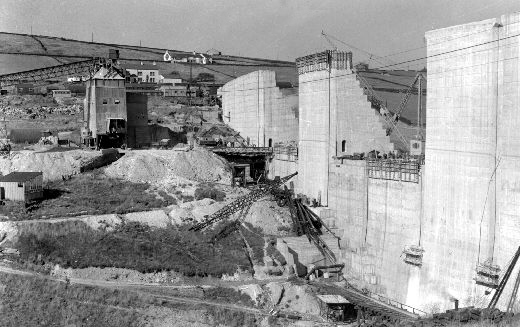
Wakefield Corporation Waterworks started impounding the valley of the River Ryburn in the 1930s, with Ryburn Reservoir being completed in 1933. Construction on Baitings took place 20 years later with completion in 1956. Baitings Bridge, on an old road linking Yorkshire and Lancashire, was to be flooded under the reservoir so a concrete viaduct was built. During spells of very hot weather and drought conditions, the old packhorse bridge is revealed.
Wakefield Express: 31st August 1955
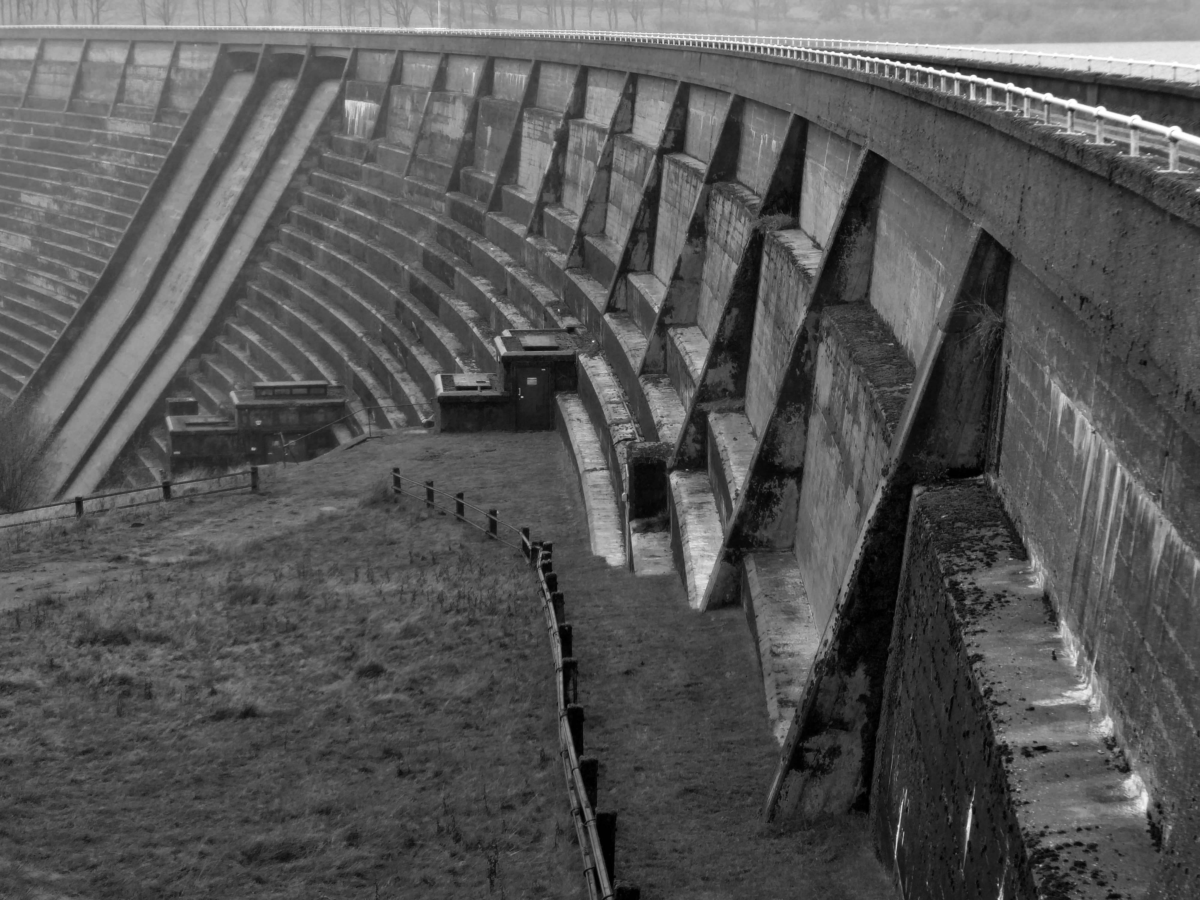
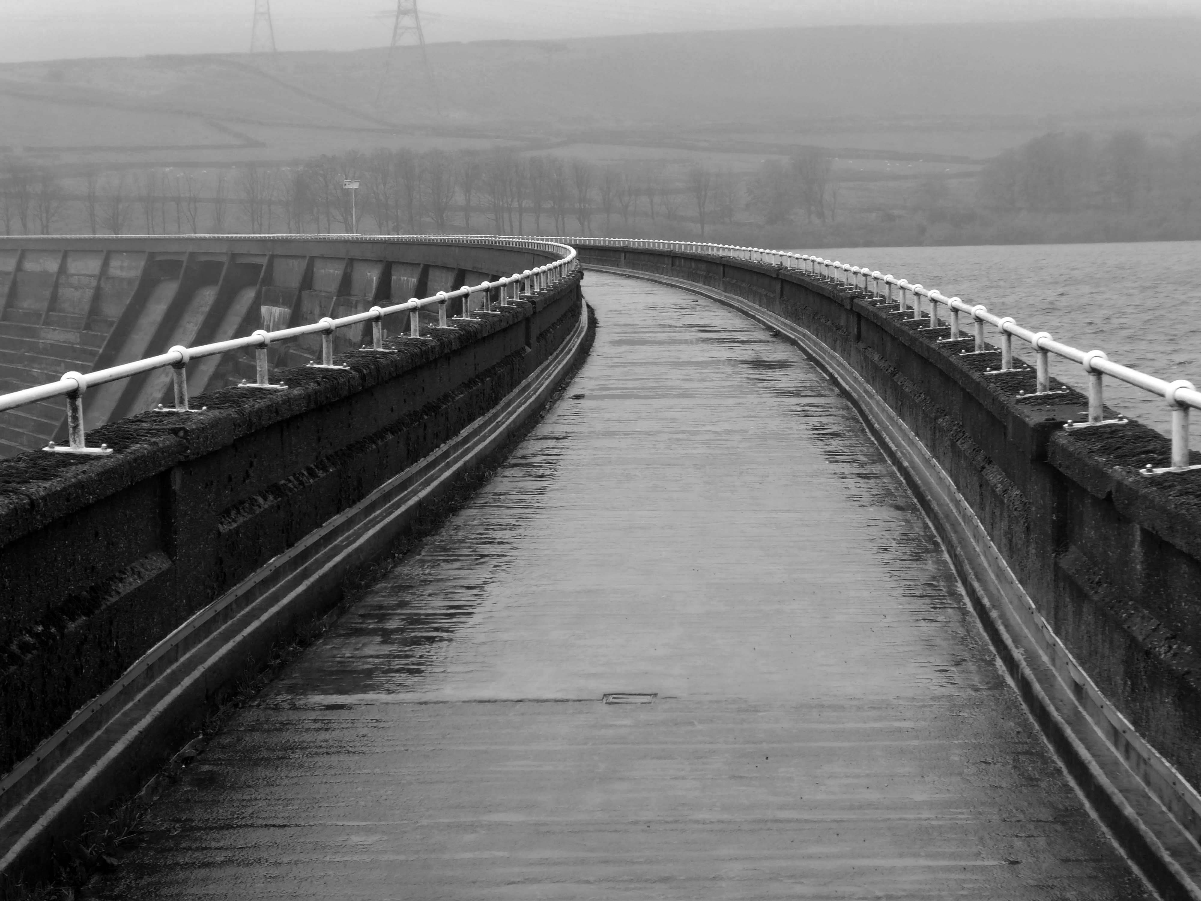
The dam head is a curved structure that is 1,540 feet long and over 160 feet high. The reservoir covers 59 acres and has a catchment of 1,830 acres , and when it is full, it holds over 113,000,000 cubic feet of water. The dam took eight years to complete at a cost of £1.4 million, and is located at 840 feet above sea level. A tunnel connects reservoirs in valleys to the north with Baitings to allow for the transfer of water. Manshead Tunnel is 8,000 feet long and was opened in 1962.
Inconveniently, the footpath to the lower Ryburn Reservoir was closed – we were diverted over the dam.
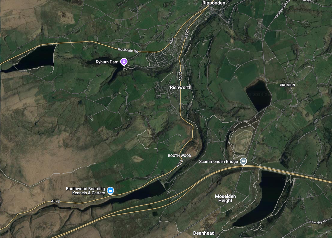
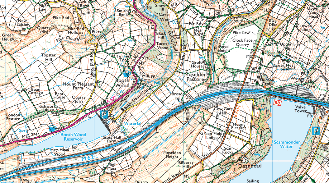
We took the pathway to Booth Wood Reservoir – over Pike End and beyond.
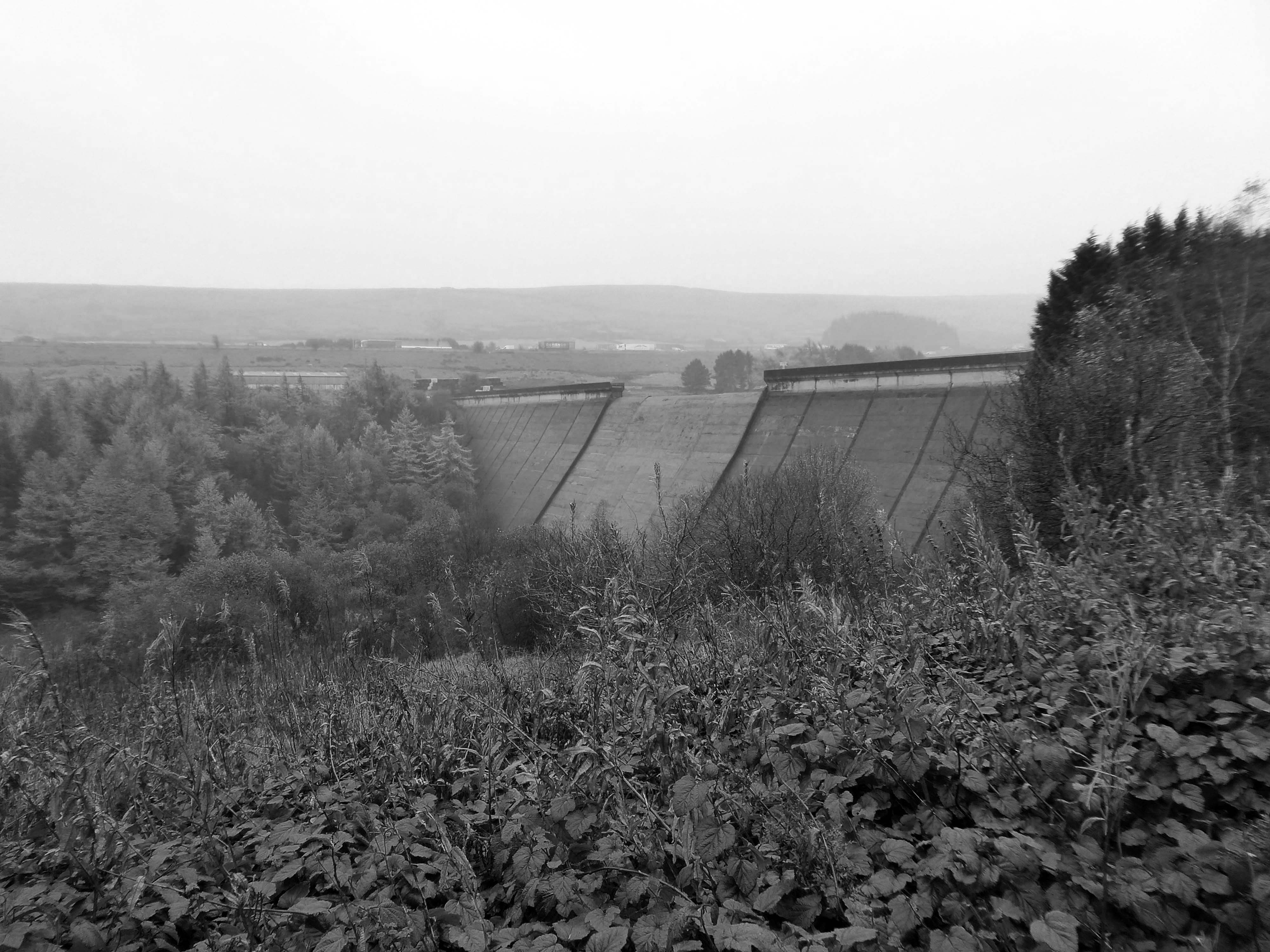
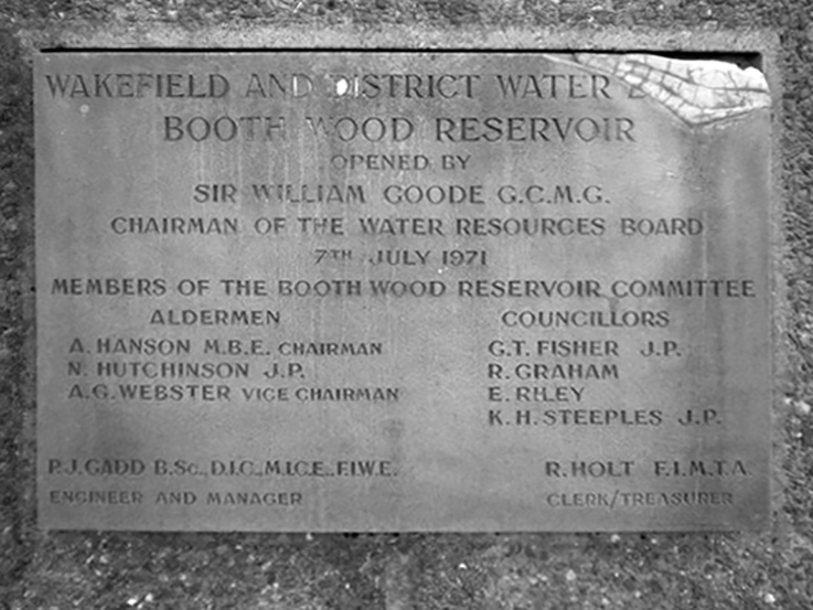
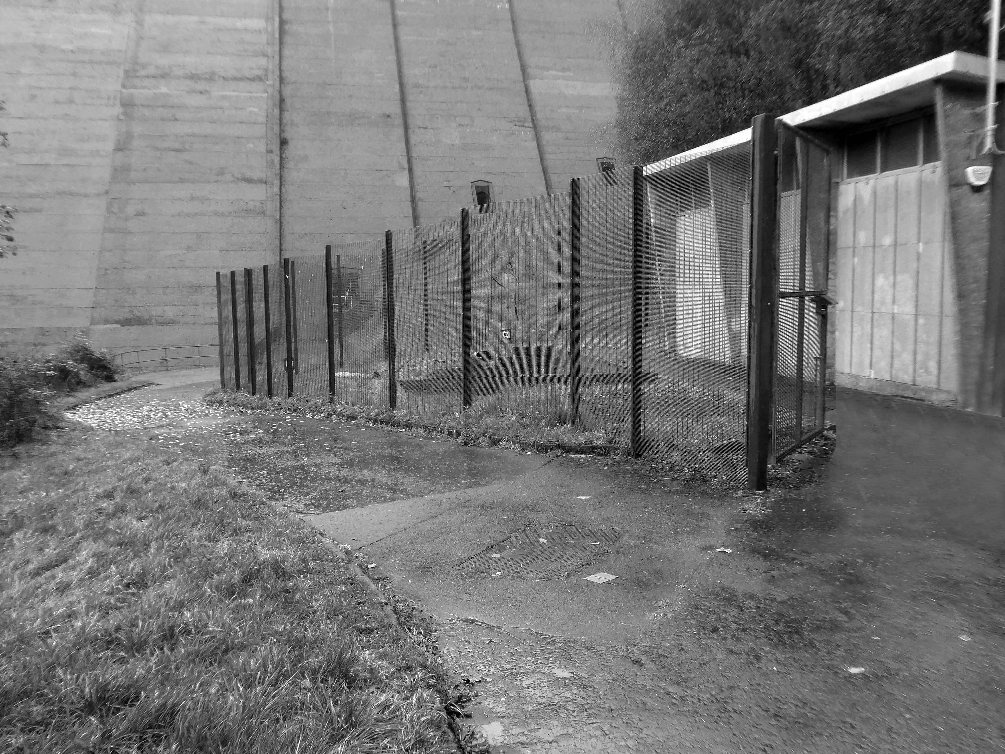
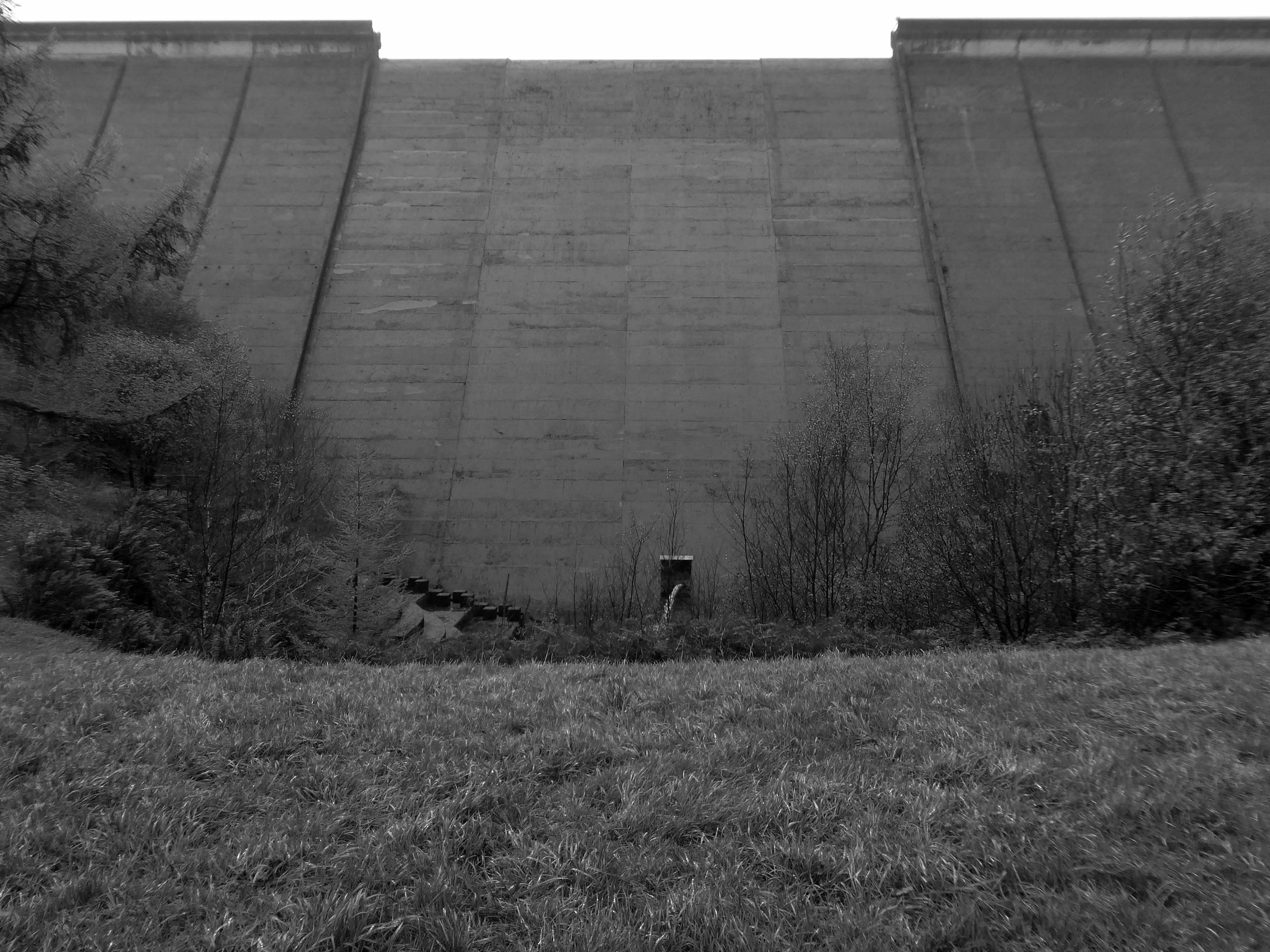
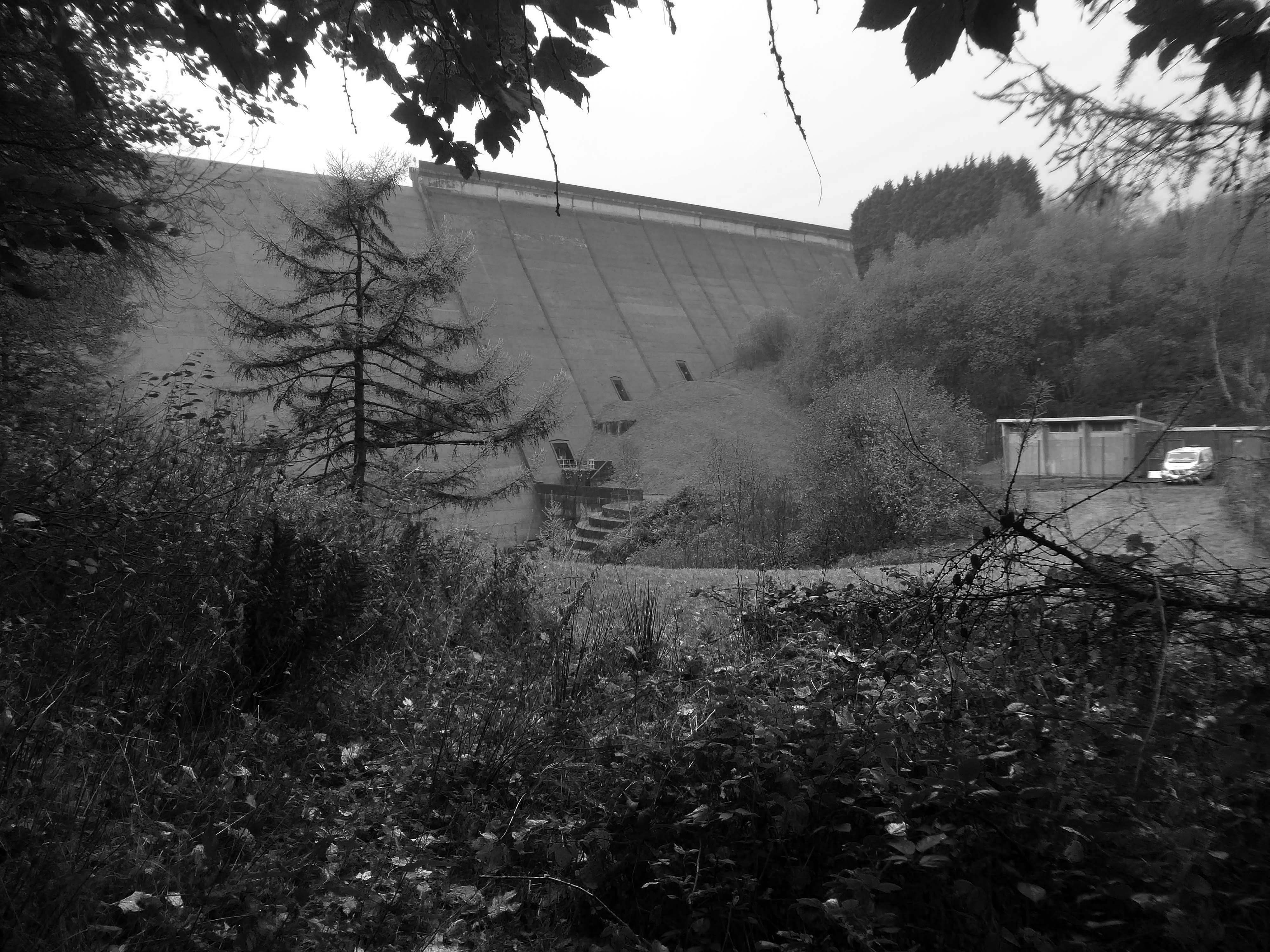
We dropped down beneath the Booth WoodDam.
Booth Wood Reservoir is a man-made upland reservoir that lies north of the M62 motorway and south of the A672 road near to Rishworth and Ripponden in Calderdale, West Yorkshire. The reservoir was approved for construction in 1966 and completed in 1971.
It supplies water to Wakefield.
The reservoir dams the Booth Dean Clough watercourse and takes water directly from the surrounding moorland. It has a plain concrete crest on the dam head which is straight and extends to a length of 1,150 feet and a height of 157 feet.
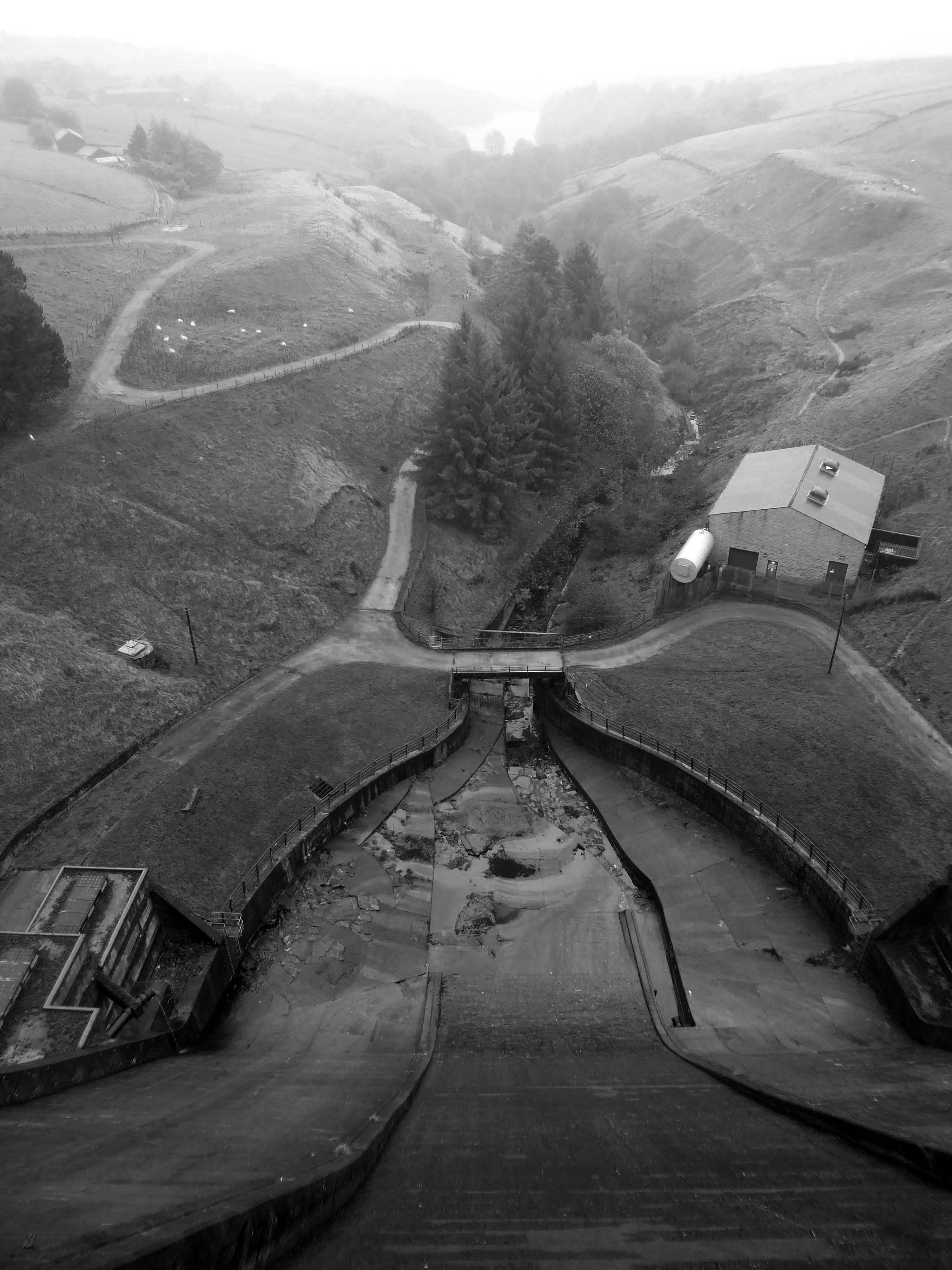
Below is a dinky pumping station, tucked beneath the dam.
We took a precipitous path through the wood – up to the level of the reservoir.
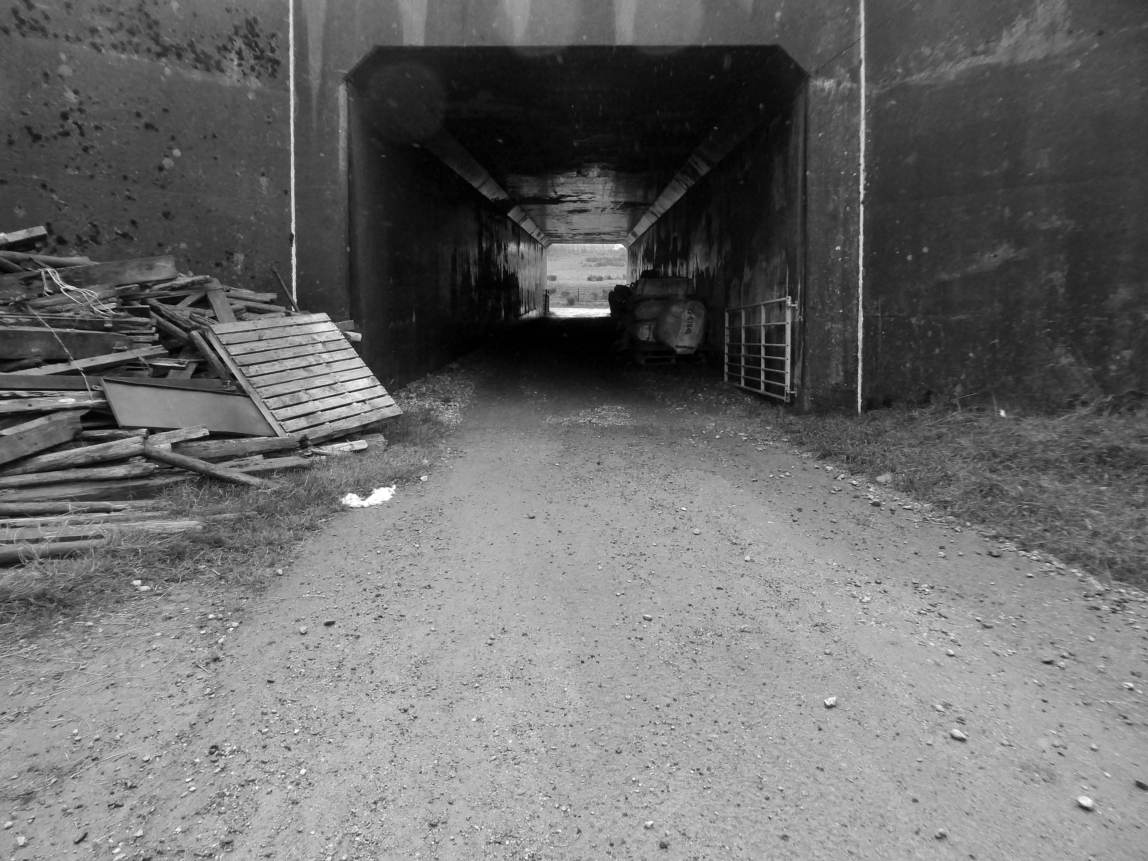
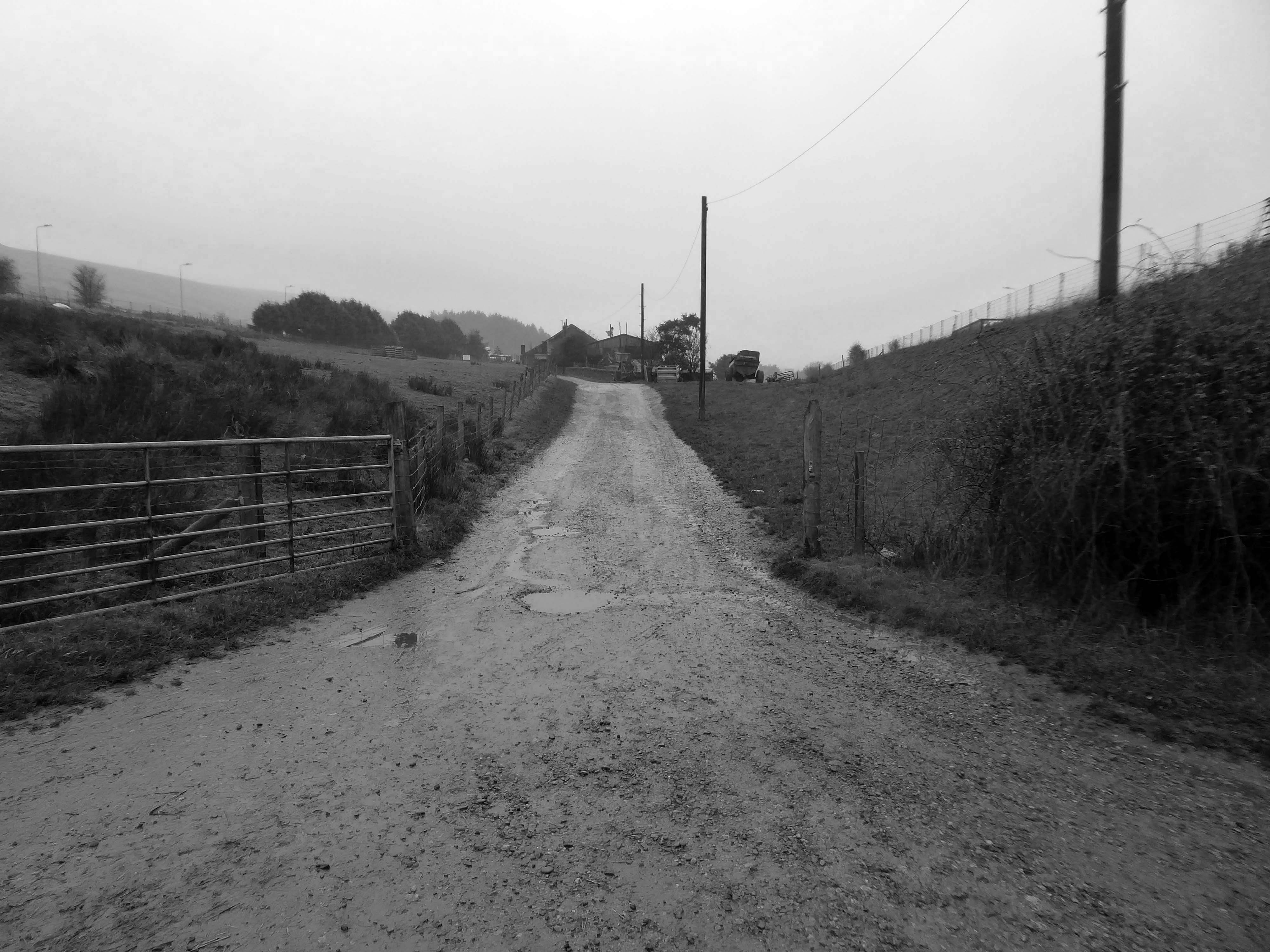
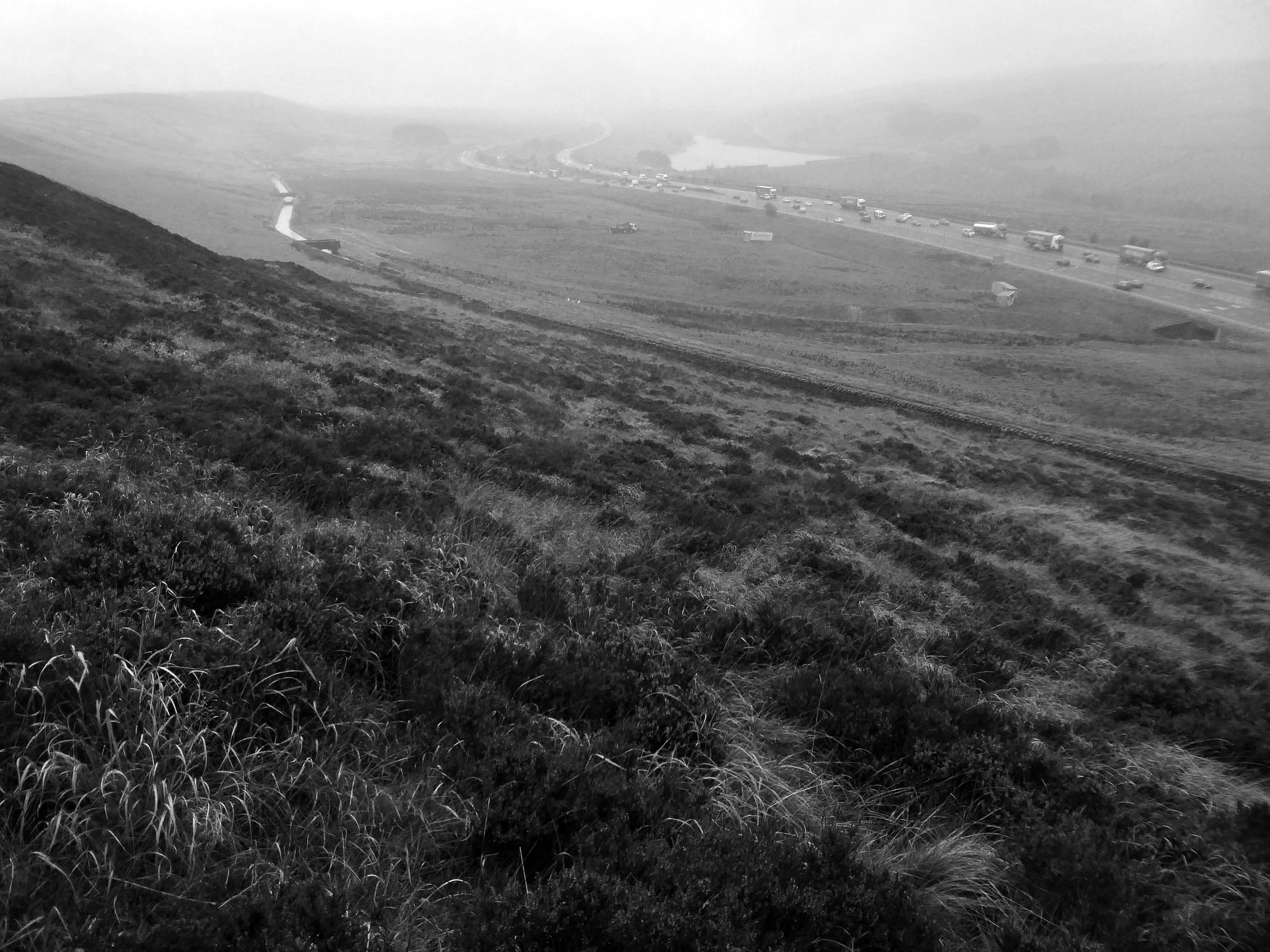
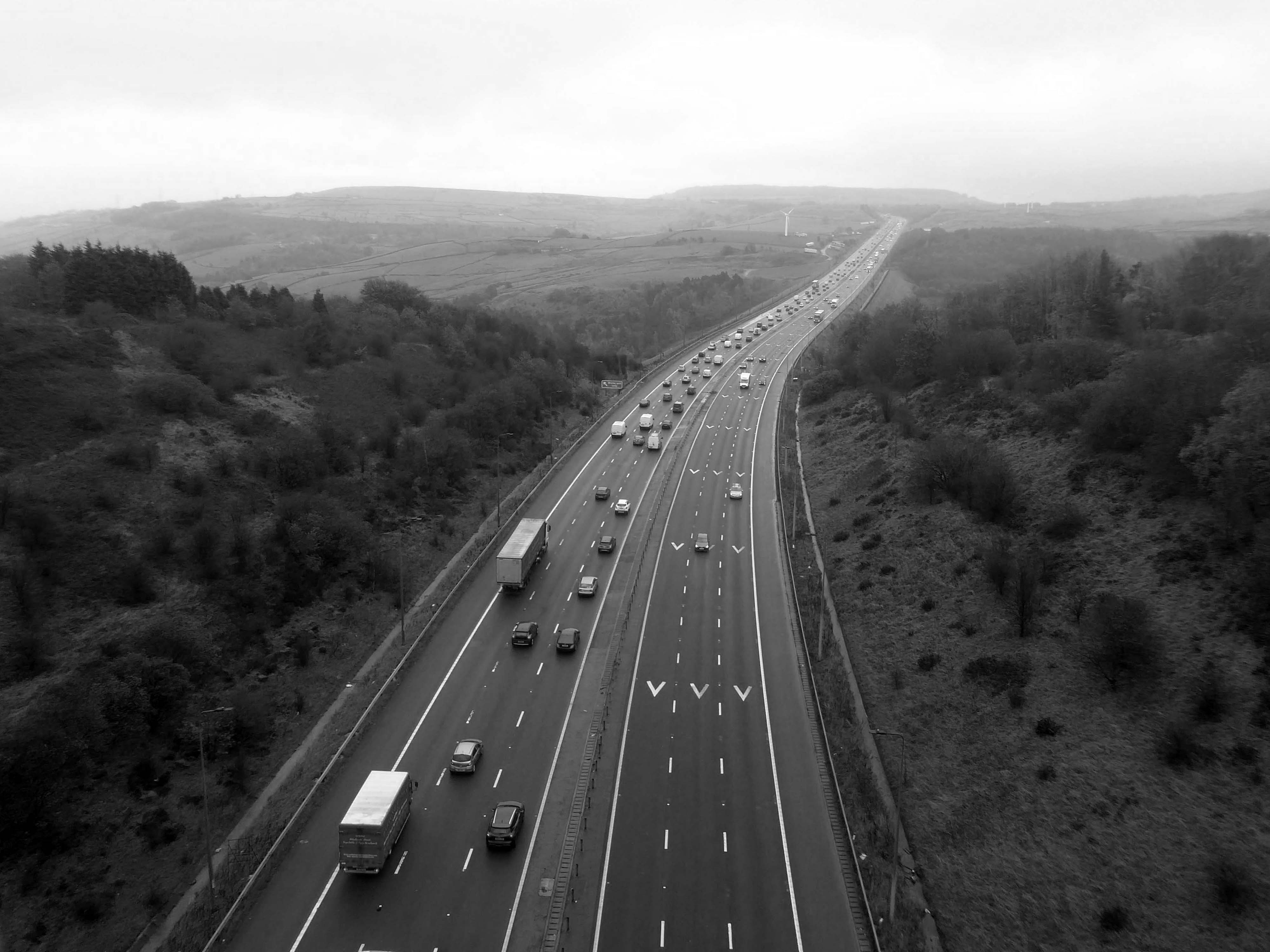
Under the the M62 and past the infamous Stott Hall Farm.
Stott Hall Farm is a farm located between the eastbound and westbound carriageways of the M62 motorway in Calderdale. It is the only farm in the UK situated in the middle of a motorway and was built in the 18th century on Moss Moor. It lies south of Booth Wood Reservoir where the carriageways are separated between junctions 22 and 23. The road divides for much of its length between the Windy Hill and Deanhead cuttings because of the surrounding geography; but a myth persists that it was split because Ken and Beth Wild refused to sell. However, the farm was actually owned by Yorkshire Water at the time the M62 was built.
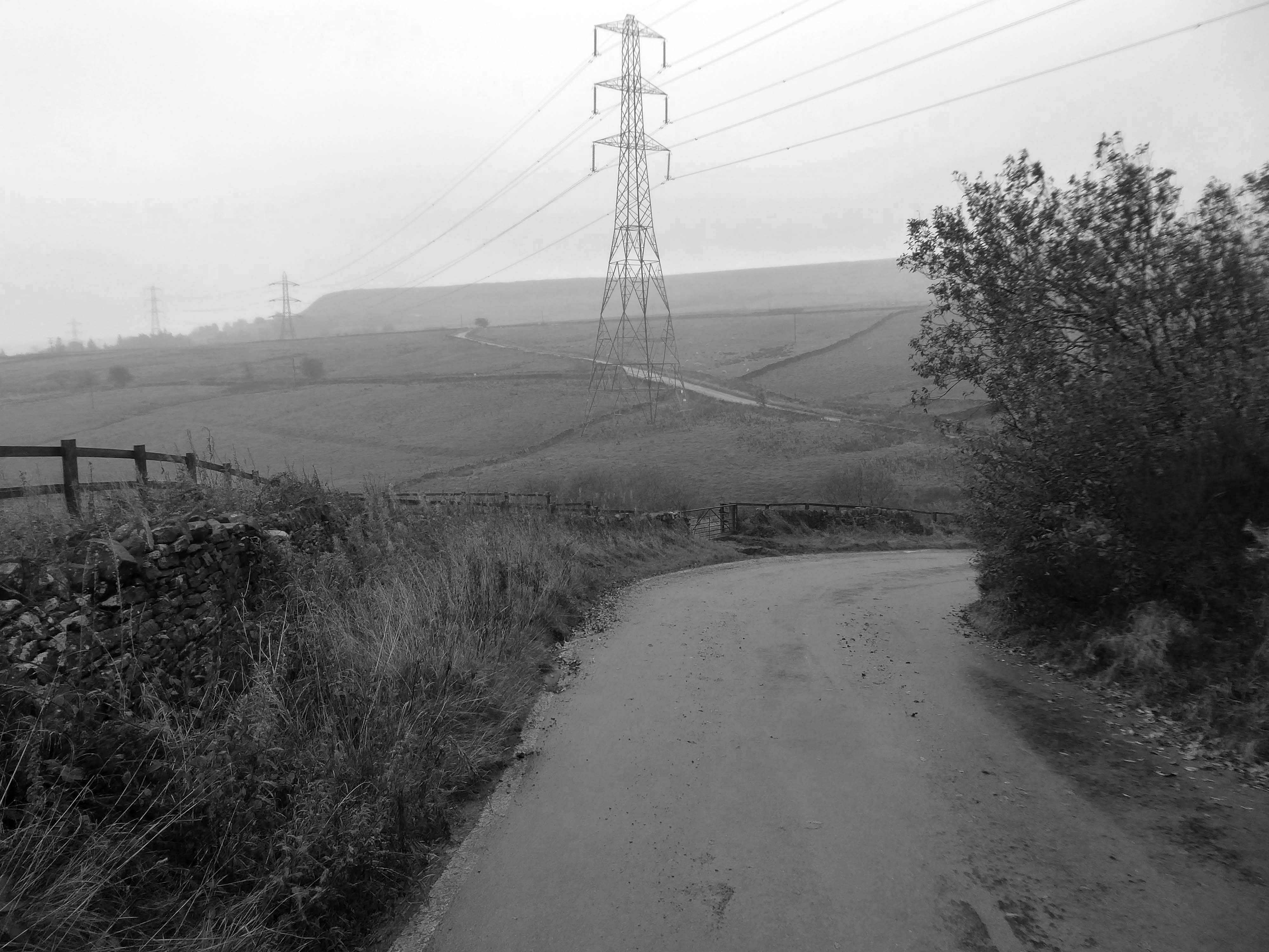
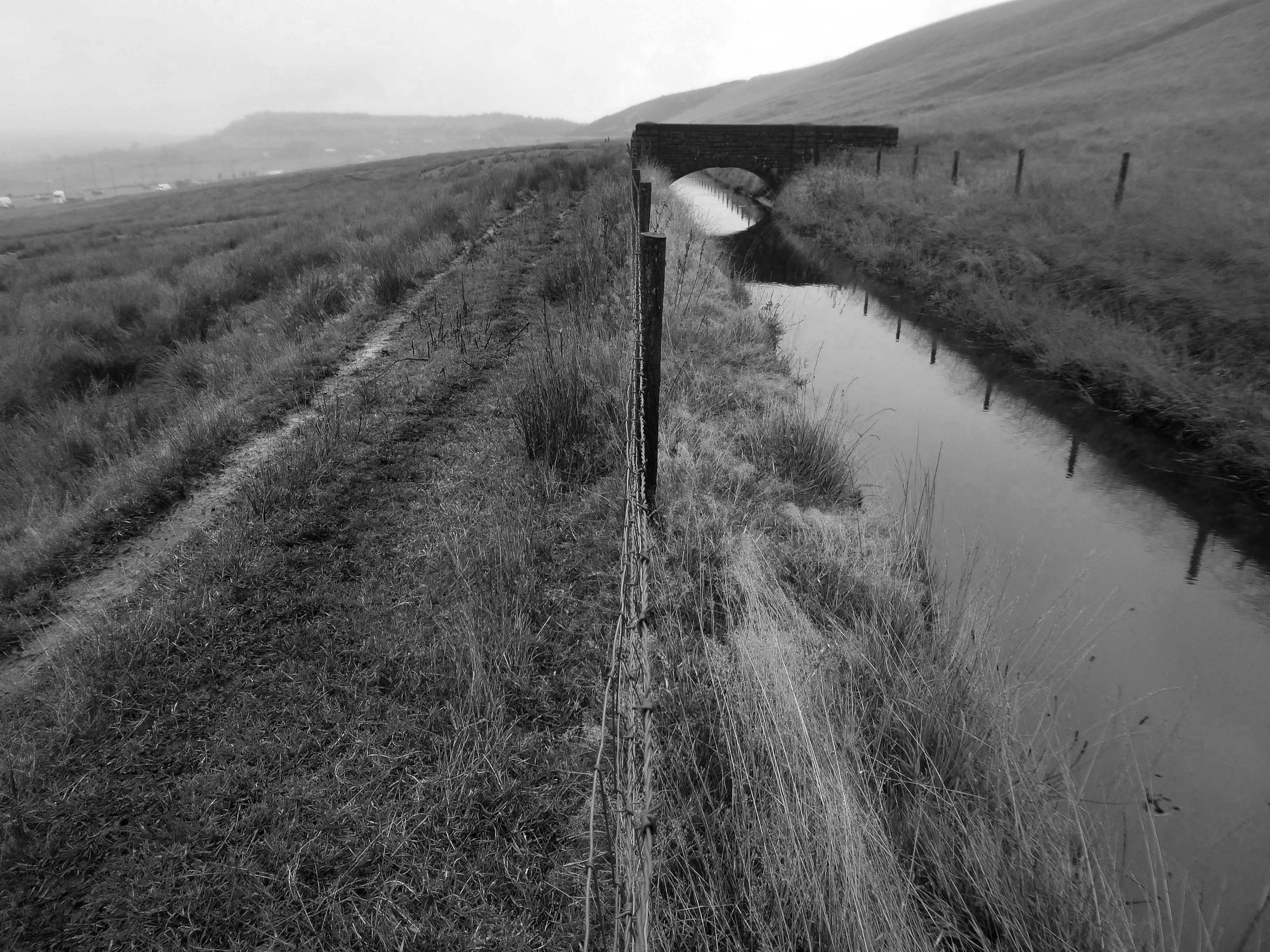
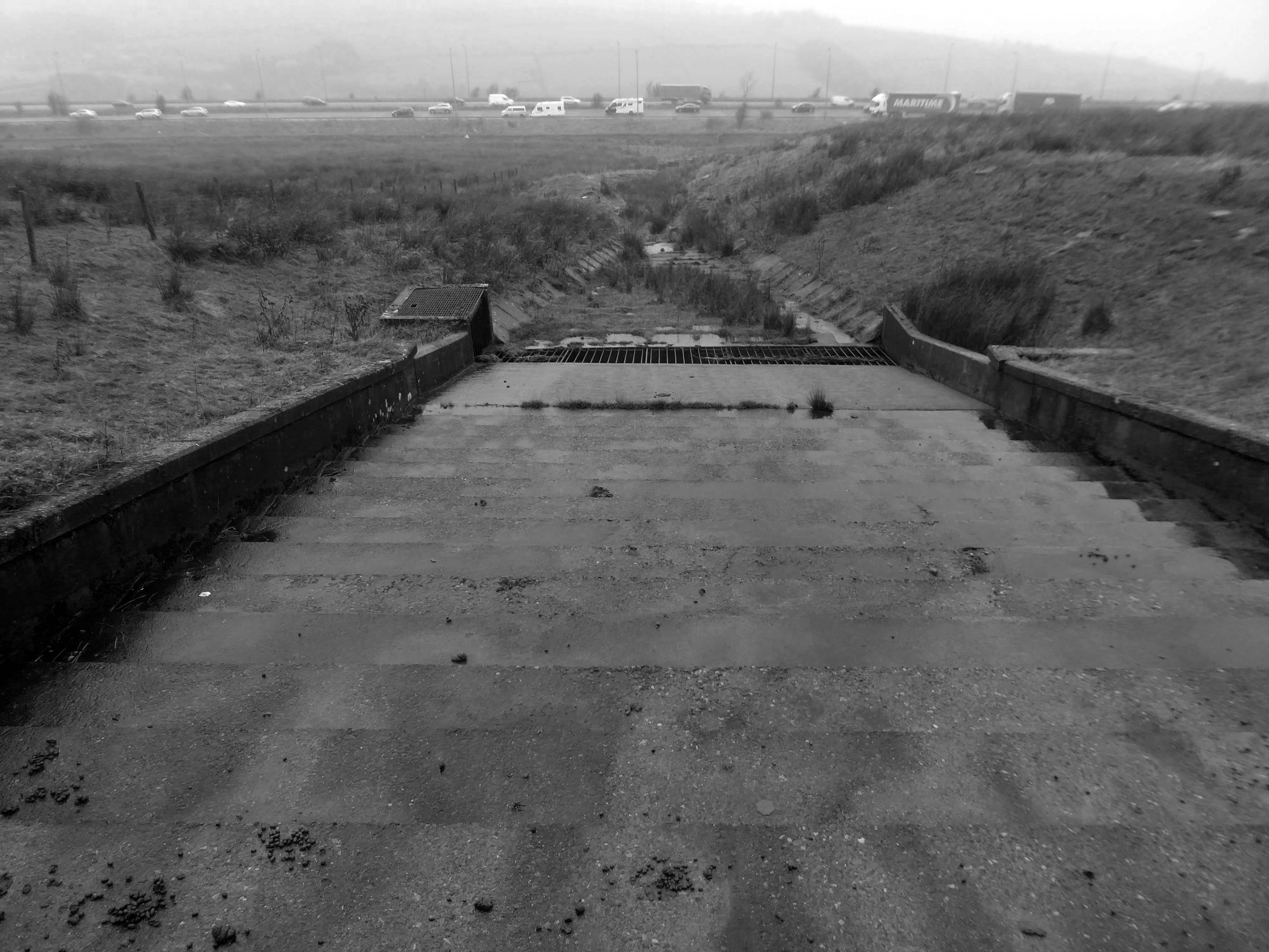
We walked over the upland moors to meet with the Catchwater, which formerly fed the Ringstone Edge Reservoir, prior to the construction of the motorway cutting.
Climbing again over Cow Gate Hill to meet the Saddleworth Road.
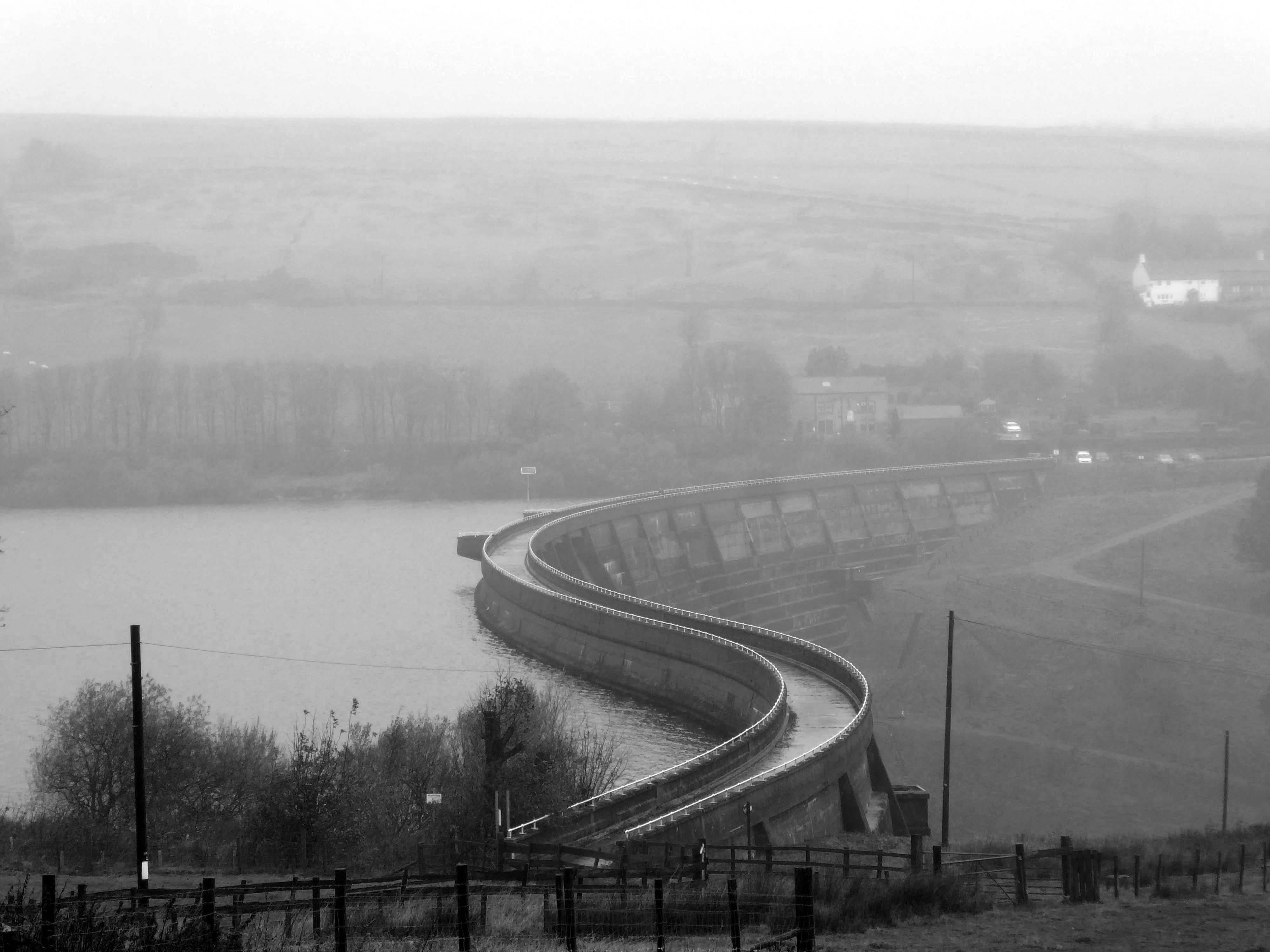
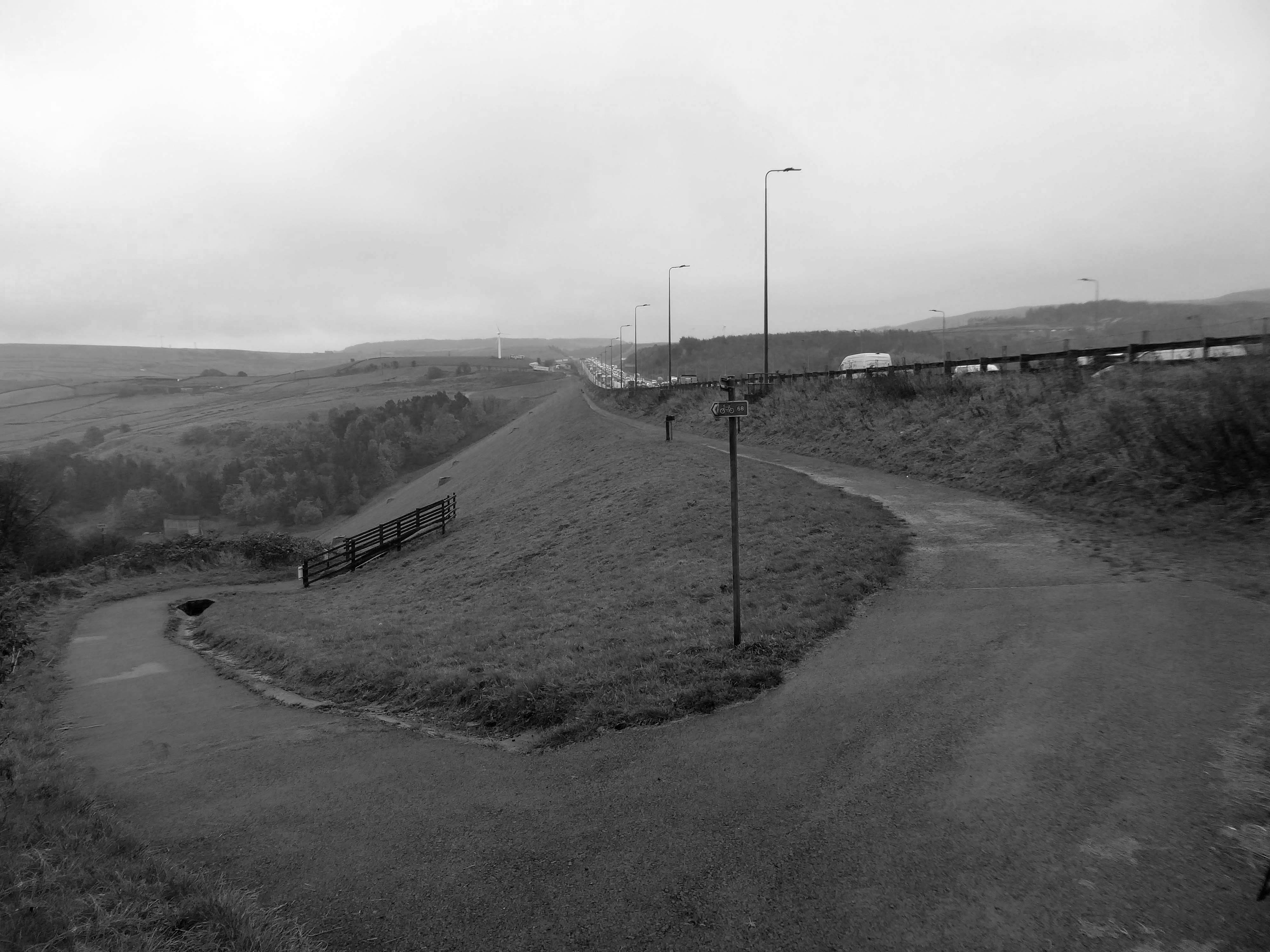
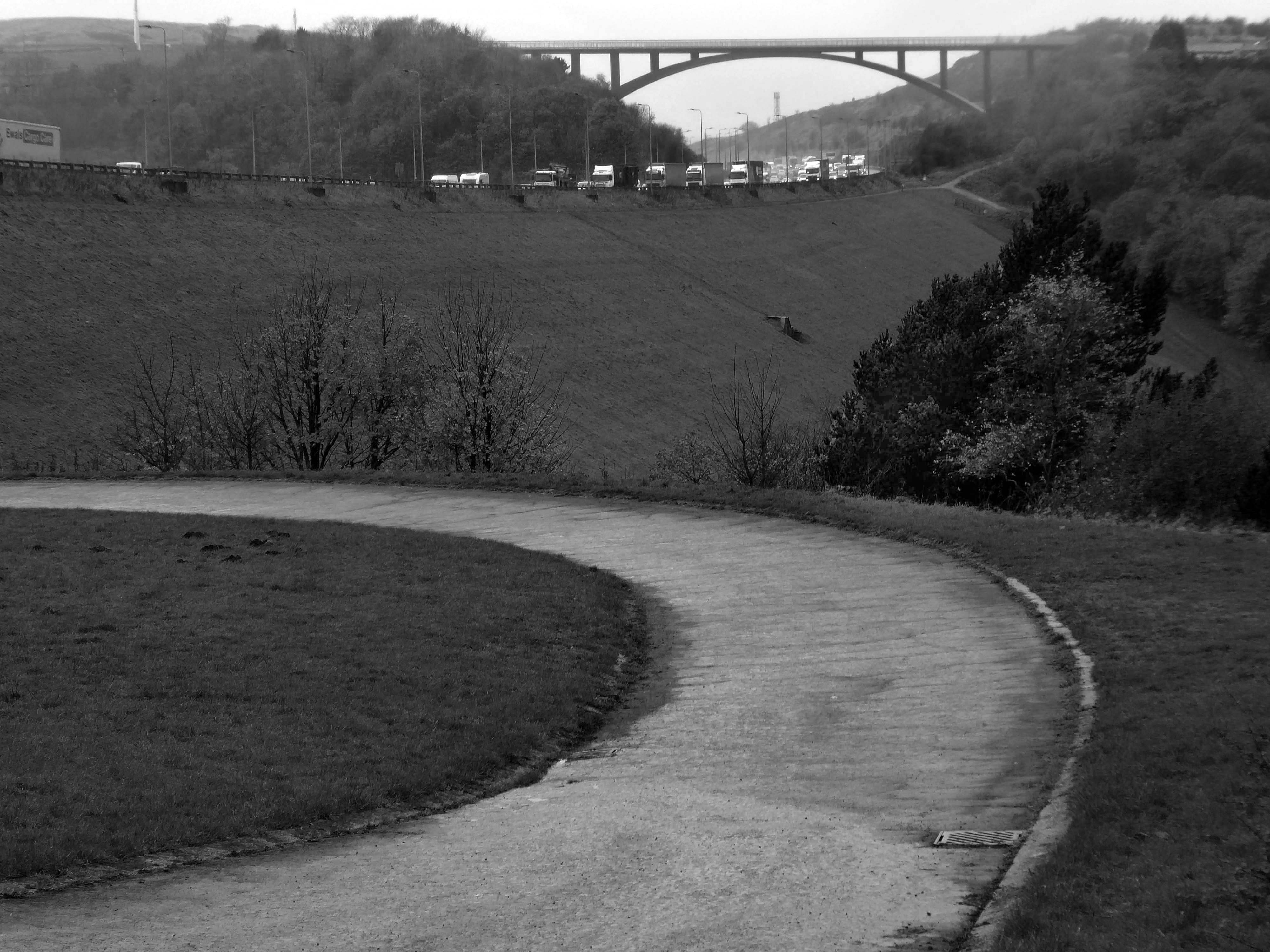
Crossing the motorway and dropping down to meet the Scammonden Dam.
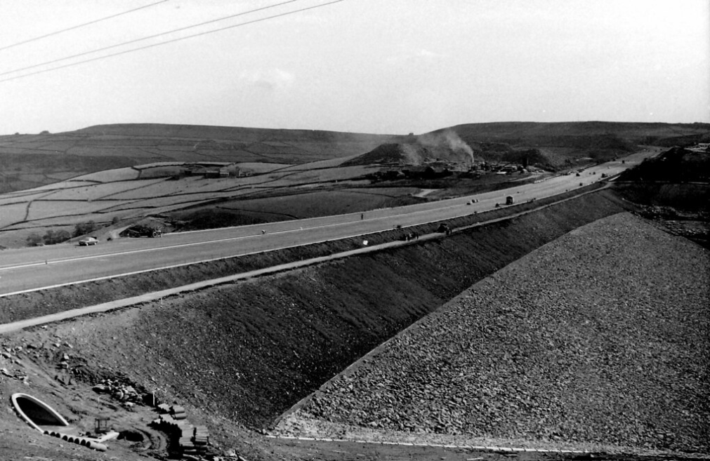
Scammonden Dam is part of the M62 motorway between junctions 22 and 23, the only such structure in Britain. Its construction by the Ministry of Transport and Huddersfield Corporation Waterworks required the passing of the Huddersfield Corporation Act 1965. The motorway dam spans the Deanhead Valley in the Pennines between Huddersfield and Rochdale and the main contractor for the project was Sir Alfred McAlpine & Sons.
It was designed by Rofe, Kennard and Lapworth
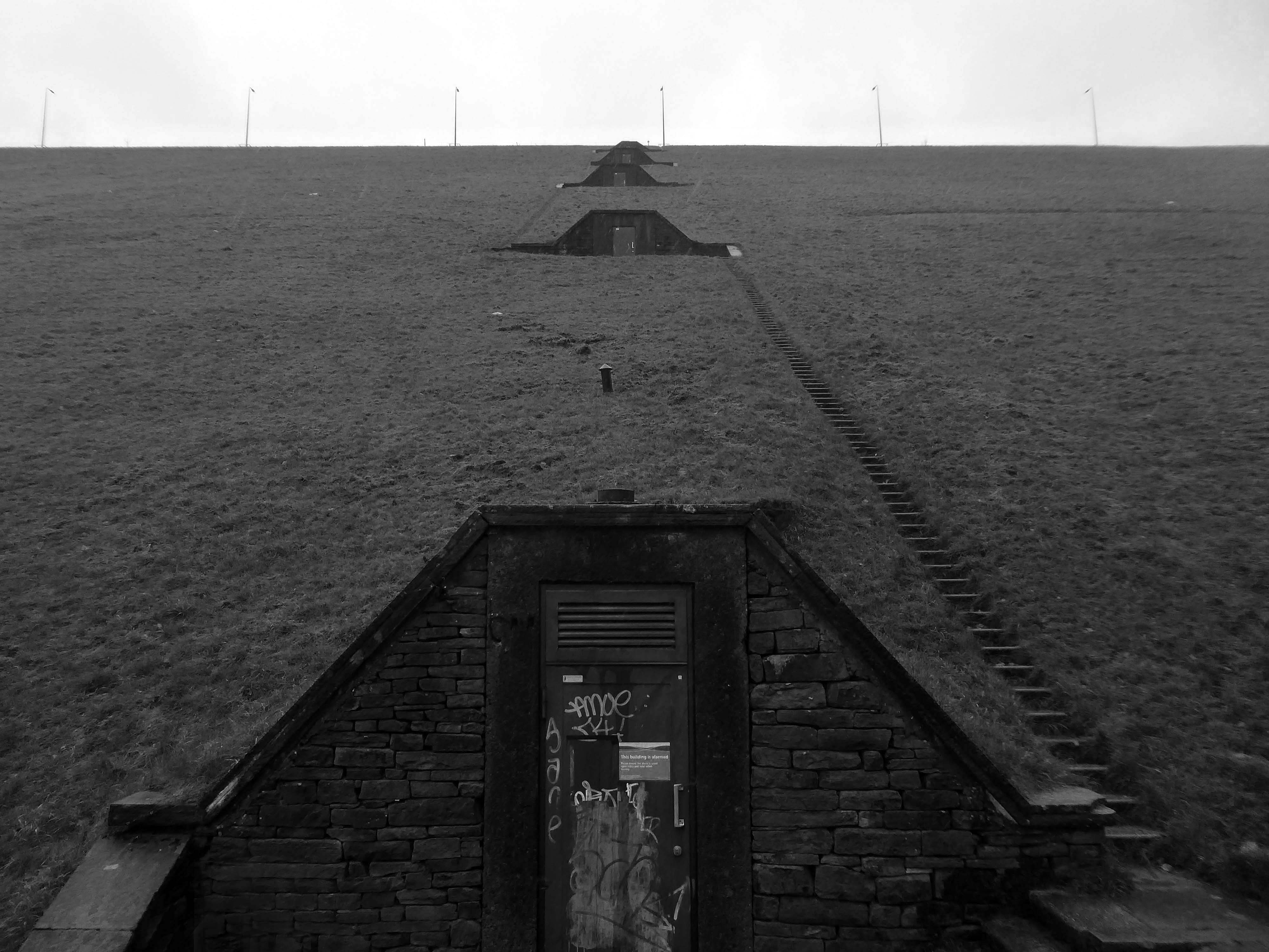
Surveying began in November 1961 and the route of the carriageway was determined in mid 1963. Excavation in the Deanhead Valley commenced the following year and for the dam in 1966. This required the removal of 25,200,000 cu ft of peat bog to reach the solid rock base nearly 43 ft below ground level. Material excavated elsewhere on the line of the motorway, clay from cuttings between Lofthouse and Gildersome, and 3.4 million cubic metres from the Deanhead excavations was used to build the dam’s embankment which is 2,051 ft in length and 207 ft above the original valley floor. The embankment is 1,427 ft wide at its base and 180 ft at road level.
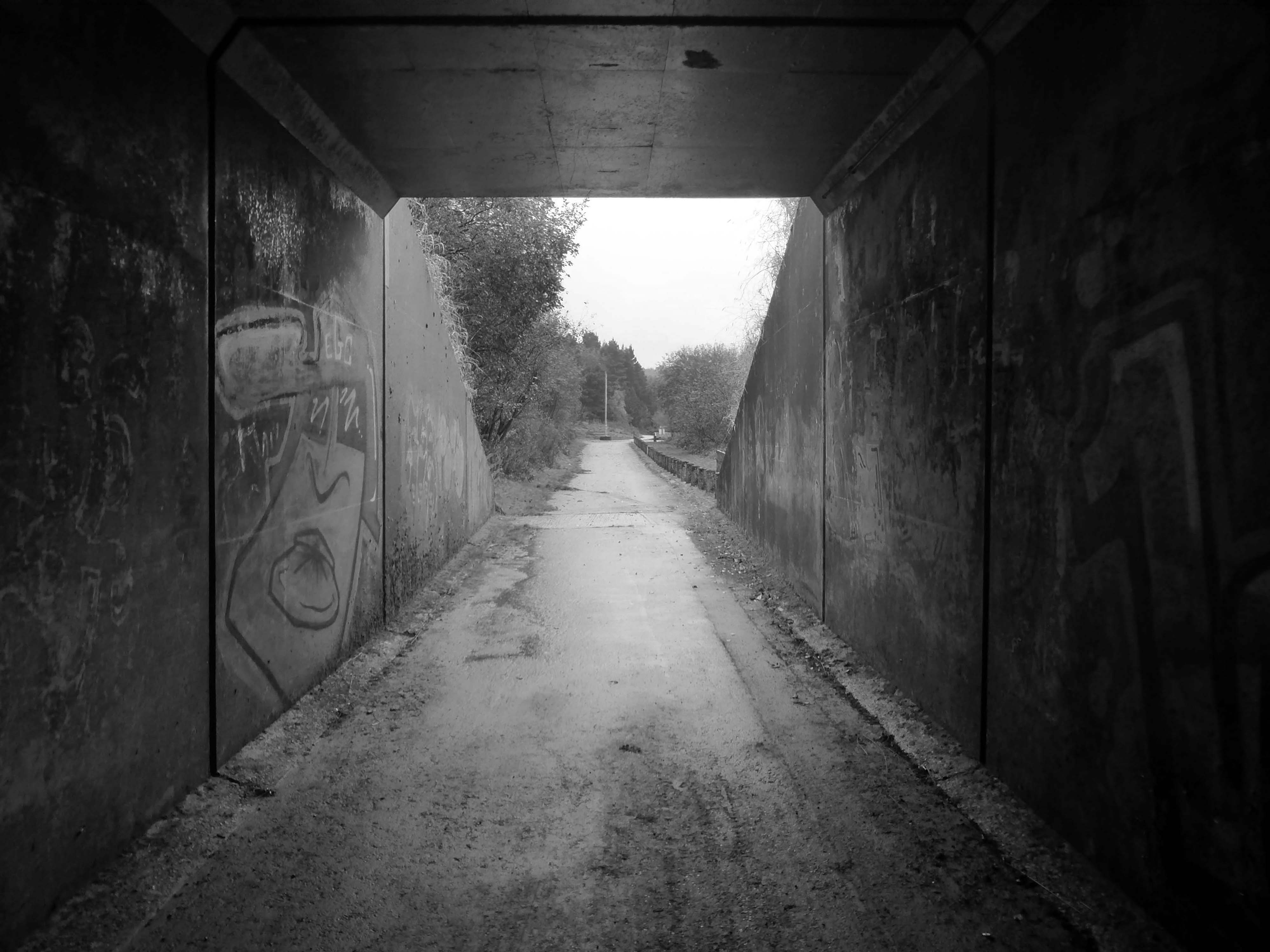
Scammonden steps comprises five flights of steps up the hillside from the valley below. Totaling 458 steps, the cumulative step count when ascending each of the five flights is 95, 200, 287, 363 then 458.
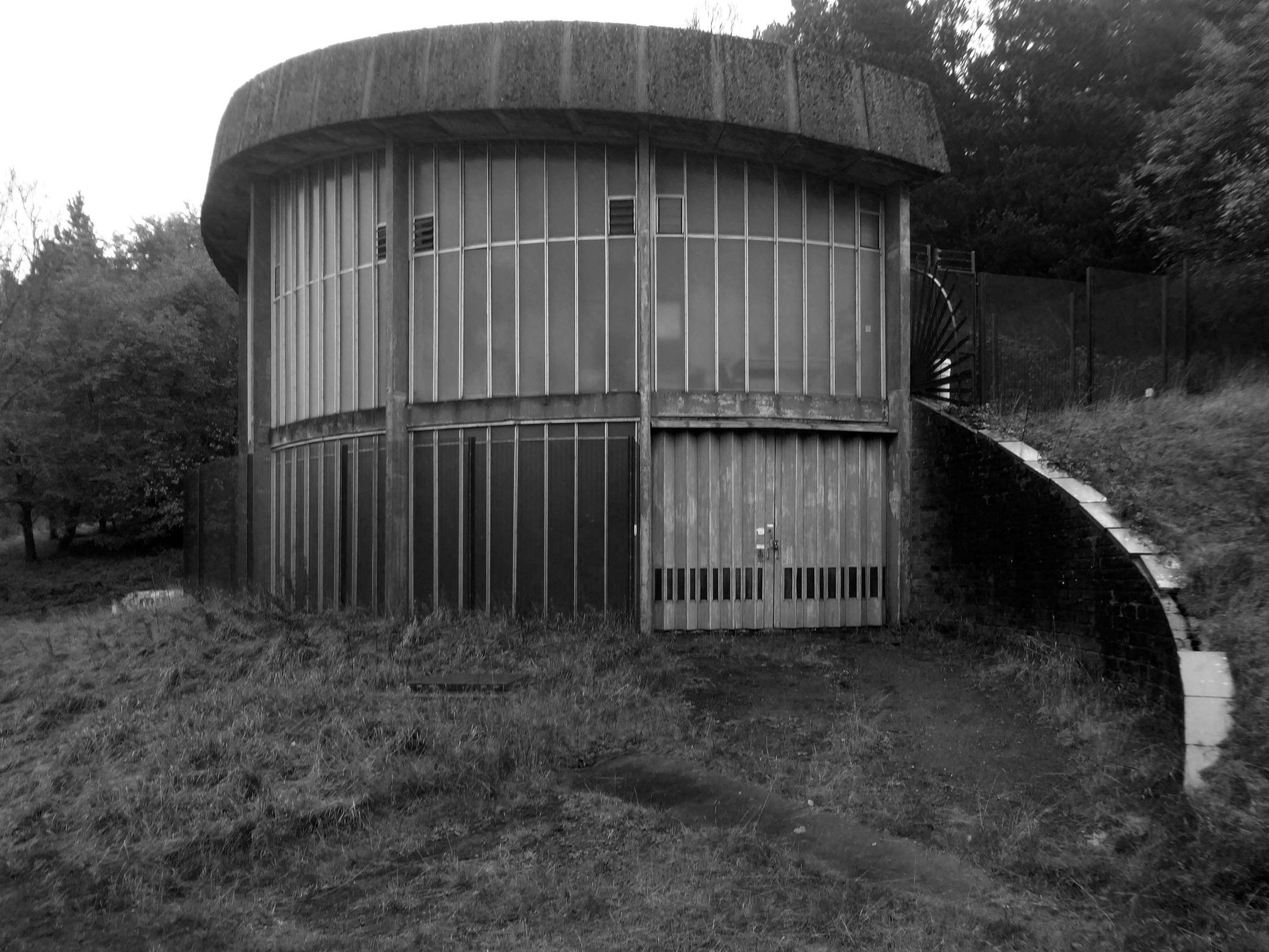
At the base of the dam is this delightful Pumping House.
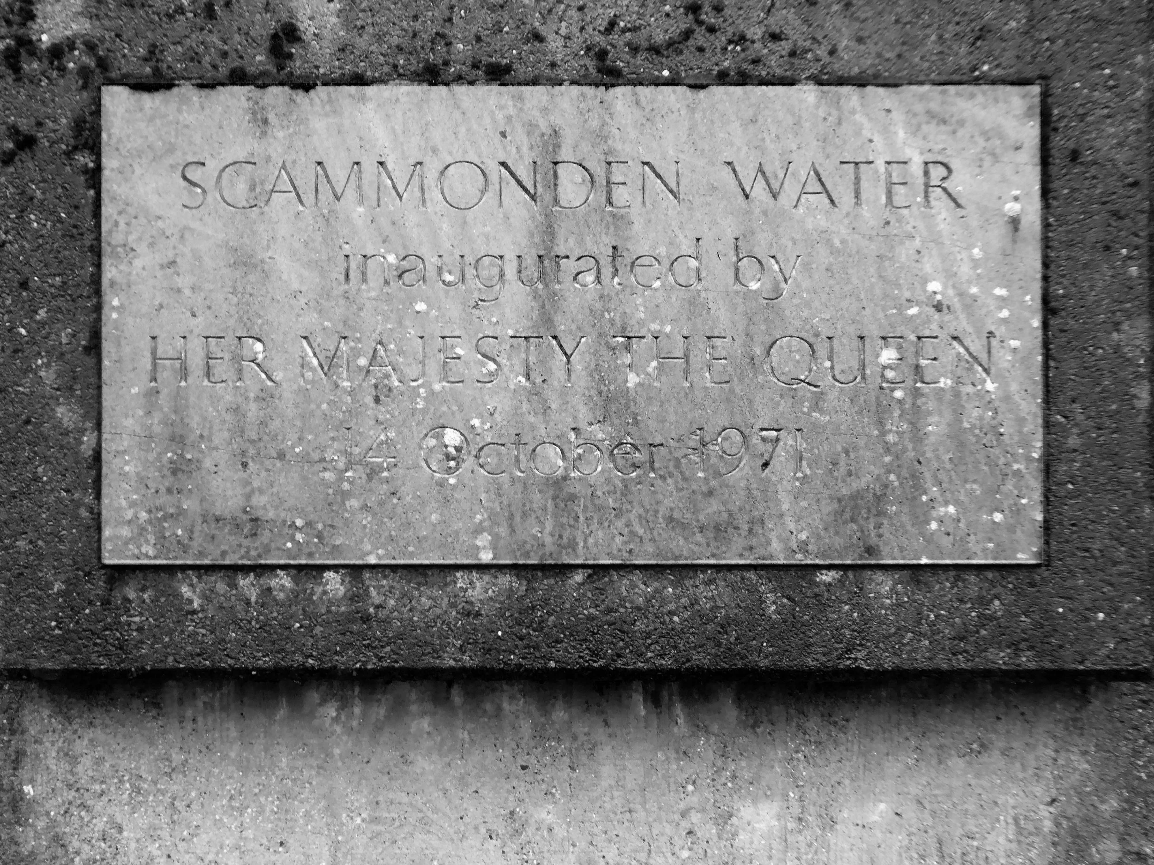
The motorway, which was dependent on the completion of the dam, was opened to traffic on 20th December 1970 and officially opened by Queen Elizabeth II who unveiled a plaque near the valve tower of Scammonden Water on 14 October 1971.
Ascending and looking back toward Scammonden Bridge also known locally as the Brown Cow Bridge – after the nearby Brown Cow Inn, now closed, spans the Deanhead cutting carrying the B6114.
The bridge was built for the West Riding County Council to the designs of the county surveyor, Colonel S Maynard Lovell.
It opened to traffic on Monday 18 May 1970 by Major Bruce Eccles – Huddersfield Transport ran buses to see the bridge.
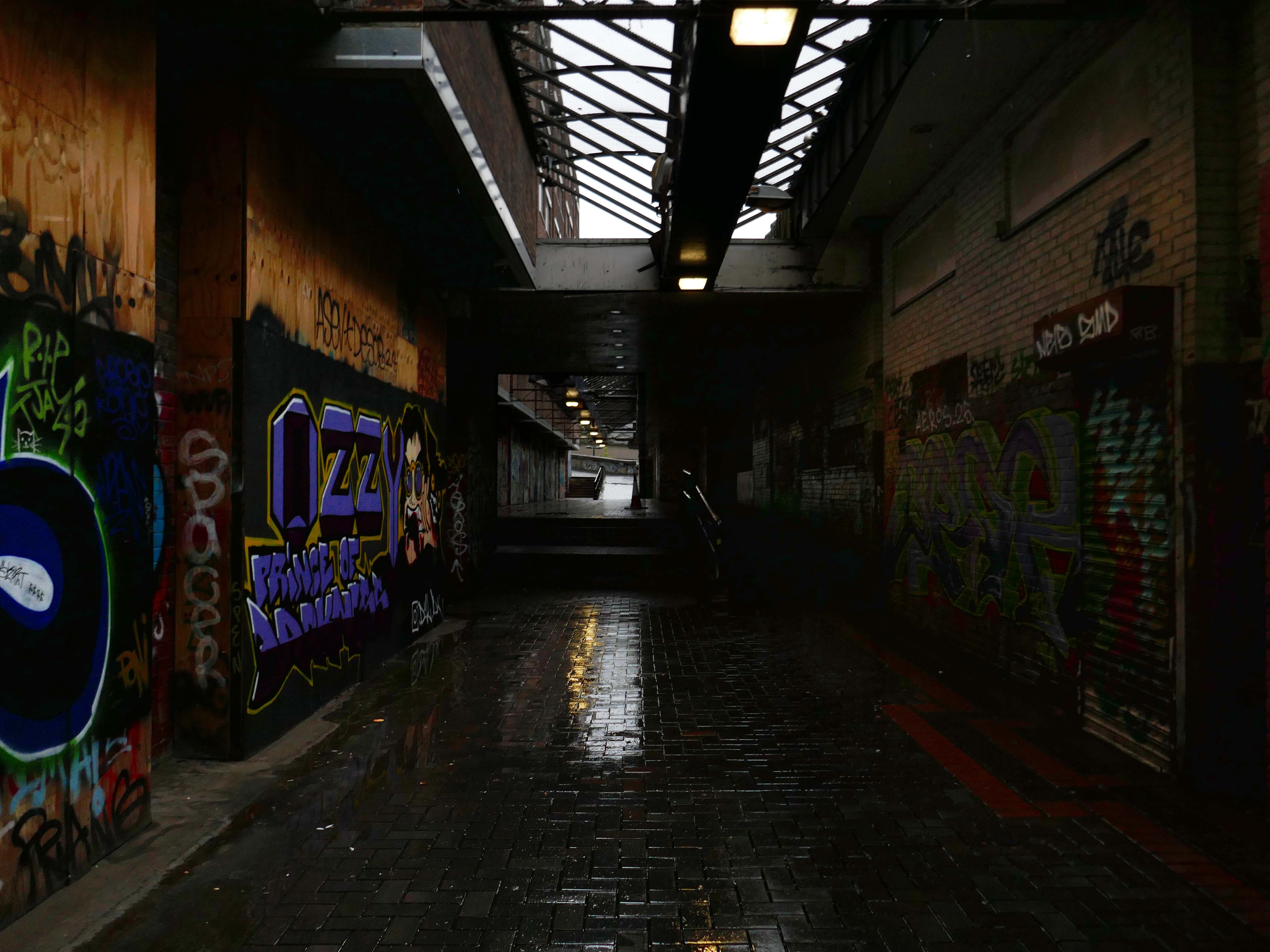
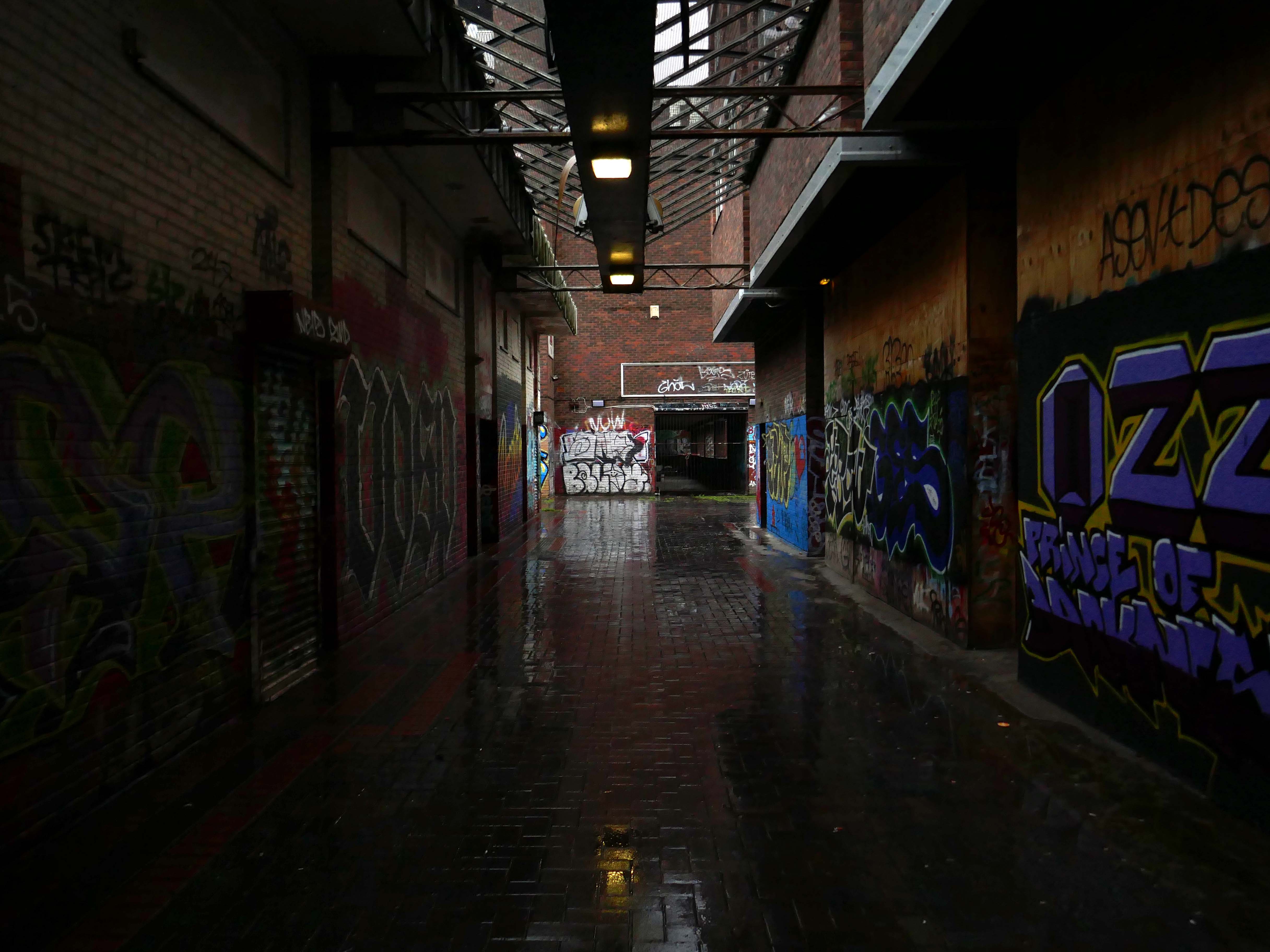
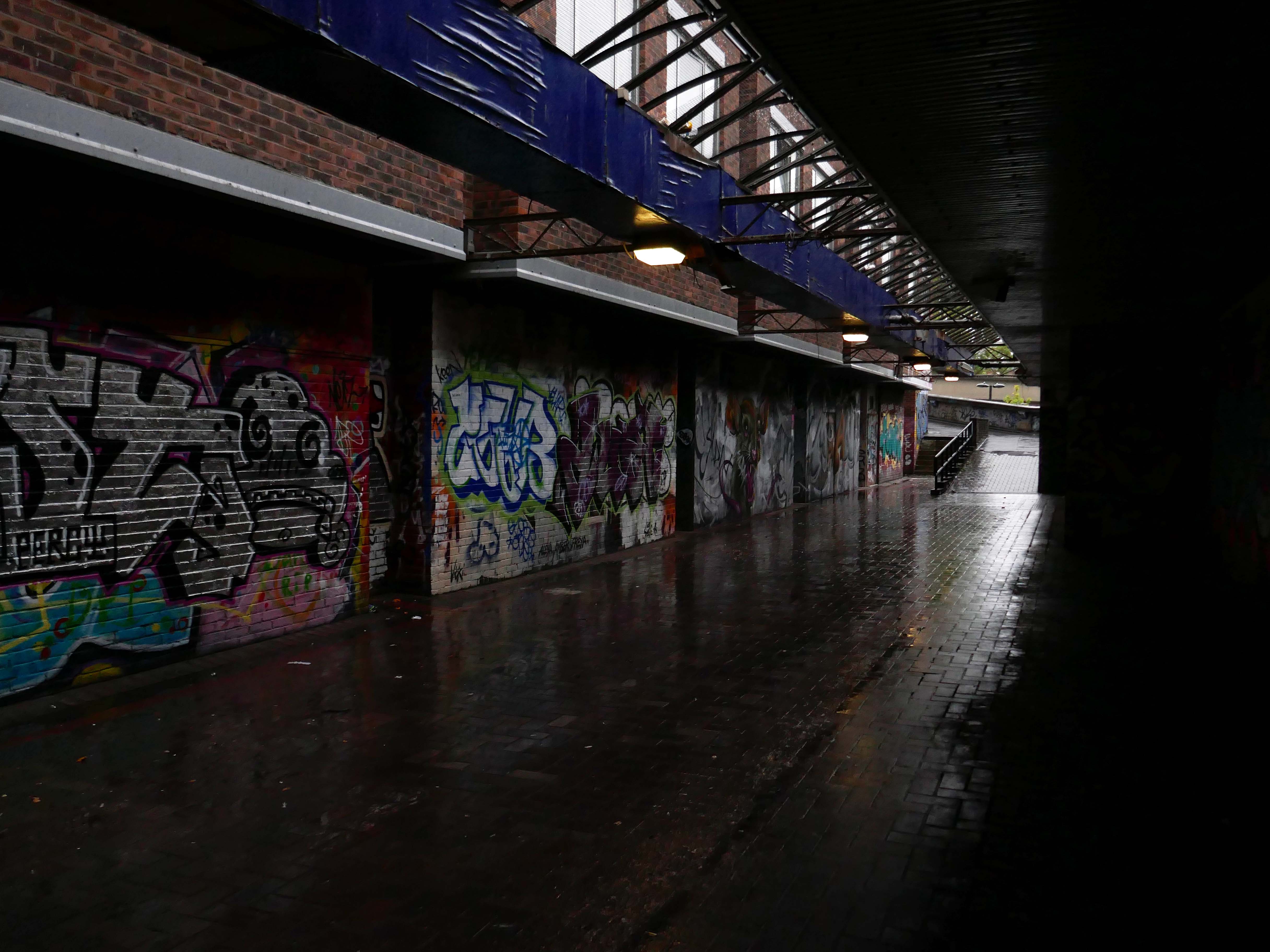
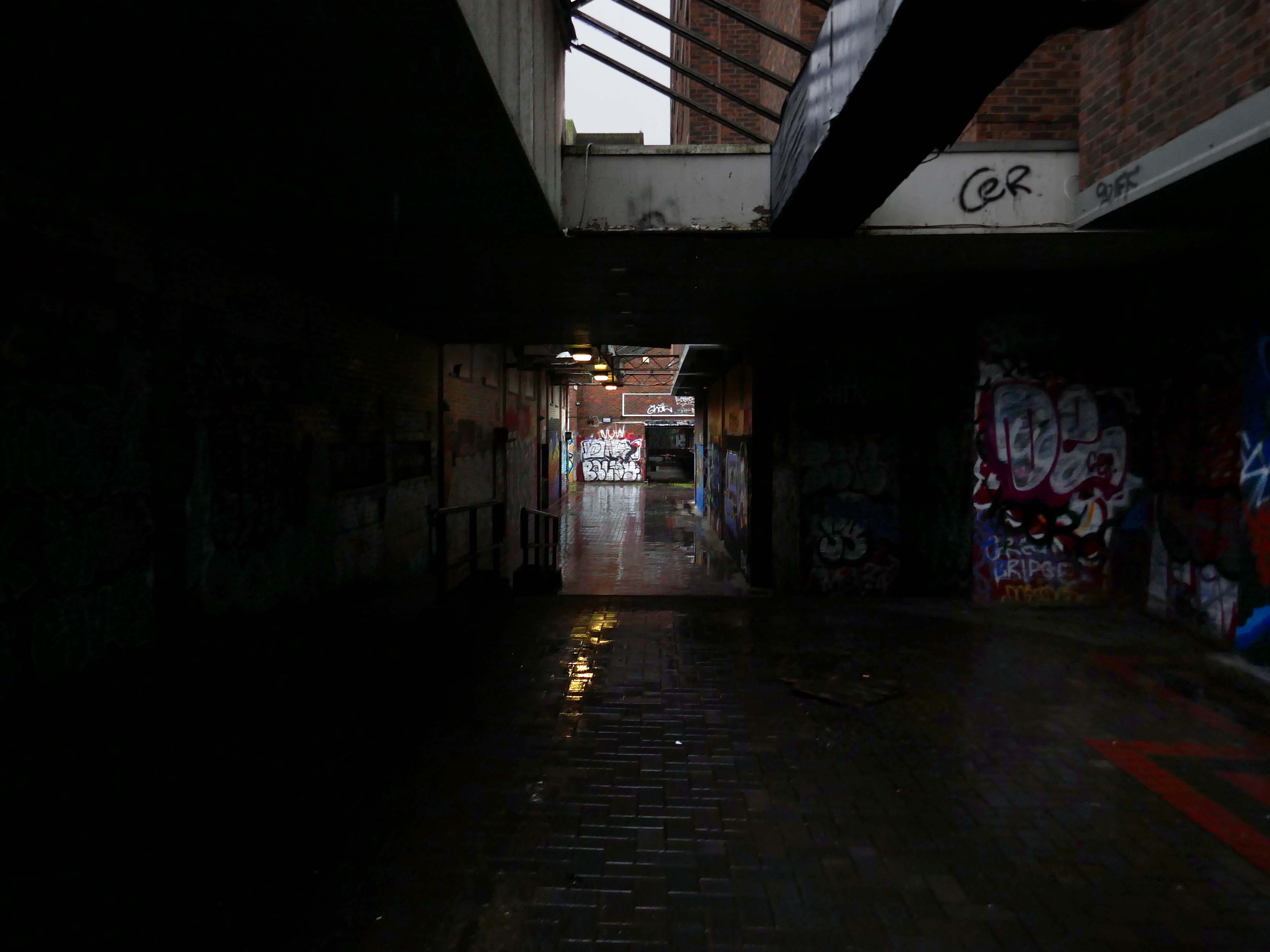
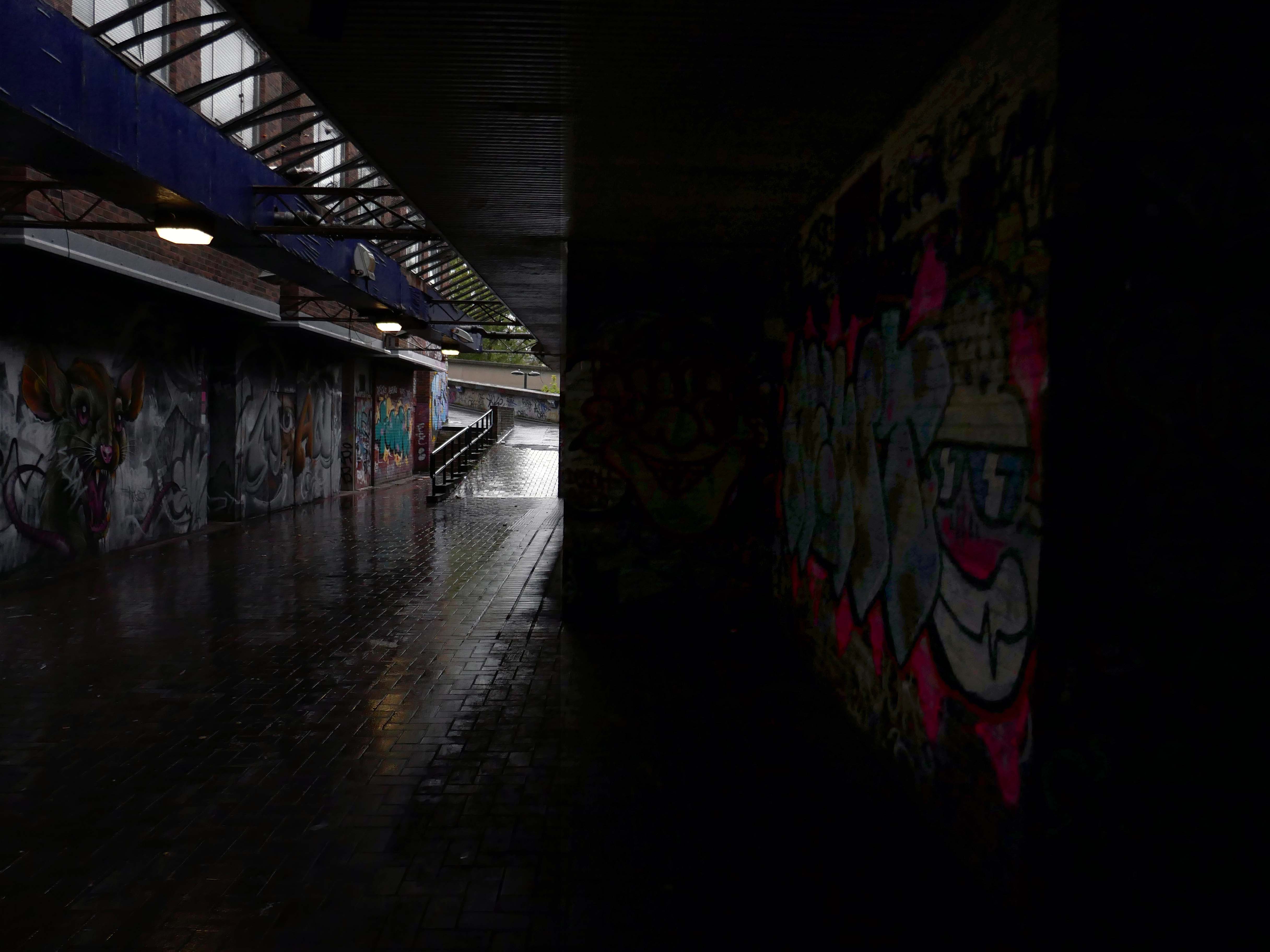
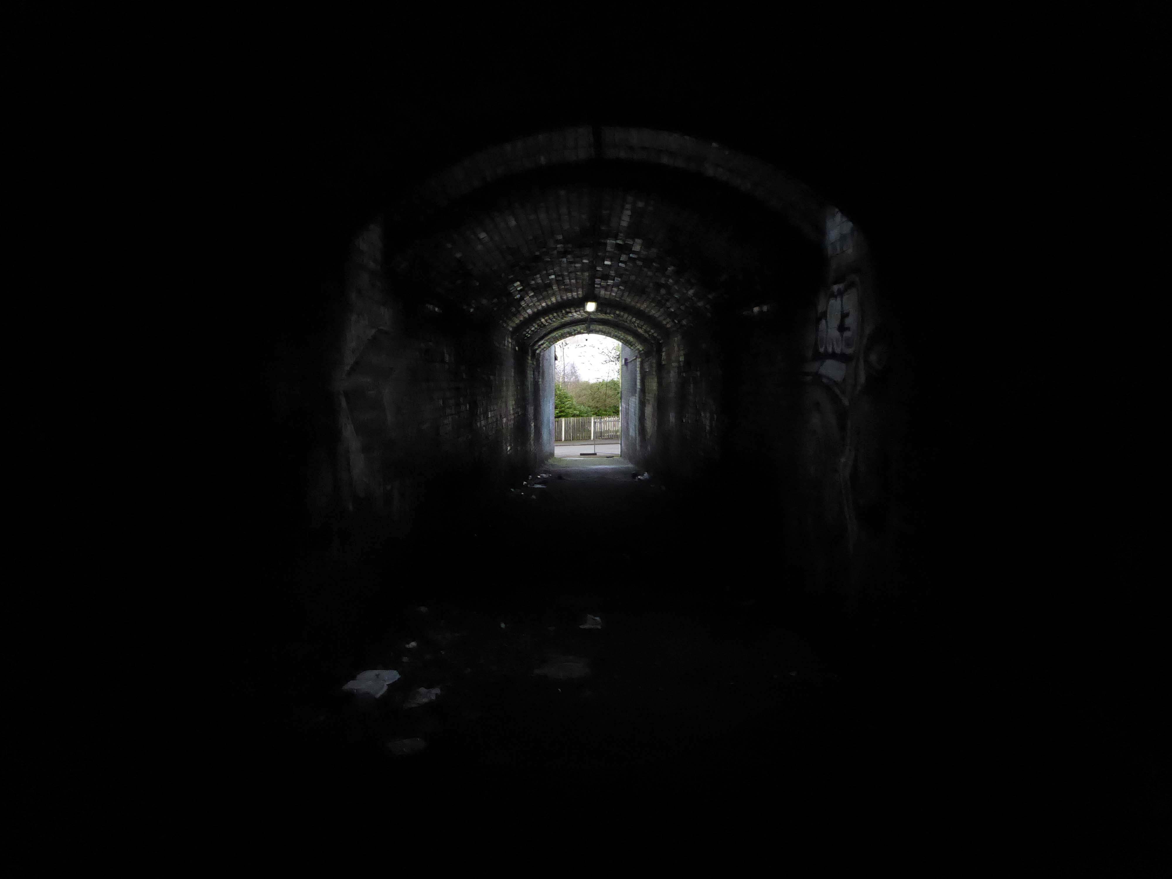
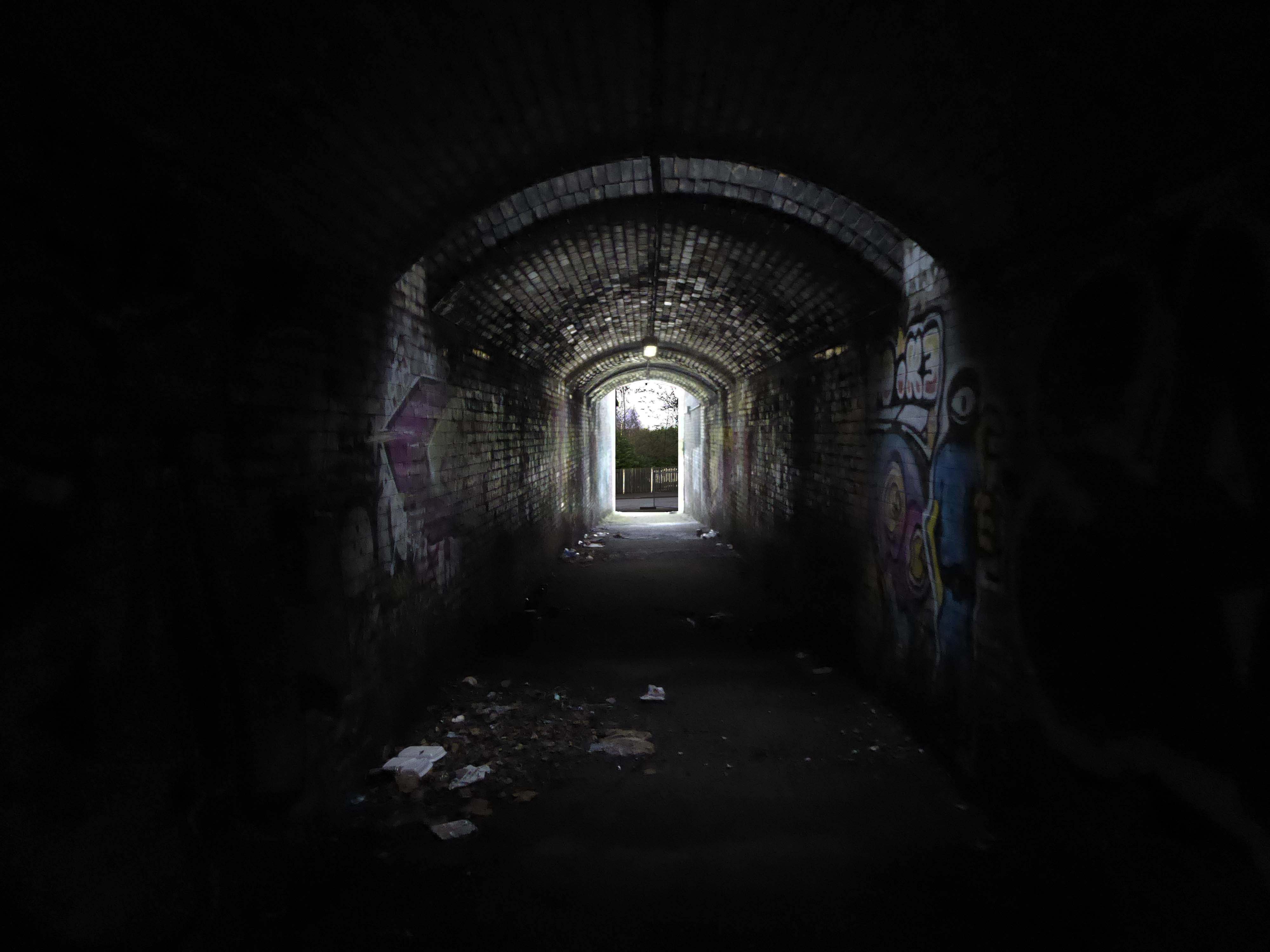
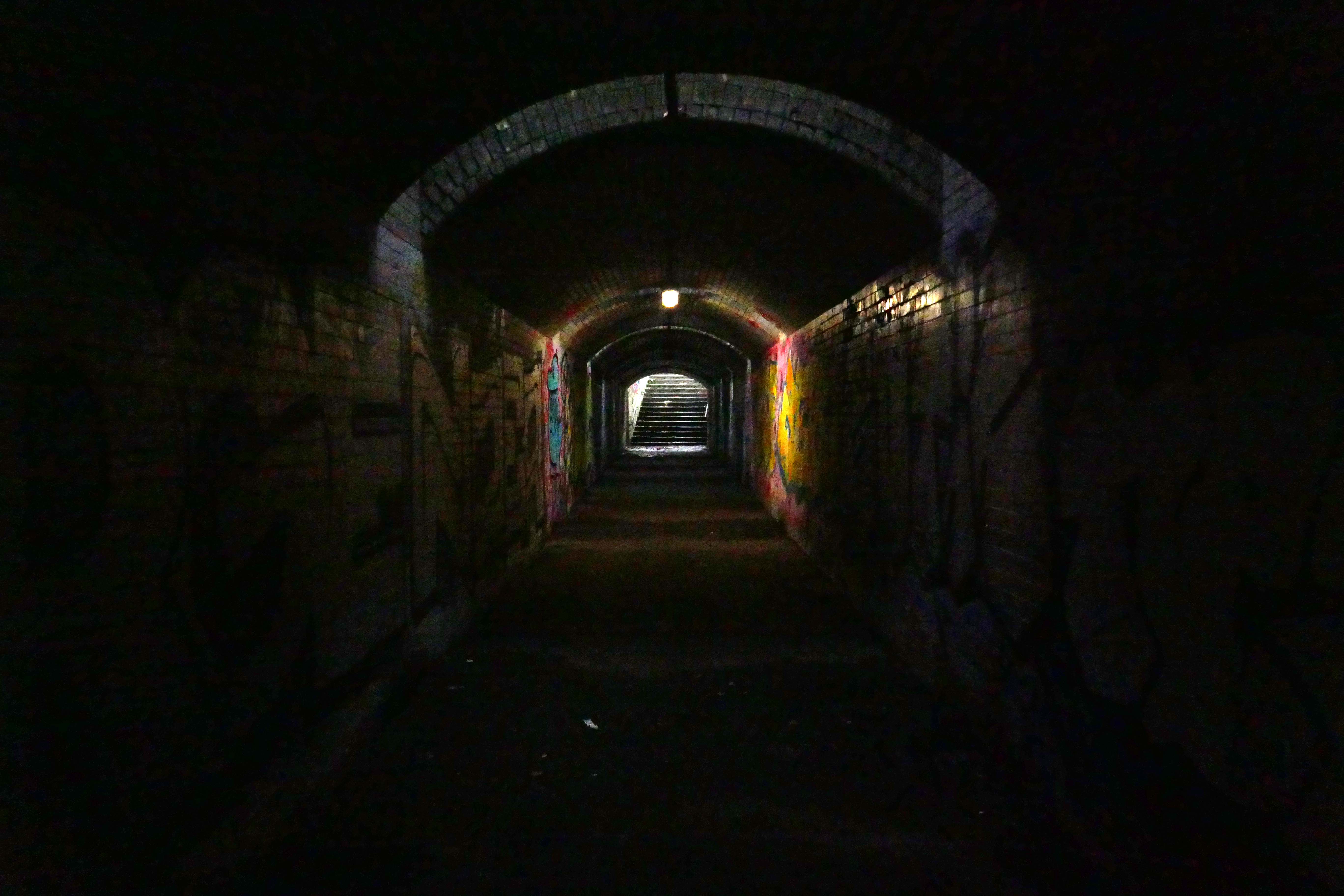
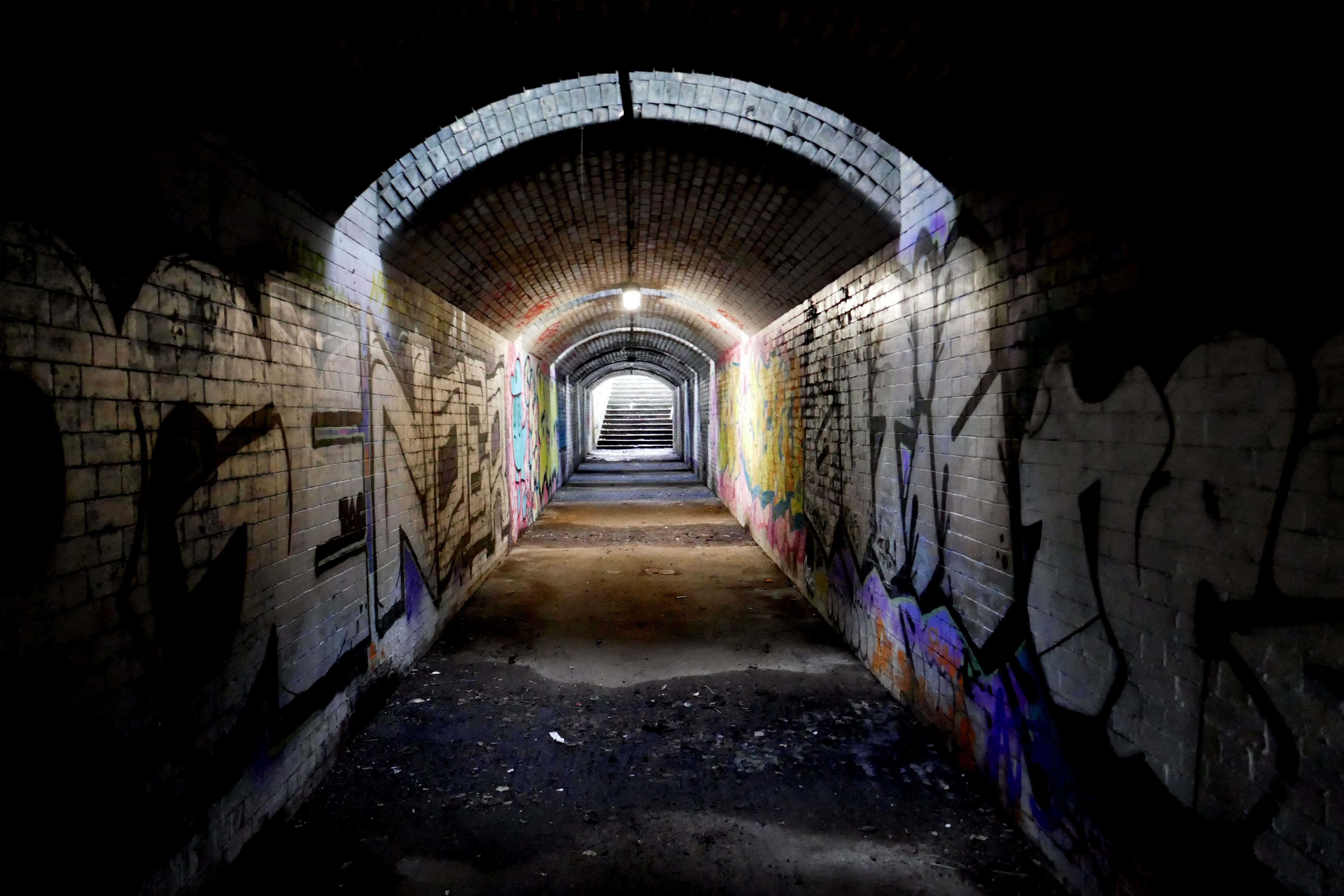
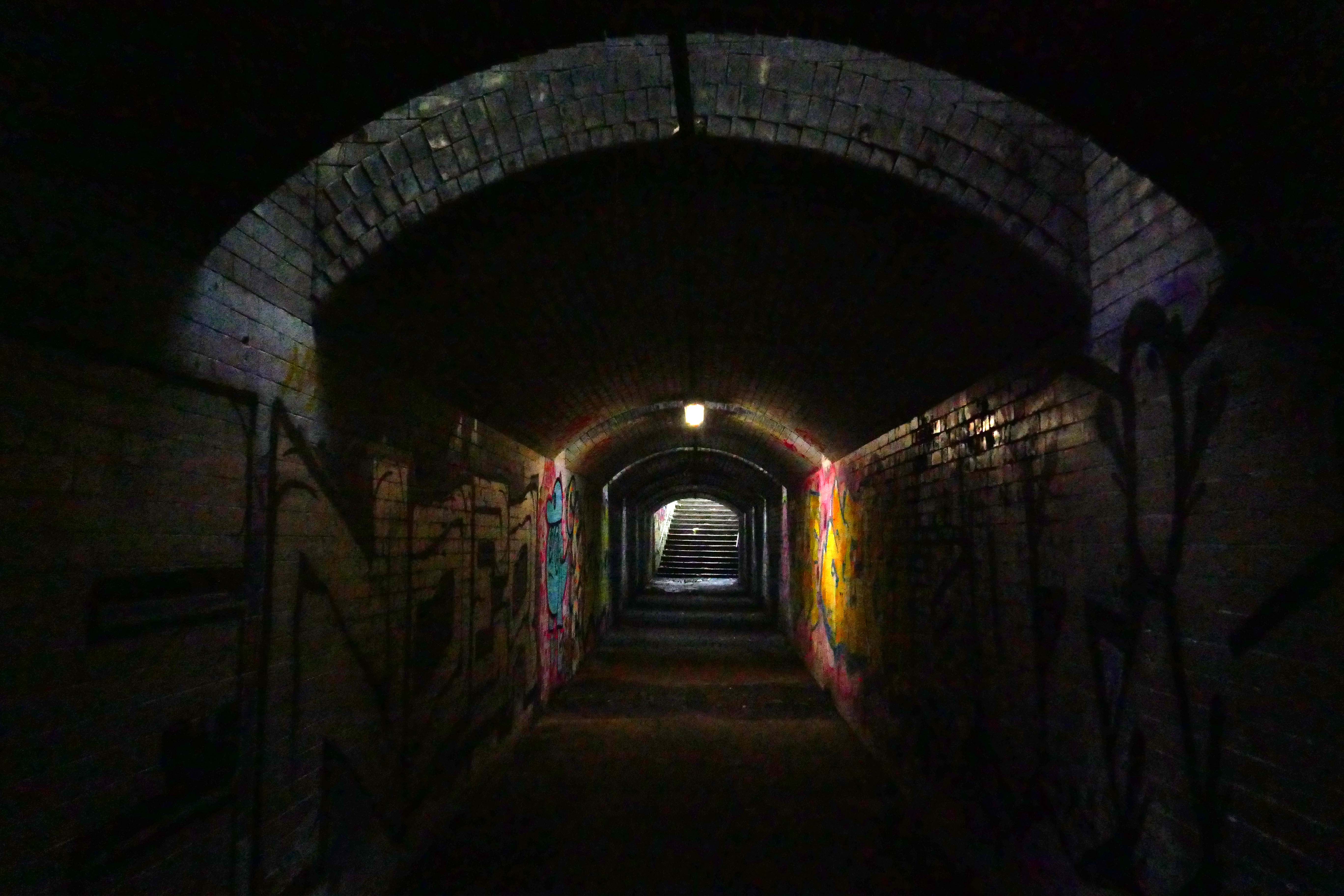
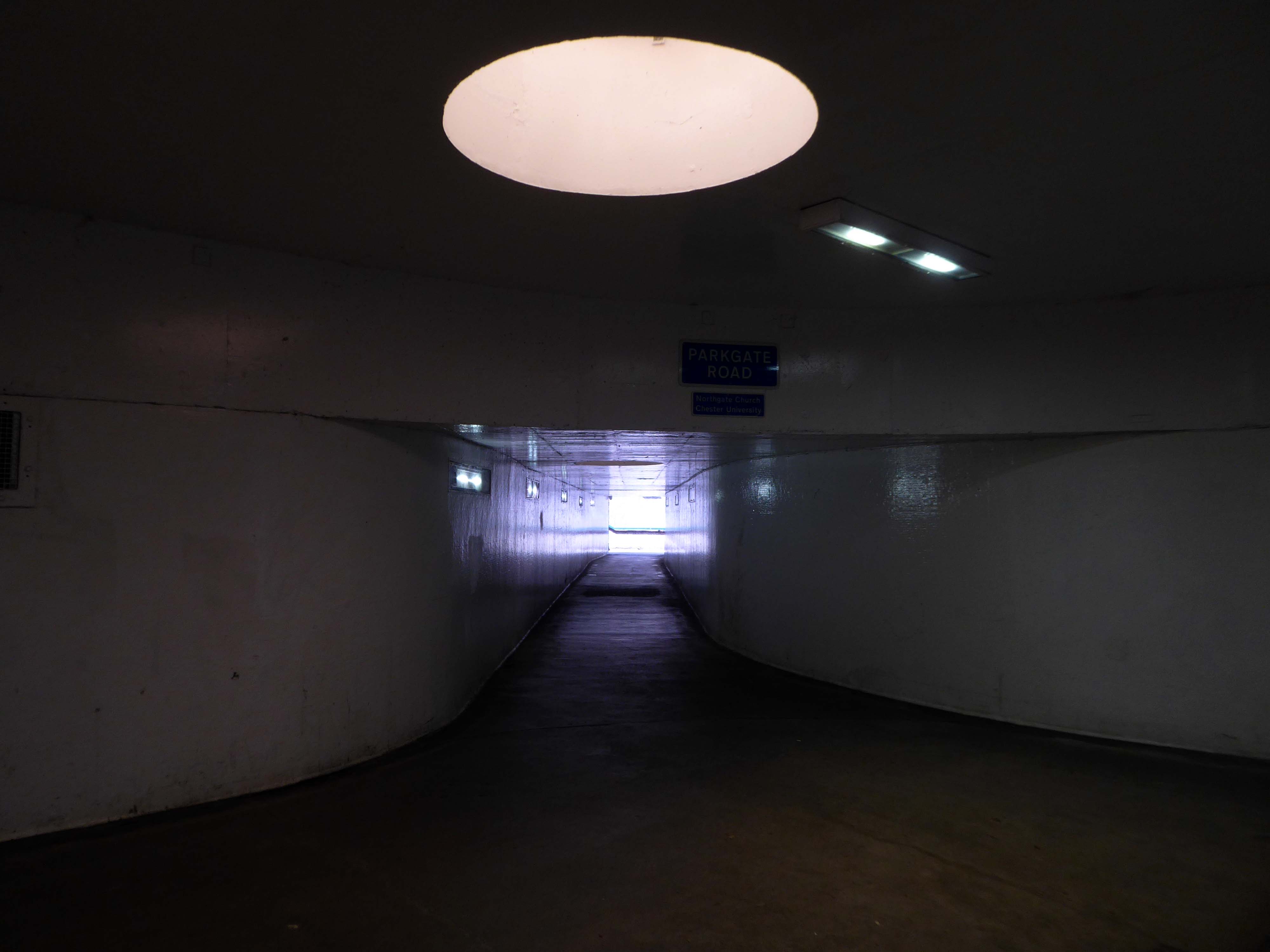
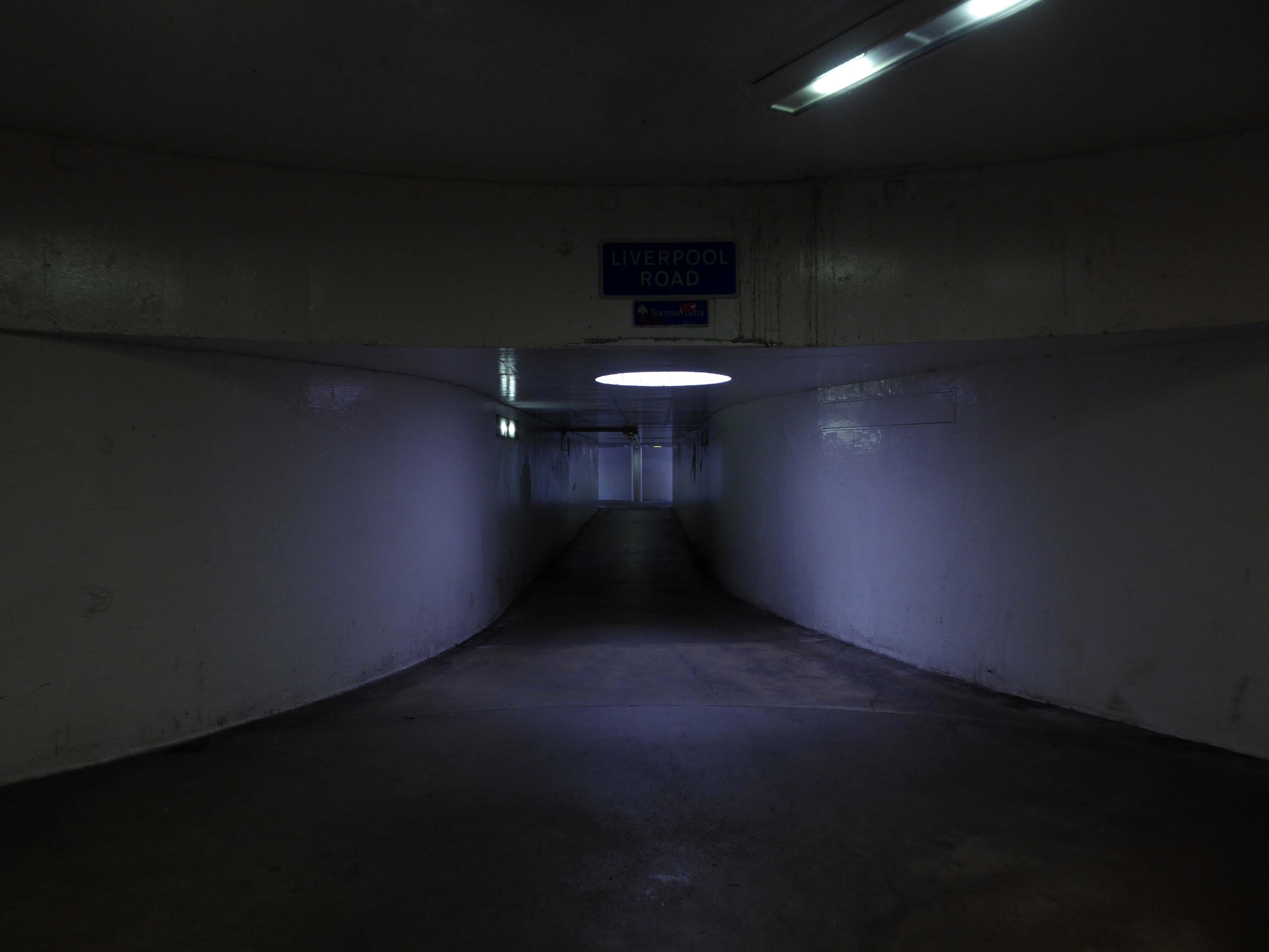
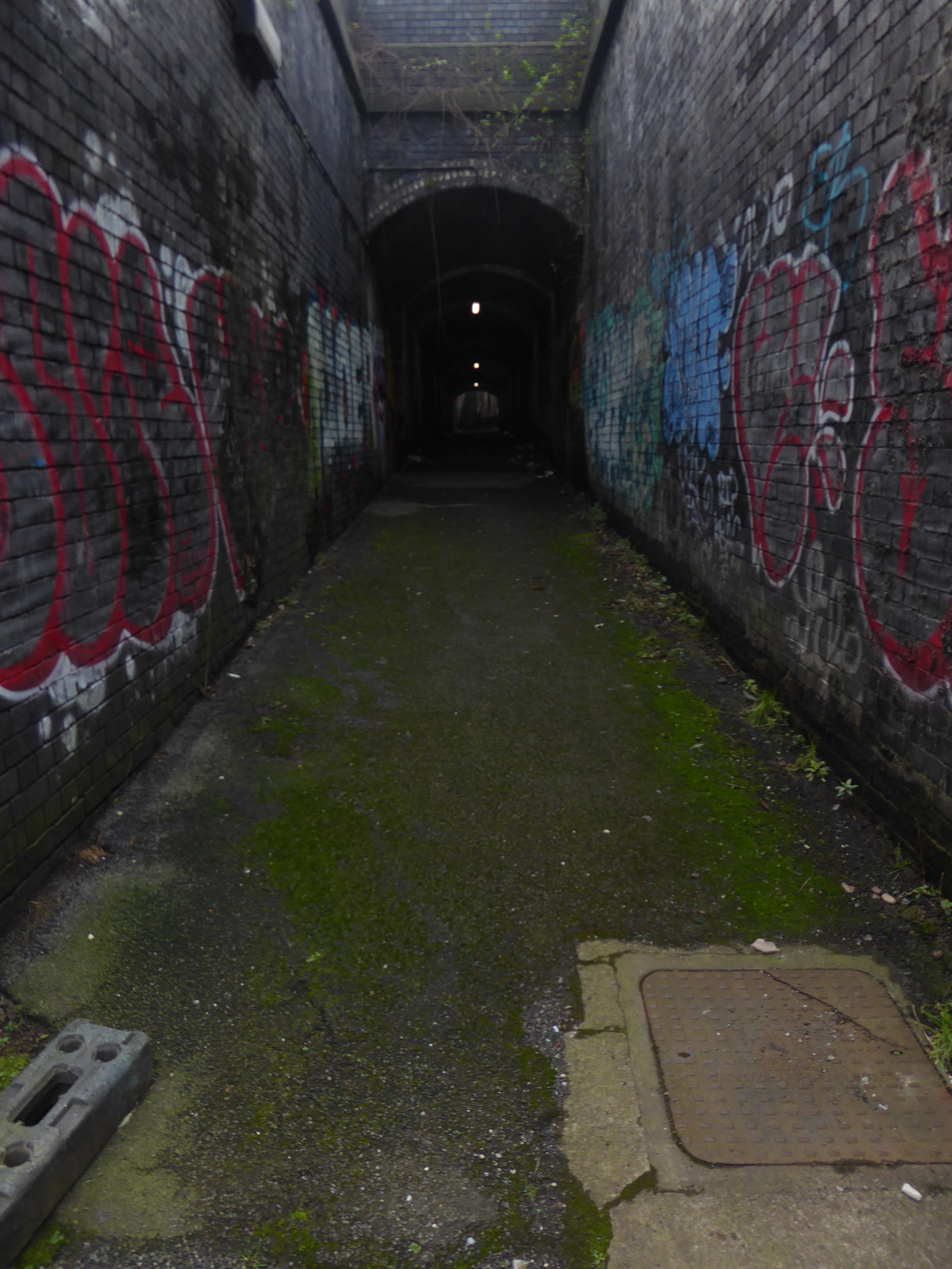
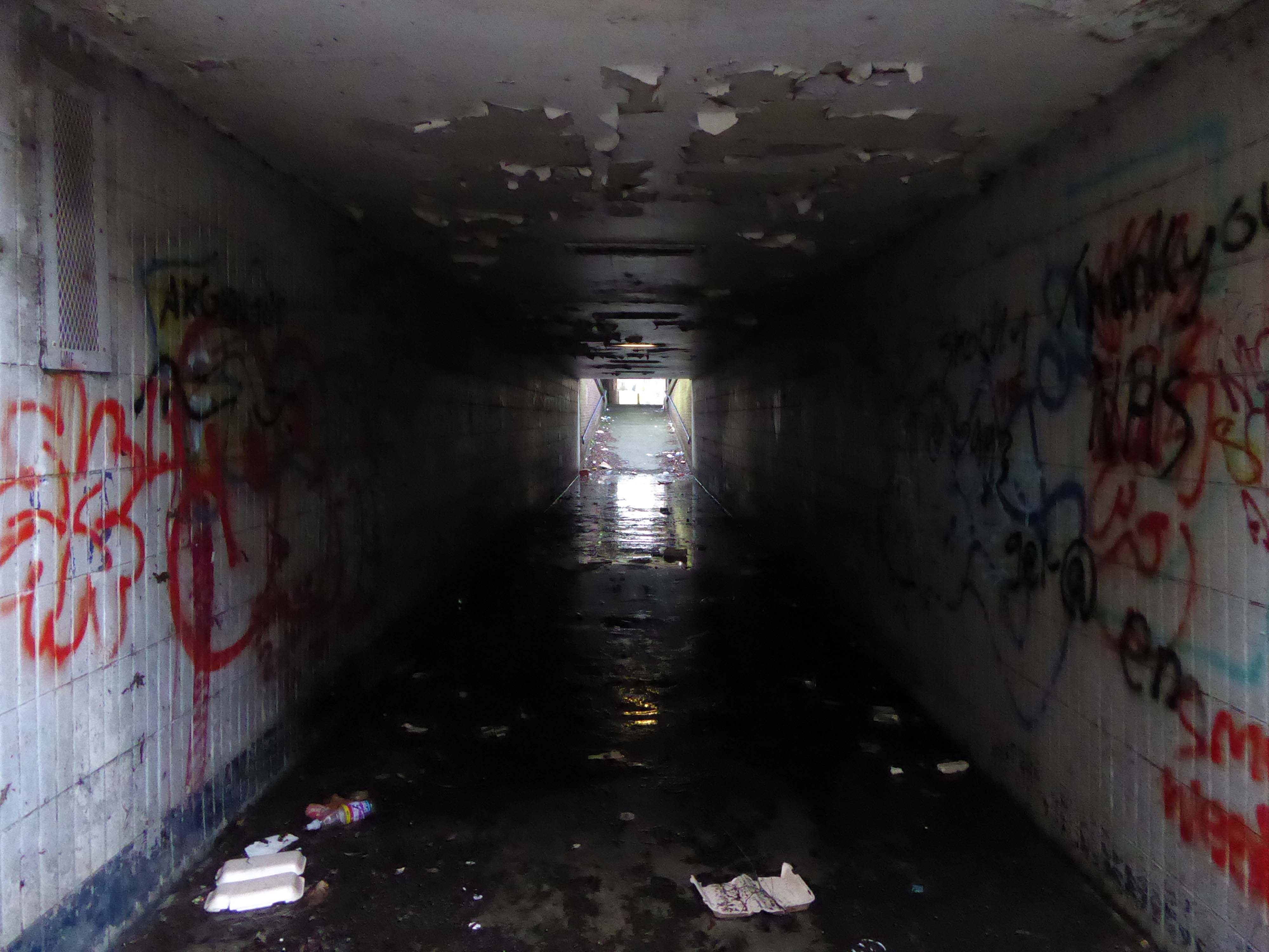
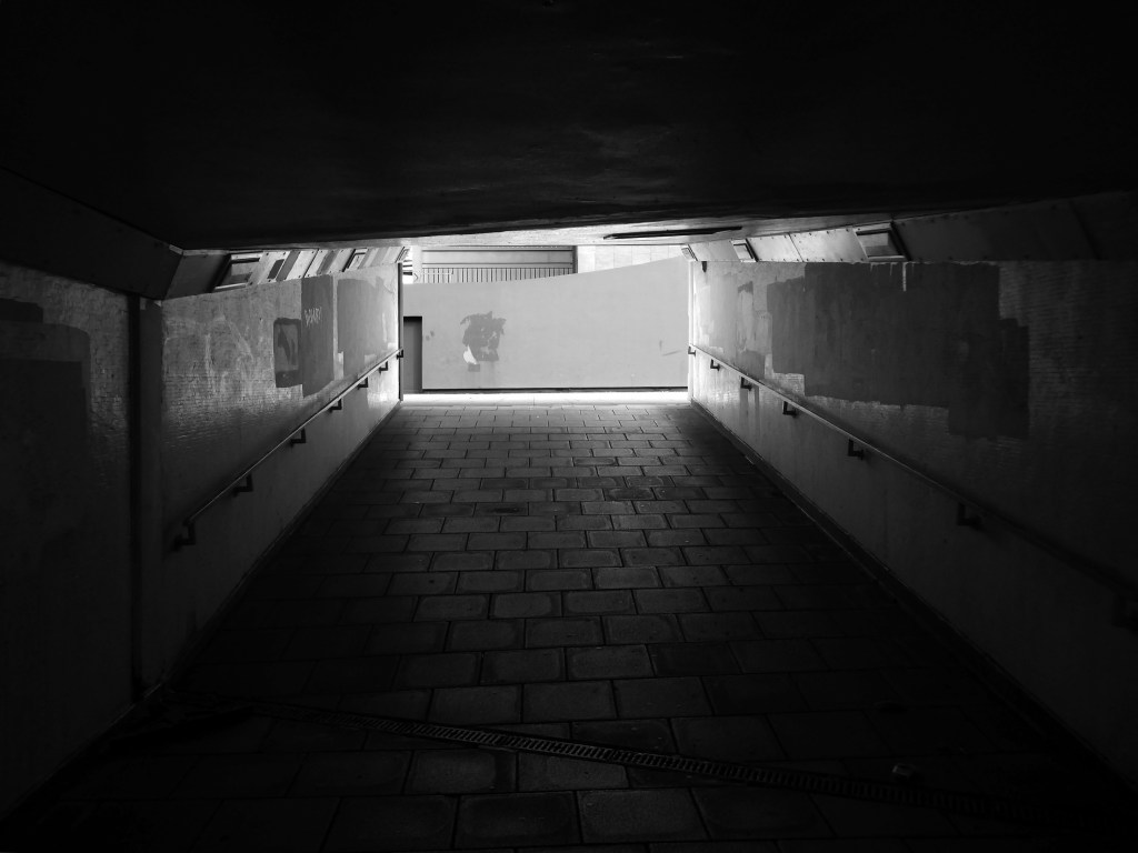
I’m overwhelmed by the underpass, where the passage of time is both slowed and hurried.
A feeling of unease will hasten your pace, a strange sense of transcendence allows you to linger longer.
There’s a world going on underground.
Rattle big black bones in the danger zone There’s a rumblin’ groan down below There’s a big dark town, it’s a place I’ve found There’s a world going on underground
Having taken a particular interest in this particular piece of public art for some time – I need to go and take a little look.
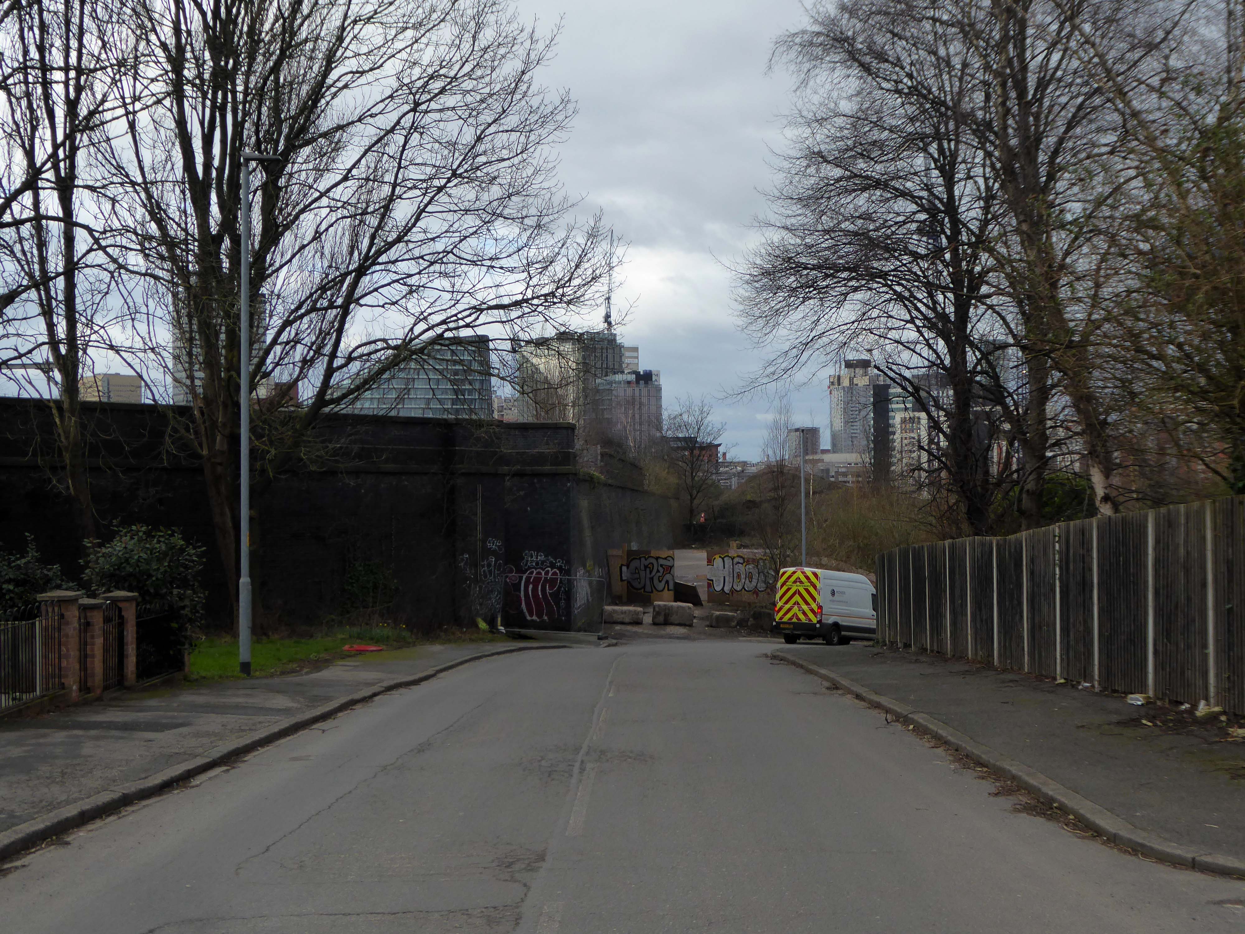
But what will we see along the way, as we hasten along Rochdale Road?
Which once looked like this, way back when in 1904.
Though some things inevitably come and go, as some things are prone to do.
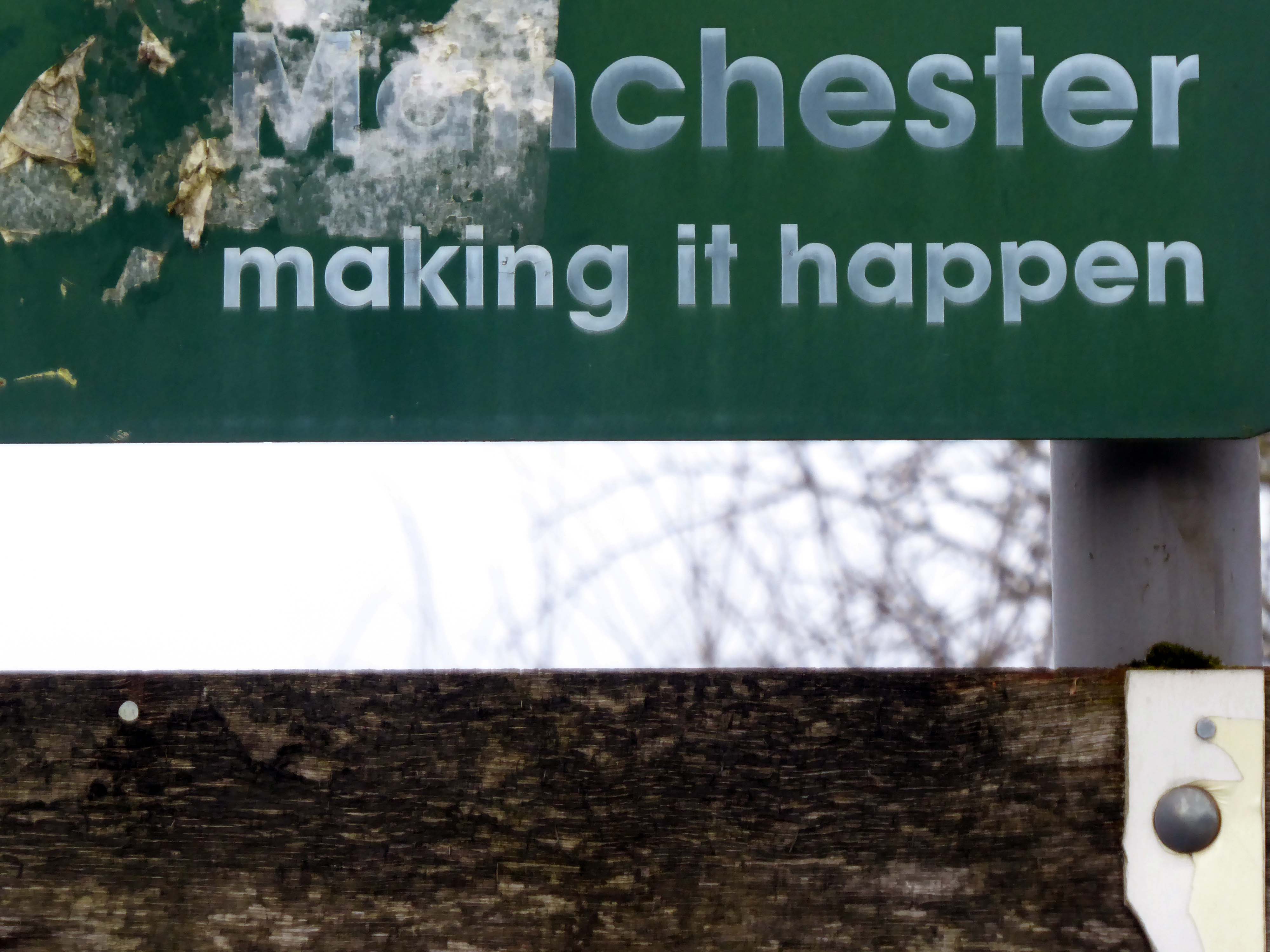
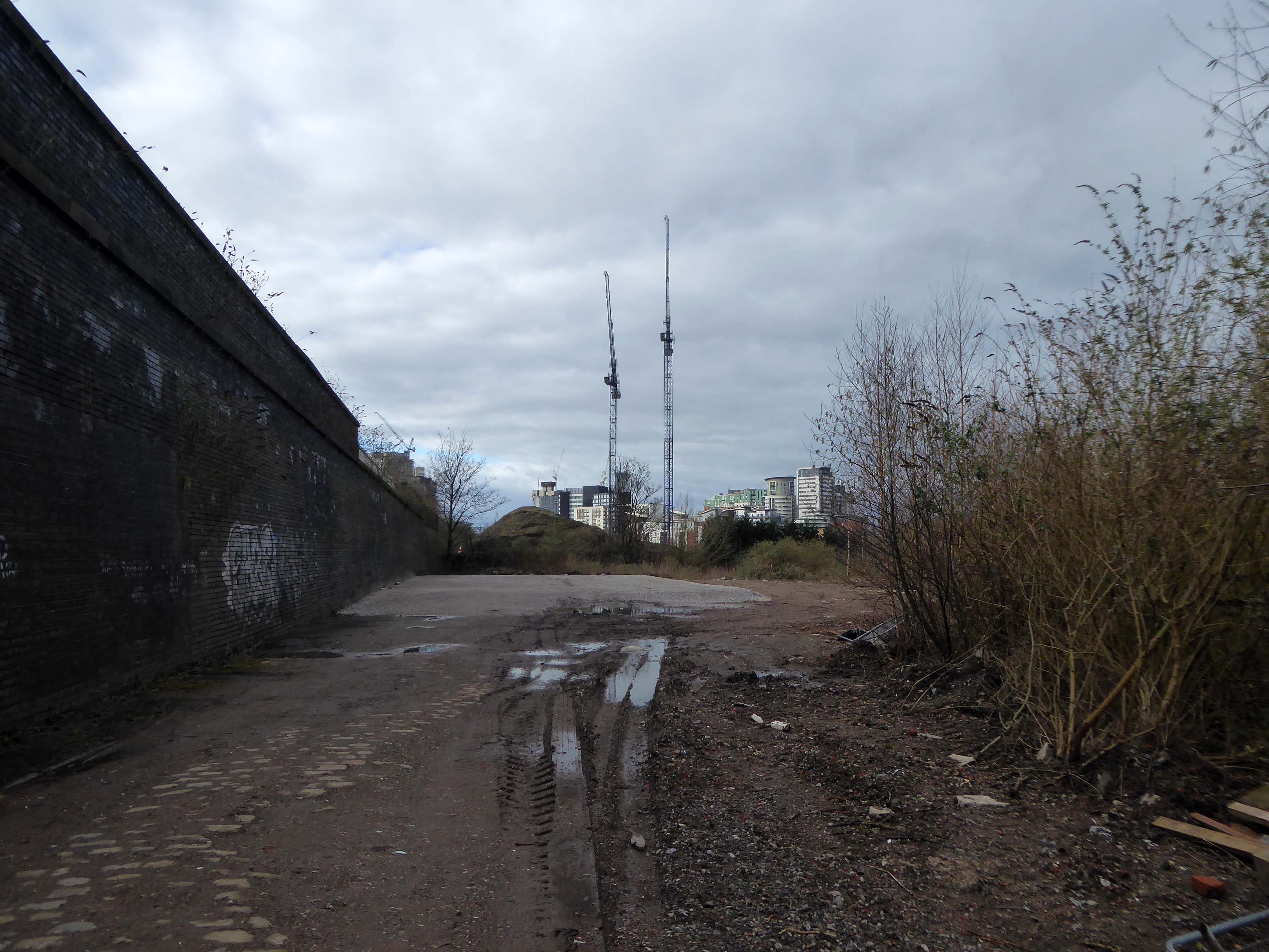
The city is undergoing yet another reinvention as Manchester becomes – an attractive place to invest and do business.
See, I am doing a new thing!
Now it springs up; do you not perceive it?
I am making a way in the wilderness and streams in the wasteland.
Isaiah 43:19
Once there was a gas works here – adjoining Gould Street, seen here in 1958.
The Gould Street Gas Works was a gas manufacturing plant located in Manchester, England. Originally built in 1824, the plant was operated by the Manchester Corporation Gas Department and was in operation from 1833 to 1969. It was named after the street on which it was located, which was named after John Gould, who was a prominent Manchester businessman in the 19th century.
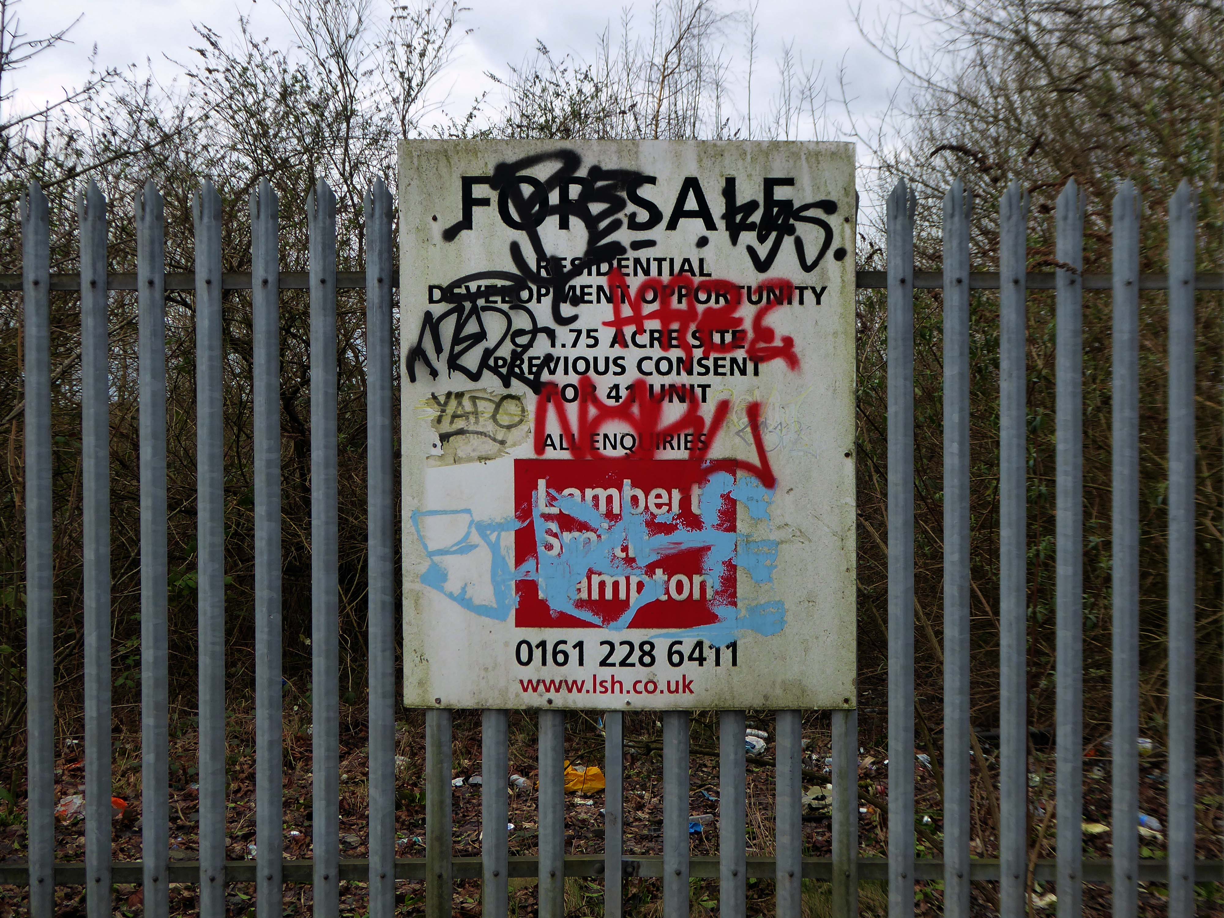
The Gasworks New Town neighbourhood is one of seven envisioned by the £4bn Victoria North masterplan. It will feature nine buildings ranging from 8 to 34 storeys. The 6.6-acre site has most recently been home to a car park but the green development will overwhelmingly prioritise walking and cycling over driving. It will result in tens of millions of pounds being pumped into the city’s economy over the lifetime of the development.
Plans for a trailblazing city centre regeneration scheme that will create more than 1200 homes has been approved by Manchester City Council.
A total of 85 of the 1200, will be affordable homes available through Shared Ownership.
Though as of March 31st 2023 ground is yet to be broken, no signs of the:
New centre of gravity for central Manchester that will create thousands of jobs and inject tens of millions of pounds into the city’s economy.
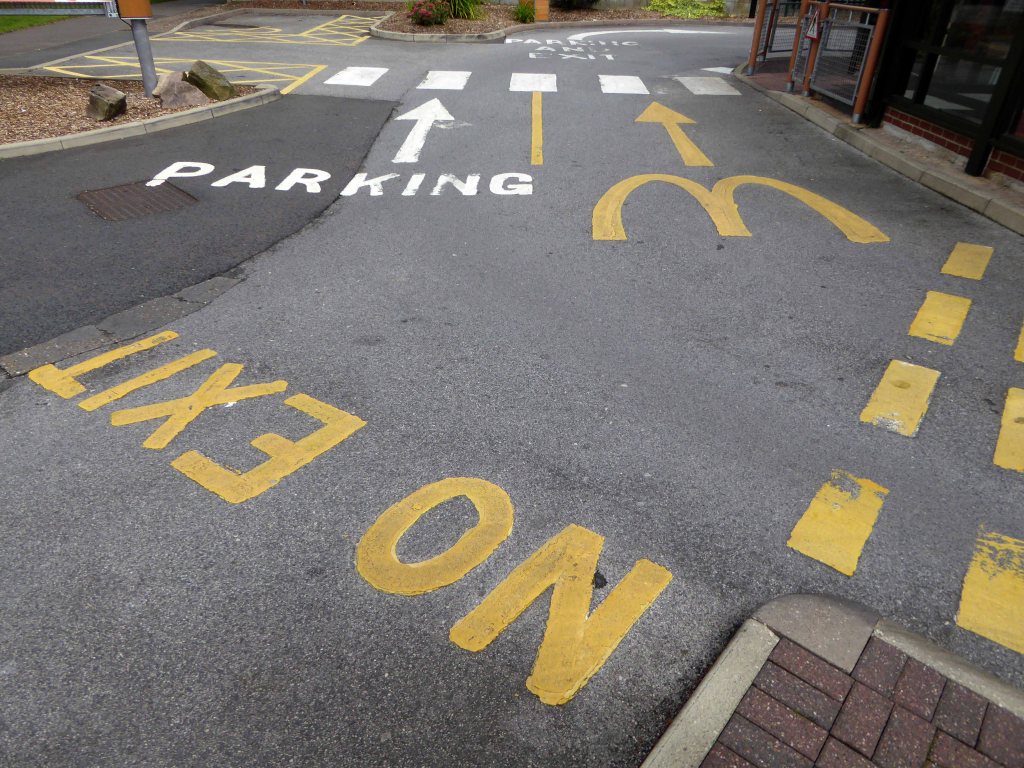
So you zig-zag wanderers, make the most of these wide open expanses of affordable car parking, while you can.
The future may yet be here today – or the next.
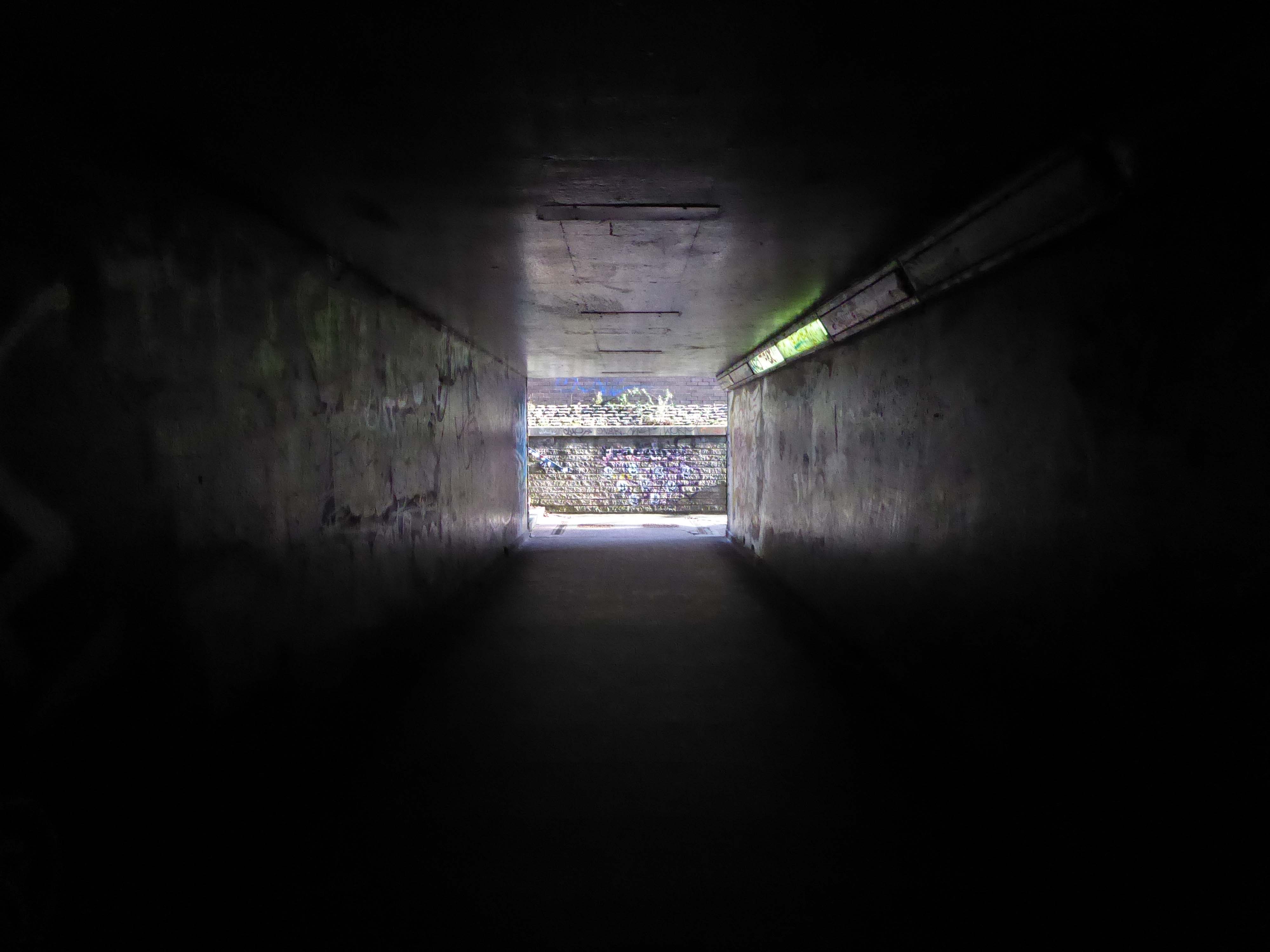
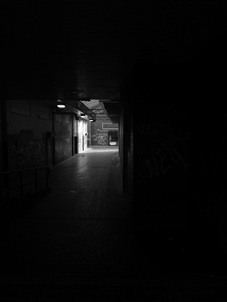
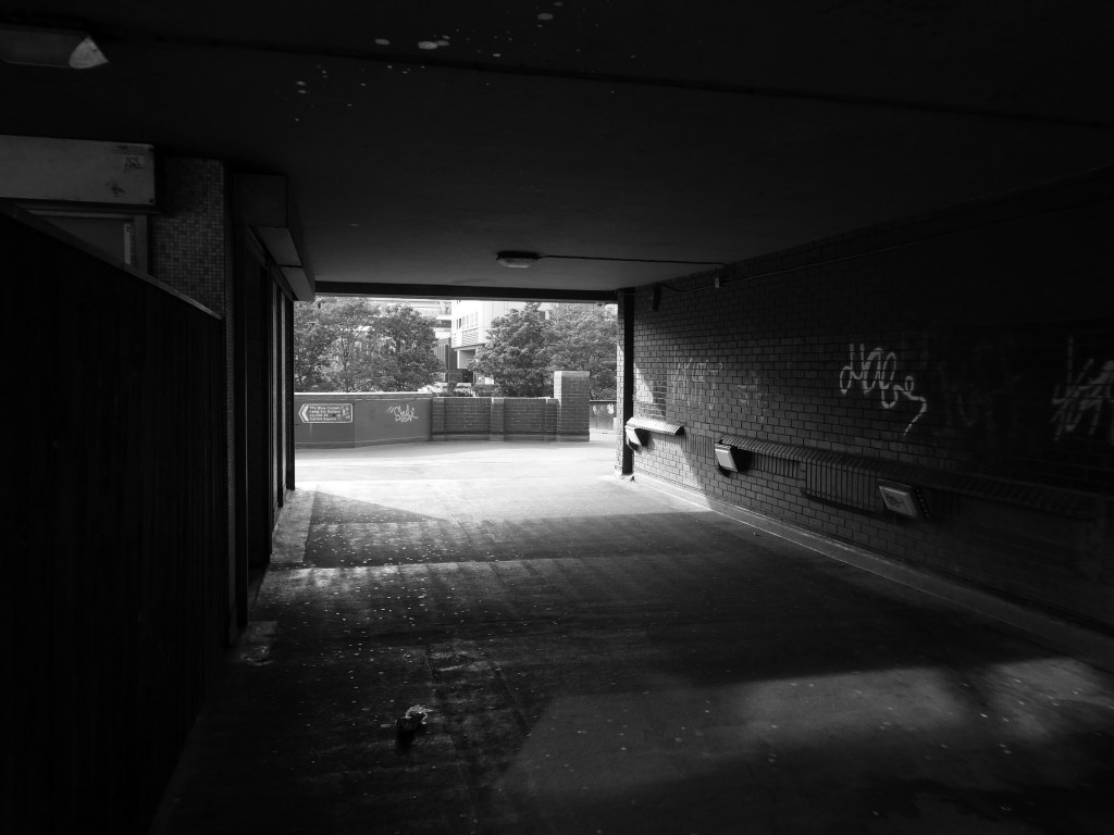
Let’s duck under the railway, through this sad damp pedestrian tunnel – the domain of the cash strapped daytime drinker, transient tagger and disaffected leaflet distributor.
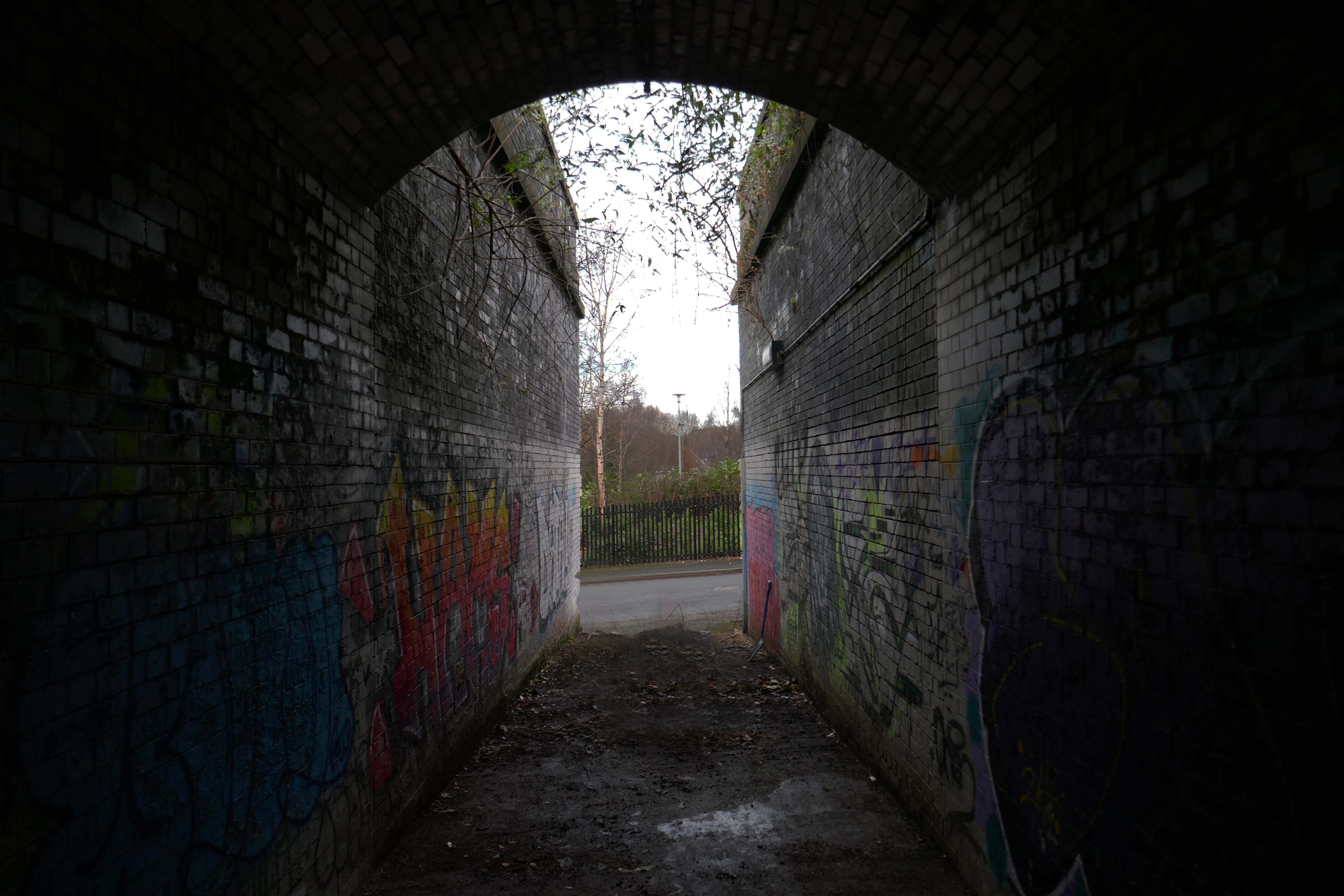
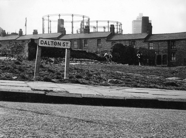
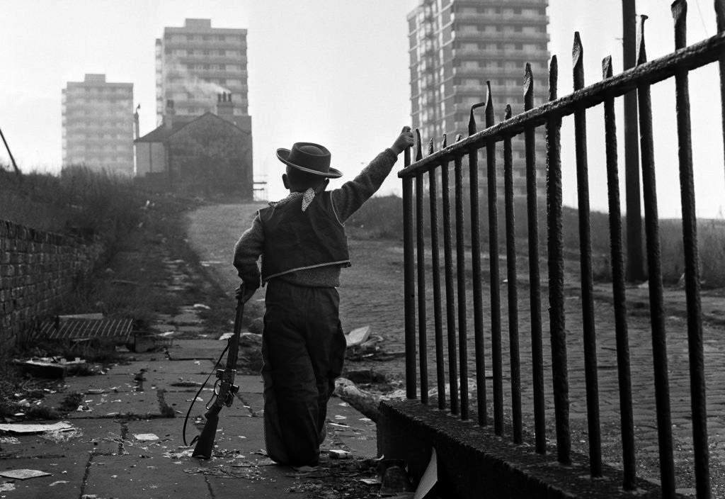
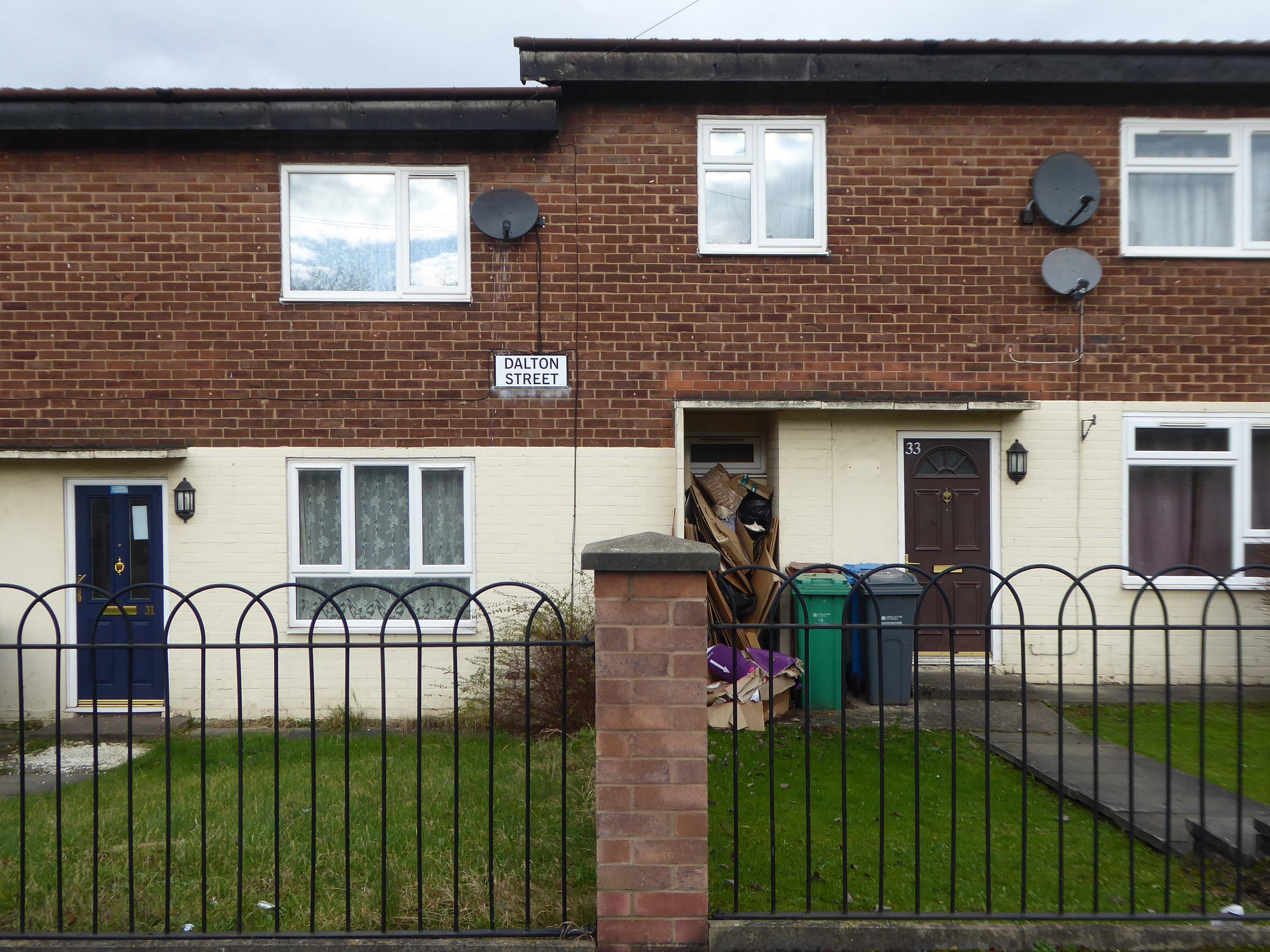
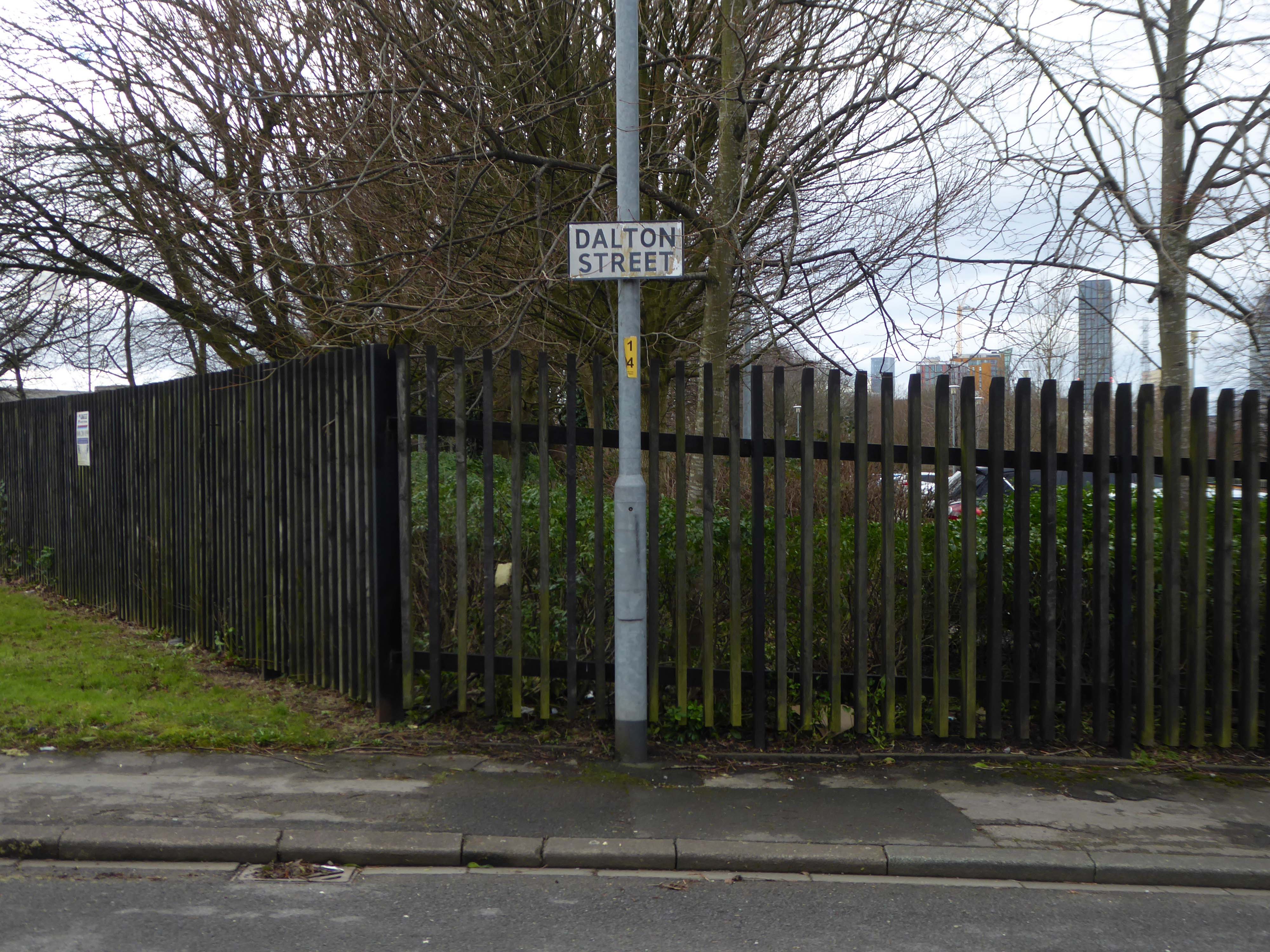
Next thing you know you have emerged into the daylight on Dalton Street – we have been here before seeking the Collyhurst Cowboy.
Photograph: Dennis Hussey
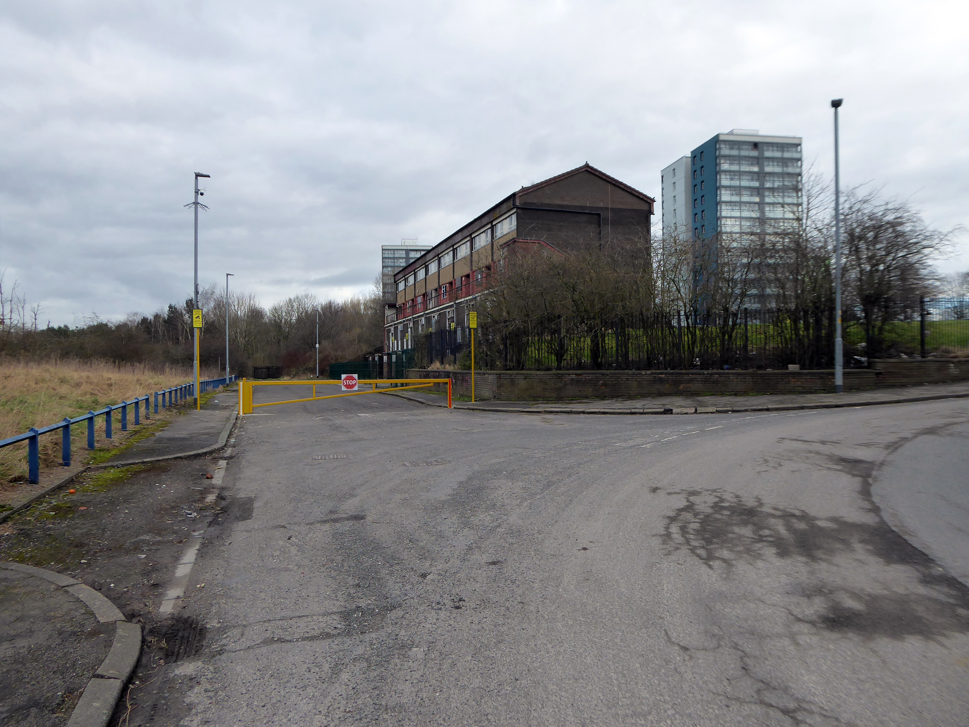
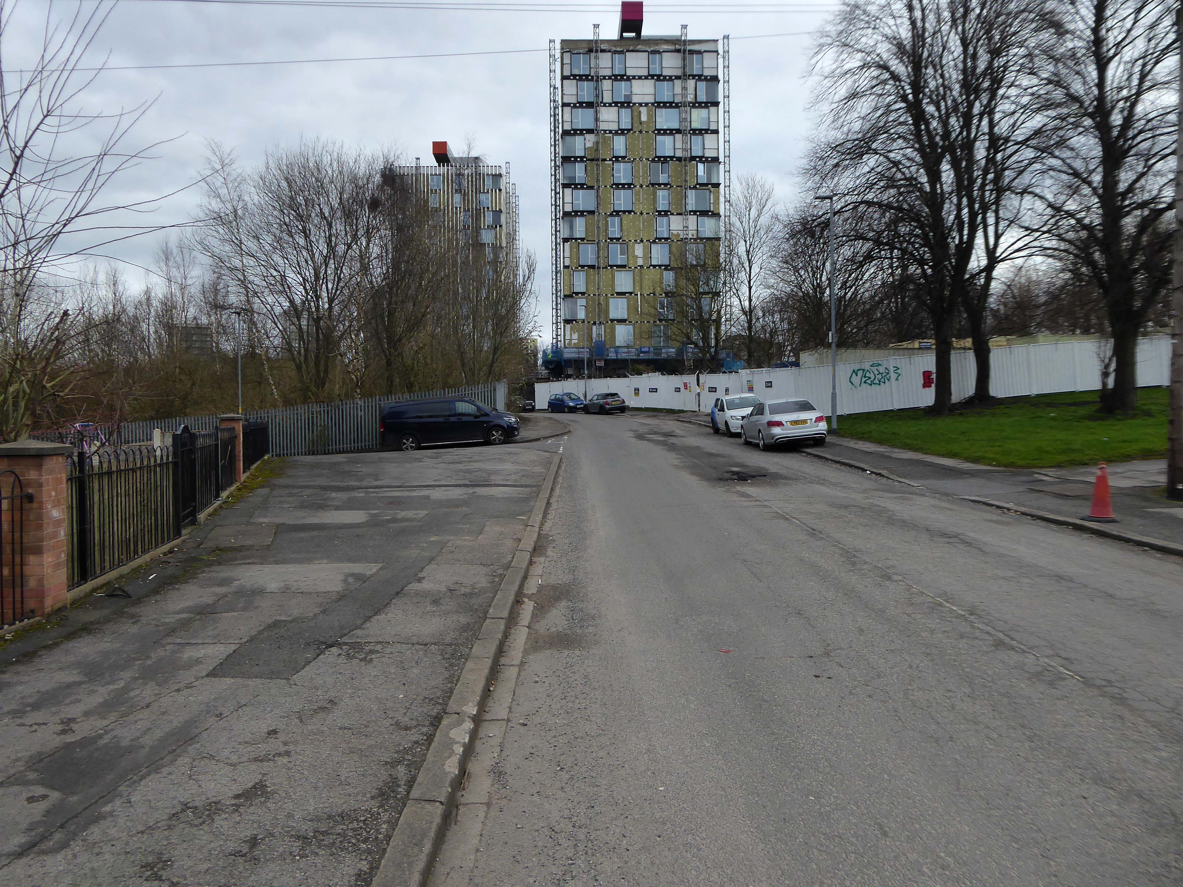
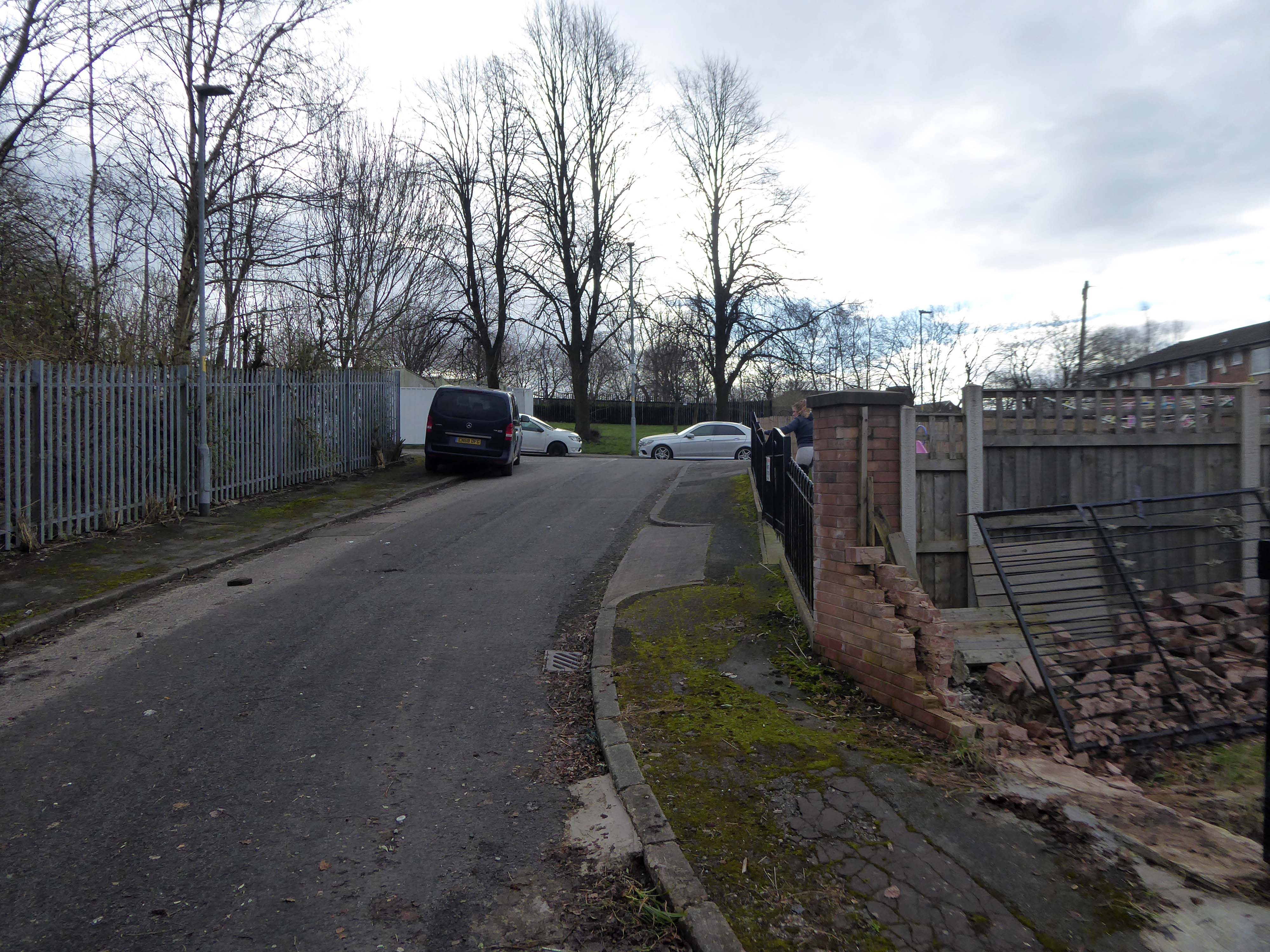
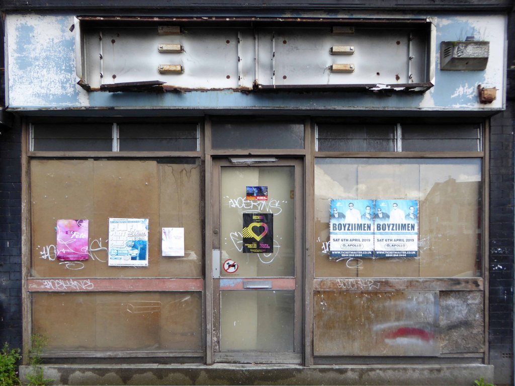
Onwards to Eastford Square.
The shops and maisonettes are due to be demolished any day now – no longer to gaze open-eyed upon the former quarry of Sandhills.
Around the front the diggers have been a digging – digging up around the base of the totem.
The work is to be re-sited by the nearby tower blocks.
The end is nigh.
Heading now for Collyhurst Road and the Irk Valley – seen here in 1960.
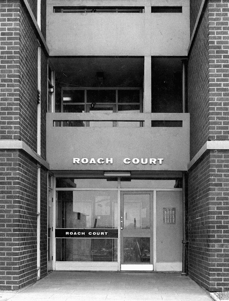
Looking back on the Square and the Dalton Street flats – Humphries, Dalton, Roach, Vauxhall and Moss Brook Courts under construction.
Vauxhall Street now but a shadow of its former self – the last traces of industry long gone.
Reclaimed over time by trees and dense underbrush.
Crossing Collyhurst Road and up and over the railway via Barney’s Steps also known as the Lowry Steps.
LS Lowry
By the late 1950’s the whole of this area which we called Barney’s Tip became a refuse tip for Manchester City Council.
The area is in the process of being reconfigured as a delightful country park.
The investment will also help develop an initial phase of the planned City River Park incorporating St Catherine’s Wood as part of a network of public open space, including improvements along the River Irk and works to improve flood resilience, unlocking the potential of the Irk Valley that will characterise the wider Northern Gateway project.
The first phase of the City River Park will begin work to transform former railway architecture to develop the new Viaduct Linear Park north of Victoria Train Station, new stepped public realm space – Red Bank Terraces, along with new green space by the River Irk and the key improvements to St Catherine’s Wood.
Collingham Street is lined with trucks, trailers, stalls and mobile homes.
But there’s nothing temporary about this Cheetham Hill neighbourhood; most residents have lived here for years and many plan to spend the rest of their lives here.
Founded more than forty years ago, it was created by the Showman’s Guild of Great Britain – and it’s reserved exclusively for fairground workers both retired and current.
Built on Queens Road tip, a former rubbish dump, and rented out by Manchester Council, many of the 52 homes belong to older retired showmen or families for whom an itinerant lifestyle has become more challenging.
It’s a close-knit community with a unique shared history.
Though not without its own particular issues it would seem, according to the MEN.
The licensing out of hours team has received noise complaints relating to the premises which was found to be open beyond permitted hours when visited. Officers also identified breaches of the Health Act during inspections in which people were seen smoking shisha pipes in an enclosed extension at the back.
We will leave the Flamingo be and head back into town – but not without giving a nod to this confusing collision between this self-made scrapyard-man chic gate and the ever changing skyline of overheated urban regeneration.
The new creation has come: The old has gone, the new is here!
More than once, though that’s no reason not to do so again – so I did.
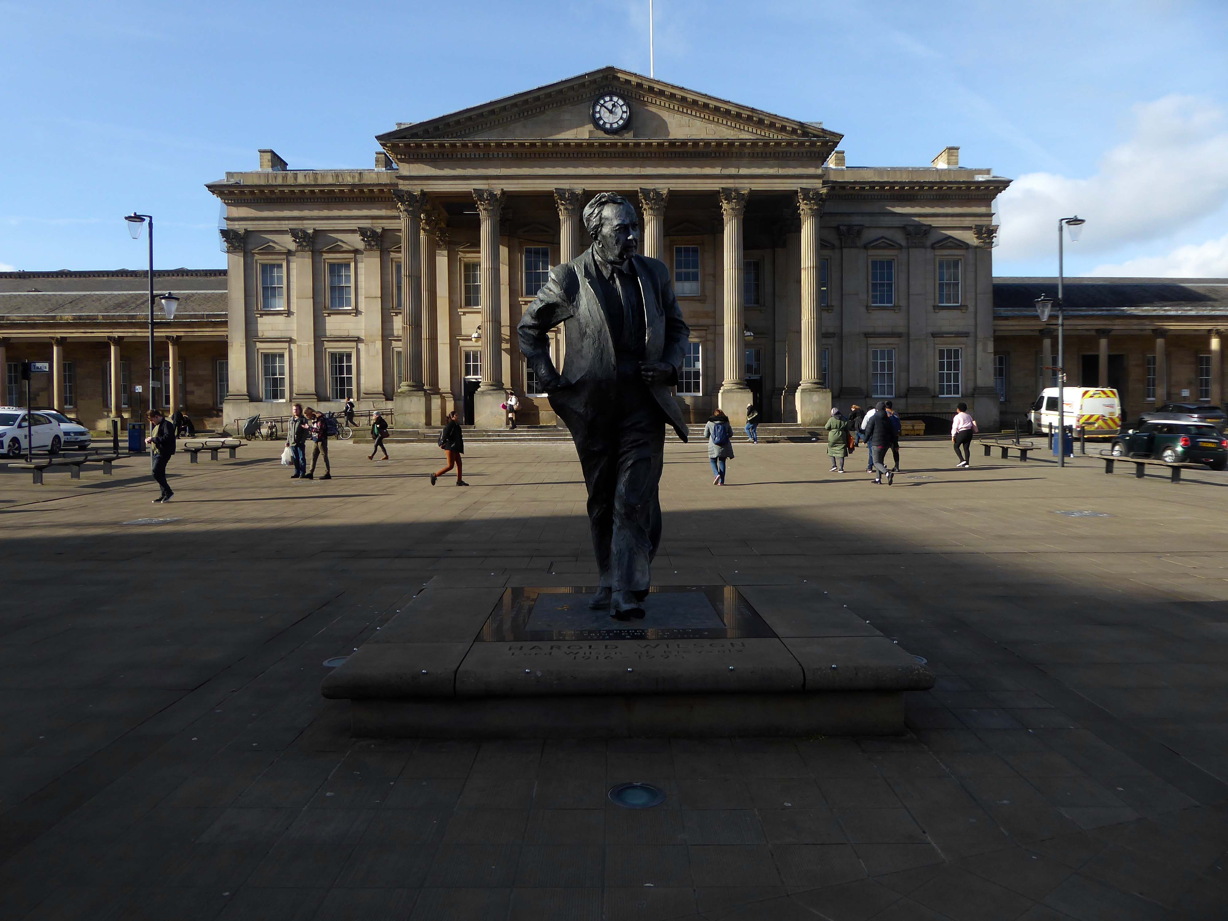
Saying hello to Harold.
Harold saying hello to us:
Nostalgia won’t pay the bills; the world doesn’t owe us a living; and we must harness the scientific revolution to win in the years to come. This scientific revolution is making it physically possible, for the first time in human history, to conquer poverty and disease, to move towards universal literacy, and to achieve for the whole people better living standards than those enjoyed by tiny privileged classes in previous epochs.
He warned change would have to reach every corner of the country; The Britain that is going to be formed in the white heat of this revolution will be no place for the restrictive practices or for outdated methods on either side of industry.
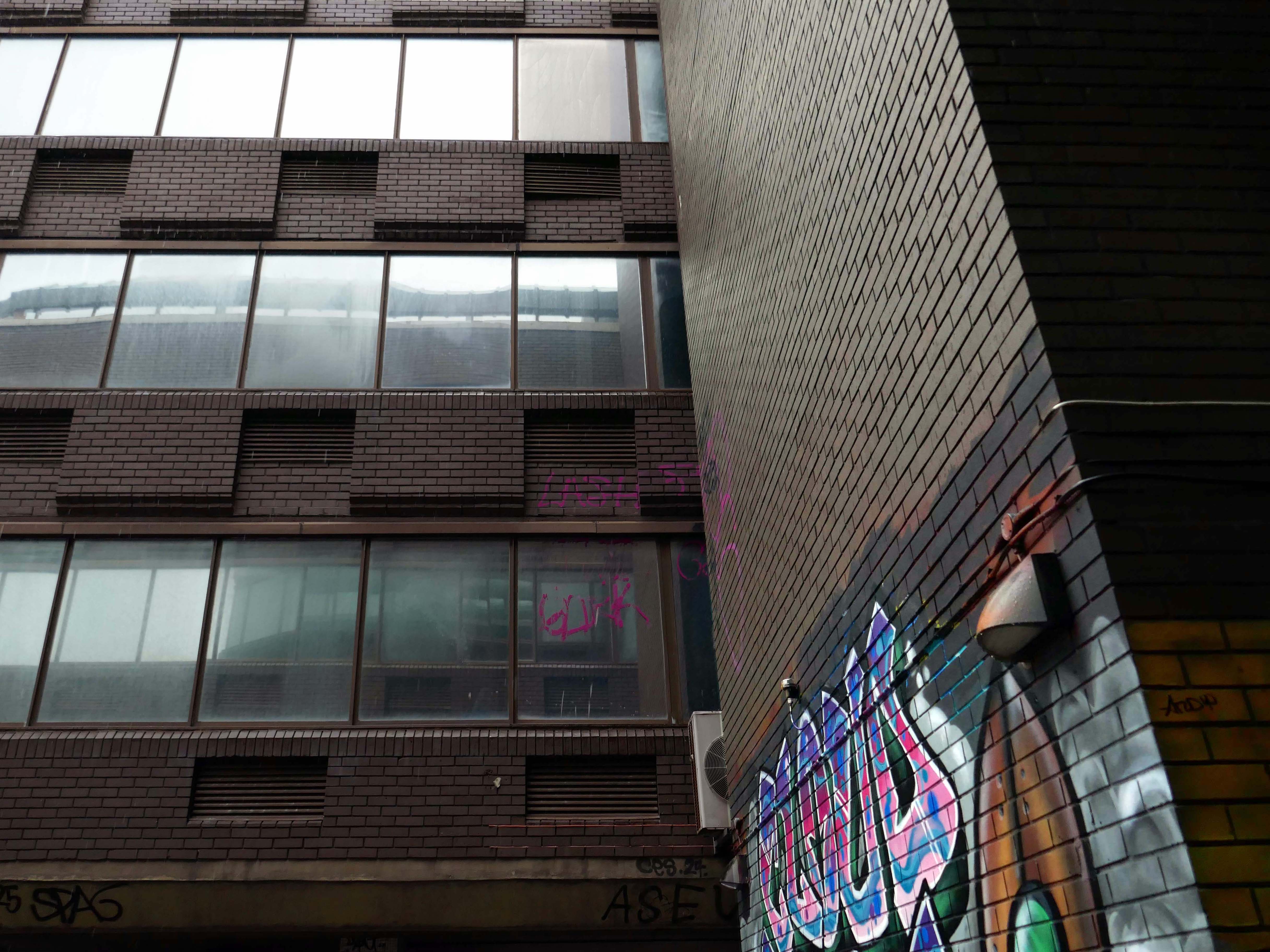
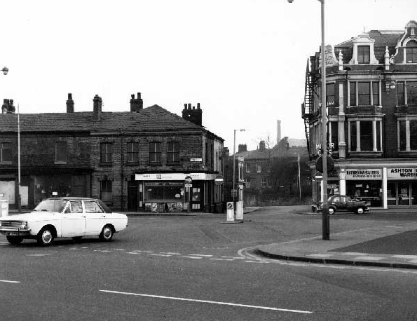
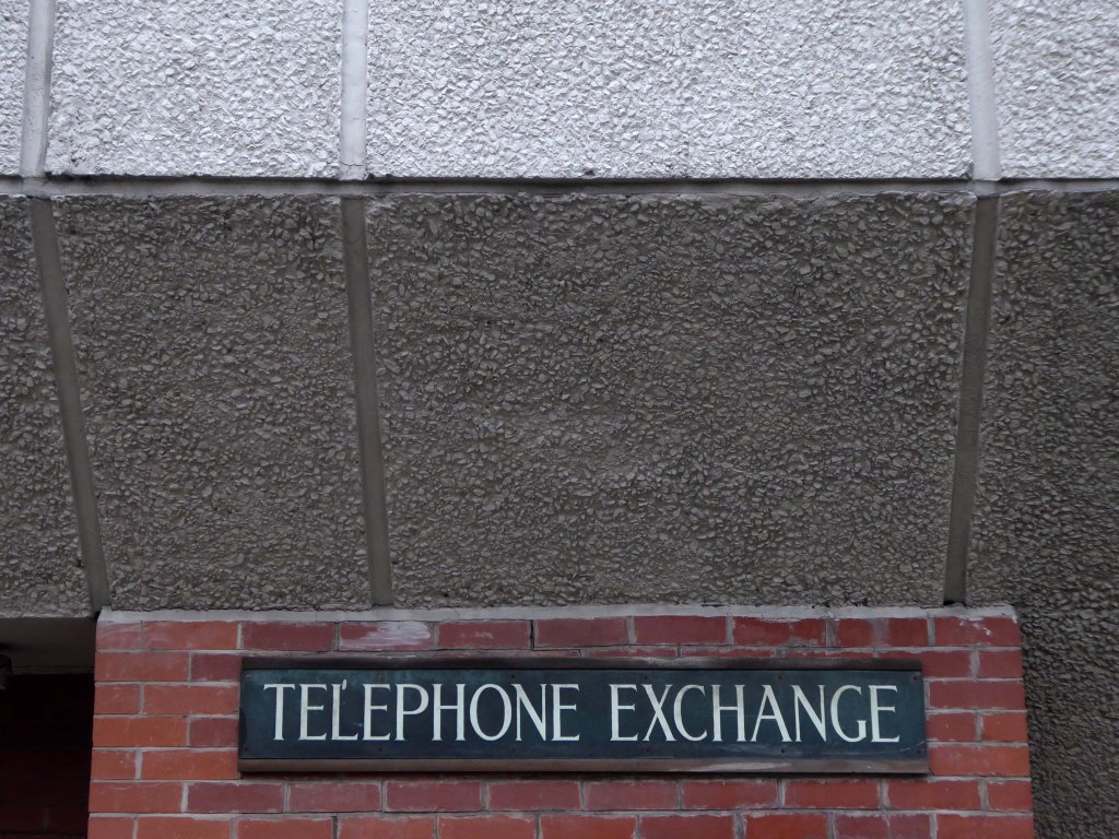
Standing sentinel over one of Nikolaus Pevsner and John Betjeman’s favourite railway station front elevations.
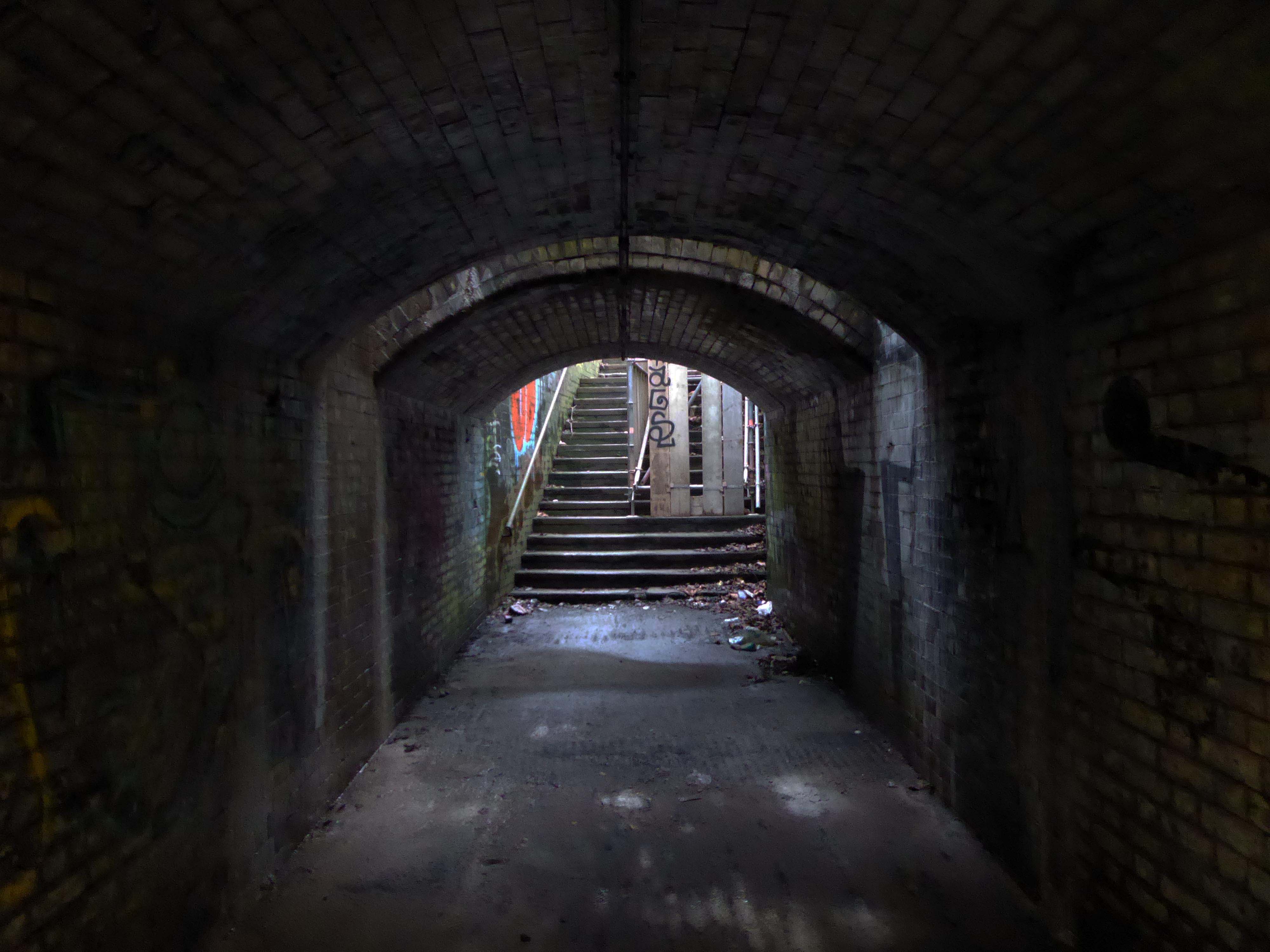
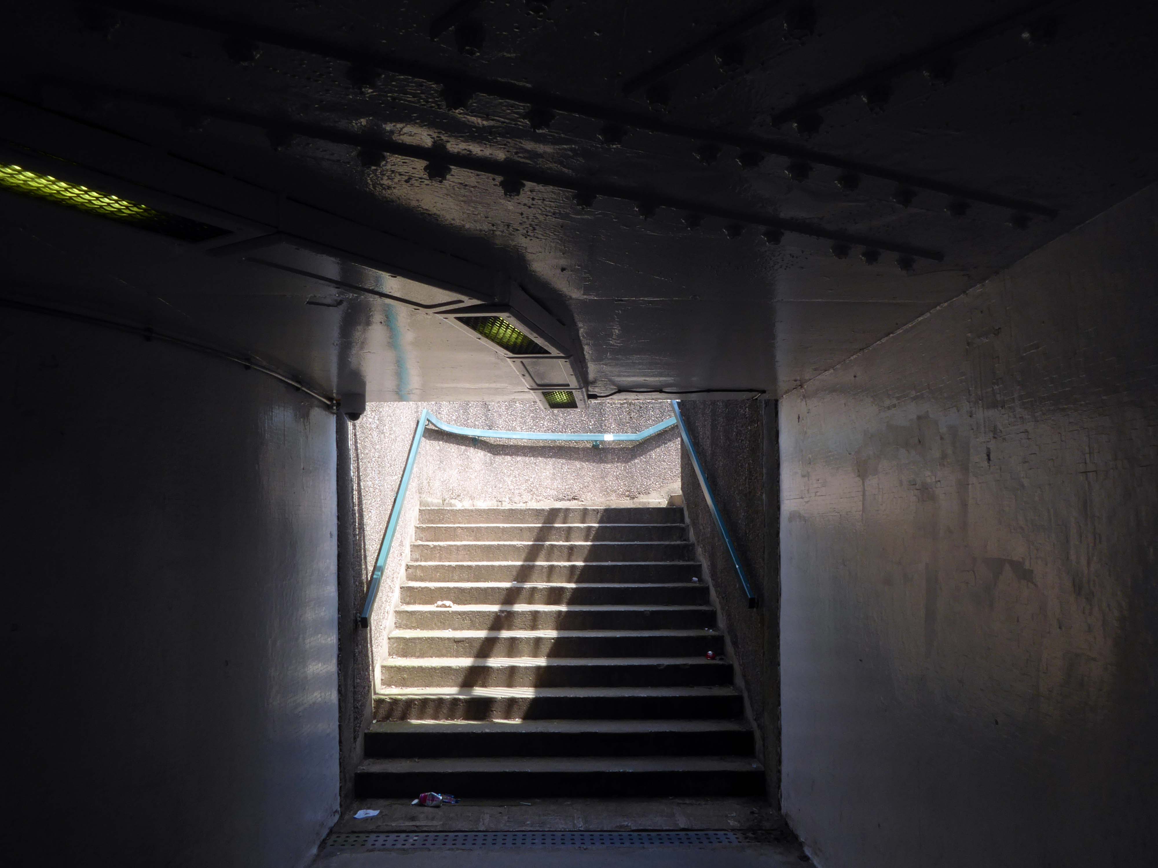
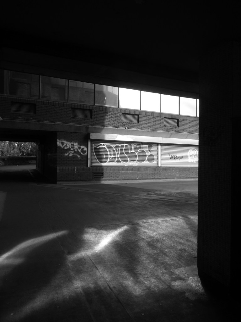
Through a passage darkly.
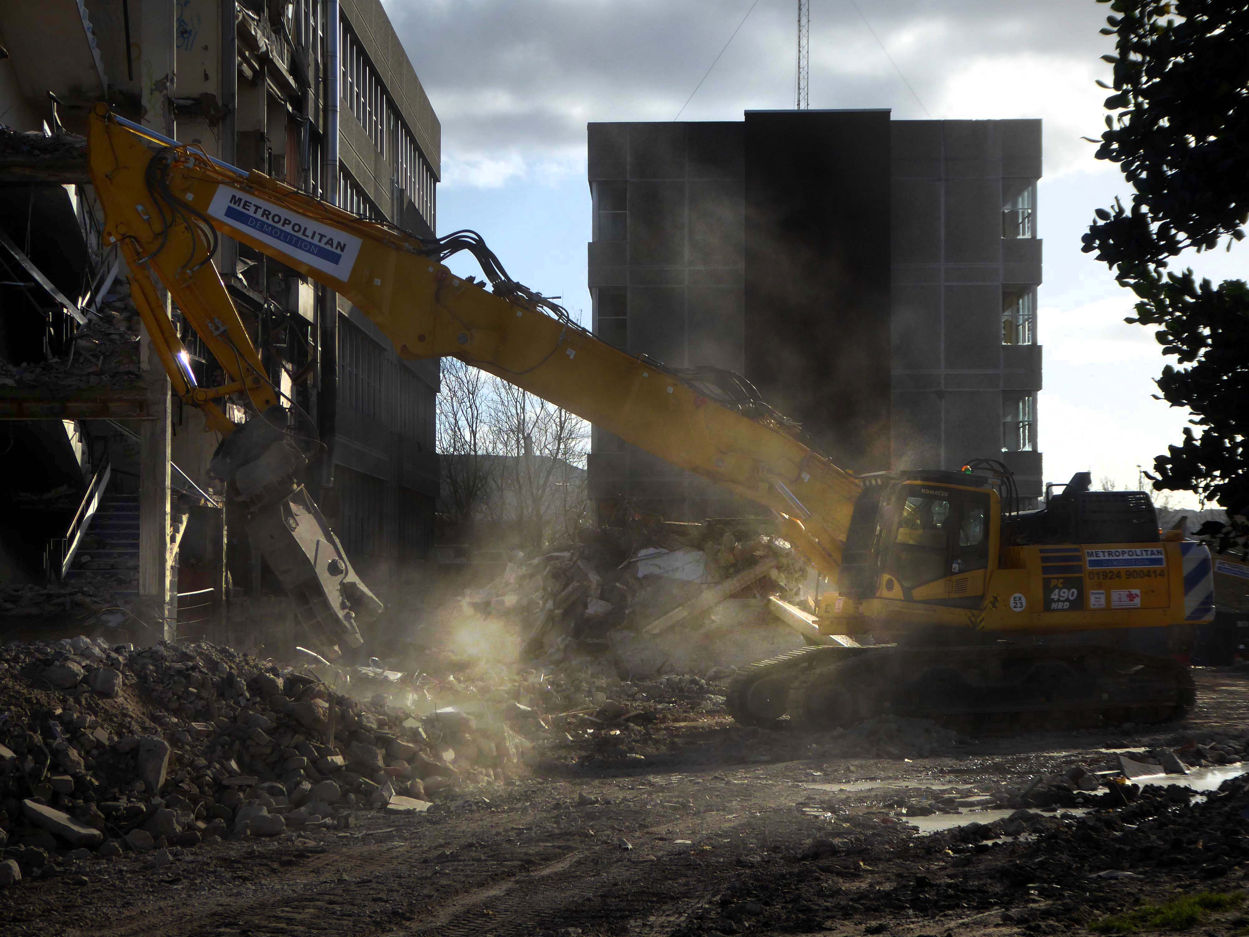
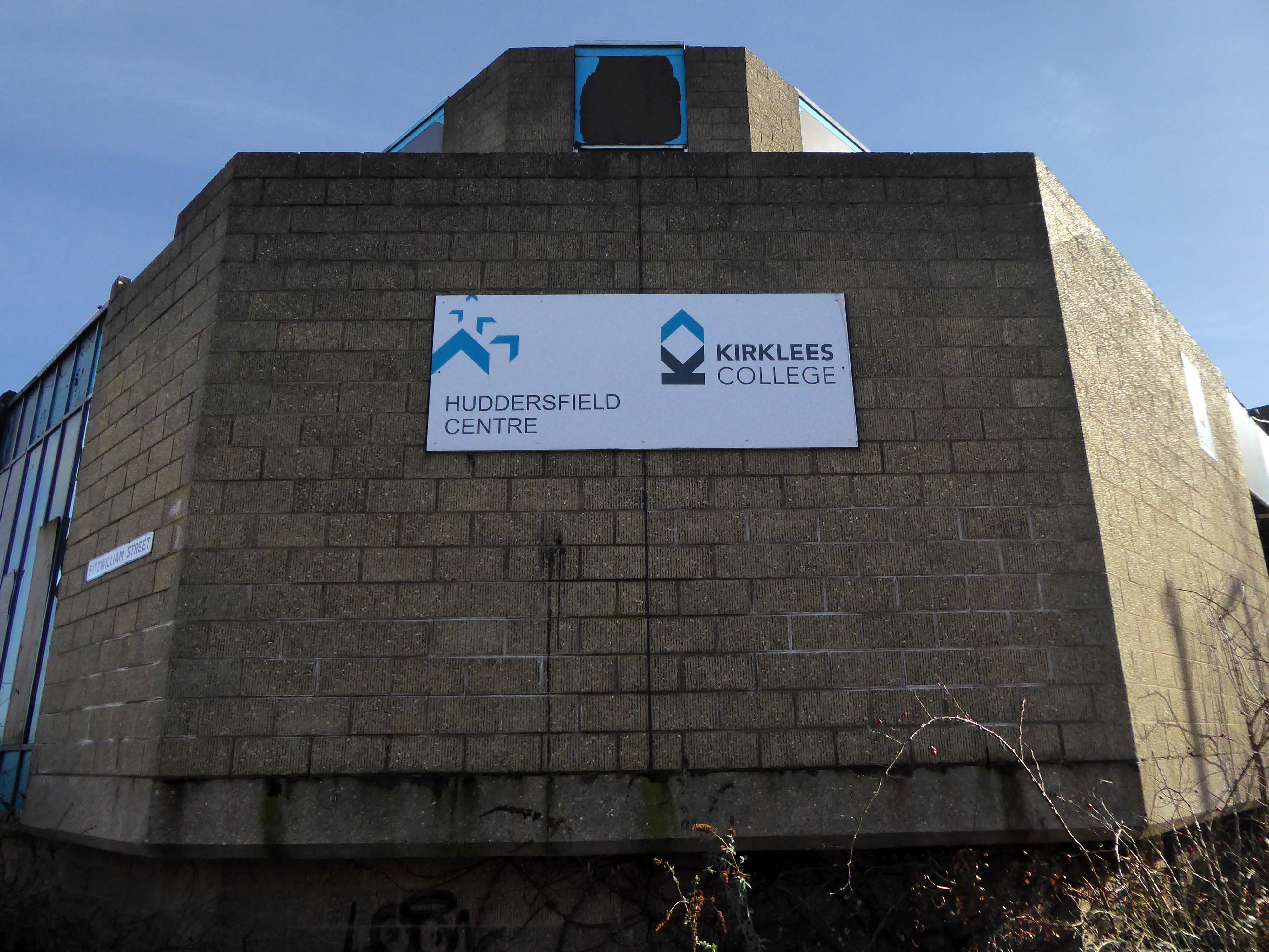
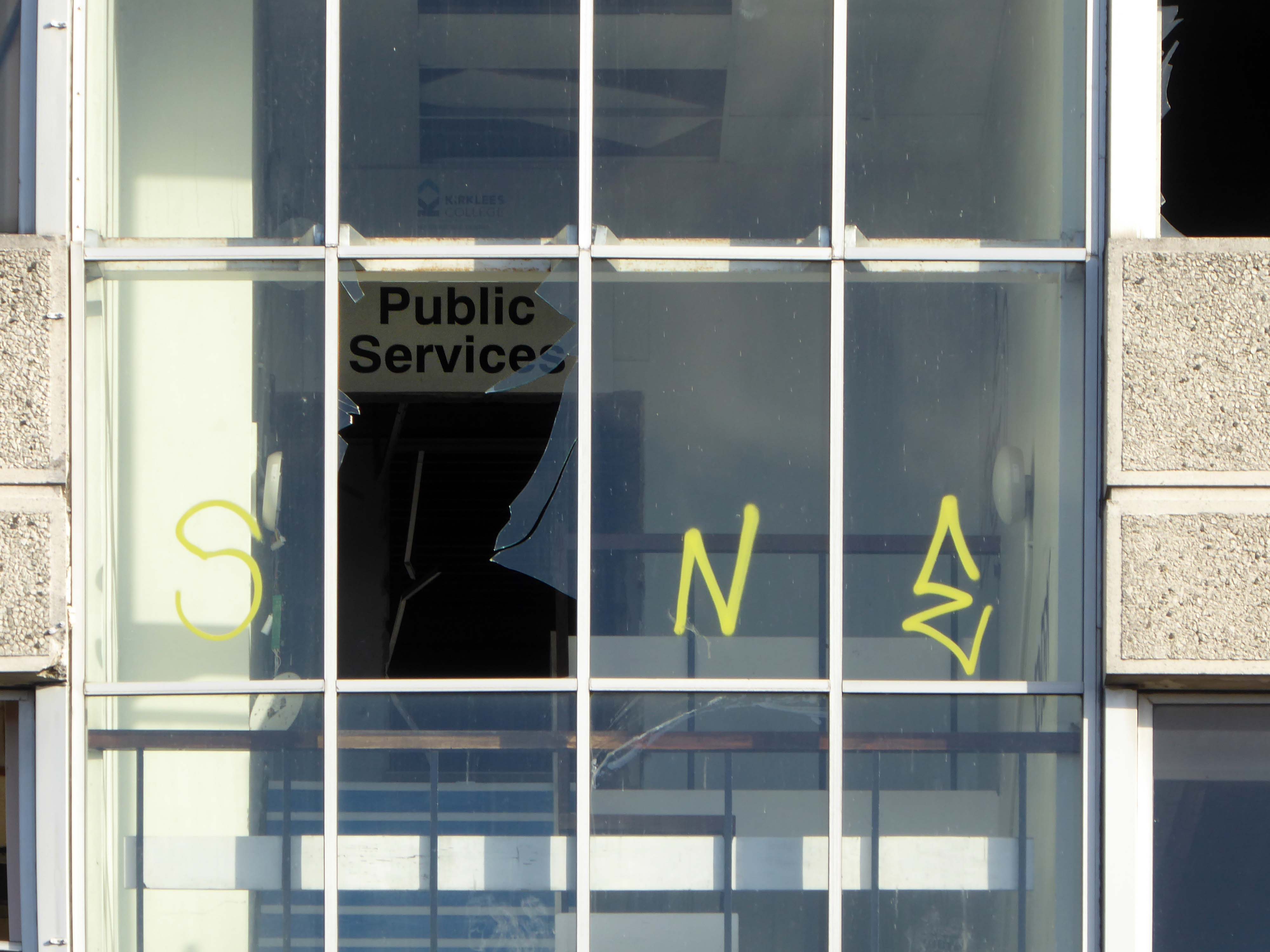
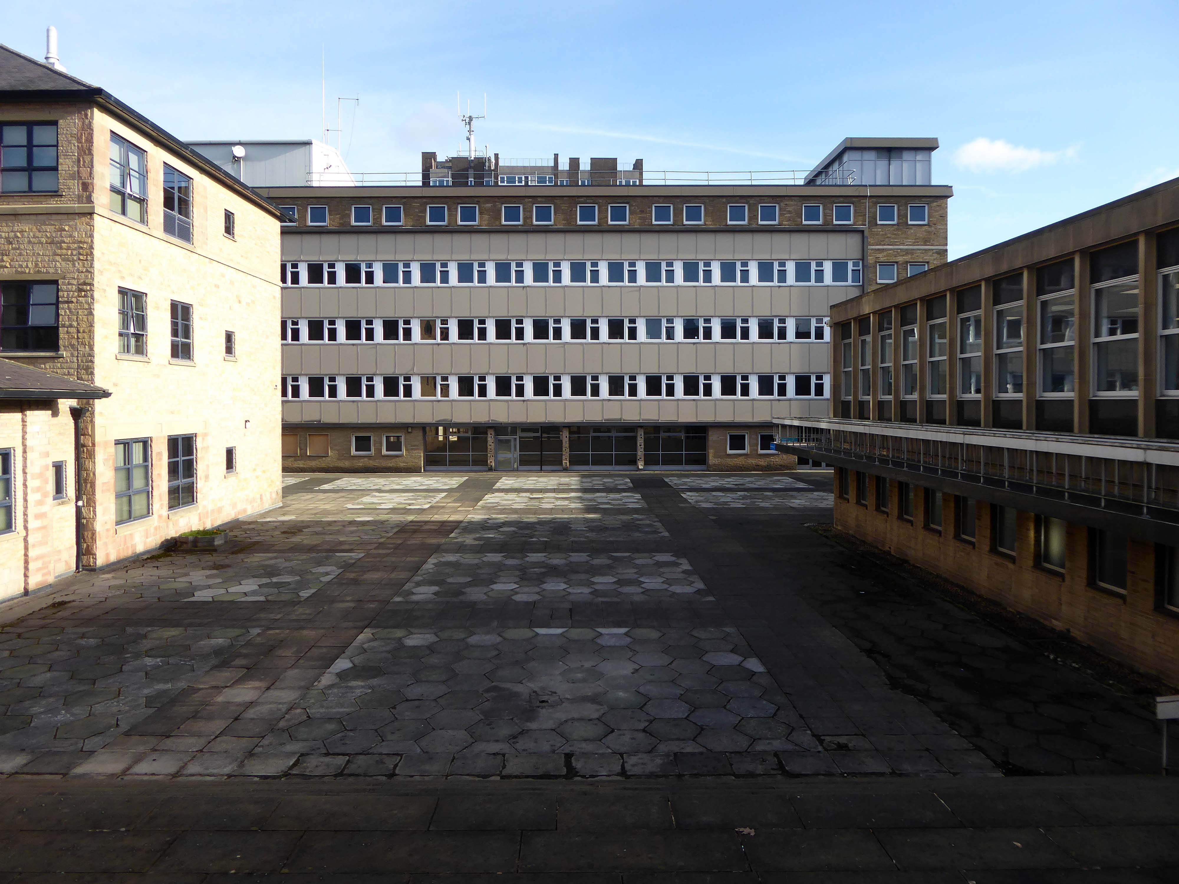
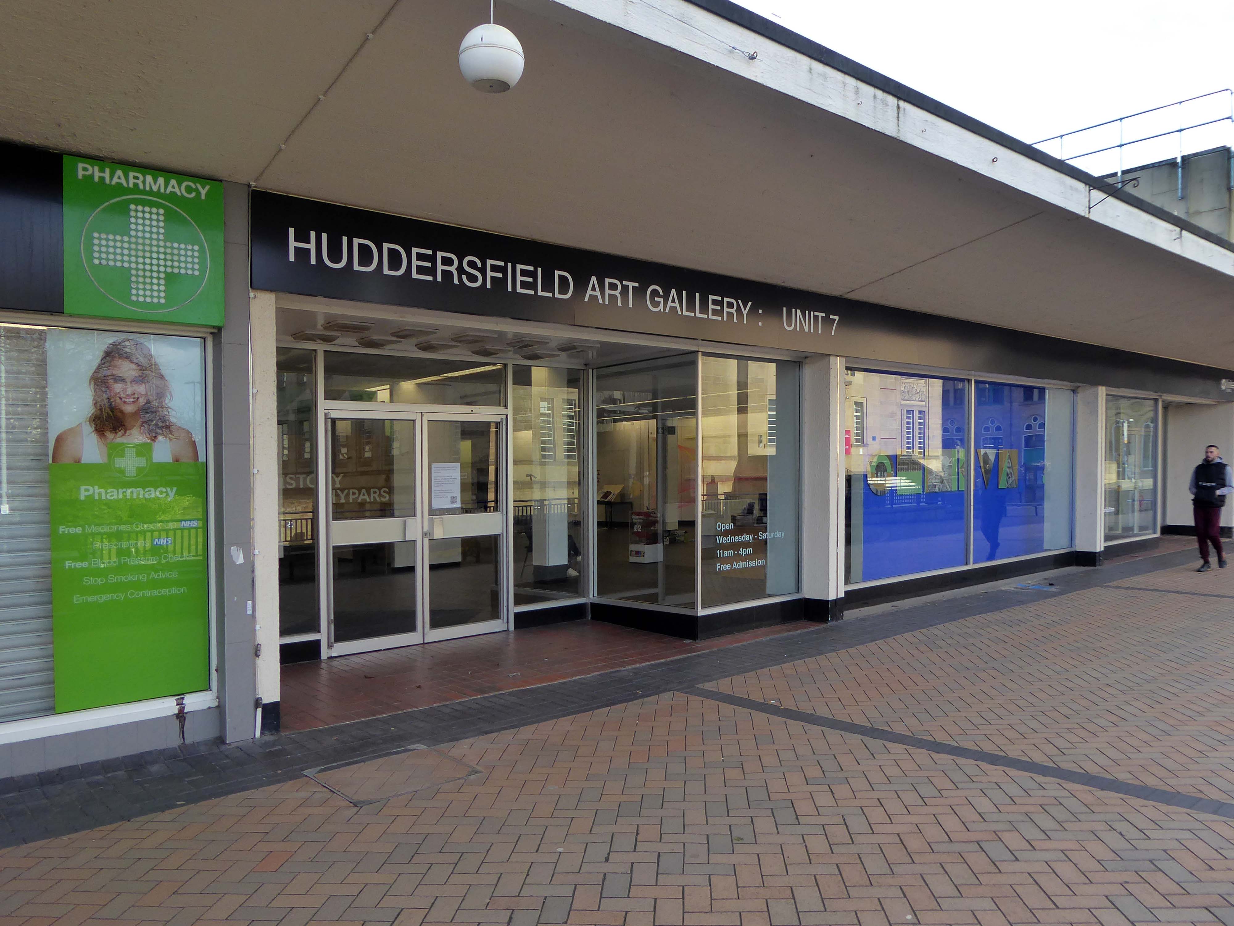
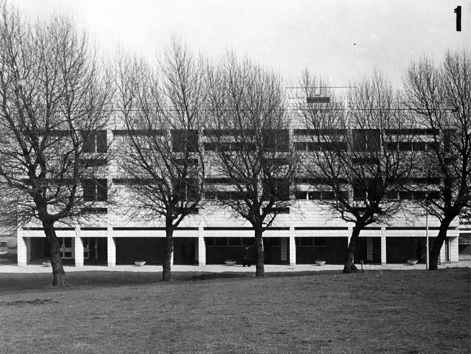
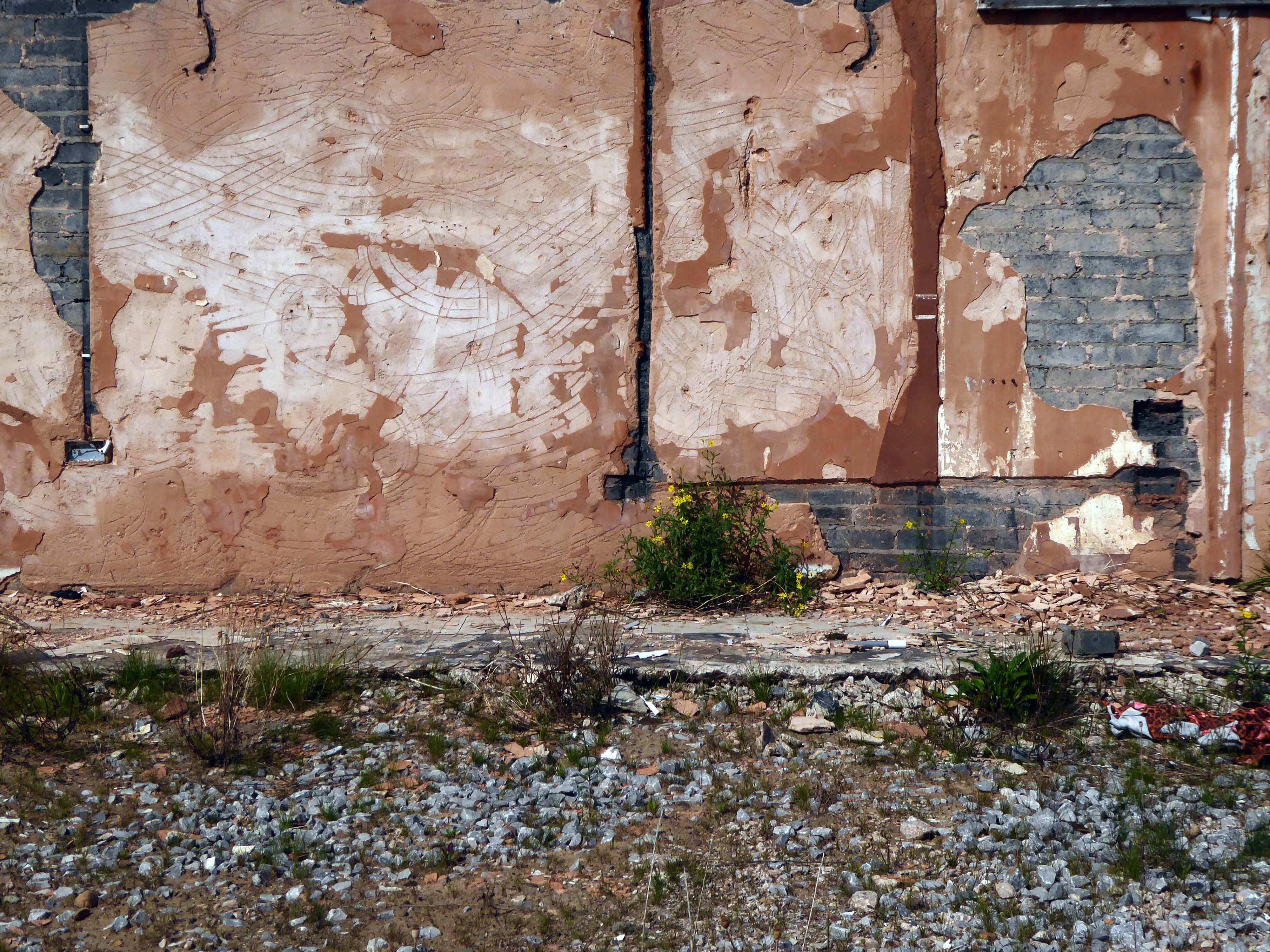
Emerging into the light of day and the demolition of the Kirklees College 1969-72 by Borough Architect Charles Edmund Aspinall.
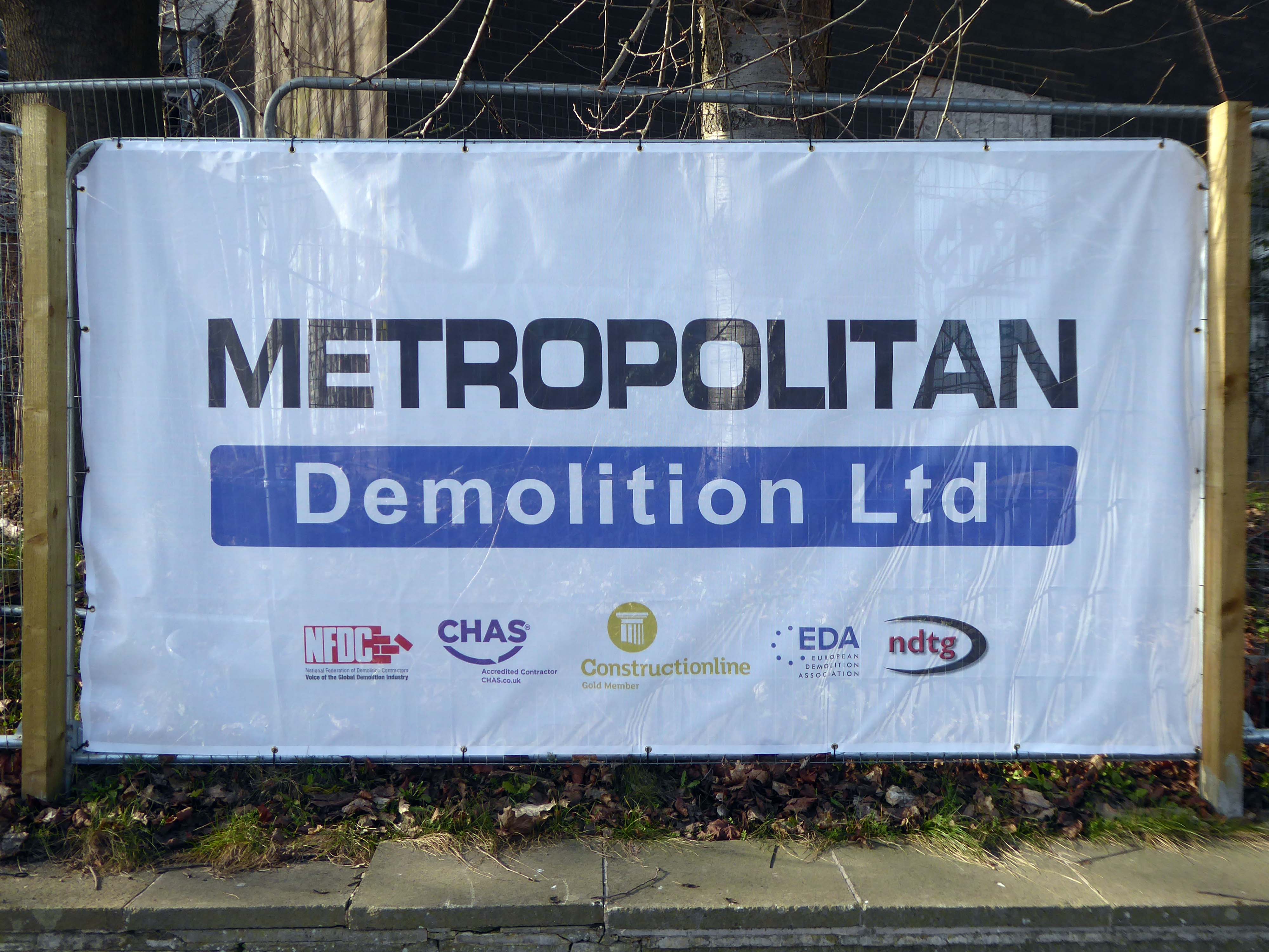
My thanks to the Metropolitan team who invited me in beyond the barriers.
We provide safe and efficient demolition services across a broad range of projects, from the small domestic dwelling to large scale industrial units – we offer the complete solution. With excellent communication and impeccable health and safety standards, we can project manage the decommissioning a structure on time and on budget.
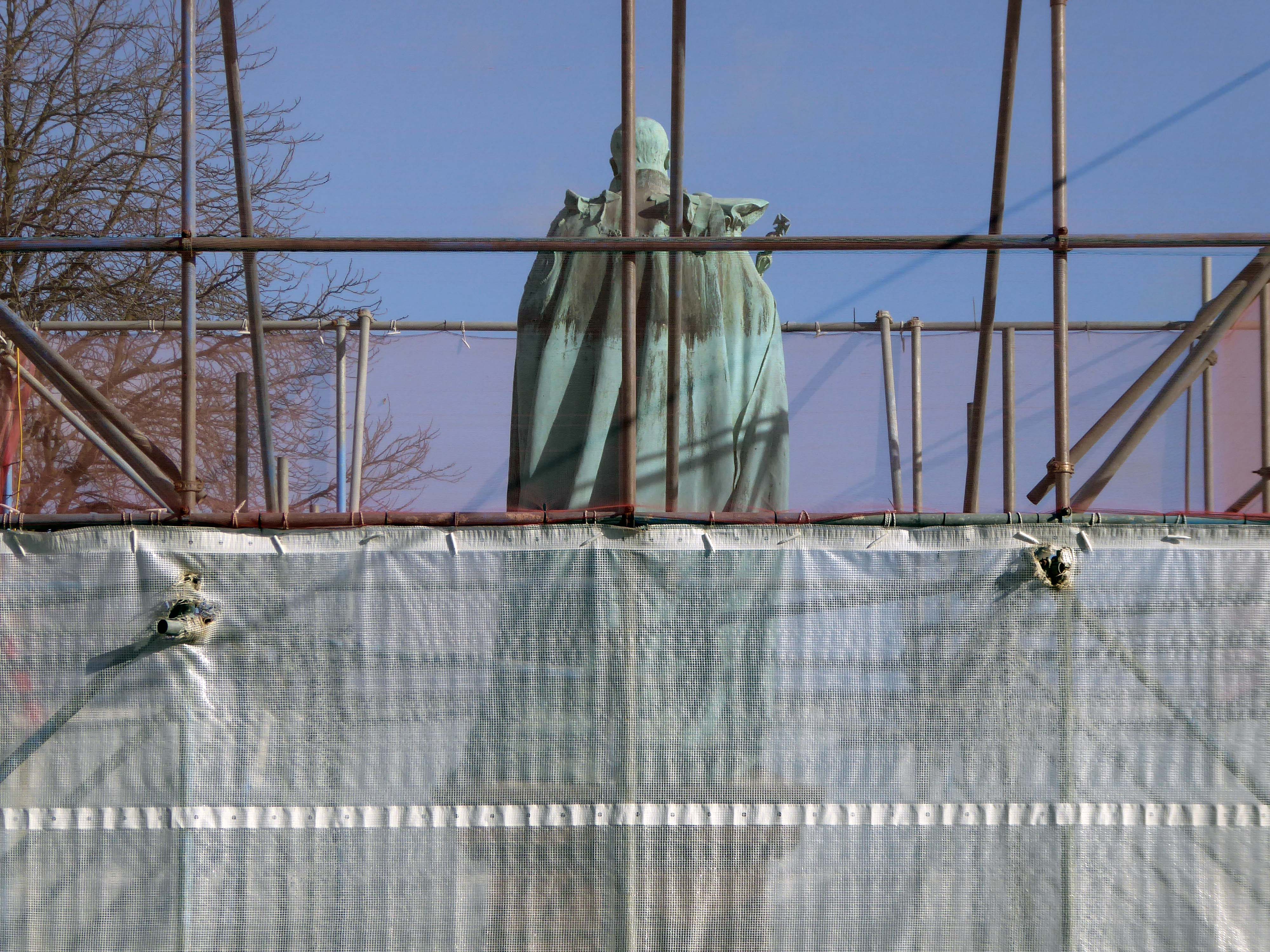
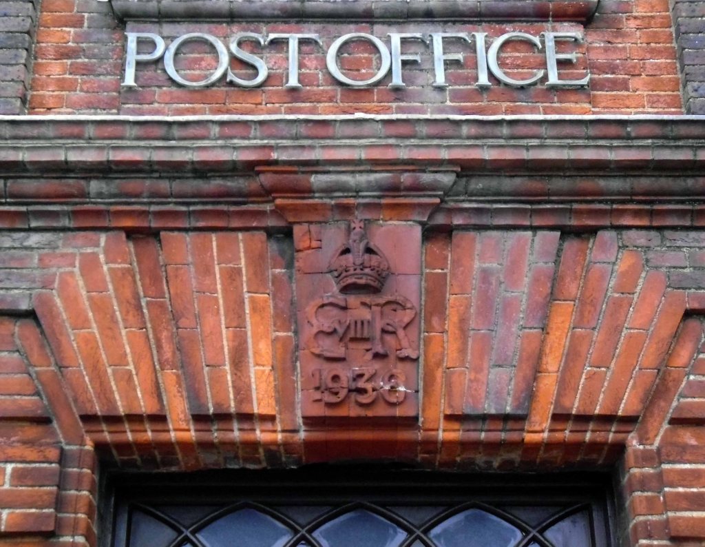
Edward VII is under wraps.
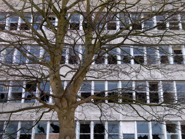
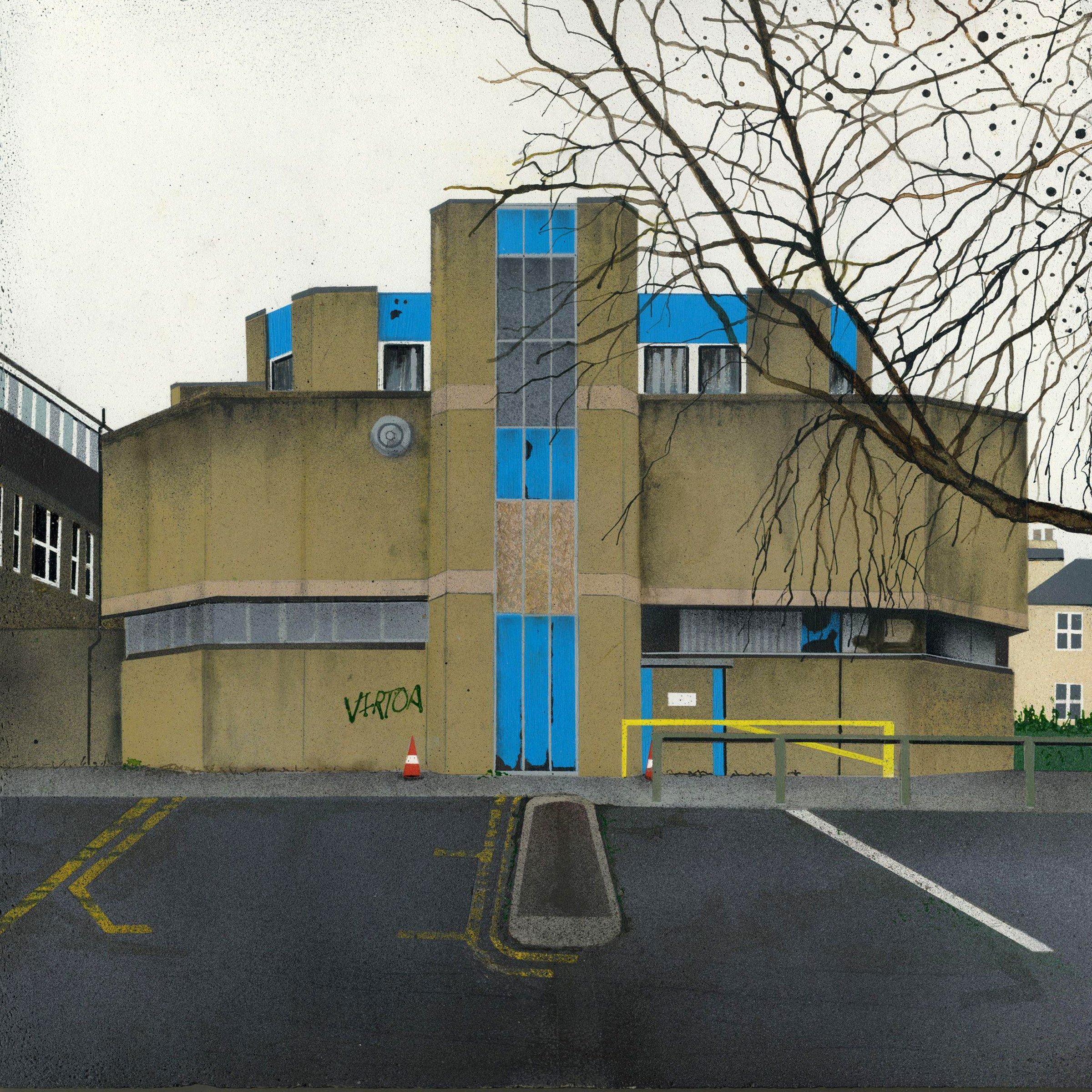
Everything else is up for smash and grab – including the later concrete block immortalised by Mandy Payne.
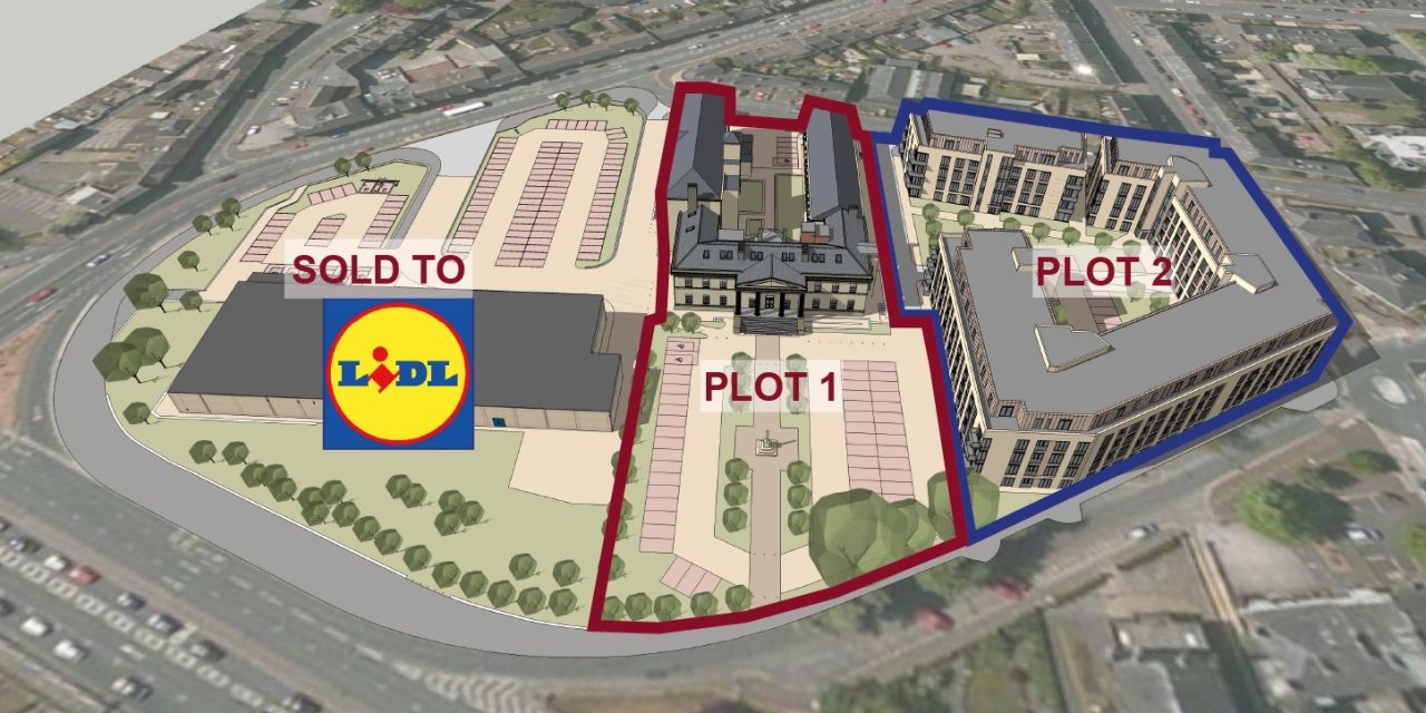
LIDL is coming – and some homes
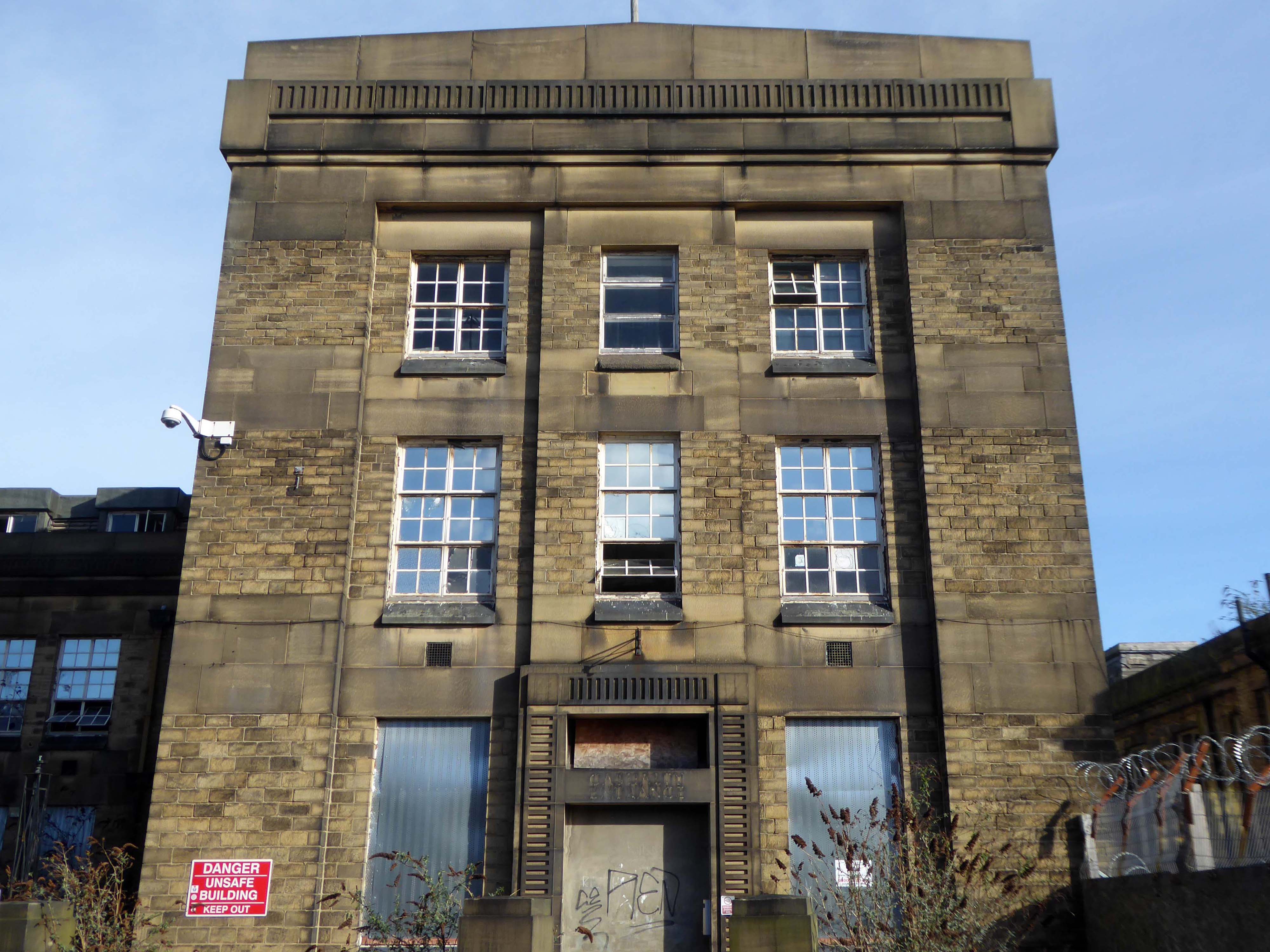
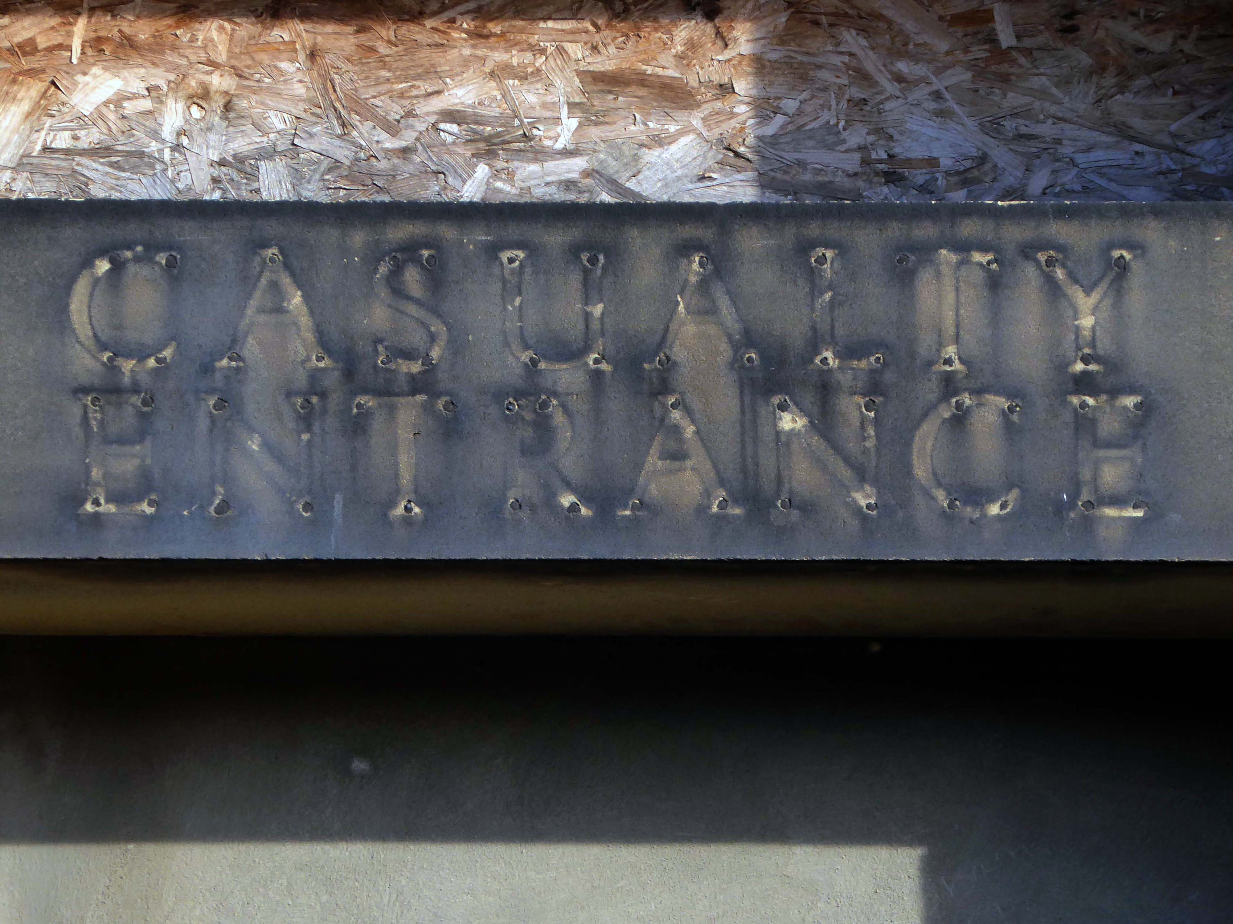
The final details have now been signed off by the council and work on the six-acre site – which includes the Grade II-listed original Huddersfield Royal Infirmary – can now begin.
The vandal-hit and fire-damaged late 1960s and early 1970s college buildings are to be demolished and Lidl will build a new supermarket with a 127-space car park. The store will eventually replace the store on Castlegate.
The former hospital will be retained and the site will see 229 apartments and an office complex. The apartments are expected to be for older or retired people.
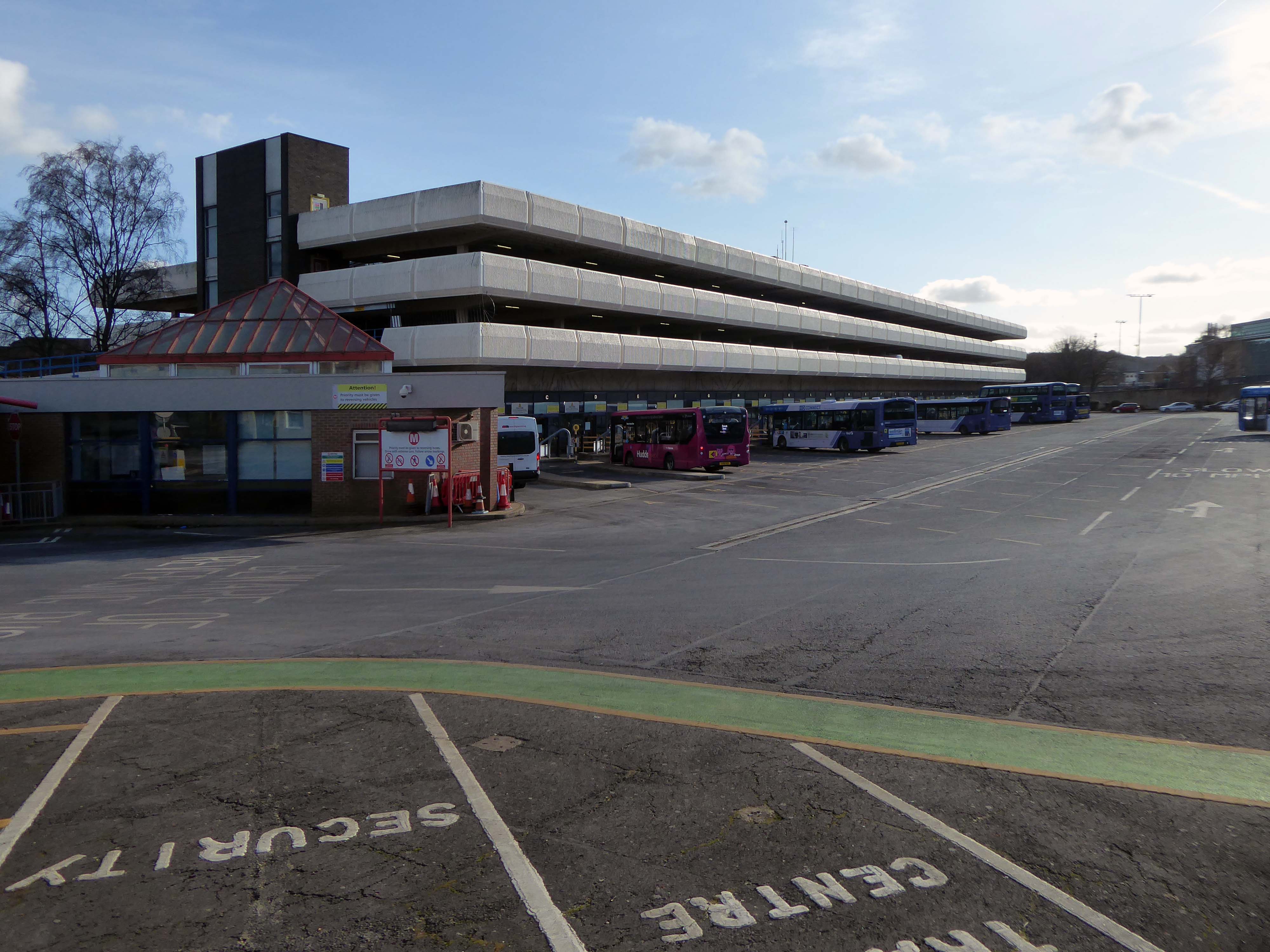
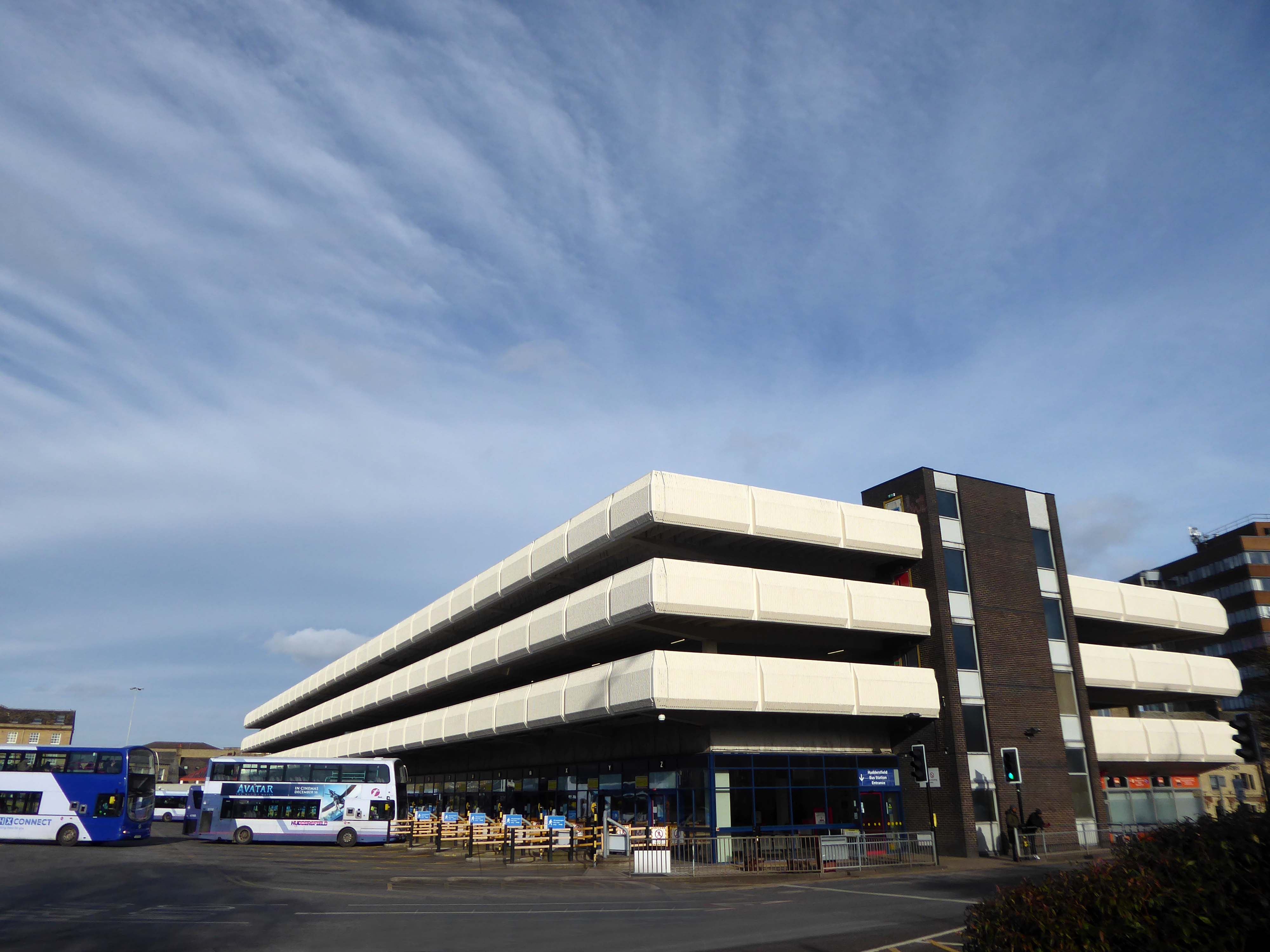
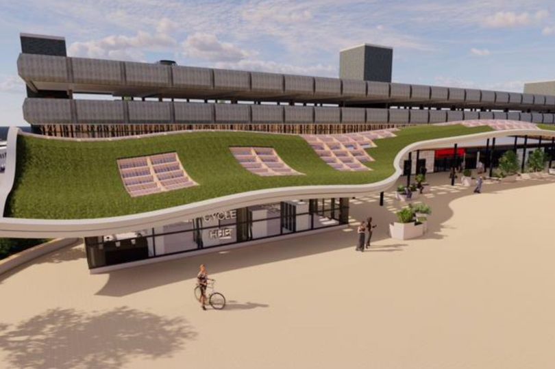
Huddersfield’s £20M game-changing bus station is set to be completed by the end of 2025 with a living grass roof, sixty bike cycle hub, upgraded shops and new facilities
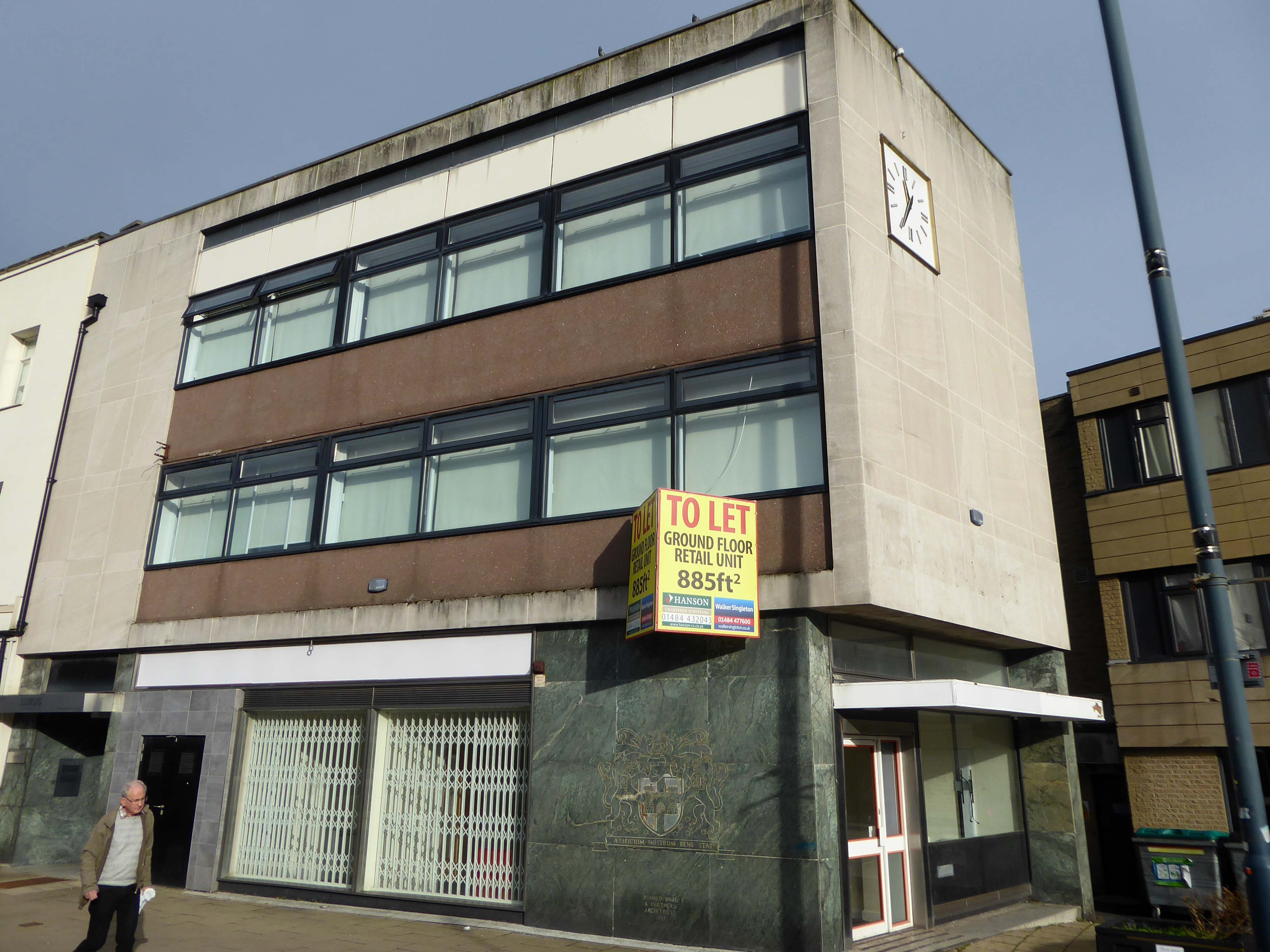
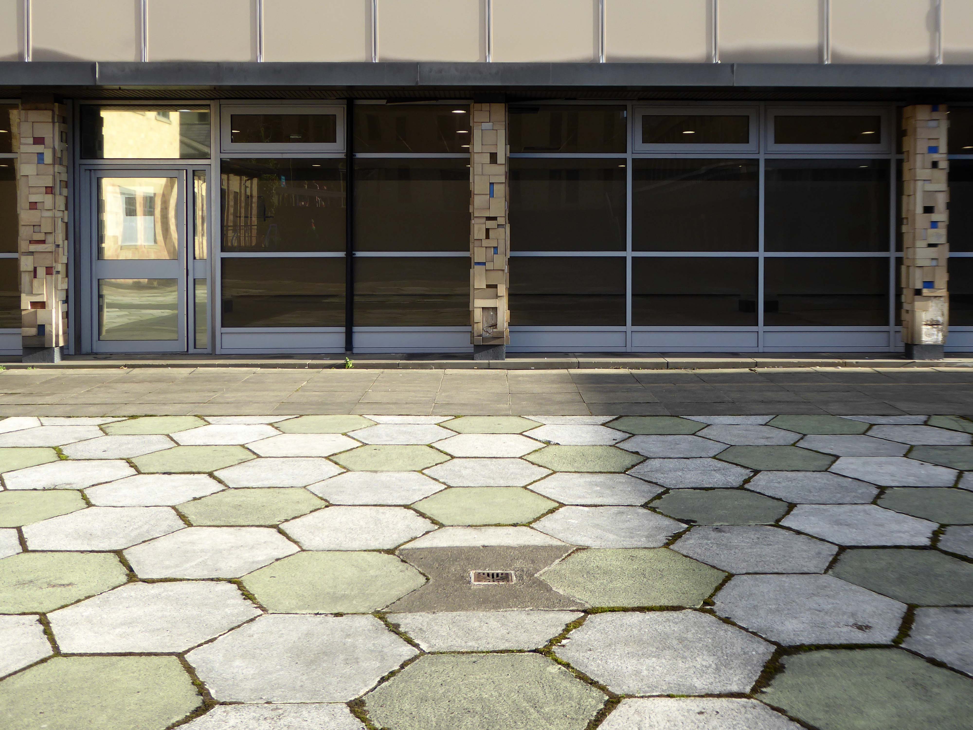
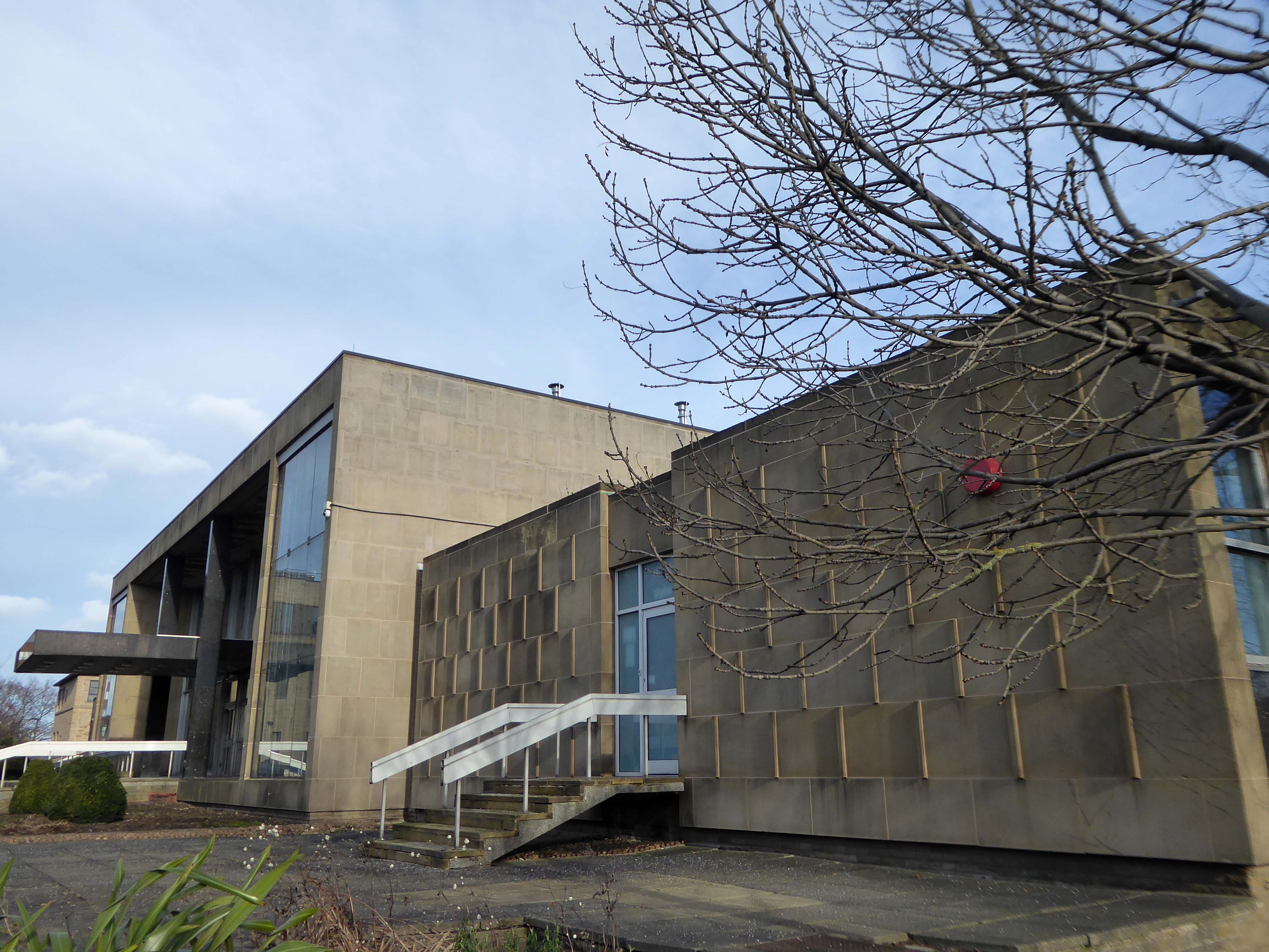
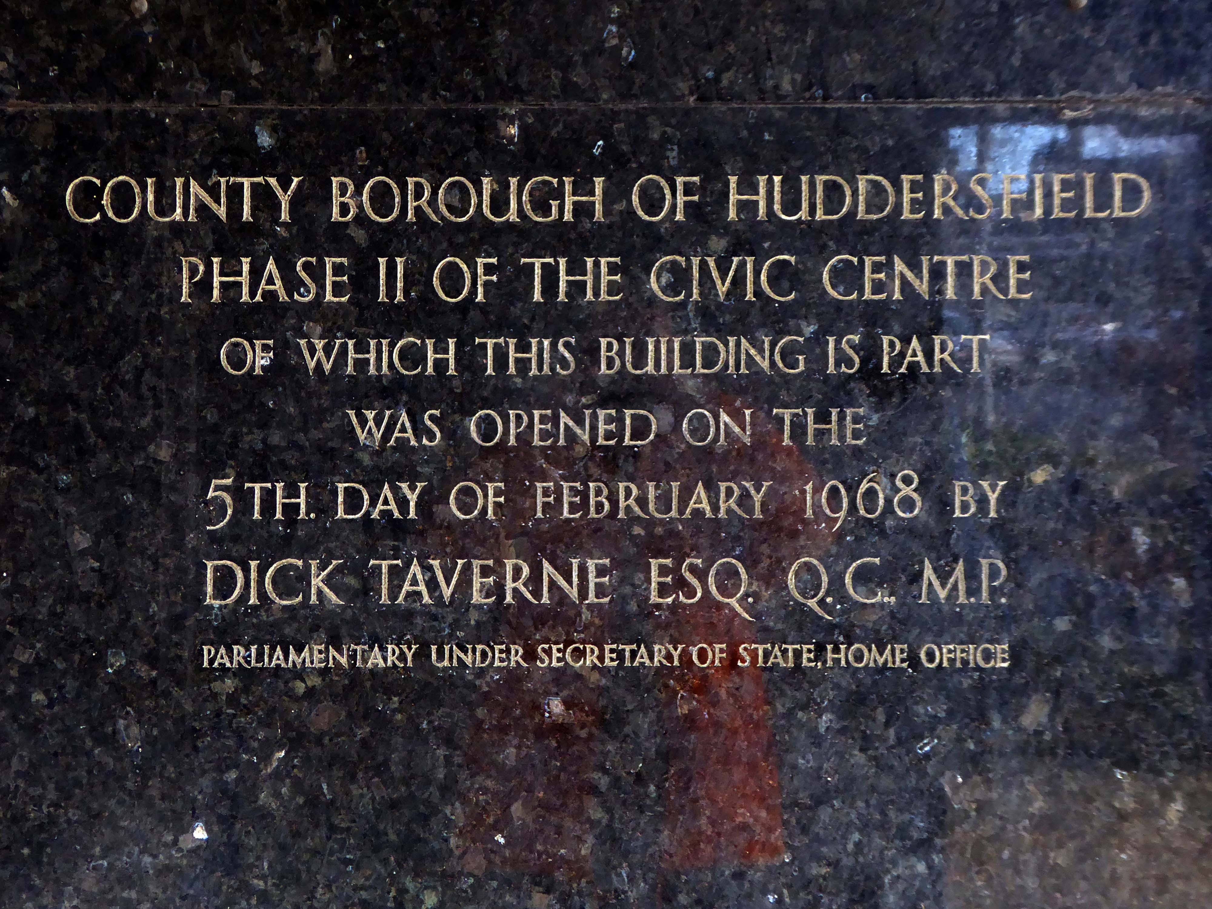
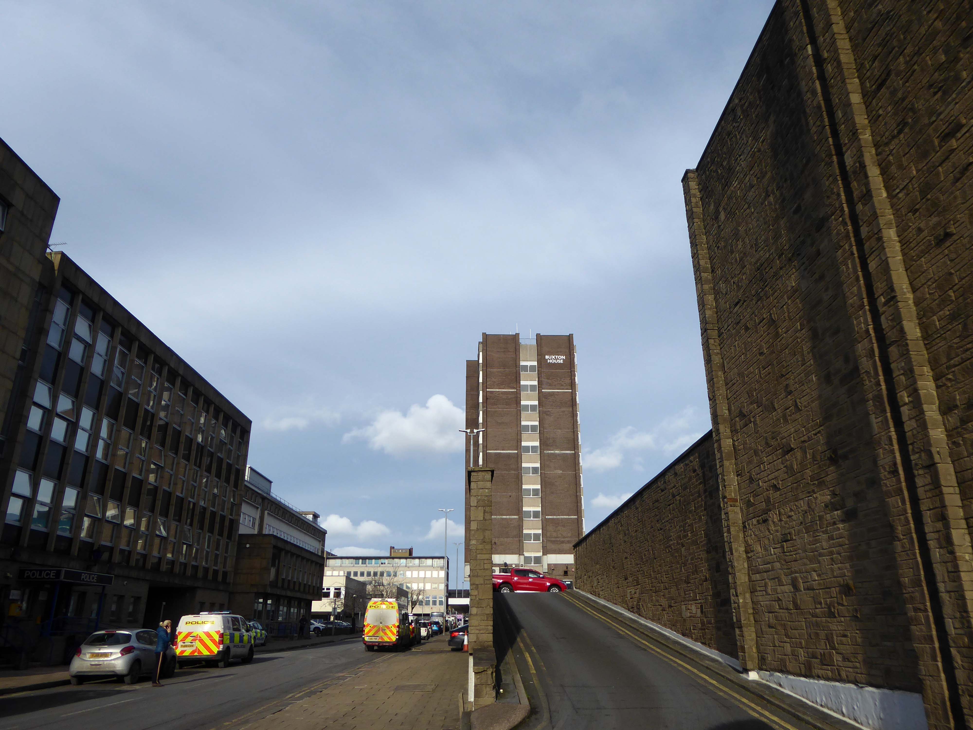
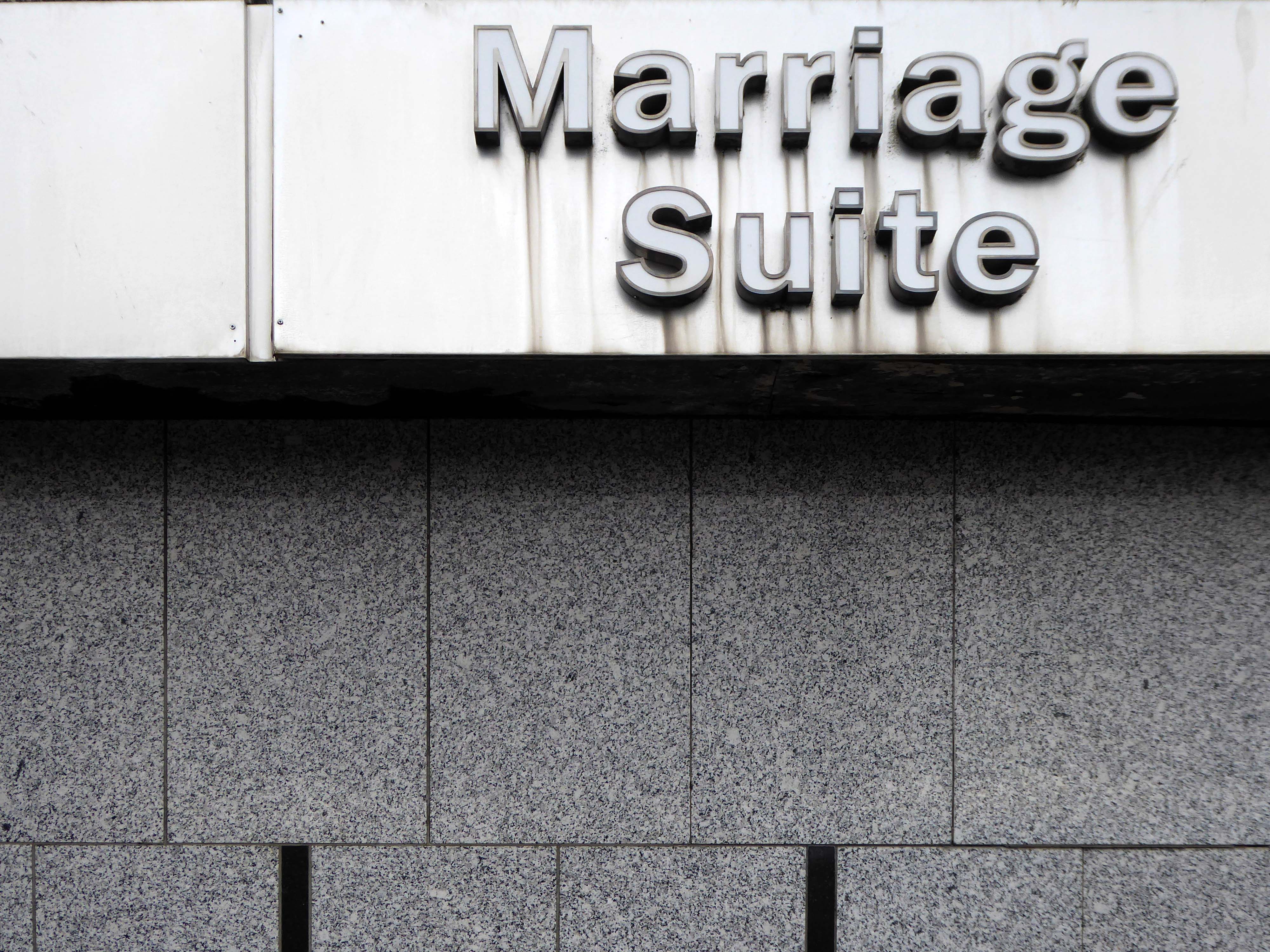
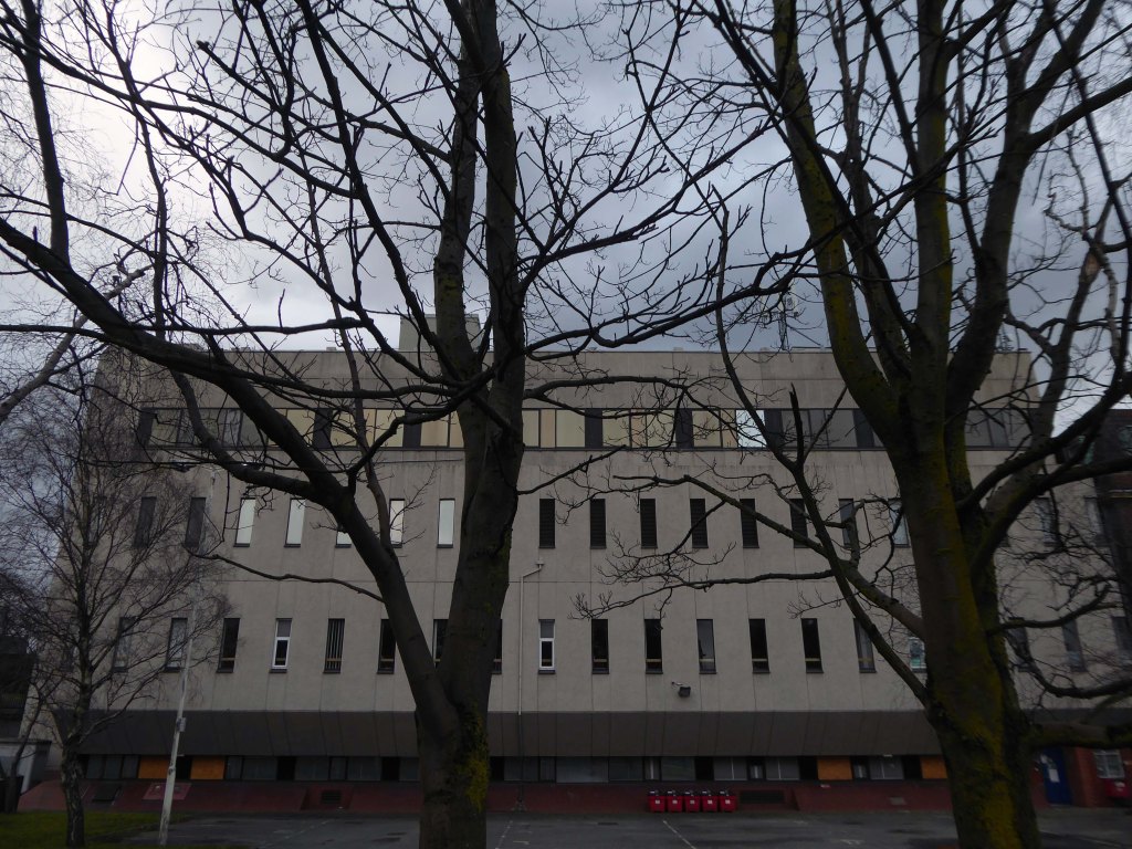
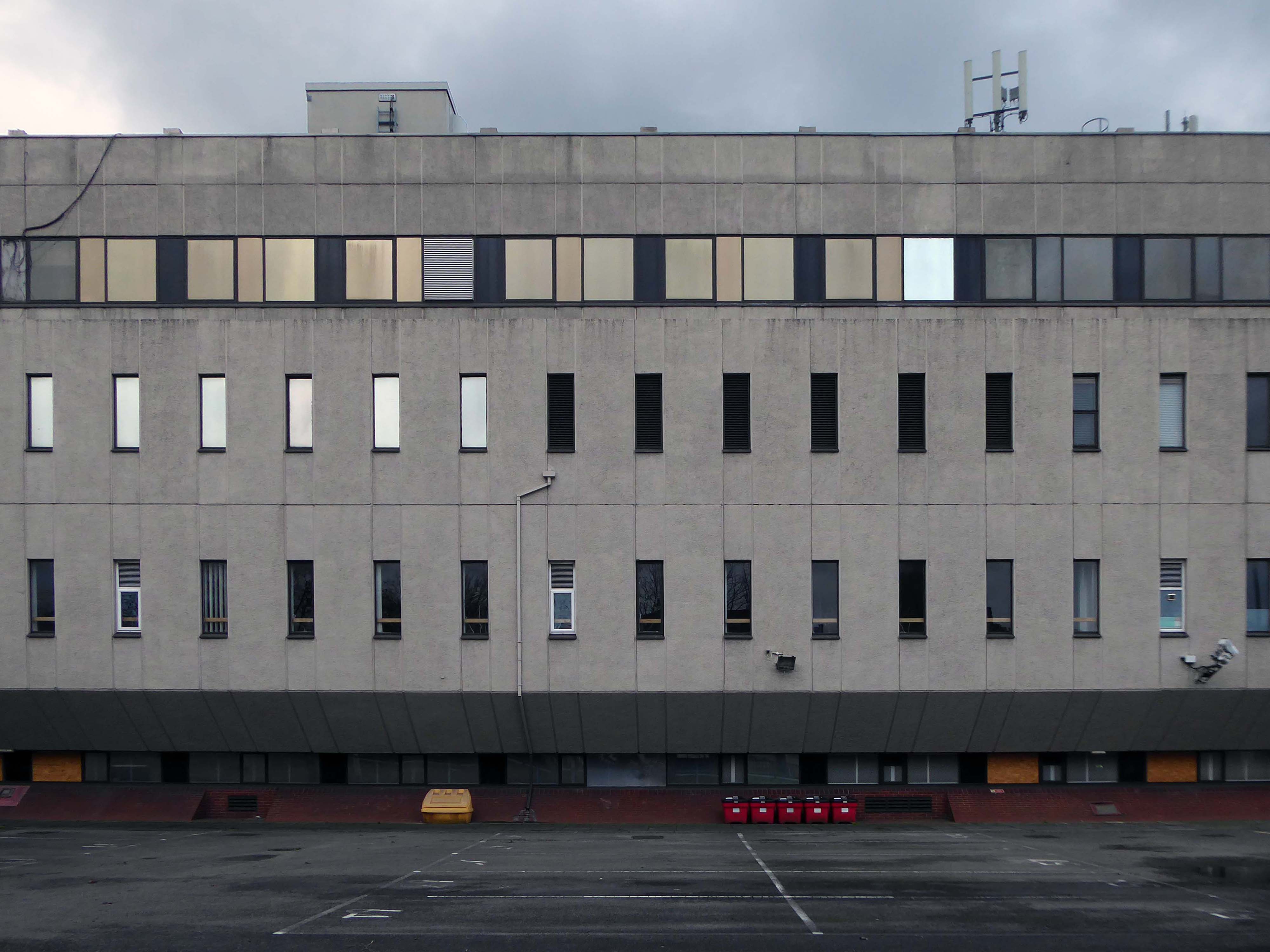
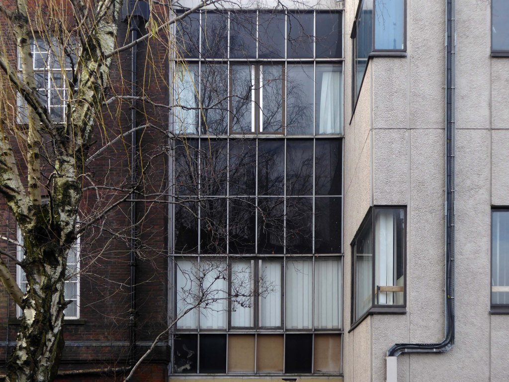
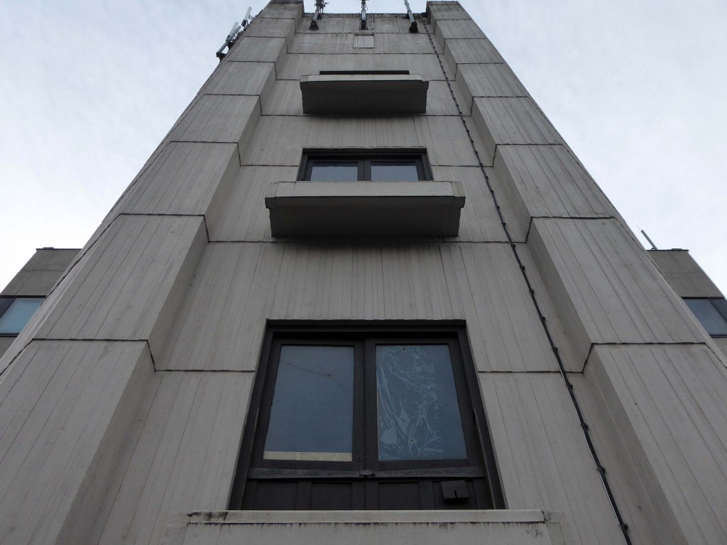
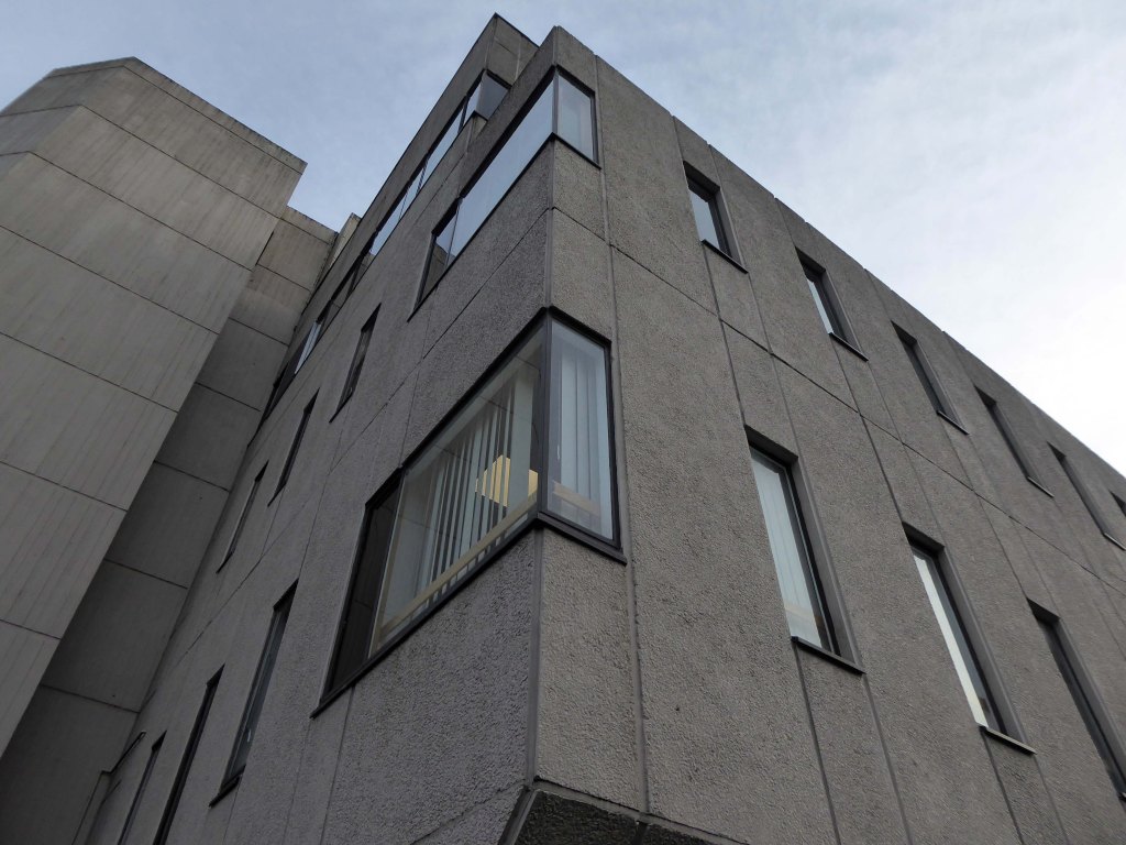
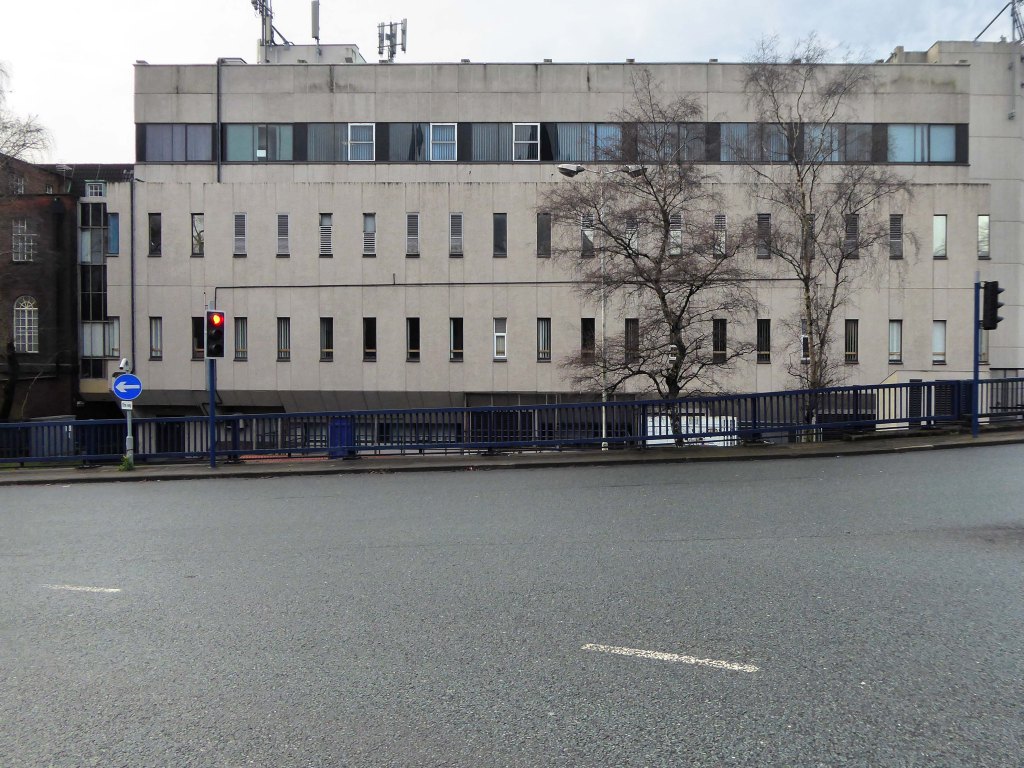
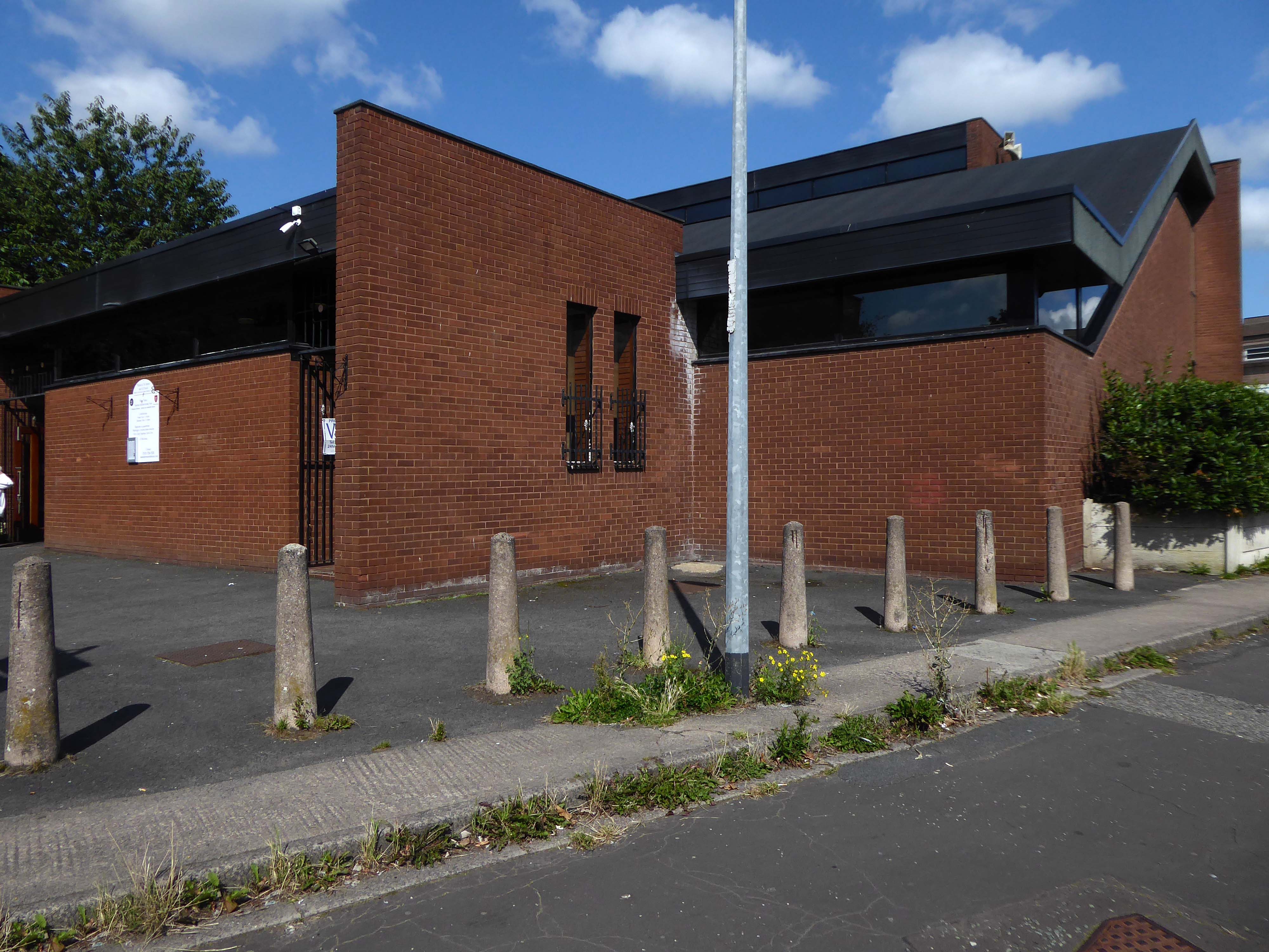
Crossing the road to the Civic Centre and the perennially empty piazza which along with the Magistrates Courts and Police Station was the work of the Borough Architects team – led by Charles Edmund Aspinall.
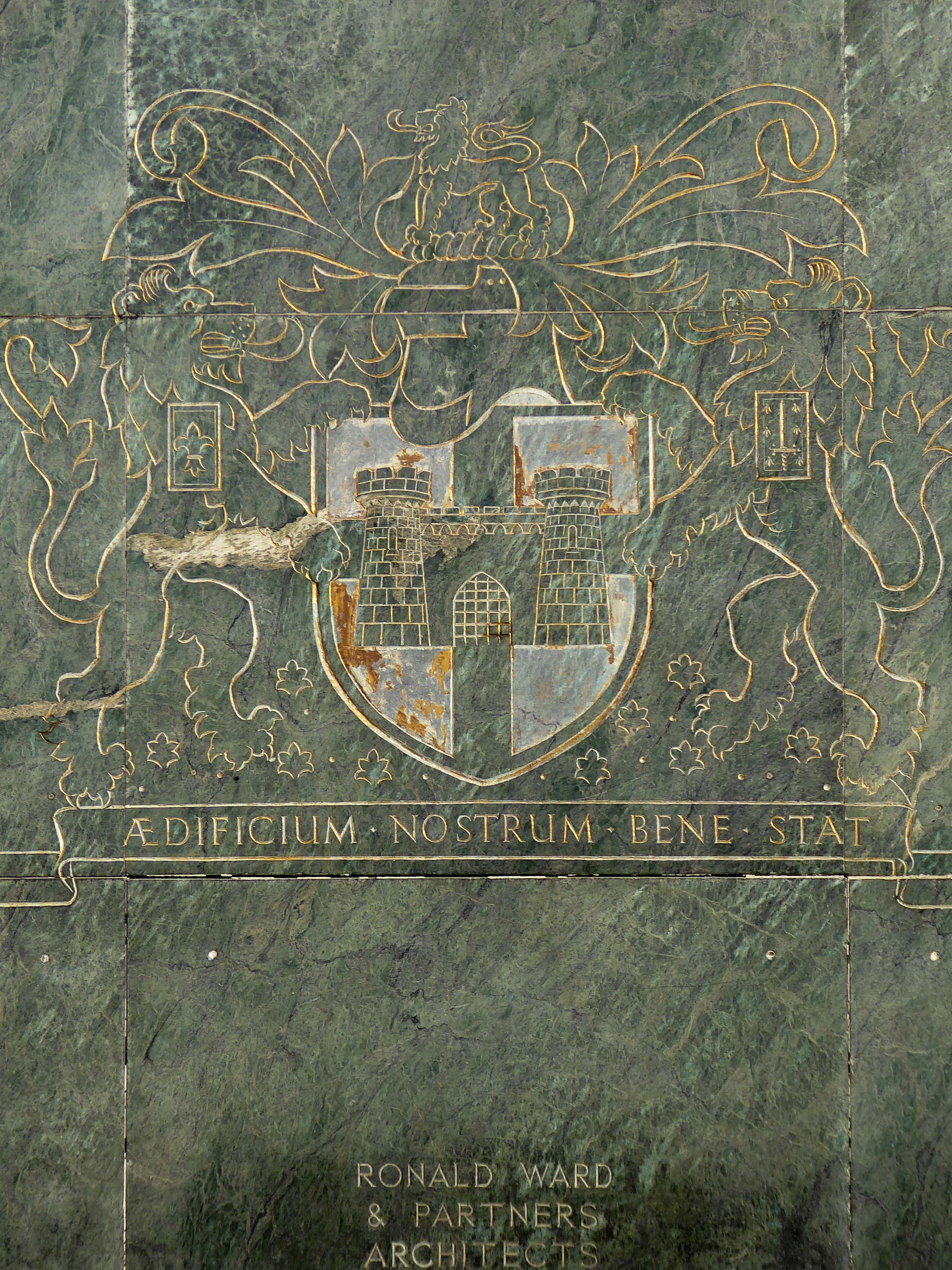
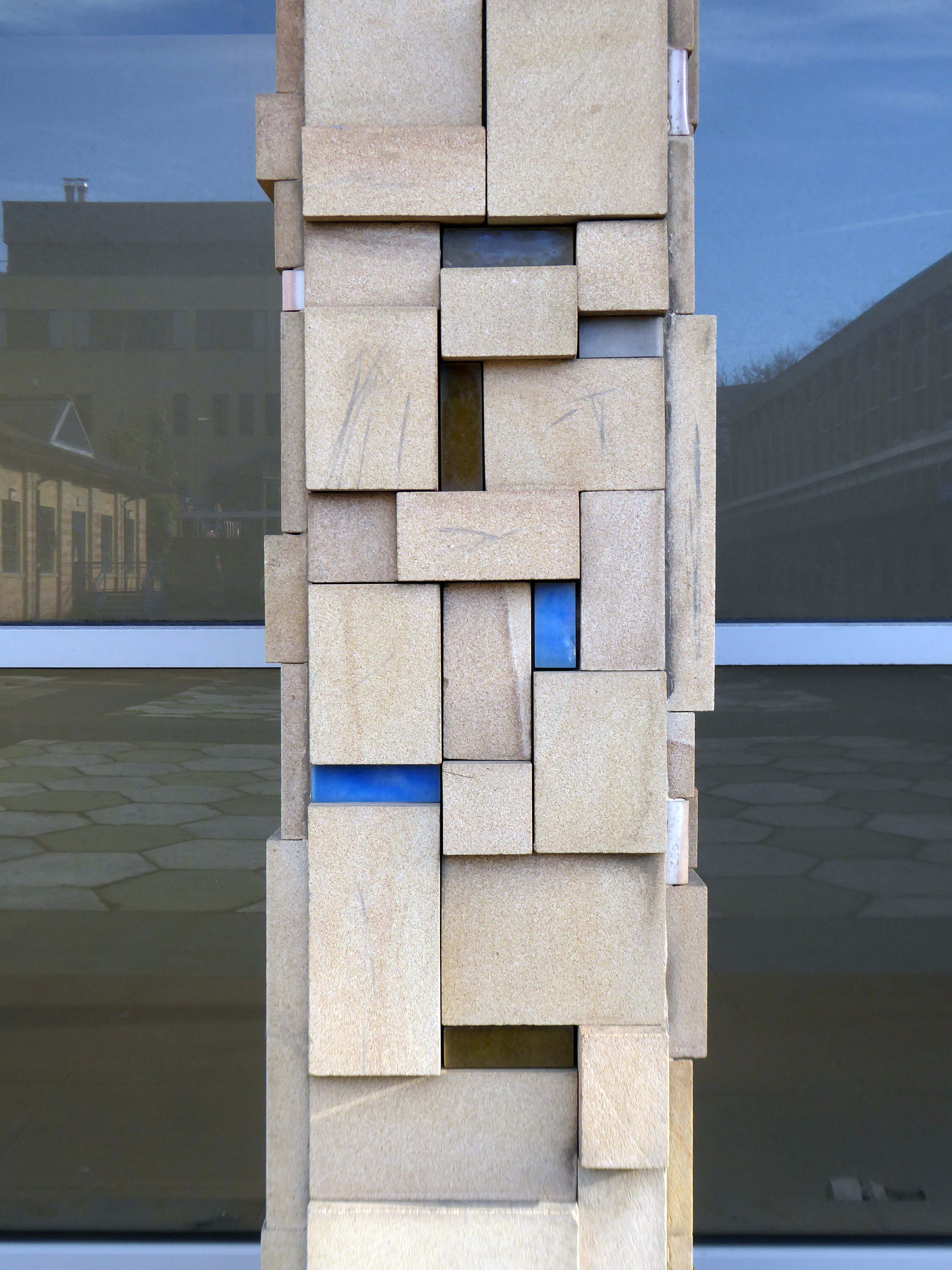
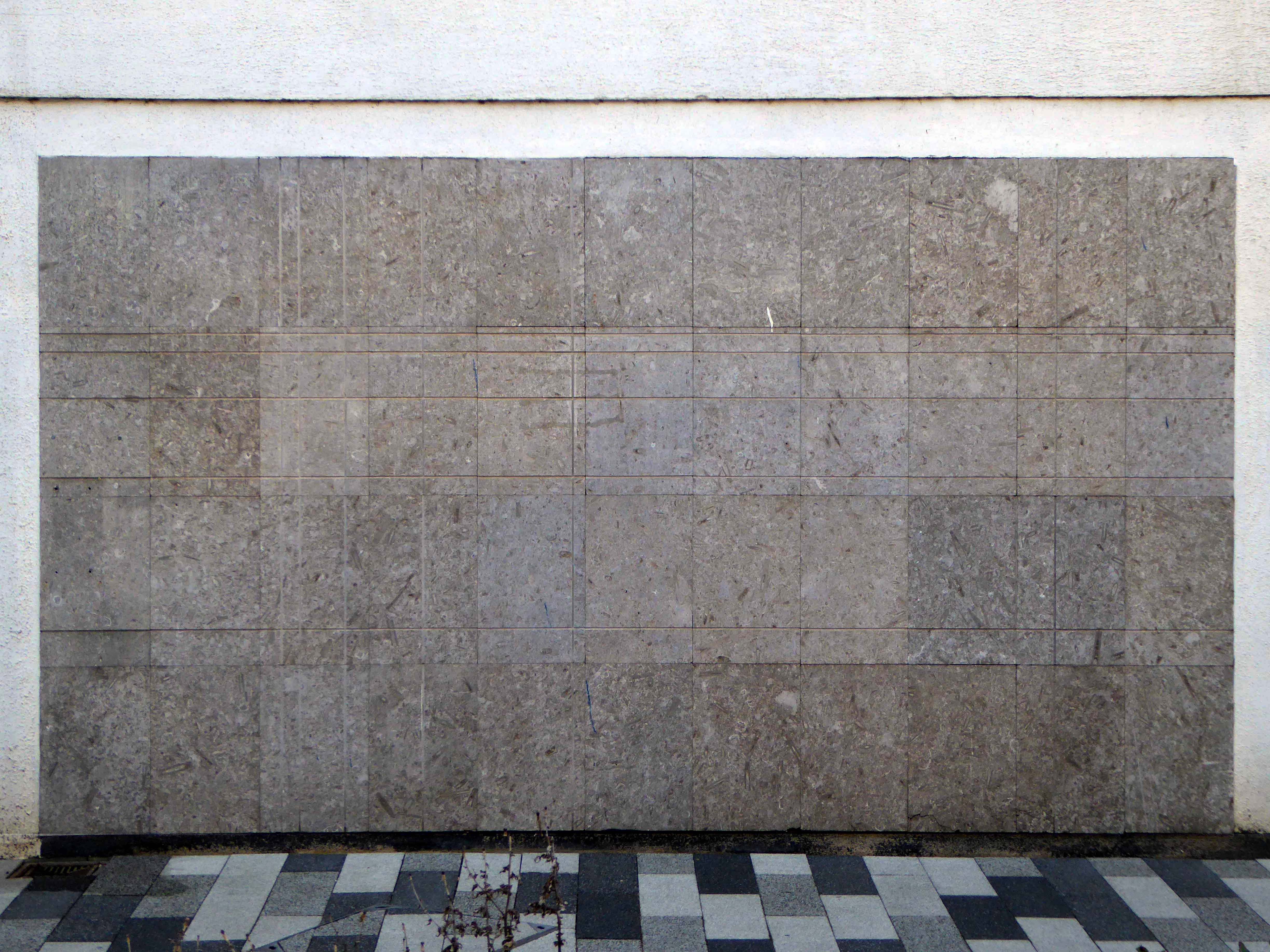
Walking excitedly toward the Exsilite panels set in the stone faced columns – a brand name for a synthetic, moulded, artificial marble.
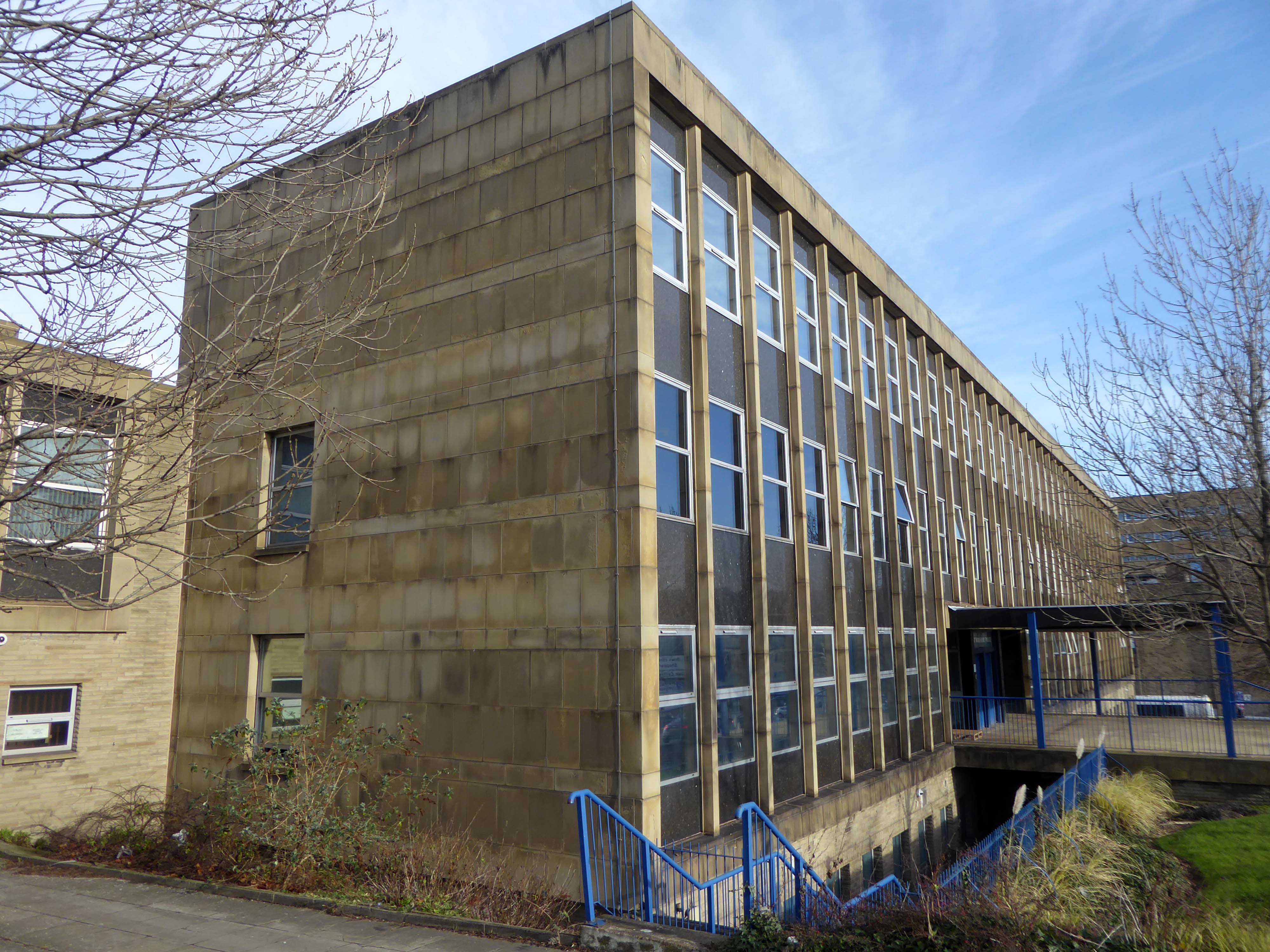
Magistrates Courts
Police Station
Dick Taverne served under Harold Wilson’s premiership in the 1960s, he served as a Home Office Minister from 1966 to 1968, Minister of State at the Treasury from 1968 to 1969 and then as Financial Secretary to the Treasury from 1969 to 1970.
In 1970, he helped to launch the Institute for Fiscal Studies, now an influential independent think tank and was the first Director, later chairman.
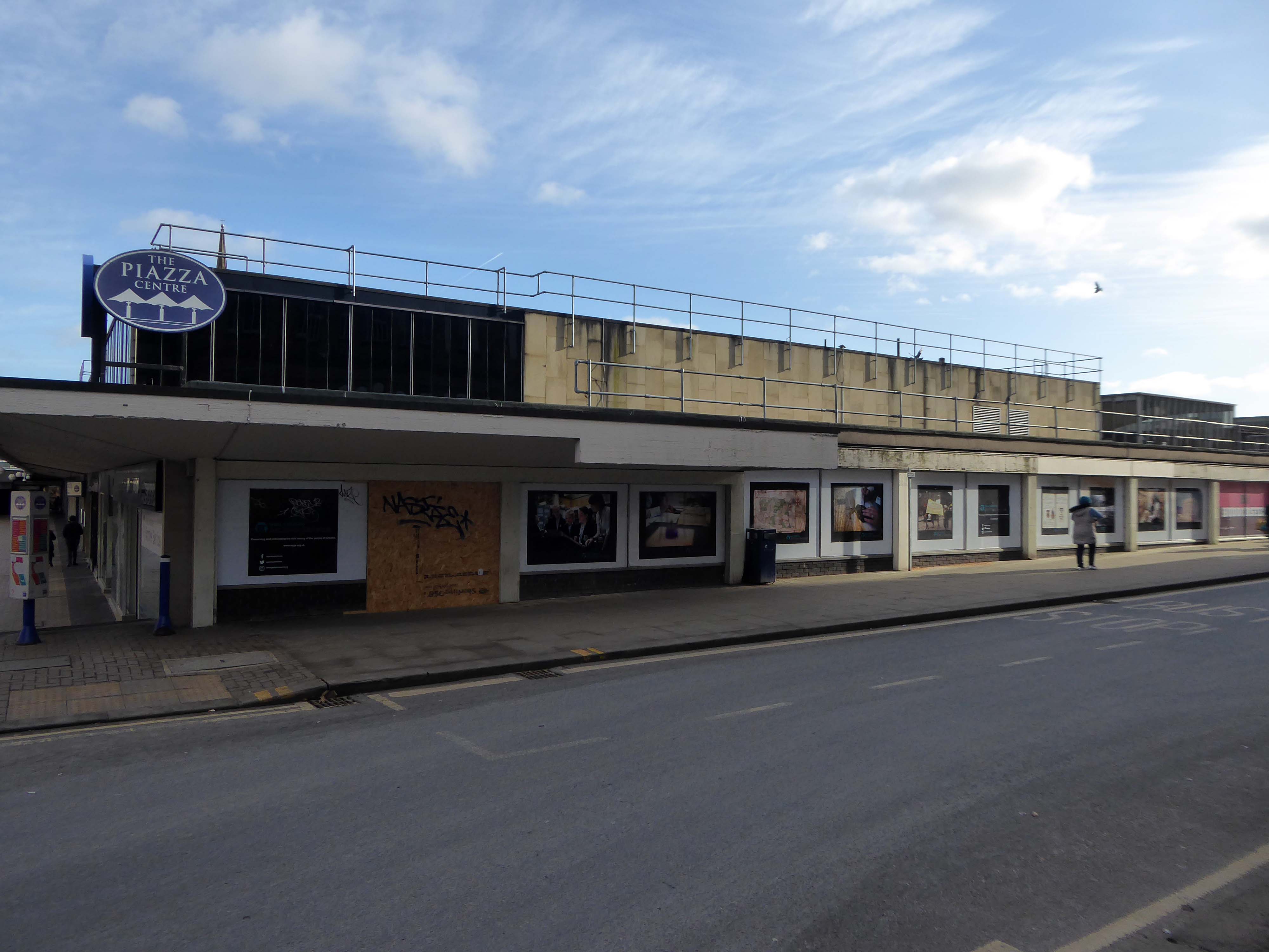
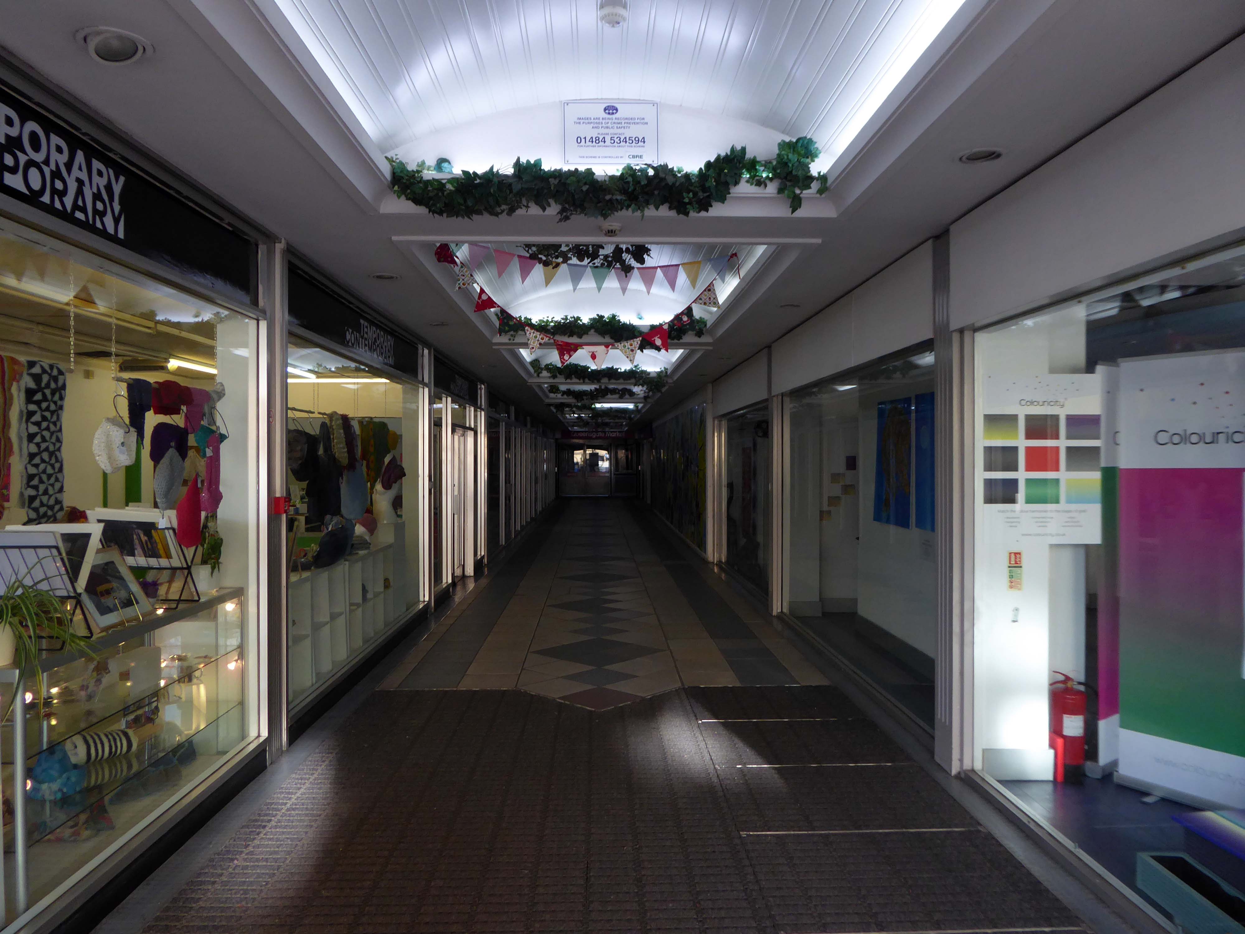
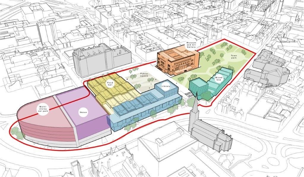
The vision is to create an inclusive space where families, residents and visitors can enjoy a vibrant mix of music, arts, food and more in one central area, overlooking a stunning new urban park.
The council plans to demolish the Piazza Centre and create a new events/live music venue, a food hall, a museum and art gallery, a new library and a new multi-storey car park, all centred around a new Town Park.
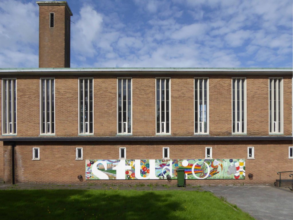
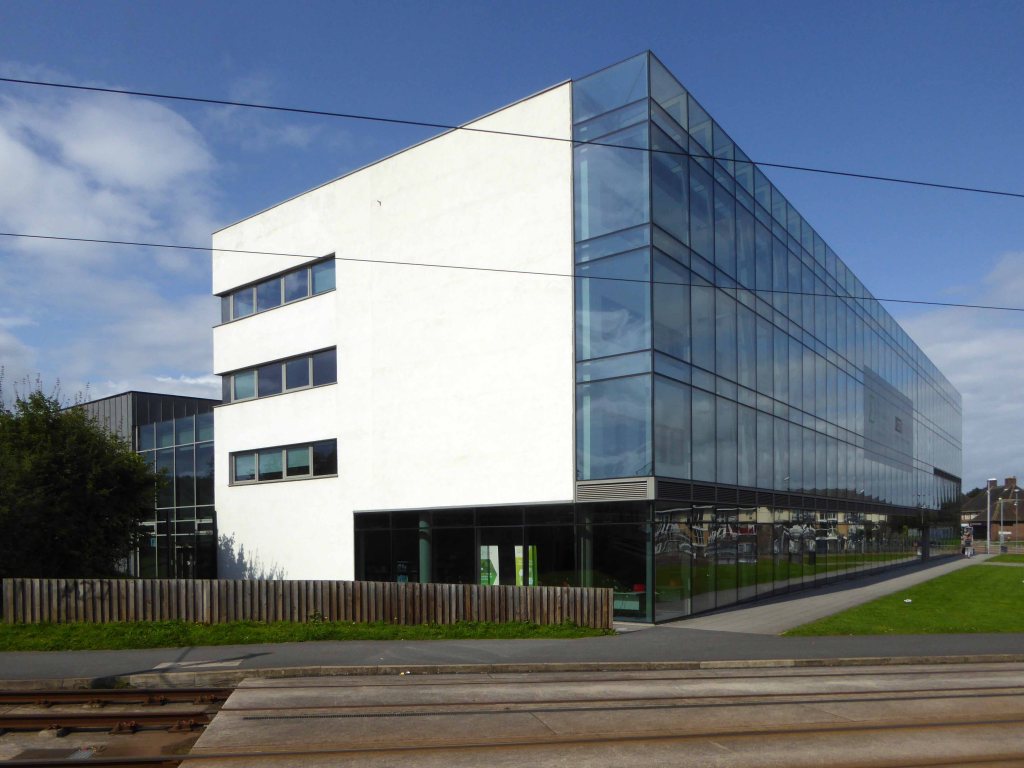
Named after one of the Twentieth Century’s finest artists, the space nurtures a new and inspired generation of designers. Through visual and physical connection, the environment encourages students to work together, stimulating communication and ingenuity, the ingredients of successful collaboration.
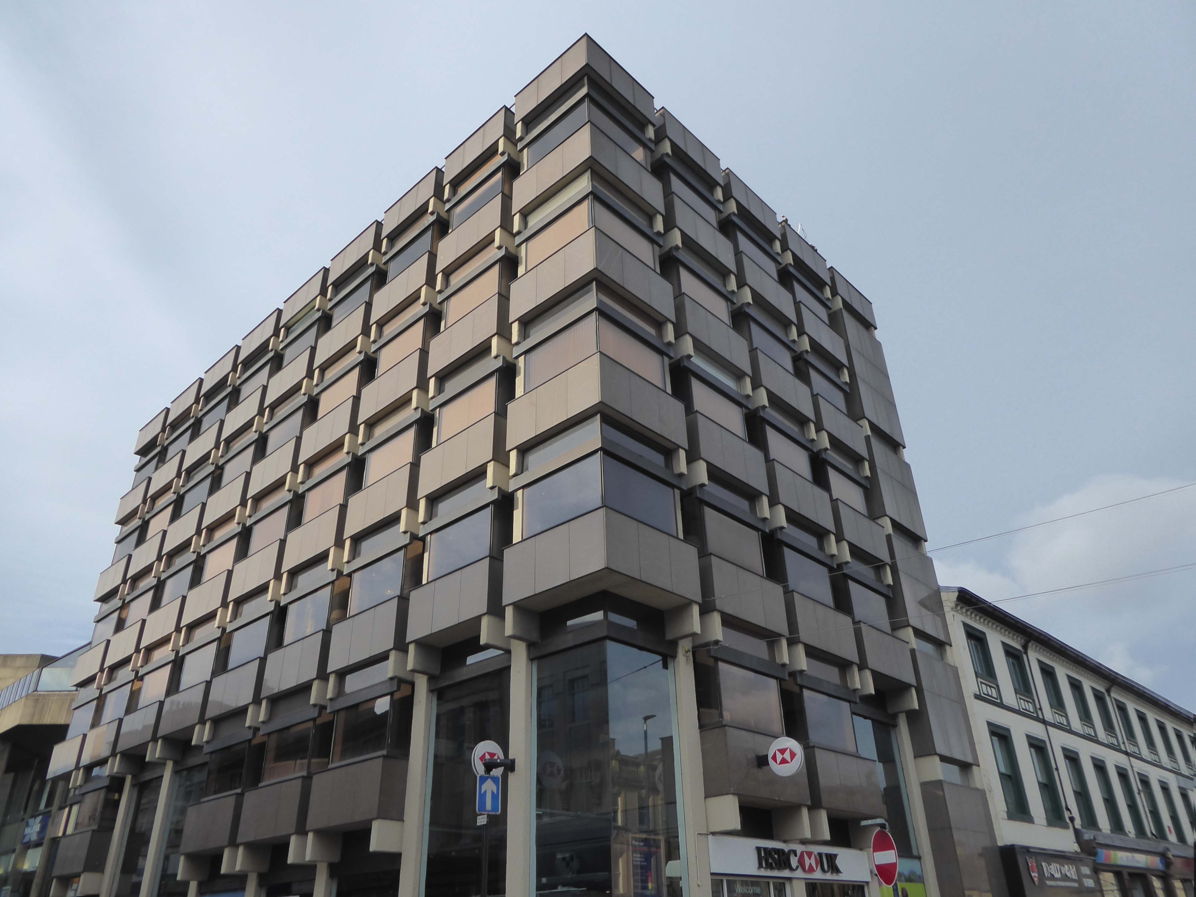
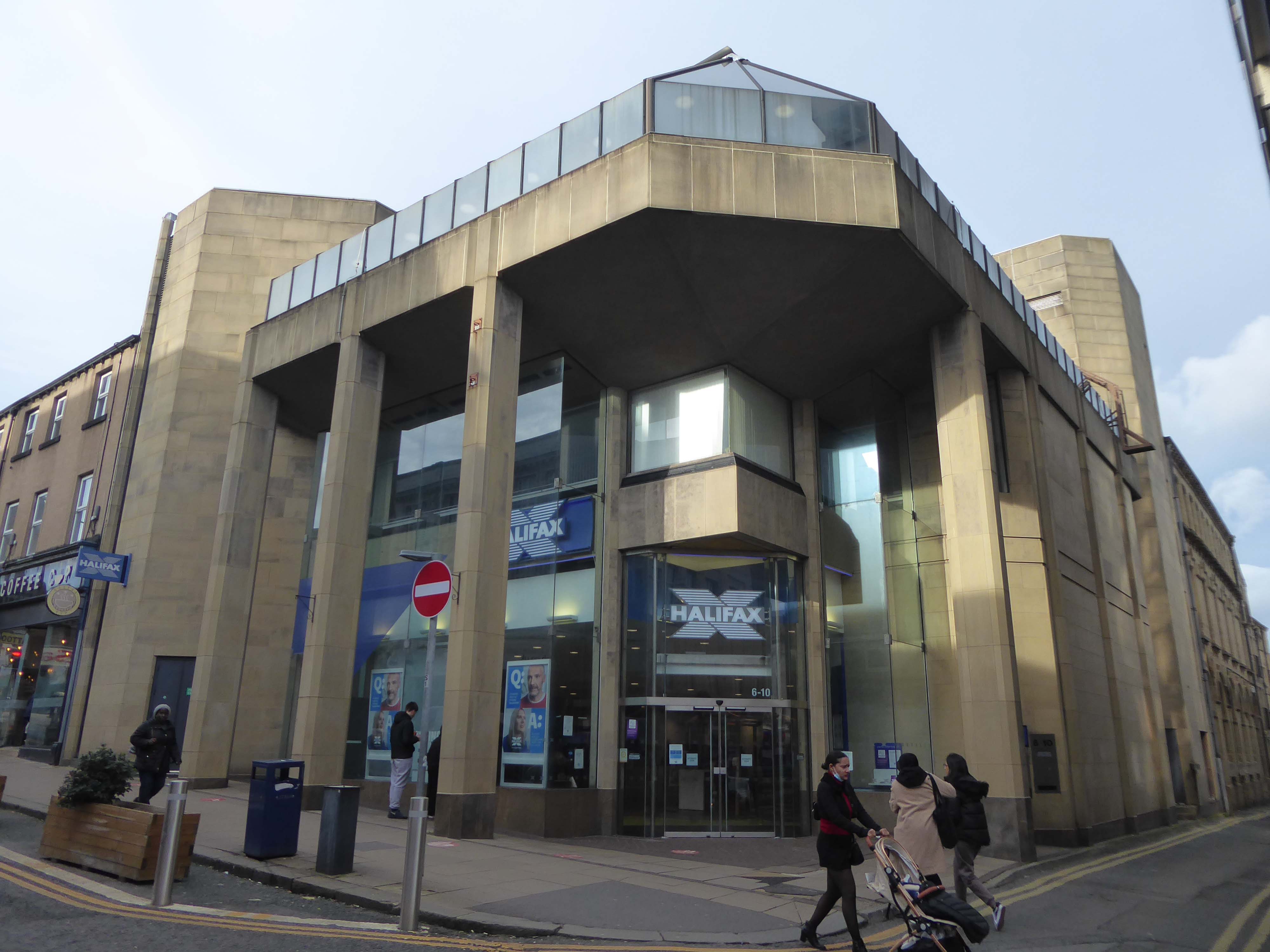
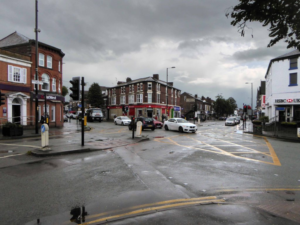
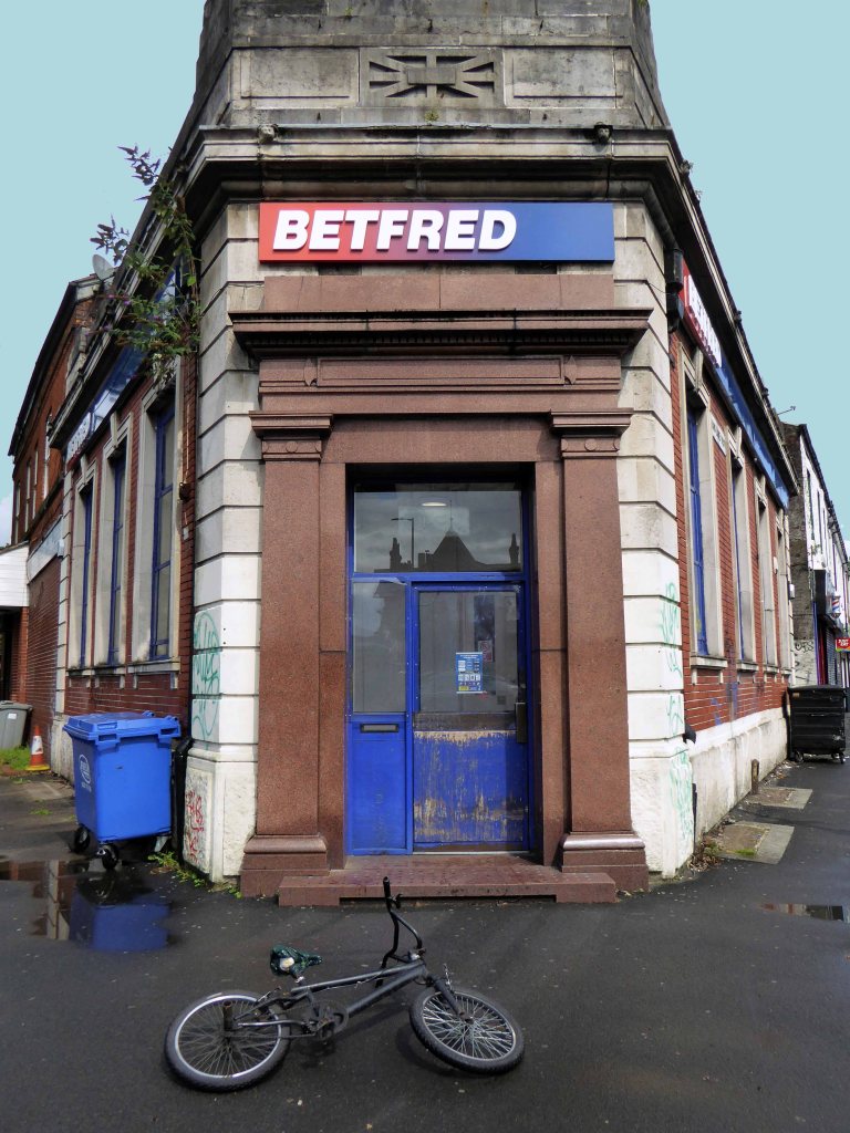
Take that to the bank/s
Keep savin’, keep buildin’ That interest for our love Take that to the bank Keep savin’, keep buildin’ That interest for our love Take that to the bank
HSBC was designed by Peter Womersley, who also designed the thoroughly modern private house, Farnley Hey, near Castle Hill, which won the RIBA Bronze Medal in 1958.
Halifax Building Society
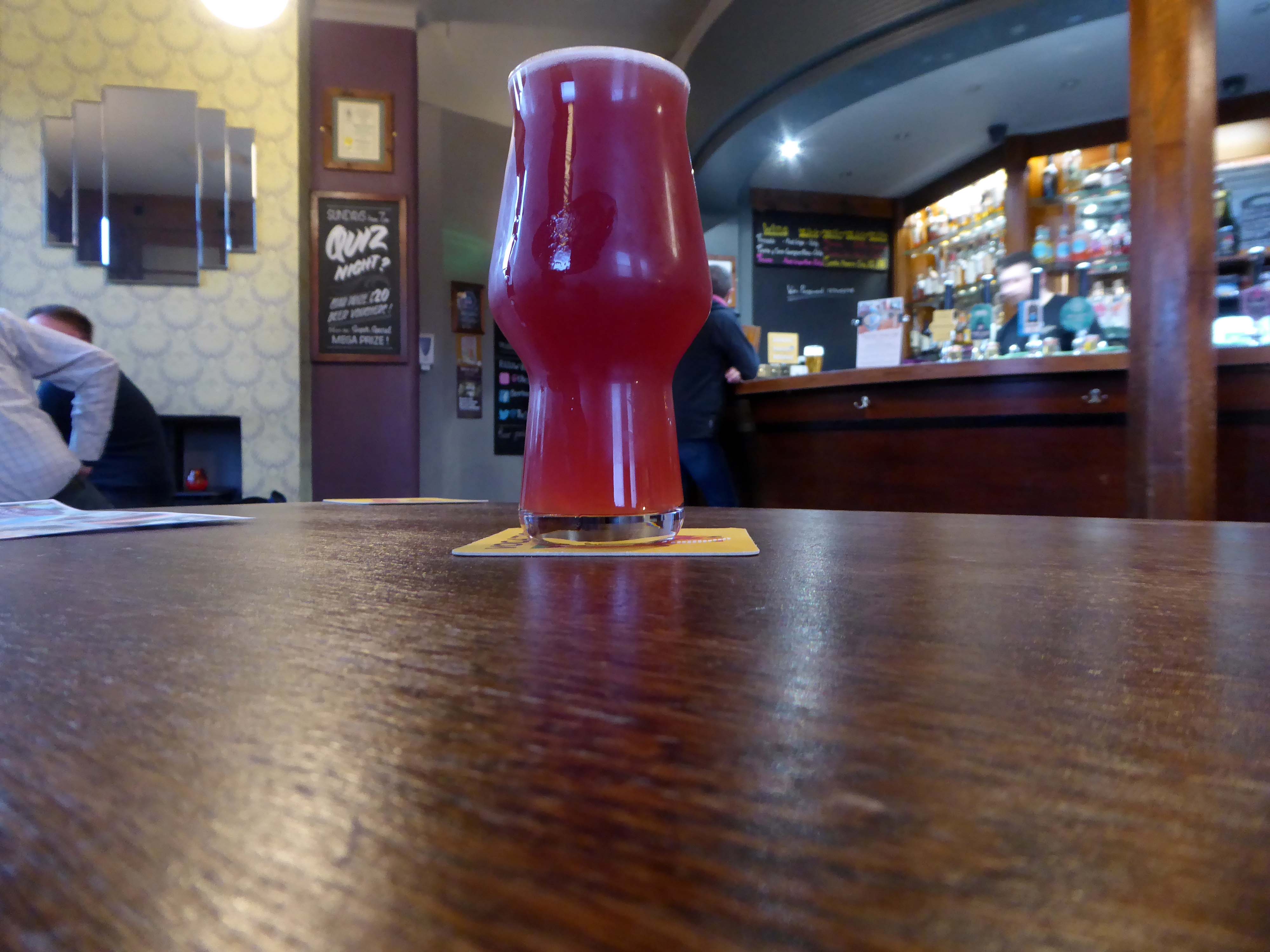
Having walked around town for more hours than enough I sought respite in The Sportsman and a glass of Squawk multi-berry fruited sour
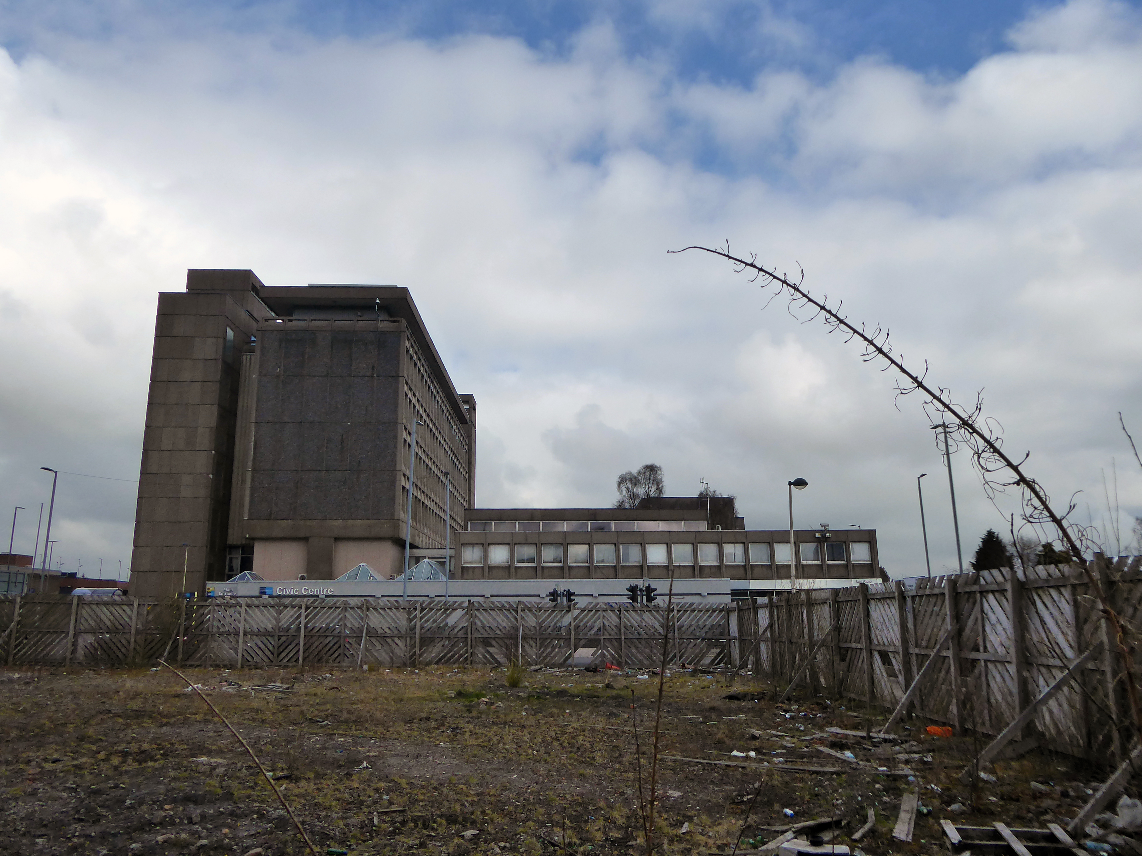
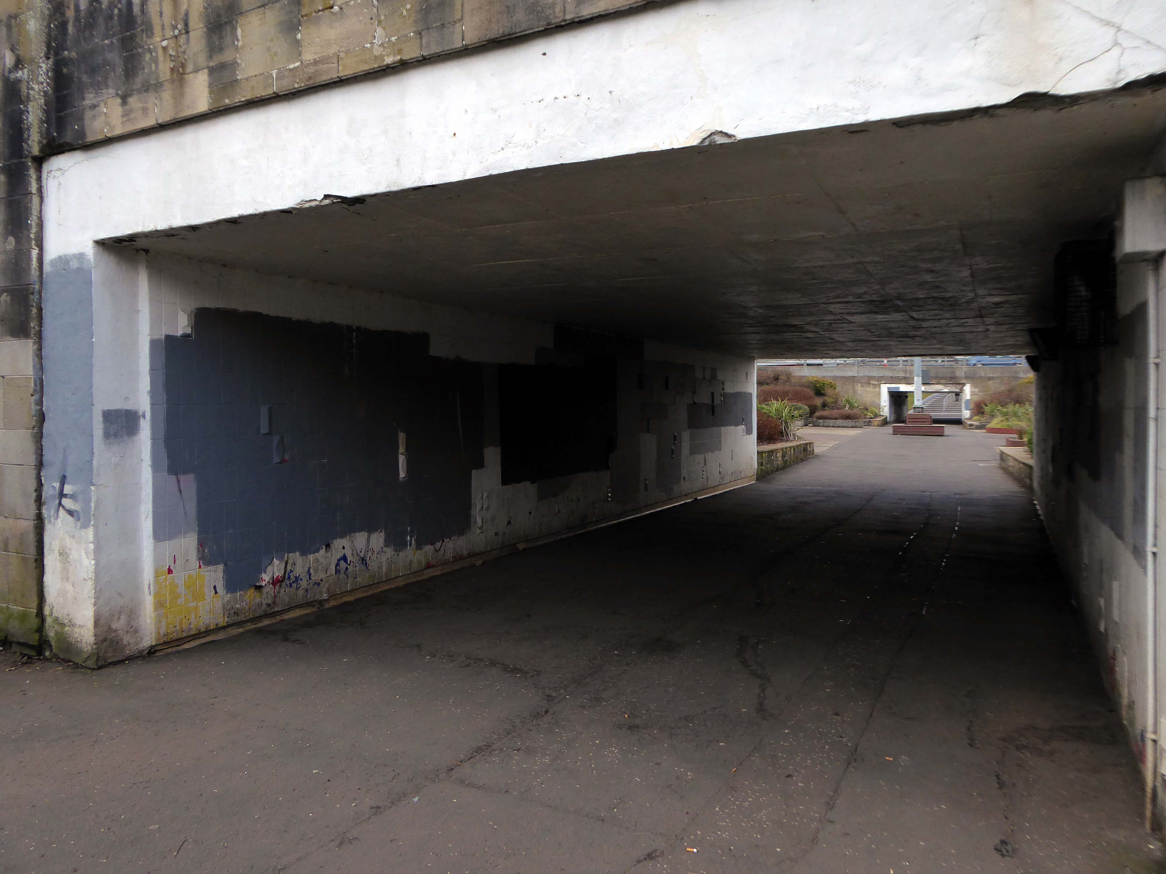
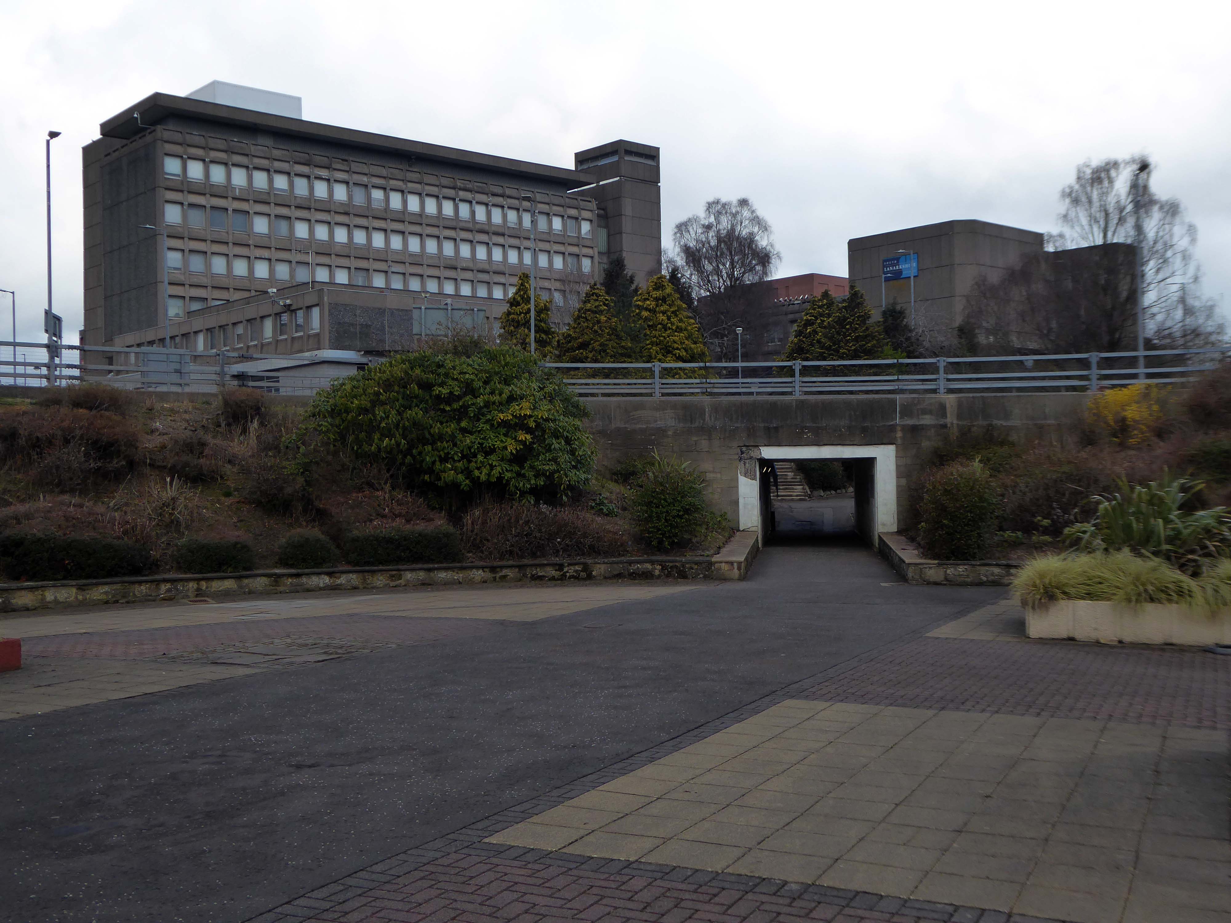
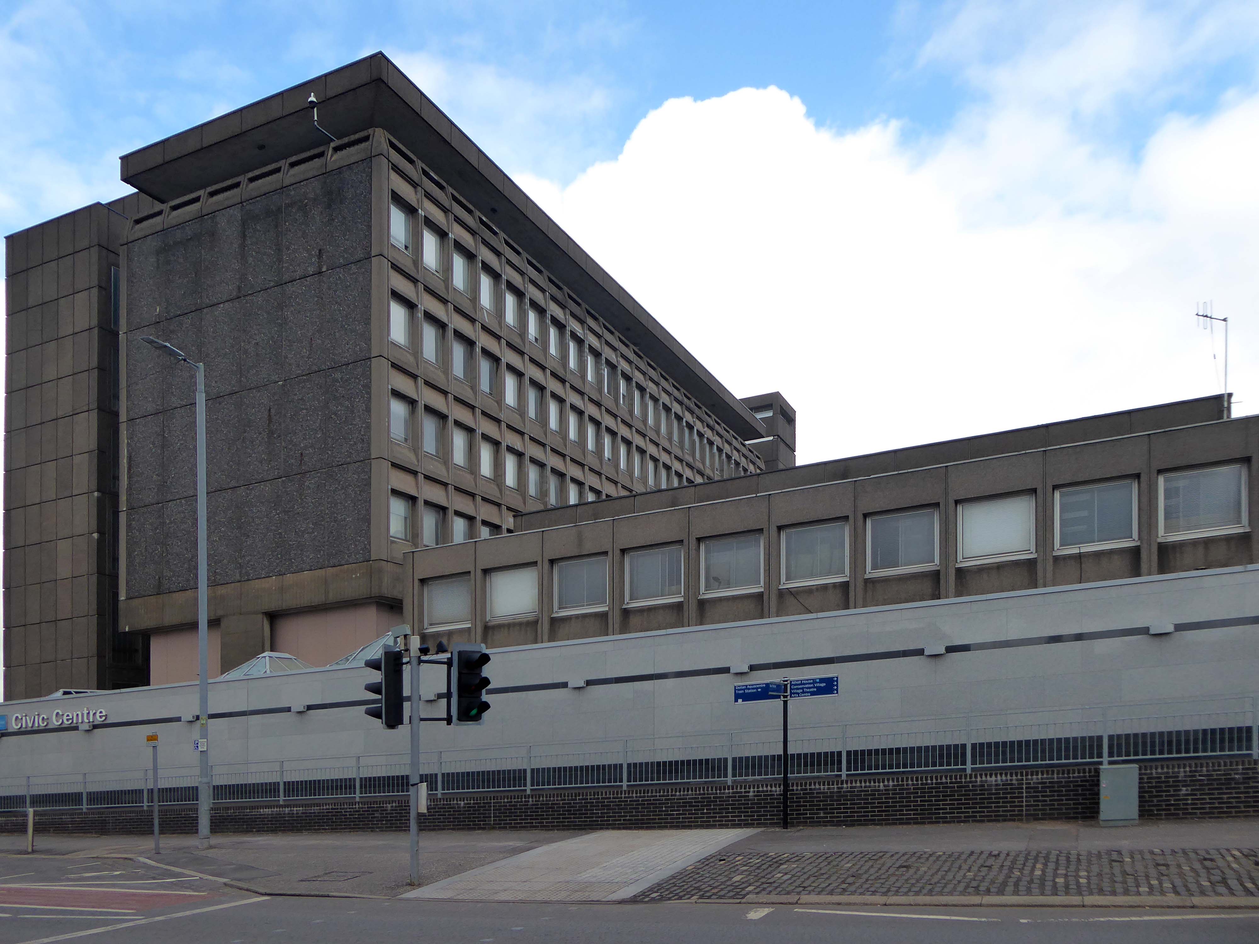
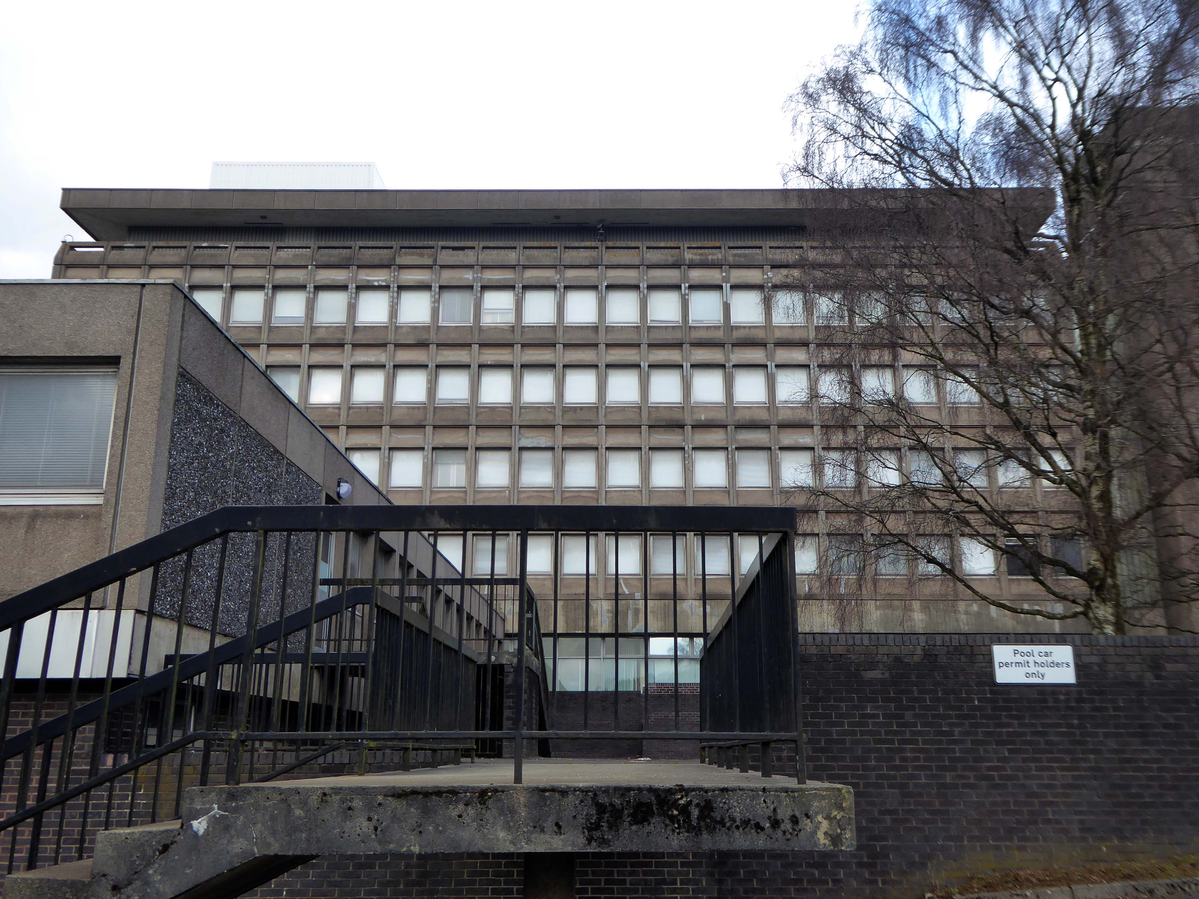
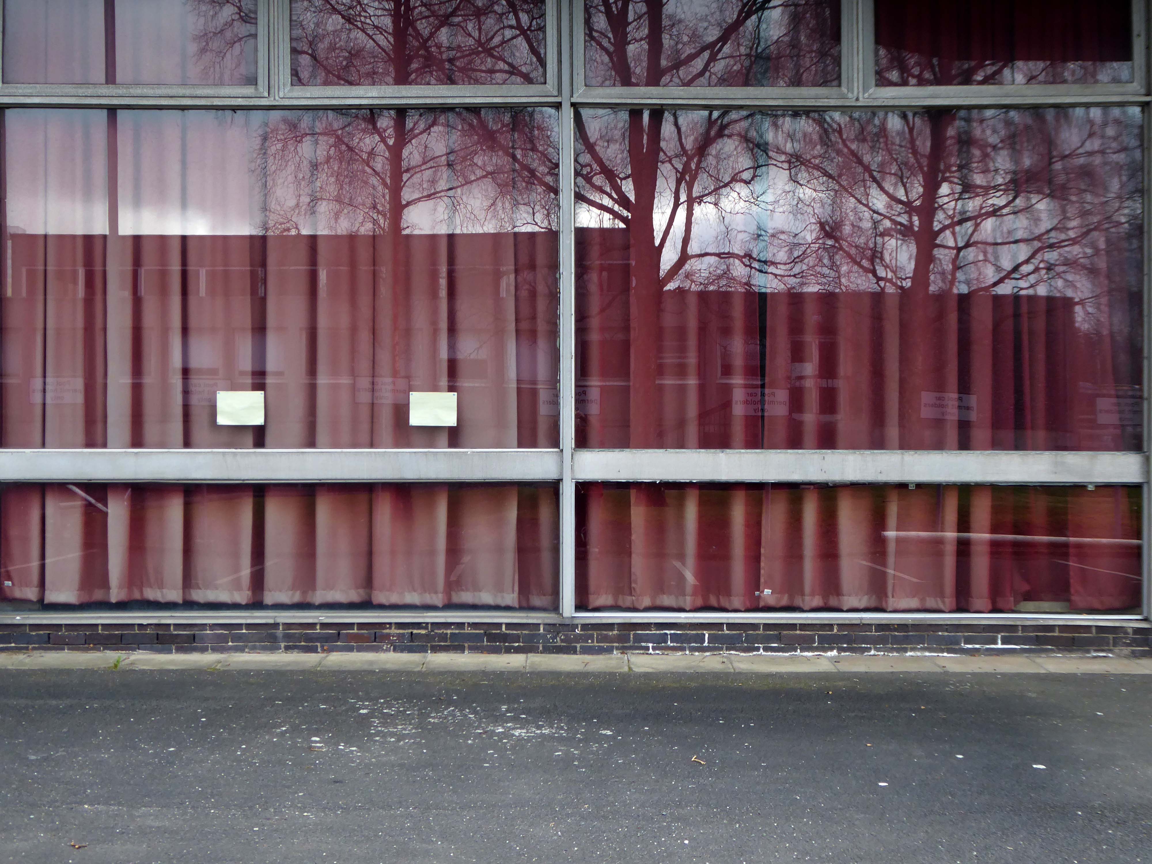
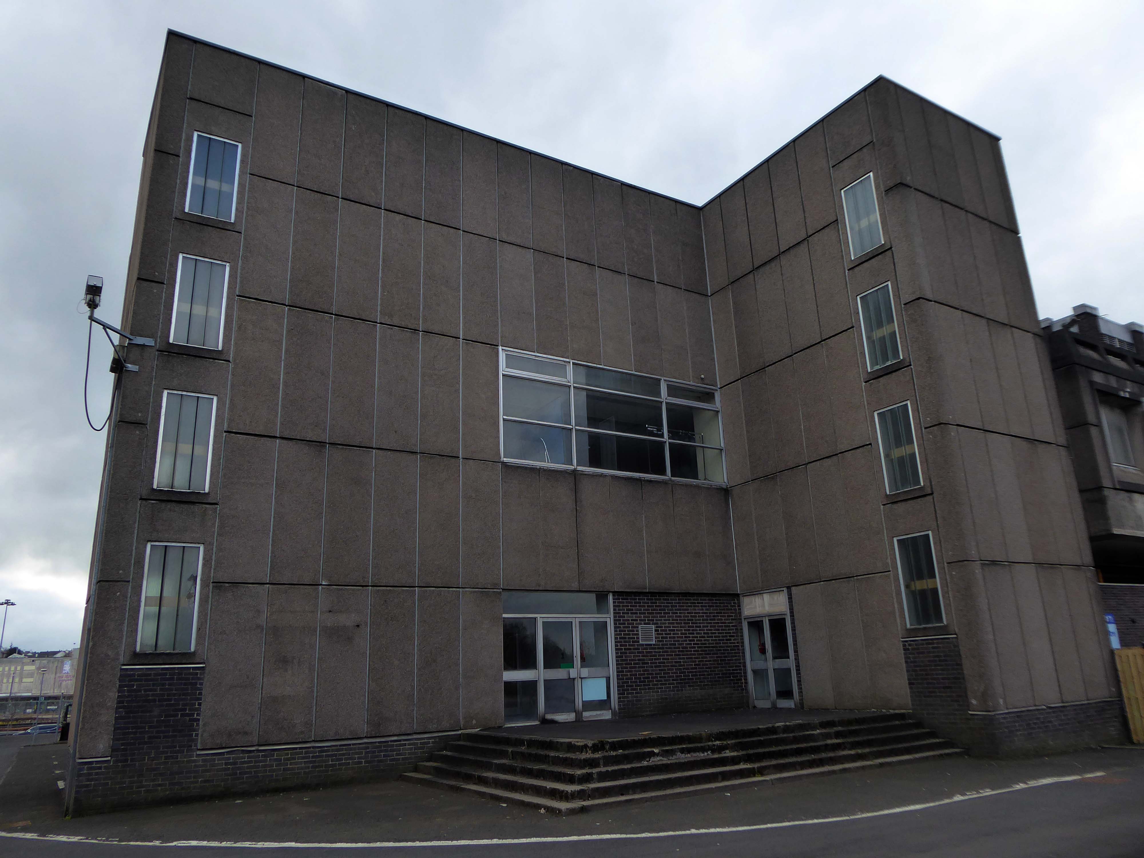
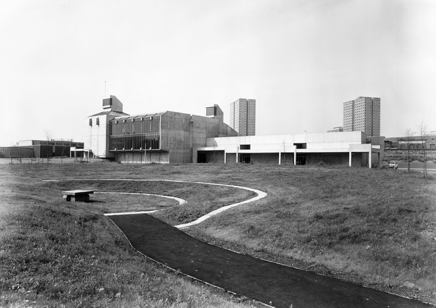
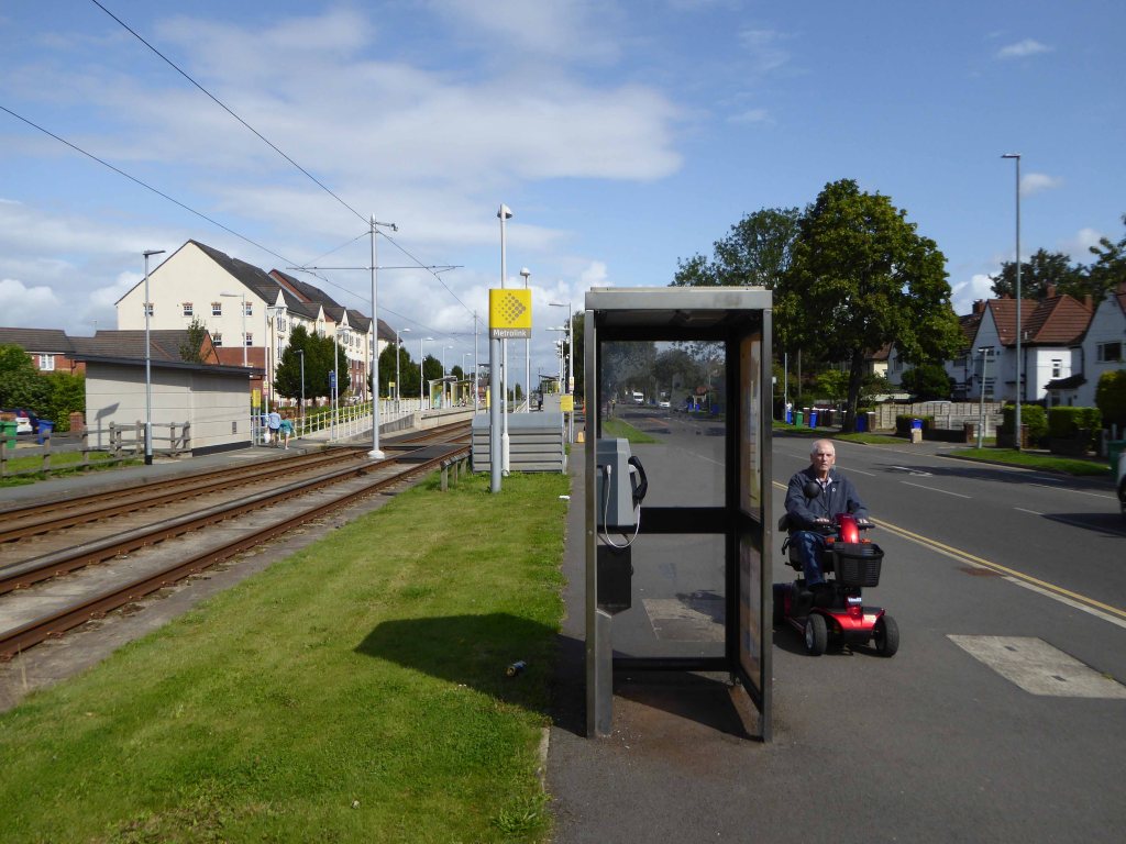
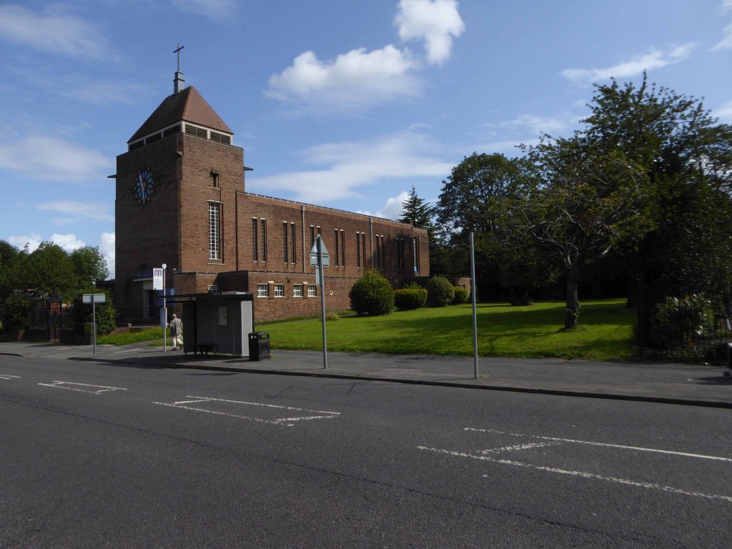
I walked from St Bride’s Church, through a valley to East Kilbride Civic Centre
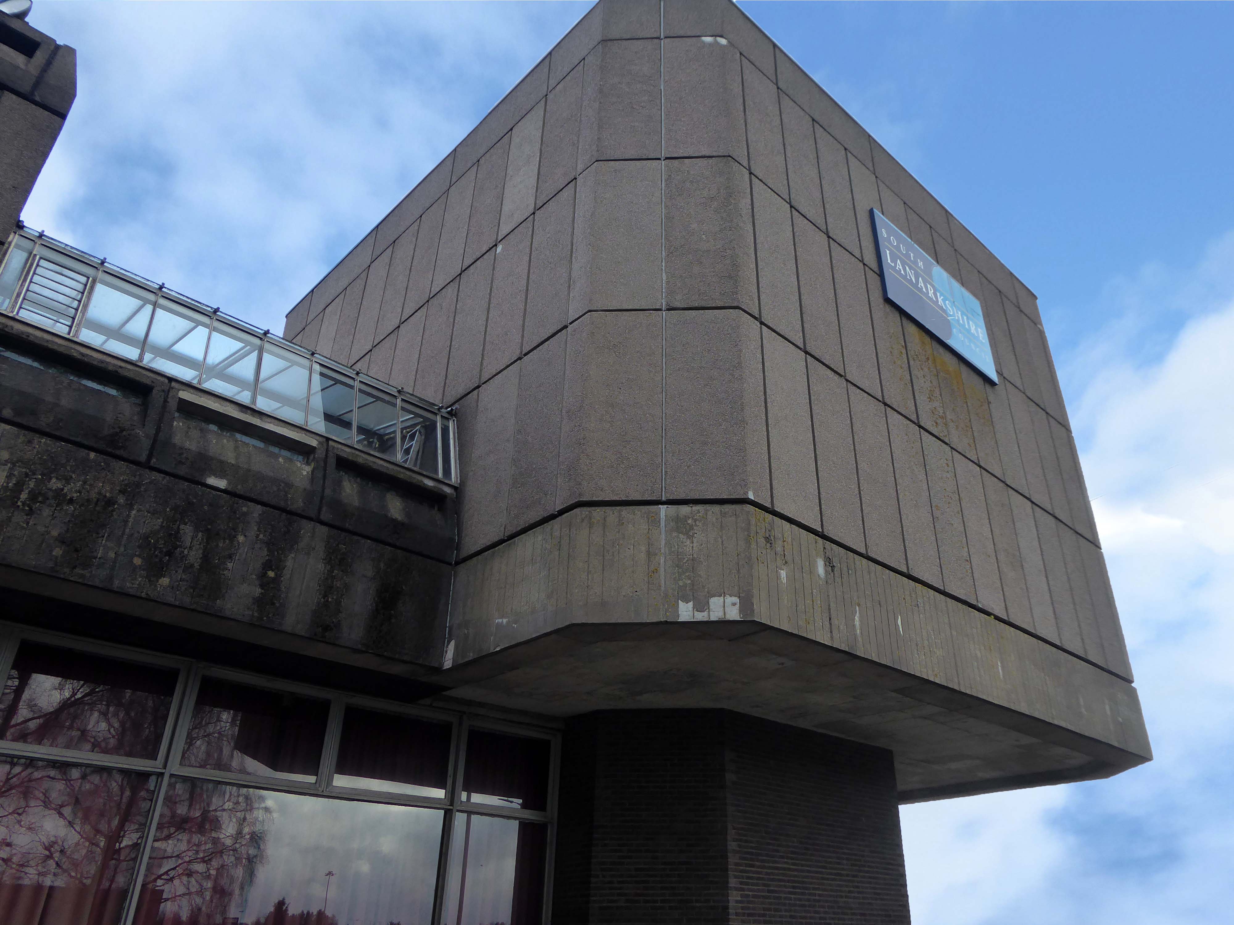
Commissioned by the burgh of East Kilbride, was designed by Scott Fraser & Browning, built by Holland, Hannen & Cubitts and completed in 1966.
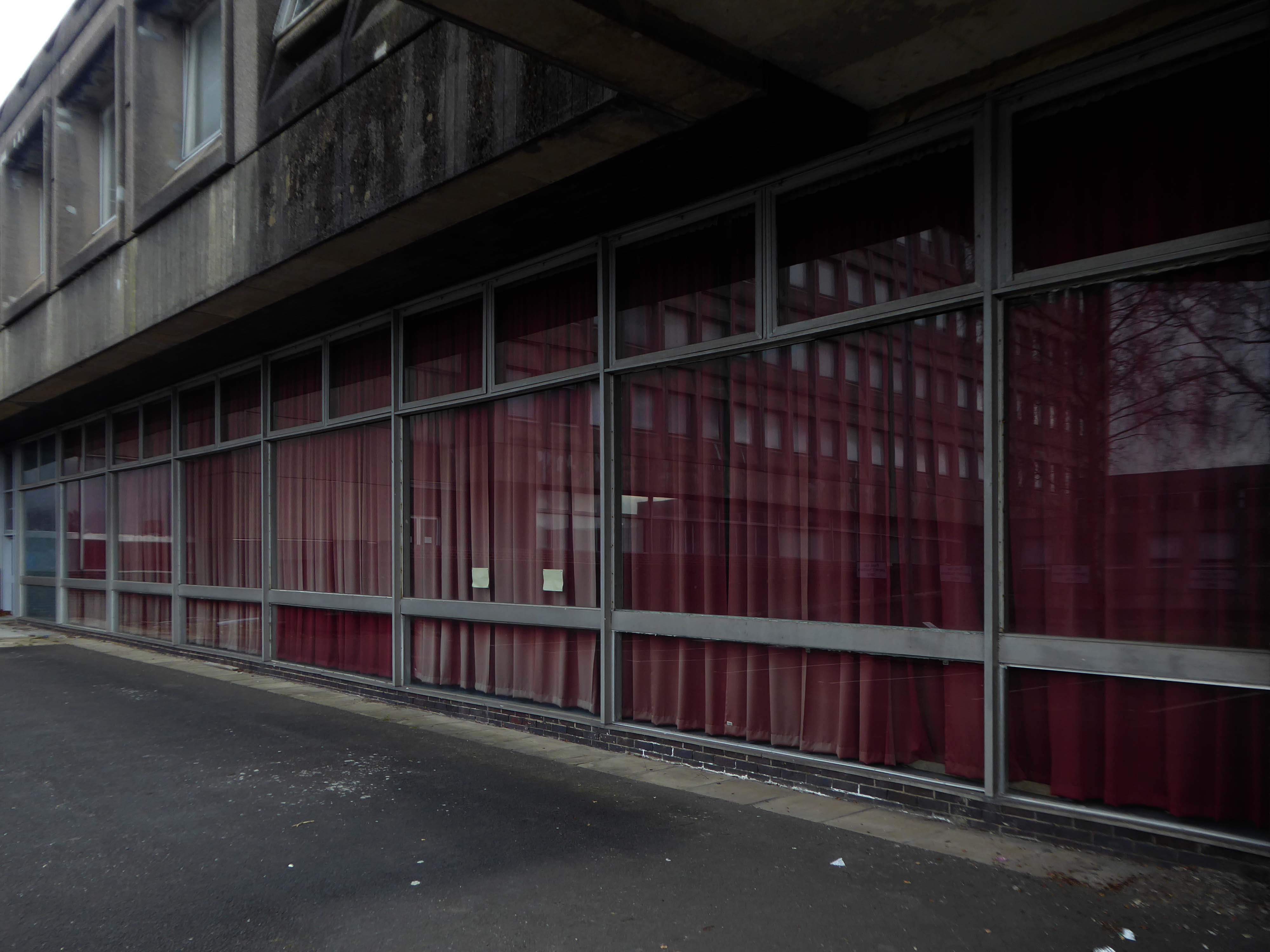
Accommodating Ballerup Hall.
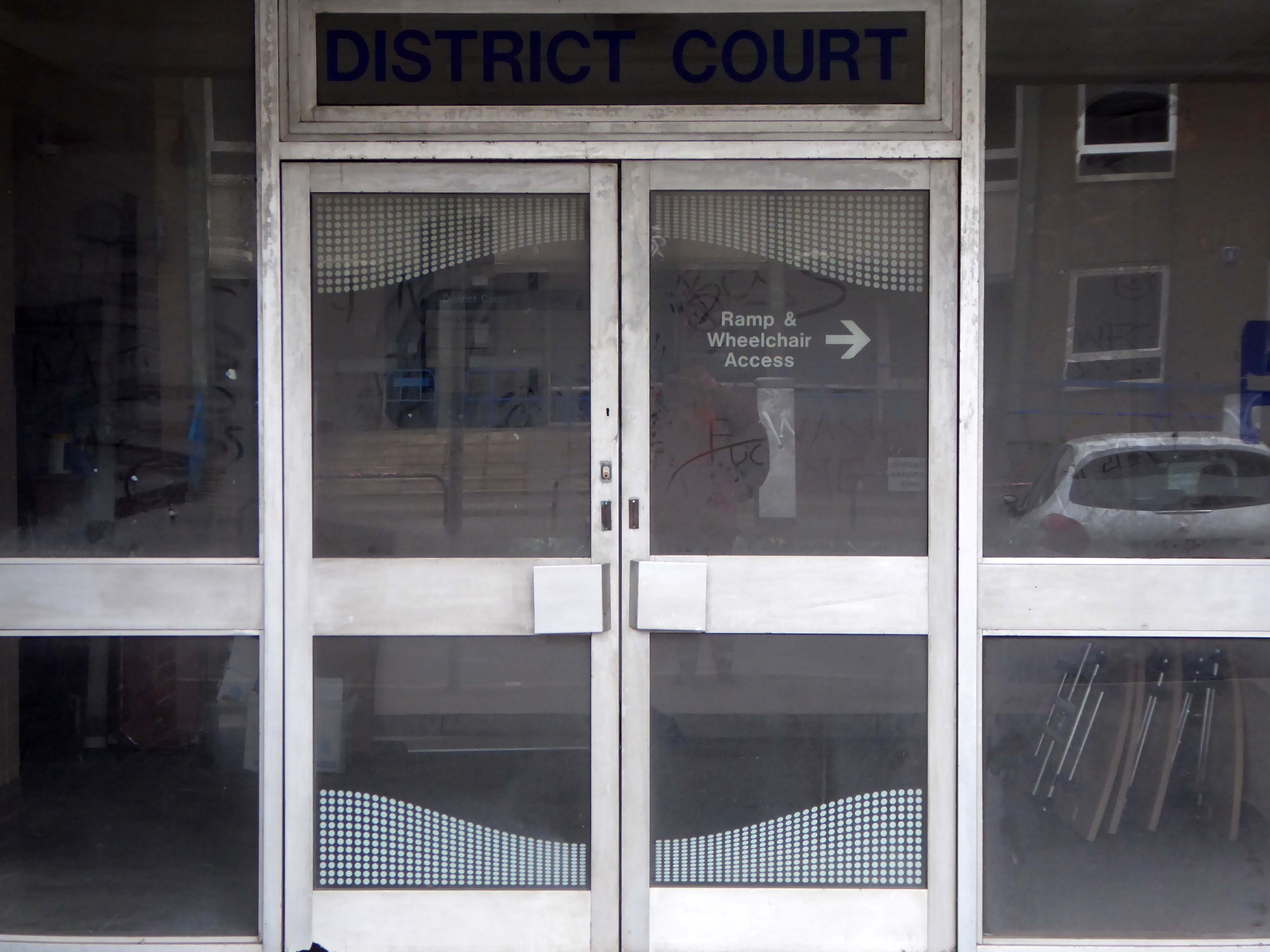
Ballerup Hall is located within East Kilbride Civic Centre and takes its name from its twin town Ballerup, which is near Copenhagen in Denmark. The hall comprises a main hall with stage, kitchen facilities and a bar servery. The adjoining district court room is available after office hours for a limited range of activities.
The stars of British Championship Wrestling return to East Kilbride with a star-studded line up including The Cowboy James Storm and all your favourite BCW Superstars!
I missed the missing link twixt Roddy Frame and the Civic Centre.
If you were lucky enough to catch the 2013 concerts in which Frame marked the 30th anniversary of High Land Hard Rain by playing Aztec Camera’s seminal debut album live, you’ll already have seen Anne’s pictures. Before getting to High Land Hard Rain itself in those shows, Frame treated audiences to a rare set drawn from what he termed his East Kilbride period – the songs he was writing as a teenager that would appear on Aztec Camera’s two Postcard singles, and form the basis of the band’s legendarily unreleased Postcard album, Green Jacket Grey.
While he played those tunes, huge, striking black and white images of his old hometown appeared as a backdrop behind him, setting exactly the right fragile, retro-future new town mood of post-industrial Fahrenheit 451 urban development.
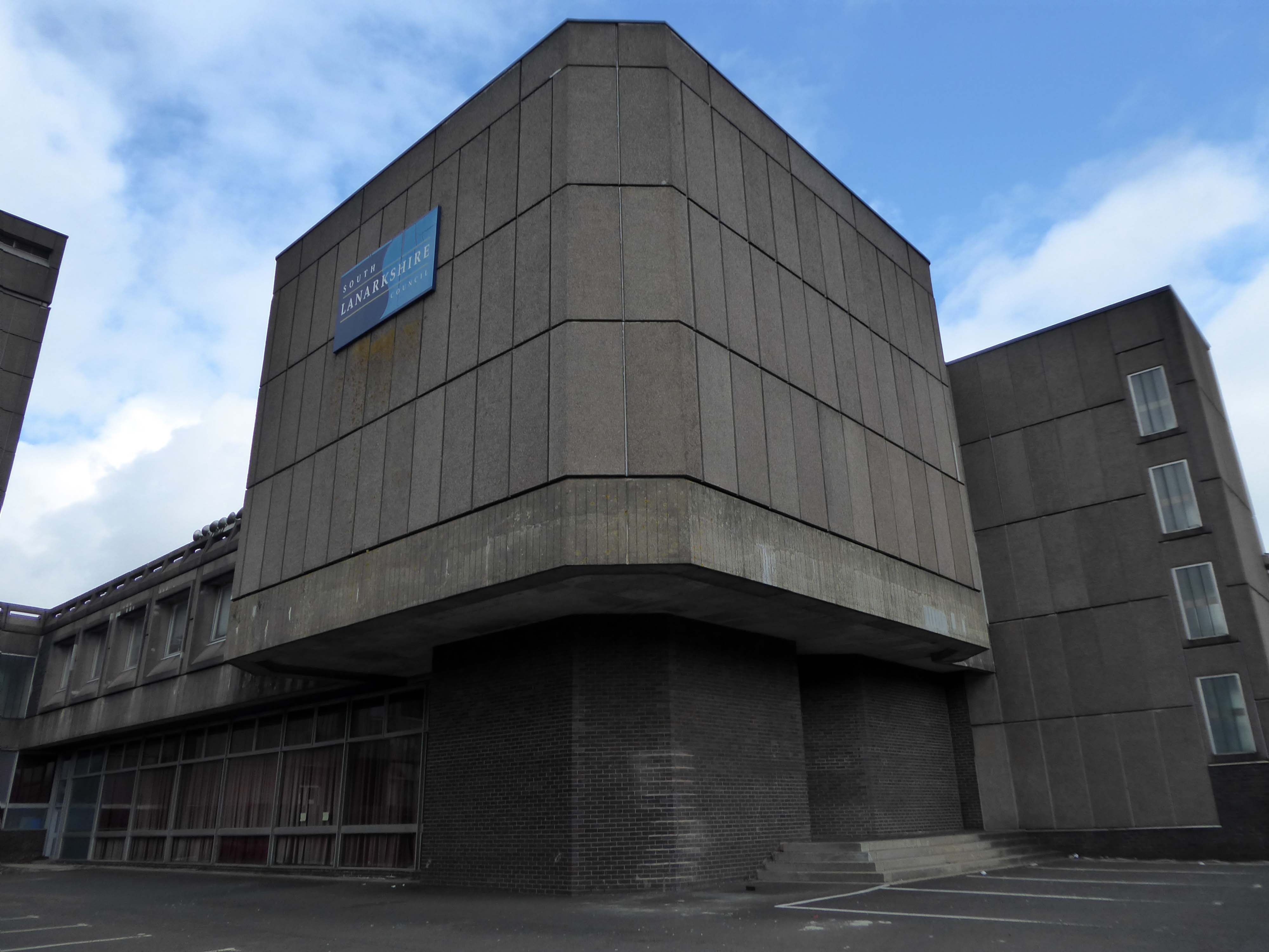
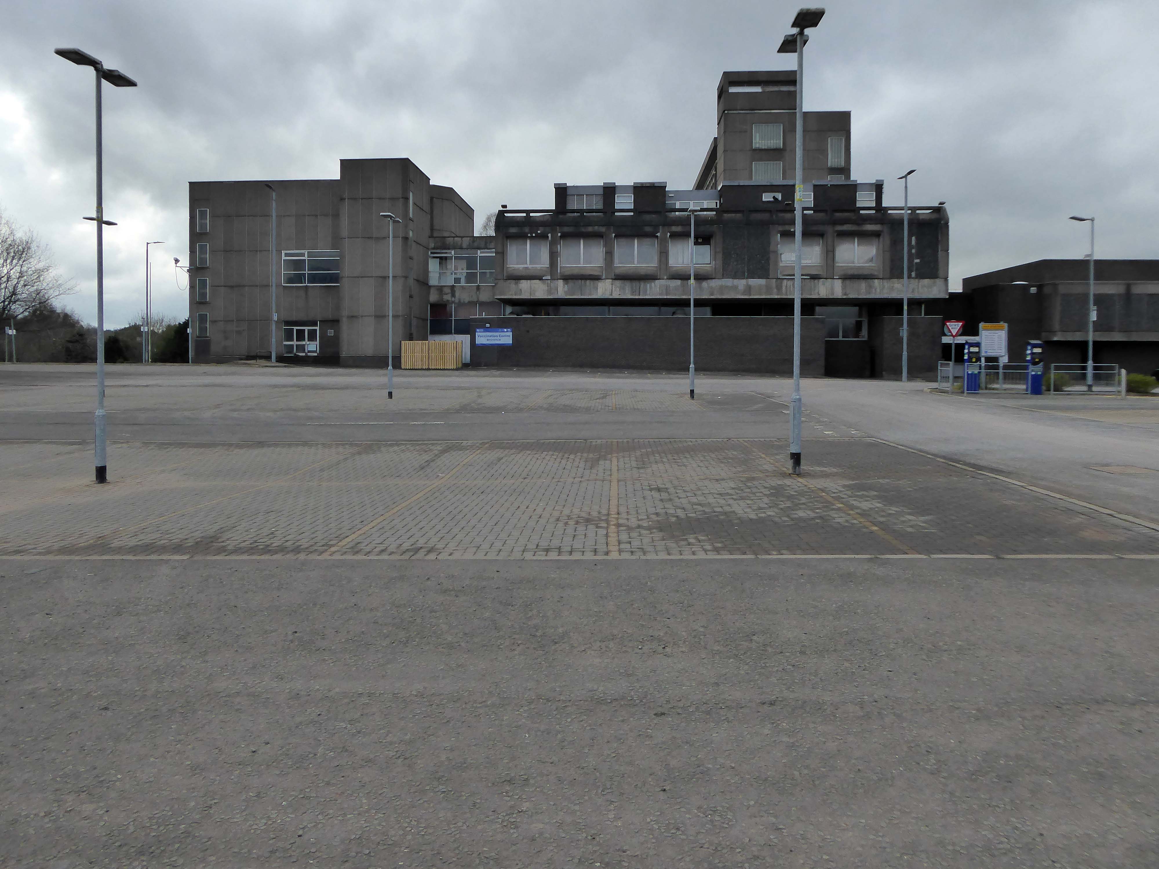
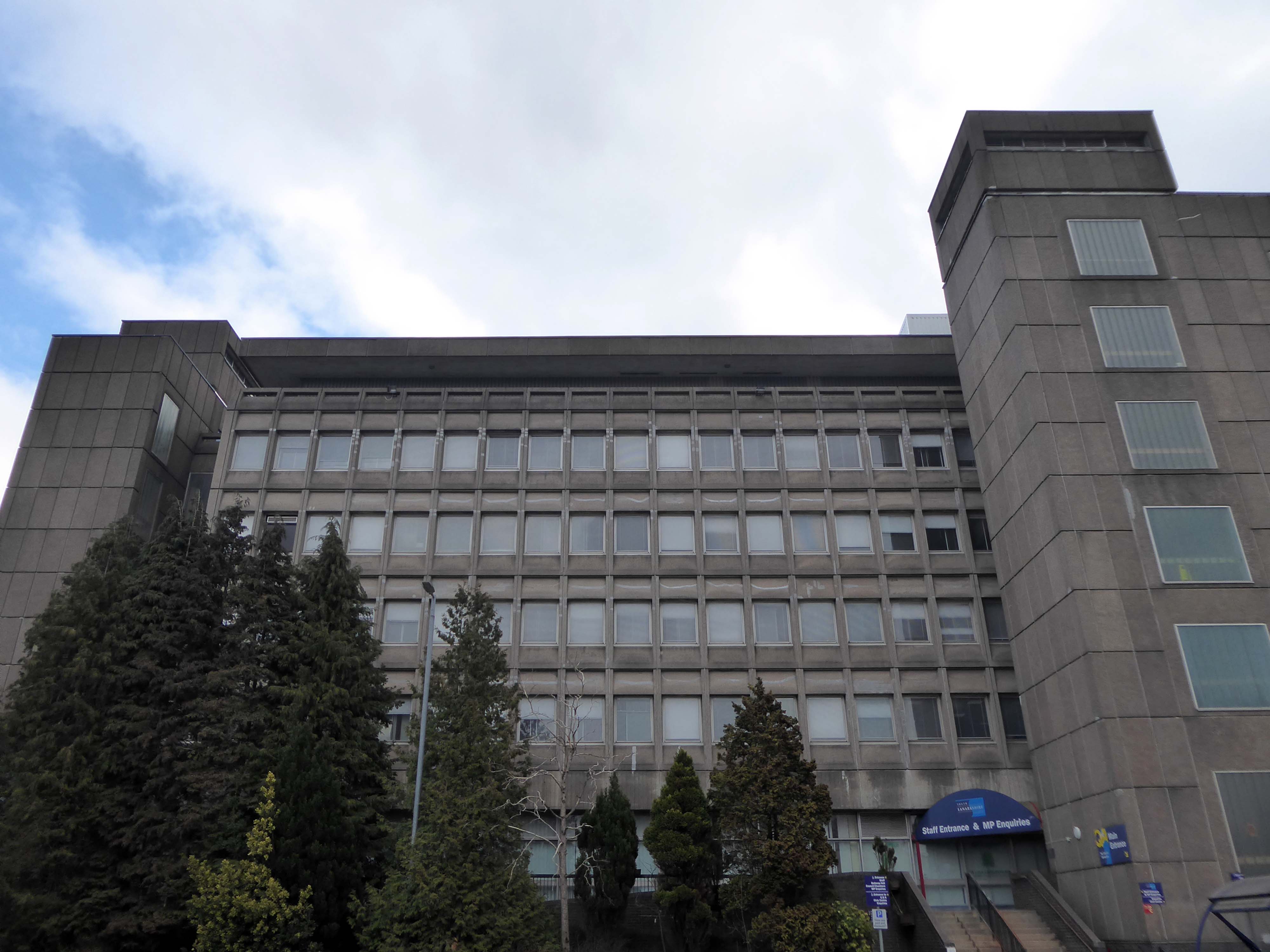
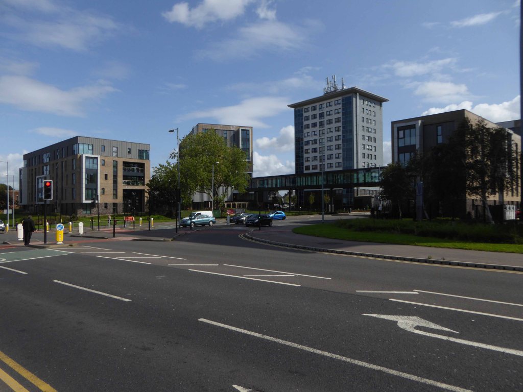
A strategic masterplan for East Kilbride town centre which could see a new purpose-built civic facility is to be put before the council next month.
Last March we told how radical new plans could see the crumbling Civic Centre replaced with – a new front door to East Kilbride.
Despite there being no specific proposals agreed at this stage, South Lanarkshire Council has confirmed that agents of the owners are set to present their strategic masterplan to elected members in February.
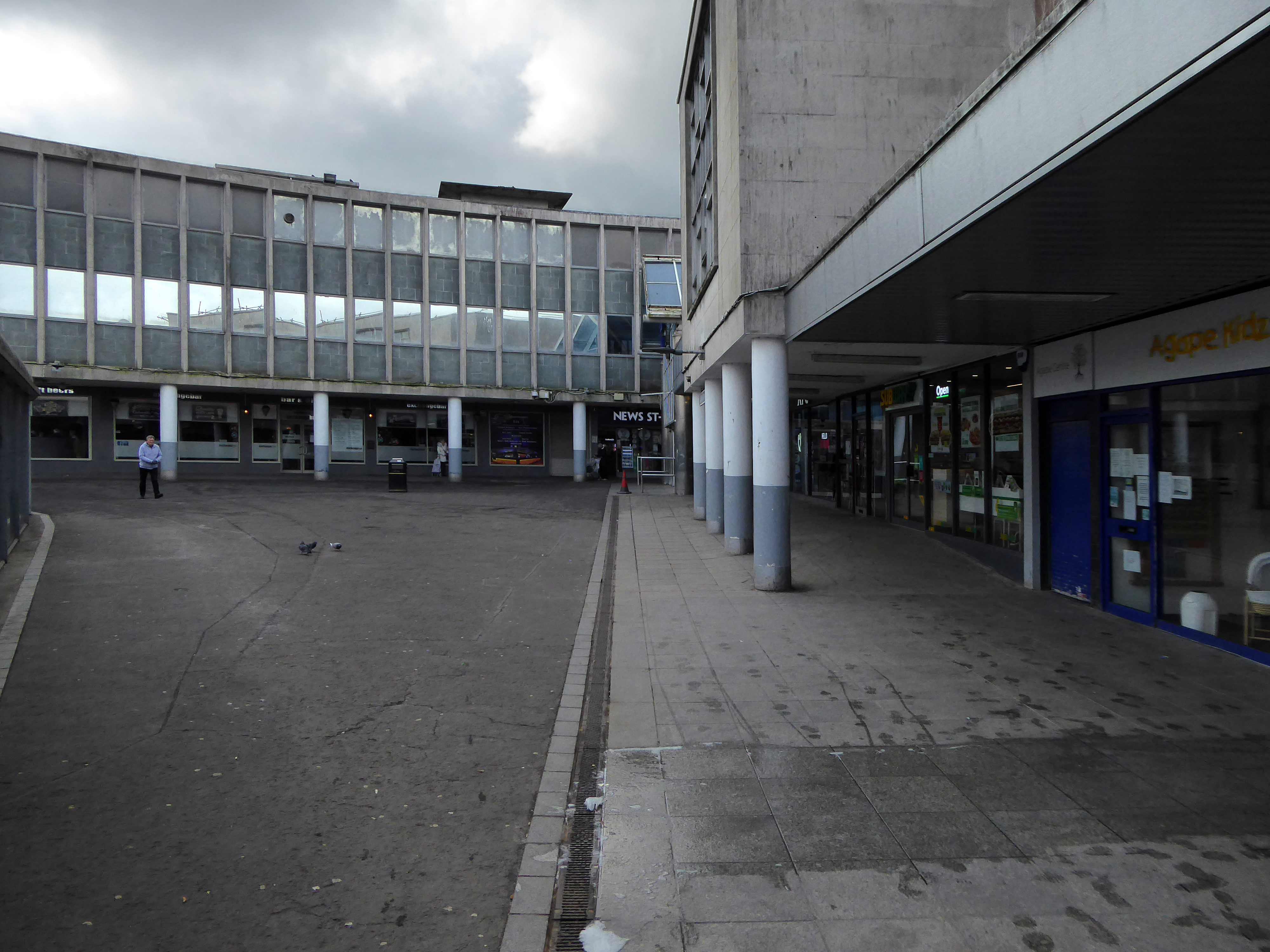
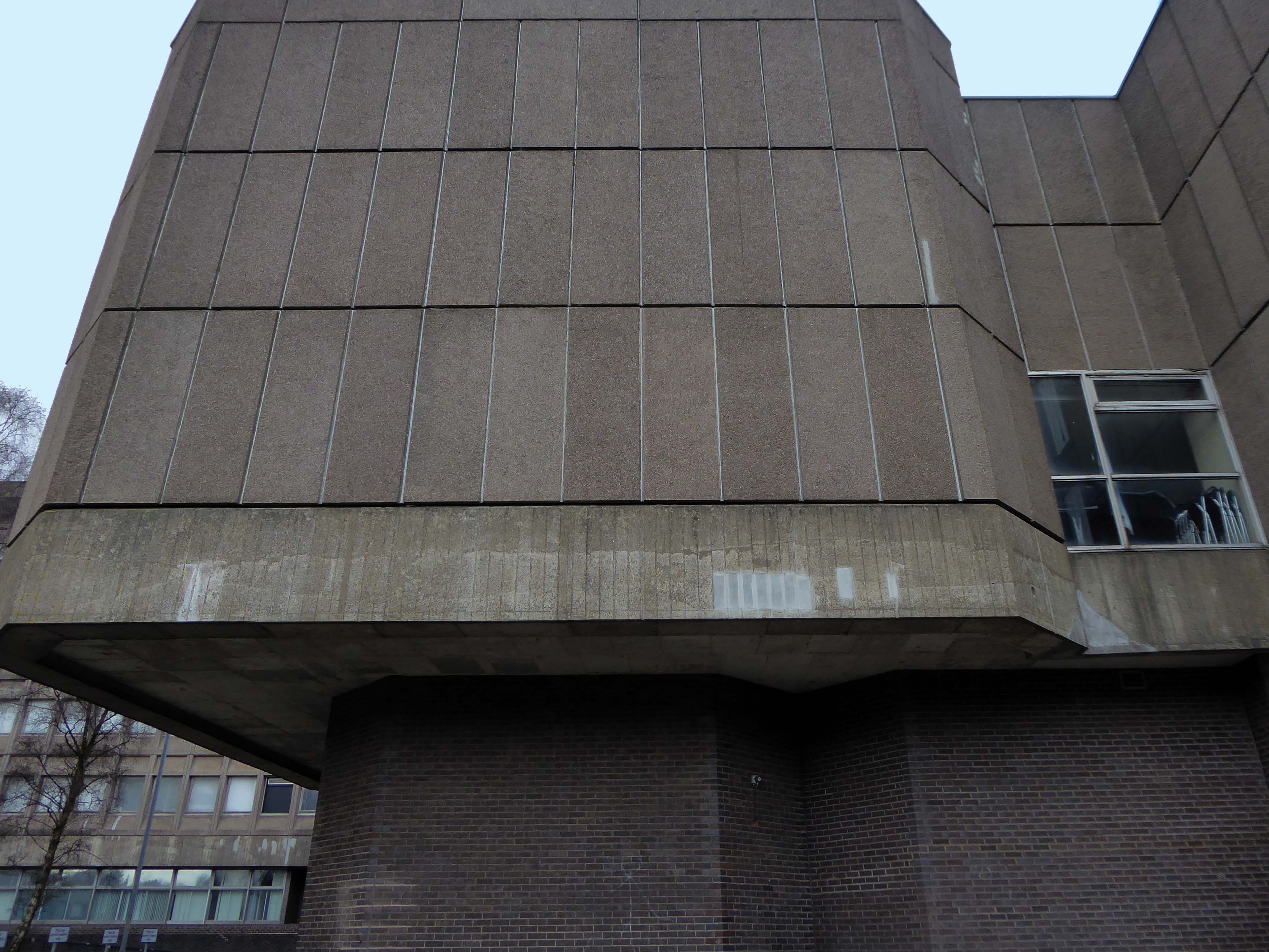
It currently sits by the shopping centre and a patch of empty ground.
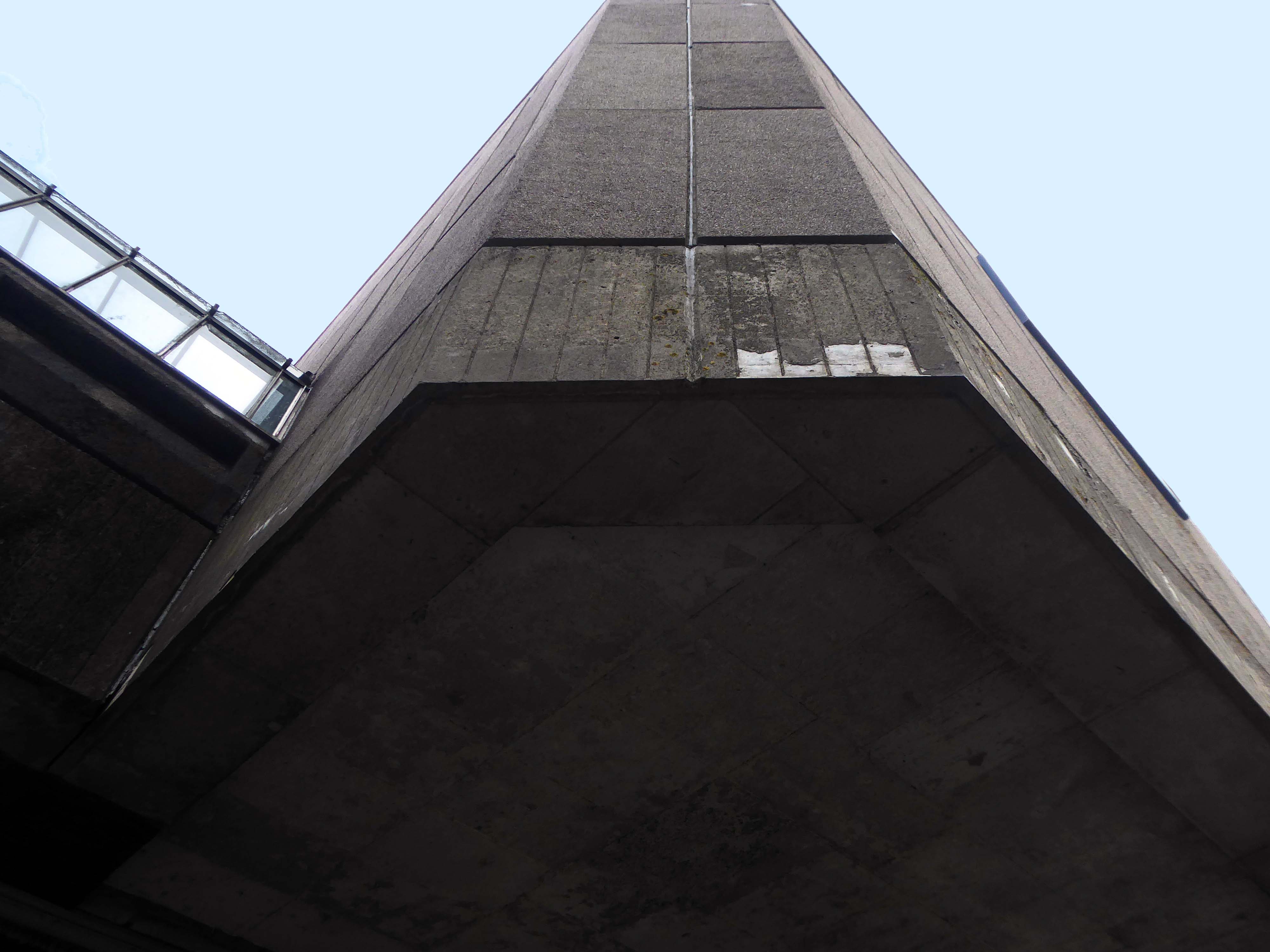
Several imposing interlocking volumes, formed by pre-cast concrete panels.
East Kilbride was the first new town built in Scotland in 1947. New Town designation was a pragmatic attempt to soak up some of the population from an overcrowded and war ravaged Glasgow. Its design was indeed an anathema to the chaotic and sprawling Glasgow: clean straight lines, modern accessible public spaces; and footways, bridges and underpasses built with the pedestrian in mind. It was designed as a self contained community — with industry, shops, recreation facilities and accommodation all within a planned geographic area.
Now I’m going east to Dalton Street, home to the Collyhurst cowboy.
Photograph: Dennis Hussey
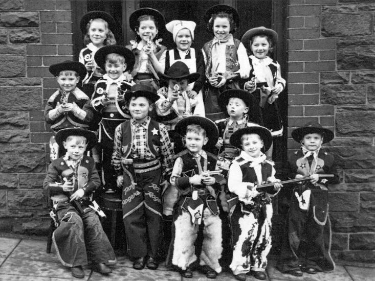
This is an illusion within an illusion, twice removed.
The Hollywood recreation, recreated on the rough ground of post war Britain.
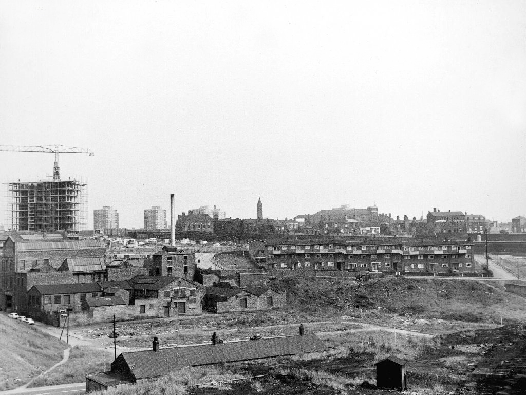
In 1960 the area was a dense network of streets, industry and homes – demolished during the period of slum clearance.
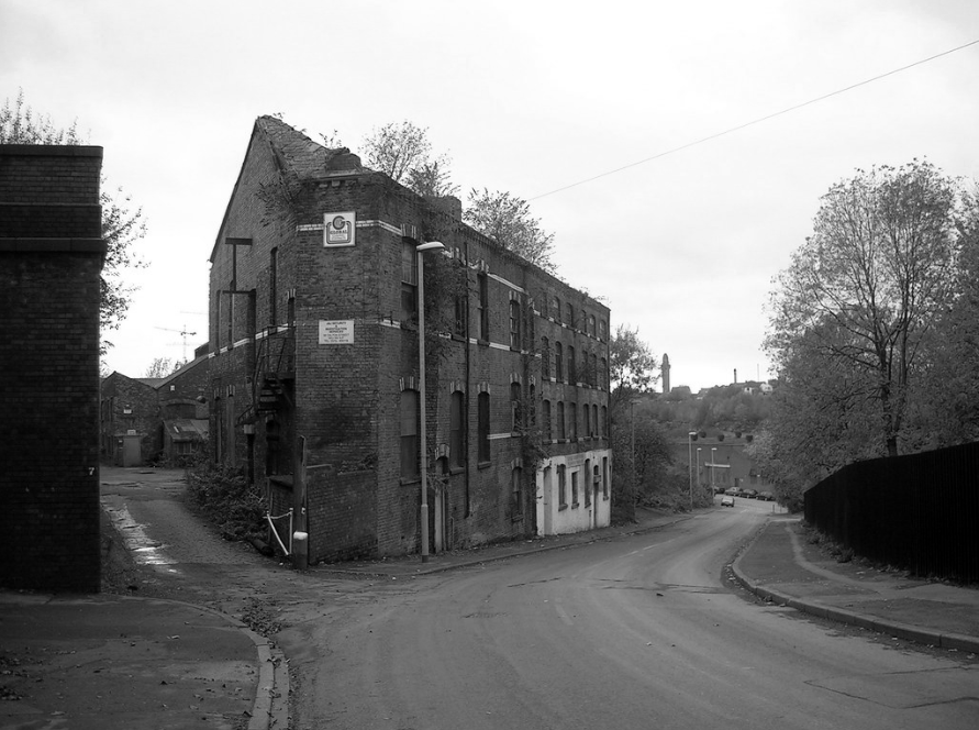
Escaping the dark, dank Irk Valley onwards and upwards to Rochdale Road.
The Dalton Works Arnac factory survived until 2008
Photograph: Mikey
The tight maze of Burton Street and beyond, reduced to rubble.
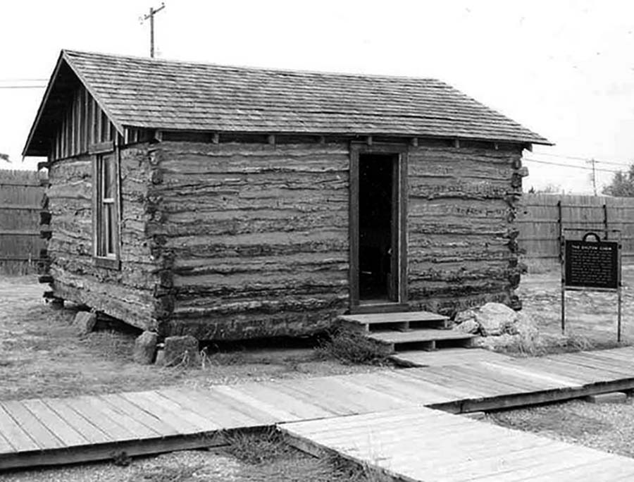
Dalton Street was not home to the Dalton Gang, they lived here in Oklahoma
It was home to imaginary gangs, committing imaginary crimes, in an imaginary Manchester, in ITV’s Prime Suspect Five.
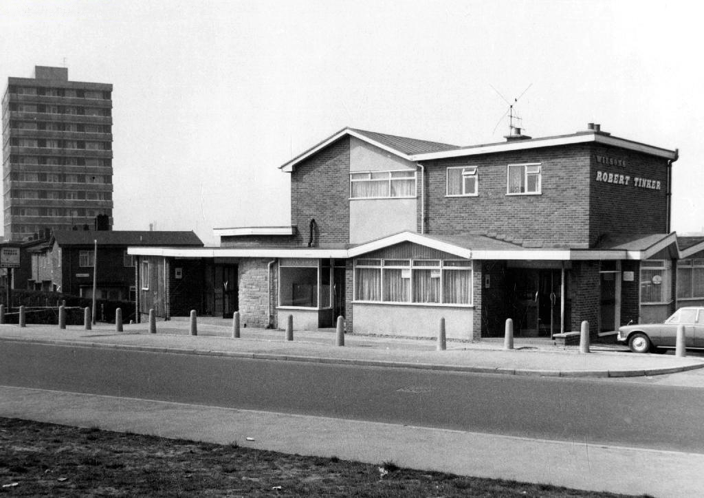
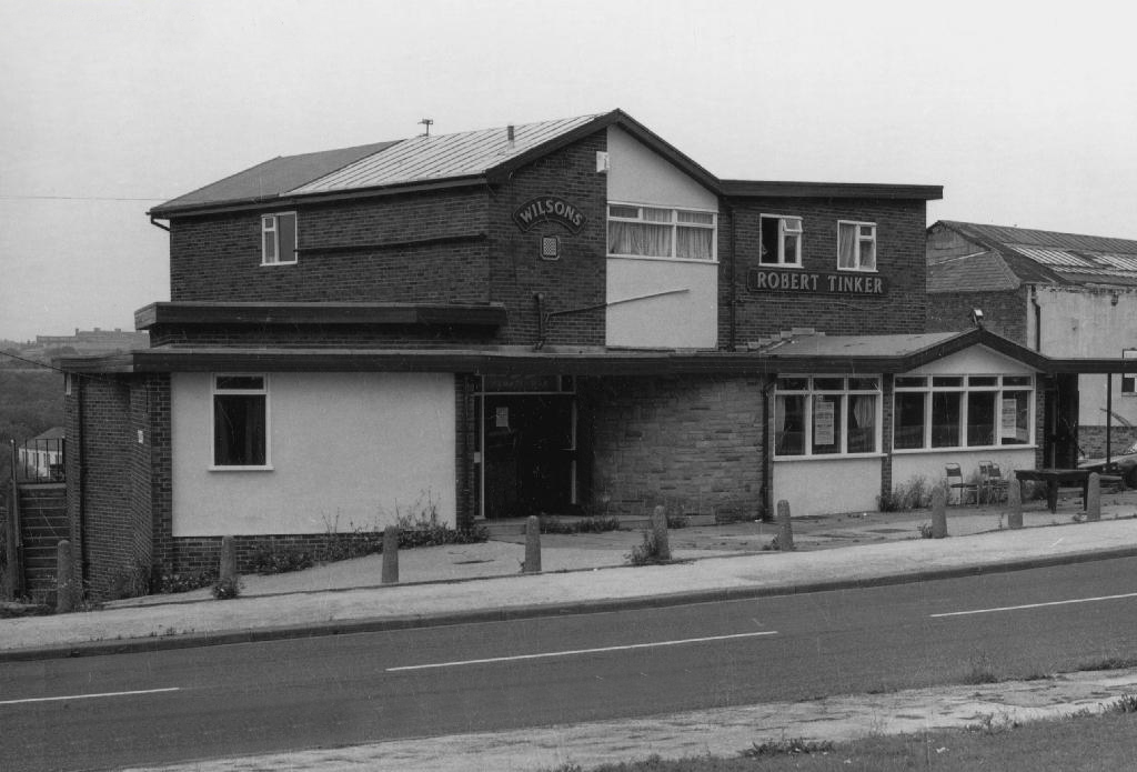
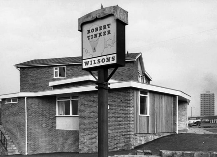
Kangol capped criminals doing business outside the Robert Tinker on the corner of the very real Dalton and Almond Streets.
The Robert Tinker was an estate pub in a run down area of Collyhurst. The pub looked pretty grim from the outside, but it was smarter than I expected inside, I had a drink in the lounge which was carpeted and comfortable. This was a Banks’s tied house and there were two real ales on the bar, I had a drink of Banks’s bitter and this was a decent drink, the other beer was Banks’s mild. This pub closed about two years after my visit and looked derelict, it has now been demolished.
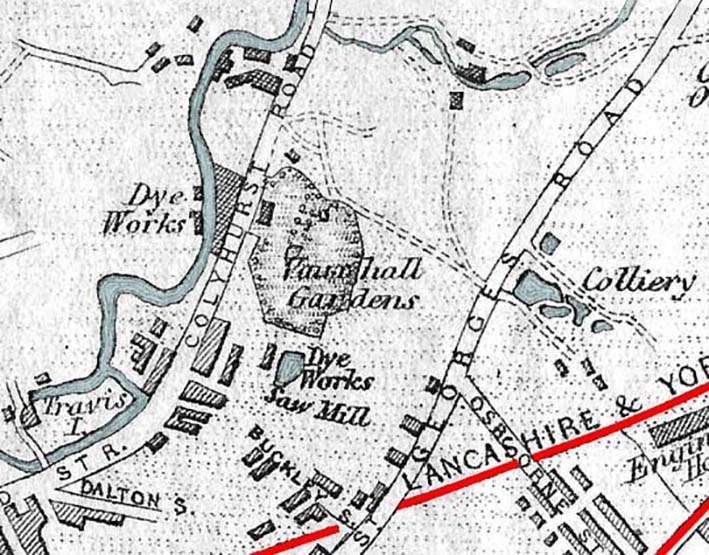
Robert Tinker was the owner of the Vauxhall Gardens, a Victorian pleasure venue.
At the openingthere was a special attraction, a giant cucumber which had been grown in the gardens reaching a length of seven feet and eight inches and a large and beautiful balloon was to be liberated at 9pm
Much of the red sandstone used for building in Manchester and the surrounding area, including stone for the Roman fort at Castlefield, St Ann’s Church in the city centre, Manchester Cathedral and the original buildings of Chetham’s Hospital, came from Collyhurst Quarry. Geologists use the term Collyhurst Sandstone for this type of soft red sandstone, which occurs in North West England
Tinker died in 1836 and gradually his gardens were whittled away, the subsoil was sold to iron moulders who cherished its certain properties and before long the trees were chopped down and houses were being built on the former site.
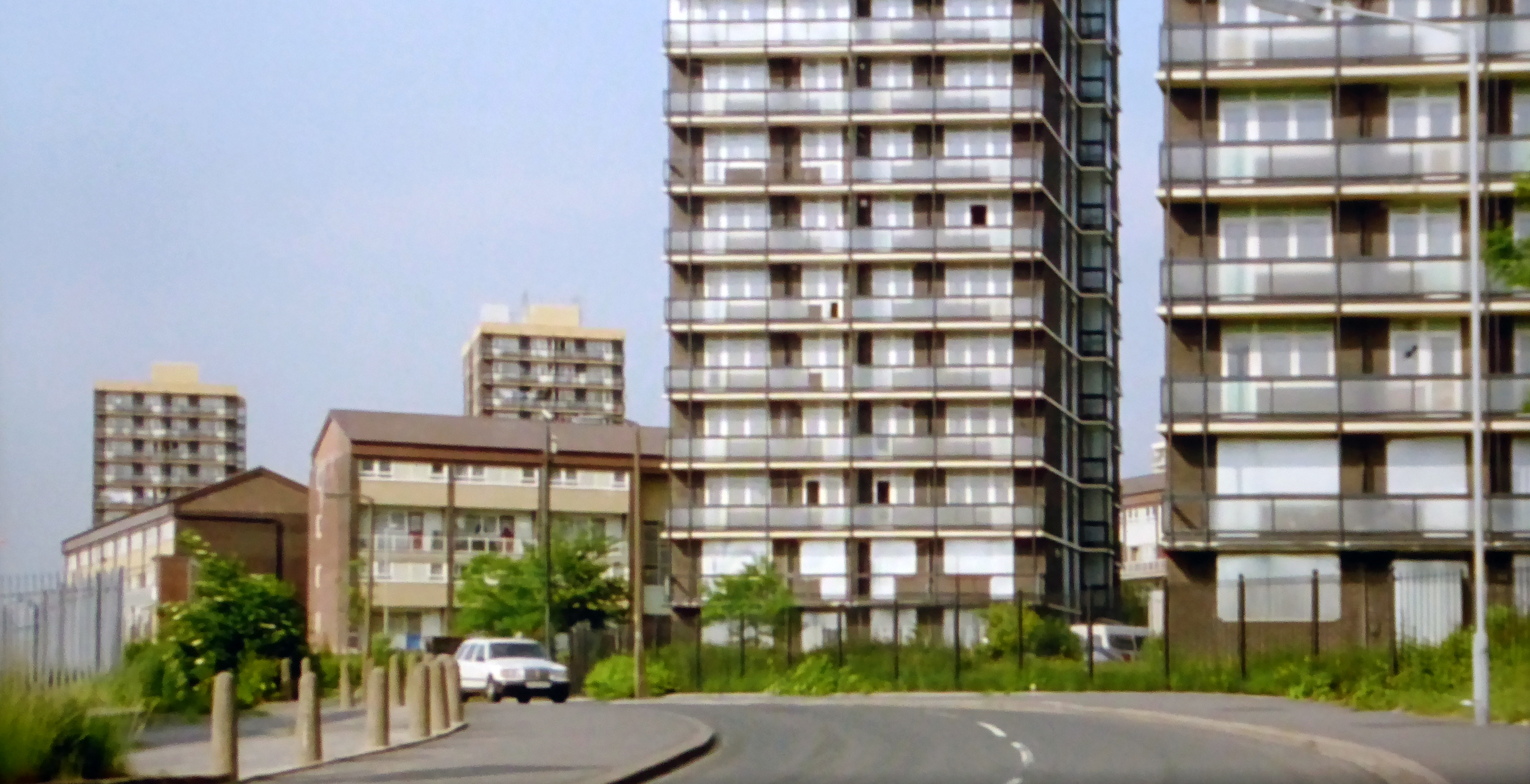
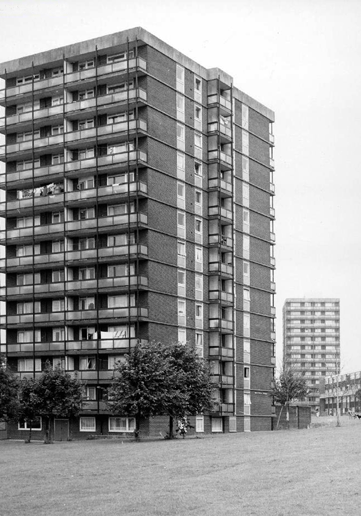
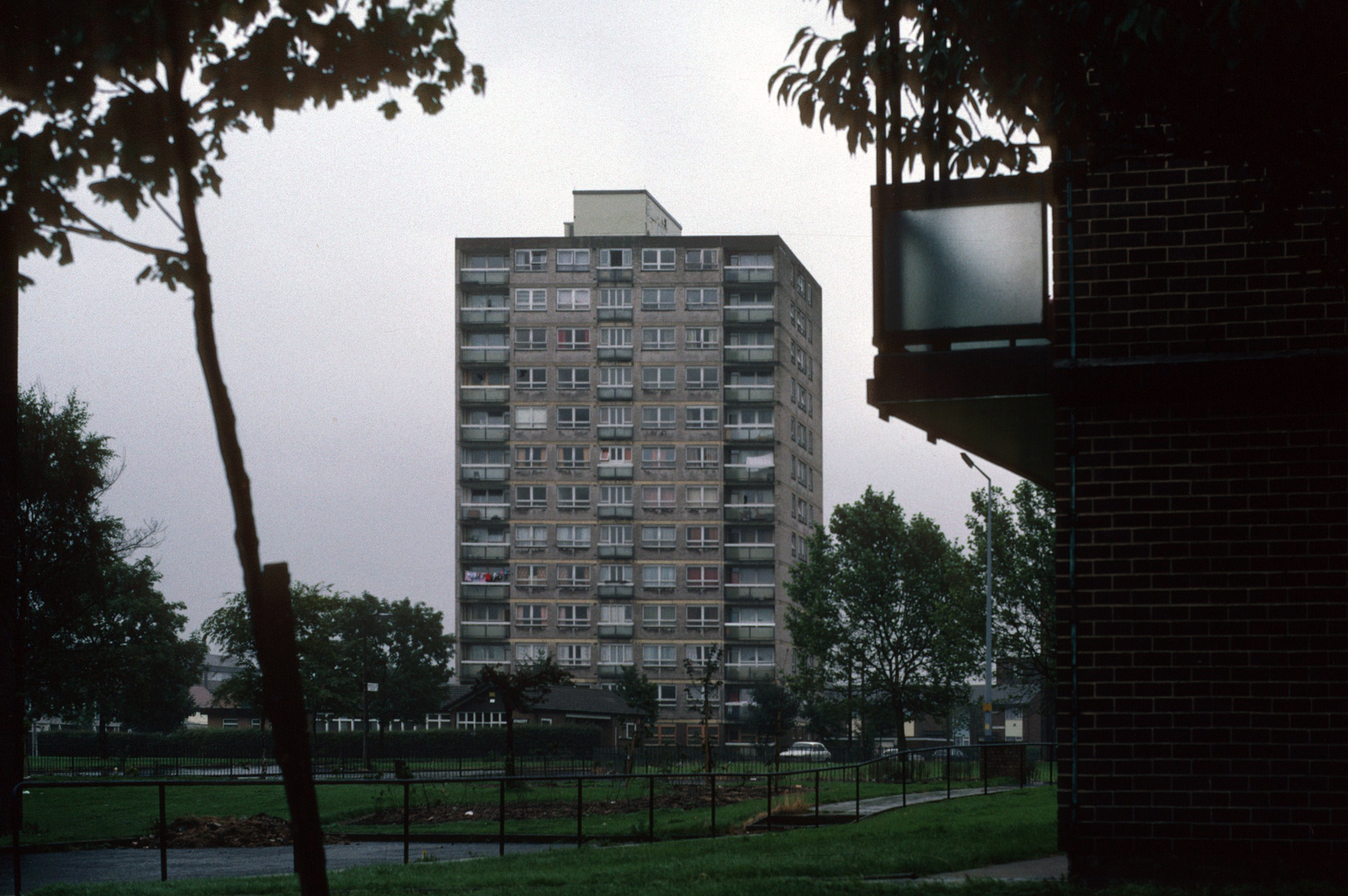
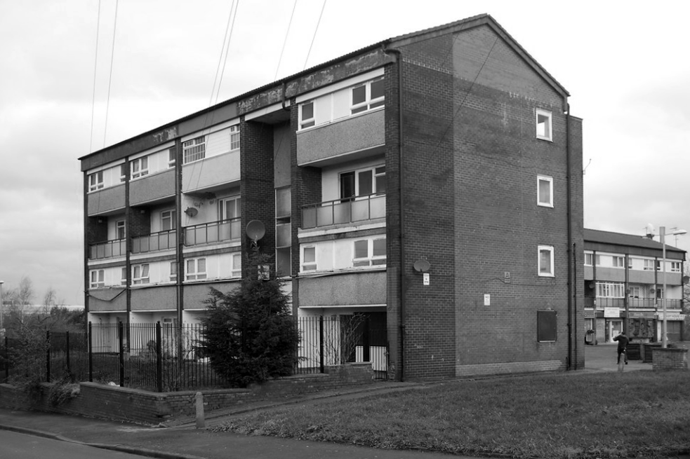
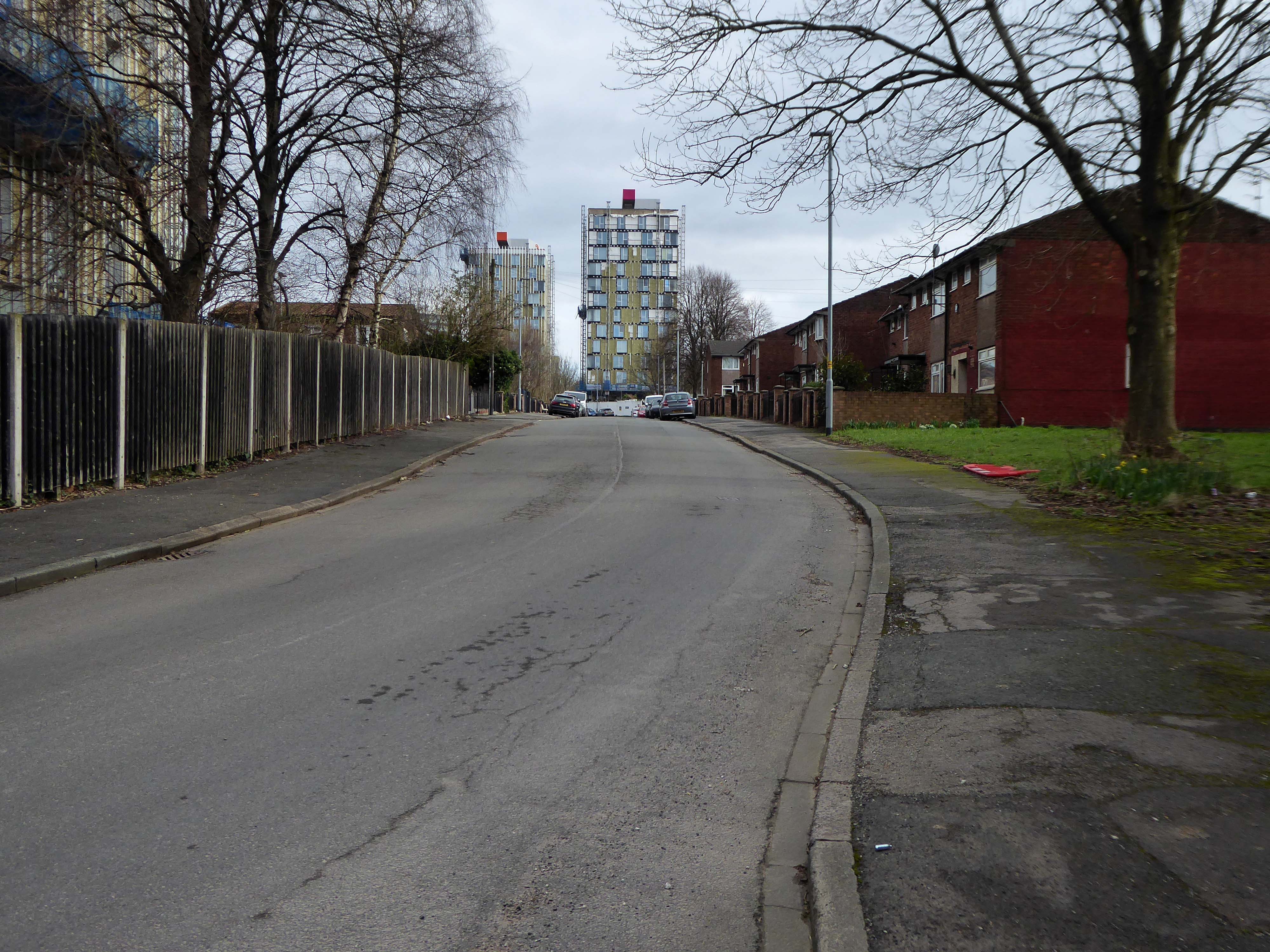
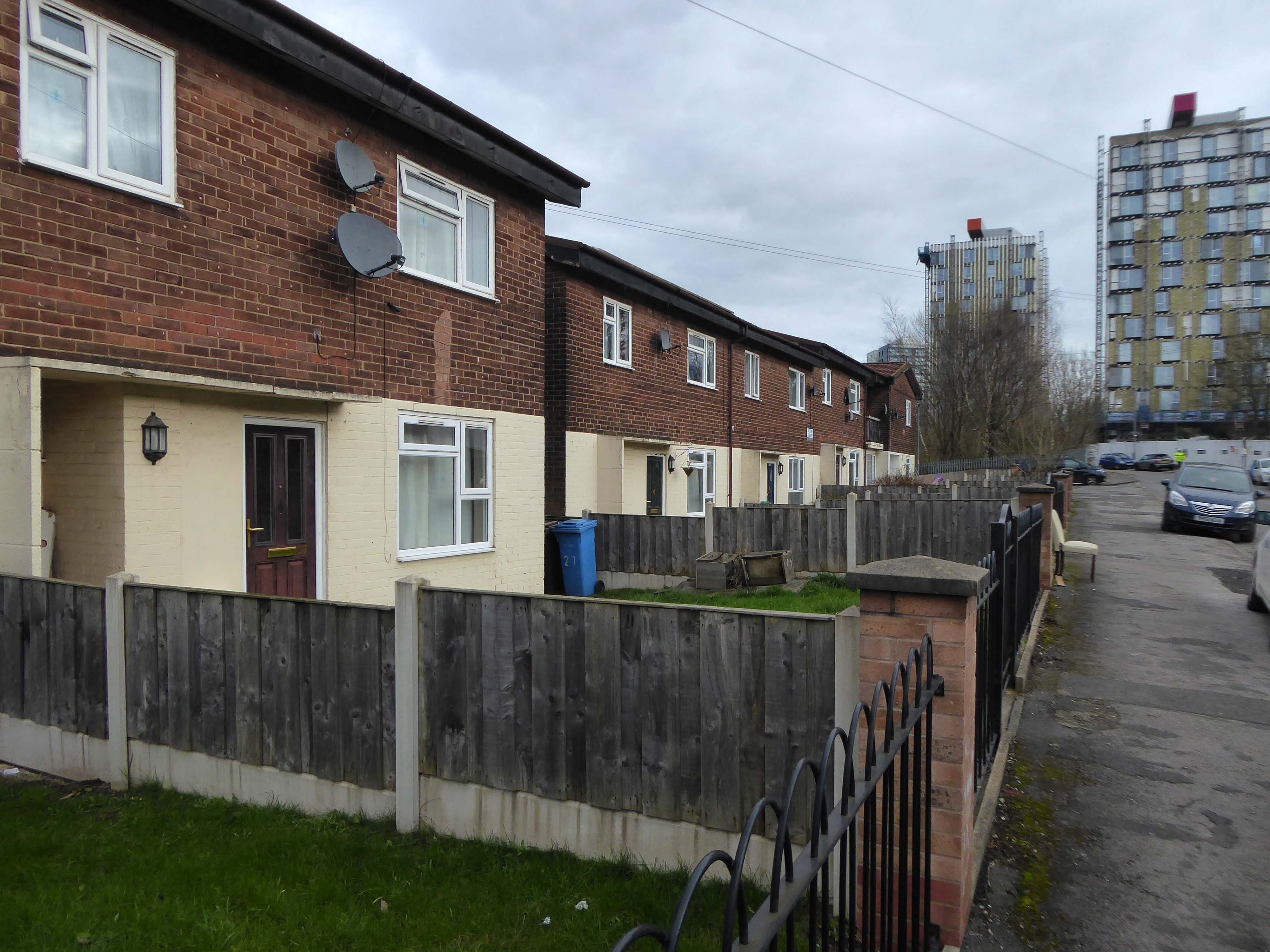
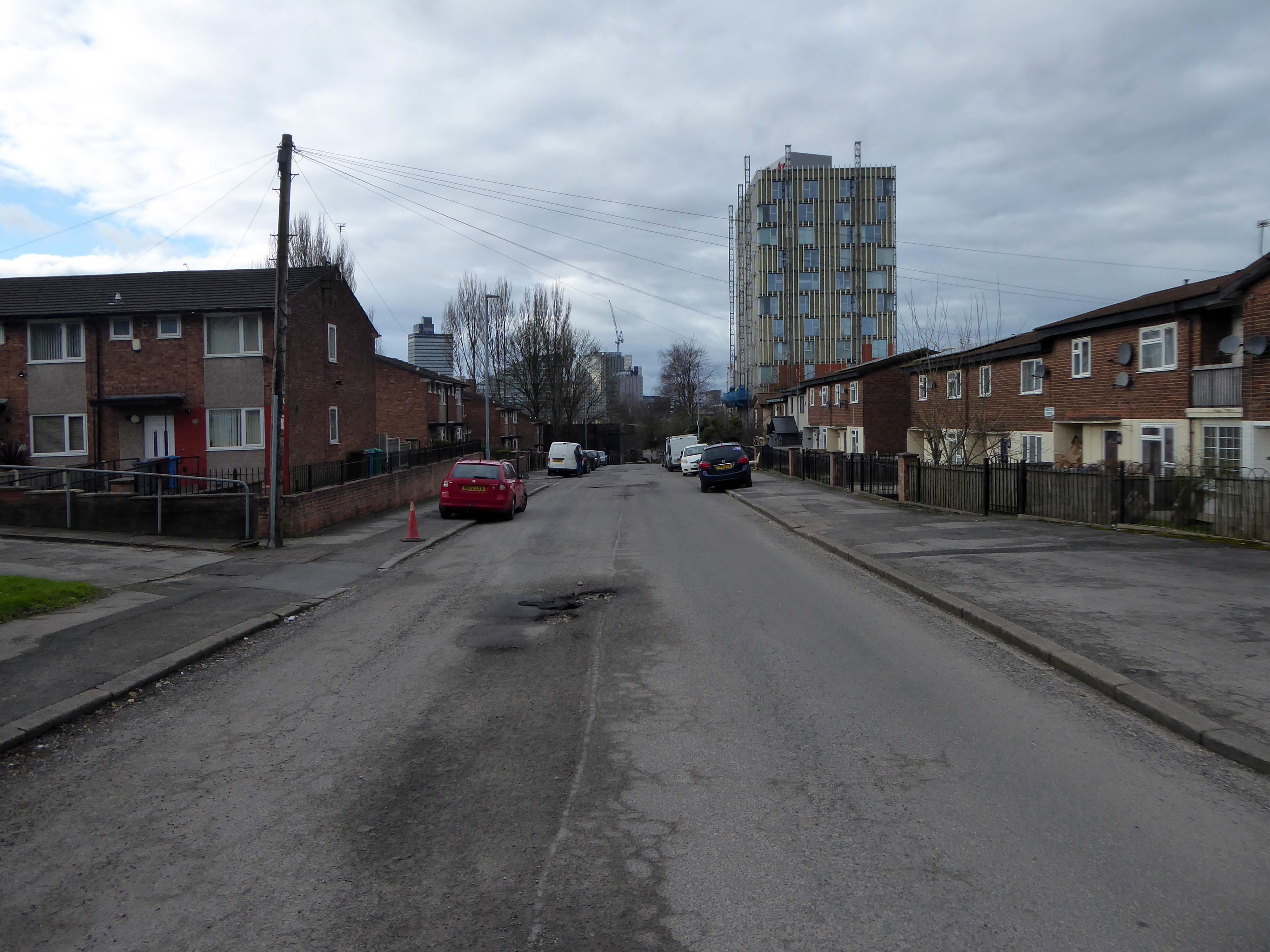
Those houses are in their turn whittled away, replaced in the 1960’s with fashionable tower blocks.
Architects: J Austen Bent 1965
In total five thirteen storey blocks – Humphries, Dalton, Roach, Vauxhall and Moss Brook Courts
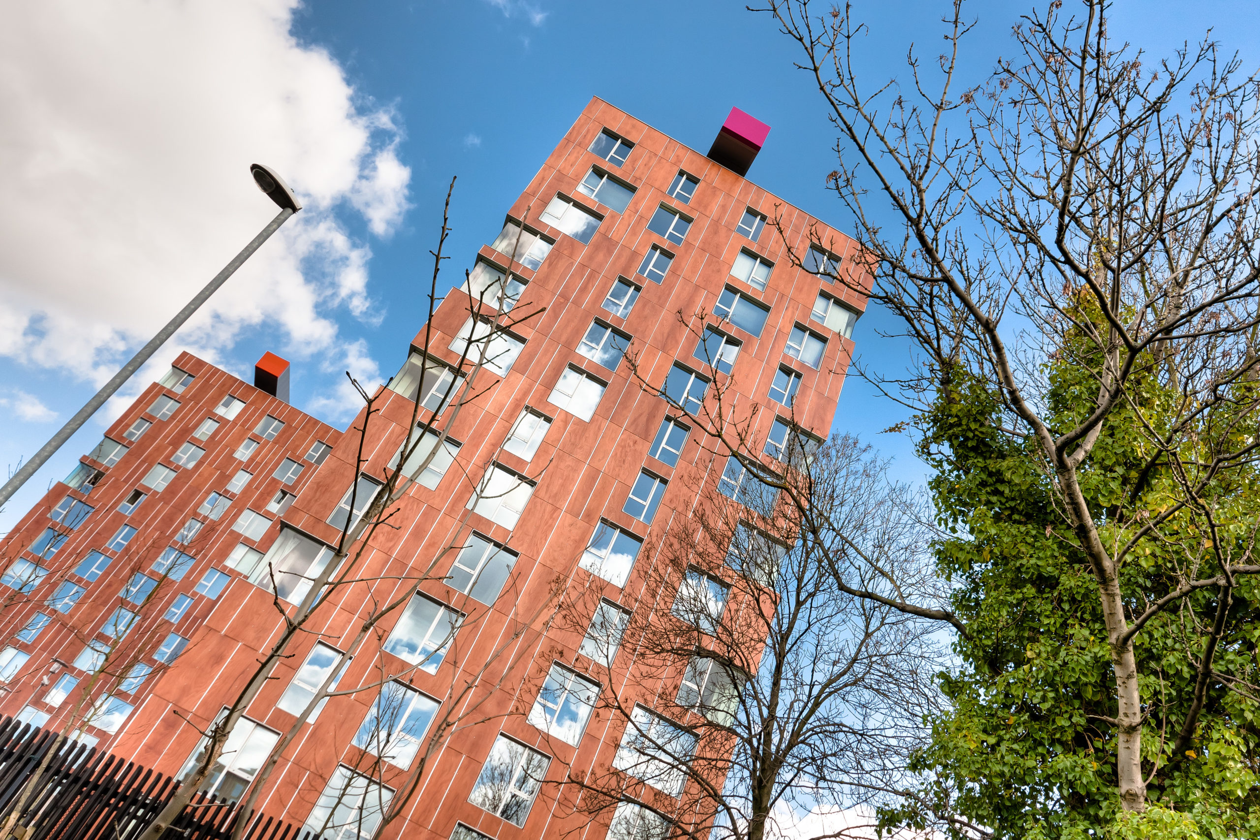
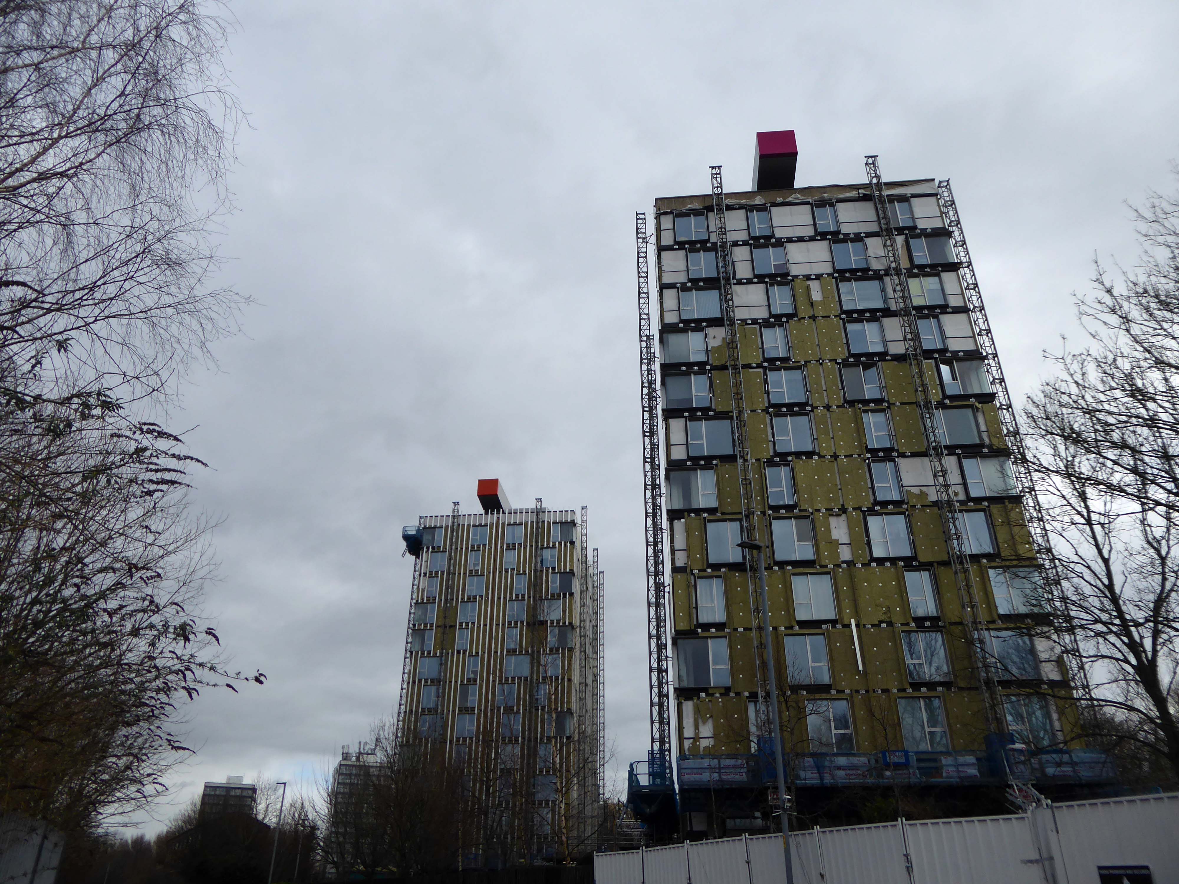
Subsequently purchased by Urban Splash and refurbished:
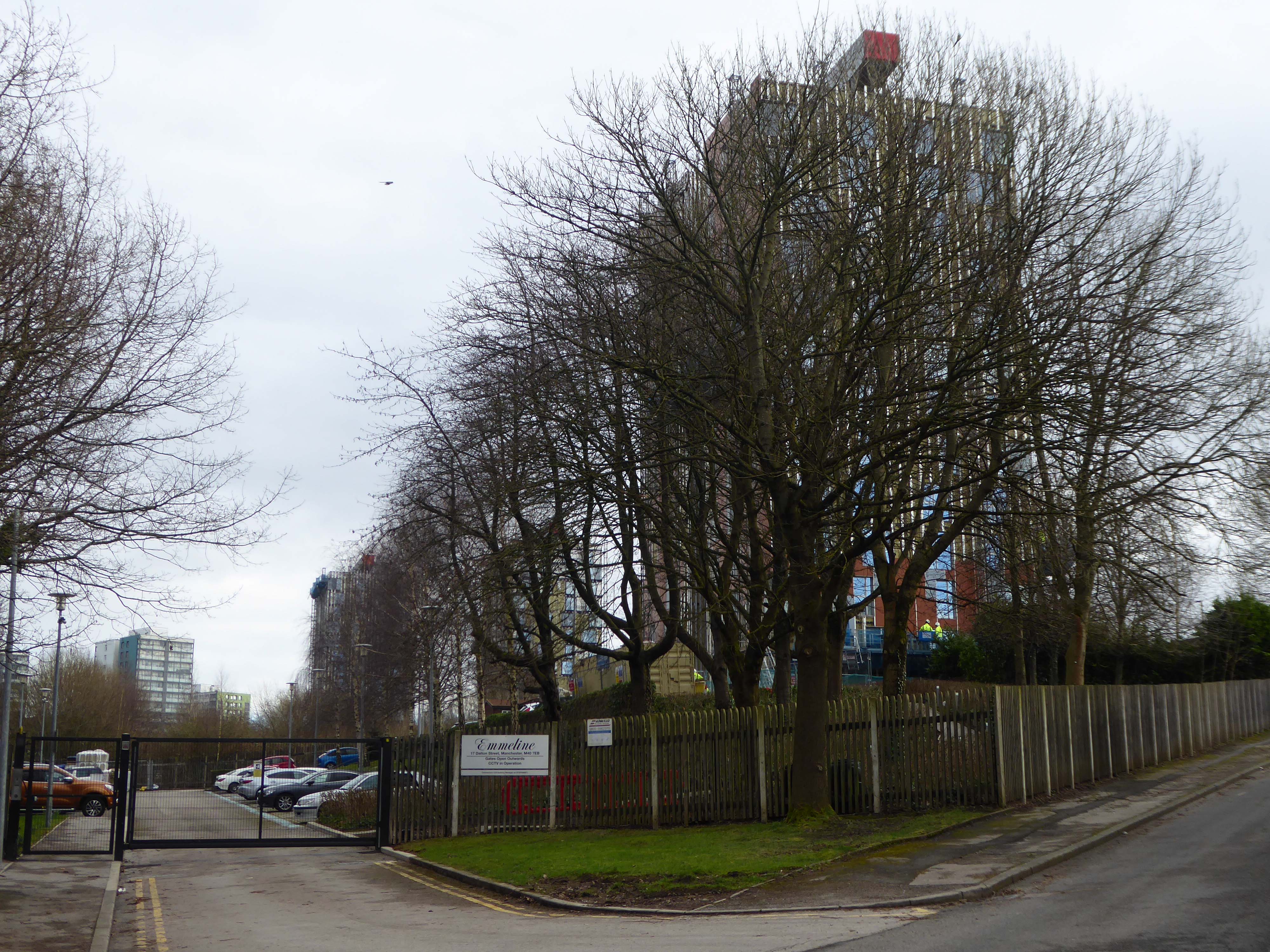
Designed by Union North Architects, the names for the Three Towers were decided in a public competition and the winning names were Emmeline, Christabel and Sylvia – naming the towers after the Pankhurst sisters and their mother.
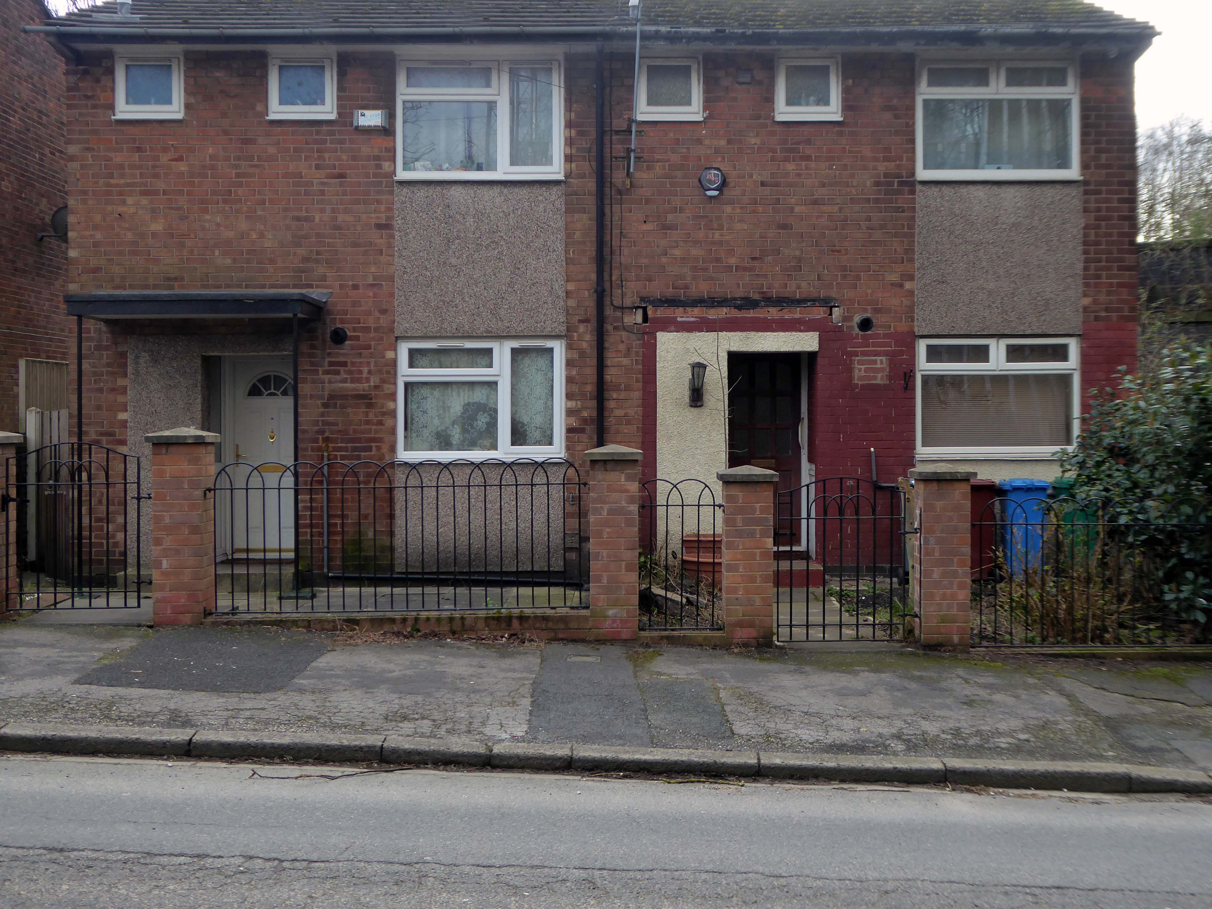
The remains of the remaining Eastford Square homes tinned up and secured awaiting who knows what.
So let’s take a short walk, see how things stand.
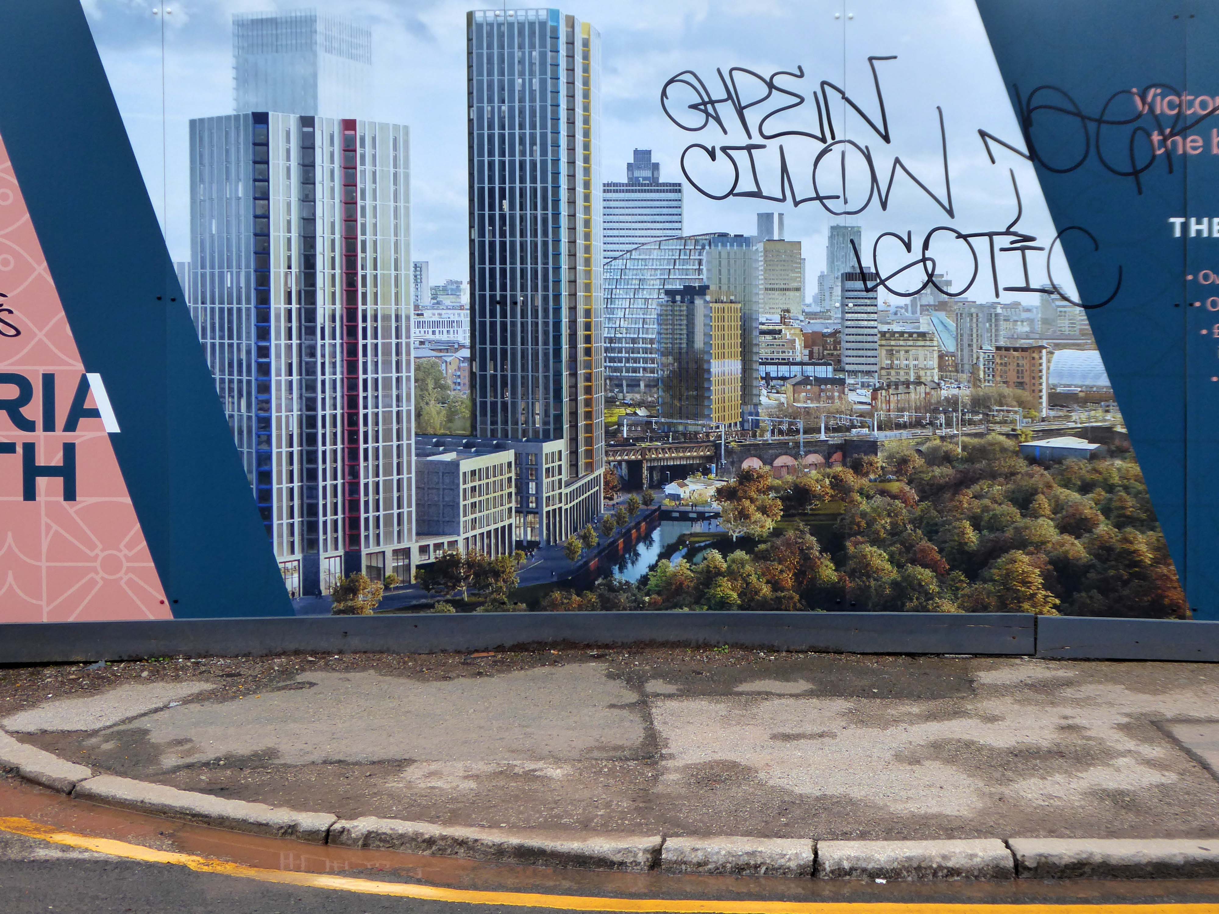
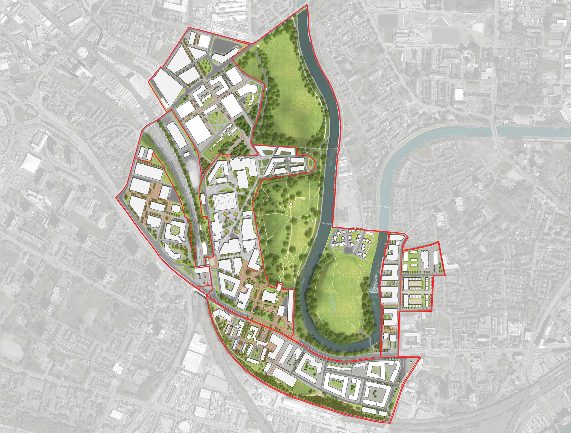
The area now forms the core of the latest municipal Masterplan – Victoria North.
Victoria North is a joint venture programme between Manchester City Council and developer Far East Consortium.
An internationally recognised developer, FEC specialises in residential led mixed-use developments and hotels, along with its casino and car park operations throughout mainland Europe.
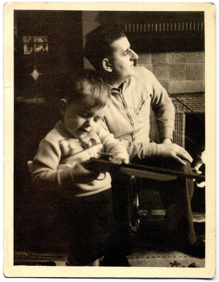
The cowboys are now long gone – or are they?
When I was a cowboy out on the Western Plain Well, I made a half a million Working hard on the bridle reins
Come a cow-cow yicky come a cow-cow yicky, Harpurhey
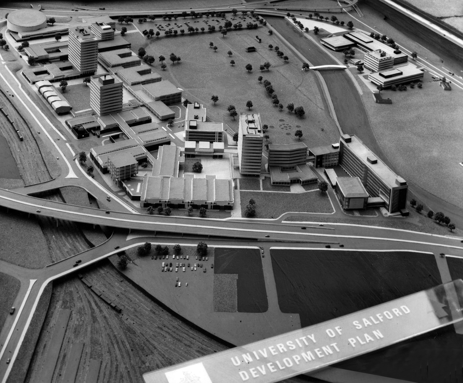
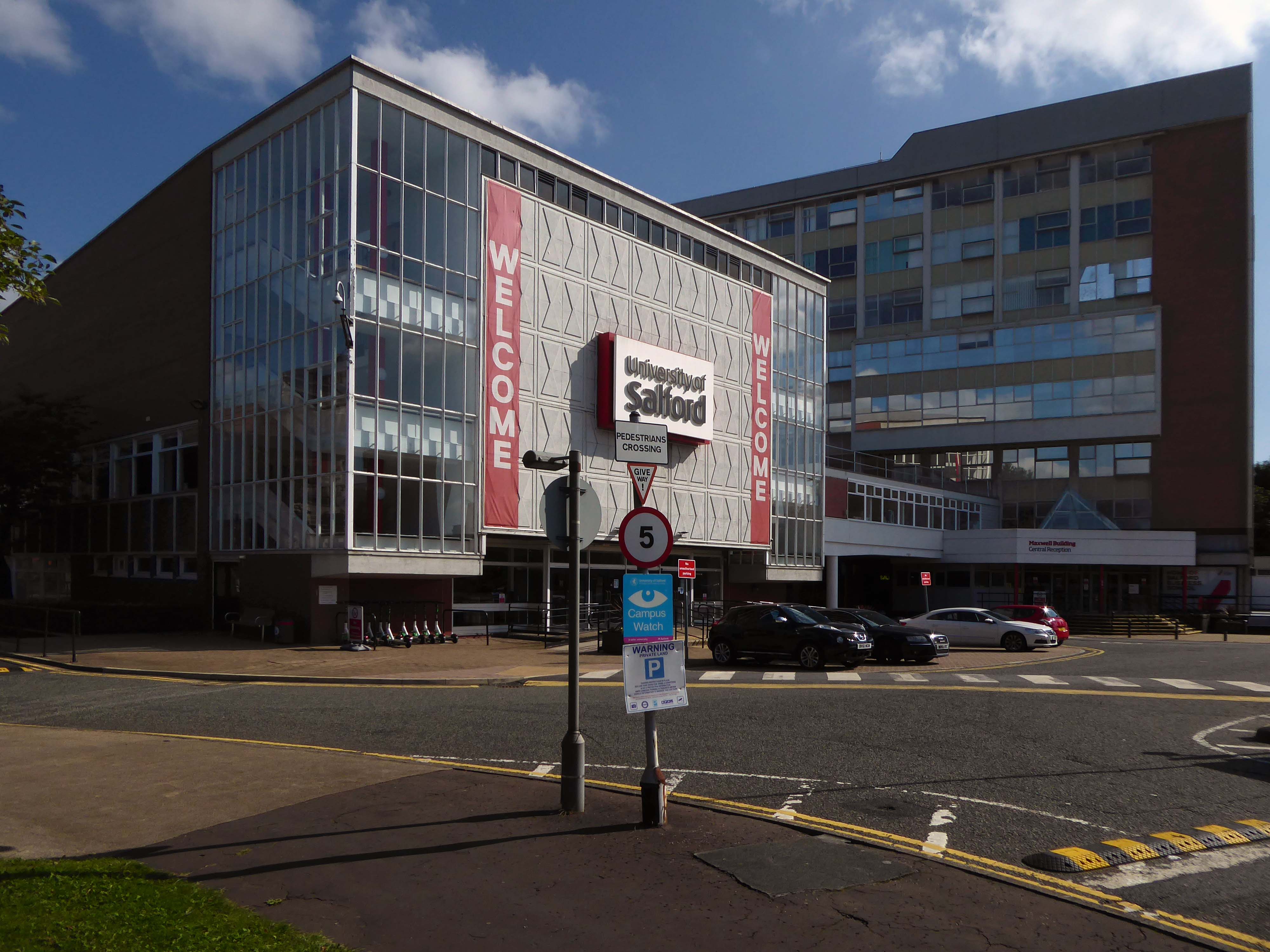
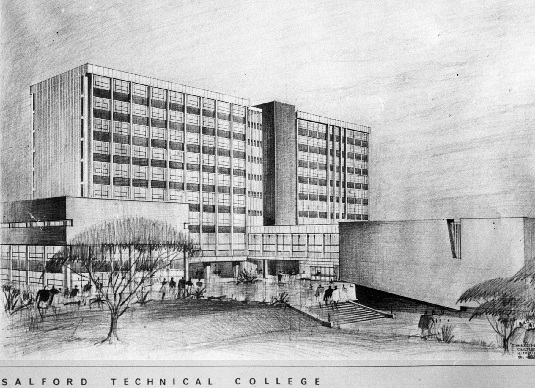
The original master plan would have swept away the Victorian Technical Institute and Salford Art Gallery.
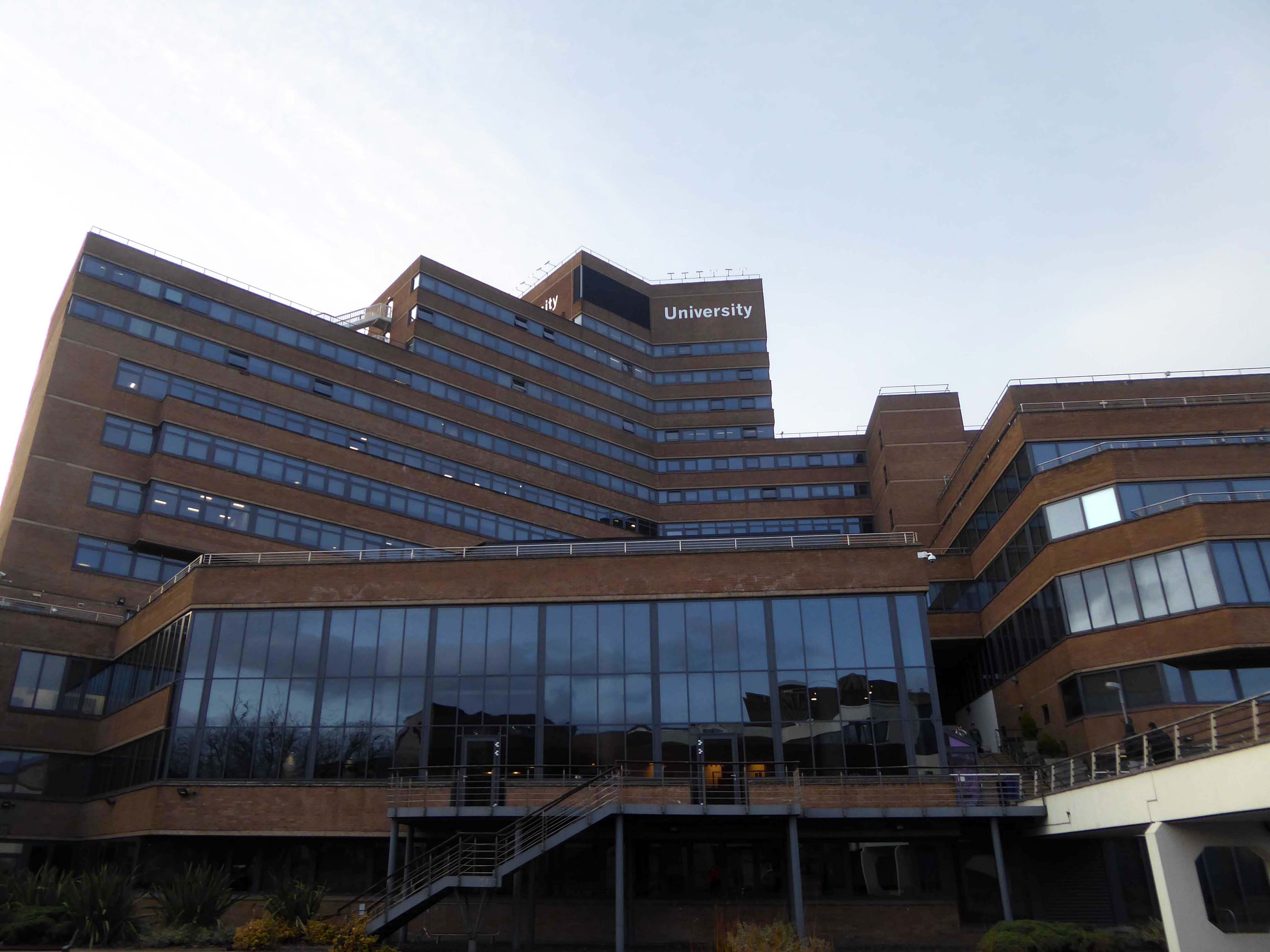
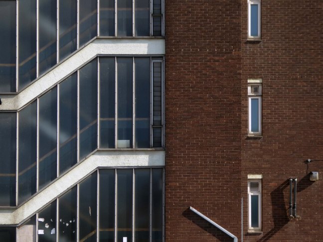
Across the road are the Maxwell Buildings.
They were built between 1959 and 1960 to a design by the architect C H Simmons of the Lancashire County Architects Department.
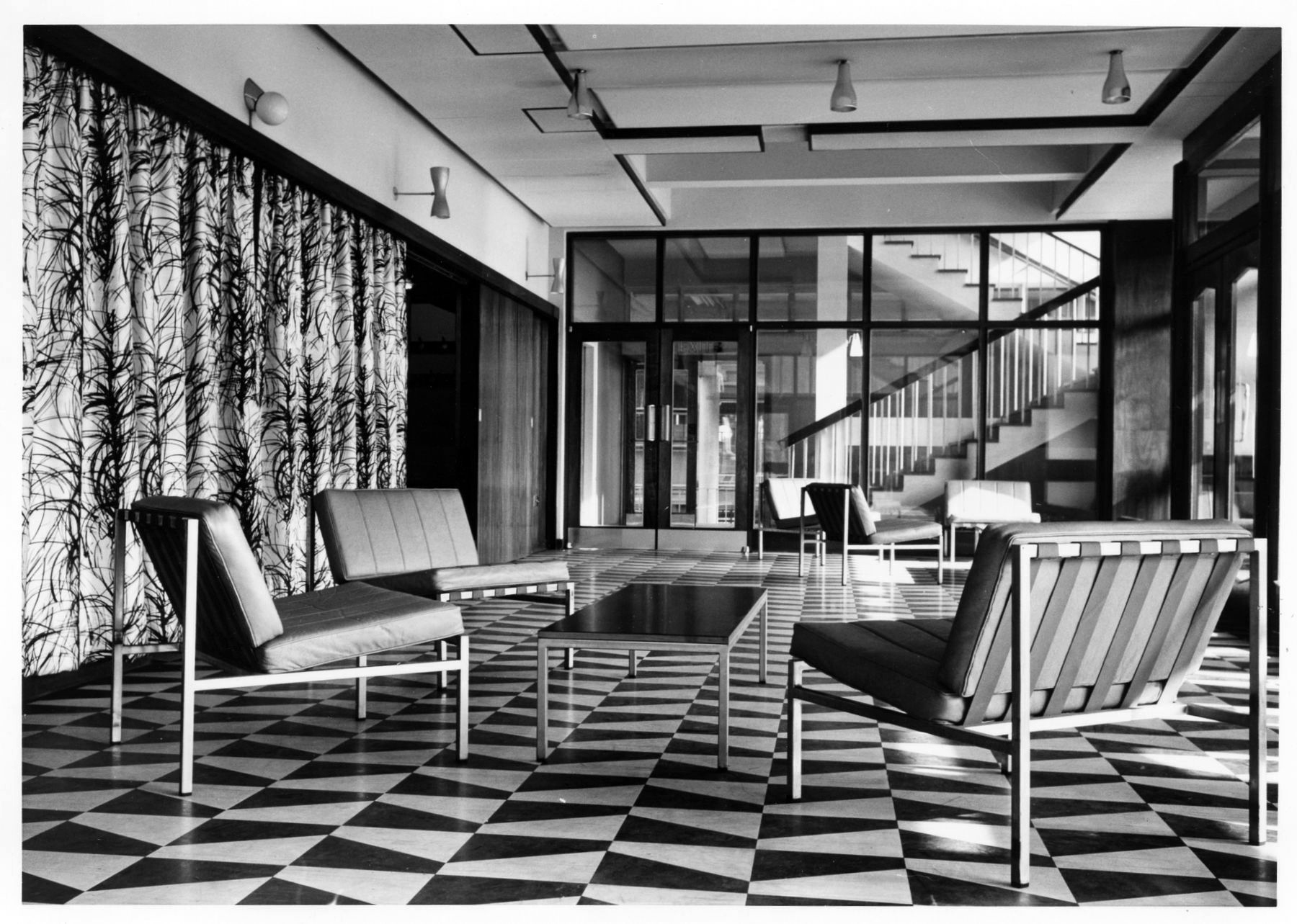
The interior decorative order of Sixties’ institutions was integral to the architectural design, sadly this is no longer so.
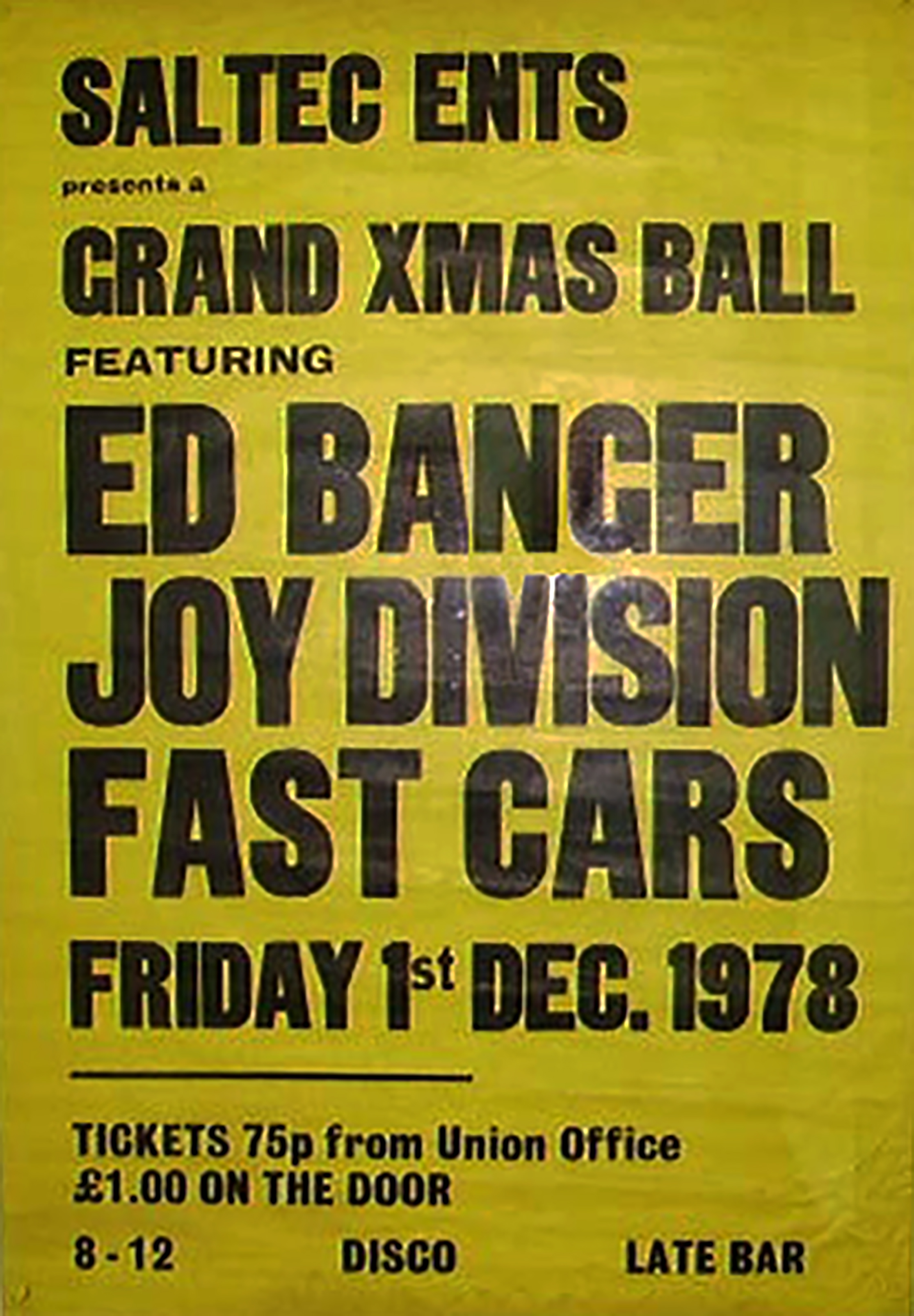
The hall has a great musical heritage.
Featuring the Fast Cars who we have previously encountered in Swinton at the Lancastrian Hall.
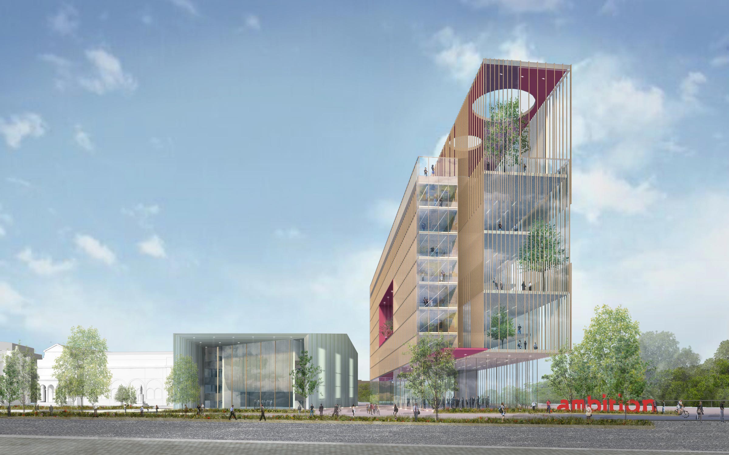
Which may be the subject of ambitious redevelopment.
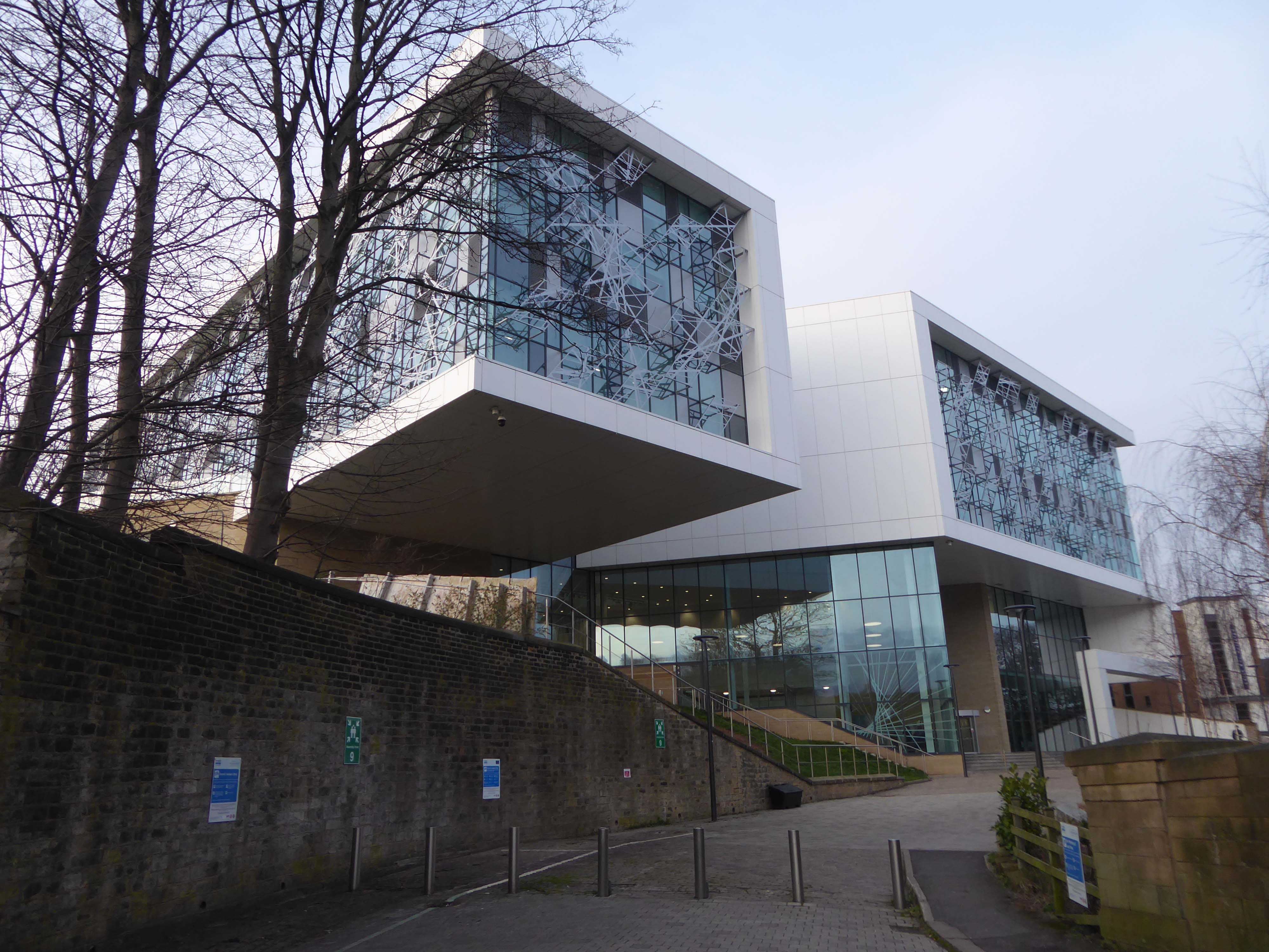
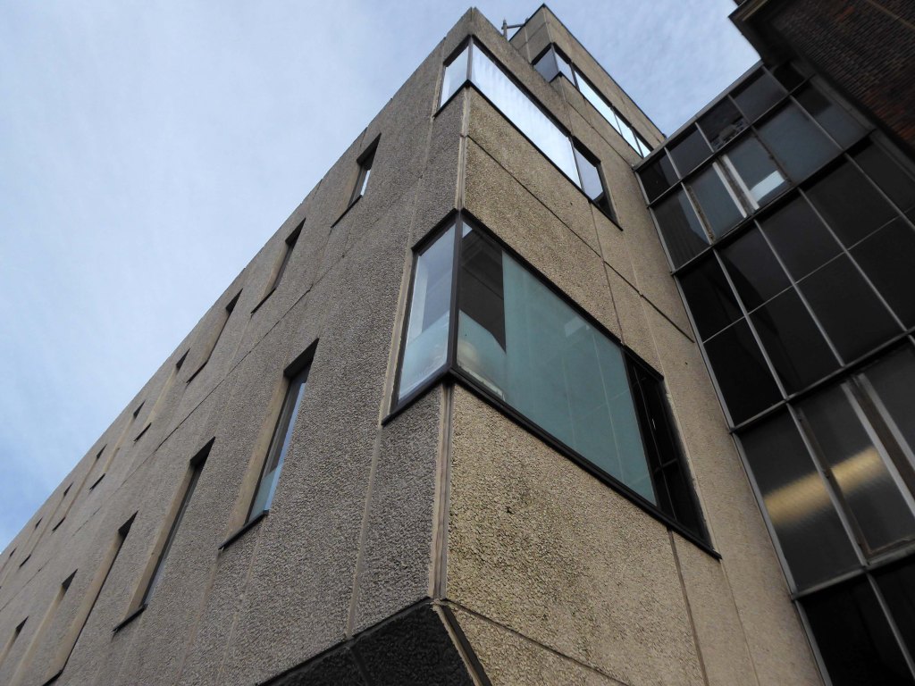
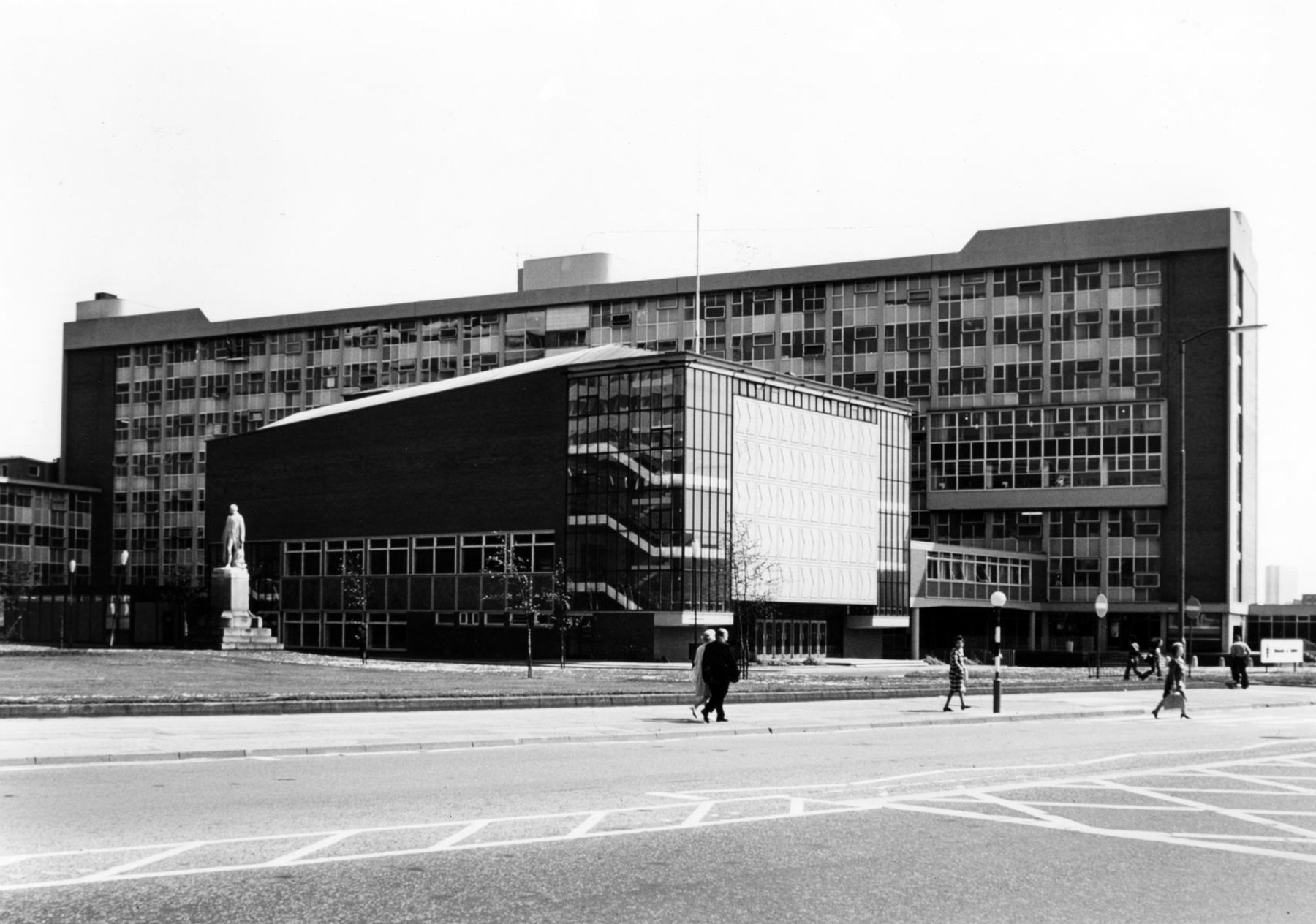
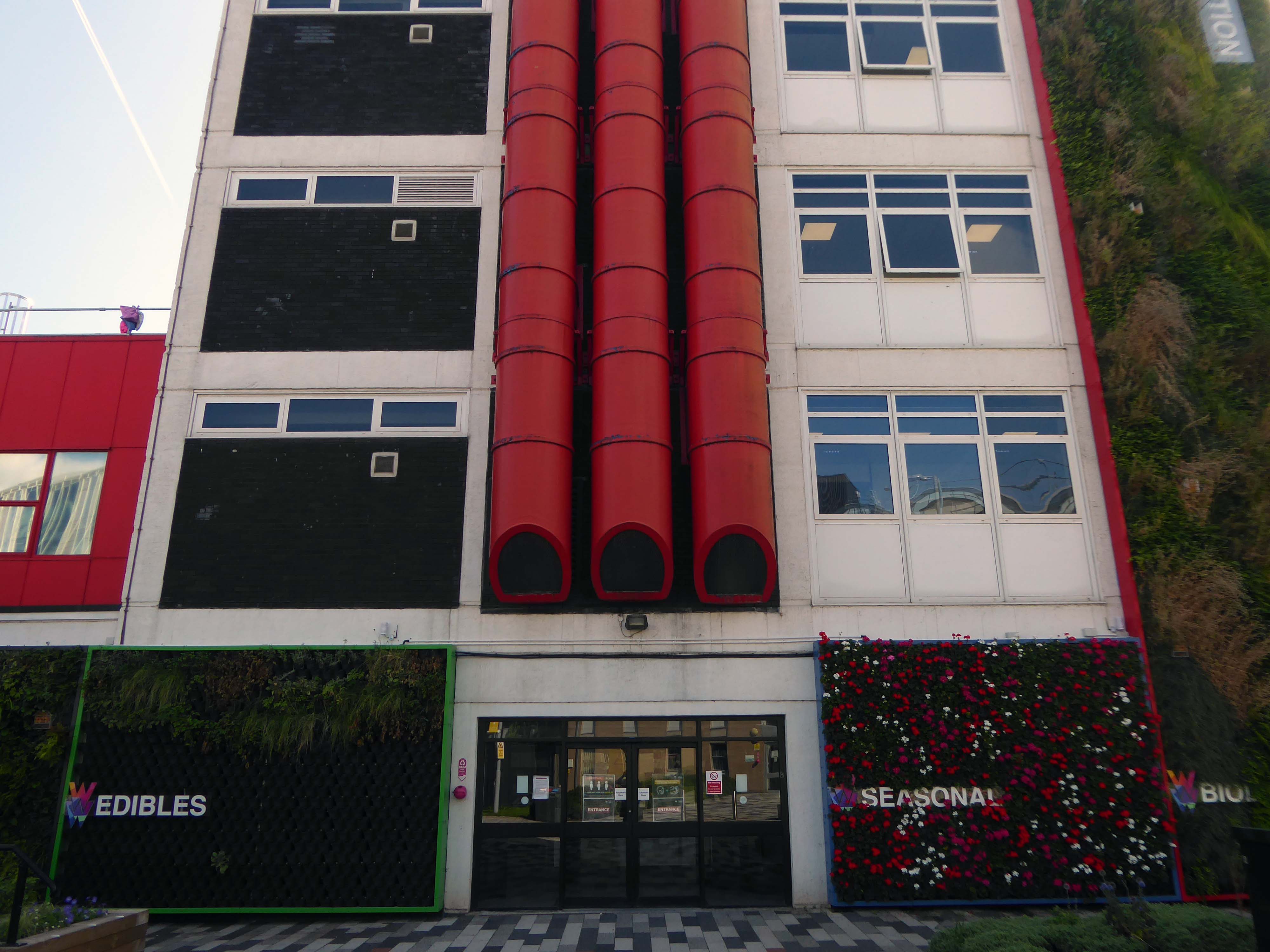
Take a turn around the corner to the Cockcroft Building.
The east facing mural painted out and obscured by retrofitted infrastructure.
These incised stone panels obscured by plants.
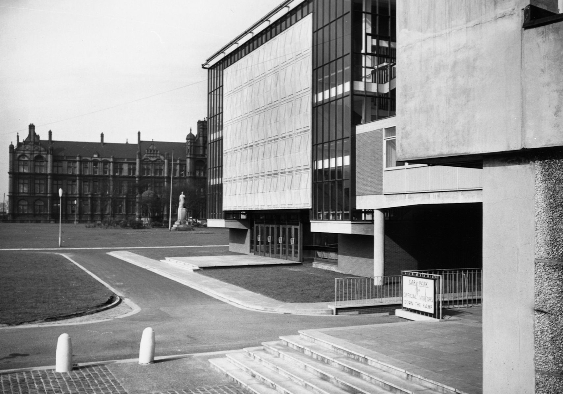
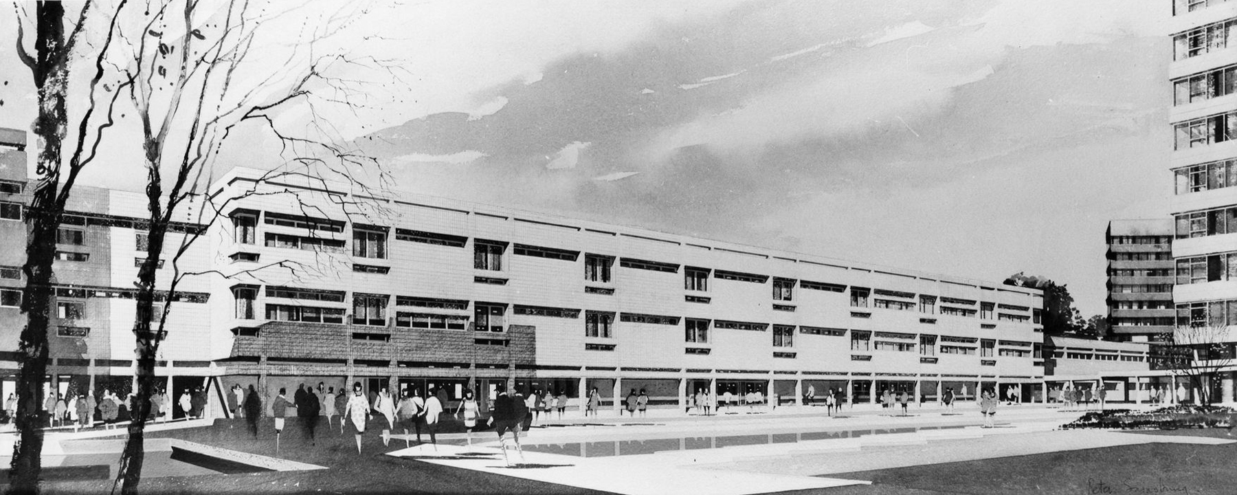
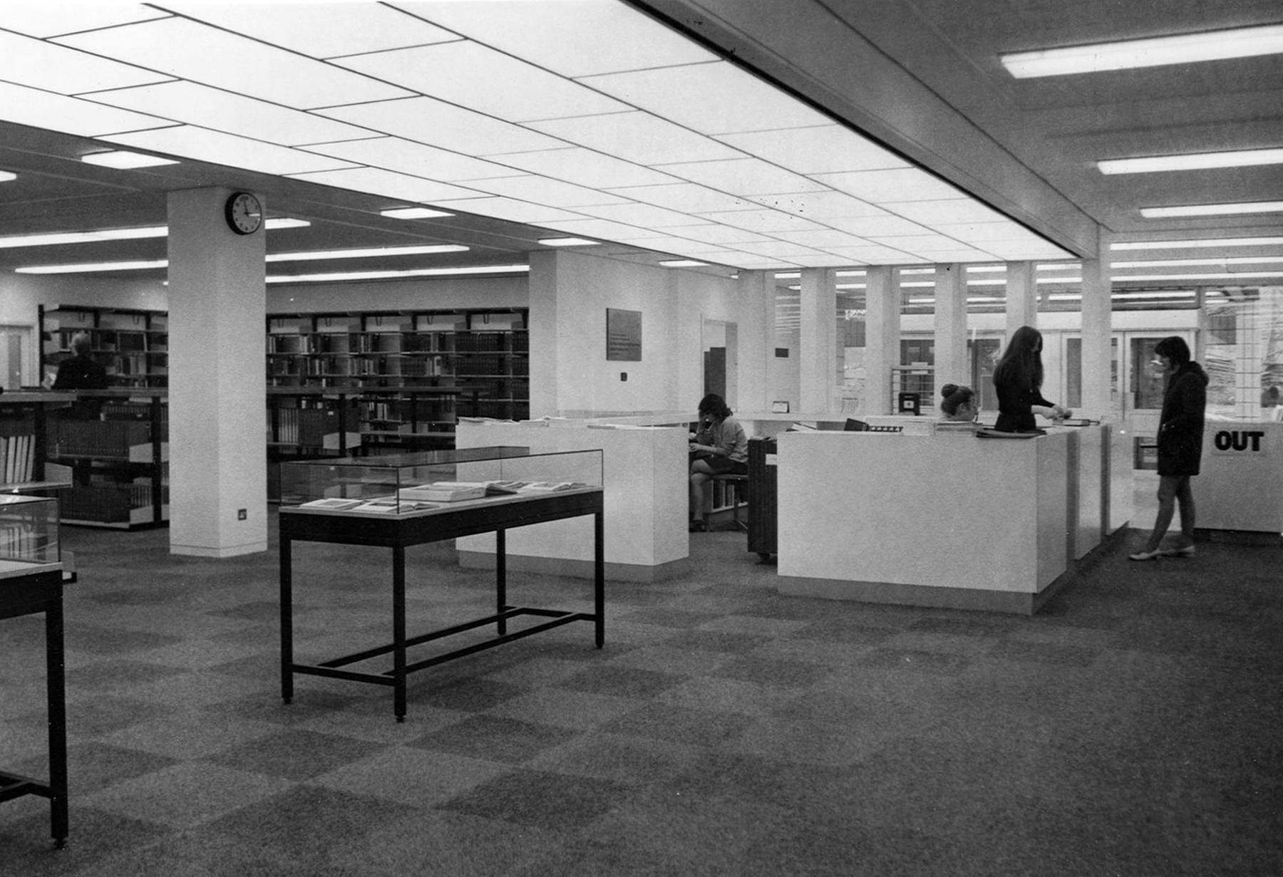
To the left is the Clifford Whitworth Library – this is the original architectural impression – signed Peter Sainsbury.
The original fascia was tile clad.
Subsequently replaced by uPVC boards.
Yet again the original interior was integral too the architectural scheme and period.
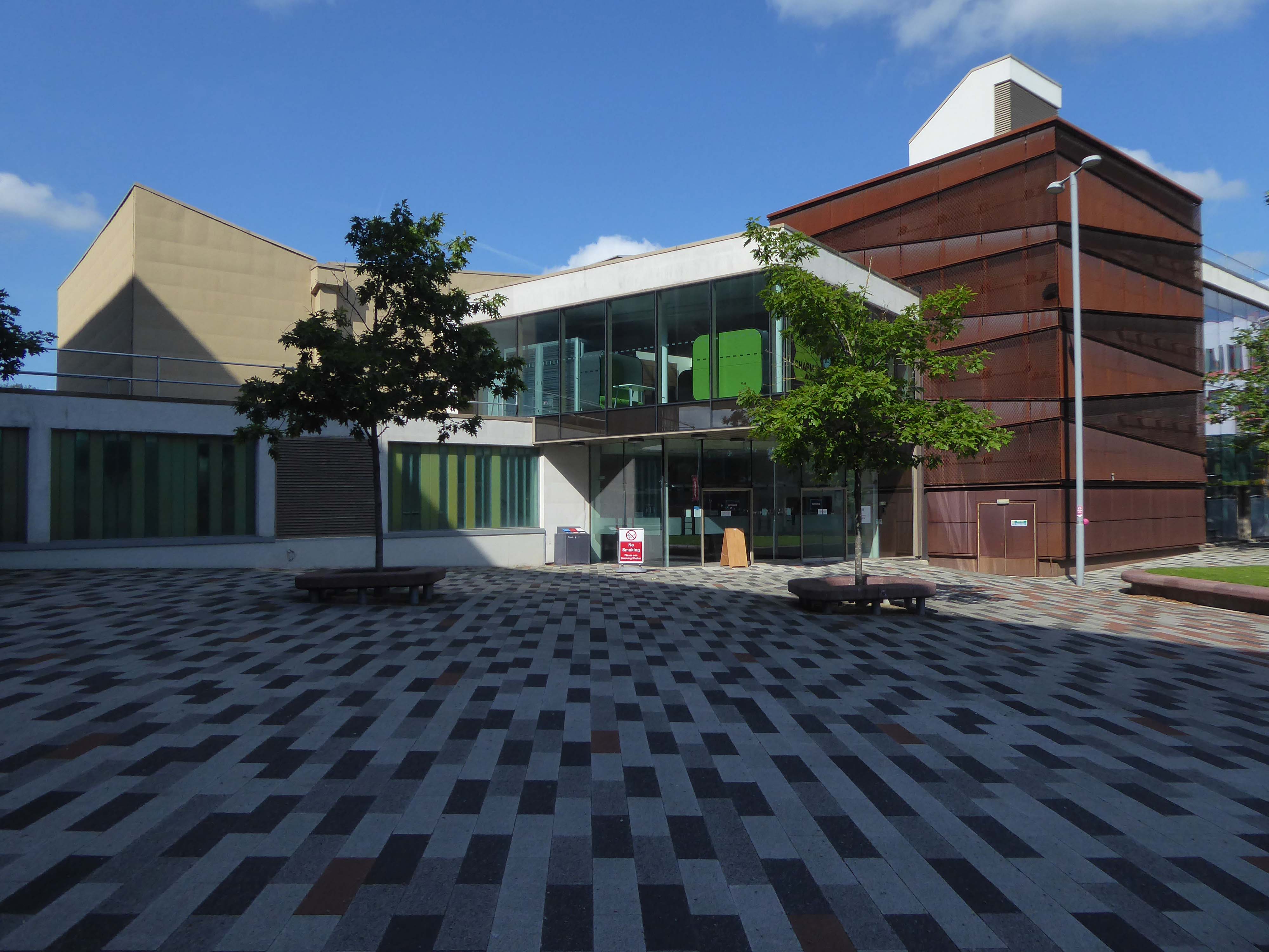
Across the way the Chapman Building.
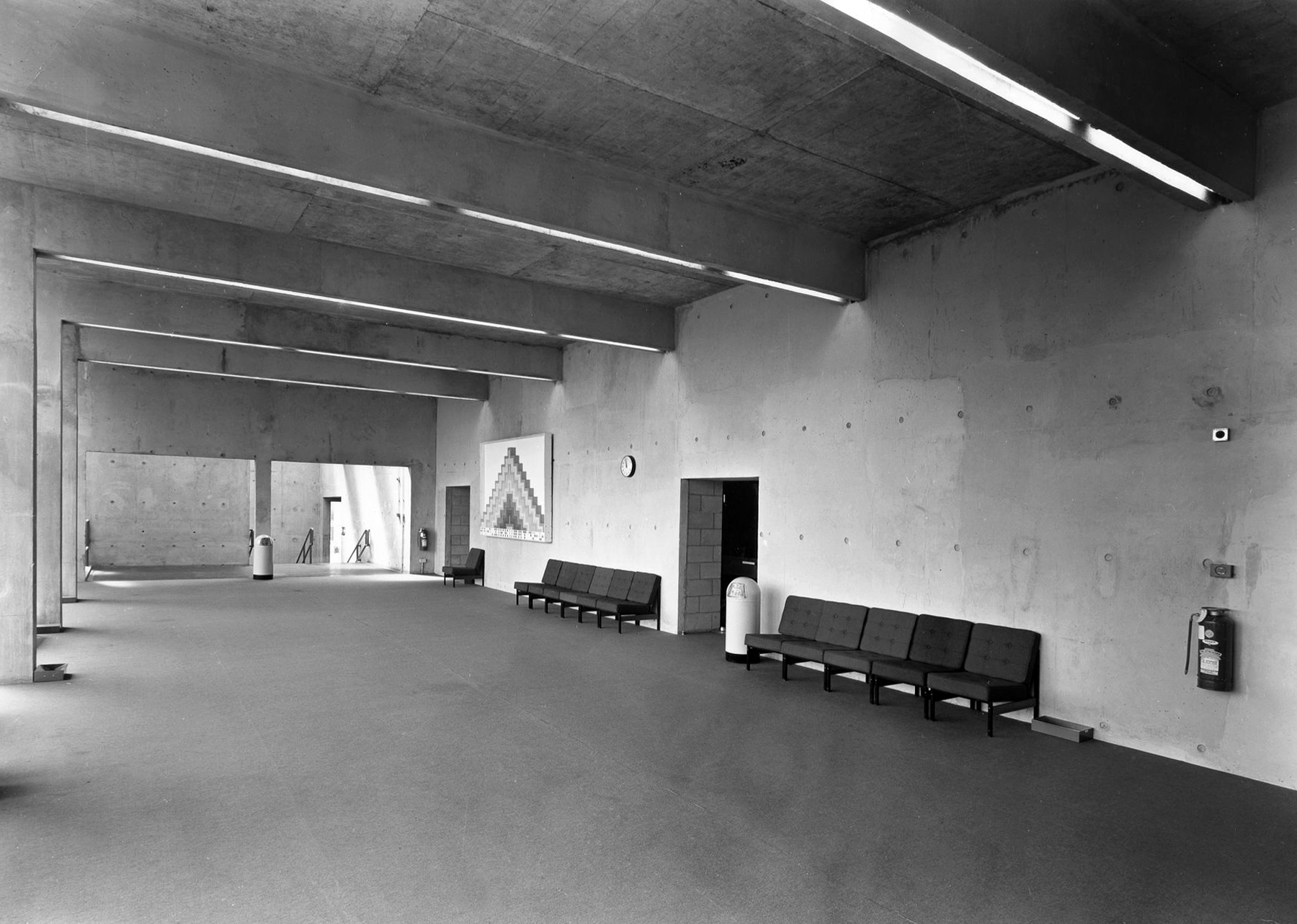
It was designed by WF Johnson and Partners of Leamington Spa, as a lecture theatre block and gallery. It sits with its long axis running parallel to the railway behind. The series of grey volumes, occasionally punctuated by colourful floods of red and green trailing ivy, hang together in a less than convincing composition. The orientation and access to the building seem confused and detached from any cohesive relationship to the rest of the campus, but there is something perversely attractive about the right essay in the wrong language. The reinforced concrete building contained five lecture theatres, communal spaces, an art gallery, AV support areas and basement plant rooms. Following a major refurbishment in 2012, several additions were made to the exterior and its total concrete presence somewhat diminished. It still houses lecture theatres and a number of other learning and social spaces.
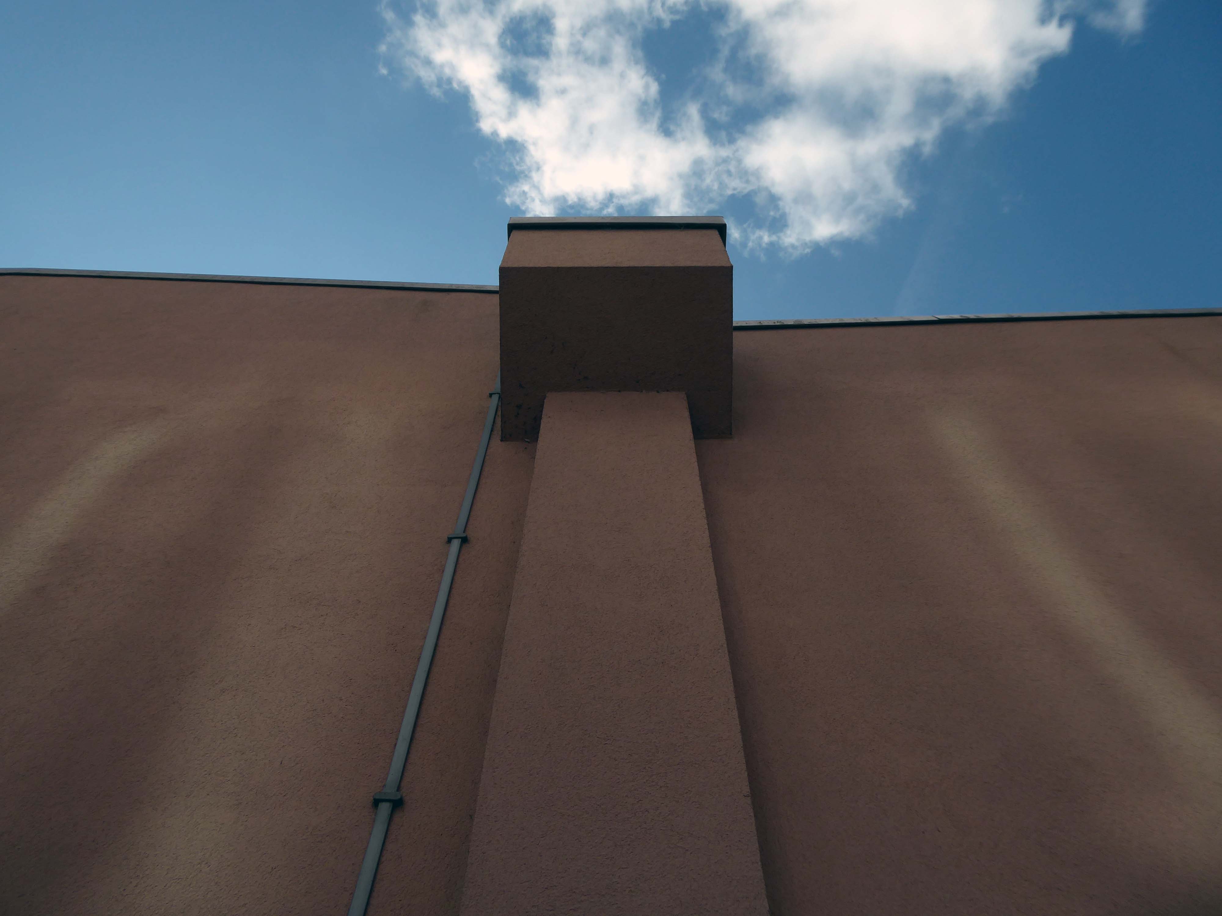
To the rear of the building there are some of the original details, now painted a series of funny colours.
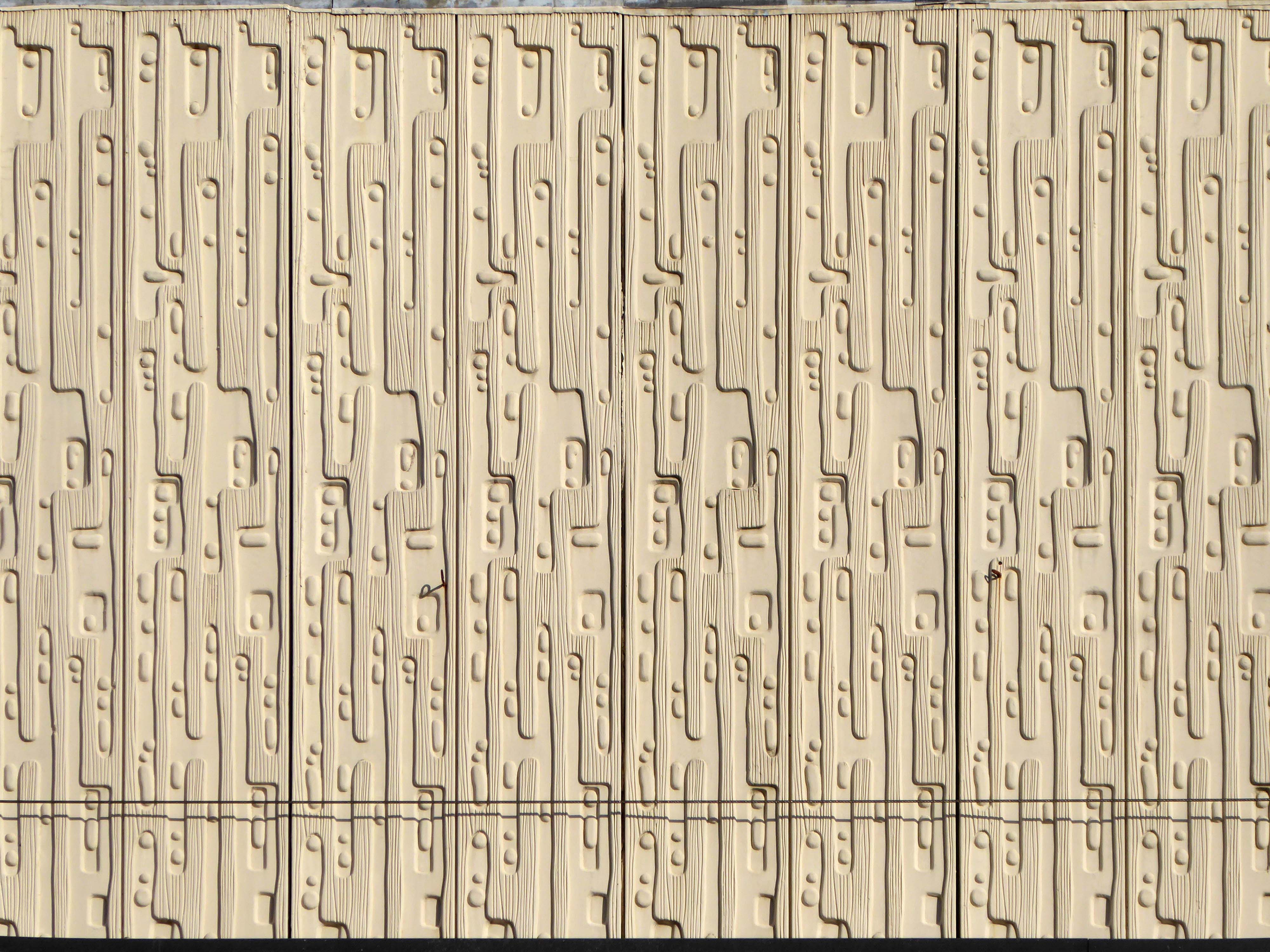
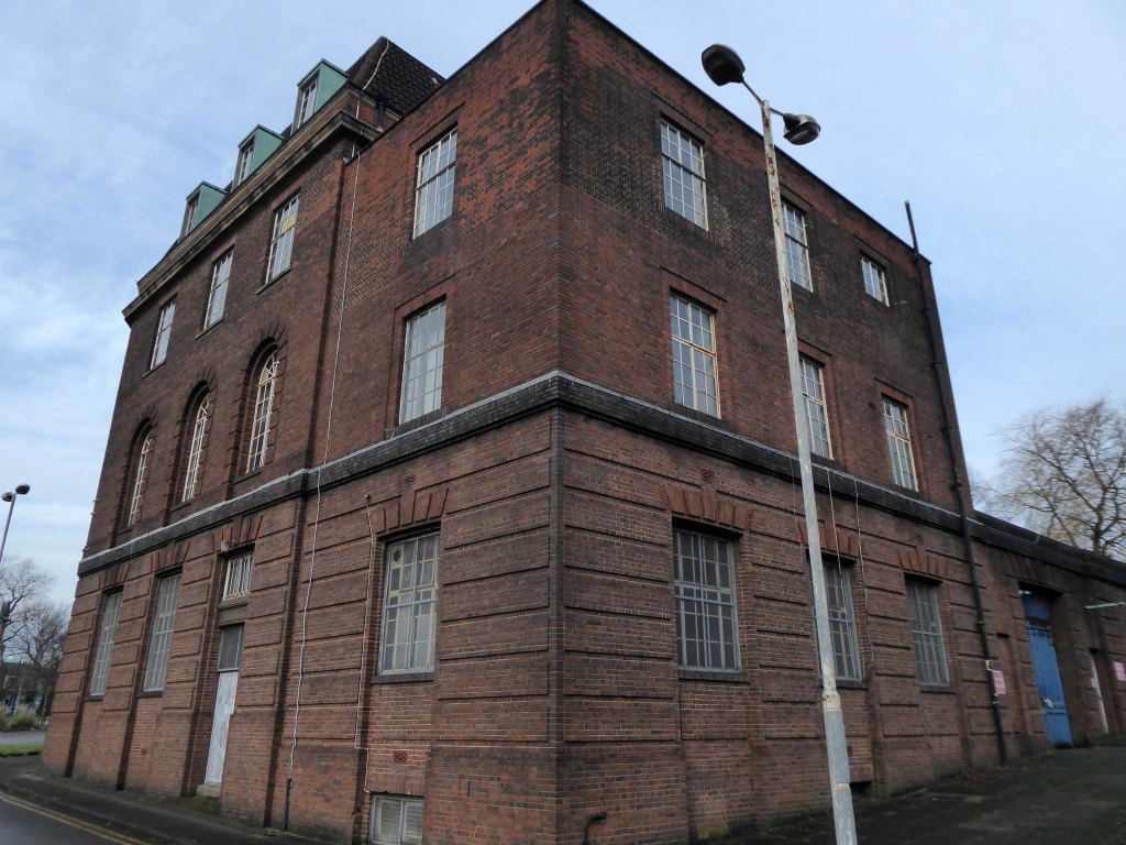
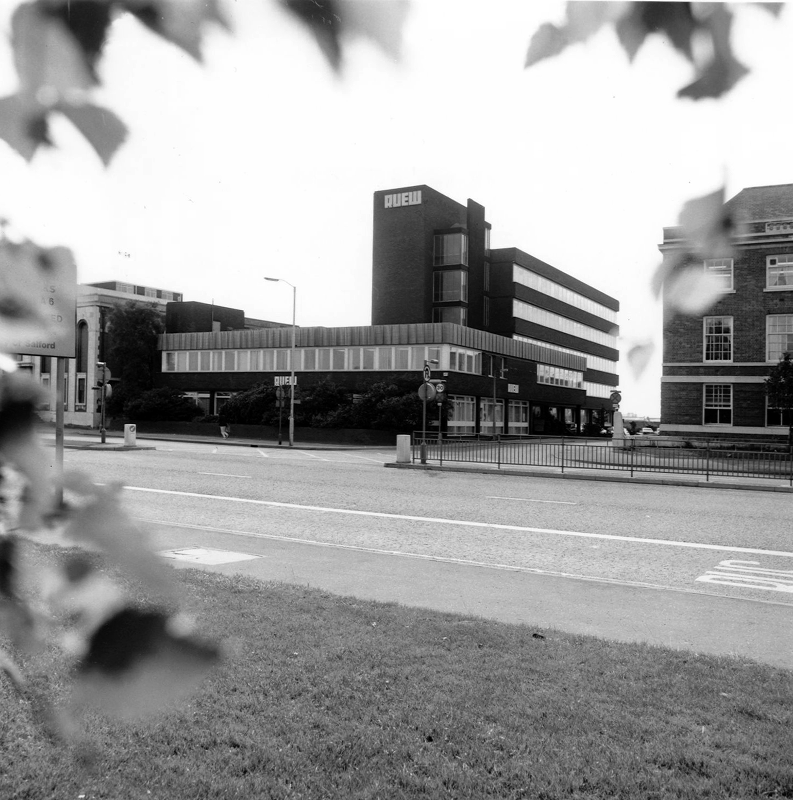
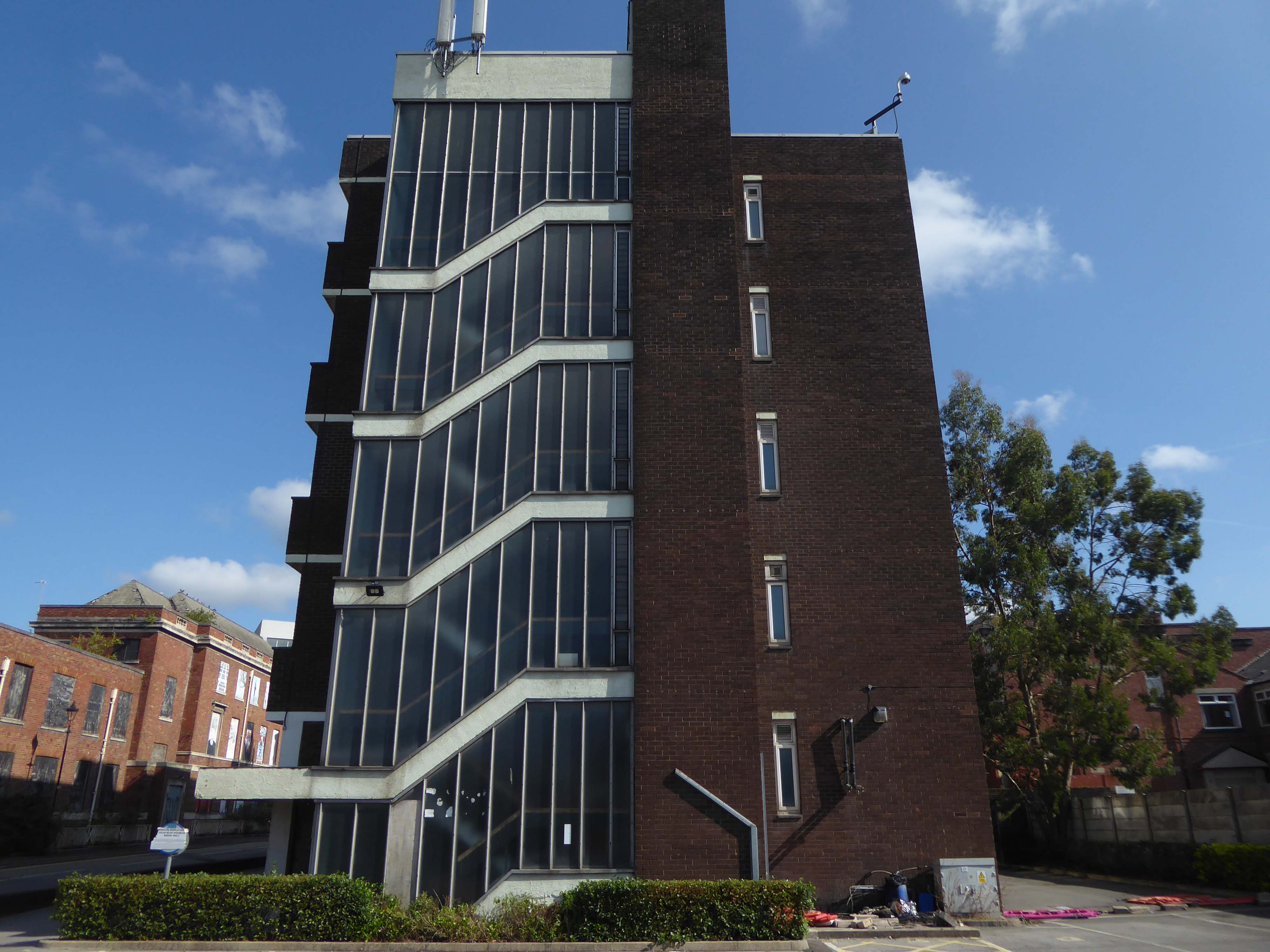
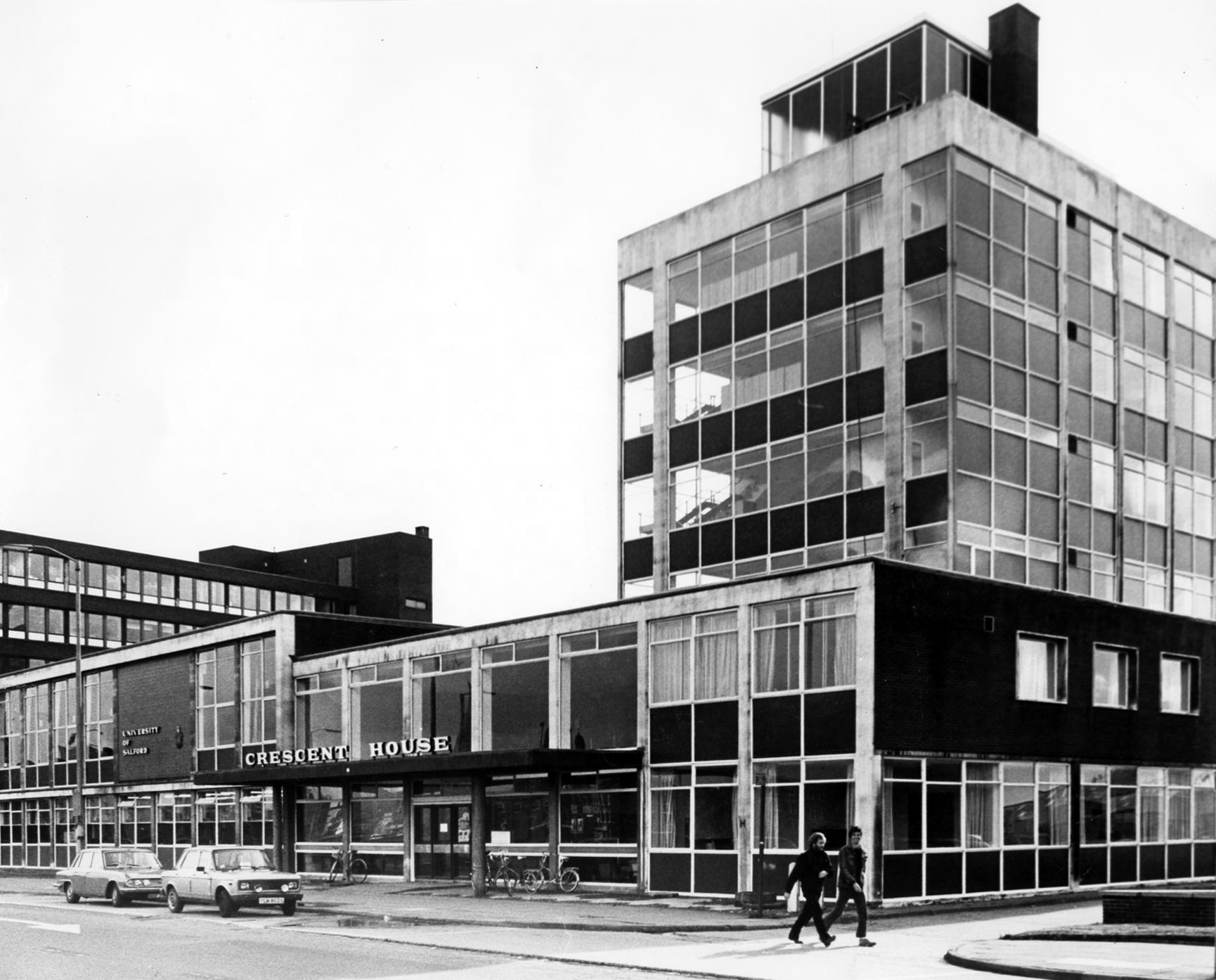
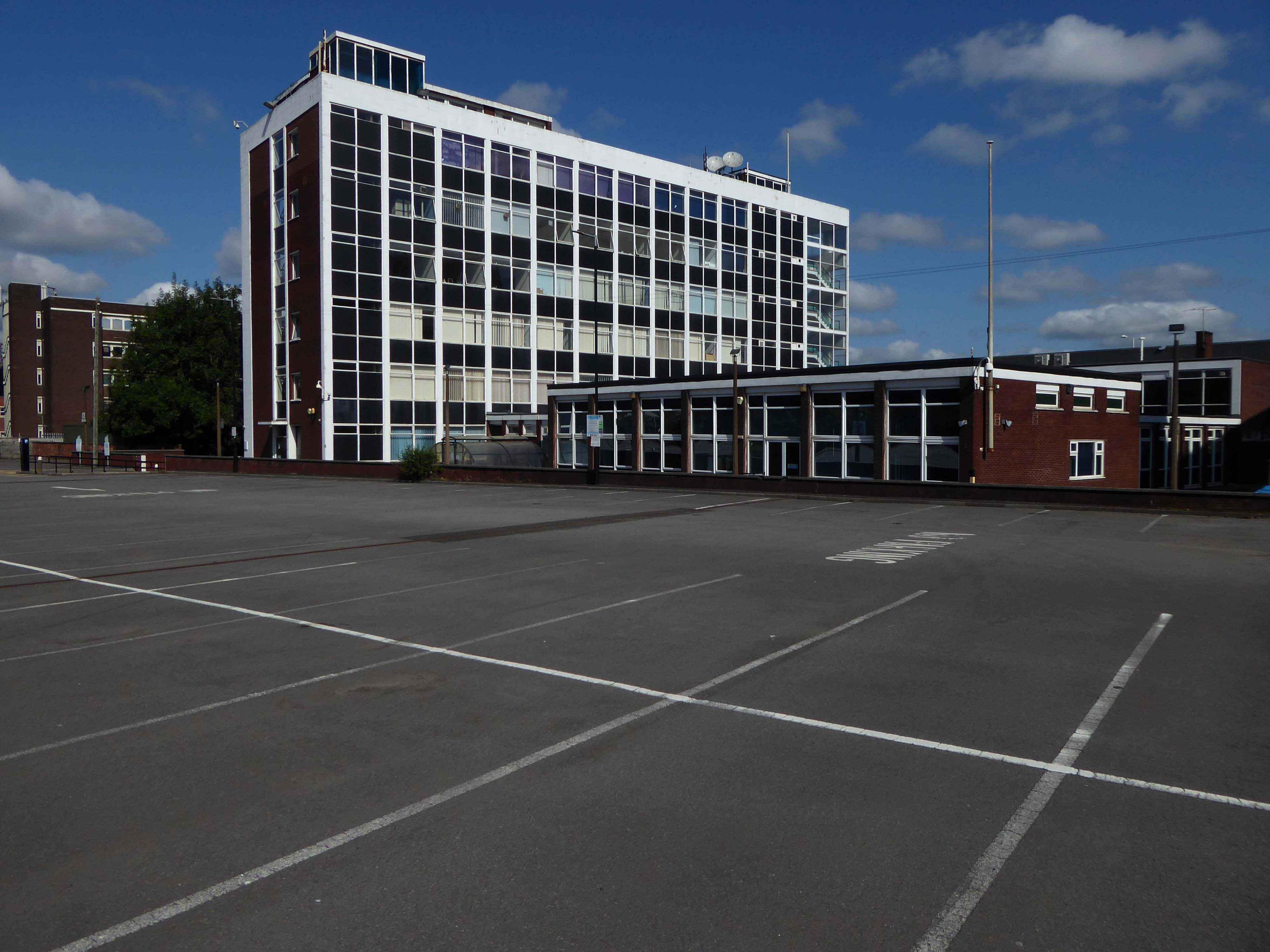
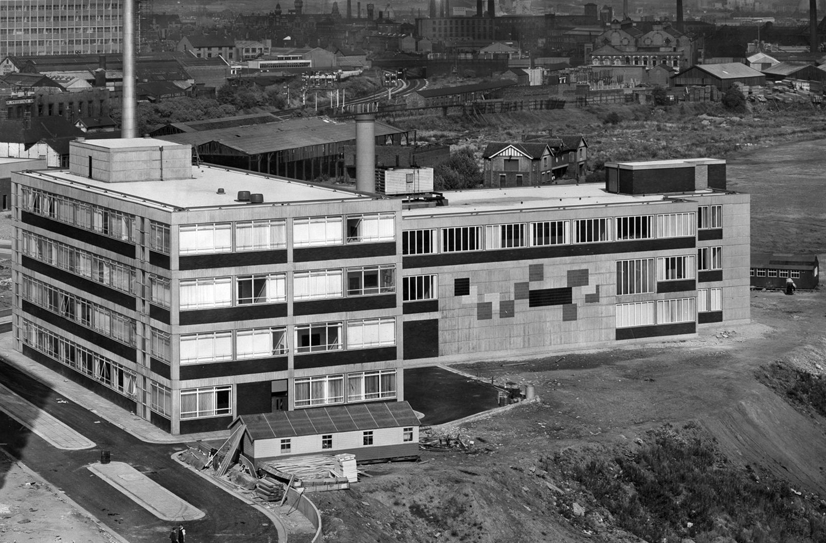
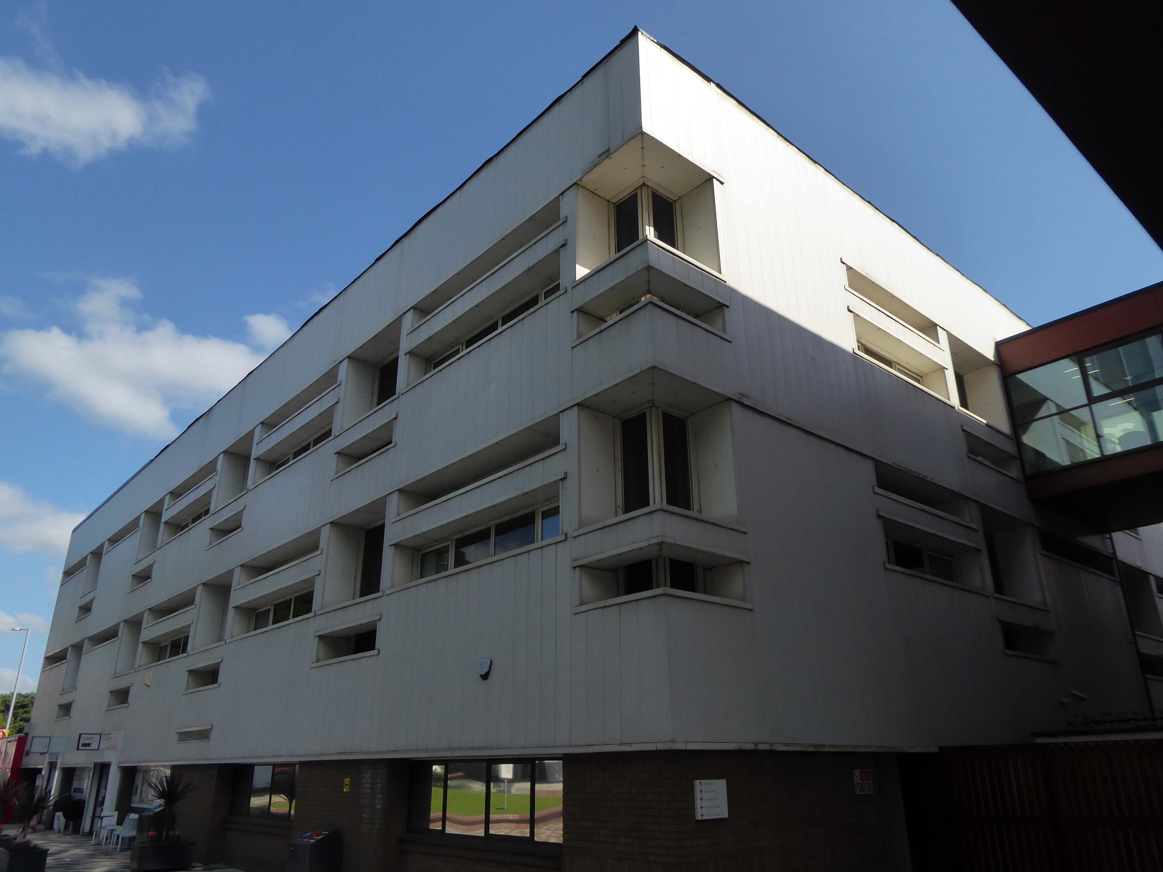
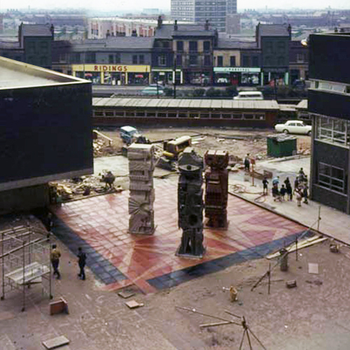
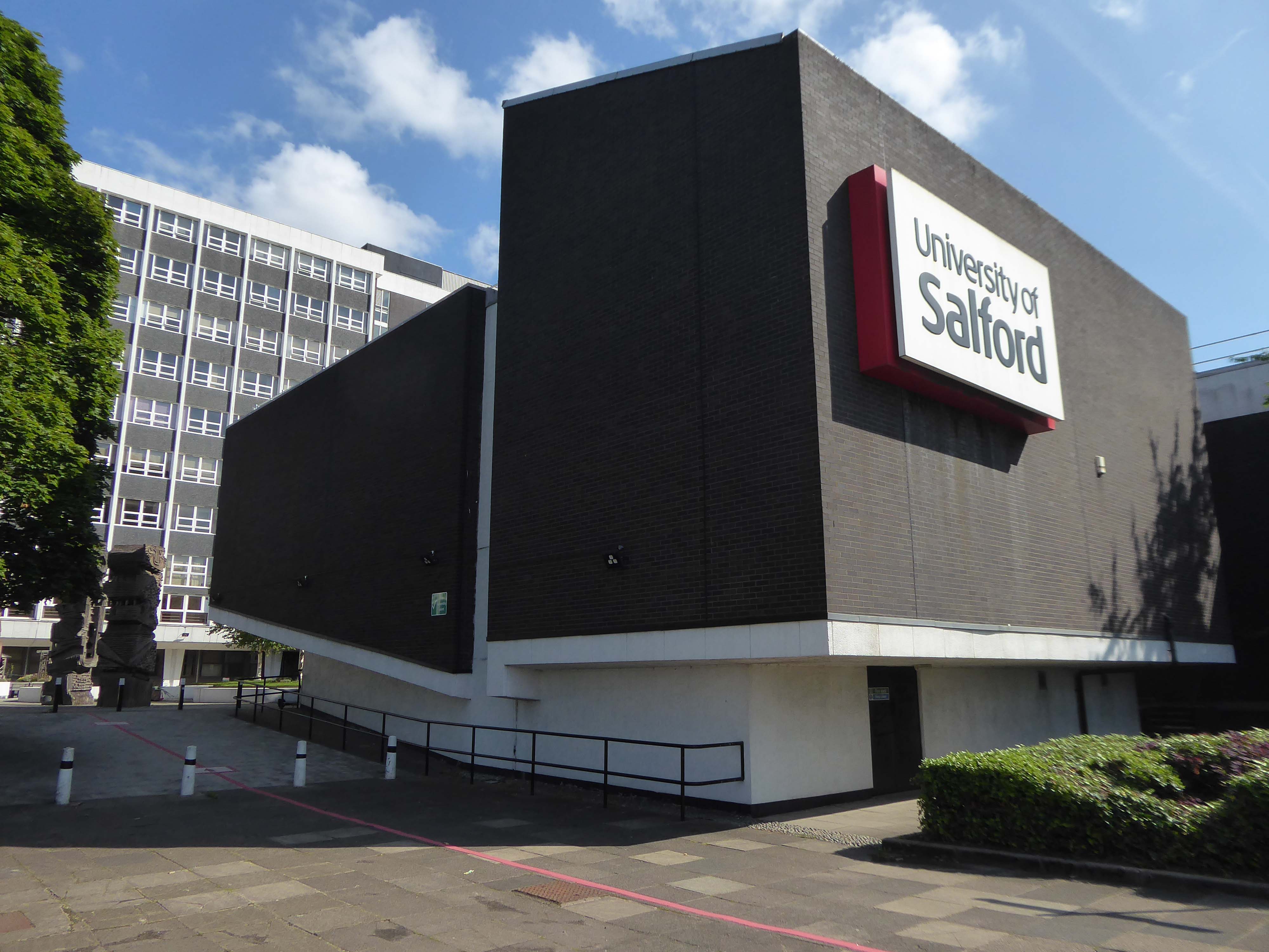
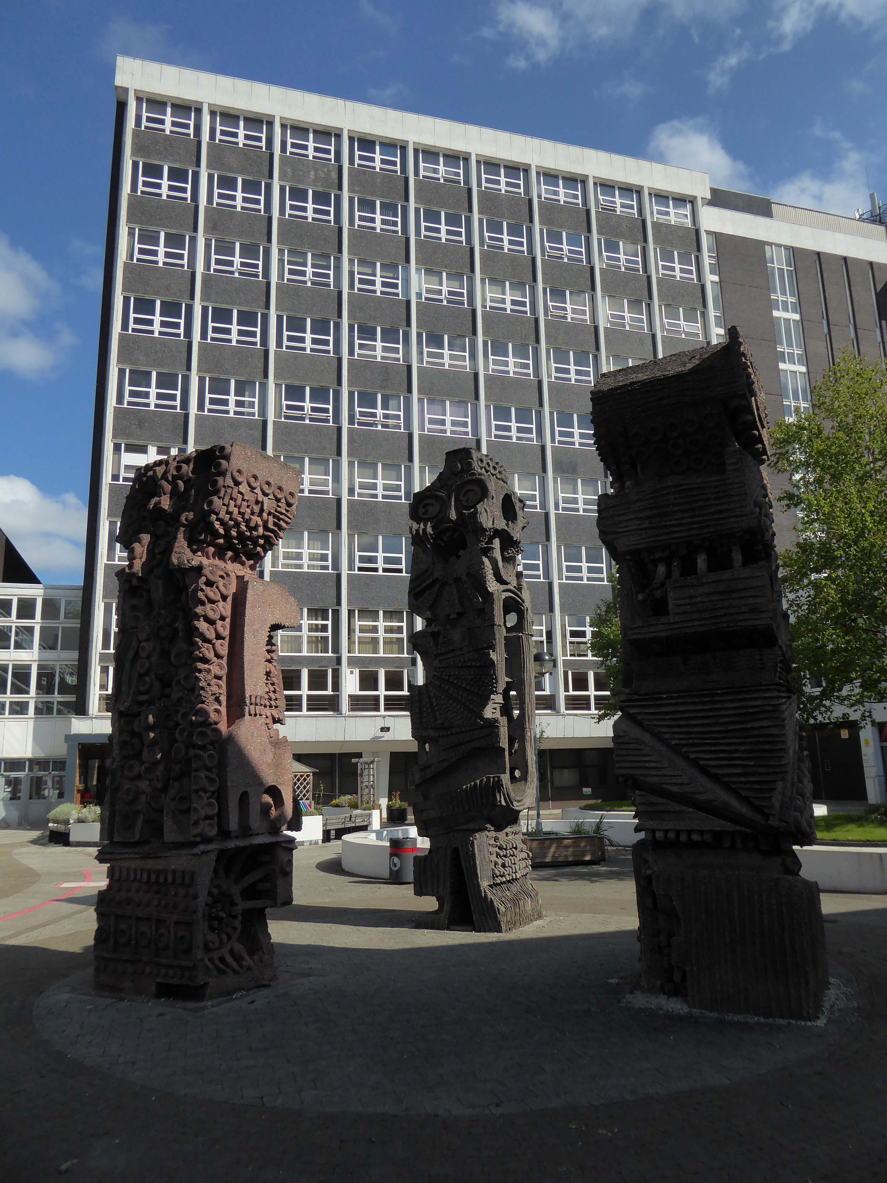
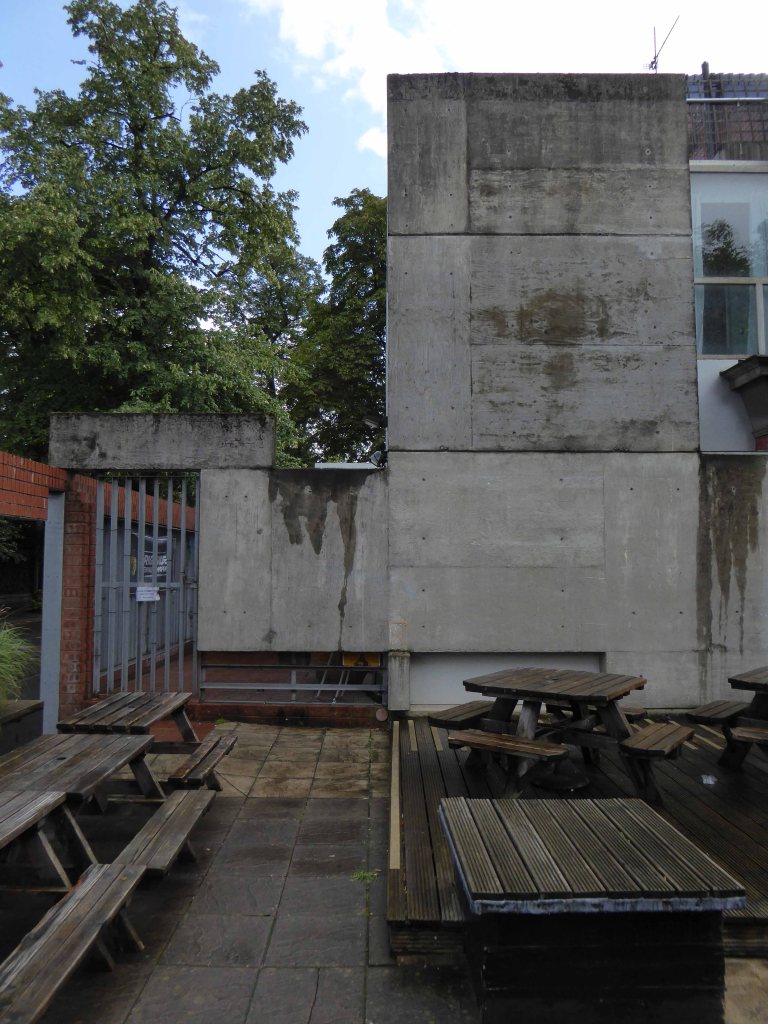
A ways down the road the former Salford Technical College.
Now the part of the University of Salford, this grouping is probably the most significant work by Halliday Meecham during this period. The blocks wrap to almost enclose a courtyard and they step up in height towards the rear of the site. To the front is a lecture theatre block in dark brick. The multi-storey elements are straightforward in their construction and appearance and have had their glazing replaced. Perhaps the richest elements here are the three totemic structures by artist William Mitchell, which were listed at Grade II in 2011. Mitchell was actively engaged with the experiments of the Cement and Concrete Associations during the 1960s and produced a wide variety of works for public and private clients; other works regionally include the majority of the external art and friezes at Liverpool Metropolitan Cathedral and the Humanities Building at Manchester University. These textured concrete monoliths appear to have an abstract representation of Mayan patterns and carry applied mosaic. They were made on site using polyurethane moulds. There is another Mitchell work hidden behind plasterboard in the inside of the building.
April 1965 saw the Salford City Reporter proudly boast in an article that
The Ellor Street dream begins to come true – complete with interviews with residents of the newly constructed Walter Greenwood, Eddie Colman and John Lester Courts all which towered some 120 feet above the Hanky Park skyline.
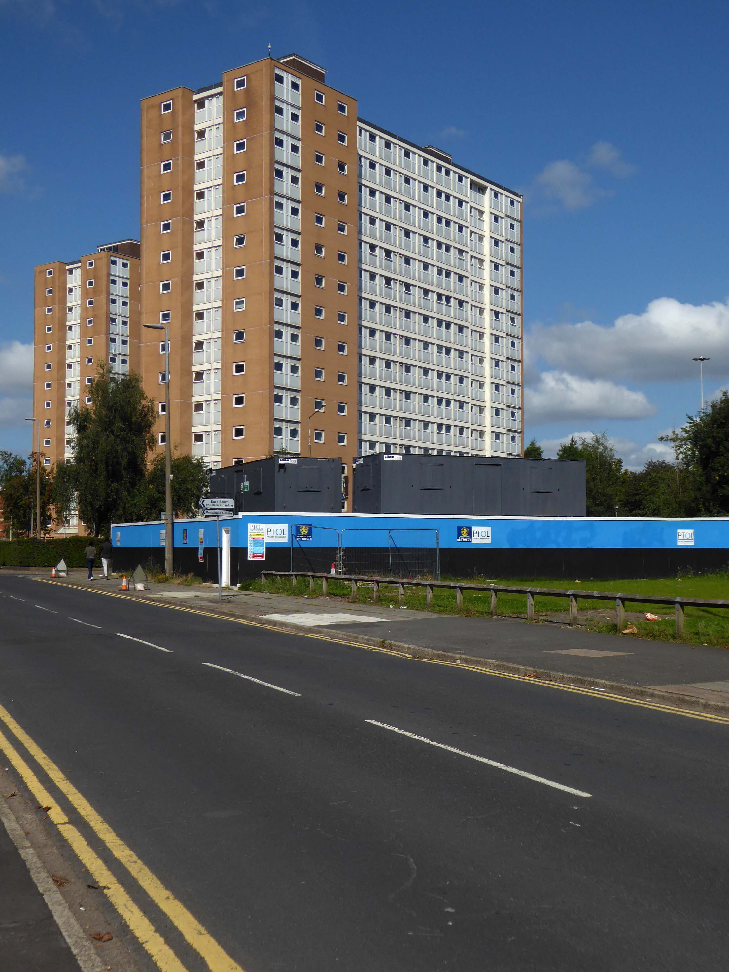
These particular blocks of flats were of special significance because their completion was the end of the first stage of the Ellor Street redevelopment scheme which was to provide 3,000 new homes, the £10 million pound Salford Shopping Precinct and a new civic centre – which never got built – making this A Salford of the Space Age.
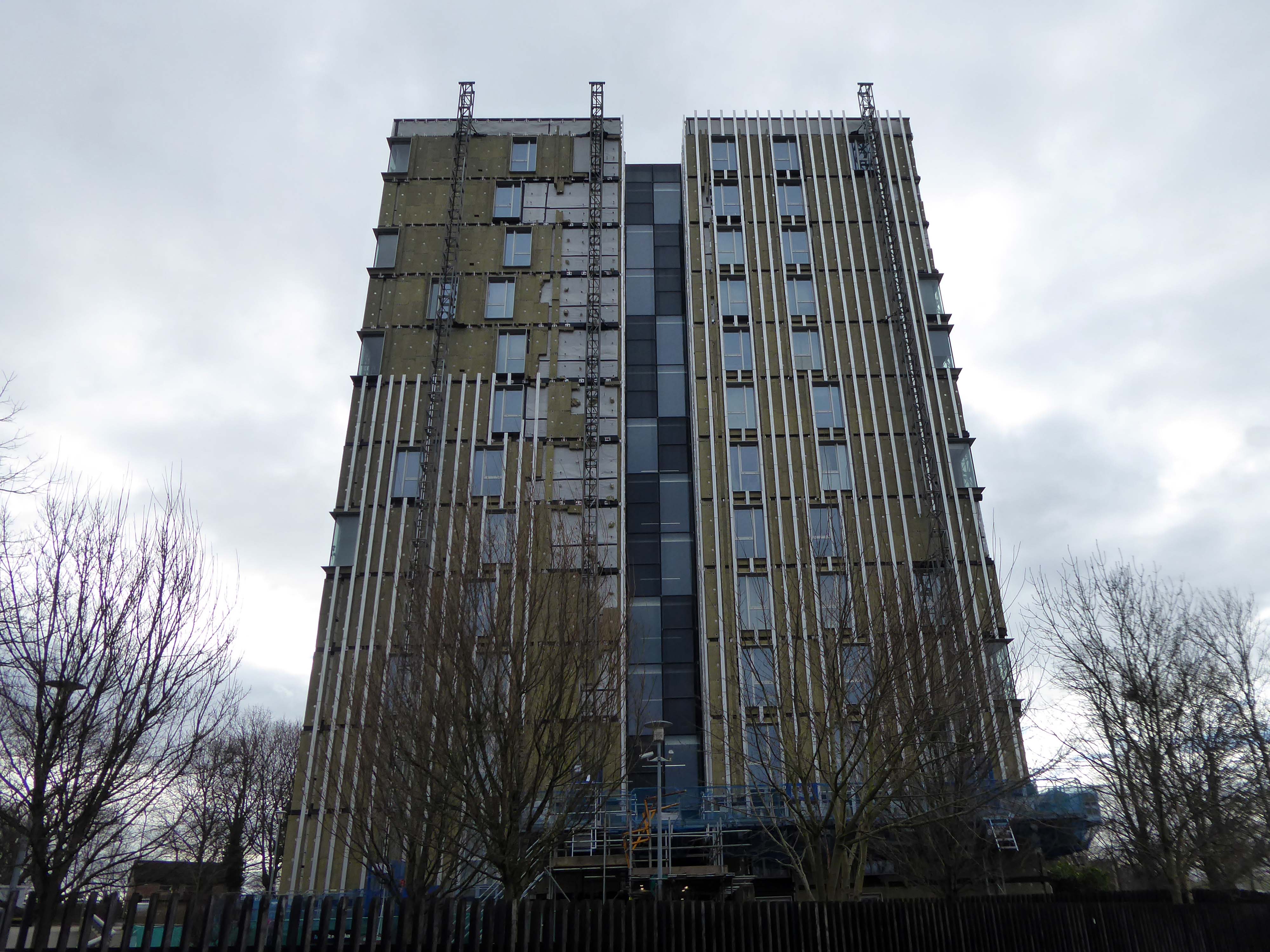
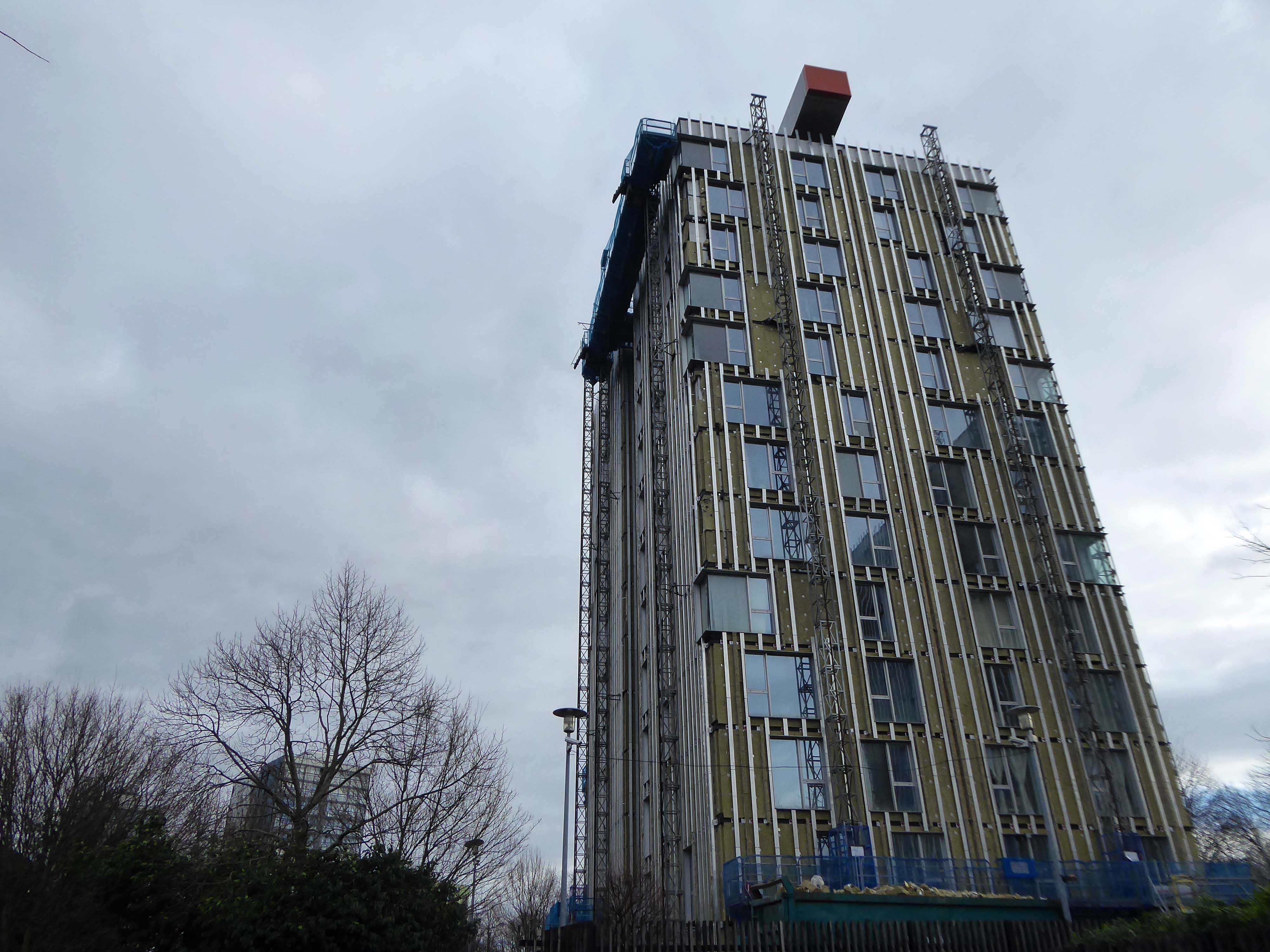
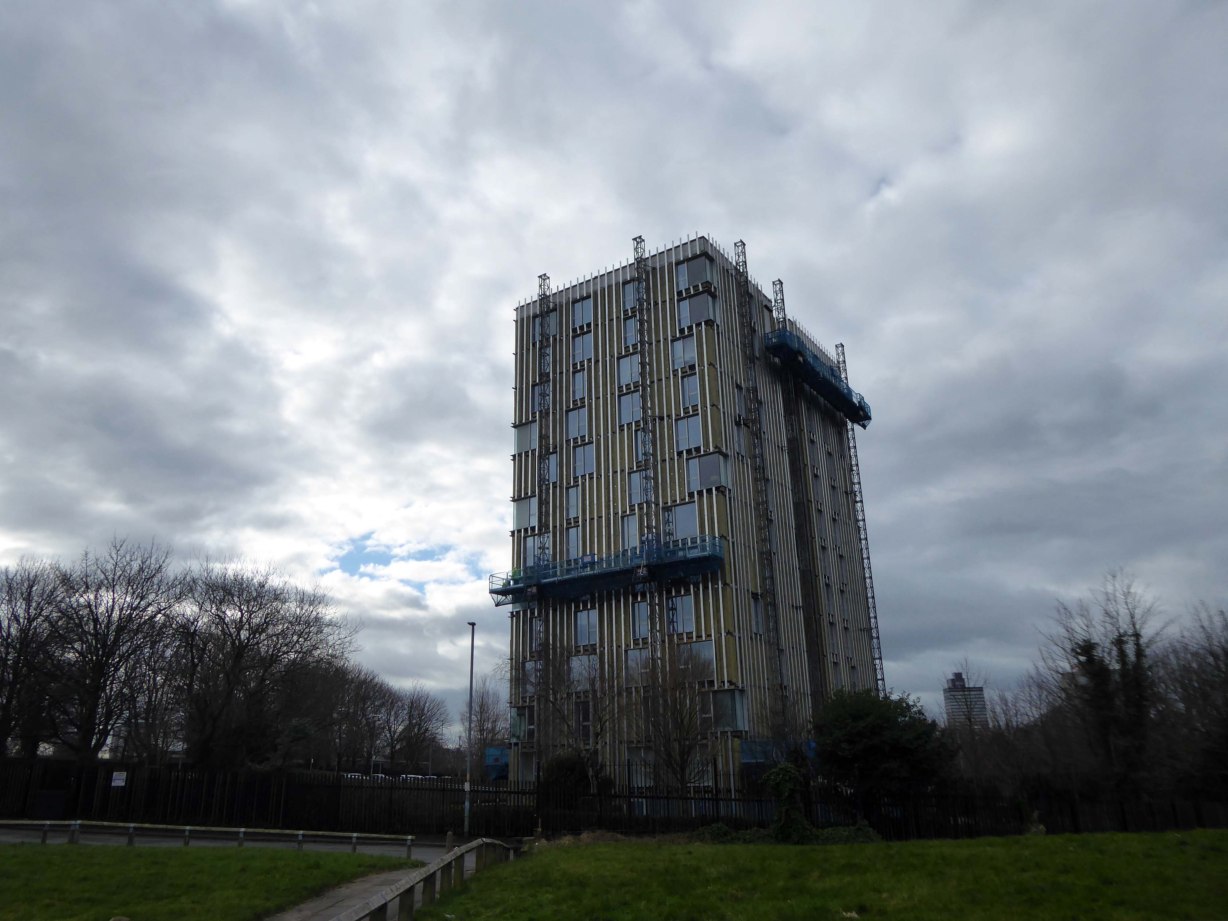
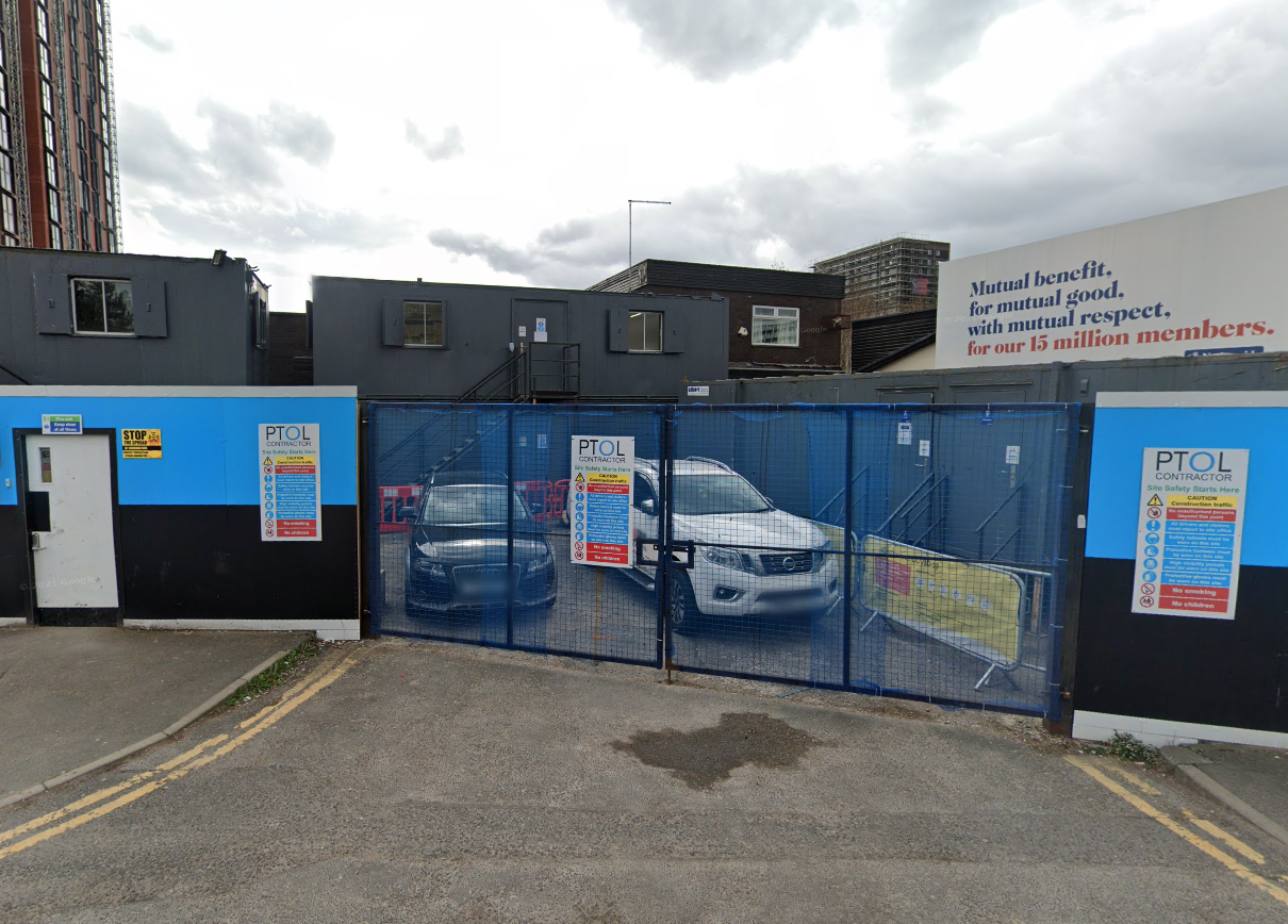
The tower blocks are now clad and the site a construction base for cladders.
Full details of Salford’s complex and extensive redevelopment can be found here at Tower Block.
Walter Greenwood Court was demolished in 2000/2001, whilst Eddie Colman and John Lester Court are now student accomodation for the nearby Salford University.
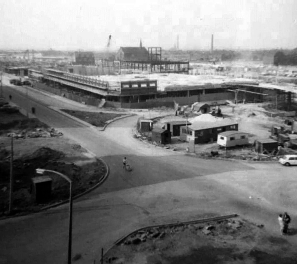
The construction of the shopping centre and surrounding areas continued and on 21 May 1970 the new Salford Market officially opened. From 1971 onwards new shops inside the precinct itself began to open.
However, due to a lack of funds and a political scandal which saw chairman Albert Jones jailed for eight months construction of Salford Precinct was halted. The site had only 95 shop units compared to the proposed 260, the hotel and two storey car park were never built.
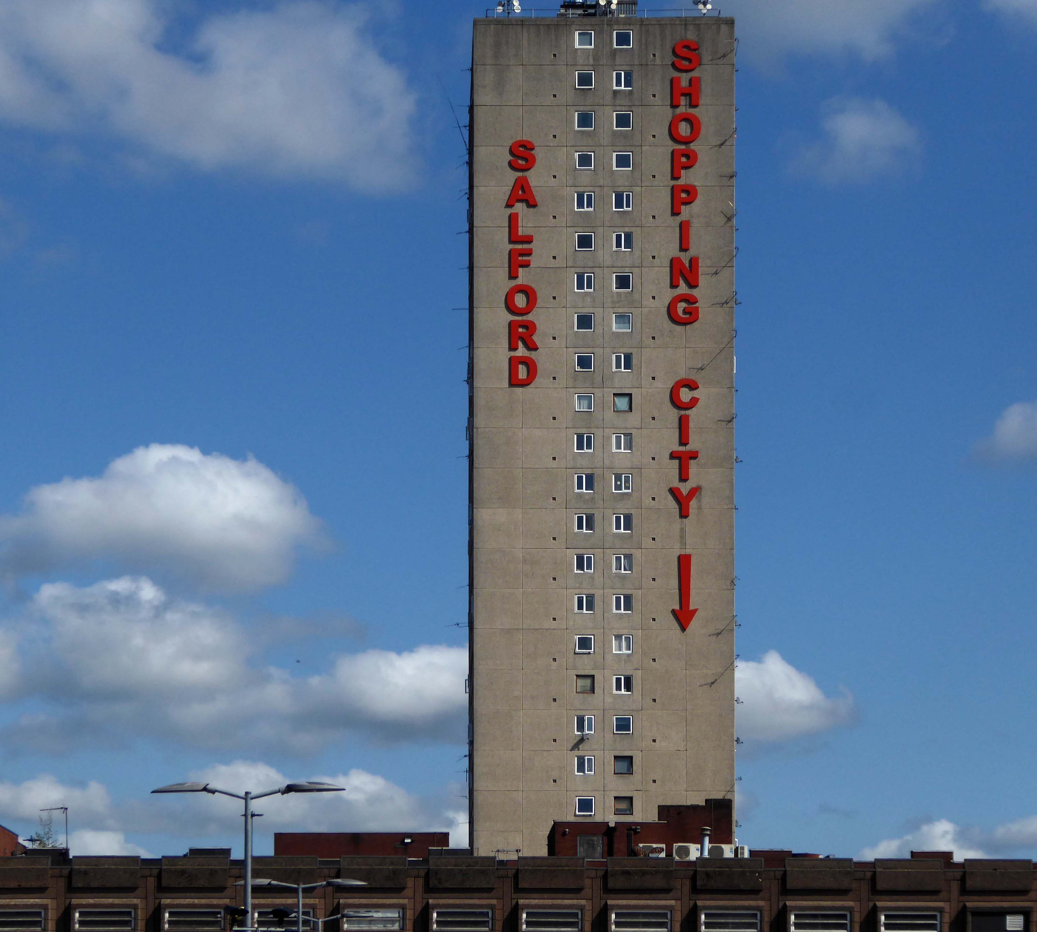
The architectural core of the site has been retained, including the 23 storey Briar Court residential tower.
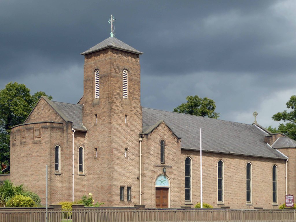
Tucked in behind is Mother of God and St James RC Church.
Clearances took place from the middle of the twentieth century and new high-rise housing blocks were built, as well as a shopping centre.
There was a Catholic presence in the area from 1854, when schools were built. What was described in The Tablet as a beautiful church, an Early English Gothic design by M. Tijou – presumably Herbert Tijou, architect of the chapel to Loreto College, Manchester, was opened by Cardinal Manning, Archbishop of Westminster in 1875.
One hundred years later this church was demolished and replaced by the present building.
The architects were Desmond Williams & Associates, the design bearing some similarity to their St Sebastian, Salford. In 2010 the church of All Souls, Weaste, was closed, and the marble sanctuary furnishings brought to the church.
Description
All orientations given are liturgical. The church is steel framed with brick walls and a monopitch roof (originally covered with copper, now with felt). Bold brick forms create a presence, and the design is somewhat defensive, with few windows. The building is entered from a lower porch which forms a narthex. The slope of the roof and the stepped clerestory lighting create a striking impression inside, and full-height windows towards the east end incorporate stained glass figures said to have originated in the previous church. Marble sanctuary furnishings are presumably those from the church in Weaste and appear to be of later twentieth century date, while the font is of traditional type with a clustered stem and may have come from the earlier church.
Returning to The Crescent the High Street Estateis all but demolished, save for one resident and their row.
This is an area which has seen a succession of clearances, redevelopment and shifts in demographics during a relatively short and intense period of change.
That process of change continues to hastily unfold.
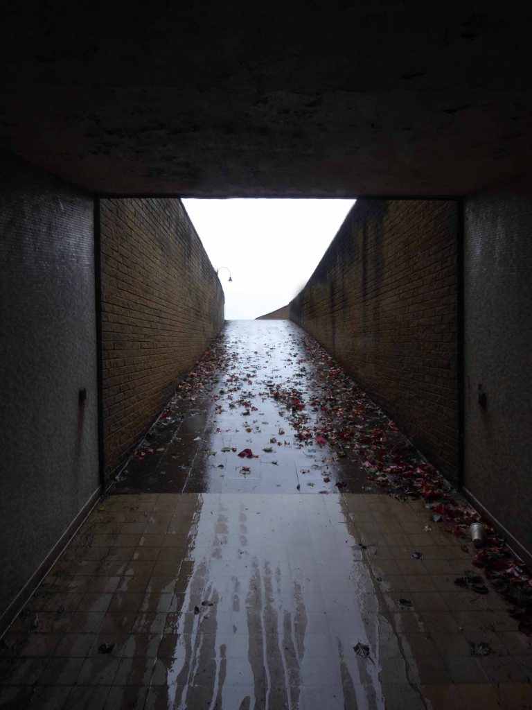
Avoiding heavy showers and even heavier seas, I’m here again.
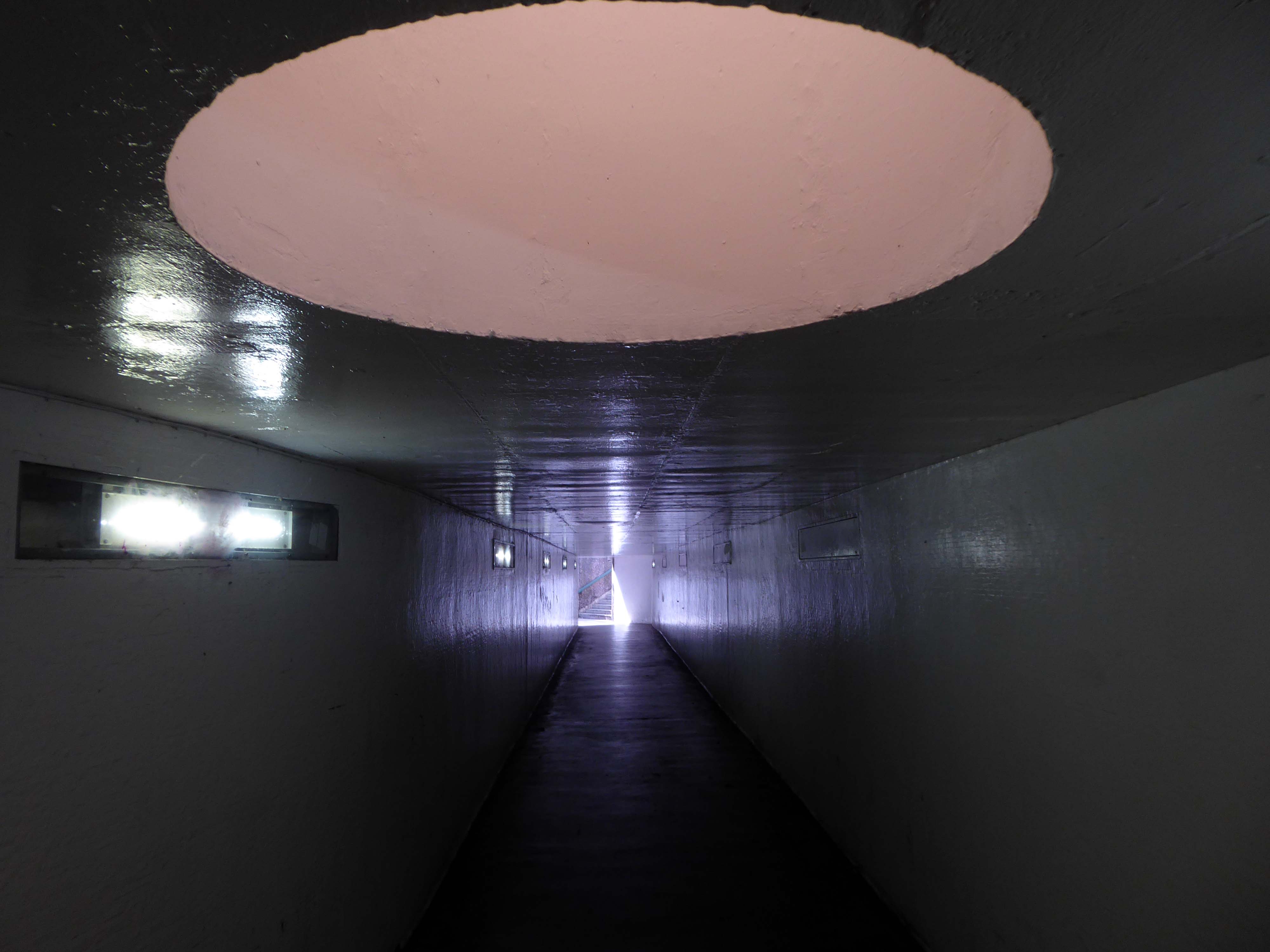
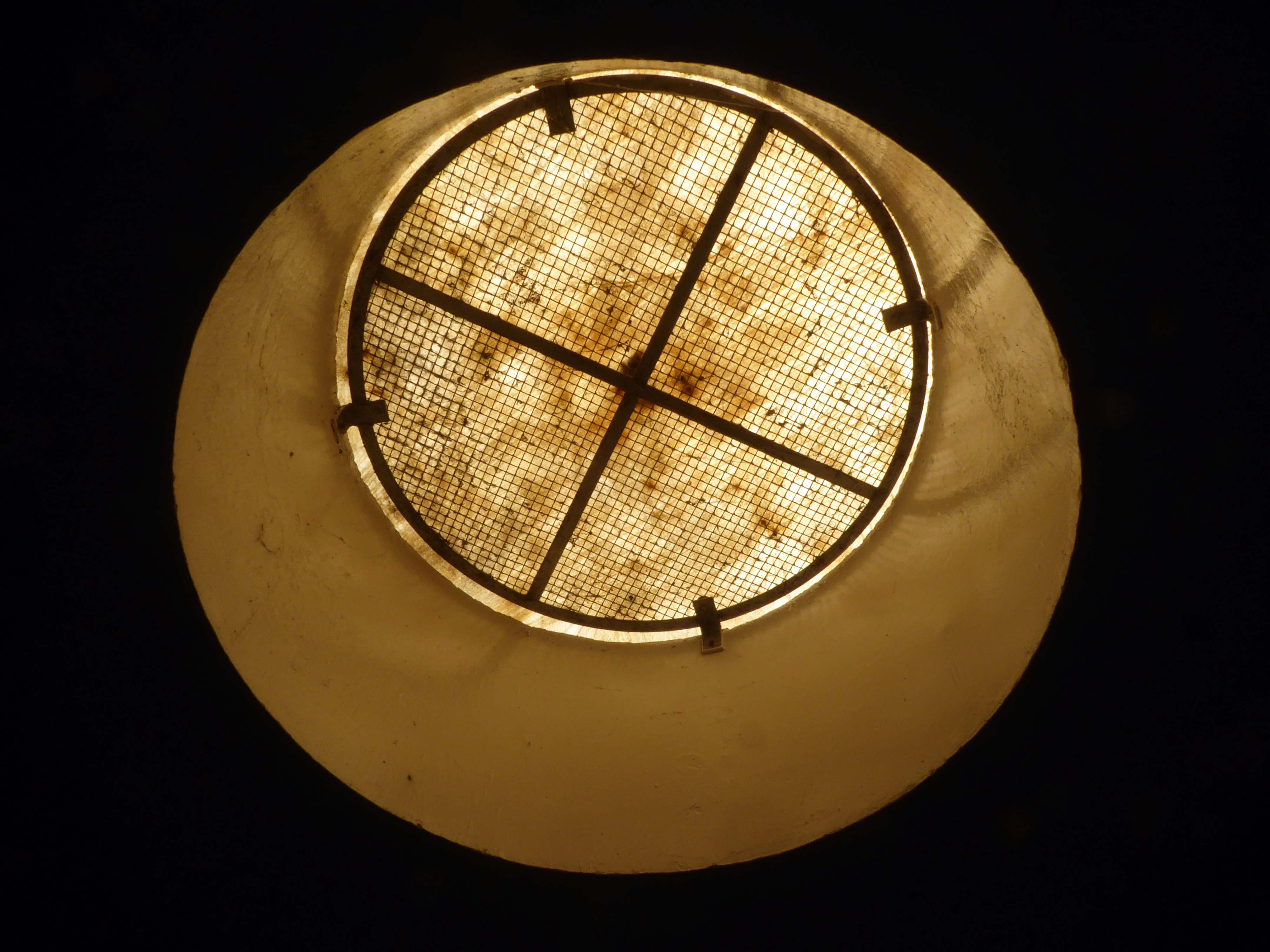
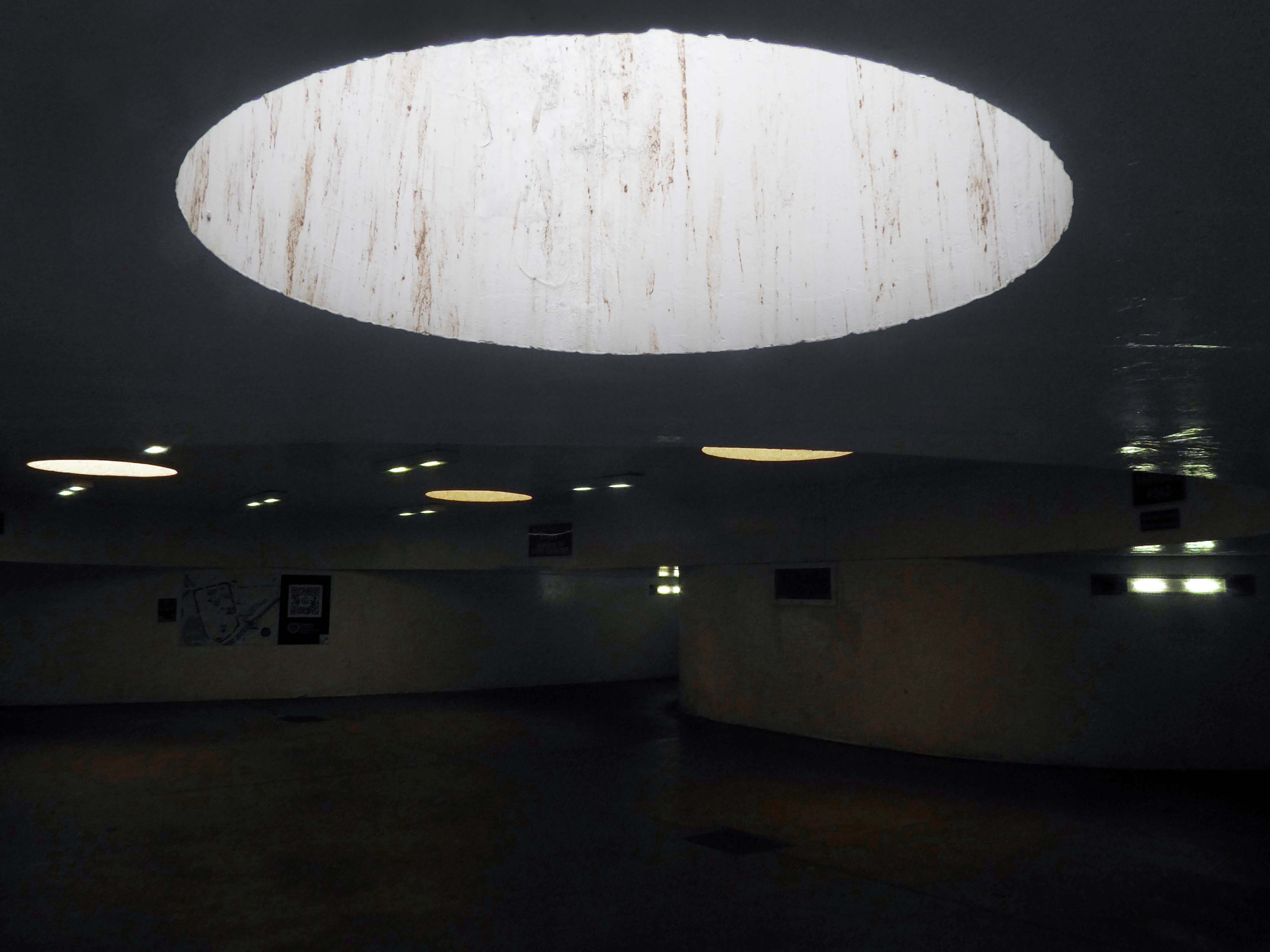
Three ways in and out of a doughnut on Scarborough’s South Bay.
One way in and out of the North Sea.
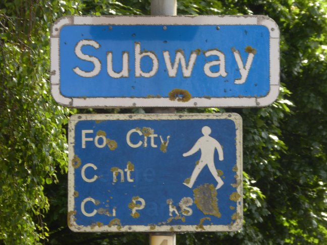
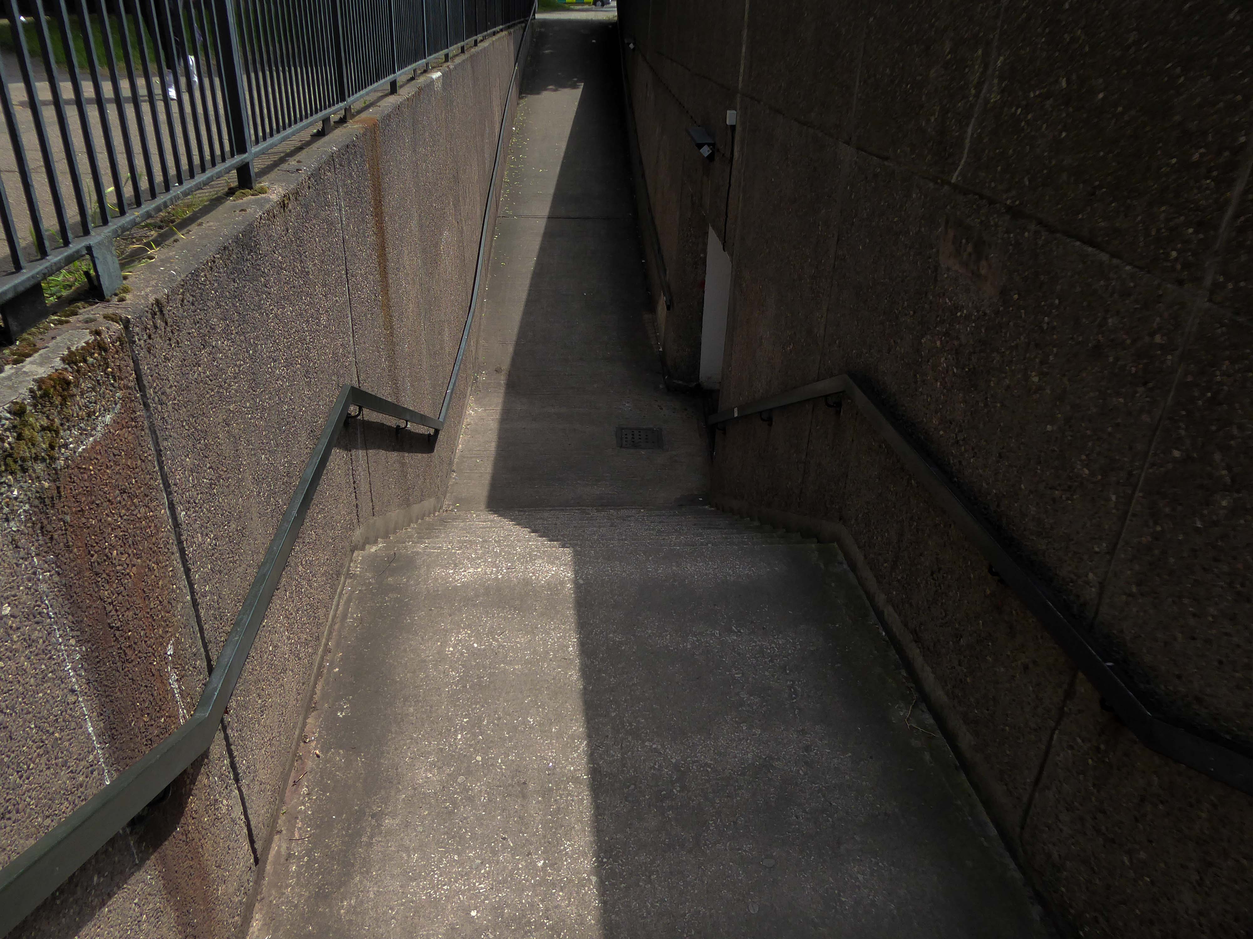
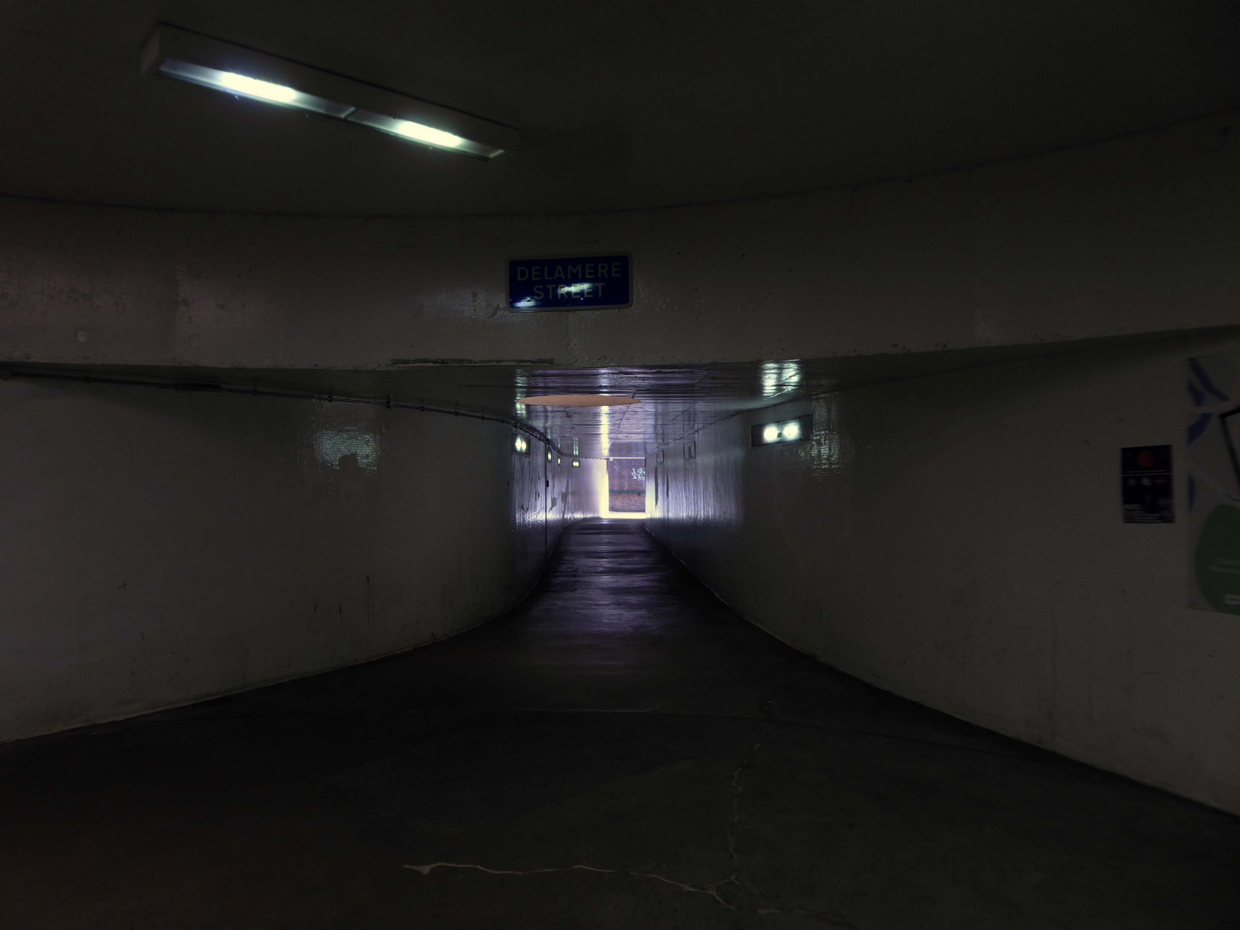
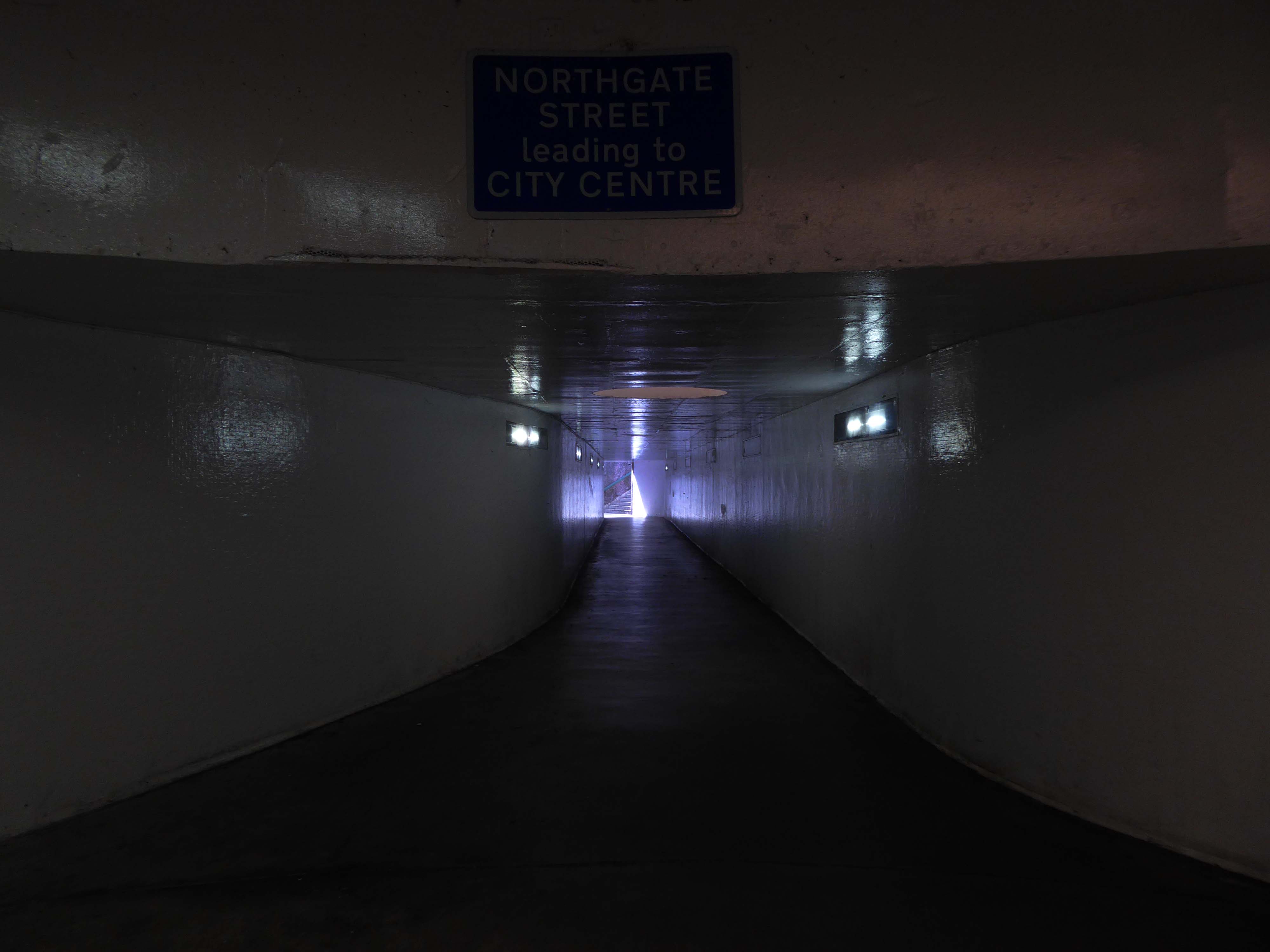
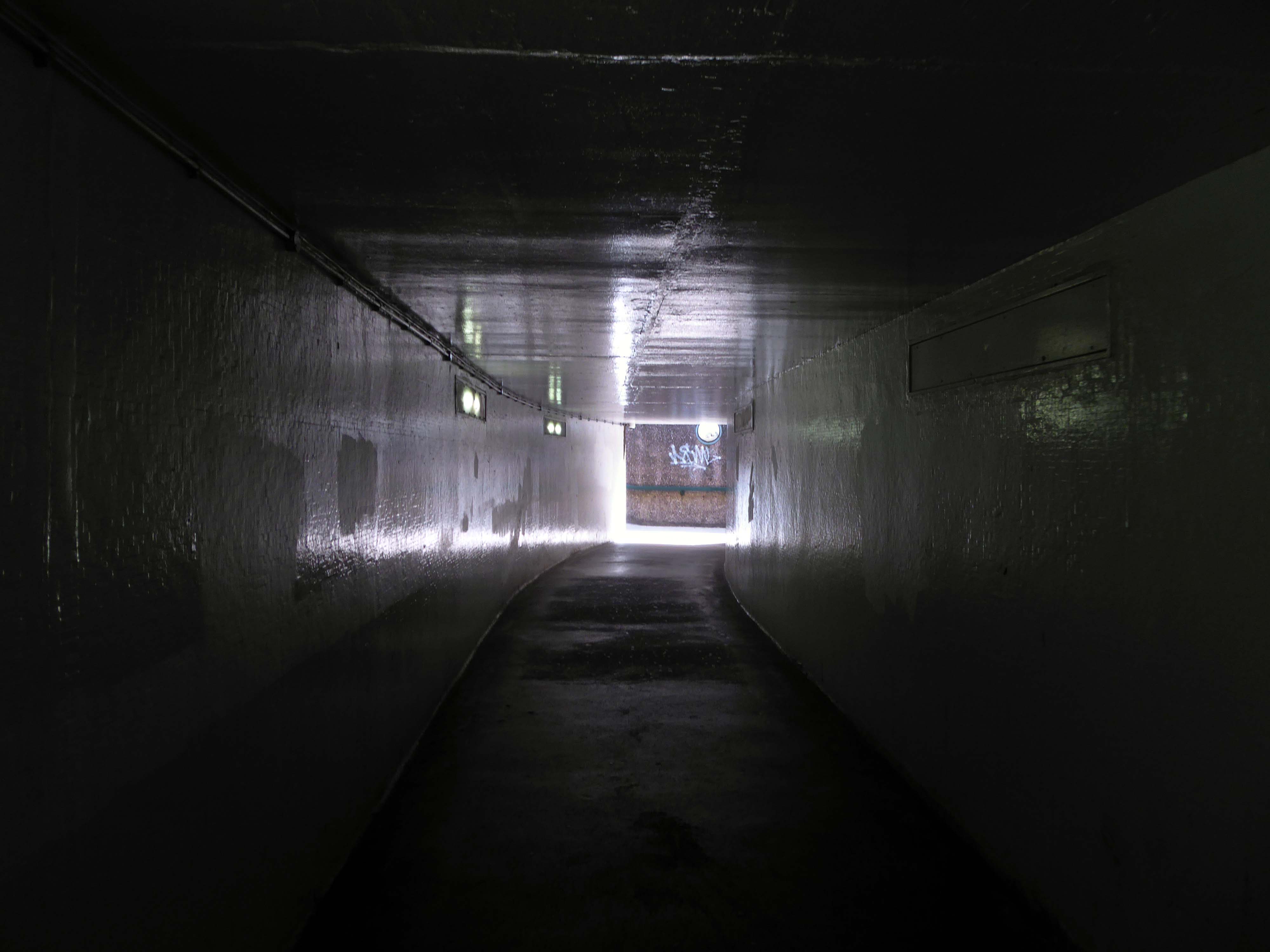
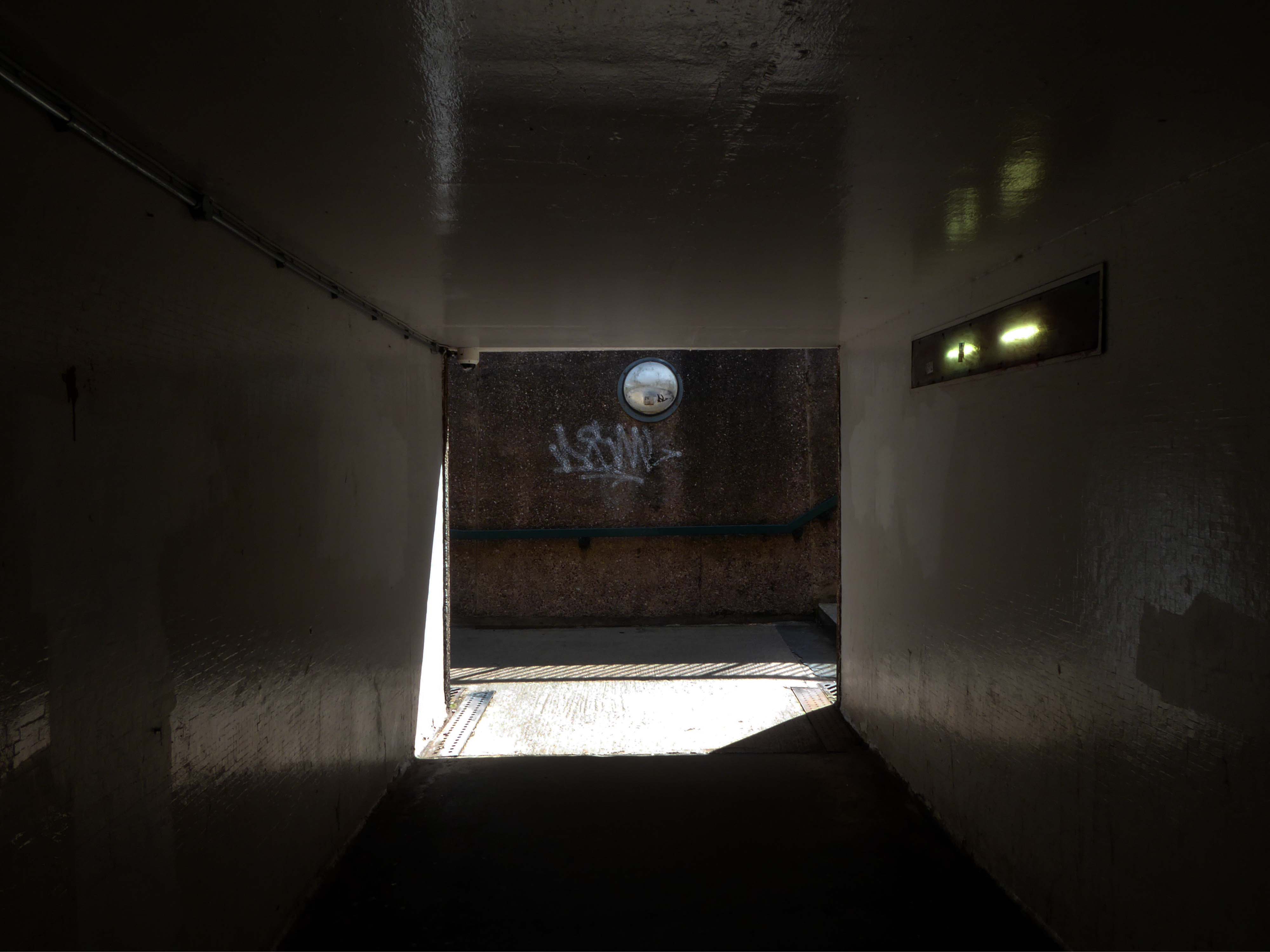
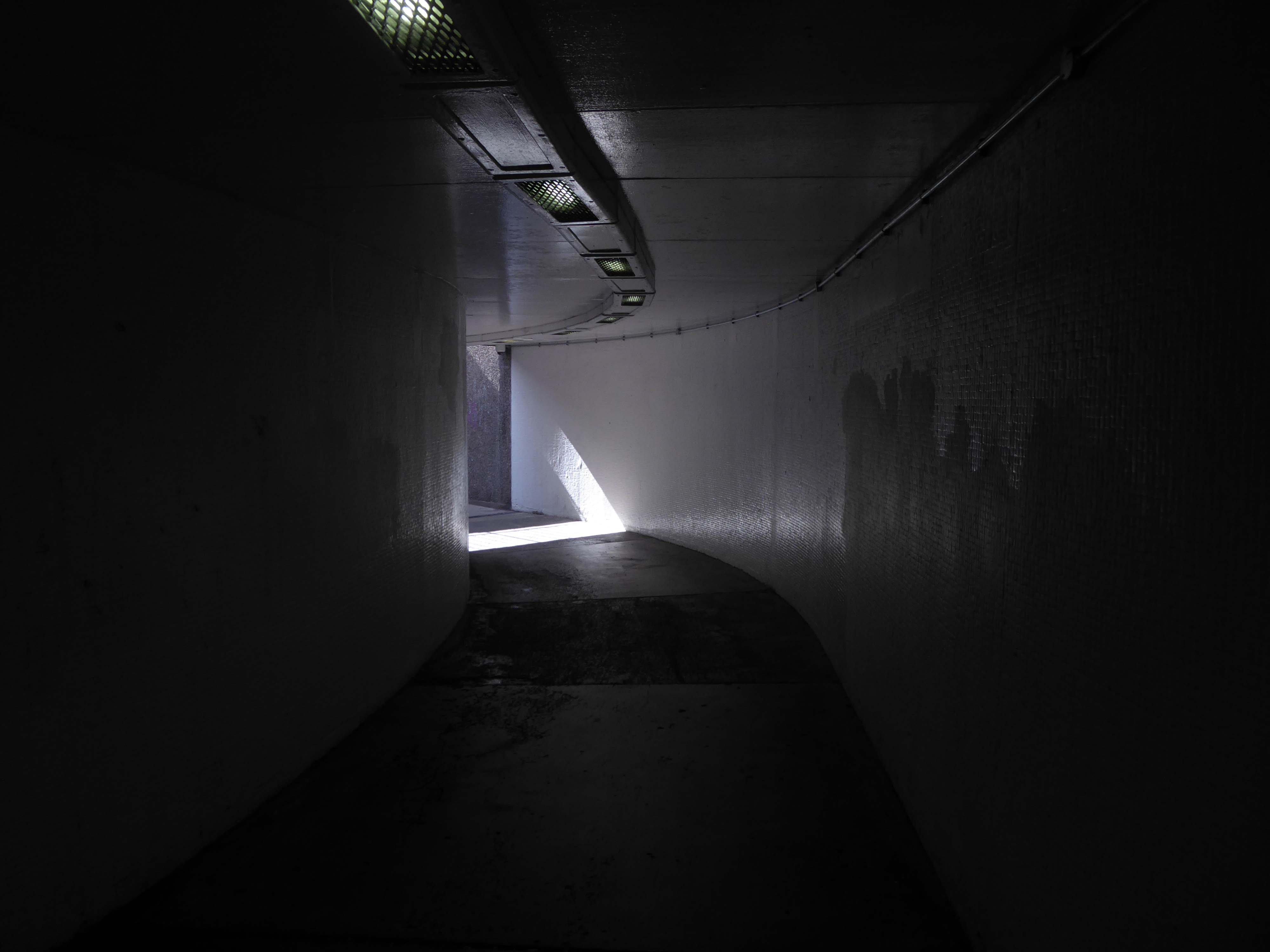
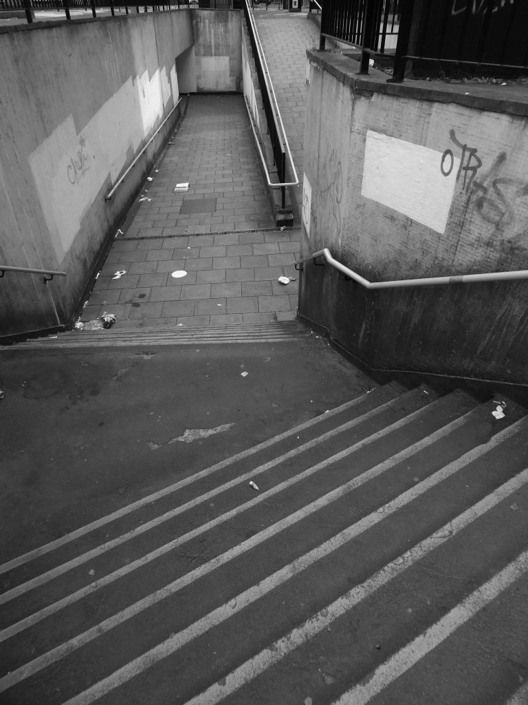
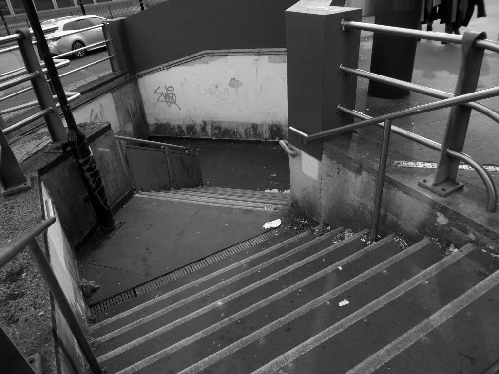
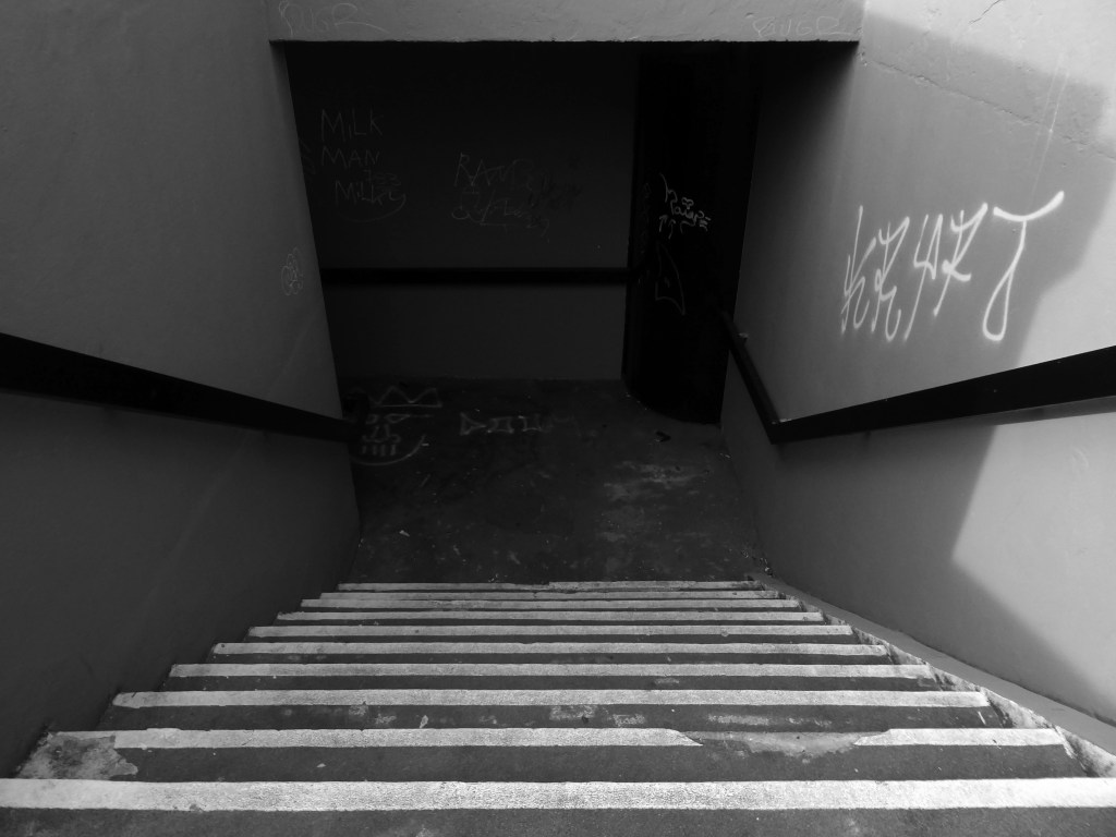
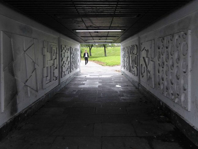
The underpass it seems is generally under threat, unsafe, often unloved and underground – often underused.
Once thought to be the answer to the threat posed to the pedestrian, by increased motor traffic, they are now deemed unsafe – poorly lit, badly maintained and scenes of anti-social activity.
Havens for those who are a threat to themselves.
Don’t let that put you off, get down and get with it!
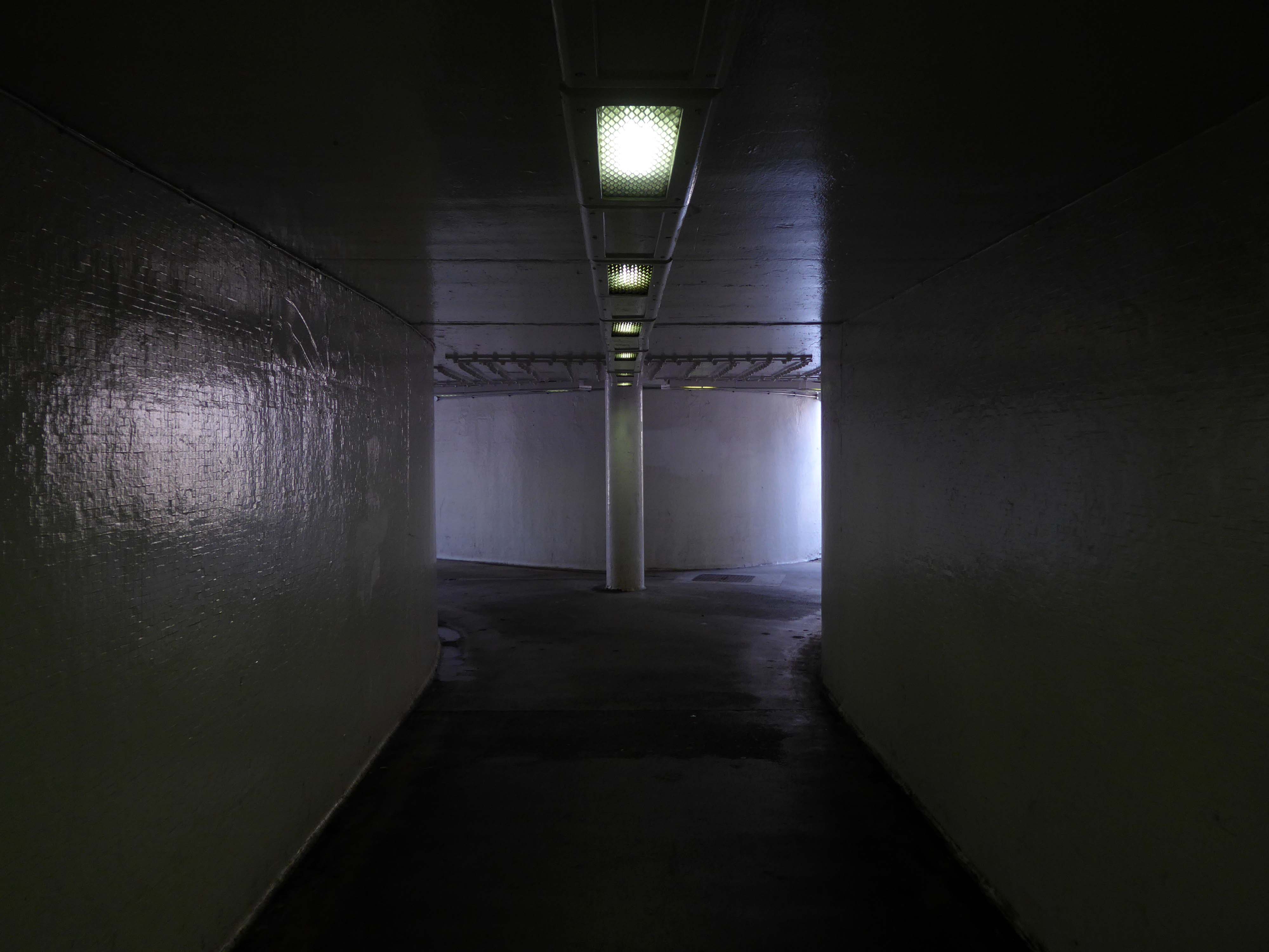
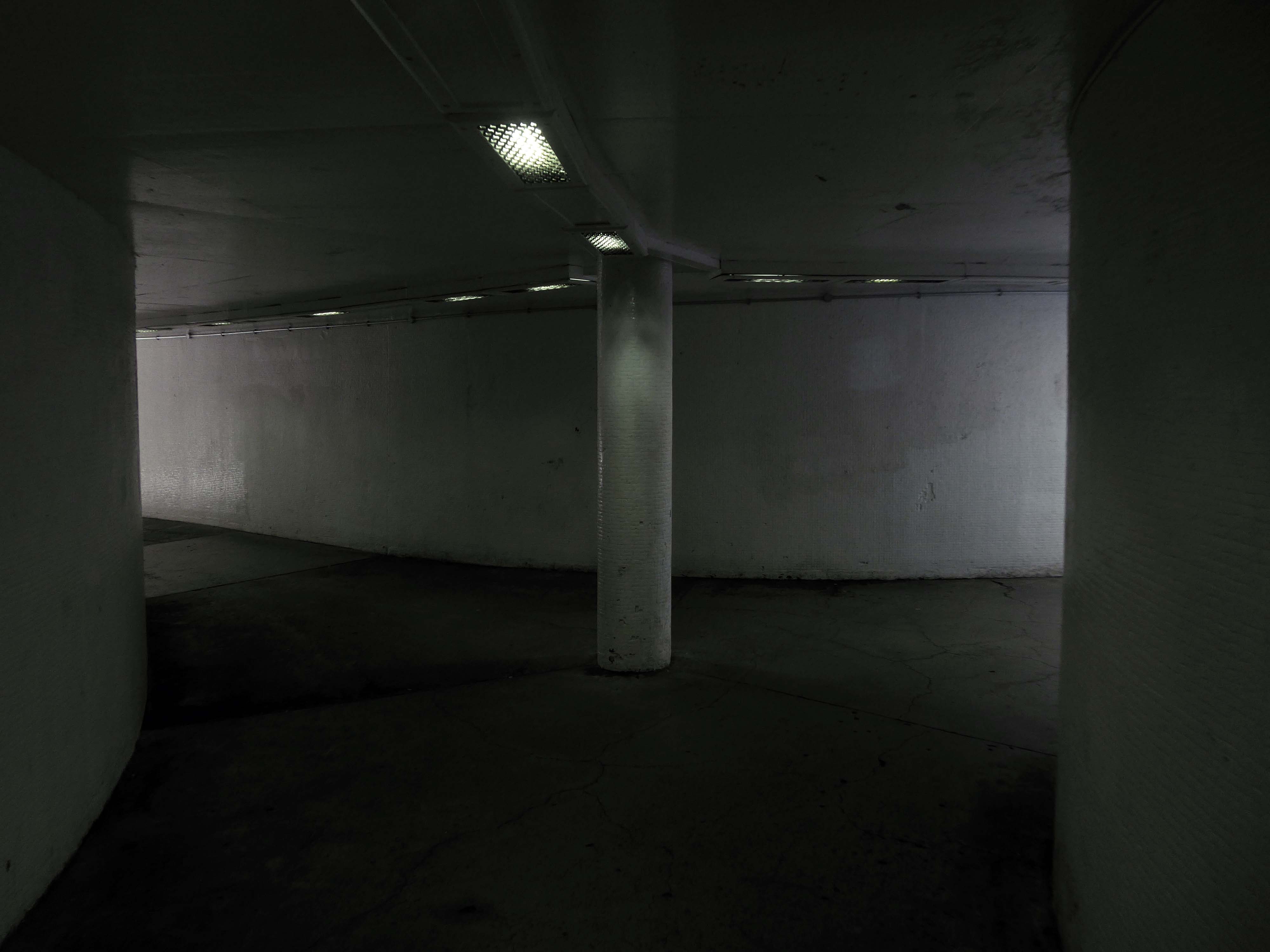
Why not treat yourself to a walk around the South Bay Underground Car Park?
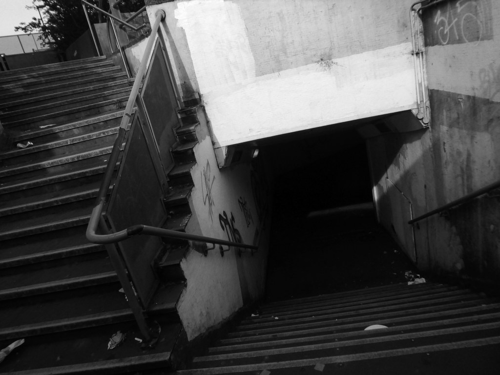
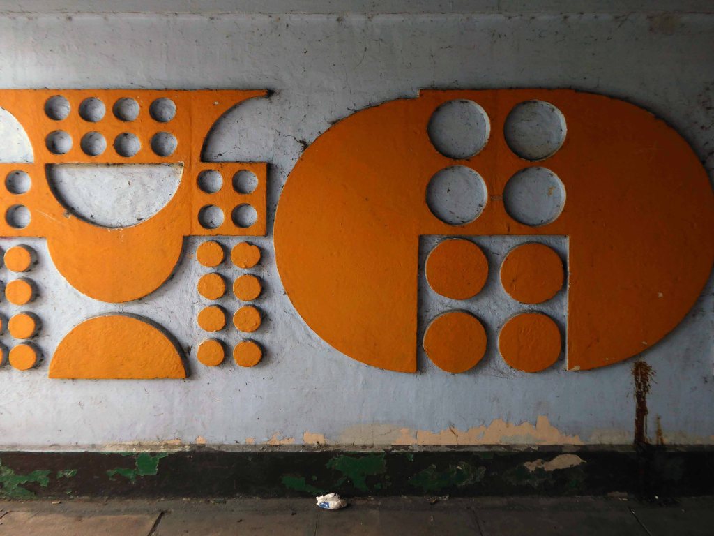
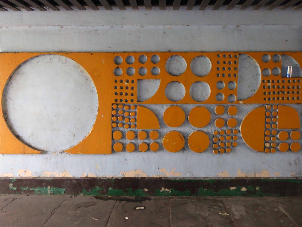
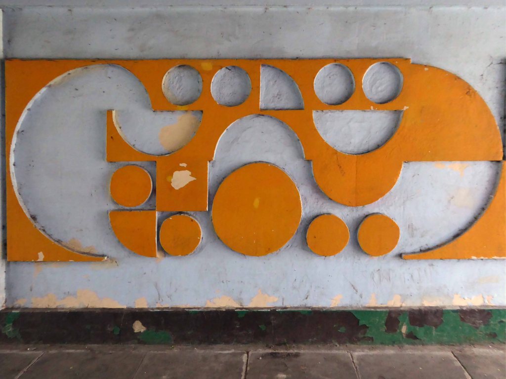
First there was the first, then secondly the second – this is the third and last underpass.
A fitting finish to the series as we pass through the final subterranean frontier out into the clear light of the South Yorkshire day.
Each one is a neglected gem of municipal modernism, the underpass a feature under threat, the pedestrian often subsumed by the drive to accommodate the motor car.
As of last Wednesday, we all seem to have tenuously hung on in there.
Oh we’ll hear the thunder roar, feel the lightning strike. At a point we’ll both decide to meet at the same time tonight.
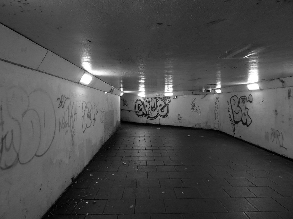
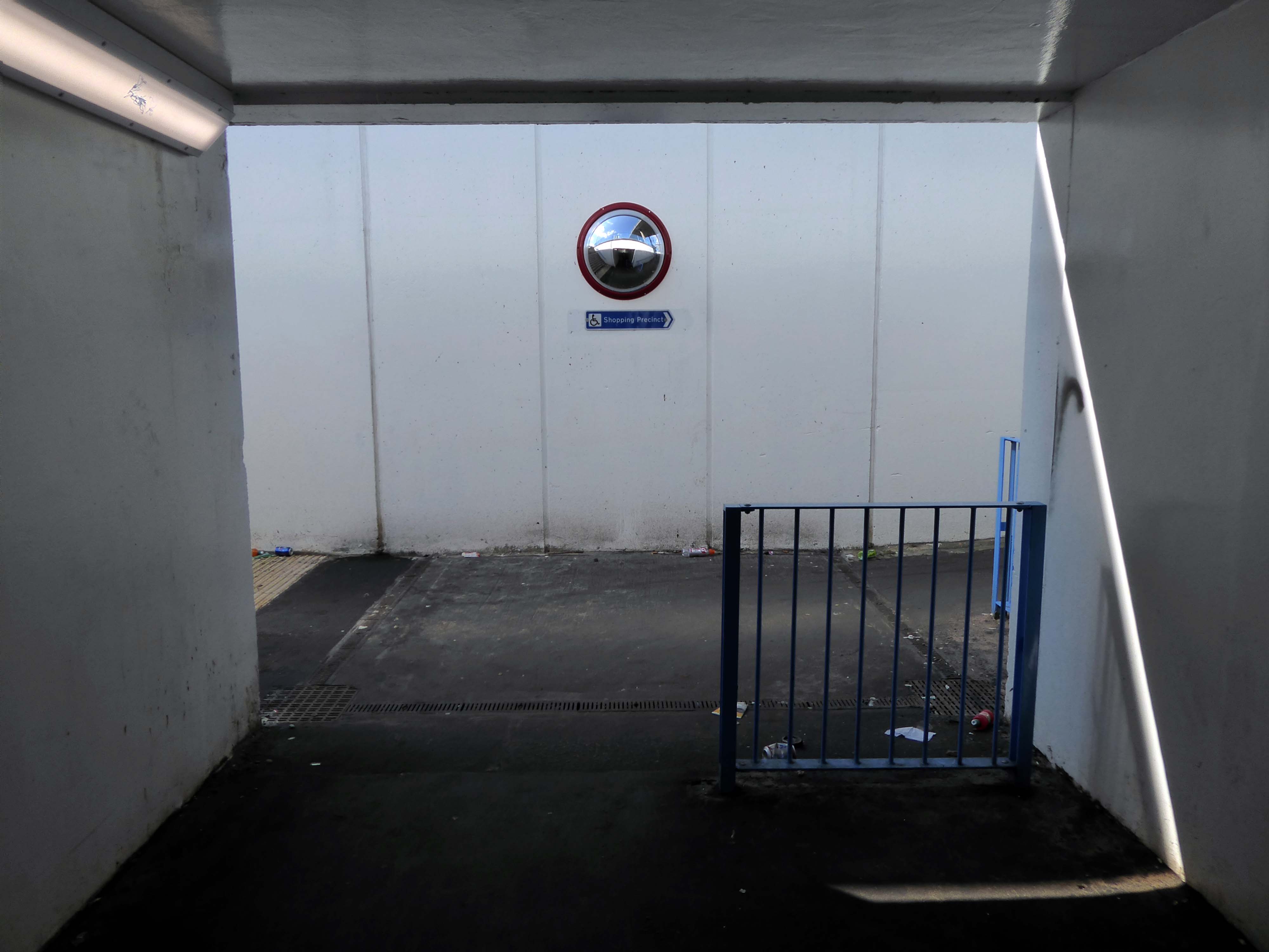
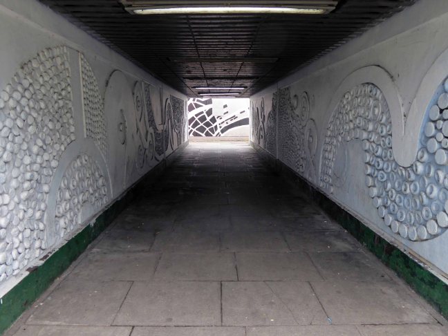
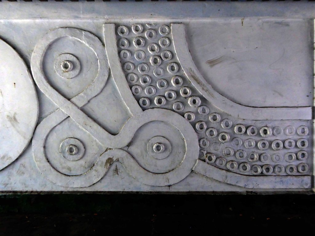
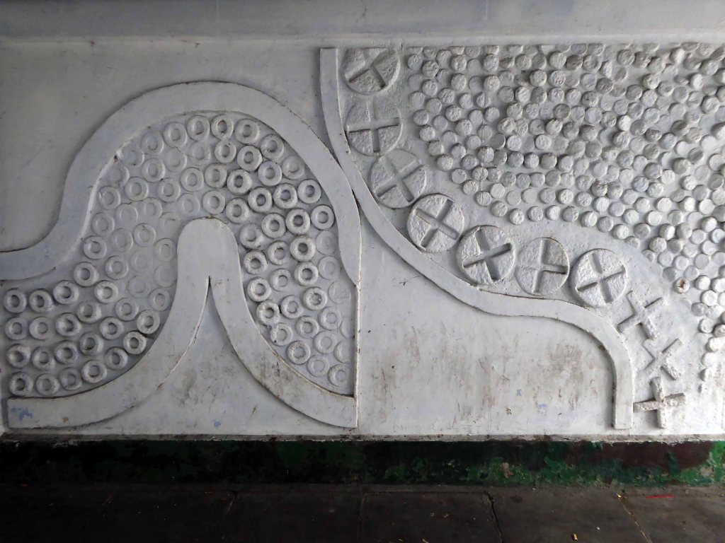
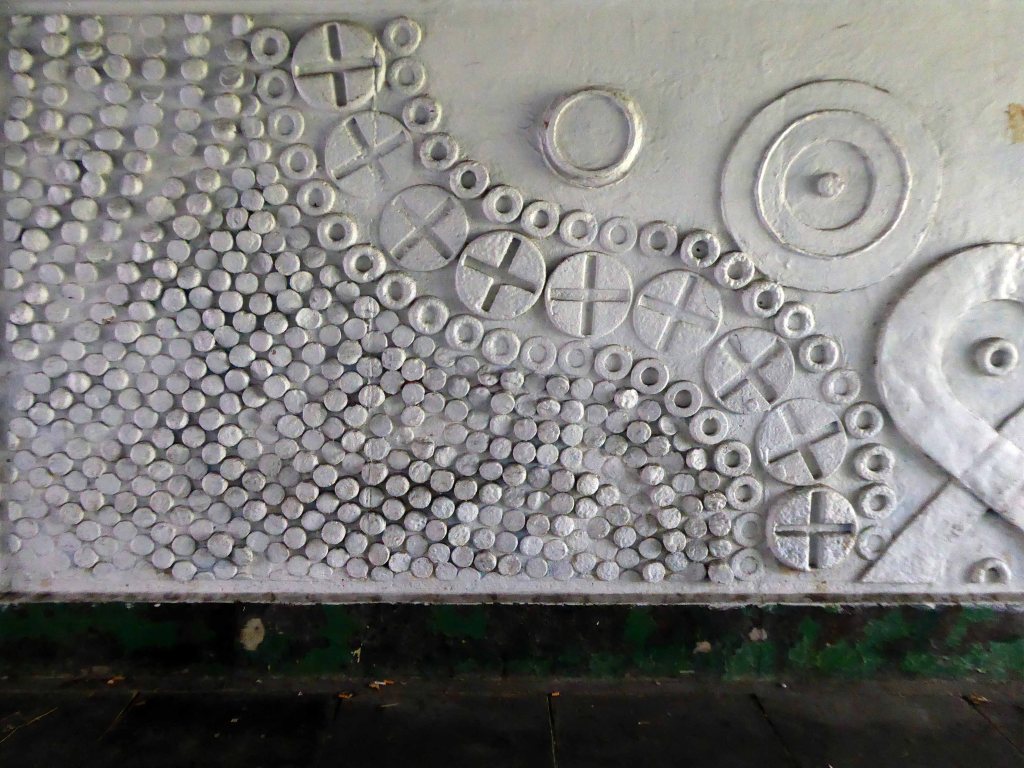
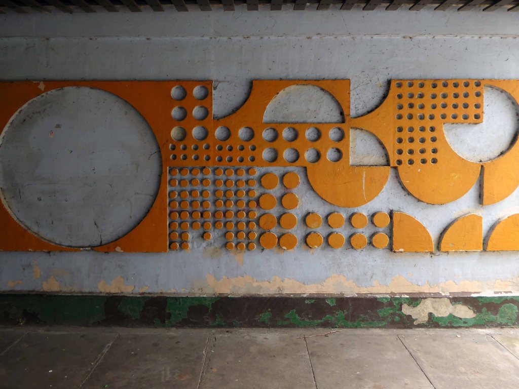
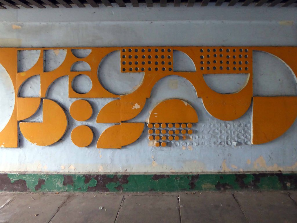
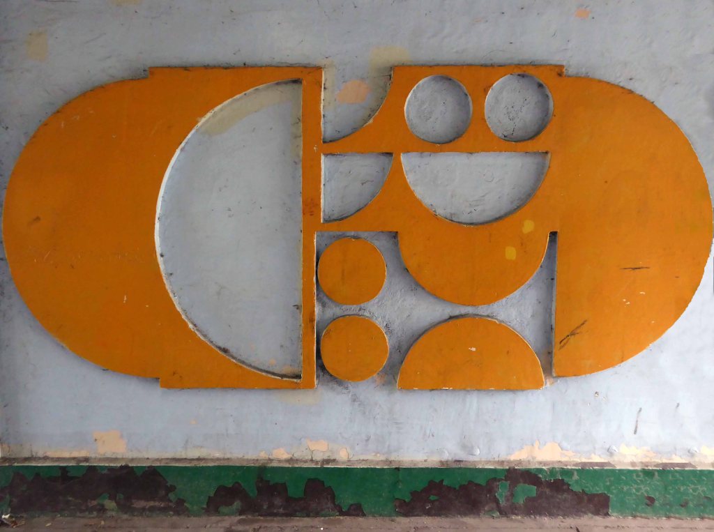
I had seen a photograph posted by Mandy Payne of an underpass in Rotherham – illustrating a delightful concrete relief.
Enlisting the assistance of friend and local resident Helen Angell, we set out on a mission to visit the roundabout in back of the big Tesco, which housed the three underpasses.
This is the first – painted white, well whiteish – more than somewhat disabused by the passage of time and the passage of users of the underpass.
Brute and angular, incised and cursive and currently lacking authorship or attribution.
Having started in the middle, let’s fast forward to the end – the beginning will have to wait.
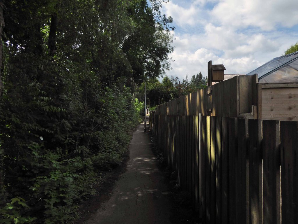
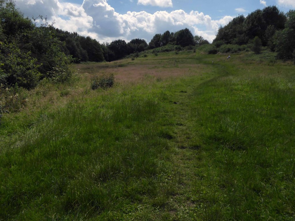
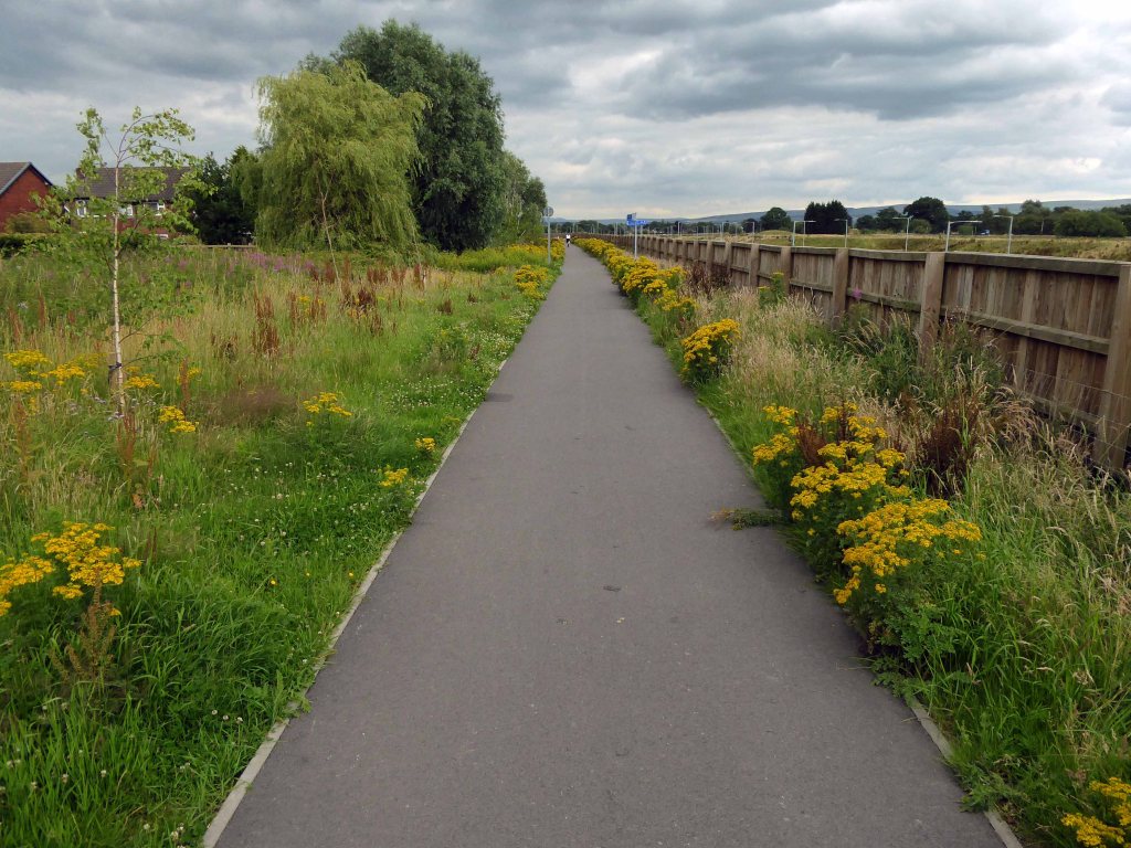
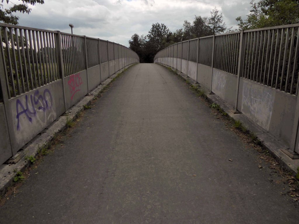
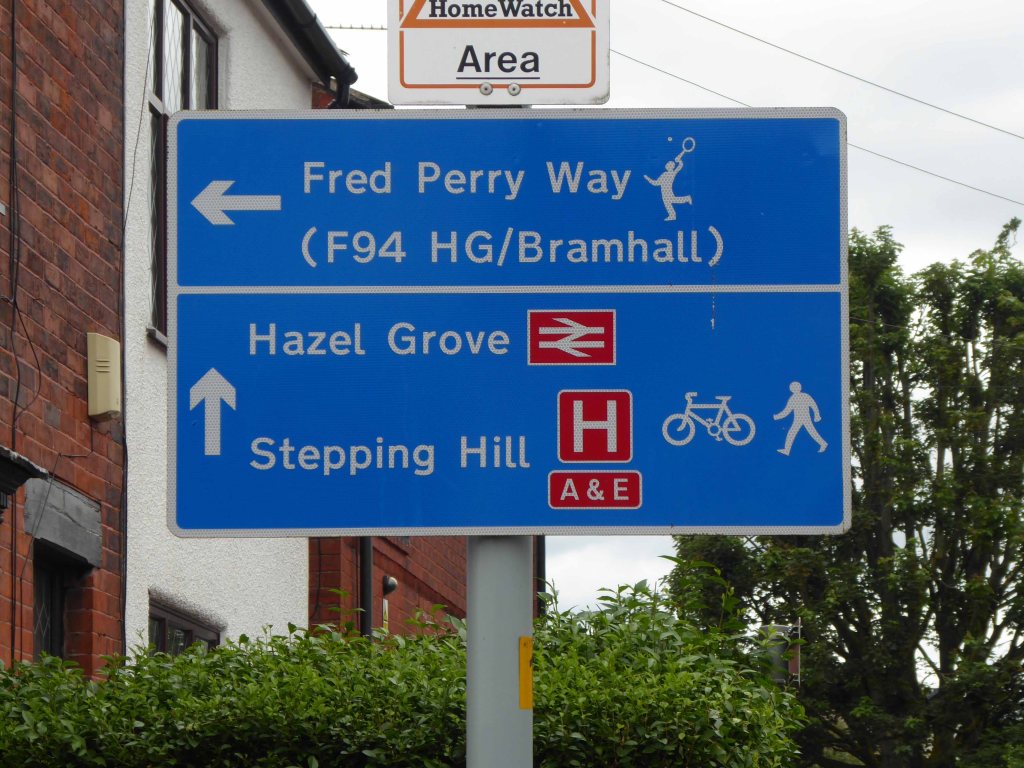
We take up our walk along Fred’s Way once more by Mirrlees Fields.
Following the brook along the narrow shallow valley, betwixt and between houses.
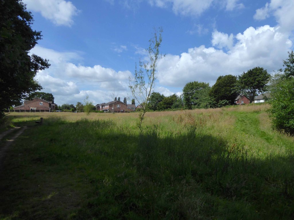
Briefly opening out into green open space.
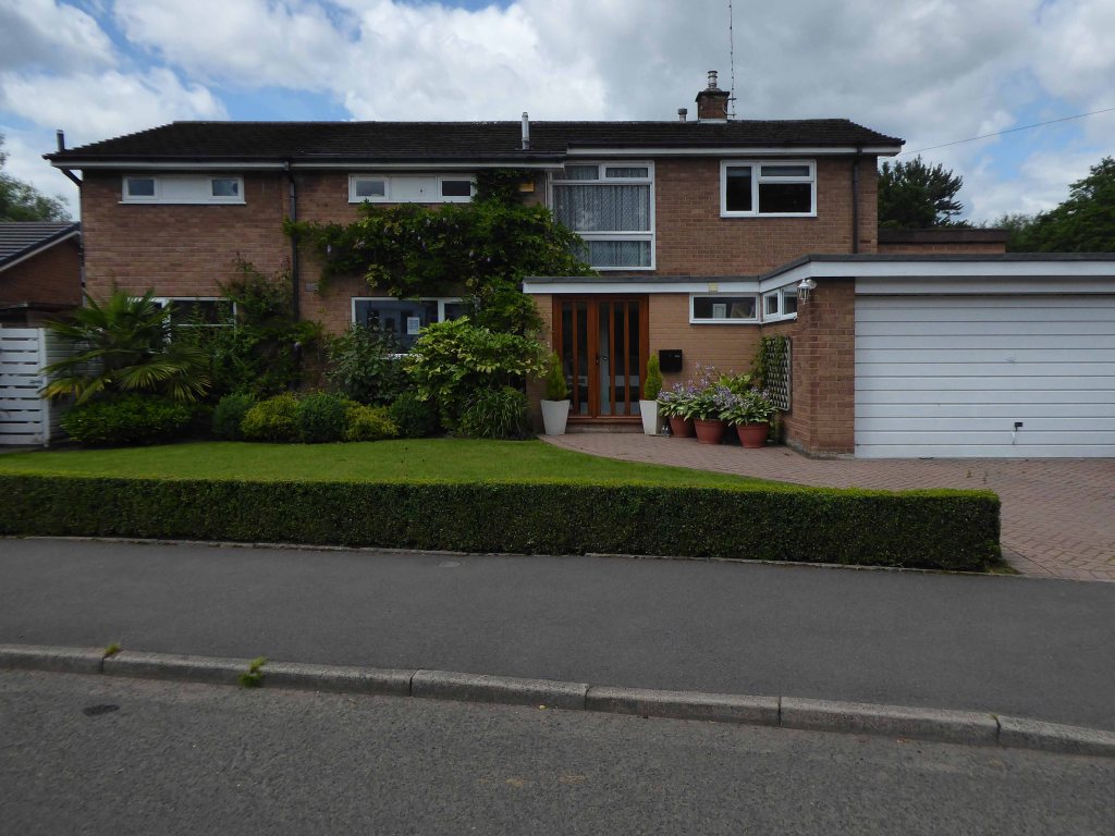
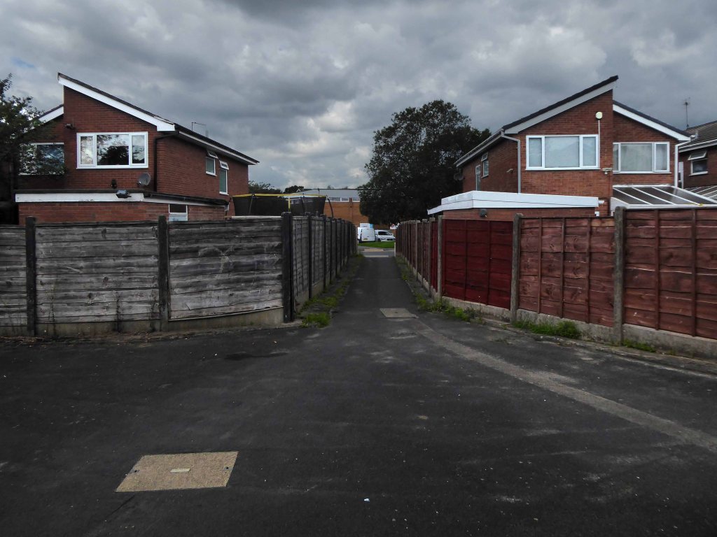
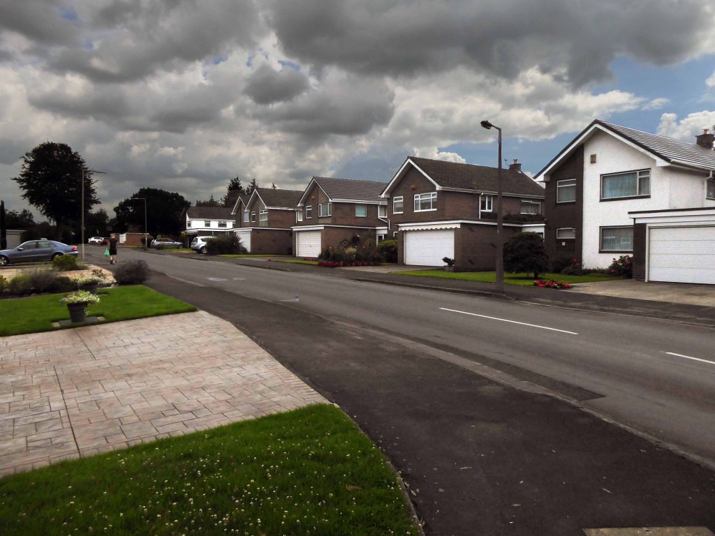
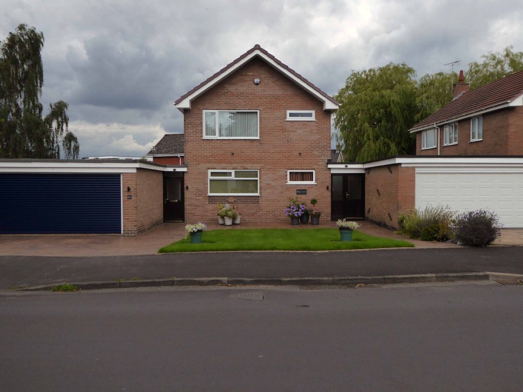
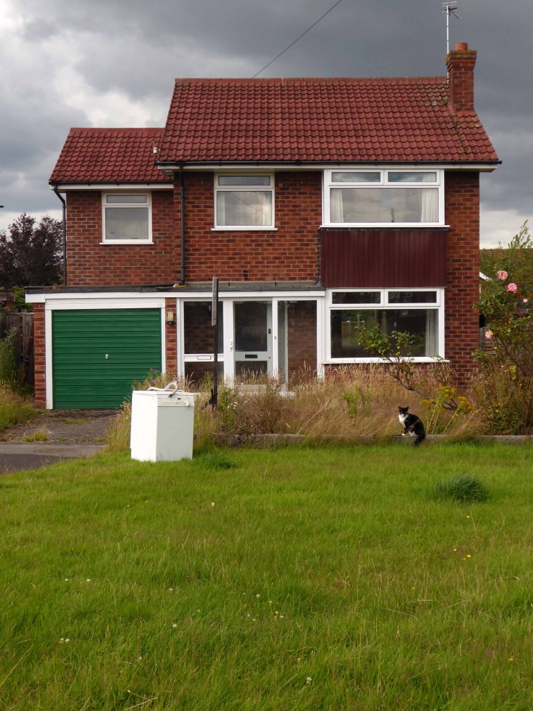
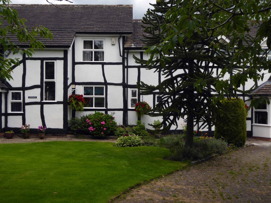
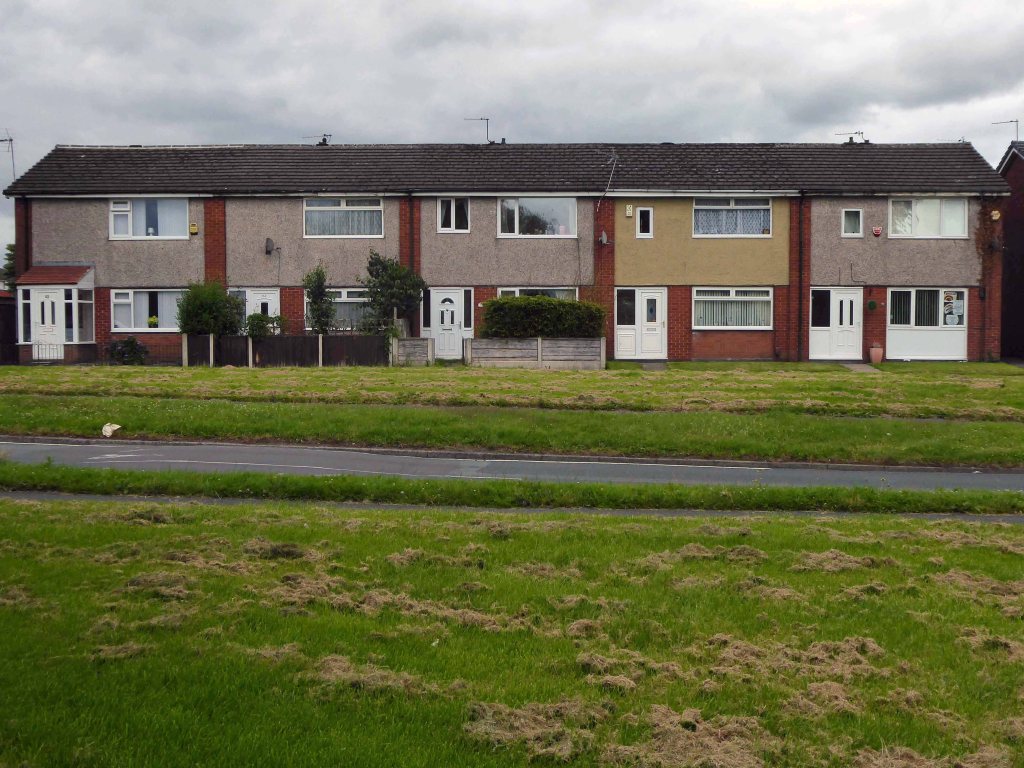
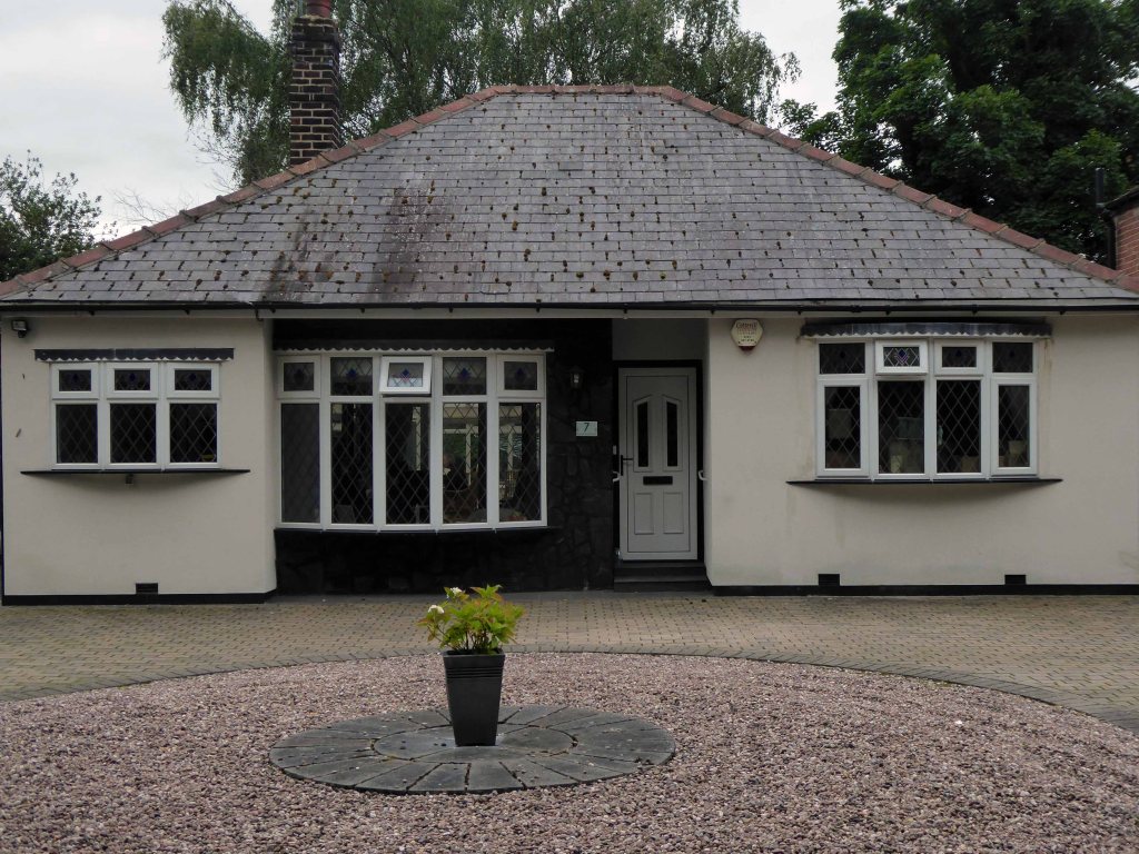
Crossing the road and entering the detached world of the detached house.
No two the same or your money back!
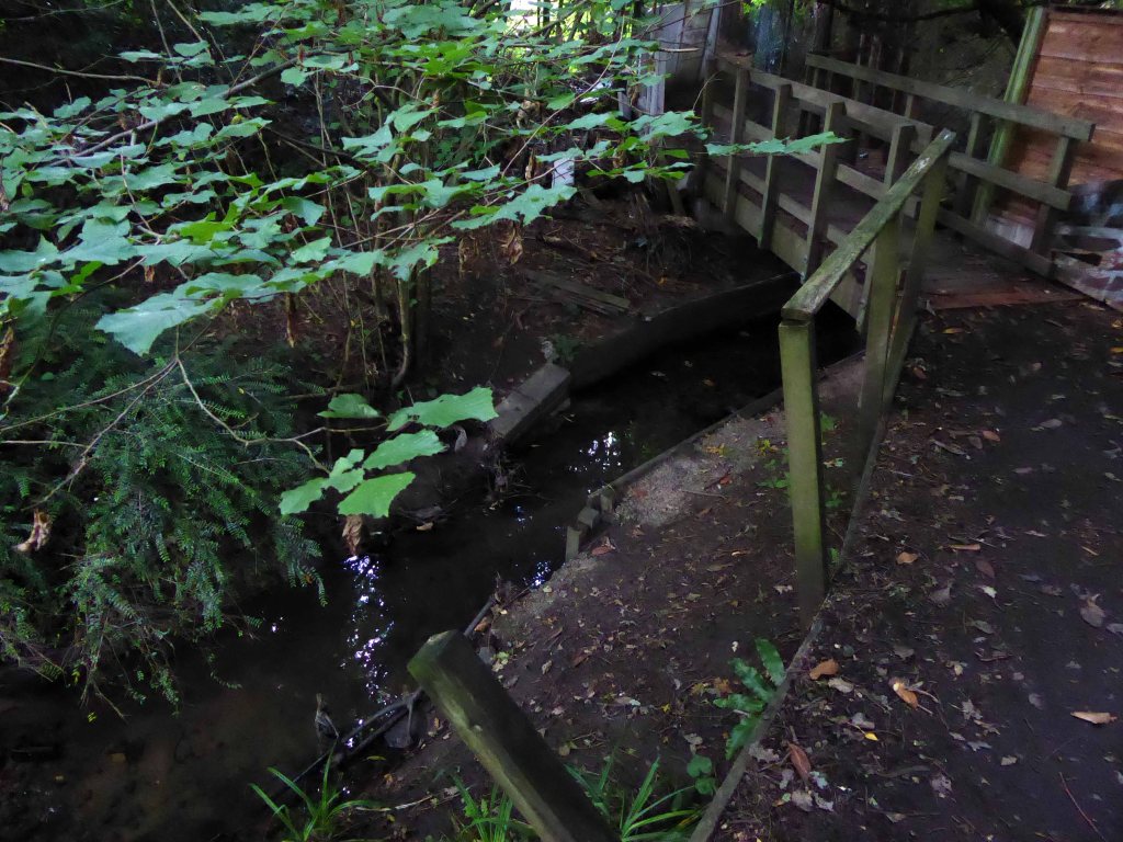
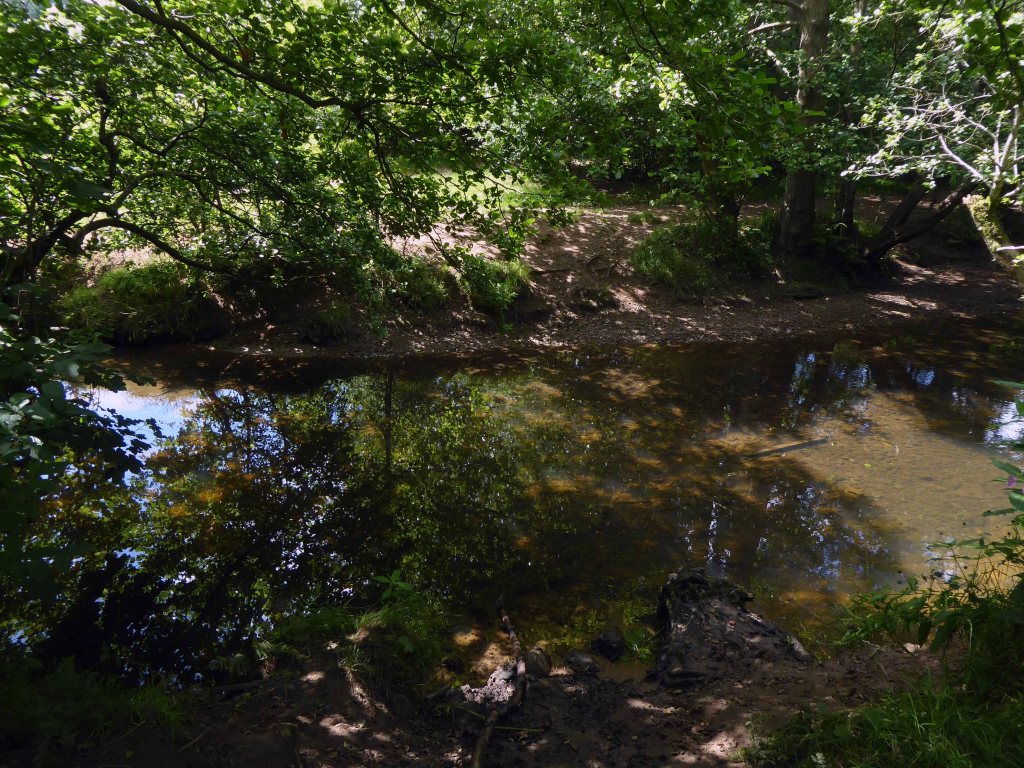
Diving feet first into Happy Valley, home to the Lady Brook stream.
And quickly out again.
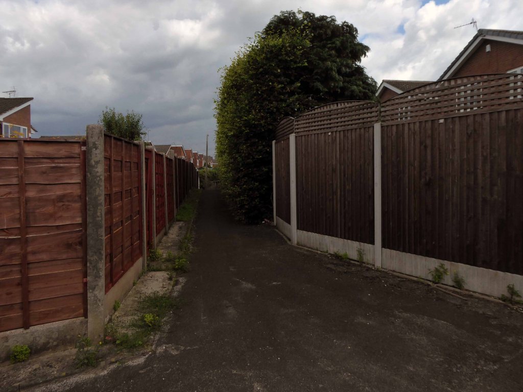
Emerging once again into the space between spaces.
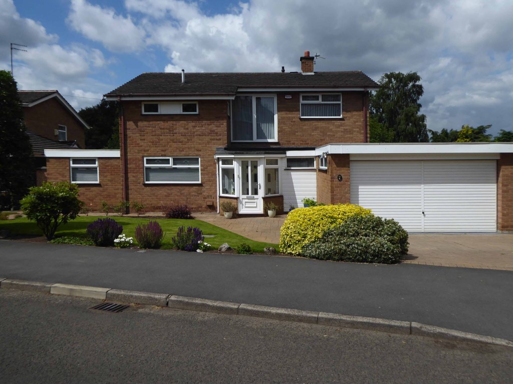
The suburban idyll of the Dairyground Estate home to very few semi-skilled and unskilled manual workers; those on state benefit/unemployed, and lowest grade workers.
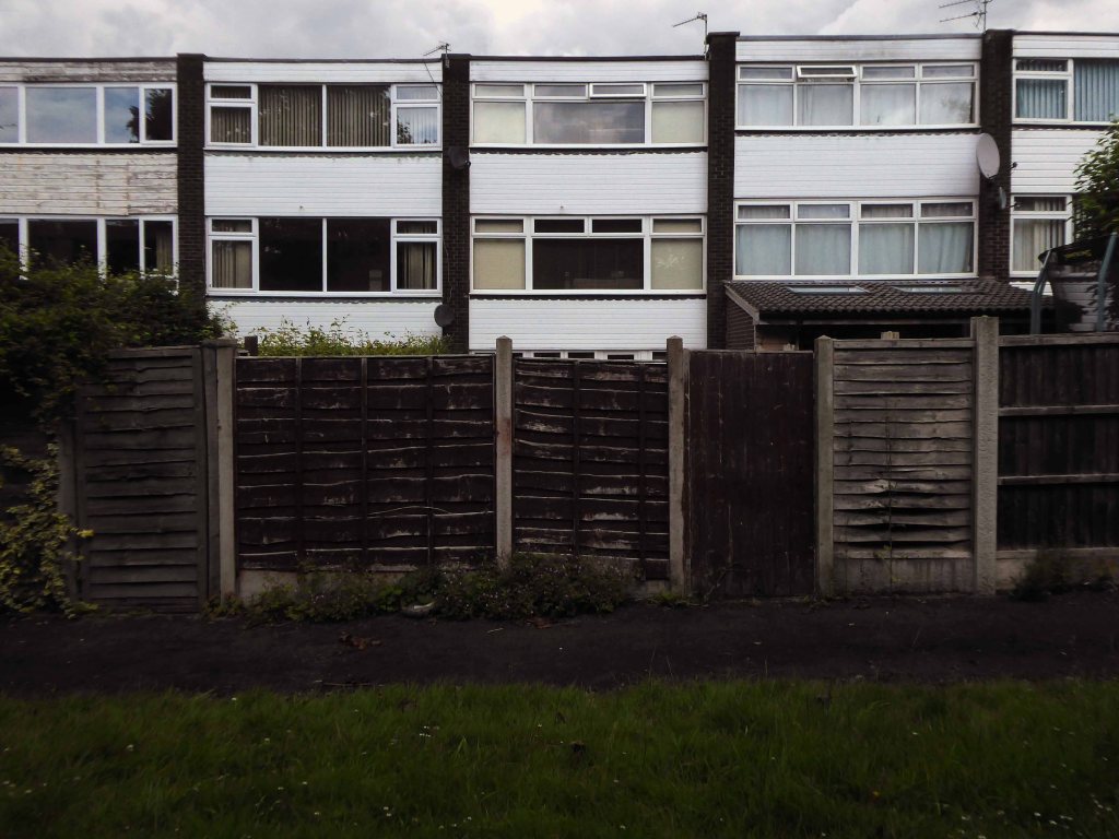
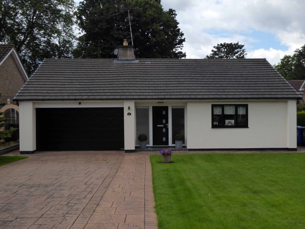
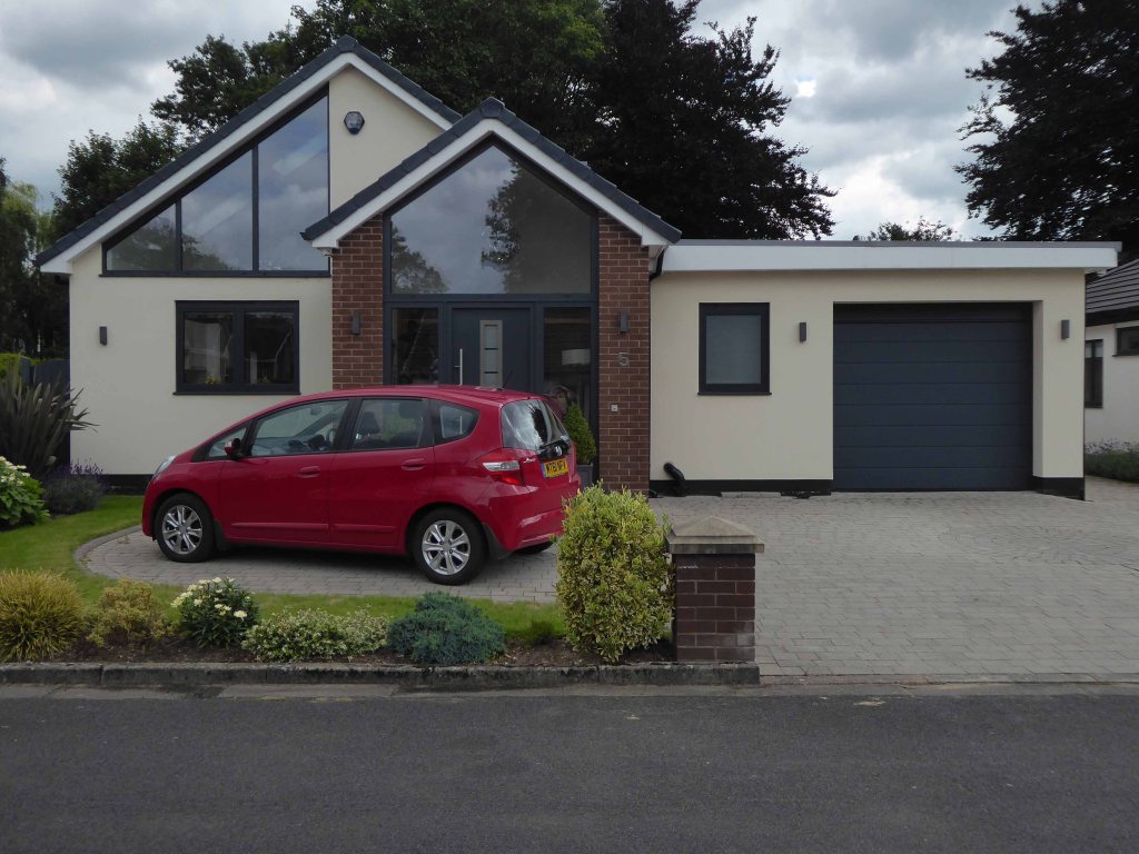
But home to an interesting array of Post War housing.
Including examples of the style de jour, à la mode conversions and updates extended and rendered, black, white and grey symbols of success or extensive extended credit facilities.
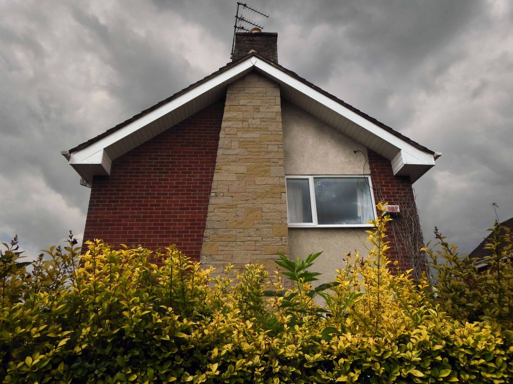
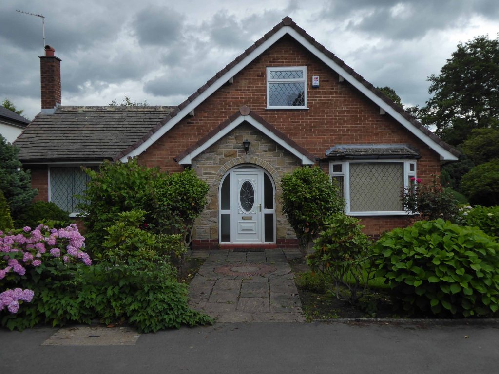
Though the more traditional fairy tale variant still has a space and place, in the corner of some well behaved cul de sac.
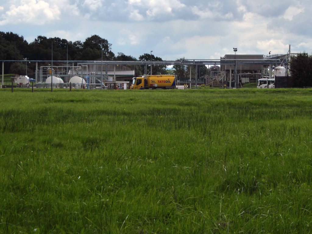
Under the railway – through a low tunnel darkly.
We struck oil, black gold, Texas Tea – Tate Oil.
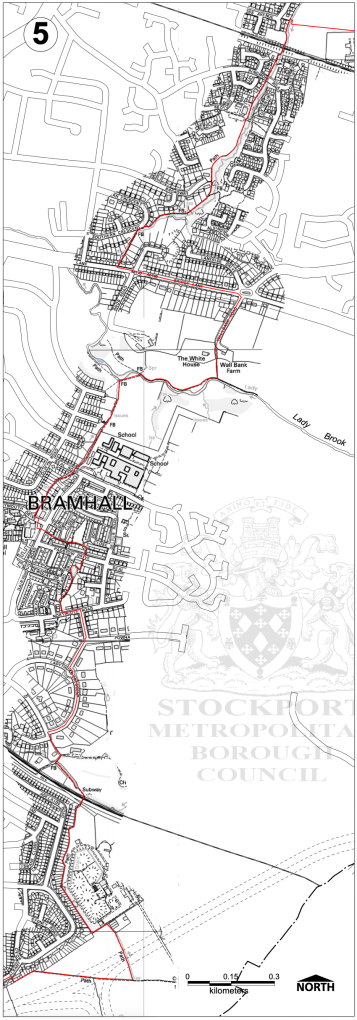
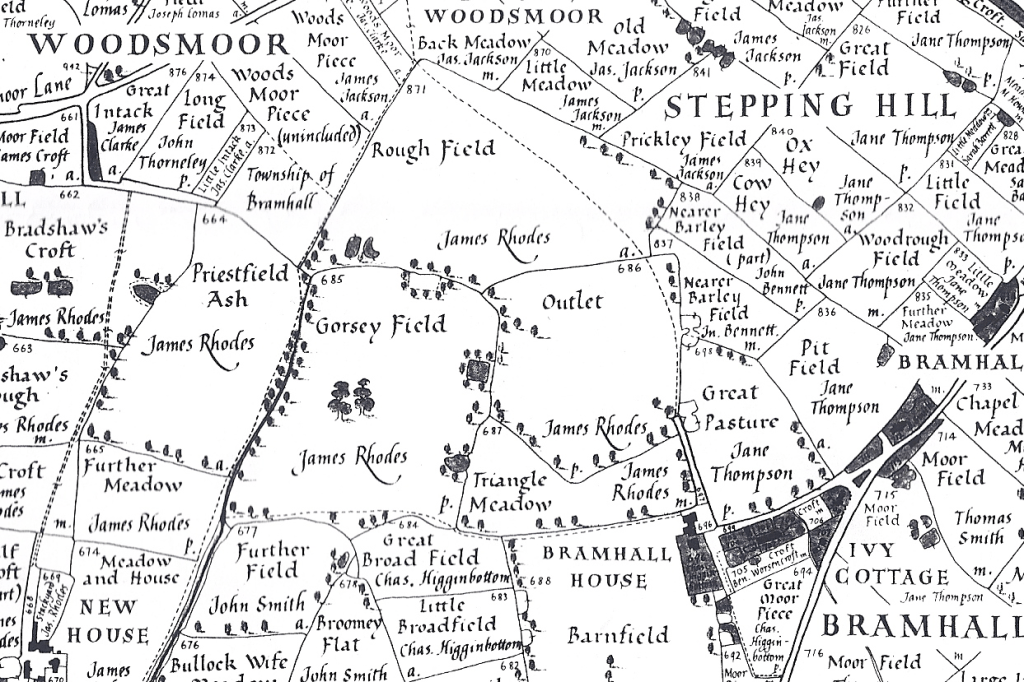
The area of Little Australia – so called as all the roads are named after towns in Australia, is bordered by the West Coast Main Line to the north, the Bramhall oil terminal to the east, Bramhall village centre to the west and Moorend Golf Club to the south.
We emerged into a warren of obfuscation, dead ends and conflicting signs, having made enquiries of the passing populace, we realigned with the new bypass.
Passing over the conveniently placed footbridge over the bypass and beyond.
Emerging amongst faux beams and real Monkey Puzzles.
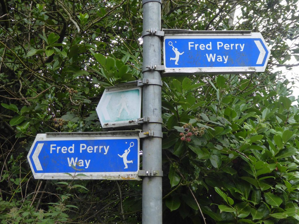
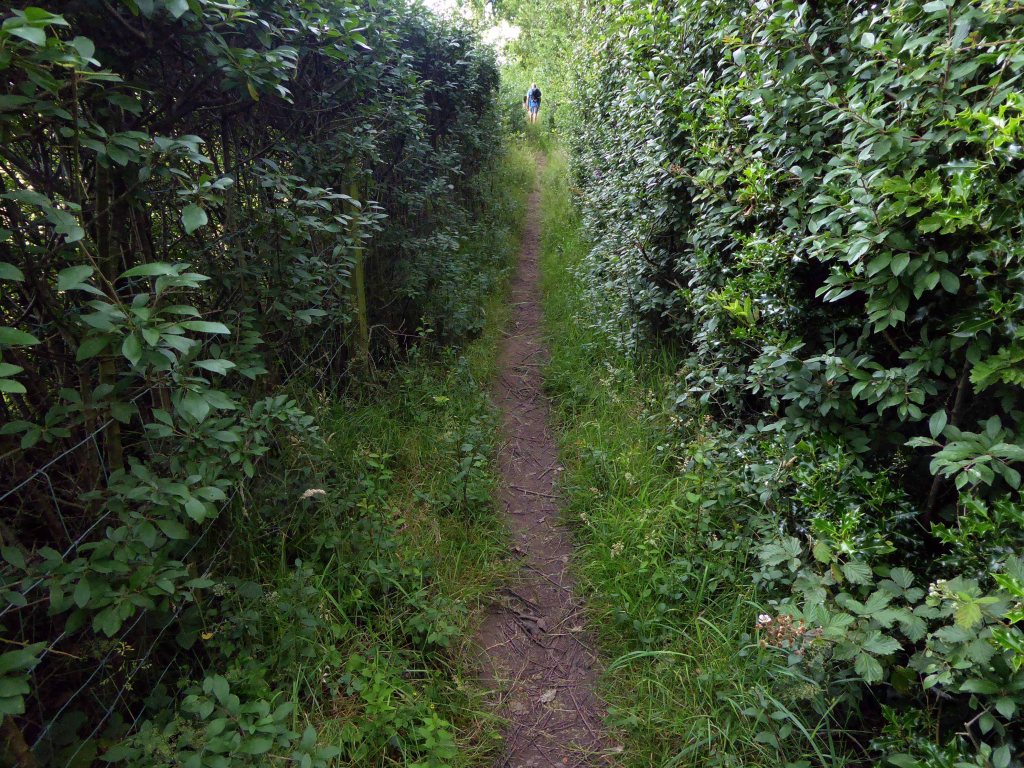
It was at this point that, unbeknownst to us, we followed a twisted sign, misdirecting us along an overgrown path – to Handforth.
We failed, in the end we failed to arrive to arrive at the end.
Heading west like headless chickens towards the Turkey Farm.
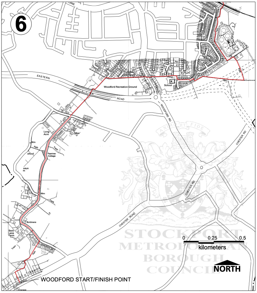
Making our way mistakenly to Handforth Dean Retail Park – rear of.
Crossing slip roads with no pedestrian access and the forbidden territory of an industrial sized gymnasium car park.
Woodford will just have to wait, another day another dolorous excursion.
I’ll do anything twice or more – so here we are again, this time on foot.
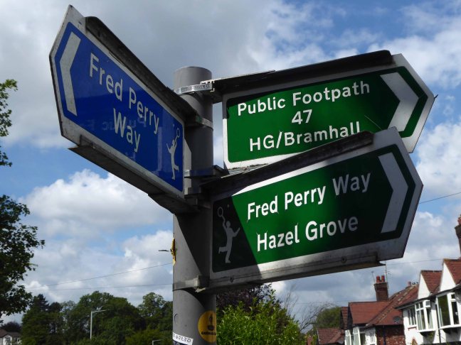
Let’s start at the very beginning, a very good place to start – in the middle, the section from the town centre to Hazel Grove.
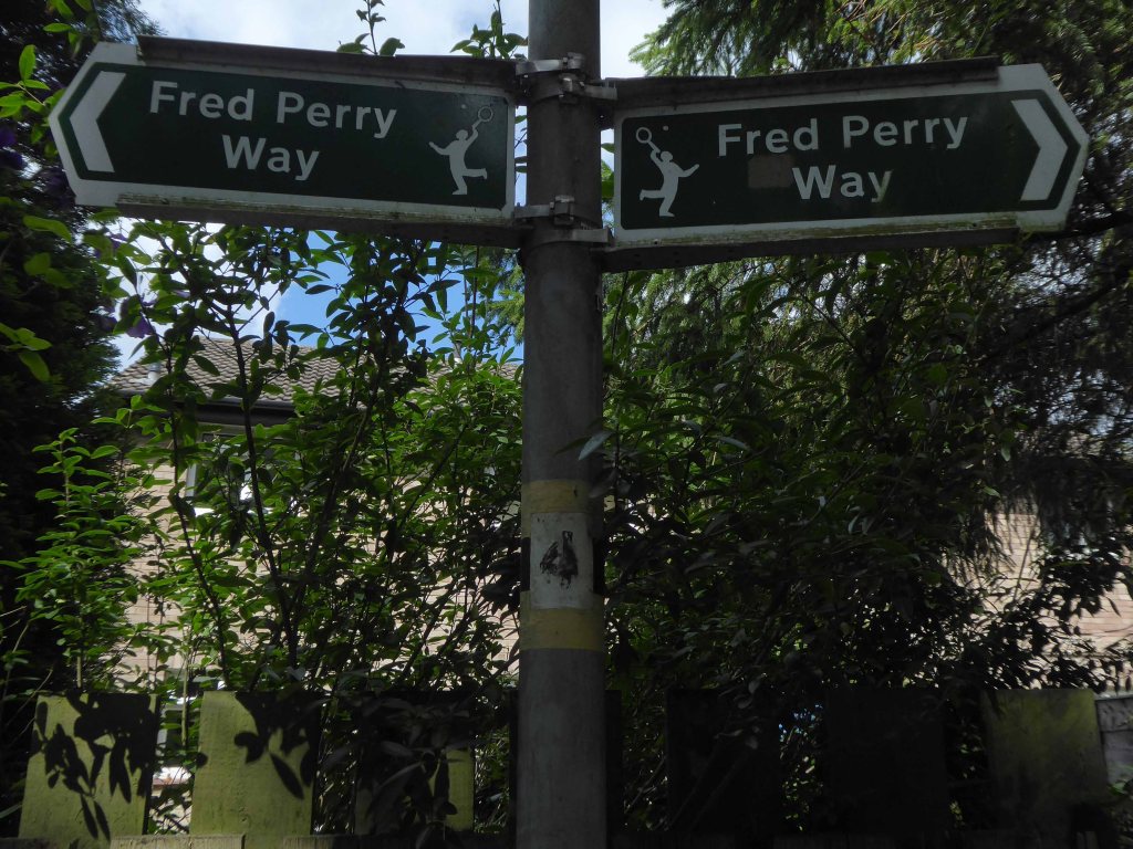
Maps are available here for free – we declined the offer, deciding to follow signs instead, many of which were missing or rotated, the better to misinform and redirect – such is life.
We are mostly lost most of the time, whether we like it or know it or not.
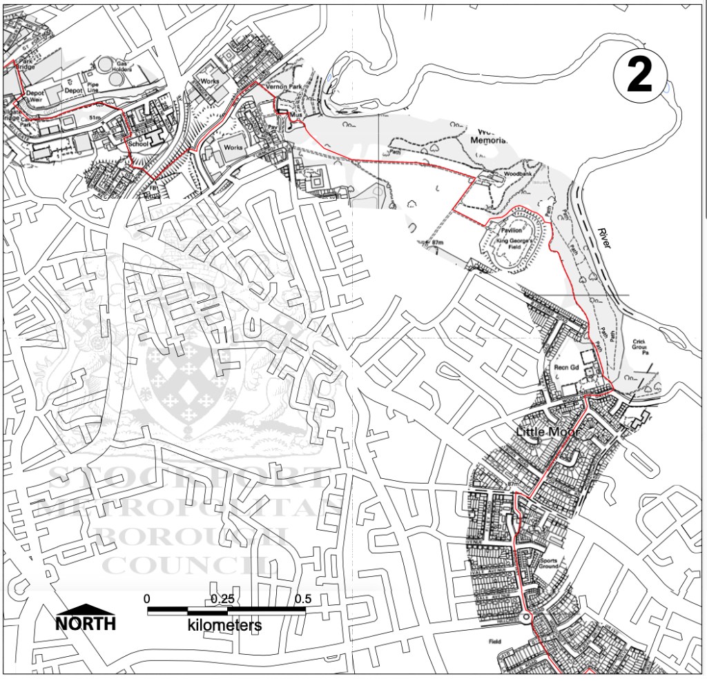
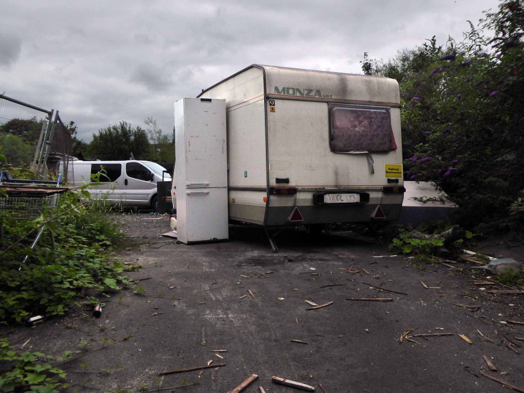
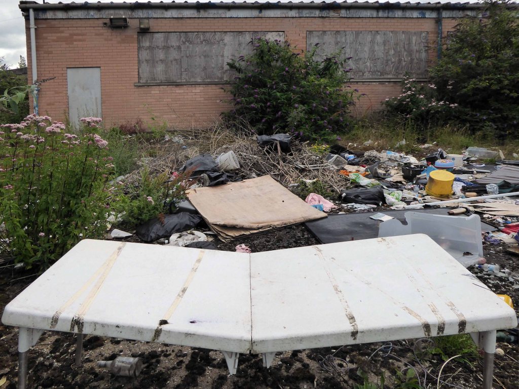
We begin at the confluence of the rivers Mersey and Goyt – which no longer seems to be a Way way, the signs having been removed, and proceed down Howard Street, which seems to have become a tip.
The first and last refuge for refuse.
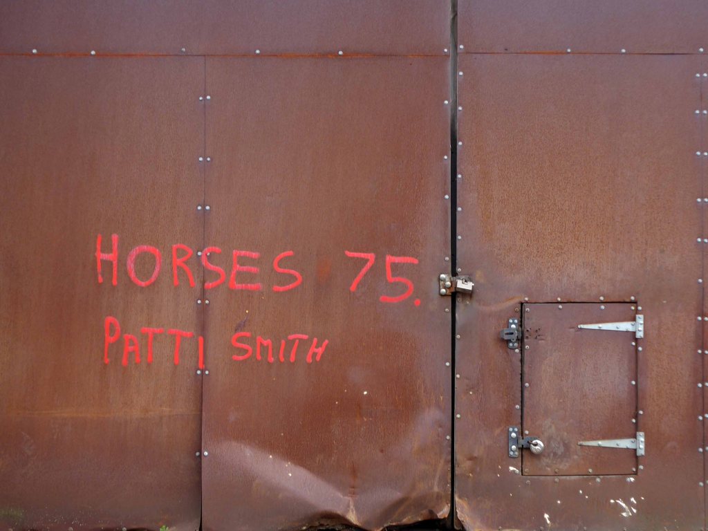
Passing by the kingdom of rust – Patti Smith style.
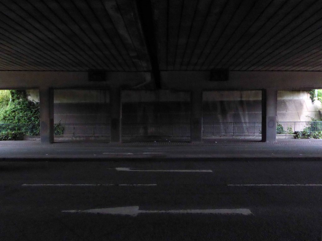
Passing under the town’s complex internal motorway system by underpass.
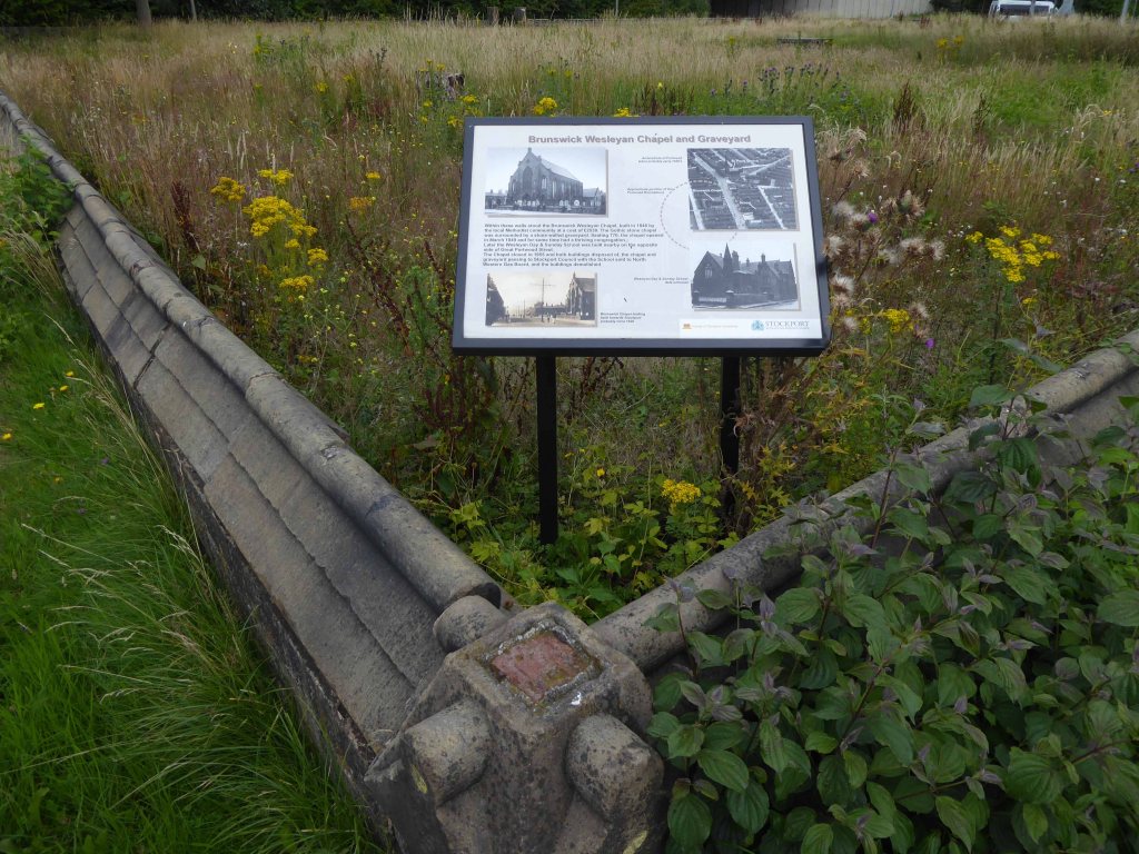
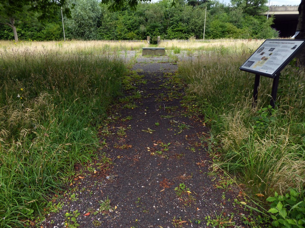
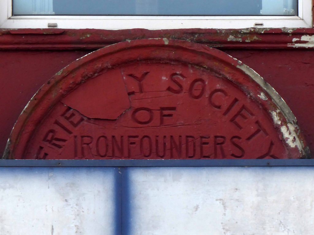
Almost opposite the entrance to the museum, now set in shrubbery, are the foundations, laid in September 1860, of what was to be a forty metre high Observatory Tower. Despite a series of attempts, funds for the tower could not be raised and the ‘Amalgamated Friendly Societies of Stockport’ eventually had to abandon the idea.
Historic England
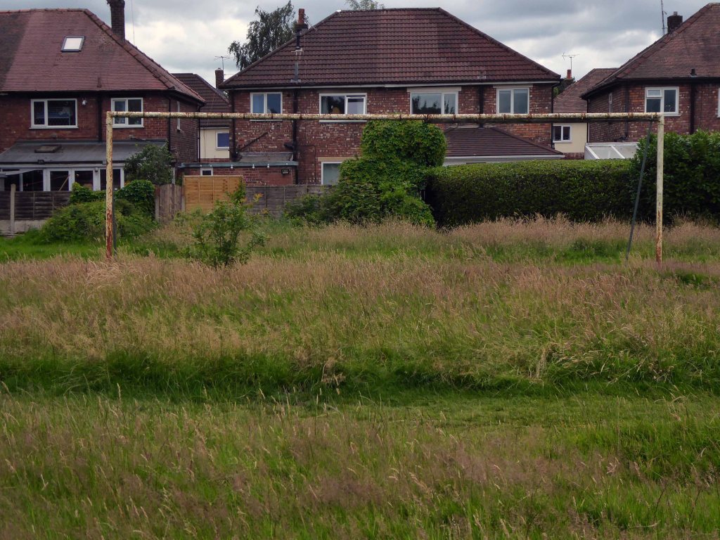
Out east and passing alongside the running track.
Lush meadows now occupy the former football field, twixt inter-war semis and the woodland beyond.
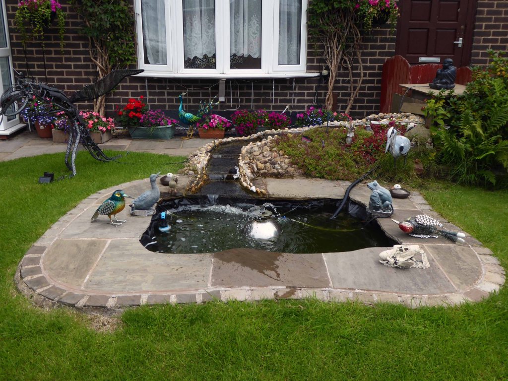
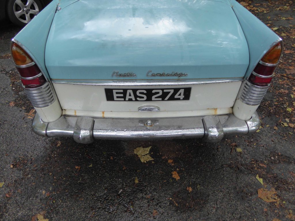
Out into the savage streets of Offerton where we find a Buick Skylark, incongruously ensconced in a front garden.
The only too human imperative to laugh in the face of naturalism.
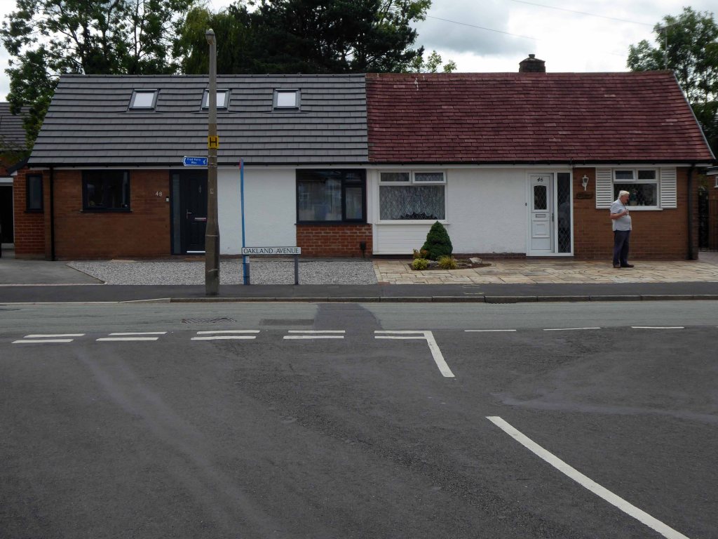
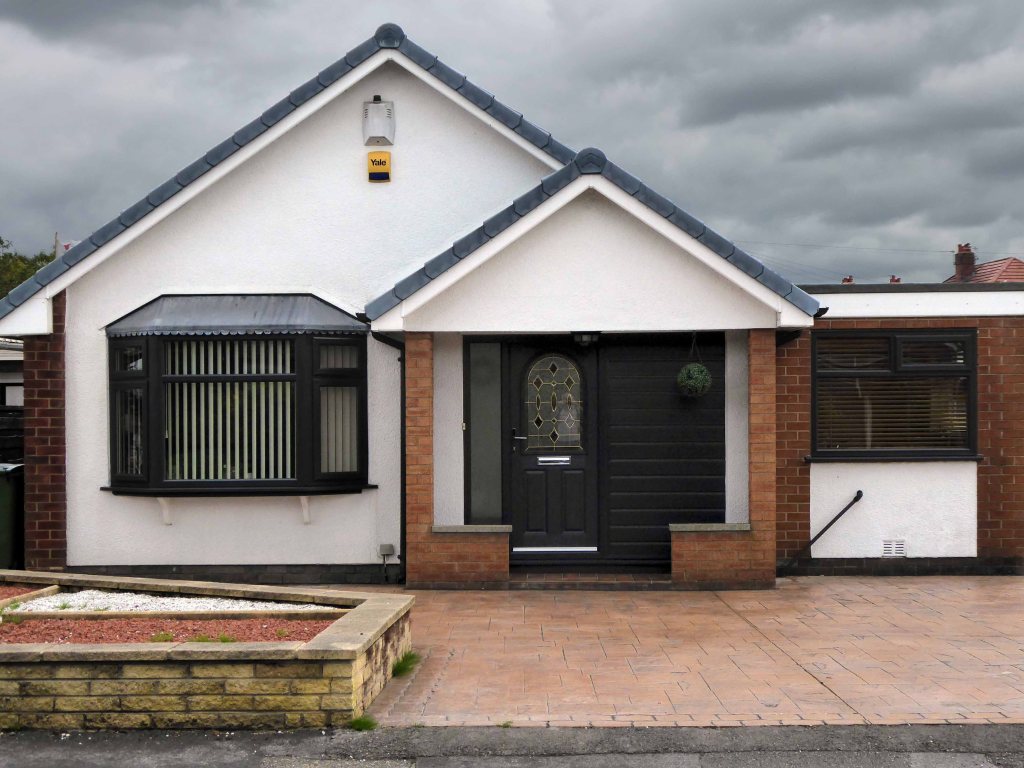
We have crossed over Marple Road and are deep in the suburban jungle of mutually exclusive modified bungalows.
Off now into the wide open spaces of the Offerton Estate – the right to buy refuge of the socially mobile, former social housing owning public.
People living on Offerton Estate have been filmed for a programme entitled ‘Mean Streets’ which aims to highlight anti-social behaviour in local communities.
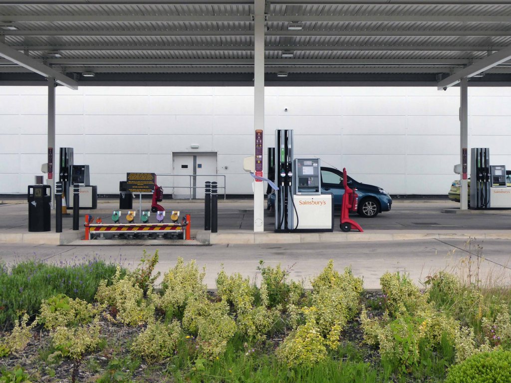
The next thing we know we’re in a field, a mixed up melange of the urban, suburban and rural, on the fringes of a Sainsbury’s supermarket filling station.
We cross the A6 in Hazel Grove and here for today our journey ends
Ignoring the sign we went in the opposite direction.
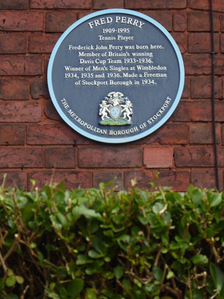
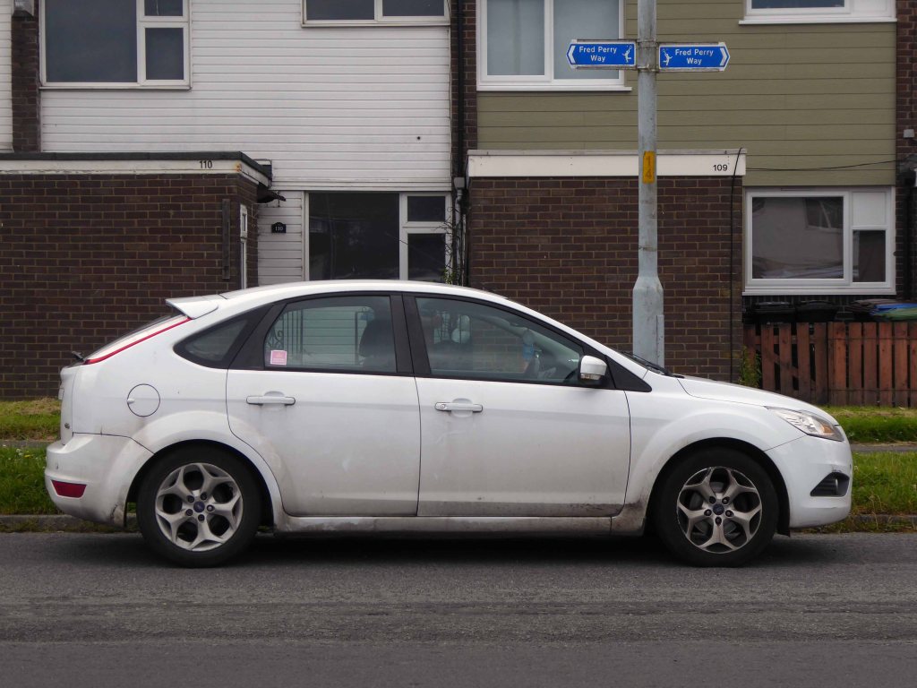
As we reach the edge of Mirrlees Fields – the site of the only Fred Perry laurel leaf logo emblazoned way marker.
The Fields are currently designated as a green space and are not available for residential development. But MAN would like to overturn this designation for over one third of the Fields.
MAN Energy Solutions UK is the original equipment manufacturer of Mirrlees Blackstone diesel engines.
Before the Blackstone MAN came in 1842 – the fields were all fields.
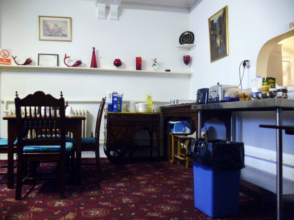
Monday 3rd August 2015 one finds oneself wide wake in the Rydeview Hotel.
Faced with a breakfast best described as indescribable.
I arose and departed, not angry but hungry.
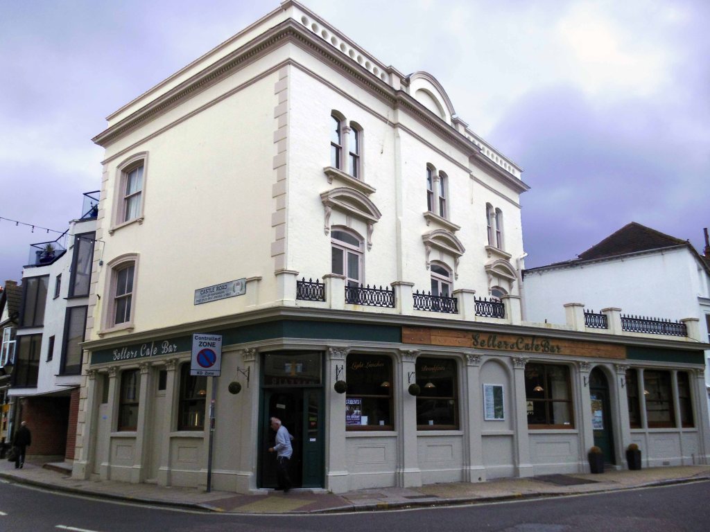
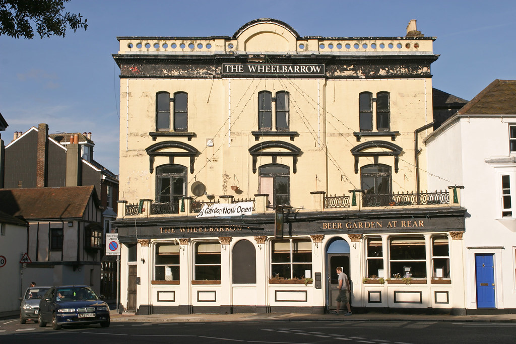
Made my way to the corner of Southsea Common, where once we drank – Tim Rushton and I were often to be found in The Wheelbarrow together.
A boozer no longer, now named for the city’s long gone famous son.
How bad a pub is this? I walk past it to get to my local. Most nights there are six people max in the bar, all huddled around the bar itself, backs to the door. – this often includes the landlord and landlady. They have live music there once in a while and you can’t get served by the one bloke behind the bar – the landlord and landlady never help out, they don’t seem to give a toss.
Beers crap, not worth a visit.
It was never like that in our day.
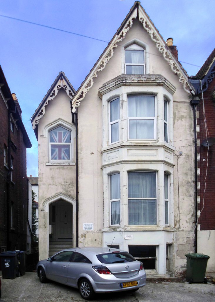
Visiting our former abode on Shaftesbury Road – where I once dwelt along with Tim, Catherine, Liz and Trish.
Yet more Stymie Bold Italic.
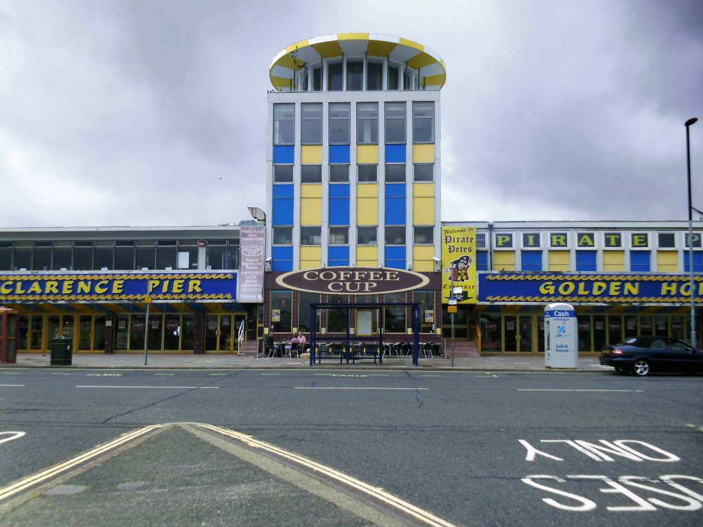
Back to the front for a peer at the pier.
Clarence Pier is an amusement pier located next to Southsea Hoverport. Unlike most seaside piers in the UK, the pier does not extend very far out to sea and instead goes along the coast.
The pier was originally constructed and opened in 1861 by the Prince and Princess of Wales and boasted a regular ferry service to the Isle of Wight. It was damaged by air raids during World War II and was reopened in its current form on 1 June 1961 after being rebuilt by local architects AE Cogswell & Sons and R Lewis Reynish.
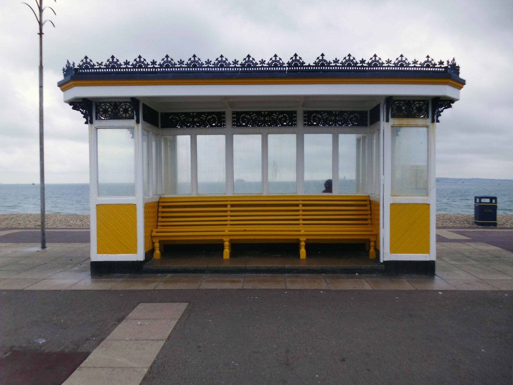
Low cloud grey skies and drizzle.
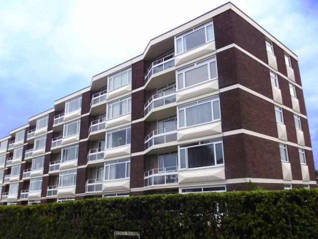
This sizeable two bedroom apartment situated on the seventh floor of the ever popular Fastnet House is offered with no onward chain and the option of a new 999 year lease as well as a share of the freehold. With panoramic views over The Solent towards the Isle Of Wight and Spinnaker Tower, situated in a central location and close to all amenities, this lovely apartment offers luxury living for any prospective buyer. With lift access, the apartment comprises; entrance hallway, a large lounge diner with box bay window boasting stunning sea views across the city and The Solent, master bedroom with built in wardrobes and sea views over The Solent, a spacious second bedroom, fitted kitchen with breakfast bar and a recently updated modern shower room.
Coal Exchange– Peter and Dawn welcome you to their traditional pub in the heart of Emsworth adjacent to the public car park in South Street and close to the harbour.
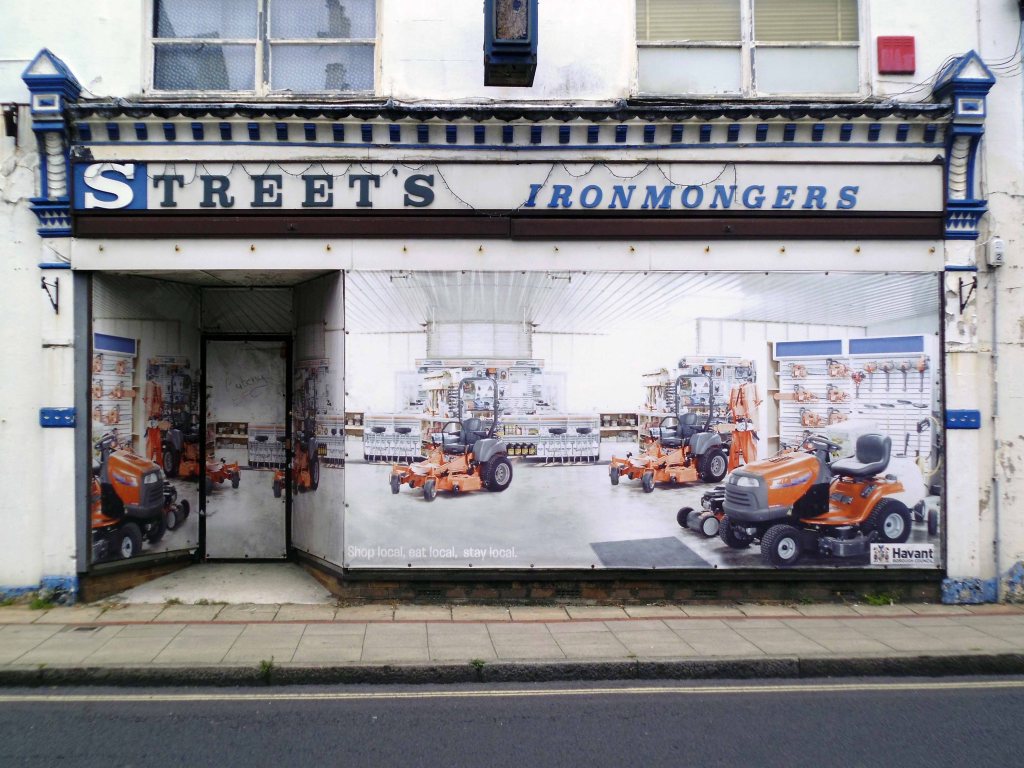
Lillywhite Bros Ltd is a family run business established over 60 years ago in Emsworth, which is ideally located between Portsmouth and Chichester. It is currently run by brothers Paul and Mike who continue to keep up with modern techniques and equipment, as well as maintaining their traditional values and high standard of customer service.
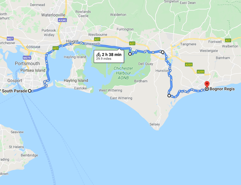
Next thing you know I’m in Pagham, having become very lost somewhere between there and here, asking for directions from the newsagents and buying a bottle of Oasis.
The newsagent was mildly amused by lack of map, sense and/or sensibility.
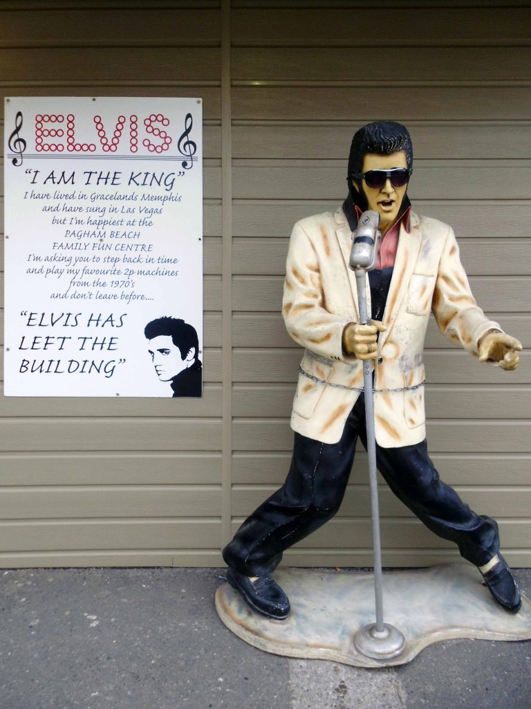
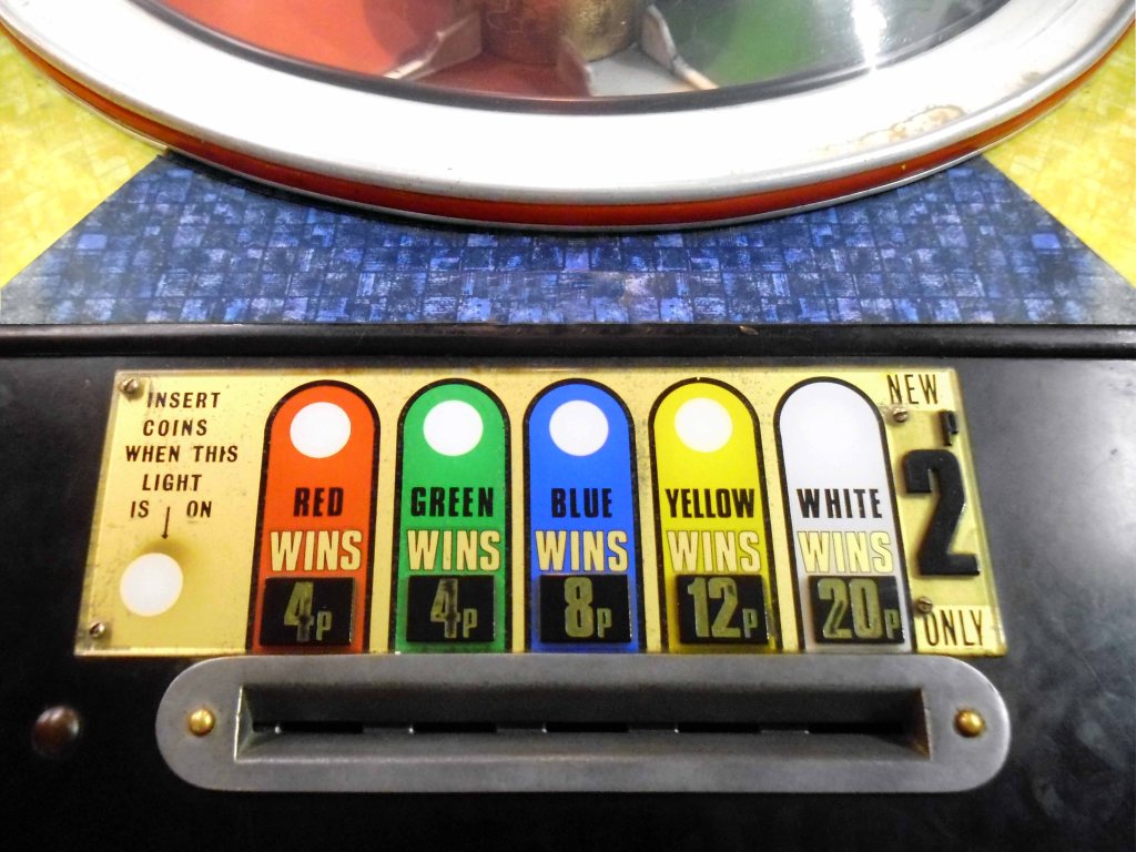
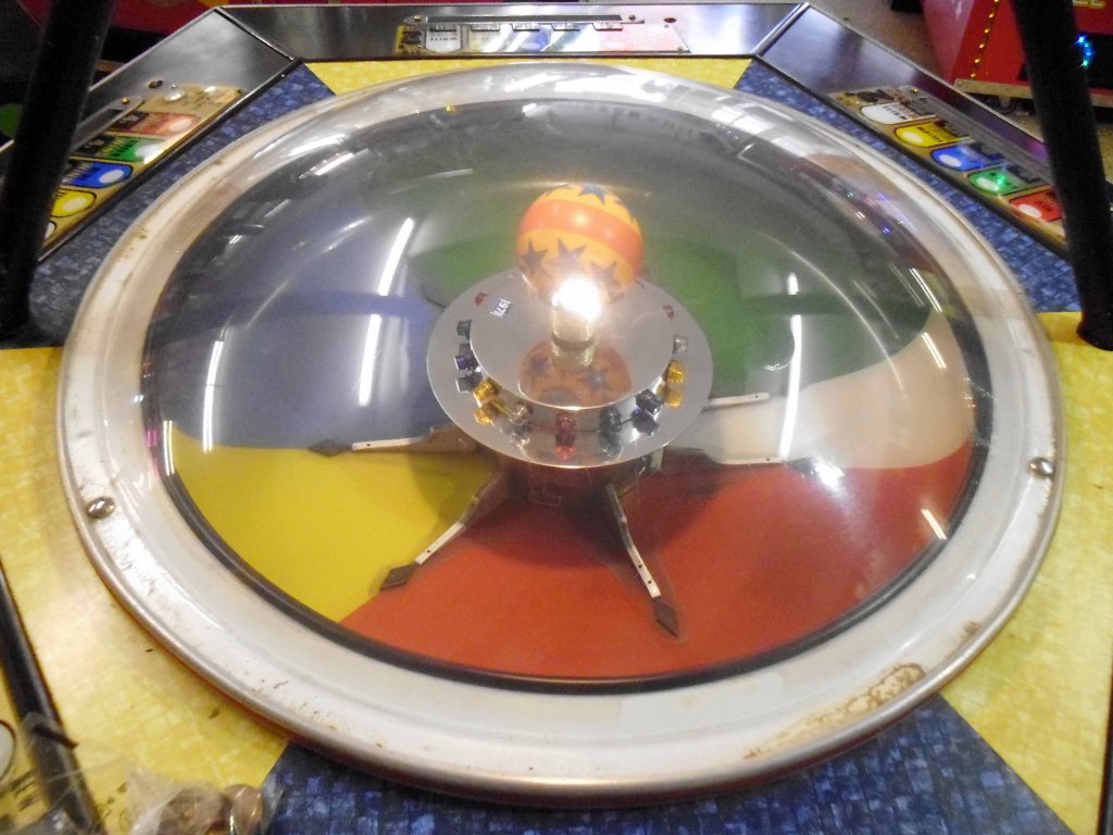
I spent many happy hours here in my youth playing the slots with The King.
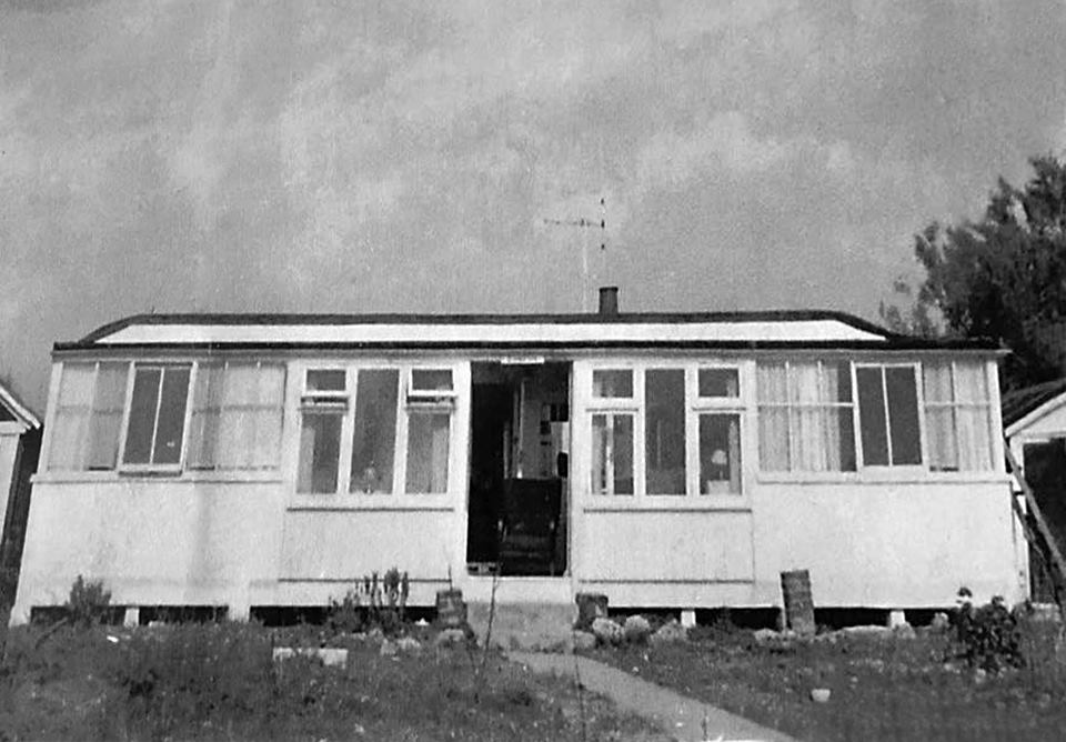
We would stay here in Tamarisk with my Aunty Alice and Uncle Arthur and Smudge the cat, an idyllic railway carriage shack two rows back from the pebbled seashore.
We would enjoy a shandy at the King’s Beach with Lydia, Wendy and David.
All gone it seems.
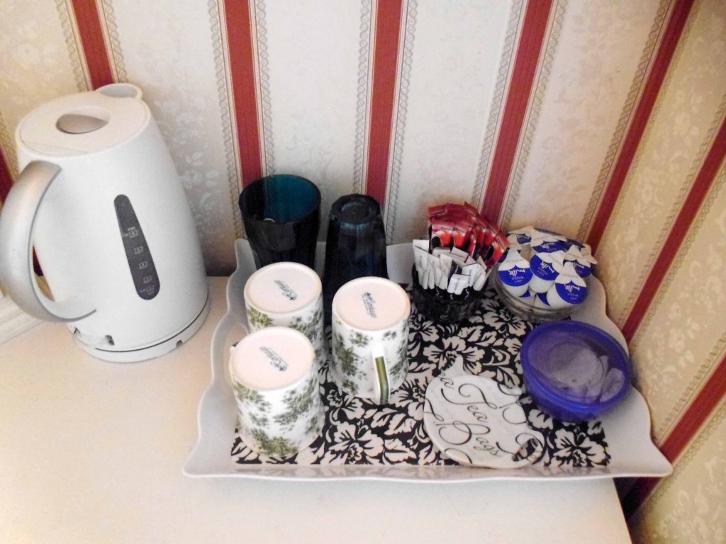
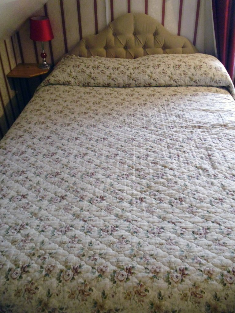
On to Bognor a B&B and a brew – a brief glimpse into my luxury lifestyle.
I’ll take an overcast Monday evening stroll along the prom, where I chanced to meet two landlocked Chinese lads, gazing amazed at the sea – they were on a course in Chichester learning our own particular, peculiar ways.
There was no-one else around.
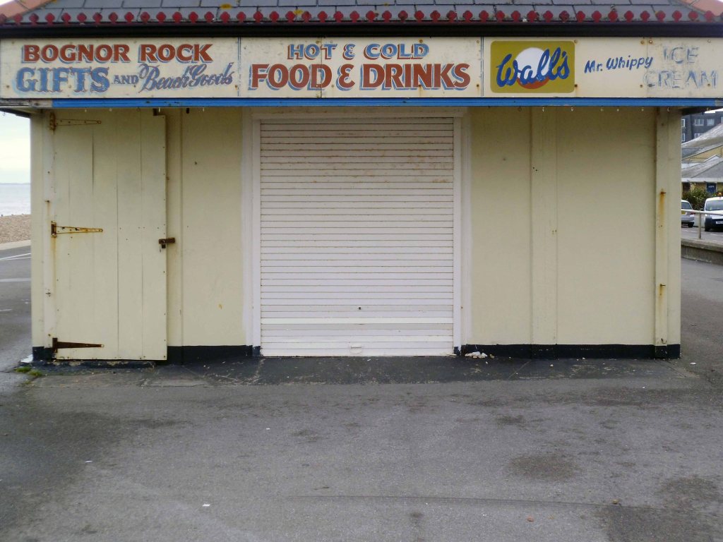
Who can resit the obvious allure of the novelty item?
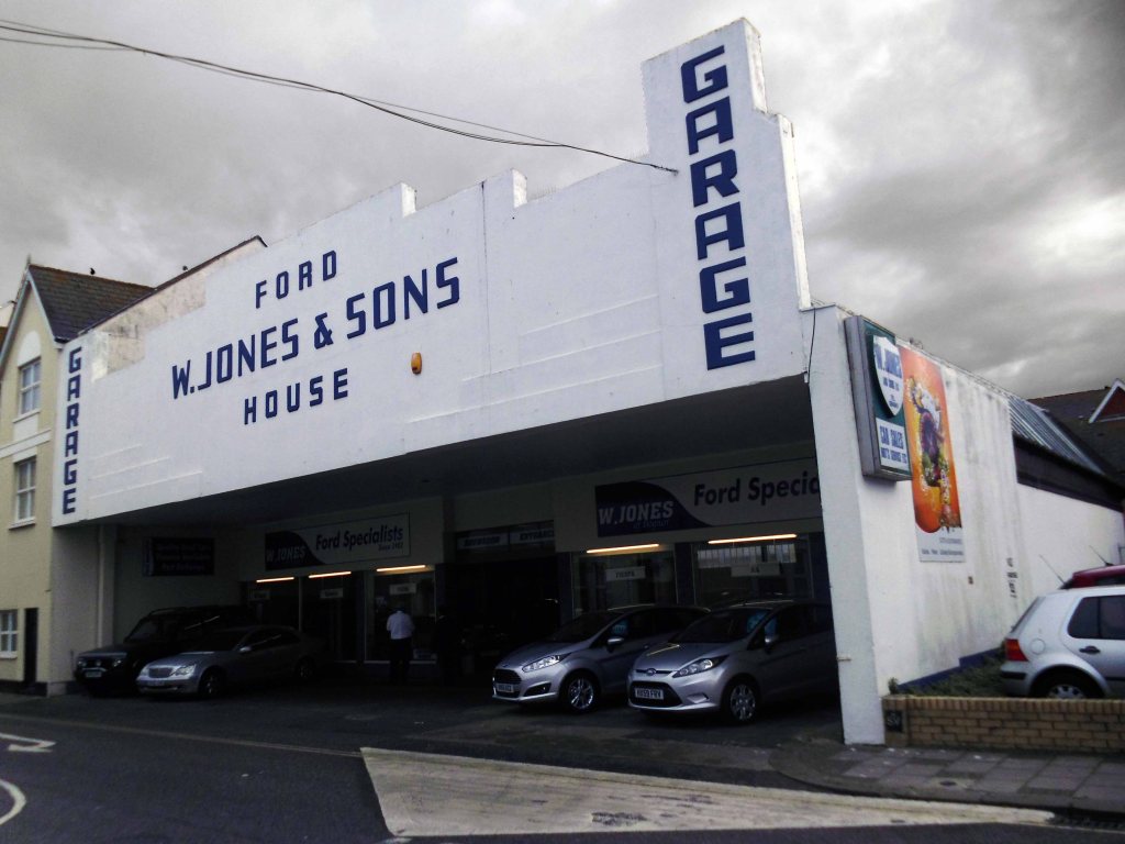
Or an Art Deco garage fascia.
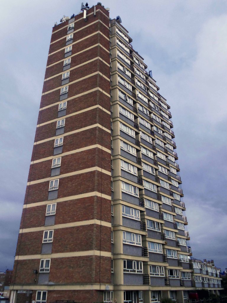
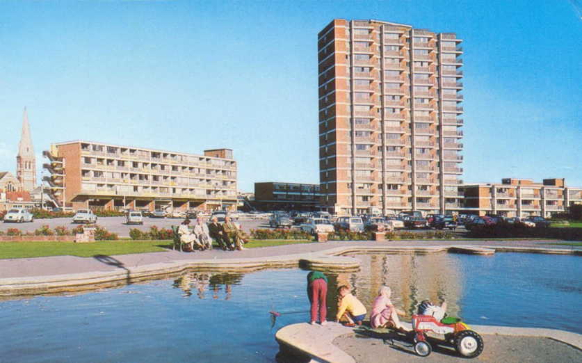
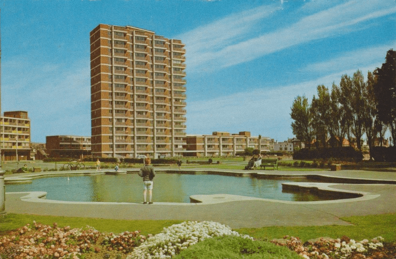
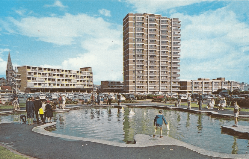
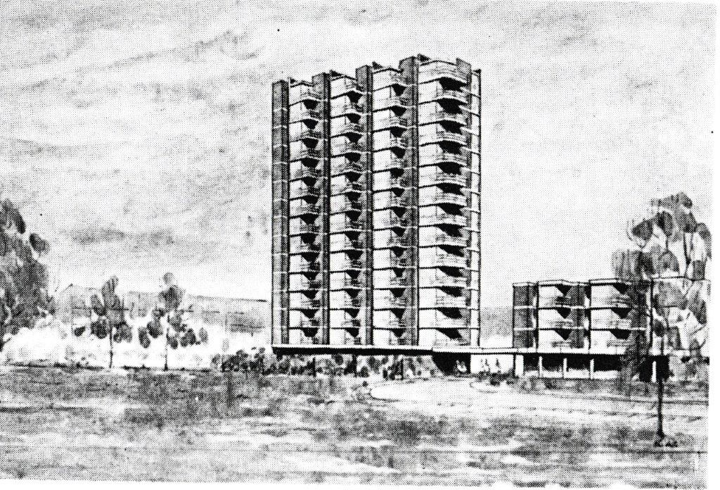
Fitzleet House was built in the 1960s architects: Donald Harwin & Partners, it consists of seventy four flats, fifteen of them are in a three-storey block next to the main building.
PS&B are pleased to offer this sixth floor flat which is situated conveniently close to the town centre and within close proximity of the sea front. The accommodation is newly refurnbished and is offered unfurnished with south/west facing lounge with small balcony with far reaching views to the sea. Kitchen and bathroom with shower over bath and one double bedroom. Further benefiting from having modern electric heating and double glazing, telephone entry system, lift to all floors, communal sky dish and white goods. With regret no pets and no children – £685 rental is payable calendar monthly in advance.
For many years, a gentleman called Todd Sweeney collected sunshine statistics from the roof of Fitzleet House, which were then forwarded to the Met Office in London to assist with national statistics, and in 1983 one group of Cubs arranged a special tea party on the roof of the building as part of the national tea-making fortnight.