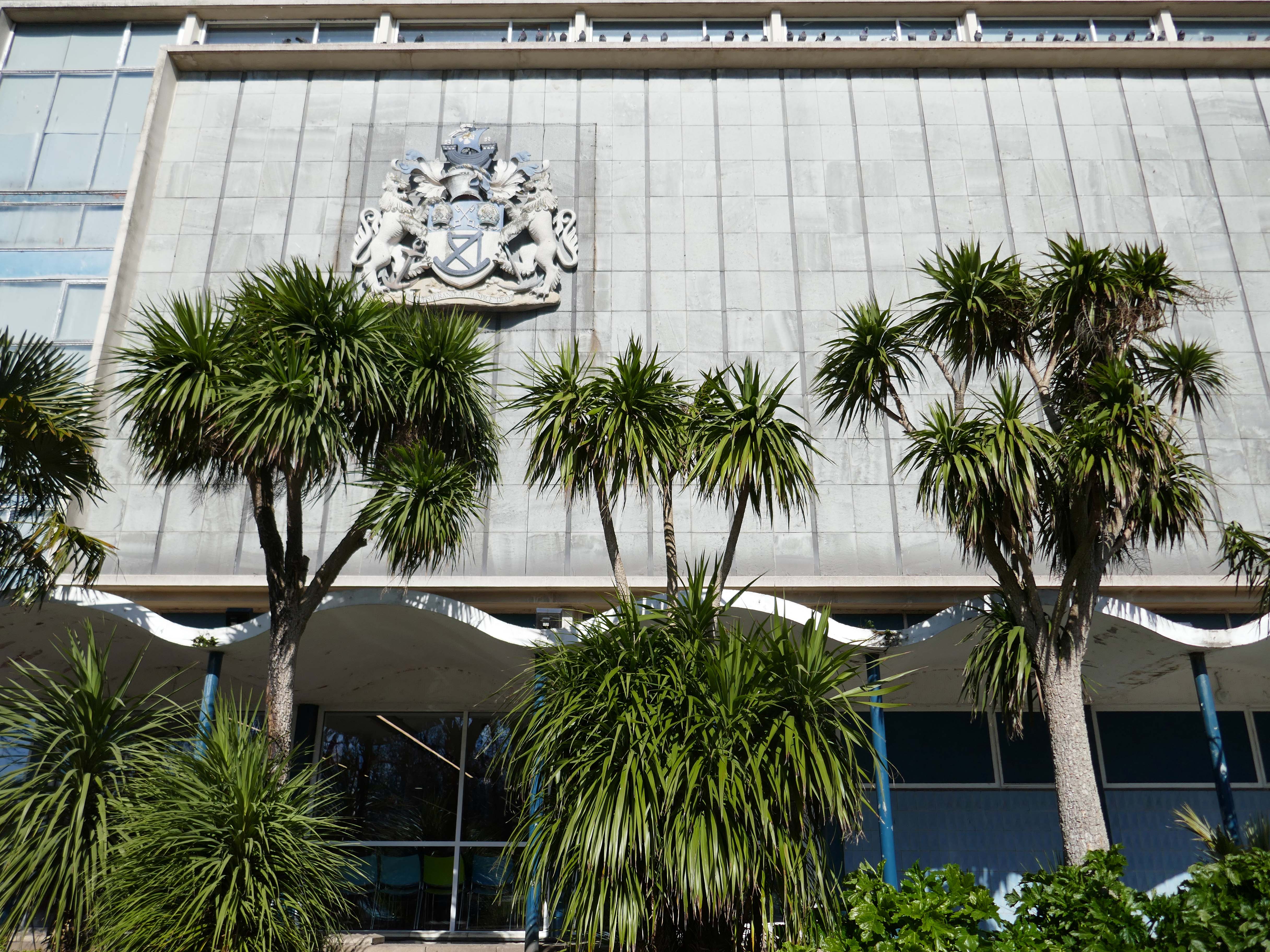
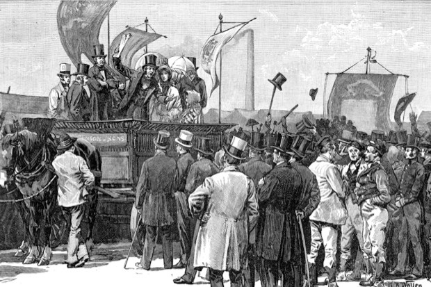
In 1879, the Museum moved to a new larger building next to Mowbray Park including a library and winter garden based on the model of the Crystal Palace. US President Ulysses Grant was in attendance at the laying of the foundation stone by Alderman Samuel Storey in 1877, the building opened in 1879.
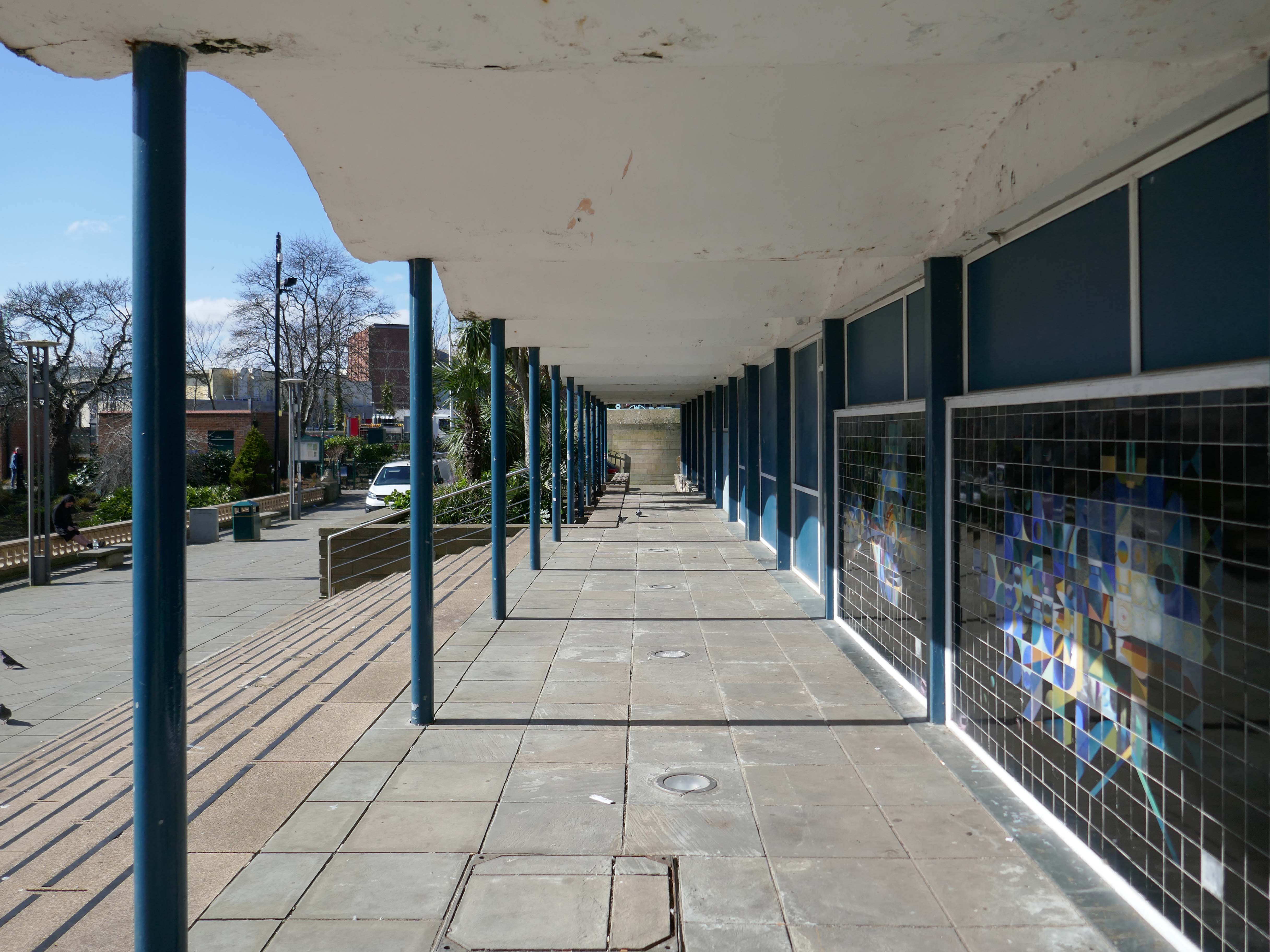
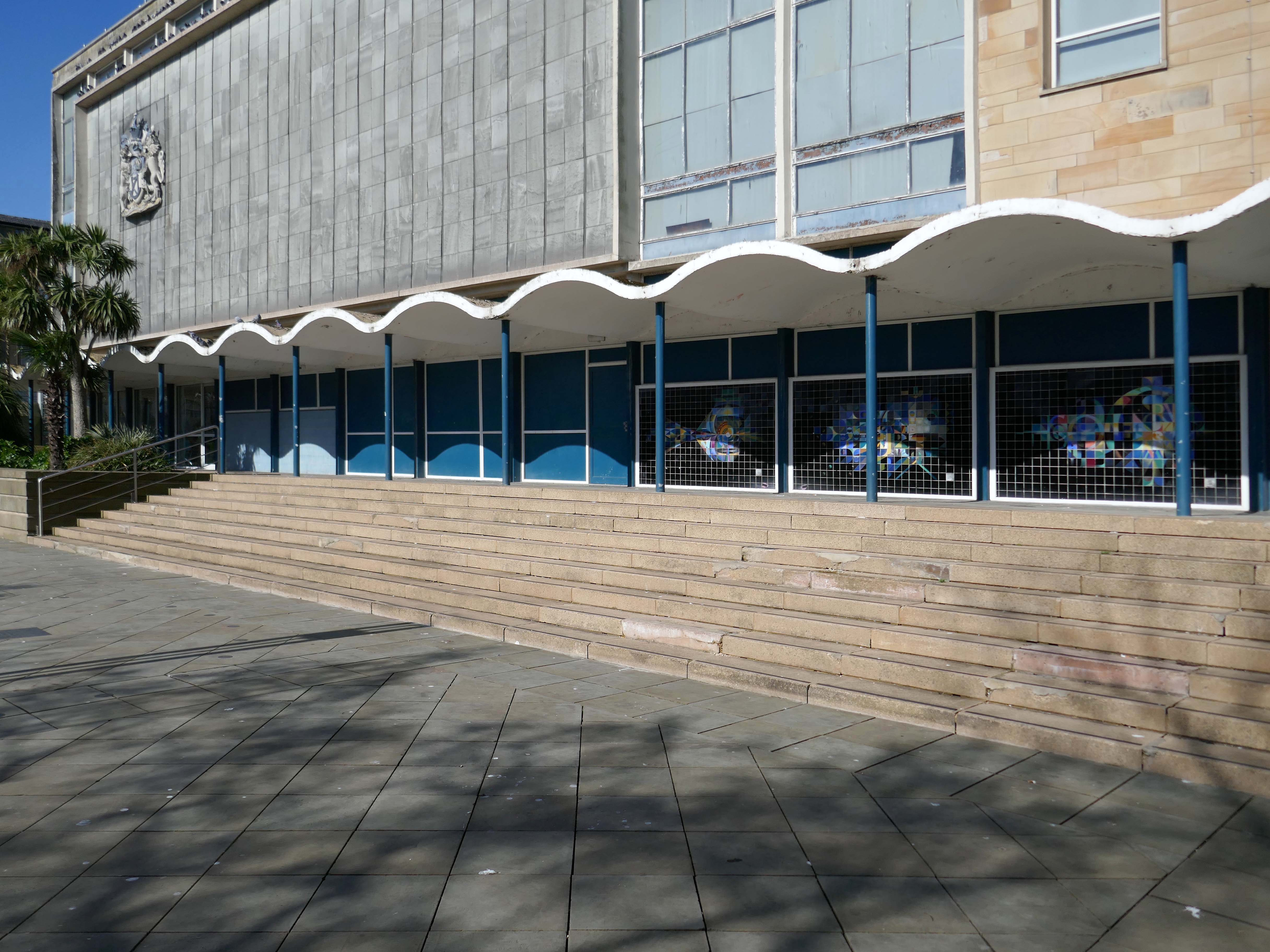
During World War II, Winter Garden was damaged by a parachute mine in 1941 and demolished the following year. A 1960s extension took its place, but in 2001, a lottery funded refurbishment of the museum created a new Winter Garden extensionand improved facilities.
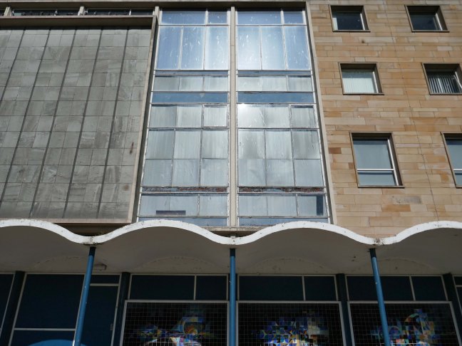
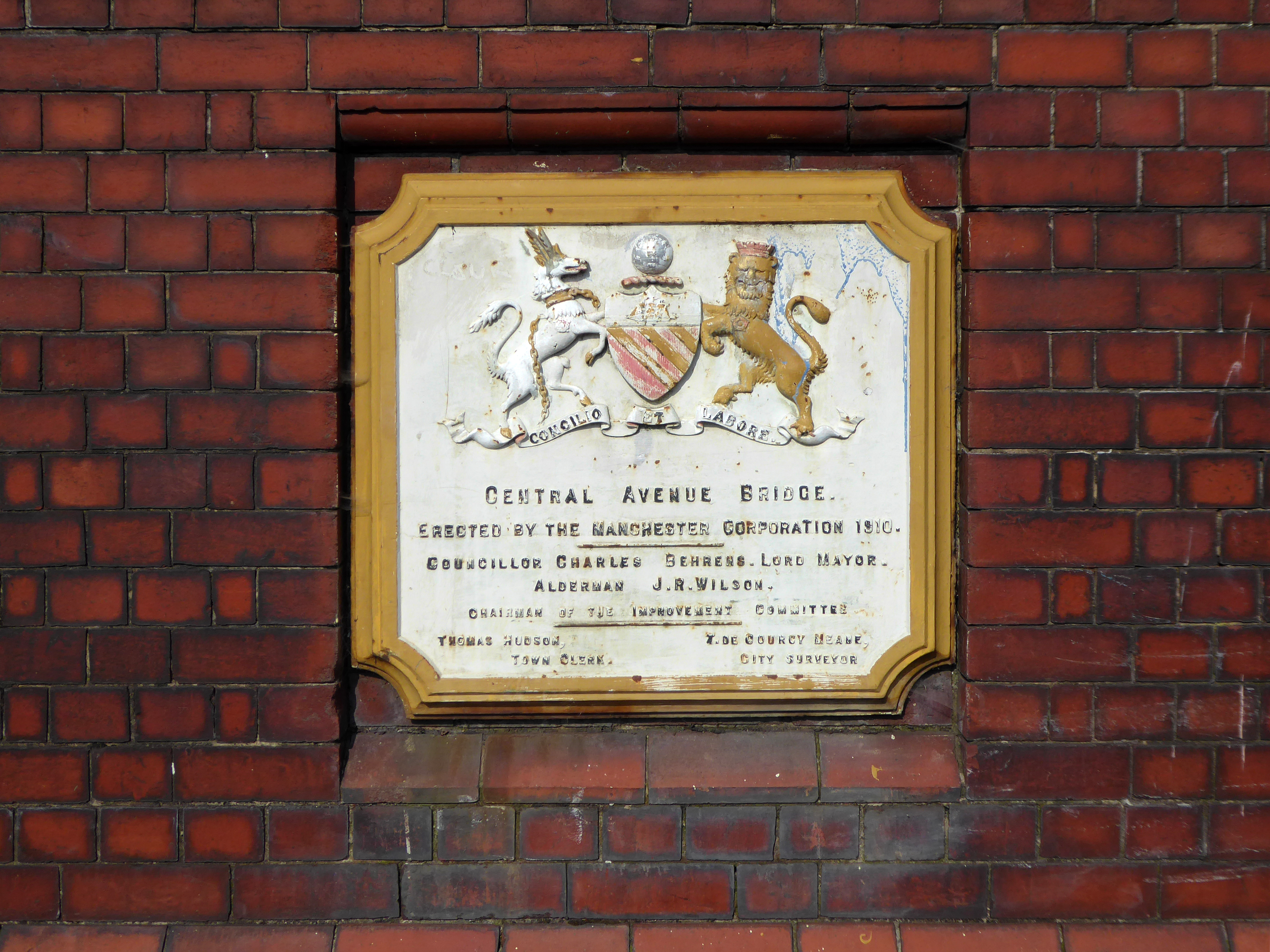
Built in 1879 by local architects J & T Tillman, the museum building is Listed Grade II and was the first civic museum to be purpose-built outside of London.
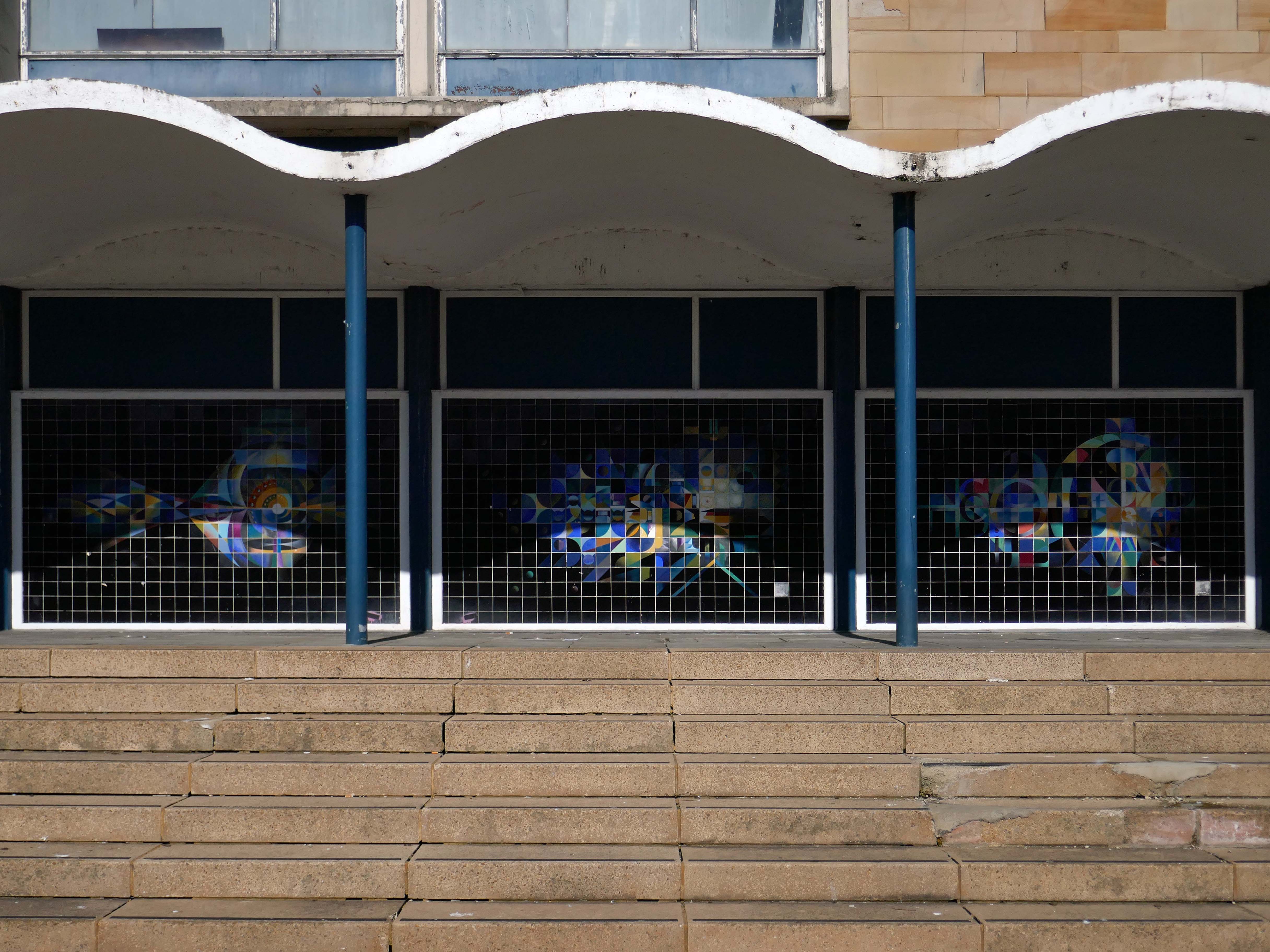
I have been unable to find any attribution for the 1960s extension, built in the Festival of Britain style.
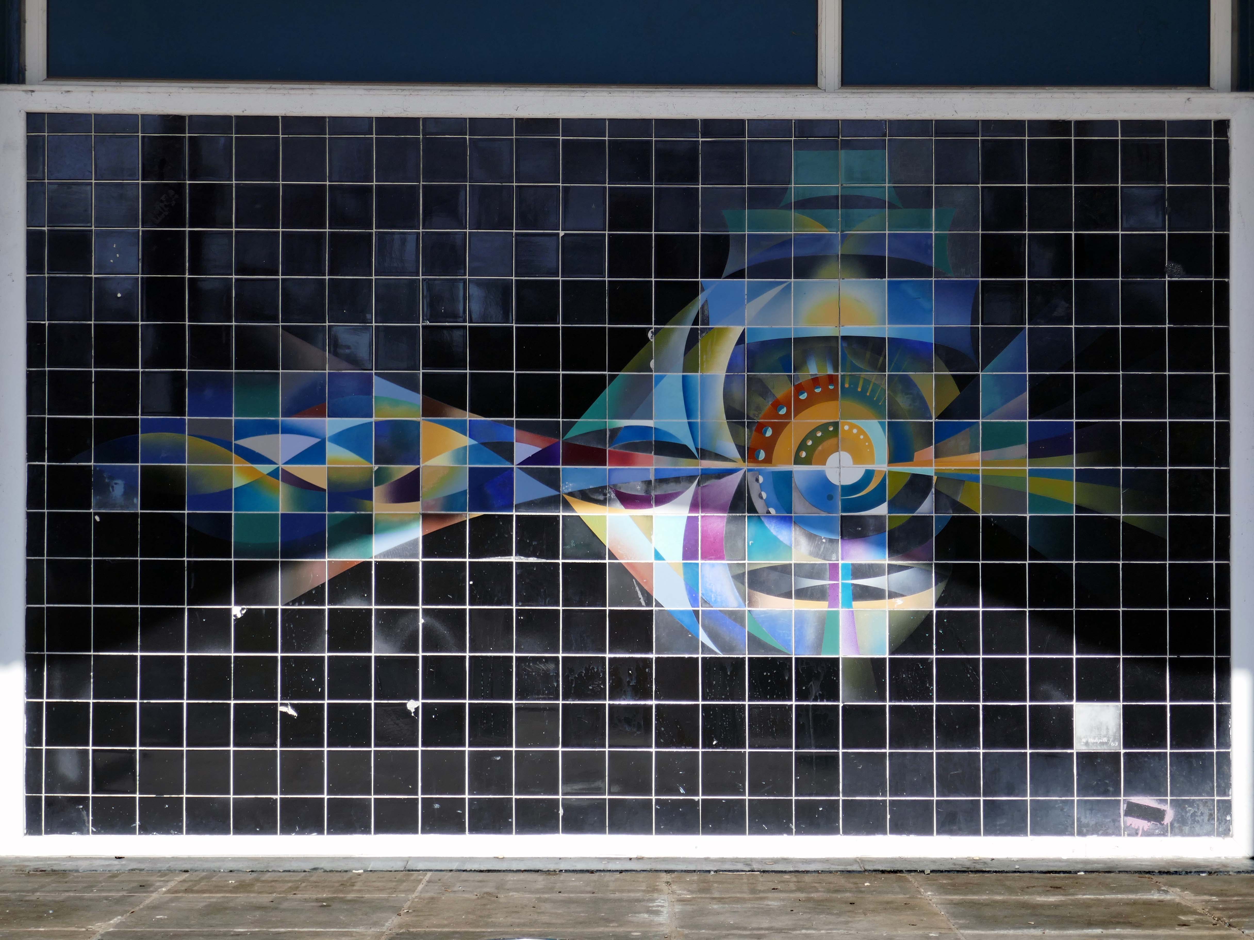
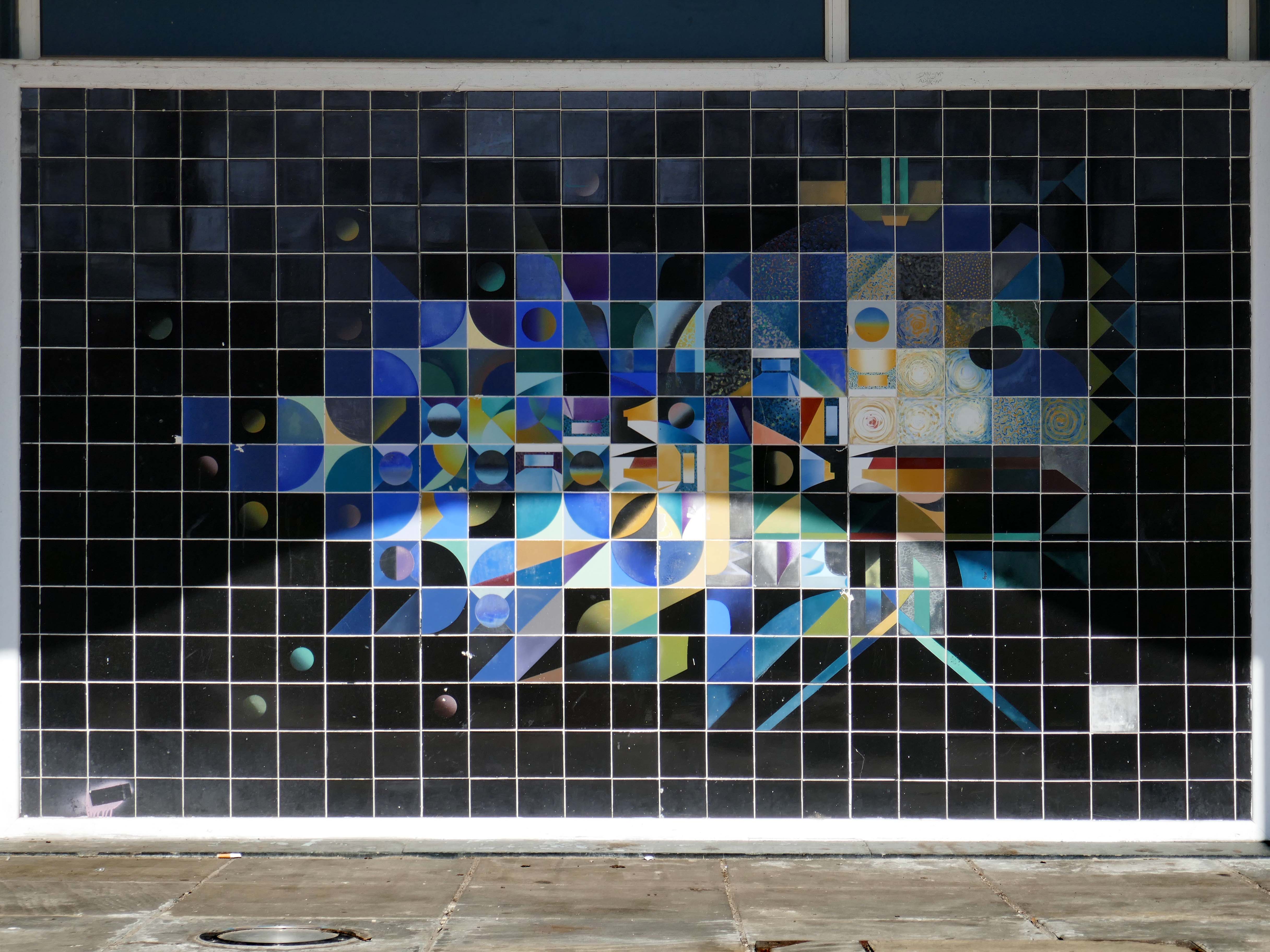
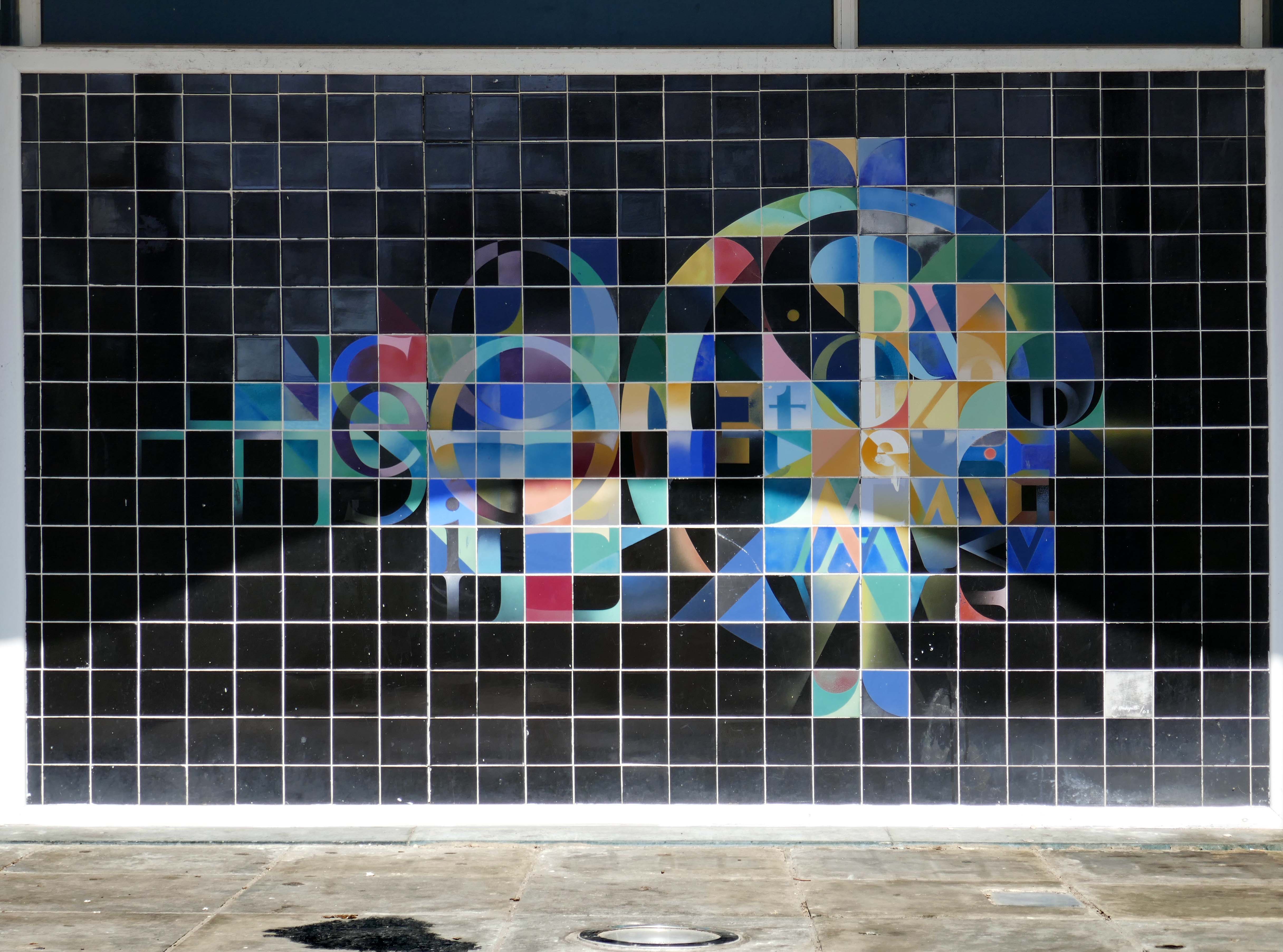
The panels, on the rear elevation, were by Walter Hudspith, then Senior Lecturer at Sunderland College of Art. They were the first examples of public art to be commissioned in Sunderland and were made for the building’s 1962-64 extension; they represent music, art and literature. The panels were restored by Lesley Durbin at the Jackfield Conservation studio in 2000-01.
Having taken a particular interest in this particular piece of public art for some time – I need to go and take a little look.
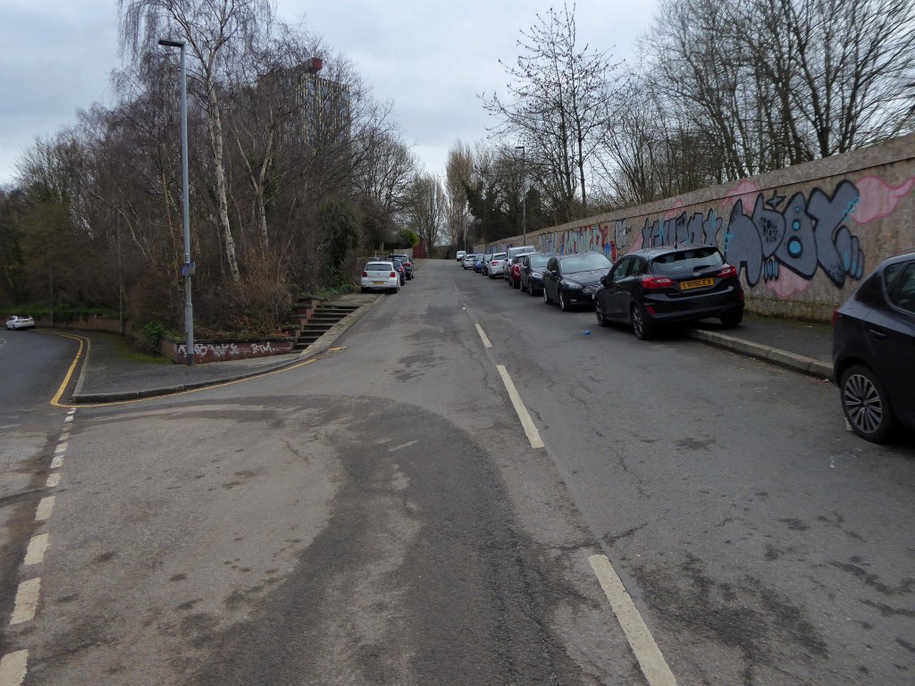
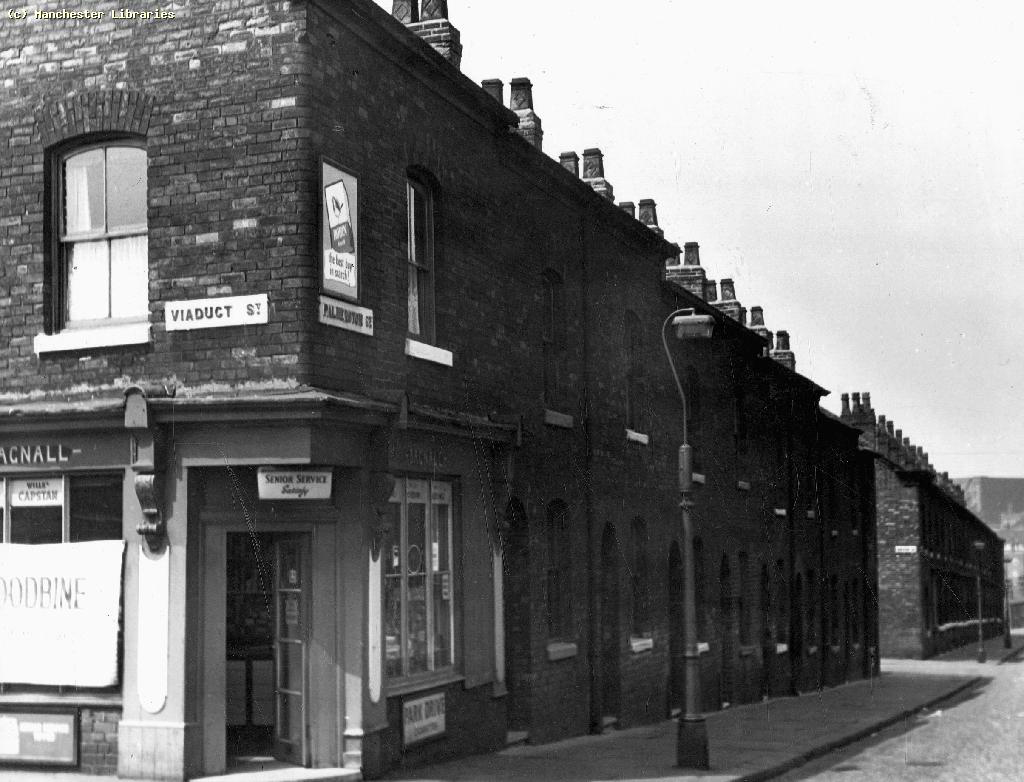
But what will we see along the way, as we hasten along Rochdale Road?
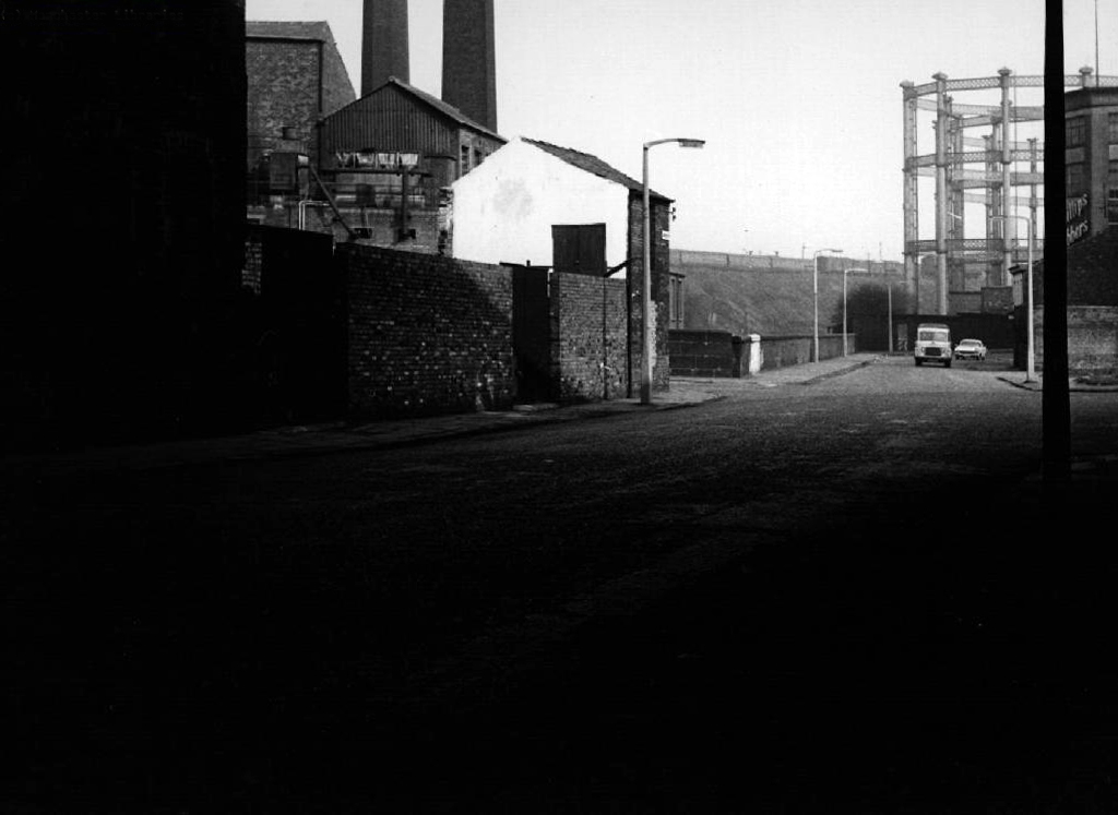
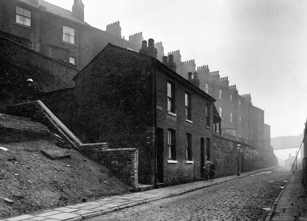
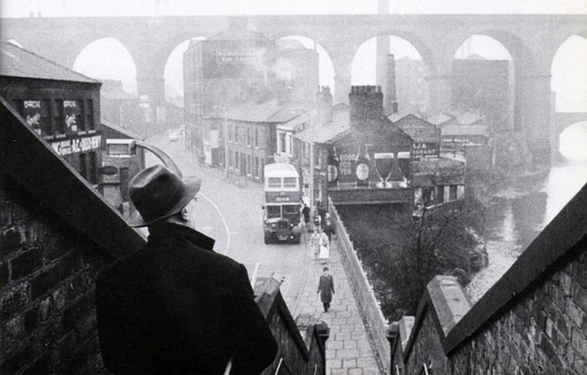
Which once looked like this, way back when in 1904.
Though some things inevitably come and go, as some things are prone to do.
The city is undergoing yet another reinvention as Manchester becomes – an attractive place to invest and do business.
See, I am doing a new thing!
Now it springs up; do you not perceive it?
I am making a way in the wilderness and streams in the wasteland.
Isaiah 43:19
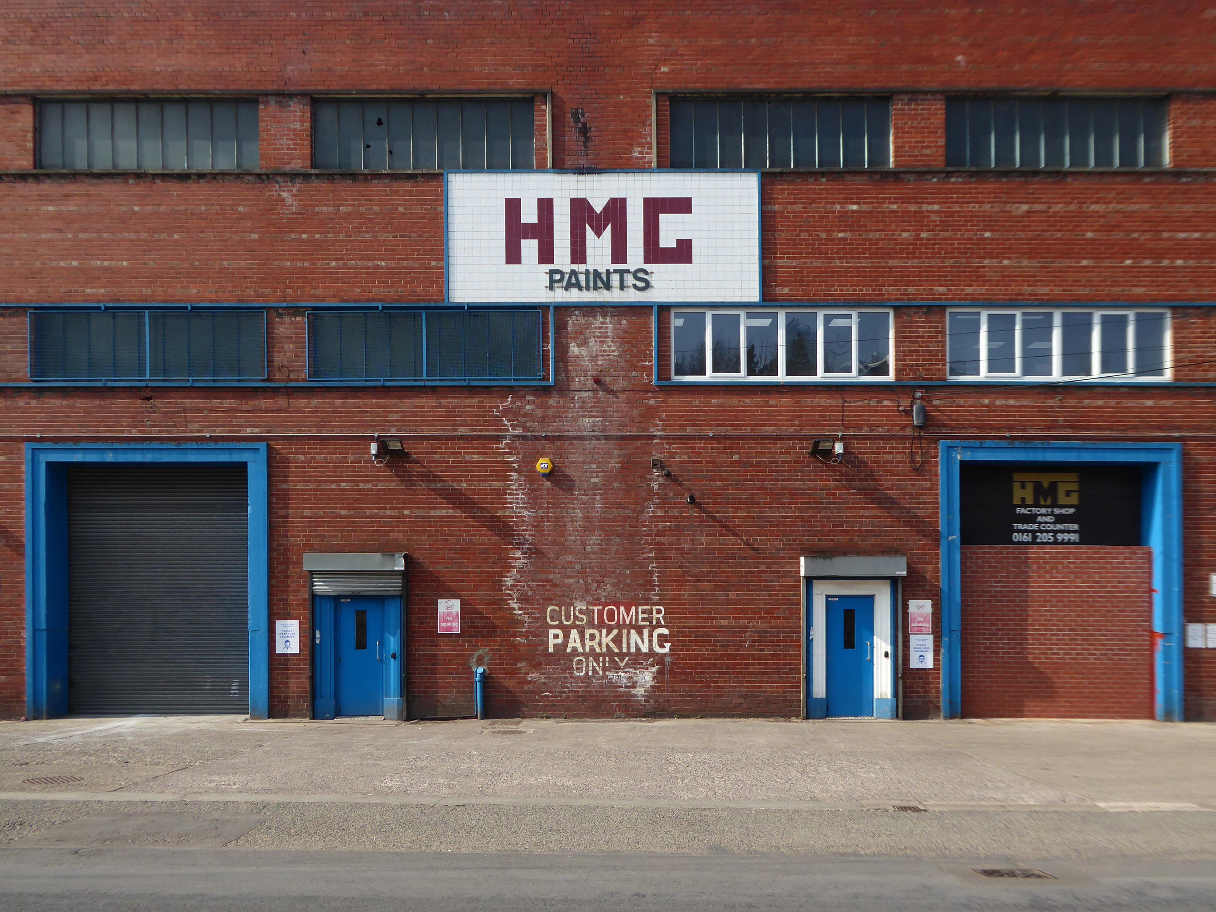
Once there was a gas works here – adjoining Gould Street, seen here in 1958.
The Gould Street Gas Works was a gas manufacturing plant located in Manchester, England. Originally built in 1824, the plant was operated by the Manchester Corporation Gas Department and was in operation from 1833 to 1969. It was named after the street on which it was located, which was named after John Gould, who was a prominent Manchester businessman in the 19th century.
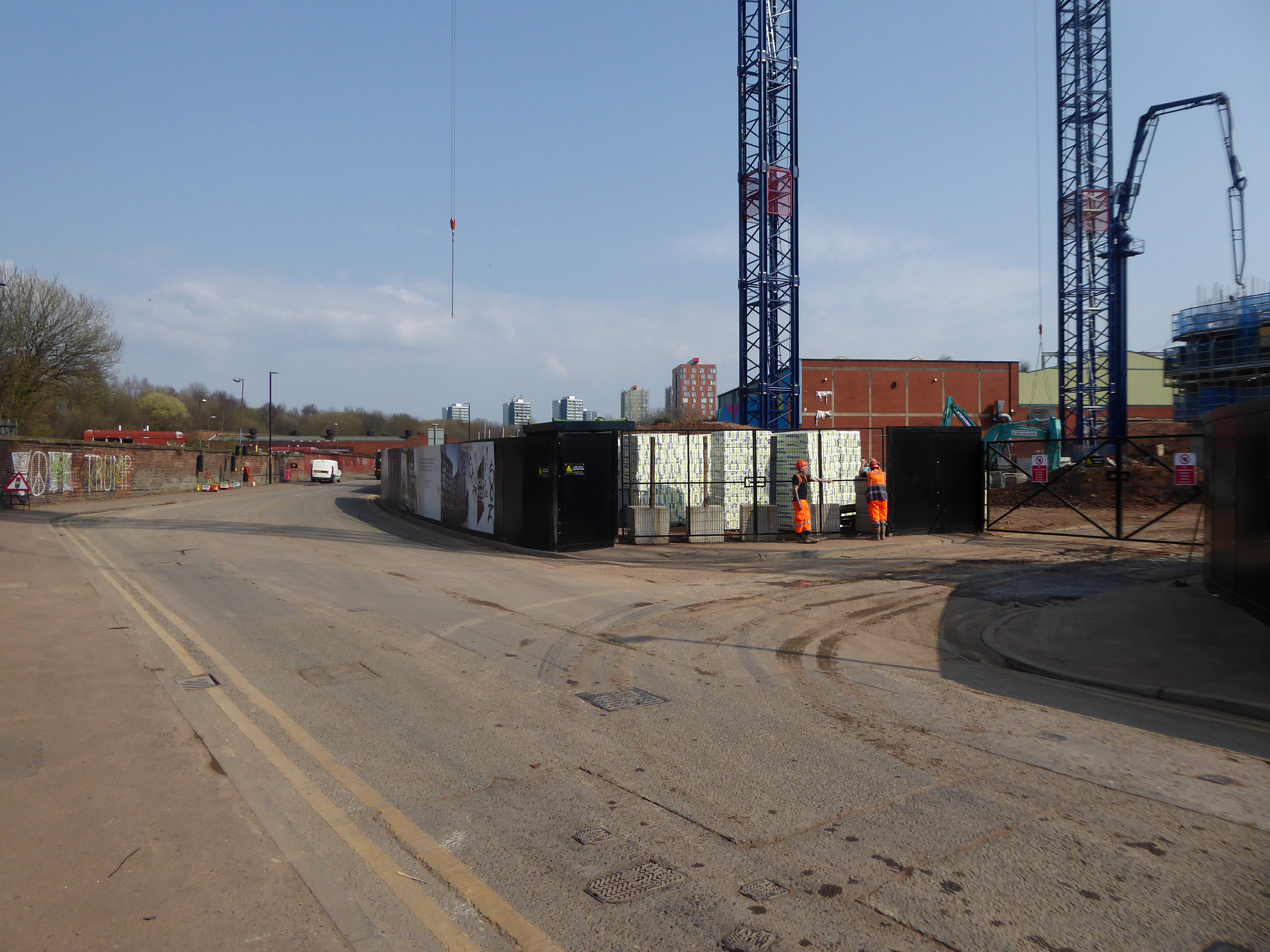
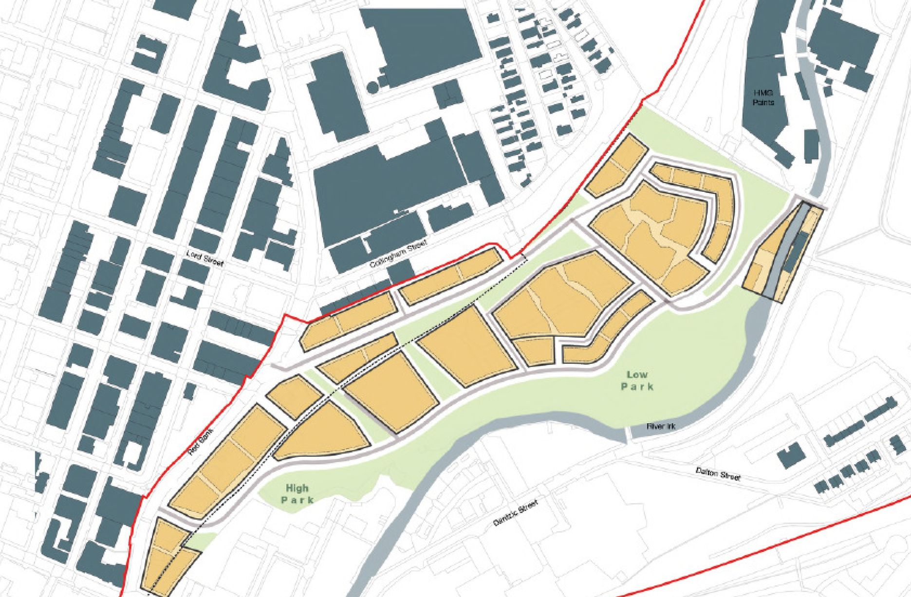
The Gasworks New Town neighbourhood is one of seven envisioned by the £4bn Victoria North masterplan. It will feature nine buildings ranging from 8 to 34 storeys. The 6.6-acre site has most recently been home to a car park but the green development will overwhelmingly prioritise walking and cycling over driving. It will result in tens of millions of pounds being pumped into the city’s economy over the lifetime of the development.
Plans for a trailblazing city centre regeneration scheme that will create more than 1200 homes has been approved by Manchester City Council.
A total of 85 of the 1200, will be affordable homes available through Shared Ownership.
Though as of March 31st 2023 ground is yet to be broken, no signs of the:
New centre of gravity for central Manchester that will create thousands of jobs and inject tens of millions of pounds into the city’s economy.
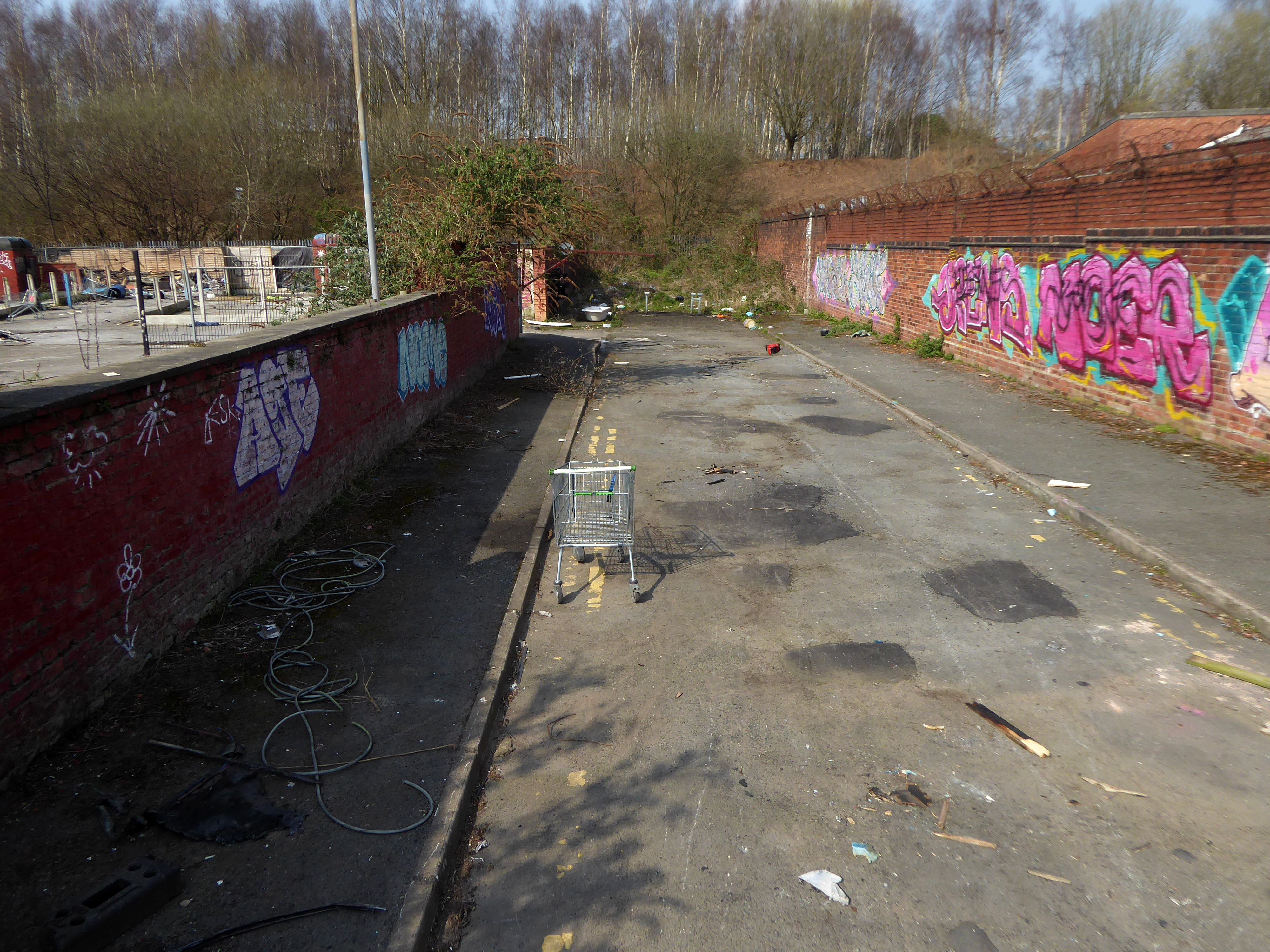
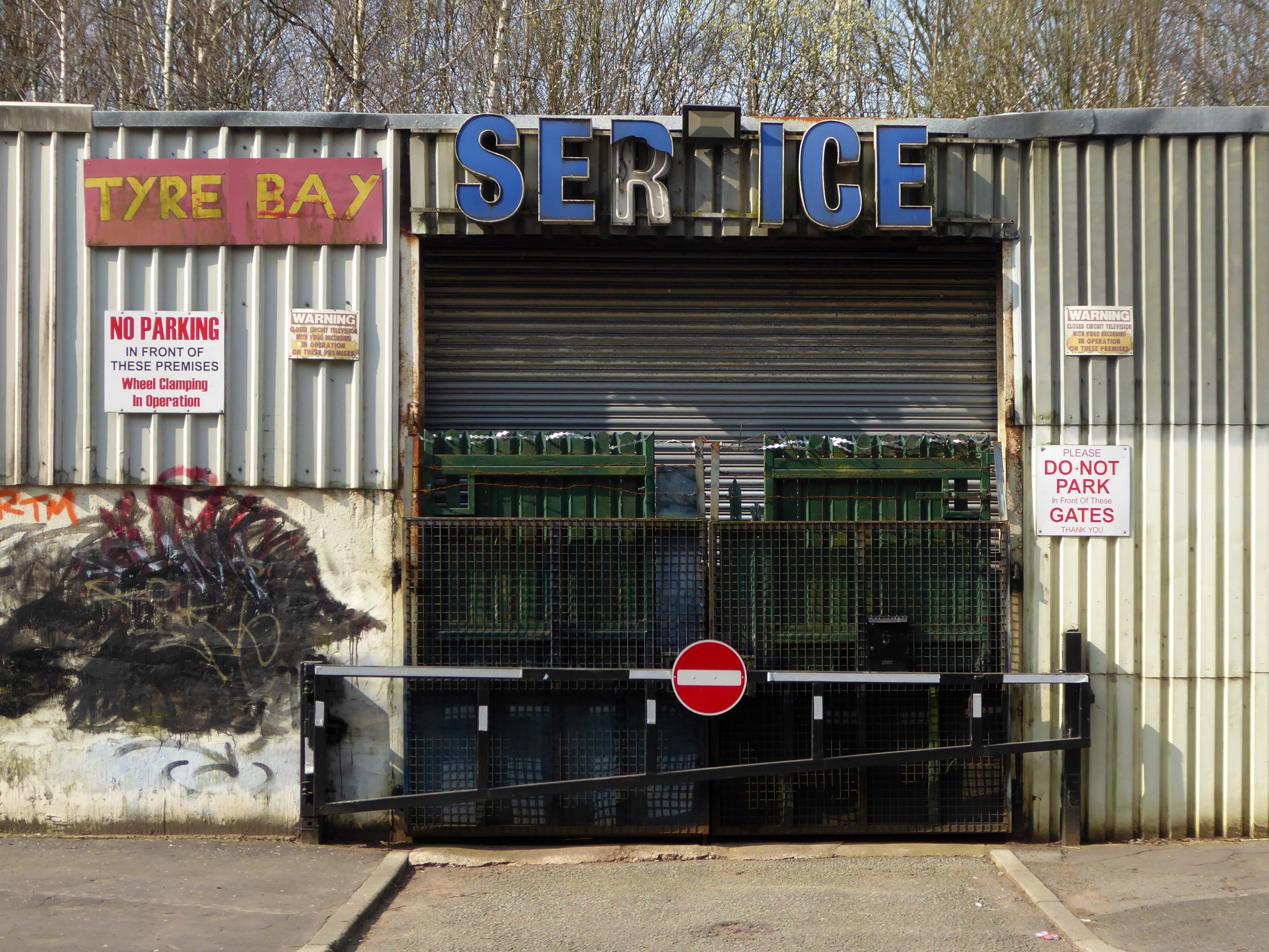
So you zig-zag wanderers, make the most of these wide open expanses of affordable car parking, while you can.
The future may yet be here today – or the next.
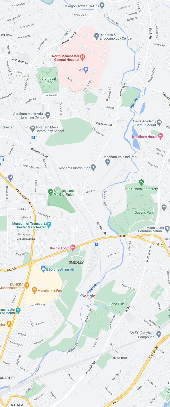
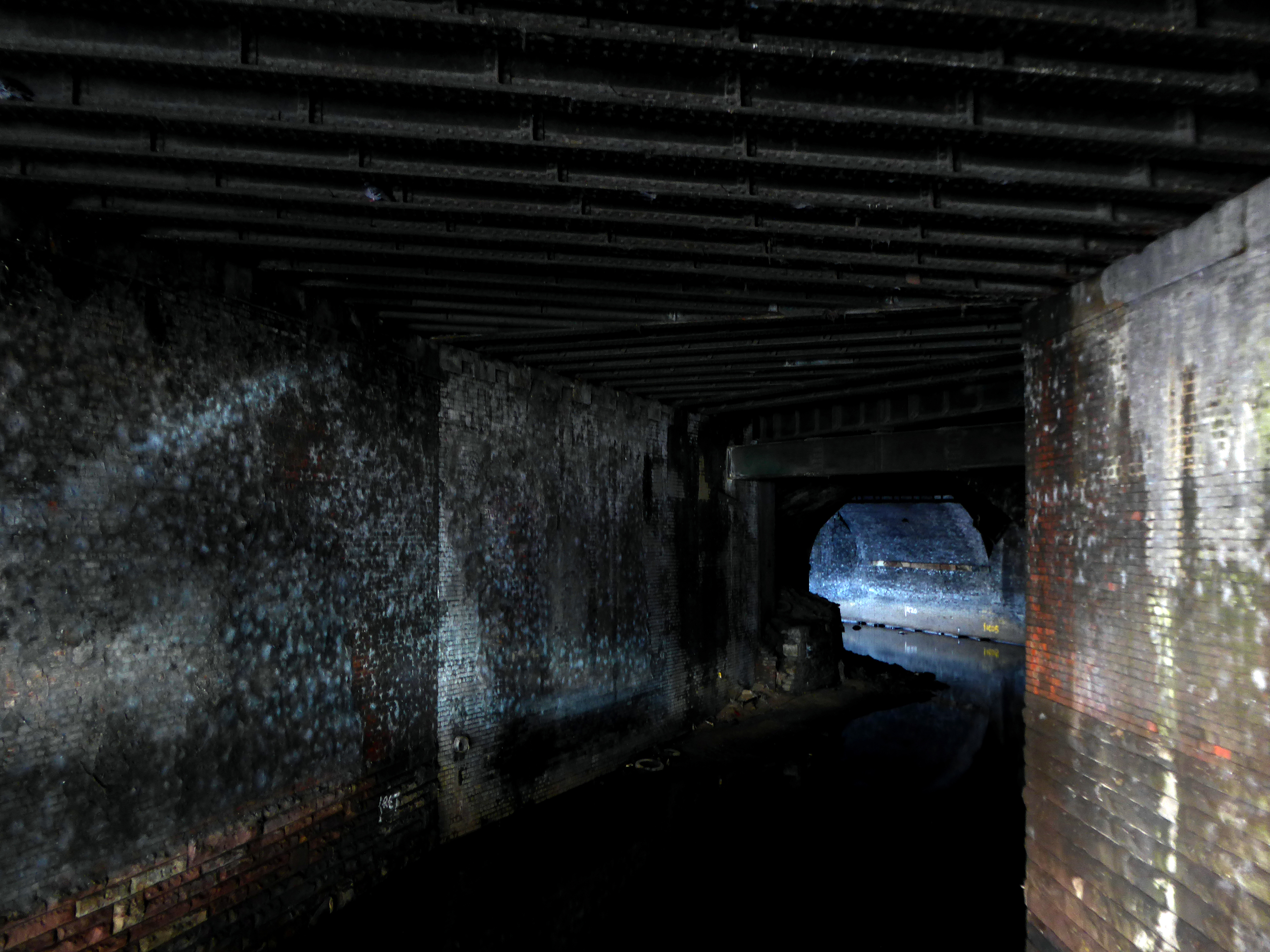
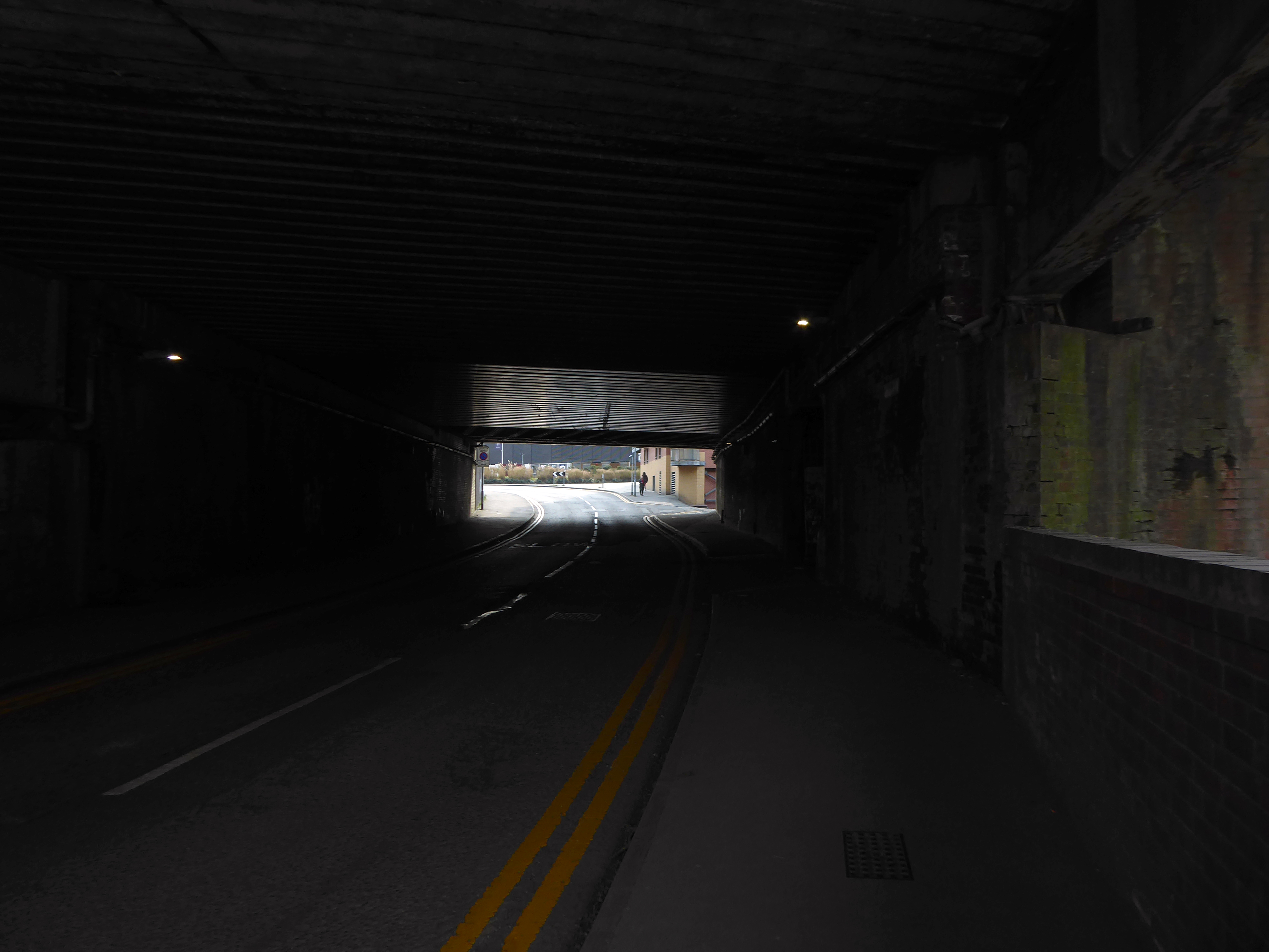
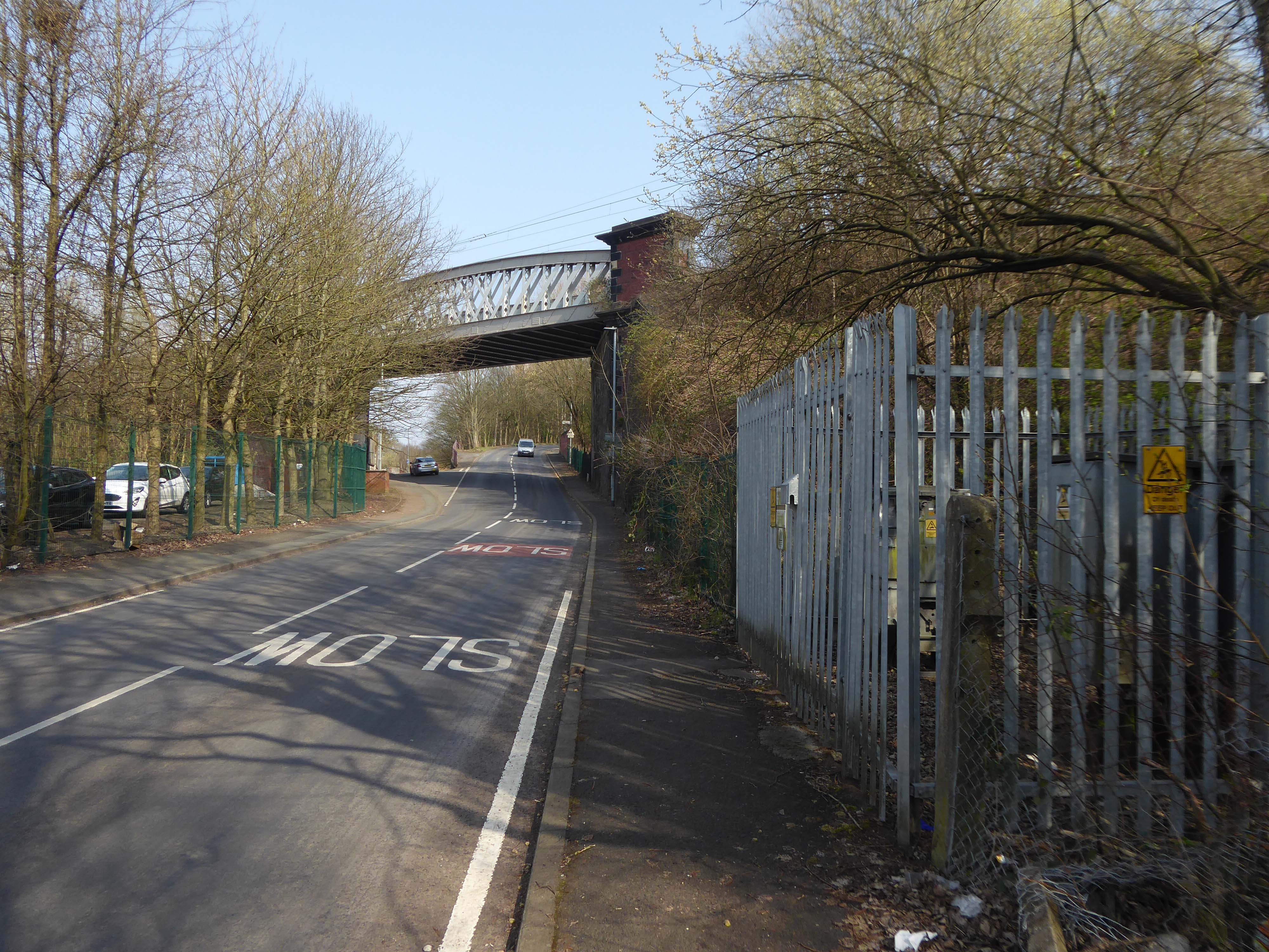
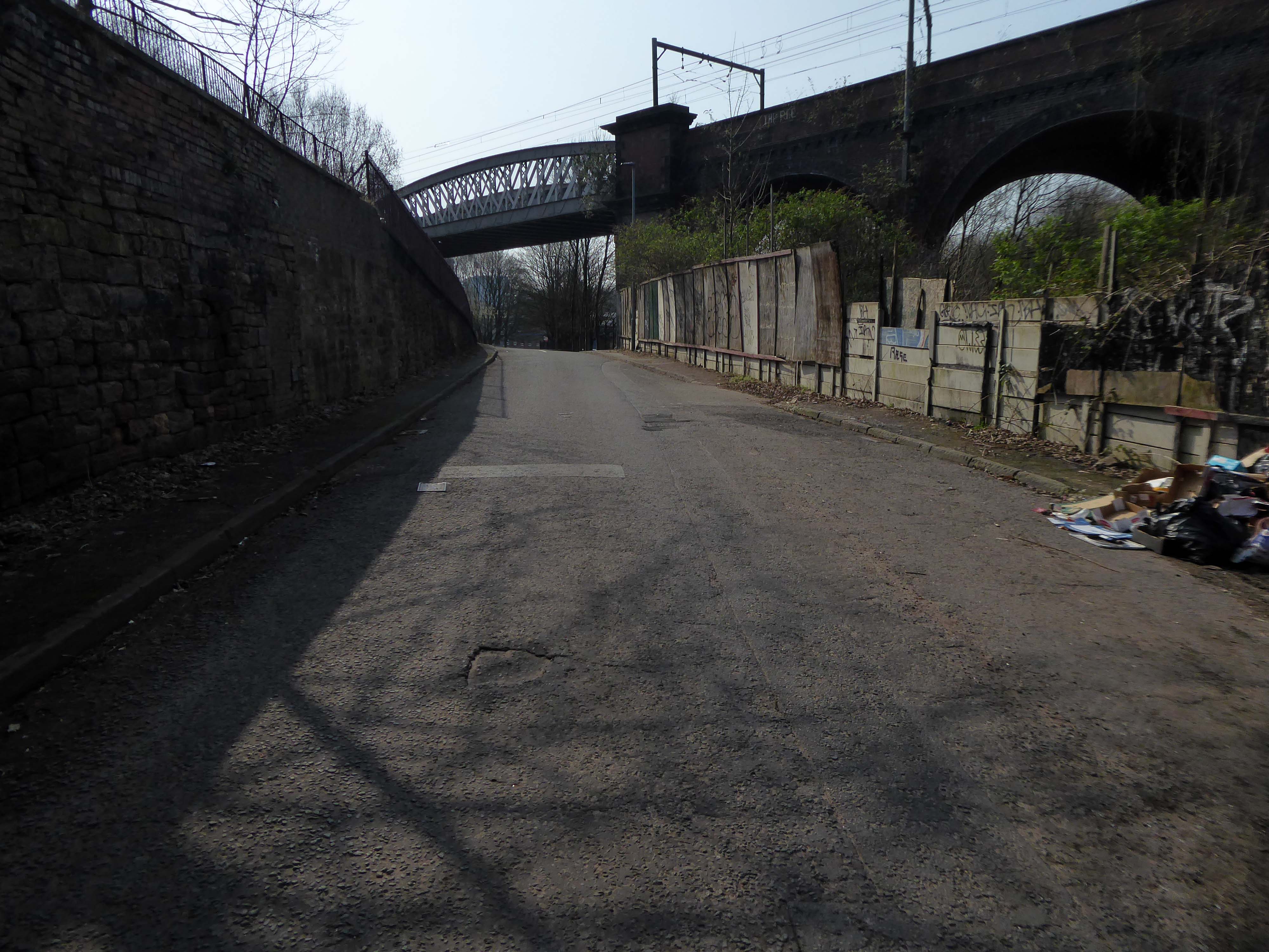
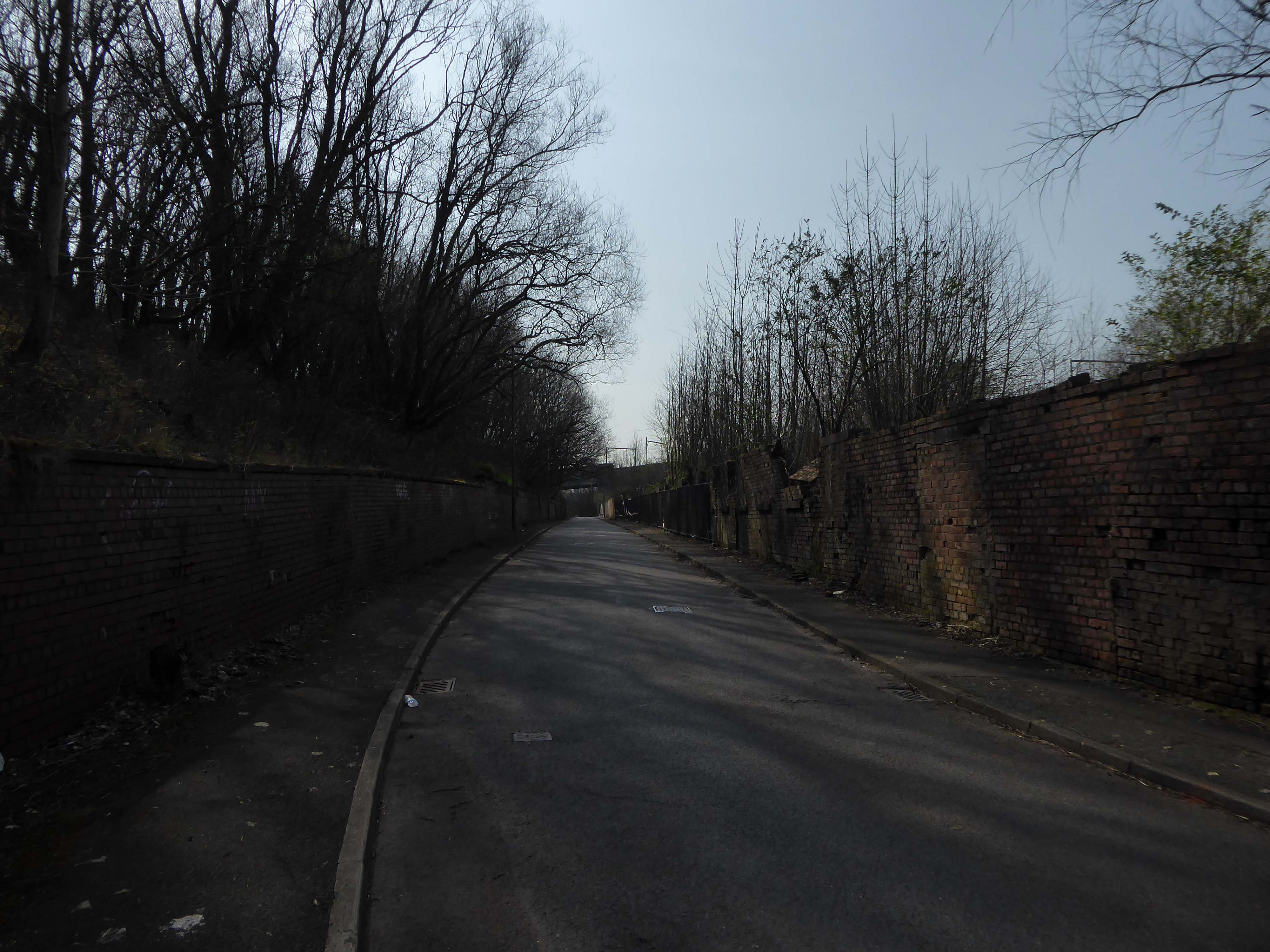
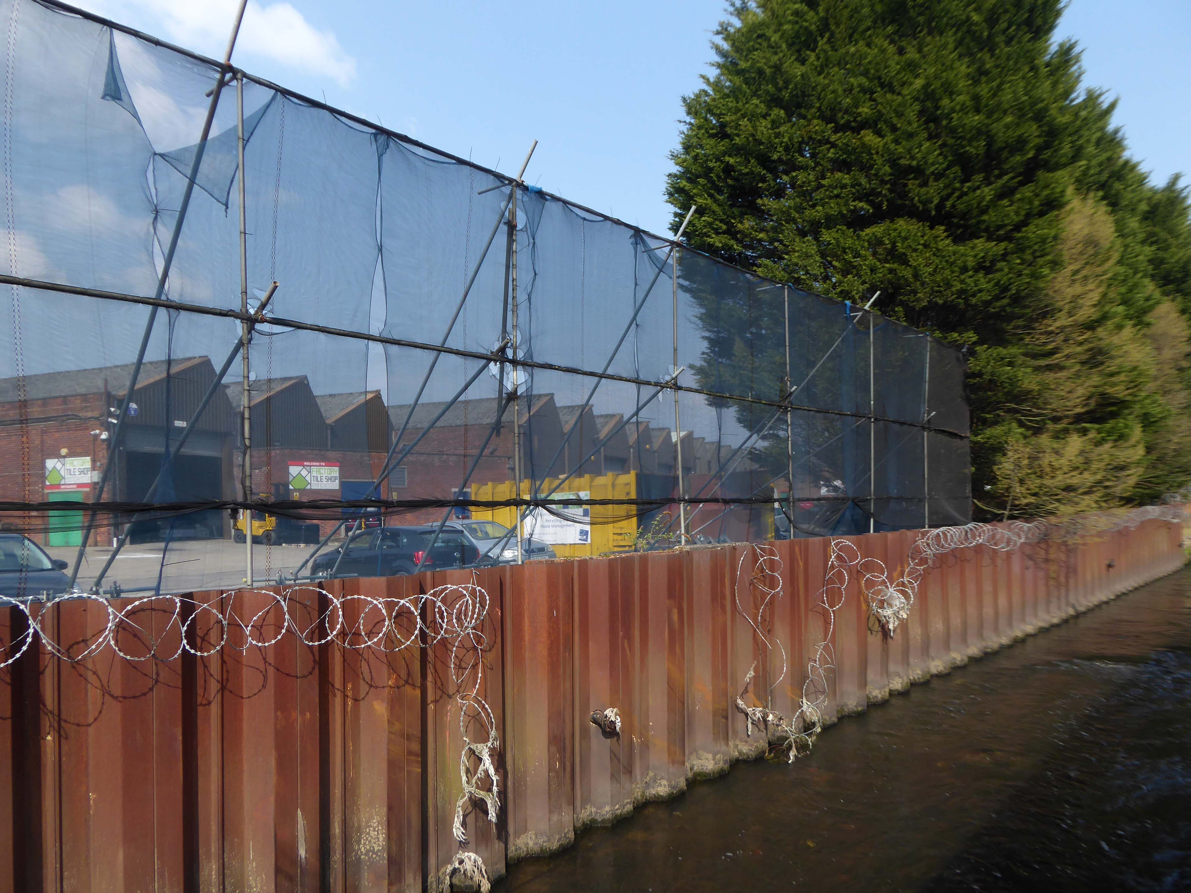
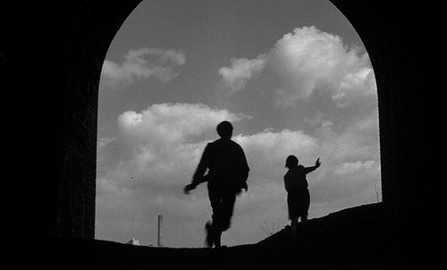
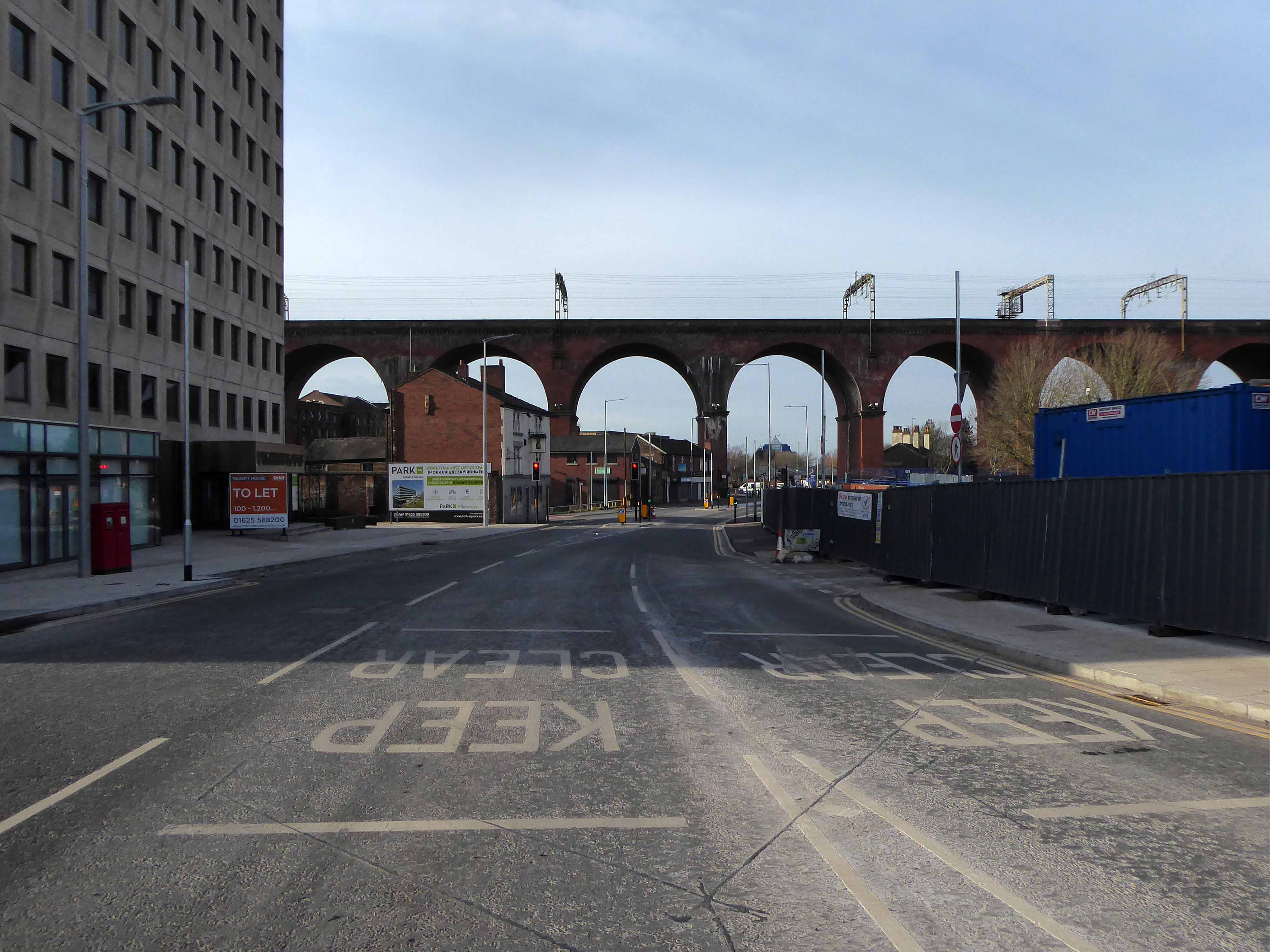
Let’s duck under the railway, through this sad damp pedestrian tunnel – the domain of the cash strapped daytime drinker, transient tagger and disaffected leaflet distributor.
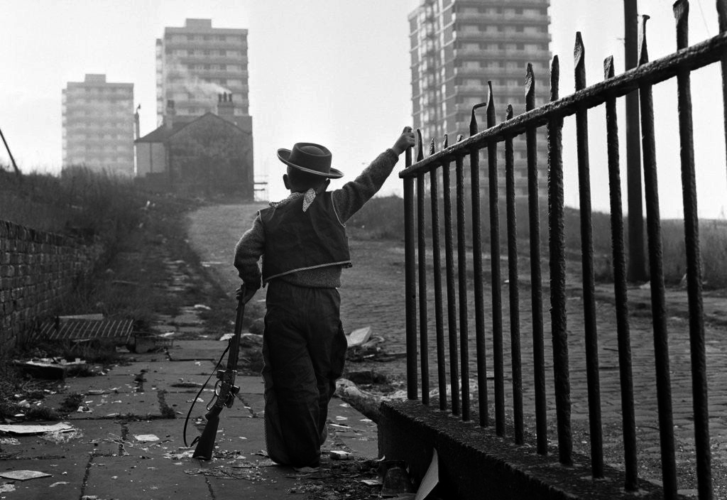
Next thing you know you have emerged into the daylight on Dalton Street – we have been here before seeking the Collyhurst Cowboy.
Photograph: Dennis Hussey
Onwards to Eastford Square.
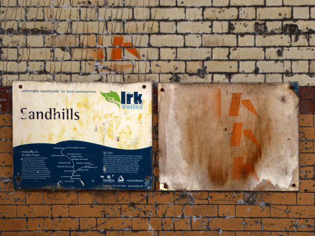
The shops and maisonettes are due to be demolished any day now – no longer to gaze open-eyed upon the former quarry of Sandhills.
Around the front the diggers have been a digging – digging up around the base of the totem.
The work is to be re-sited by the nearby tower blocks.
The end is nigh.
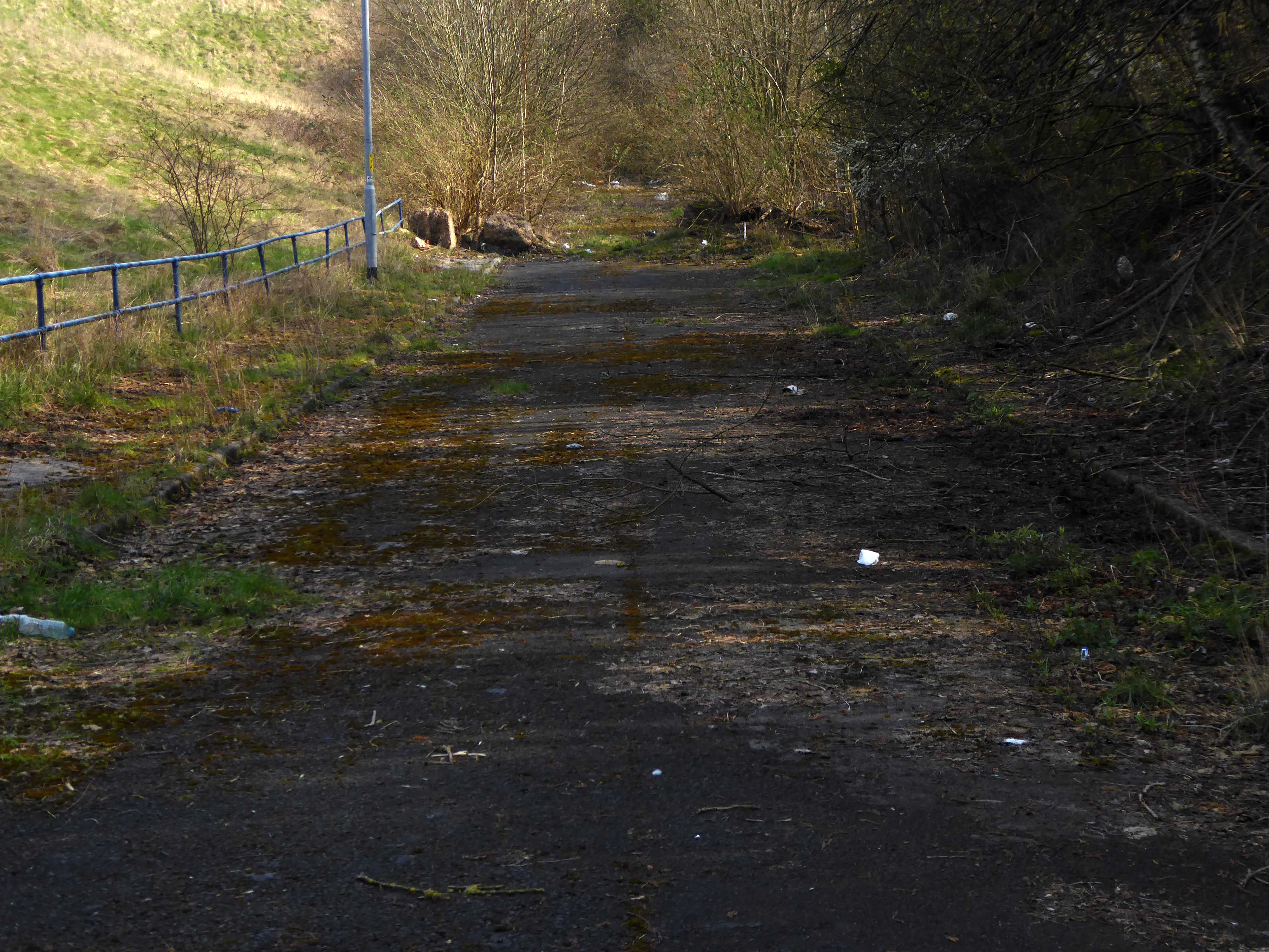
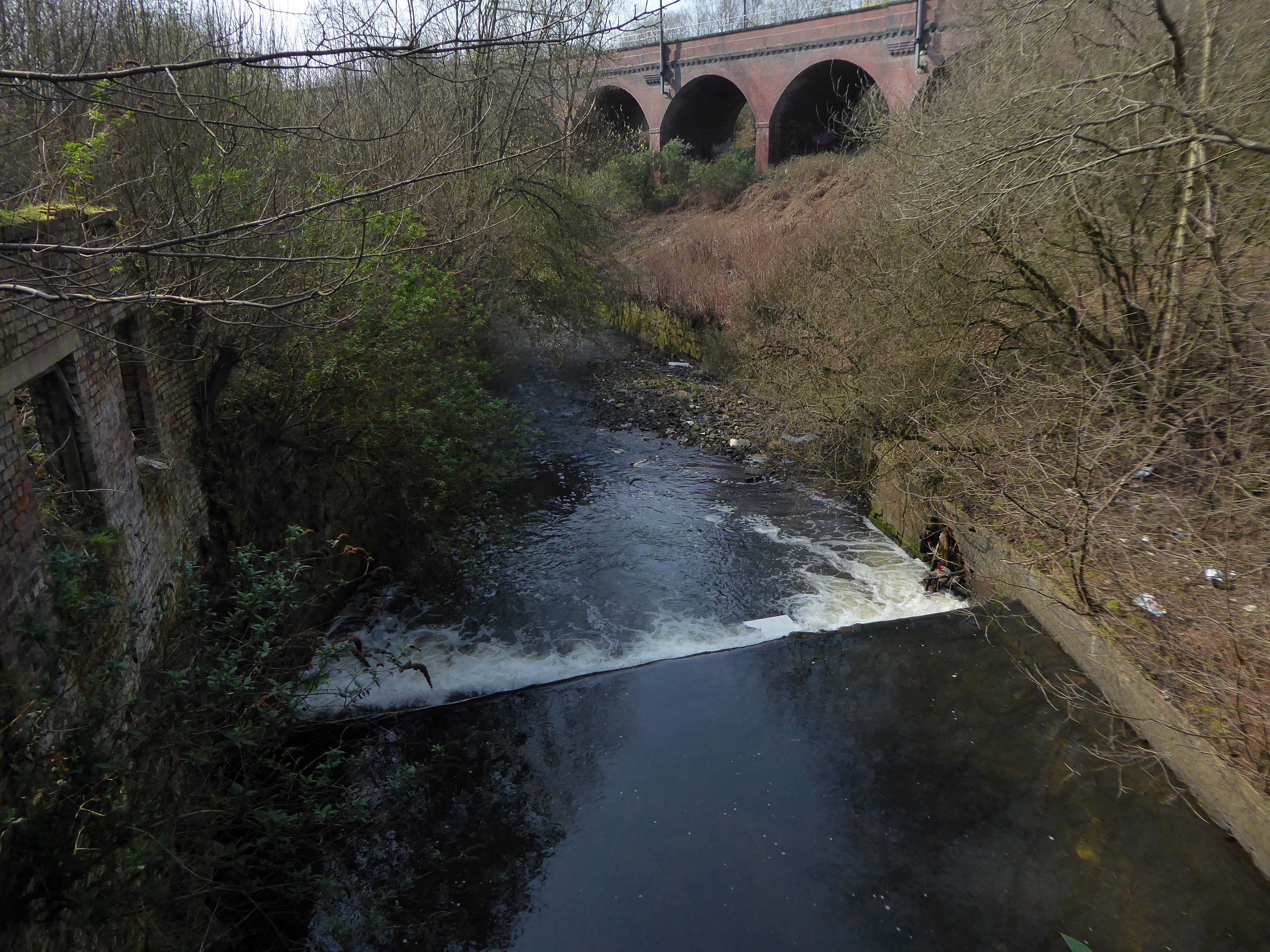
Heading now for Collyhurst Road and the Irk Valley – seen here in 1960.
Looking back on the Square and the Dalton Street flats – Humphries, Dalton, Roach, Vauxhall and Moss Brook Courts under construction.
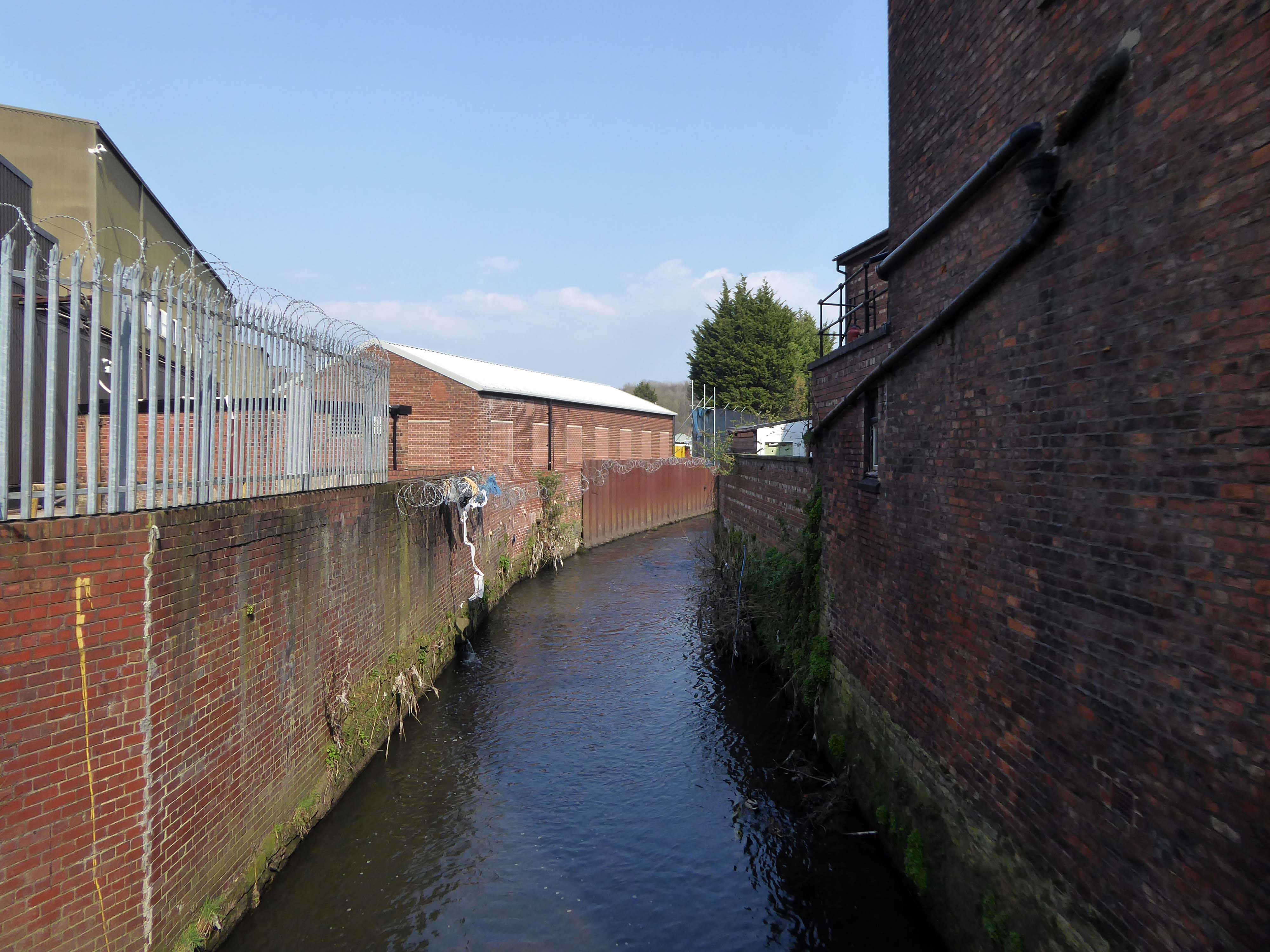
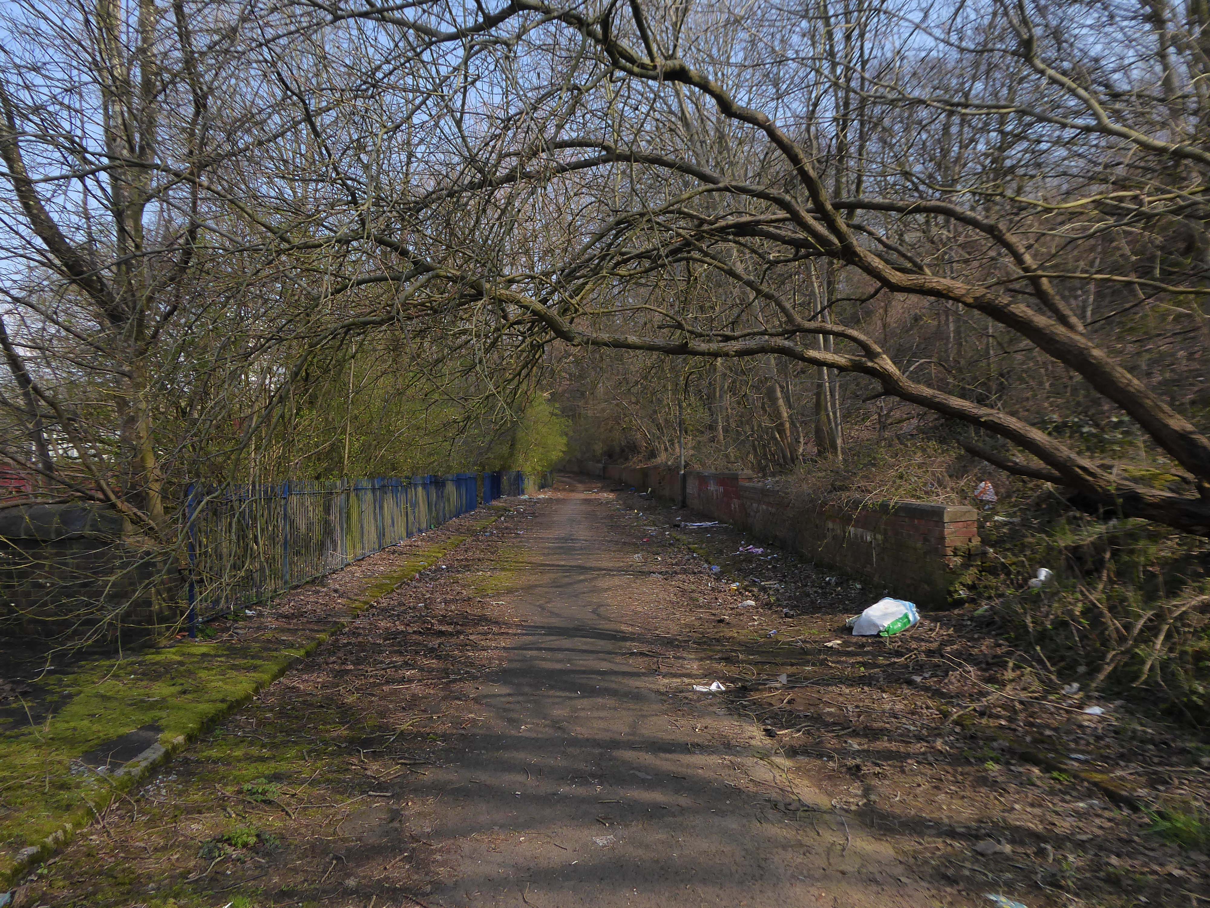
Vauxhall Street now but a shadow of its former self – the last traces of industry long gone.
Reclaimed over time by trees and dense underbrush.
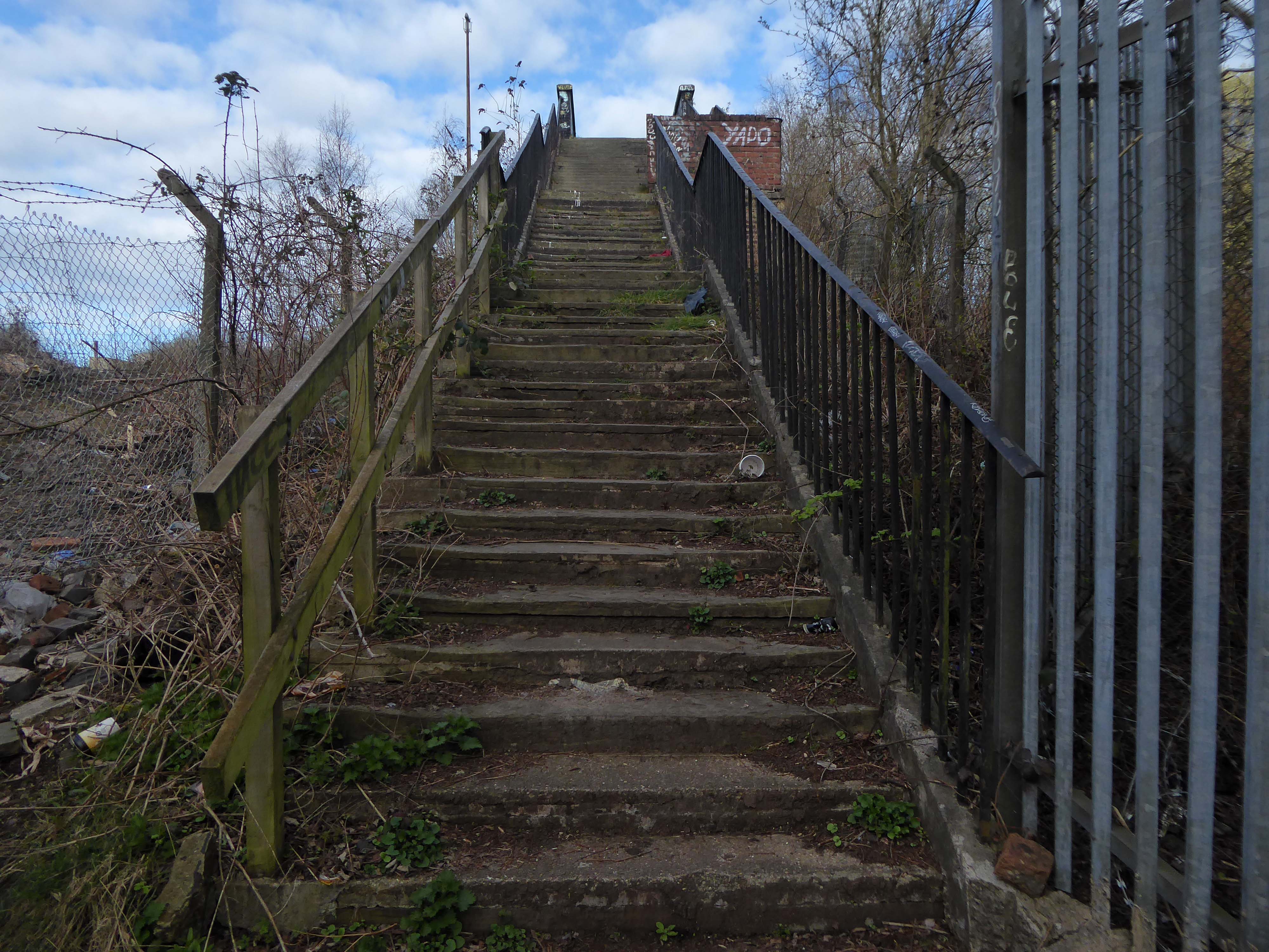
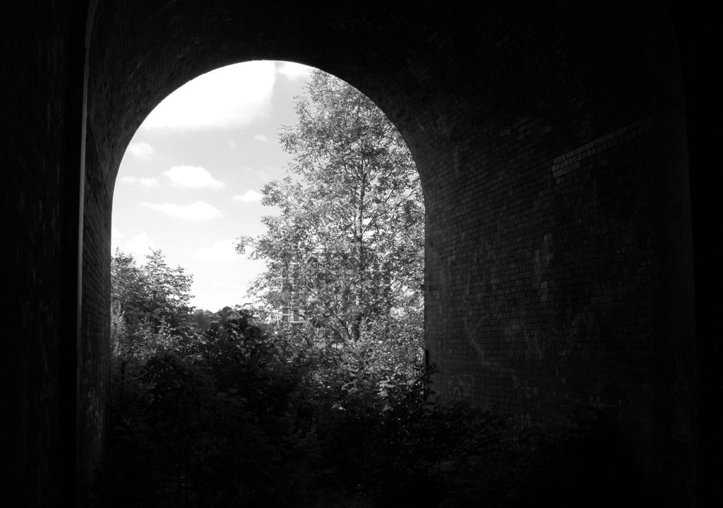
Crossing Collyhurst Road and up and over the railway via Barney’s Steps also known as the Lowry Steps.
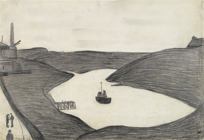
LS Lowry
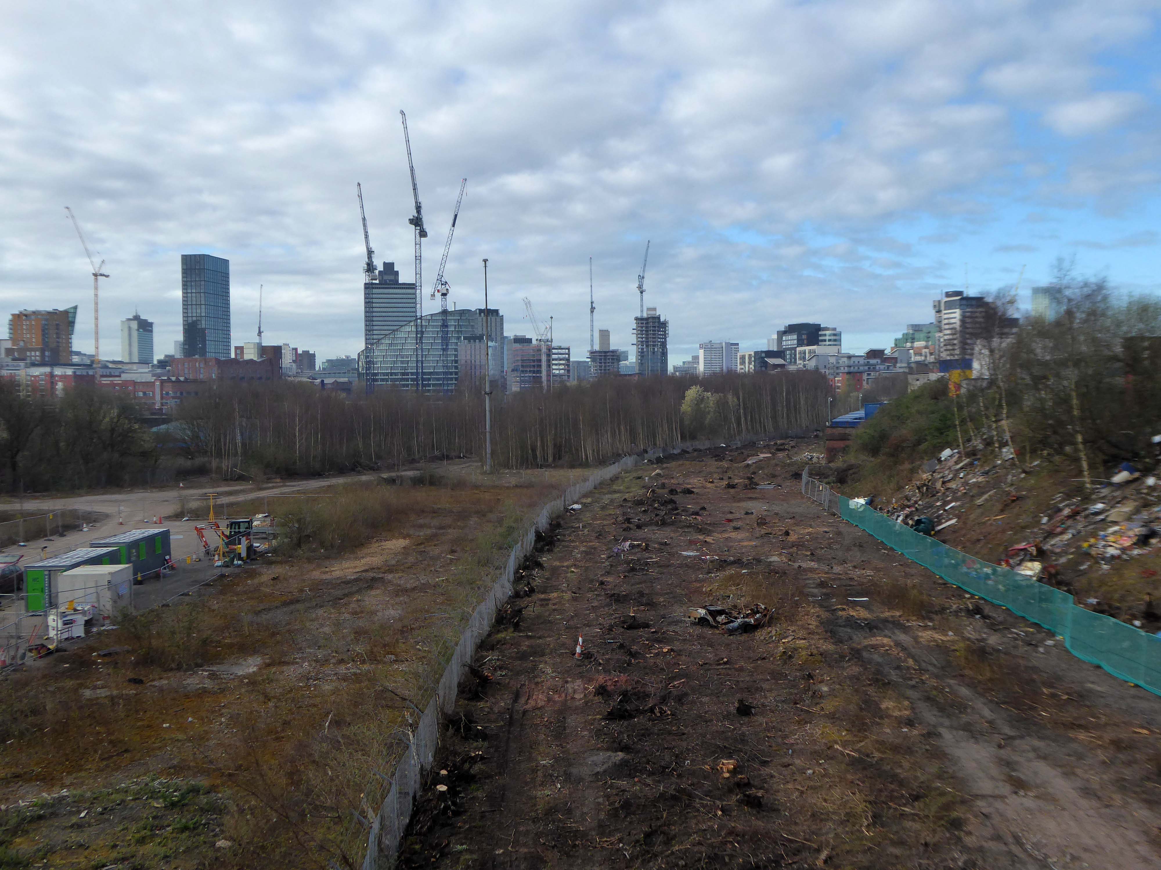
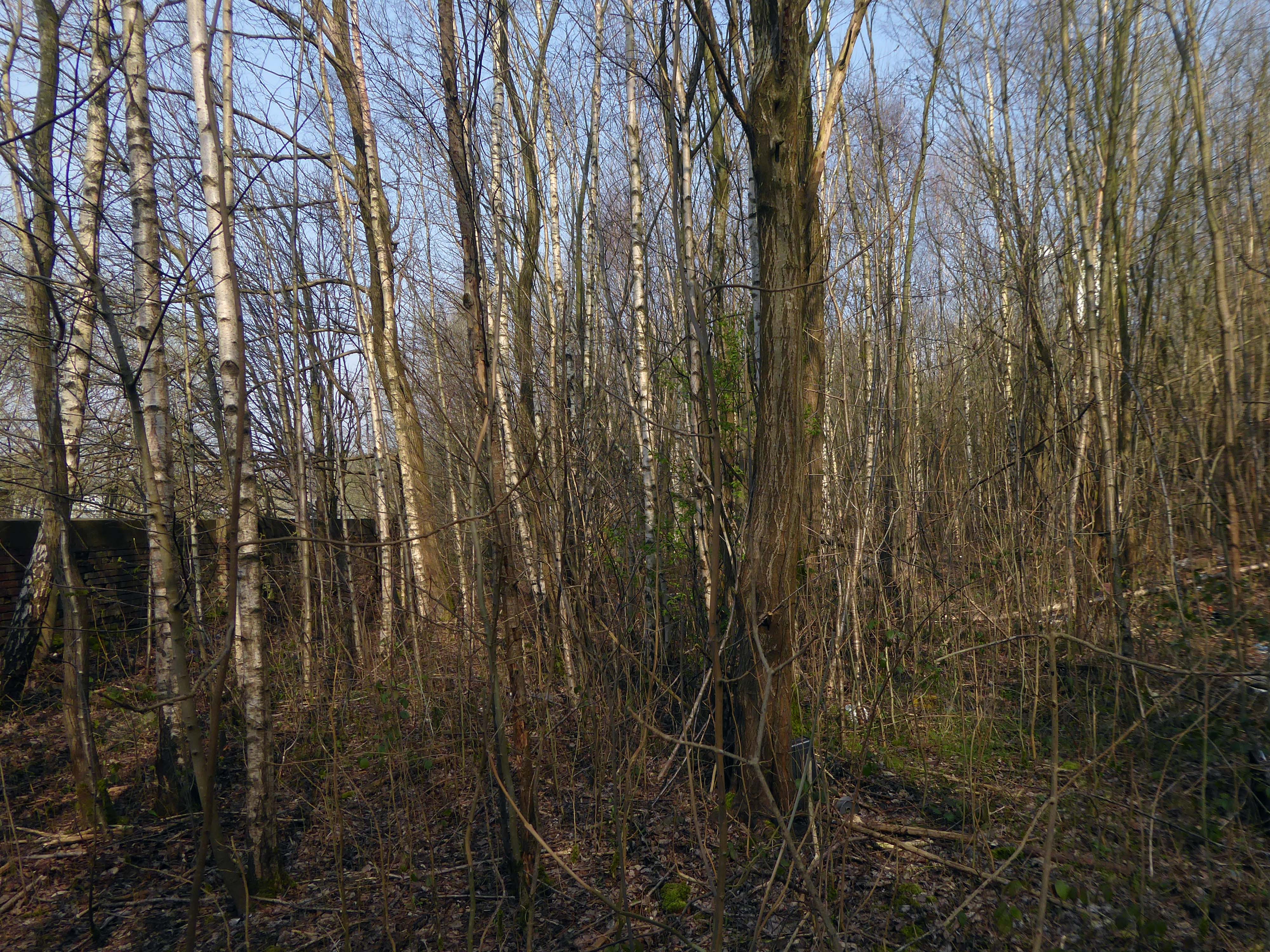
By the late 1950’s the whole of this area which we called Barney’s Tip became a refuse tip for Manchester City Council.
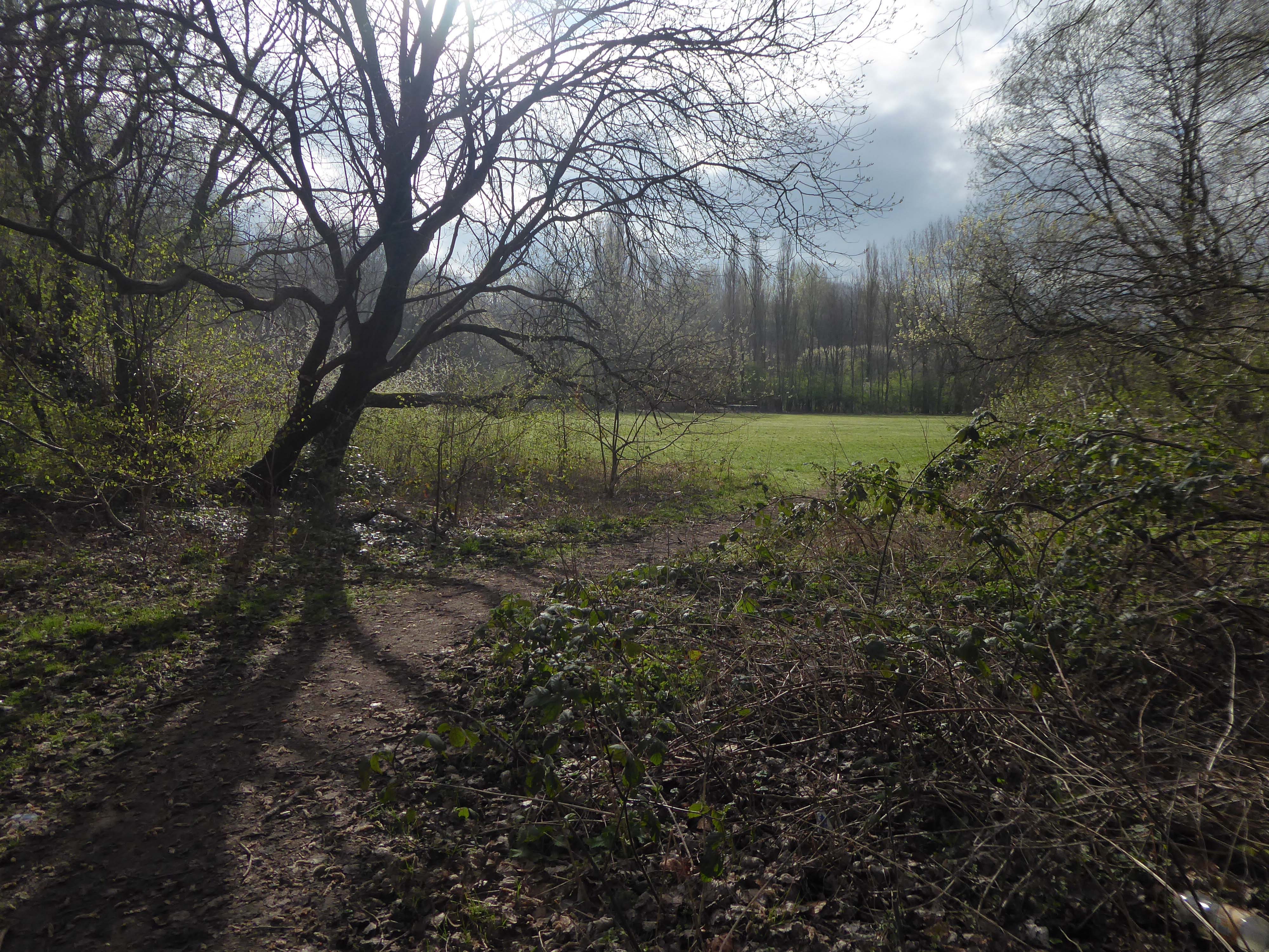
The area is in the process of being reconfigured as a delightful country park.
The investment will also help develop an initial phase of the planned City River Park incorporating St Catherine’s Wood as part of a network of public open space, including improvements along the River Irk and works to improve flood resilience, unlocking the potential of the Irk Valley that will characterise the wider Northern Gateway project.
The first phase of the City River Park will begin work to transform former railway architecture to develop the new Viaduct Linear Park north of Victoria Train Station, new stepped public realm space – Red Bank Terraces, along with new green space by the River Irk and the key improvements to St Catherine’s Wood.
Collingham Street is lined with trucks, trailers, stalls and mobile homes.
But there’s nothing temporary about this Cheetham Hill neighbourhood; most residents have lived here for years and many plan to spend the rest of their lives here.
Founded more than forty years ago, it was created by the Showman’s Guild of Great Britain – and it’s reserved exclusively for fairground workers both retired and current.
Built on Queens Road tip, a former rubbish dump, and rented out by Manchester Council, many of the 52 homes belong to older retired showmen or families for whom an itinerant lifestyle has become more challenging.
It’s a close-knit community with a unique shared history.
Though not without its own particular issues it would seem, according to the MEN.
The licensing out of hours team has received noise complaints relating to the premises which was found to be open beyond permitted hours when visited. Officers also identified breaches of the Health Act during inspections in which people were seen smoking shisha pipes in an enclosed extension at the back.
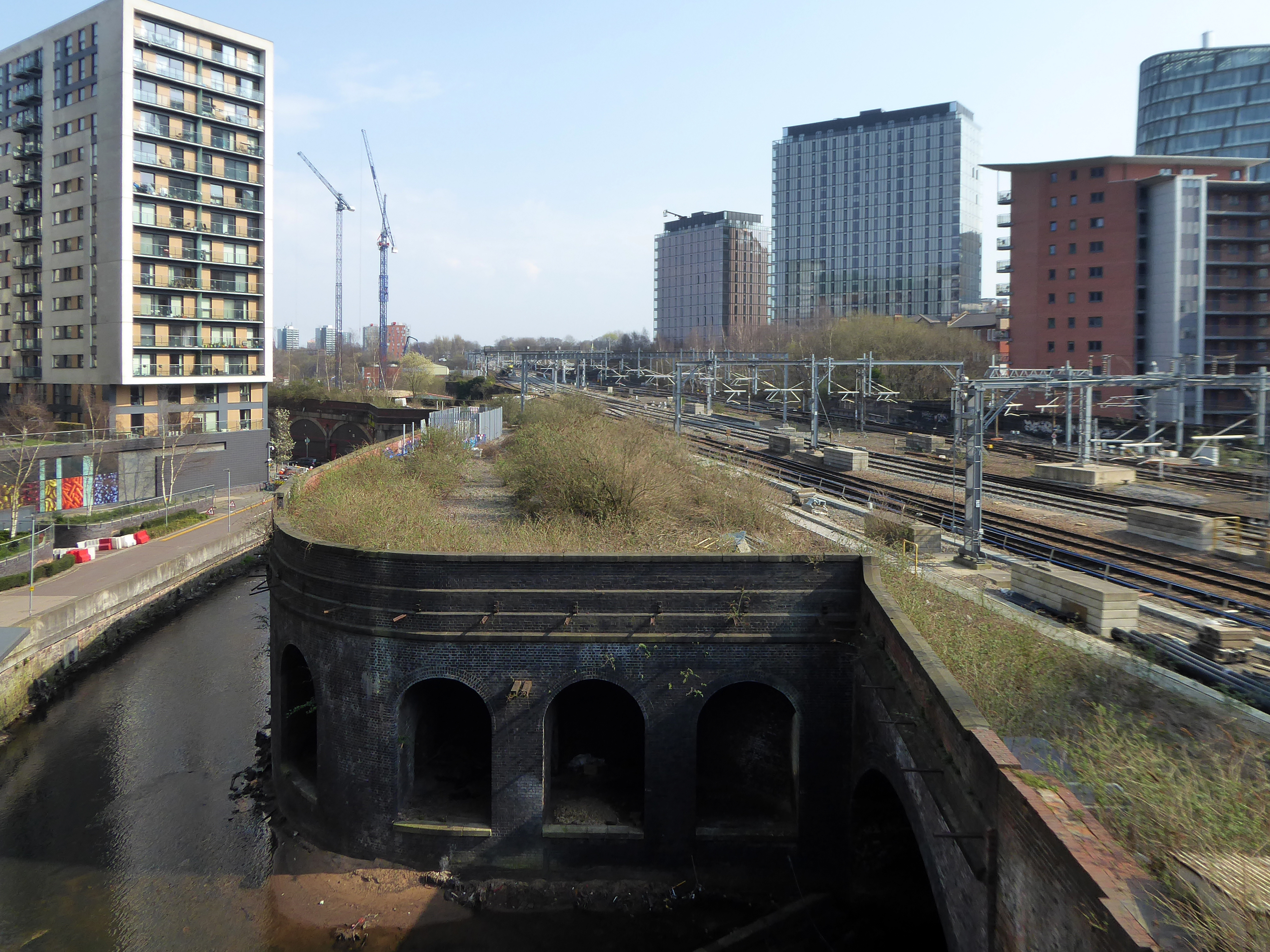
We will leave the Flamingo be and head back into town – but not without giving a nod to this confusing collision between this self-made scrapyard-man chic gate and the ever changing skyline of overheated urban regeneration.
The new creation has come: The old has gone, the new is here!
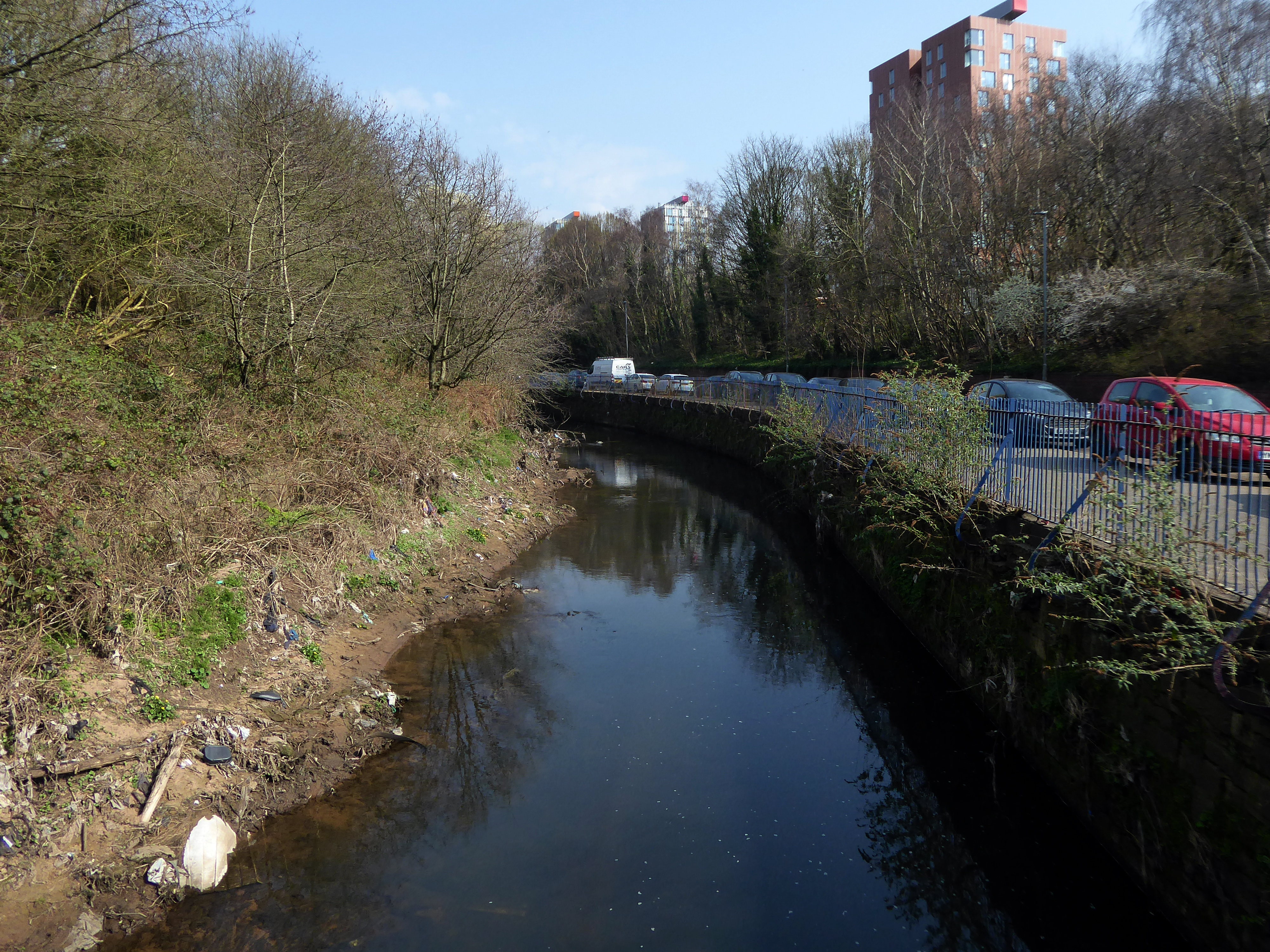
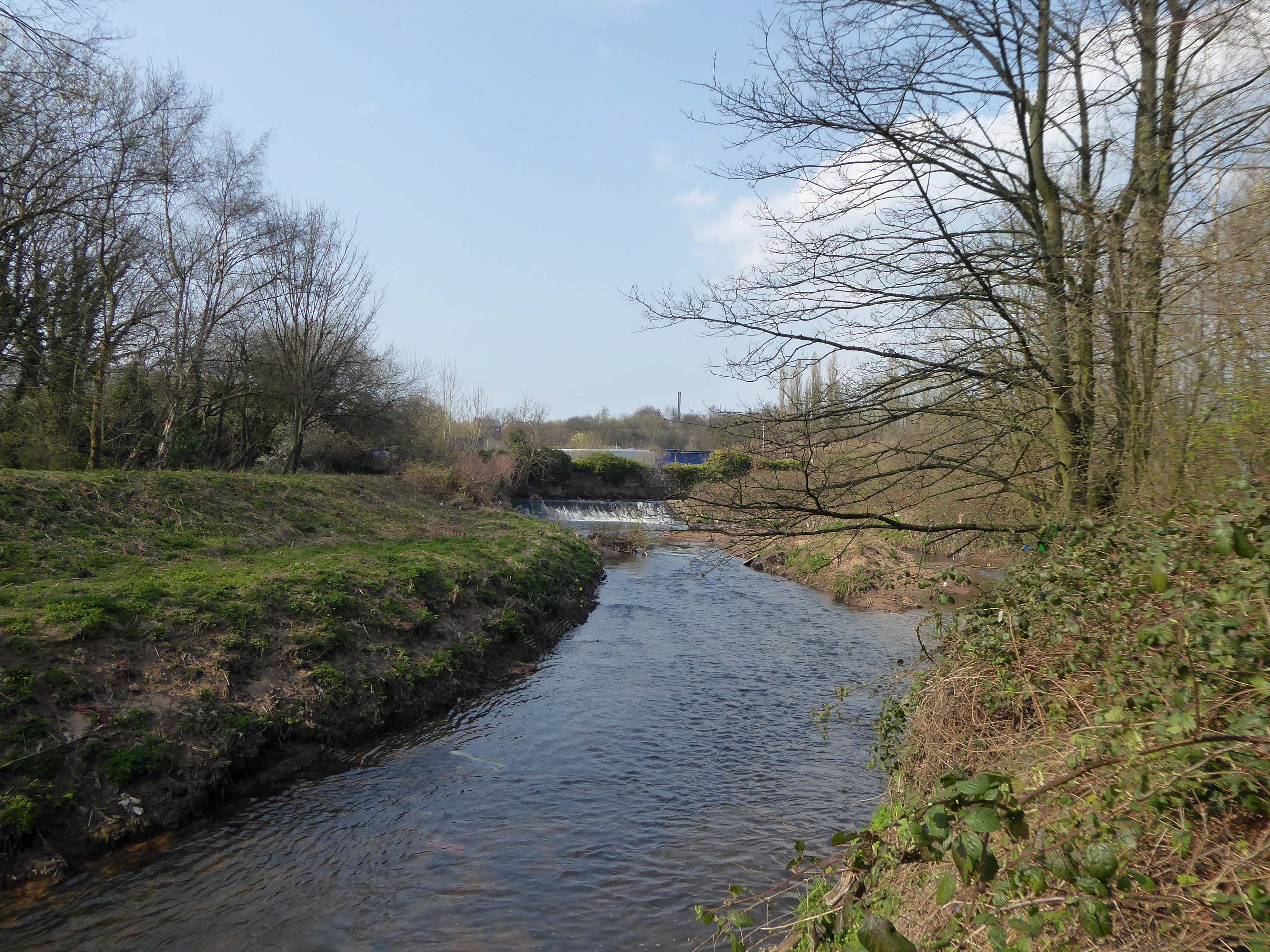
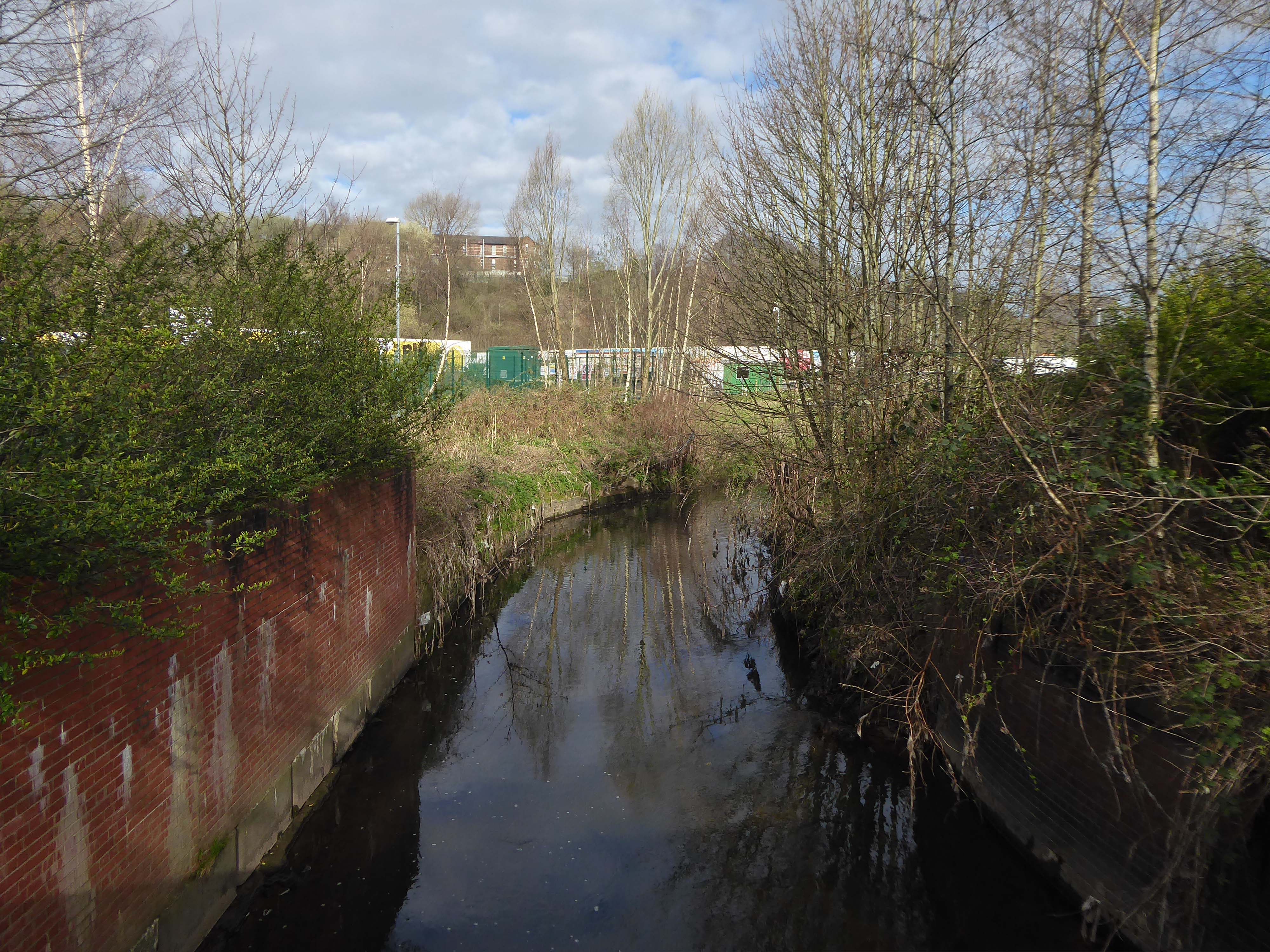
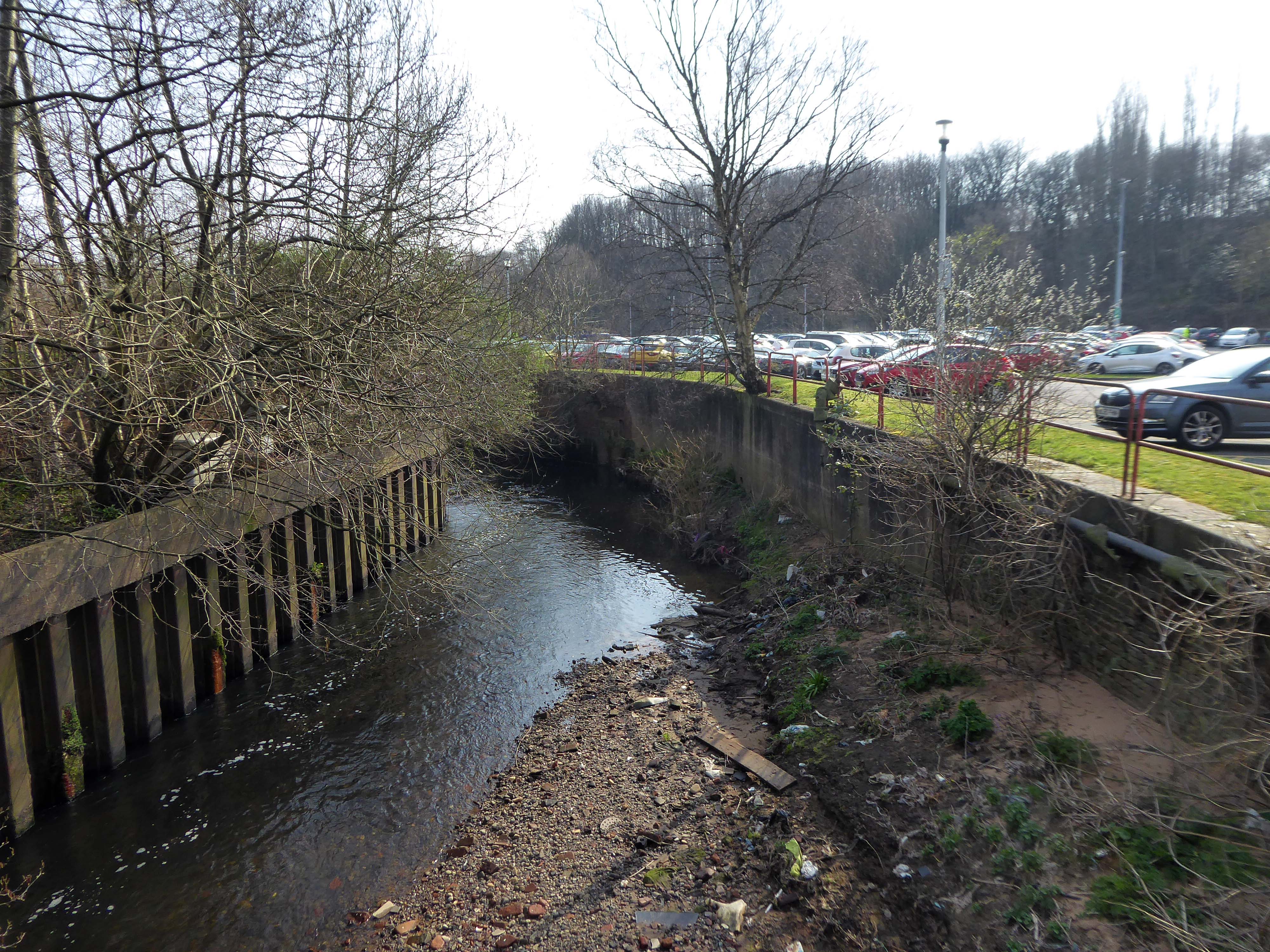
The first leg of a journey to the source of the River Irk beginning behind Victoria, finishing by the Hexagon Towerin Blackley.
The Irk’s name is of obscure etymology, but may be Brittonic in origin and related to the Welsh word iwrch, meaning roebuck
In medieval times, there was a mill by the Irk at which the tenants of the manor ground their corn and its fisheries were controlled by the lord of the manor. In the 16th century, throwing carrion and other offensive matter into the Irk was forbidden. Water for Manchester was drawn from the river before the Industrial Revolution. A bridge over the Irk was recorded in 1381. The river was noted for destructive floods. In 1480, the burgesses of Manchester described the highway between Manchester and Collyhurst which – the water of Irk had worn out. In 1816, of seven bridges over the Irk, six were liable to be flooded after heavy rain but the seventh, the Ducie Bridge completed in 1814 was above flood levels.
According to The New Gazetteer of Lancashire the Irk had – more mill seats upon it than any other stream of its length in the Kingdom and – the eels in this river were formerly remarkable for their fatness, which was attributed to the grease and oils expressed by the mills from the woollen cloths and mixed with the waters.
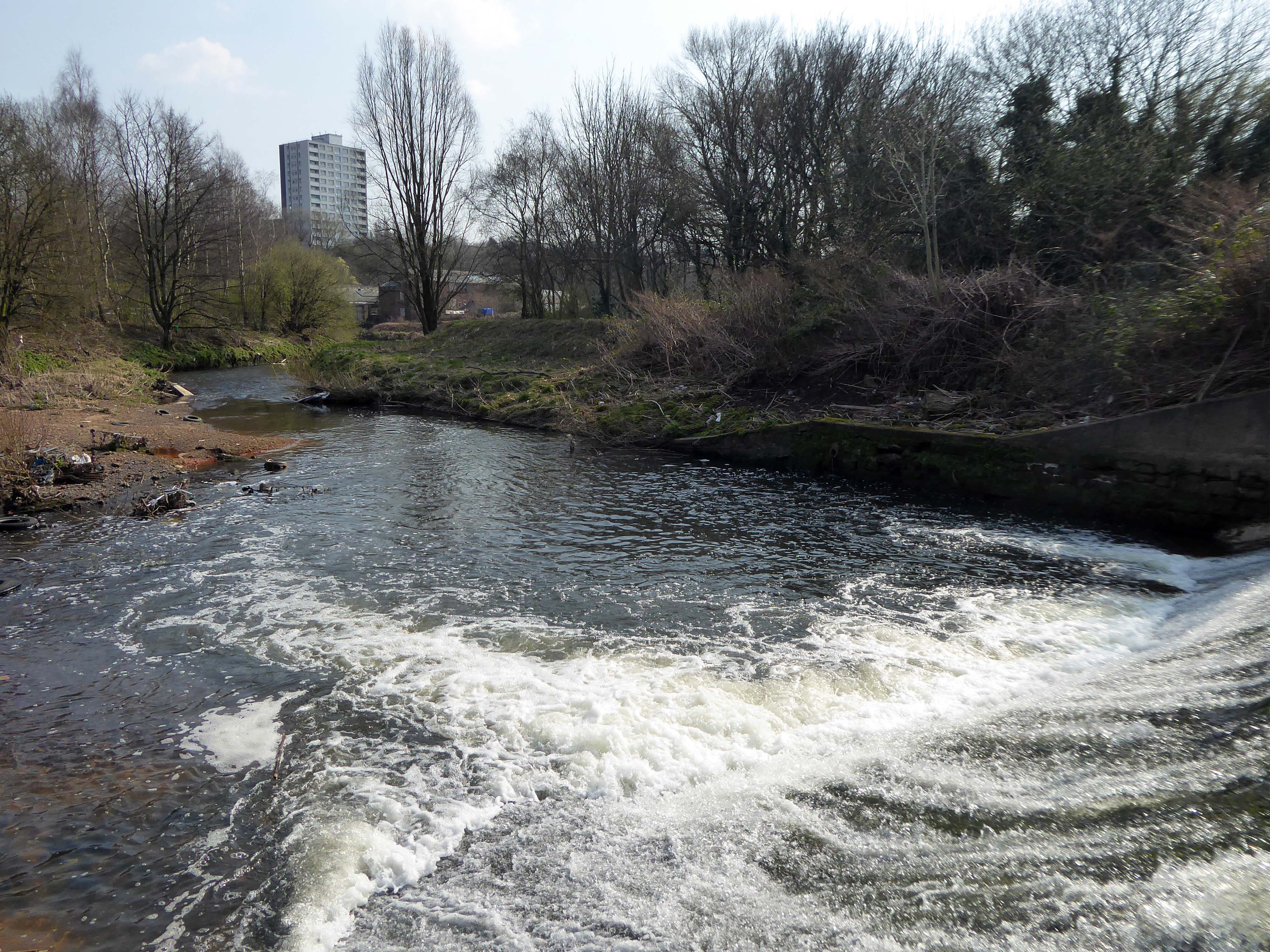
However, by the start of the 20th century the Irk Valley betweenCrumpsall and Blackley had been left a neglected river – not only the blackest but the most sluggish of all rivers.
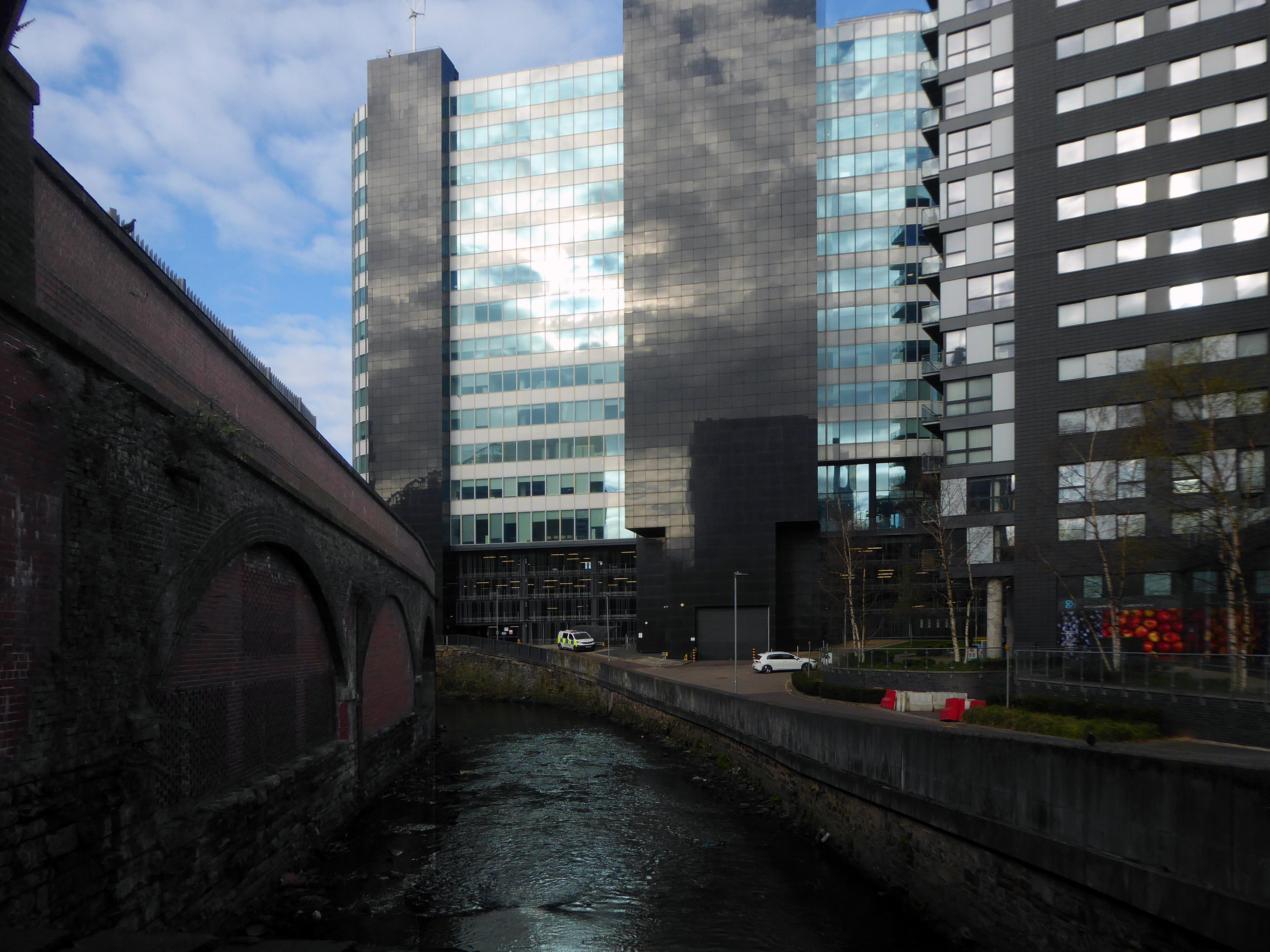
The river emerges from beneath the city into an area named Scotland – a remnant of Manchester’s links with the Jacobite Rebellion.
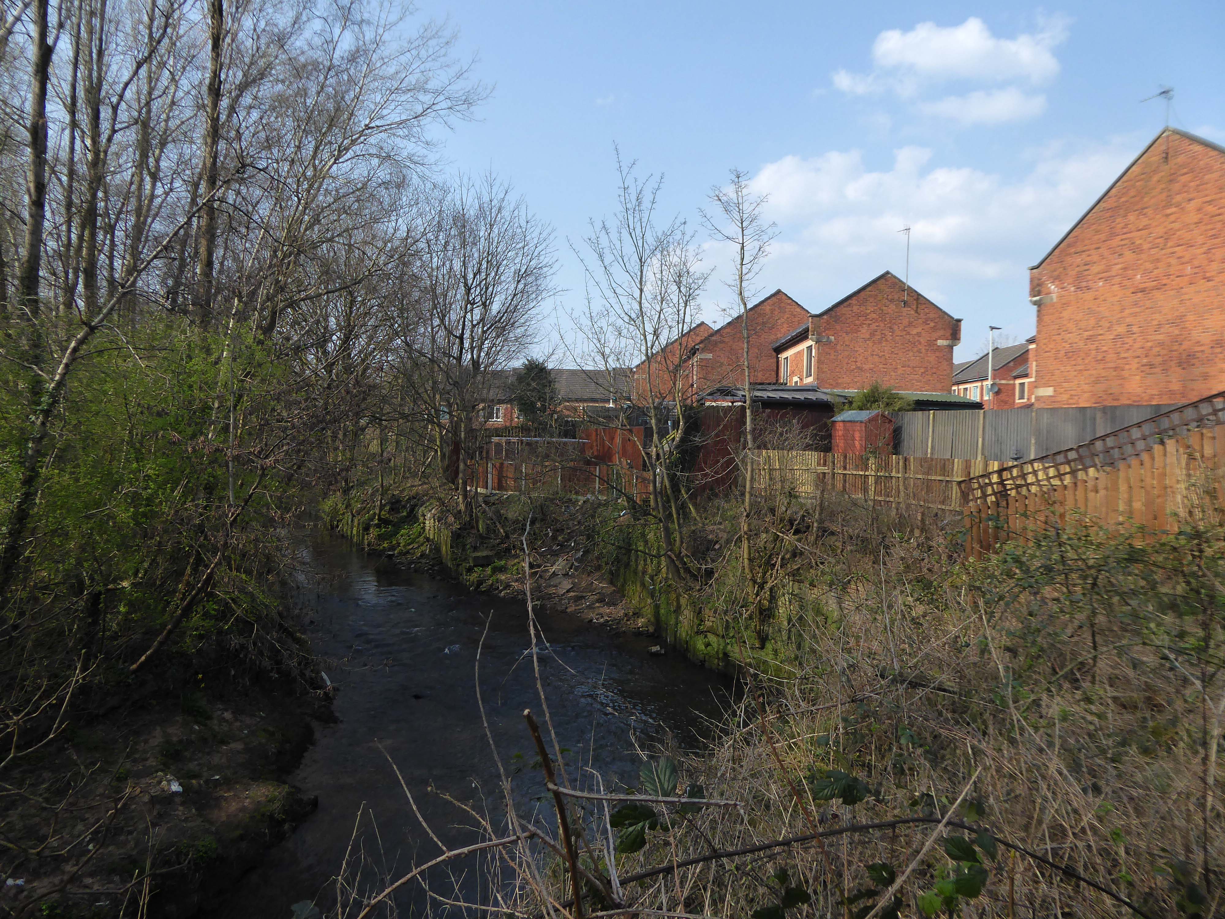
To the left were the squalid Victorian homes of Red Bank – currently presenting as the Green Quarter.
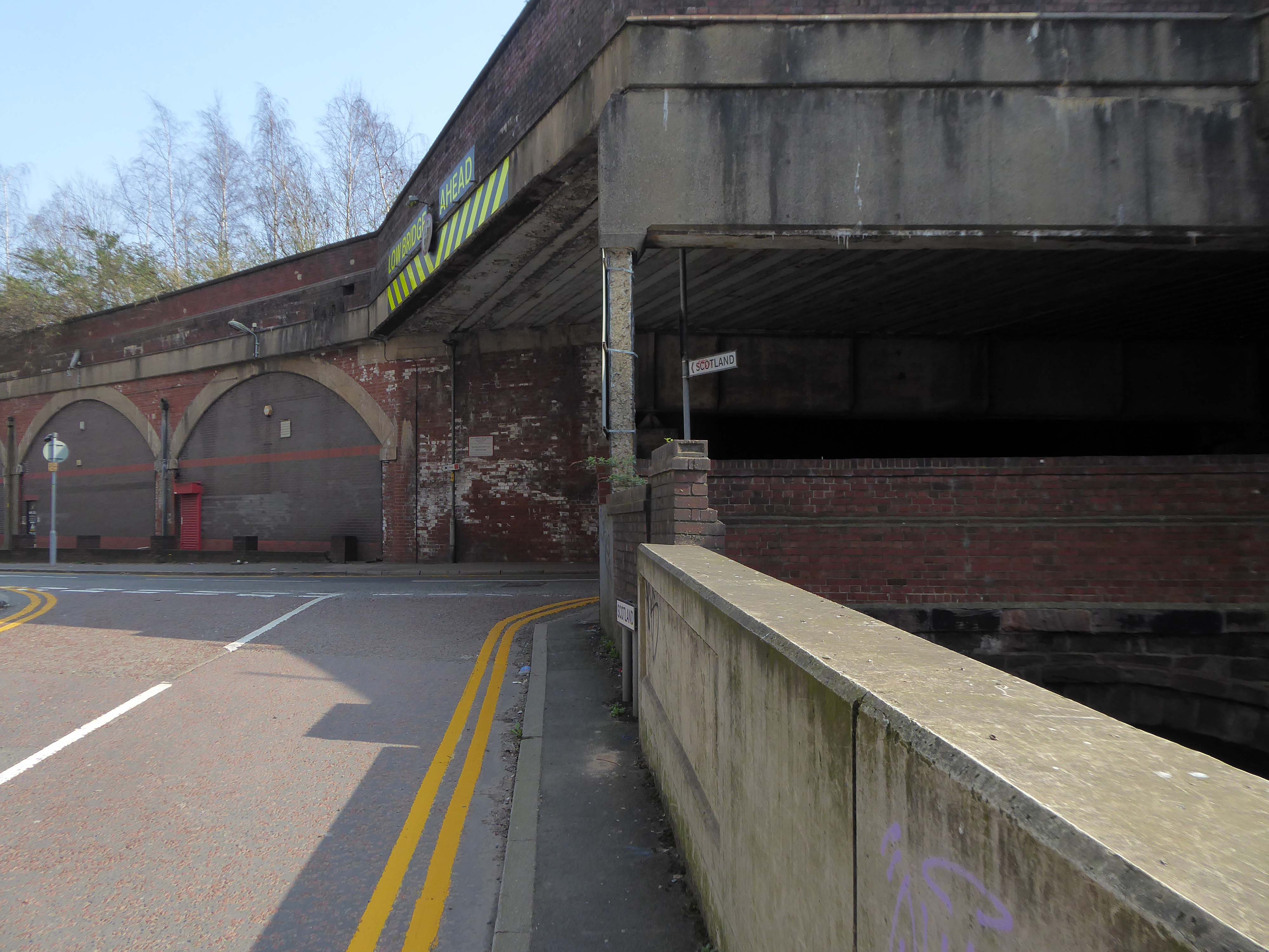
The river briefly becomes subterranean again.
This is a river with an ignominious history – famously damned by émigré Friedrich Engels.
At the bottom flows, or rather stagnates, the Irk, a narrow, coal-black, foul-smelling stream, full of debris and refuse, which it deposits on the shallower right bank.
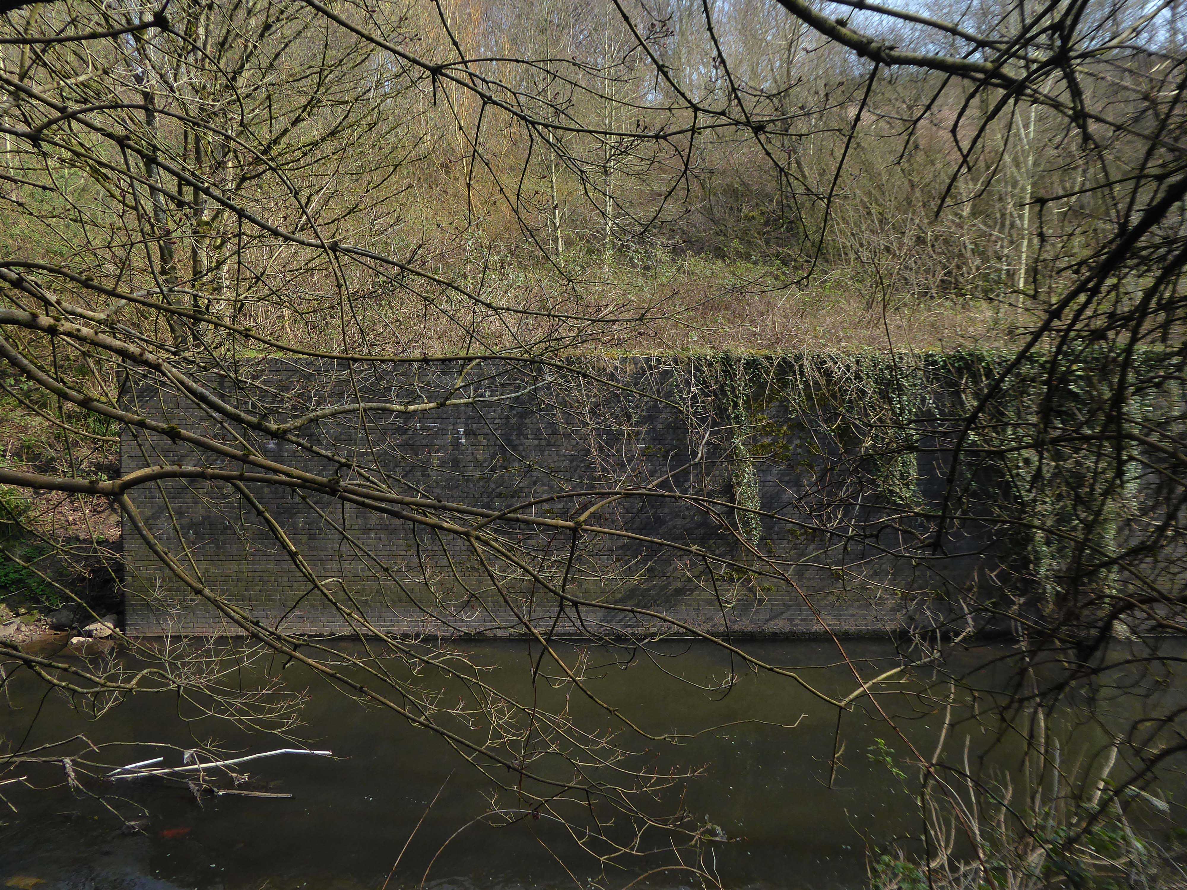
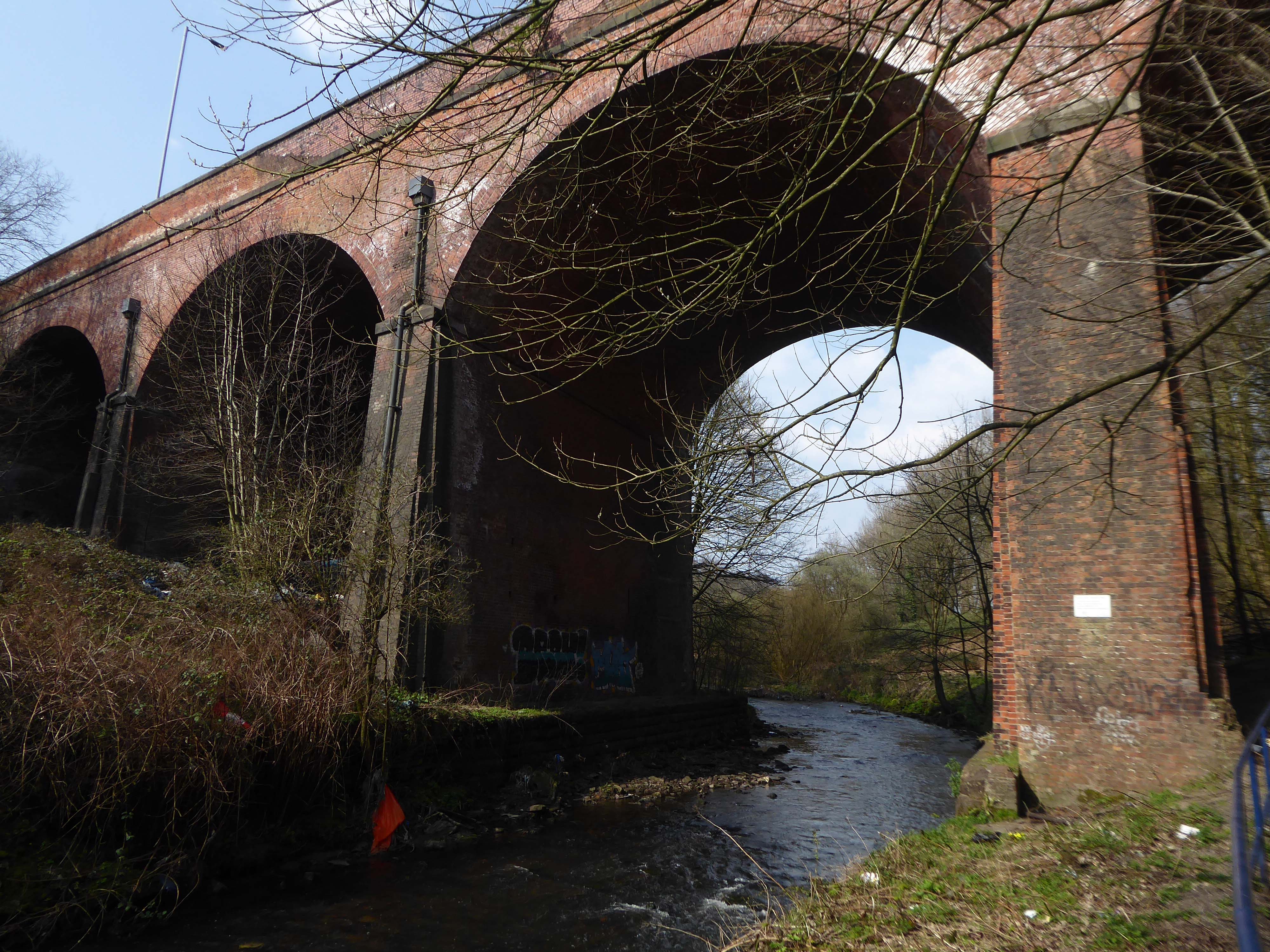
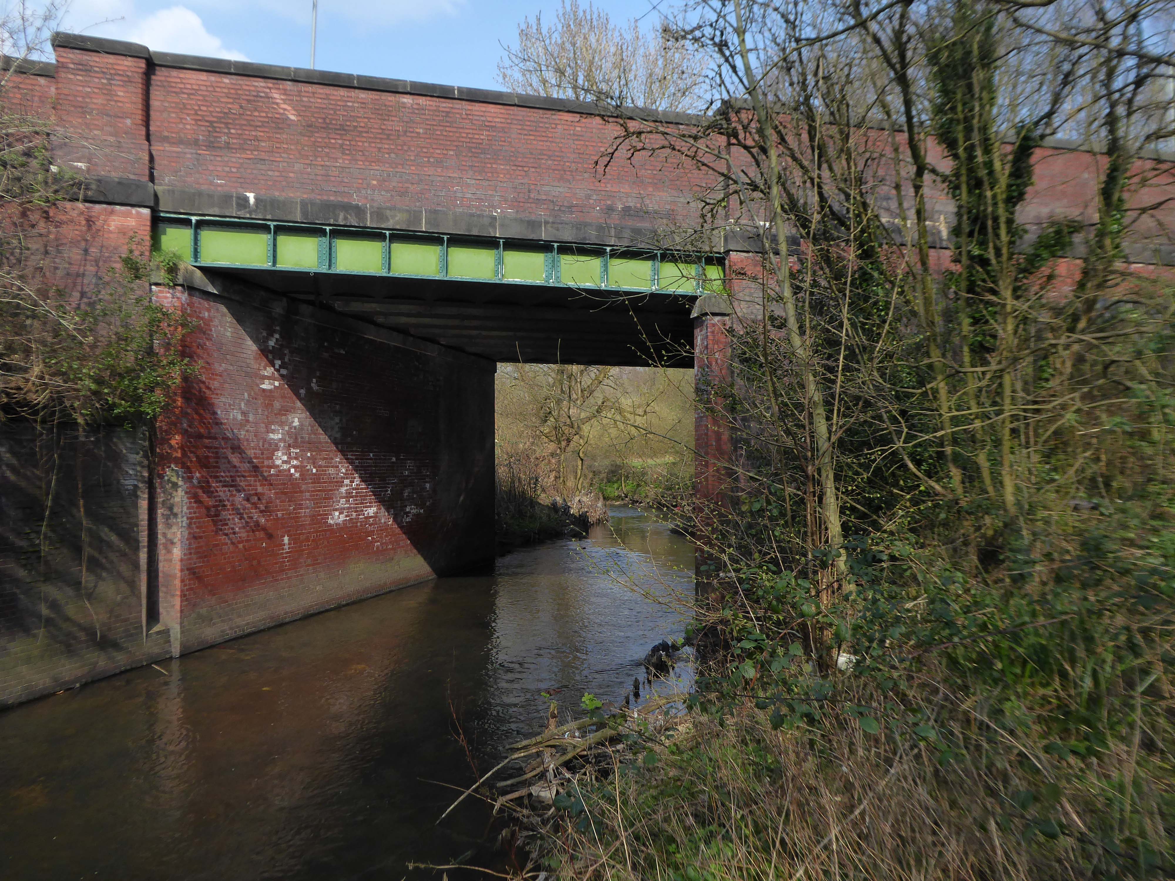
Spanning the defunct railway workings, affording a view of the brightly blooming city centre.
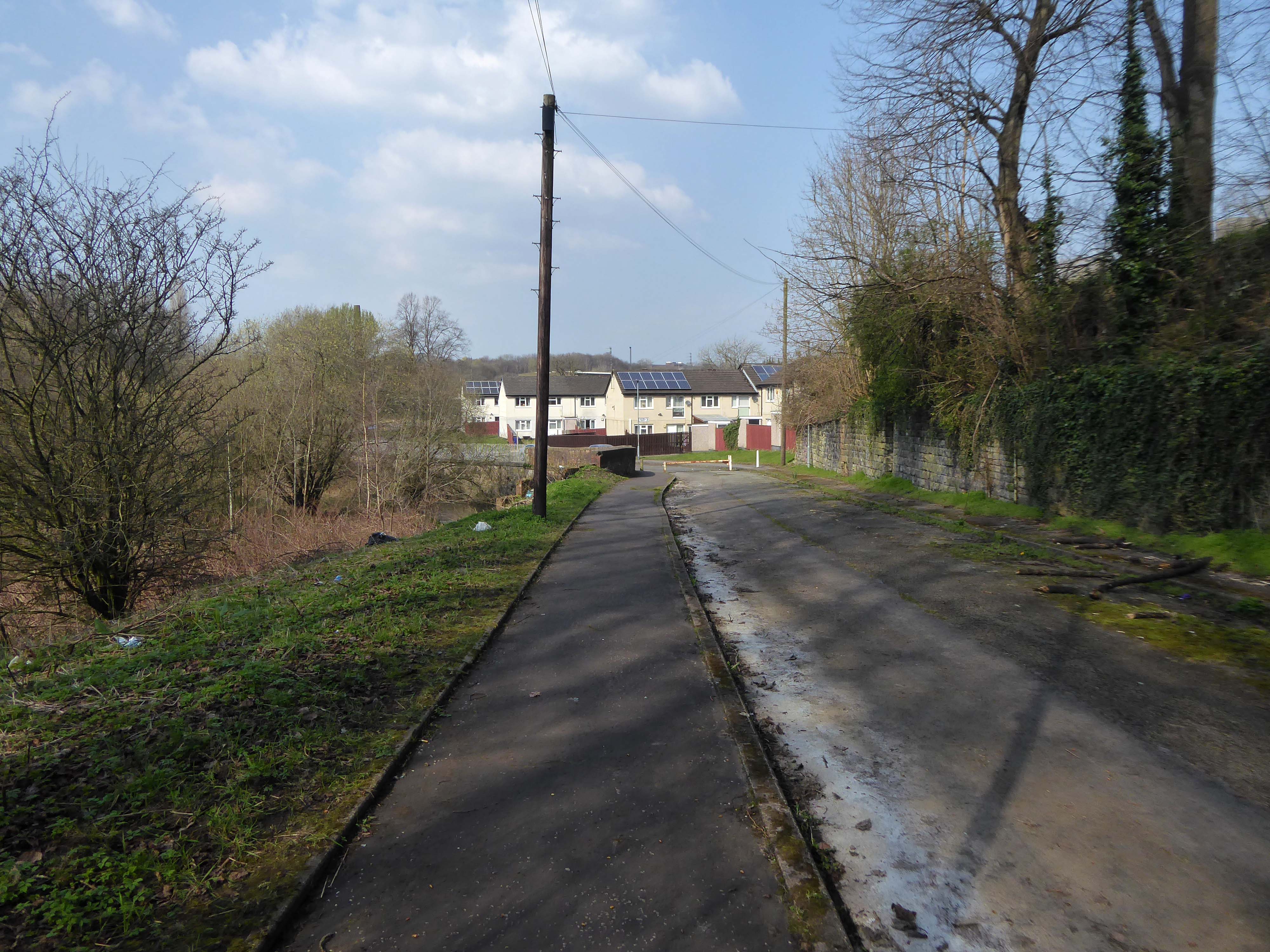
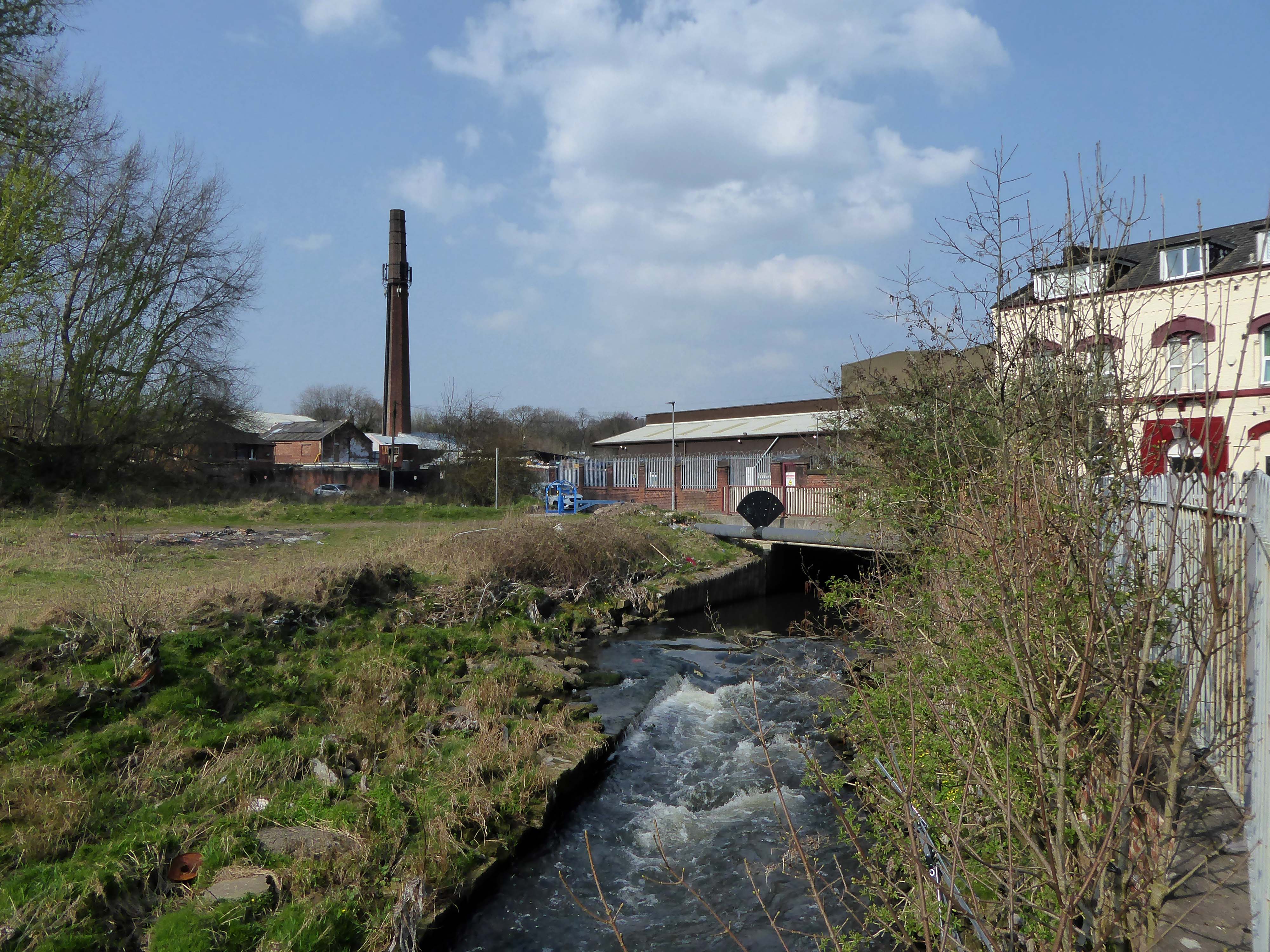
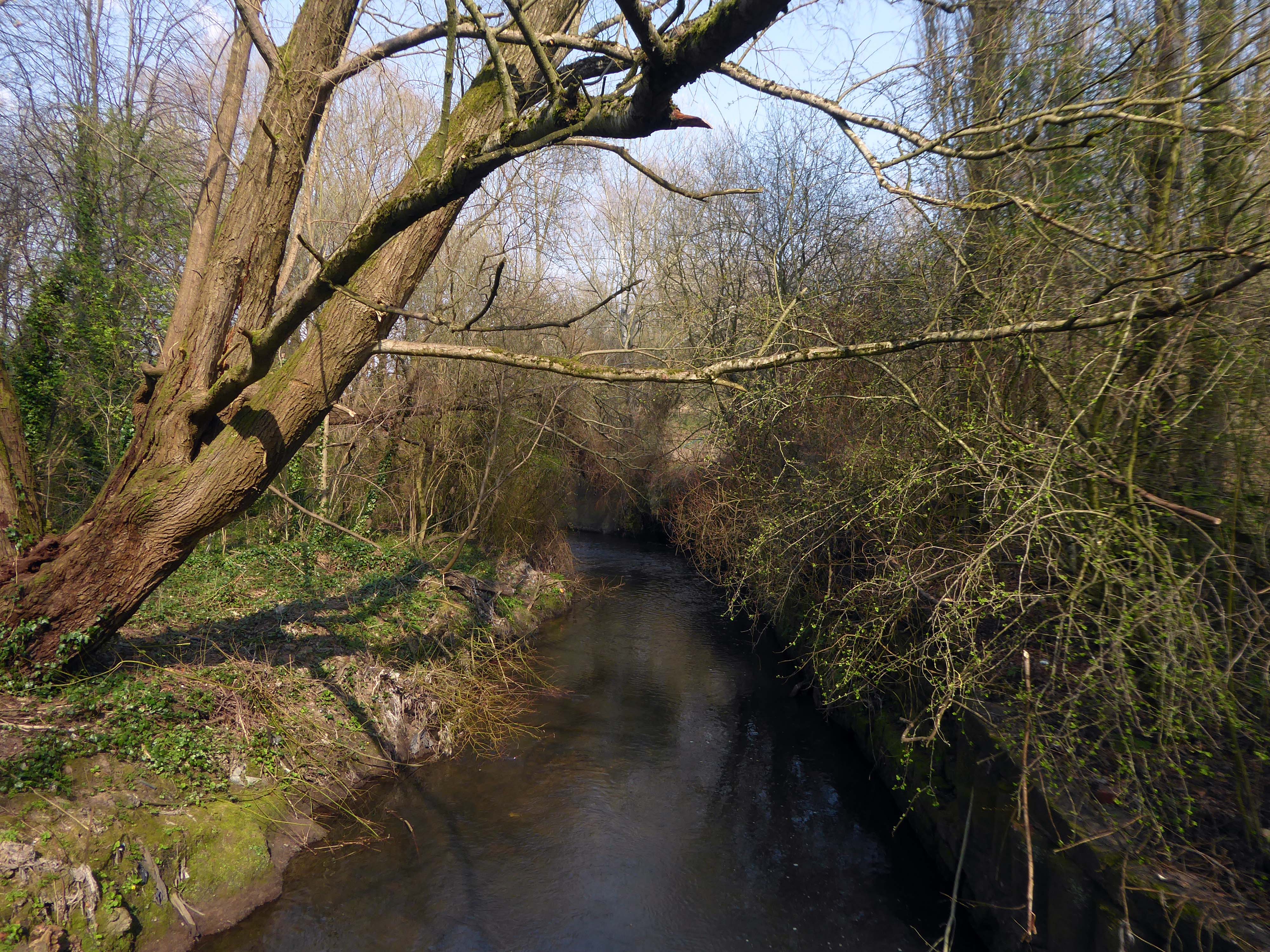
Leaving Collyhurst Road, we journey along Smedley Road.
Seen here in 1934.
Passing beneath Queens Road – Queens Park to the right.
Queen’s Park was one of Britain’s first municipal parks created in 1846. The park was originally arranged around Hendham Hall, home of the Houghton family however this was demolished in 1884.
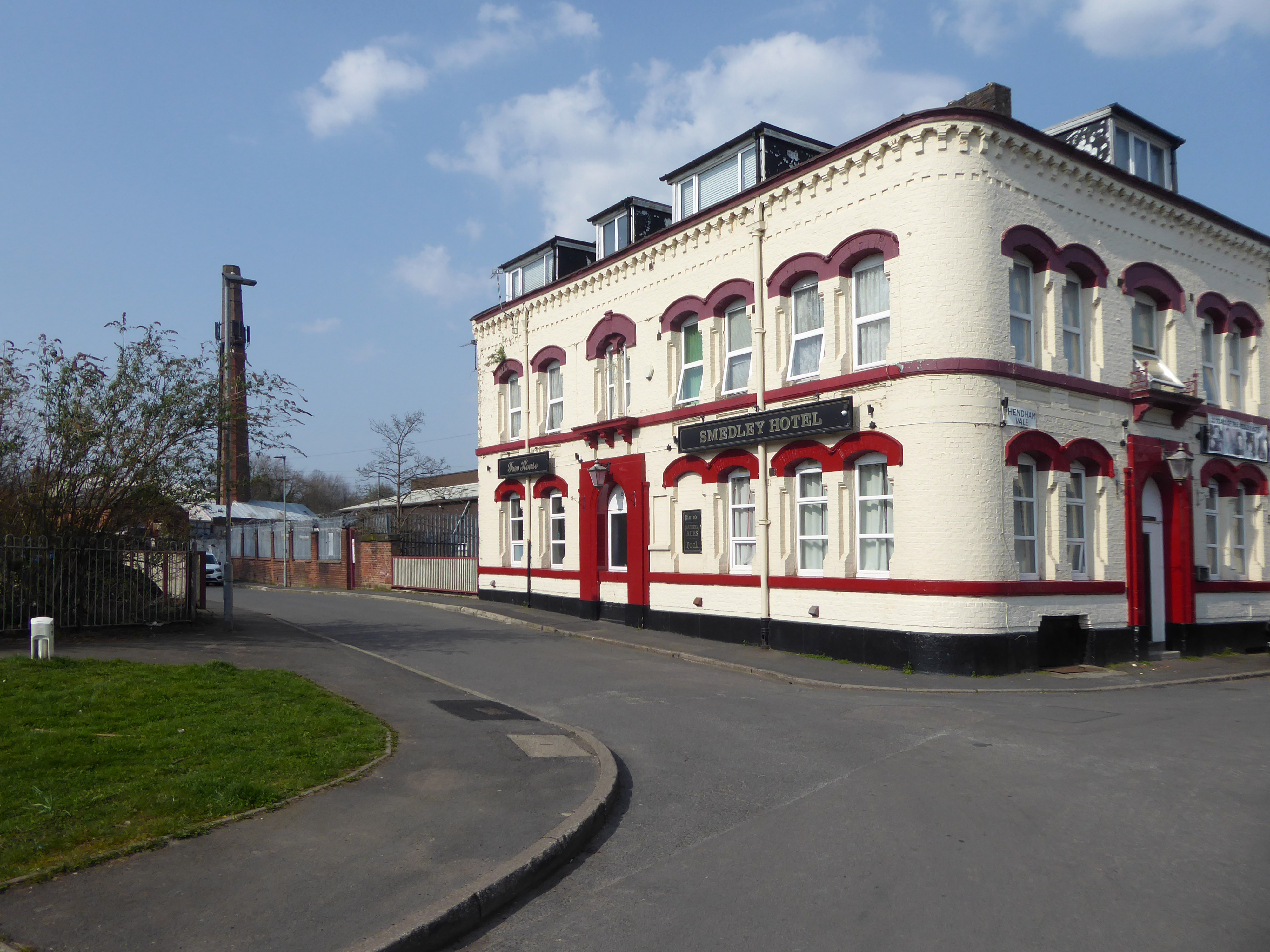
Dropping down to Hendham Vale.
To the right is the Smedley Hotel.
The Smedley Hotel is a very large pub that is hidden away on a quiet back street.Once inside there were a few different rooms and I had a drink in the bar which was fairly large and seemed in need of some attention. The pub still had its old Chesters signs outside and there were three real ales on the bar. I had a drink of Chesters bitter and this was a very nice drink the other beers were Chesters mild and Boddington’s bitter.
I thought this pub would be long gone but it is still standing and I think open for business.
Lost to the world are the Manchester Moderne flats of Kennet House overlooking the Irk Valley on Smedley Lane.
Hendham Way becomes a pedestrianised lane.
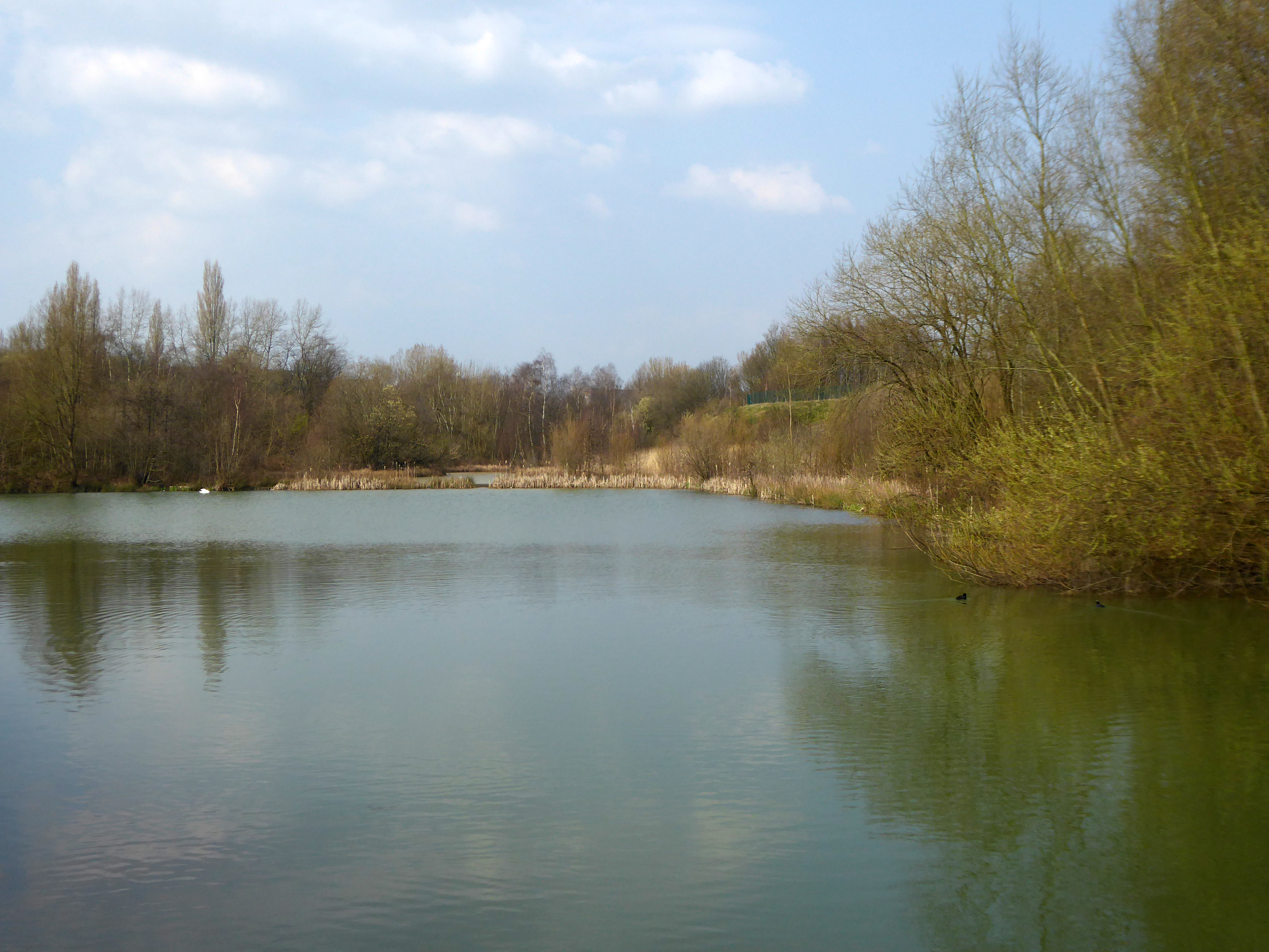
Taking the road up and then down, returning to the river, and following the wrong path – alongside the Hapurhey Reservoir and Ponds.
A remnant of the industrial era the reservoirs and ponds, once used by the factories as a source of water, have over the year become a thriving habitat which supports a substantial amount of wildlife.
Then cutting back and regaining the correct path.Finally arriving at the Hexagon Tower.
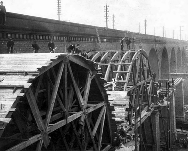
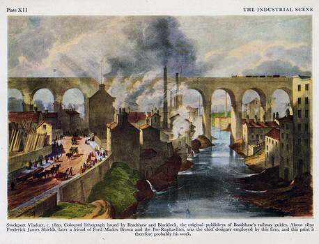
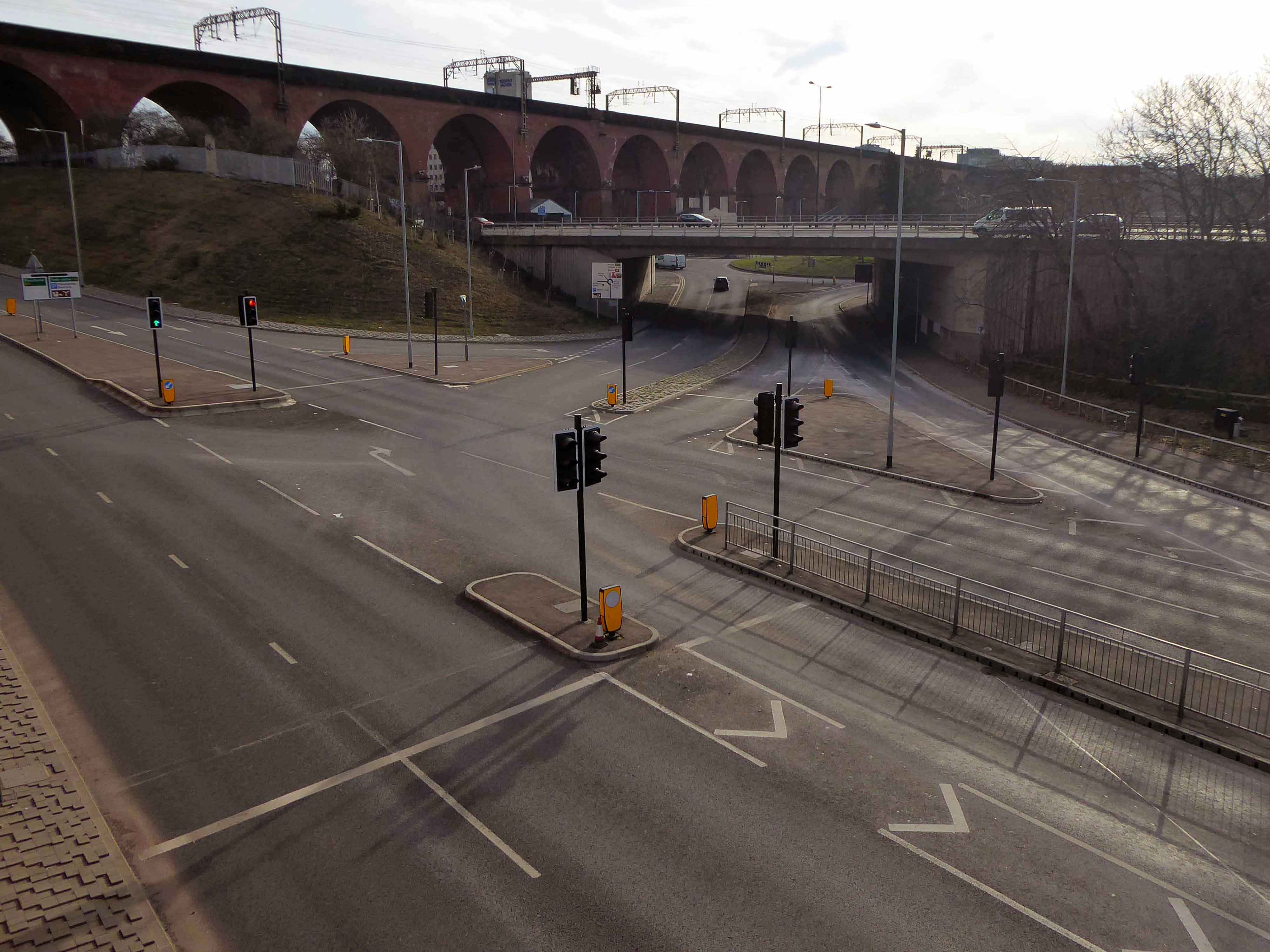
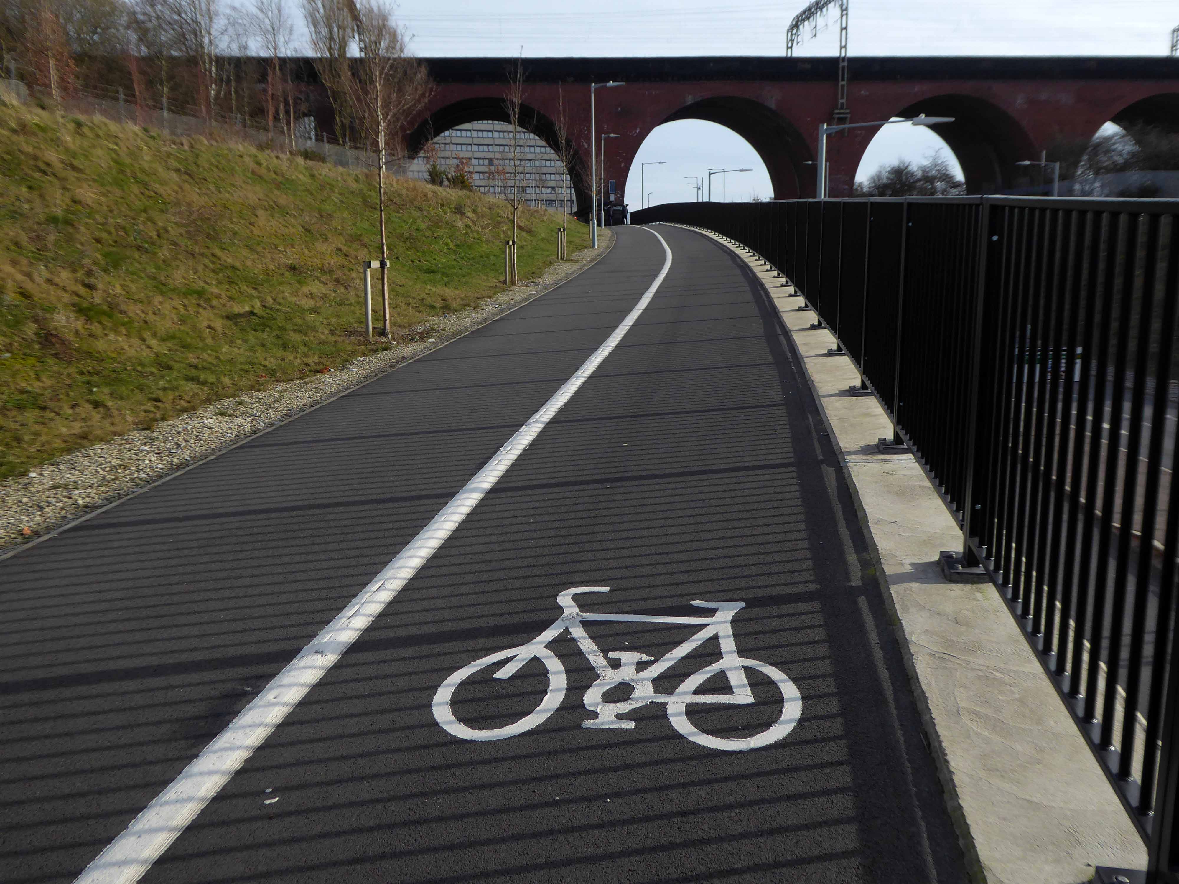
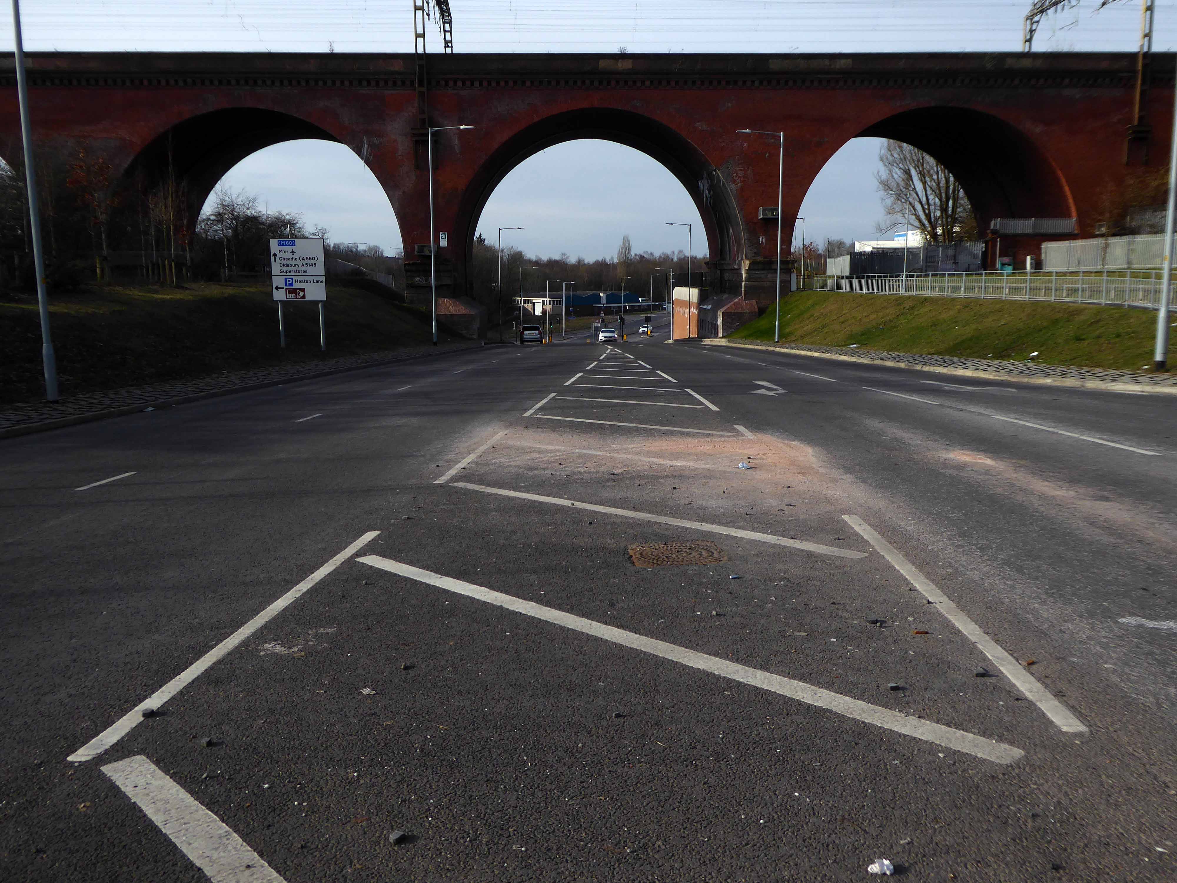
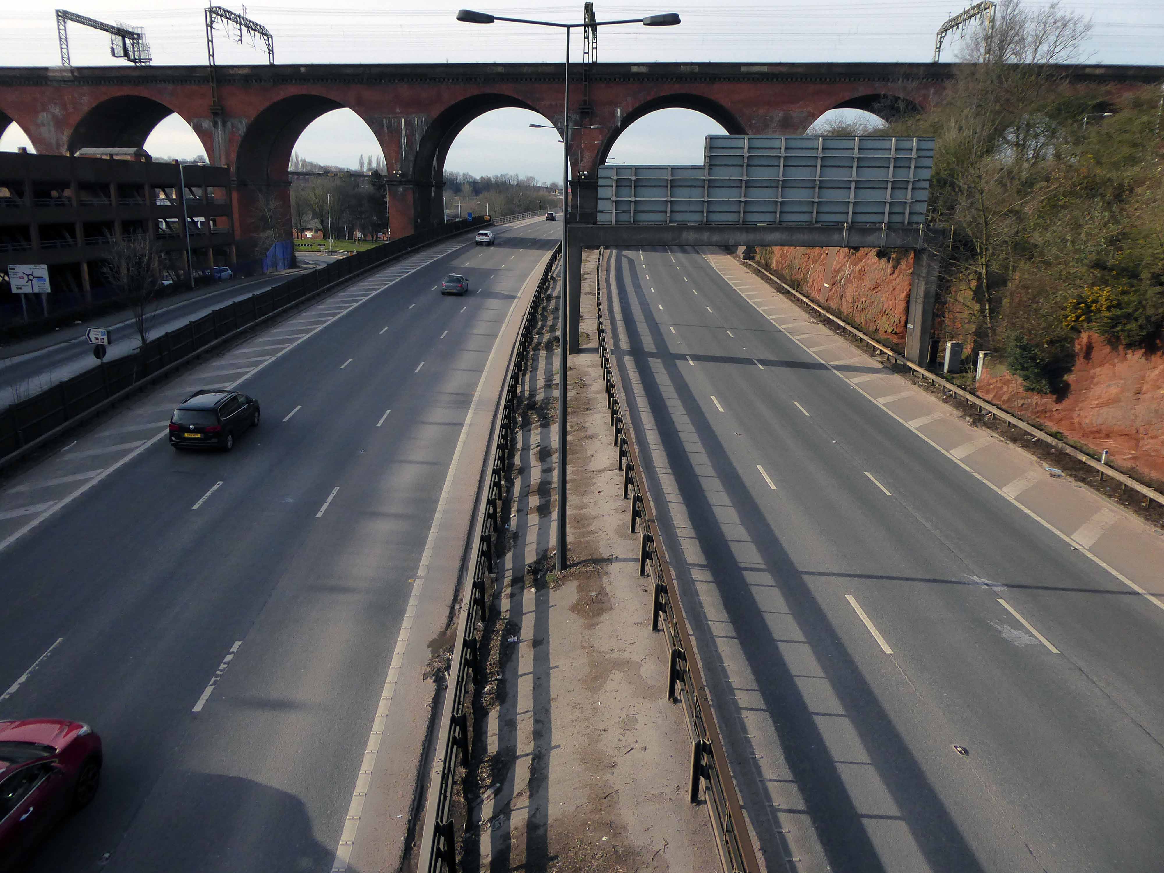
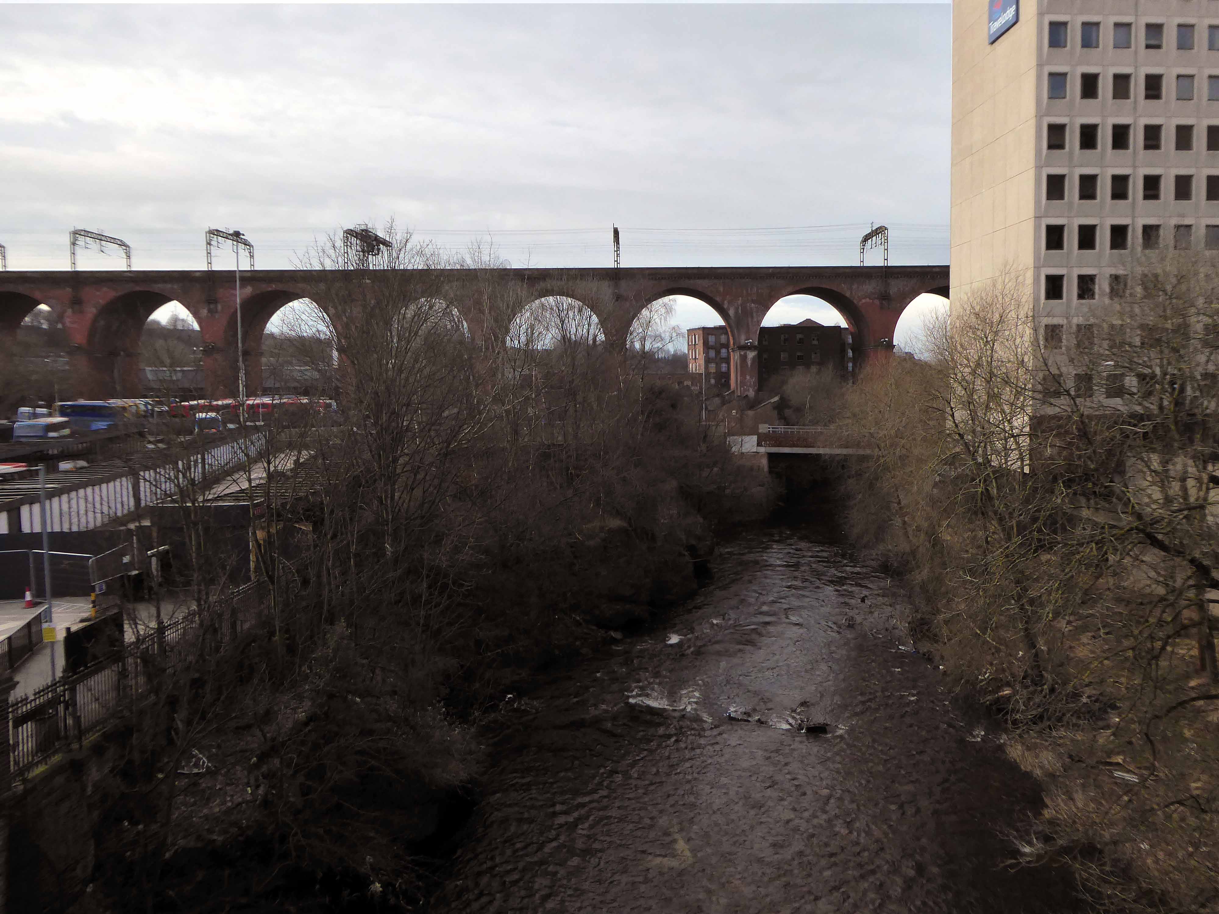
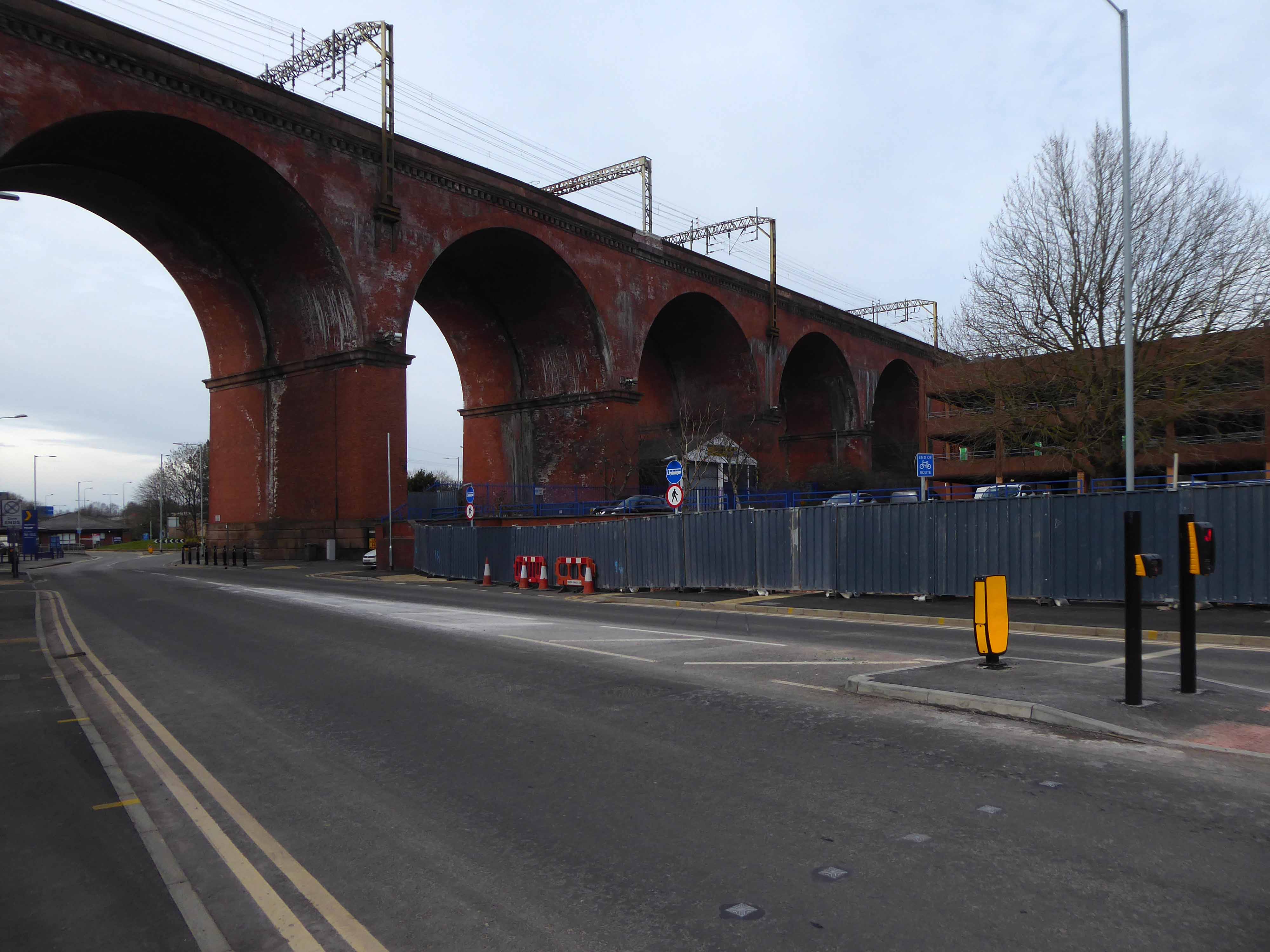
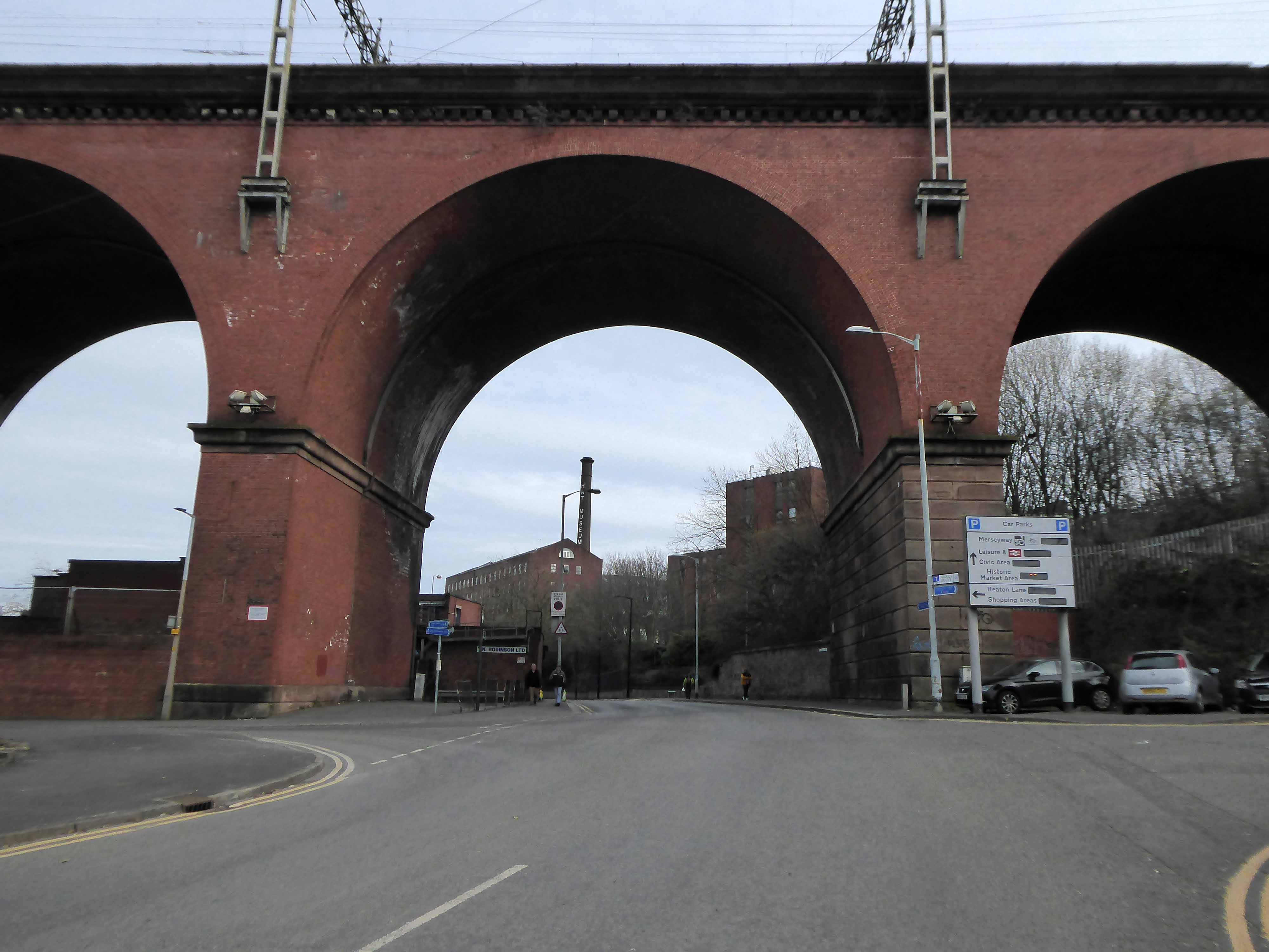
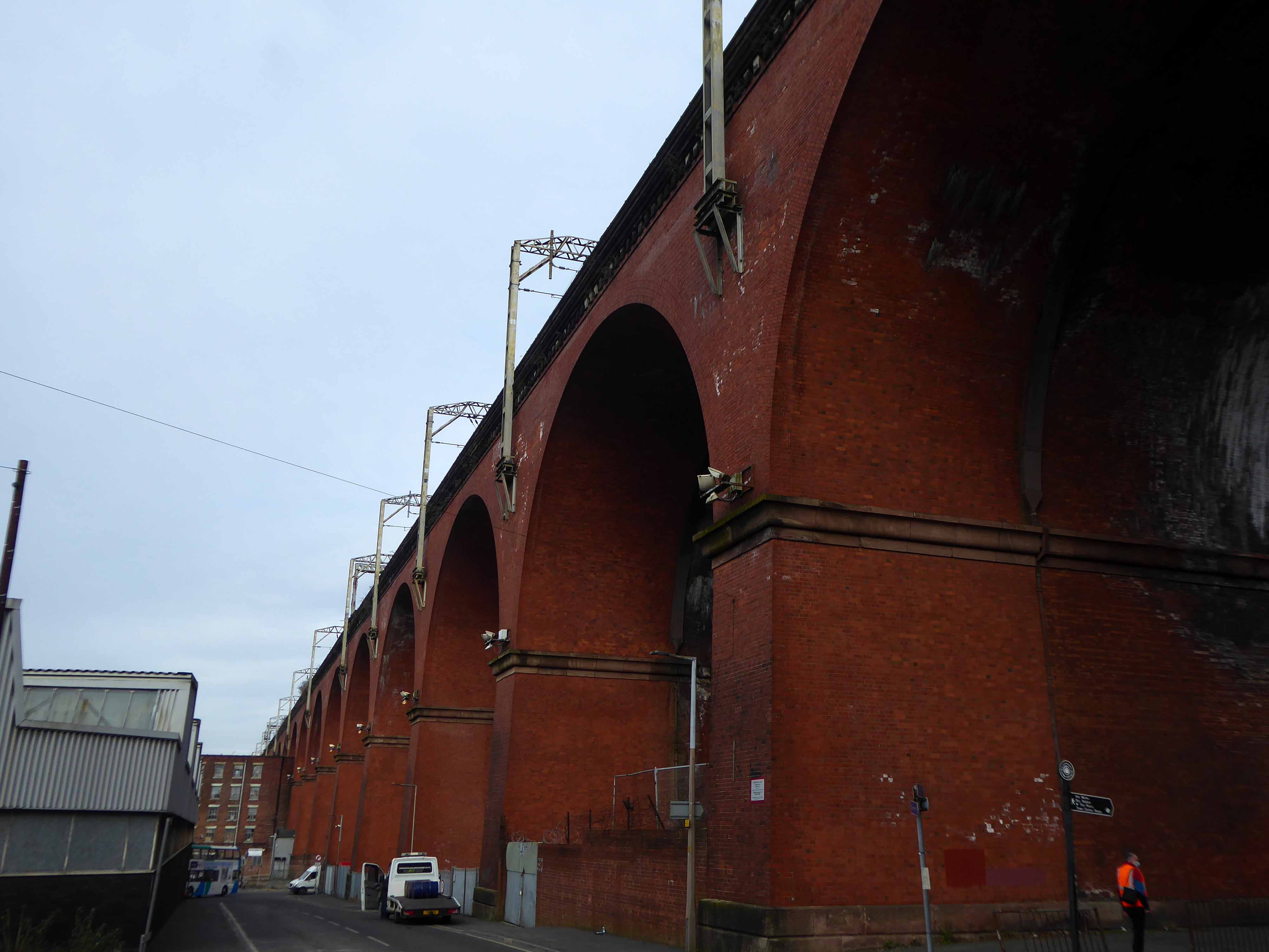
Stockport Viaduct, carries the West Coast Main Line across the valley of the River Mersey in Stockport, Greater Manchester, England. It is one of the largest brick structures in the United Kingdom, as well as a major pioneering structure of the early railway age.
Stockport Viaduct was designed by George Watson Buck for the Manchester and Birmingham Railway. Work began in 1839 and was completed in 1840. Roughly 11 million bricks were used in its construction; at the time of its completion, it was the world’s largest viaduct and a major feat of engineering. The viaduct is 33.85 metres high.Stockport Viaduct is a Grade II* listed structure and remains one of the world’s biggest brick structures.
In the late 1880s, the viaduct was widened to accommodate four tracks instead of two. In the 1960s, overhead catenary lines were installed by British Rail for the West Coast Main Line electrification scheme. In the second half of the twentieth century, the M60 motorway was built, passing through two arches of the viaduct.
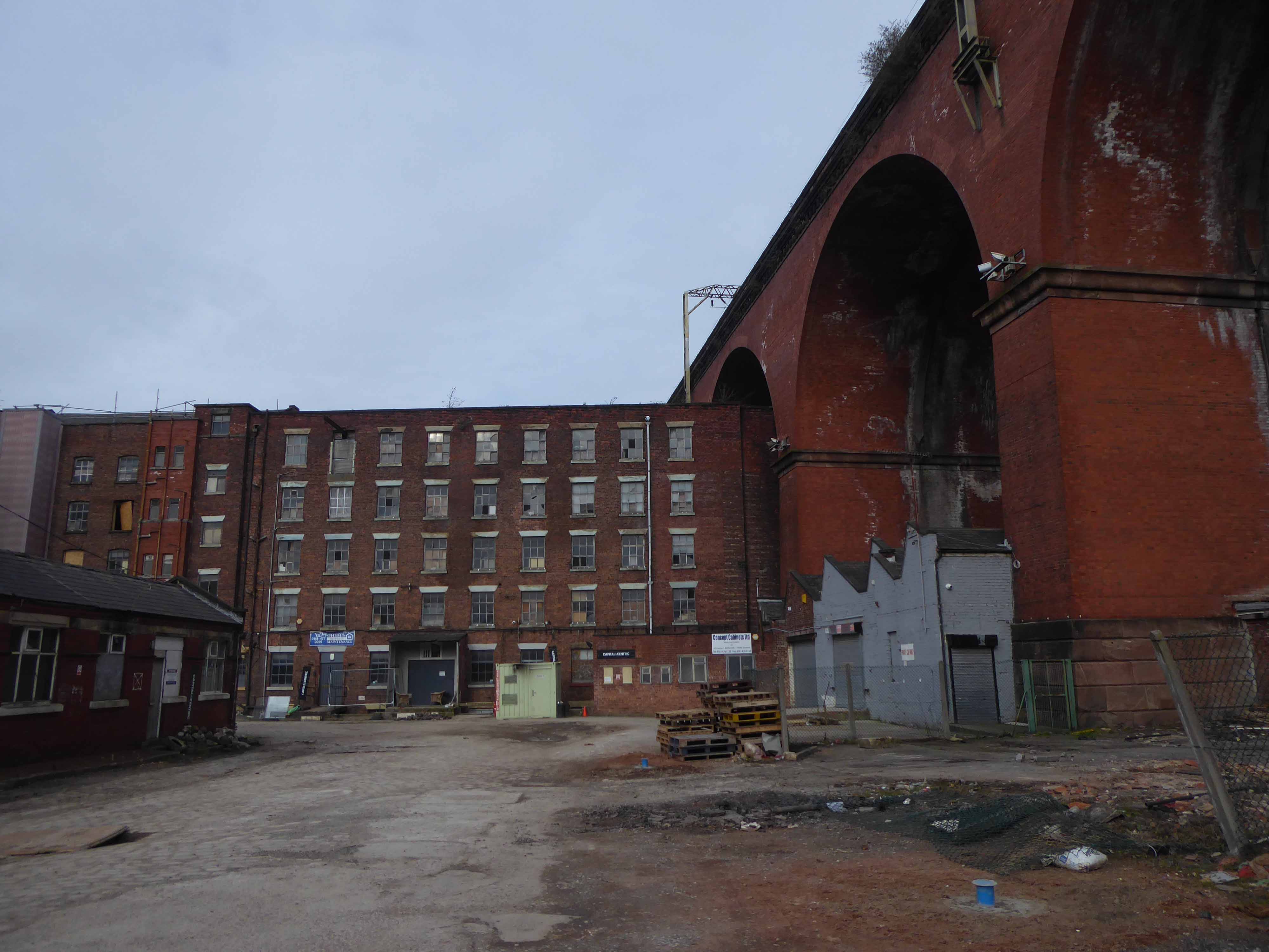
The structure is central to the visual landscape of the town – it has been the subject of both literature and art, most notably in the work of LS Lowry.
I believe that this composite composition of a northern landscape, is firmly embedded in the psyche of Stopfordians.
A notion that we are able to apprehend the whole of the structure in one panoramic sweep.
Our present perceptions are inextricably linked to past experience, possibly an illusory past.
My photograph below, was taken before access was prohibited.
Though has this uncluttered view ever actually existed?
The area has been a constantly evolving jumble of buildings, in, under and around the viaduct.
This raises the question – when did you last see your viaduct?
I live moments away on Didsbury Road – so why not take a look, circumnavigating the site in search of an answer?
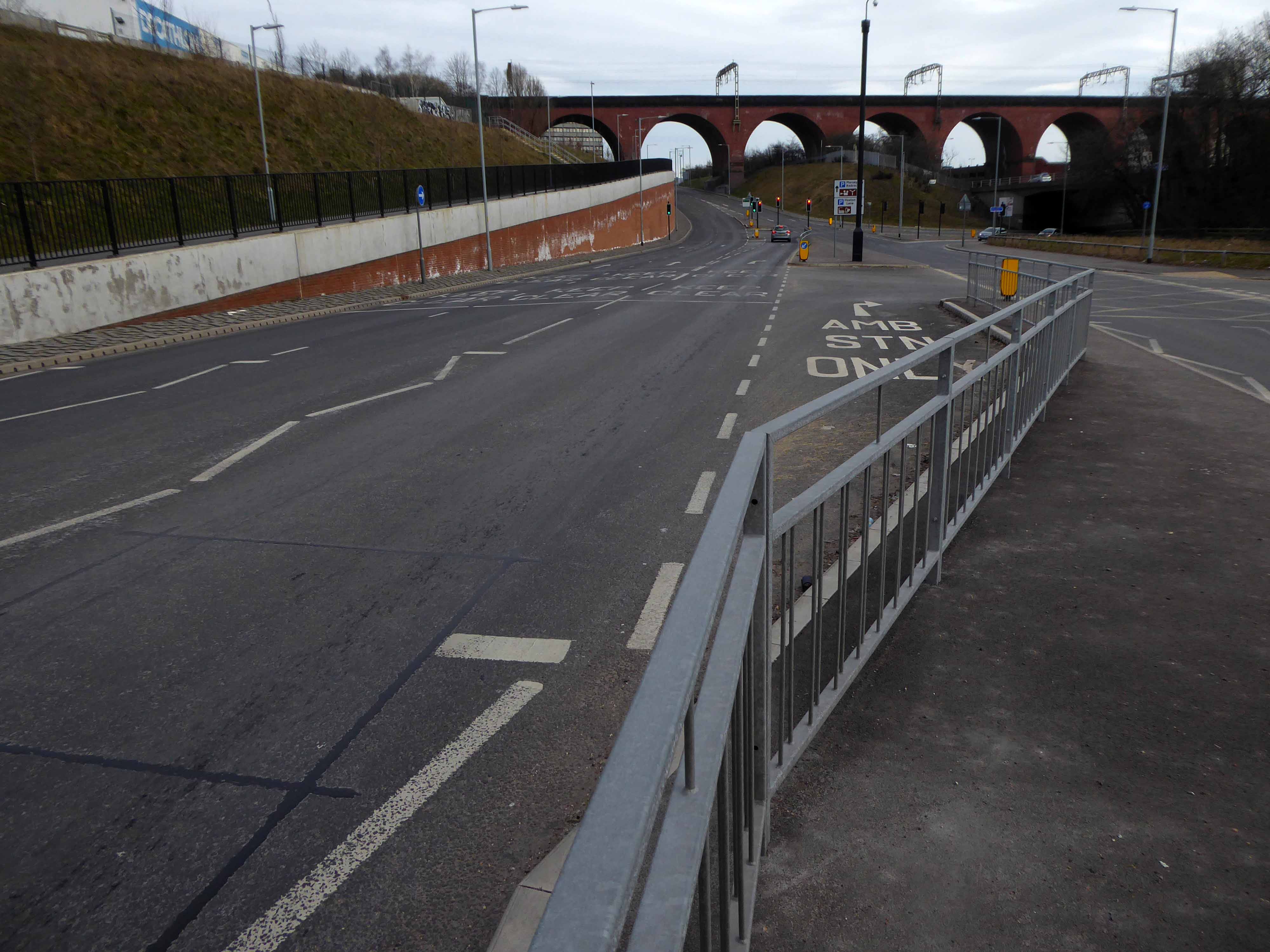
From the recently constructed pedestrian and cycleway a view south across multiple roadways.
Approaching the arches from the west.
Looking east from Wellington Road North and the newly constructed A5154 link road.
Looking along the M60.
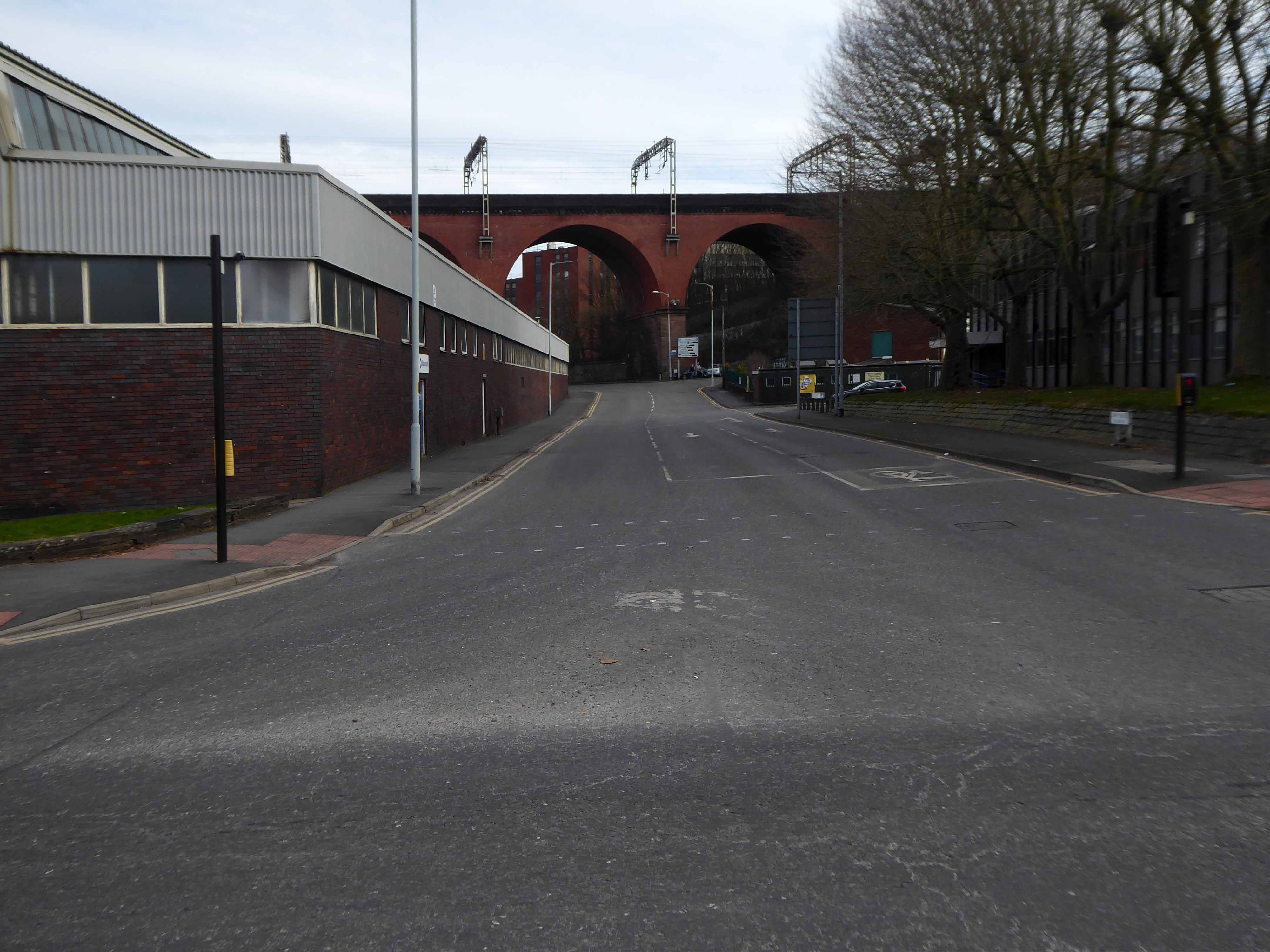
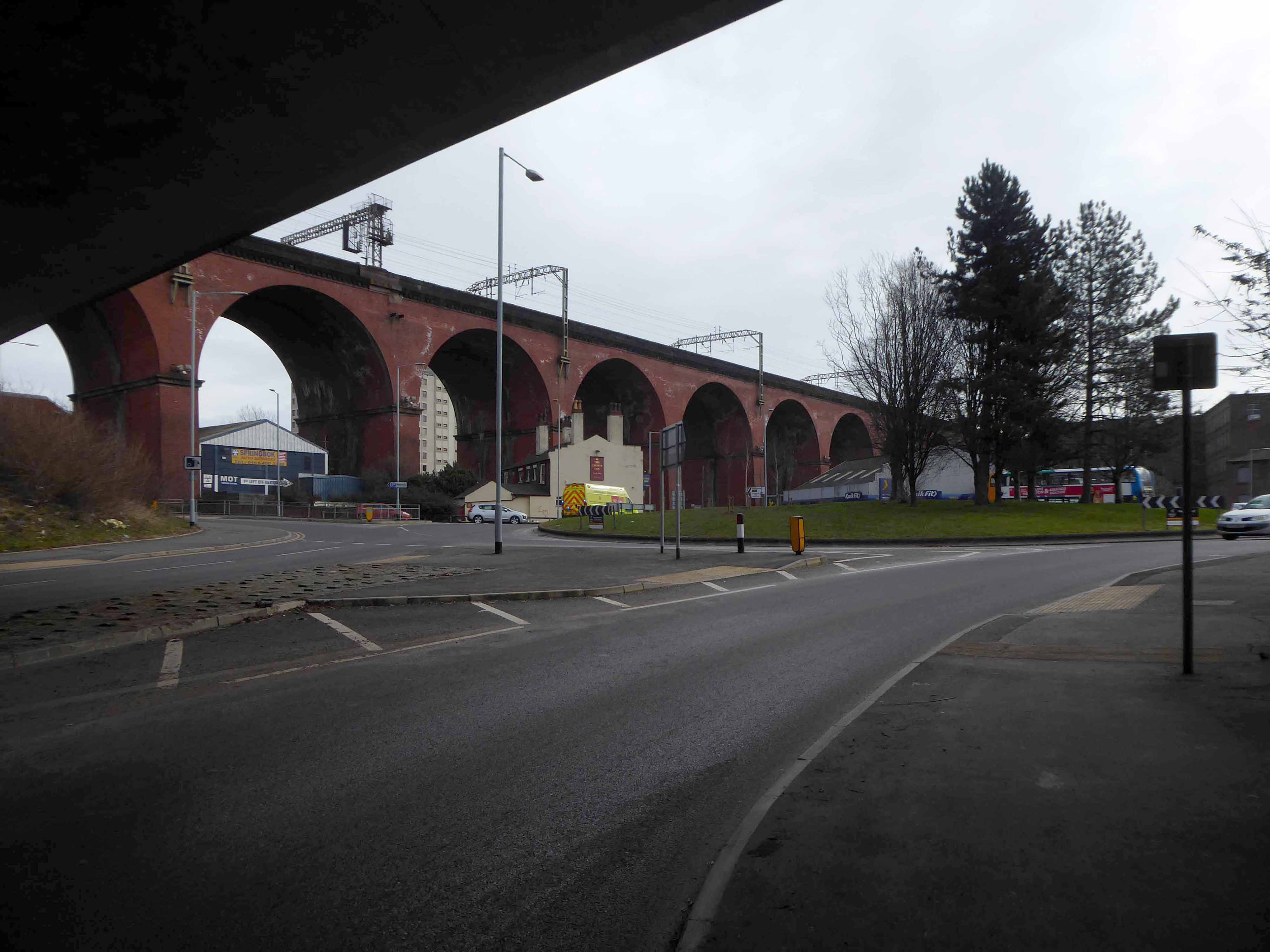
Looking along Heaton Lane, to the left Regent House.
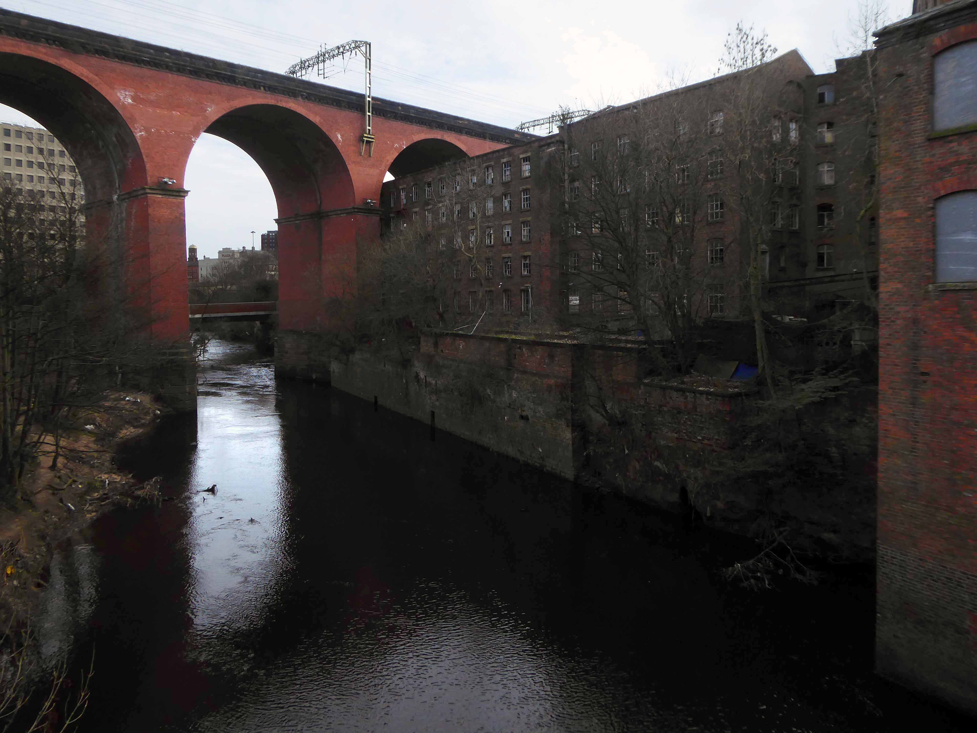
Looking along the River Mersey
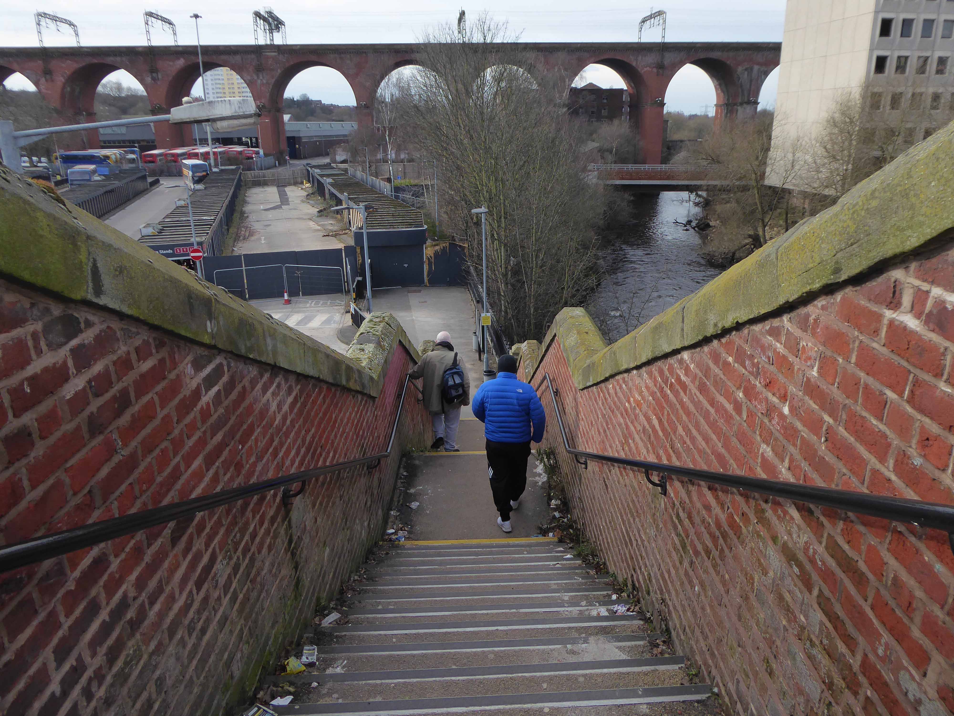
The Lowry Steps.
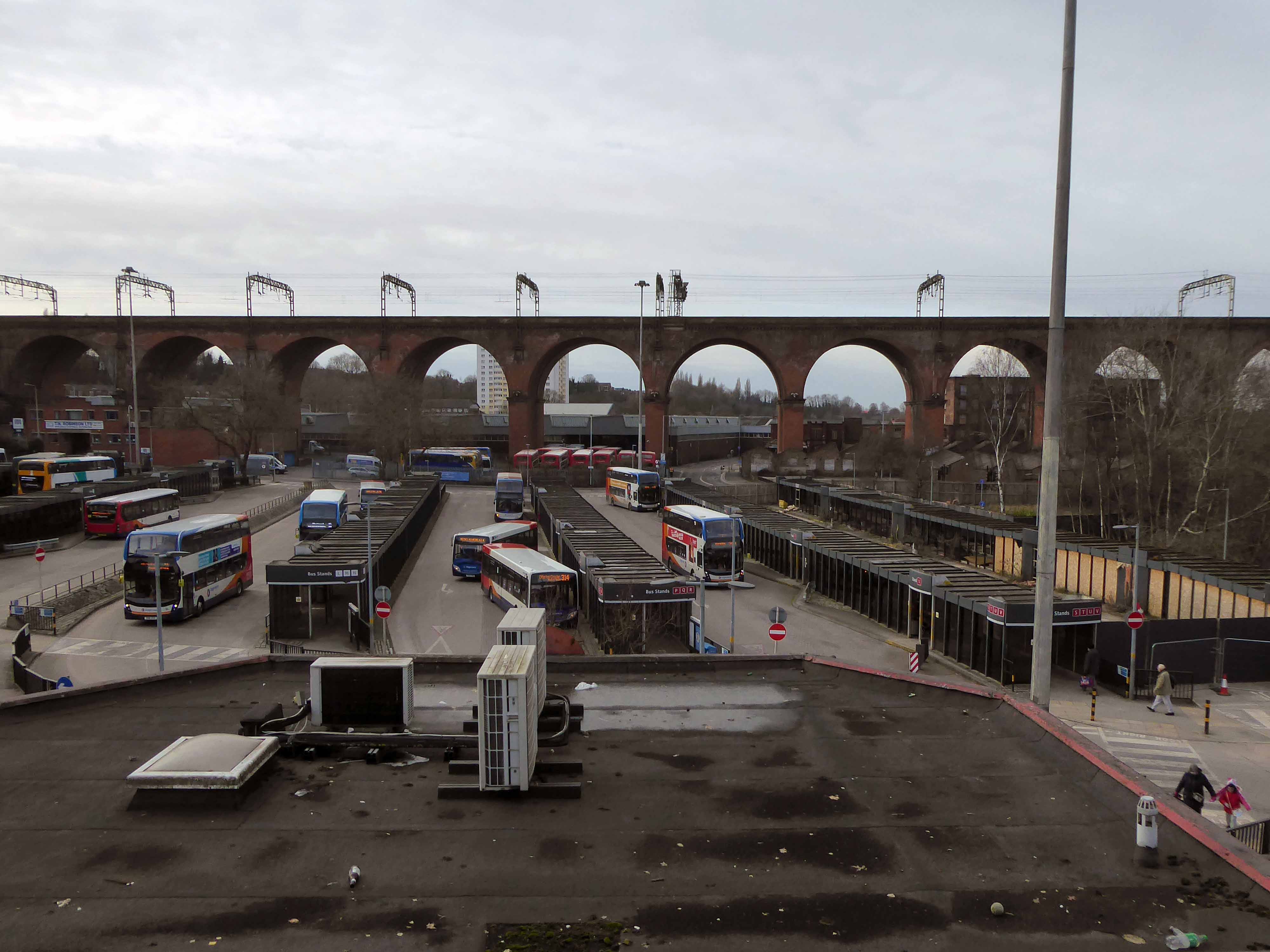
The view over the soon to be redeveloped Bus Station.
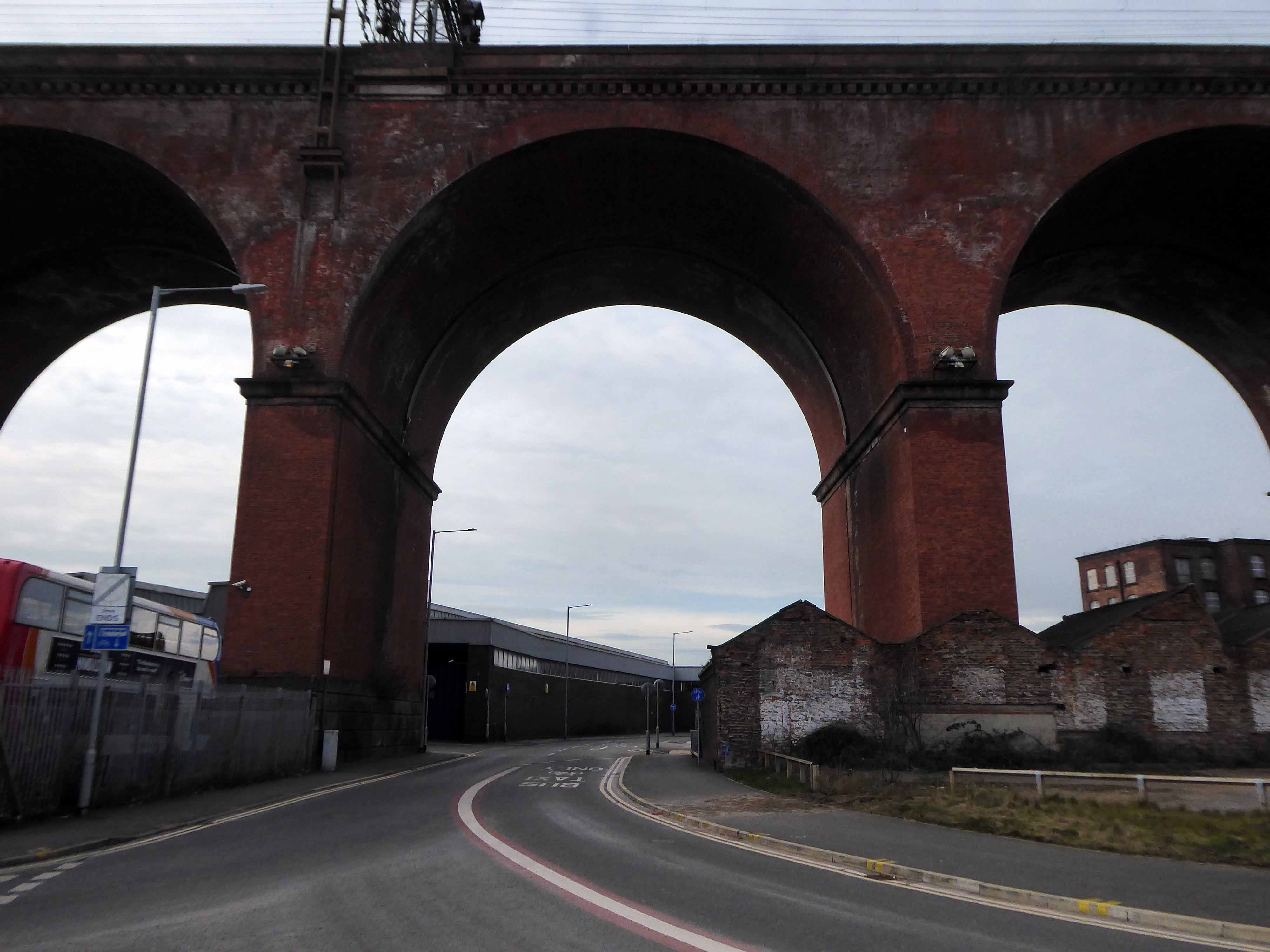
The view along Daw Bank.
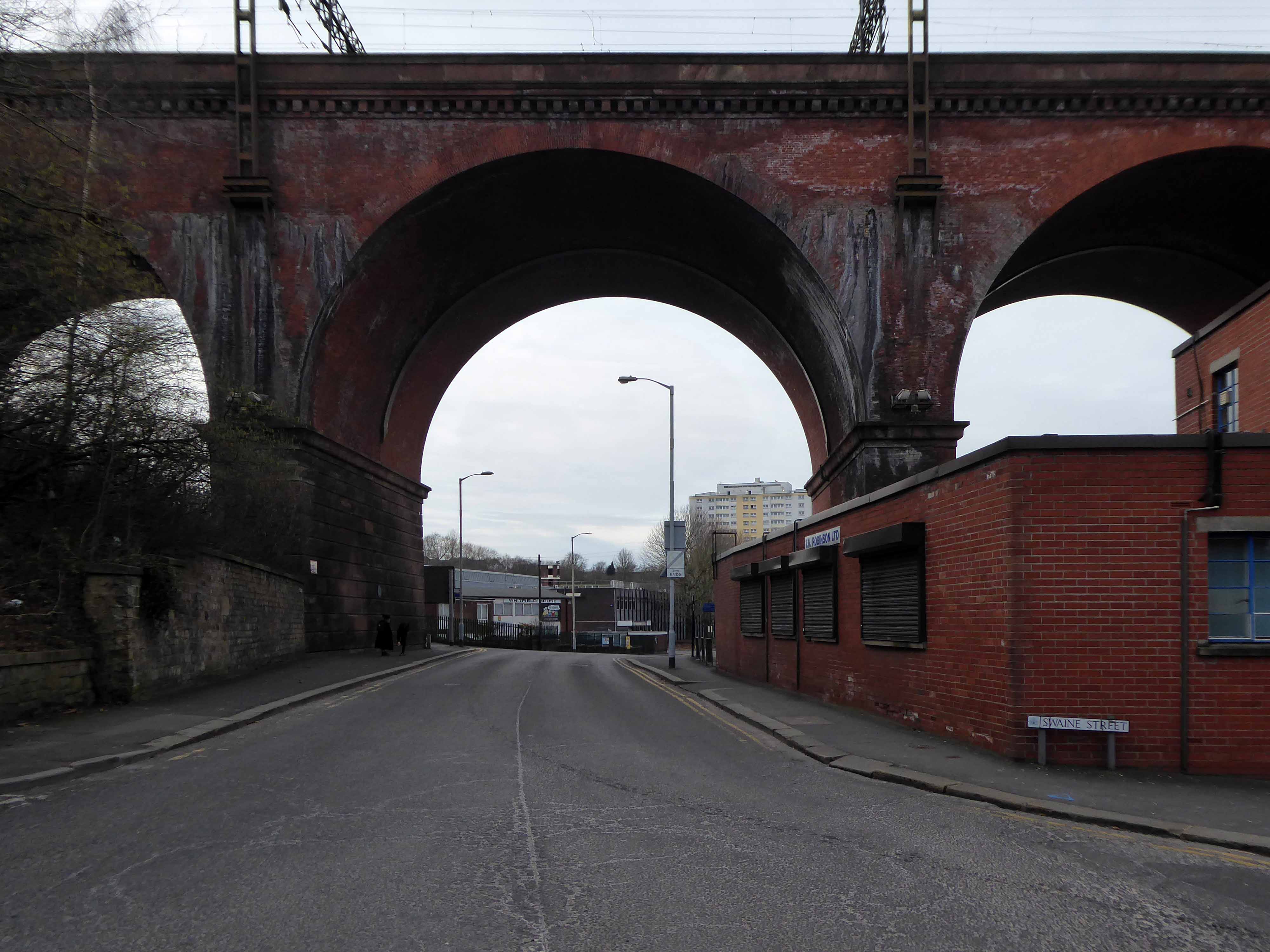
One of the most complete perspectives along Swaine Street.
Swaine Street and Astley Street junction.
Crossing the new bridge to Heaton Lane.
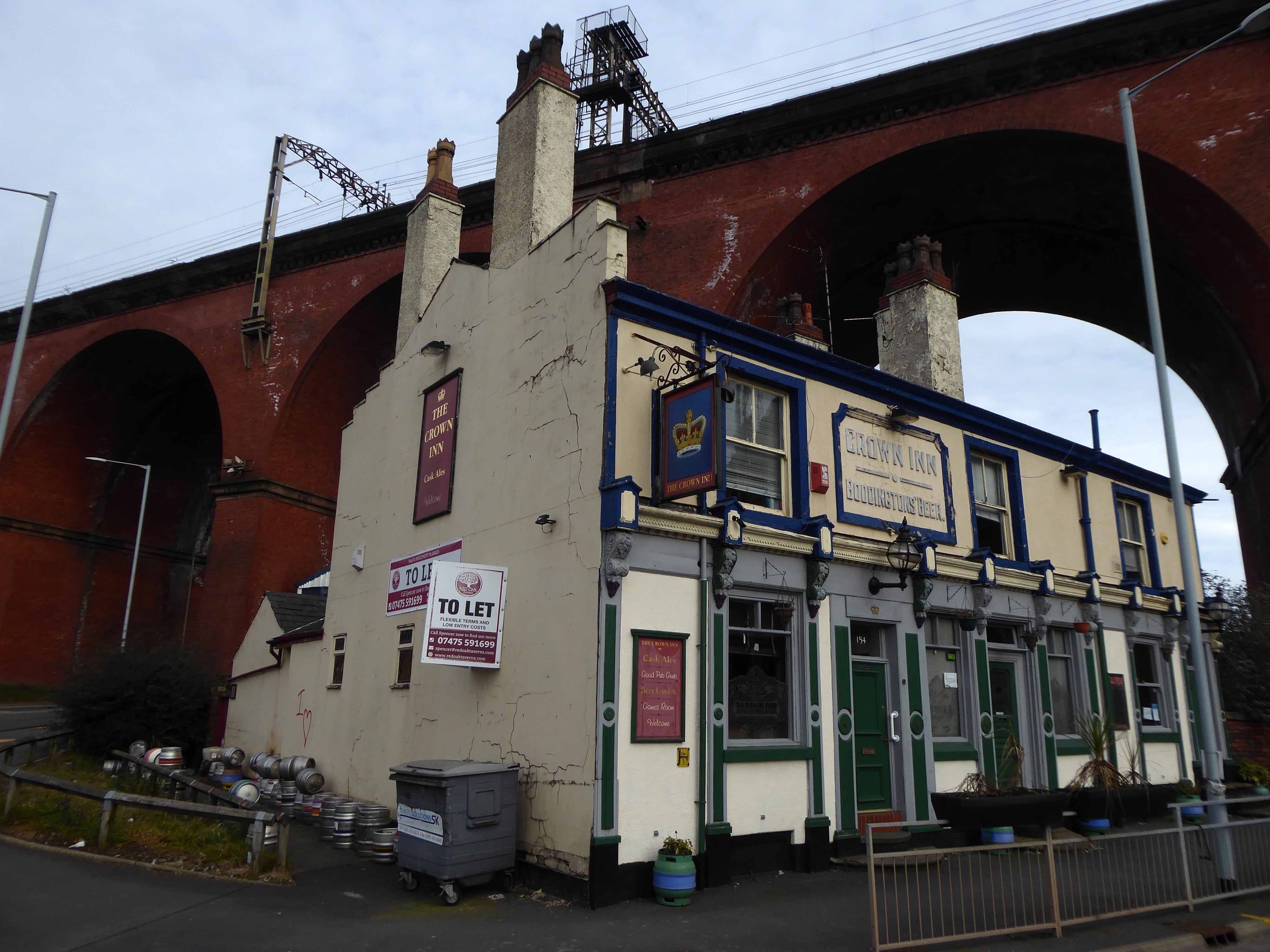
Looking back towards the Crown Inn.
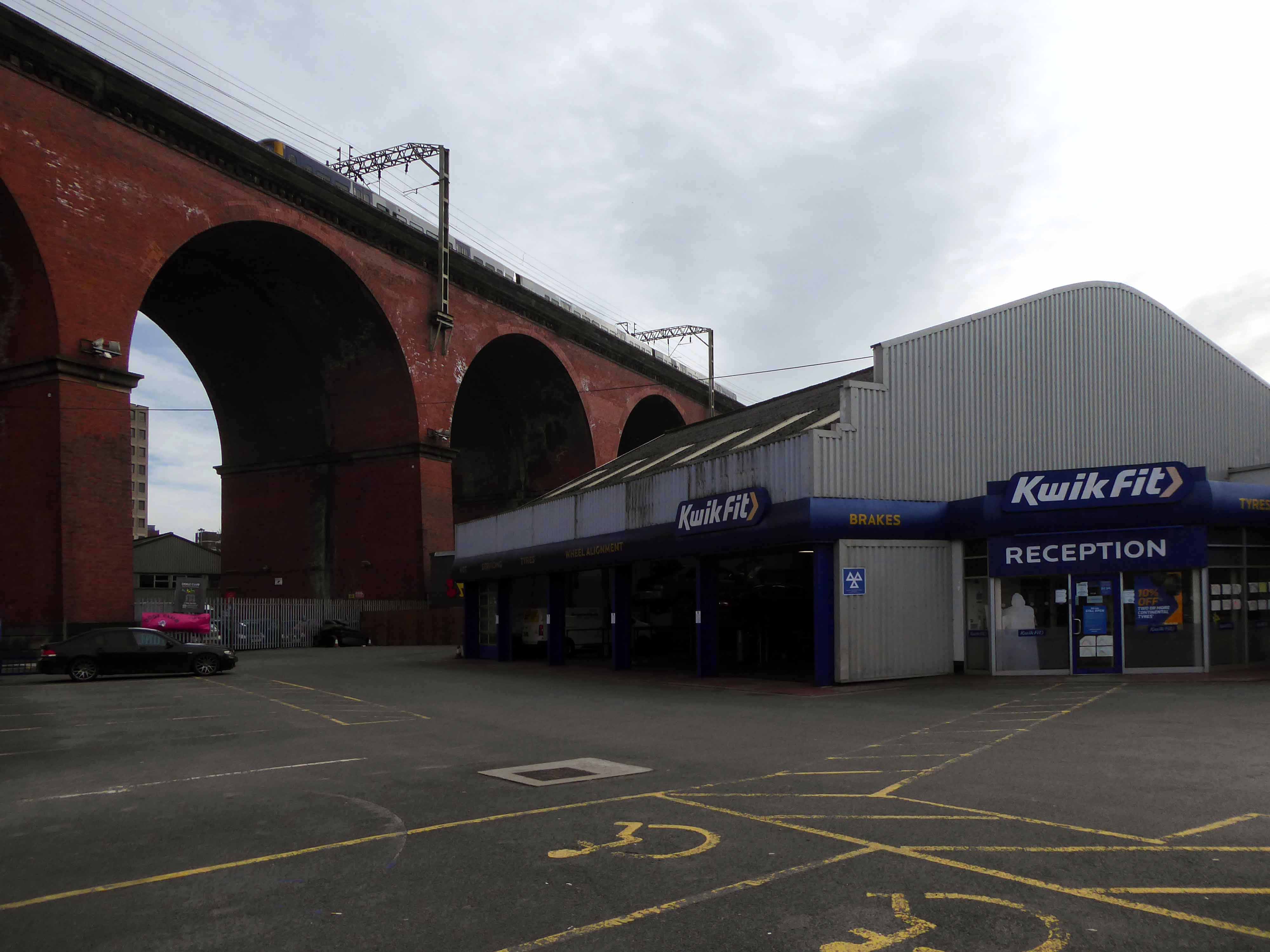
The view over Kwik Fit.
Looking east along the River Mersey, beside the rear of Weir Mill.
The view between the Stagecoach Bus Depots.
Looking east along Daw Bank.
Another clear perspective along Viaduct Street.
Beside Weir Mill.
Beneath the M60.
Looking east along Travis Brow.
This is one cold day in Covid February, the traffic a little lighter, few folk on foot.
Another day would produce another series of views, the light shifts, leaves appear on trees, the regeneration of Stockport sees the built environment shift and shimmy with an alarming regularity.
The landscape formed by the second Ice Age, gouging out a glacial valley and subsequently a conjoined river, is all part of a passing parade; it is acted out over millennia, you yourself are party to but one small part, make the most of it, get out and about take a look.
All this life is but a play, be thou the joyful player.
Prompted by Gillian and Adam’s – A Different North project, my thoughts turned once again to notions of the North, similar notions have been considered in my previous posts:
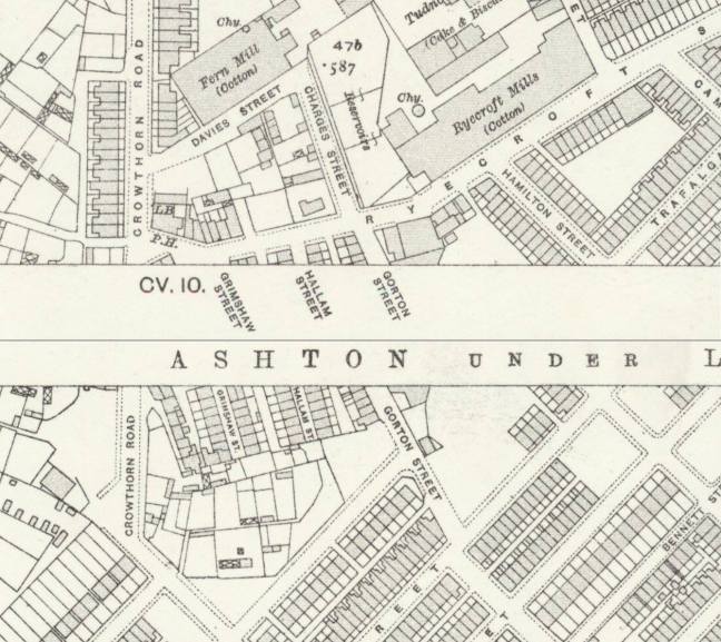
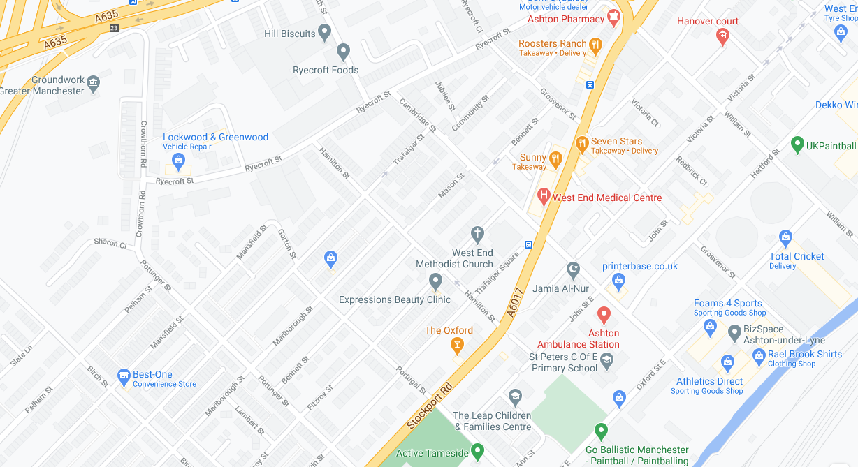
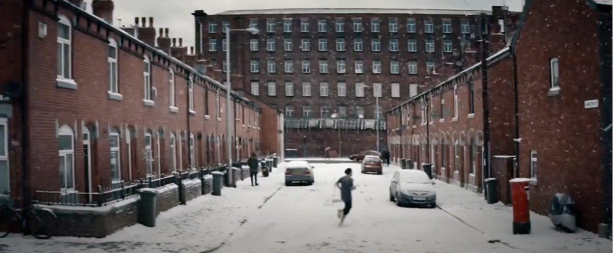
I recalled the 2016 season Sky Football promotional film, it had featured a street in Ashton under Lyne, it had featured Hamilton Street.
A street spanning the West End and the Ryecroft areas of the town, the town where I had lived for most of my teenage years. The town where my Mam was born and raised in nearby Hill Street, nearby West End Park where my Grandad I had worked, nearby Ashton Moss and Guide Bridge.
This is an area familiar to me, which became the convergent point of a variety of ideas and images, mediated in part by the mighty Murdoch Empire.
Here was the coming together of coal and cotton, an influx of population leaving the fields for pastures new.
In the film, Leytonstone London born David Beckham is seen running down the snow covered northern street.
A credit to our emergent mechanical snow generation industry.
According to snowmakers.com, it takes 74,600 gallons of water to cover a 200 by 200-foot plot with 6 inches of snow.Climate change is cutting snow seasons short, we make snow to compensate, more energy is spent making snow, more coal is burned, more CO2 is released.
It is to be noted that locally there has been a marked decline in snowfall in recent years, the Frozen North possibly a thing of the past.
The temperatures around the UK and Europe have actually got warmer over the last few decades, although when you are out de-icing your car it may not actually feel as though it has. Whilst this can not be directly link to climate change, it is fair to assume that climate change is playing a part.
It is also to be noted that Sky Supremo Rupert Murdoch has described himself as a climate change “sceptic”.
Appearing arms raised outside of the home of a family clustered around the television, in their front room.
Filming the ad was great and the finished piece is a really clever way of showing that you never know what might happen in football, I always enjoy working with Sky Sports and I’m proud to be associated with their football coverage.
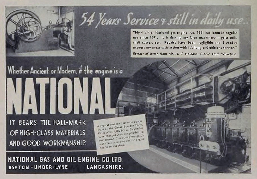
The area does have a football heritage, Ashton National Football Club played in the Cheshire County League in the 1920s and 1930s. They were sometimes also known as Ashton National Gas, due to their connections with the National Gas and Oil Engine Company based in the town.
Illustrative of a time when sport and local industry went hand in glove.
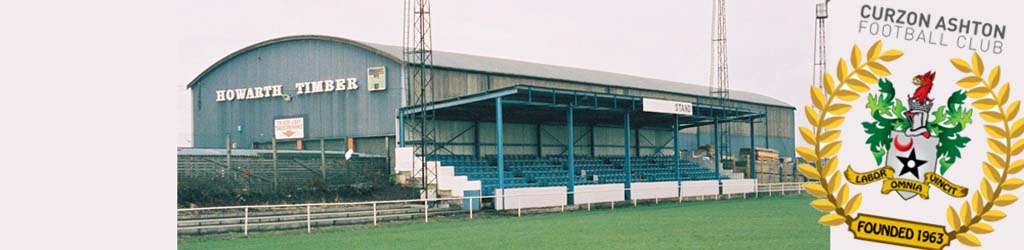
The National Ground was subsequently taken over by Curzon Ashton who have since moved to the Tameside Stadium.
Ashton & Hyde Village Hotels occupy the front of shirt sponsors spot on our new blue and white home shirt, while Seed of Speed, our official conditioning partners, feature on the arm, and Minuteman Press occupy the back of the shirt. Meanwhile, Regional Steels UK Ltd. are the front of shirt sponsors on our new pink and black away kit.
Illustrative of a time when sport and local industry continue to work hand in glove.
Local lad Gordon Alexander Taylor OBE is a former professional footballer. He has been chief executive of the English footballers’ trades union, the Professional Footballers’ Association, since 1981. He is reputed to be the highest paid union official in the world.
His mobile phone messages were allegedly hacked by a private investigator employed by the News of the World newspaper. The Guardian reported that News International paid Taylor £700,000 in legal costs and damages in exchange for a confidentiality agreement barring him from speaking about the case.
News International is owned by our old pal Rupert Murdoch, the News of the World no longer exists.
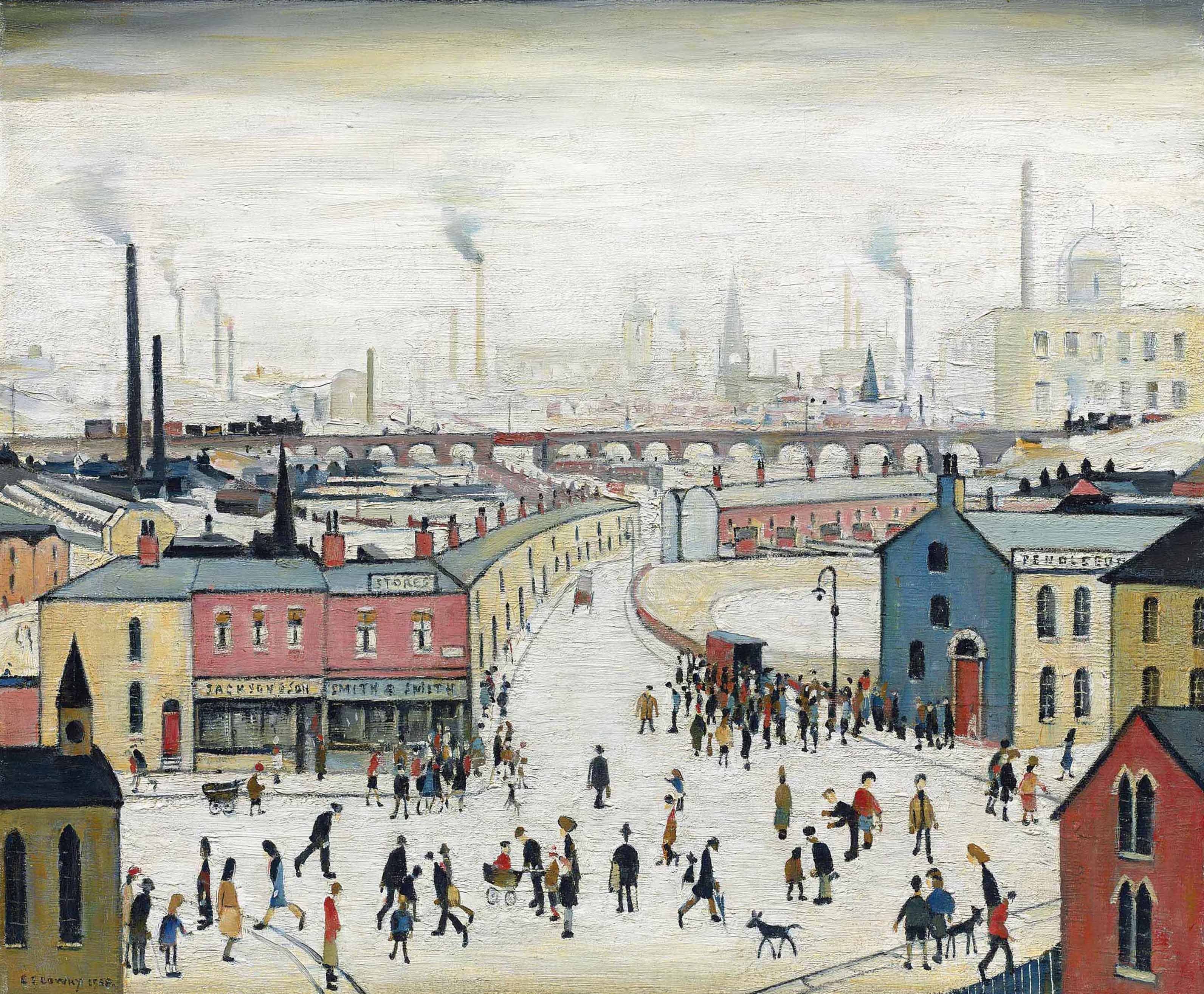
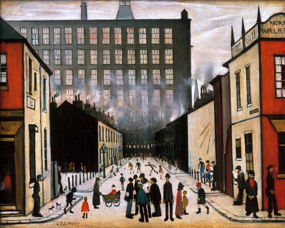
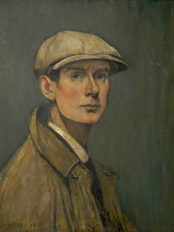
The view of Hamilton Street closely mirrors LS Lowry’sStreet Scene Pendlebury – the mill looming large over the fierce perspective of the roadway. The importance of Lowry’s role in constructing a popular image of the North cannot be overestimated.
He finds a grim beauty in his views of red facades, black smoke and figures in white, snowy emptiness. He is a modern primitive, an industrial Rousseau, whose way of seeing is perhaps the only one that could do justice to the way places like Salford looked in the factory age.
For many years cosmopolitan London turned its back on Lowry, finally relenting with a one man show at the Tate in 2013 – I noted on the day of my visit, that the attendant shop stocked flat caps, mufflers and bottled beer, they seemed to have drawn the line at inflatable whippets.
Drawing upon other artists’s work, in a continuous search for ways to depict the unlovely facts of the city’s edges and the landscape made by industrialisation.
But Murdoch’s Hamilton Street is as much a construct as Lowry’s – the snow an expensive technical coating, Mr Beckham a CGI apparition. Our contemporary visual culture is littered with digital detritus, saving time and money, conjuring up cars, kids and footballers at will.
An illusion within an illusion of an illusory North.
Green screen chroma keyed onto the grey tableau.
Mr Beckham himself can also be seen as a media construct, for many years representing that most Northern of institutions Manchester United – itself yet another product of image manipulation, its tragic post-Munich aura encircling the planet, with an expensive Empire Made, red and white scarf of cultural imperialism.
David’s parents were fanatical Manchester United supporters who frequently travelled 200 miles to Old Trafford from London to attend the team’s home matches, he inherited his parents’ love of Manchester United, and his main sporting passion was football.
Mr B’s mentor was of course former Govan convener – Mr A Ferguson, who headed south to find his new Northern home, creating and then destroying the lad’s career, allegedly by means of boot and hairdryer.
Here we have the traditional Northern Alpha Male challenged by the emergent Metrosexual culture, celebrity fragrances, posh partner, tattooed torso, and skin conditioner endorsements.
It is to be noted that the wealth of the region, in part created by the shoemaking and electrical industries, have long since ceased to flourish, though still trading, PIFCO no longer has a local base.
The forces of free market monopoly capitalism have made football and its attendant personalities global commodities, and manufacturing by and large, merely a fanciful folk memory.
Hamilton Street would have provided substantial homes to workers at the Ryecroft Cotton Mills.
Ryecroft Mill, built in 1837,was the second of a series of four mills built on the site, the first was built in 1834. In 1843, over 10,000 people were employed in Ashton’s cotton mills – today there are none.
This industrial growth was far from painless and Ashton along with other Tameside towns, worked long and hard in order to build the Chartist Movement, fighting to establish better working conditions for all.
The tradition of political and religious non-conformity runs wide and deep here, the oft overlooked history of Northern character and culture.
Textile production ceased in the 1970s and the mill is now home to Ryecroft Foods, a subsidiary of Weetabix.
Ashton like many of Manchester’s satellite towns created enormous wealth during the Nineteenth and Twentieth centuries. The workers of Ashton saw little of that wealth, the social and economic void left by the rapid exodus of the cotton industry to the Far East, is still waiting to be filled, in these so called left behind towns.
Photo Ron Stubley
Here is a landscape nestled in the foot of the Pennines, struggling to escape its past and define a future.
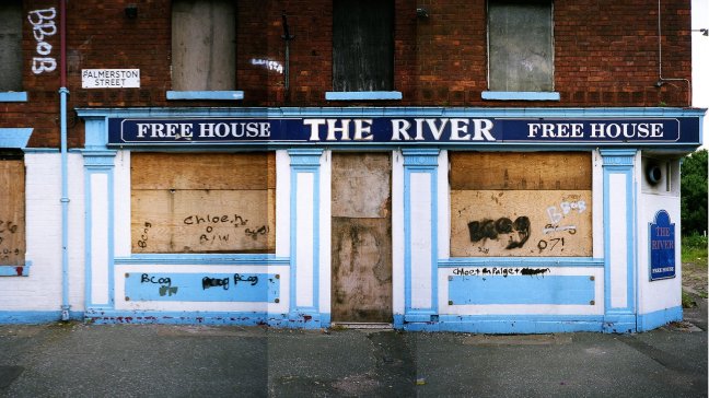
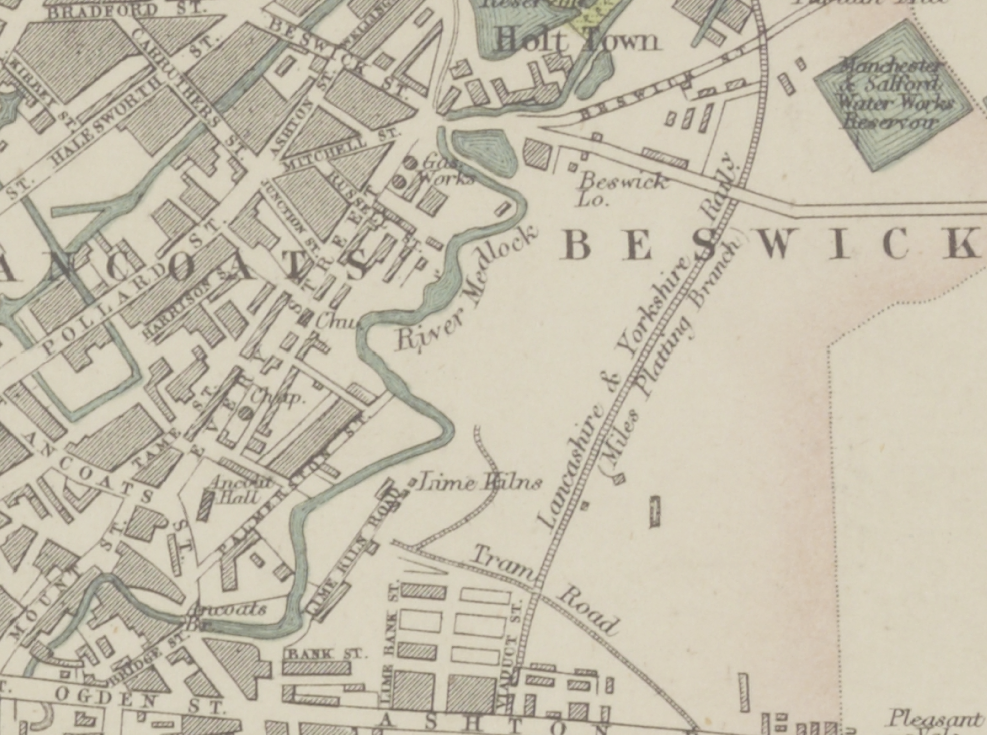
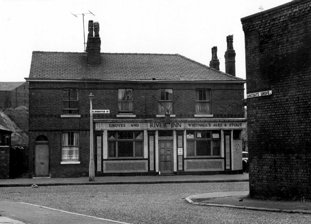
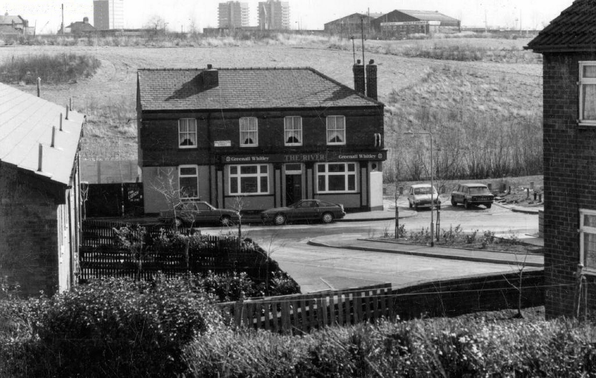
To begin at the beginning – some years ago I traced the route of the River Medlock, I chanced upon a forlorn pub called The River, all alone, desolate and boarded up, presiding over an area that I assumed, would once have supplied ample trade to a busy boozer.
I returned last week in search of some rhyme or reason, for such a seemingly sad and untimely decline.
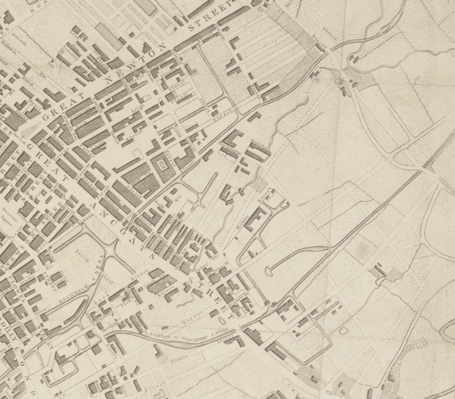
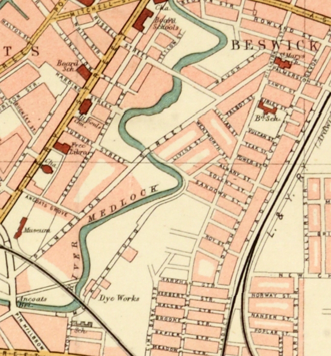
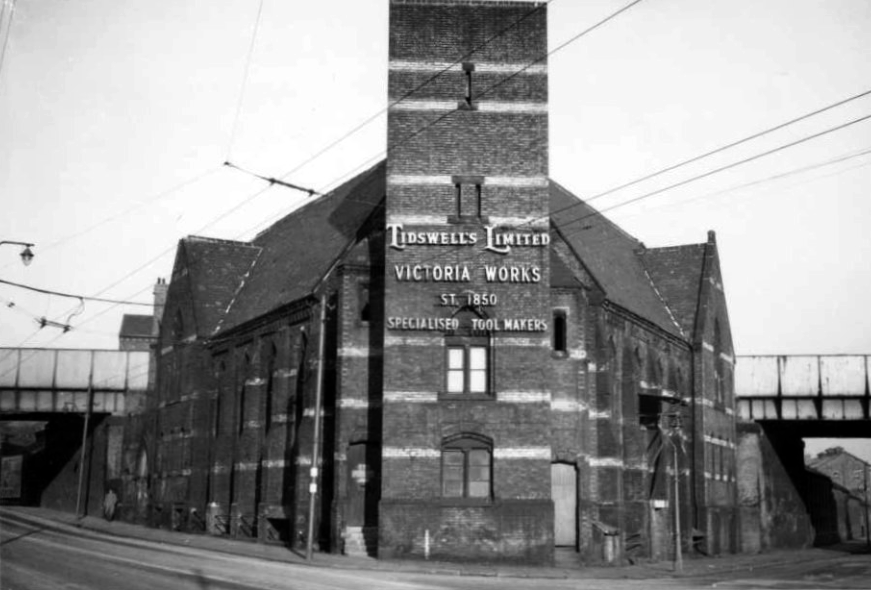
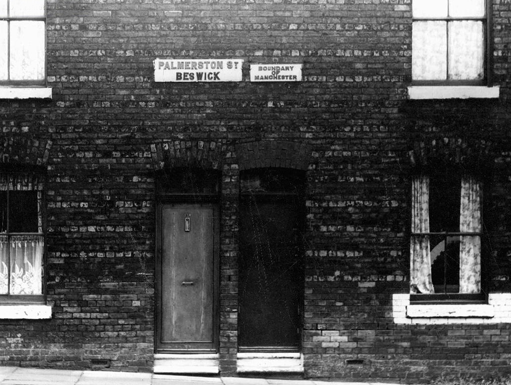
So here we are back at in Manchester 1813, the seeds of the Industrial Revolution sewn in adjacent Ancoats, the fields of Beswick still sewn with seeds, the trace of Palmerston Street nought but a rural track.
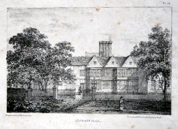
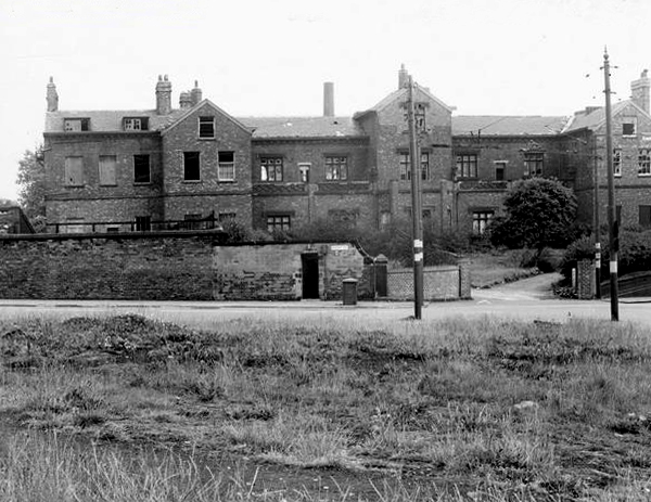
Sited on land between Great Ancoats Street and Every Street was Ancoats Hall, a post-medieval country house built in 1609 by Oswald Mosley, a member of the family who were Lords of the Manor of Manchester. The old timber-framed hall, built in the early 17th century, and demolished in the 1820s was replaced replaced by a brick building in the early neo-Gothic style.
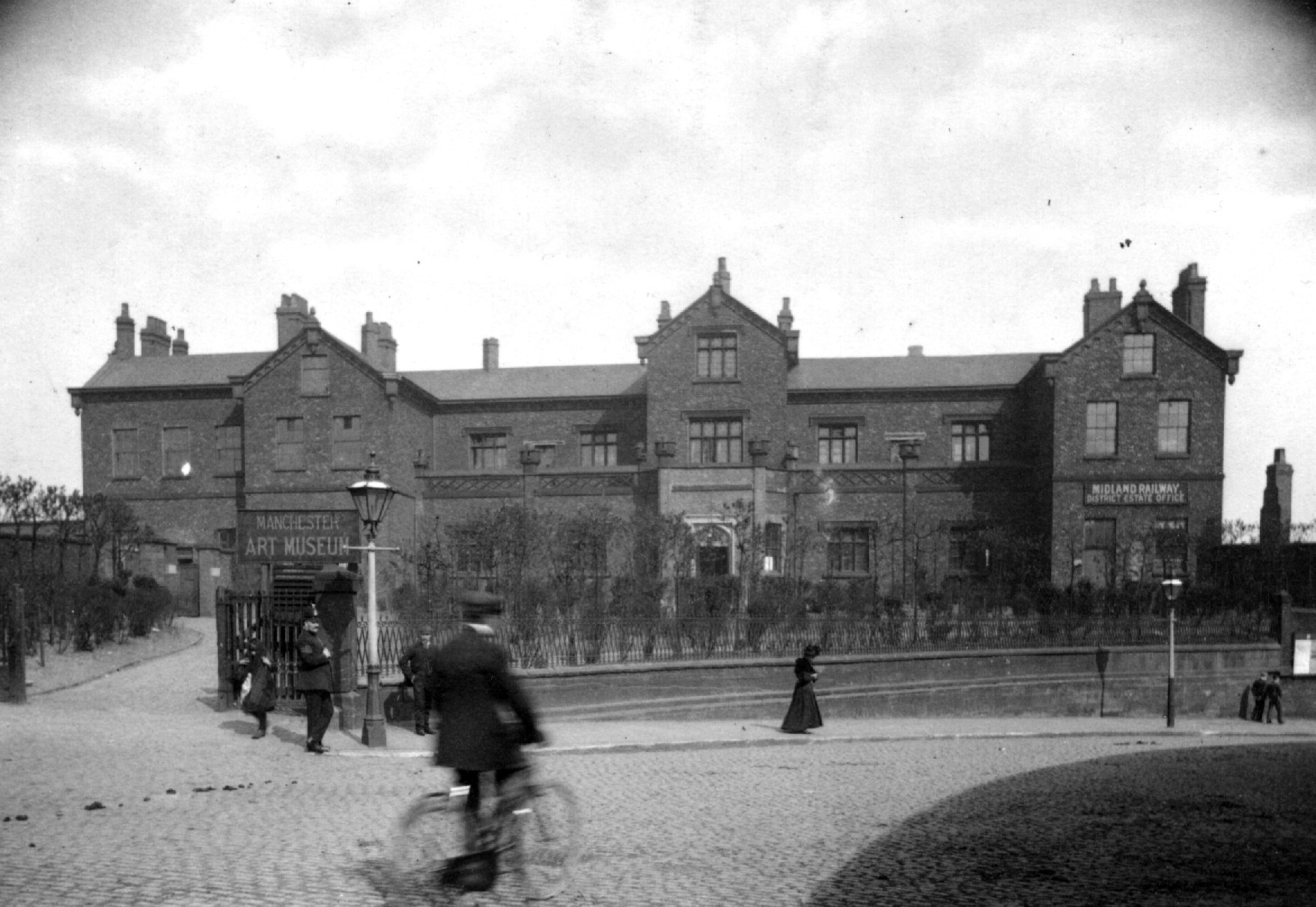
This would become the Manchester Art Museum, and here the worst excesses Victorian Capitalism were moderated by philanthropy and social reform.
When the Art Museum opened, its rooms, variously dedicated to painting, sculpture, architecture and domestic arts, together attempted to provide a chronological narrative of art, with detailed notes, labels and accompanying pamphlets and, not infrequently, personal guidance, all underlining a sense of historical development.
Housing and industry in the area begins to expand, railways, tramways, homes and roads are clearly defined around the winds of the river.
In 1918 the museum was taken over by the city, it closed in 1953 and its contents were absorbed into the collection of Manchester City Art Gallery, as the State increasingly took responsibility for the cultural well being of the common folk.
The building was finally demolished in the 1960’s – just as the area, by now a dense warren of back to back terraces, was to see further change.
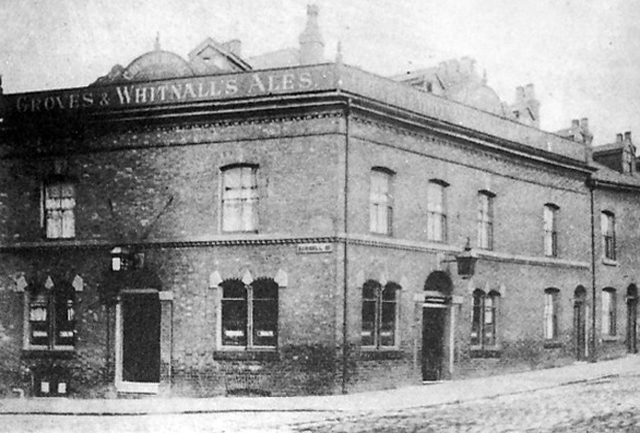
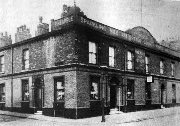
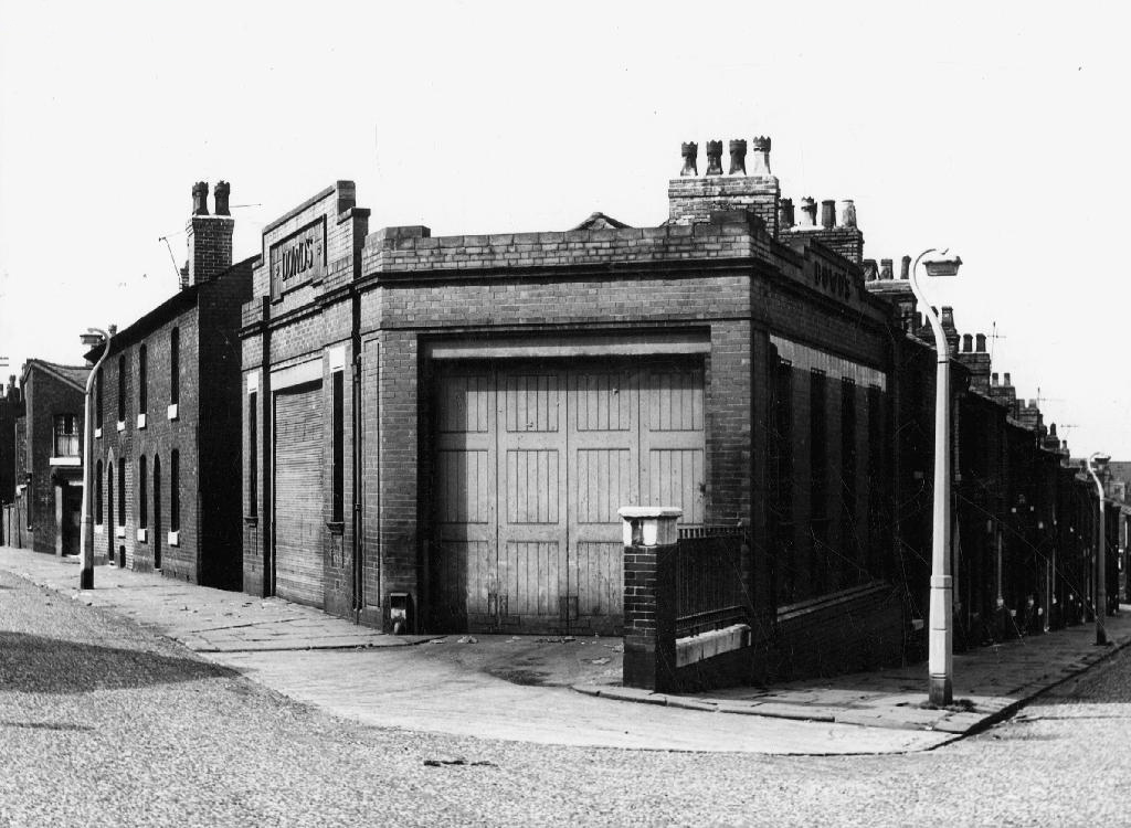
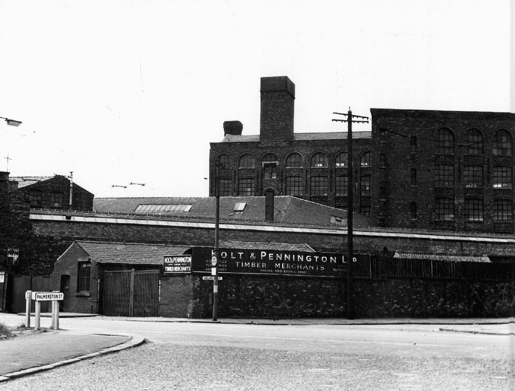
Along the way was the the River Inn, seen here with a fine Groves and Whitnall’s faience tiled frontage.
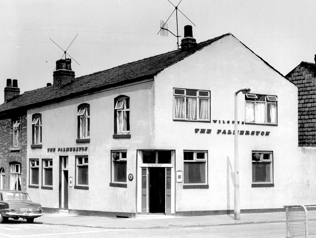
The street also offered rest, relaxation and refreshment through the Church, Pineapple and Palmerston pubs, as recored here on the Pubs of Manchester blog.
The River seen here in the 1970’s struggled on until 2007.
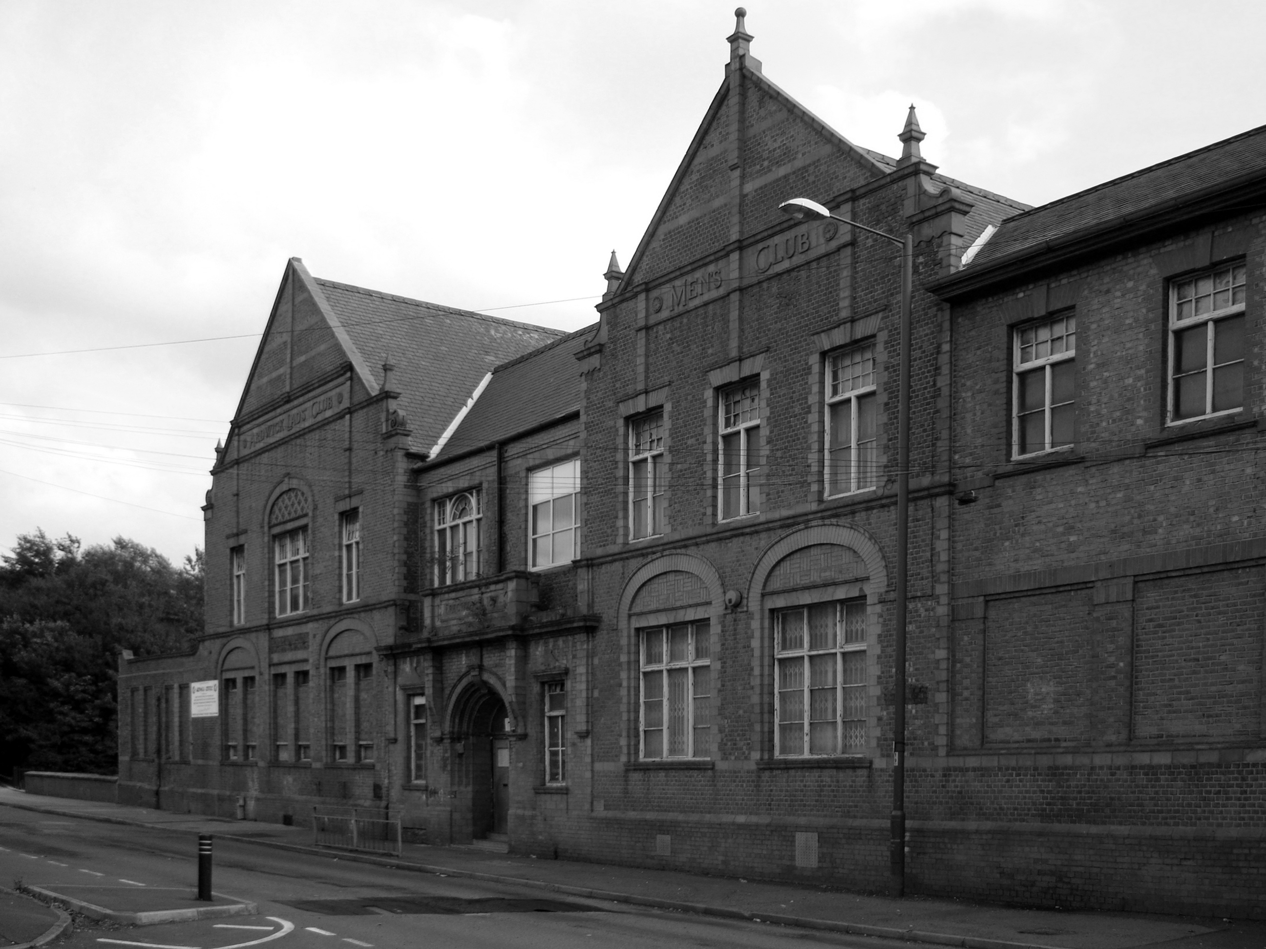
Further along we find the Ardwick Lads Club, further evidence of the forces of social reform, that sadly failed to survive the forces of the free market and the consequent Tory cuts in public spending and wilful Council land-banking.
The Ardwick Lads’ and Mens’ Club, now the Ardwick Youth Centre, opened in 1897 and is believed to be Britain’s oldest purpose-built youth club still in use [and was until earlier in 2012]. Designed by architects W & G Higginbottom, the club, when opened, featured a large gymnasium with viewing gallery – where the 1933 All England Amateur Gymnastics Championships were held – three fives courts, a billiard room and two skittle alleys (later converted to shooting galleries). Boxing, cycling, cricket, swimming and badminton were also organised. At its peak between the two world wars, Ardwick was the Manchester area’s largest club, with 2,000 members.
On the 10th September 2012 an application for prior notification of proposed demolition was submitted on behalf of Manchester City Council to Manchester Planning, for the demolition of Ardwick Lads’ Club of 100 Palmerston Street , citing that there was “no use” for the building in respect to its historic place within the community as providing a refuge and sporting provision to the young of Ancoats.
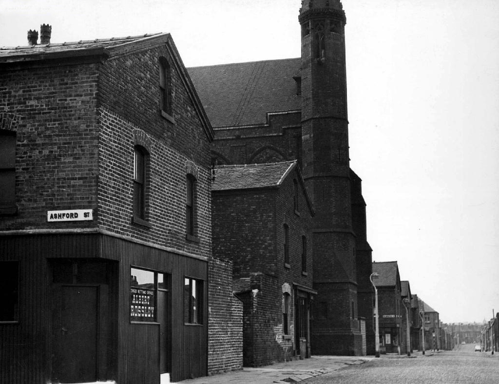
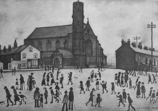
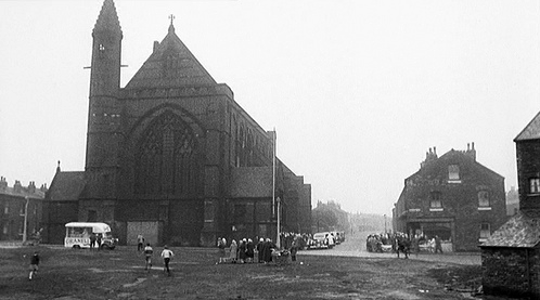
At the top turn of the street stood St Mary’s – the so called Lowry church.
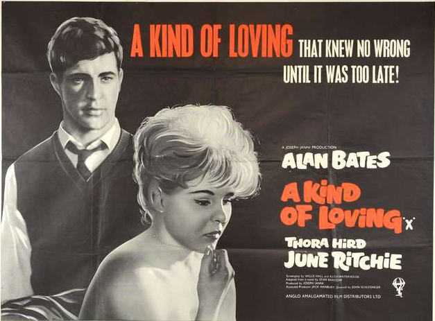
Used as a location for the film adaptation of Stan Barstow’s A Kind Of Loving
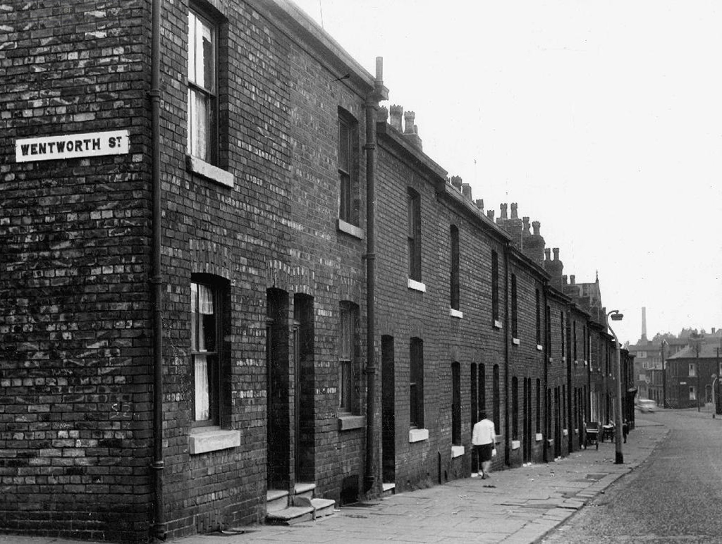
The homes and industry attendant schools and pubs were soon to become history, all that you see here is more or less gone. Slum clearance, the post-war will to move communities away from the dense factory smoke, poor housing stock and towards a bright shiny future elsewhere.
Whole histories have subsequently been subsumed beneath the encroachment of buddleia, bramble, birch and willow.
The land now stands largely unused and overgrown, awaiting who knows what, but that’s another tale for another day.