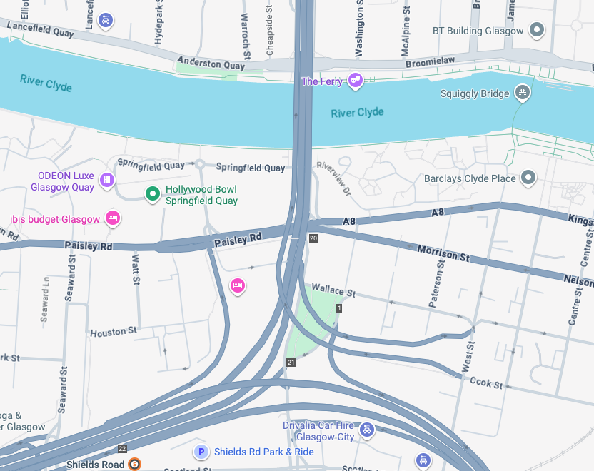
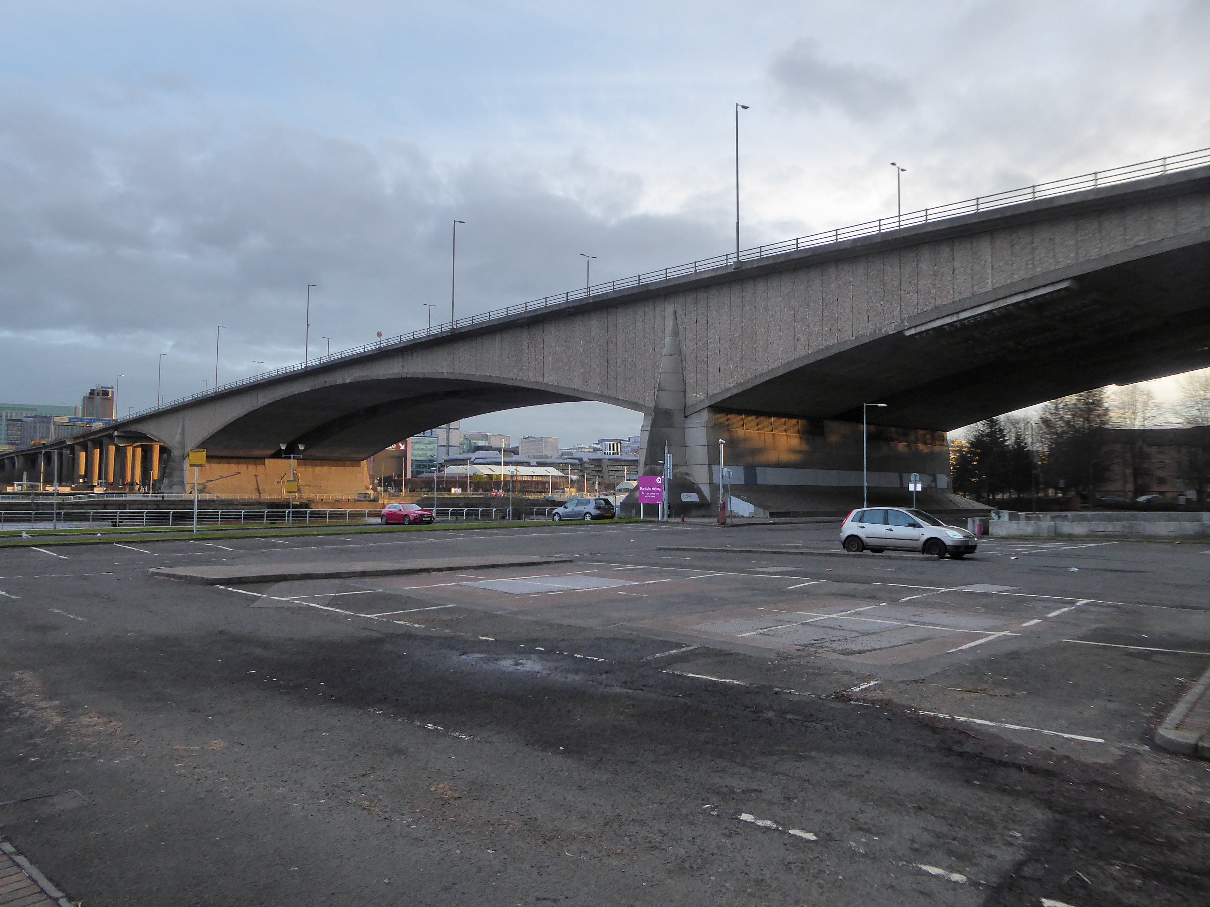
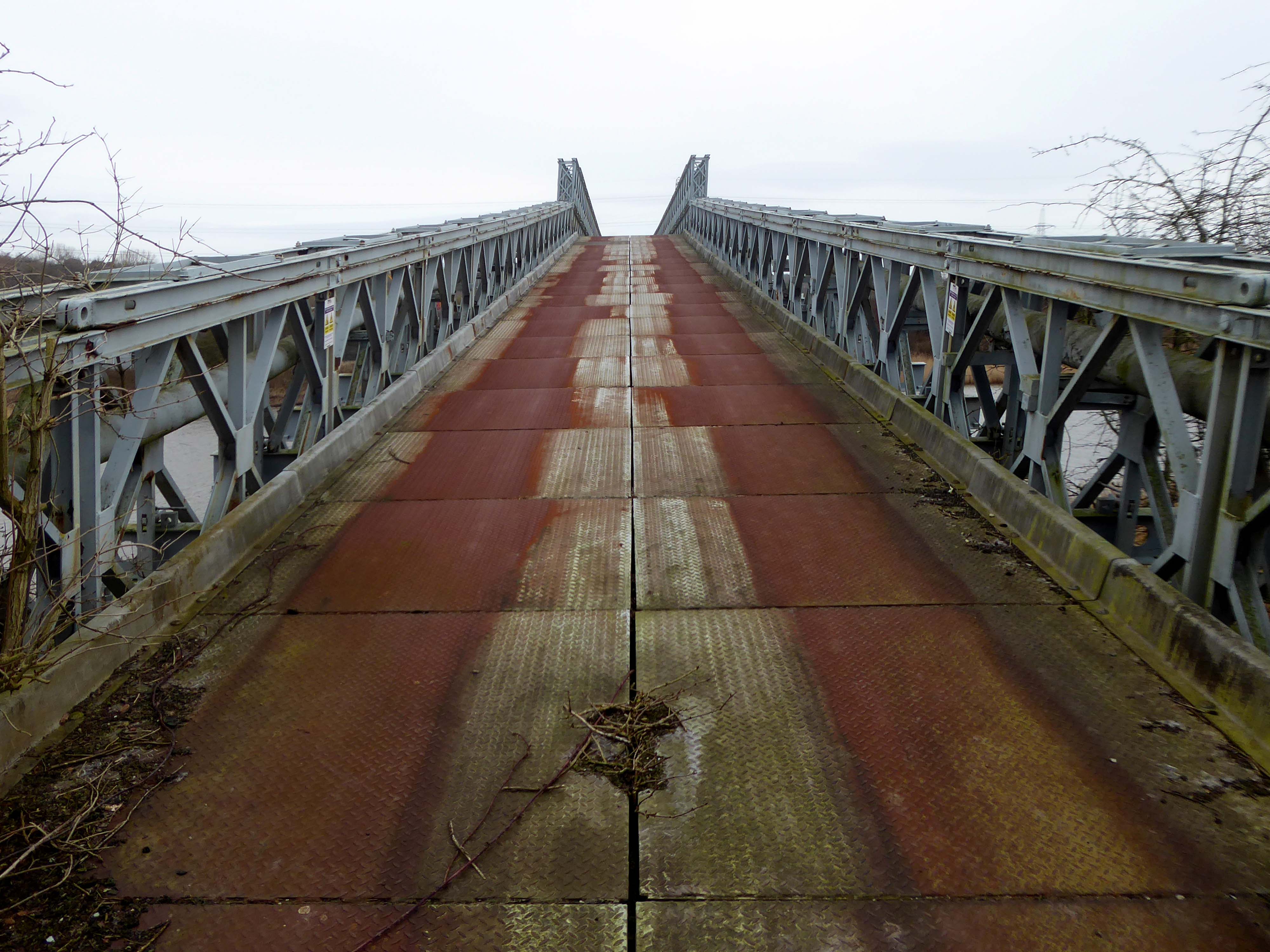
The bridge on the River Clyde – and access to the city’s motorway system.
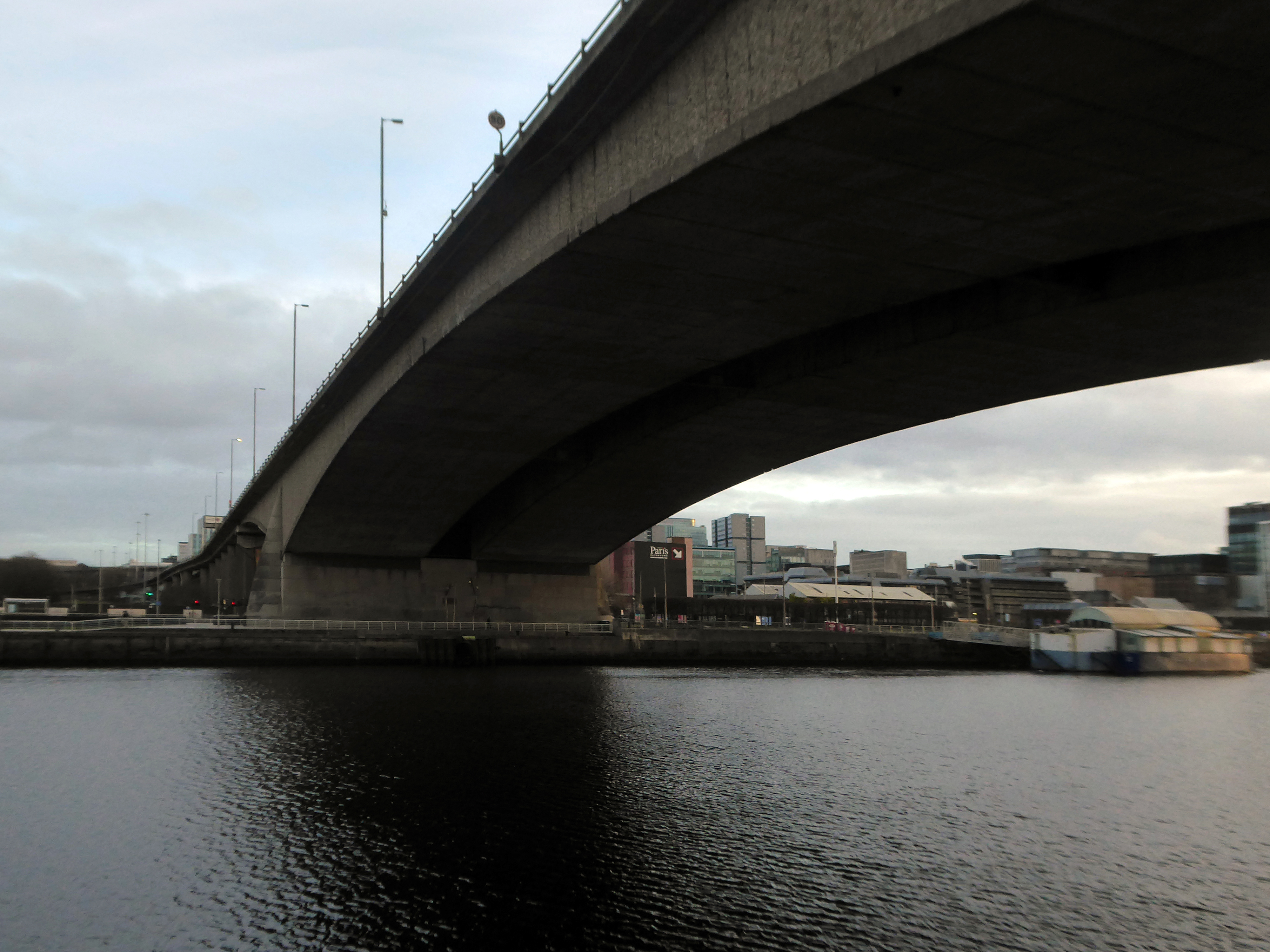
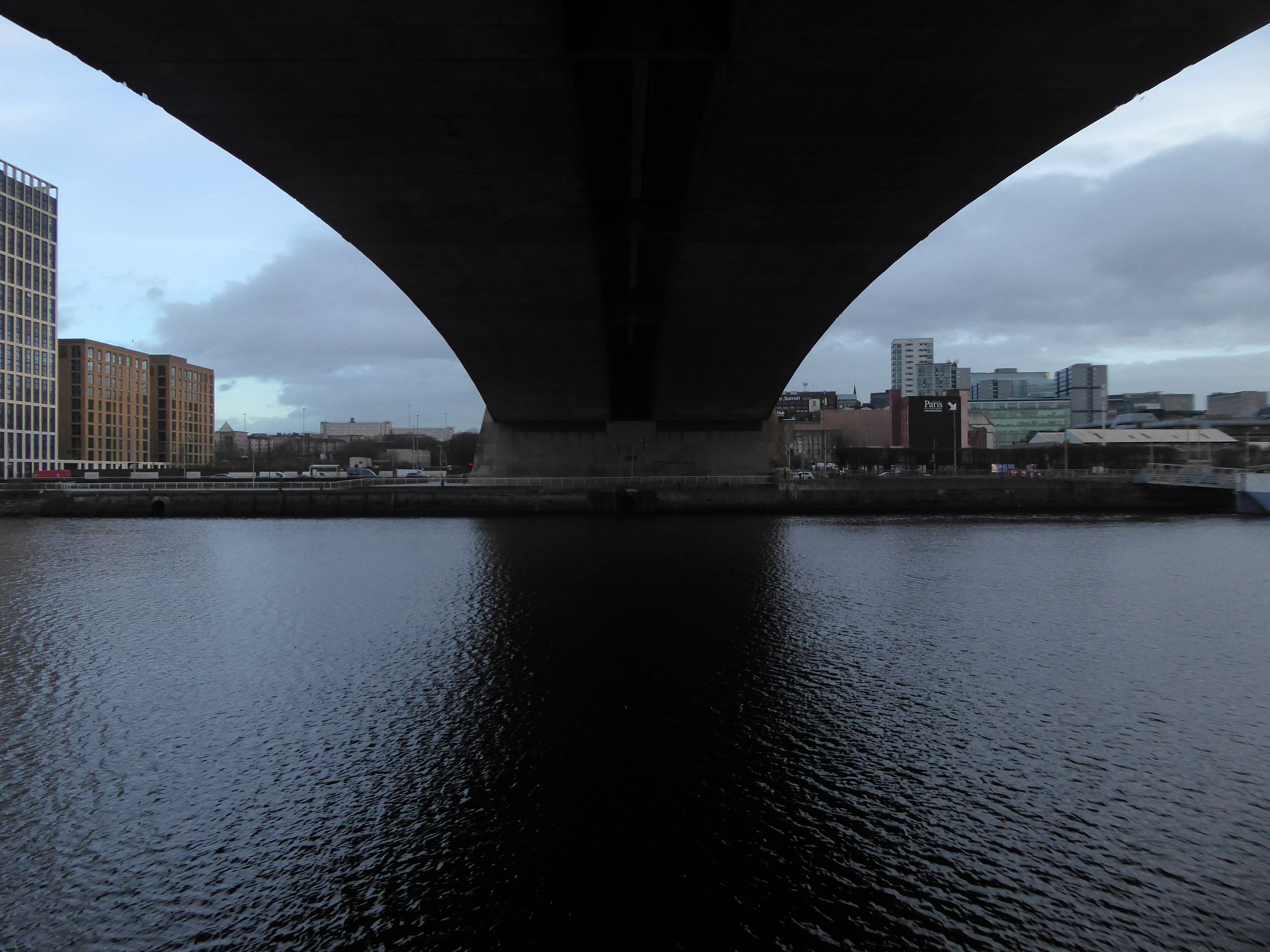
The Kingston Bridge is a balanced cantilever dual-span ten lane road bridge made of triple-cell segmented prestressed concrete box girders crossing the River Clyde.
Carrying the M8 motorway through the city centre, the Kingston Bridge is one of the busiest bridges in Europe, carrying around 150,000 vehicles every day.
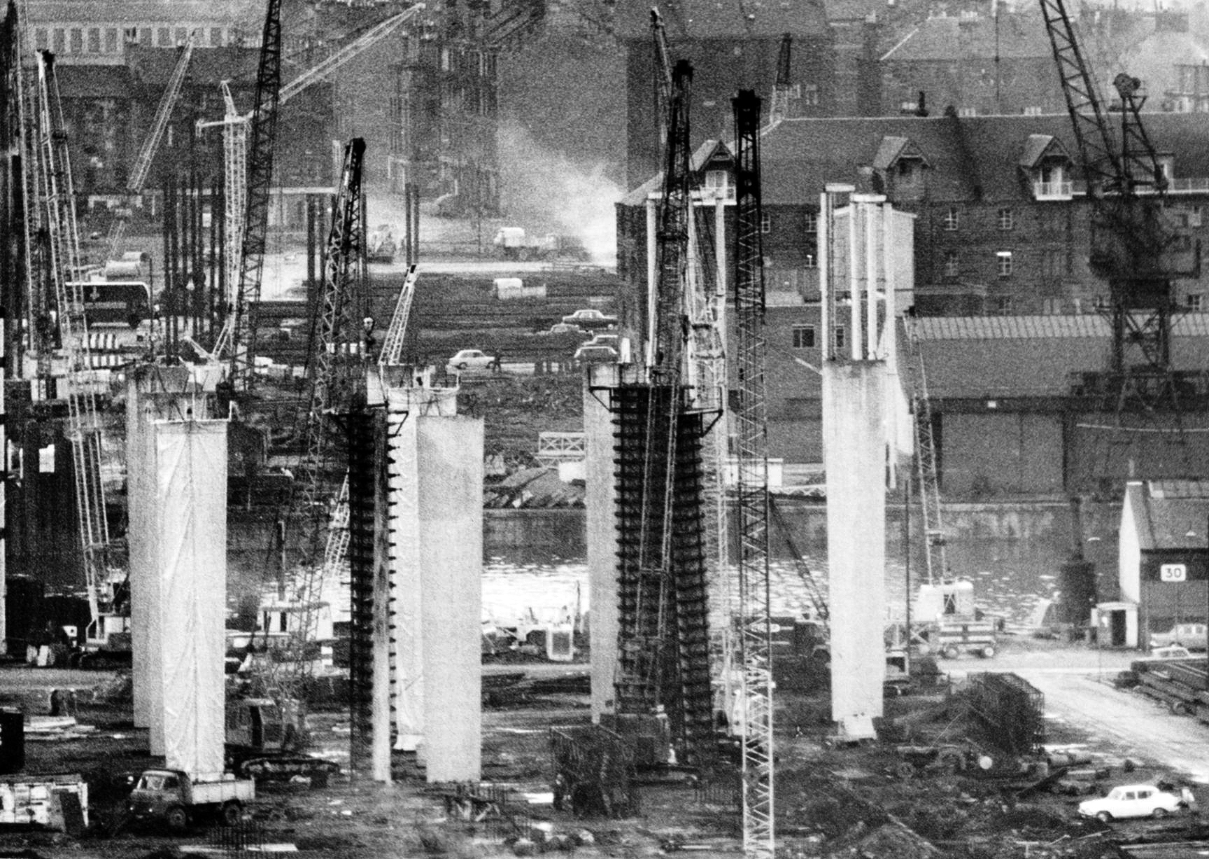
The bridge was first proposed in 1945 as part of the Glasgow Inner Ring Road scheme. After feasibility studies were carried out, William Fairhurst was appointed consulting engineer for the design of the bridge and its approaches and on 15 May 1967 construction began; this was a joint venture between Duncan Logan Construction Ltd and Marples Ridgway.
The eventual cost was £2.4m excluding the approach viaducts or around £11m in total.
On 26 June 1970 Kingston Bridge was opened by Queen Elizabeth the Queen Mother.
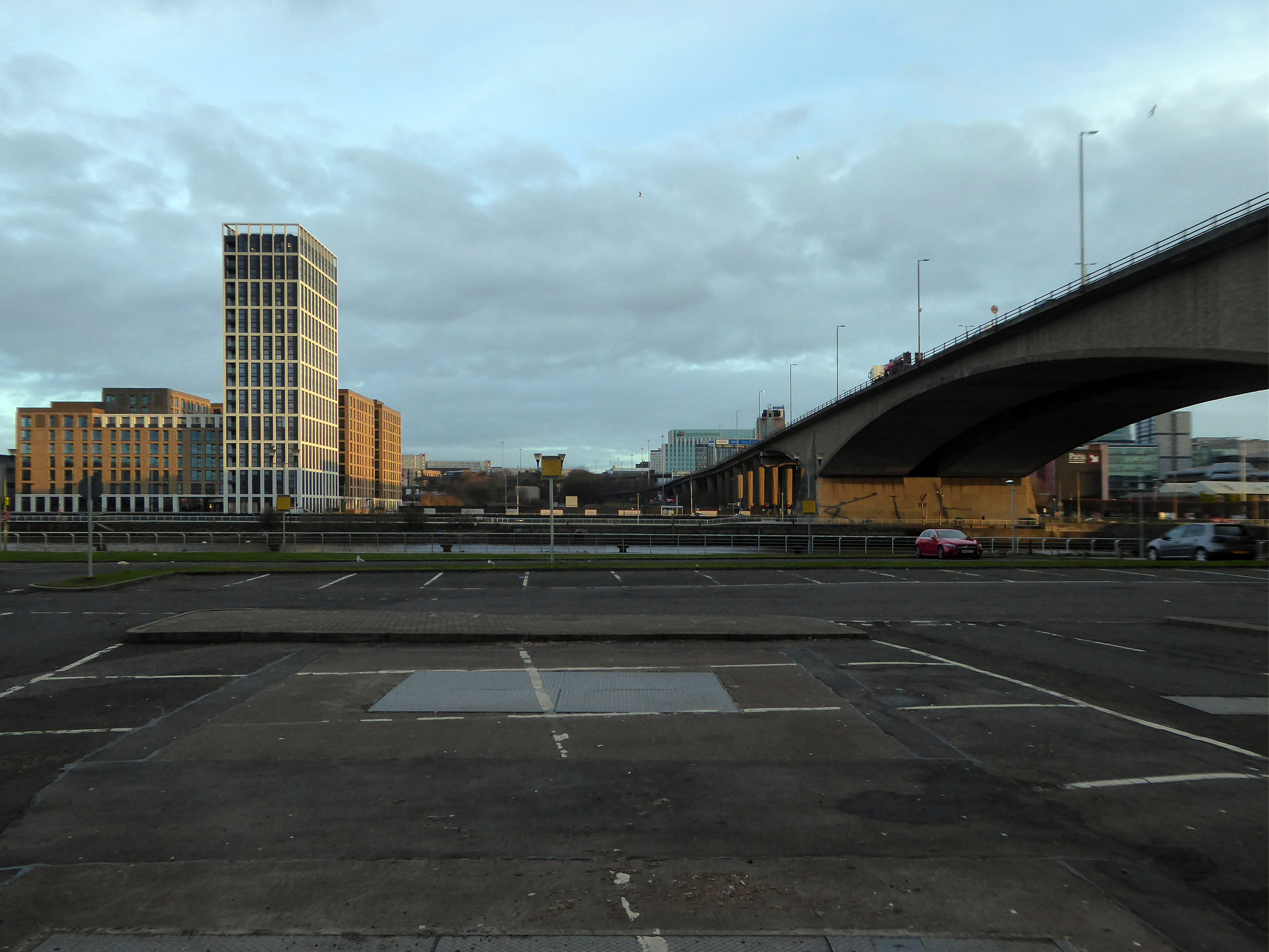
Co-operative House was the former headquarters of the Scottish Co-operative Wholesale Society and today is a mixed residential and commercial development.
There is a dubious urban myth that the fourth man in the Williamwood bank robbery, Archie McGeachy, is buried in the pillars of the bridge.
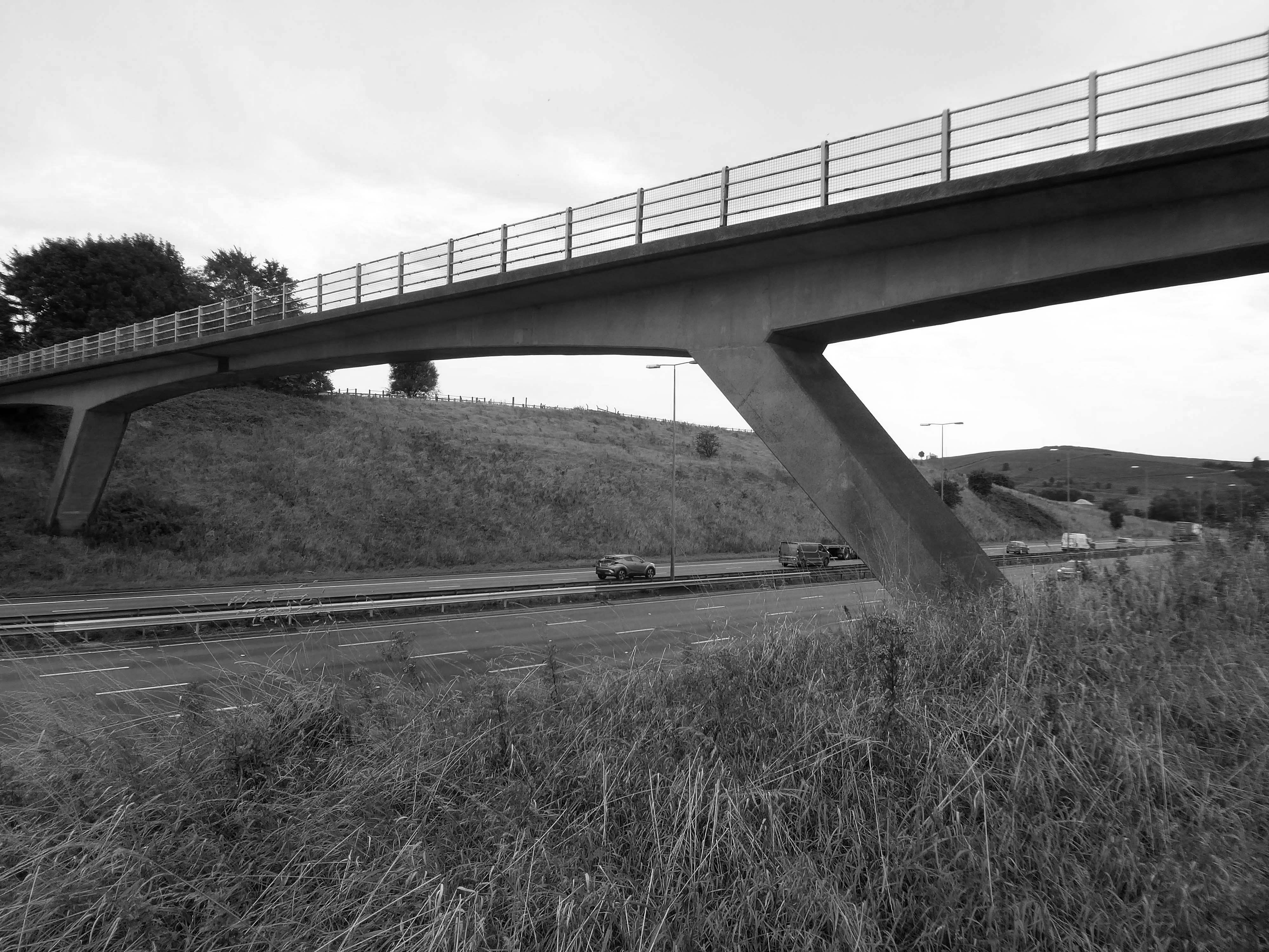
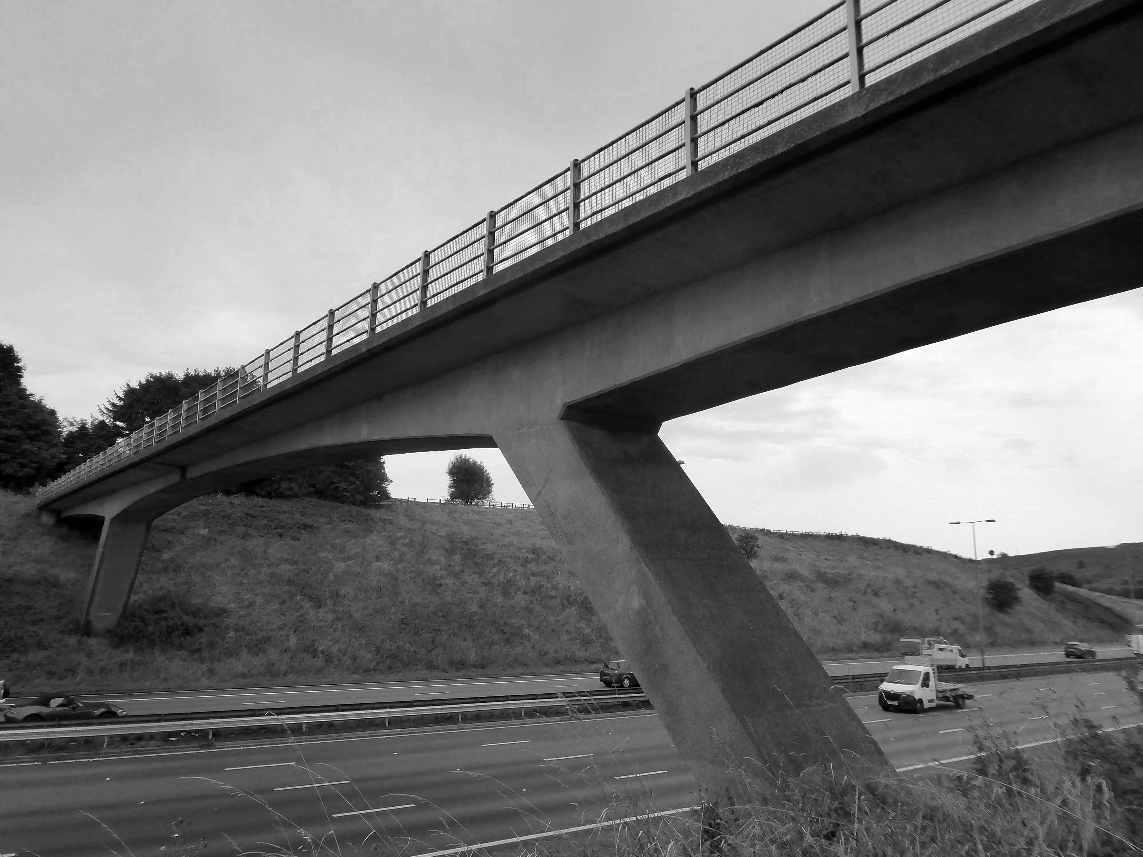
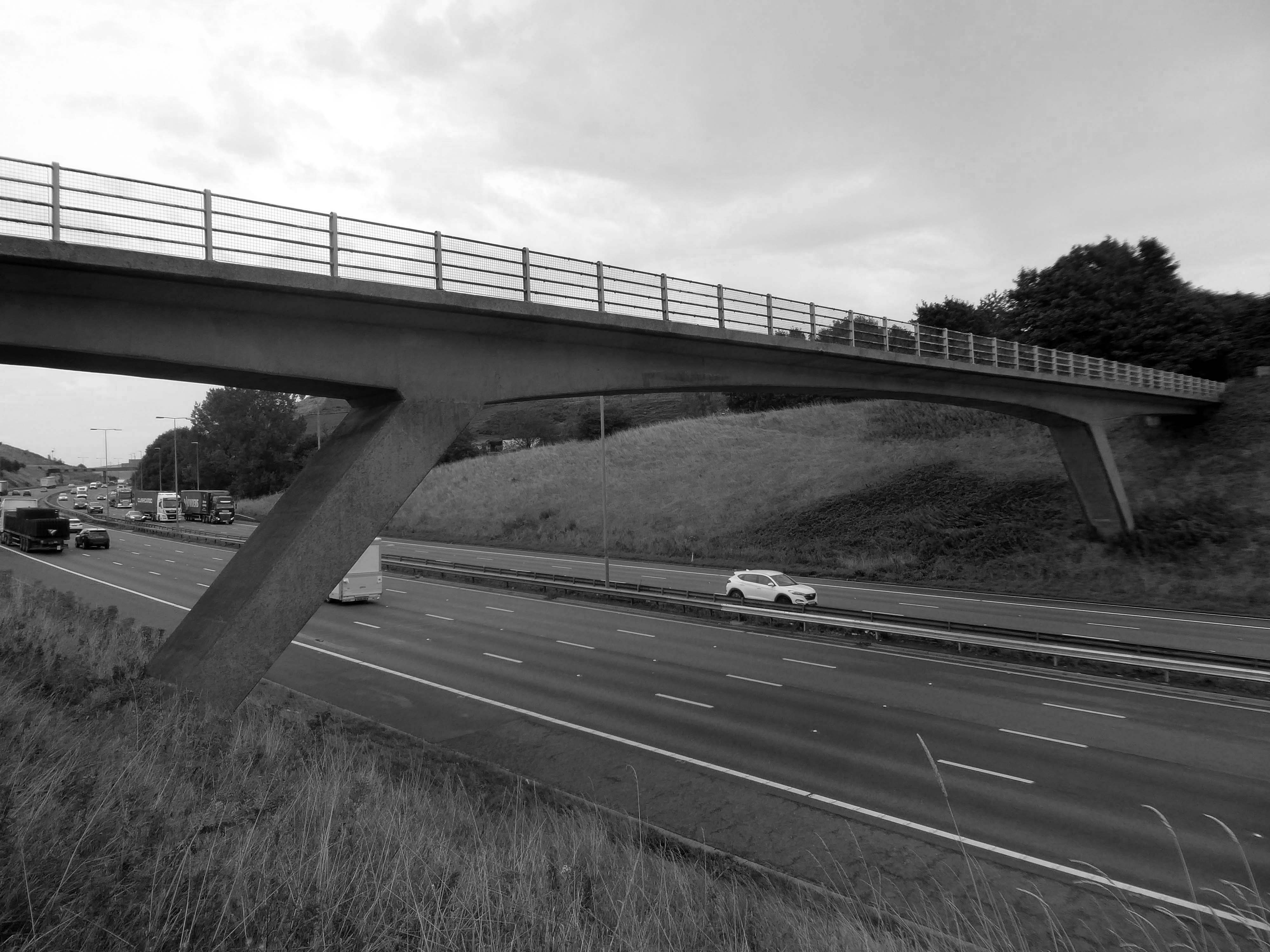
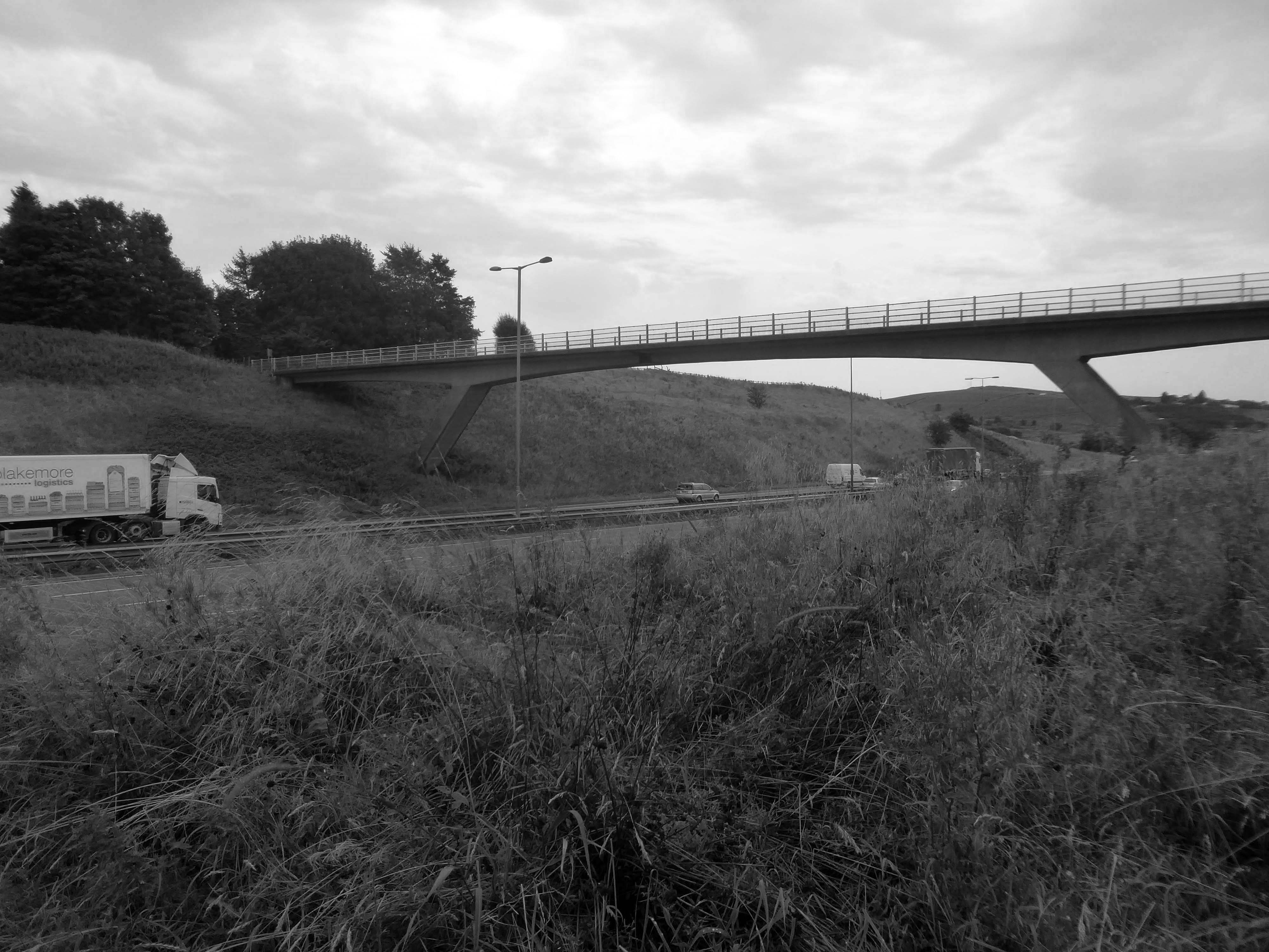
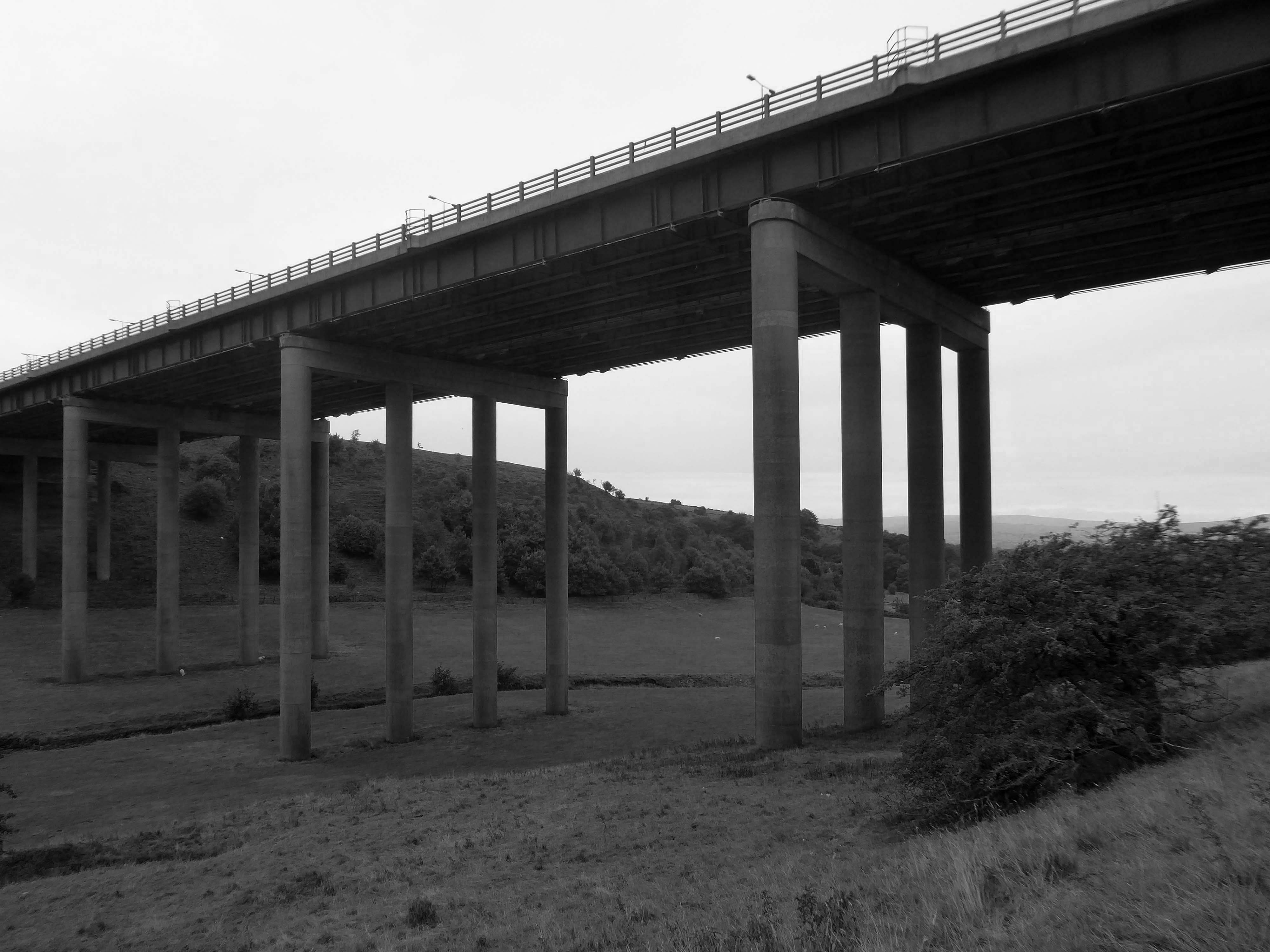
The M62 is a 107-mile-long west–east trans-Pennine motorway, connecting Liverpool and Hull via Manchester, Bradford, Leeds and Wakefield; 7 miles of the route is shared with the M60 orbital motorway around Manchester.
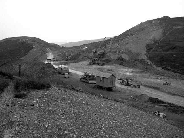
The motorway, which was first proposed in the 1930s, and conceived as two separate routes, was opened in stages between 1971 and 1976, with construction beginning at Pole Moor near Huddersfield and finishing at that time in Tarbock on the outskirts of Liverpool. The motorway absorbed the northern end of the Stretford-Eccles bypass, which was built between 1957 and 1960. Adjusted for inflation to 2007, its construction cost approximately £765 million. The motorway has an average daily traffic flow of 144,000 vehicles in West Yorkshire, and has several sections prone to gridlock, in particular, between Leeds and Huddersfield and the M60 section around Eccles.
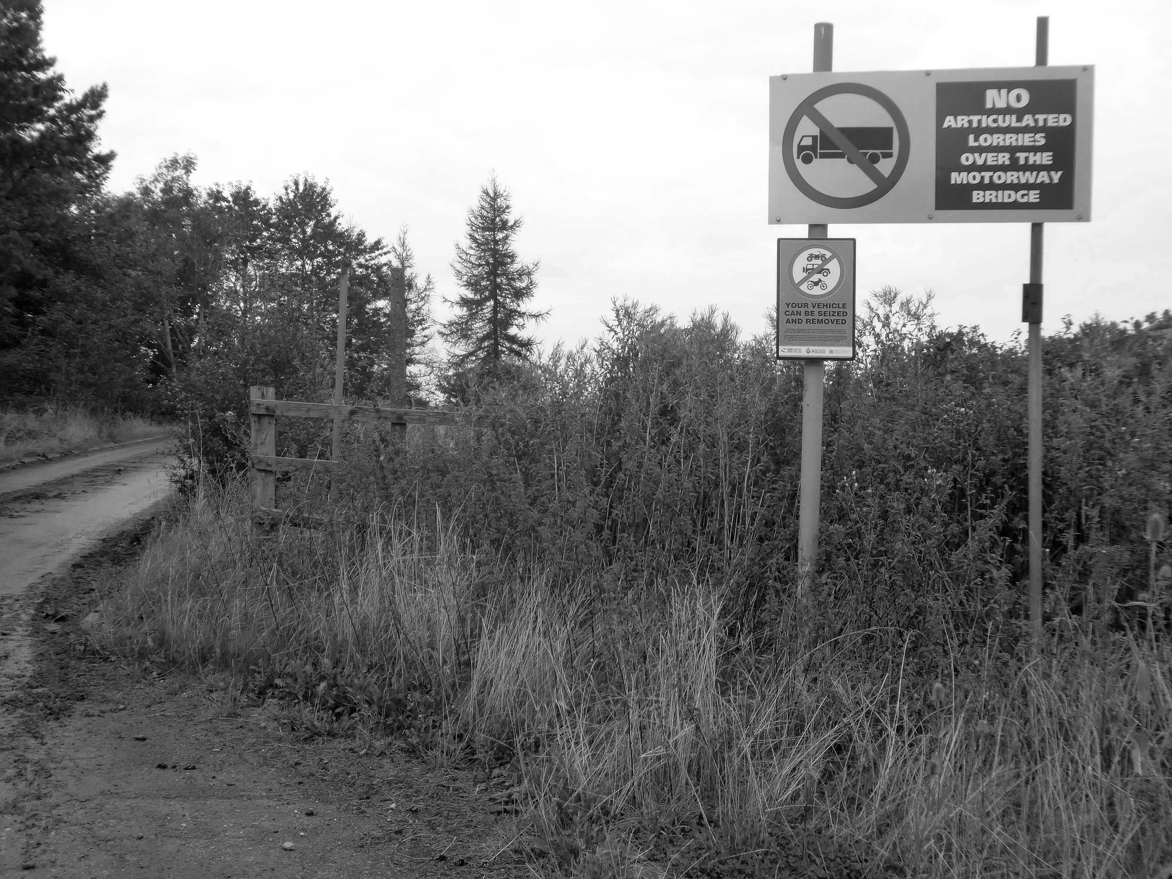
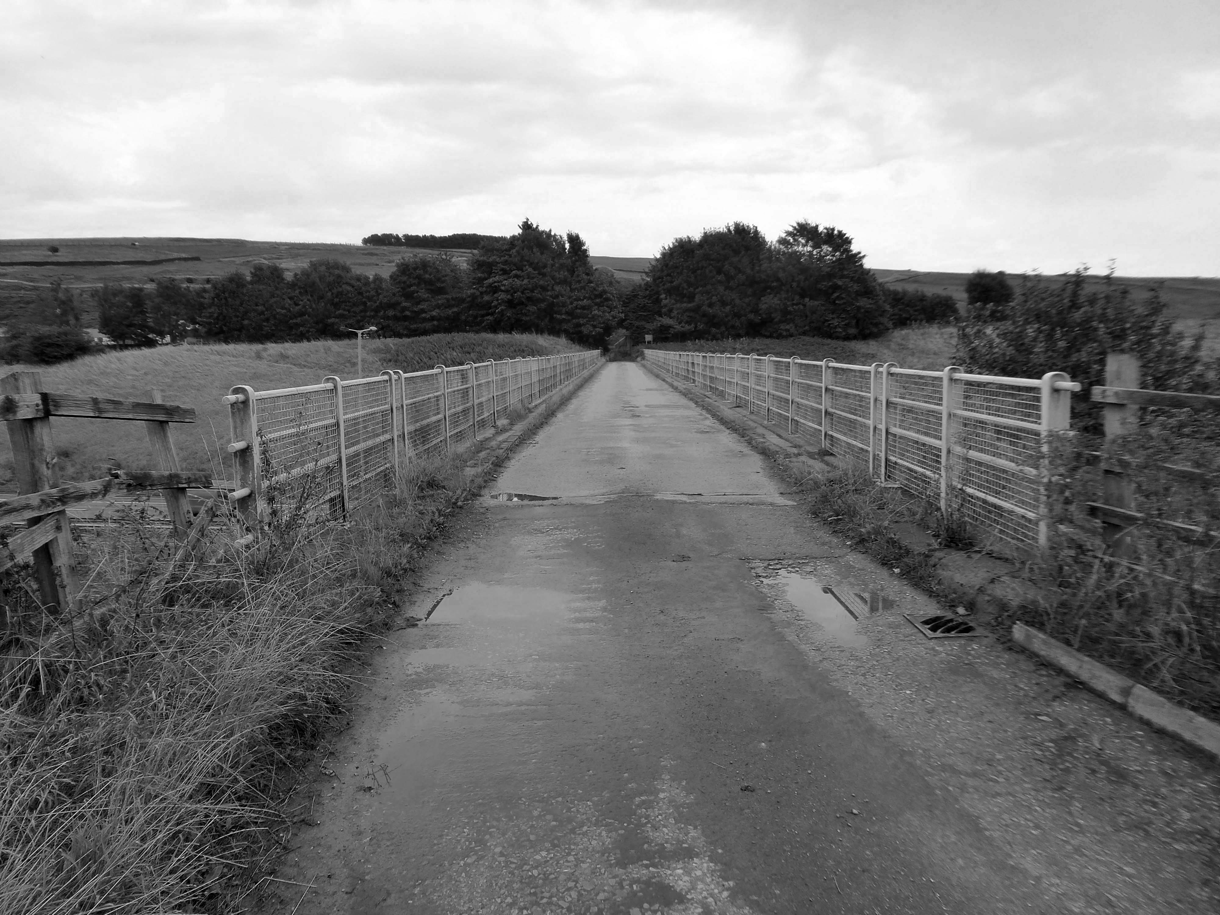
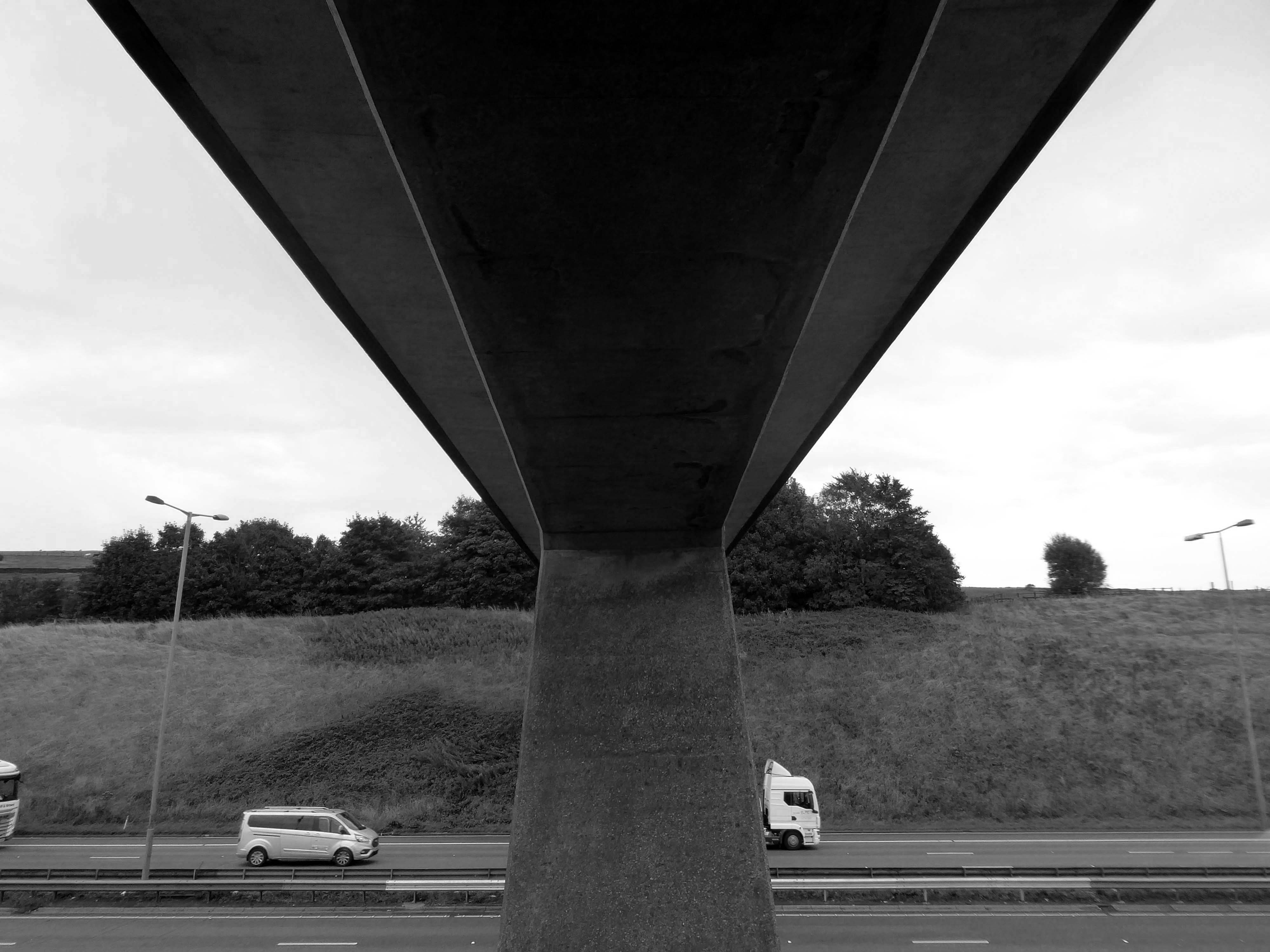
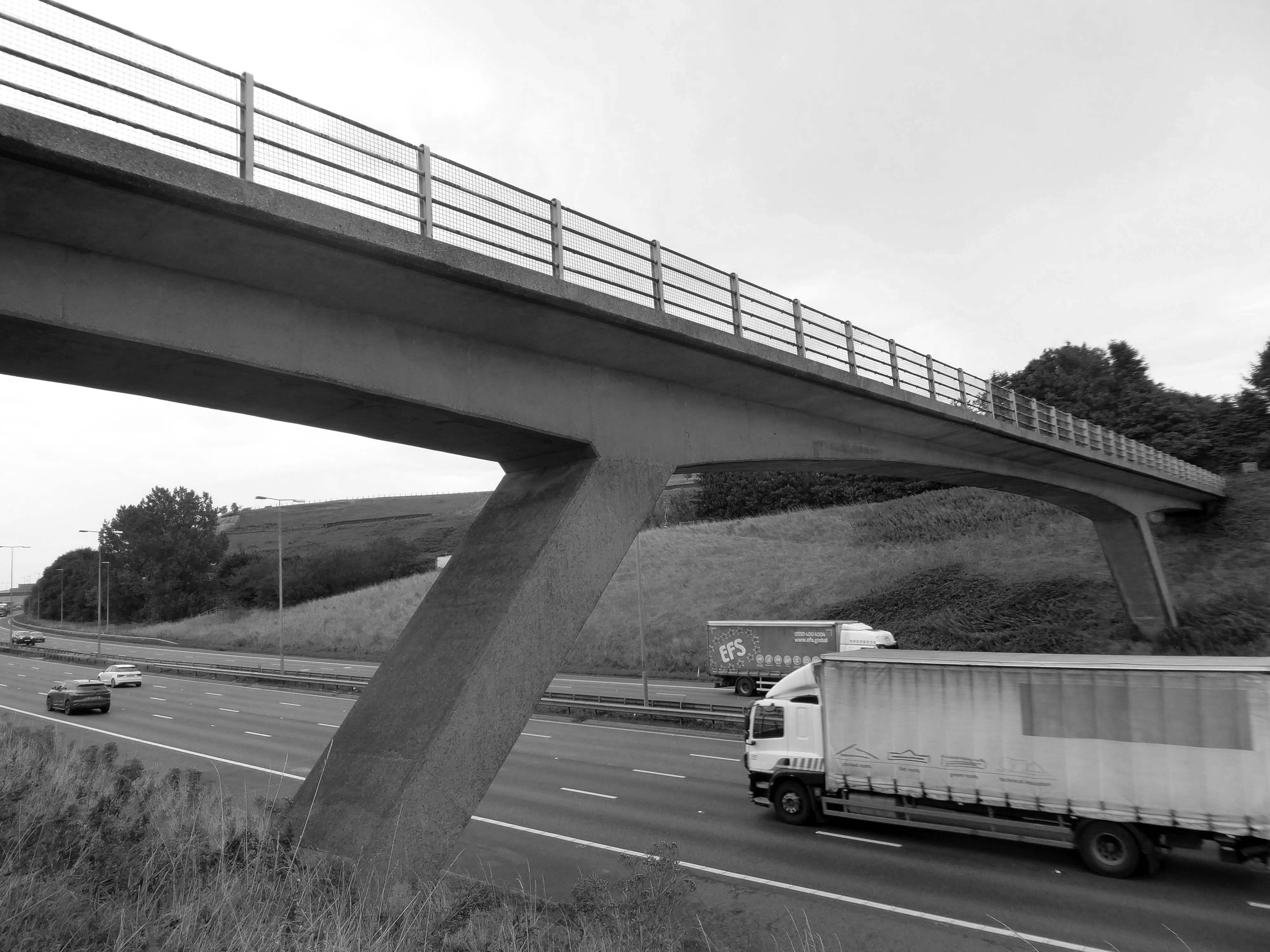
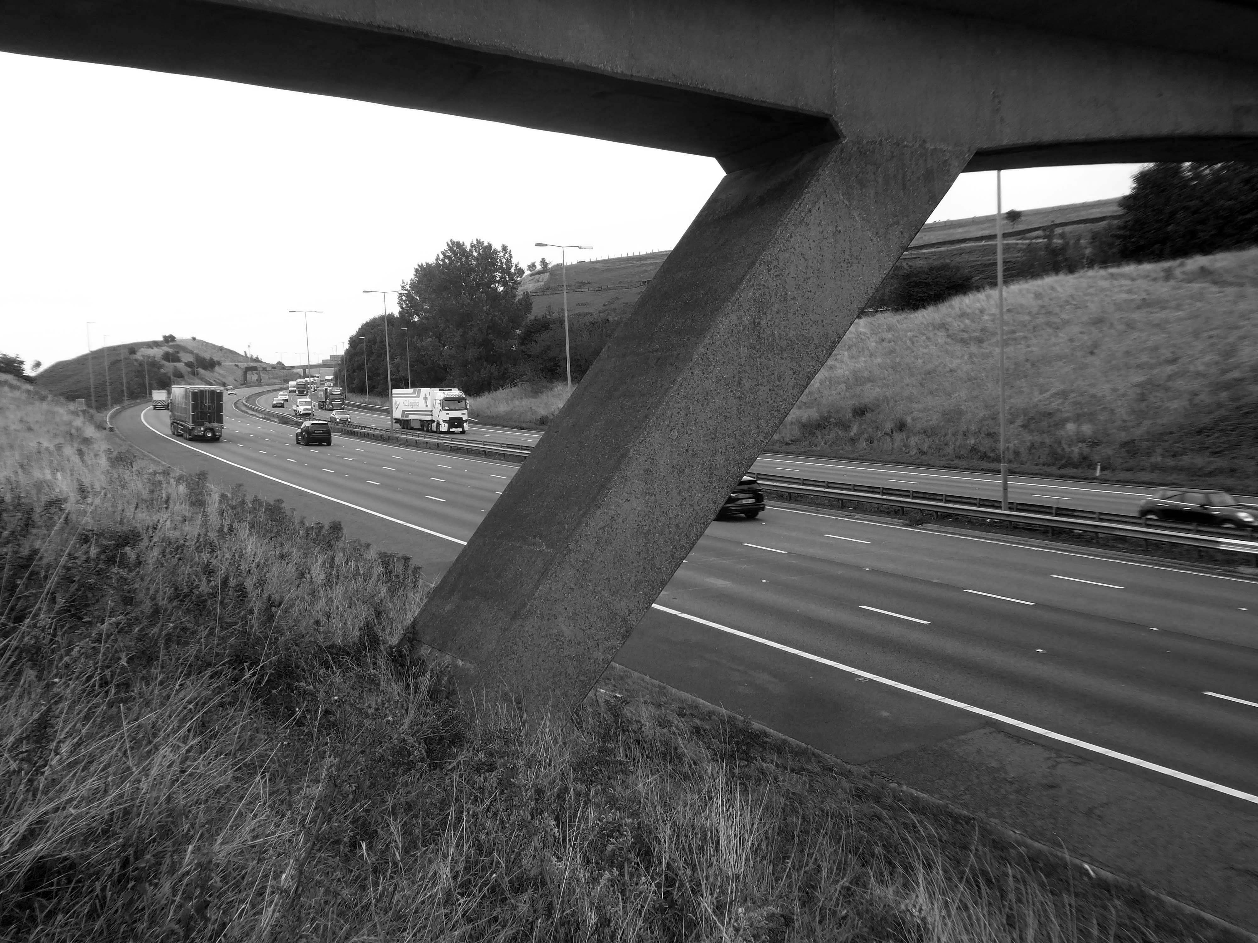
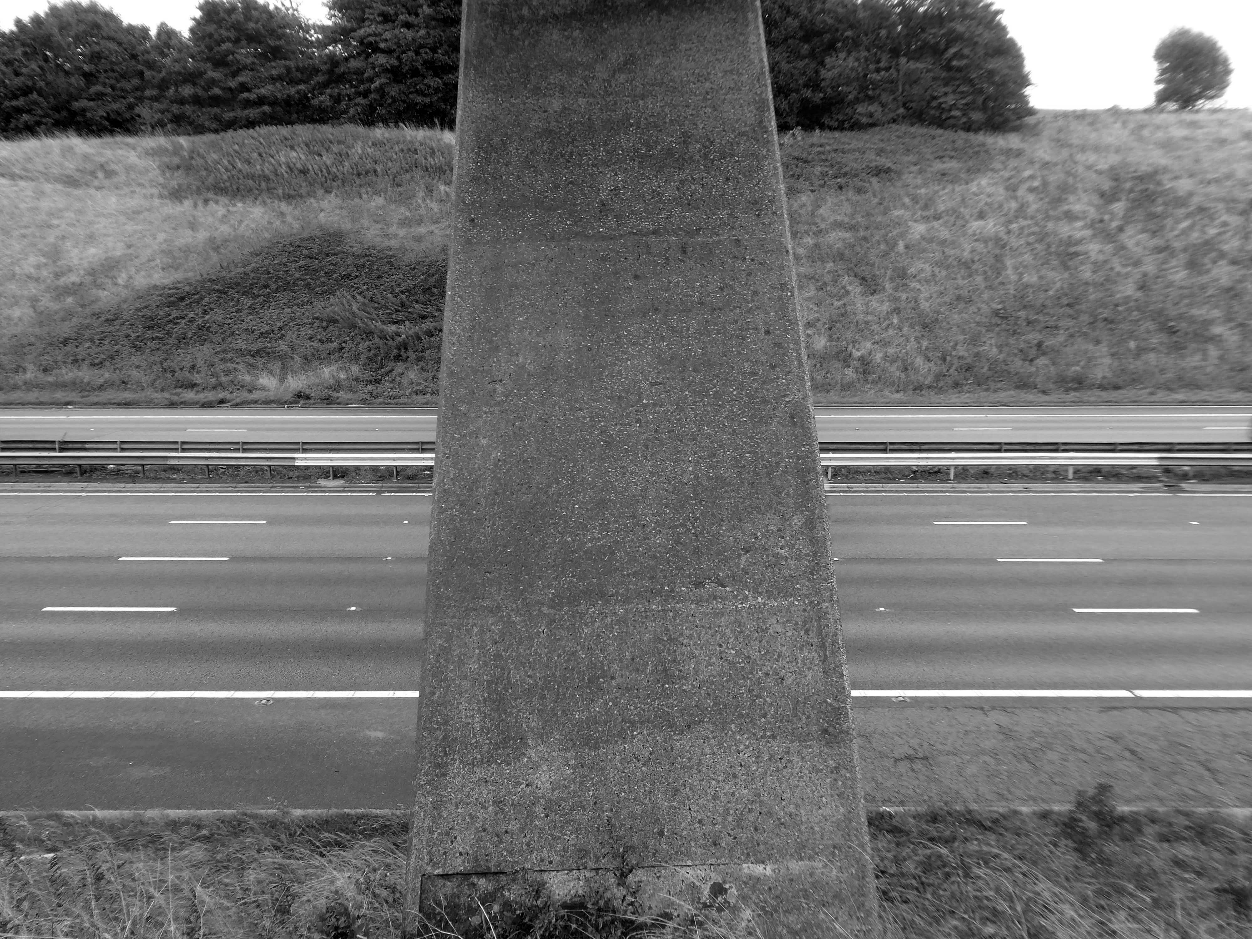
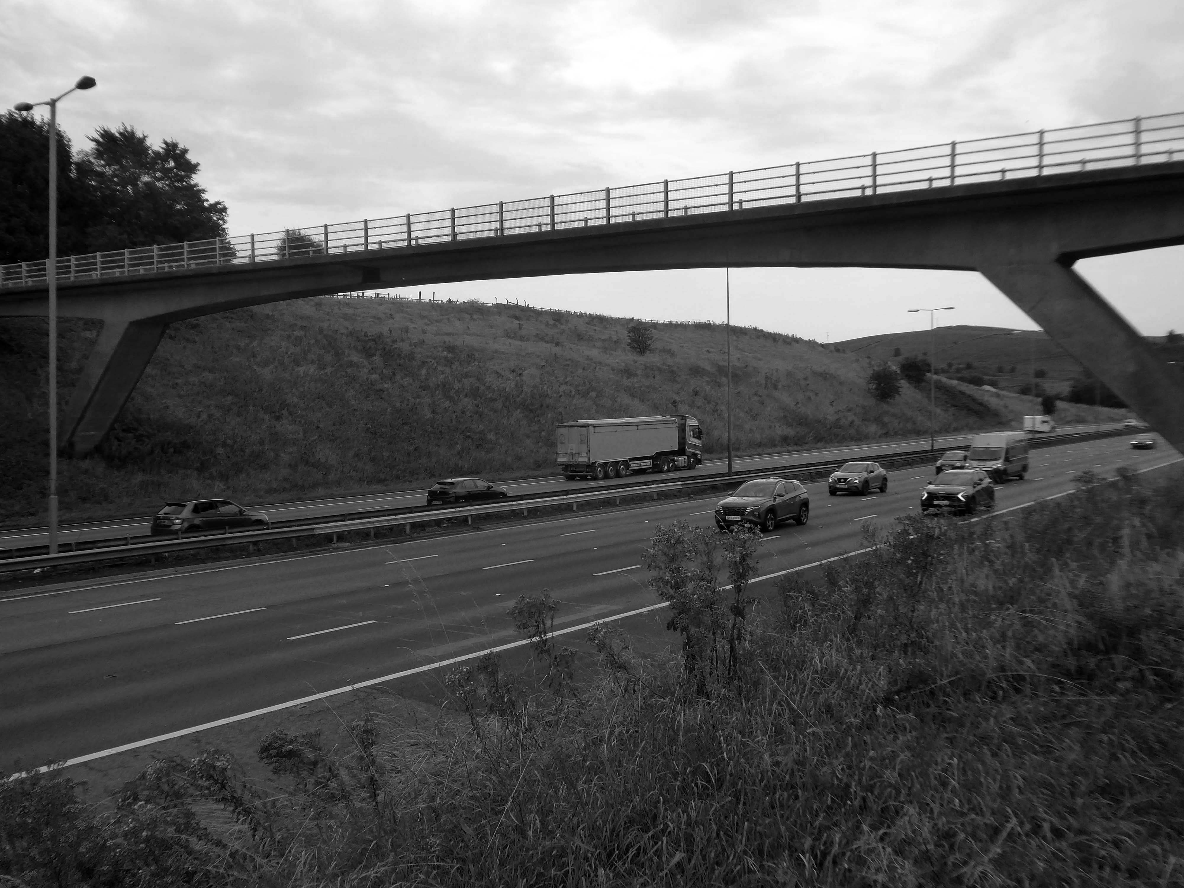
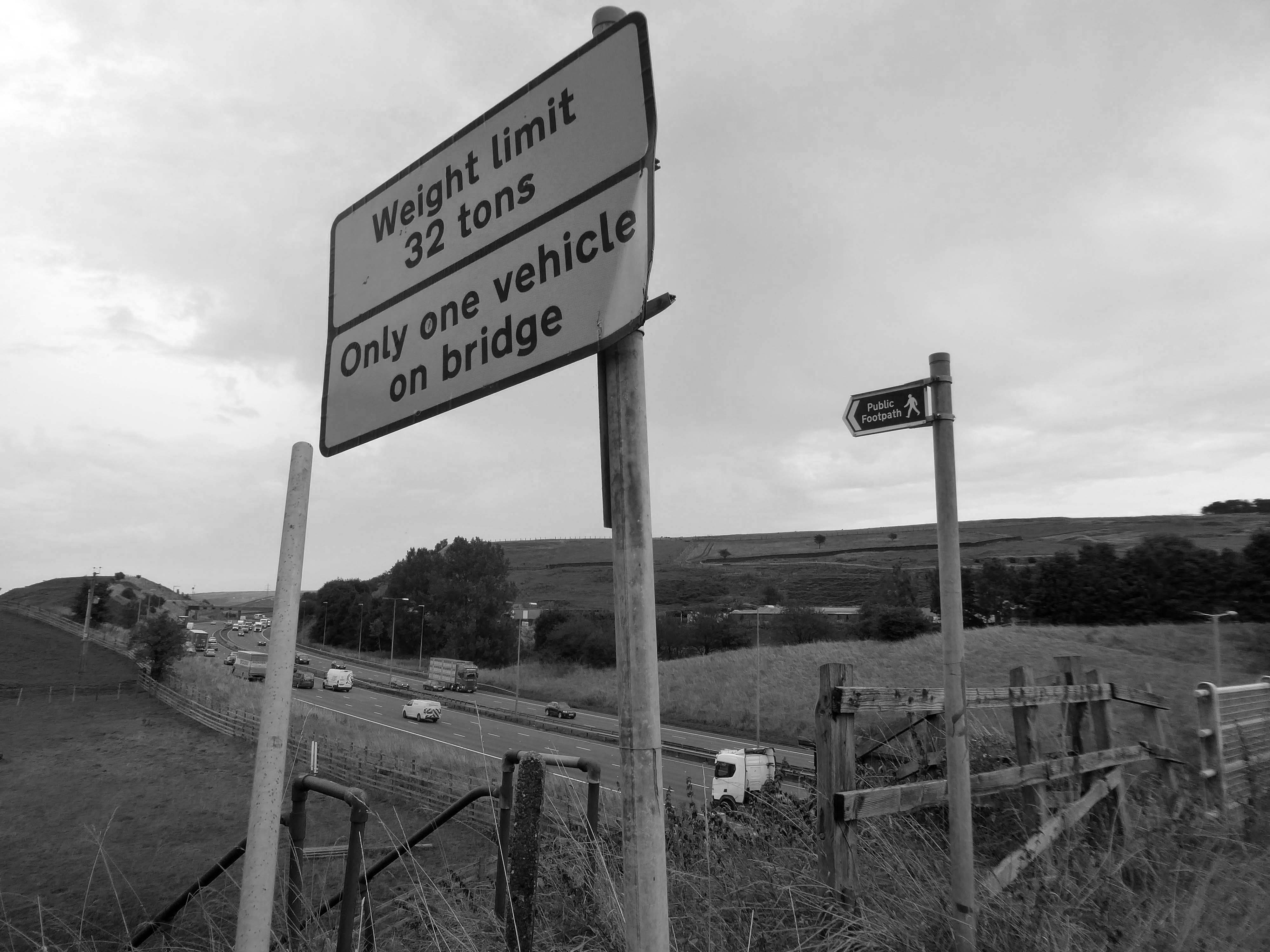
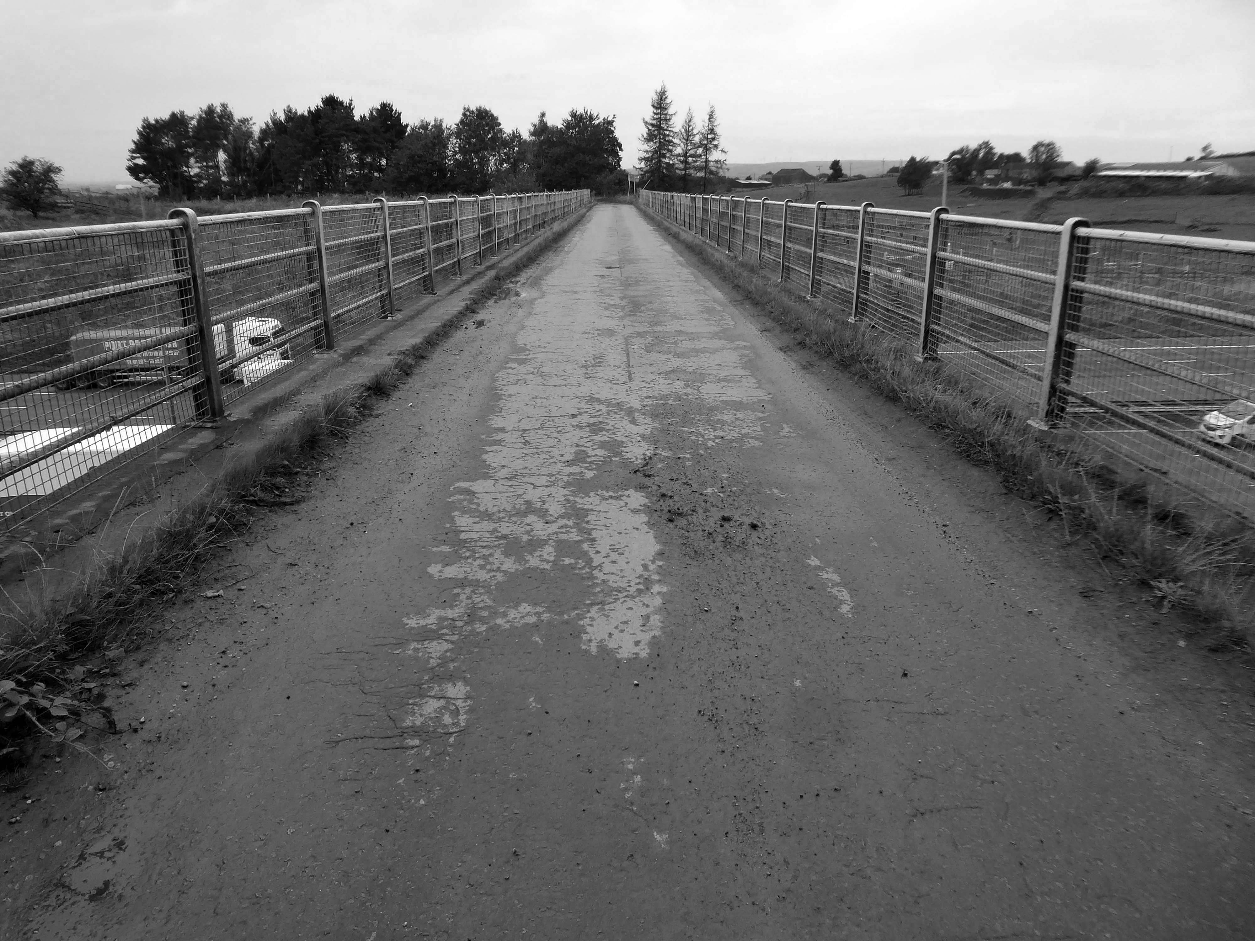
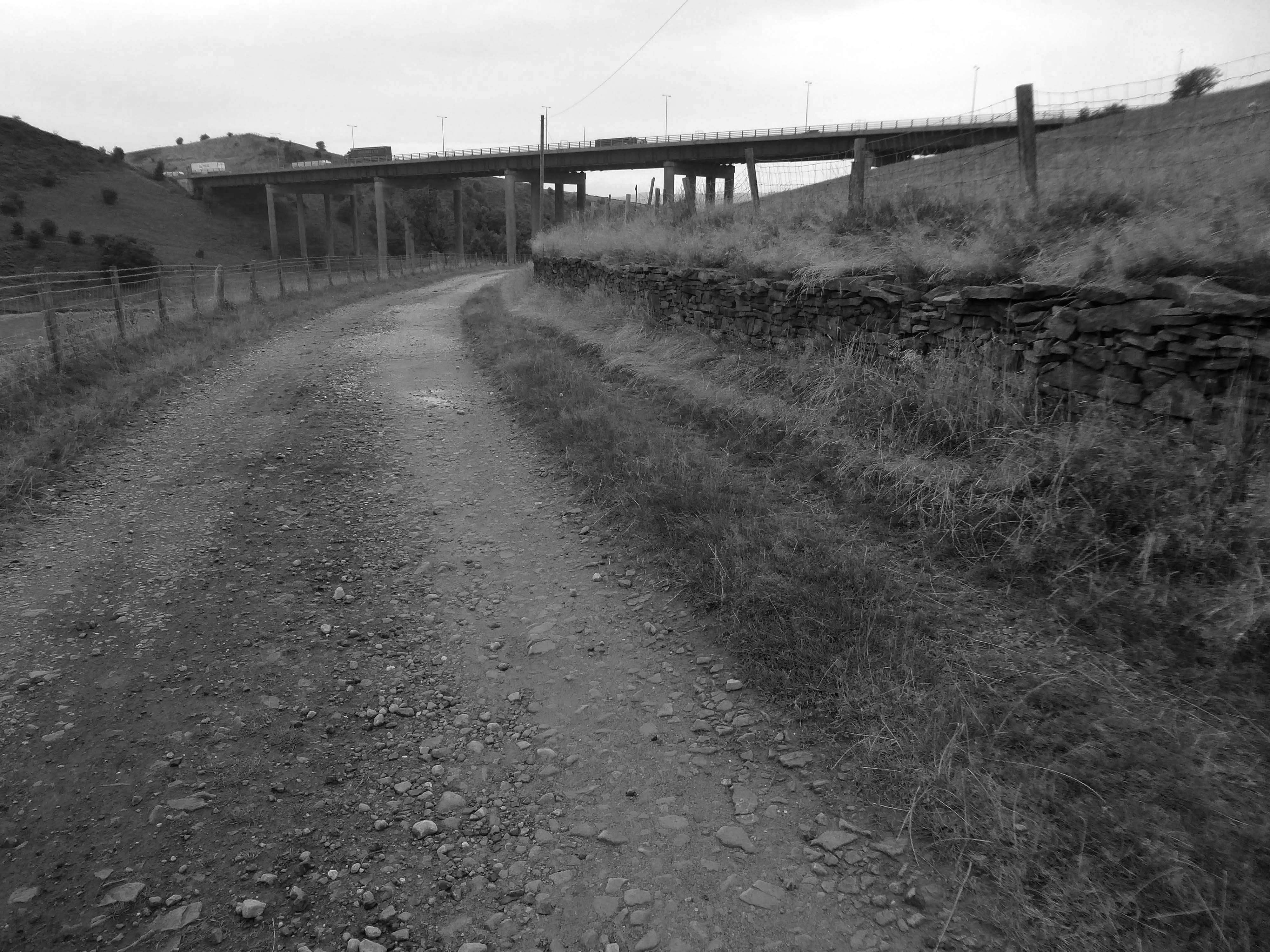
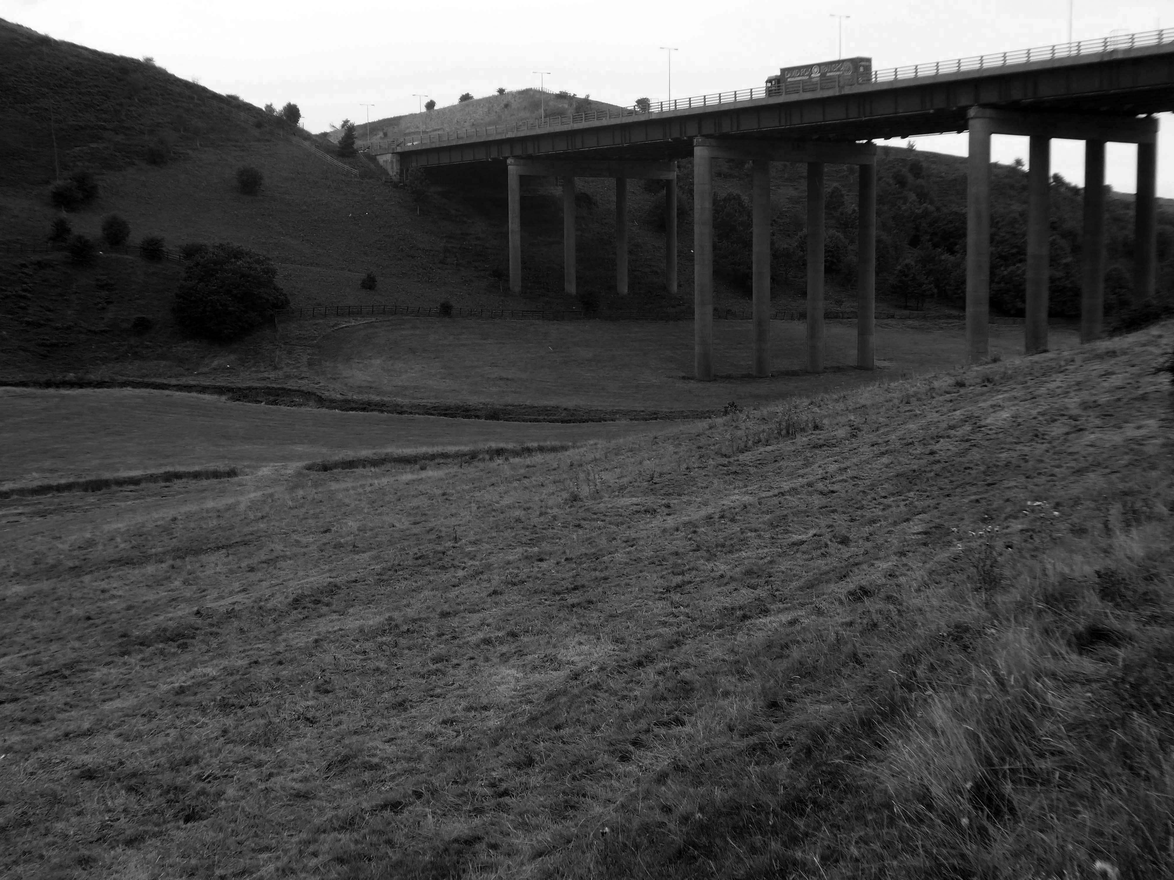
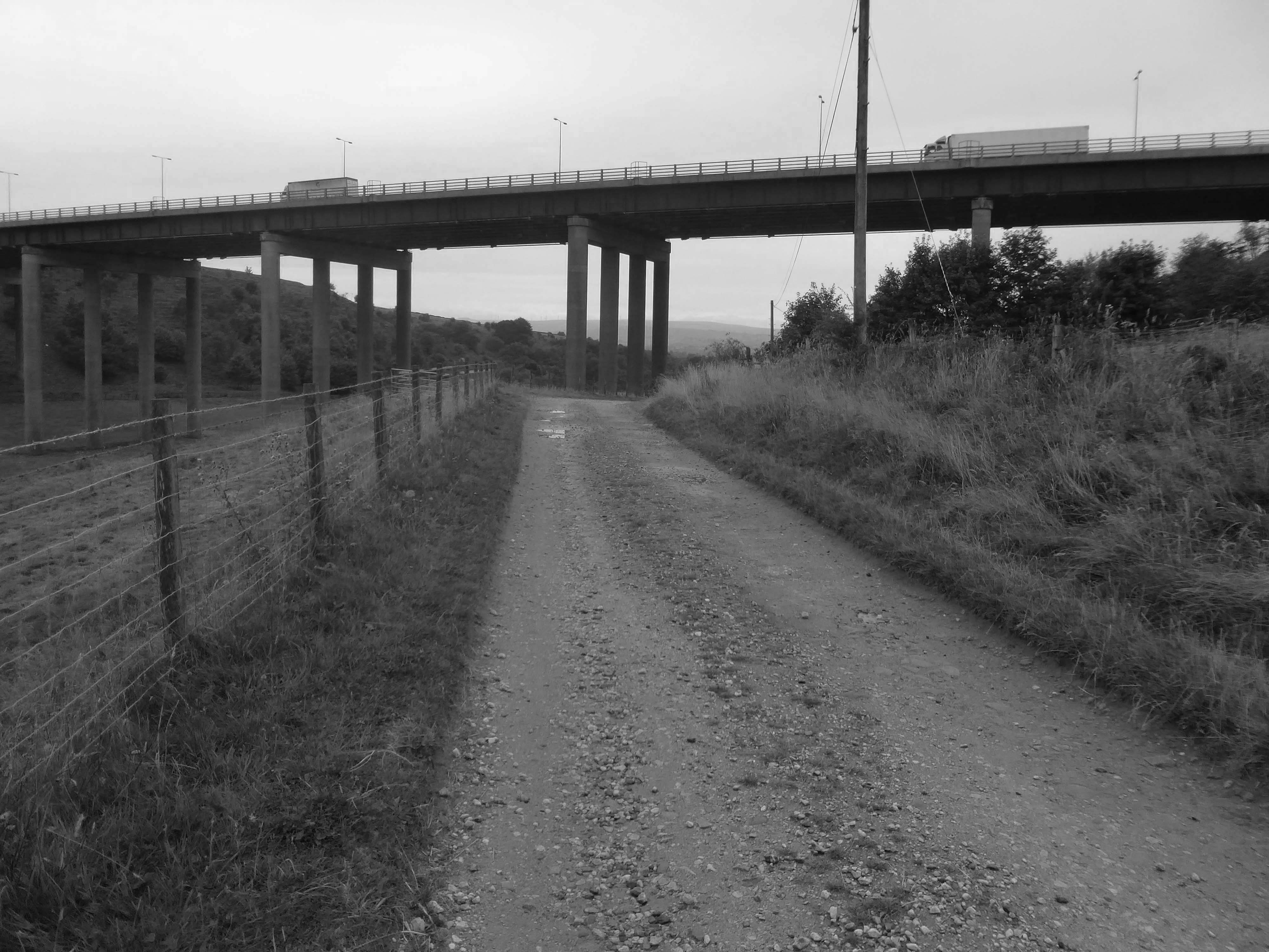
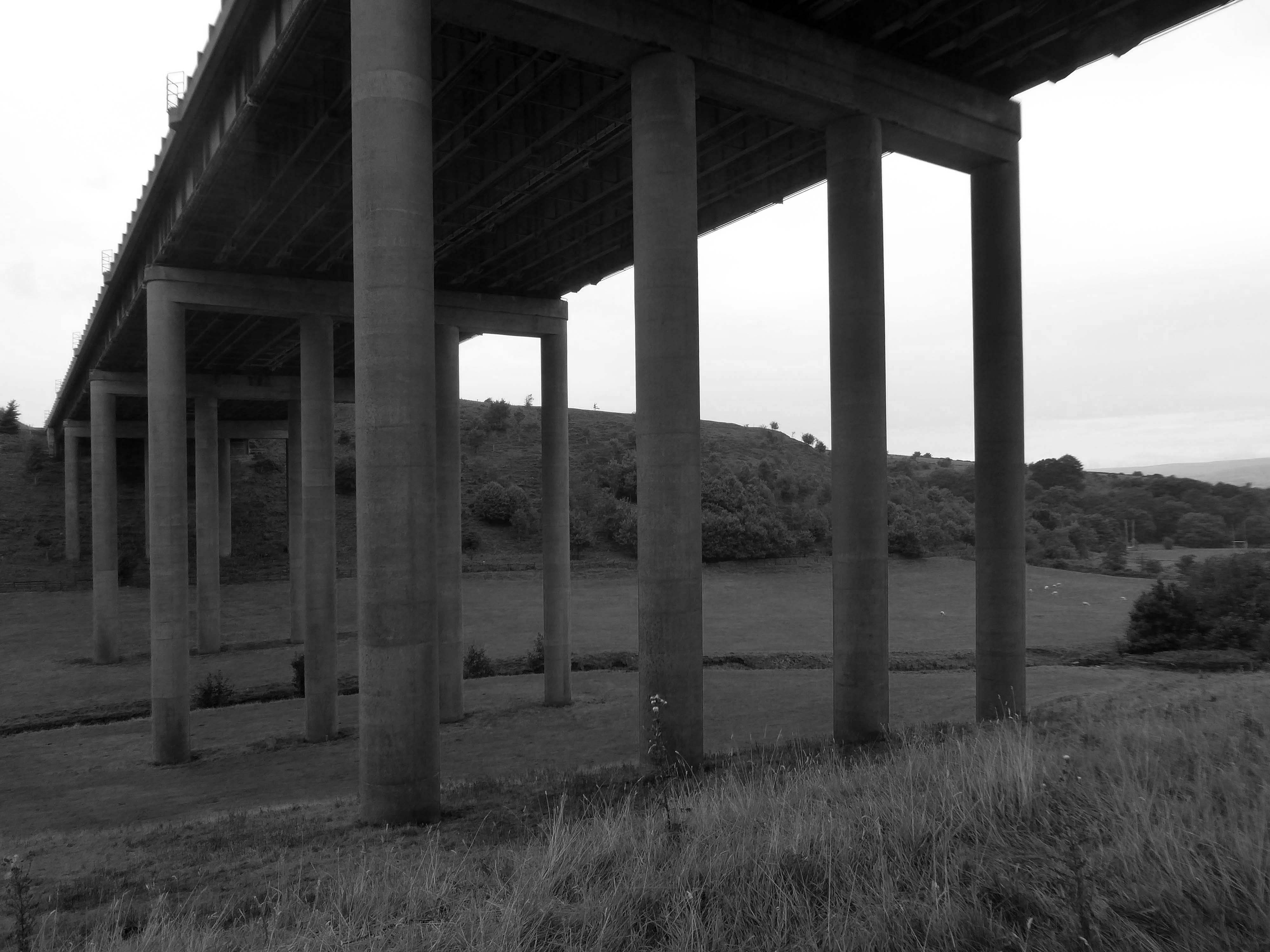
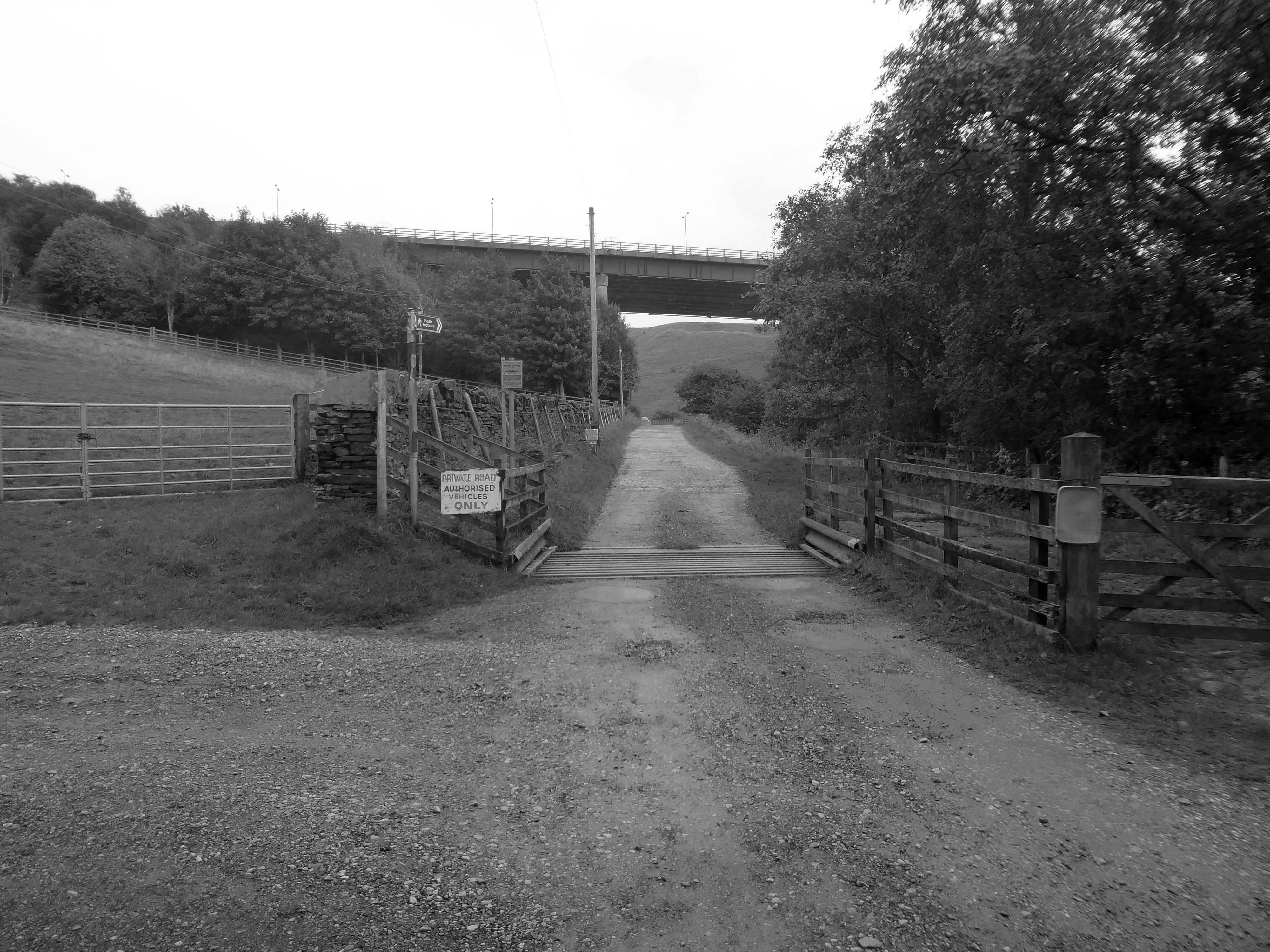
We were walking along Tunshill Lane on our way to the Piethorn Valley, our crossing of the M62 facilitated by this elegant road bridge.
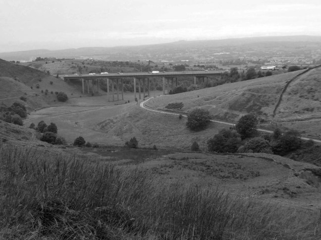
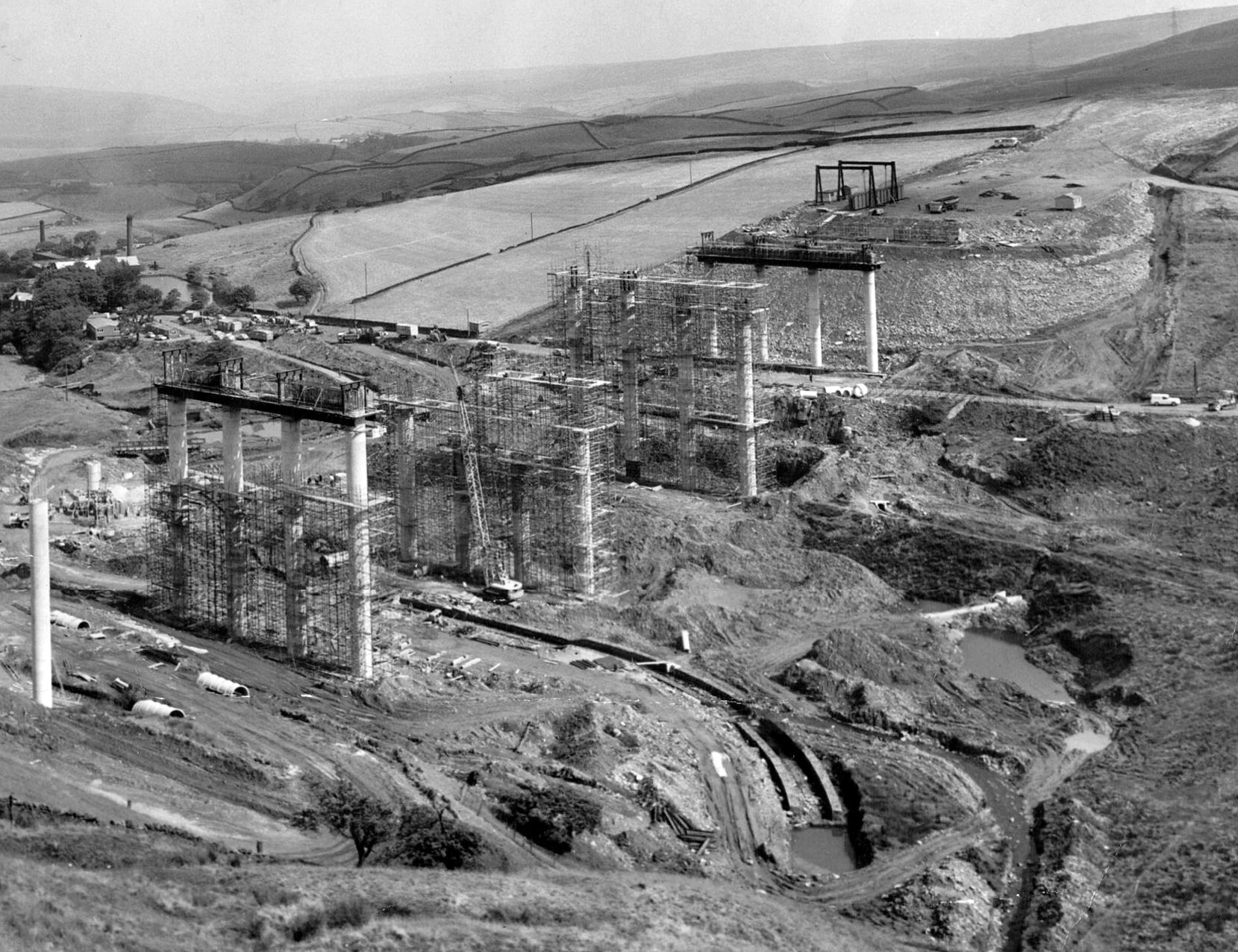
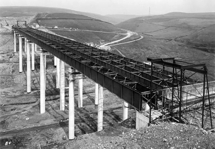
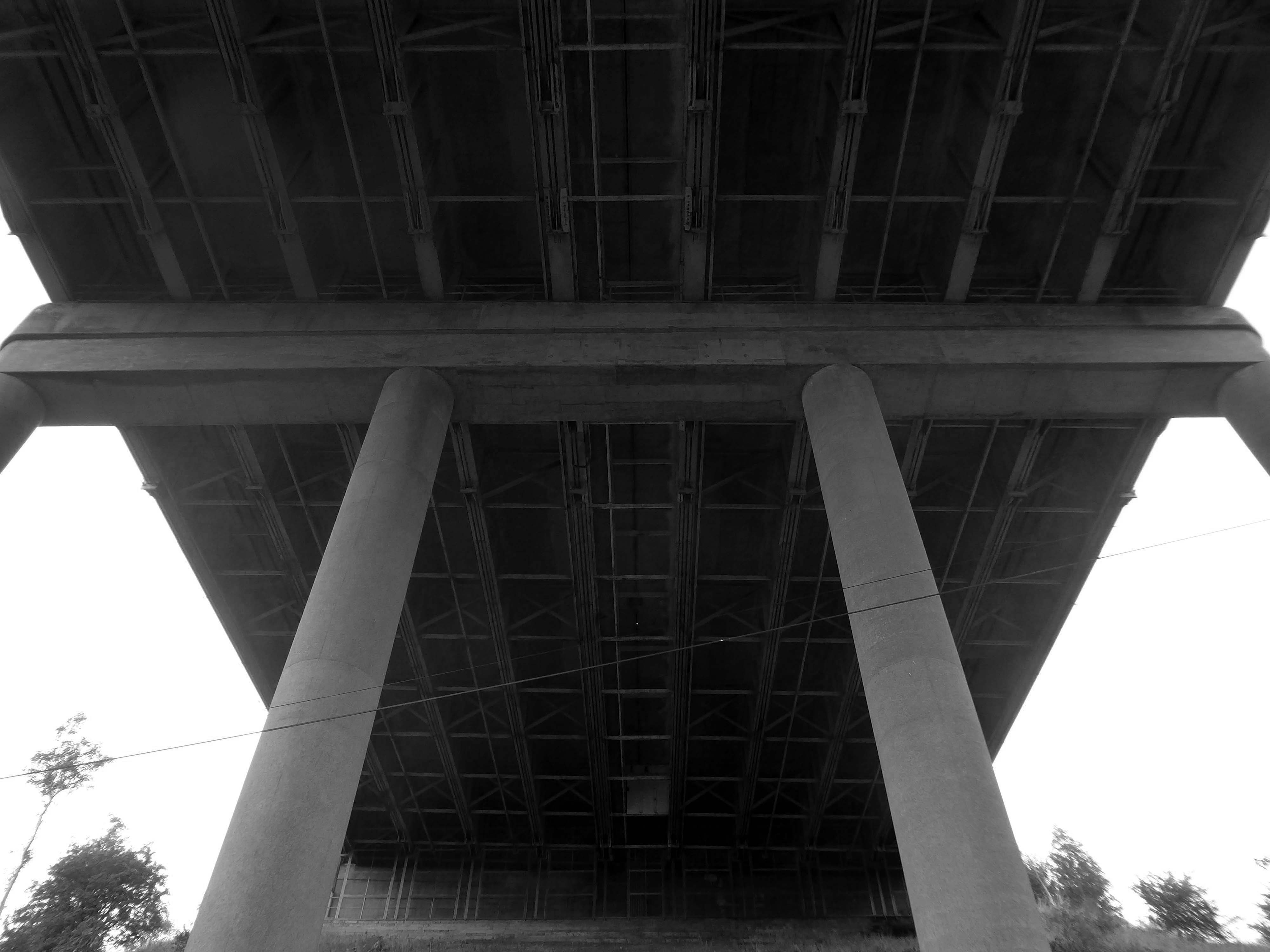
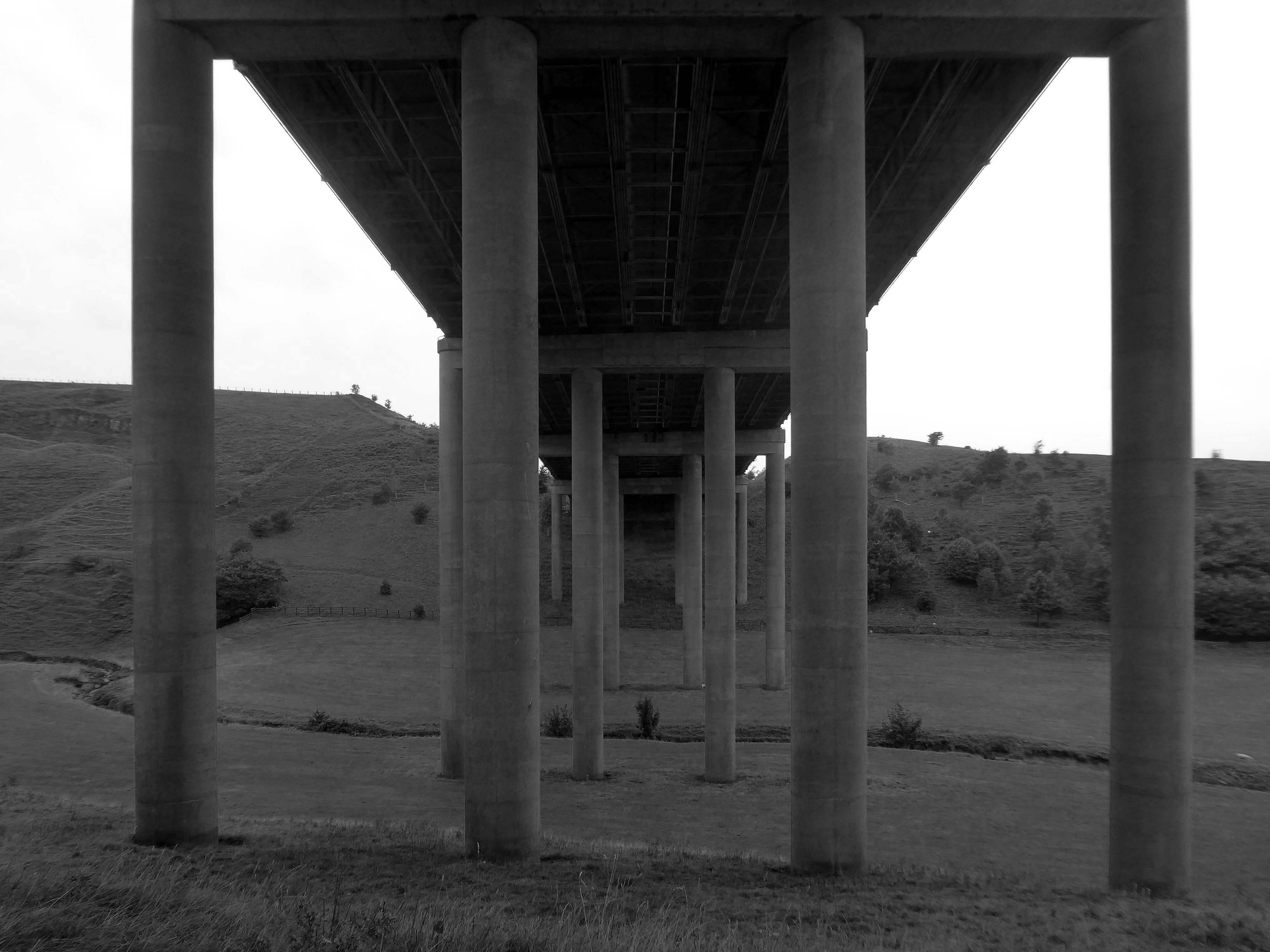
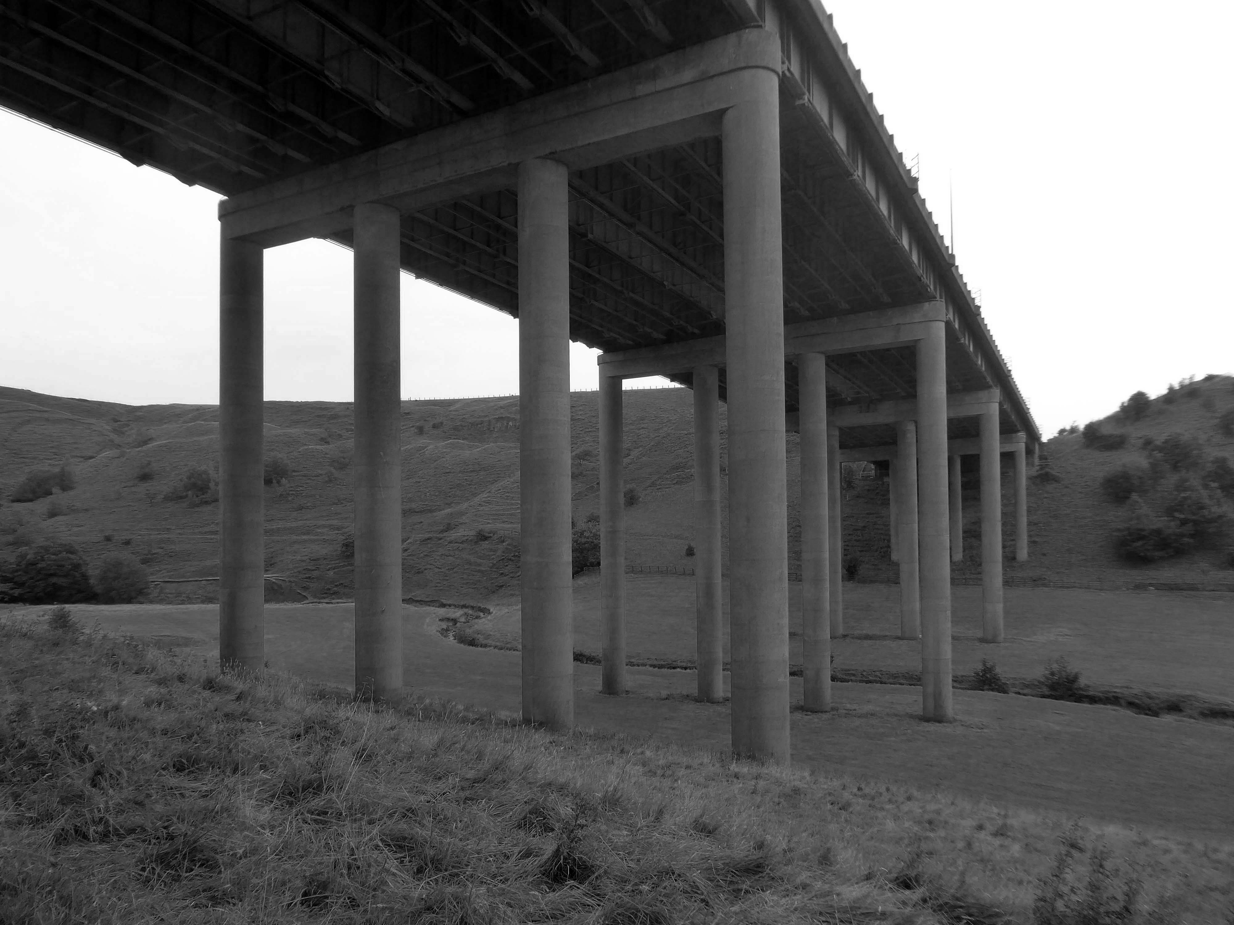
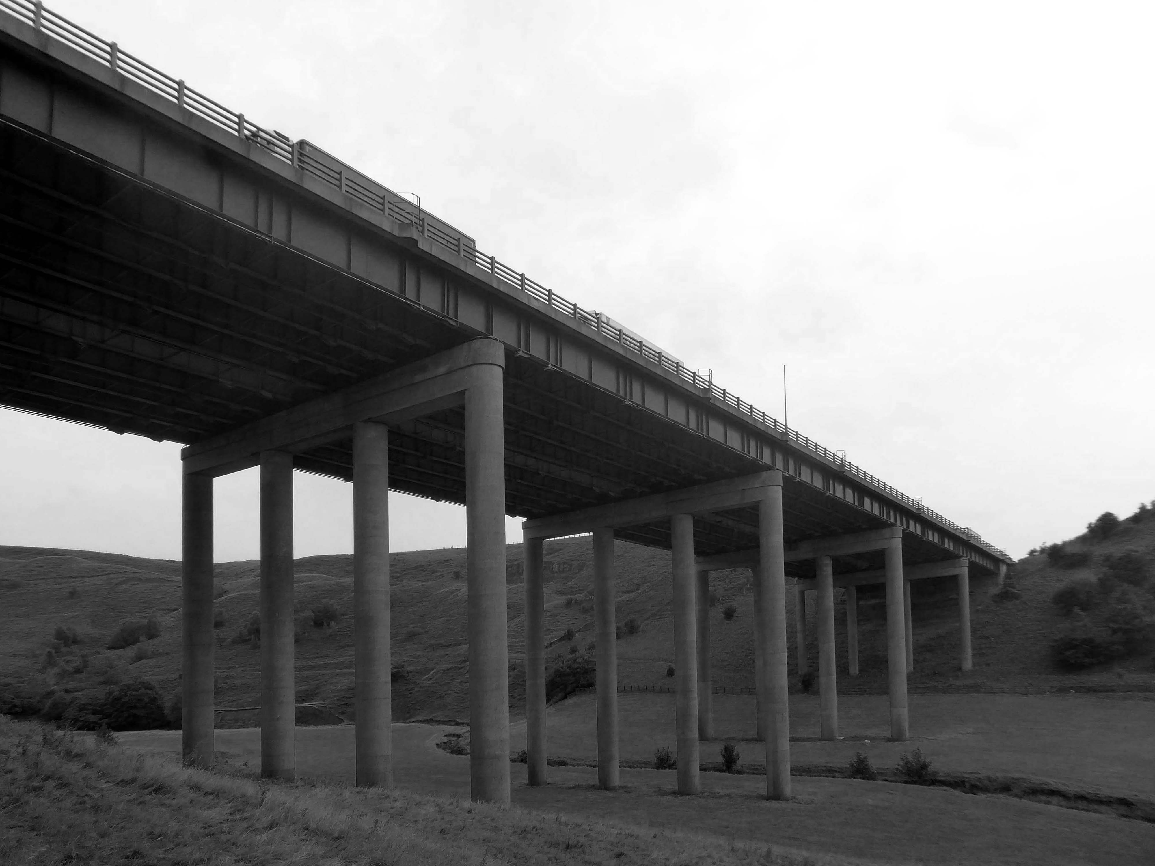
A notable structure between junctions 21 and 22 on the uphill section towards Windy Hill is the Rakewood Viaduct which carries the road over the Longden End Brook.
The viaduct is 280 yards long and 140 ft above the valley floor. It was built in 1966 by Reed & Mallik and opened to motorway traffic in October 1971. It has a sister bridge, the Gathurst Viaduct in Wigan, which carries the M6 motorway over the Leeds & Liverpool Canal, the Manchester-Southport line and the River Douglas and was constructed before the Rakewood Viaduct.
The steelwork deck was subcontracted to Robert Watson Steelwork of Bolton.
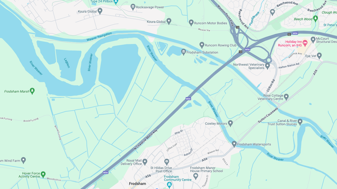
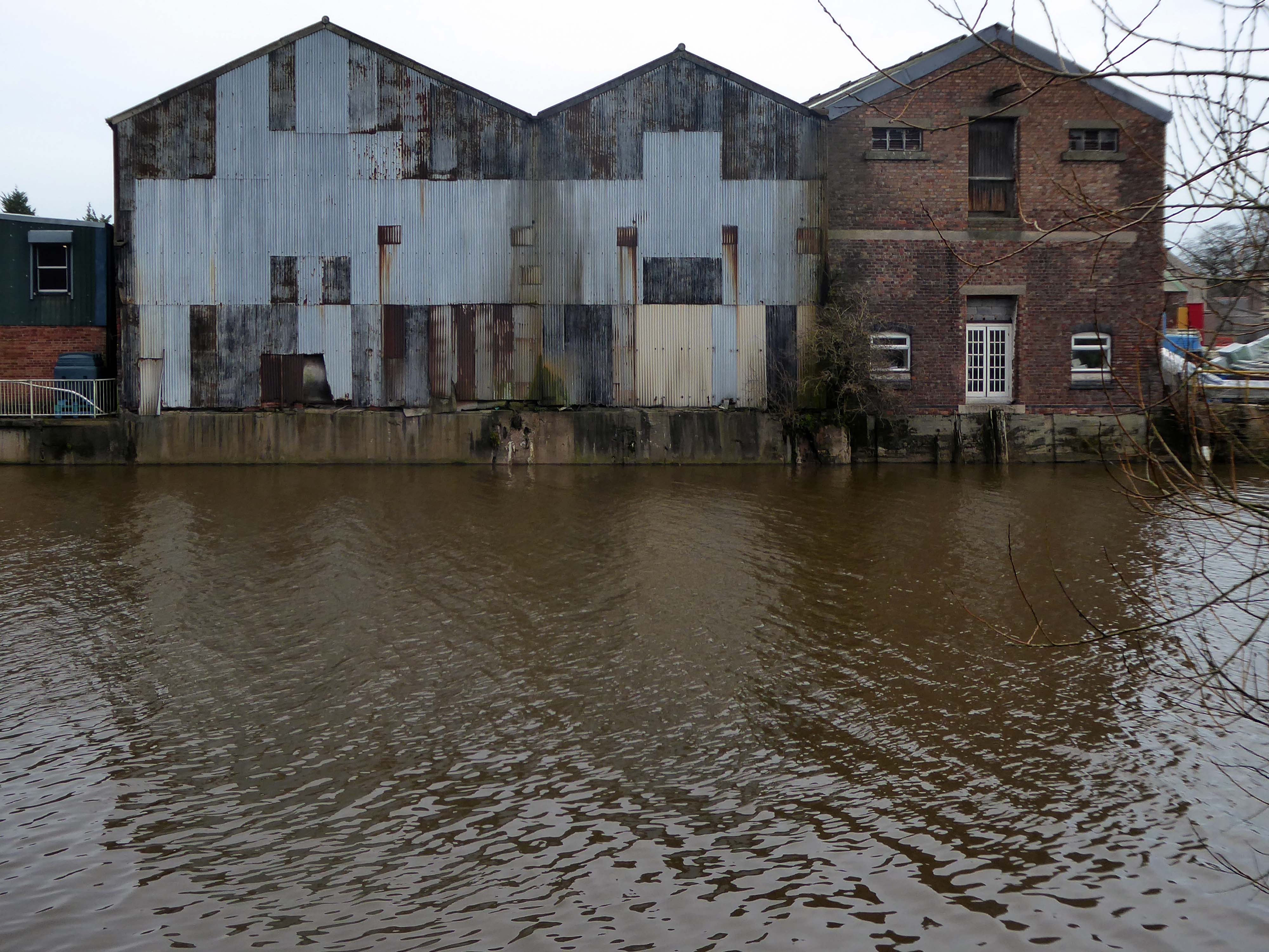
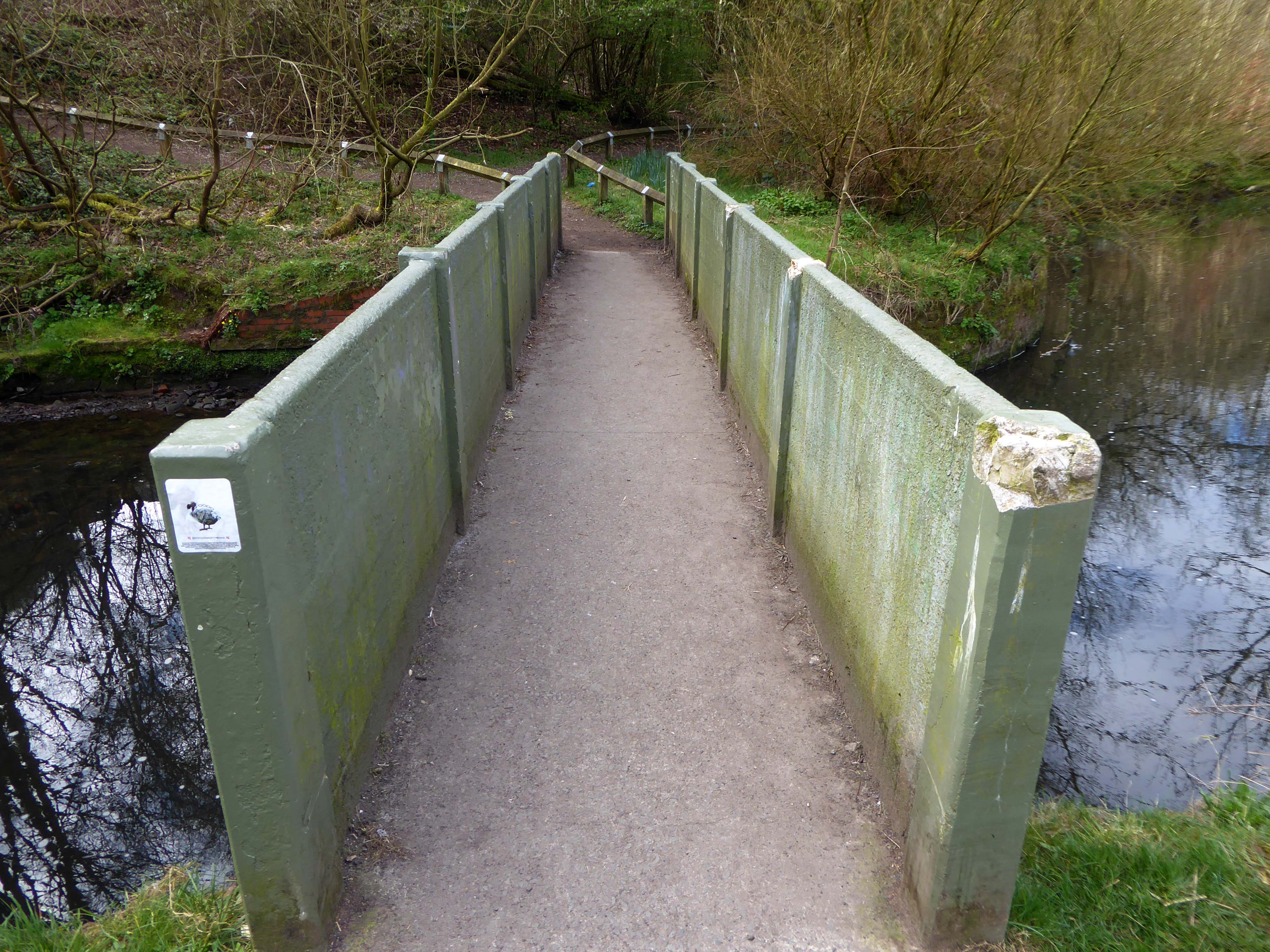
Along with my almost lifelong friend Mr Tim Rushton – I took a trip along a short stretch of the River Weaver, walking from east to west.
River Weaver – rising on the boundary between the counties of Shropshire and Cheshire and then flowing 45 miles north to reach the Irish Sea estuary of the River Mersey to the west of Runcorn.
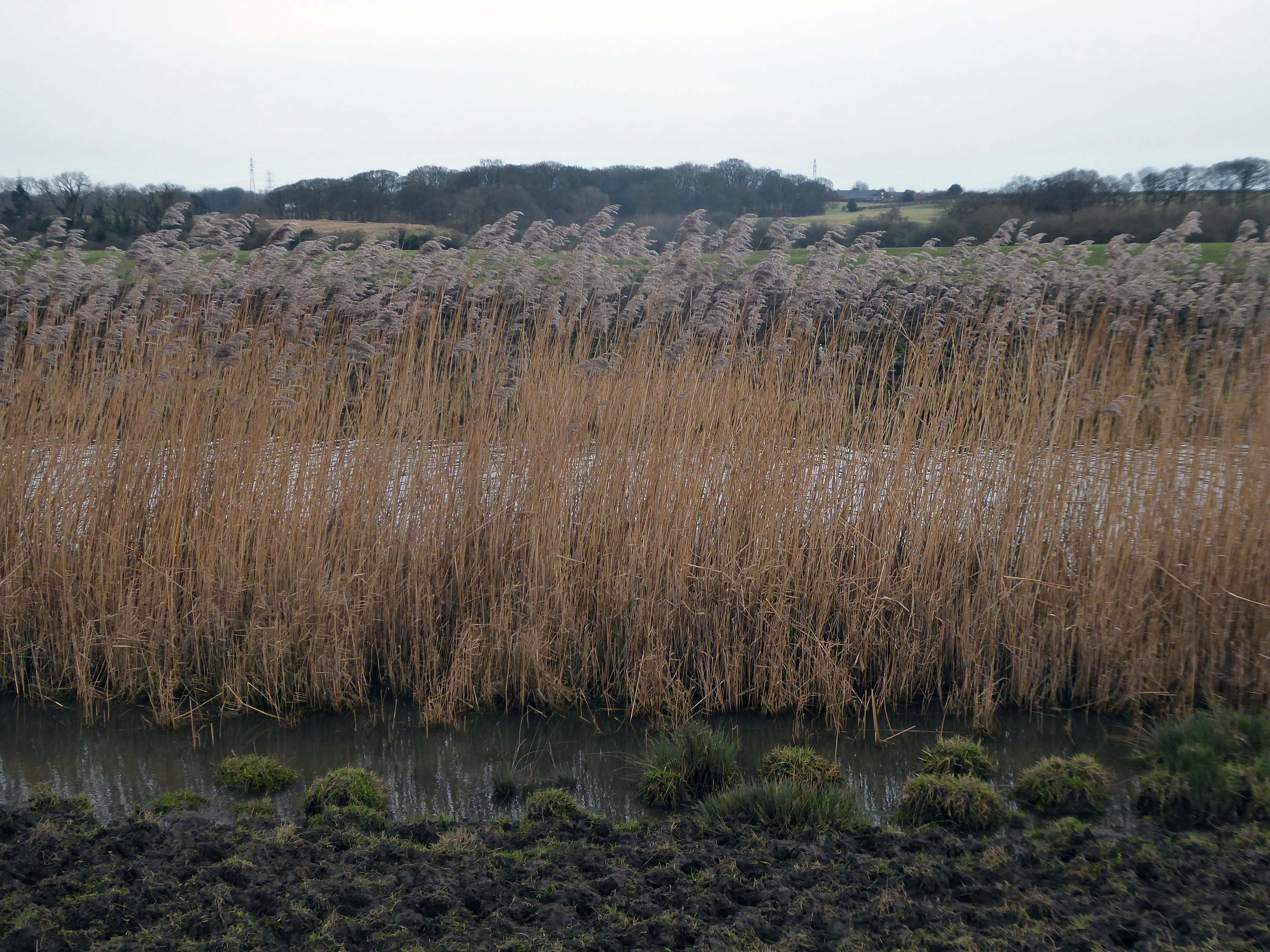
Below Winsford, the course of the river has been altered several times, by the construction of cuts and locks, to enable small ships to trade on it. The river formerly joined the River Mersey at Weston Marsh, but since the construction of the Manchester Ship Canal, begun in 1887, it has flowed into the canal, from where surplus water enters the Mersey by the Weaver sluices, just upstream of the junction. The tidal river section below Frodsham has been bypassed by the Weston Canal since 1810 and is no longer navigable, as Frodsham Lock is derelict.
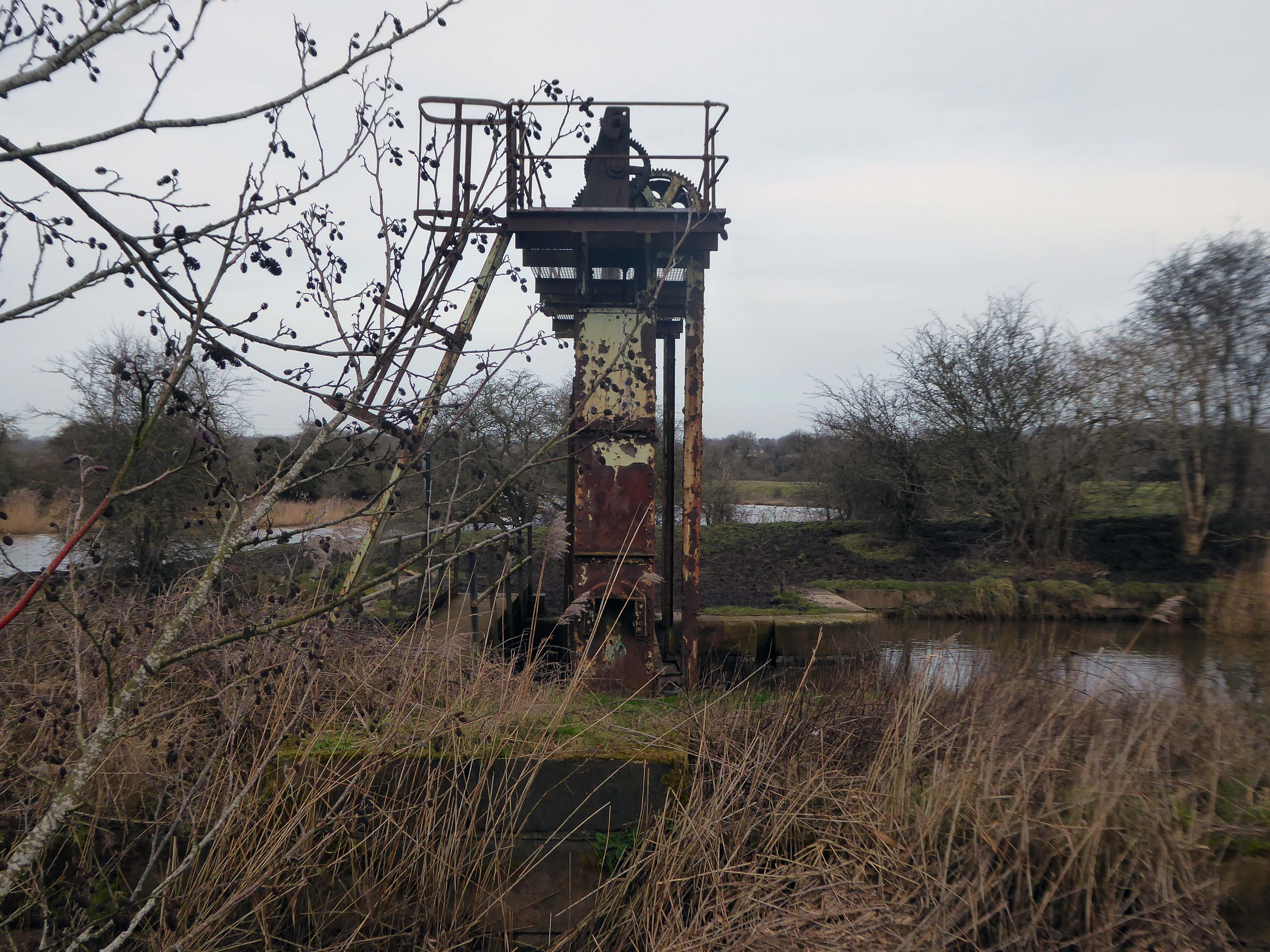
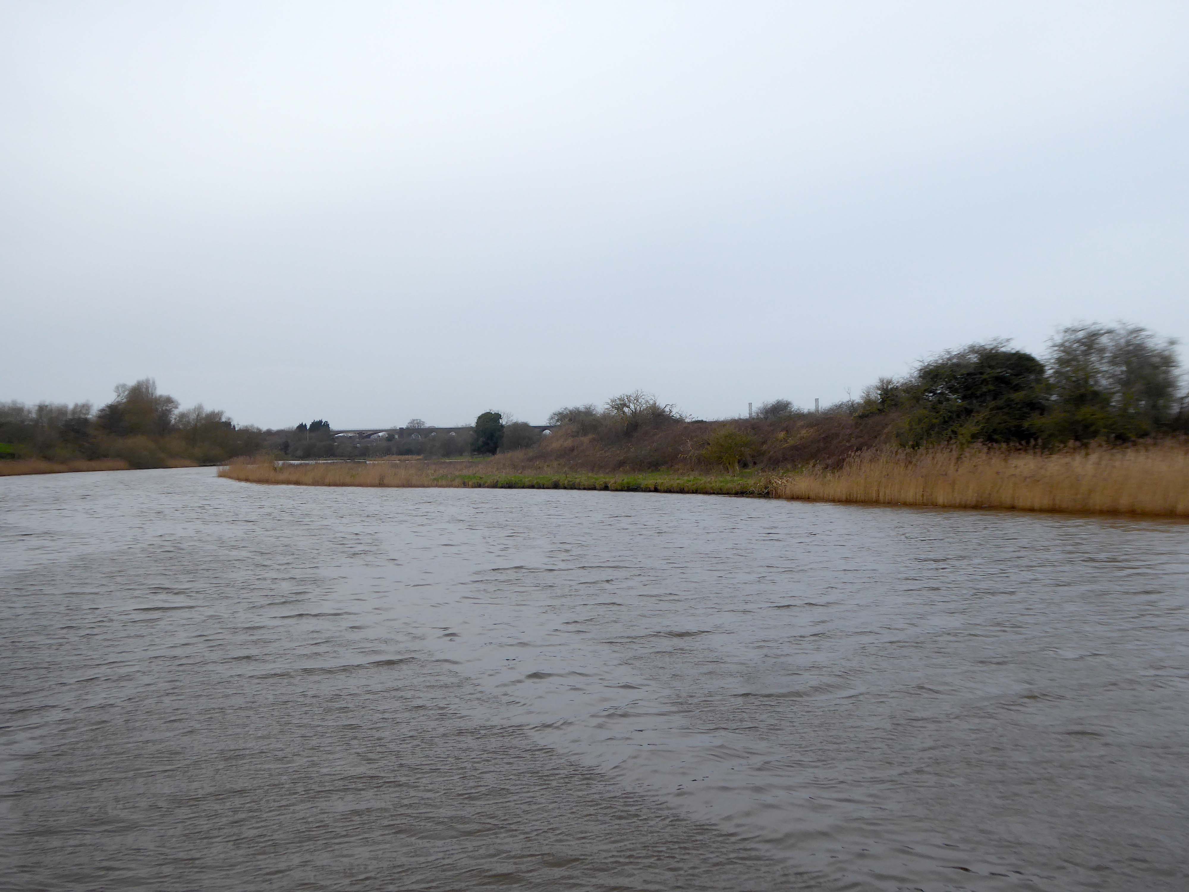
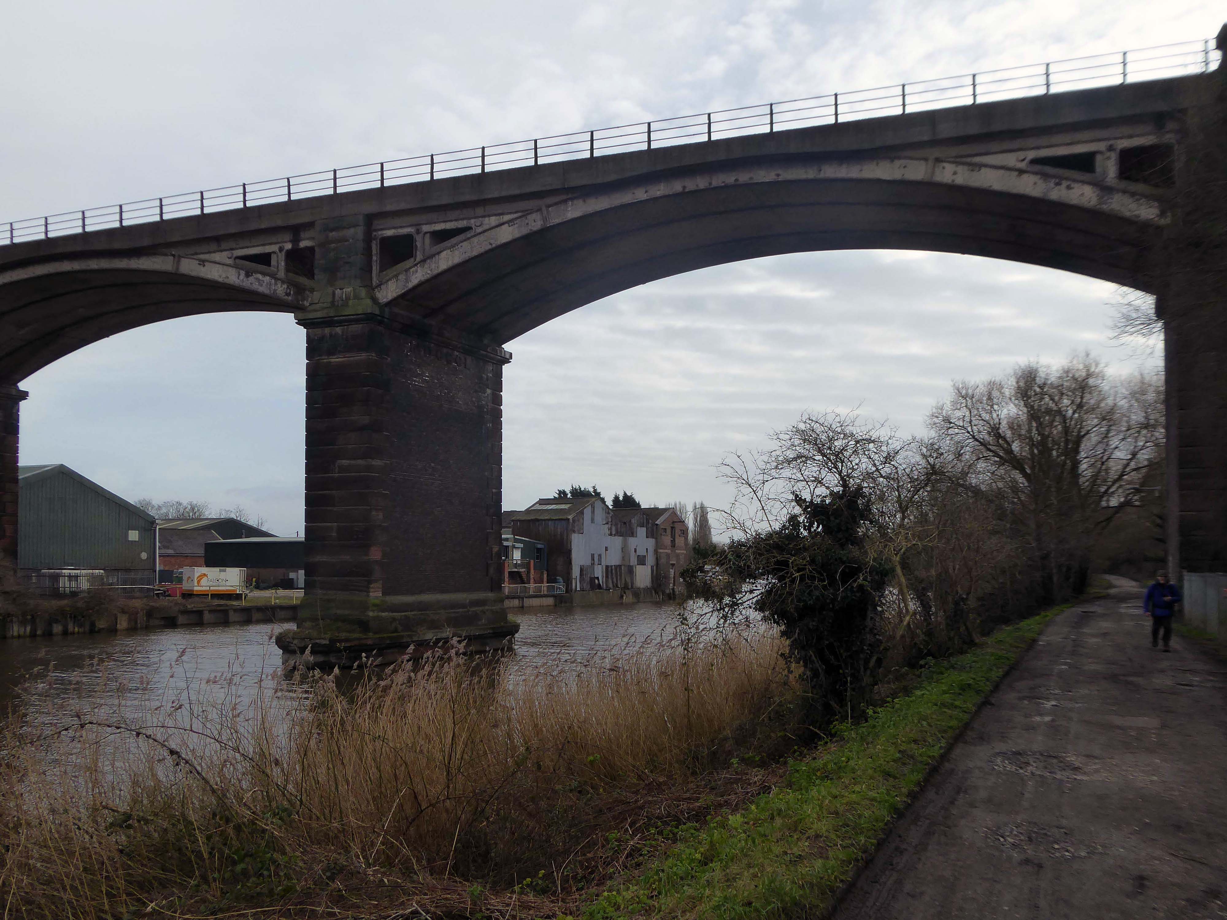
Railway viaduct over River Weaver and adjoining land by A Rendel Engineer and Thomas Brassey, contractor 1848-1850 – for Birkenhead Lancs & Cheshire Junction Railway Co.
Red sandstone, brown brick and cast iron, two segmental-arched iron spans of circa thirty metres over river; two round arches on west bank and twenty one on east bank. Piers to iron spans are rusticated tooled ashlar; the other spans have rusticated voussoirs, pier faces and quoins and rock-faced spandrels with brick reveals, cornice to iron-span piers, plainer imposts to others.
Top of central pier to river modified to take mid C20 concrete track bed.
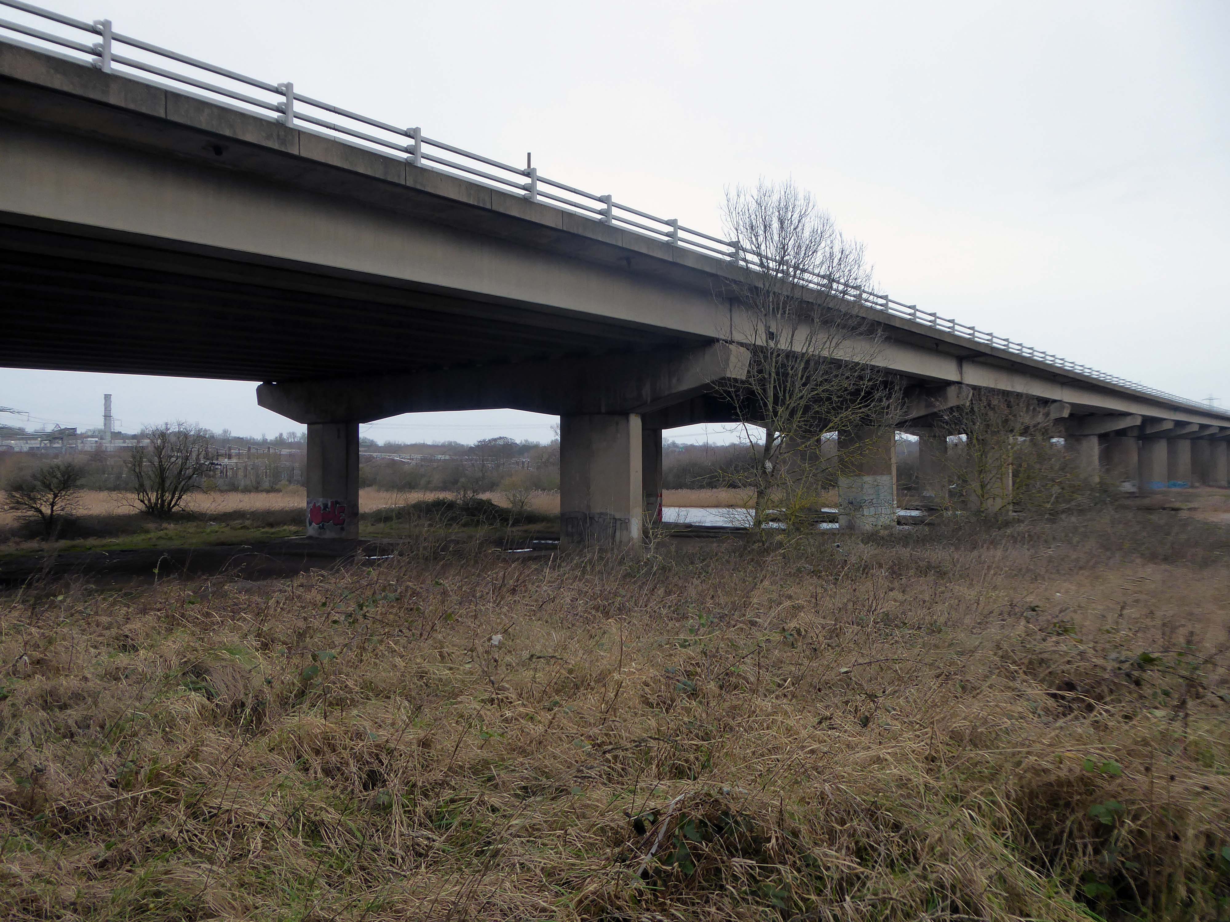
Weaver Viaduct is one of the outstanding features of M56 and its design was approved by the Royal Fine Arts Commission. The three-quarter mile of elevated motorway and approach embankments over the River Weaver and Weaver Navigation Canal opened on 21 February 1971.
Design was by Husband and Co of Sheffield – acting for Department of Environment, who also supervised the project.The contractor was Christiani Shand with a tender price of £3,146,387 in March 1968.
Work began in April 1968 – the eventual cost was put at £3.5 million.
Thirty two 125-foot concrete 100-tonne beams were put into place in July 1970; the concrete beams were made by Matthews & Mumby of Windmill Lane Denton.
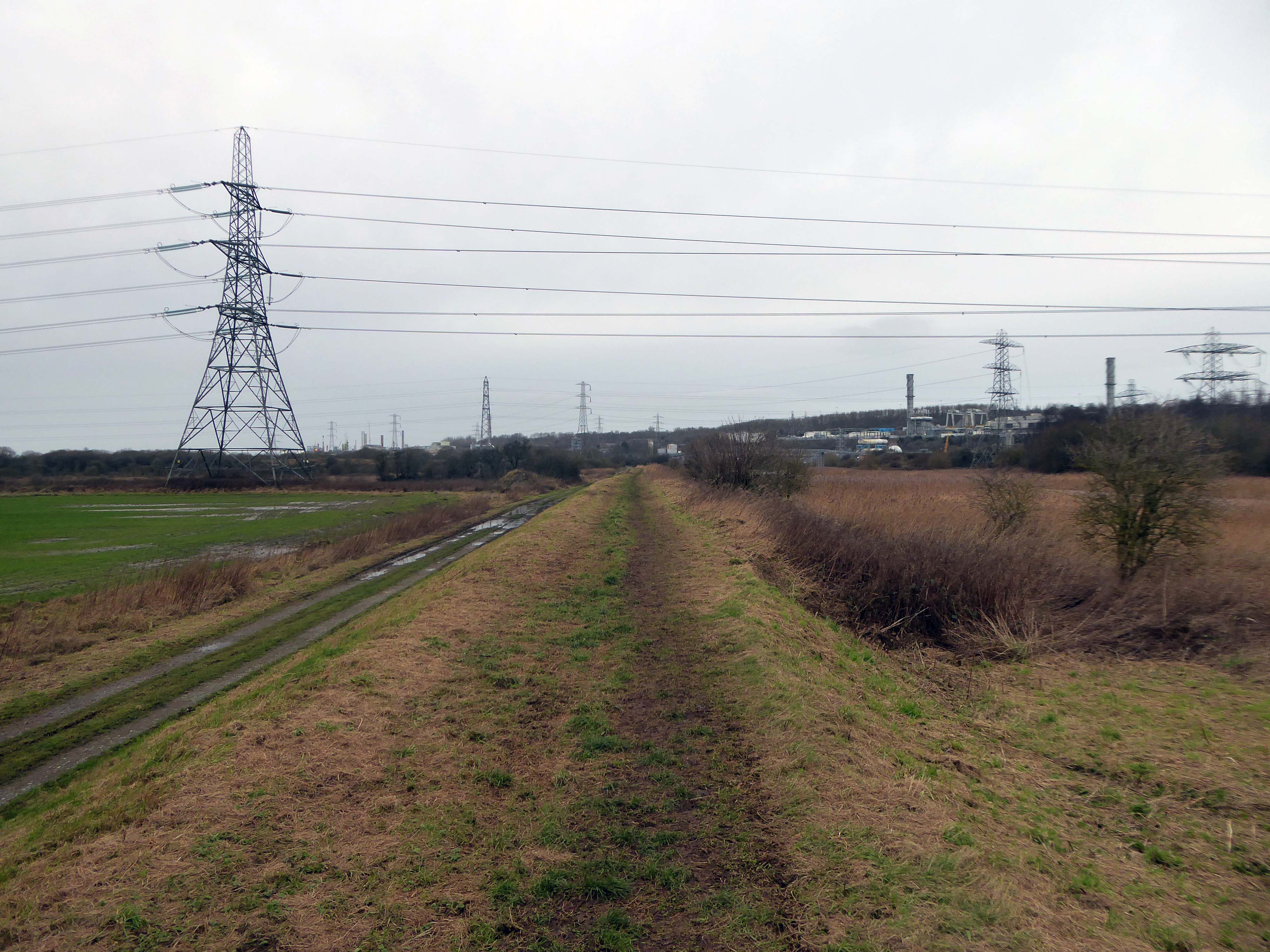
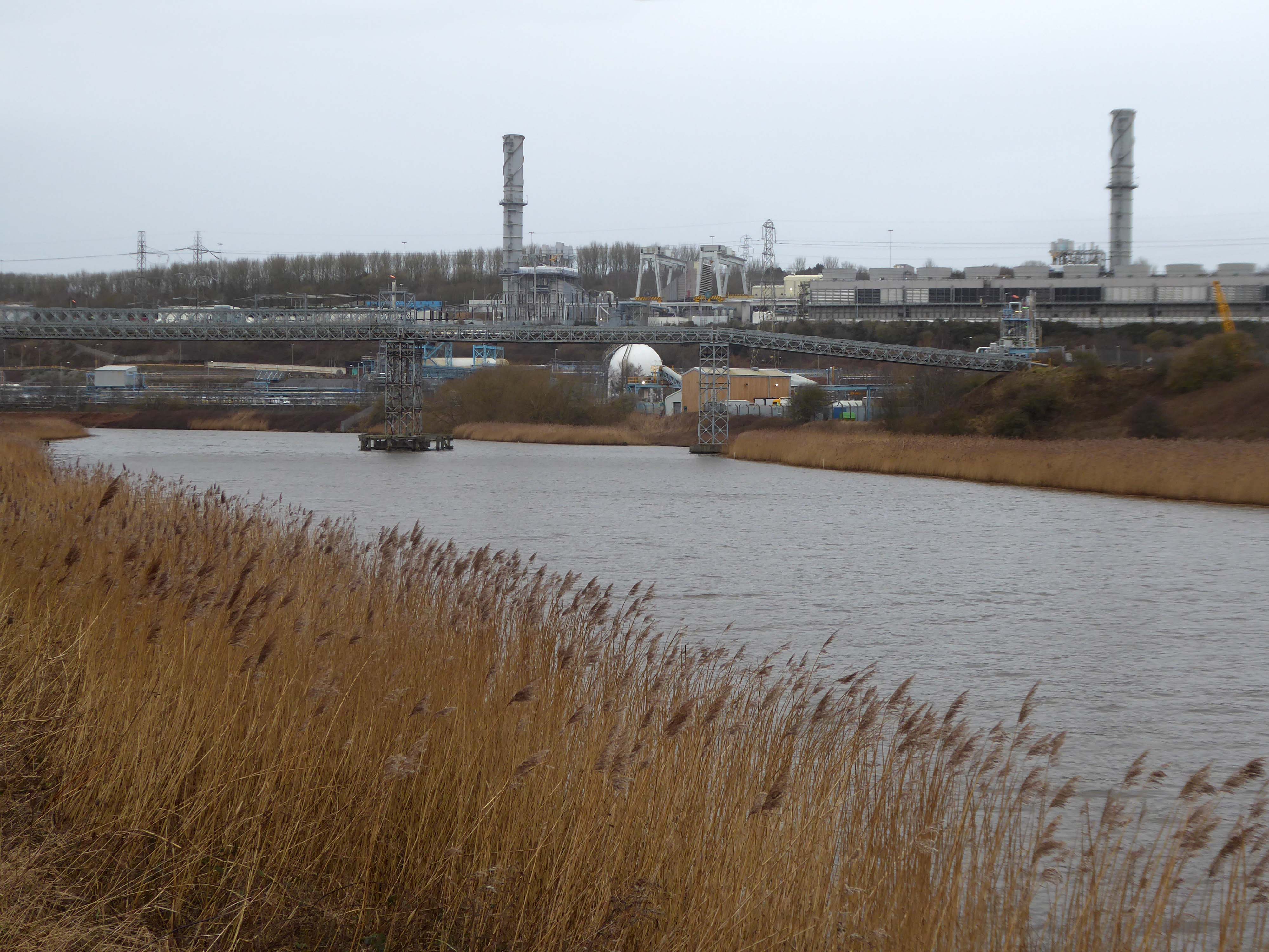
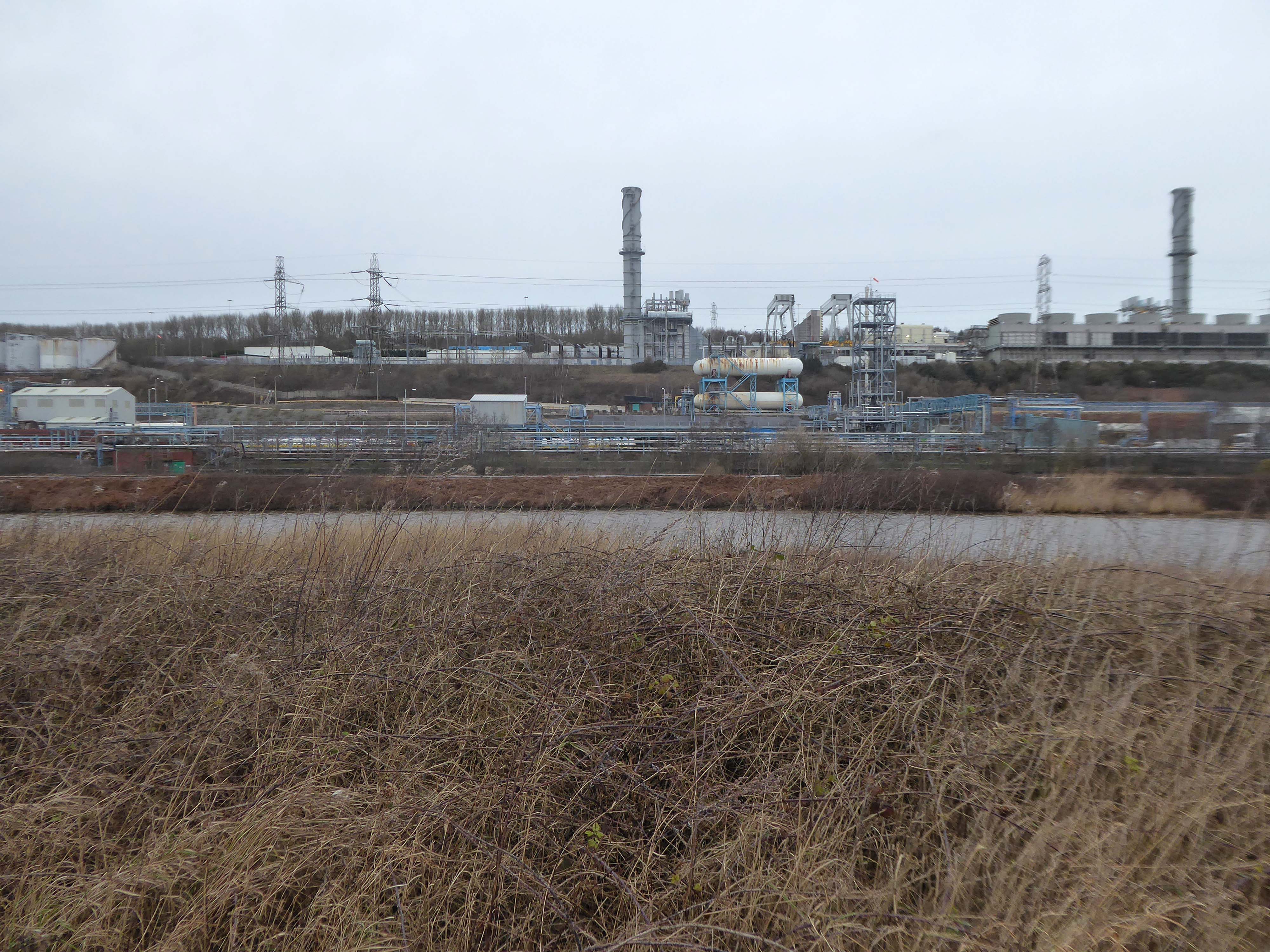
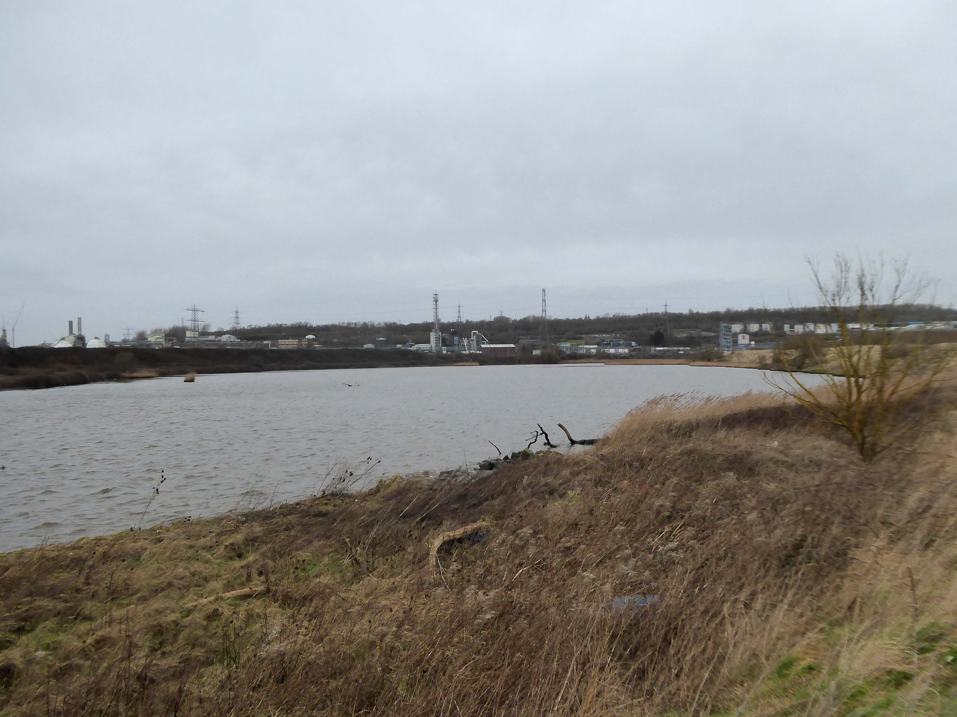
High-VoltageFrodsham Substation – Rock Savagepower station
Rock Savage Power Station is an 800 MWe gas-fired power station.
It was opened by Queen Elizabeth II on 31 July 1998, and owned by InterGen, a company that is now jointly owned by Ontario Teachers’ Pension Plan and China Huaneng Group, it cost £375m.
It sponsors the Runcorn Jets baseball club, the Highfield Male Voice Choir and the Weston Angling Club.
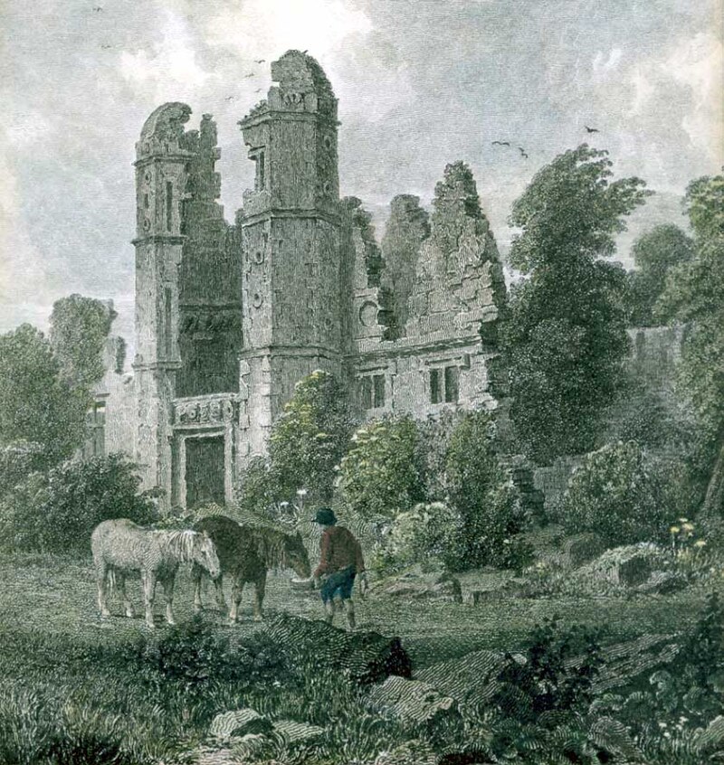
The name comes from the nearby ruined Elizabethan mansion – Rocksavage.
KouraGlobal – leader in the development, manufacture, and supply of fluoro products and technologies, opened a new HFA 152a production facility at their Runcorn site in the UK.
Chiesi, the international research-focused pharmaceuticals and healthcare group, signed a commercial agreement to use the new low carbon footprint medical propellant for inhalation product development and clinical trials in 2019.
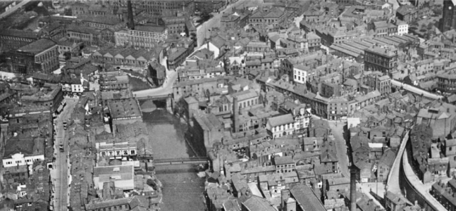
Britain from Above 1948
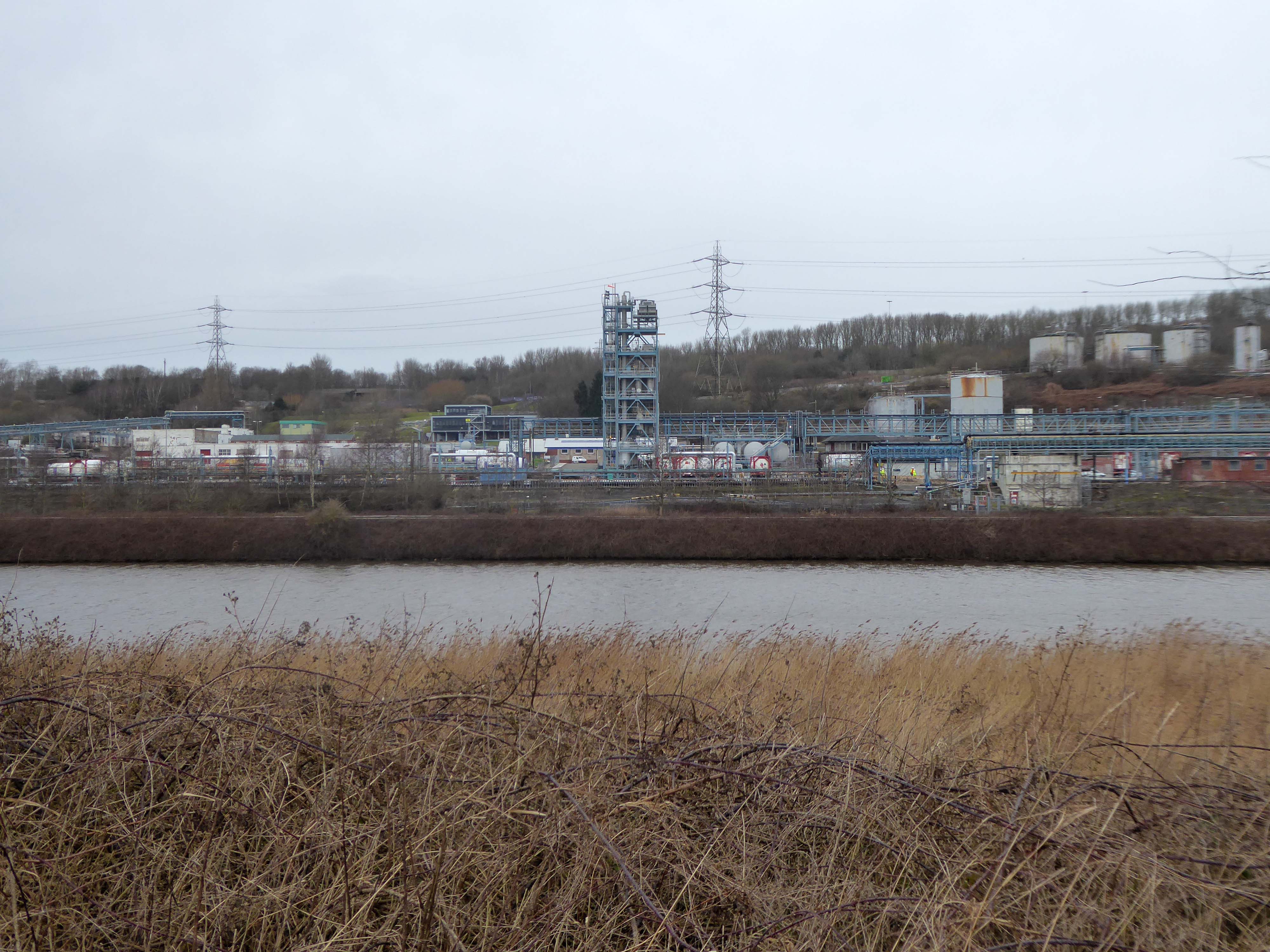
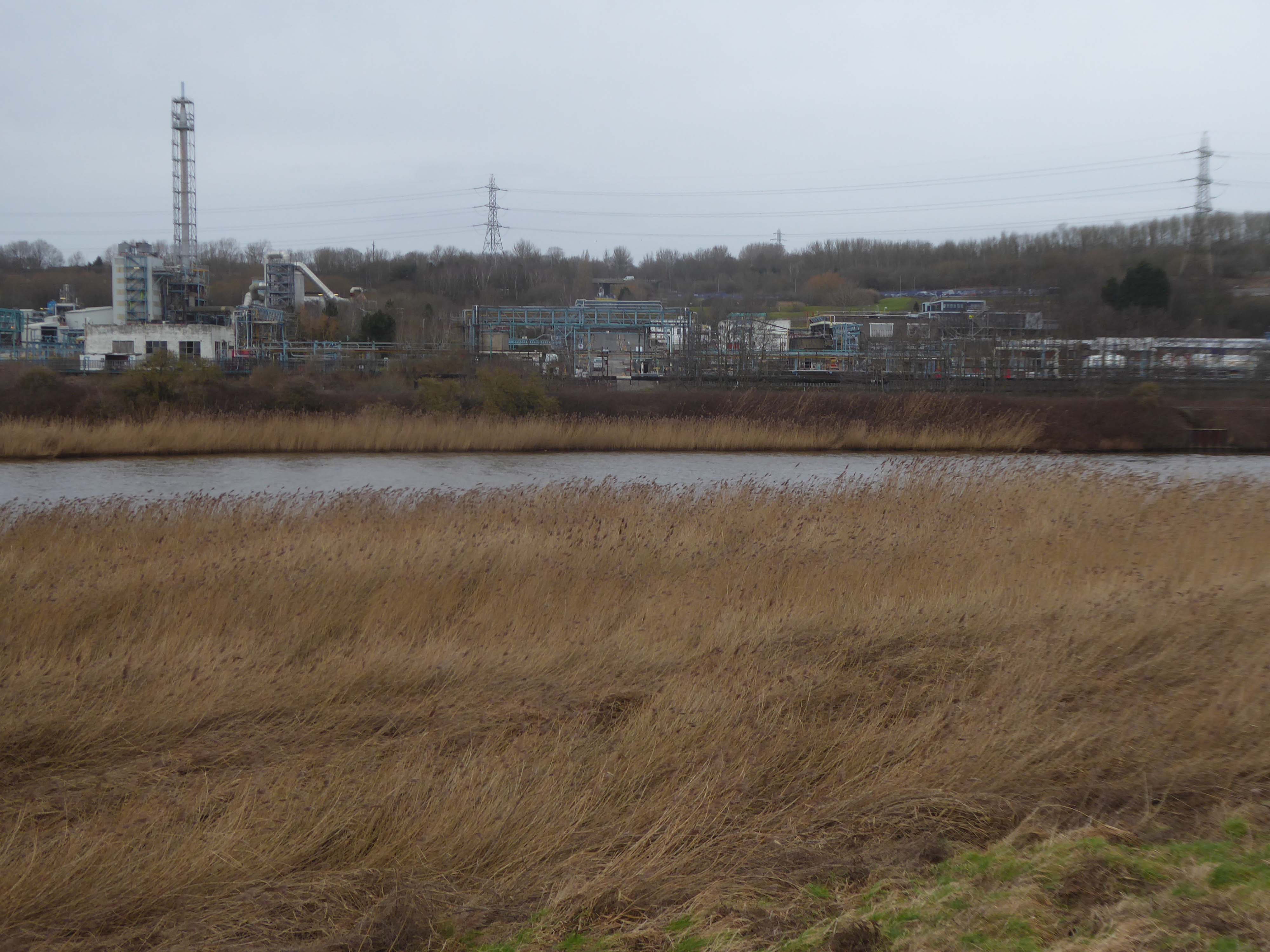
Ineos Chemical Complex formerly ICI Rocksavage Works on the banks of the River Mersey River Weaver and Manchester Ship Canal in Runcorn formerly ICI works of Rocksavage and Castner Kelner Works which produced fluorcarbons such as aerosol propellants dry cleaning solvents and chlorine UK January 2007
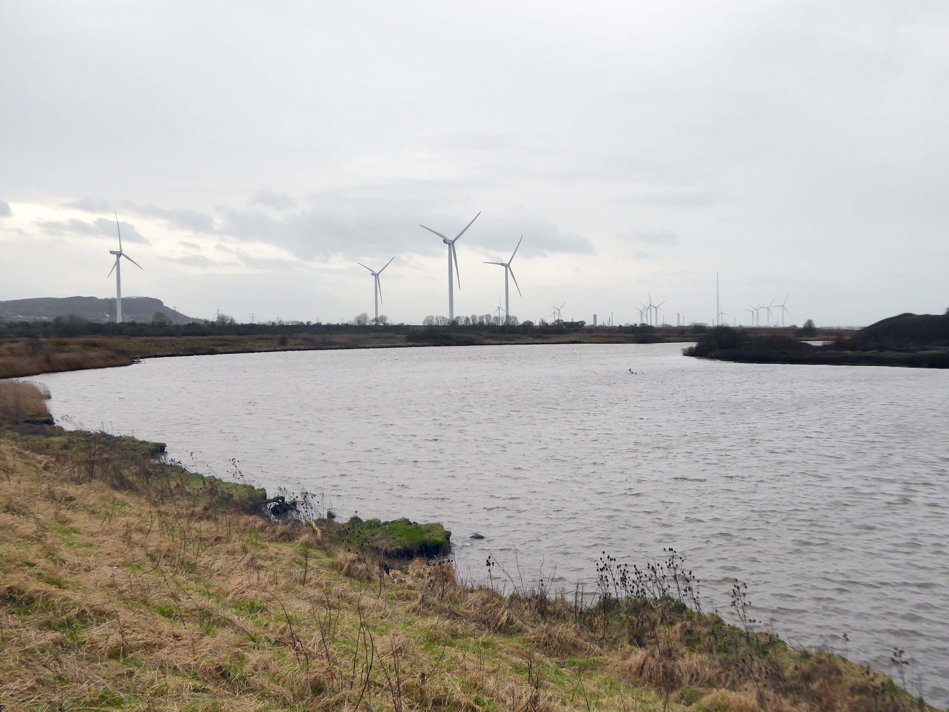
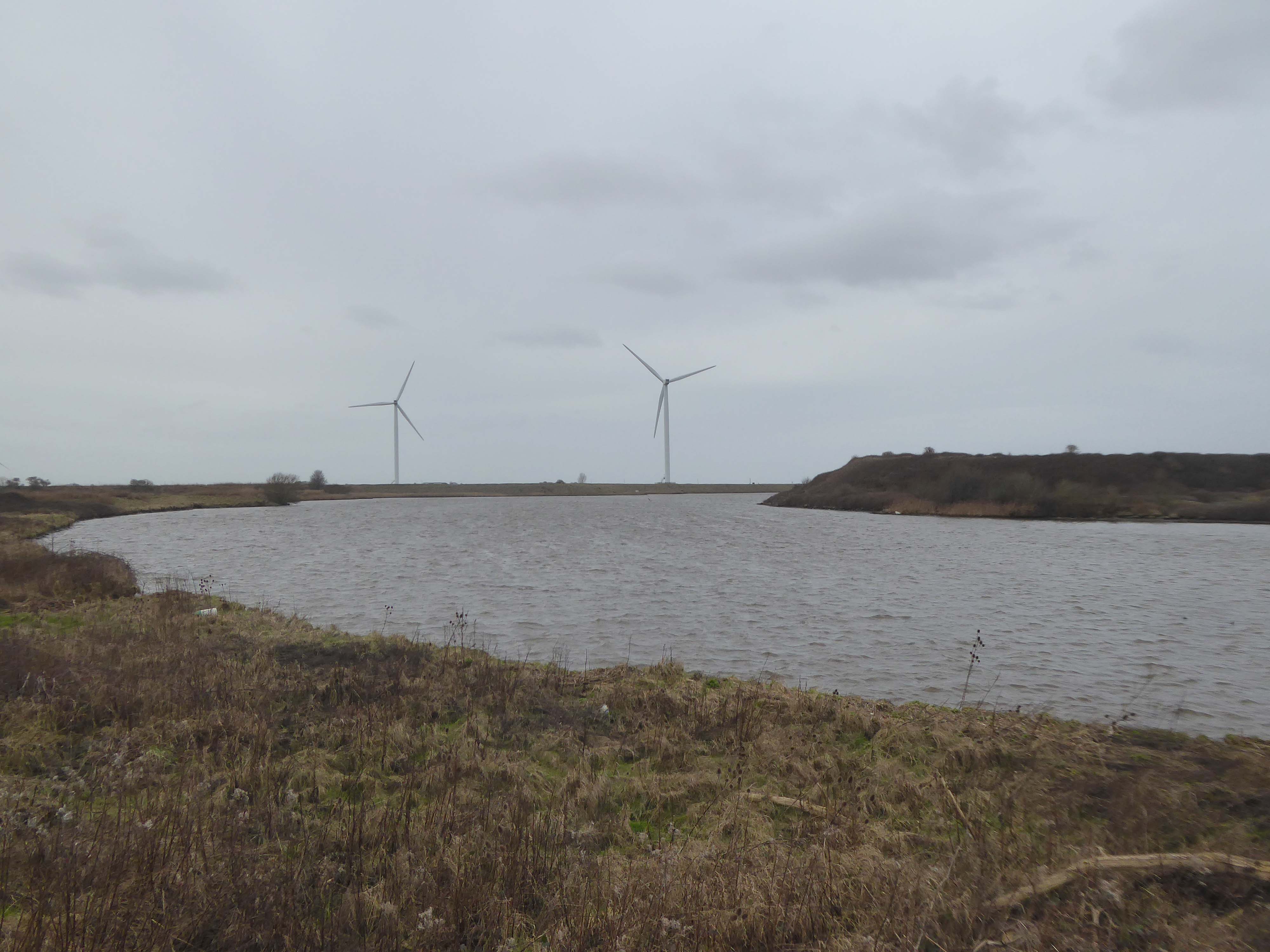
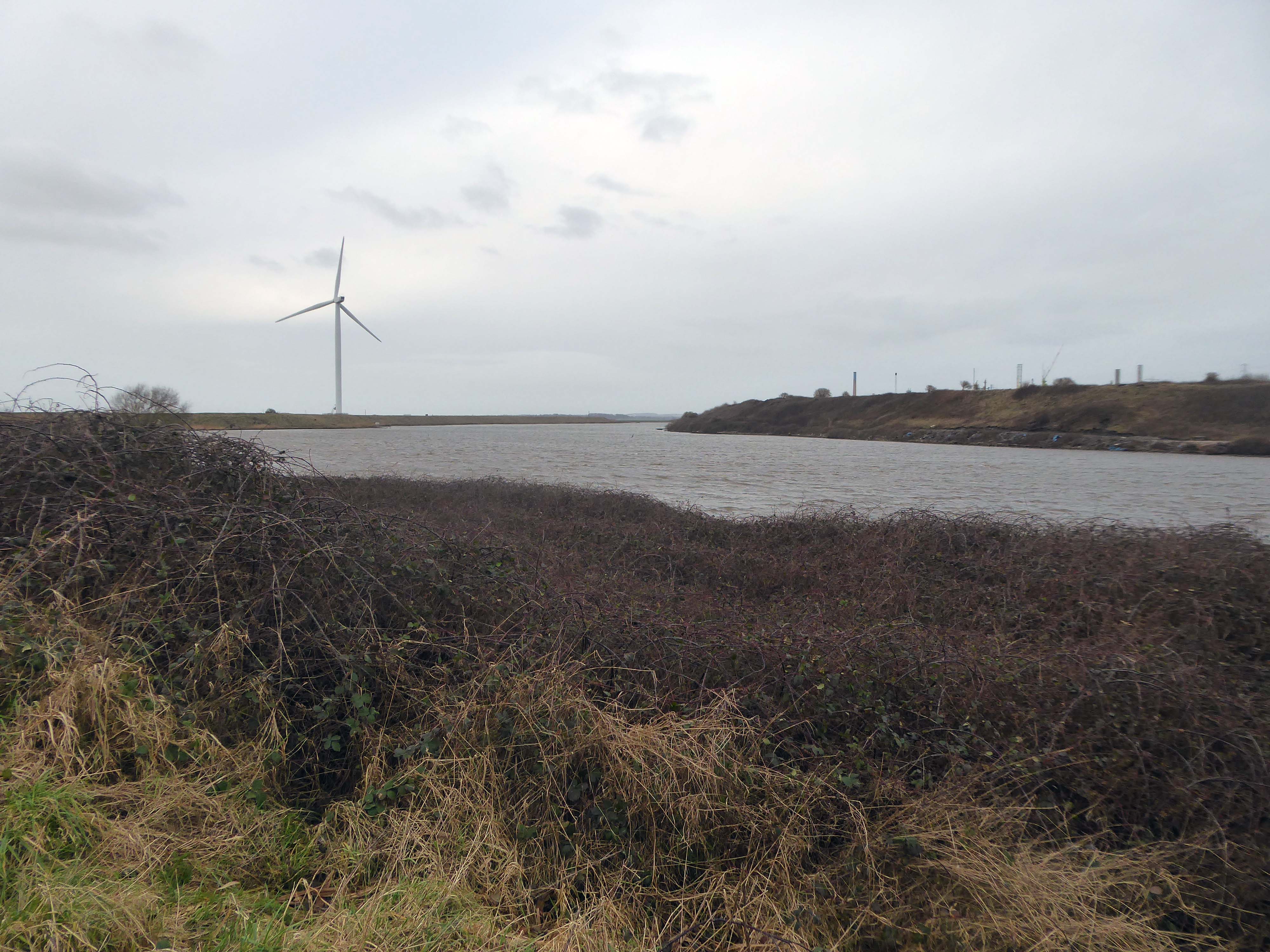
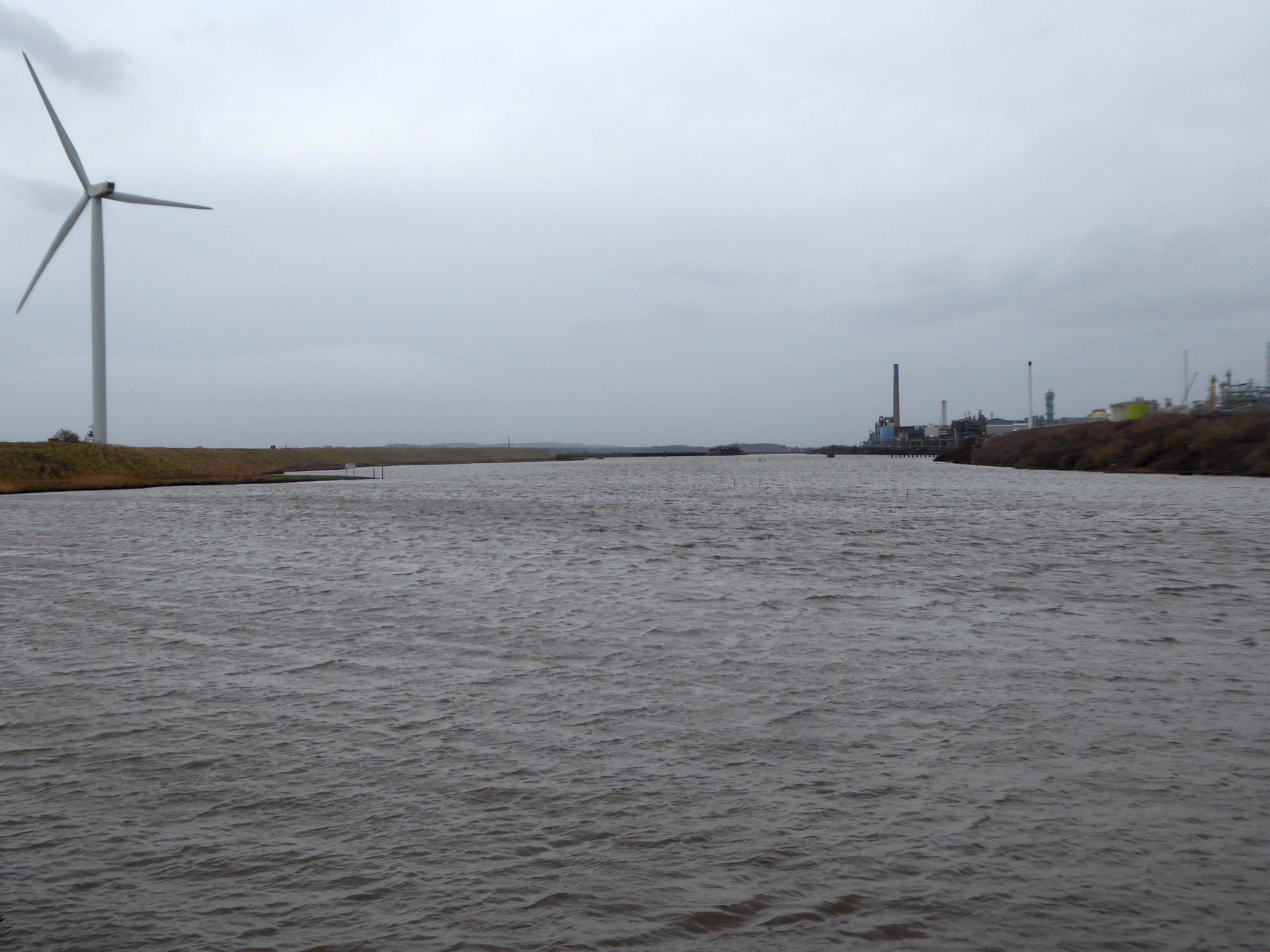
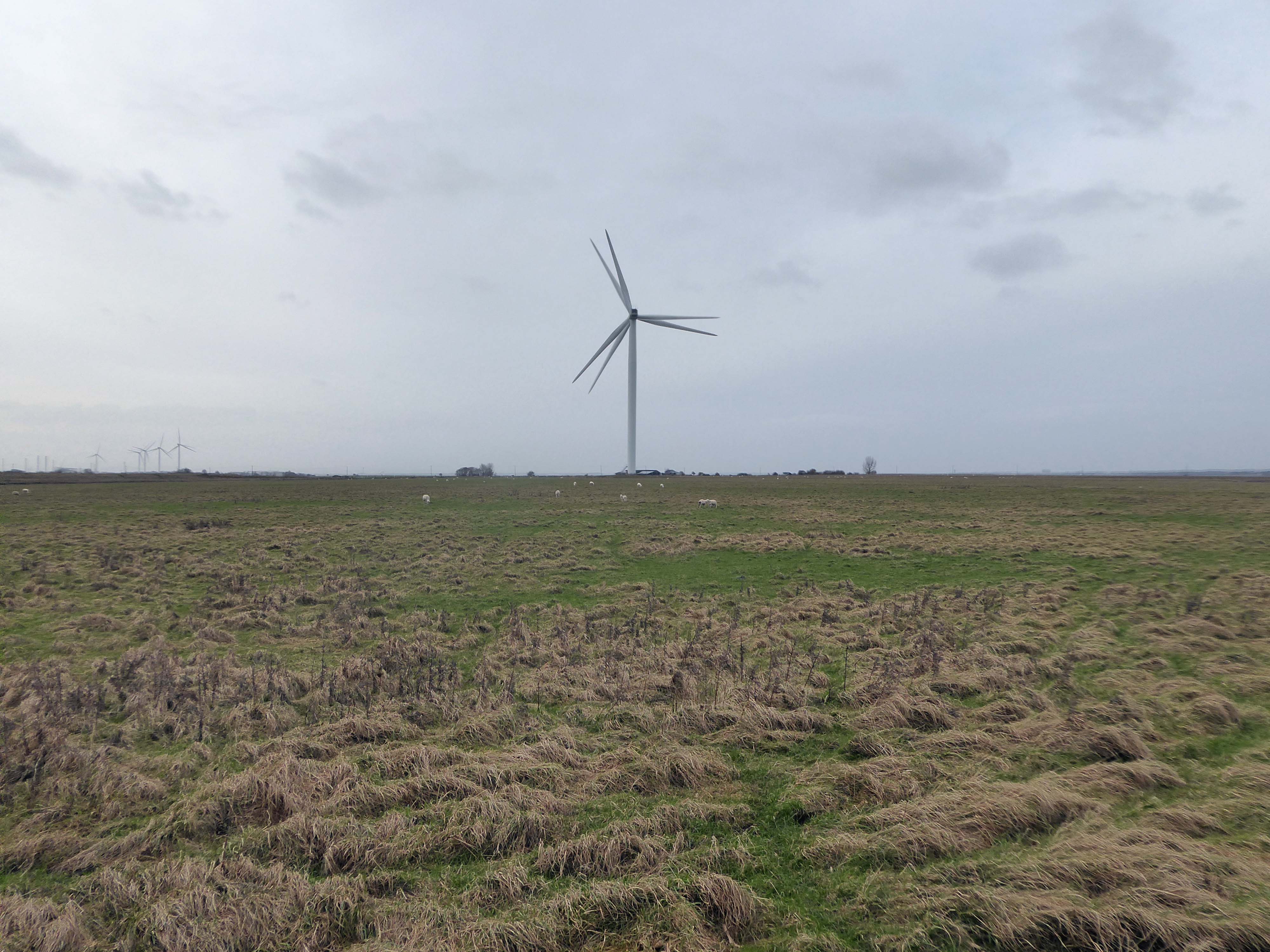
Frodsham Wind Farm is one of England’s largest onshore generating stations, and the largest in the Cheshire region, with an installed capacity of more than 50 MW. Construction of the wind farm began in March 2015 and became fully operational in February 2017.
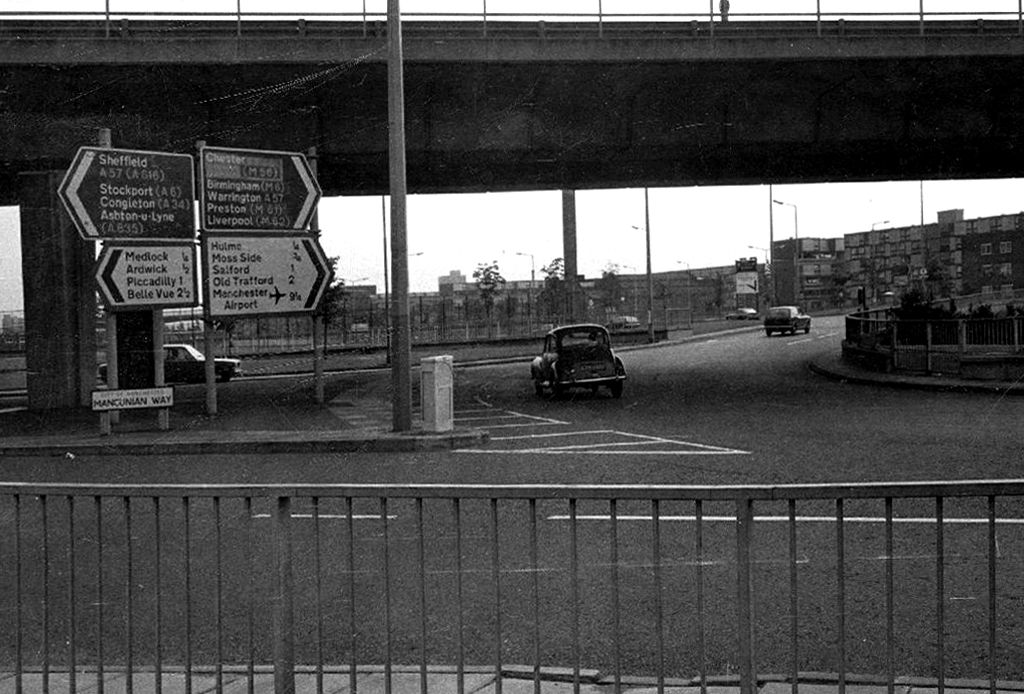
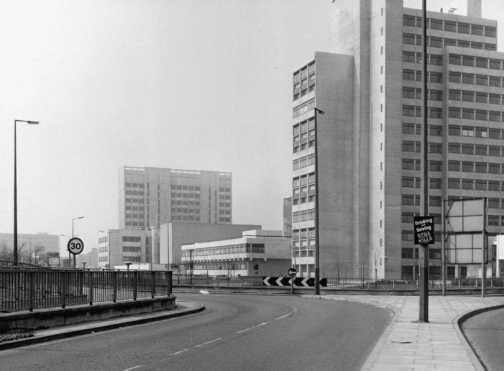
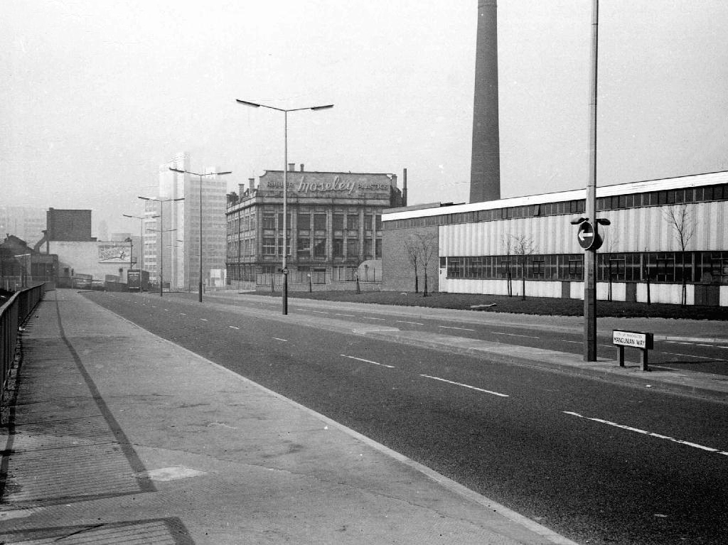
The A5103 is a major thoroughfare running south from Piccadilly Gardens in Manchester city centre to the M56 in Northenden. The road is two-lane dual carriageway with a few grade-separated junctions. It is used by many as a link to the airport and to the motorway network south.
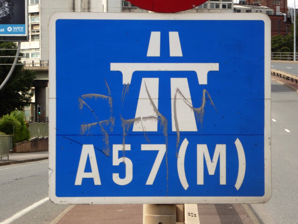
The road starts at Piccadilly Gardens where it meets the A6. It heads along Portland Street – at one time it ran along the parallel Mosley Street, past fast-food outlets and off-licences and then meets the A34 Oxford Street. It multiplexes with that road north for 200 yards into St Peter’s Square and then turns left into Lower Mosley Street, initially alongside the tramlines and then past the former Manchester Central station, now a conference centre with the same name. The road becomes Albion Street and goes over the Bridgewater Canal and under the railway line east of Deansgate station. The road then meets the A57(M) Mancunian Way at a roundabout interchange. This is where most of the traffic joins and leaves.
The road is now 2×2 dual carriageway with the name Princess Road. It passes under the Hulme Arch, a grade-separated junction with the A5067, with an unusually large central reservation. This is presumably because of the proposed plans from the 1960s of a motorway. However, after passing under the junction, there are innumerate sets of traffic lights, with the B5219, the A6010 and the A5145, as well as many other unsigned roads. There are also many speed cameras set at 30 mph.
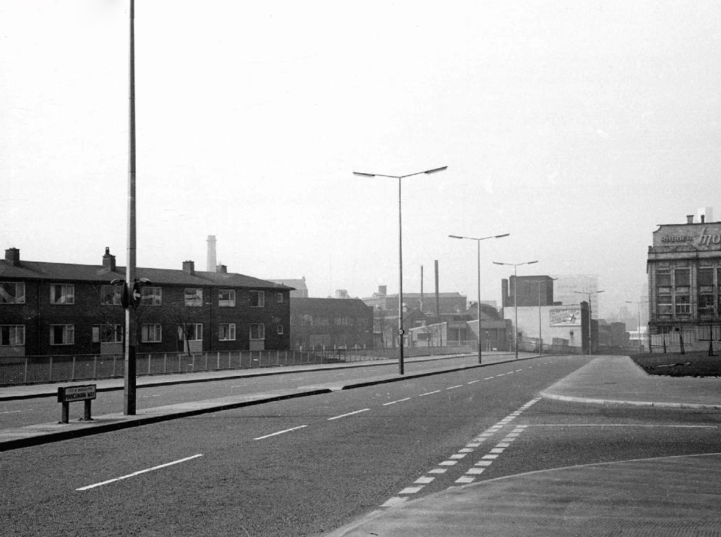
The road picks up pace as we exit the sprawl of South Manchester and the road becomes Princess Parkway, with a 50 mph speed limit. We cross the River Mersey and almost immediately hit the M60 at J5.
Except for the Manchester City Centre section – which was numbered A5068, this road did not exist on classification in 1922. Princess Road was built in 1932 to serve the new southwestern suburbs; initially it ran between the B5219 and A560 and was numbered B5290, with the road later extended north into the A5068 on the southern edge of the city centre and renumbered A5103.
The northern extension through Hulme initially followed previously existing roads, so followed a zigzag route. As part of the road’s upgrade and the reconstruction of Hulme in the 1970s the road was straightened and the original route can no longer be seen. The A5068 was severed around this time with the construction of the A57(M) and the A5103 took on its city-centre section, taking it to the A6.
The M60 was developed by connecting and consolidating the existing motorway sections of the M63, M62, and an extended M66. It came into existence as the M60 in 2000, with the completion of the eastern side opening in October.
The original plan called for a completely new motorway, but policy change led to the plan which created the current motorway. As soon as it opened, the motorway got close to its projected maximum volume on significant sections.
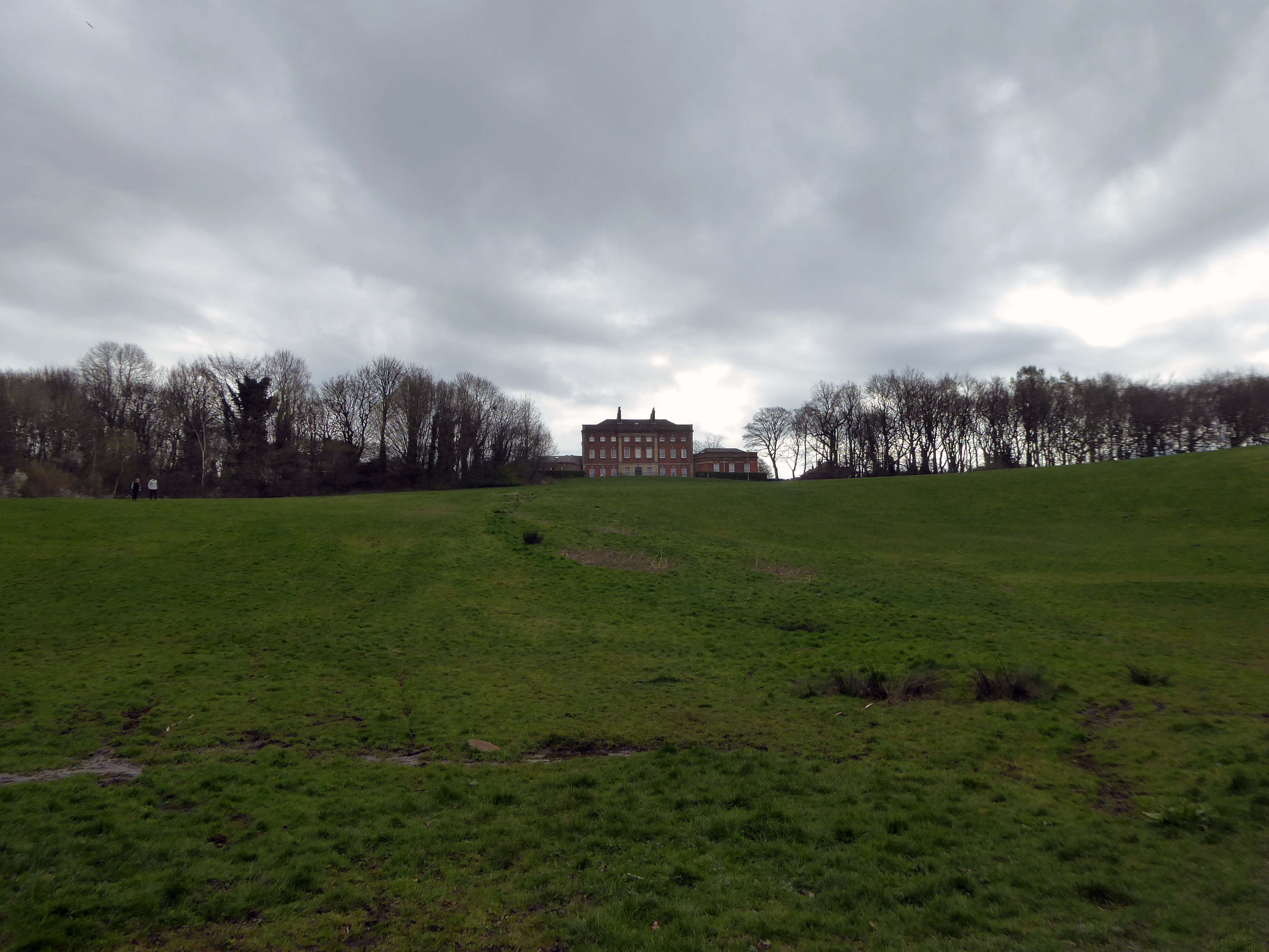
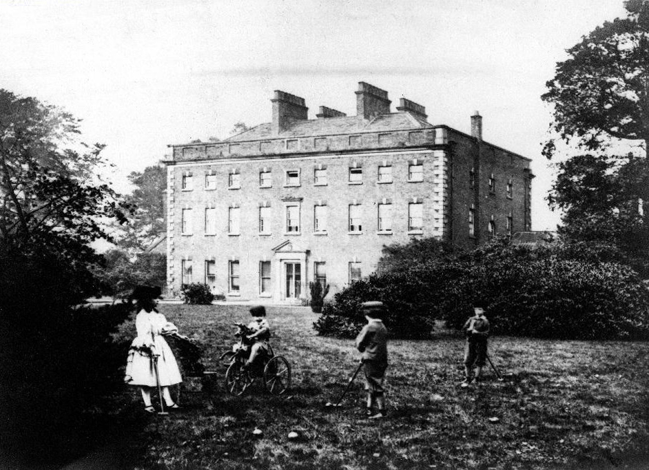
This Palladian mansion was designed and built in 1736 by renowned architect, Giacomo Leoni, who had also been responsible for significant alterations to Lyme Hall during the same period.
Offering an infusion of historical significance coupled with an abundance of living space throughout, Alkrington Hall East, simply must be viewed to be appreciated in full.
During the early 1770’s, the Hall became the largest museum outside of London, when the Hall’s owner, Sir Ashton Lever, exhibited his private collection of natural objects, including live animals. Remaining as an imposing symbol of Leoni’s work, Alkrington Hall remains one of only a few surviving examples throughout England.
In modern times, the Hall has since been carefully and sympathetically separated into 4 sections, and we are pleased to be offering for sale the largest portion of the Hall, with a total floor area comprising of over 7500 SQFT, and living accommodation spread over 4 floors.
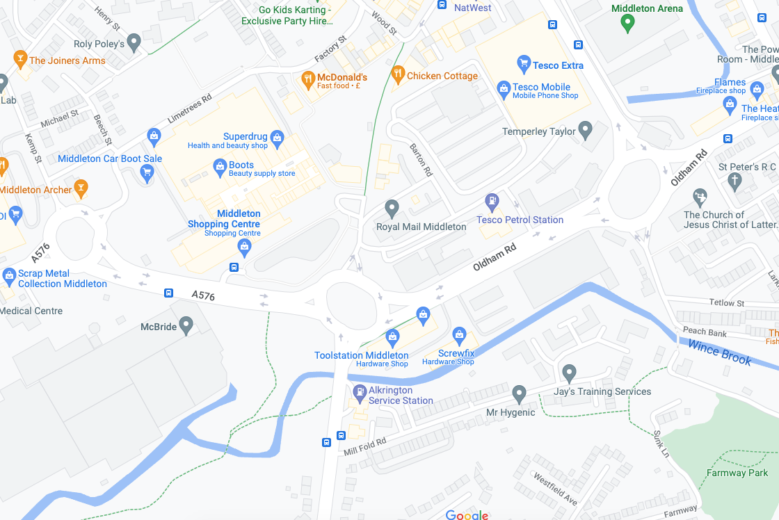
Next thing you know you find yourself in Middleton, where the Irk sort of disappears – you sort of get lost and sort of follow the wrong track, eventually ending up back where you should have been in the first place.
Don’t follow Wince Brook – it’s so far from right that it’s wrong – right?
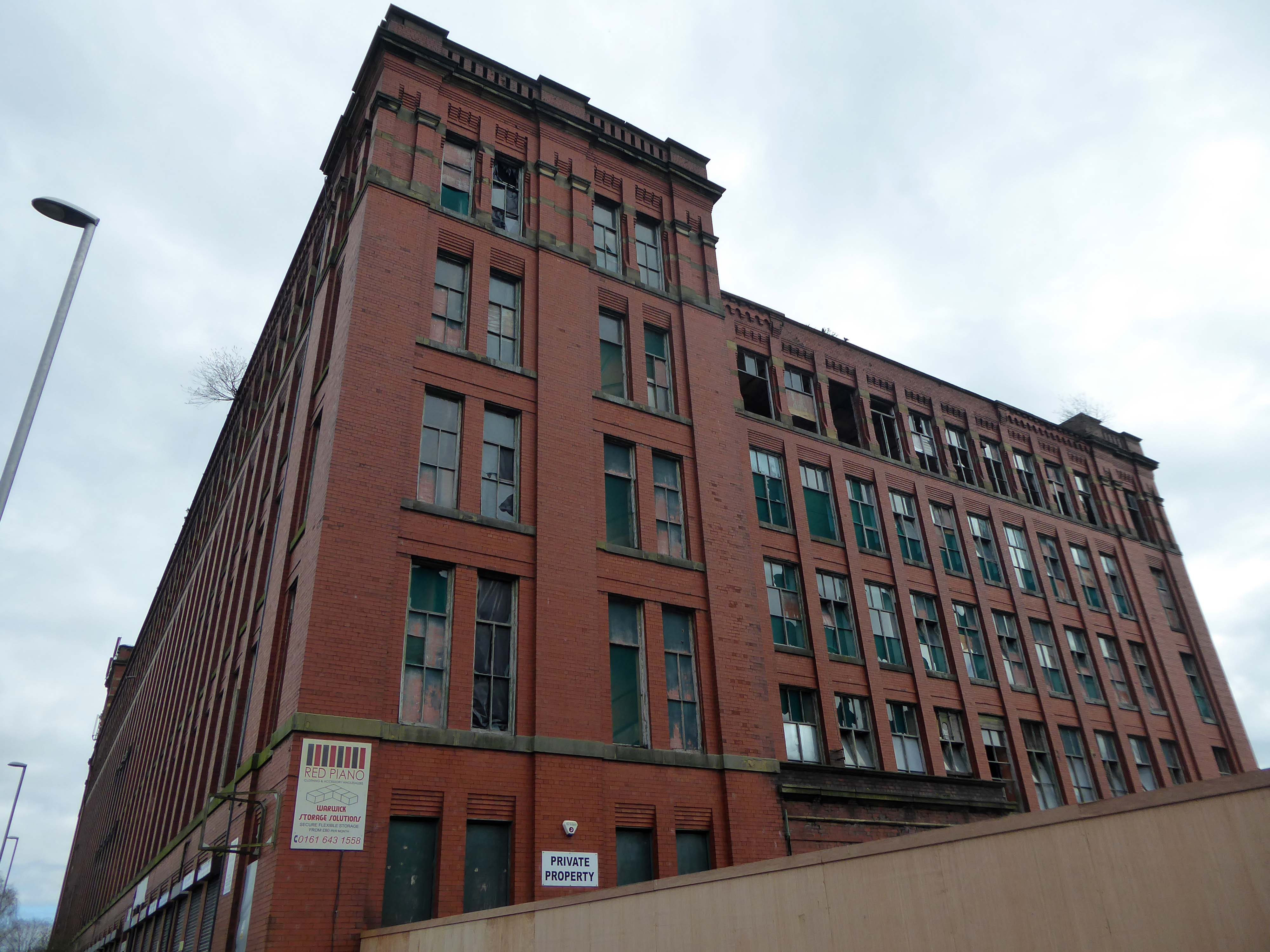
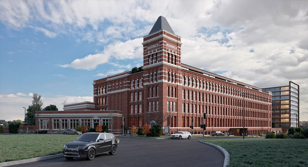
Take a walk up Oldham Road to see Warwick Mill instead.
1907 by G Stott of J Stott and Sons – Red brick with internal cast-iron frame.
There was and Oval Partnership planning for a retail development in 2014 which failed to materialise.
The converted building will provide a showcase for Chinese manufacturers of construction-related products looking to enter the UK and wider European markets. Products on display will include tiles, lighting, furniture, kitchenware, sanitary ware and curtains. A second phase will see the construction of a new building alongside effectively doubling the floor space. In addition the brief includes a range of restaurant, leisure, culture and entertainment facilities threaded through the building. The conversion will open up the existing building in a dramatic way, maximizing permeability and providing a strong visual connection back into the town, promoting public access through the building to the attractive south-facing waterside of the mill.
Permeability failed to be maximised, sadly.
Ambitious plans to refurbish Grade II listed Warwick Mill to create new homes and breathe life into an important building and part of Middleton’s history have been drawn up.
Warwick Mill has recently changed ownership and the new owners, Kam Lei Fong (UK) Ltd, have been working with Rochdale Borough Council over the last nine months to develop proposals to redevelop the site.
A Middleton couple has saved the oldest surviving mill in the town after a two-year renovation project.
Located on Townley Street, Lodge Mill was built in the mid-1800s and was originally a silk weaving mill. It went on to cotton weaving and cloth dying, then to a home for many different small local businesses. Sadly, in the early 2000s, it fell into disrepair and became derelict.
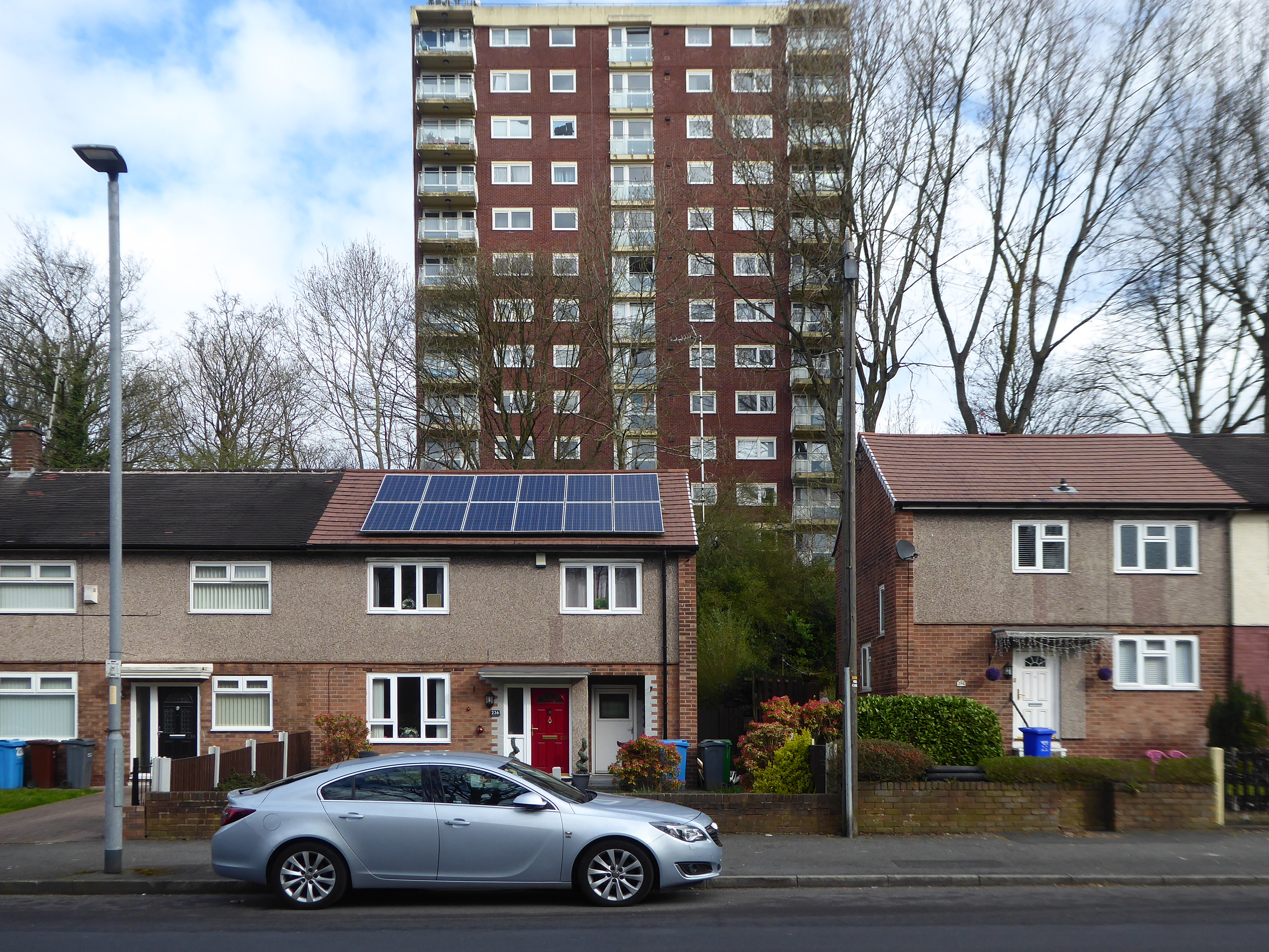
Martin Cove and Paula Hickey bought Lodge Mill on 1 April 2019 and immediately set about replacing and repairing the roof. They also installed a 19.4kw solar PV system so the mill became its own little power station that summer.
In August 2019, the couple opened a small ice cream shop on the ground floor of the mill – named the Ice Cream Shop at Lodge – selling locally-made ice cream from Birch Farm, Heywood.
The ice cream is made using cream from Tetlow Farm’s dairy herd at Slattocks – Martin explained.
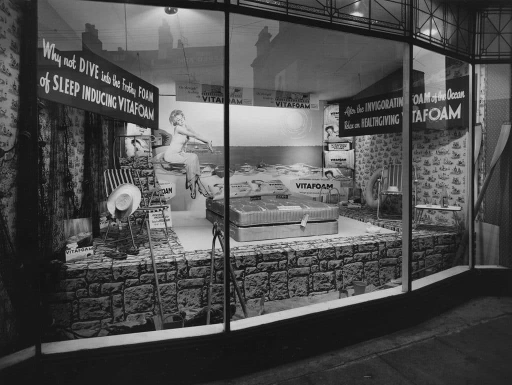
Founded in 1949 on £100 capital, Vitafoam started its original operation manufacturing latex foam products in Oldham, Greater Manchester.
After establishing the business, the company made a major move to its current site in Middleton, Manchester in 1955, acquiring two empty former cotton mills to cope with increased demand.
By 1963, Vitafoam had added the manufacture of polyurethane foam to its business and was providing product speciality for upholstery and bedding markets.
As Vitafoam entered the new millennium the company had made great strides in supplying external foam converters. These rely on Vitafoam to be their business partner and provide their foam needs. This trend continues to grow from strength to strength and is supplemented by our own group conversion companies.
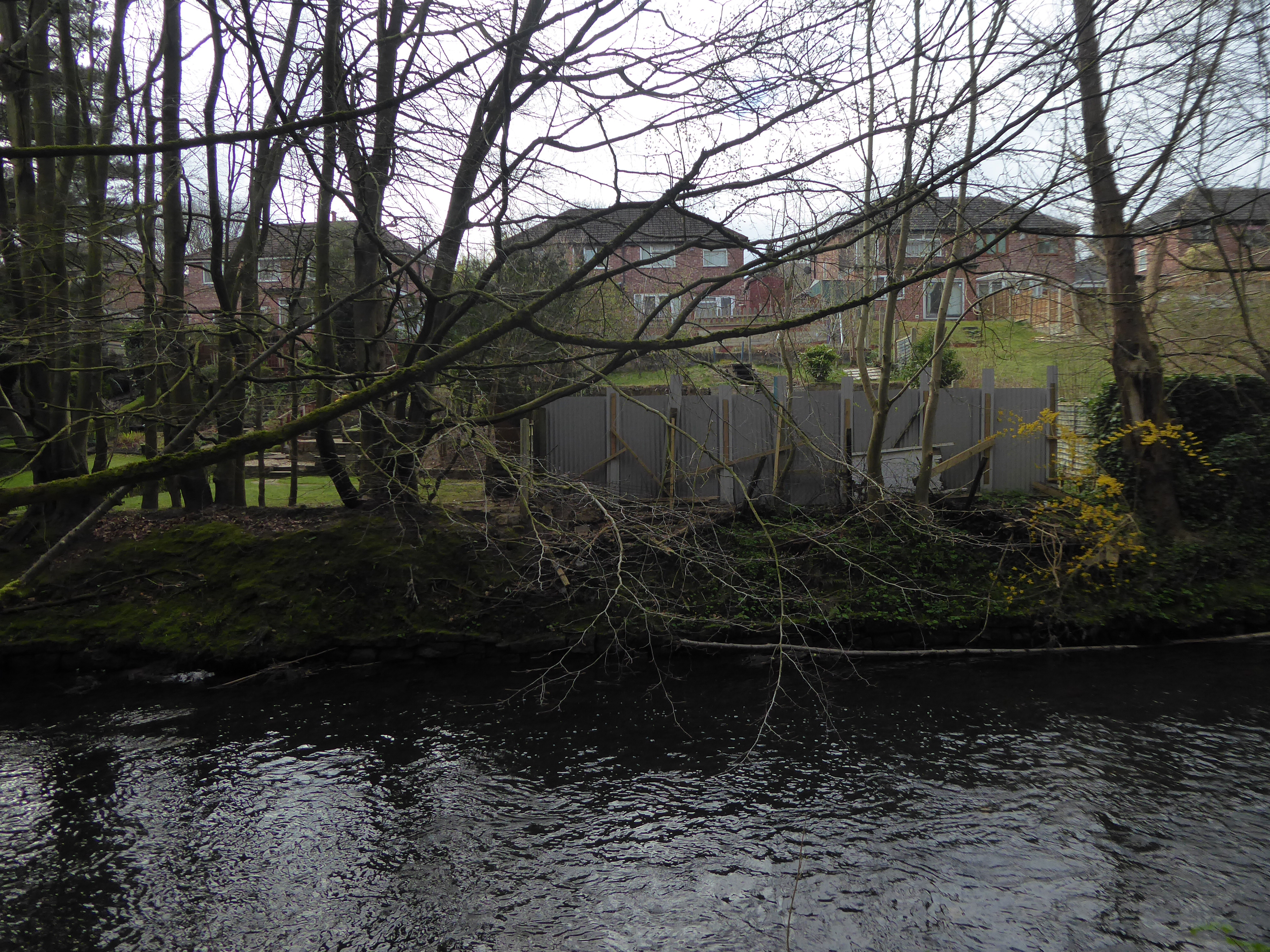
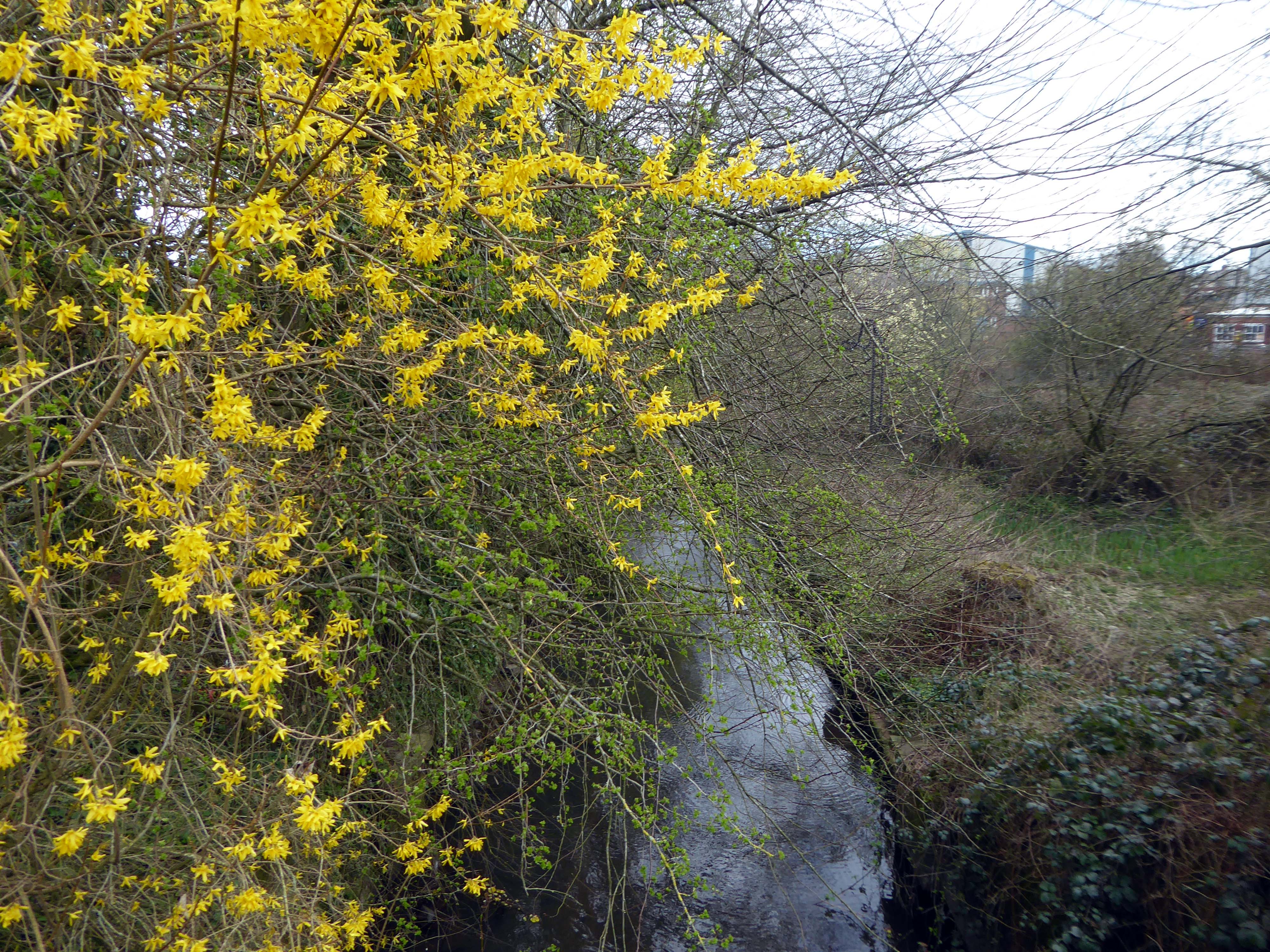
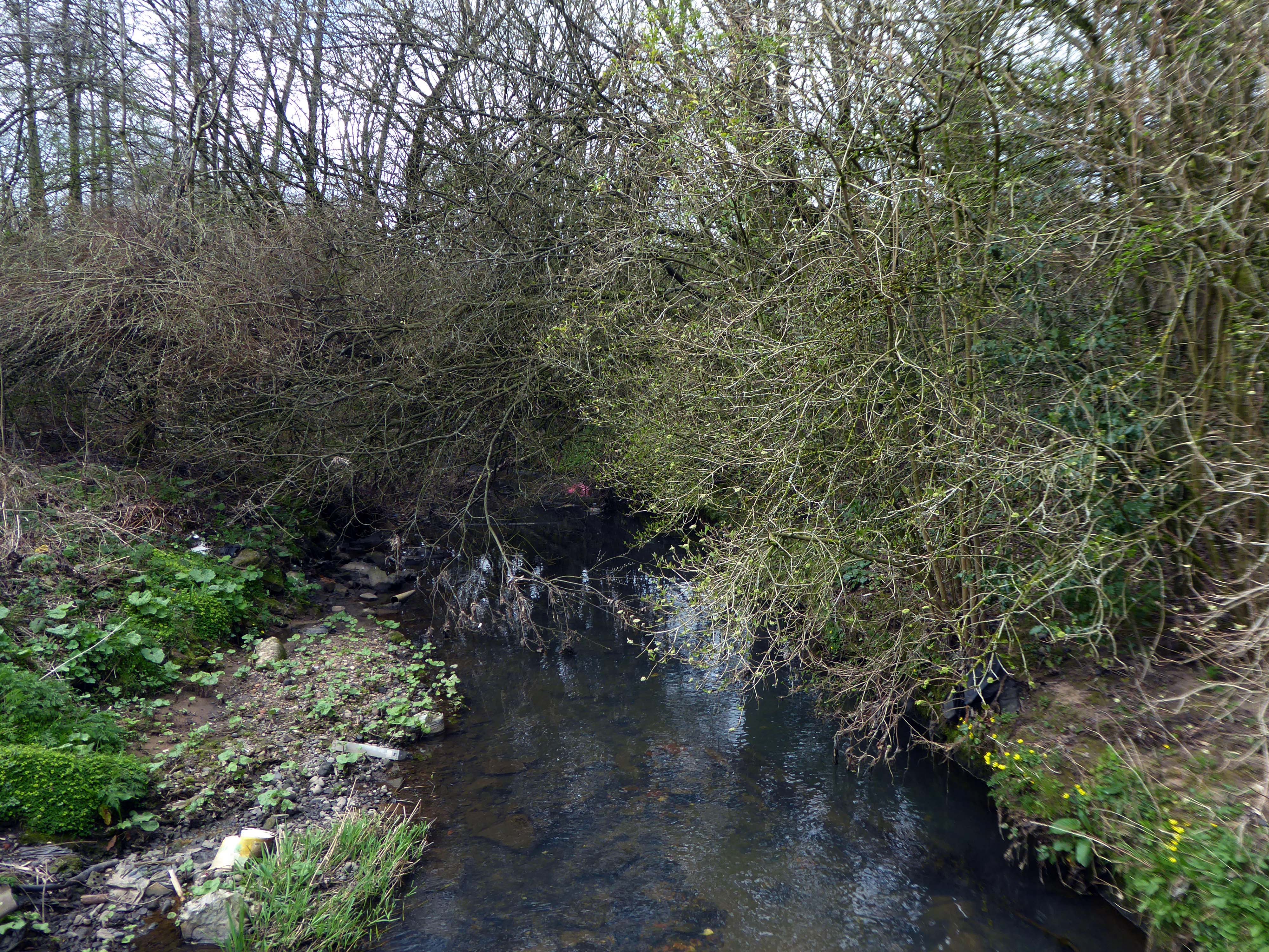
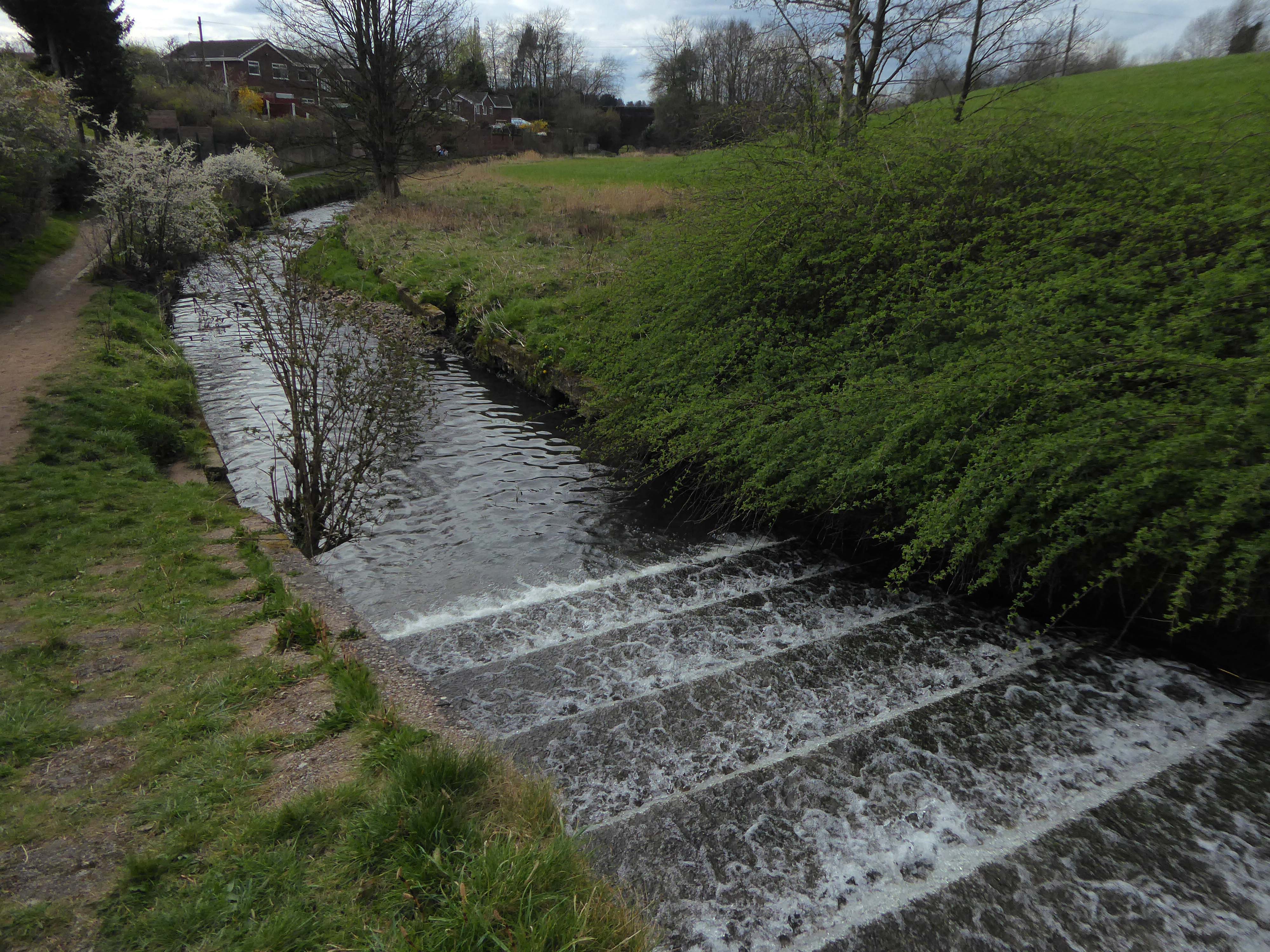
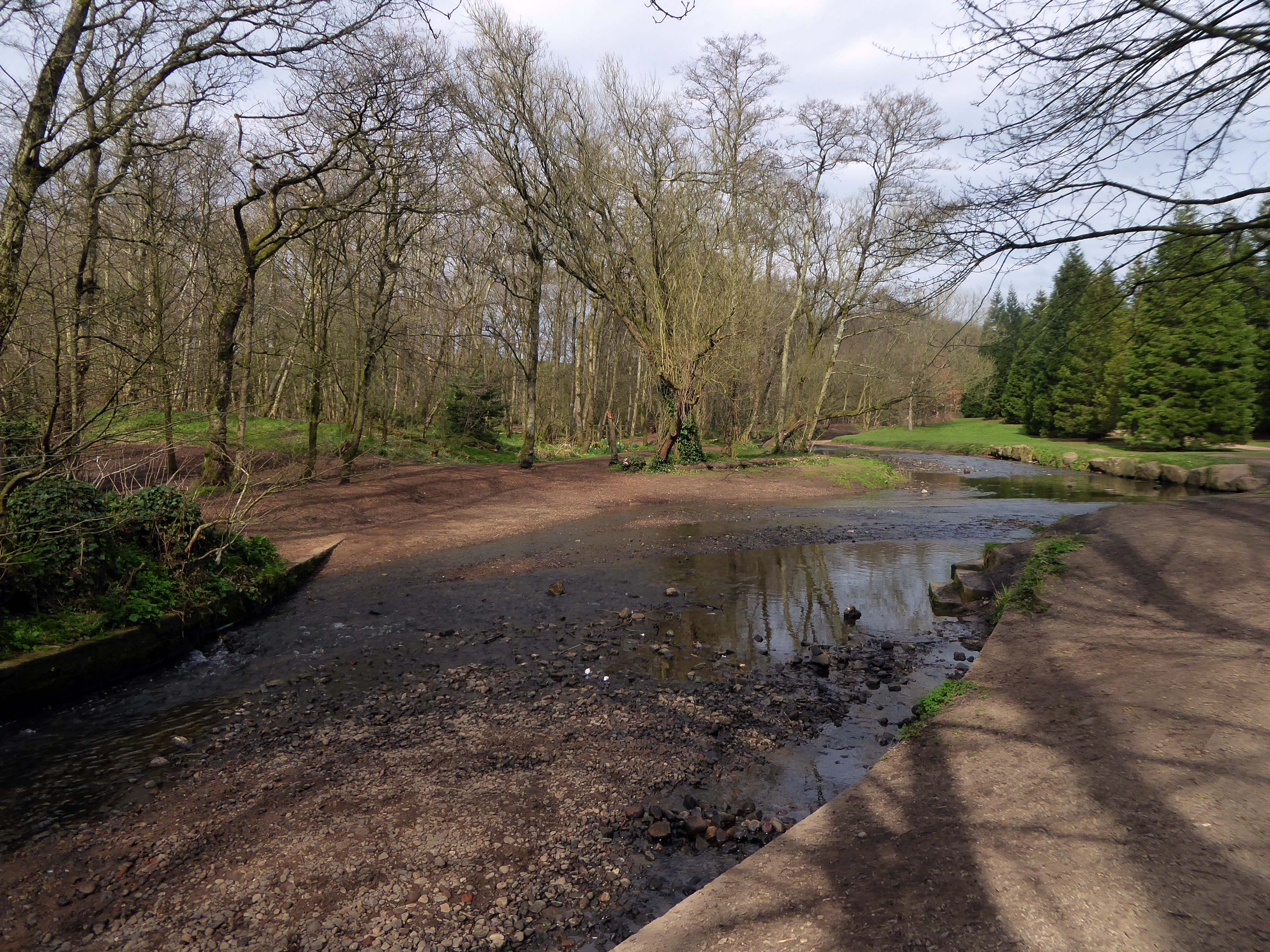
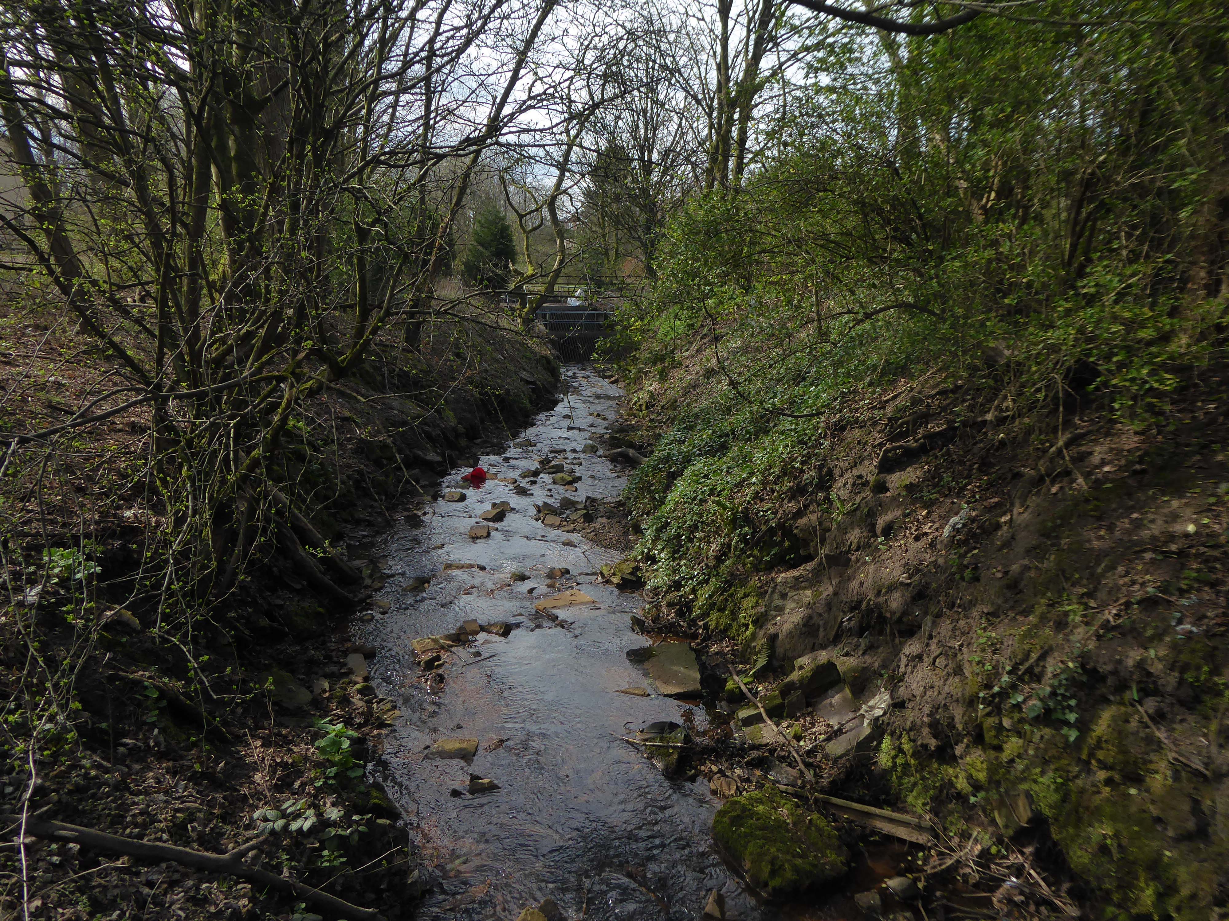
Regaining the river at Chadderton Hall Park.
Its roots stretch back to the 13th century being the land on which Chadderton Hall once stood. It contains a large field area with a small football pitch, a playground area, several flower gardens and a small café situated next to the Park’s bowling green.
Chadderton Hall was first built in the 13th century by Geoffrey de Chadderton, this first hall was in Chadderton Fold slightly to the east of the current park. In 1629 a new hall was built at the site of the current park and was present there until the 20th century when it was demolished in 1939. It was at the end of the 19th Century that the area surrounding Chadderton Hall began to be used for public recreation. A boating lake and a menagerie, including a kangaroo and a lion, were established as part of a Pleasure Garden. These features have long since been demolished but evidence of the boating lake can be seen by the hollowed out area where the playing fields now stand.
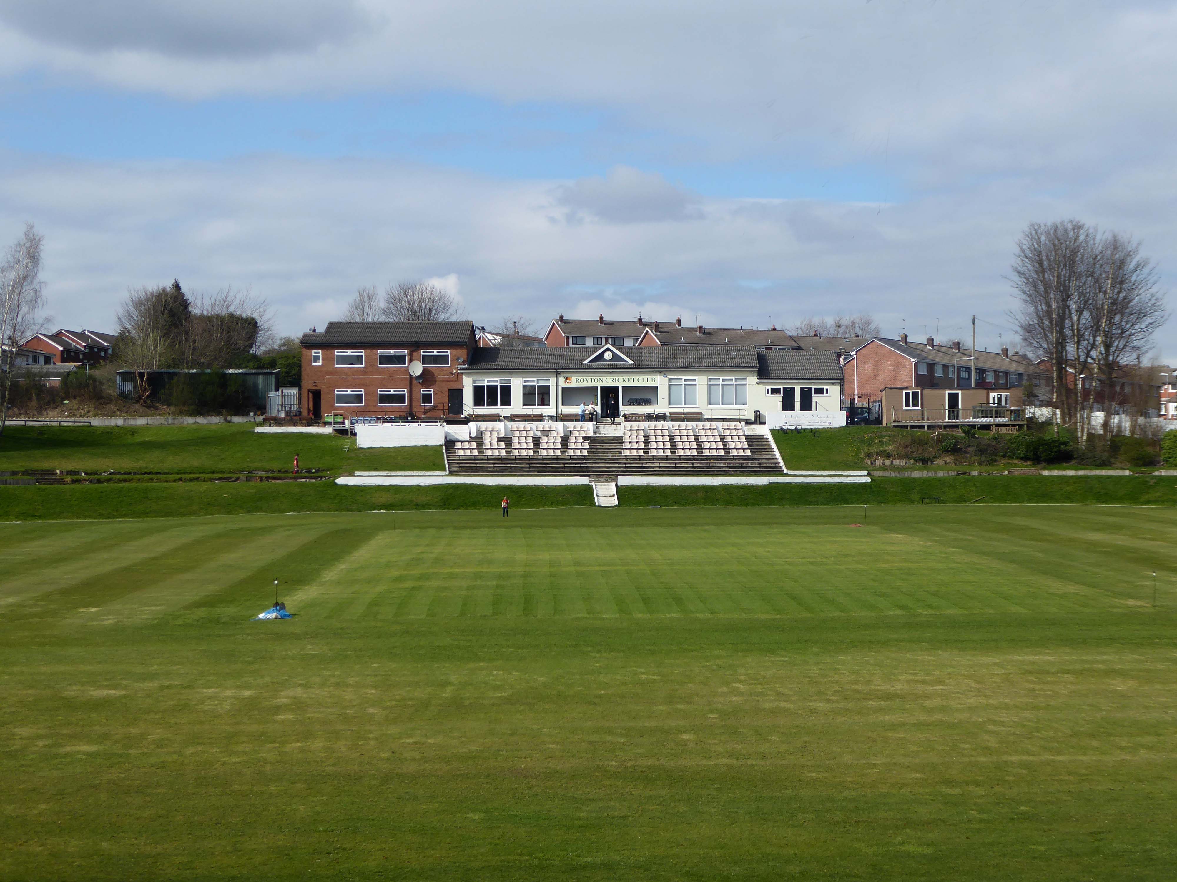
Based in the heart of Thorpe Estate – Royton Cricket, Bowling & Running Club offers a family friendly environment whilst hosting strong, competitive cricket throughout the summer. Bowling throughout the summer along with a Running section – Royton Road Runners, who operate all year round. Along with seasonal events such as our well known firework display along with St Georges Day celebrations – with plans in the pipeline for improvements on current events as well as new exciting projects – it’s a great time to be apart of the club & community!
I have very fond memories of visiting with my dad Eddie Marland as he followed Ashton in the Central Lancashire League – both watching cricket and seeing my dad crown green bowling here.
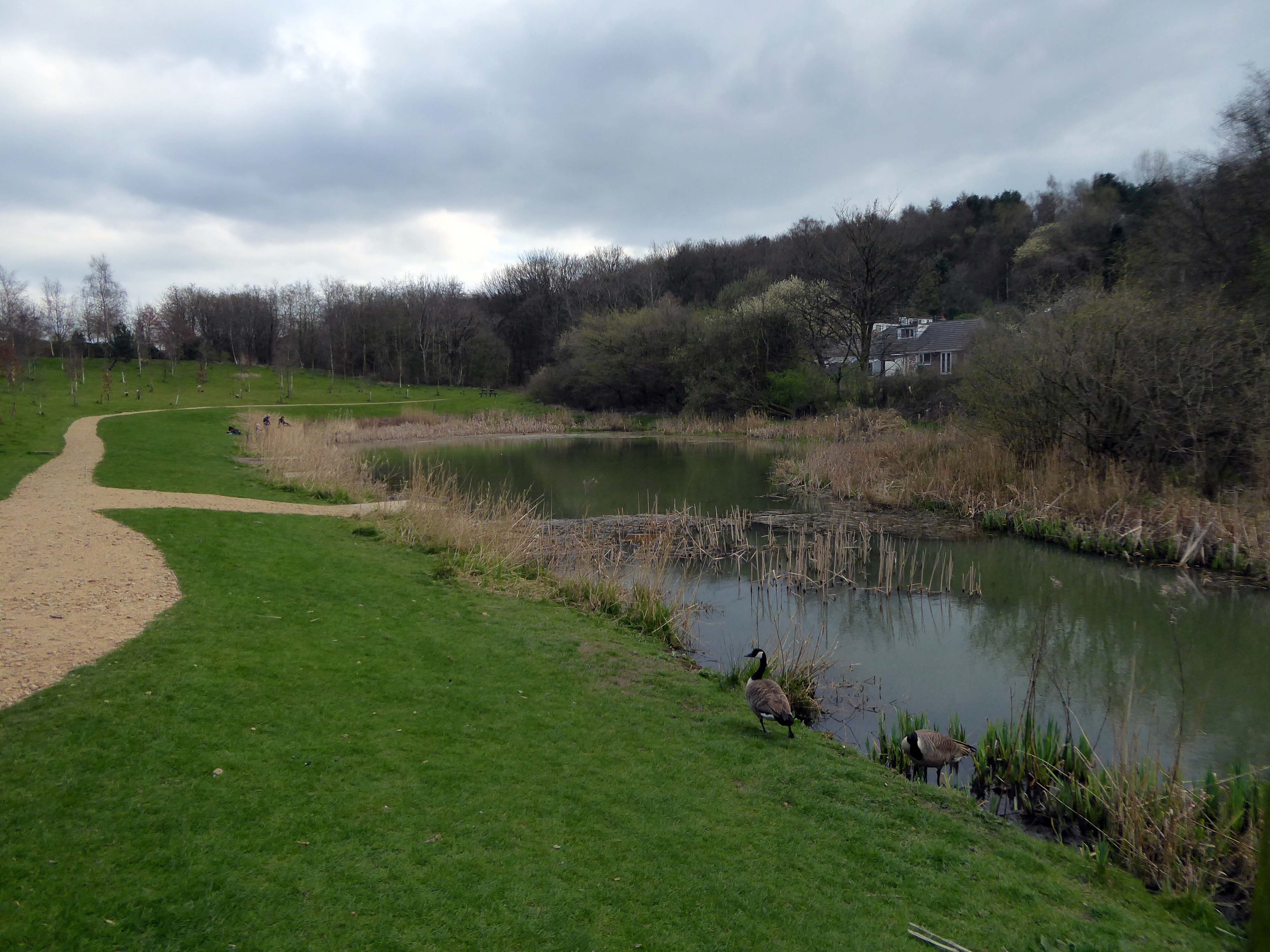
These now full memorial forests were originally donated to Life for a Life by Oldham Metropolitan Borough Council. Salmon Fields meadow sits adjacent to a lovely pond that is used regularly by fishing enthusiasts and is frequently used as a breeding site for Canadian Geese.
Life for a Life planting areas are natural environments where we encourage wildlife and plantlife to flourish, as such additional items should not be added to the tree or the space around it, especially as they can cause damage to the tree.
Please be aware that any prohibited items left on or around memorial trees will be removed.
Although these sites are now full to the planting of new memorial trees if you have an existing memorial tree dedicated you can still upgrade memorial plaques, add additional ashes to a memorial tree, order memorial keepsakes etc.
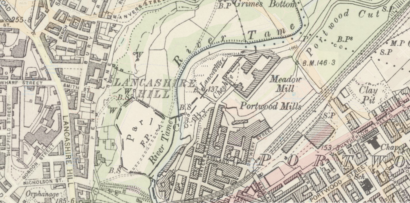
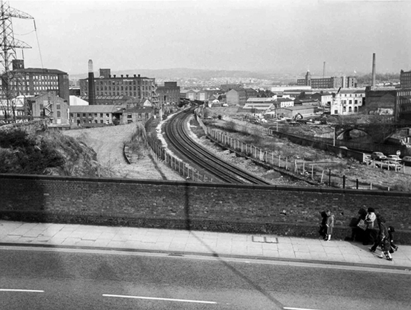
I often walk around here, the space enclosed by the River Tame and the M60, it was a maze of busy streets, home to peoples’ homes, industry, pubs, clubs and railways.
Much of that is now gone, either left to its own devices, untended rough empty ground, or overwritten by the newly built Tesco Extra and Porsche dealership.
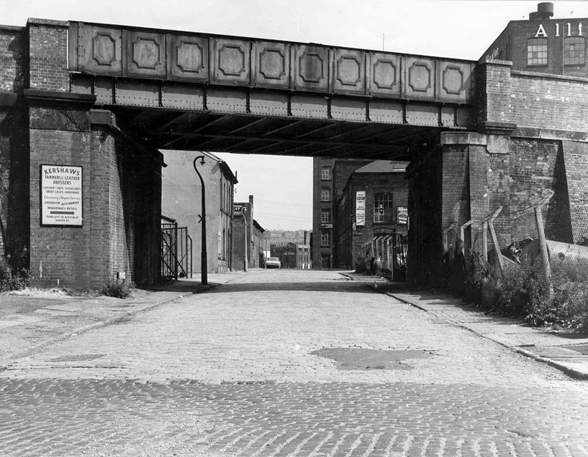
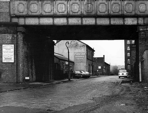
Water Street, Portwood looking north, taken from Avenue Street. Looking underneath the railway bridge, on the left hand side, the first building used to be a public house called ‘The Beehive’, further along was Kent & Swarbrick’s Tripeworks, now a precision engineers, then North West Concrete Works – Easymix. On the right is Coxson’s Brushworks, then the Portwood Mill, Kershaw’s Tannery and the Meadow Mill at the bottom of the street.
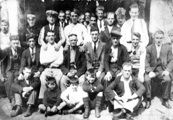
The area was also home to the Blood Tub boxing ring.
Outside the Blood Tub Back Water Street Portwood.
Centre row left to right Billy PittTaylor Micky PelhamJack HulmeJo Moran owner John MorryBobby RileyLaurie Glen a jockey
2nd row from the back – James Jimmy Rose.
Back row left to right – Charlie Dean An ambulance man Ike Irelands horse dealer – Team from Macclesfield.
Extreme right – Jo Mulrooney.
Front row left to right extreme left – Sidney Smith soft Sidney – a simpleton Jo Hulme.
Copied from a photograph lent by Eddie Pitt
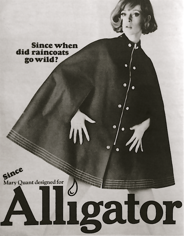
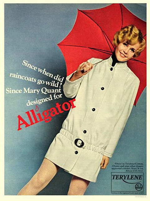
Alligator Rainwear – a British company, whose main factory was based in Beehive Mill. It was best known for its 1960s collaborations with Mary Quant in the design and production of her Wet Look collection of PVC raincoats.
The firm was started after the First World War by Reuben Satinoff, who had previously founded the London Waterproof Company – Silkimac. It was taken over by his sons after the Second World War. For decades, it manufactured traditional weatherproof raincoats in black, brown and beige, but the collaboration with Quant led to new fabrics including PVC and nylon, and a range of bright and vibrant colours.
At its peak in the 1960s and 1970s, Alligator had a turnover of £5 million per year and was exporting its products to Europe and North America. It was later owned by Baker Street Brands who describe it as one of their heritage brands.
Viewed from Tiviot Dale Viaduct
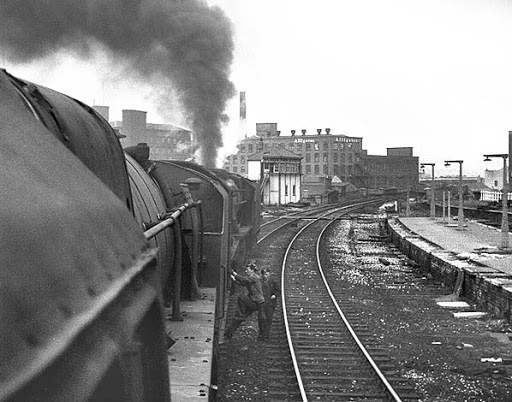
Tiviot Dale station was located on the Cheshire Lines Committee (CLC) operated Stockport, Timperley and Altrincham Junction Railway line from Portwood to Skelton Junction, a section of what became the Woodley to Glazebrook line. It was situated at the bottom of Lancashire Hill, next to the present motorway bridge. It was opened on 1 December 1865 and was originally known as Stockport Teviot Dale. From 1880, Tiviot Dale was also served by long-distance trains running on the Manchester South District Railway to London St Pancras.
Tiviot Dale remained a part of the CLC, which was jointly owned from 1923 by the London and North Eastern Railway and the London Midland and Scottish Railway, until 1948 when it became part of the British Railways London Midland Region.
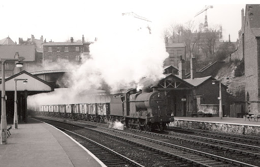
The lines through the station remained in heavy use by coal trains heading for Fiddlers Ferry power station near Warrington from the Woodhead Line. These, however, ceased in 1980 when damage was caused to the nearby Tiviot Dale tunnel during construction work on the M63 motorway – now M60 motorway and the line temporarily closed for safety reasons. The closure was made permanent west of Bredbury’s stone terminal in 1982, following the demise of the Woodhead route; the track was subsequently lifted in 1986 and the tunnel partially filled in. The area surrounding the station was further altered at the beginning of the 21st century to allow the construction of a supermarket and office buildings, which now block the old trackbed.
Portwood Railway Station was on the Stockport and Woodley Junction Railway – later becoming part of Cheshire Lines Committee – Glazebrook to Woodley line. According to Bolger it opened to passengers on 12 January 1863, along with the rest of the Stockport and Woodley Junction Railway, although Butt suggests it opened on 1 December 1865 when the Stockport, Timperley and Altrincham Junction Railway opened.
The station opened for goods traffic in 1865, closing to passengers on 1 September 1875, when it became a goods station. It remained in use until 25 April 1966 when it closed except for coal traffic which continued until 27 March 1972 when it closed entirely except for a private siding.
Today no trace of the station remains, the site being buried under a slip road of the M60 motorway.
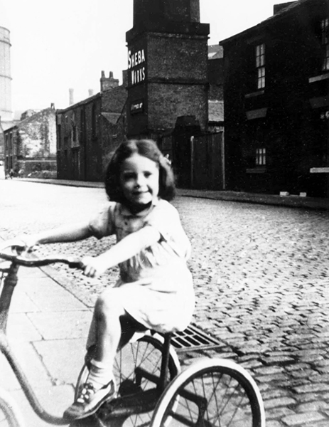
Monica Clarke on her tricycle in Marsland Street, behind her across the cobbled street is the Sheba Works – 1951.
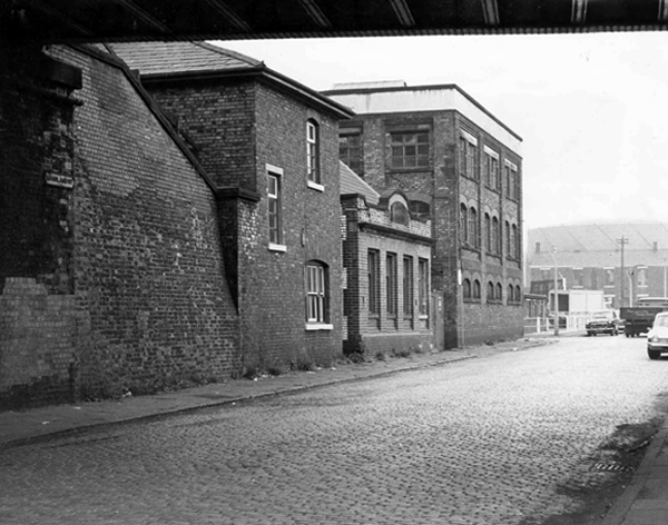
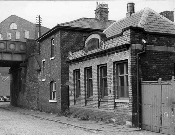
Marsland Street east, showing the Haymarket Chambers – 1967
The front of Haymarket Chambers Marsland Street.
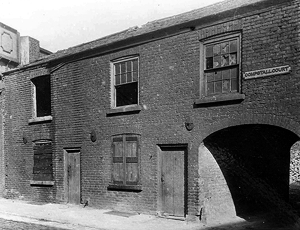
Boarded up dwellings on Compstall Court, off Marsland Street.
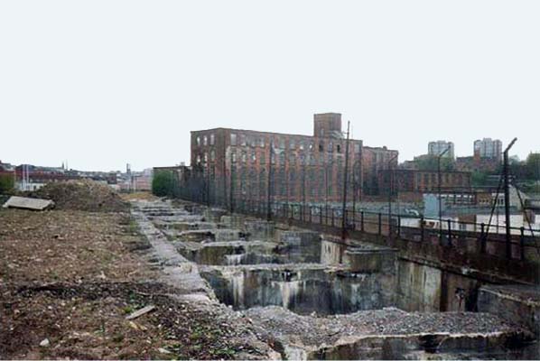
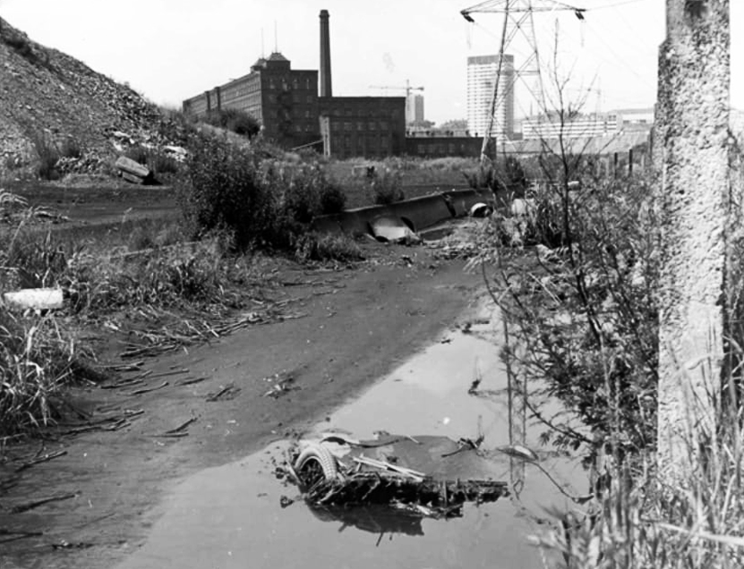
Portwood Cut 1968
James Harrison bought the manor of Brinnington in the early 1780’s – by 1790 Harrison had three factories in Portwood and others were to follow. In 1796, to provide sufficient water-power to this industrial zone he constructed a substancial millrace. Known as the Portwood Cut, it carried water across the Tame, between his Reddish and Brinnington estates. Harrison also planned the construction of factories at Wood Hall but that particular scheme was abandoned after his death in 1806.
Harrison’s Weir still survives on the river. To the south sections of the Portwood Cut also survive within Reddish Vale Country Park, both as a shallow depression and as water-filled, if somewhat silted and overgrown channel.
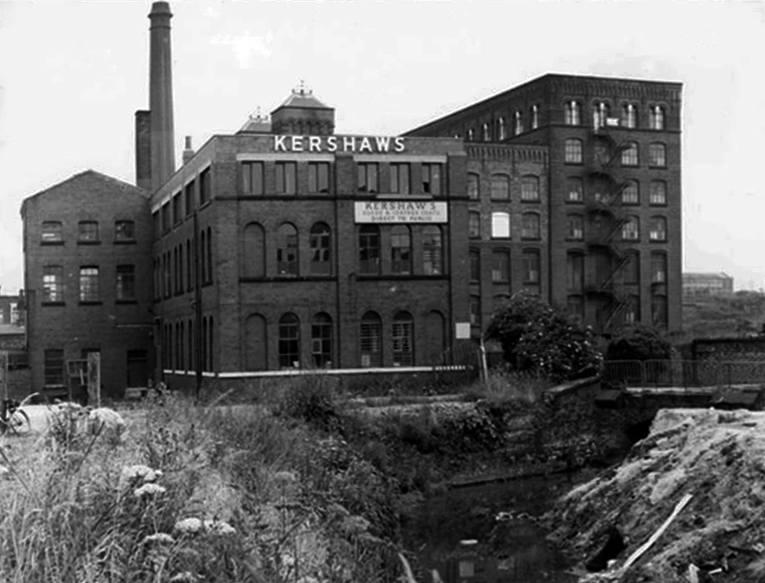
Kershaws is one of the only original businesses which still trades in the area.
Established back in 1855 by Joshua Kershaw, the company has gone from strength to strength.
Way back then, it was just a tannery. Today, seven generations on, Edward Kershaw heads a company that is known and respected for it’s quality leather in Europe, America and the Far East.
Kershaws also provide white leather for masonics and bagpipes.
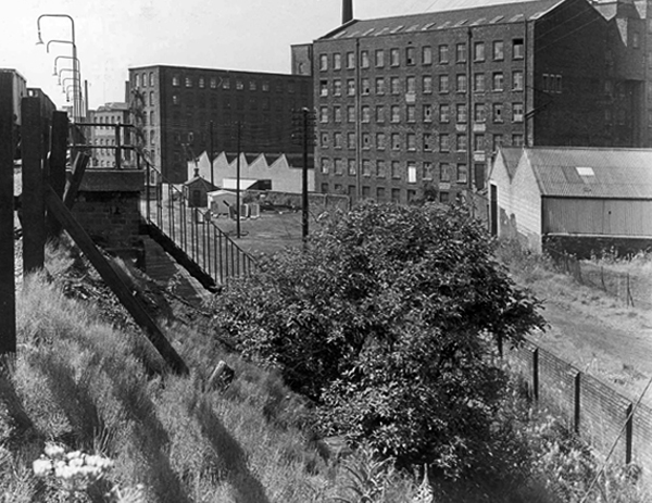
Brewery Street – a view of the steps leading to the railway footpath to Tame Street – 1967.
The mill in the foreground is the Portwood Spinning Mill now called Portwood Mill – on the front of the mill it states Sir Richard Arkwright Portwood Mill.
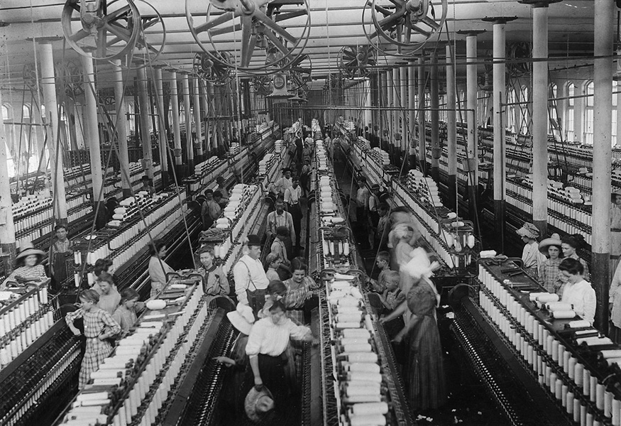
Employees – Portwood Spinning Company
Coal drops and yard at the rear of the Beehive Spinning Mill
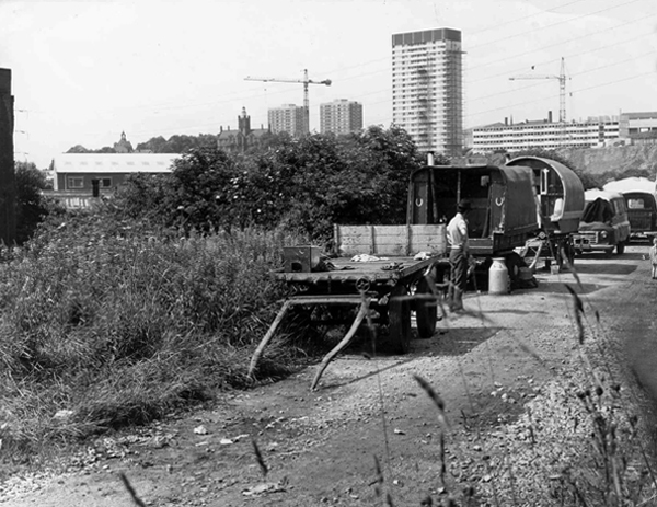
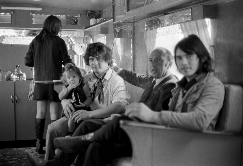
Tame Street gave motorized access to the Cut and here the caravans of travelling folk were parked several times a year, usually until the police ‘moved them on’. The men collected and sold scrap metal, the women sold clothes pegs and told fortunes from door to door. Many of the local people treated them with suspicion and some local pubs would not admit them.
Building work on Lancashire Hill can be seen in the background – 1968
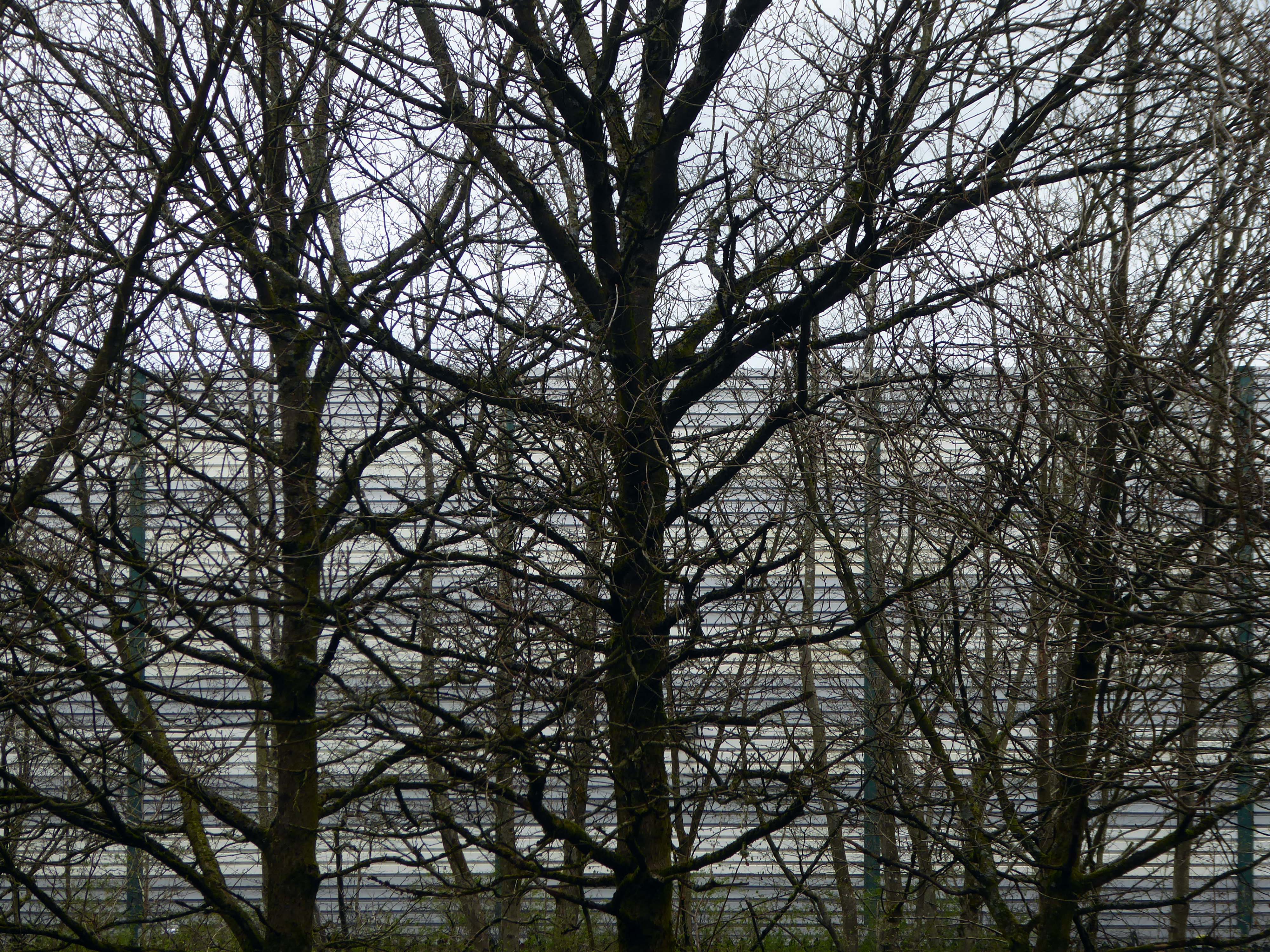
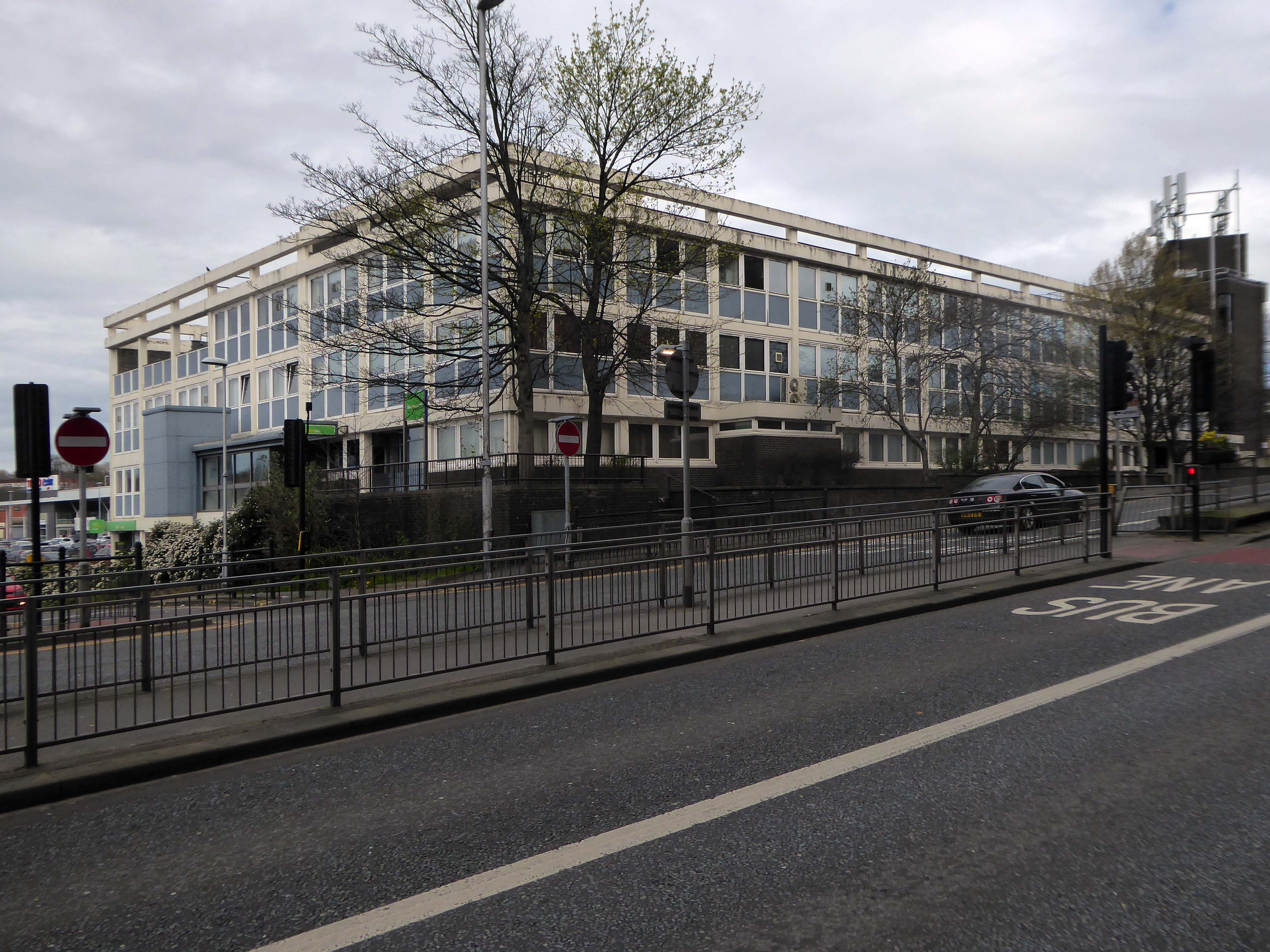
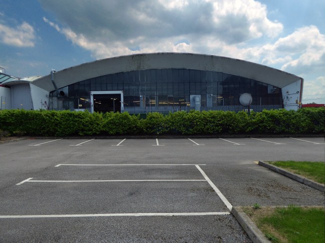
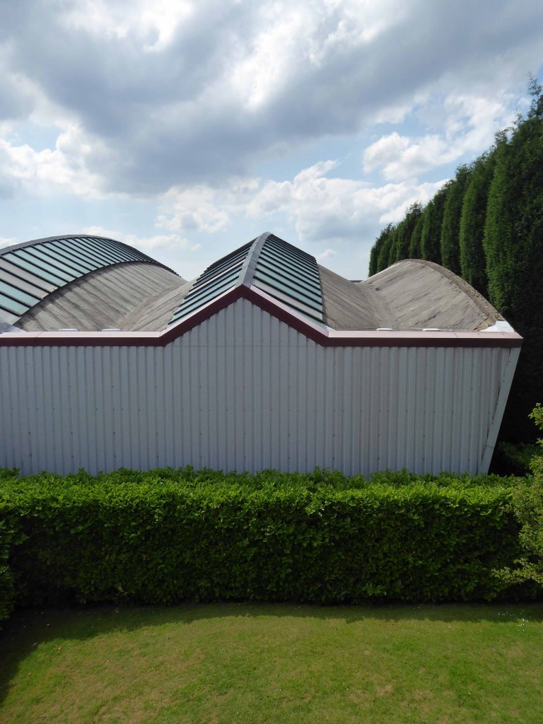
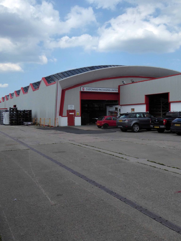
I’ve cycled by here for some fifty years or more – always admiring its serrated roof.
Way back when we would roam around on our bikes, exploring the waste ground adjacent to Jackson’s Brickworks.
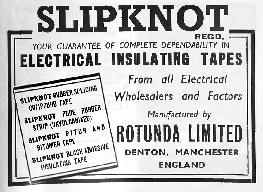
Where we would scavenge tape from the Rotunda tip.
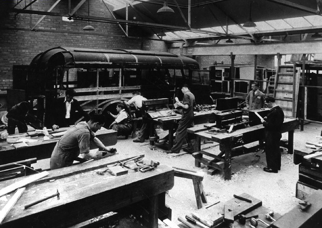
I remember it as a Remploy Centre.
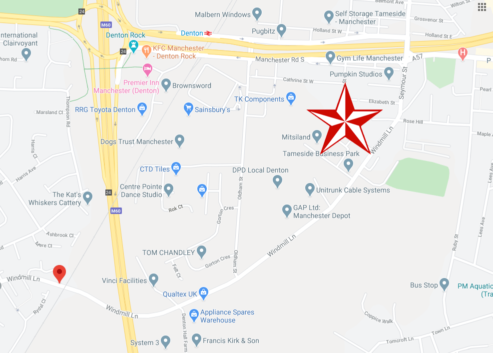
My last 13 years prior to retirement last May were spent at the centre, on Windmill Lane, Denton. Just before I left, a lot of demolition work was done, prior to redevelopment of much of the site.
I seem to remember the place always being referred to locally as Th’ Rehab – the Rehabilitation Centre, a Government training centre, where skills were taught, such as joinery, bricklaying etc, and there was also a Remploy Unit housed there.
Local men could go for a free haircut, administered by a well supervised trainee.
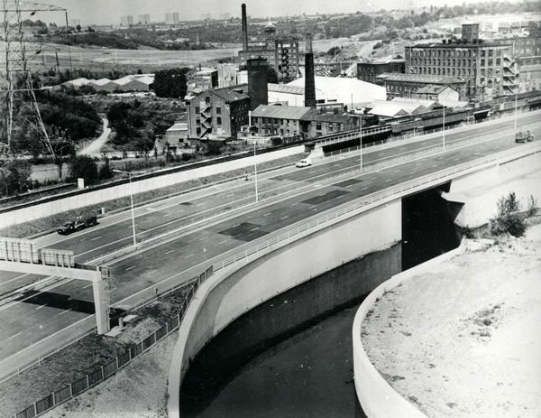
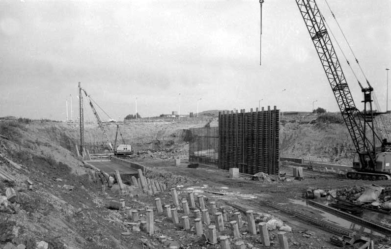
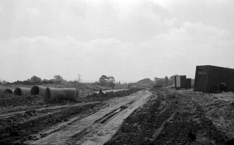
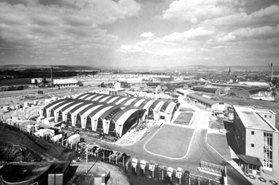
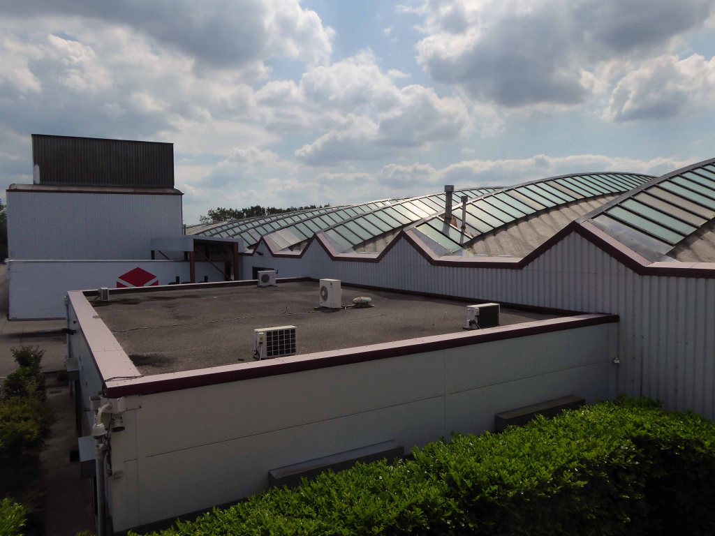
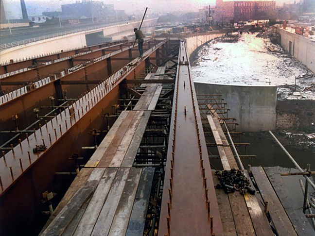
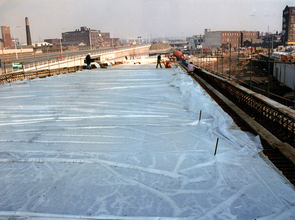
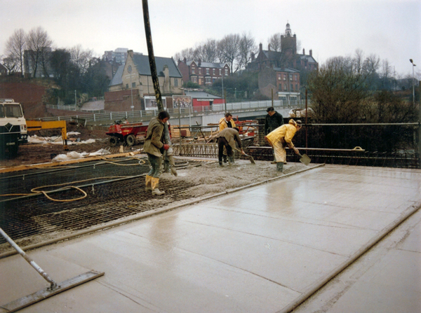
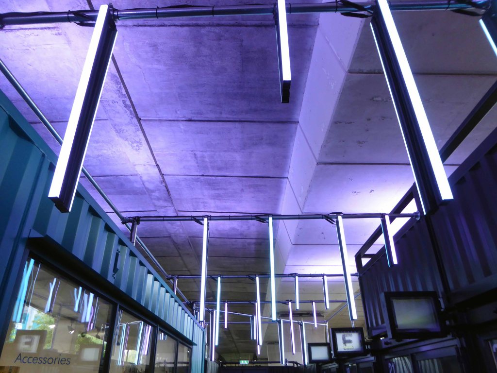
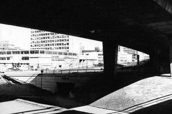
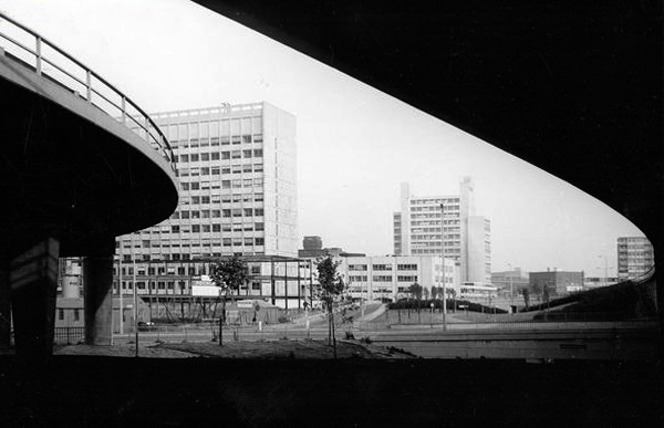
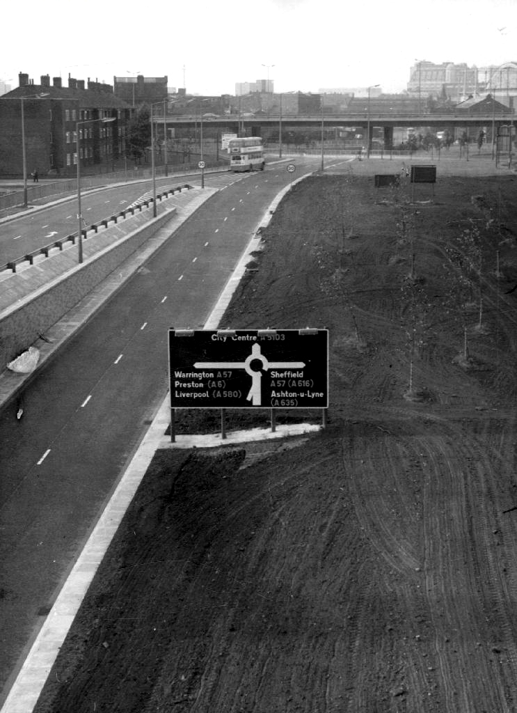
Proximity to the M60, seen here under construction is paramount to its future success.
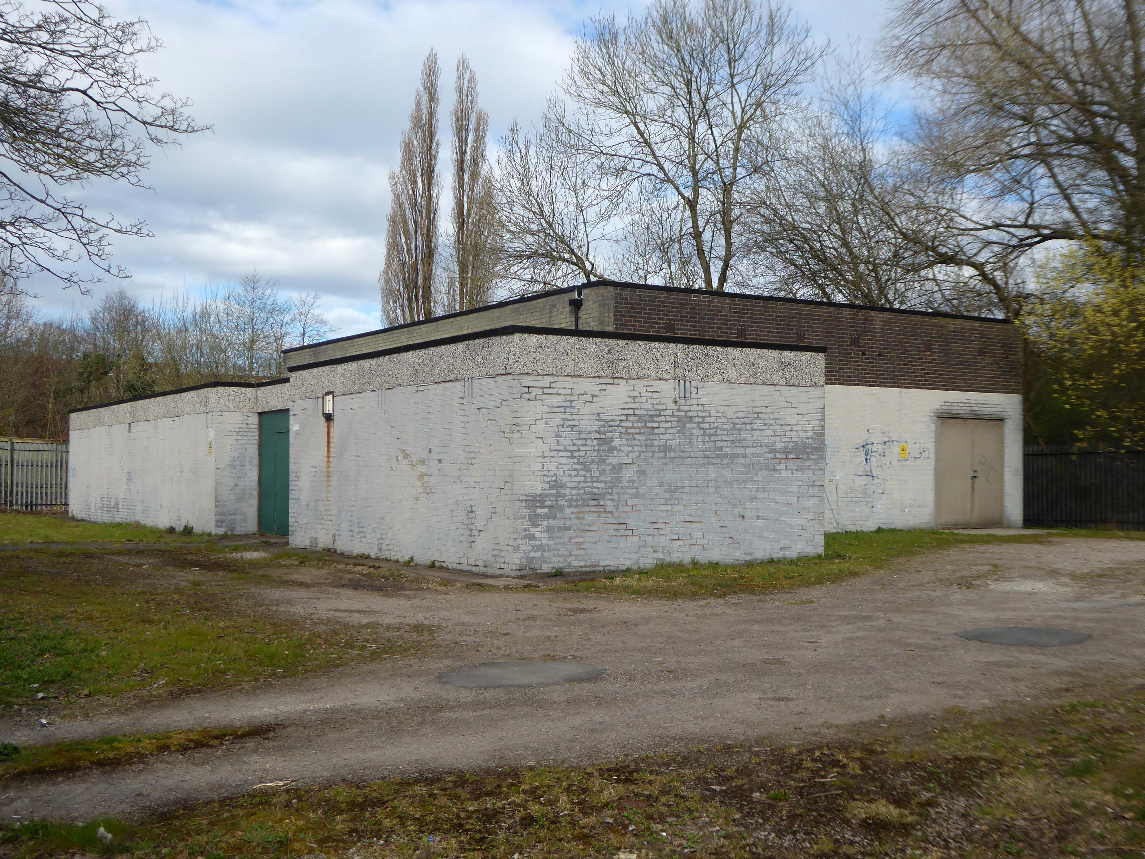
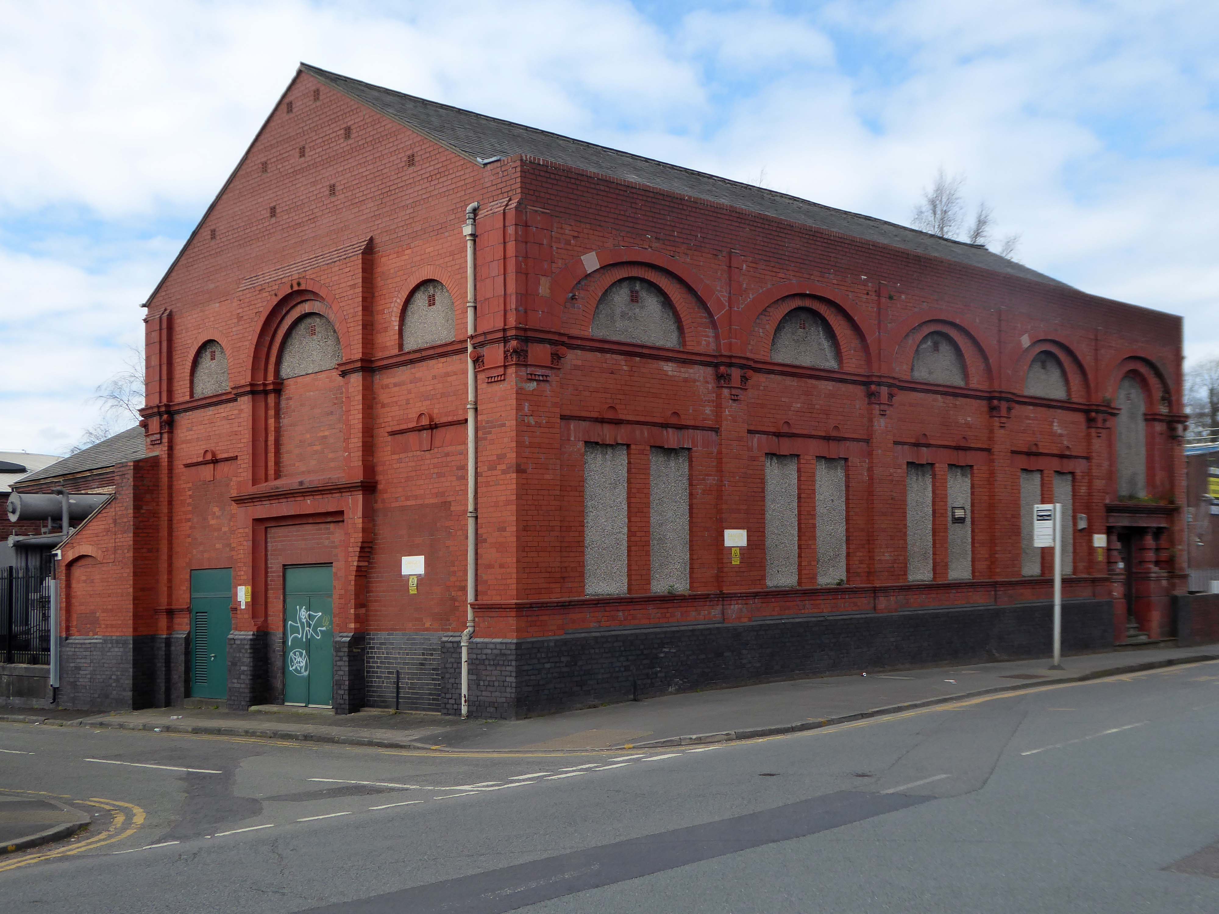
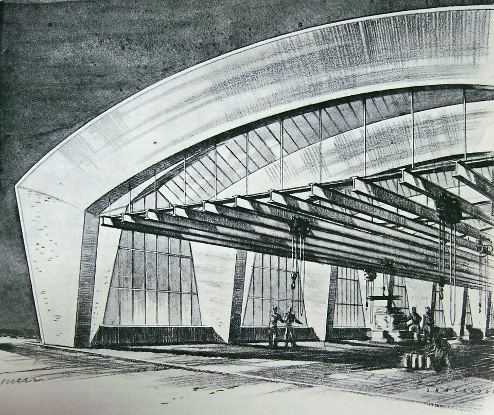
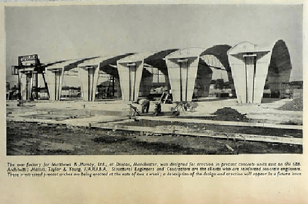
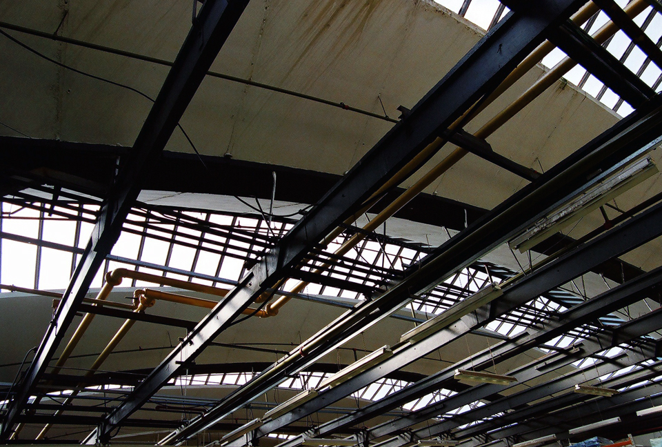
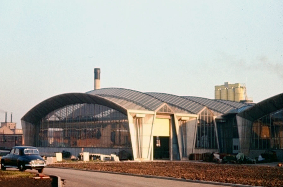
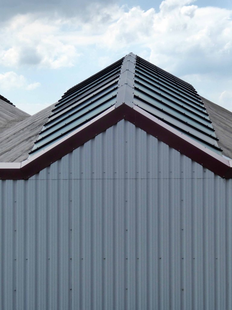
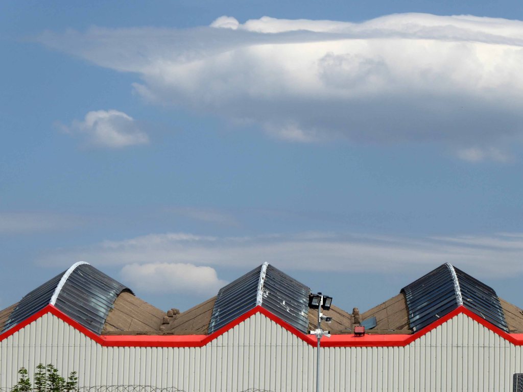
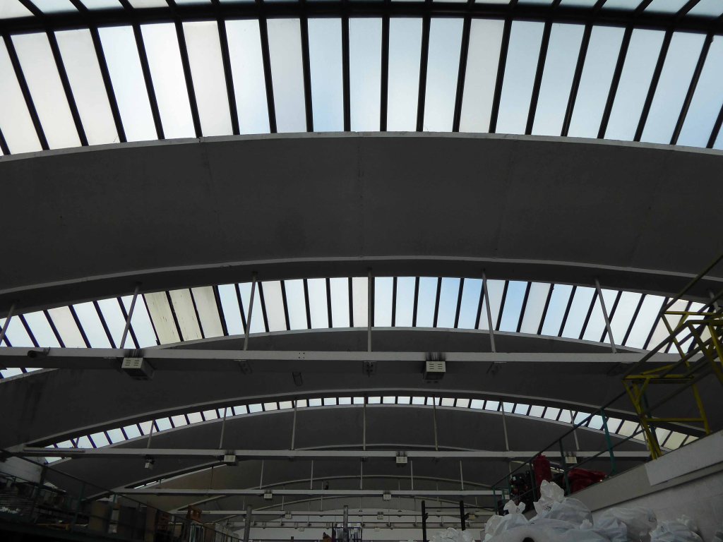
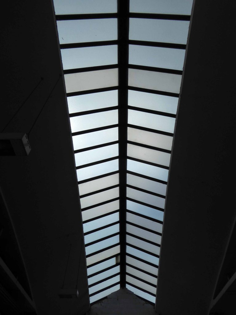
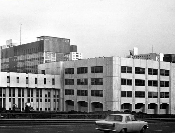
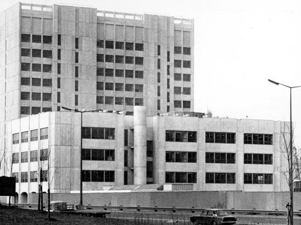
This former production plant for concrete components is now sadly partitioned and houses a number of businesses, only one of which still has a manufacturing base. The engineer for the project was also the client; reinforced concrete engineers, Matthews & Mumby. The intention was to create large floor areas, free from columns, to accommodate fourteen casting beds of about fifty metres in length. The structure of the two sheds was formed from arch units assembled on the ground, jacked into position and post-tensioned to form large tied span arches. Each arch spans approximately thirty metres and was designed to carry up to fourteen one tonne loads along the monorail hangers that ran the length of the factory, centred to each casting bed and suspended from the arches. Lantern section glazing hugs the curve of the arches that act as a reflective surface to provide an even light across the factory floor. The rails and hangers added a further louvered filter to the light, described at the time as ‘the ‘venetian blind’ effect. Originally the elevation between the V shaped columns was also glazed, this has now been filled and significantly reduces the aesthetic presence of the exposed structure and a distinctly ‘modern’ building of the time.
Mainstream Modern – my thanks to Richard Brook for the text and archive images.
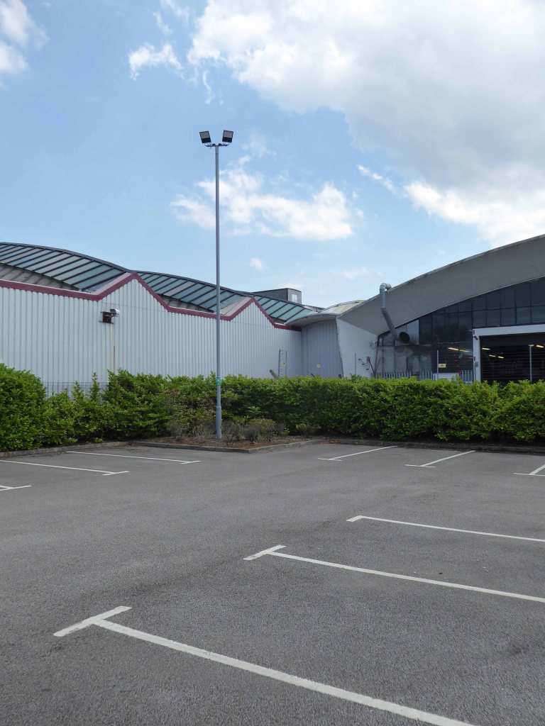
So one sunny day last week, on a lockdown walk I went to take a look around.
The addition of cladding is never an uplifting sight on any site – the integrity of the building is seriously challenged.
Sometimes a former Rehabilitation Centre can do without rehabilitation it seems.
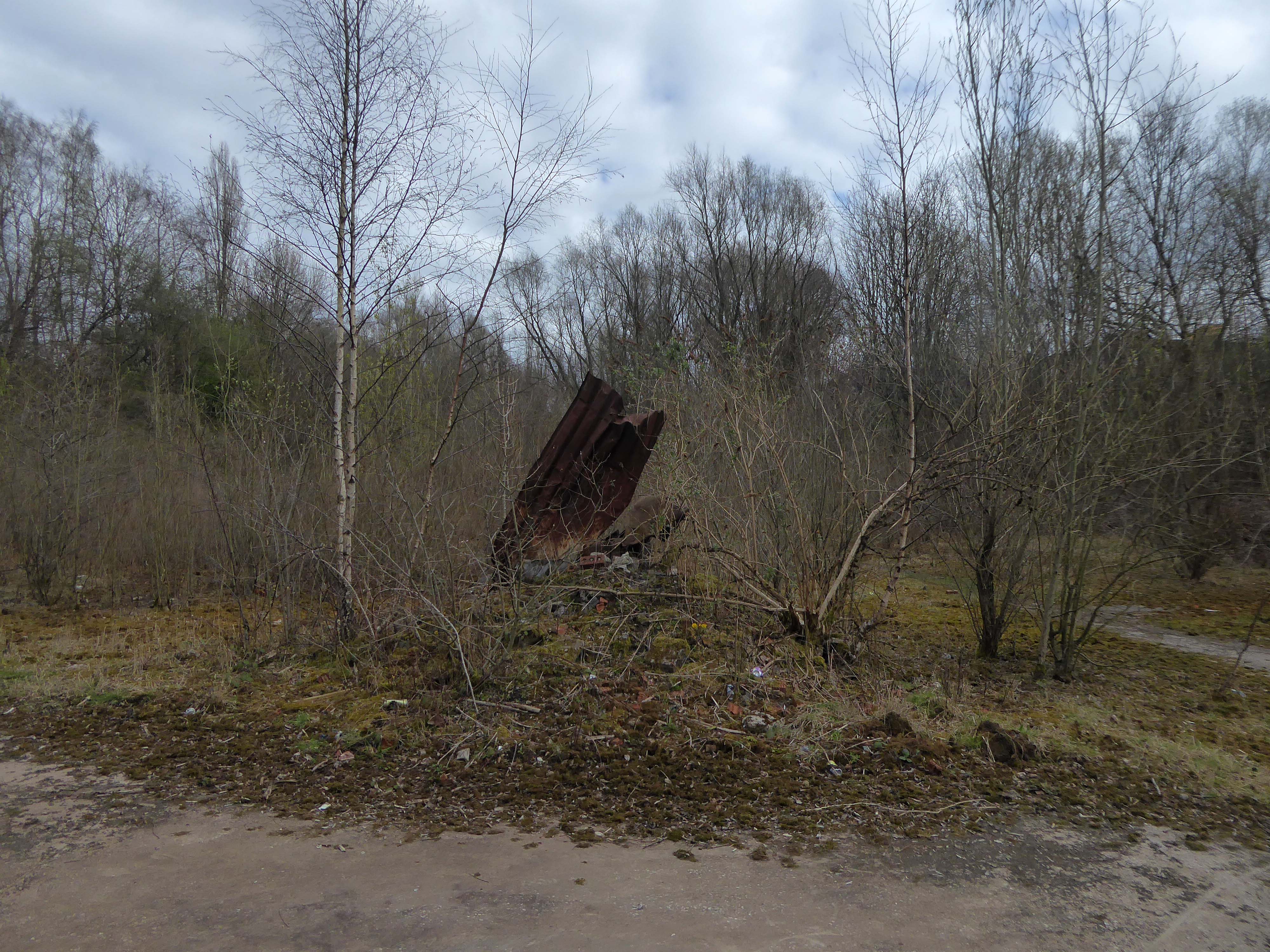
He reached the foot of the embankment, and waved with one arm, shouting at the few cars moving along the westbound carriageway. None of the drivers could see him, let alone hear his dry-throated croak, and Maitland stopped, conserving his strength. He tried to climb the embankment, but within a few steps collapsed in a heap on the muddy slope.
Deliberately, he turned his back to the motorway and for the first time began to inspect the island.
Maitland, poor man, you’re marooned here like Crusoe – If you don’t look out you’ll be beached here for ever. He had spoken no more than the truth. This patch of abandoned ground left over at the junction of three motorway routes was literally a deserted island.
JG Ballard Concrete Island
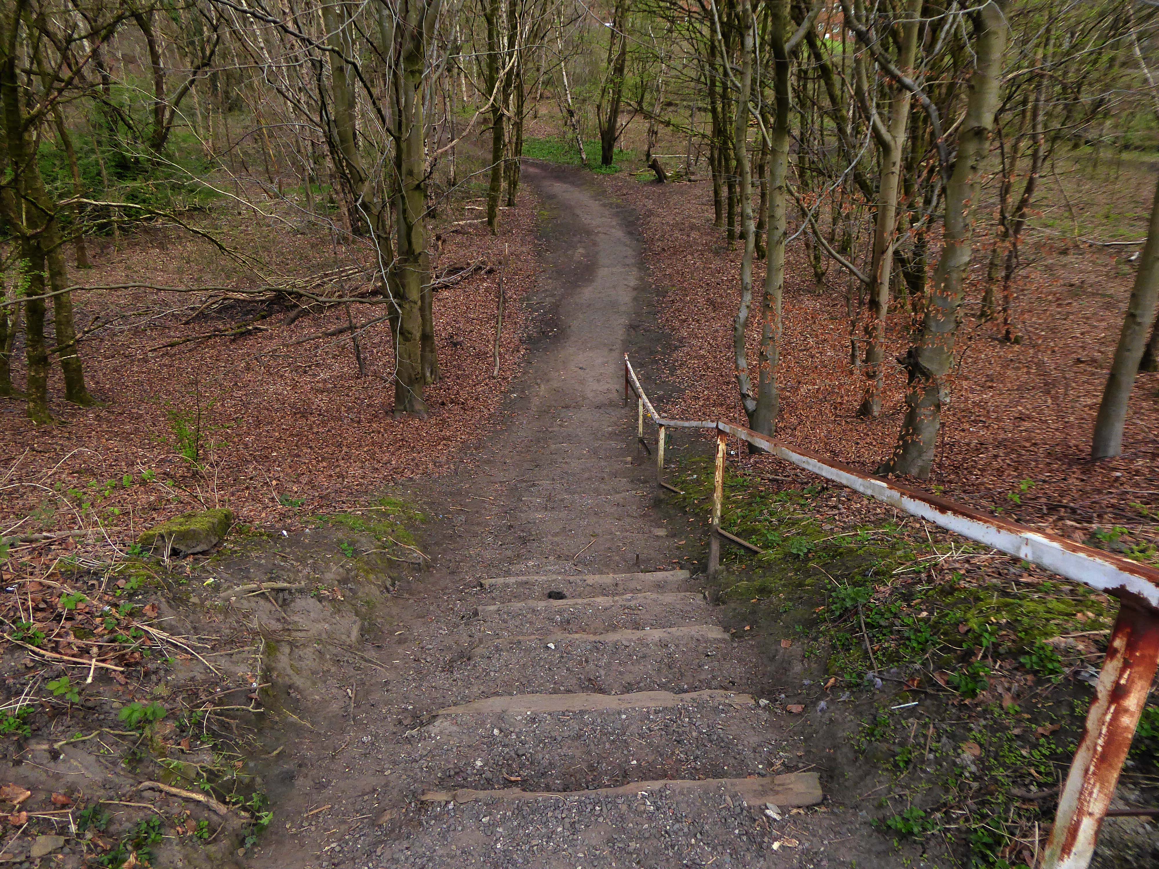
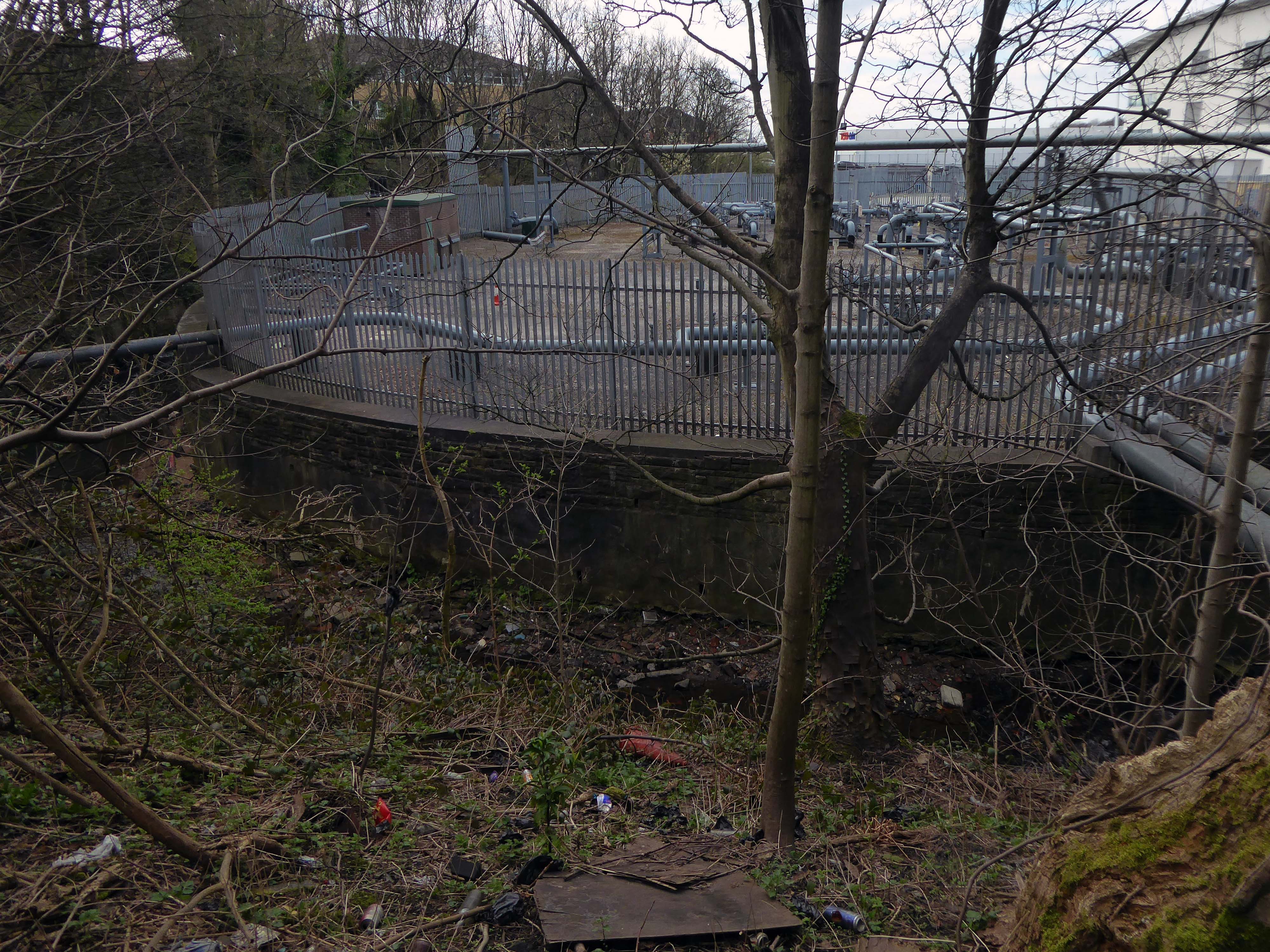
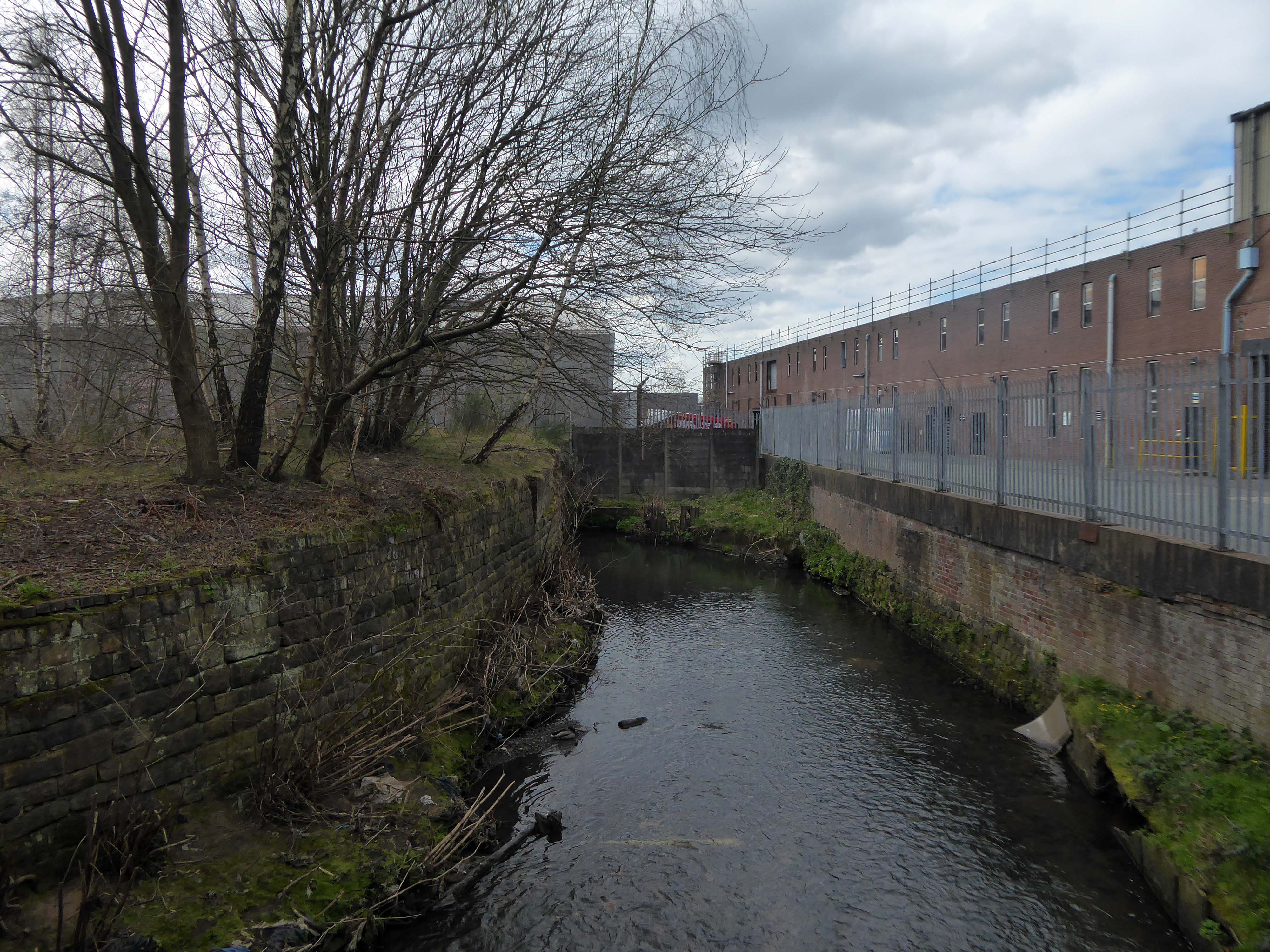
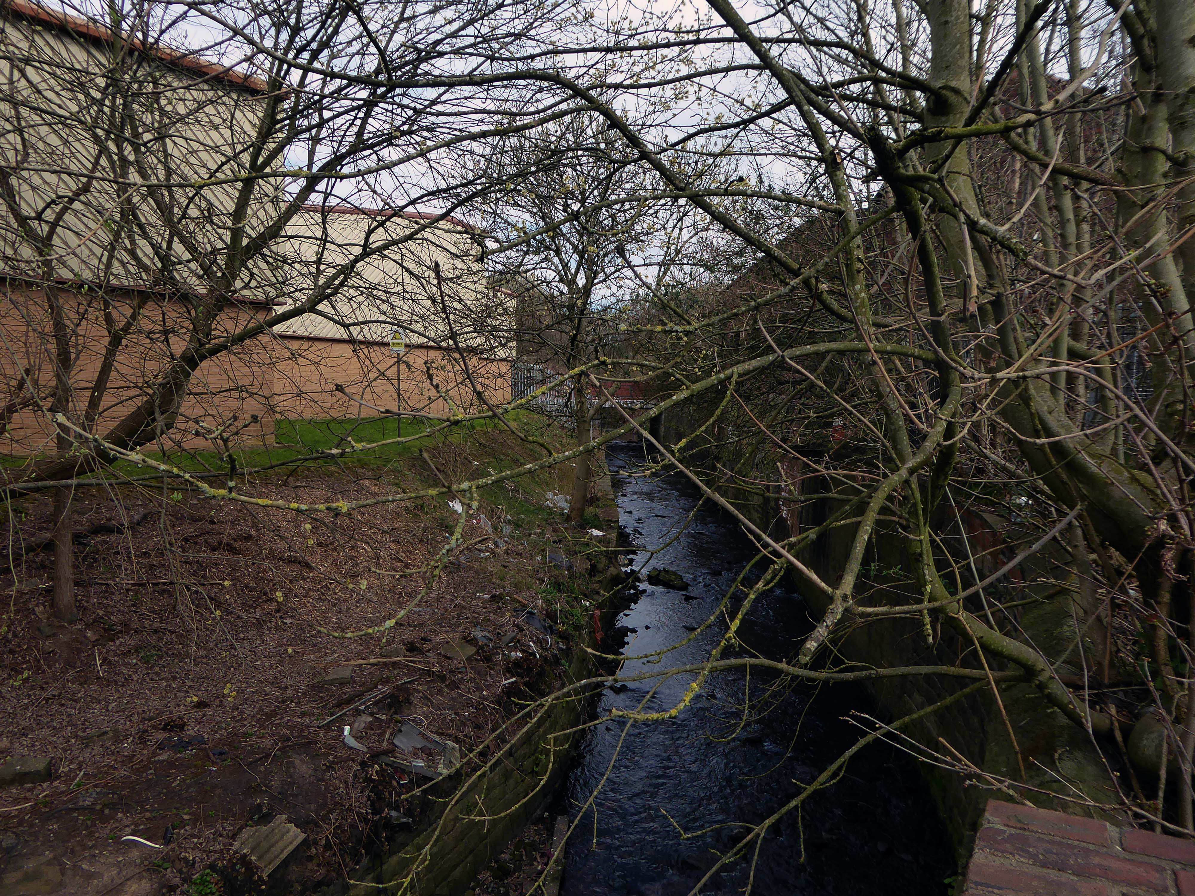
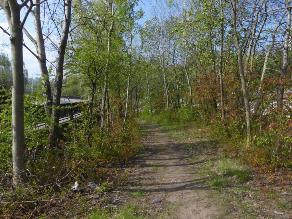
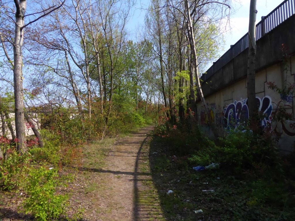
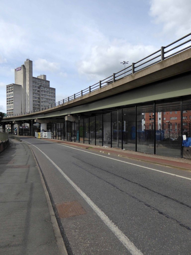
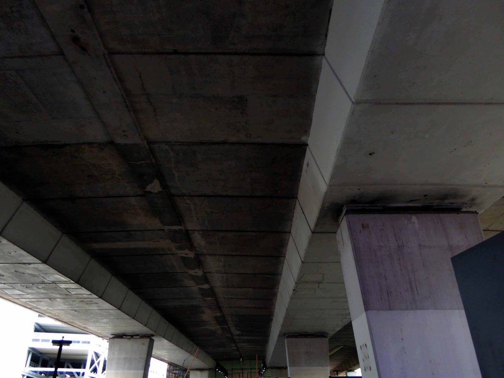
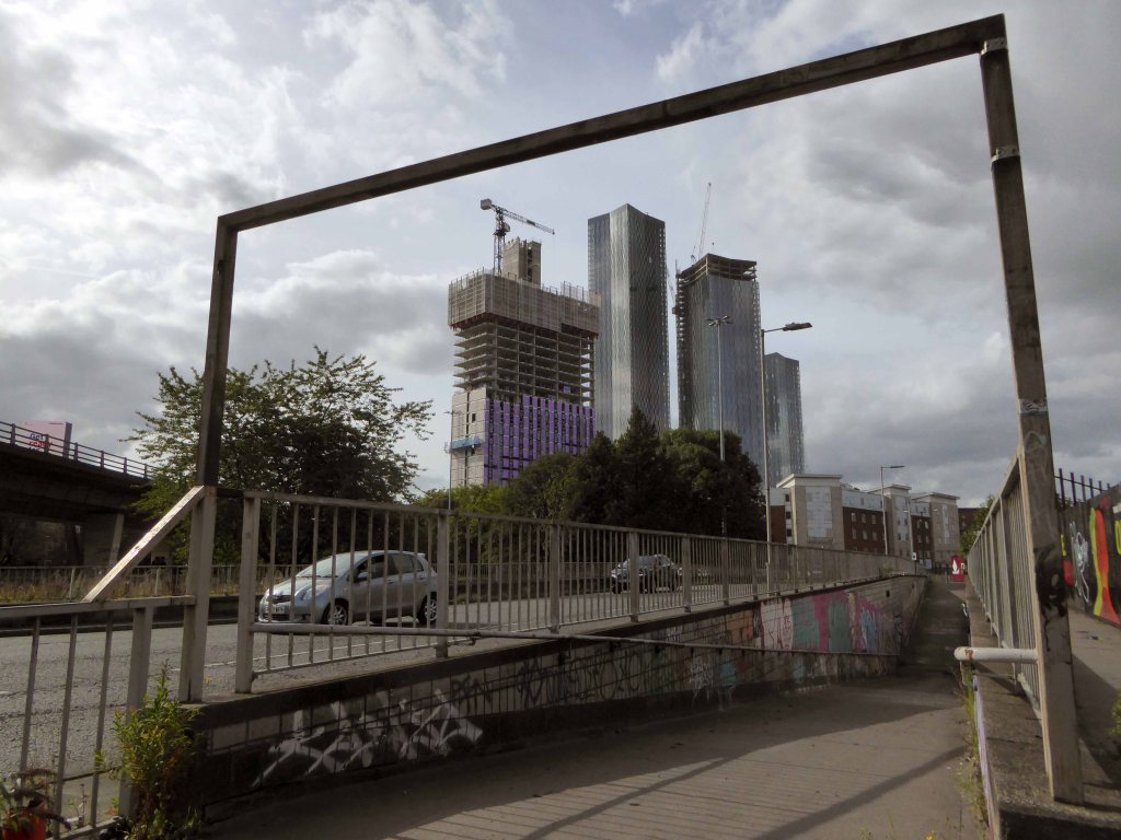
I’m in a different place – the same but different, whilst out walking I went through an open gate, following a well worn path, for the very first time.
Leading who knows where.
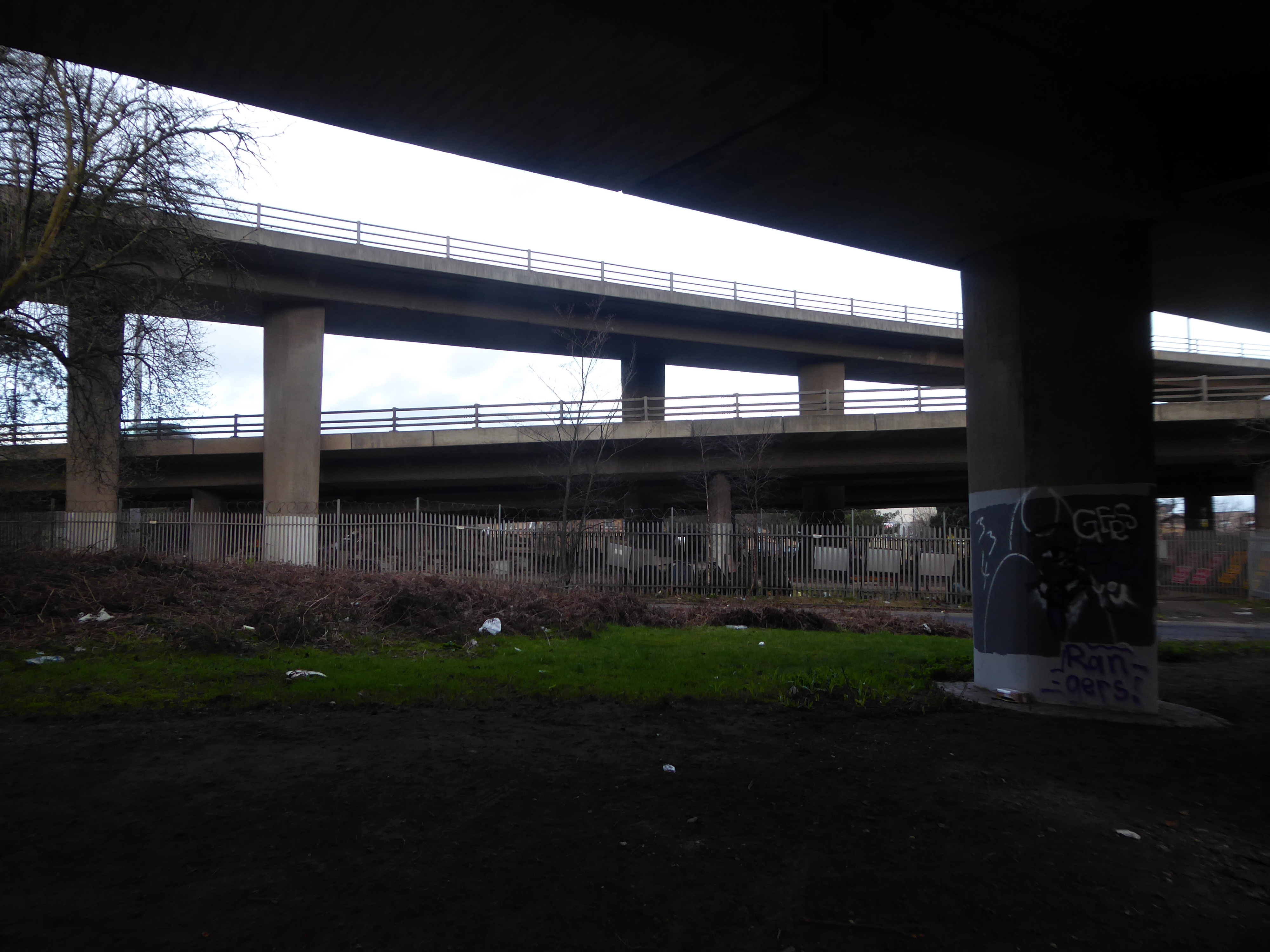
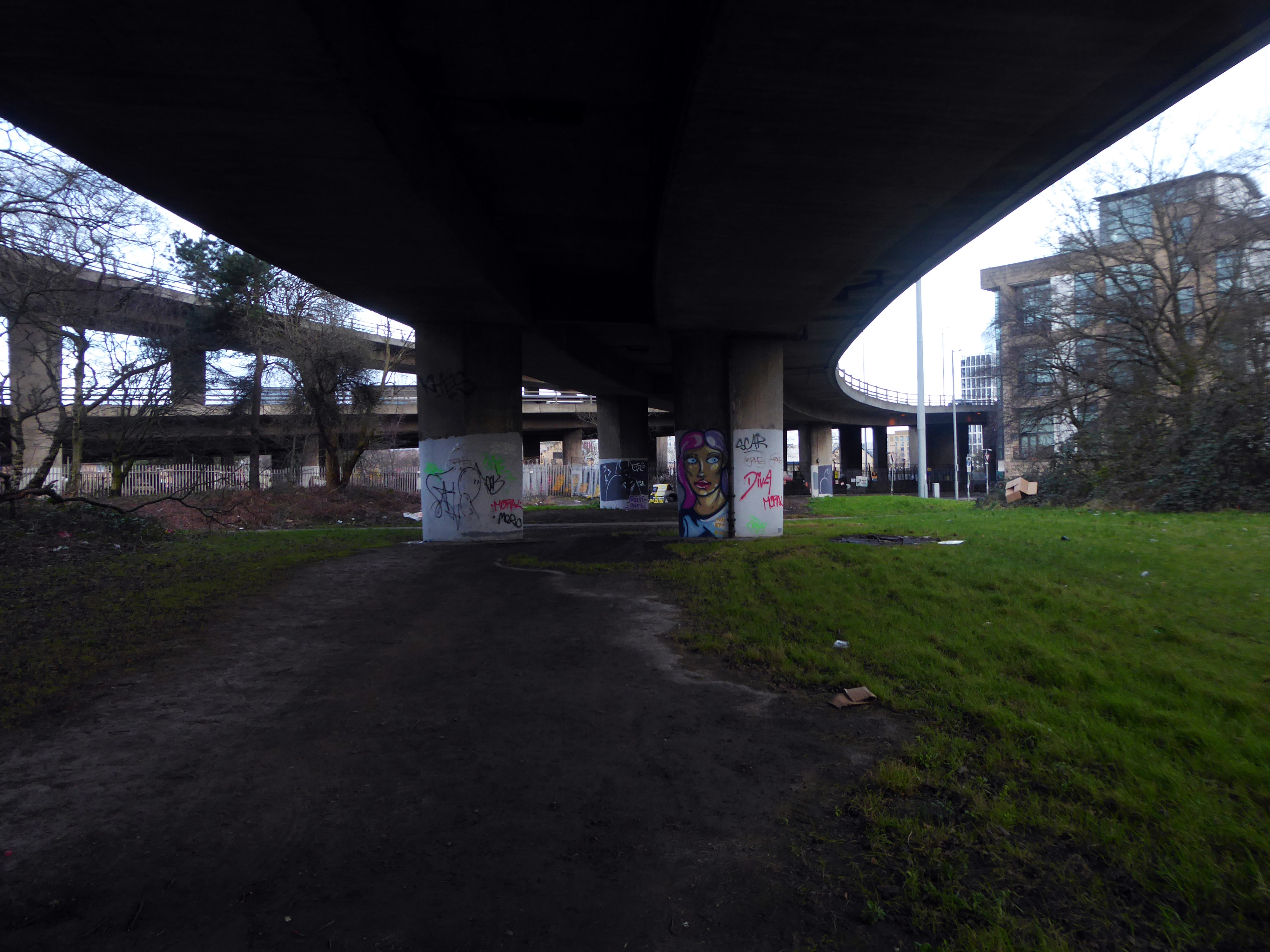
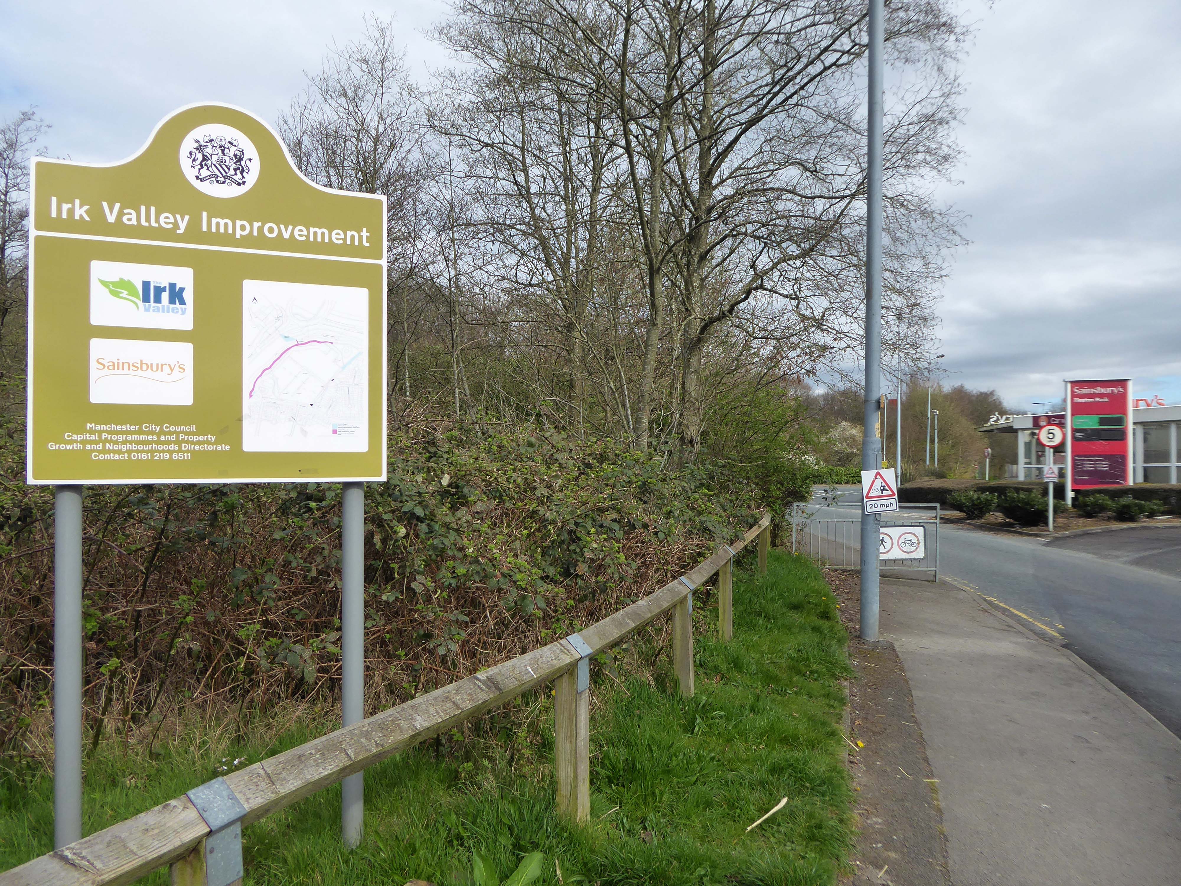
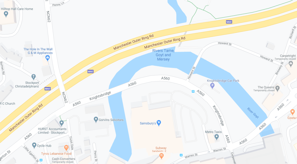
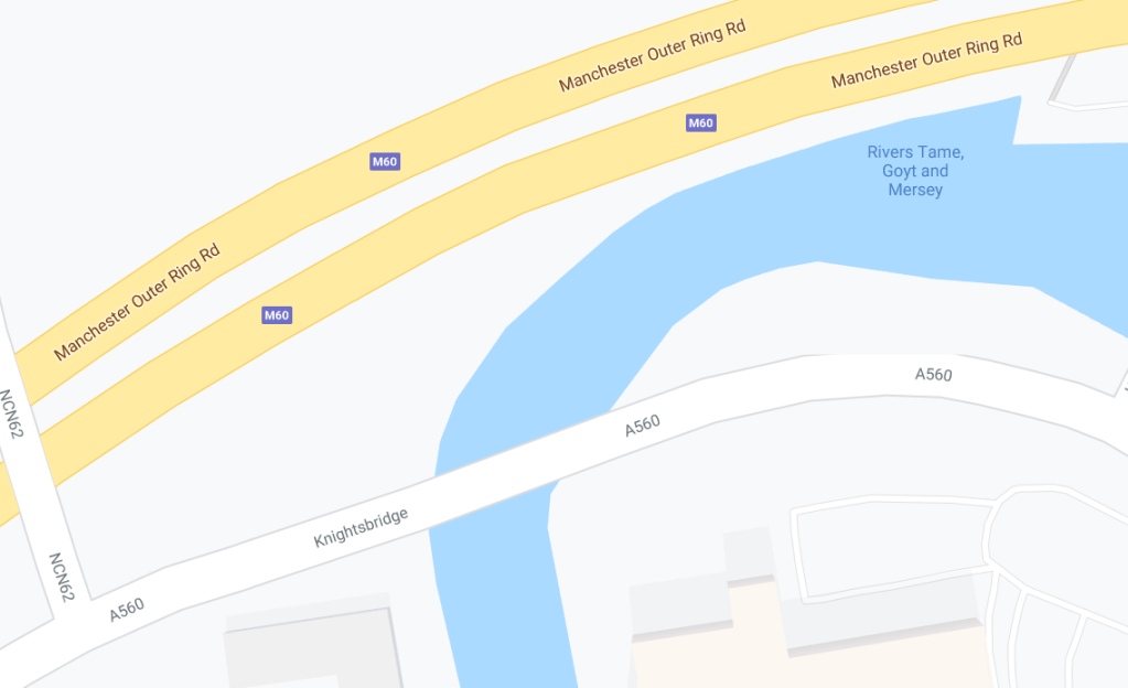
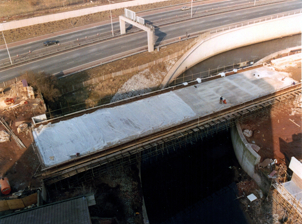
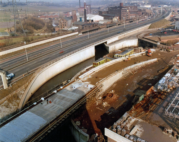
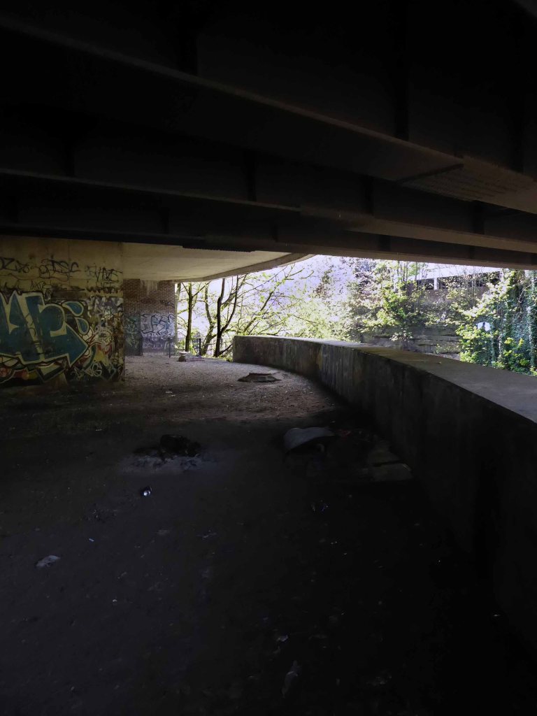
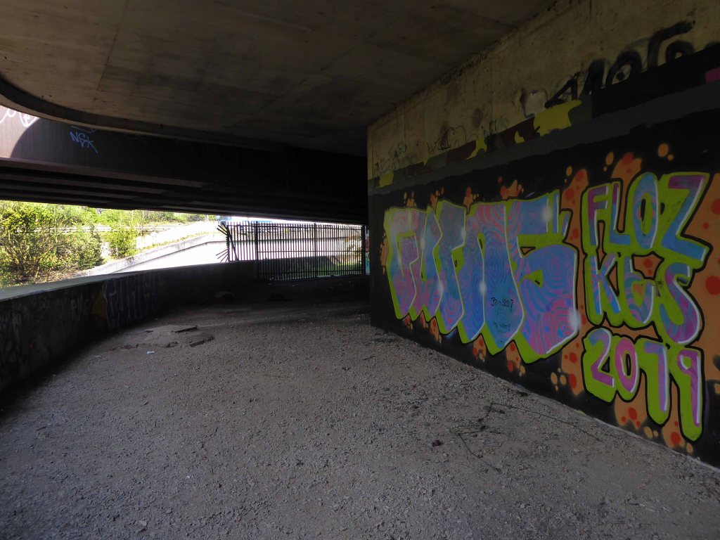
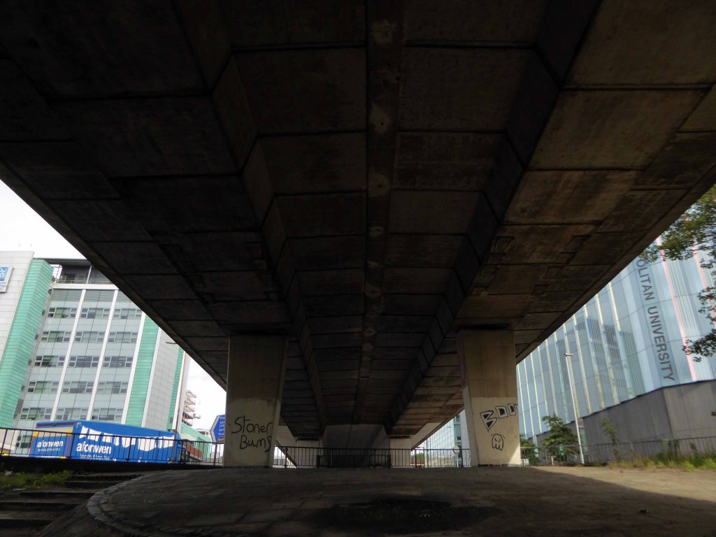
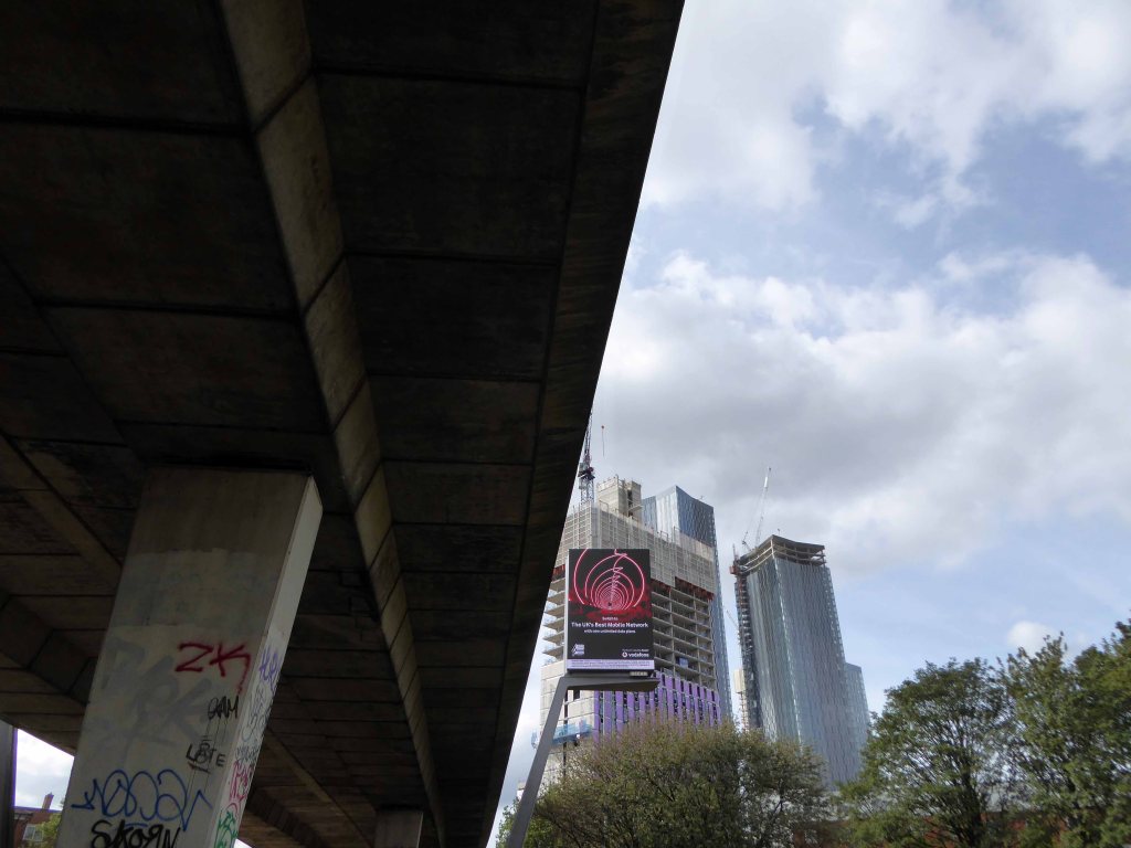
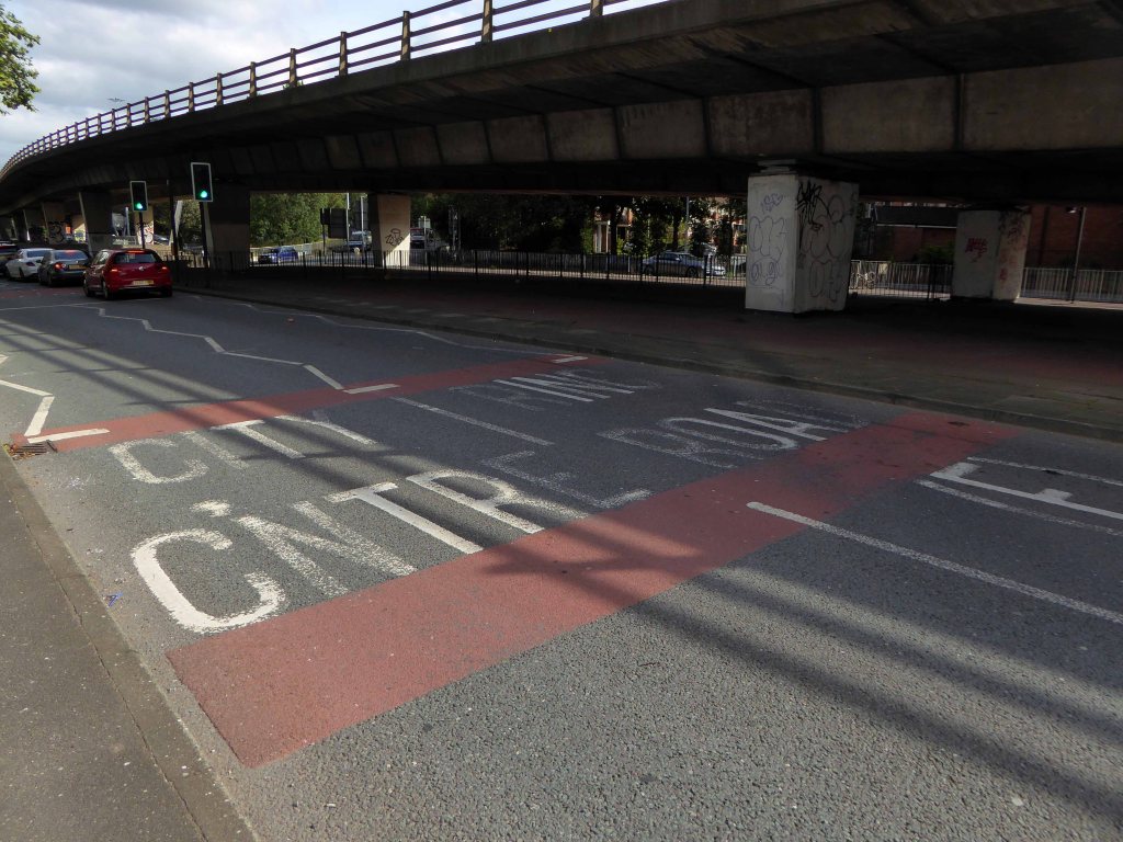
The confluence of three rivers, the meeting of motorway and main road.
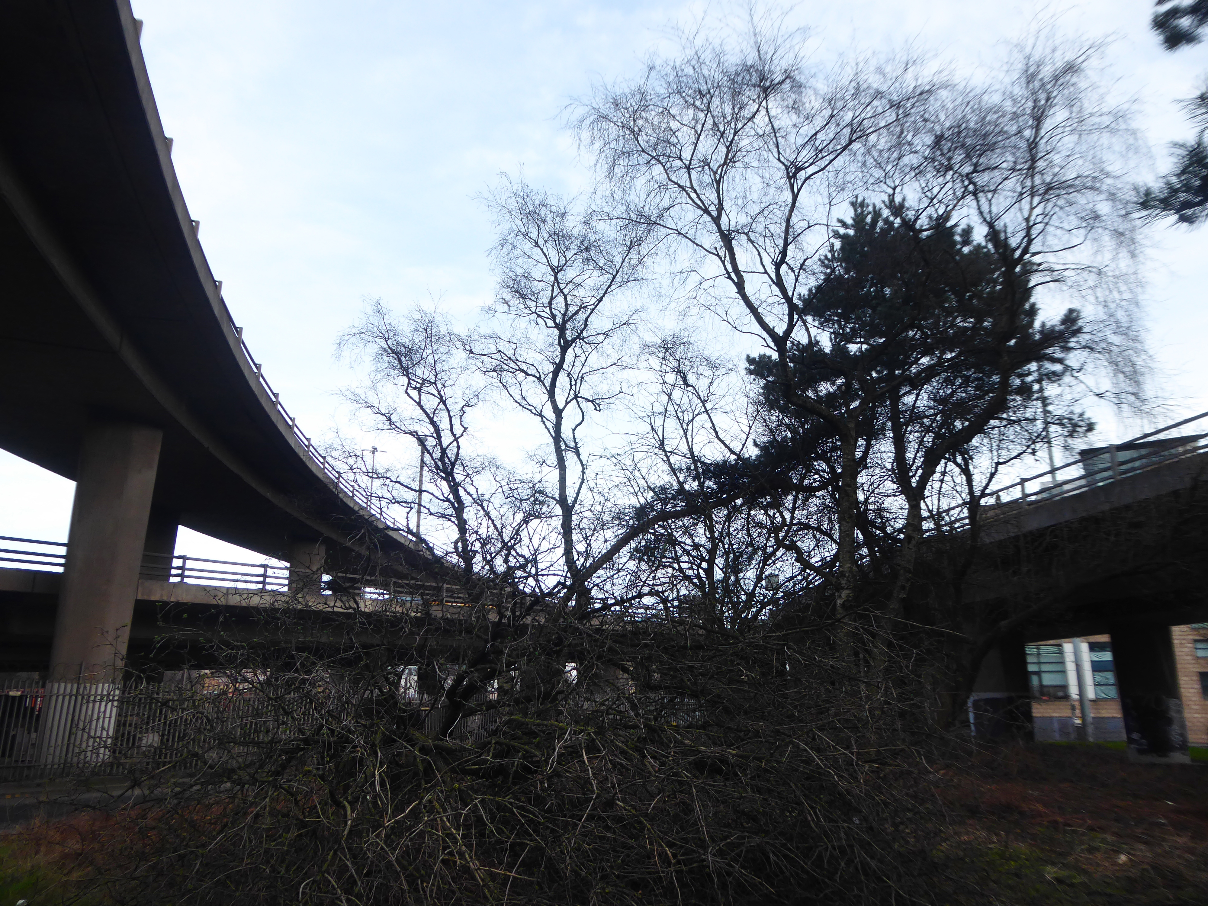
I ventured further – where if anywhere are we going?
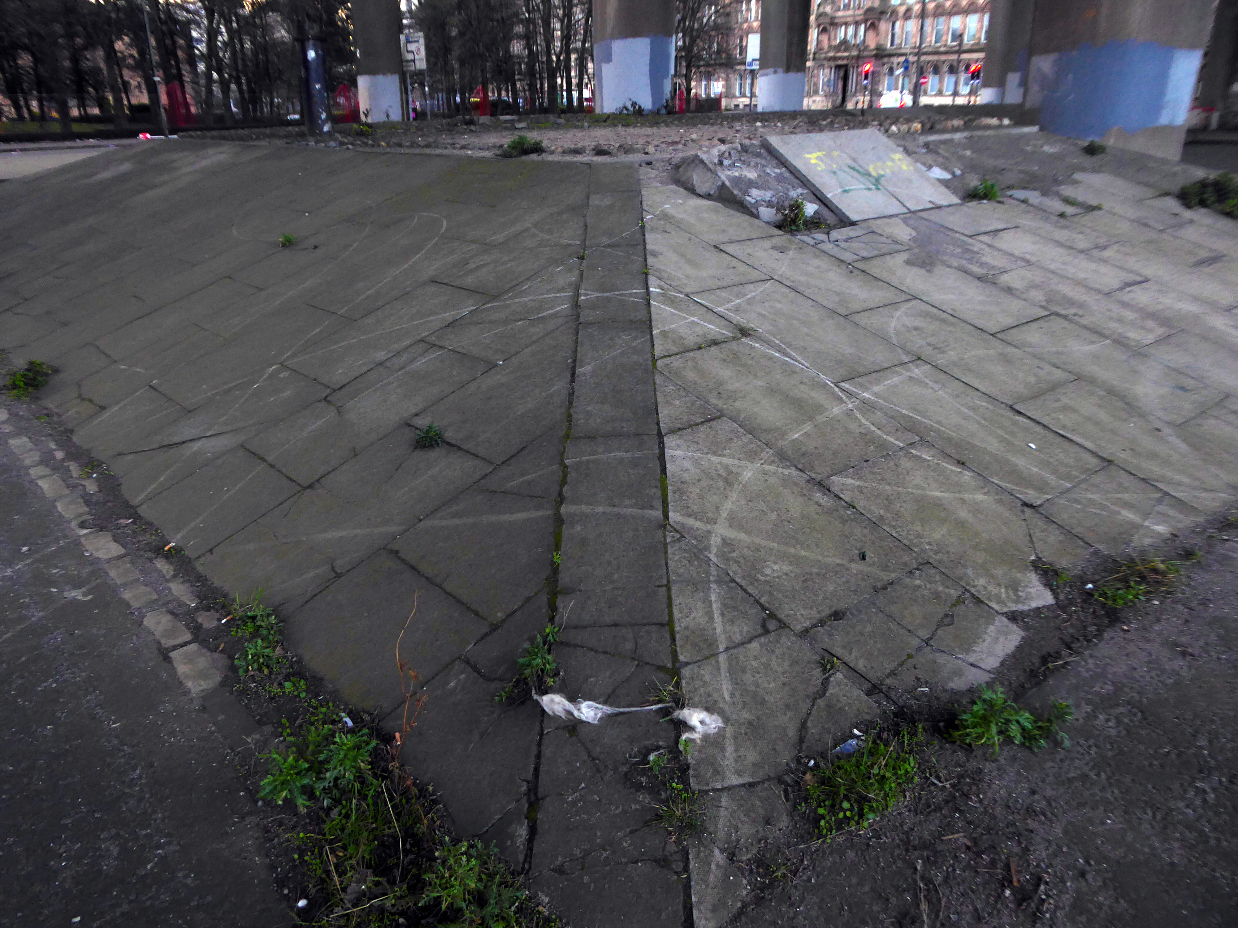
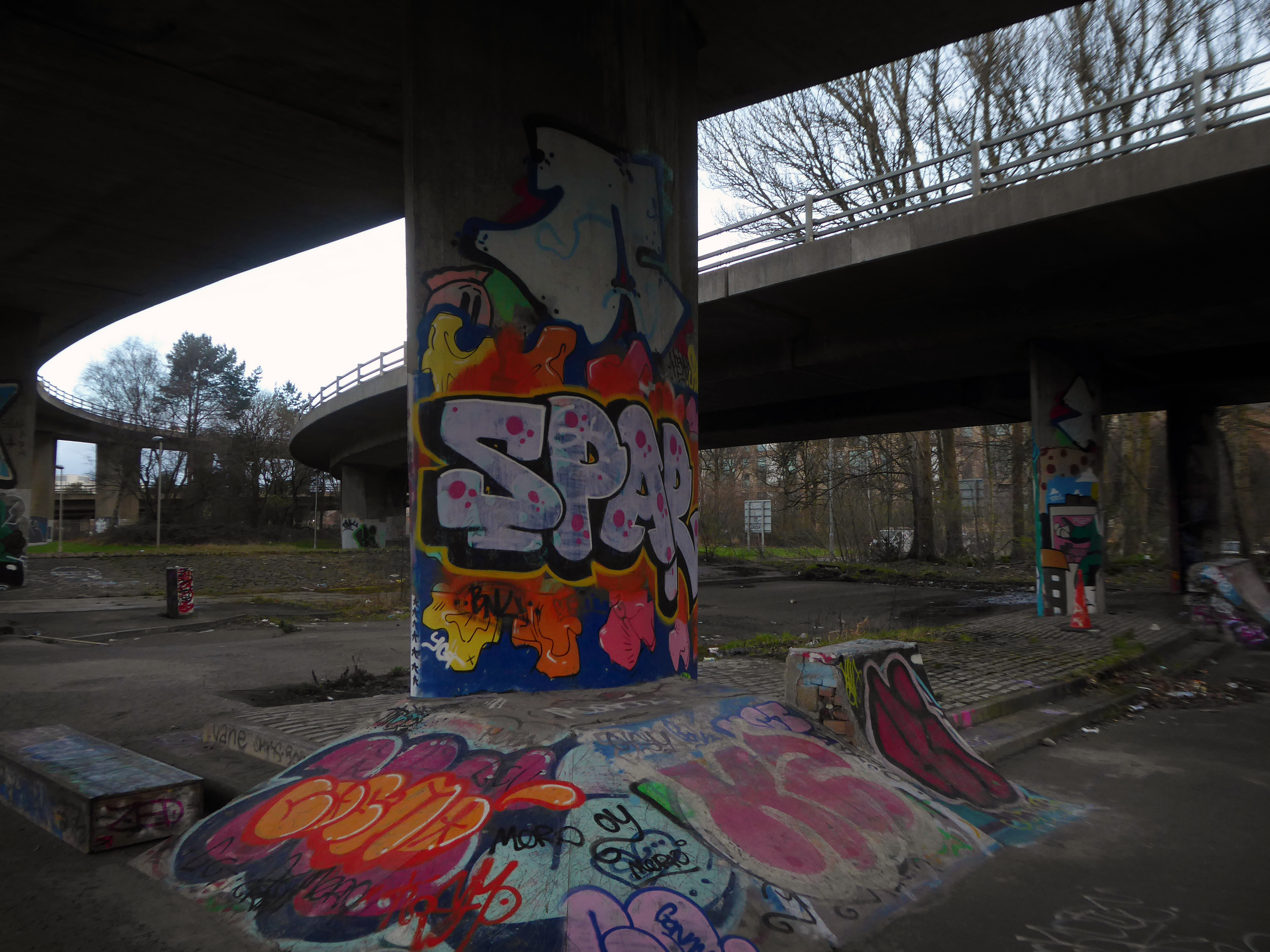
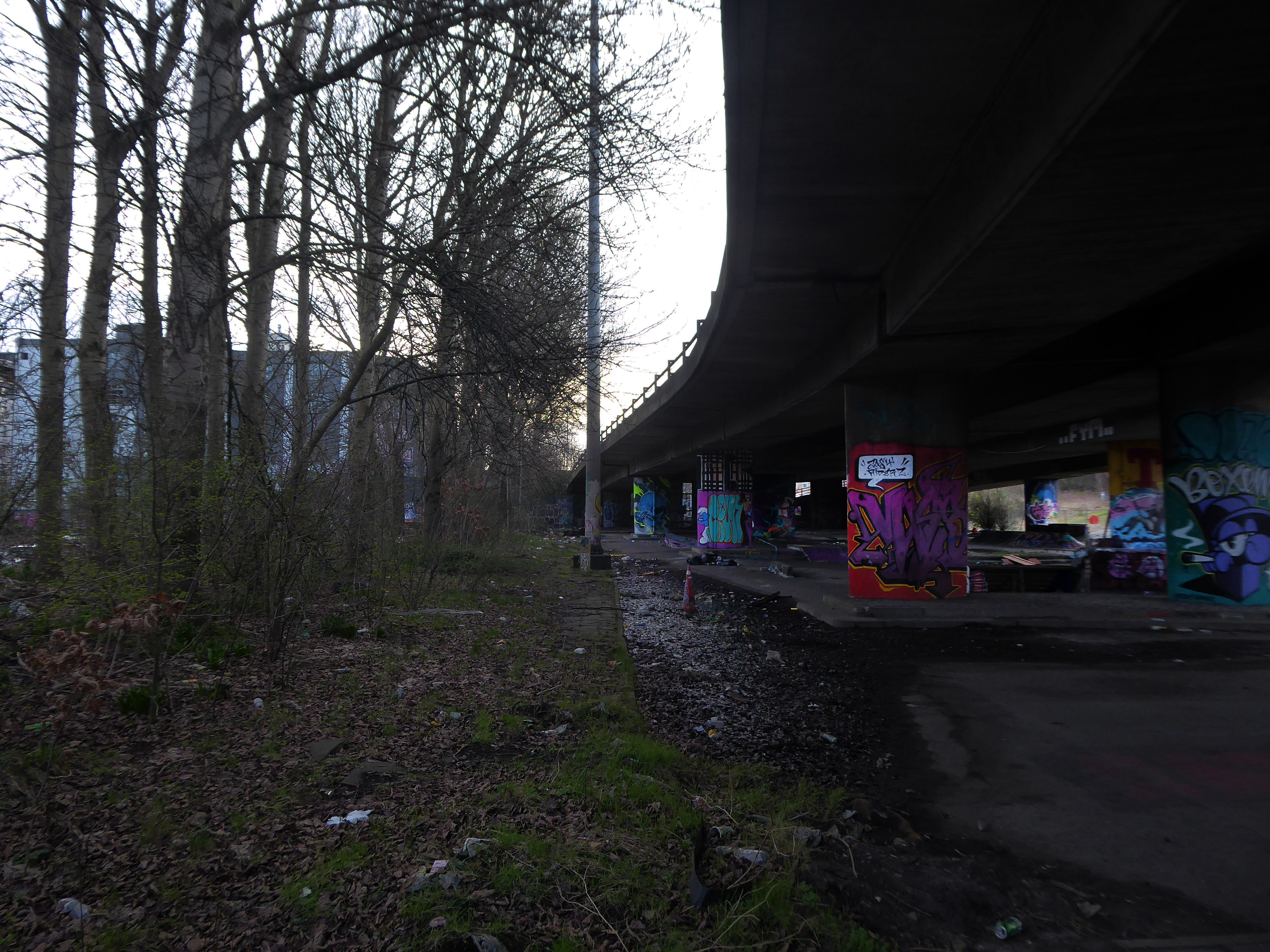
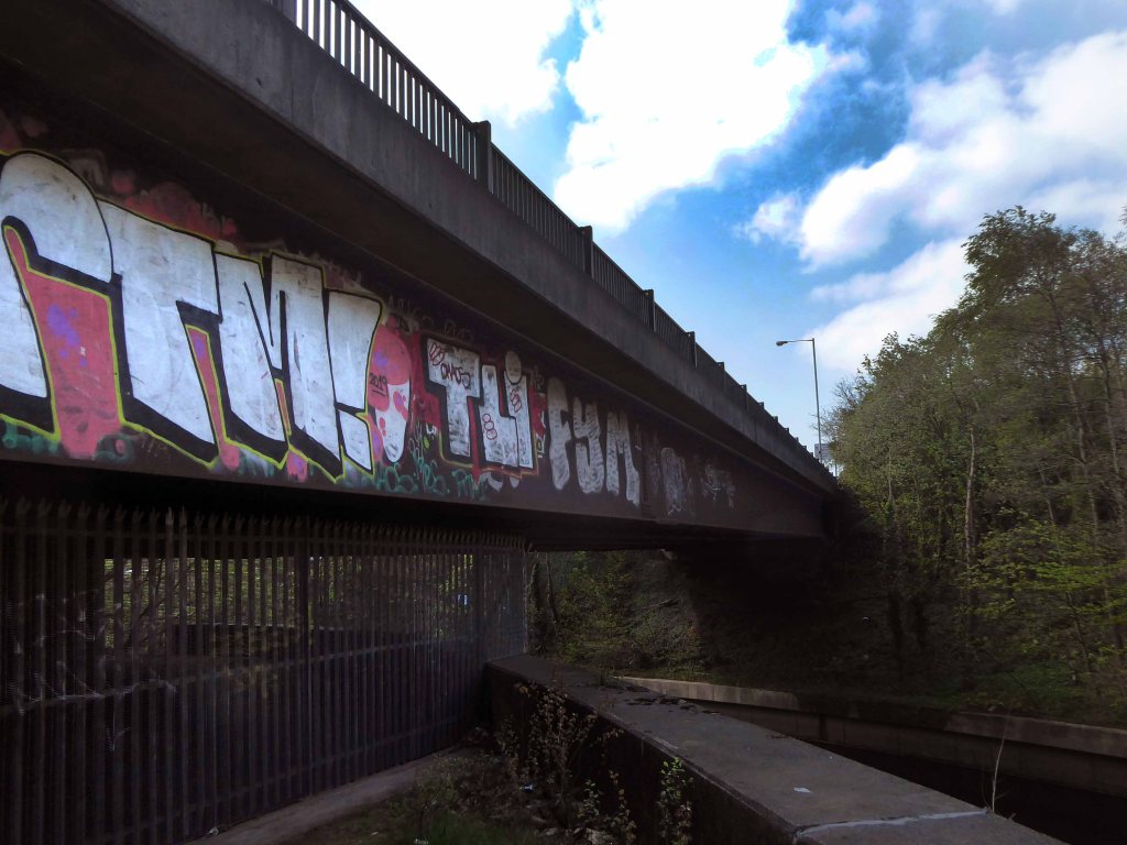
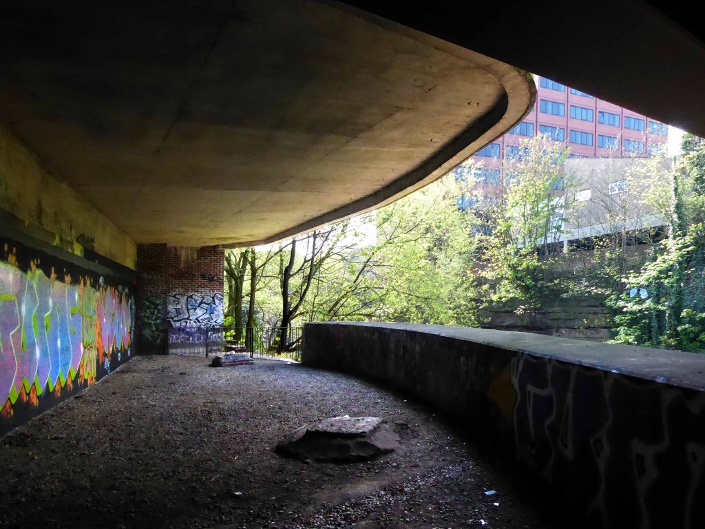
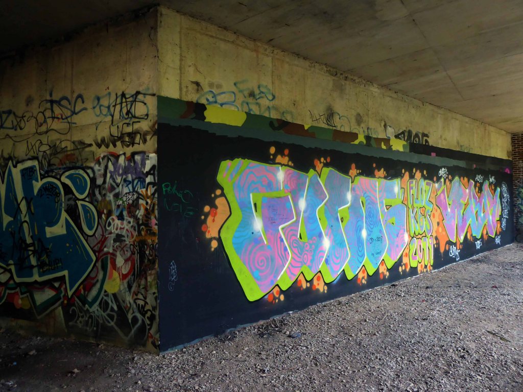
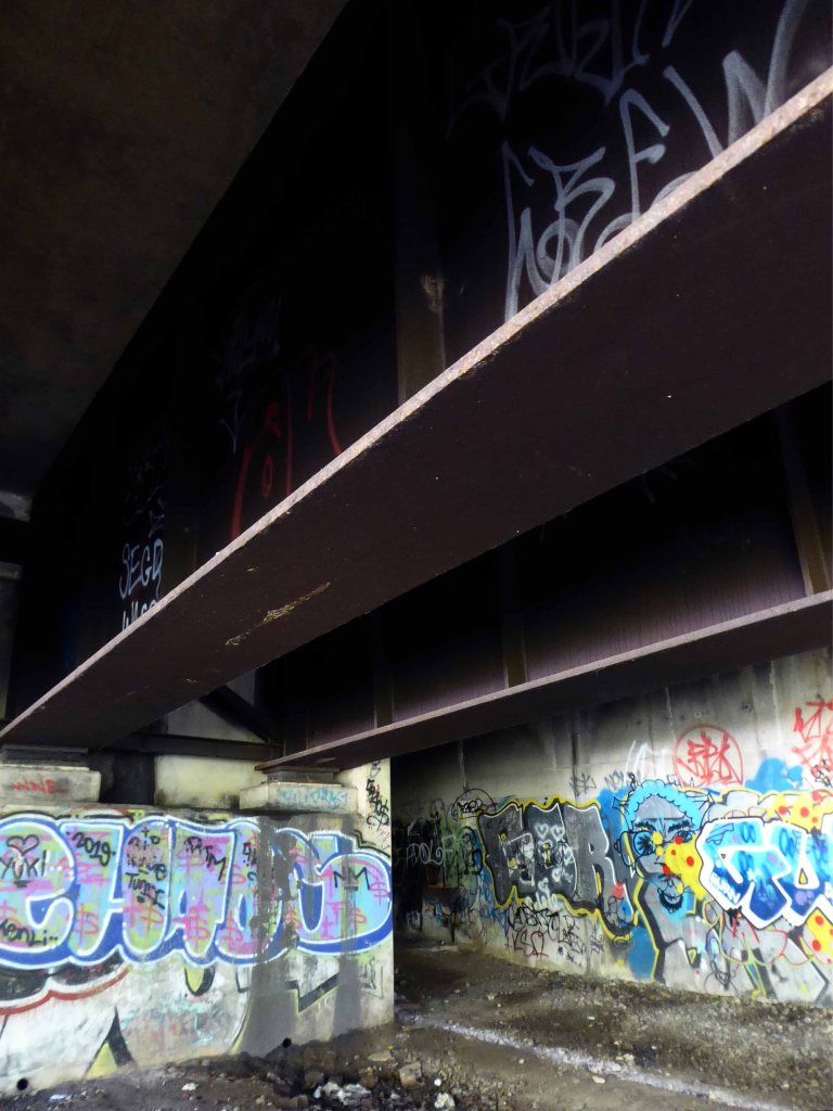
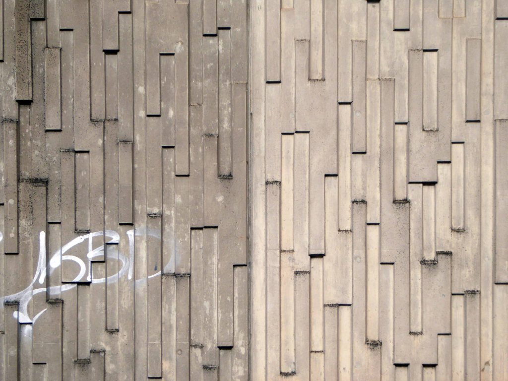
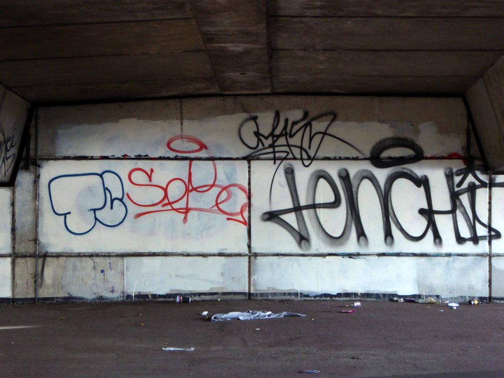
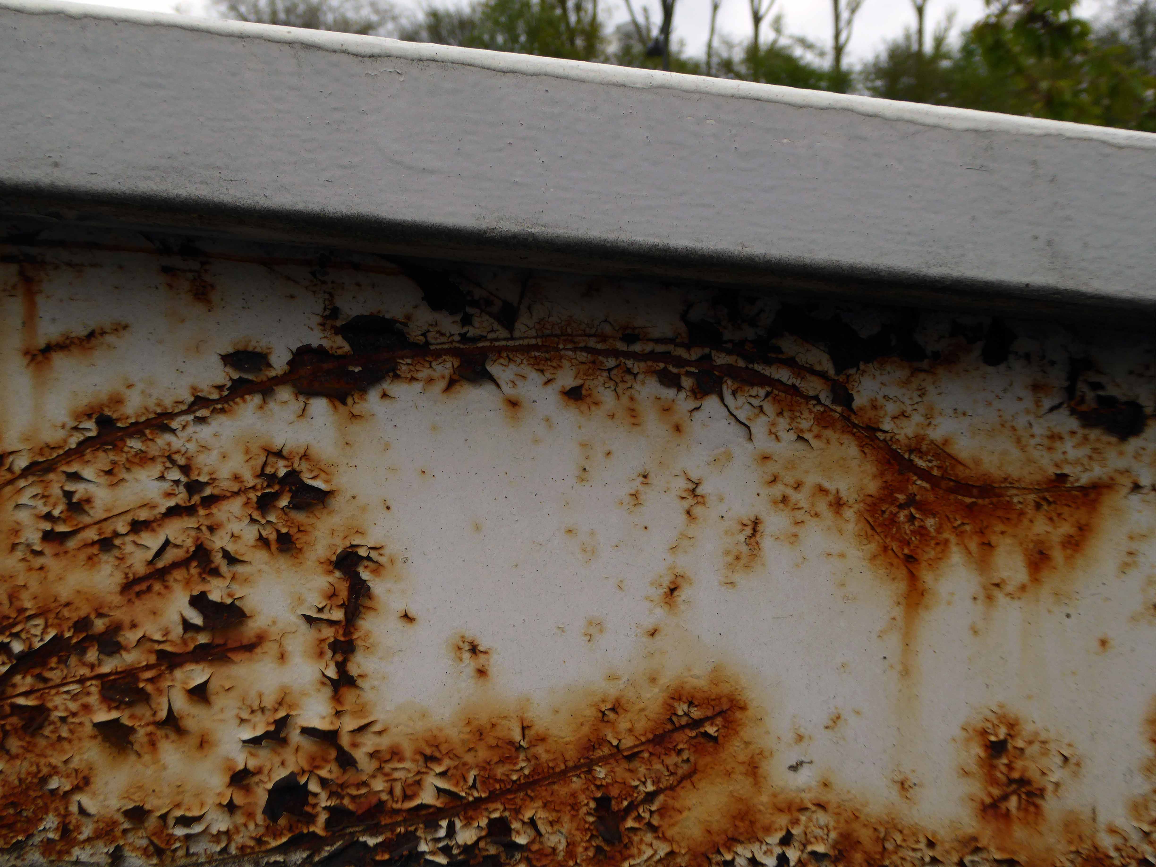
This tight tree lined and paint daubed triangle offers no answers.
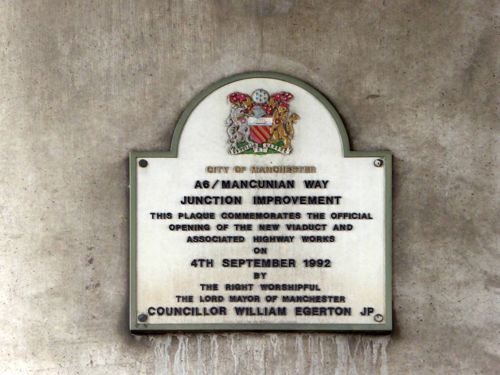
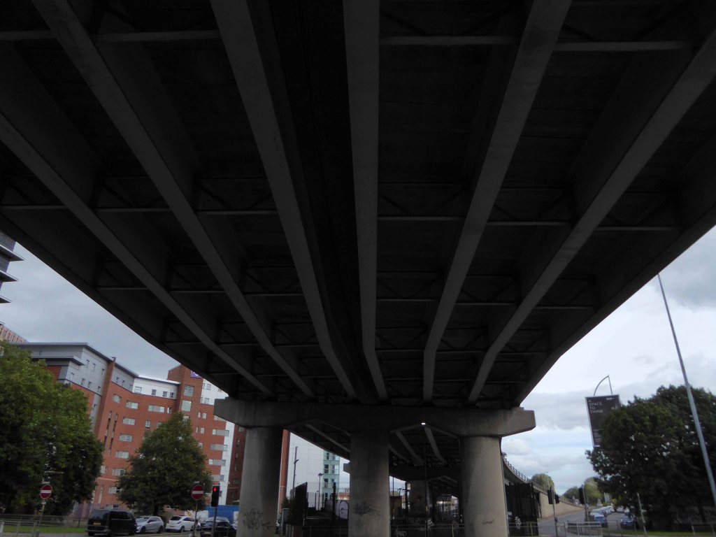
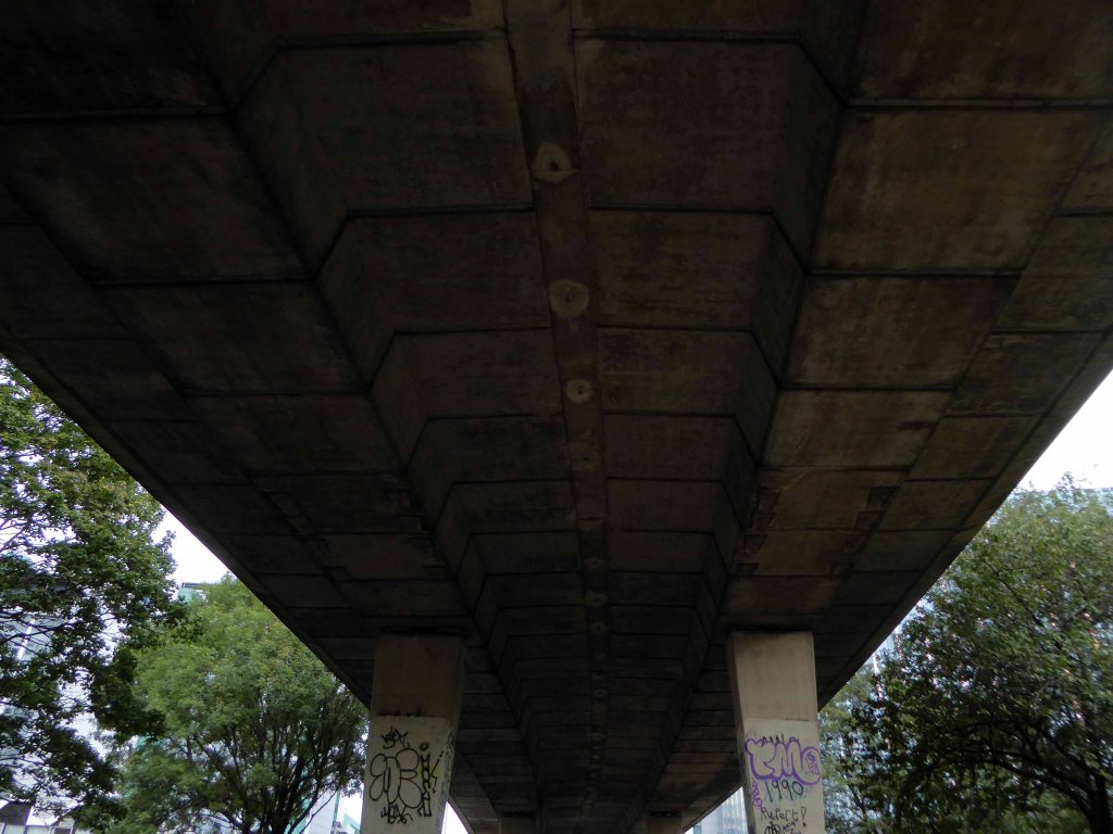
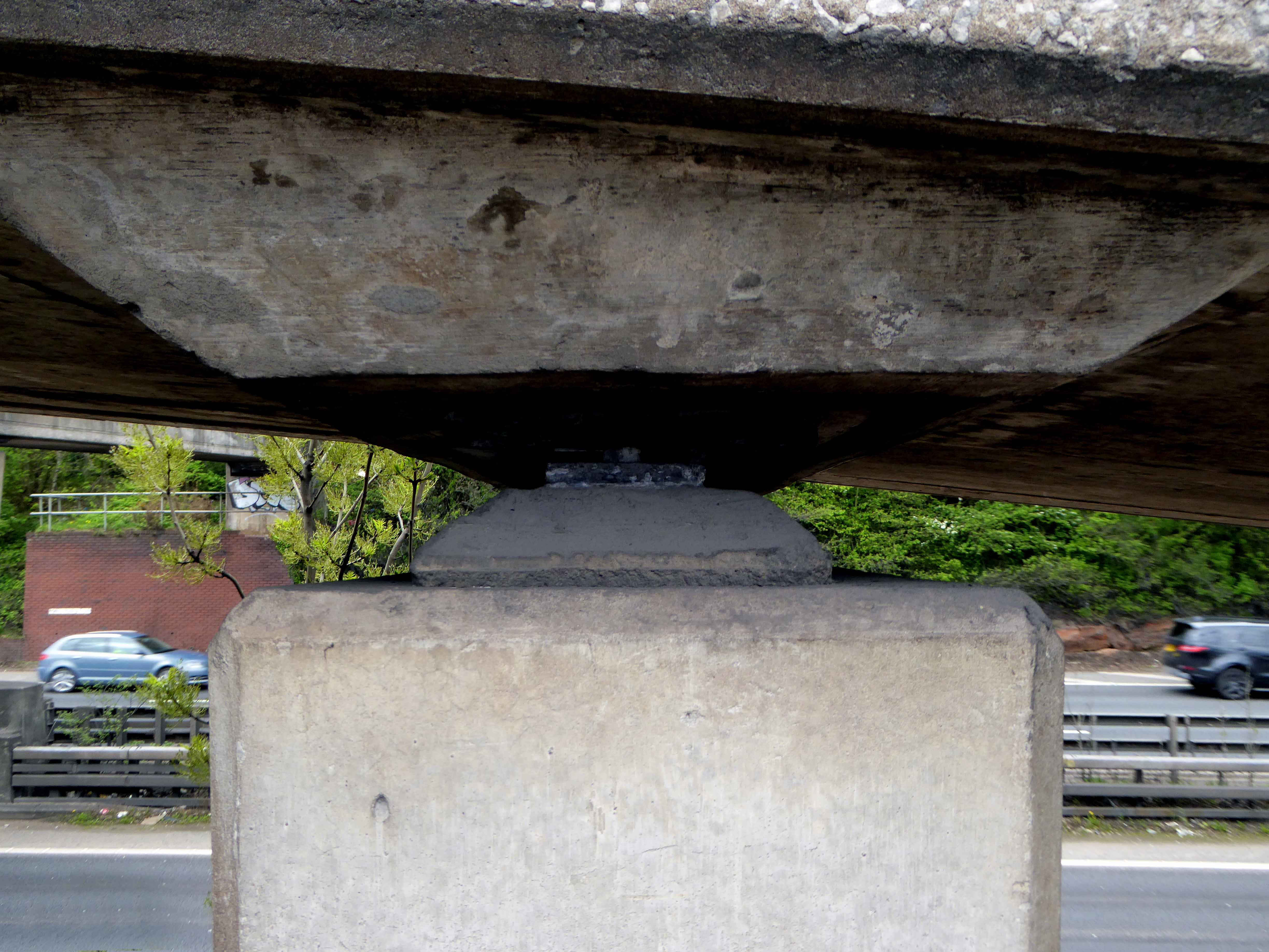
Tamed thirty years or so ago, with concrete and steel.
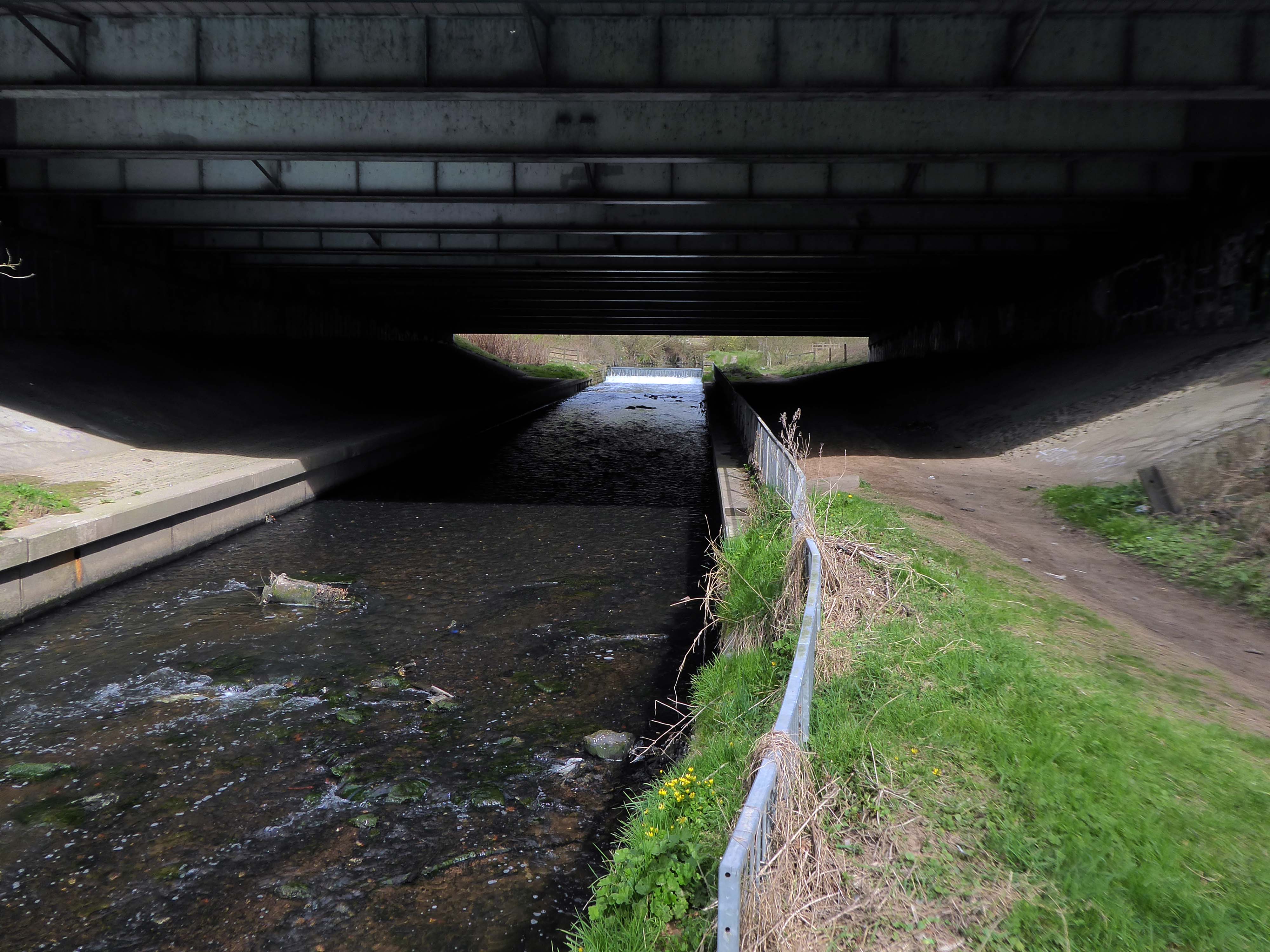
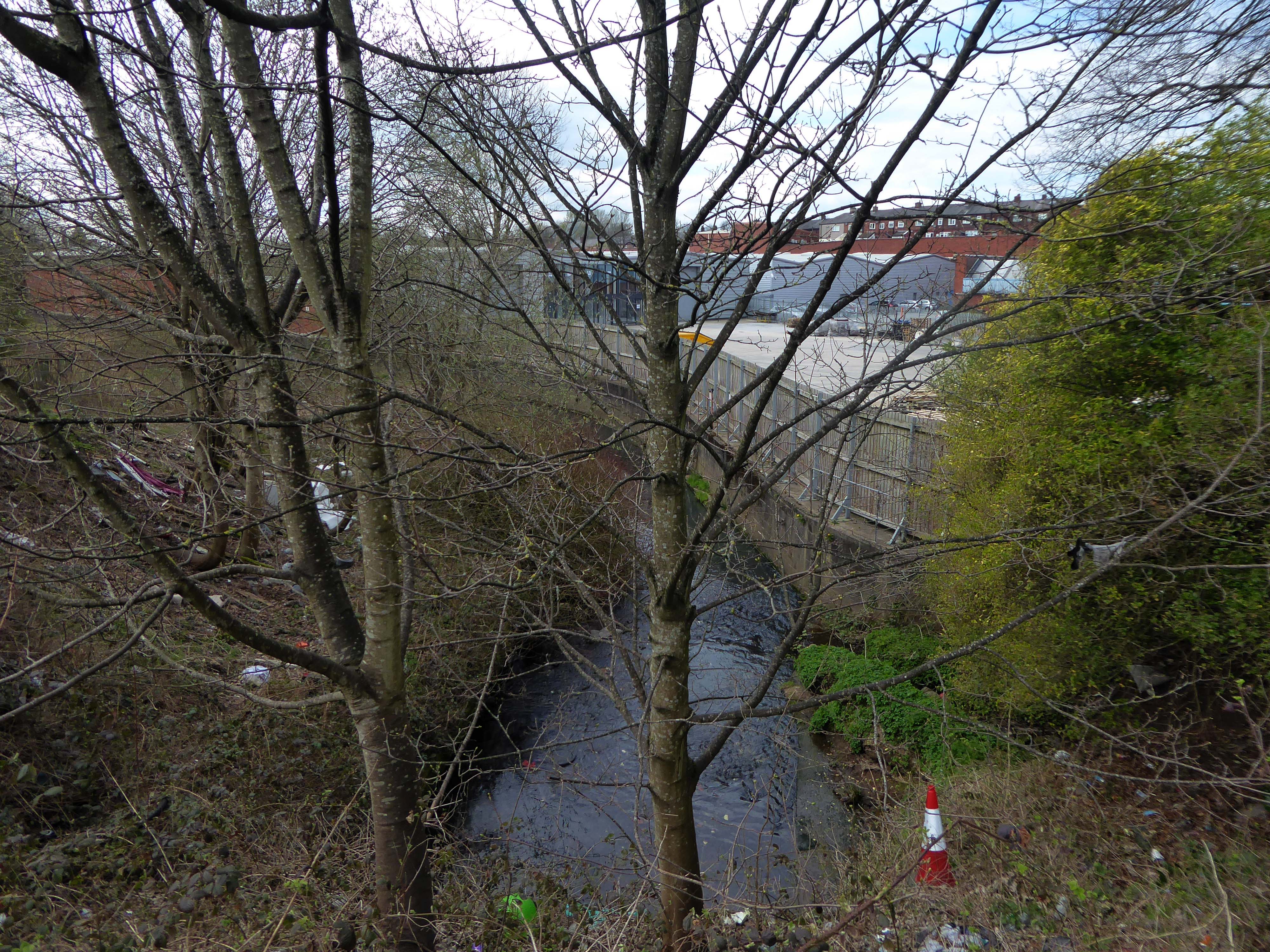
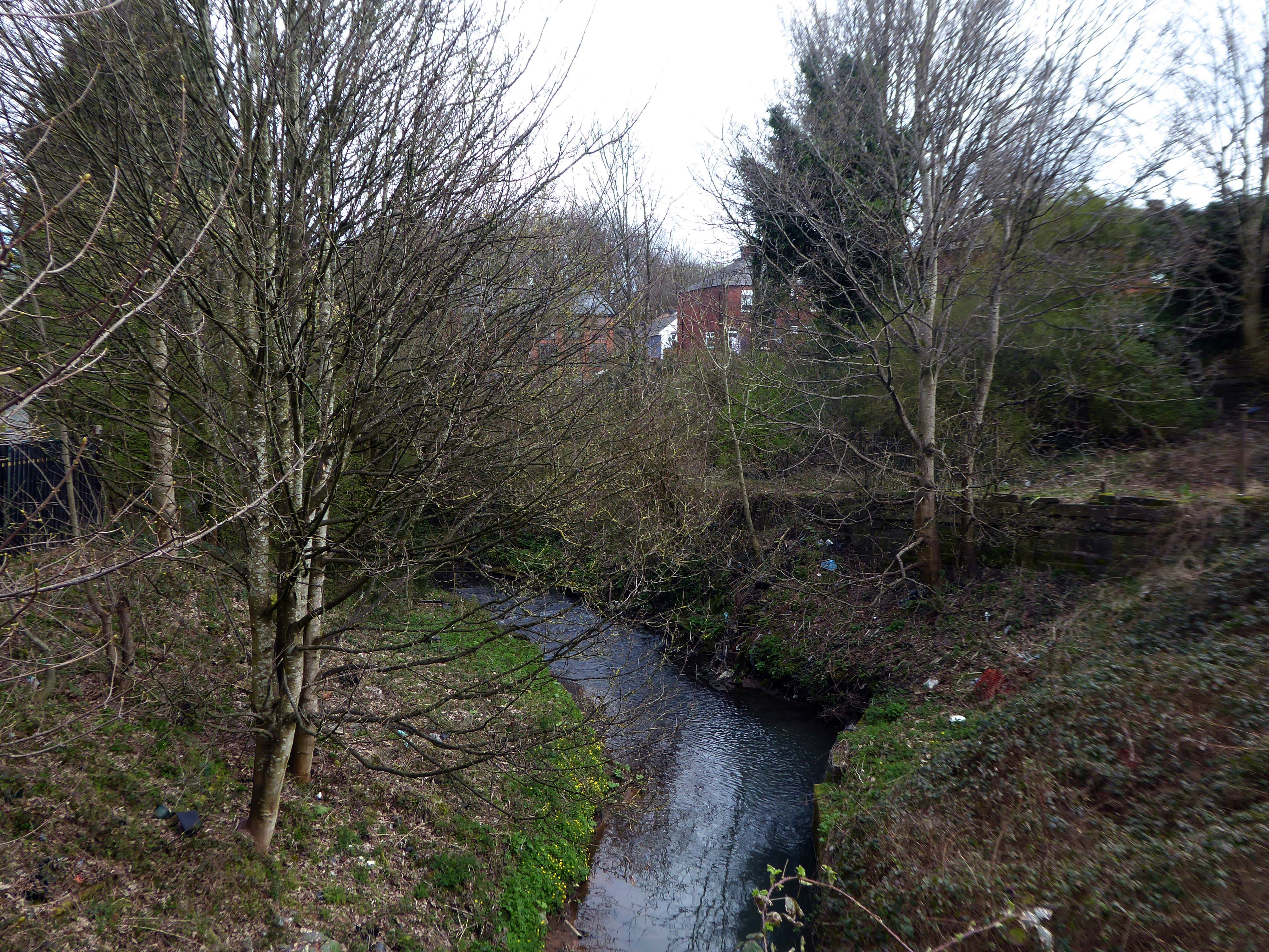
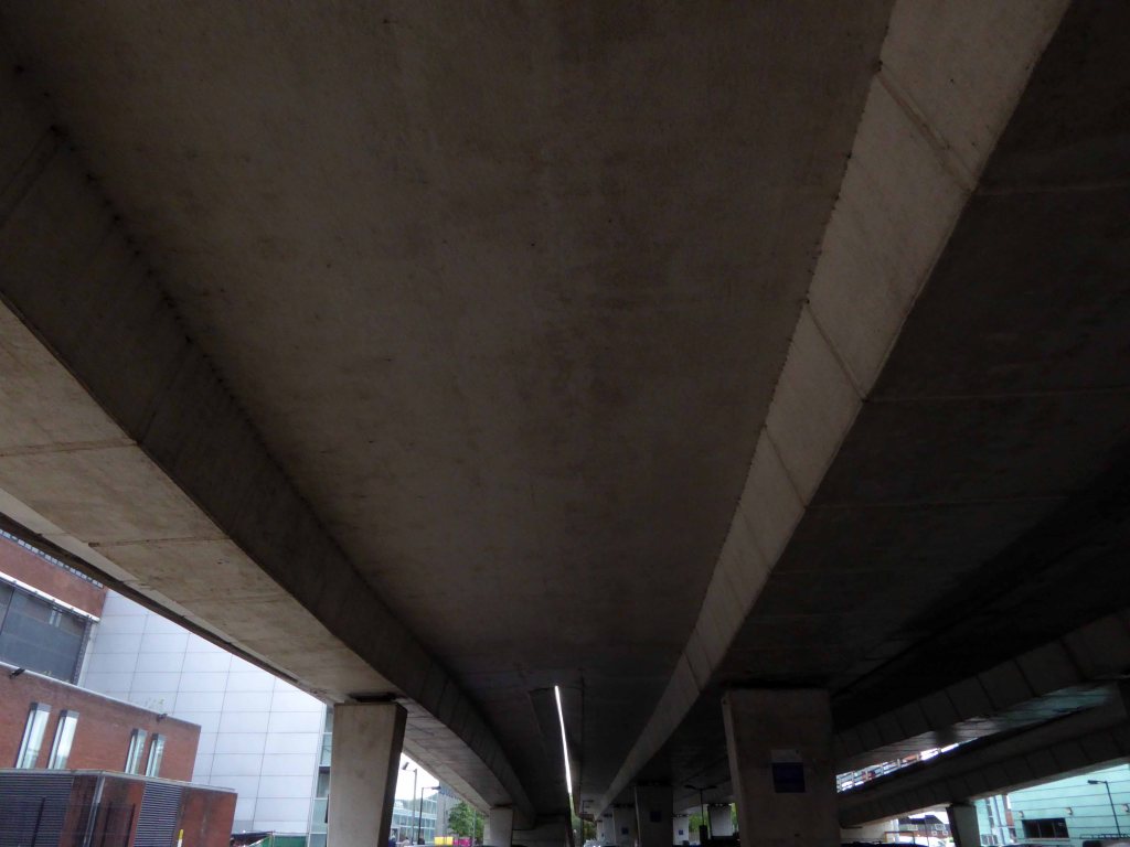
Further and further.
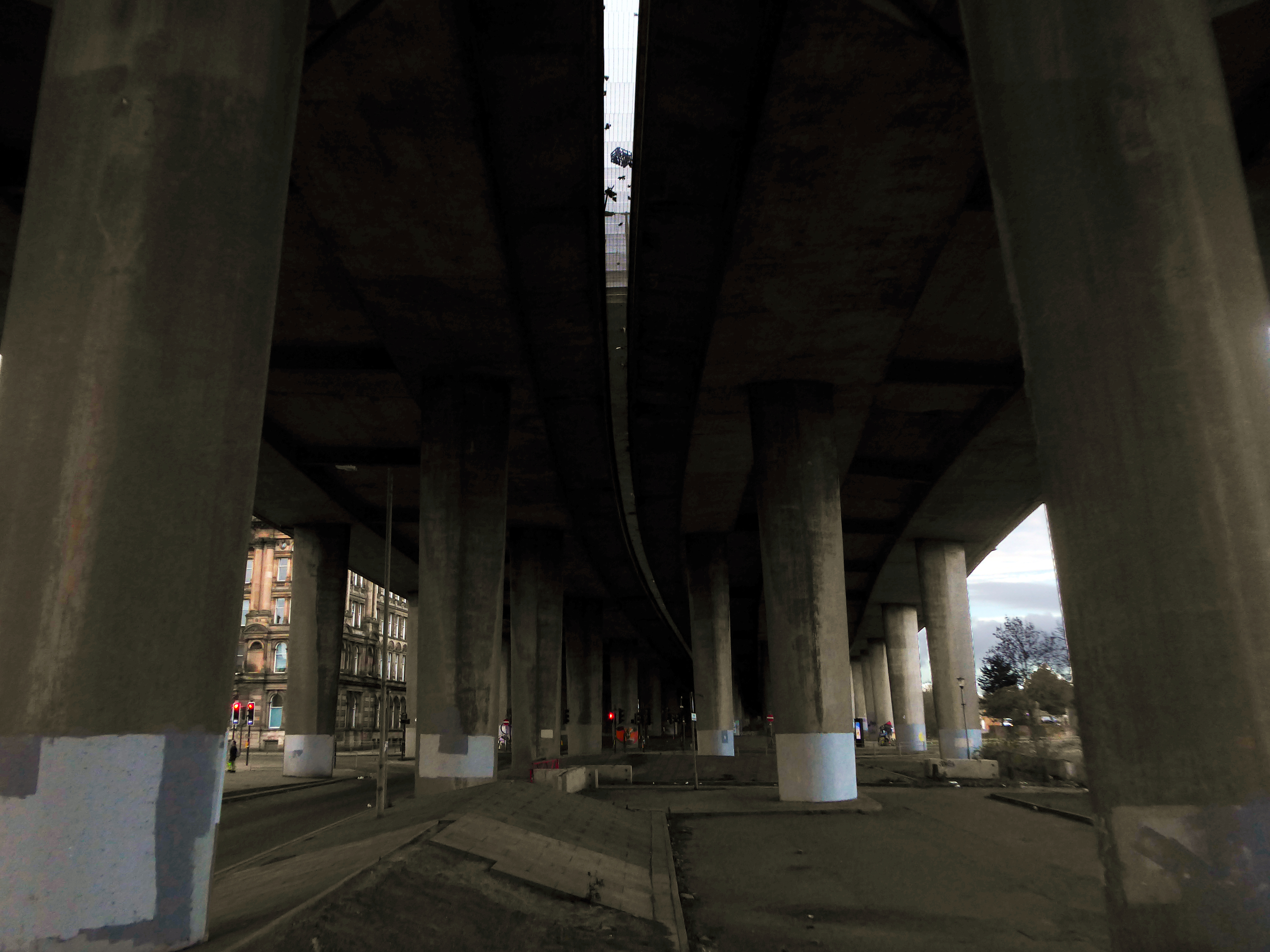
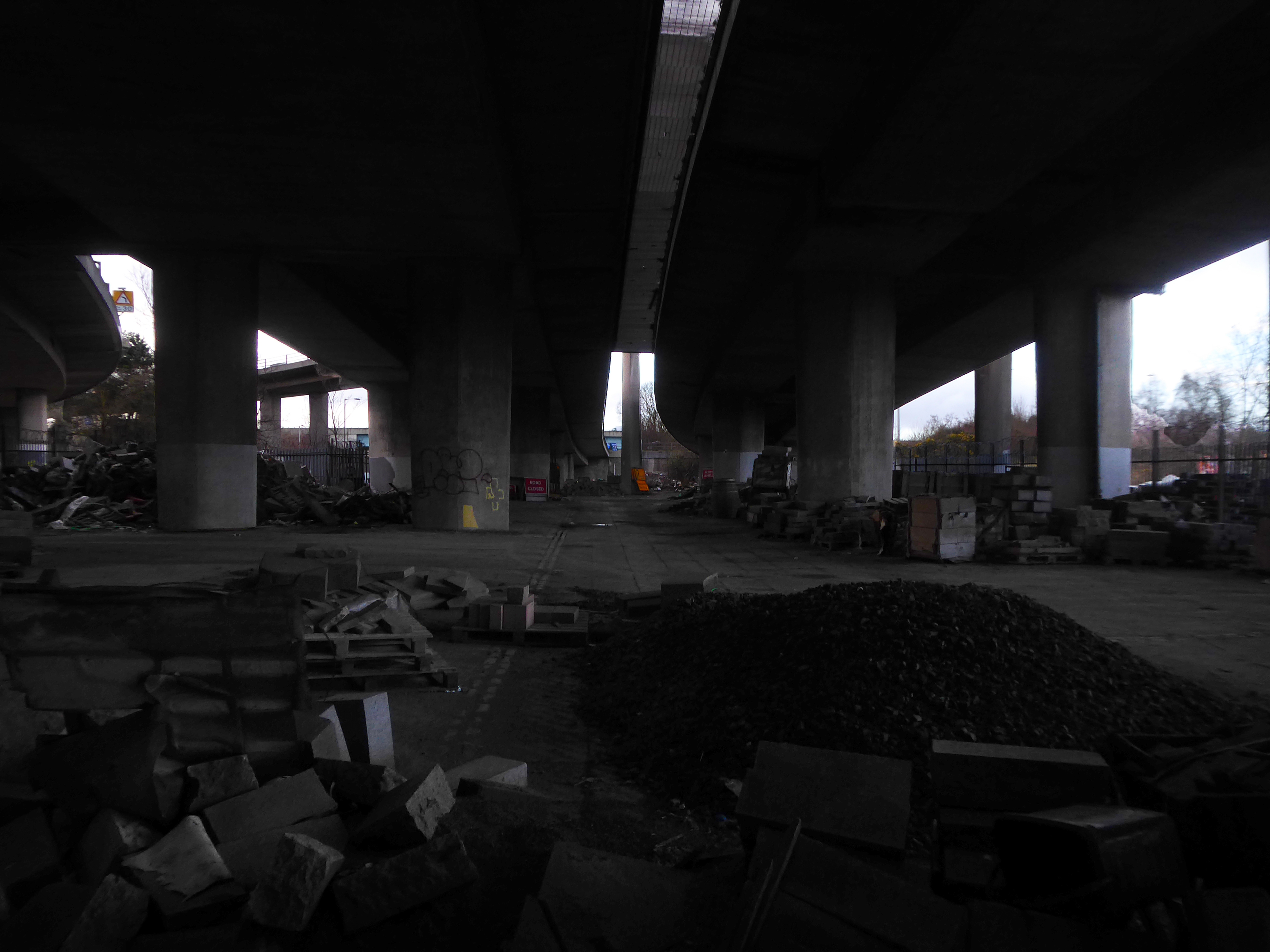
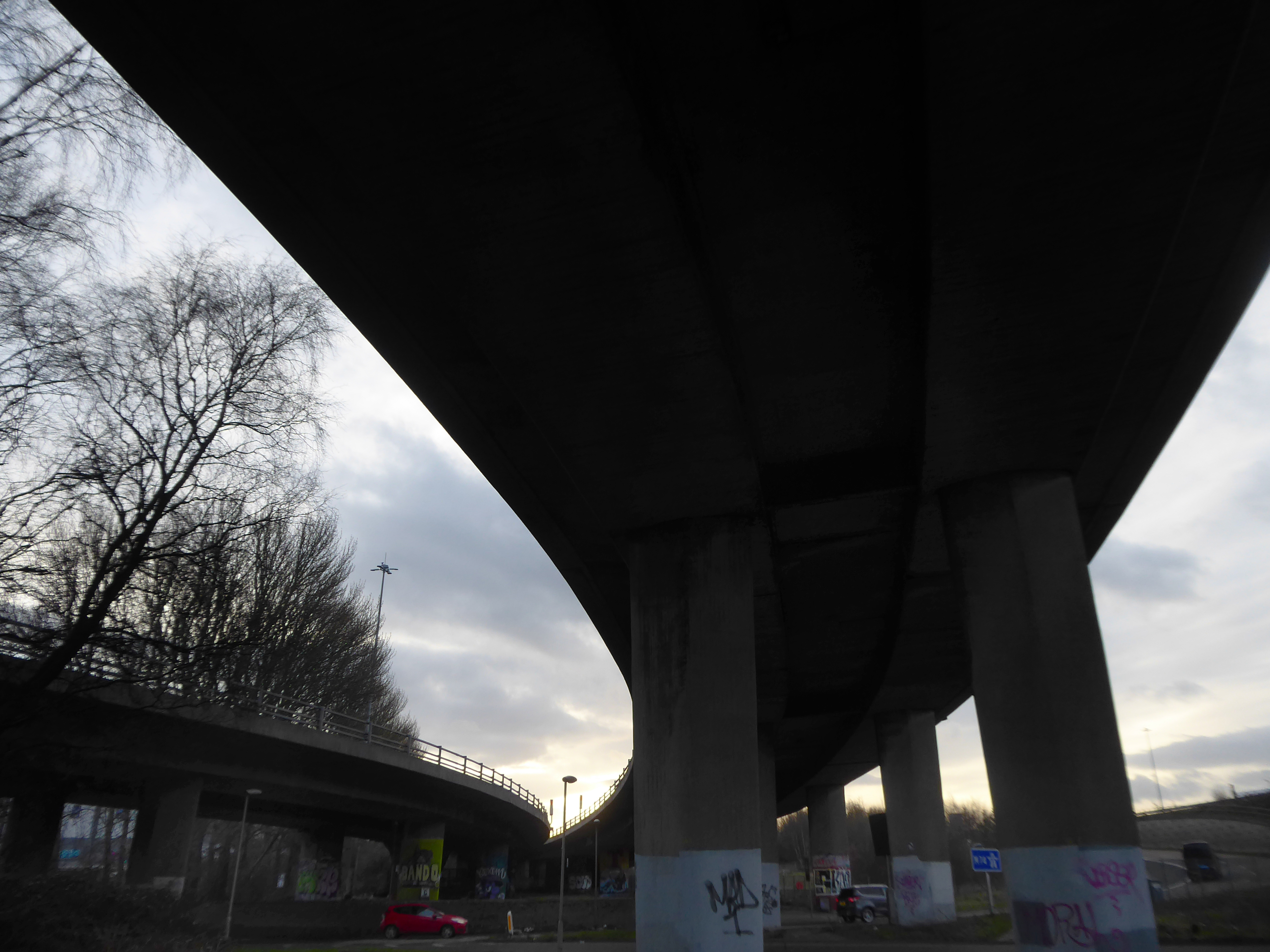
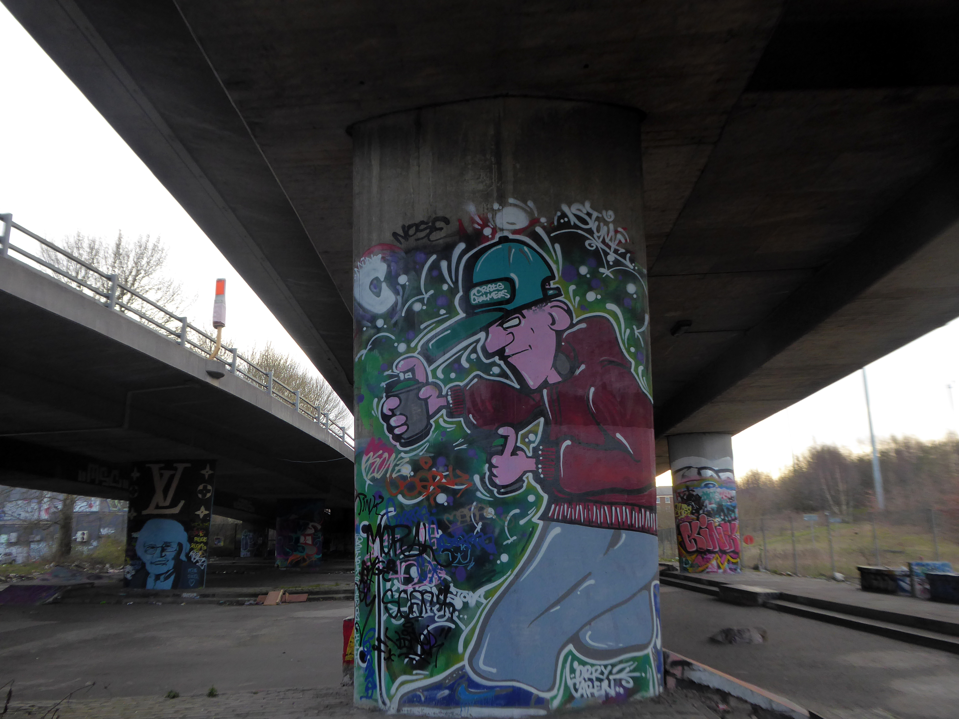
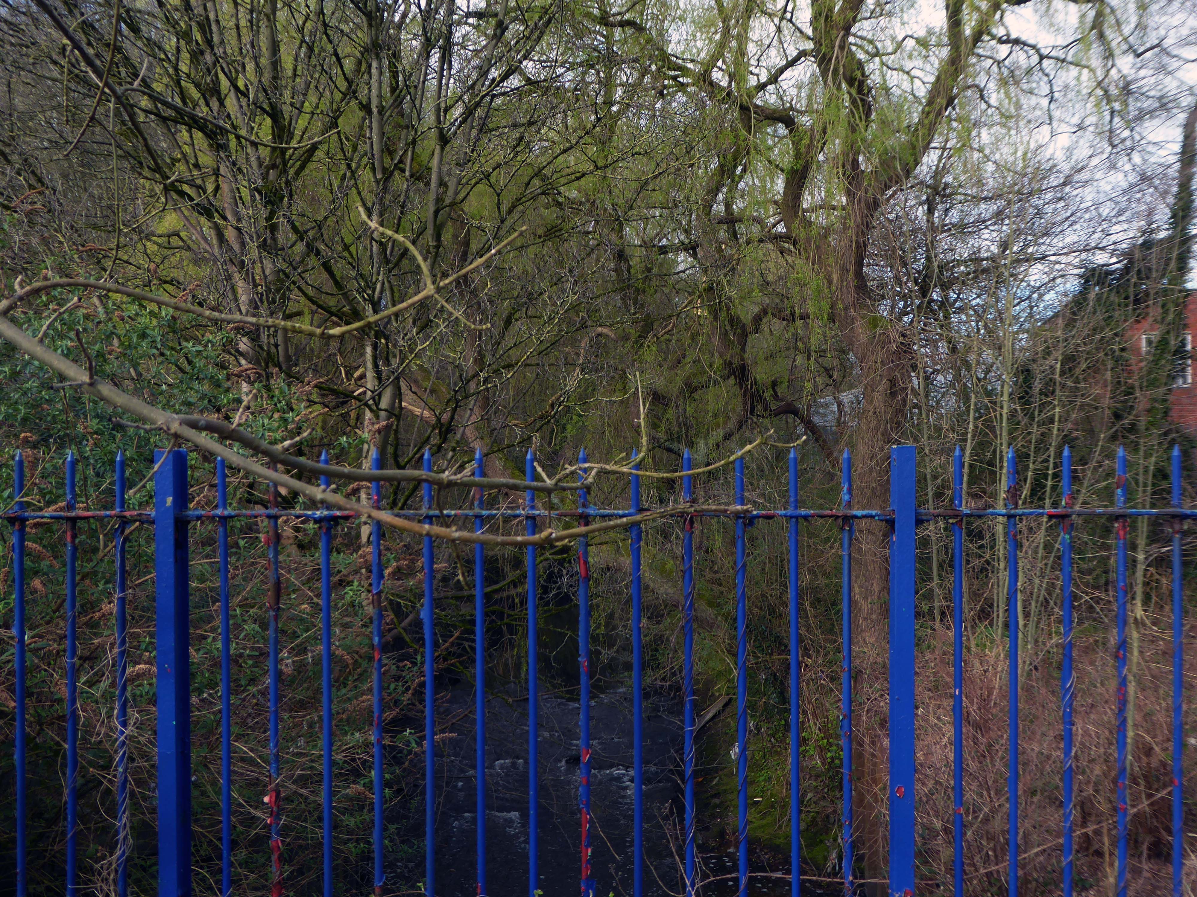
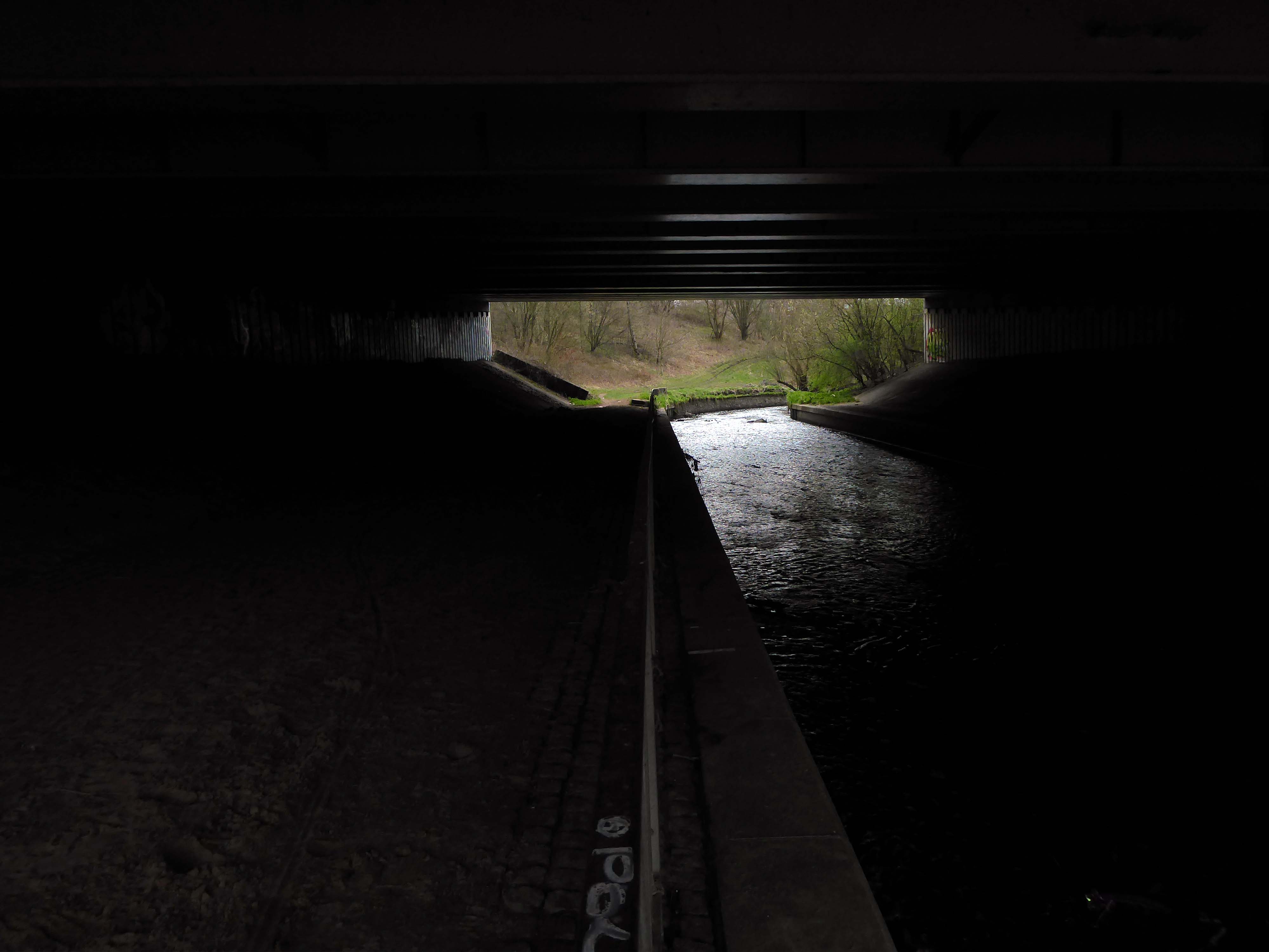
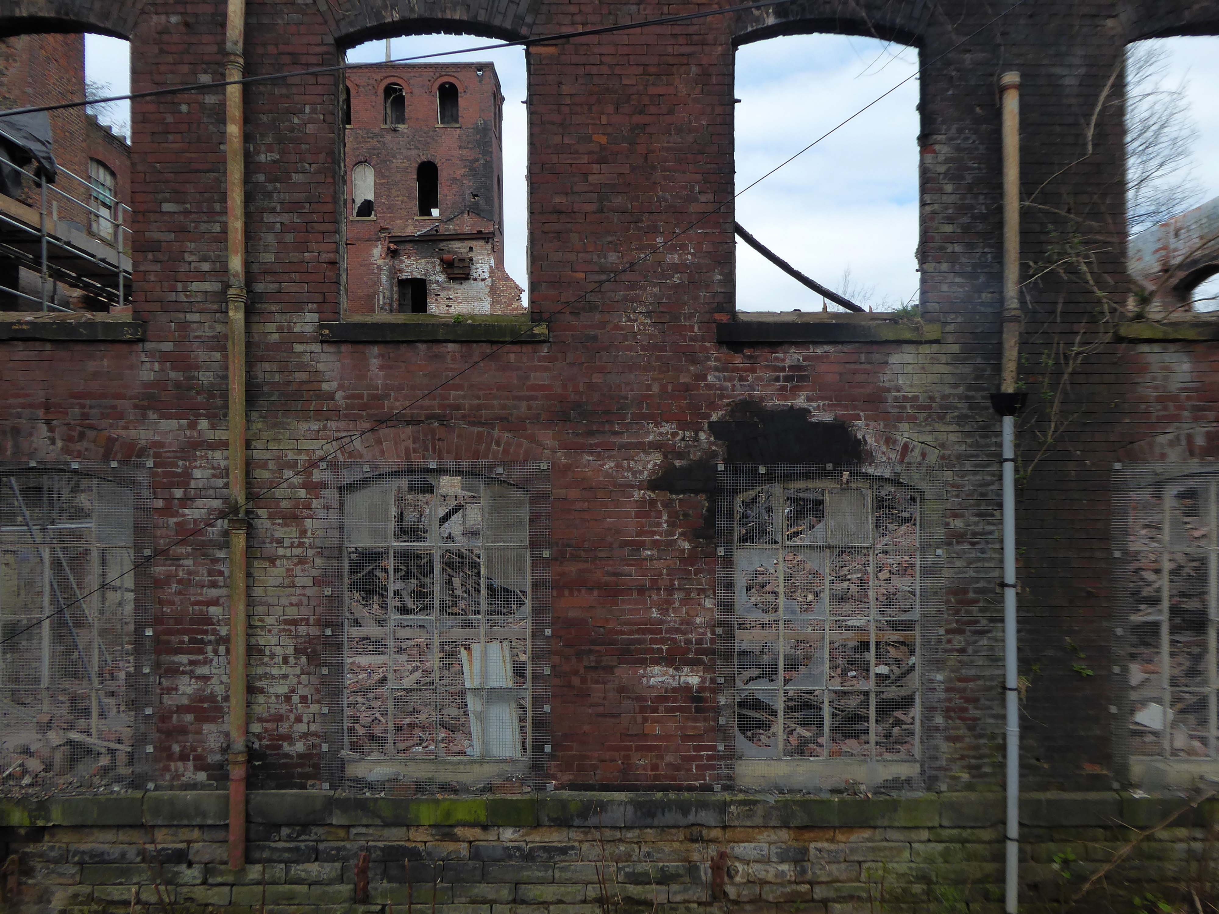
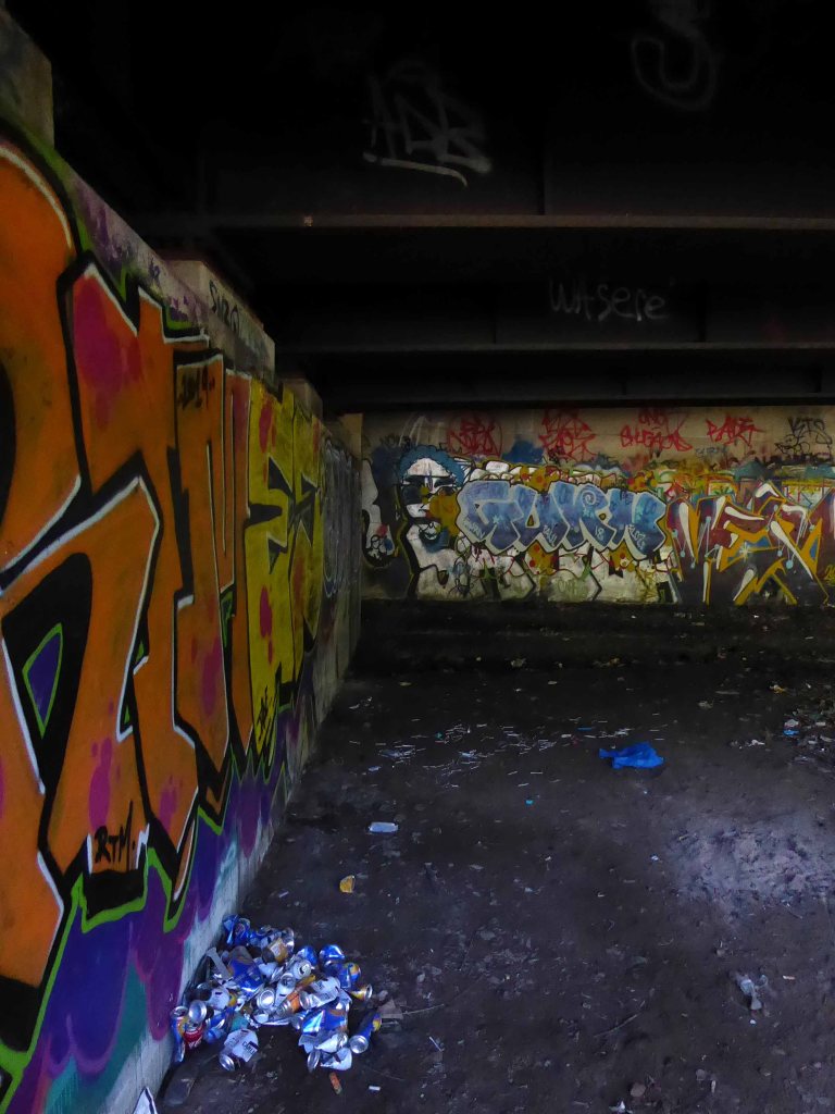
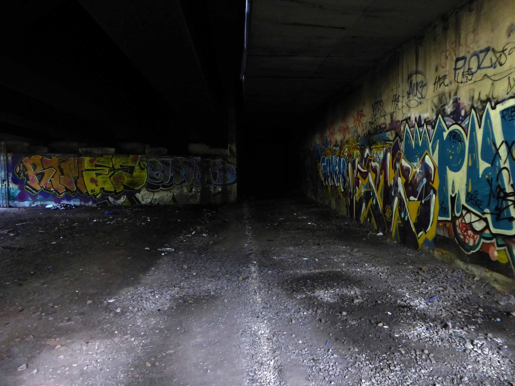
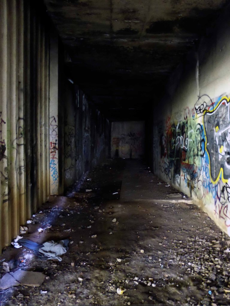
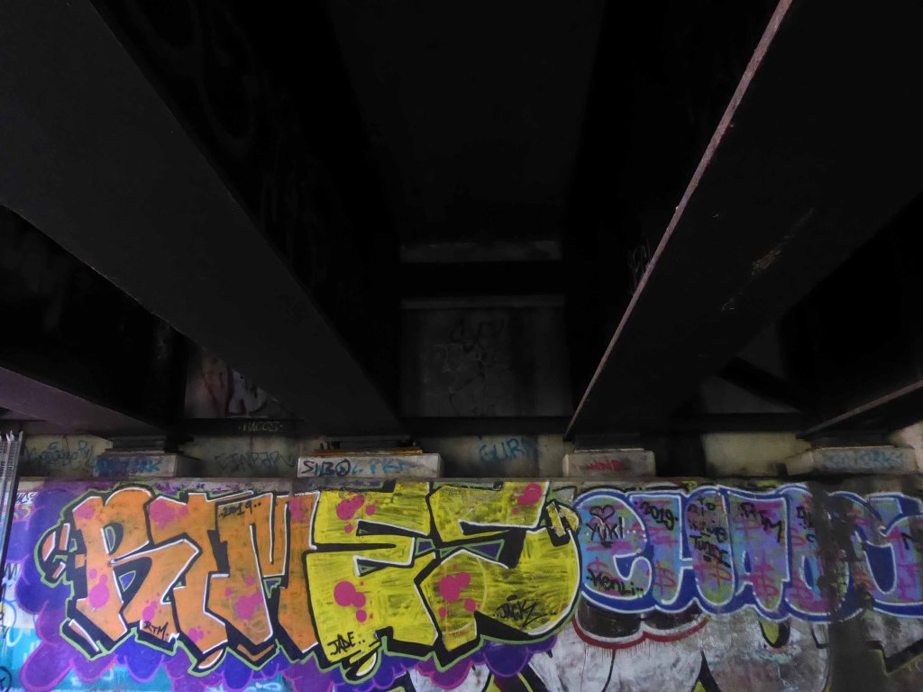
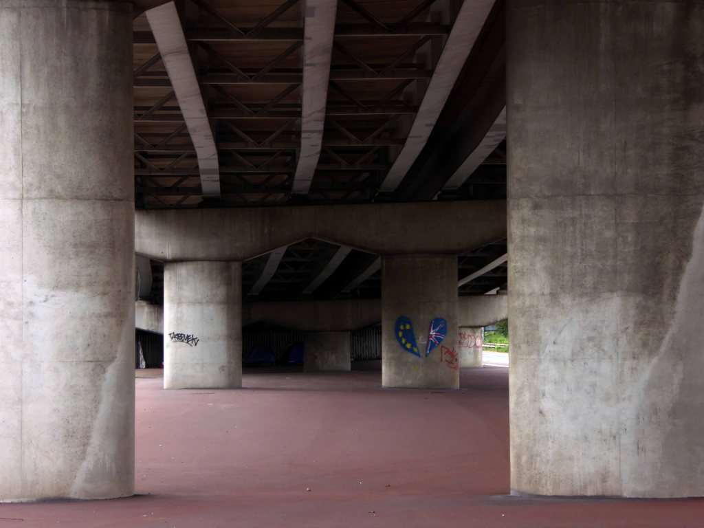
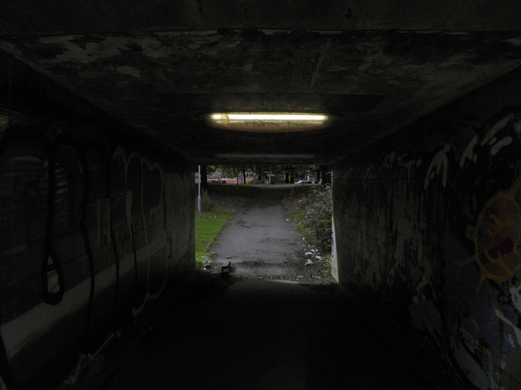
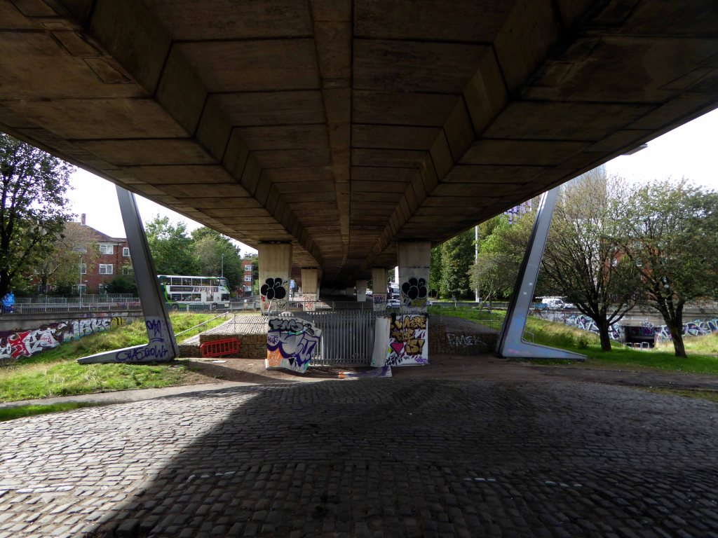
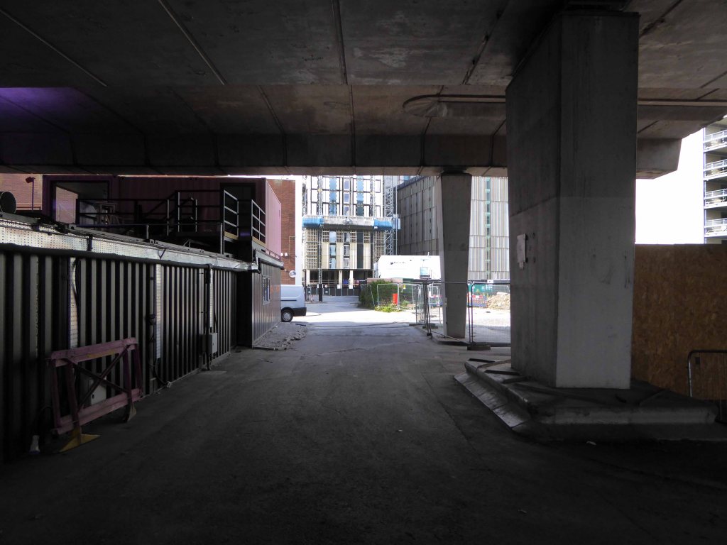
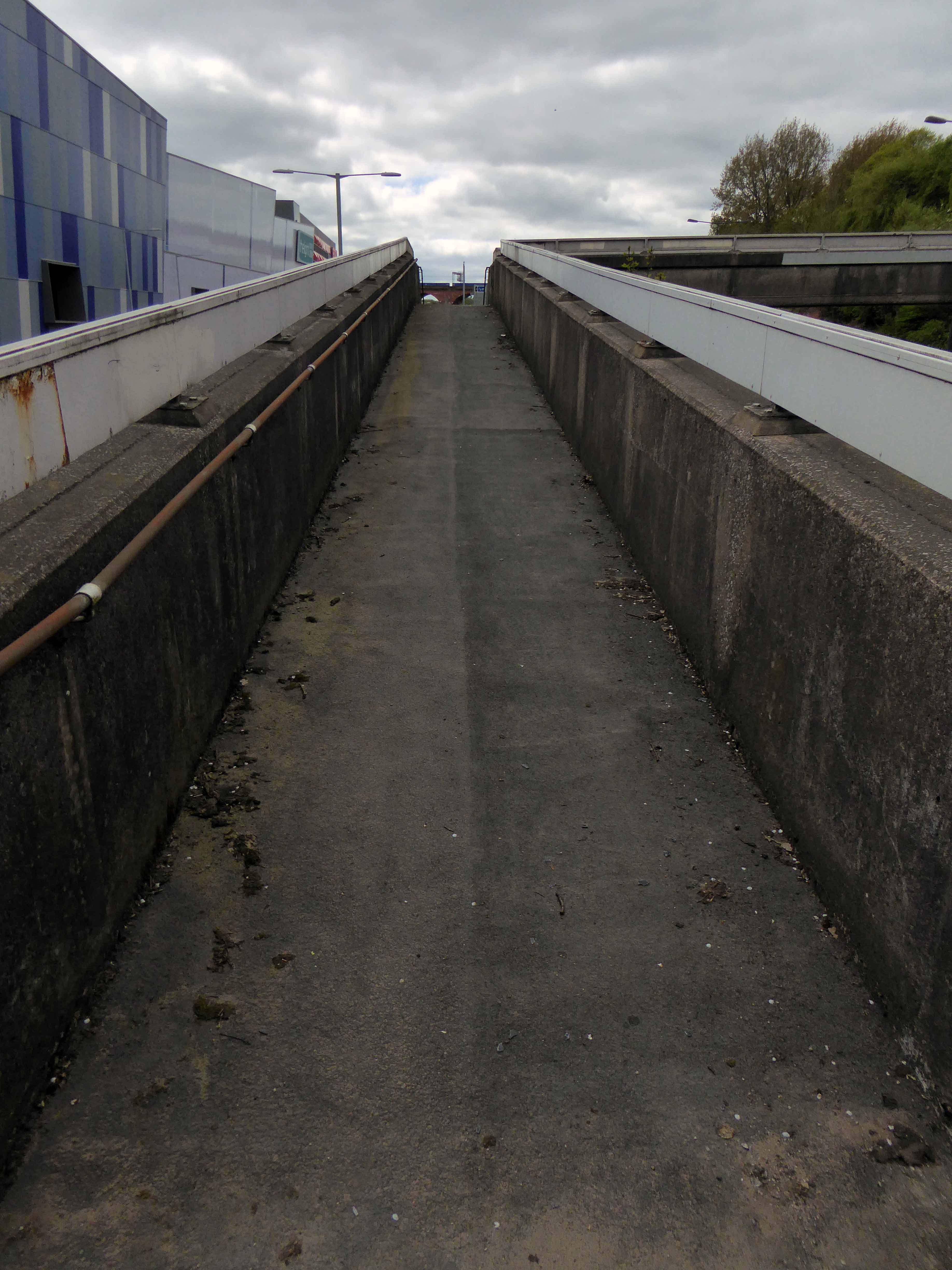
Into an underground world.
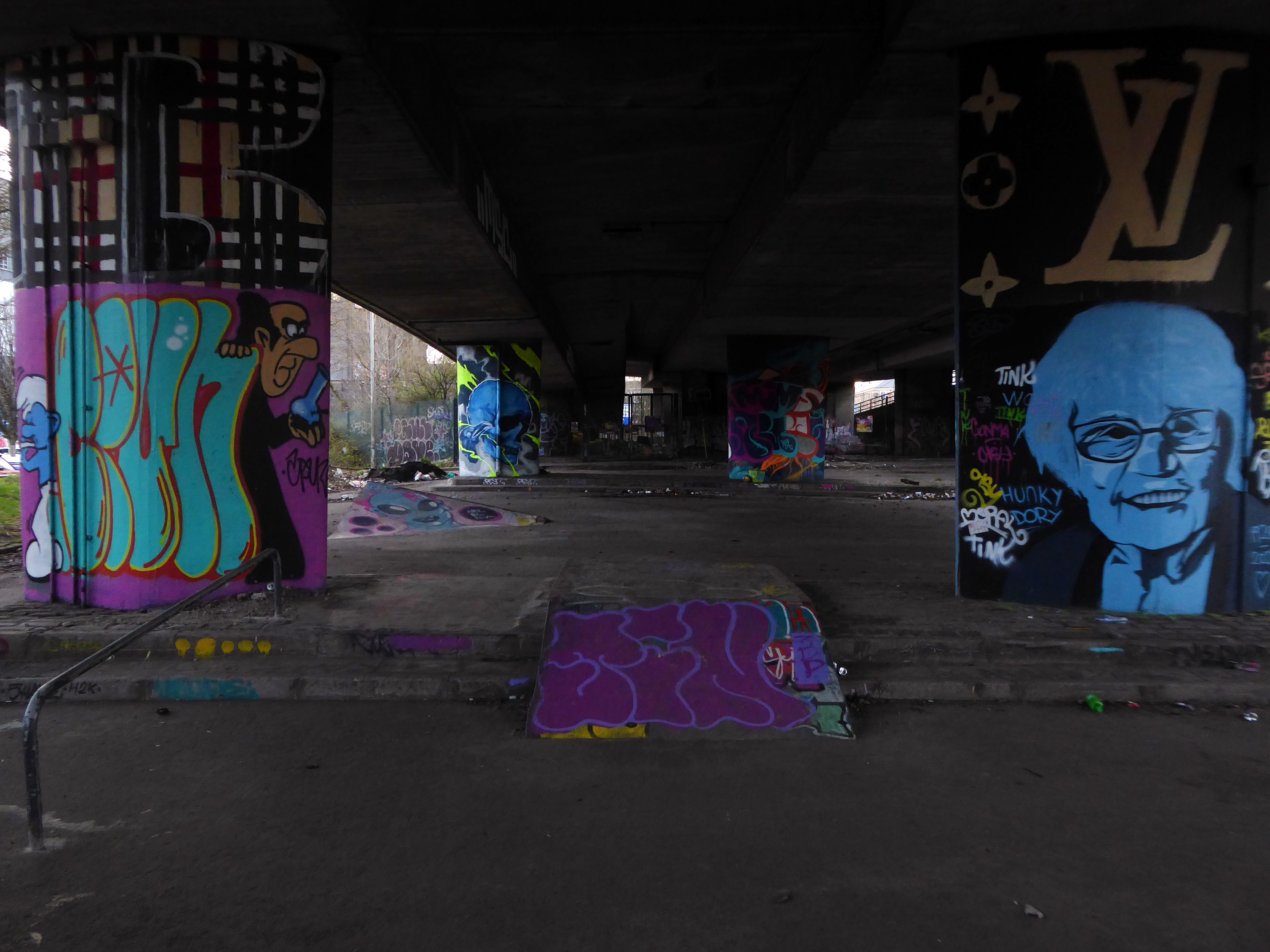
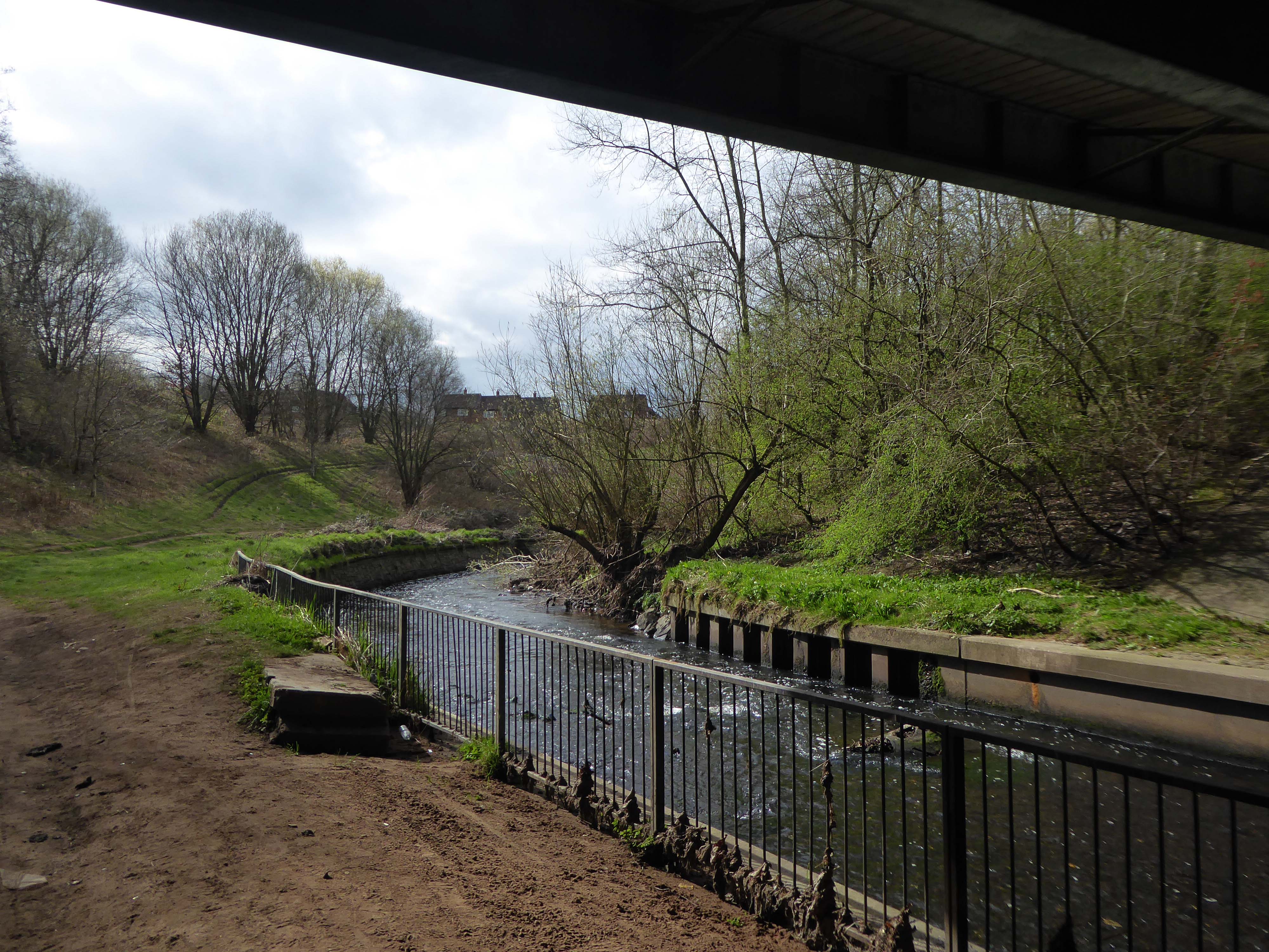
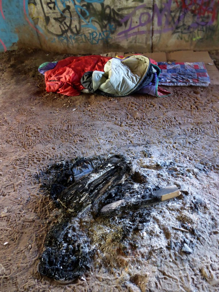
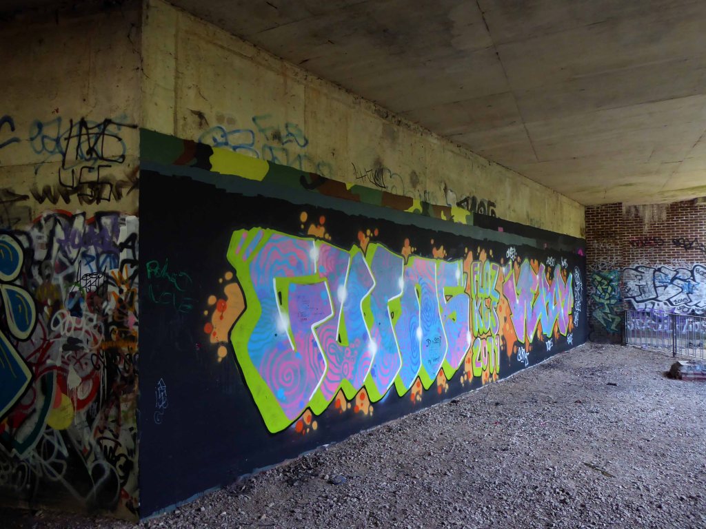
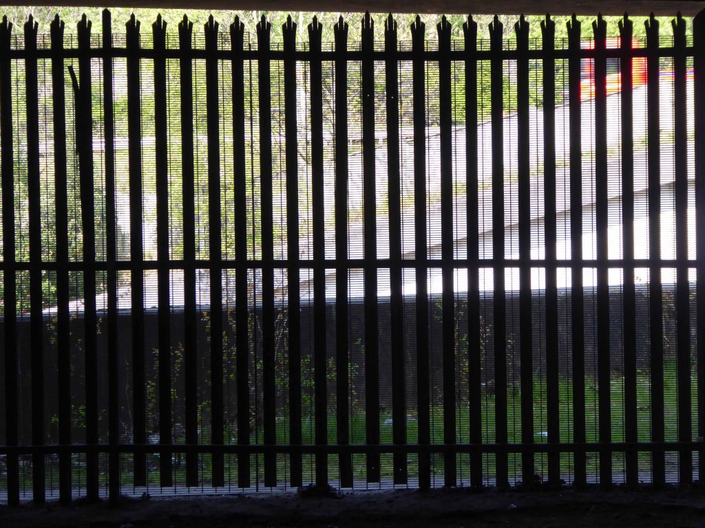
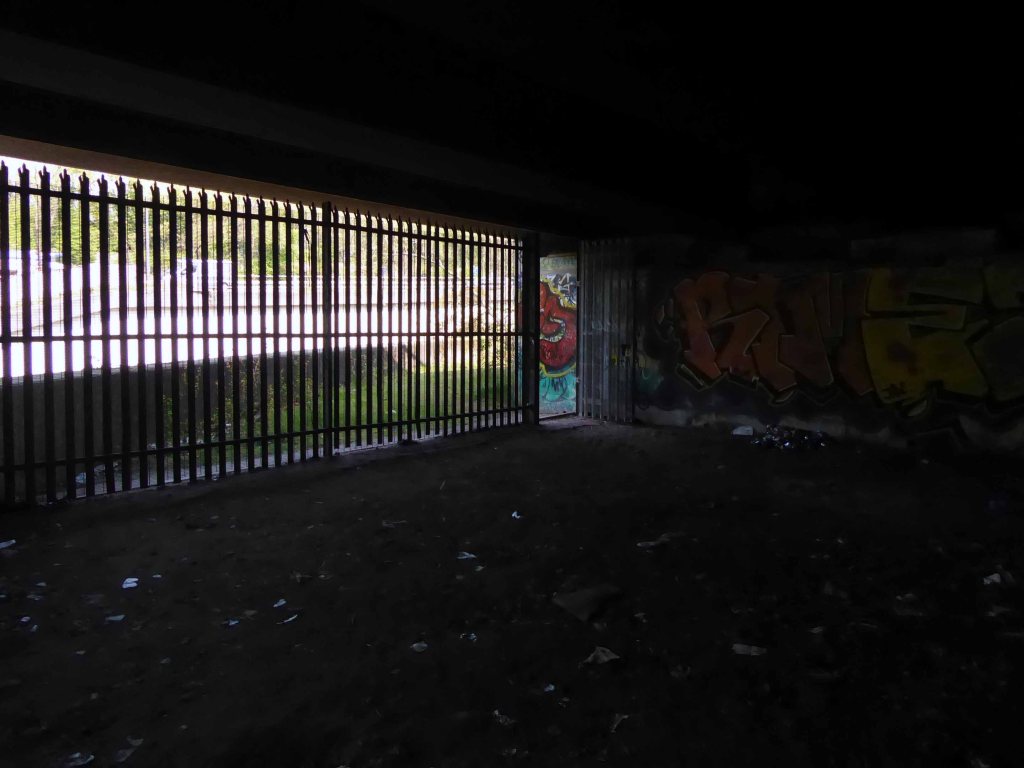
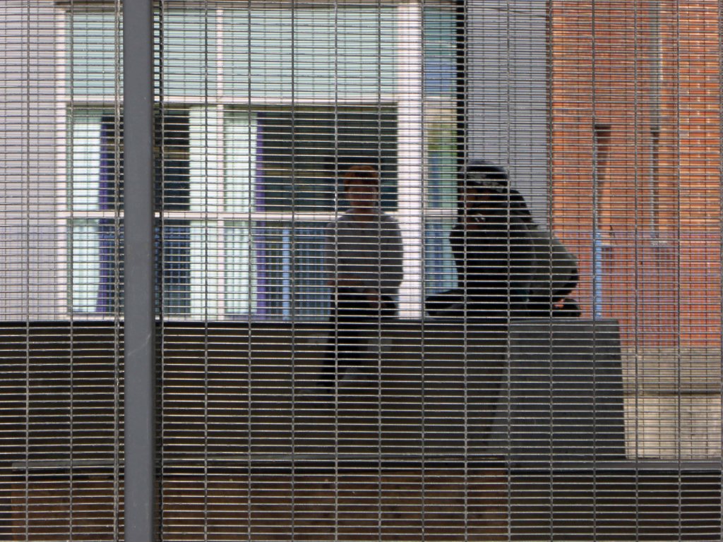
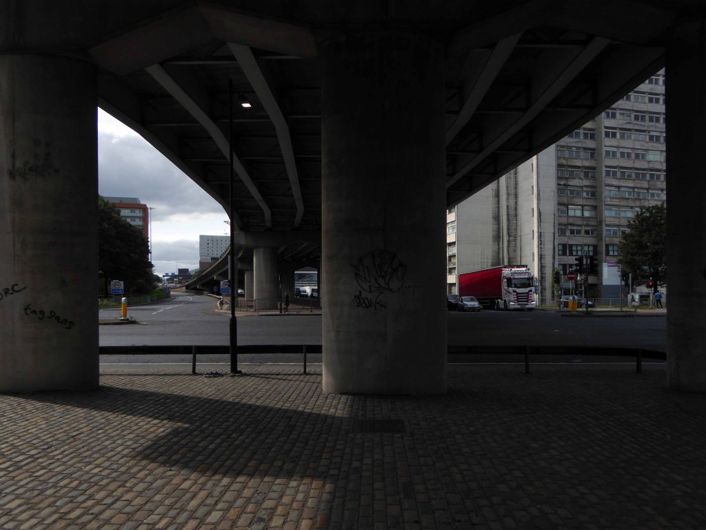
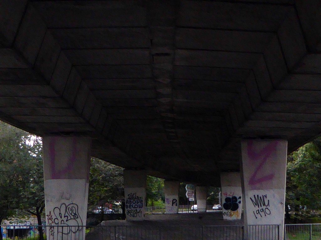
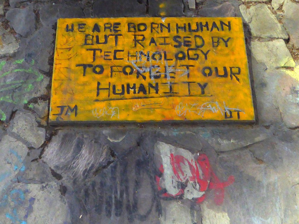
Through the railings and into a void – a void that had become home to the otherwise engaged, seeking solace somewhere, finding shelter from the storm. A storm of Twenty First Century austerity, man made – moving money around until those without are out, out in the open, nowhere else to go but here.
How often have I lain beneath rain on a strange roof, thinking of home.
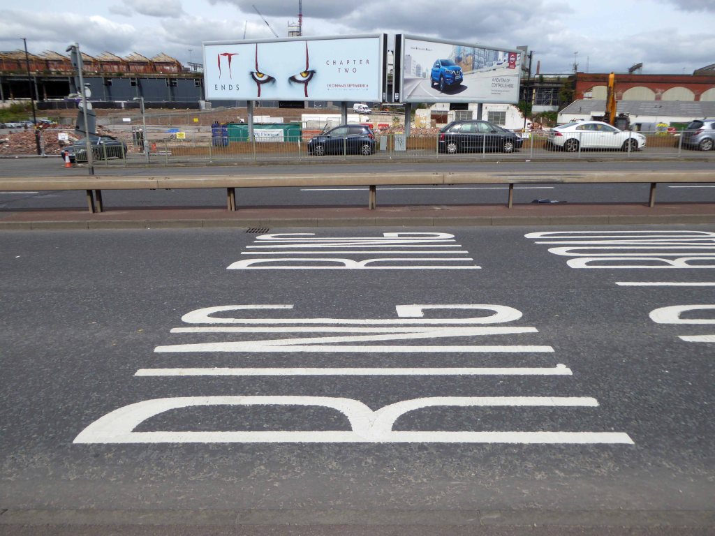
Previously posted as historical journey – this, as they say, is the real deal, one foot after another, one sunny afternoon in September.
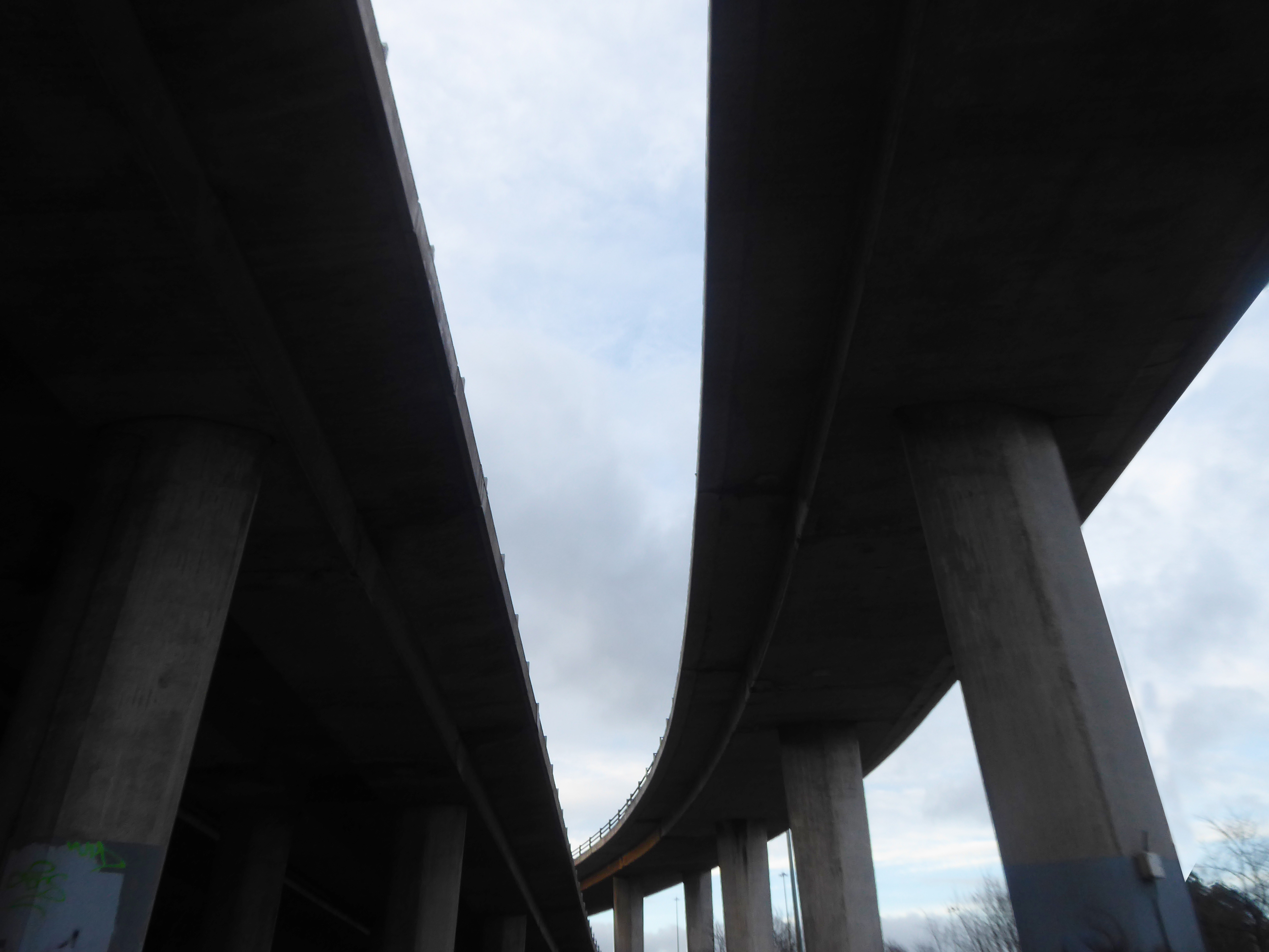
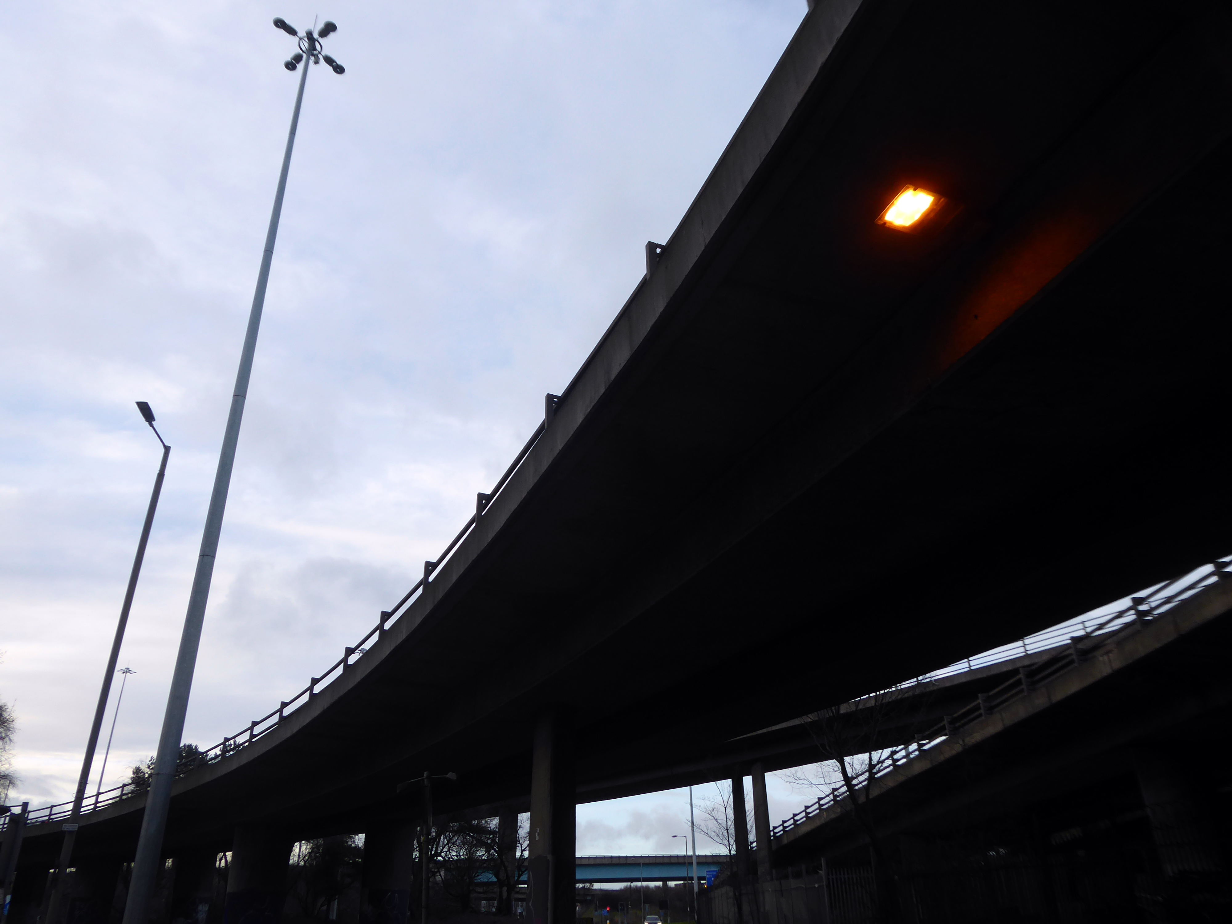
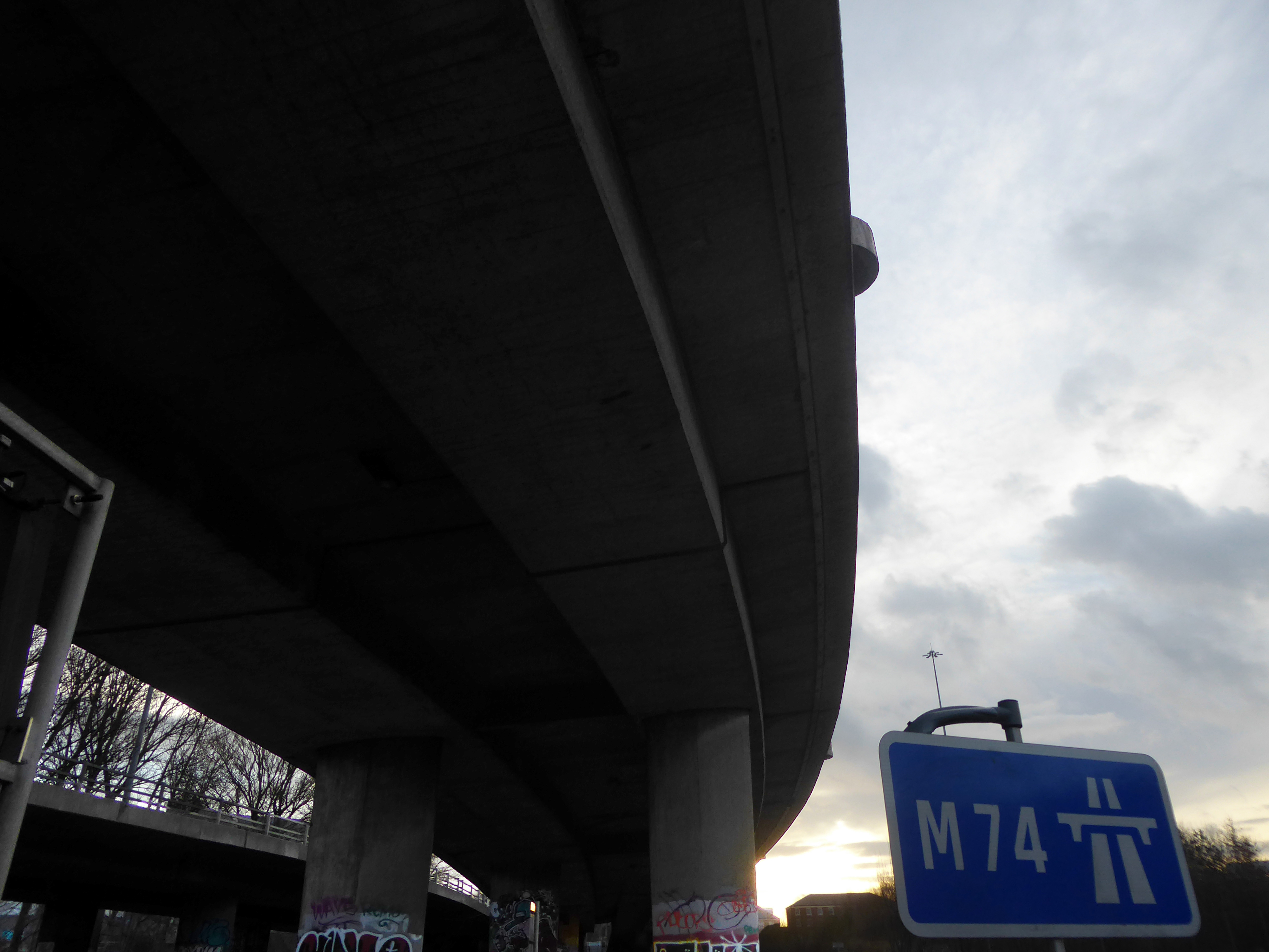
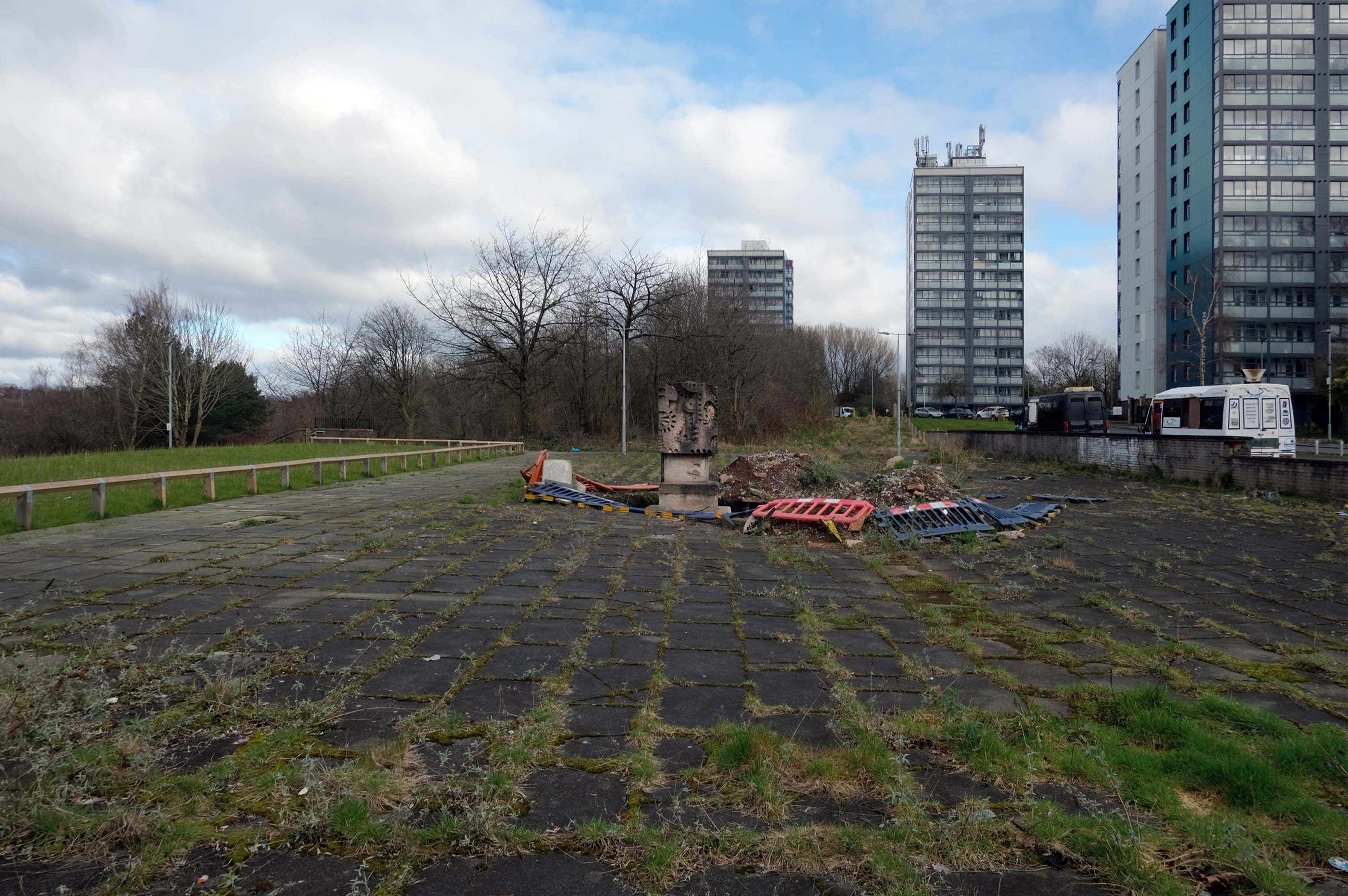
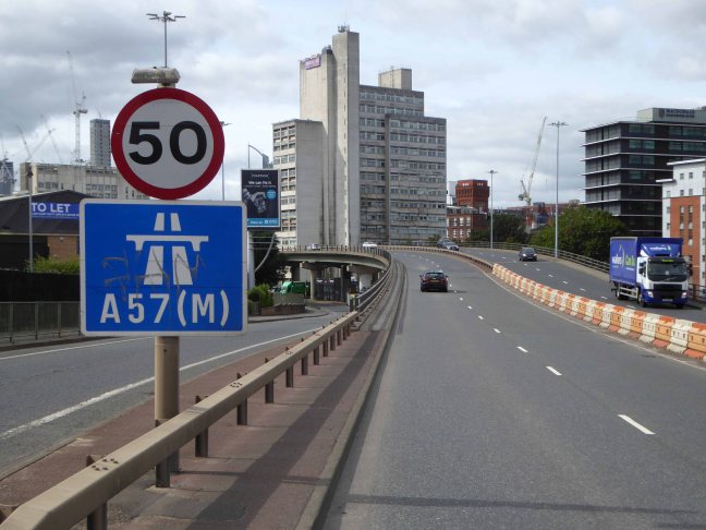
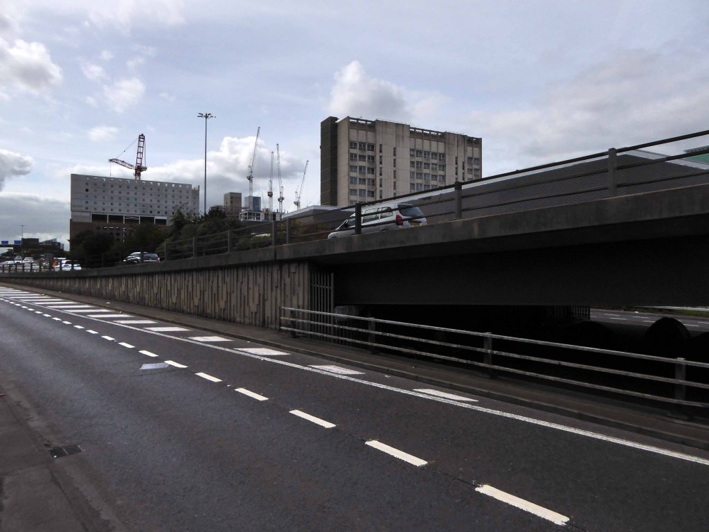
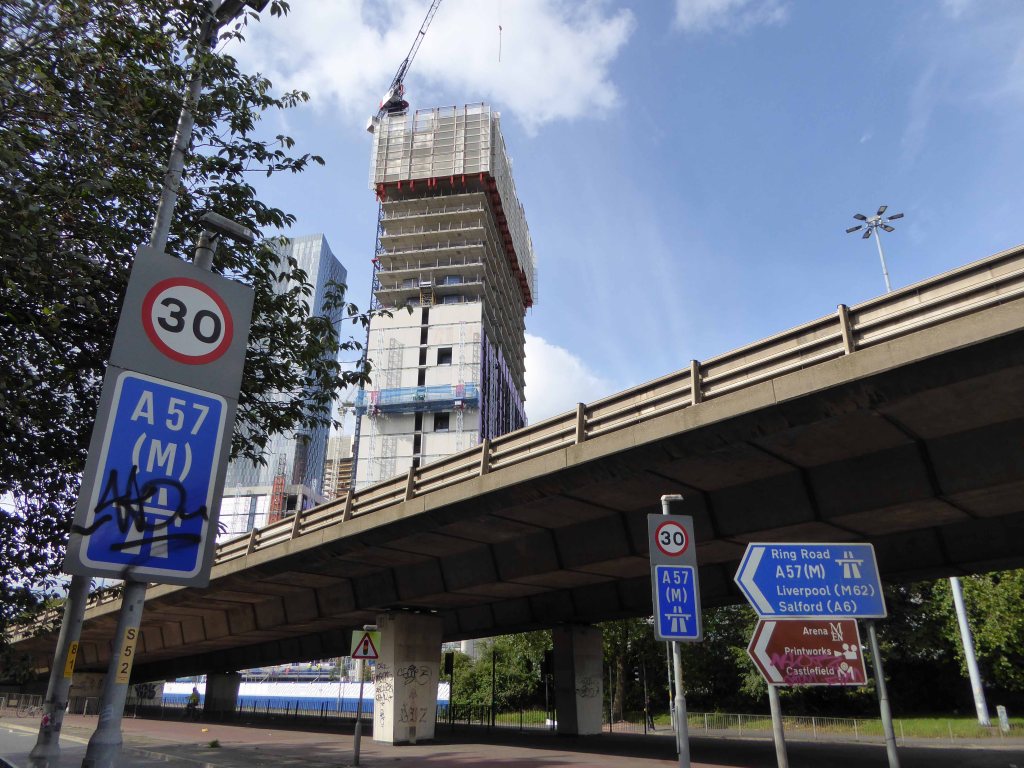
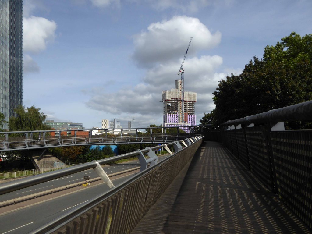
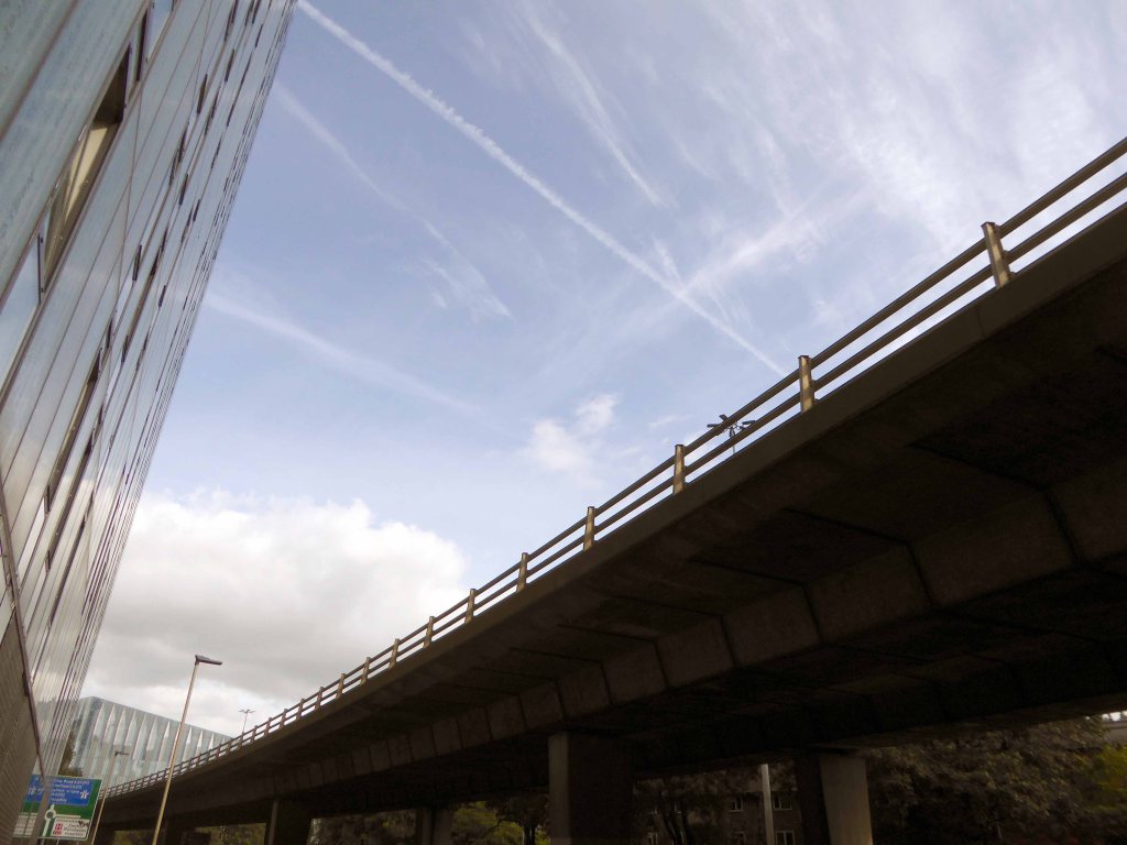
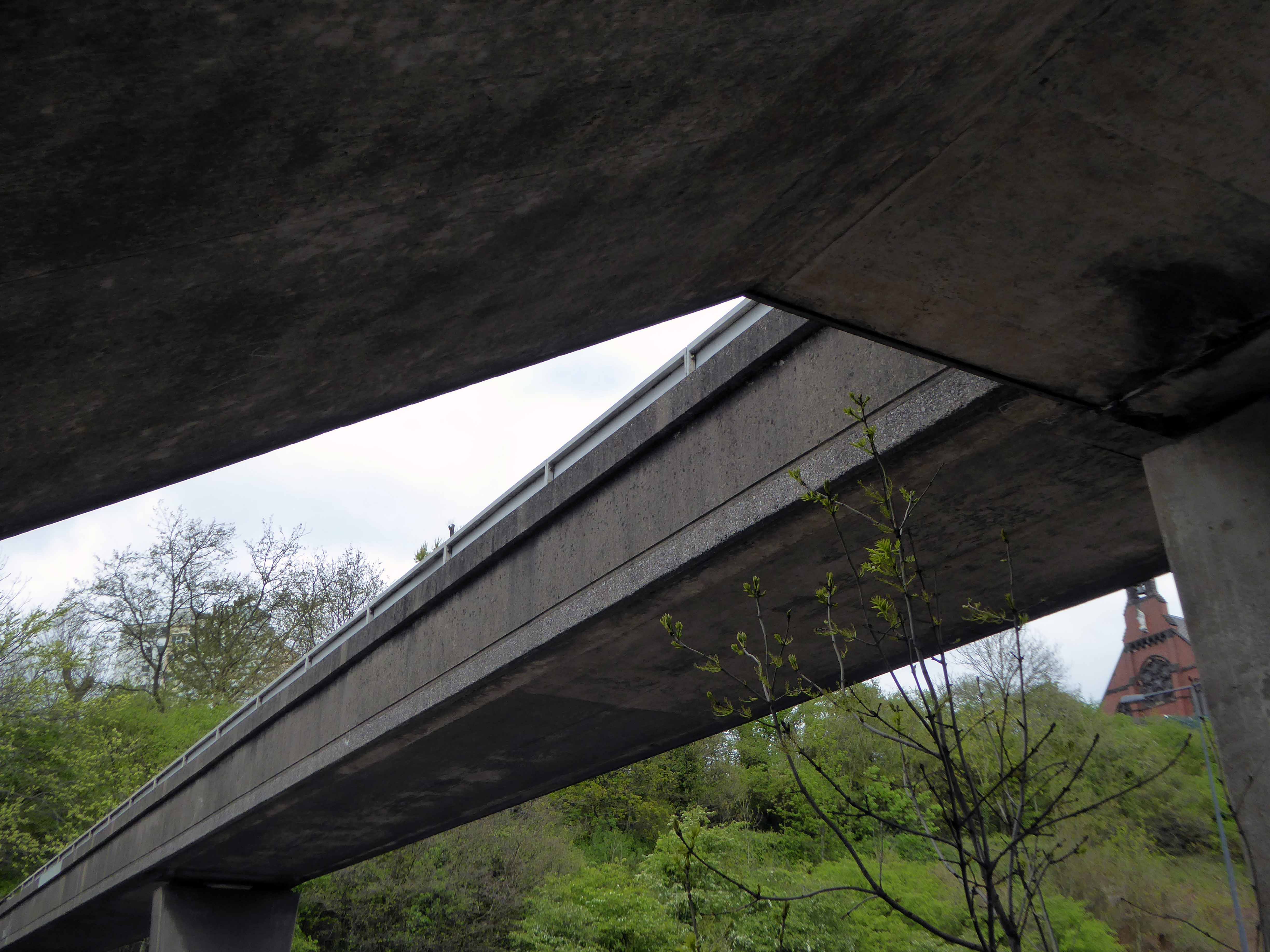
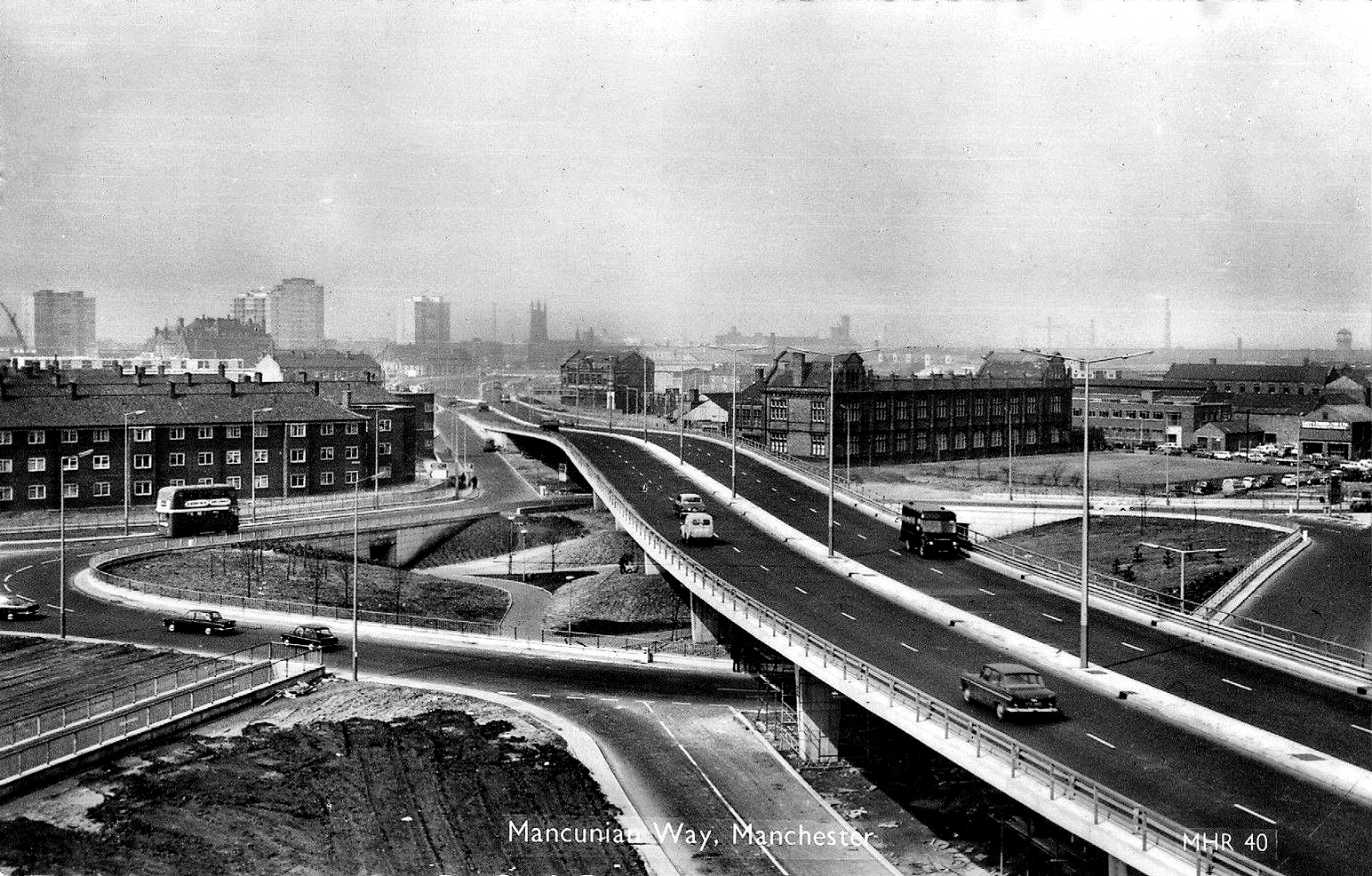
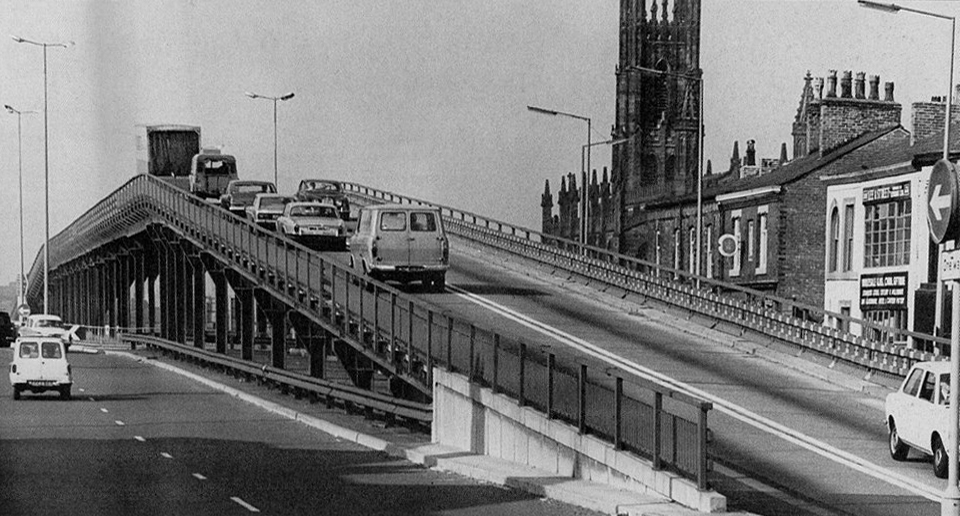
From east to west and back again – in or on, under and around our very own Highway in the Sky.
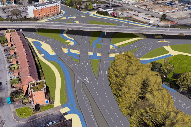
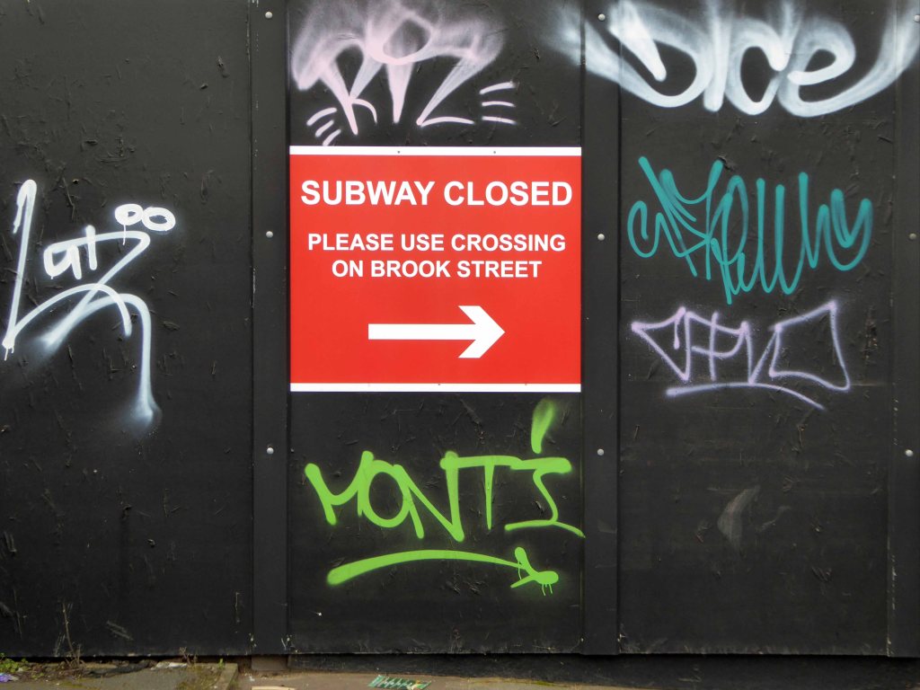
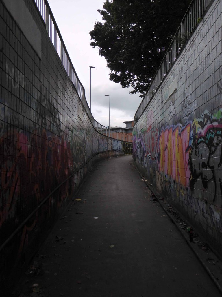
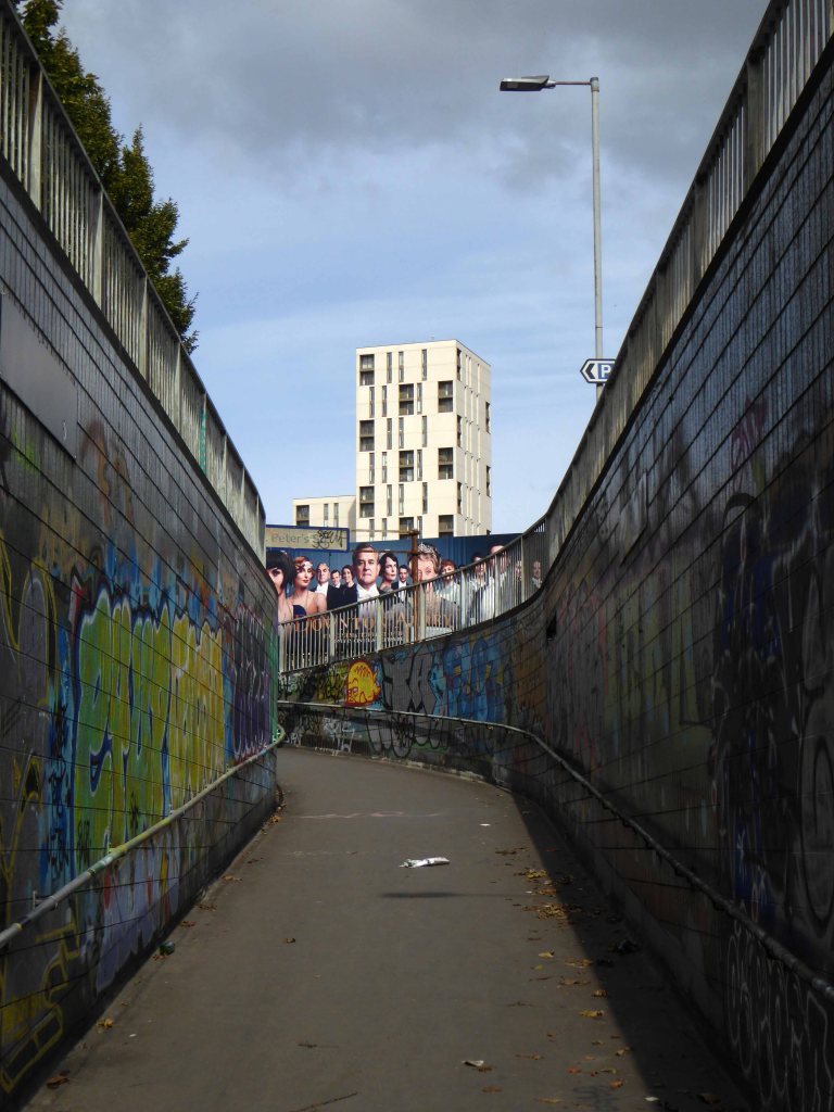
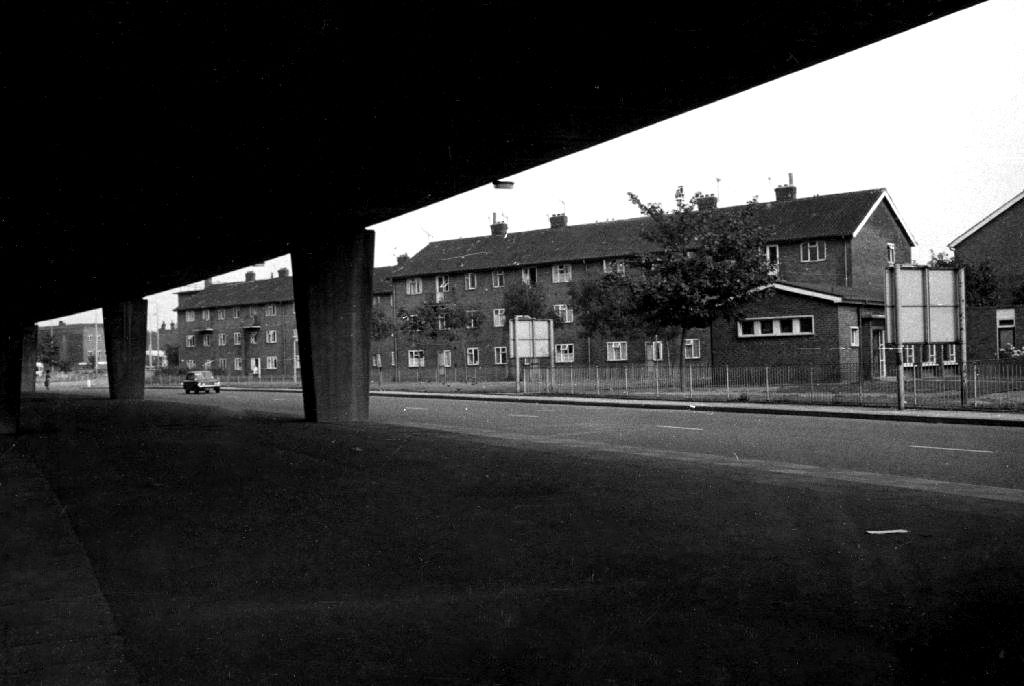
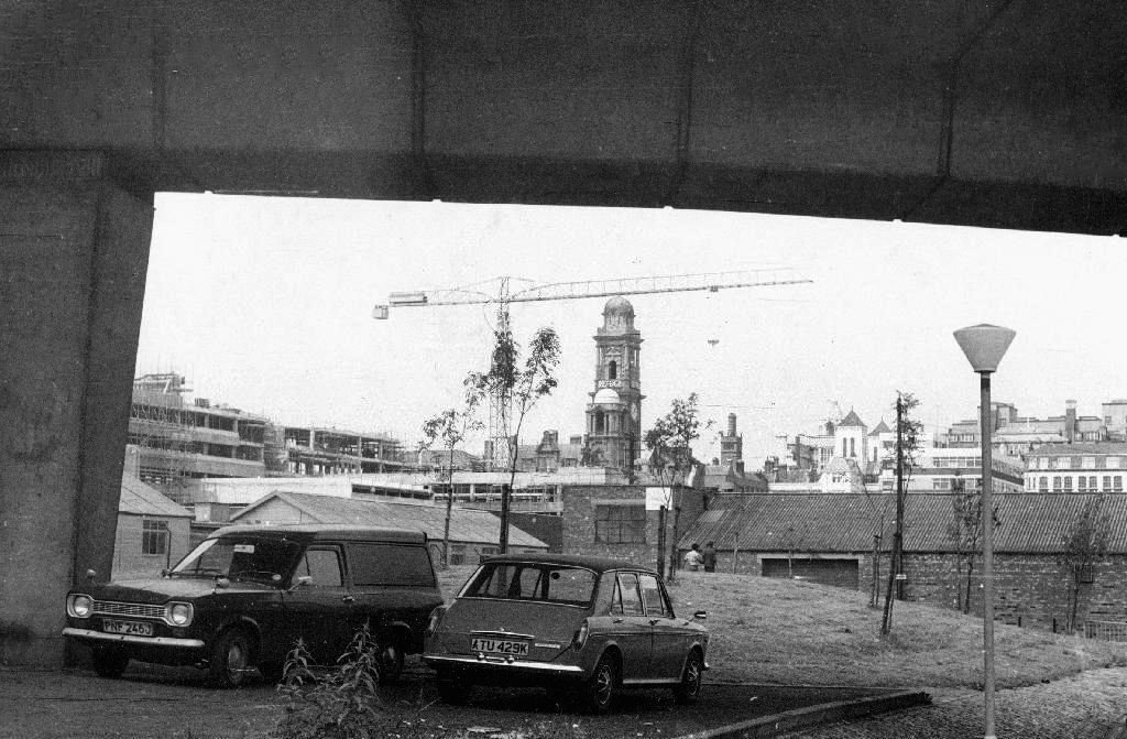
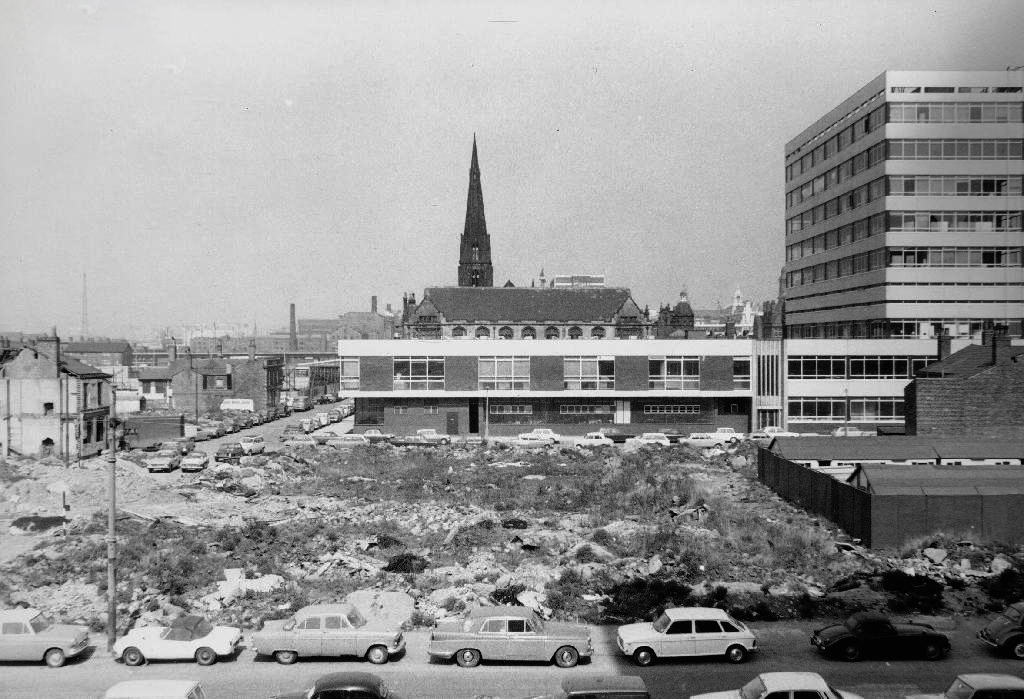
Part of the ever changing patchwork of demolition and development which defines the modern city. The carriageway prevails, whilst the pervasive rise and fall continues apace, its forlorn pedestrian underpasses may soon be superseded by wider walkways.
Manchester City Council is spending around £10million to make major changes to the junction where Princess Road meets the Mancunian Way and Medlock Street.
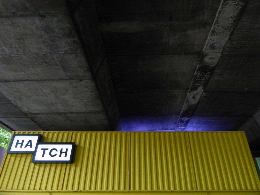
Much to the chagrin of local residents, who value the solace of their sole soulful green space and the frequent users, passing under the constant waves of sooty traffic.
What you see is what you get today, tomorrow is another kettle of concrete, trees, traffic and steel.
I ride a bicycle, which seriously restricts my access to the world of the M – one and six or otherwise. Having a more than somewhat ambivalent outlook on motor cars and their ways I have nevertheless written a short history.
So to satisfy my idle curiosity, and fill the damp wasteland of a Bank Holiday Sunday afternoon, let’s go on a little trip back in time by means of archival images.
What of your history?
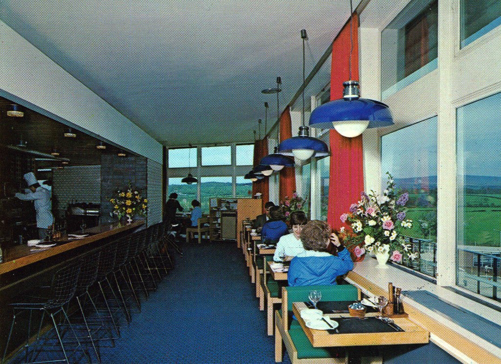
Tendering documents were sent out in 1962 describing it as a 17.7 acre site, requiring at least a £250,000 investment, including an eastern corner reserved for a picnic area, and an emphasis that the views to the west must be considered in the design, and facilities must be provided on both sides. Replies were received – from Telefusion Ltd, J Lyons, Banquets Catering Ltd, Granada and Rank
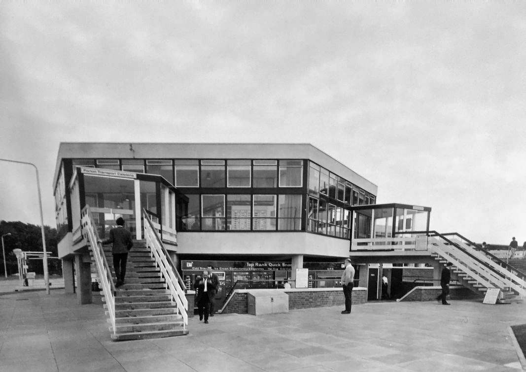
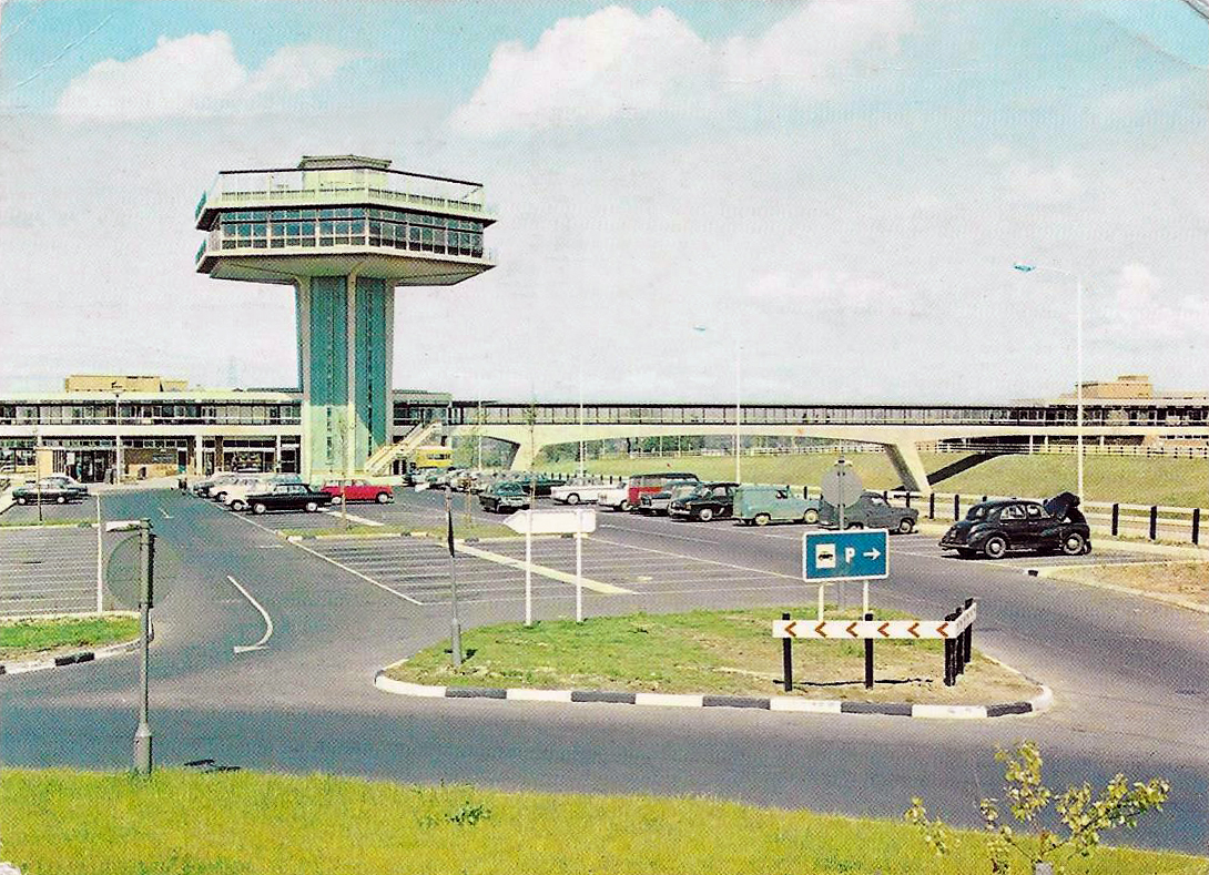
Top Rank’s plan came consistently highly rated by all the experts it was passed between. It showed a restaurant and a self-service café on the west side, the restaurant being at the top of a 96ft (29m) tower. At the top of the tower was a sun terrace – a roof with glass walls, which they had described but hadn’t included any suggestions for how it could be used, adding that maybe it could form an observation platform, serve teas, or be reserved for an additional storey to the restaurant.
Including a transport café on each site, seating was provided for 700 people, with 101 toilets and 403 parking spaces. A kiosk and toilets were provided in the picnic area.
“The winning design looks first class. Congratulations.”
Architects T P Bennett & Sons had been commissioned to design the services, along with the similar Hilton Park. At £885,000, it was the most expensive service station Rank built, and was considerably more than what had been asked of them.They won the contract, but on a condition imposed by the Landscape Advisory Committee that the height of the tower was reduced to something less striking.
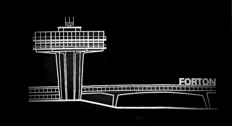
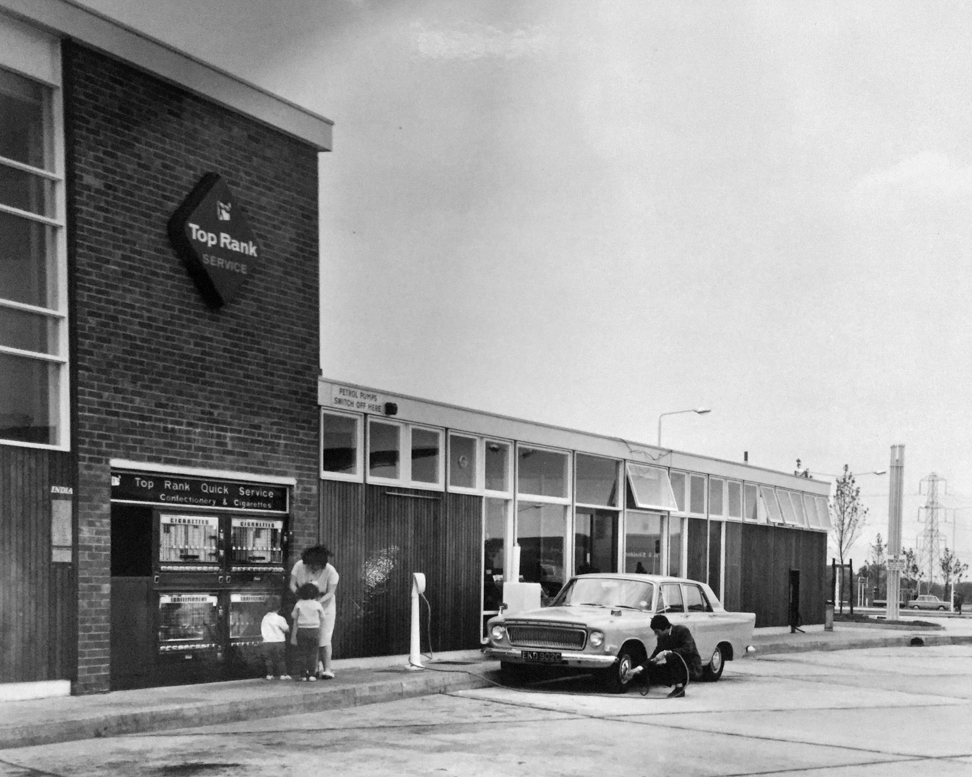
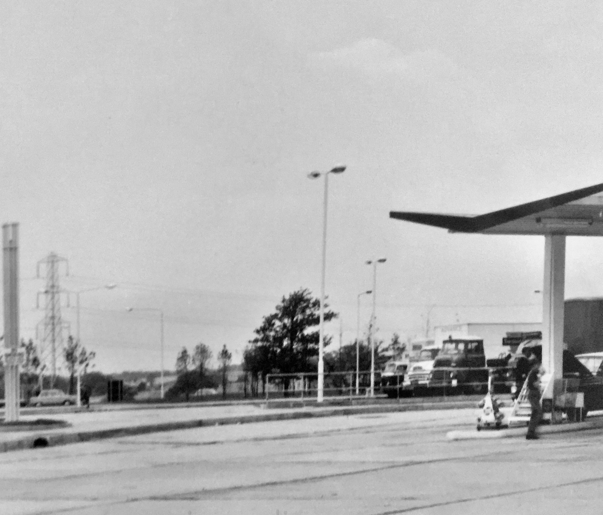
Lancaster was opened in 1965 by Rank under the name ‘Forton’. The petrol station opened early in January, with some additional southbound facilities opening that Spring.
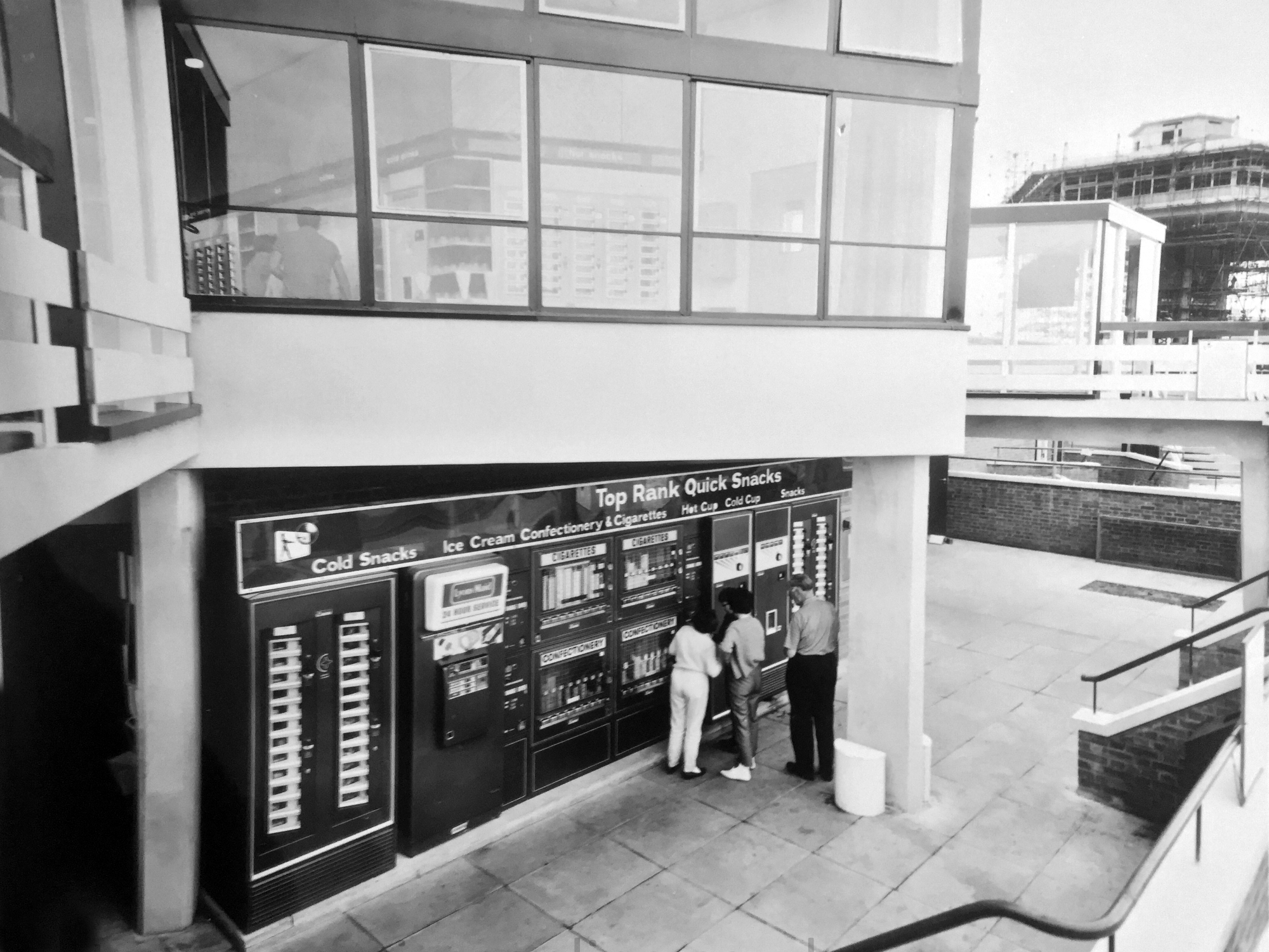
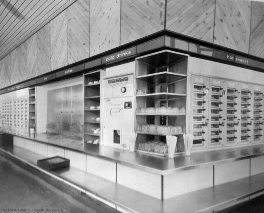
The southbound amenity building had a lowered section with a Quick Snacks machine and the toilets. Above it was the transport café which had only an Autosnacks machine, where staff loaded hot meals into the back and customers paid to release them. These were the motorway network’s first catering vending machines, and the Ministry of Transport were won round by the idea, but Rank weren’t – they removed them due to low demand.
In 1977, Egon Ronay rated the services as appalling. The steak and kidney pie was an insult to one’s taste buds while the apple pie was an absolute disgrace. He said everywhere needed maintenance and a coat of paint, the toilets were smelly and dirty, and the food on display was most unattractive.
A 1978 government review described the services as a soulless fairground.
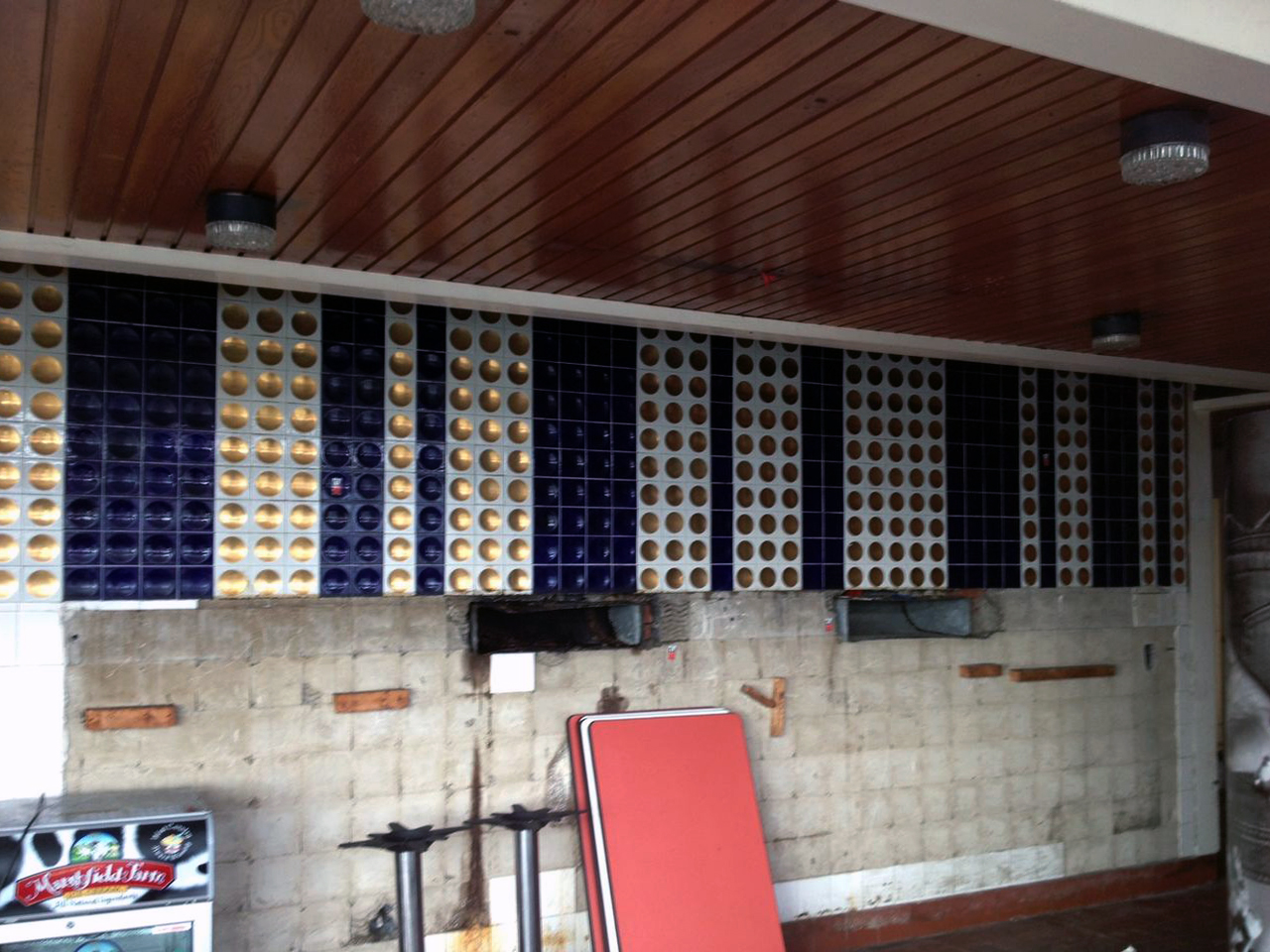
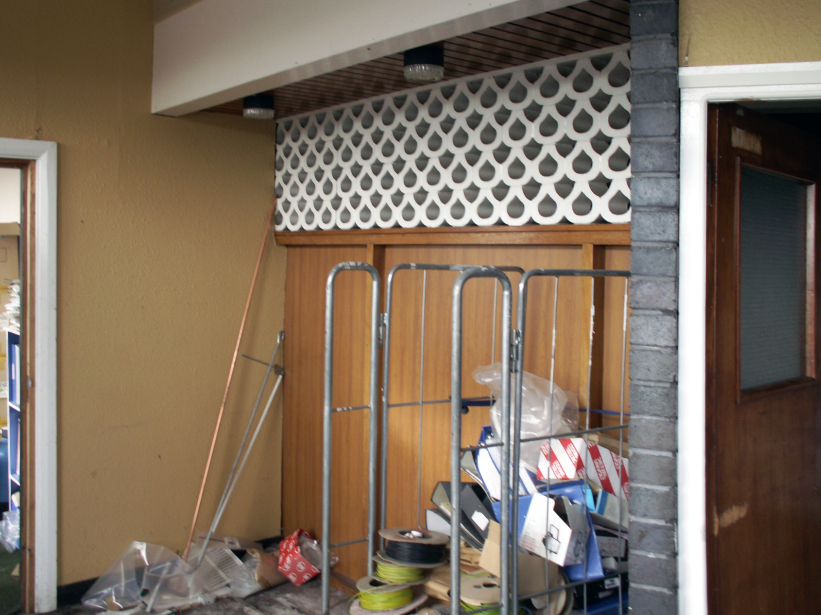
The Forton Services and the typology generally have had a chequered career, rising and falling in public favour and perception. Purveying food and facilities of varying quality, changing style and vendors with depressing regularity – knowing the value of nothing yet, the Costas of everything.
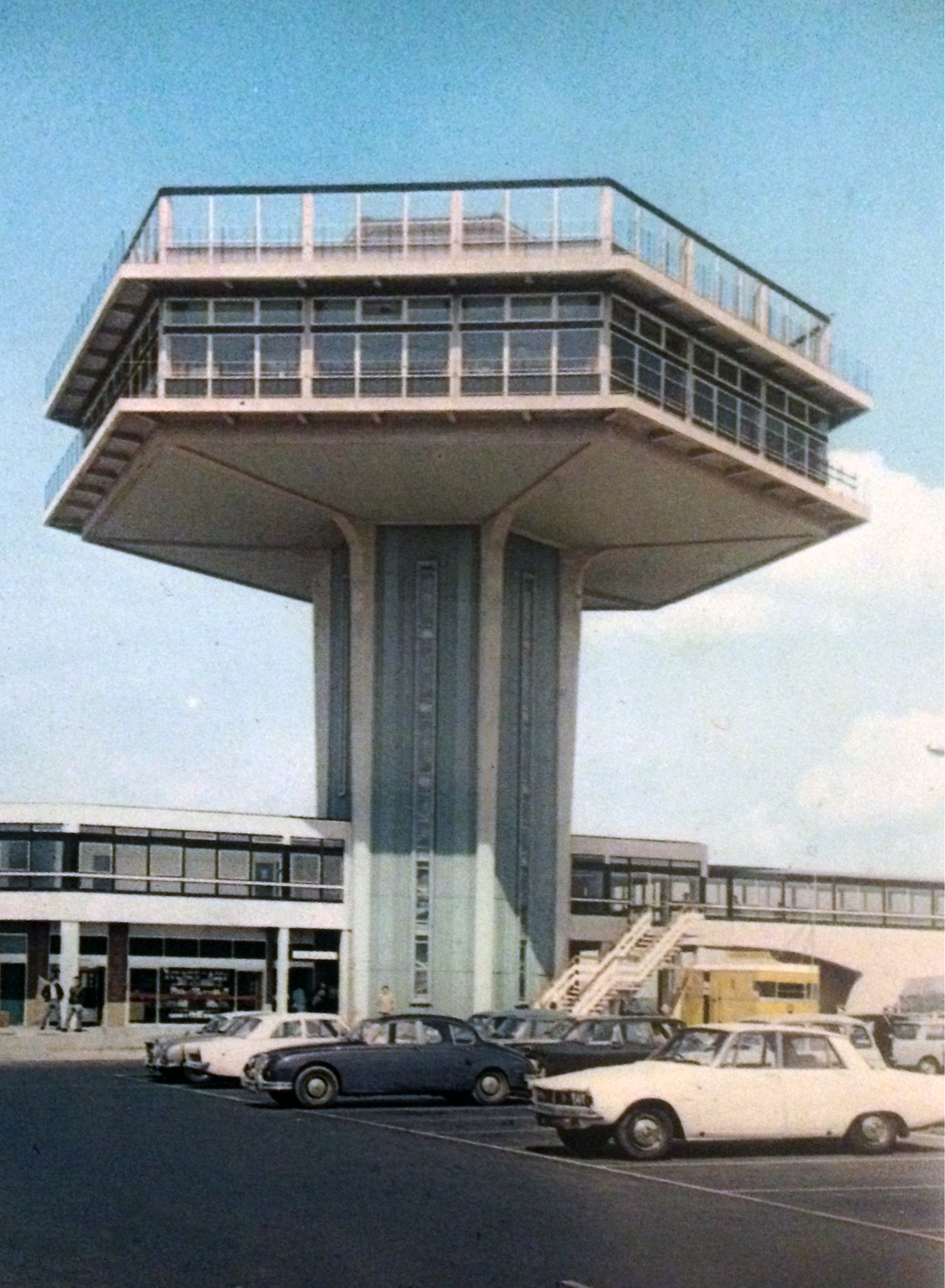
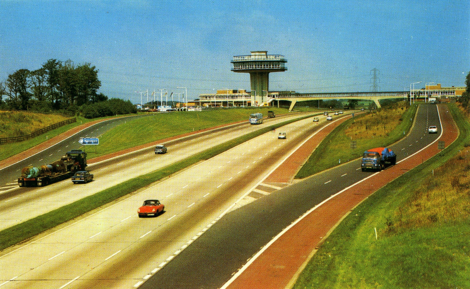
Ironically the prematurely diminished tower has taken on iconic status in the Modernist canon – listed in 2012 yet closed to the public, admired from afar – in a car.
The Pennine Tower was designed to make the services clearly visible – the ban on advertising had always been an issue, and the previous technique of having a restaurant on a bridge, like down the road at Charnock Richard, was proving expensive and impractical. Rank commissioned architects T P Bennett & Sons to capitalise on the benefits of exciting design while trialling something different. The tower resembles that used by air traffic control, summarising the dreams of the ’60s.
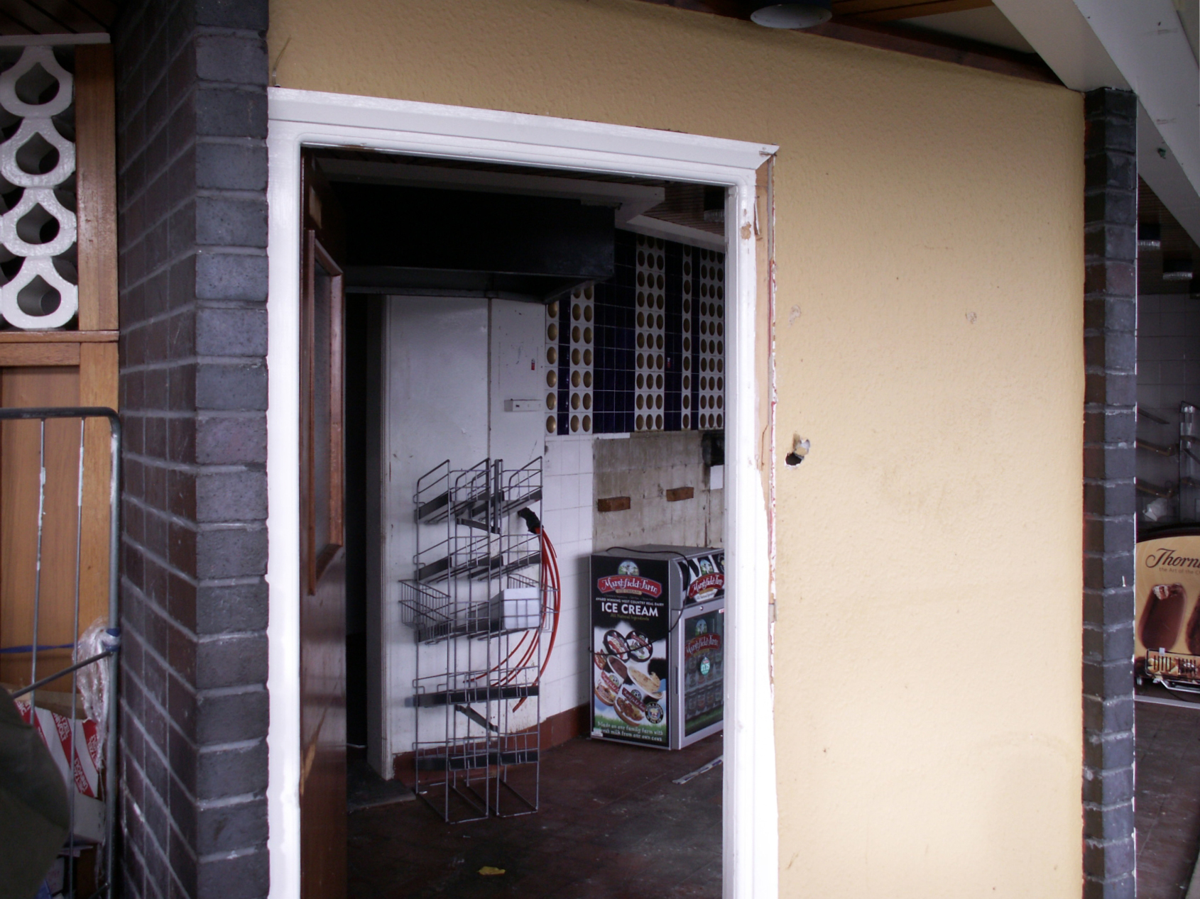
The central shaft consists of two lifts, which were originally a pentagonal design until they were replaced in 2017. They’re still in use to access the first floor, but with the buttons to higher floors disabled. There are then three service lifts, and one spiral staircase – satisfying typical health and safety regulations.
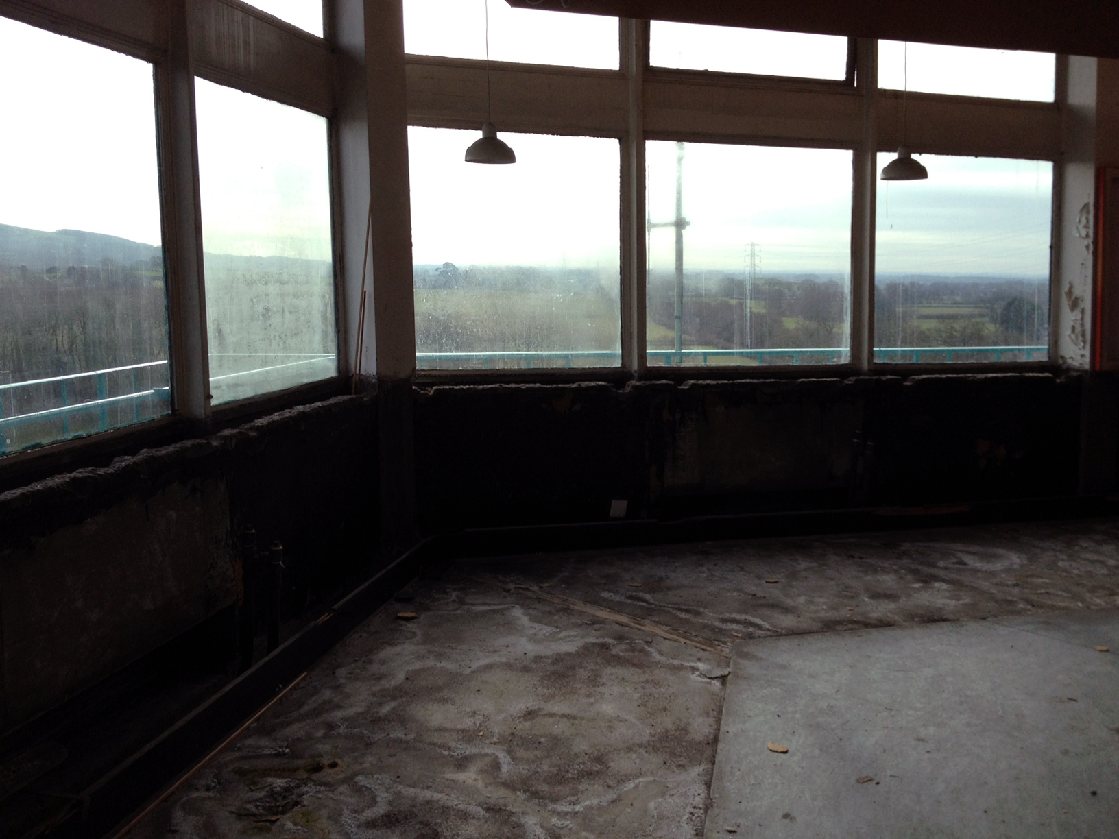
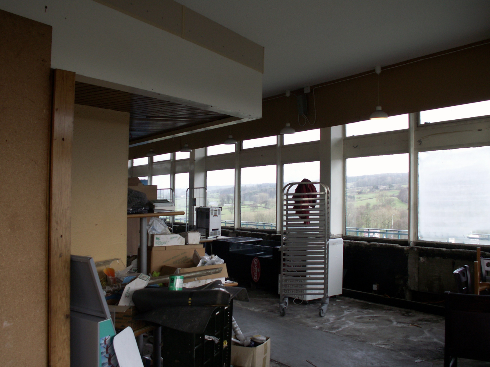
At the top of the tower stood a fine-dining waitress service restaurant, offering views over the road below and across Lancashire. Above the restaurant the lift extended to roof-level, to allow the roof to serve as a sun terrace – although Rank admitted they weren’t sure what this could be used for, suggesting serving tea or eventually building another level.
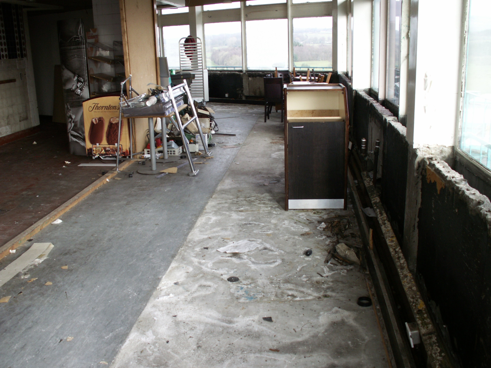
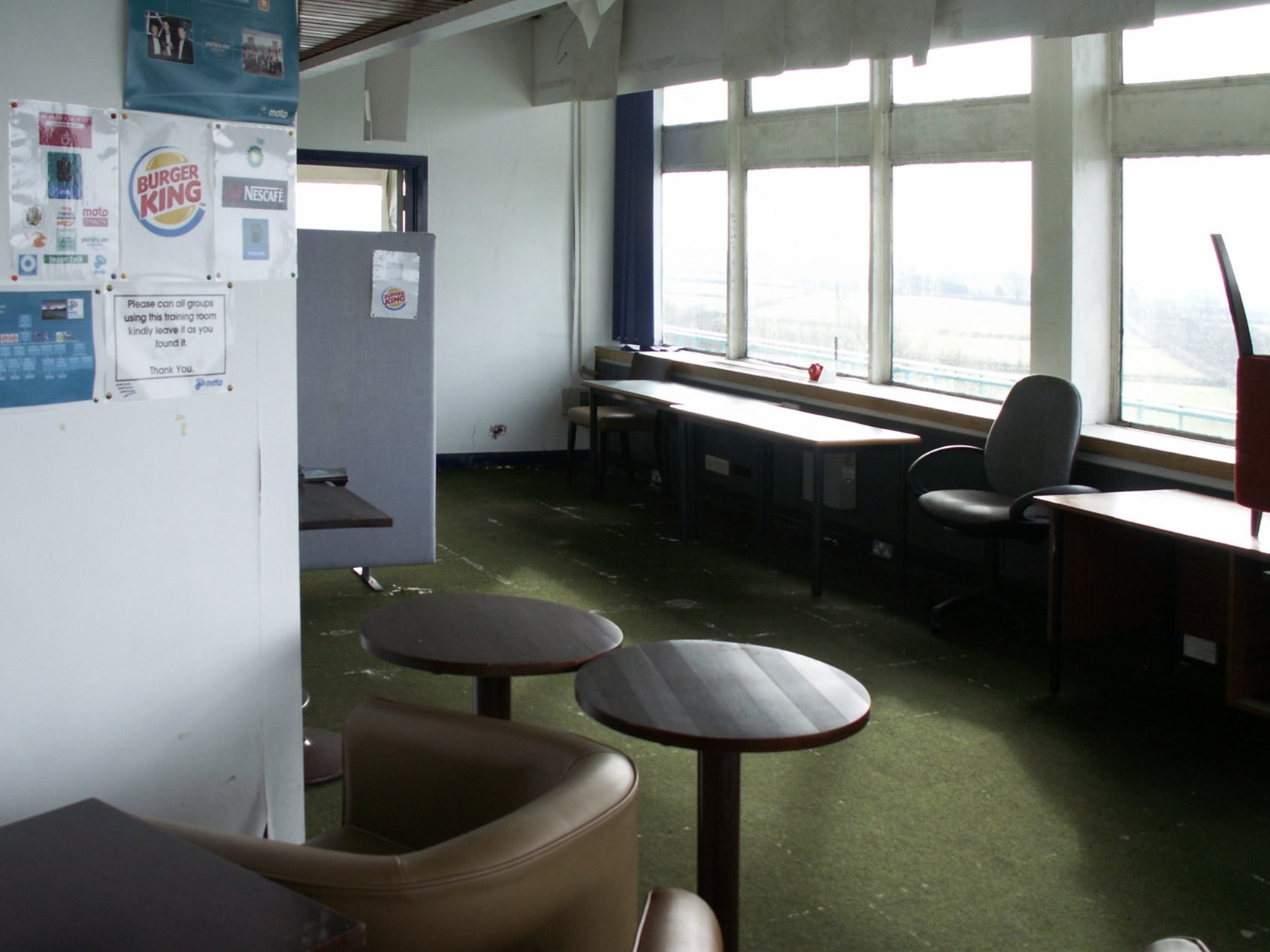
In reality social changes and cost-cutting limited the desirability of a sit-down meal, and this coupled with high maintenance costs made the tower fall out of favour. The ‘fine dining’ restaurant became the trucking lounge that had been on the first floor, before closing to the public in 1989. It then soldiered on for another 15 years, partially re-fitted, as a head office, then staff training and storage, but even this became too impractical, and the tower is now not used at all.
Although the tower is unique to these services, the concept of large high-level floors can be seen in many Rank services of the era, the idea of each one being to have a visible landmark and a good view of the surrounding area, such as at Hilton Park. The lower-level restaurant at Forton sticks out over the first floor, and partially in to the road, to give an optimum view. Toilets and offices were in the ground floor buildings below.
There are lots of myths flying around that the tower was forced to close by safety regulations, and that it is about to fall down. Like any building which hasn’t been used for 30 years it would take a lot of investment to get it open again, and with roadside restaurants across the country closing due to a lack of trade, nobody has come up with an convincing plan to justify investing in the Pennine Tower.
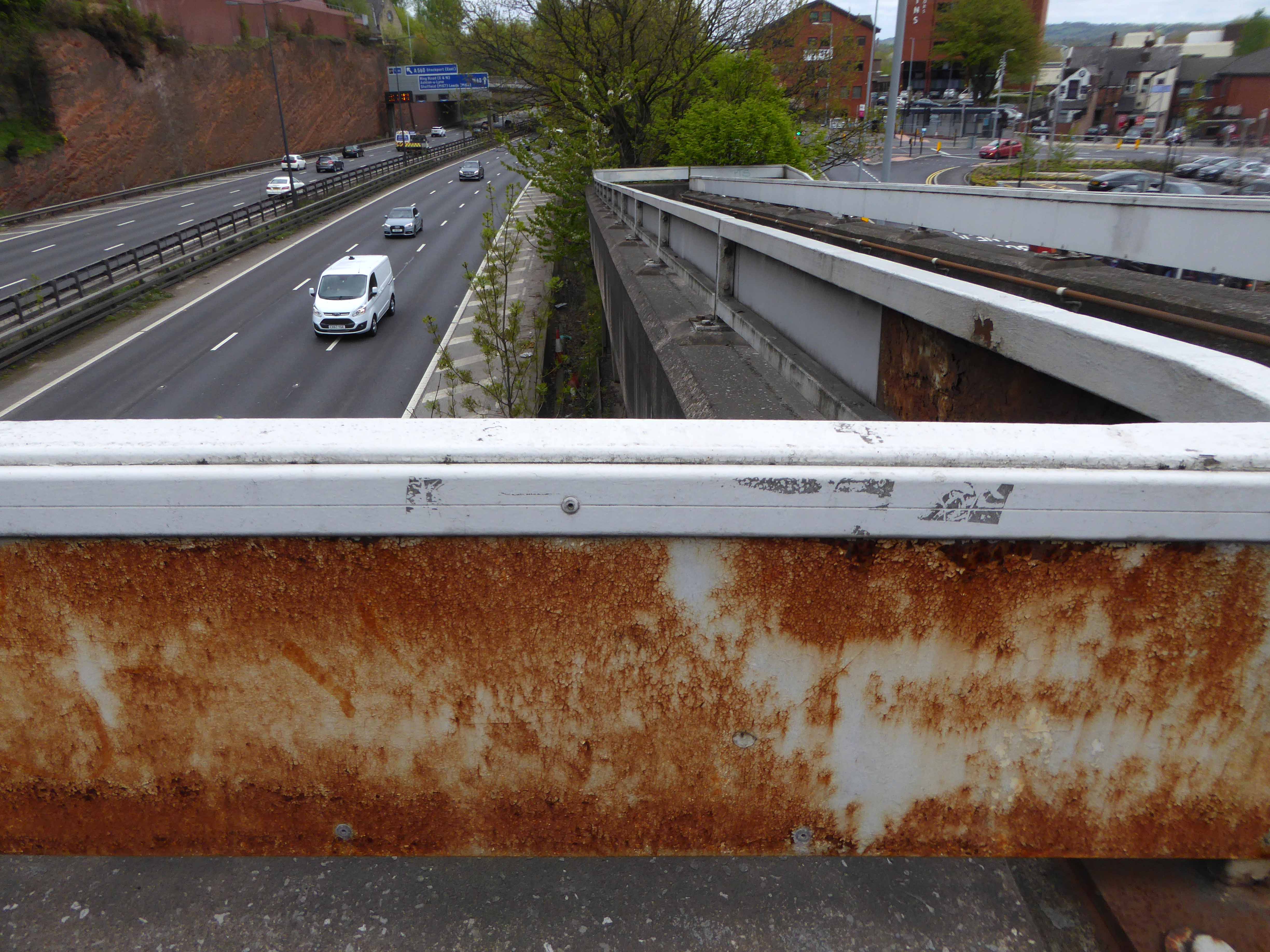
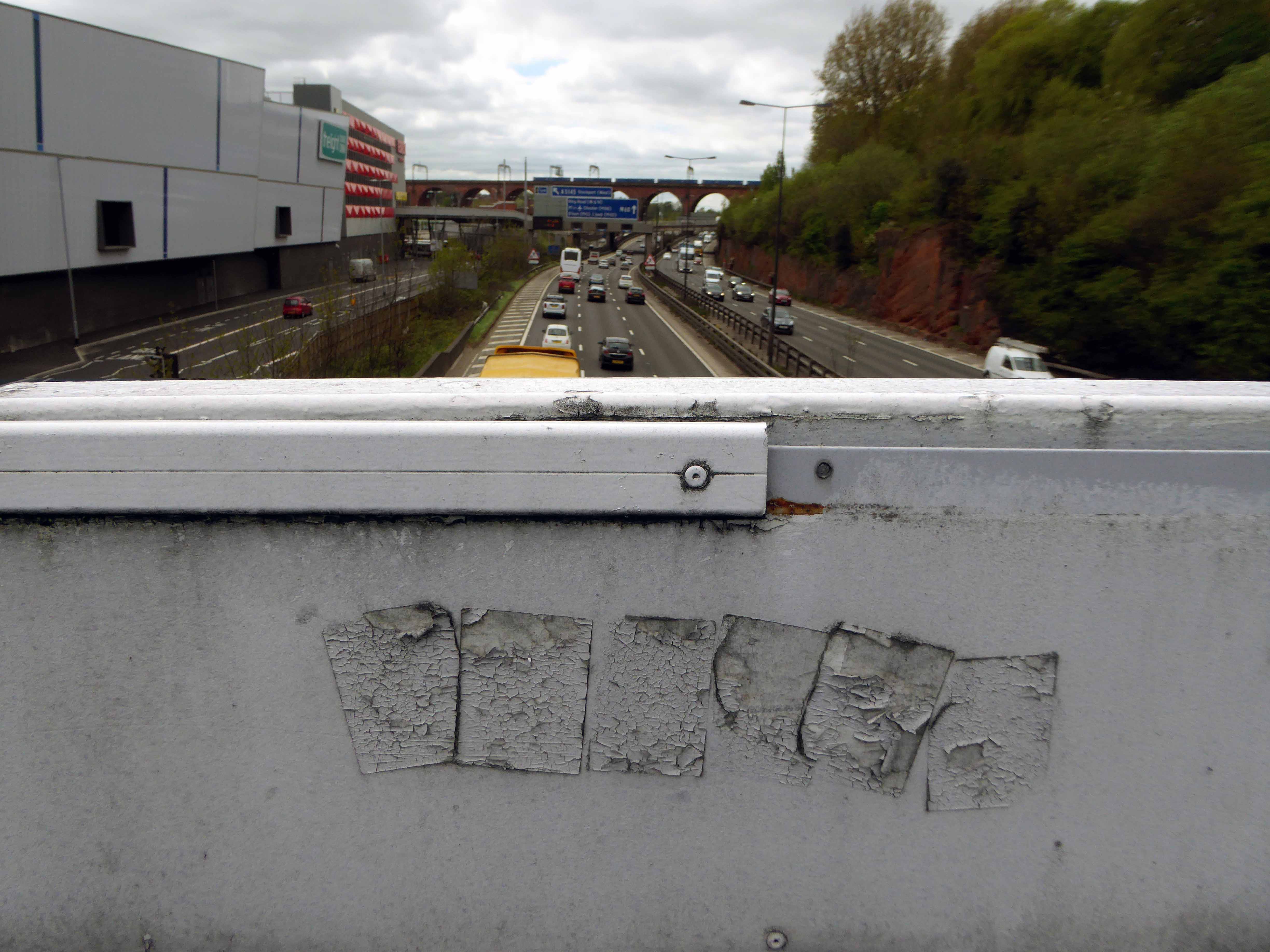
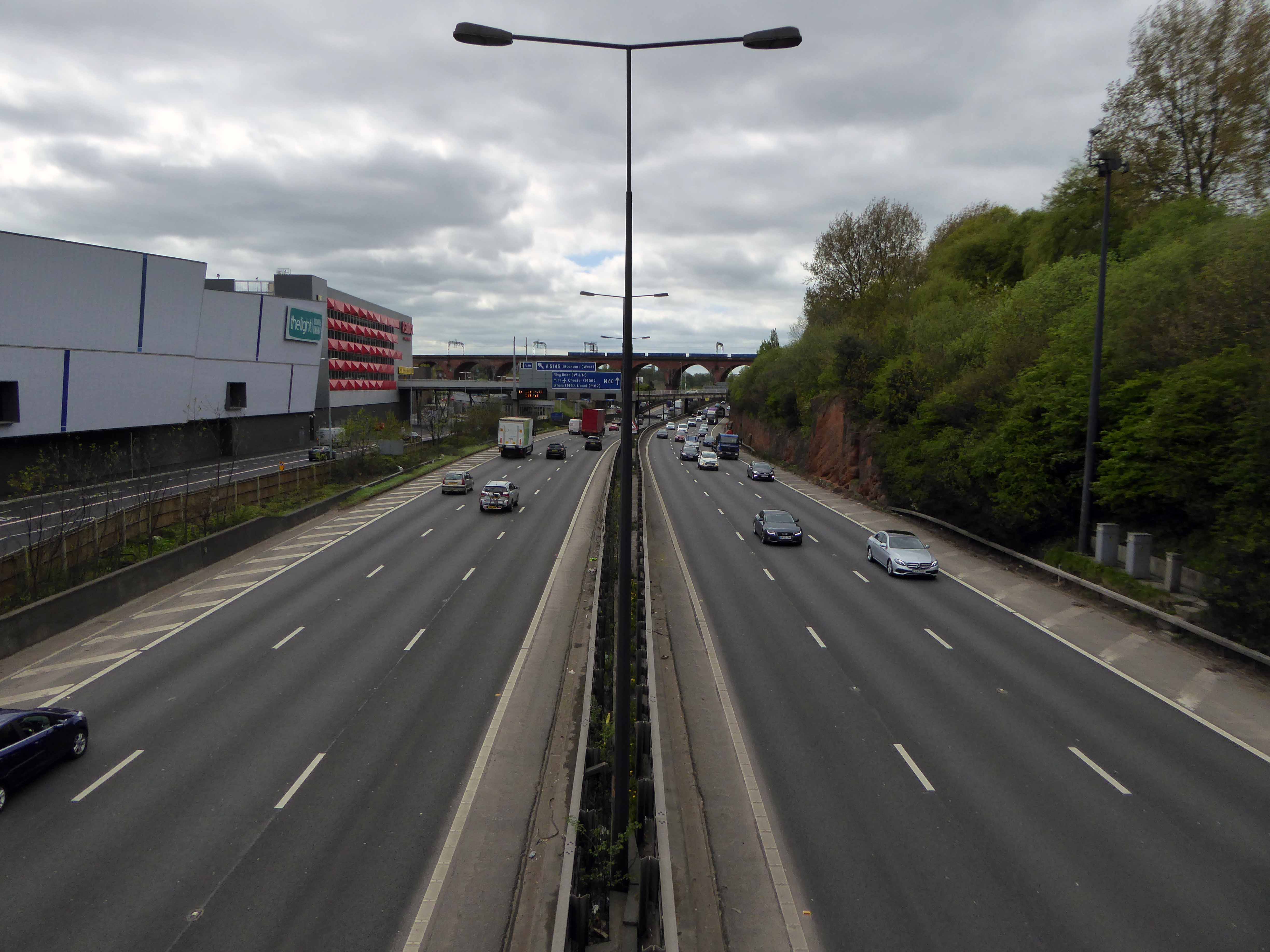
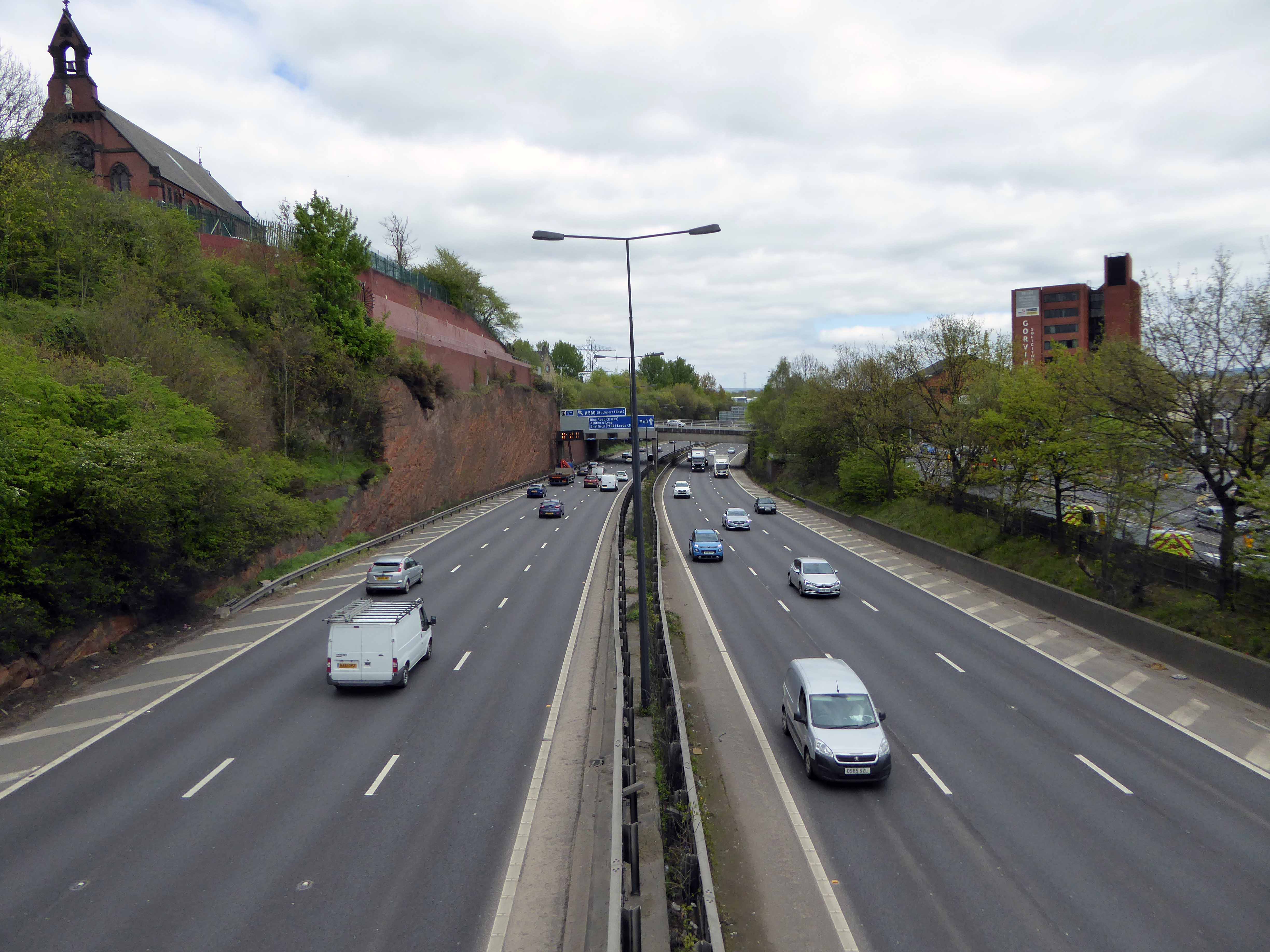
A Moebius Band of motorway formerly known as the M63 wraps and warps itself around the city, ever so conveniently linking the traffic of Greater Manchester with itself.
Ever so conveniently it passes through Stockport – only moments from my home.
Before the white man came.
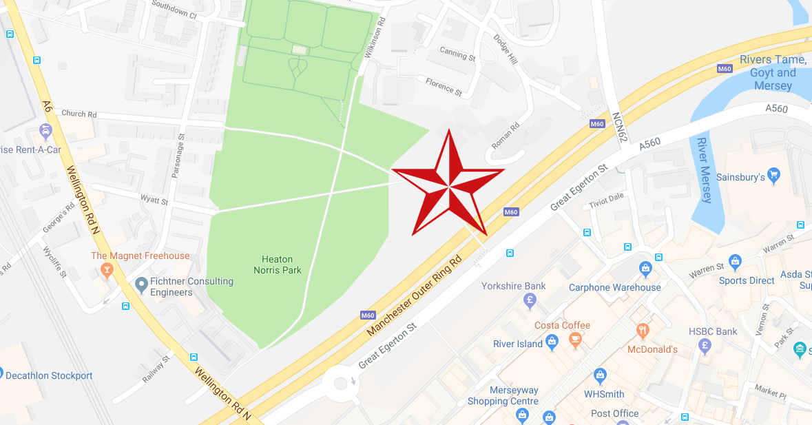
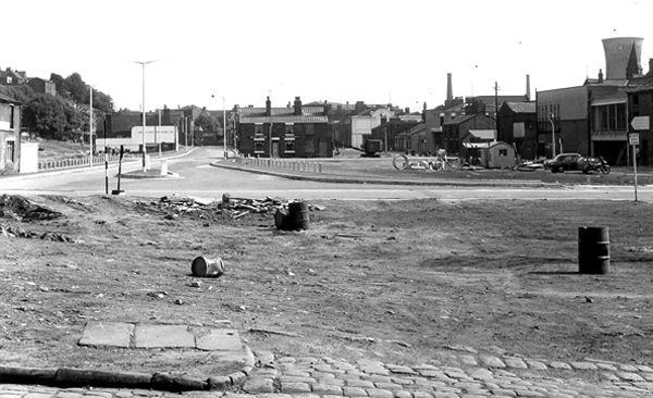
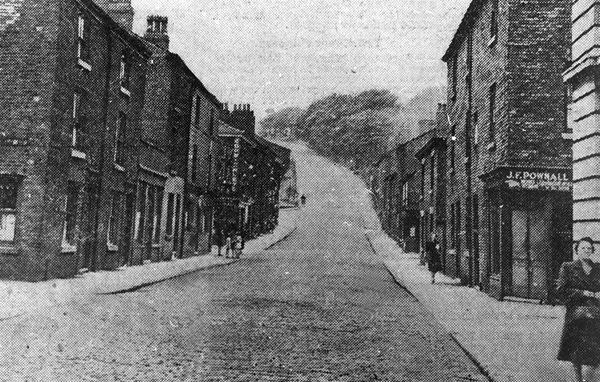
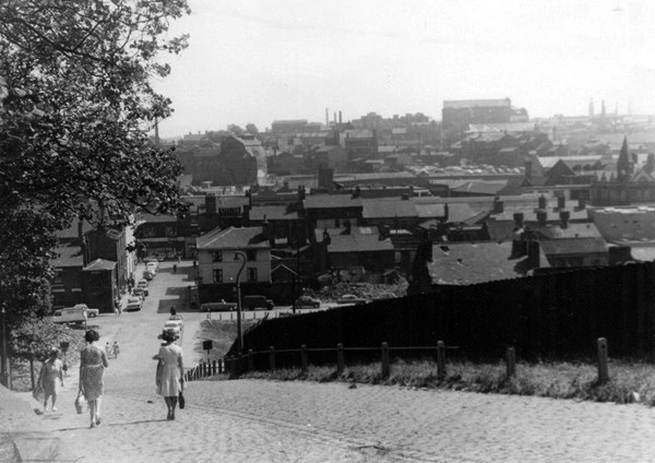
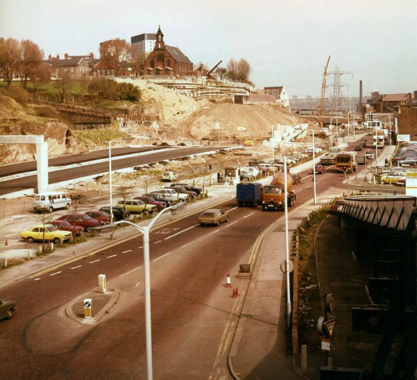
The view from Princes Street along Hatton Street – towards Heaton Norris Rec.
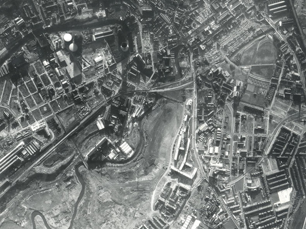
1945
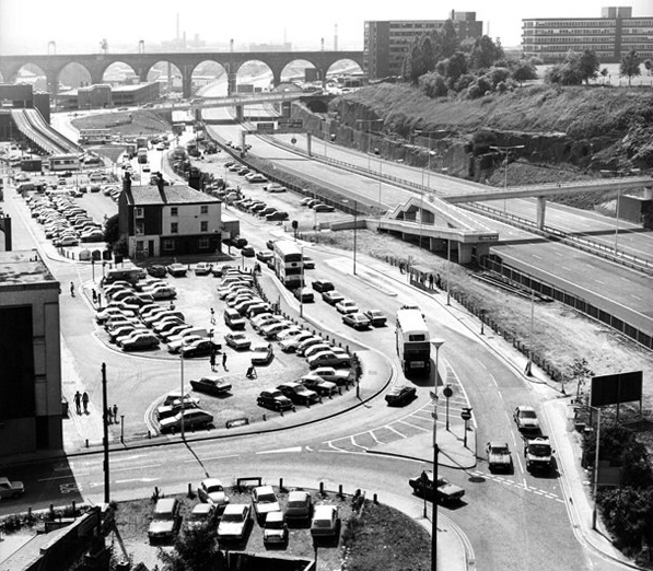
1960
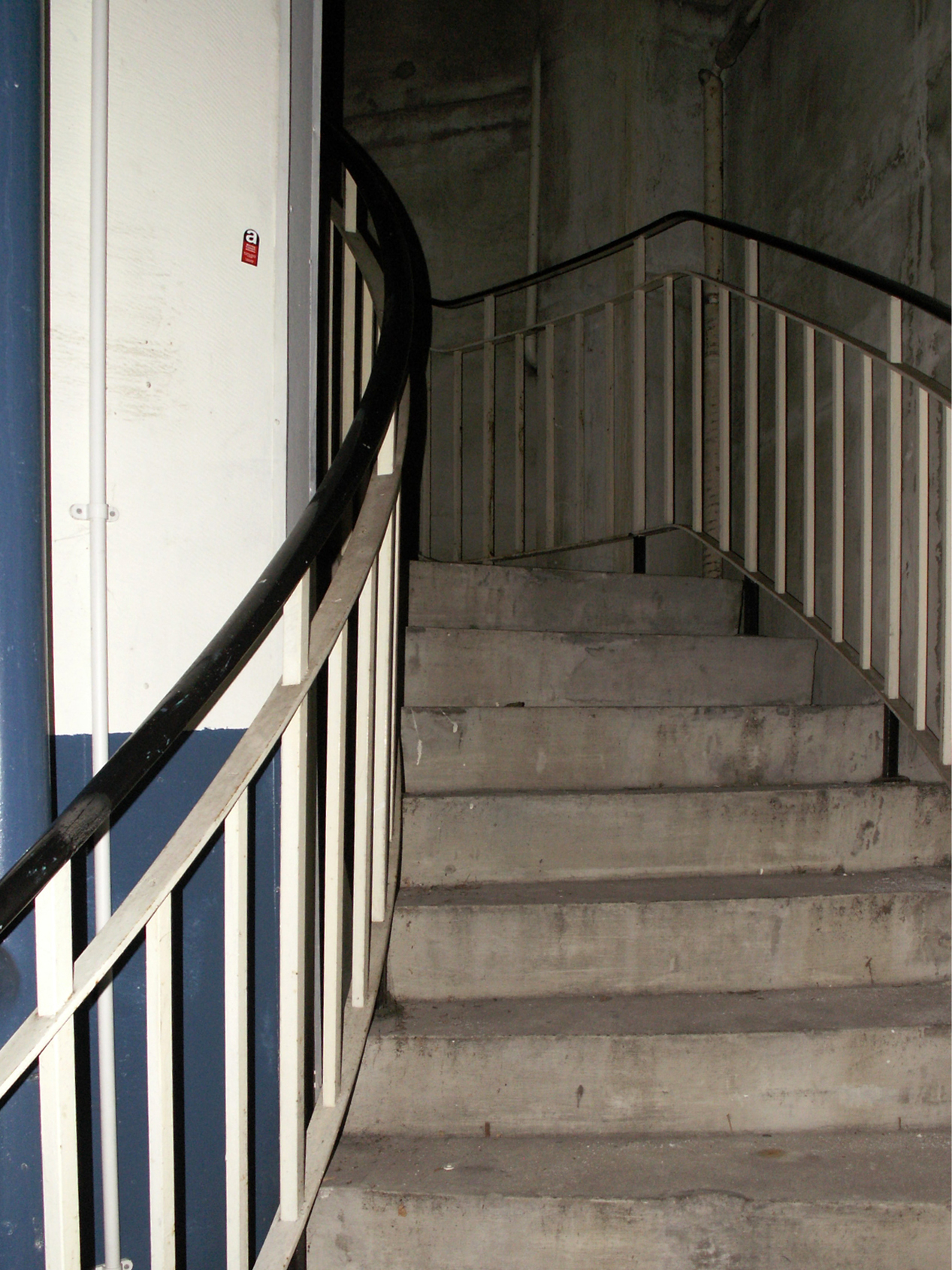
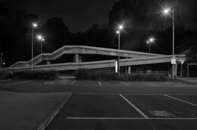
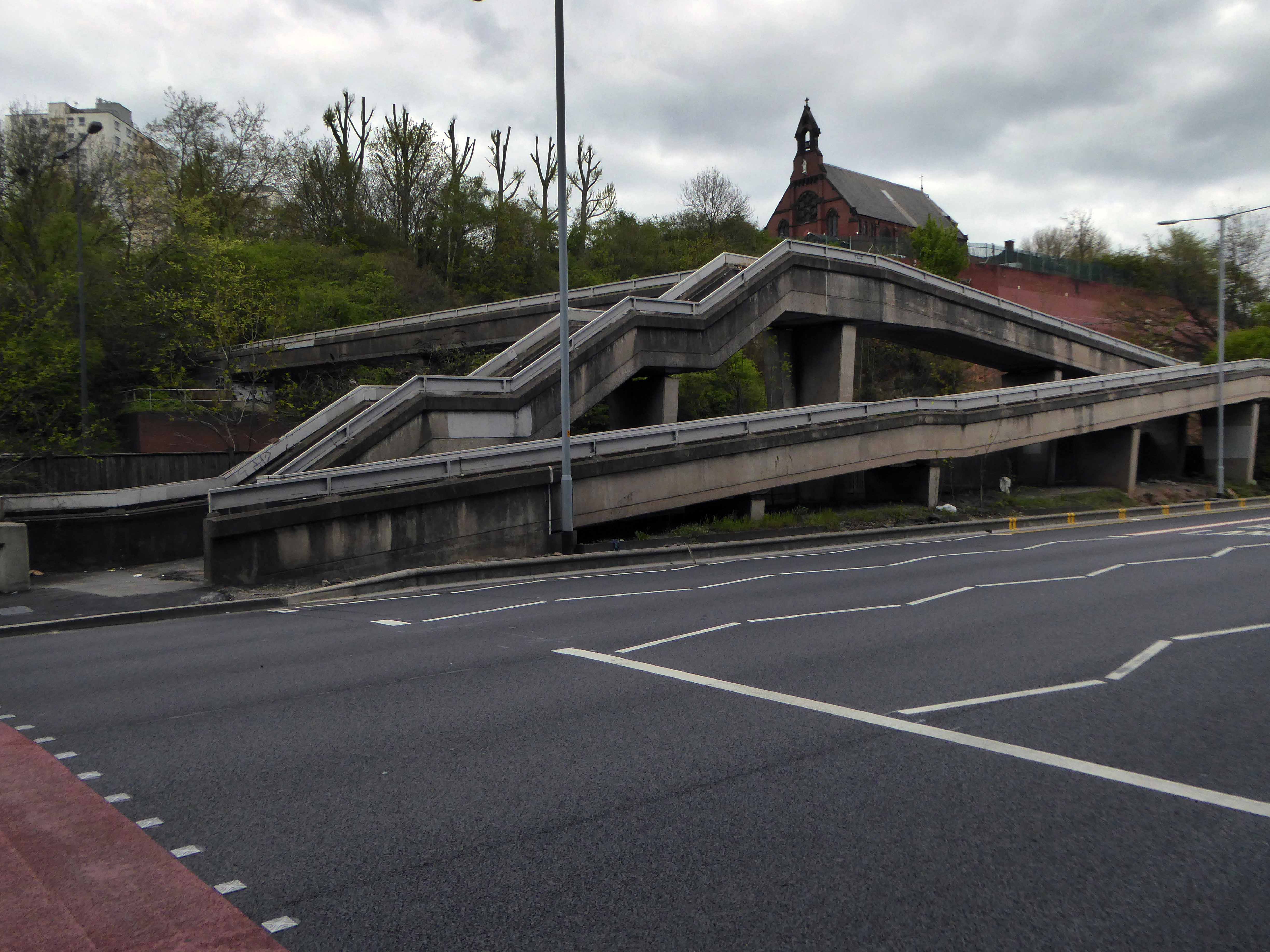
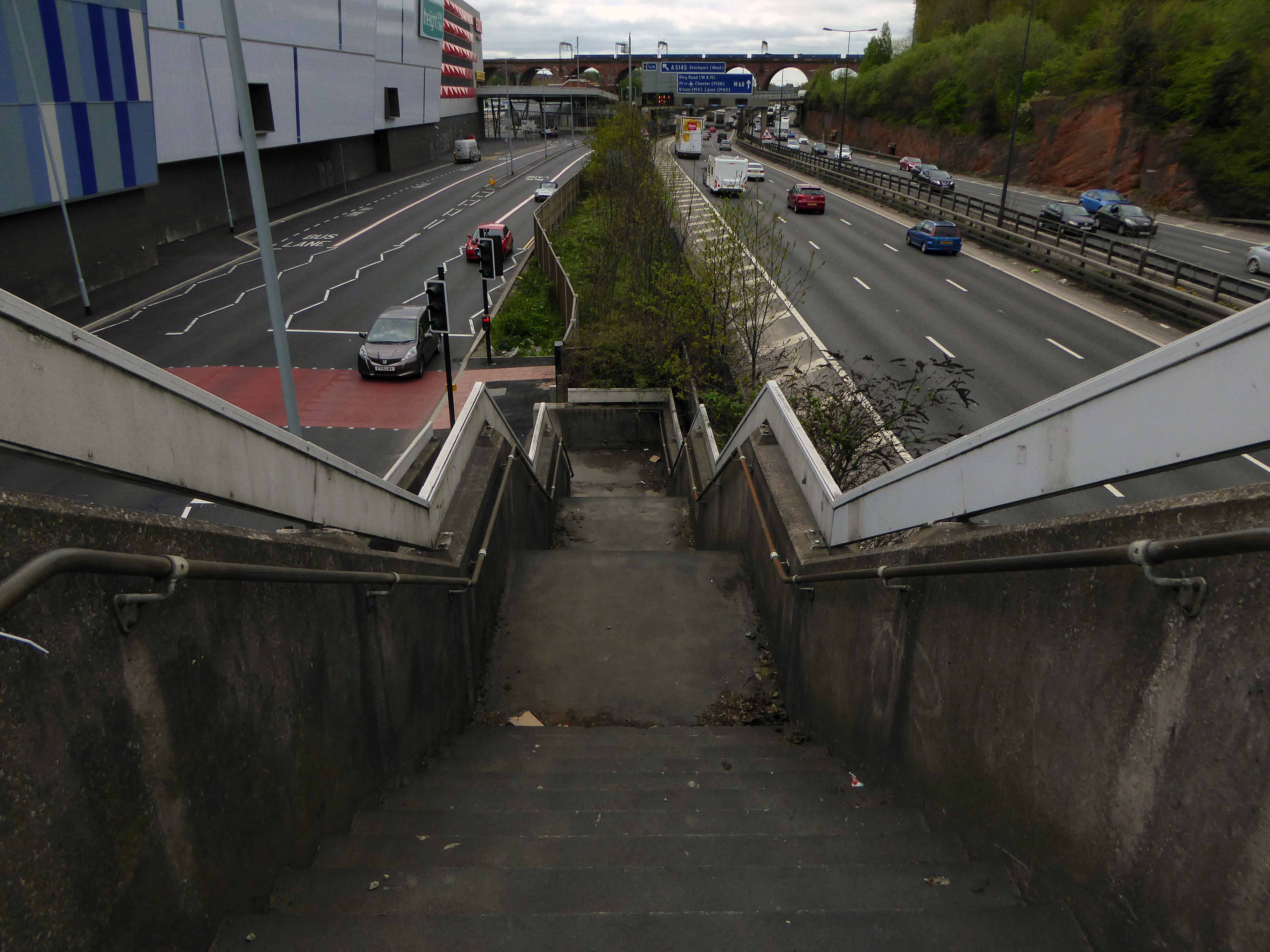
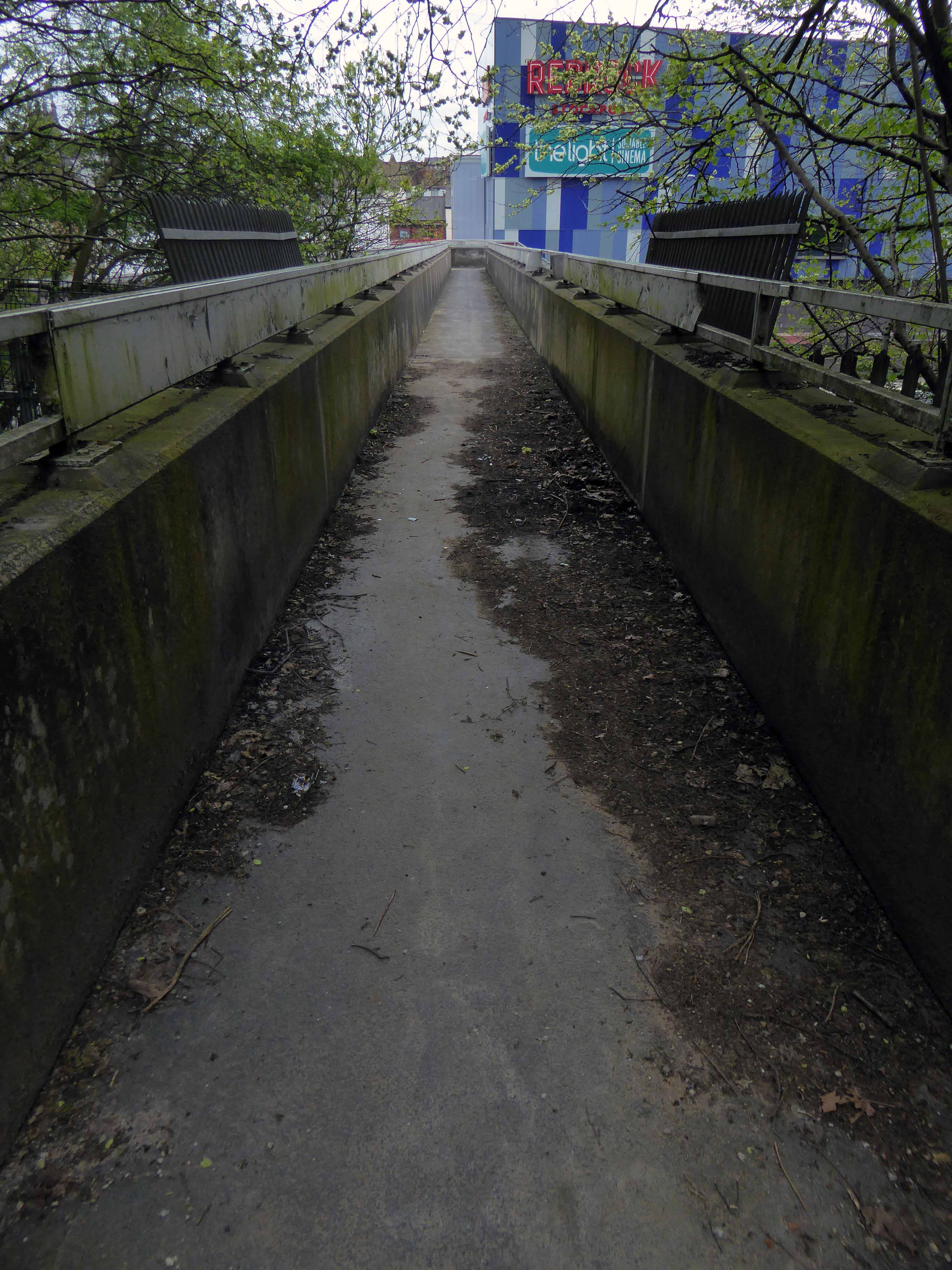
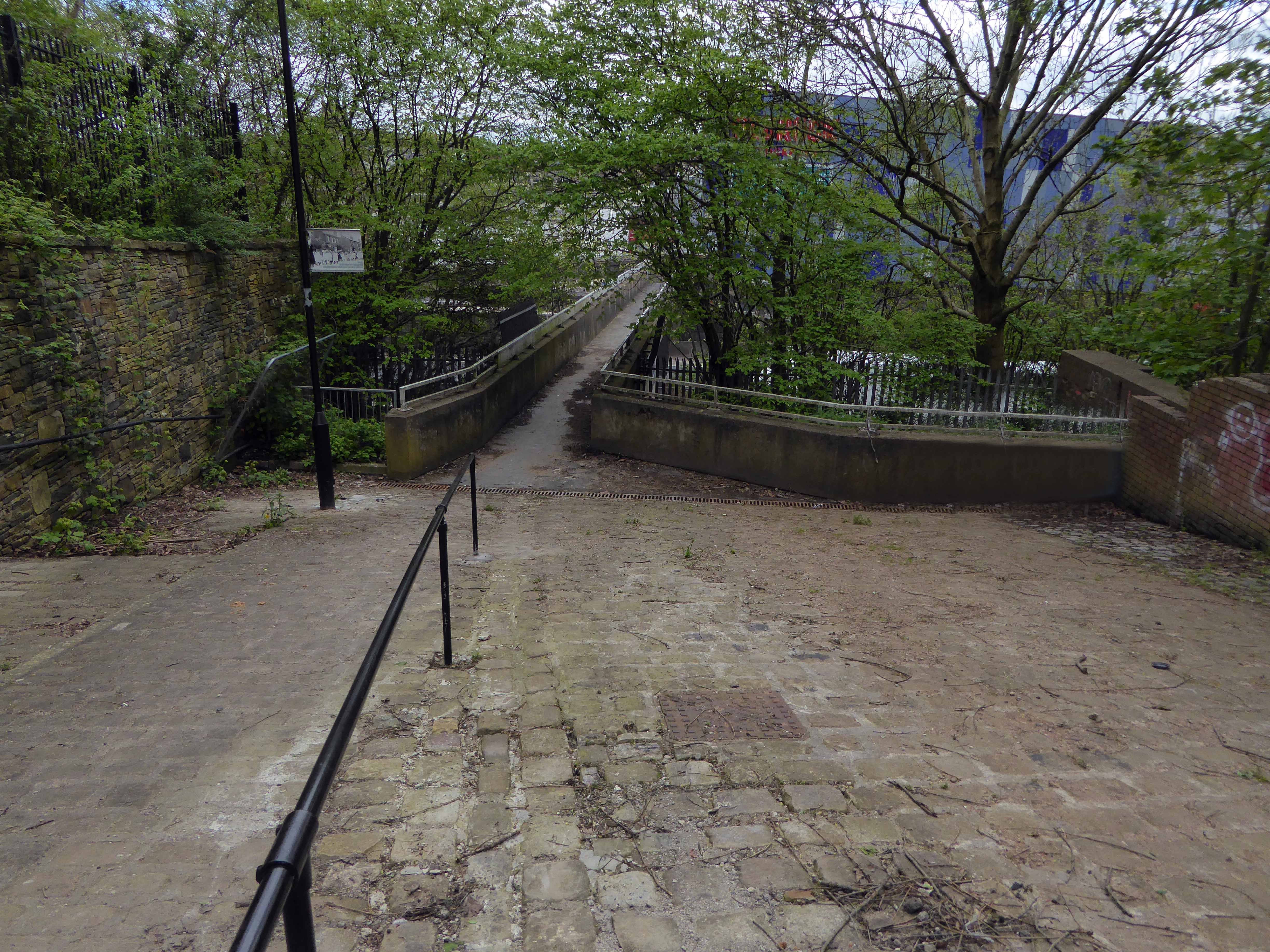
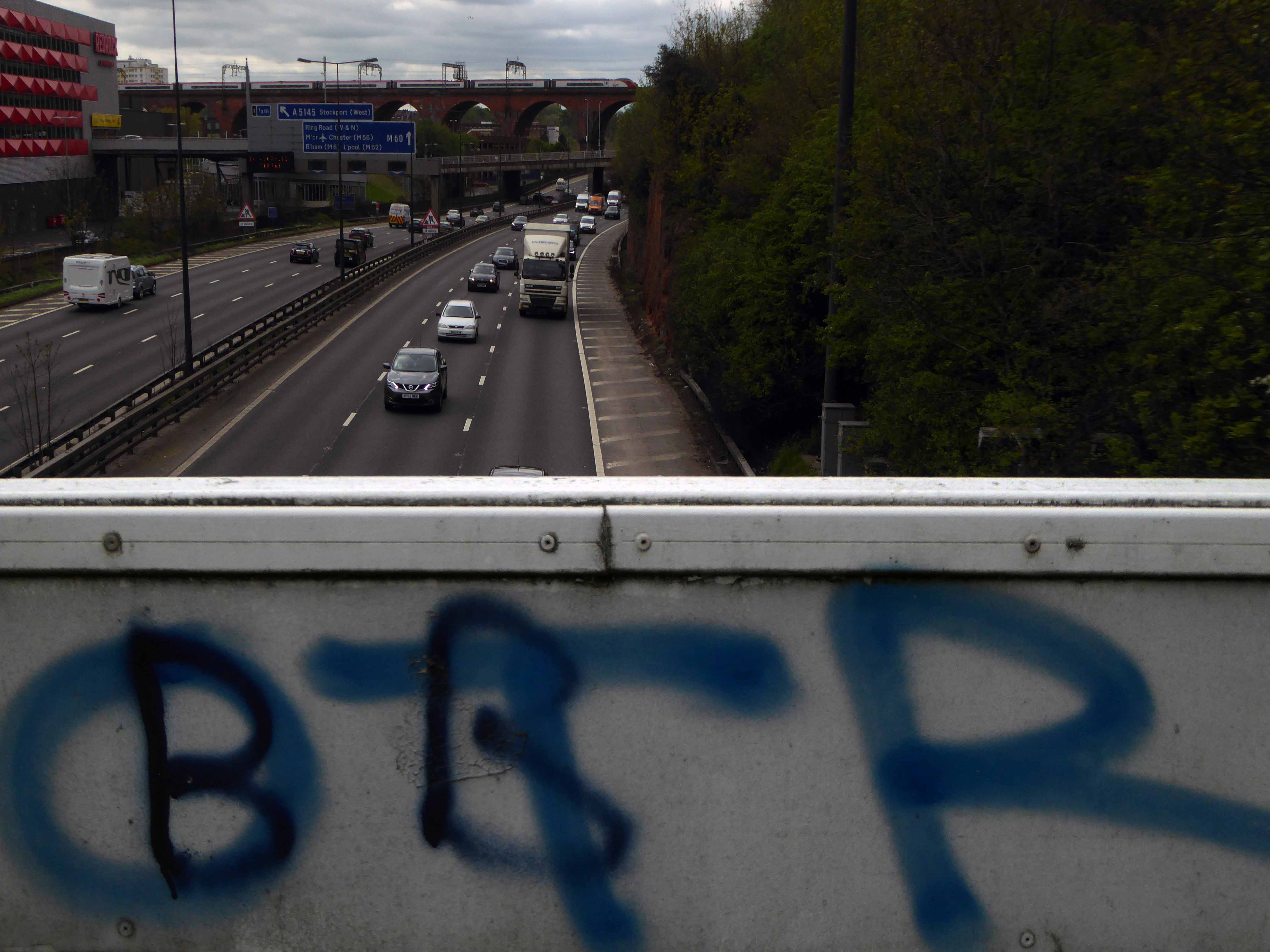
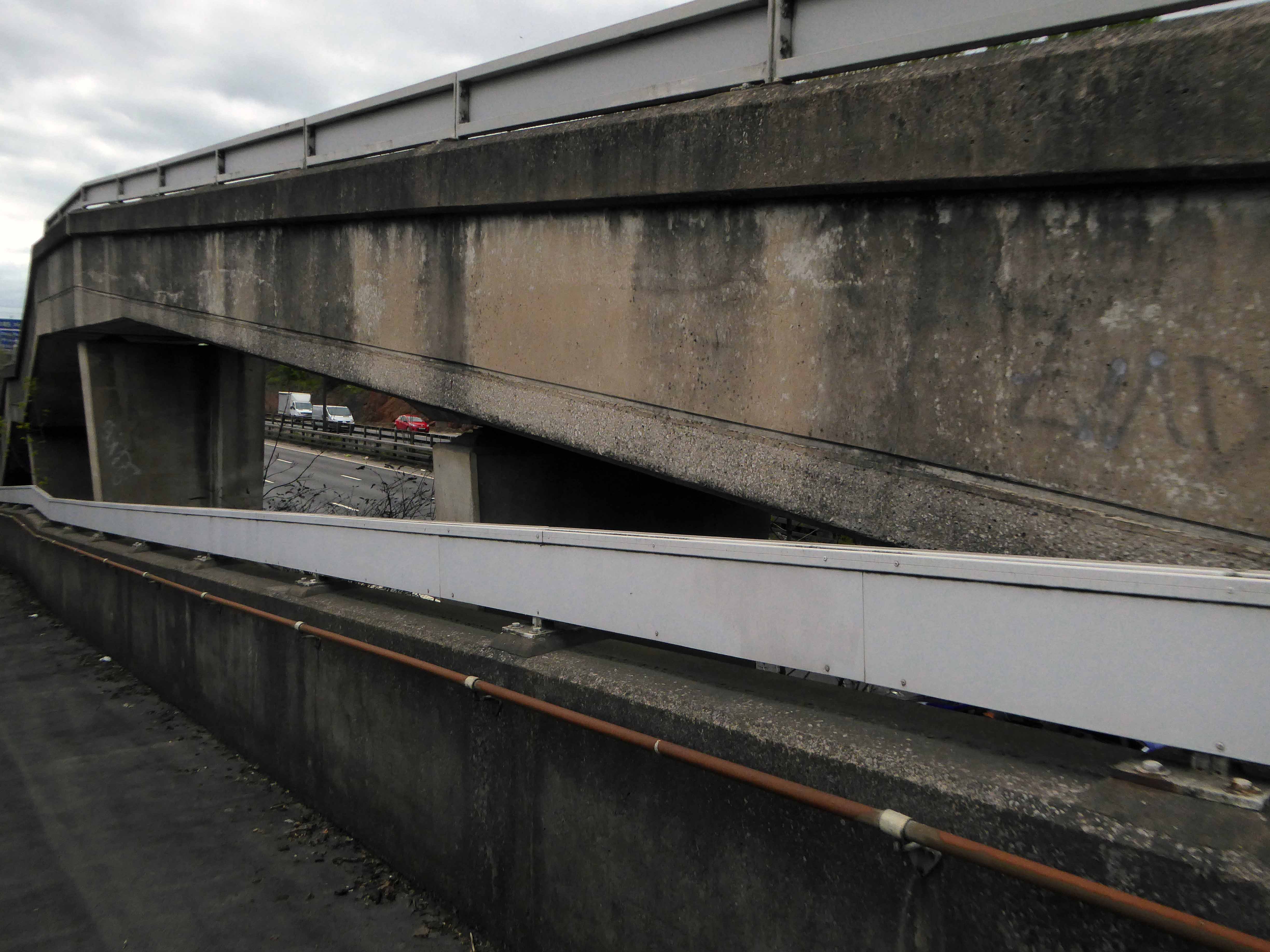
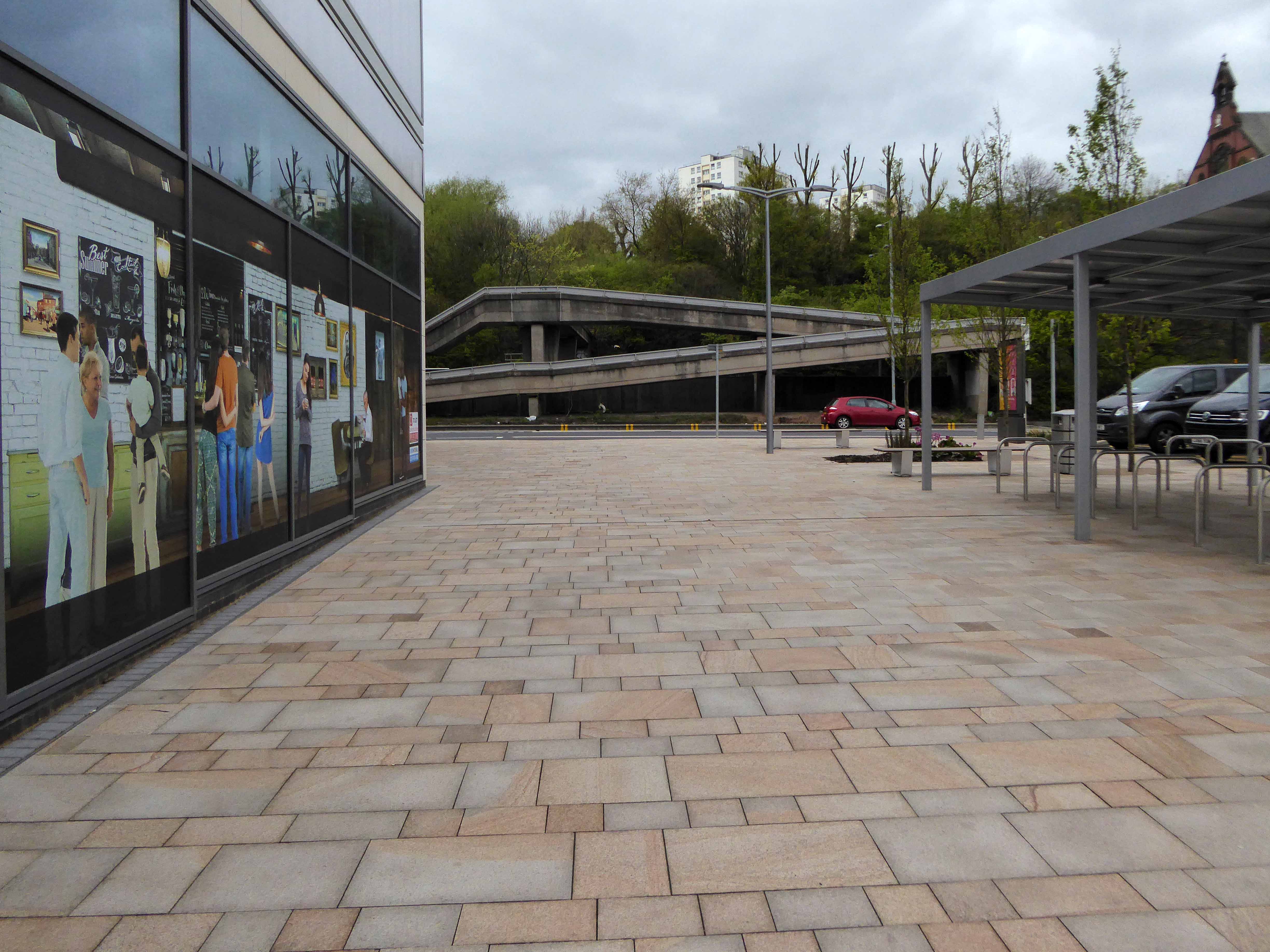
A boon to the modern day motorist, though happily the modern day pedestrian is also catered for in the form of the Hatton Street Footbridge – linking Great Egerton Street below, with Heaton Norris Recreation ground above.
Images TS Parkinson – Stockport Image Archive
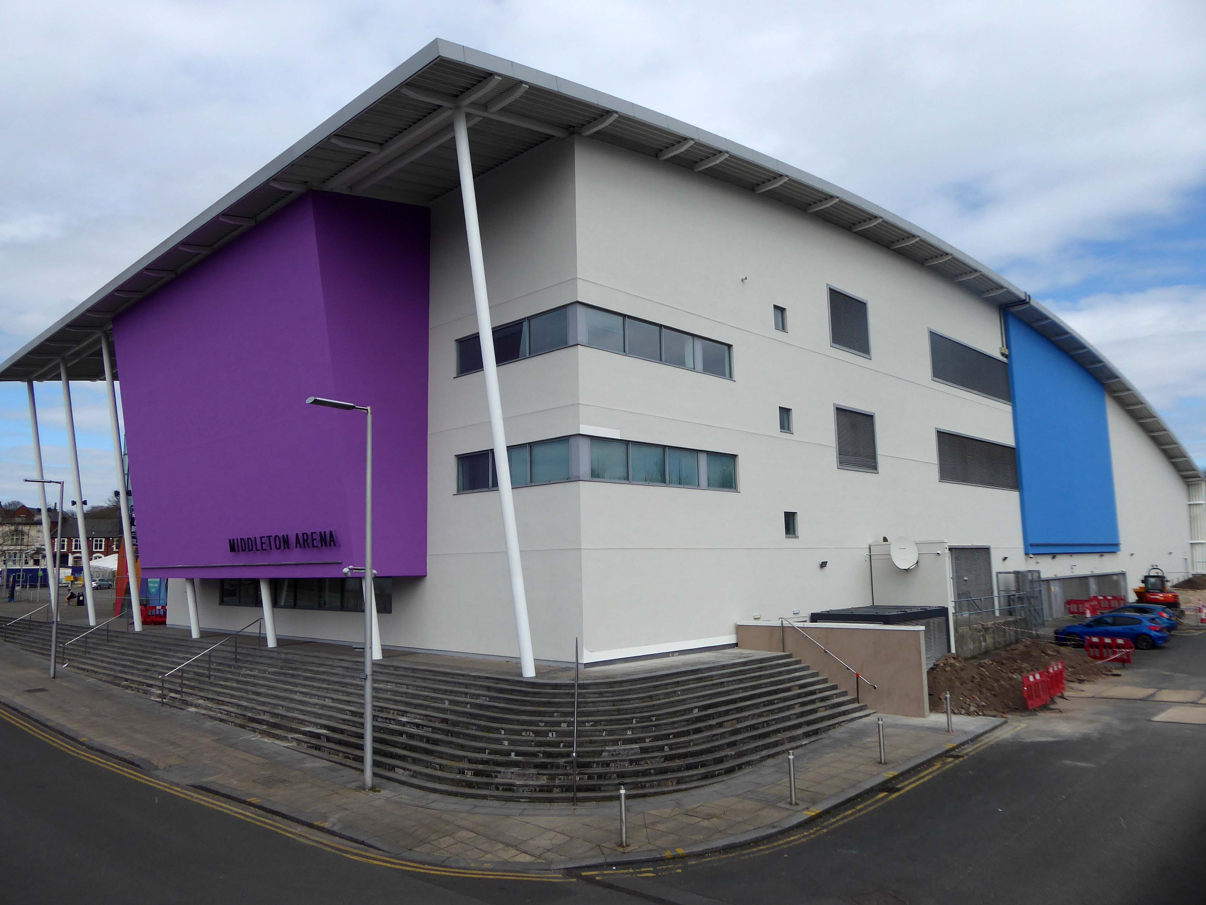
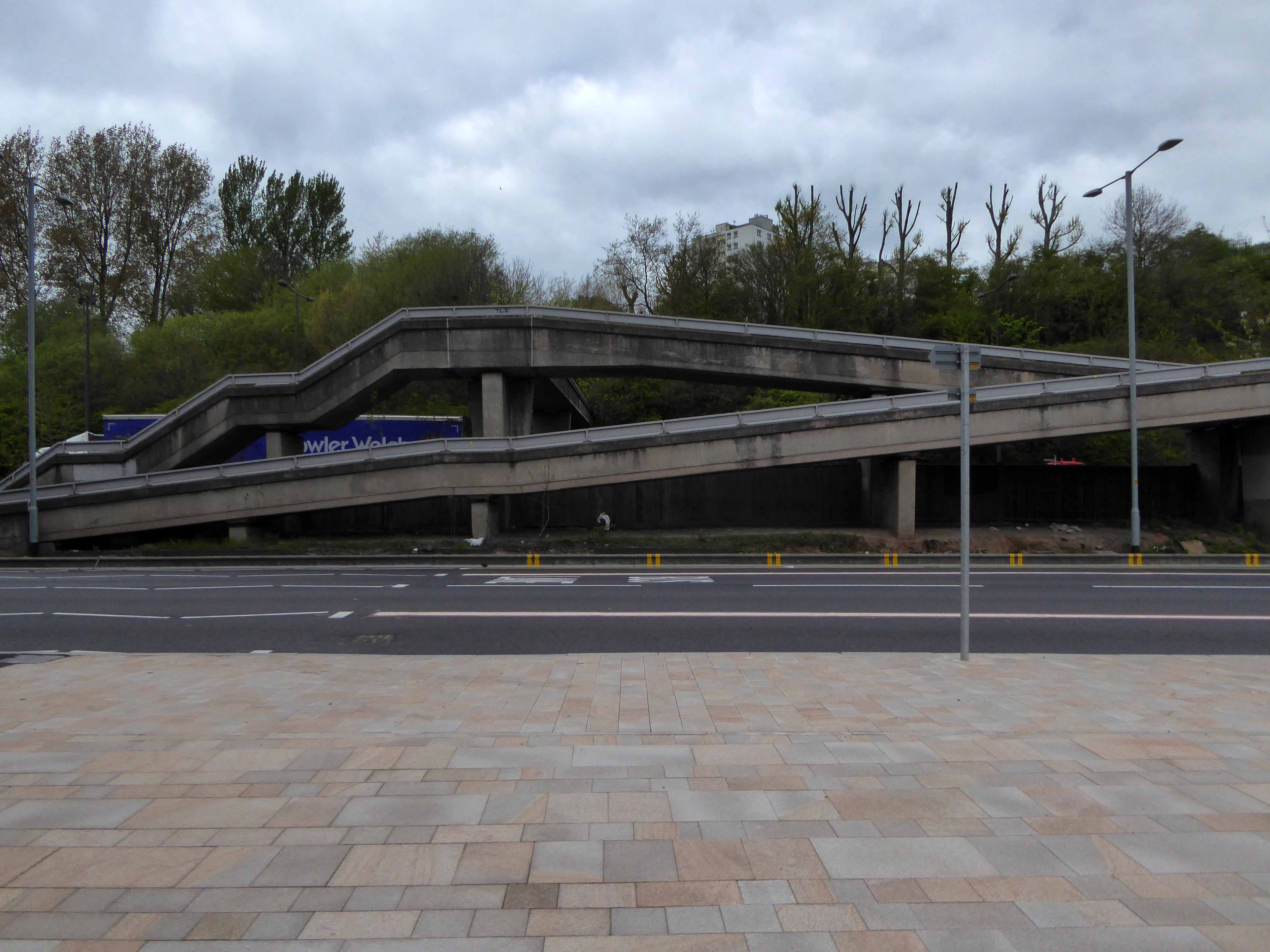
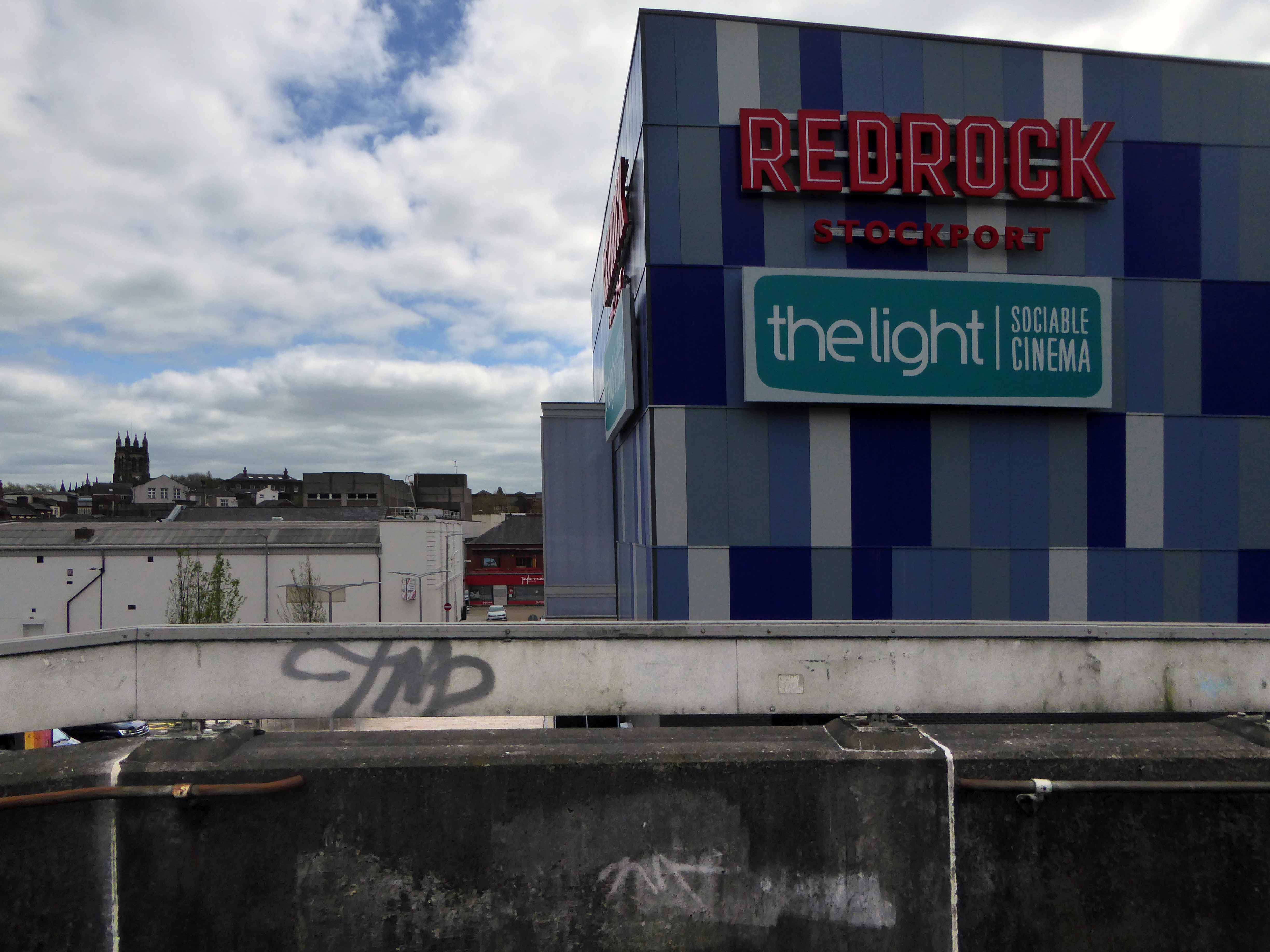
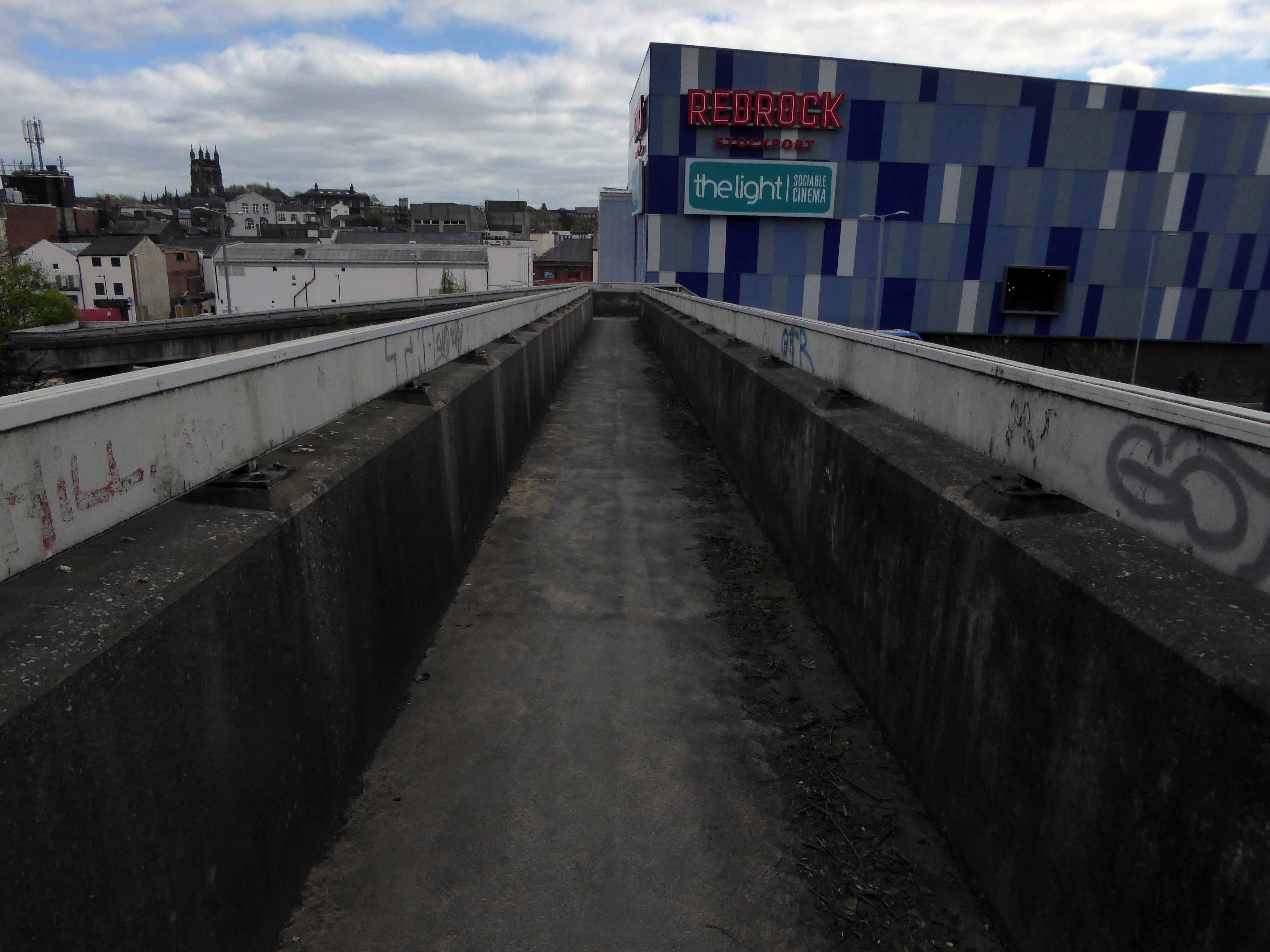
For the past two years the footbridge has been inconveniently closed, during the development of the Redrock Leisure Facility, built on the site of the former car park, in the foreground of the image above. Thus prohibiting the passage from the Post Modern world of the big brash entertainment box, to the leafy cobbled street beyond.
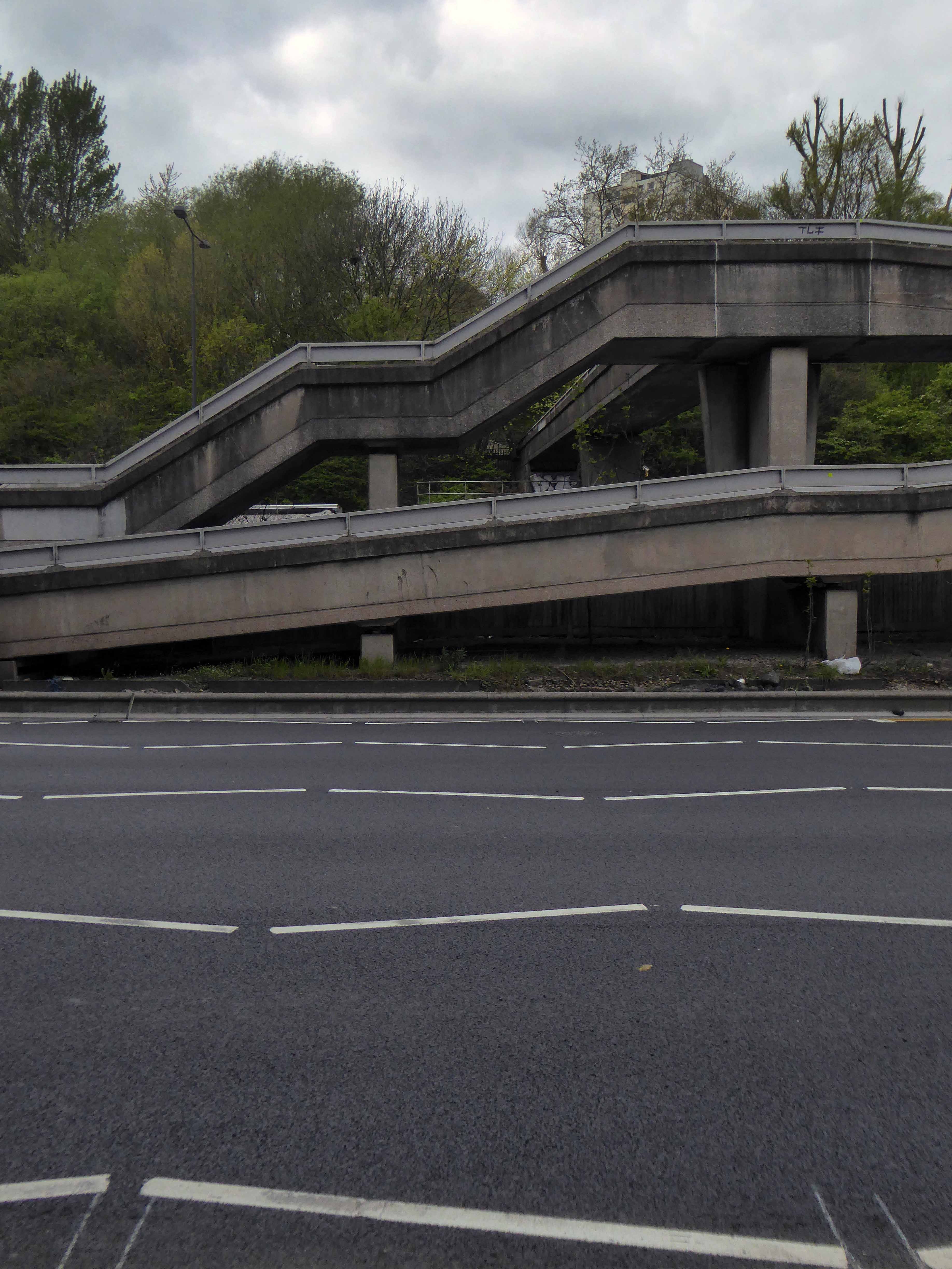
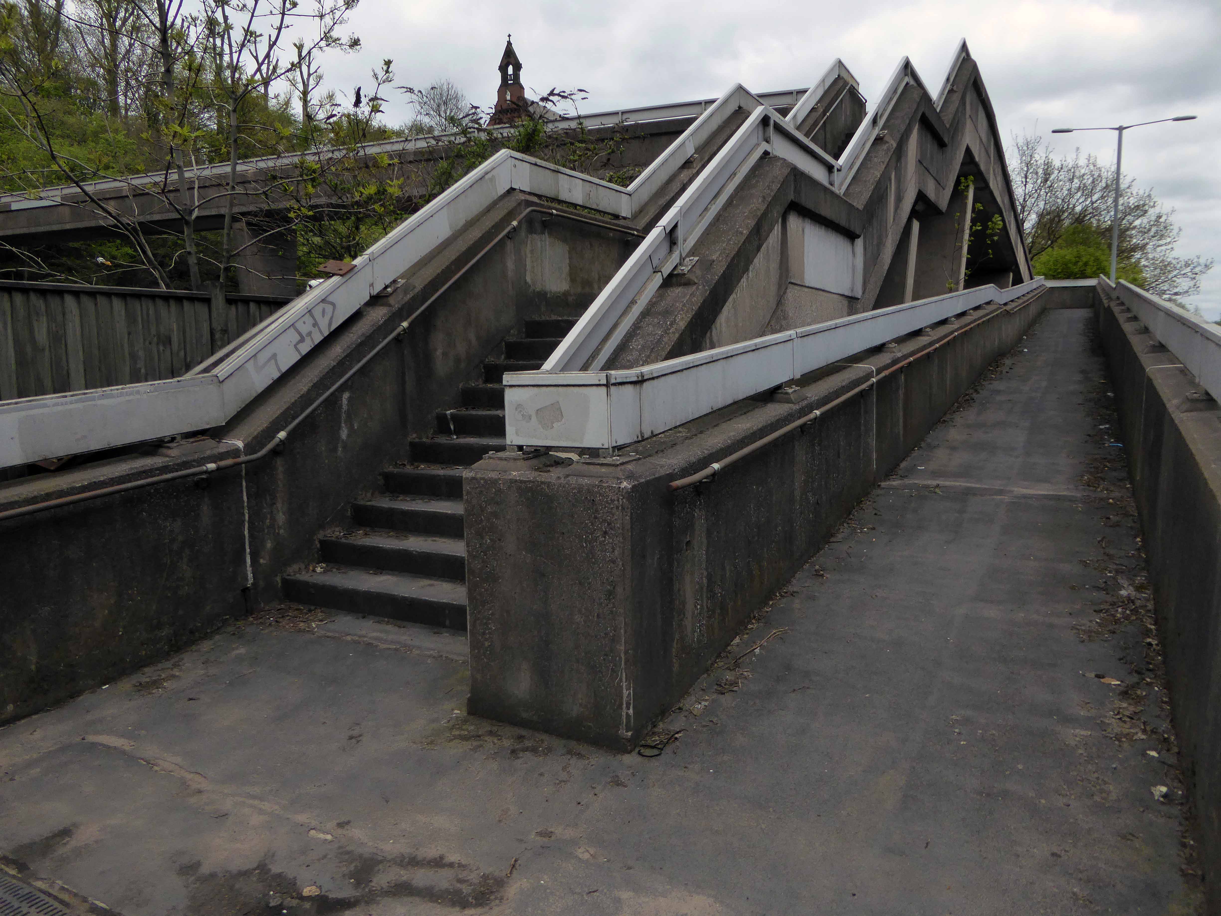
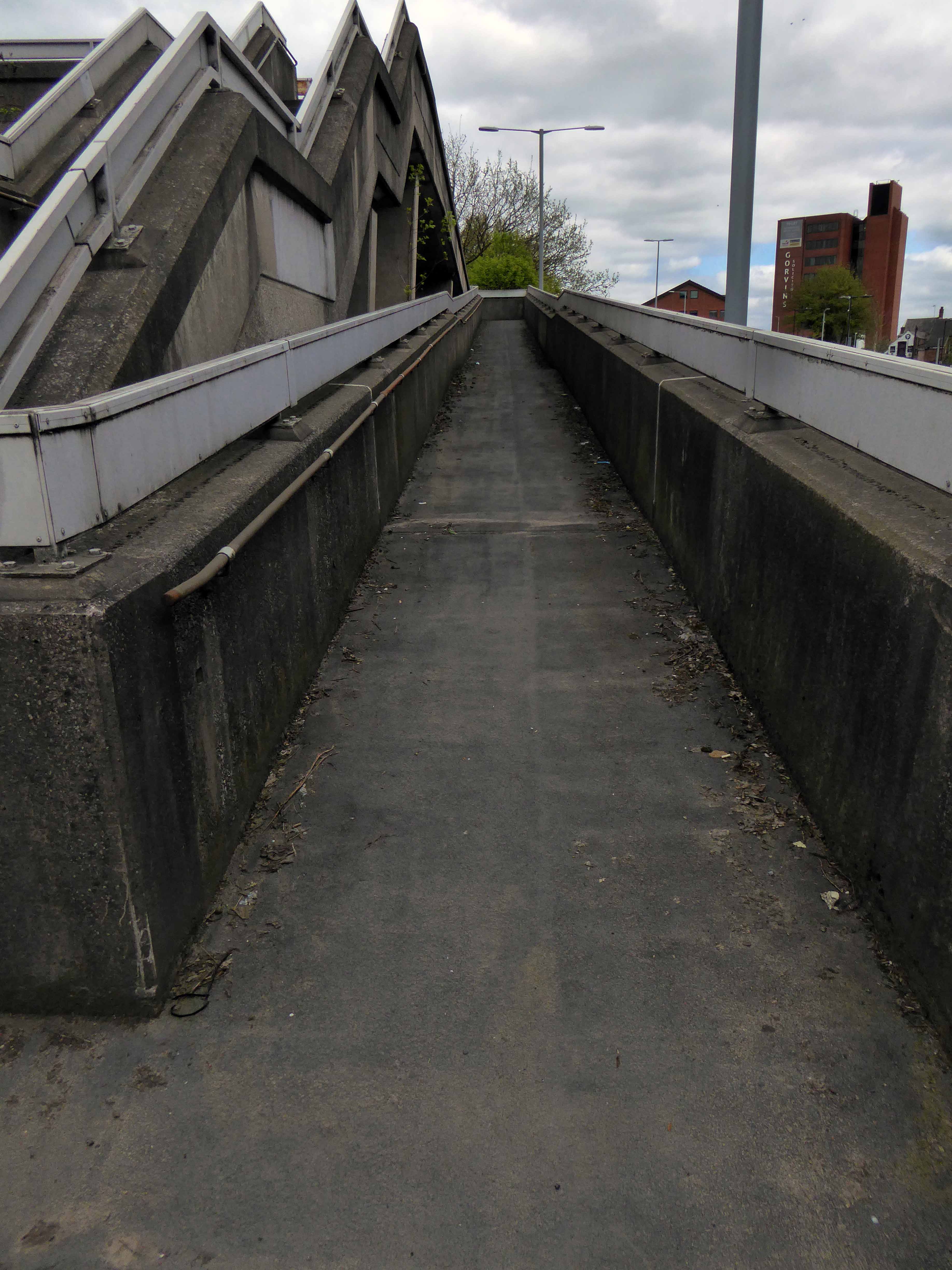
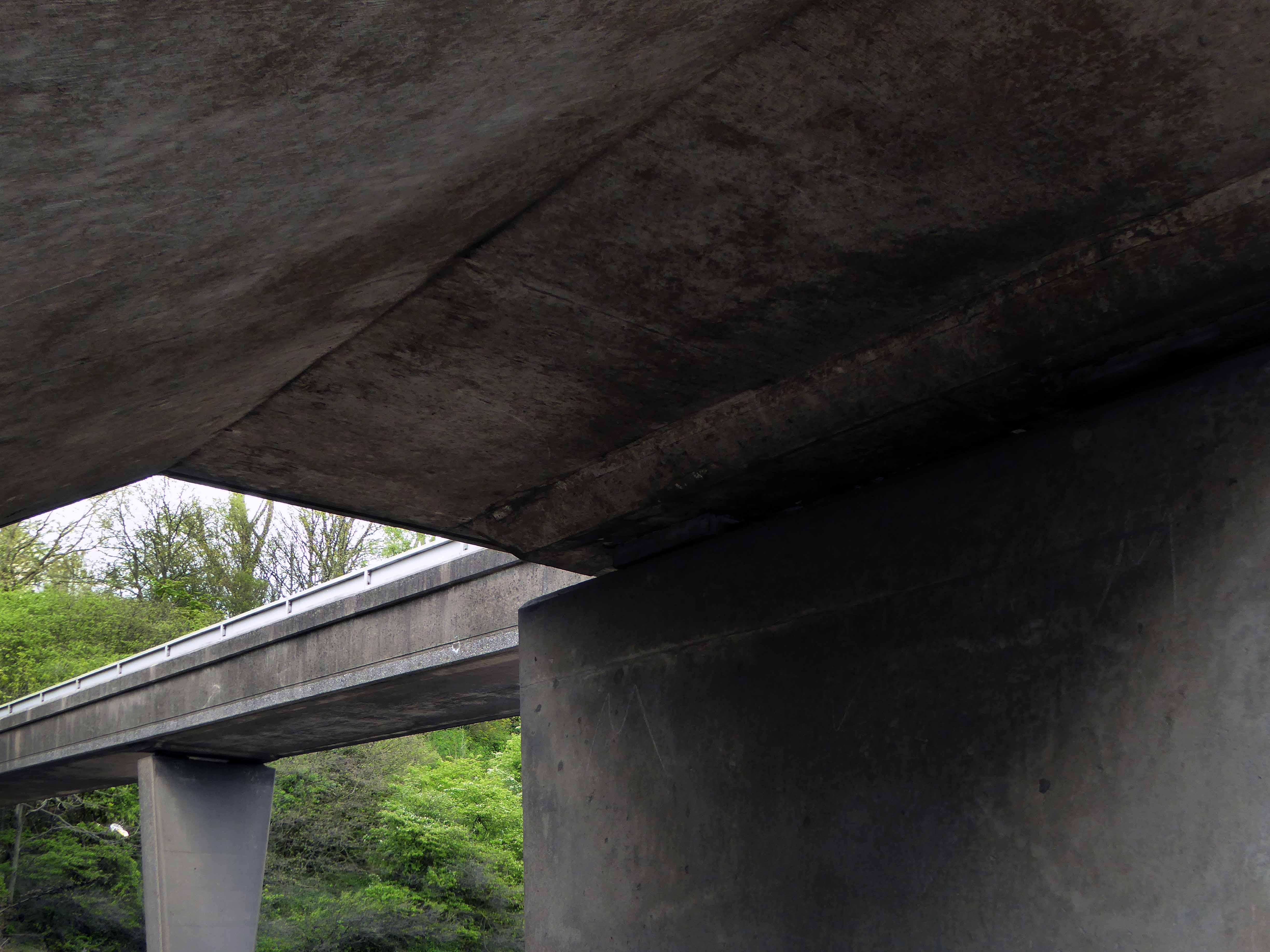
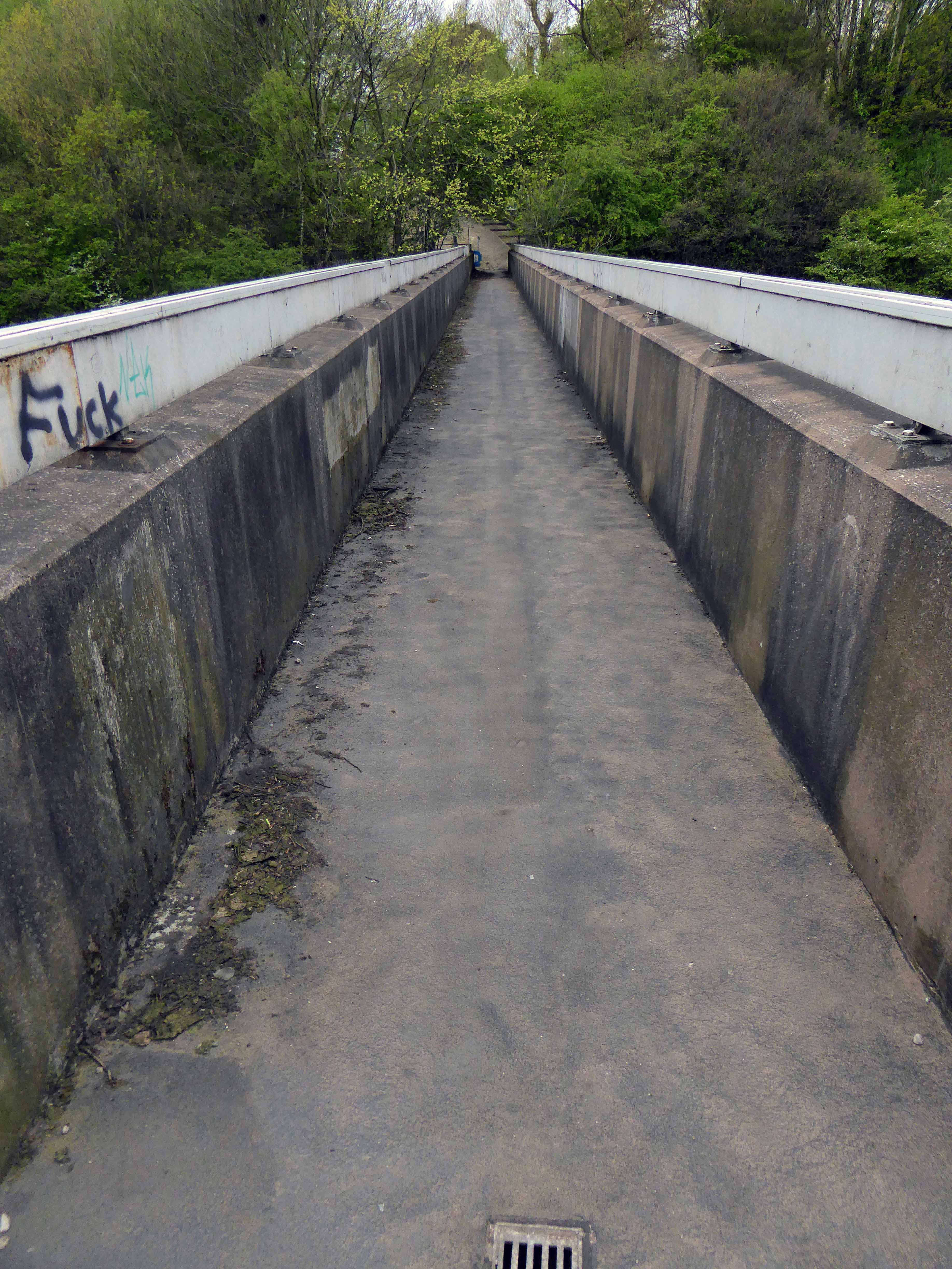
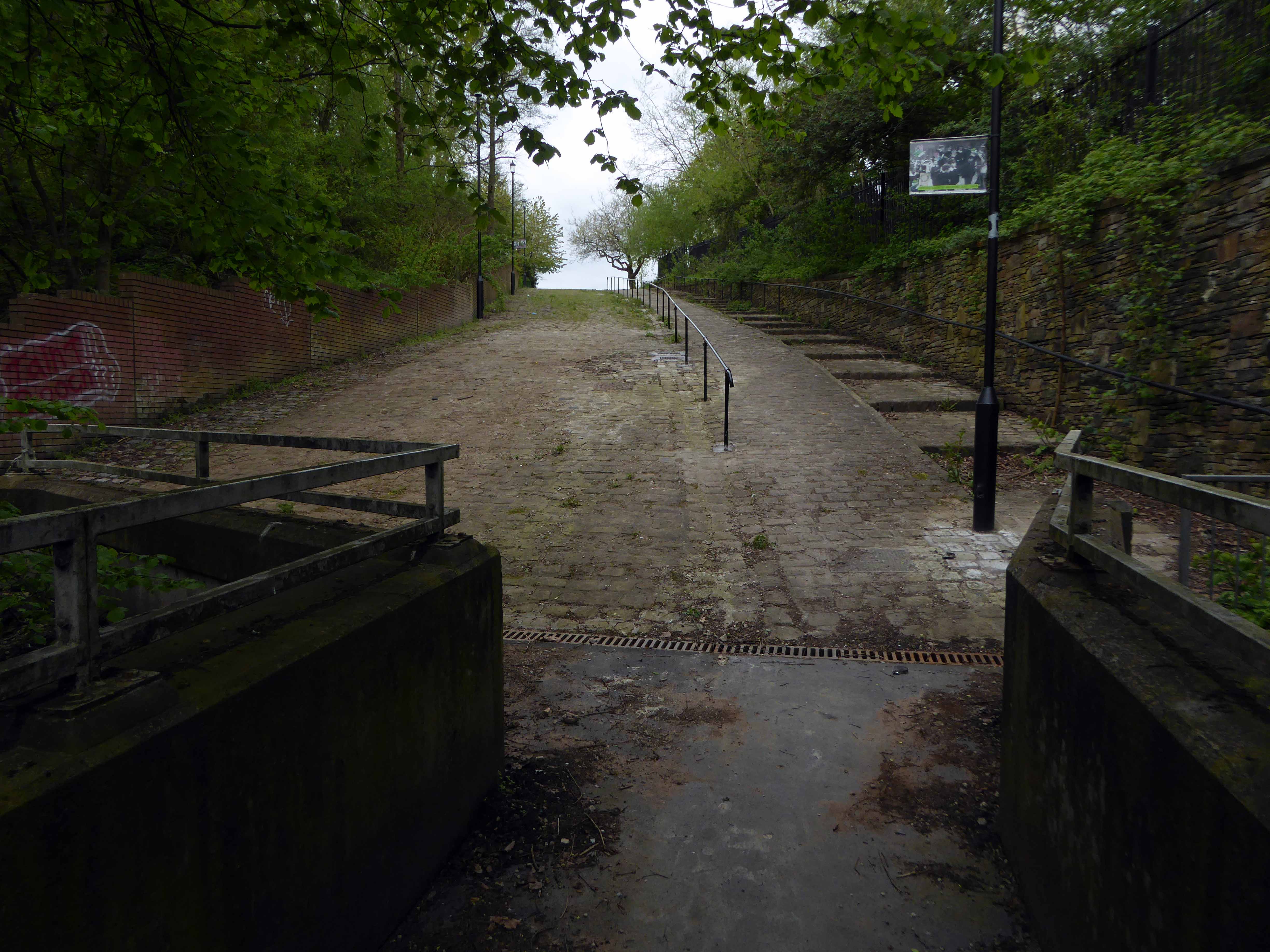
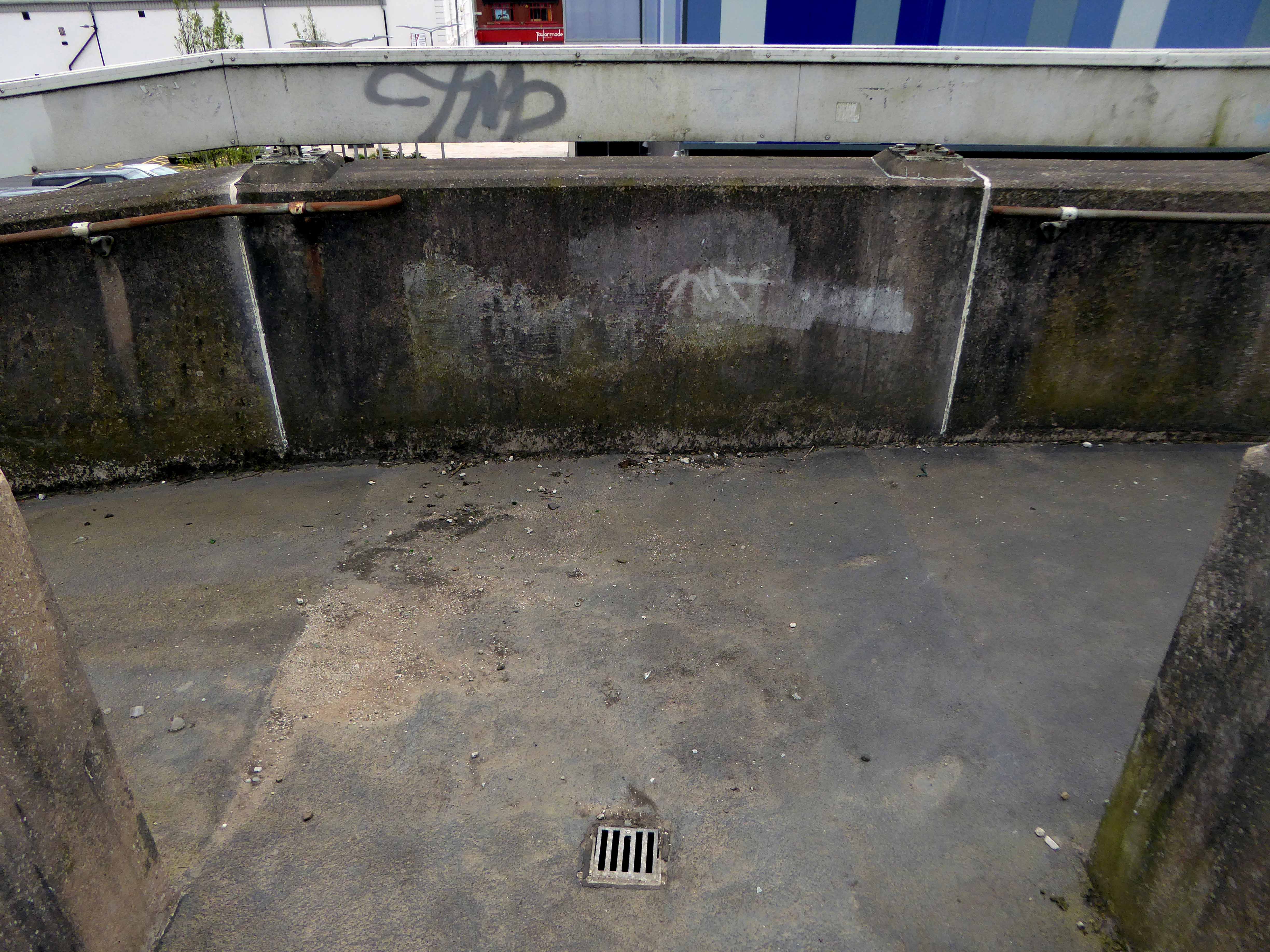
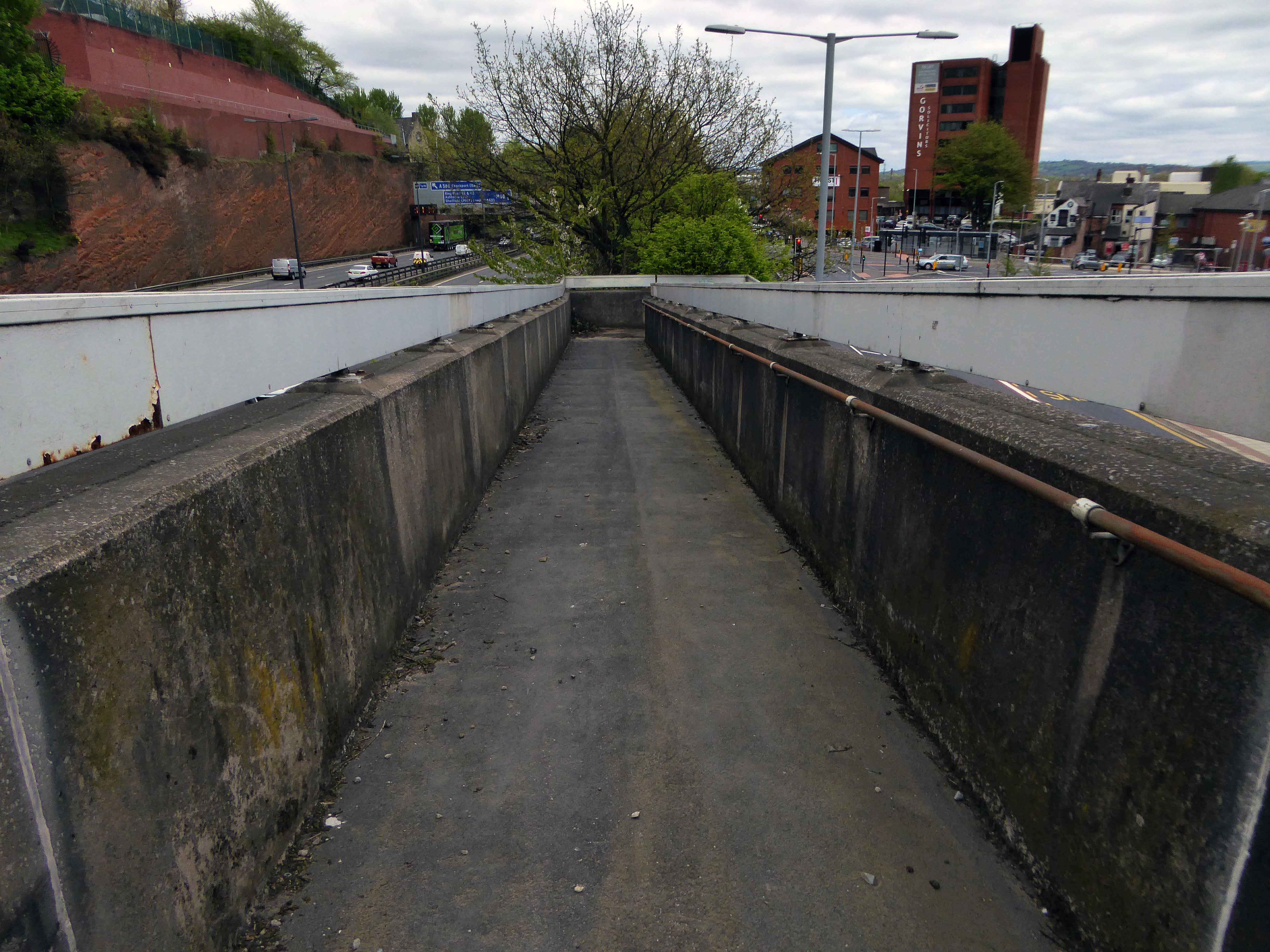
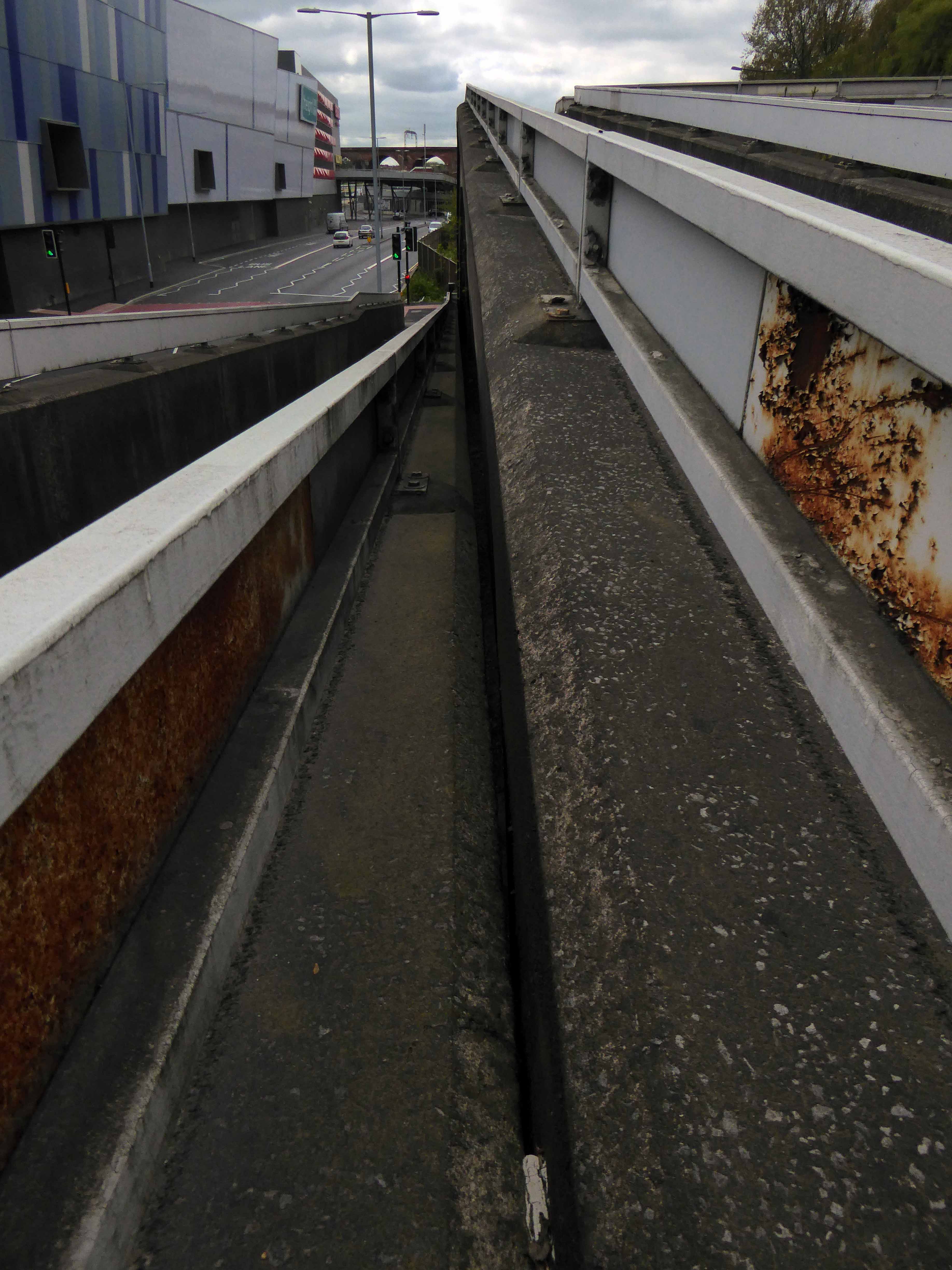
The Hatton Street footbridge has two spans of in-situ u-section deck, is at ground level on the north side, but is reached by steps or ramp from Great Egerton Street on the south.
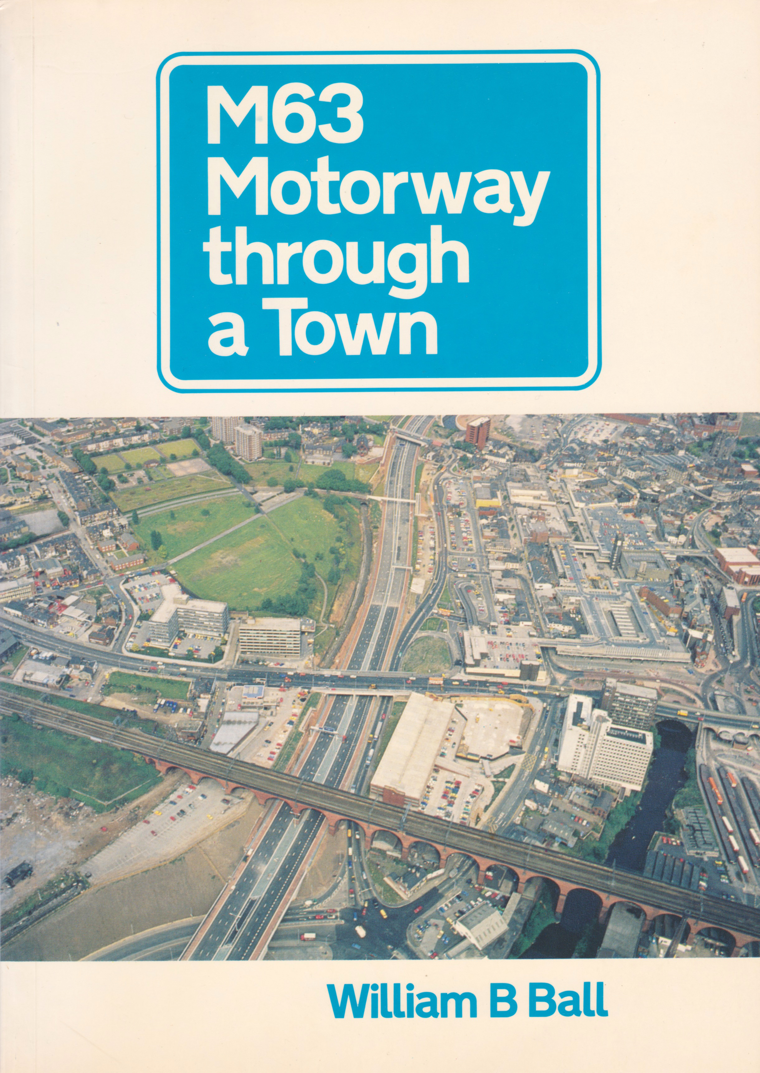
William B Ball
I’m ever so pleased that access has been reinstated, from me it is both fully functional yet imbued with an elegant concrete sculptural grace, worthy of Niemeyer or Lasdun.
So take a walk on the slightly higher side, either way you win.