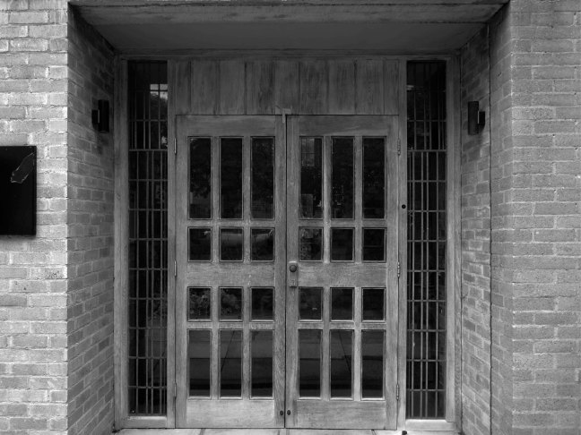
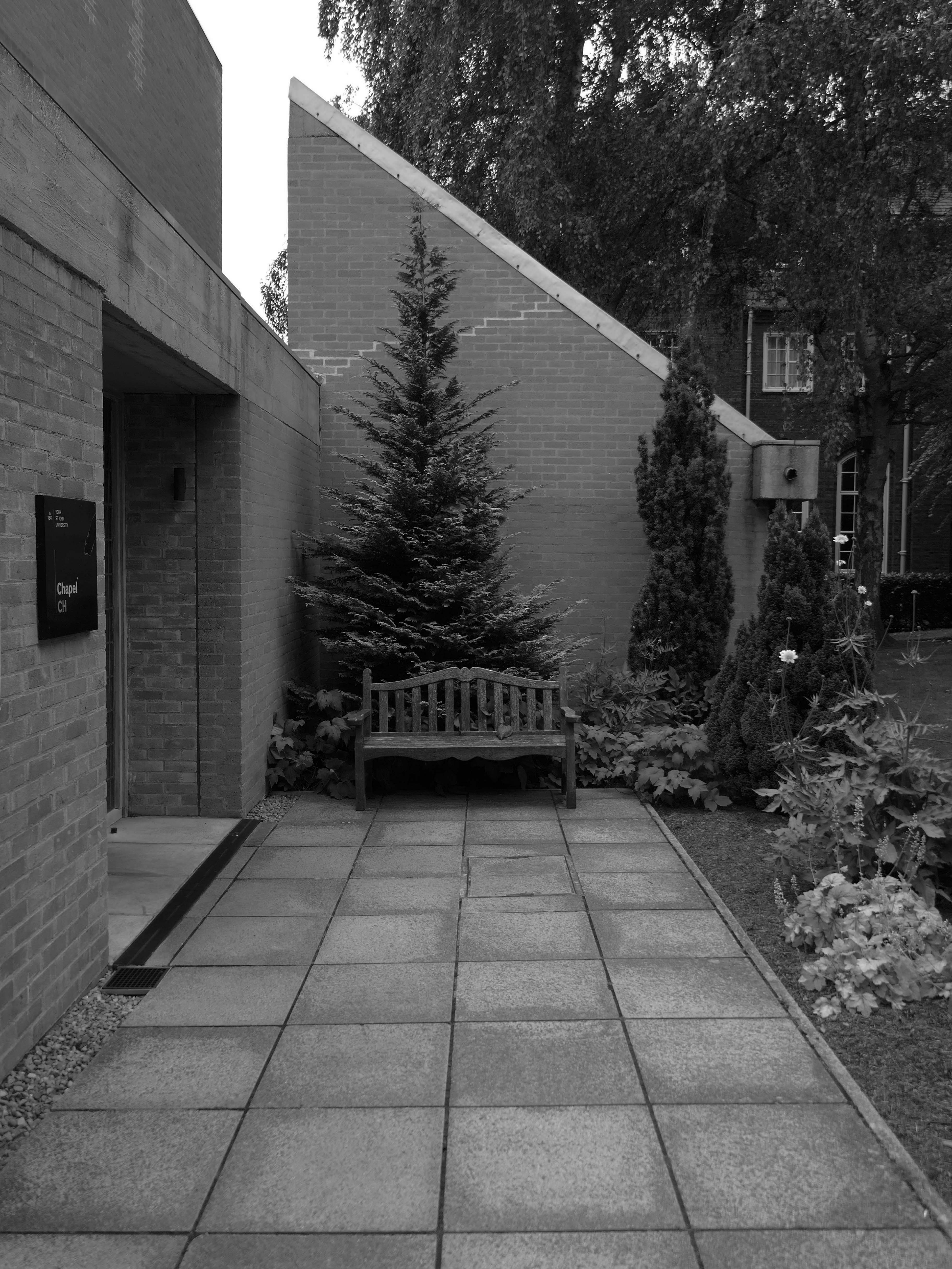
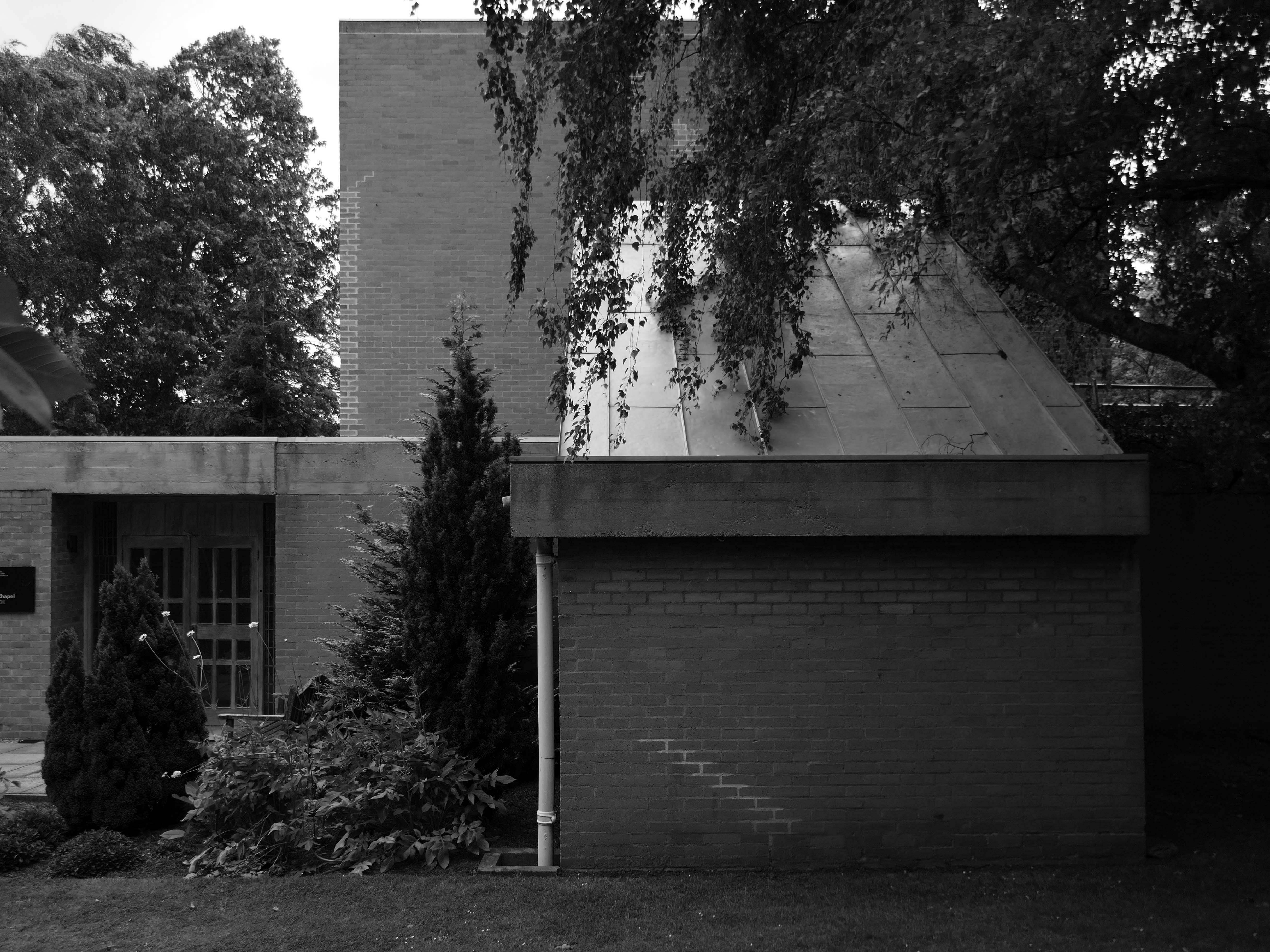
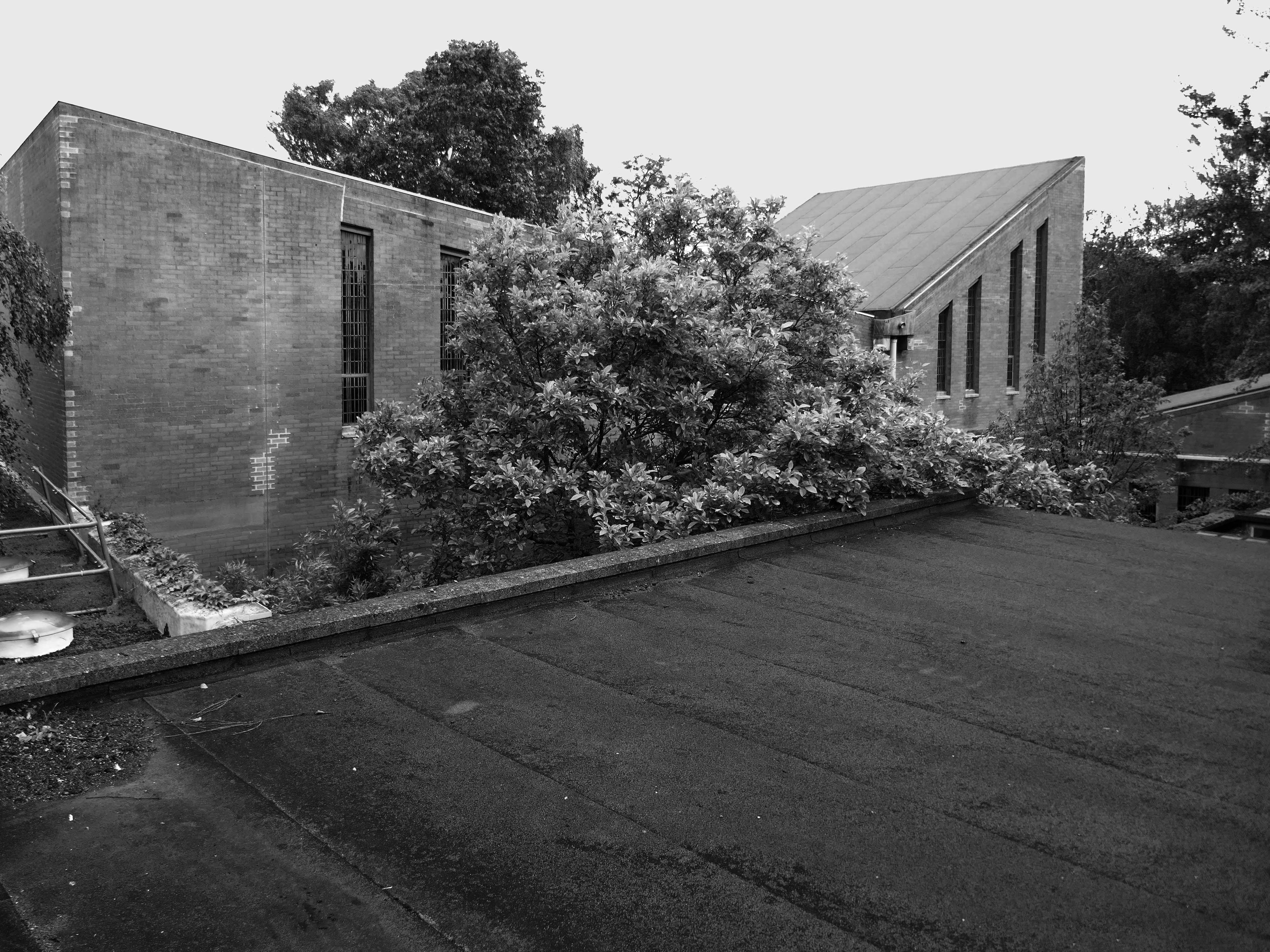
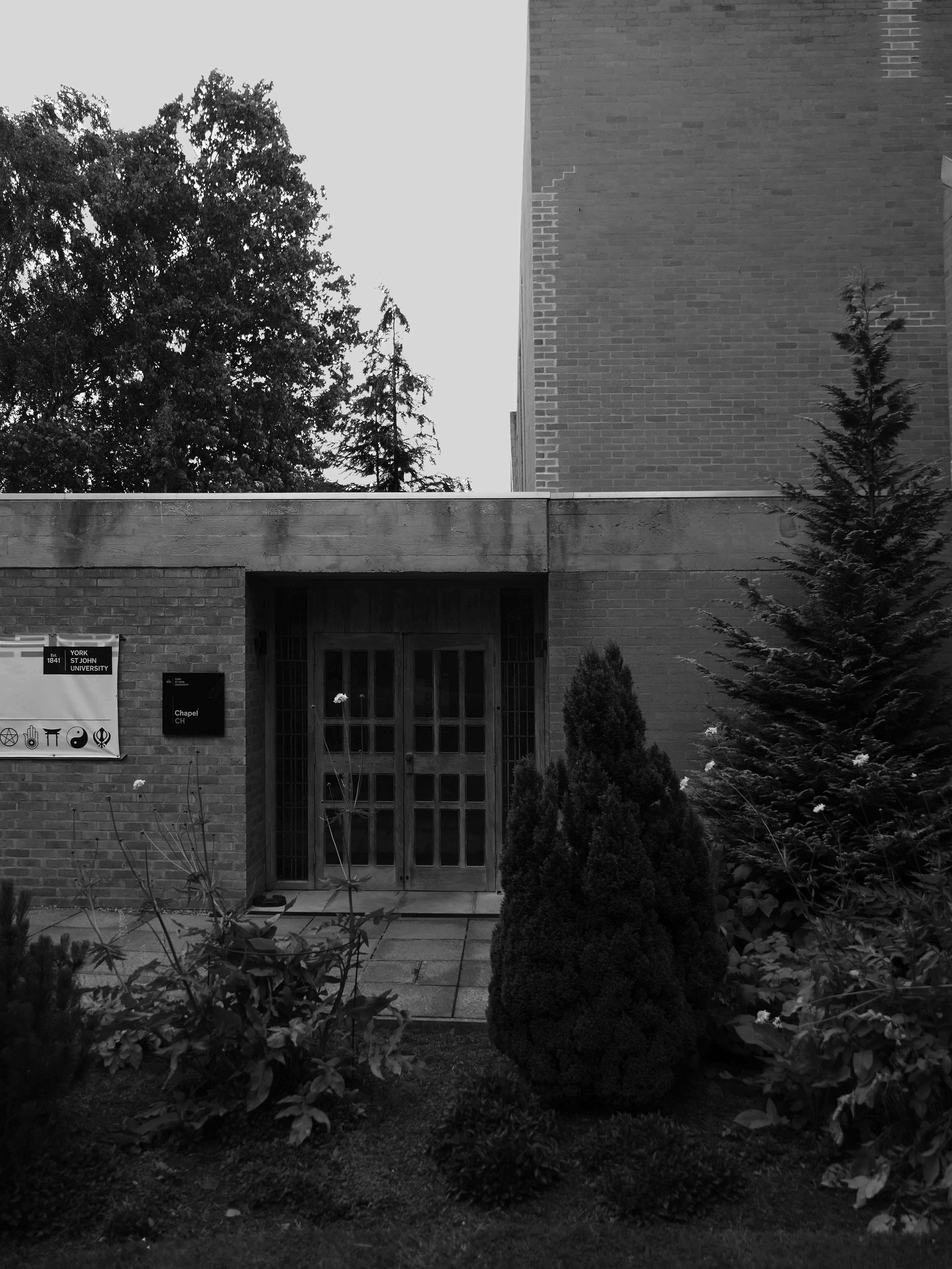
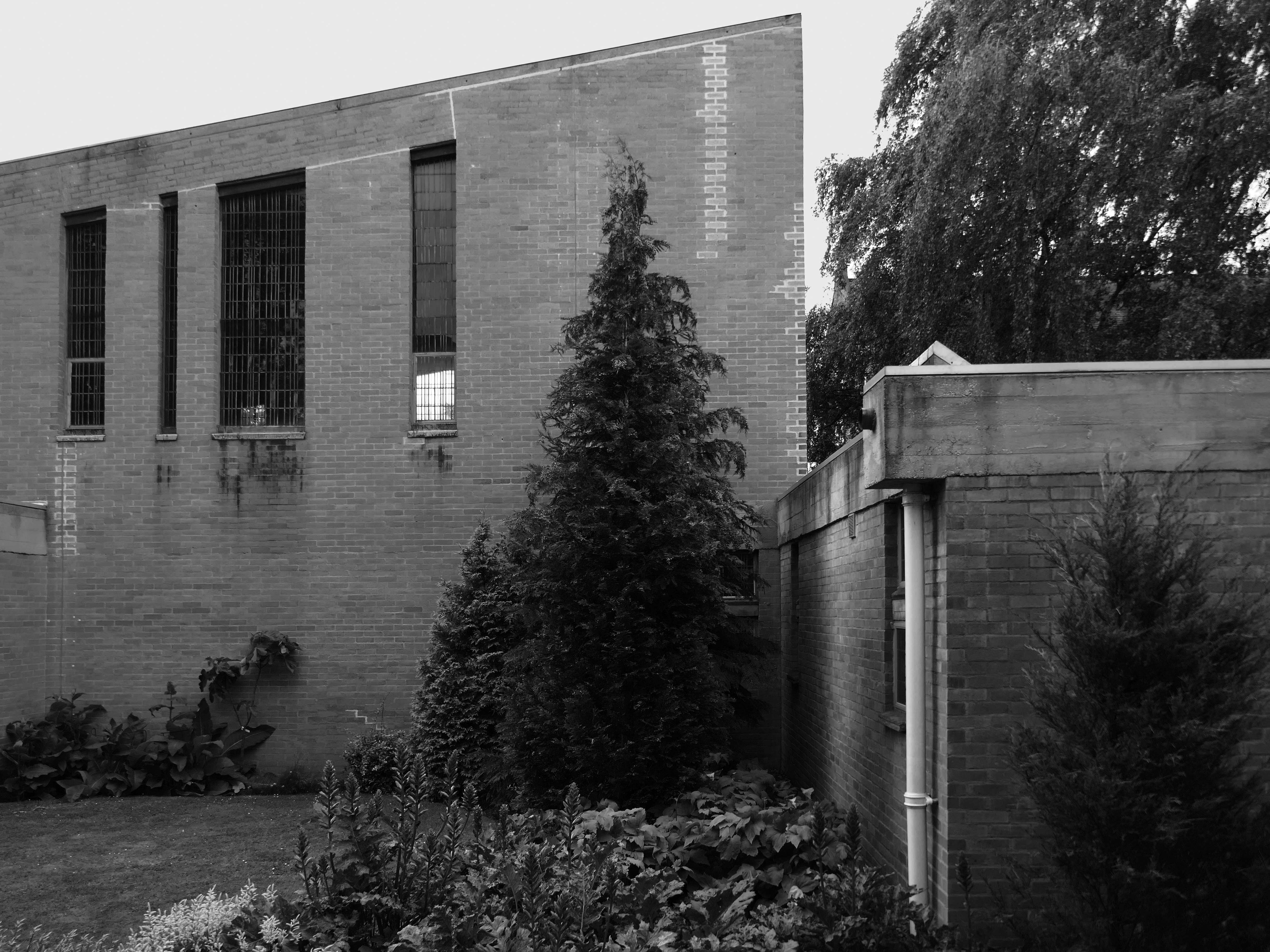
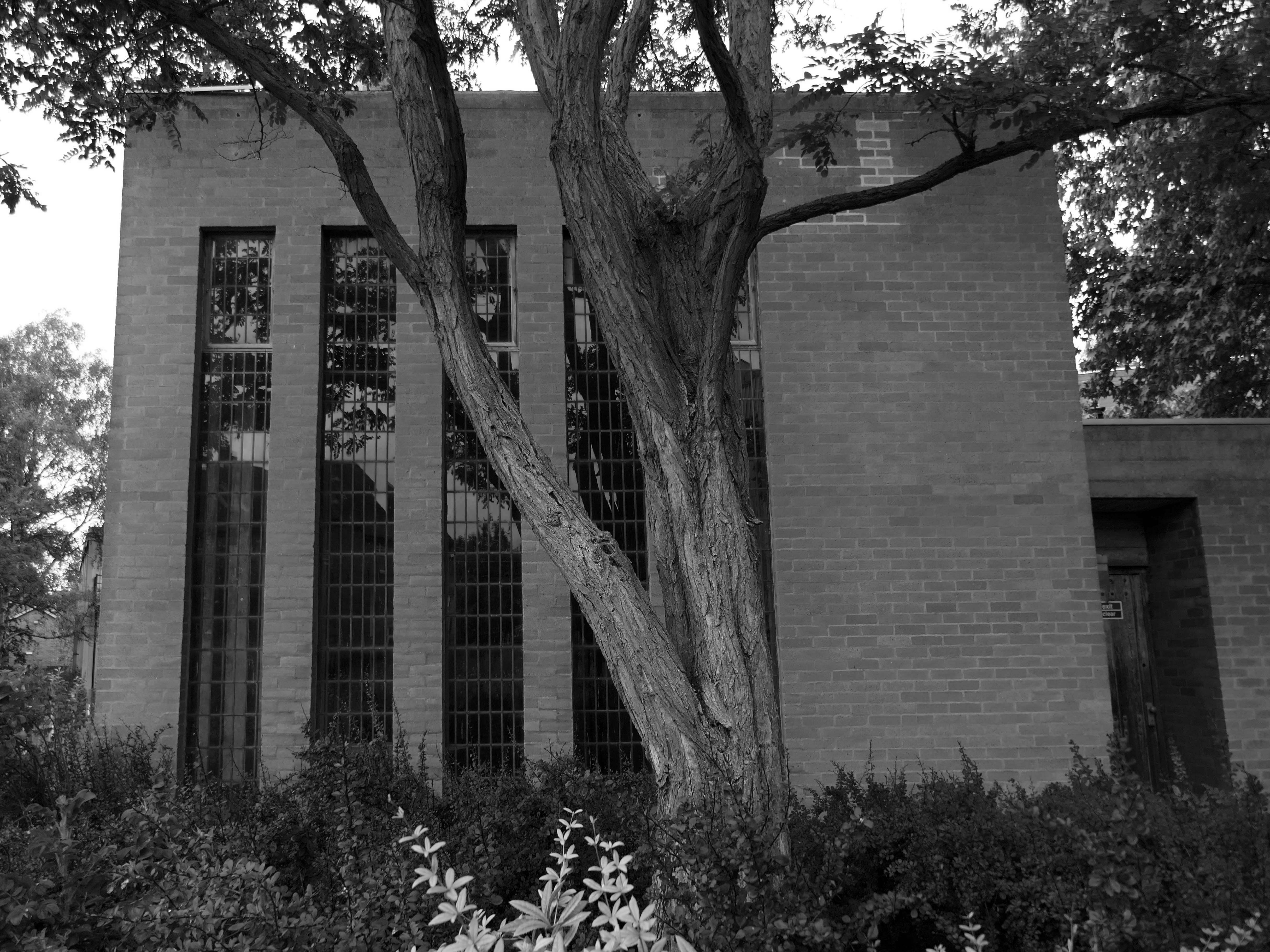
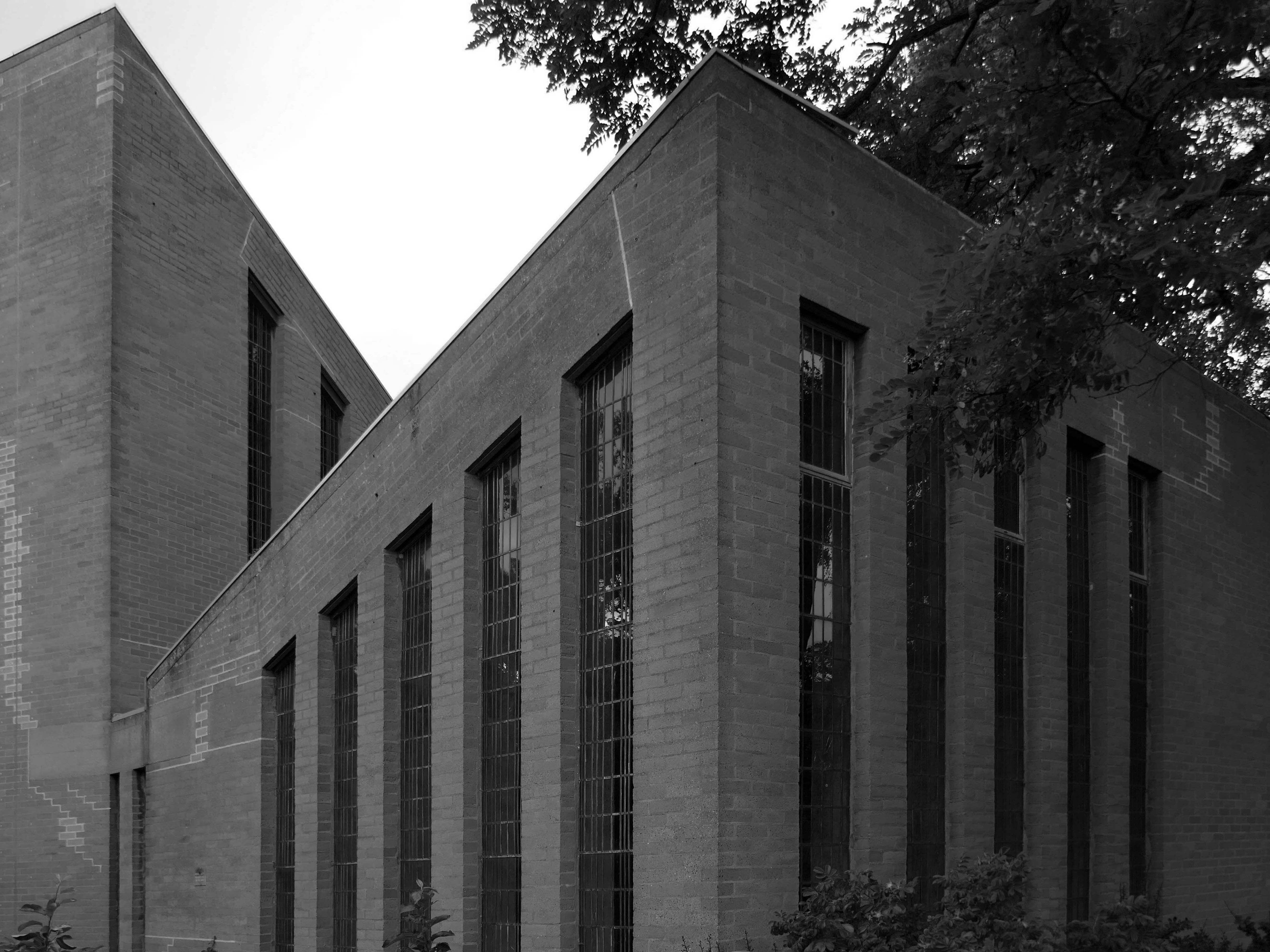
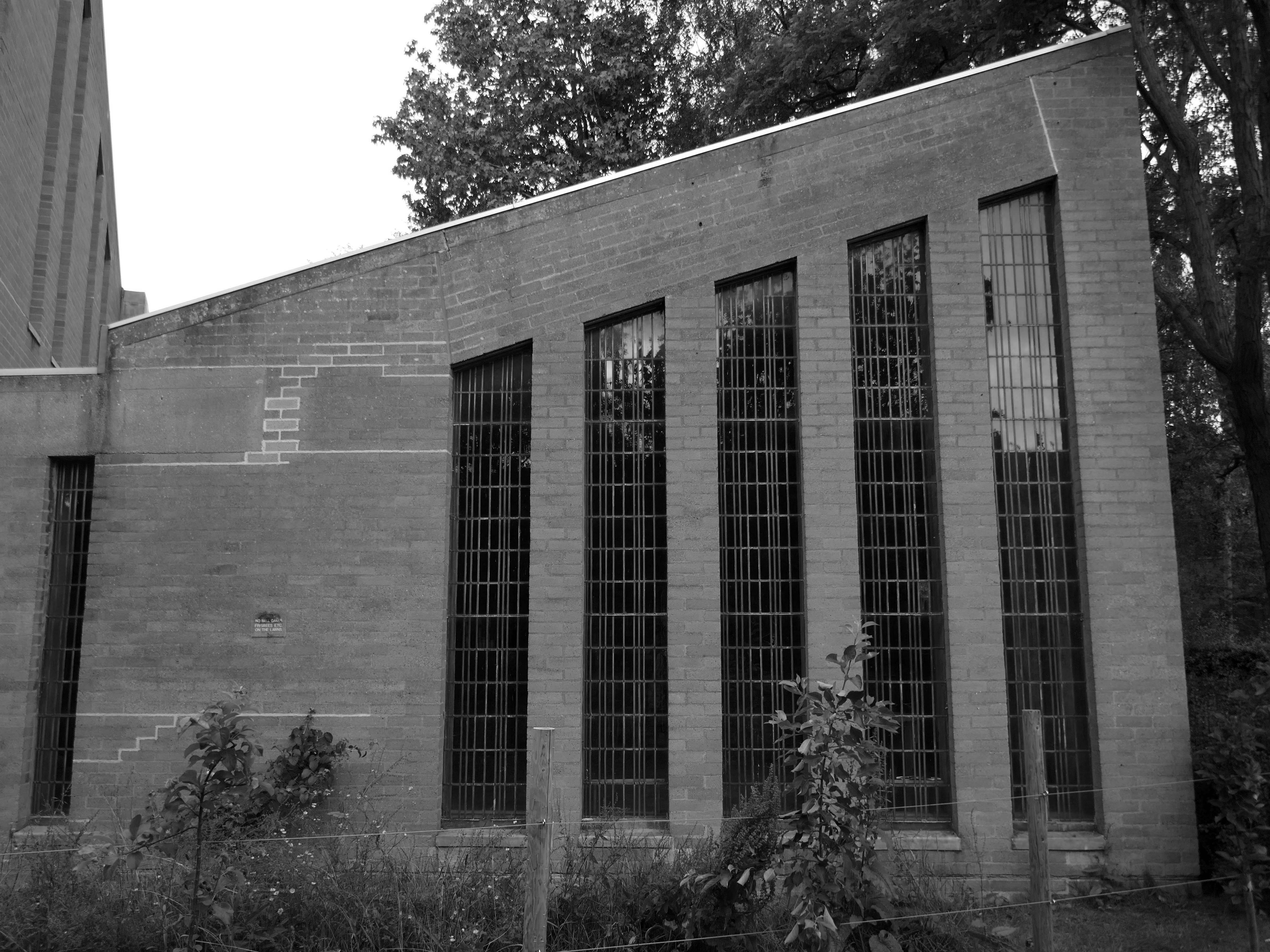
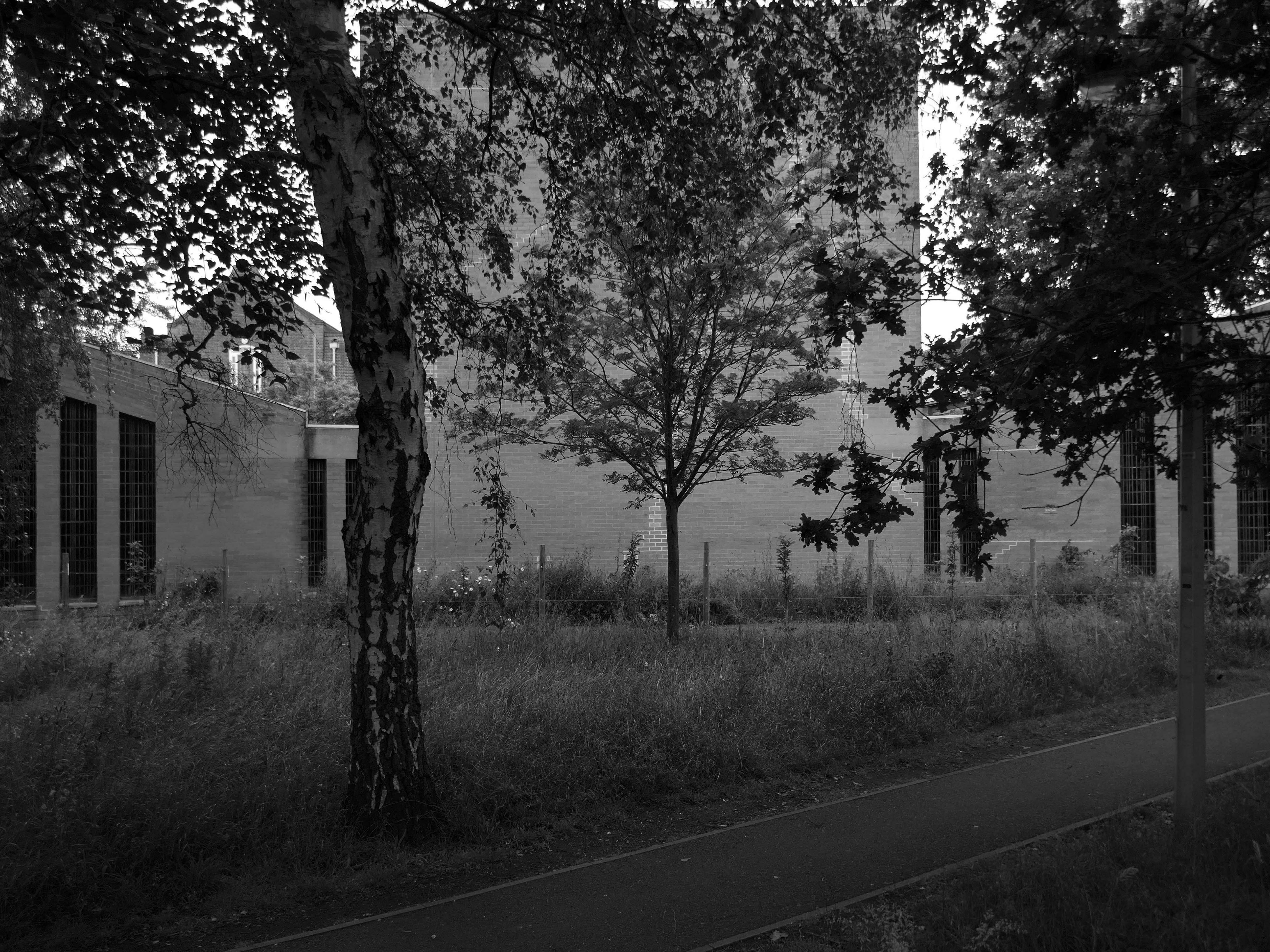
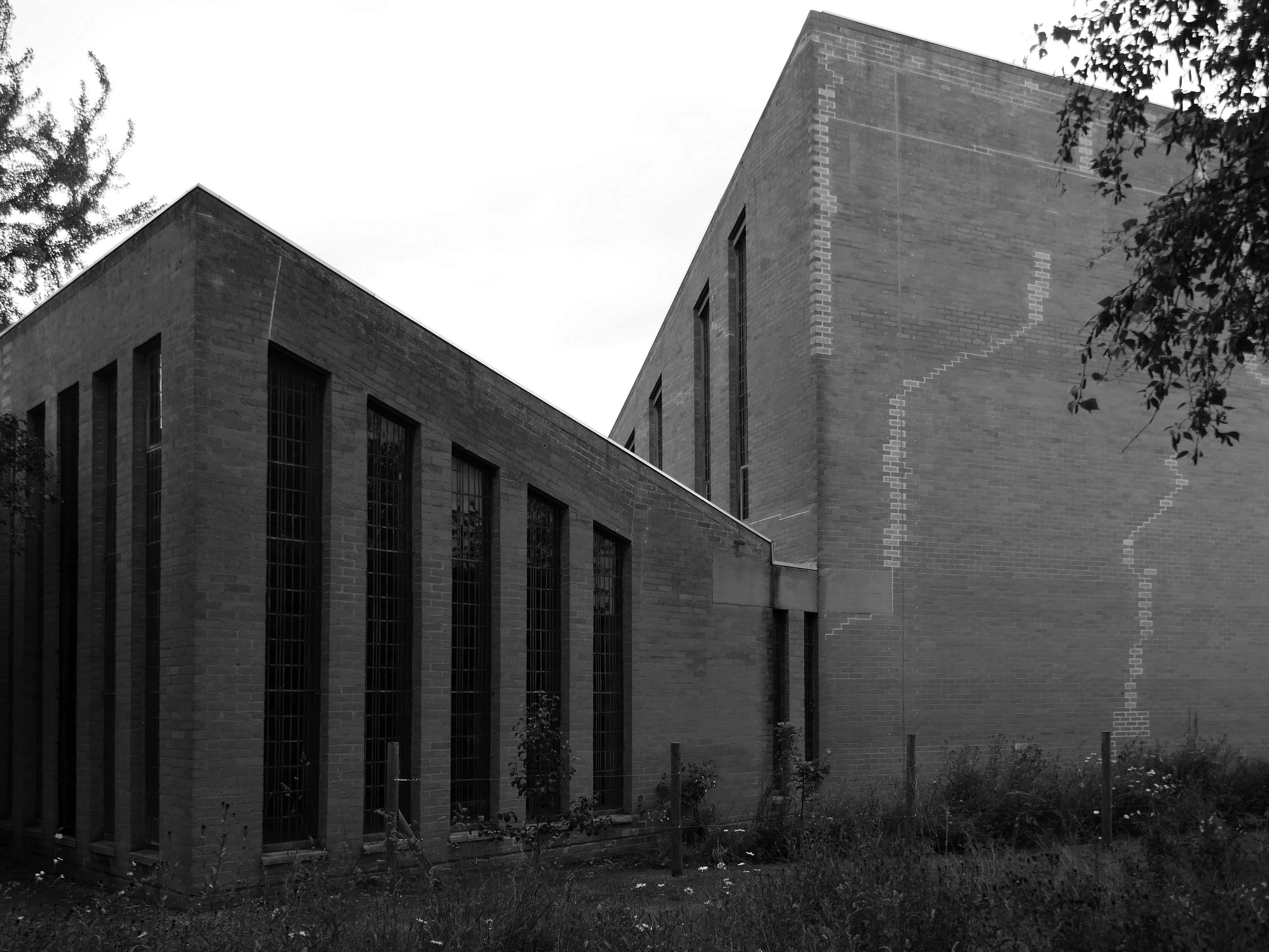
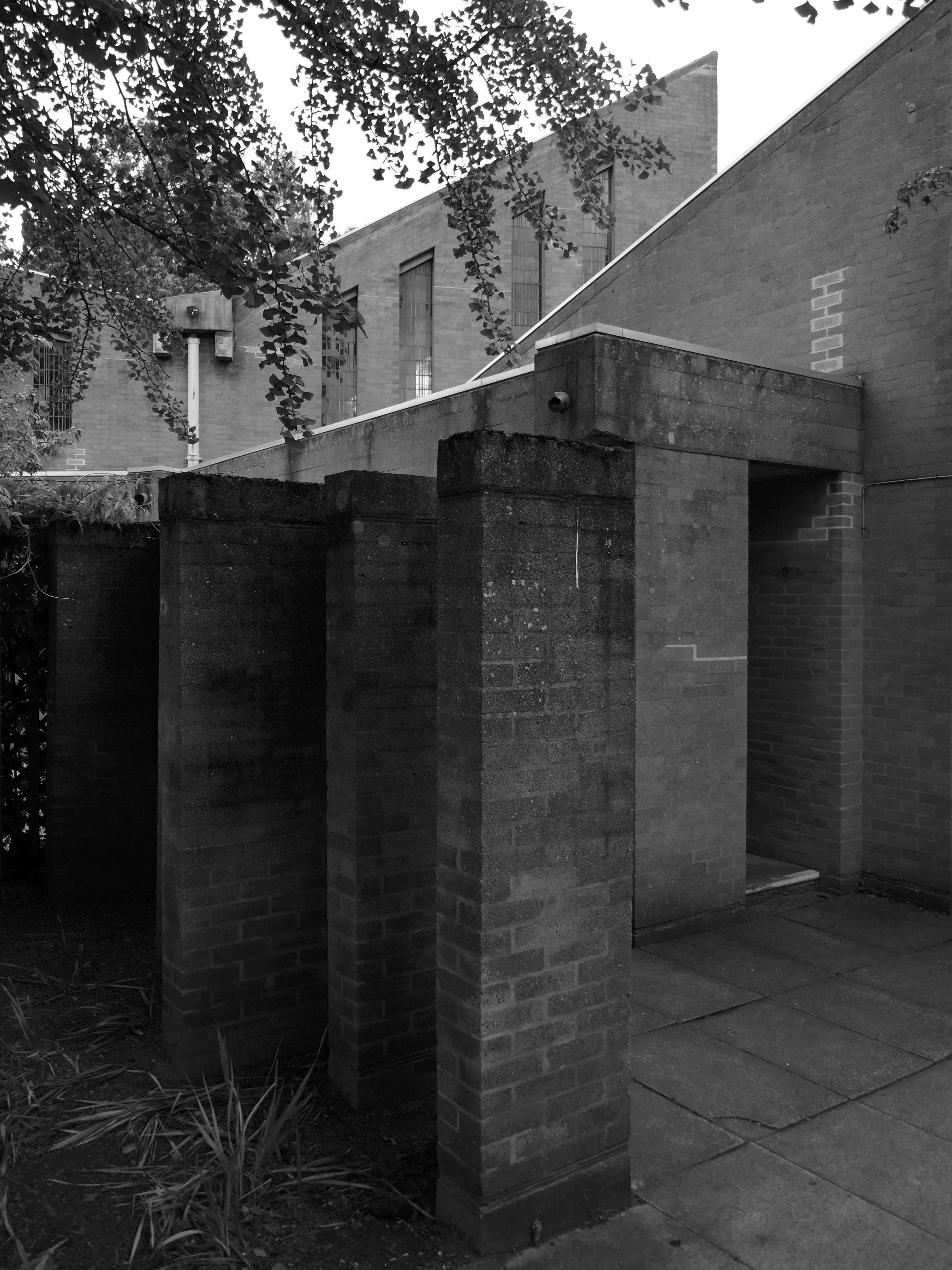
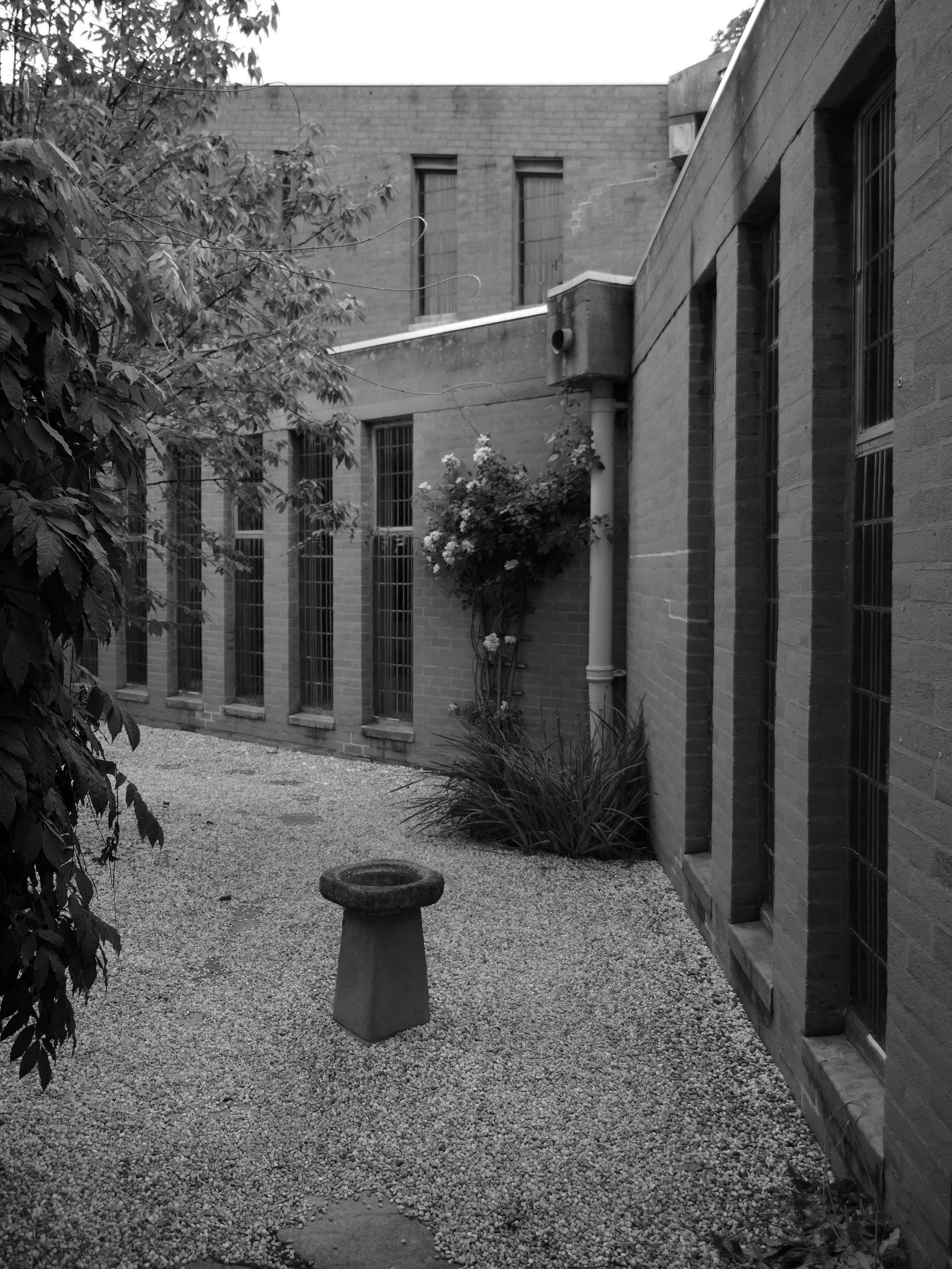
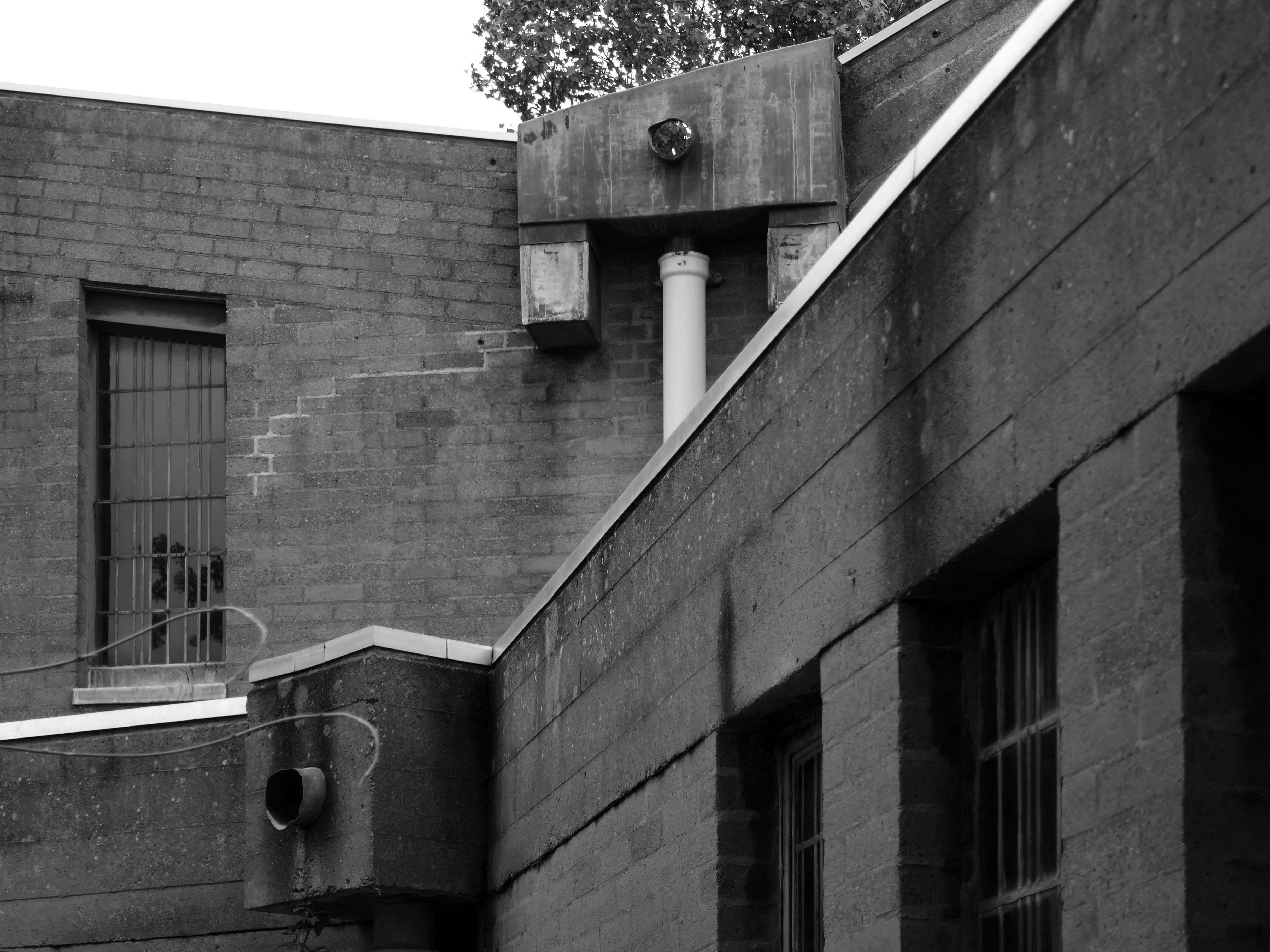
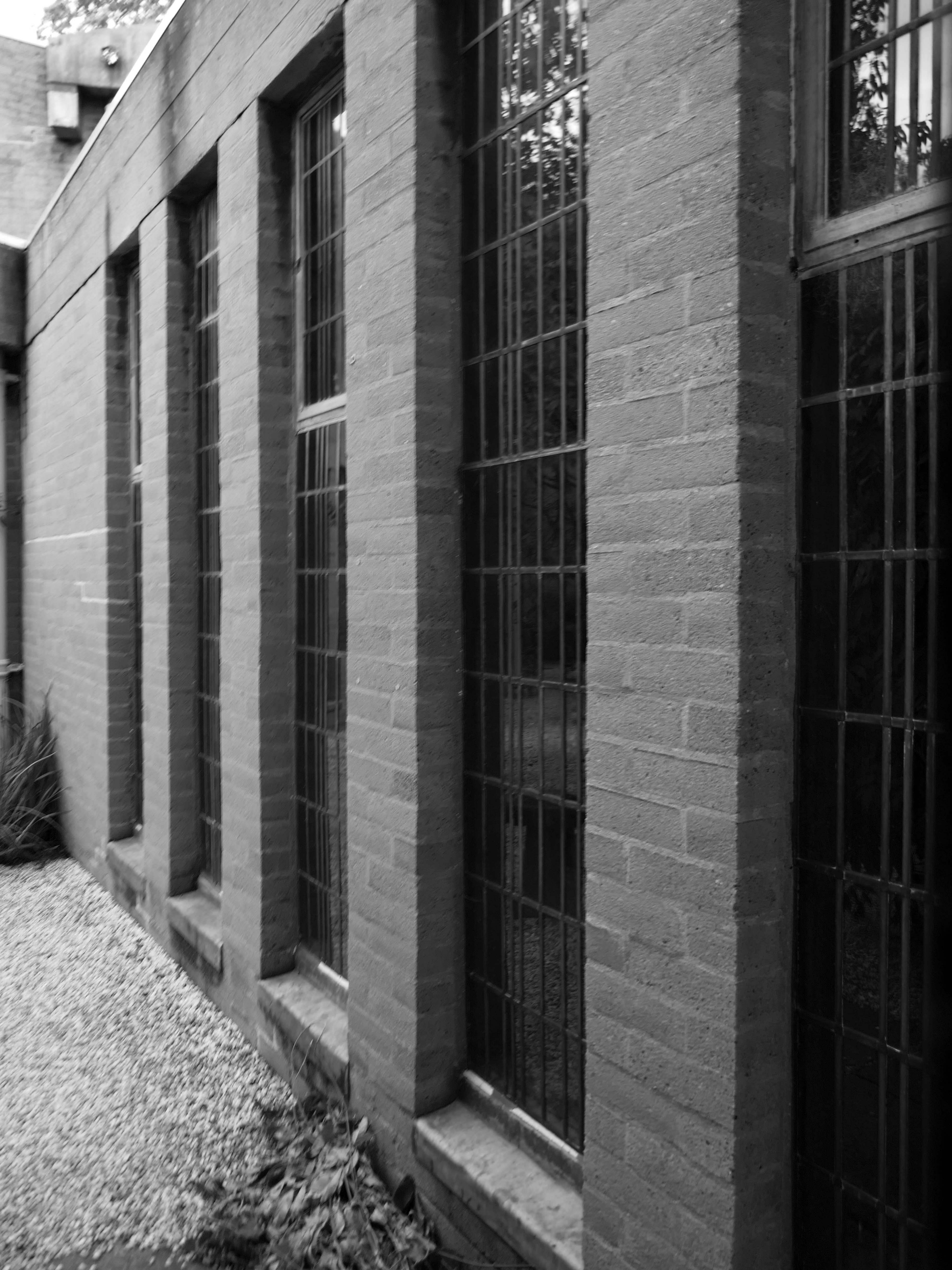
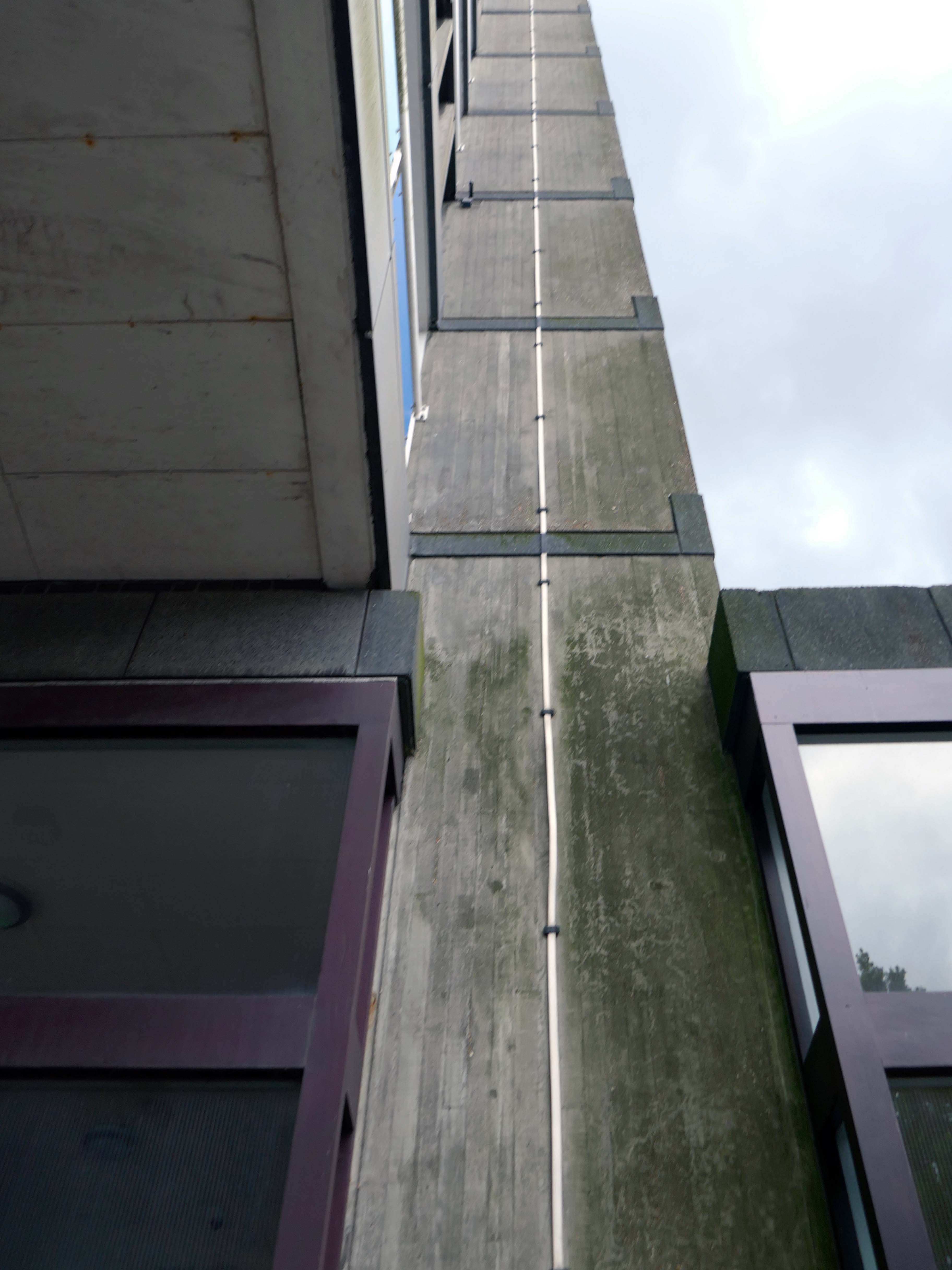
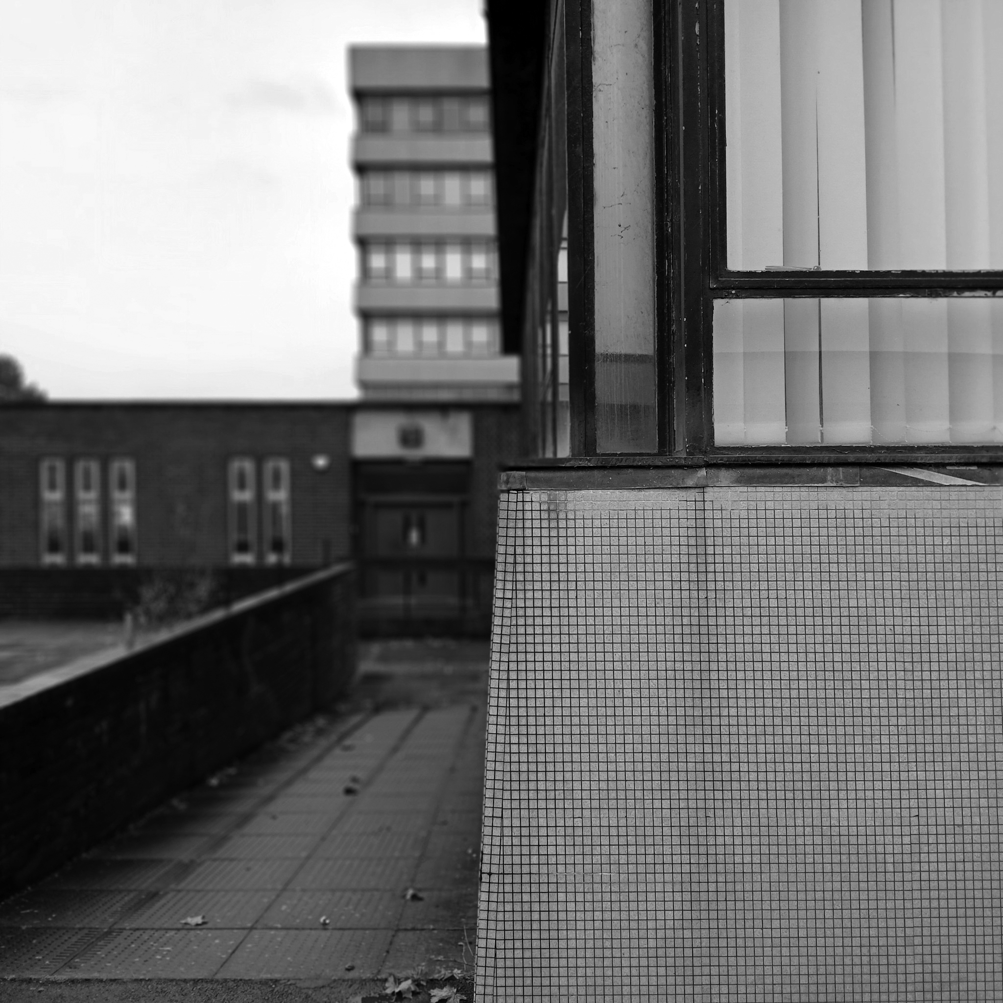
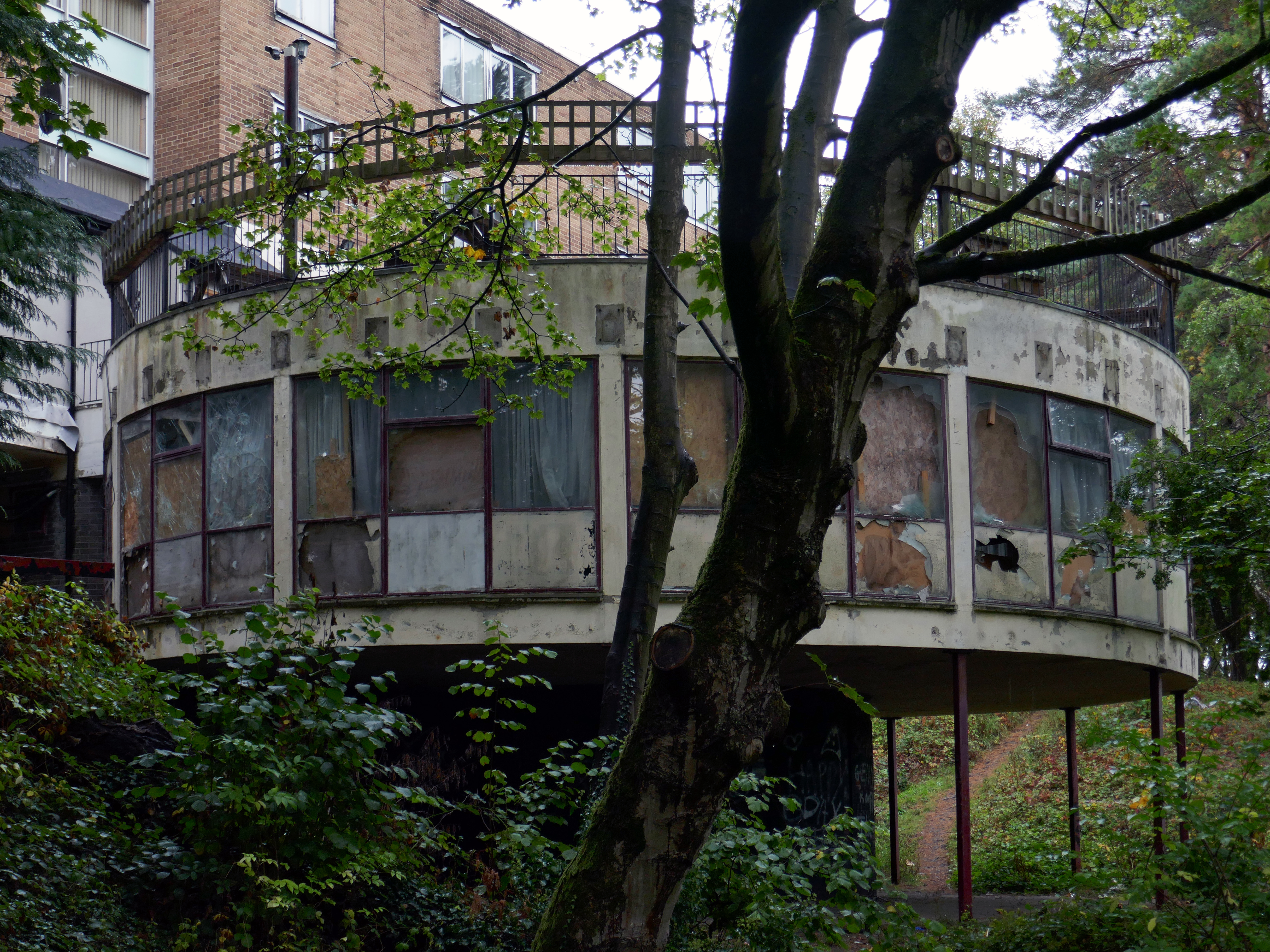
The chapel was closed on a Saturday so we wandered around outside, peering curiously through the windows. Surrounded by mature planting, the bare brick and glazing is more than somewhat softened, the planting however does inhibit the intrepid photographer.
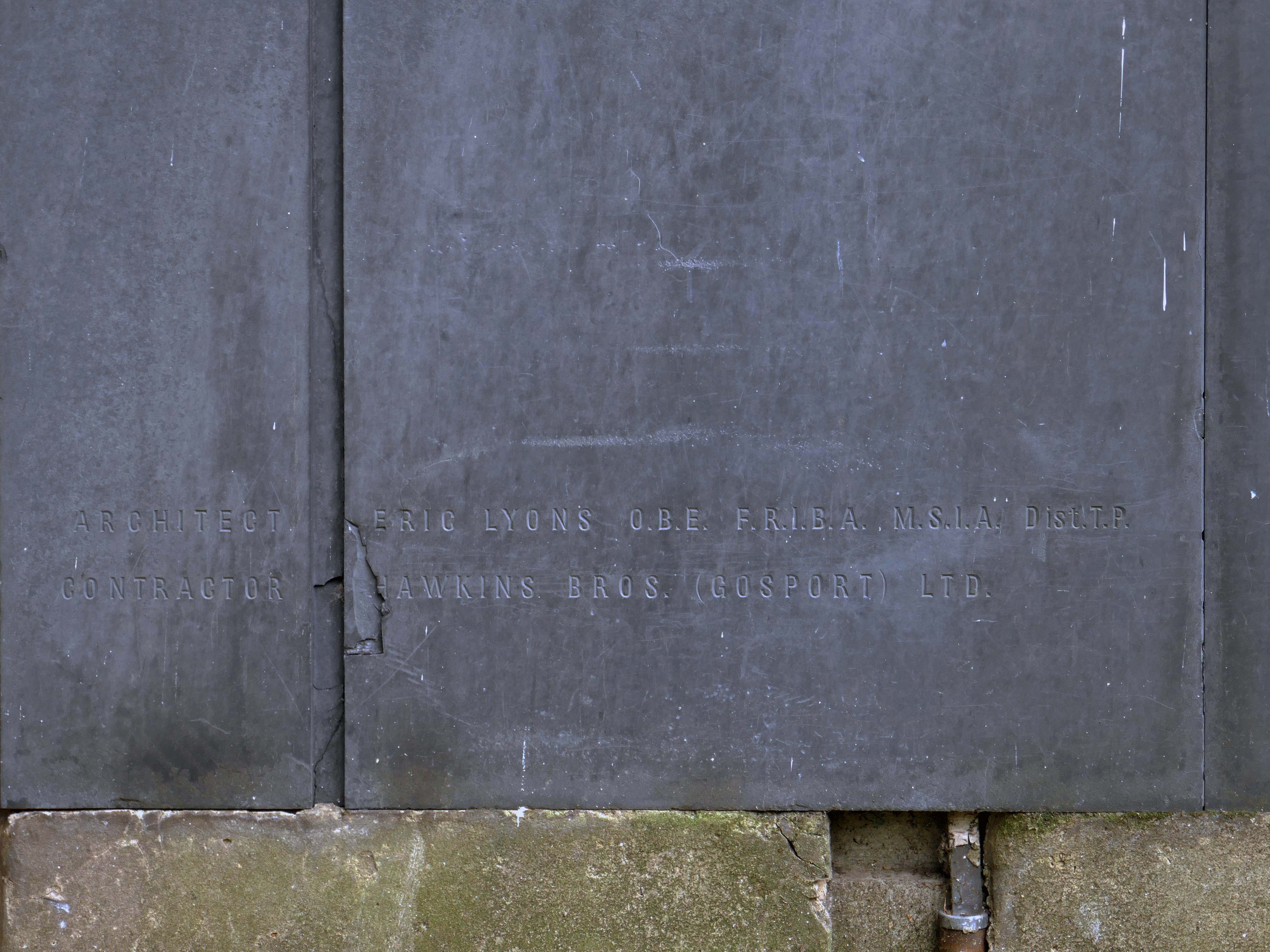
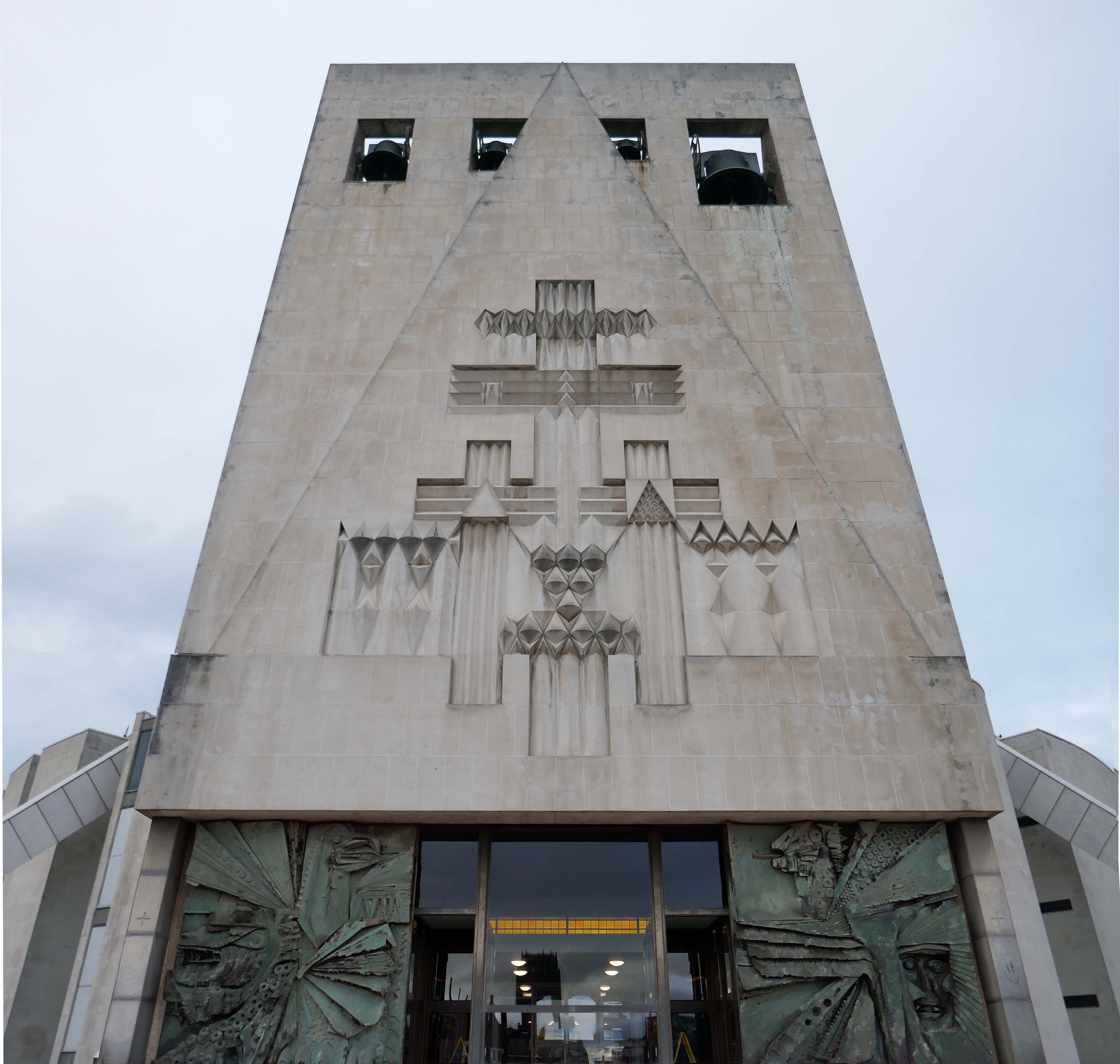
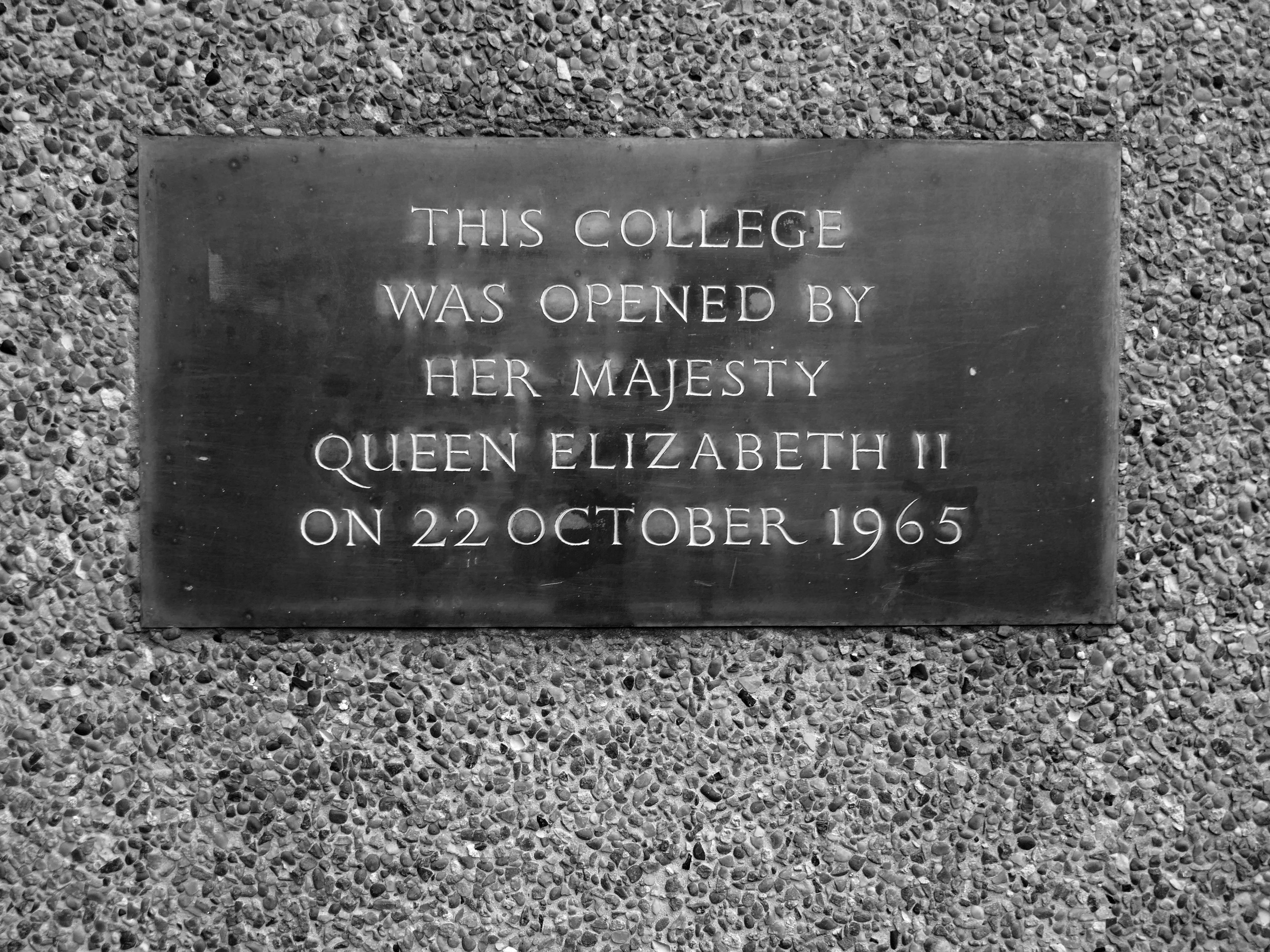
Designed 1965, built 1966-7; architect George Gaze Pace, executant assistant Ronald Sims.
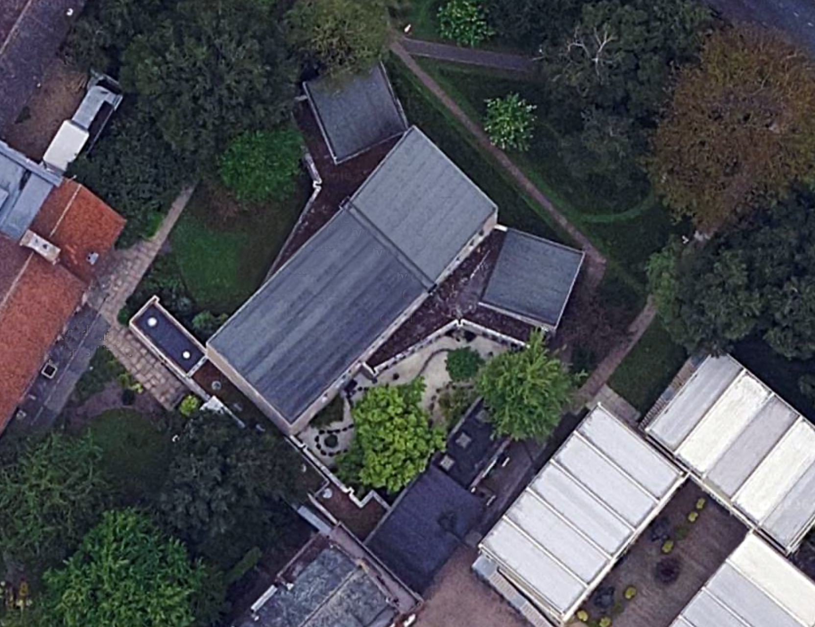
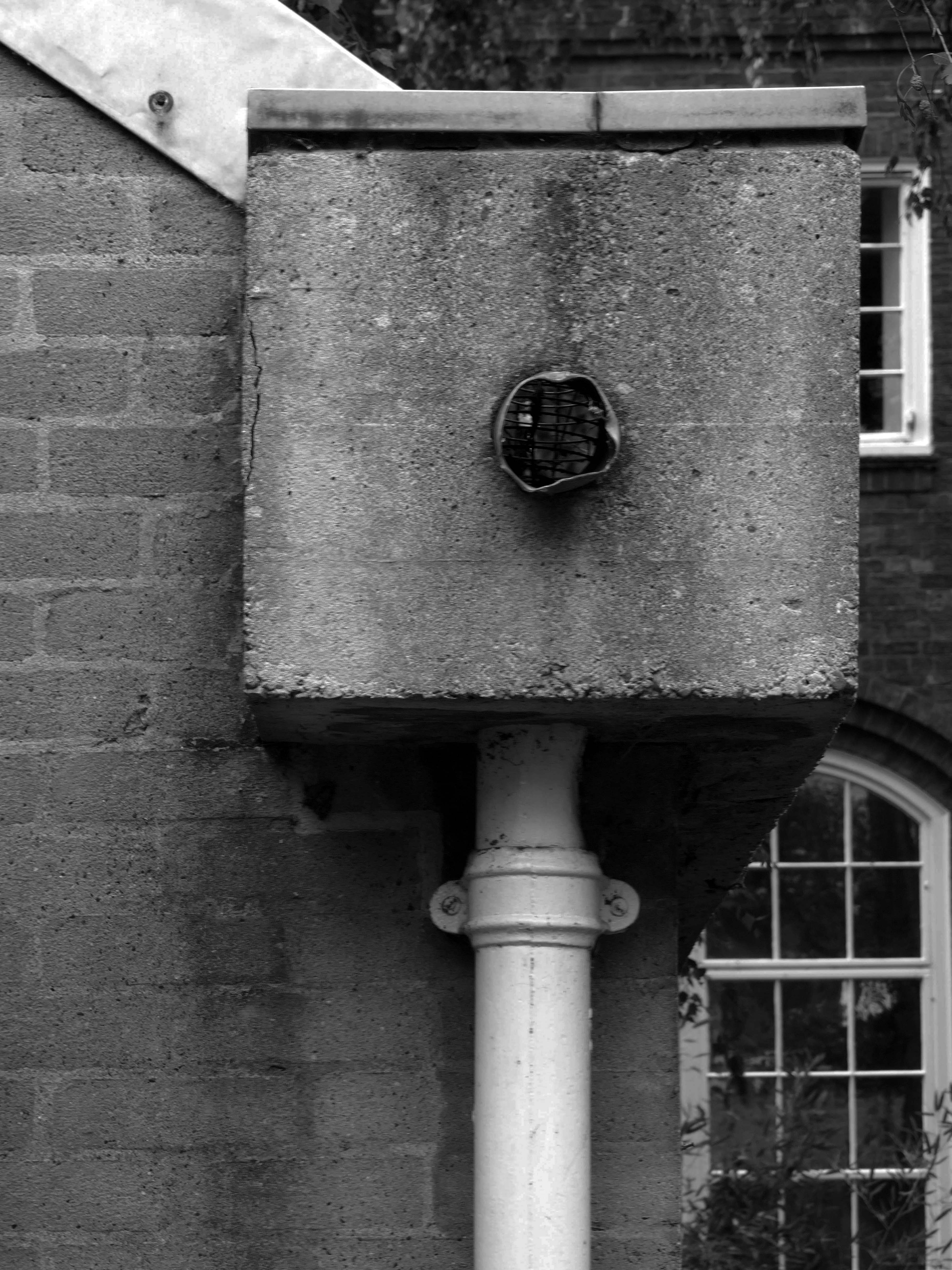
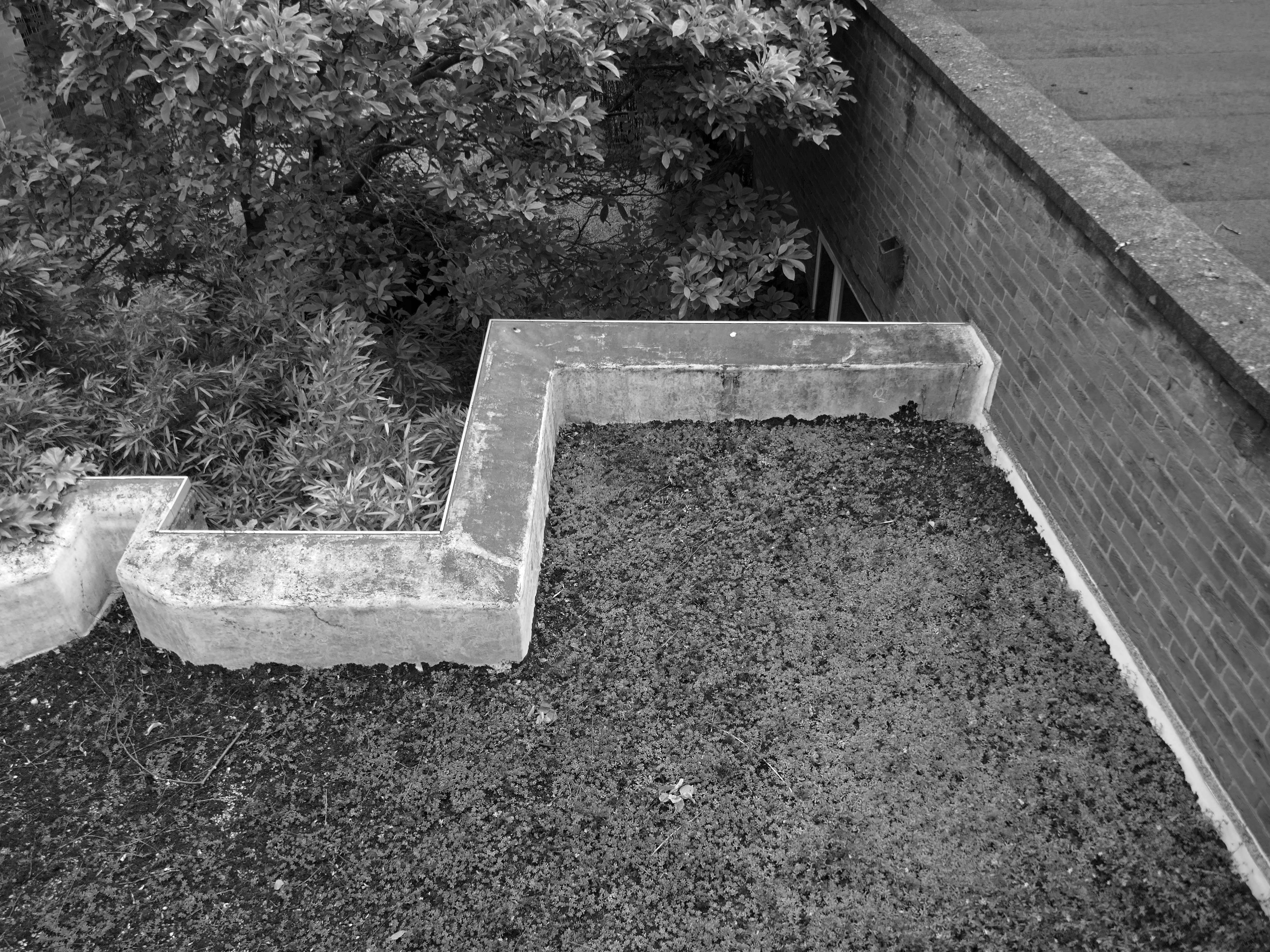
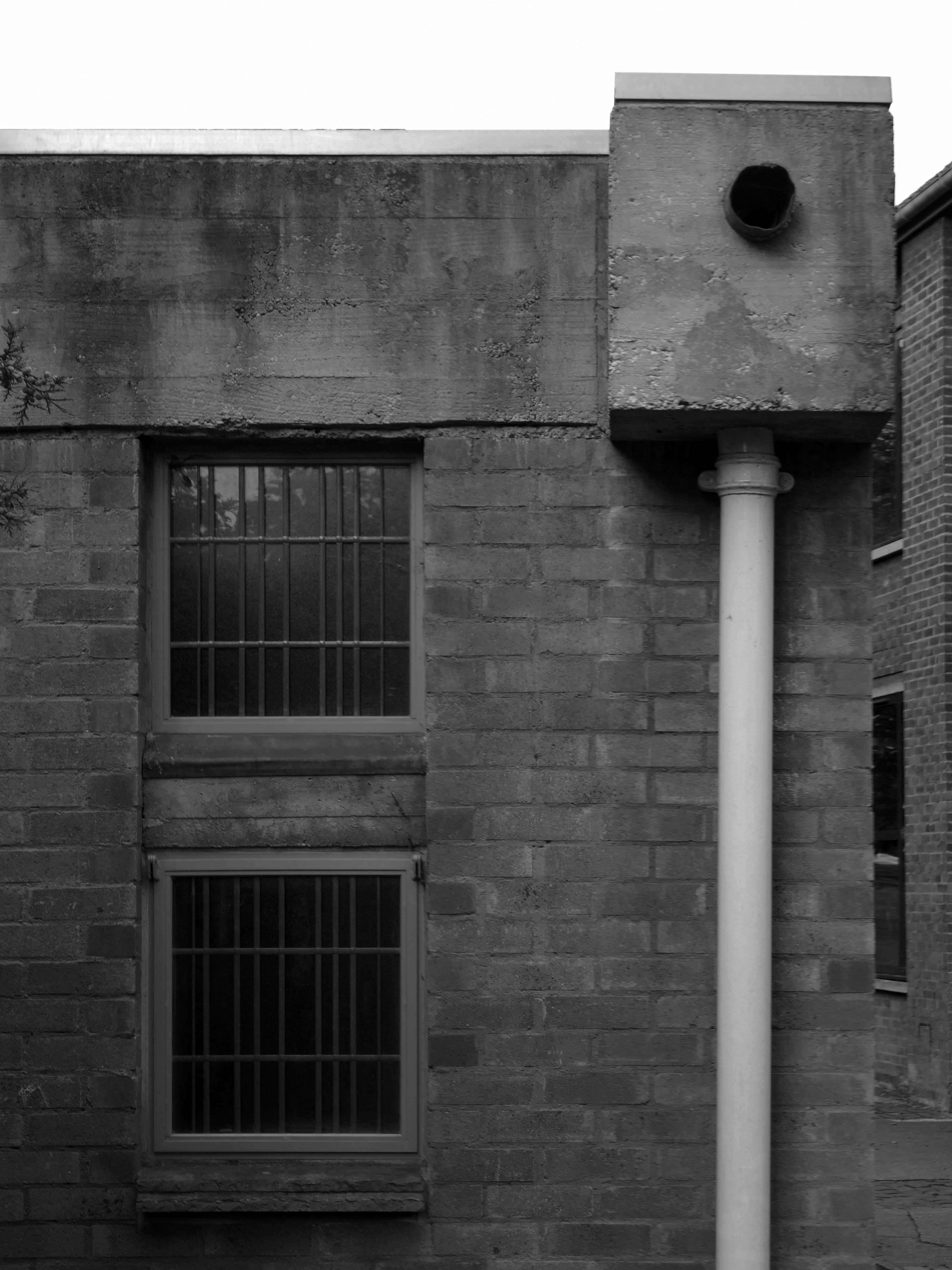
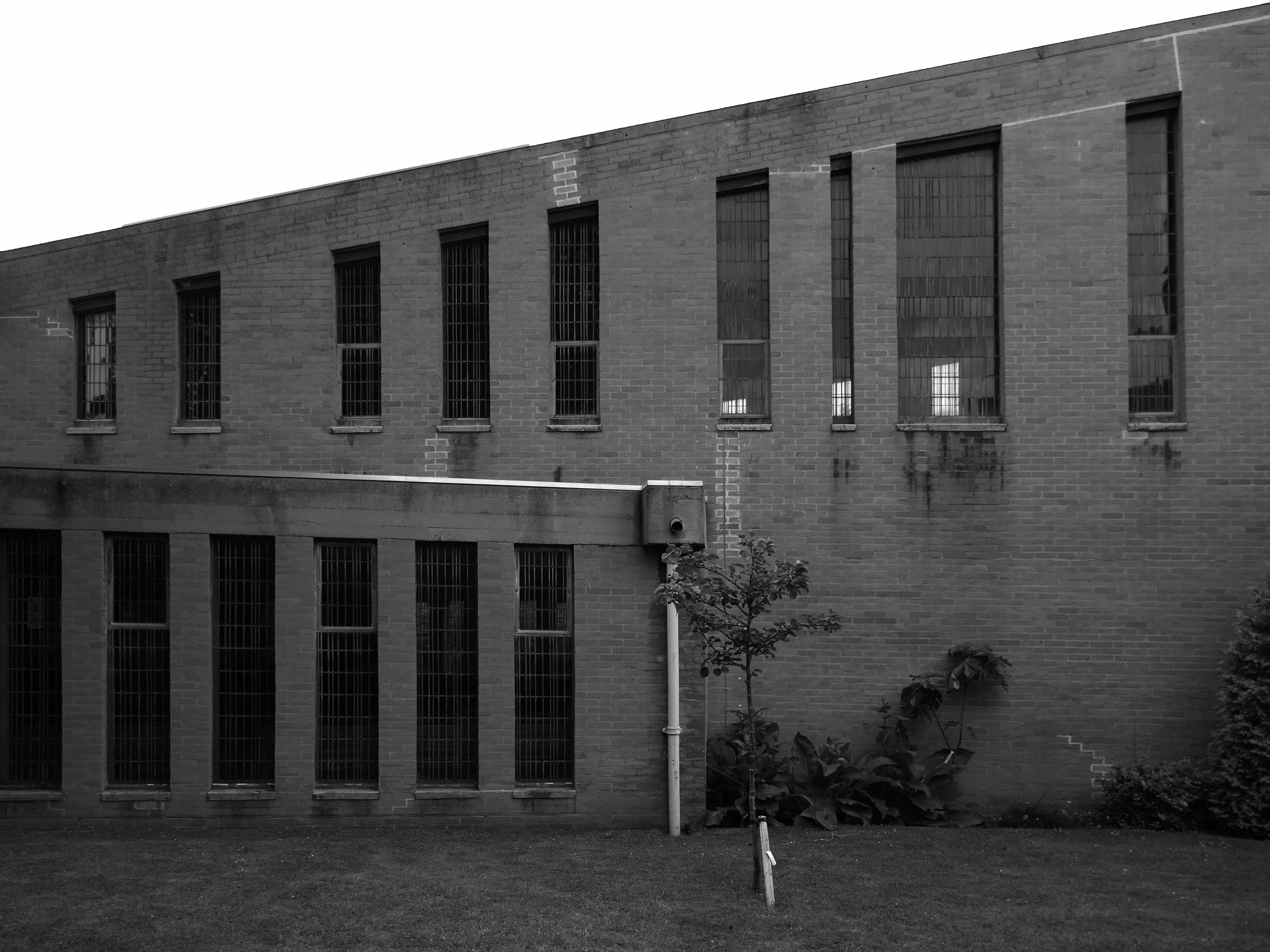
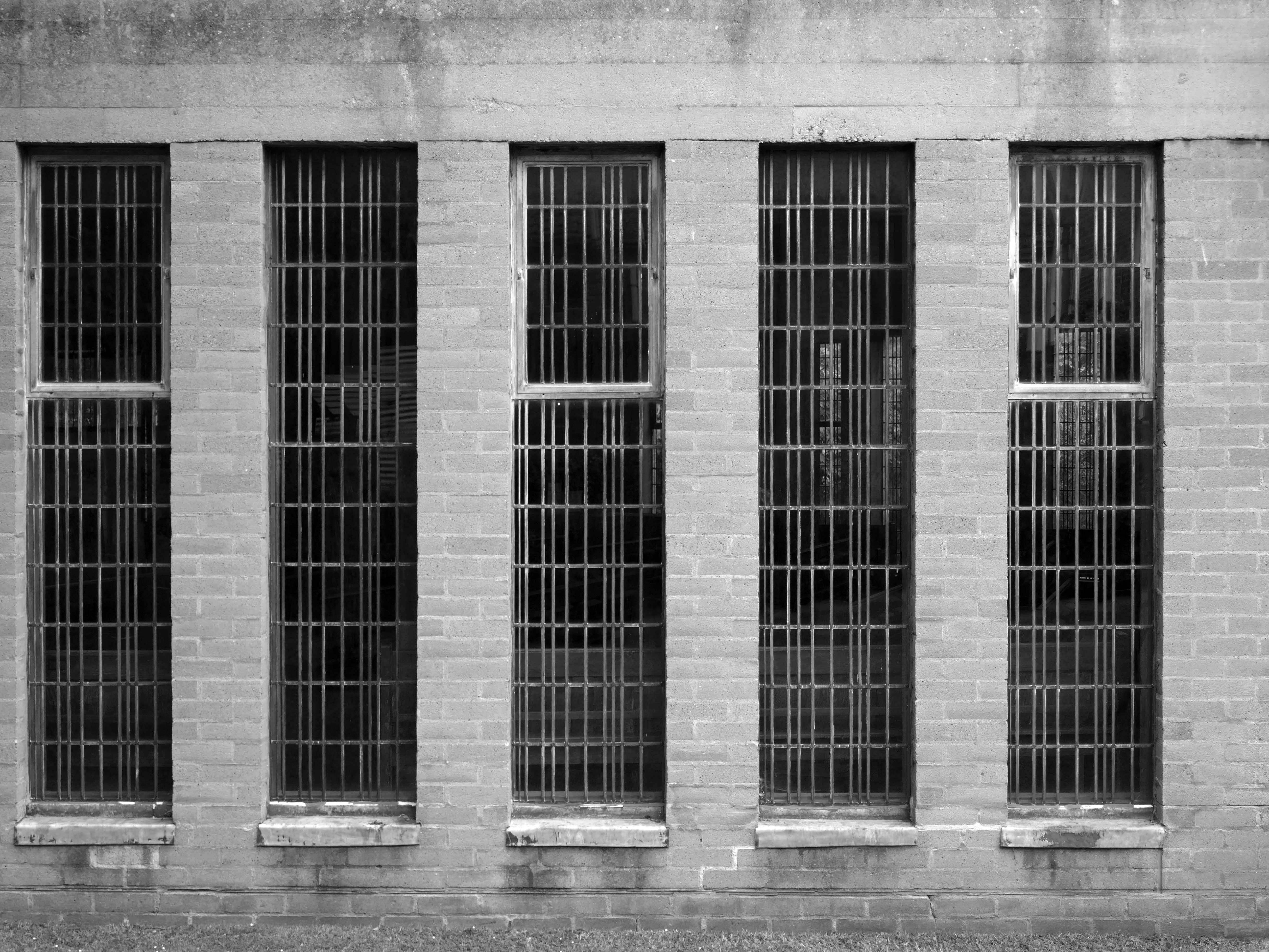
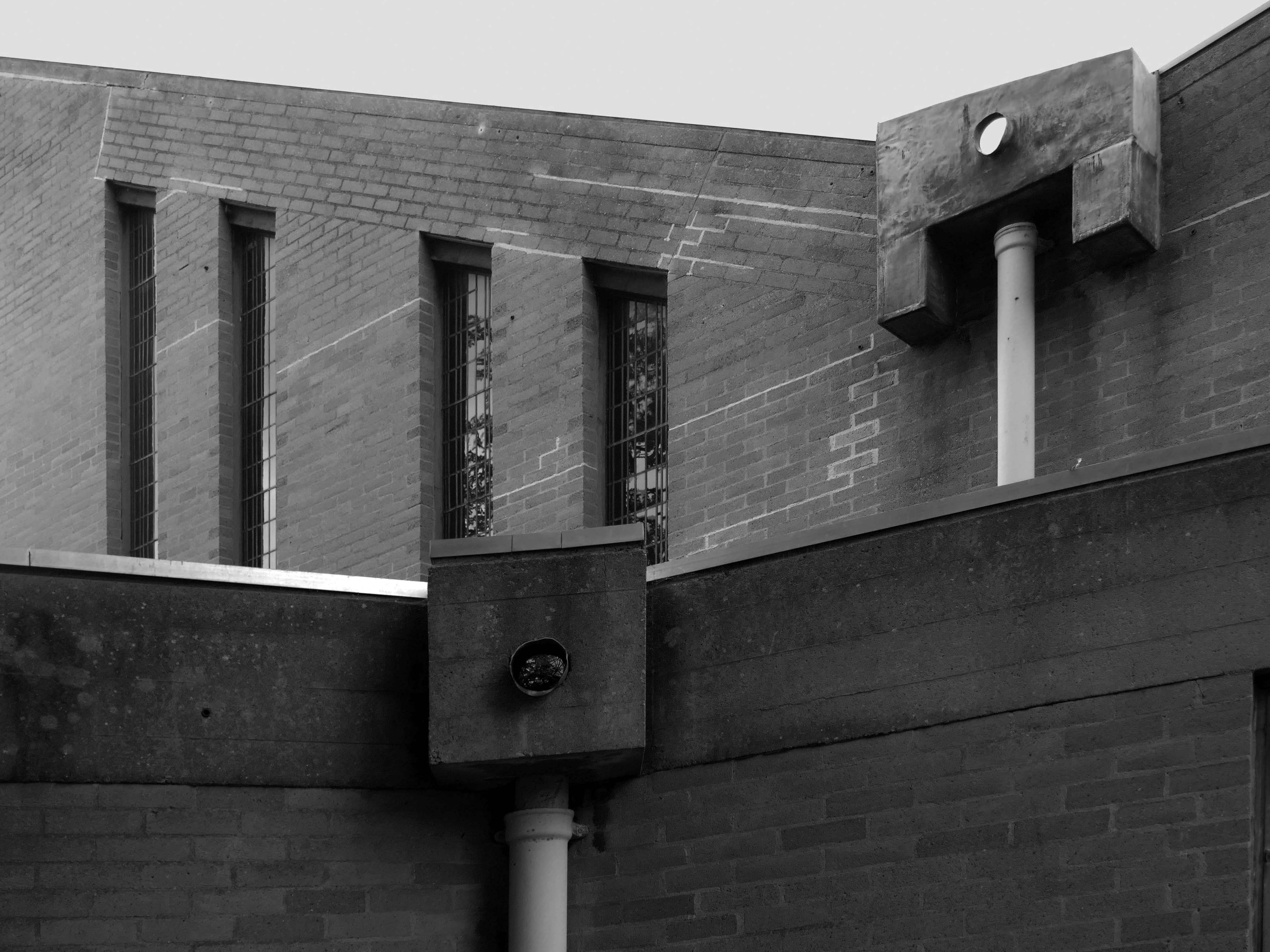
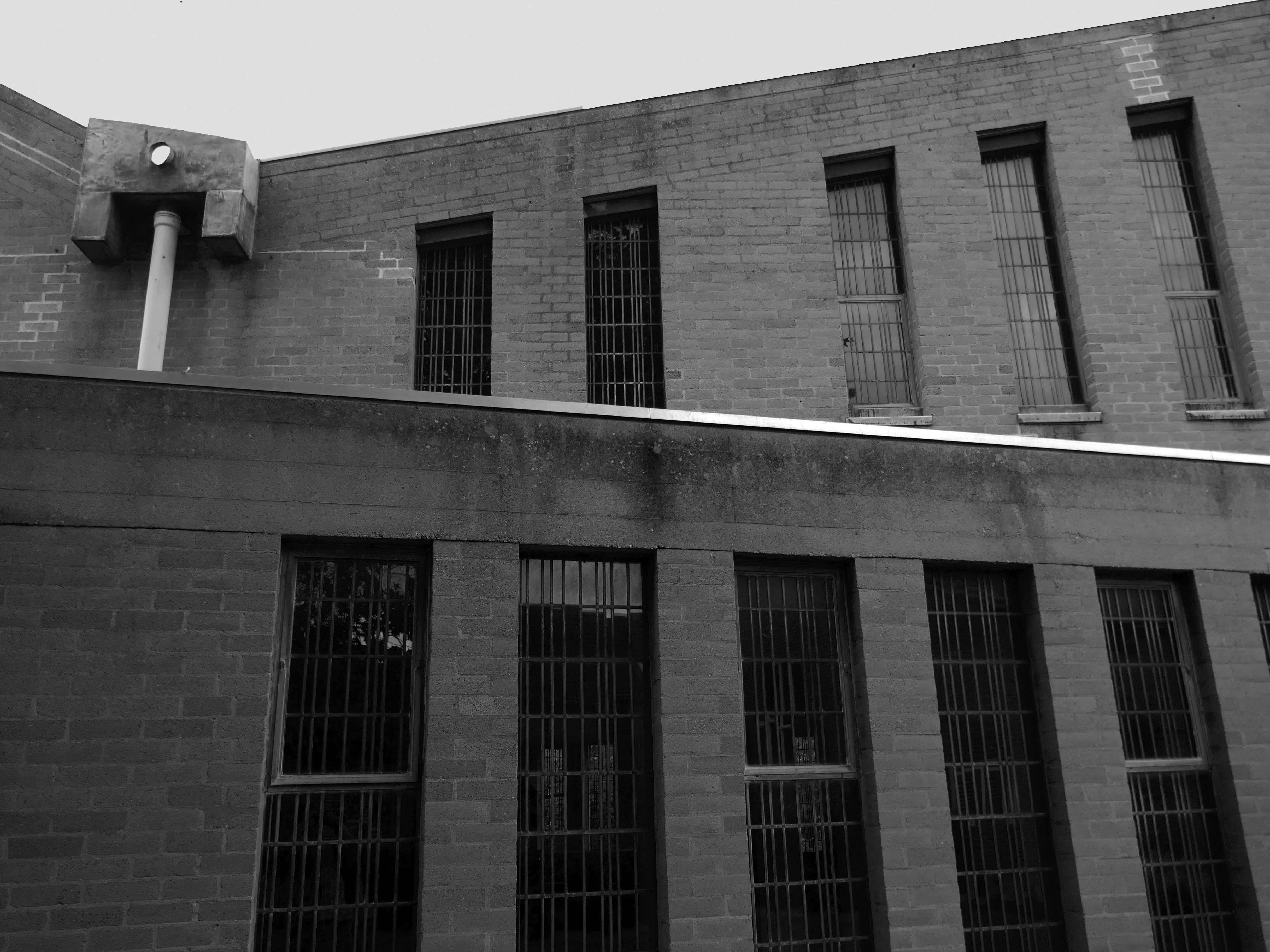
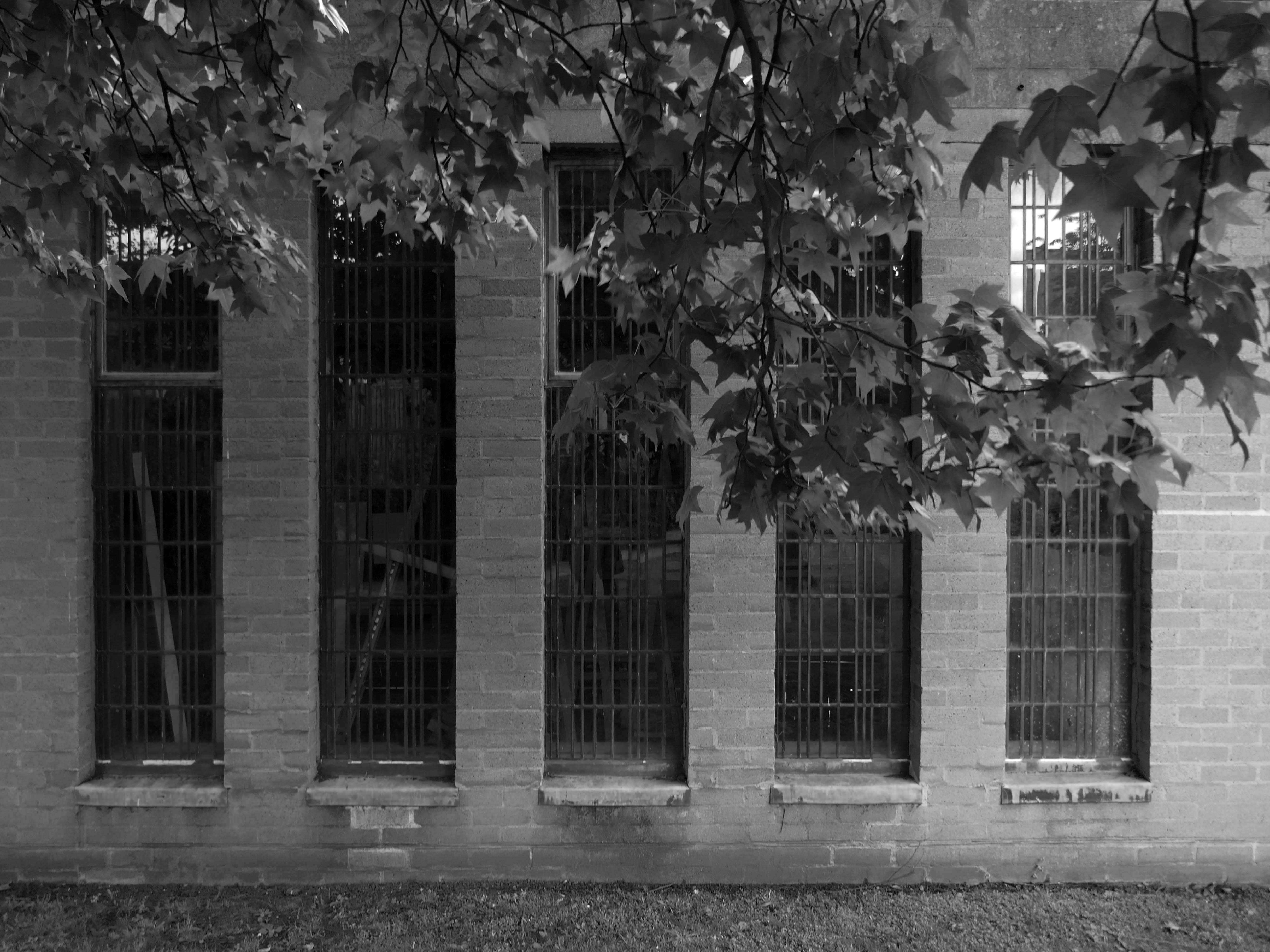
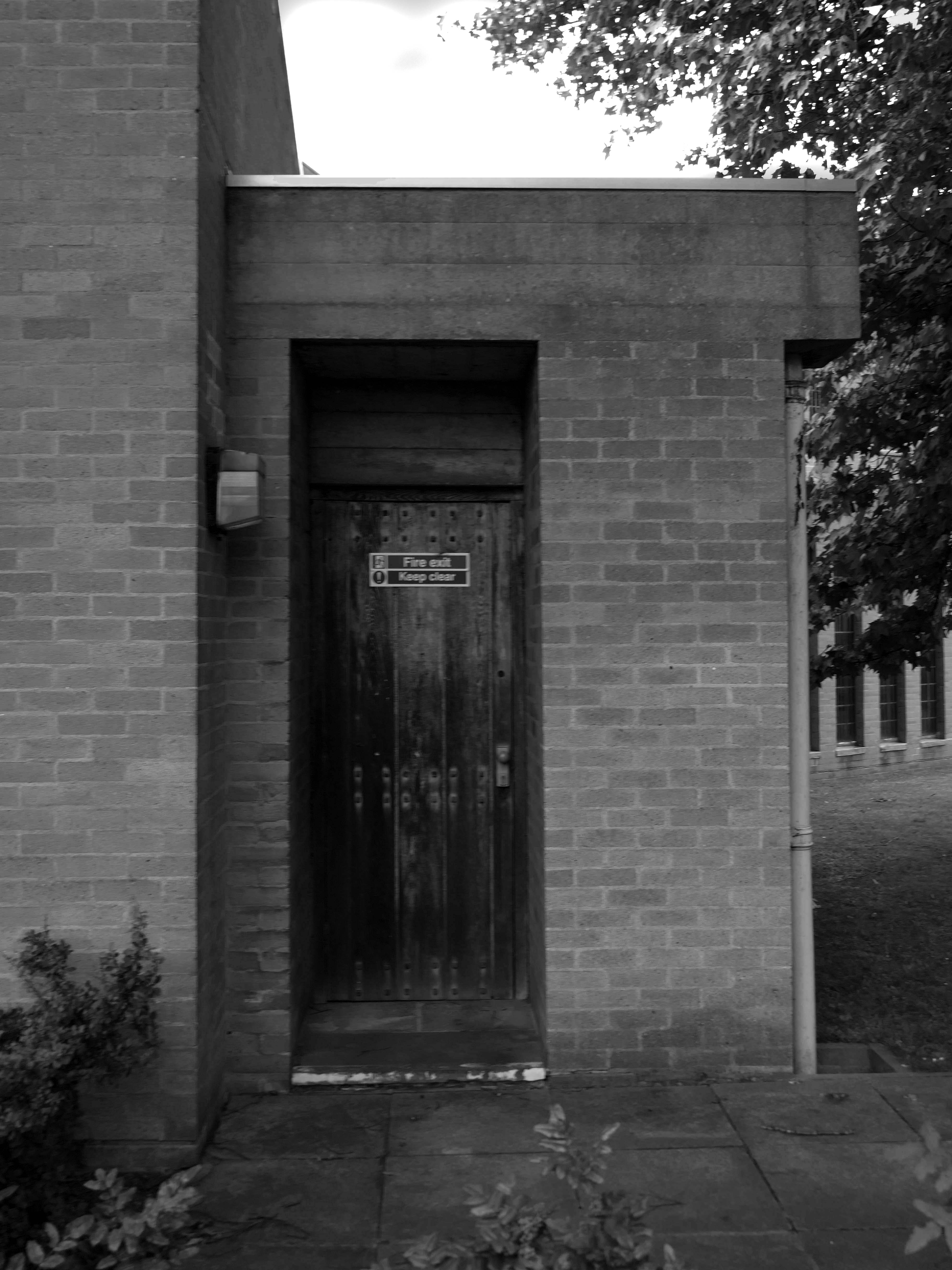
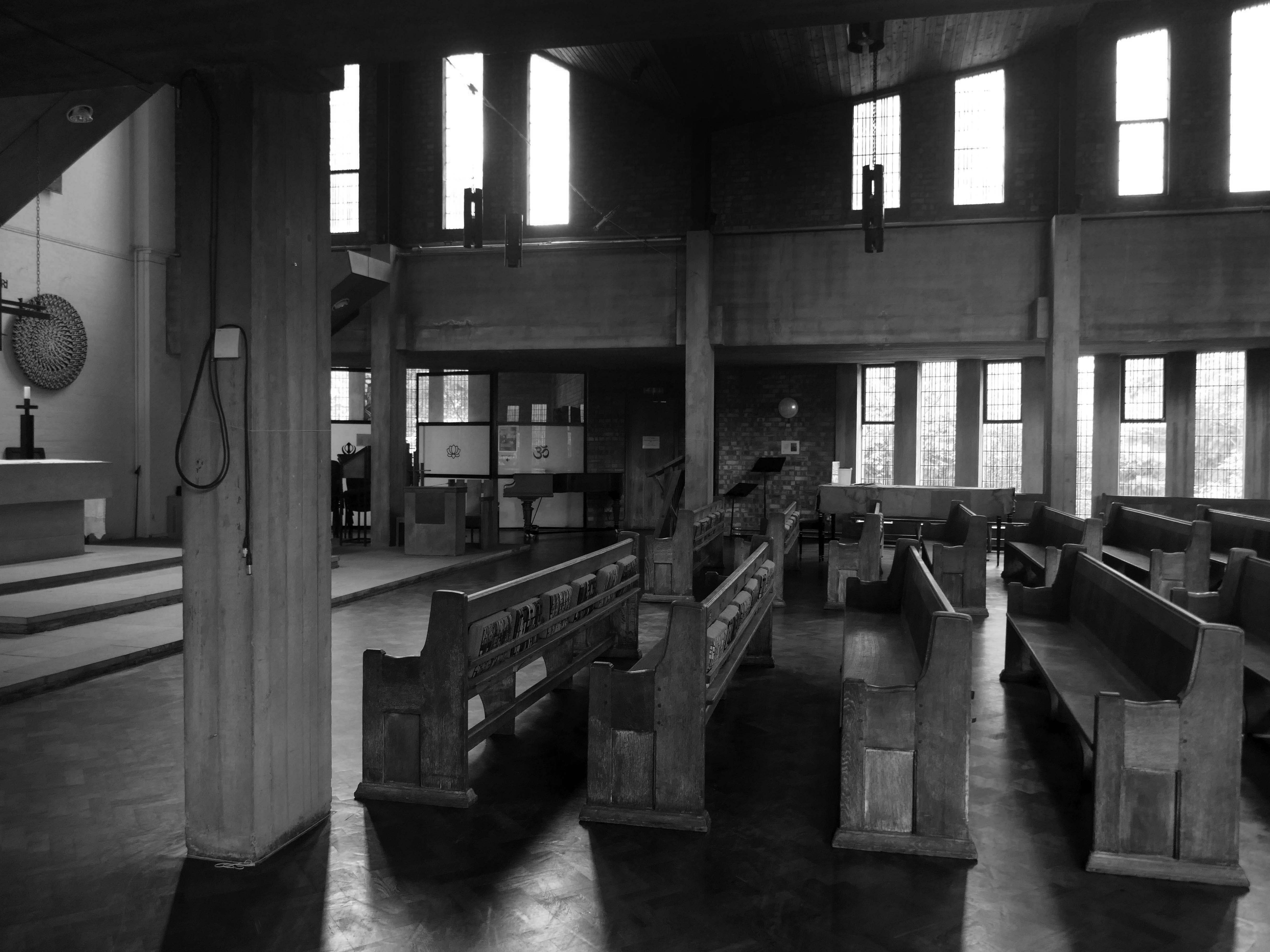
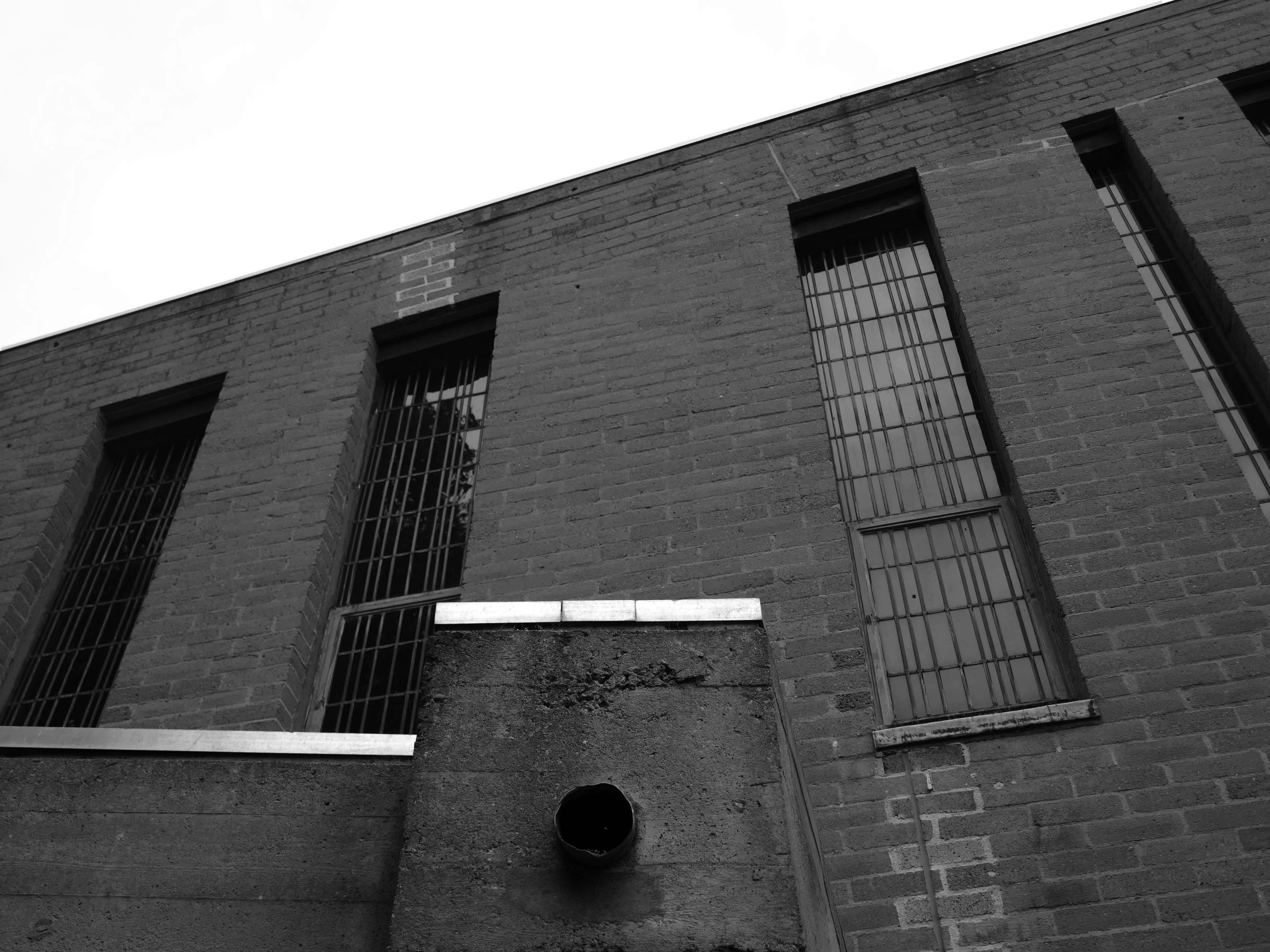
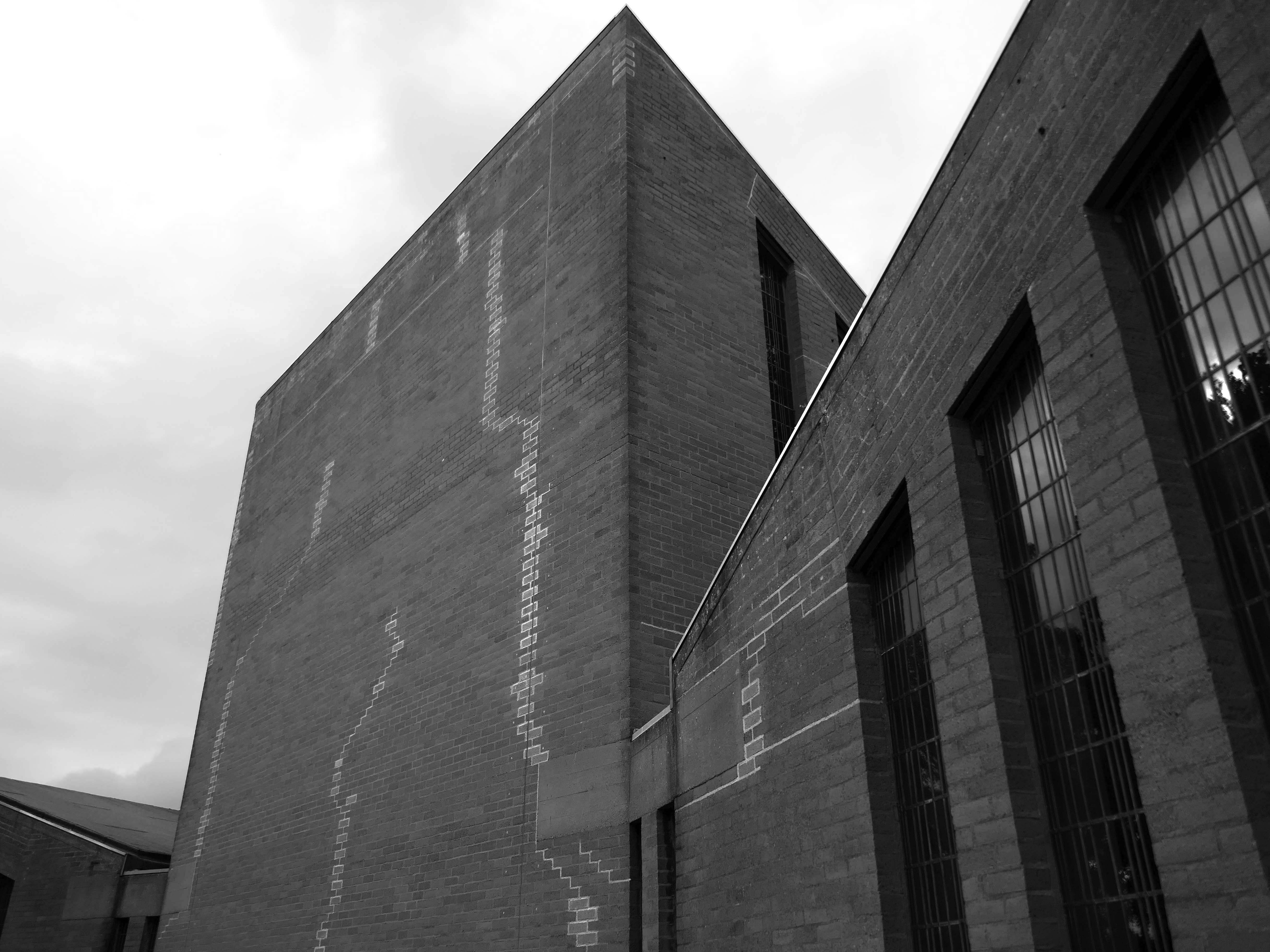
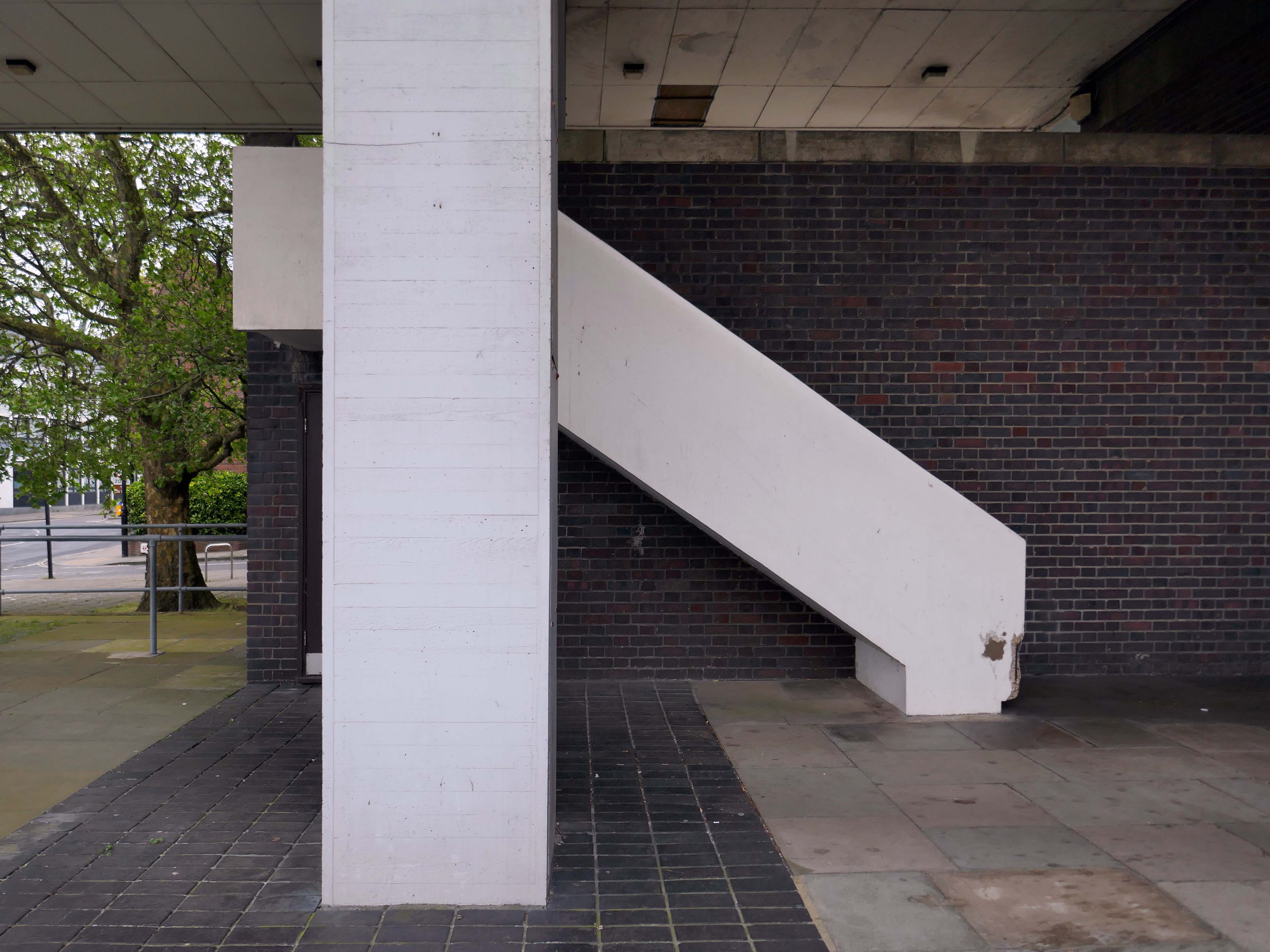
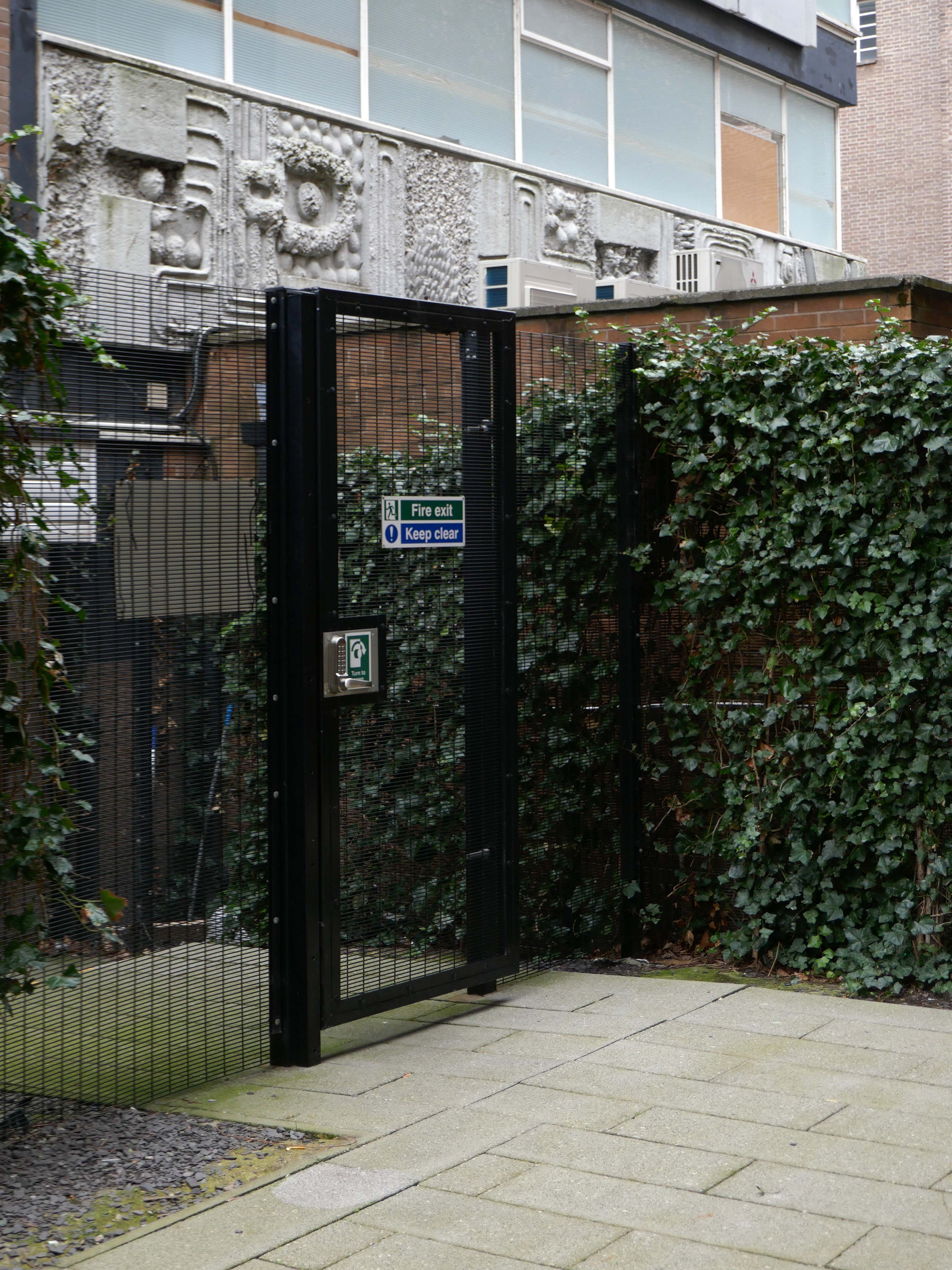
Reinforced concrete frame, partly left exposed, clad in pale brick. Monopitched roofs. Low flat roofs to entrances and between the three main elements with thick board-marked eaves. Central space flanked by angled transepts, with organ loft to (liturgical) west end and wing of offices behind. Long narrow flat-headed windows between brick mullions, timber doors. Attached walls and steel gate lead to inner garden, intended for contemplation.
Interior with exposed concrete frame, including piers and thick ring beam at gallery level, with brick infill. Boarded timber ceiling to main space; board-marked ceilings to low side aisles. Choir gallery with organ, designed by Pace, set behind timber lattice screen also to his designs, and reached via narrow spiral stair. Ceramic piece to balcony front 1999 by Helen Batty. Some pews, brought from the college’s former chapel of 1858 remodelled by Pace in the 1950s.
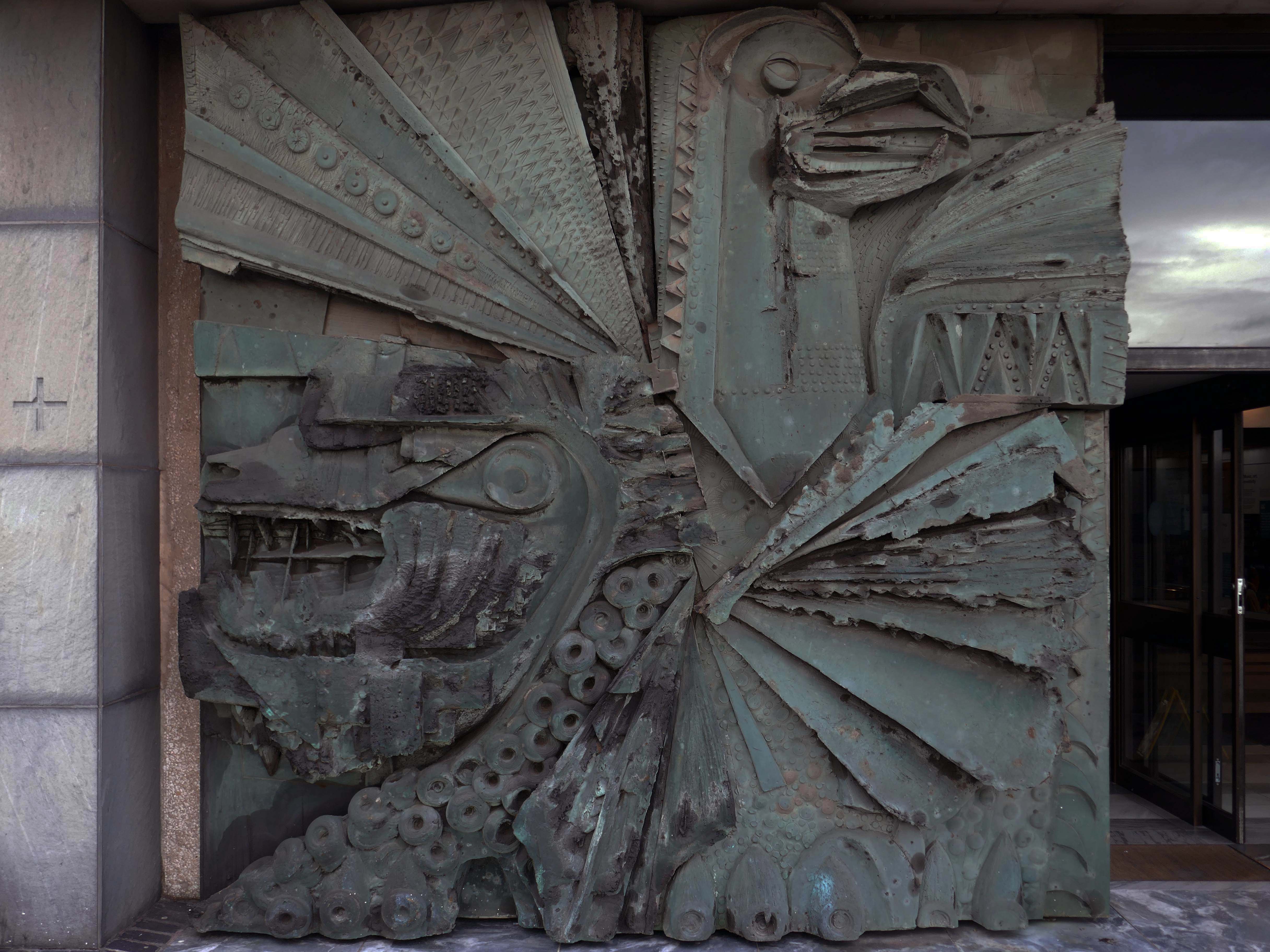
Hanging pendant light-fittings to Pace’s designs. Altar, lectern and altar seating all by Pace; pulpit designed 1998. Windows – internally the concrete of the mullions is exposed, all originally clear leaded lights, but now stained glass is being incorporated, most notably ‘The Water of Life’ by Cathy Nutkins, a 1990 graduate, in right-hand transept.
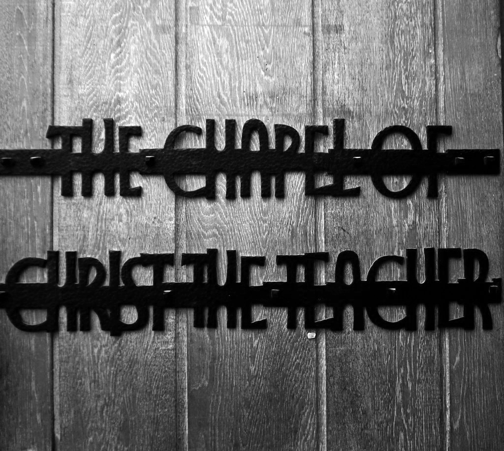
Chapel of Christ the Teacher to rear, by foyer, refurbished 1994 by Helen Turner, textile artist. The building is well-suited to the incorporation of student works of art, some temporary, some permanent, and additions are continually being made to the collection.
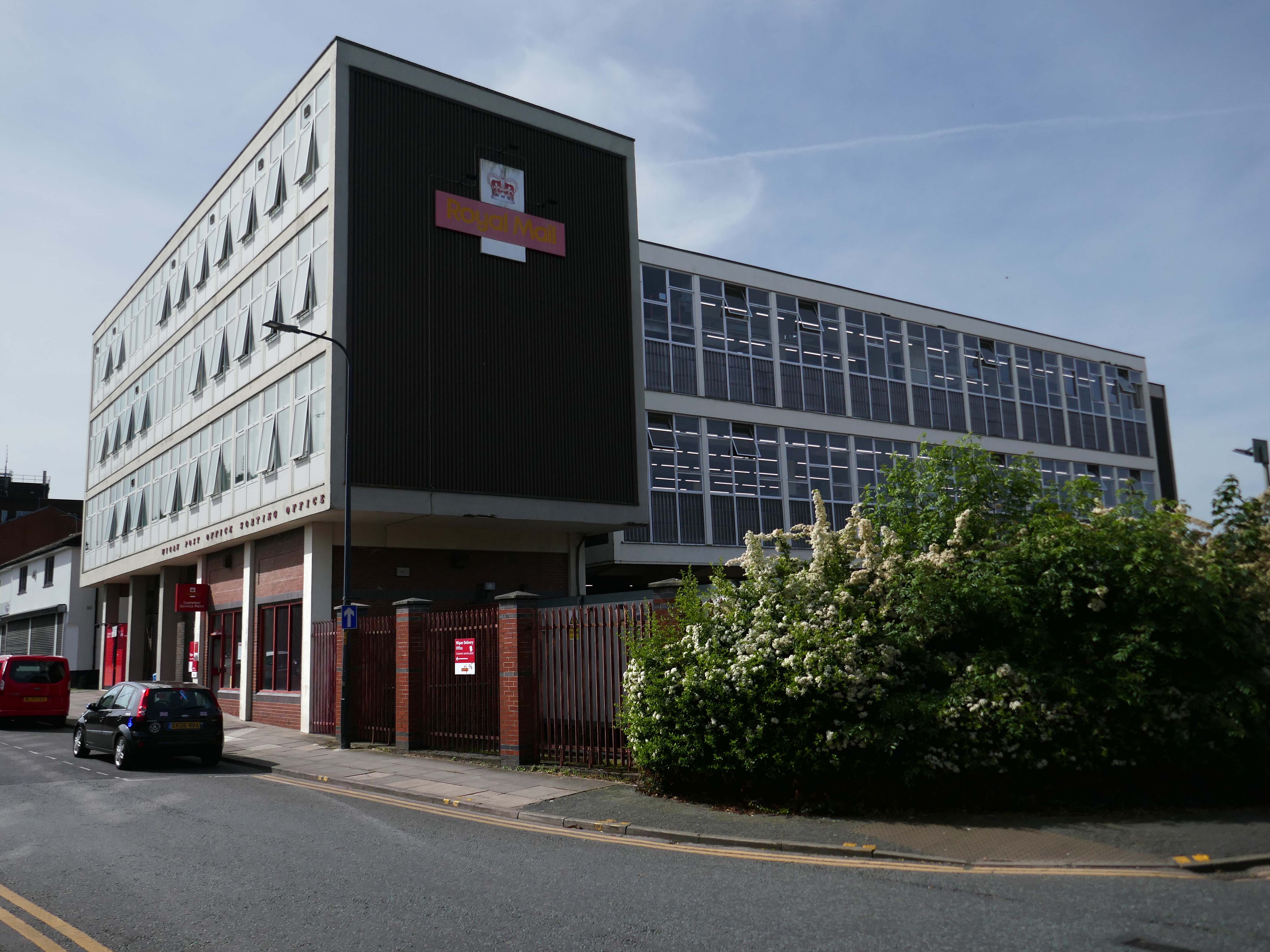
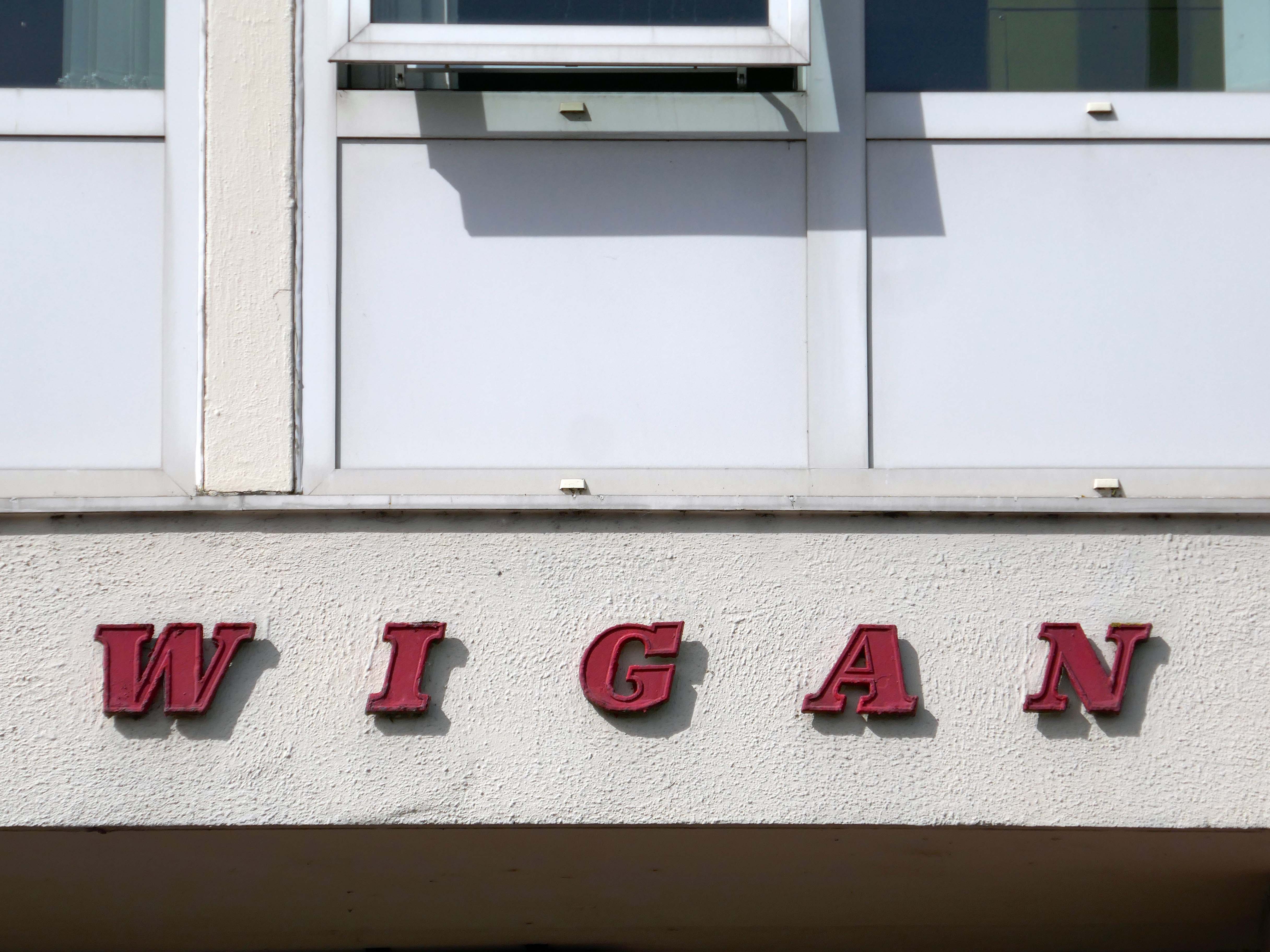
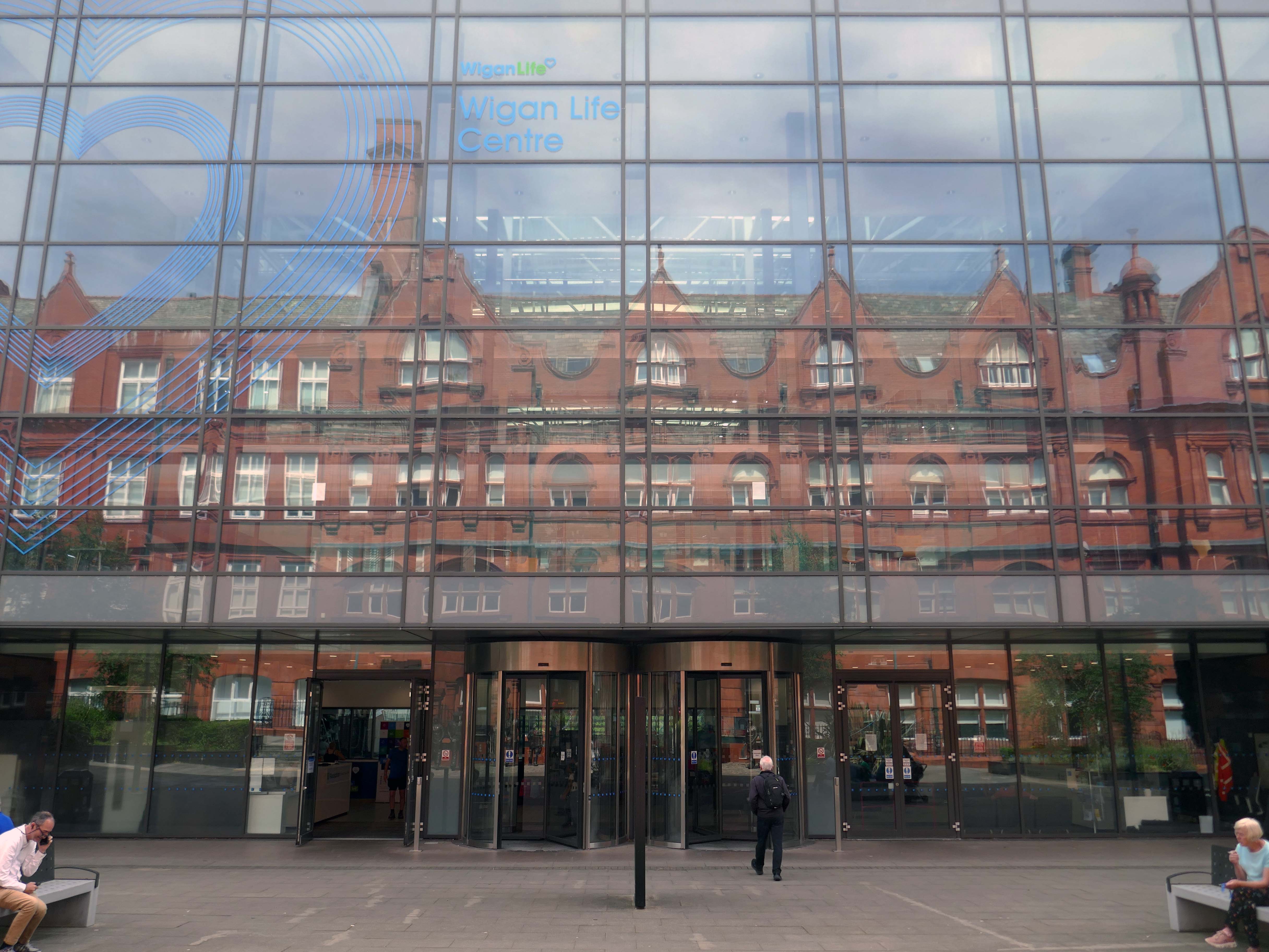
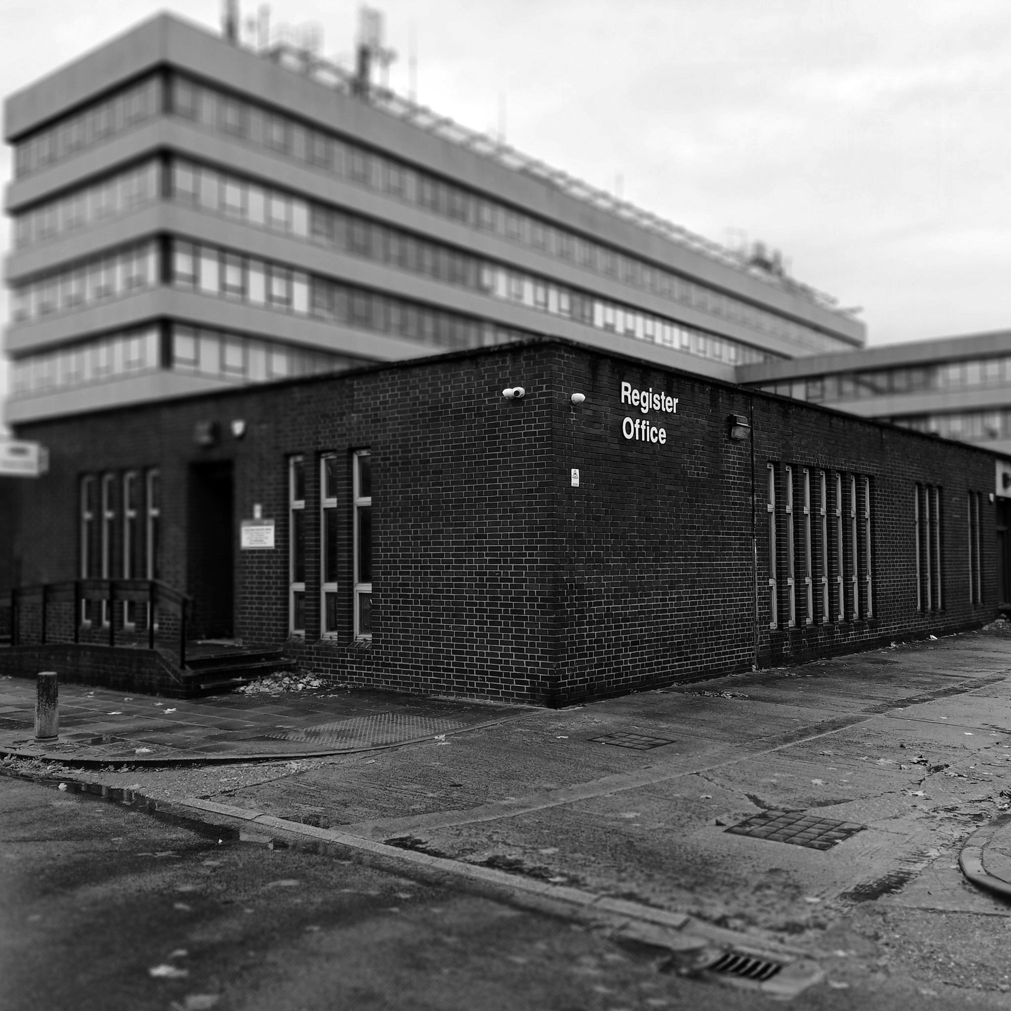
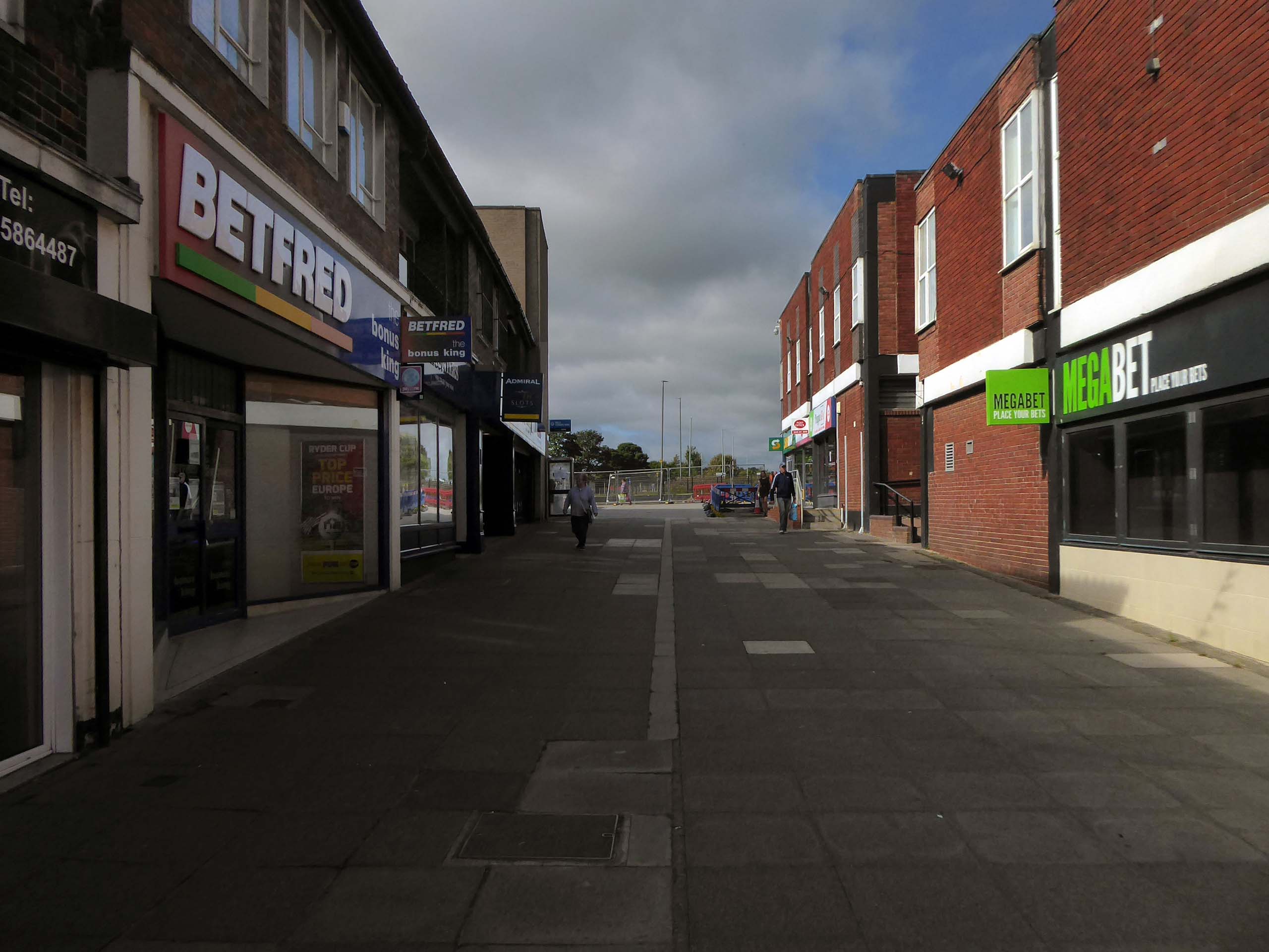
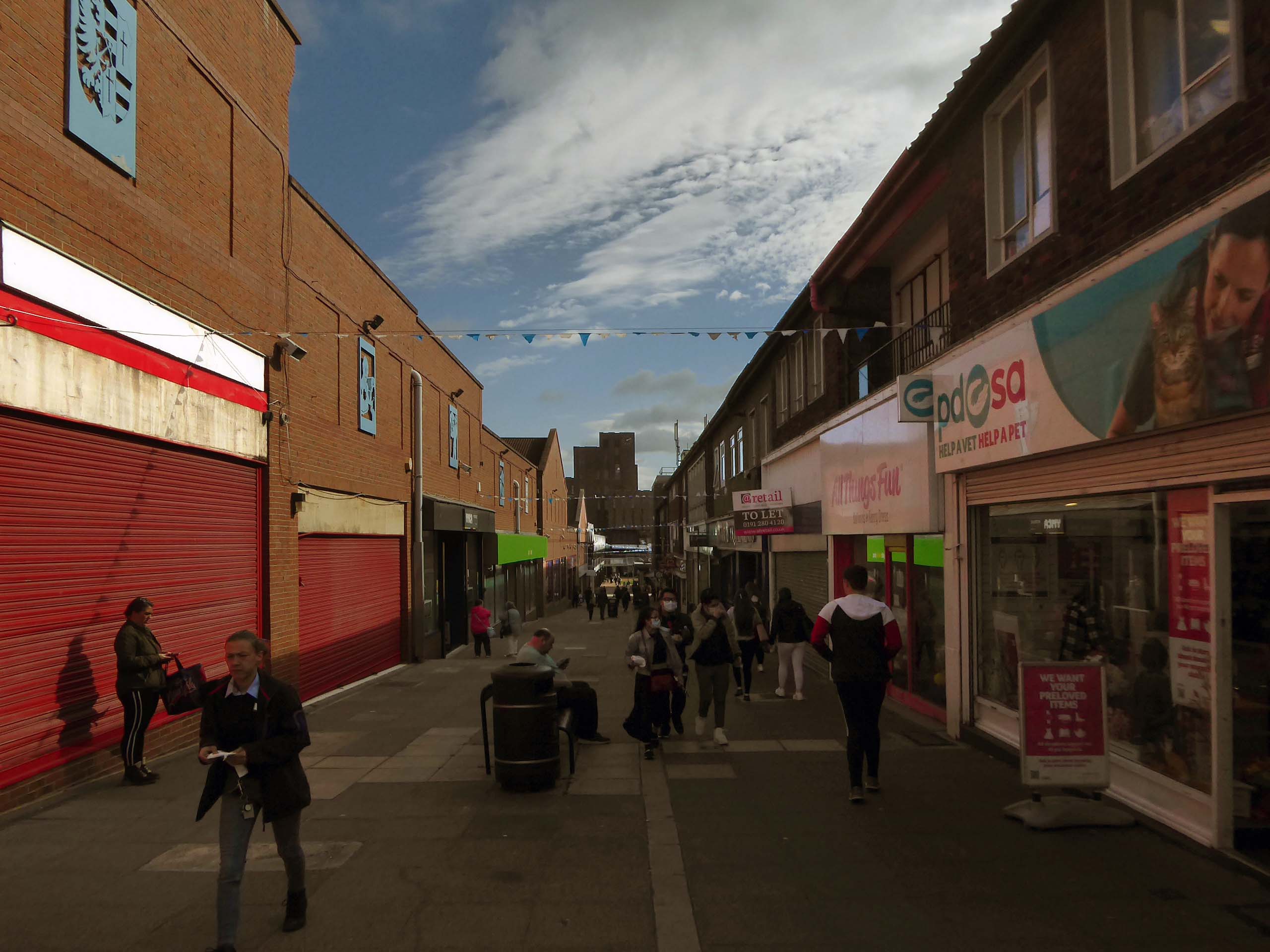
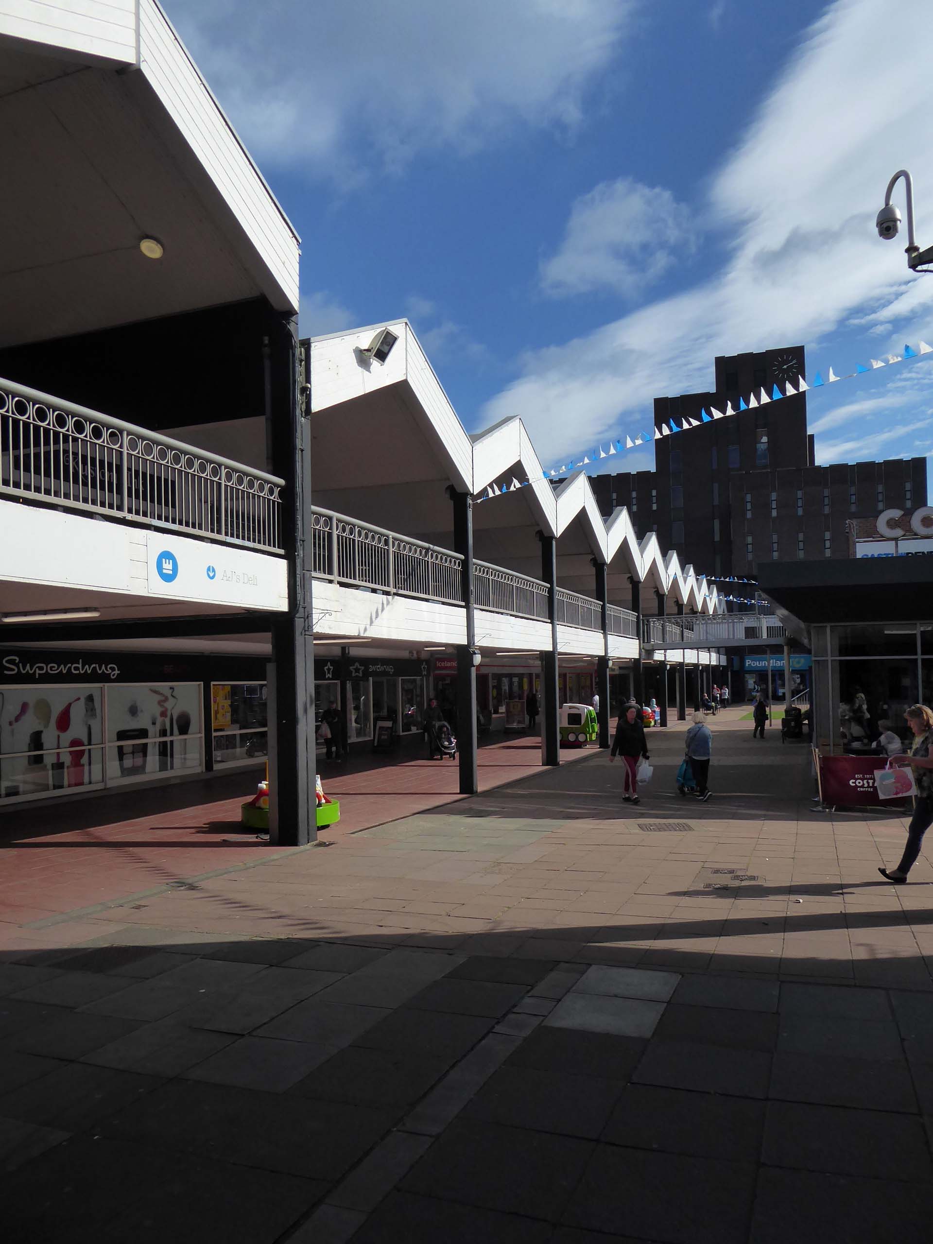
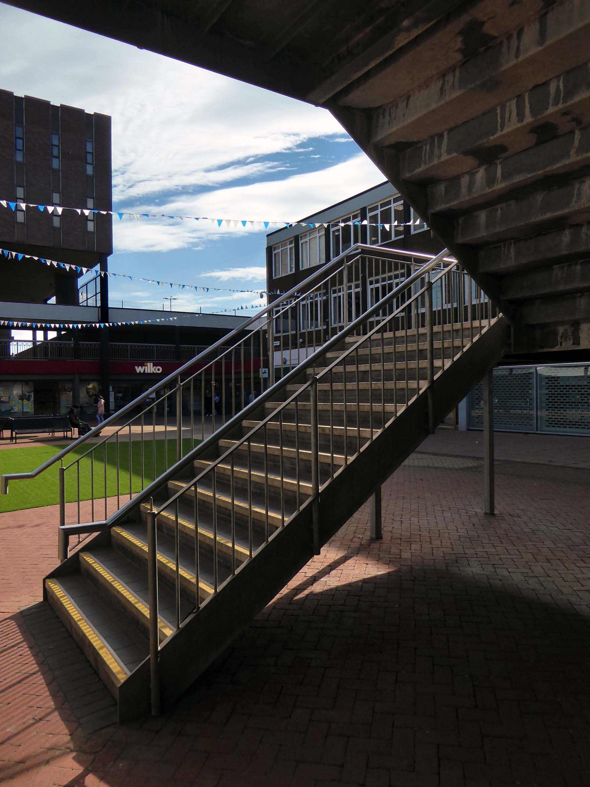
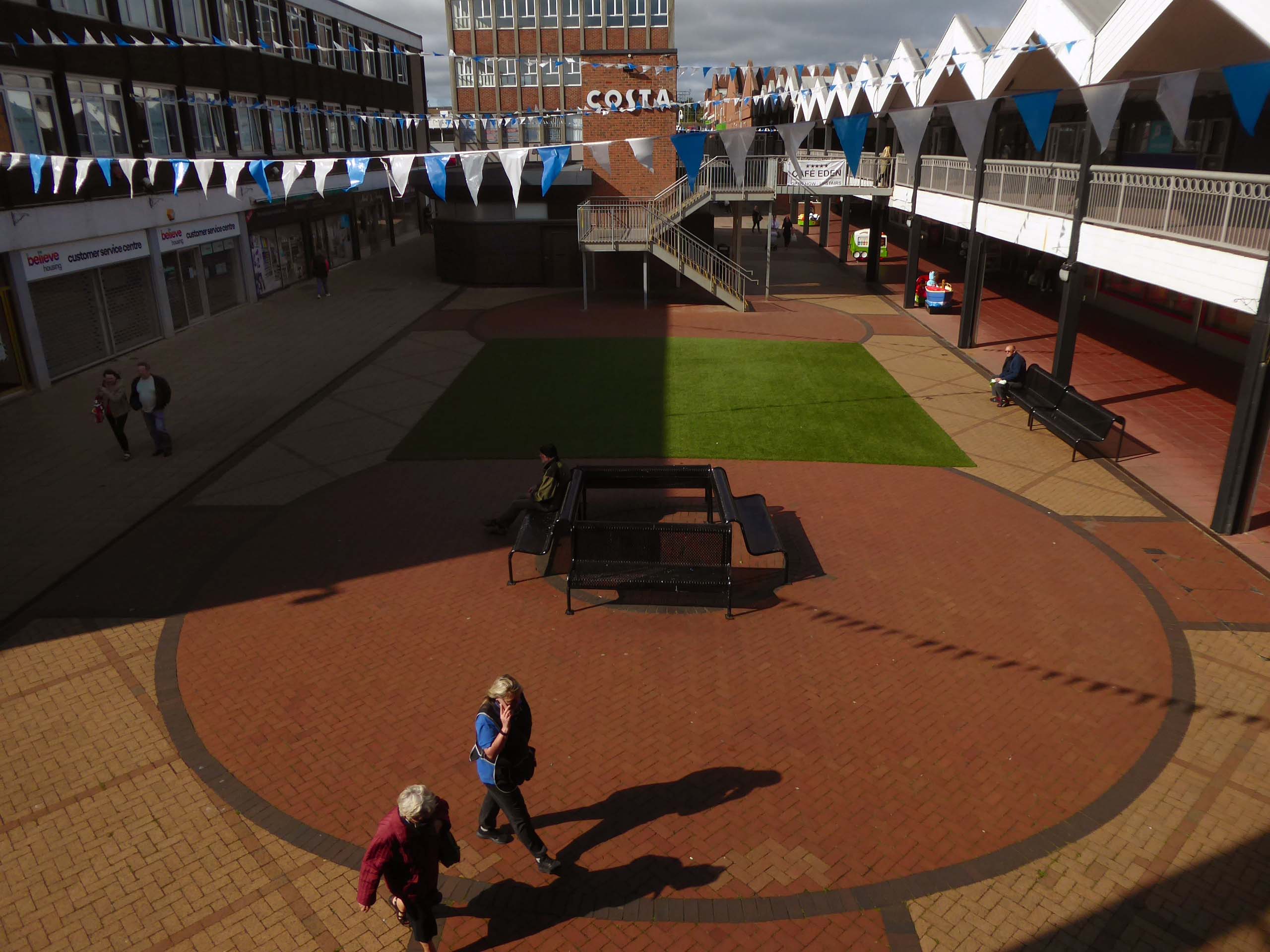
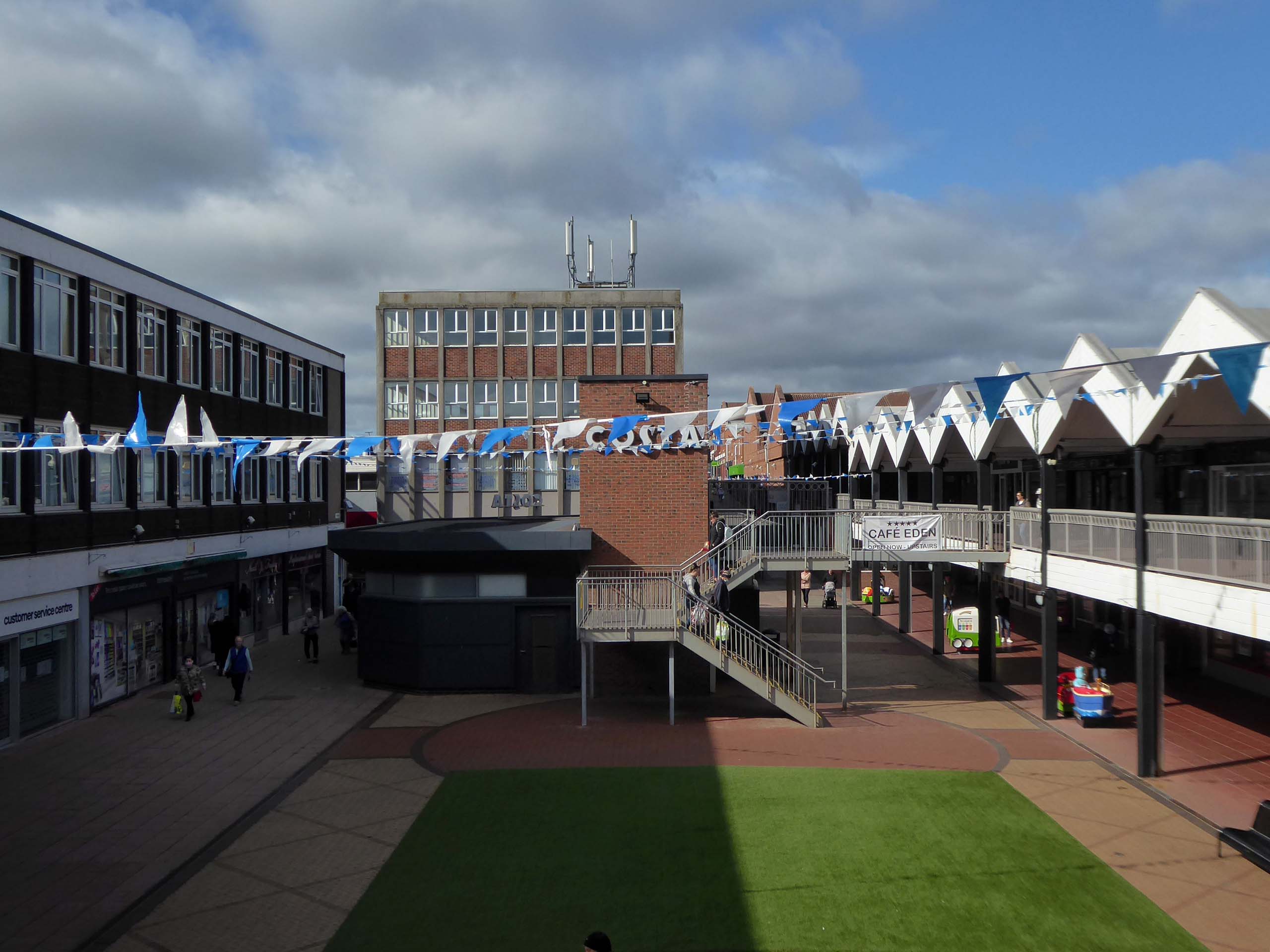
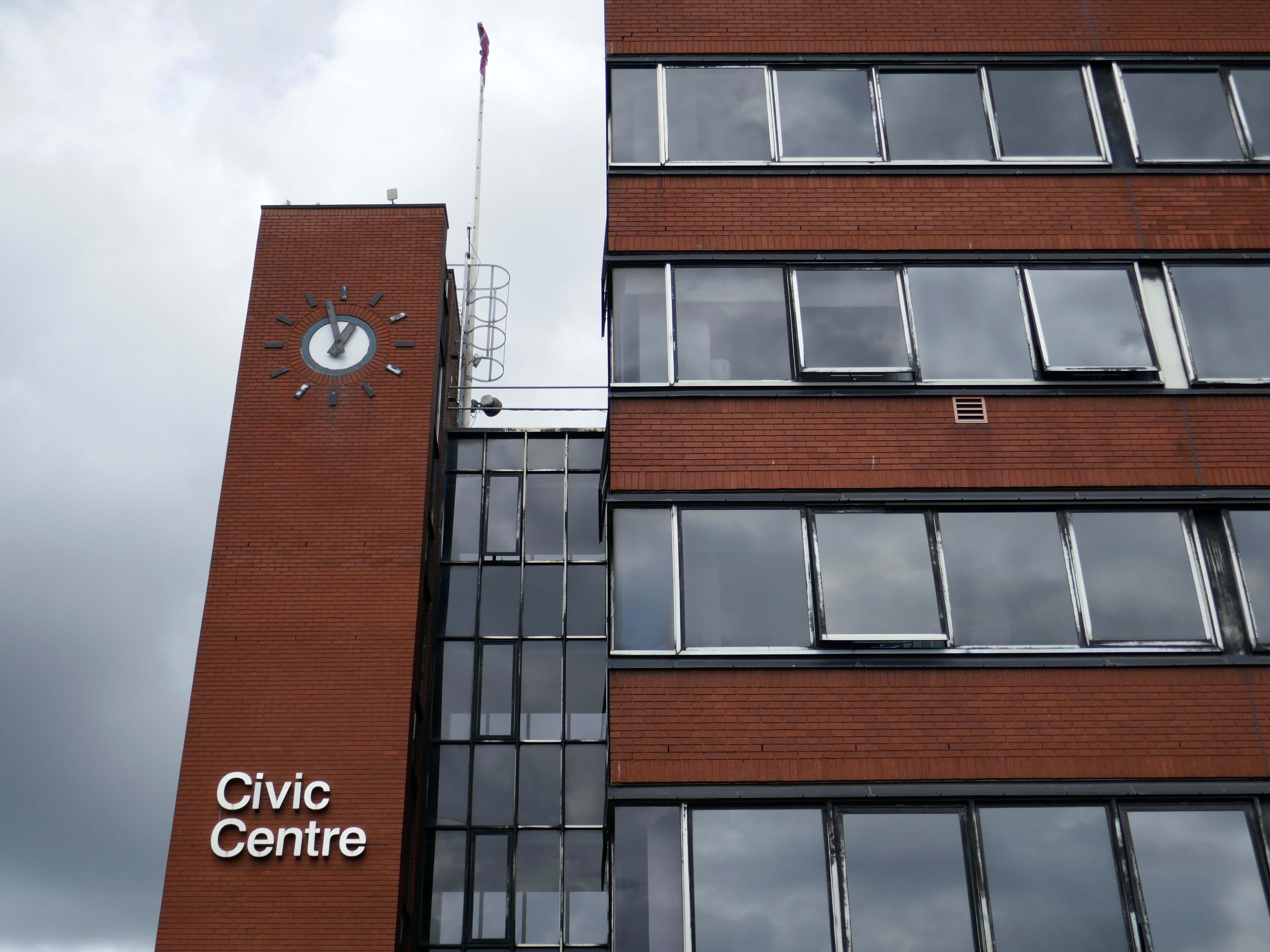
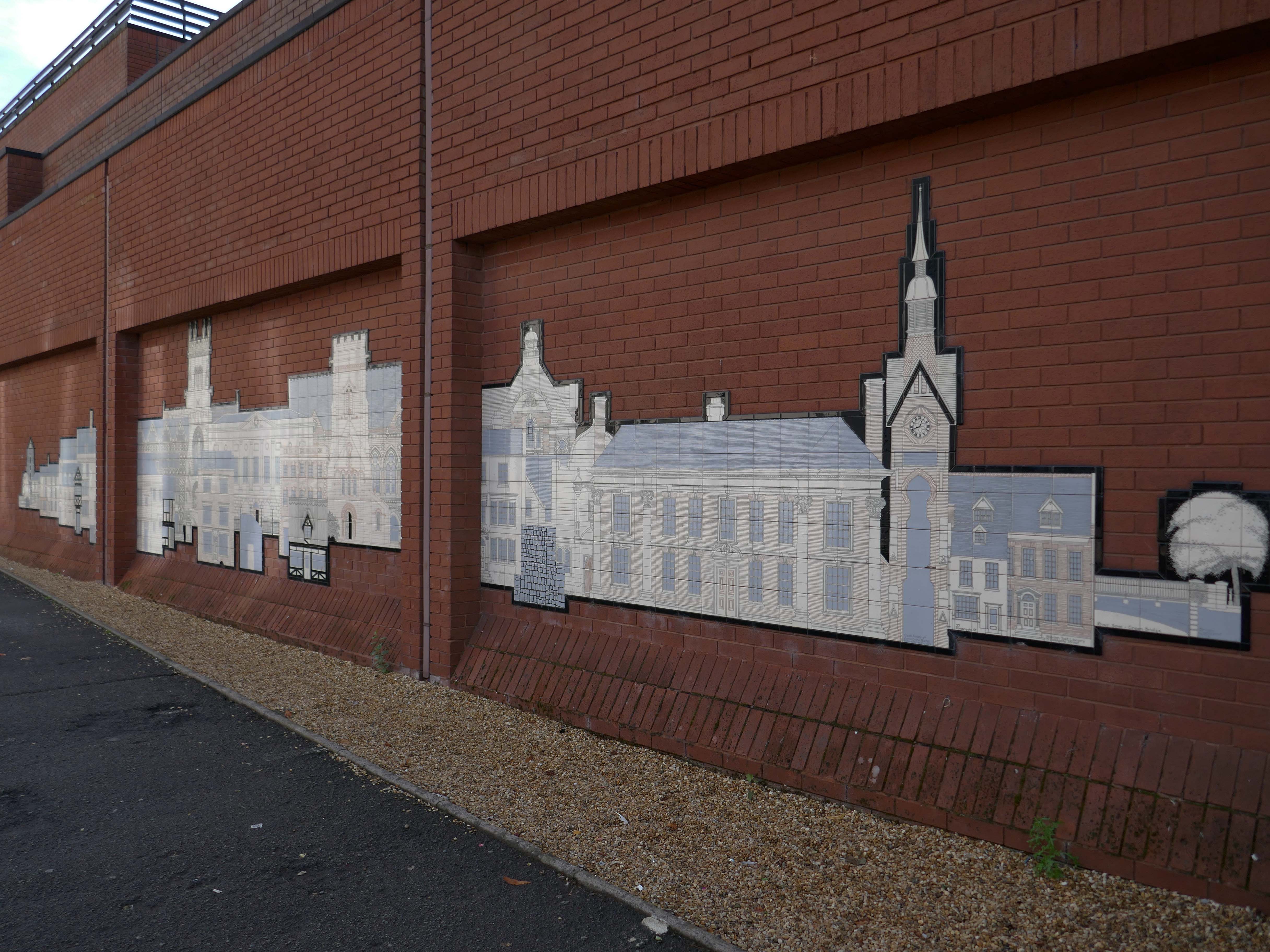
It’s been four years since our 2022 Wigan Walk – so time to see if there has been a refreshing change.
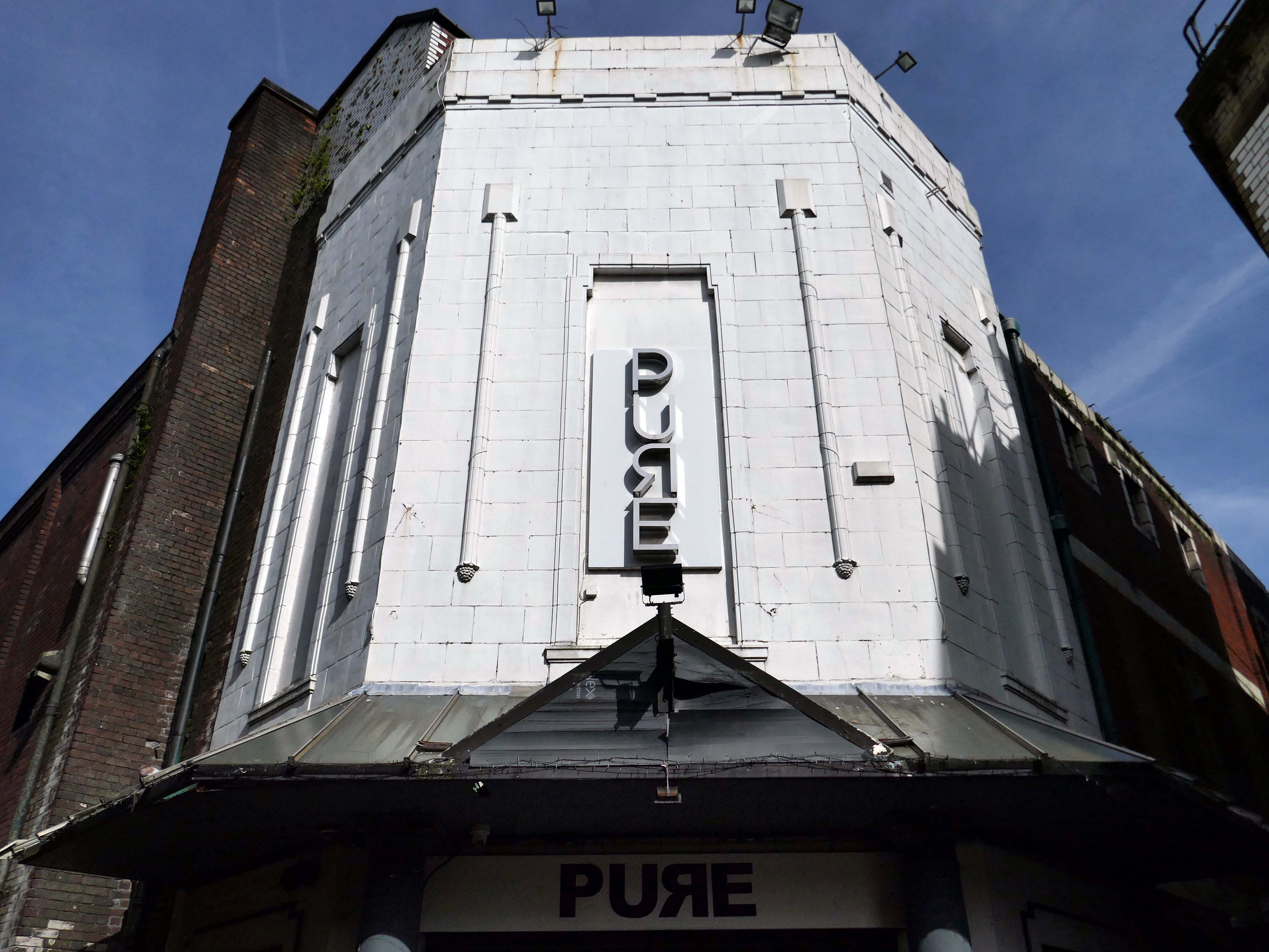
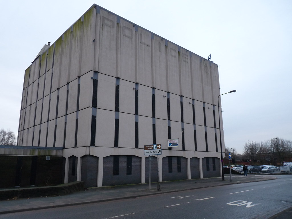
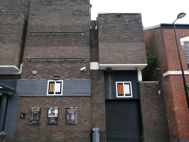
Beginning with a trip to the former flicks, the Princes Cinema now trading as Pure nightclub, sometimes home to Singo Bingo.
Originally the site of New Princes Theatre, opened on the 1st May 1911, the cinema was demolished and replaced, on an adjacent plot, by Princes Cinema in 1933.
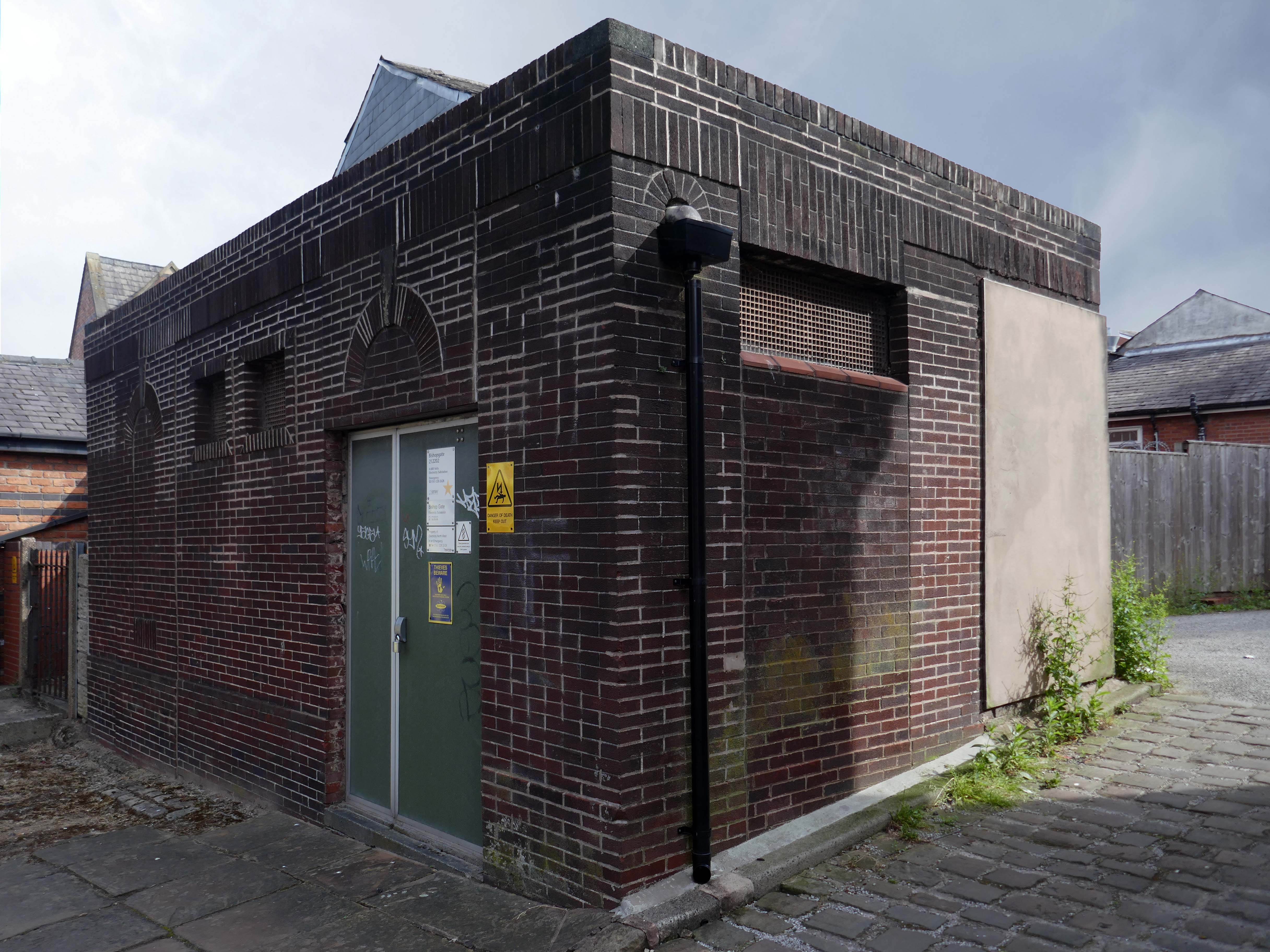
Ofd special note the adjacent Electrical Substation of the day.
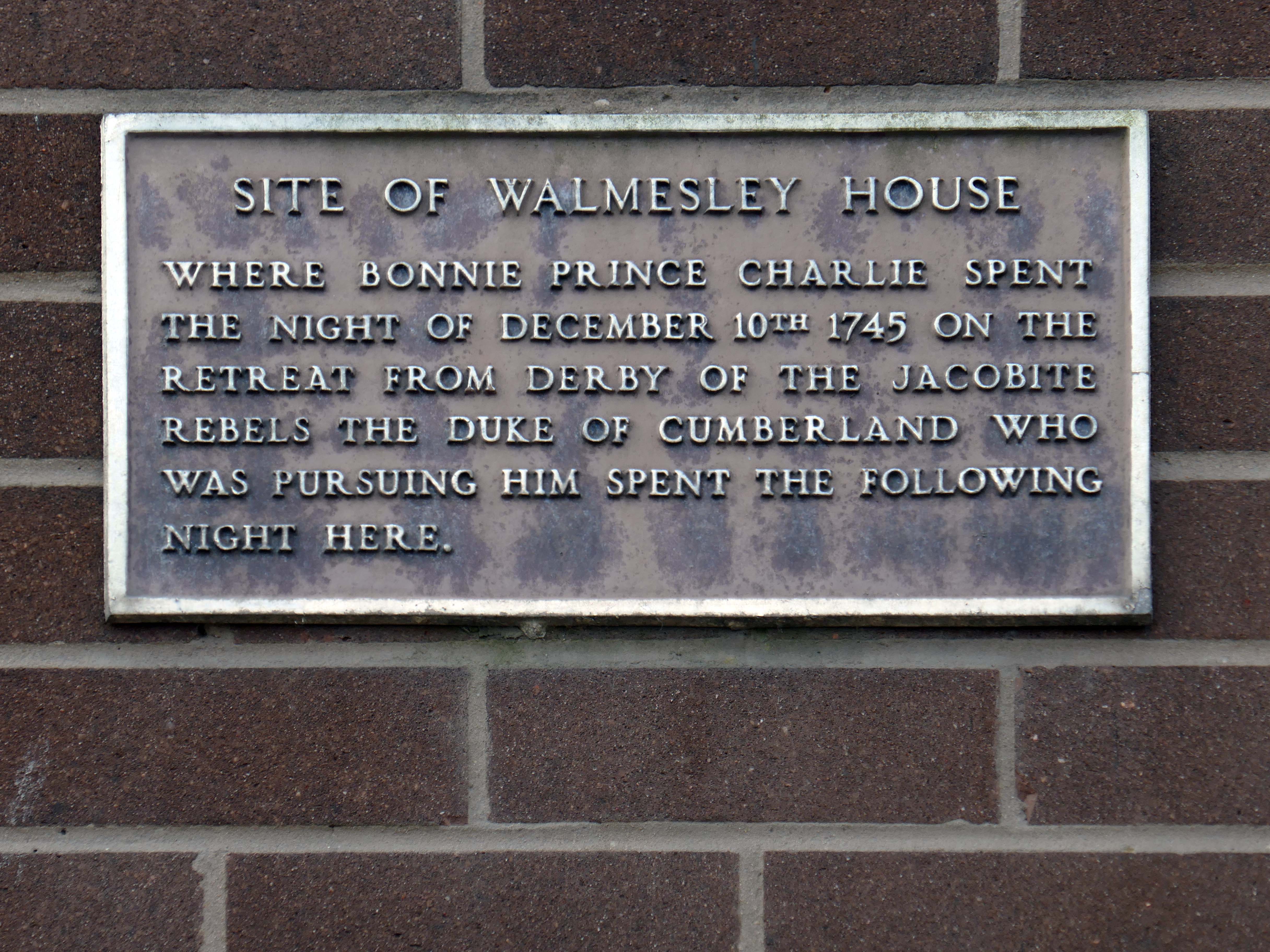
Plus extra added military history.
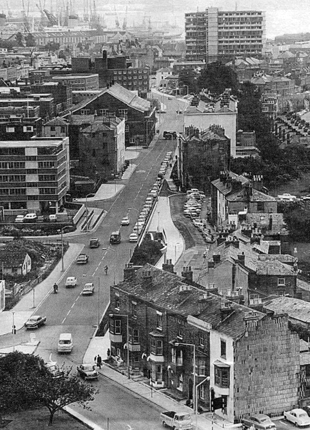
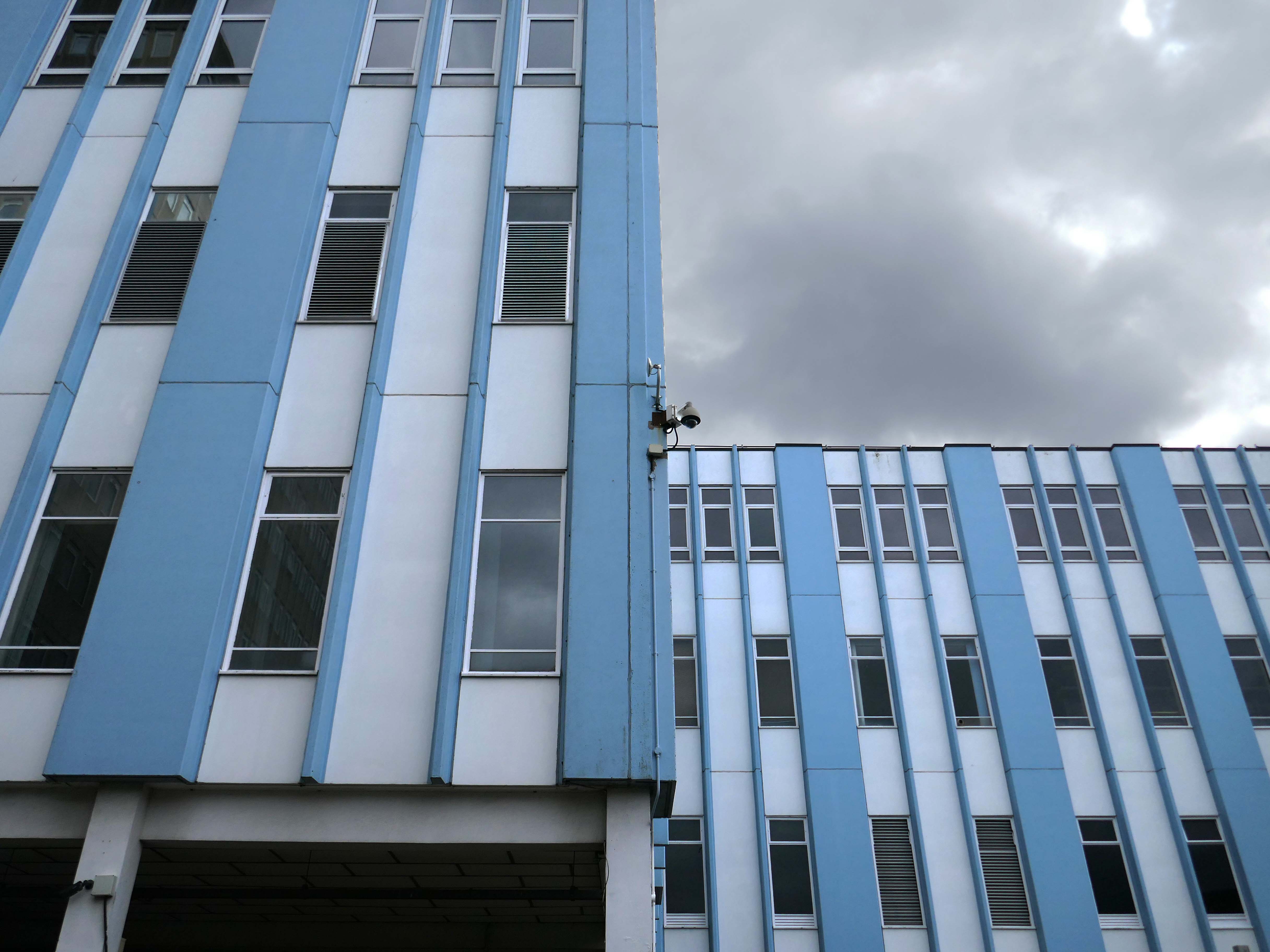
Seventies
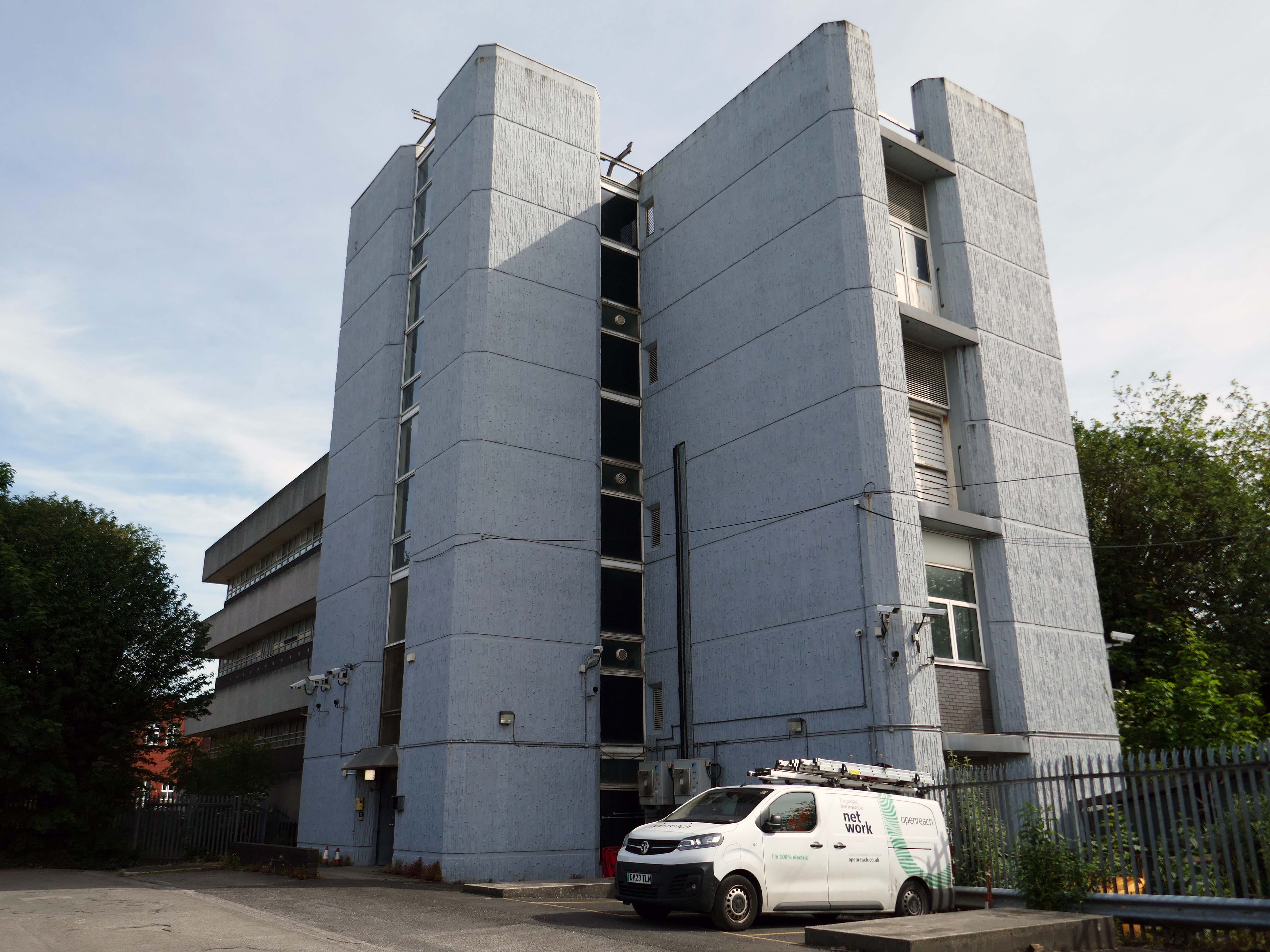
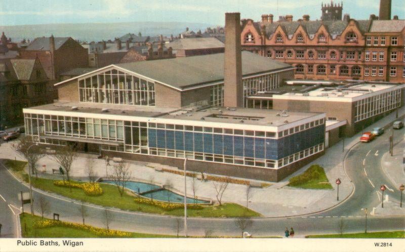
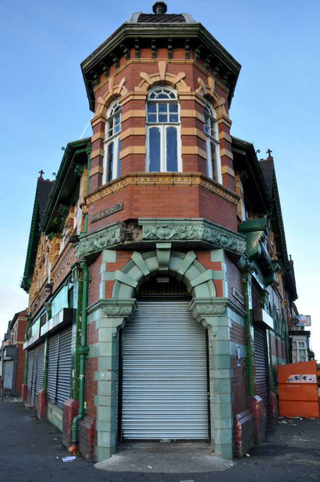
Tucked in behind the Telephone Exchange are several streets of Edwardian social housing – the Spring Gardens Scheme of 1905.
The property is practically paying its way, and all the present generation has to find is a small sum of ninety odd pounds for sinking funds. For this we get fifty-nine families decently housed, the rateable value of the town increased, a slum abolished, an eyesore removed, the health of the inhabitants remarkably improved, their environment made clean, refined, and elevating, whilst our successors in 1959 will inherit an unencumbered estate.
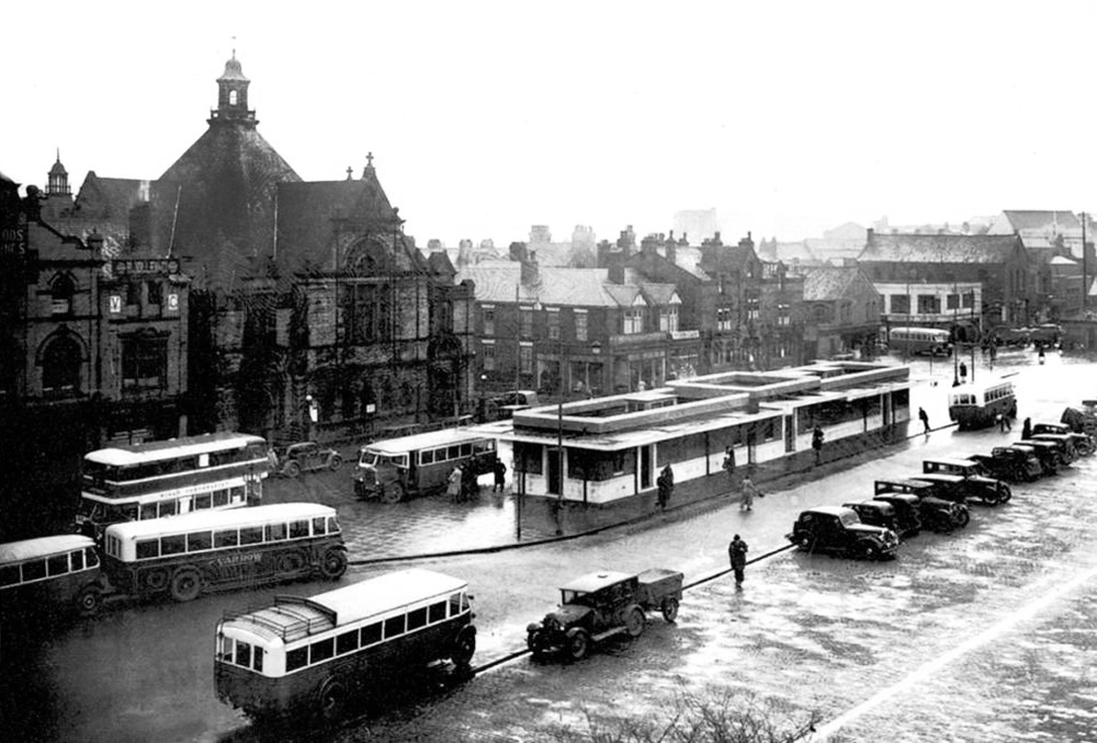
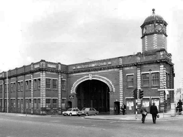
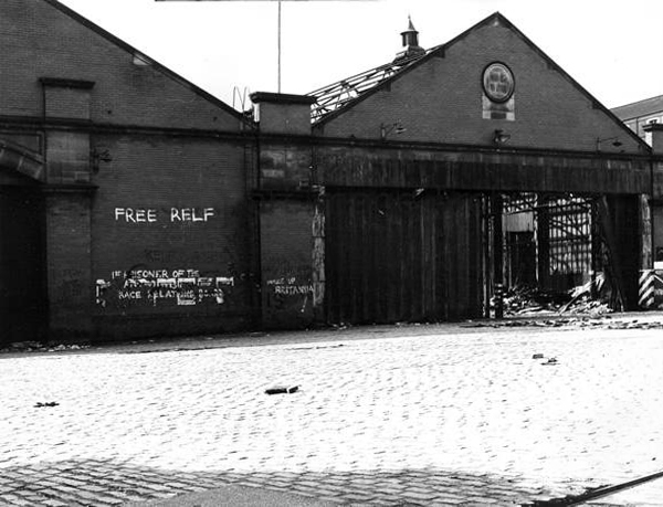
It was demolished in 1985 as part of a wider redevelopment of the town centre to make way for the Galleries Shopping Centre. A new bus station, built at a cost of £2.3 million, began construction in April 1986, and opened in November 1987.
Wikipedia
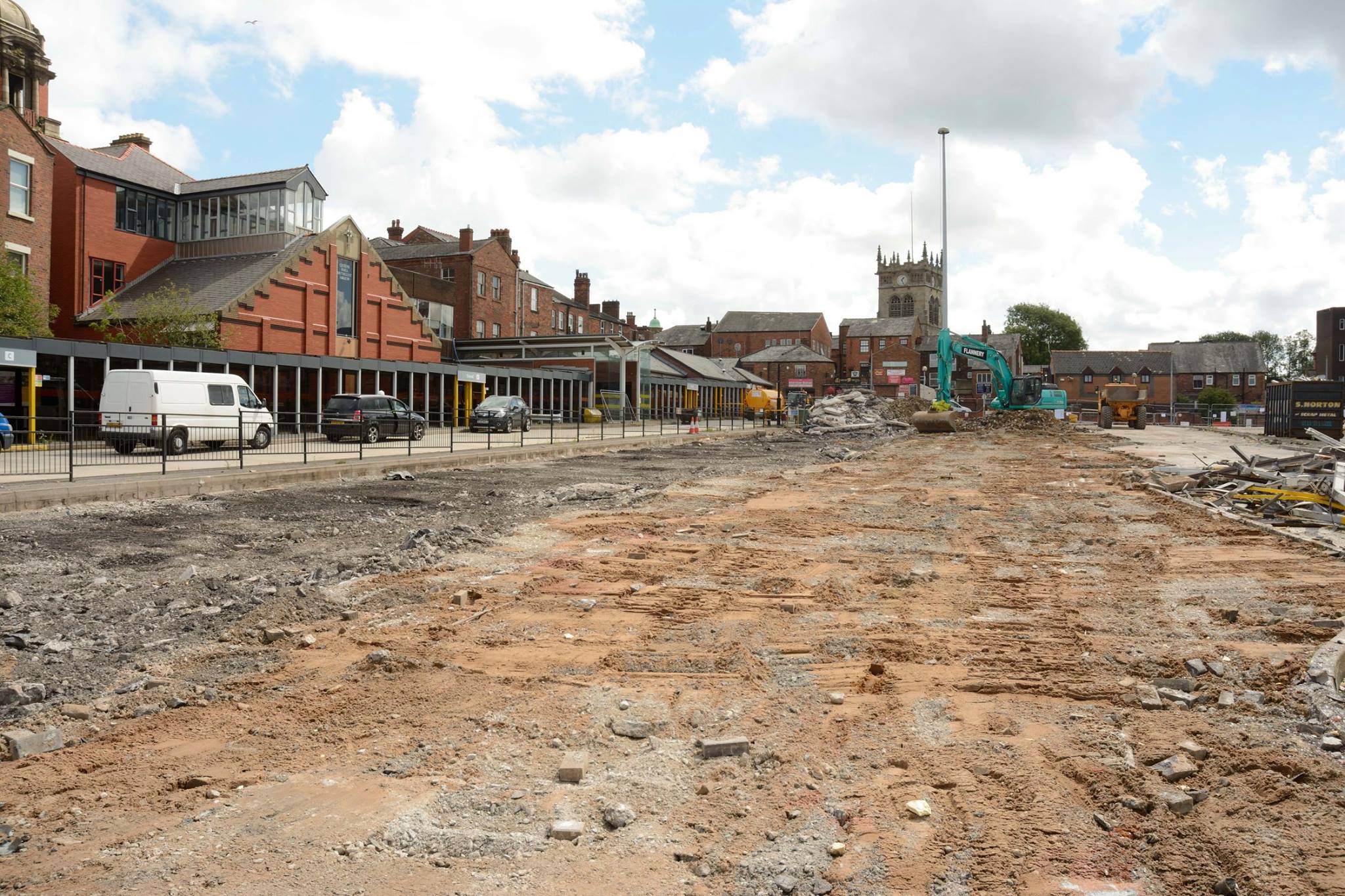
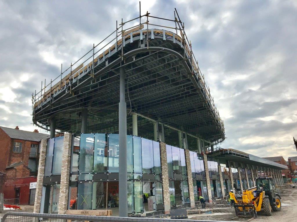
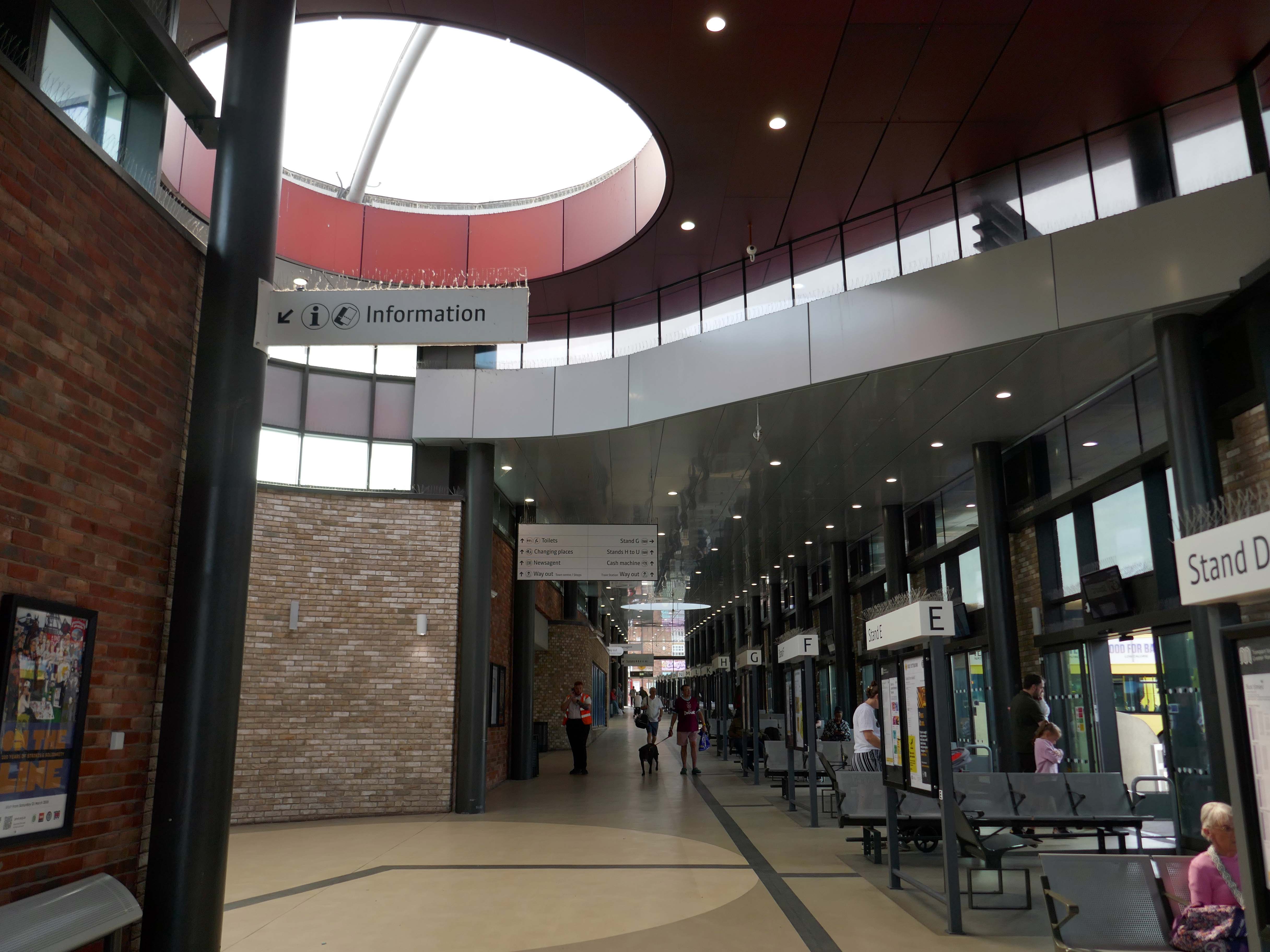
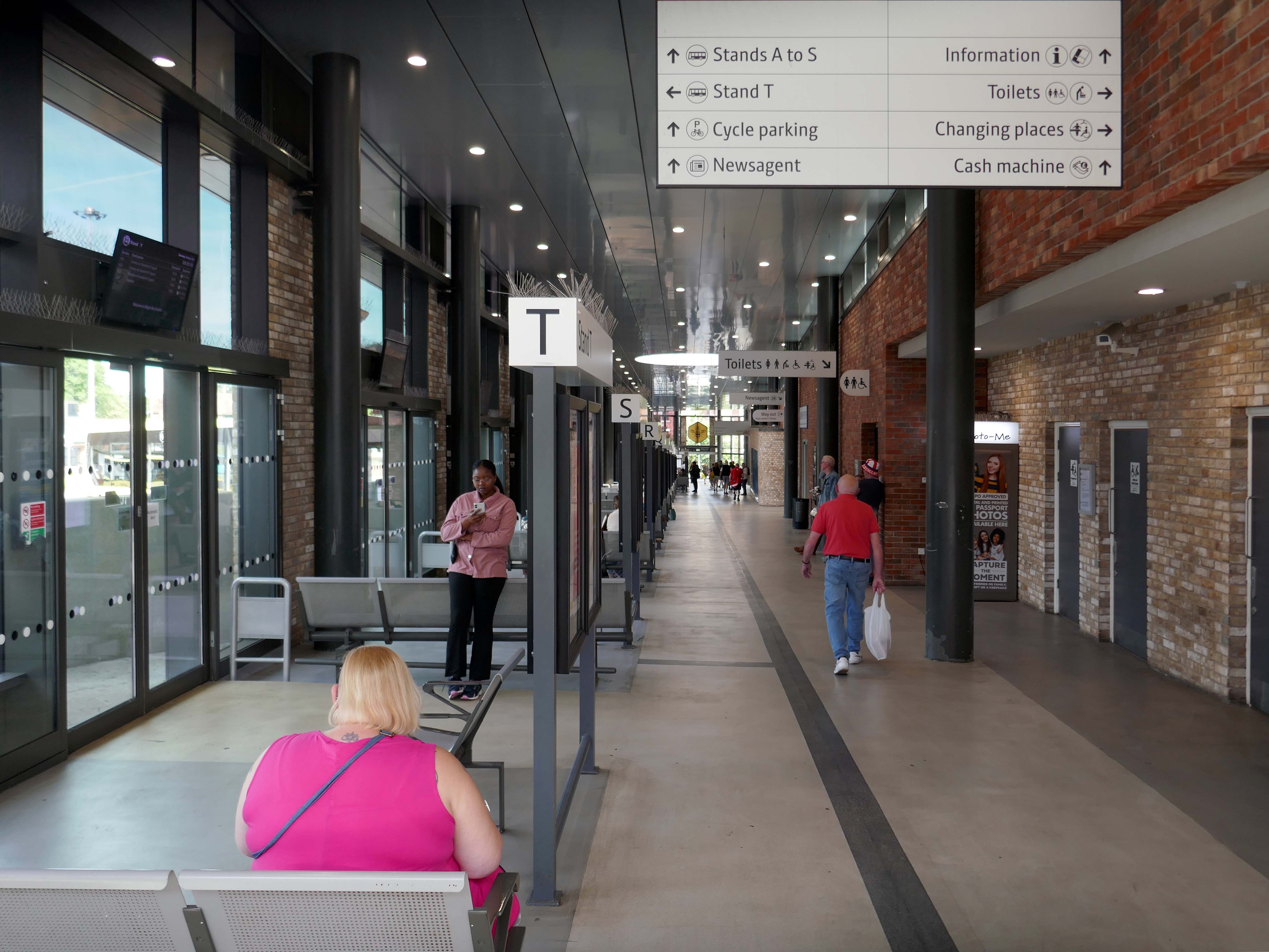
Transport for Greater Manchester commissioned Austin-Smith:Lordto design a replacement nineteen stand £15.7m bus station in Wigan Town Centre, the project was completed in October 2018.
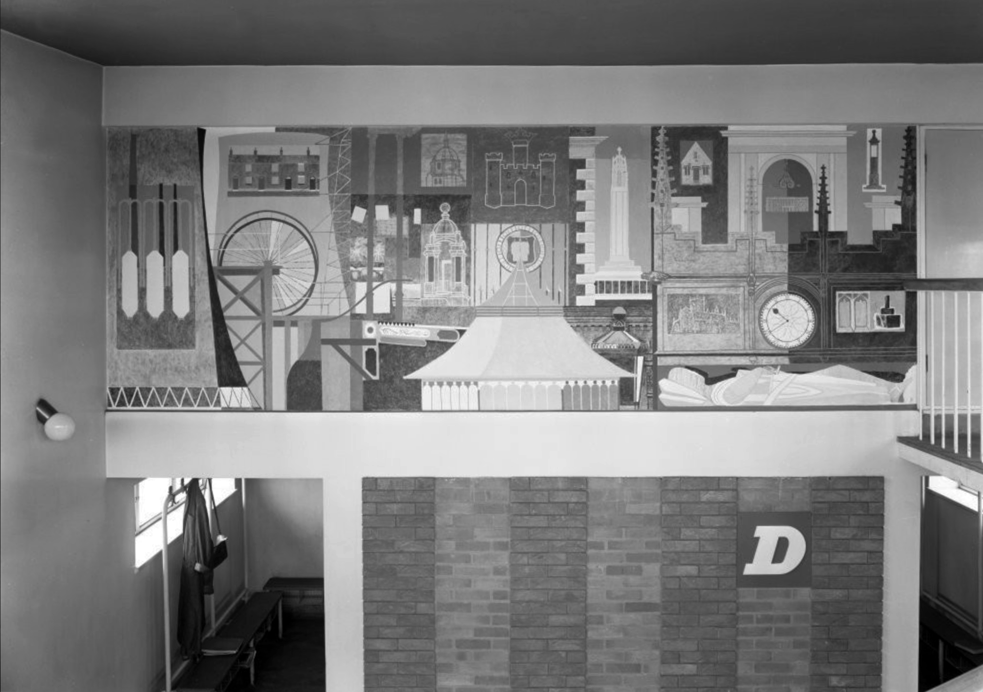
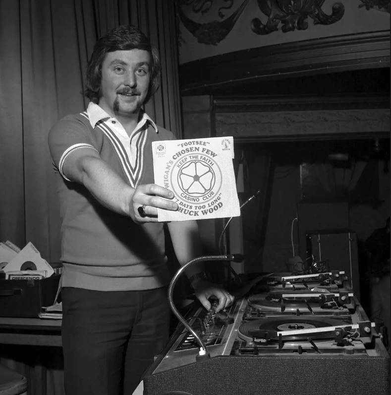
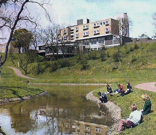
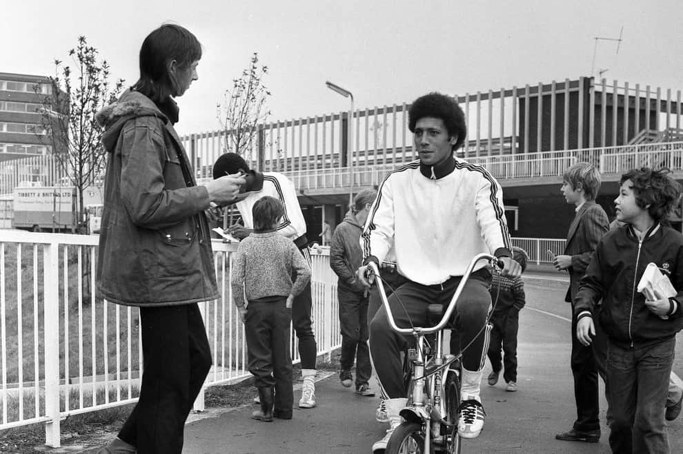
DJ Russ Winstanley was a former pupil, here he is in 1975 at the Wigan Casino holding up a copy of Footsee by Wigan’s Chosen Few b/w Seven Days Too Long by Chuck Wood.
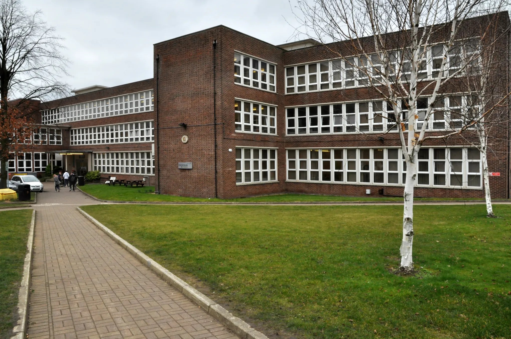
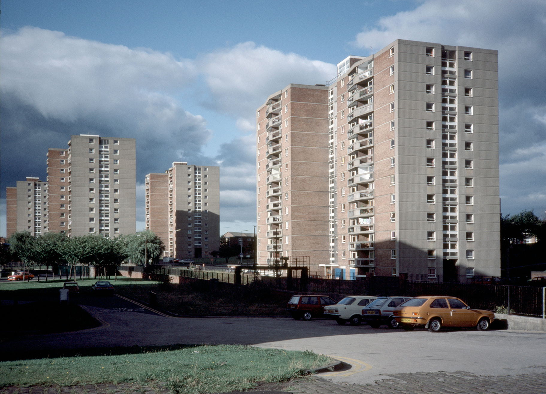
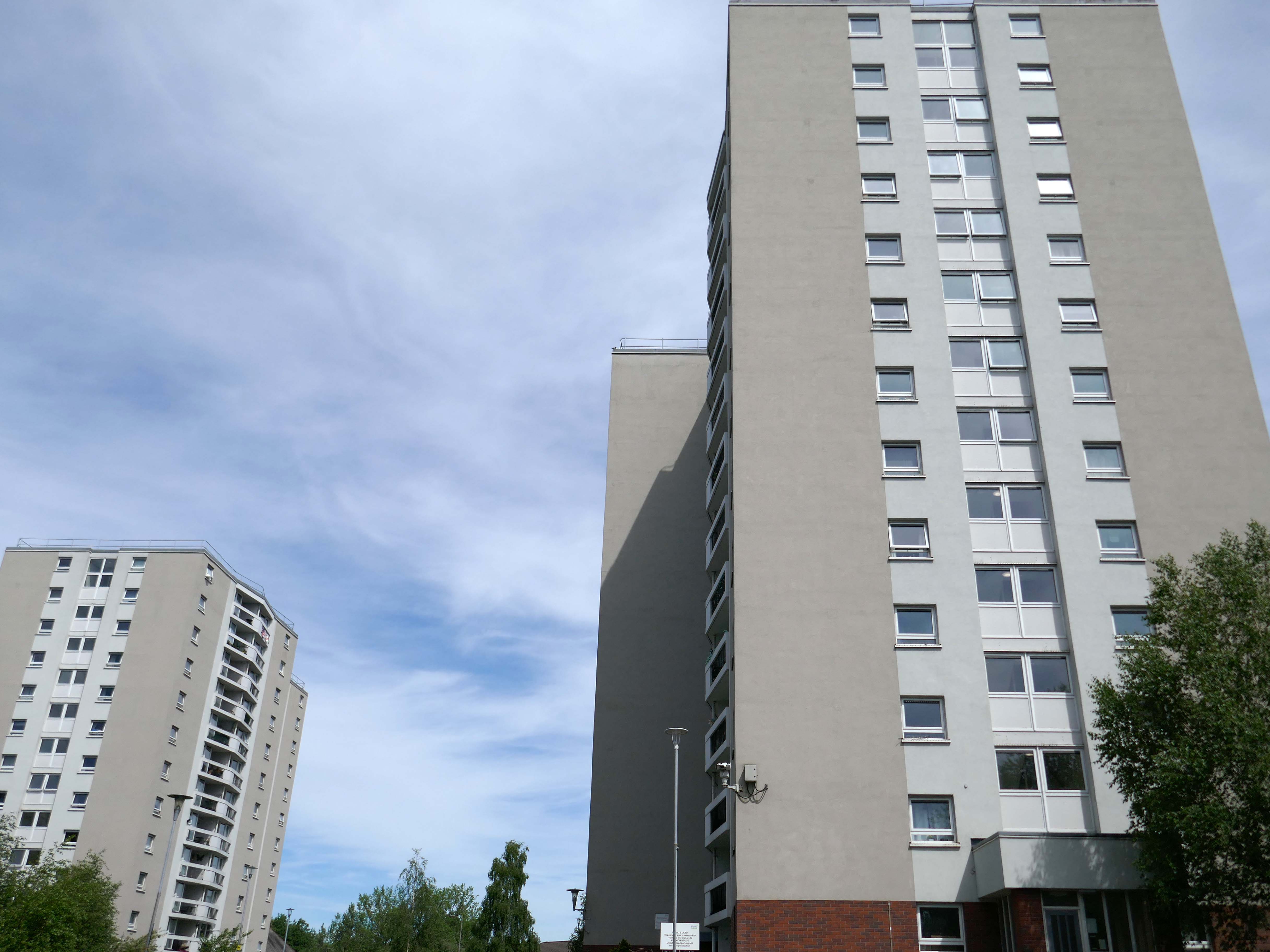
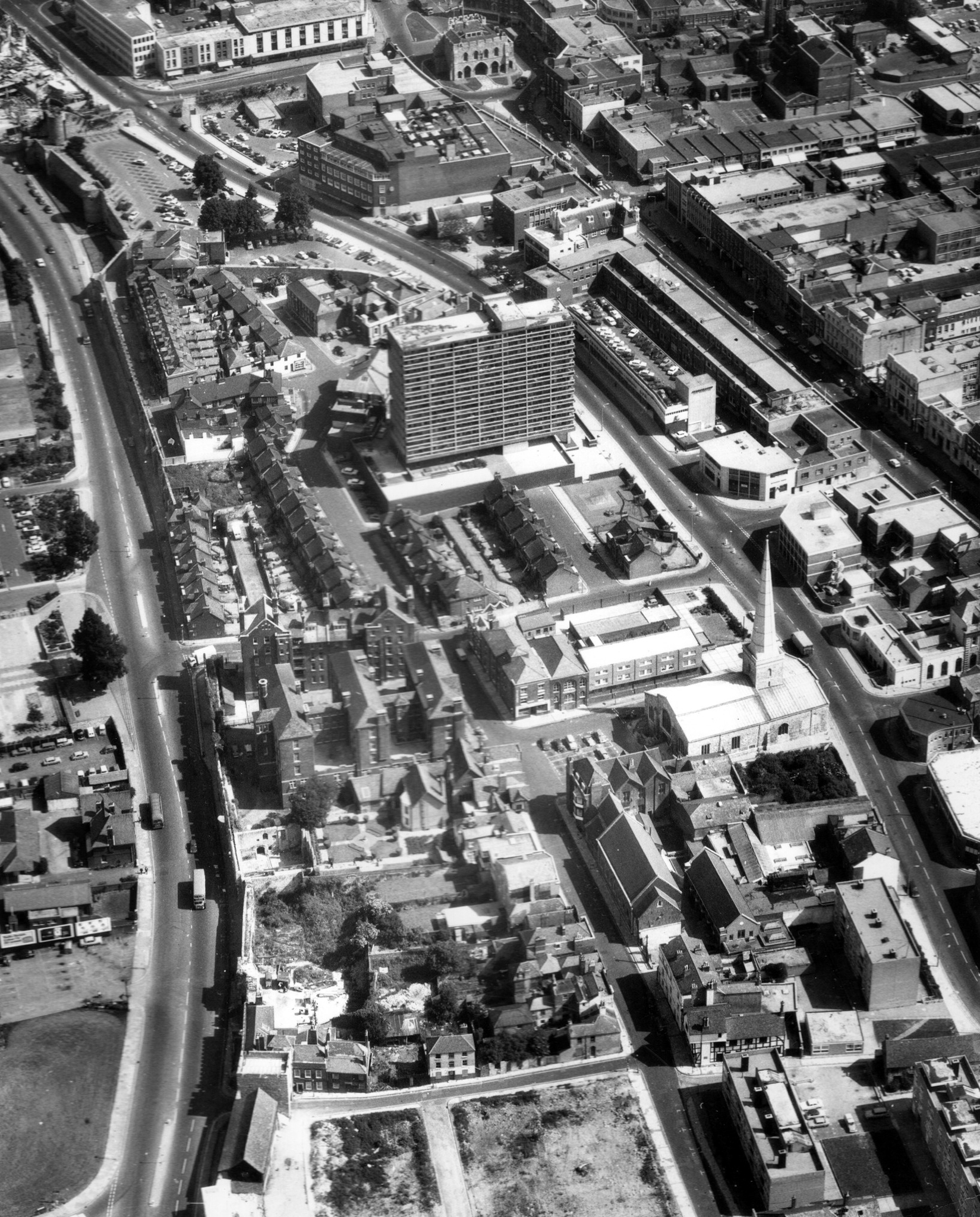
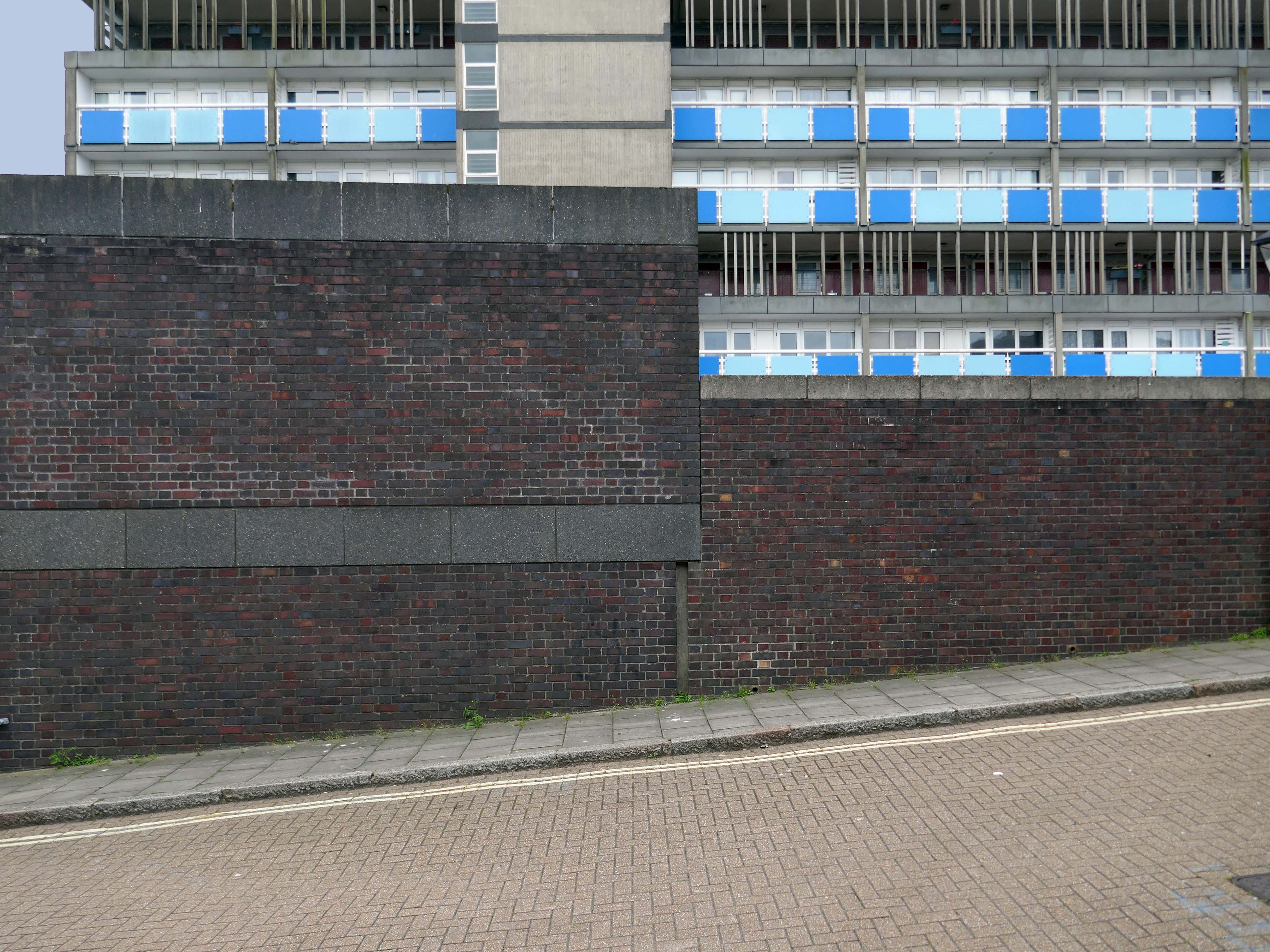
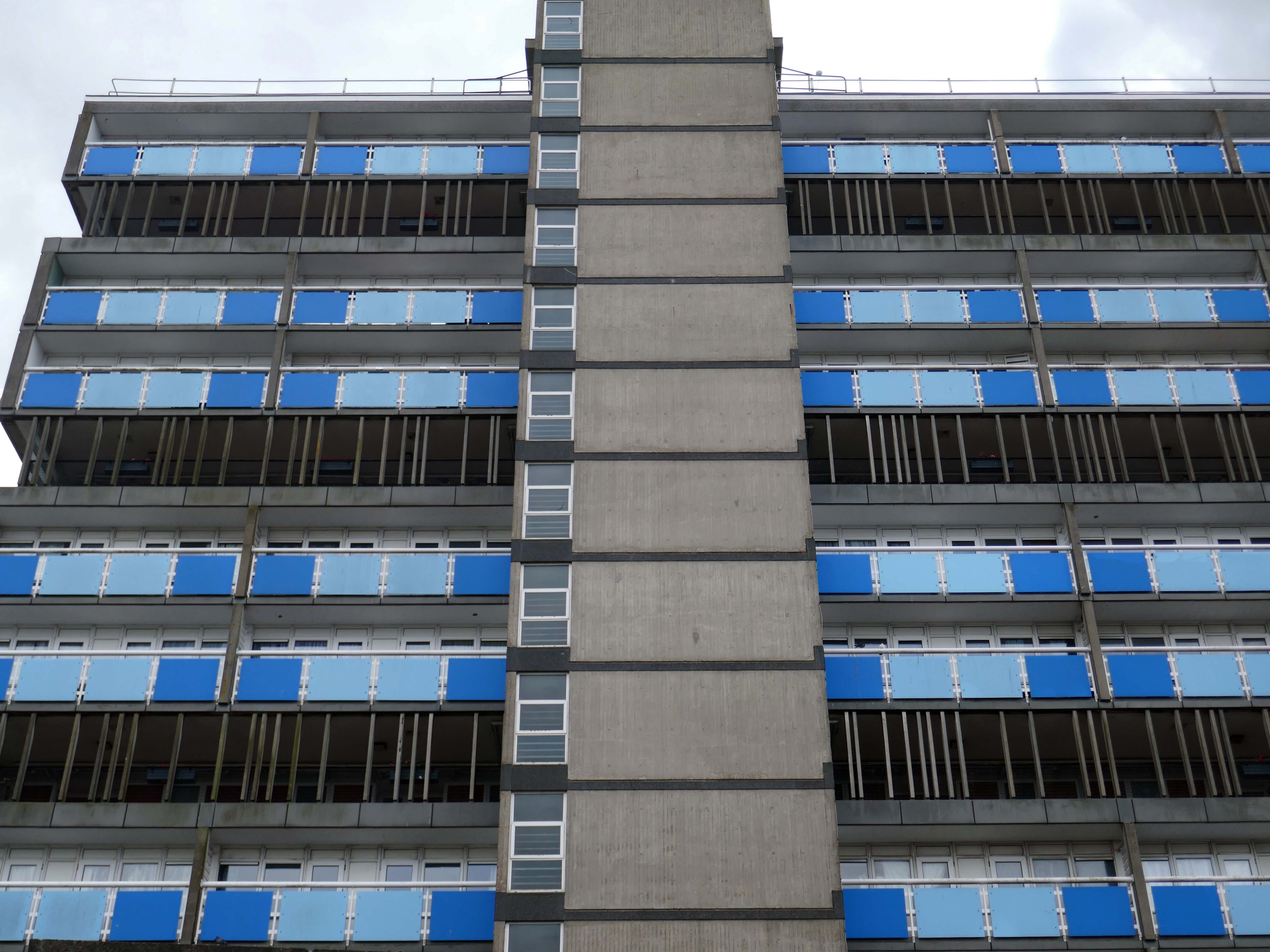
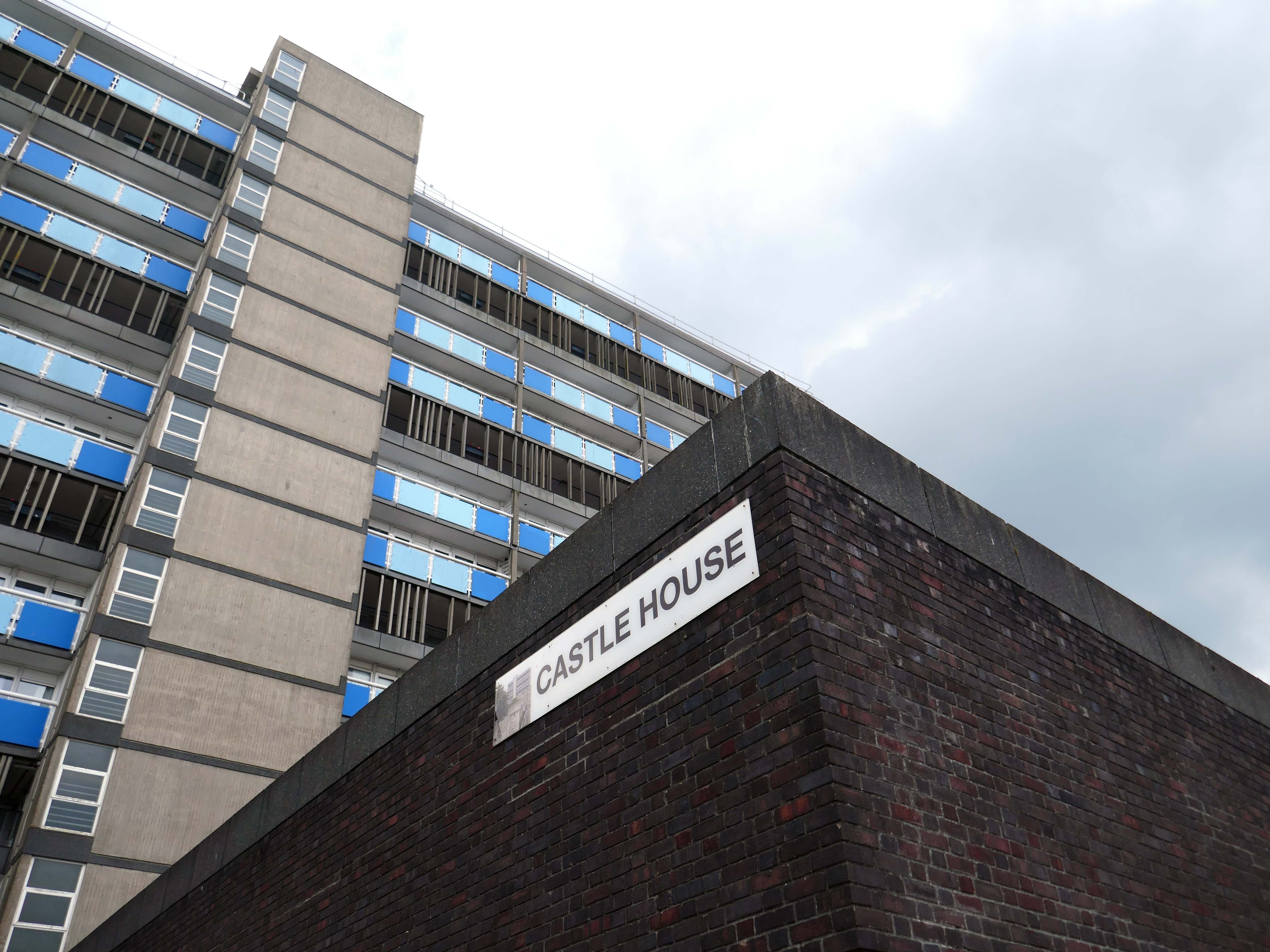
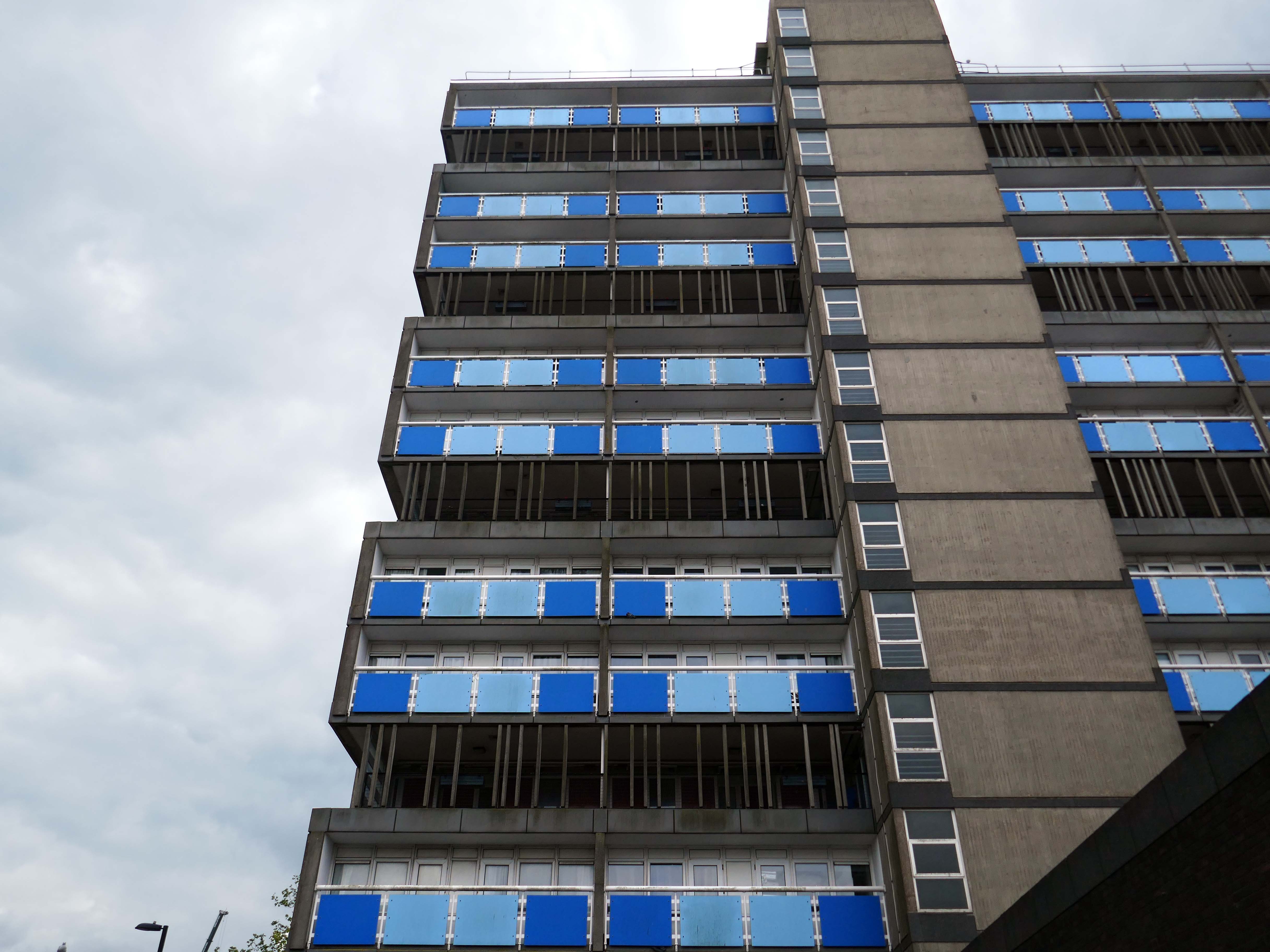
Across the way to Scholes Comprehensive Development 1964
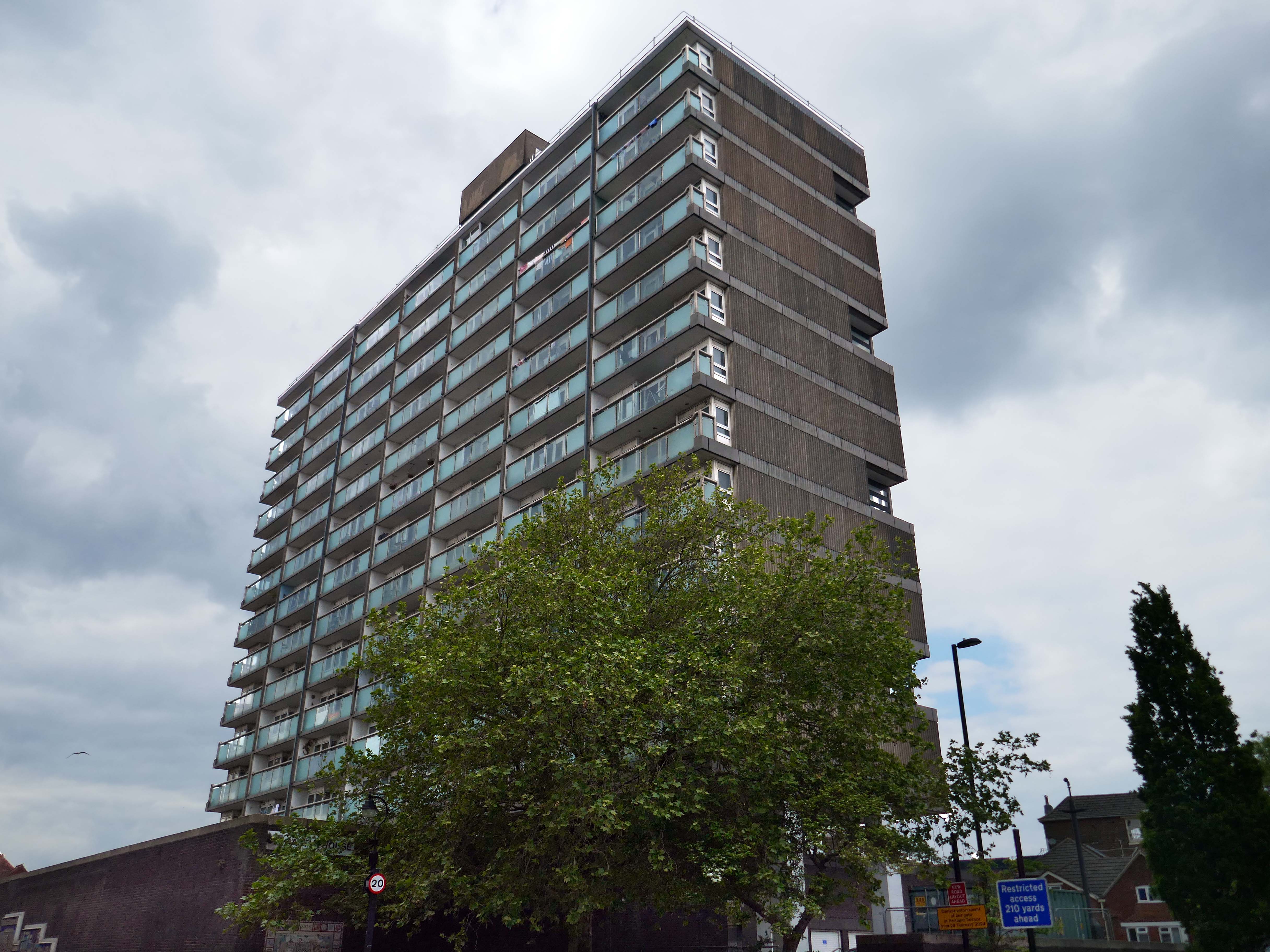
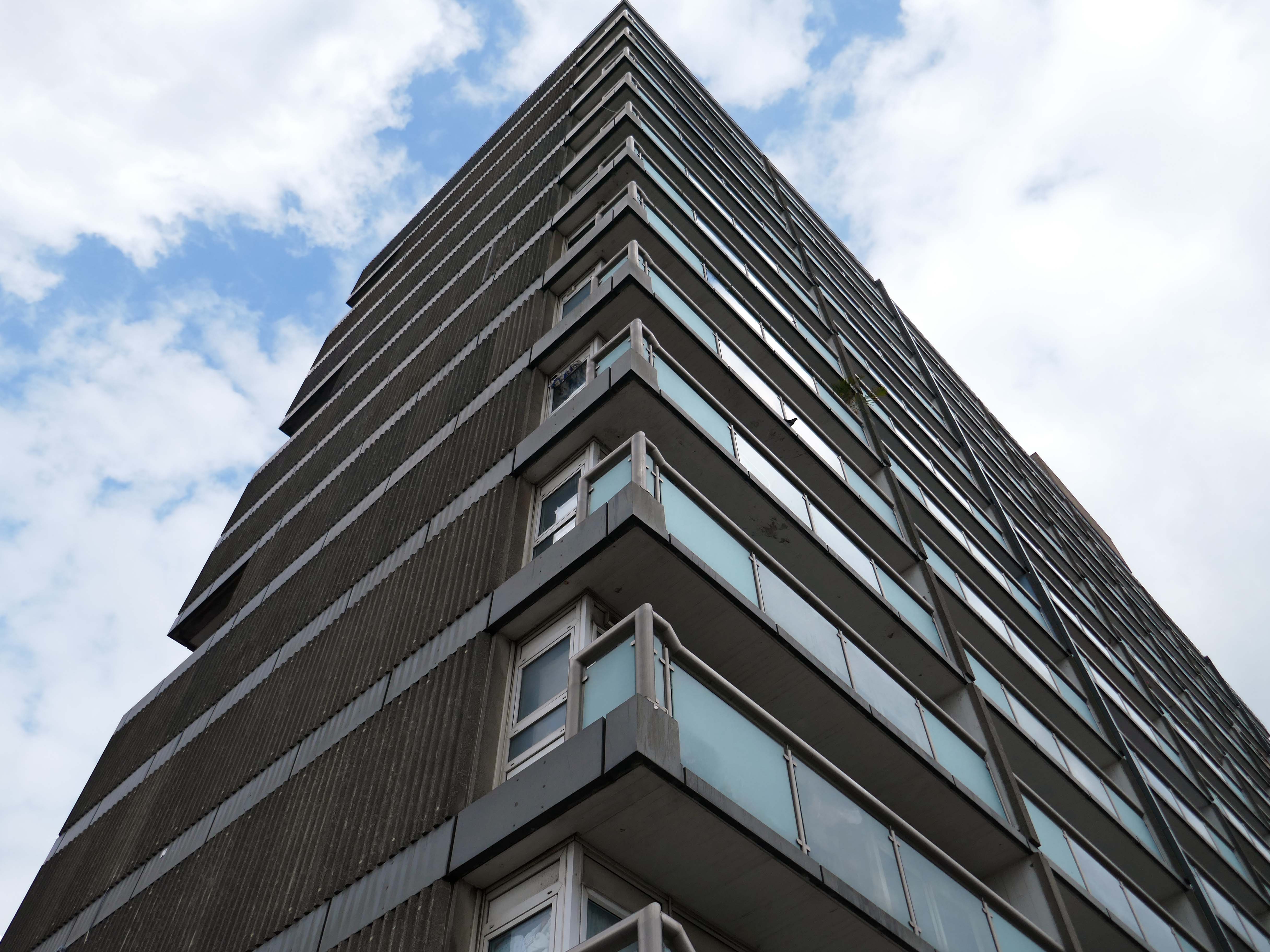
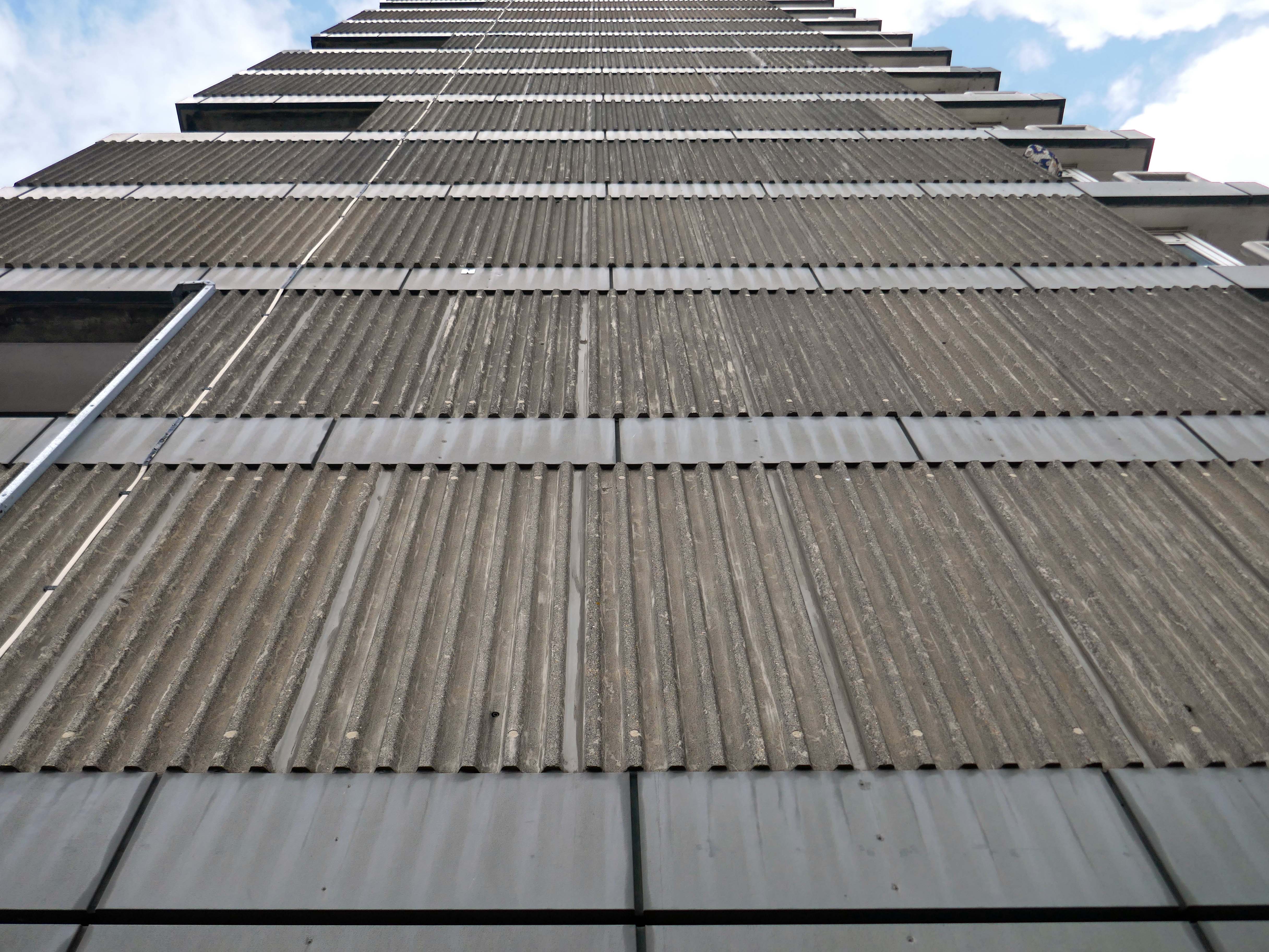
Five thirteen-storey tower blocks adjacent to Douglas House in Scholes were approved in 1964. Lower-rise housing and flats spread to the east. In 1968, a further 13-storey block, Boyswell House, was built at this eastern end of the Scholes Comprehensive Development Area. Almost 500 slum houses, housing 566 families, were demolished that same year and 581 new council homes completed.
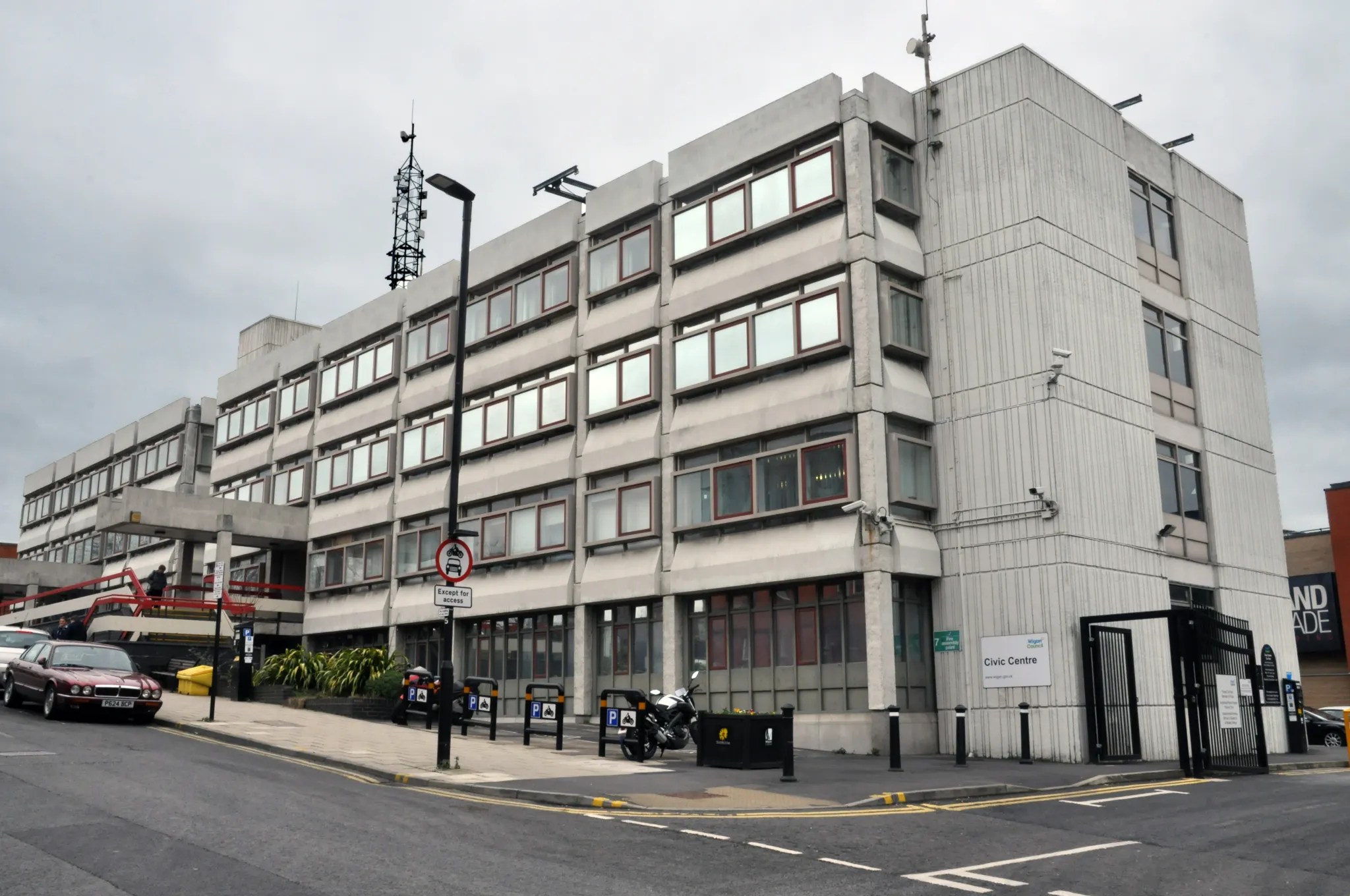
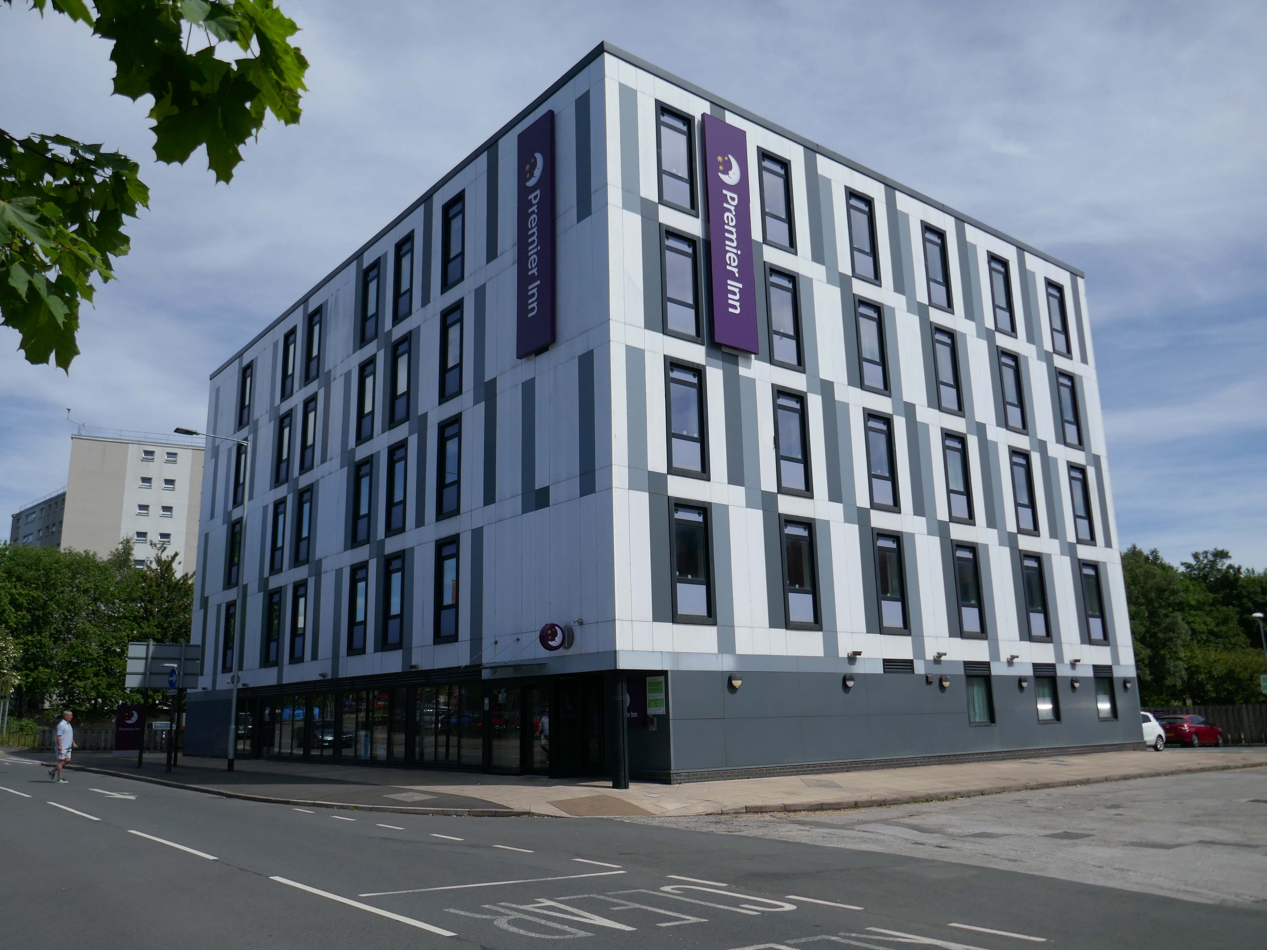
Next to the Roger Booth cop shop that became a Premier Inn.
A super-comfy bed, blackout curtains, a powerful shower and free Wi-Fi – our double rooms have everything you’ll need for a great night’s sleep.
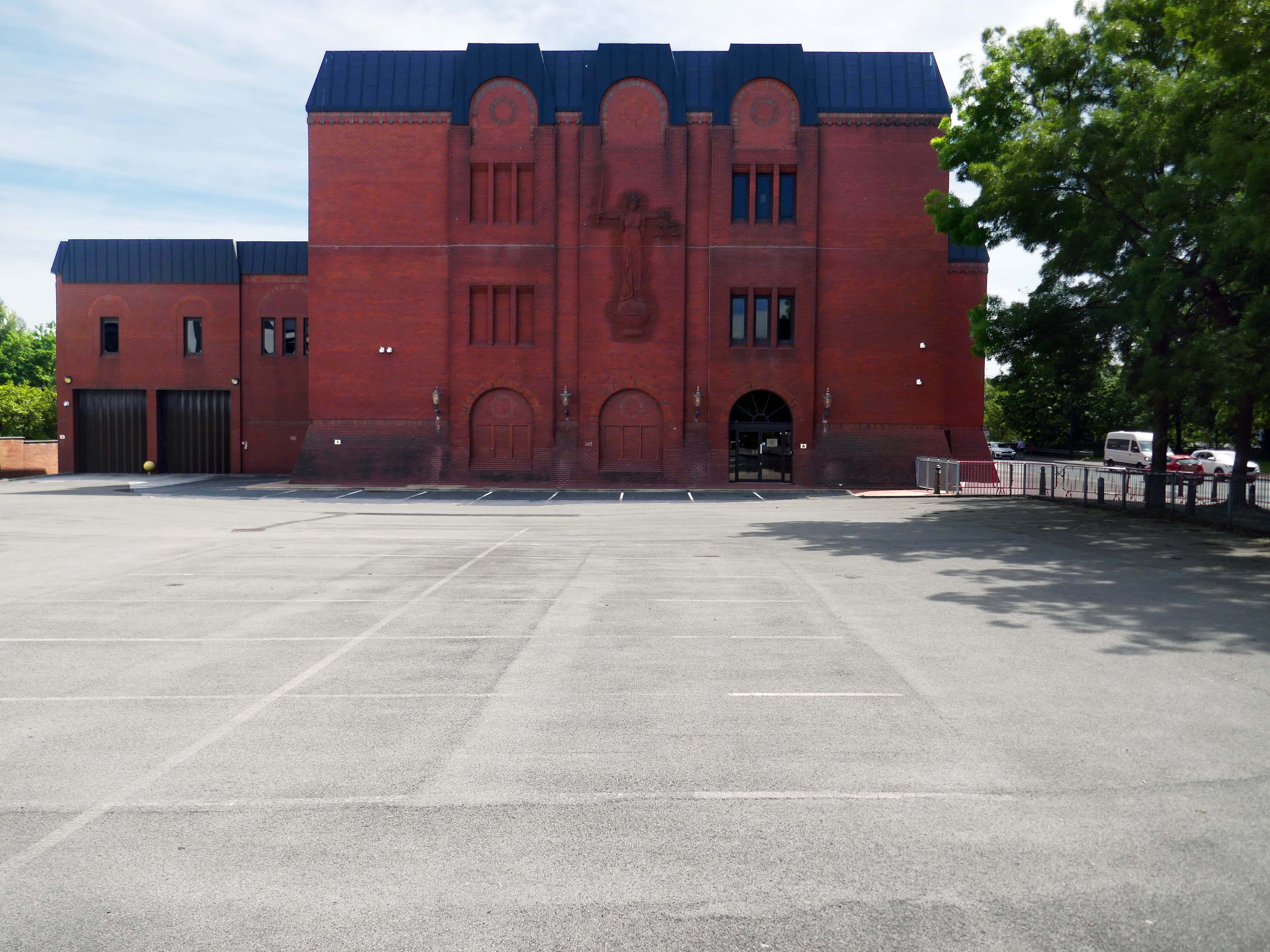
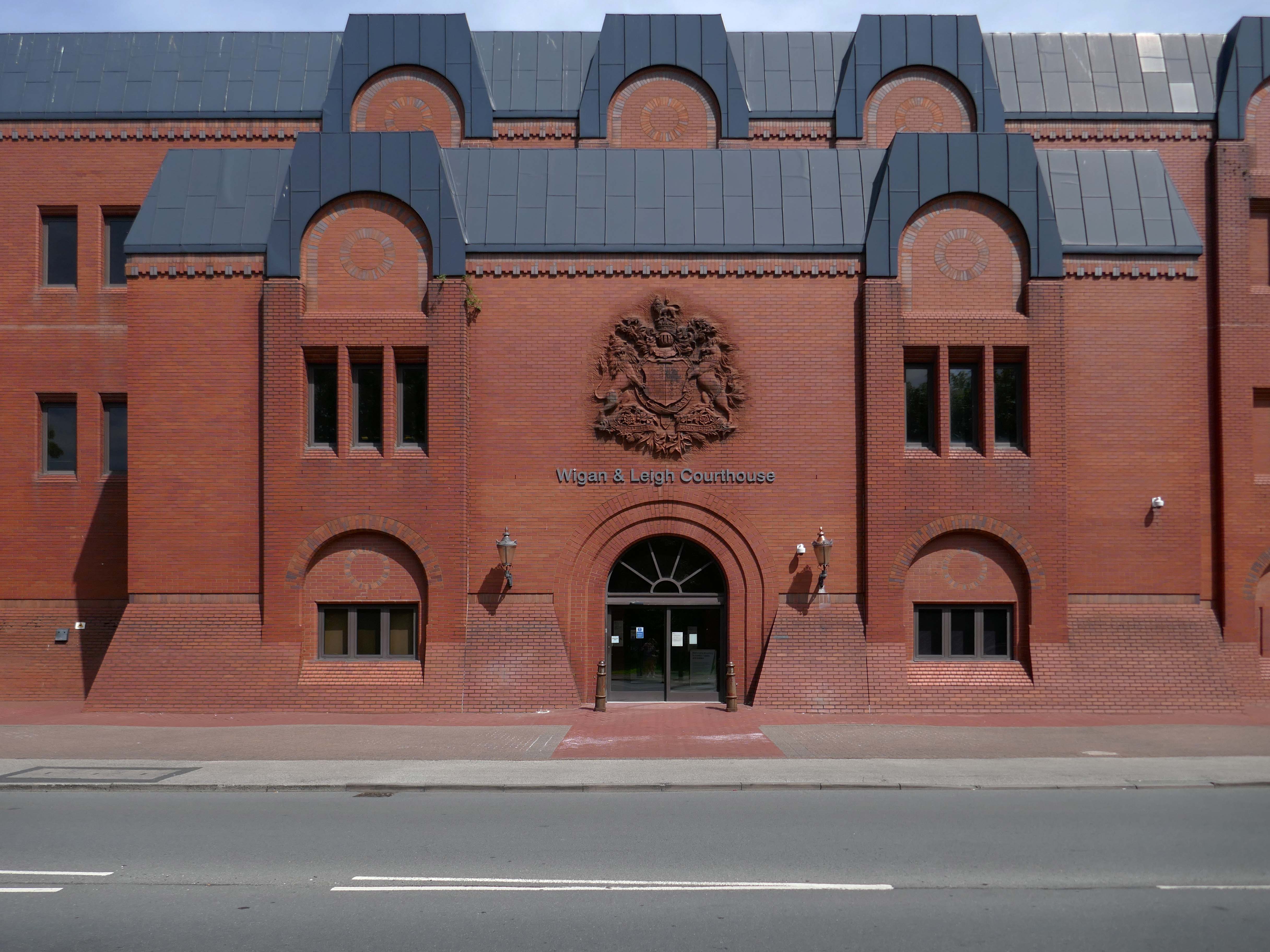
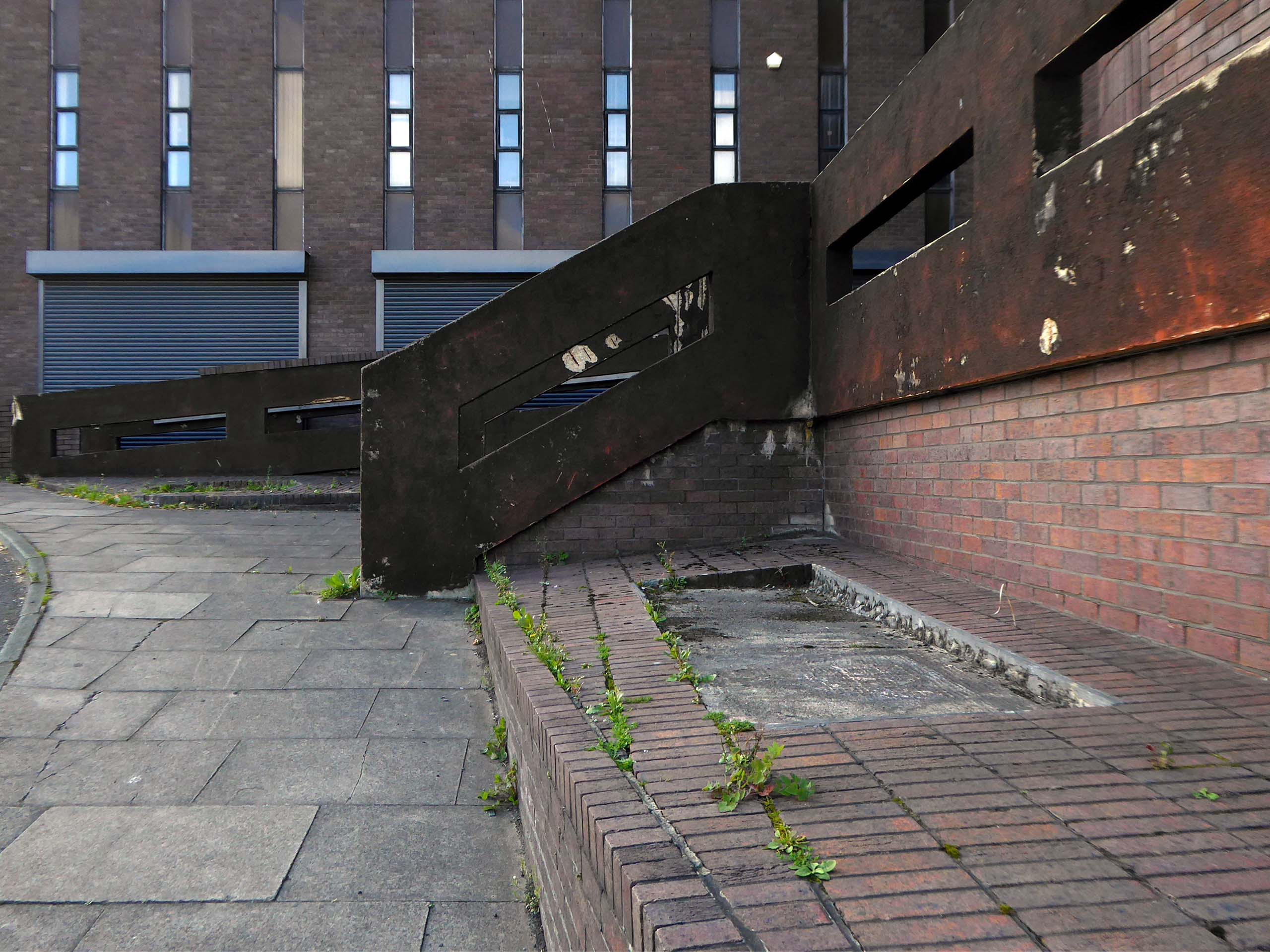
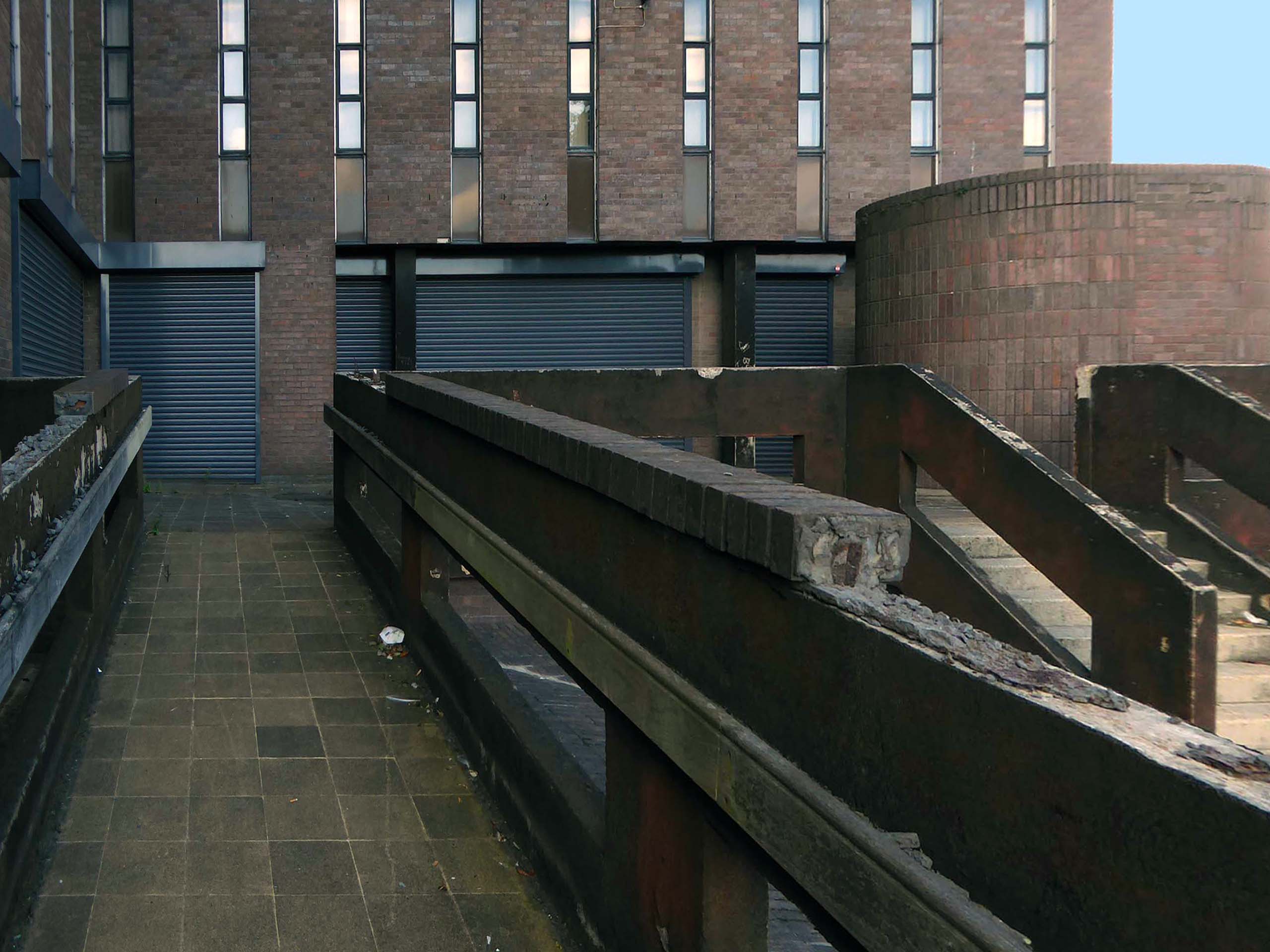
Next door the Wigan & Leigh Courthouse 1992 Wigan MBC Architect.
Relief figure of justice by Christine Ward.
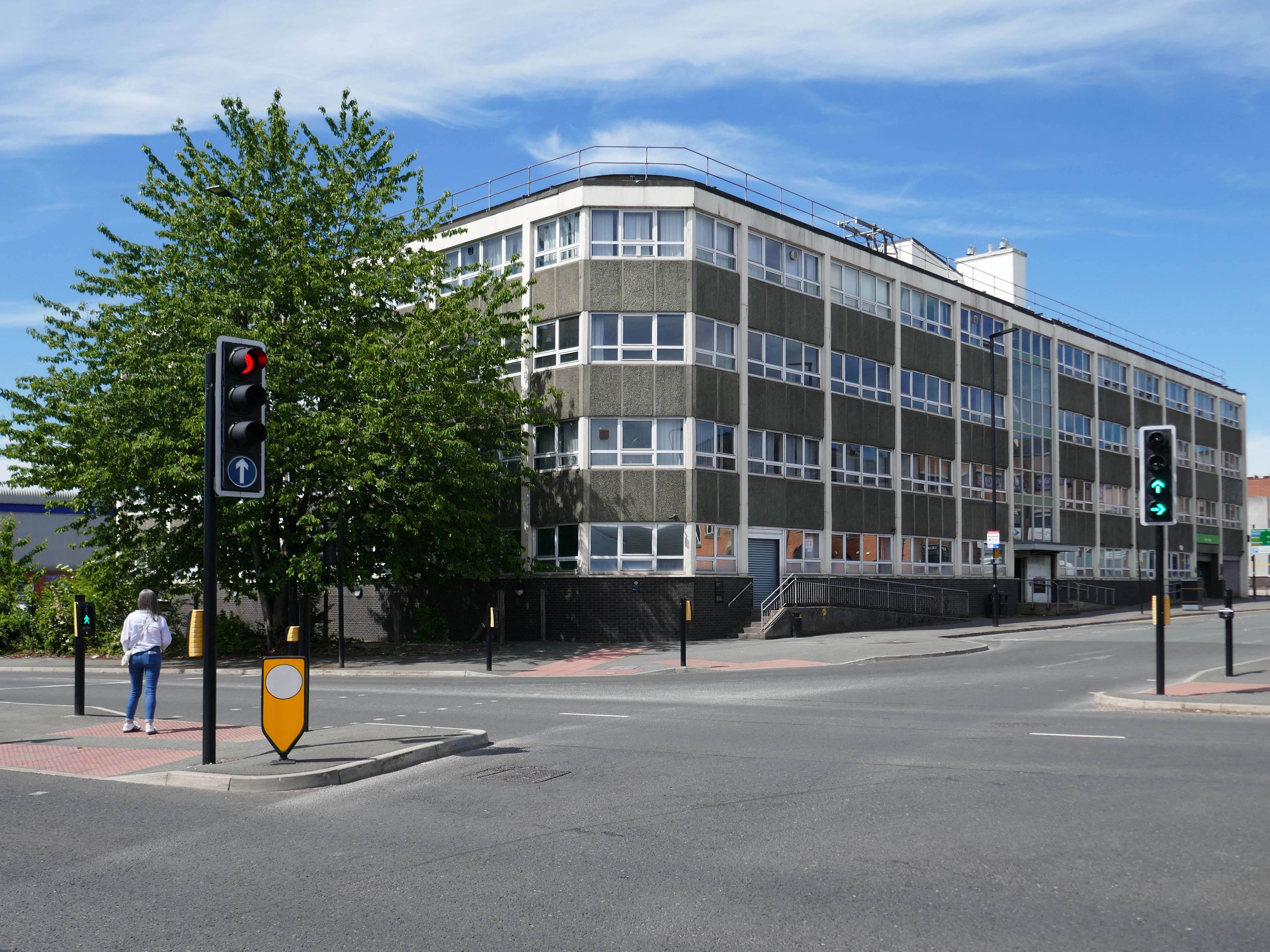
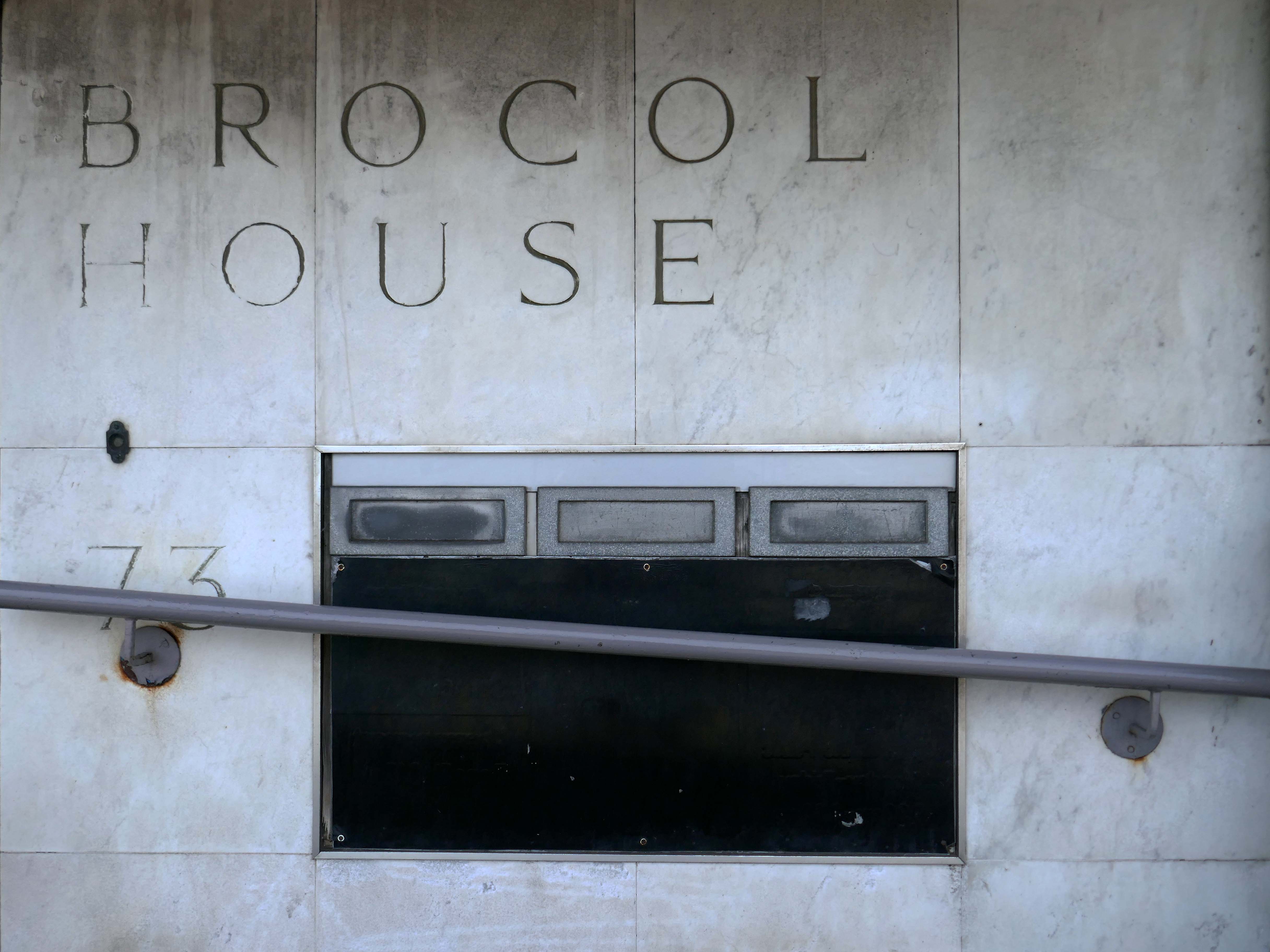
Onward to Brocol House – currently home to the Job Centre
Image – Wigan Peers
Originally built for the Inland Revenue one the site of the Brewers Arms – has the welcoming charm shared by the majority of Ministry of Works buildings of the period.
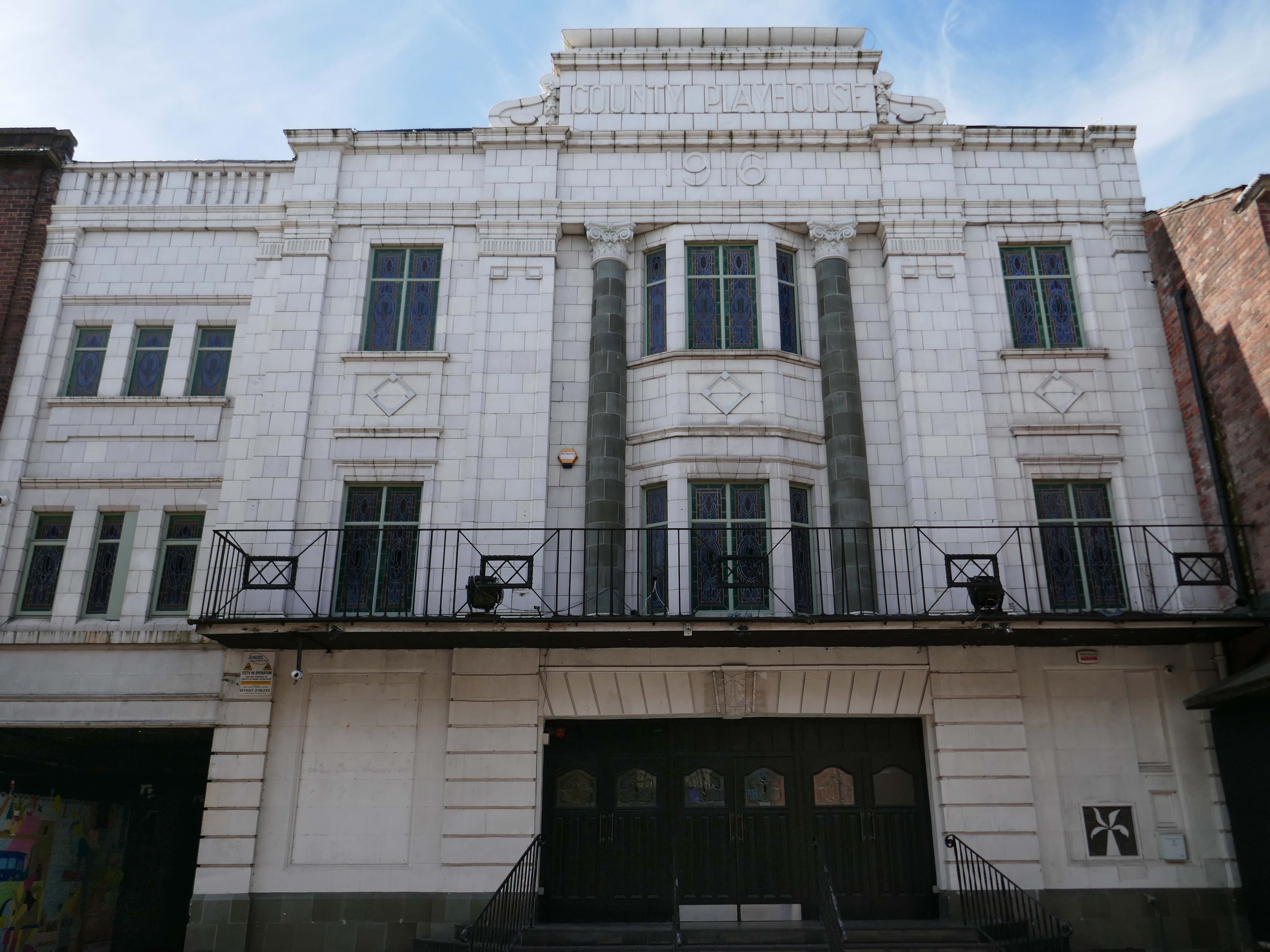
Nearly done – up the road to the County Playhouse.
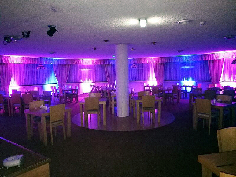
The club’s atmosphere is defined by thumping musicand a vibrant crowd eager to dance and celebrate. Its modern interior design complements the lively ambience, creating an inviting space for locals and visitors alike.
Construction began on the County Playhouse in 1916. However, due to a shortage of materials and labour during World War I, it was not completed until 1919.
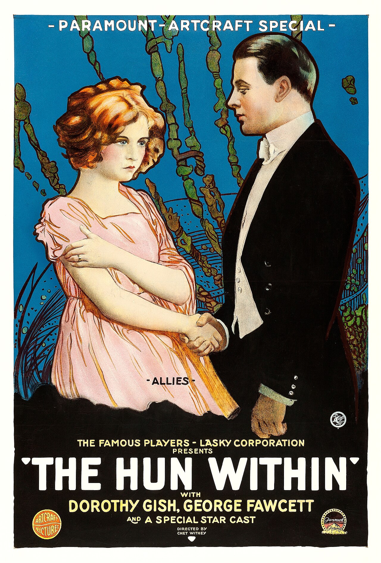
Finally opened on 22nd December 1919 with The Hun Within – starring Dorothy Gish.
The County Playhouse closed on Sunday 13th November 1966 with Disney’s “The Sword and the Stone”. It was taken over by the Leeds Based Star Cinemas chain and they converted it into Star Bingo and Social Club opened on 24th November 1966.
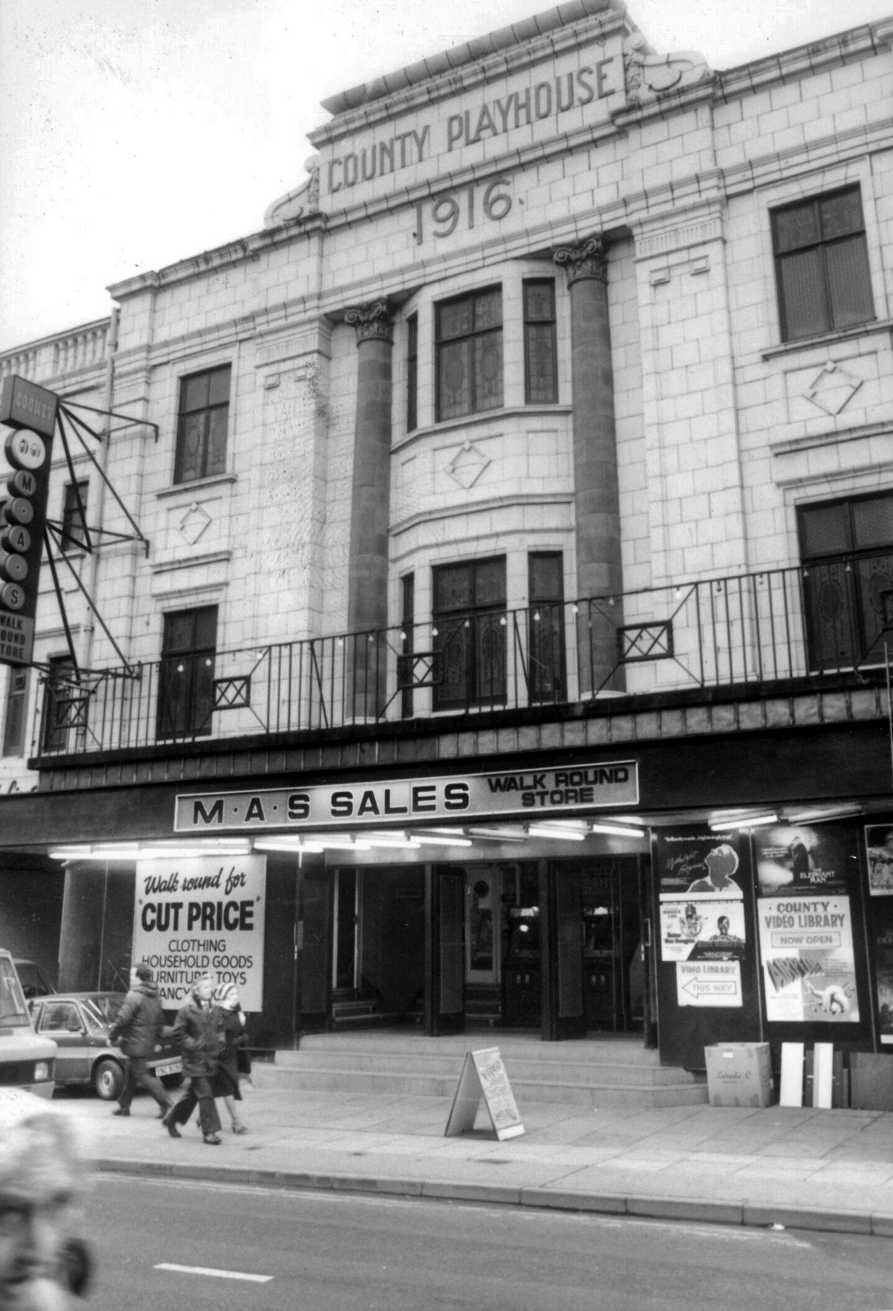
MAS sales store 1982 – Frank Orrell Photography
The building has since been used as a discount store and Playhouse Club Café. It then became home to the 1,200 capacity Pure Nightclub. In the early-2000’s it became the Ibiza nightclub. The Pure nightclub move into the former Princes Cinema
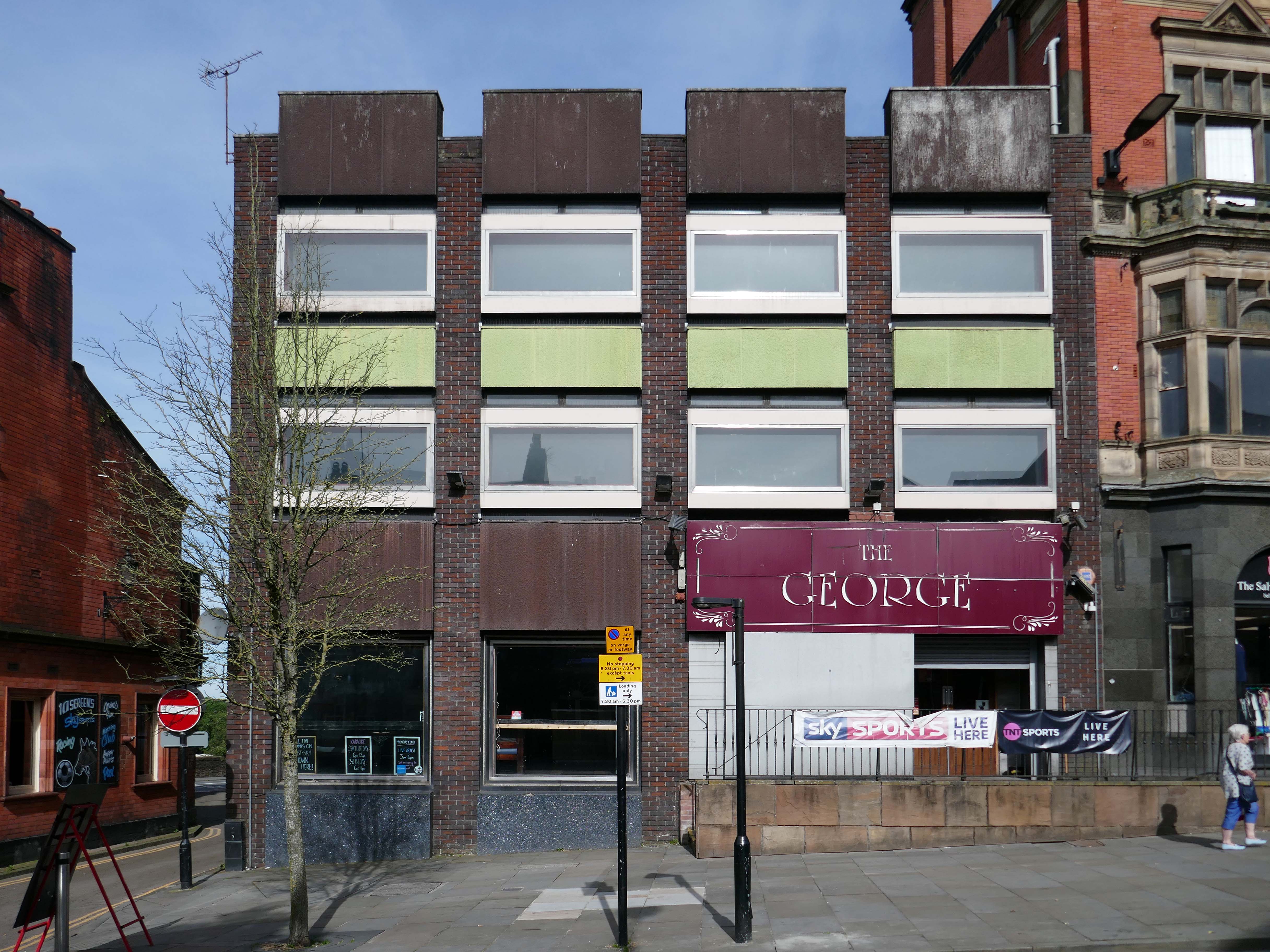
Time for a swift half in The George to end your tour?
Great for a local pint one of the cheapest in Wigan I believe, slightly rough at times but no fights just real local people who are generally friendly. Proper drinking gaff, and karaoke on certain nights.
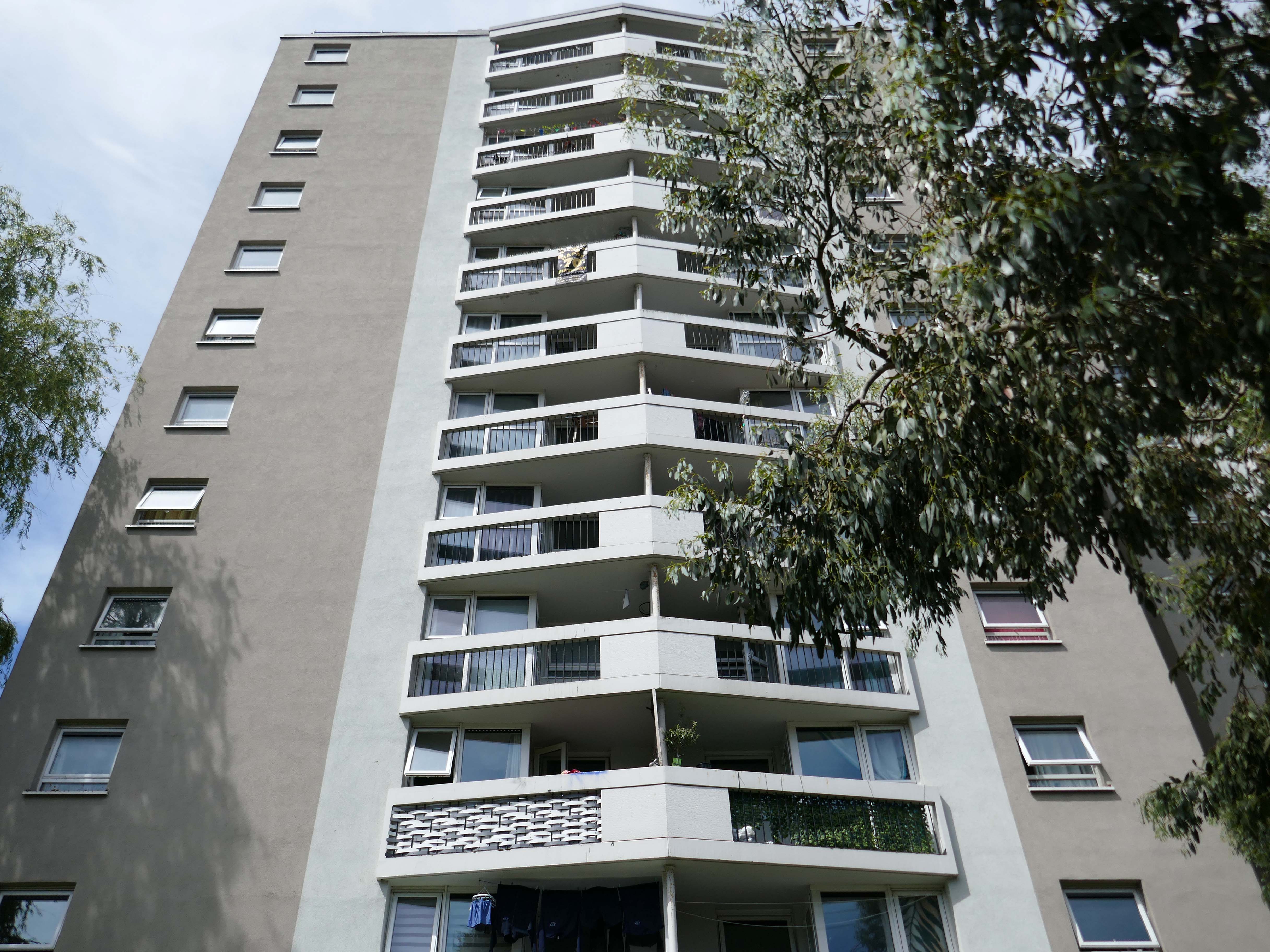
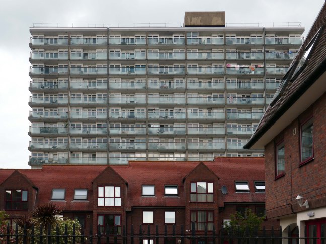
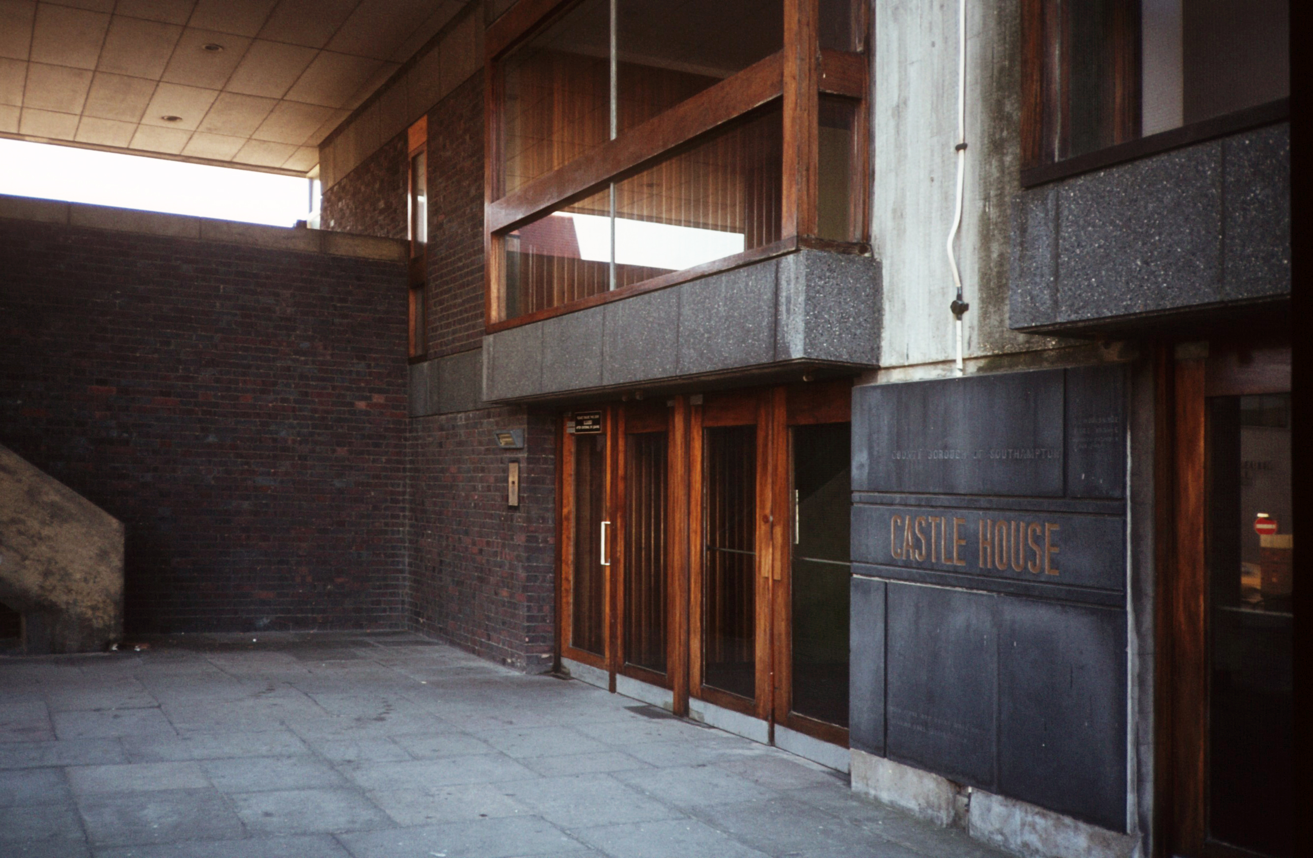
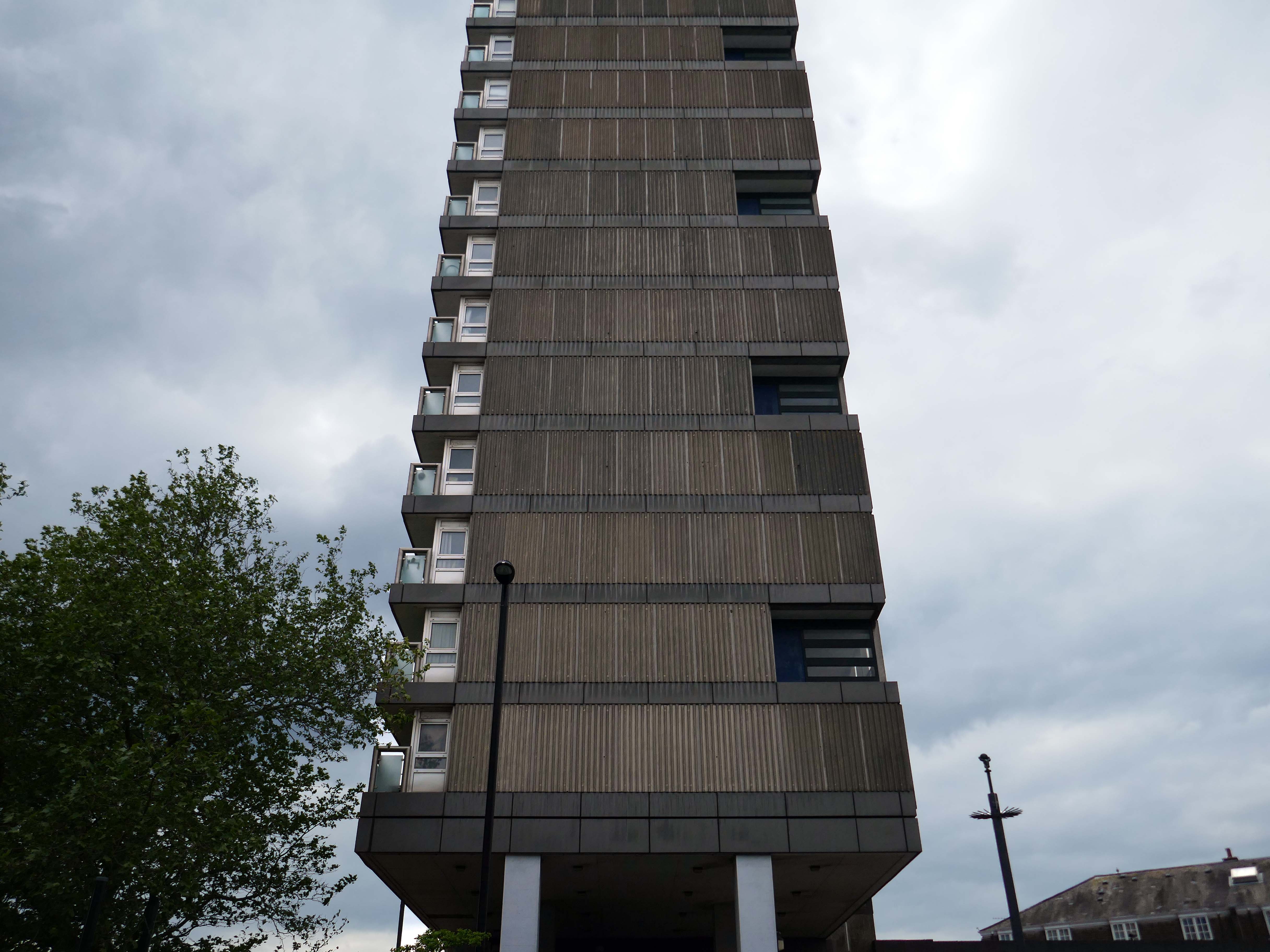
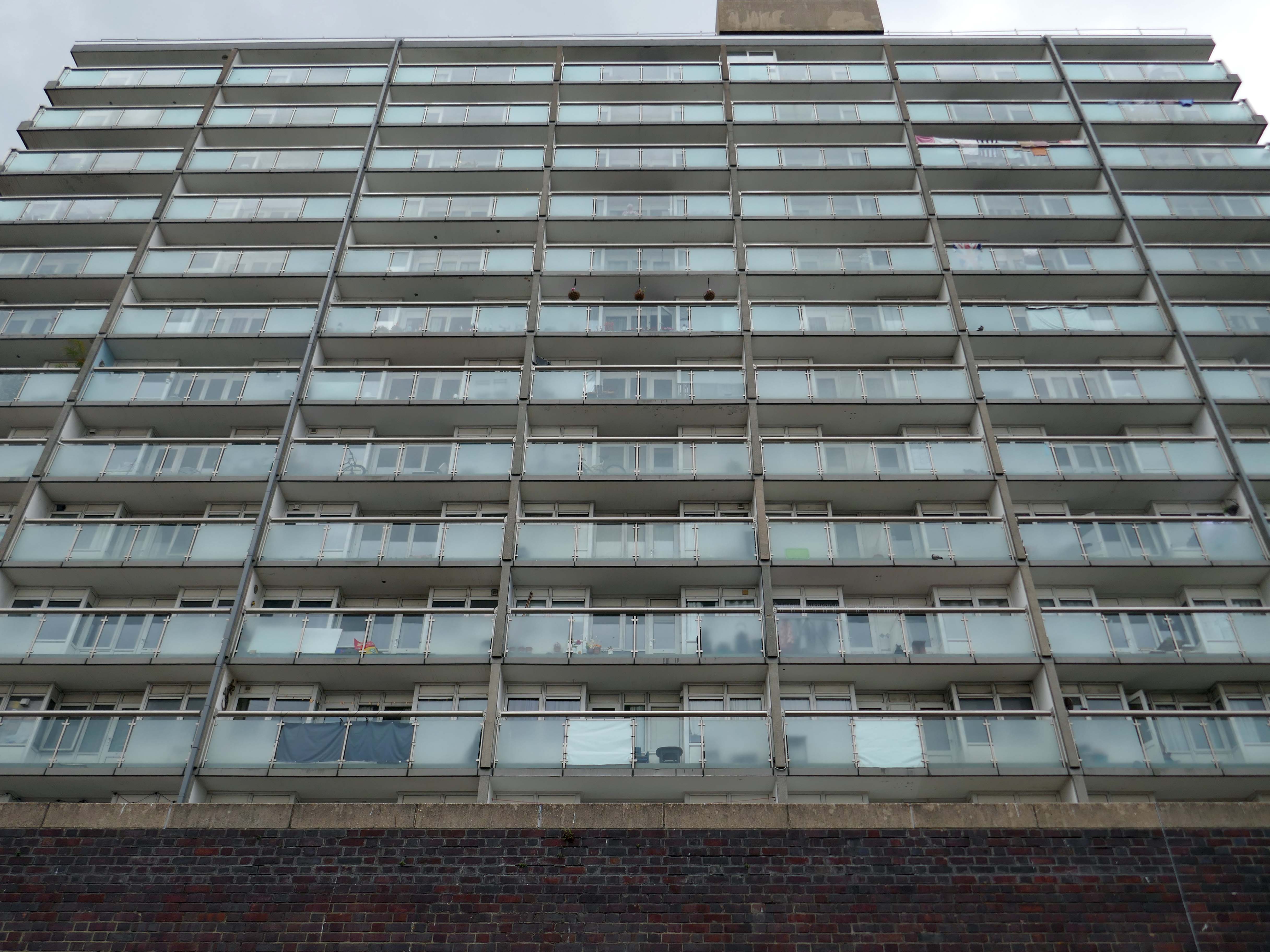
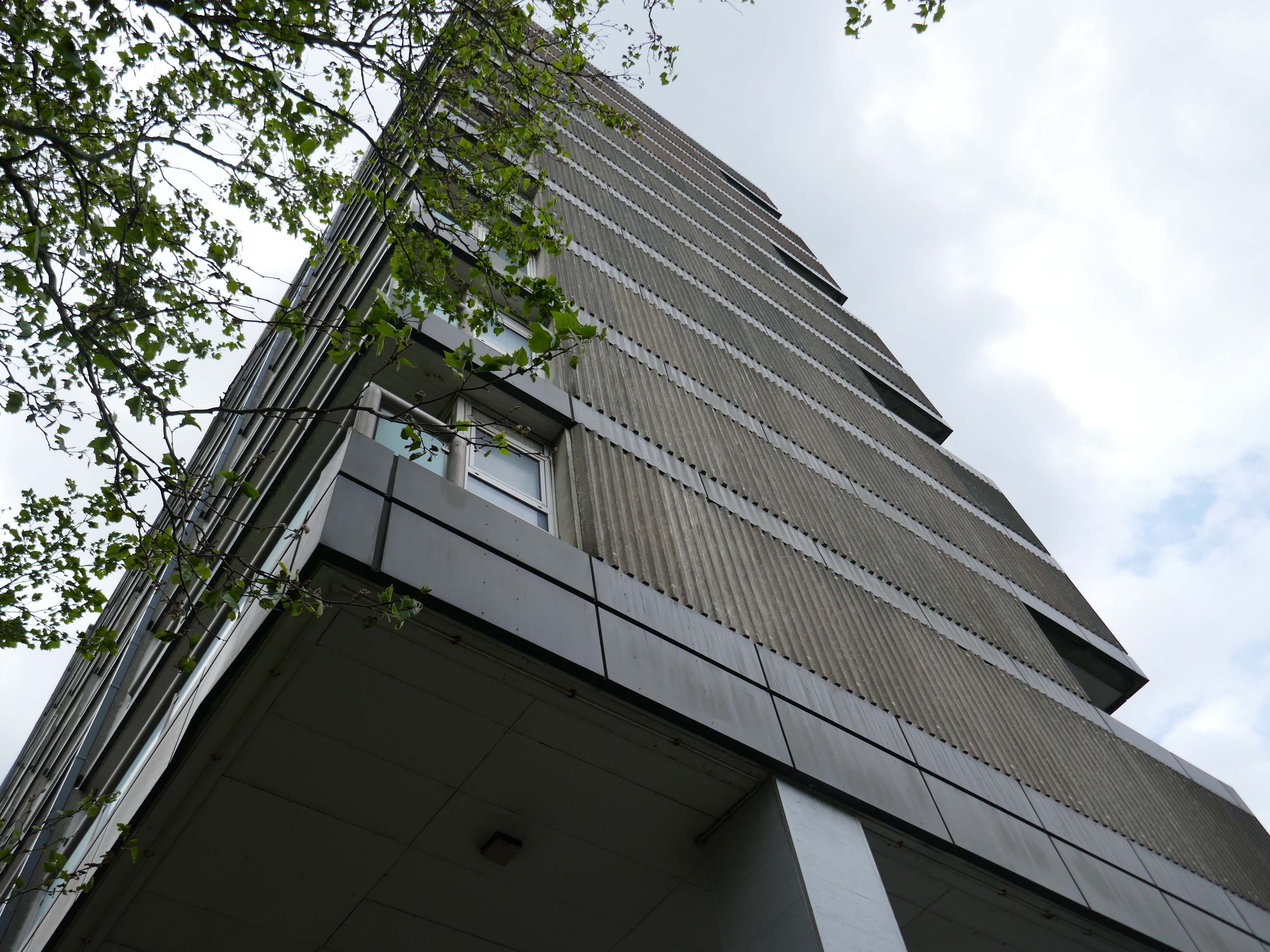
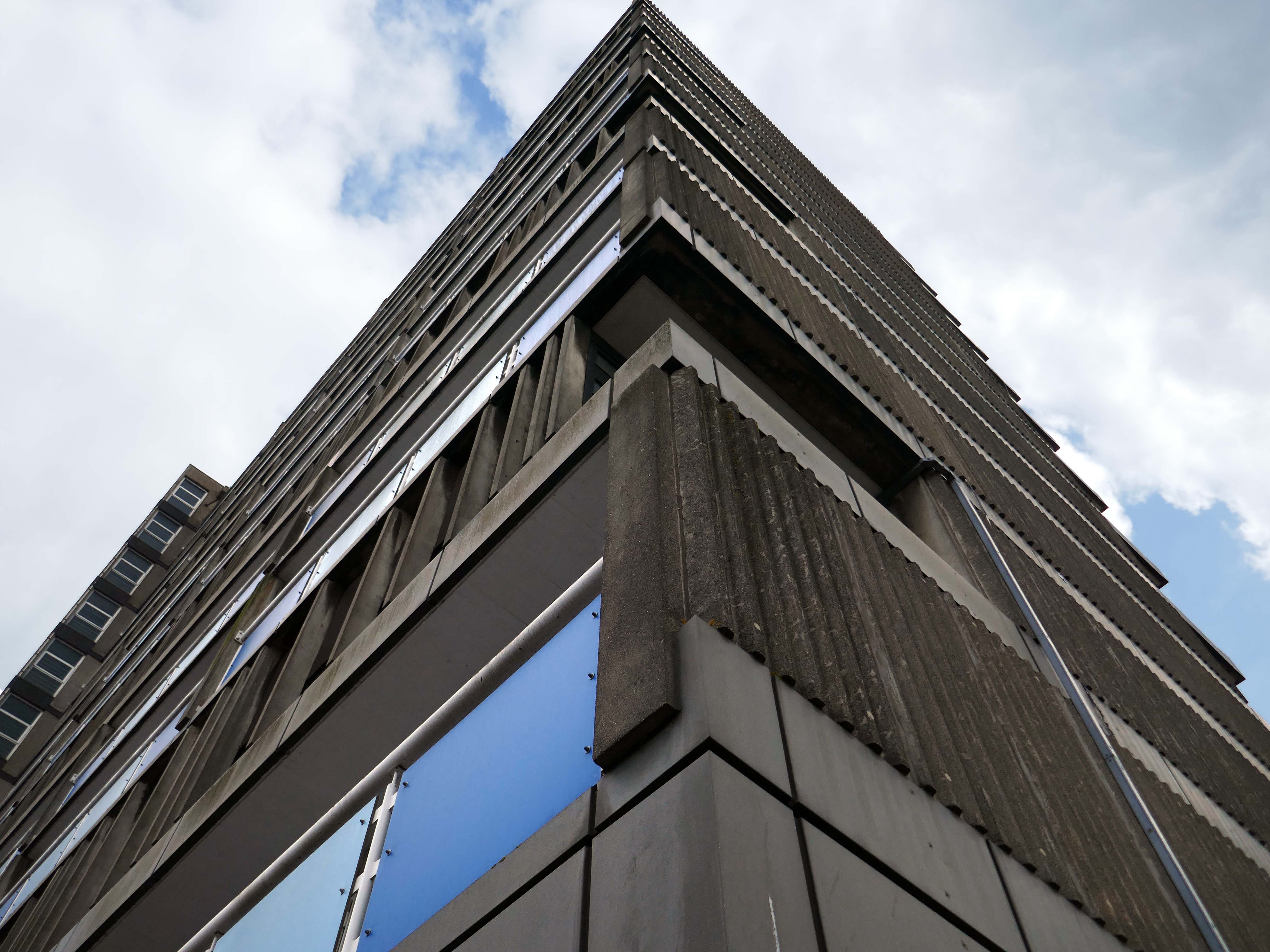
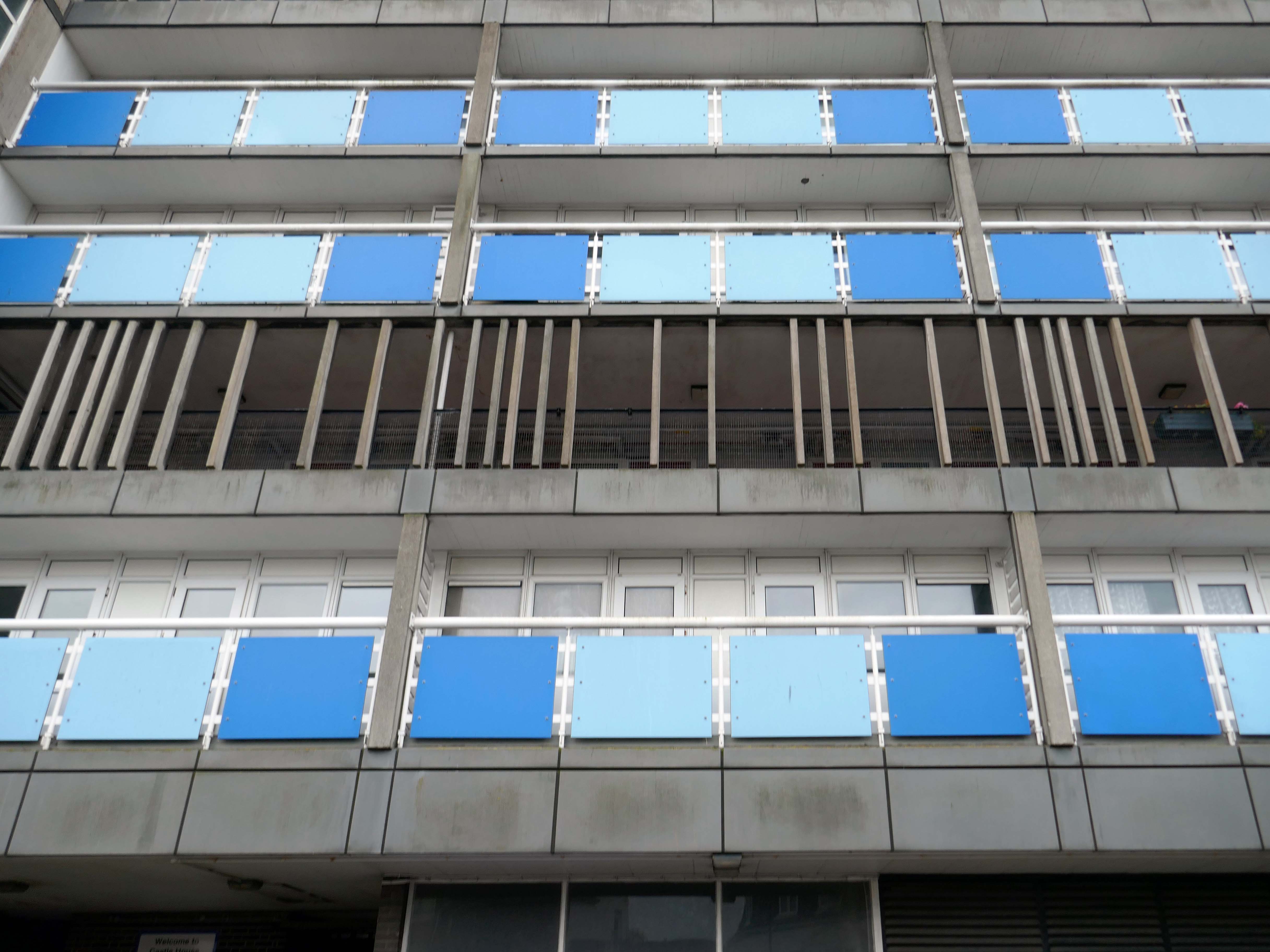
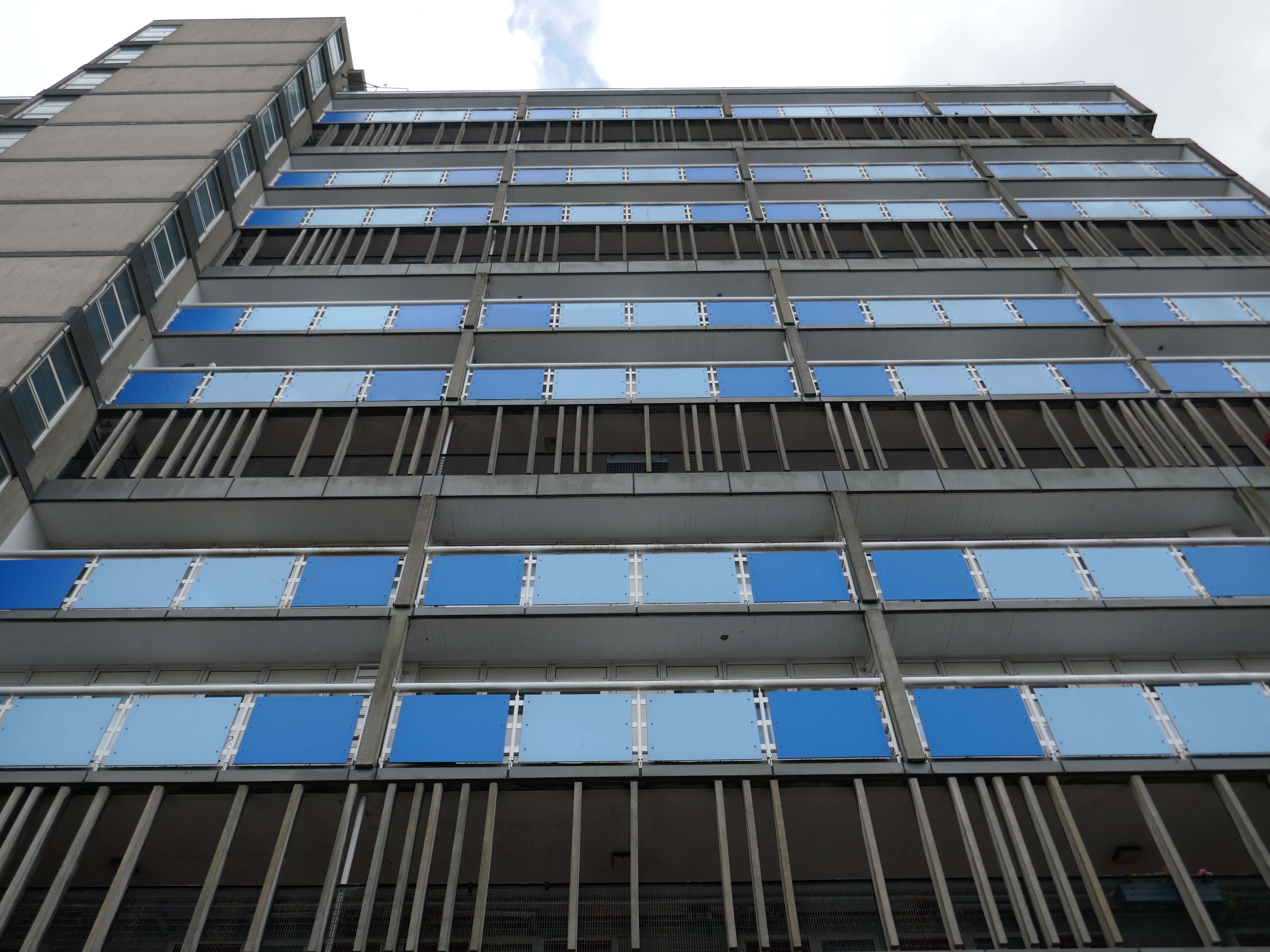
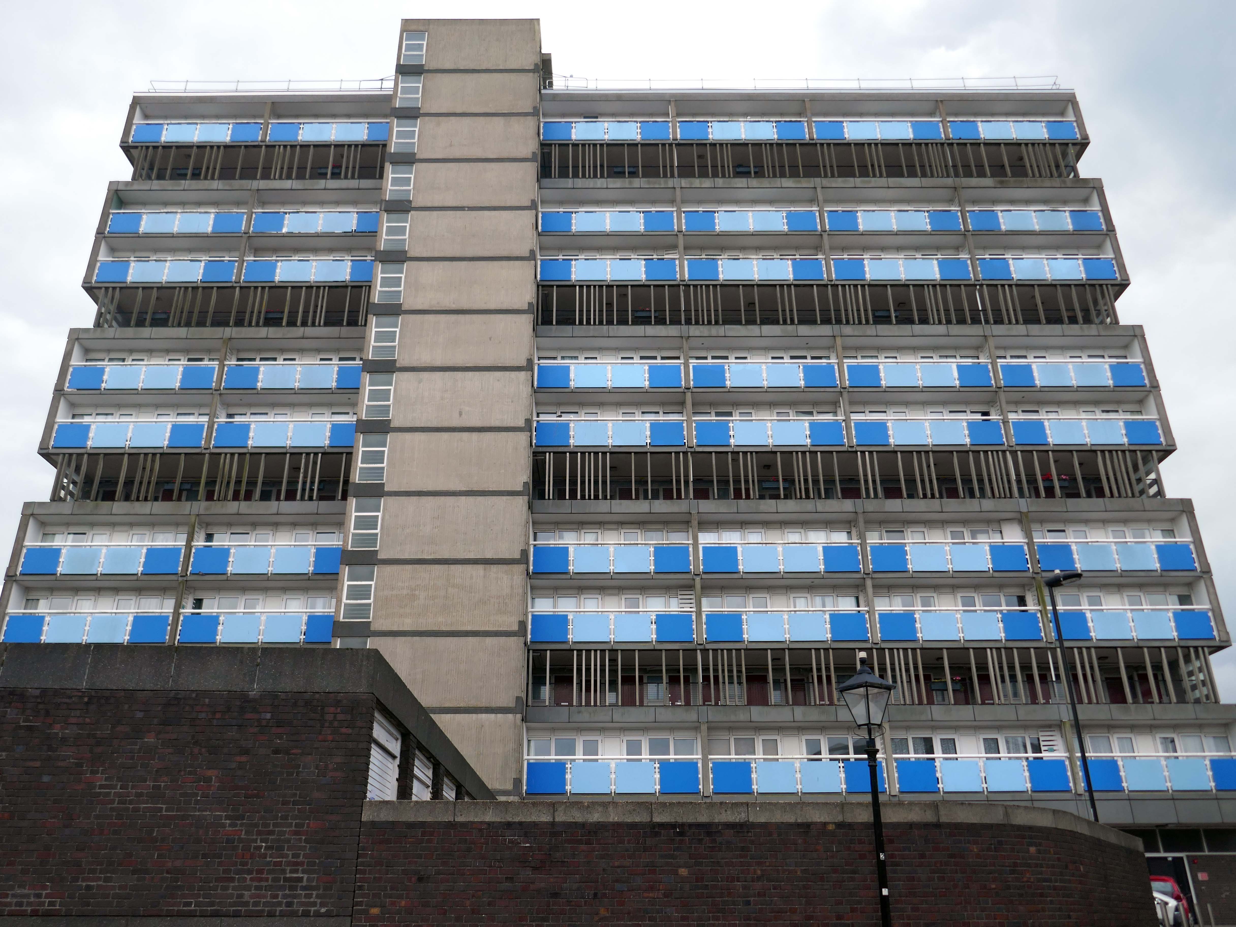
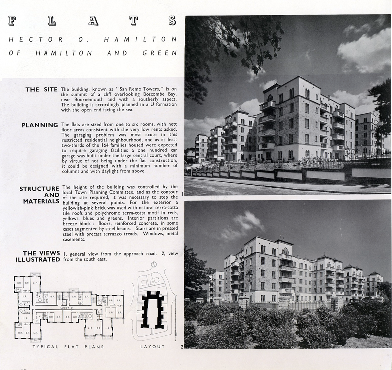
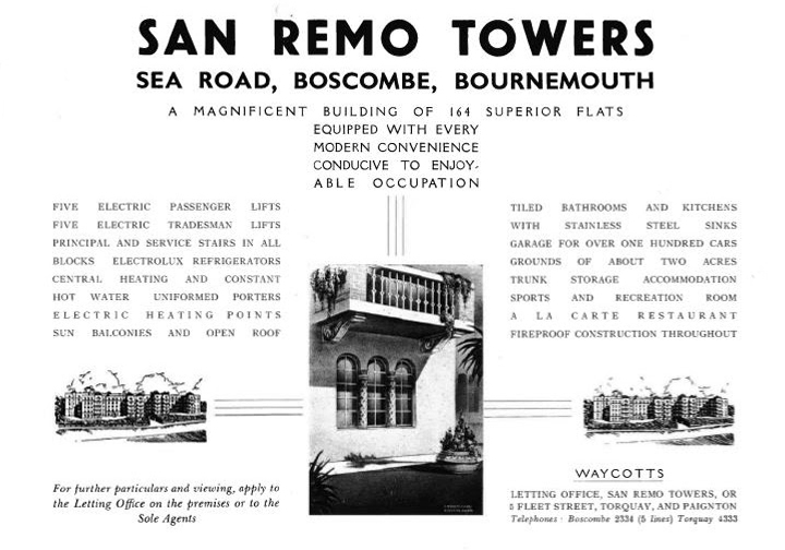
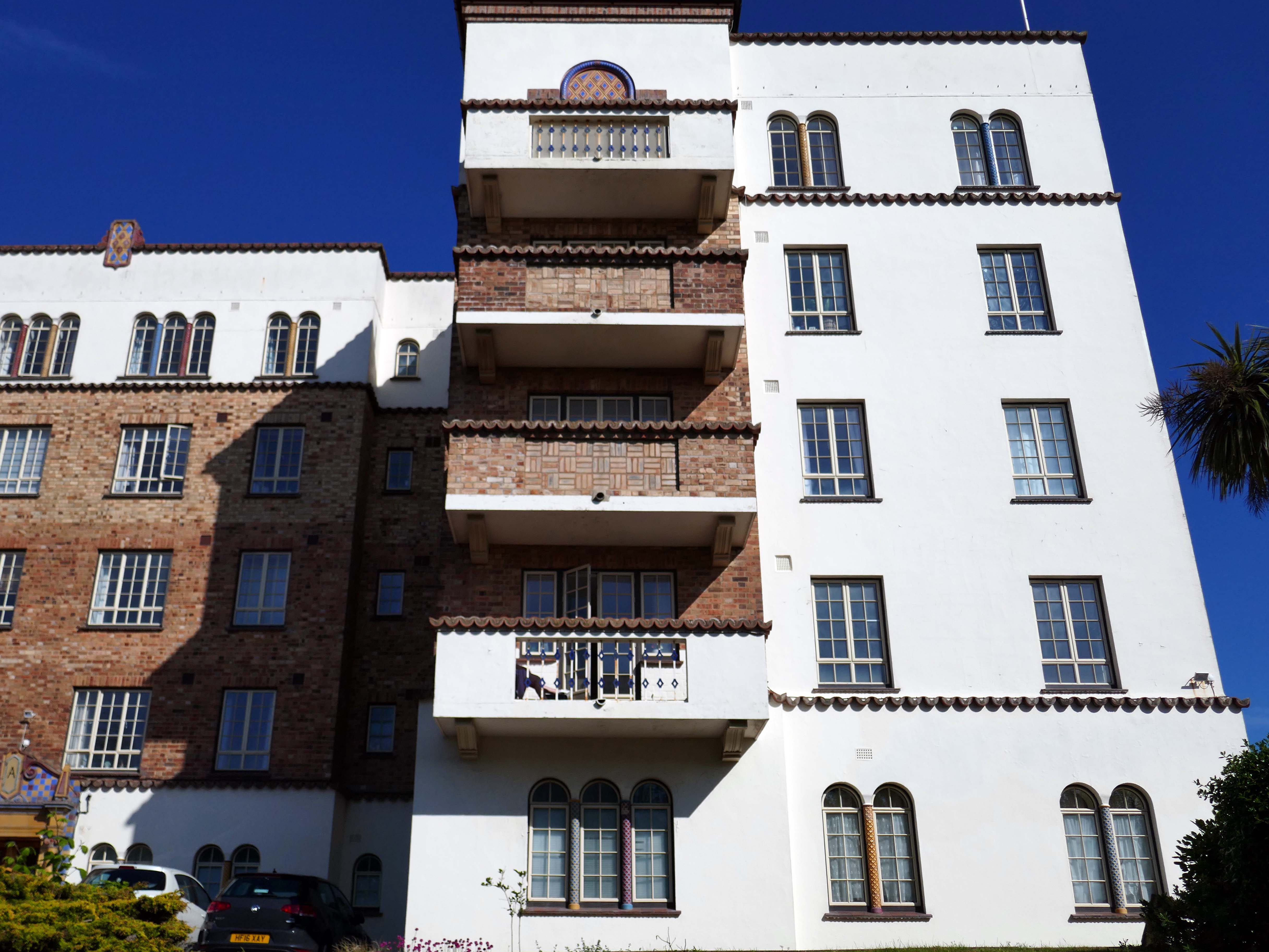
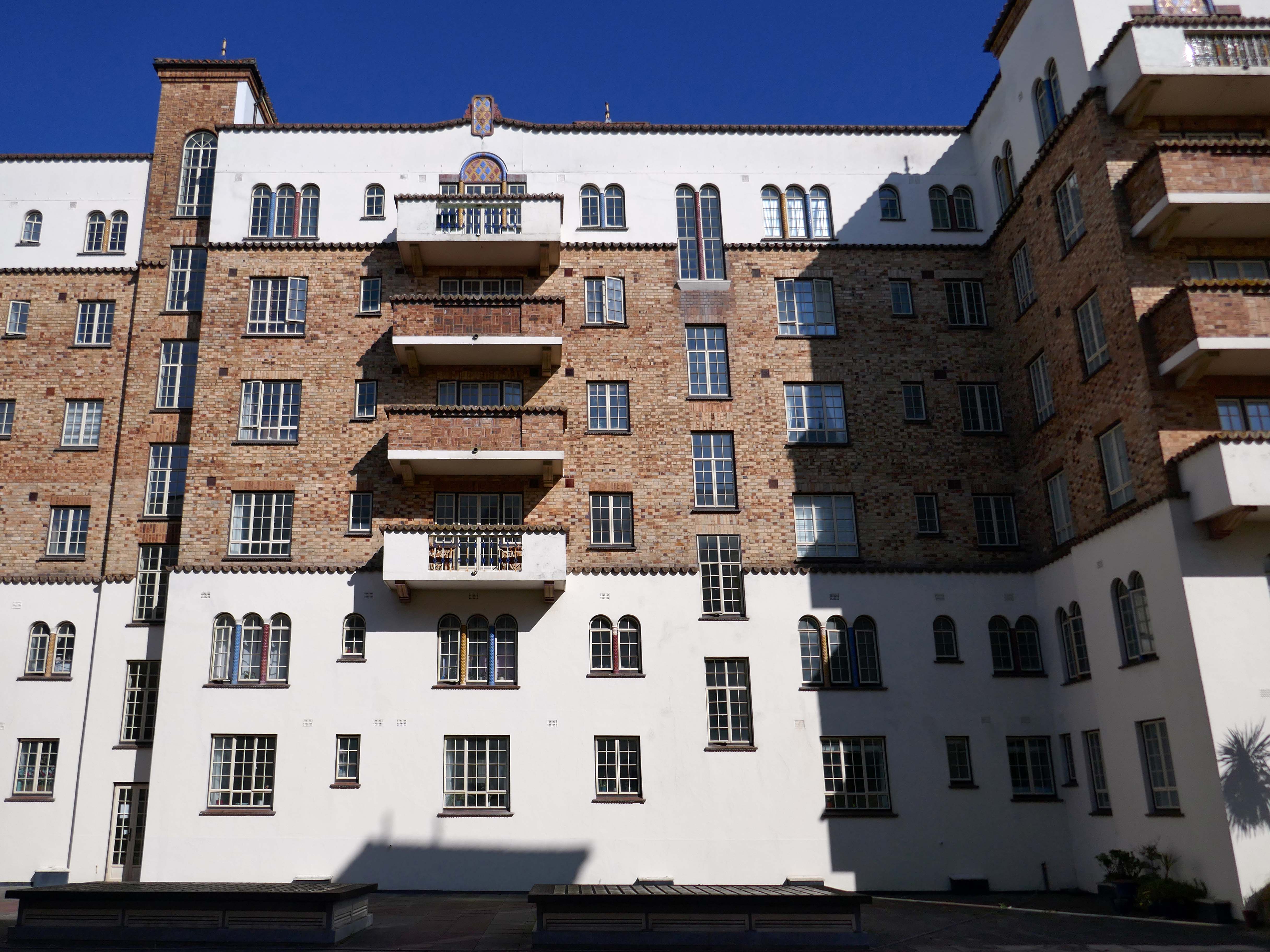
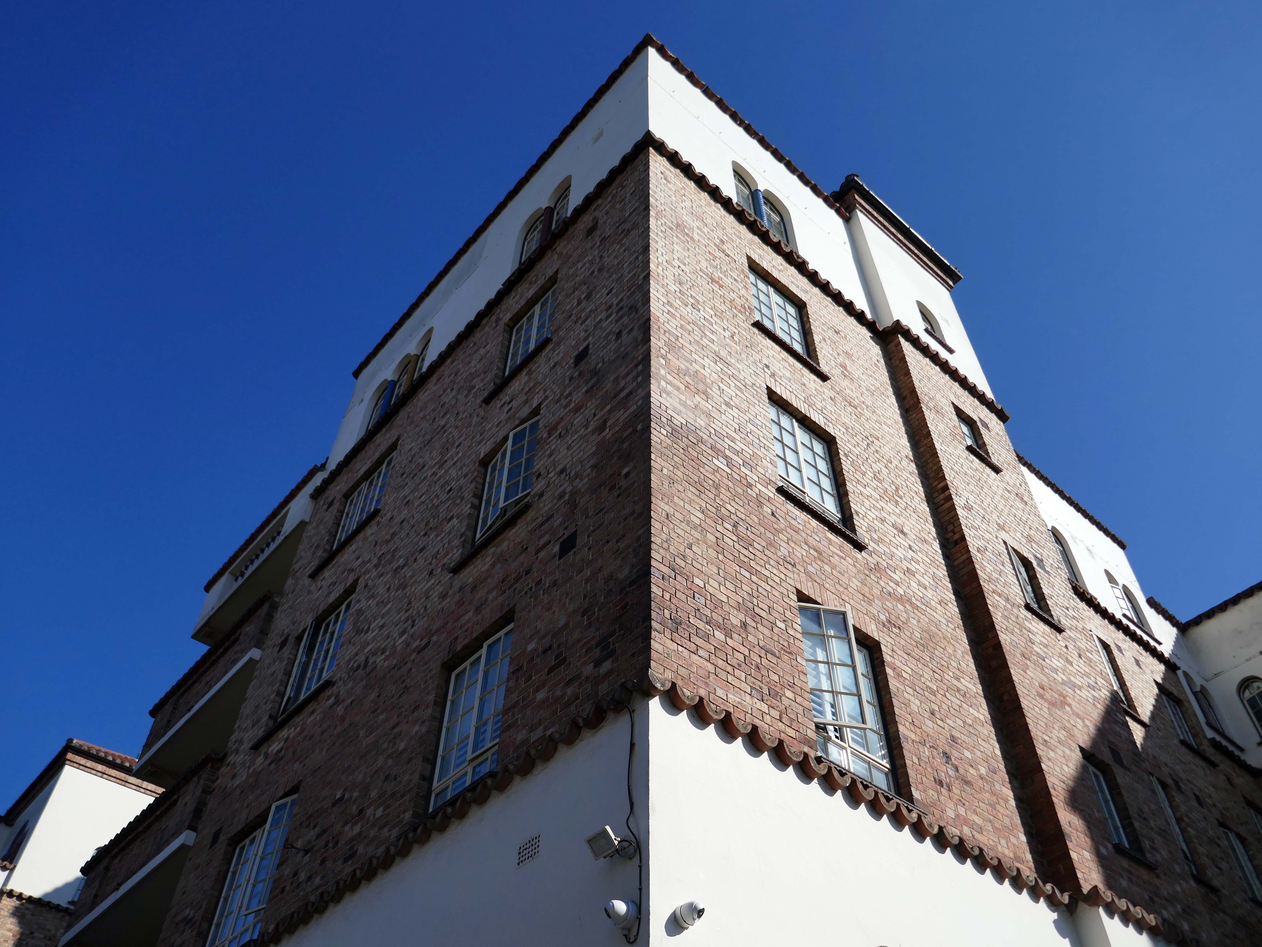
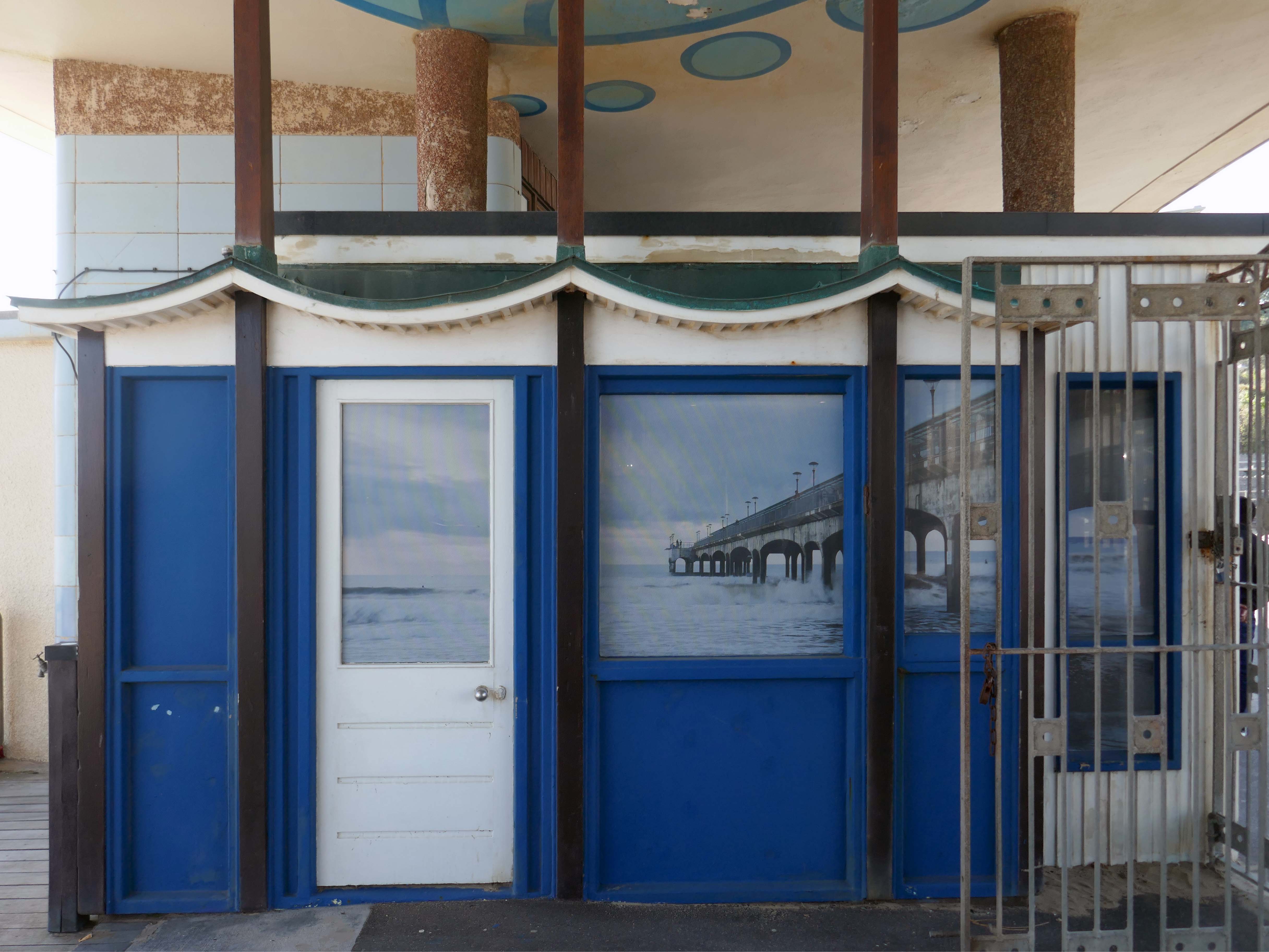
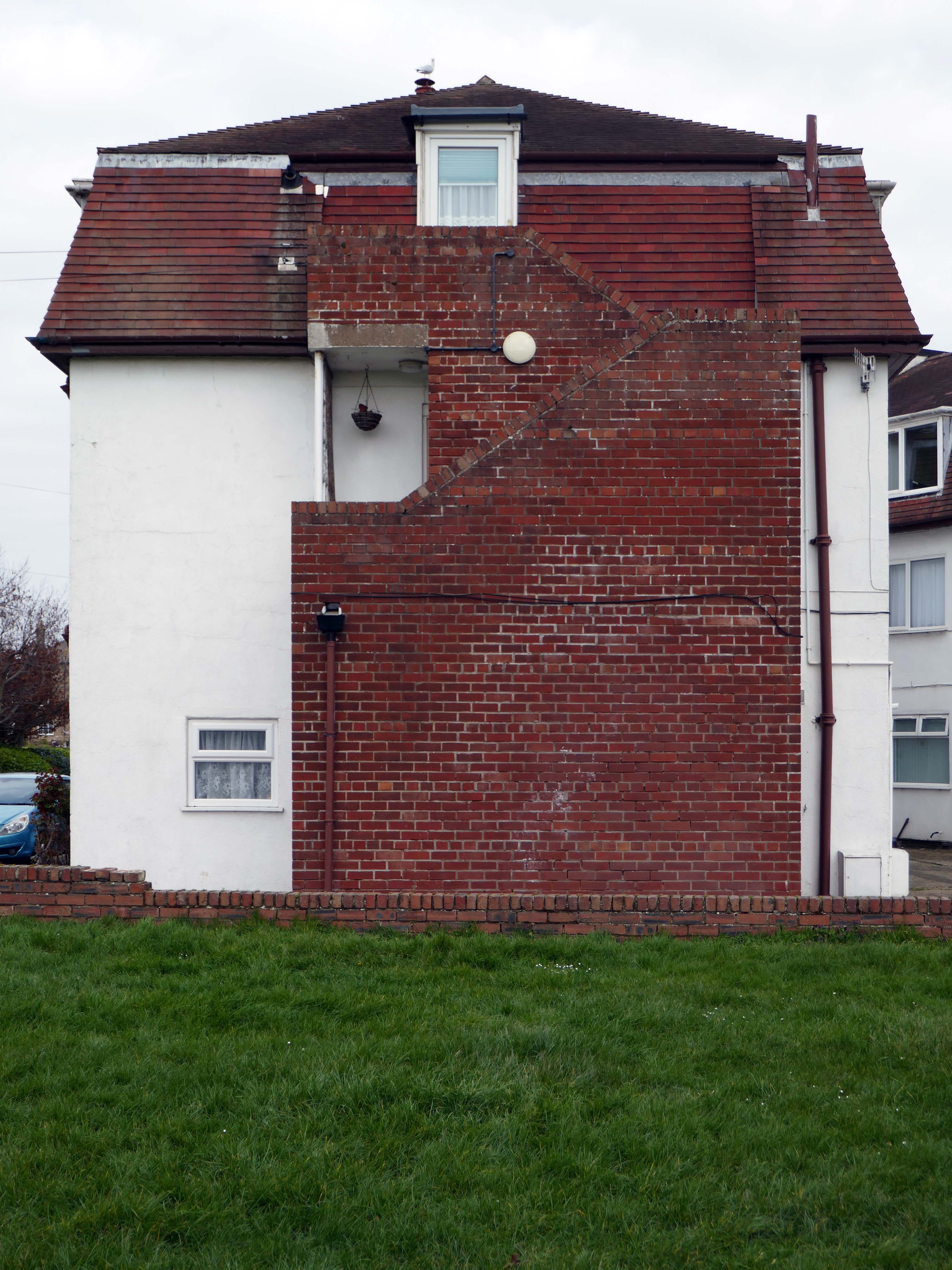
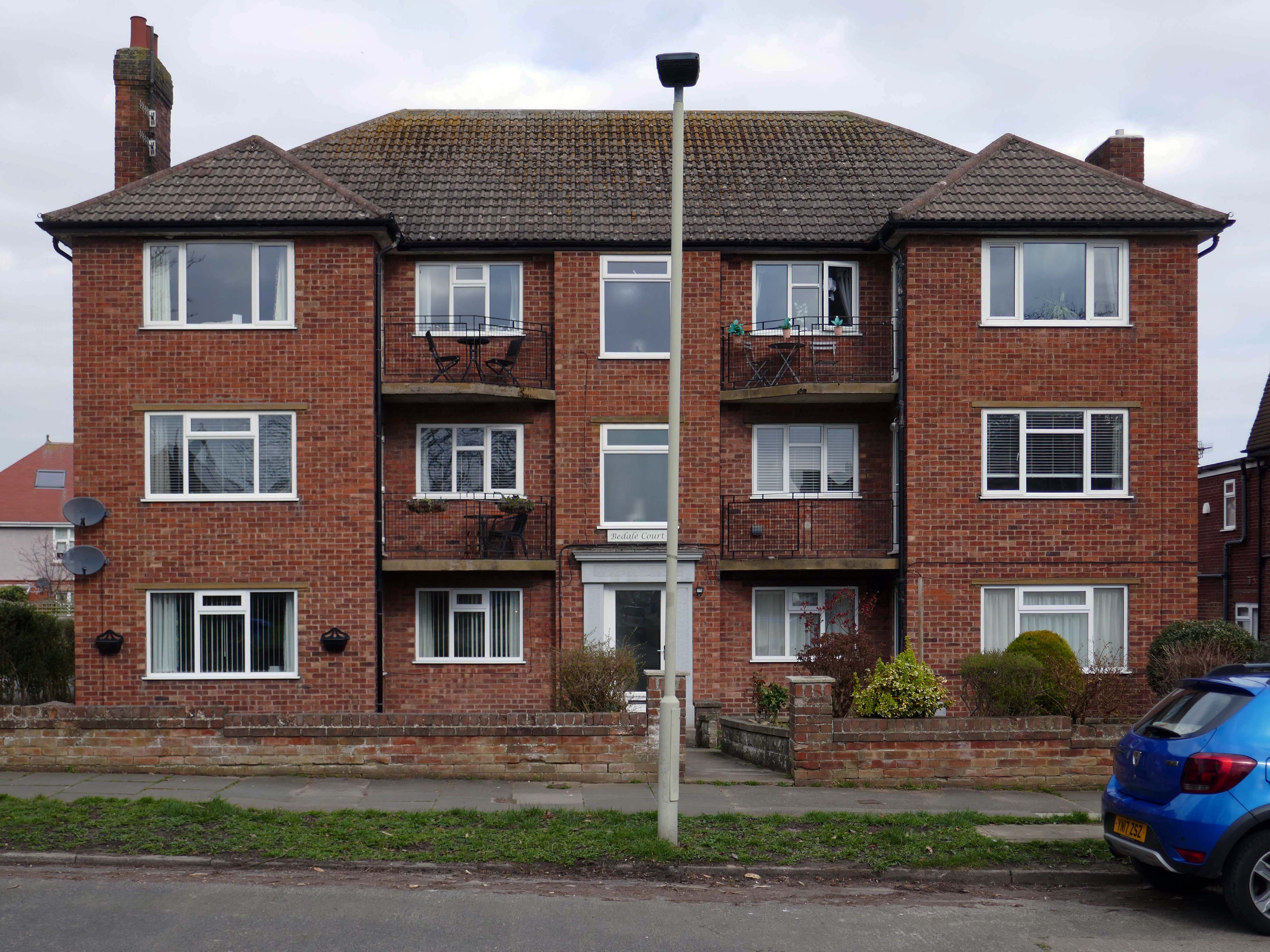
San Remo Towers Sea Rd Boscombe Bournemouth BH5 1JY
Alwyn Ladell
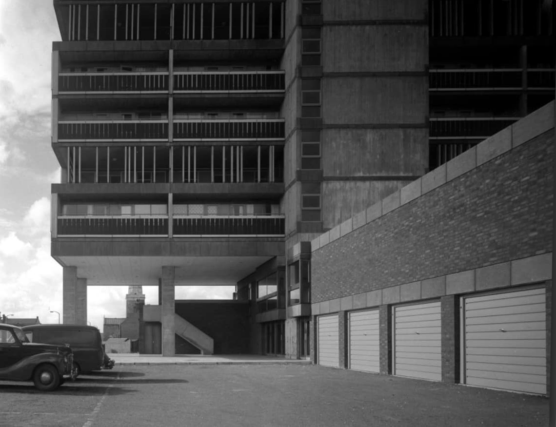
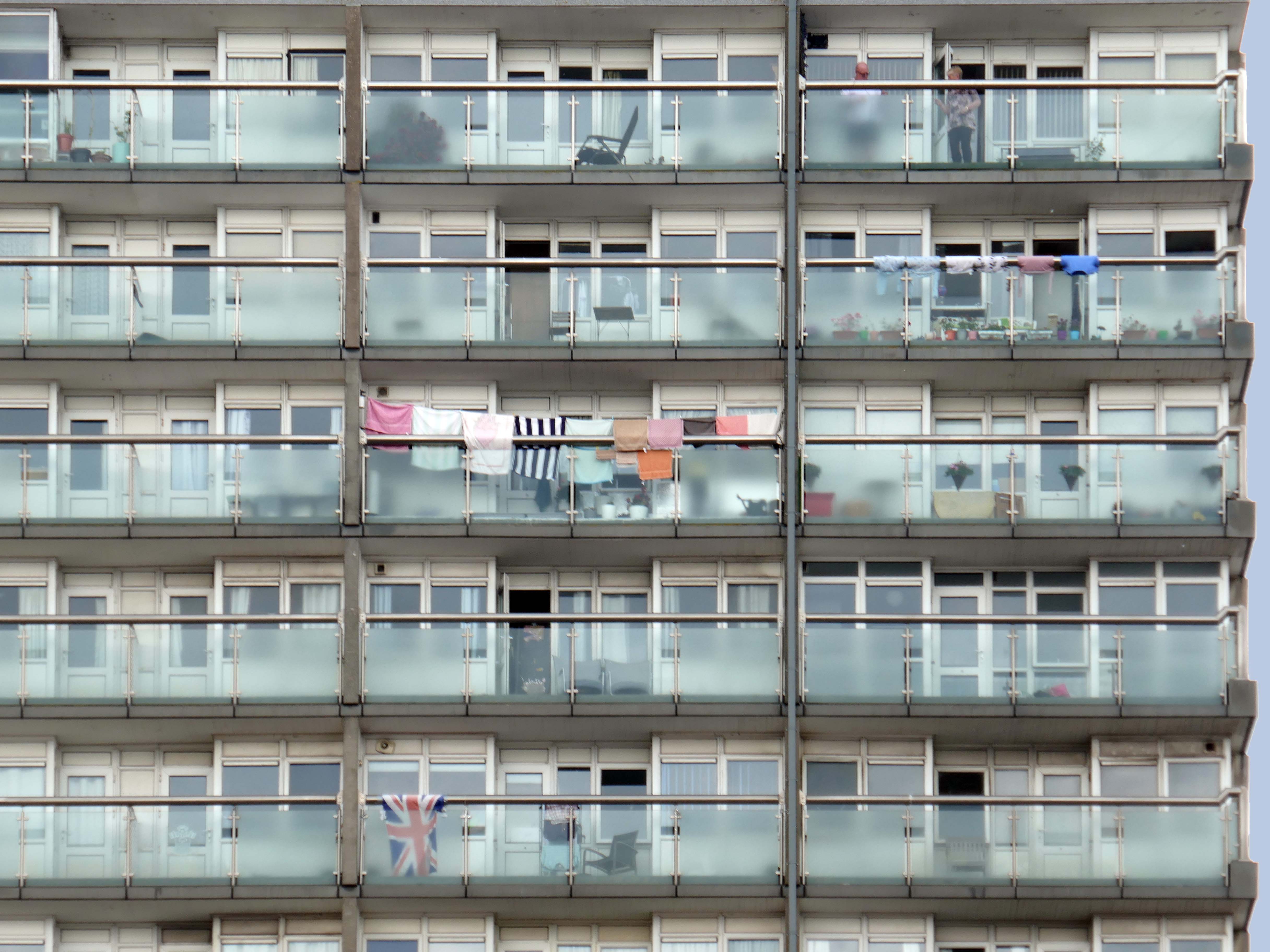
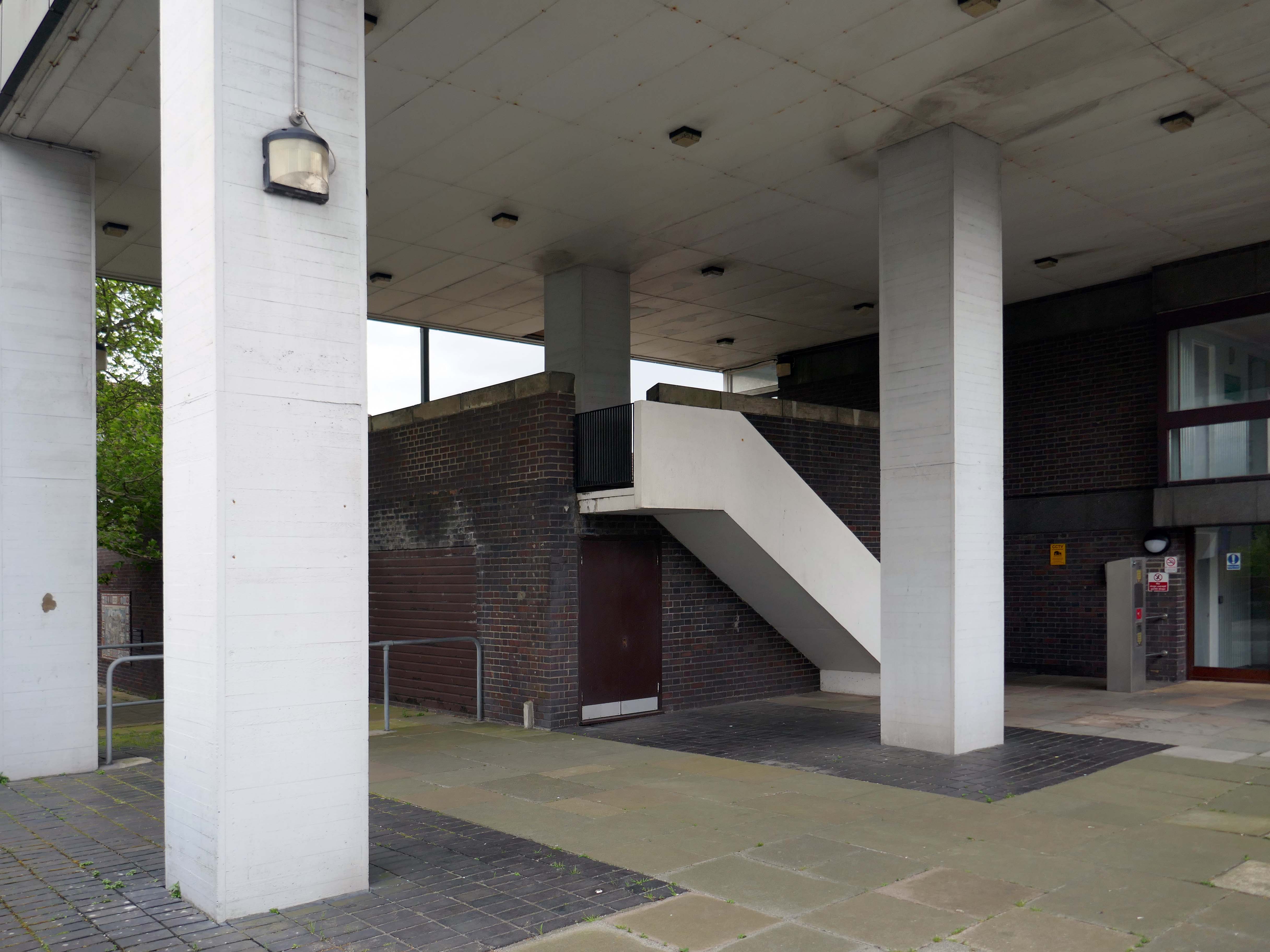
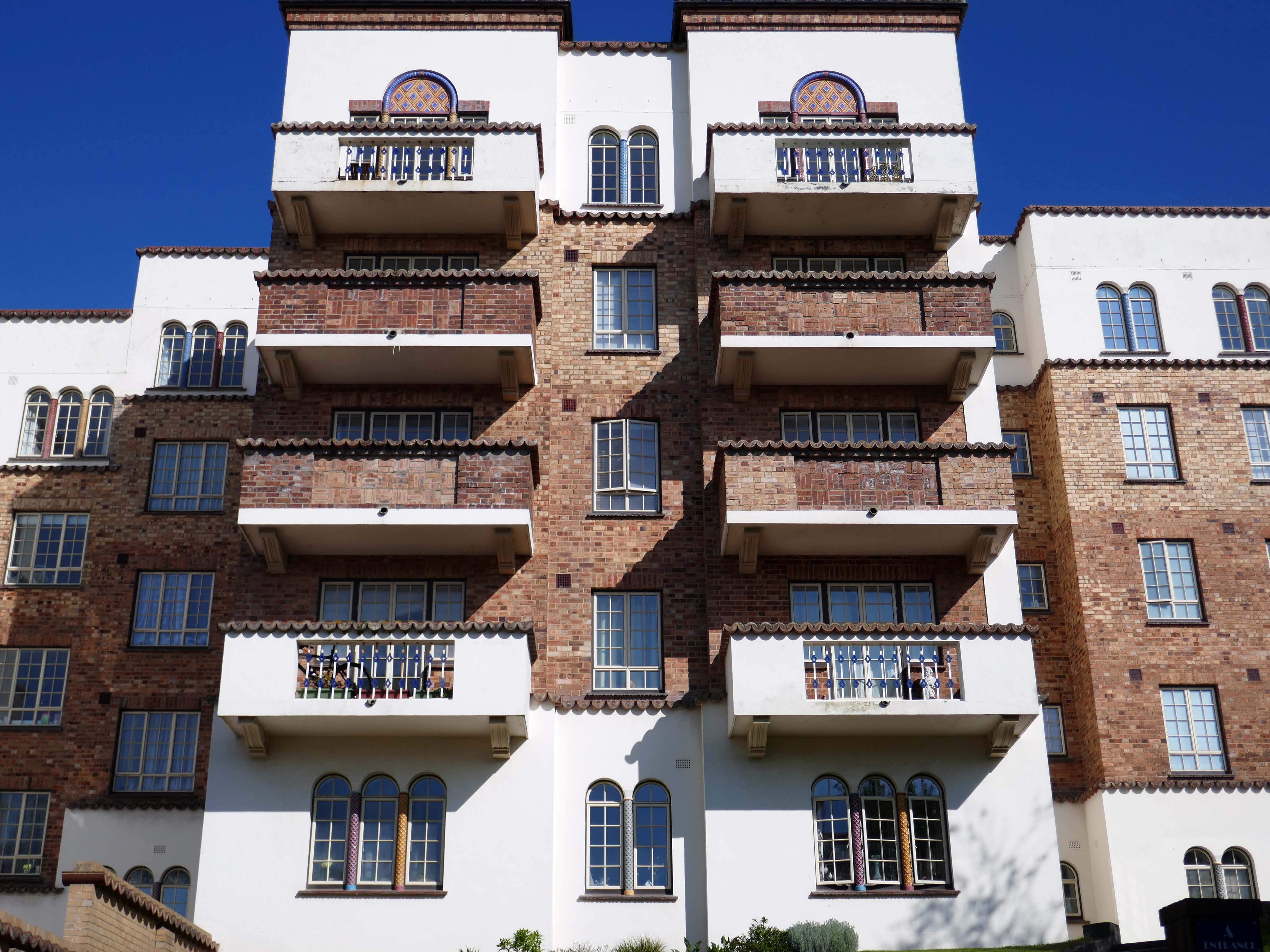
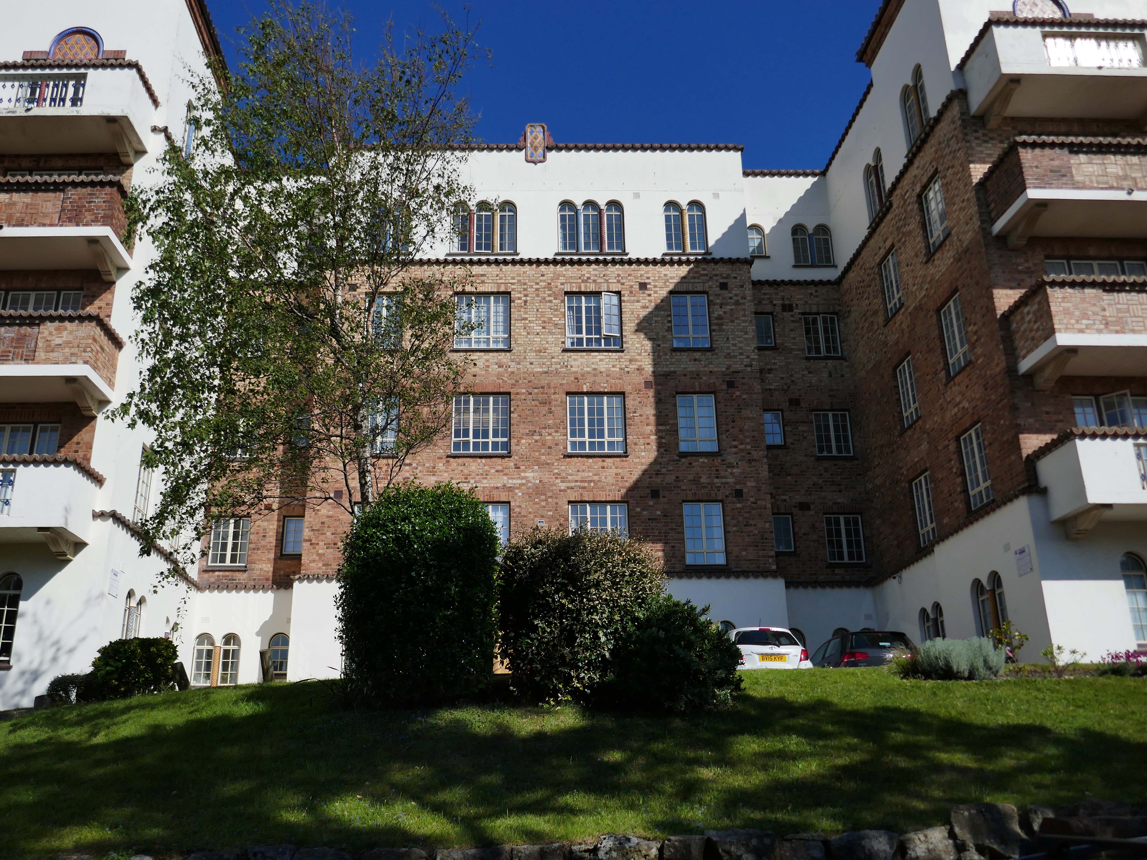
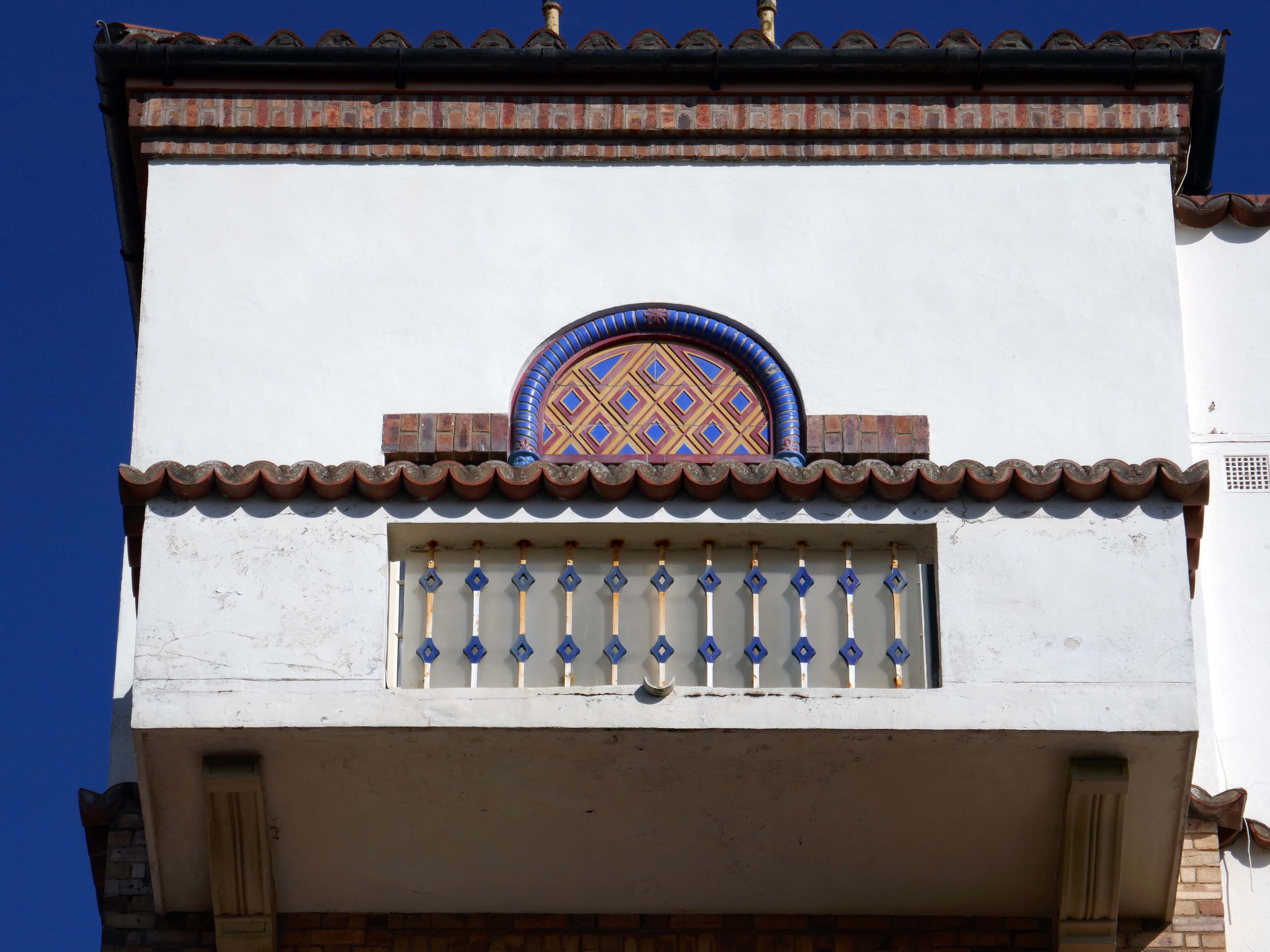
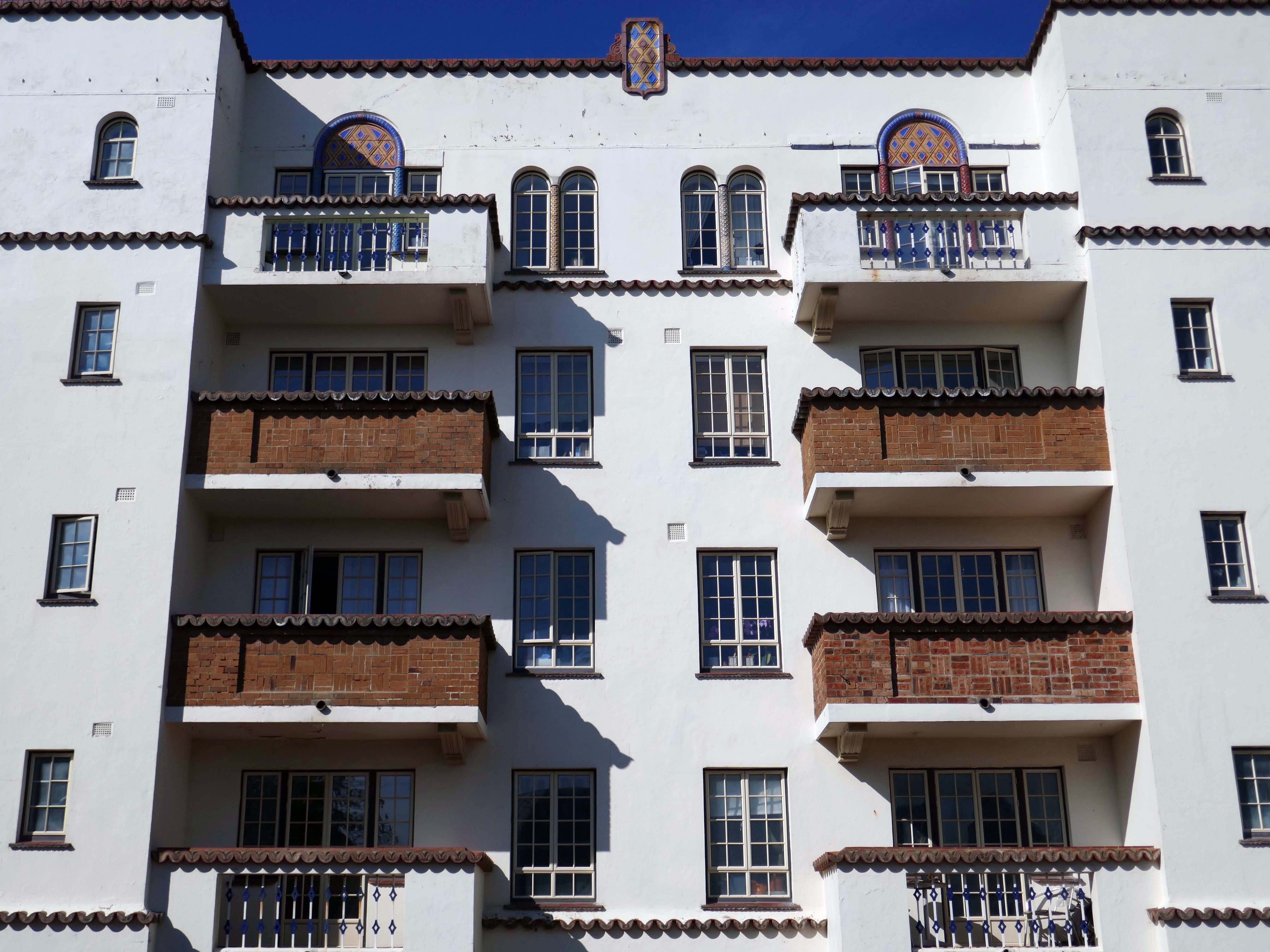
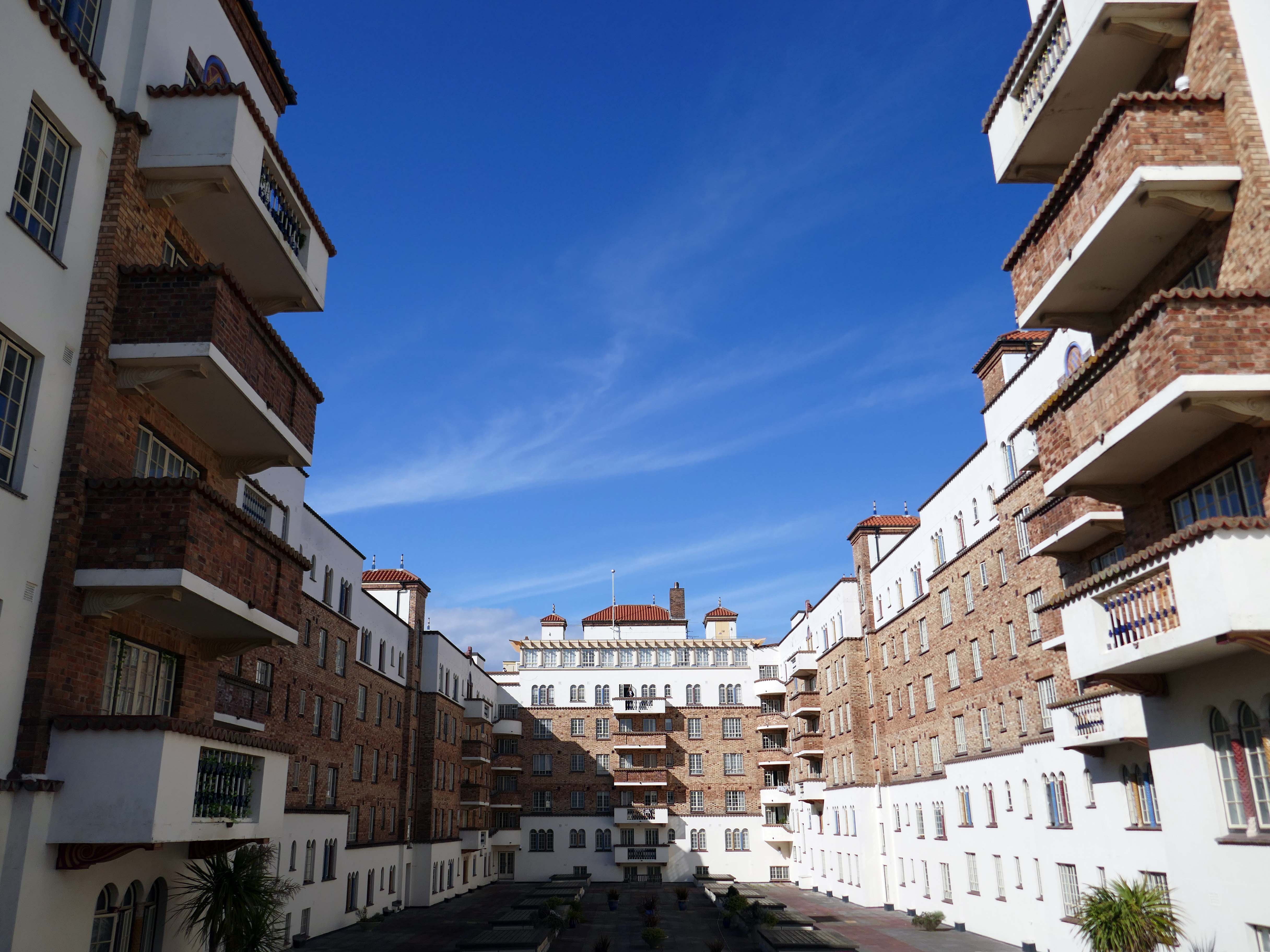
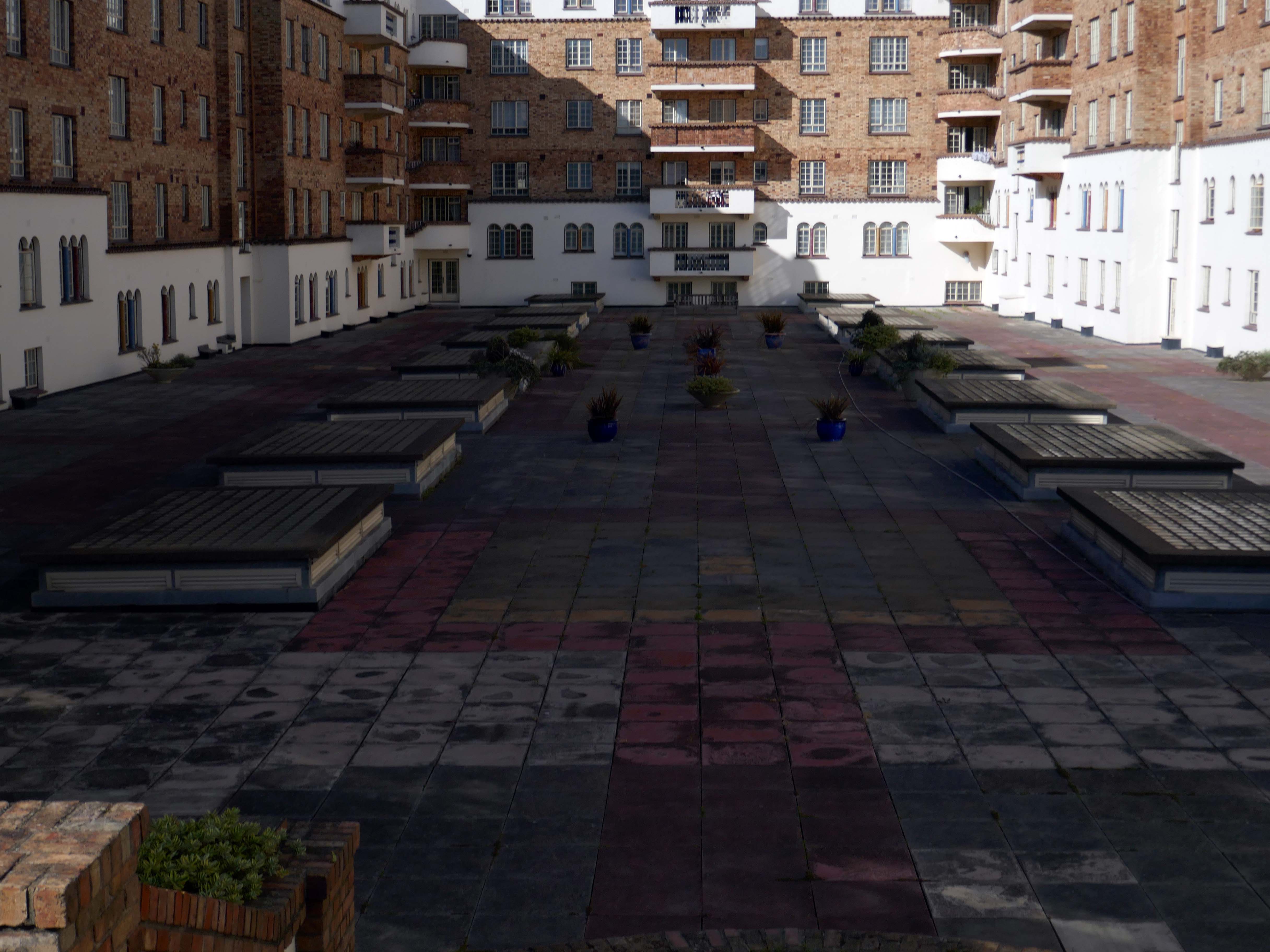
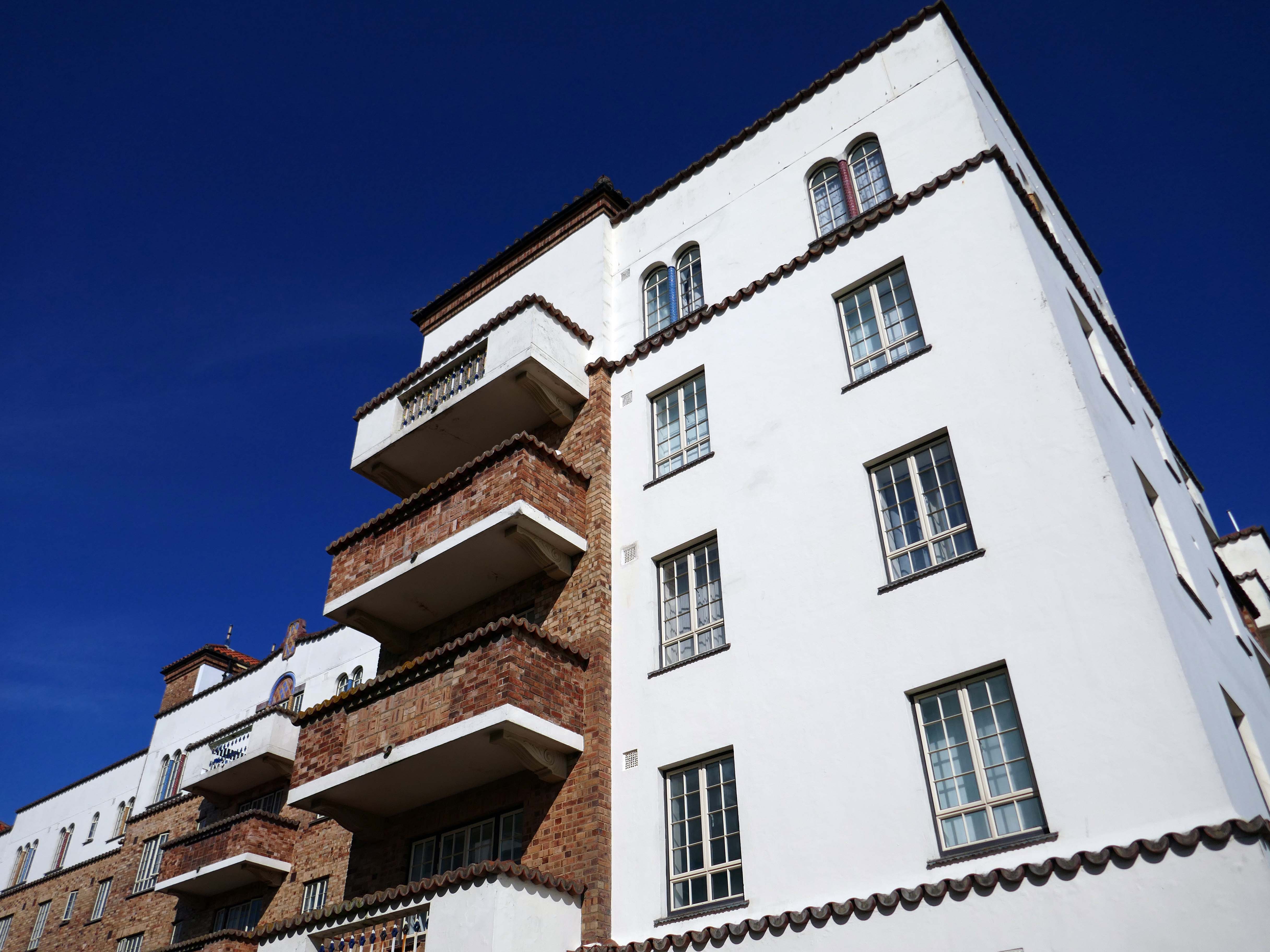
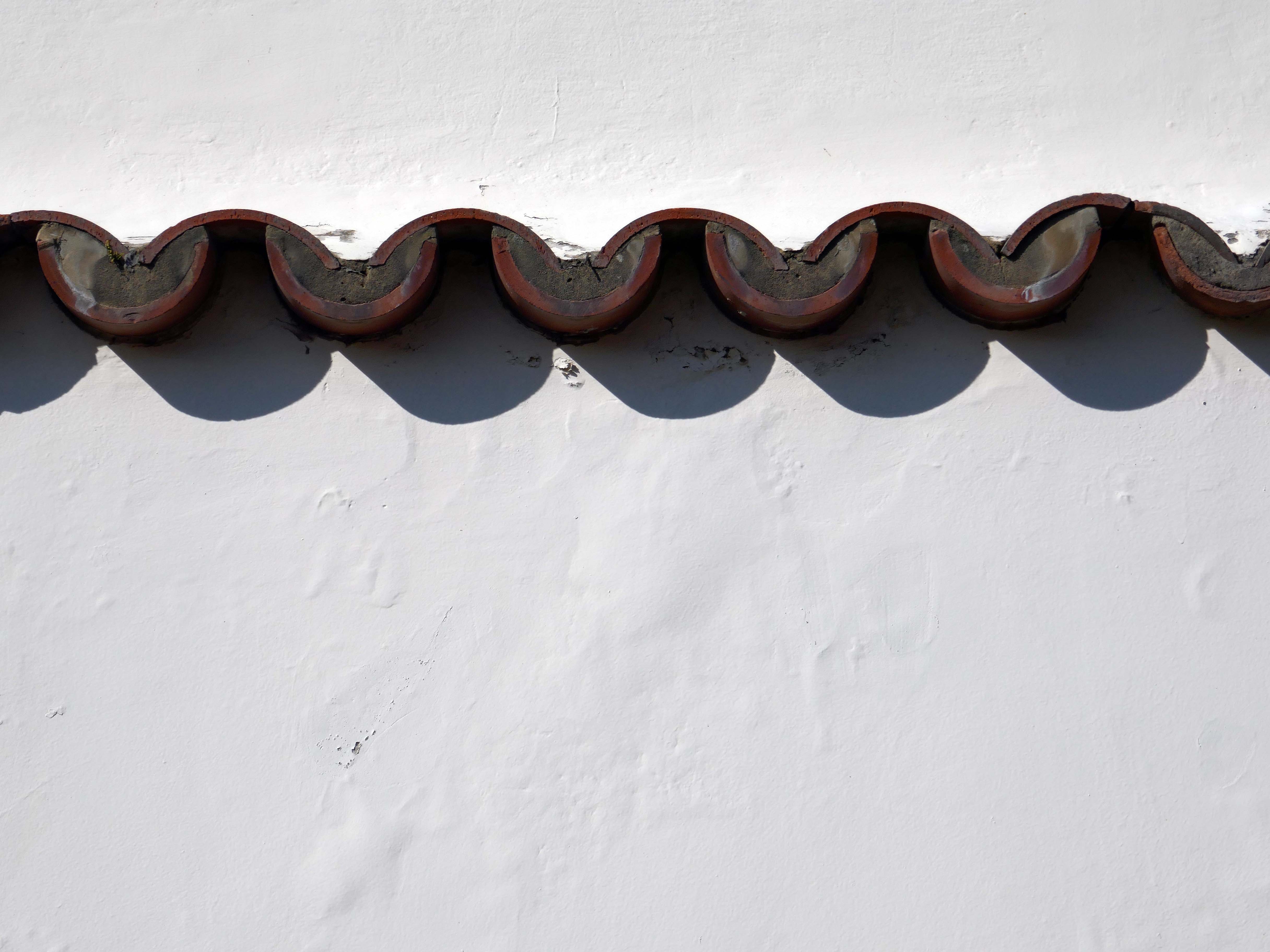
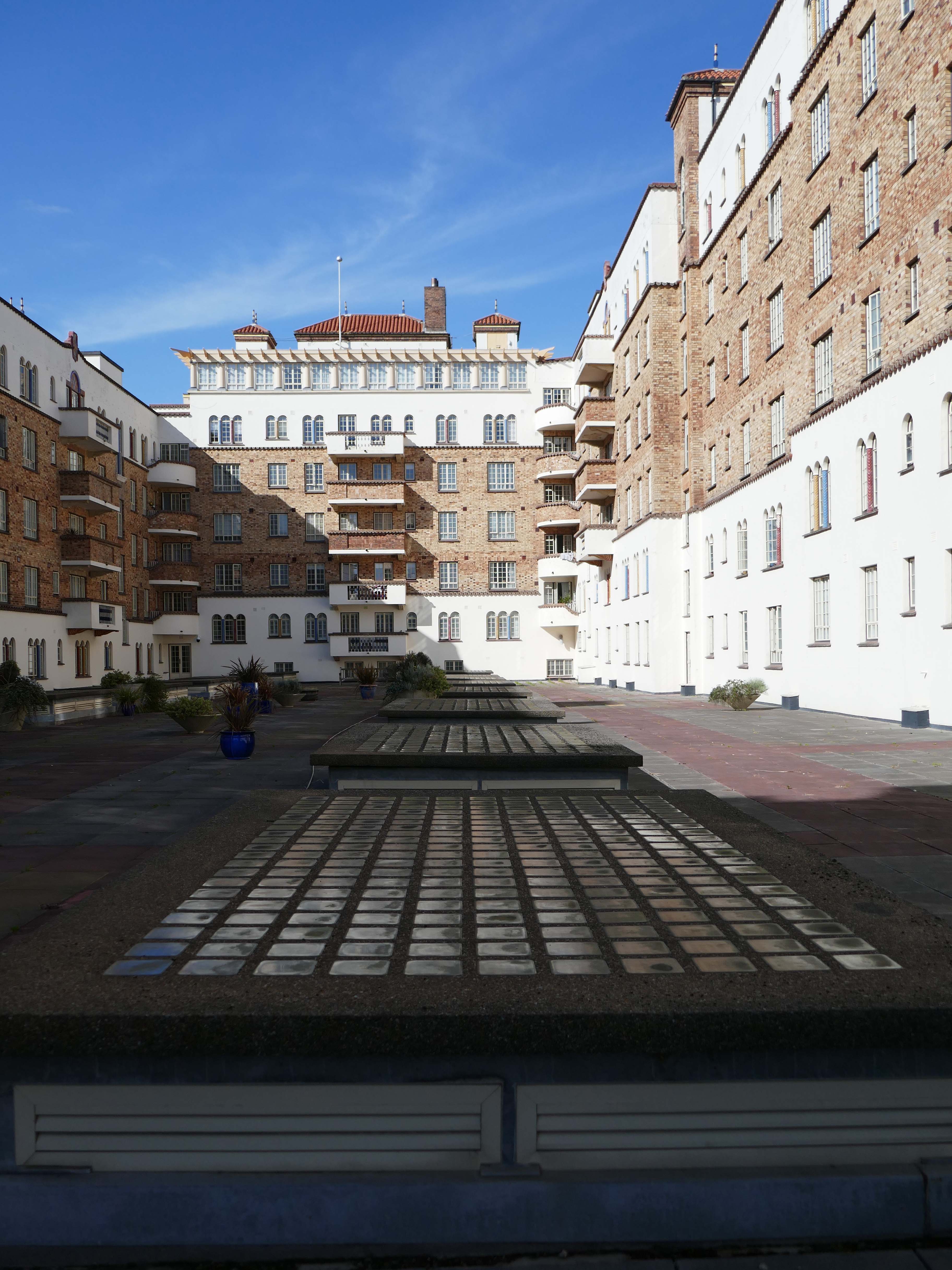
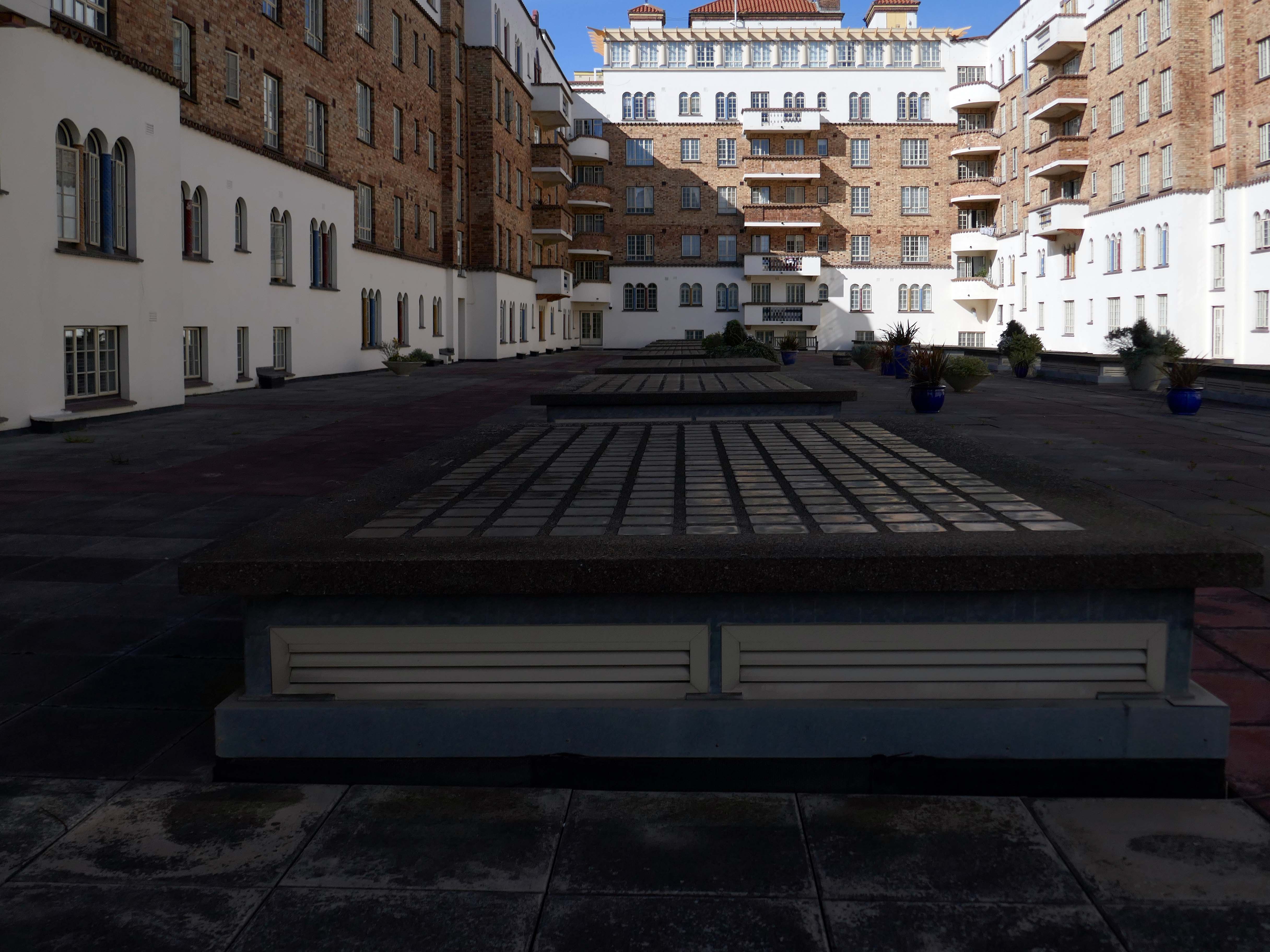
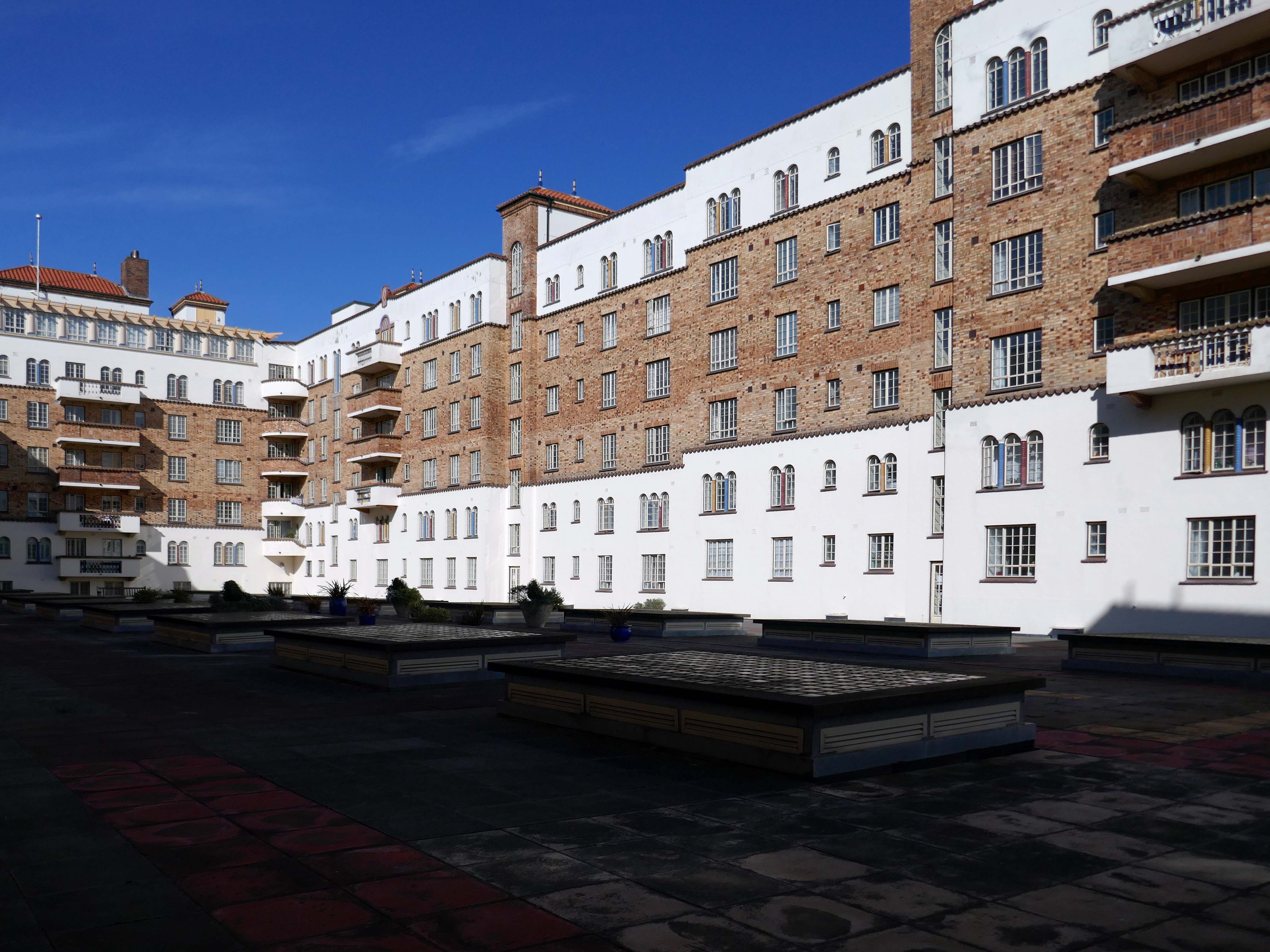
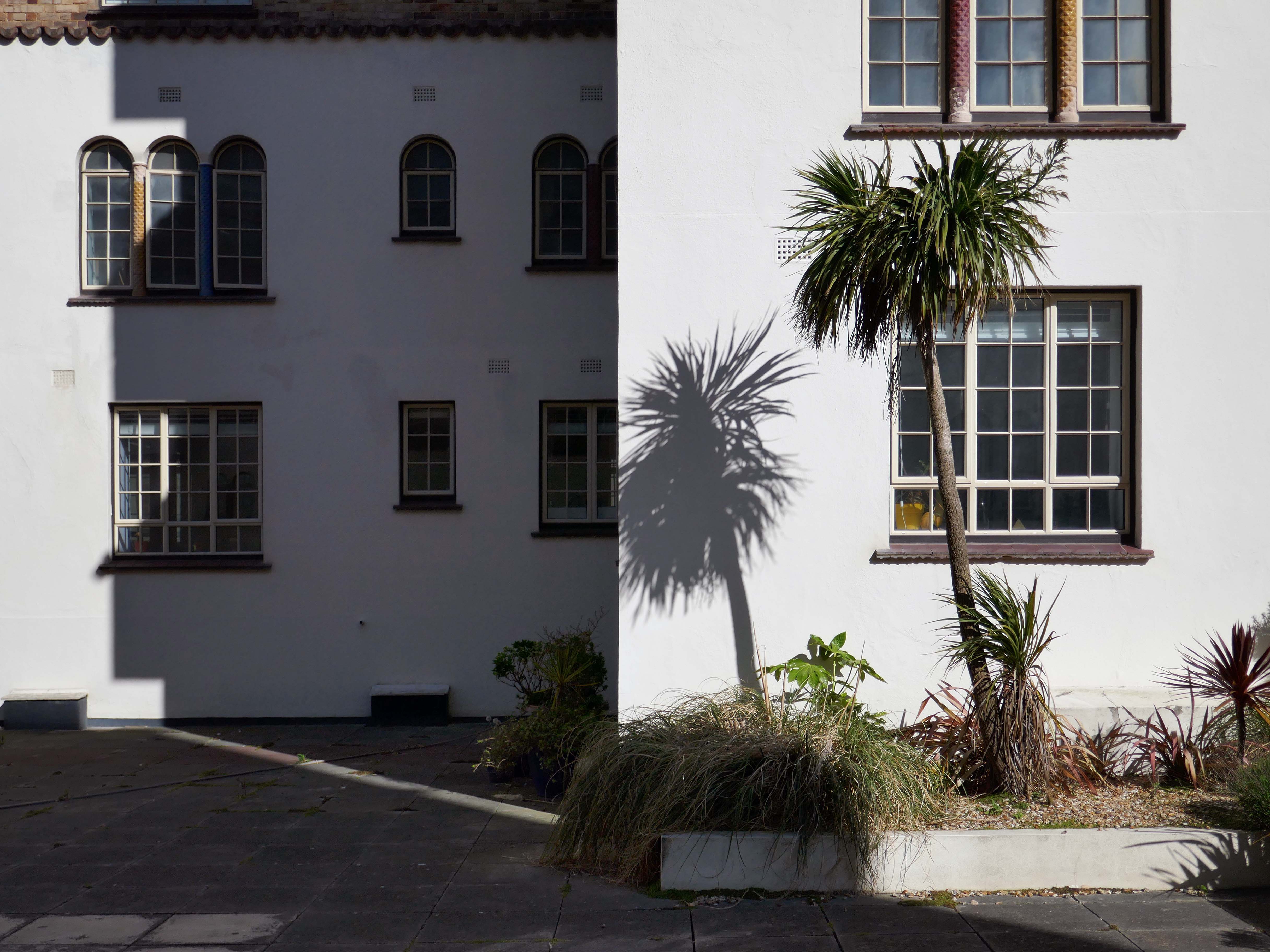
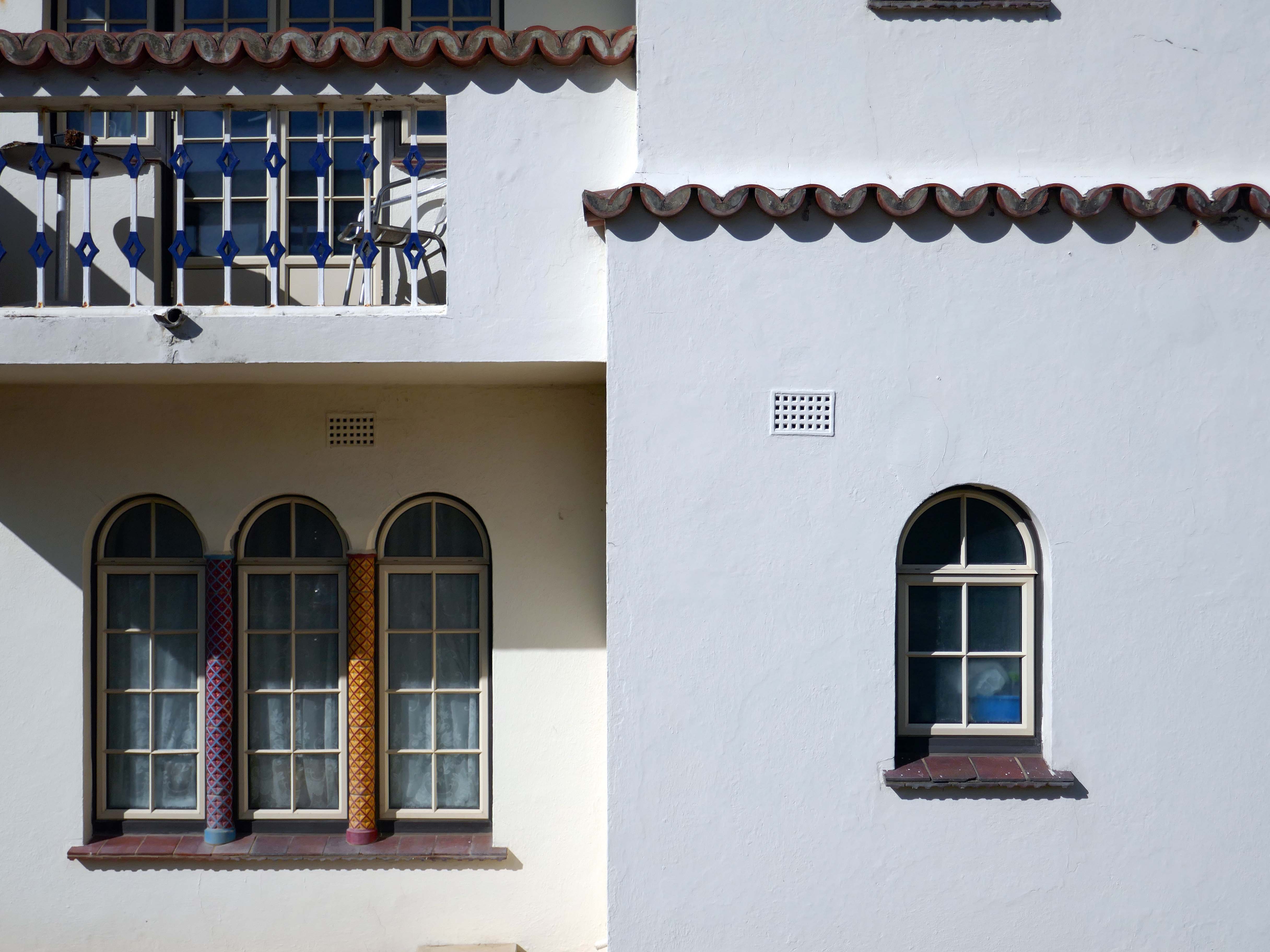
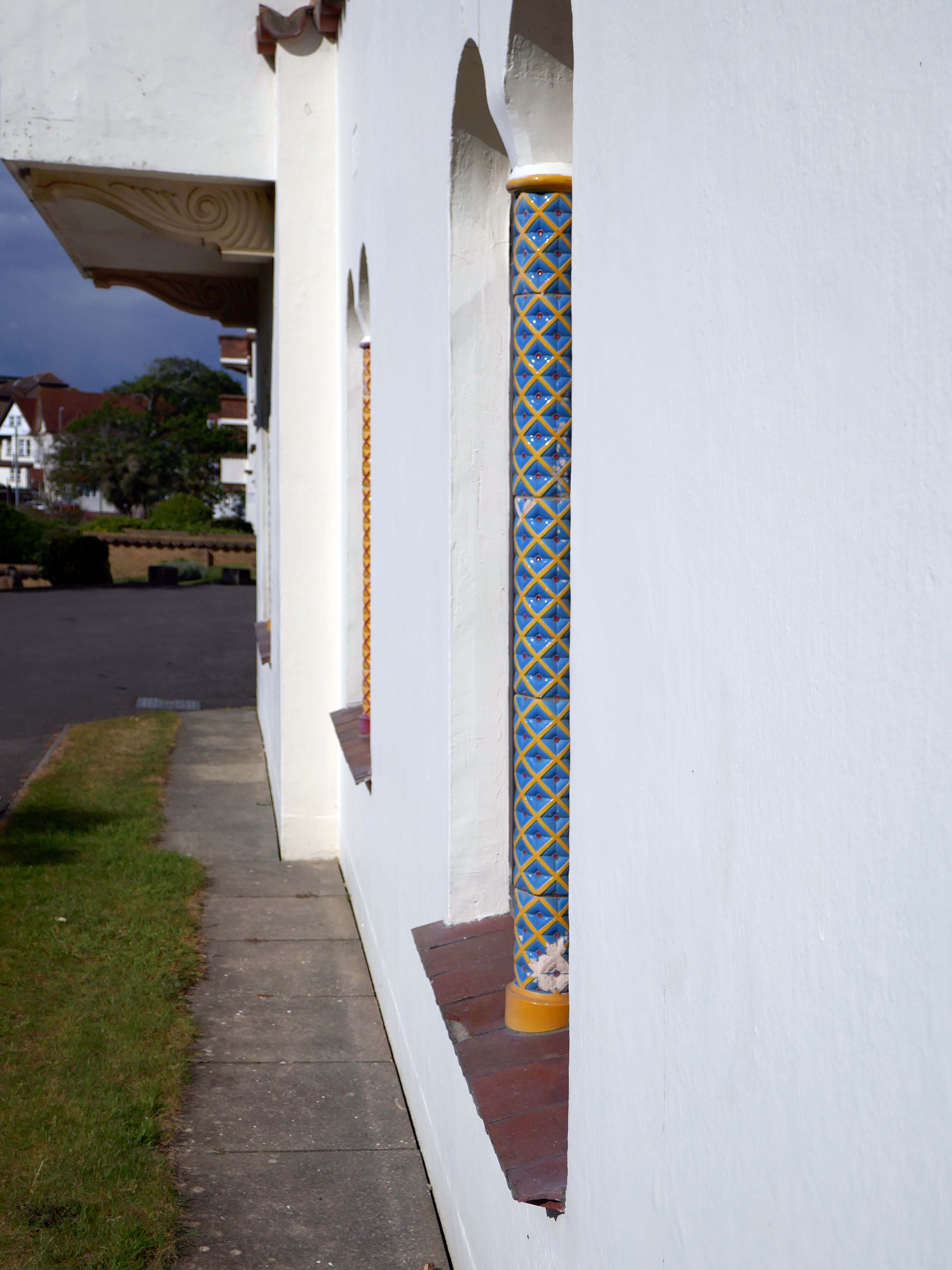
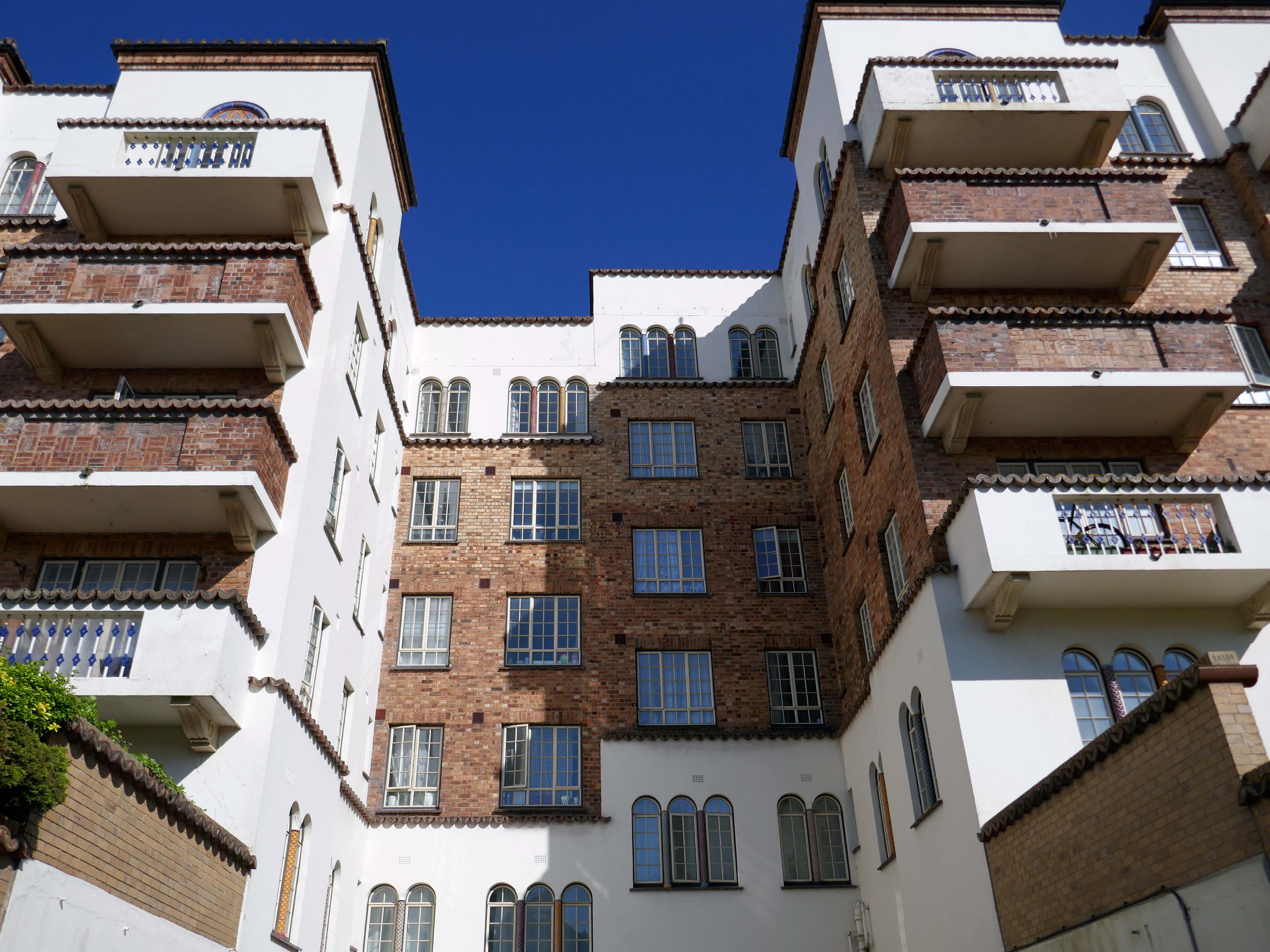
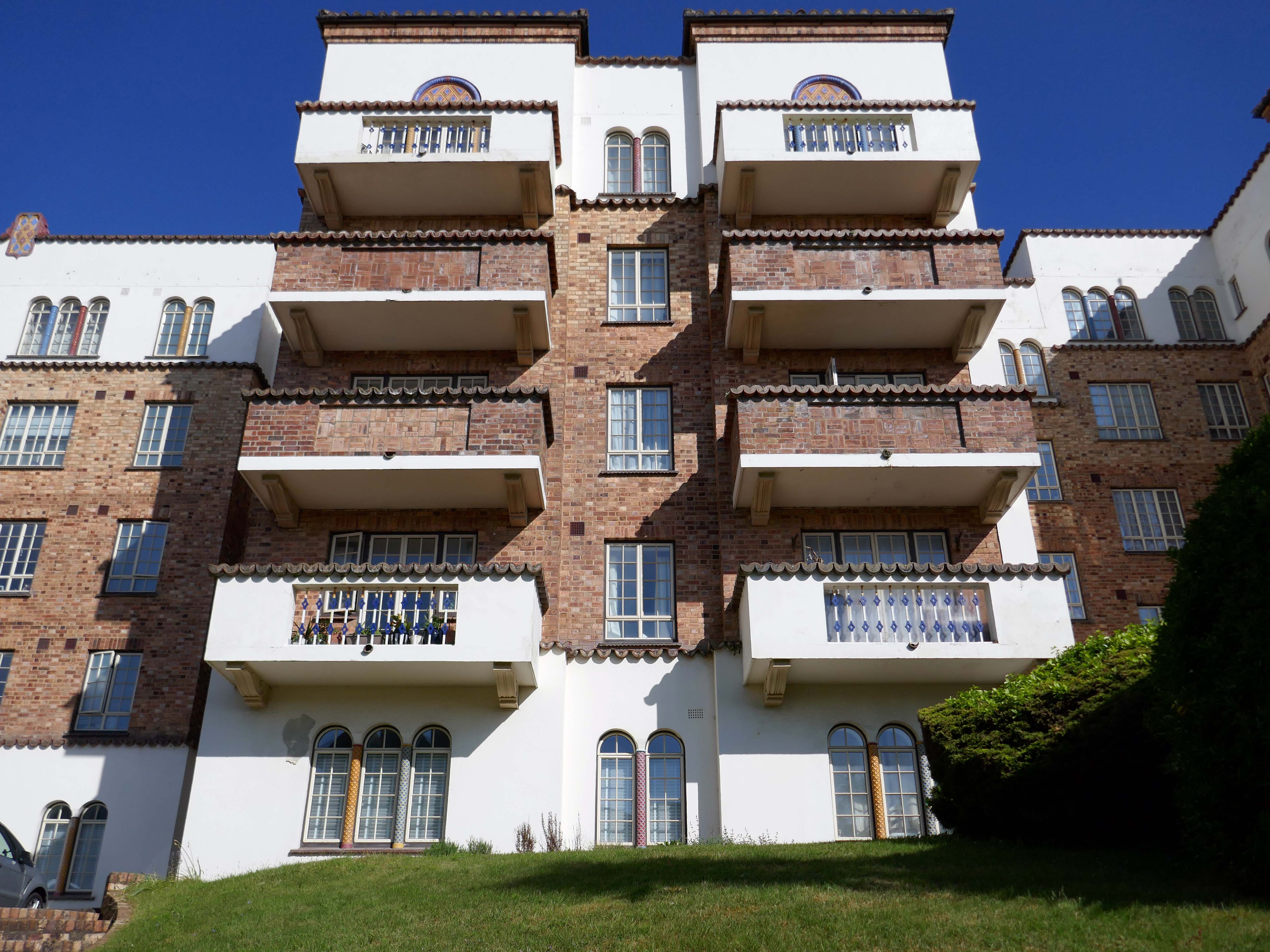
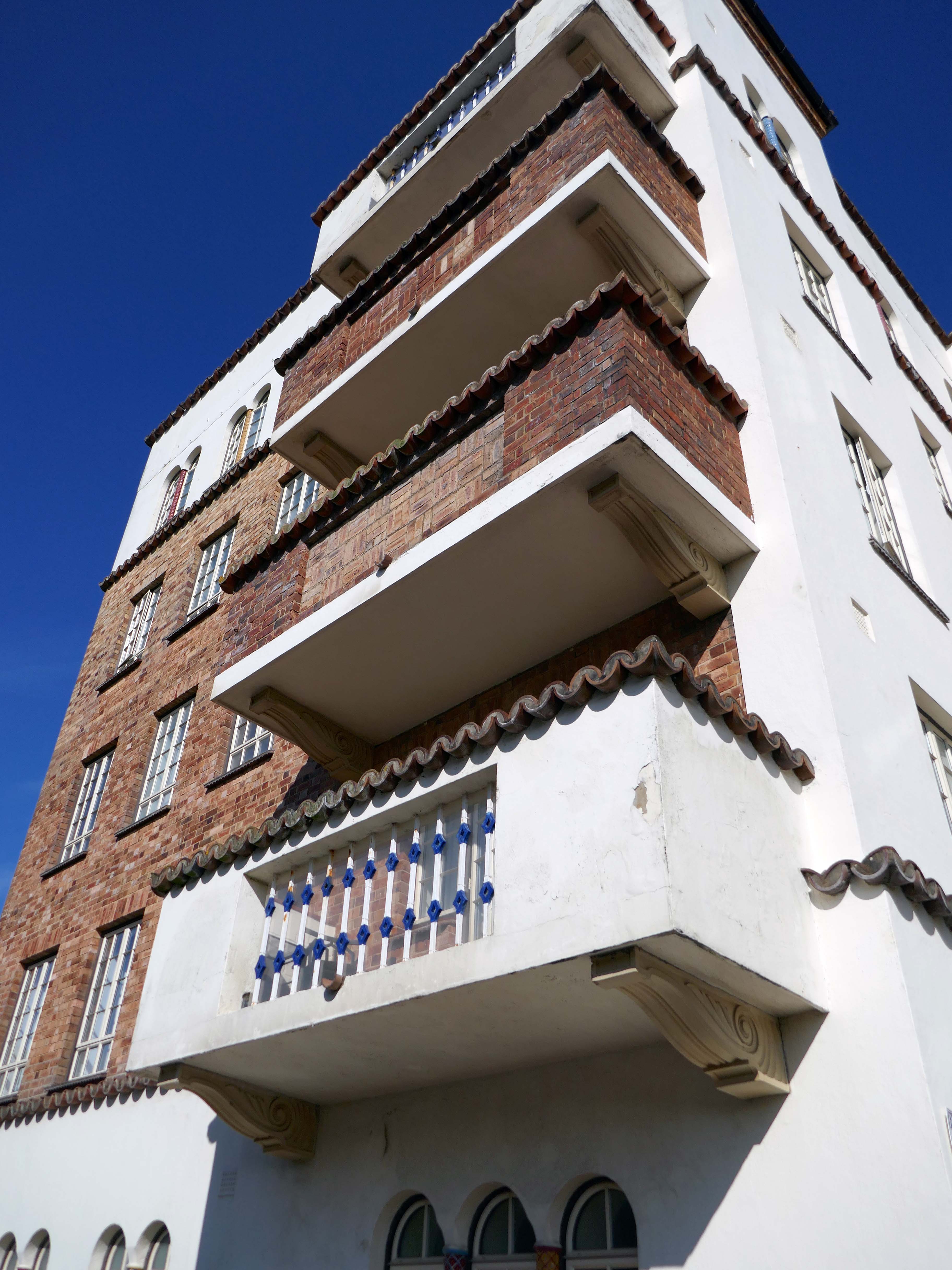
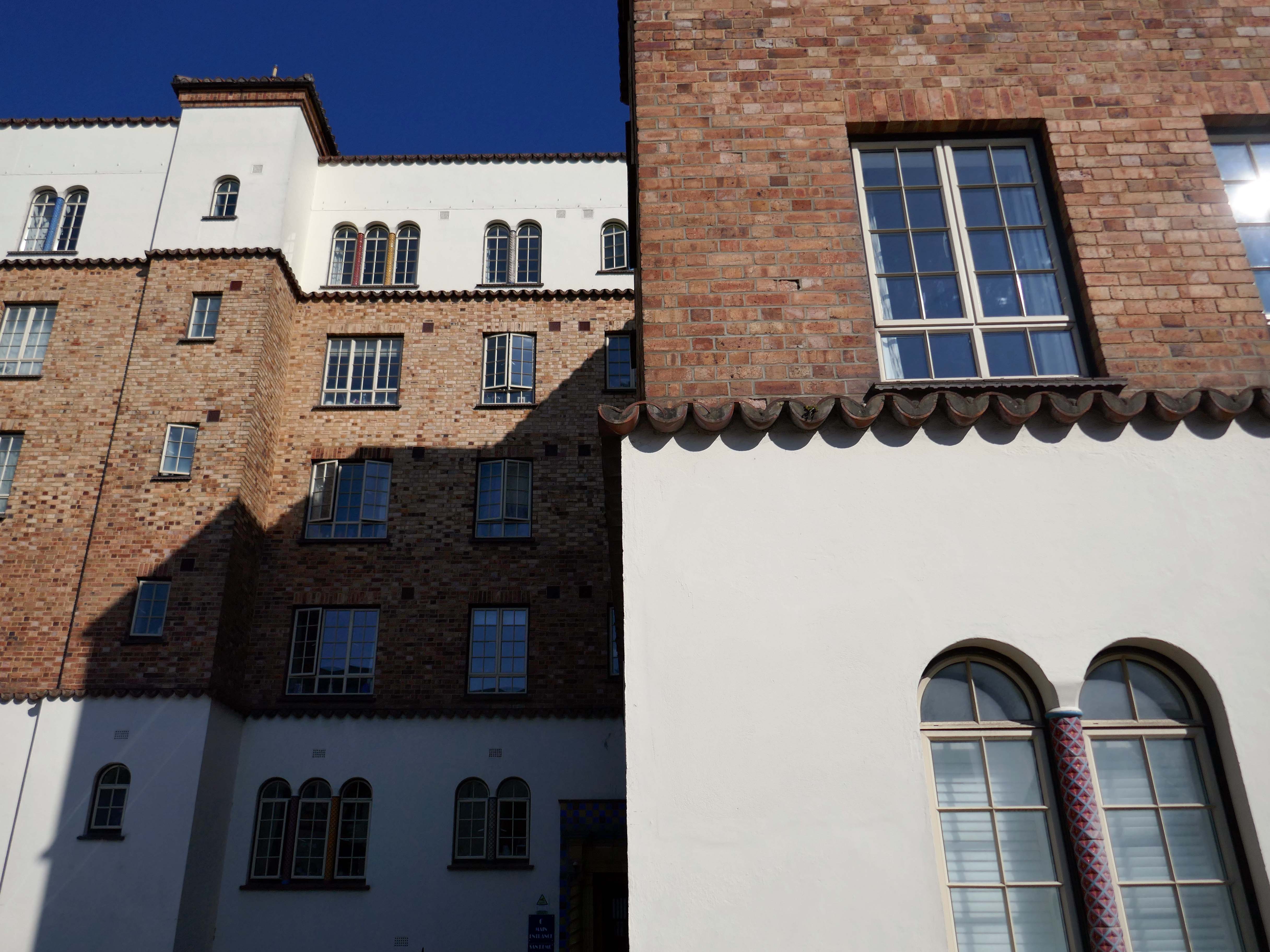
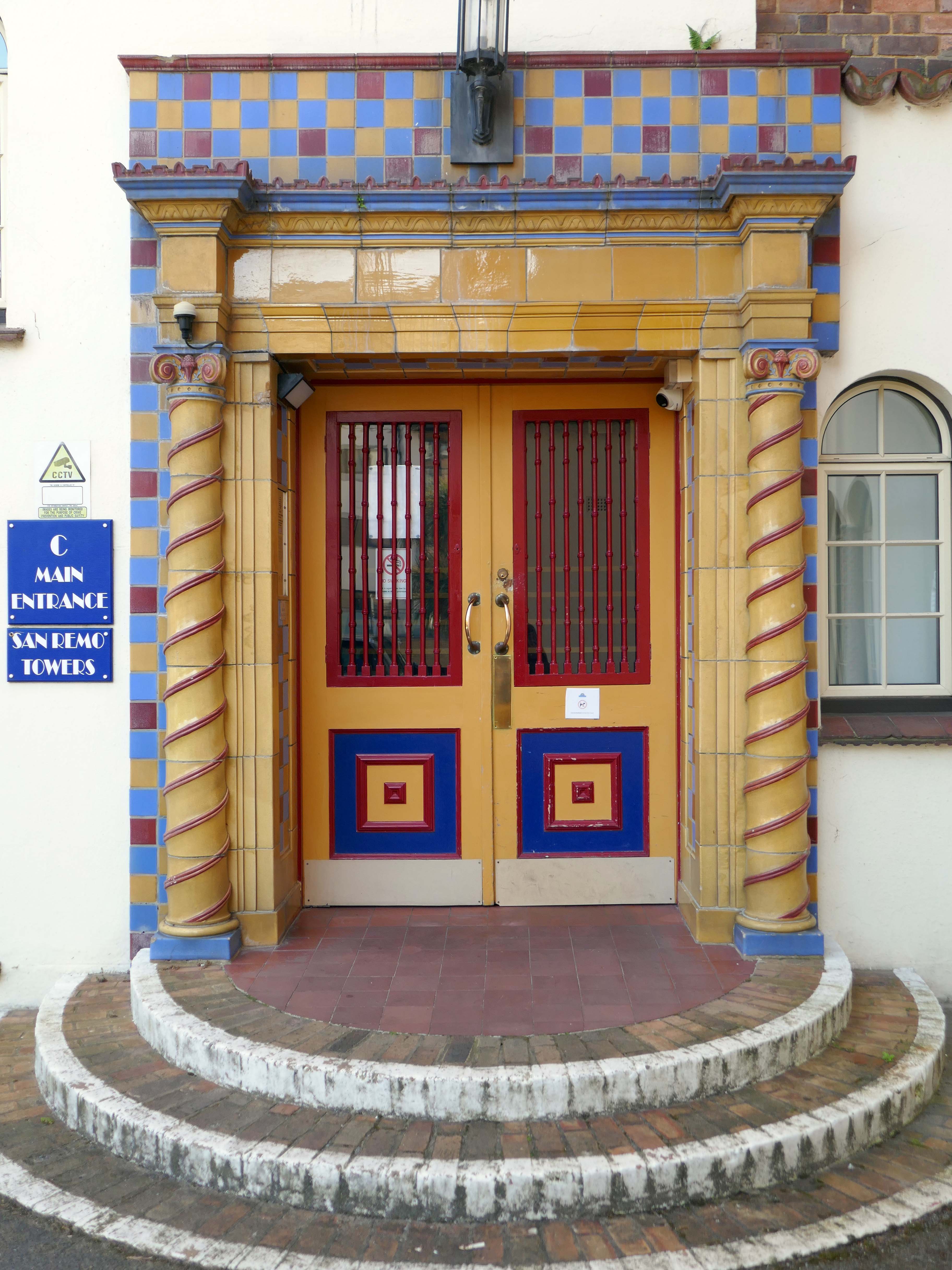
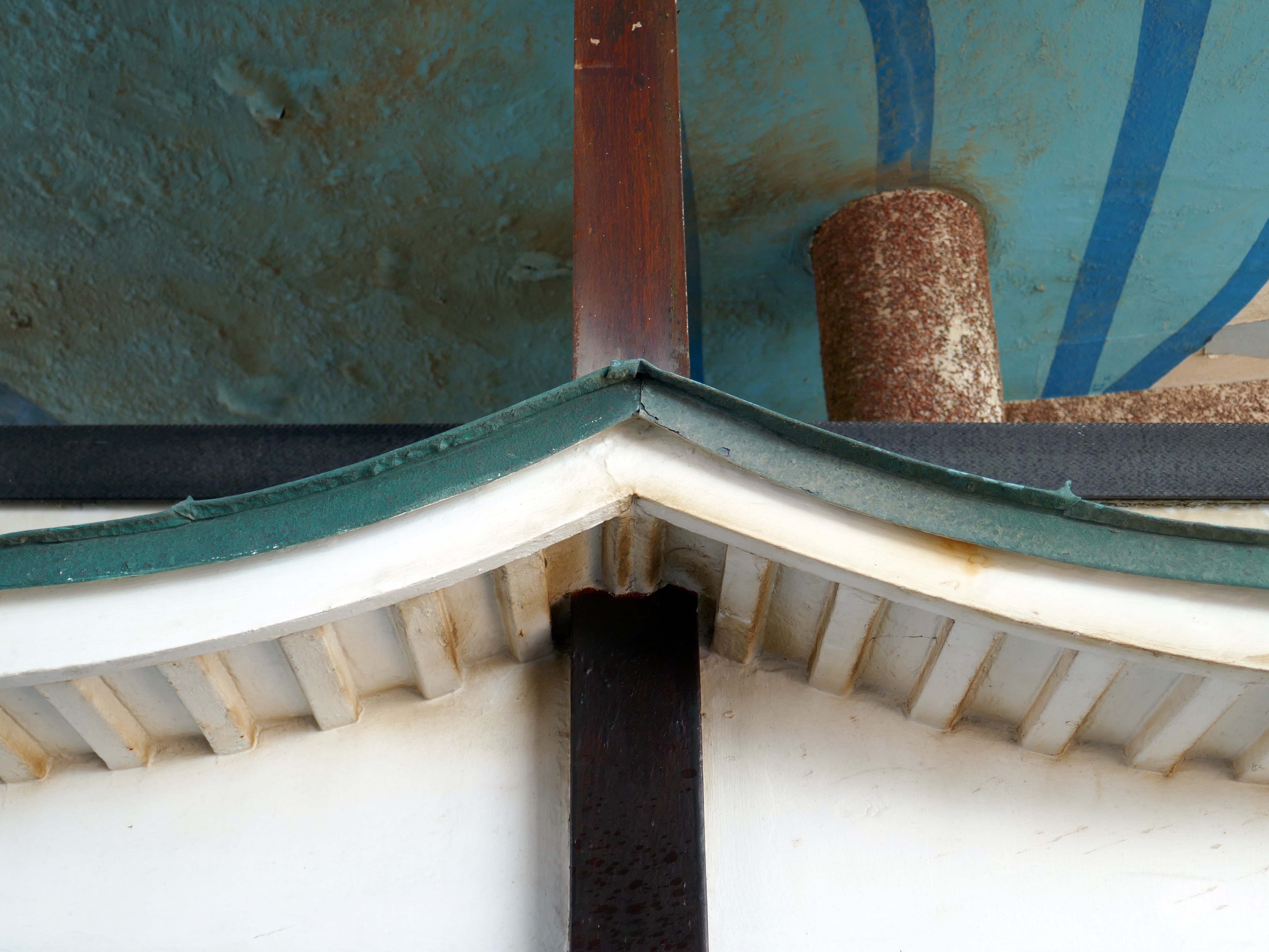
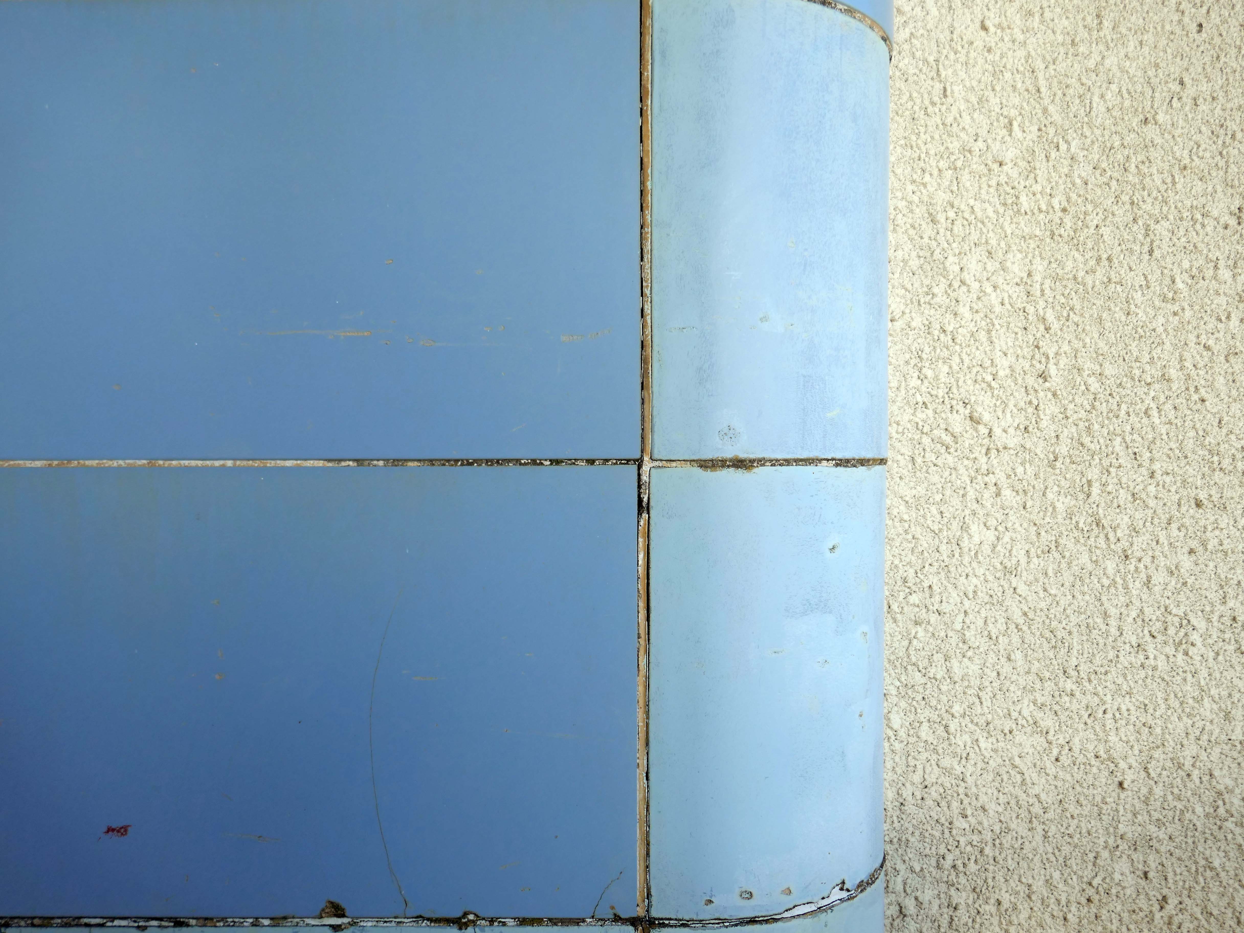
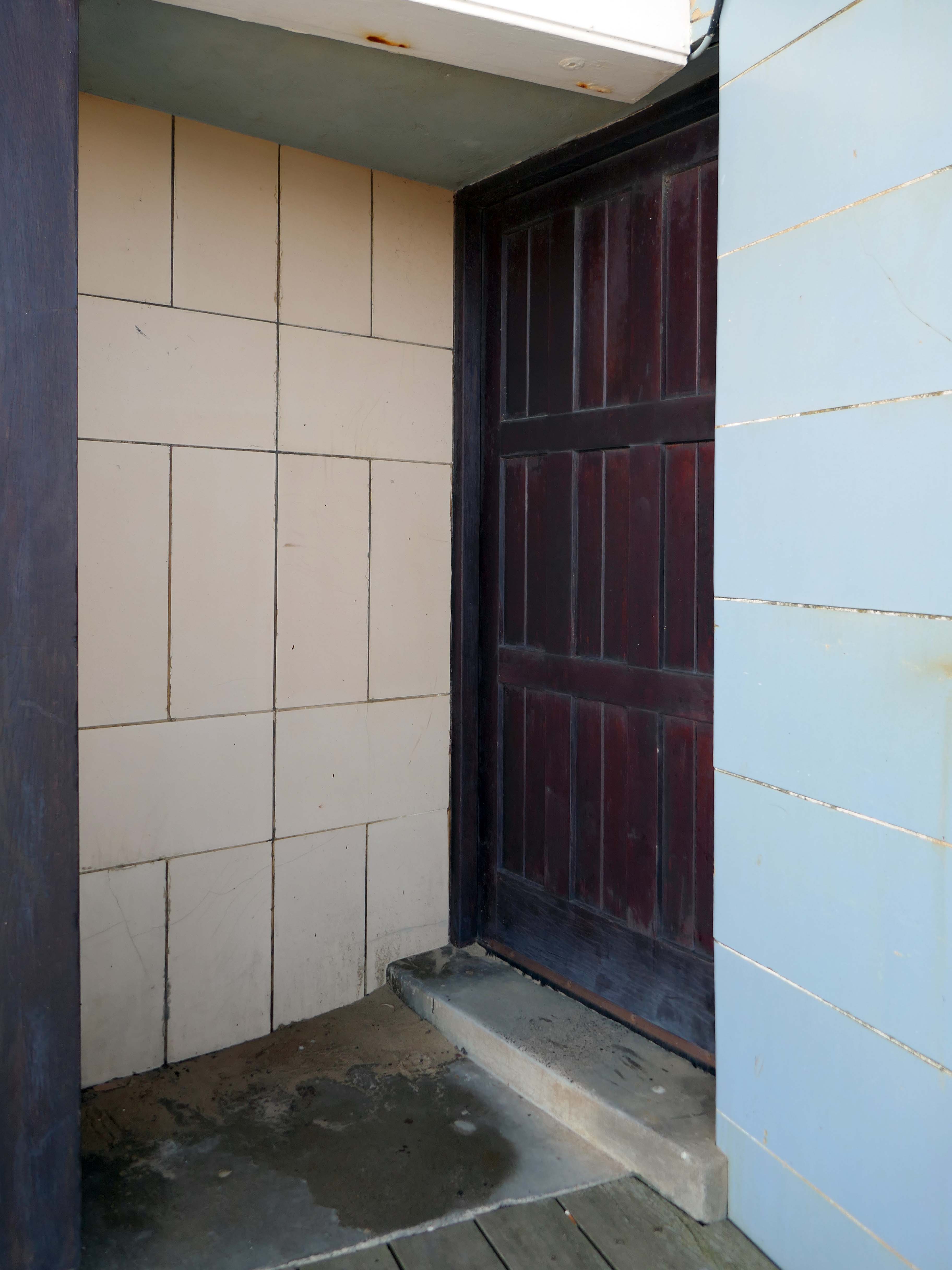
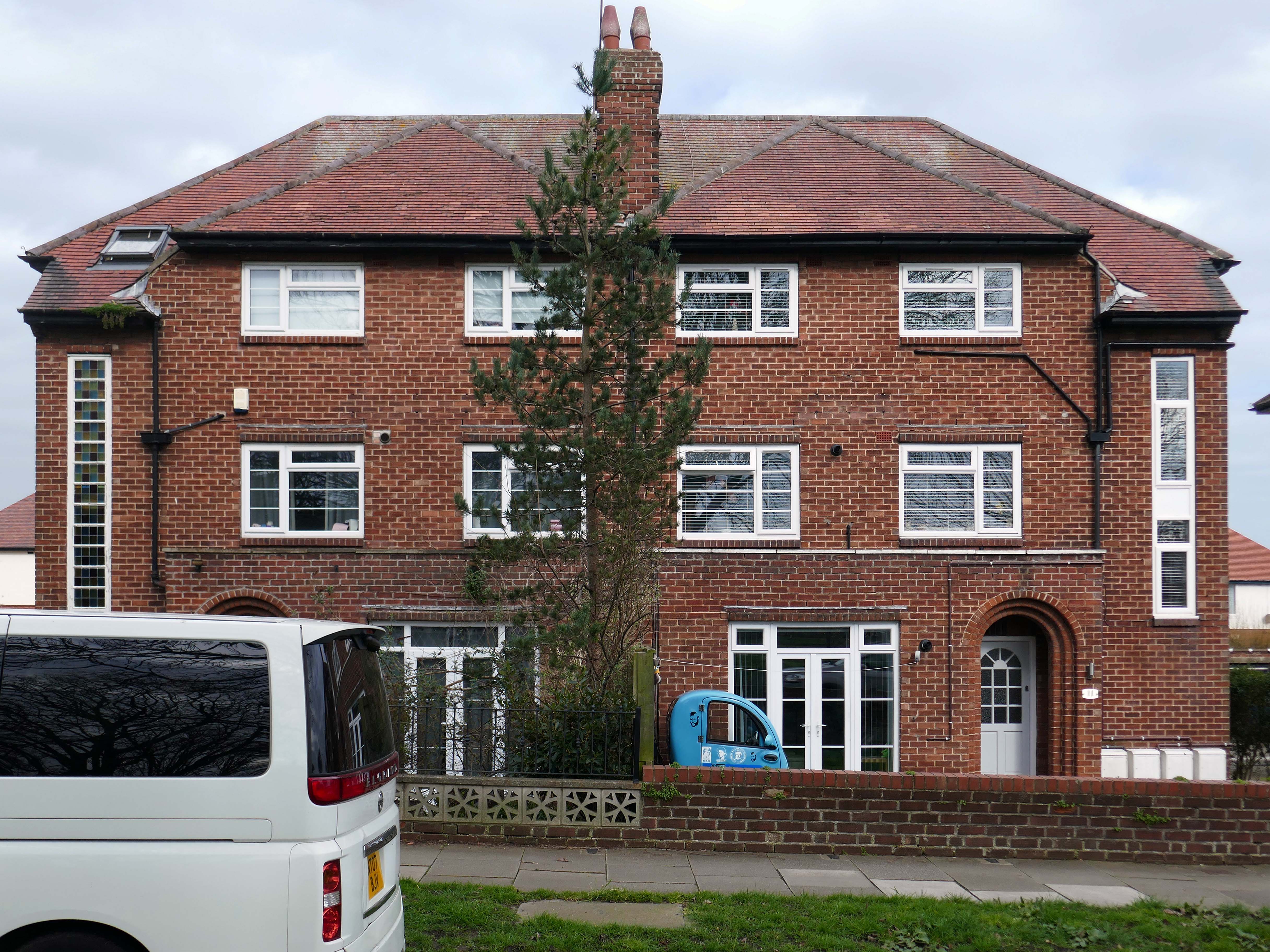
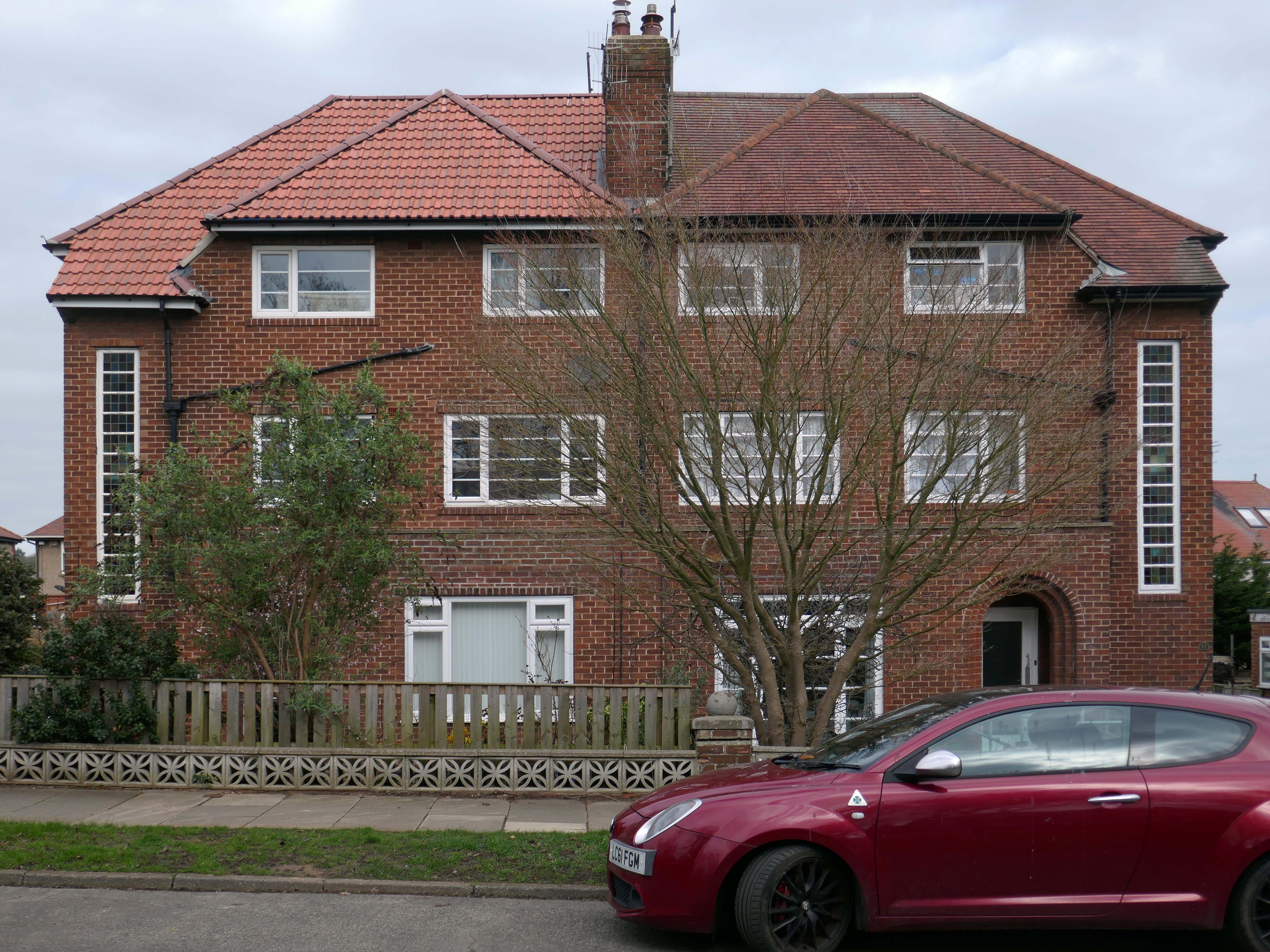
Block of 164 flats, with penthouse and office, over basement garage. 1935-8 by Hector O Hamilton. Pale brick, with areas of render, particularly to ground and upper floors, faience tiling, and concrete floors. Flat roof behind high parapets edged with pantiles, and with pantiled roofs over staircase towers and over penthouse. Single stack serving boiler house. U-shaped plan around central courtyard, set over garage.
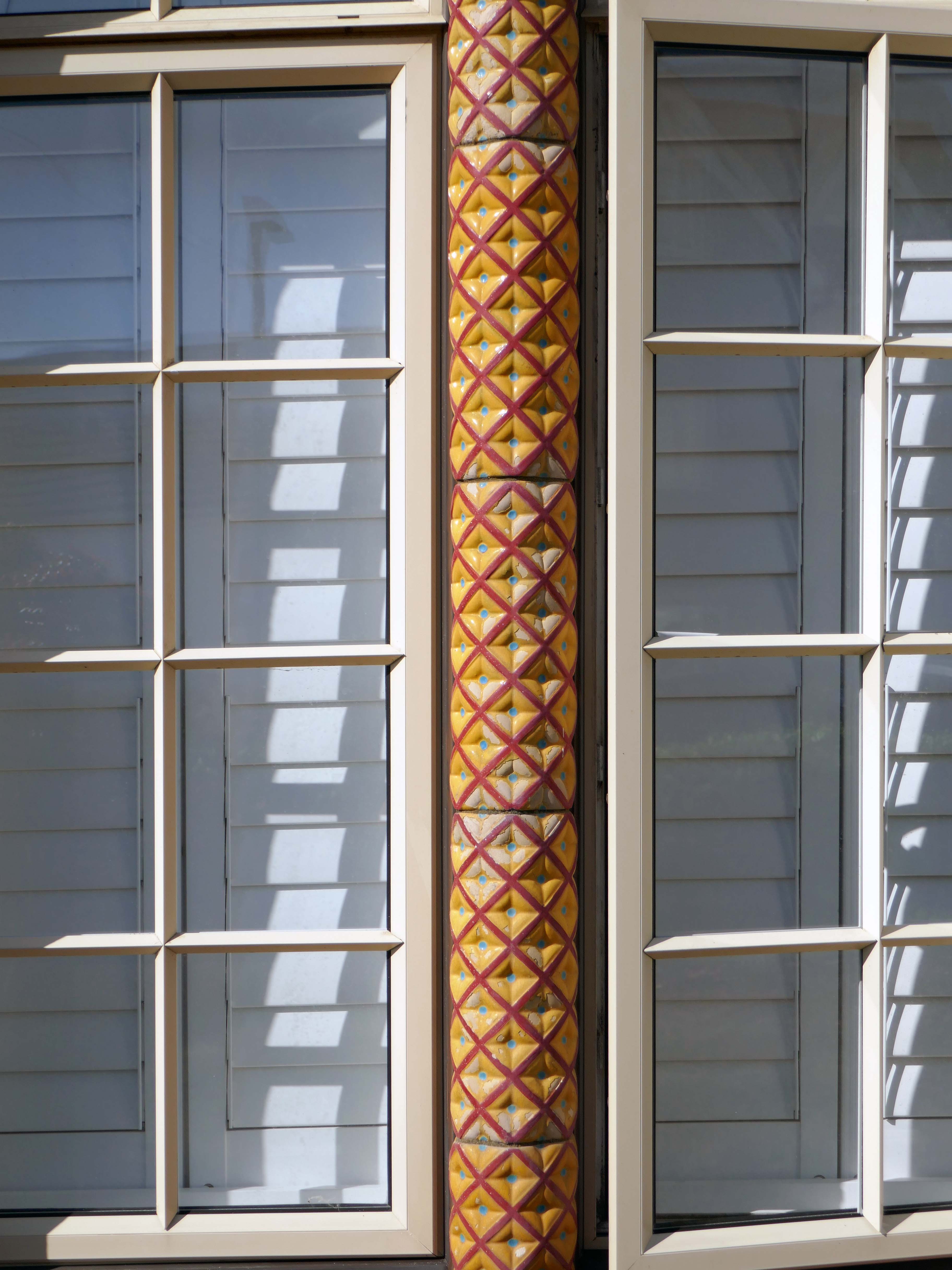
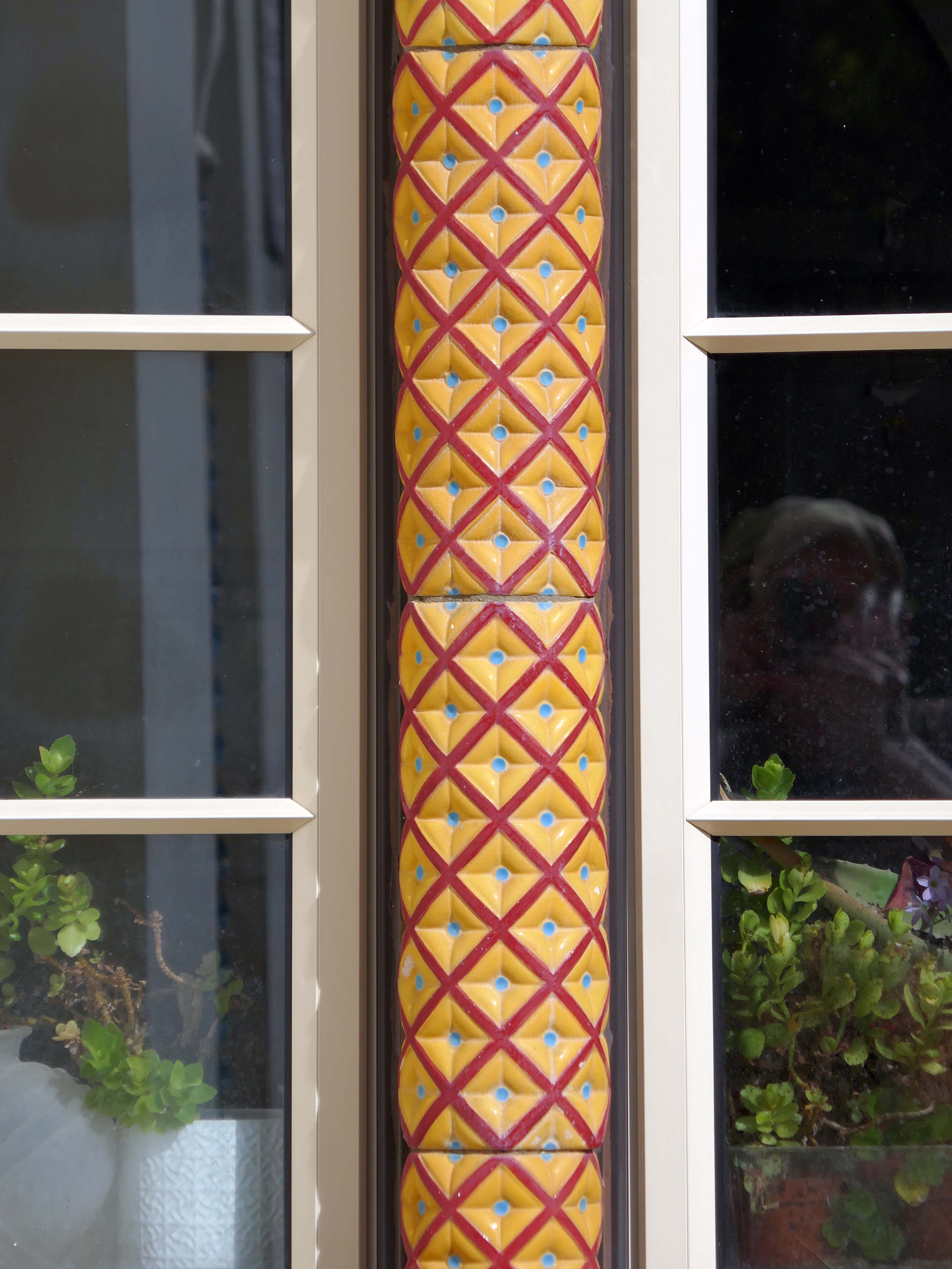
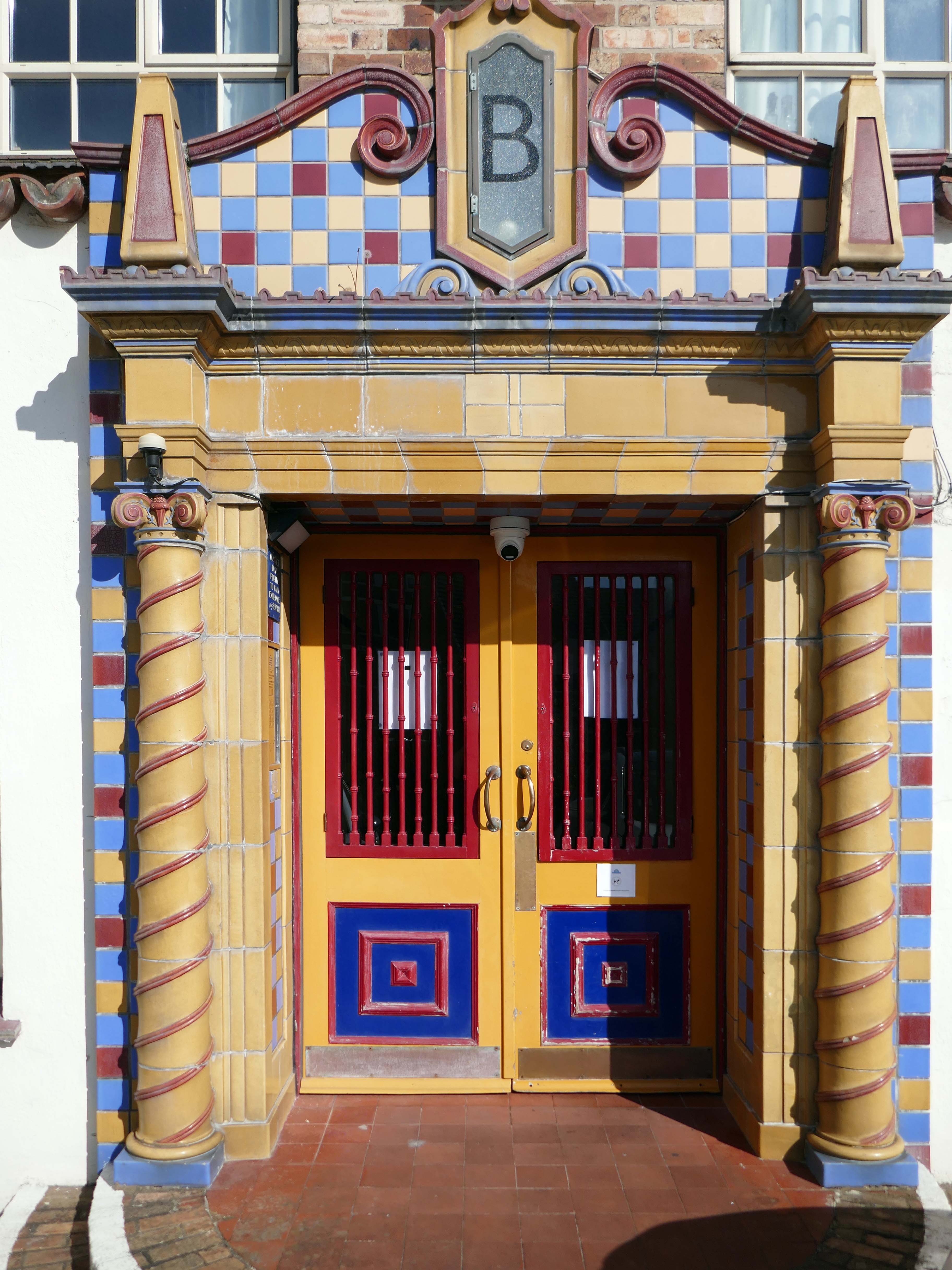
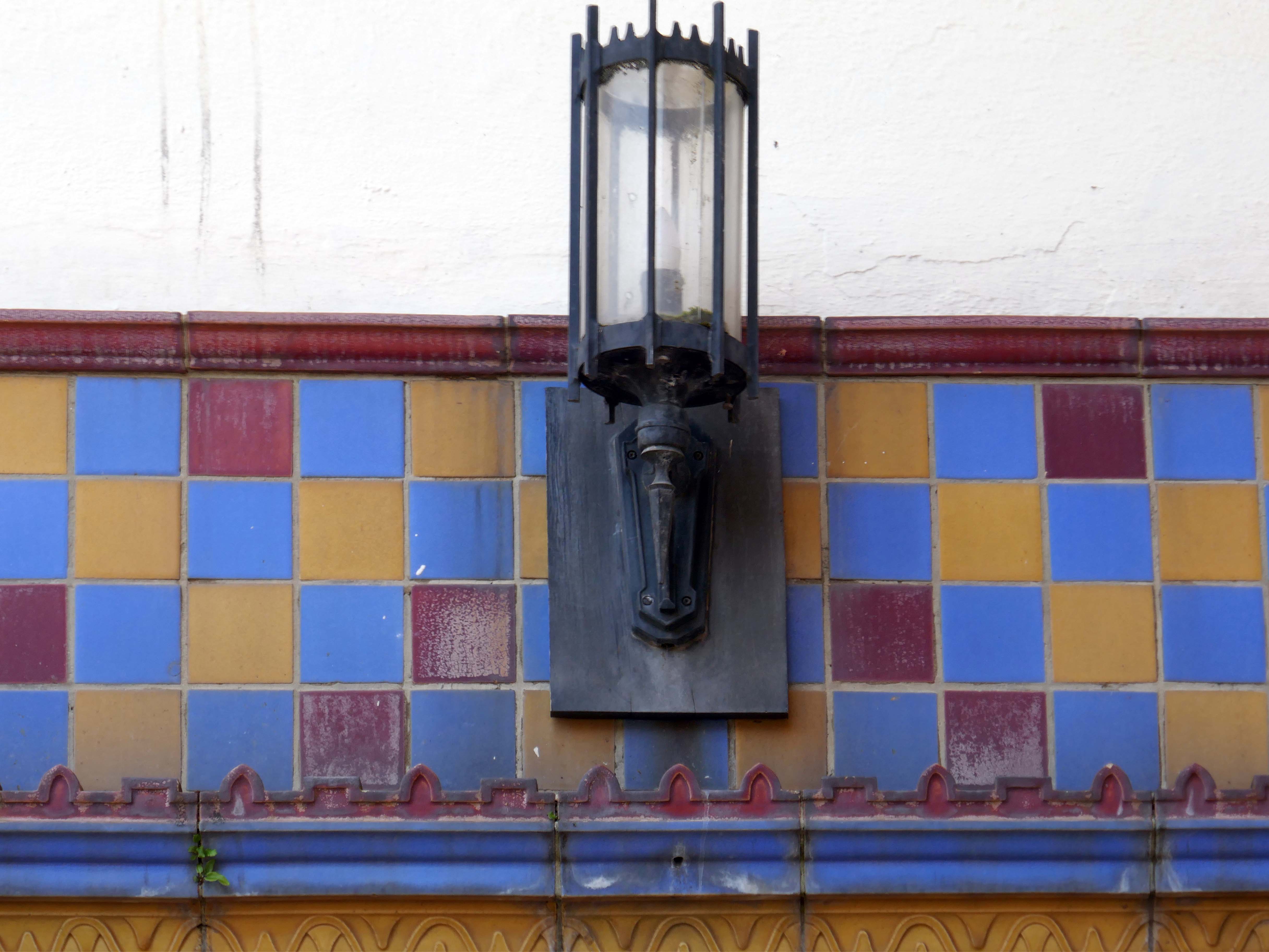
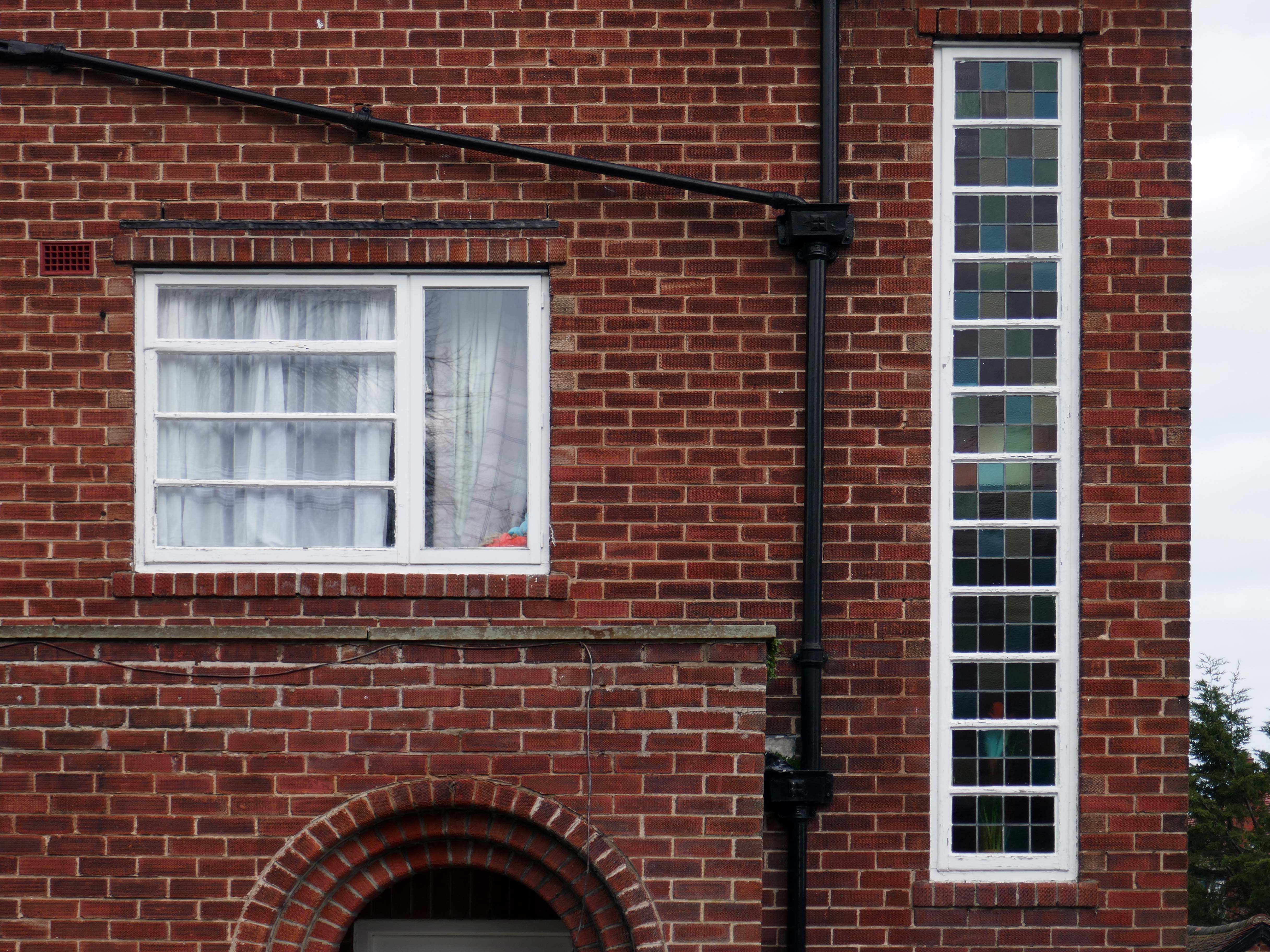
The flats, on five floors, are set in five blocks, with corridor access via separate residents and trade stairs and lift from each of six entrance doors – the central block C is served by the main entrance as well as its own. Through access between blocks on ground floor only. The estate office projects on the ground floor of Block C. The exterior is in a delightful Spanish mission style, with extensive use of coloured faience around doors and in window jambs. Metal casement windows with small panes, round-arched to ground and fifth floor, where coloured jambs predominate. Projecting balconies of brick and render to the larger flats, with coloured balustrades and supported on console brackets. Glass rooflights to the basement car park. The six entrances with double panelled doors, set in lively decorated surrounds of brightly coloured faience, with barley sugar engaged columns under Ionic capitals and block designation – A-E, main entrance, in faience lettering. French doors with small panes to courtyard. Attached brick retaining walls at entrance to courtyard.
Interiors: The residents’ staircases with jazz modern metal balustrading, those for tradesmen with stick balusters. Interiors of flats not inspected but understood to have been modernised. San Remo Towers is one of the most comprehensive seaside developments of flats to be erected in the 1930s. It was planned as early as 1935-6 by Armstrong Estates Limited of Guildford. It was opened on 1 June 1938 as ‘a magnificent block of 164 superior flats, 296-260 per annum rental, garage for 130 cars’. Facilities offered as inclusive in this price included centralised hot water and central heating, an auto vac’ cleaning system, centralised telephones, a resident manager, a porter, daily maid, boot cleaning and window cleaning services. There was a Residents’ club with a reading room card room, billiard room and library, and a children’s recreation and games room. There were kiosks in the ground-floor lobbies selling tobacco and convenience items, where the staff took orders for the local tradesmen. The fifth-floor restaurant offered a la carte meals, which could be taken at pension rates of 38s per week. A simpler dinner cost 2/6d.
Restaurant Crockery 1940
The use of an American architect, Hector O Hamilton, may be an explanation for the building’s large range of facilities, including the grand underground car park and sophisticated servicing. The residents’ club was converted to a penthouse in the 1950s, but the block retains its select tone. The elevations were described in 1940 as dignified and select and harmonise with the general surroundings. Today they are admired as for the very striking way in which they stand out from their surroundings as a piece of 19305′ exotic fantasy transported to seemly Bournemouth.
San Remo Towers is one of the most impressive seaside developments in England of its period. Source: Waycotts, San Remo Towers, 1940 letting brochure.
First seen in 2015 on my South Coast cycling tour, today I was on foot with time to wander around San Remo Towers.
For me it is the most charming and capricious of seaside apartment blocks – a playful symphony of faience and fancy. An exotic dose of Californian Hispanic on the Dorset coast.
Today, most of the flats have been refurbished and sold to independent buyers. In 2019, the lessees worked together to buy the building and it is now owned by San Remo Towers SRT Freehold Ltd. Not all the flats have share of freehold yet, but the option is available for any lessee who wishes to join.
Hector O. Hamilton, young New York architect, who won a share in the first prize with his design for the projected Palace of the Soviets in Moscow, announced yesterday that he would sail for Russia in a month at the invitation of the Soviet Government to aid in the construction of the building. Although persons familiar with Russia have warned that he would be paid in rubles and probably not be permitted to take the $6,000-his share in the prize money-out of the country, Americans who have worked there point out that it is the policy of the Soviet Government to pay technical men from this country in dollars. They say also that while it is against the law to take rubles out of the country this law does not apply to foreign currency.
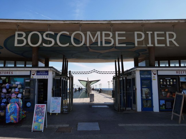
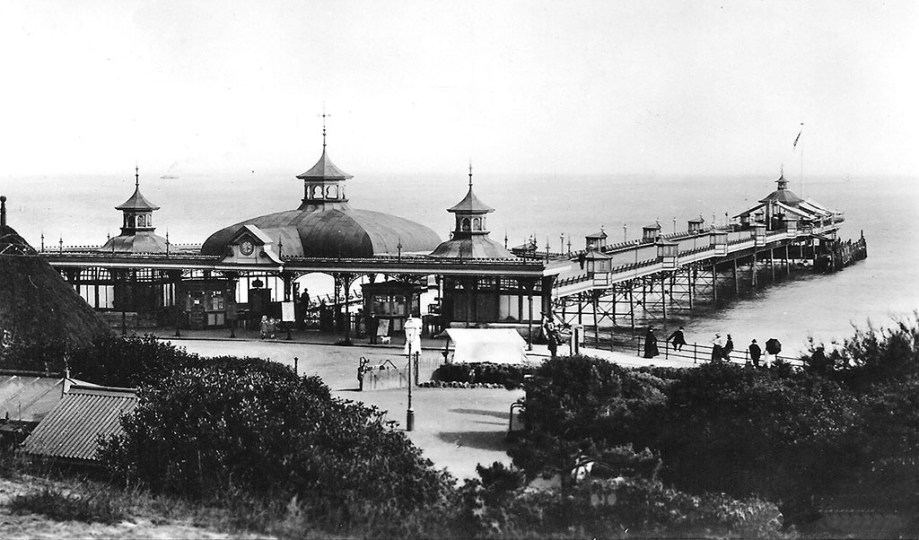
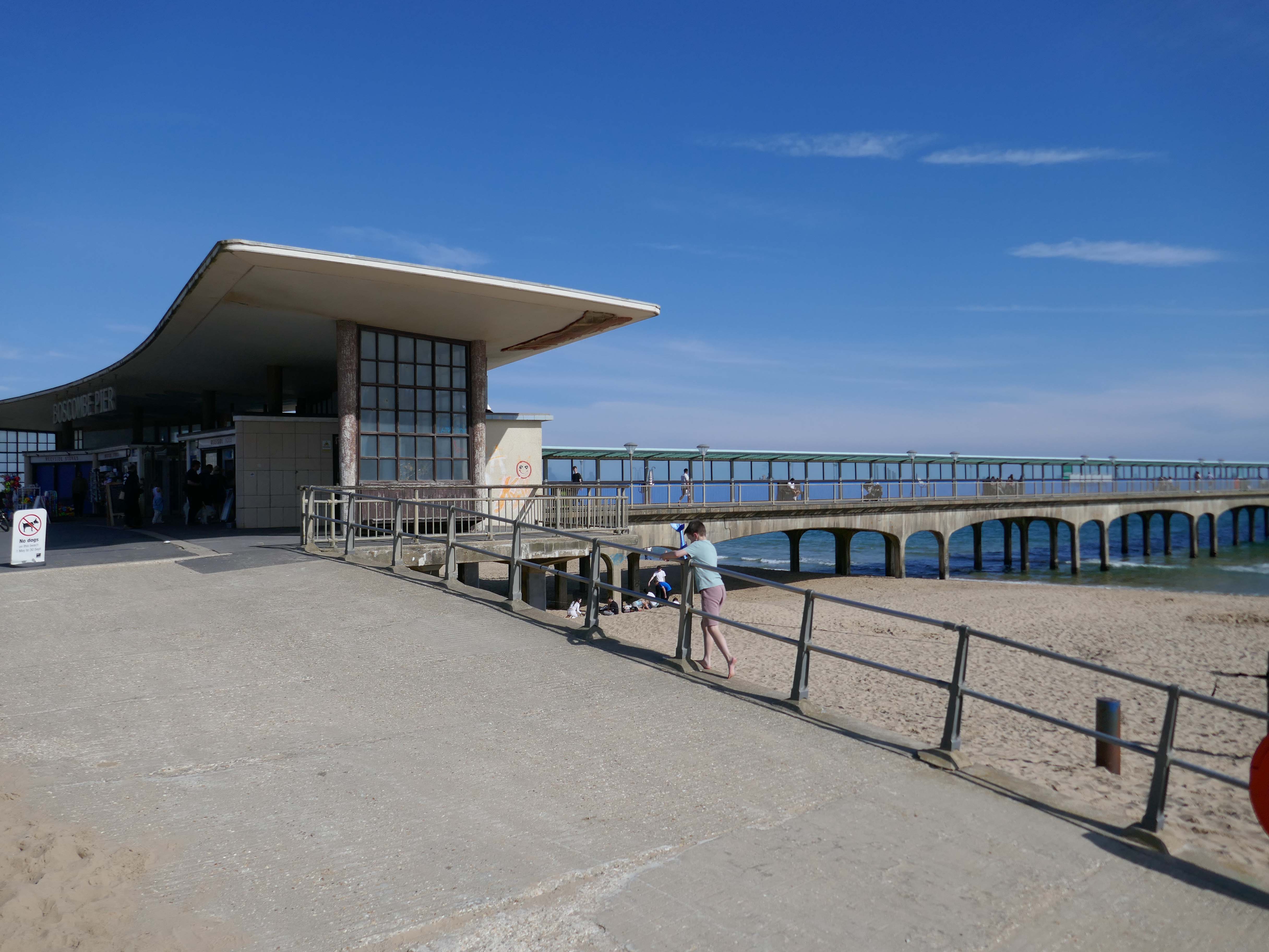
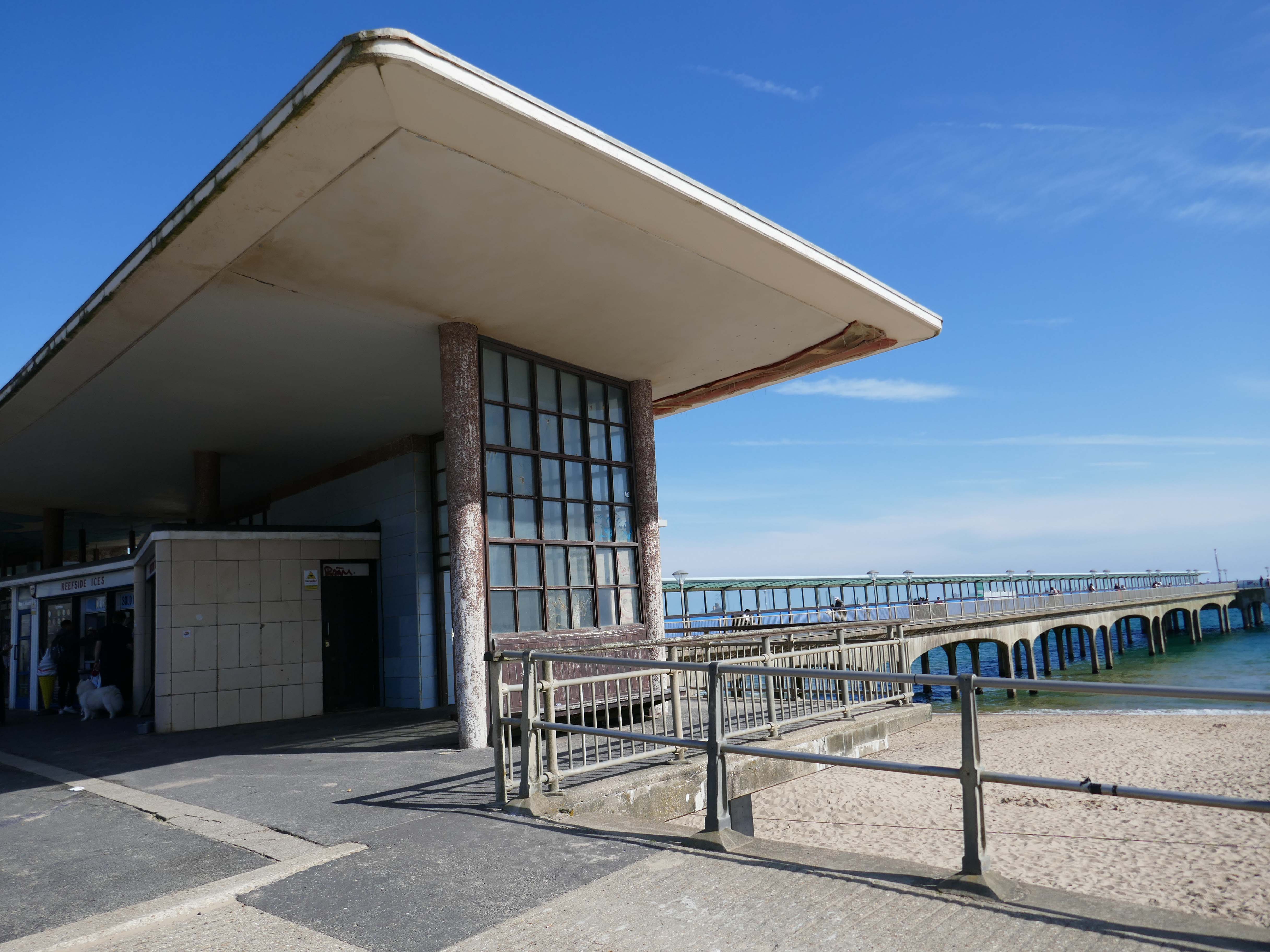
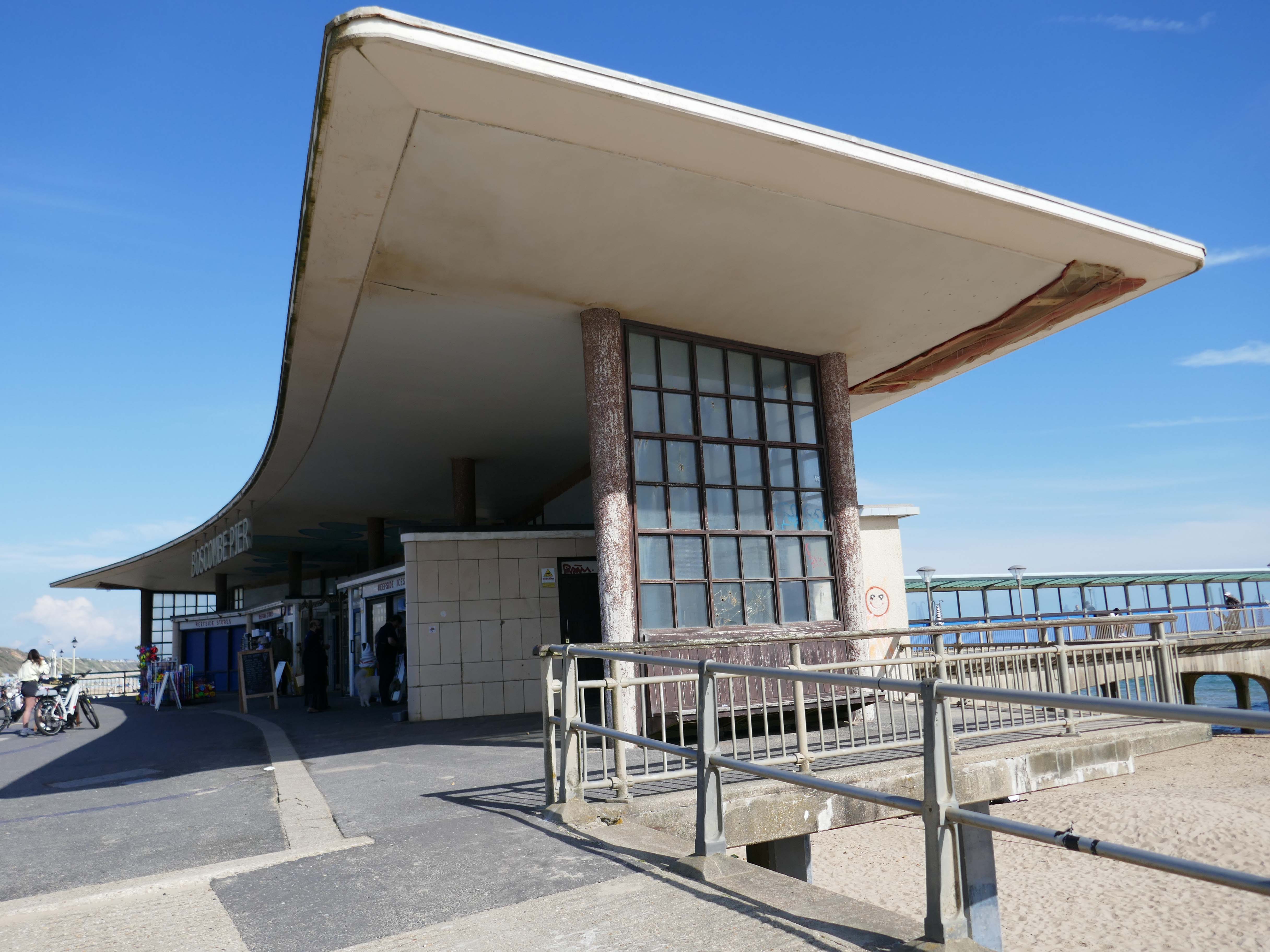
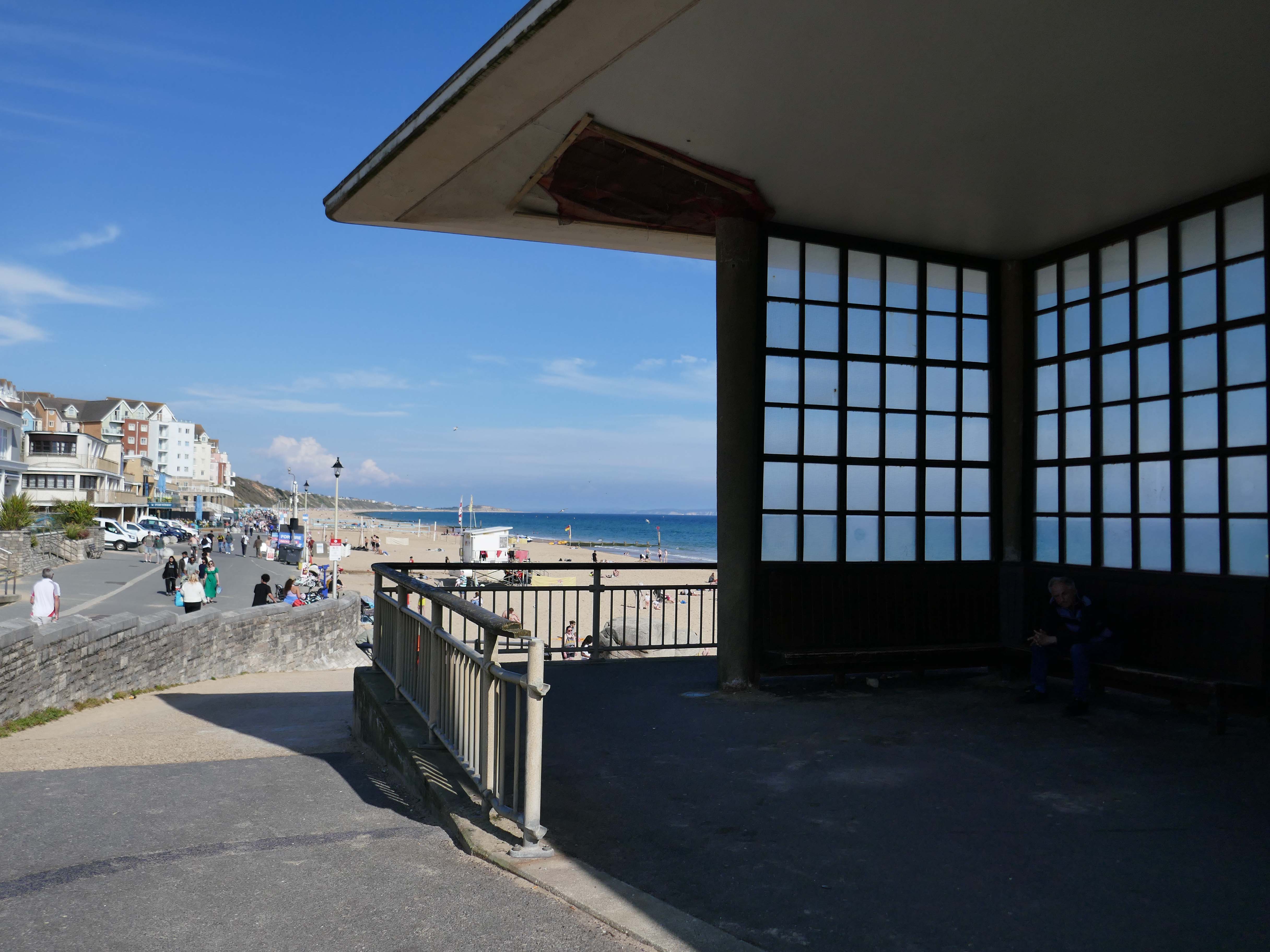
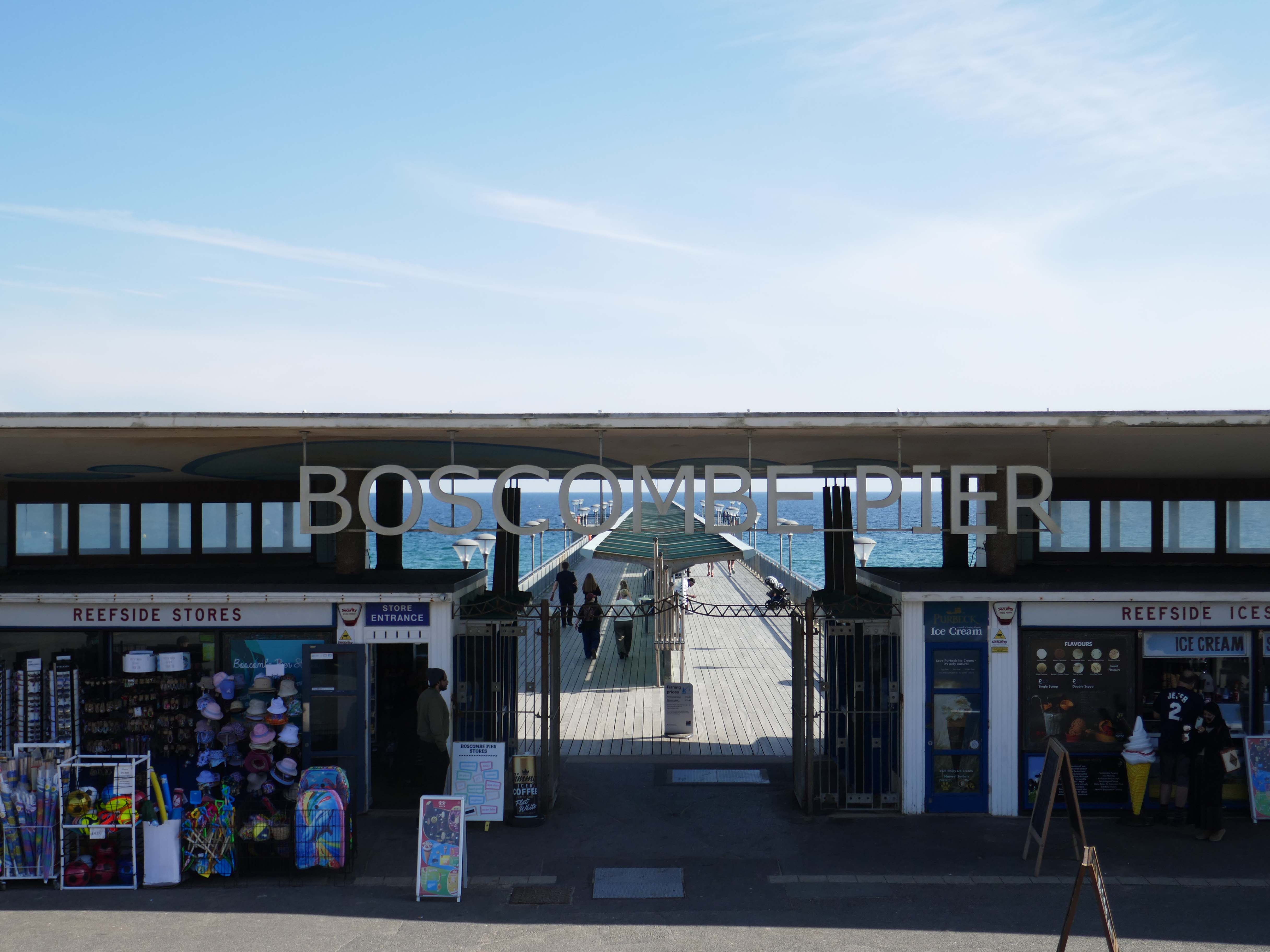
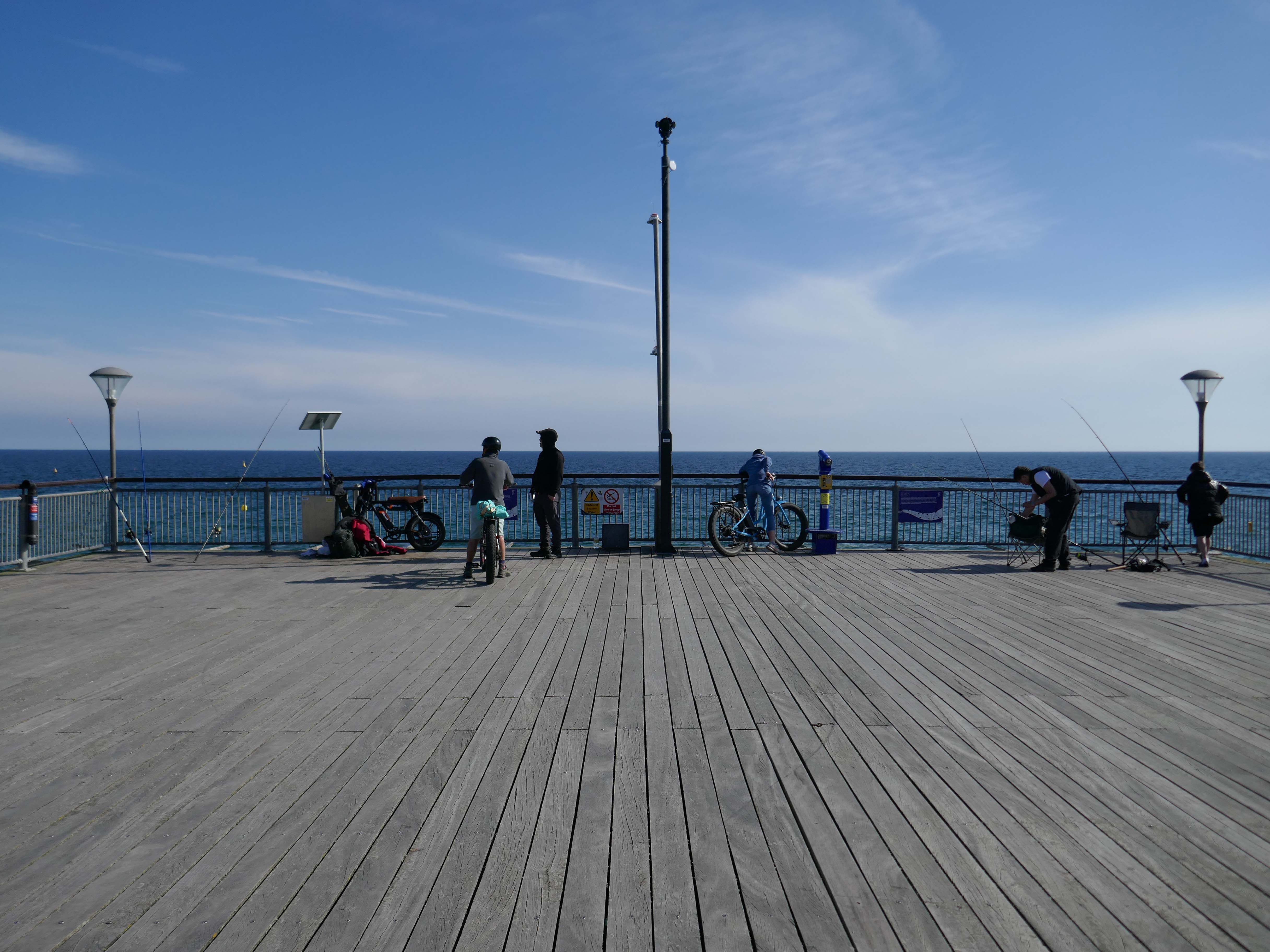
The Boscombe Pier Company was formed in 1886 and the first pile was laid on 11th October 1888. Designed by Archibald Smith, the 600 foot pier opened on 28th July 1889.
The local council took over the pier in 1904 and erected buildings at the entrance and on the pier-head. Facilities included a busy steamer landing stage.
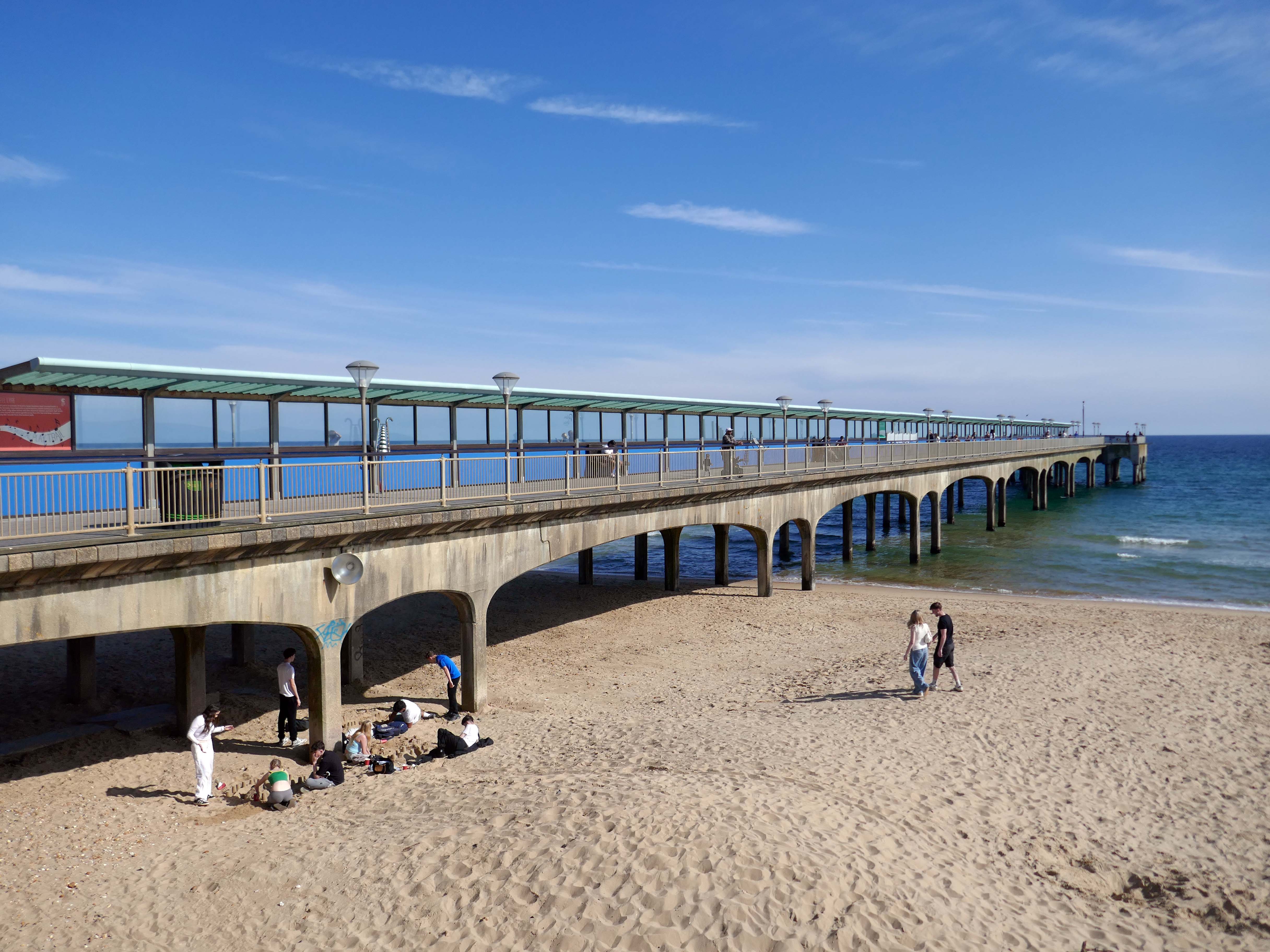
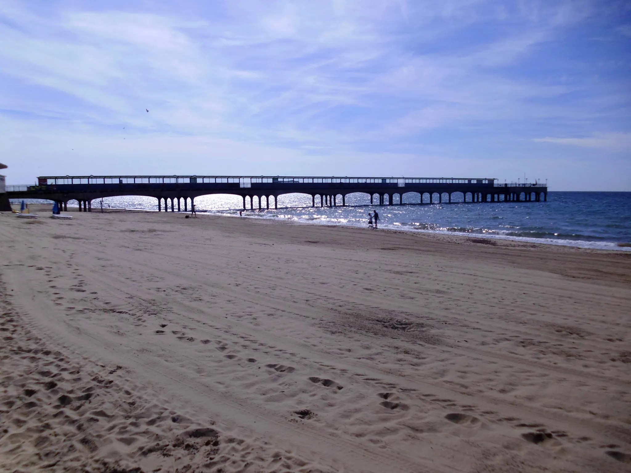
In 1924/5 and 1927, the head was renewed in high alumina concrete. Between 1958 and 1960, the neck was reconstructed using reinforced concrete. In 1940, the pier was breached for defence reasons.
Between 1958 and 1960, the neck was reconstructed using reinforced concrete.
A restaurant and the Mermaid Theatre were built at the pier-head in 1961 although the ‘Theatre’, in fact, opened as a covered roller-skating rink for its first two seasons. In April 1965, the leaseholder, Cleethorpes Amusements, converted it into an arcade. The council formally took over the Mermaid ‘Theatre’ in 1988 when the lease ended.
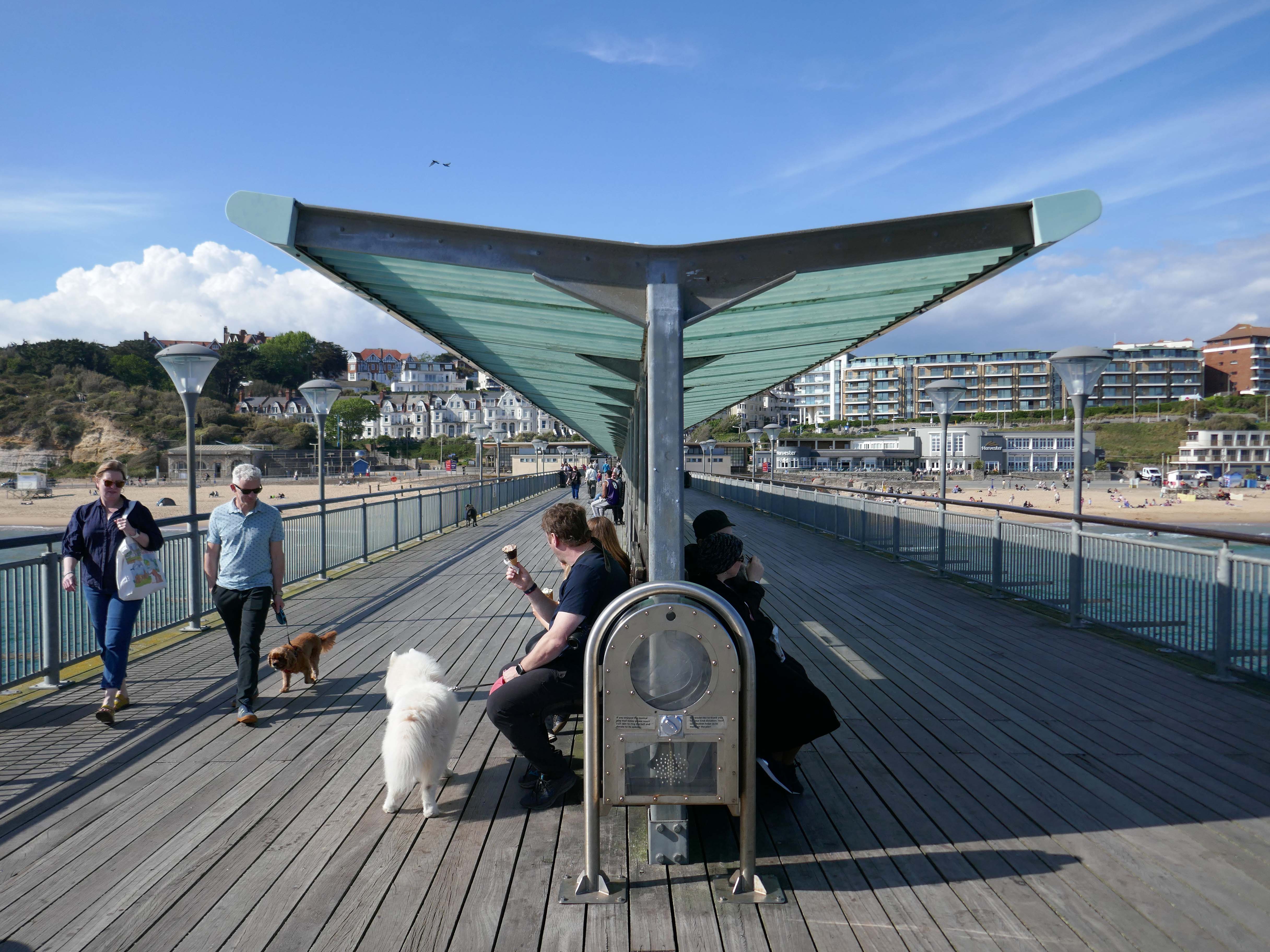
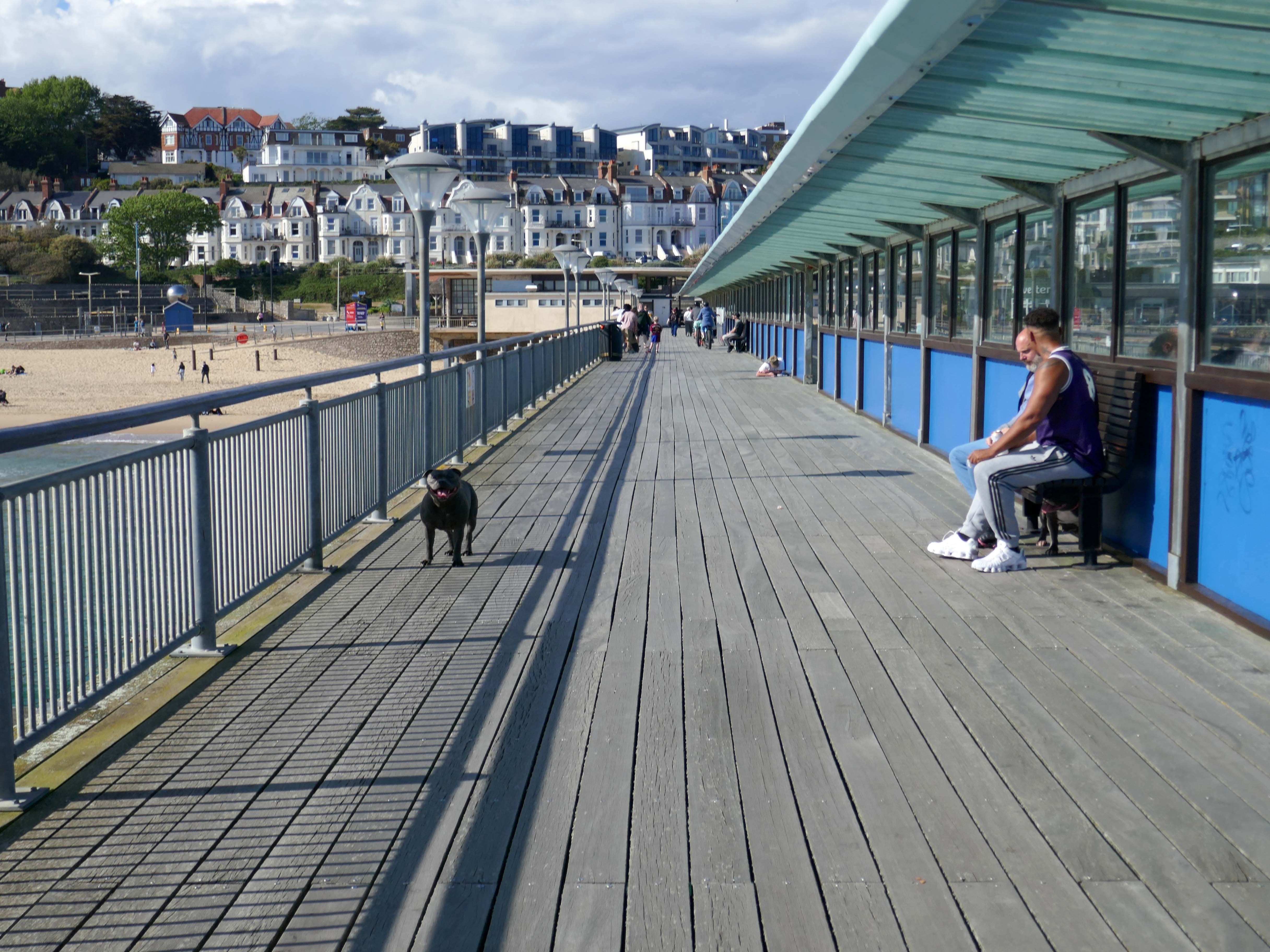
In 2008, the area around Boscombe pier underwent extensive renovation. The derelict and unsafe building at the end of the pier was demolished, and replaced by a simple viewing and fishing platform. The rest of the pier was also restored.
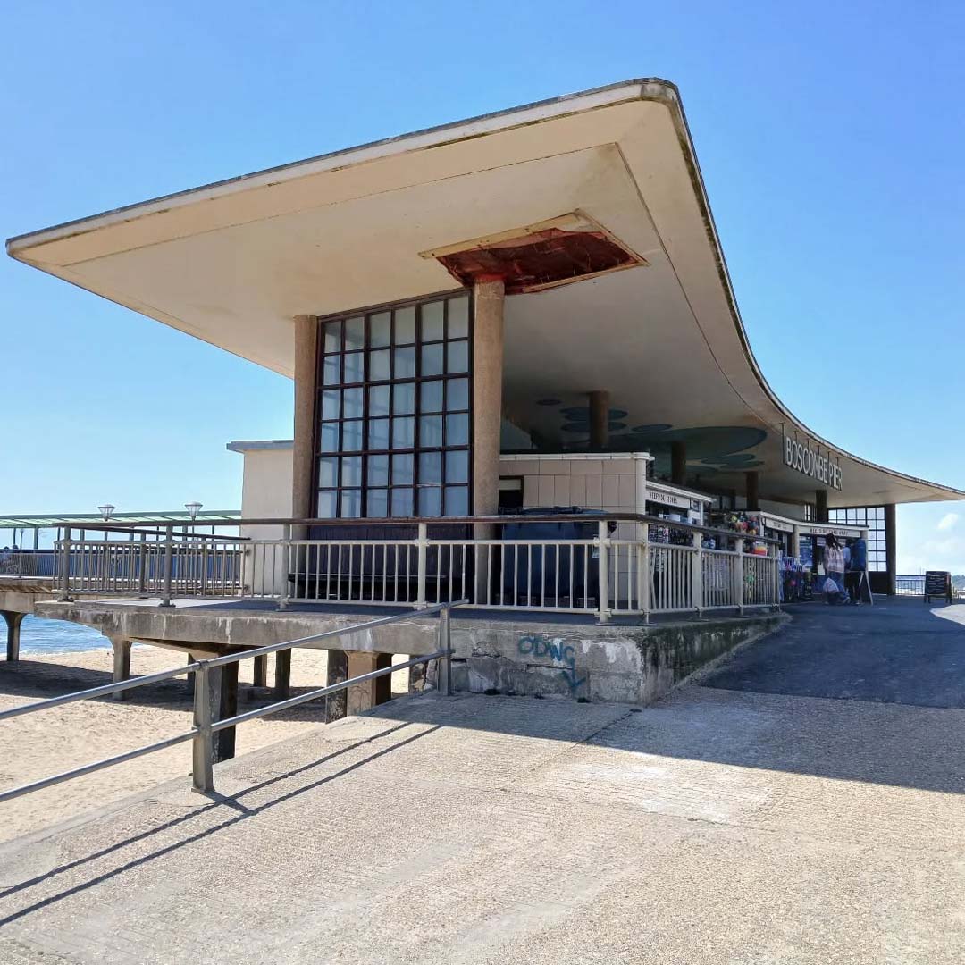
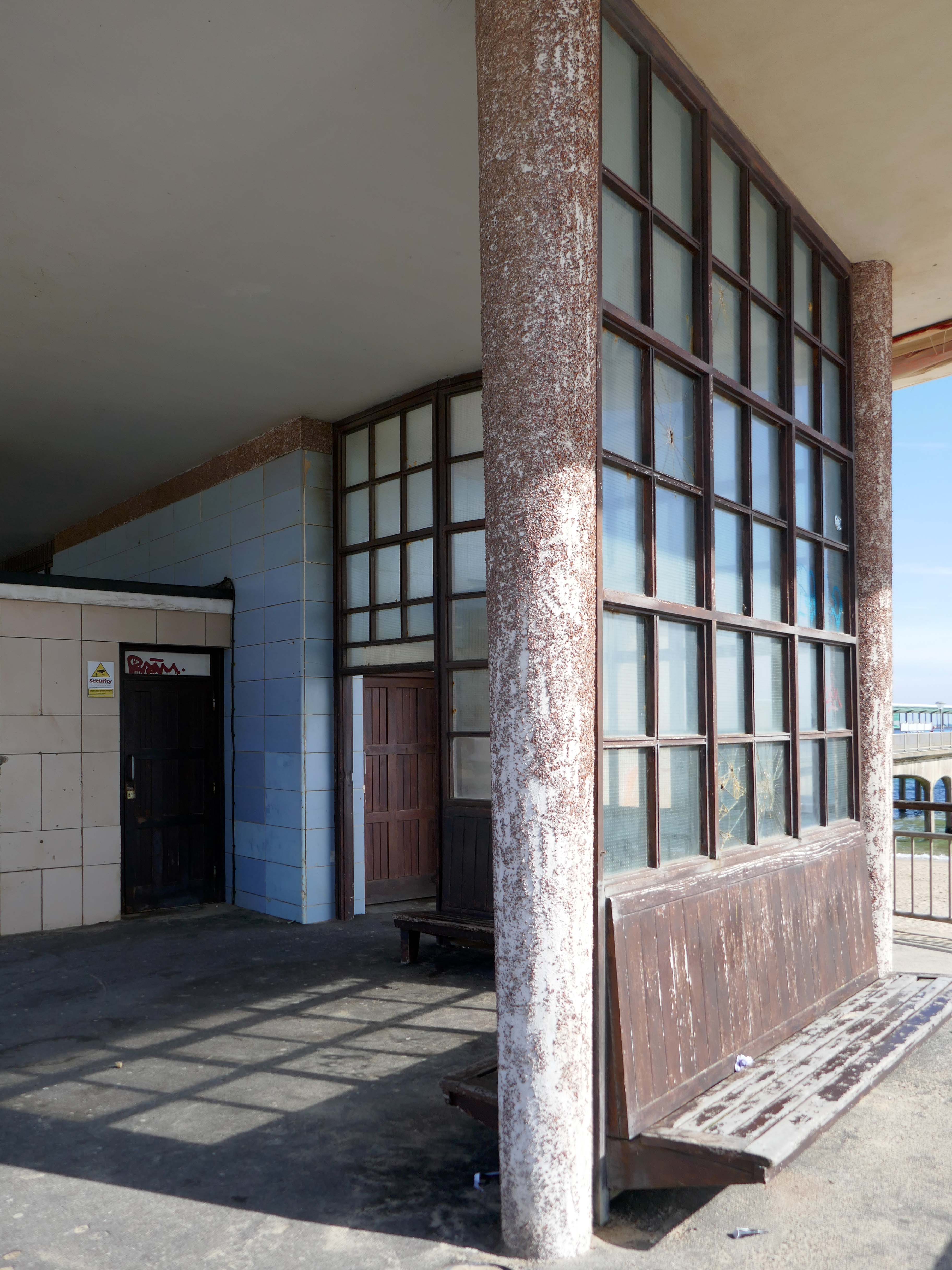
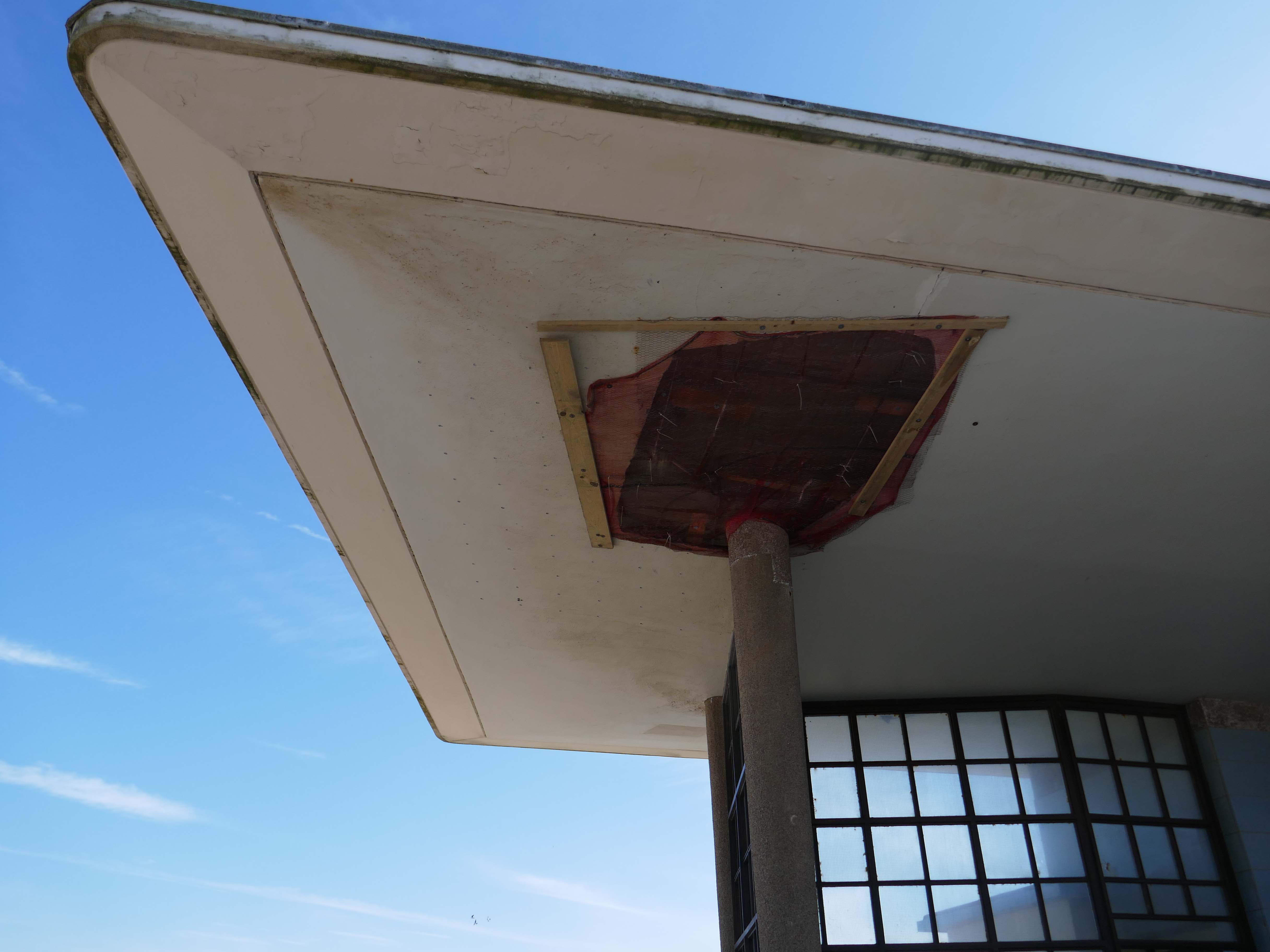
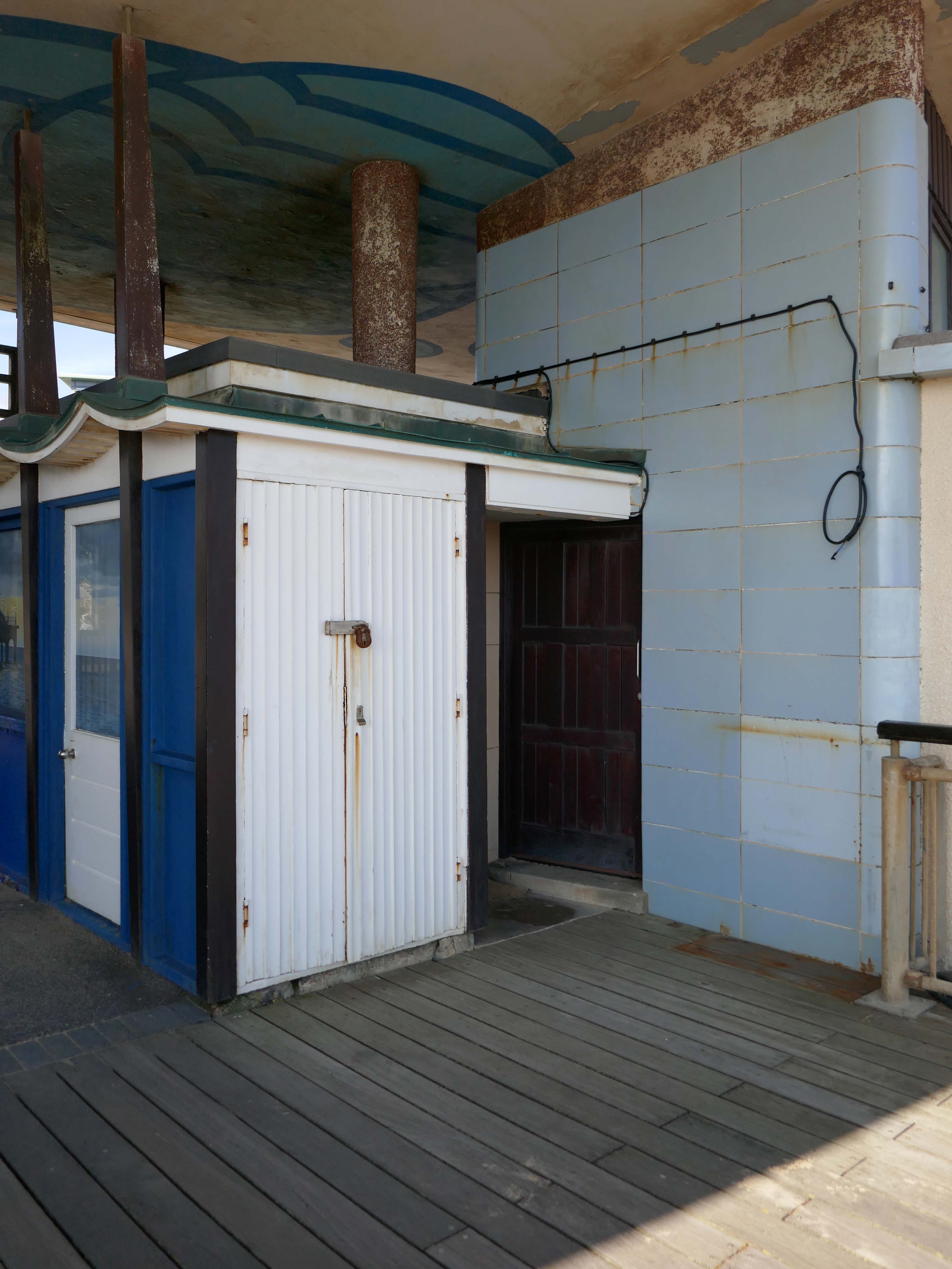
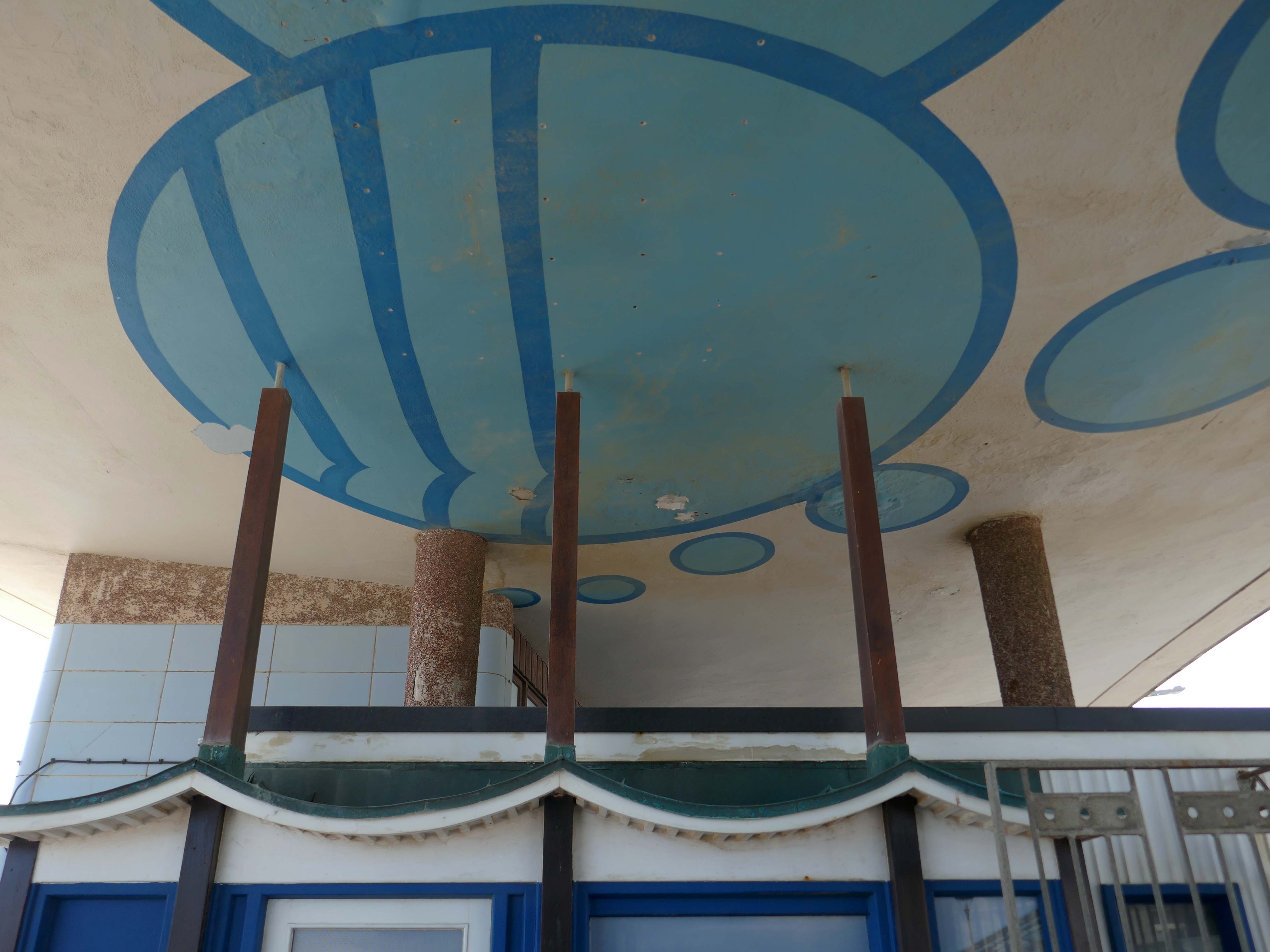
However, the neck building is a design of great verve and vivacity that well demonstrates the revitalisation of the British seaside resort in the 1950s. The contemporary style associated with Frank Lloyd Wright’s Usonian houses and made popular with Californian homes in the 1940s was well suited to the requirements of an architecture that combined ‘sun and fun’. The contemporary style made a feature of expressing different elements or planes of a composition with different materials, and here the combination is honest and each element well detailed. The sweep of the cantilevered, boomerang-shaped roof is a particularly joyous feature. It is a building that would have been despised as being exactly of its date until recently; now it is a building that can be celebrated for that very reason, and a rare example of pier architecture from these years.
Open seven days a week from 9am to 11pm – may be subject to change due to weather conditions.
Inside the Grade II listed building at the pier’s entrance, you’ll find a café, takeaway and a beach shop. Outside you can have a go on the bouldering walls and the slackline.
There’s no charge to go on Boscombe Pier, there’s also a viewing platform at the end of the pier.
The resident, who does not wish to be named, was walking along the seafront from Southbourne to Boscombe Pier on Thursday, March 17, at around 10.30am when he noticed strange objects in the sky.
He told the Echo:
“I noticed in the sky three bright, what looked like orange, lights approaching me head on from the west to the east quite low down. I thought they might be aircraft landing lights which seemed strange as it was blue sky and a sunny day.
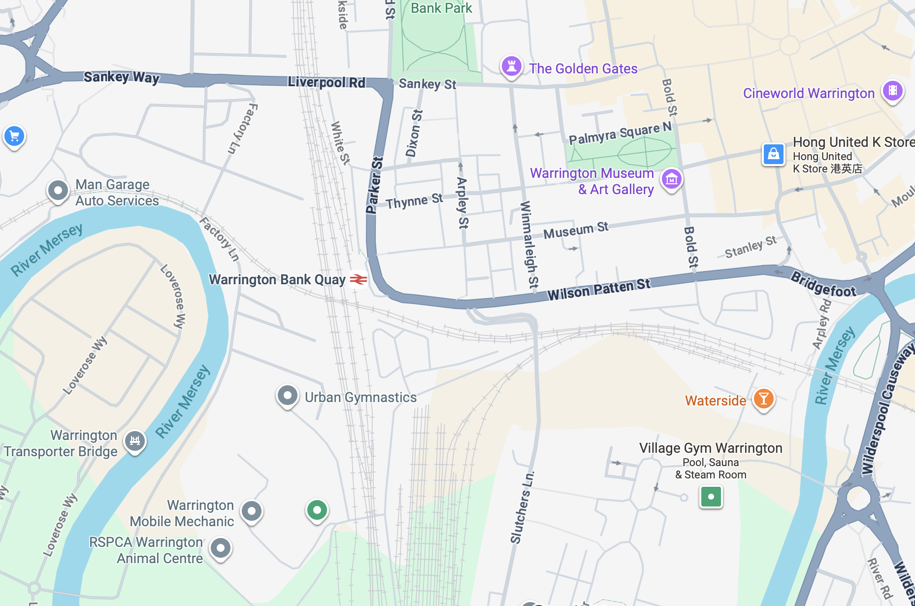
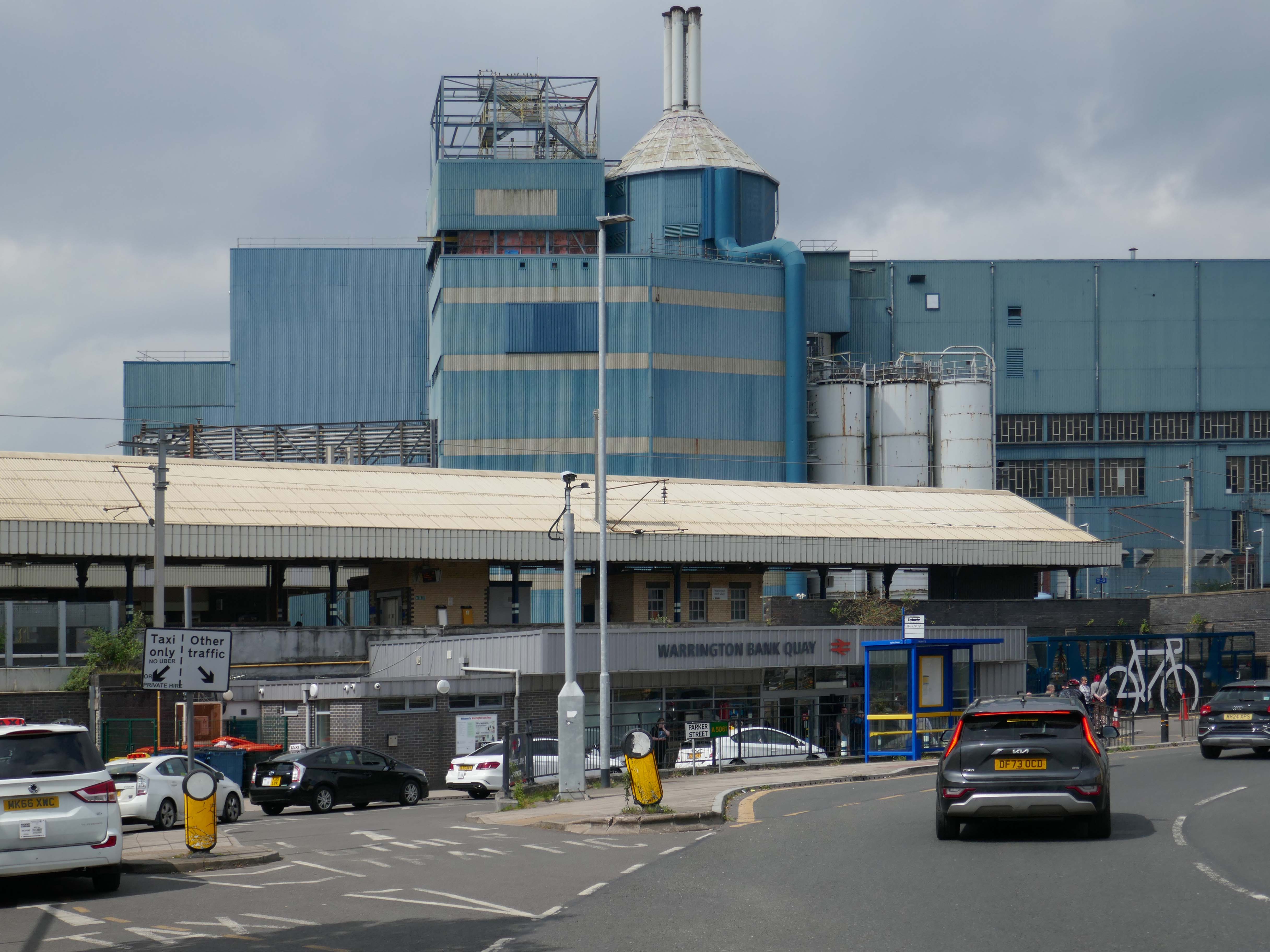
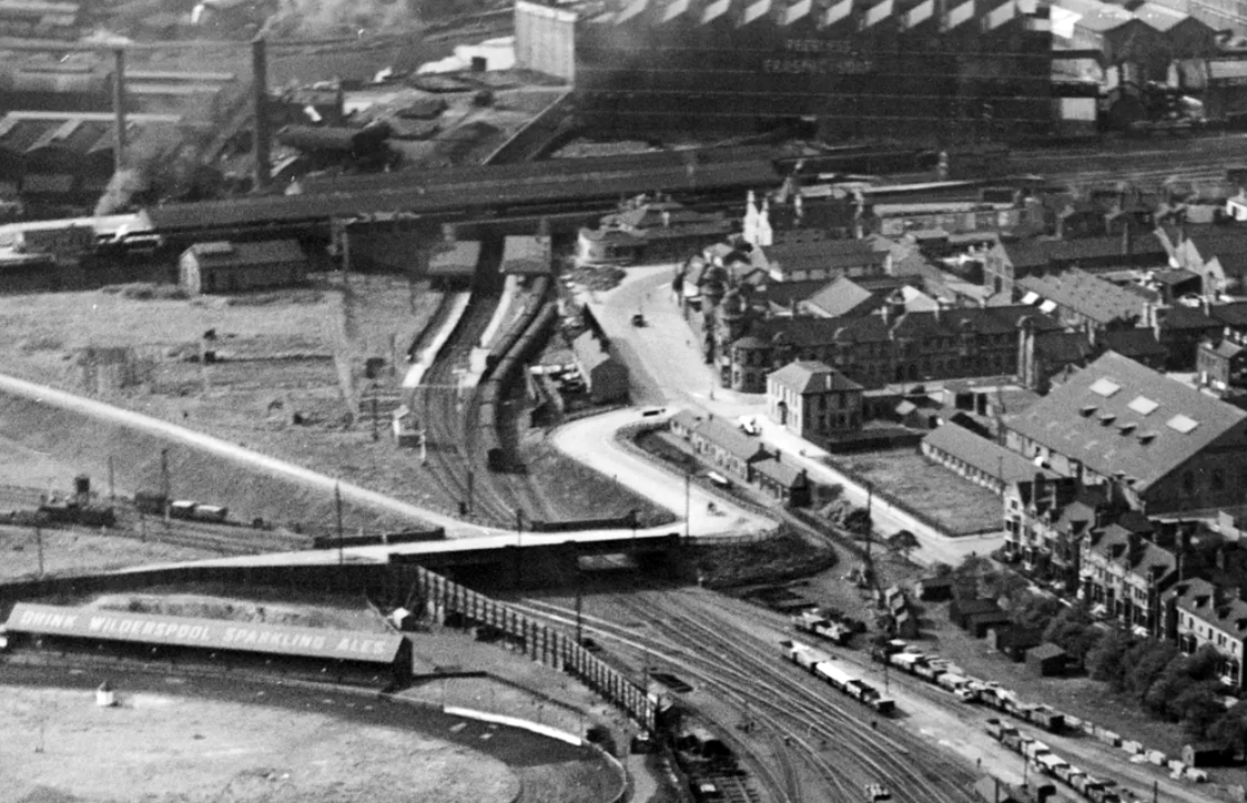
It’s a sunny day in May and we begin at Warrington Bank Quay station.
The first Warrington Bank Quay station opened on 4 July 1837.
The station was rebuilt when the line was electrified in 1973, a new power signal box covering an extended area was built east of the station for the electrification.
In 2009 a new entrance hall was completed, with a travel centre/ticket office and a shop.
The buffet on the London bound platforms was modernised.
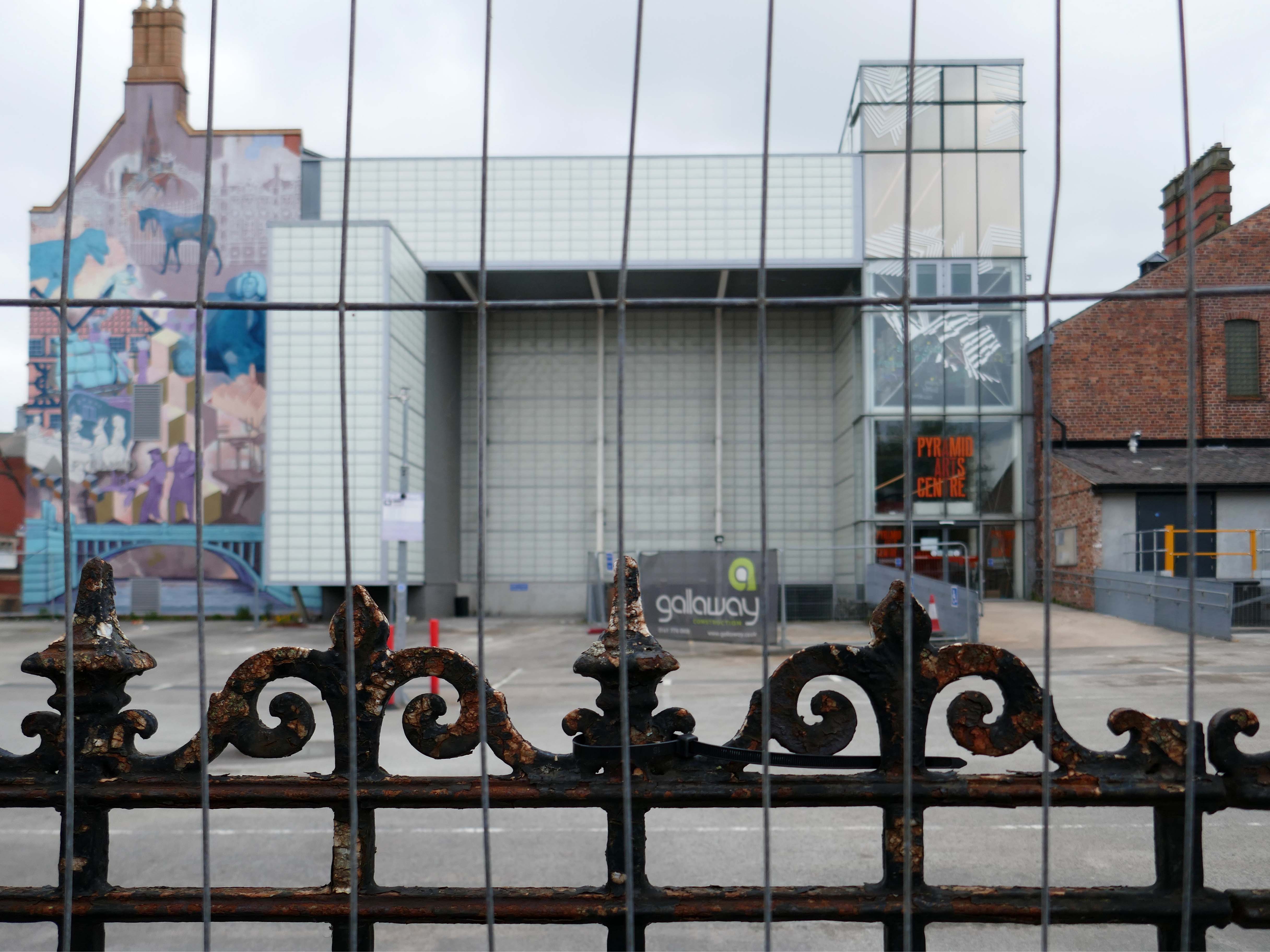
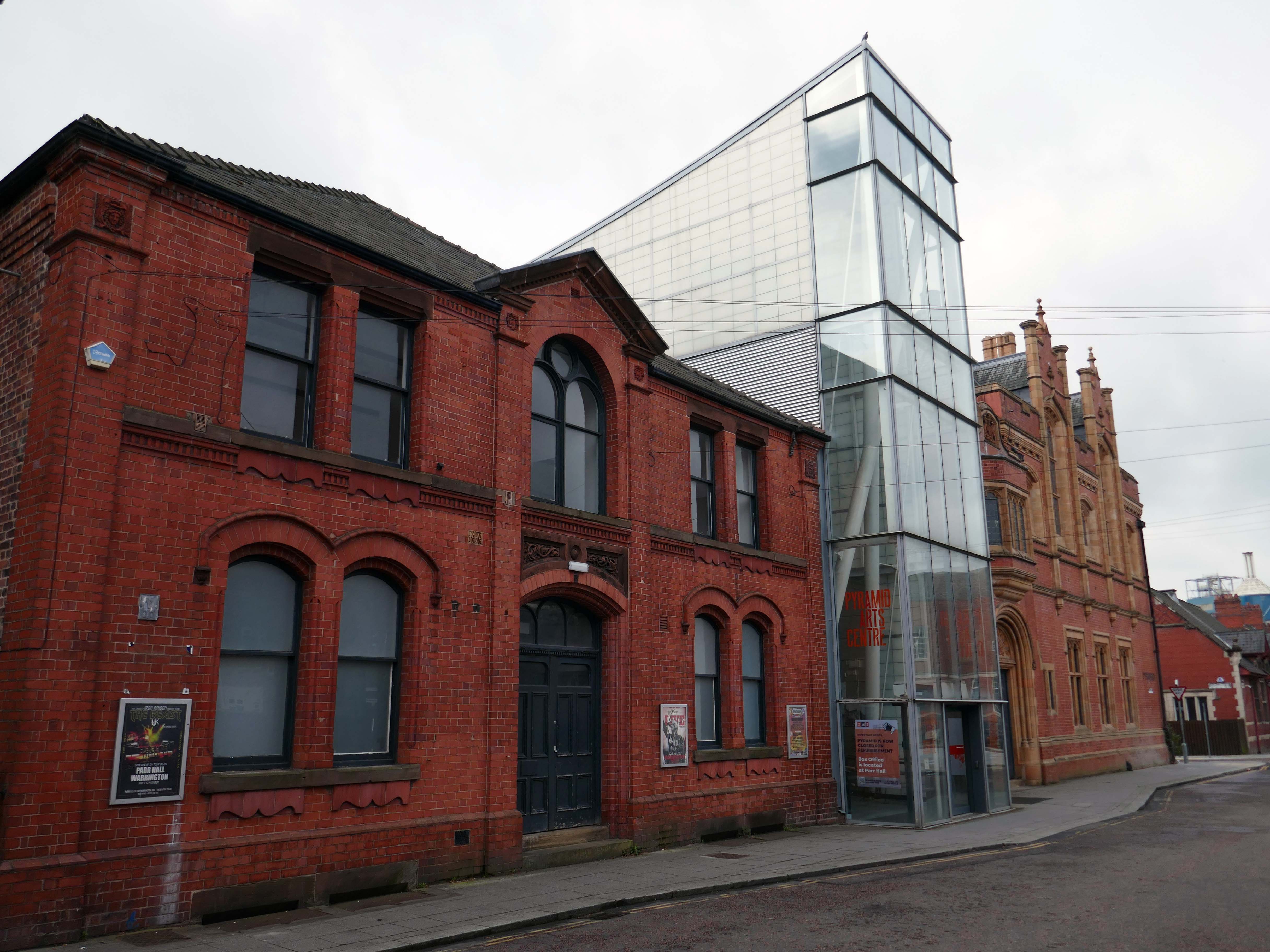
Next onwards to the Pyramid Arts extension 2002, a reworking by Studio BAAD of the former County Court and Inland Revenue Offices 1897-8 by Sir Henry Tanner.
Studio BAAD Ltd started winding up proceedings for a Creditors Voluntary Liquidation in April 2021 and the company was dissolved on 21 July 2021
The centre is currently closed – work began on the redevelopment, which has been funded by a £5 million grant from the Government, in July 2024.
The project aims to make the building more modern, accessible and fit for the future.
The redevelopment includes the addition of a new café and bar area while the Exhibition Hall will become a bigger capacity venue.
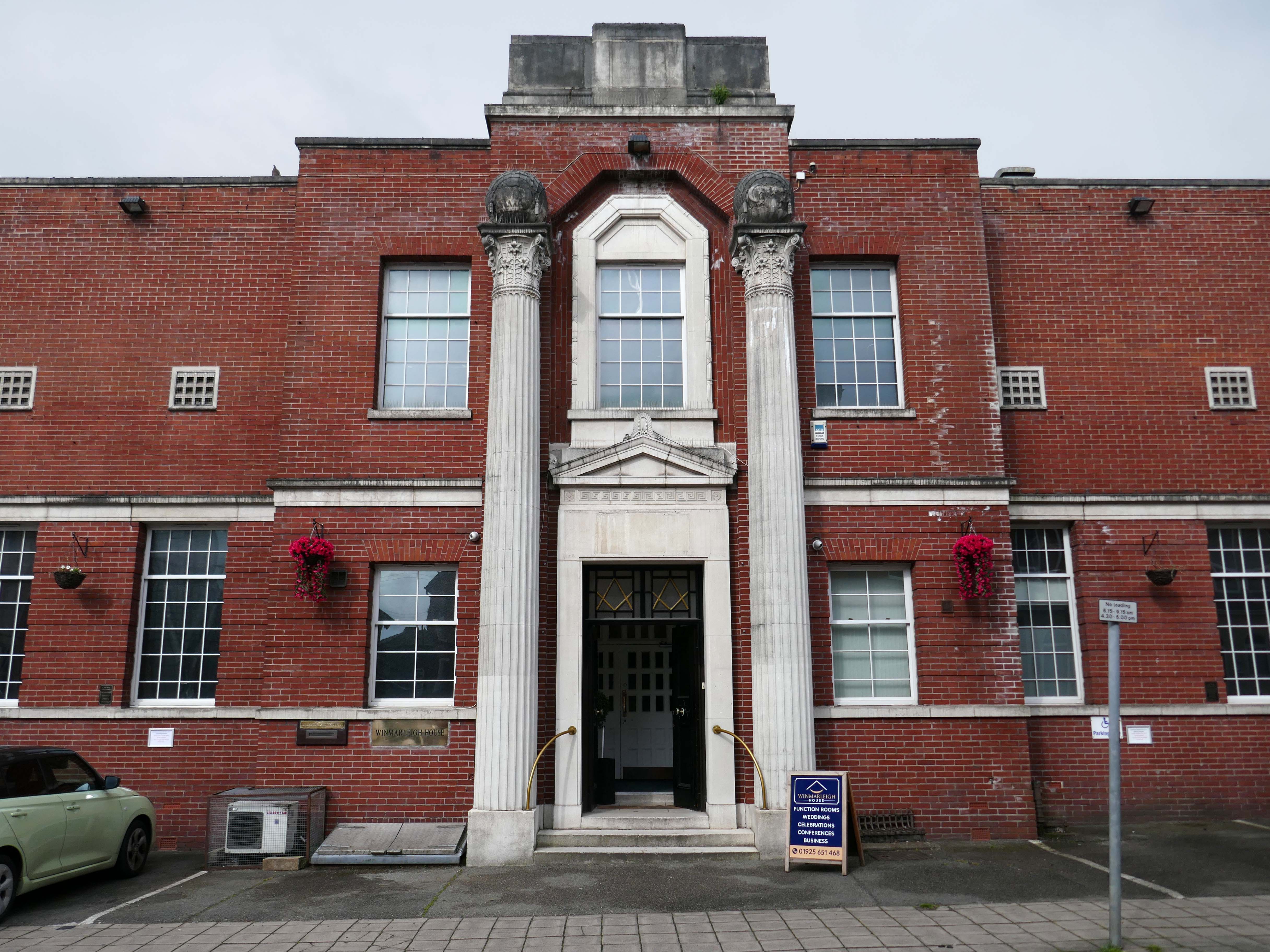
Across the way the Masonic Hall 1932-33 Albert Warburton.
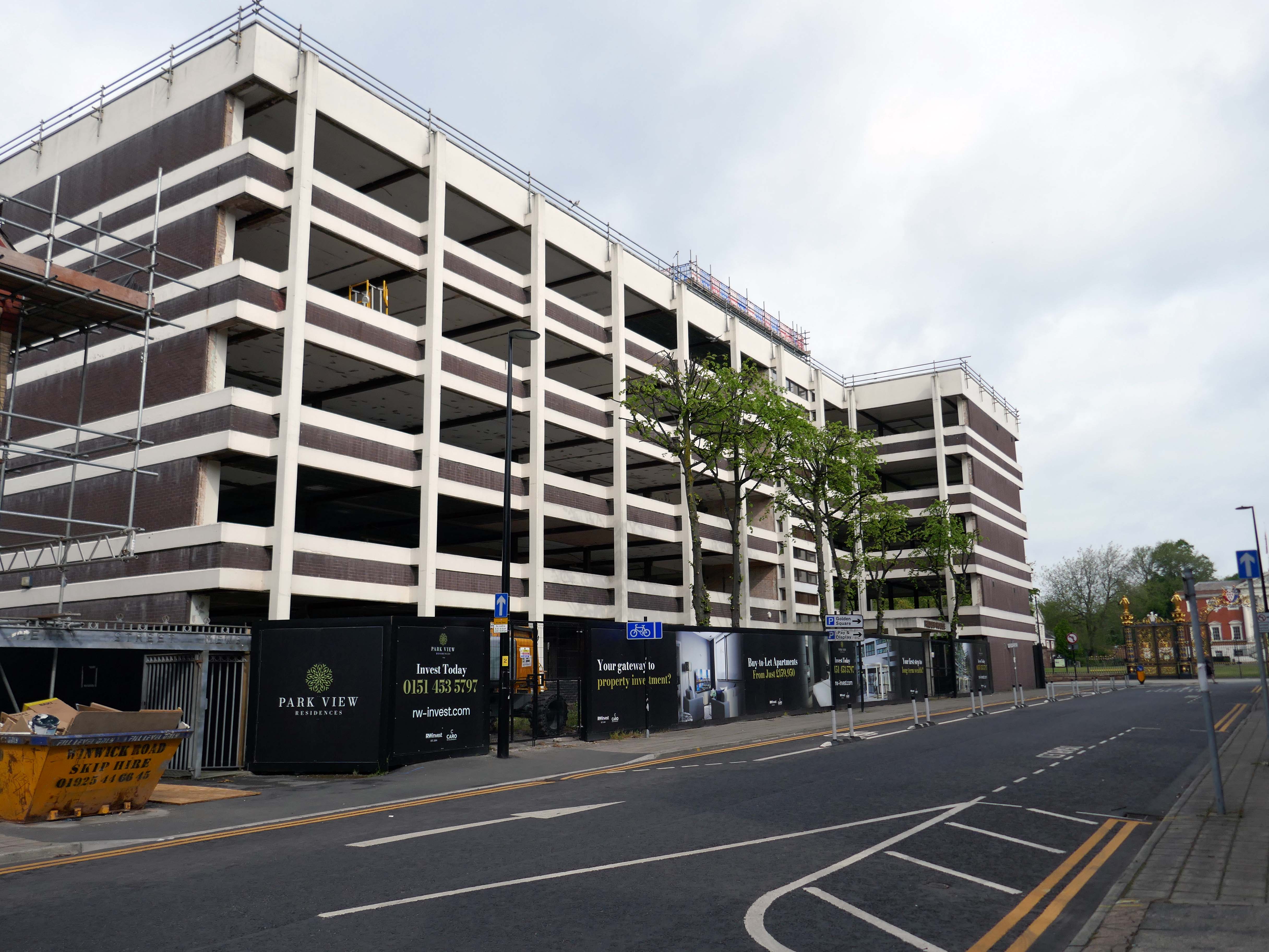
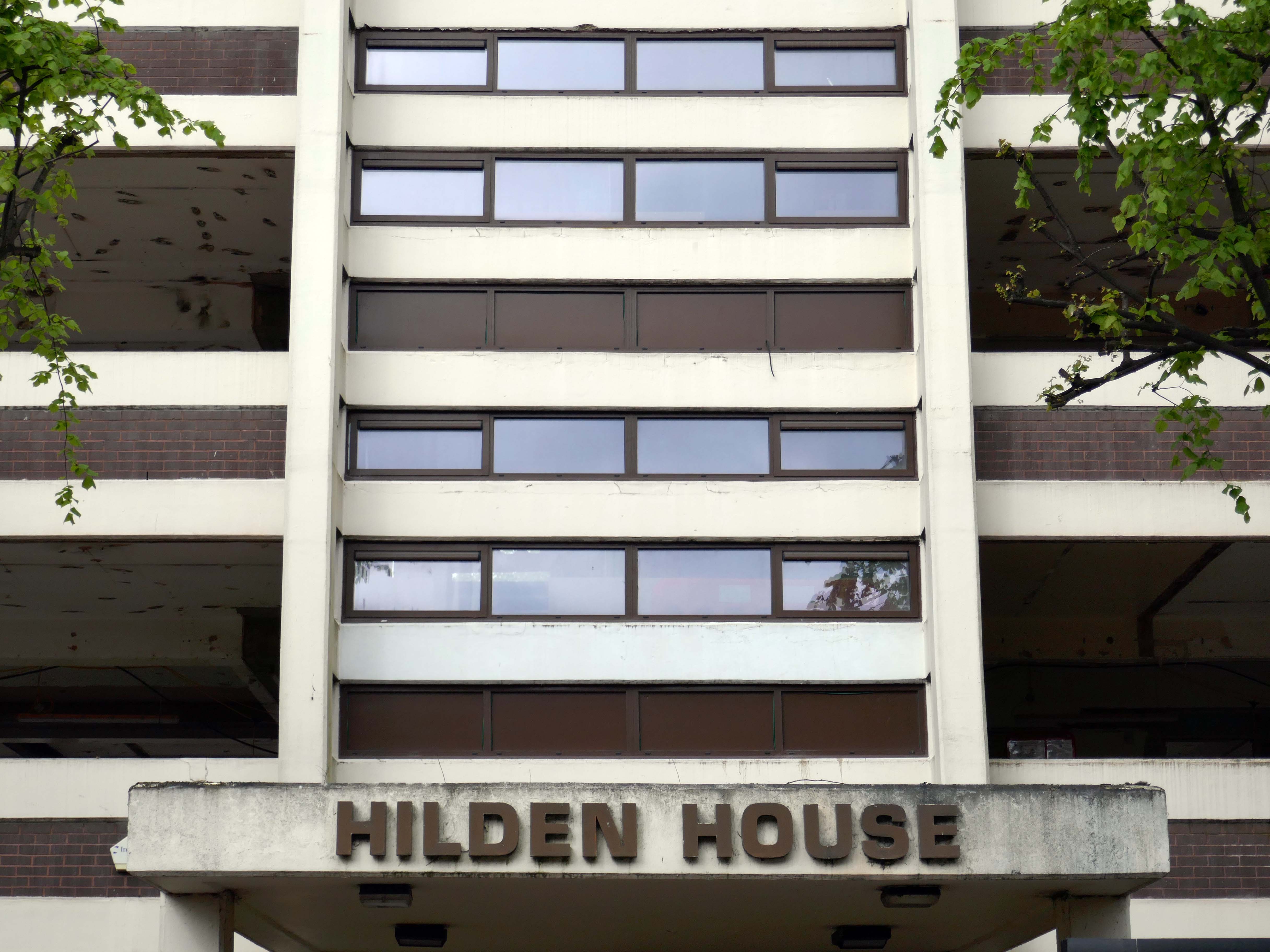
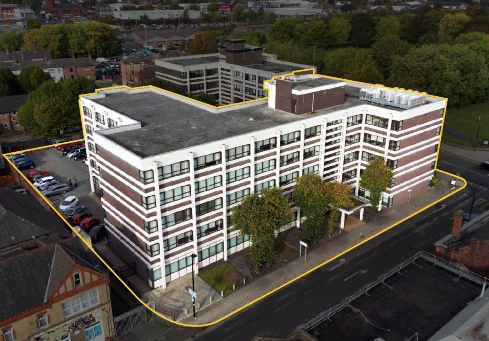
Further along to Hilden House a former Department of Works and Pension building, currently undergoing a transformation into a residential block.
The £18m office to residential reset of the 52,400 sq ft building will offer a mix of one- and two-bedroom apartments in plans now approved by the local authority.
Caro Developments, working in tandem with architectFalconer Chester Hall, hopes to start construction later this year.
According to a planning statement submitted on the developer’s behalf by Savills, once complete, the five-storey block will offer residents a concierge service, a gym and wellness facility, a resident’s lounge, and a co-working area.
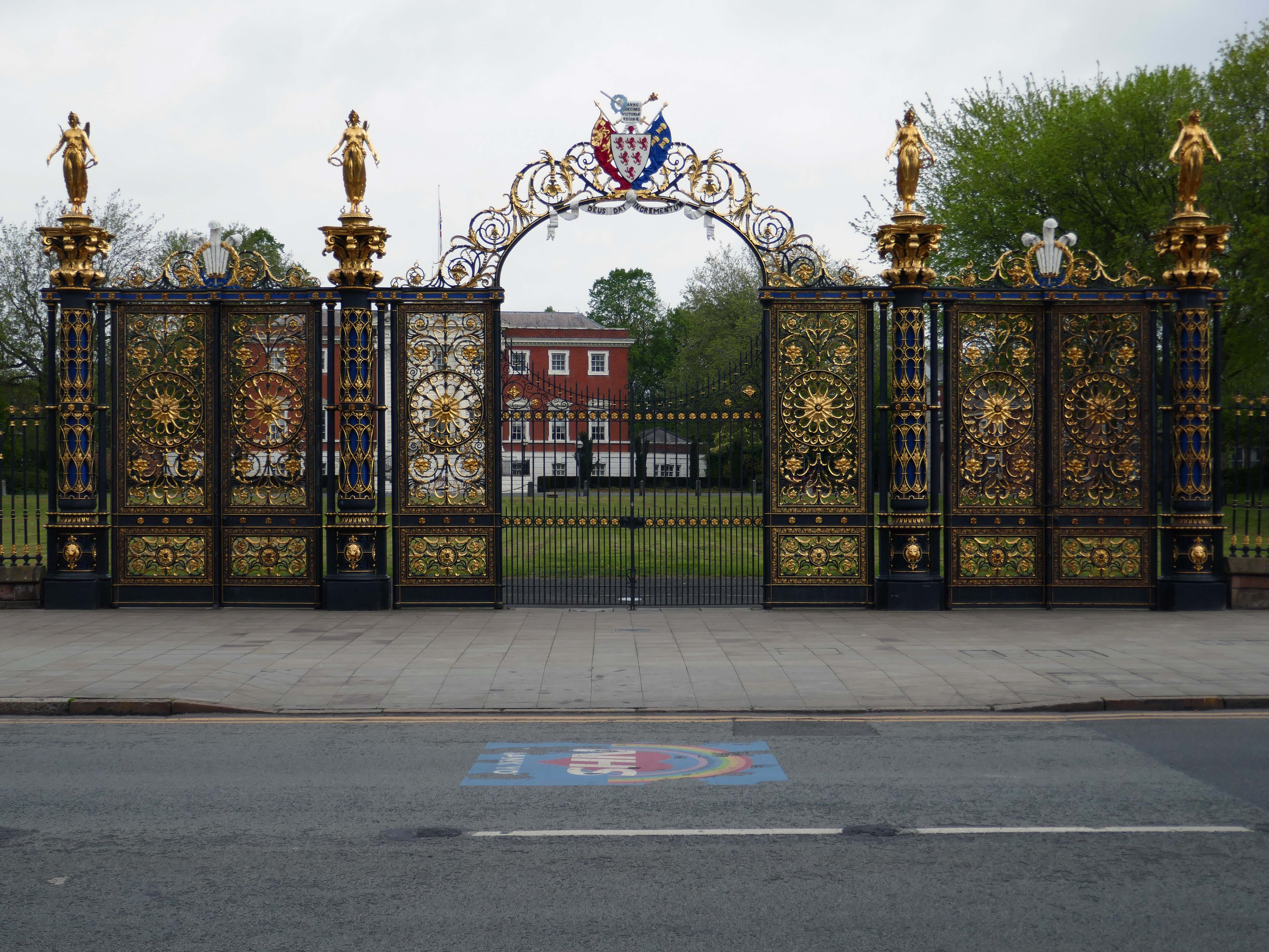
Way out of period but a notable Warrington landmark are the Golden Gates designed in 1862.
The gates were made for the International Exhibition of 1862, and then intended for Queen Victoria’s Sandringham home in Norfolk. Coalbrookdale found it hard to find a buyer for such grand gates, so Frederick Monks, one of the town’s earliest councillors, was able to buy and bring them to Warrington to stand at the front of the town hall lawn. Monks also presented the cast iron Cromwell statue, designed by John Bell, to Warrington in 1899.
The Golden Gates are Grade II* Listed, along with the gate piers and the lamps which line the driveways at either side of the town hall
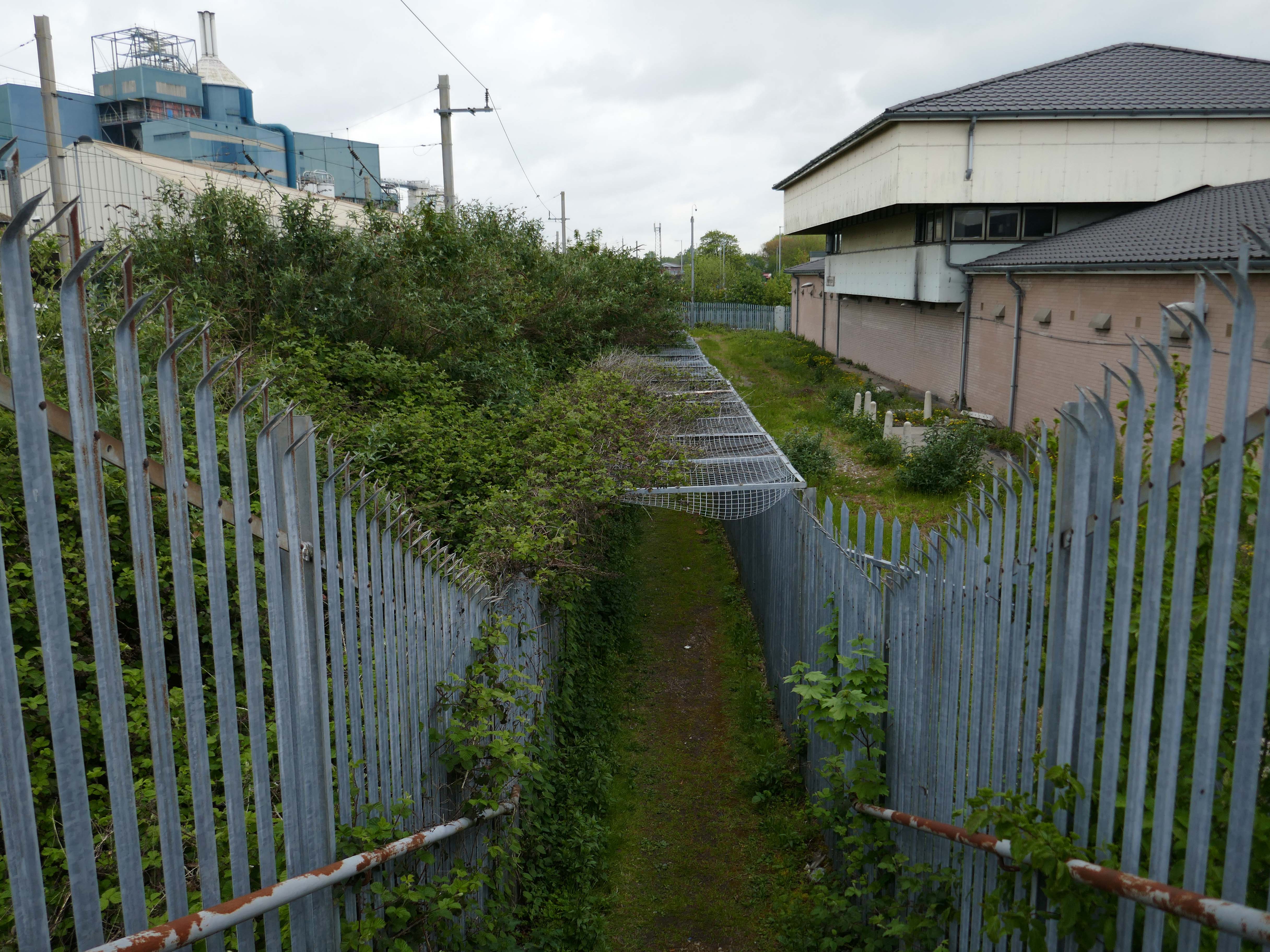
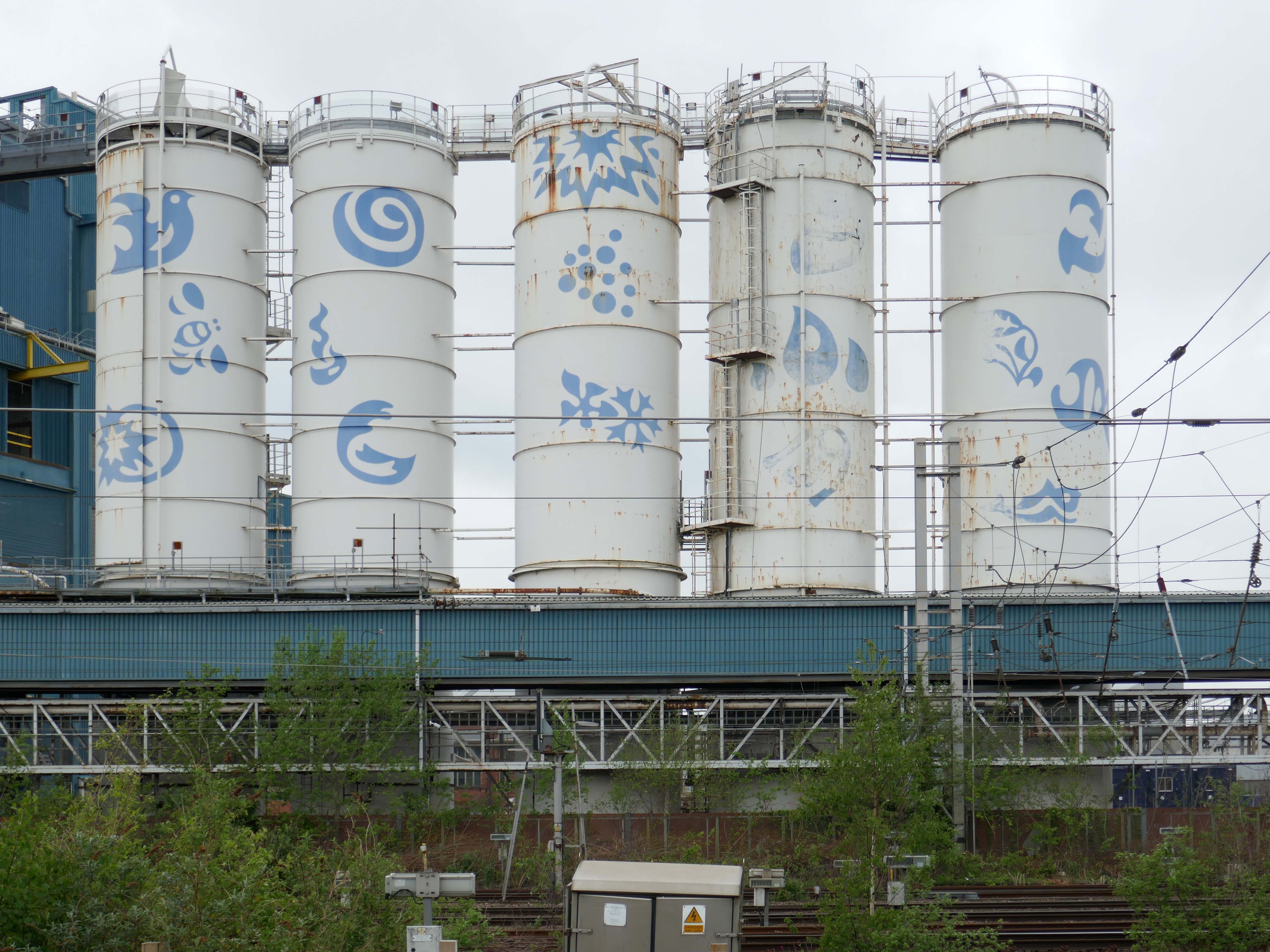
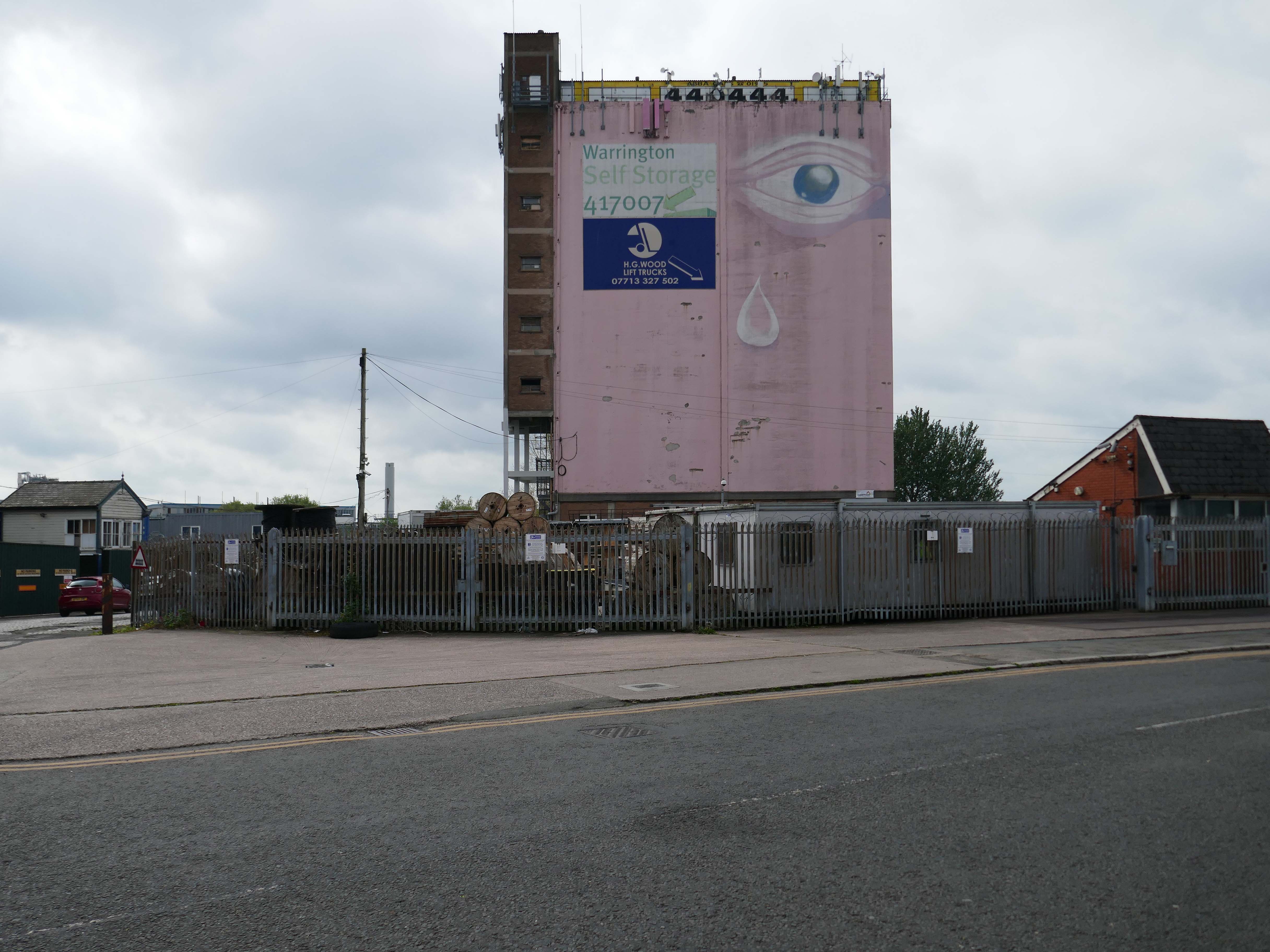
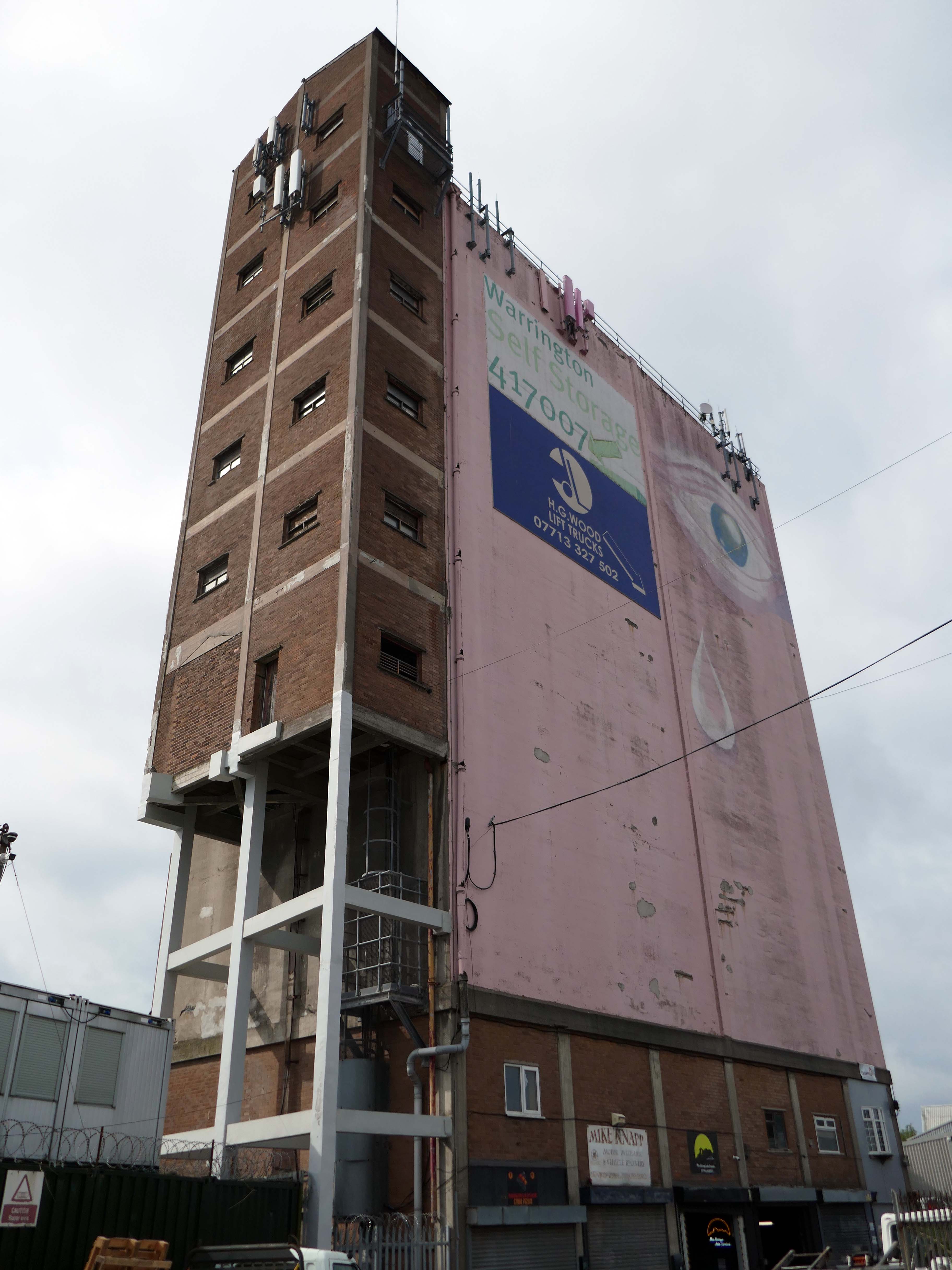
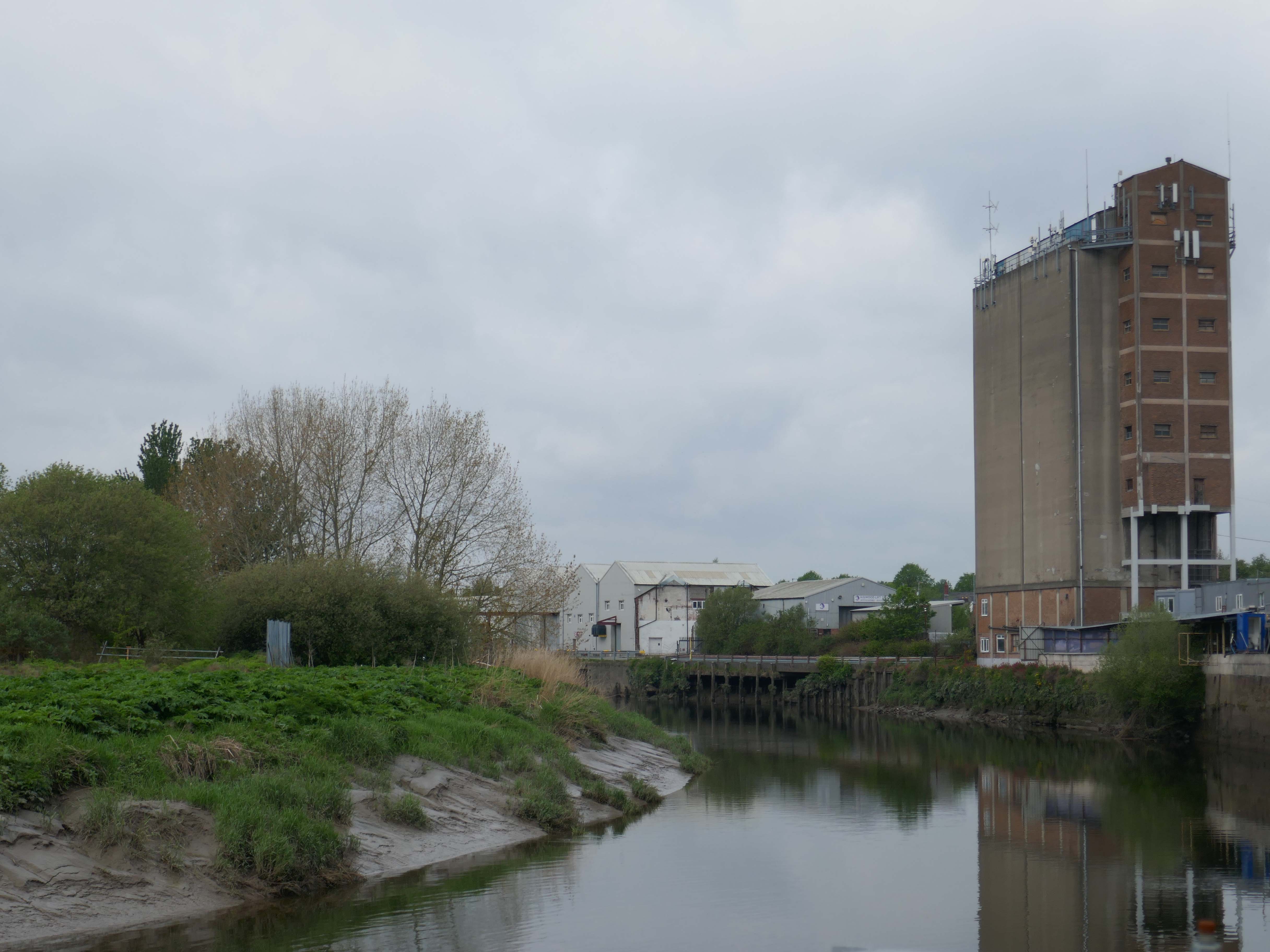
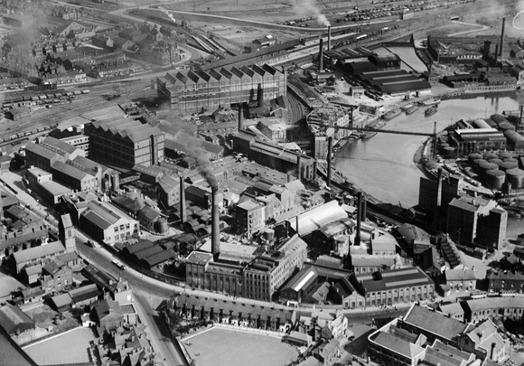
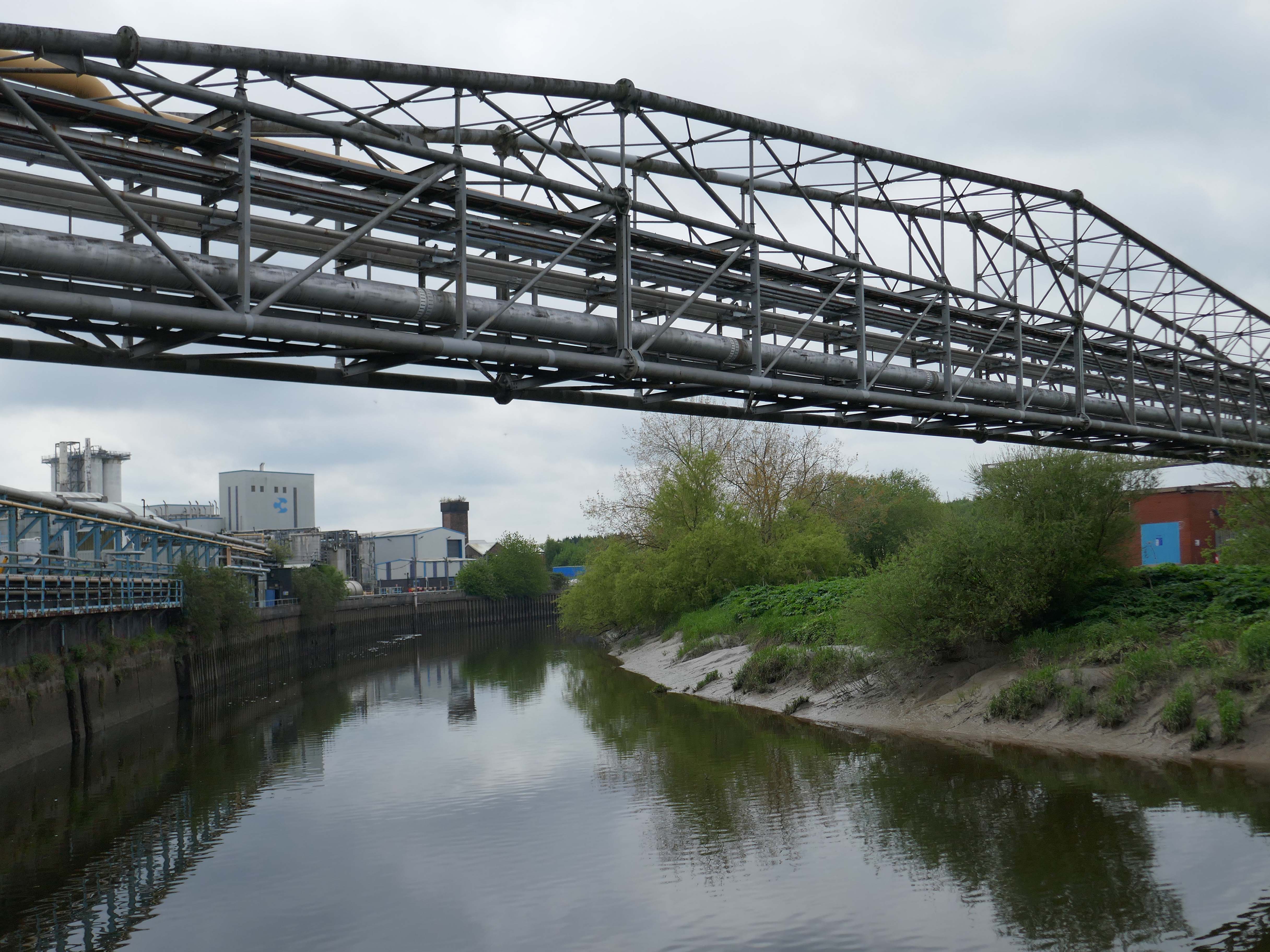
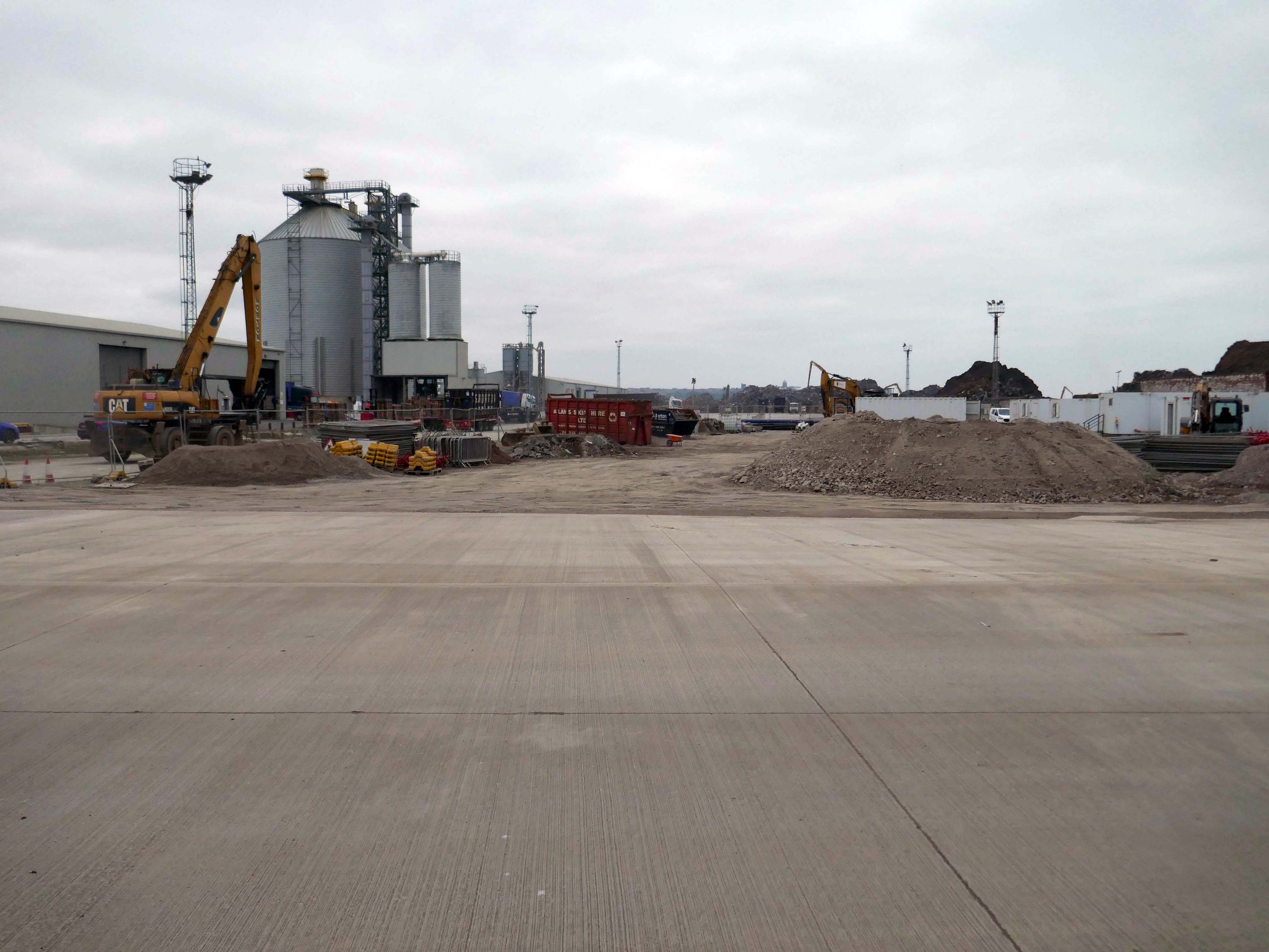
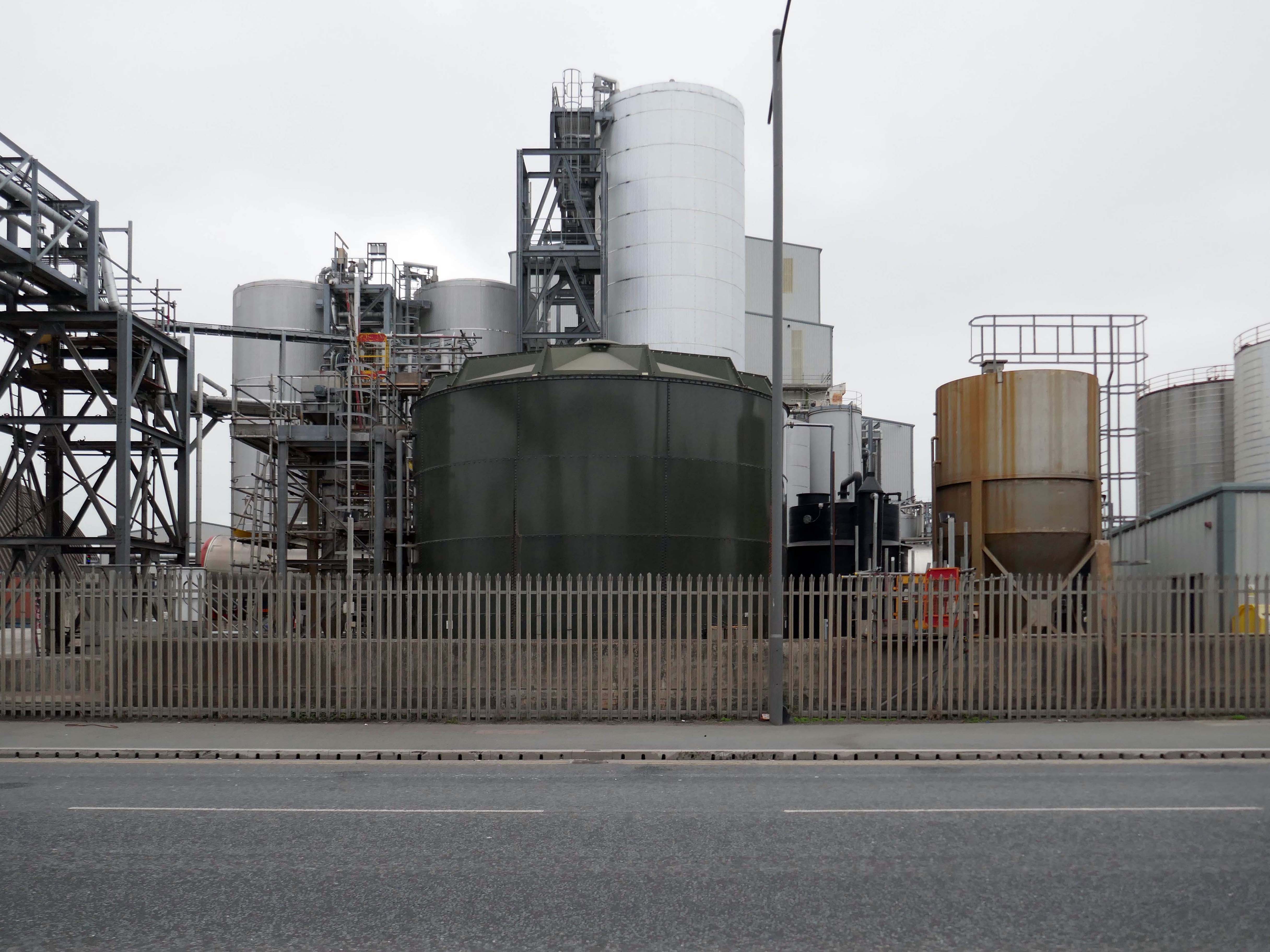
Up the road now to the Soap Works – first views from across the railway tracks.
Then over the bridge.
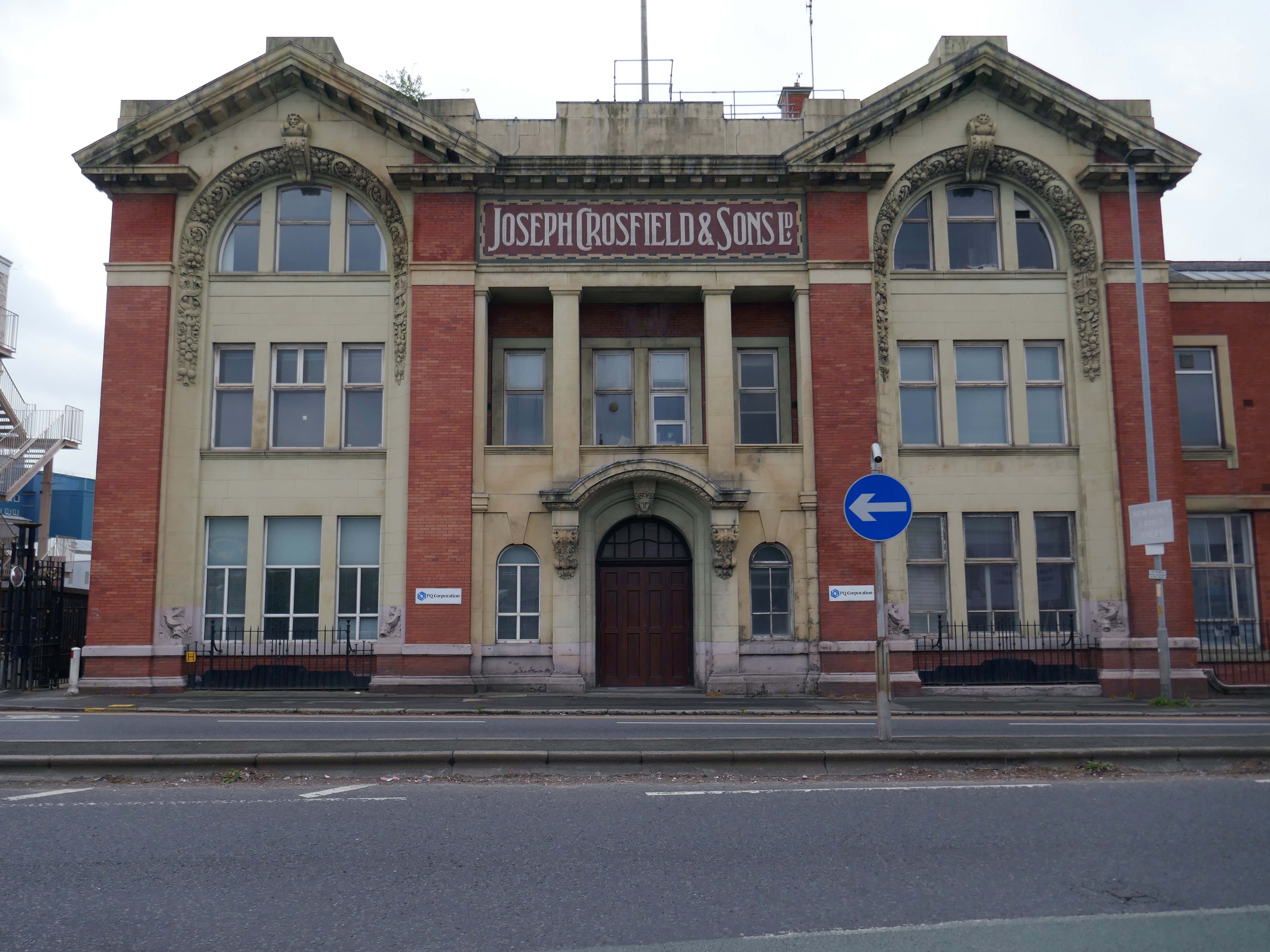
Joseph Crosfield was born in Warrington, the fourth son of George Crosfield and his wife Ann née Key. In 1814, Joseph’s apprenticeship having finished, at the age of 21 he decided to establish his own soap making business in Warrington.
In 1911 the company was purchased by Brunner, Mond & Company and 1919 it was absorbed into Lever Brothers. From 1929 Crosfield was a subsidiary of Unilever. In 1997 its Warrington speciality chemicals division that made ingredients for detergents and toothpastes was acquired by ICI and in 2001, Ineos Capital purchased the company. The name Crosfield was finally lost as it was renamed Ineos Silicas. In 2008 Ineos Silicas was merged with PQ Corporation, with the new company retaining the name of PQ Corporation.
The Crosfield’s factory closed for good in October 2020.
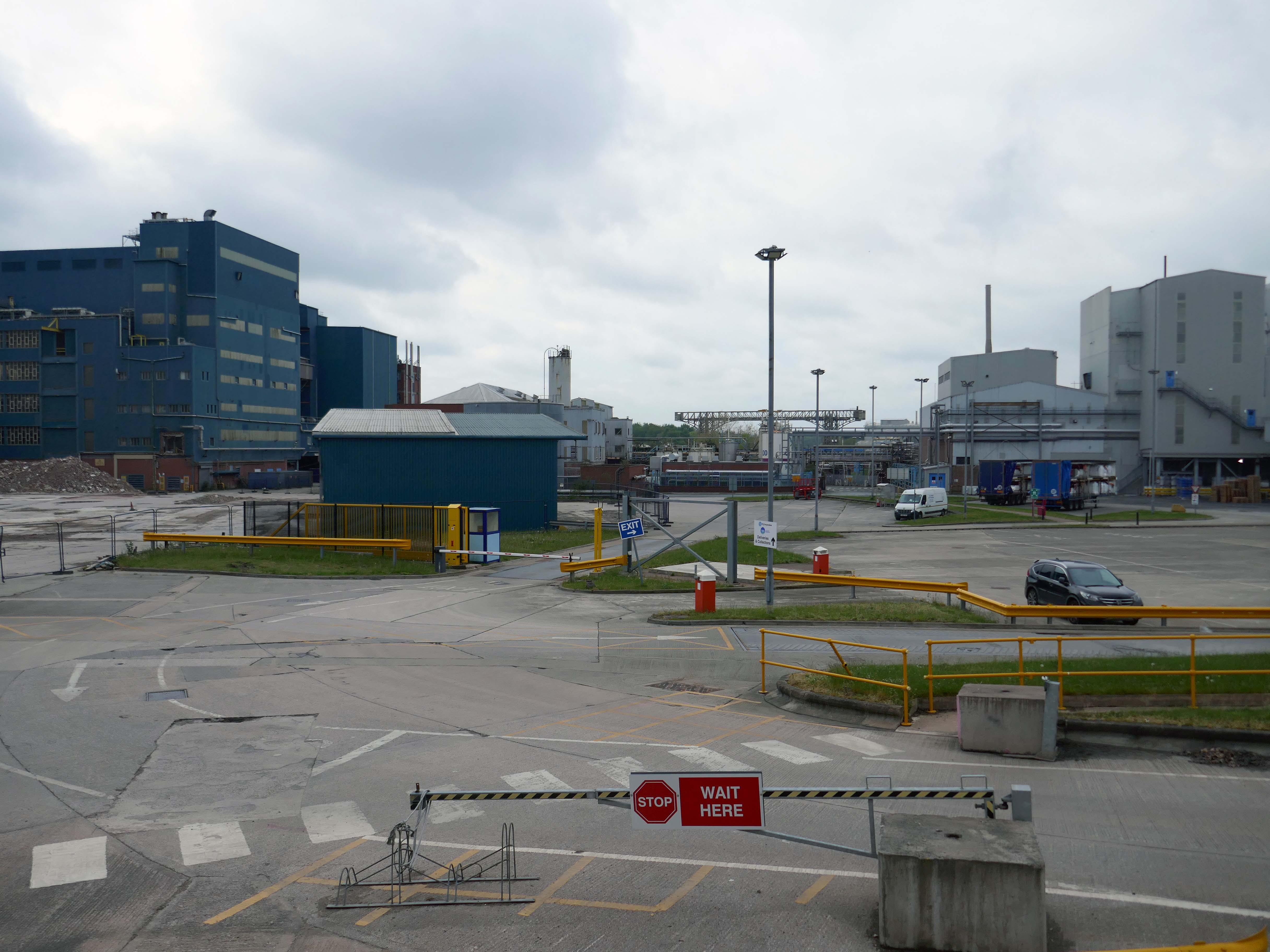
Dante FS Group formally acquired four acres of the site this month for an undisclosed fee from EcoVyst.
The latter firm will continue to operate from sections of the site, as will PQ Corporation, with Dante buying land closest to the train station, including the visible blue buildings and white Unilever tanks.
Renamed Platform at Bank Quay, the ‘next-generation, state-of-the-art modular data centre’ is ‘set to power the UK’s growing AI economy’ and bring high-tech jobs to the town.
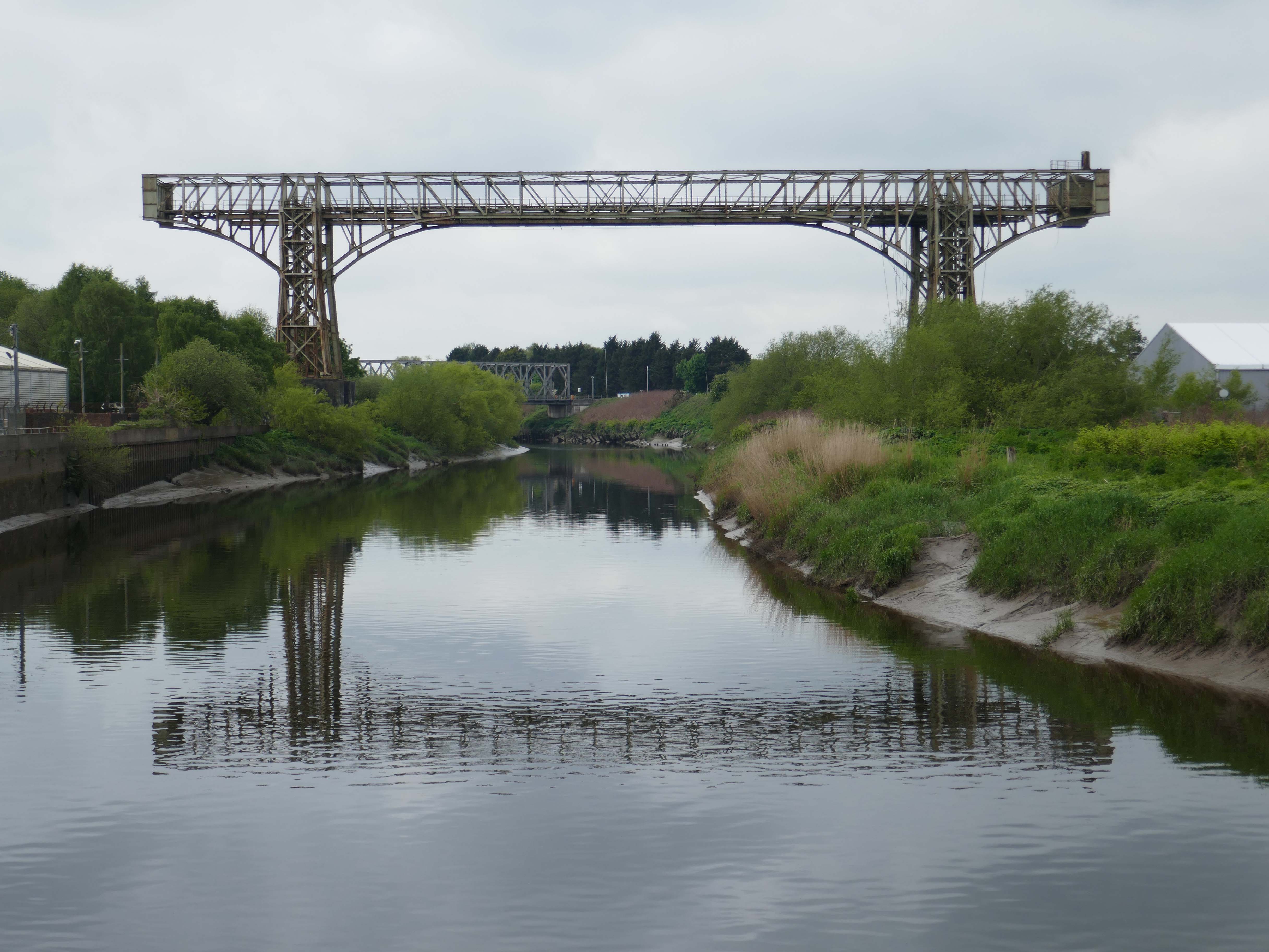
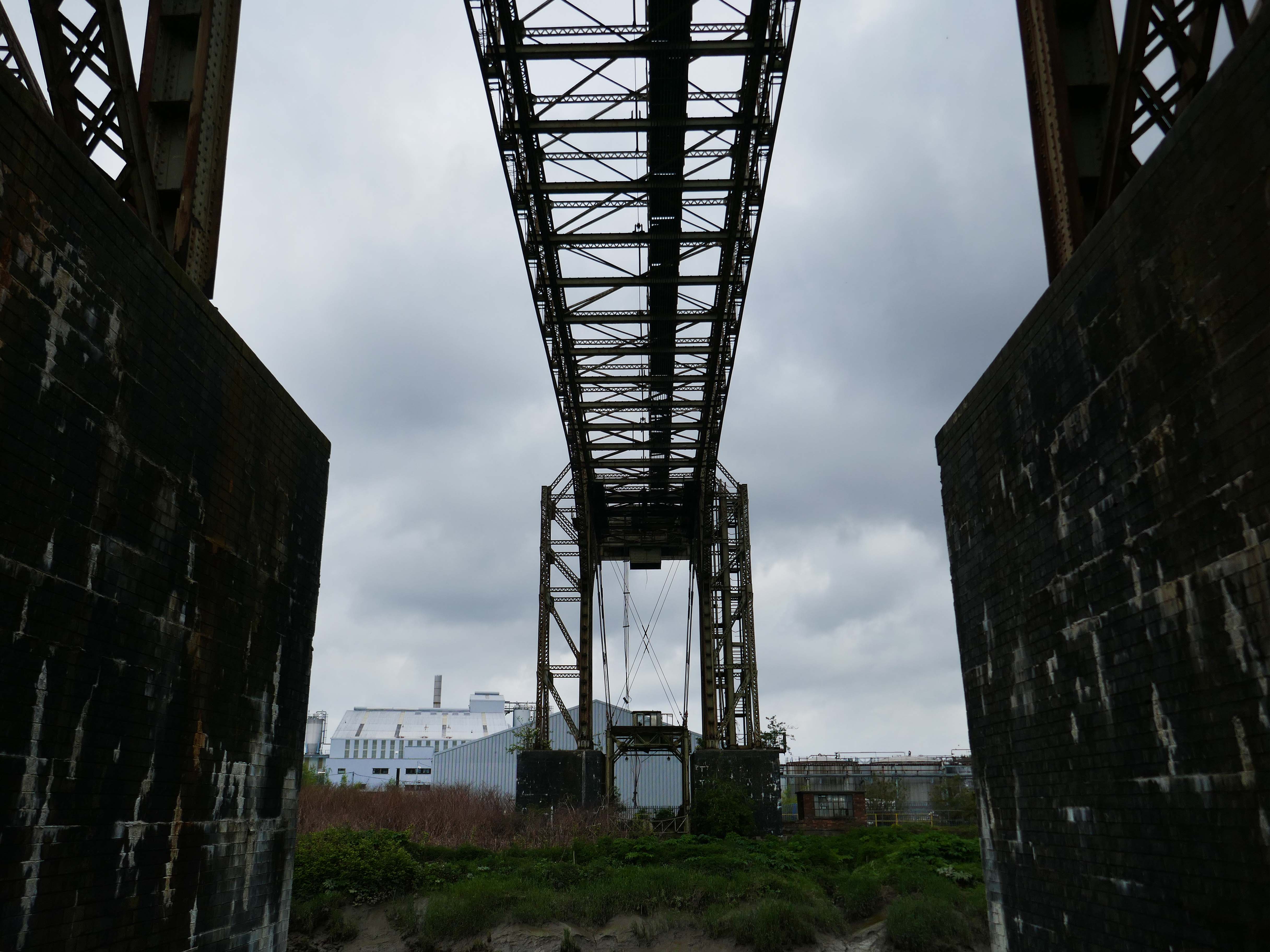
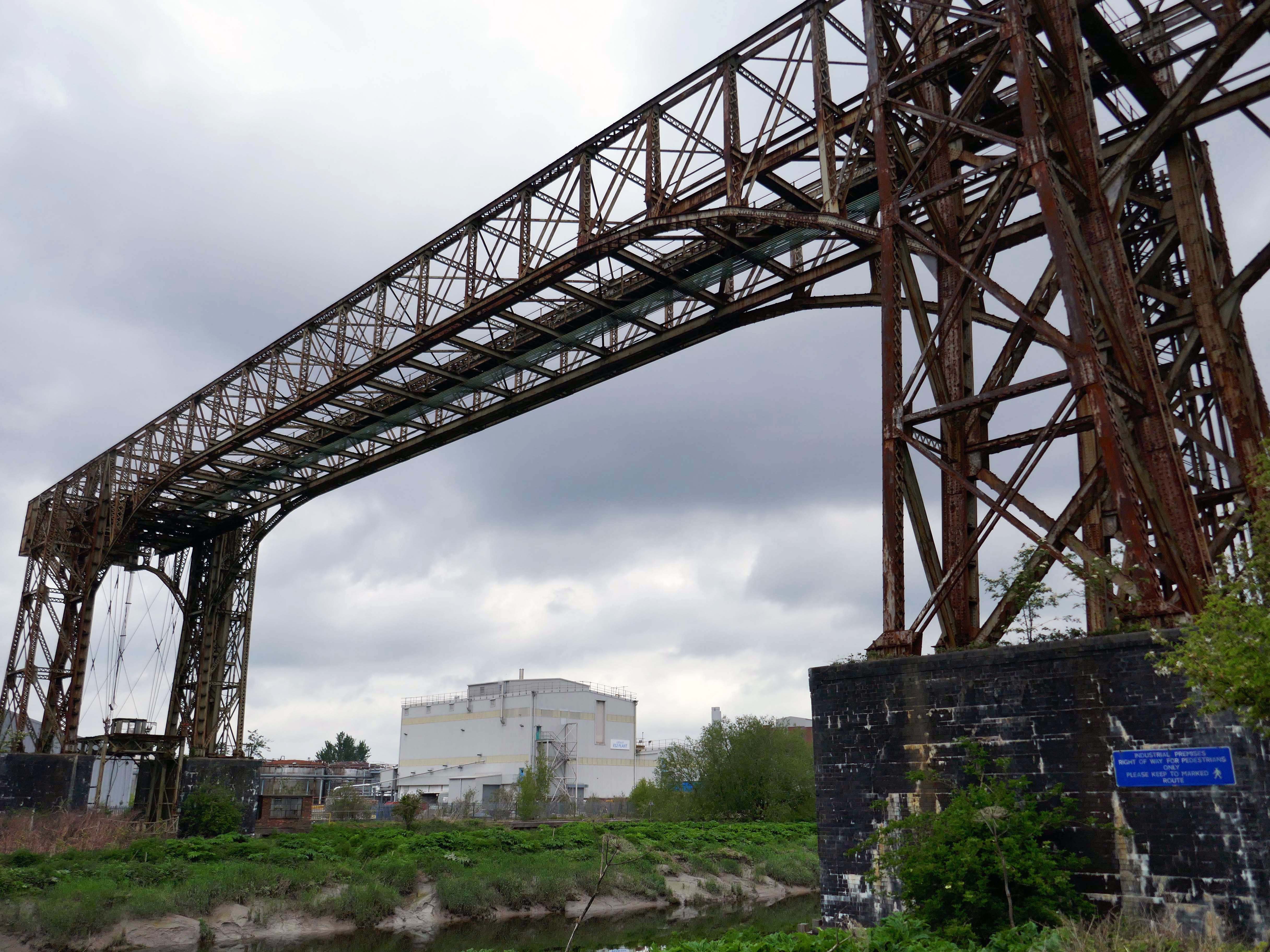
Warrington Transporter Bridge aka Bank Quay Transporter Bridge or Crosfield’s Transporter Bridge across the River Mersey is a structural steel transporter bridge with a span of 200 feet.
It is 30 feet wide and 76 feet above high water level, with an overall length of 339 feet.
It was commissioned in 1916 and, although it has been out of use since about 1964, it is still standing. It was designed by William Henry Hunter and built by William Arrol and Co.
The Transporter Bridge was built to despatch finished product from the cement plant that had been built on the peninsula. It was originally designed to carry rail vehicles up to eighteen tons loaded weight.
The bridge was converted for road vehicles in 1940, and was certified to carry loads of up to thirty tons in 1953.
This was my first visit in 2017 – recorded on Modern Mooch.
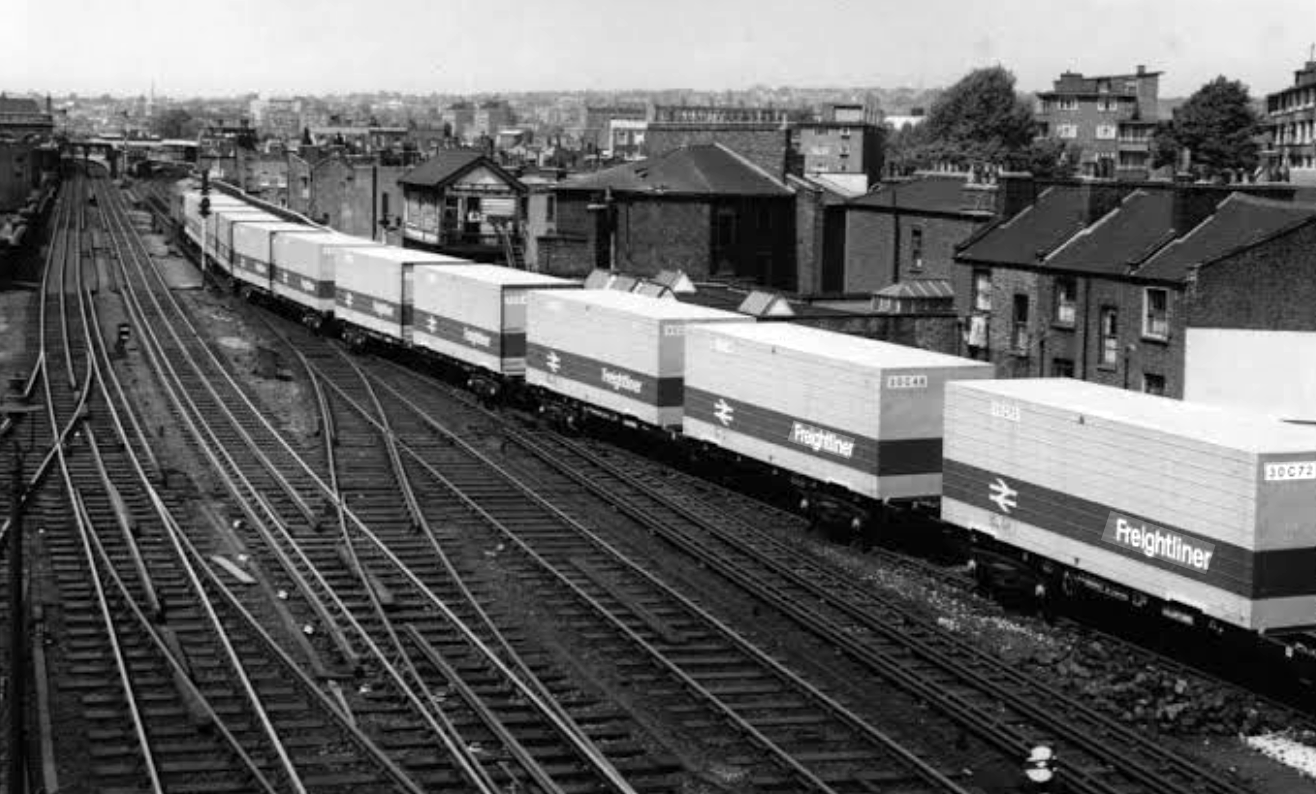
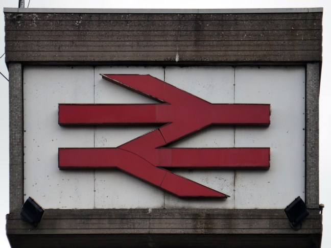
Highlight on any day out anywhere is the discovery of arcane British Rail typography.
There’s a brief history of Freightliner history right here.
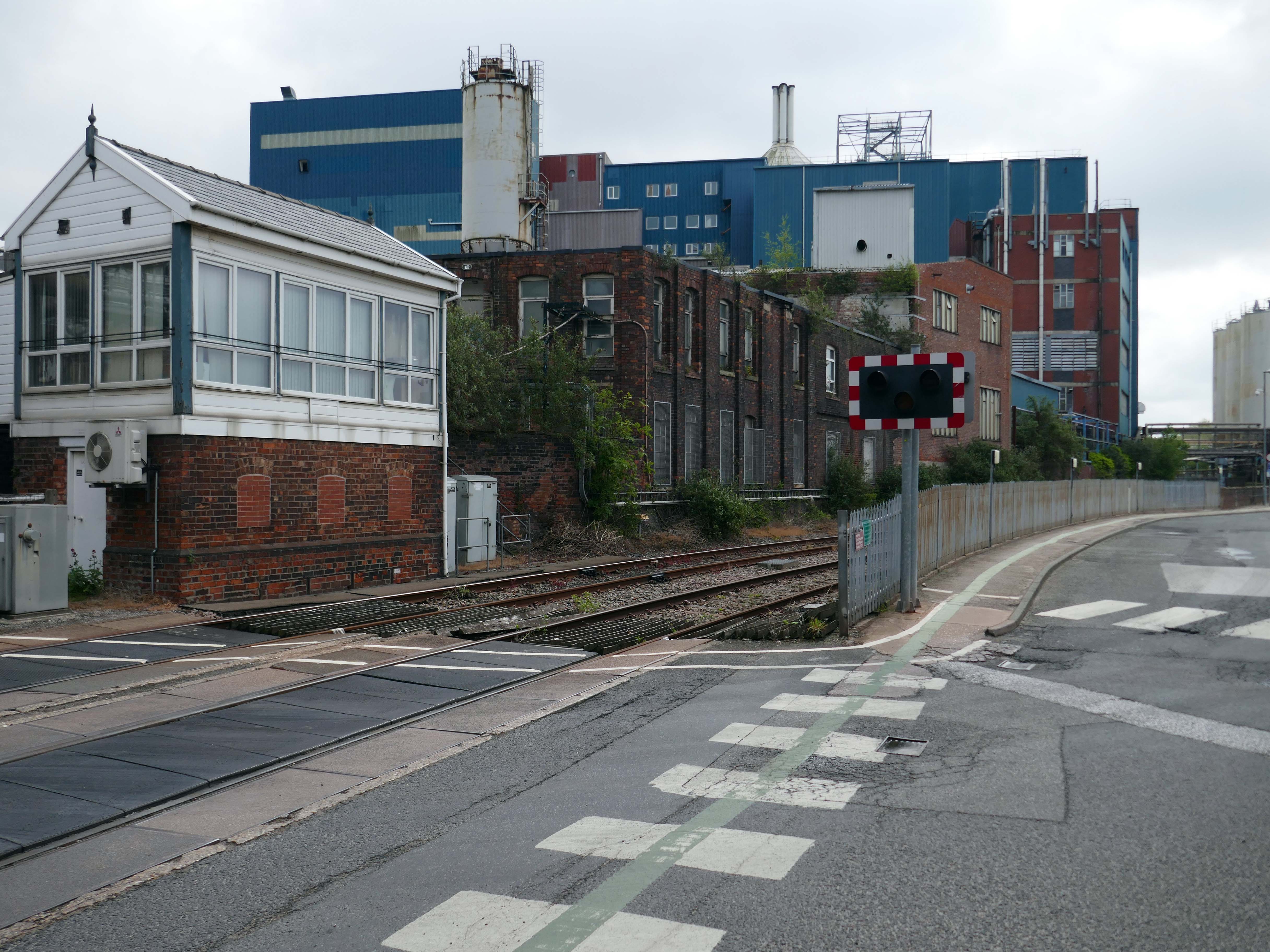
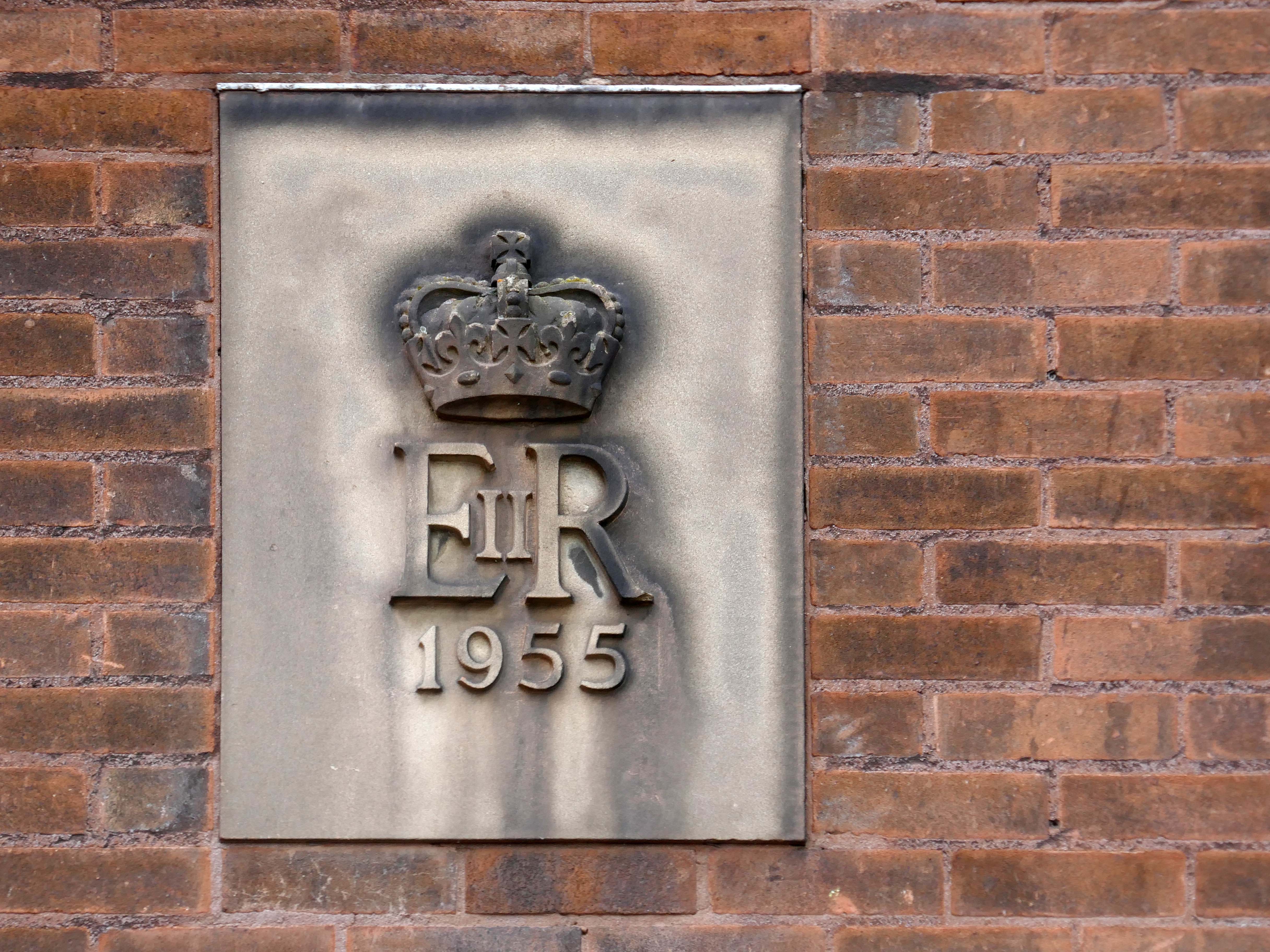
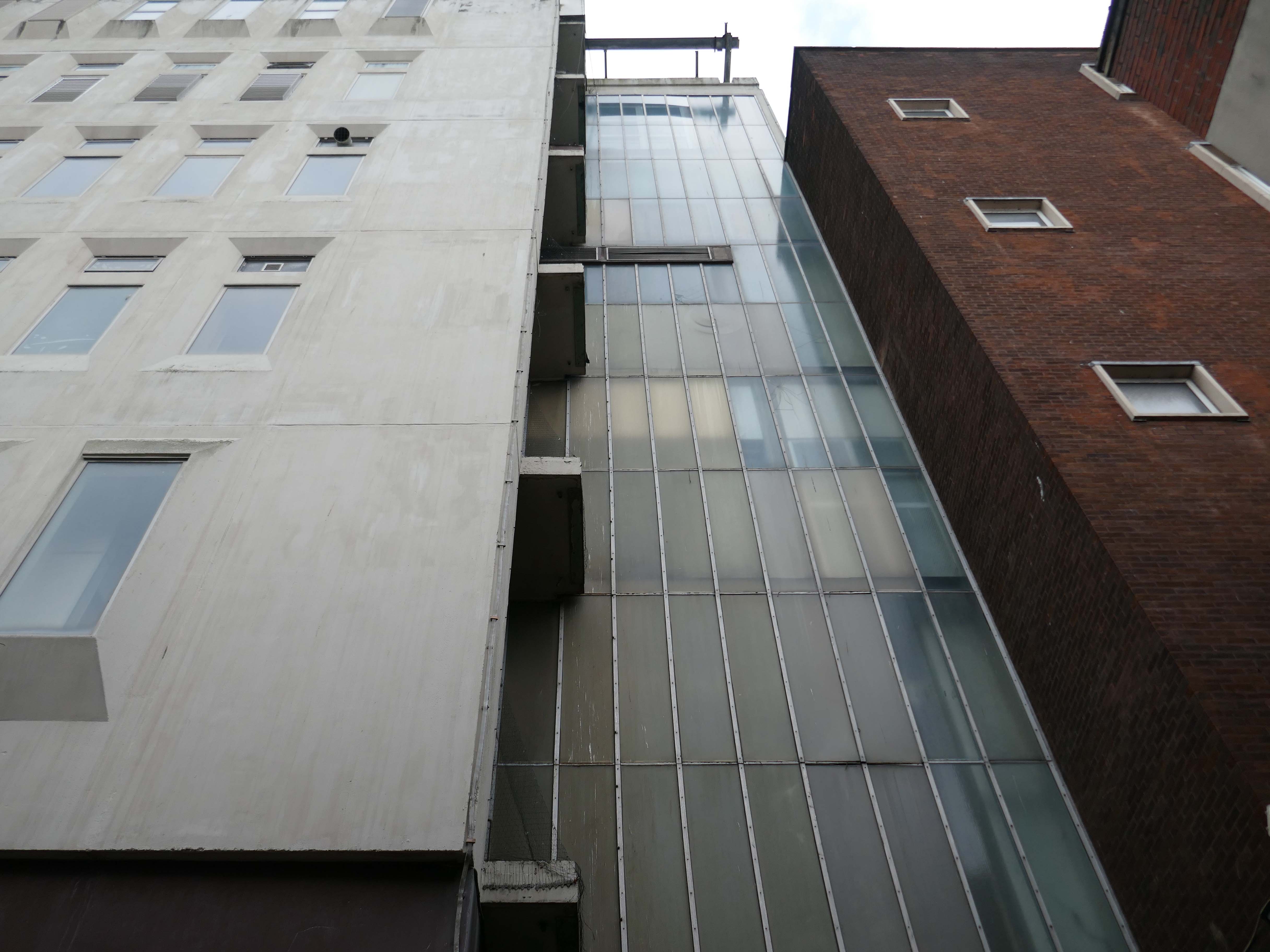
Back now to Bank Quay and off to the Telephone Exchange.
This is the 1969 building designed by the MODBW, Reginald Norman Dixon with lead architect P Clinton.
Linked to the 1955 building designed by John Onslow Stevens.
Biggest thanks to Lisa Kinch who can be found over on Instagram, for all her informative research into telephone exchanges.
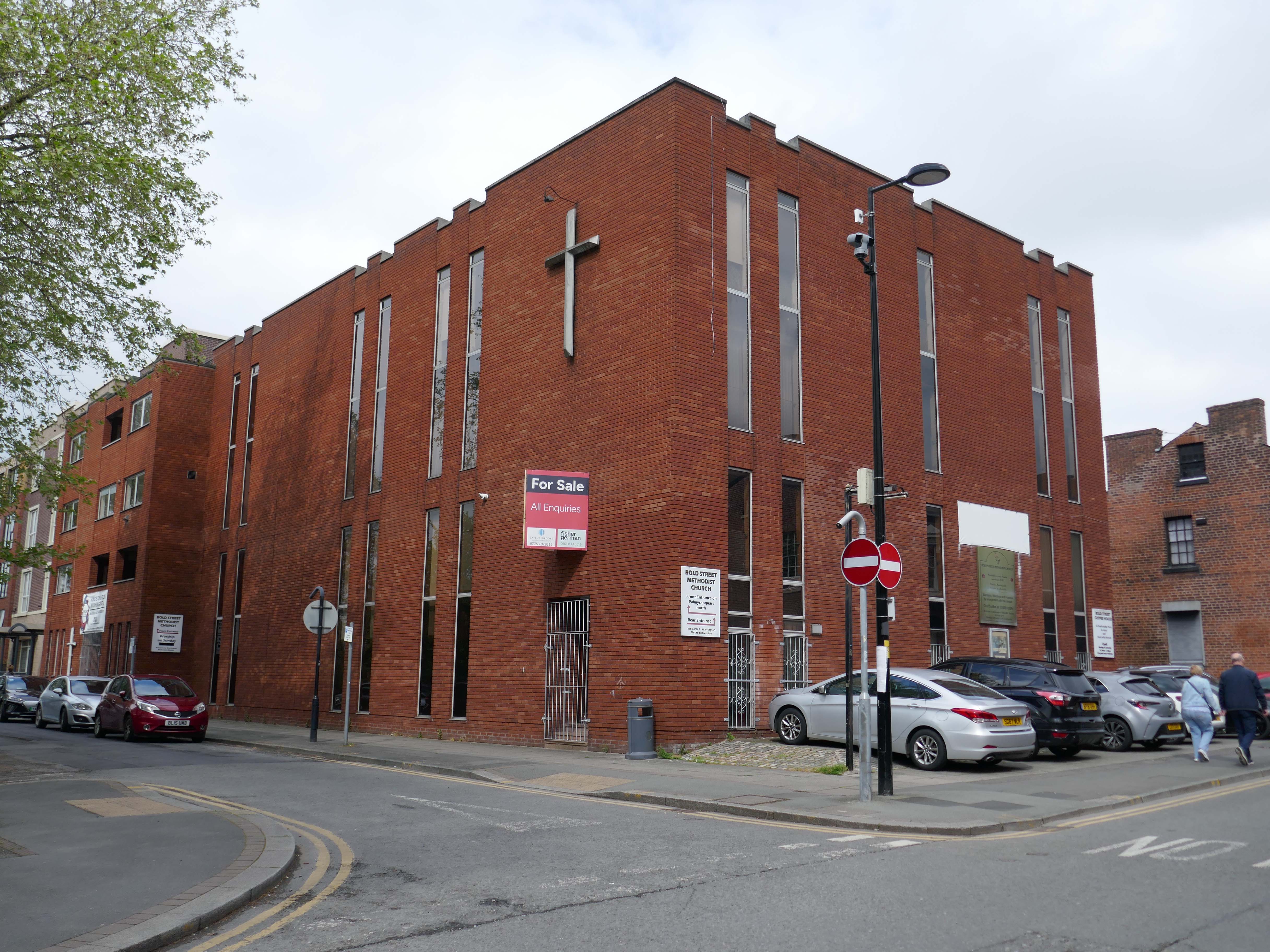
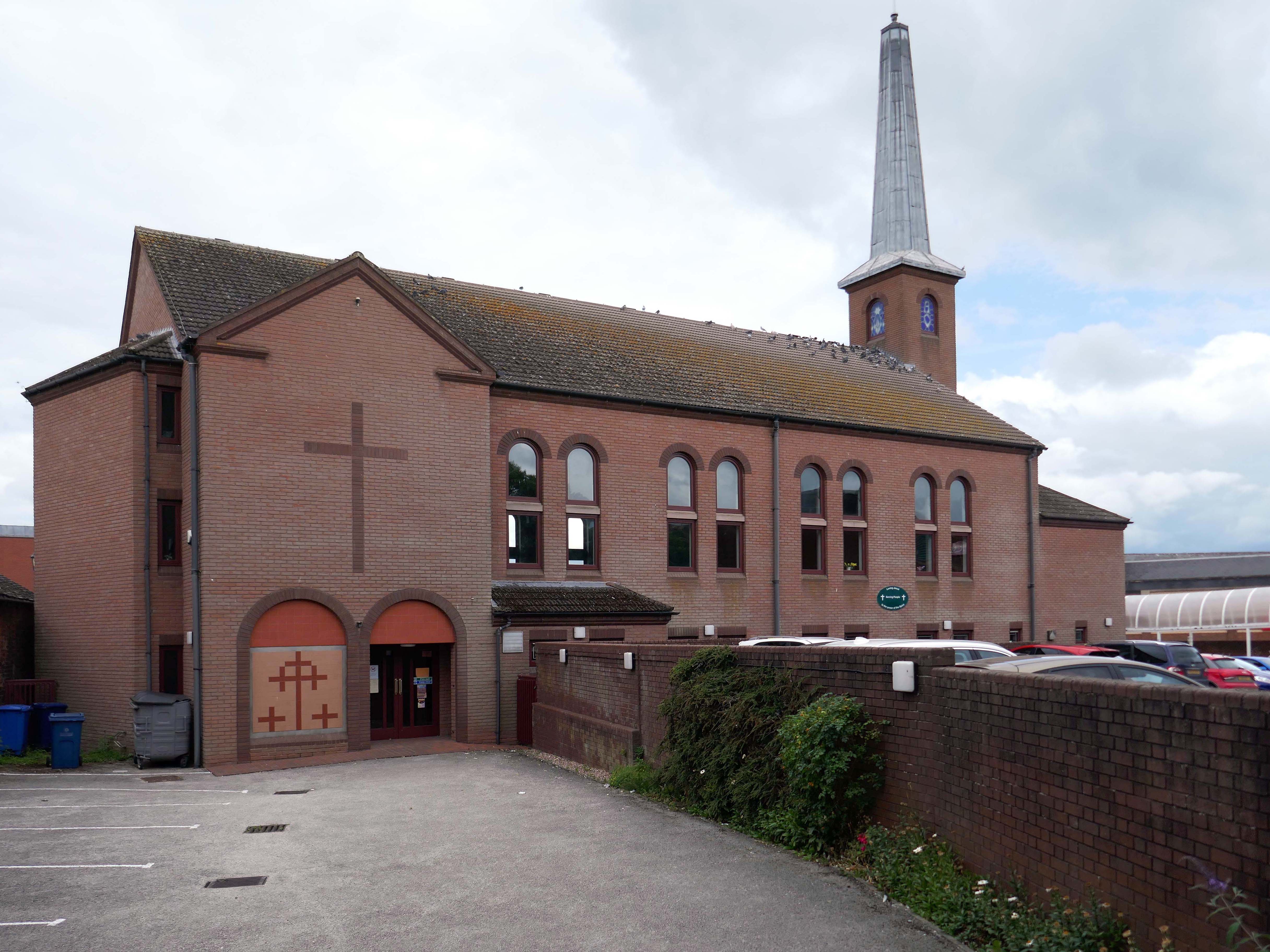
Toward the town centre and we pass the Bold Street Methodists Church – 1973-75.
Currently closed and for sale.
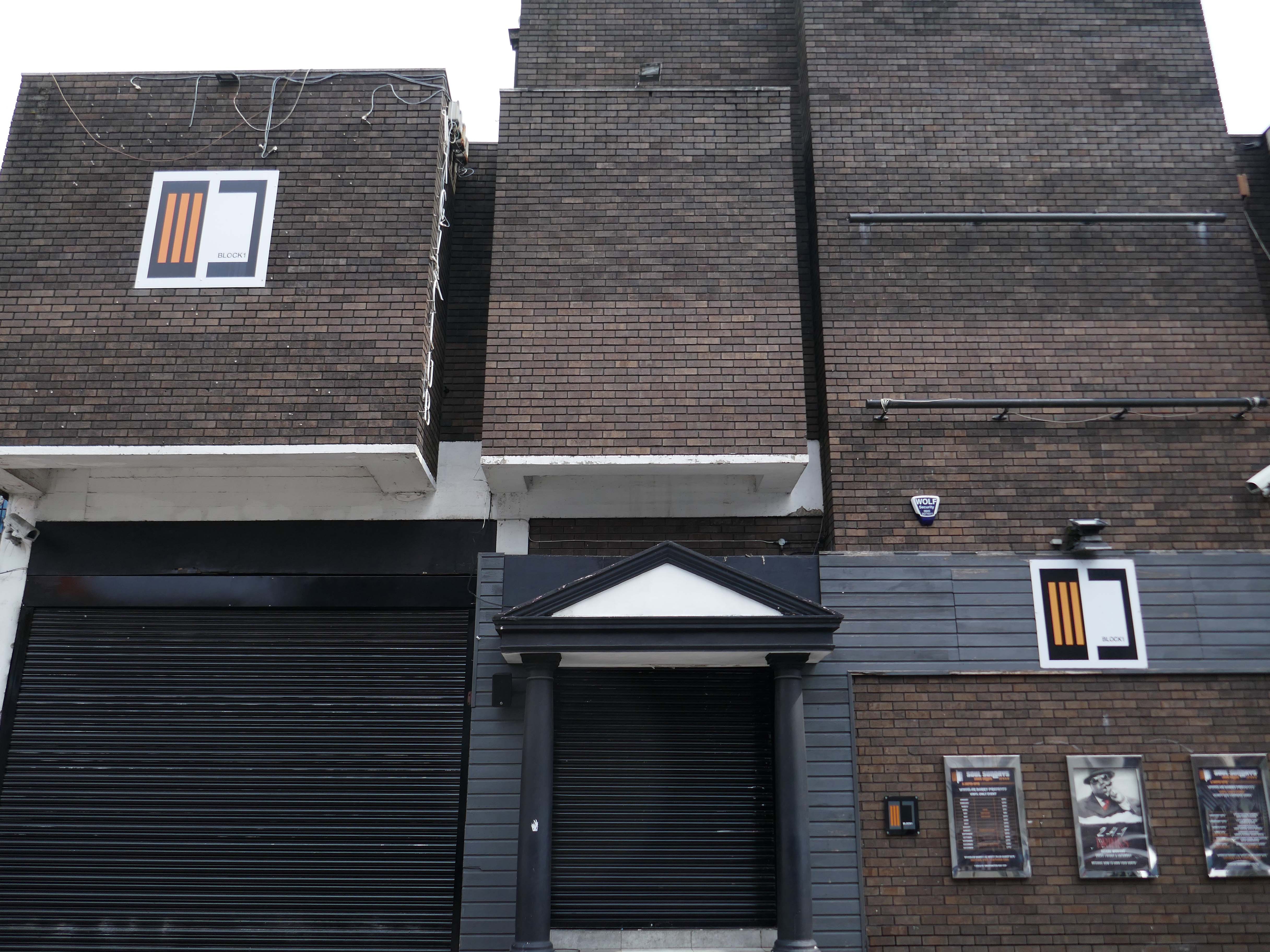
Thence to the Block 1 nightclub.
Medicine night club early 2000s.
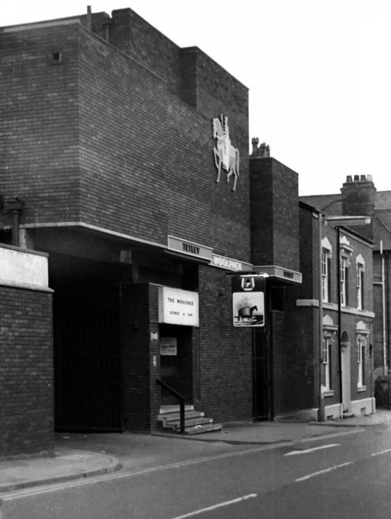
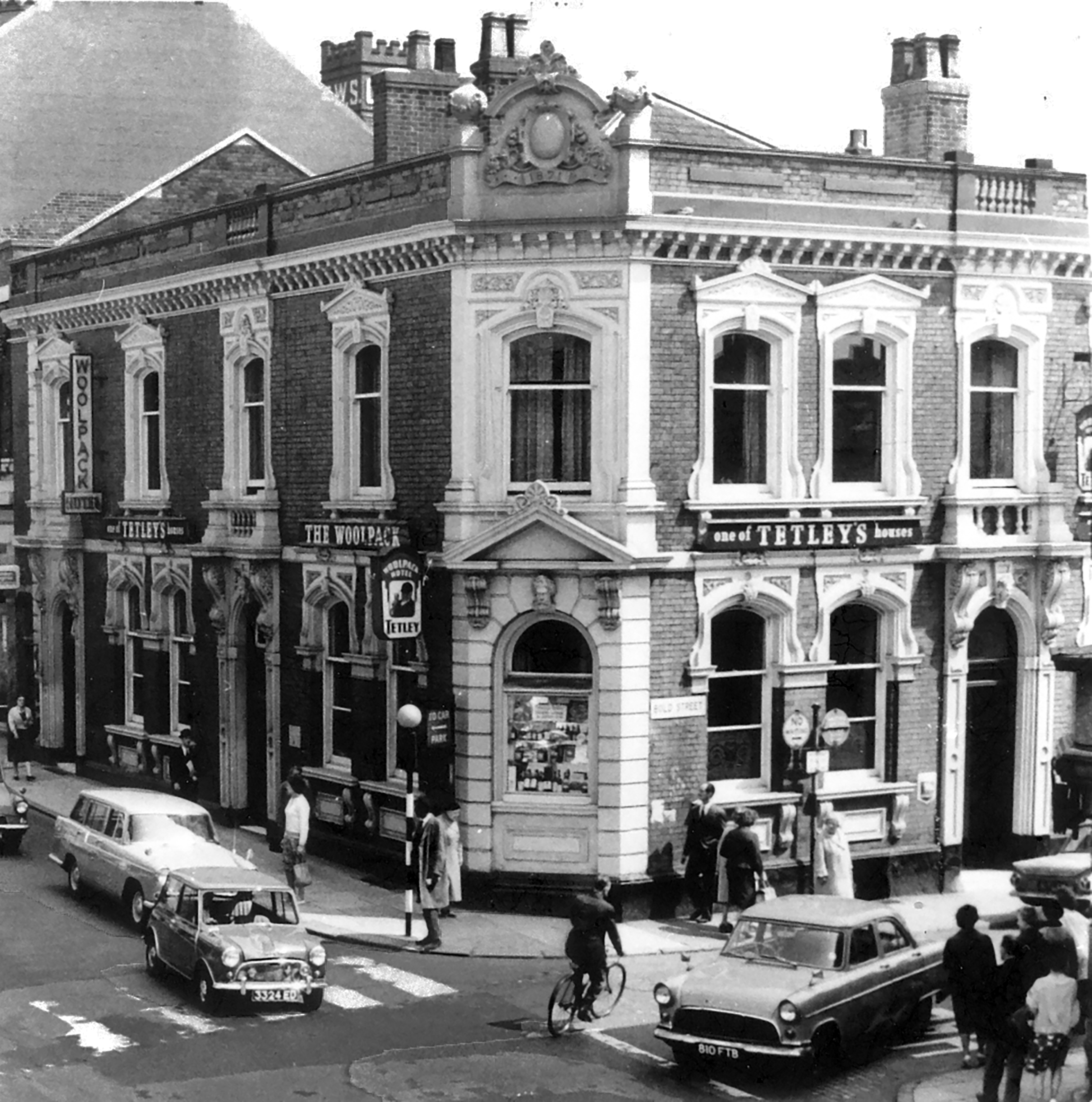
Originally a Tetley’s house named The Woolpack.
Got served my first pint in there, I was only 14.
Karl Beckett
Coming down those stairs, I slipped and the heel came off my boot, I’d only had one drink – loved those boots.
Sue Duncan
This was the original Woolpack on the site.
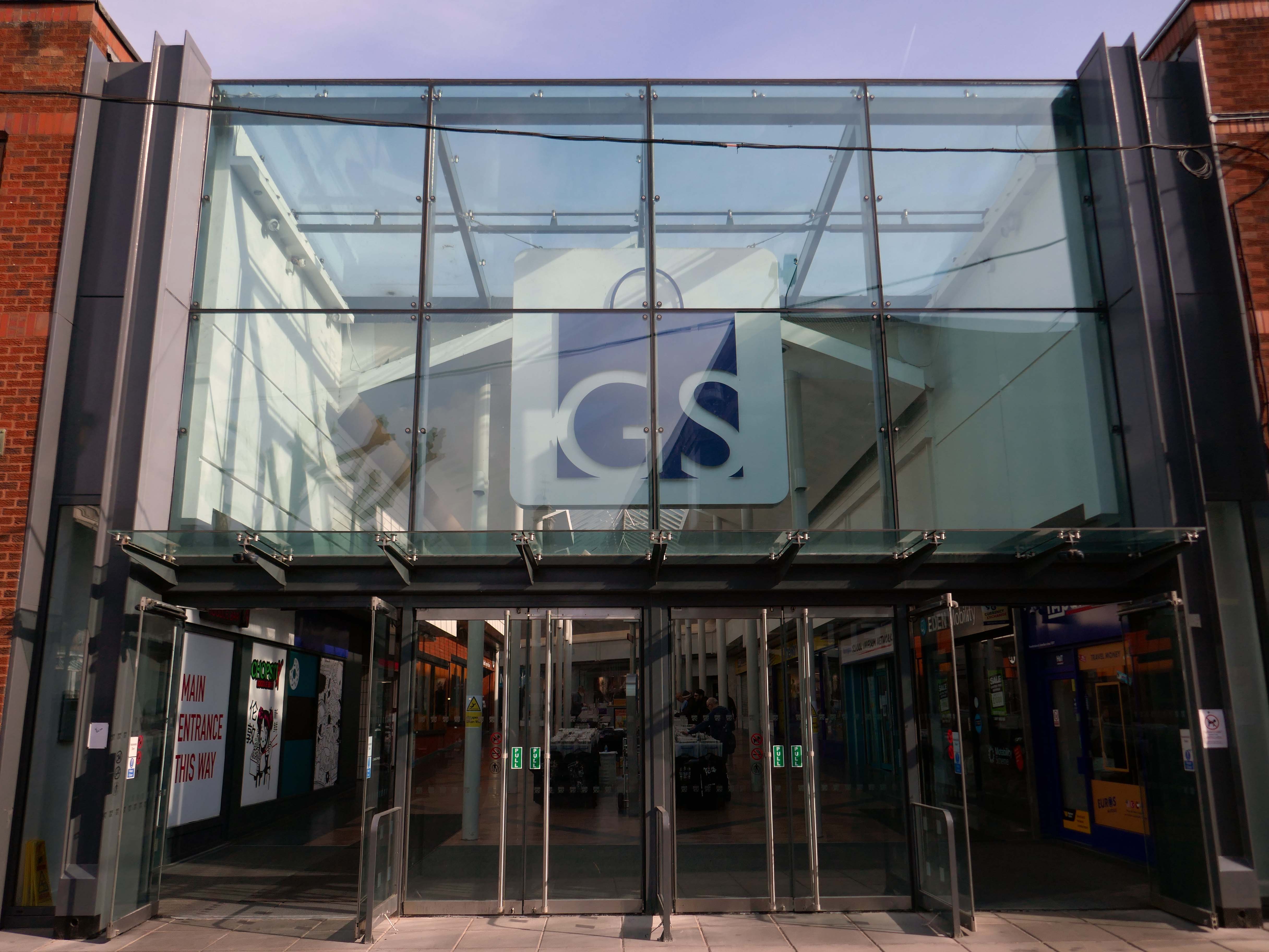
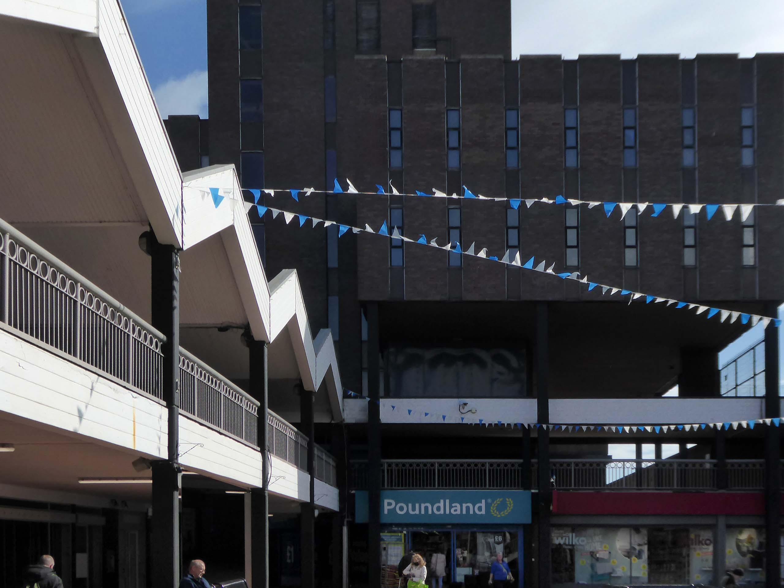
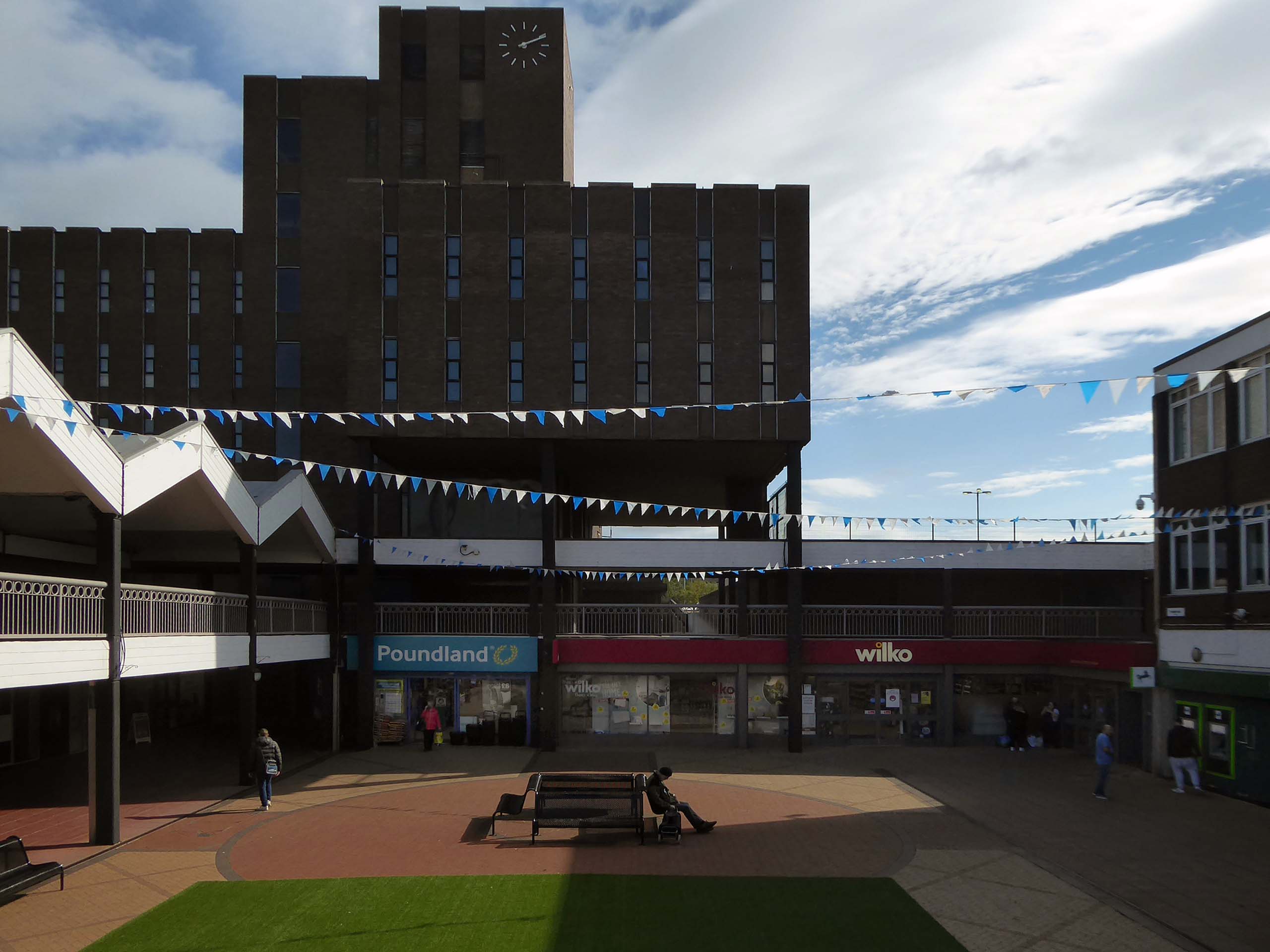
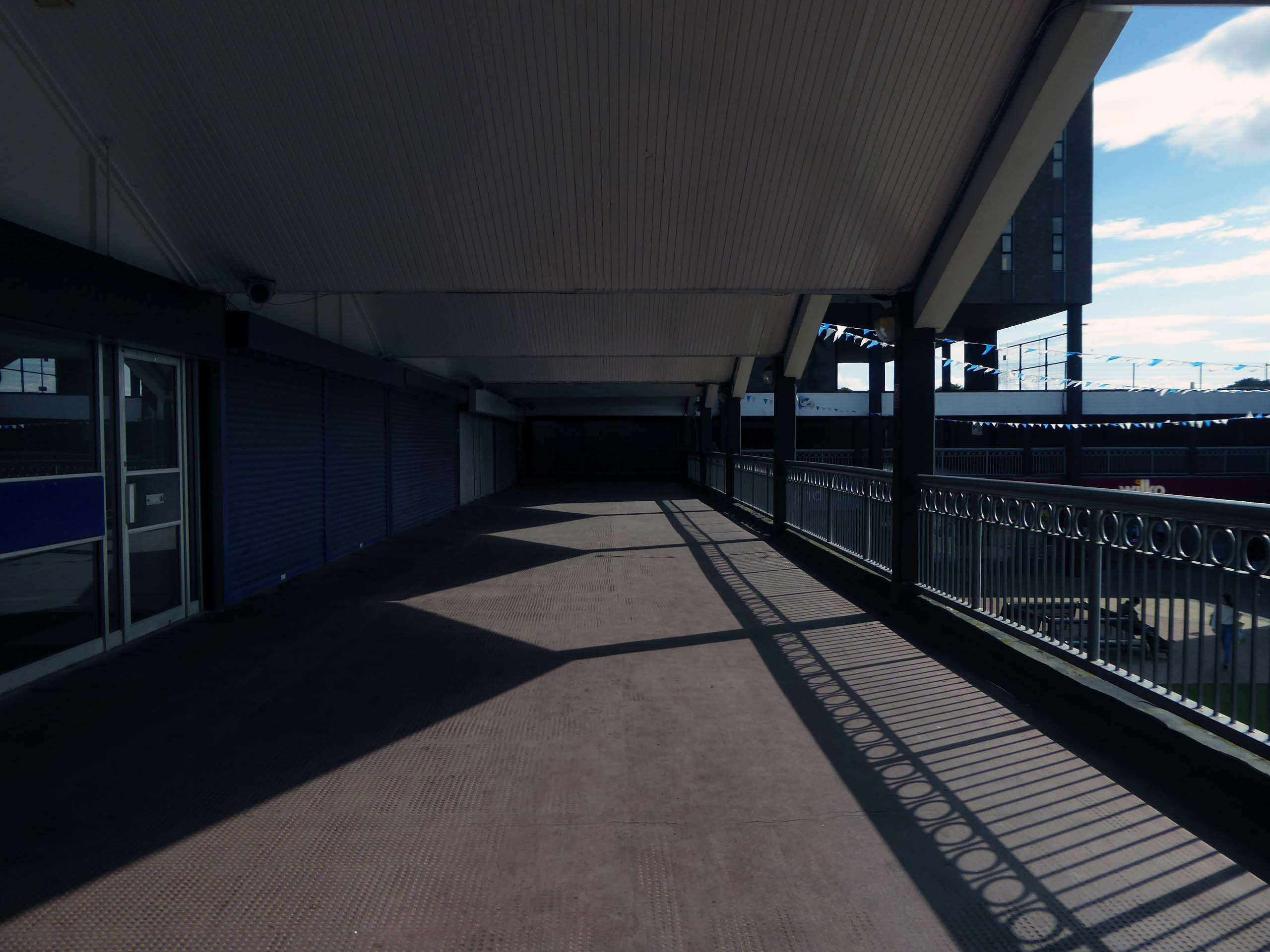
Much of the town centre is dominated by the Golden Square shopping centre.
Designed in 1974 by Ardin and Brookes and Partners, since enlarged.
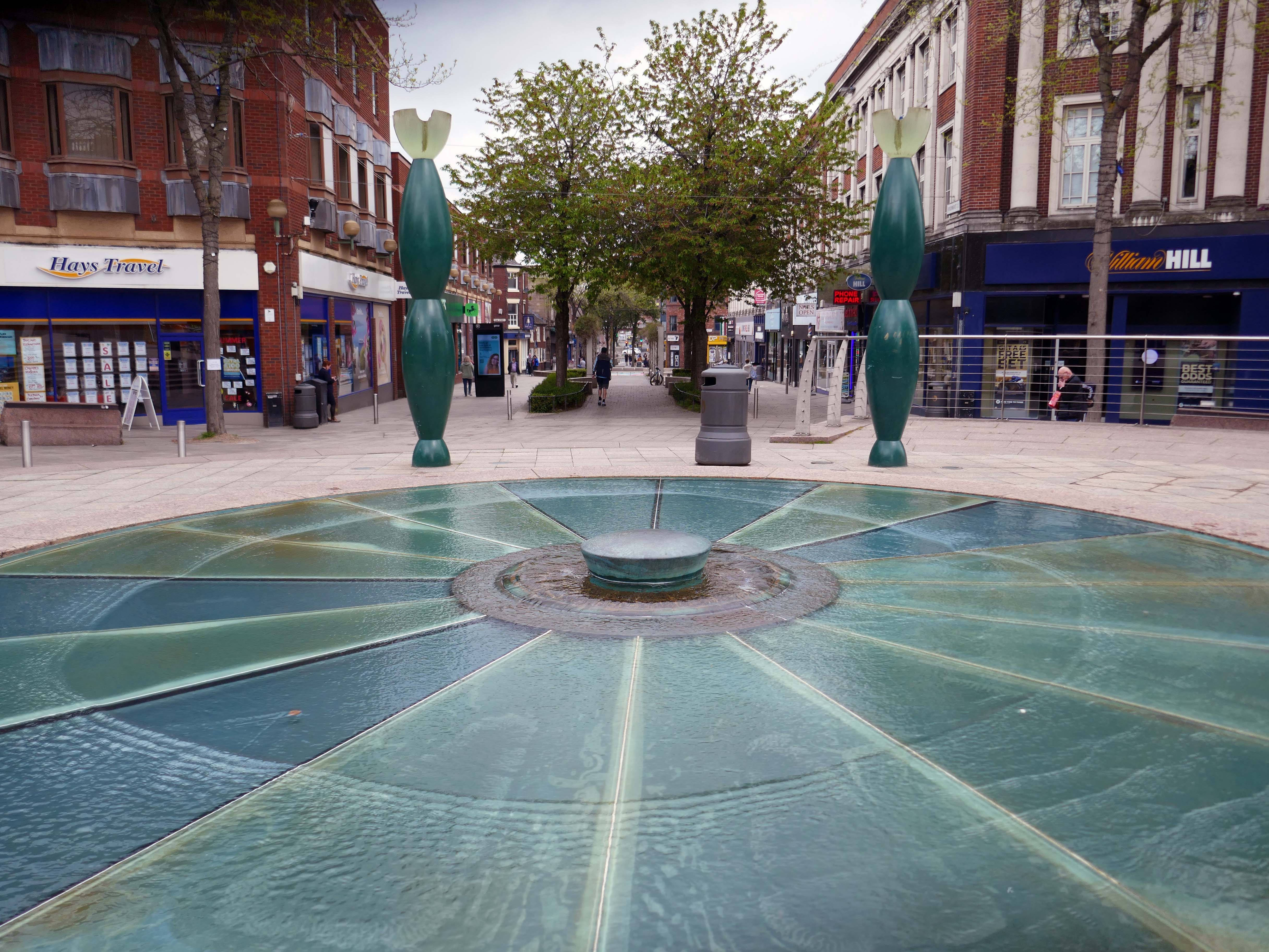
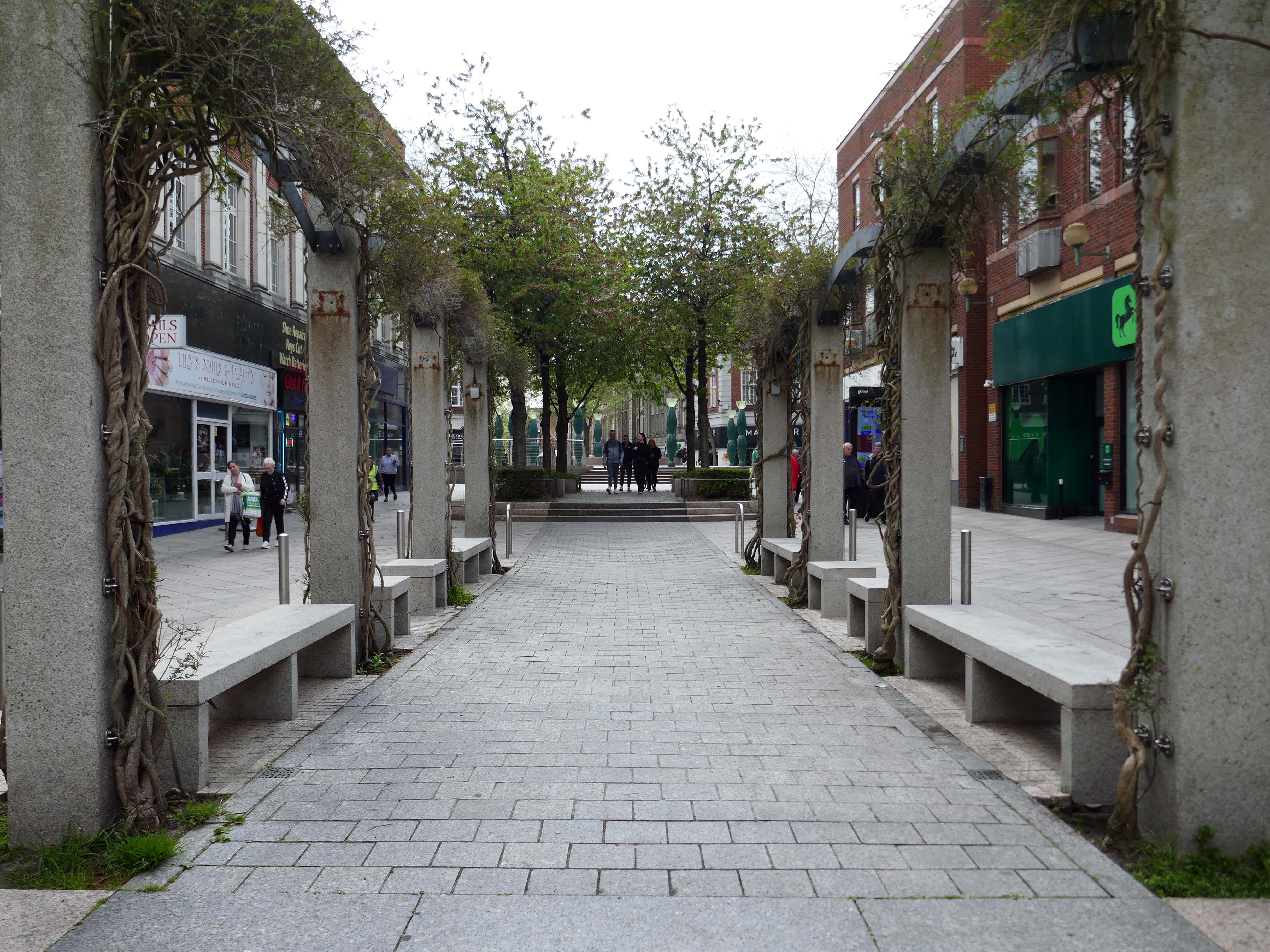
There is also extensive pedestrianisation and hard landscaping on the surrounding streets, carried out in 2002 by Landscape Design Associates with sculptural works by Howard Ben Tre.
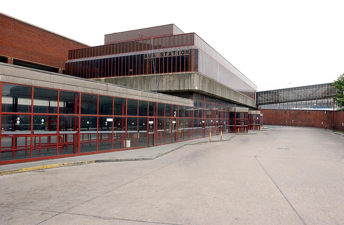
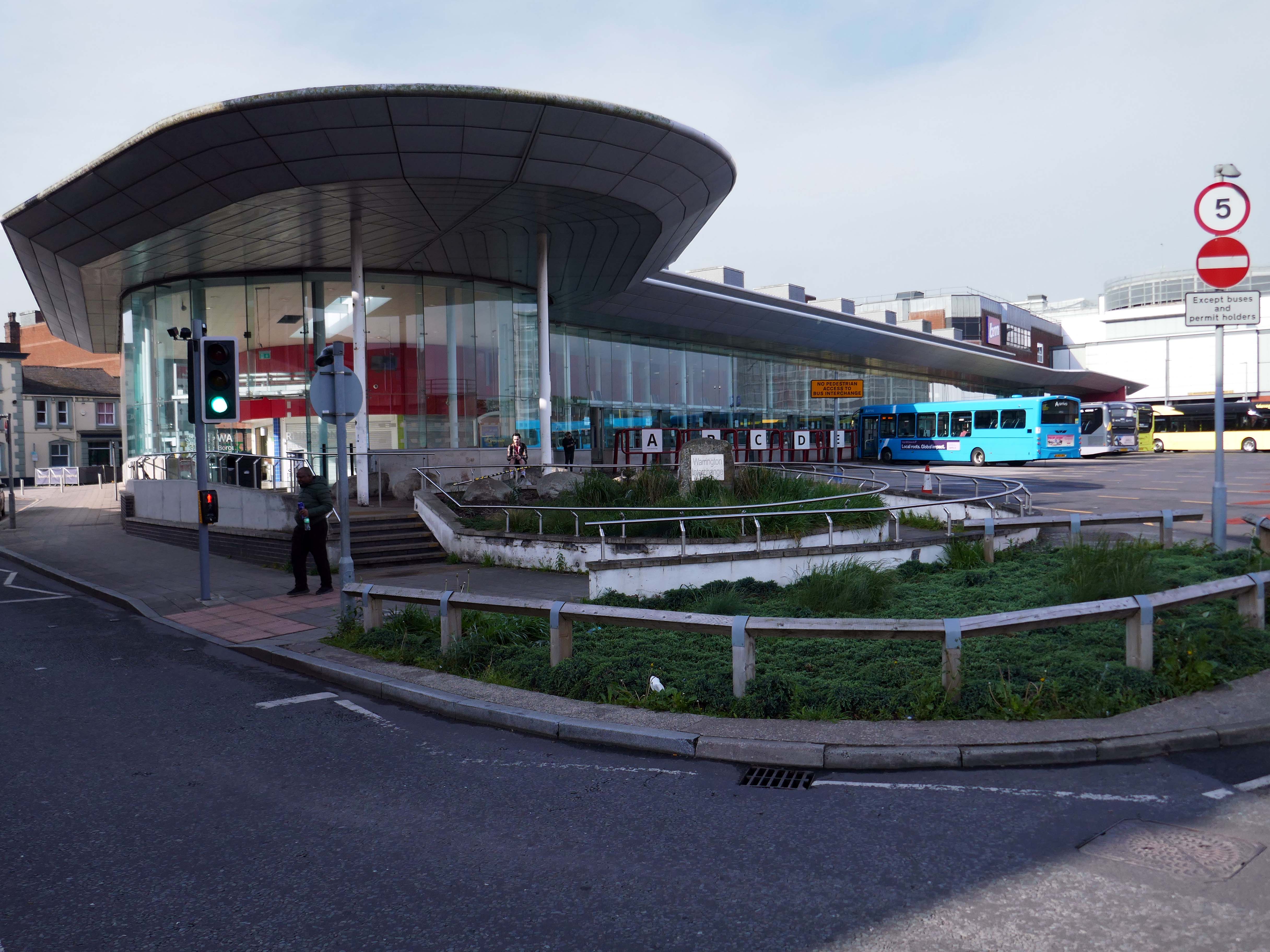
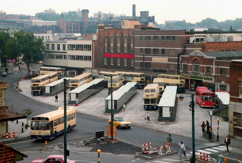
Finally to the Bus Station which used to look like this:
Until it became an Interchange and looks a lot like this.
Warrington’s new bus interchange was opened on 21 August 2006. From 1979, bus users travelled from a facility on Golborne Street, but it was very unpopular due to its very dreary appearance.
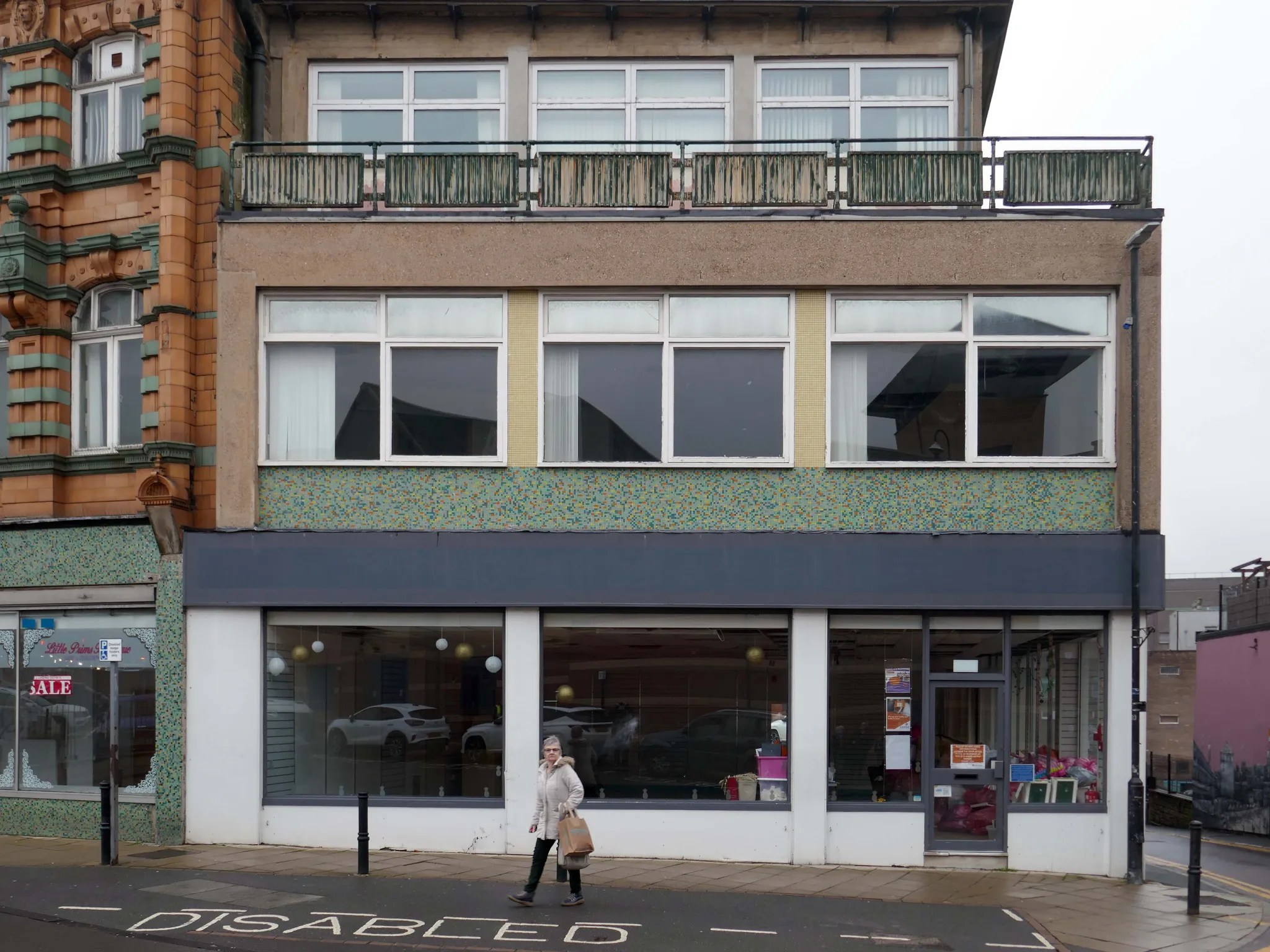
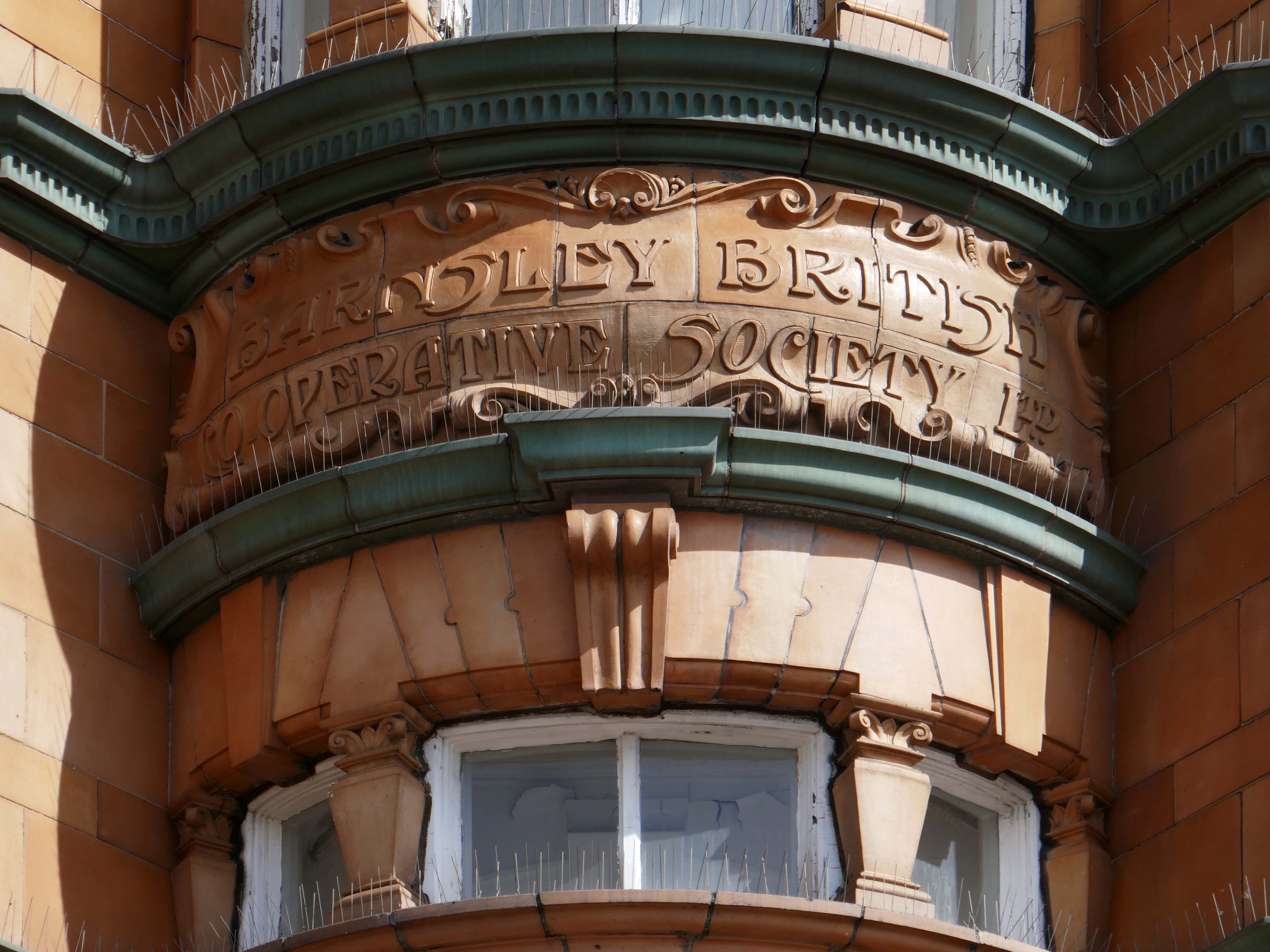
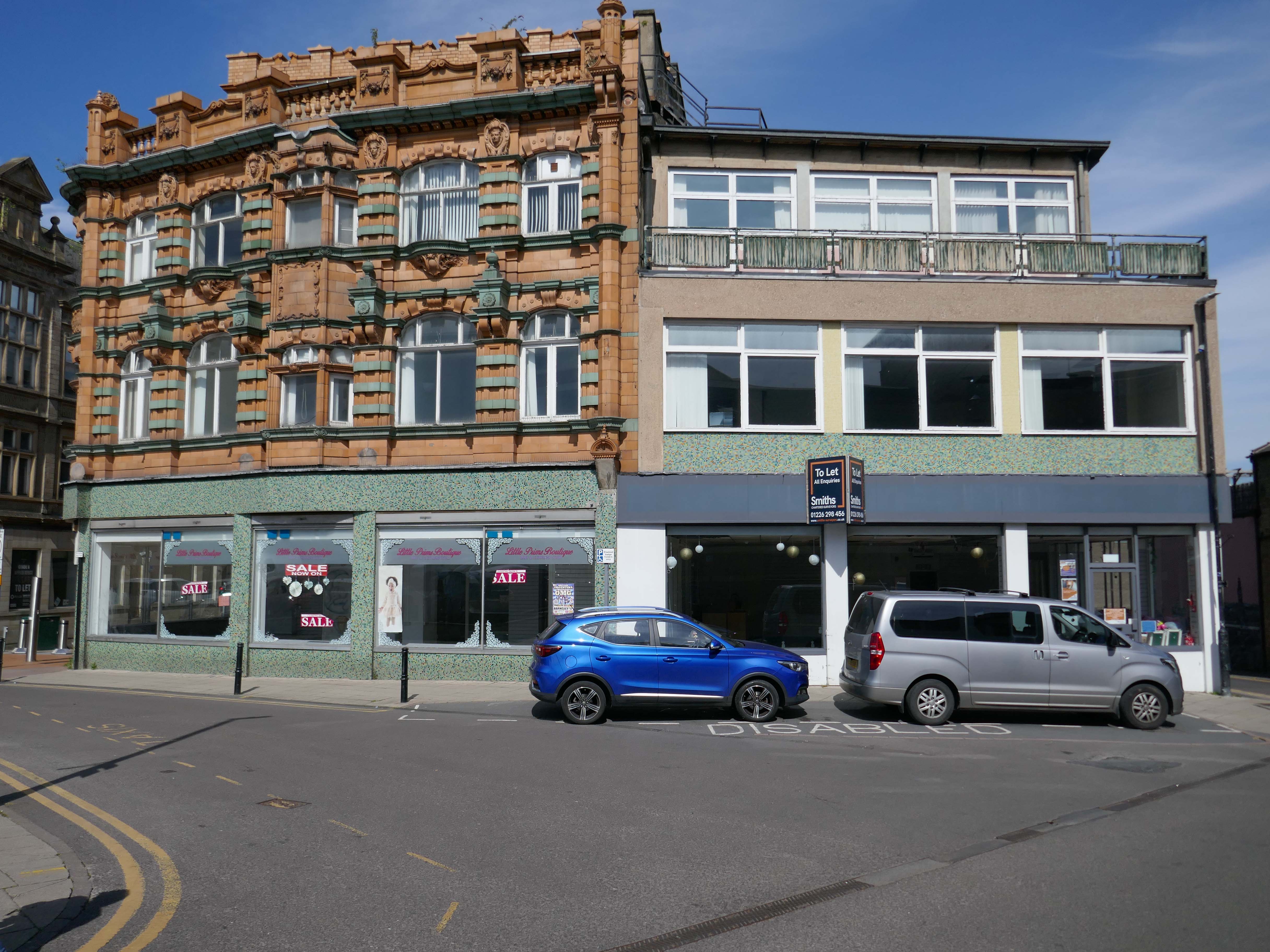
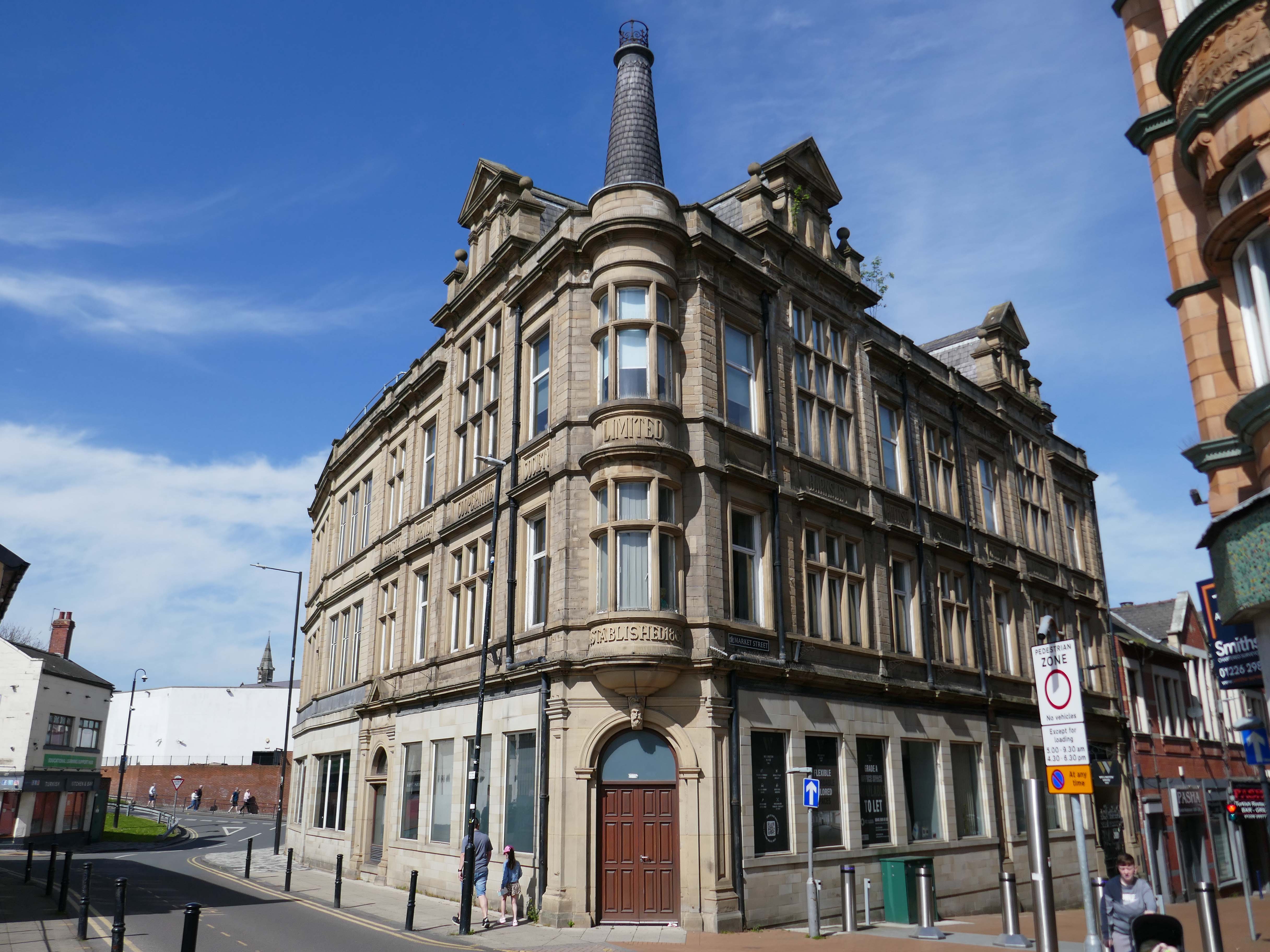
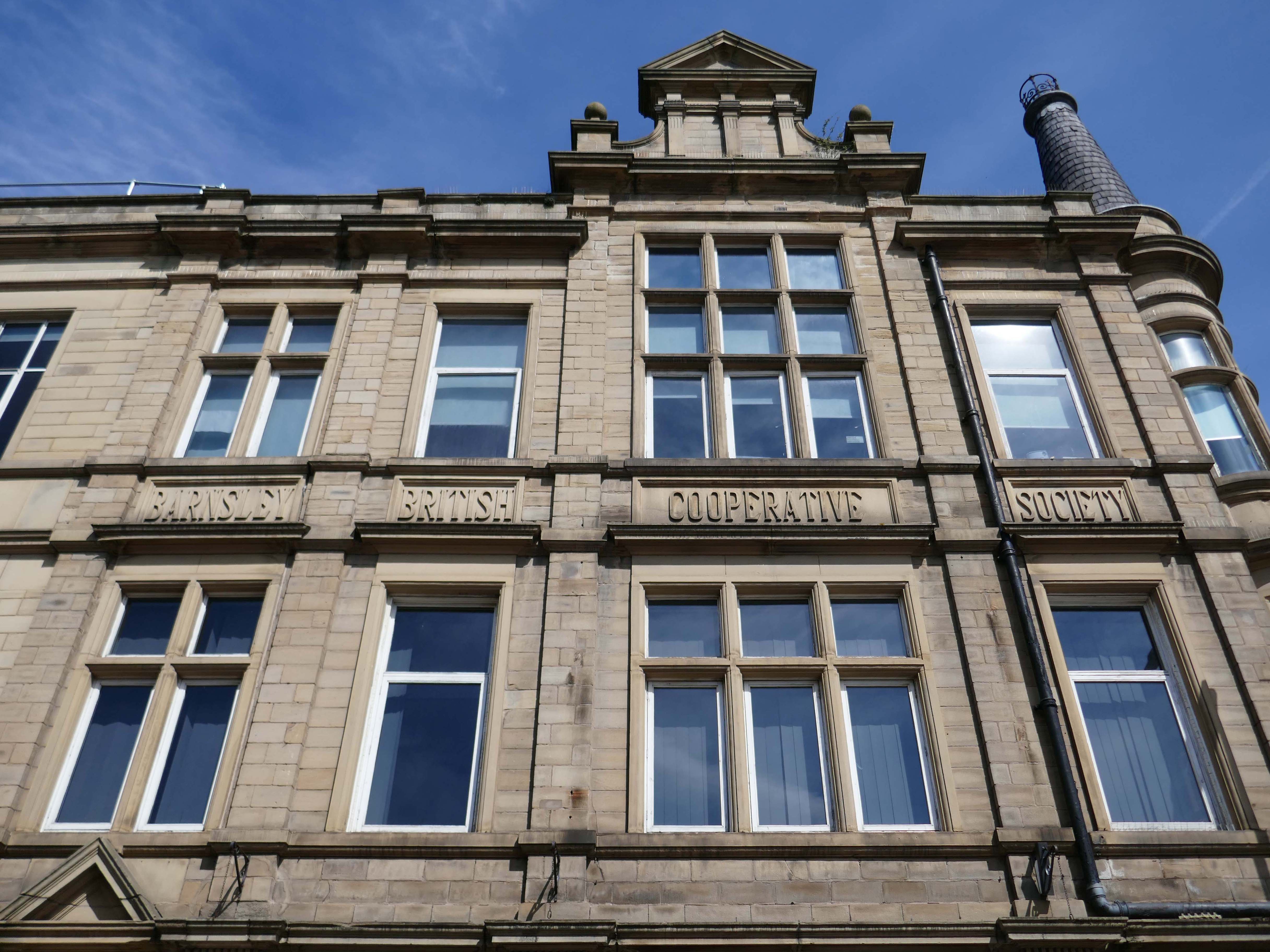
Subsequent observation and research revealed it to be an extension to a group of Barnsley Co-operative buildings.
I should have noted that the building of 1910, was the work of architect Arthur Walshingham, the terracotta and green faience, very much in the style of Northmoor Road.
The building housed grocery and footwear shops, an elegant marble floored entrance hall, a restaurant and assembly room. Its original shopfronts were mahogany with metal sills on a granite base, the windows were divided by columns with green faience shafts.
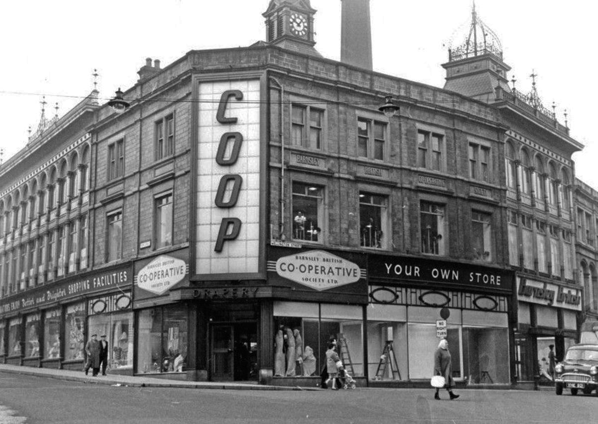
In 2016 the Barnsley British Co-operative building, sited opposite the existing buildings, suffered a large fire and unfortunately had to be demolished due to safety concerns.
For more than a century it had been considered the place to shop in town. Many will recall it as the Co-op’s toy department where, every year, excited children would queue with mums and dads to meet Santa in his grotto at Christmas.
It closed in the 1980s.
In 1993 the plan was to turn the imposing Victorian Grade II listed building into a ’high class’ venue which it was anticipated would be aimed at a clientele in the 25-plus age group.
The name Walsall is derived from Walh halh, meaning valley of the Welsh, referring to the British who first lived in the area. Later, it is believed that a manor was held here by William FitzAnsculf, who held numerous manors in the Midlands. By the first part of the 13th century, Walsall was a small market town with a manor house; the weekly market was introduced in 1220 and held on Tuesdays. The mayor of Walsall was created as a political position in the 14th century.
Significant developments also took place nearer to the town centre, particularly during the 1960s when a host of tower blocks were built around the town centre; however, most of these had been demolished by 2010.
The Memorial Gardens opened in 1952, in honour of the town’s fallen combatants of the two world wars. The Old Square Shopping Centre, a modern indoor shopping complex featuring many big retail names, opened in 1969.
Much of the reconstruction of the post-war period was quickly reconsidered as ugly and having blighted the town. In 1959, John Betjeman advised that with sensitive restoration the old buildings of the High Street could become:
There is to be further demolition on the High Street, to open up the vista between the Bus and Railway stations.
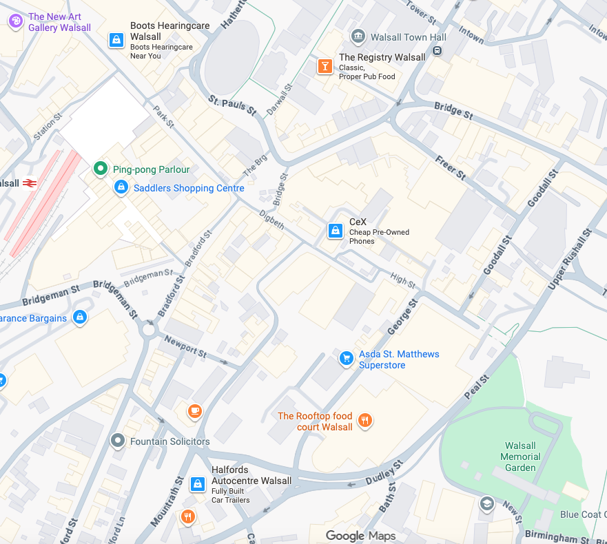
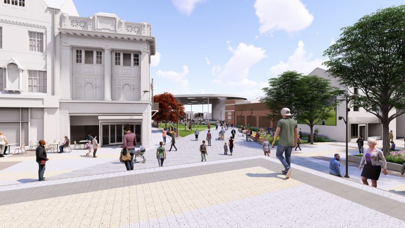
In 2021 Walsall secured funding of £11.4m from the Future High Street Fund. With further investment from Walsall Council we are now delivering the early phases of the Town Centre Masterplan, through the Walsall Connected Gateway Project.
Approval has been granted to remodel the Saddlers Centre to create a more open and attractive arrival experience for train passengers whilst also opening up Park Street. Butler’s Passage, which has in the past been the centre of antisocial behaviour, will disappear as some of the buildings are removed to create a large open walkway, connecting the rail and bus hubs.
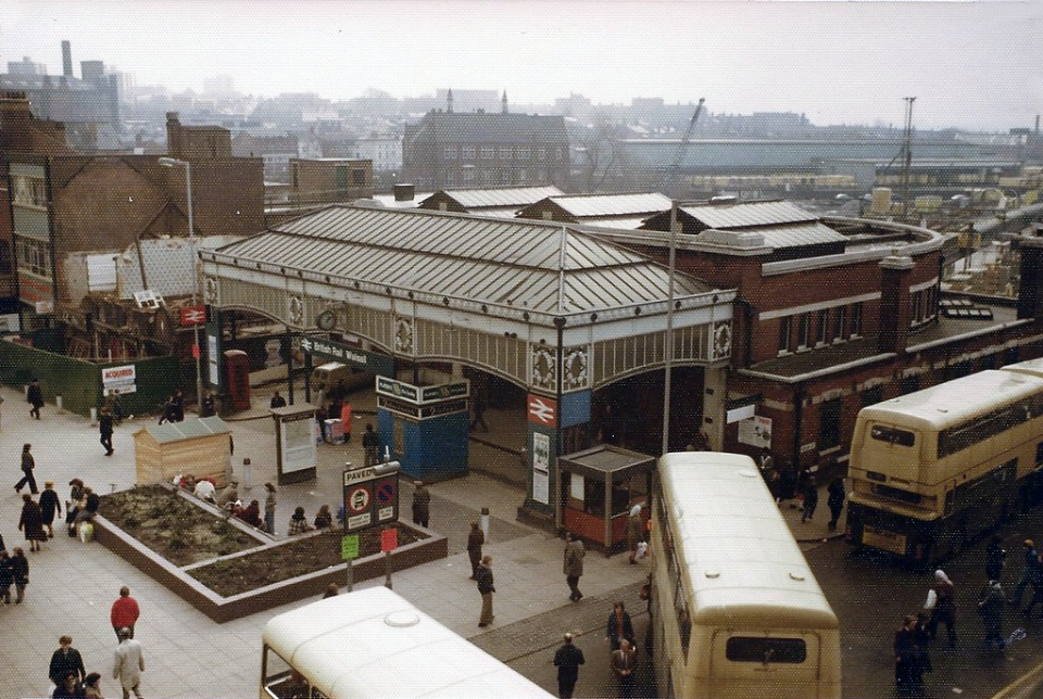
Former Railway station 4th March 1978 – photo by Walsall 1955
The station was about to be closed, demolished and replaced by a new Marks & Spencers and the Saddlers Centre.
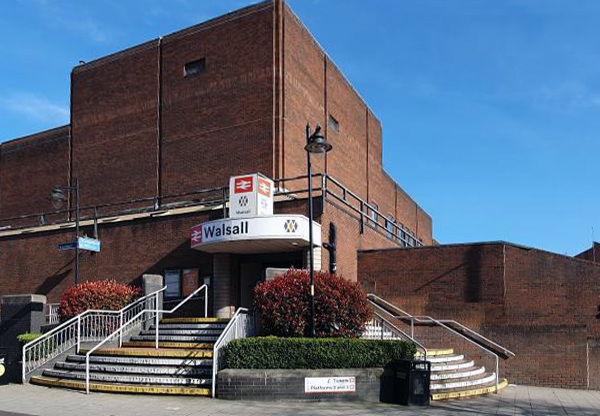
The existing entrance to the railway station on Station Street.
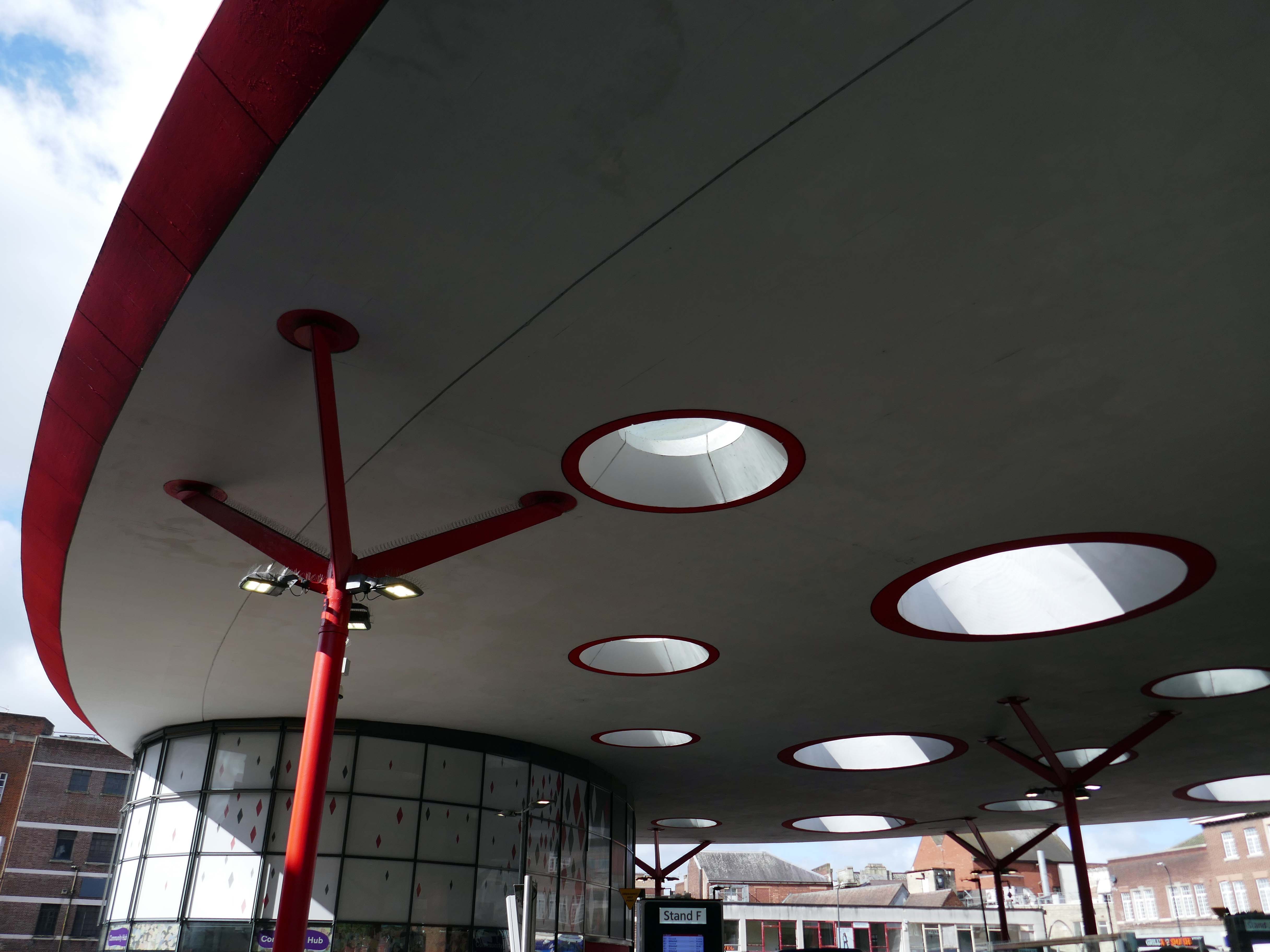
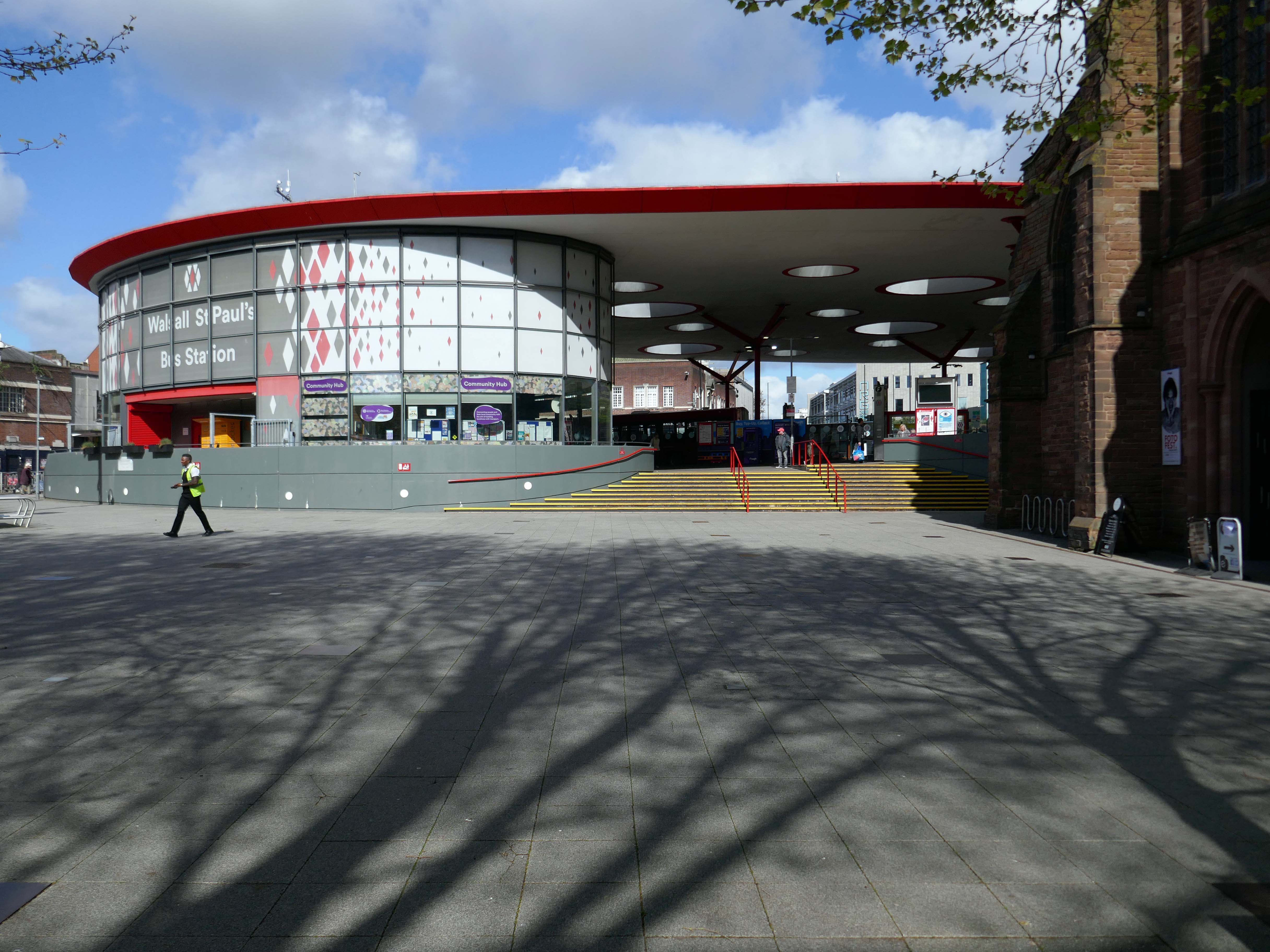
Let’s begin at the St Paul’s bus station or Hub – if you will, complete in September 2000.
The 1936 St Pauls Street bus station closed in February 1975, and was completely demolished, rebuilt and opened in August 1975.
Photo by: Walsall 1955
Allford Hall Monaghan Morris designed the building for Centro. The structural engineers were Atelier One, Shepherd Construction Ltd were the contractors, Watkins Dally were the landscape architects and Clark Smith Partnership were the civil engineers.
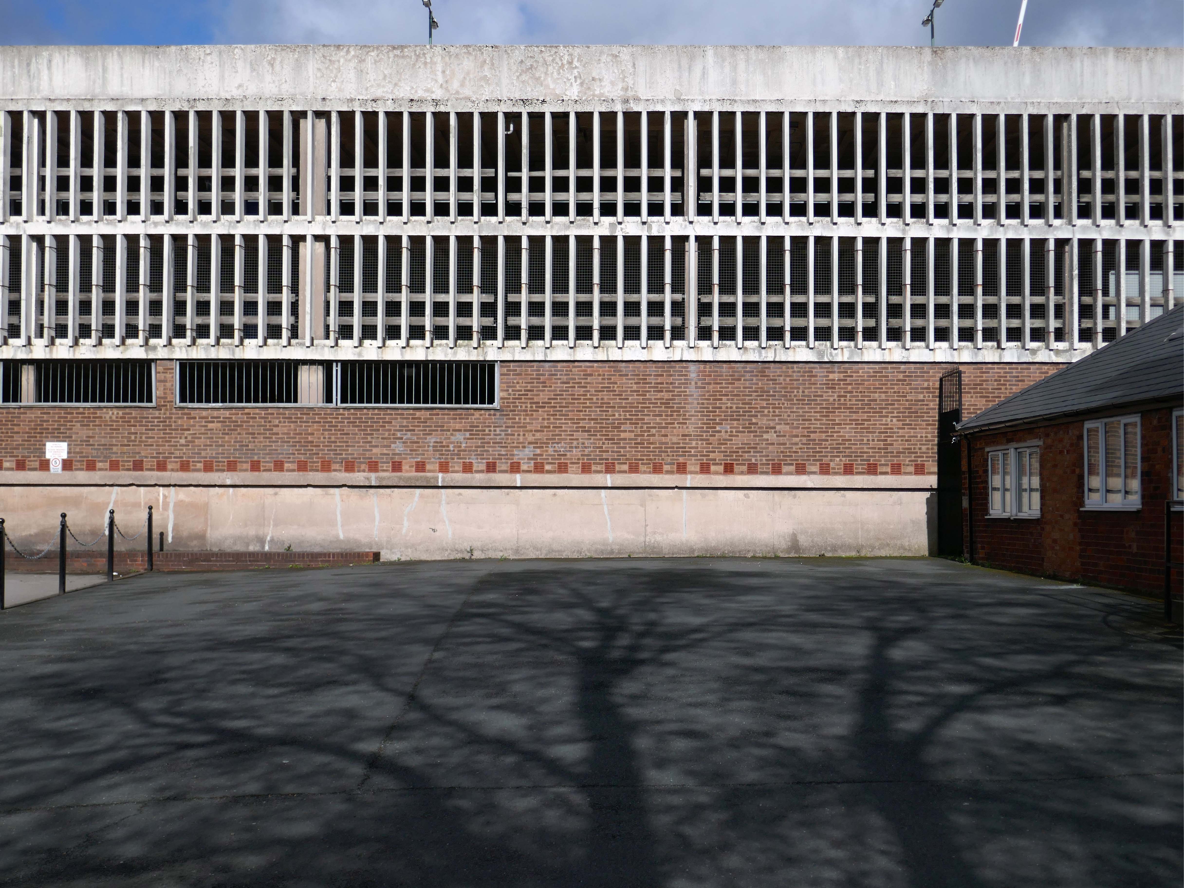
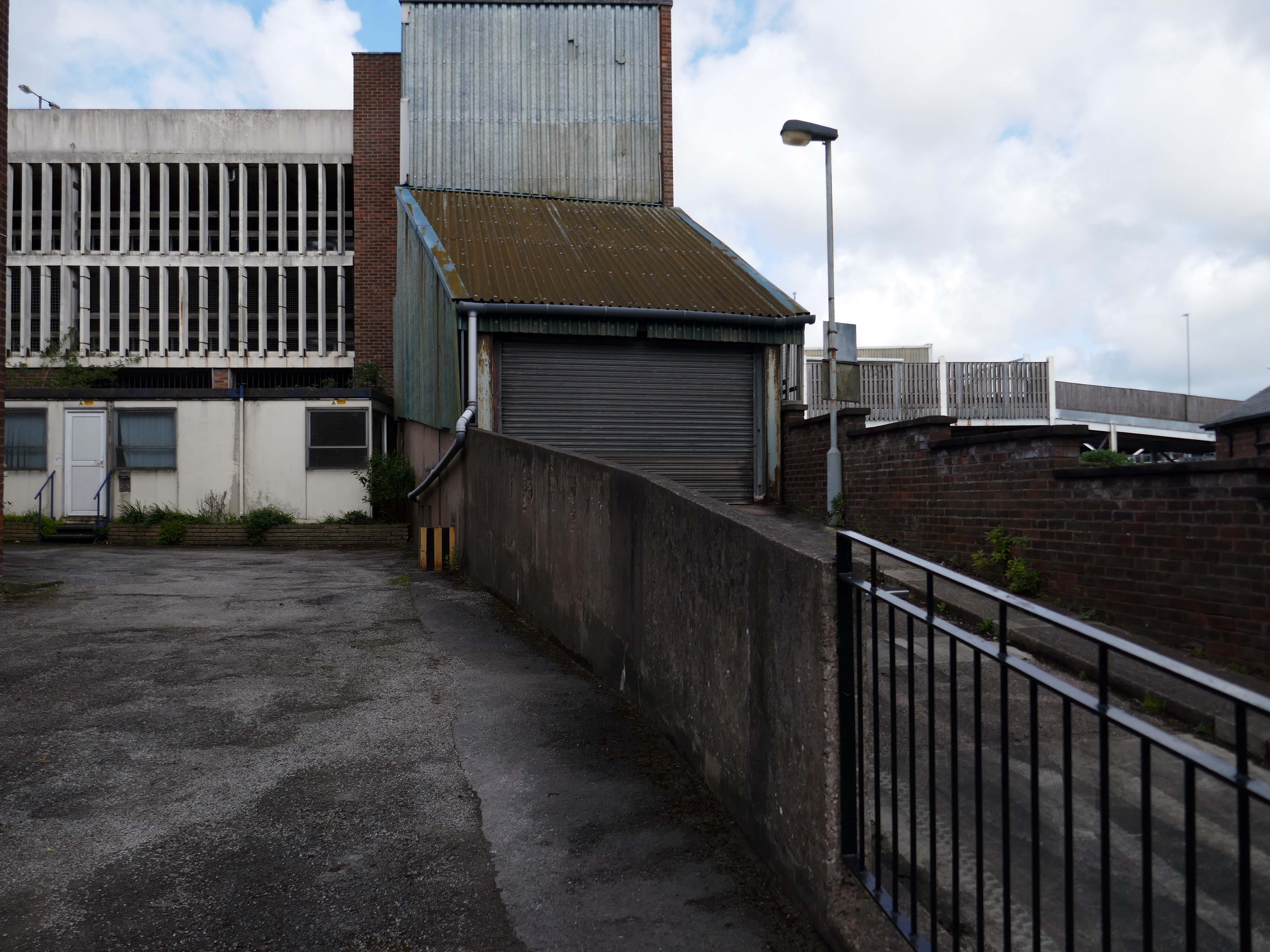
Next, a glimpse of Hatherton Road multi-storey car park.
Though it appears to be closed.
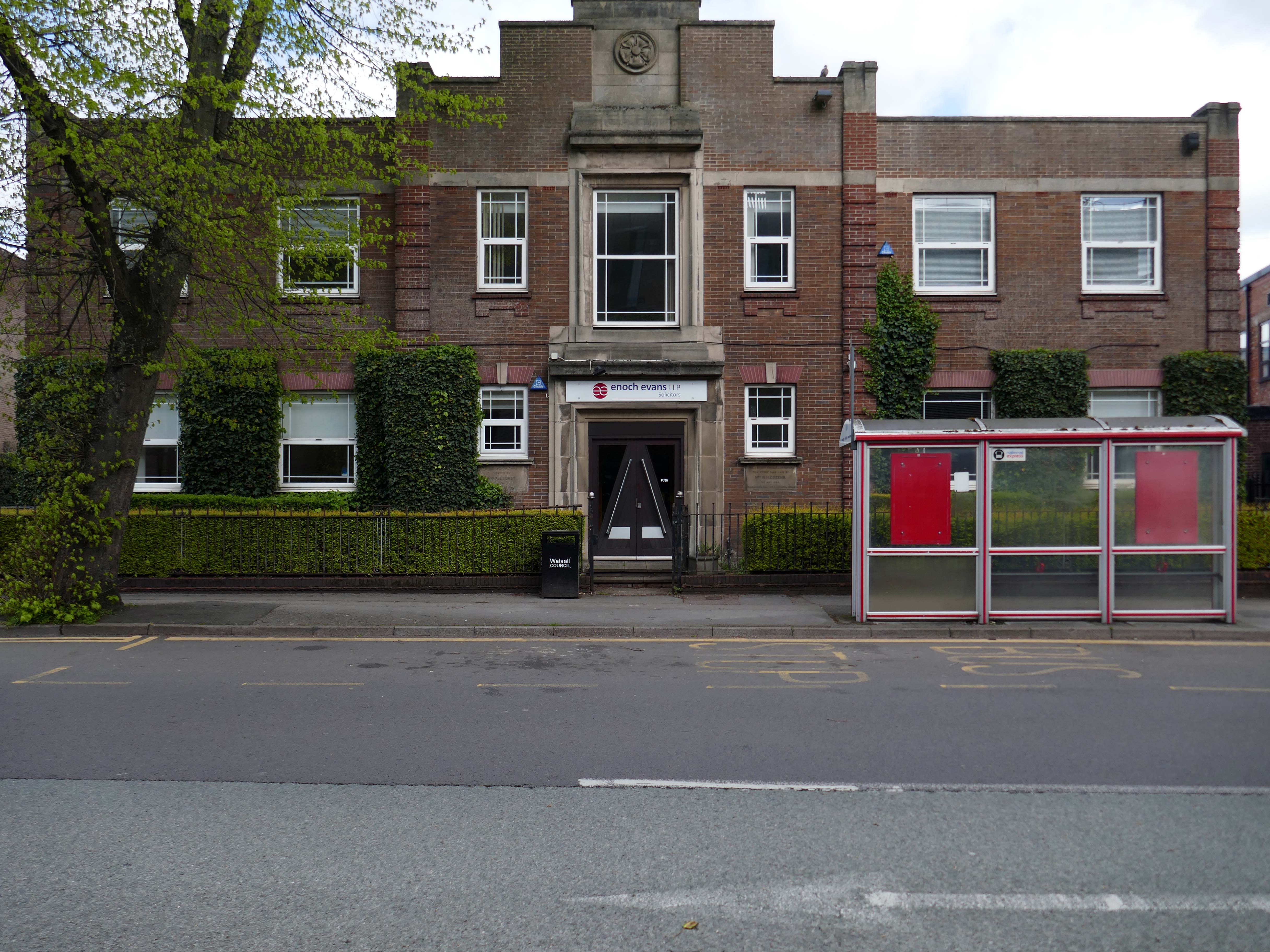
Adjacent to Enoch Evans Solicitors, their offices housed in one of the many imperious inter-war buildings dotted around the town.
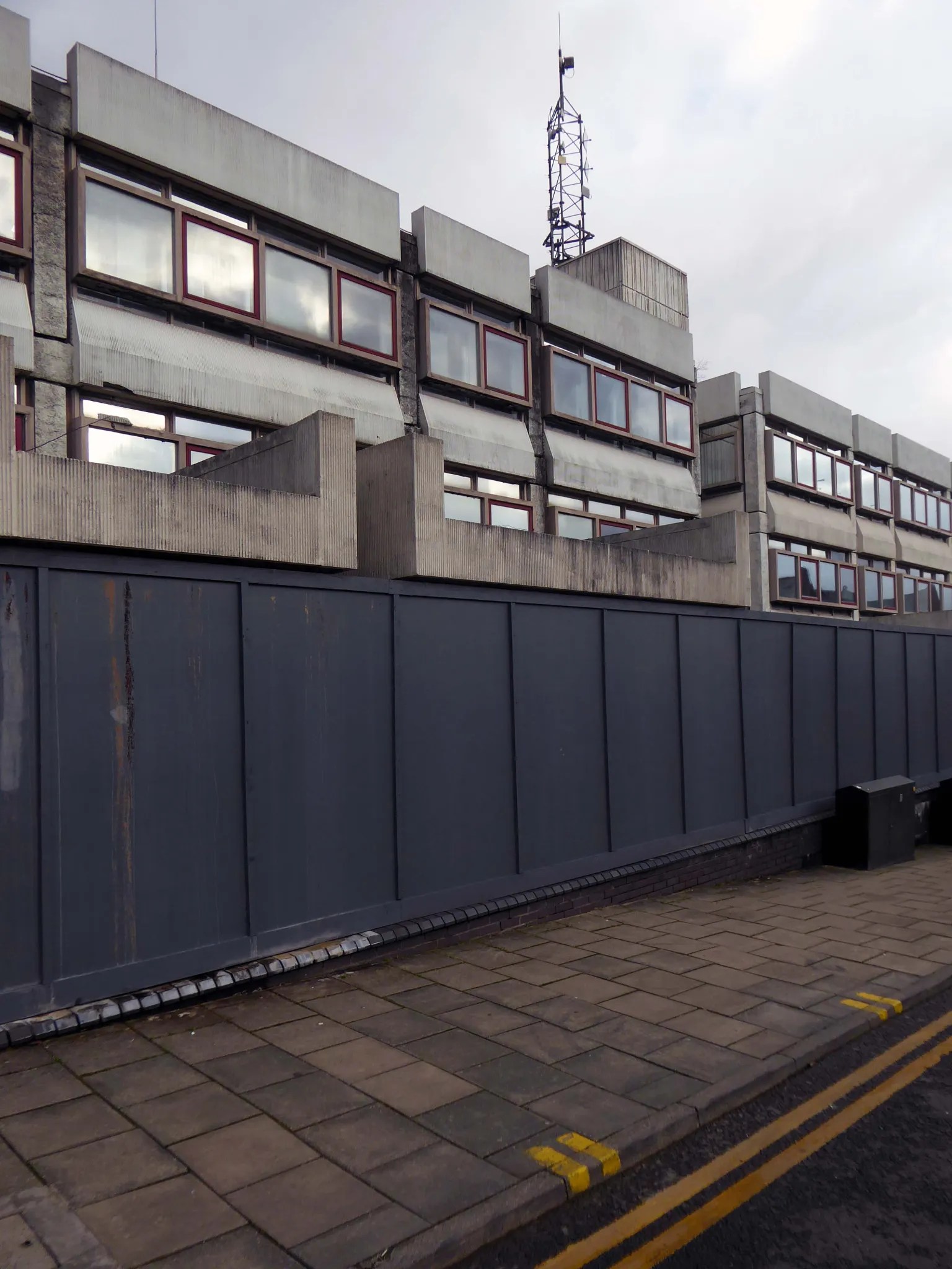
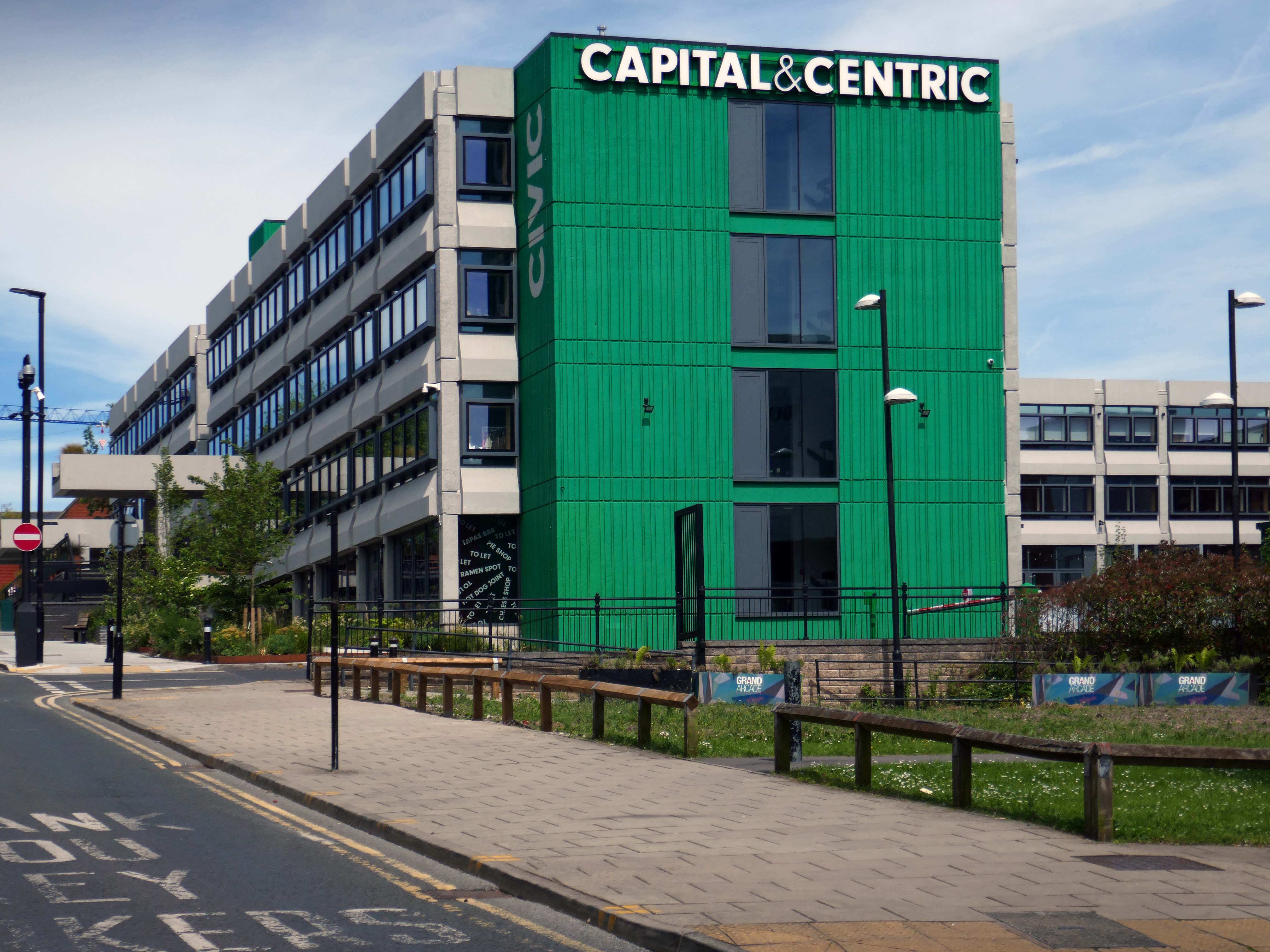
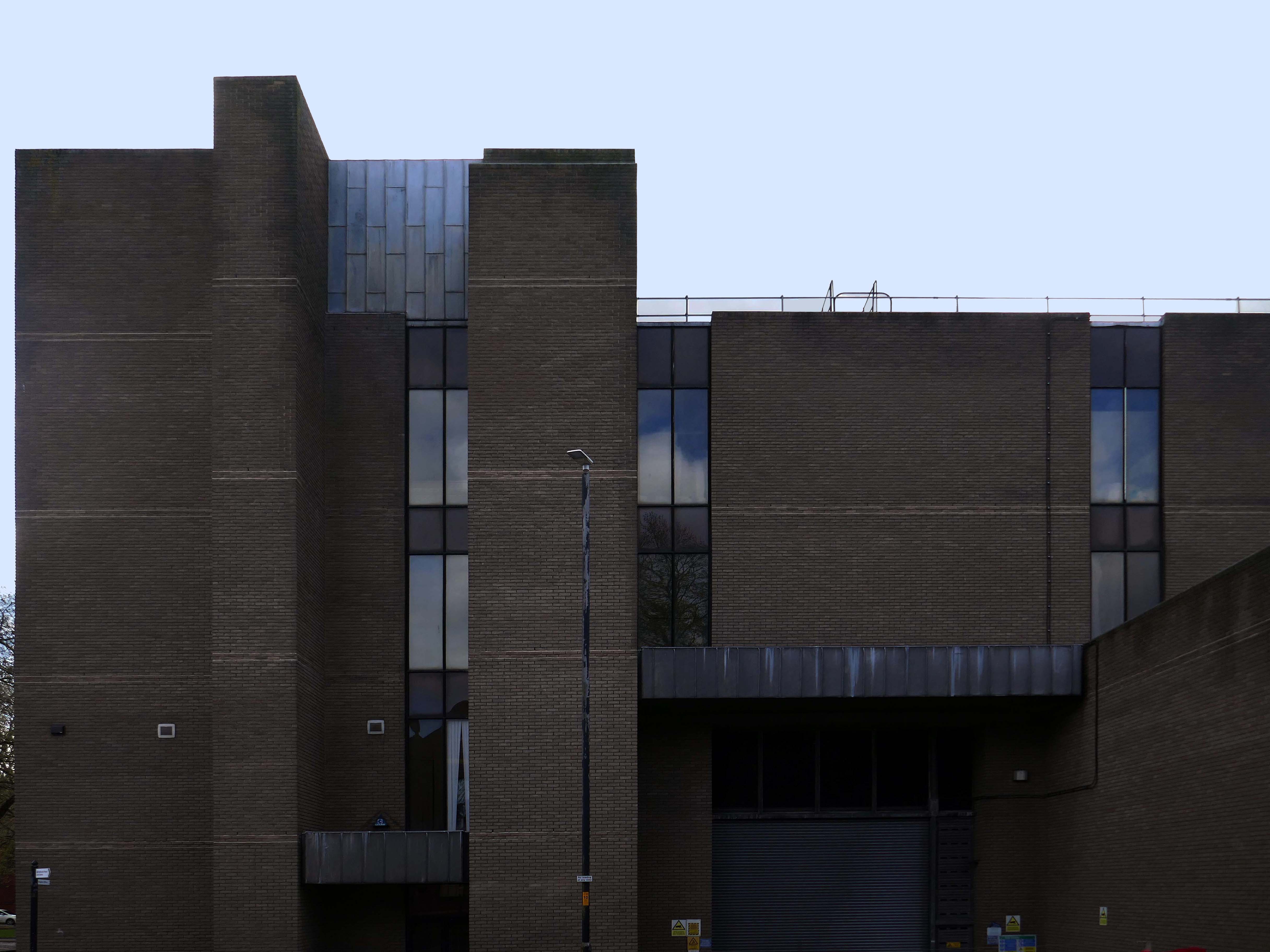
Which faces onto the back of the Civic Centre.
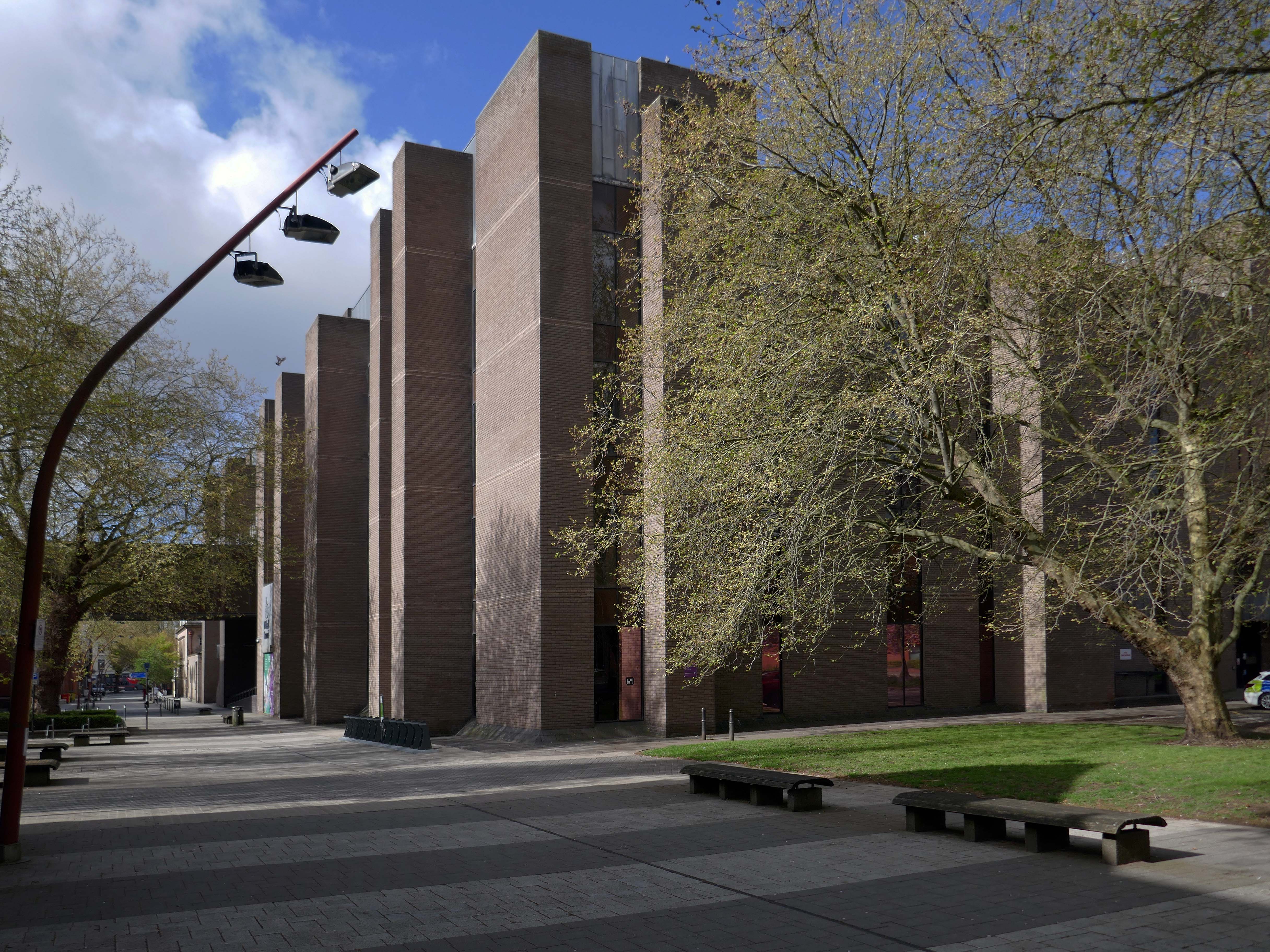
Following the formation of the Metropolitan Borough, the new Civic Centre in Darwall Street opened in 1976, architect Stanley W Bradford Walsall MBC Director of Architecture.
Central roof garden.
Leaving the Civic Quarter on the left is the Imperial
The Imperial started life as an agricultural hall, constructed in 1868-69, and designed by the architect GB Nichols of West Bromwich. At that time, it was used for a variety of community activities including shows and dancing, it was also hired out to travelling film showmen. The main feature of the early building was a principal ground floor hall.
In June 1914, the Imperial was closed to allow for conversion to a cinema, designed by West Midlands-based architects Hickton & Farmer.
The Imperial was converted to a bingo club in 1968, and in 1996 it was converted into a pub, which closed in 2016.
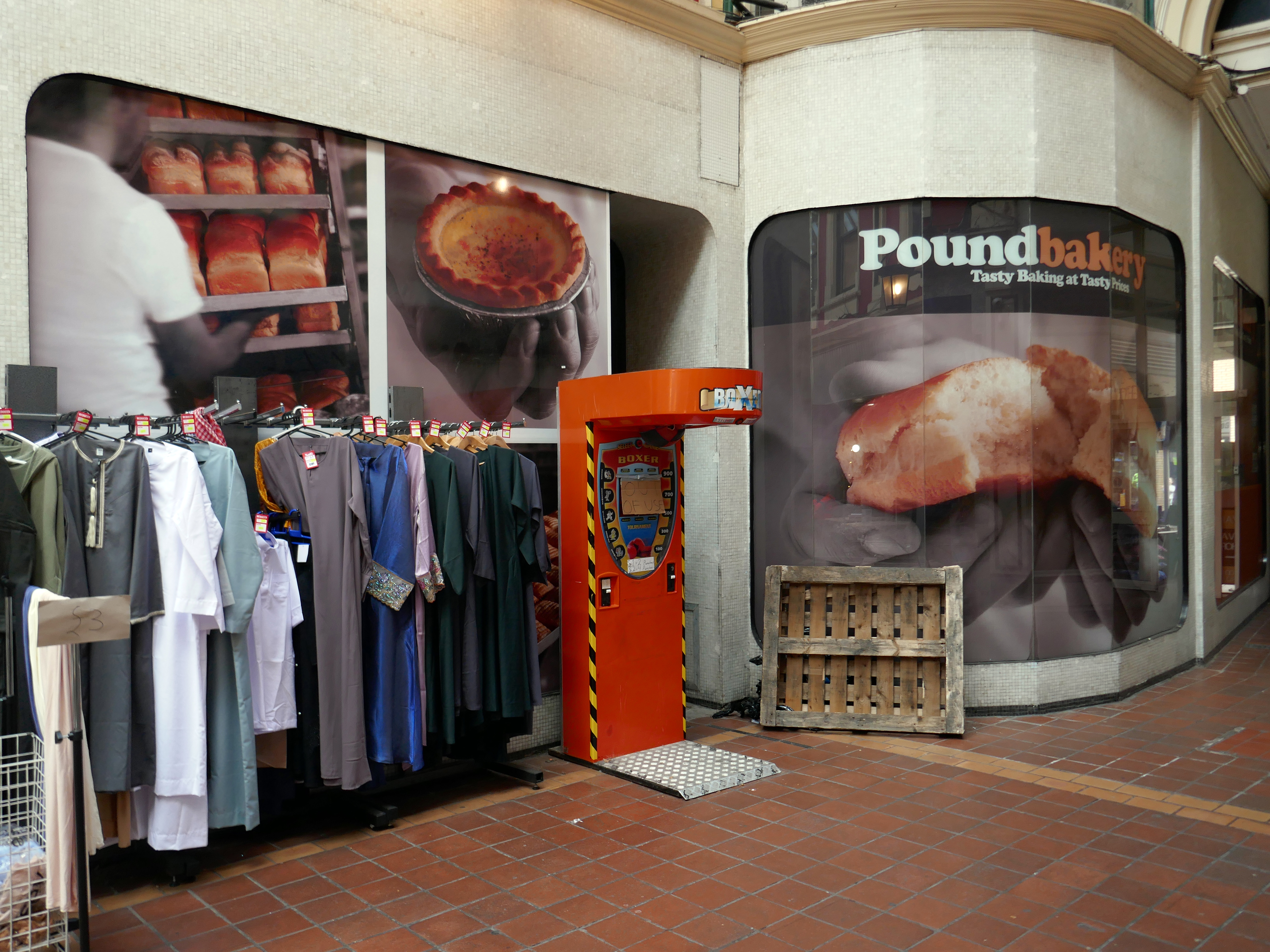
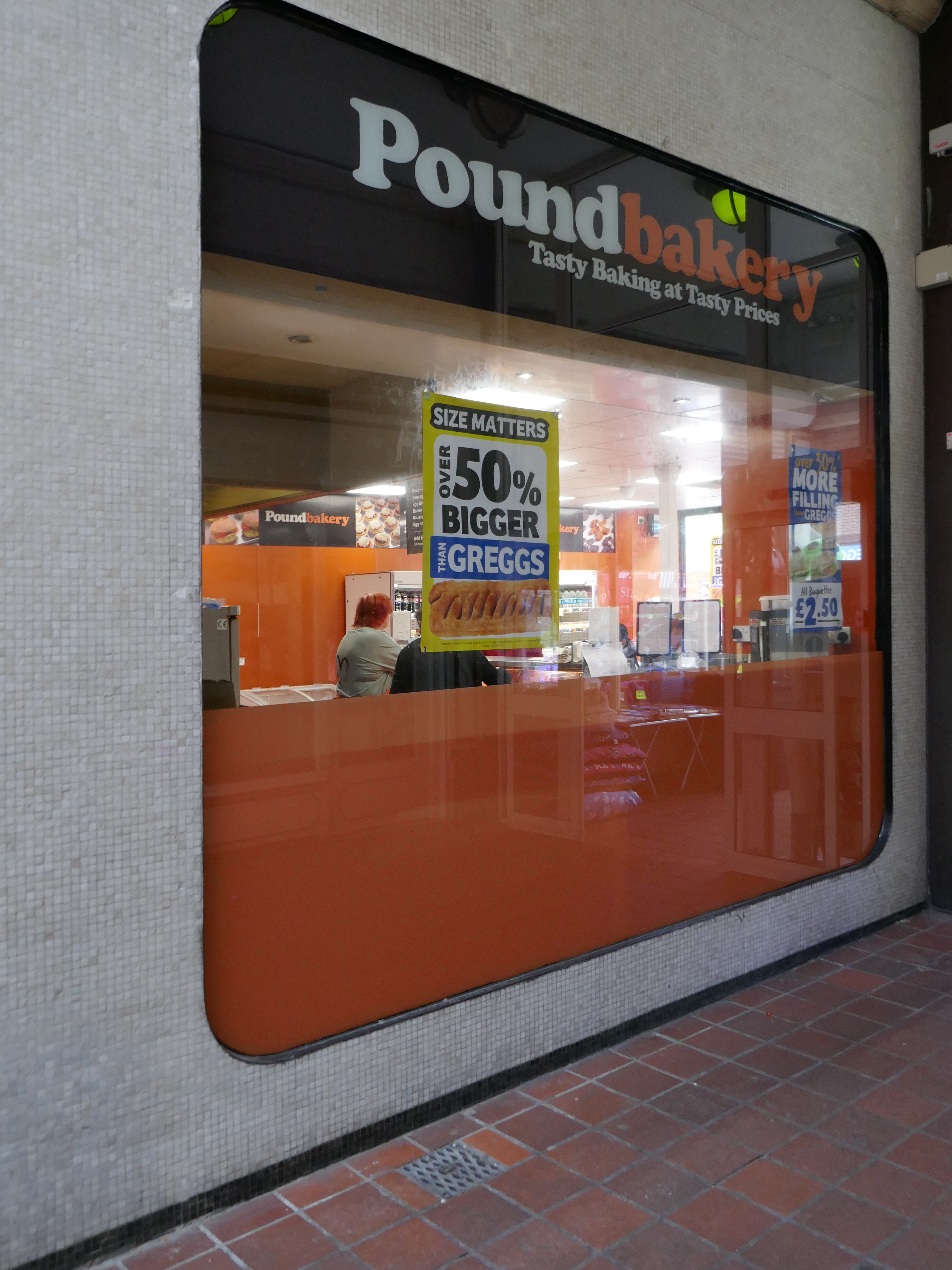
At the end of the otherwise period correct Victorian Arcade is a space age Pound Bakery.
Across the way a former Barclays Bank architects: John HD Madin & Partners.
Next door an anomalous disco themed fascia.
From here up the hill to the Old Square.
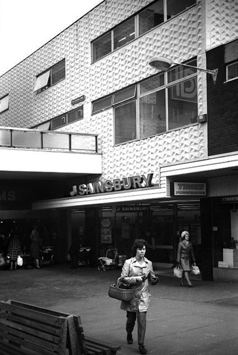
Sainsbury’s Old Square store in the early 1970s photo Will Parker.
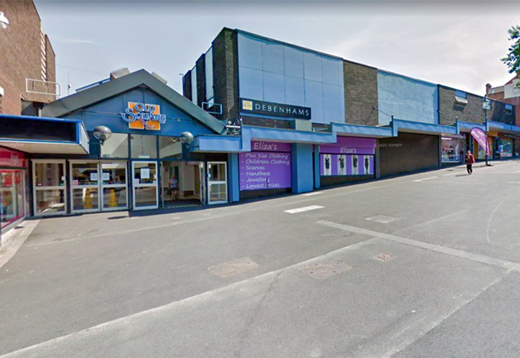
The majority of the Shopping Centre was demolished in 2014.
I remember when I was about fifteen in 1990, Coca-Cola were doing these yo-yos and if you went upstairs by the cafe, I think it was you could earn a gold coloured yo-yo. You just had to perform three tricks with it to earn one. I did walk the dog, the sleeper and I think it was around the world! Proud as punch with that I was. I know my uncle was Father Christmas for a few years on the bounce as well, when they used to have a grotto.
Dan Bracknall
These are the remnants.
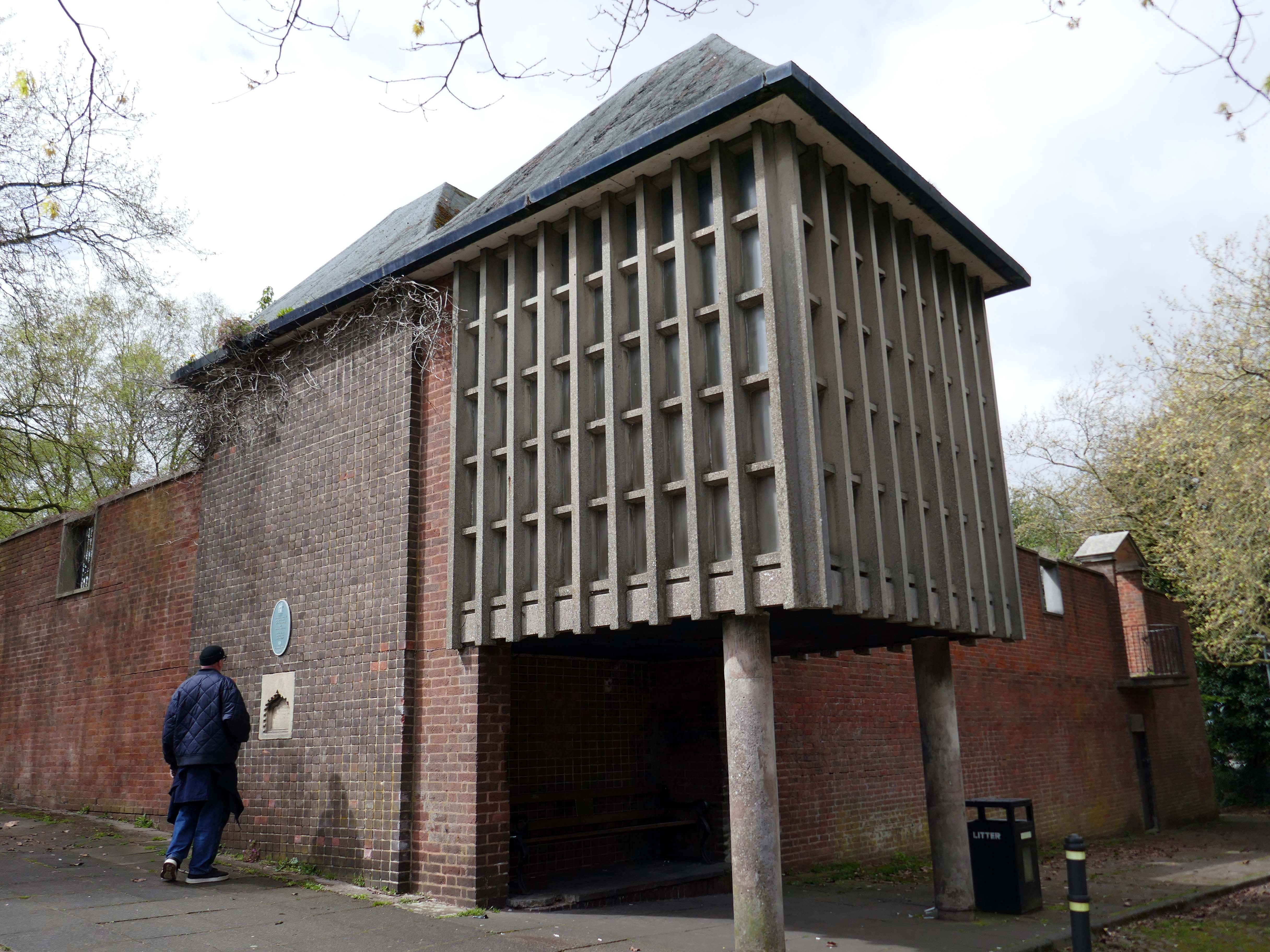
Ascending to the dizzy heights of the Grade II Listed Memorial Gardens 1953 by Geoffrey Jellicoe designed as a memorial to the dead of the two World Wars and said to mark a significant stage in the evolution of his principles of design.
Sir Geoffrey Jellicoe was one of the century’s greatest landscape architects. His contribution to landscape design has been described as equal to the 18th-century gardener Capability Brown. He was educated at Cheltenham College and then trained to be an architect at the Architectural Association. It was while at the AA that his interest in landscape was first kindled.
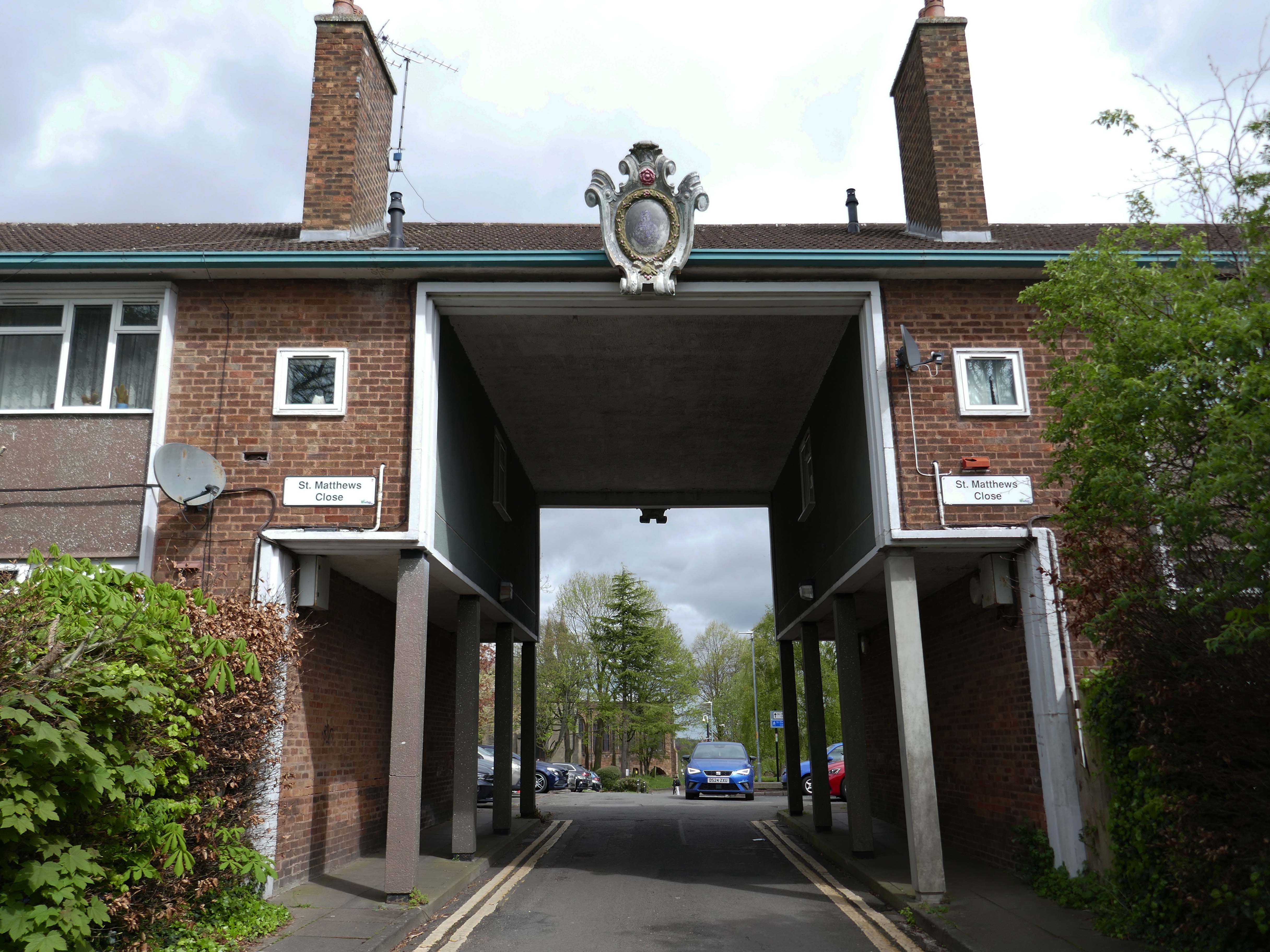
The second phase, comprising the building of the memorial chapel in the Memorial Garden, and the flats and Brotherhood or Church Hall to the south of the open space known as St Matthew’s Close, was completed c 1960
Of back down the hill onward to the Walsall School of Art.
Walsall’s art school’s history is a story of gradual growth and change, evolving from evening classes in a chapel to a modern art college. The Walsall School of Design and Ornamental Art, founded in 1854 as an evening class, operated from 1861 at the Goodall Street Baptist Chapel and eventually became the Walsall College of Art.
To celebrate Queen Victoria’s Golden Jubilee, the Walsall Science and Art Institute was opened in 1888 at Bradford Place. In 1897, it was transferred to the Town Council and renamed the Walsall Municipal Science & Art Institute. In 1926, the institute was renamed Walsall Technical College. Post-war demand led to the establishment of the Walsall and Staffordshire Technical College at Wisemore – now St Paul’s Street, in 1952. The Walsall College of Art officially merged with the College of Technology in 1992 to form Walsall College of Arts and Technology – now simply Walsall College. The college maintains strong historical ties to local industries, such as the leather trade.
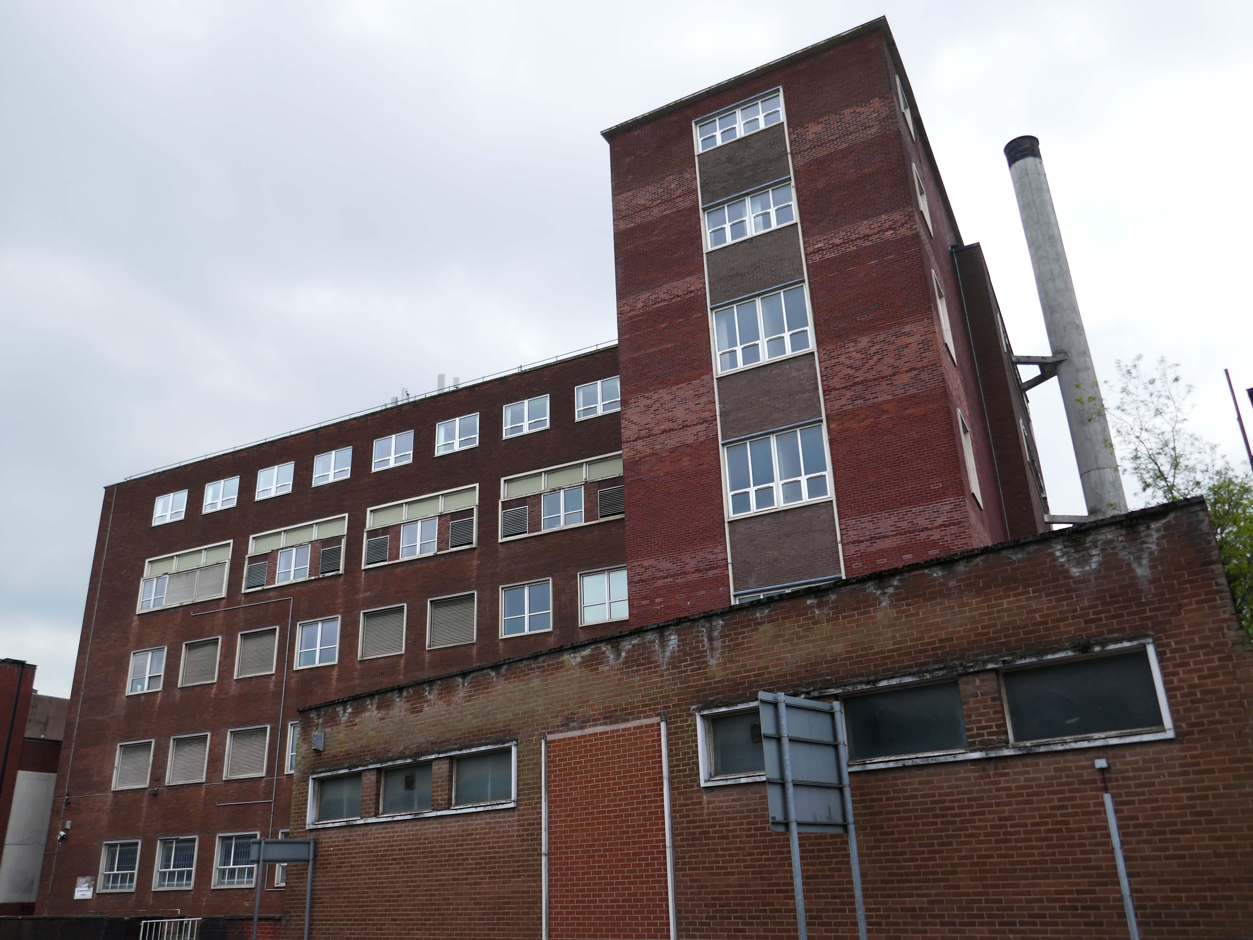
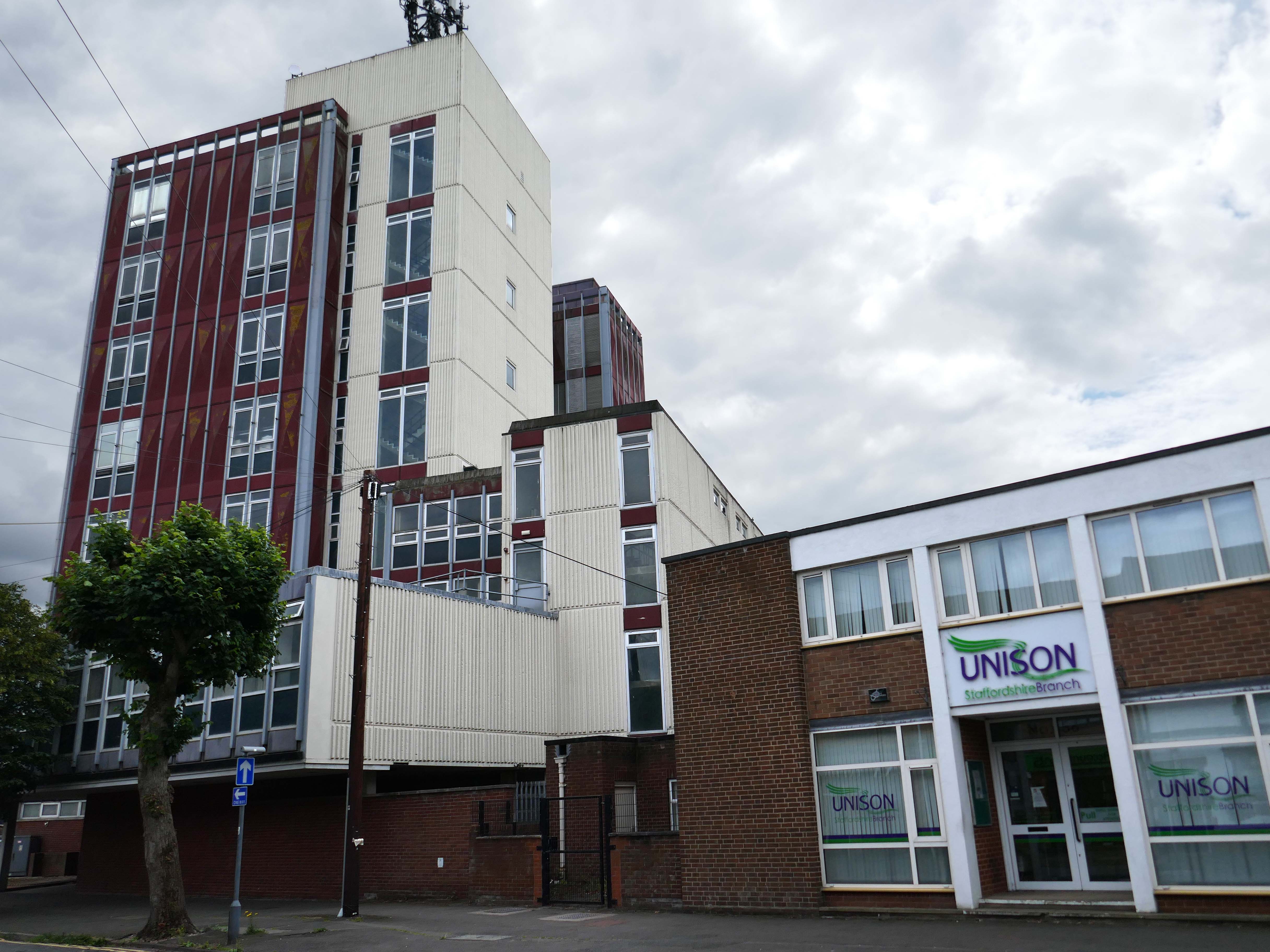
Further on there’s an enormous Telephone Exchange comprising fifties and seventies buildings.
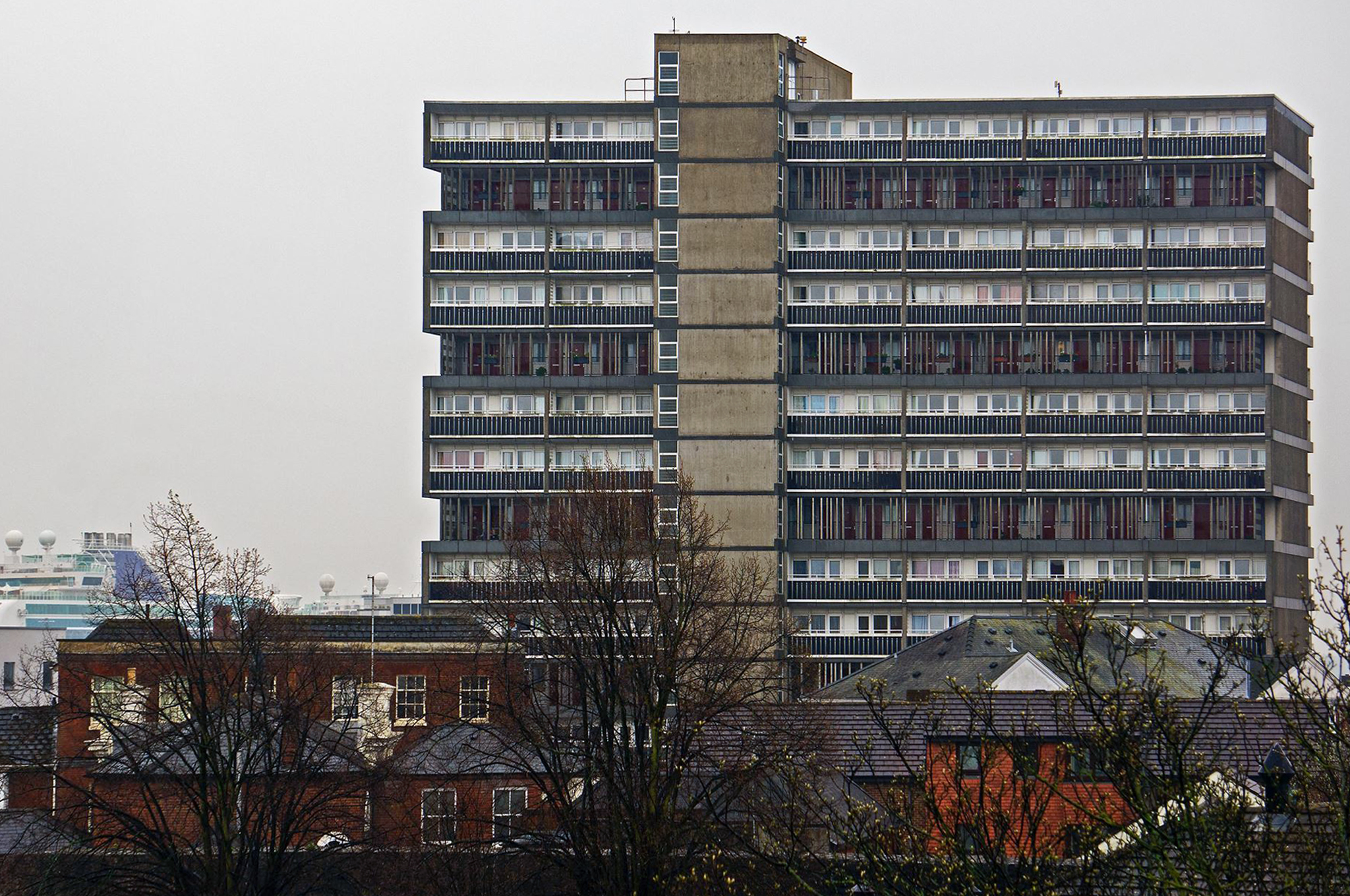
Across the way a large system built block on a podium base.
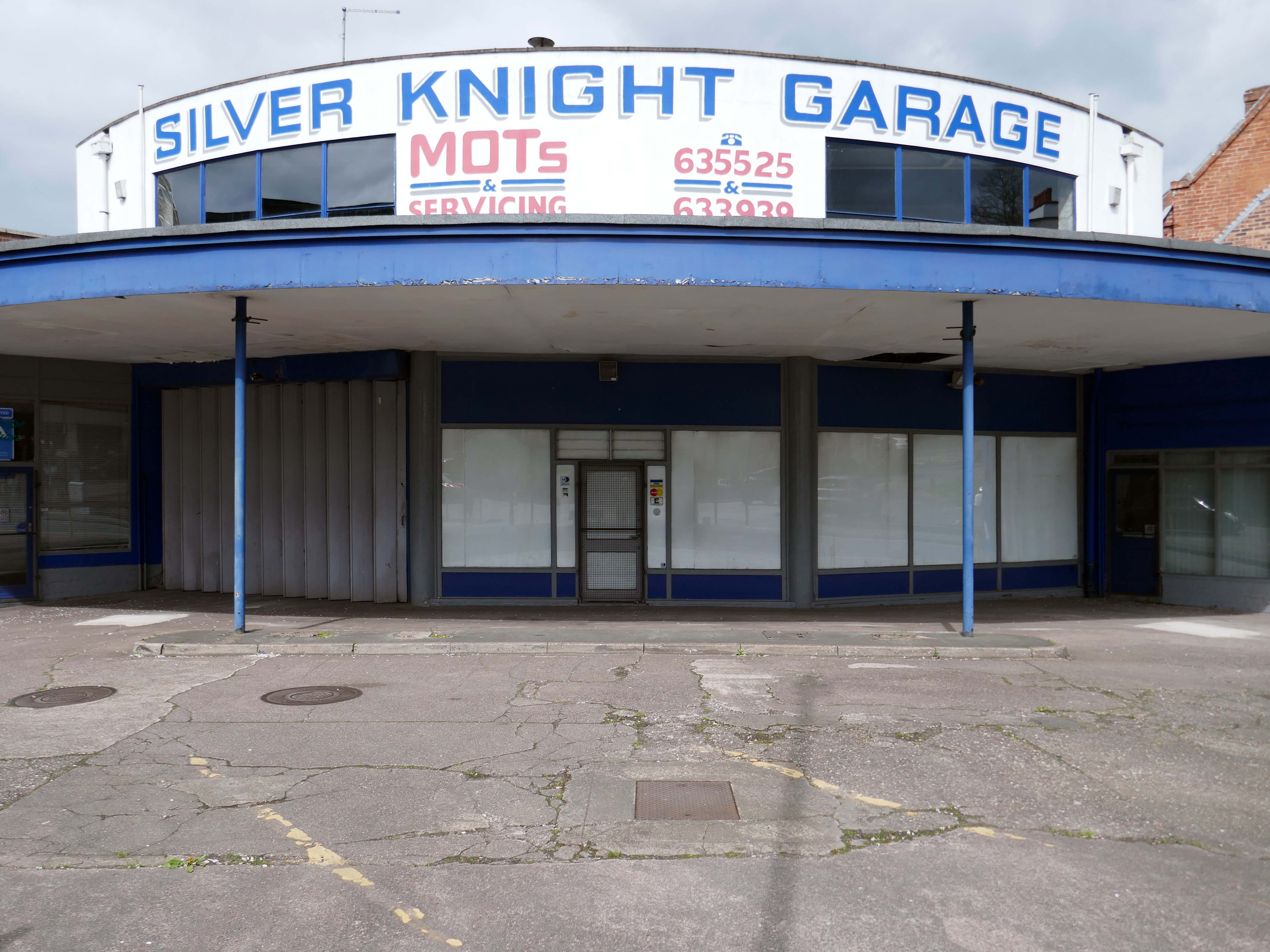
Standing on the corner where it has always stood the Silver Knight Garage.
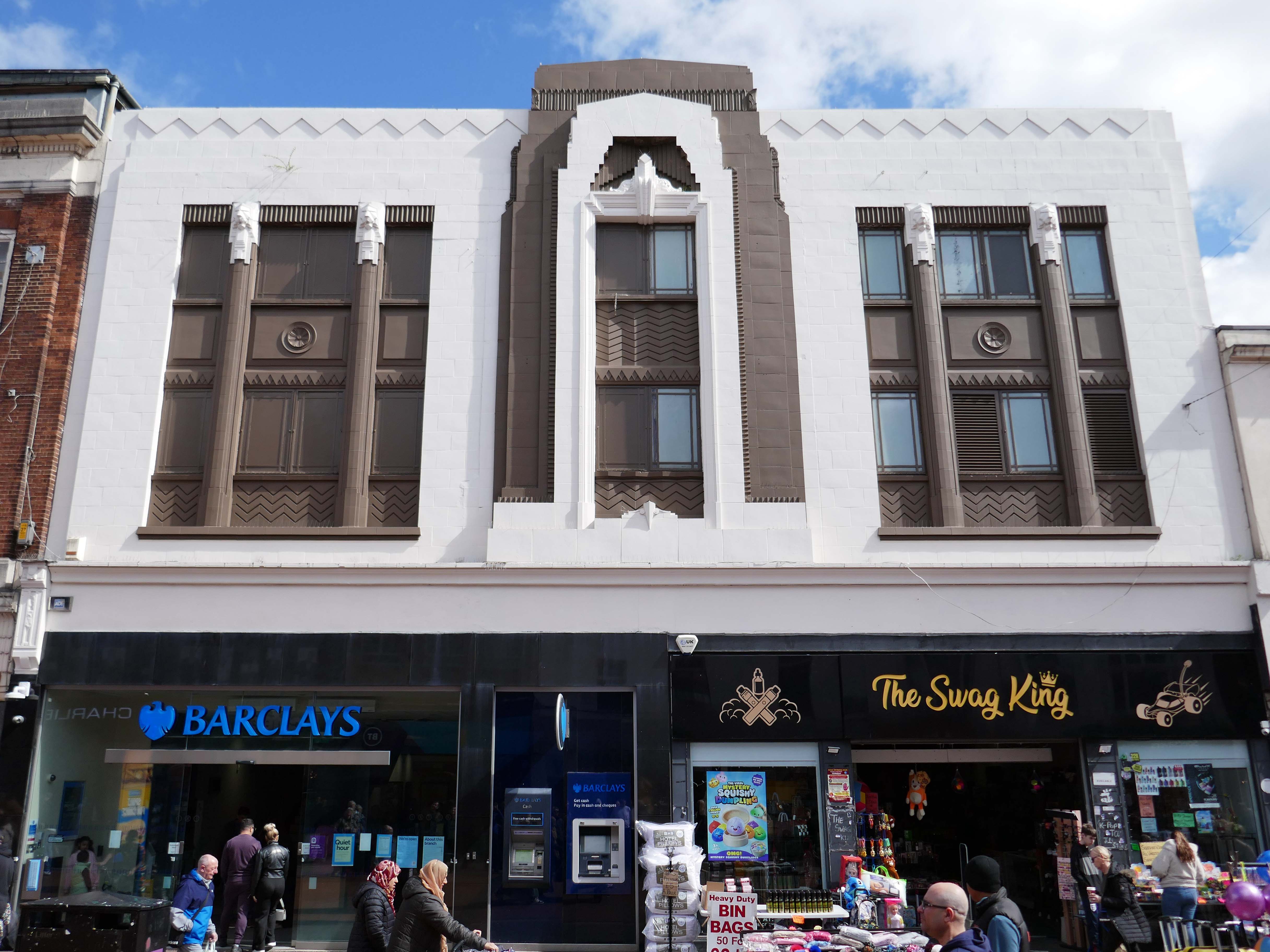
Heading back into the town centre, picking up on there’s a former Woolworths that looks like a Burton’s that thinks it’s a Barclays Bank, and also improbably a Swag King.
1933 by FW Woolworth Construction Dept – H Wimbourne
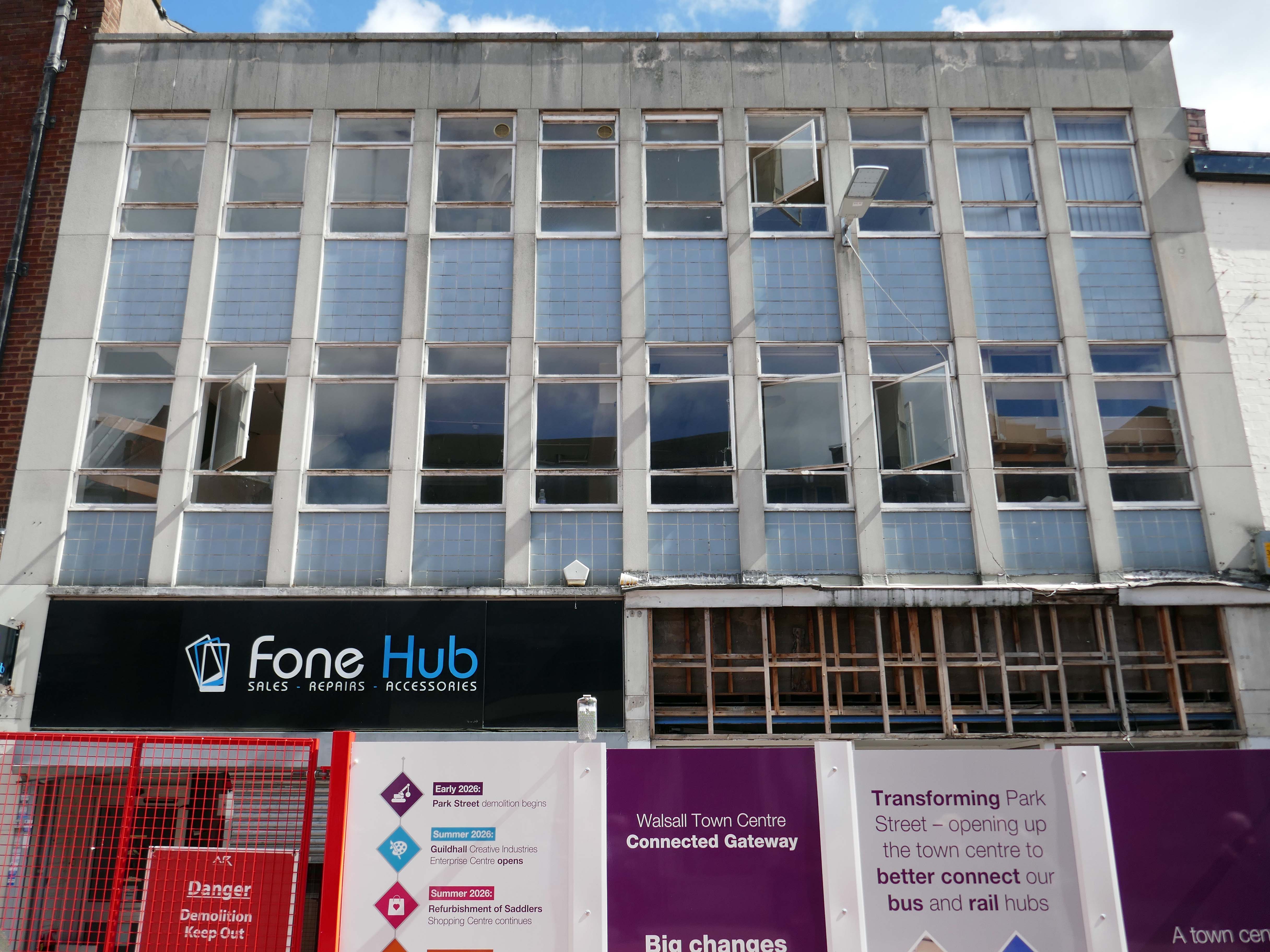
Next an indeterminate infill with pale blue panels and central pivoting metal window frames, soon to be demolished along with its neighbours, as part of the Connected Gateway Project.
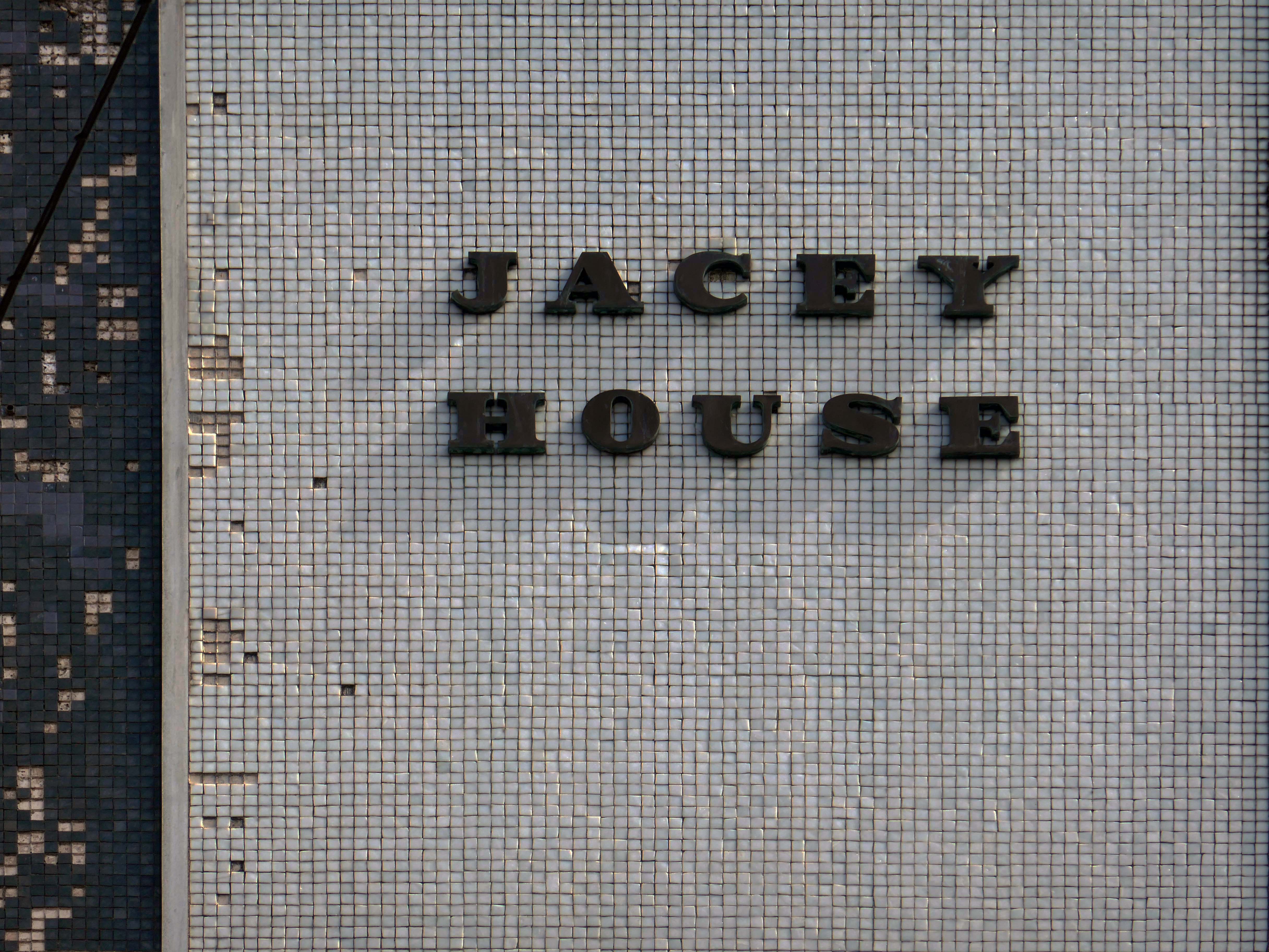
Possibly a former BHS – known as Jacey House.
Next up Park Place.
Ai says – notable features include Park Place Meats – a town centre butcher, and Park Place Shoe Repairs, which offers engraving and key-cutting services.
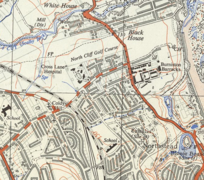
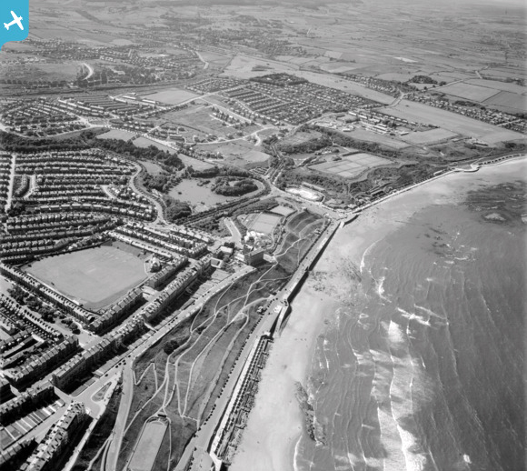
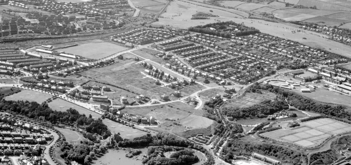
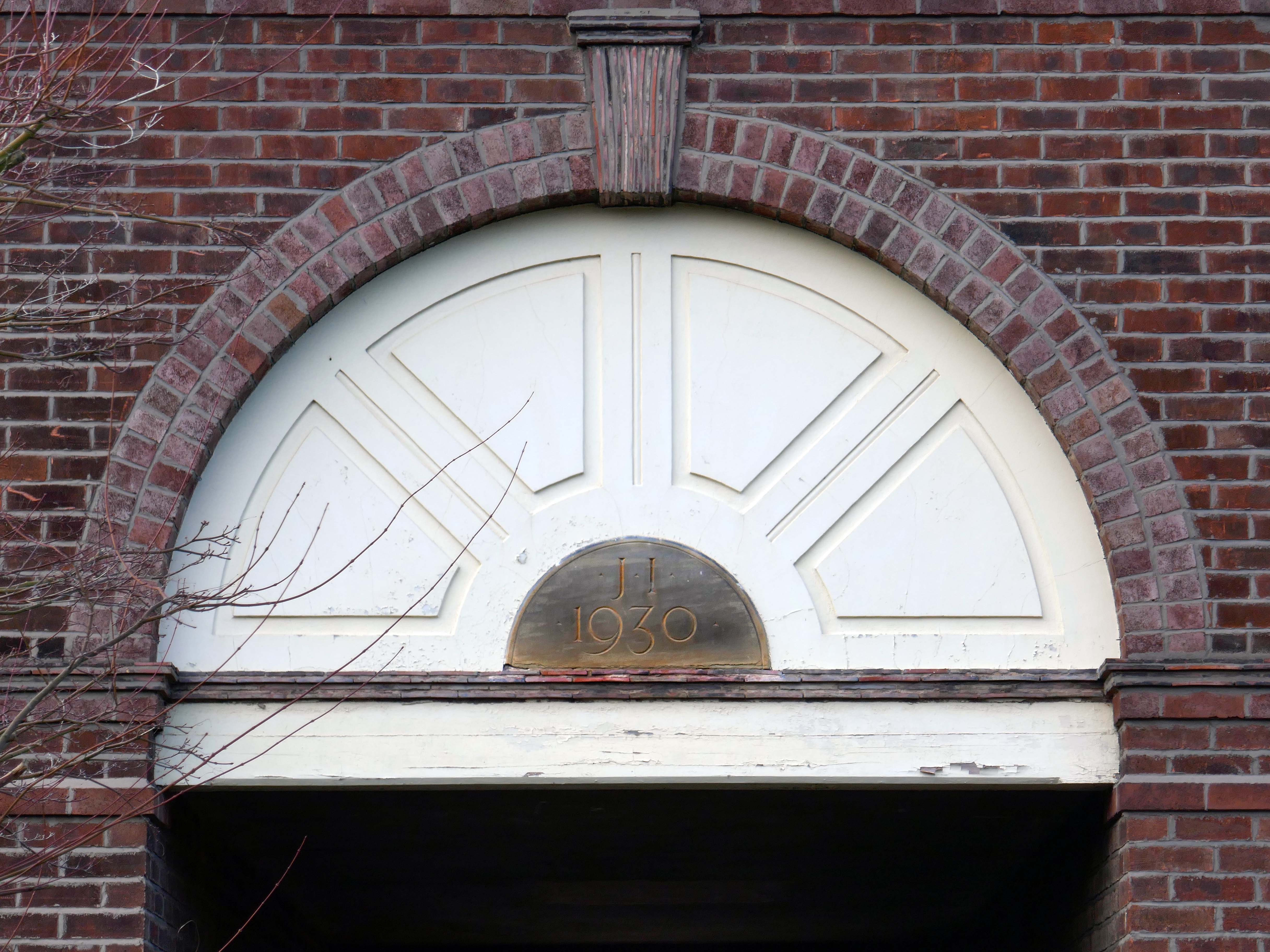
It’s 1892 and the Twentieth Century is about to overwrite the expansive green sward of Northstead and Newlands.
The Manor of Northstead consisted of a medieval manor house surrounded by fields and farms in the parish of Scalby in the North Riding of Yorkshire. The estate originally bordered the northern side of the ancient boundary of the Borough of Scarborough, following the line of Peasholm Beck. The estate passed into the ownership of the Crown during the reign of King Richard III. By 1600, the manor house had fallen into disrepair, being latterly occupied by Sir Richard Cholmeley’s shepherd until it finally collapsed
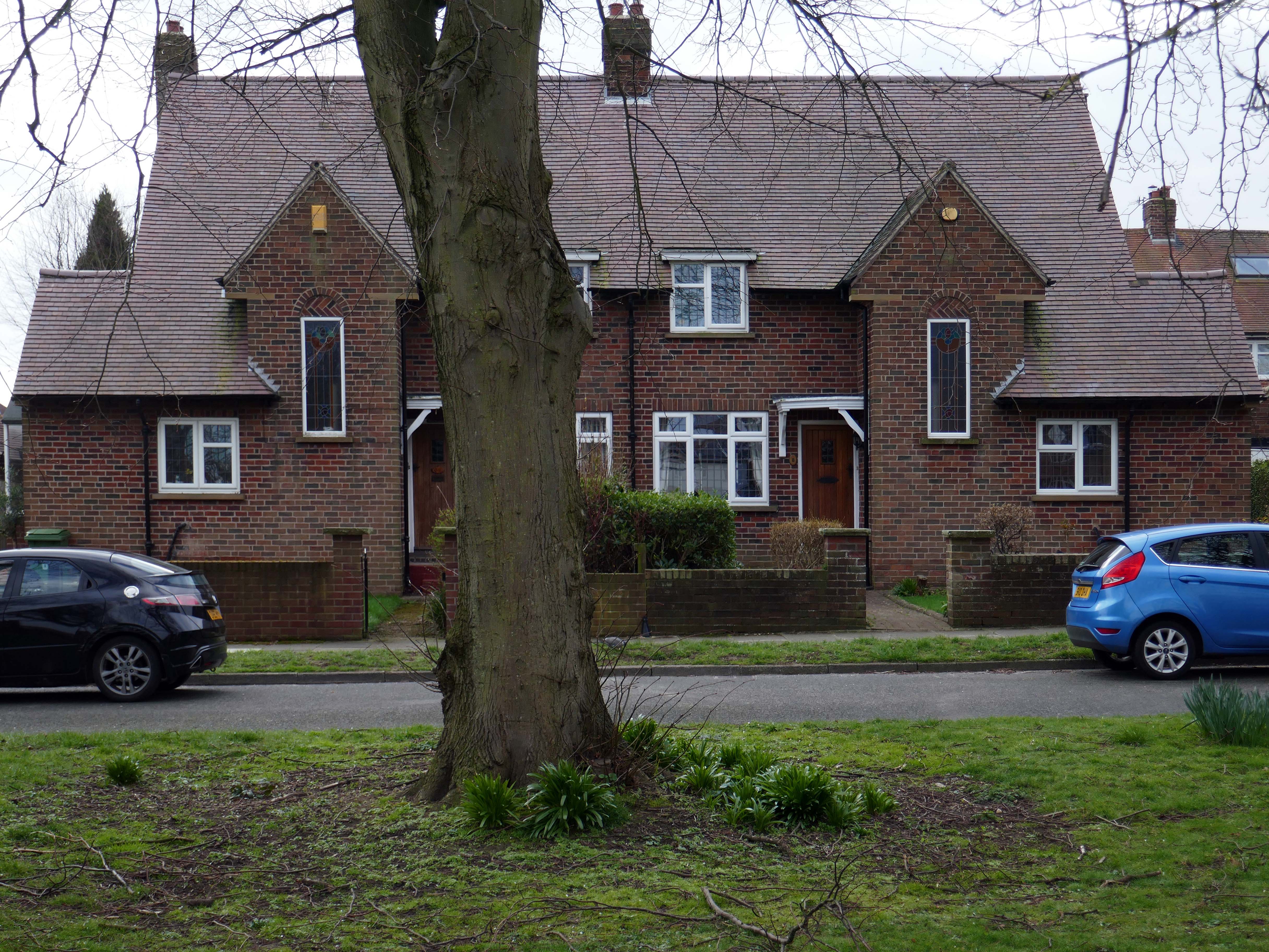
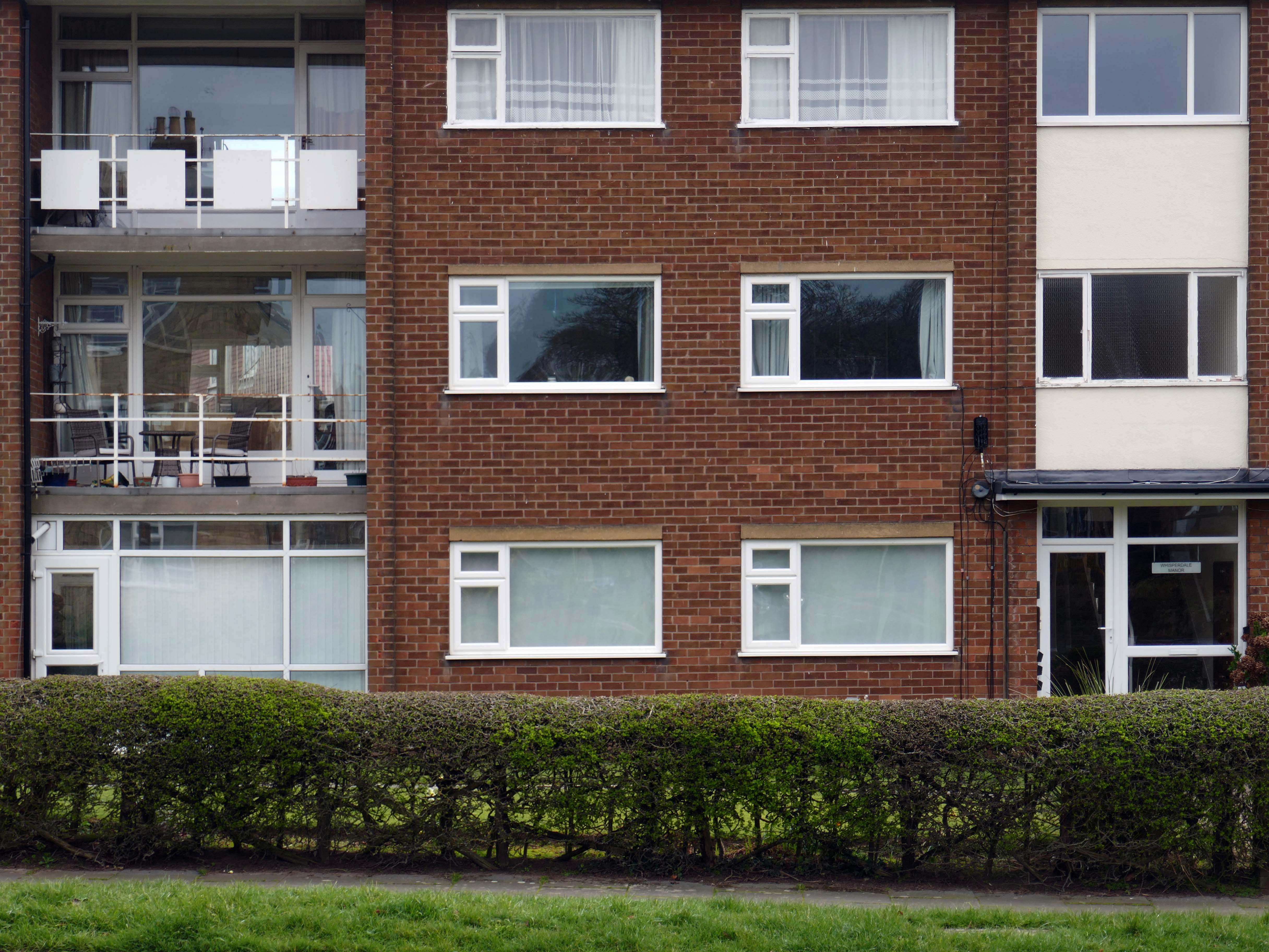
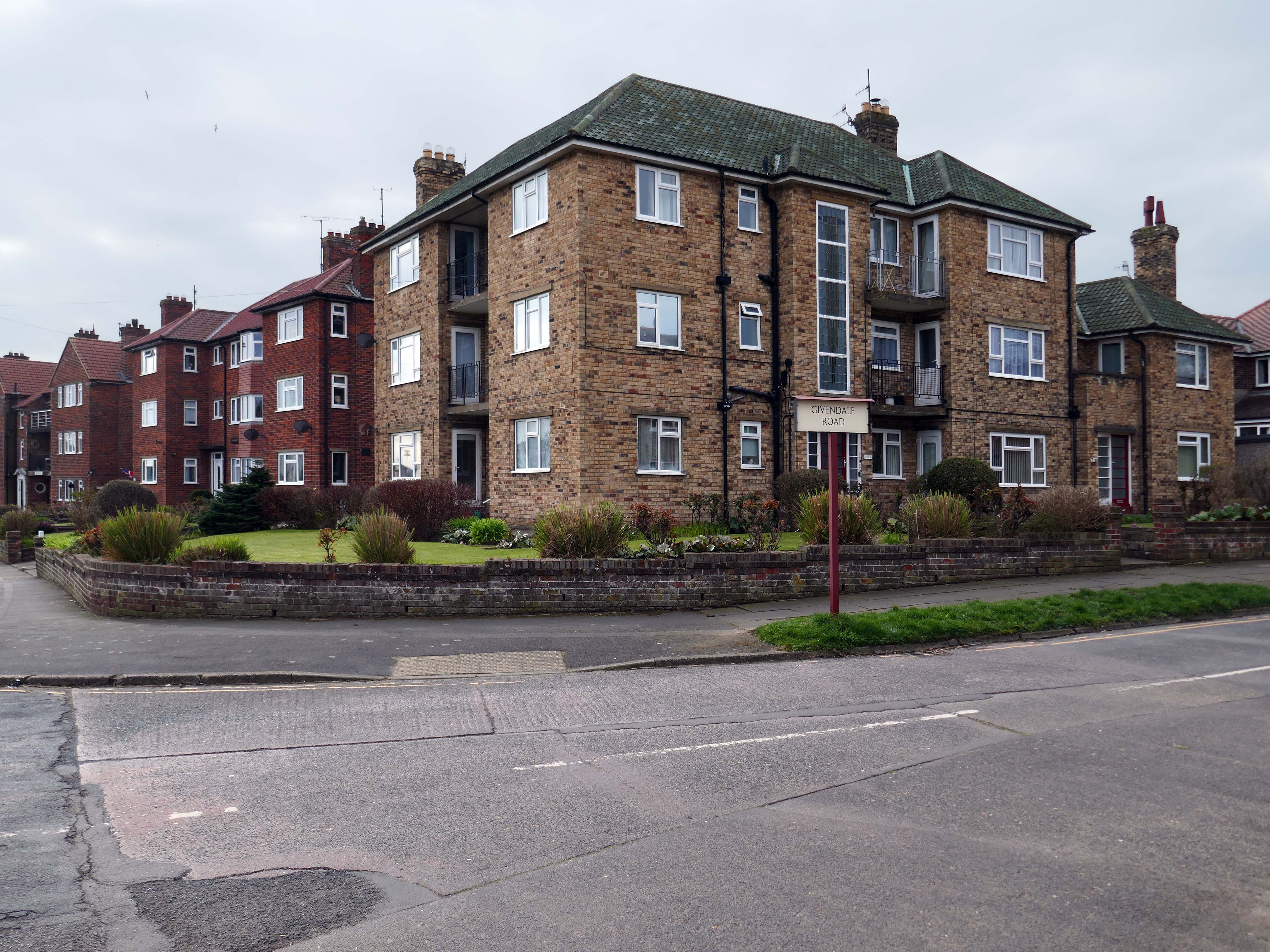
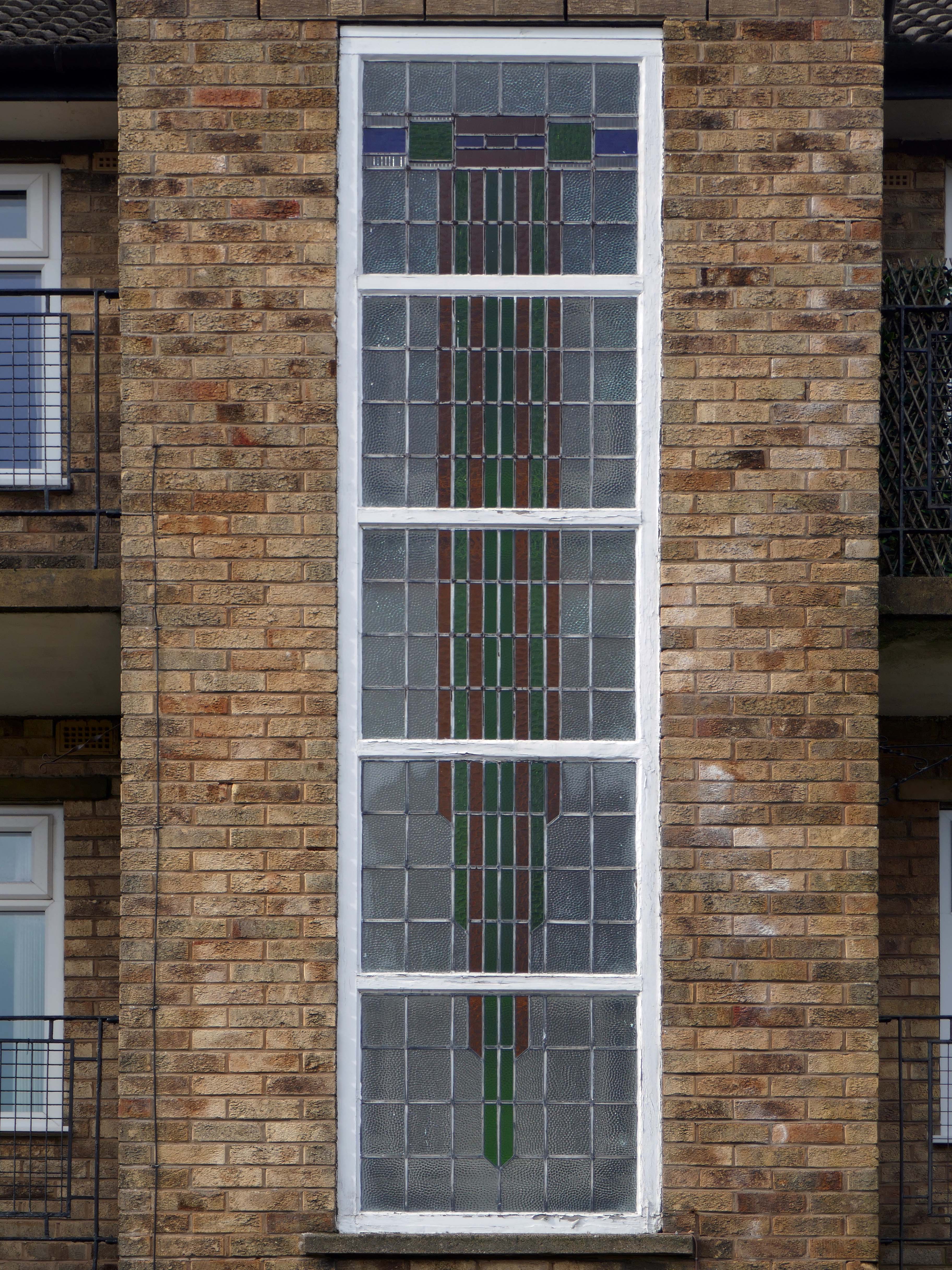
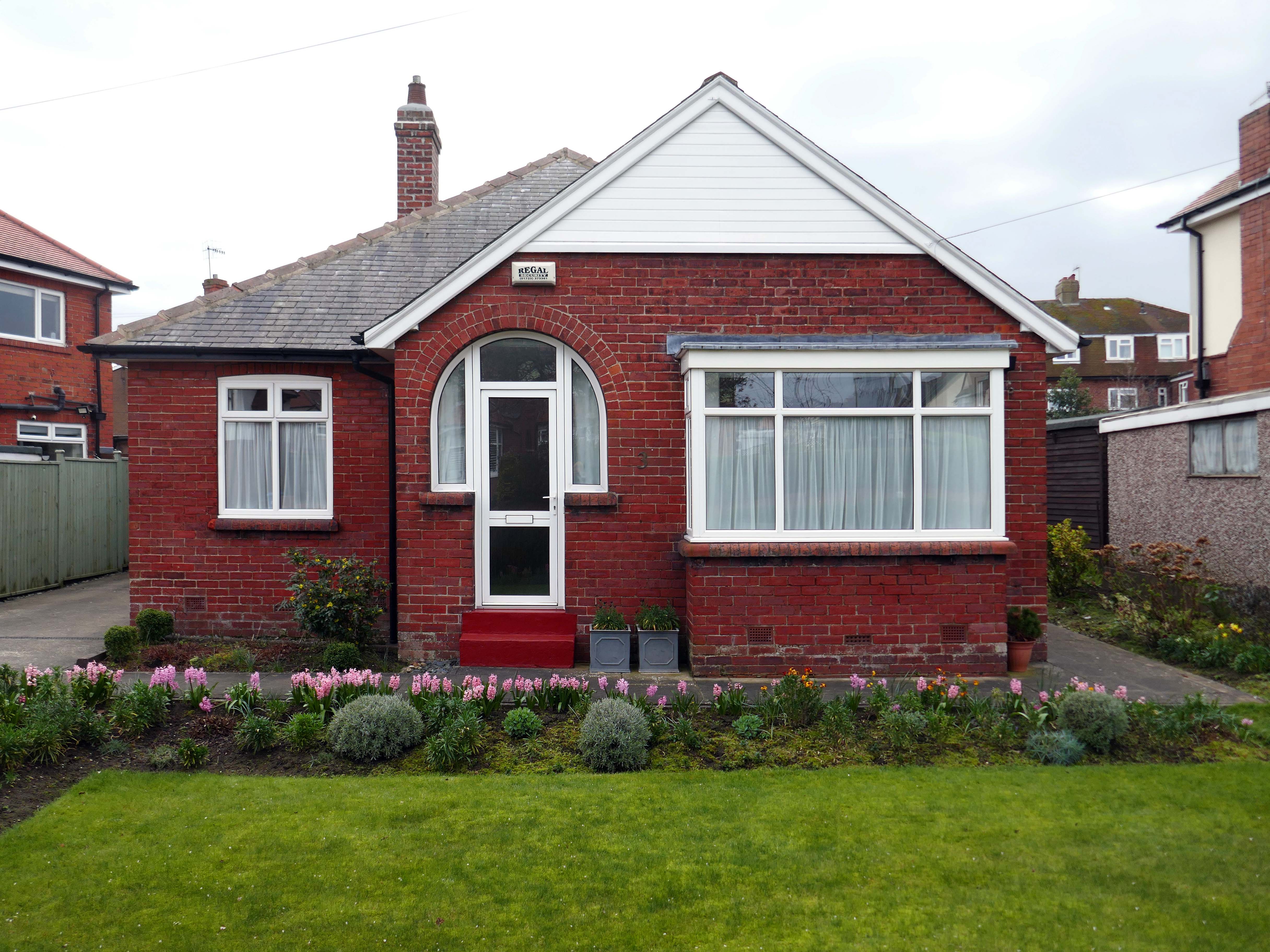
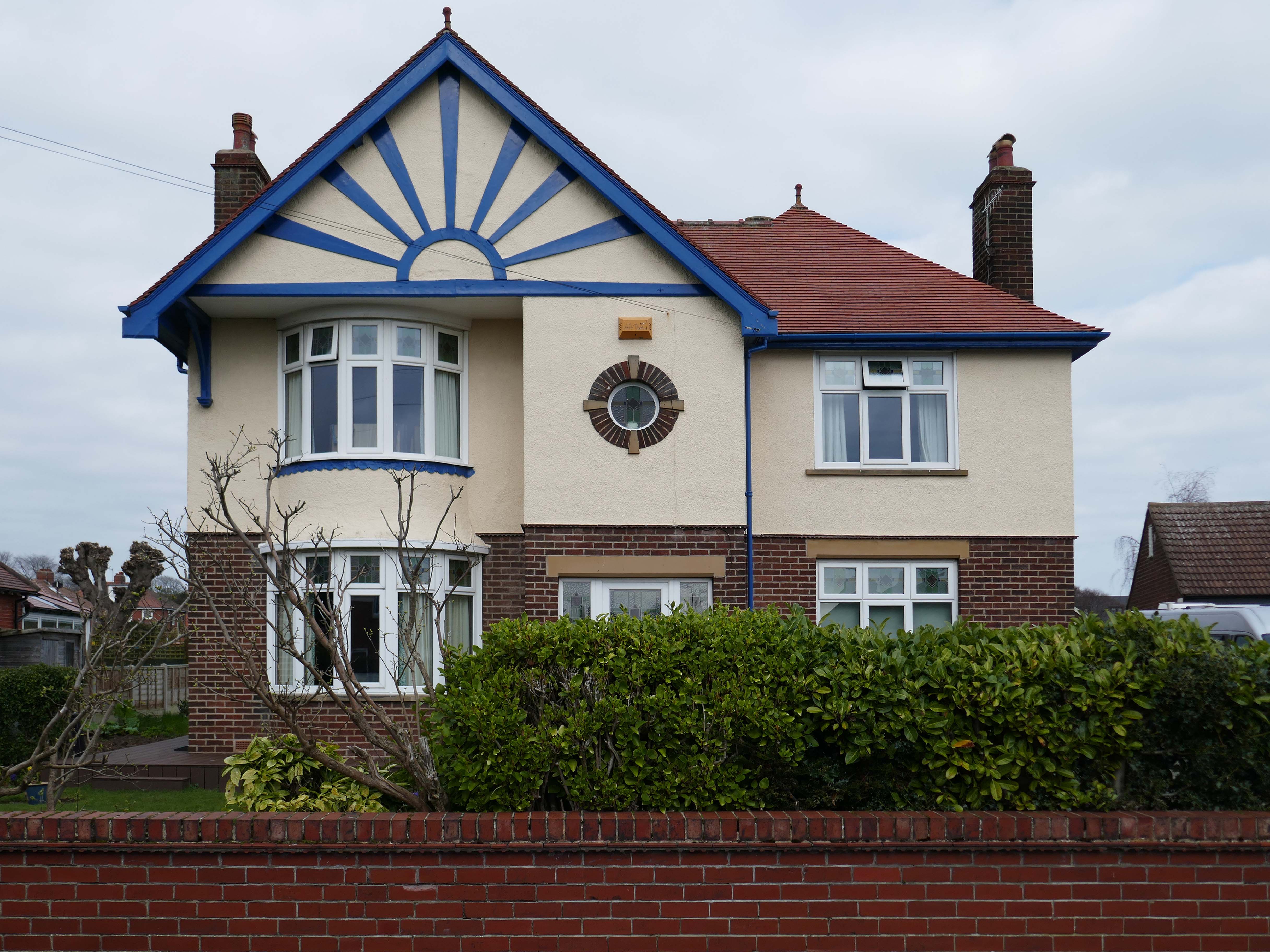
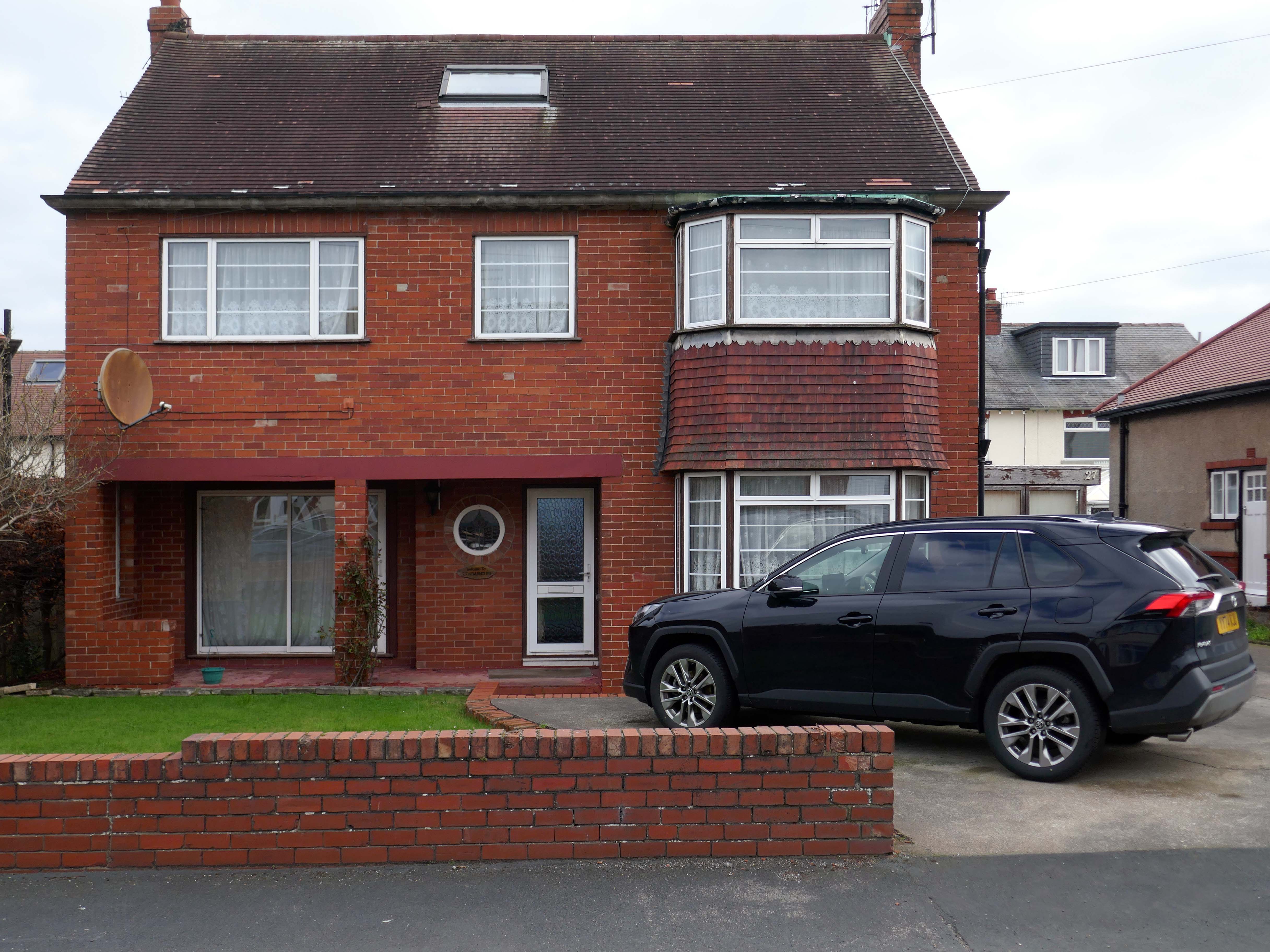
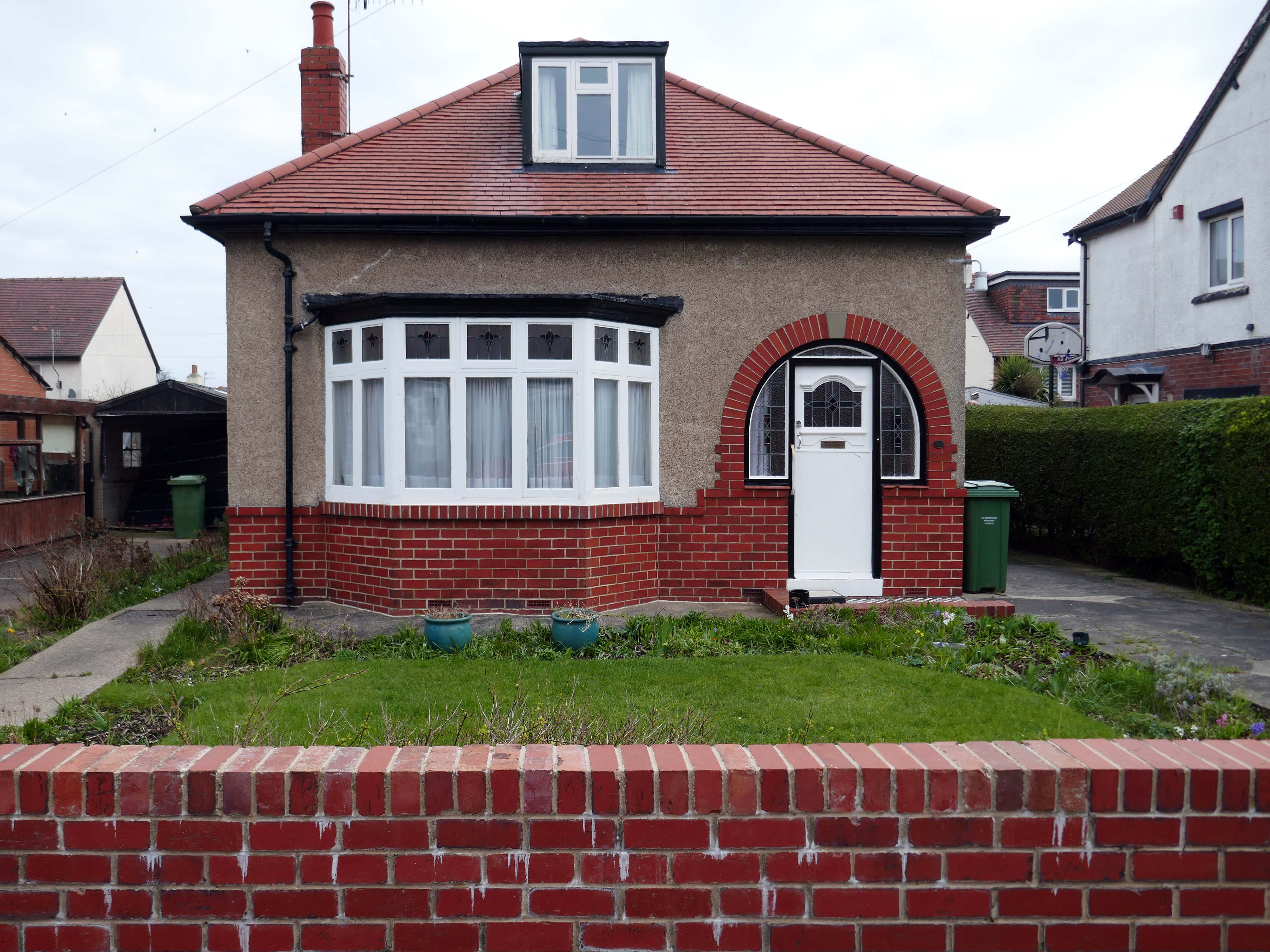
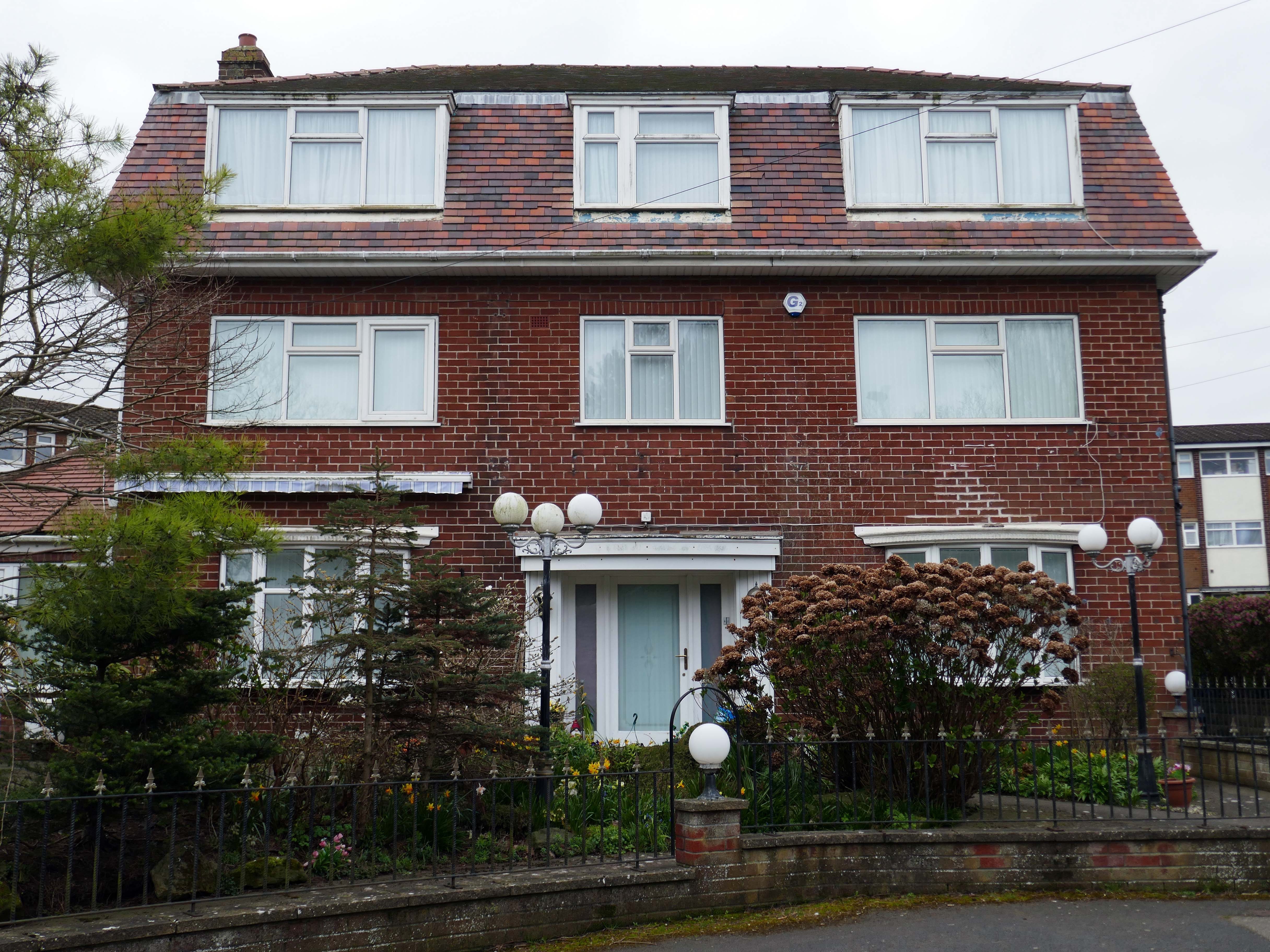
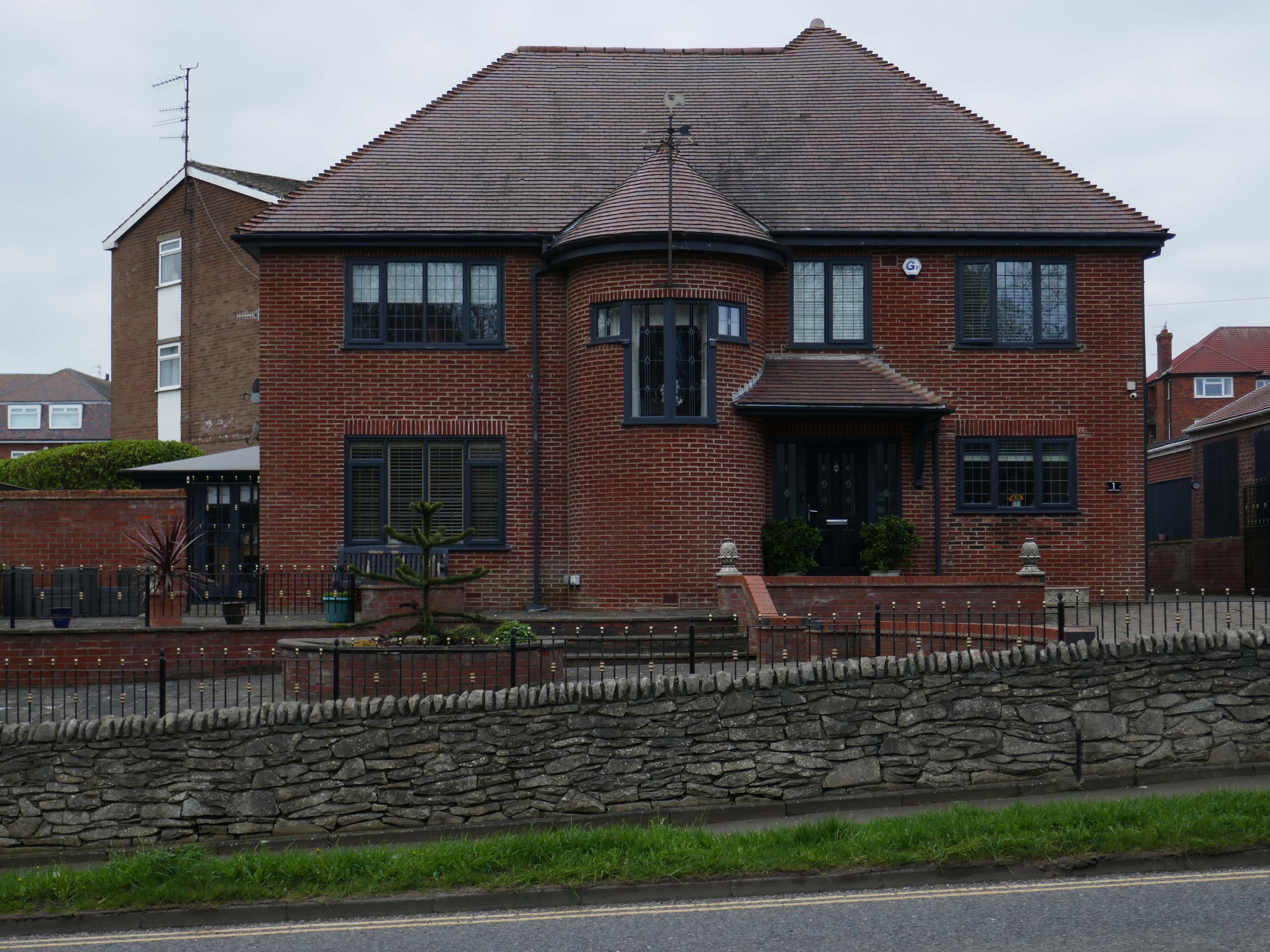
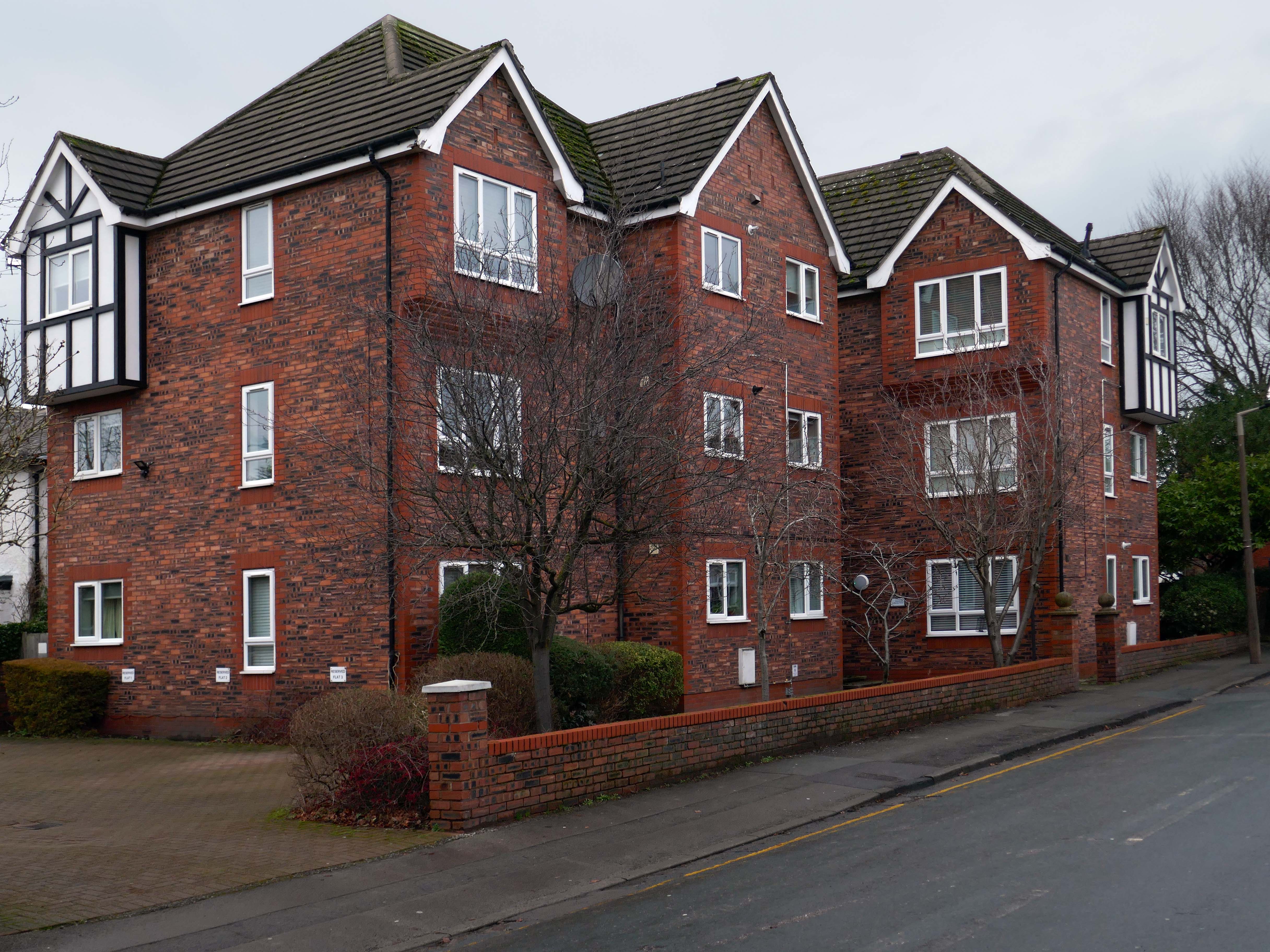
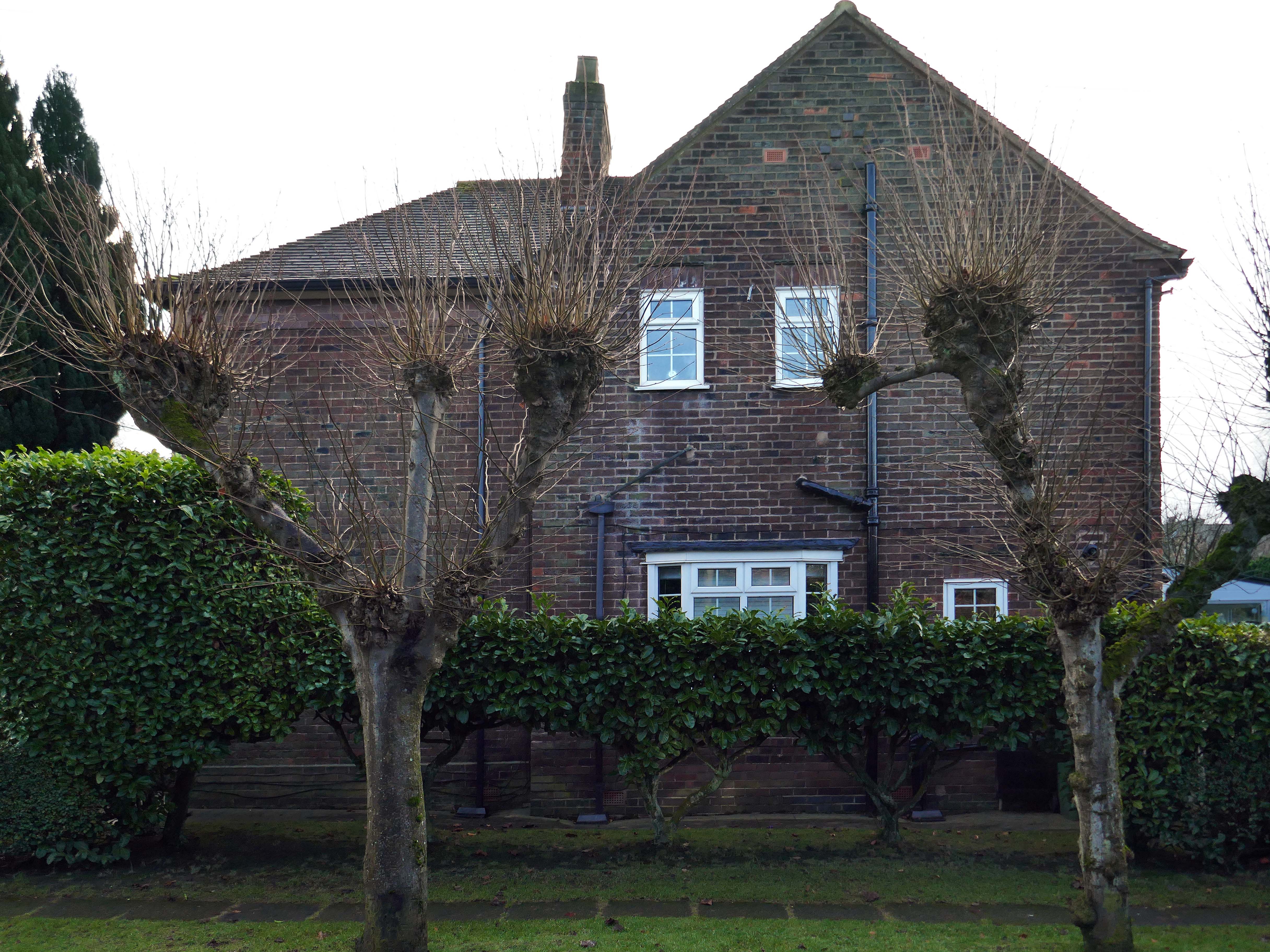
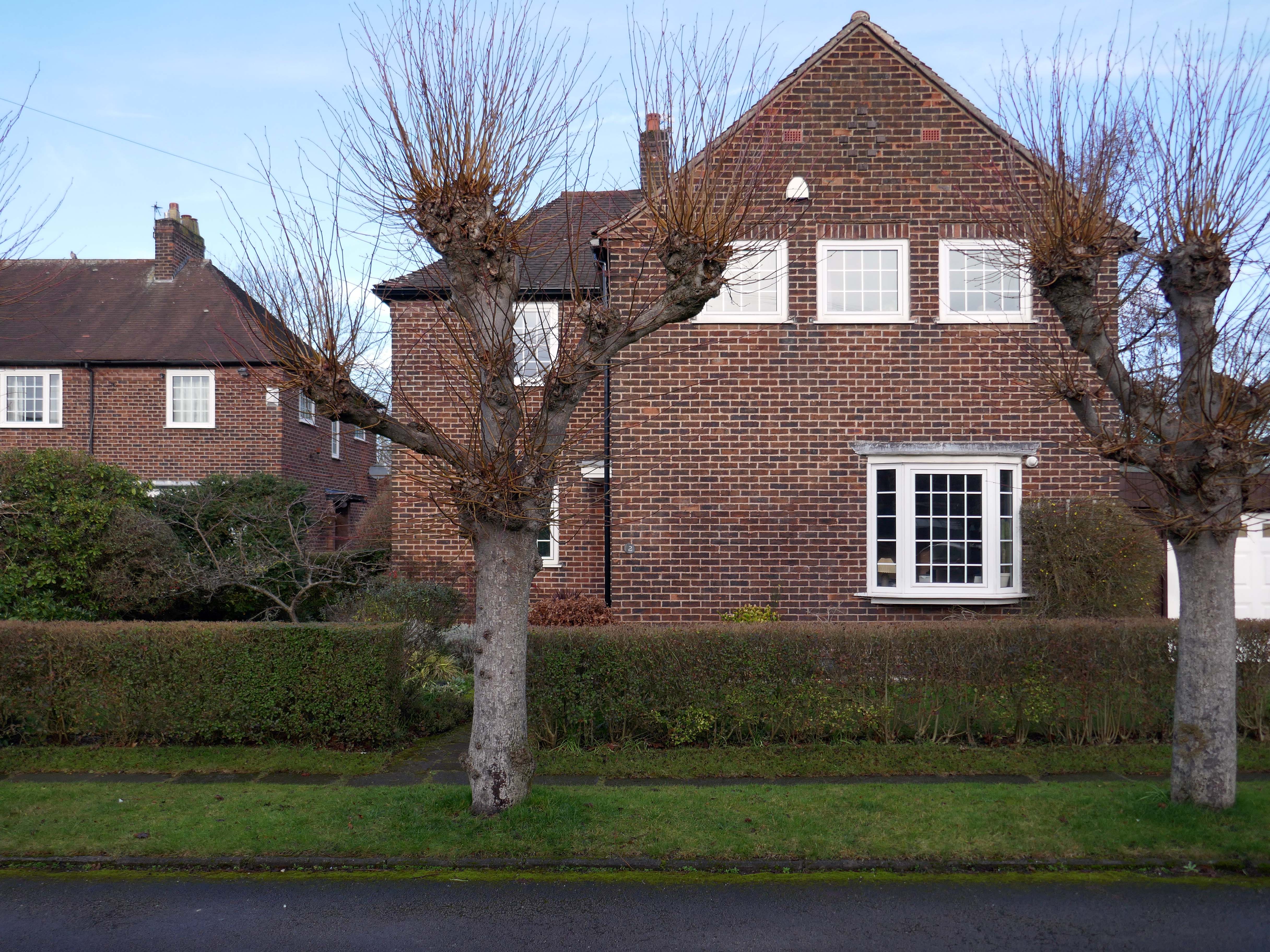
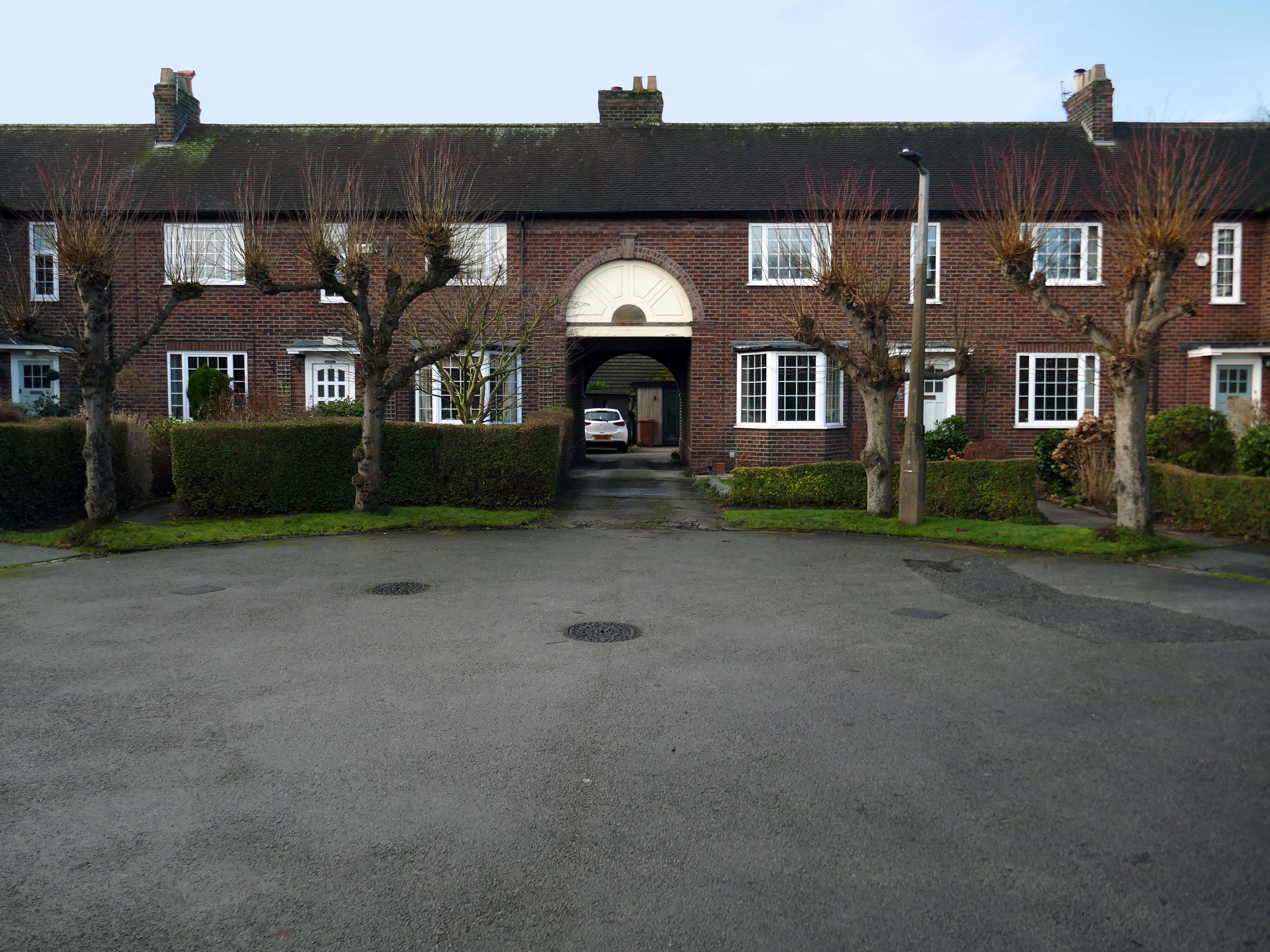
Walking the streets on a sunny Scarborough day, I was struck by the capricious cornucopia of interwar and postwar architectural styles. These are well kept well behaved homes, many of which were built as imposing apartment blocks, possibly for the seaside retirees, or the transient tourist.
The coast encourages a playful sense of design, referencing vernacular styles and including several decorative devices.
So let’s take a wander around, see what we can see.
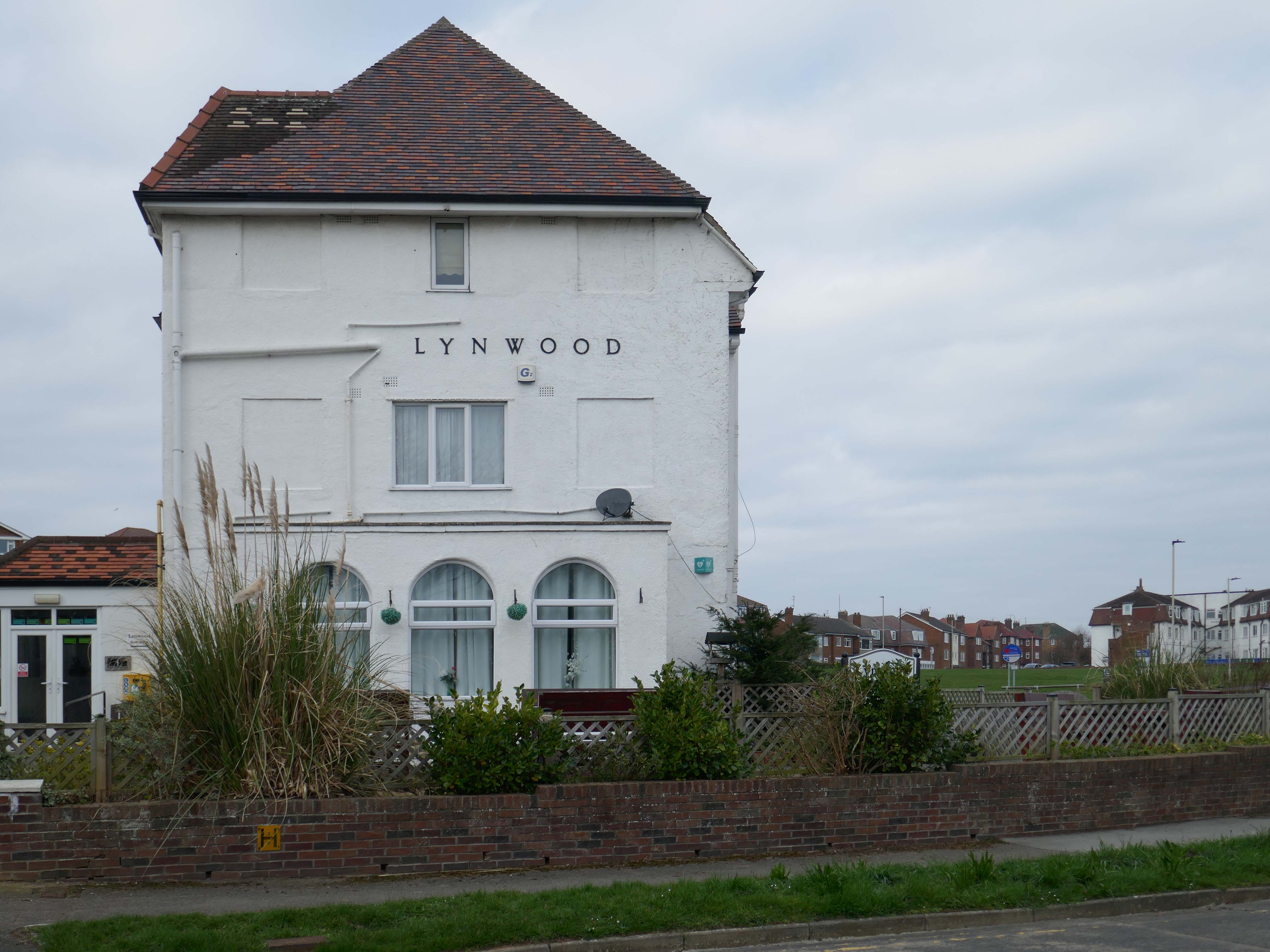
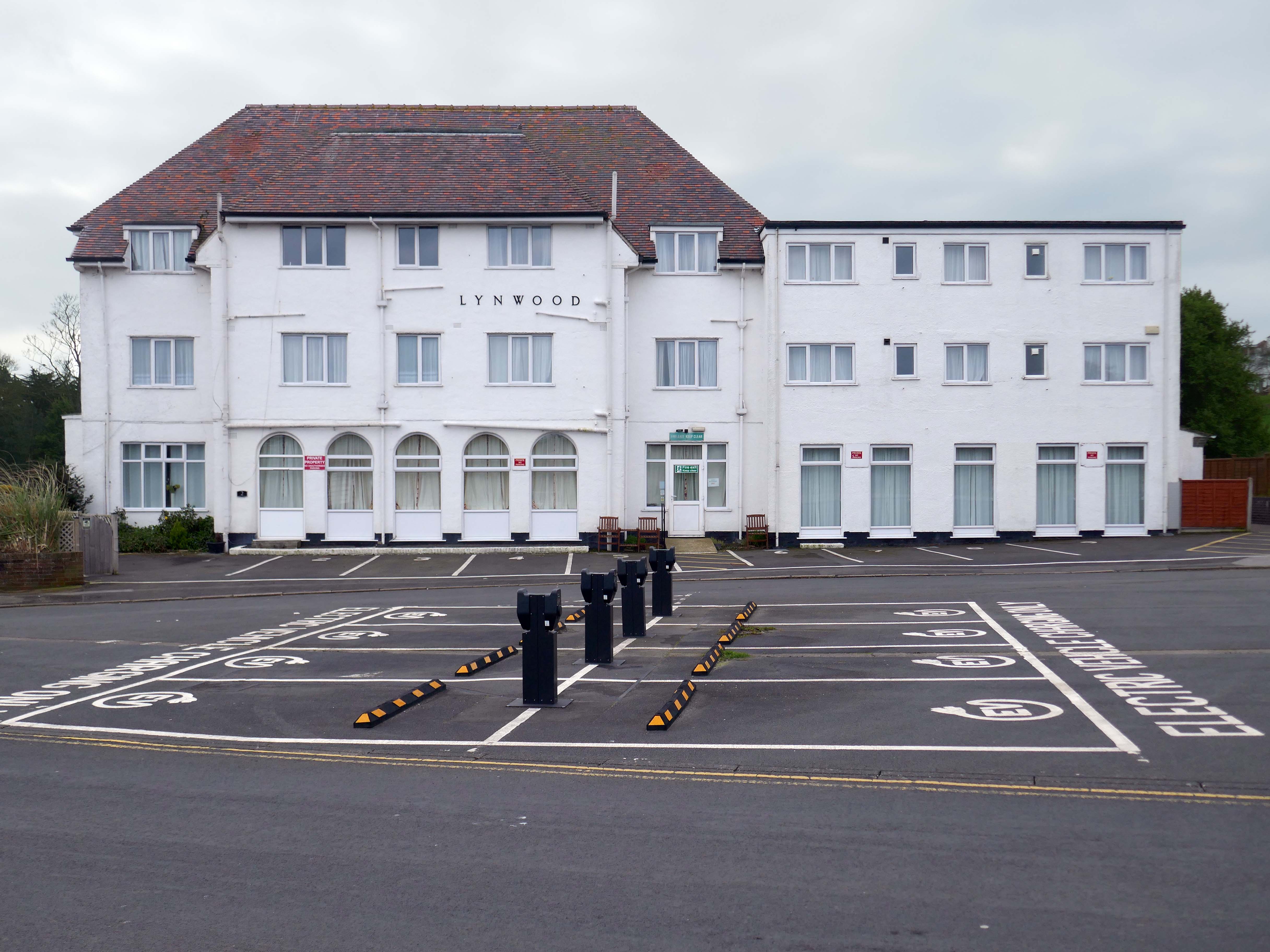
It is with deepest regret that despite the best efforts of everyone involved, it has now been confirmed that Lynwood Convalescent Home will close at the end of 2025. Whilst it was previously hoped that Lynwood could remain open for a further period, unfortunately, there are insufficient funds required to keep the Home operating and a sale of the building is progressing.
The Yorkshire Miners’ Welfare Convalescence Home charity who owns the home is continuing to support beneficiaries and staff during this difficult period. The trustees of the Home are currently discussing how the charity will use the funds from the property sale to support beneficiaries going forward and plans will be communicated in the coming weeks and months.
We fully understand the disappointment and impact this decision will have on our beneficiaries and staff. Please be assured that the trustees remain committed to keeping all stakeholders informed about the future of the charity.
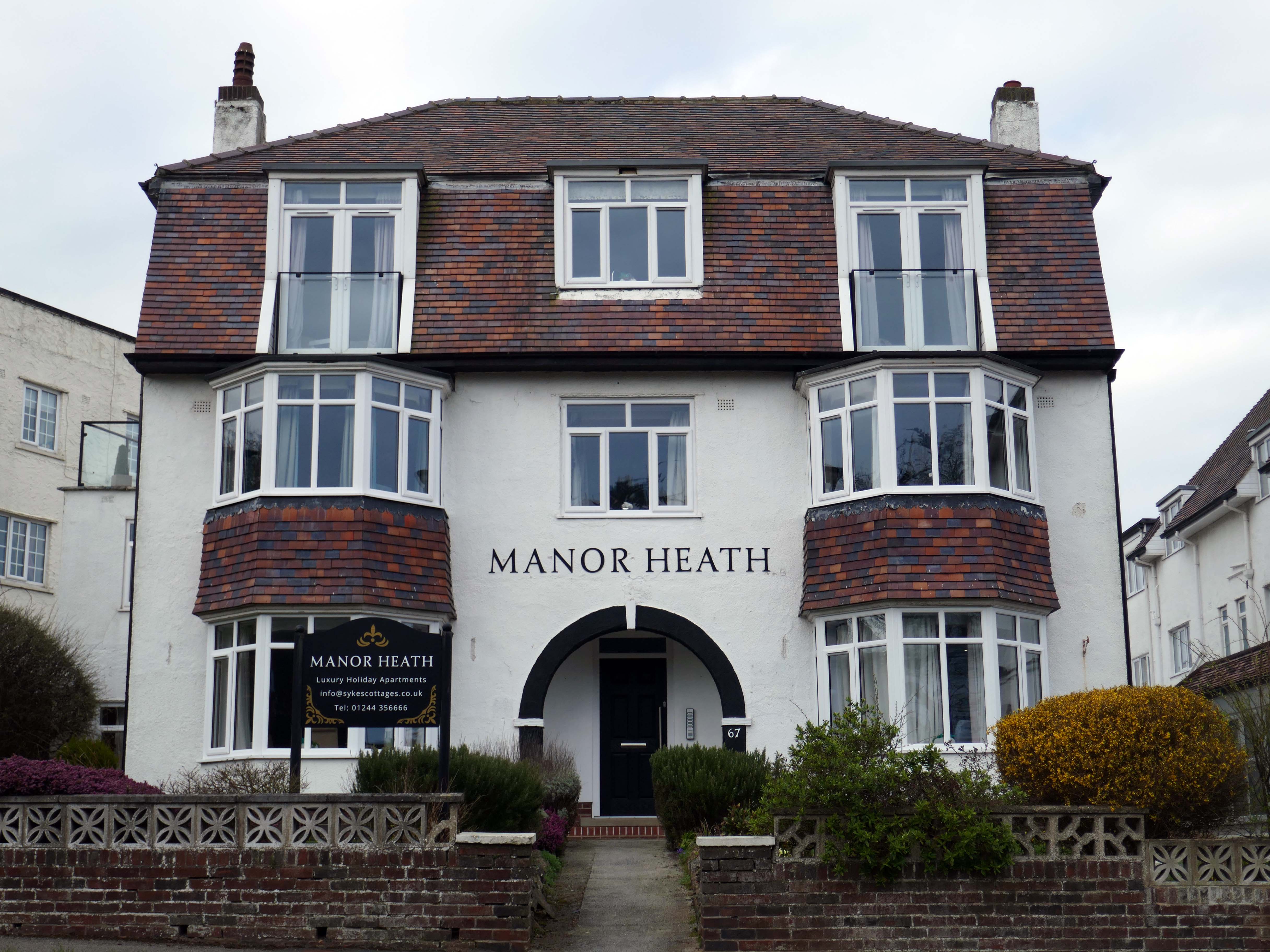
Hi, there are a few point that we feel need addressing, the WiFi kept going off. Both shower heads were very high and we could not adjust them. The grouting in the bathroom floor was broken, which made the tiles loose and needs attention. The toilet in the bathroom was loose and felt insecure. The cooker was not properly secured to the housing, it felt loose in the housing. The TV kept loosing signal and the picture would break up – thank God for youtube, as that was pretty good
Apart from the points mentioned the apartment was clean and tidy and very nice.
We have previously stayed at Manor Heath on four occasions and always enjoy it and look forward to our next visit. We stayed in apartment two, which was very comfortable, but would benefit from a coffee table or nest of tablets, so you could relax and put your drinks on it
Reviewed by Sharon 5.0 ★
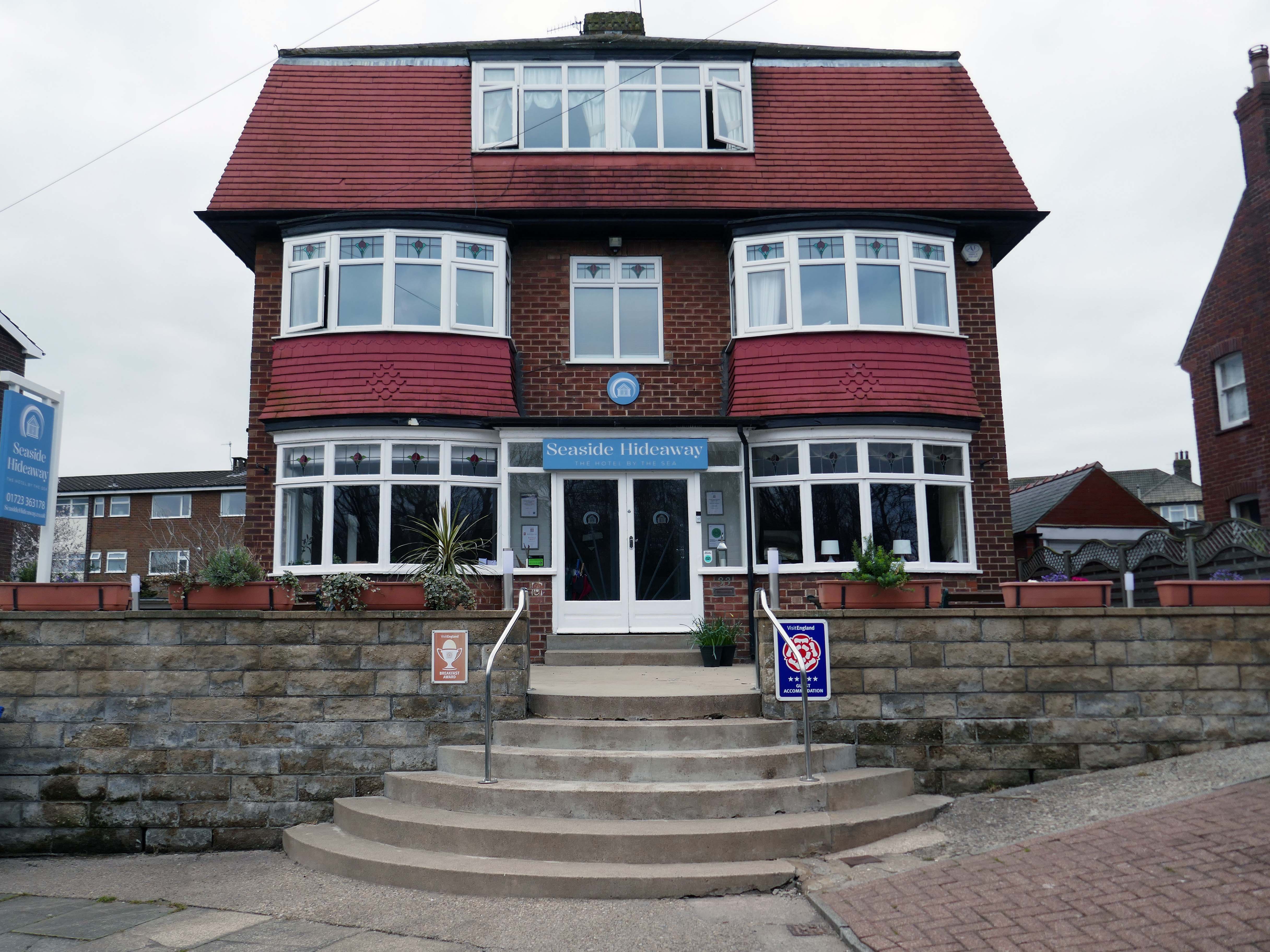
Seaside Hideaway combines a fantastic North Bay location with comfortable rooms, delicious breakfasts and a warm personal welcome from your hosts, Jim and Sarah.
If you’re thinking about a spring break by the coast, take a look at our spring breaks in Scarborough guide for ideas on where to stay and what to do.
Sculptor and designer, born in London 1925, where he continued to live. Studied at Southern College of Art in Portsmouth, at Royal College of Art and at British School in Rome; was an Abbey Award-winner. Went on to lecture widely and was a member of the design advisory board, Hammersmith College of Art and Trent Polytechnic. Also did work for Concrete Society and completed a frieze for Swiss Cottage Library.
Federation House – 1965-66 Gilling Dodd & Partners
Originally home to the National Federation of Building Employees Investments.
Now how in part to The Shandon Bells – named for the chimes of St. Anne’s Church in Cork.
The church is noted for its eight bells, immortalised in the song The Bells of Shandon by Francis Sylvester Mahony. The largest weighs a little over one and a half tons and was originally cast by Abel Rudhall of Gloucester.
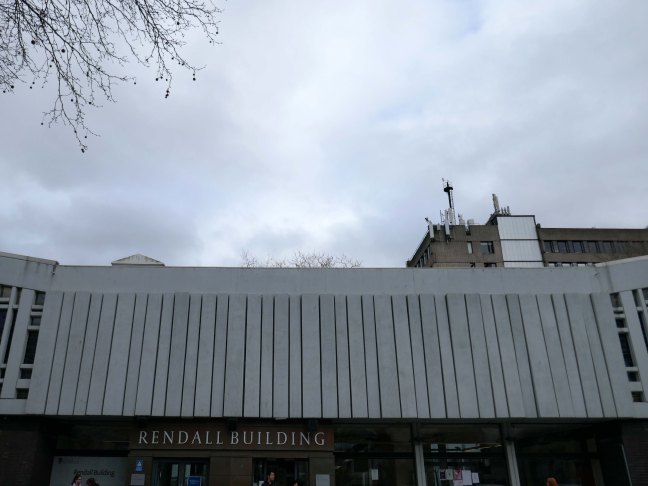
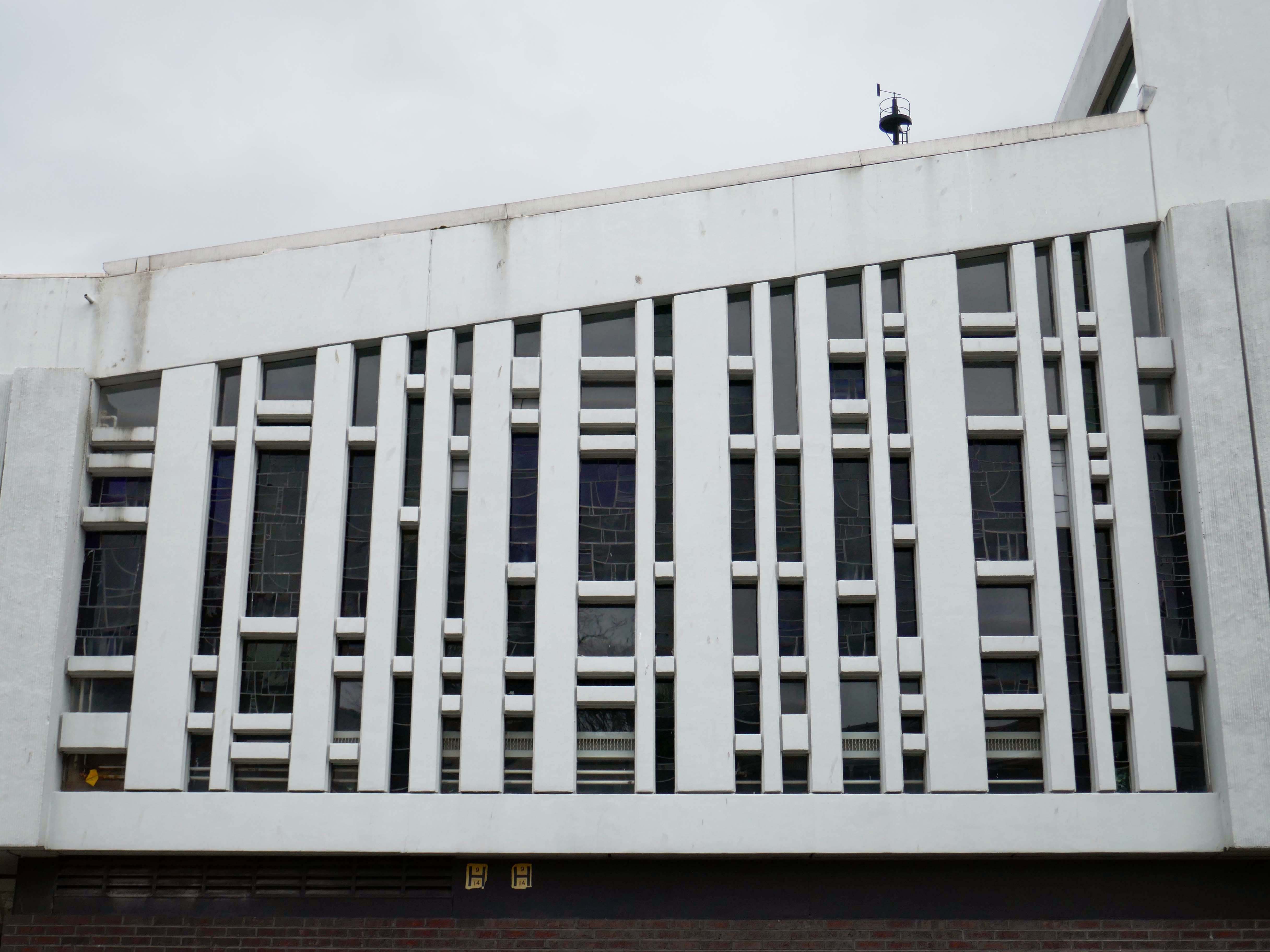
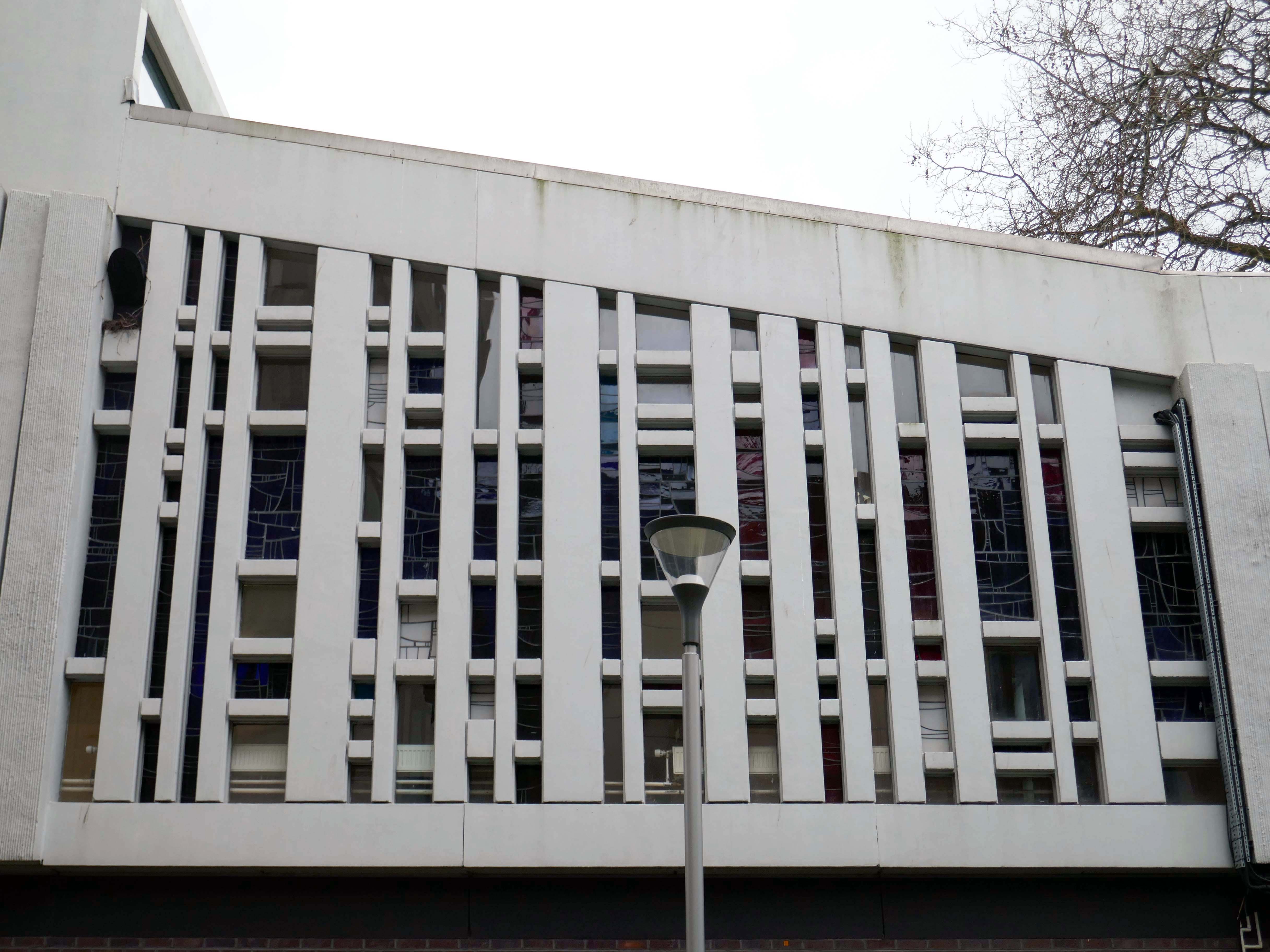
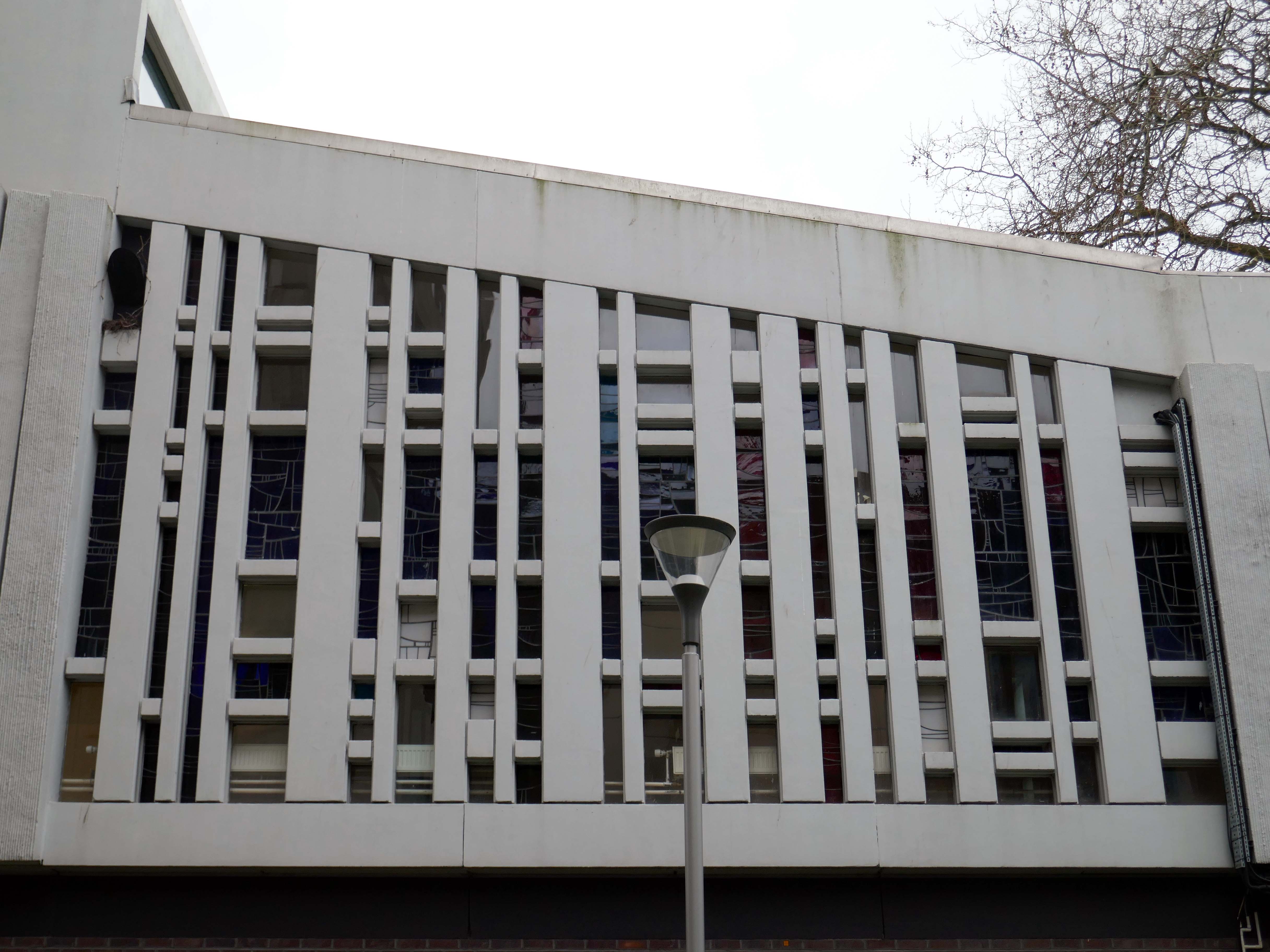
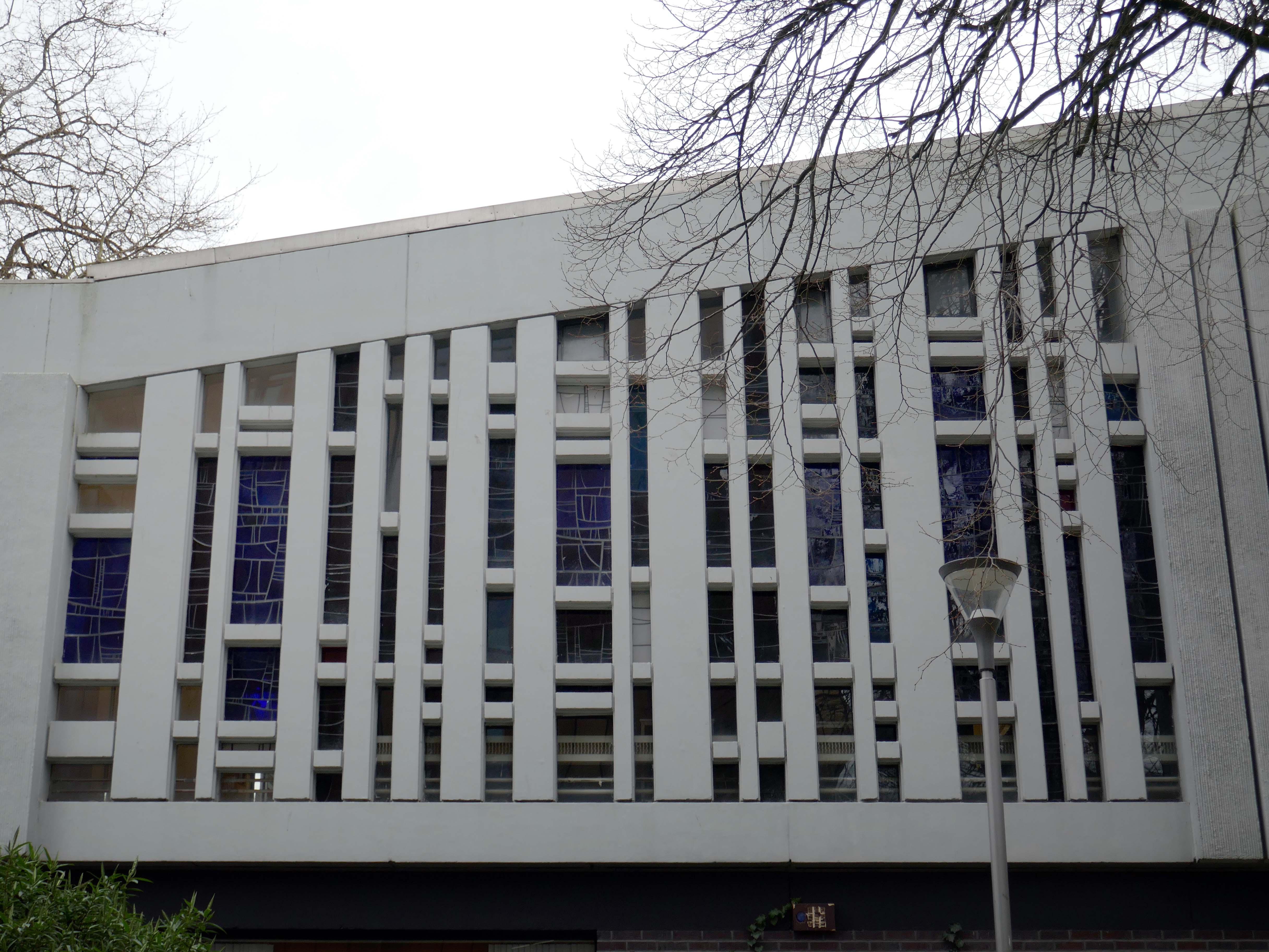
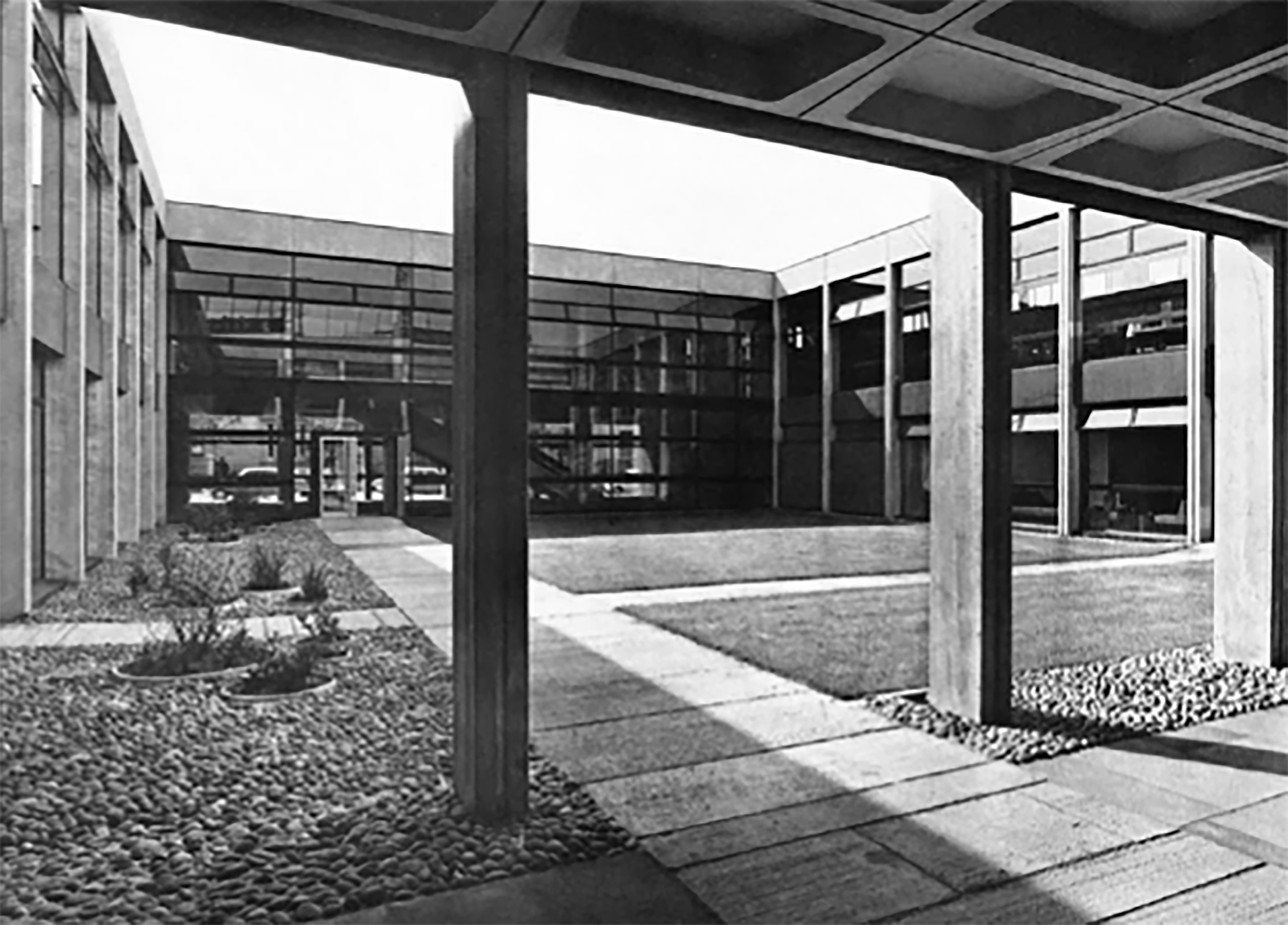
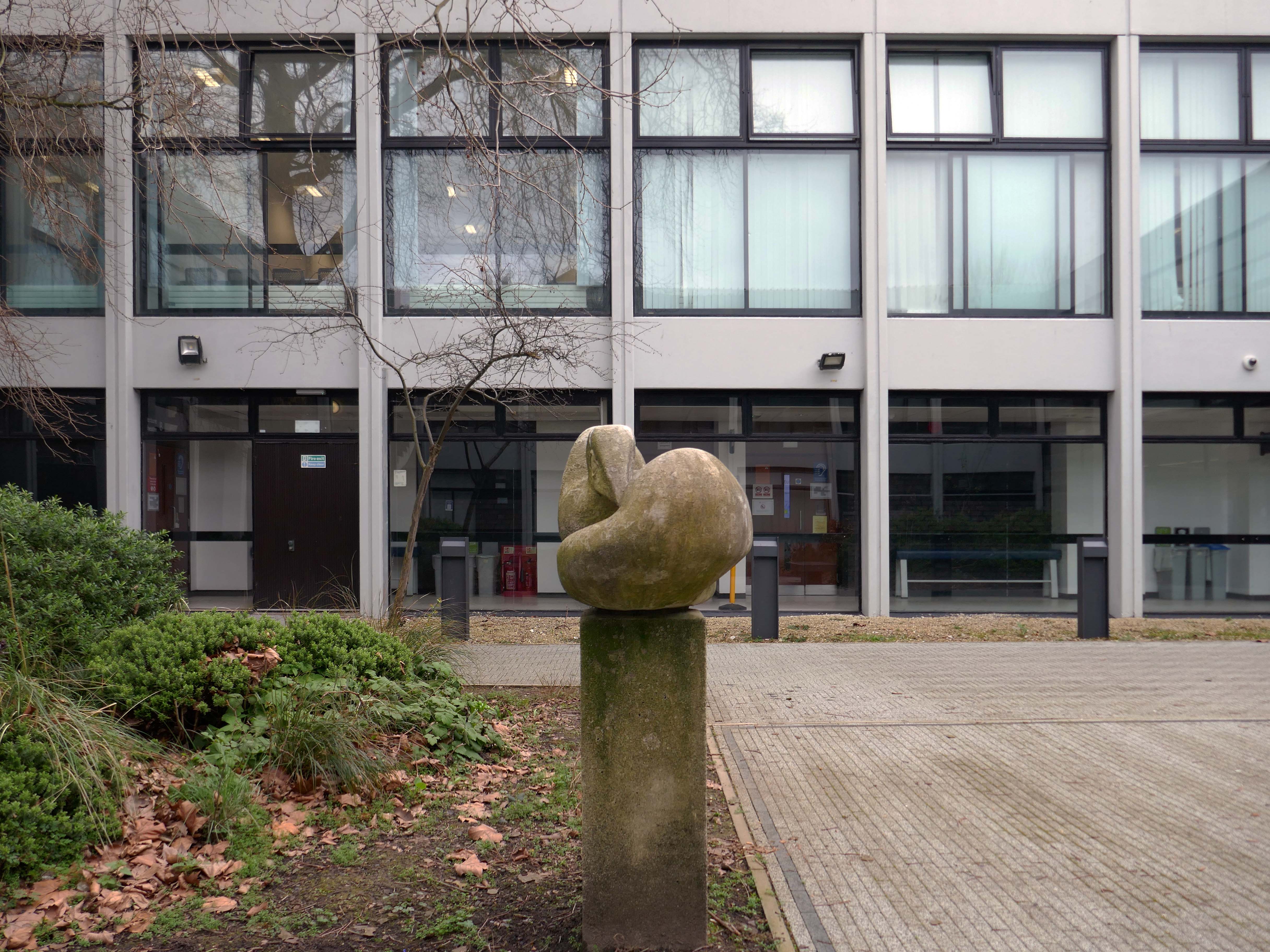
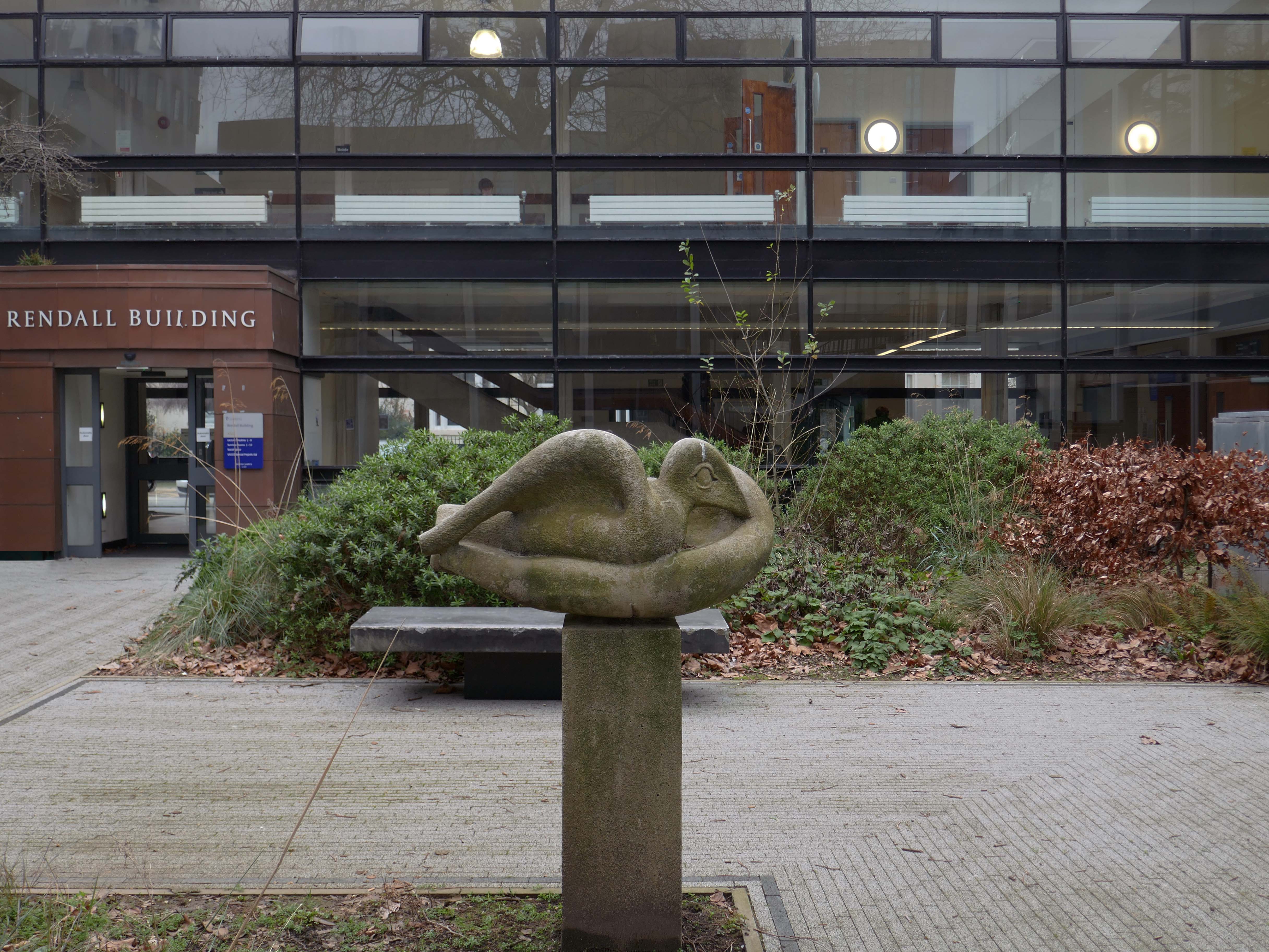
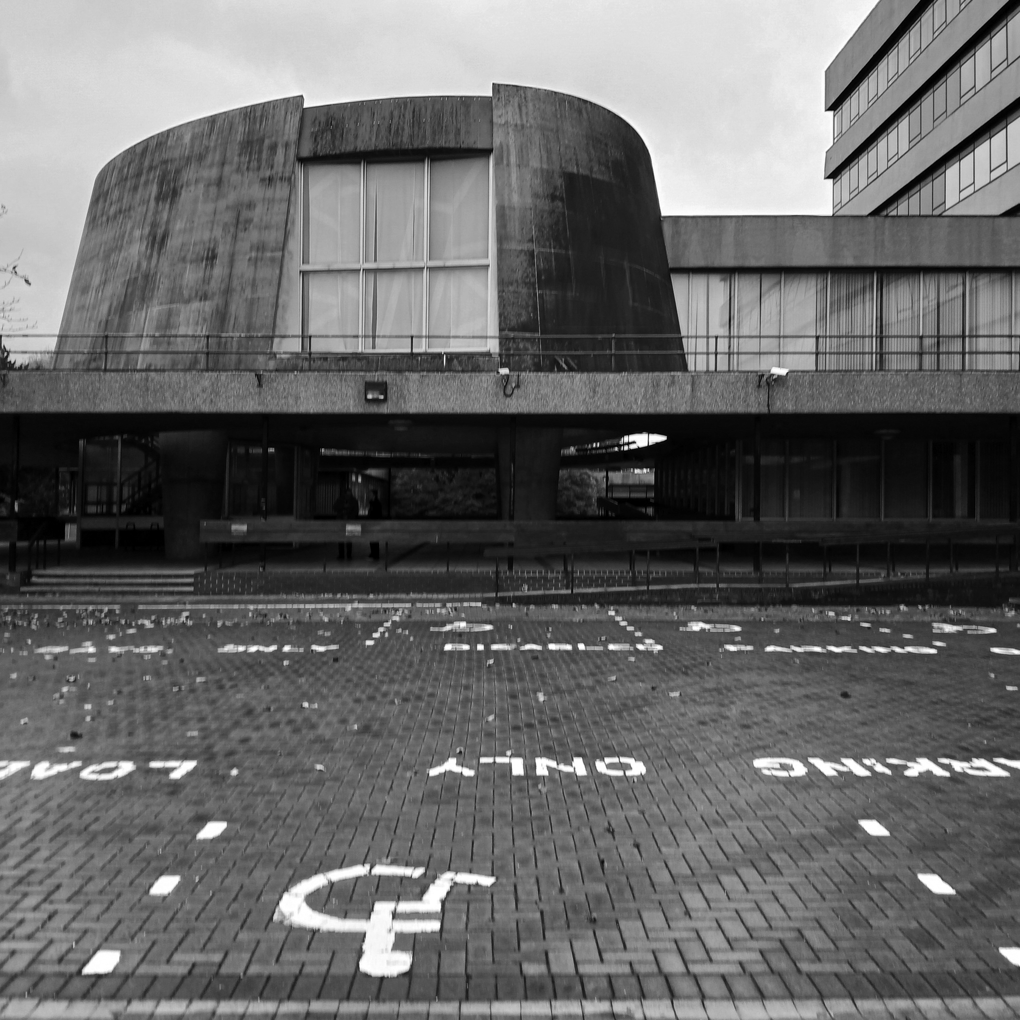
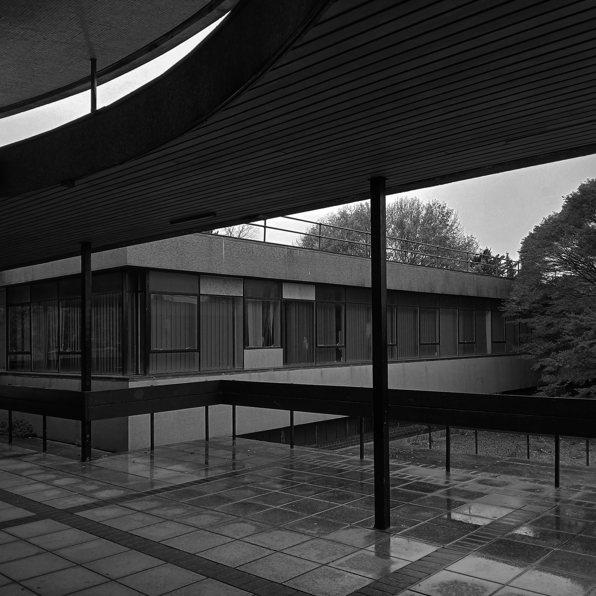
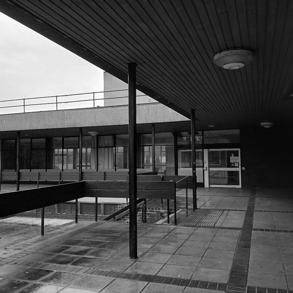
Rendall Building by Bryan & Norman Westwood, Piet & Partners 1964-6
Named after Gerald Henry Rendall who was an English educator and college administrator.
He was principal of University College Liverpool.
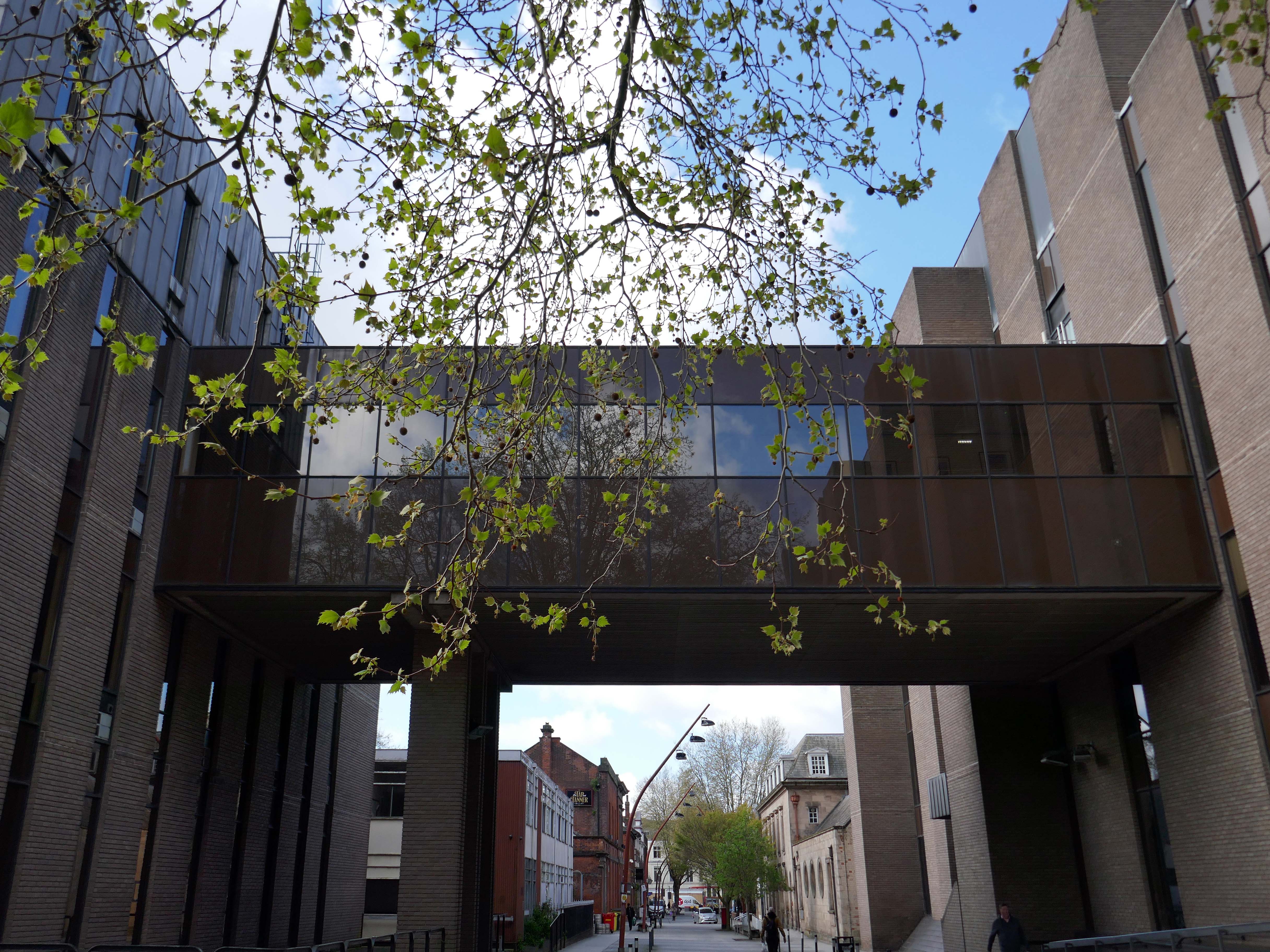
We have been here before at liverpool-university, exploring the space betwixt and between the two cathedrals.
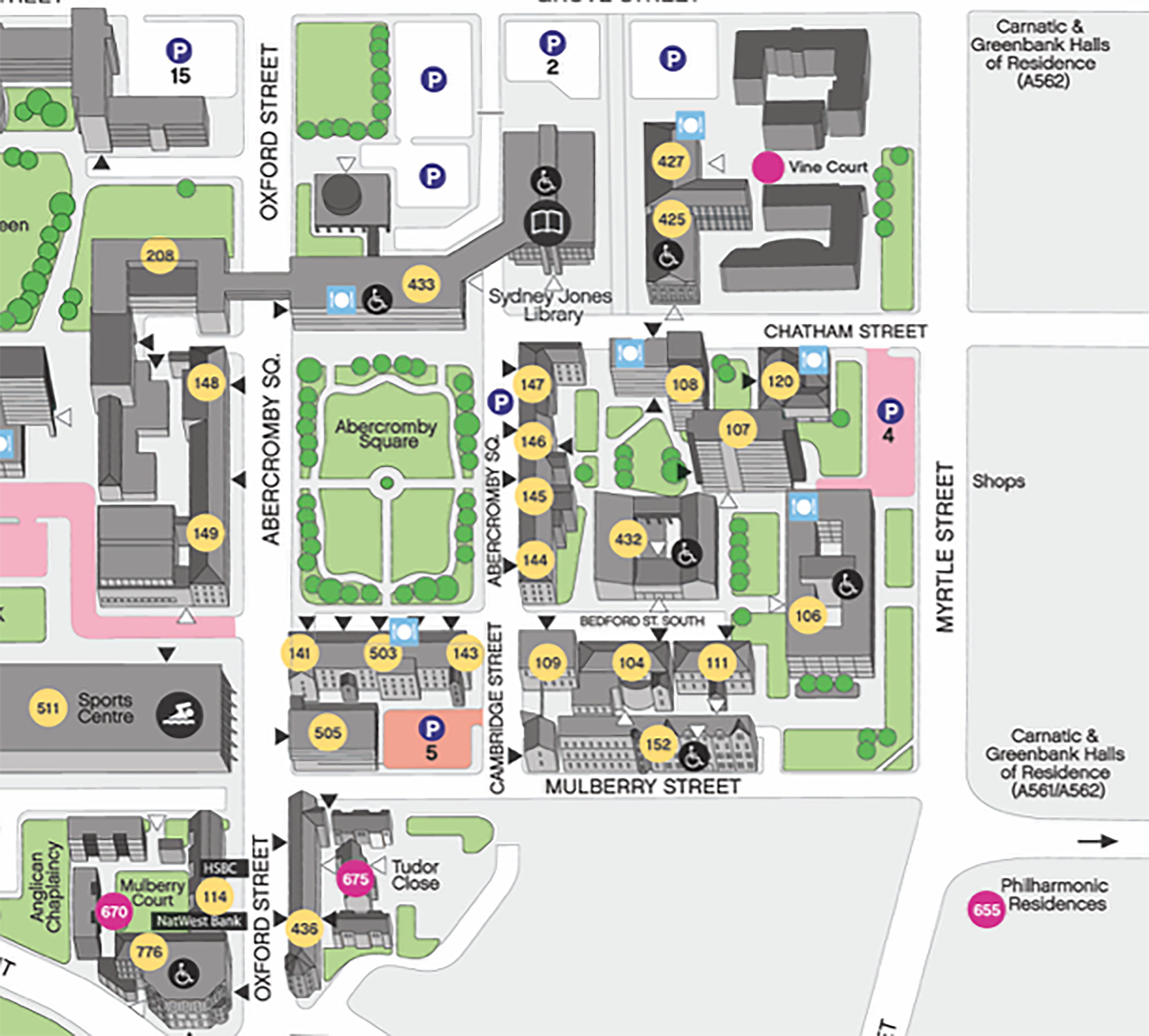
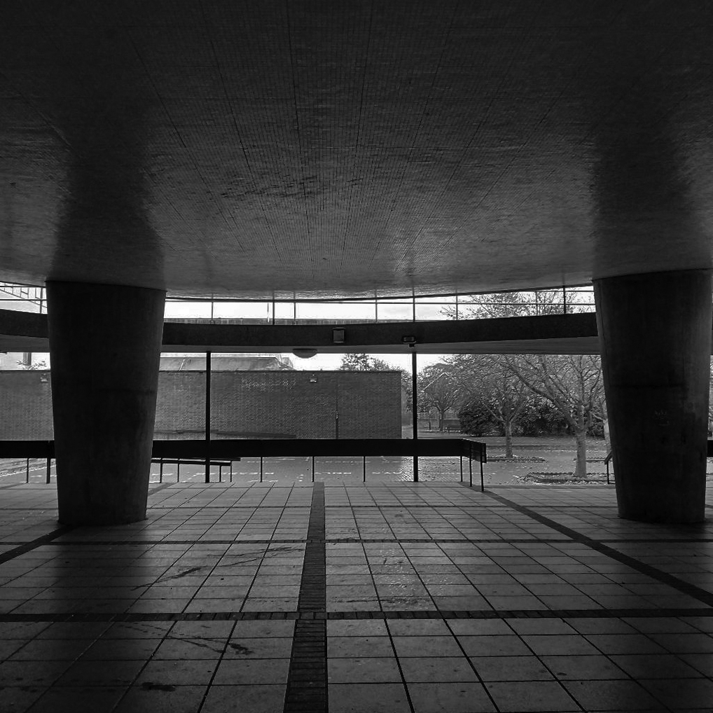
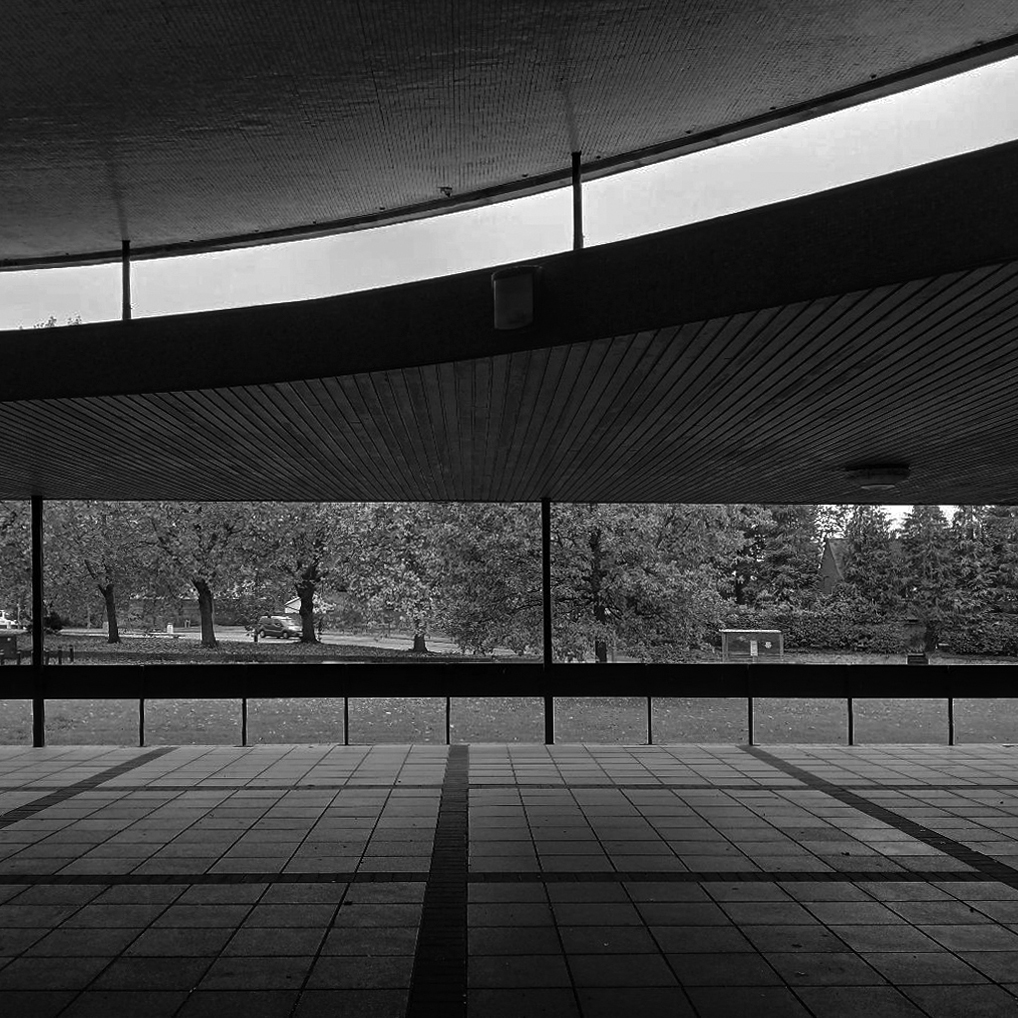
On this occasion, I wish to draw attention to this relatively small but perfectly formed building – #432 on your maps.
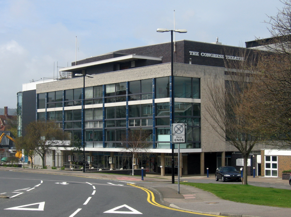
Westwood, Piet & Partners were well-known architects during the post-war period in Britain and built a body of varied work including army barracks, retail and theatre design. An example of their work is the Congress Theatre in Eastbourne – Grade II* listed.
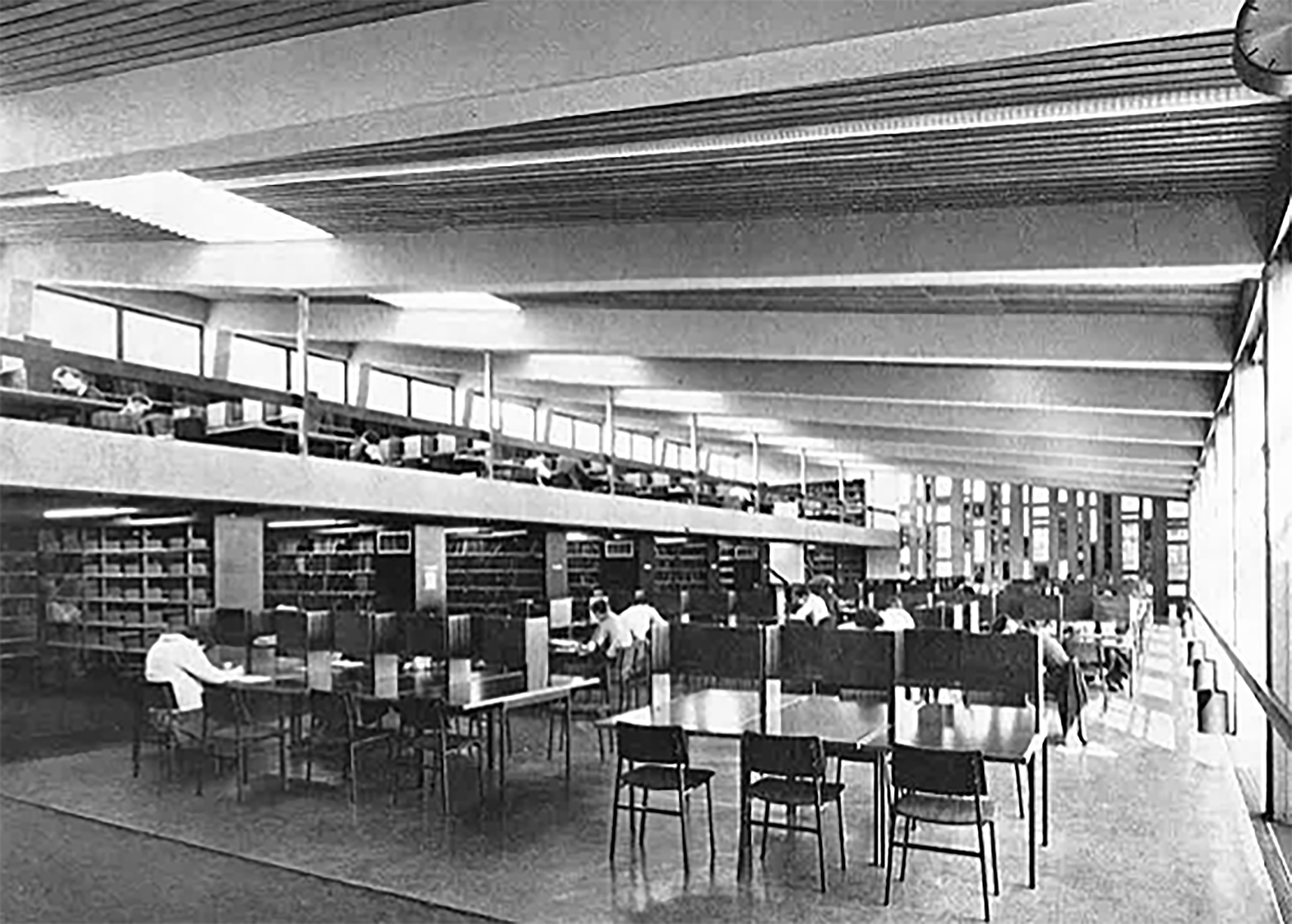
Originally built to accommodate the arts library and lecture rooms on the south campus as the University grew to accommodate larger numbers of students.
The current use as lecture and seminar rooms maintains the building’s use as a key learning space on campus.
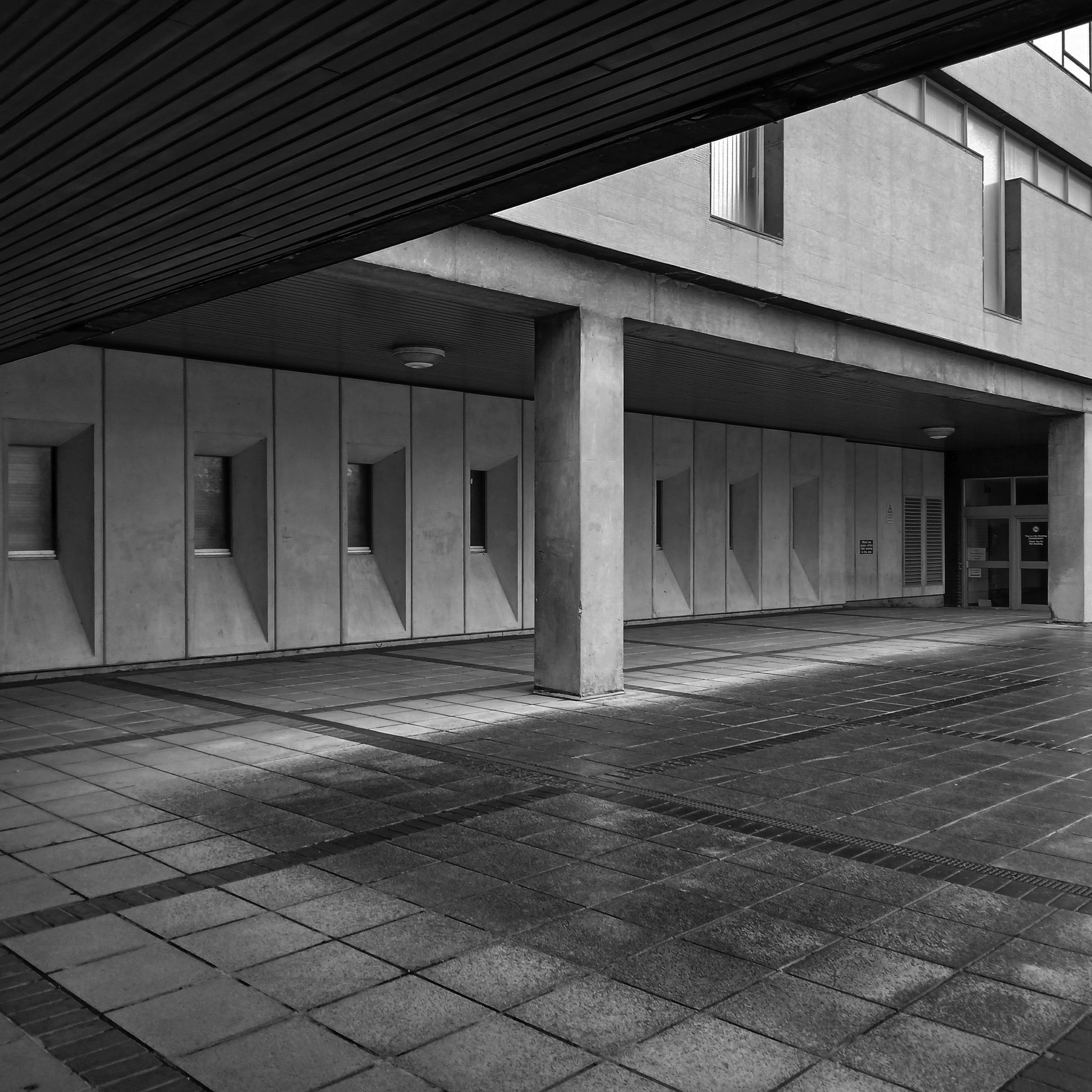
Located in an area of the southern campus where Westwood, Piet & Partners designed four blocks resulting in a group which Pevsner described as the
Most coherent and satisfying part of the precinct. The massing and materiality of the external is complementary and respectful to the surrounding Georgian buildings.
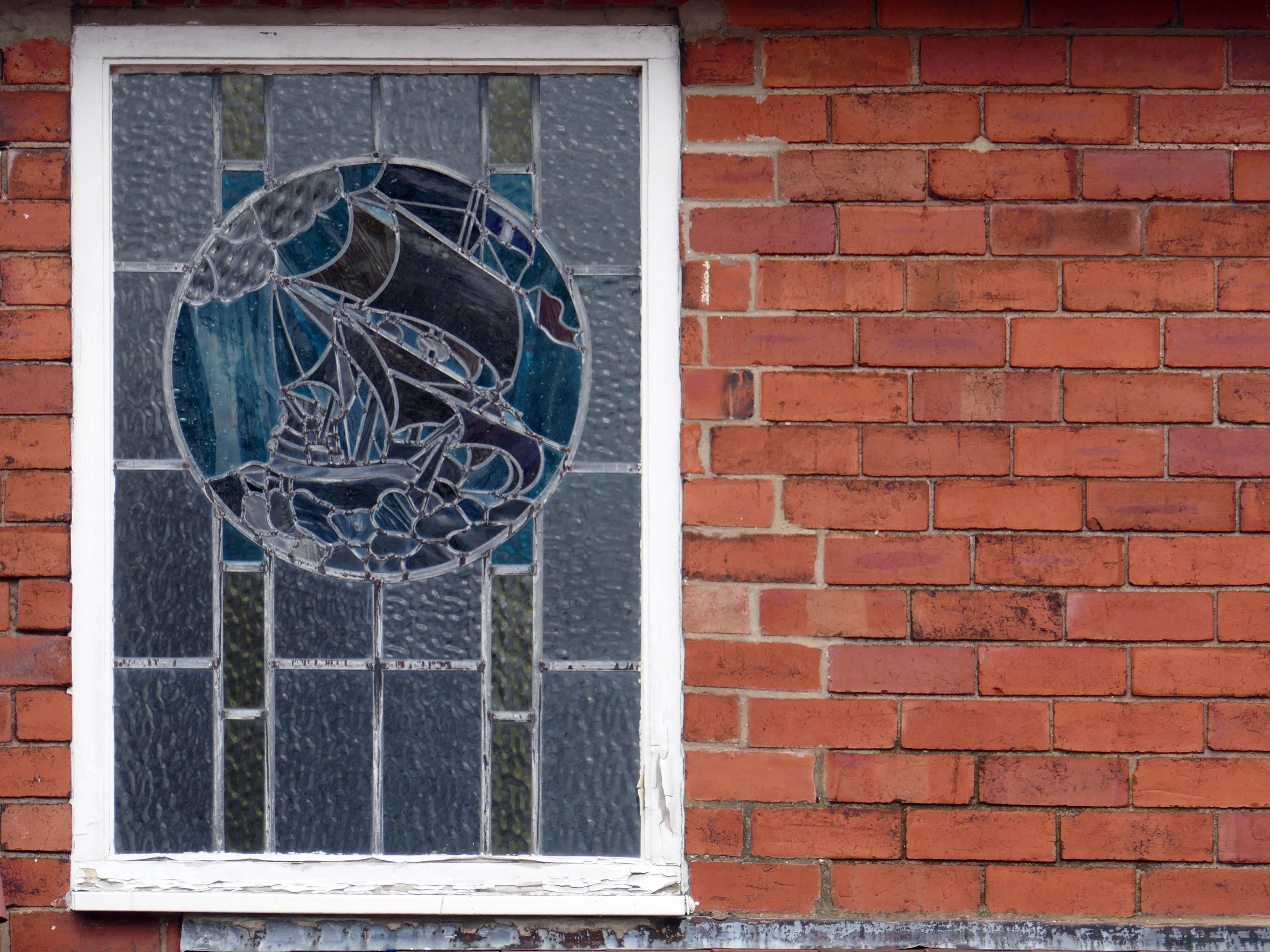
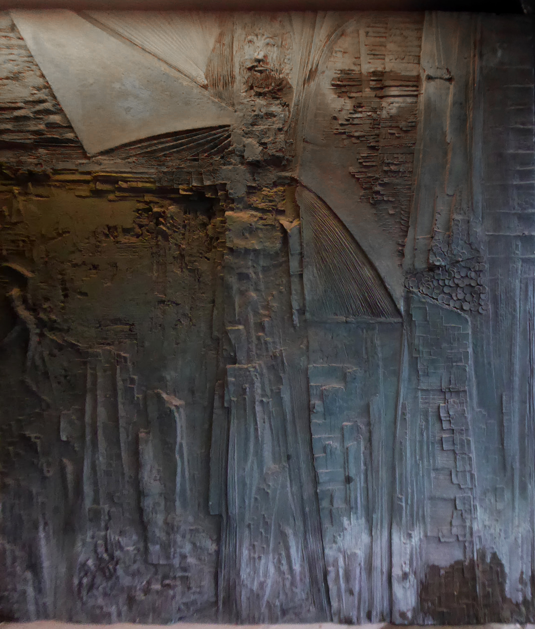
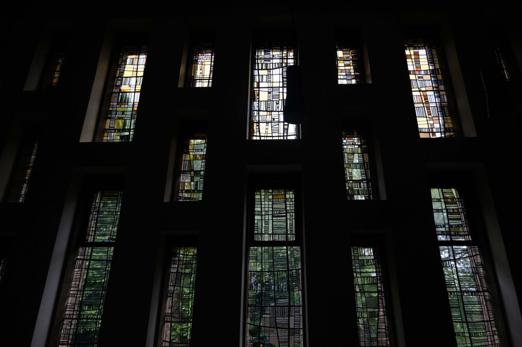
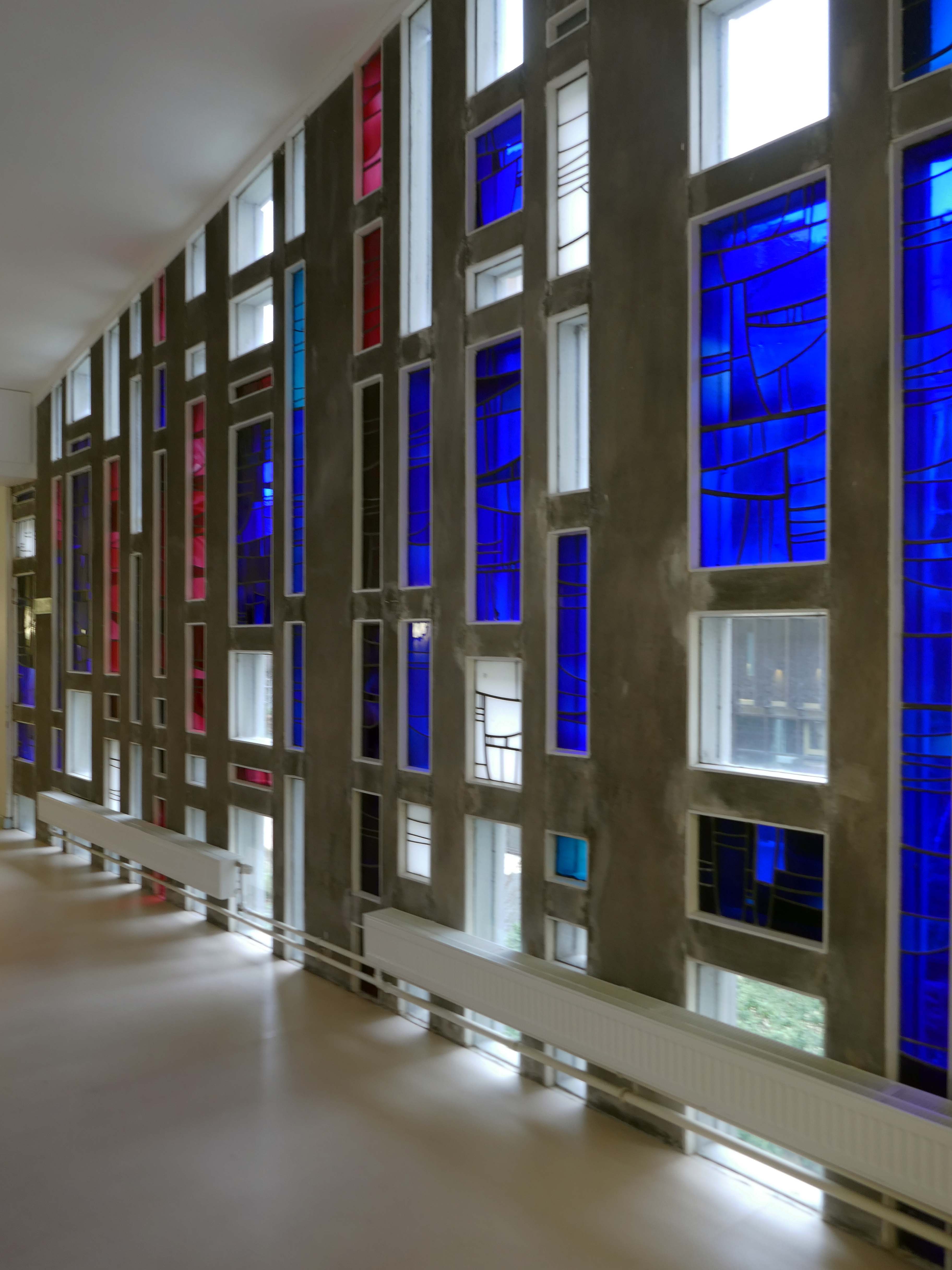
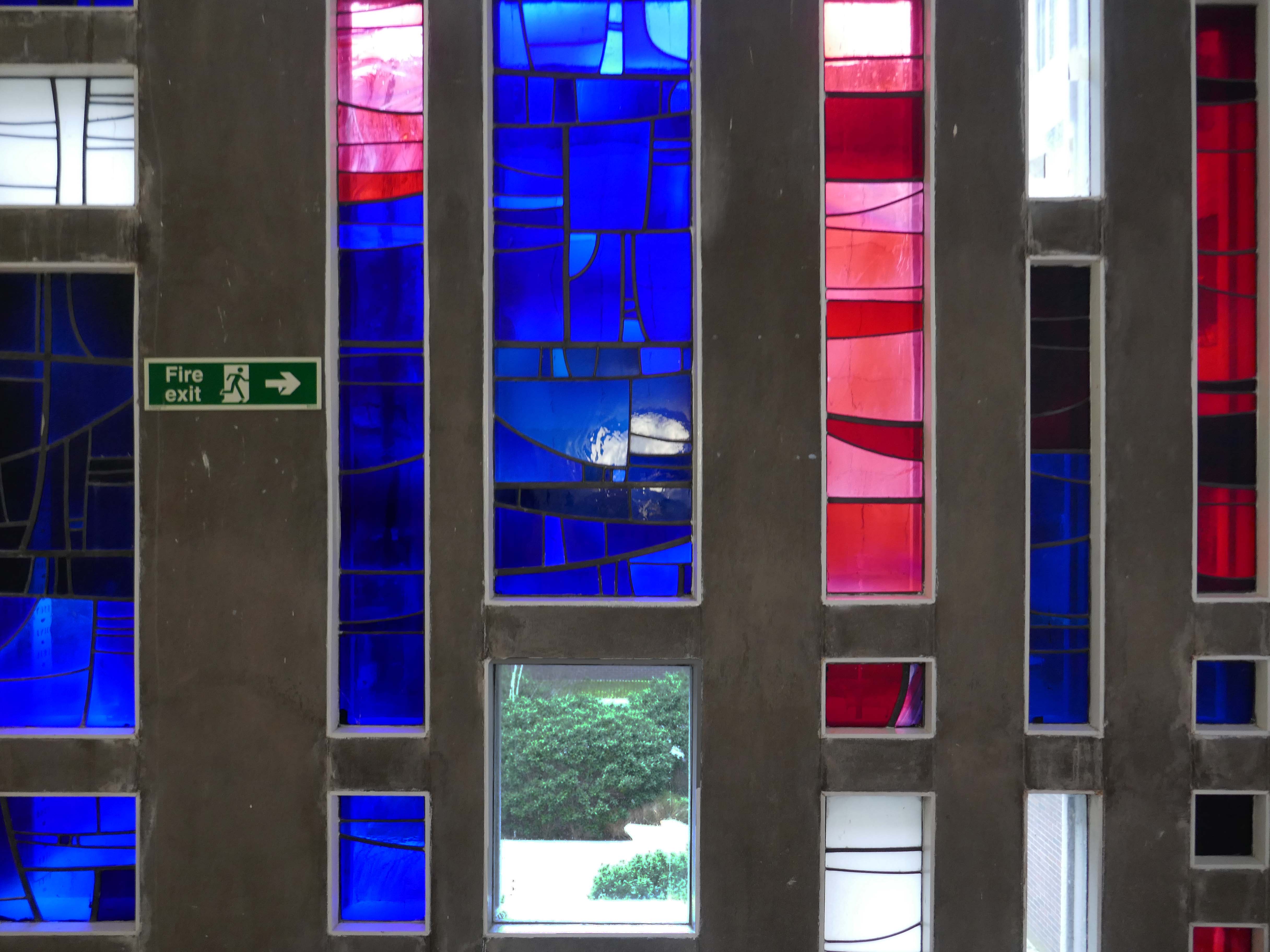
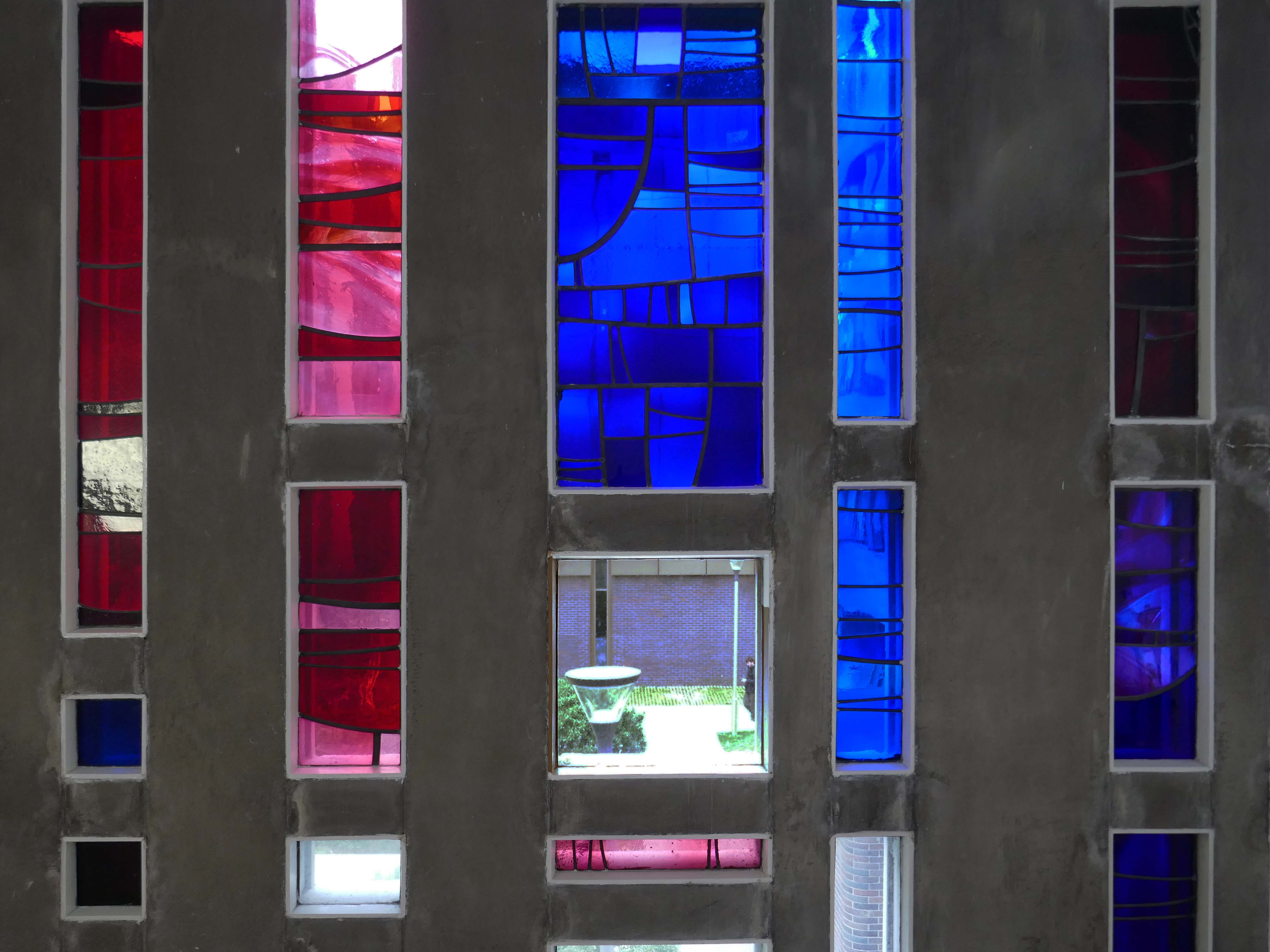
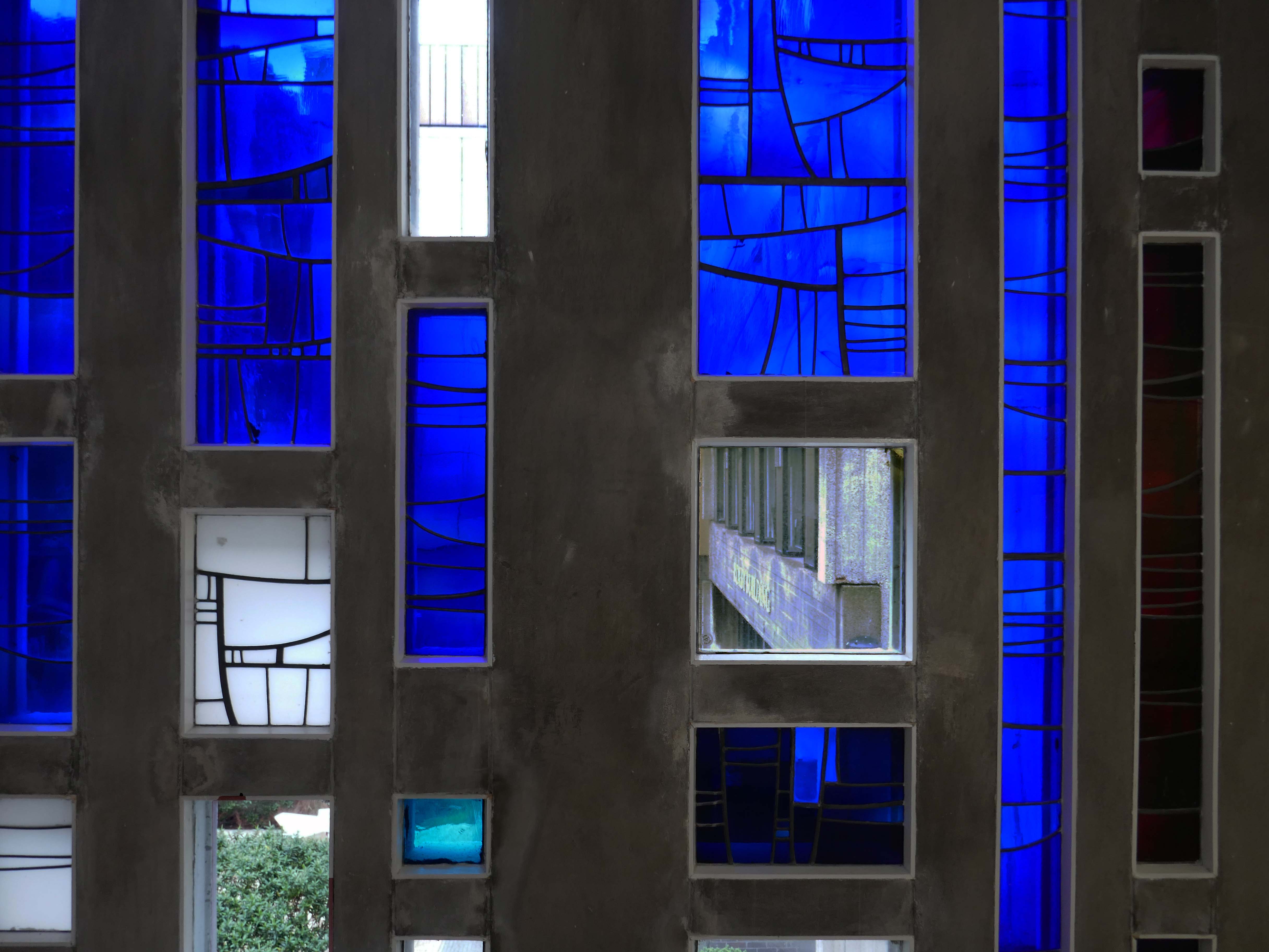
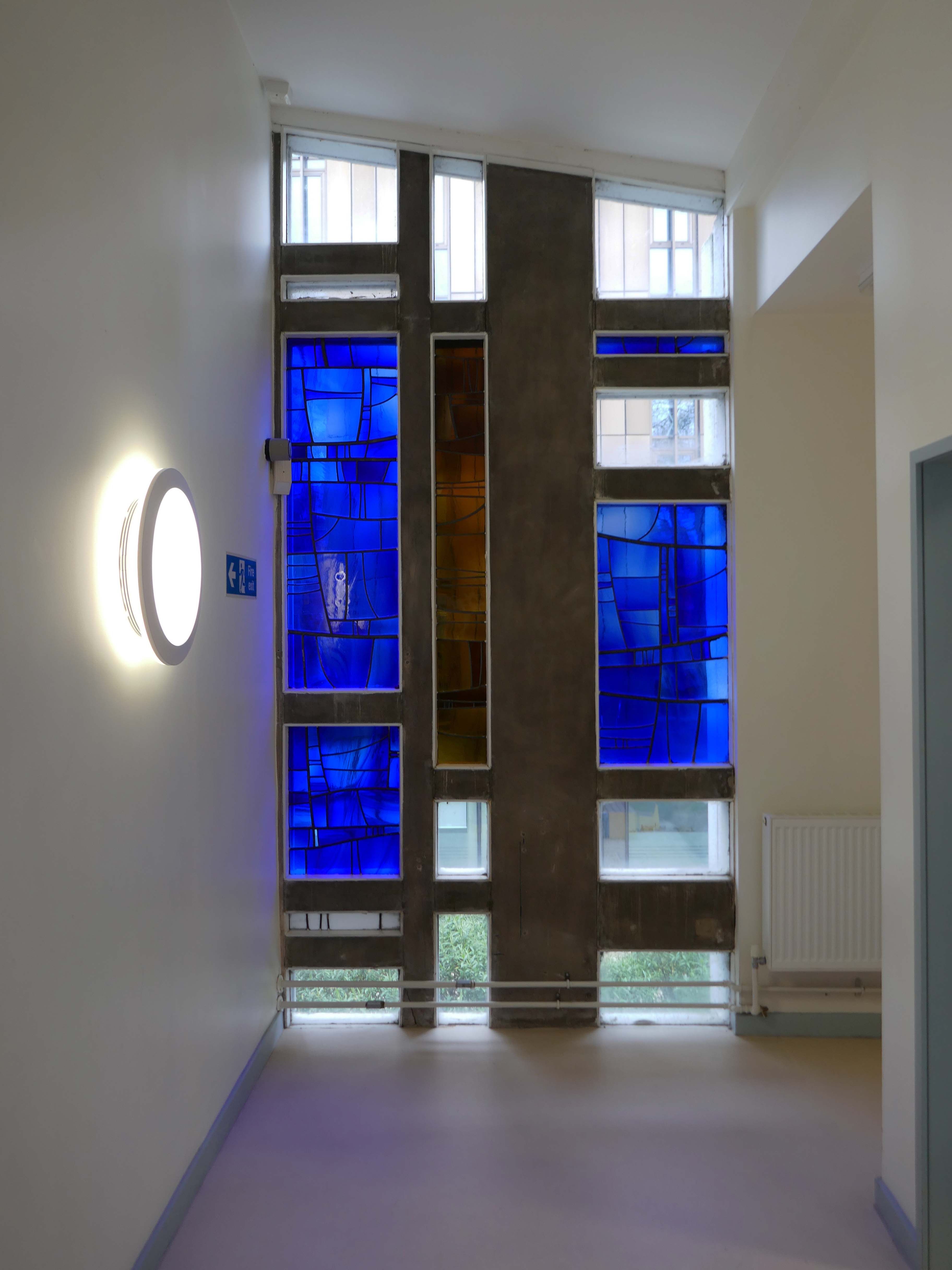
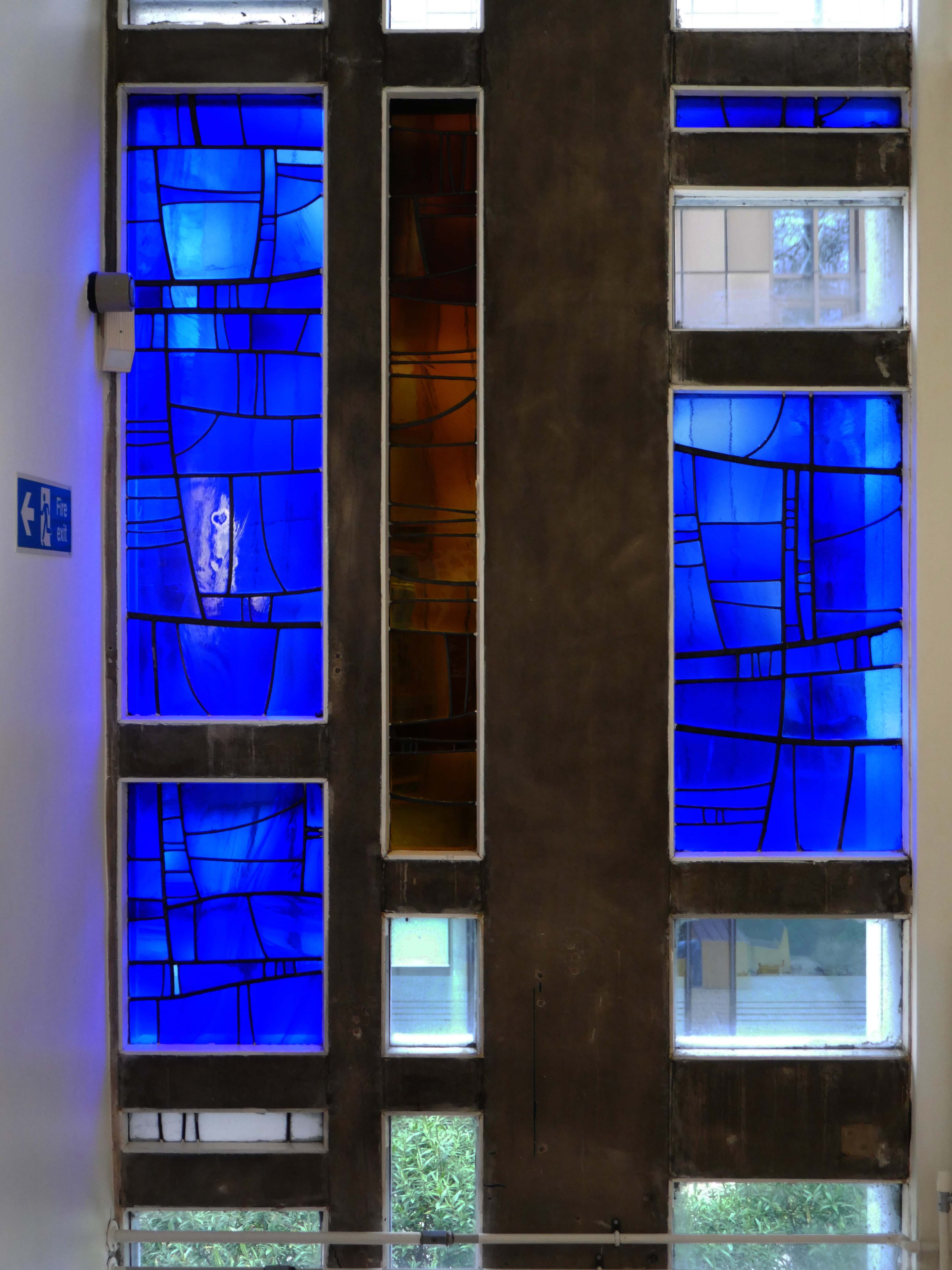
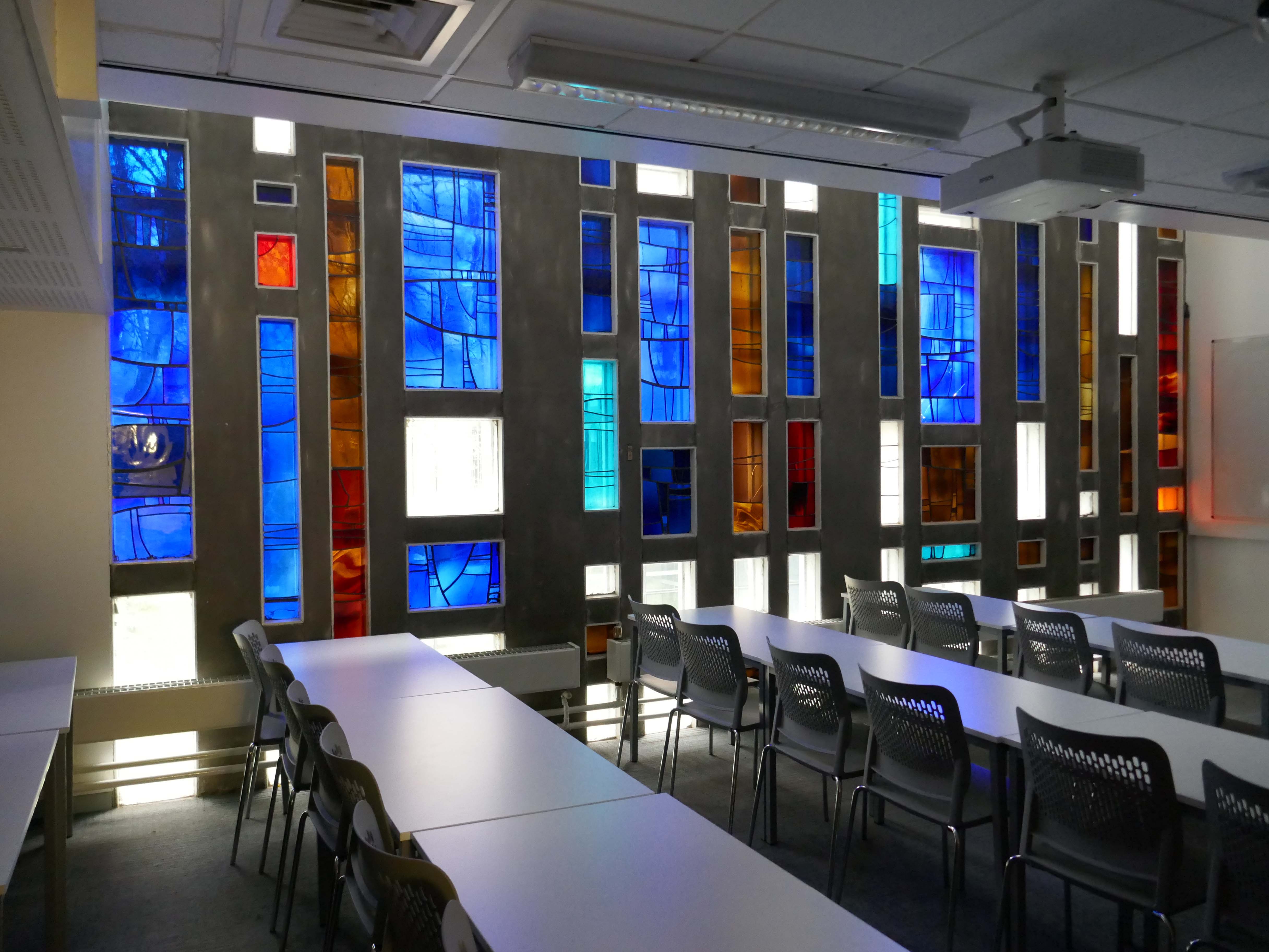
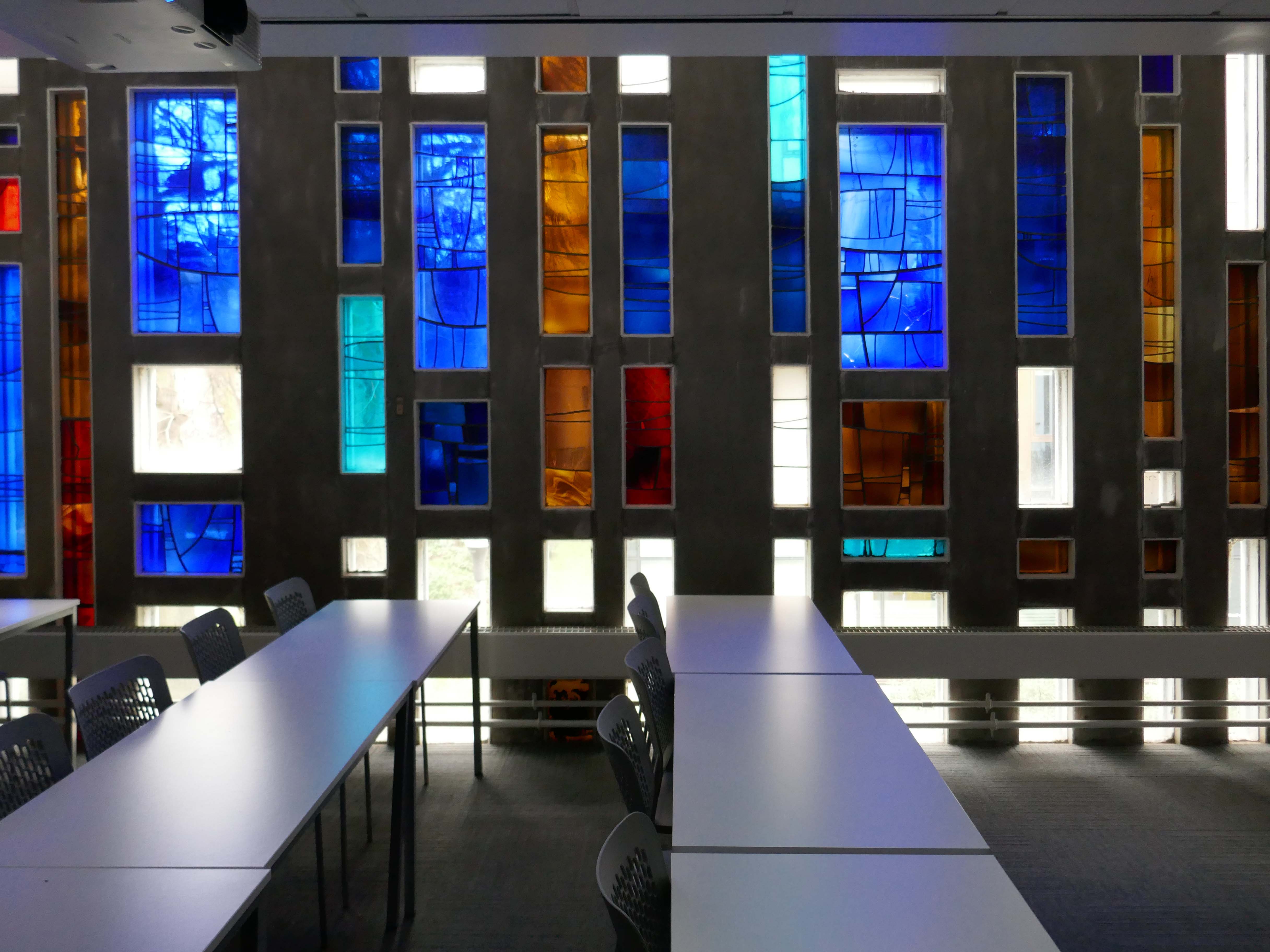
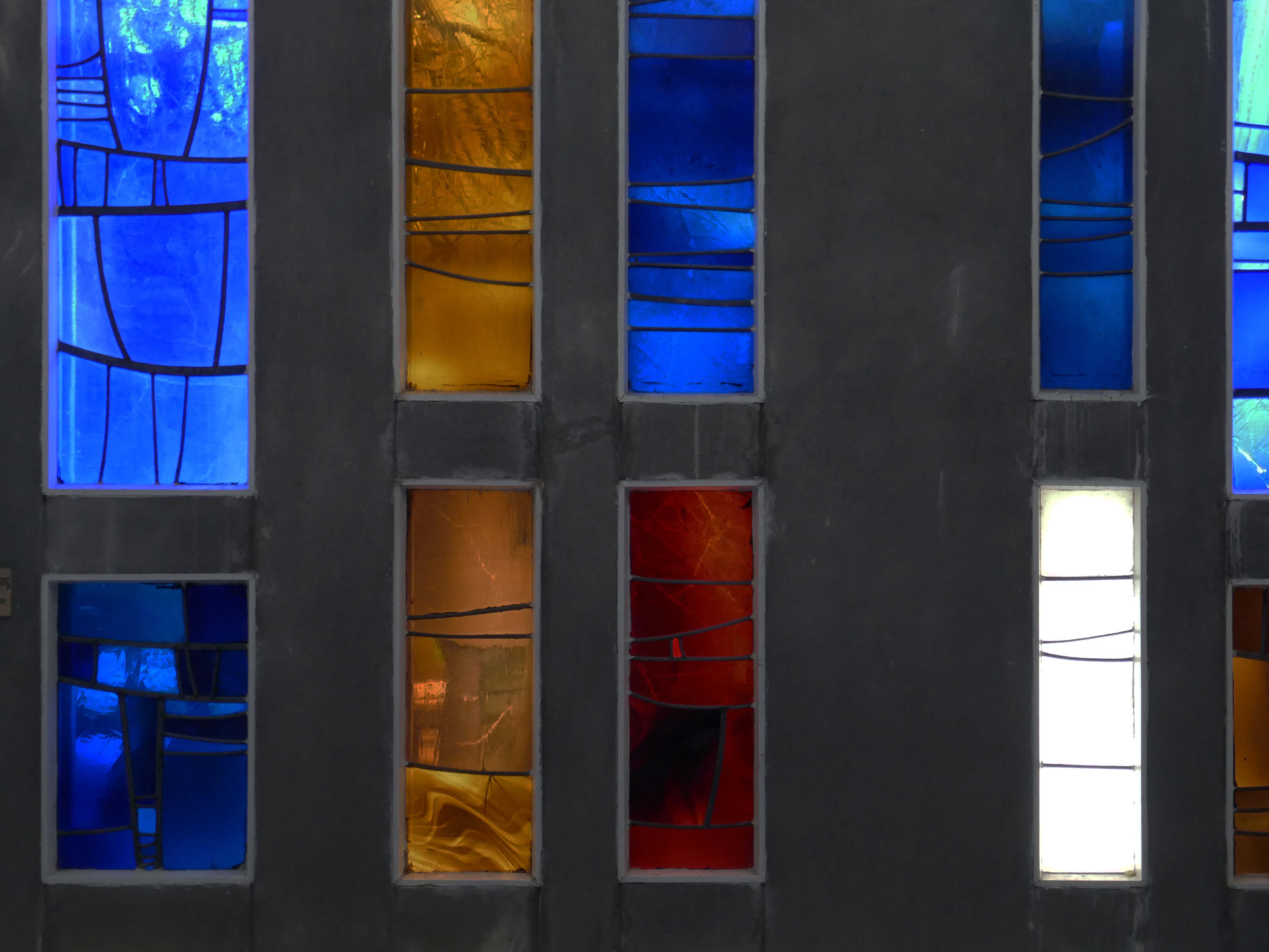
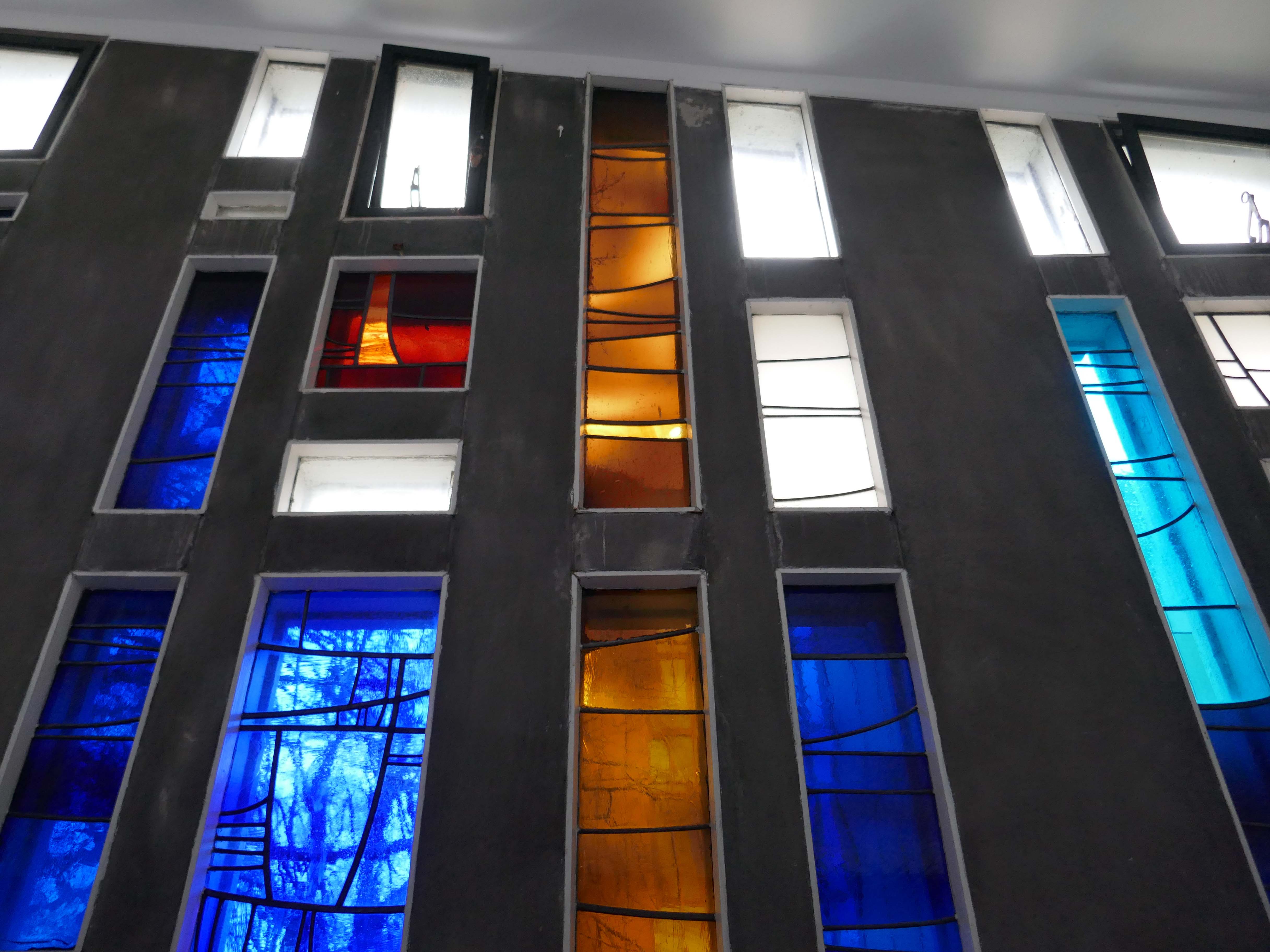
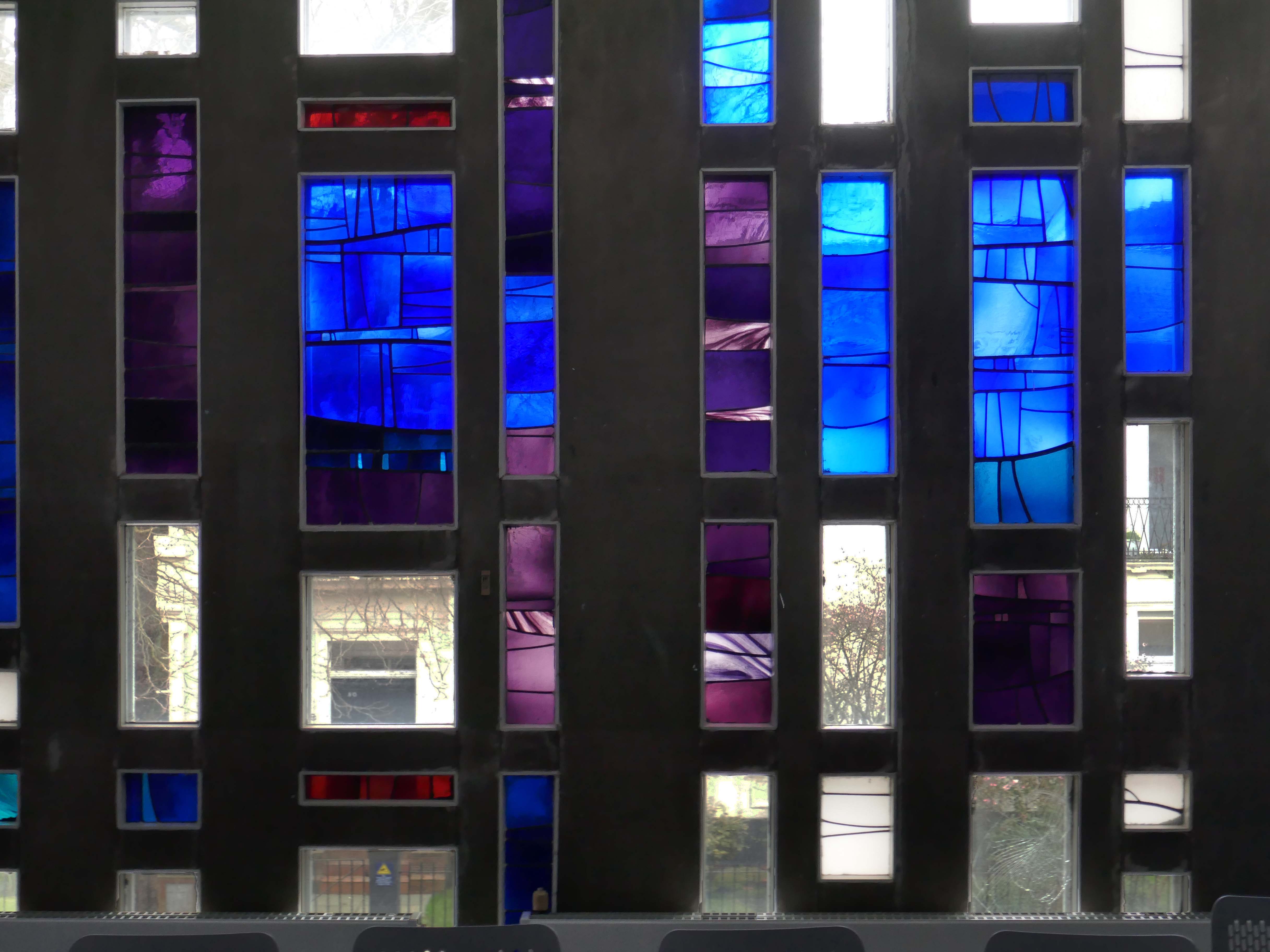
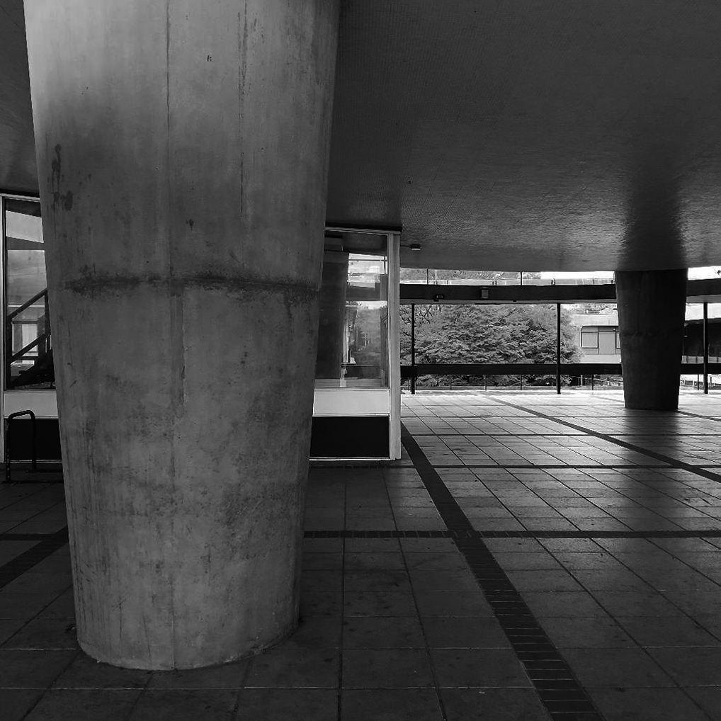
Between the concrete is ‘dalle de verre’ stained glass by Gillian Rees-Thomas.
she was also responsible for the side chapel windows at St Mark’s Broomhill Sheffield.
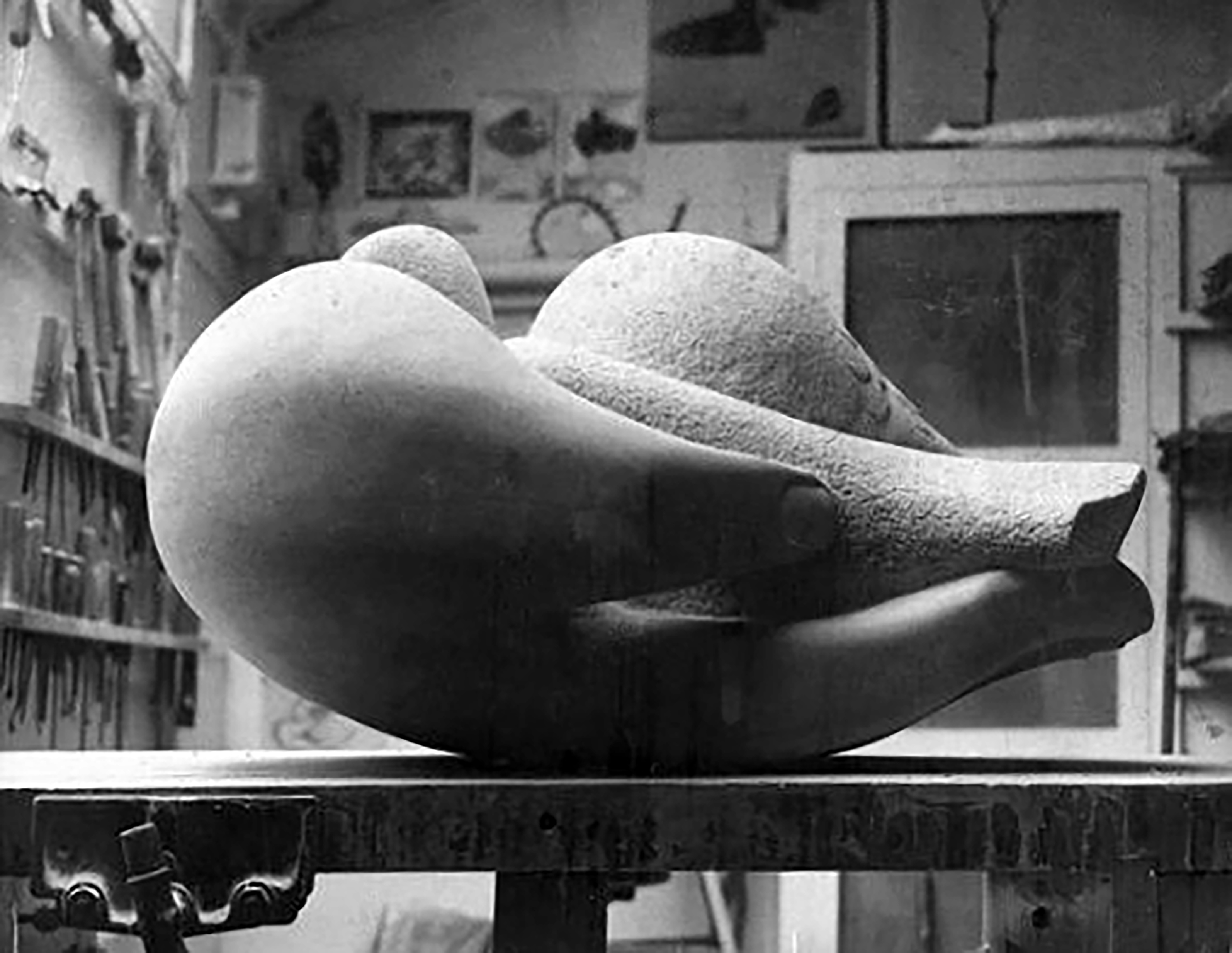
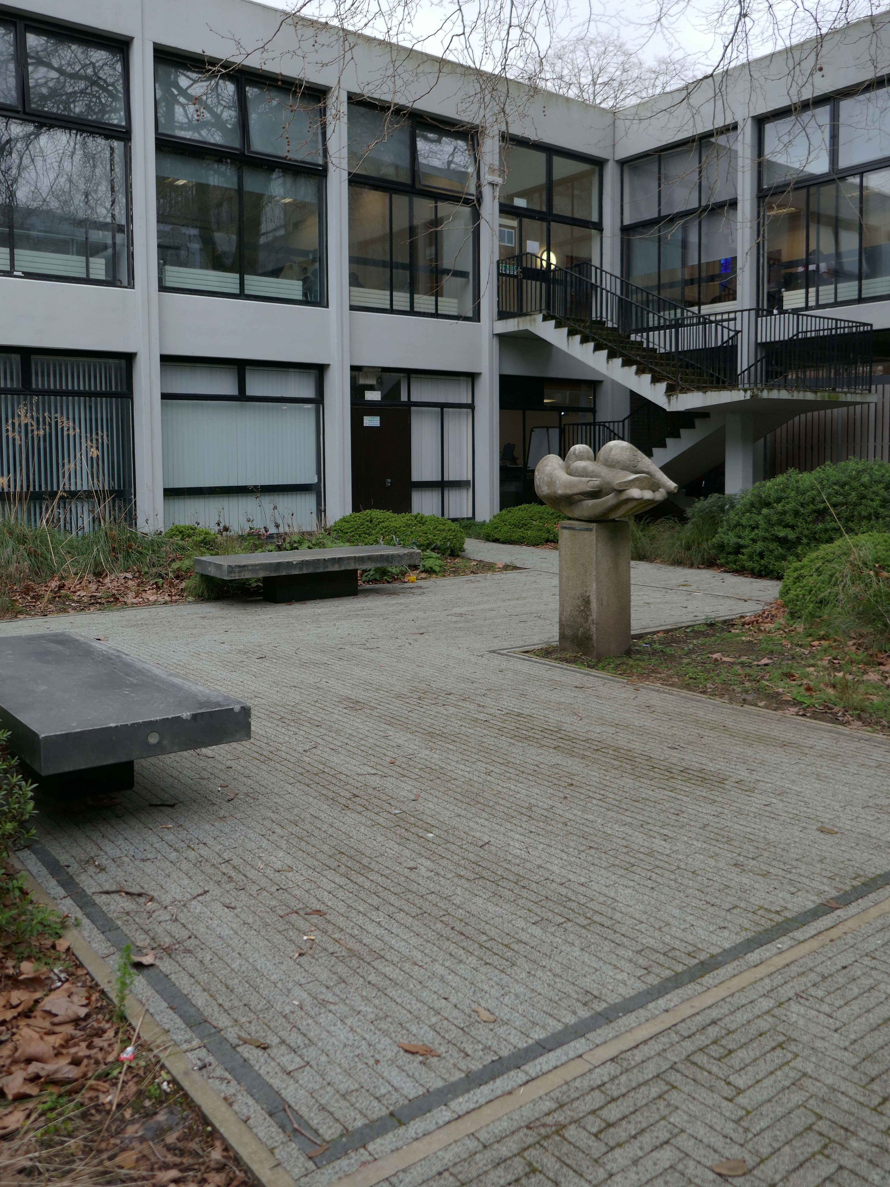
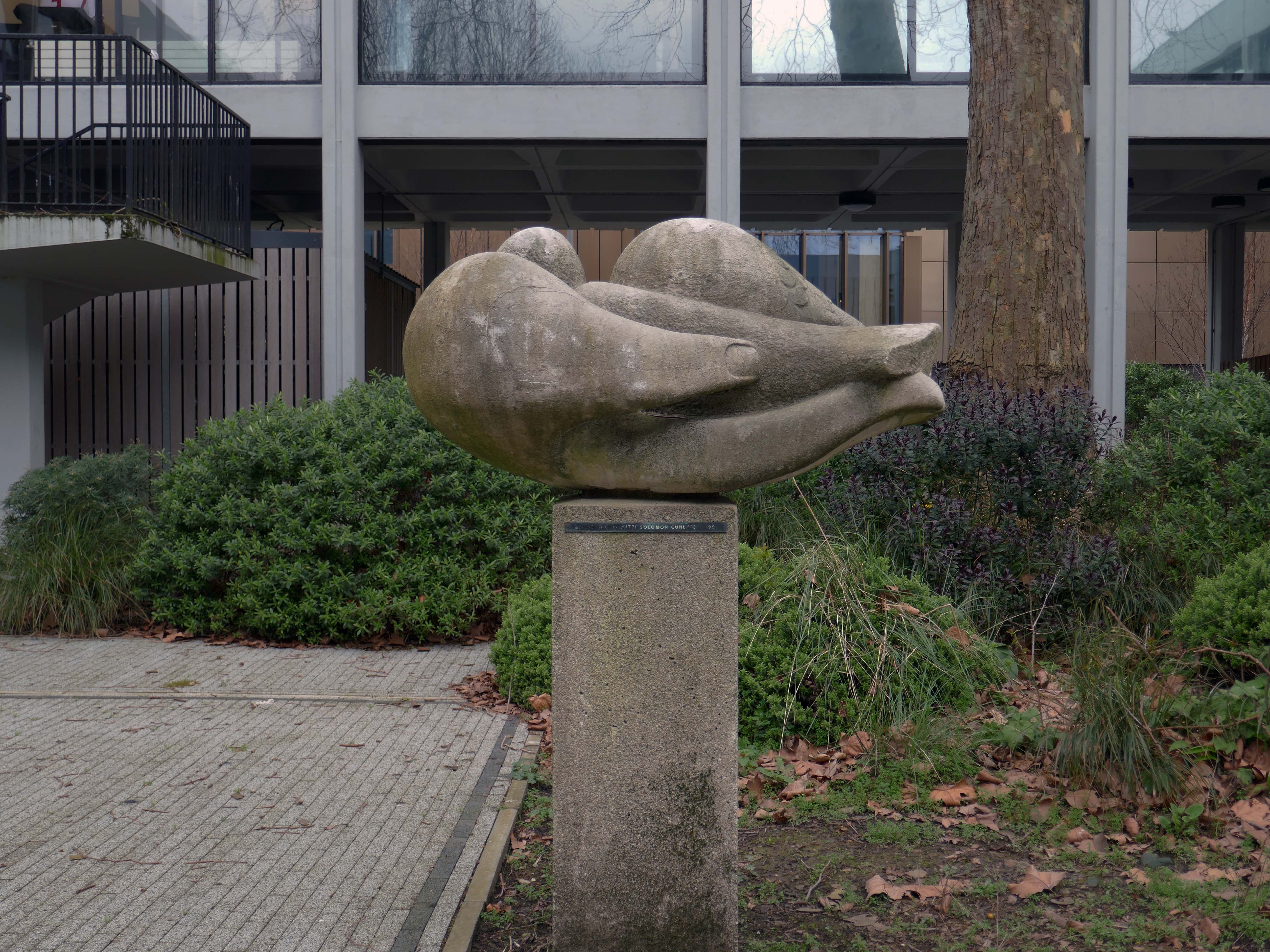
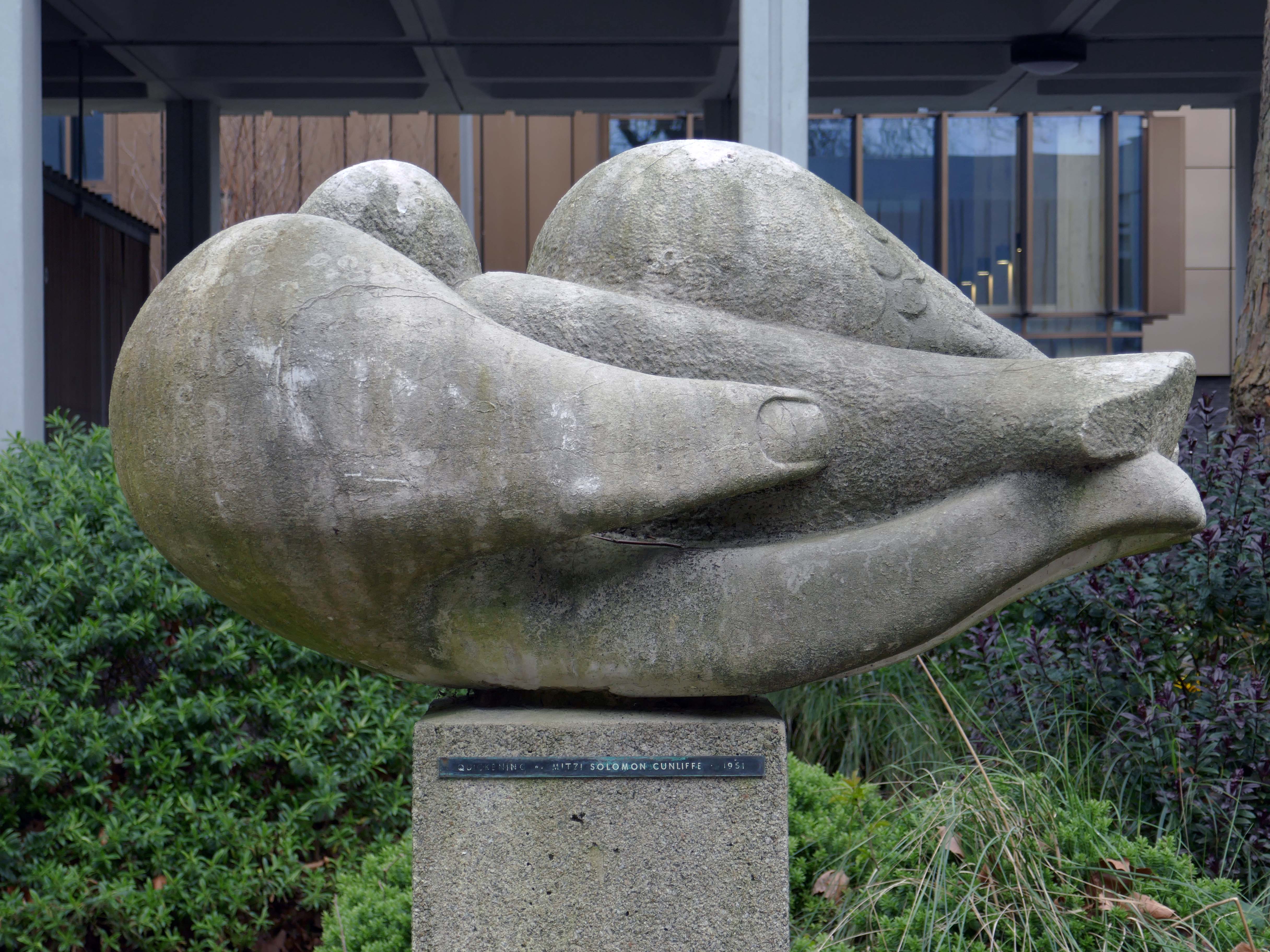
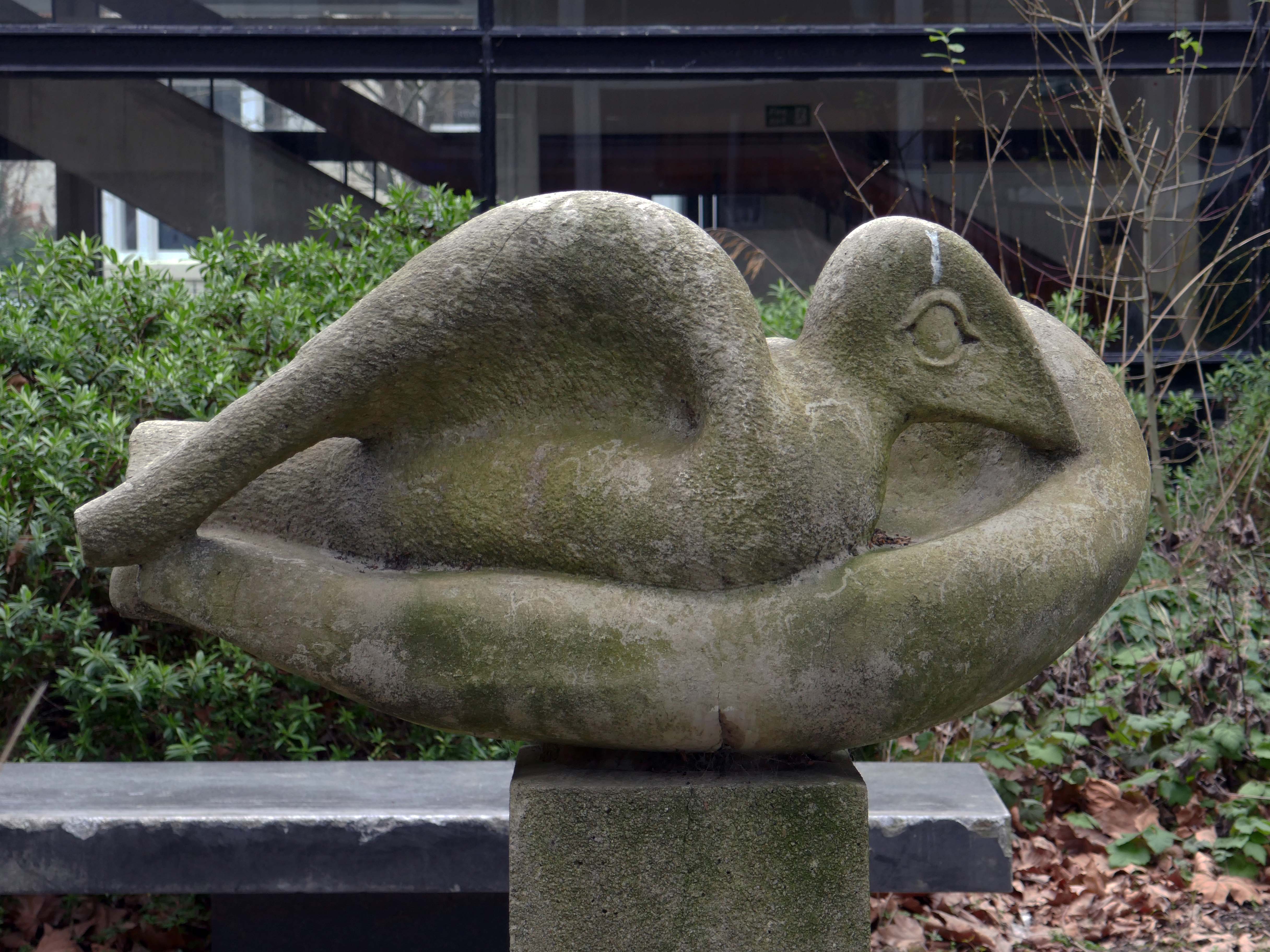
The courtyard contains a sculpture by Mitzi Solomon Cunliffe – The Quickening previously located behind the School of Architecture.
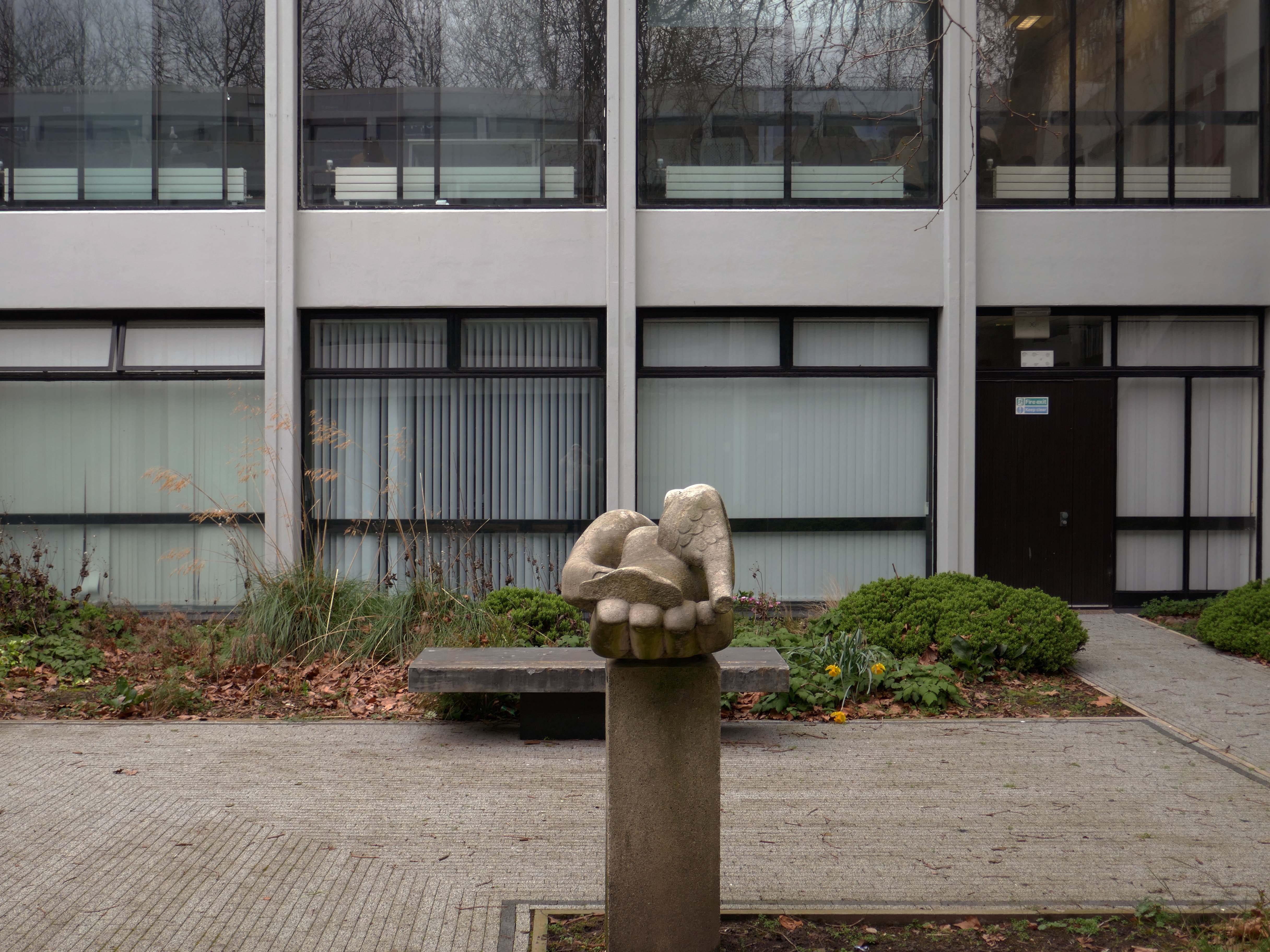
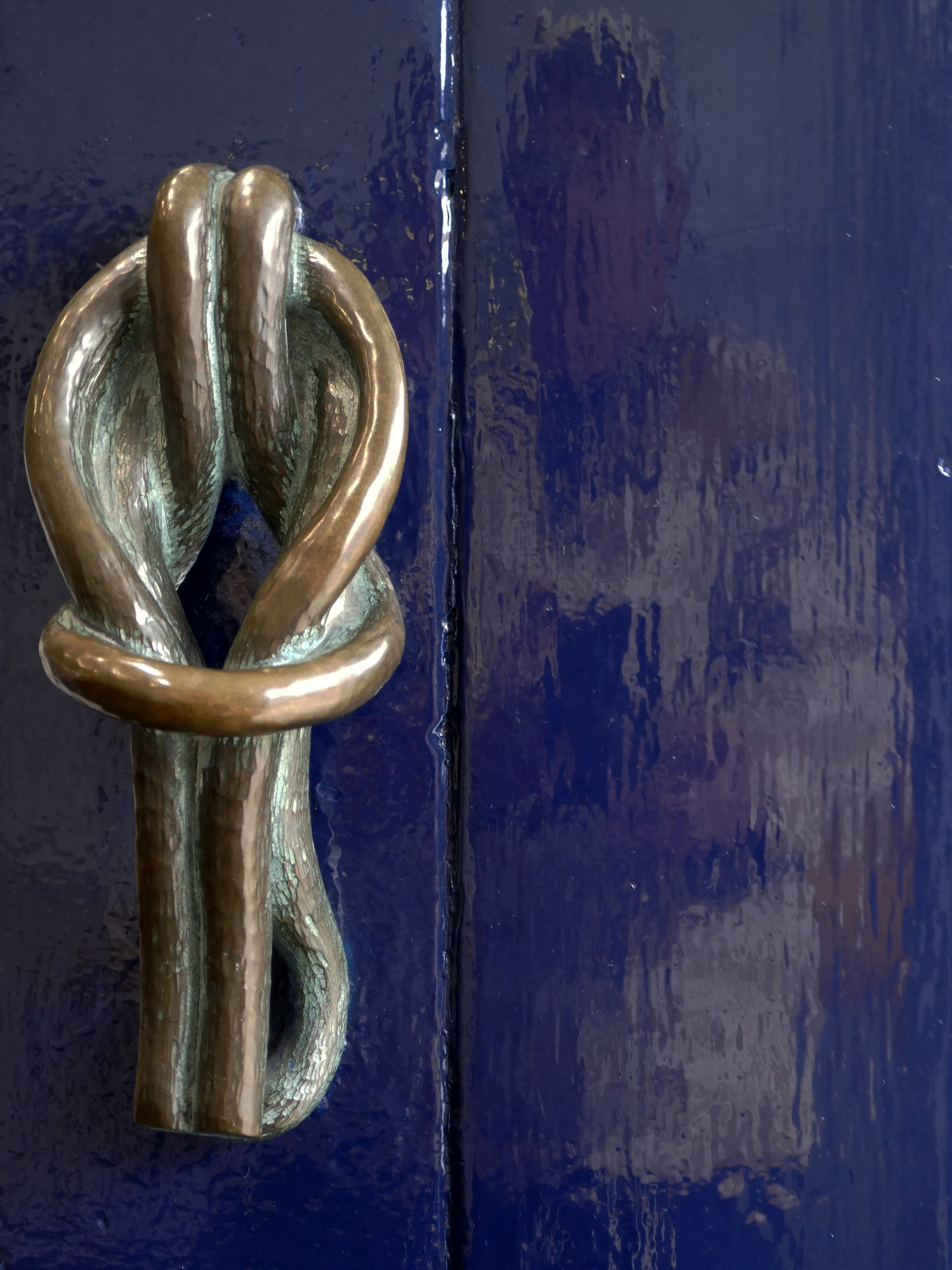
Somebody at the University of Liverpool saw Mitzi’s work at the Festival of Britain and took note. She was immediately commissioned to create three items for the University: a public sculpture to go in the courtyard of the School of Civic Design’s new building, a decorative sculpture for the inside the building and the handles for its front-door.
The public sculpture, is in the form of a hand gently holding a dove. It stood in its original position for sixty-nine years until sent away for conservation and then relocated across campus in 2020, to outside the Rendall Building.
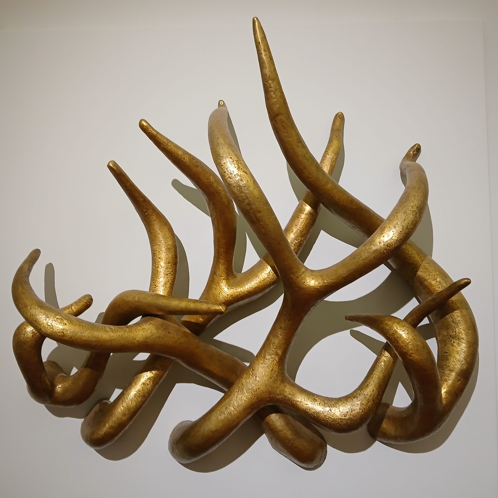
The other sculpture that Mitzi created for the building is easily the spikiest thing in our art collection. ‘Loosestrife’ is a number of tentacle-like arms that intertwine and project outwards. For many it looks like an assemblage of golden deer antlers but it may be based on spires of the flower called loosestrife.
‘Loosestrife’ had been recorded on its arrival as being made of bronze and had turned completely black over the years, probably because it was hung in an area where students smoked back in the day. When it was removed from the School of Civic Design building in 2018 and sent for cleaning, it was revealed to actually be made of brass. It is very heavy and takes four technicians with lifting gear to hang it for display.
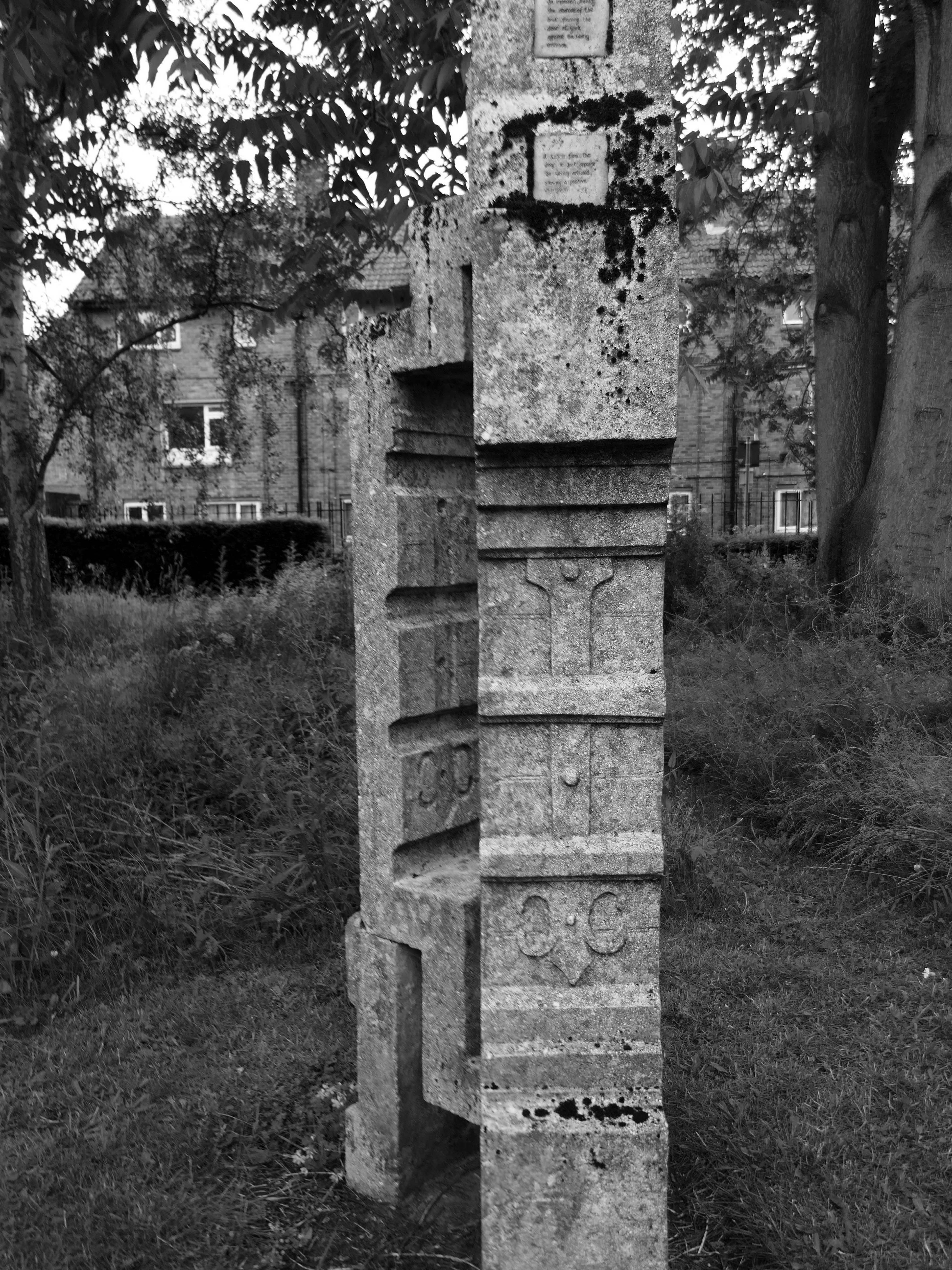
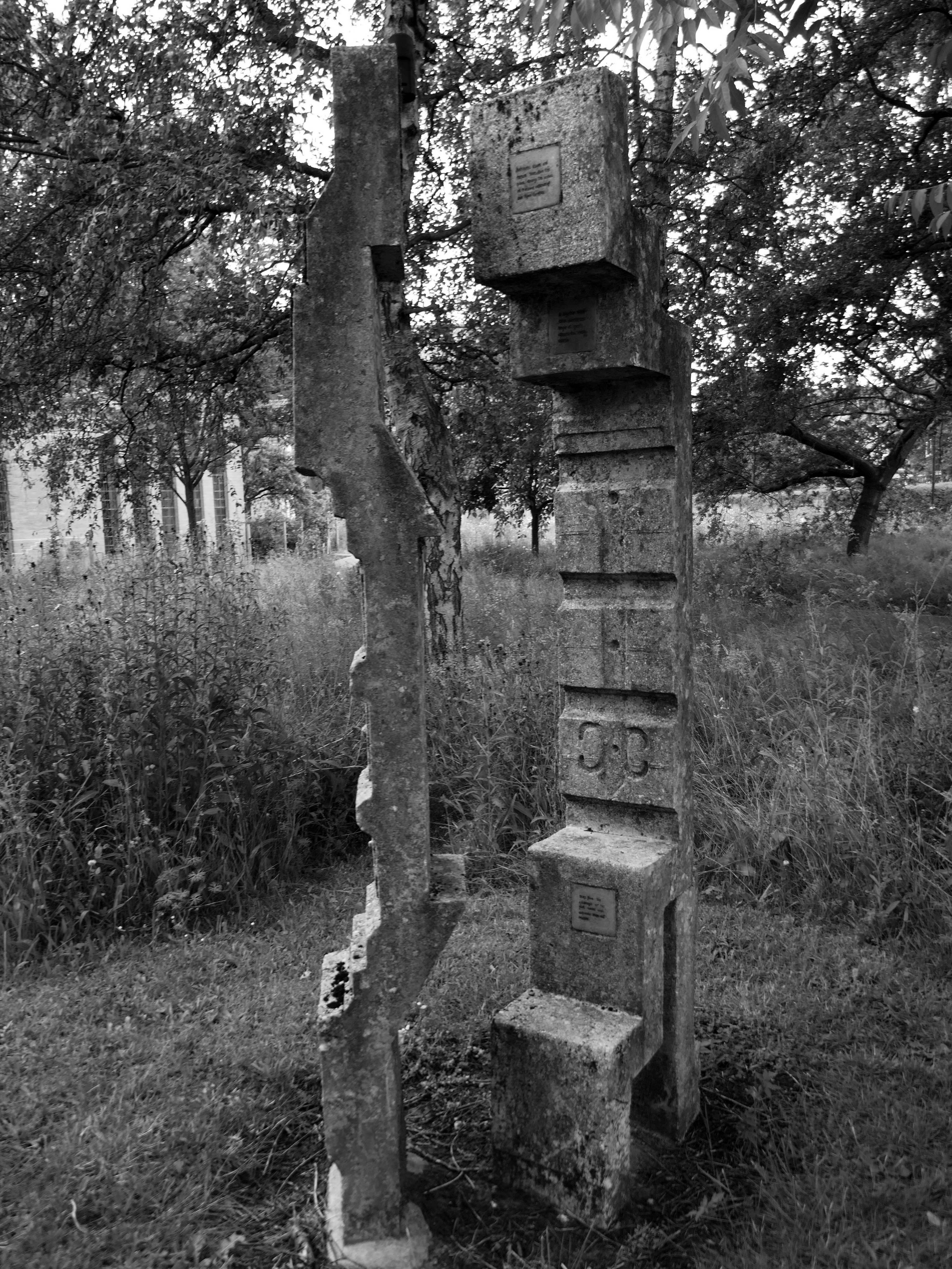
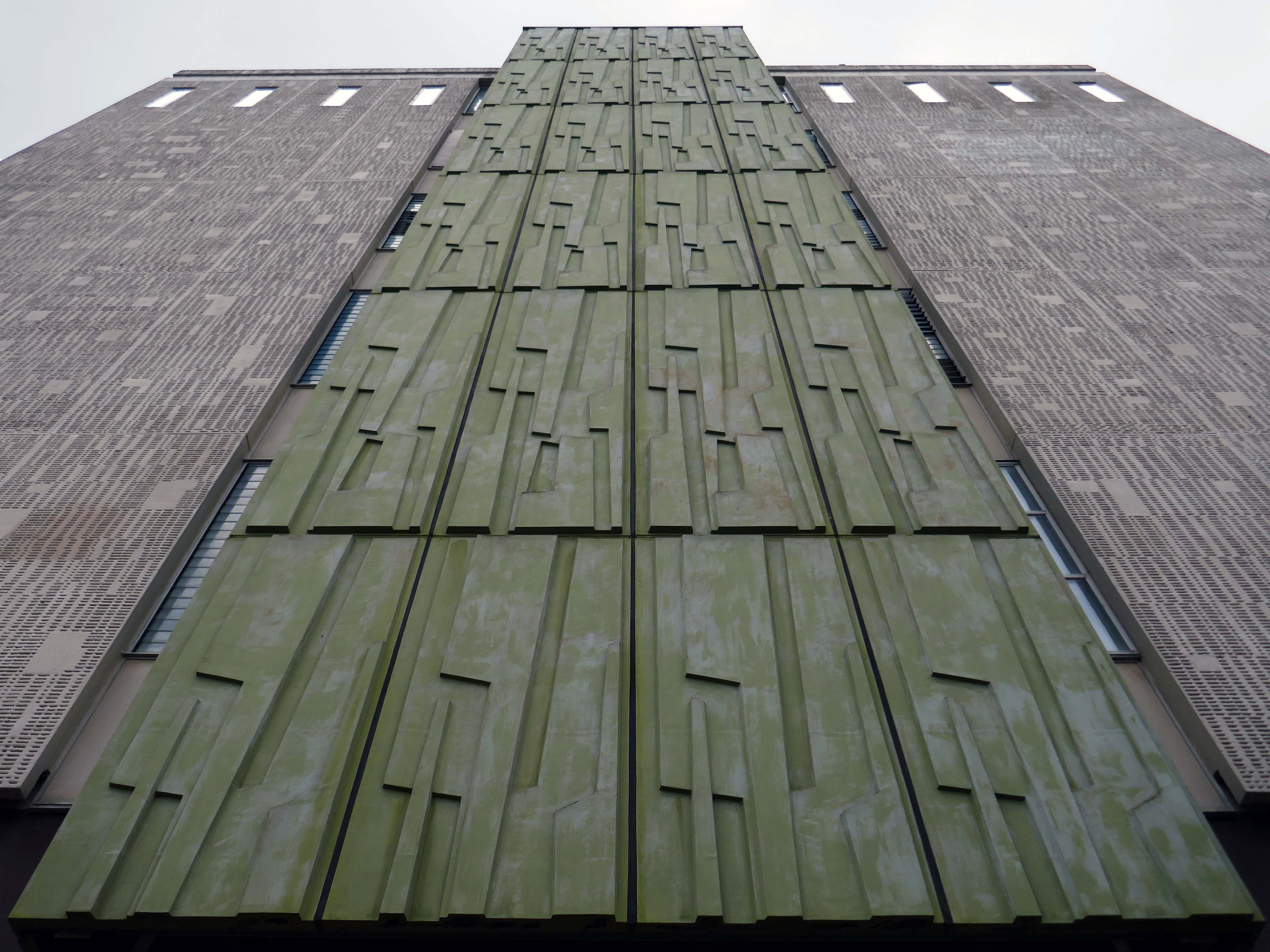
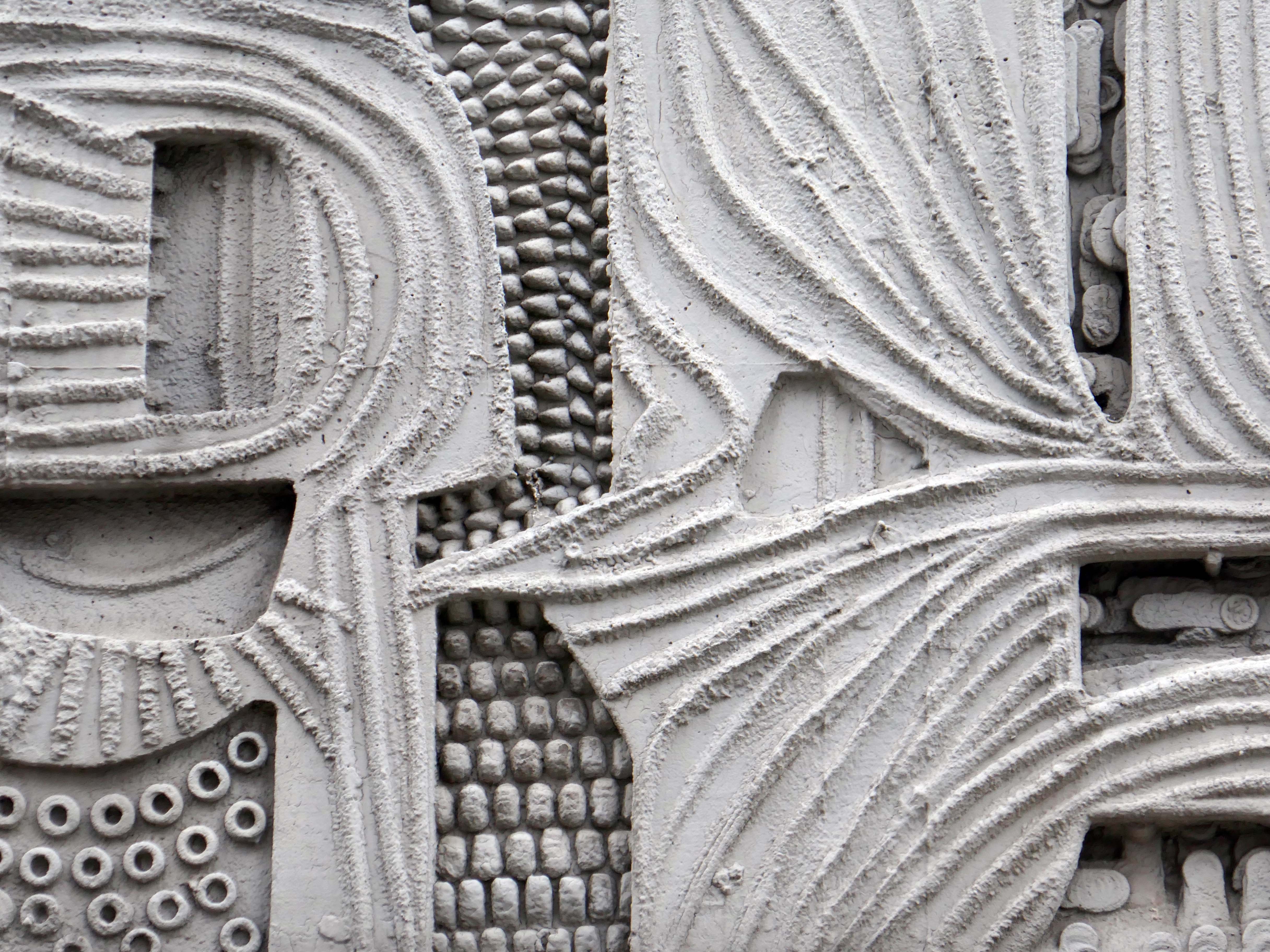
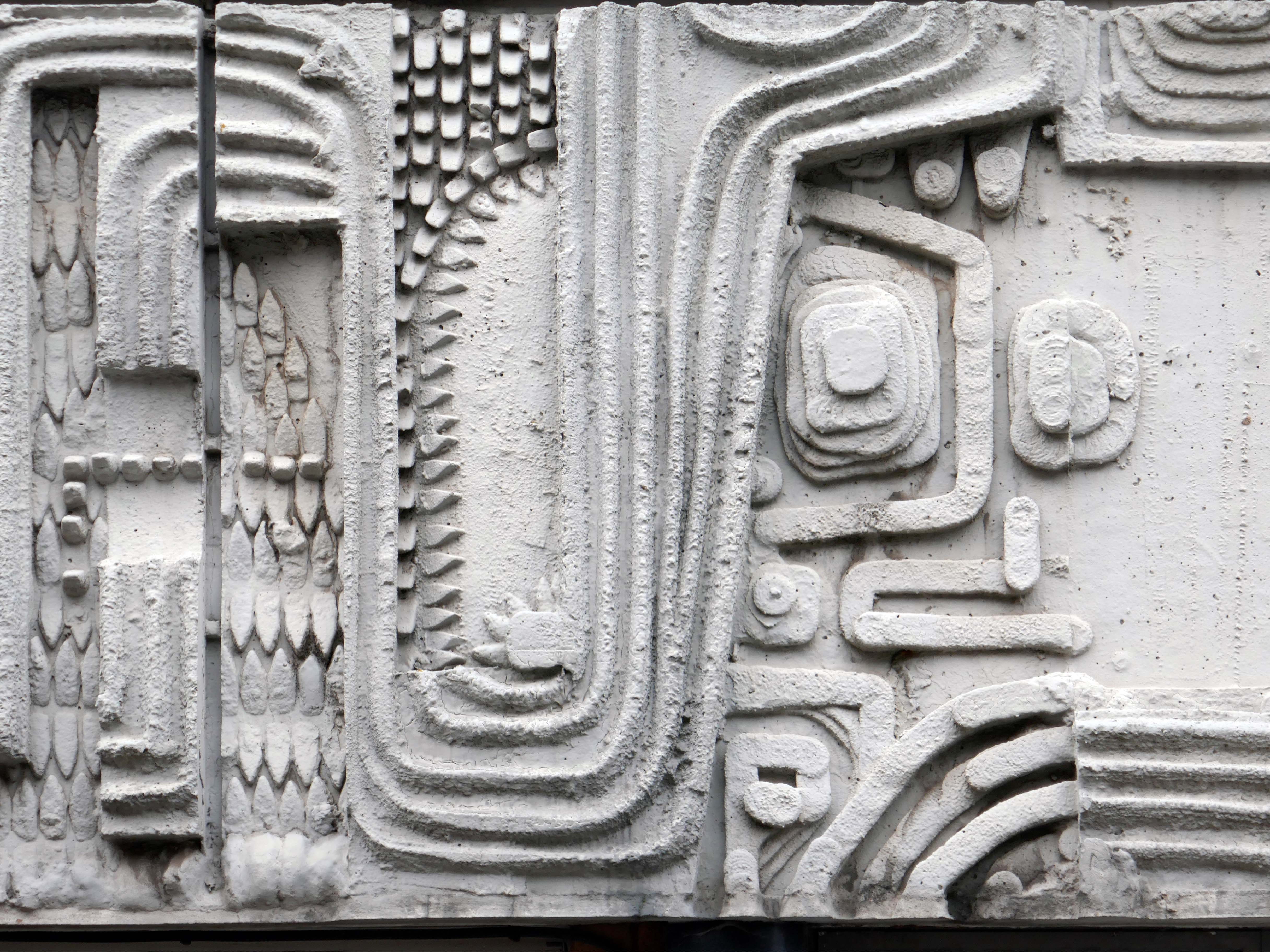
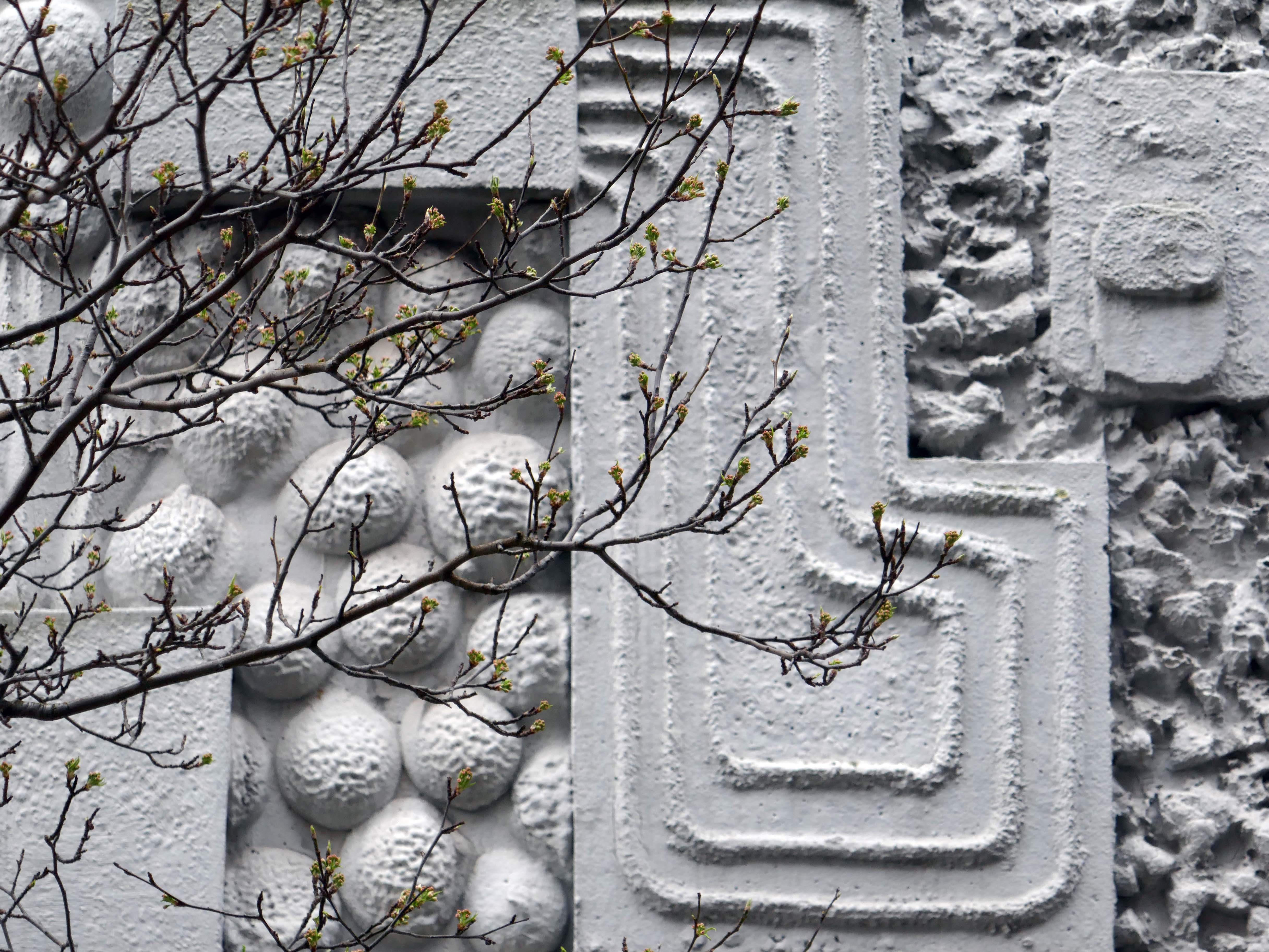
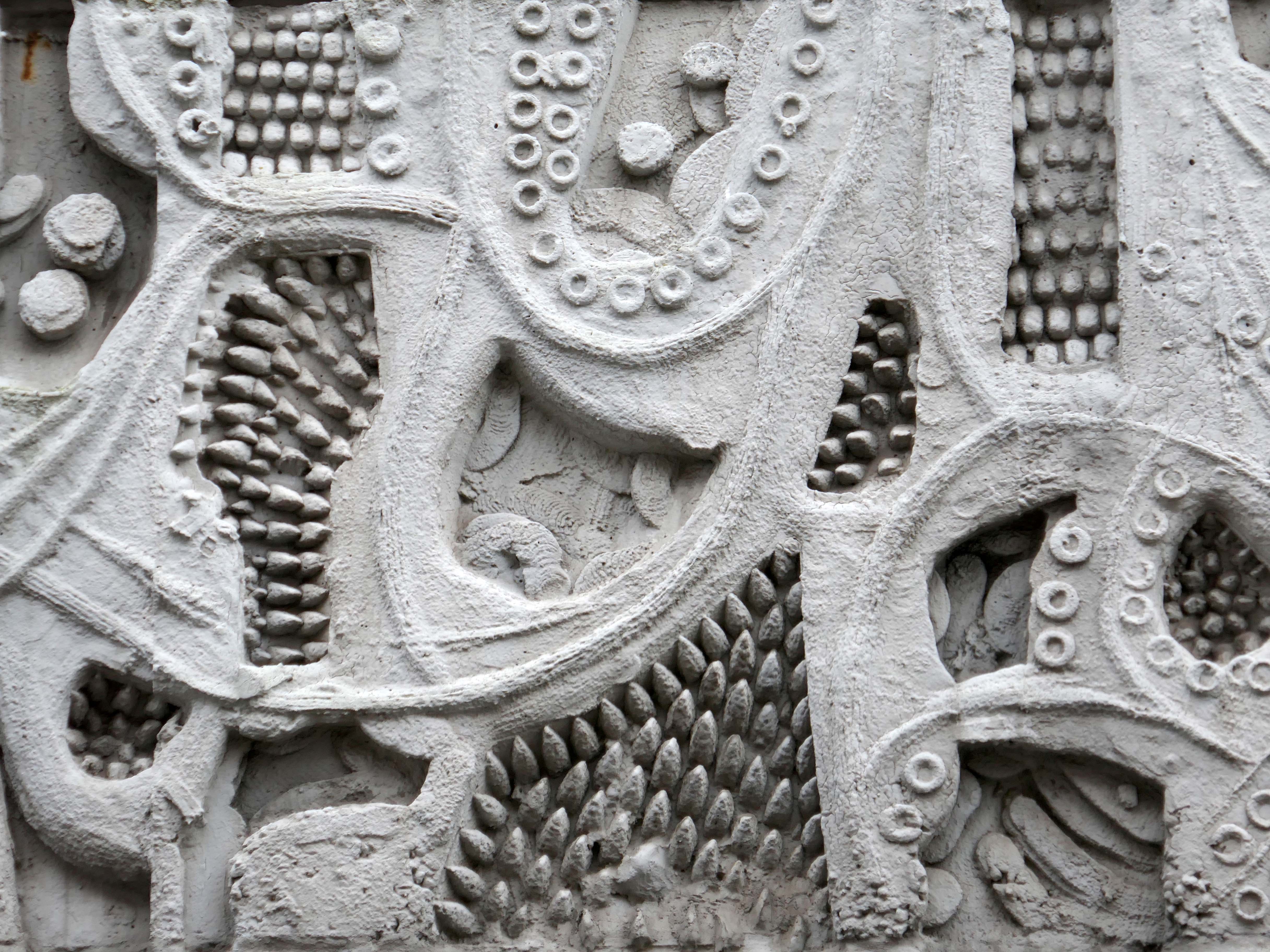
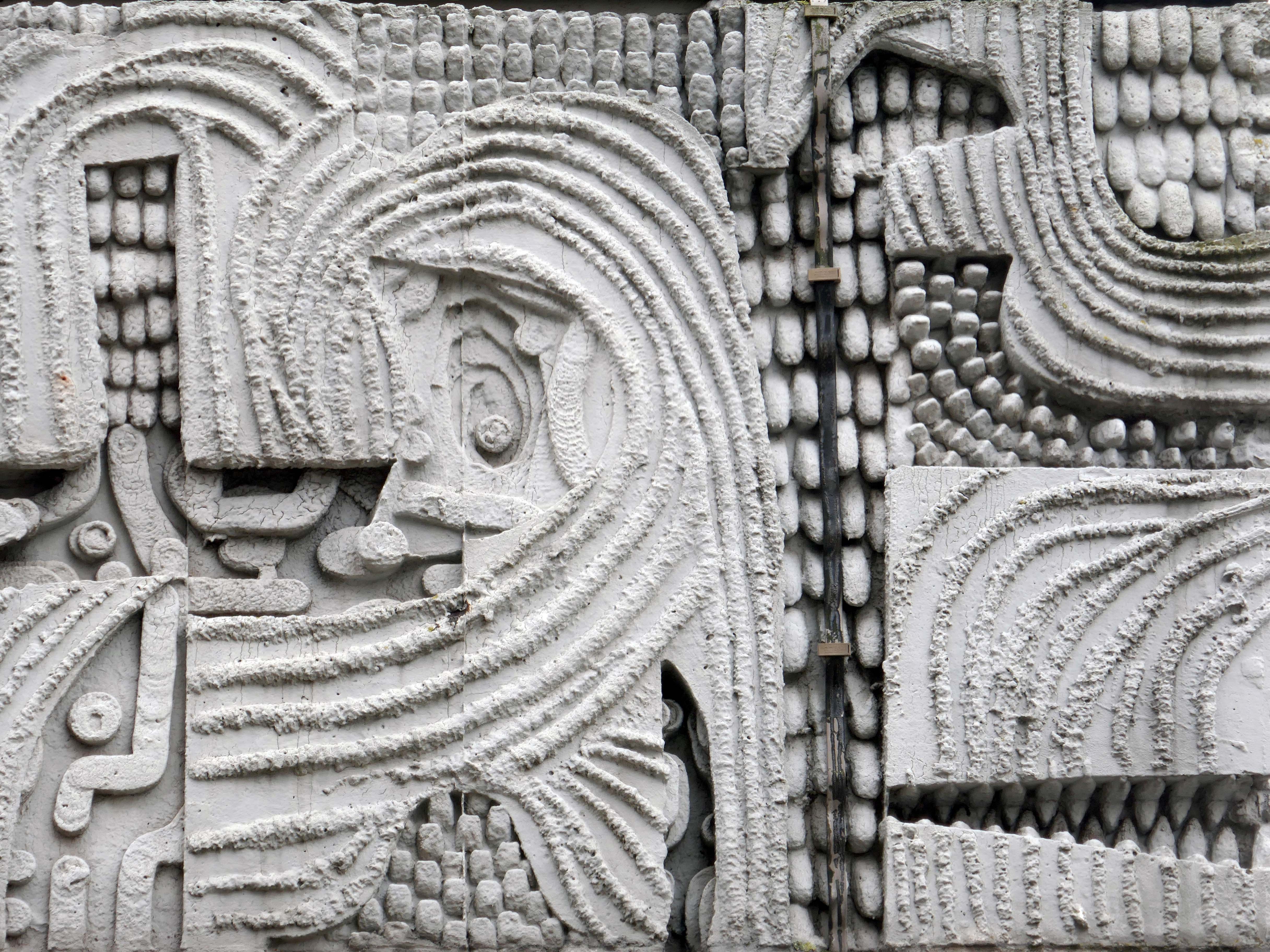
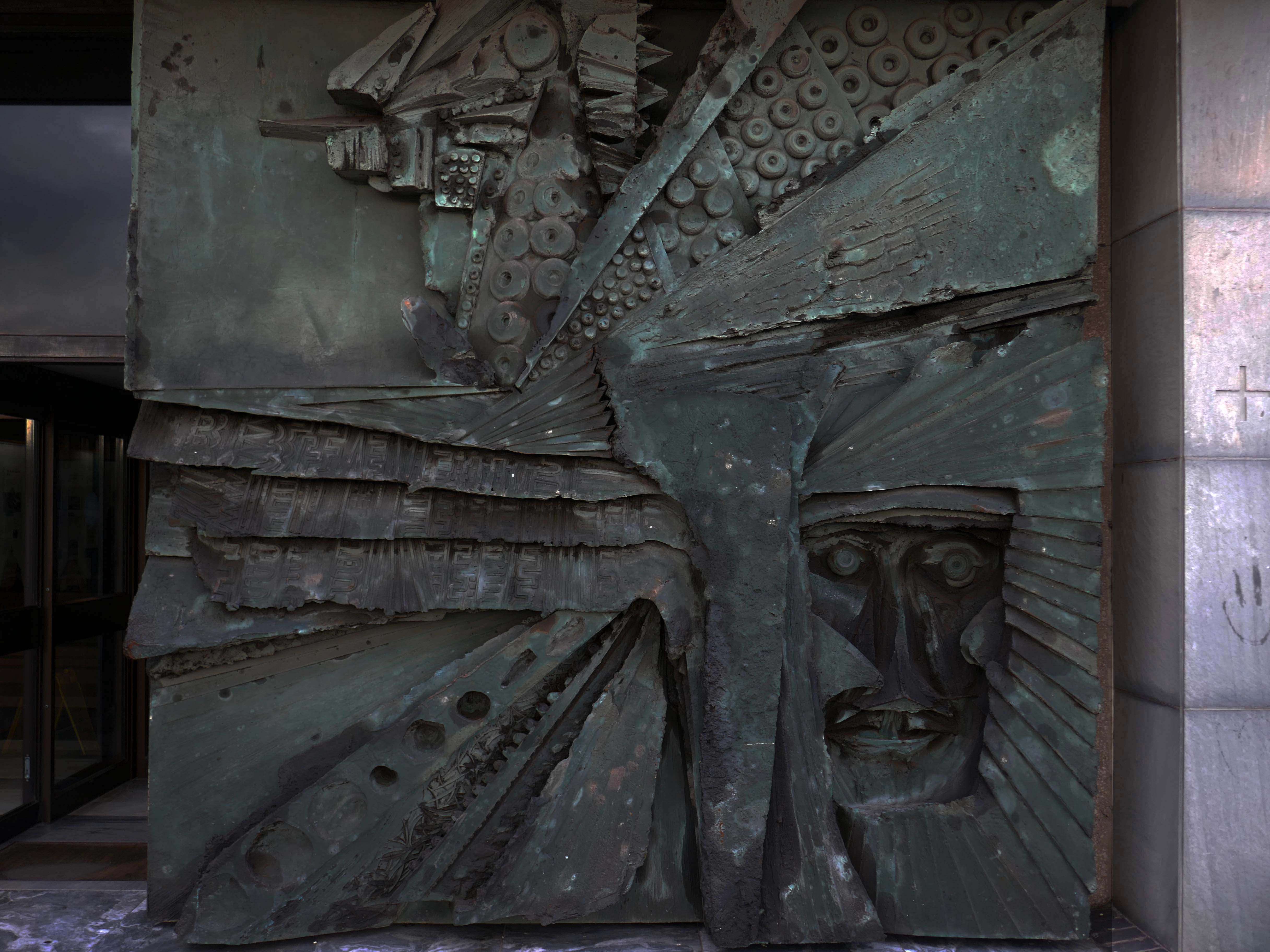
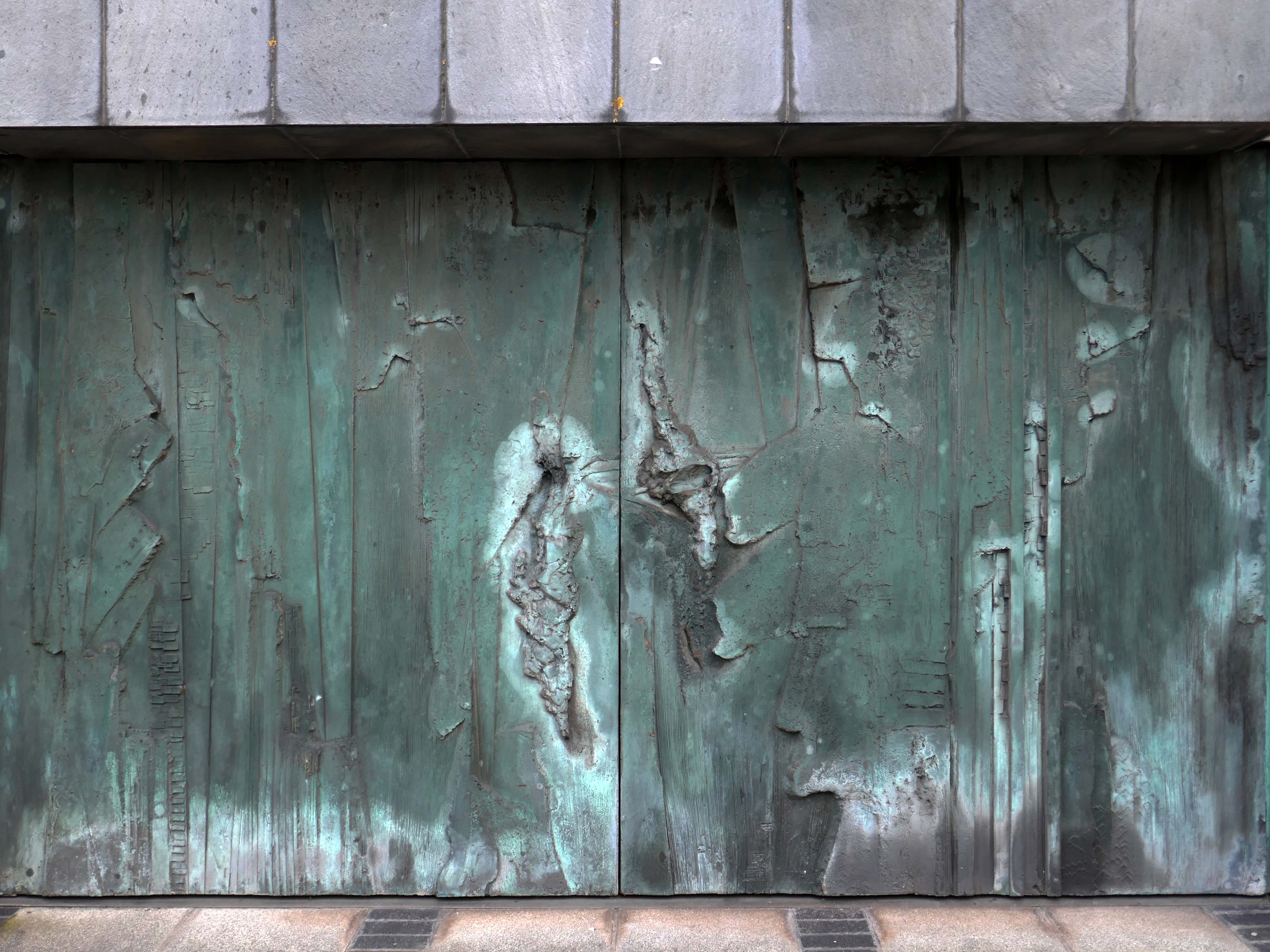
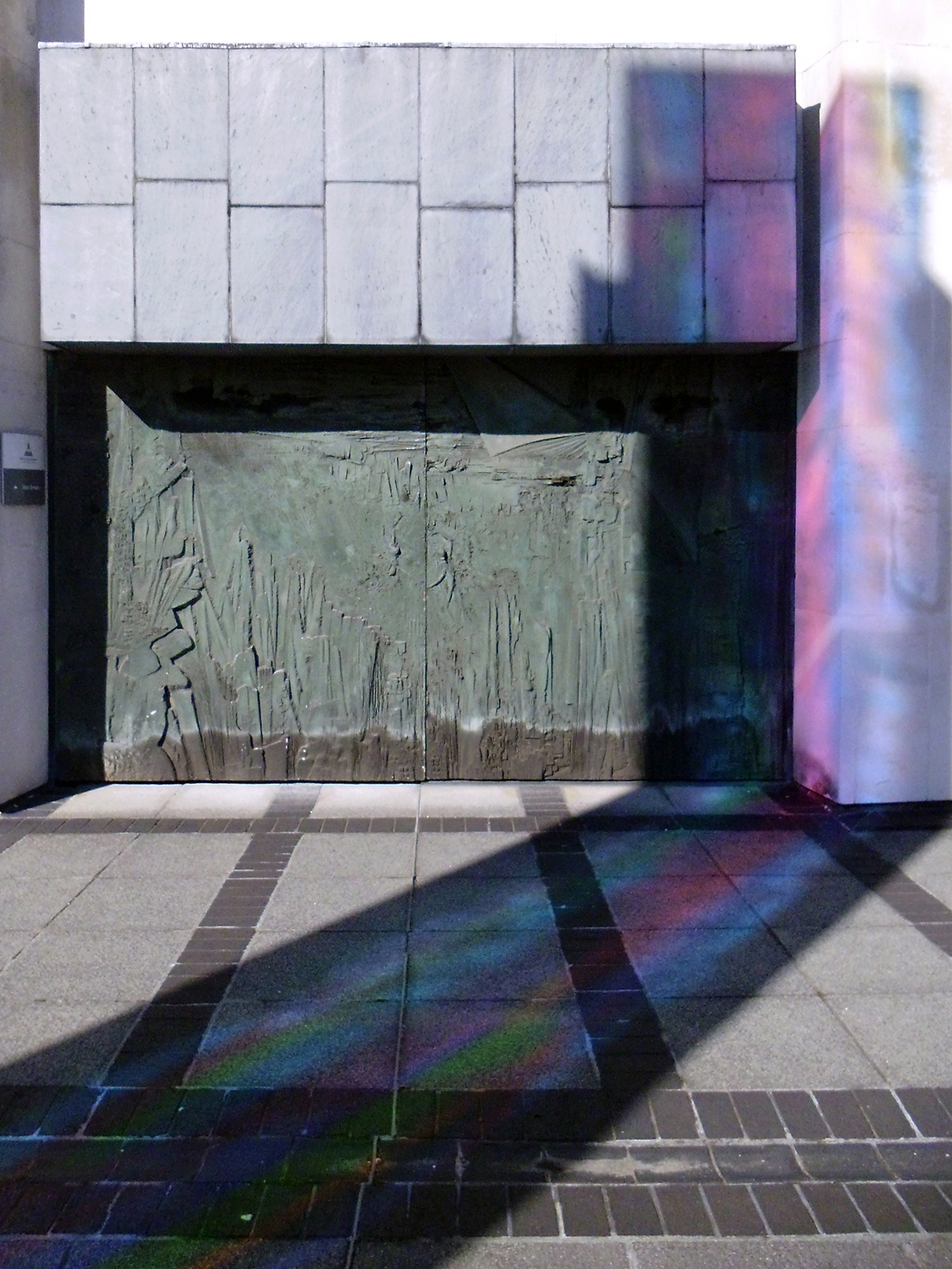
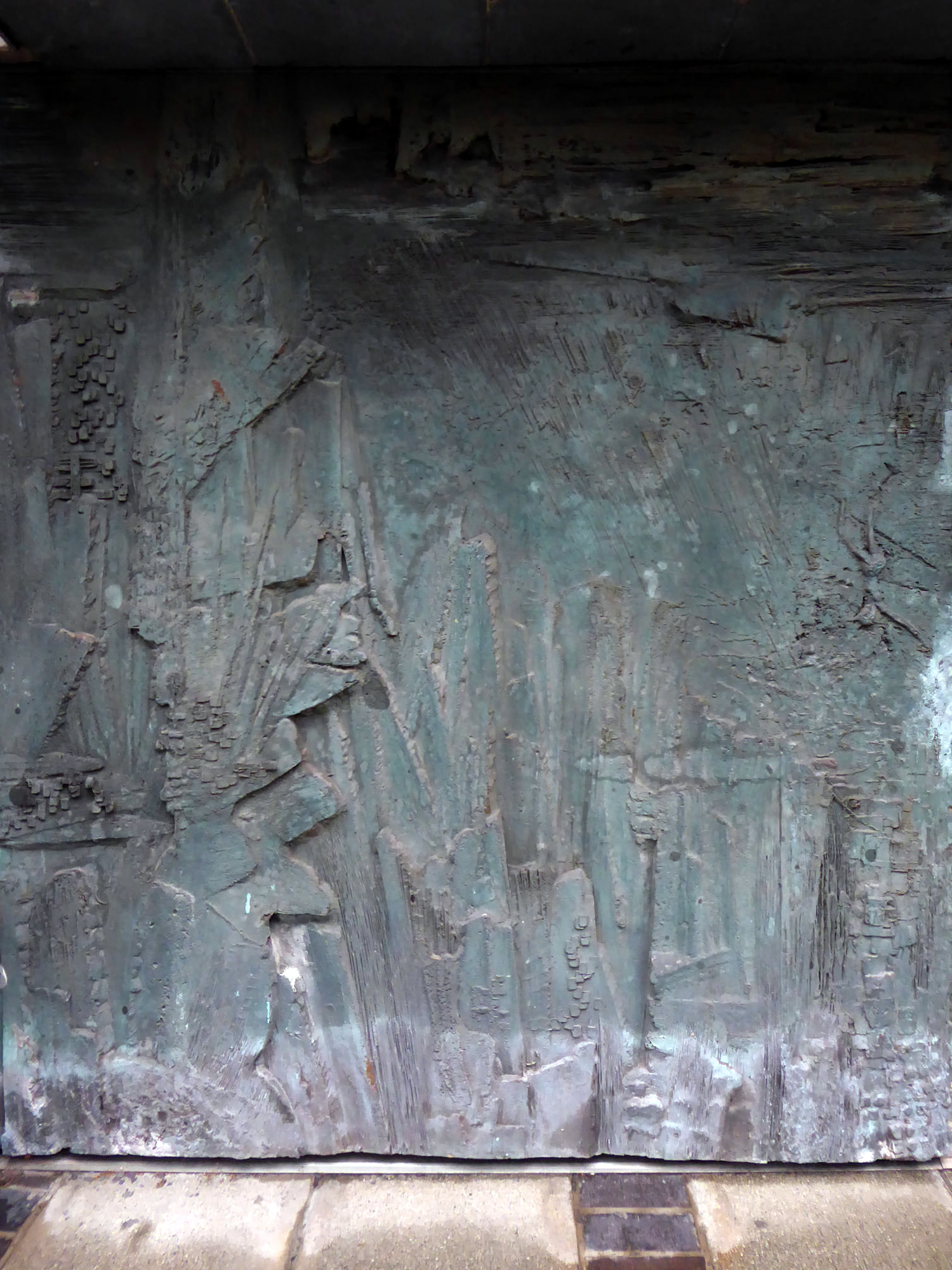
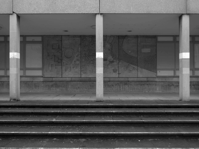
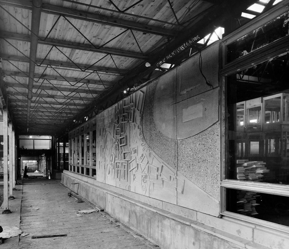
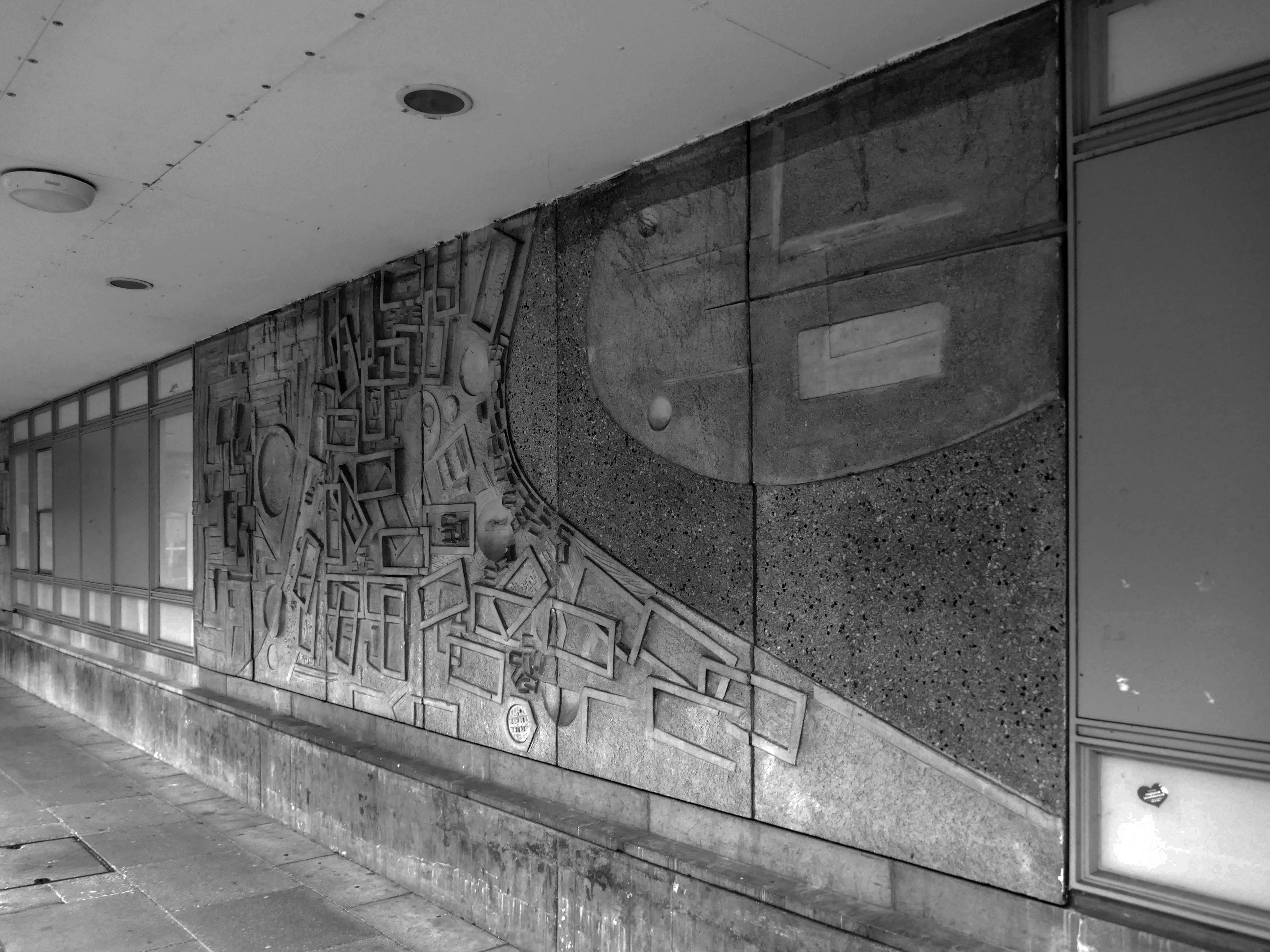
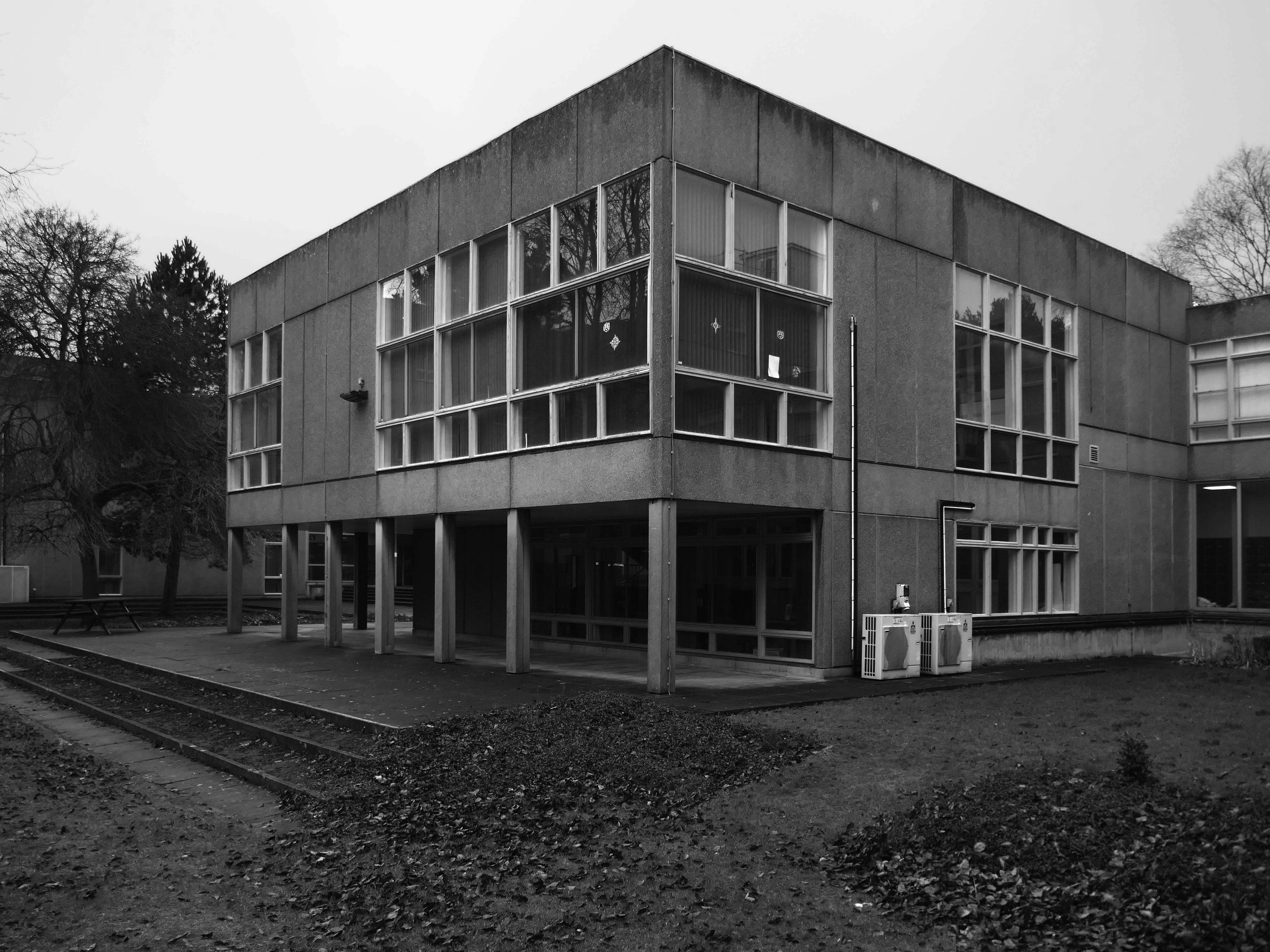
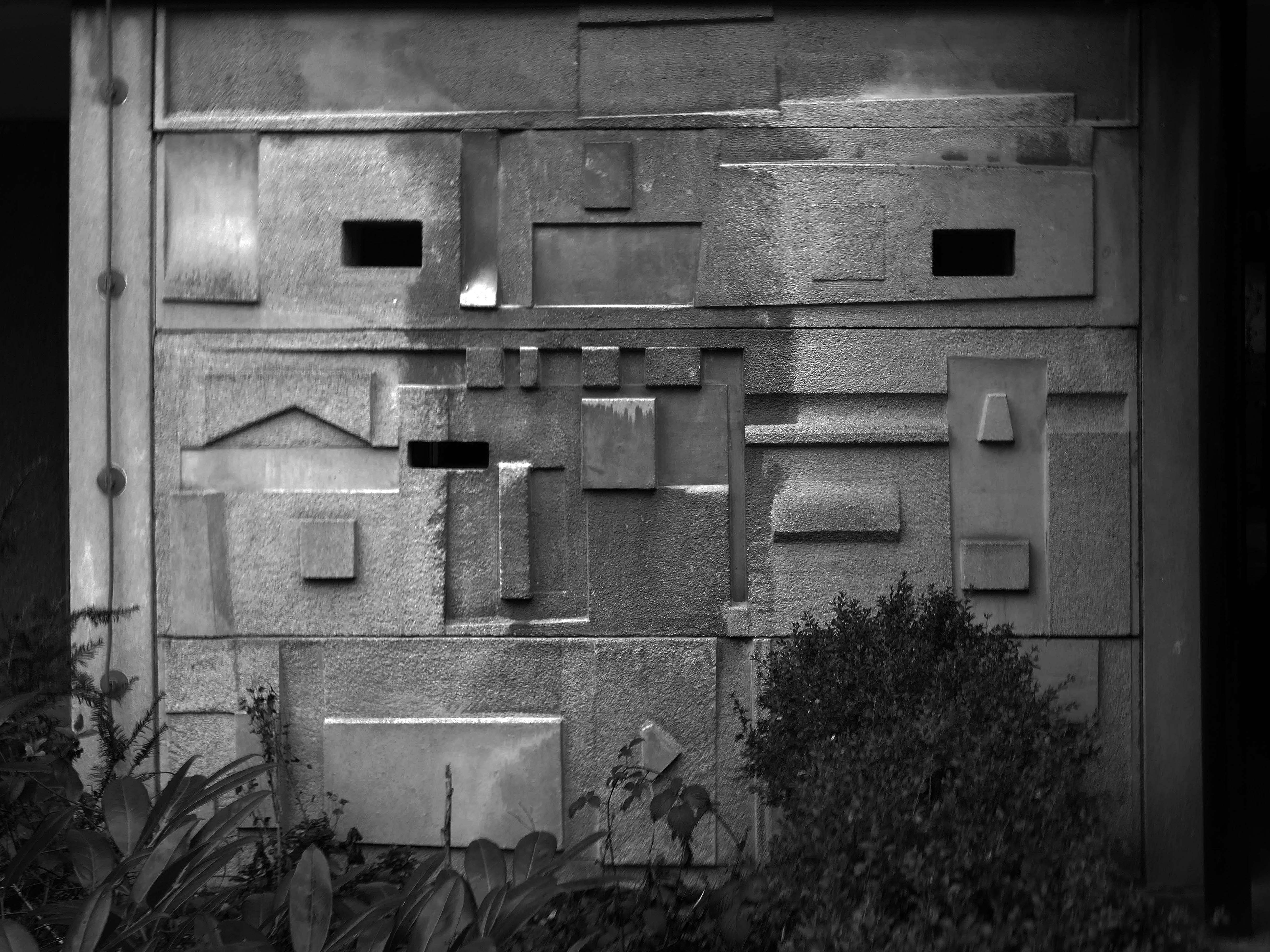
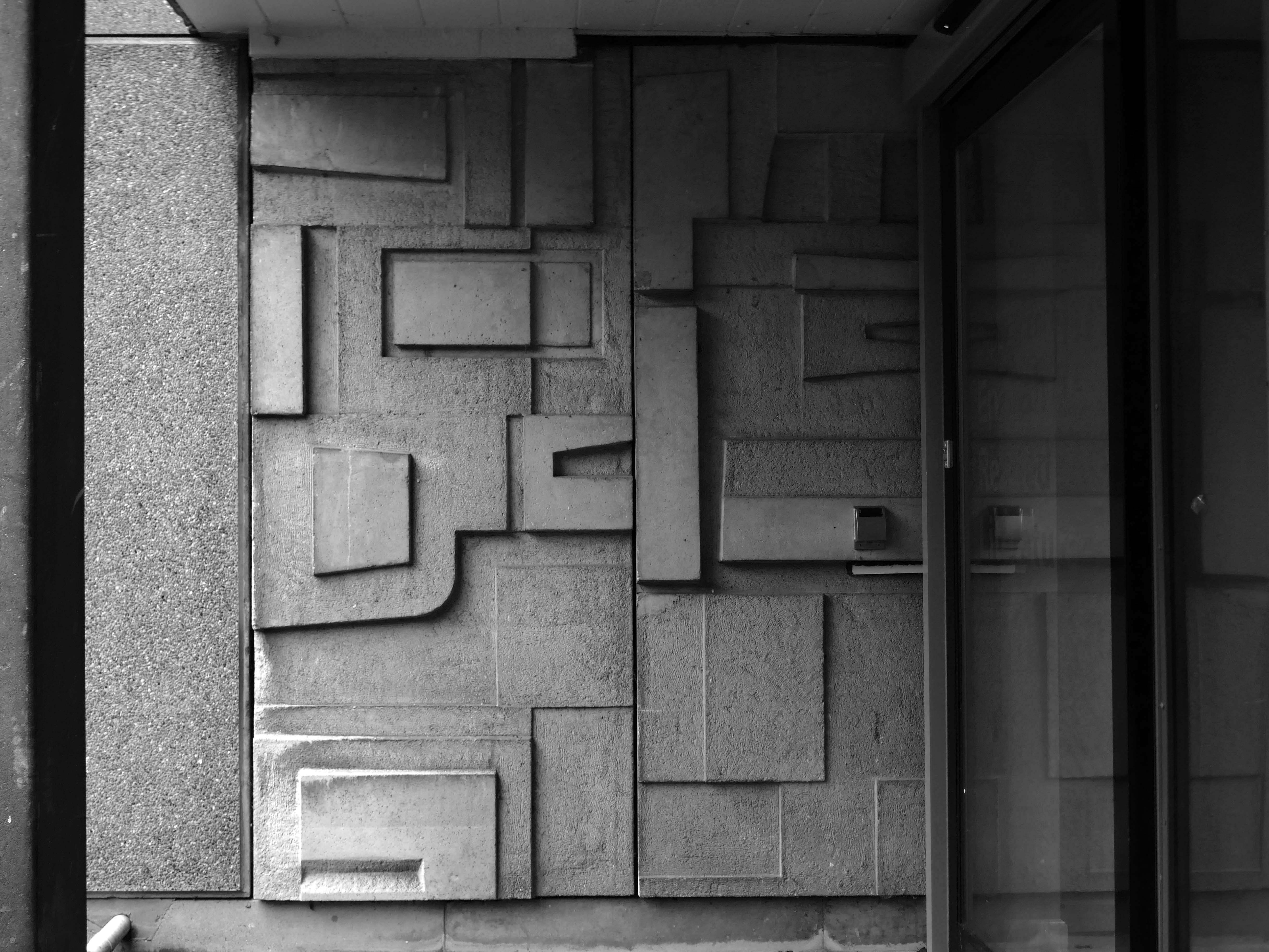
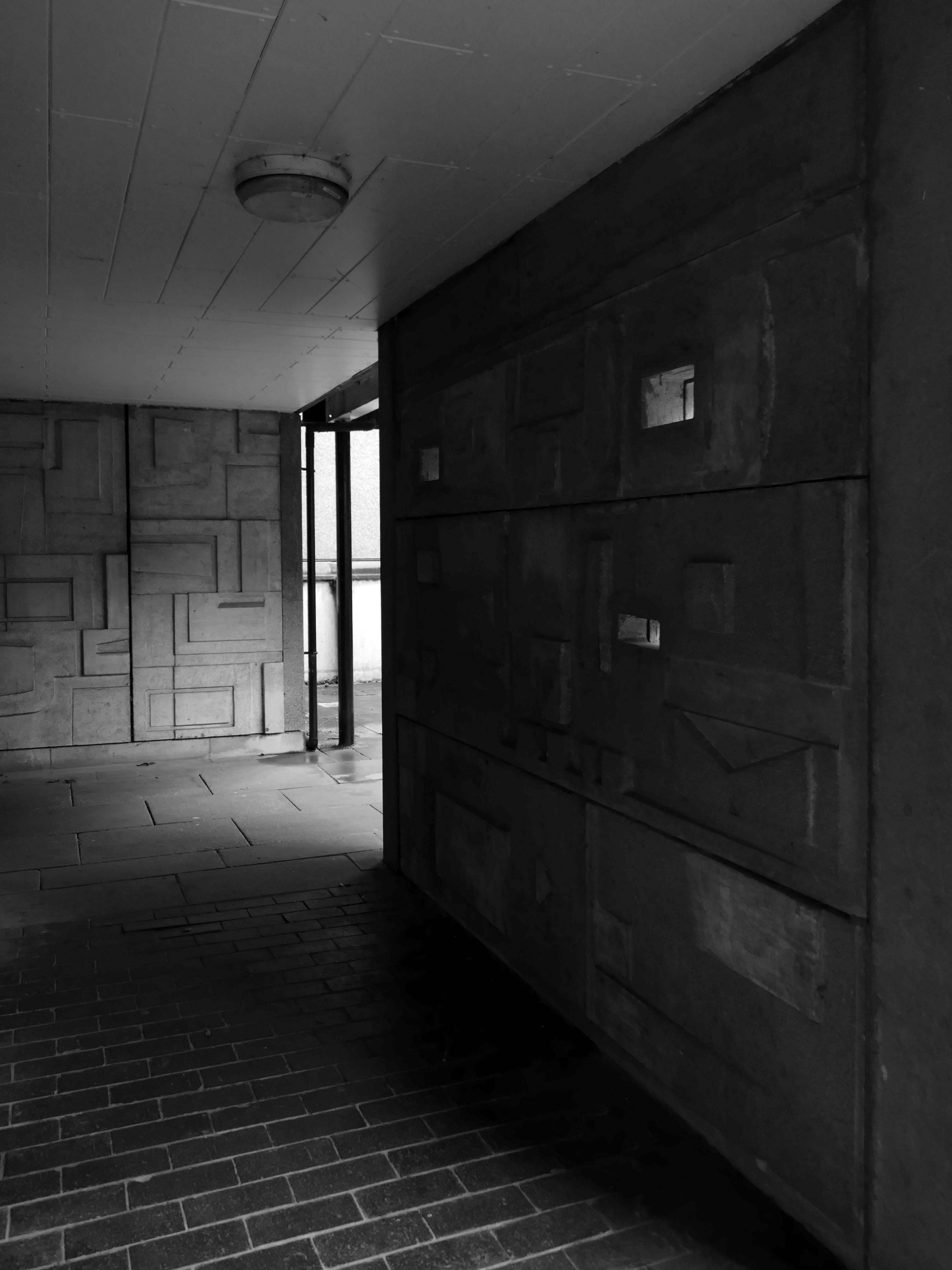
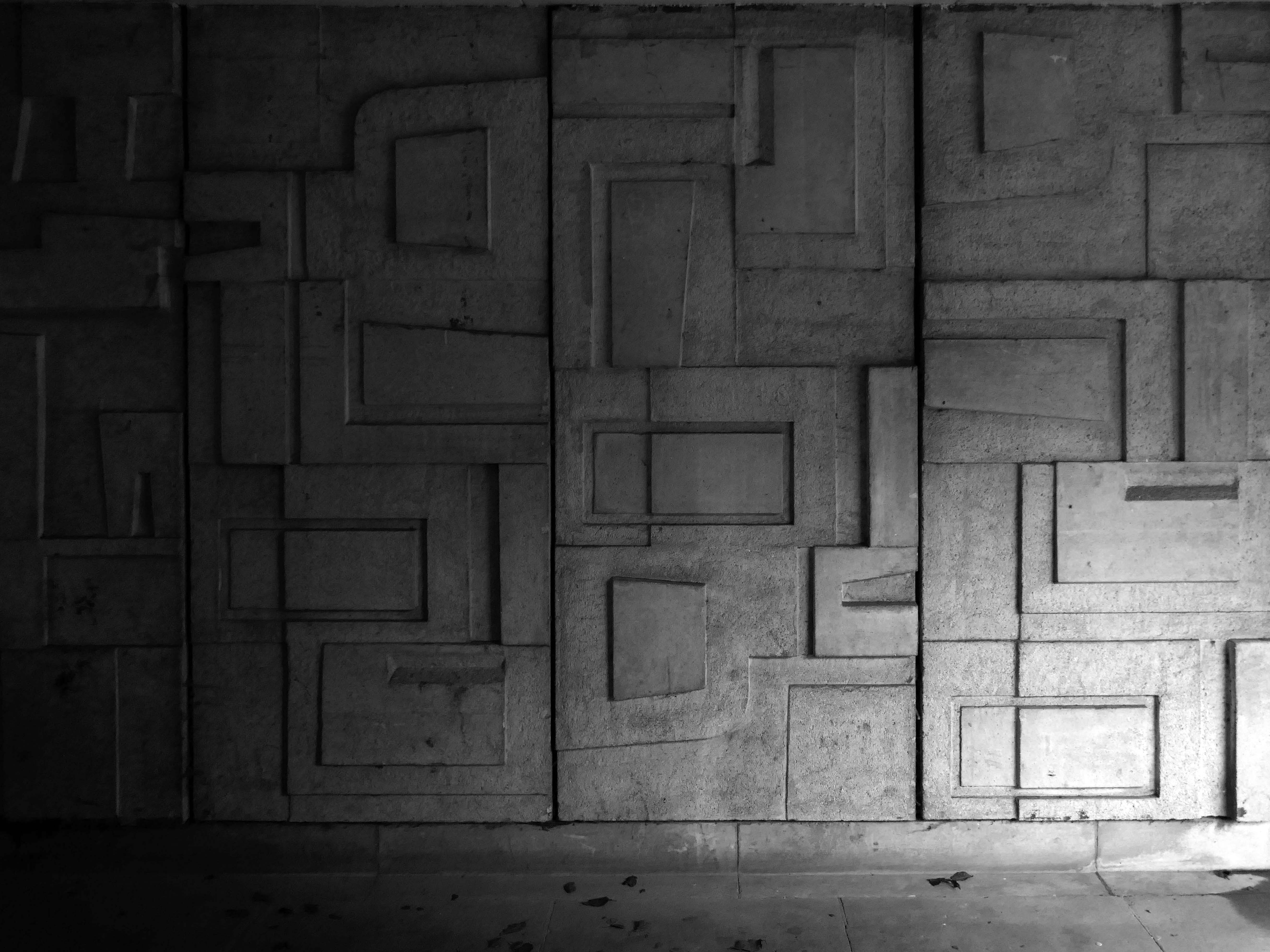
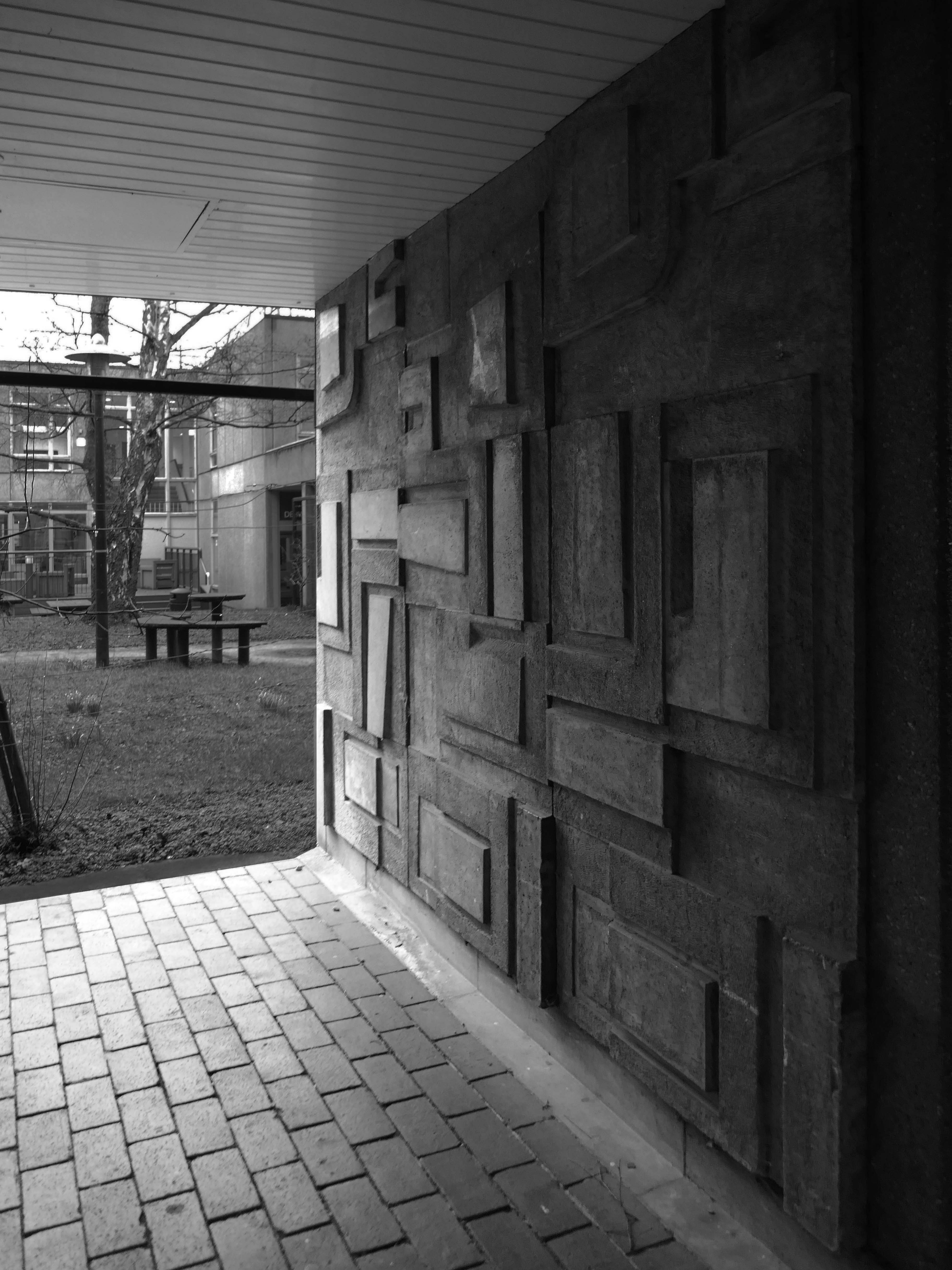
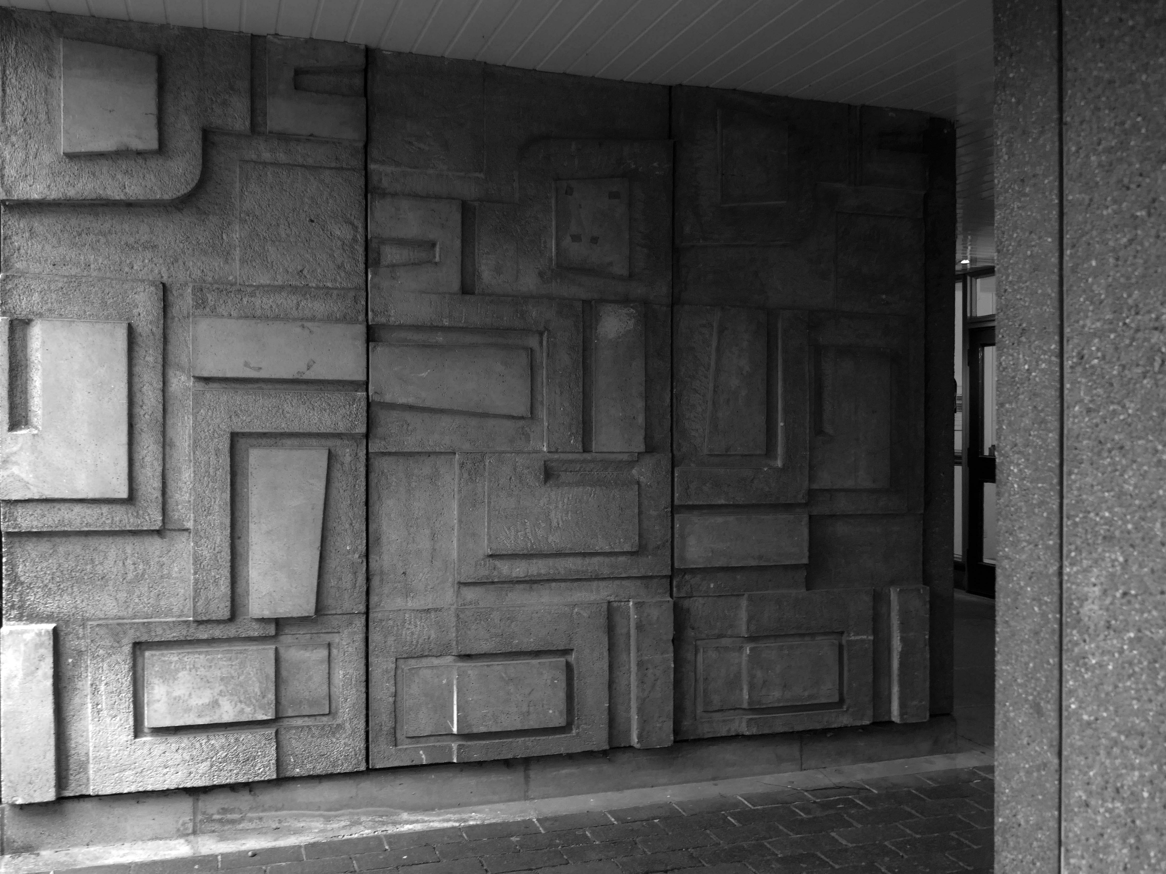
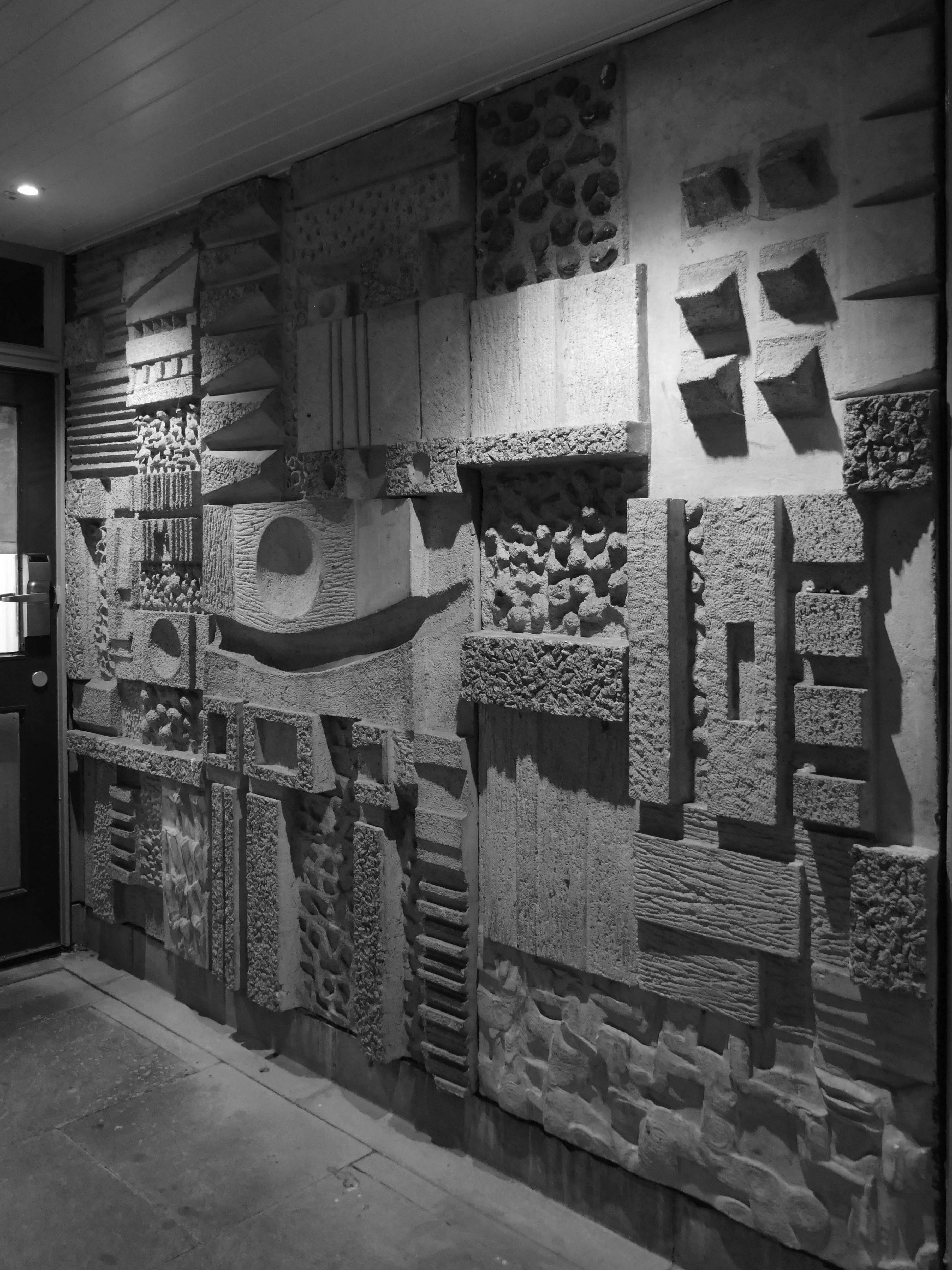
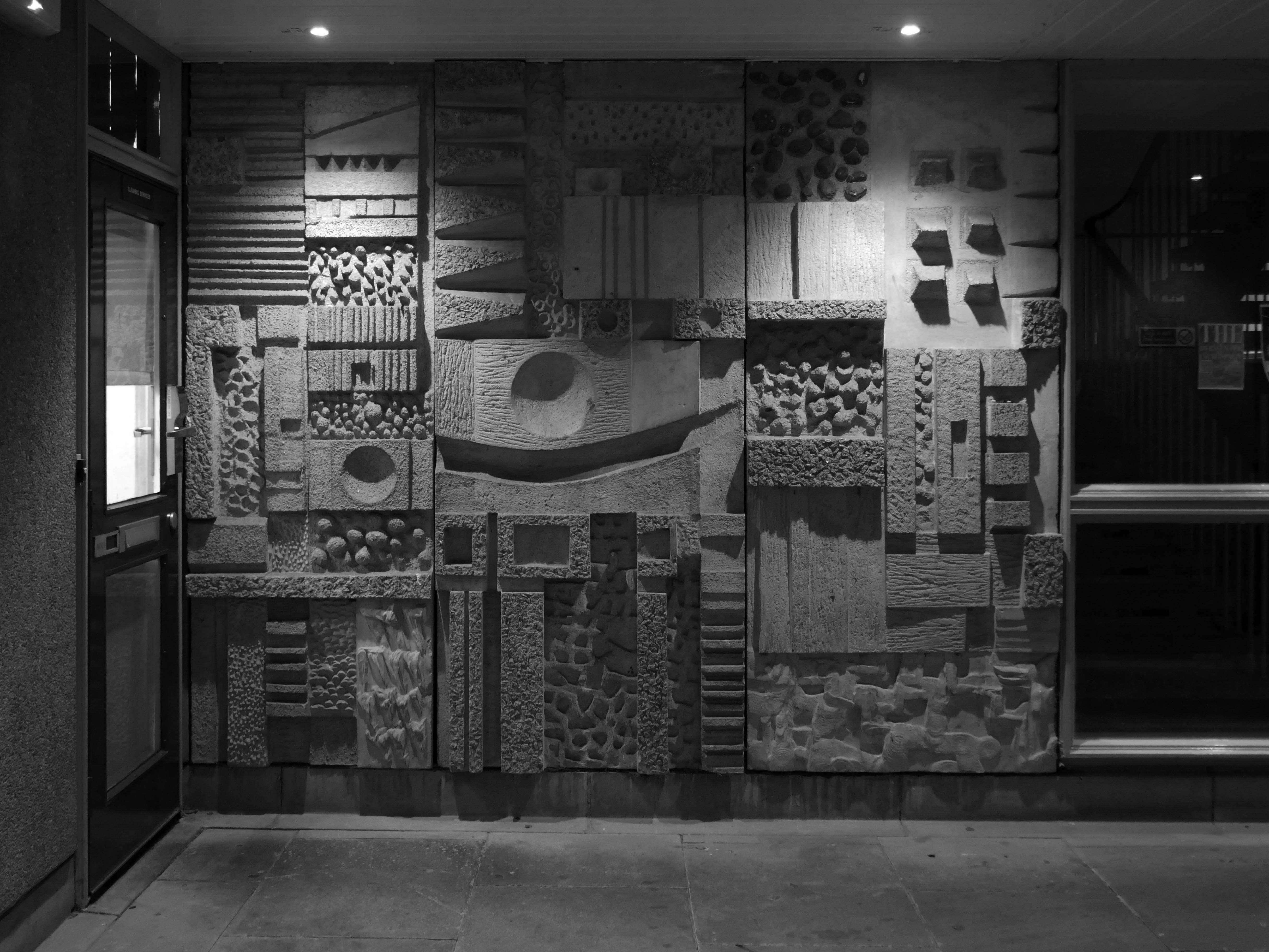
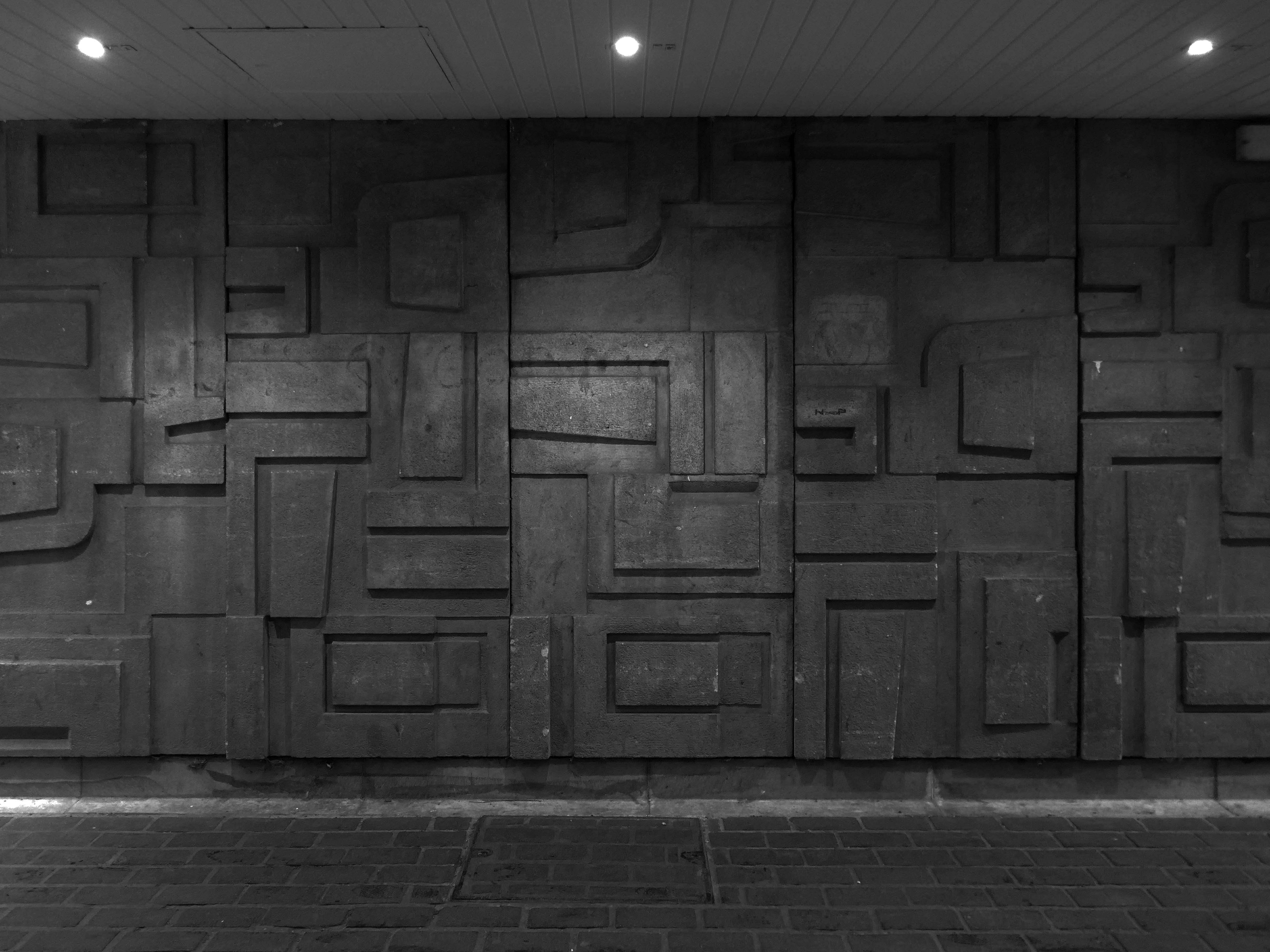
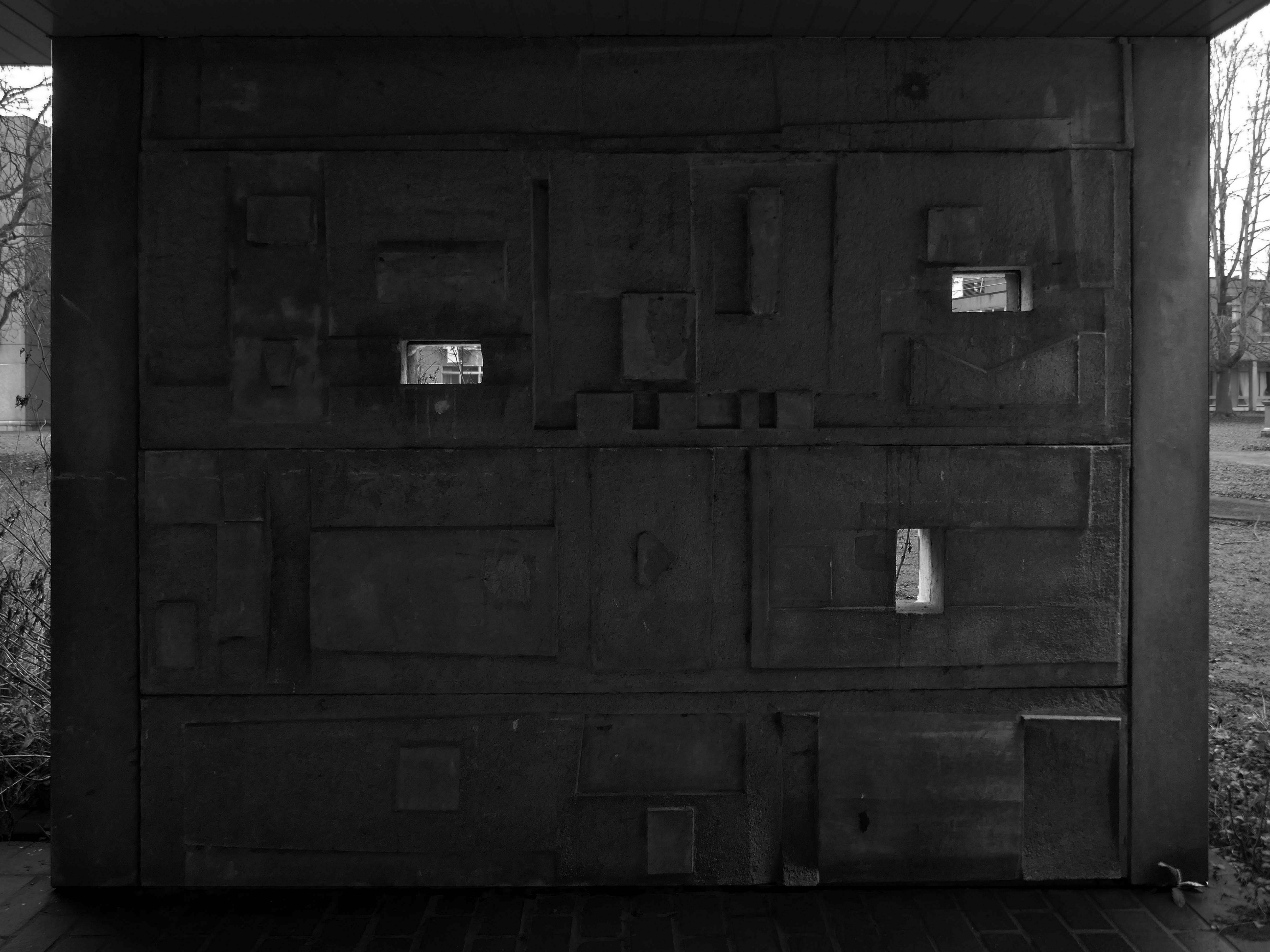
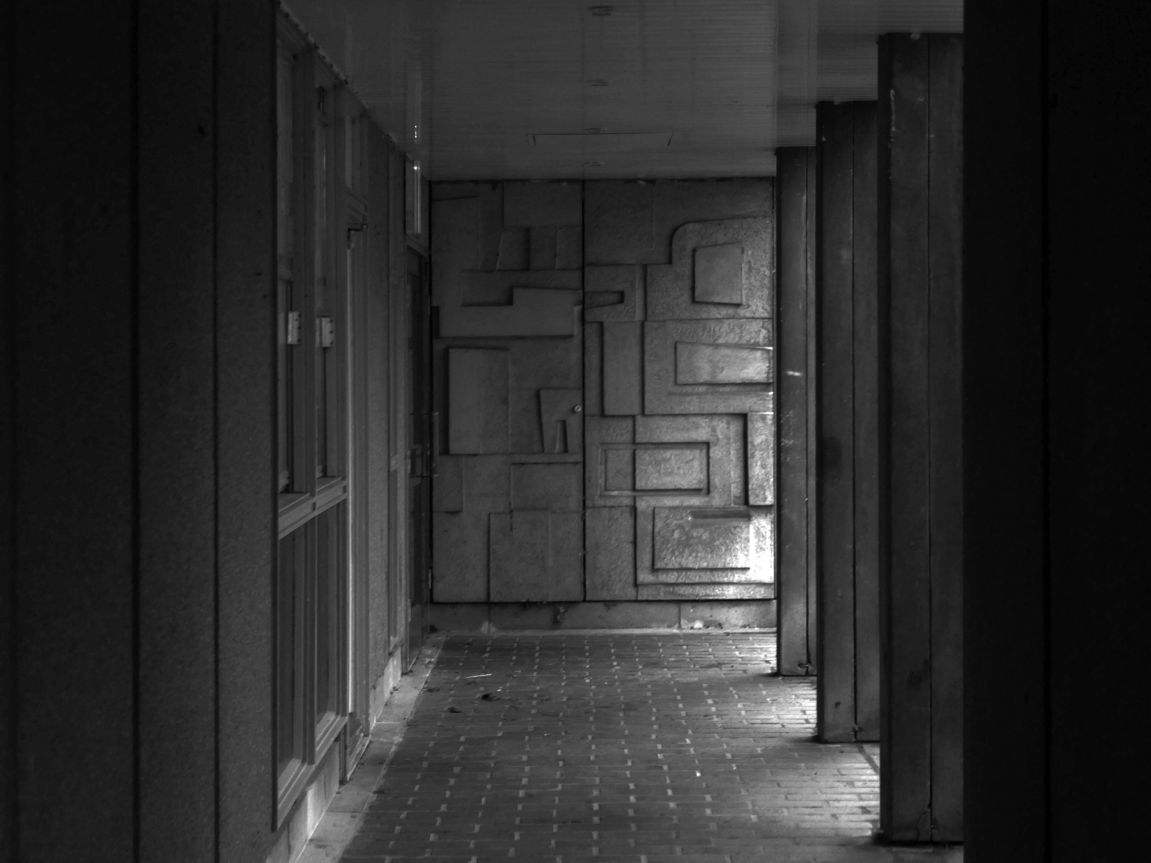
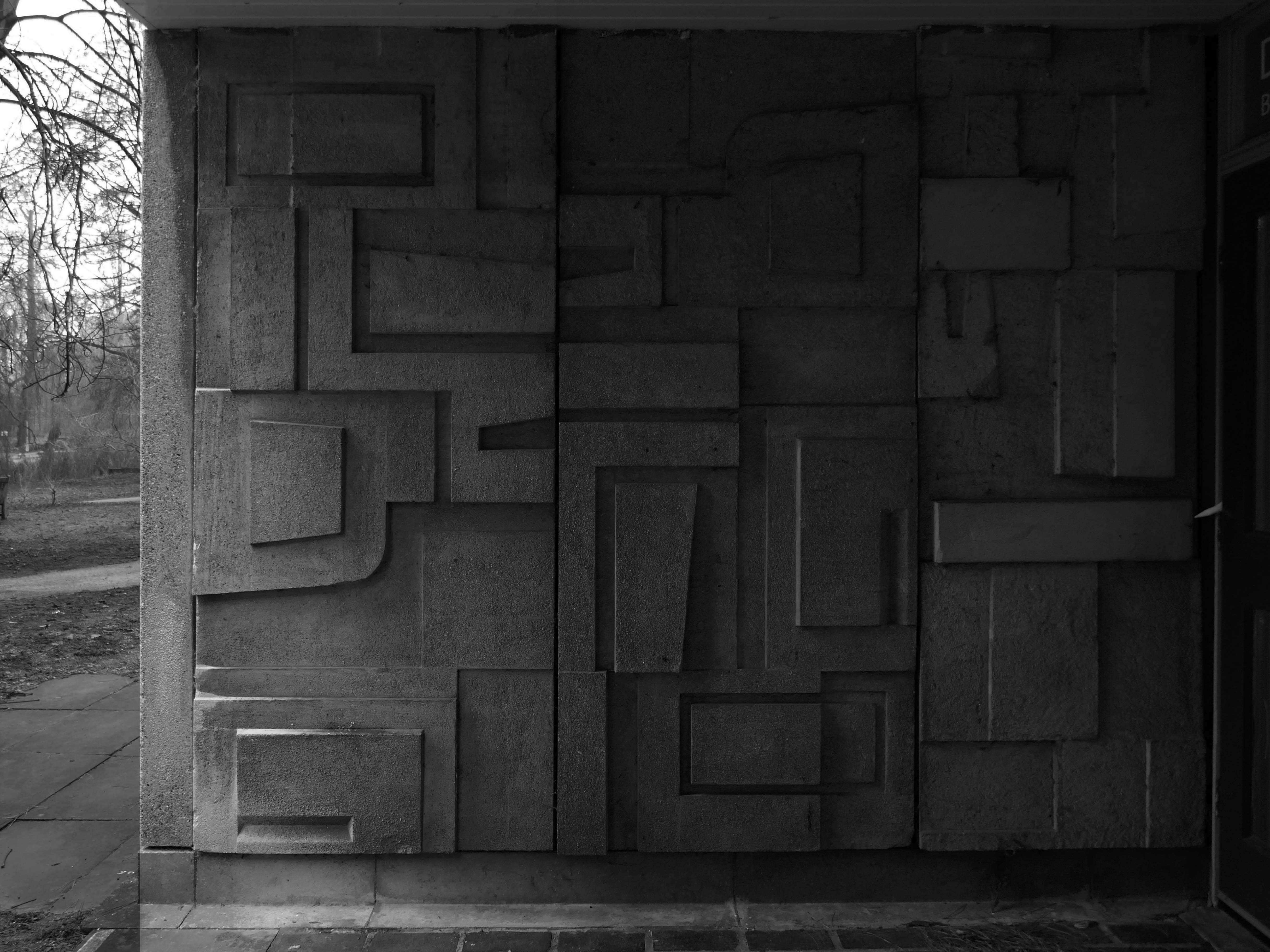
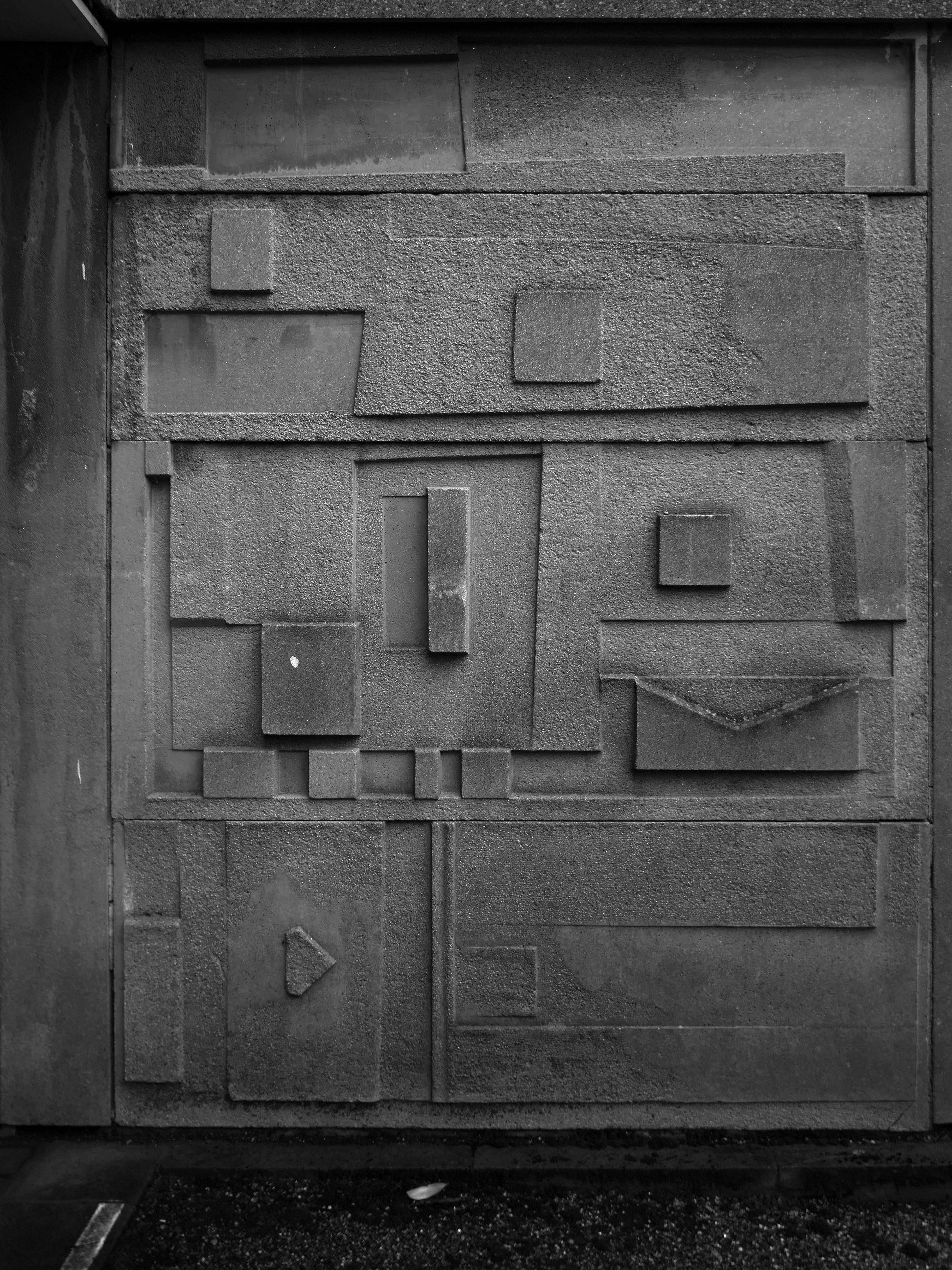
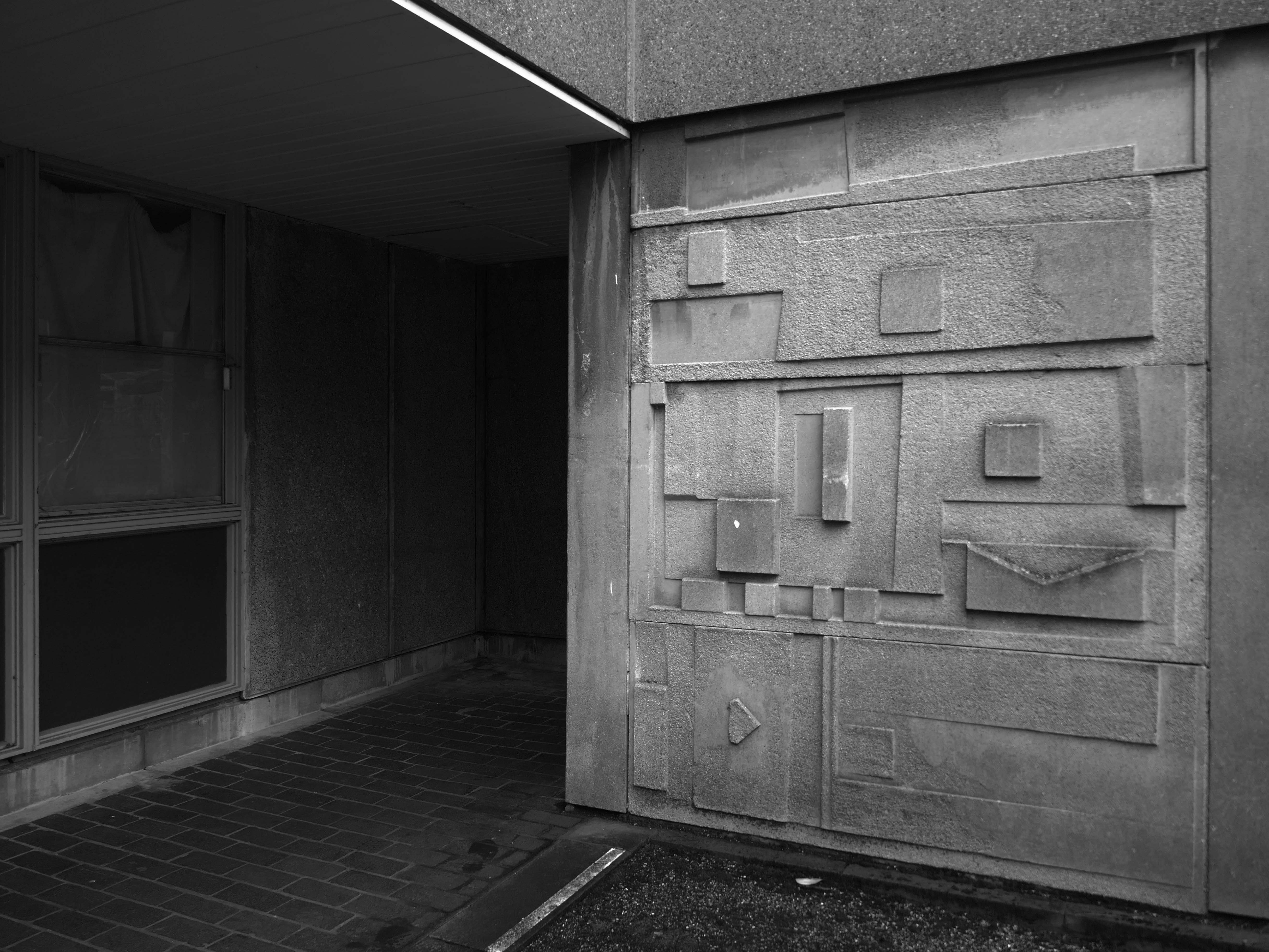
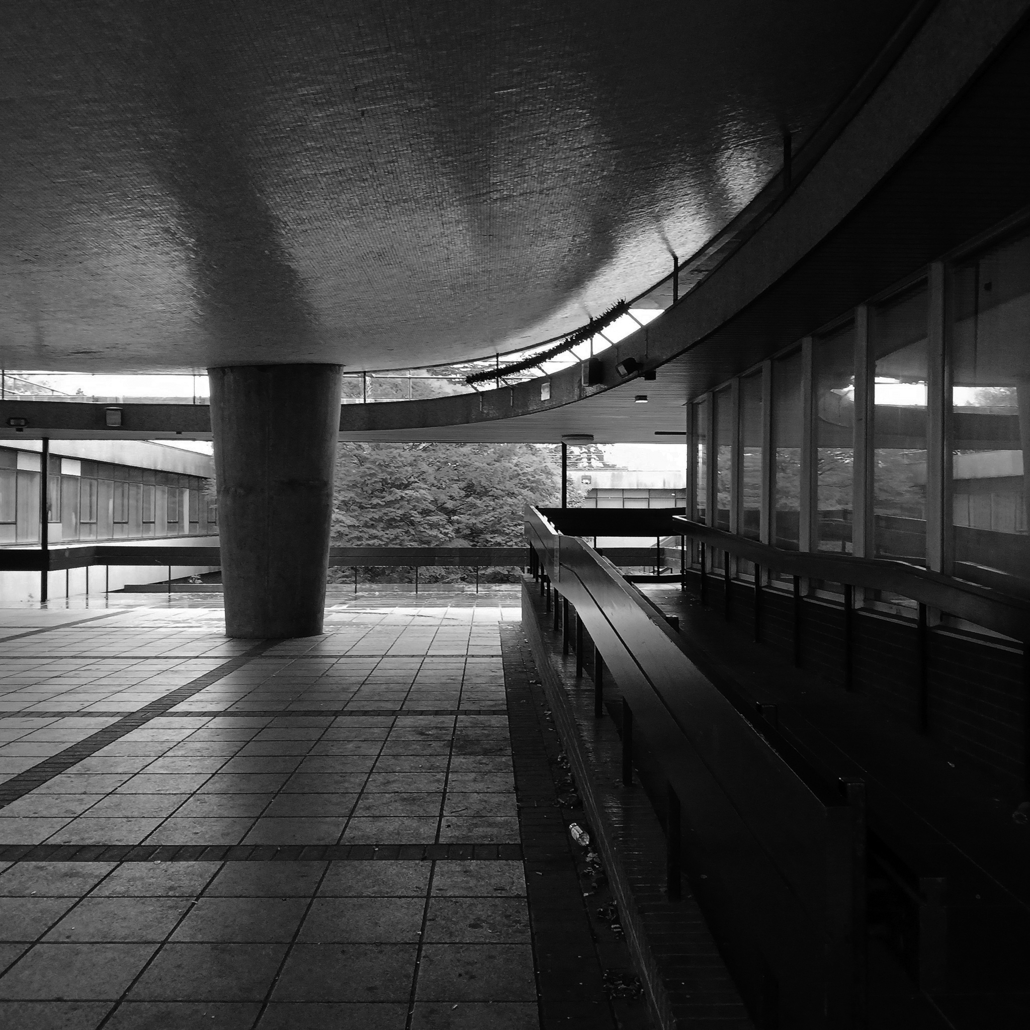
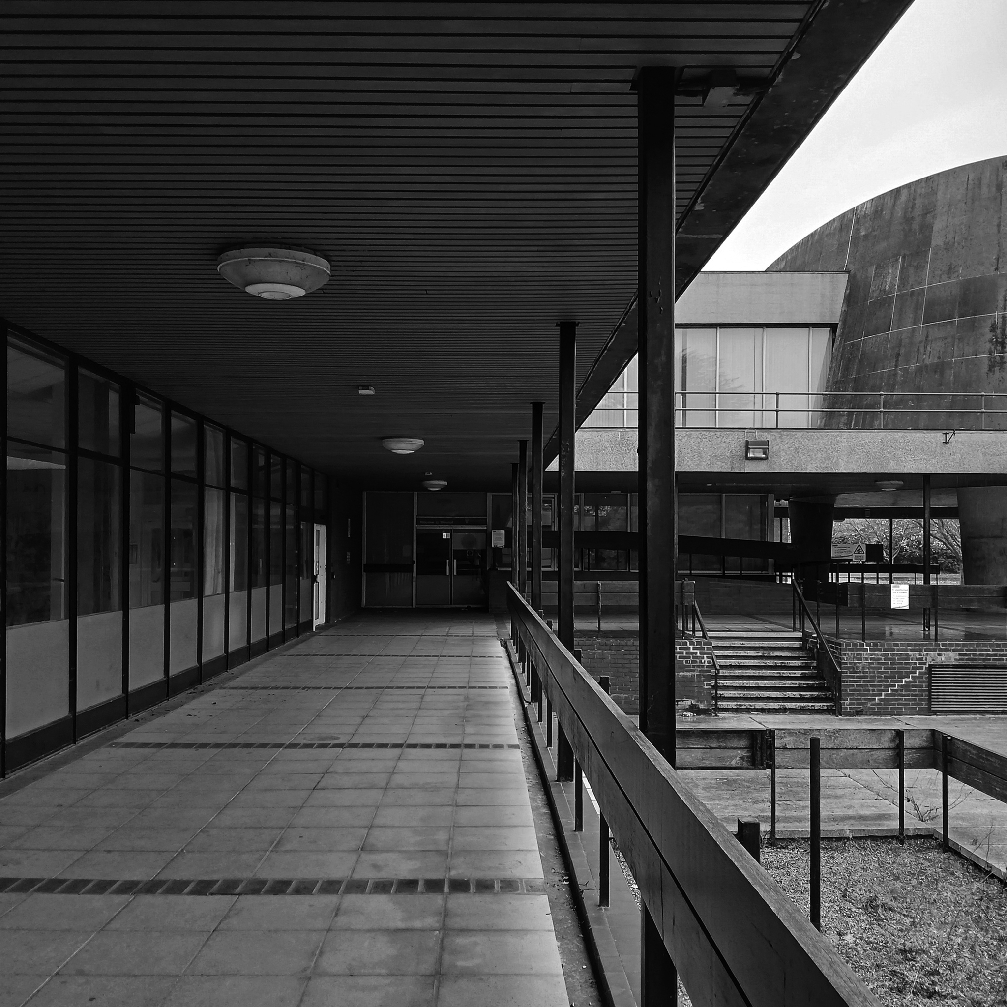
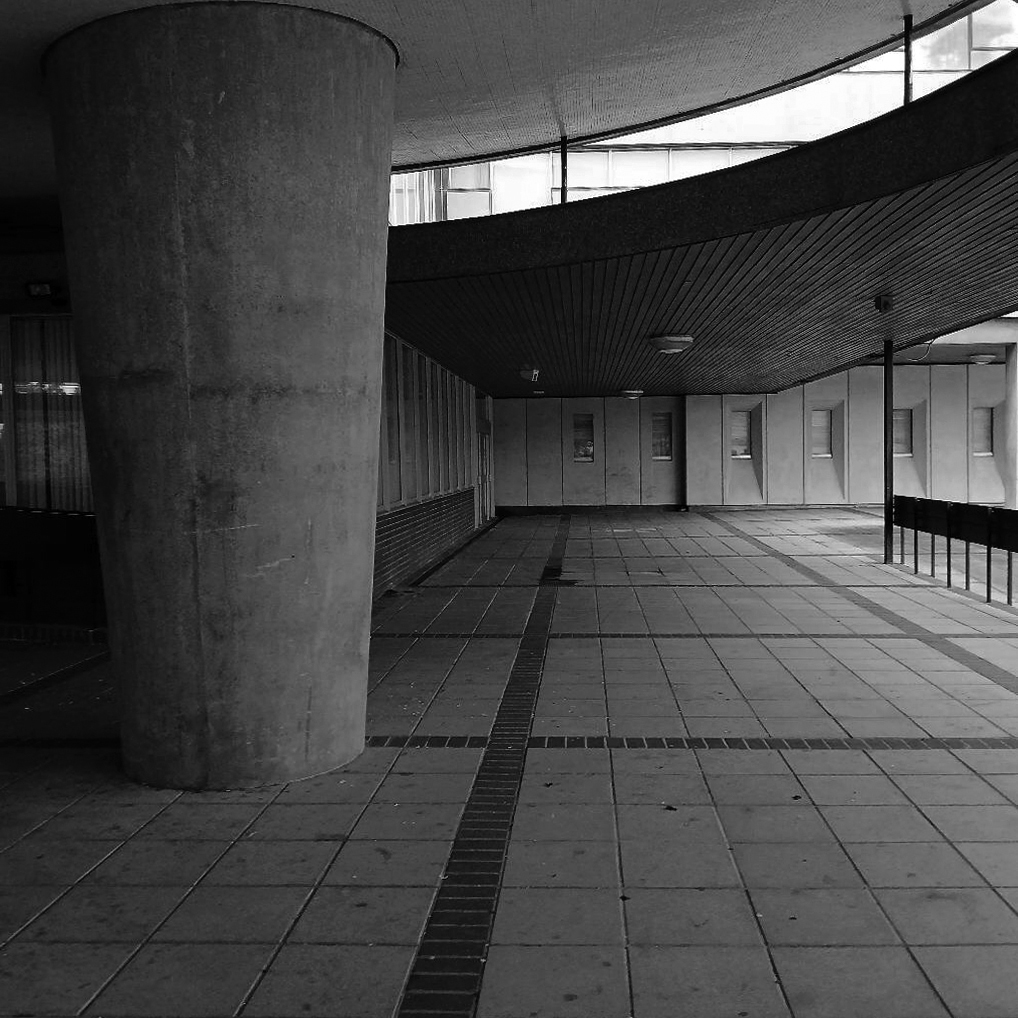
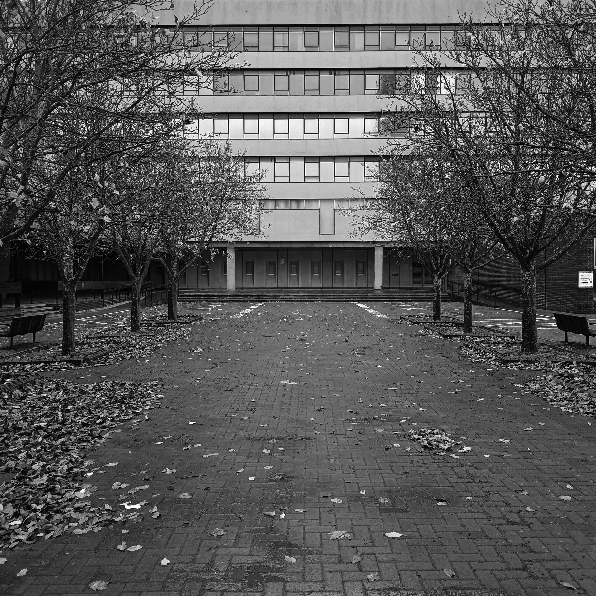
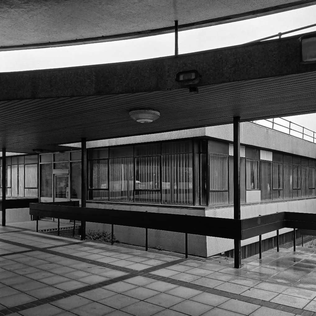
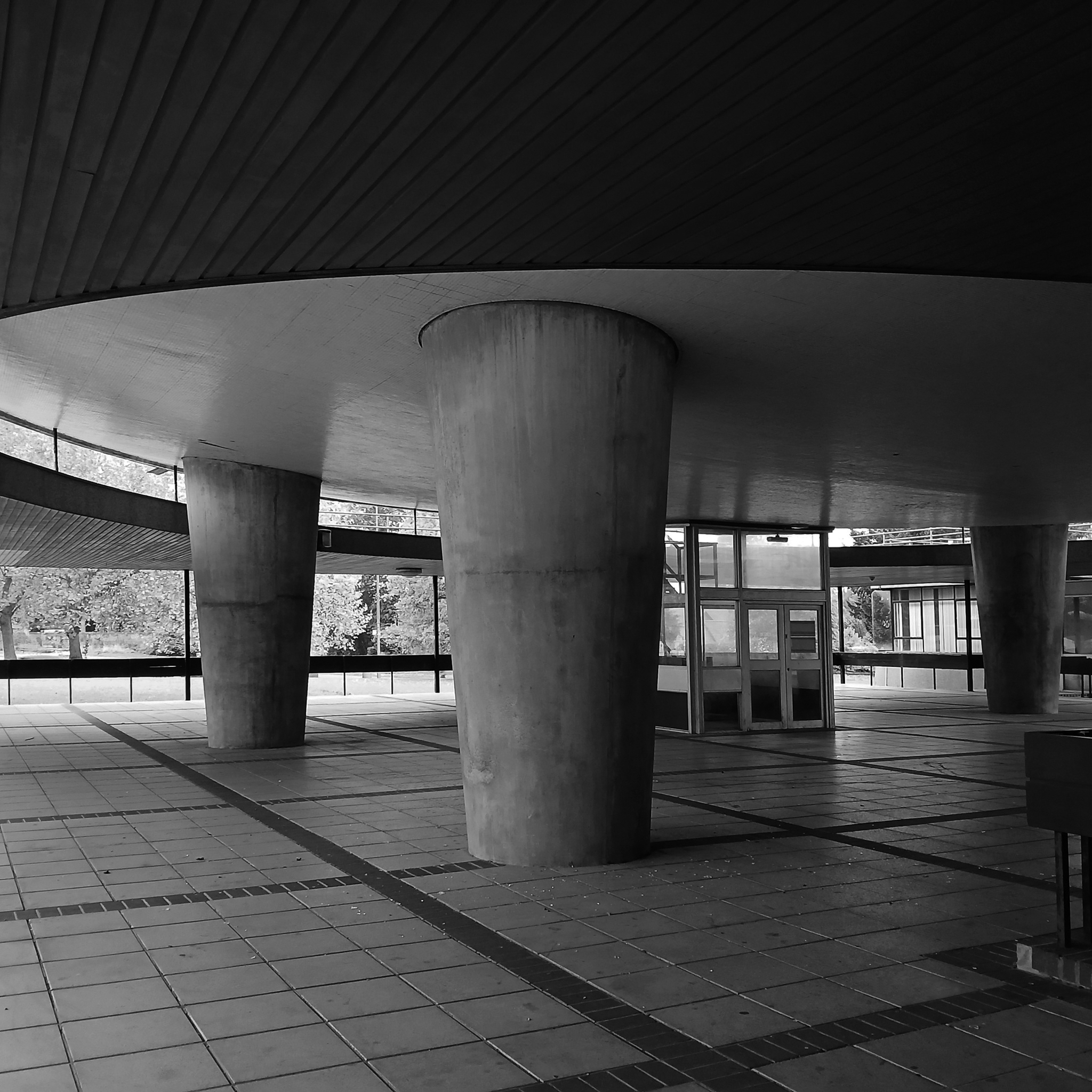
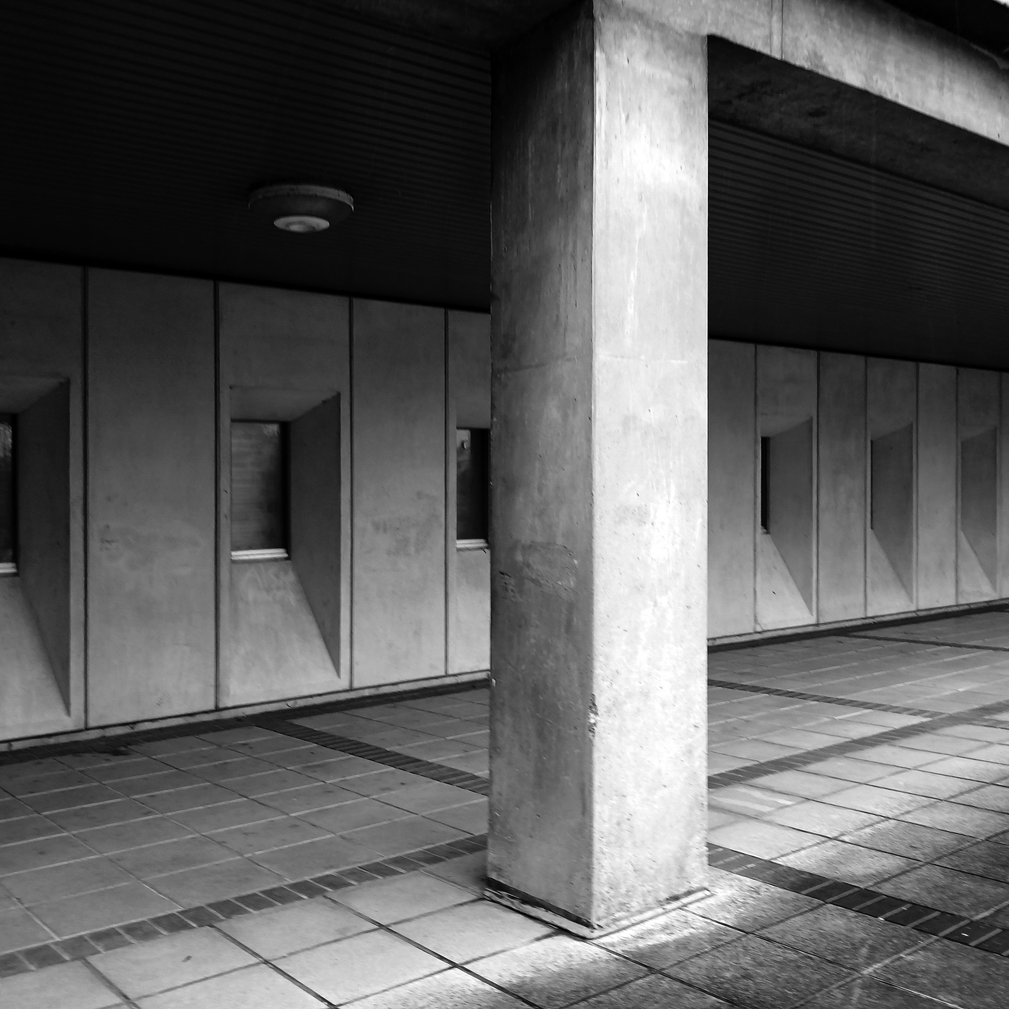
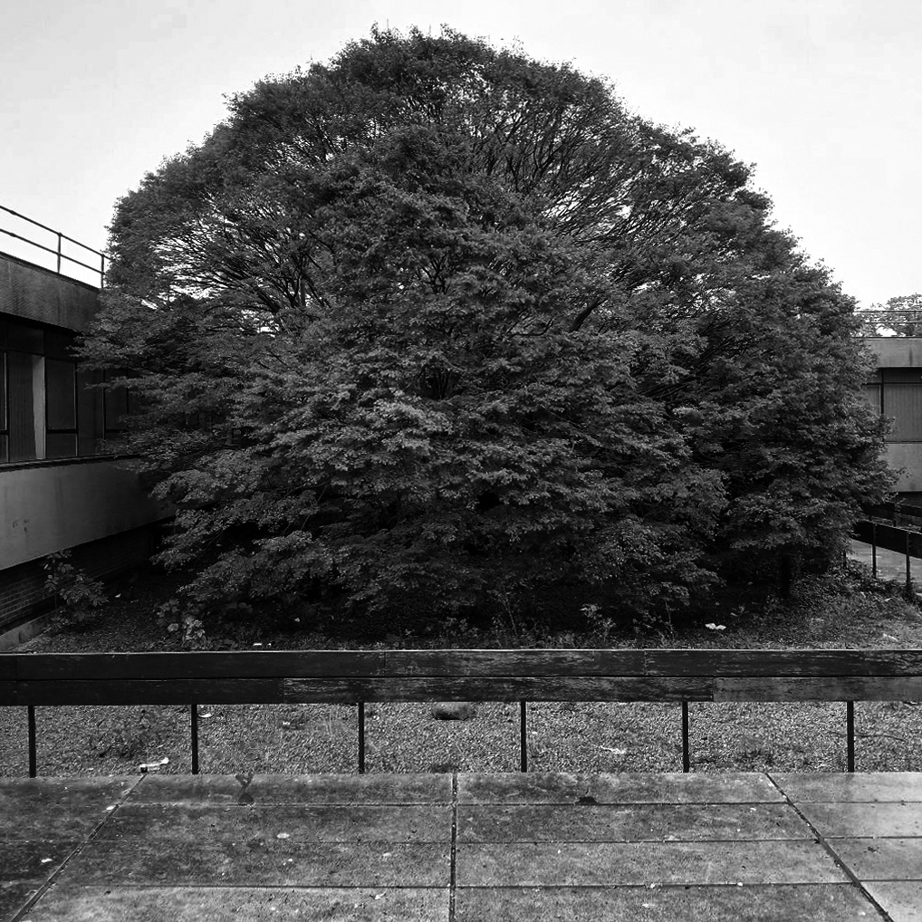
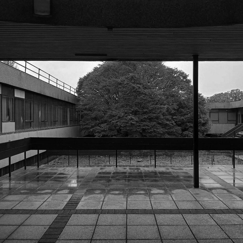
Having previously posted a history of the University of York’s Modernist architecture – here’s further information regarding Fred Millett’s concrete reliefs.
Fred Millett 1920–1980 was an English muralist, poster artist, and teacher at the Polytechnic of Central London. A number of his surviving works were commissioned by large British institutions including London Transport, London County Council and National Westminster Bank. The University of York commissioned Millett to create over 20 concrete relief panels that were to be integrated within the modular architecture of the Derwent and Langwith Colleges.
Millett’s panels created a cohesive group of works while also being distinctly different from one another due to the use of a variety of textures, geometric shapes and negative space. Larger, more detailed works follow the main covered walkways through Derwent College leading to Heslington Hall.
Smaller, less detailed works were placed near accommodation blocks and laundry rooms which suggest that they were intended for the individual enjoyment of the students who live within the College rather than a university-wide viewing experience.
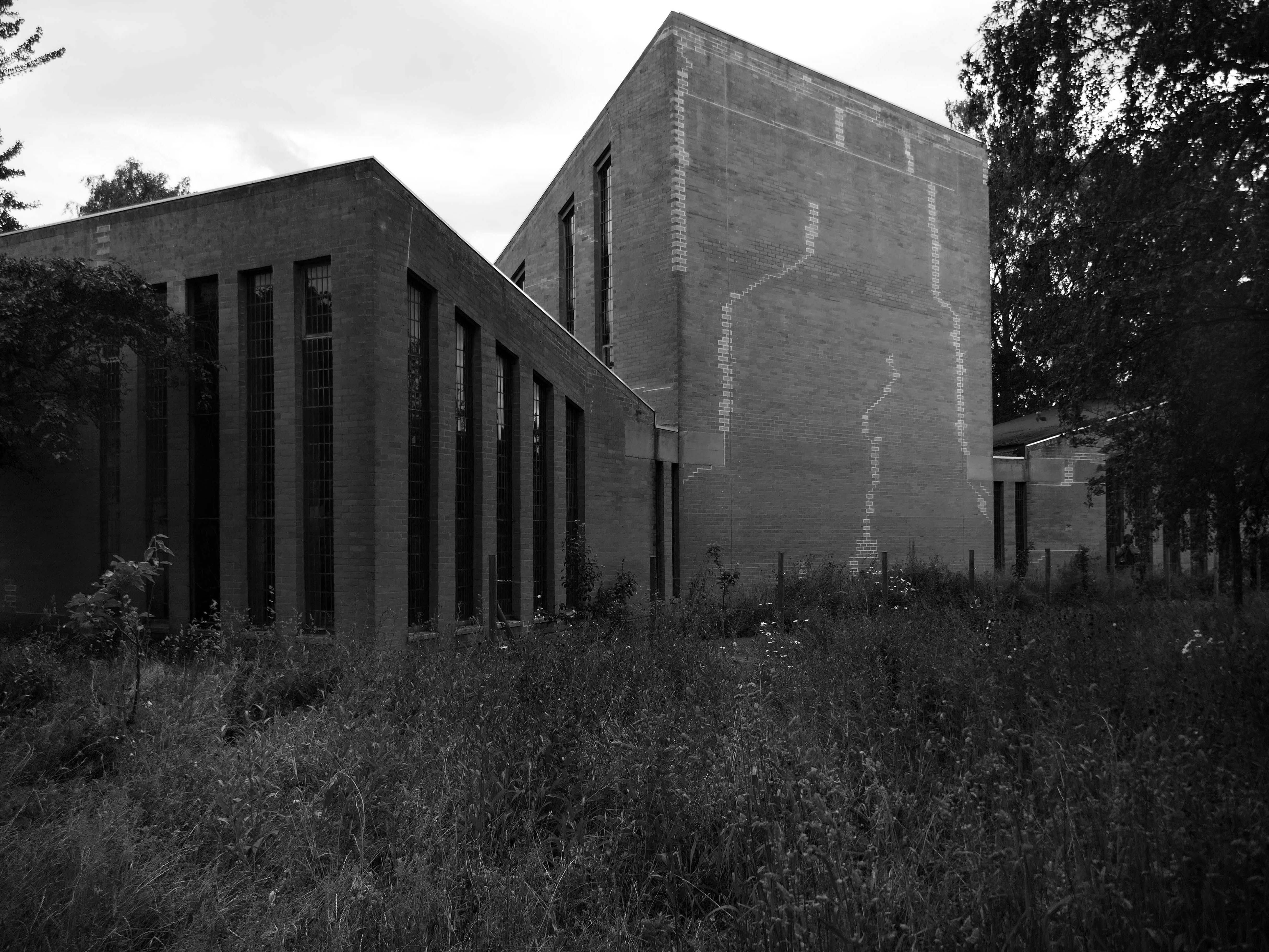
In a 1973 interview, Sir Andrew Derbyshire, who was the first project architect for the university, lamented that the project could not afford better finishes for the CLASP panels – such as adding white marble aggregate – but he did appreciate their appearance in bright sunlight or when they “glisten[ed] in the pouring rain.” Asked about the integration of the Millett sculptures to enliven the panels, he stated: “Yes. Well, that was an attempt. I would have liked it to have gone a bit further than that.”
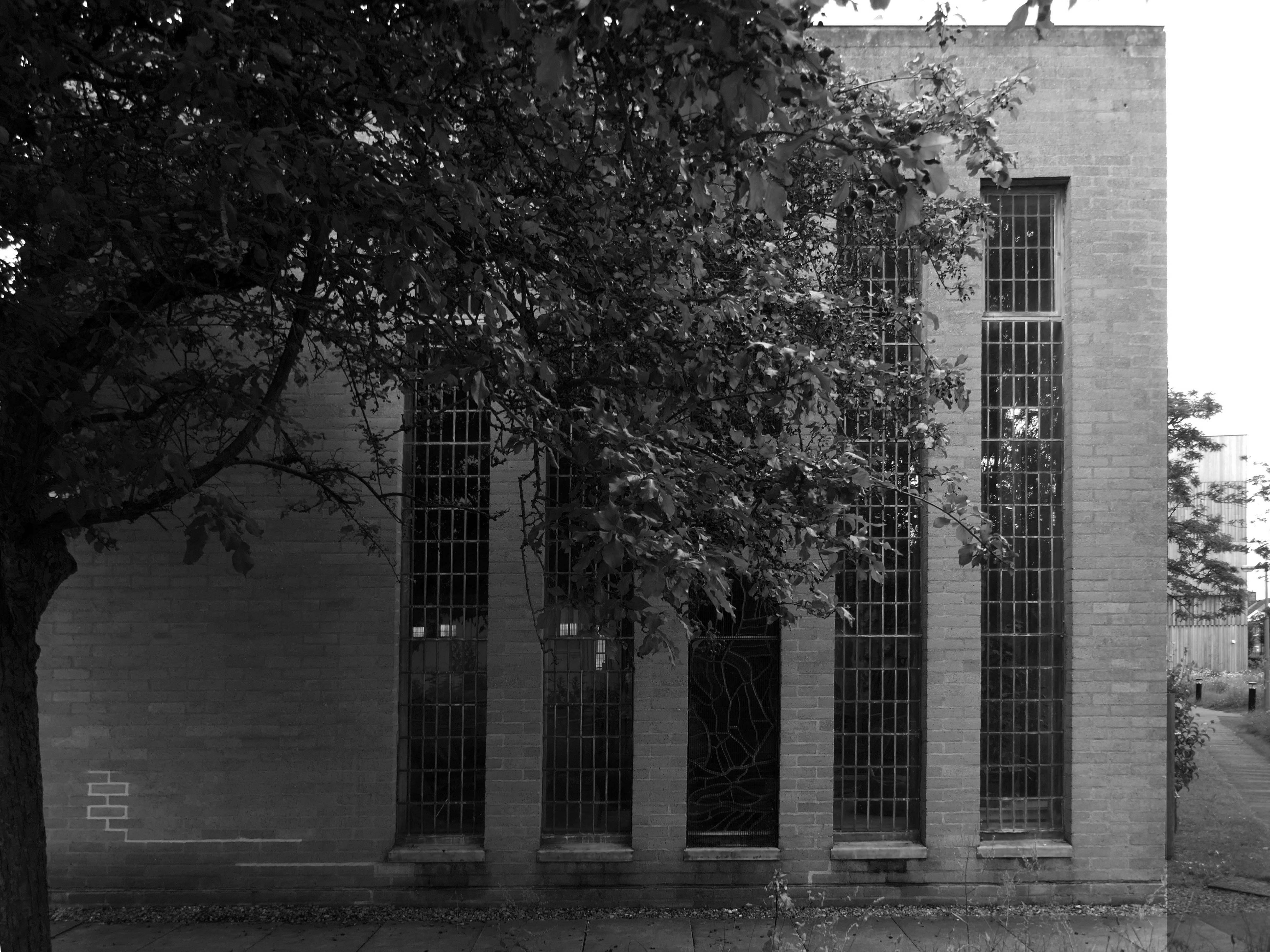
This was my first visit to the campus, and having discovered the first of the reliefs, I cantered around from block to block, like a giddy one penny child in a seaside arcade – wondering where to look next.
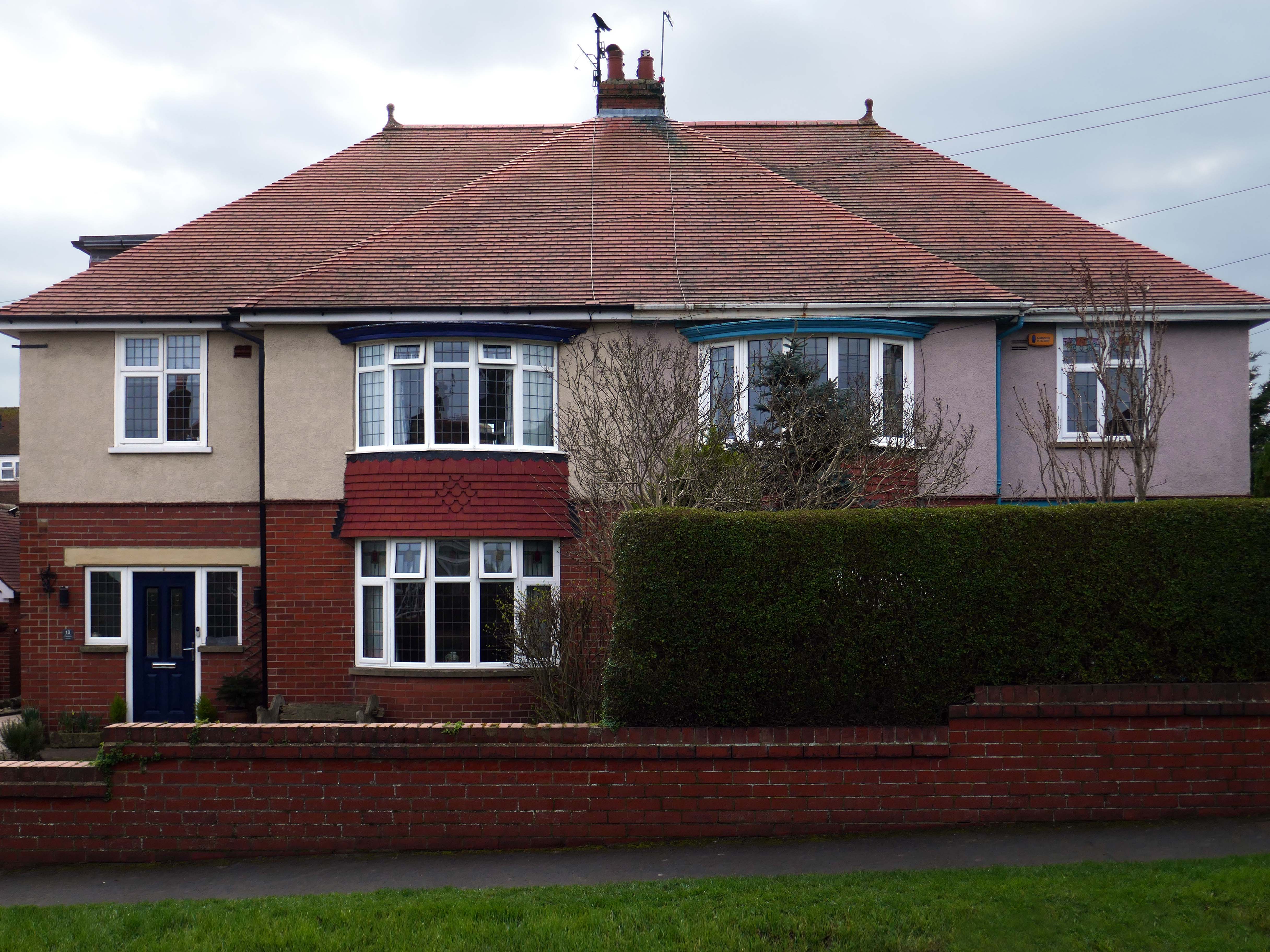
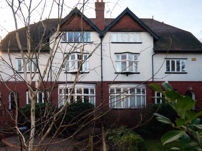
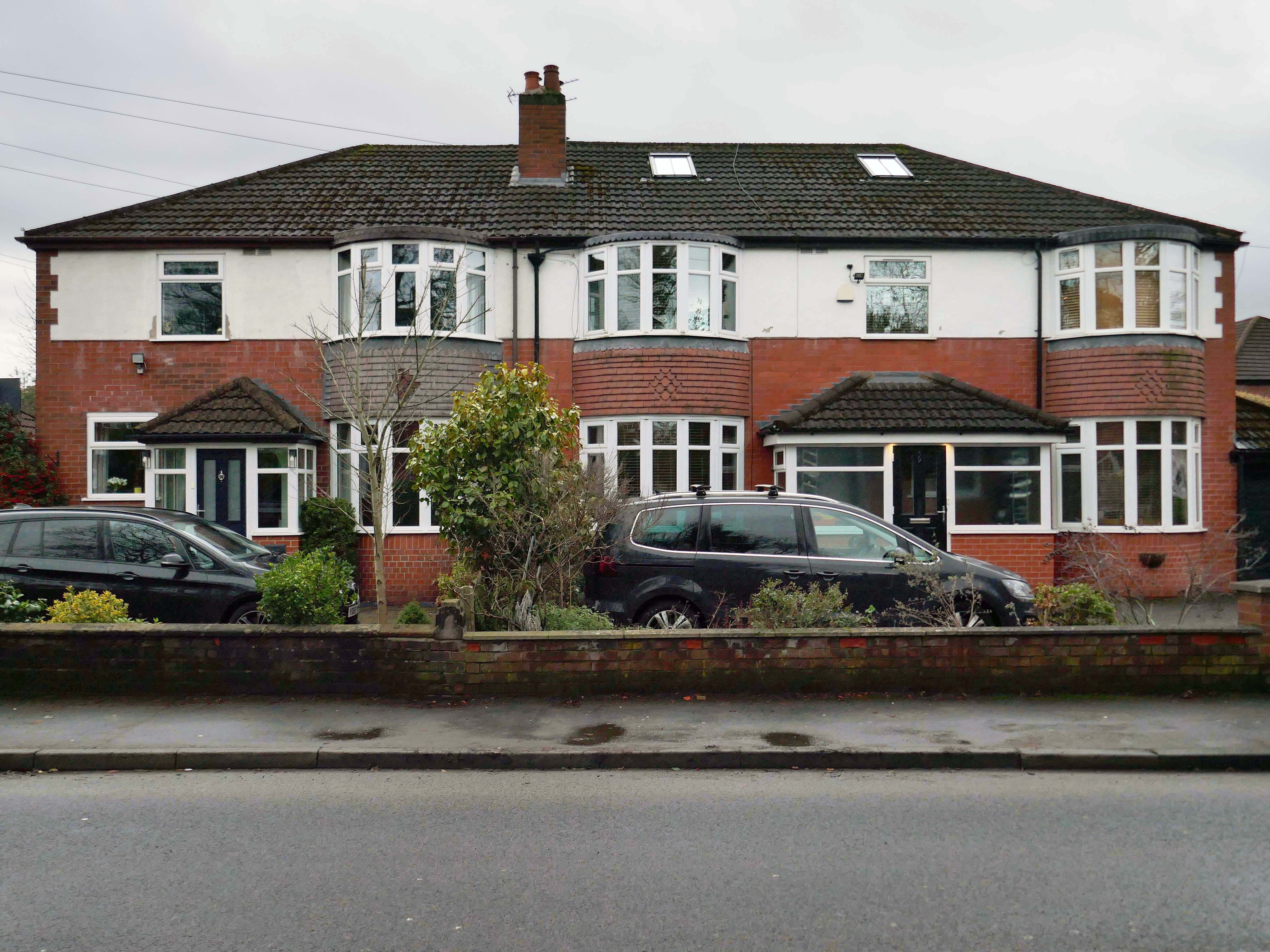
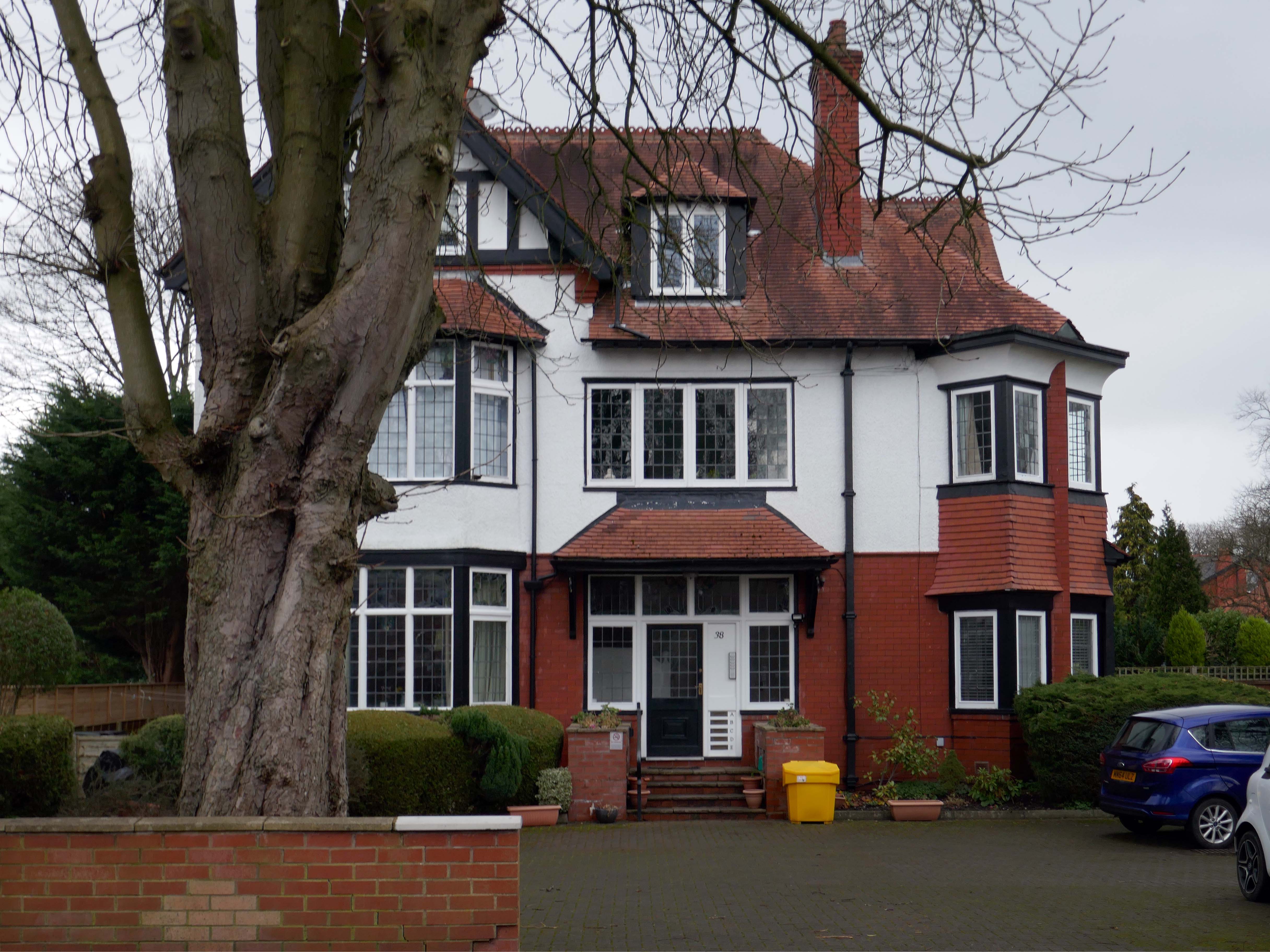
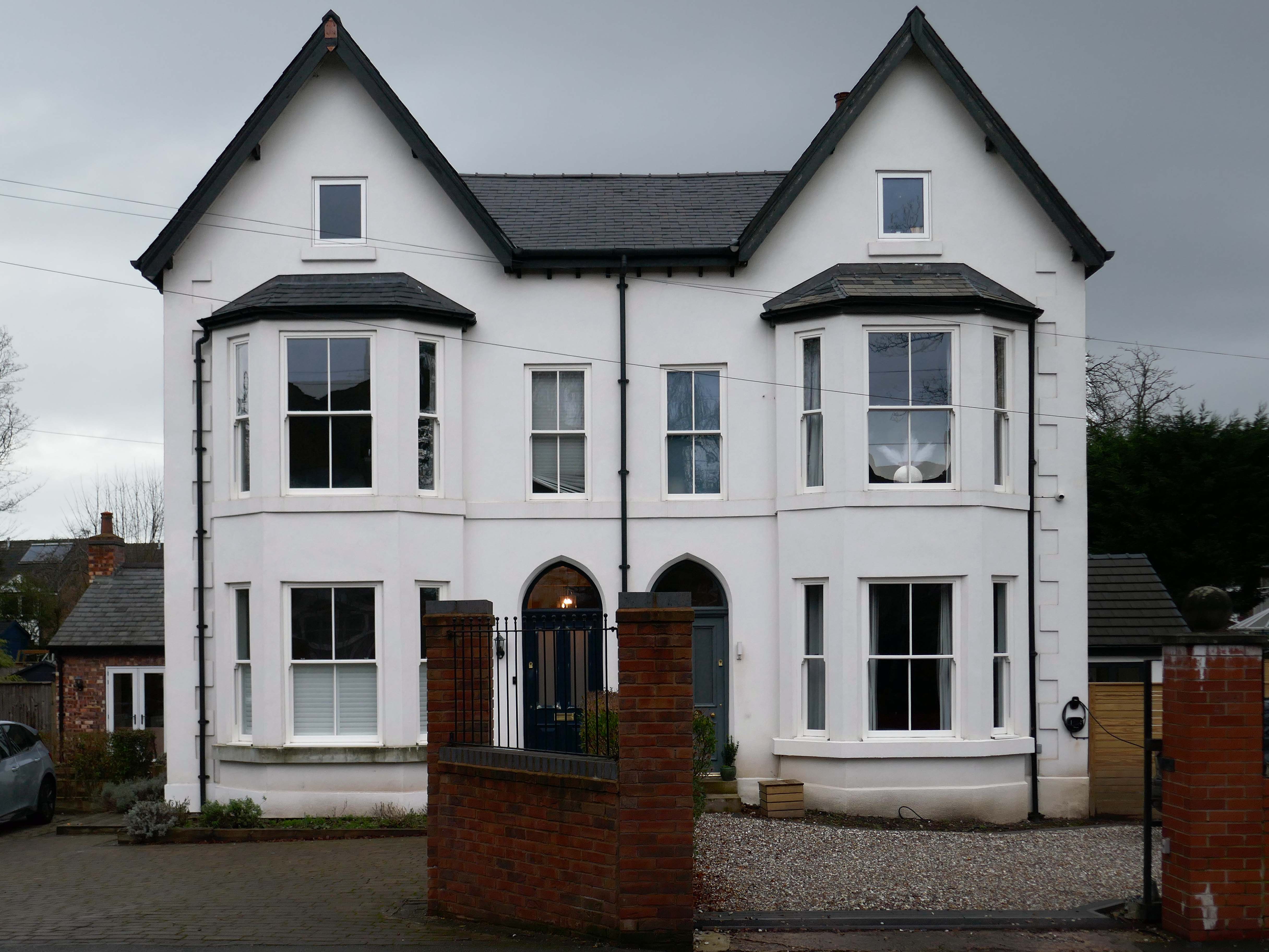
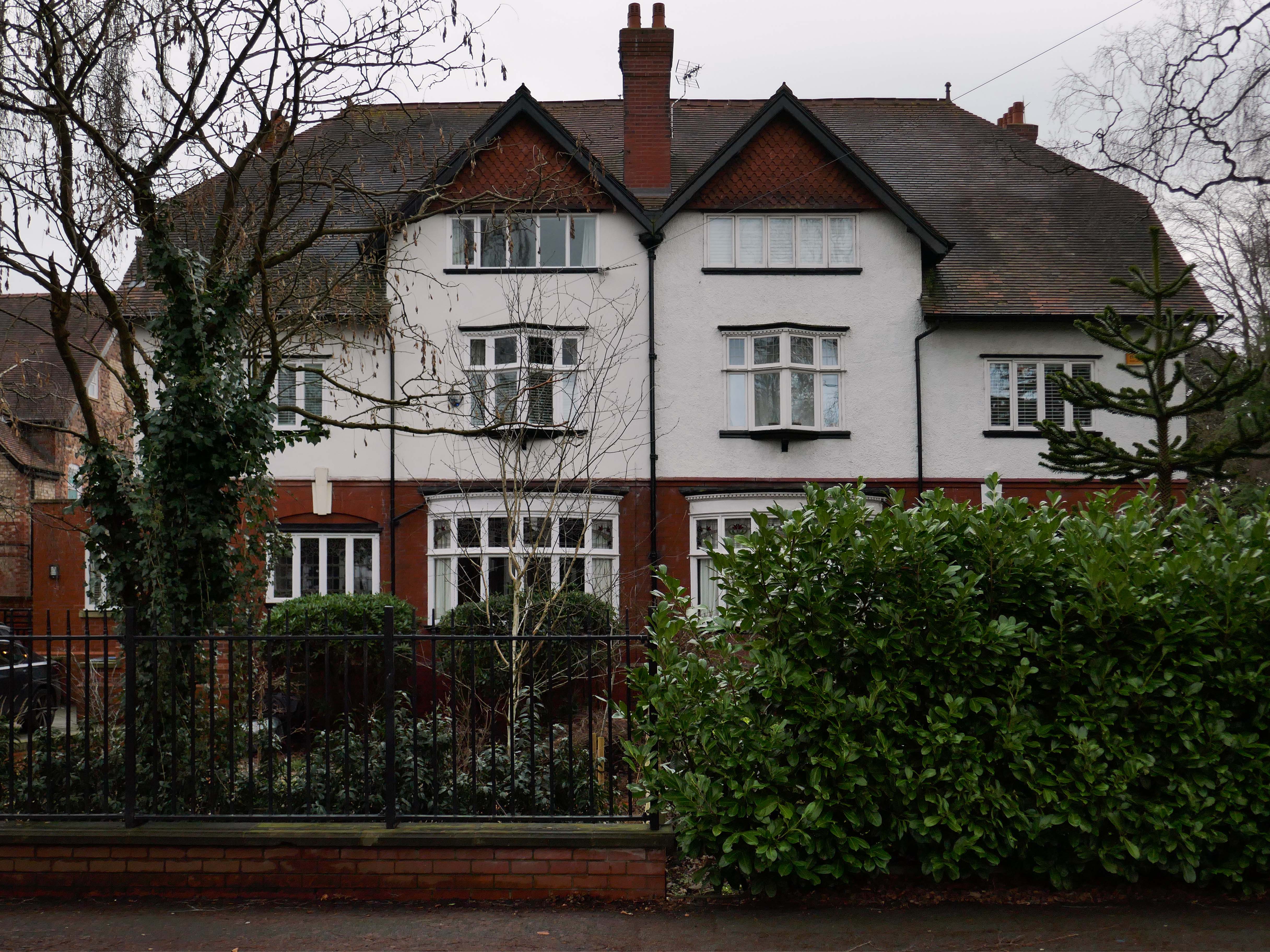
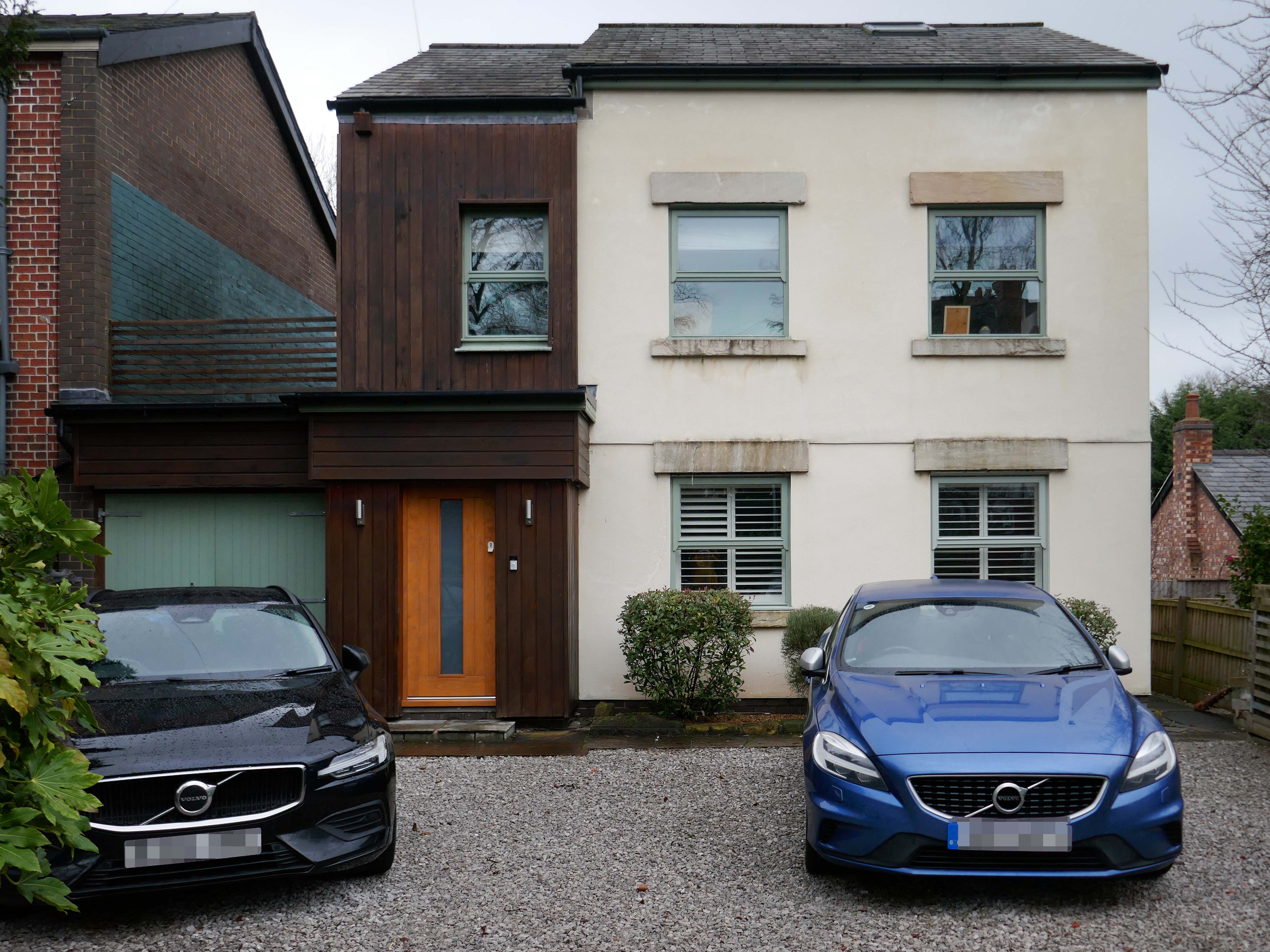
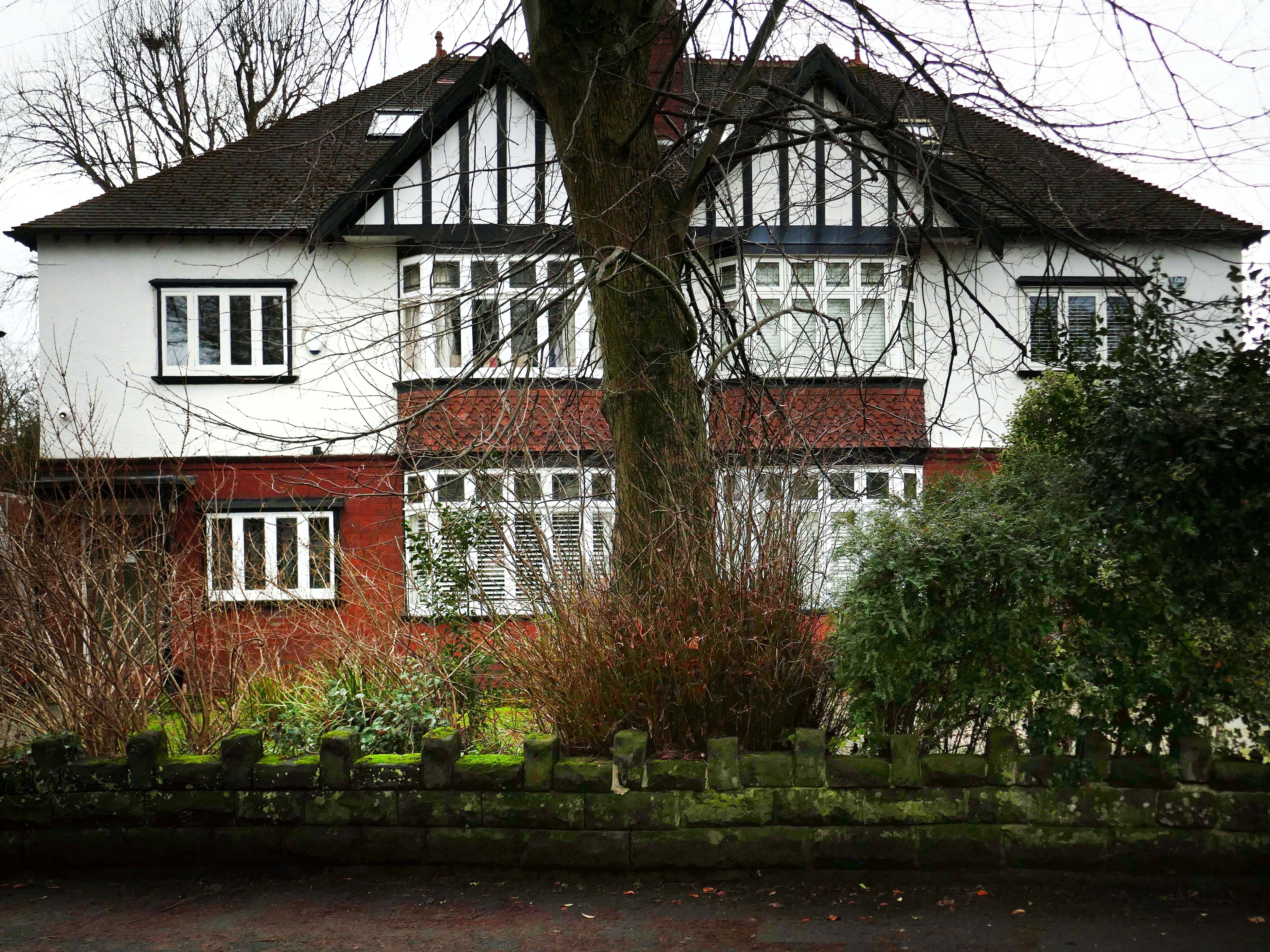
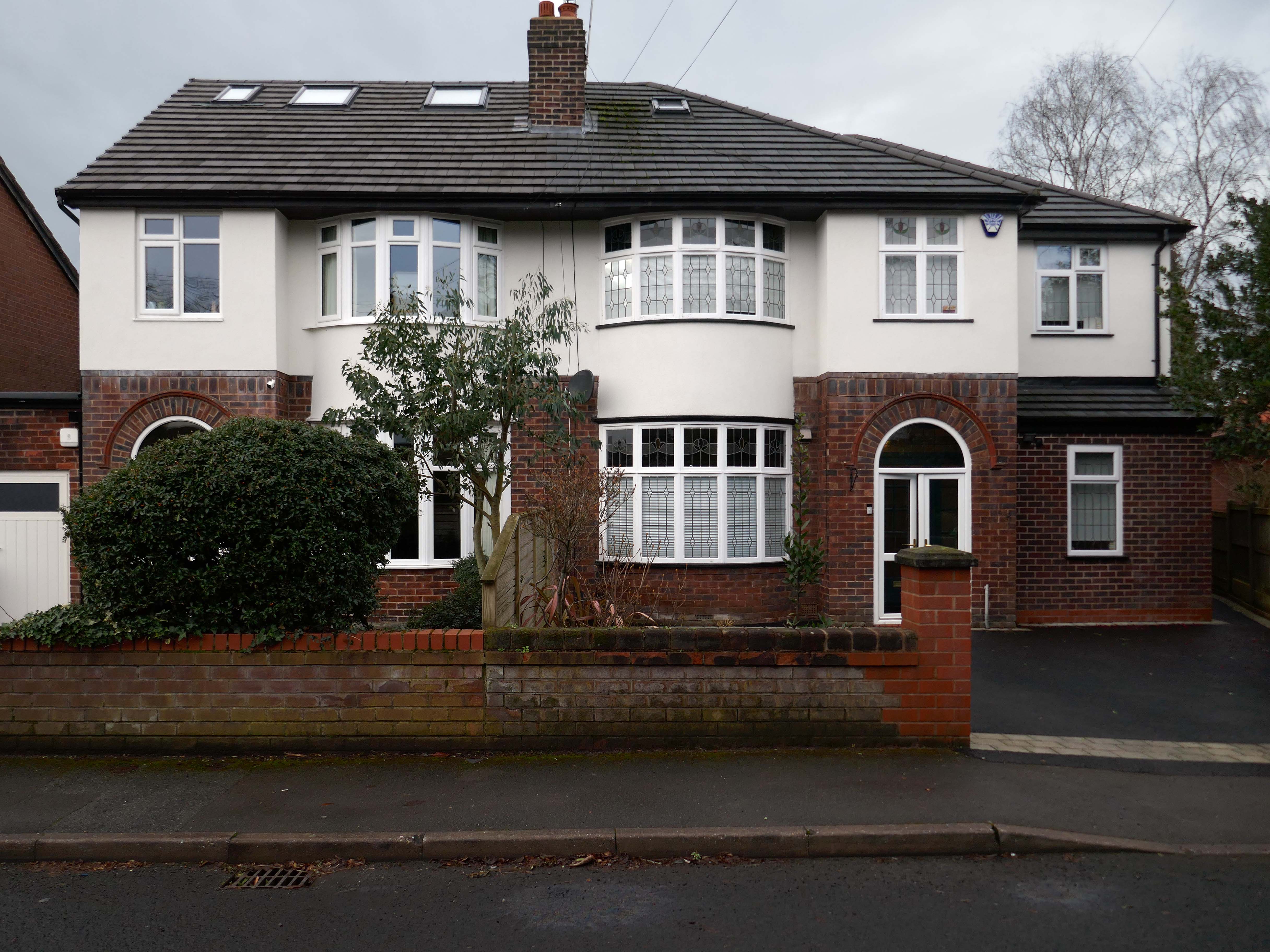
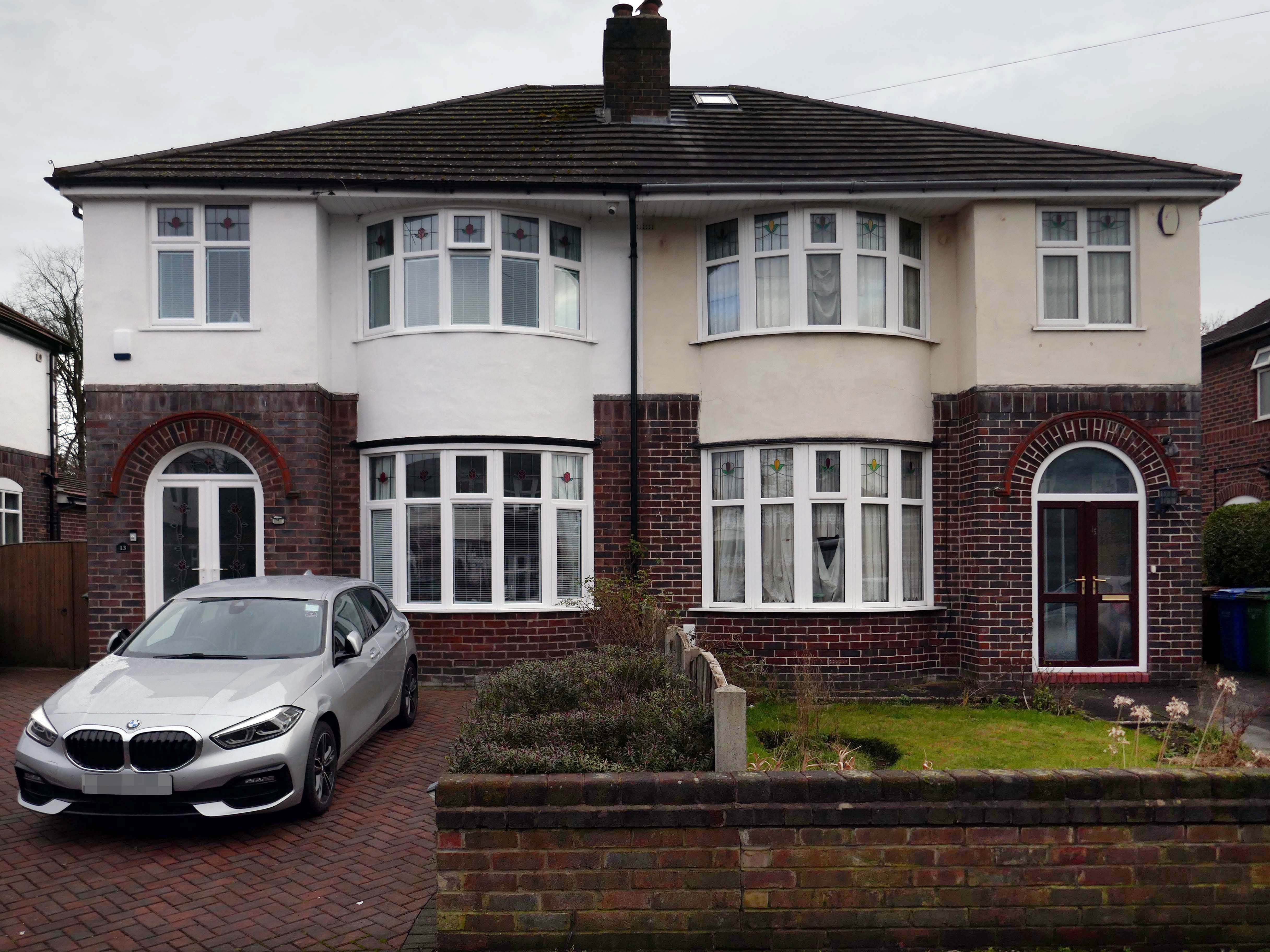
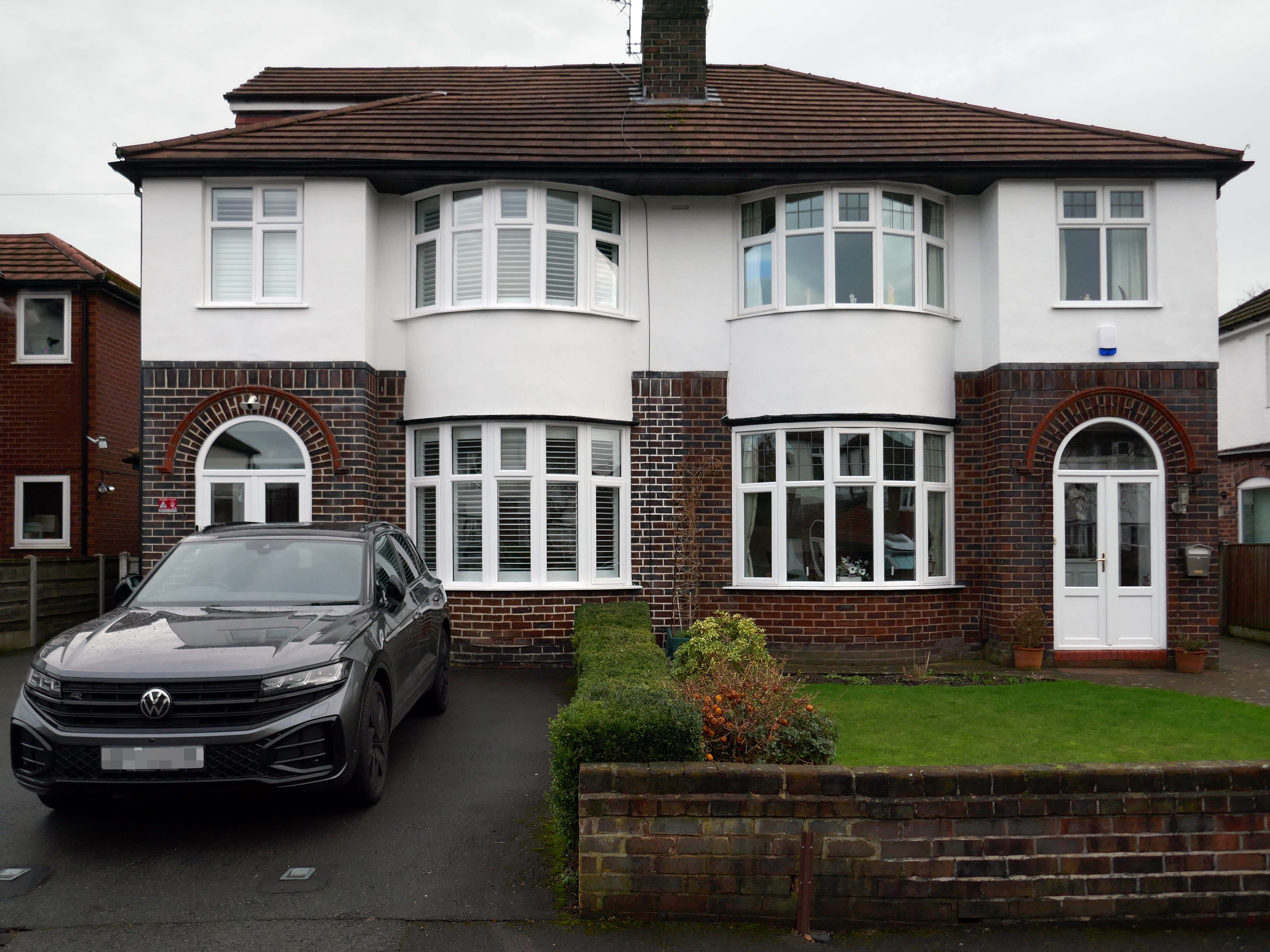
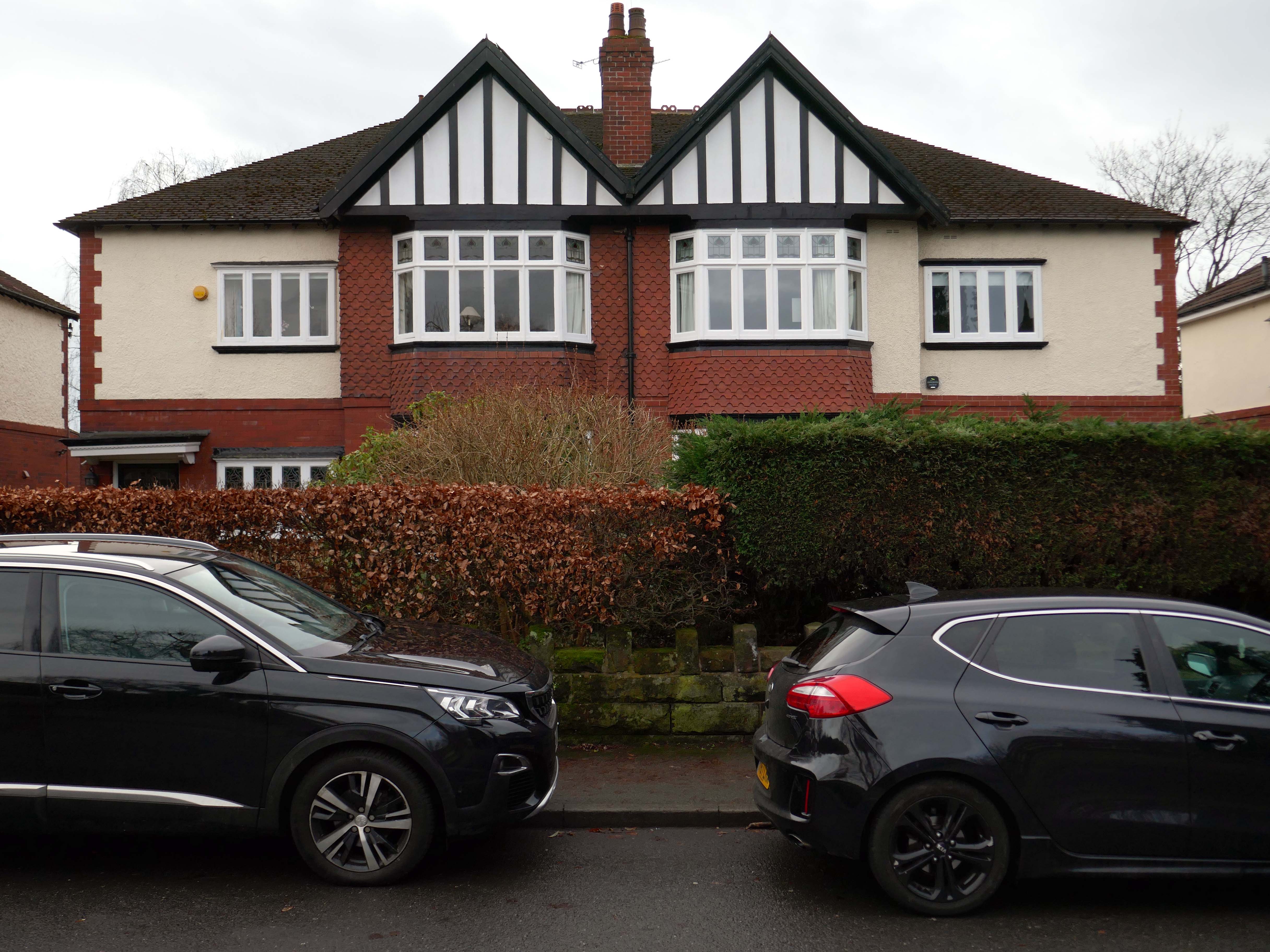
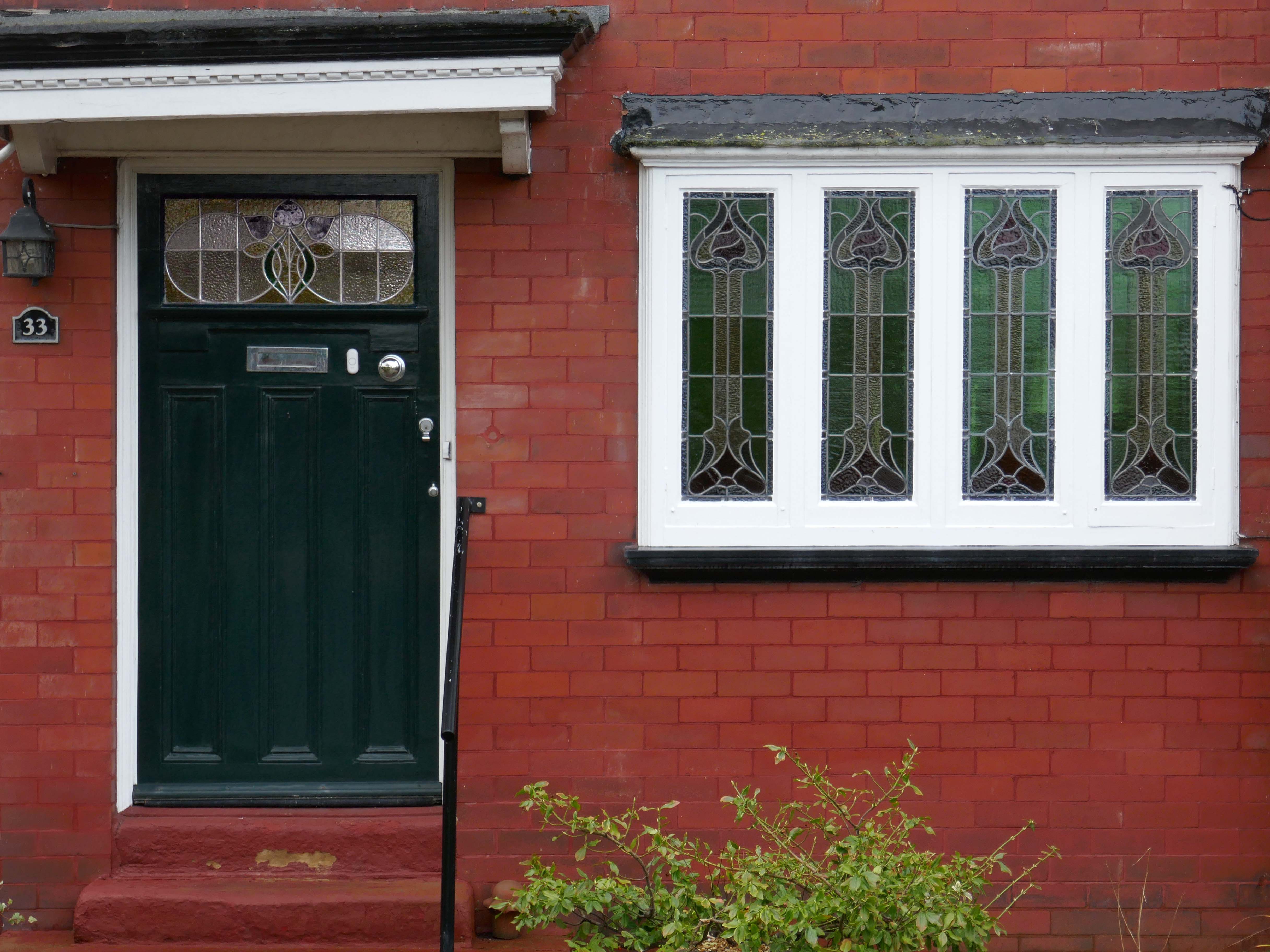
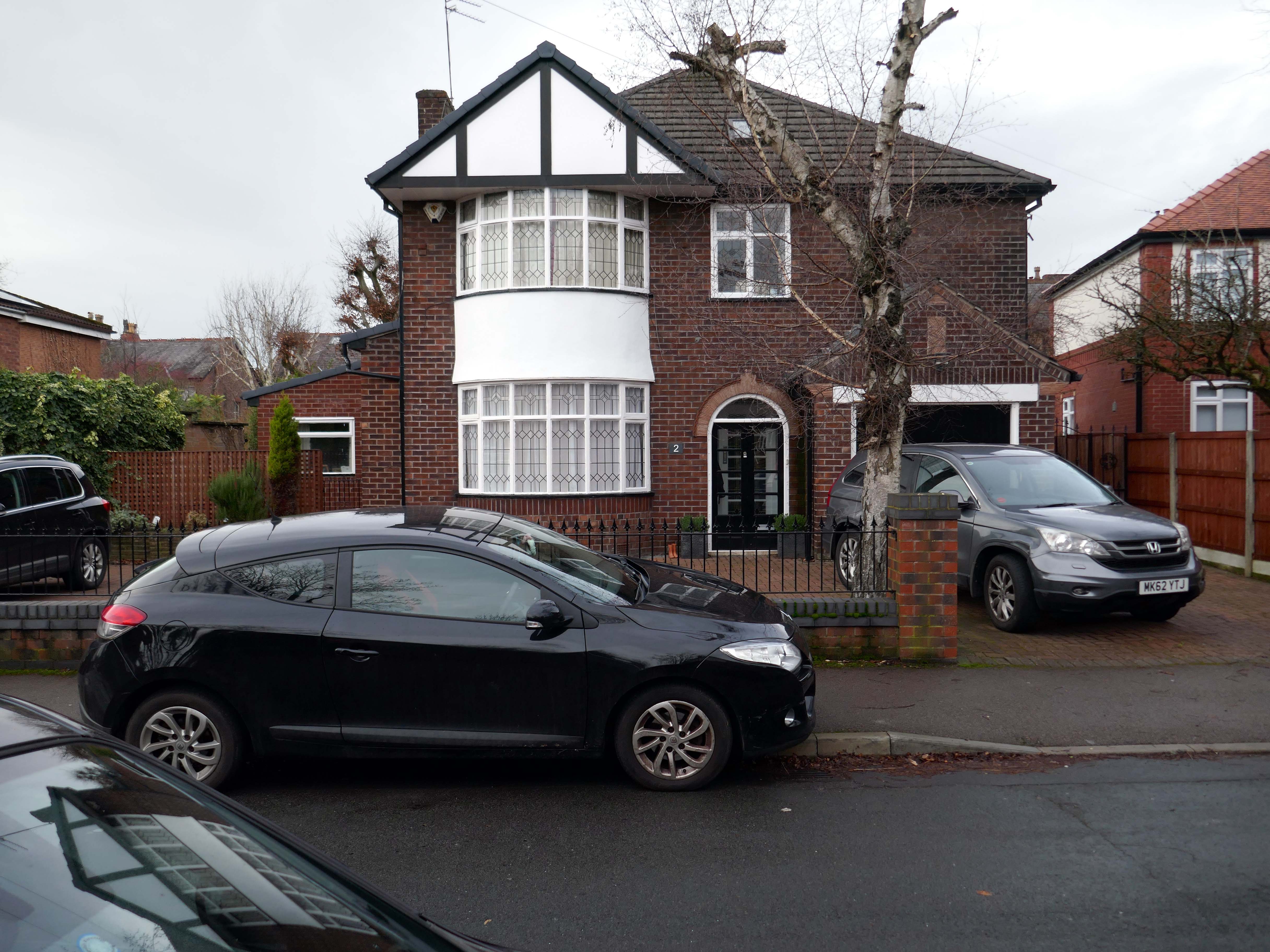
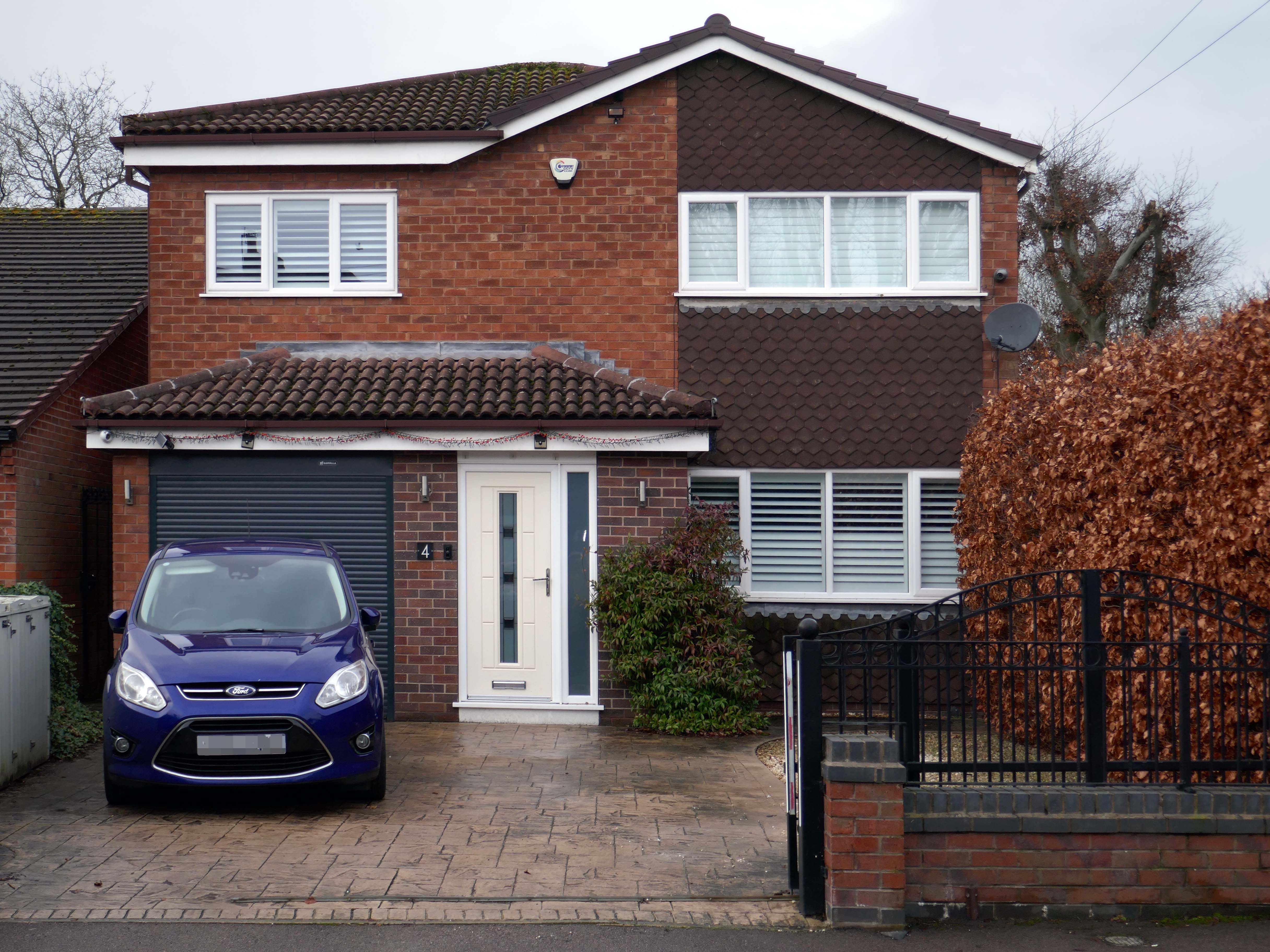
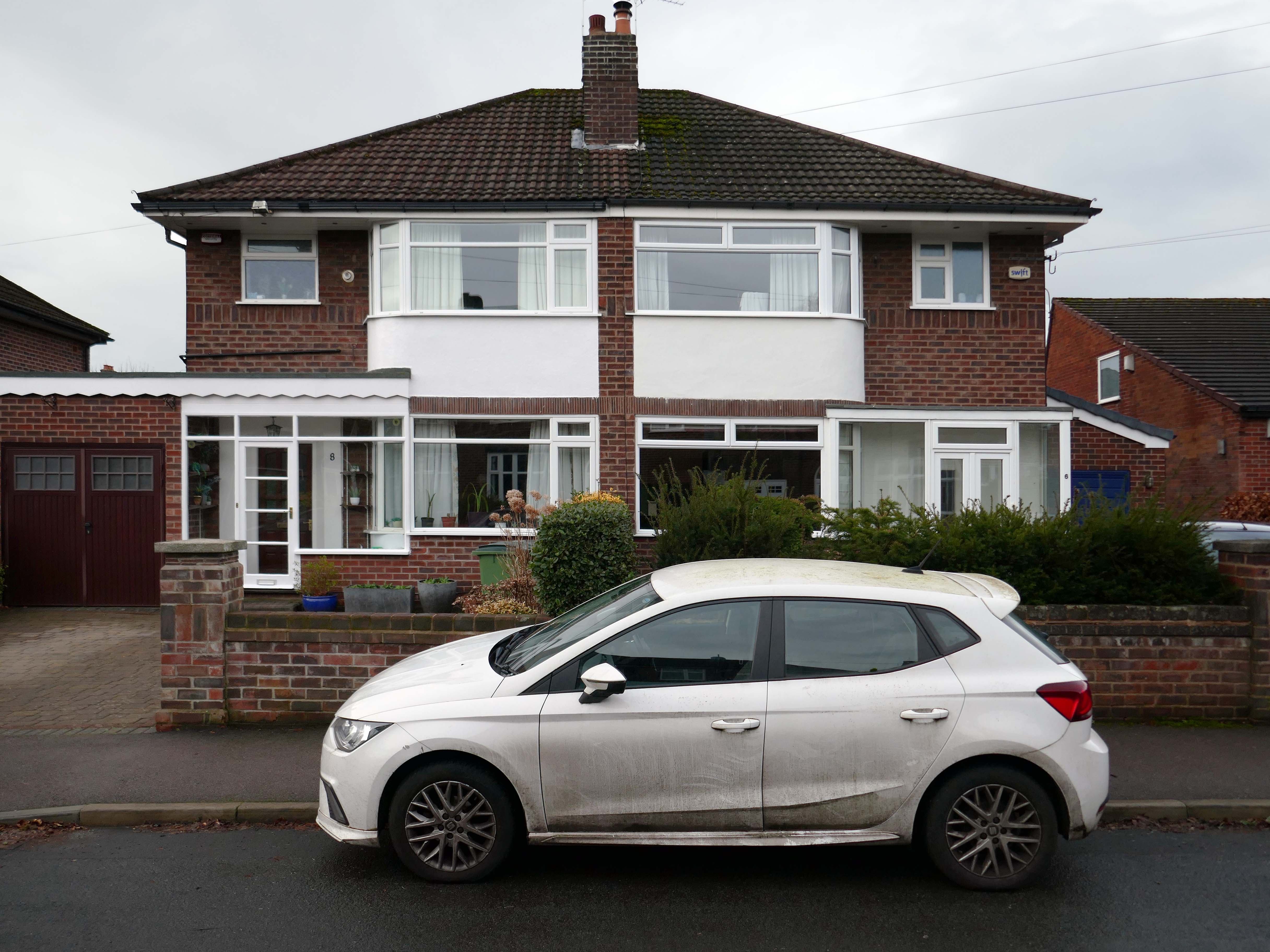
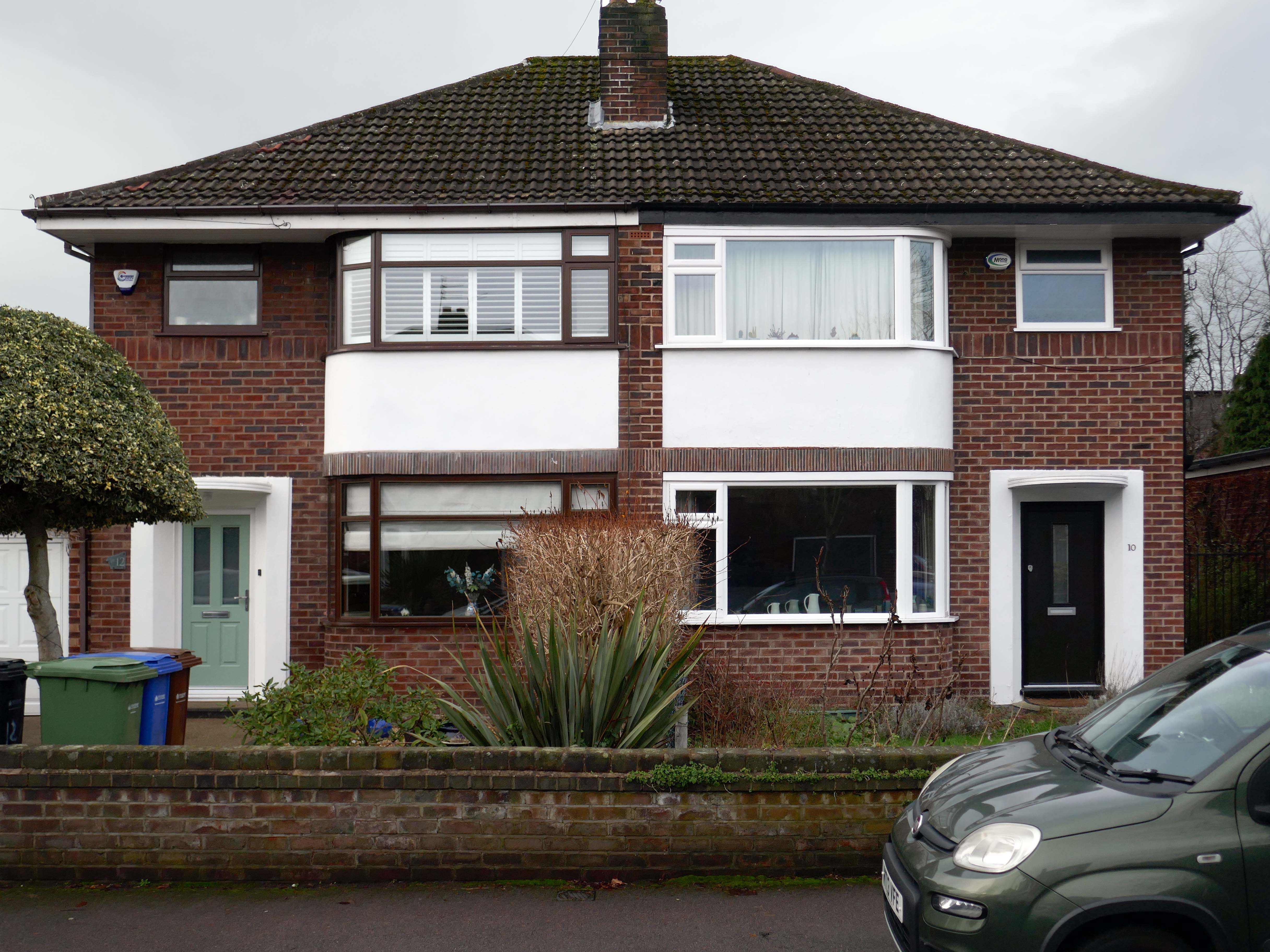
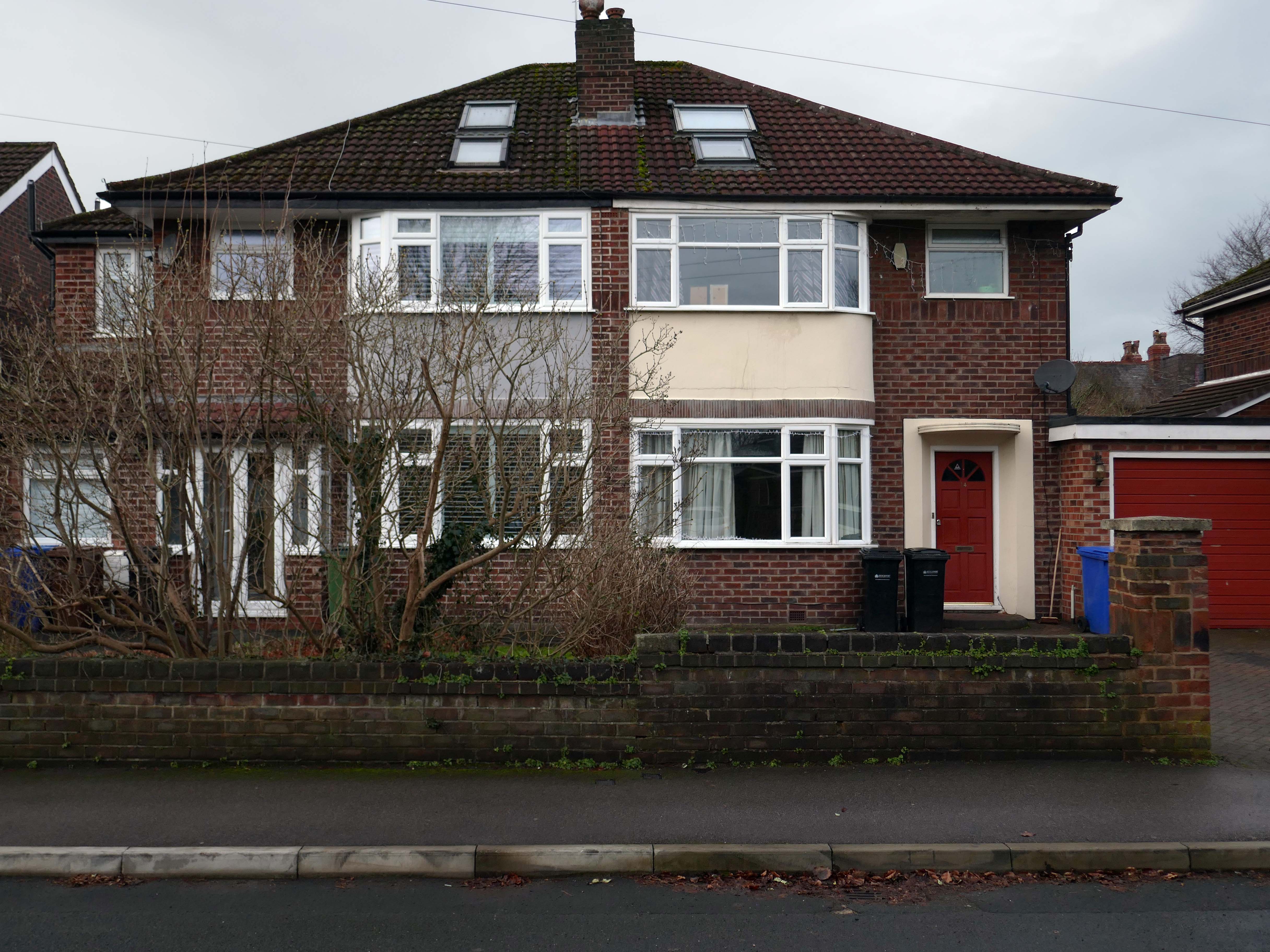
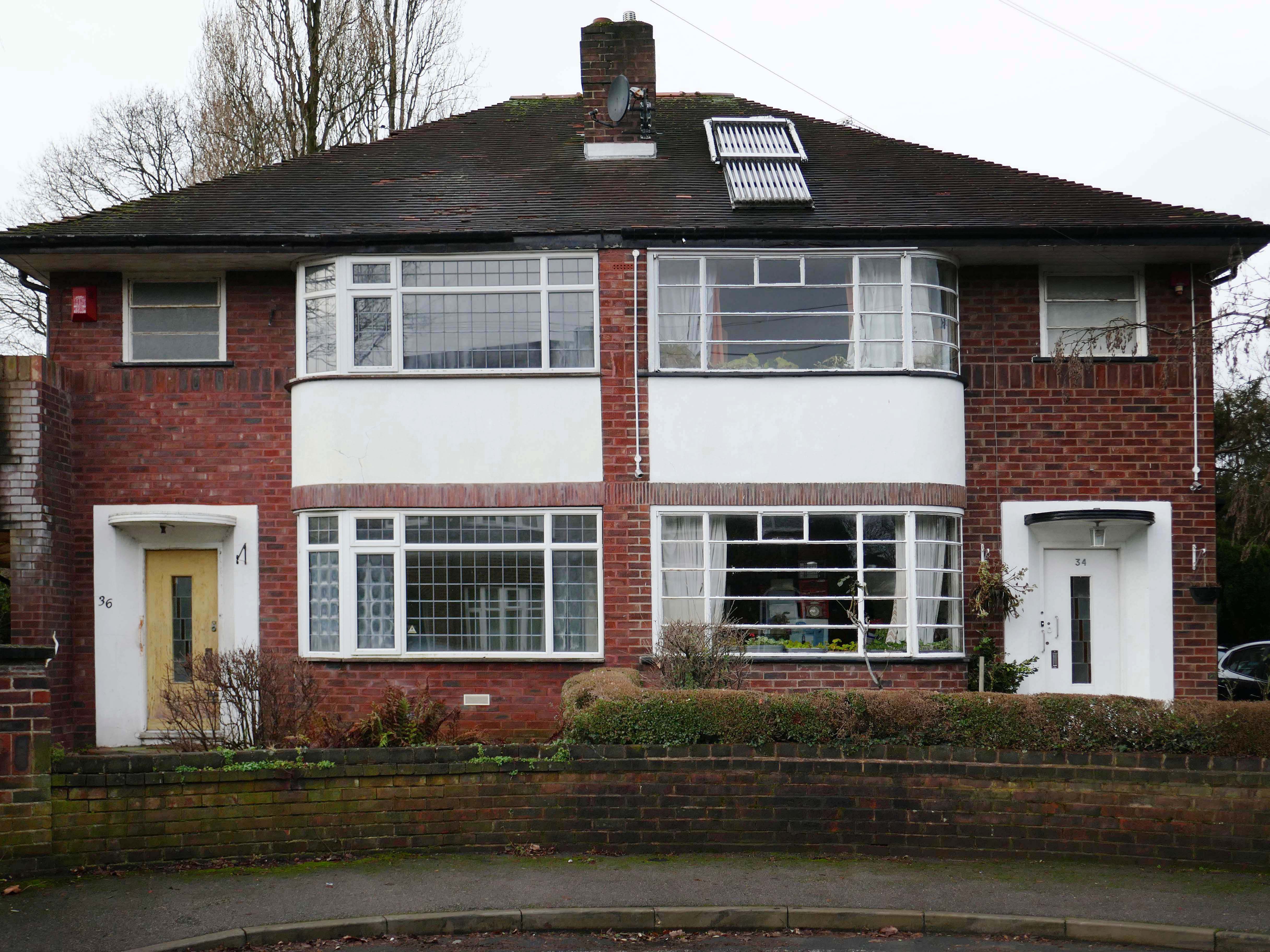
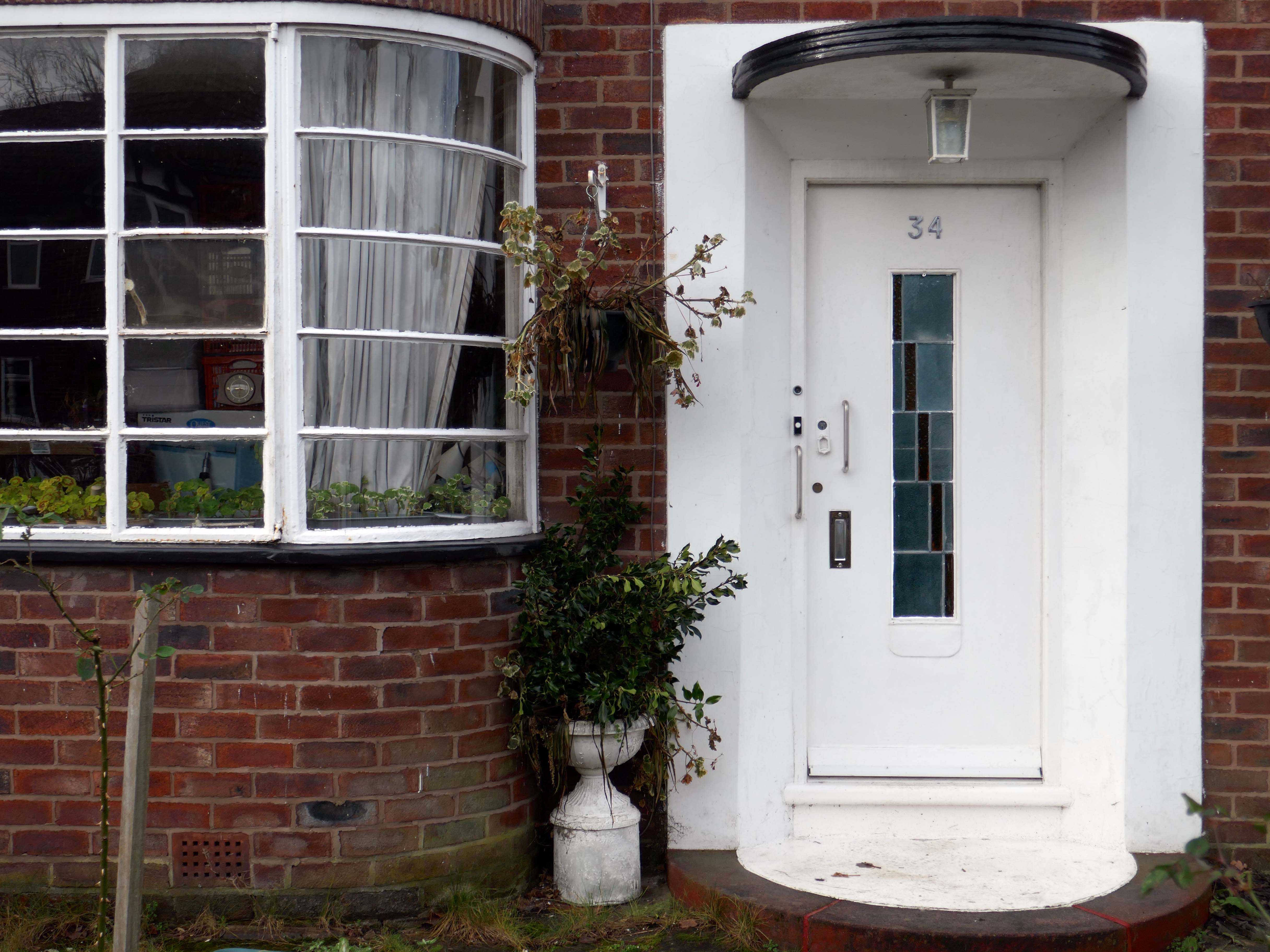
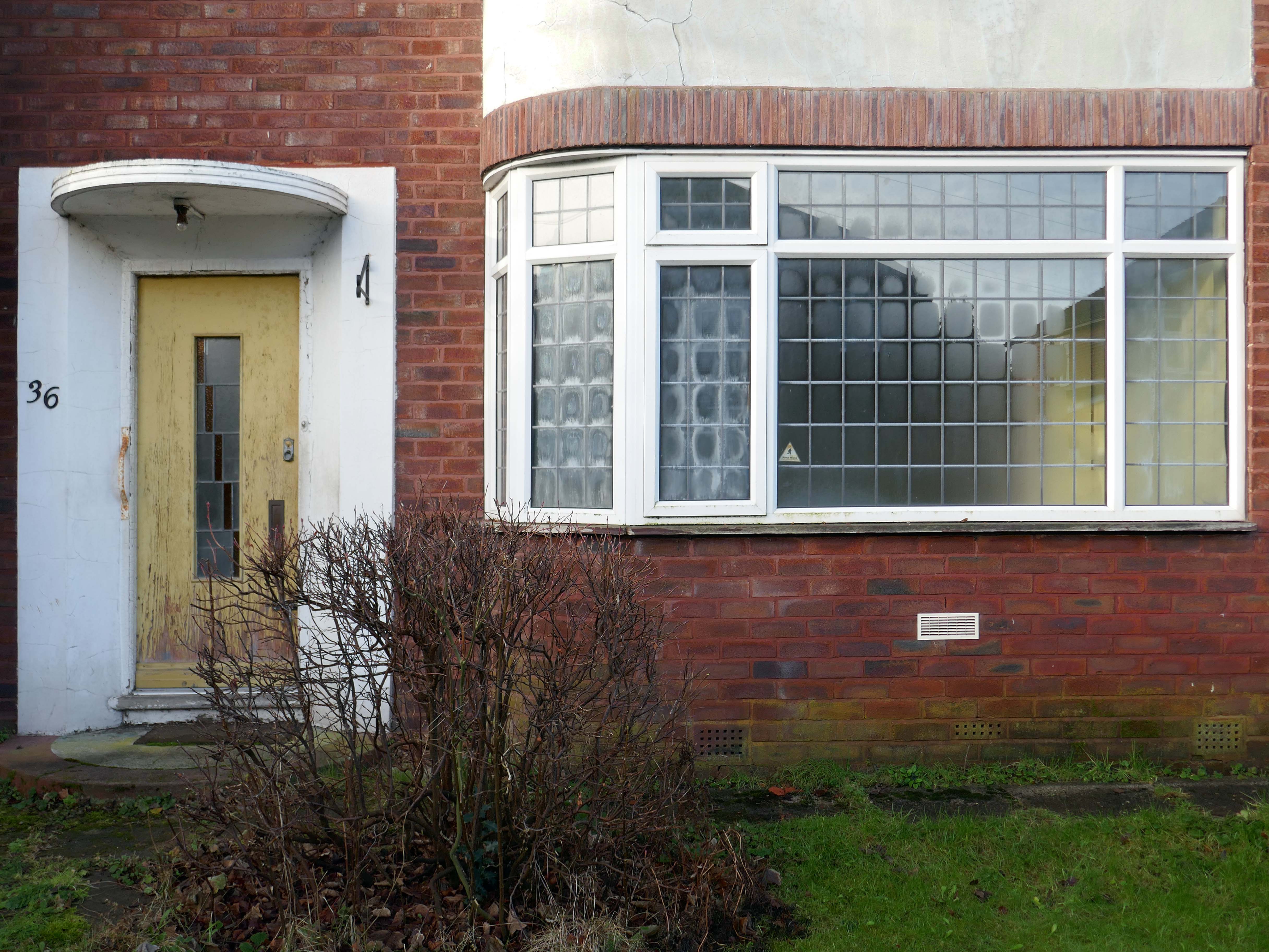
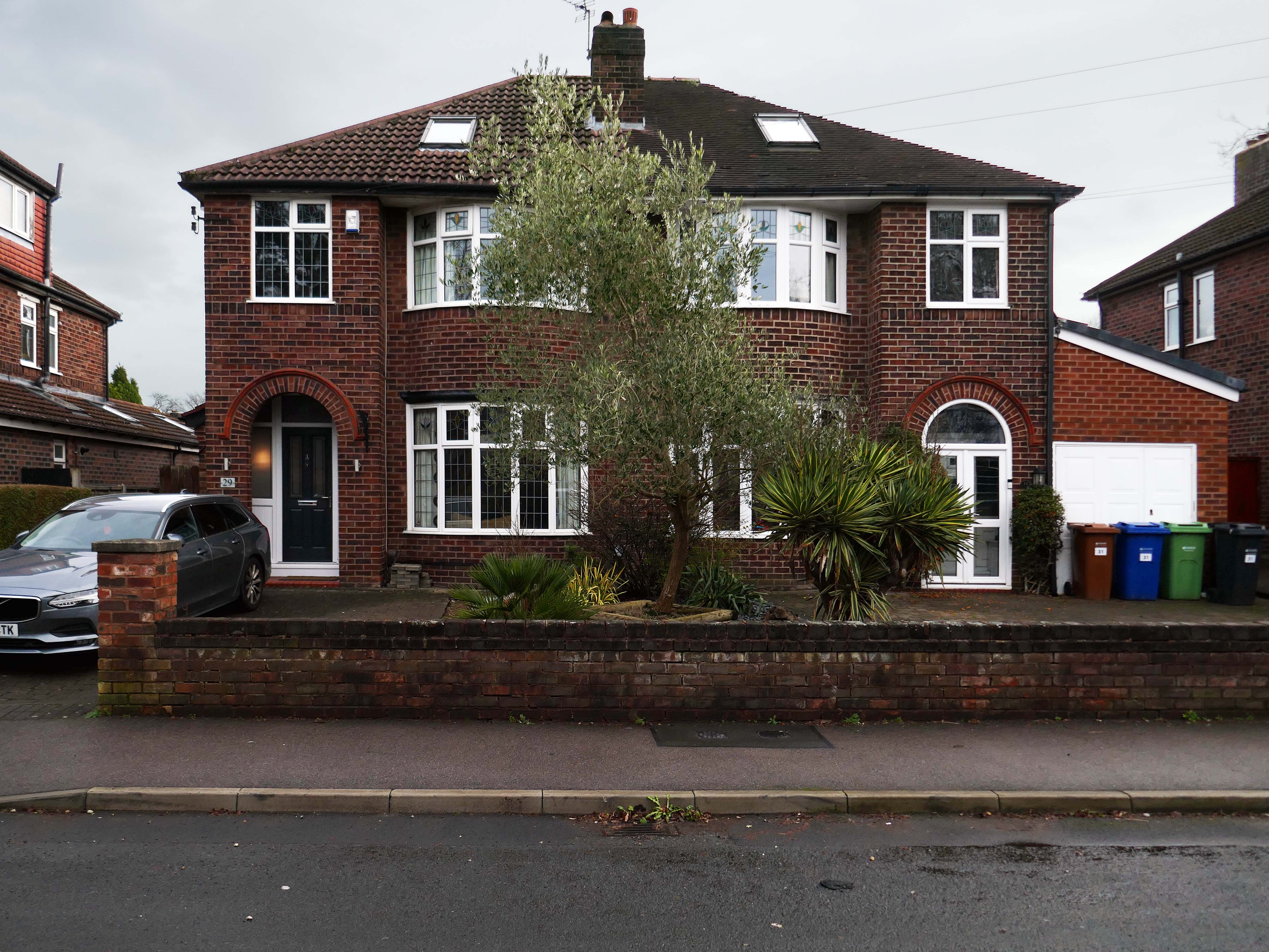
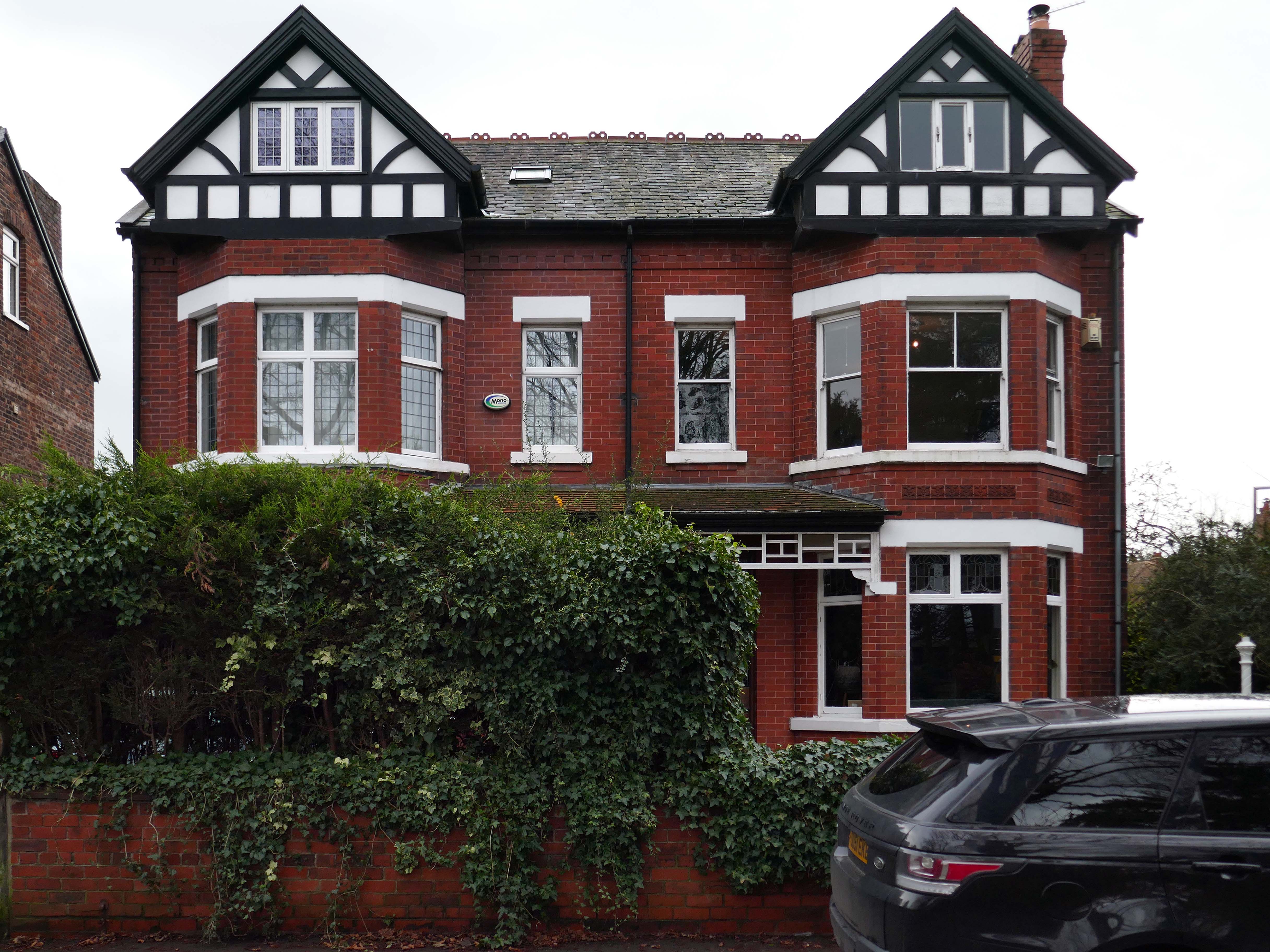
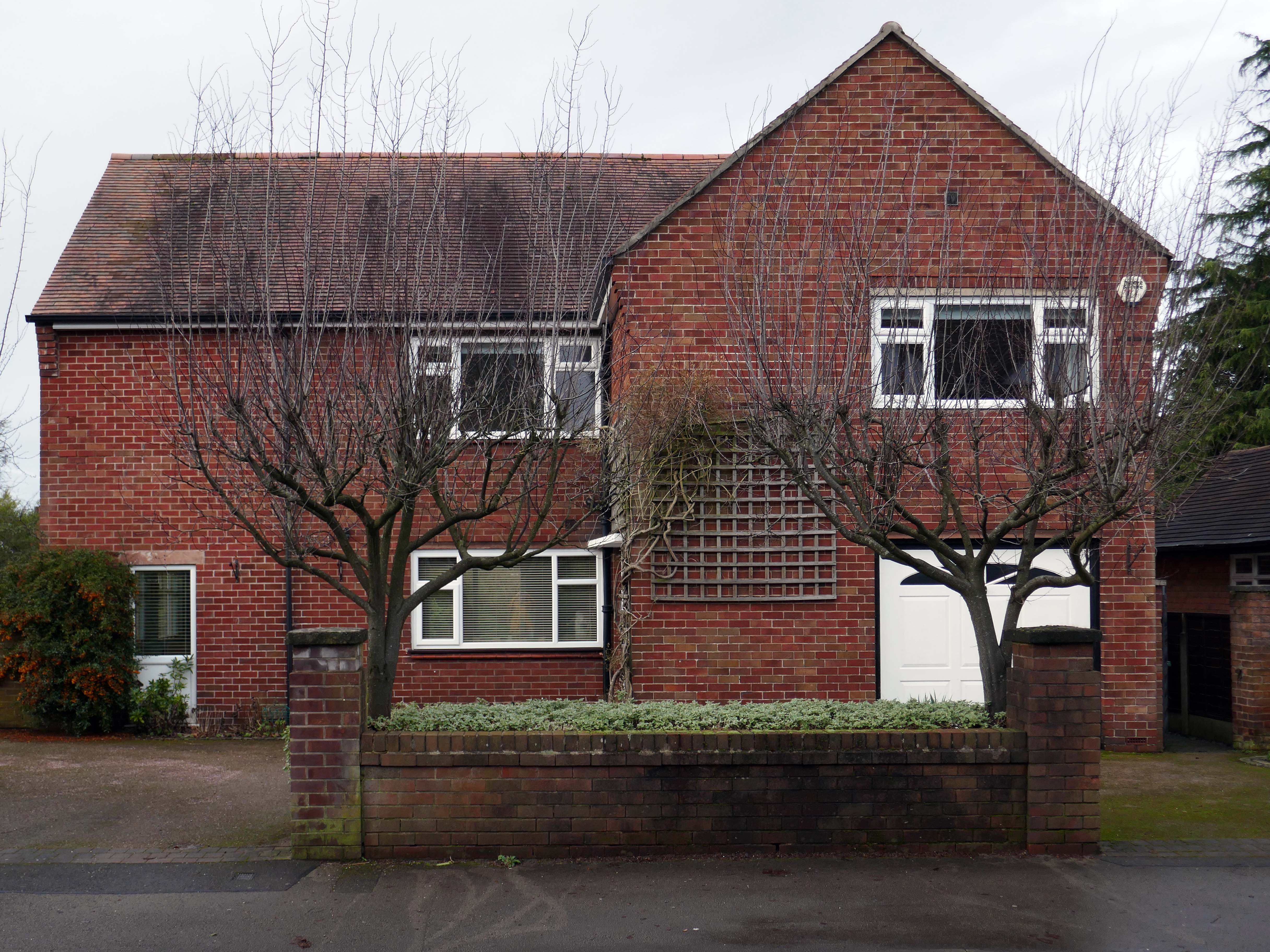
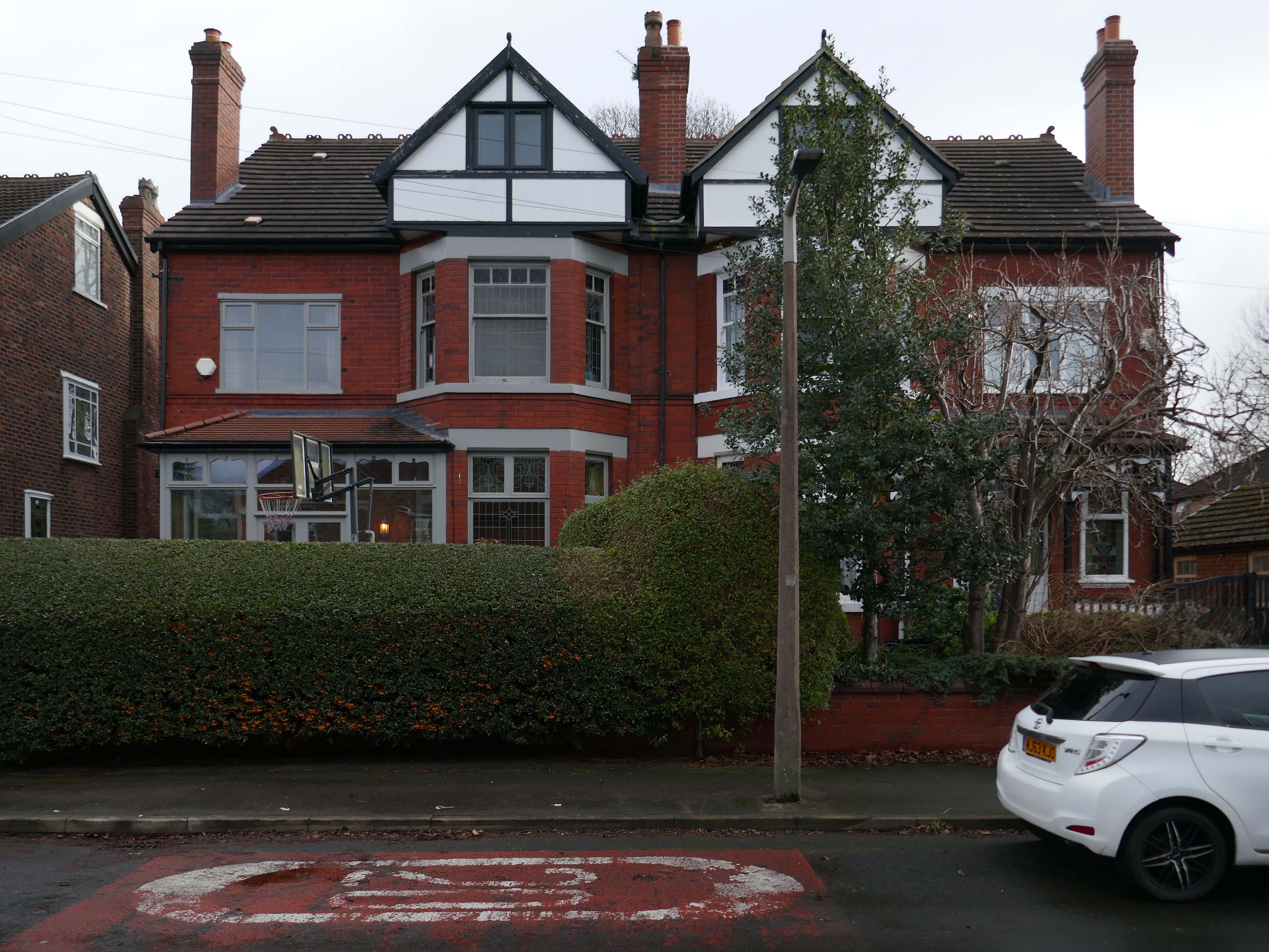
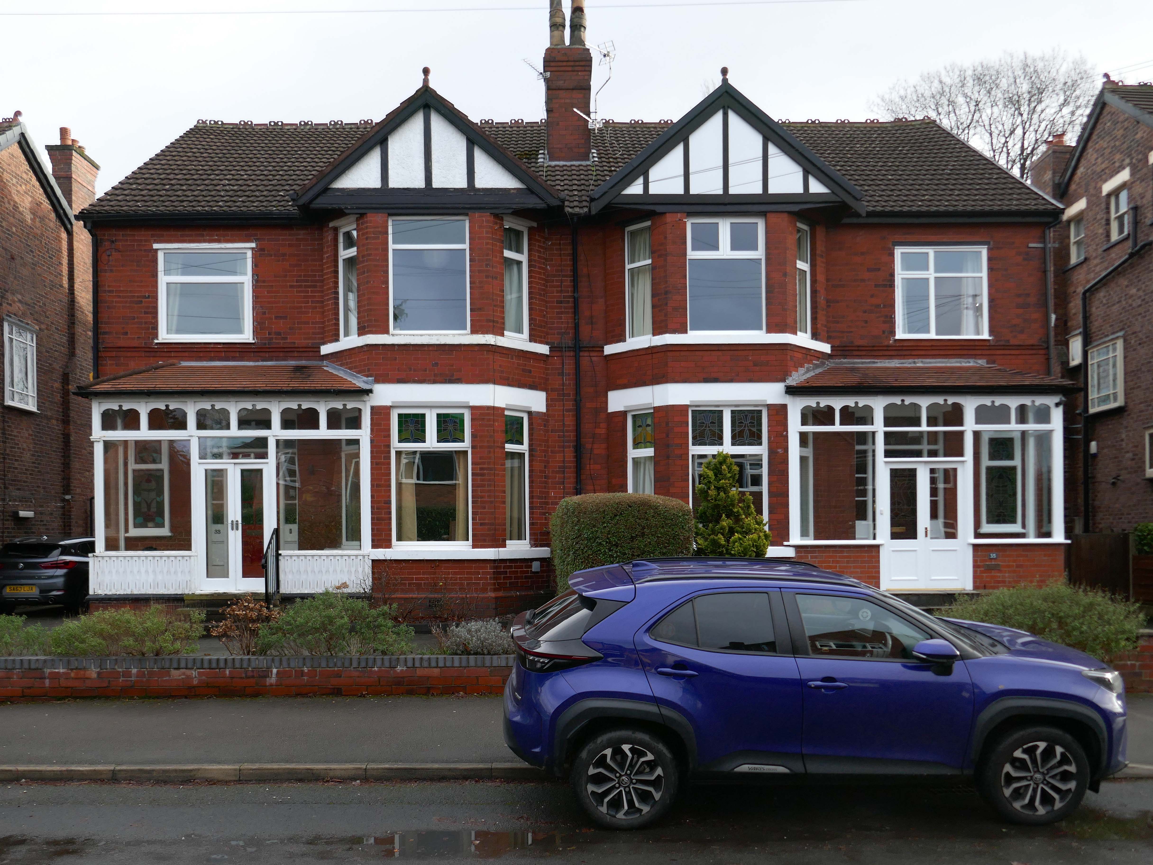
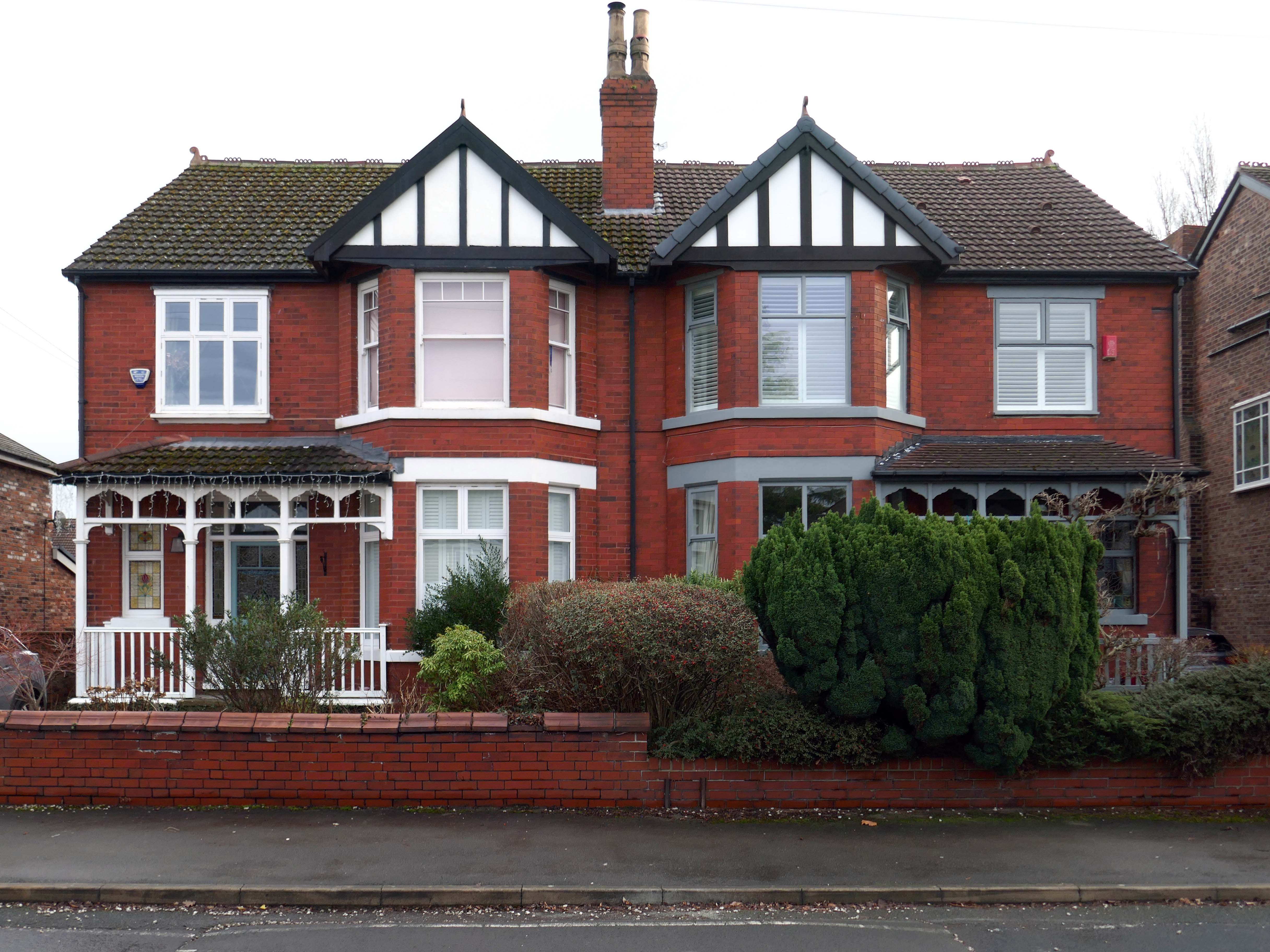
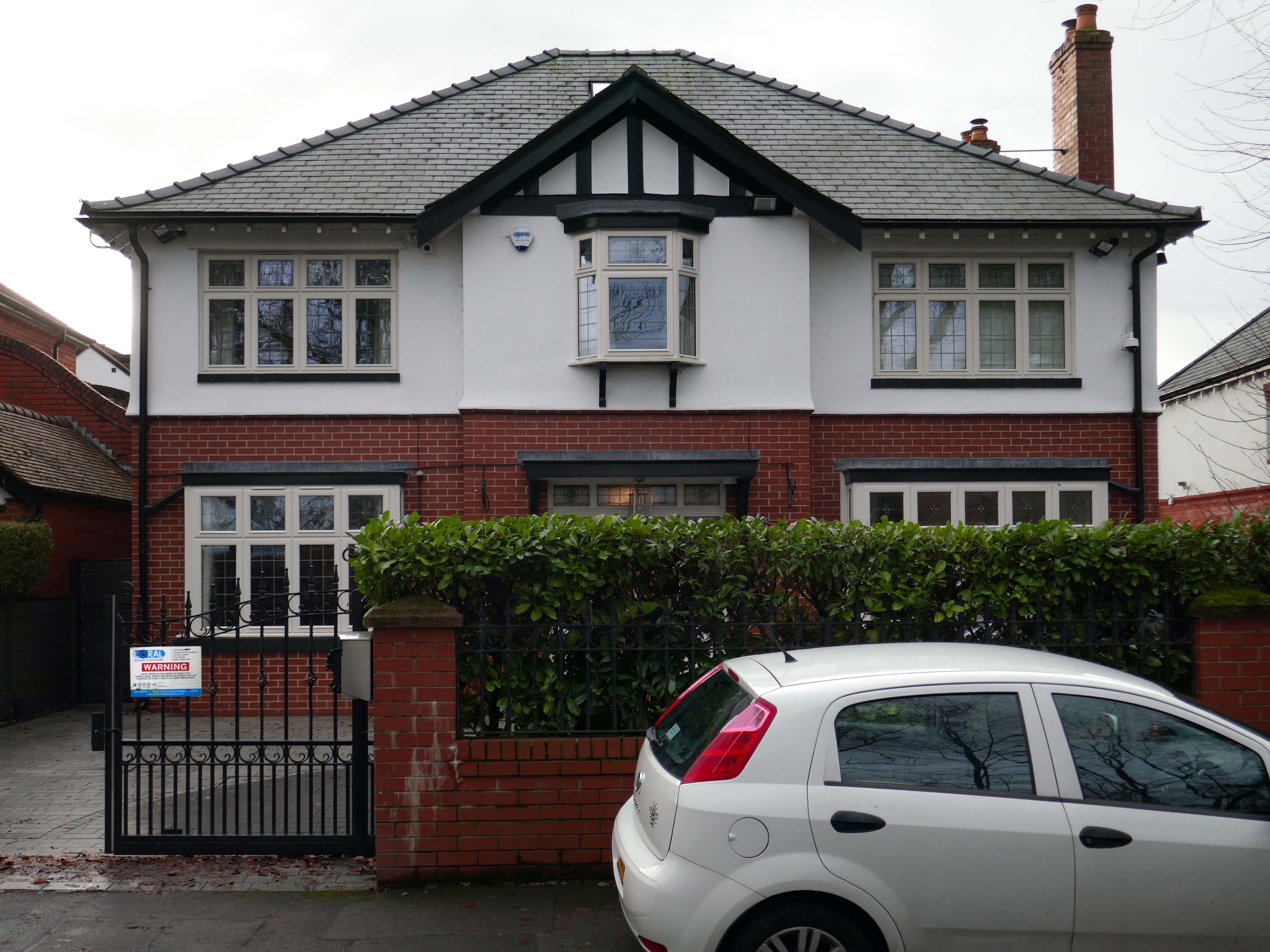
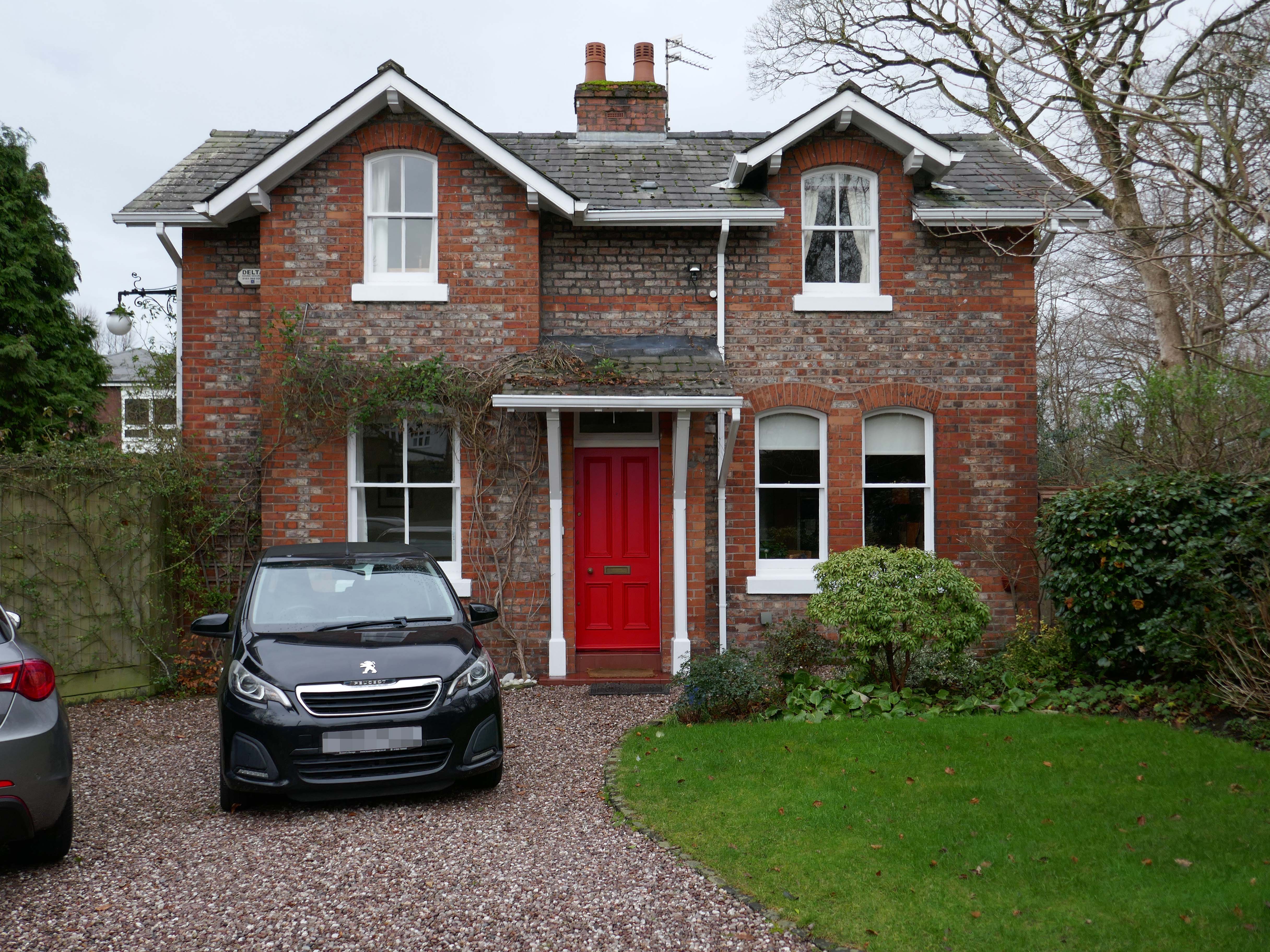
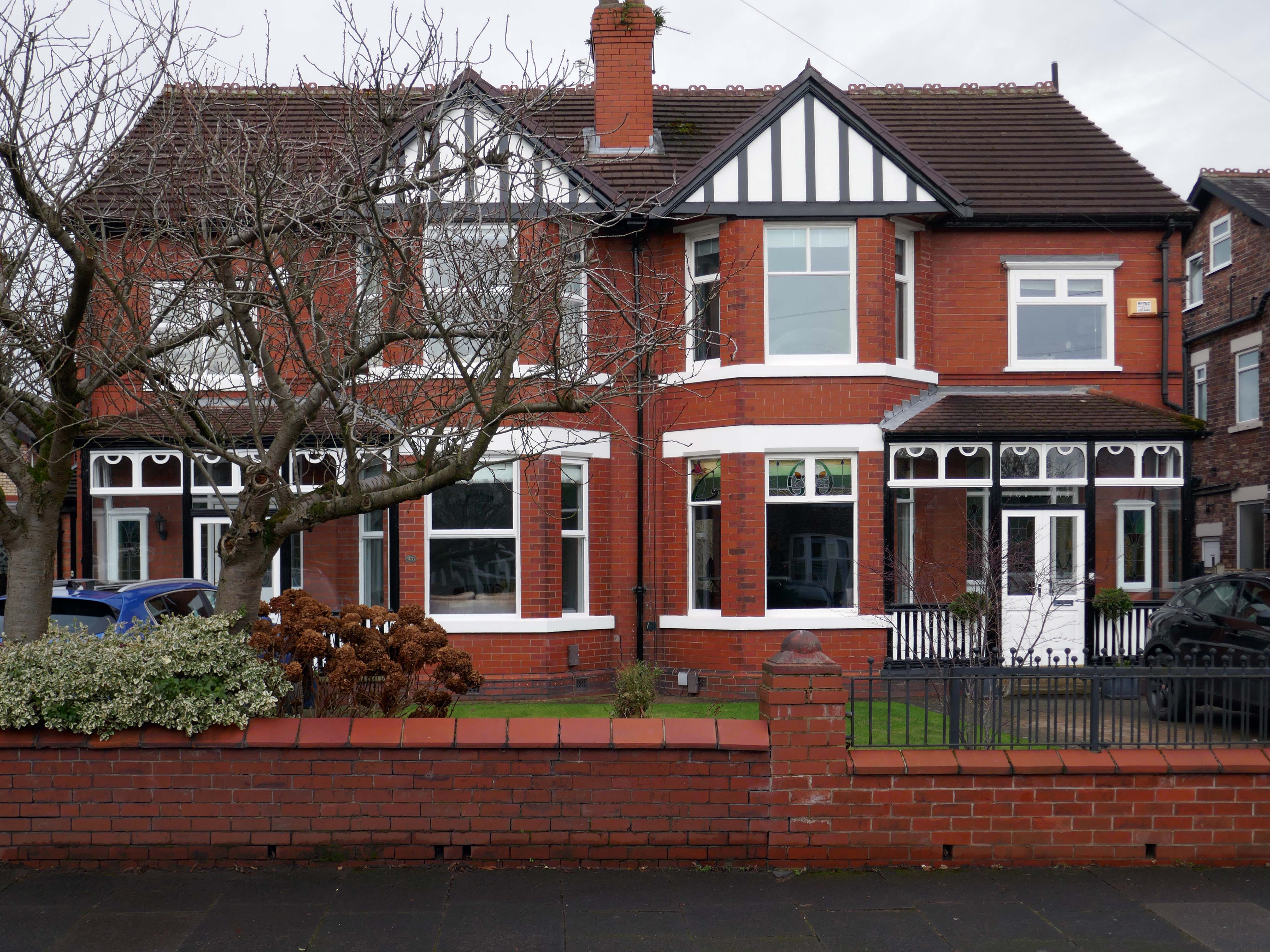
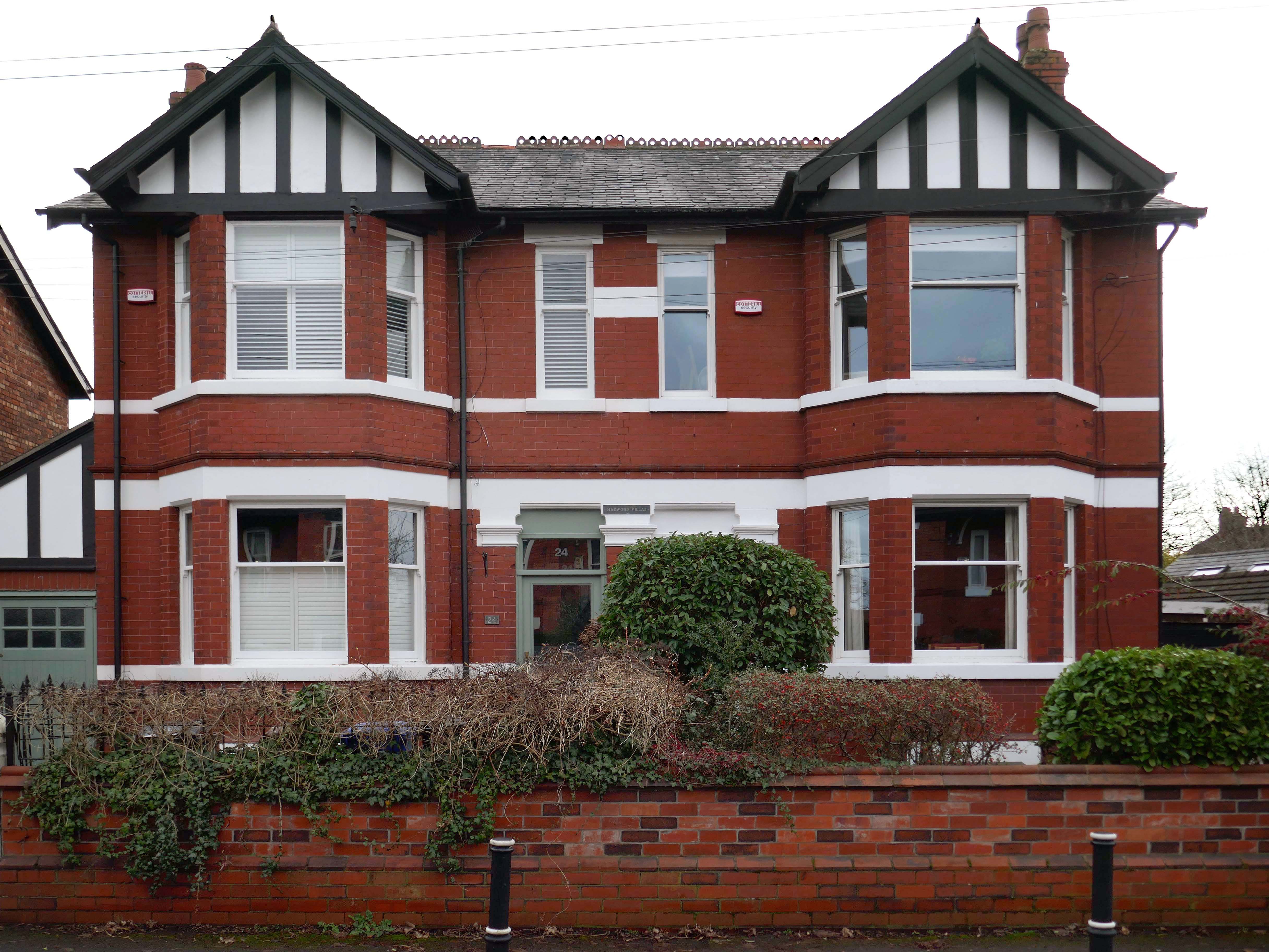
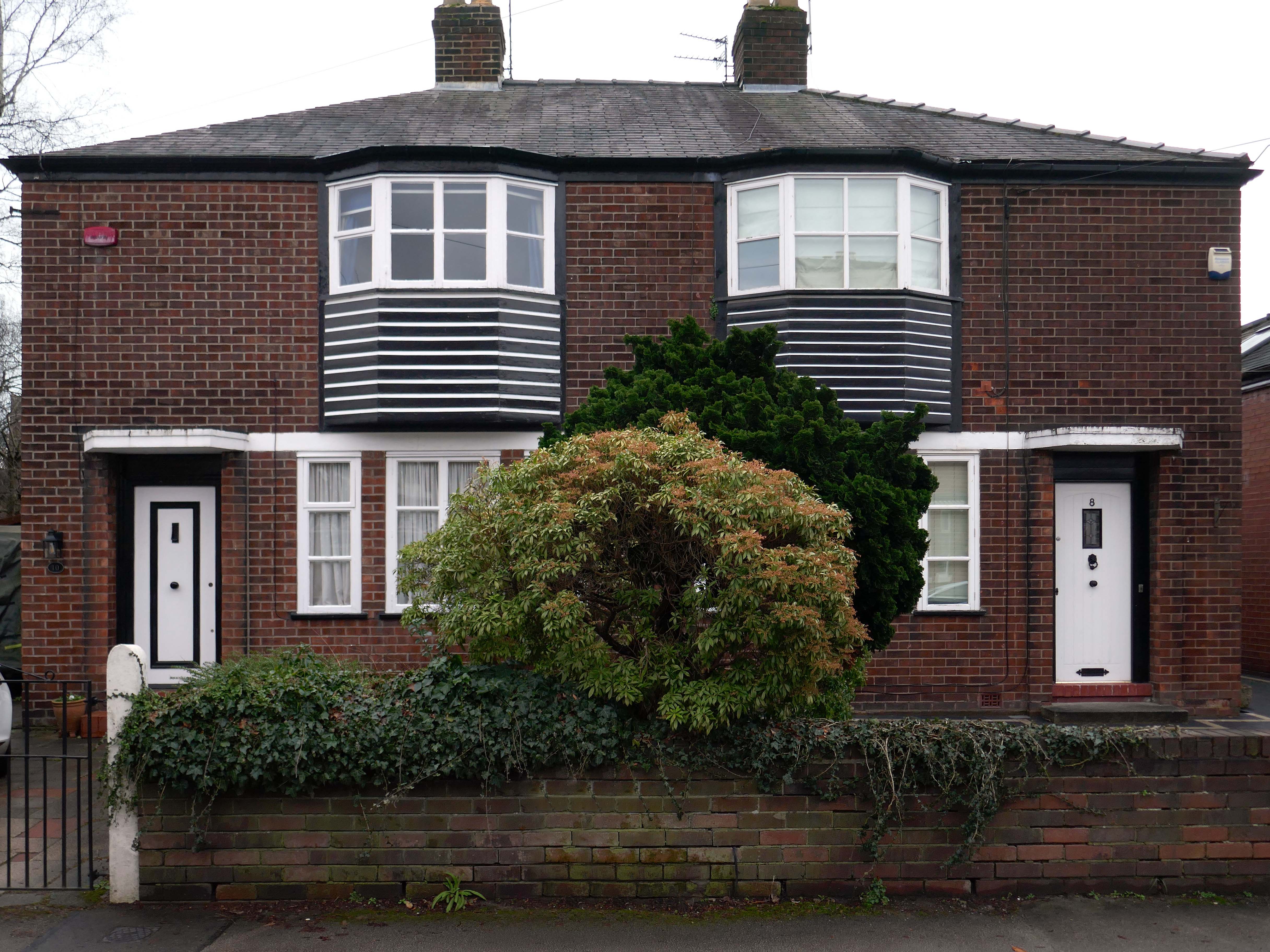
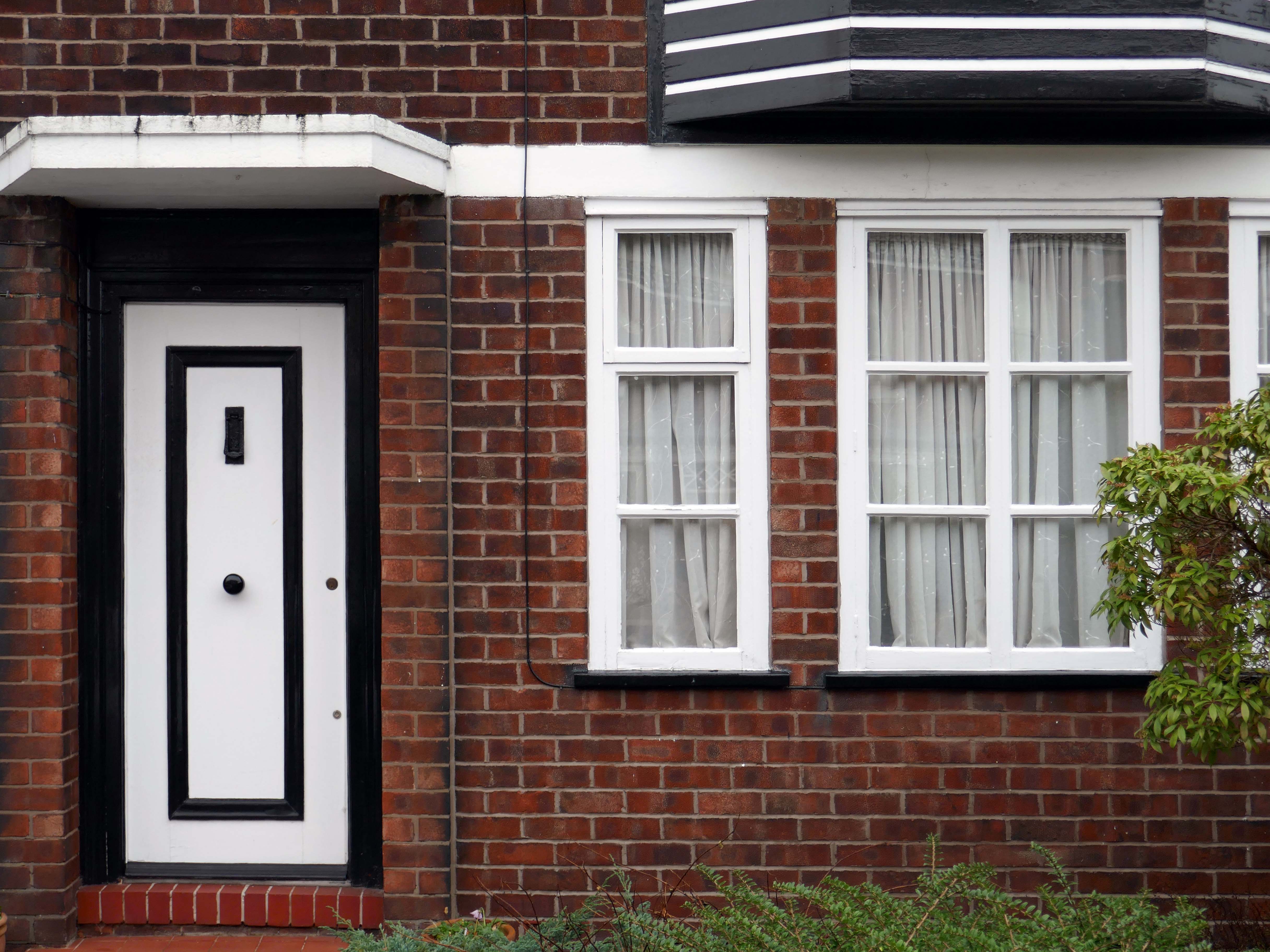
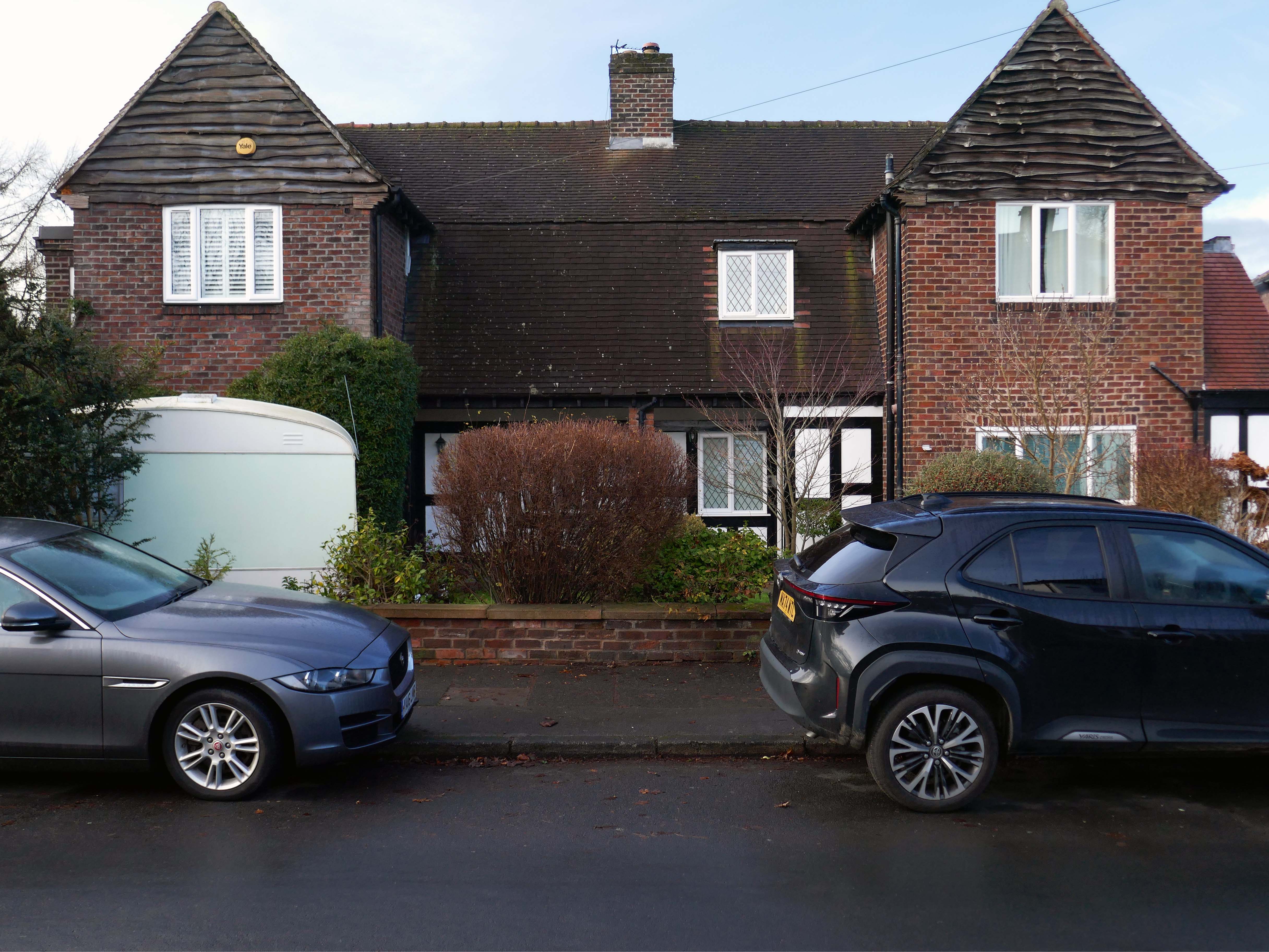
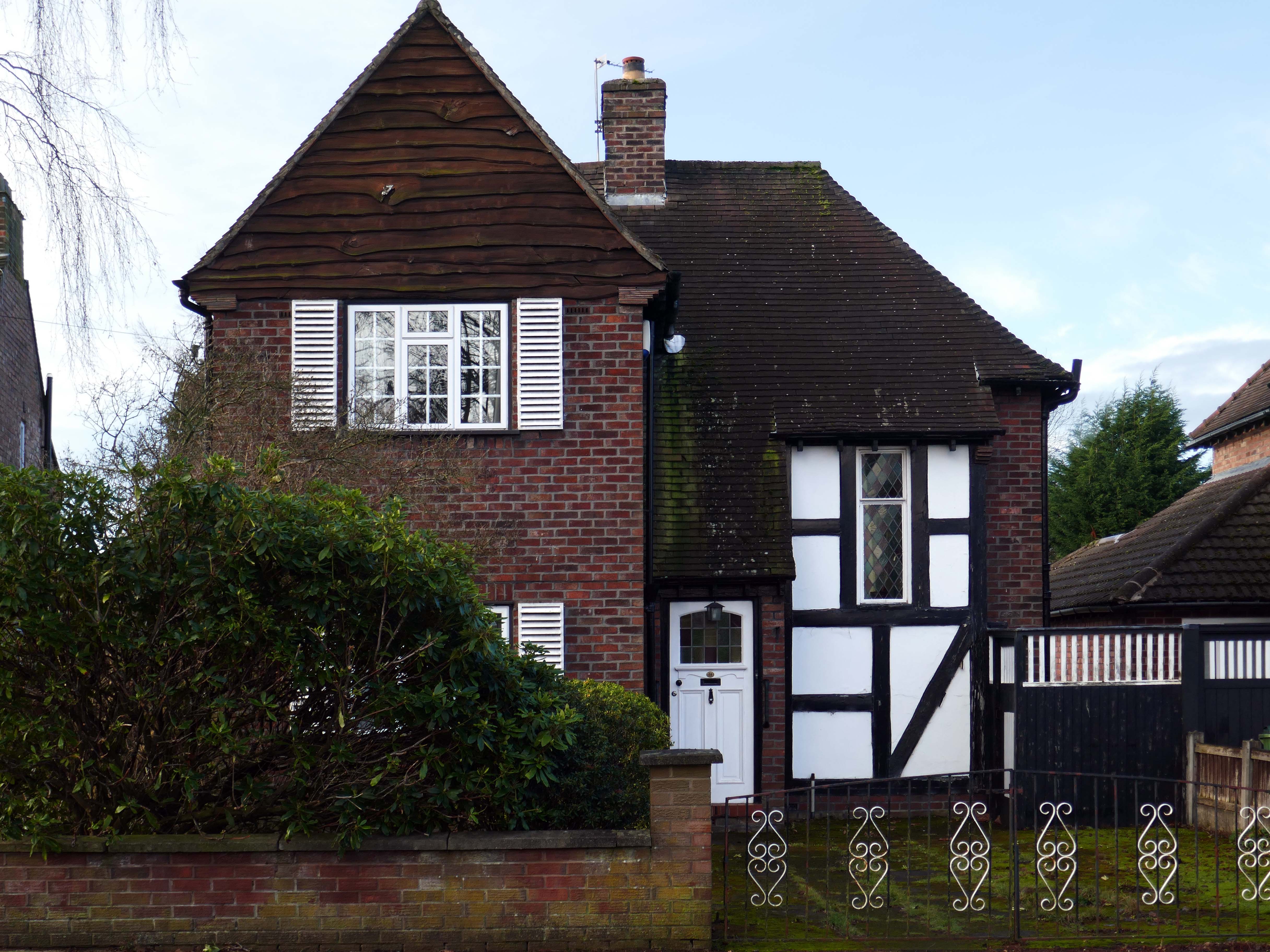
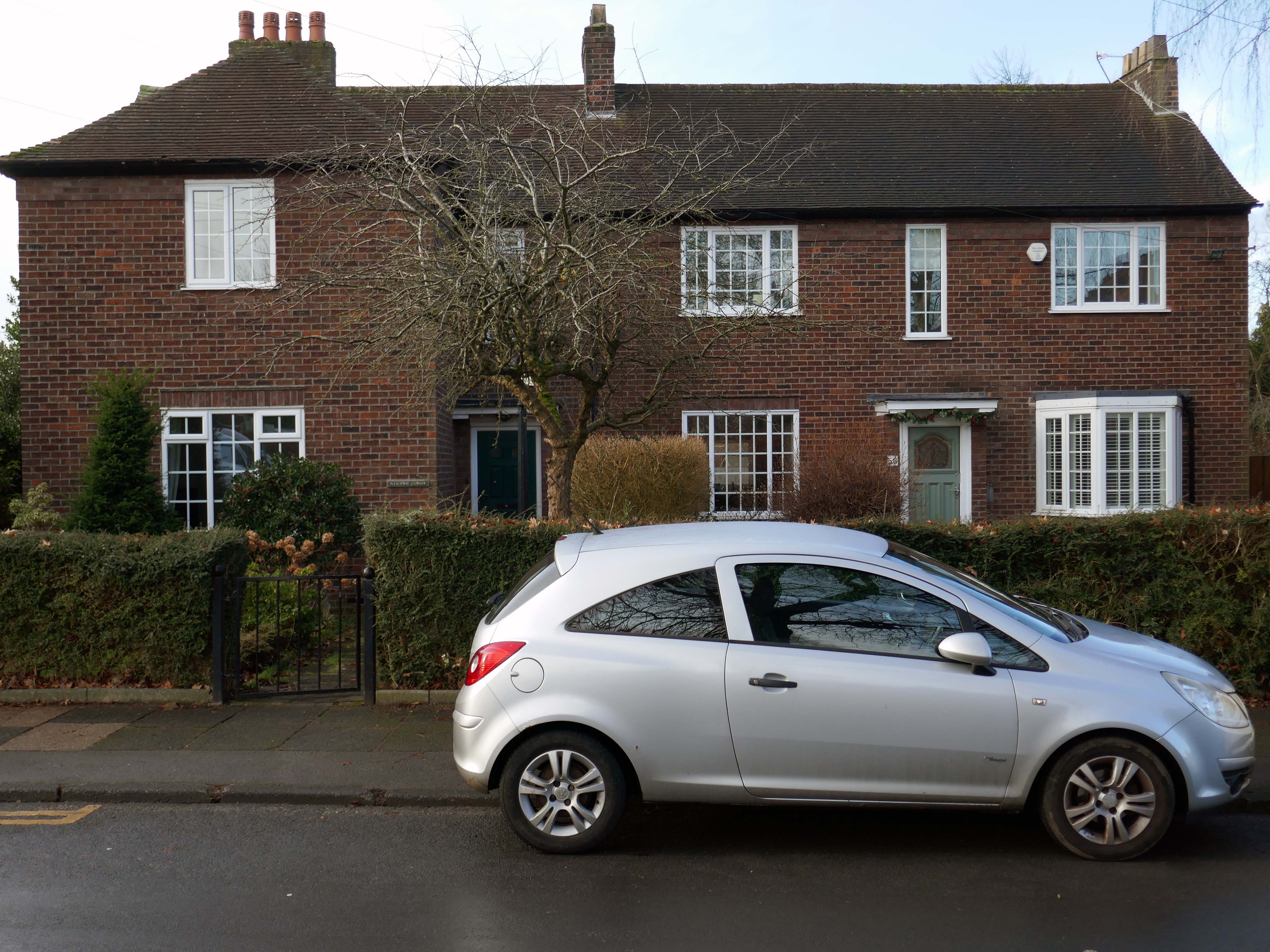
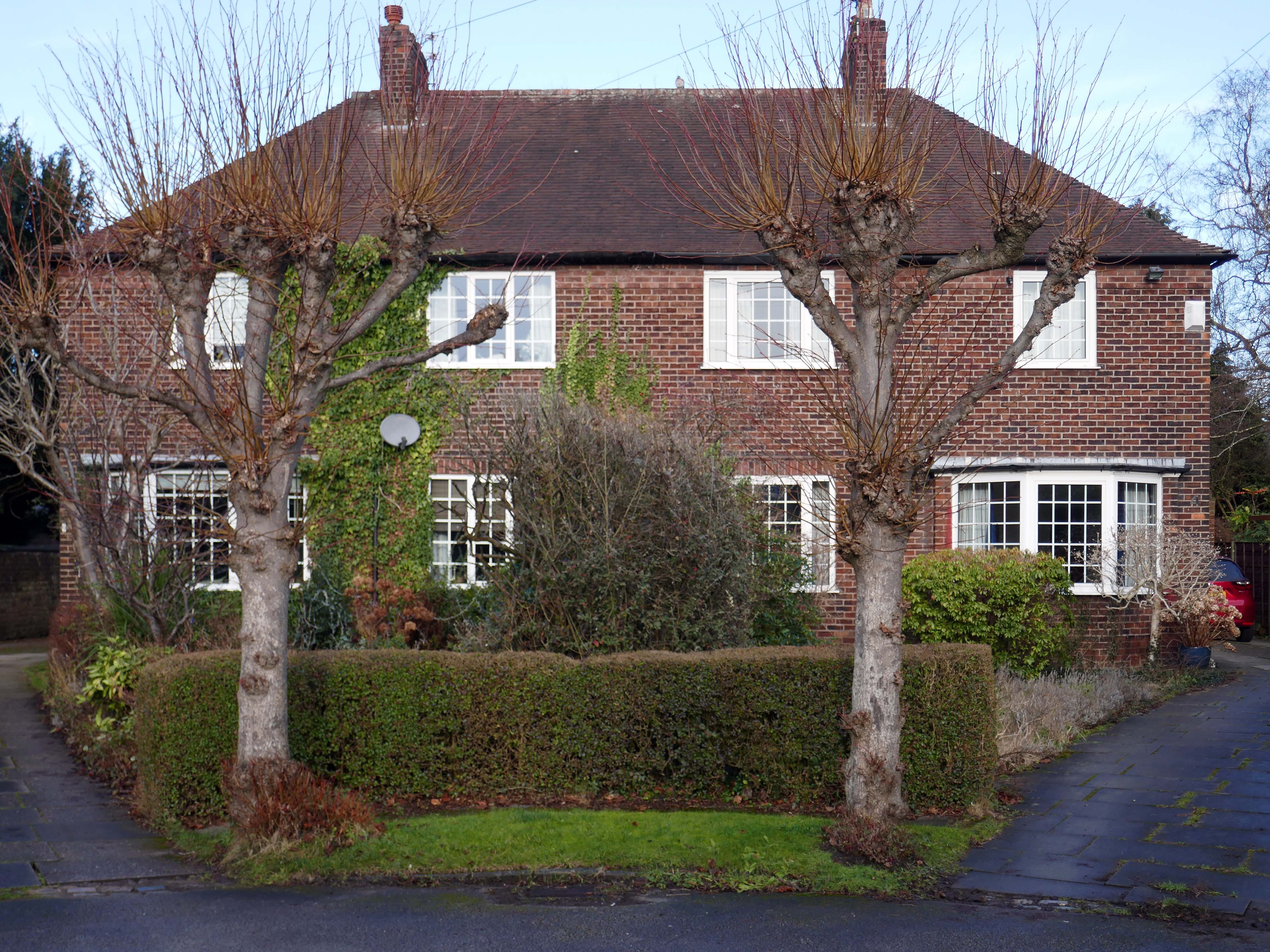
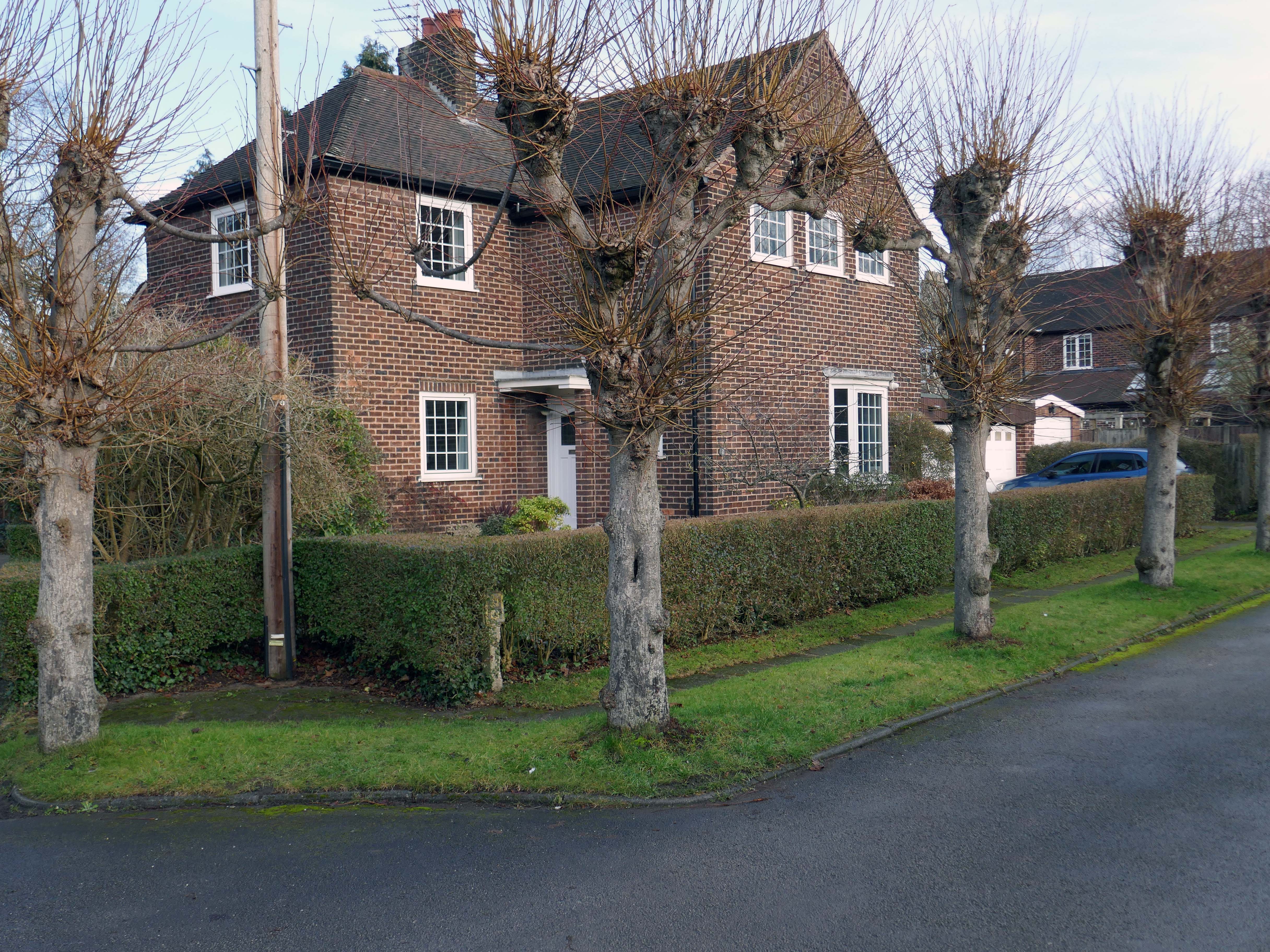
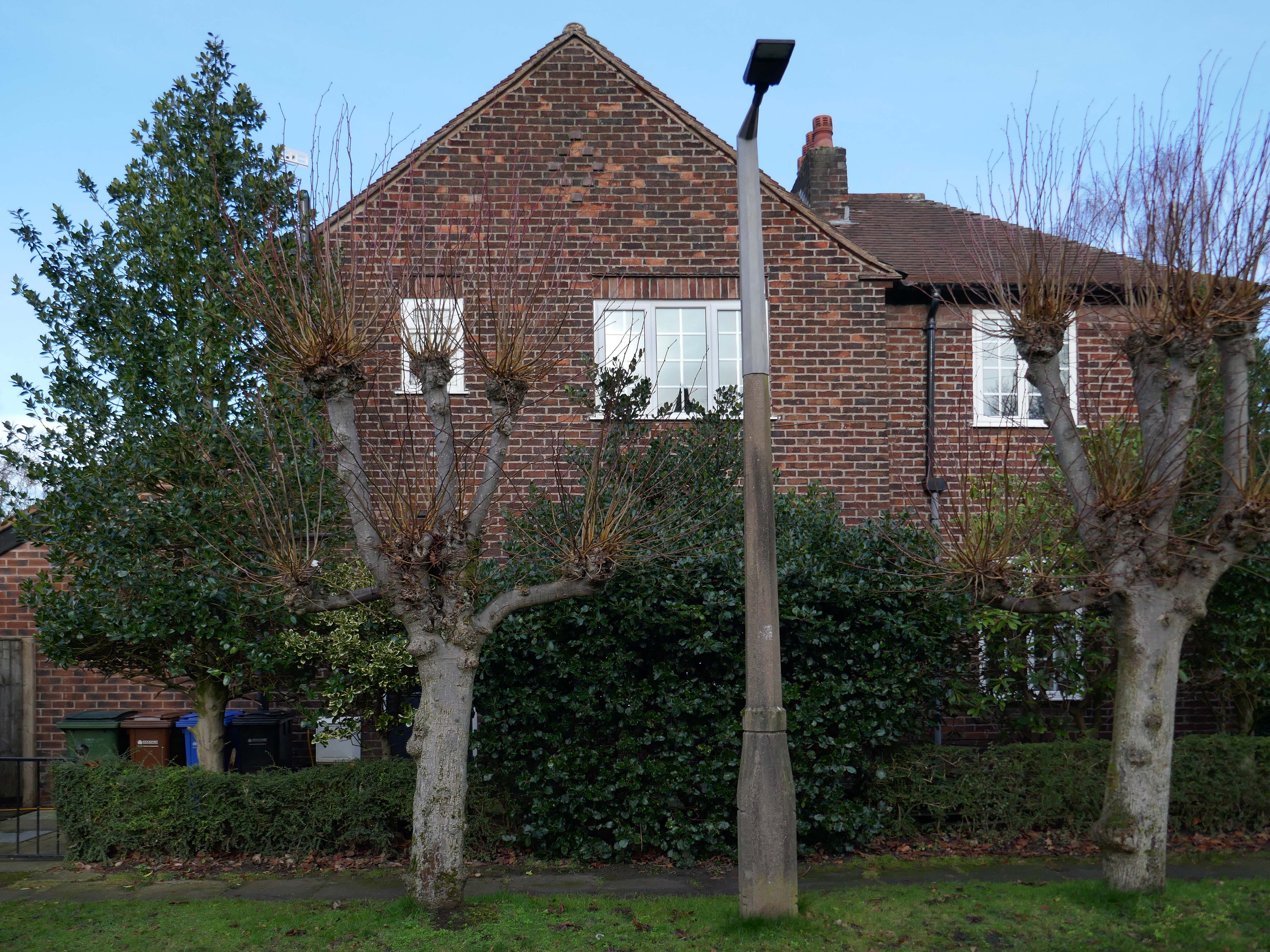
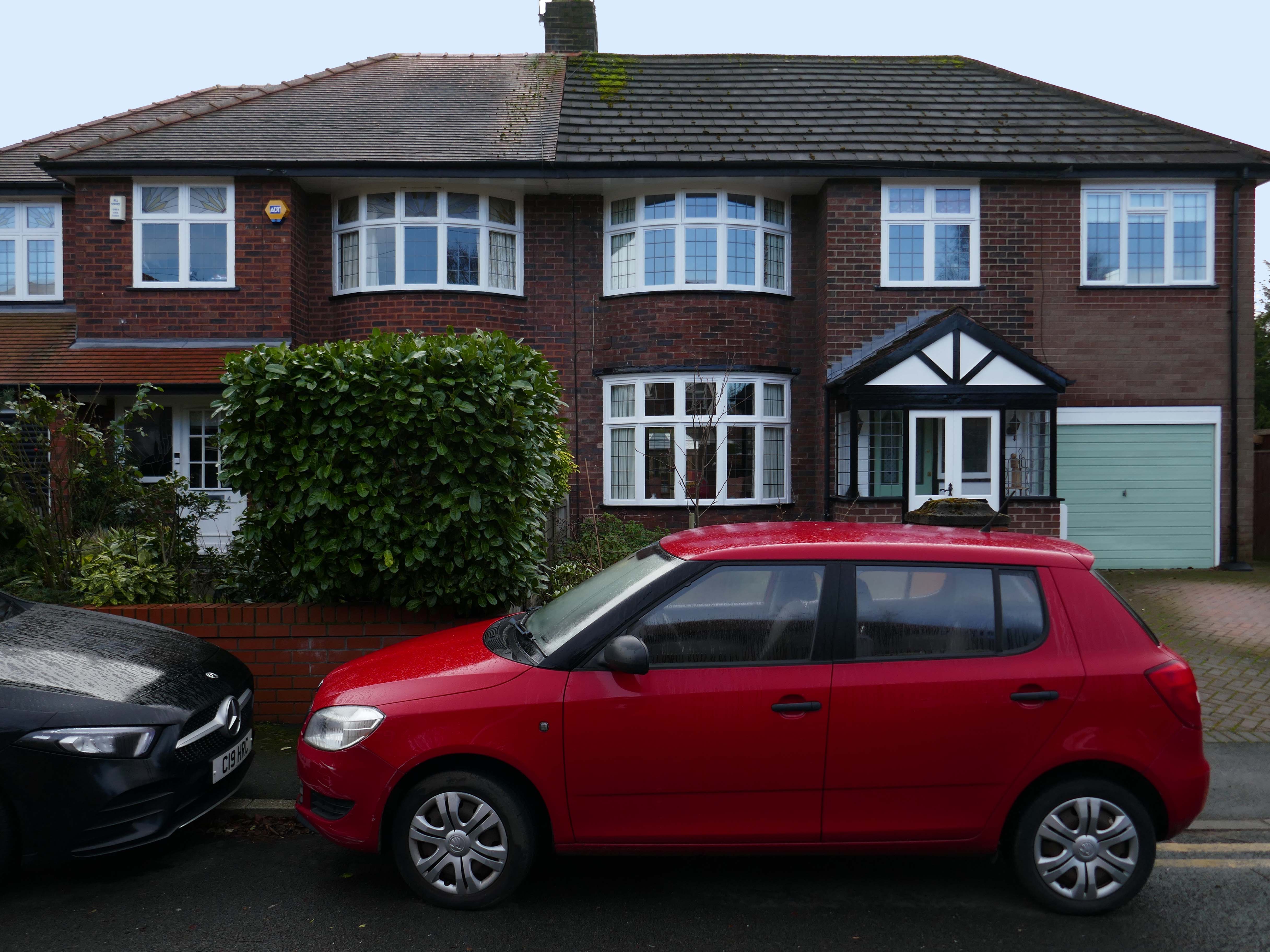
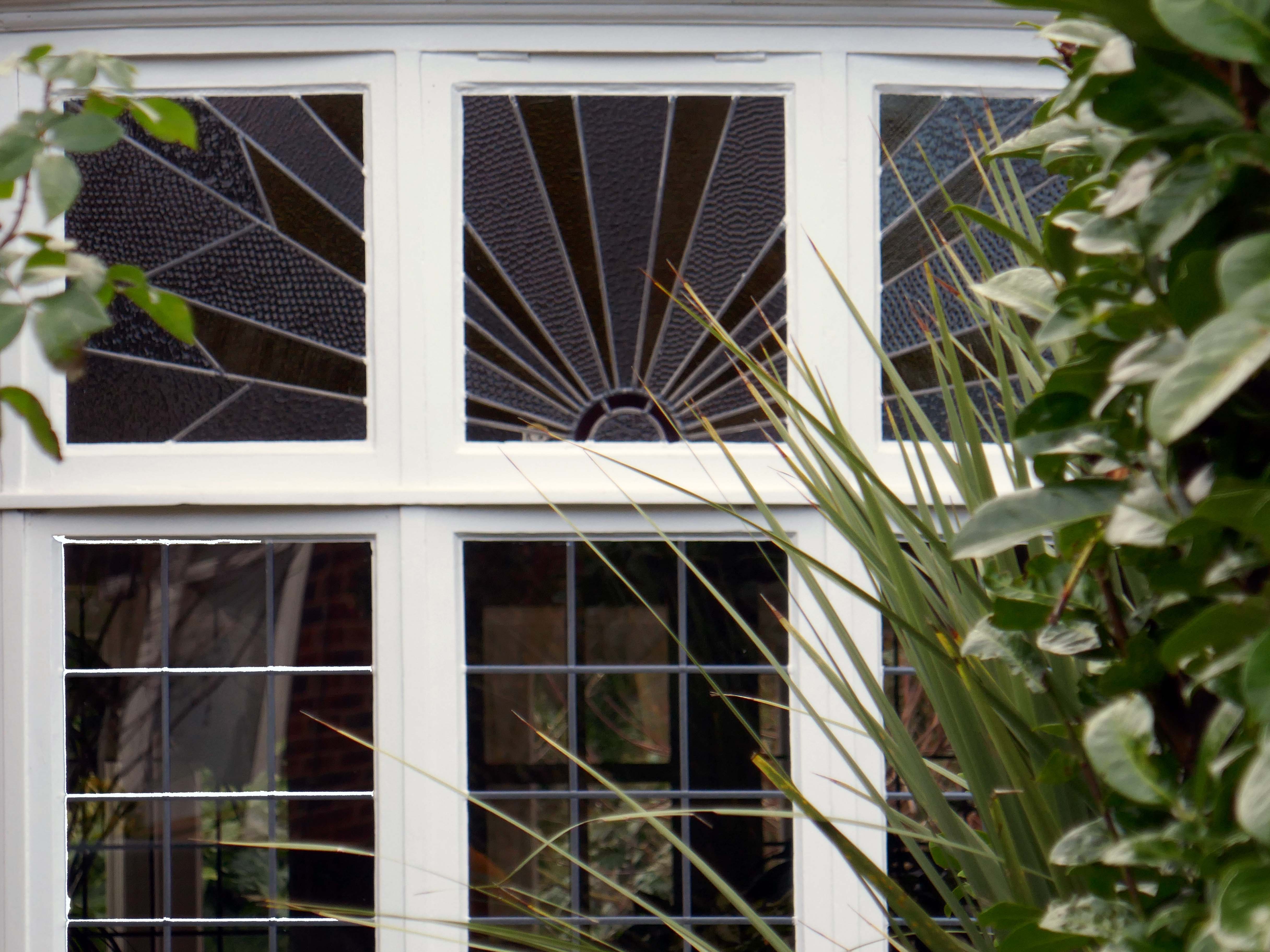
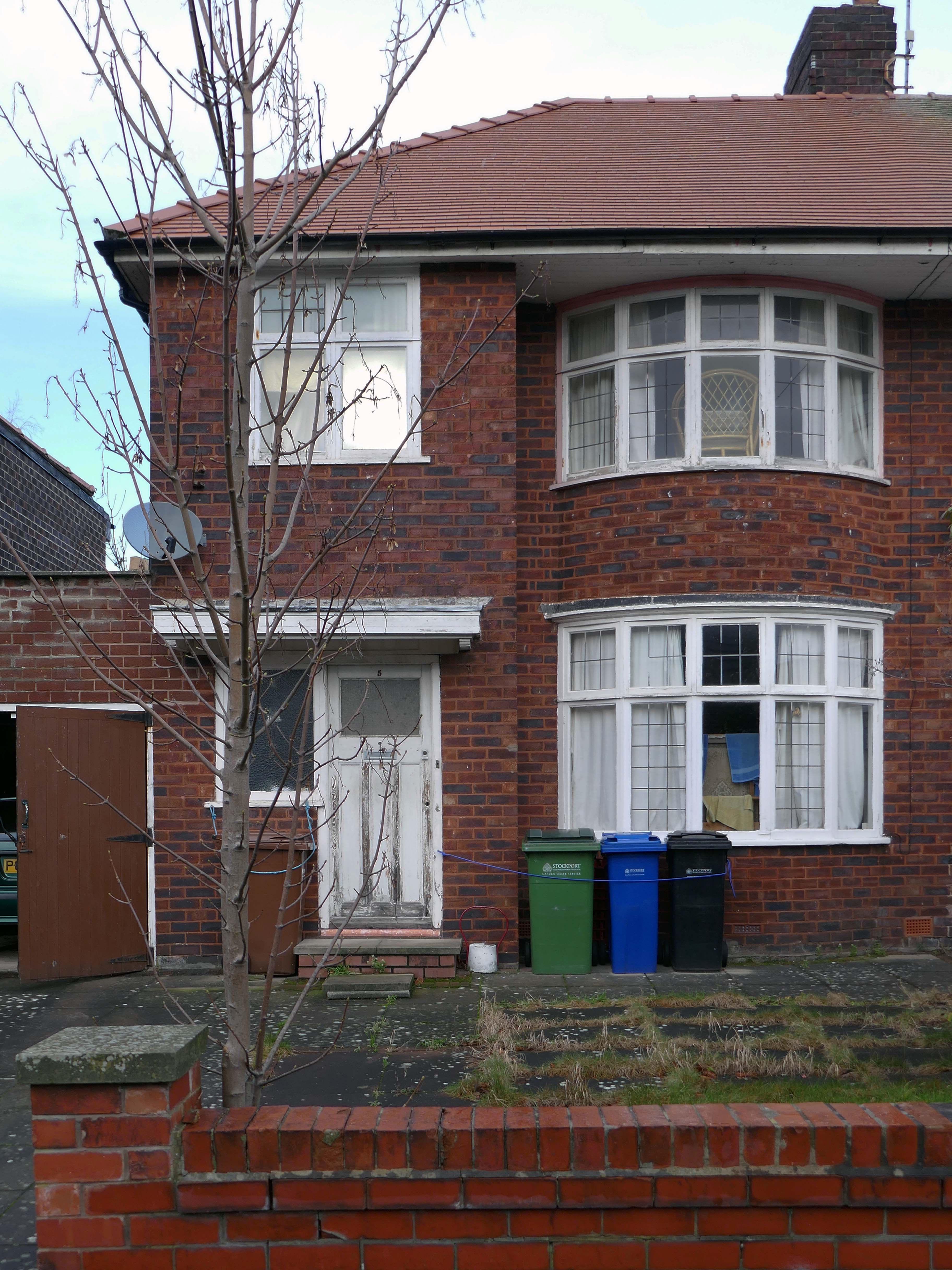
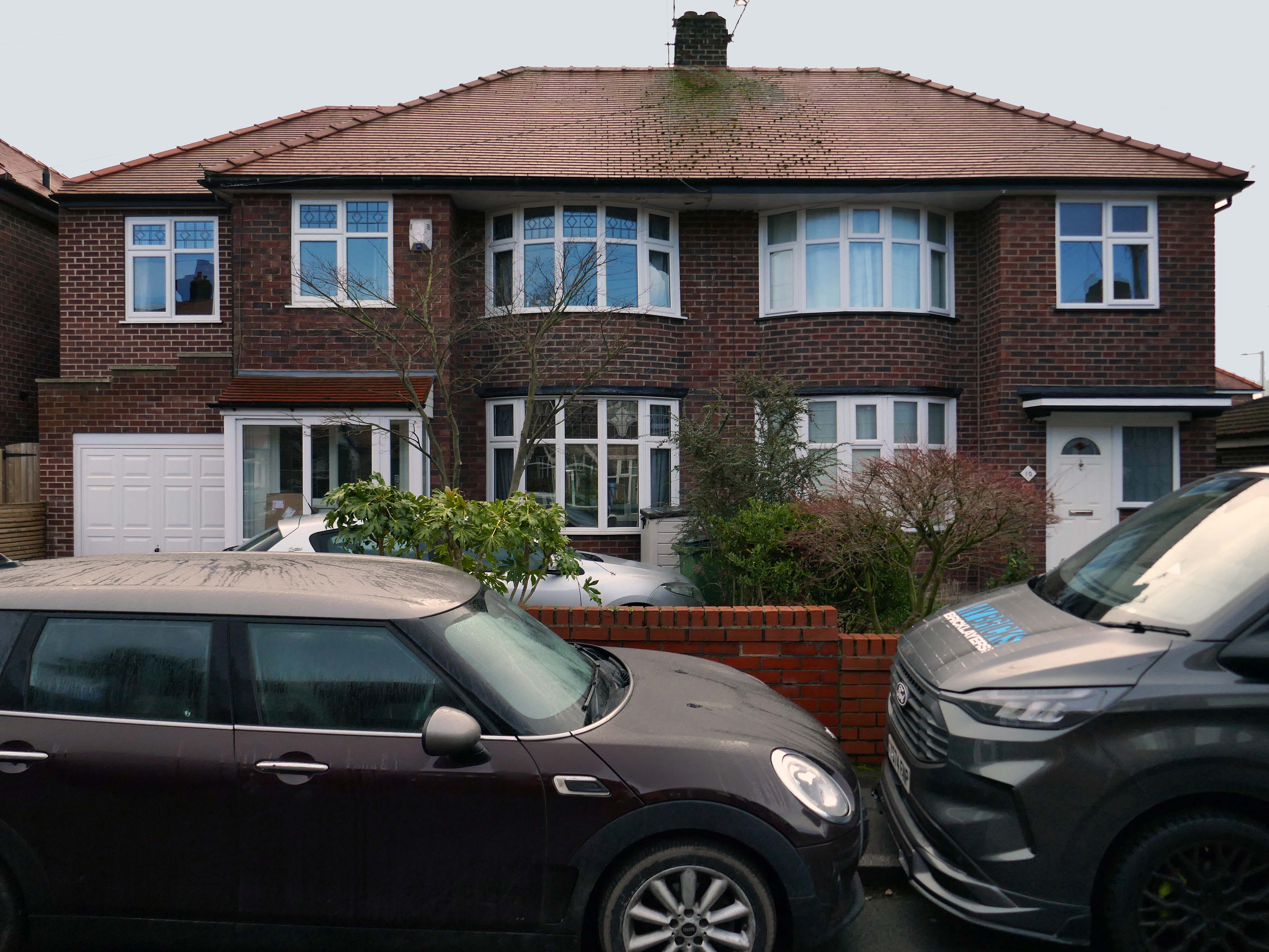
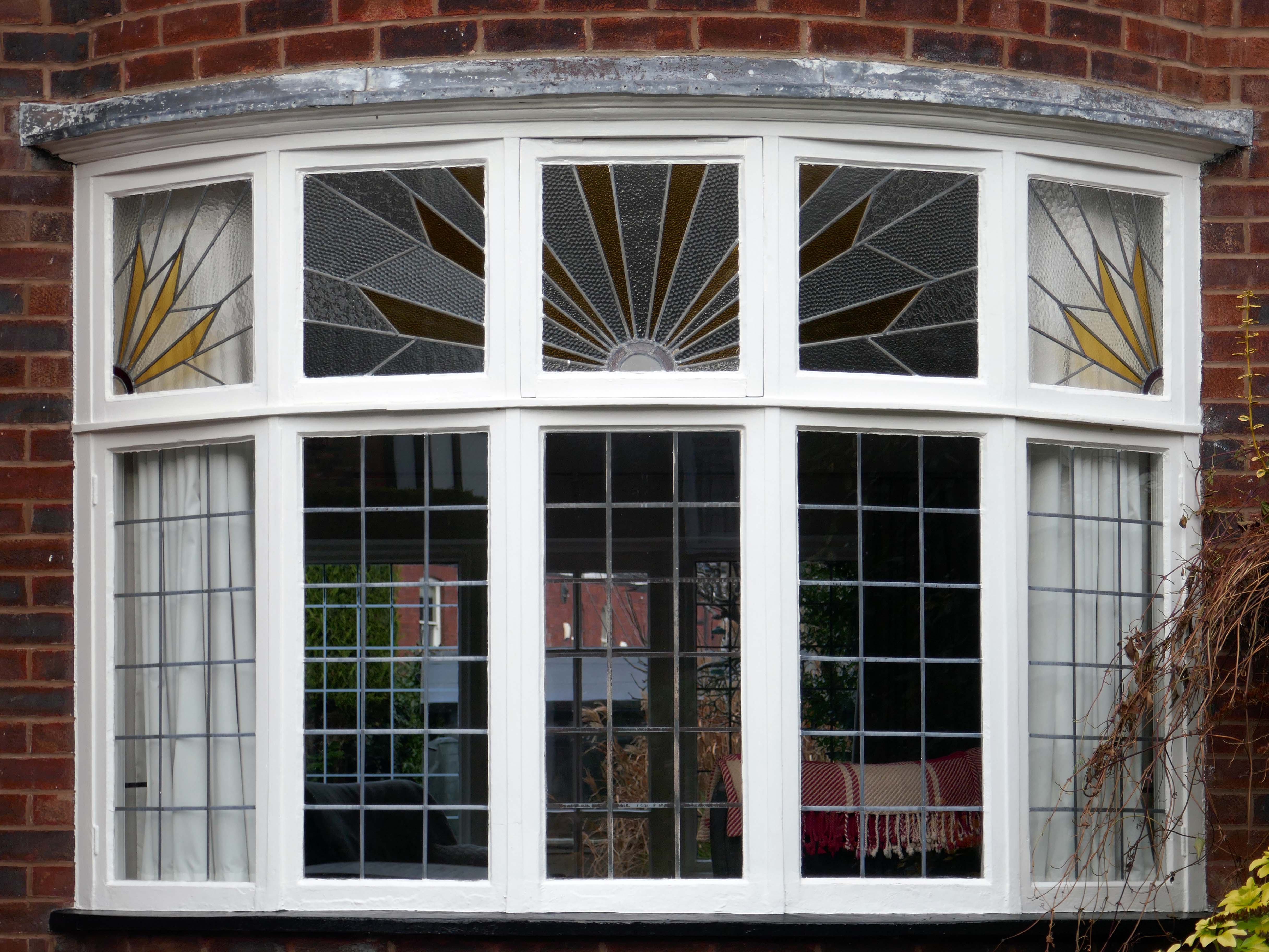
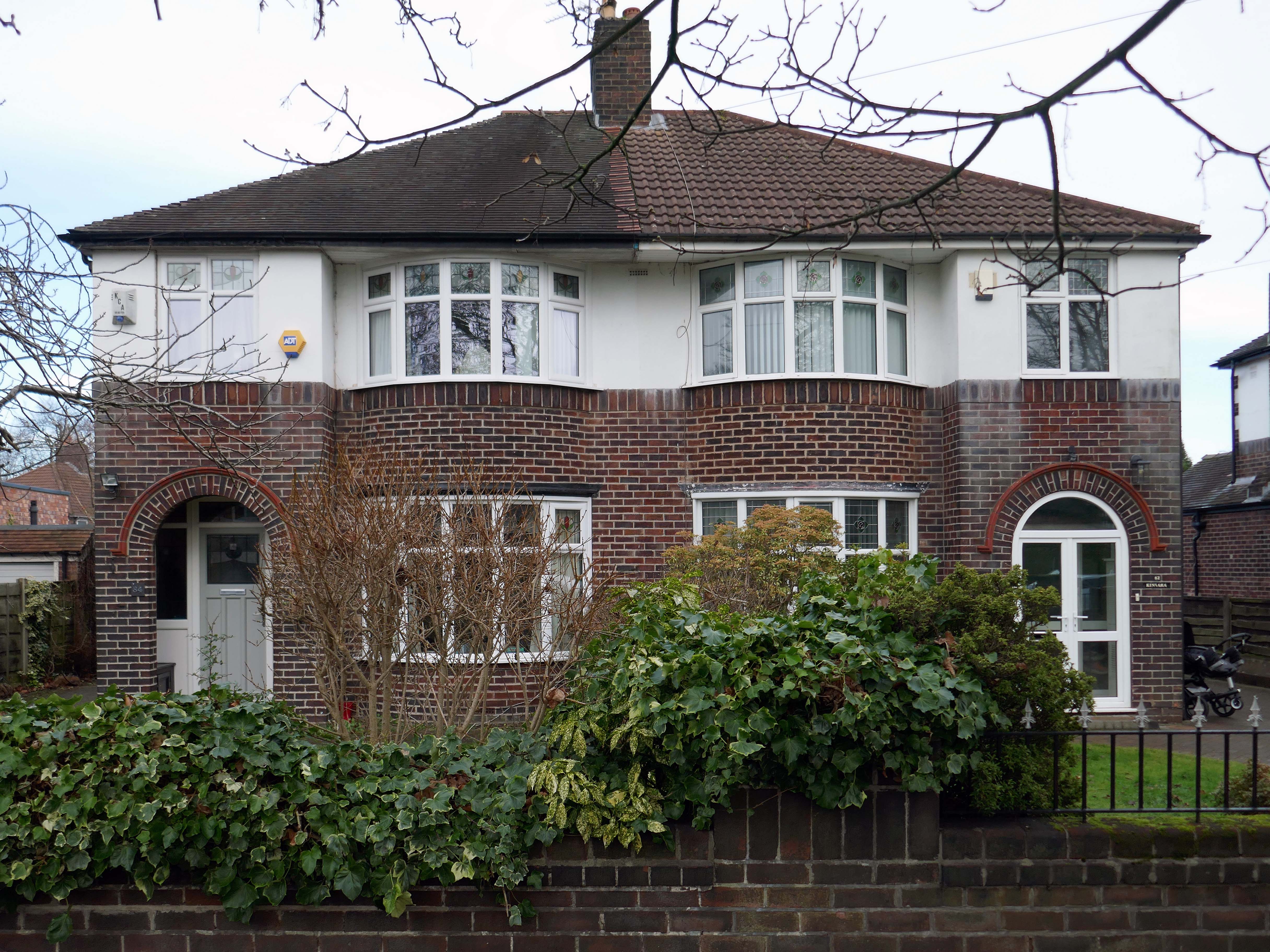
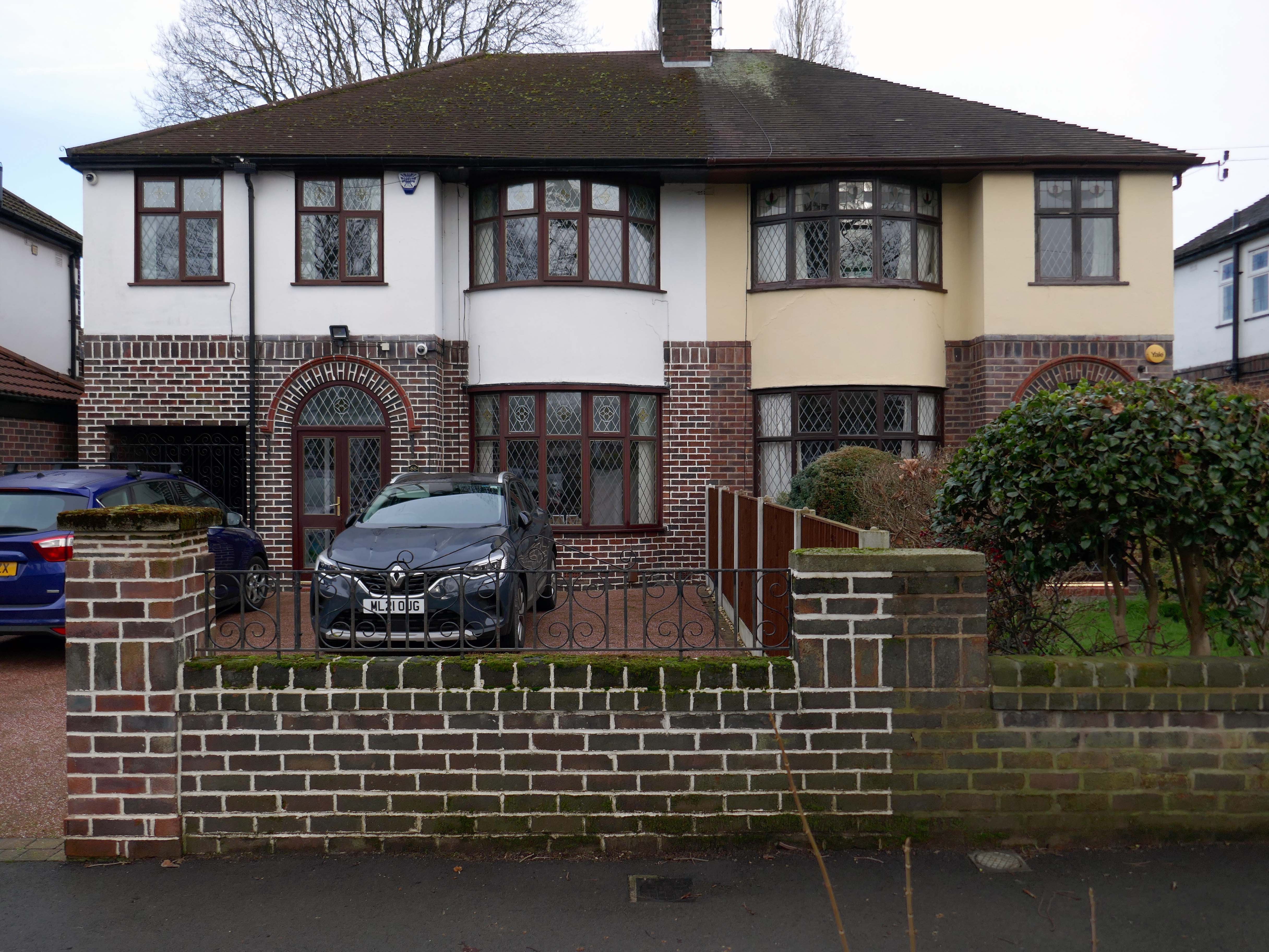
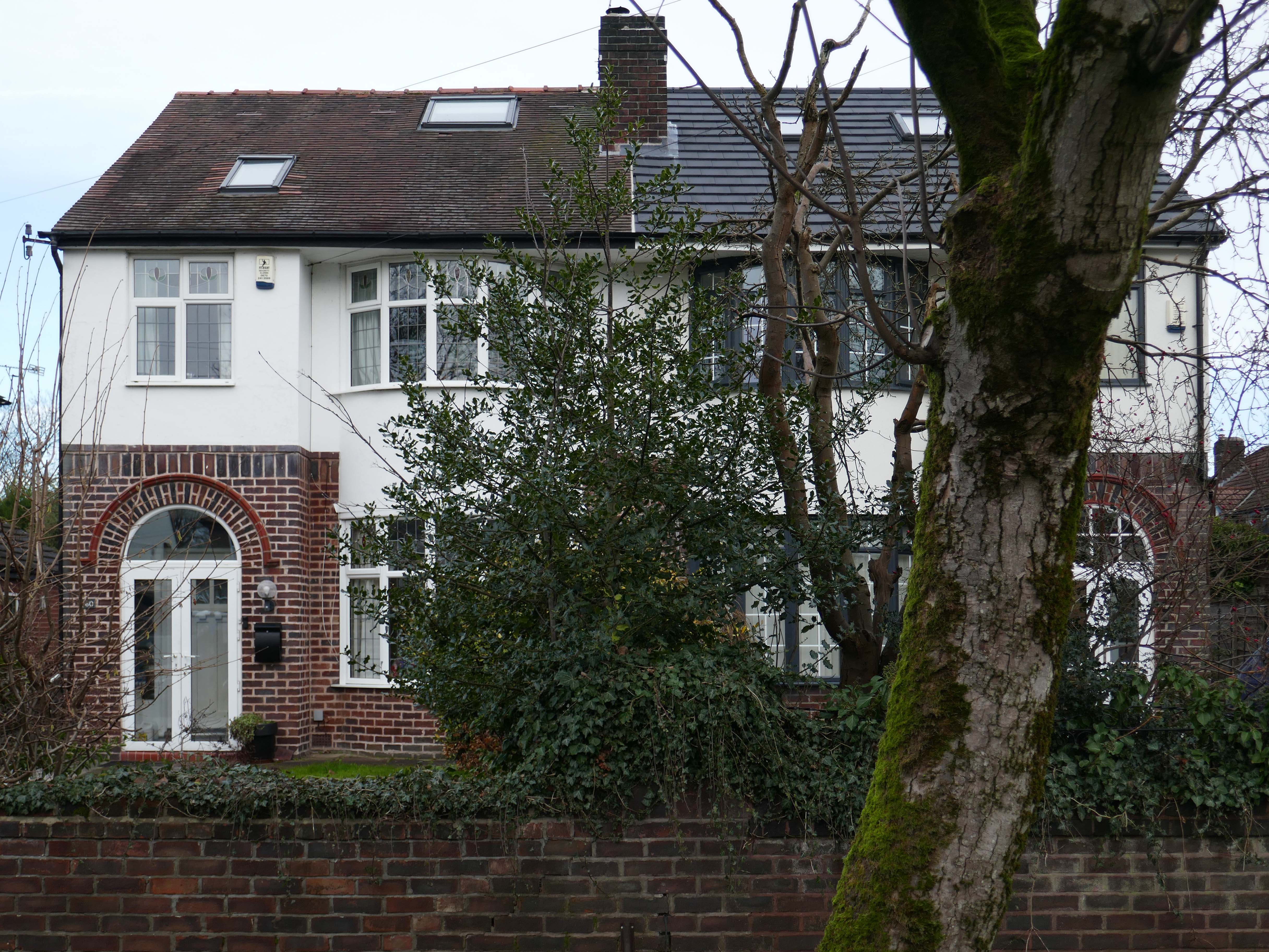
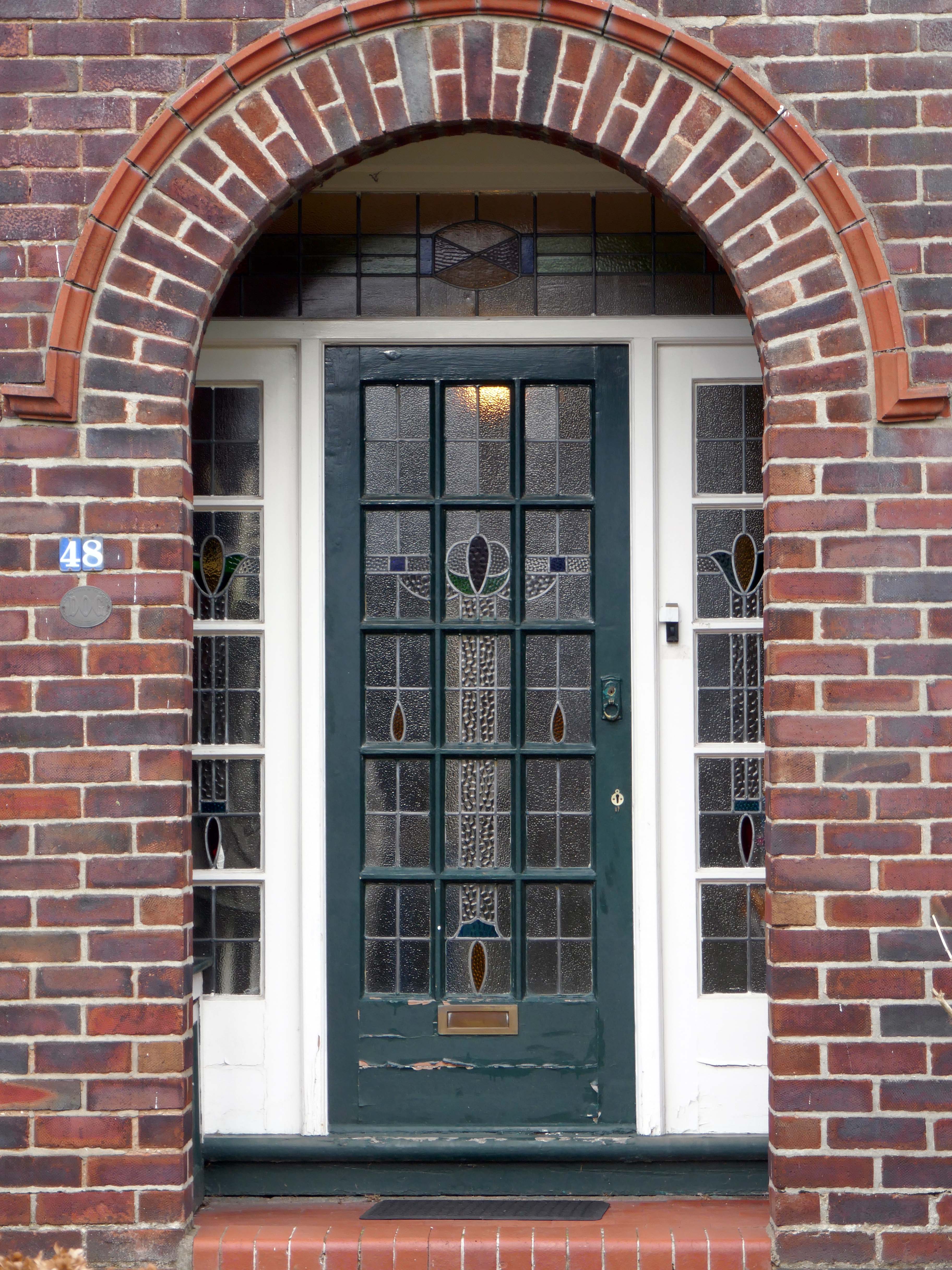
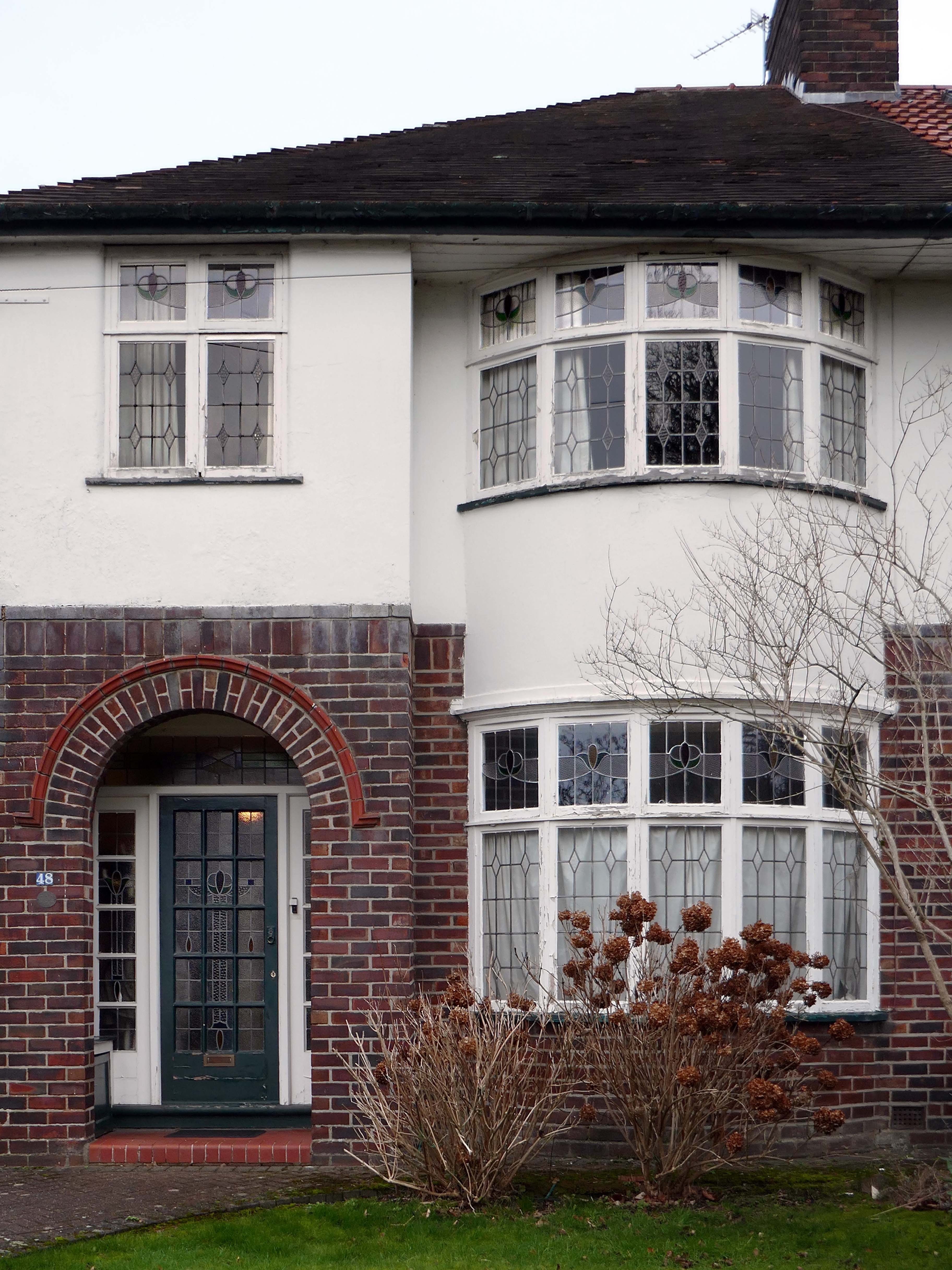
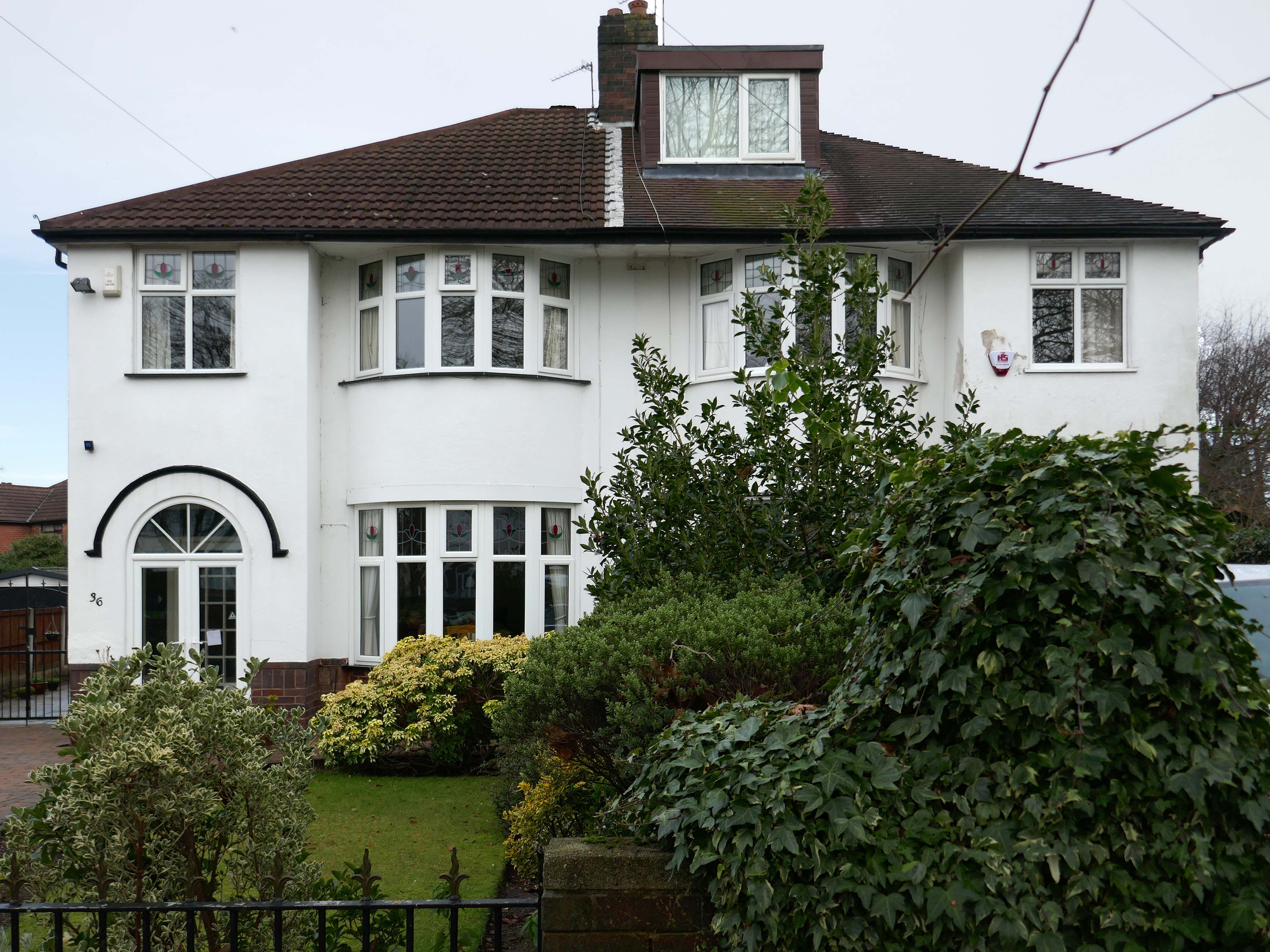
Within such a tight network of suburban streets, restrained Modernism sits alongside the traditional semi, the grand villa and humble abode. A smattering of stained glass and an original door here and there.
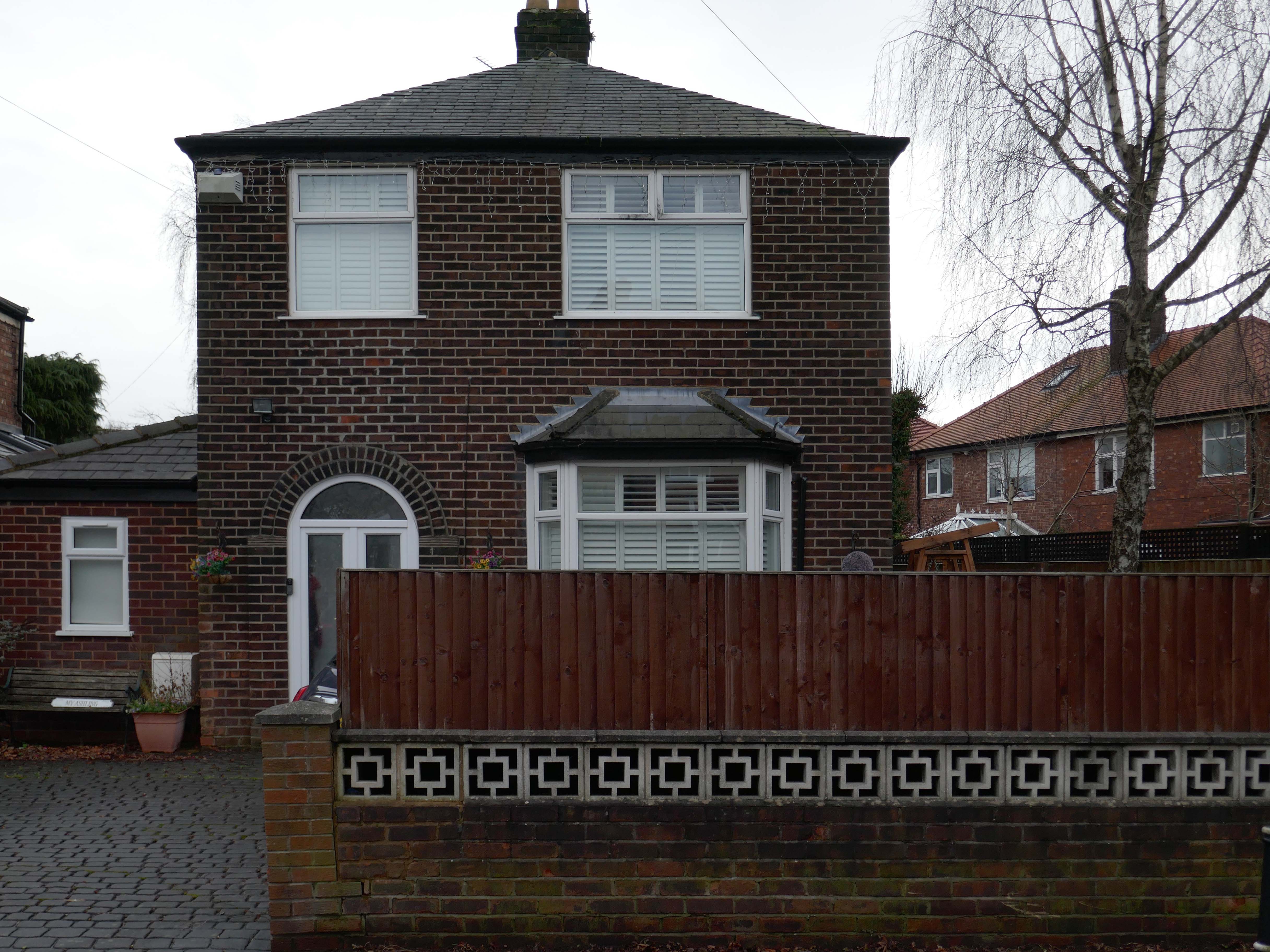
One example of a curved Crittall bay, sitting next door to a distant uPVC cousin.
Hesitant examples of Arts and Crafts and hints of Tudorbethan, subtle shades of sub Lutyens, the odd Art Deco detail.
We never keep to the present. We recall the past; we anticipate the future as if we found it too slow in coming and were trying to hurry it up, or we recall the past as if to stay its too rapid flight. We are so unwise that we wander about in times that do not belong to us, and do not think of the only one that does; so vain that we dream of times that are not and blindly flee the only one that is. The fact is that the present usually hurts. We thrust it out of sight because it distresses us, and if we find it enjoyable, we are sorry to see it slip away. We try to give it the support of the future, and think how we are going to arrange things over which we have no control for a time we can never be sure of reaching.
Blaise Pascal
Let each of us examine his thoughts; he will find them wholly concerned with the past or the future. We almost never think of the present, and if we do think of it, it is only to see what light it throws on our plans for the future. The present is never our end. The past and the present are our means, the future alone our end. Thus we never actually live, but hope to live, and since we are always planning how to be happy, it is inevitable that we should never be so.
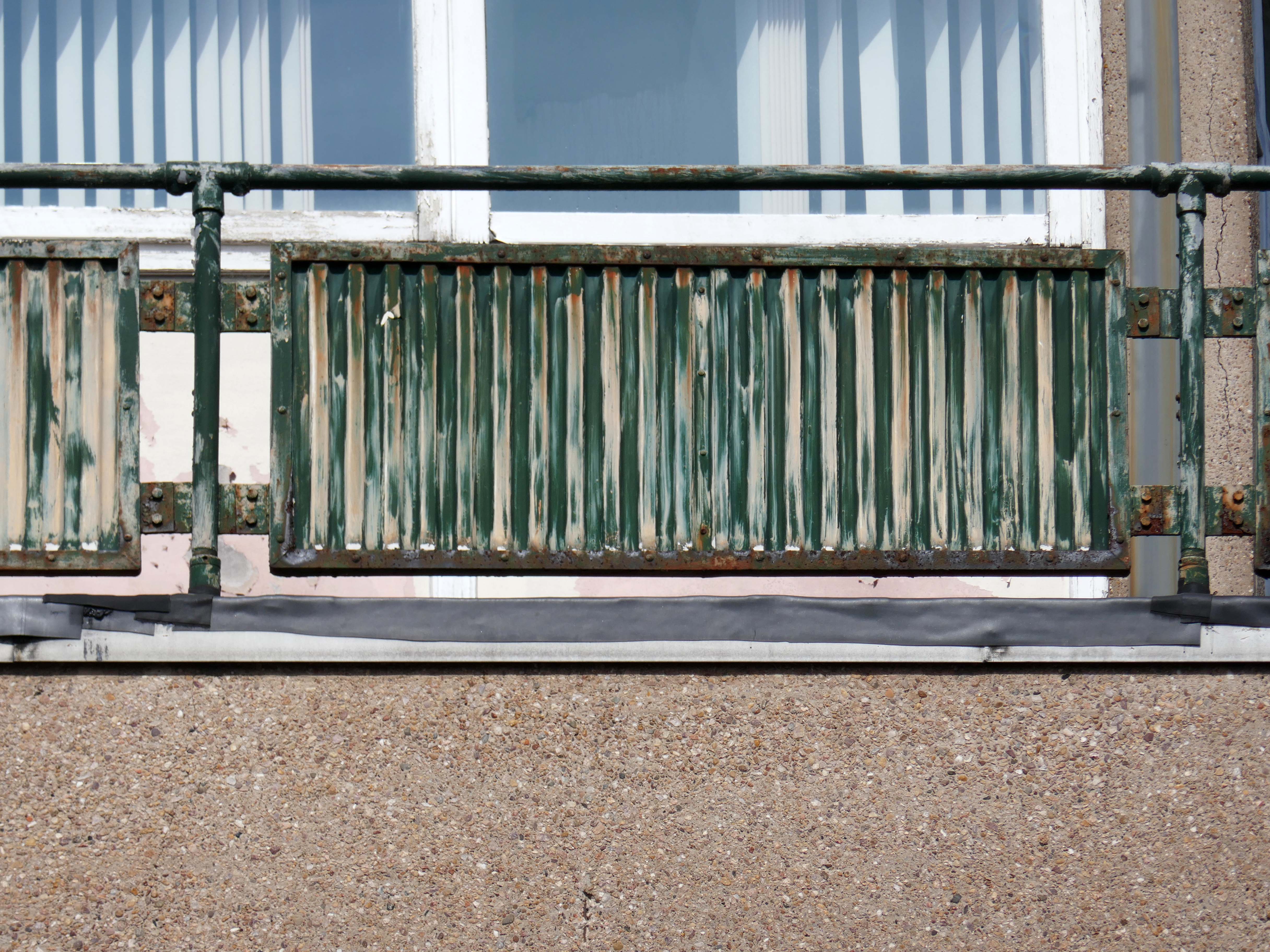
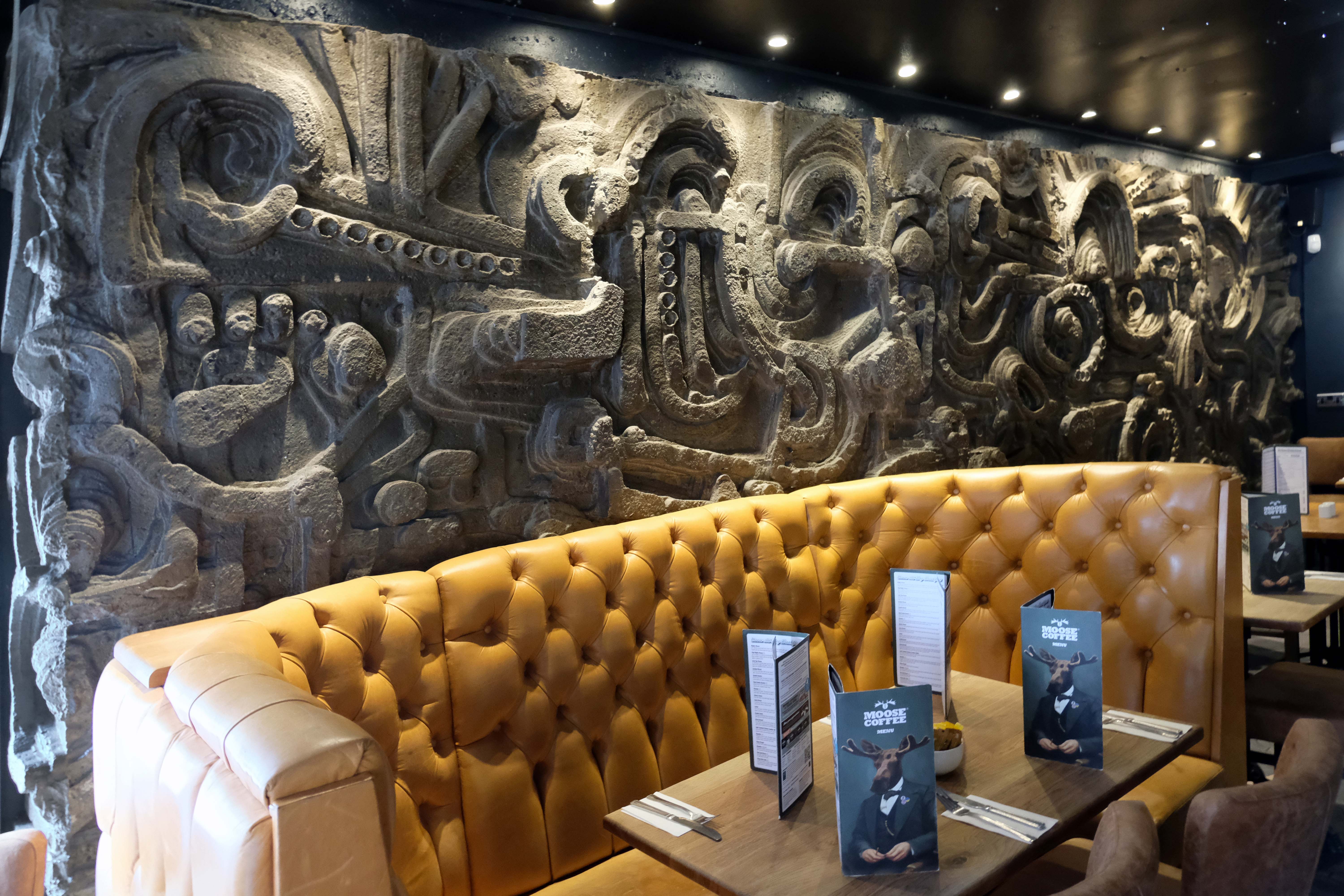
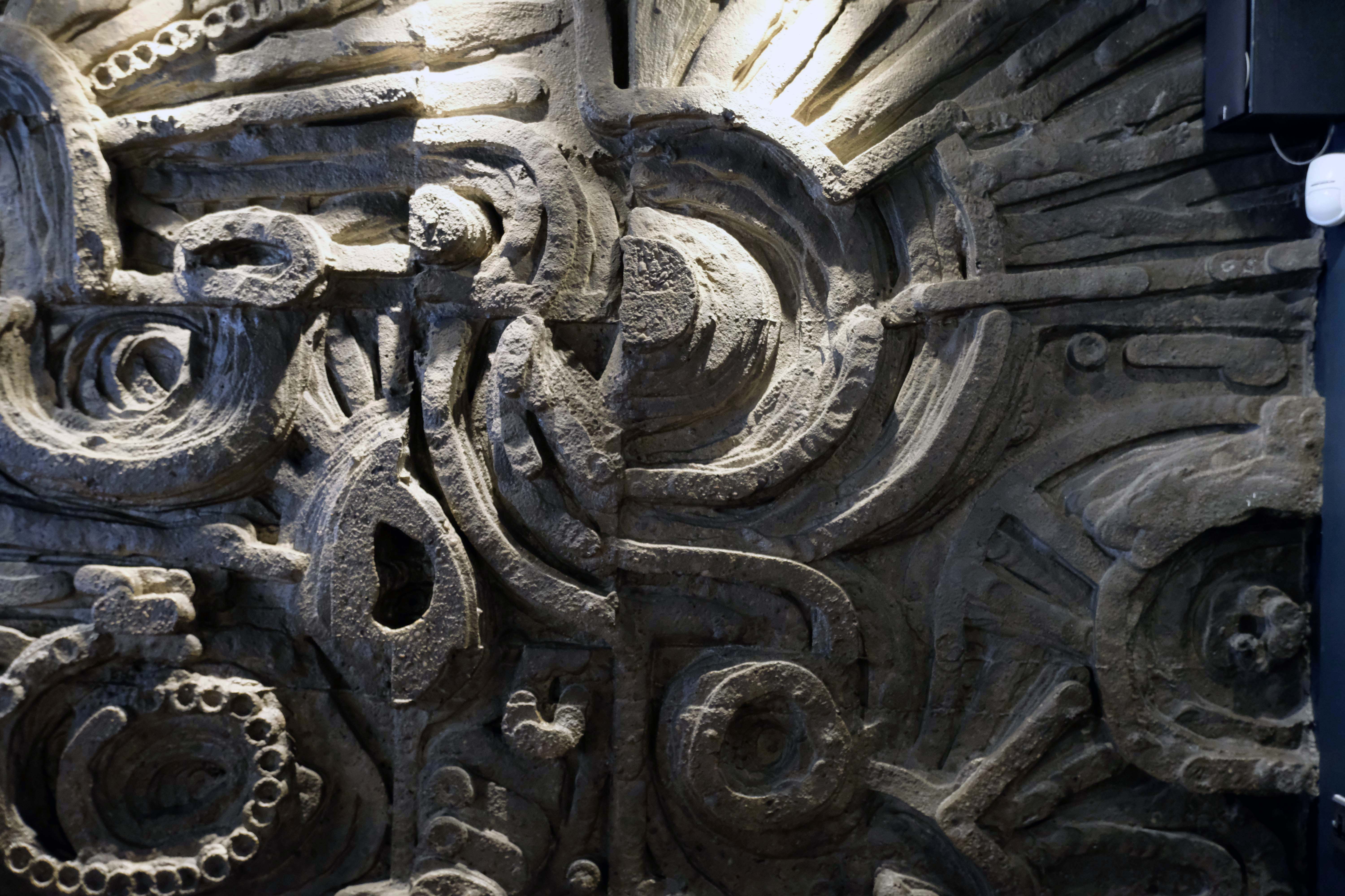
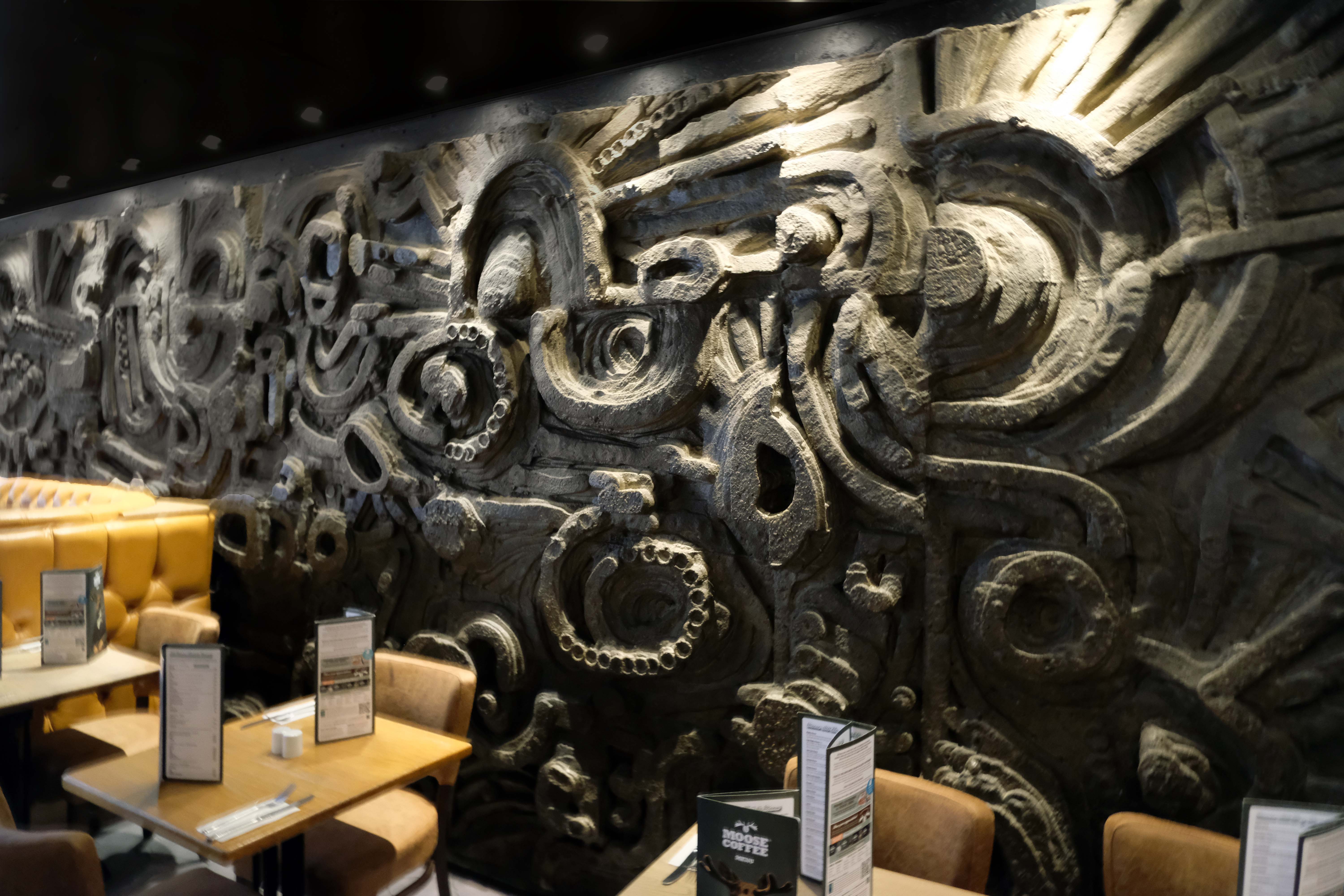
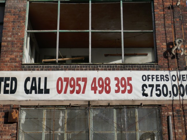
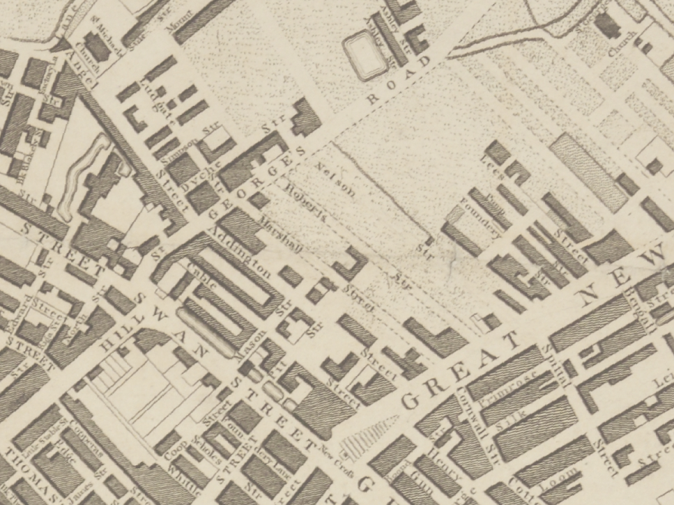
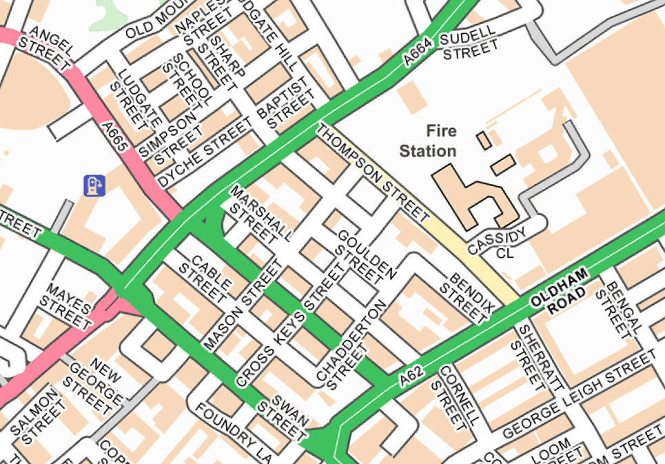
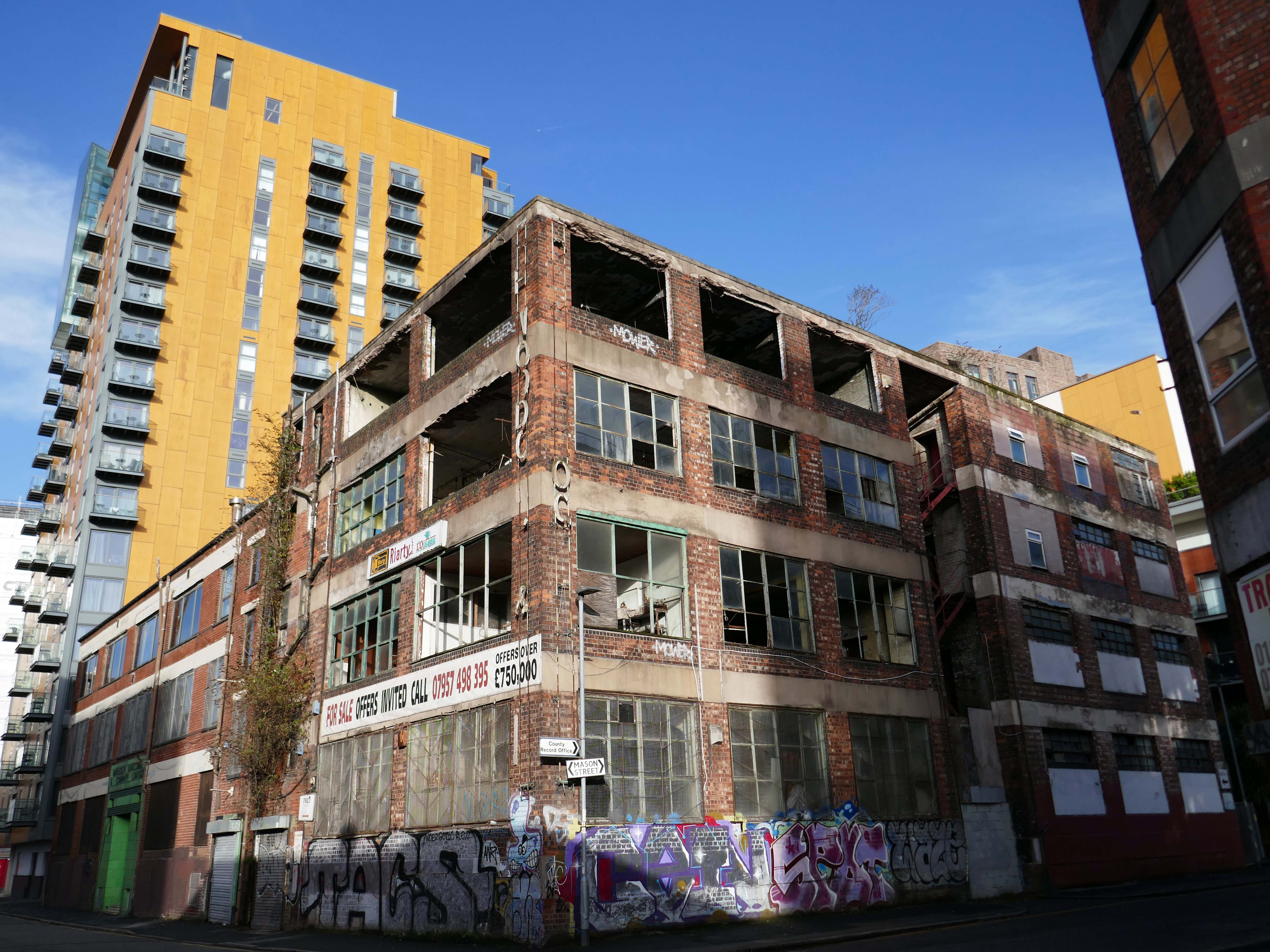
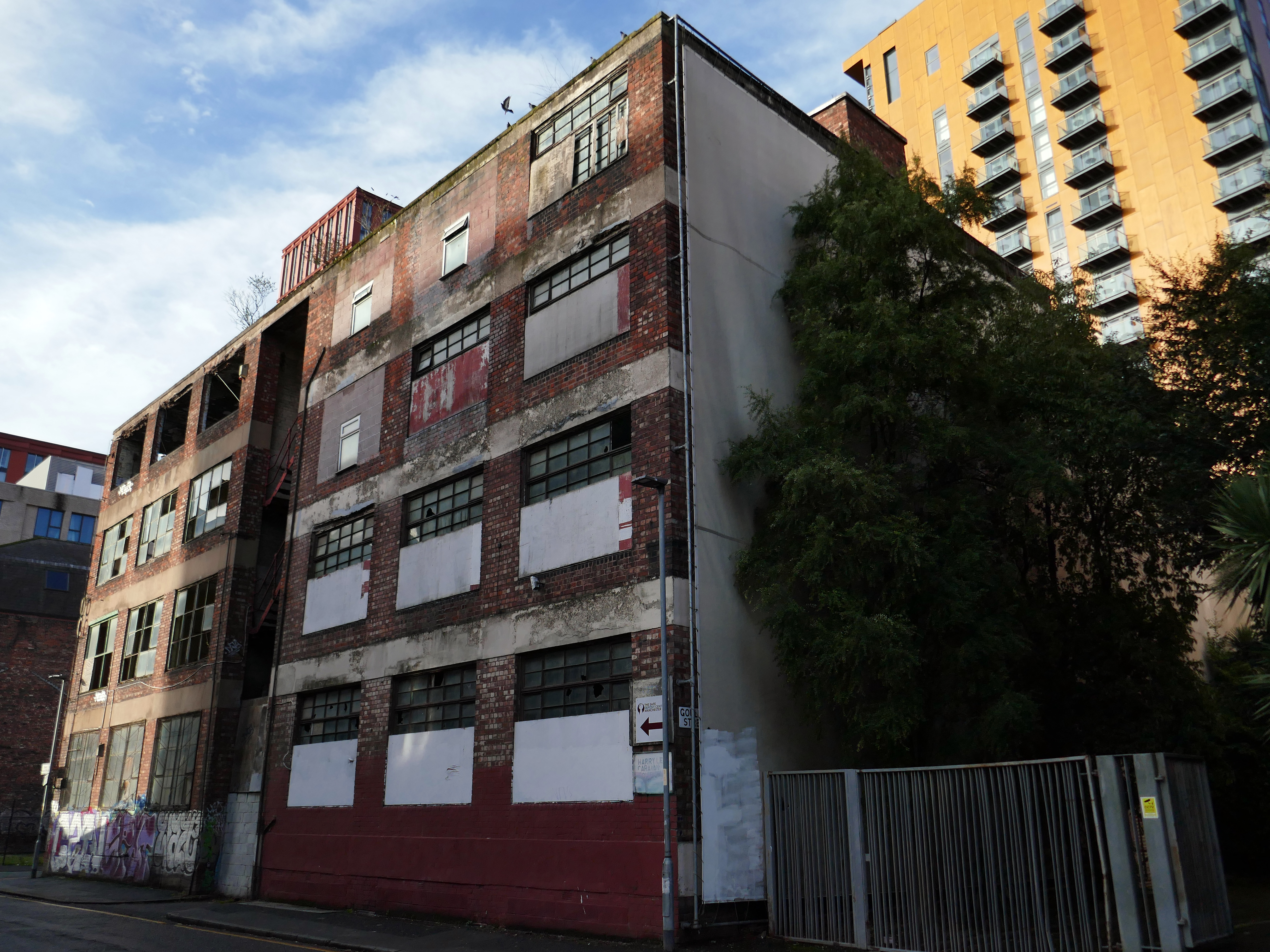
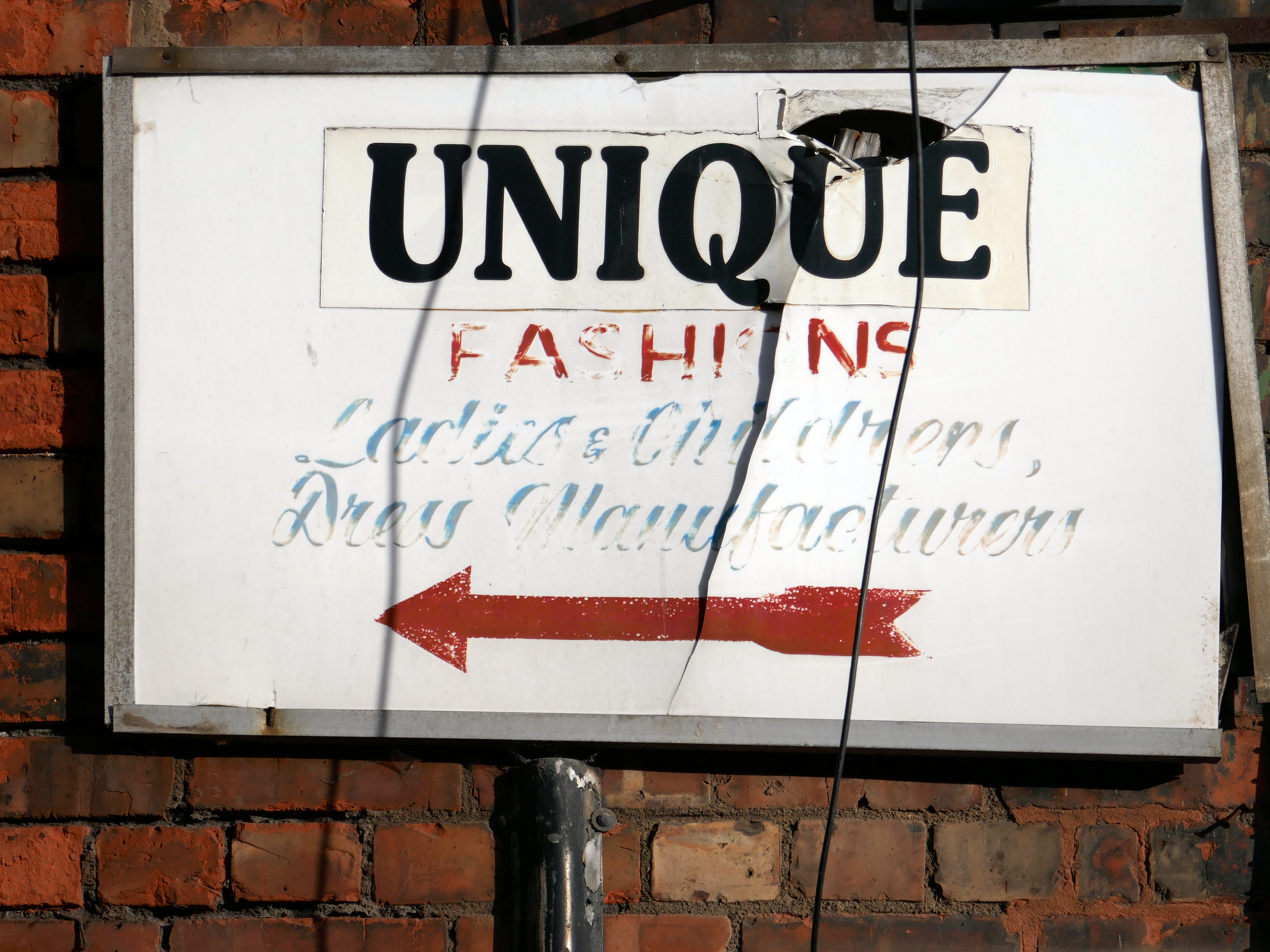
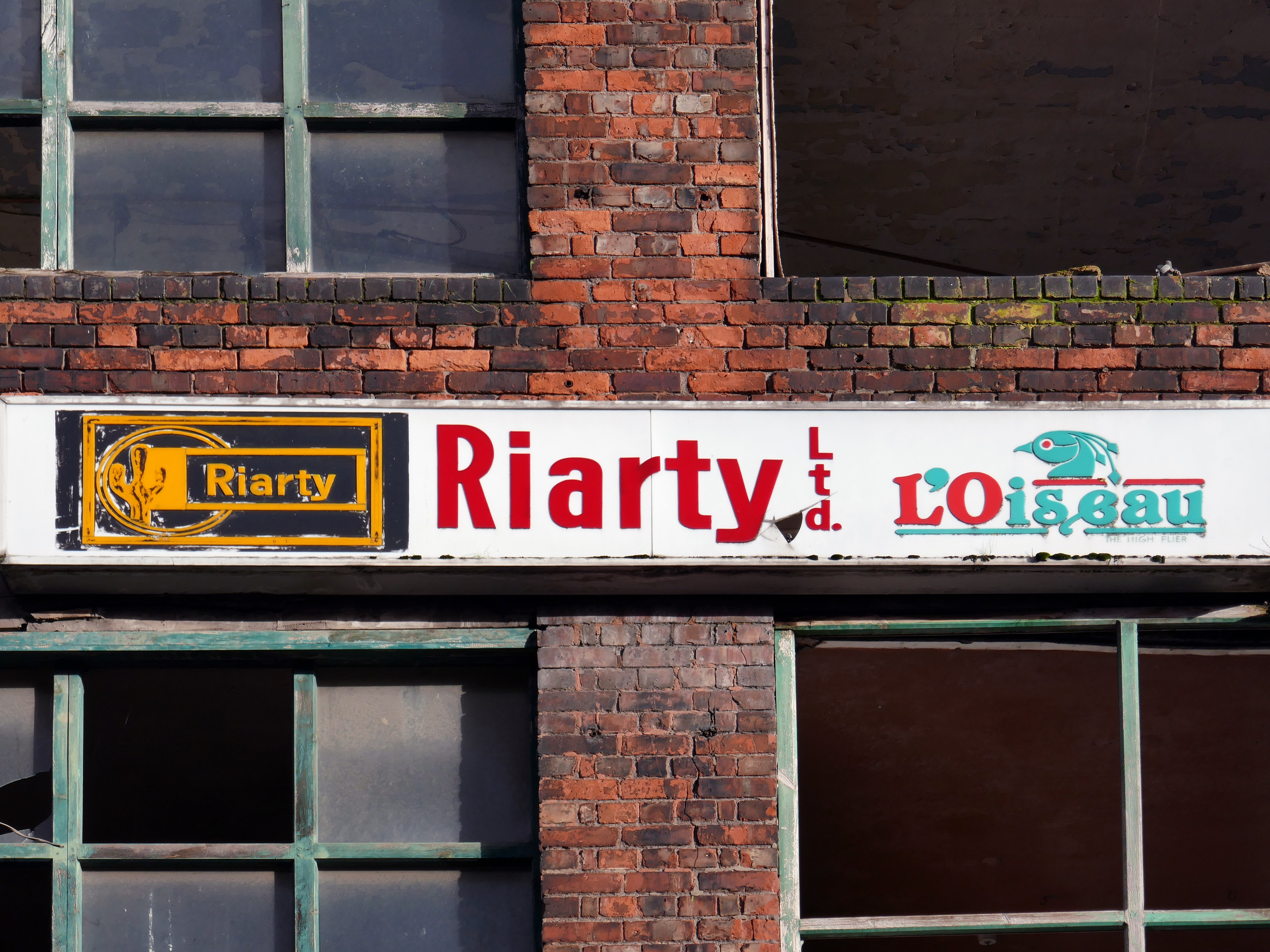
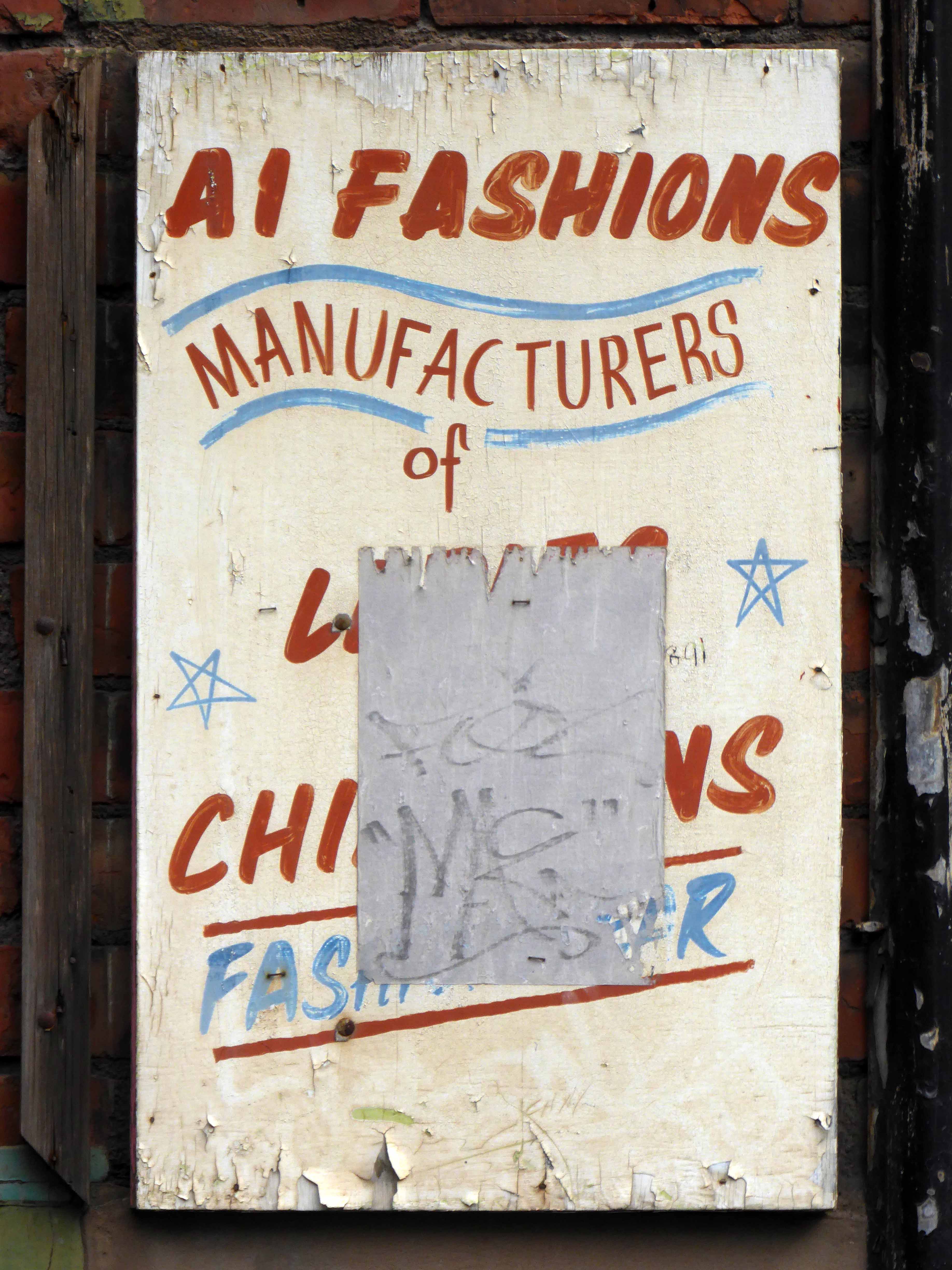
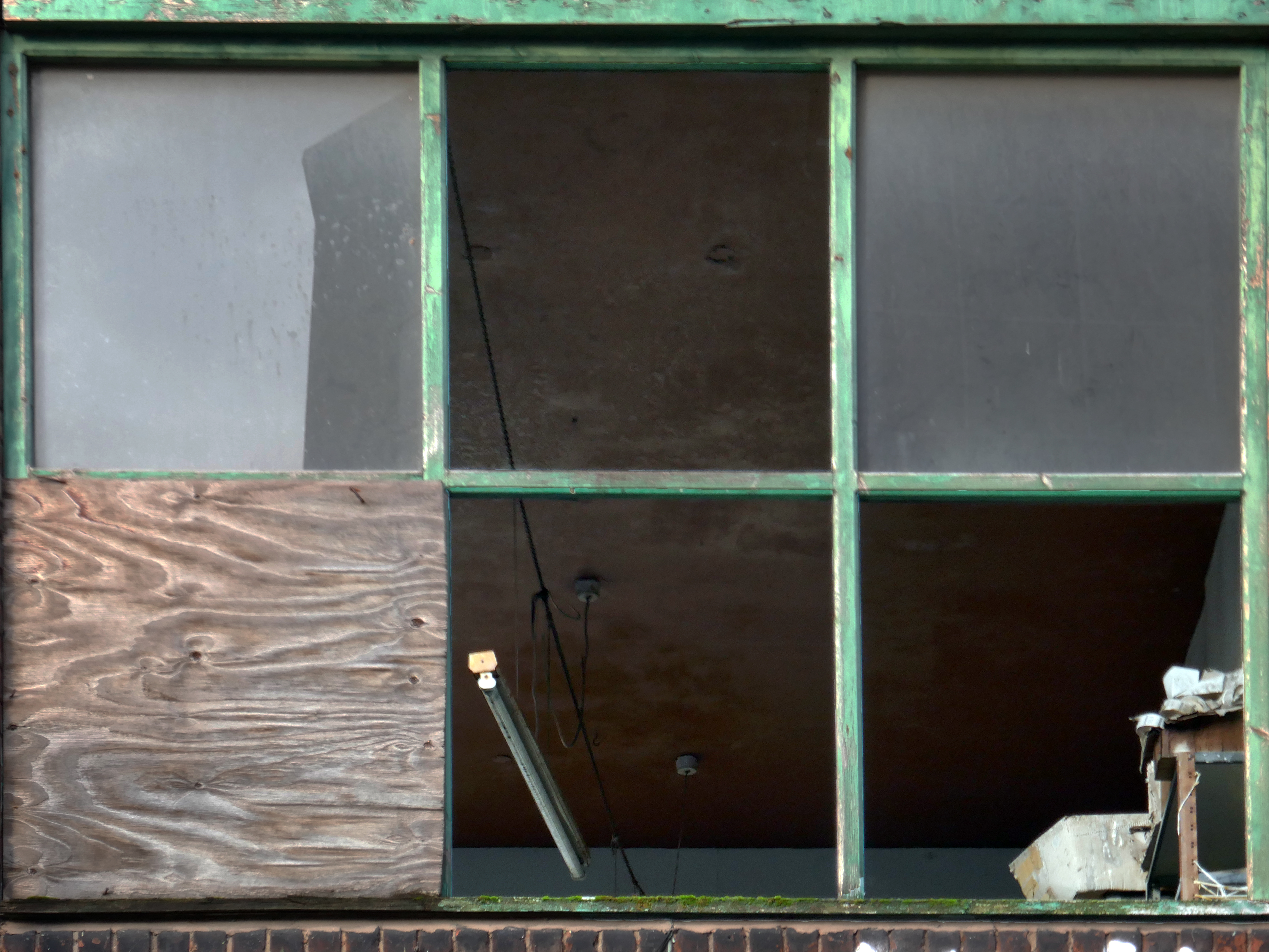
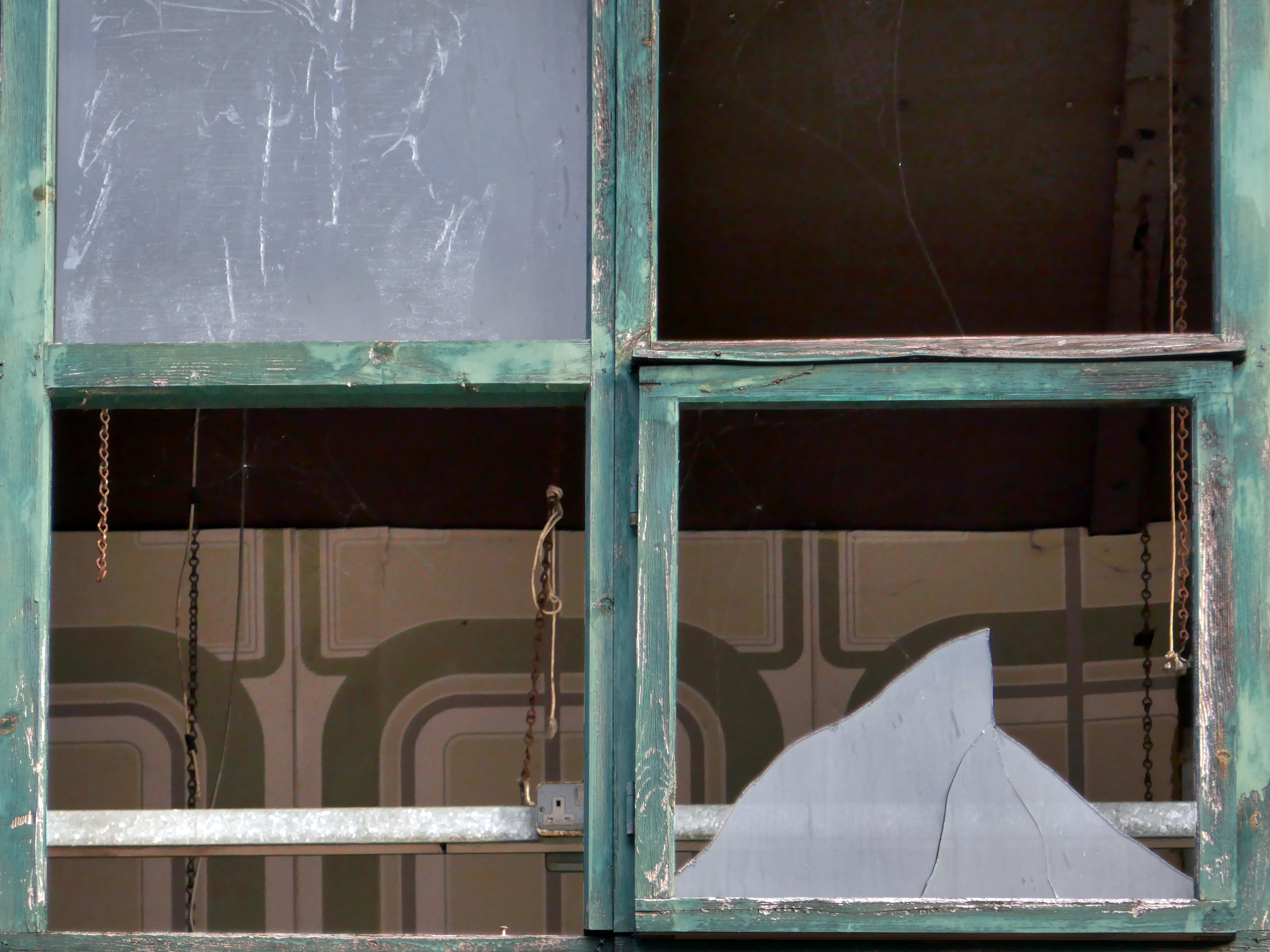
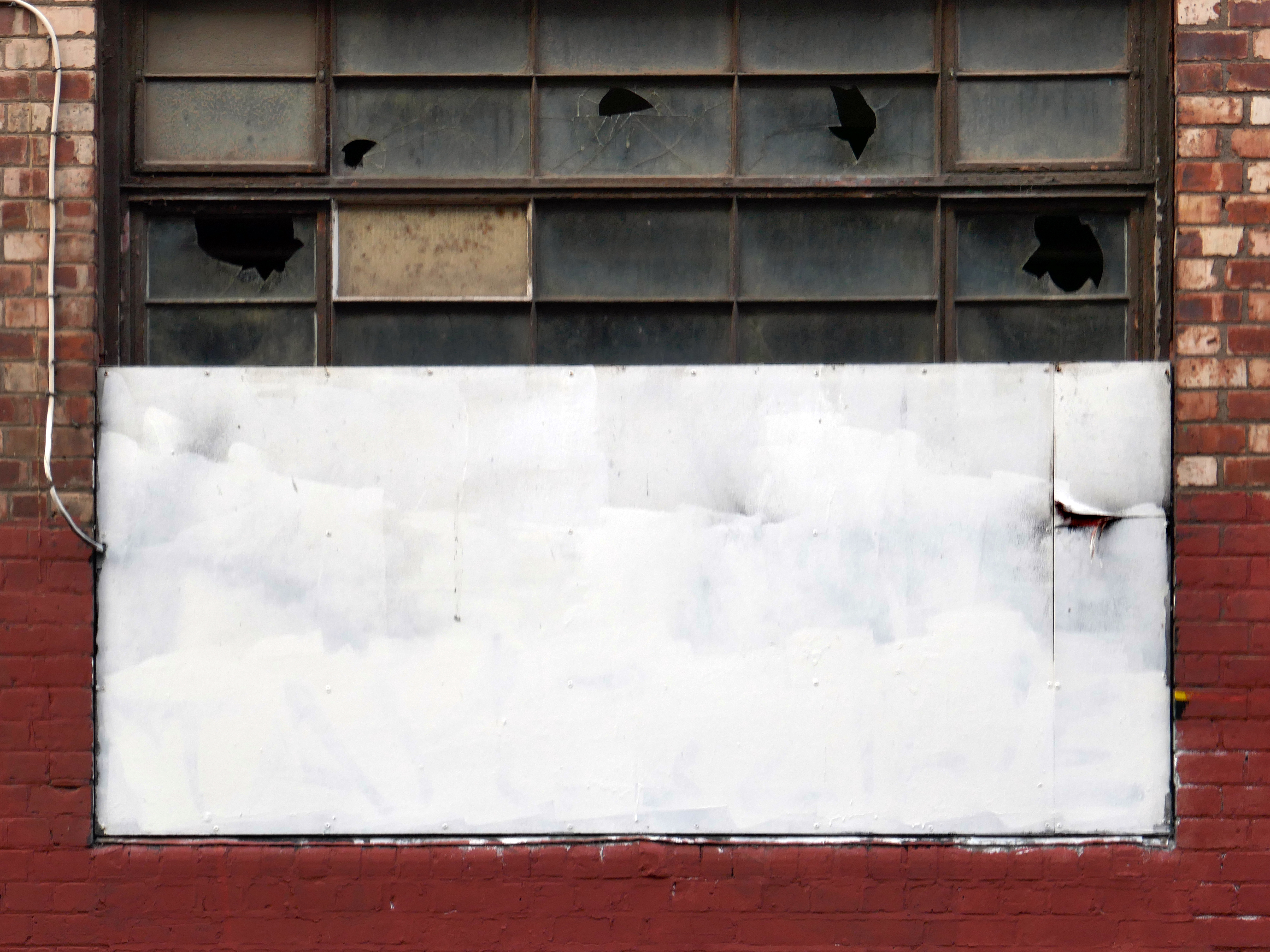
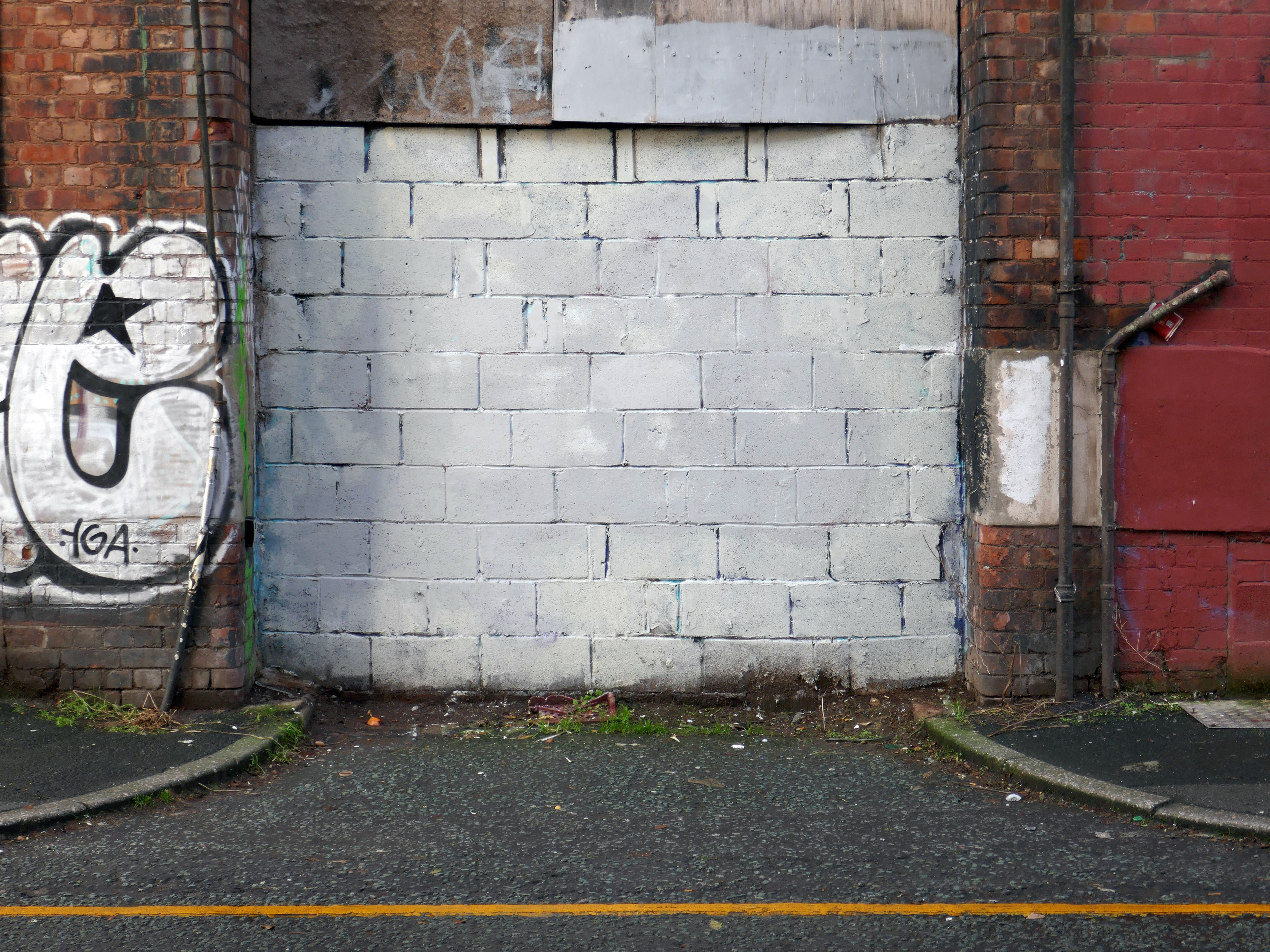
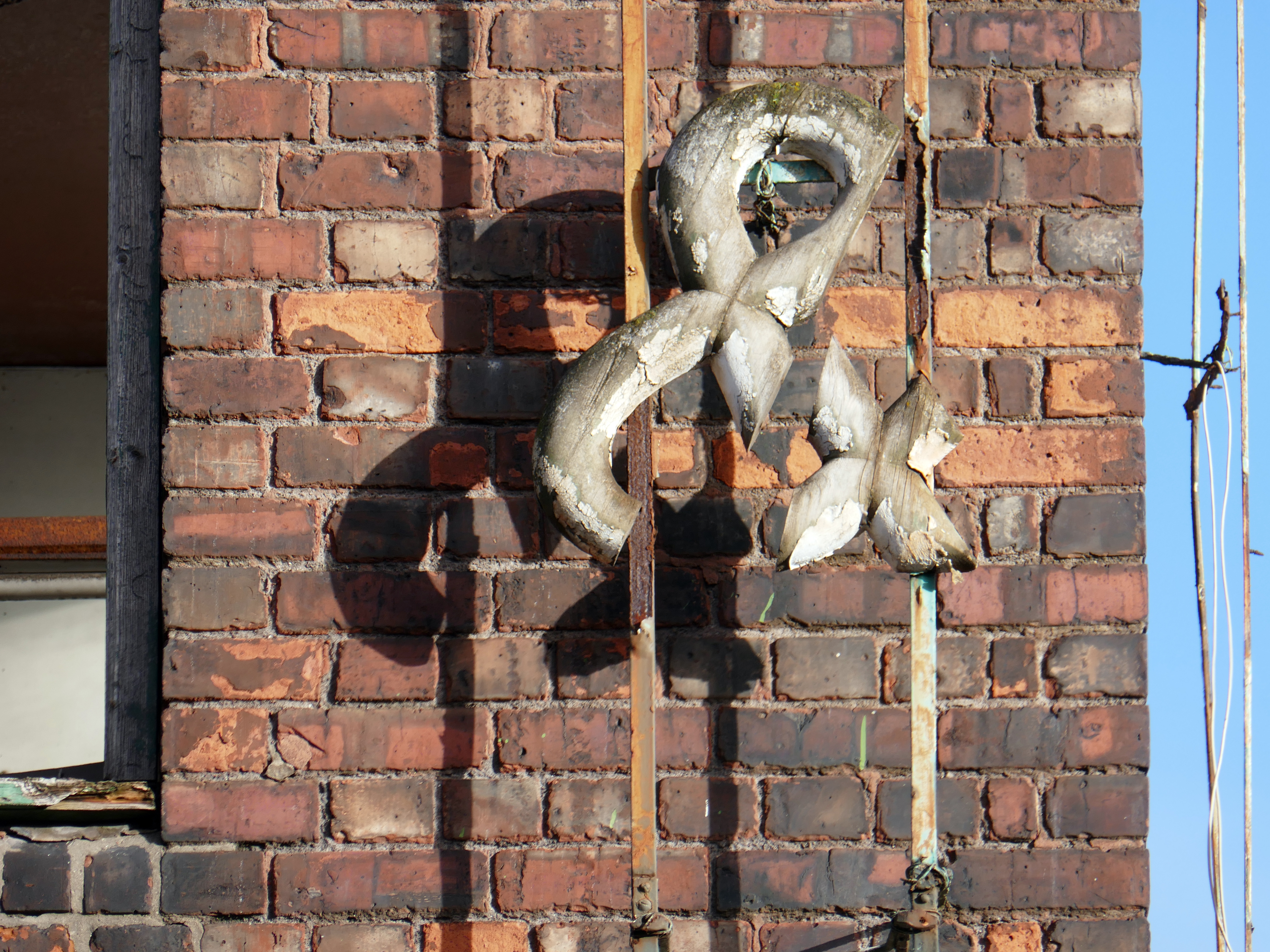
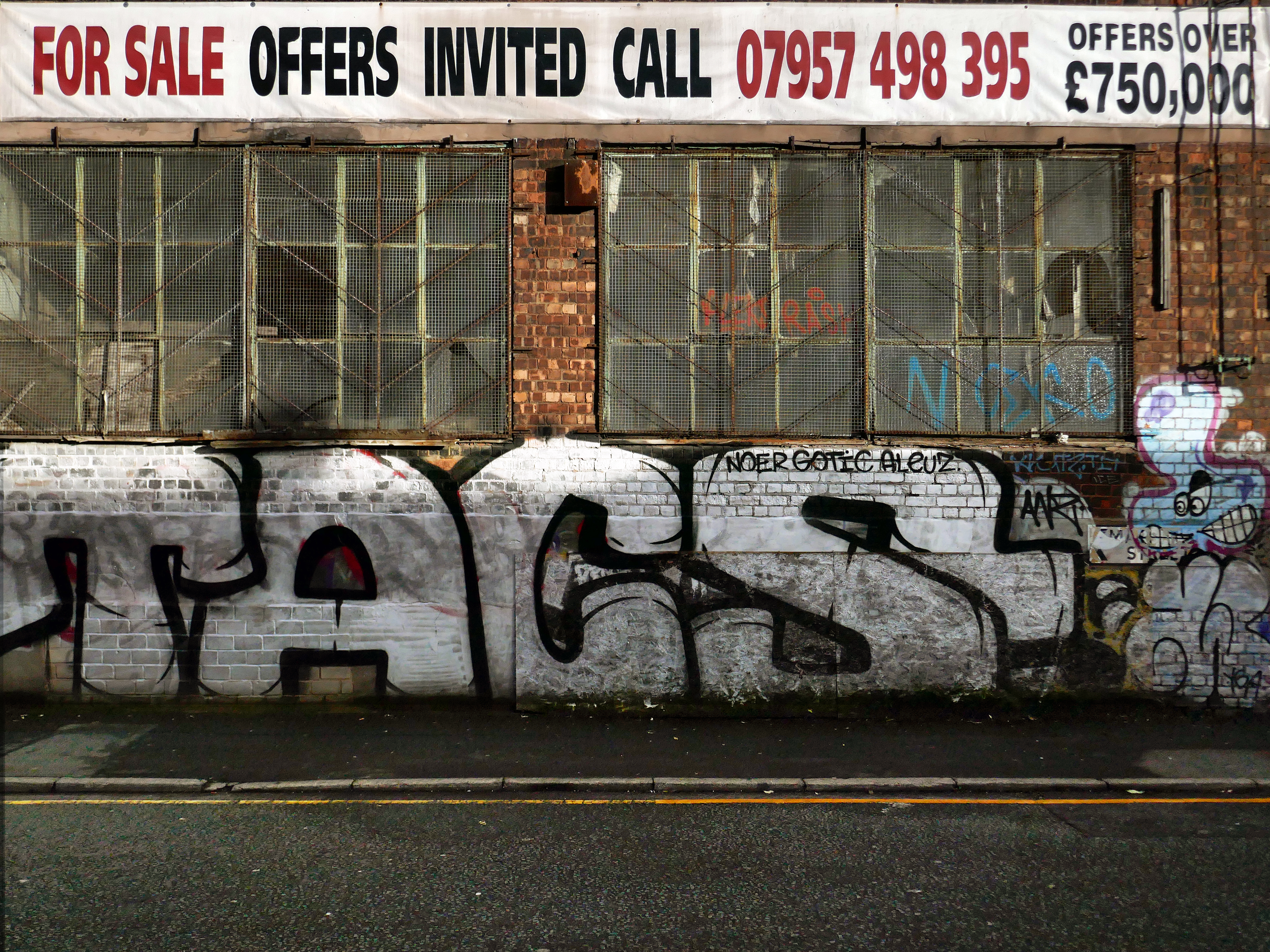
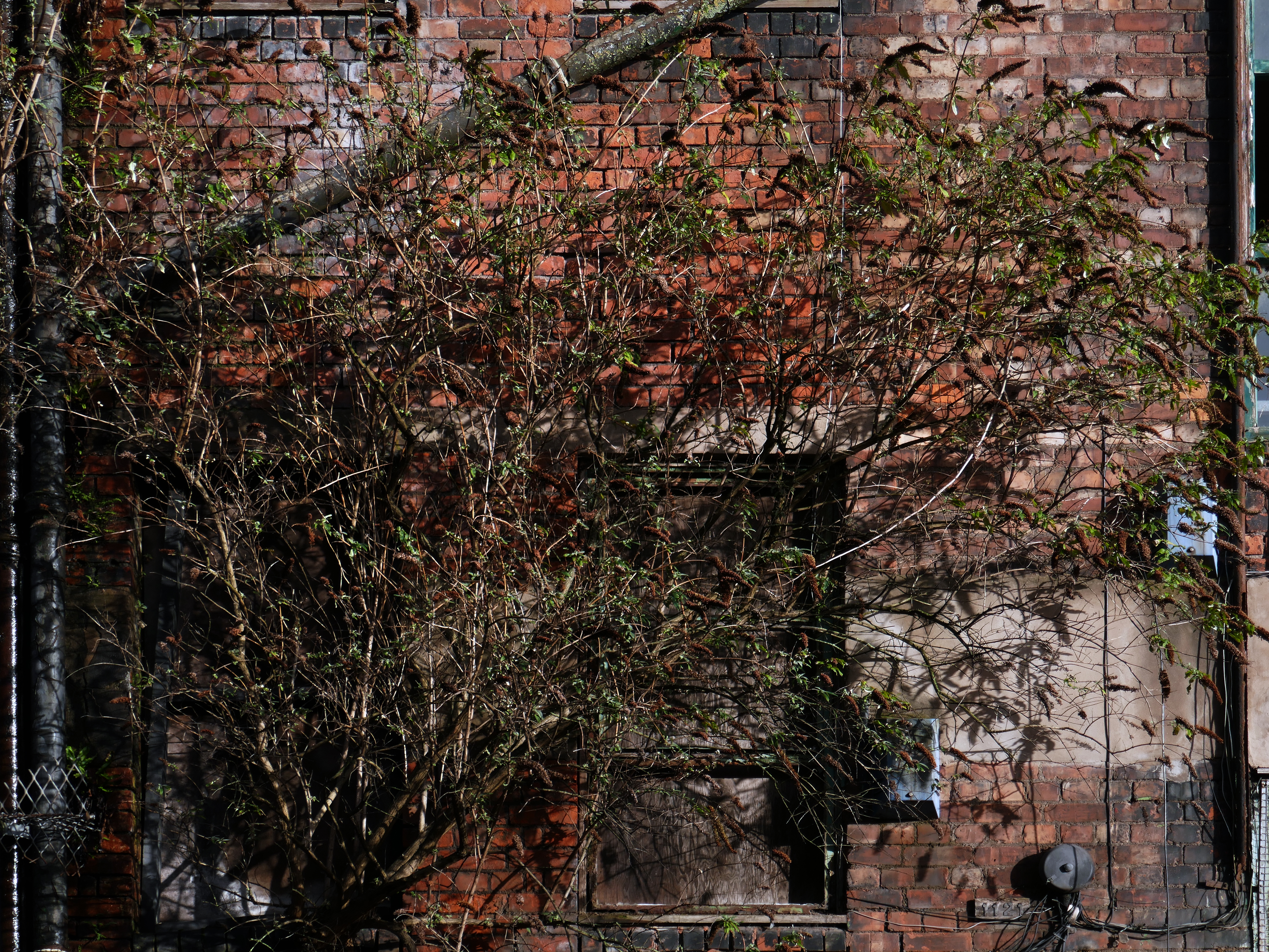
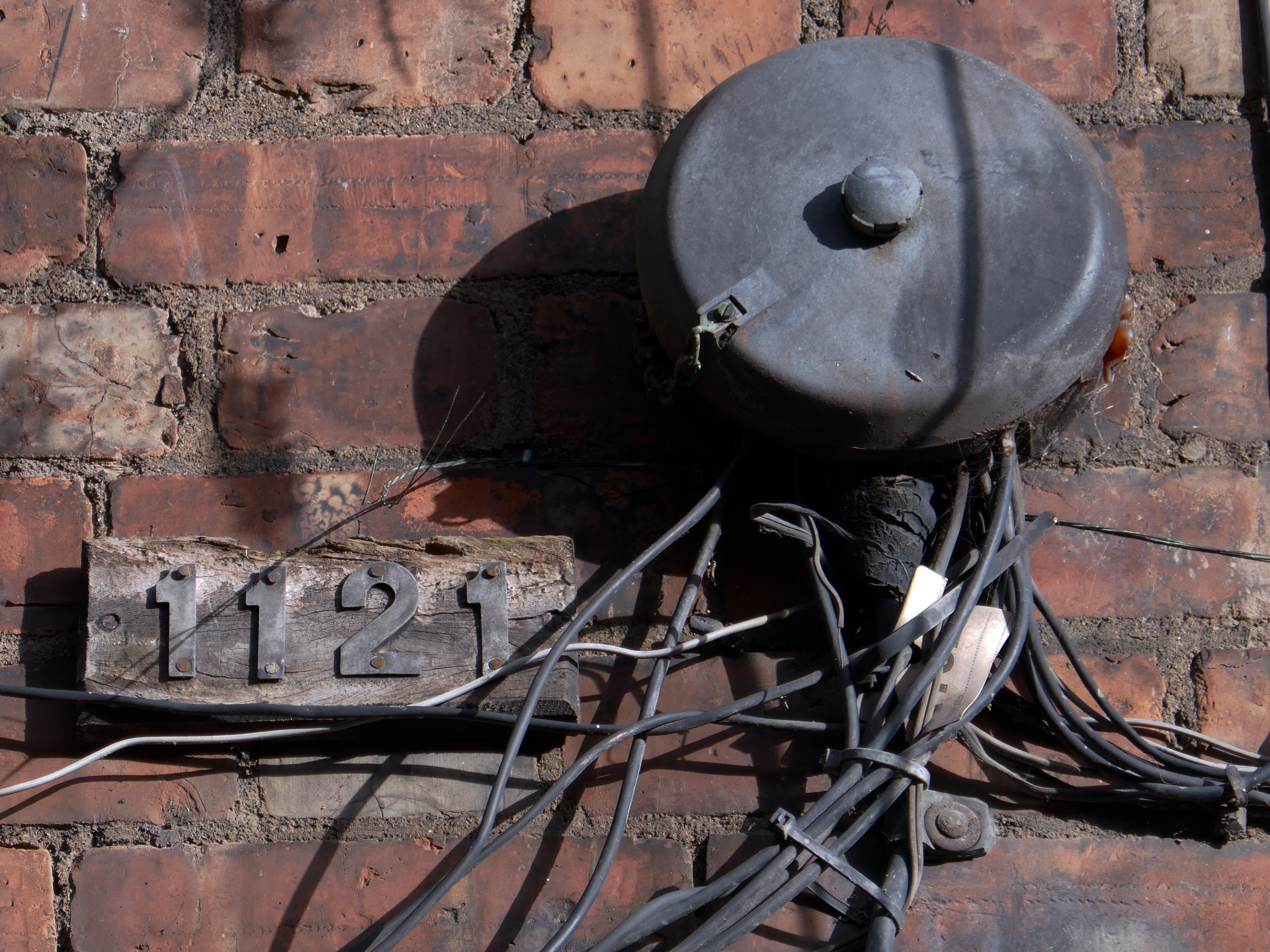
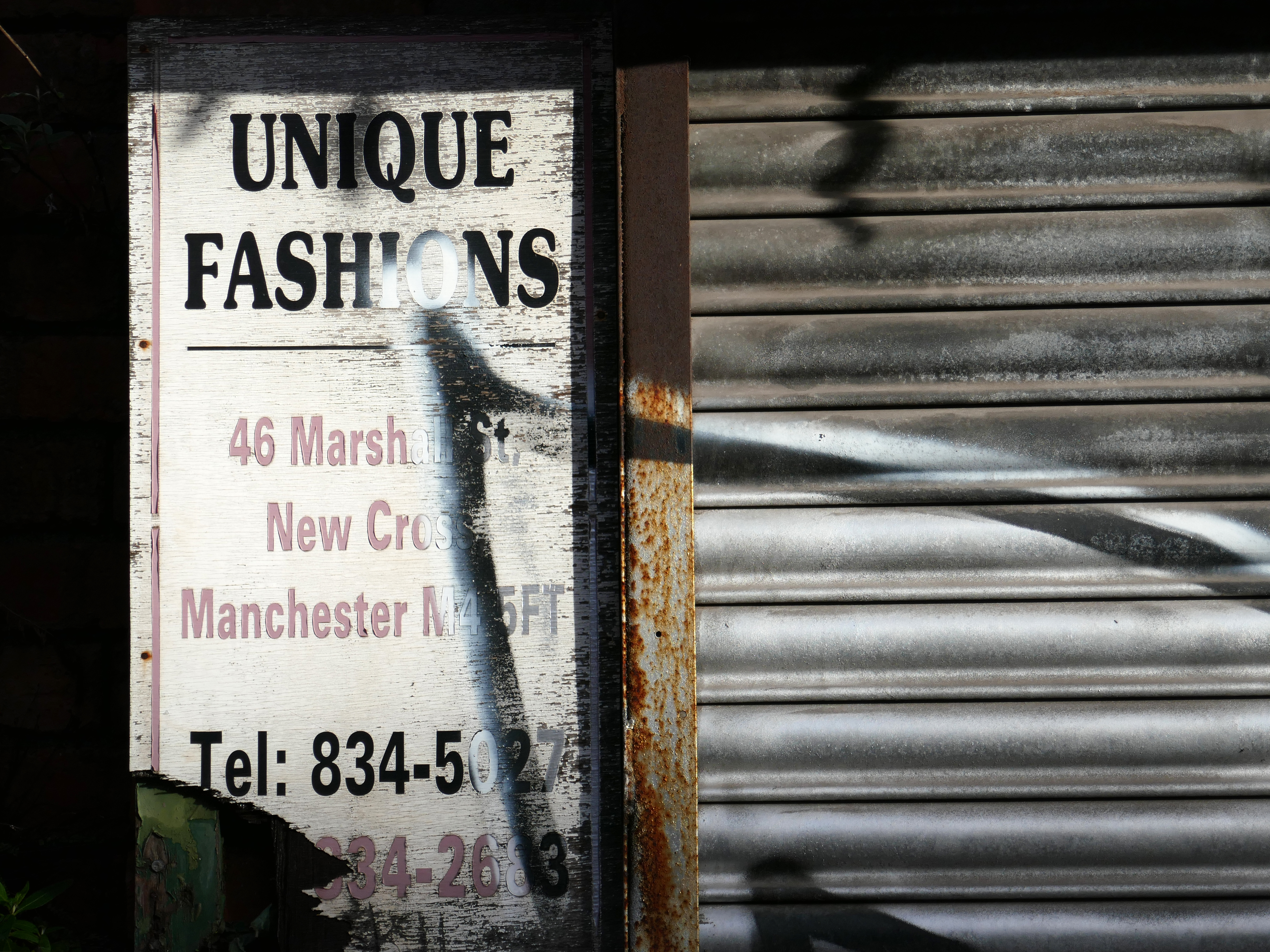
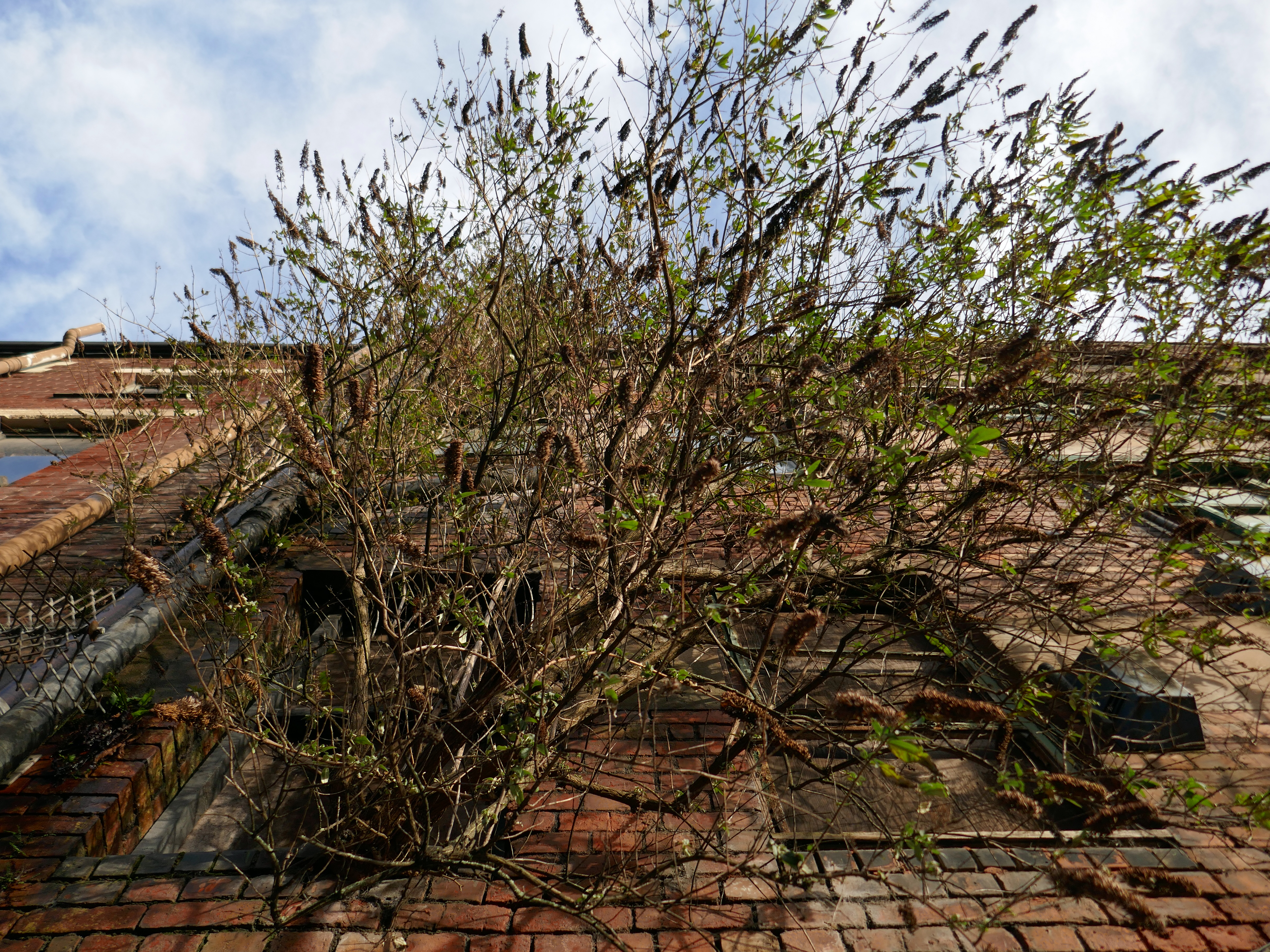
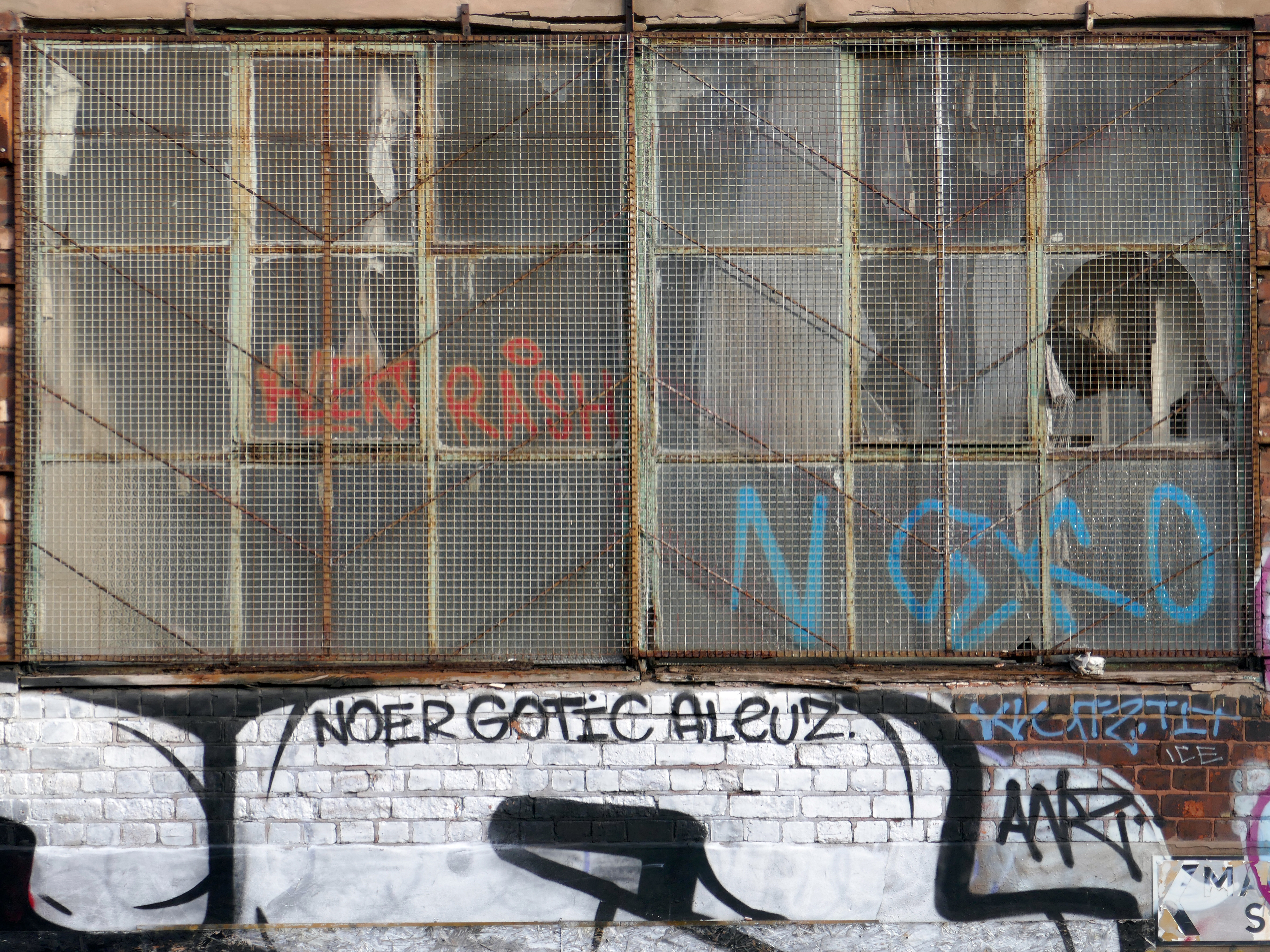
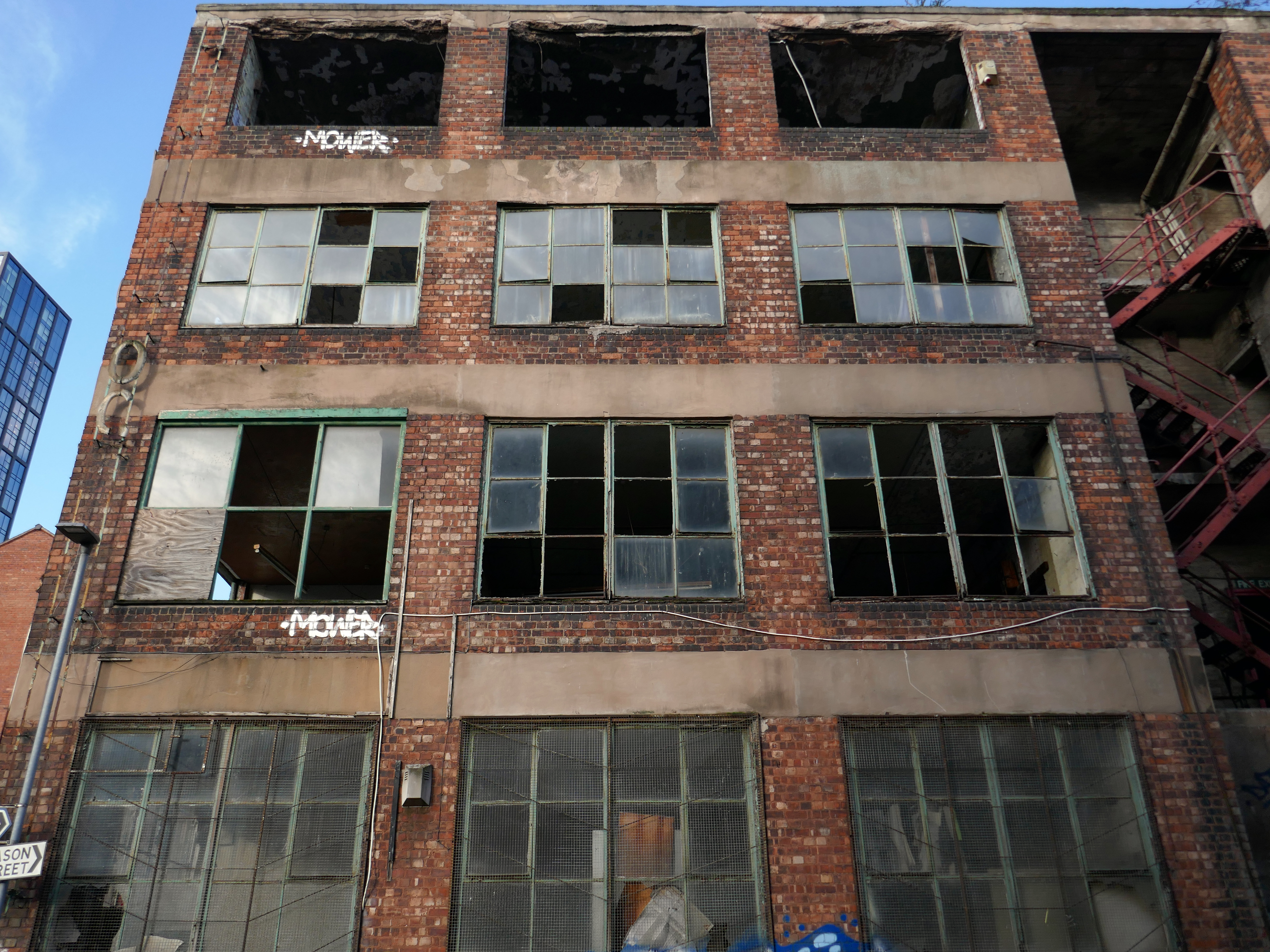
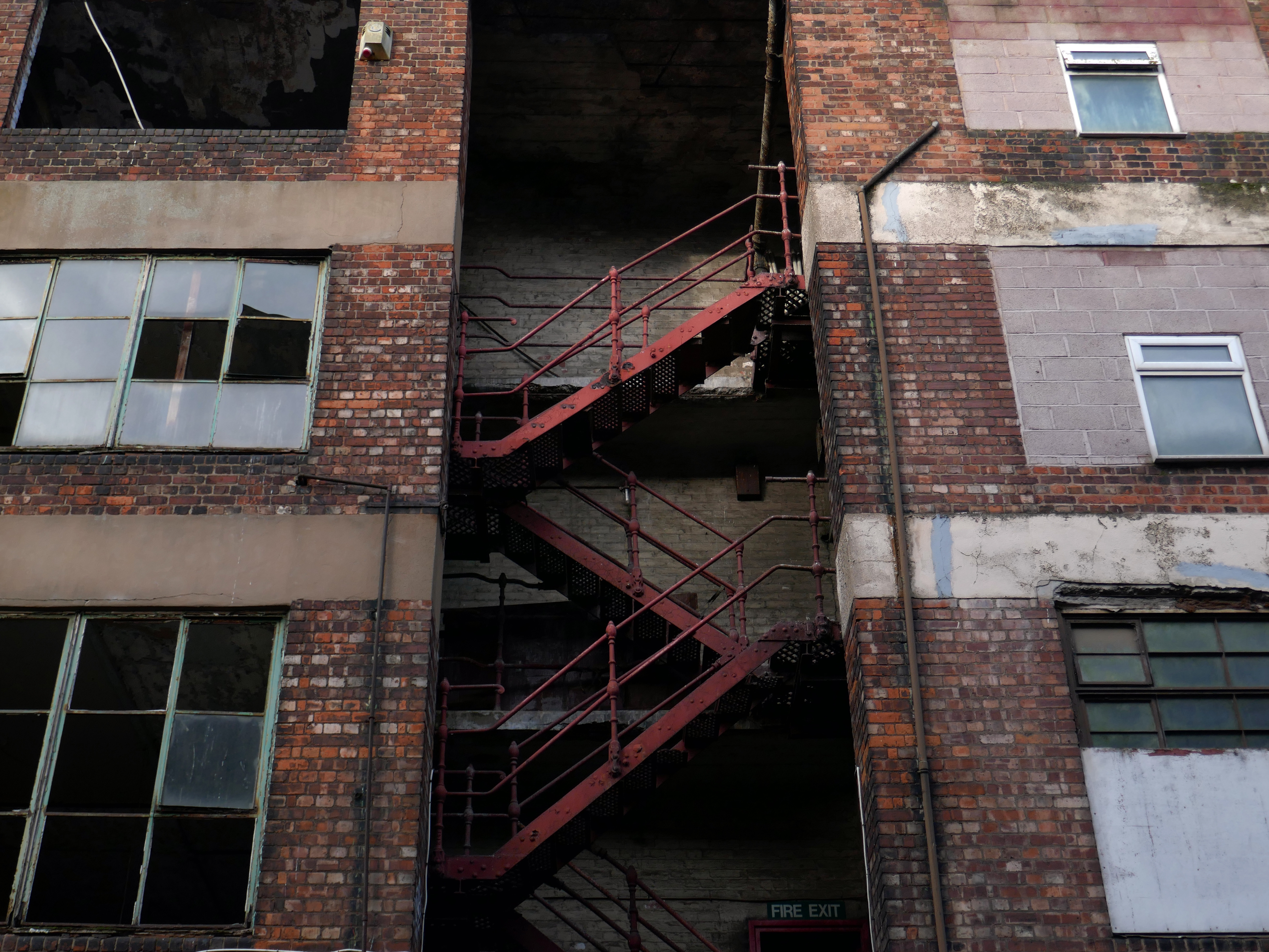
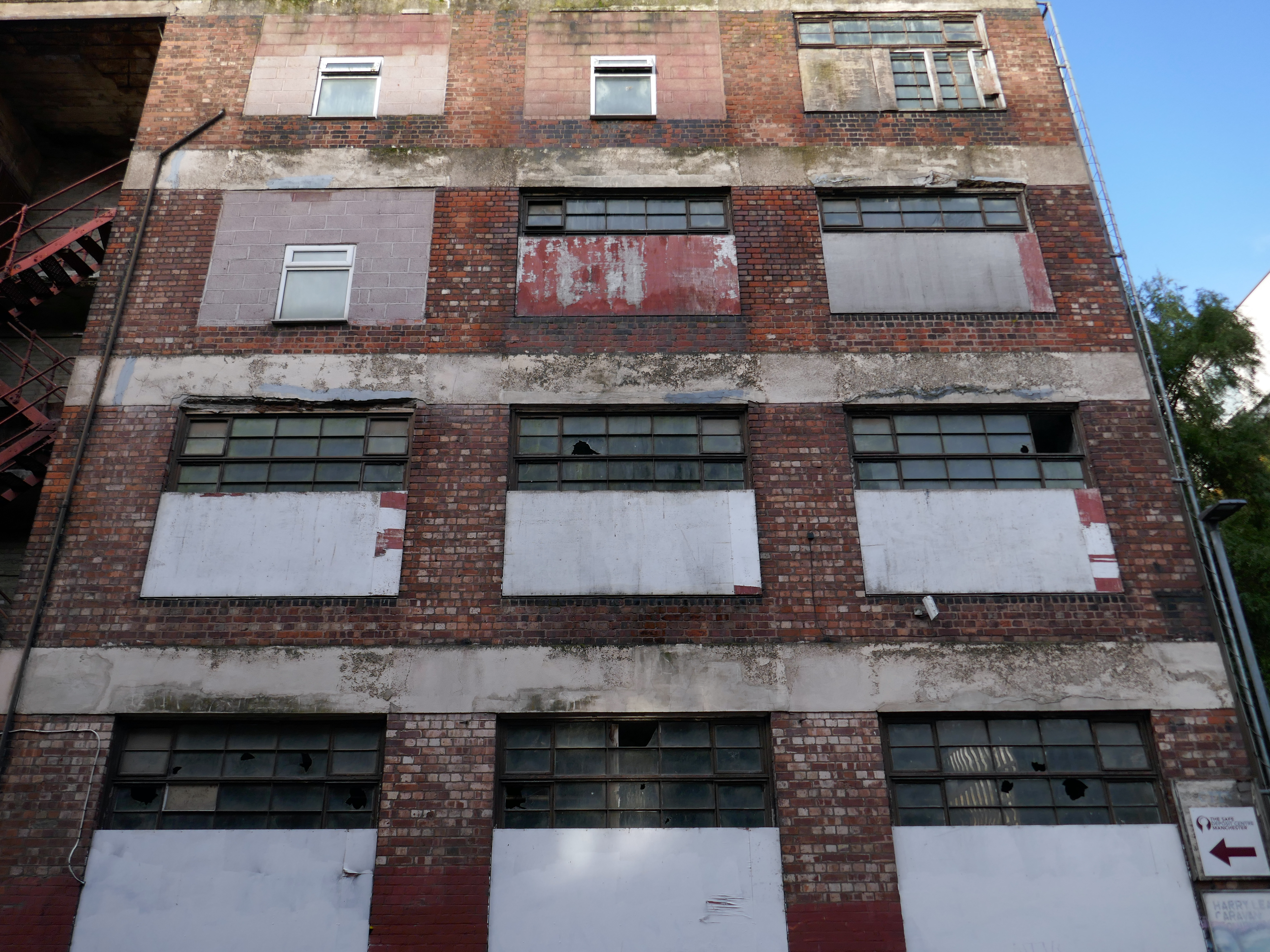
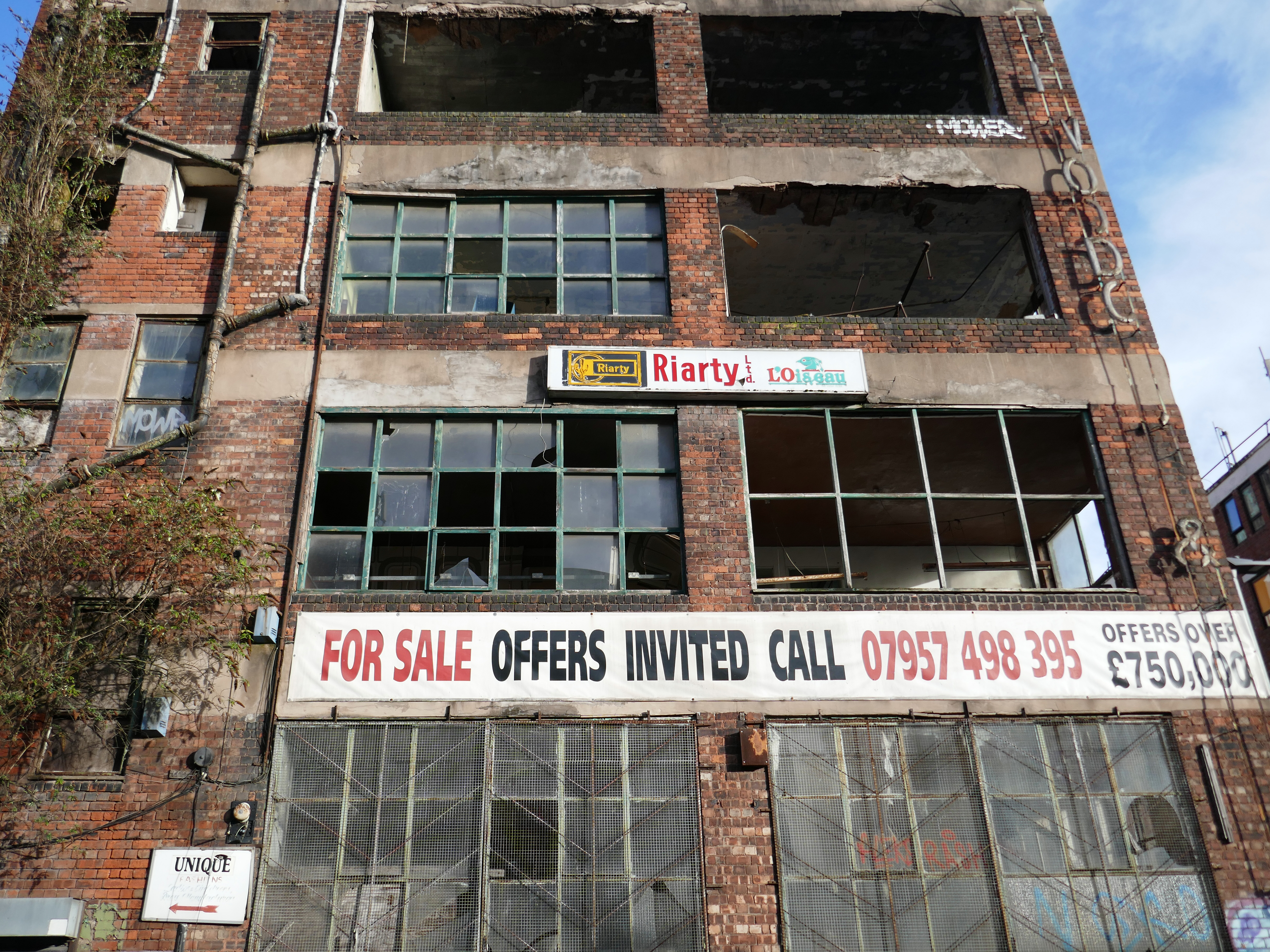
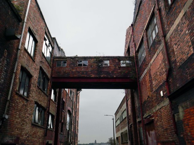
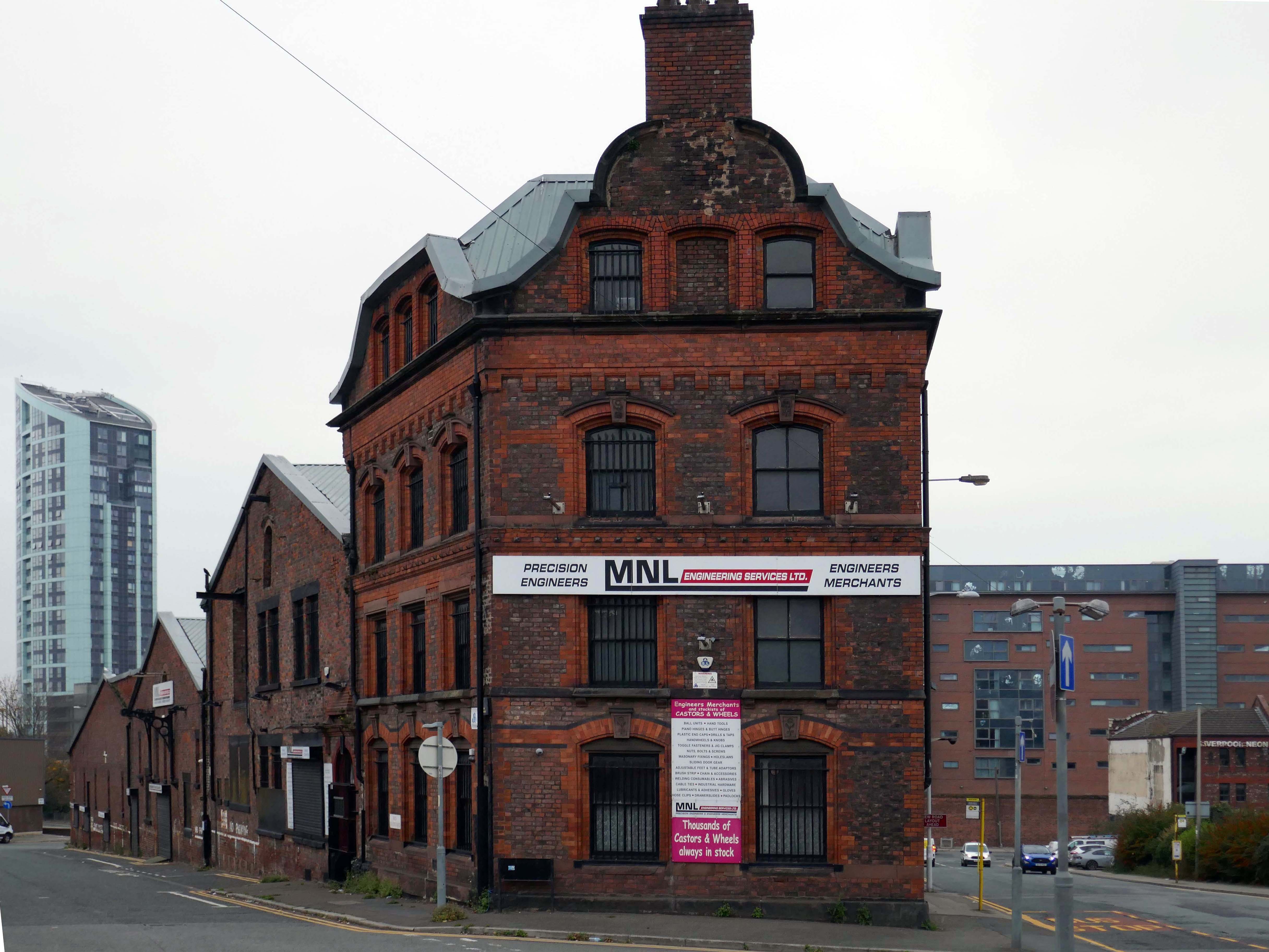
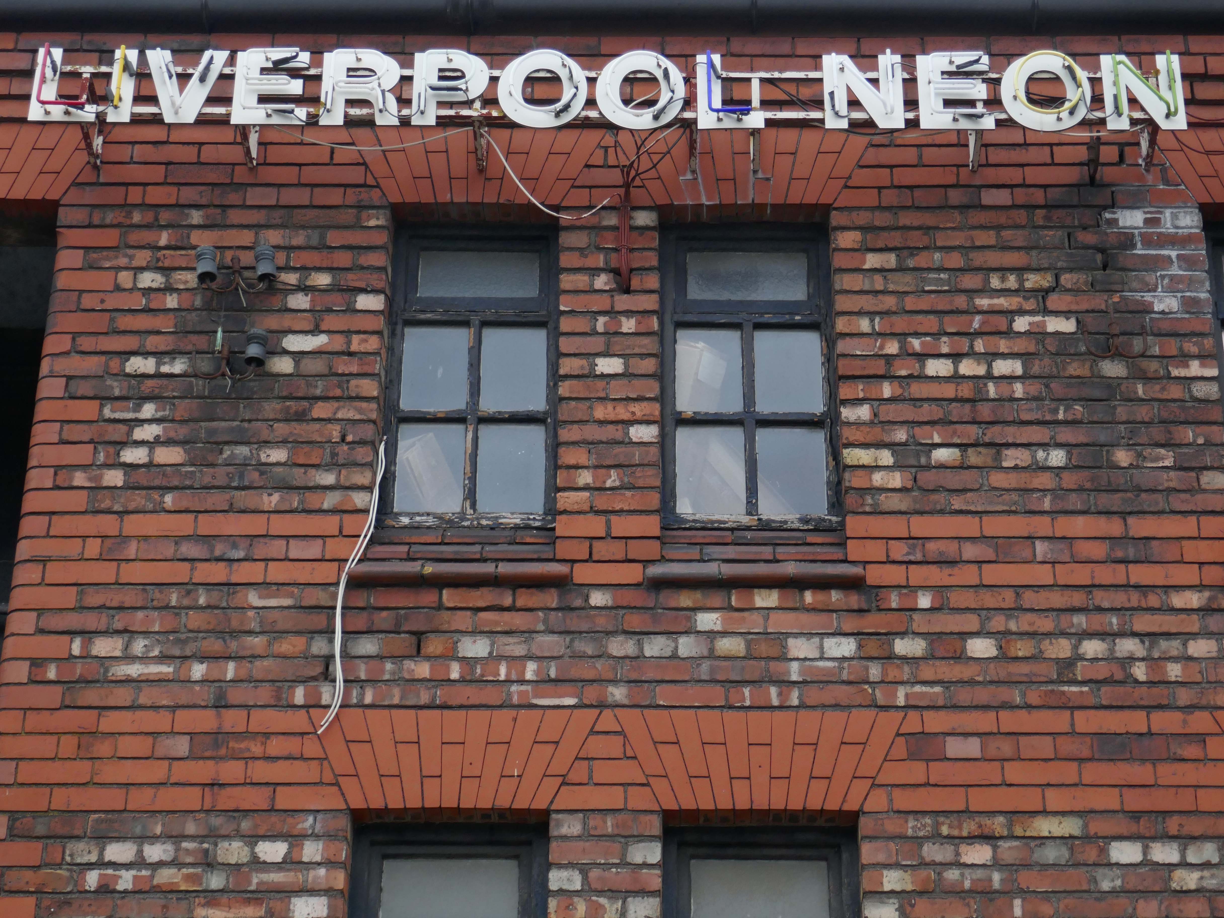
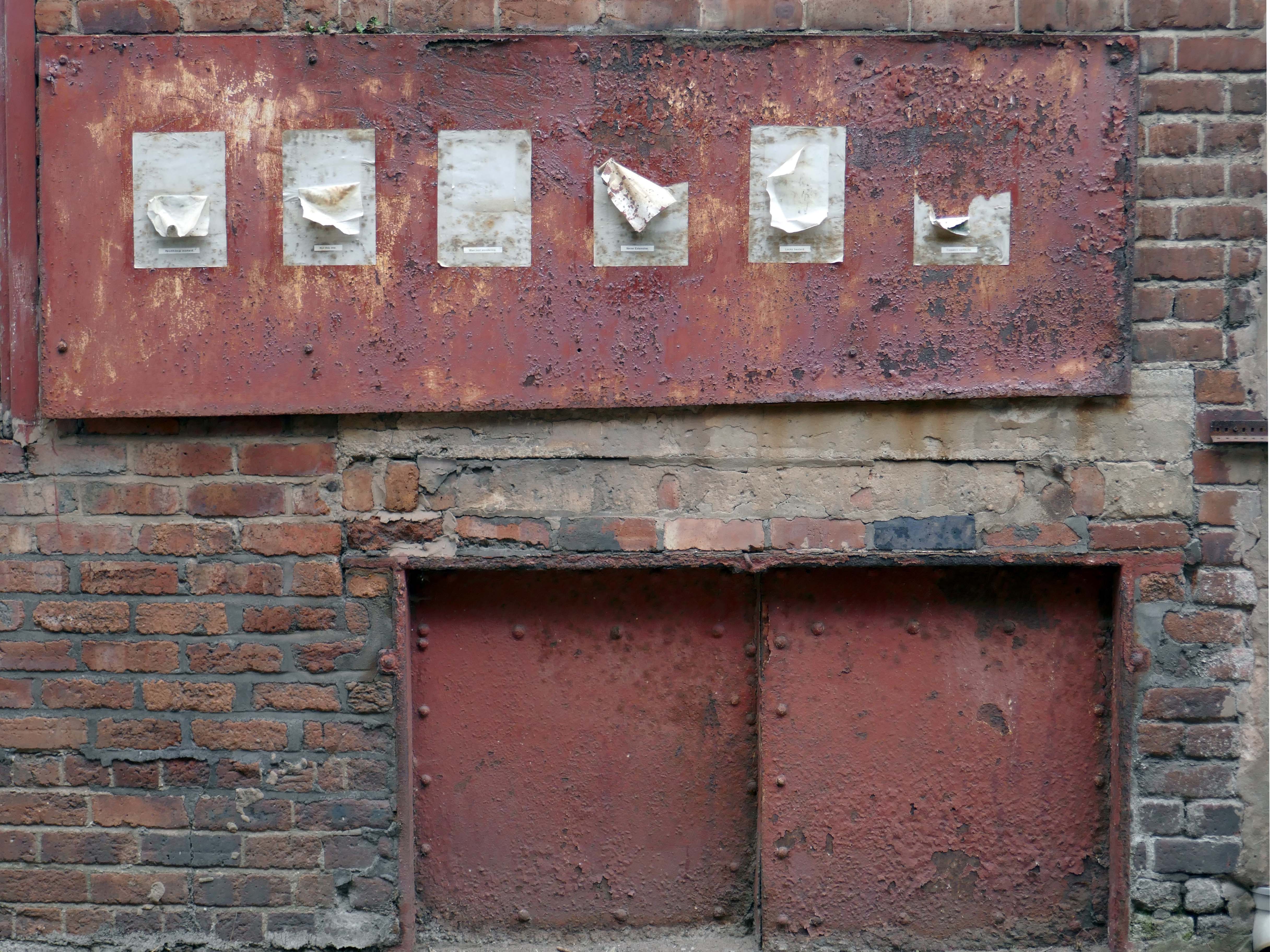
This building has always intrigued me, its sits amongst what was formerly the heart of Manchester’s Rag Trade. It is an area of signs and lost industry, the comings and goings having been and gone.
The surrounding buildings are gradually being refurbished or replaced, but somehow 46 Marshall Street is bucking the trend, though at some point someone somewhere will find over £750,000.
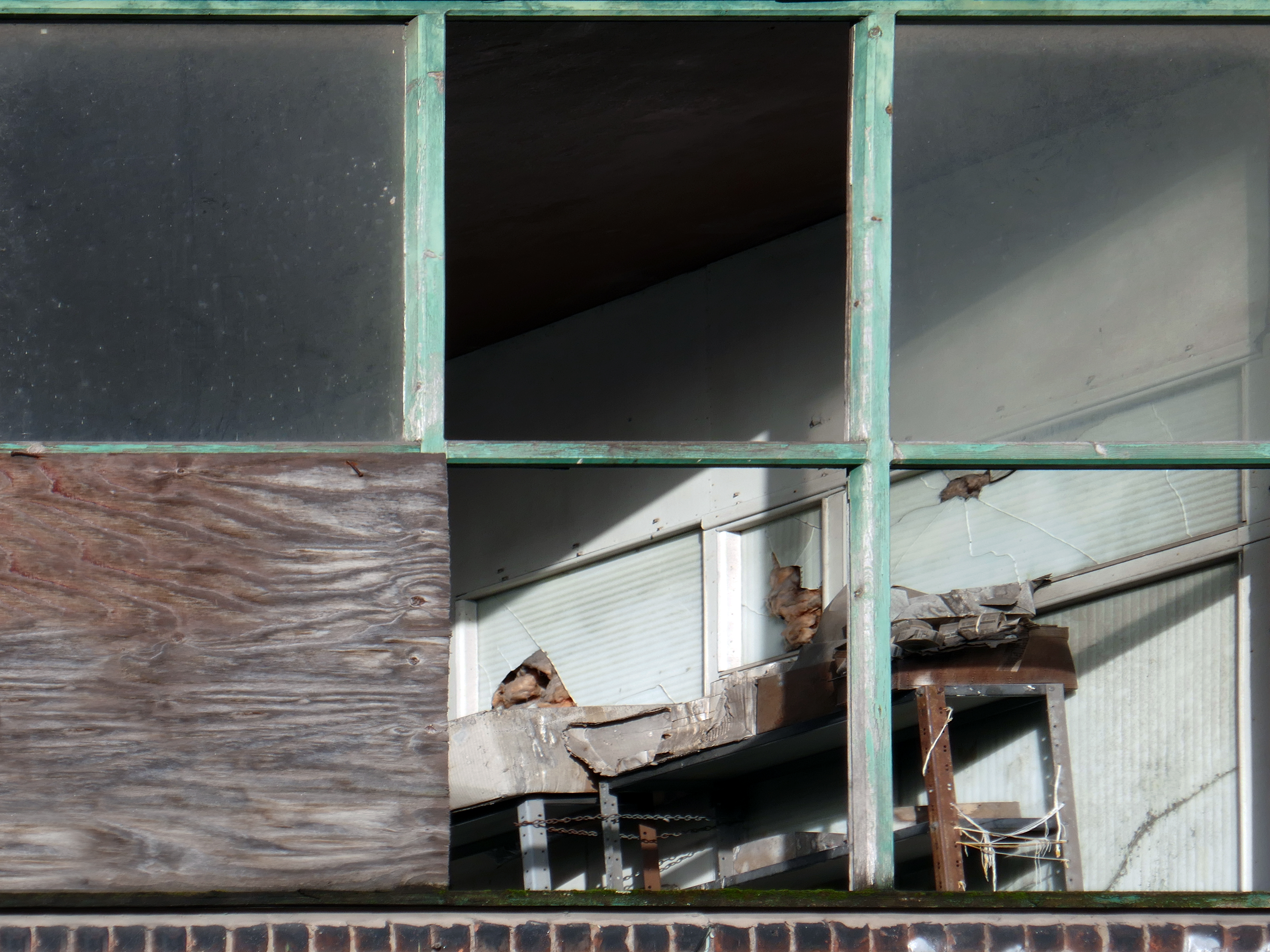
Gradually its wooden framed windows become the poked out eyes of its soul.
Light fittings hang limp and unlit, as the interior decor deteriorates.
The restless rust inhabits the lower metallic fenestration.
Block work blocks the blocked up entrances.
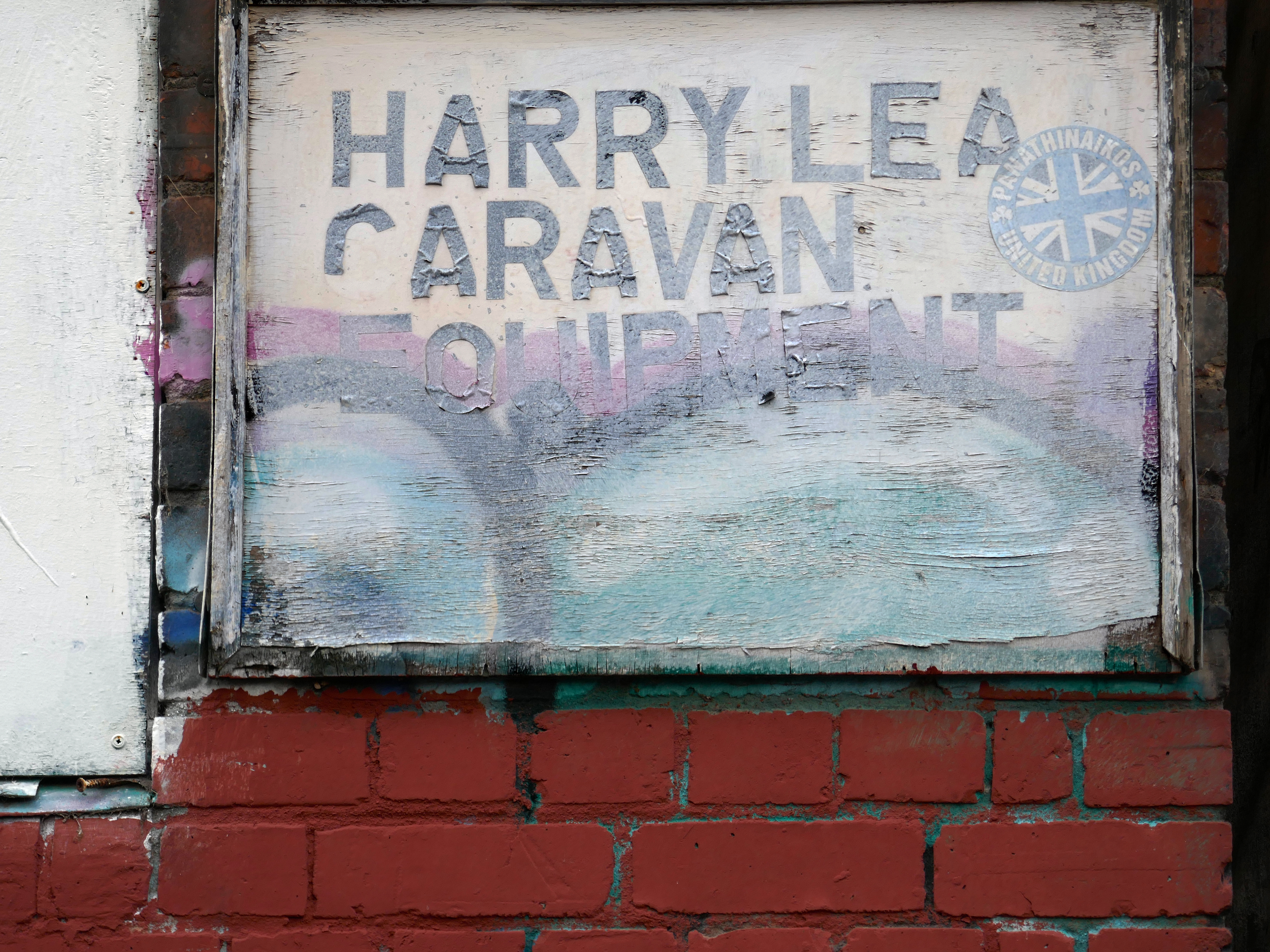
The ampersand can be traced back to the 1st century AD and the old Roman cursive, in which the letters E and T occasionally were written together to form a ligature.
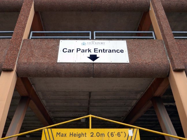
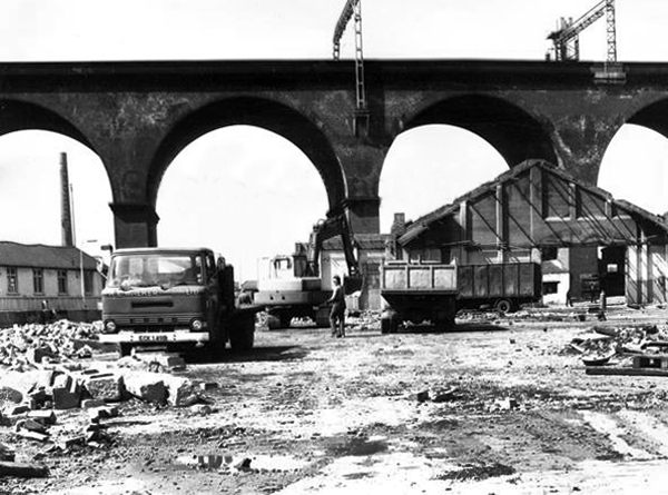
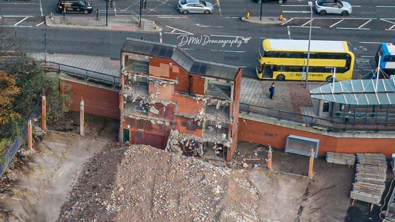
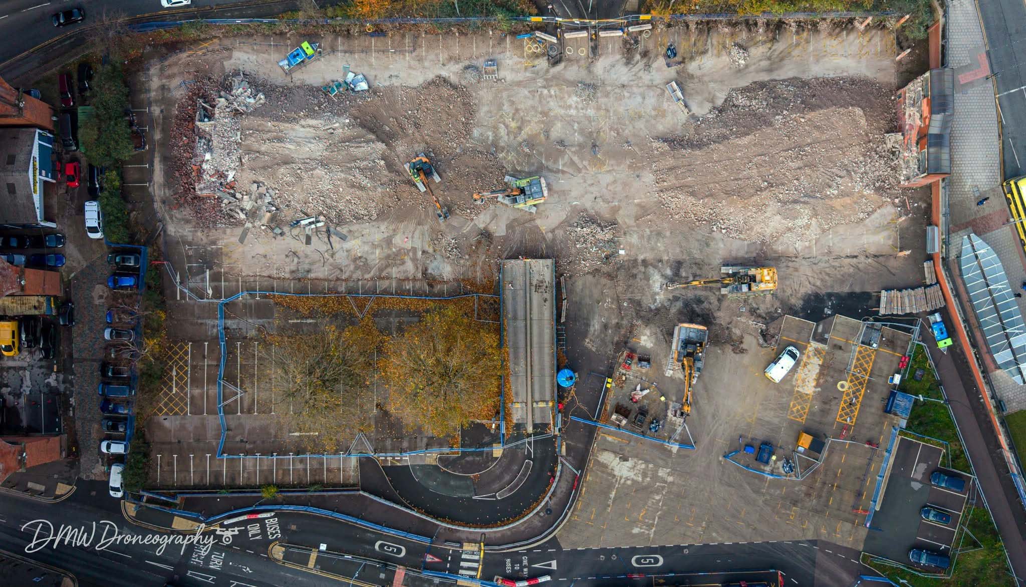
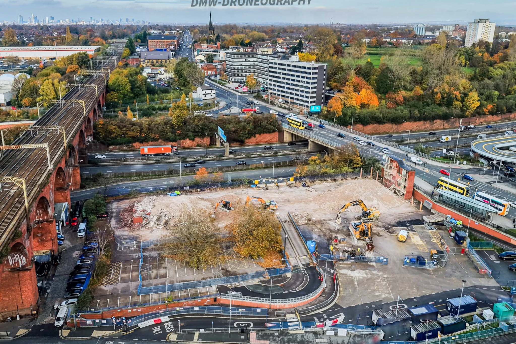
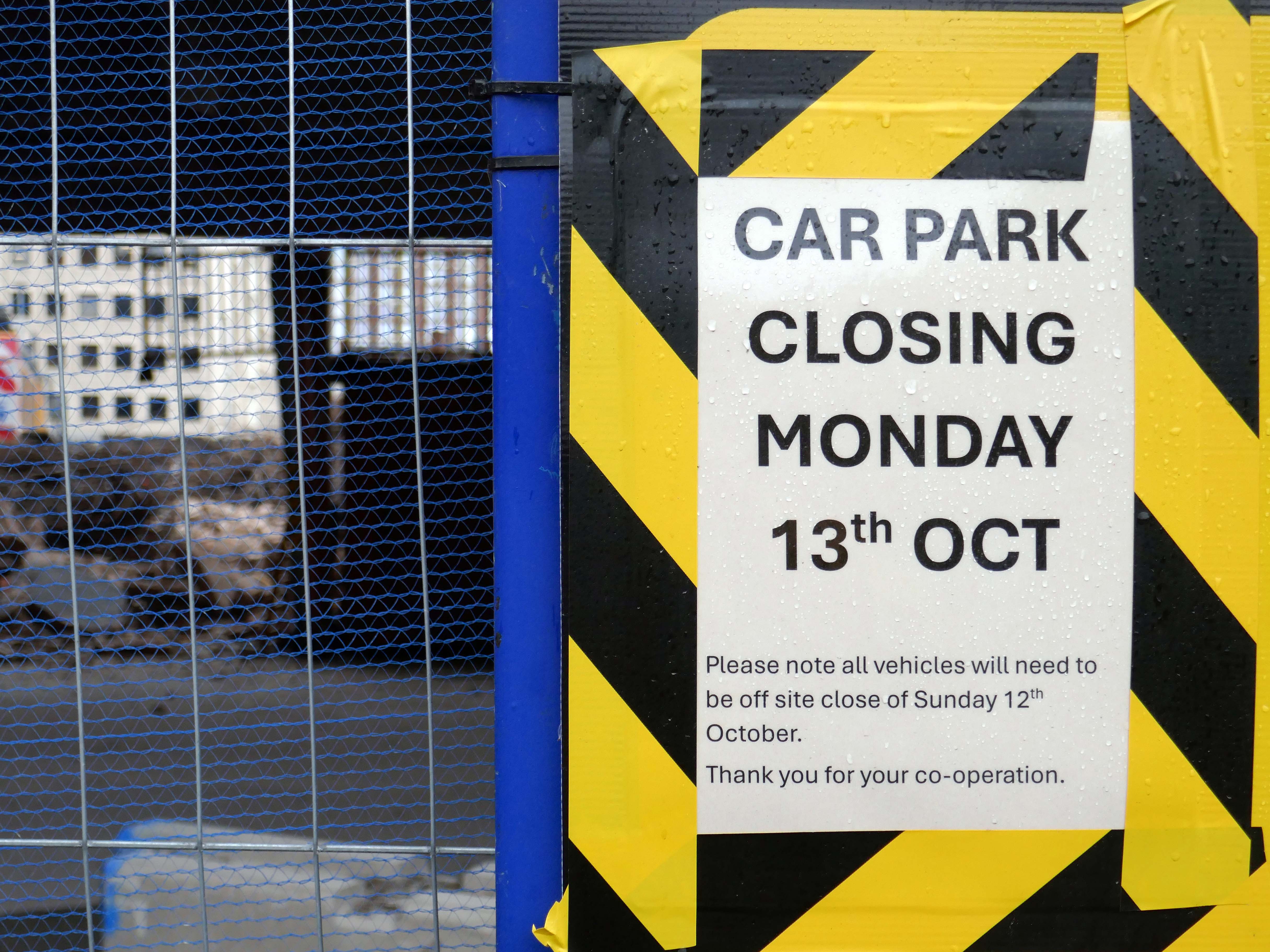
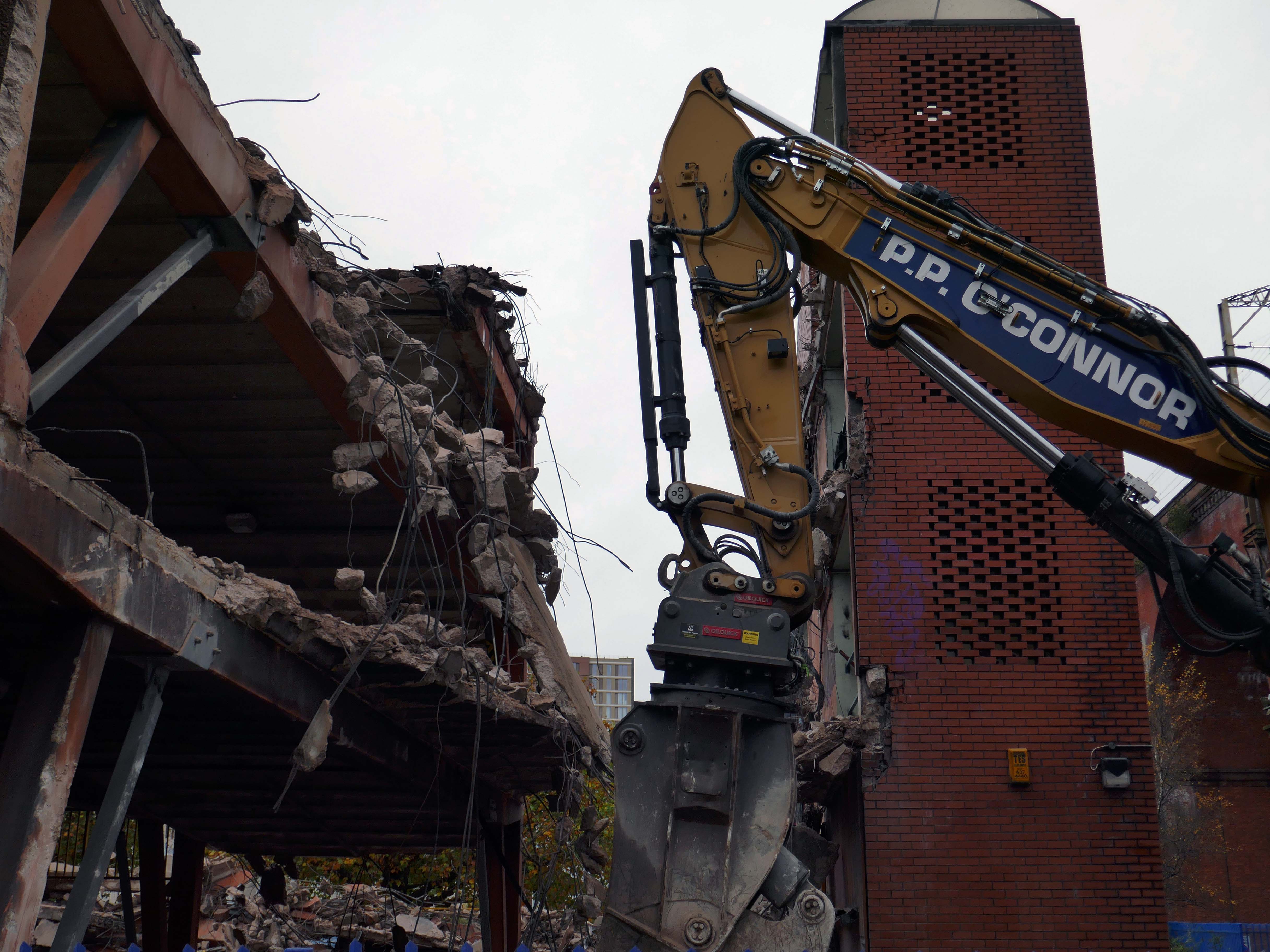
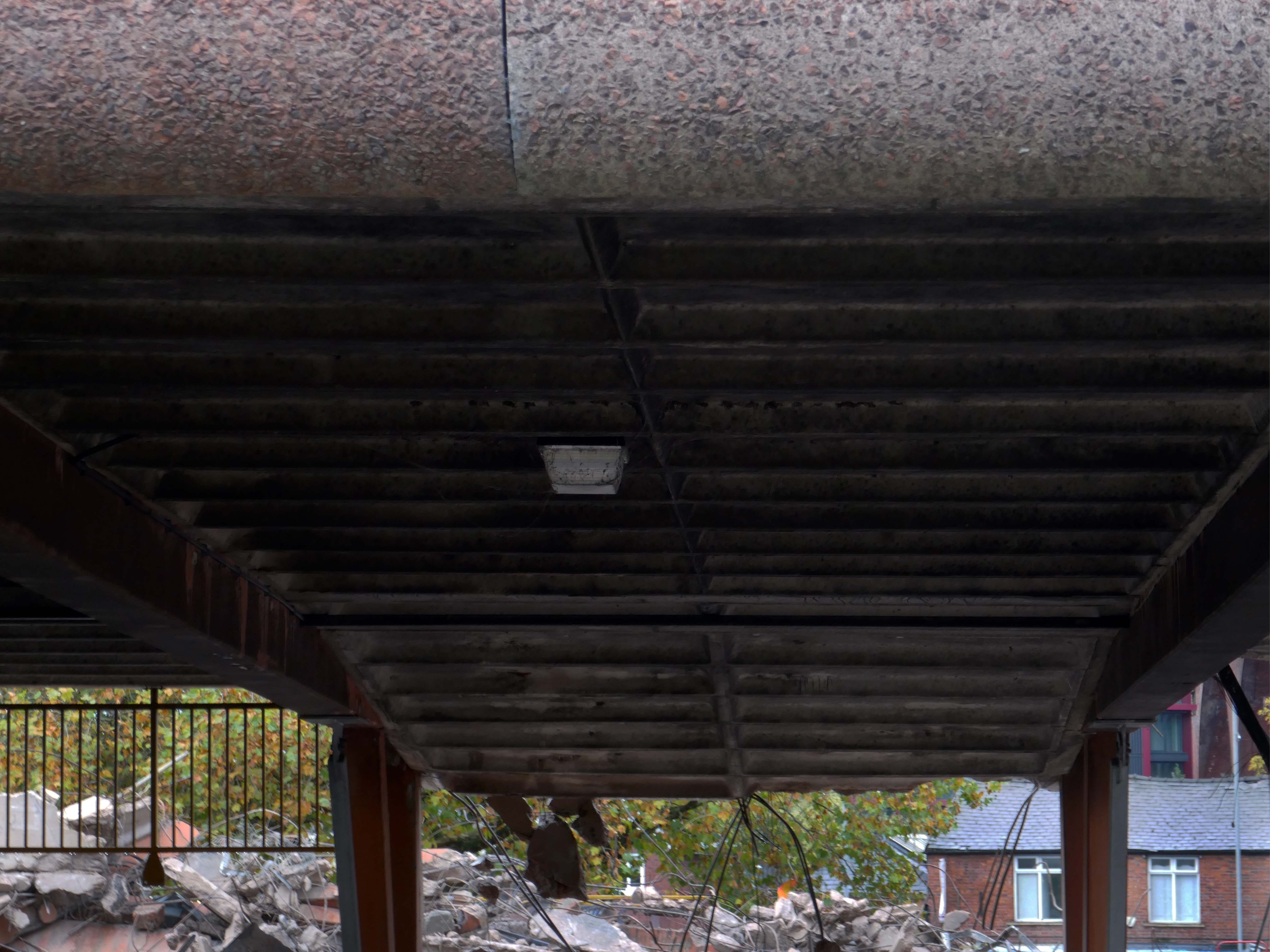
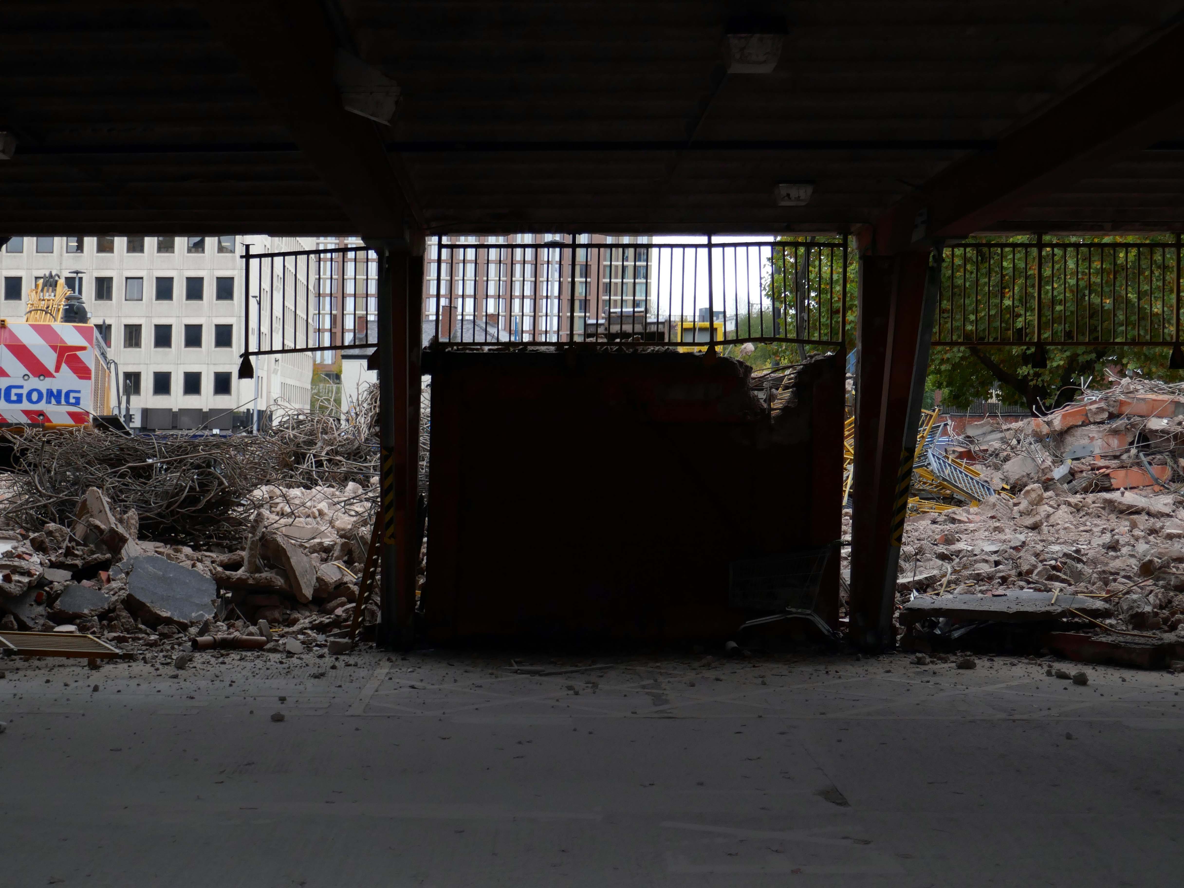
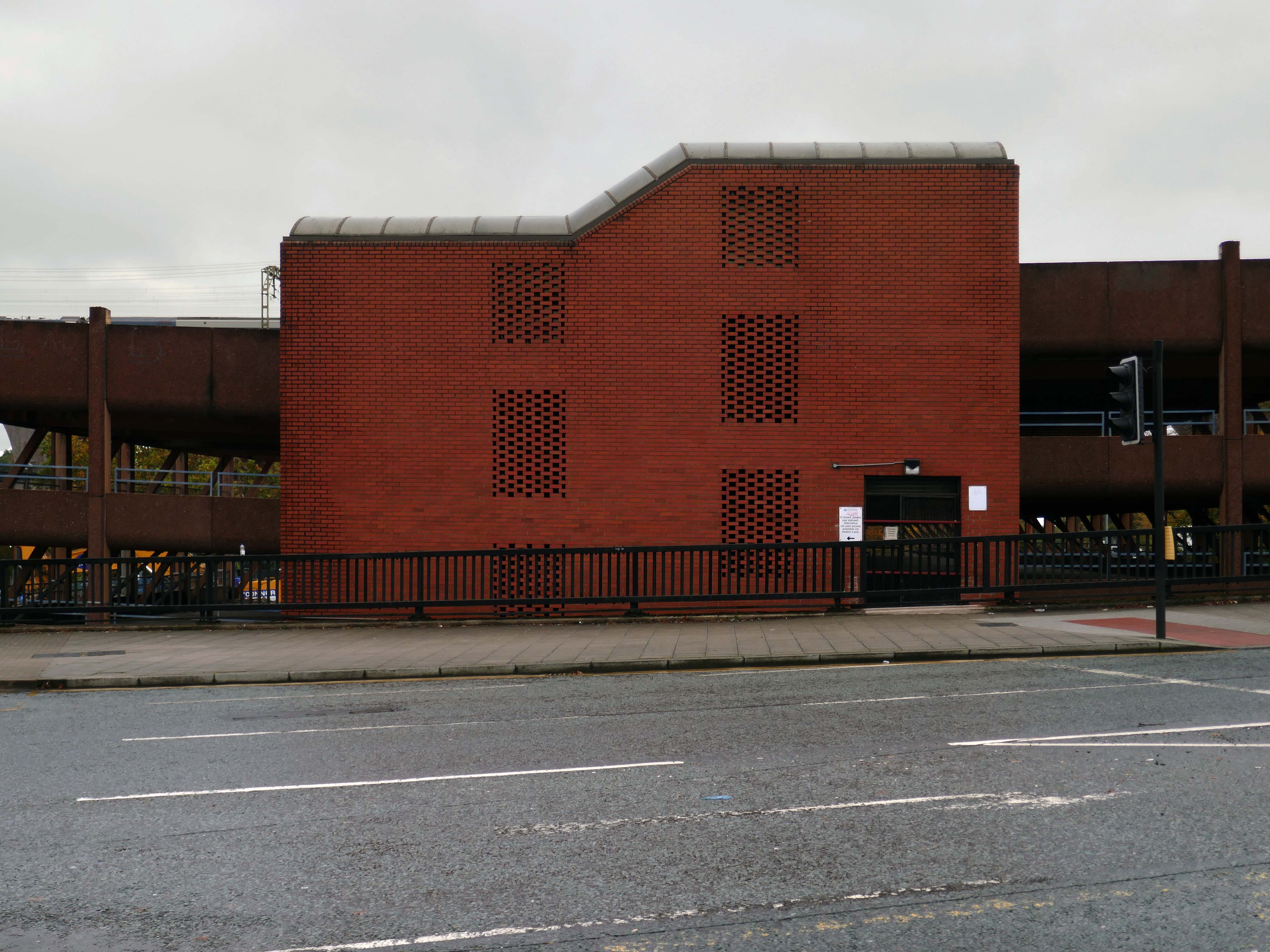
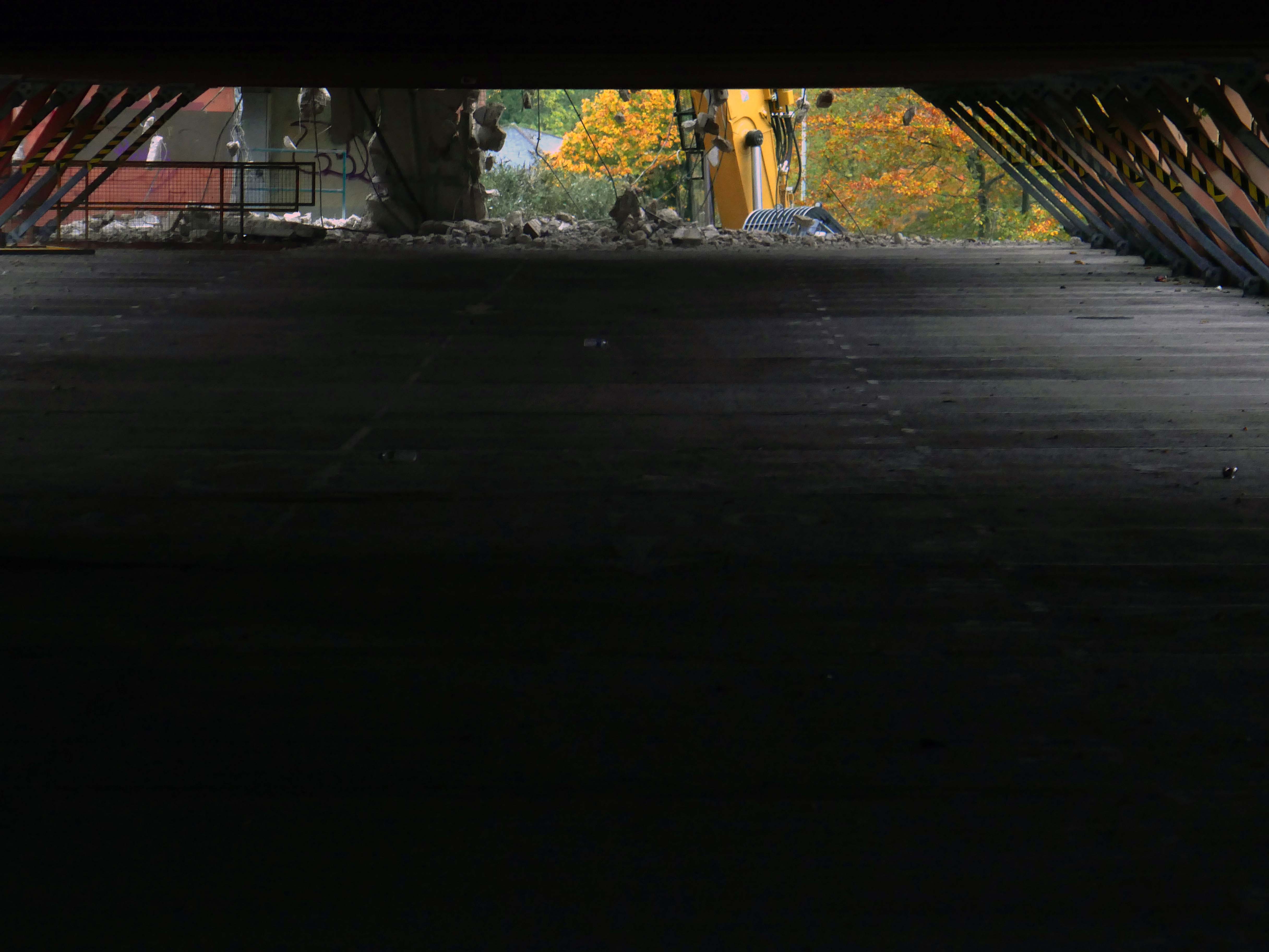
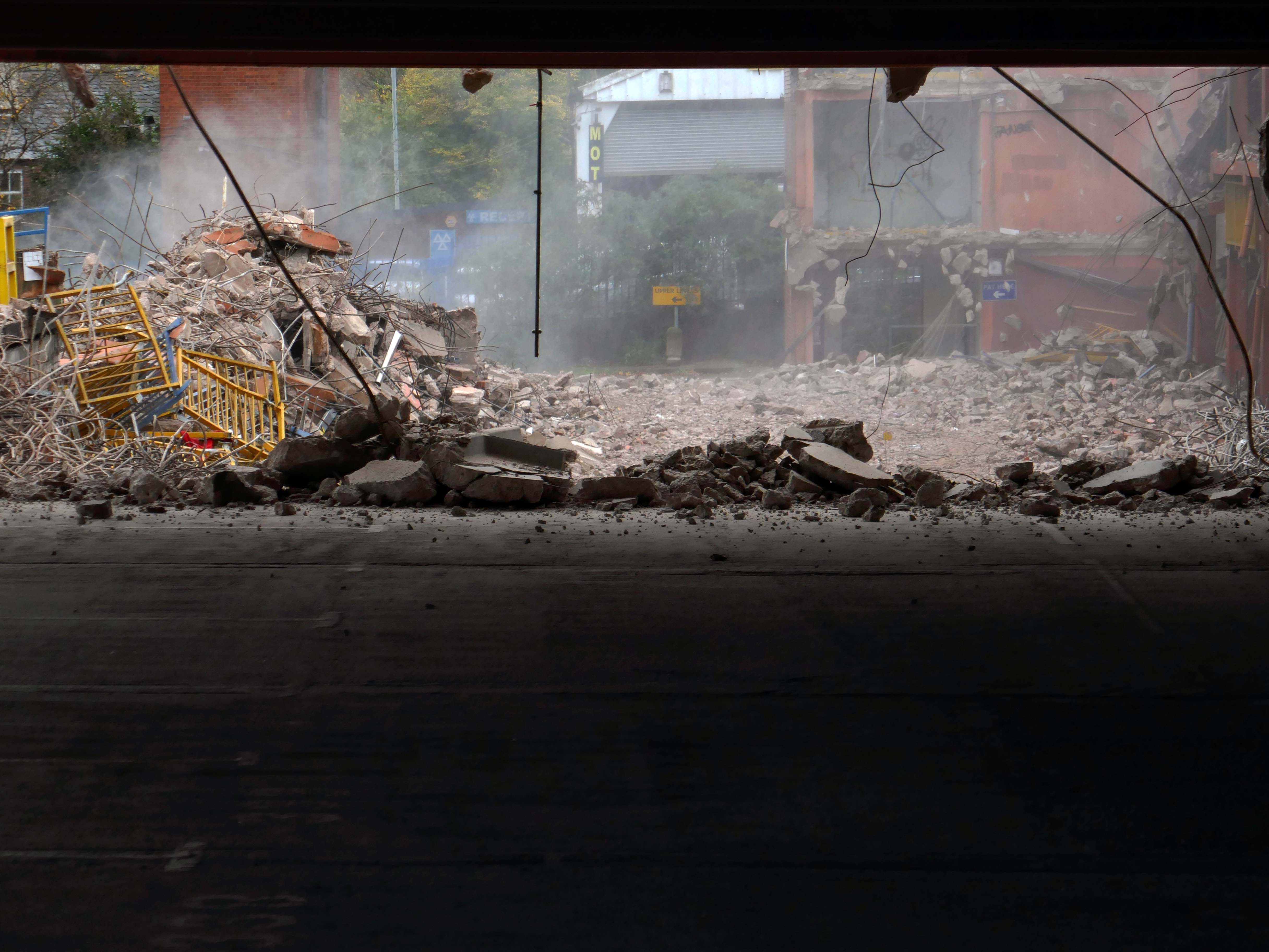
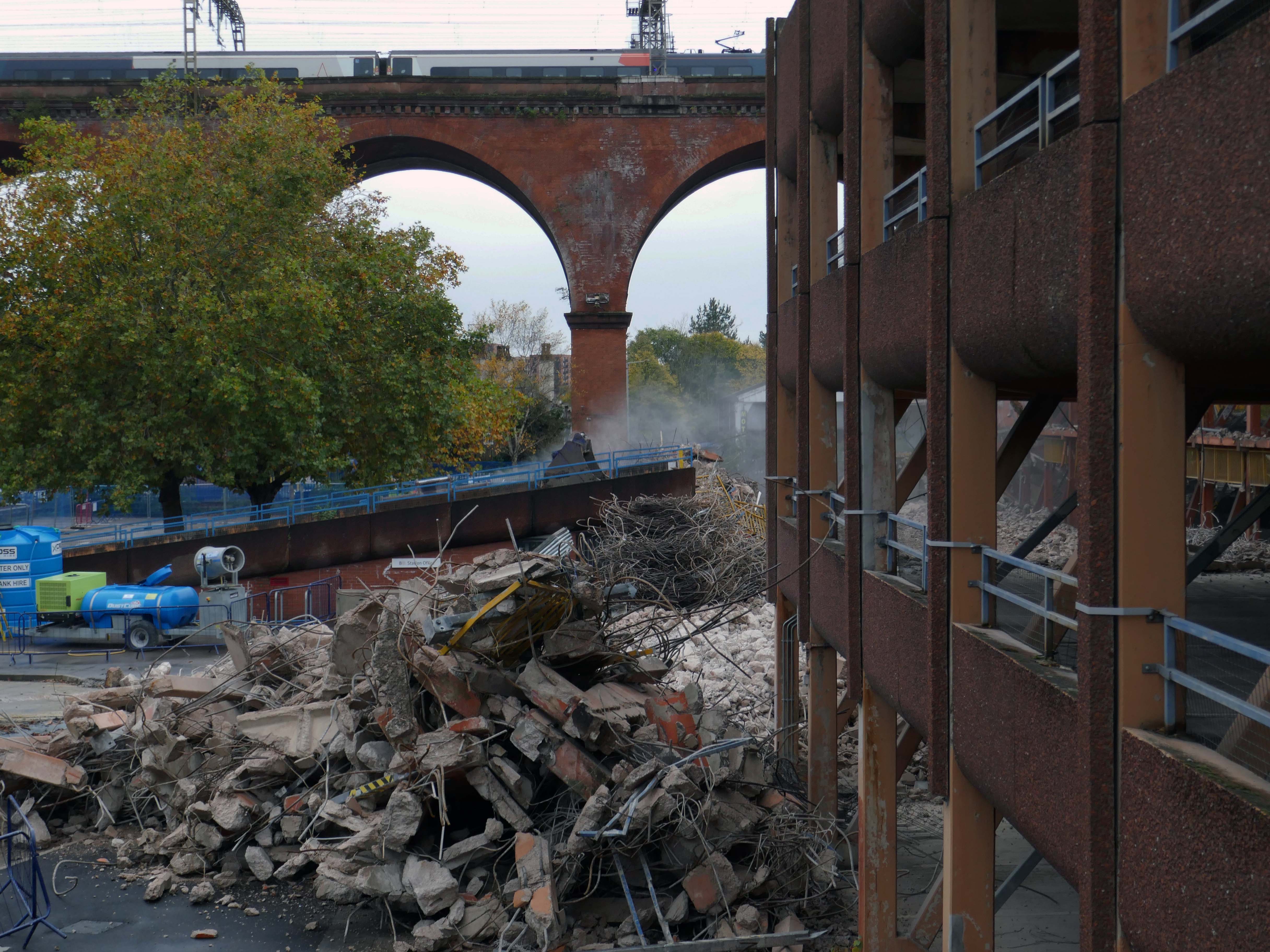
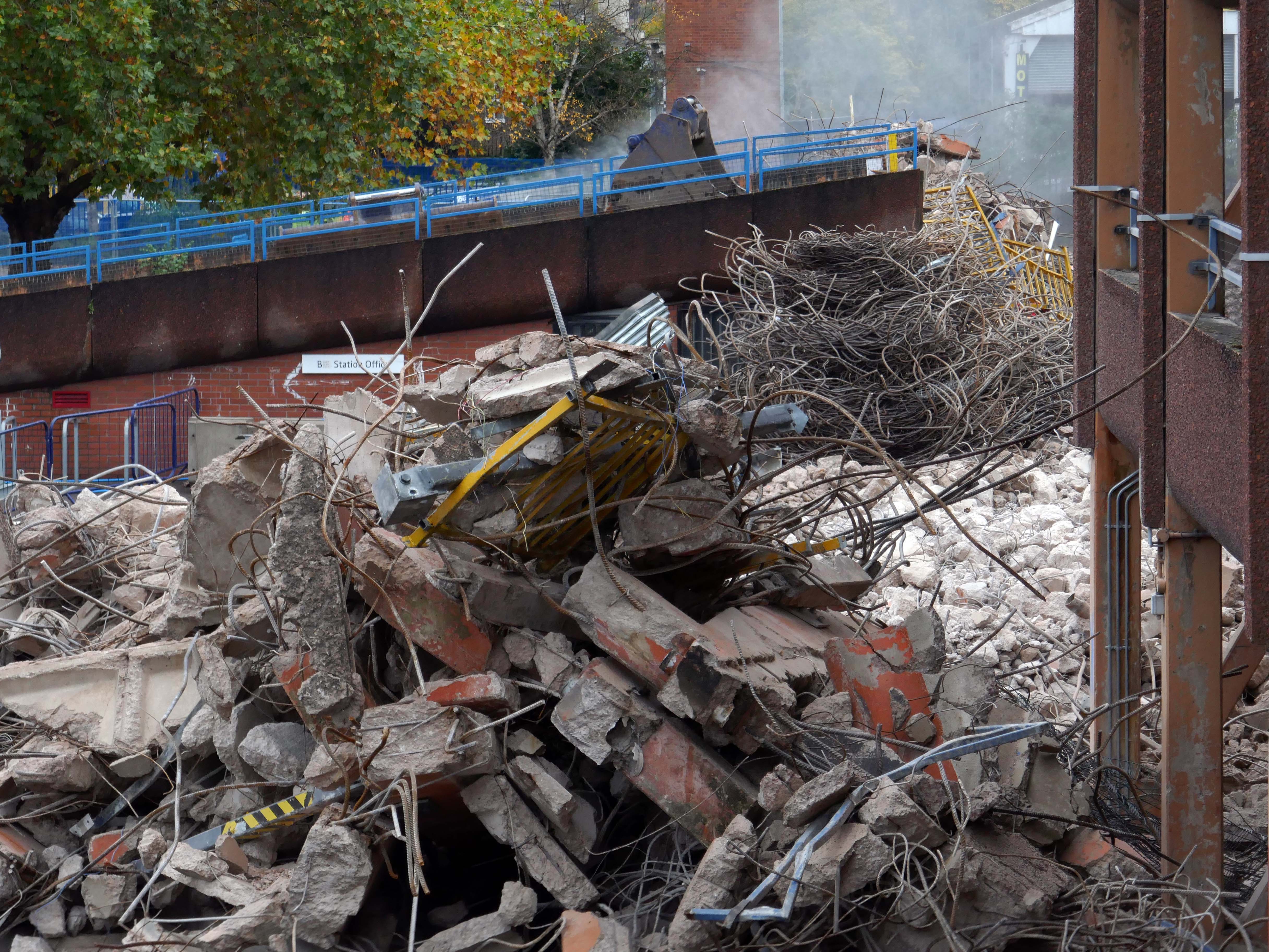
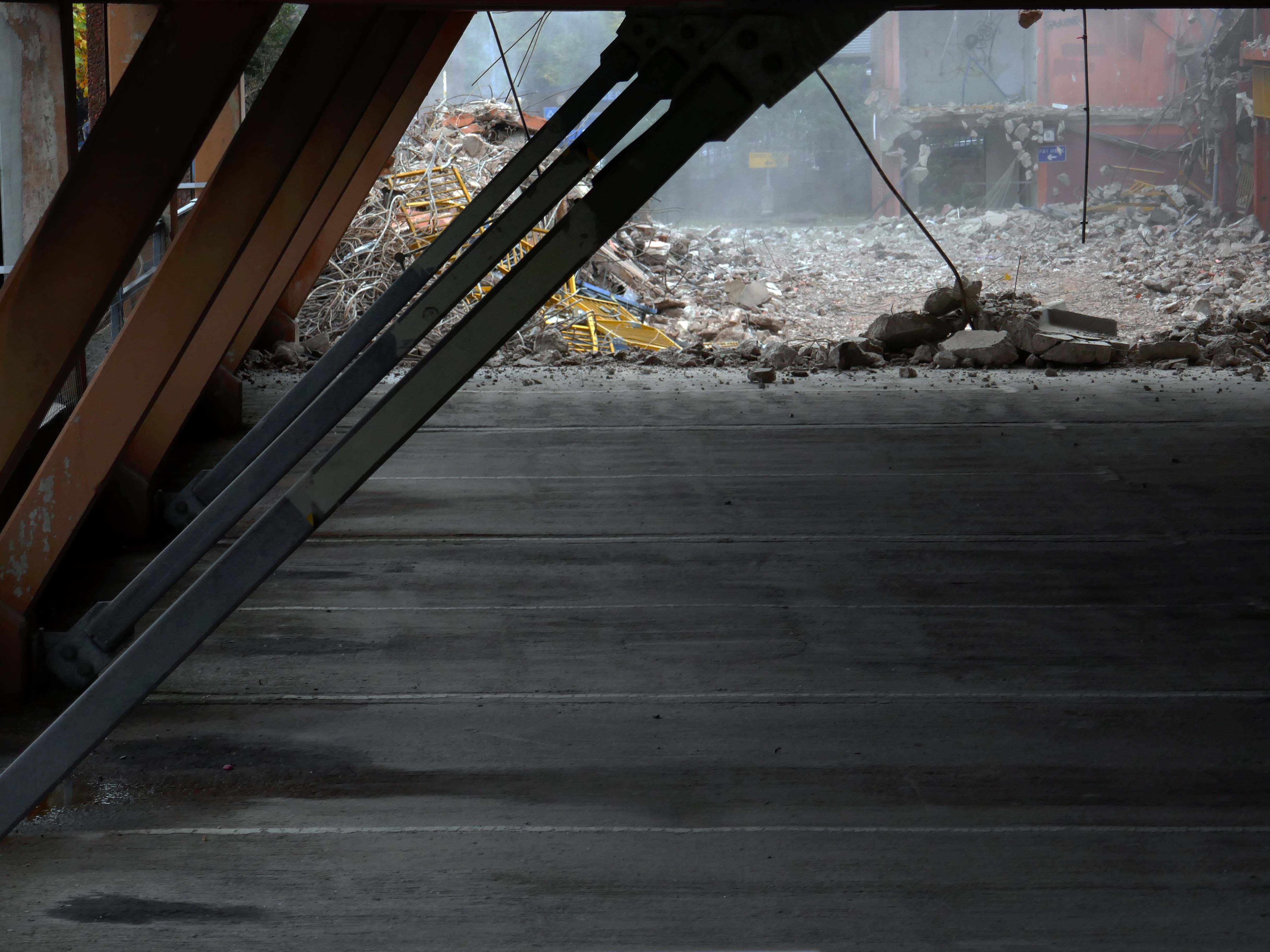
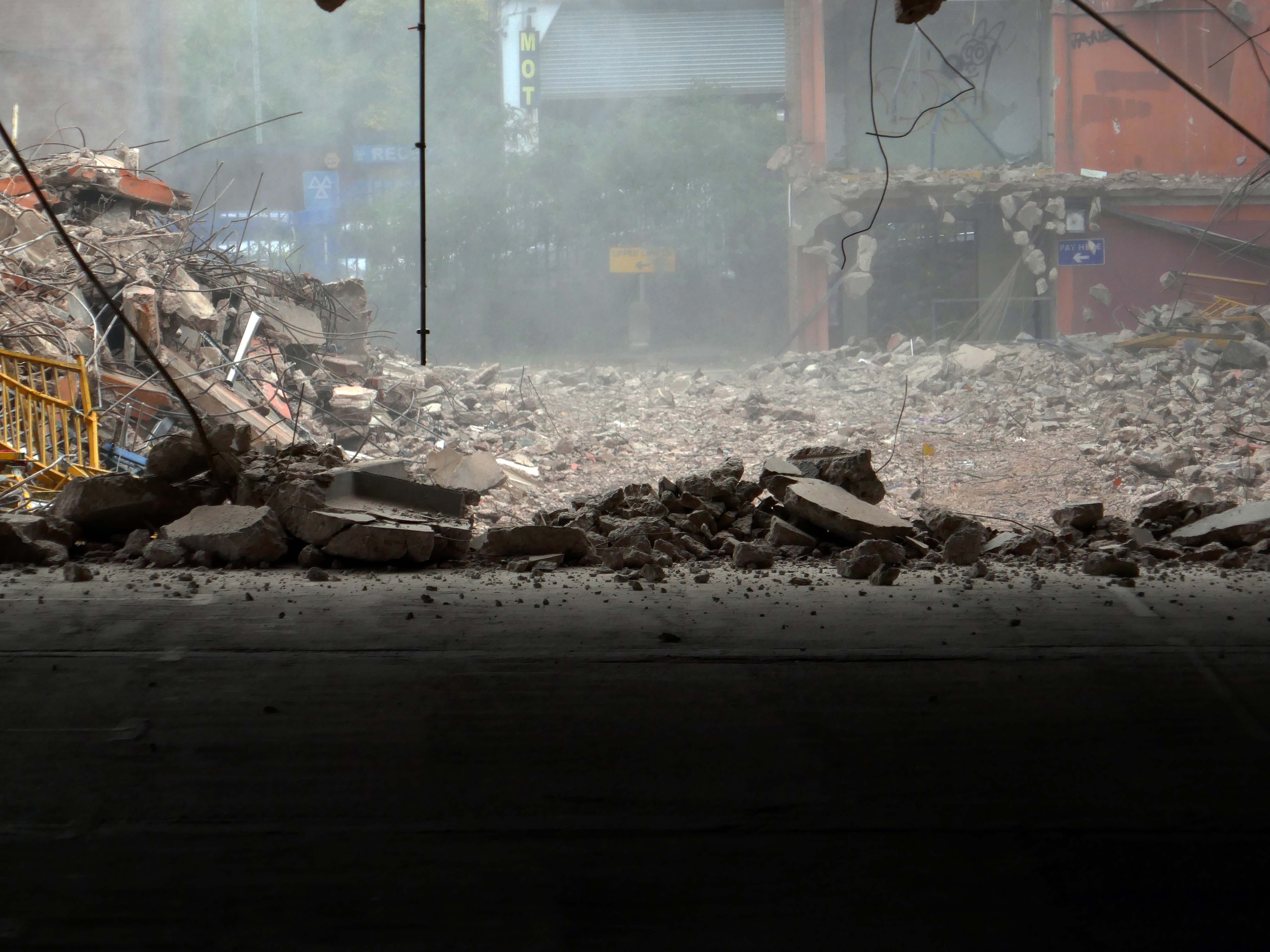
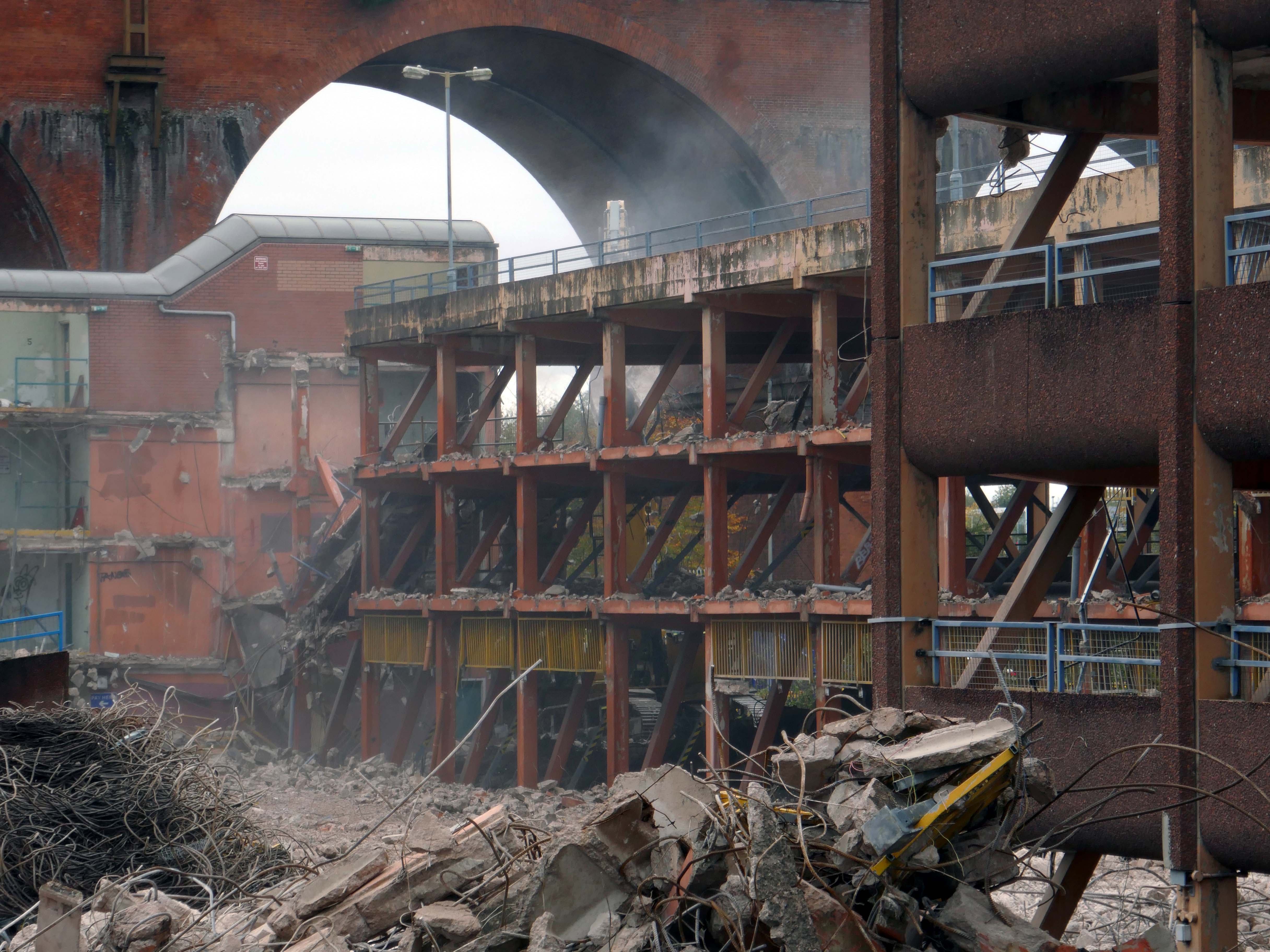
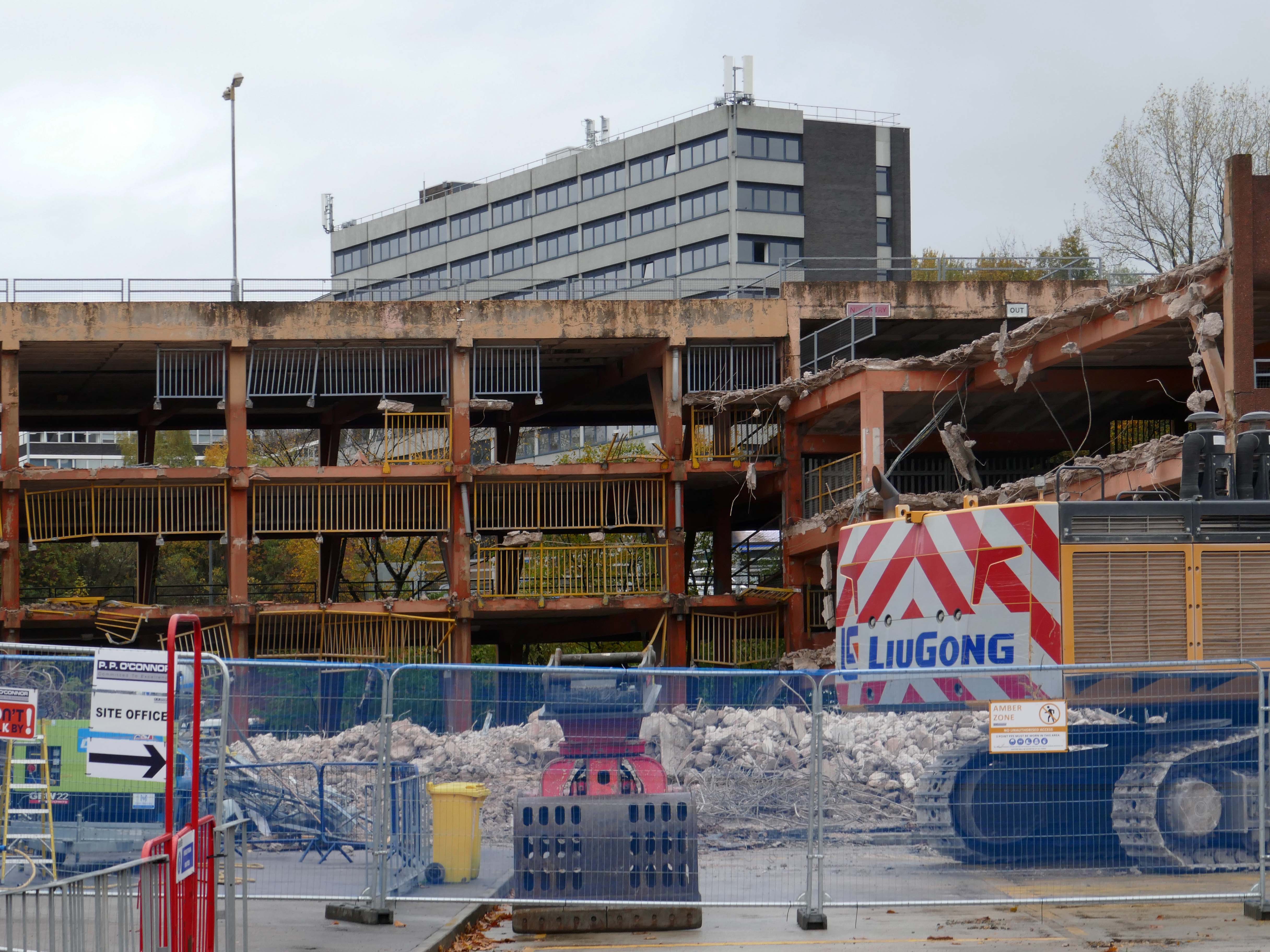
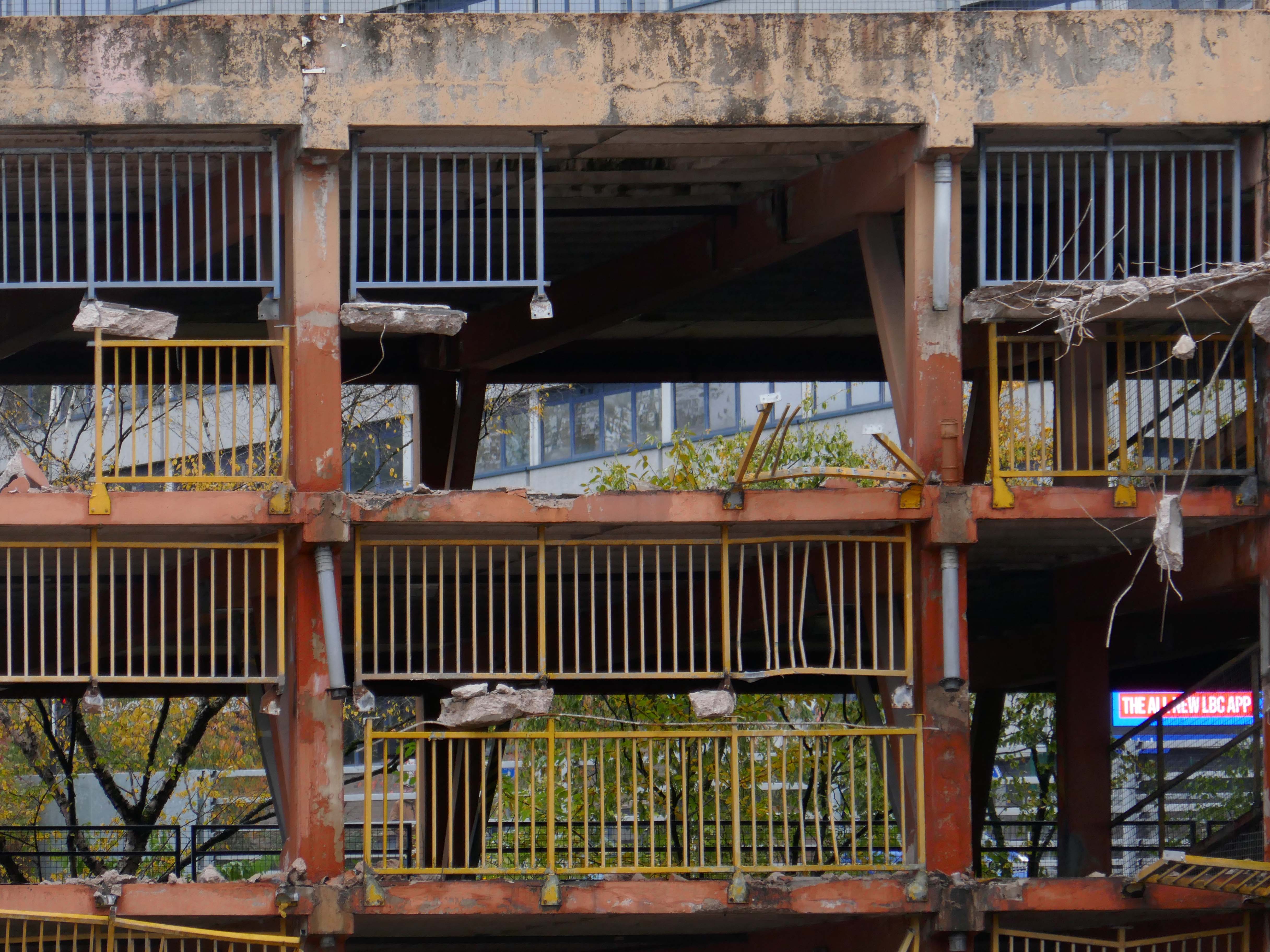
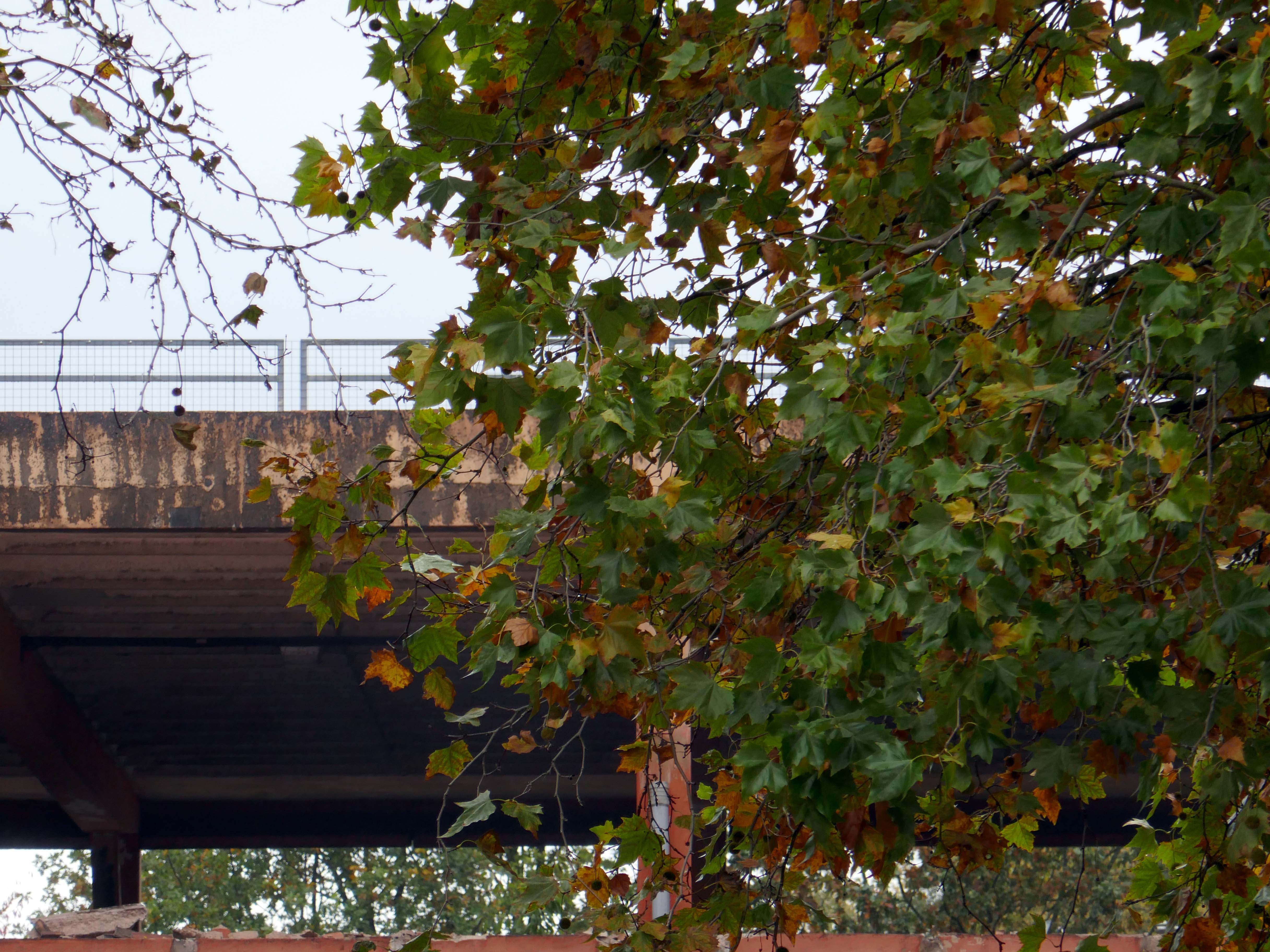
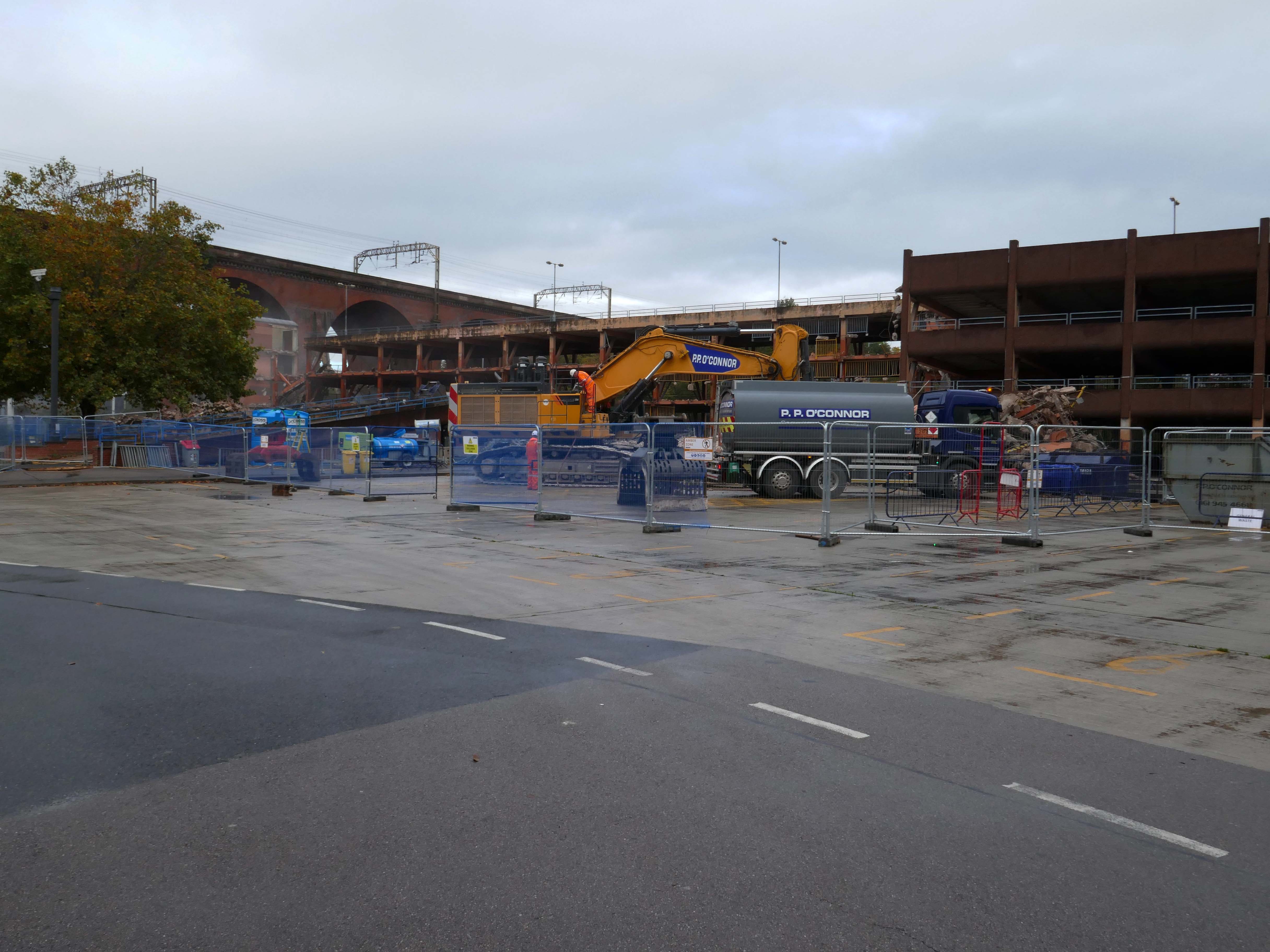
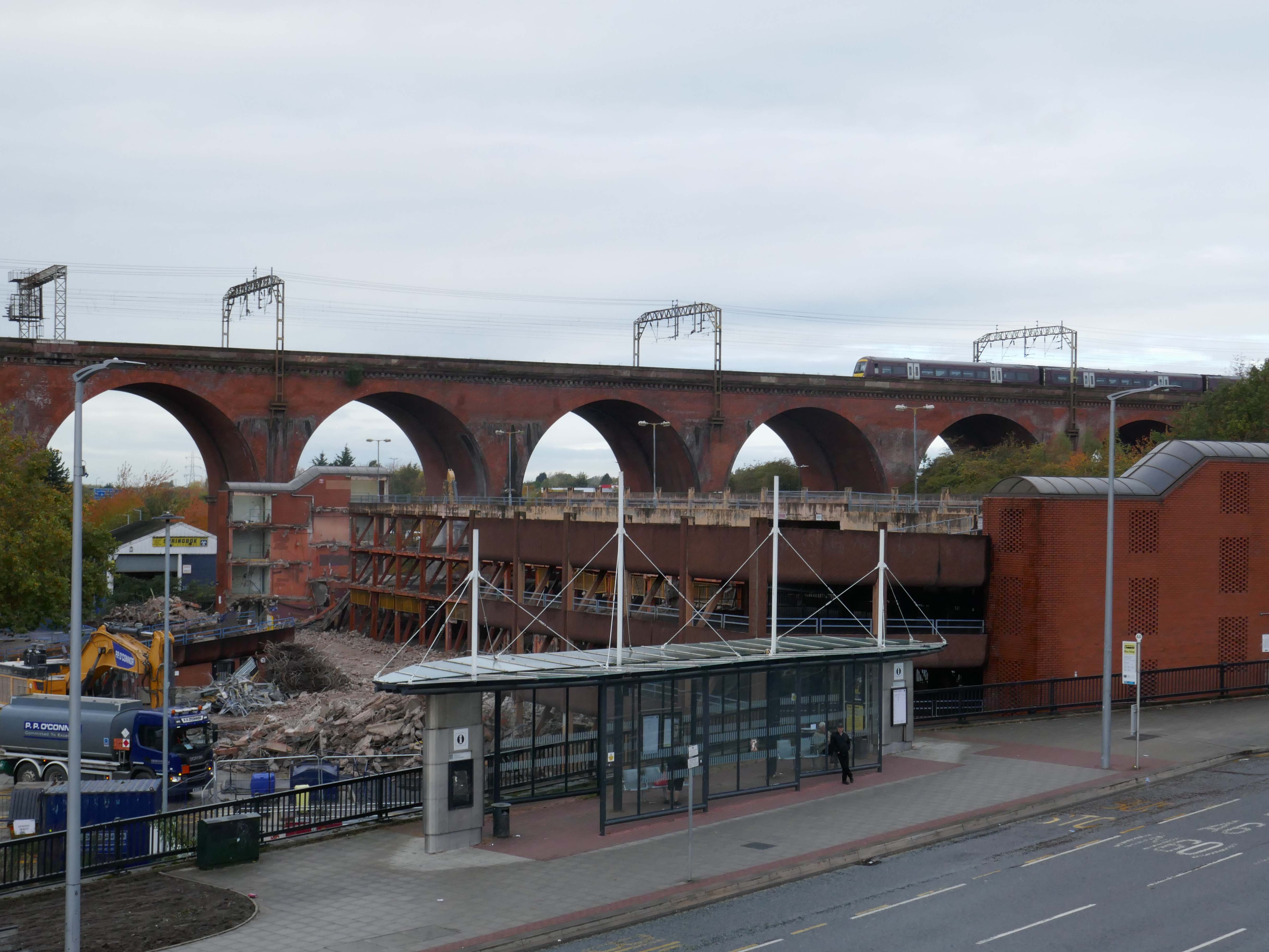
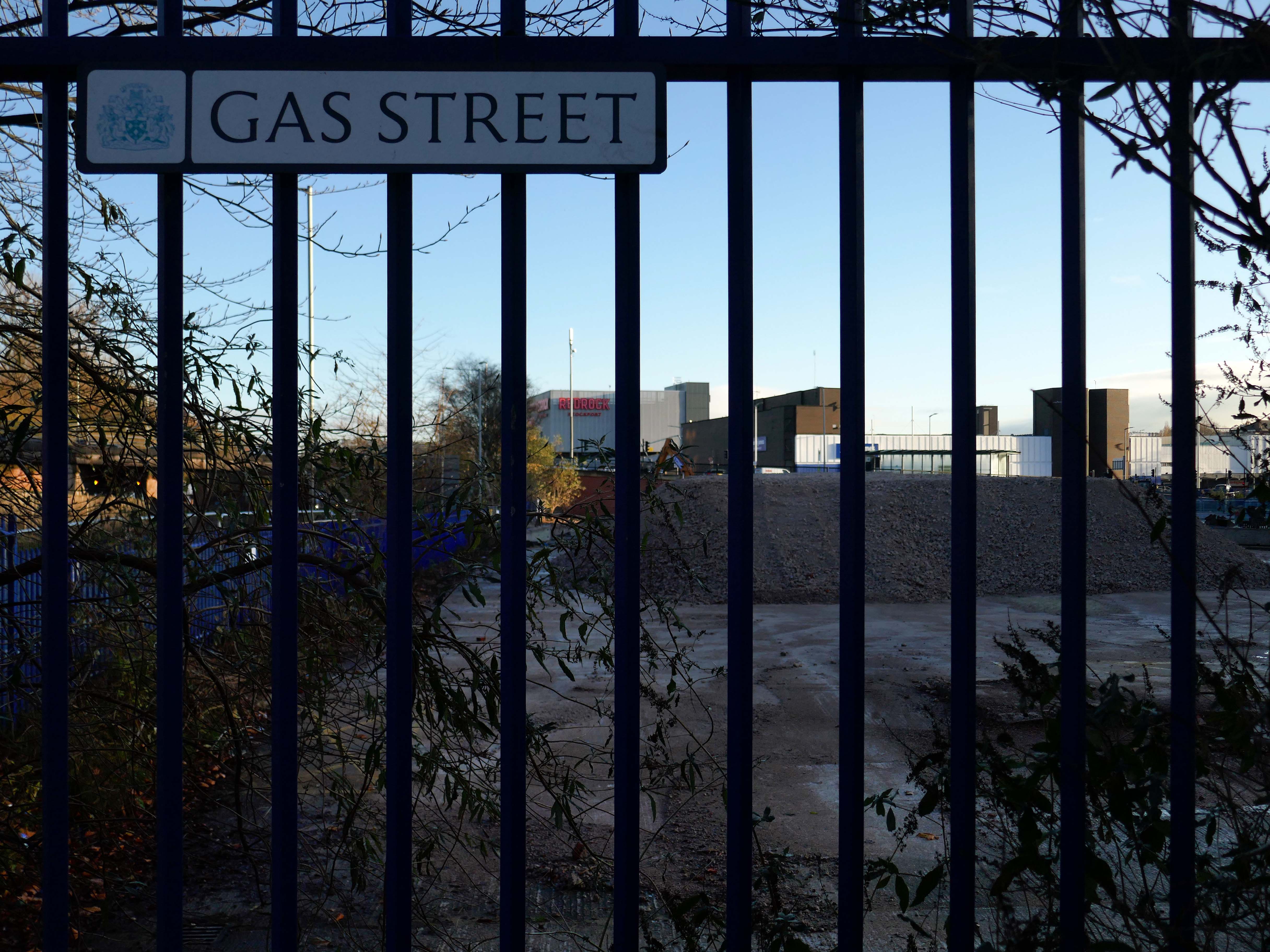
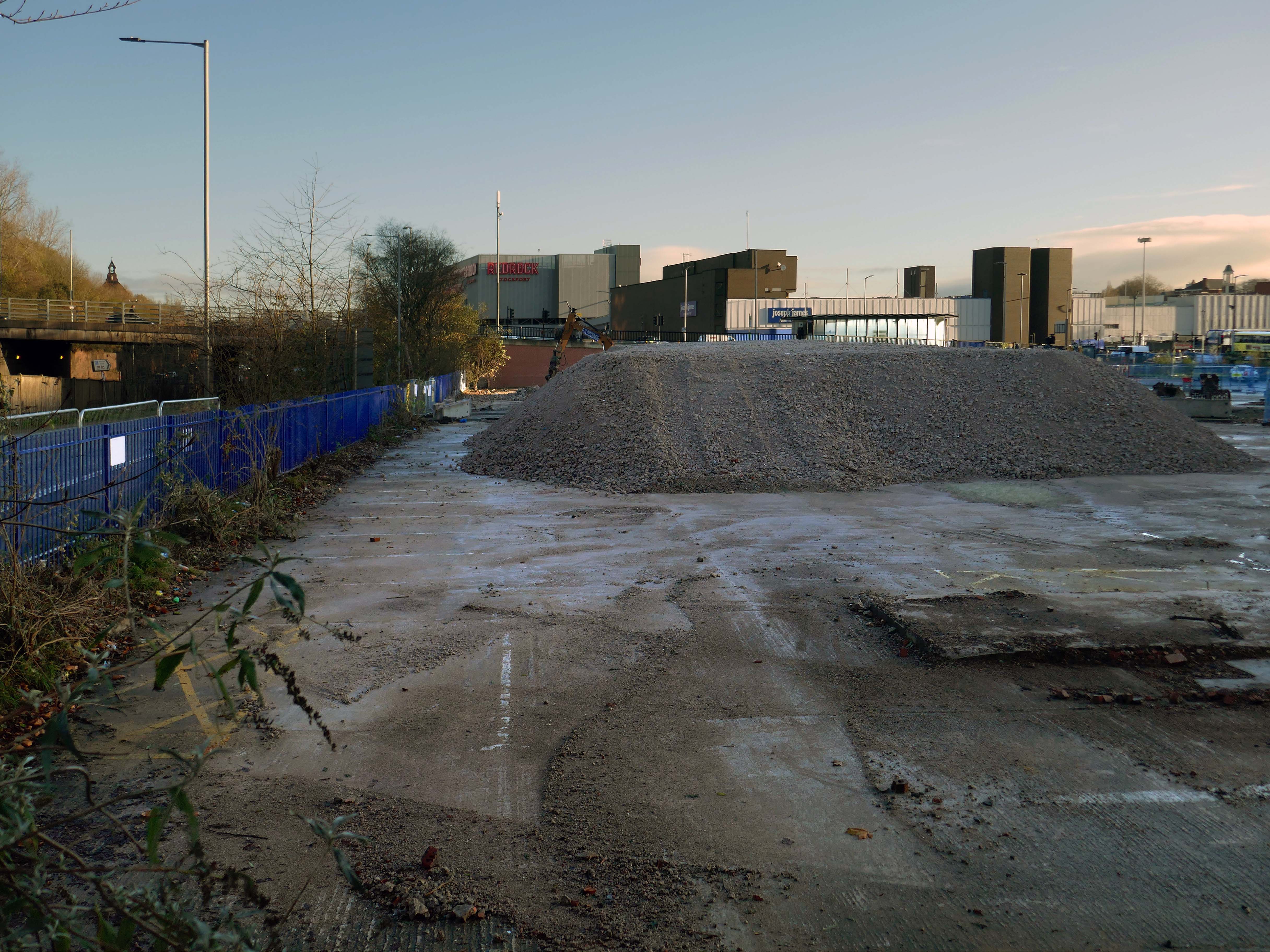
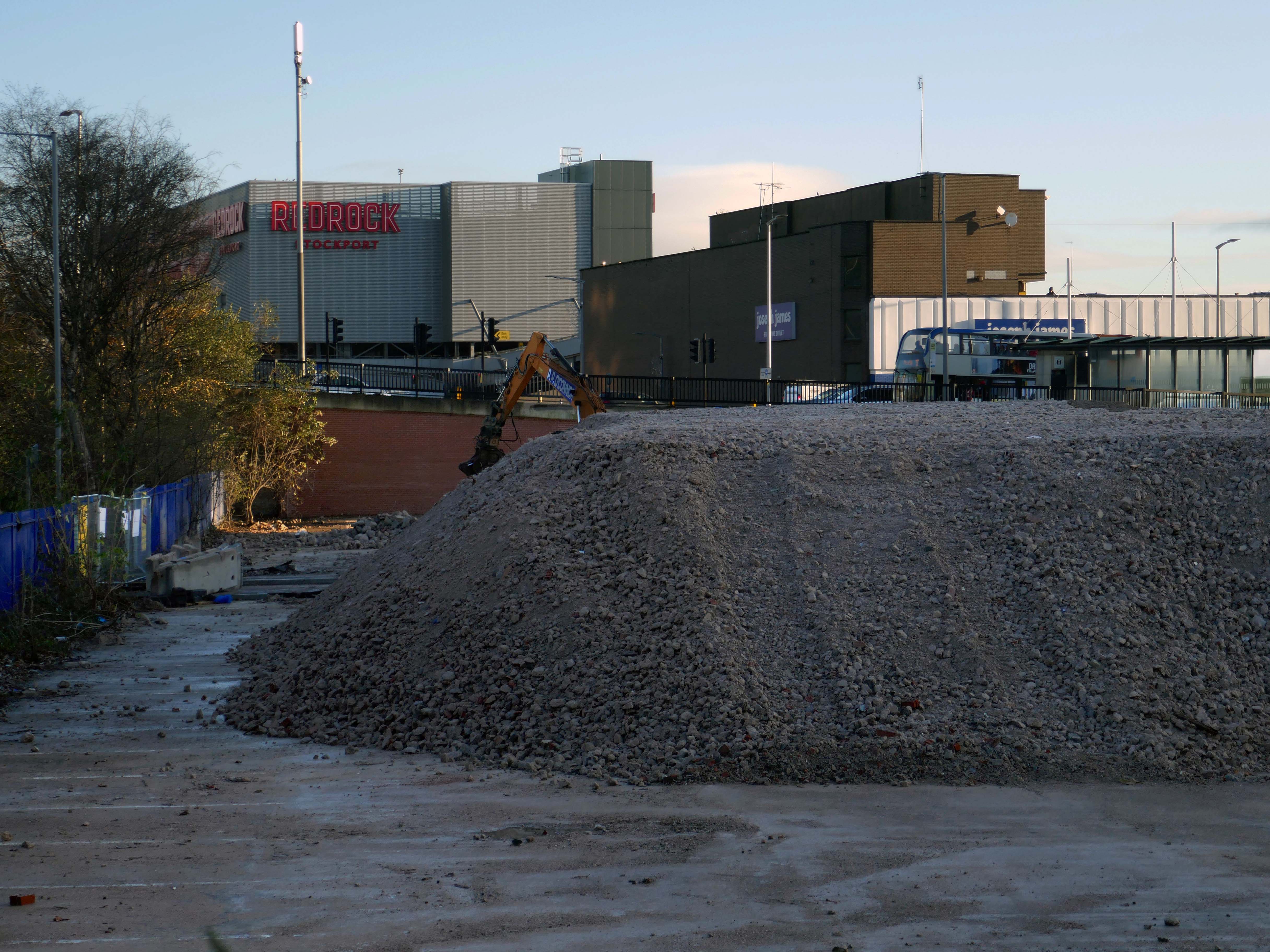
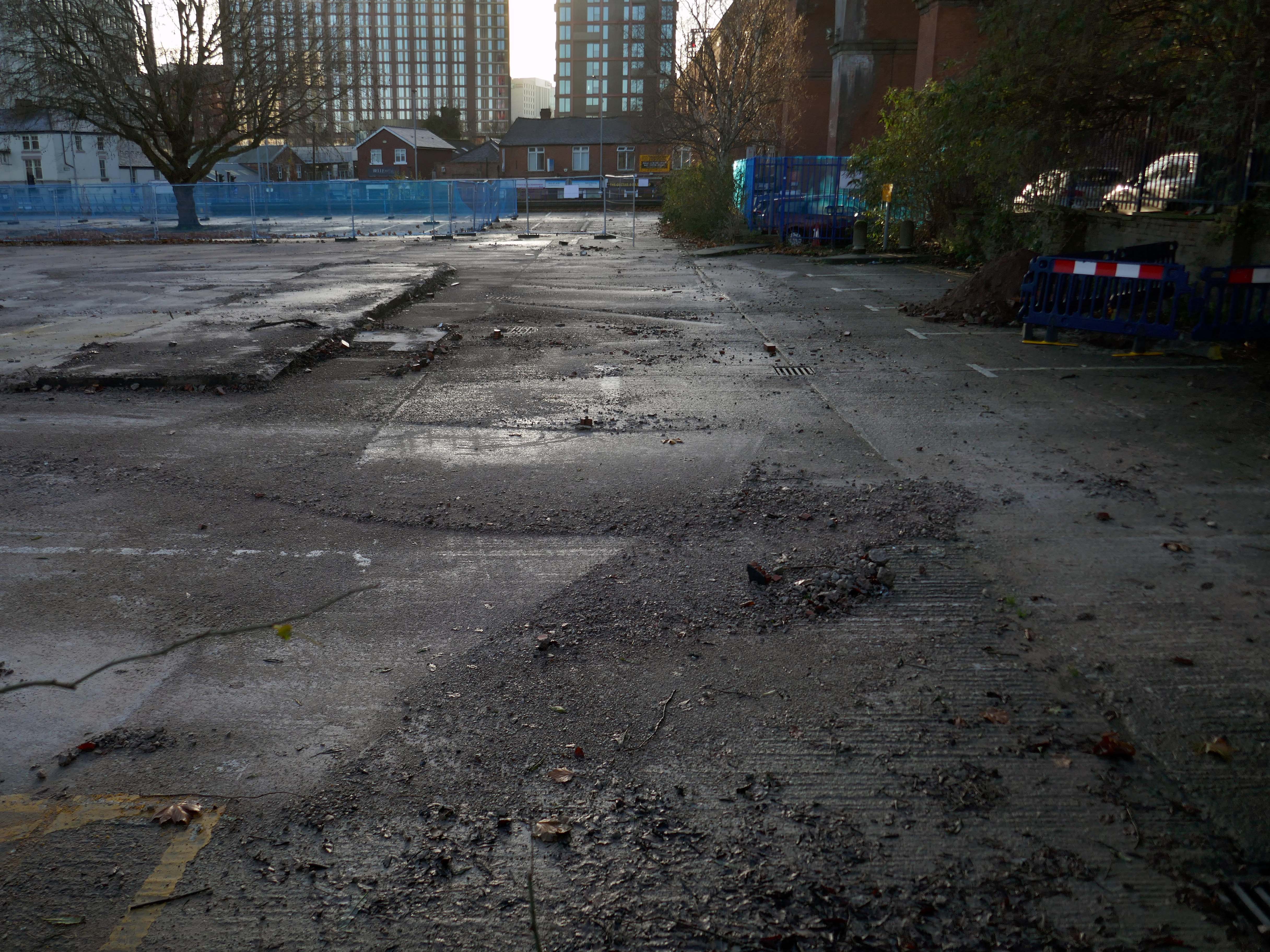
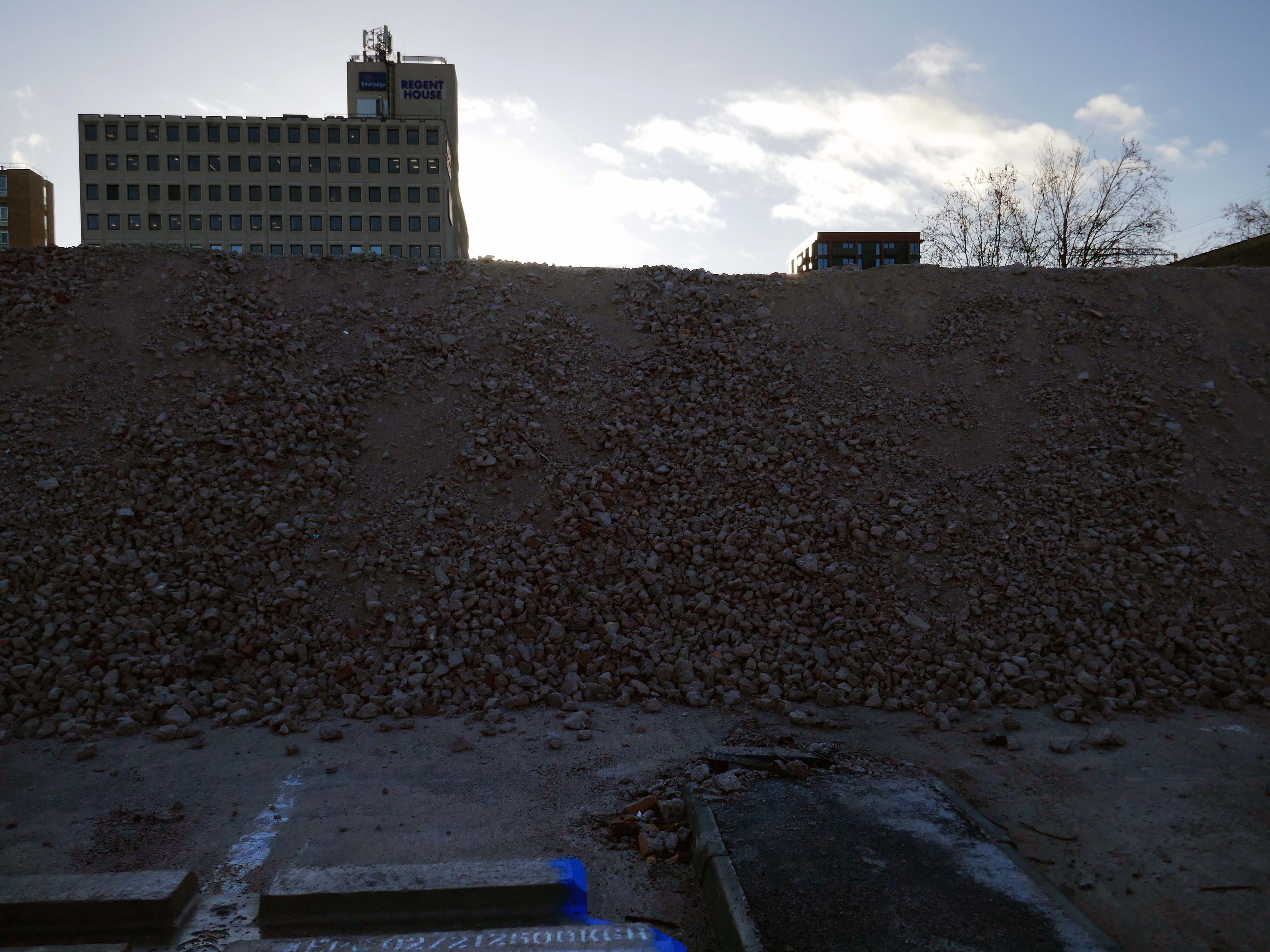
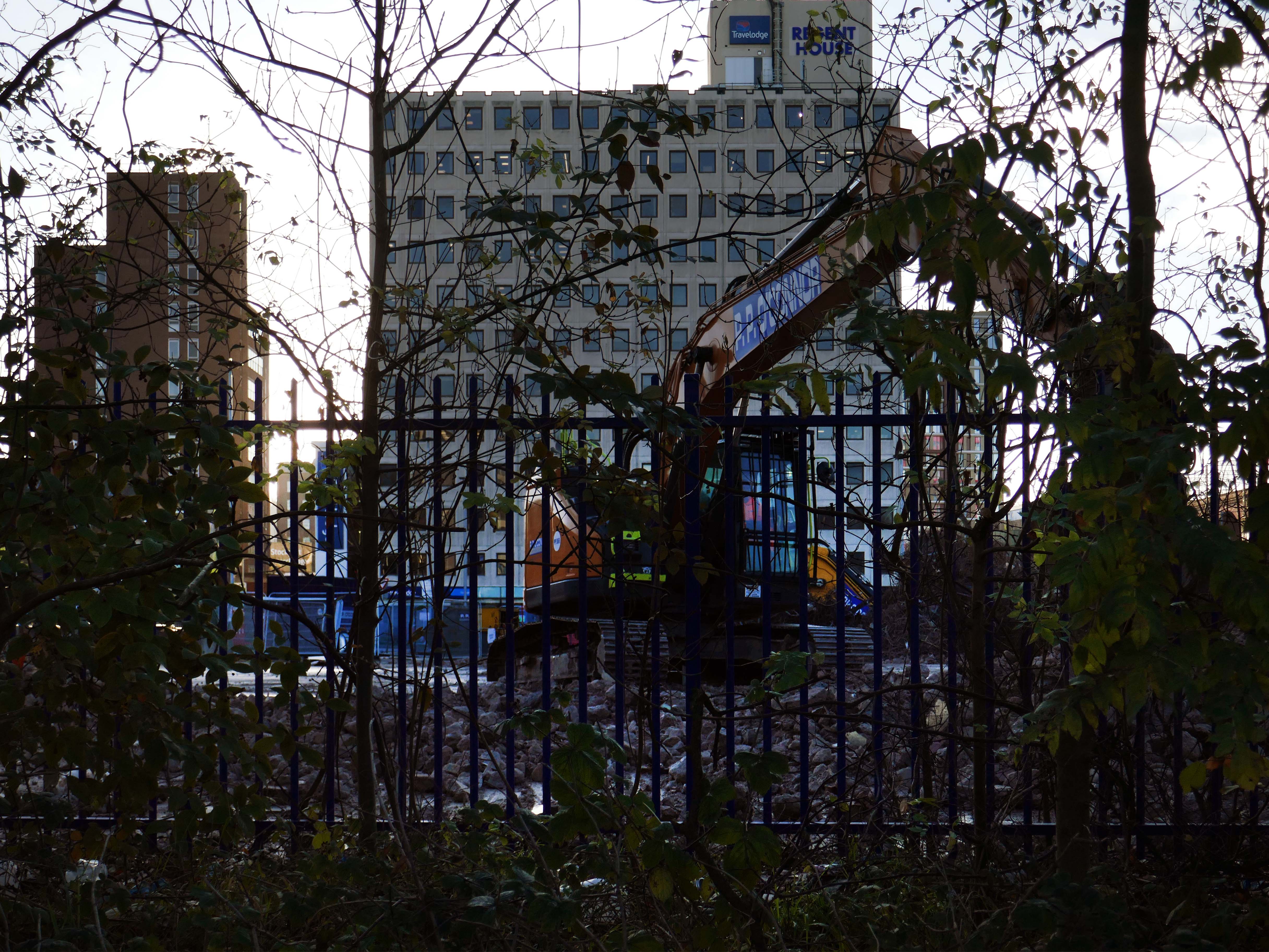
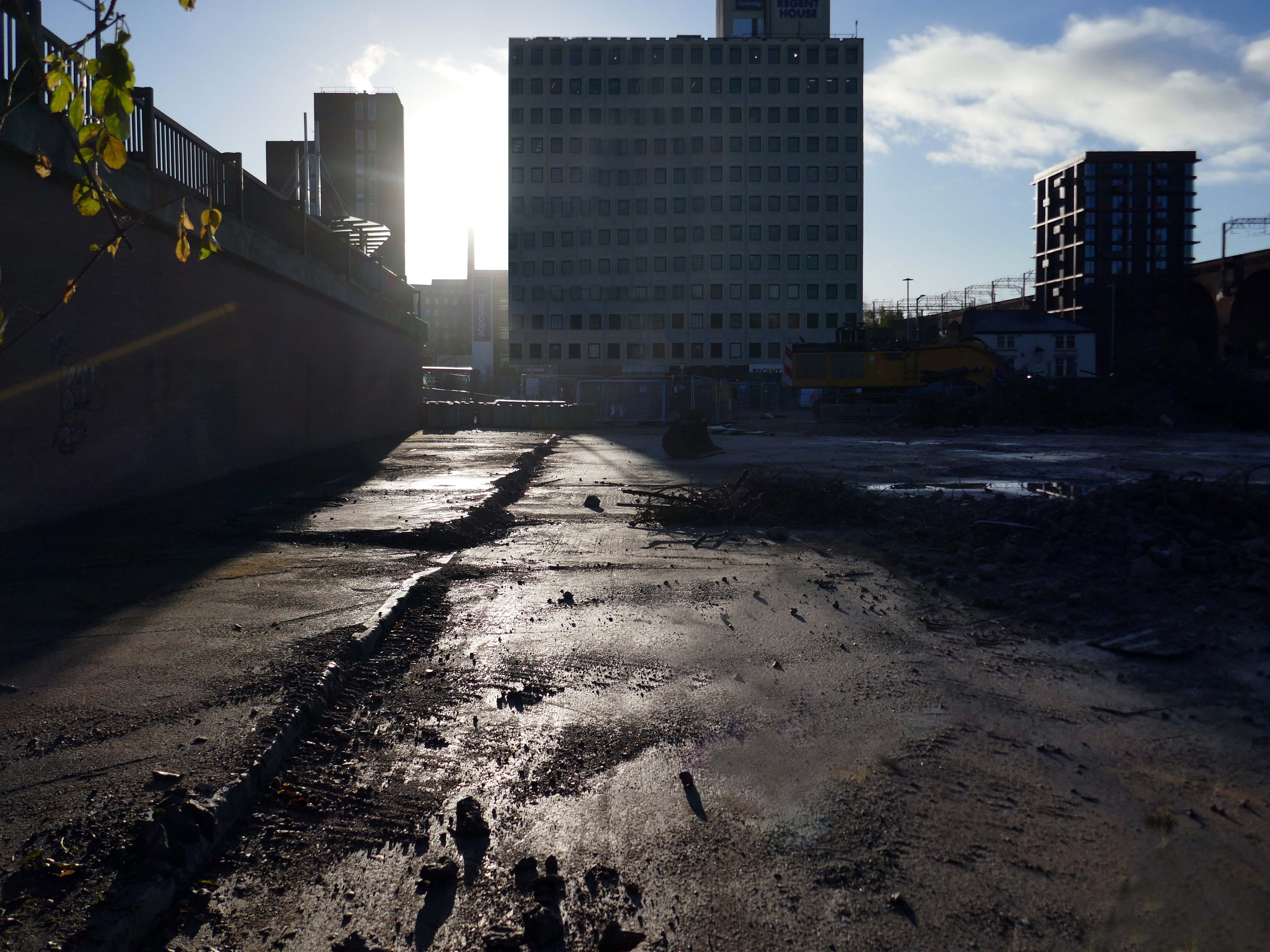
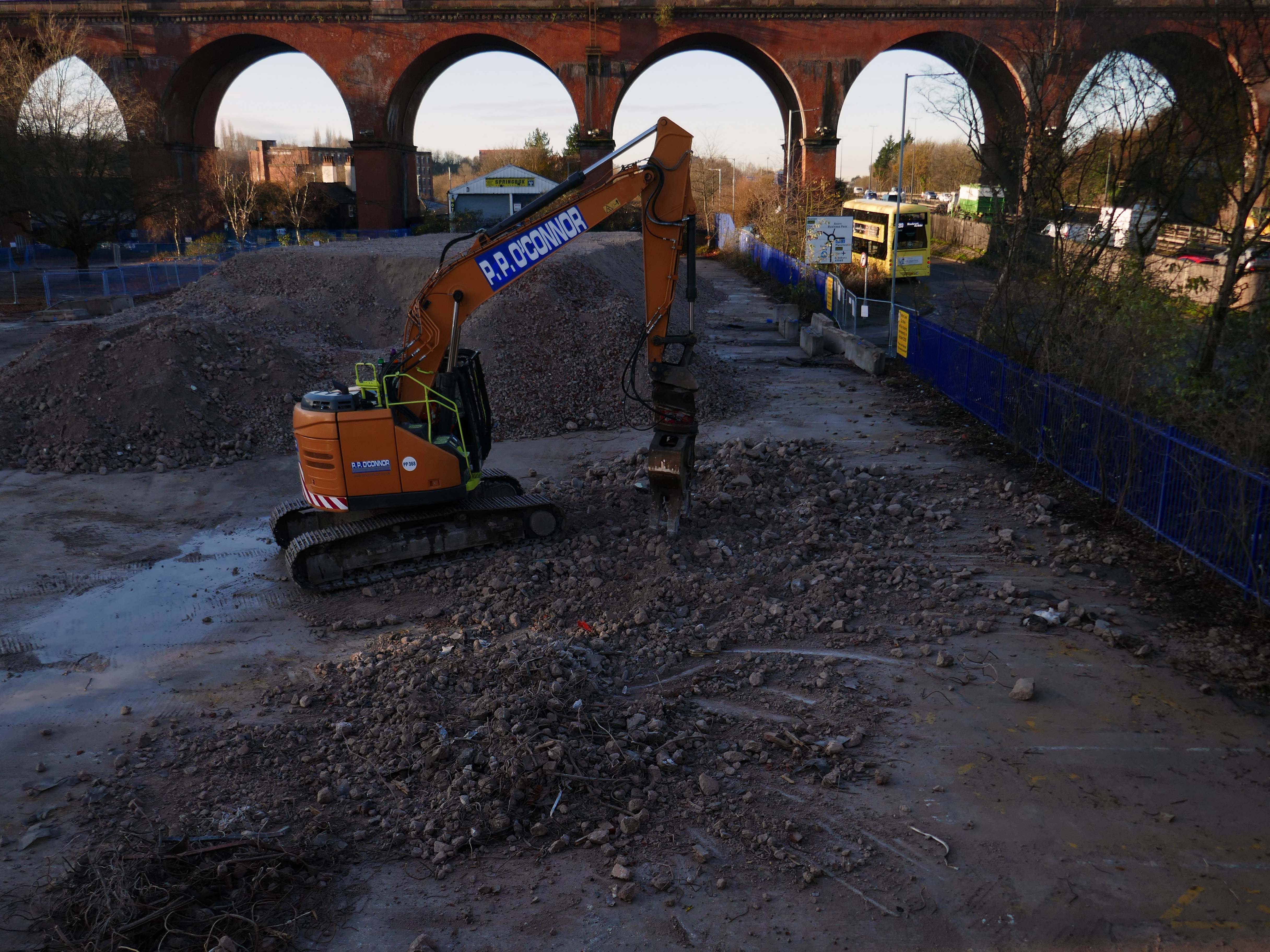
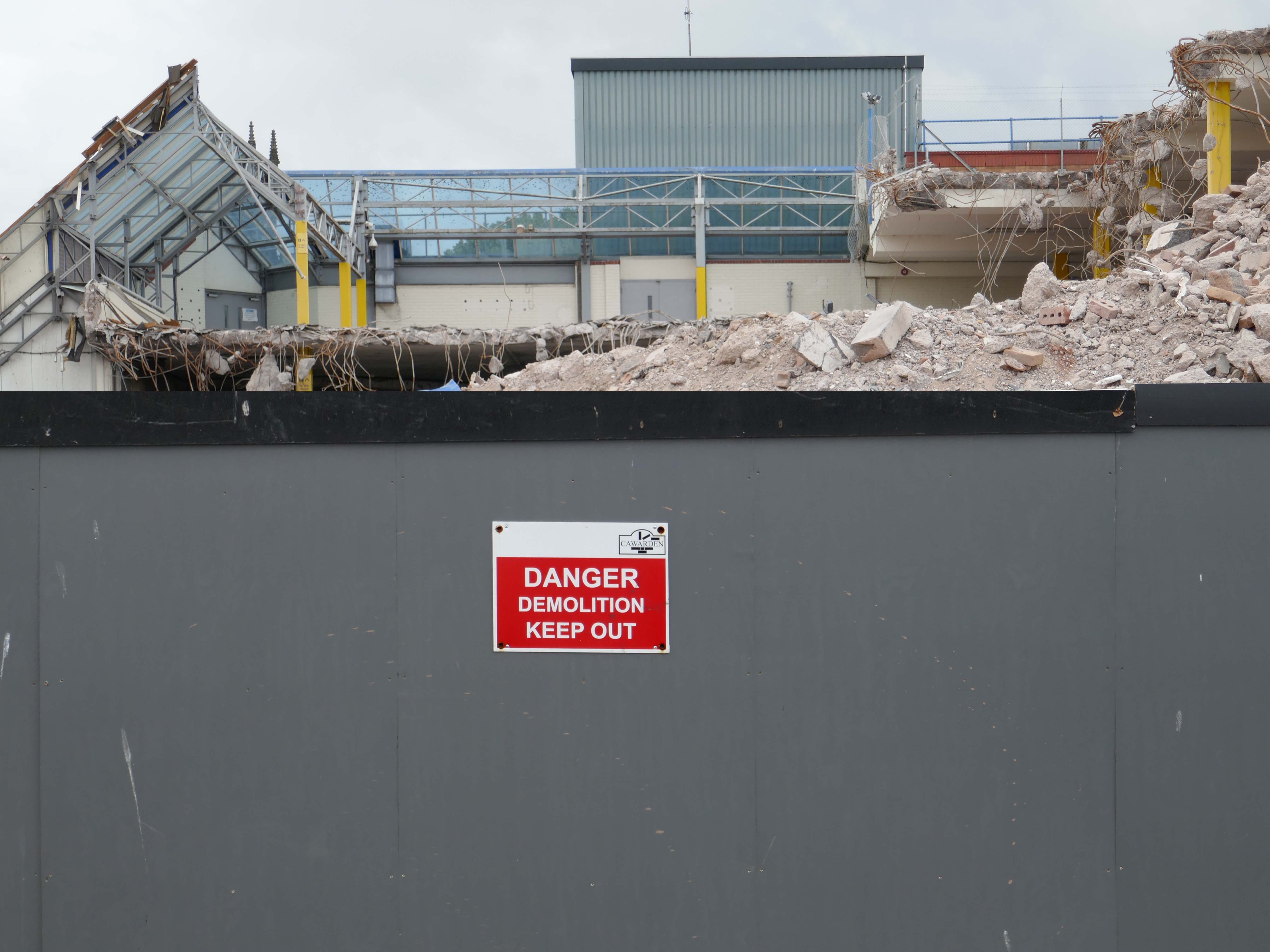
Heaton Lane car park is closed while demolition works take place.
Plans to demolish the car park were submitted by Stockport Council in September this year.
The plans propose removing the multi-storey car park down to ‘slab level’
The work itself will be carried out by removing floor slabs one by one from the parking bays, from the ground upwards. Contractor PP O’Connor has said it will take noise and dust into consideration when completing the works.
Dust suppression systems will be in place to minimise pollution.
Noise levels are not considered likely to be a nuisance, however the site manager will be able to review the demolition process if it’s deemed too high.
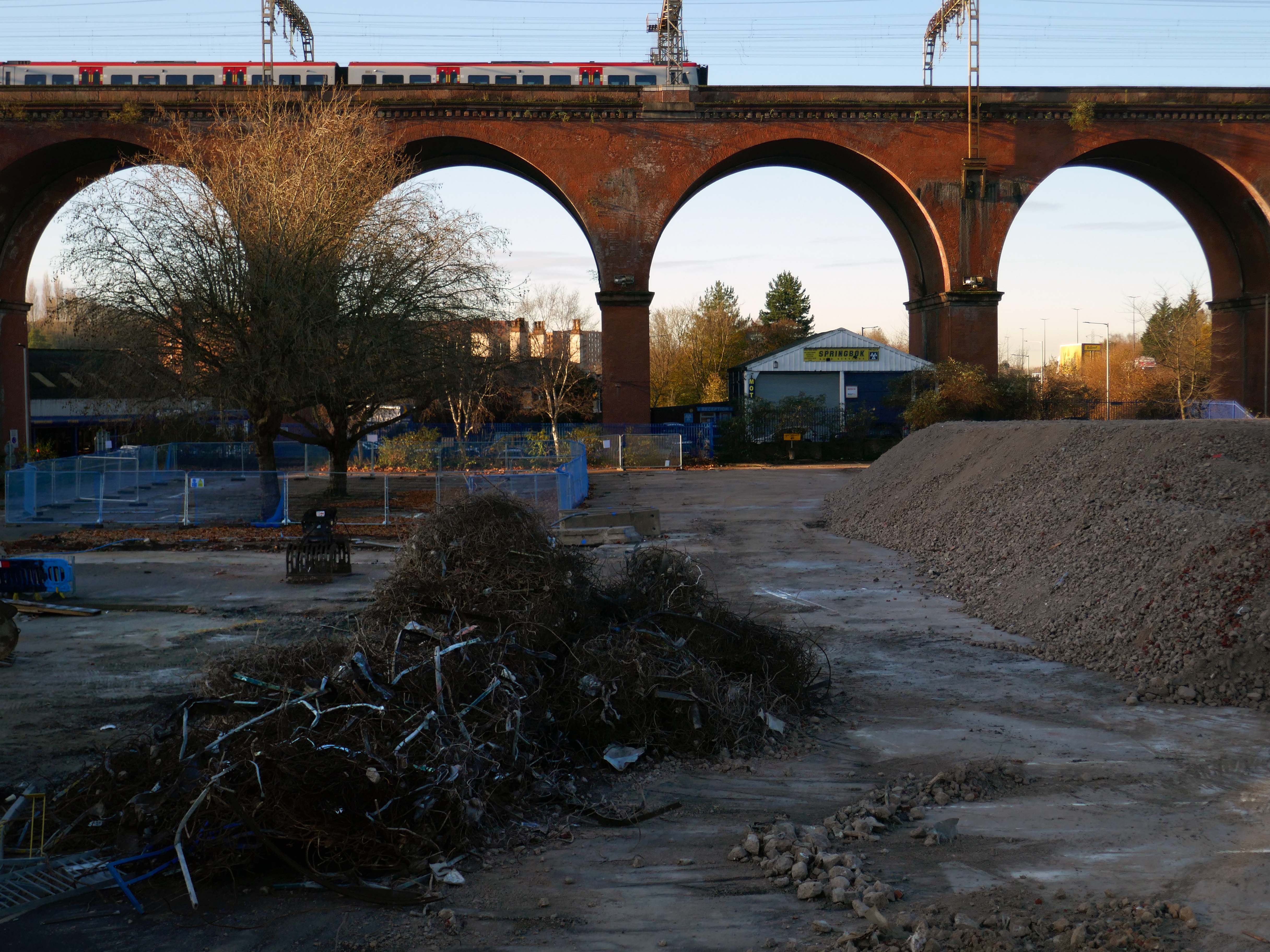
There car park is almost at the heart – on the edge of plans to regenerate the town centre.
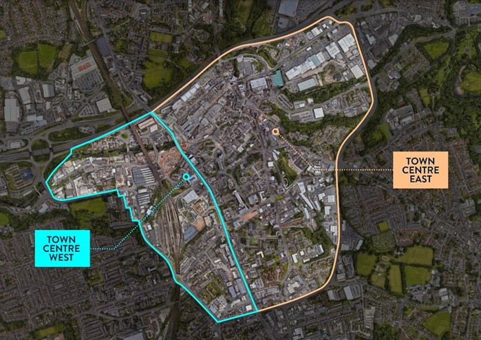
The Strategic Regeneration Framework for Stockport Town Centre West set out how up to 4,000 new homes and 1m sq. ft of new employment floorspace and 5,300 new jobs could be delivered across Town Centre West by 2035.
In order to assess the overall economic benefit of an expanded Mayoral development area Stockport Council have developed an SRF for Stockport Town Centre East. This SRF sets out an illustrative masterplan to guide the creation of Stockport’s new neighbourhoods and achieve comprehensive urban regeneration by 2040. Together the SRFs for Town Centre West and Town Centre East will guide the development of a total of 8,000 new homes alongside services and amenities. The development set out in the SRFs will drive a transformational impact on the Stockport economy.
The Corporation is expected to be established in early 2026. It will provide a single, focused body for local decision-making; engagement with stakeholders including government departments, public agencies; private sector landowners, and developers; and to drive investment across the public and private sectors to realise the shared vision for the regeneration of the Area.
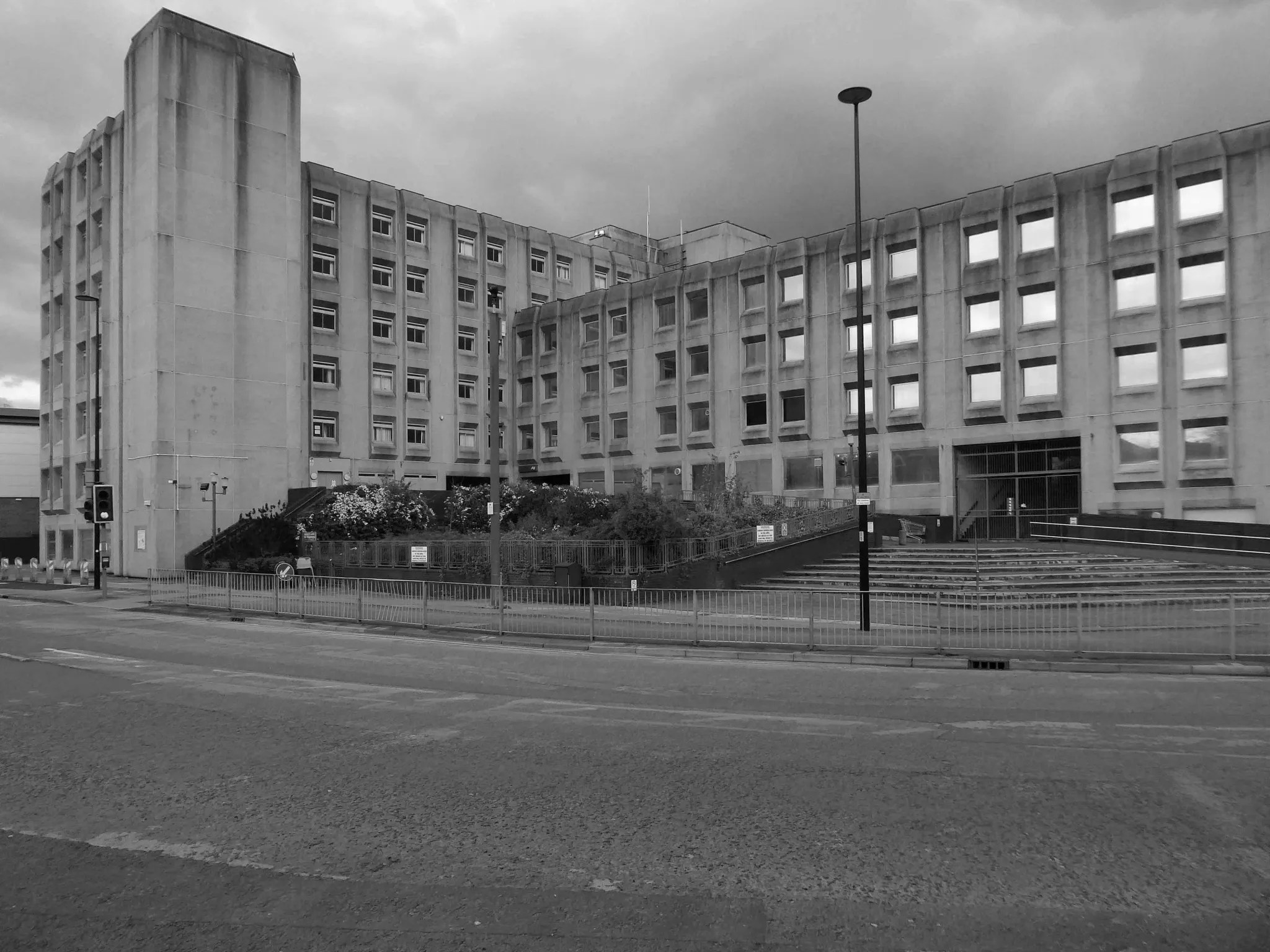
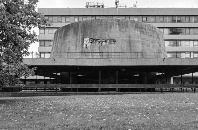
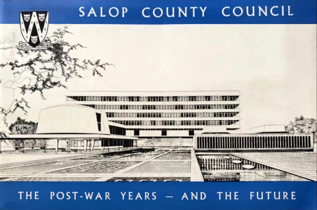
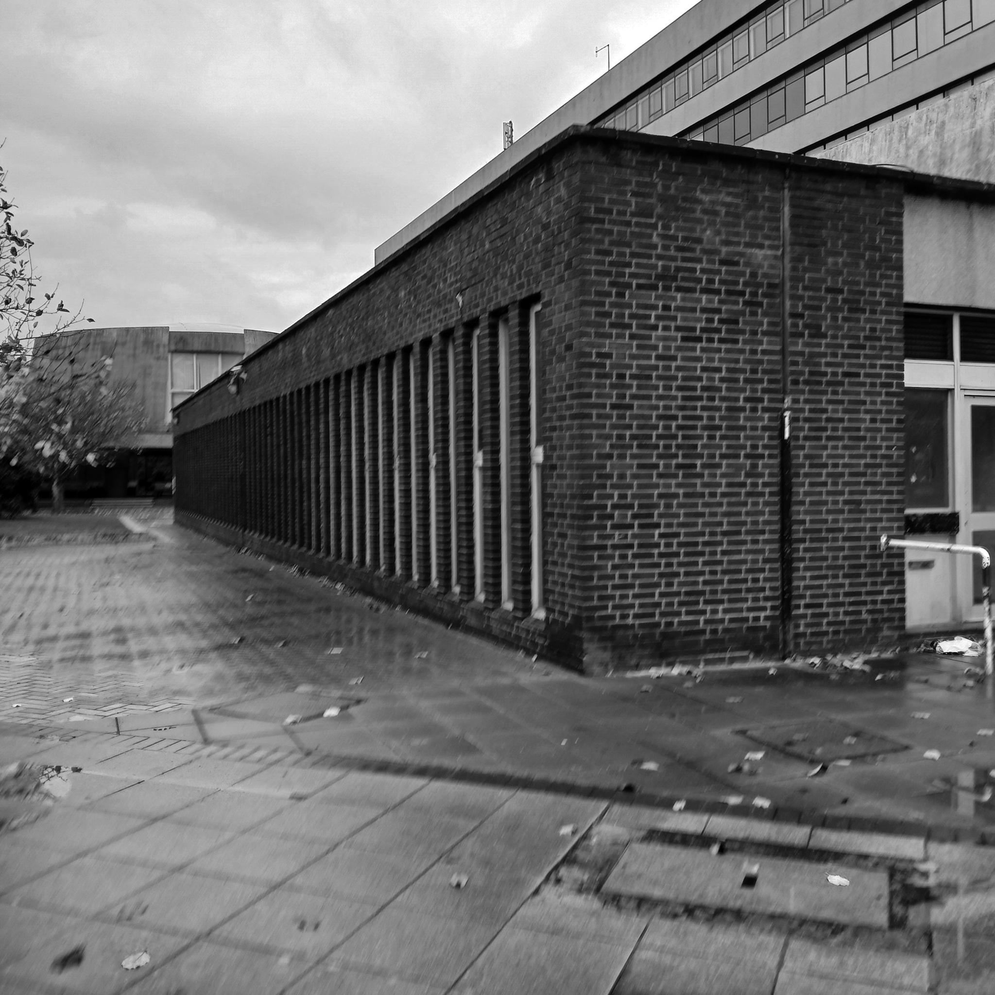
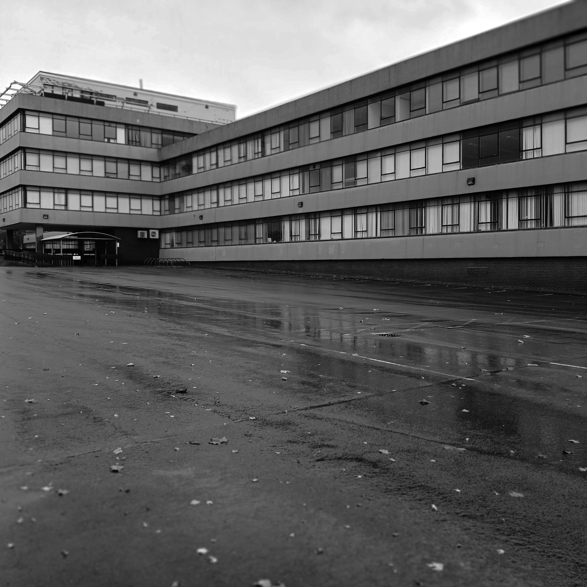
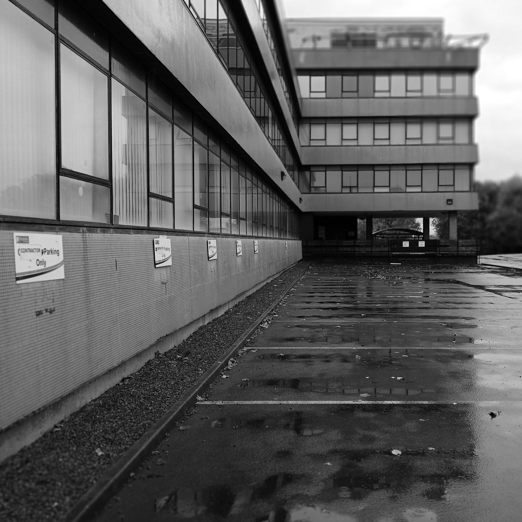
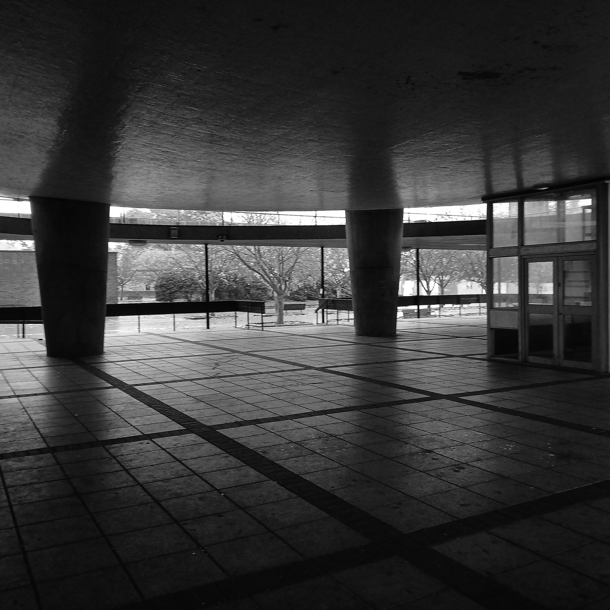
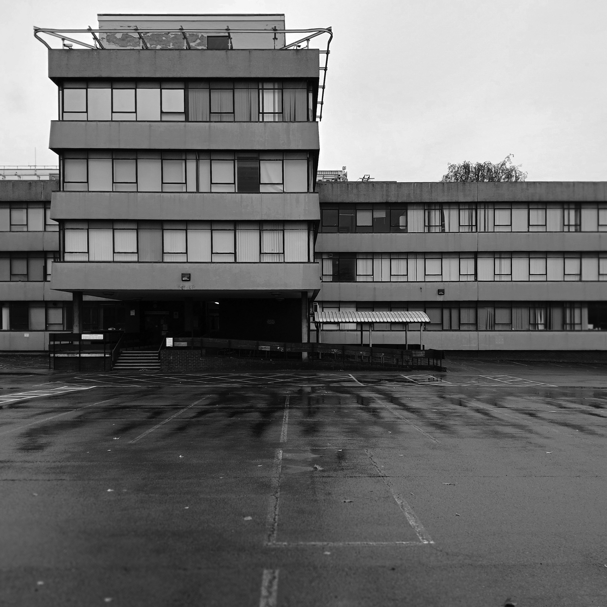
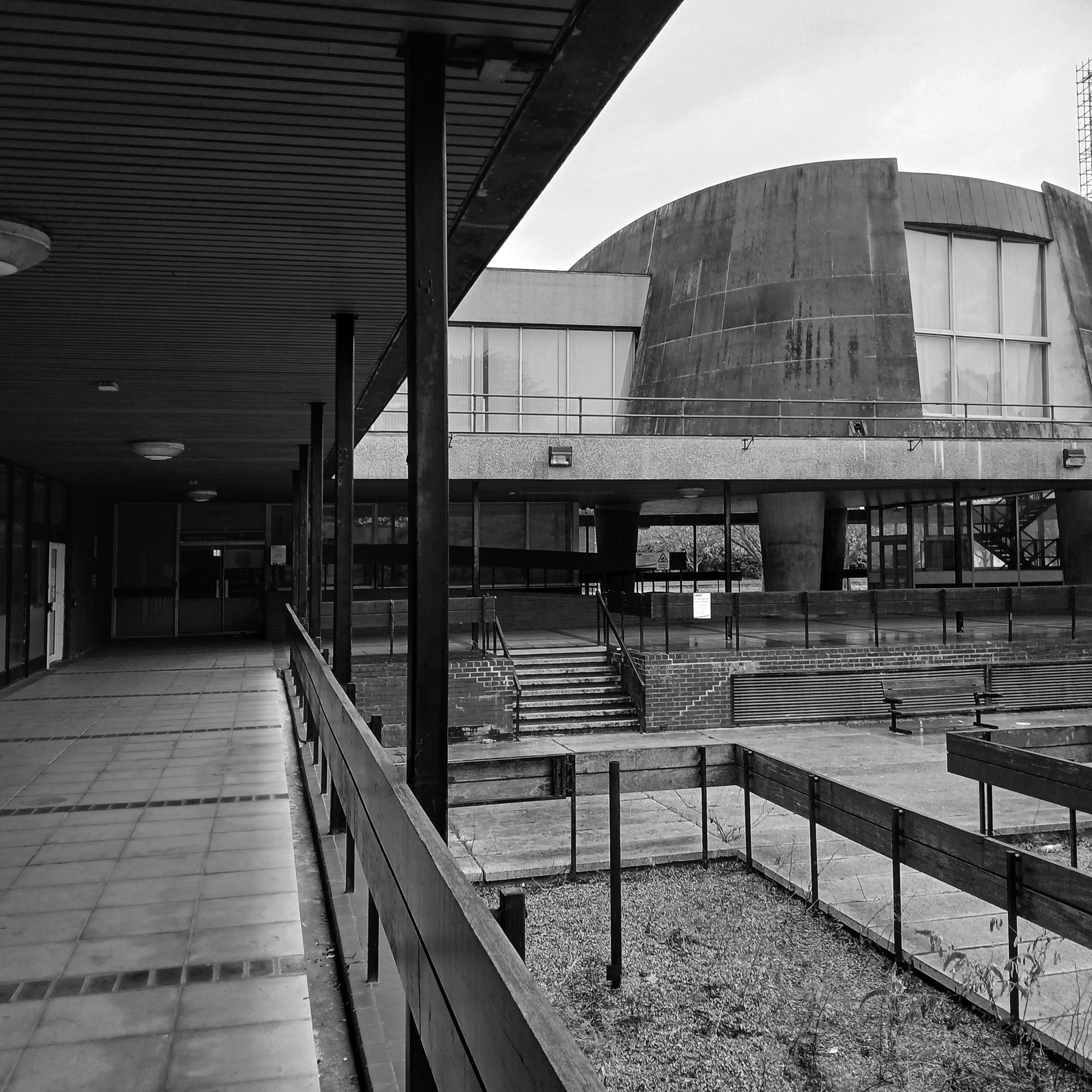
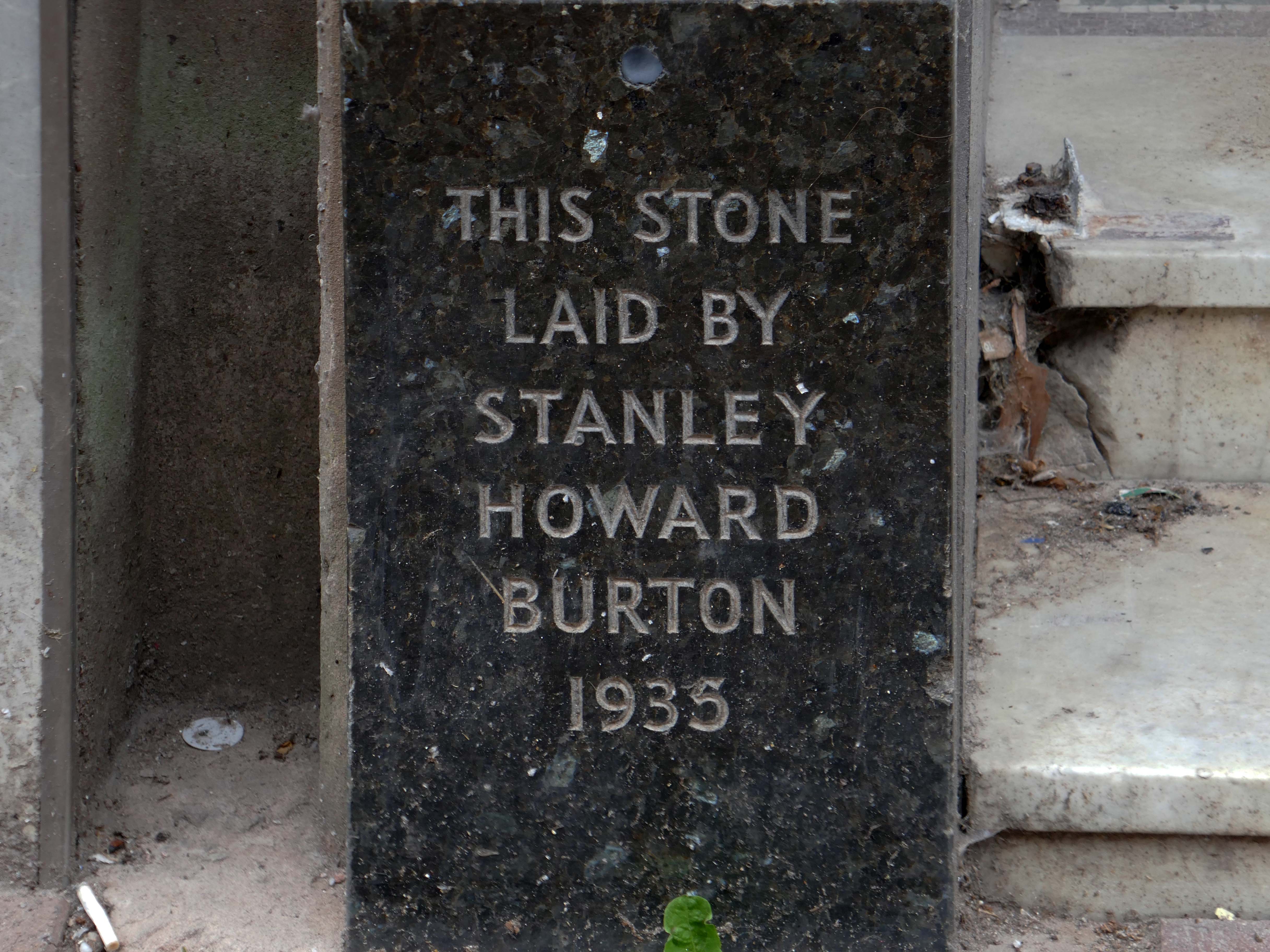
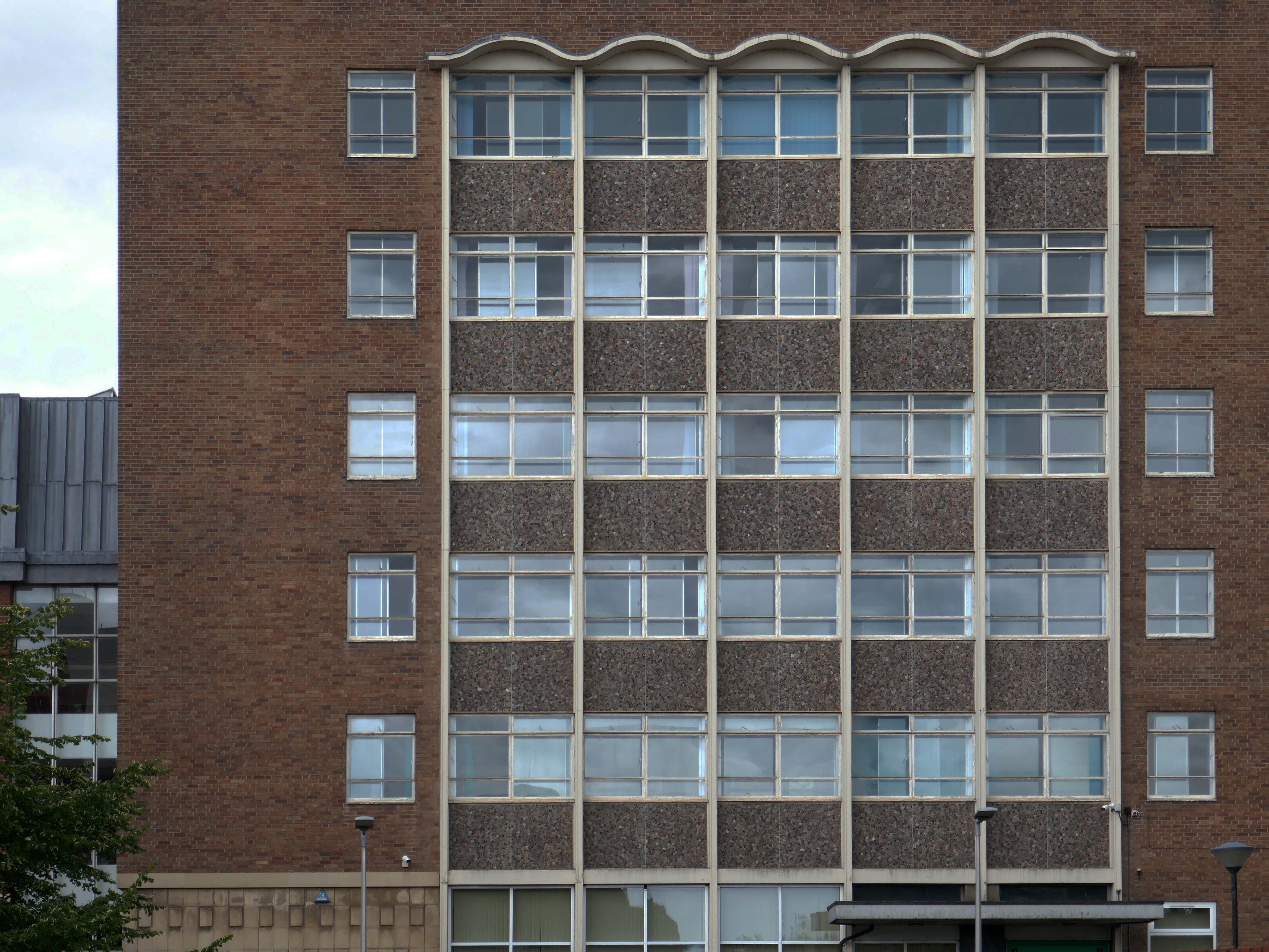
The foundation stone for the new building was laid by Sir Offley Wakeman, a former chairman of the county council, on 25 July 1964. It was designed by Ralph Crowe, the County Architect, in the Modernist style, built at a cost of £1.8 million and was completed in April 1966.
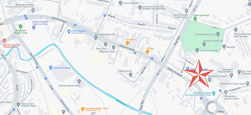
Having visited and snapped way back in June 2024, I returned in October 2025.
I had been asked to speak to the Shrewsbury Civic Society, regarding the history of Modernism in support of their campaign to save Shirehall.
The previous County Council were disposed toward demolition, the current administration are a little more circumspect.
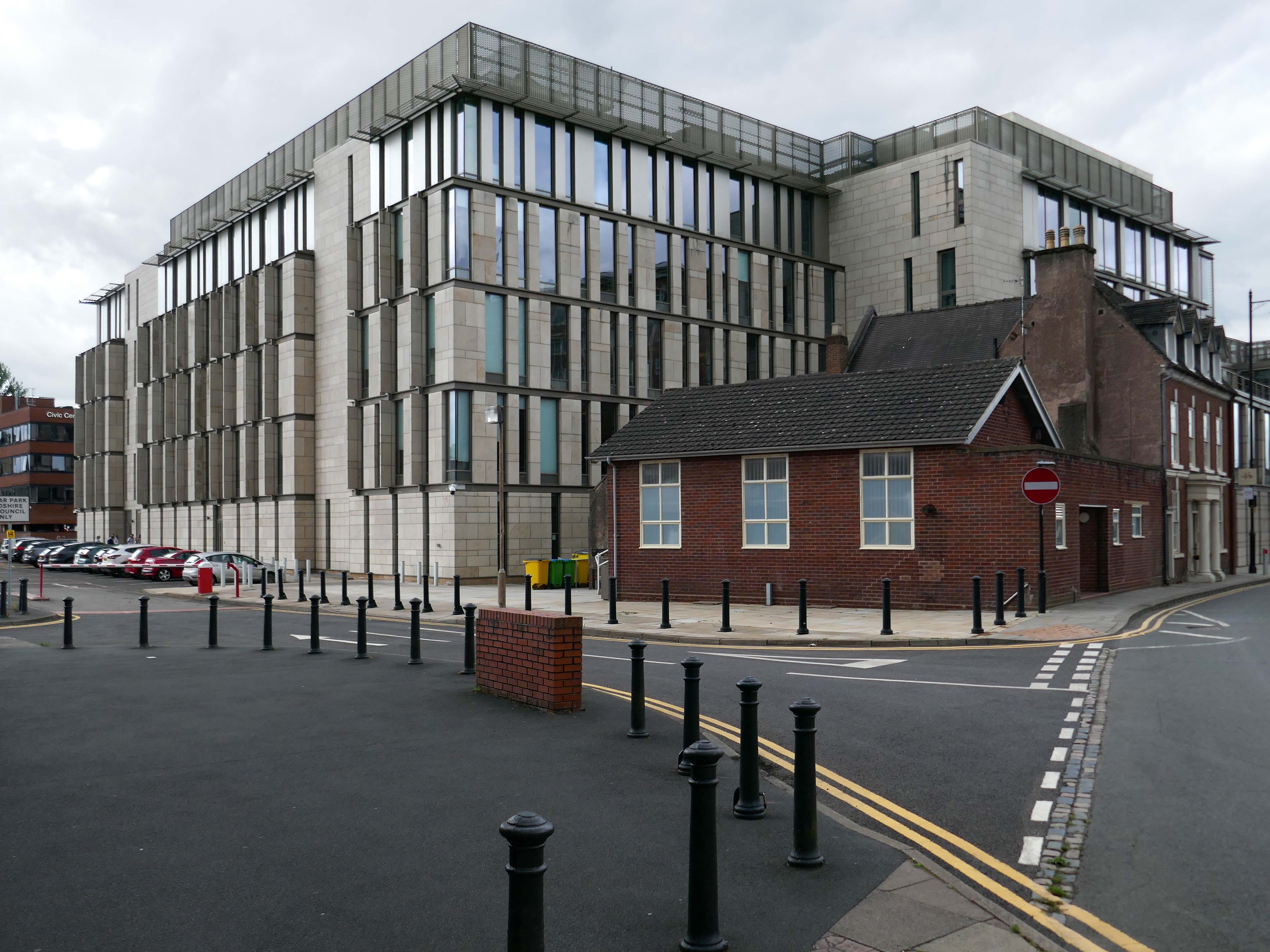
Shropshire Council is considering a return to its former headquarters, less than a year after it moved out. The authority moved from 1960s-built Shirehall in Shrewsbury to the Guildhall in Frankwell, and said doing so would save up to £600,000 per year.
At a meeting on Wednesday, cabinet member for finance Roger Evans said the Liberal Democrats, who lead the council, had paused the demolition and sale of the land, and may retain parts of the building – but only if it could afford to do so.
“We would like to retain the council chamber and some of the associated buildings, but we do need to take account for the cost both in cash terms and in net zero terms,” he said. “What we have done is paused this decision and asked experts to look at it again, look at the whole site, do a reappraisal. The results are just now being recieved.
“I want to keep it as much as we can afford, both environmentally and cash-wise. Whether we can or not will depend, the council is strapped for cash.”
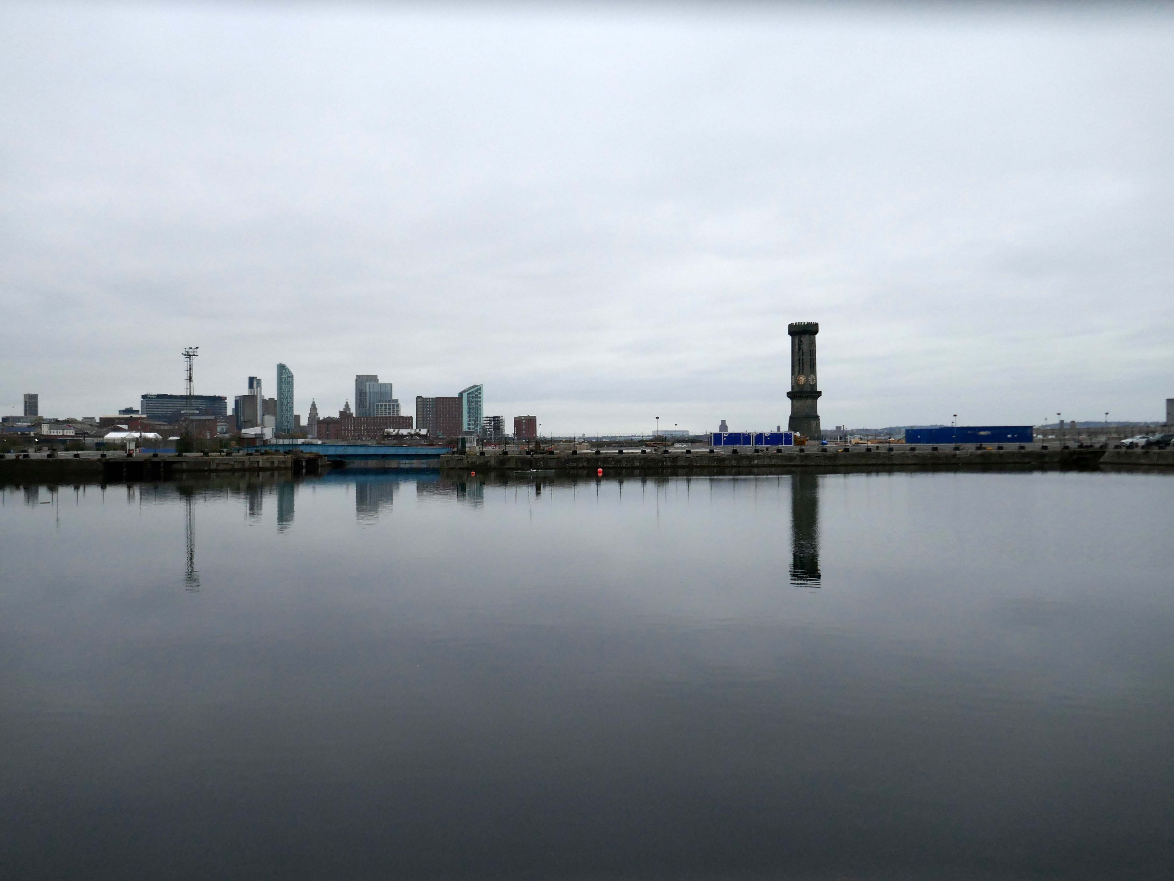
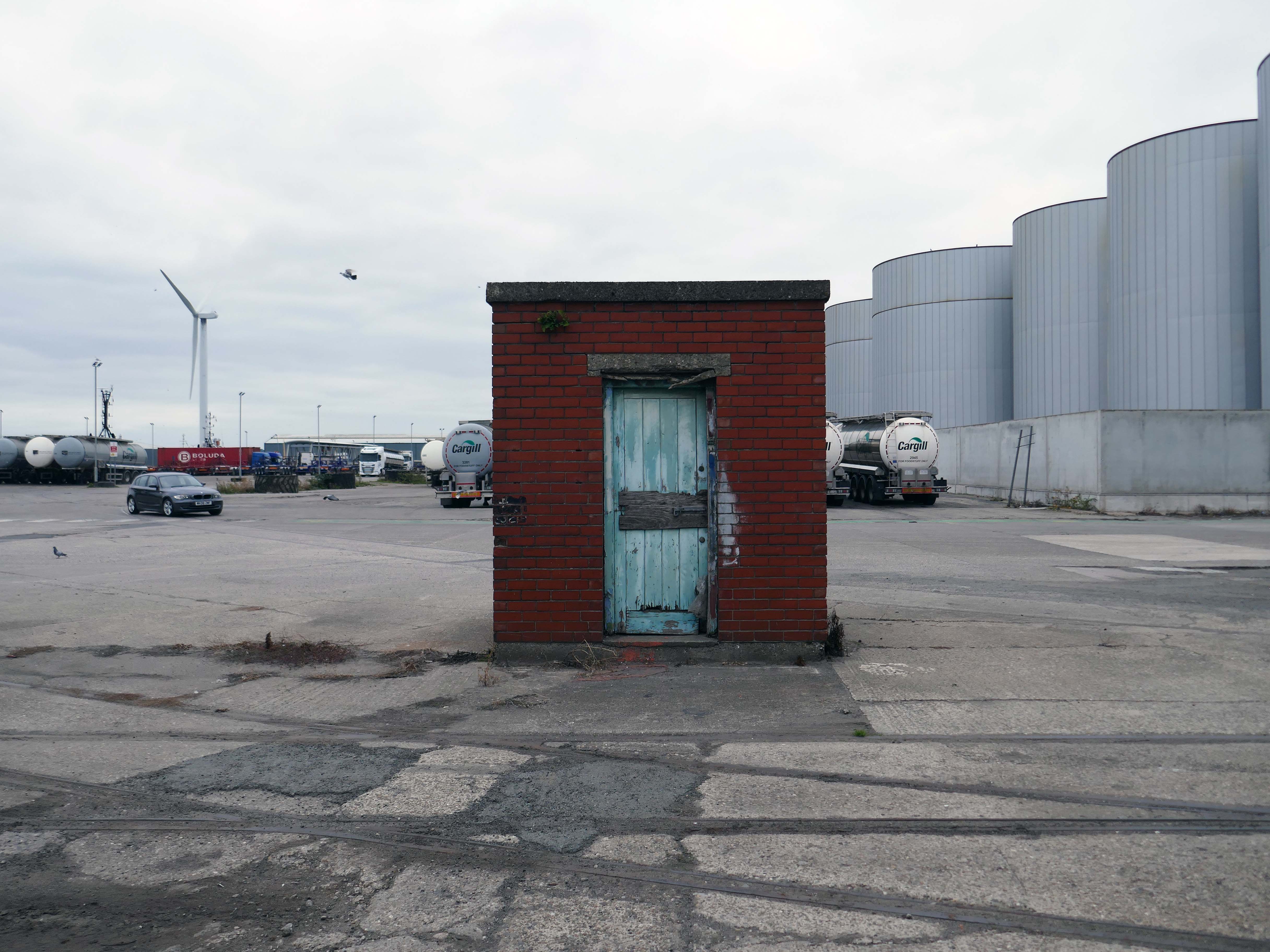
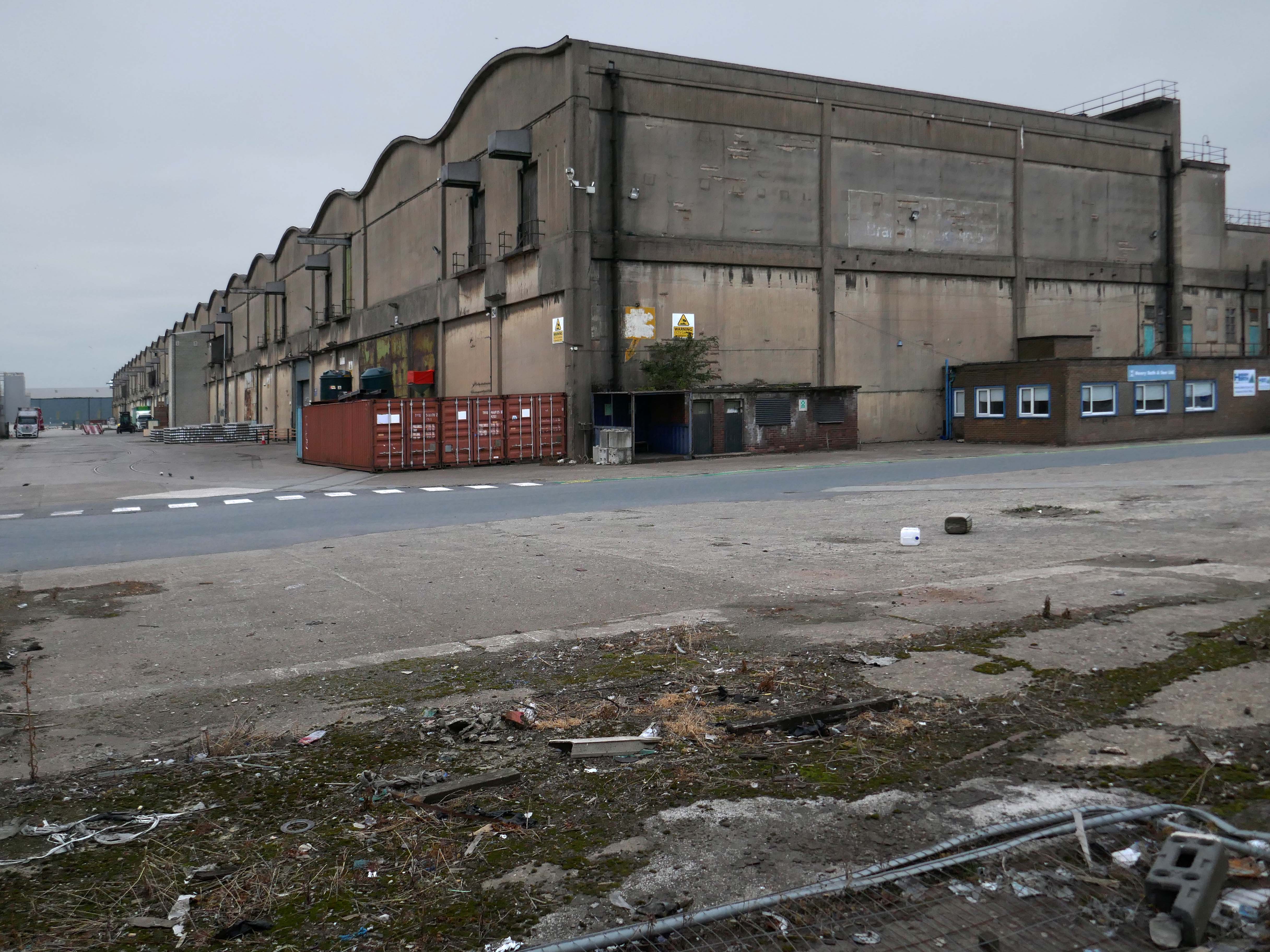
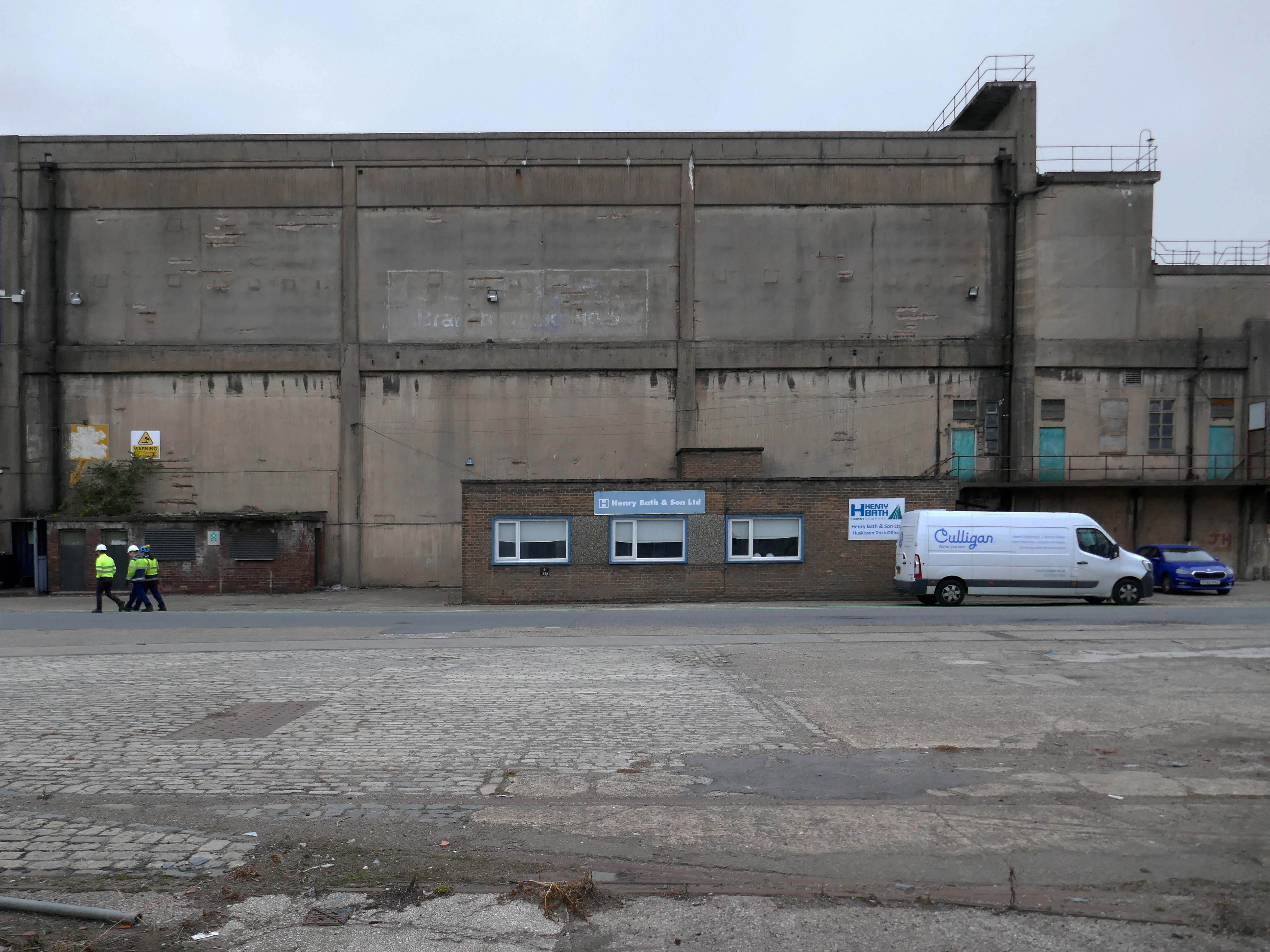
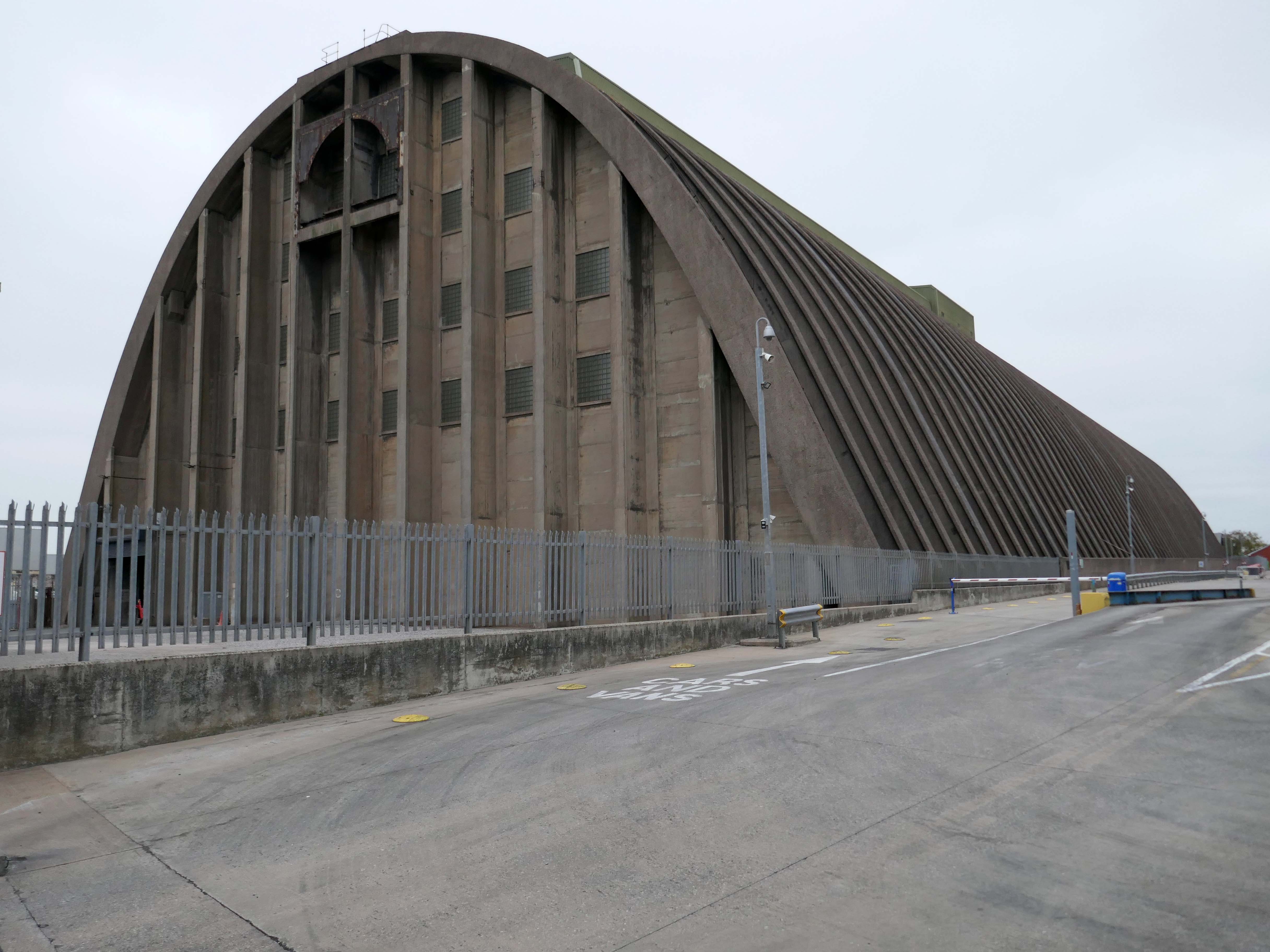
The days when a vast multitude of things came and went have been and gone.
The docks as they were are no more.
Yet in 2023, the Port of Liverpool was the UK’s fourth busiest container port, handling over 30 million tonnes of freight per annum. It handles a wide variety of cargo, including containers, bulk cargoes such as coal, grain and animal feed, and roll-on/roll-off cargoes such as cars, trucks and recycled metals. The port is also home to one of the largest cruise terminals in the UK which handles approximately 200,000 passengers and over 100 cruise ships each year.
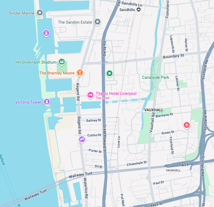
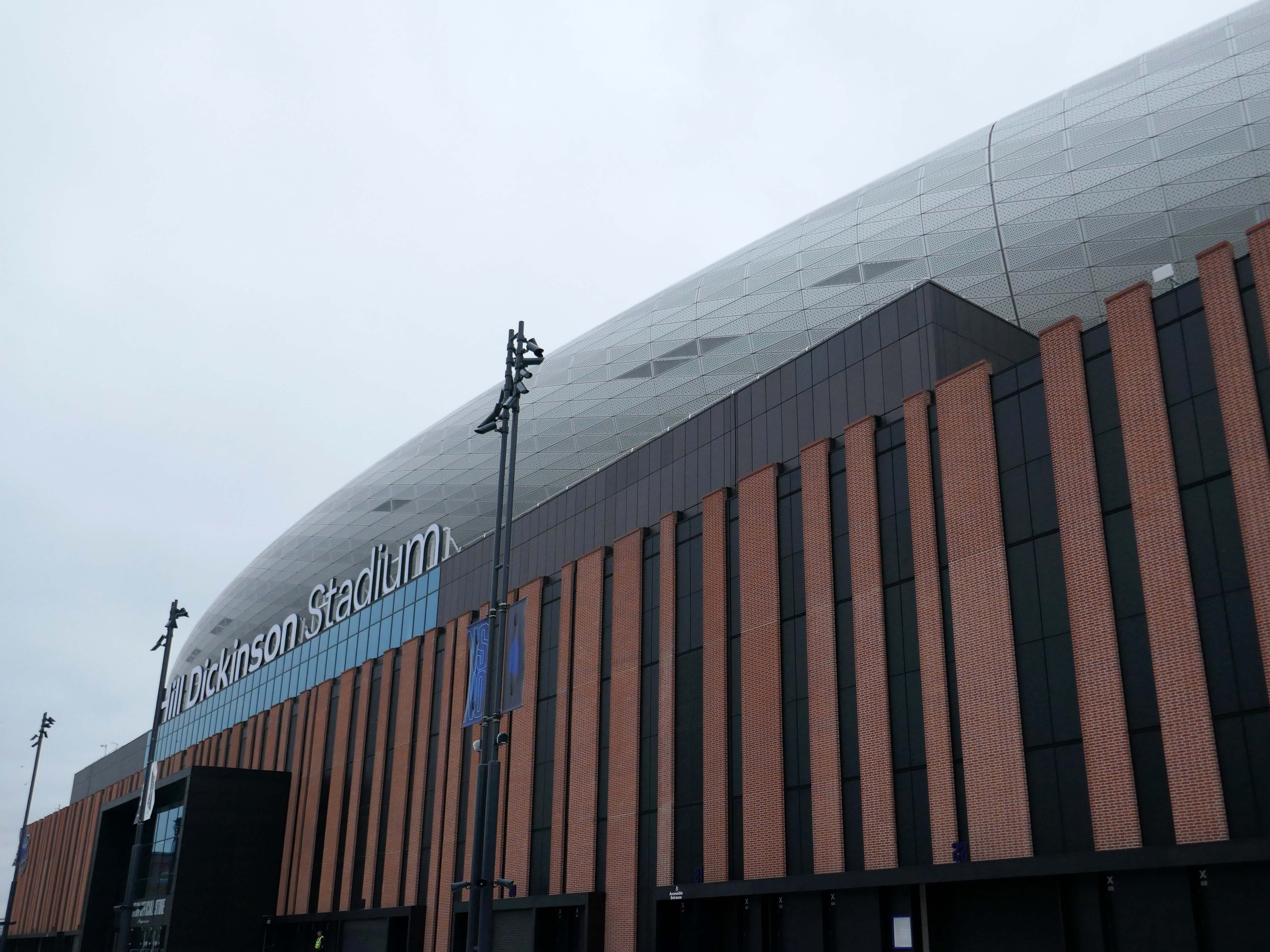
Now with the opening of the Titanic Hotel in the Stanley Dock and the arrival of the Toffees just up the road at the Hill Dickinson Stadium, the whole area is slowly being transformed into a destination, as they say in modern parlance.
However much of the Industrial heritage remains in various states of disarray, used and possibly disabused, but hanging on in there.
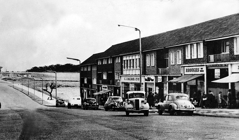
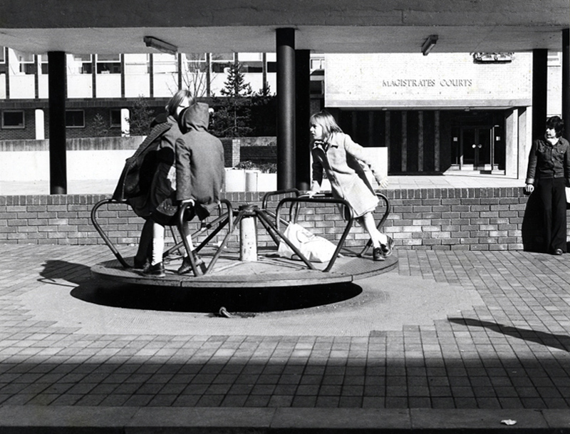
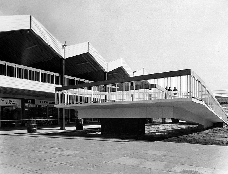
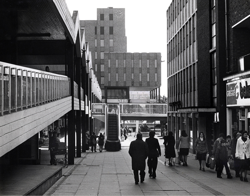
Plans for the new town centre started to be developed in 1960 by Chief Architect Roy Gazzard. The process would go through eight sets of revisions before they were finally approved in 1968. Yoden Way was then pedestrianised, and the small row of shops built in 1950’s was incorporated into the new shopping precinct, forming the north western end of Yoden Way. Like many other town centres across Britain undergoing modernisation, the high-street was split onto two levels, with ramps providing access to raised walkways.
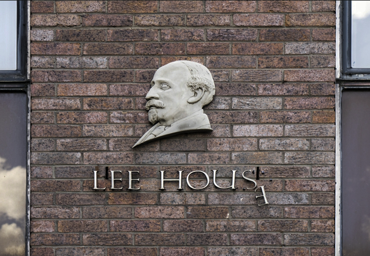
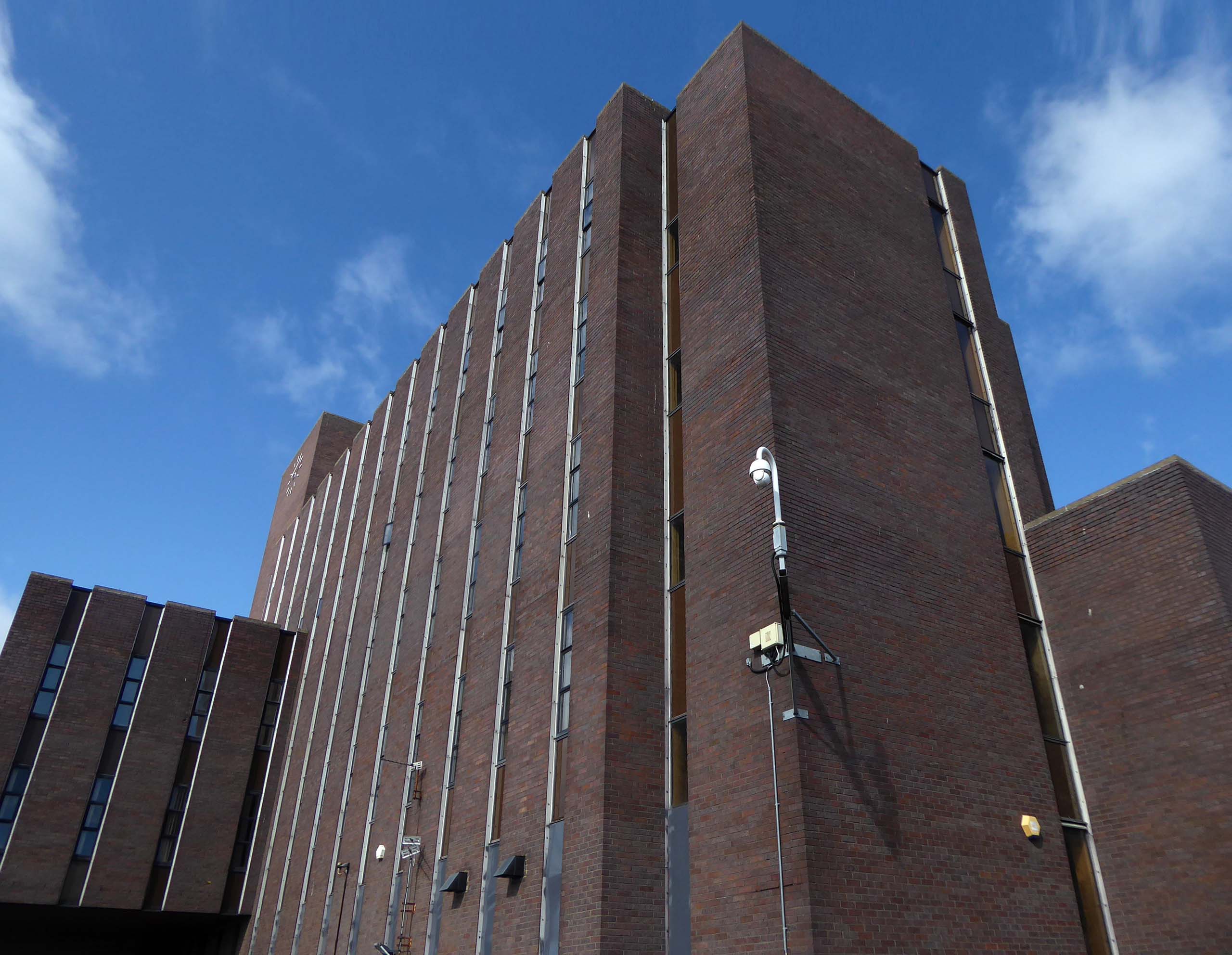
The construction of Lee House – named after Peter Lee, started in 1974. Once completed, the Development Corporation moved its Headquarters from Old Shotton Hall to Lee House in 1976, occupying the building until it was sold in 1984 and remaining staff relocated to Newton Aycliffe.
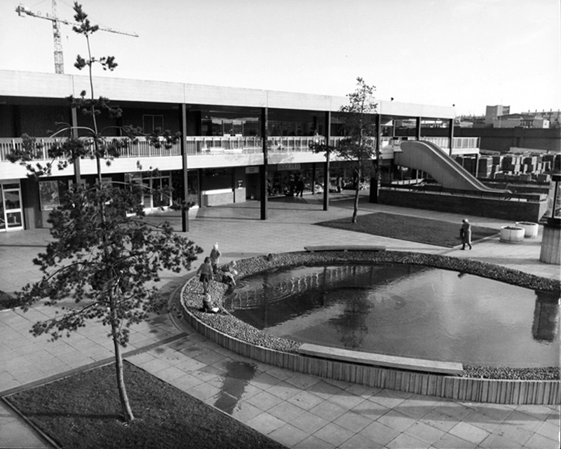
Enhancing the built environment, Peterlee Town Centre was furnished with play equipment, an ornamental pond, open air escalators, and a sculpture by John Pasmore – son of Victor.
These features were later removed after the town centre was sold to Teesdale Investments – Peterlee Limited in 1985.
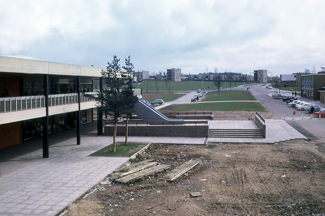
Access ramp at the bottom end of Yoden Way, prior to the construction of Lee House in 1973.
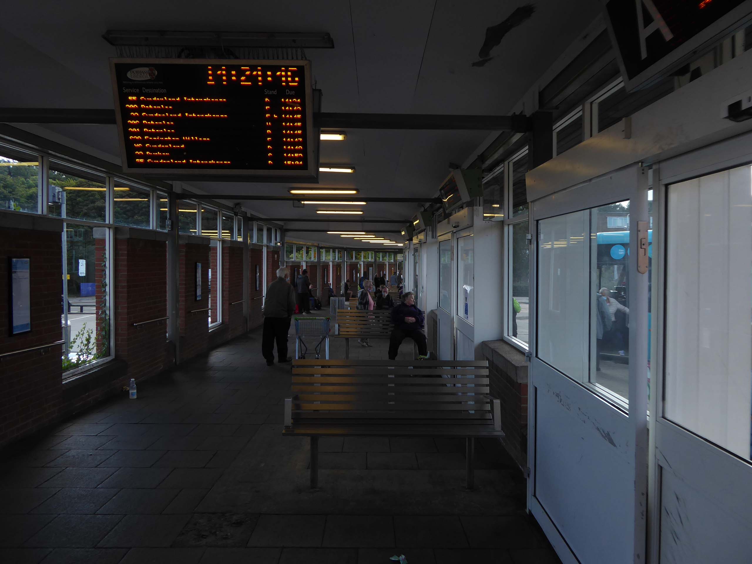
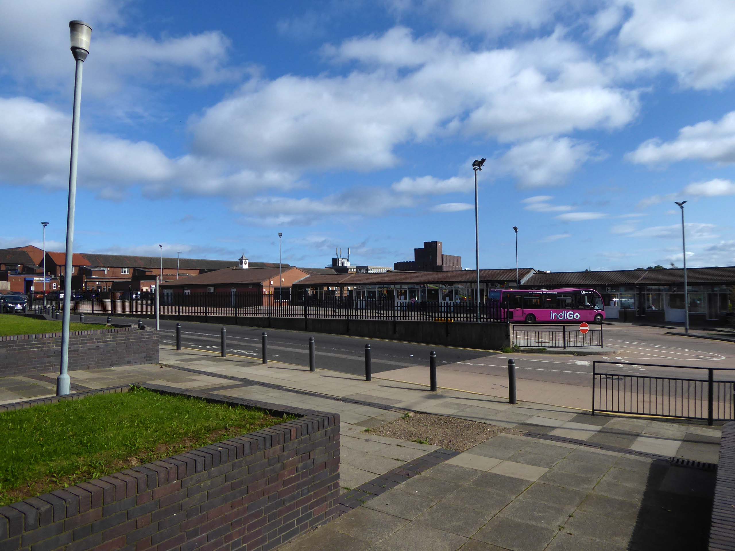
It’s 2021 and I arrive at the Bus Station.
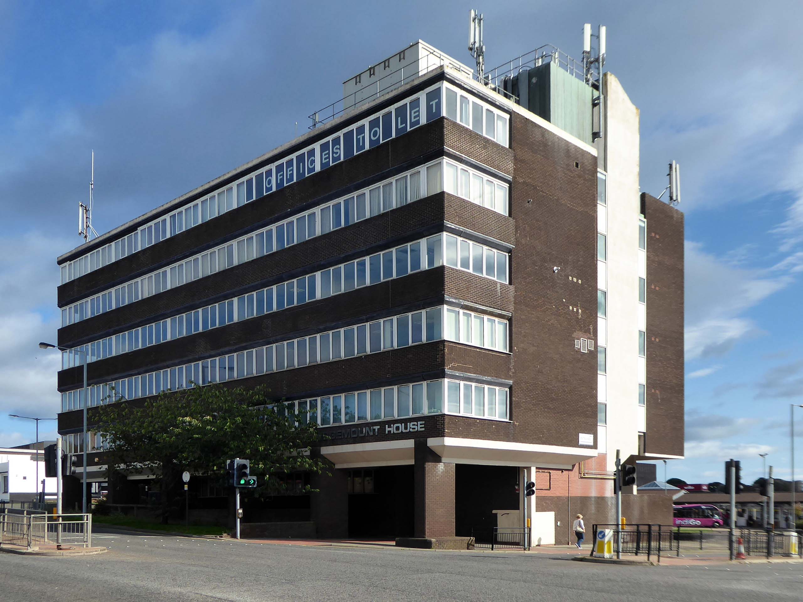
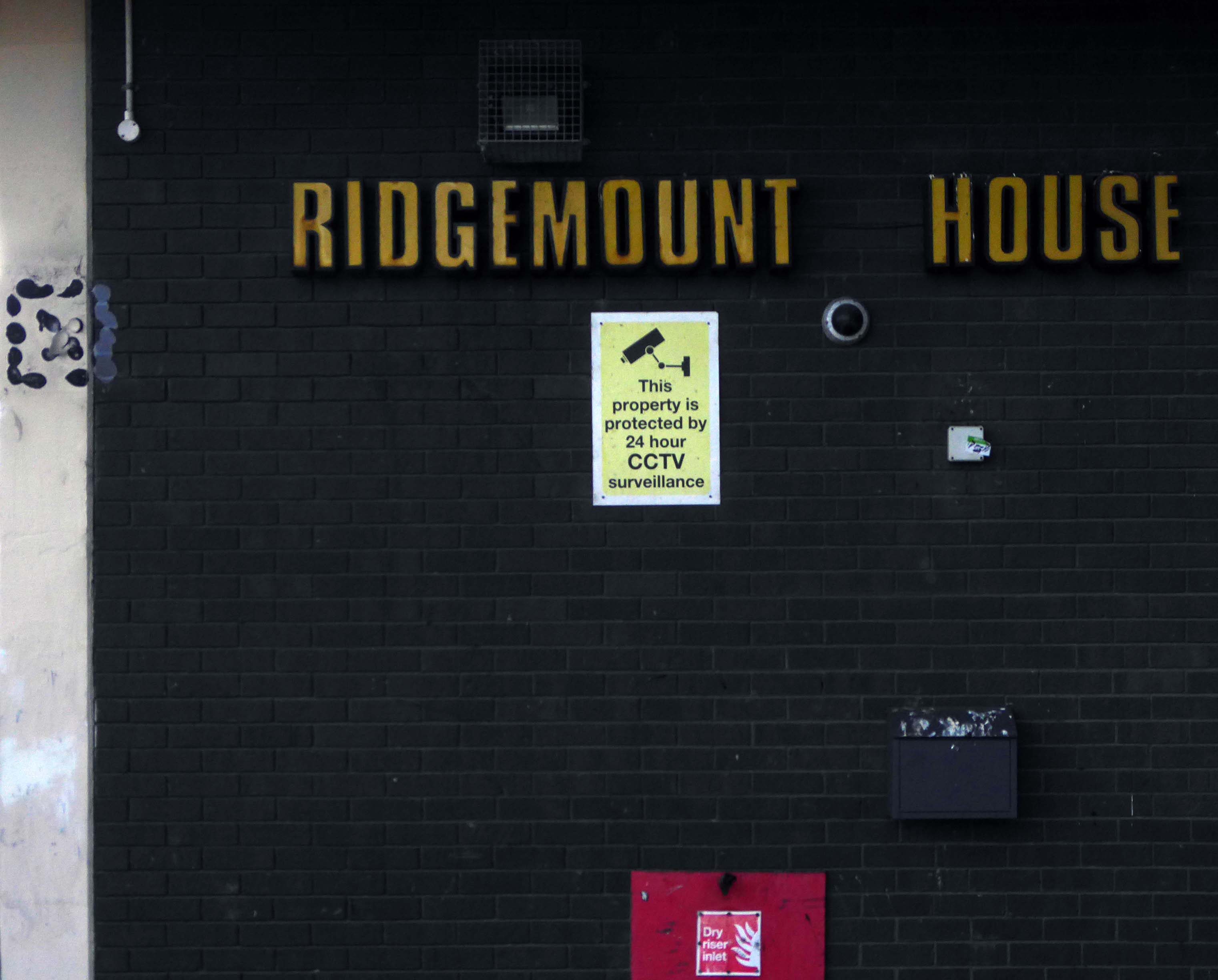
Immediately adjacent is Ridgemount House. – once home to the Job Centre.
Firefighters were called to the disused Ridgemount House on Bede Way in Peterlee on Wednesday August 16th 2023 at about 8.20pm after reports of a blaze.
Crews found a fire had broken out in the first floor of the building, which was found to be the home of thousands of pounds worth of cannabis plants back in 2020, after a man converted two floors for use as a drug farm.
Tarlochan Singh, owner of Ridgemount House, has been prosecuted following the discovery of several serious fire safety breaches at the property.
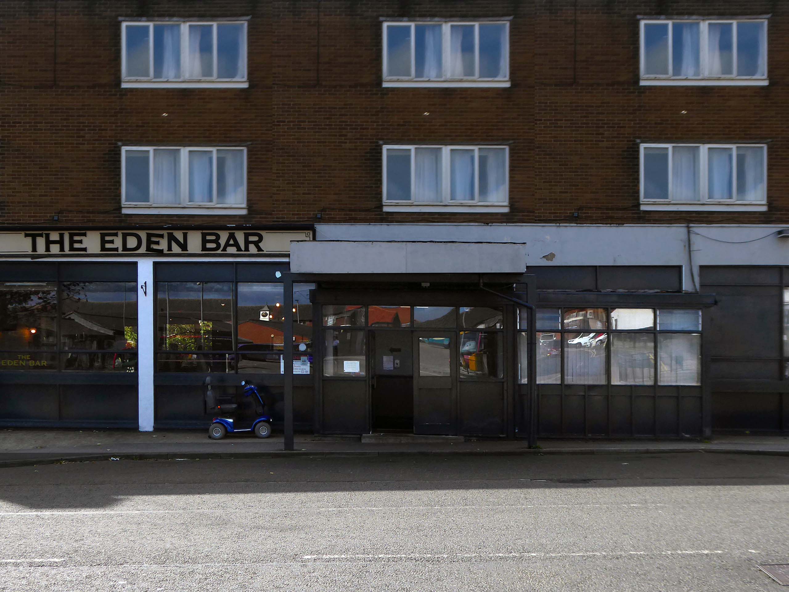
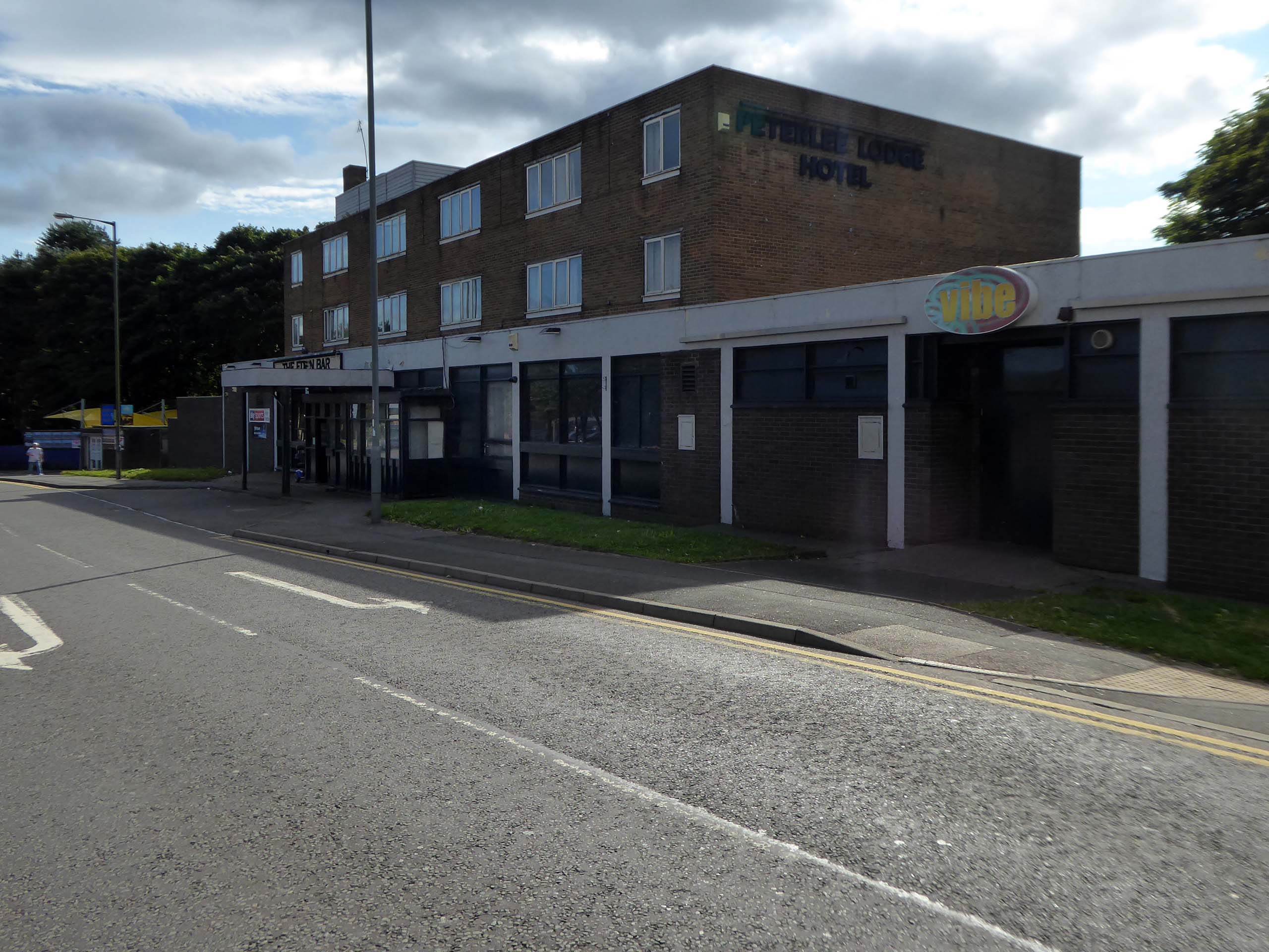
Readers have voted Peterlee nightspot Vibe as the ‘most tragic hometown club’ in the North East
Formerly known as The Dance Factory, Vibe, in Peterlee town centre, is a place famous for it’s almost impossible to get off ‘tramp stamp’ and next door neighbour The Lodge, where many locals will go for pre-drinks and some karaoke before heading to the club.
The bar which once boasted a bijou rotunda with an exclusive upper terrace, has now closed.
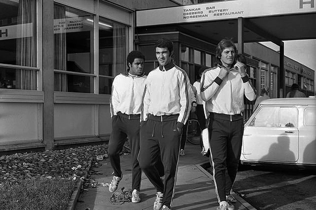
Back in 1973 the hotel was badged as the Norseman.
The giants of Sporting Lisbon faced Sunderland in the European Cup Winners Cup and they spent the build-up to the tie in the Norseman Hotel. They met local children, took a walk in the dene, signed autographs and even tried riding a Chopper bike. The side lost 2-1 at Roker Park to a talented Sunderland team before overcoming the Black Cats 2-0 back in Portugal.
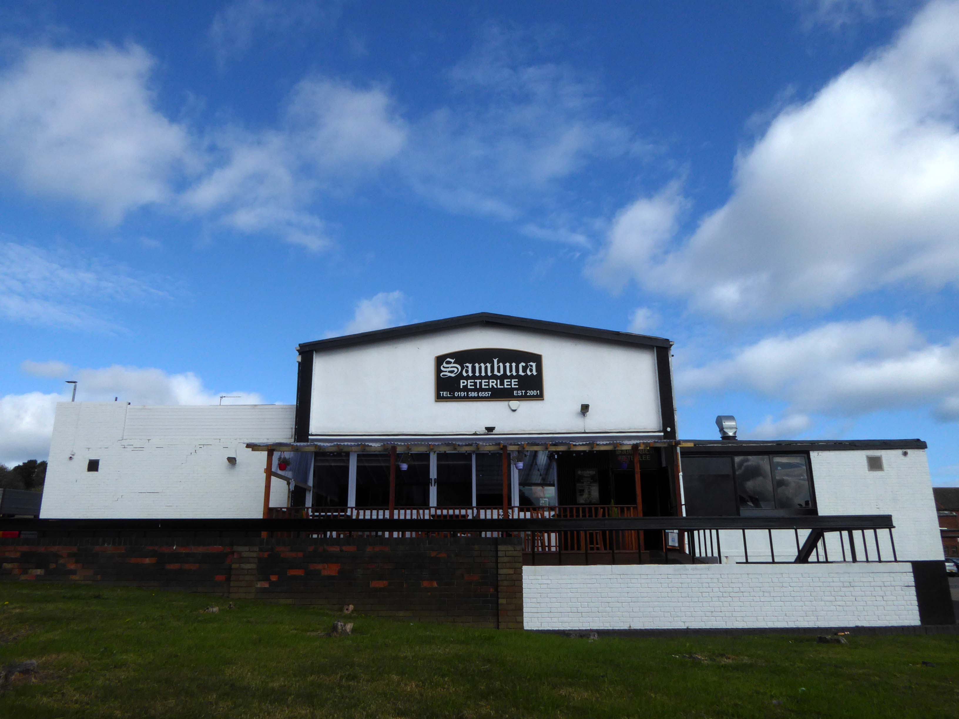
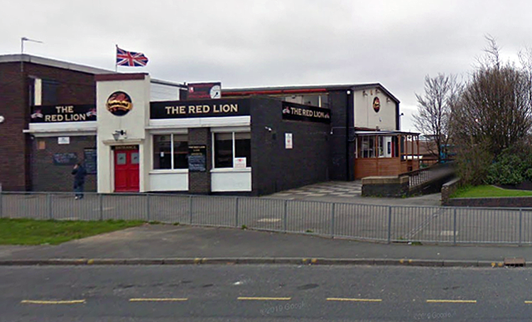
Back in 2021 Sambuca was the other town centre bar – badged with Olde English type.
Formerly the Red Lion a Cameron’s estate pub.
April 20th 2014 – Happy Easter everyone. We are open today all the way to 10pm – £2 bottles VHFs, house spirits only £3 double, buckets £4, Corona £2.50 selected shots 50p, cider cans £1 + £2 Karaoke – from now on everyone who sings gets a free shot Then we have the best in all your favourite dance ‘n’ house tunes to take you into Monday.
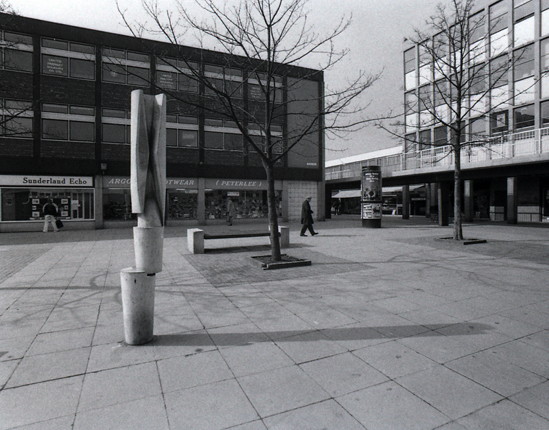
Onward to the Shopping Centre.
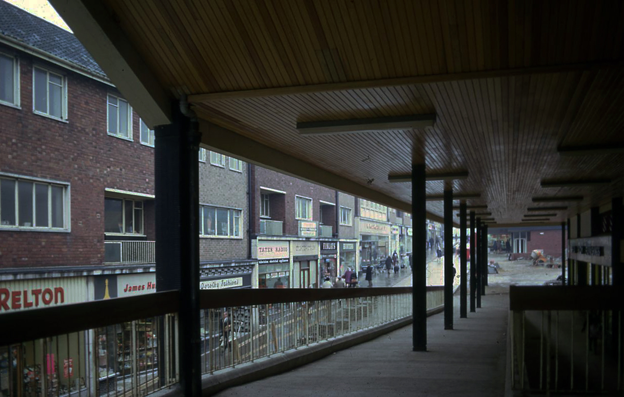
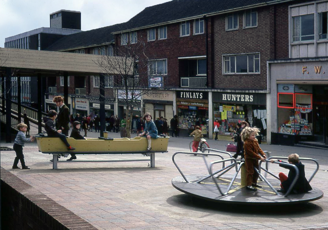
Yoden Way looking towards Lee House in 1977.
Photographs: JR James
The 1950’s shops are still in situ.
Though some of the original architectural detailing and features are no more.
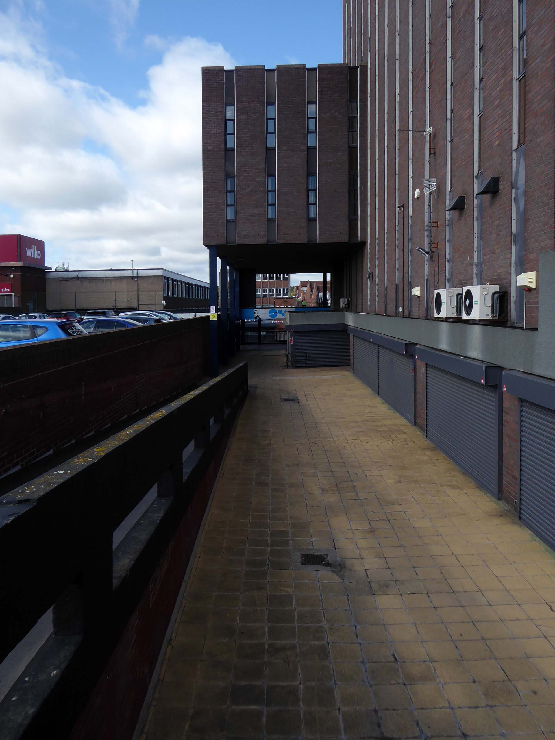
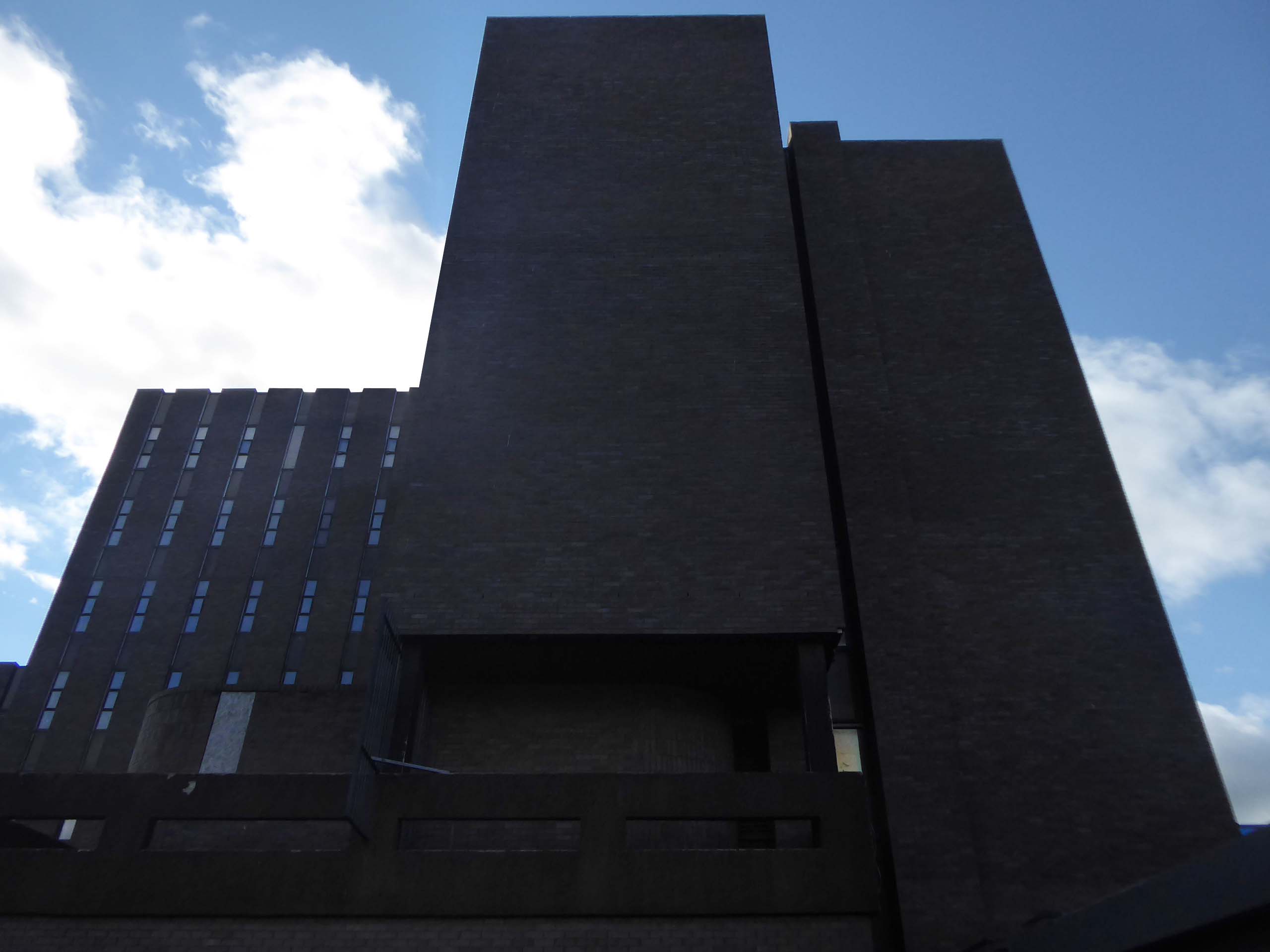
Lee House is still standing but vacant.
Lee House was once home to charity and community groups, but in 2015 the building owners ordered them to vacate the property.Even the building’s clock has stopped working and has been stuck on the same ten-past-two reading.
However, Durham County Council has now confirmed the building is in new hands. Economic development manager Graham Wood said: “We have worked with the previous owner to try to ensure the building is secured while we await proposals for its long-term future.
Four fire engines rushed to Lee House on Upper Yoden Way in Peterlee on Friday afternoon September 19th 2025 after a fire broke out on the first floor of the seven floor building.
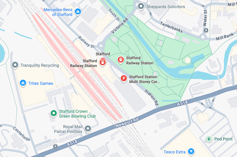
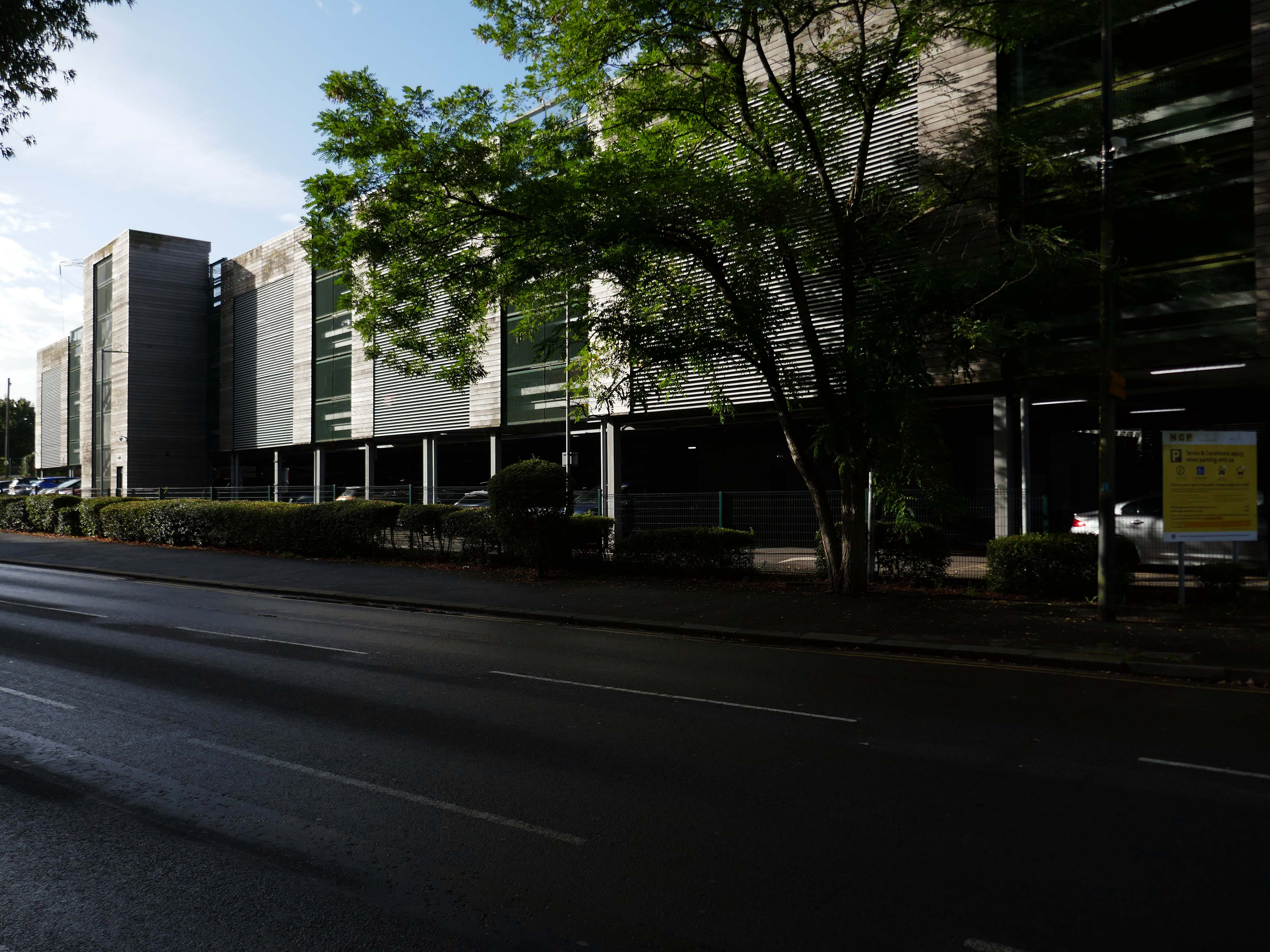
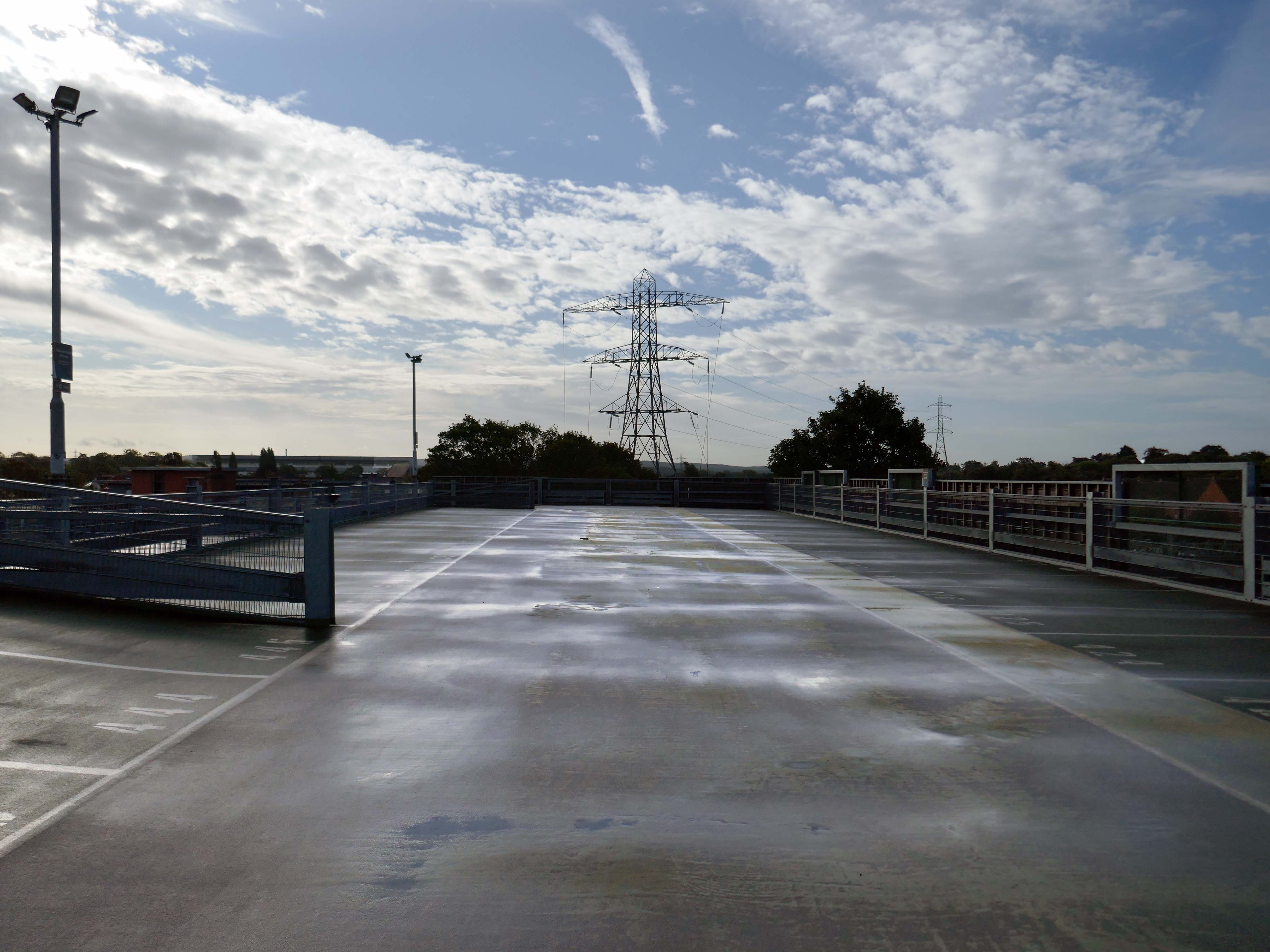
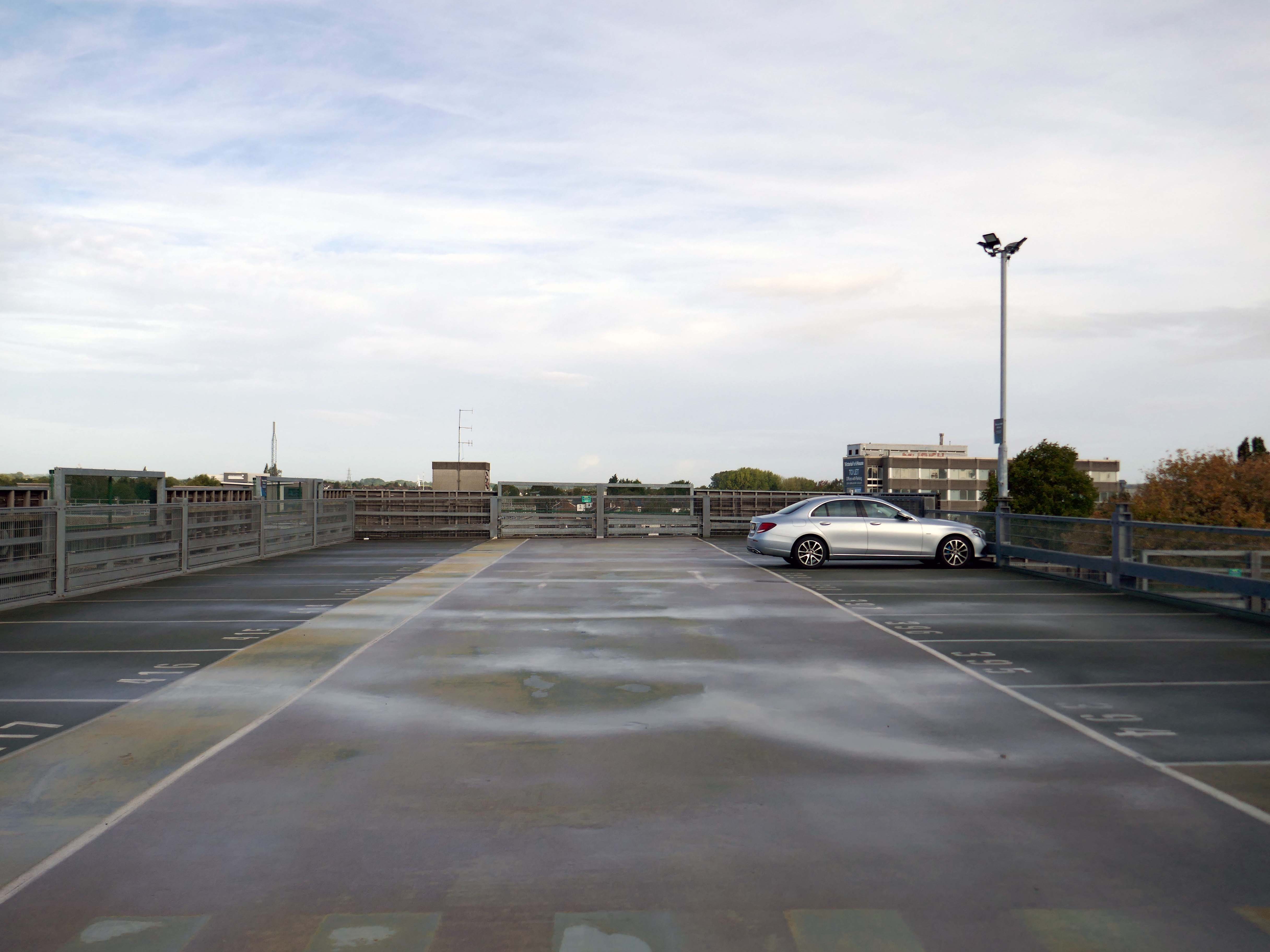
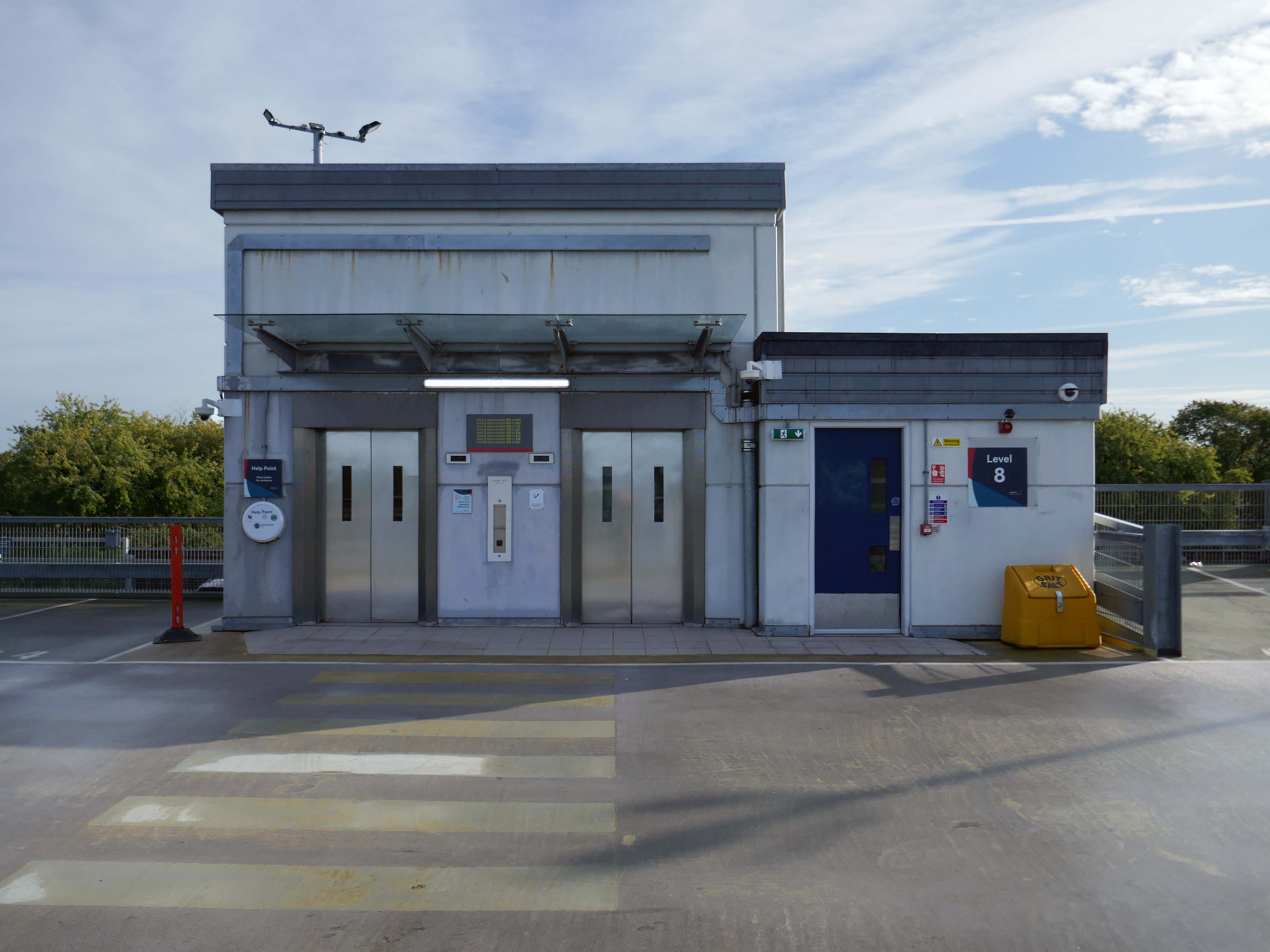
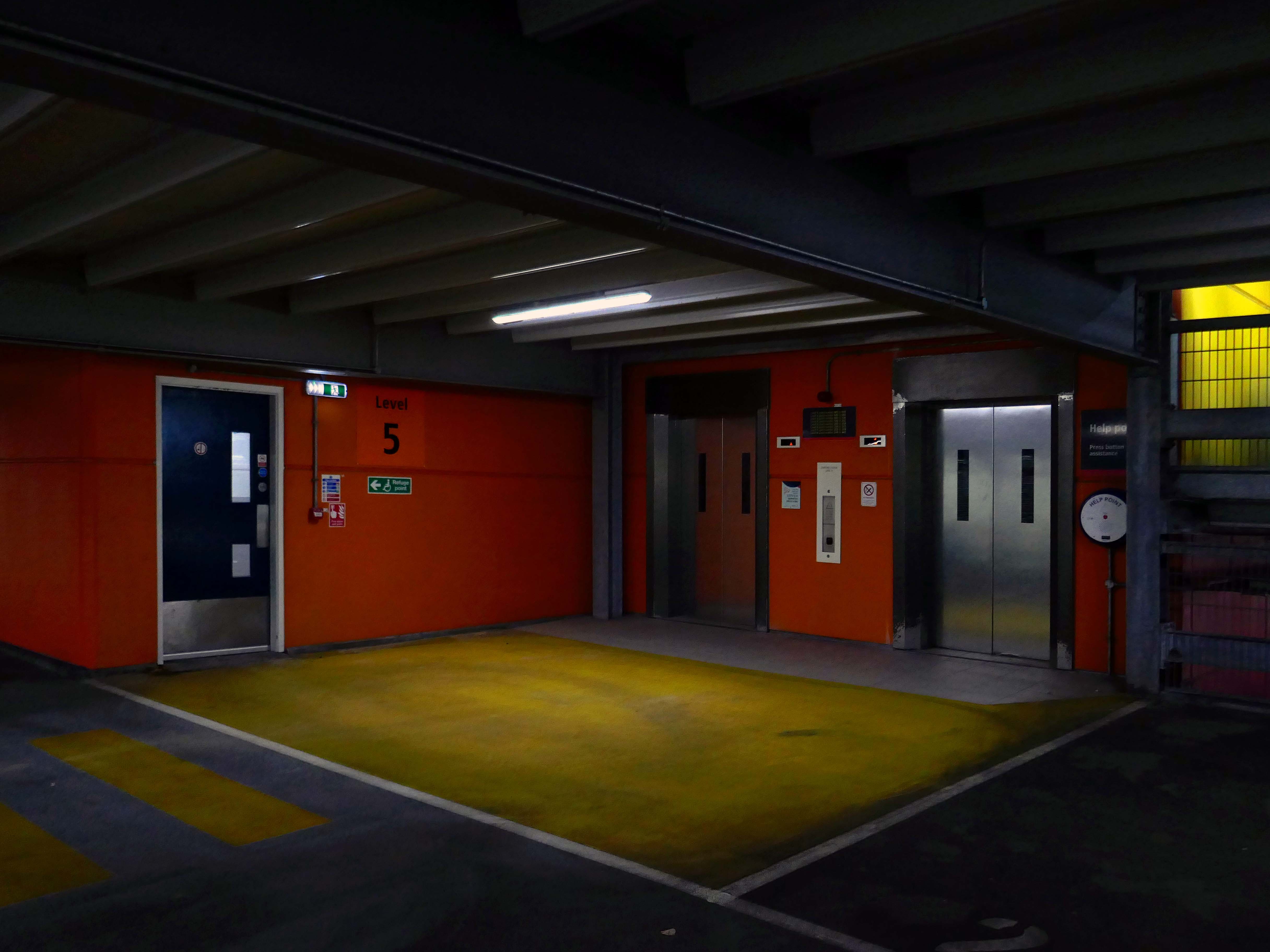
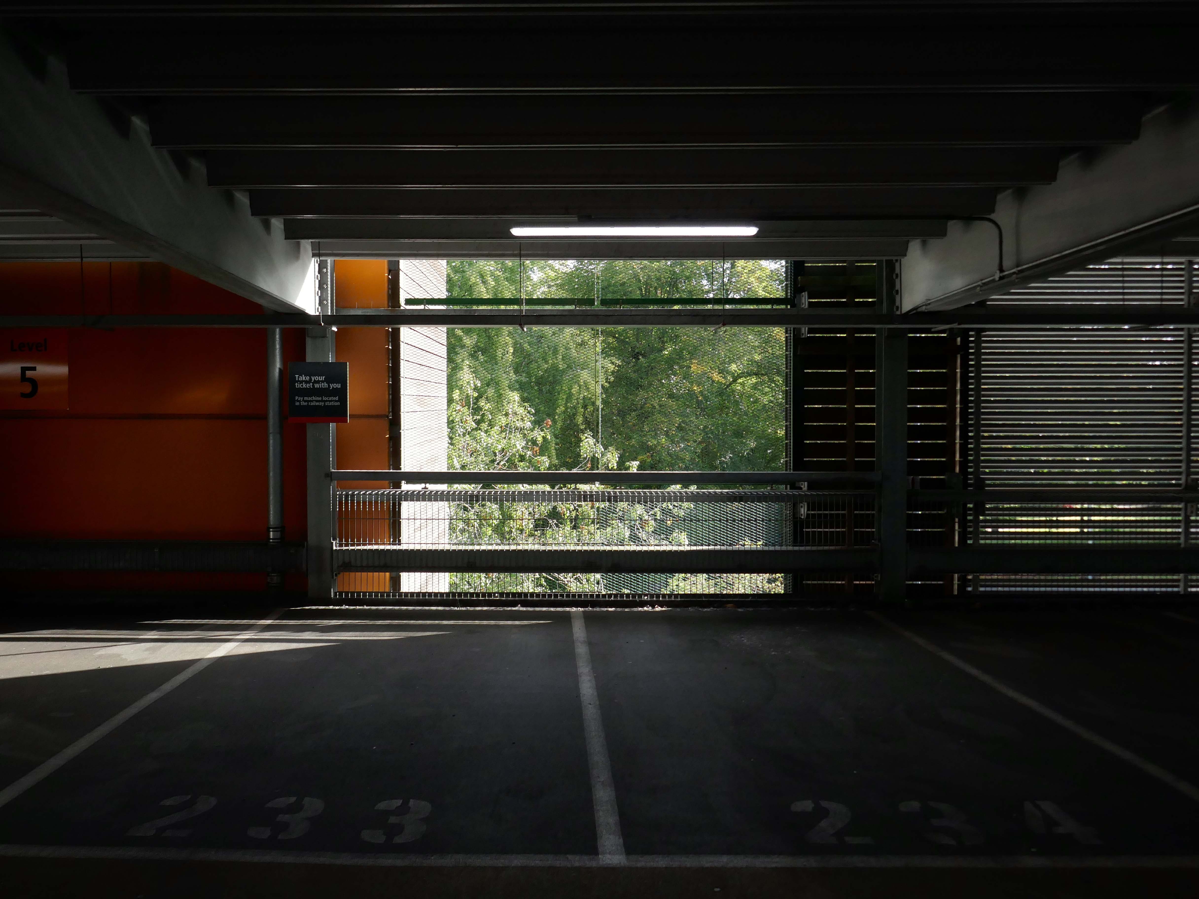
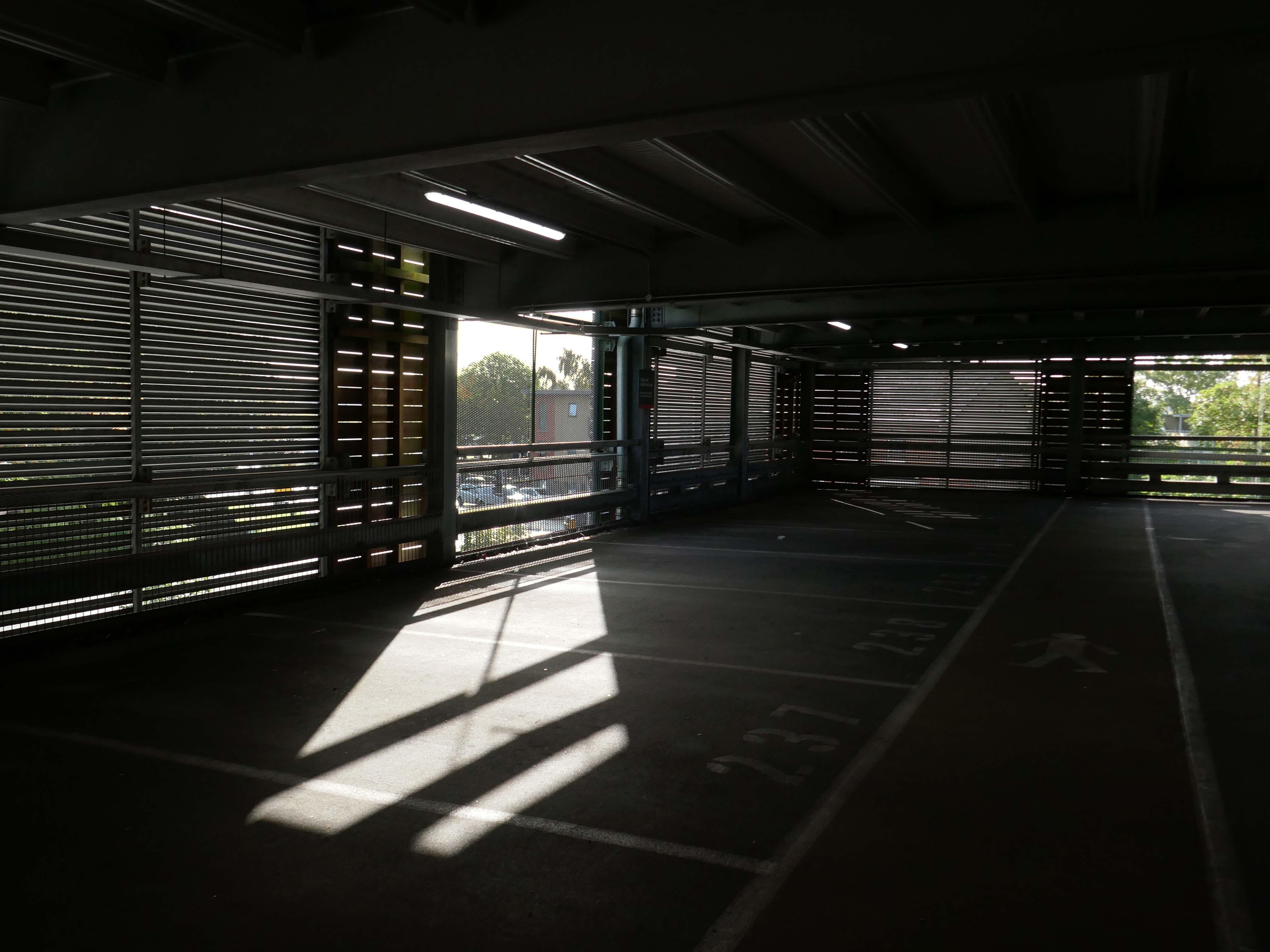
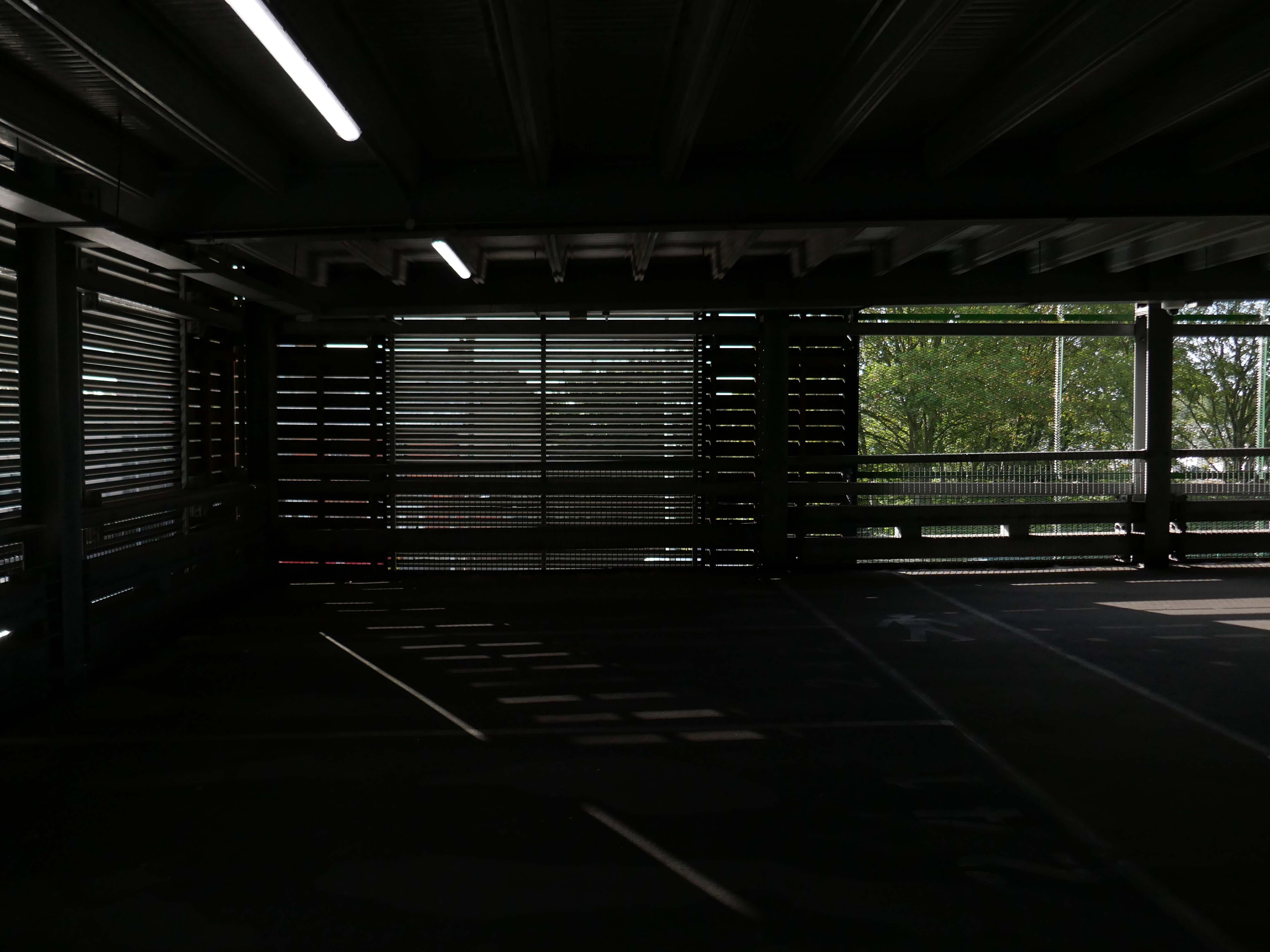
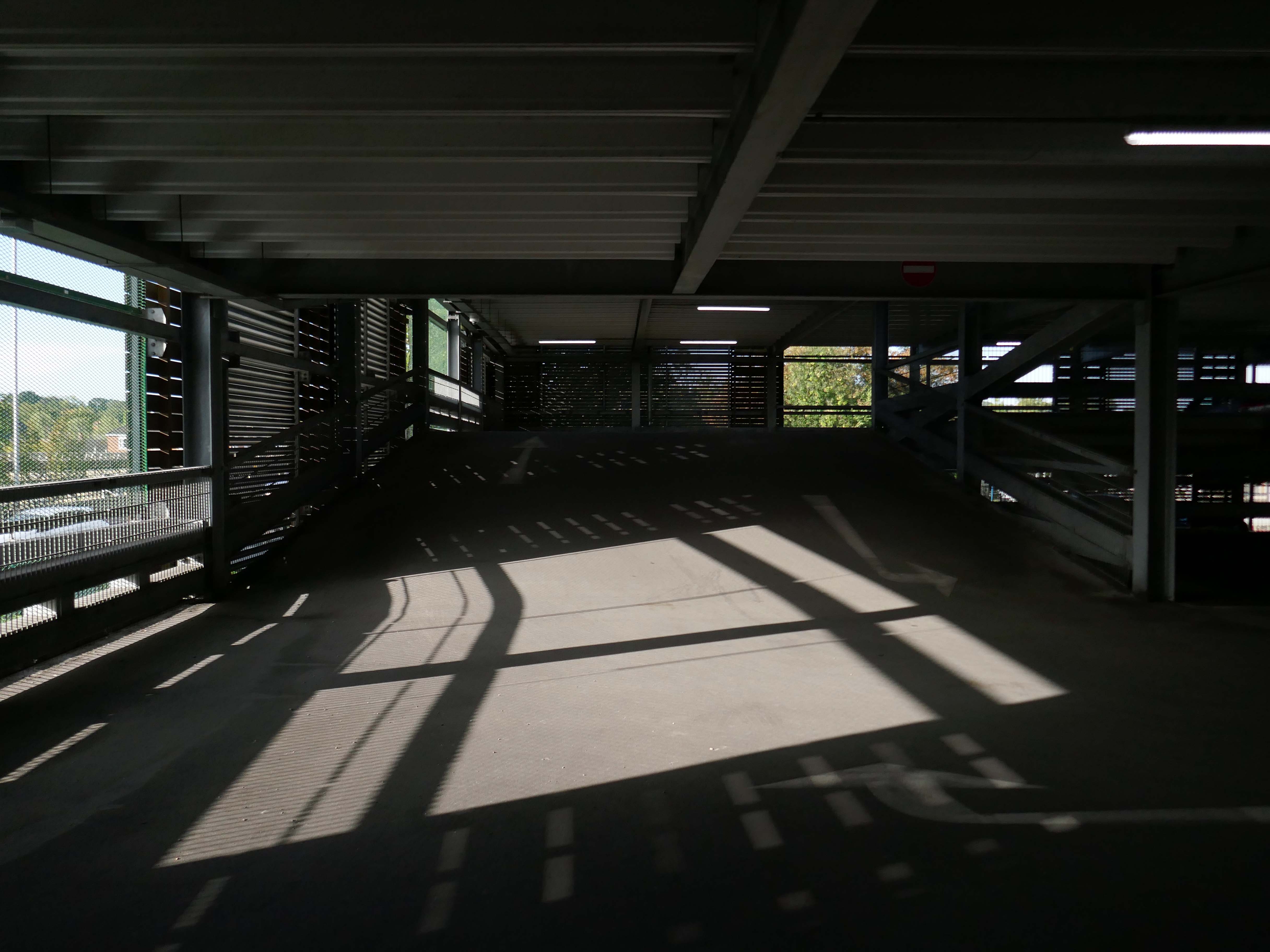
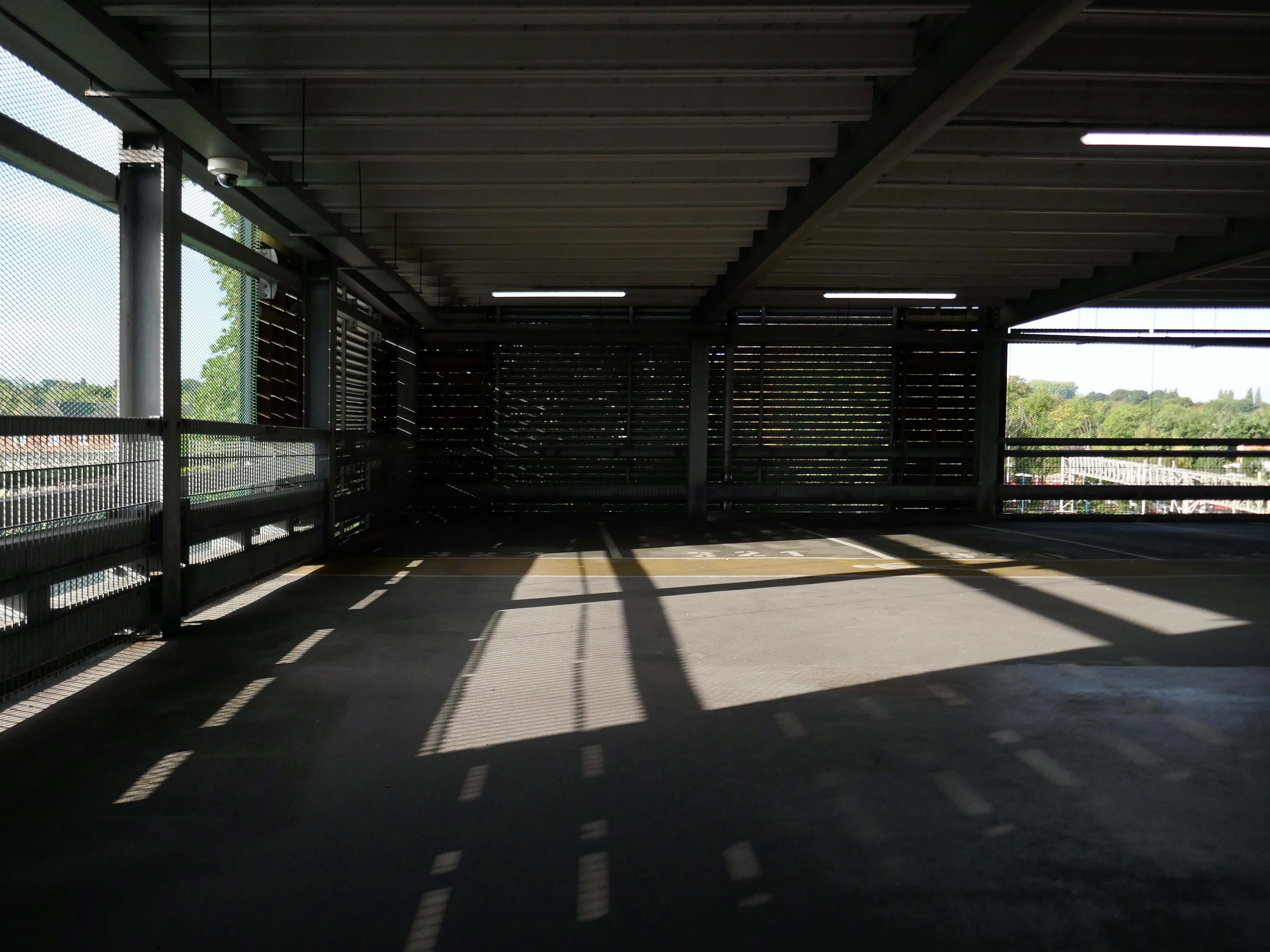
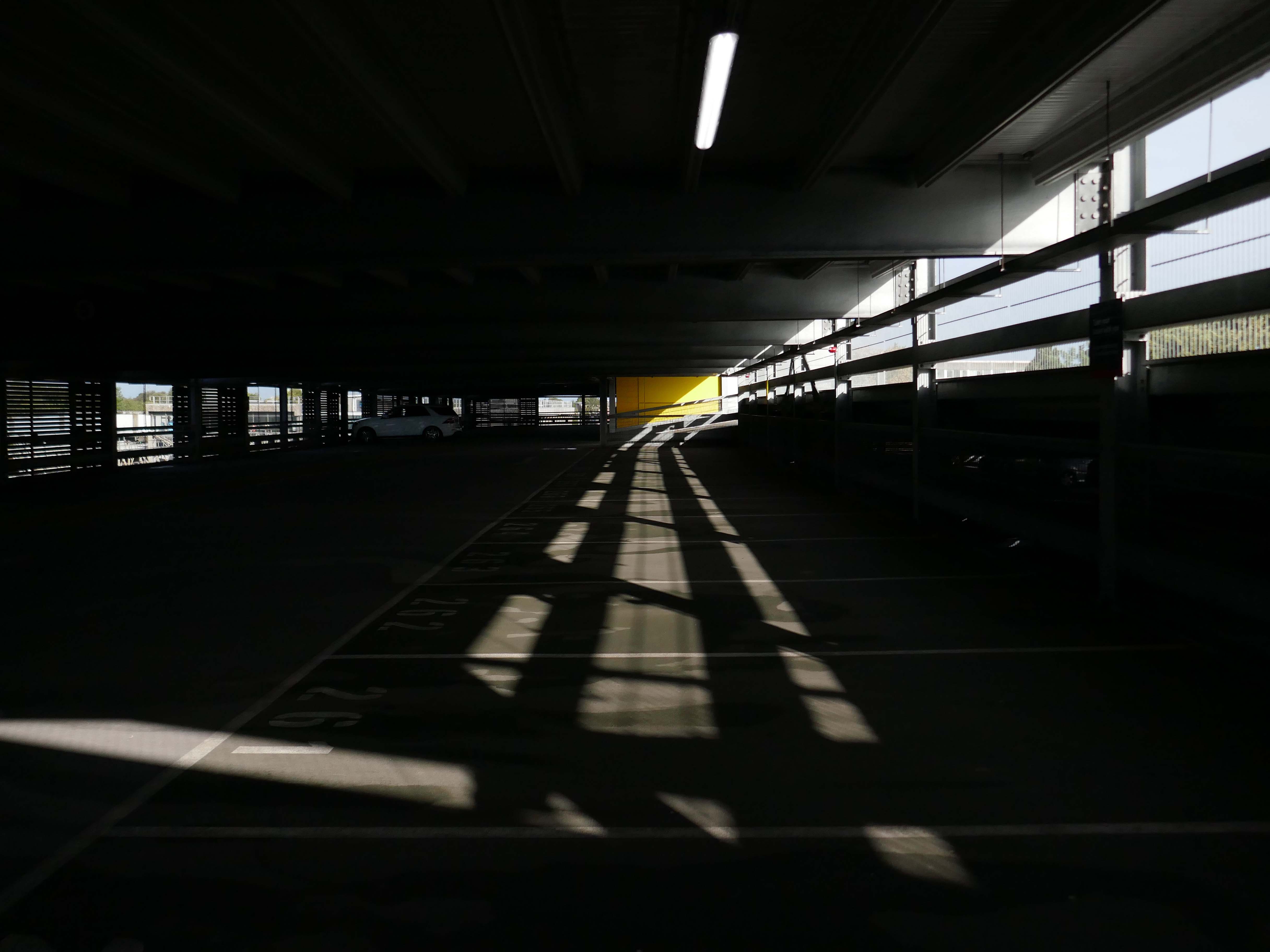
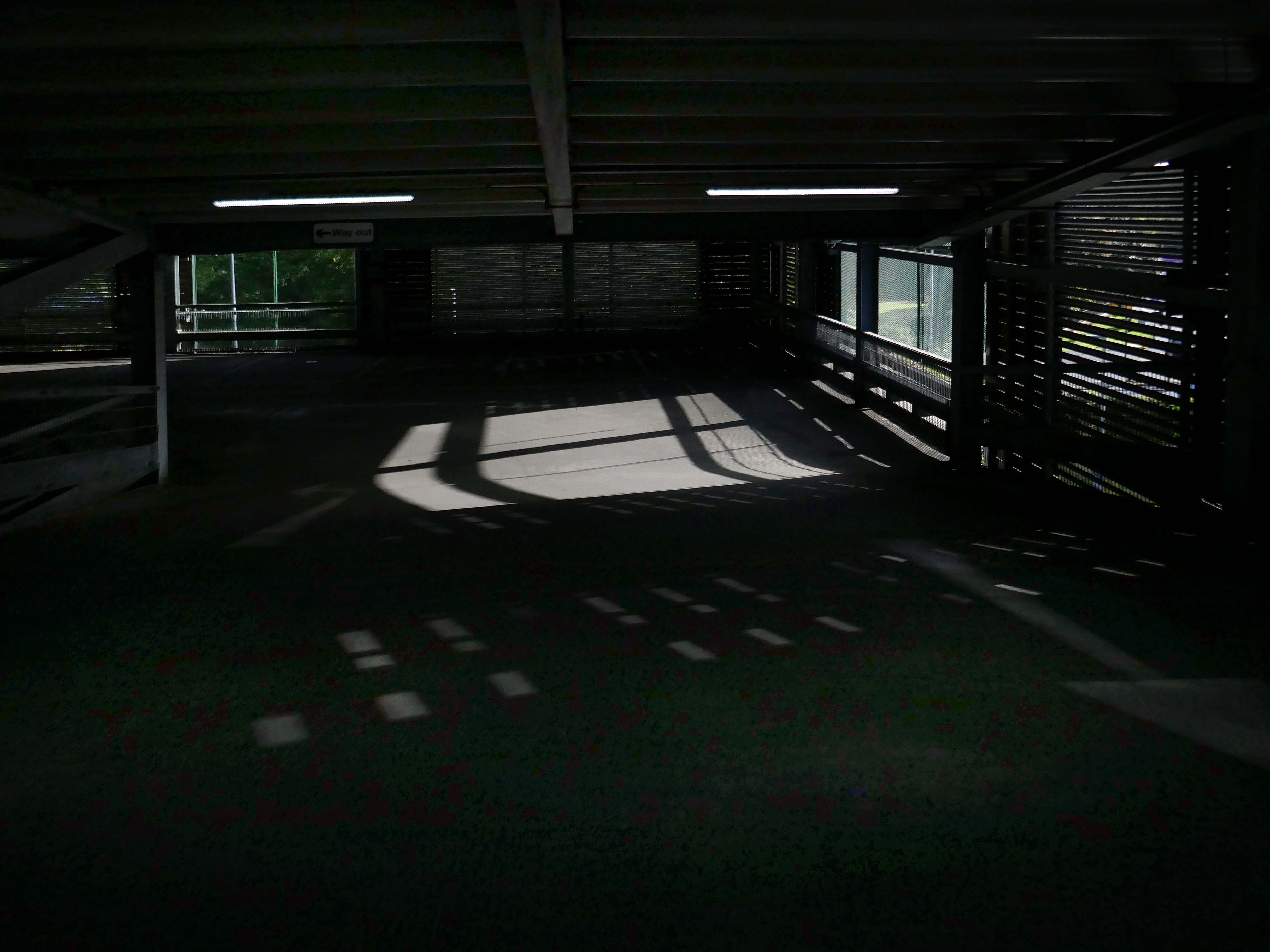
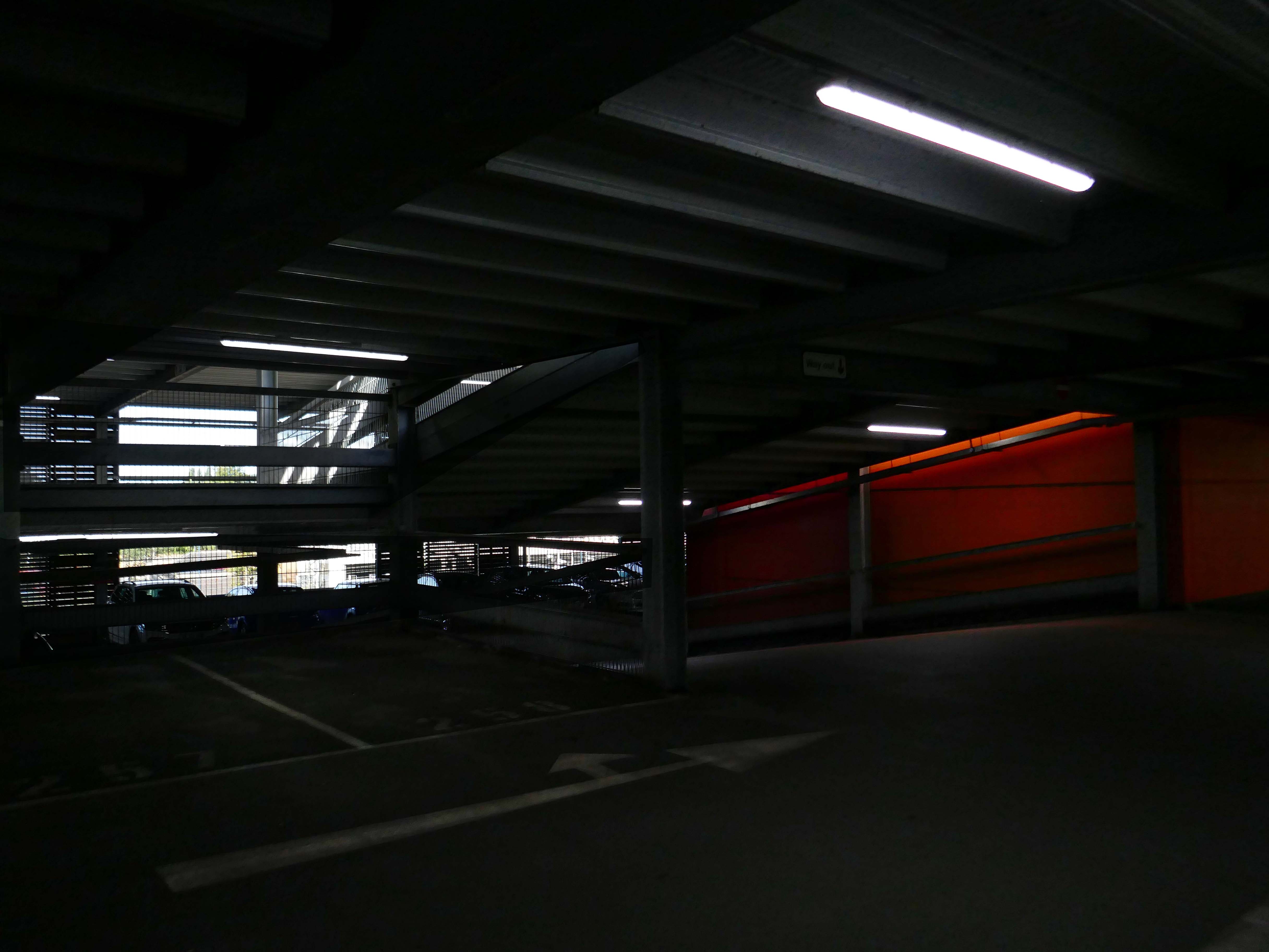
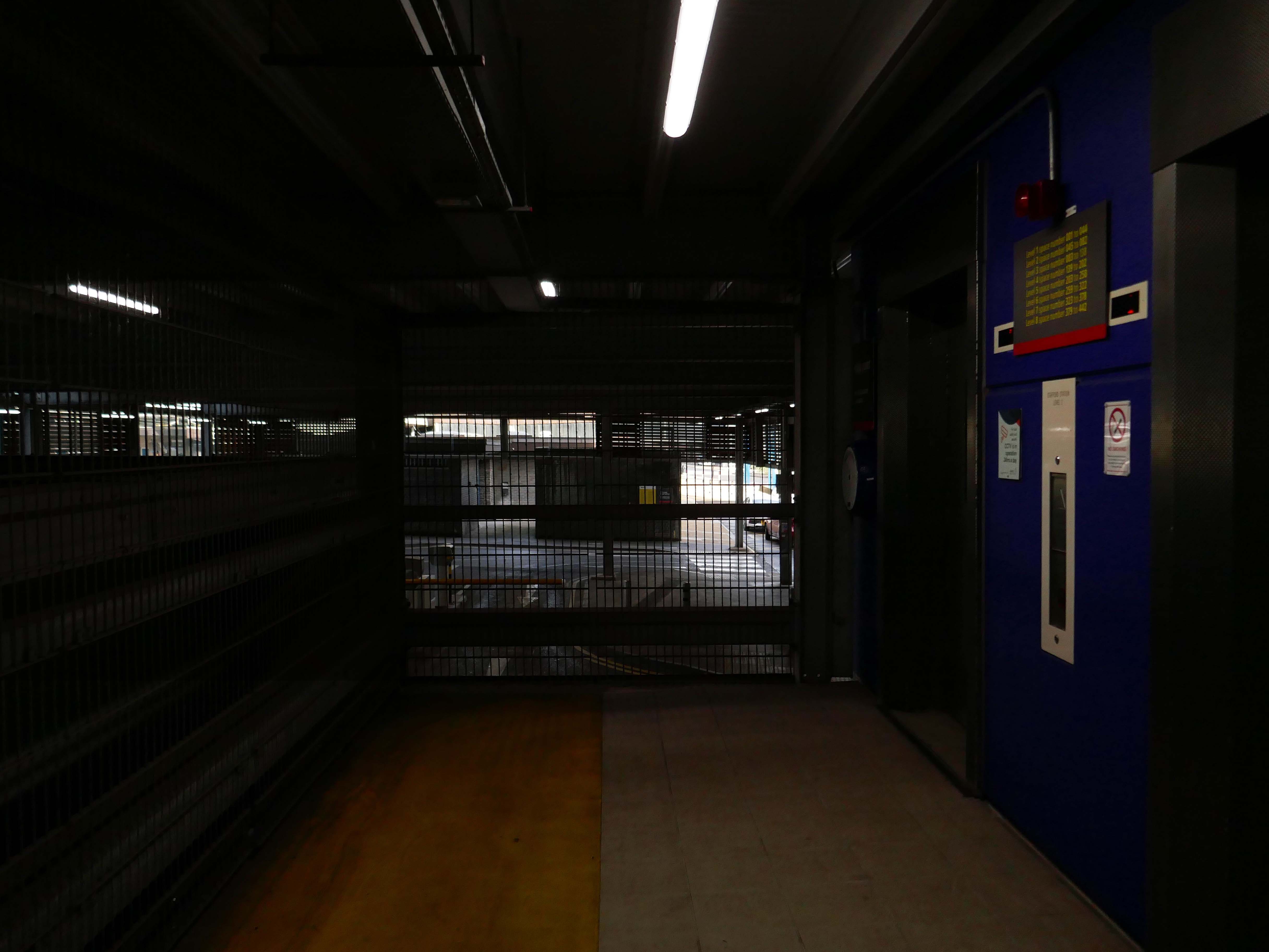
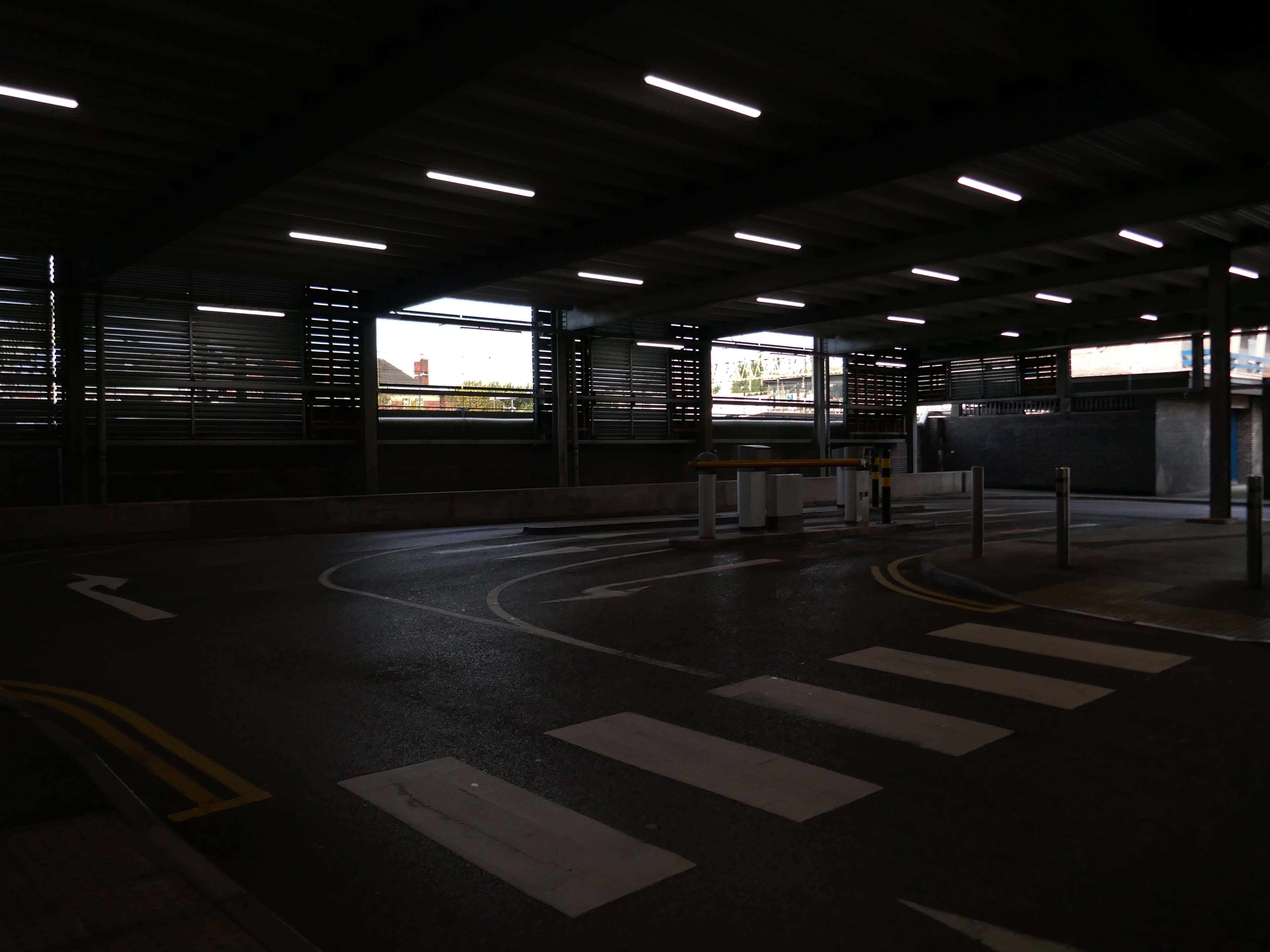
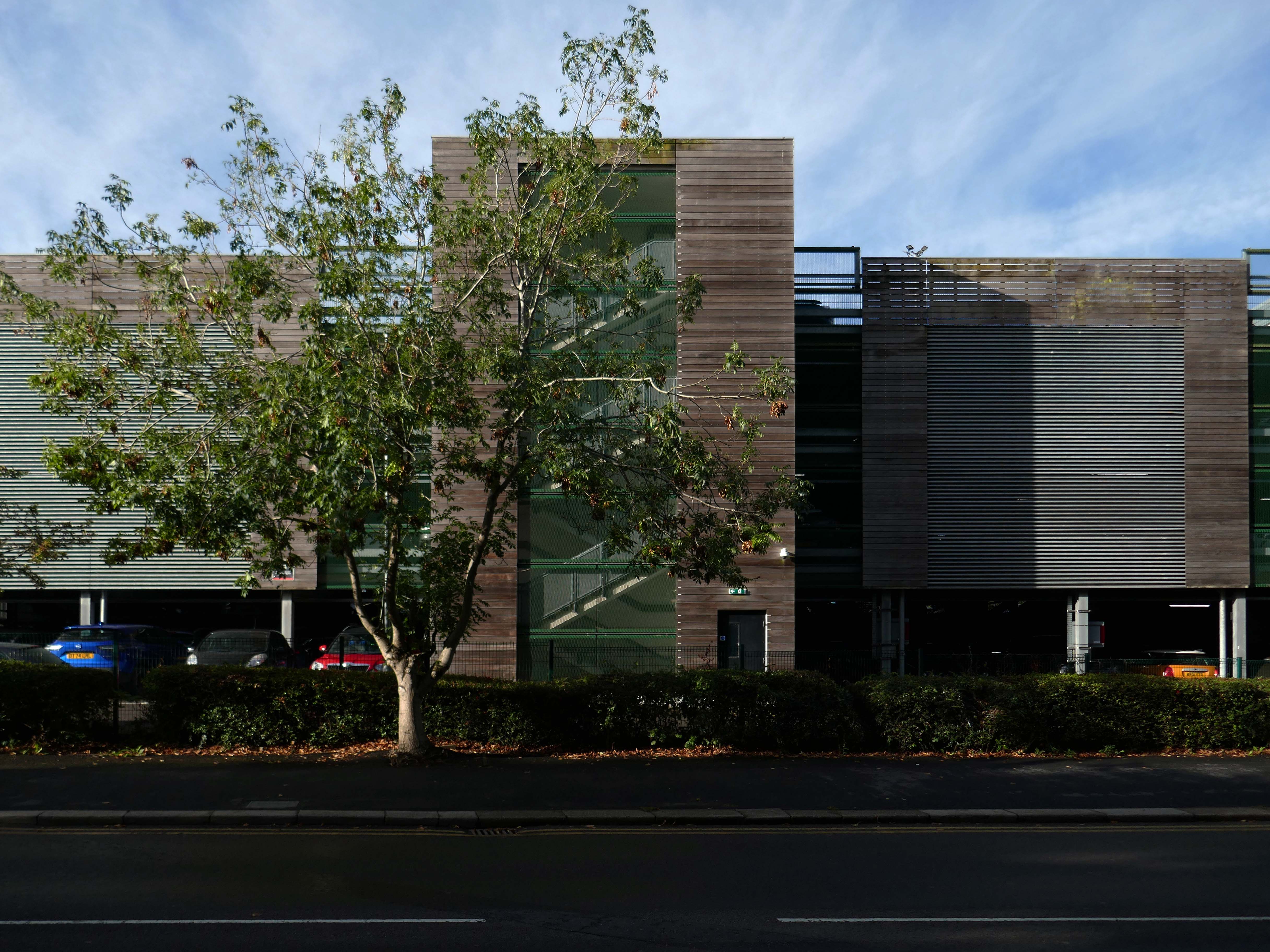
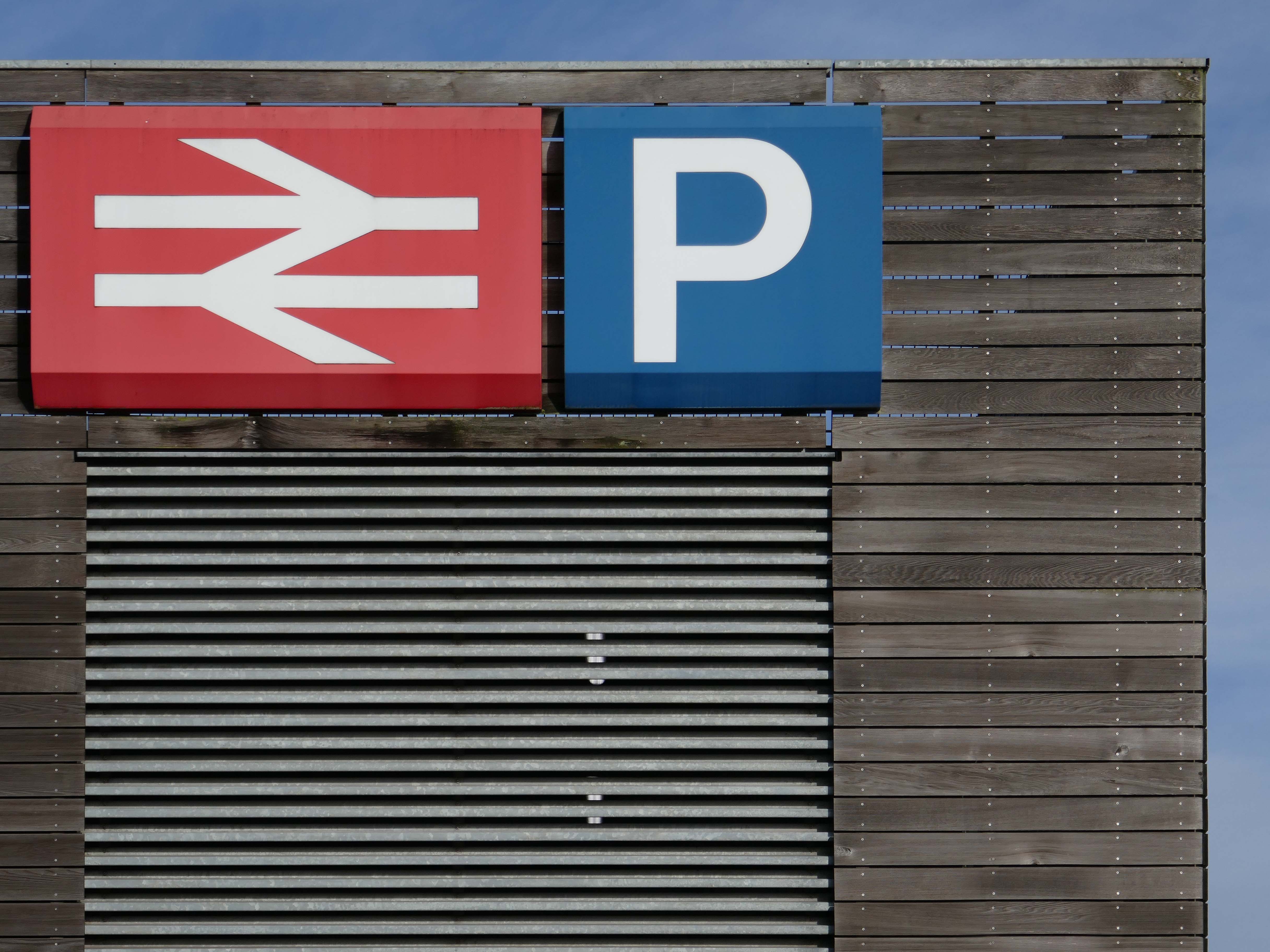
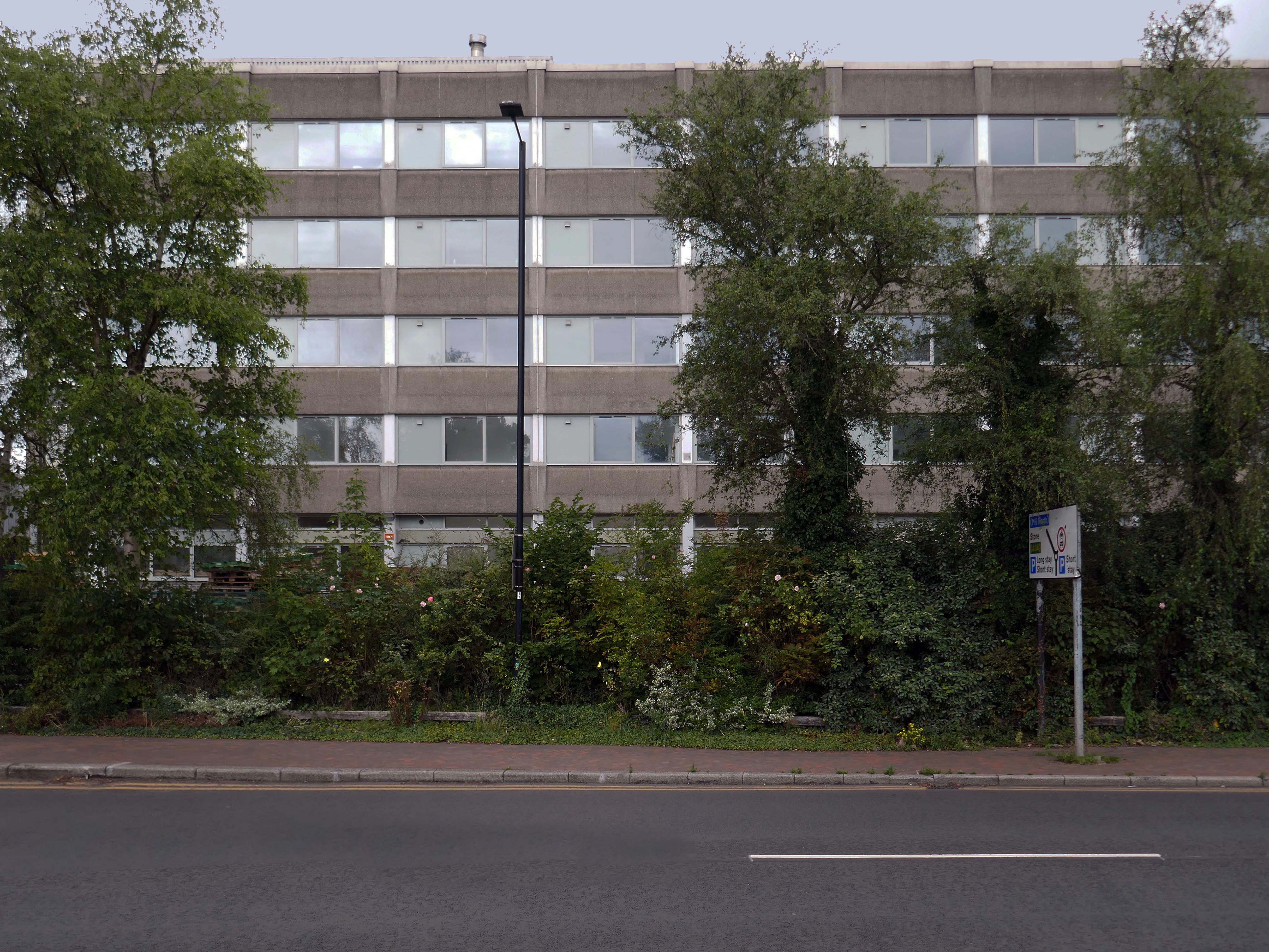
Stafford Station – Multi-Storey Car Park Station Road ST16 2AA
Arriving by train one Saturday morning at the Stafford Station, with time on my hands, I thought to take a look at the adjacent multi-storey car park.
As a pedestrian I found it to be first rate, clean and well signed and designed, easy access by both stairways and lifts, affording panoramic views of the town.
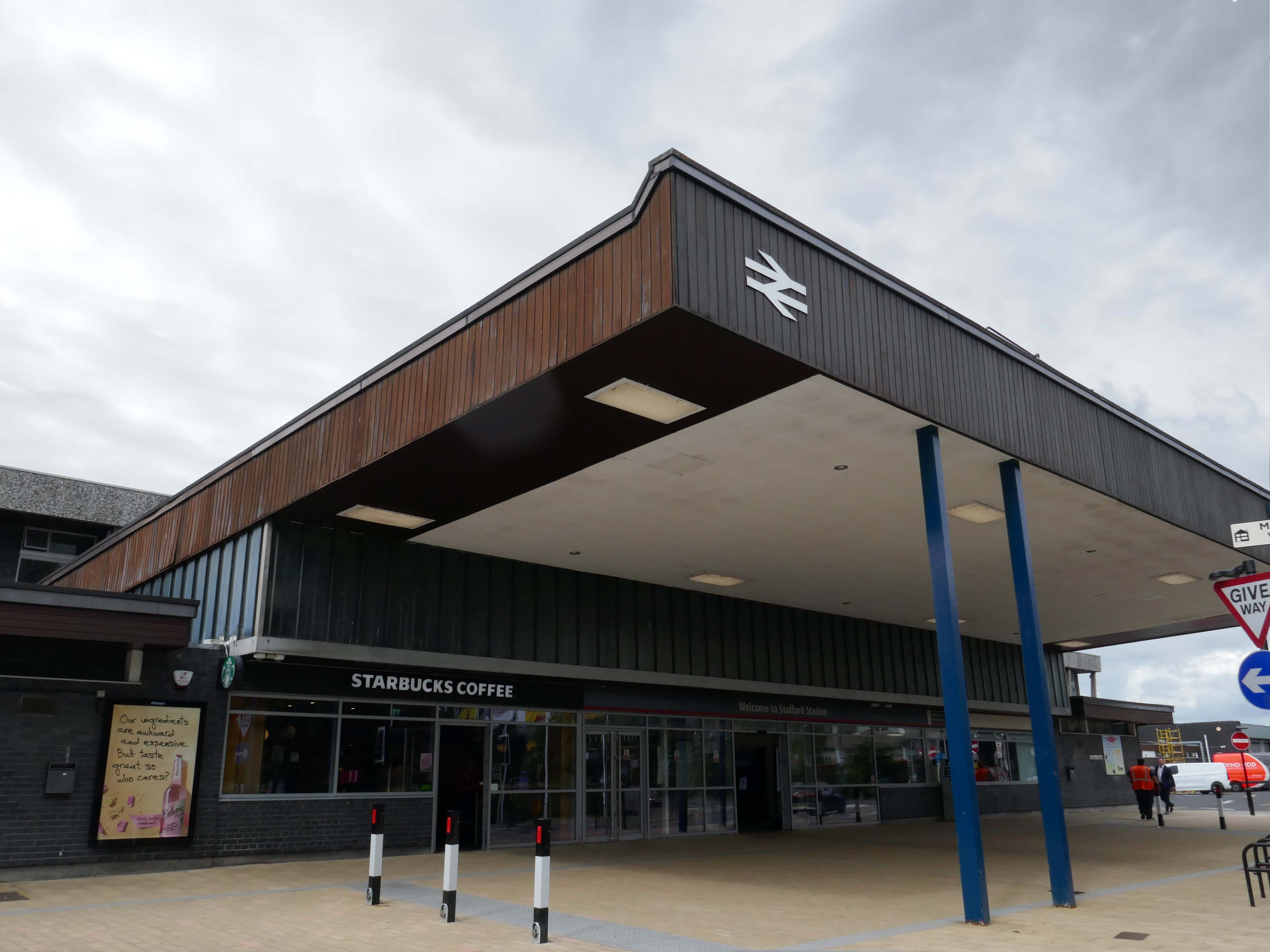
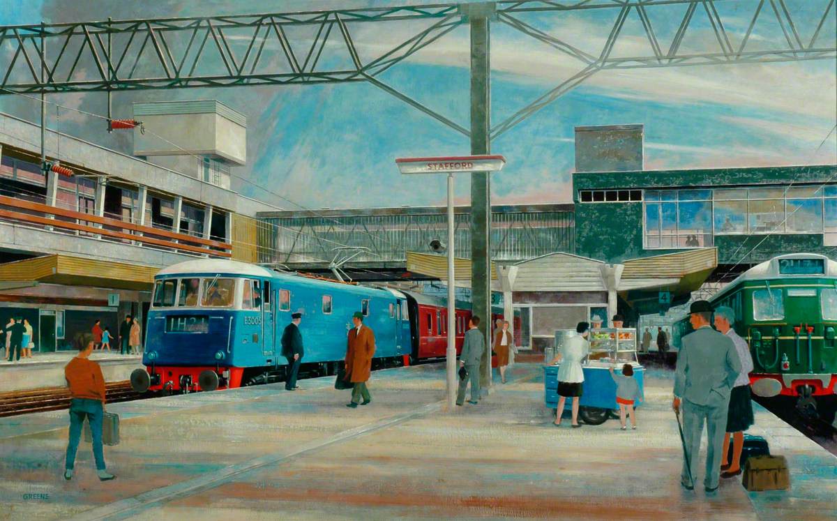
The current station was built in 1962, by the architect William Robert Headley, as part of the modernisation programme which saw the electrification of the West Coast Main Line.
On leaving the station there is an as yet partially un-let Sixties office block to let – Victoria Park House.
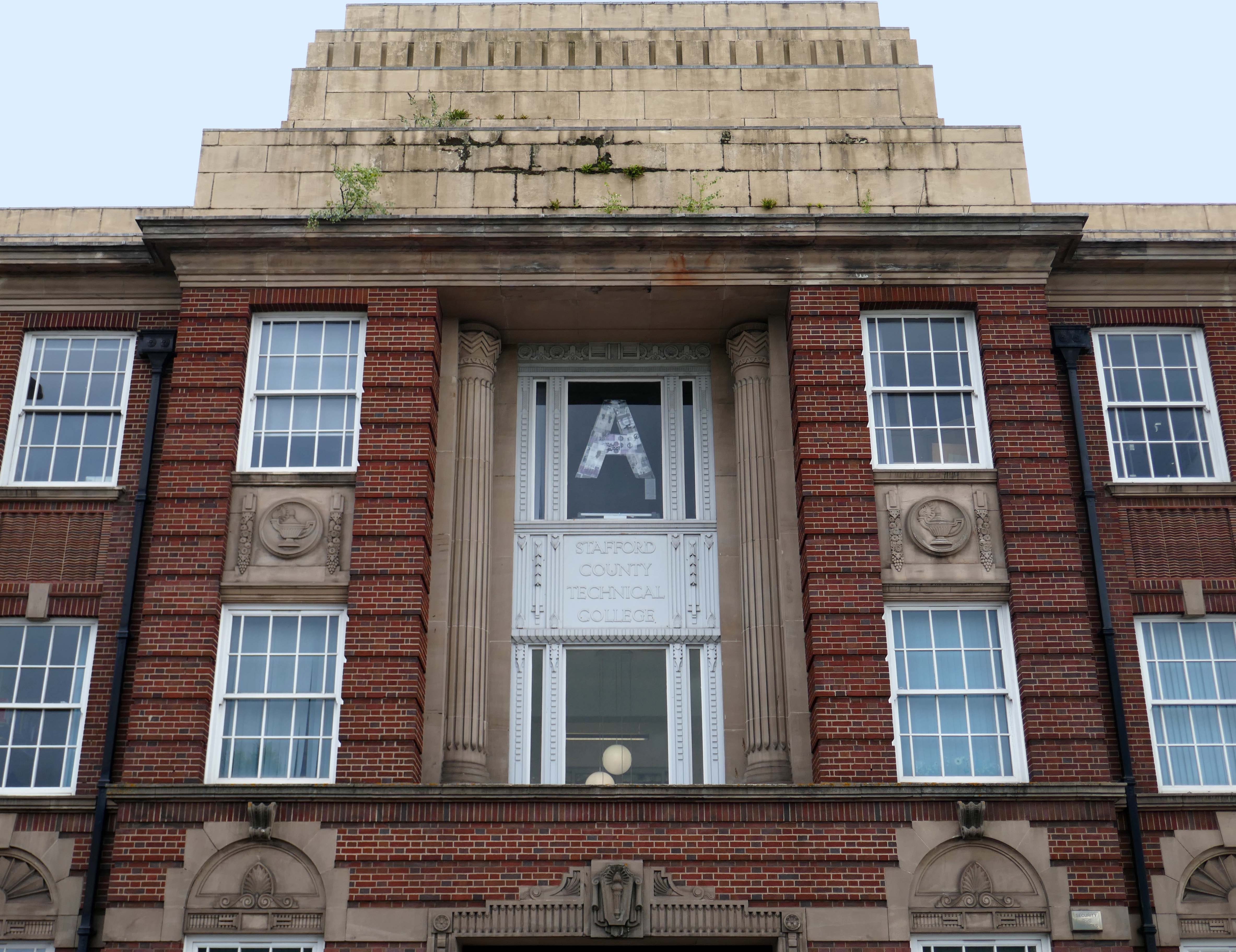
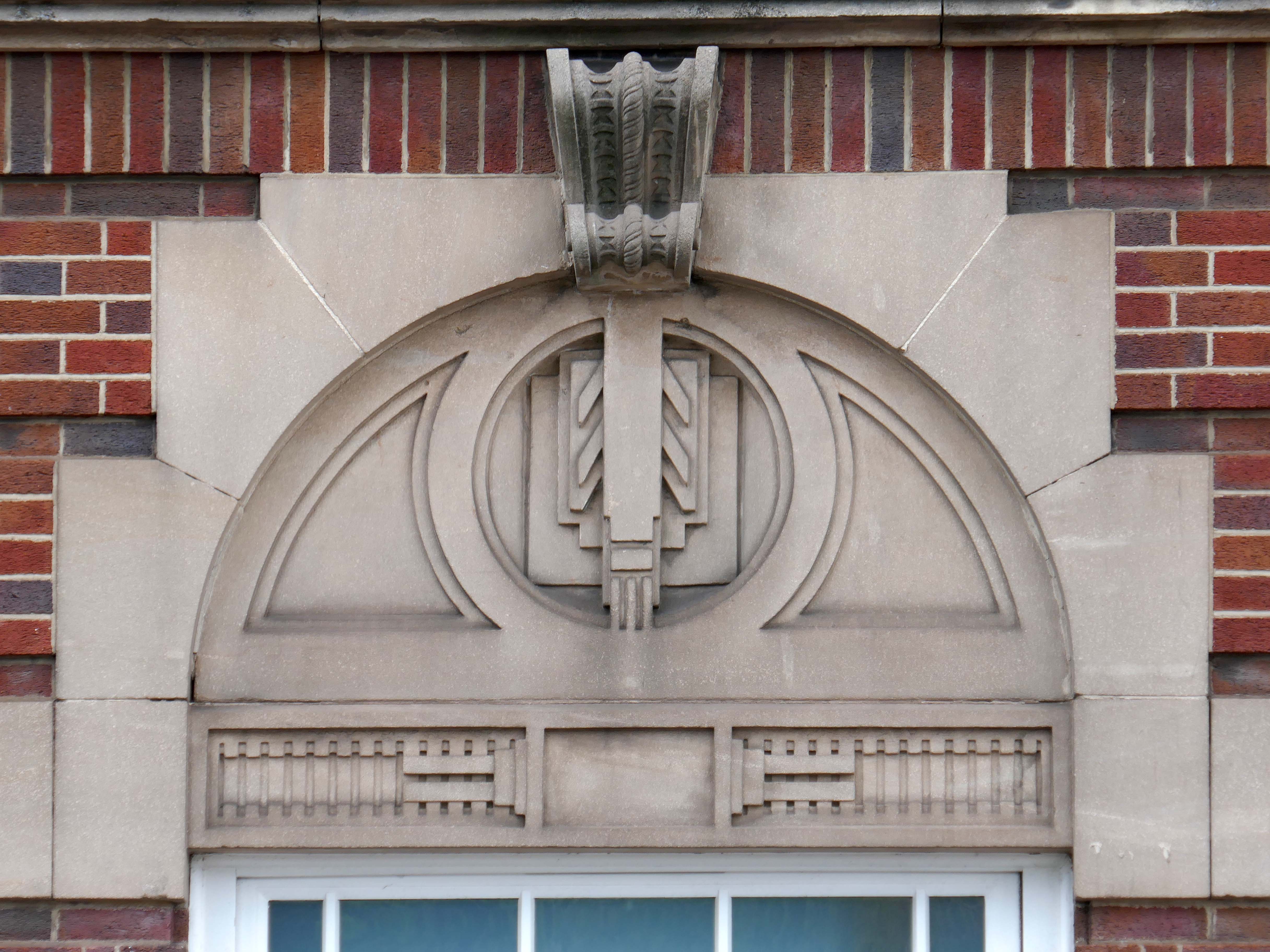
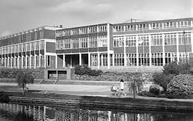
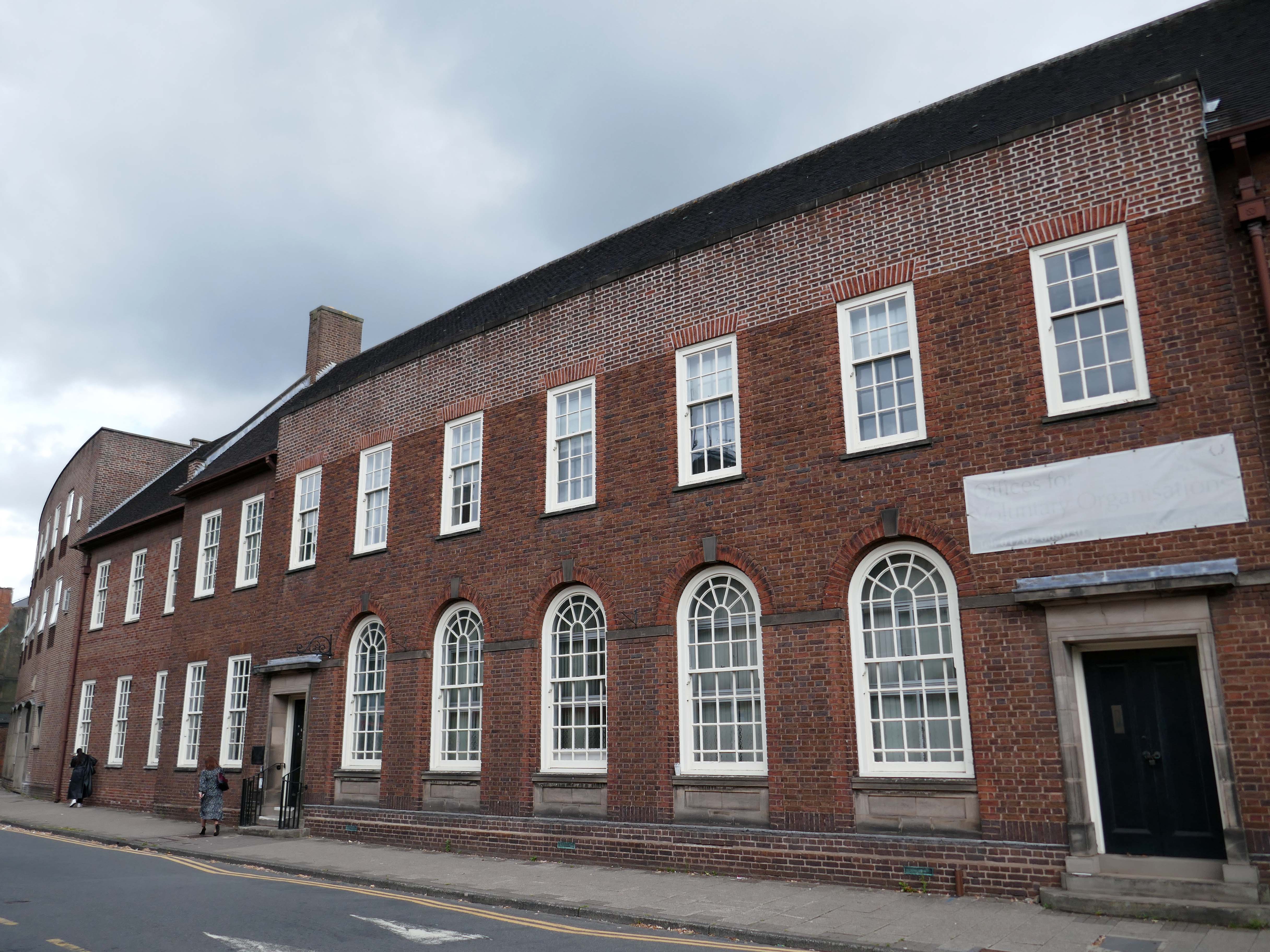
Onward to the County Technical College 1937 Grade II Listed – interior completed 1946.
The shell of the building was completed in 1937, after which it was used as an American army hospital during the war, then completed afterwards.
Heavily loaded with Art Deco details.
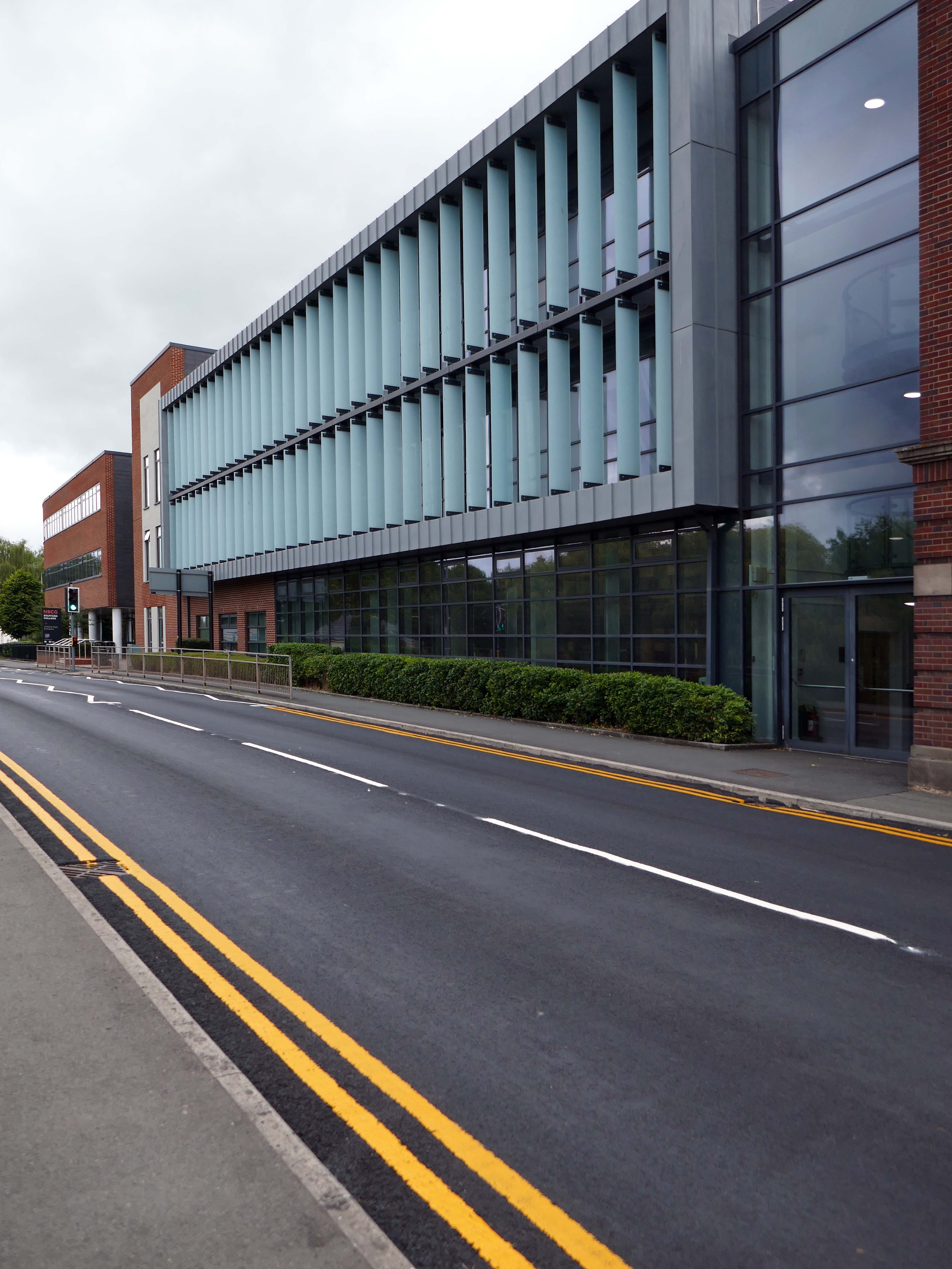
The new £28m three-storey Skills & Innovation Centre at Stafford College, completed in August 2023, was one of the first further education college schemes to be delivered under the DfE framework and a pathfinder scheme for delivery in accordance with the Further Education Output Specification. The new Centre is equipped with cutting-edge equipment and state-of-the-art facilities for construction, engineering and hybrid / electric vehicle maintenance facilities, as well as IT rich seminar suites and open learning break-out spaces along with a 4-court sports hall, a fully-equipped gym and a flexible 300-seat auditorium.
A 1970’s block was demolished to make way for the new development.
Almost everywhere we go we find a PoMo Crown Courts 1991 – architects: Associated Architects of Birmingham, cost of £10.4 million.
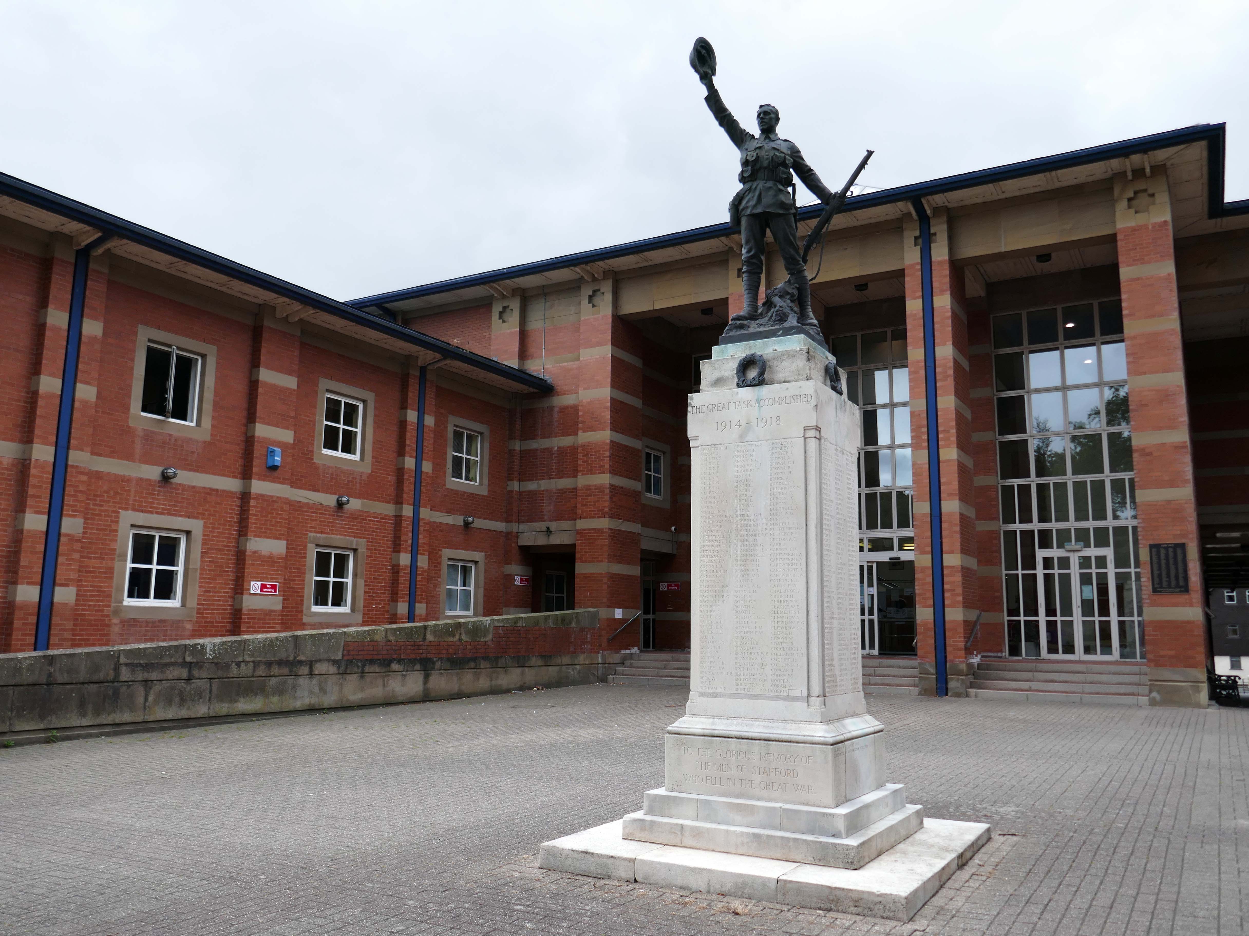
The war memorial of 1922 is by Joseph James Whitehead.
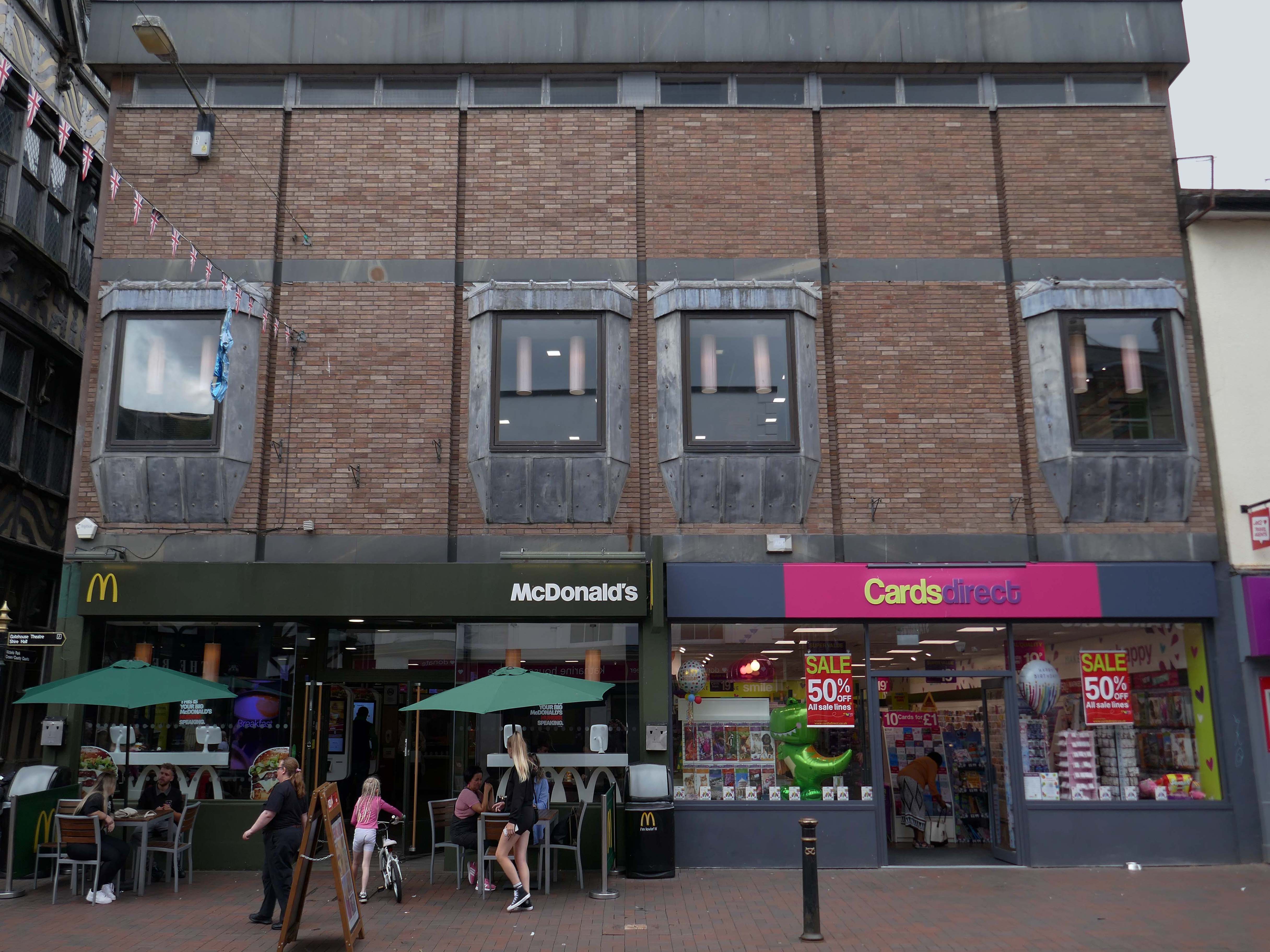
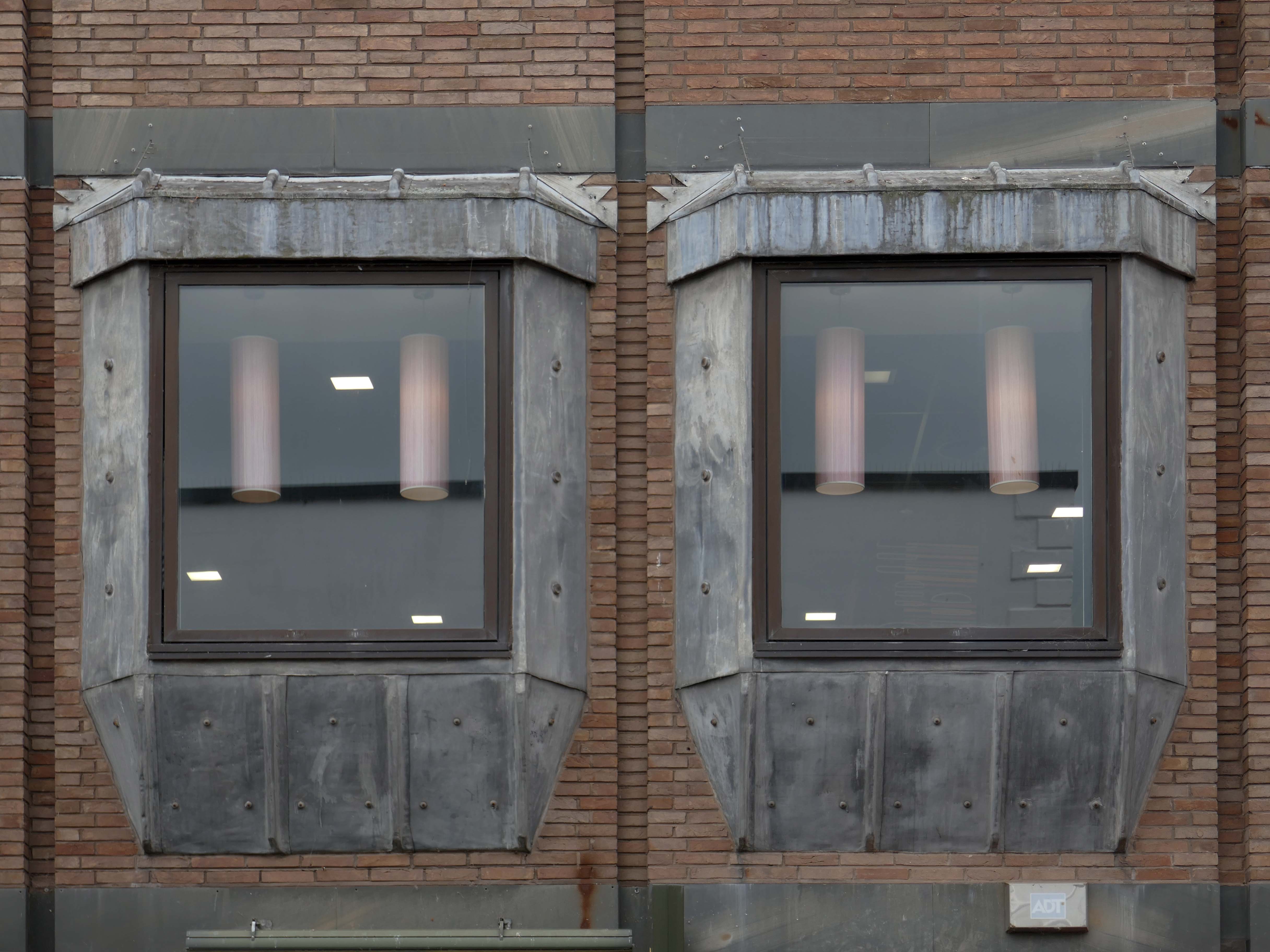
Sneaking through the alley to and before the McDonalds – one many more recent buildings with jetted lead clad bays.
Keeping the town Tudor one bay at a time..
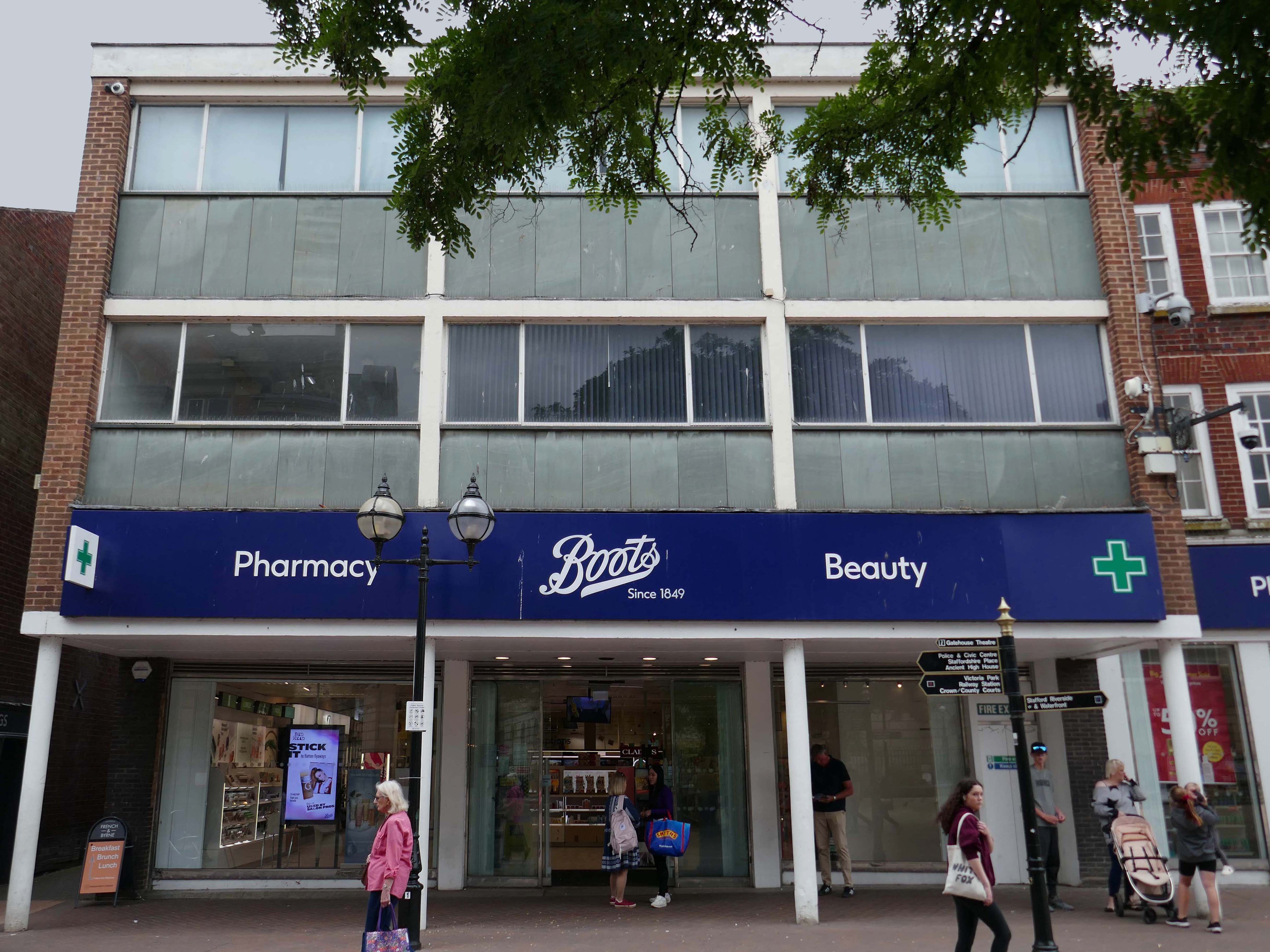
Further along a Sixties Boots.
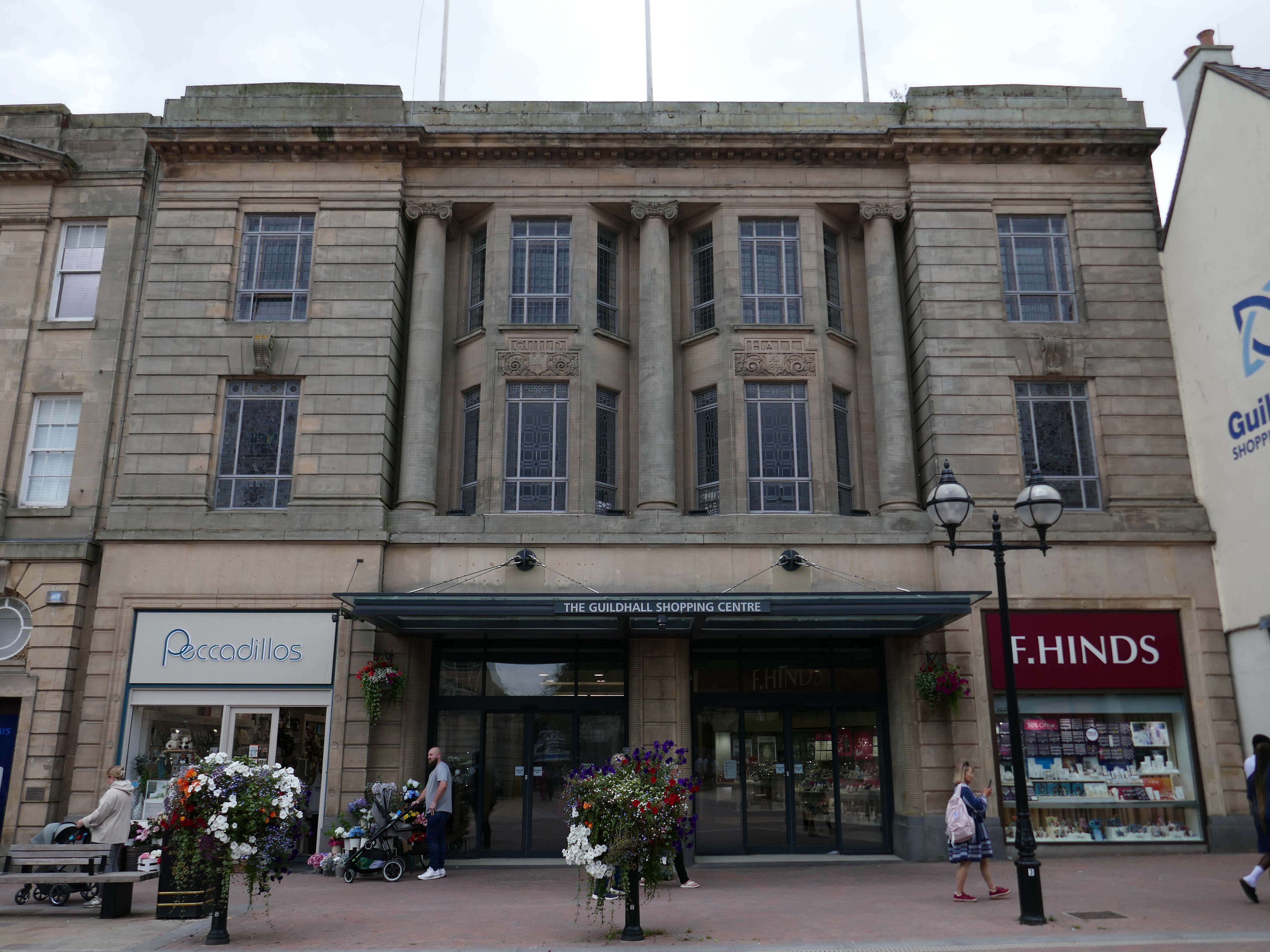
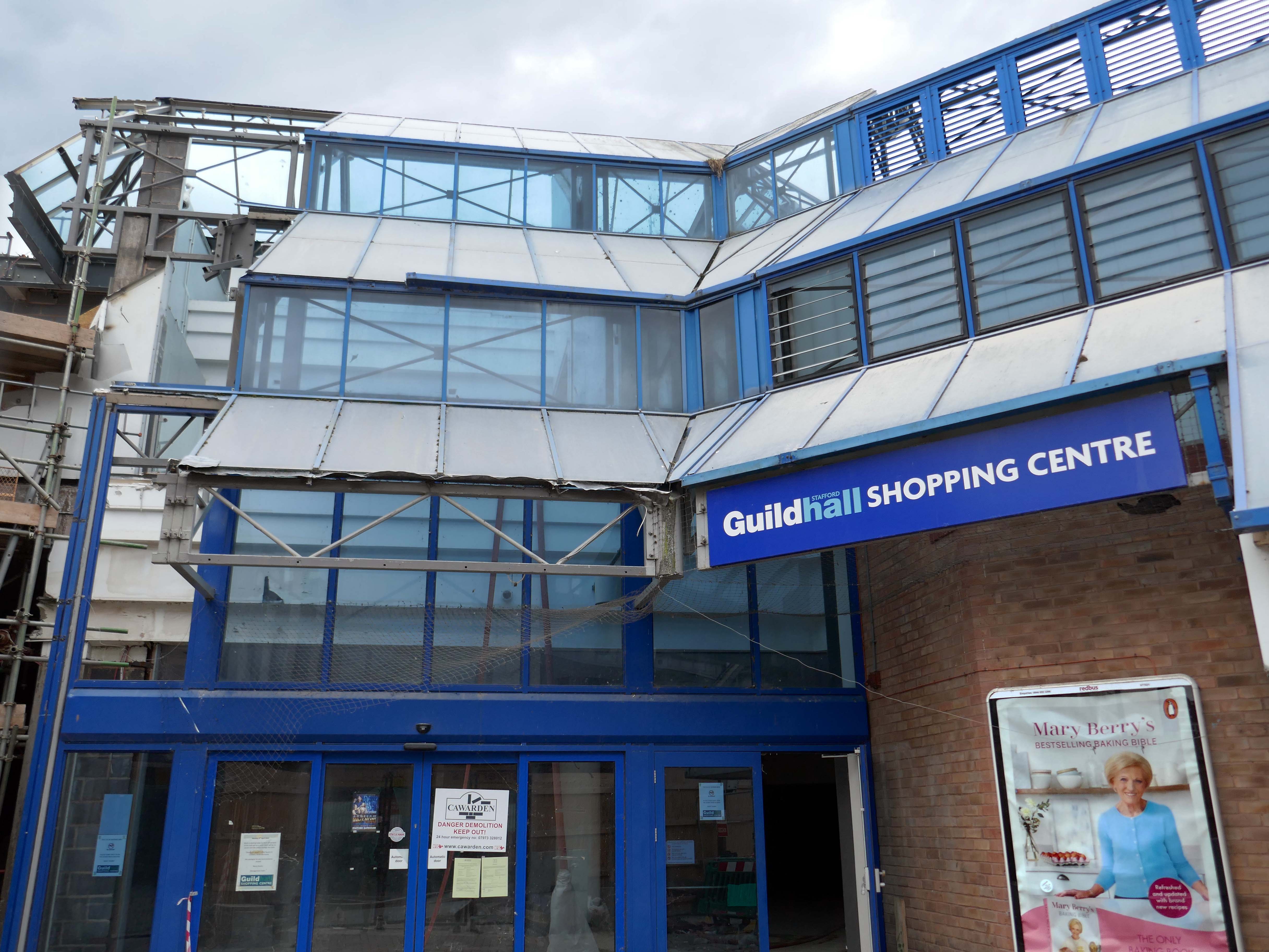
The Classical stone frontage of the Guildhall Shopping Centre.
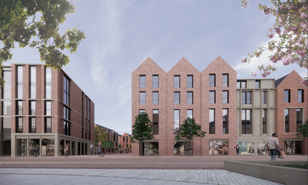
Working with Mercia Real Estate, Glancy Nicholls Architects have designed a contextual mixed-use scheme in the heart of Stafford Town Centre, within the footprint of a disused shopping centre. This includes the regeneration of the 1930’s Guildhall building that serves as the main entrance to the shopping centre and the listed Market Square building.
Around the corner a somewhat neglected retail development.
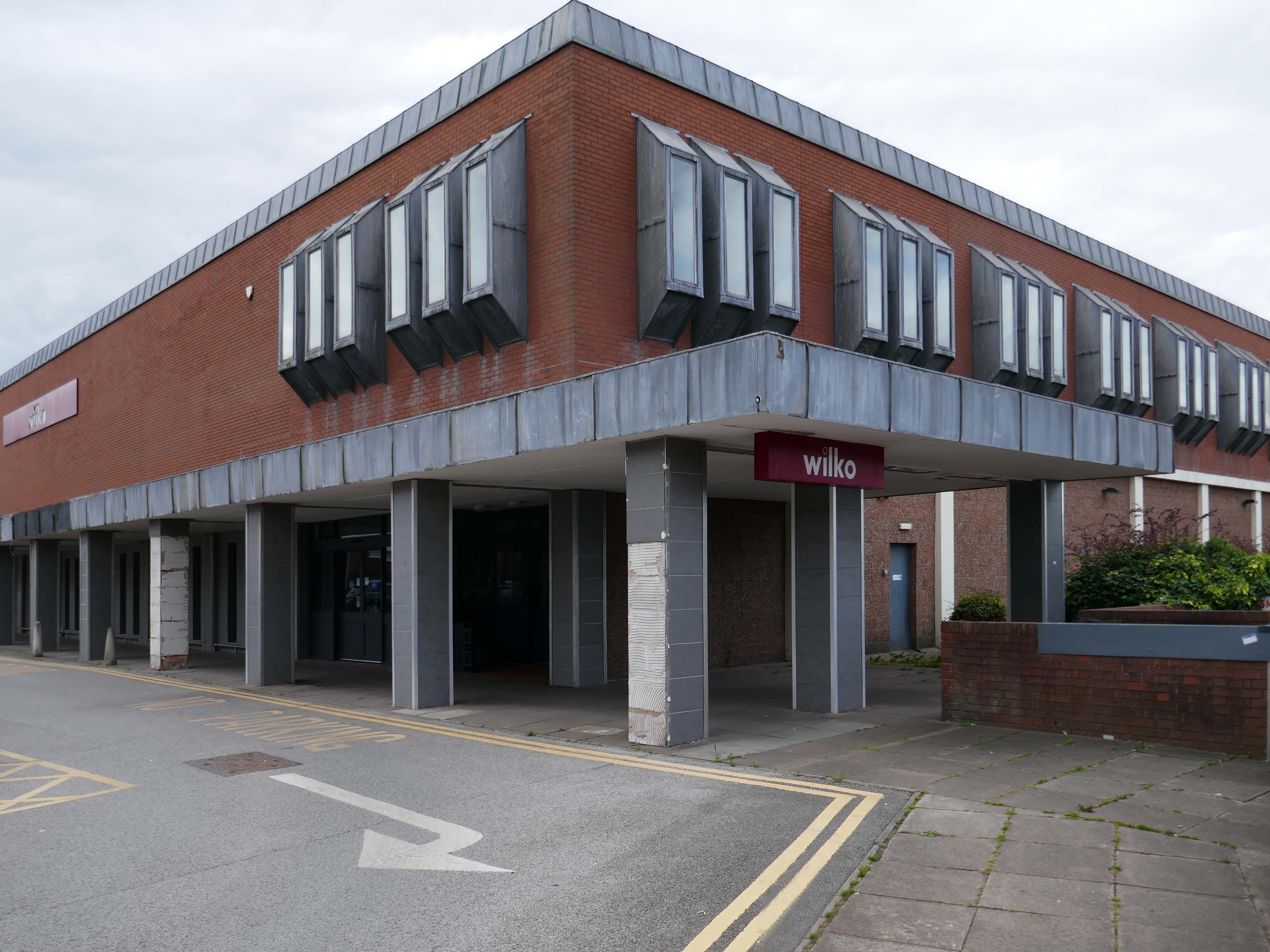
And a long lost Wilko.
Amidst it all the curious time warp that is Trinity Church 1988.
It is used by Methodist and United Reformed Church congregations.
Tucked away in a minor maze of retail a piece of figurative commemorative public art by Glynis Owen Jones, entitled Stafford Faces.
Around the corner a big B&M.
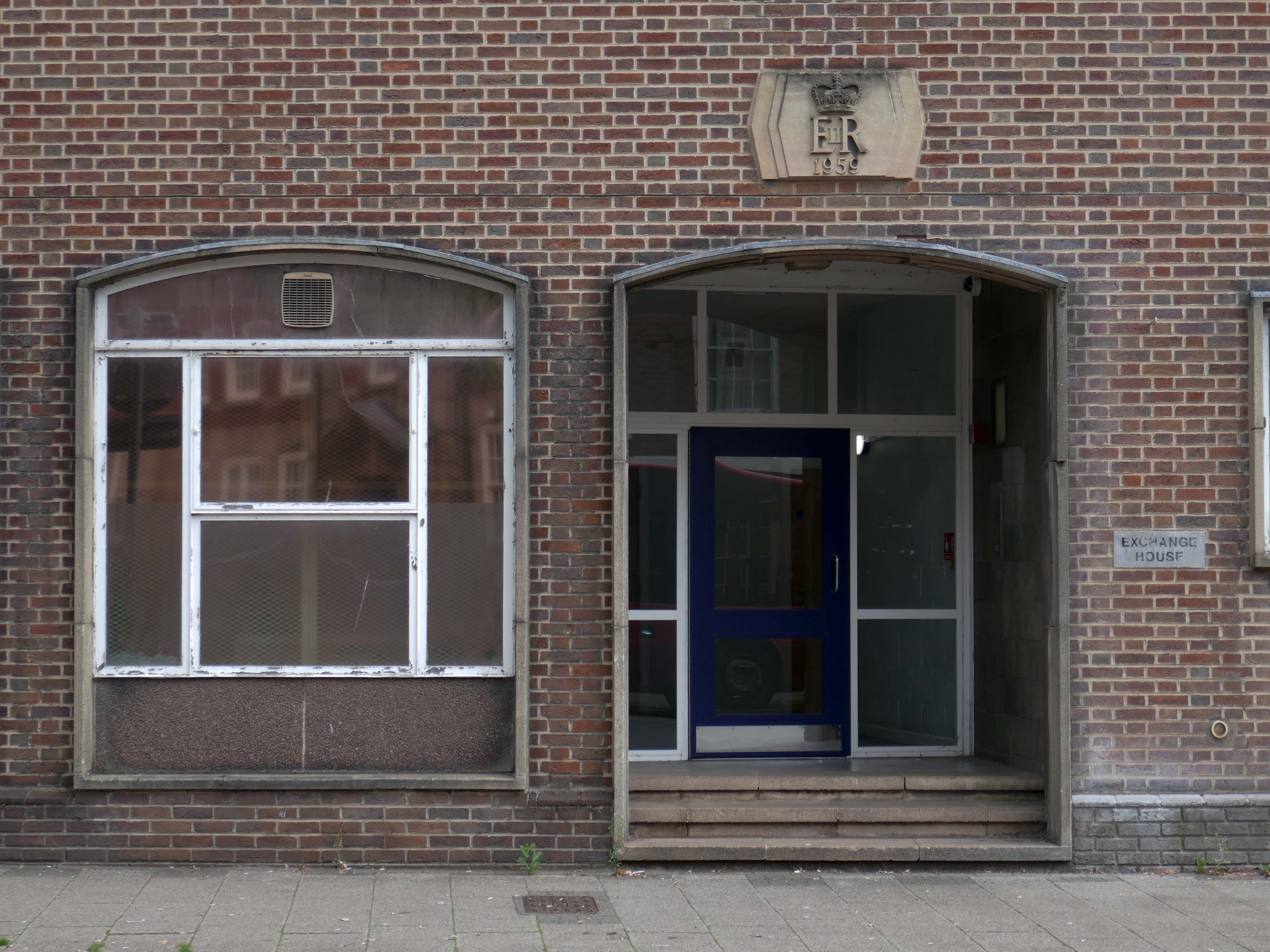
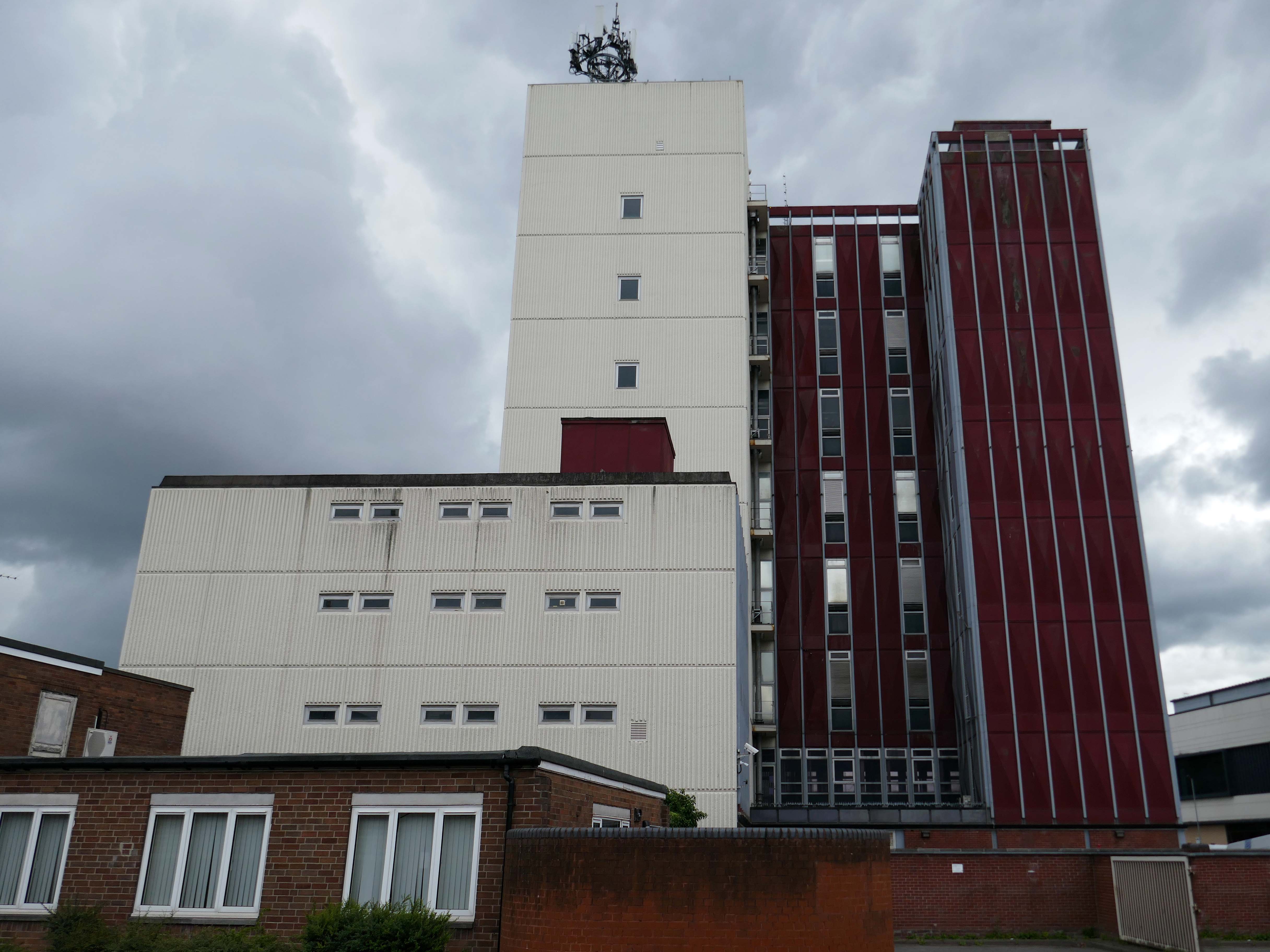
Further along a brick FoB Telephone Exchange of 1959.
Adjoined by the County Records building.
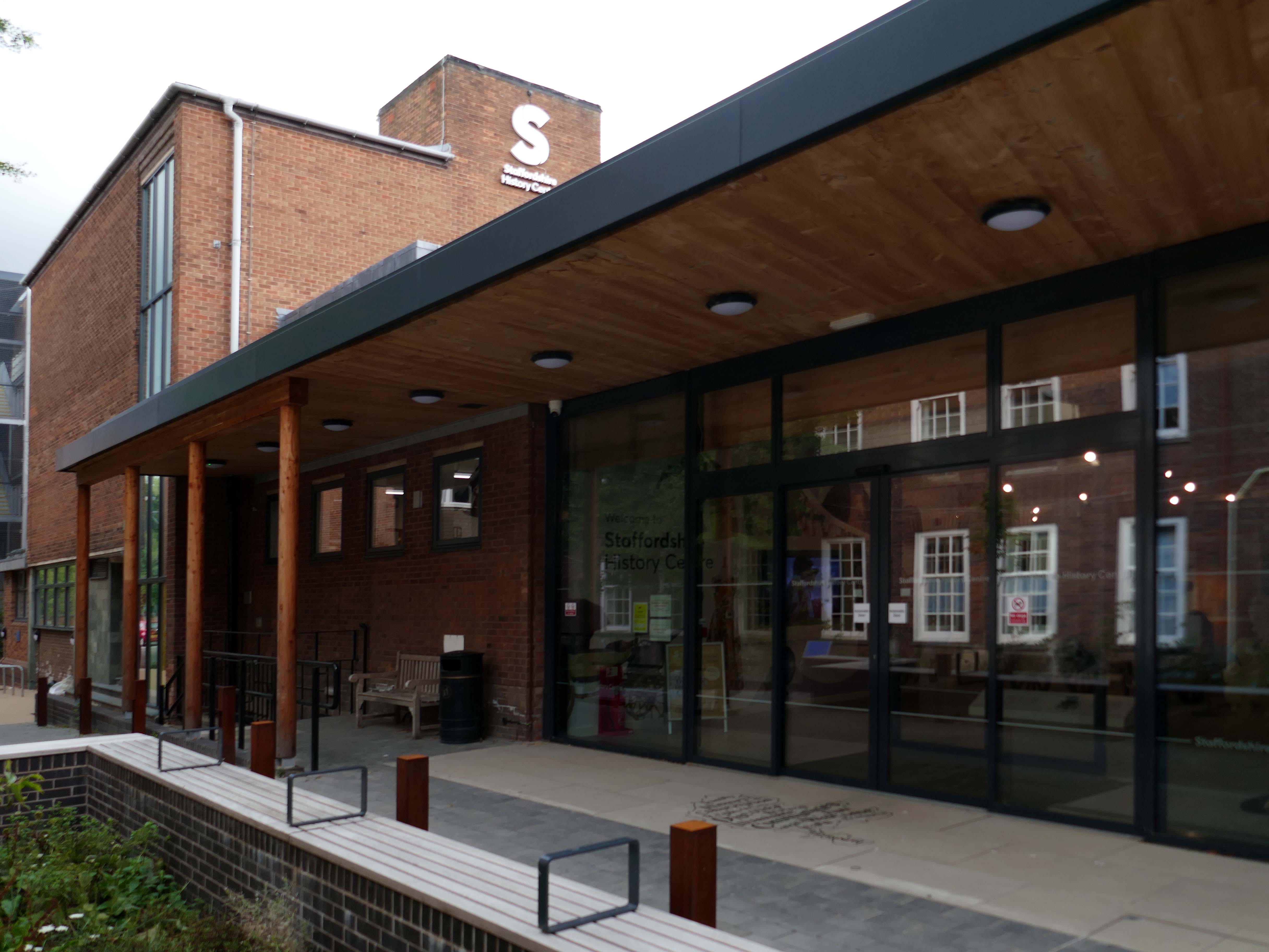
Pringle Richards Sharratt Architects have been appointed by Staffordshire County Council to create a new History Centre for Staffordshire and Stoke on Trent.
The new £4m centre will be located on Eastgate Street in Stafford and will hold historical records and collections up to 1,000 years old.
The scheme will help to provide a rejuvenated service combining the existing Records Office building and William Salt Library, in Stafford and provide a welcoming destination for all of those with an interest in local history. This will include bringing on to the Stafford site the Lichfield Records Office and aspects of the County museum.
Further FoB in the Civic Building.
Close by the Staffordshire Place a civic and retail mixed use development.
Our scheme delivers 135,000 ft2 of high quality contemporary office space across two buildings linked by a new town square. The ground floor incorporates a mix of retail and leisure uses around a sequence of smaller public spaces to maximise the amount of visible active frontage and create a natural extension to the town centre.
Sustainability issues fundamentally informed the design approach, from mitigating energy consumption to ‘future proofing’ the finished building. The building achieves a BREEAM ‘Excellent’ rating and a European Energy Performance of Buildings Directive Rating ‘A’.
Surprise surprise another retail development Riverside.
£70m riverside town centre retail and leisure development in the heart of Stafford. The 230,000 sq. ft. scheme anchored by M&S will deliver 18 retail units arranged over ground and first floors, five leisure units and a six-screen cinema to complement and strengthen the town centre economy and create new businesses and jobs.
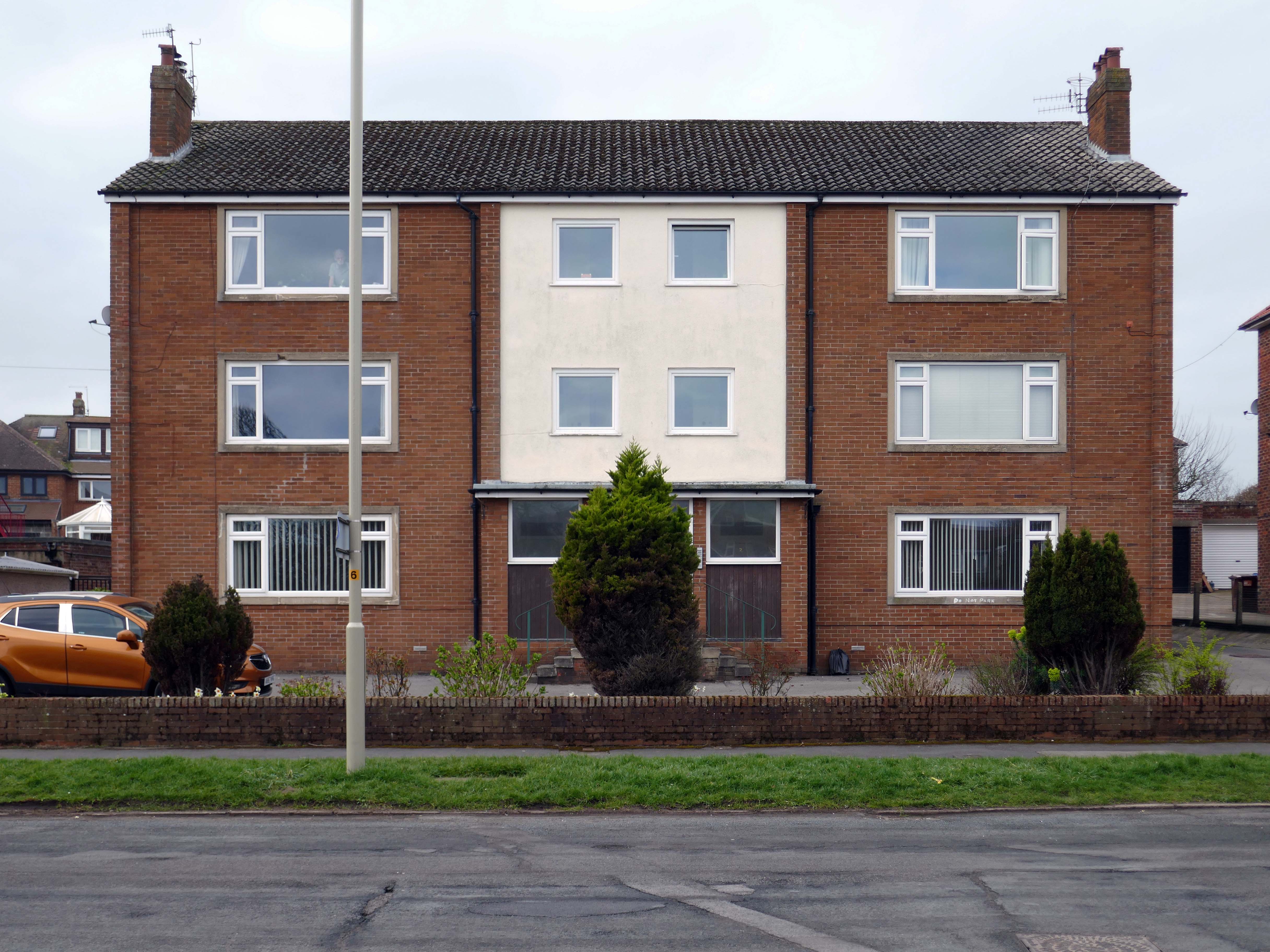
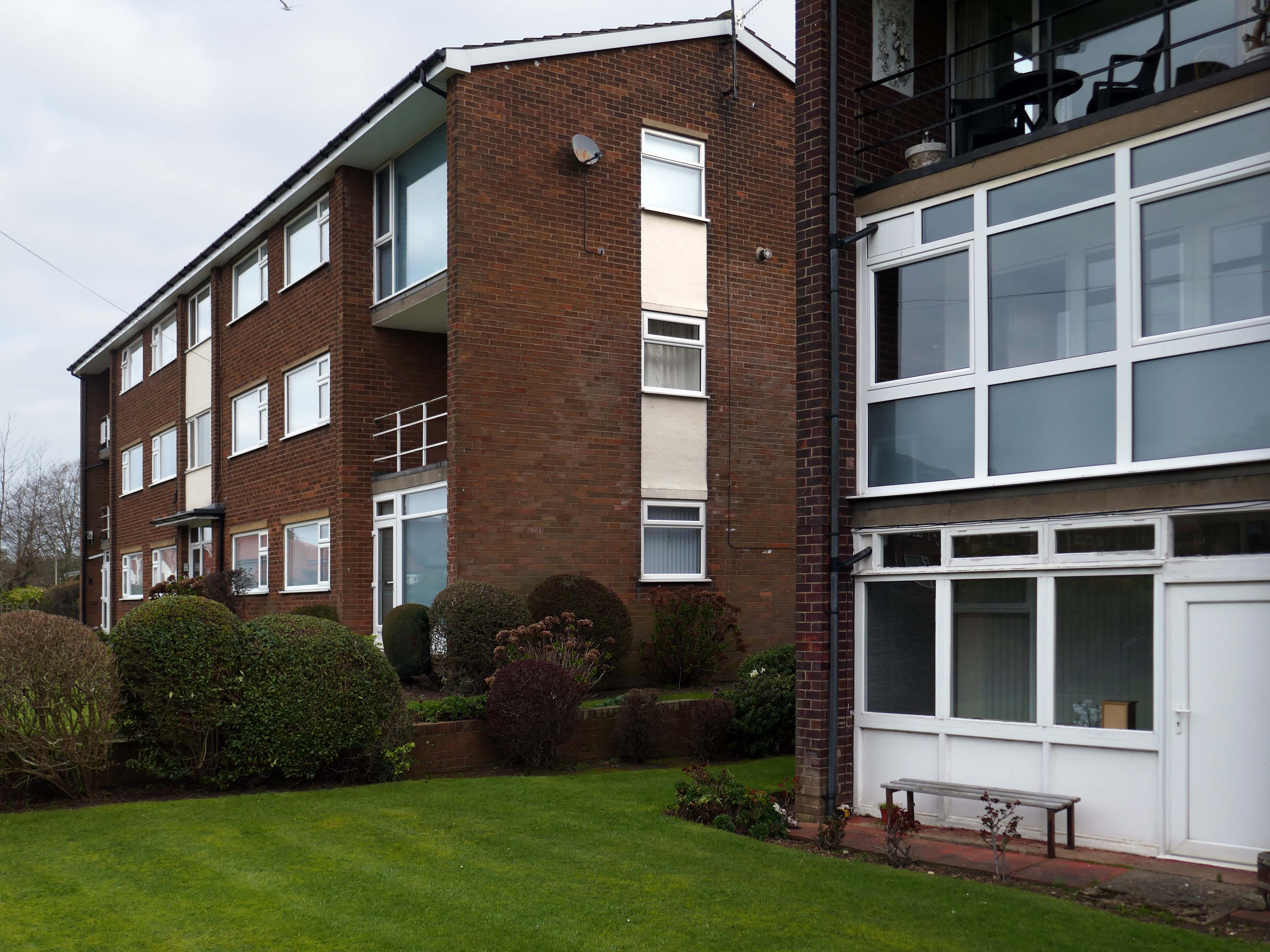
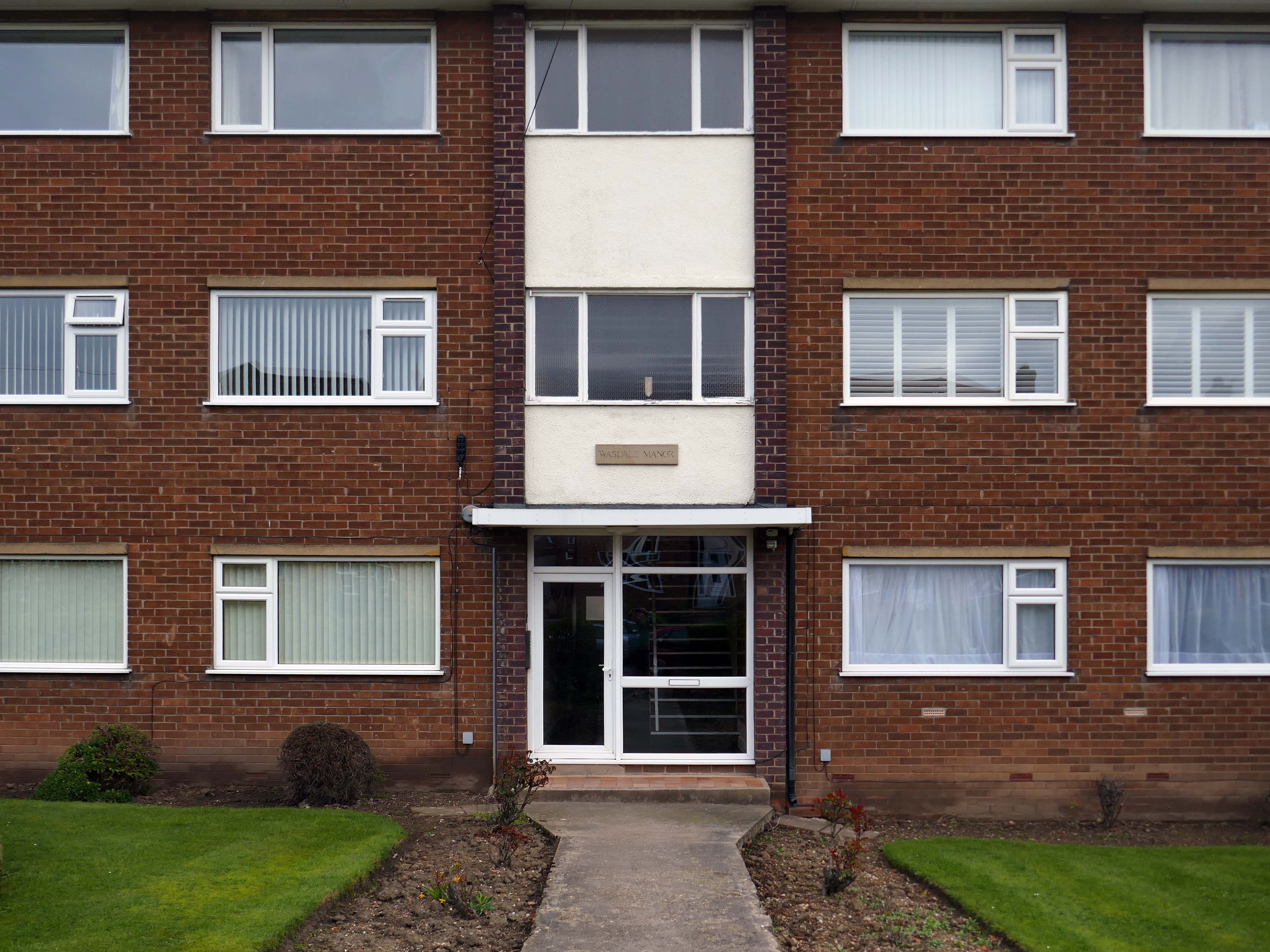
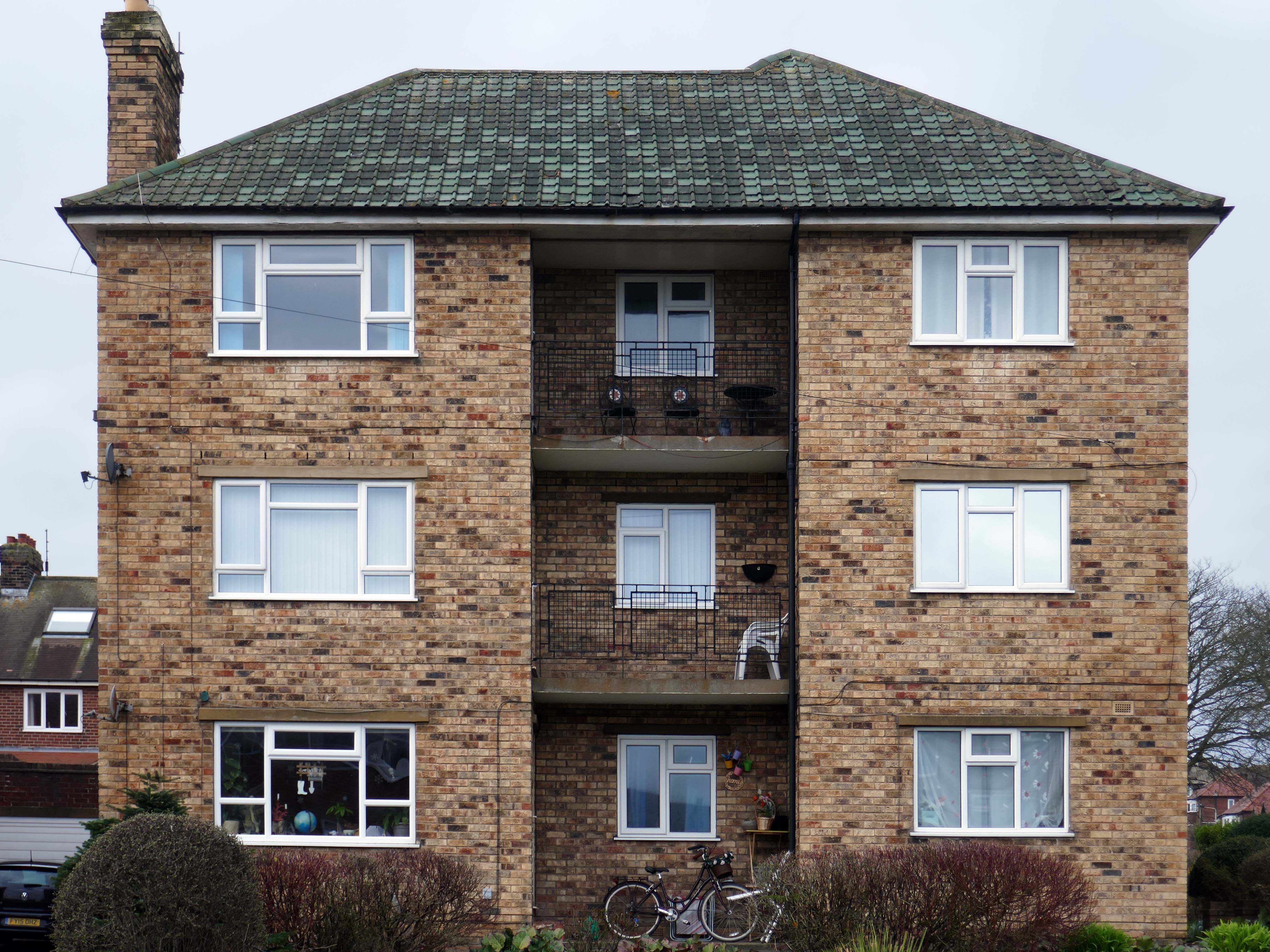
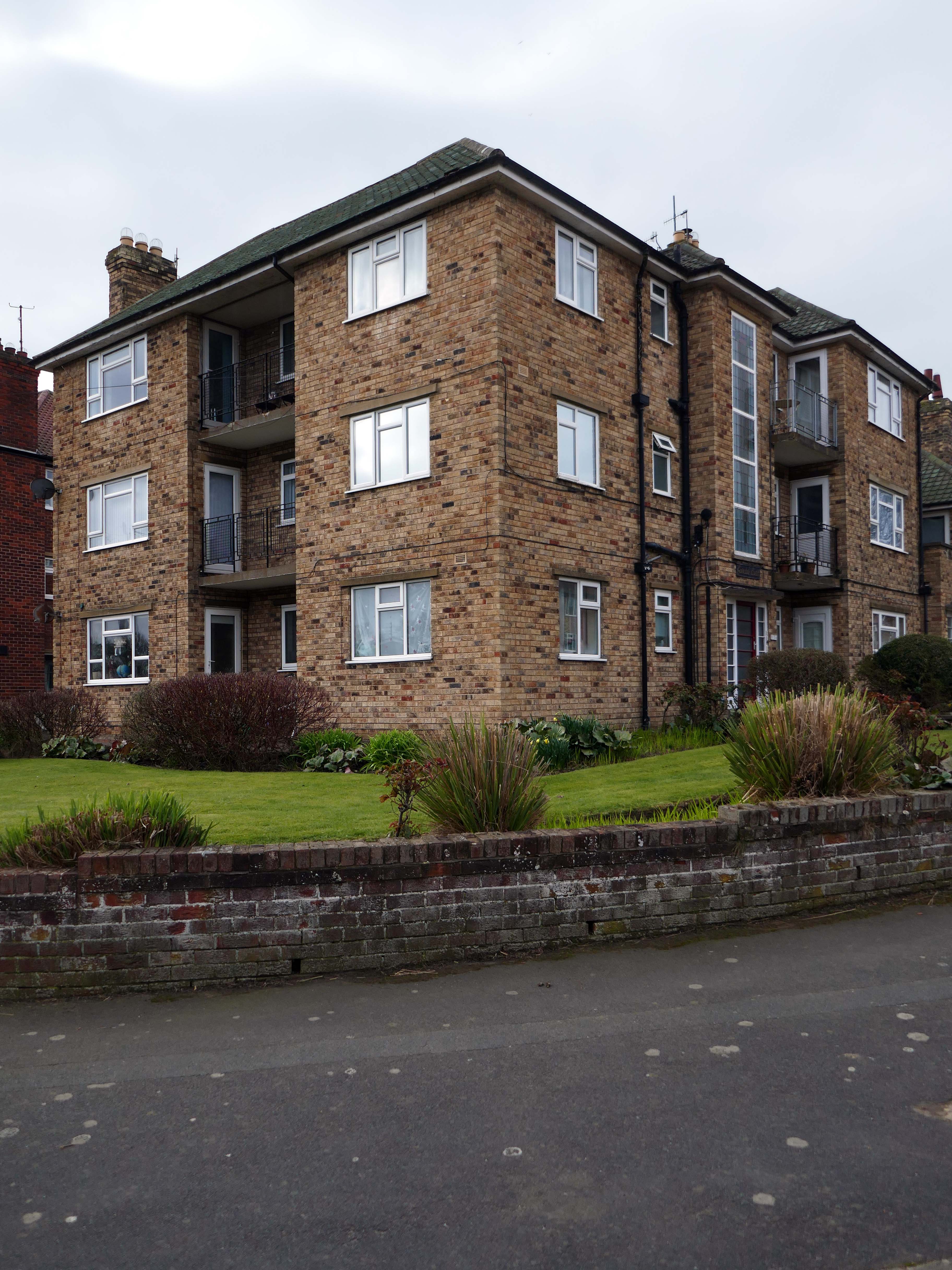
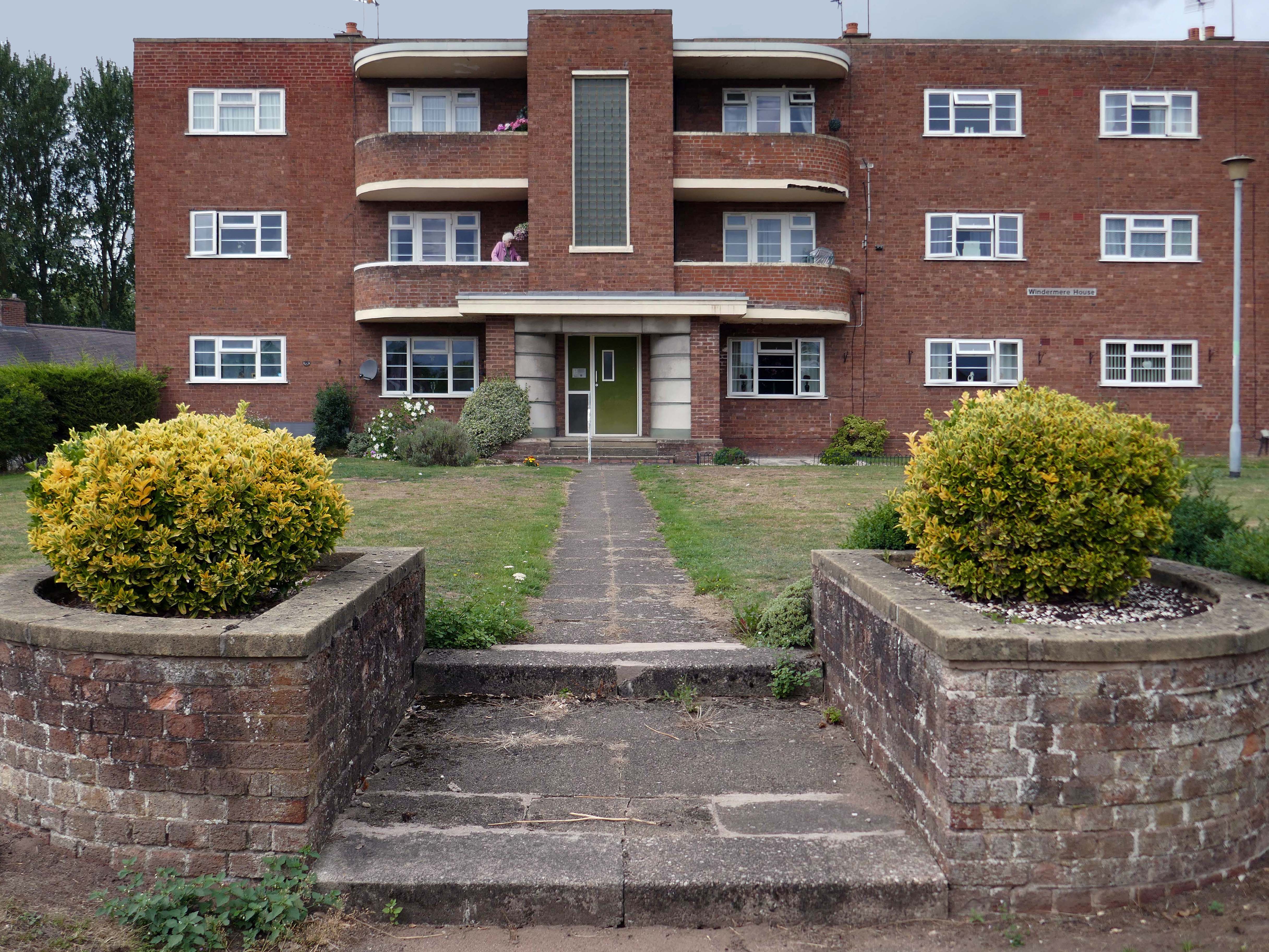
Coniston, Windemere and Rydal were among the first council homes to be built in Stafford, between 1951-52, under the direction of County Architect CM Coombes.
The flats were built as a result of The Housing – Financial and Miscellaneous Provisions Act 1946, which gave subsidies to local authorities to provide social housing. The expansion of the Borough Council’s civic duties included the employment of County Architects, in this case CM Coombes FRIBA, to whom these flats are attributed.
54 flats were built in total, to a distinctly Modernist design, and their appearance and setting are very well preserved.
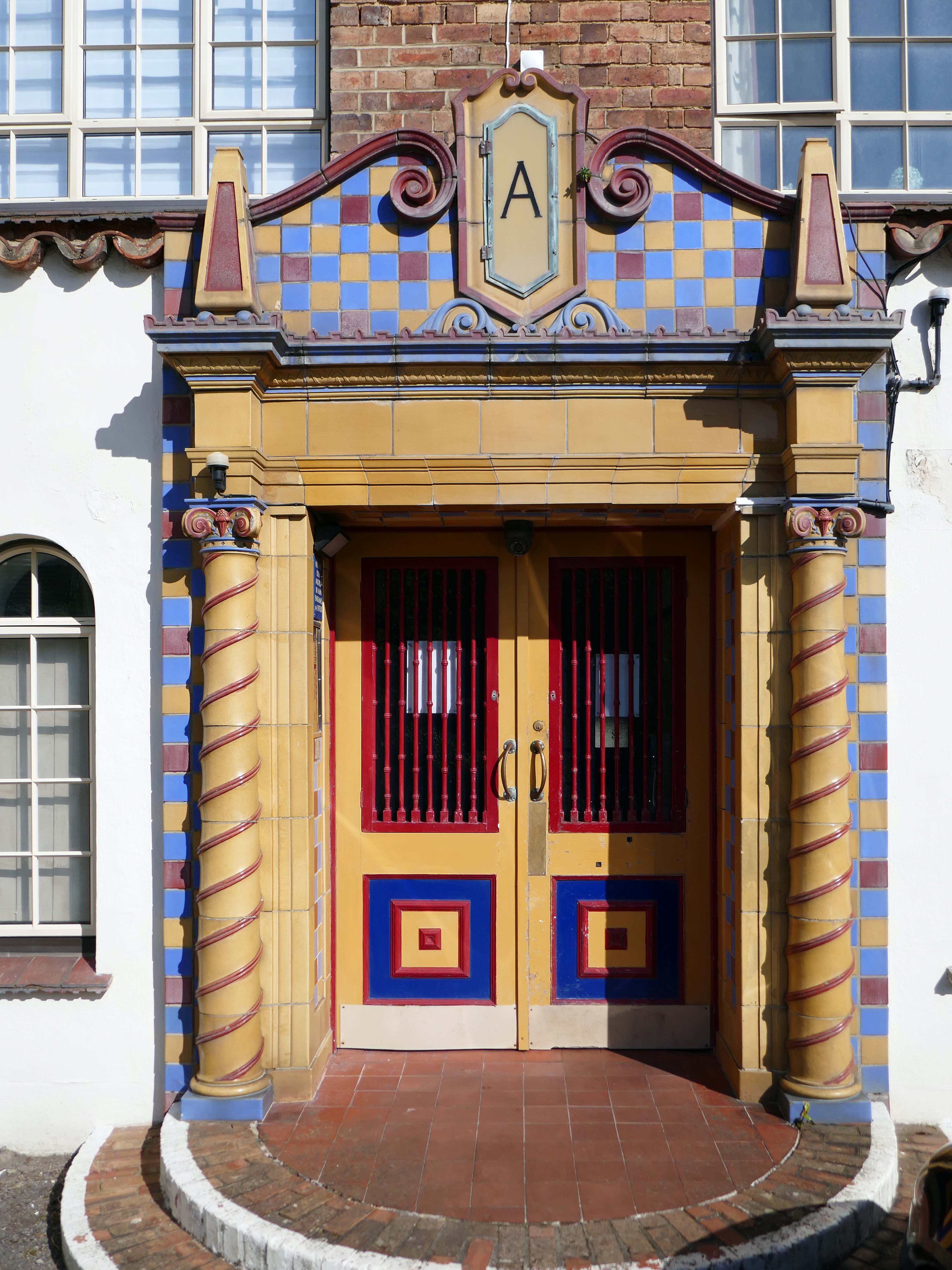
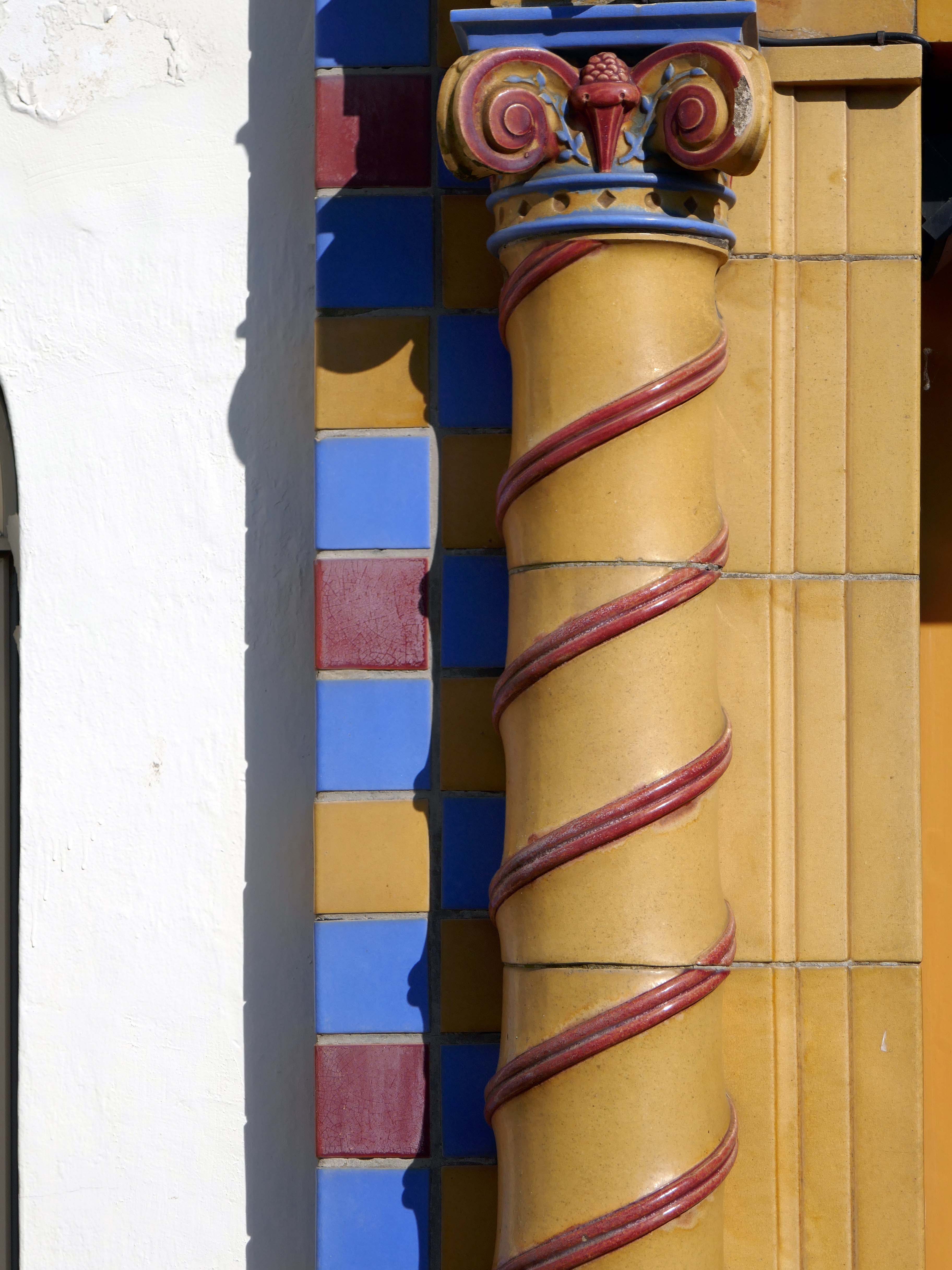
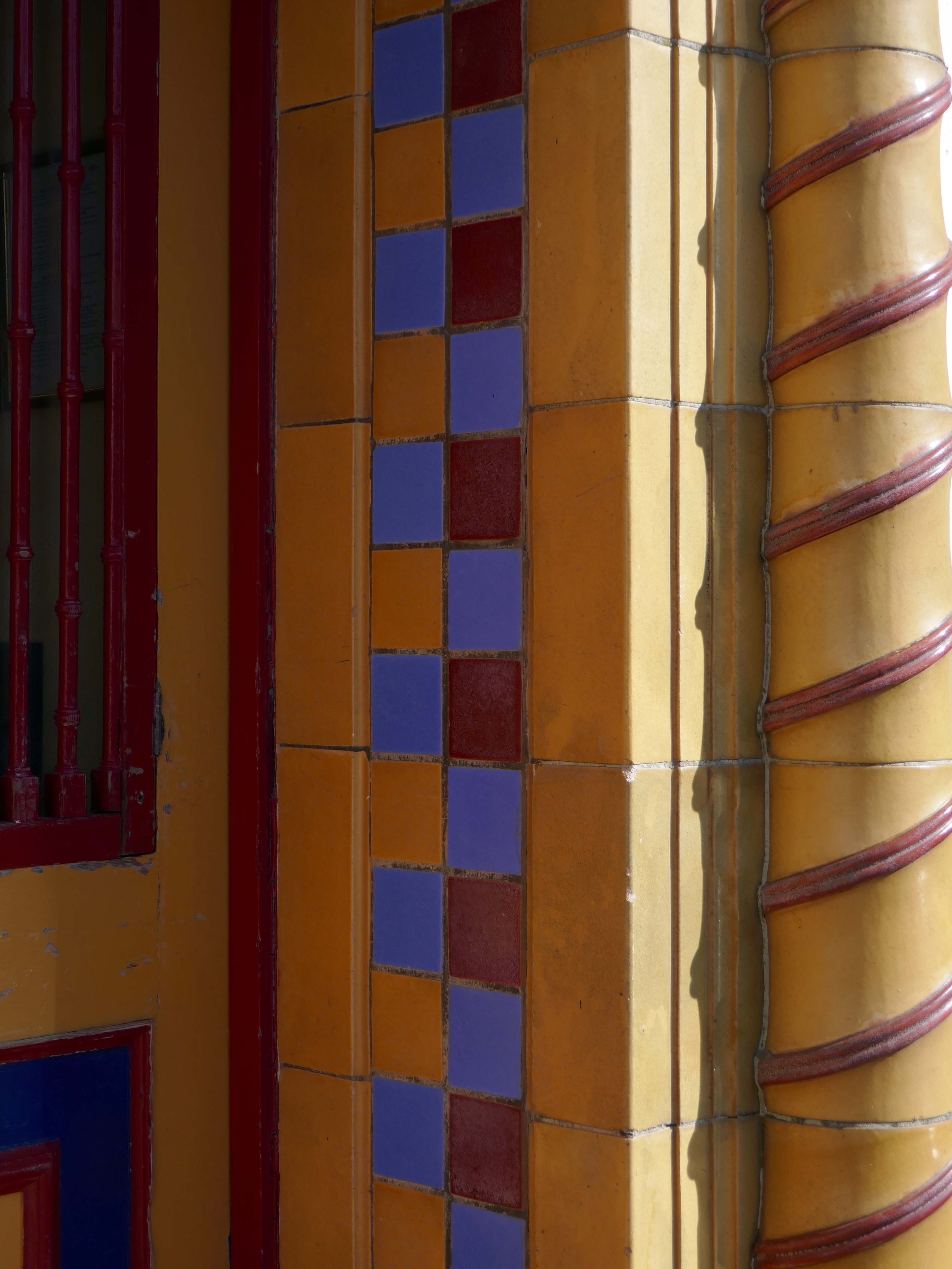
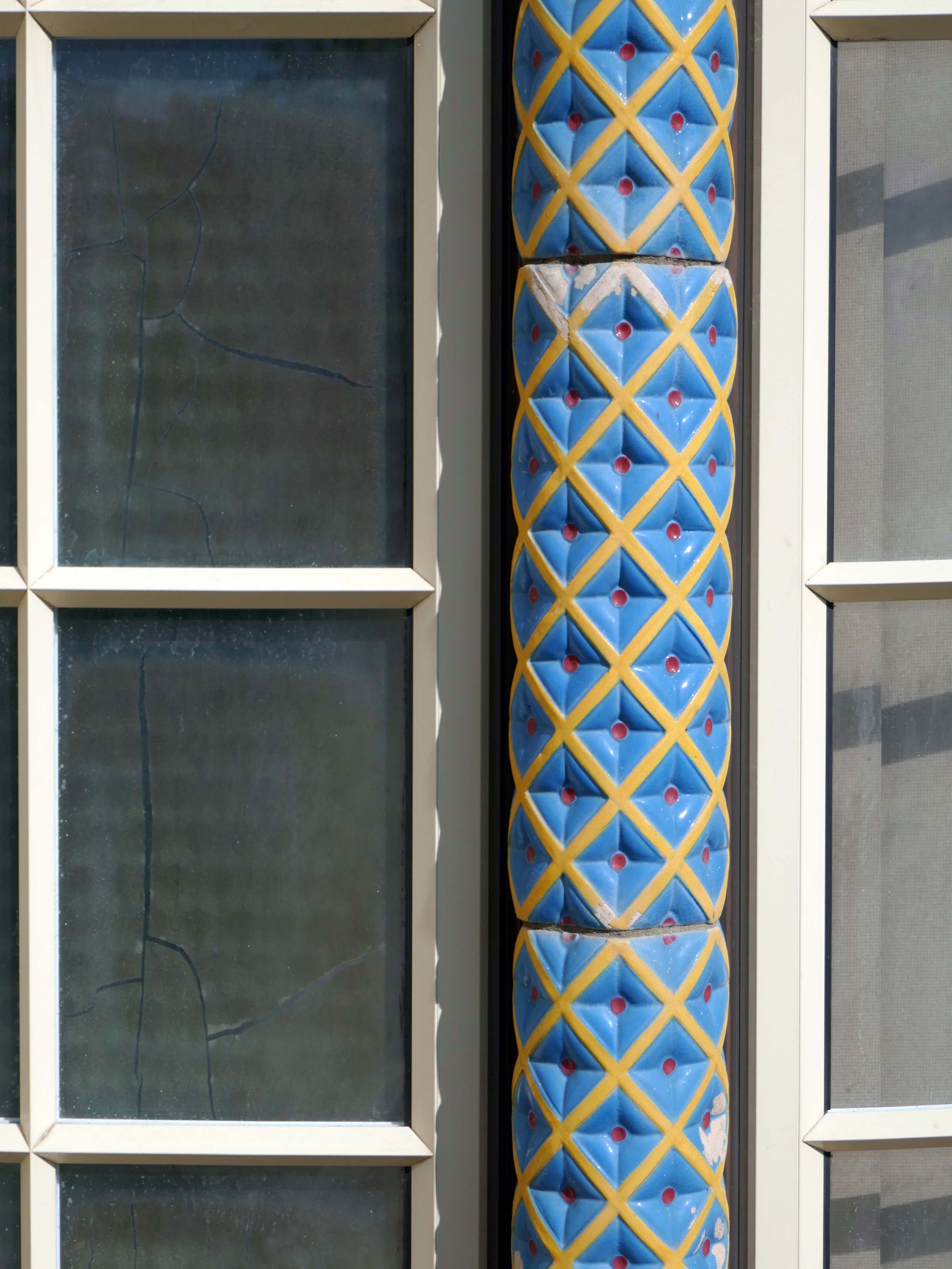
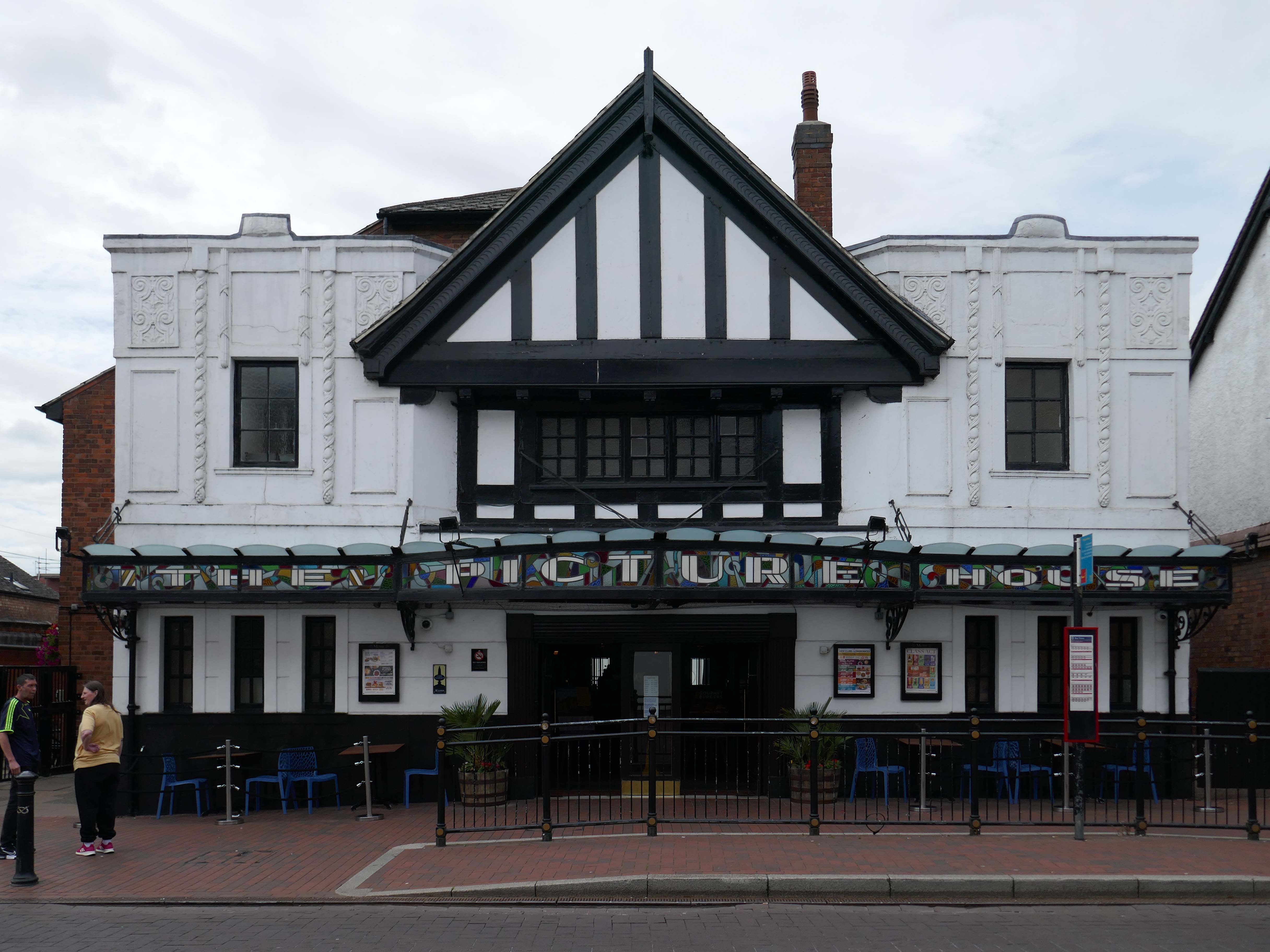
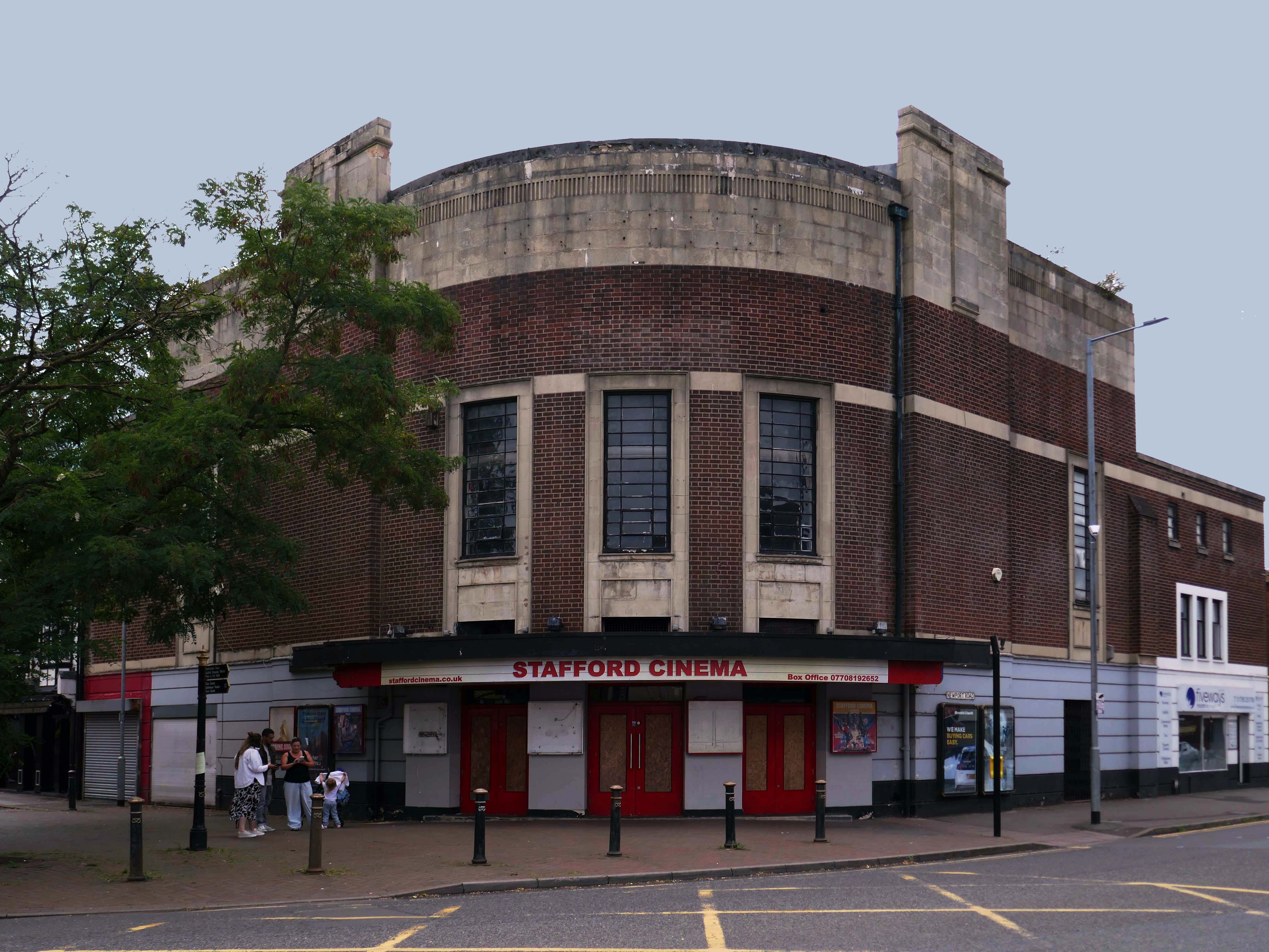
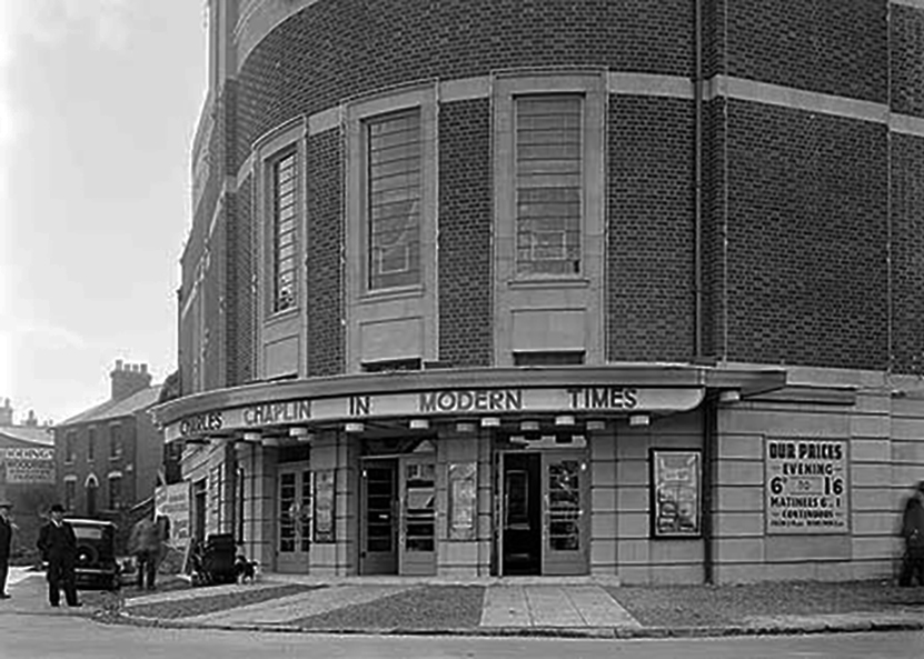
Let’s head back into the town centre – to the Grade II ListedPicture House 1914
The Picture House was closed on 30th March 1995 after a three week run of Disclosure starring Michael Douglas, there were seventy eight attending the final performance.
It was disposed of by the Rank Organisation in July 1981 and was taken over by the Hutchinson Leisure Group who re-named it Astra Cinema. In December 1981 it was tripled with 435 seats in the former stalls and two mini cinemas in the former circle seating 170 and 168.
In 1988 it was taken over by Apollo Cinemas and re-named Apollo Cinema. The downstairs cinema was closed and became a bingo club for a couple of years, during which time the two mini cinemas in the former circle remained open. The bingo operation gave way to films again in 1990 and all three screens were again open, with seating for 305, 170 and 164. In January 2014 it was taken over by the Curzon Cinemas chain and renamed Stafford Cinema.
It was closed on 18th December 2017 with Star Wars:The Last Jedi.