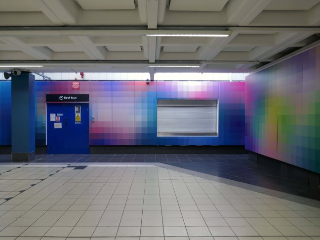
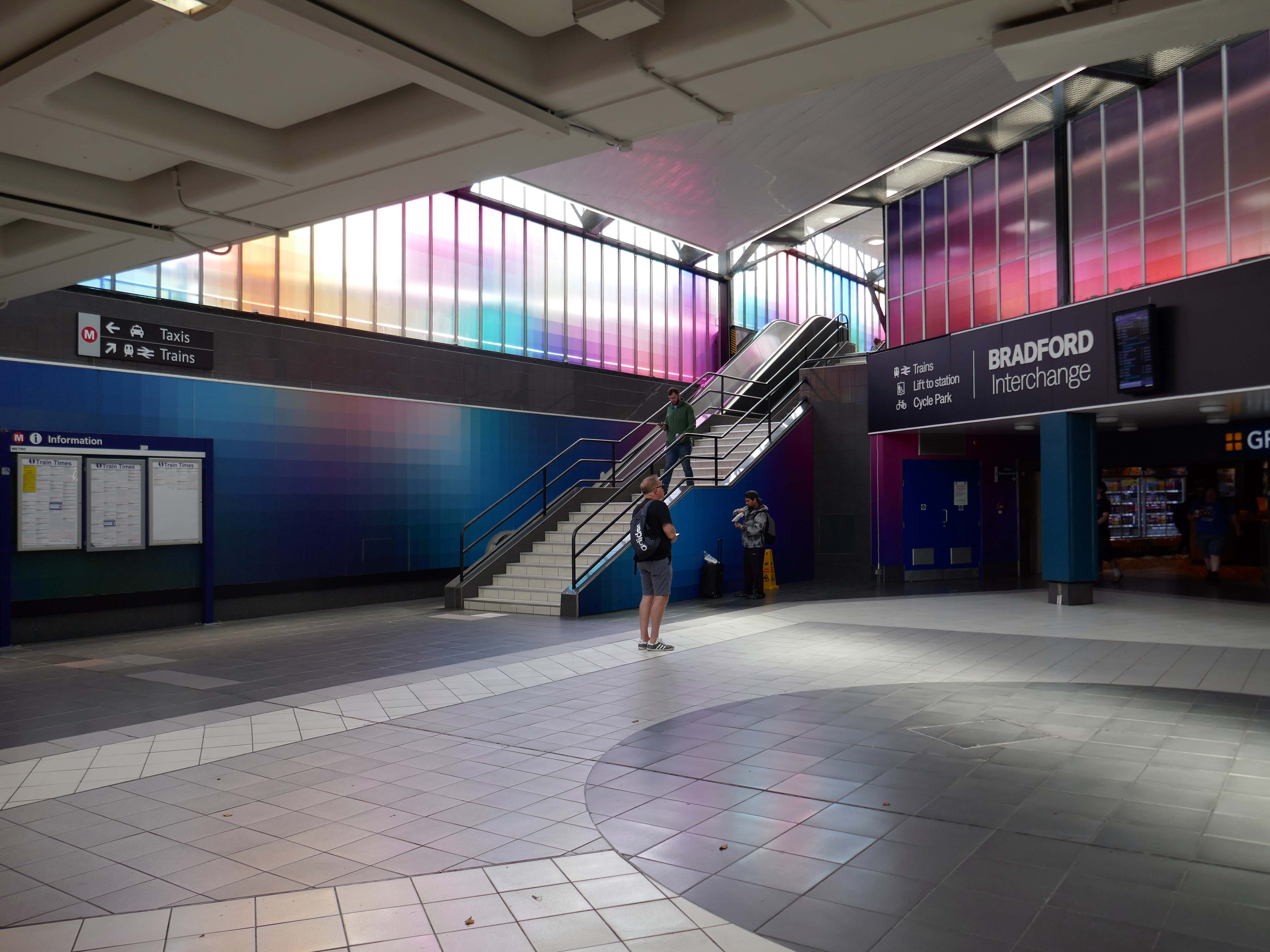
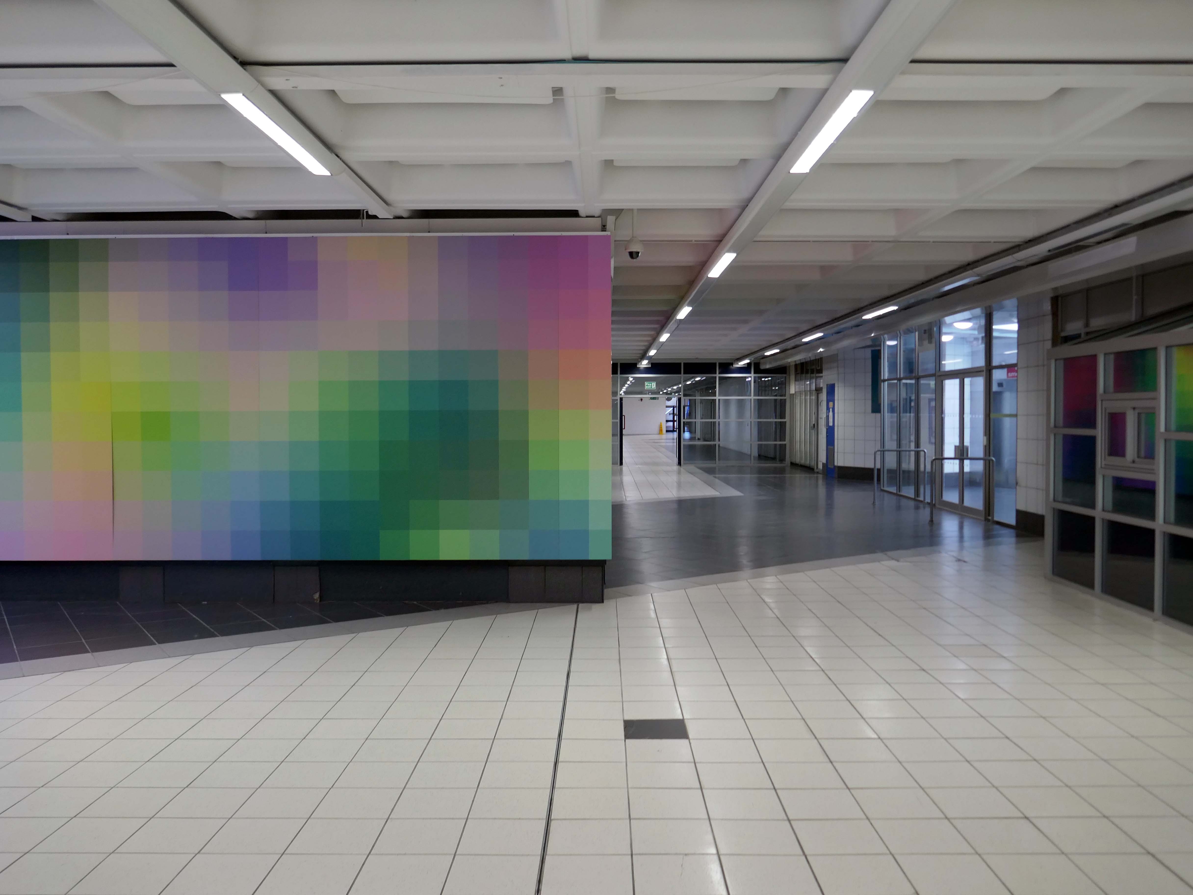
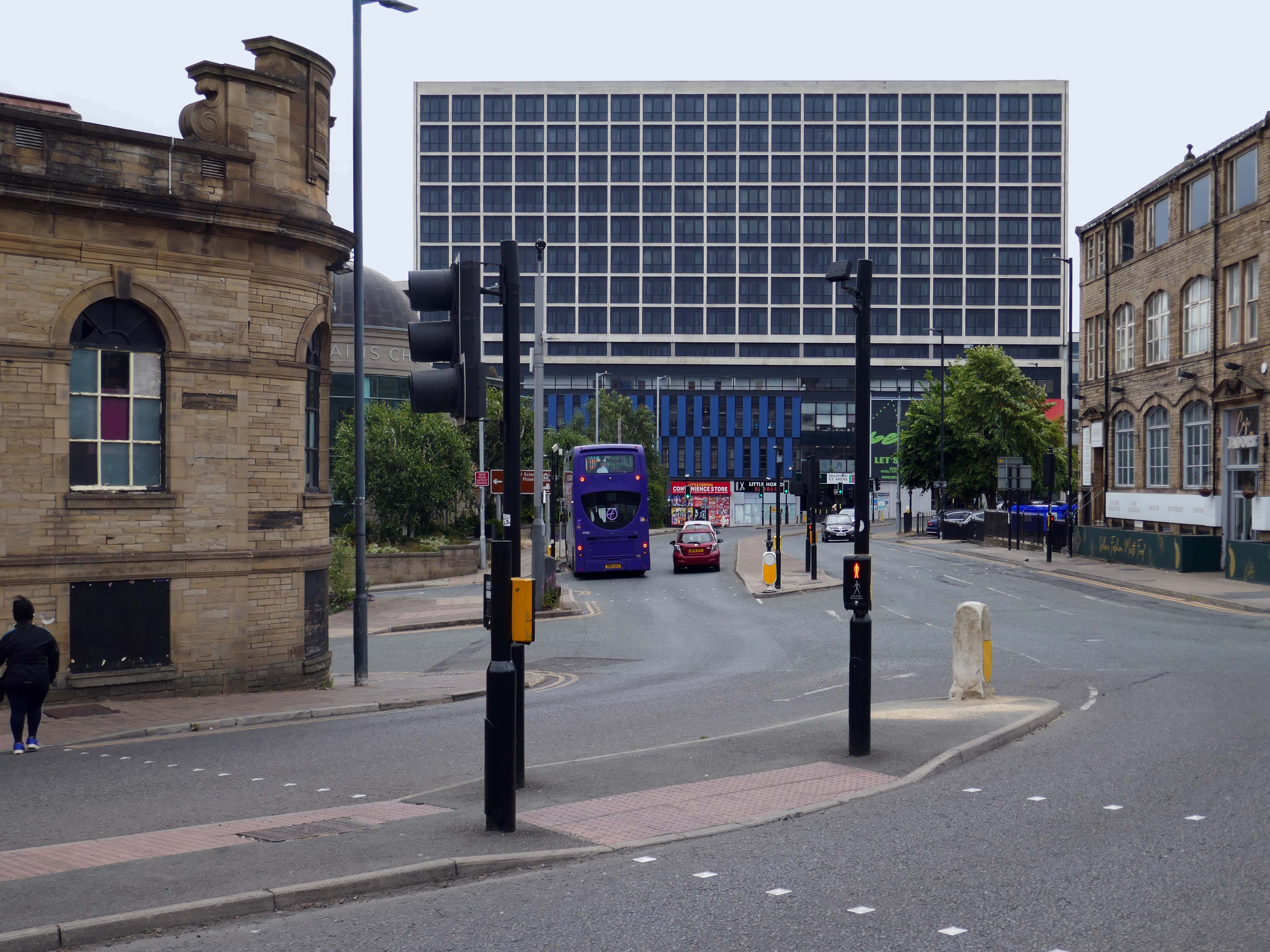
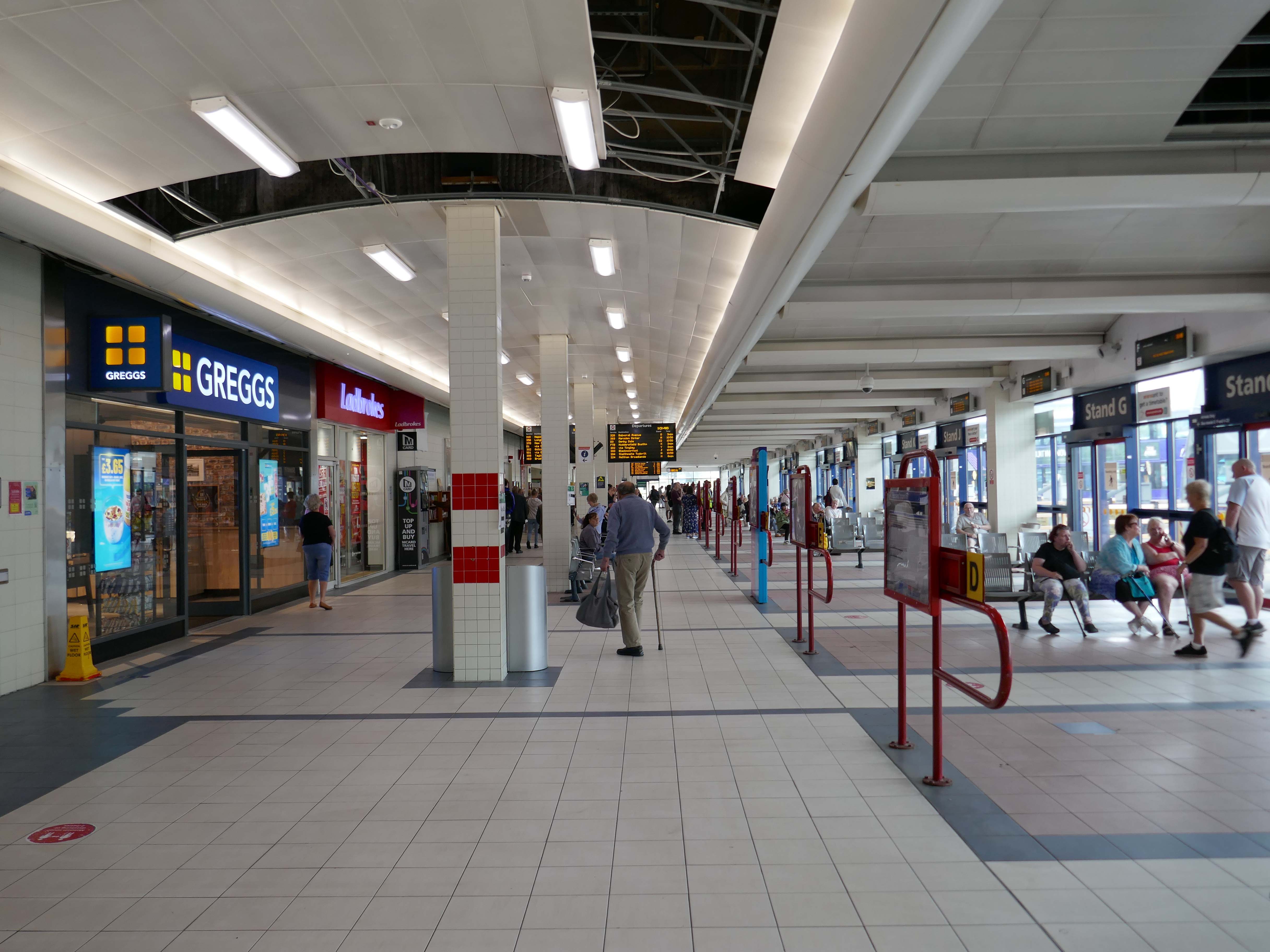
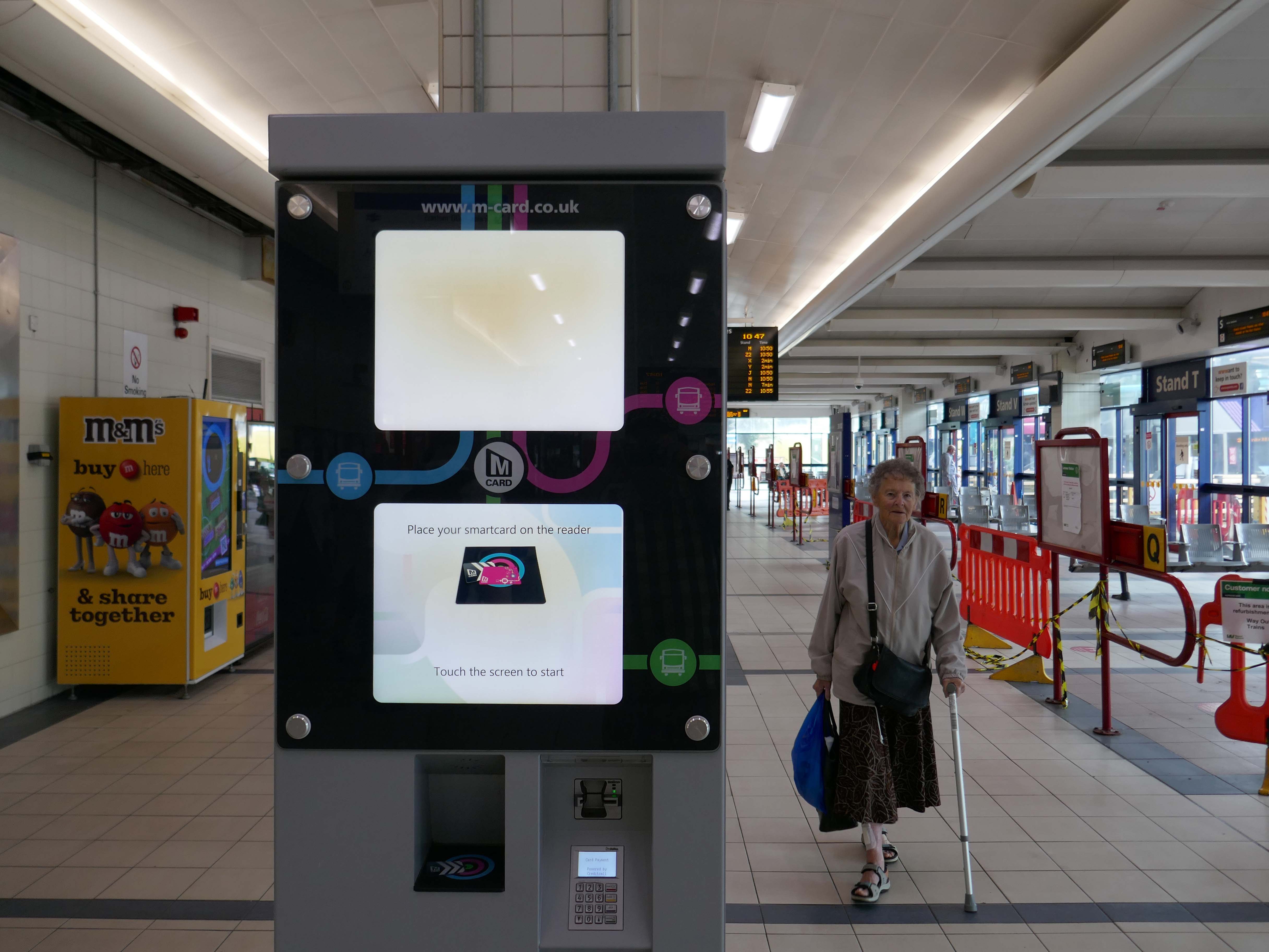
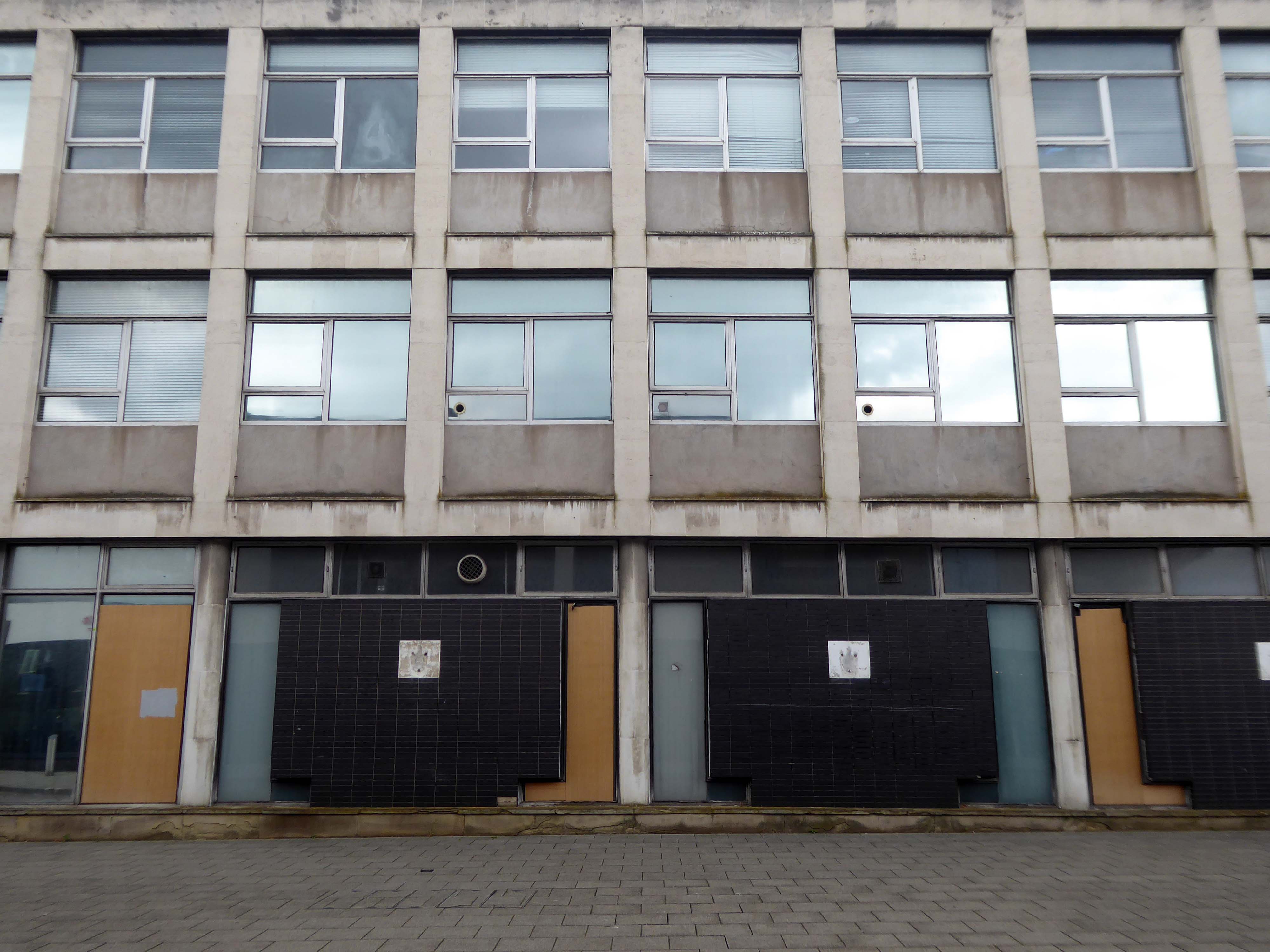
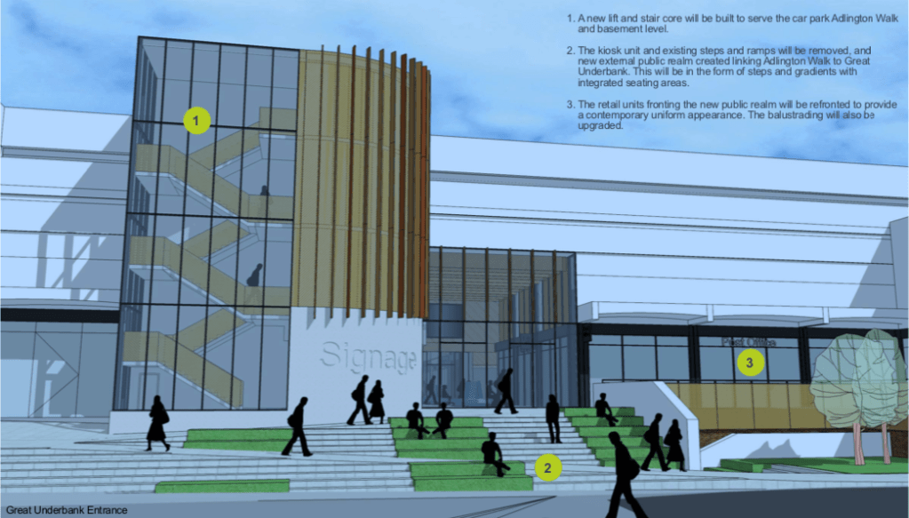
Saturday 25th July arriving in bright sunshine at the Bradford Interchange – architects WC Brown City Architect and RL Moorcroft BR 1971.
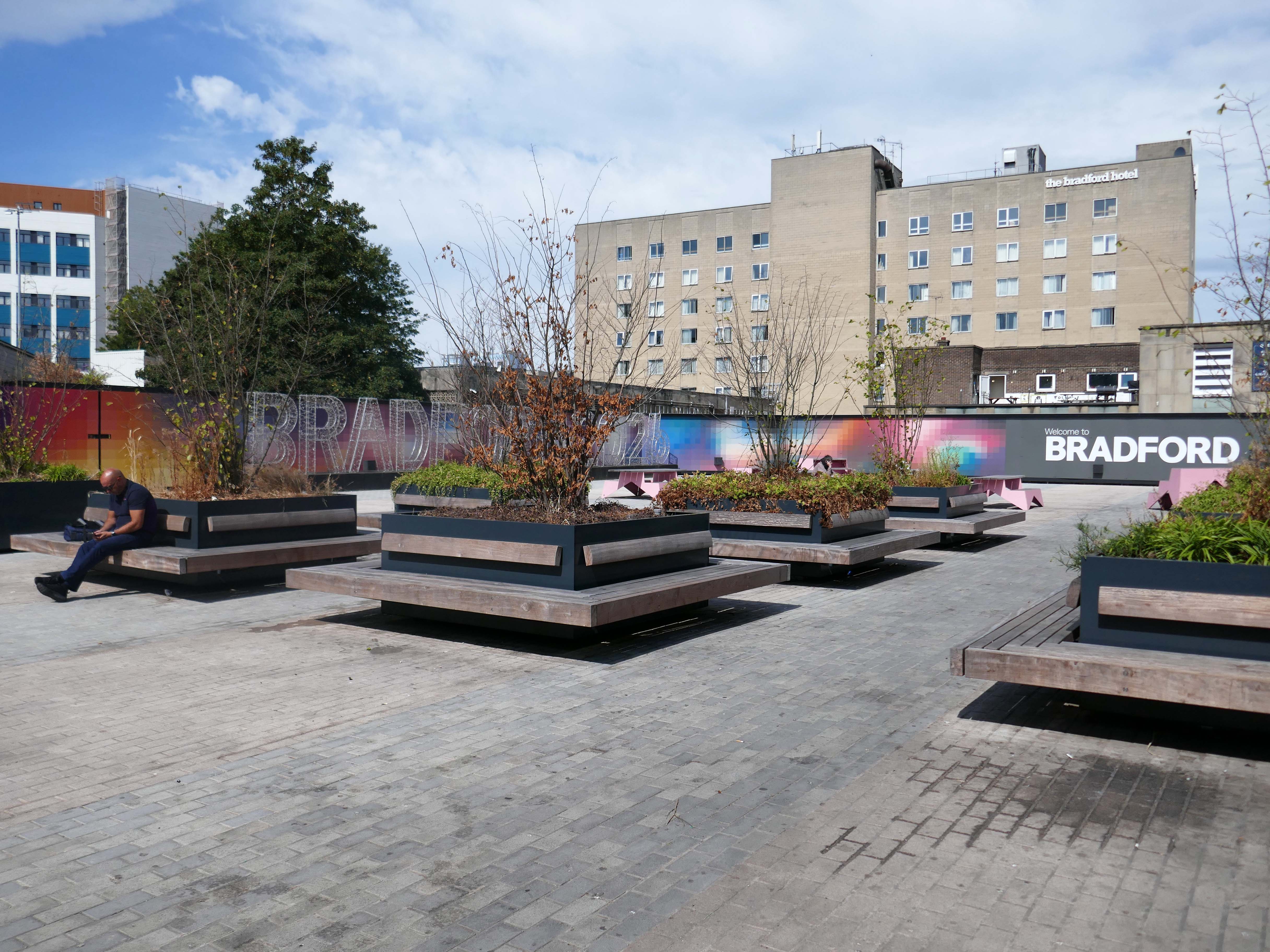
Which has been transformed for the City of Culture 2025 by Bigg Design, with their multicoloured panels.
In addition there has been a transportation of the approach by Fereday Pollard, with the addition of seating in the newly landscaped plaza area.
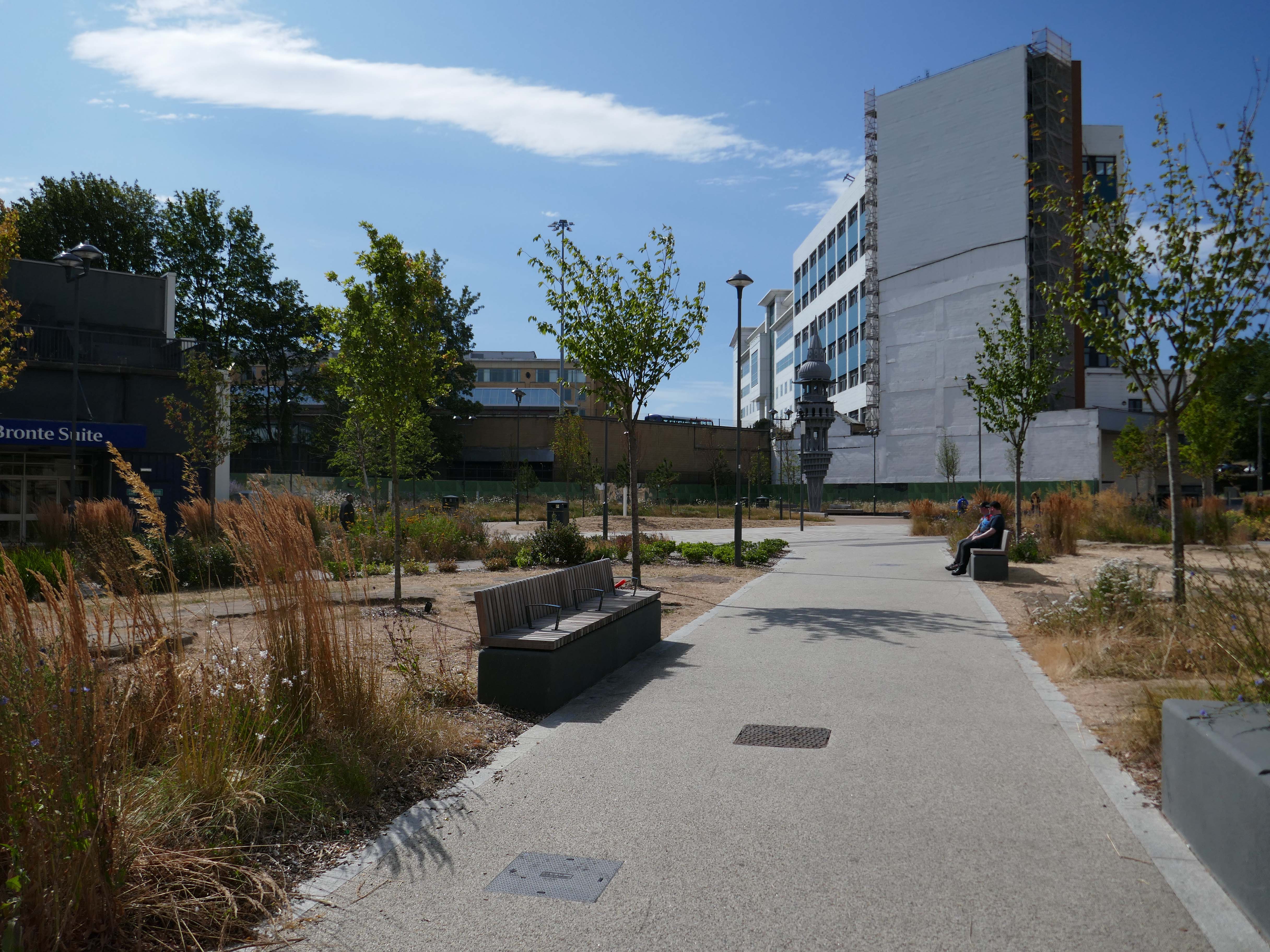
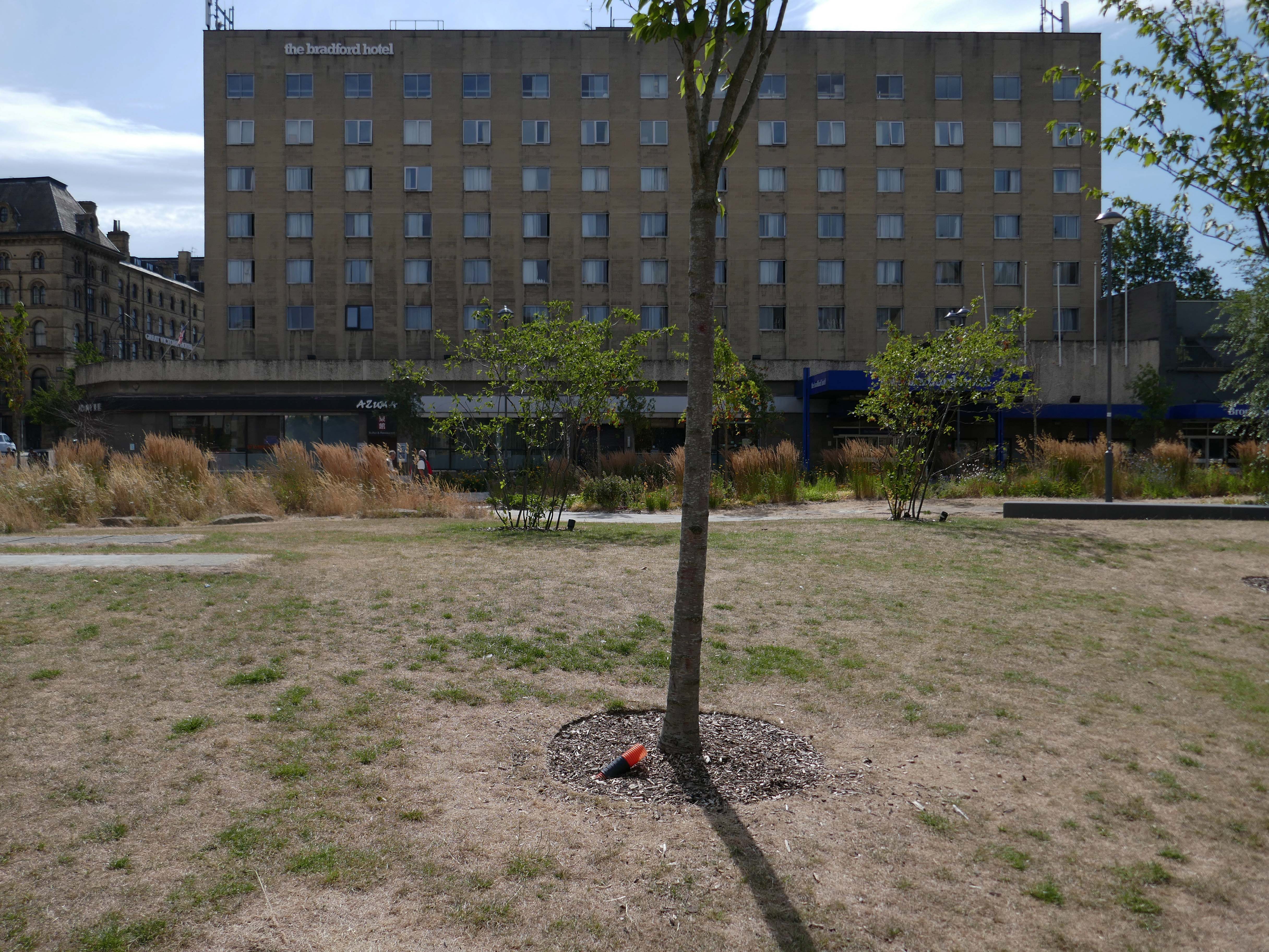
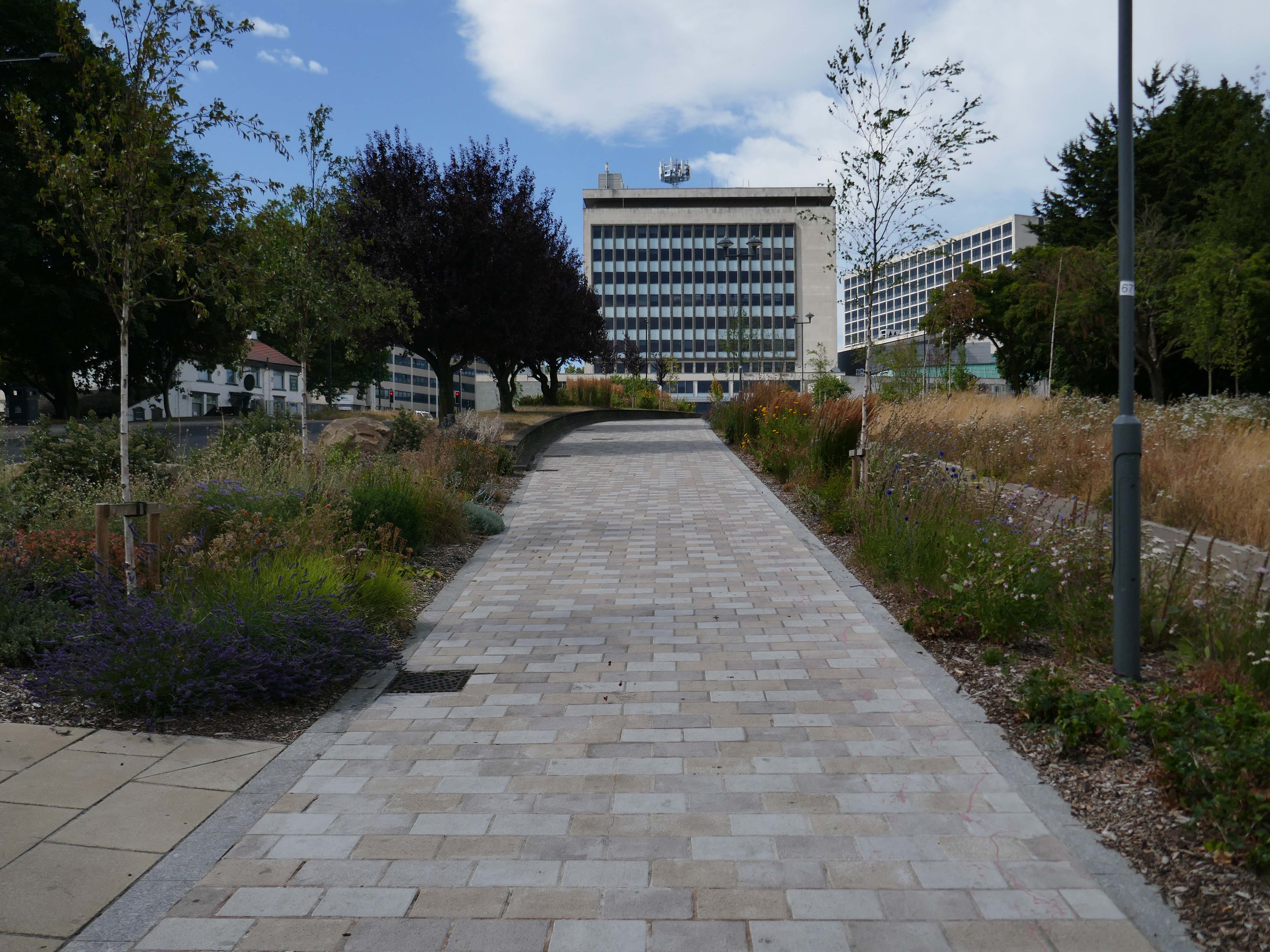
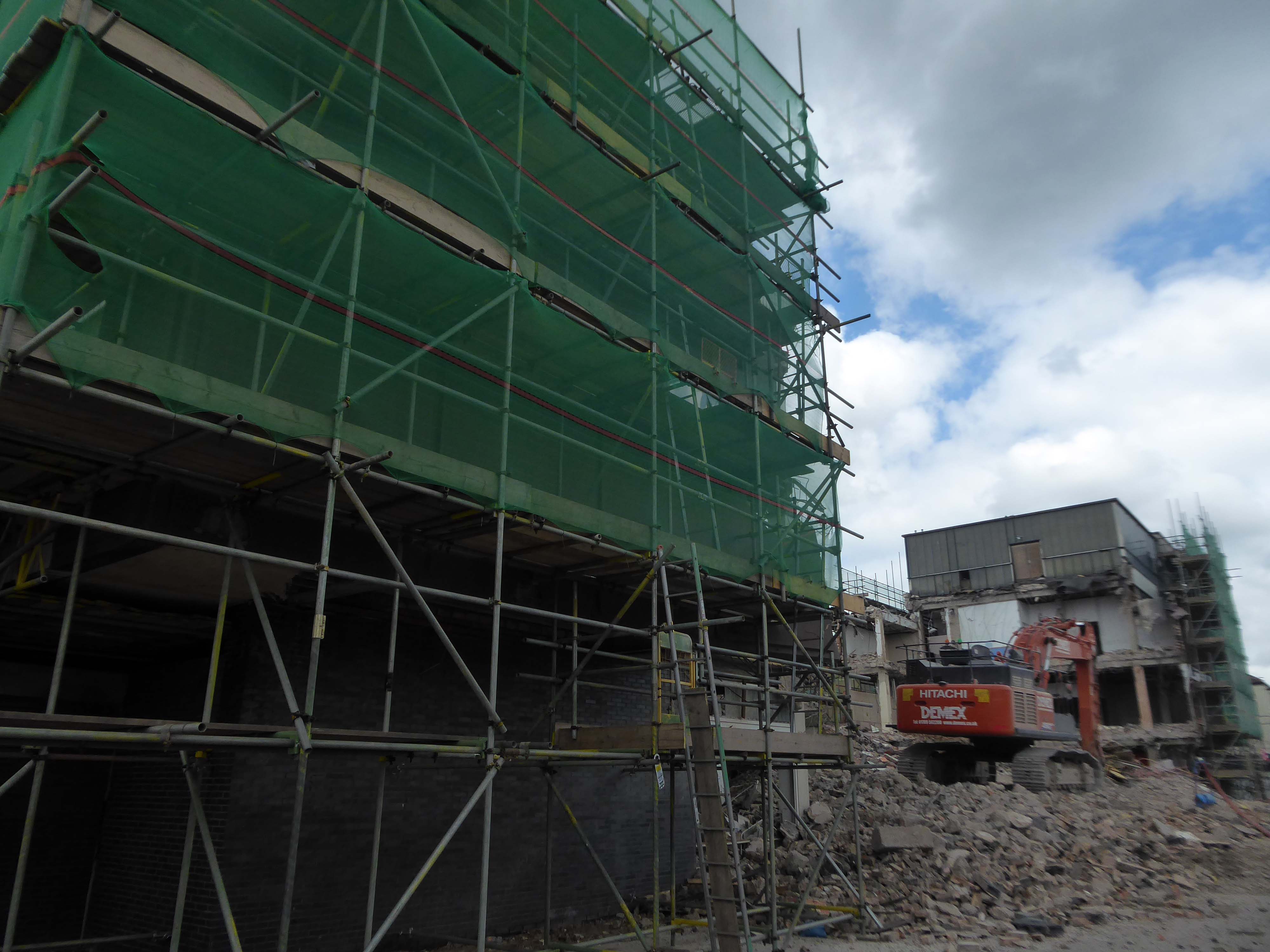
Moving into the city centre there have been changes in the area between the Bradford Hotel and the Town Hall, it’s now a freshly landscaped space especially for pedestrians.
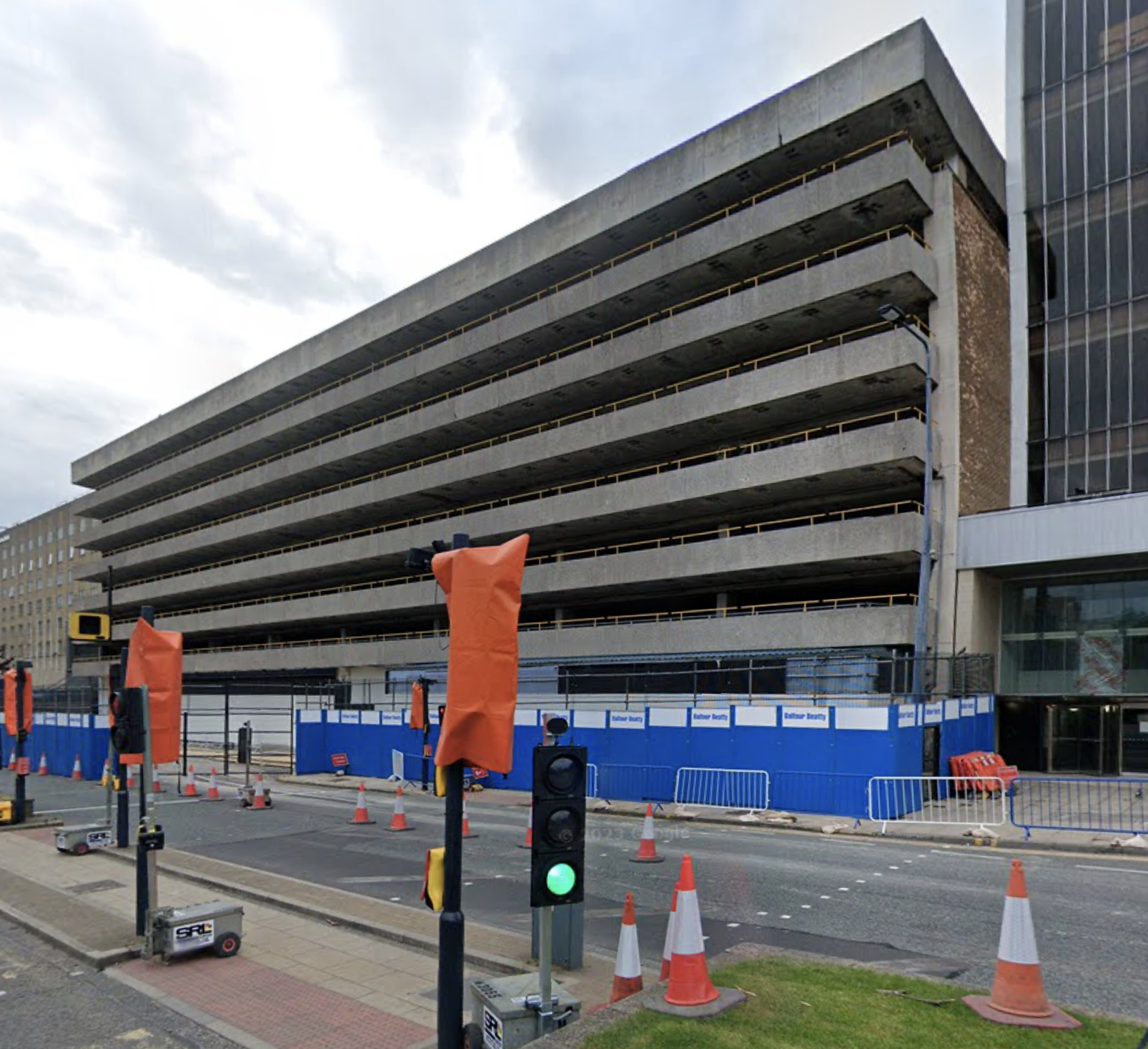
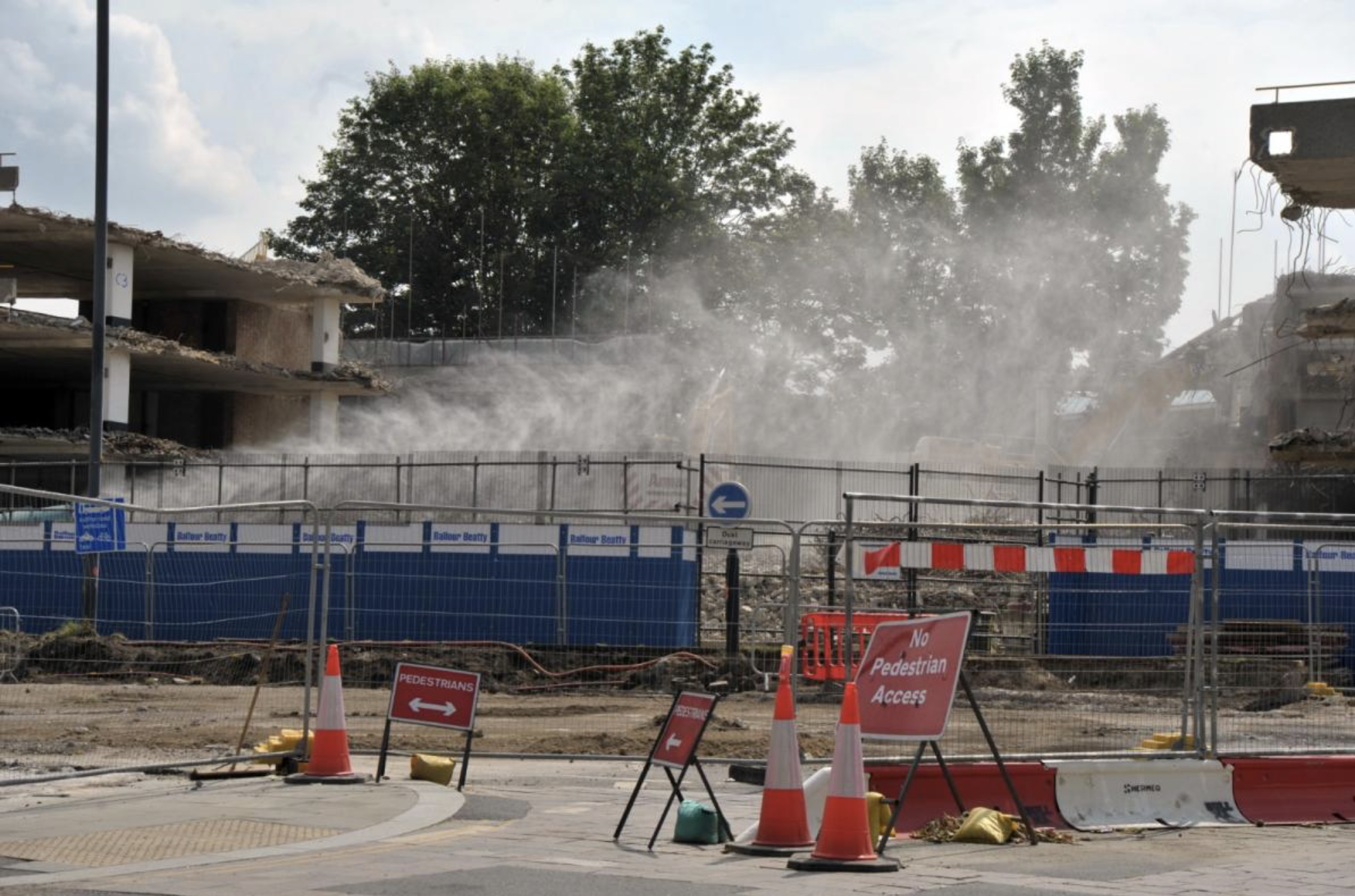
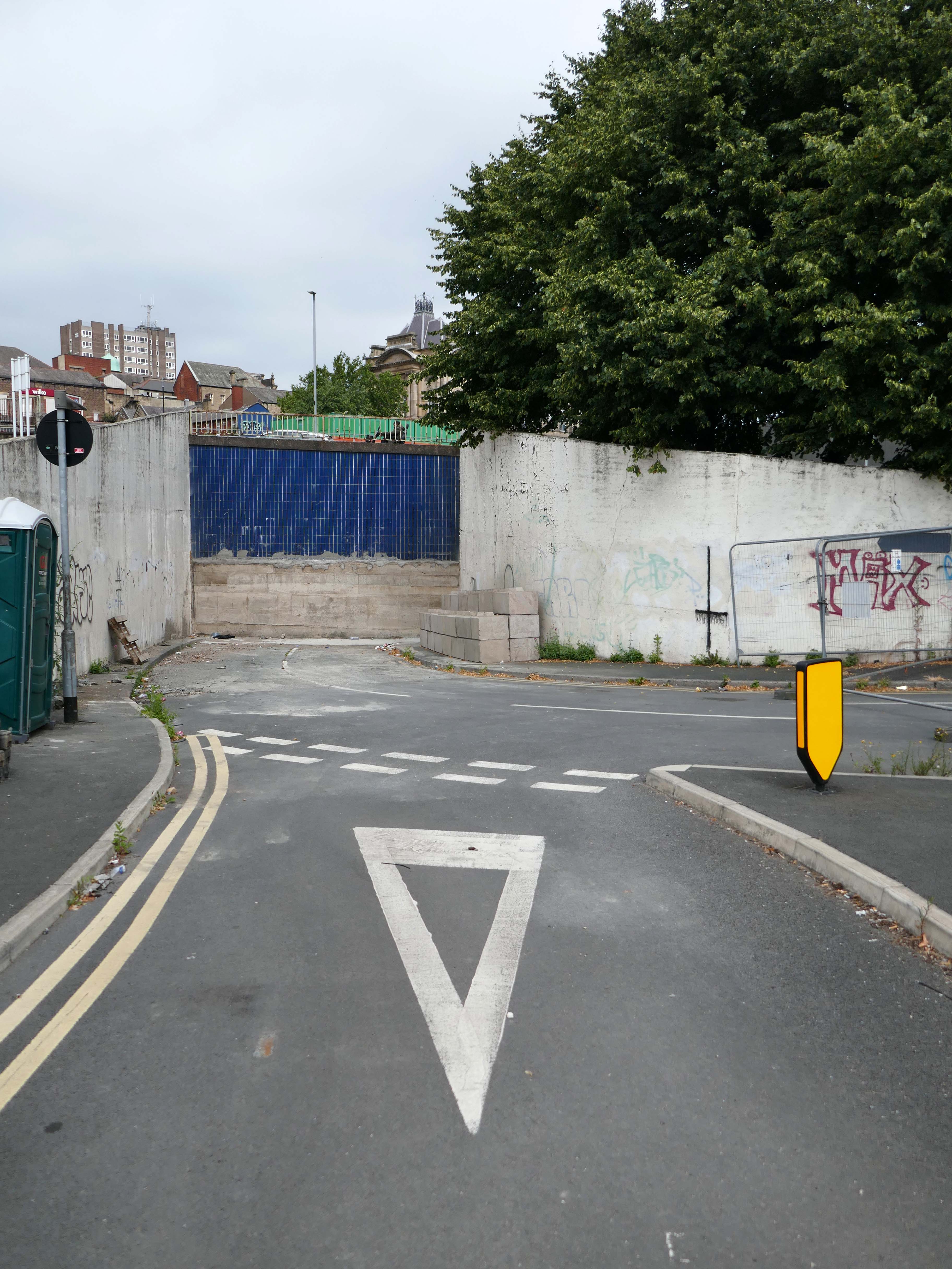
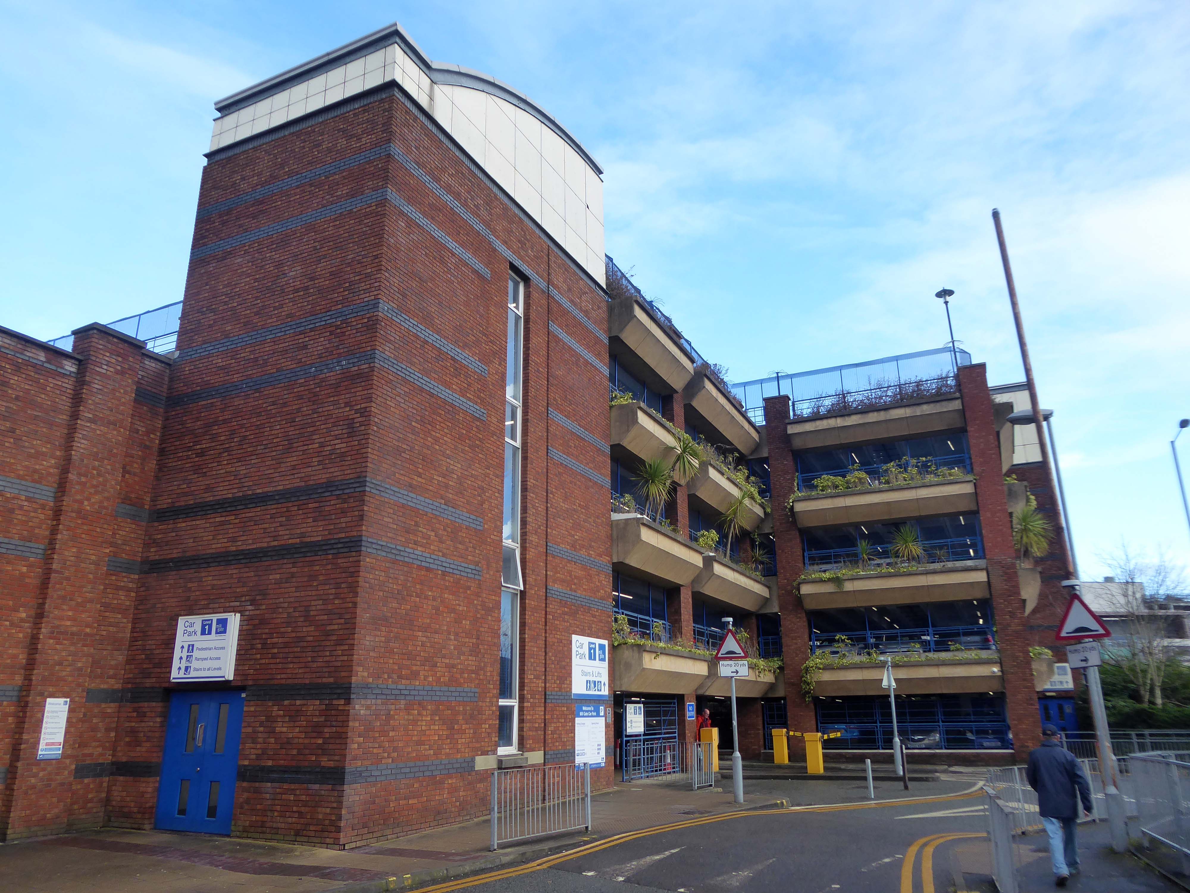
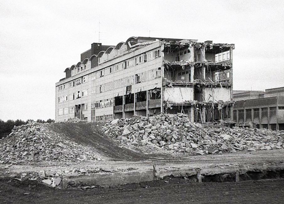
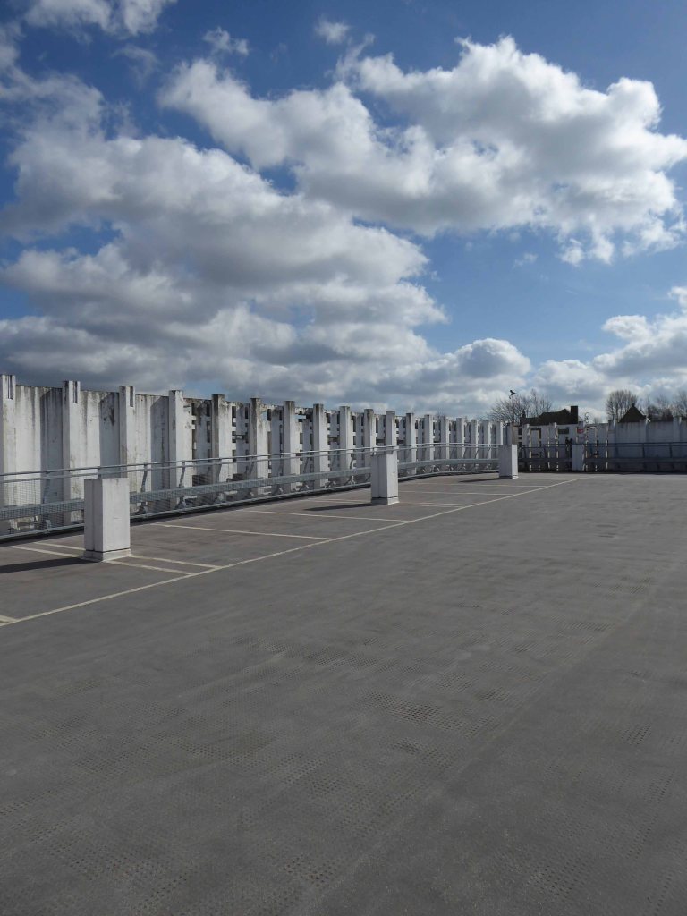
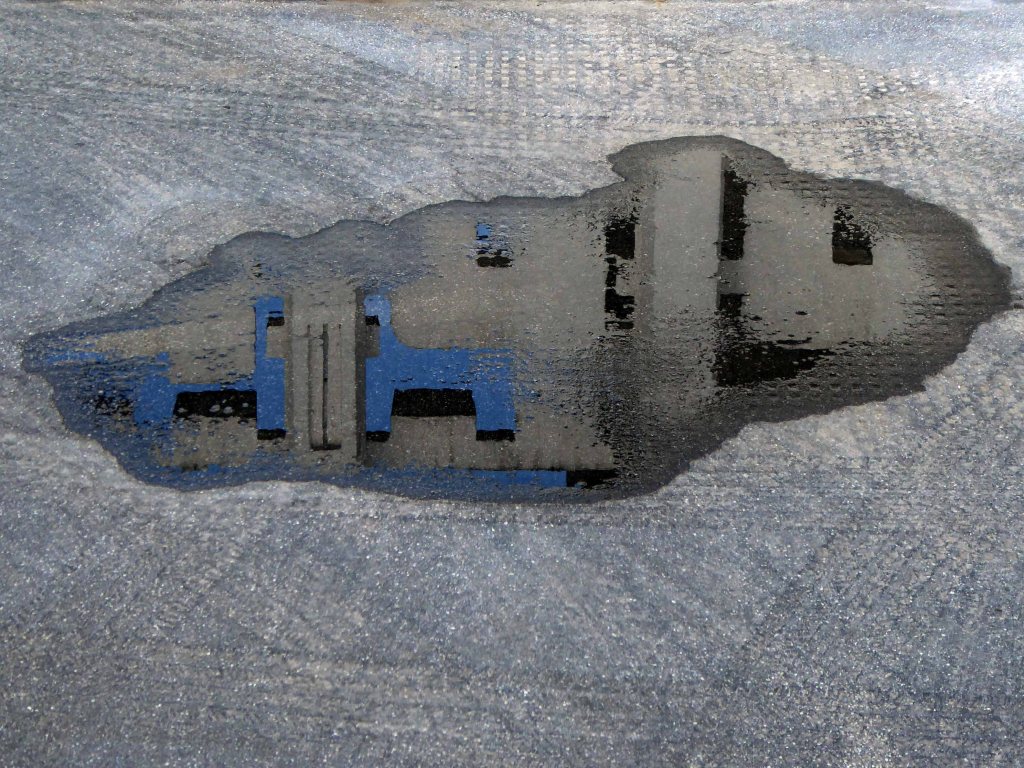
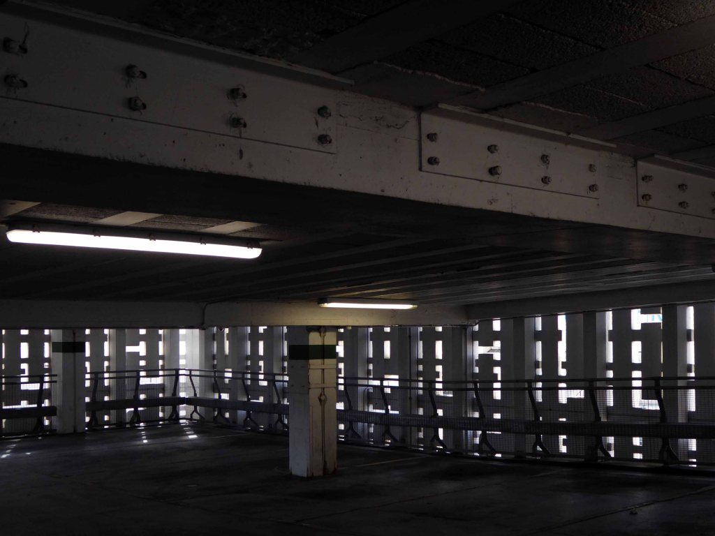
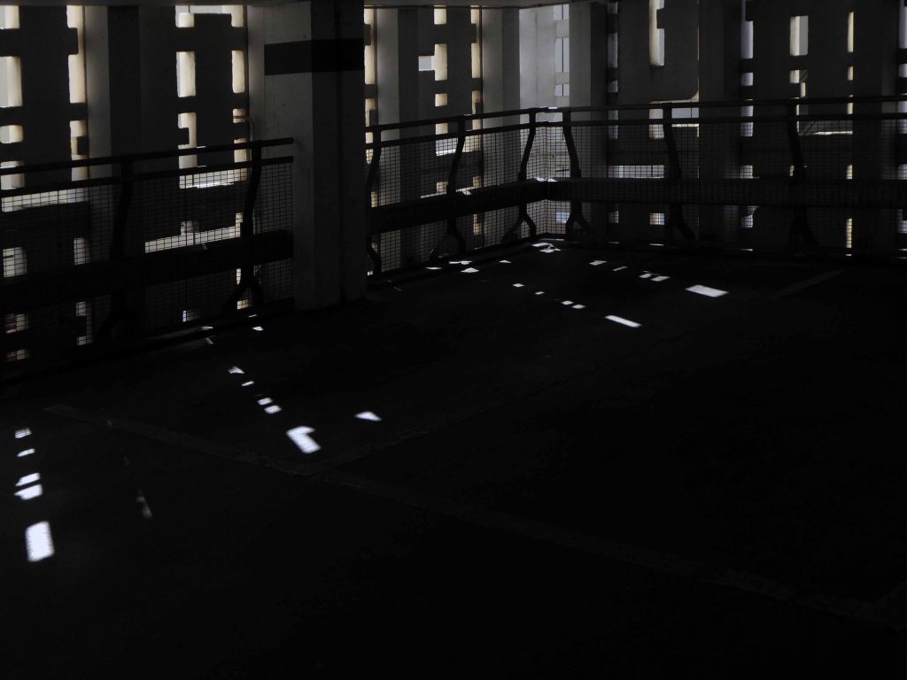
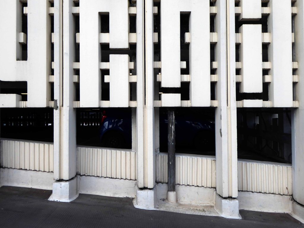
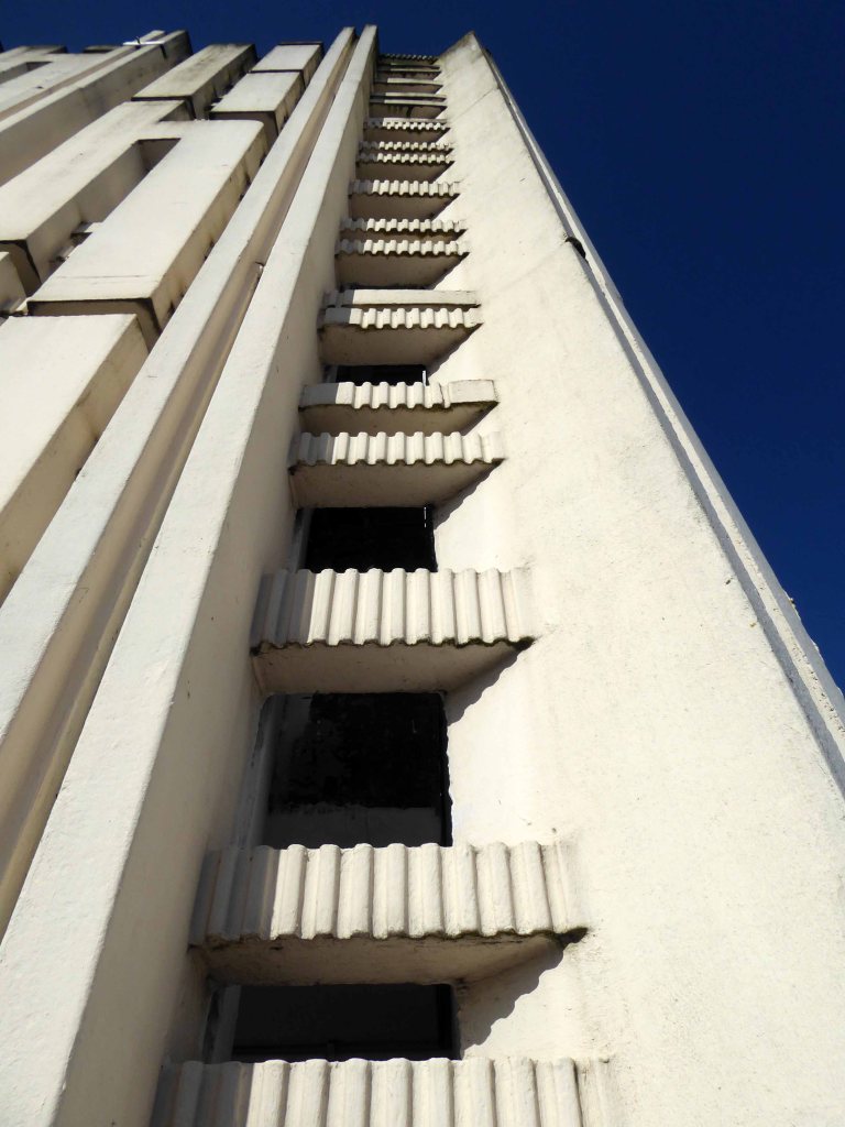
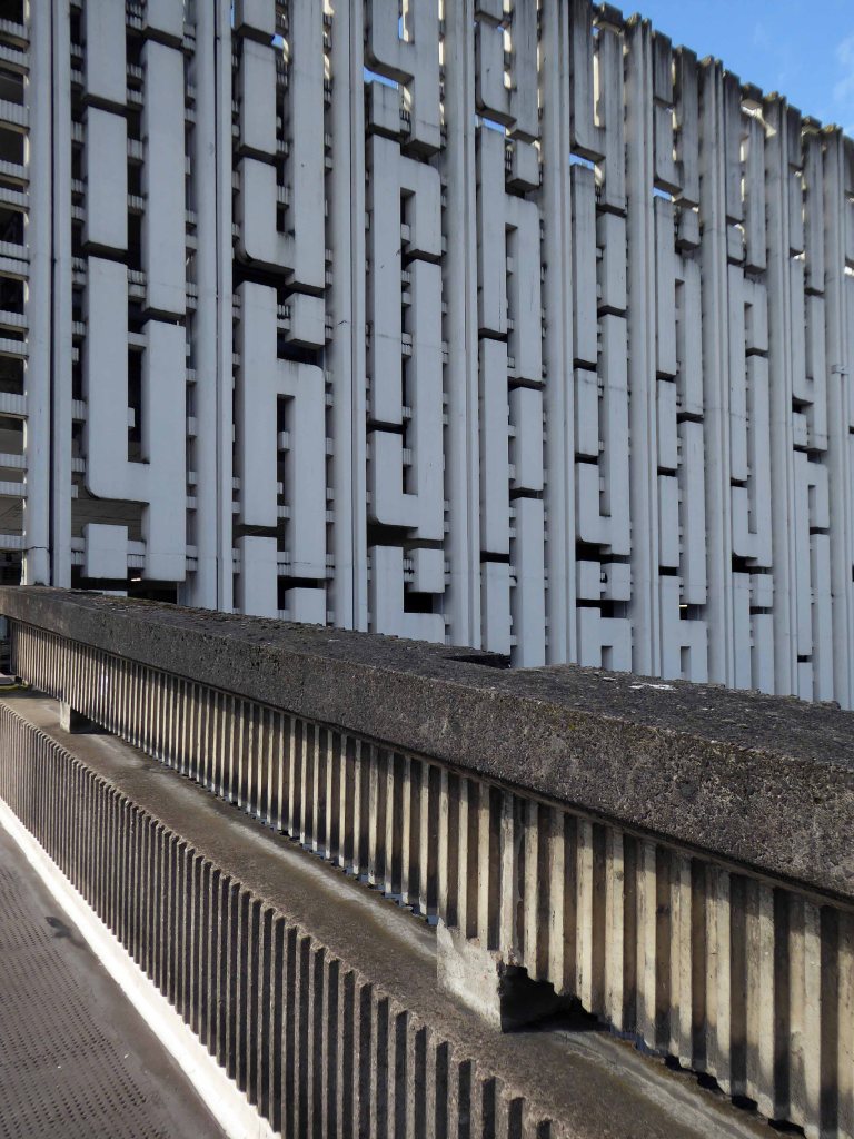
The NCP multi storey car park on Hall Ings has been demolished.
The demolition work is part of the Government-funded Transforming Cities Fund for Bradford.
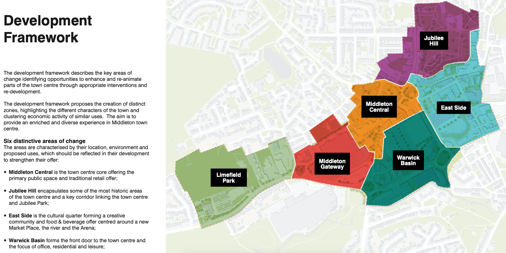
Bradford Council, in partnership with the West Yorkshire Combined Authority, is bringing forward a flagship programme of forward-thinking transport schemes, alongside major public space enhancements, that will help us shape and drive forward Bradford’s future regeneration in the city centre and beyond.
Providing an accessible, attractive and cleaner alternative to car journeys is at the heart of the Leeds City Region Transforming Cities Fund, a major new programme of transport infrastructure investment secured as part of the West Yorkshire devolution deal. The programme, which is being delivered by the Combined Authority in partnership with local authorities, will be funded through £317 million from the Department for Transport plus local match funding up to £140 million.
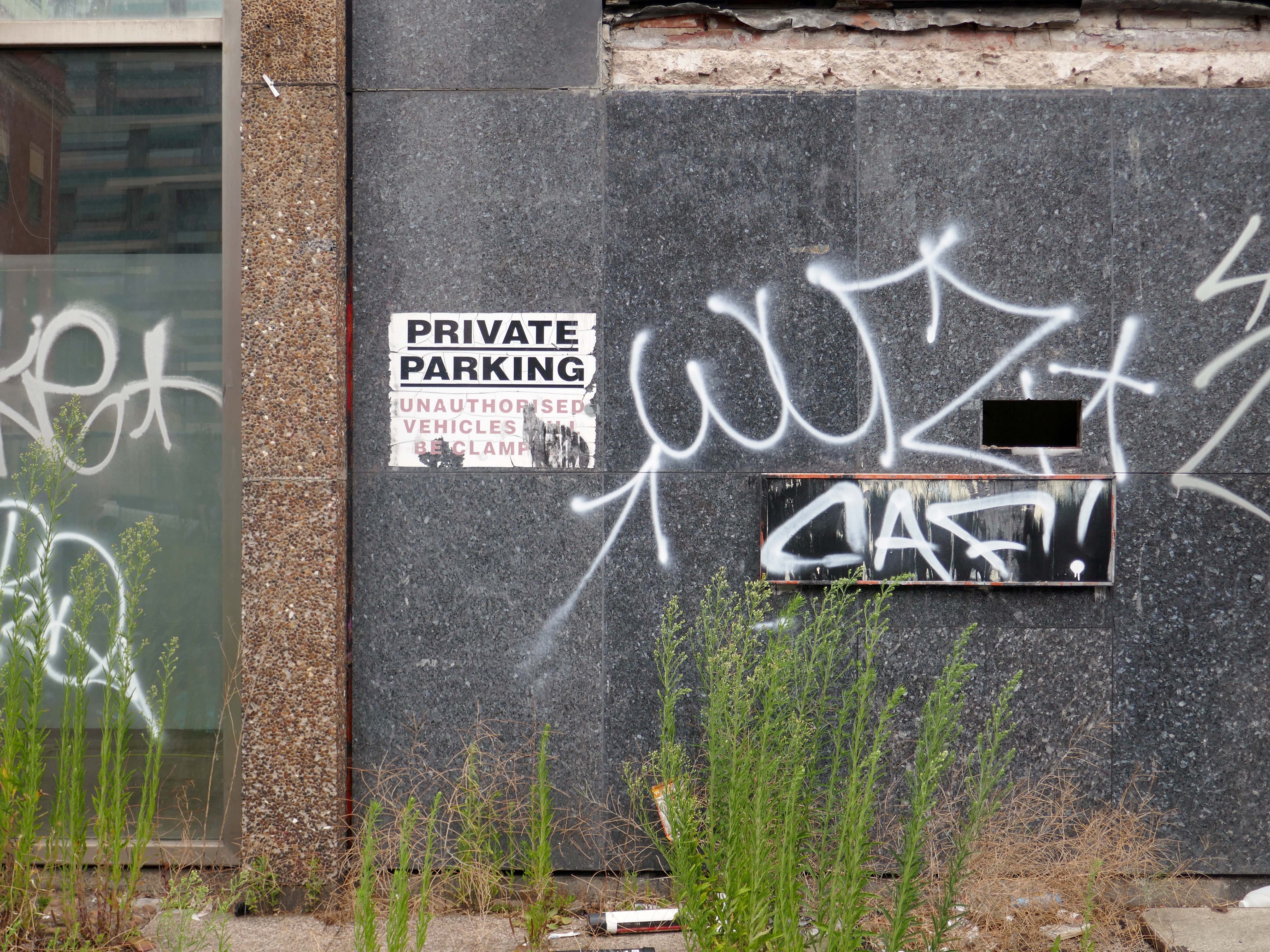
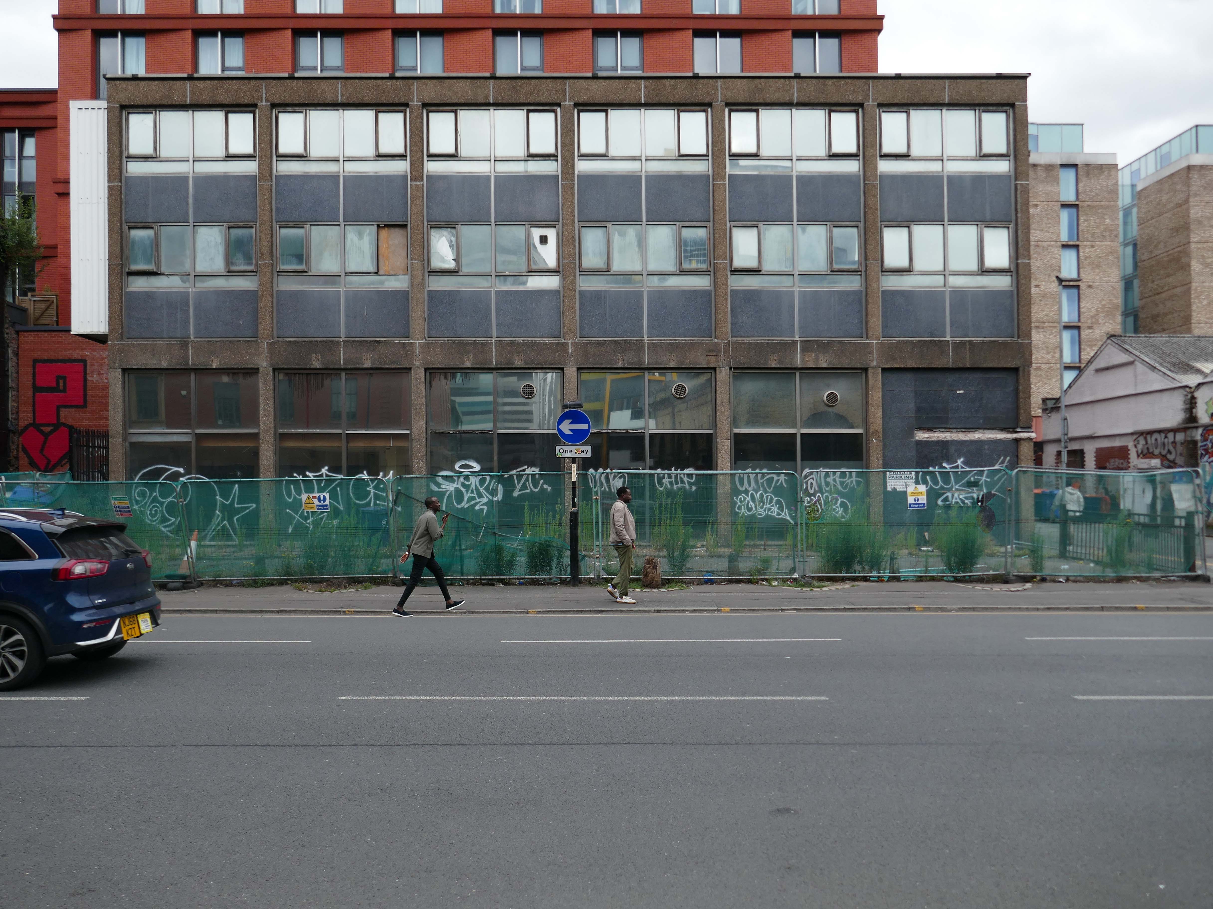
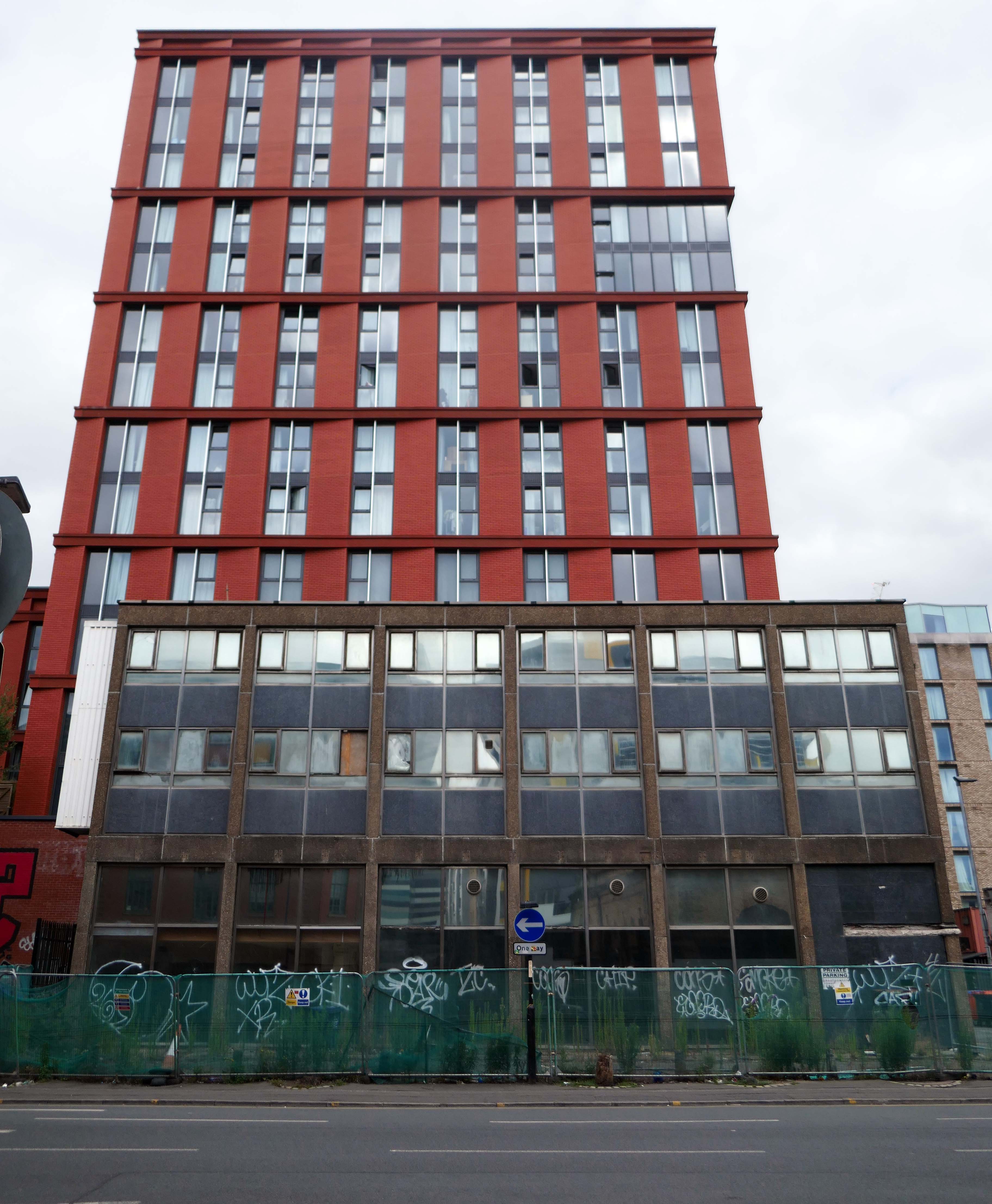
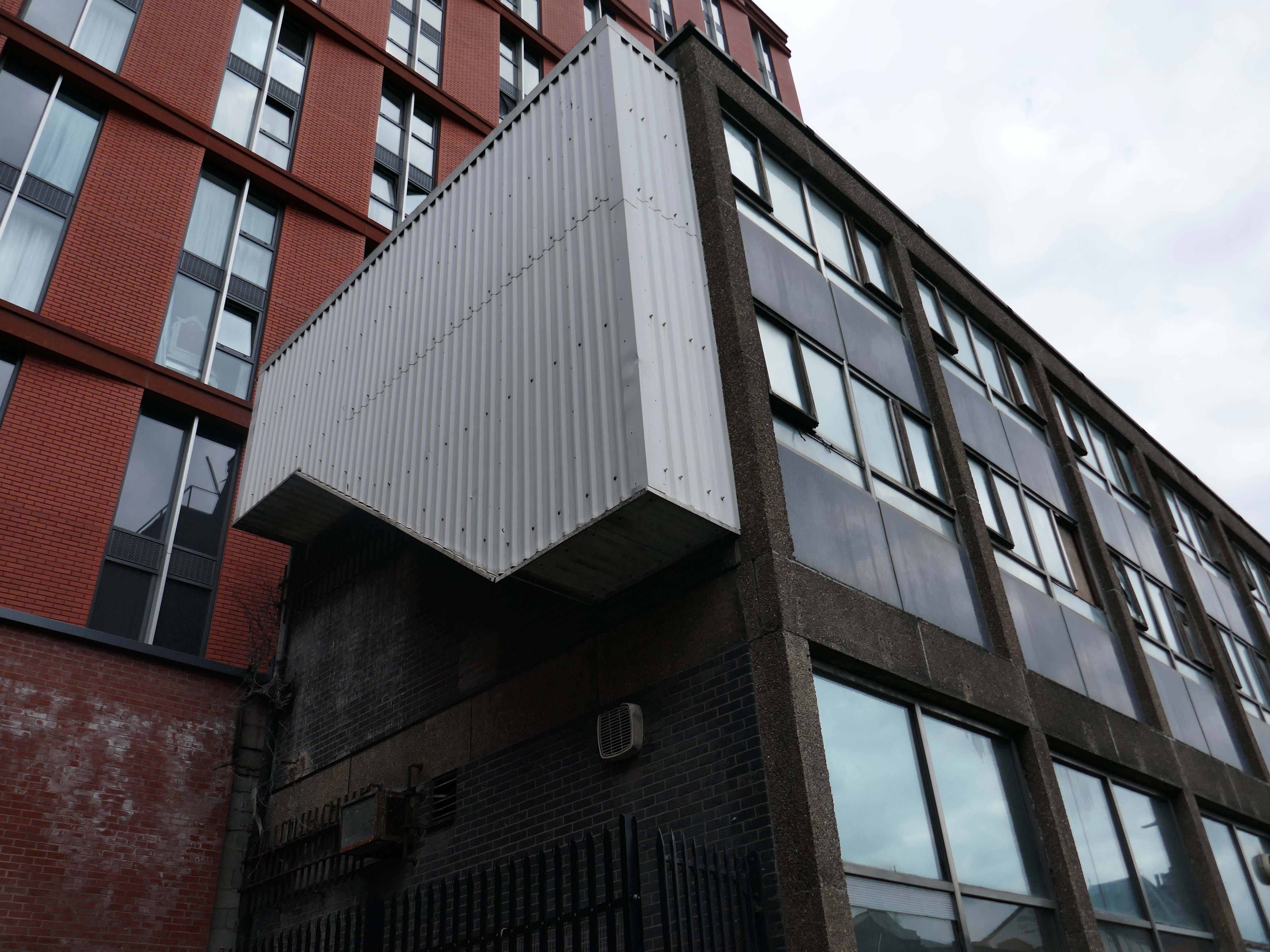
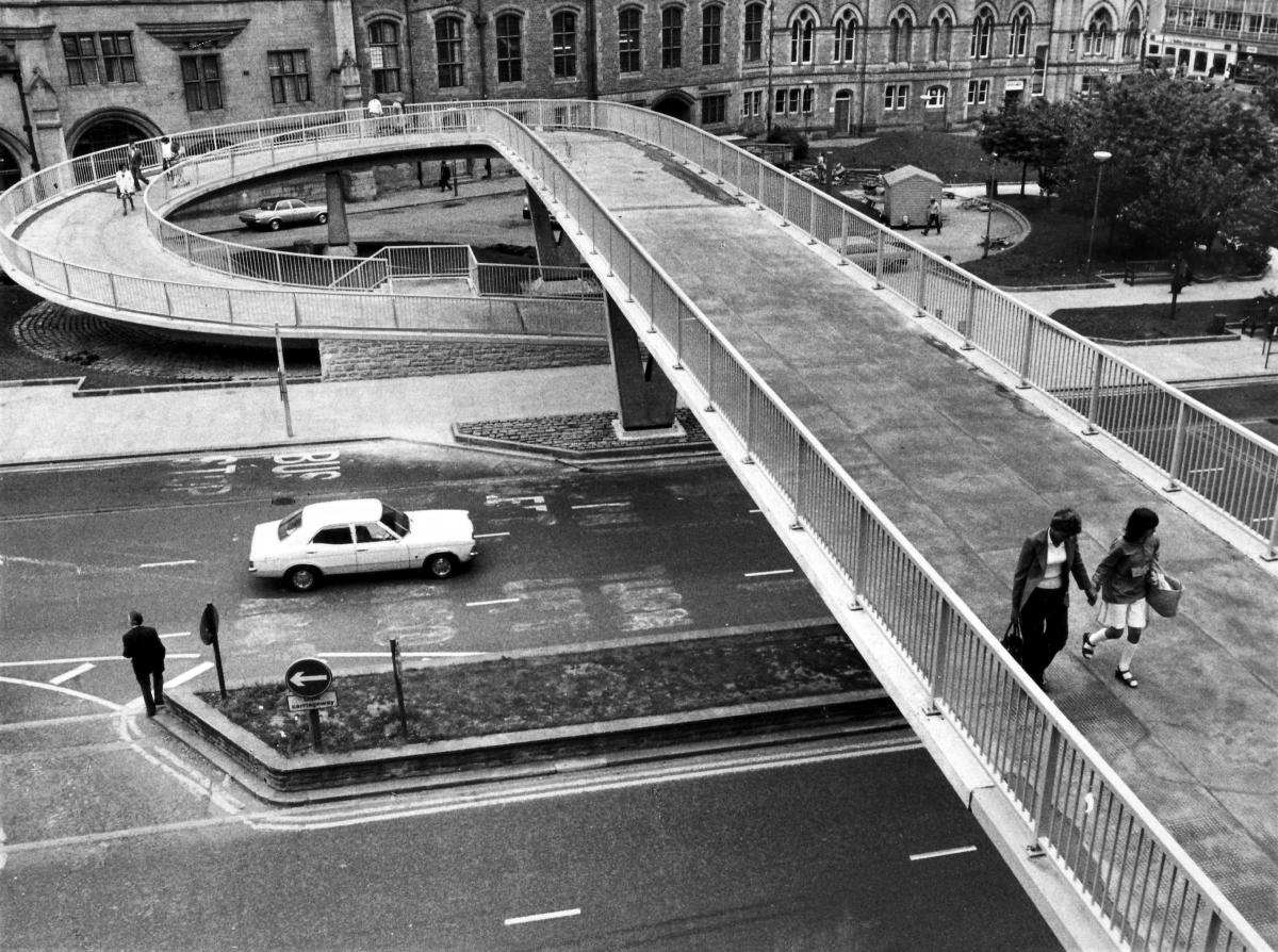
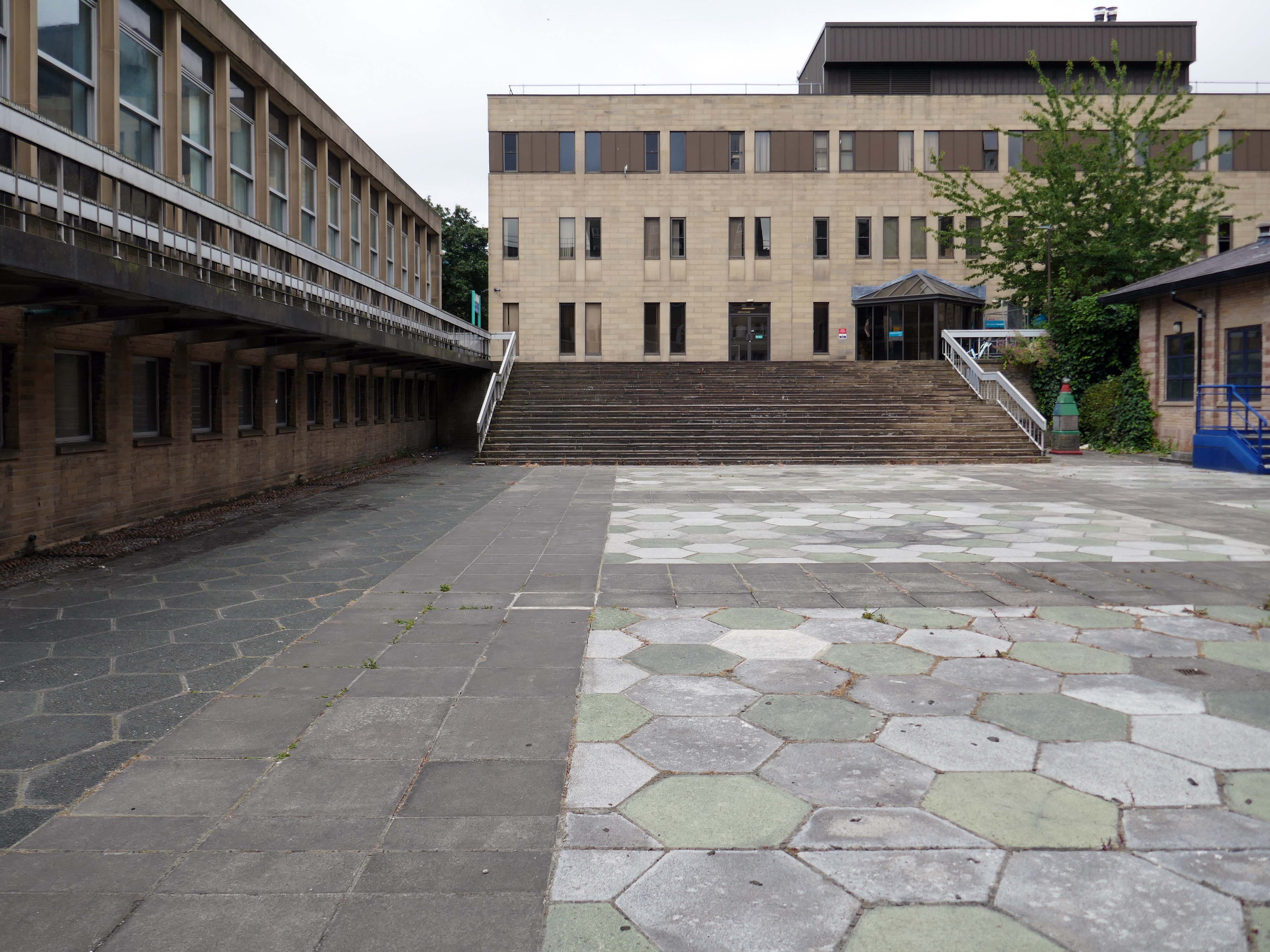
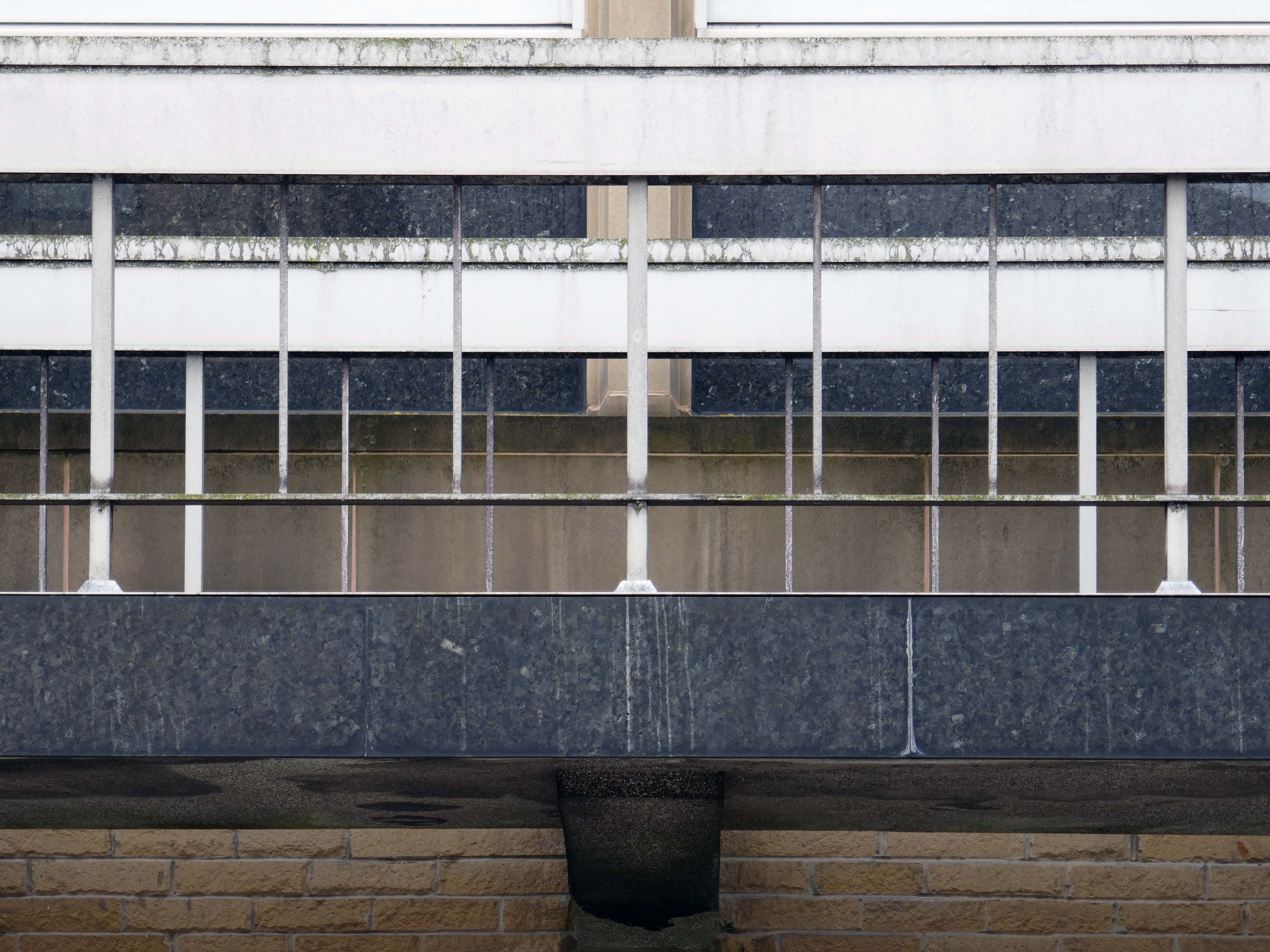
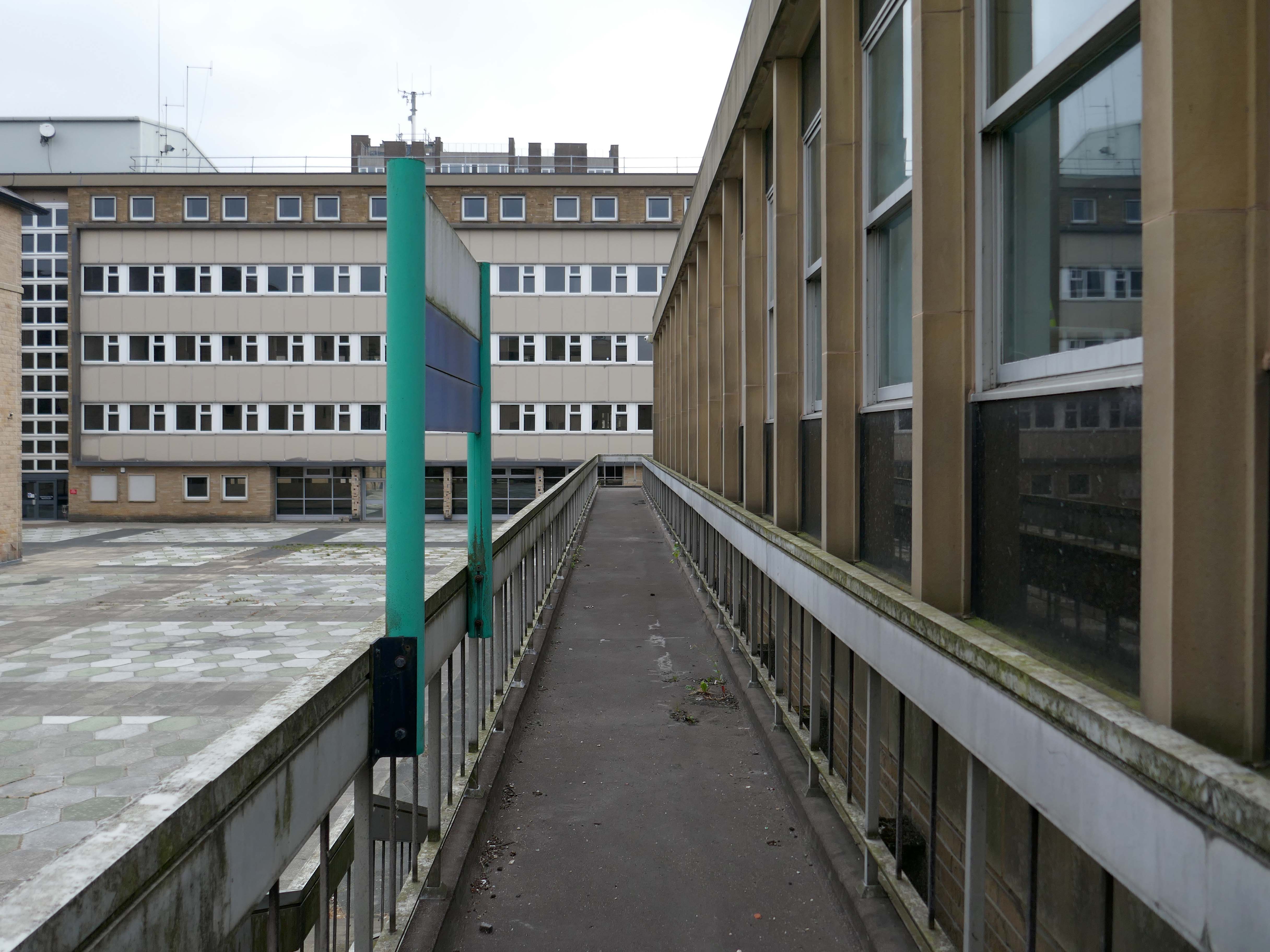
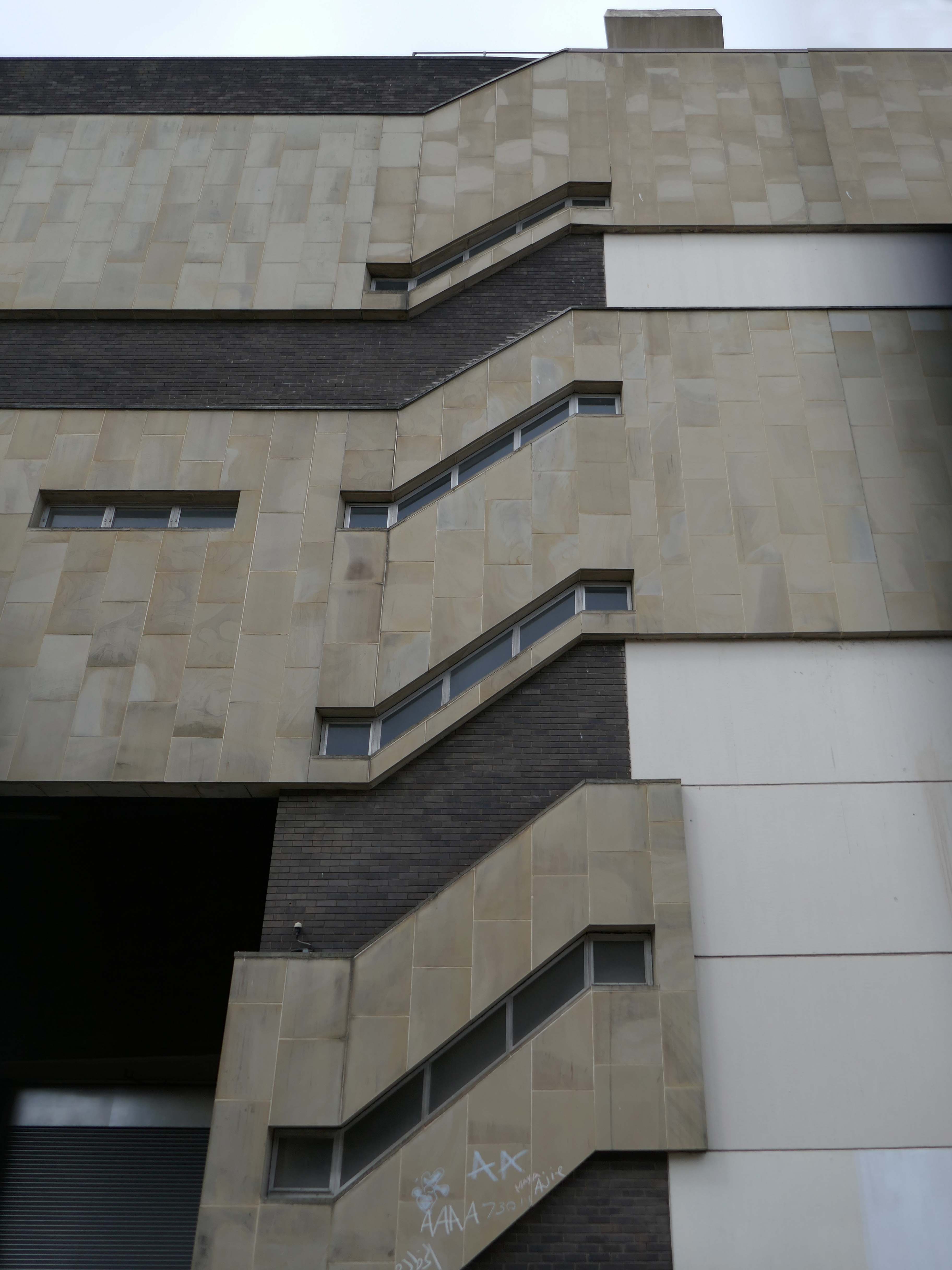
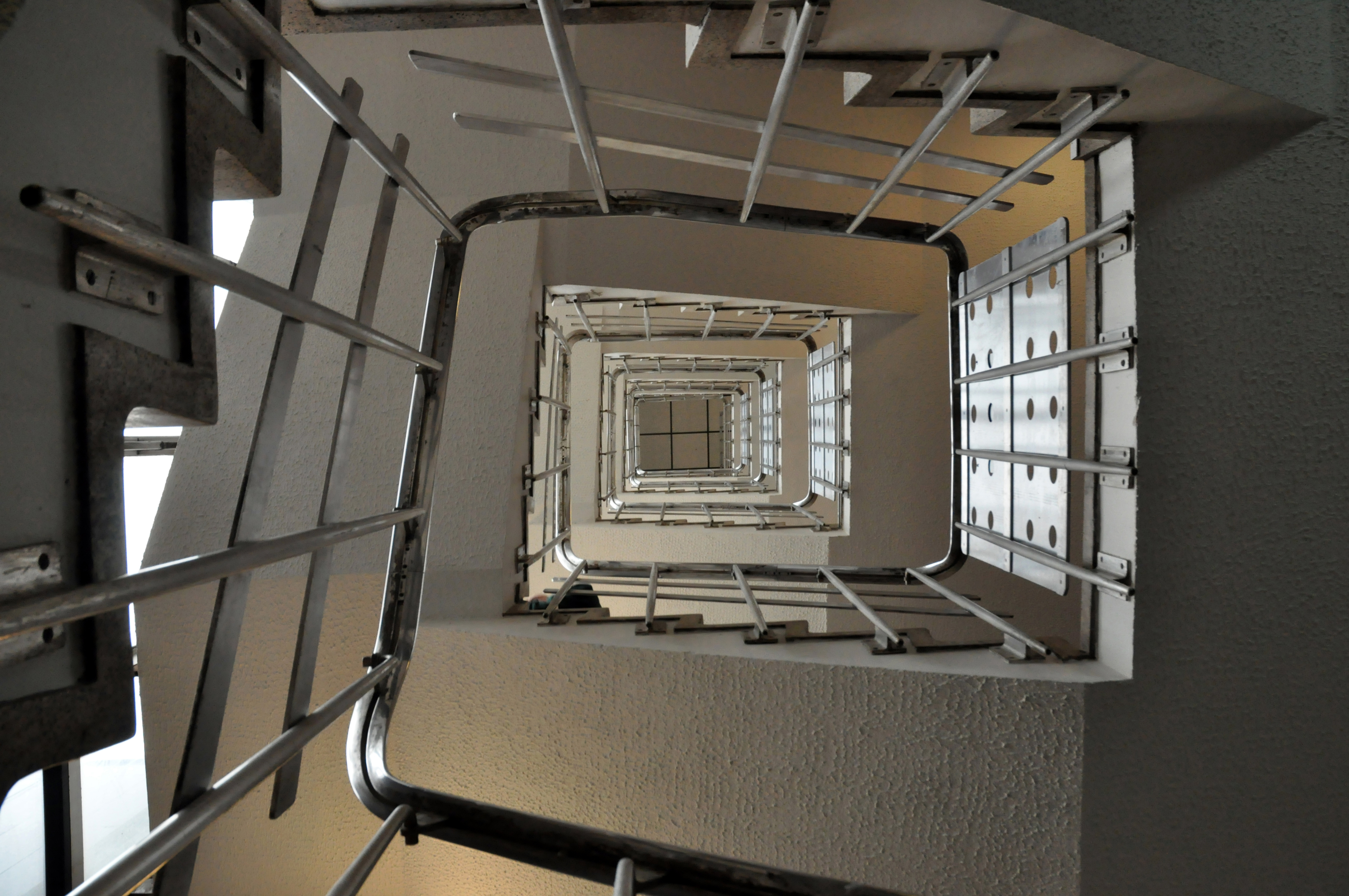
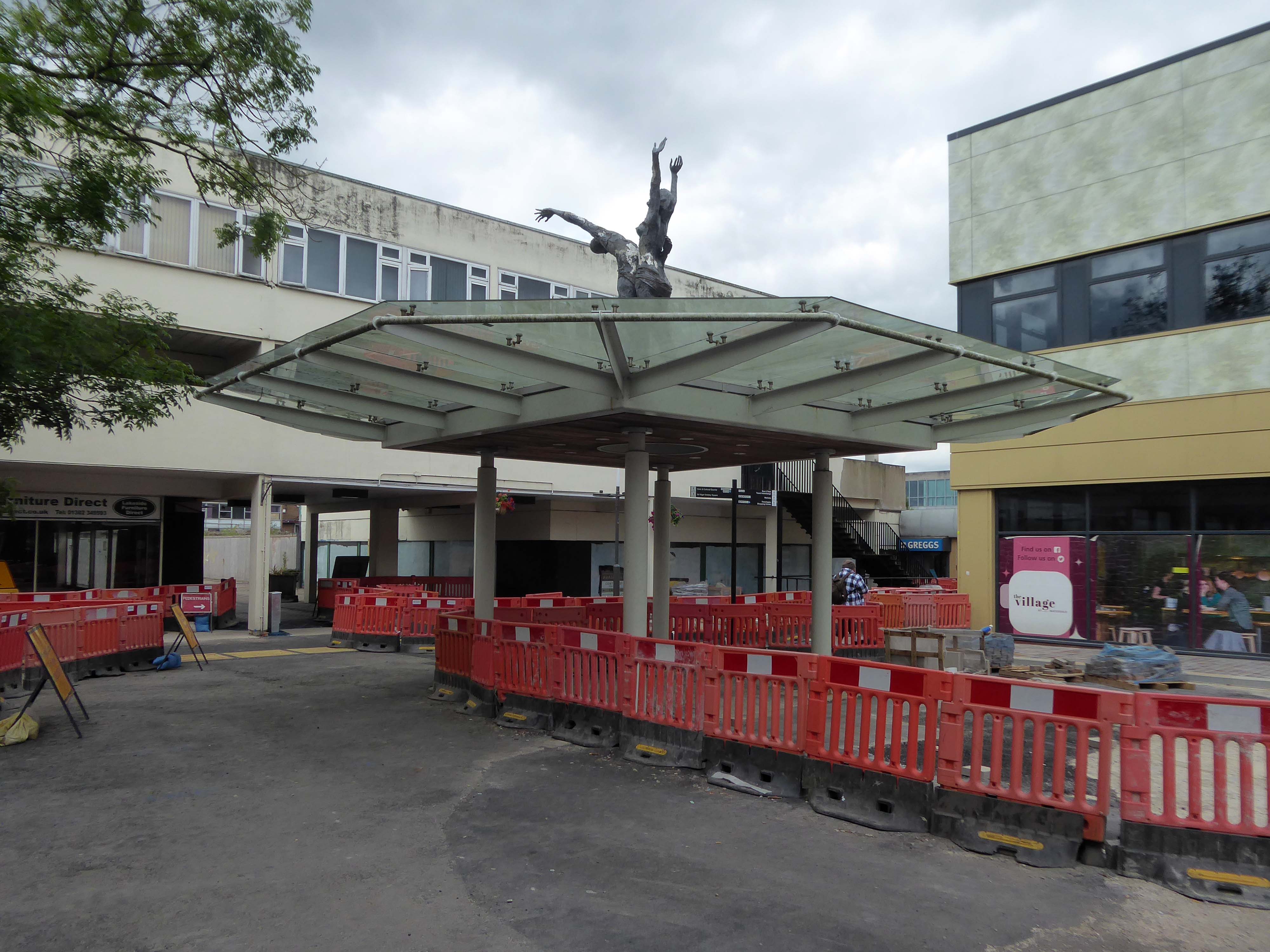
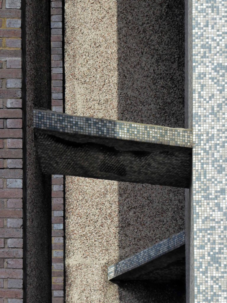
The area was once traversed by this elegant raised walkway.
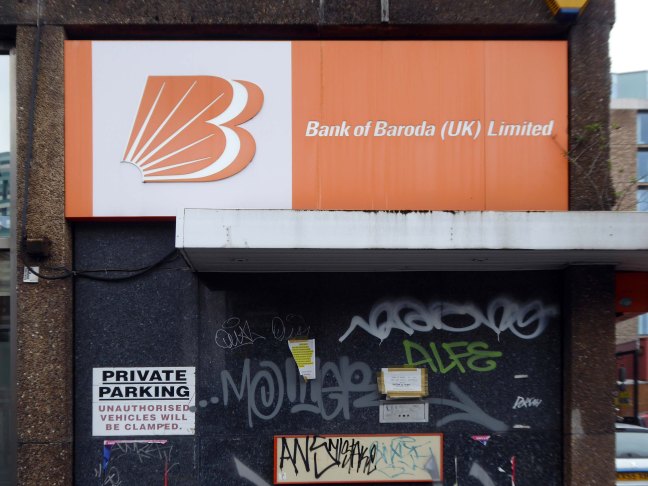
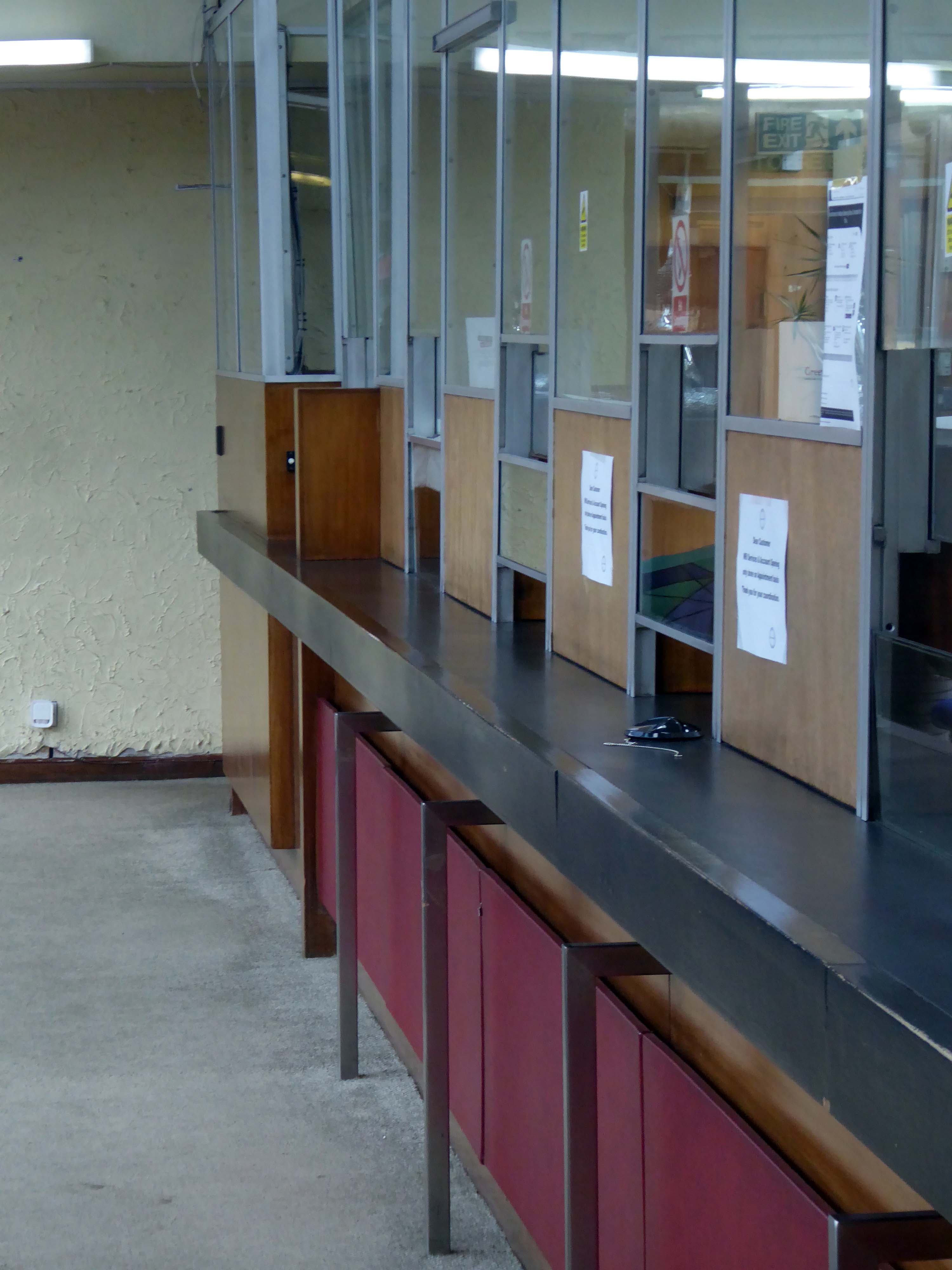
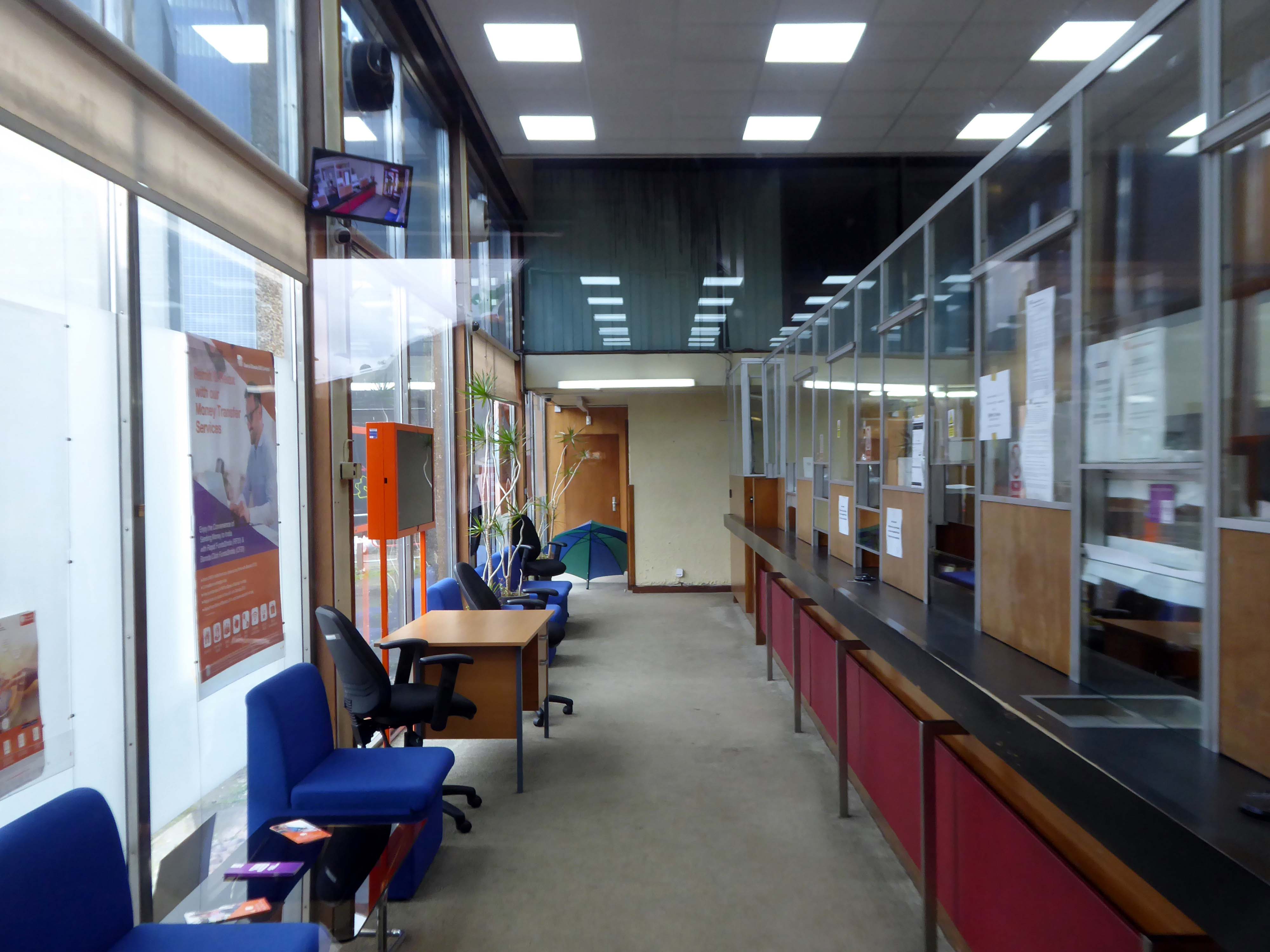
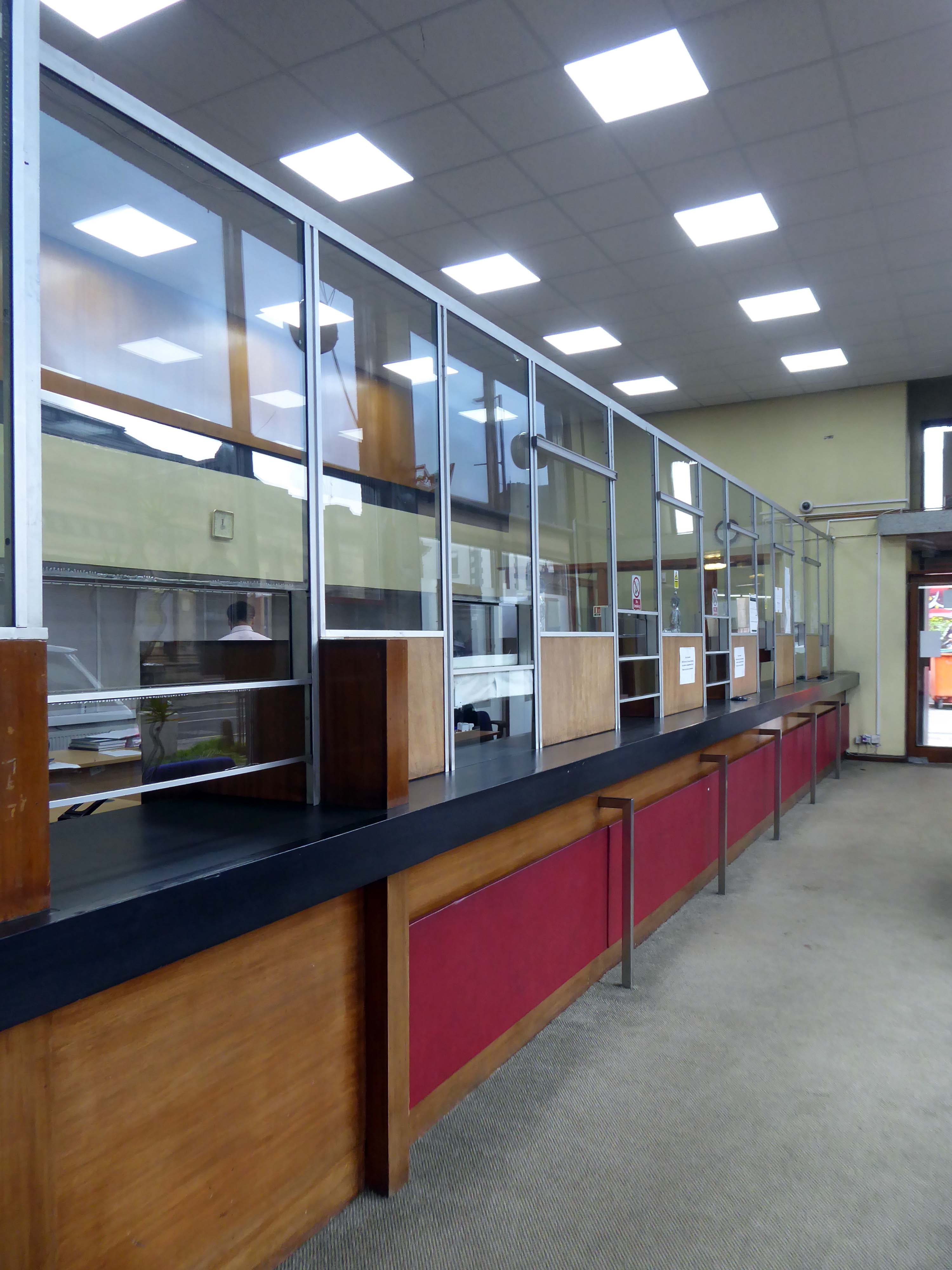
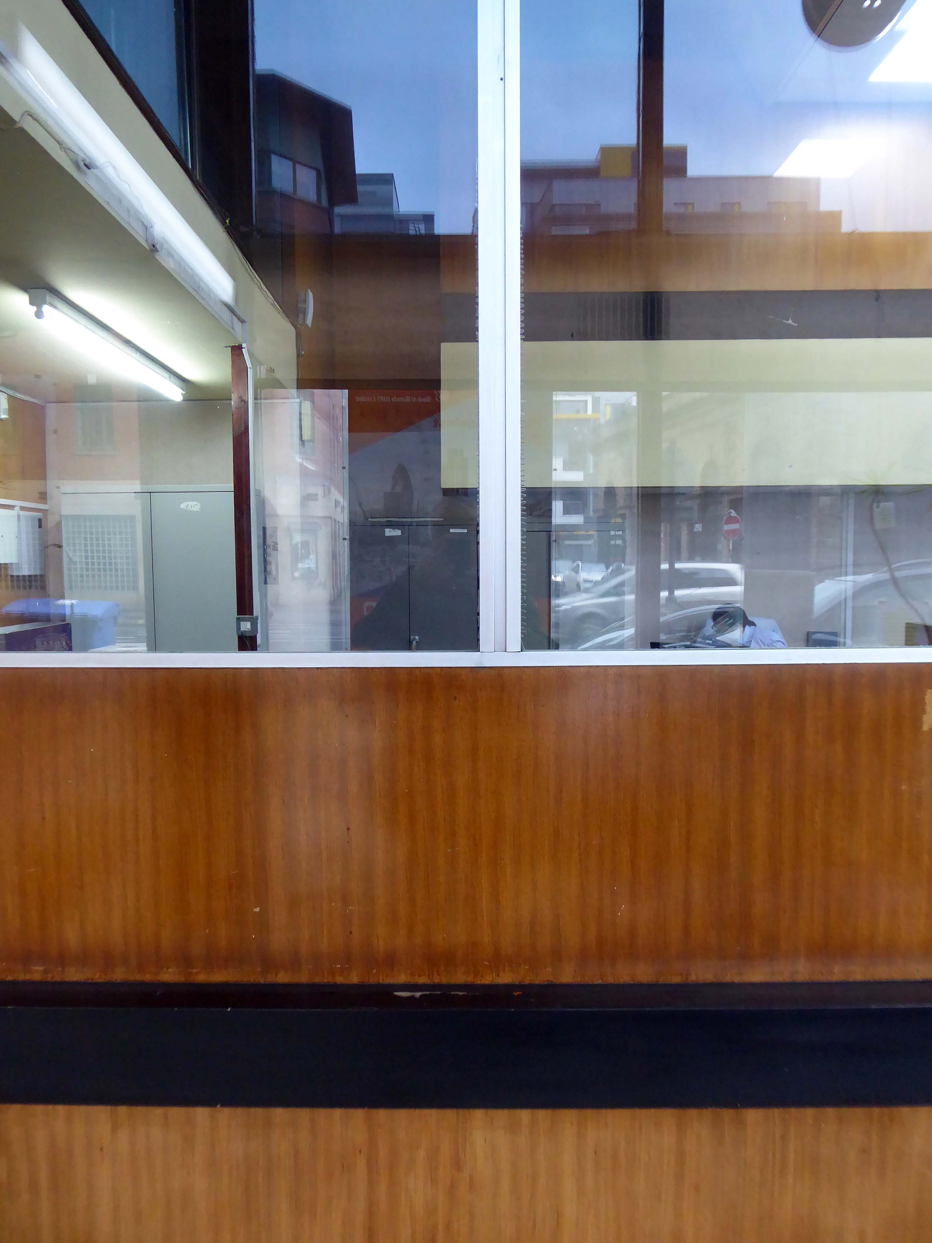
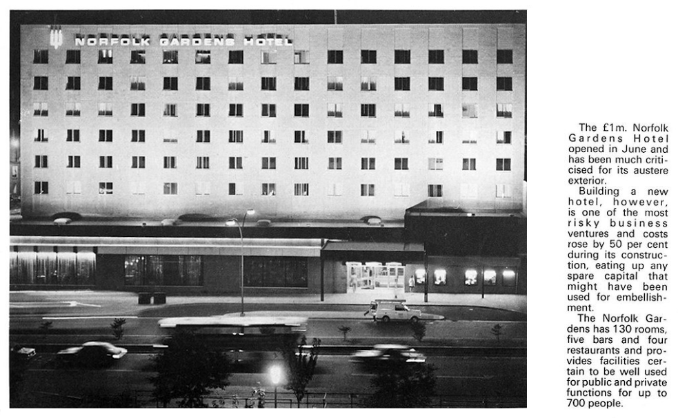
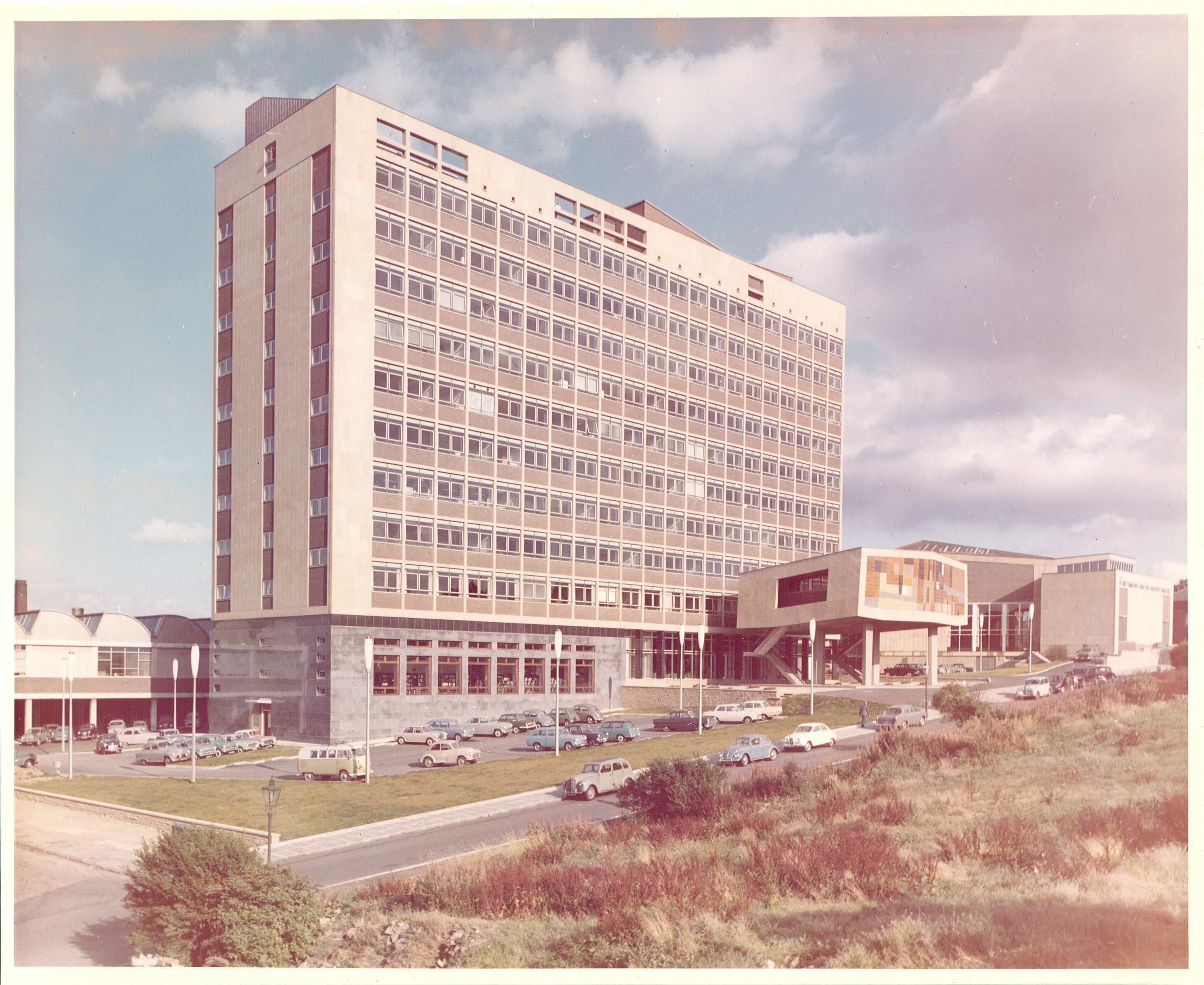
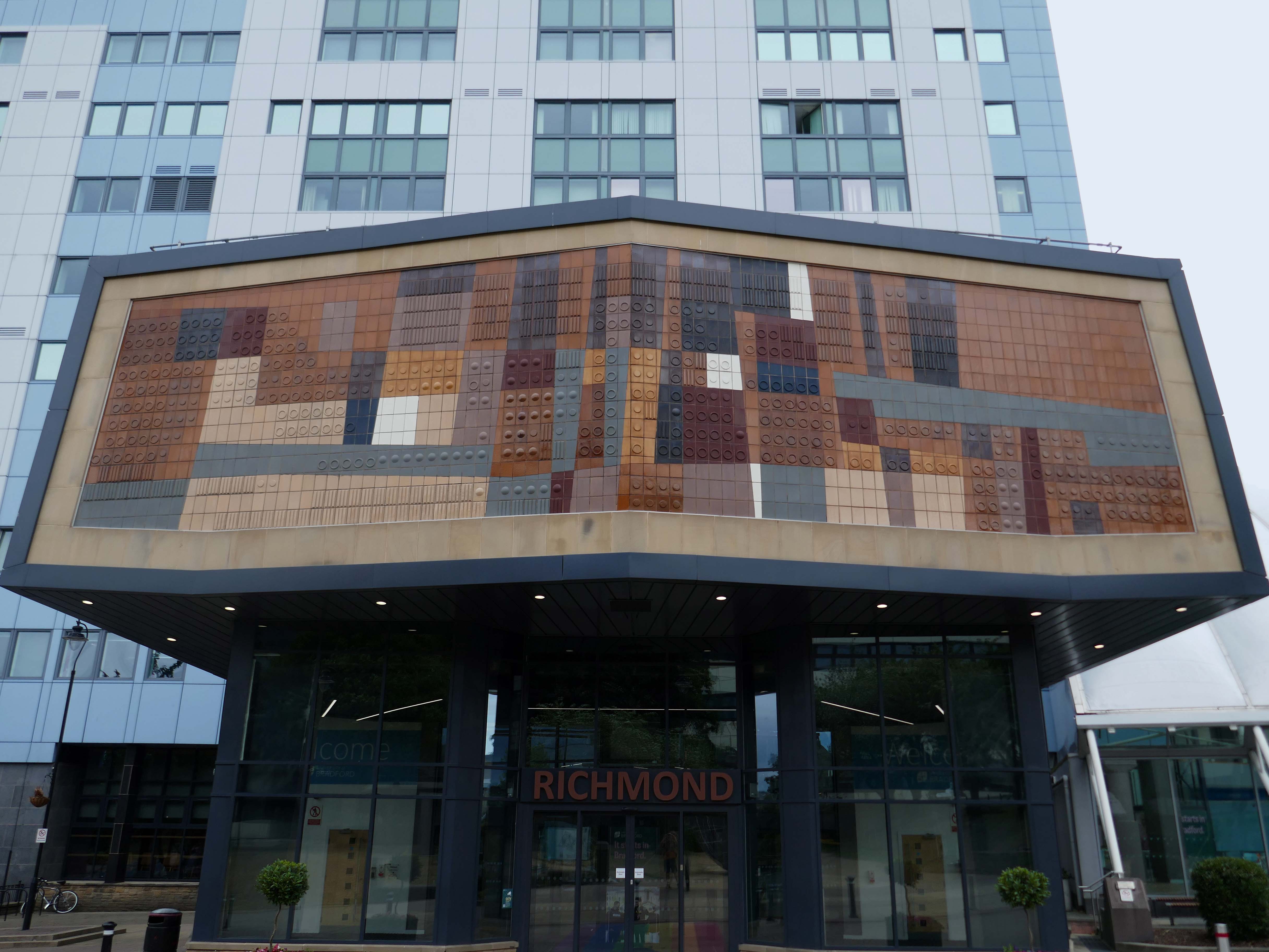
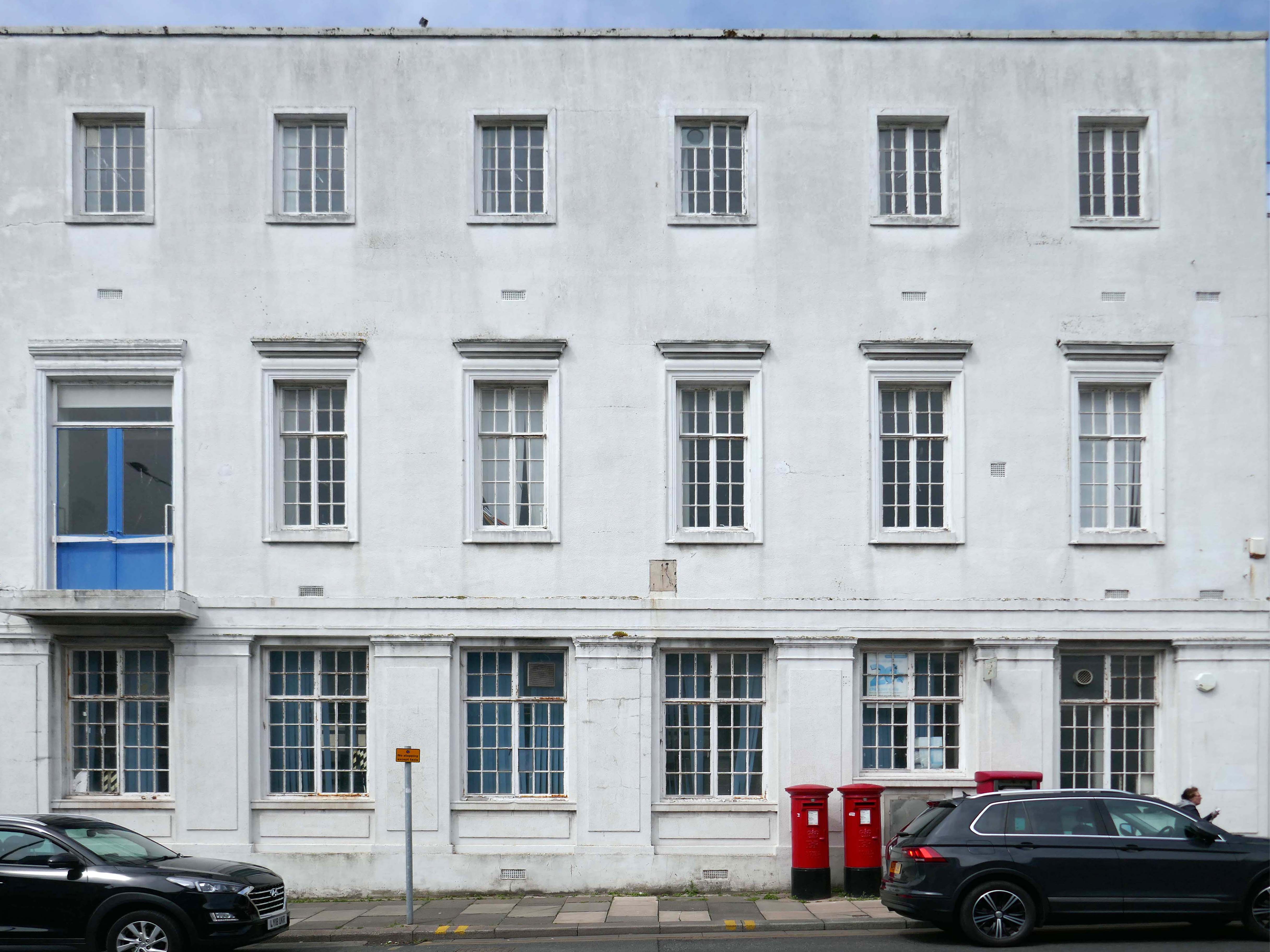
The Bradford Hotel remains resolutely unmoved, recently it has been used as an Asylum Hotel, unsure that this is still so.
Located in the heart of central Bradford, The Bradford Hotel provides an elegant refuge in the midst of the bustling city.
Originally opened as the Norfolk Gardens Hotel, the hotel was completed in 1972 and opened in June of that year.
Architects – William Walker Partnership.
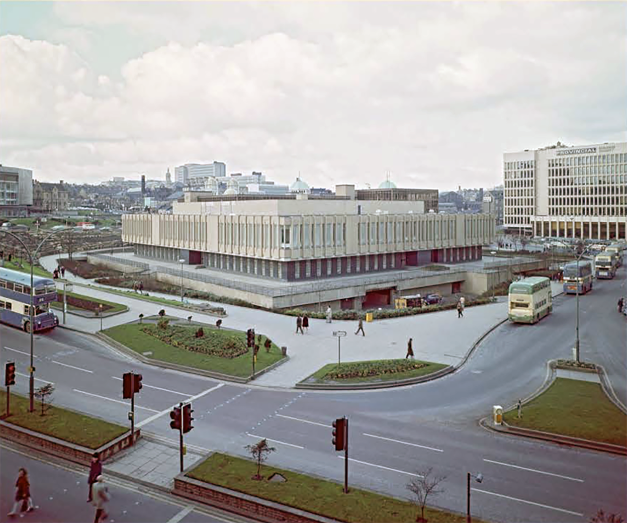
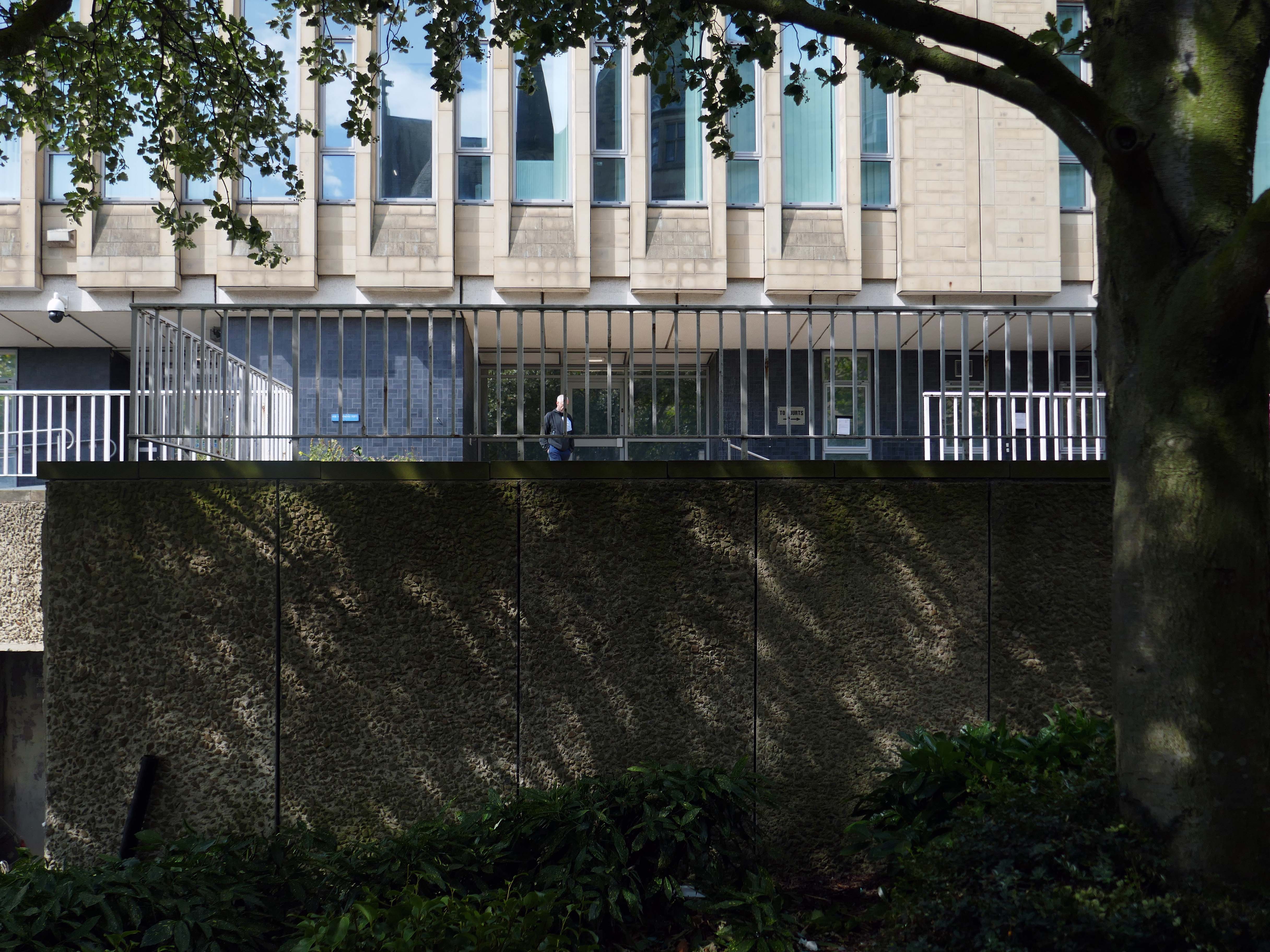
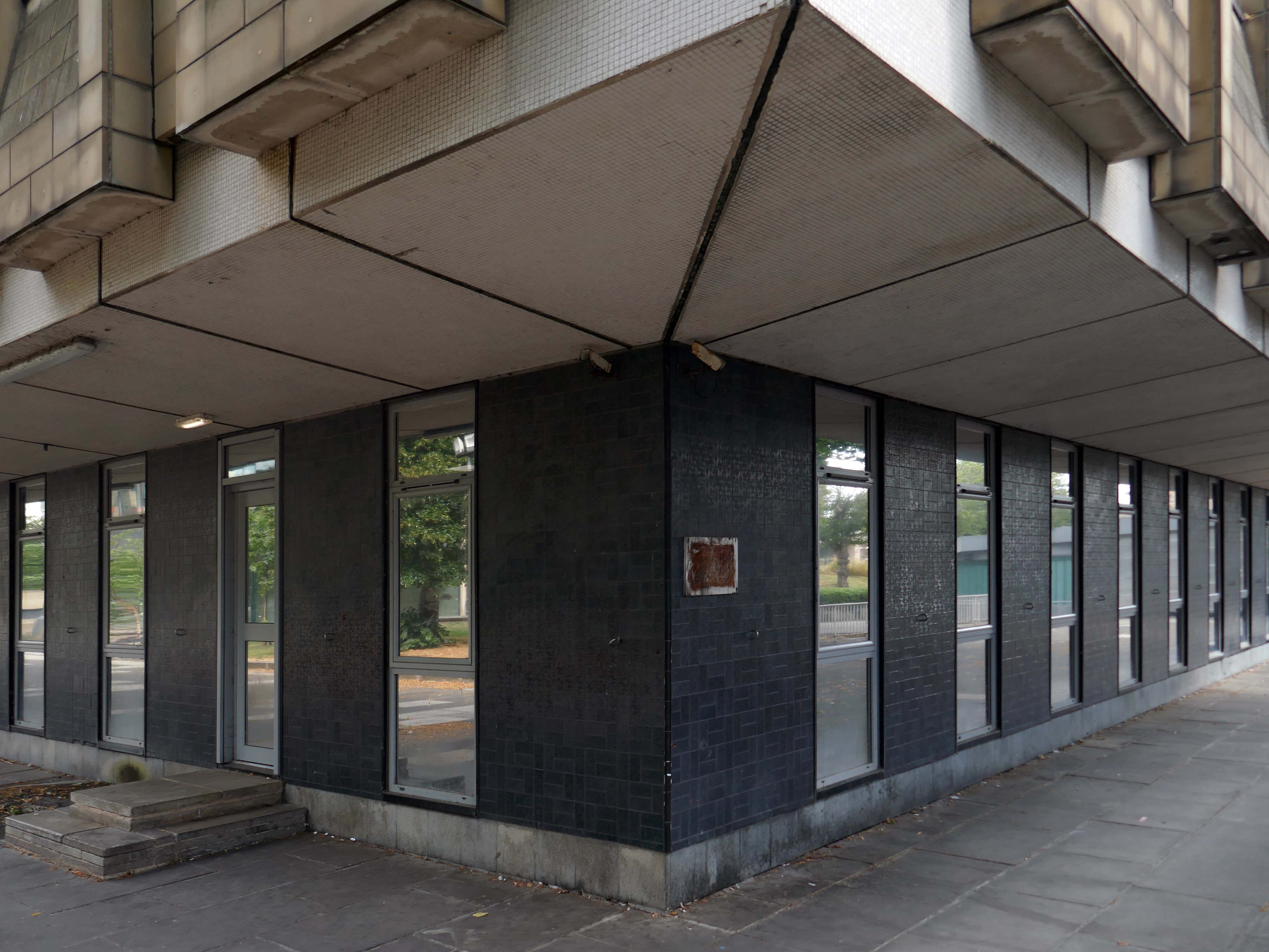
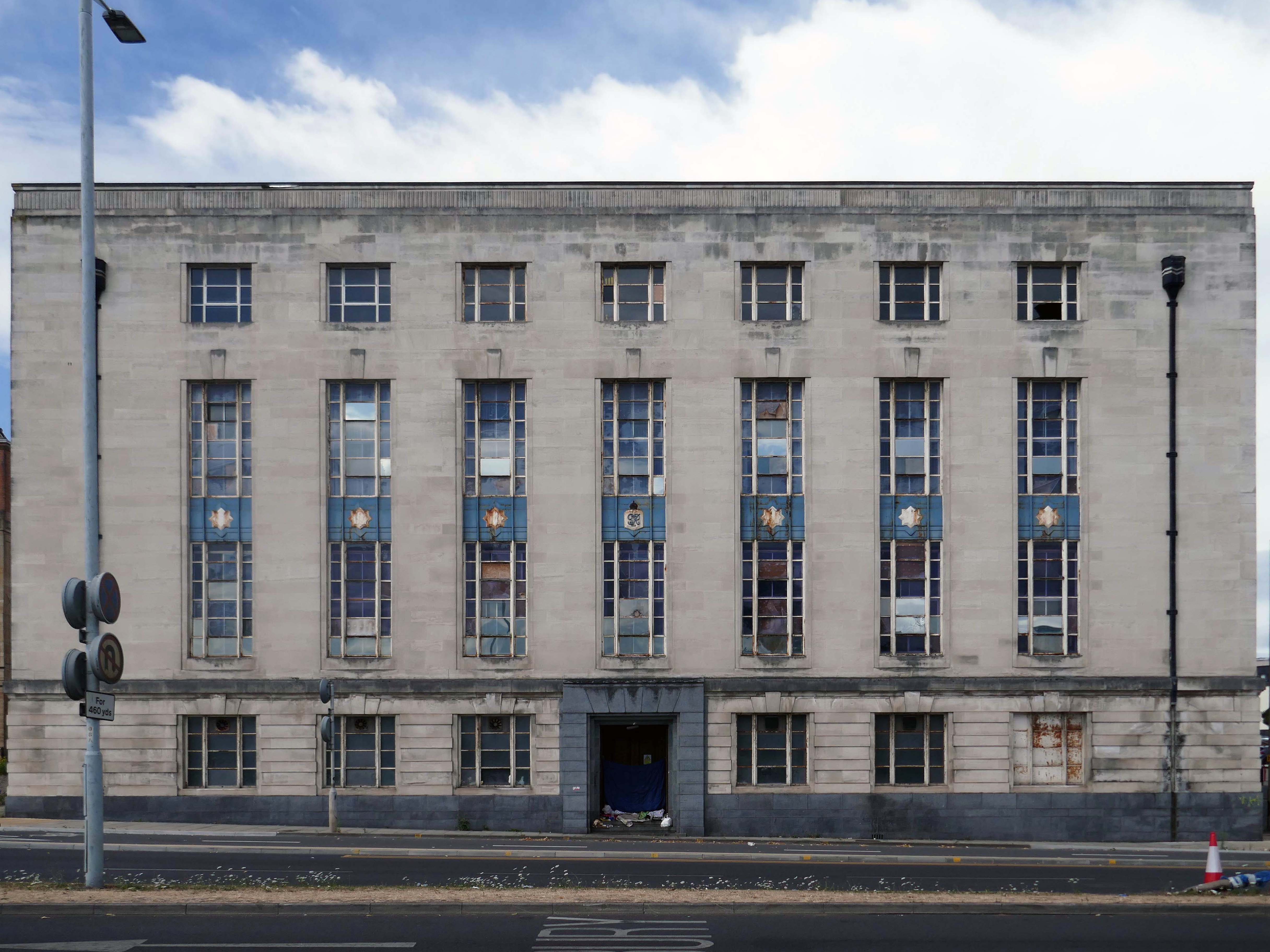
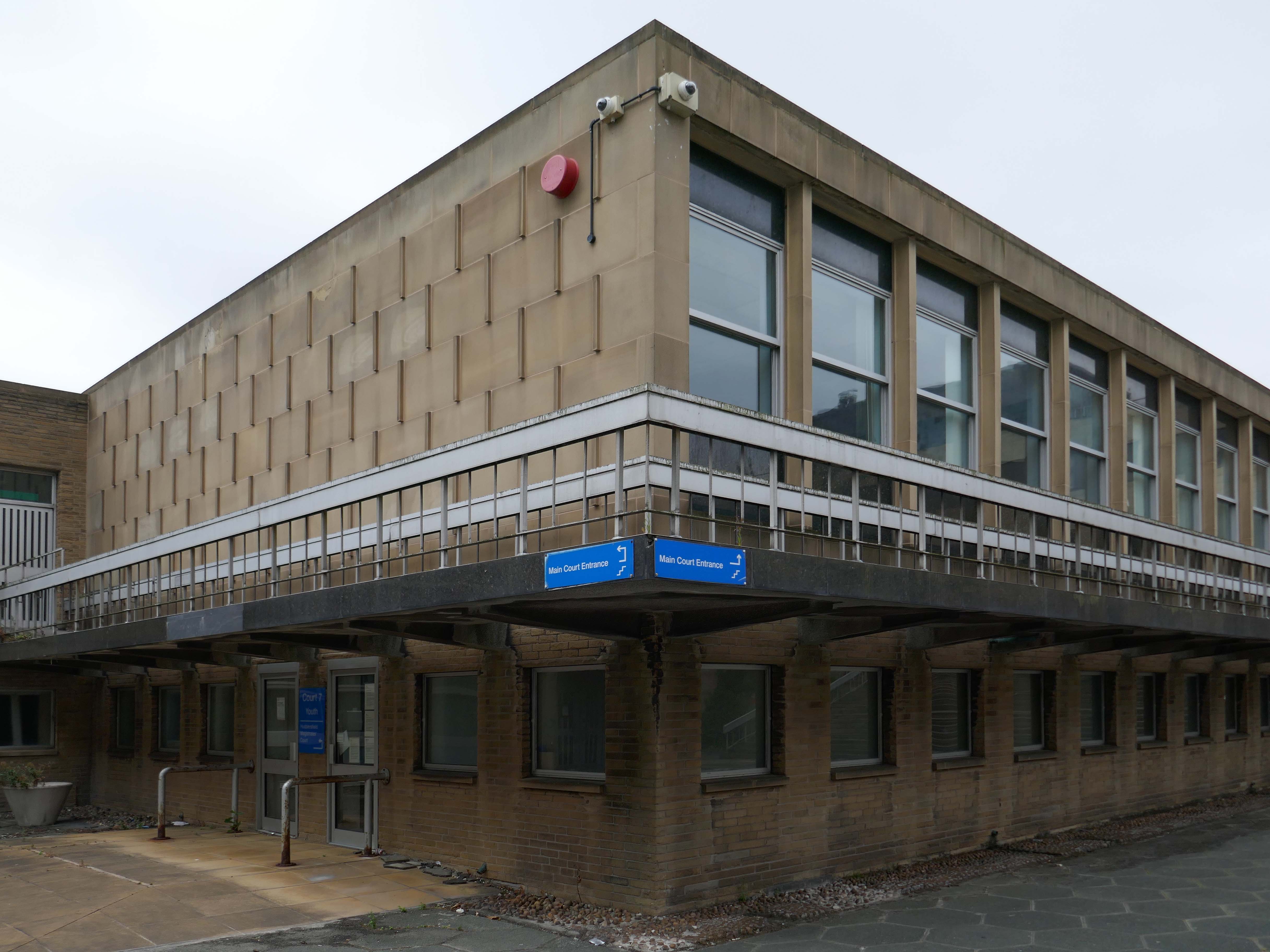
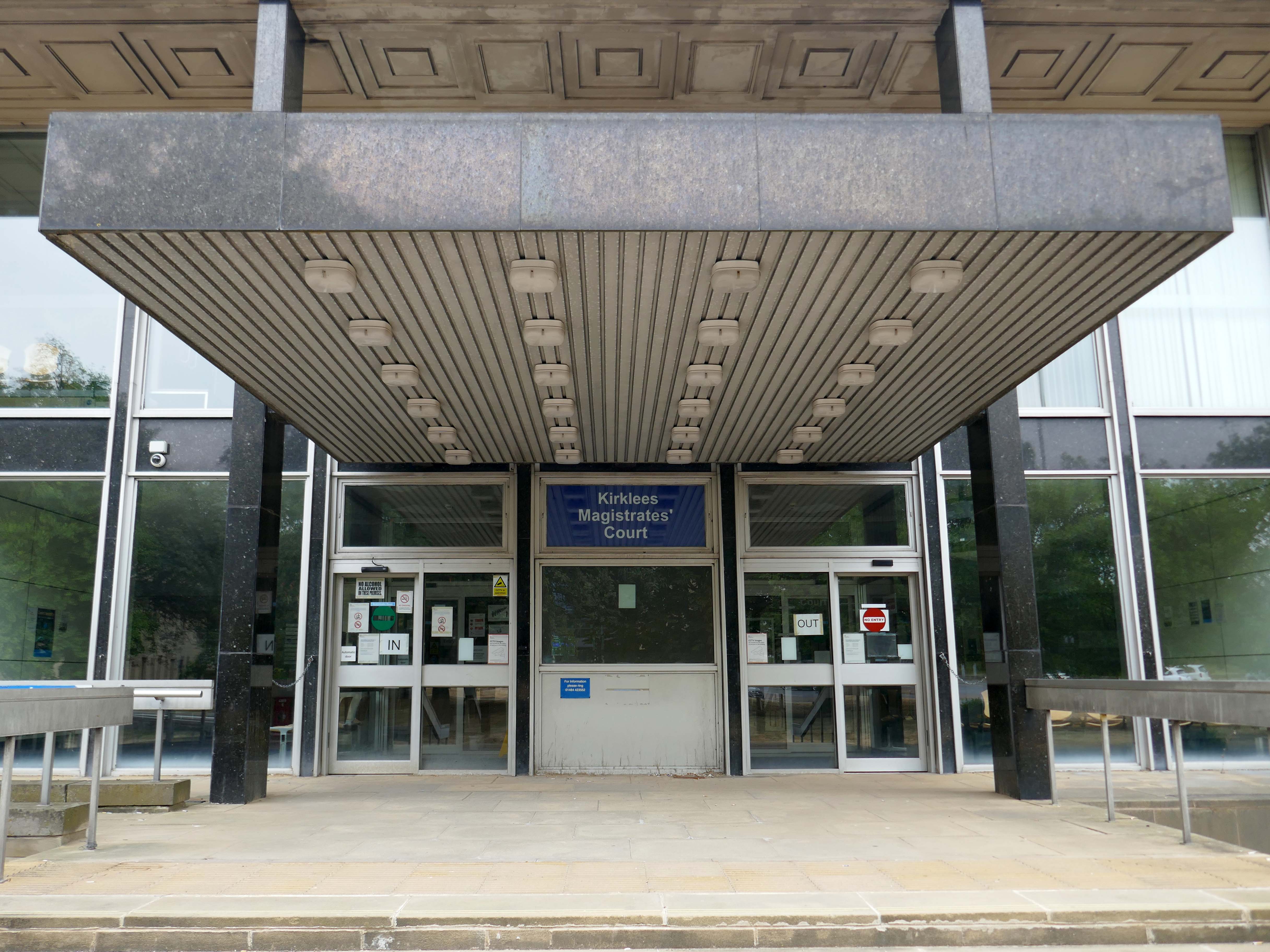
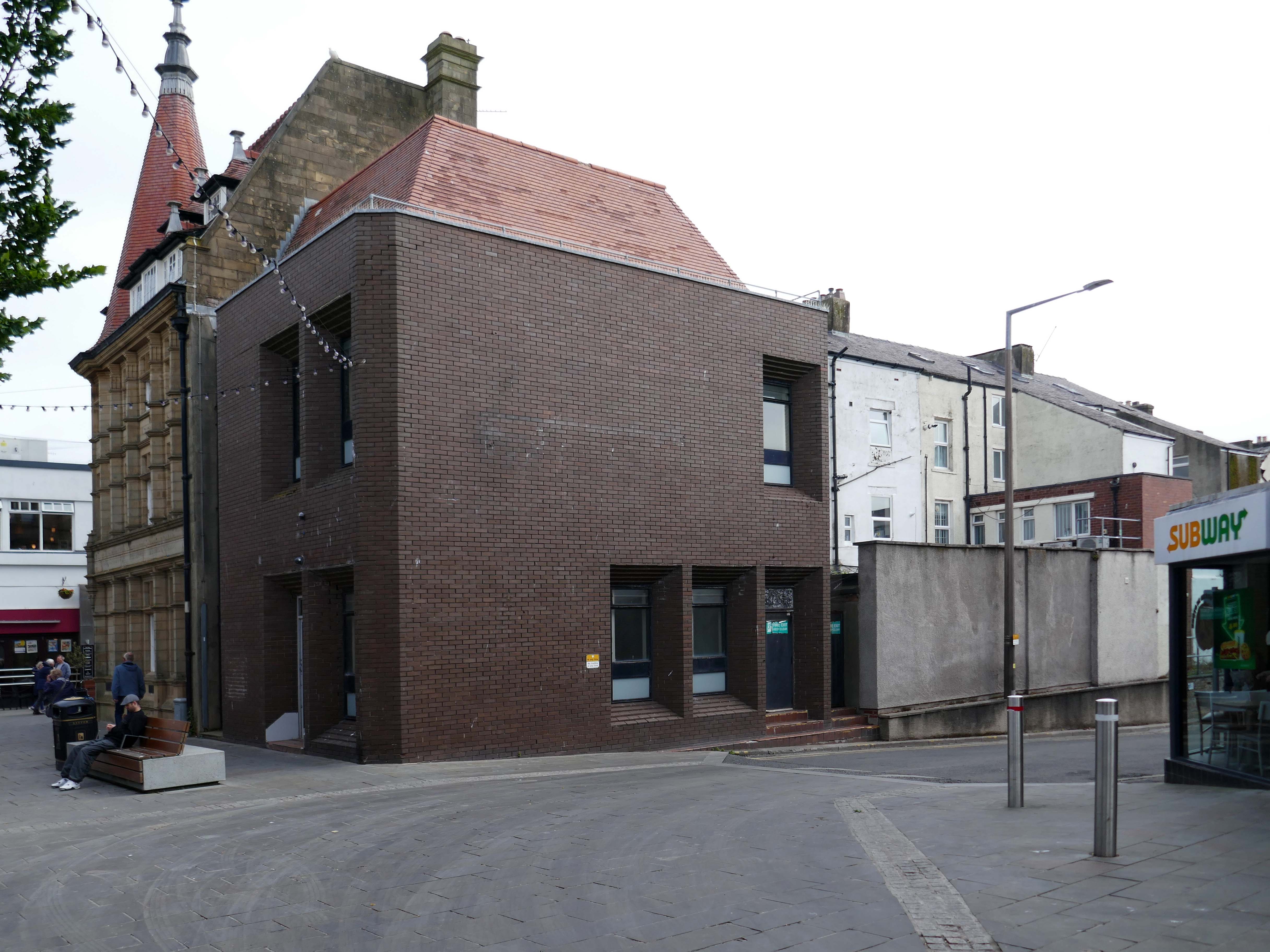
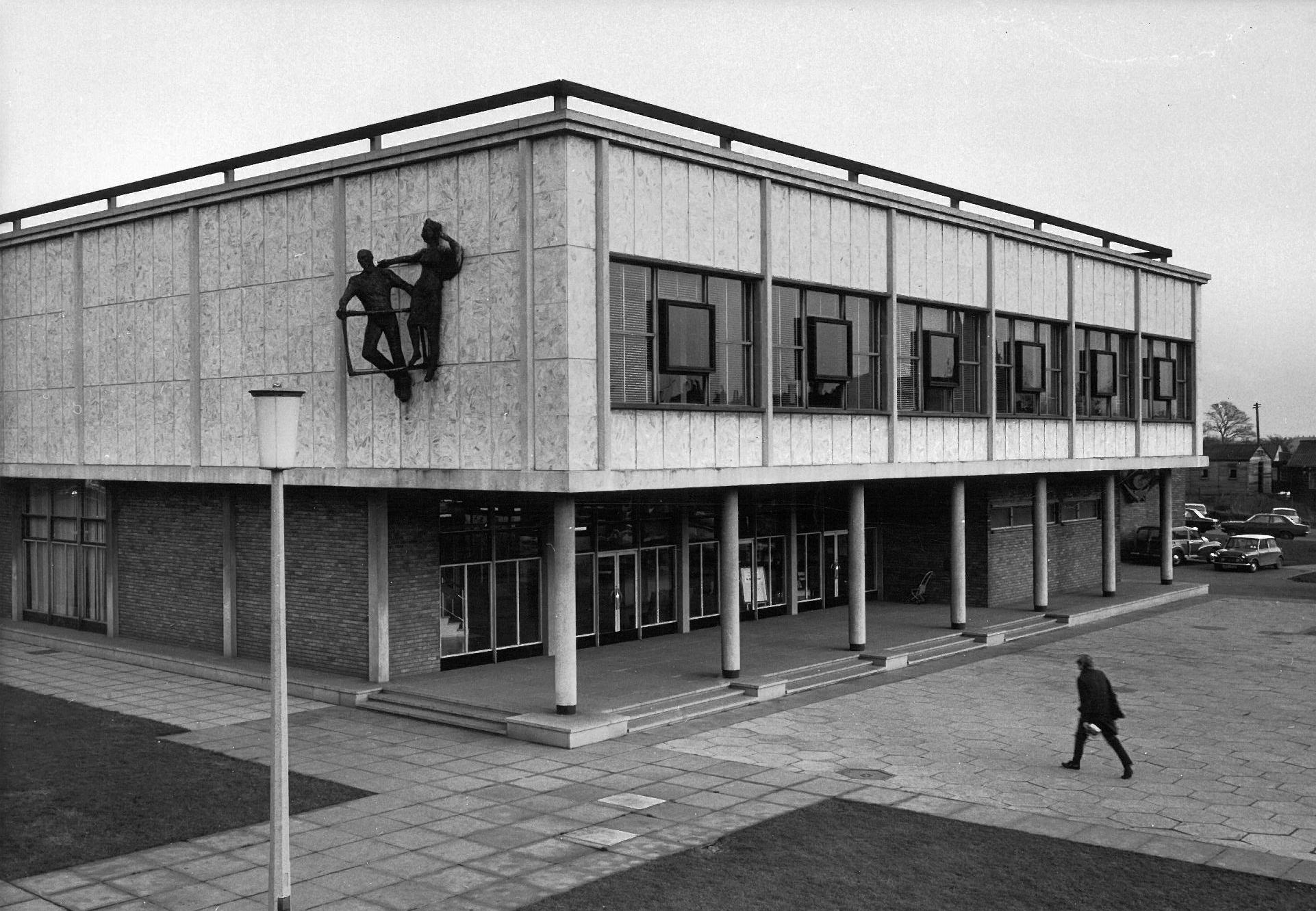
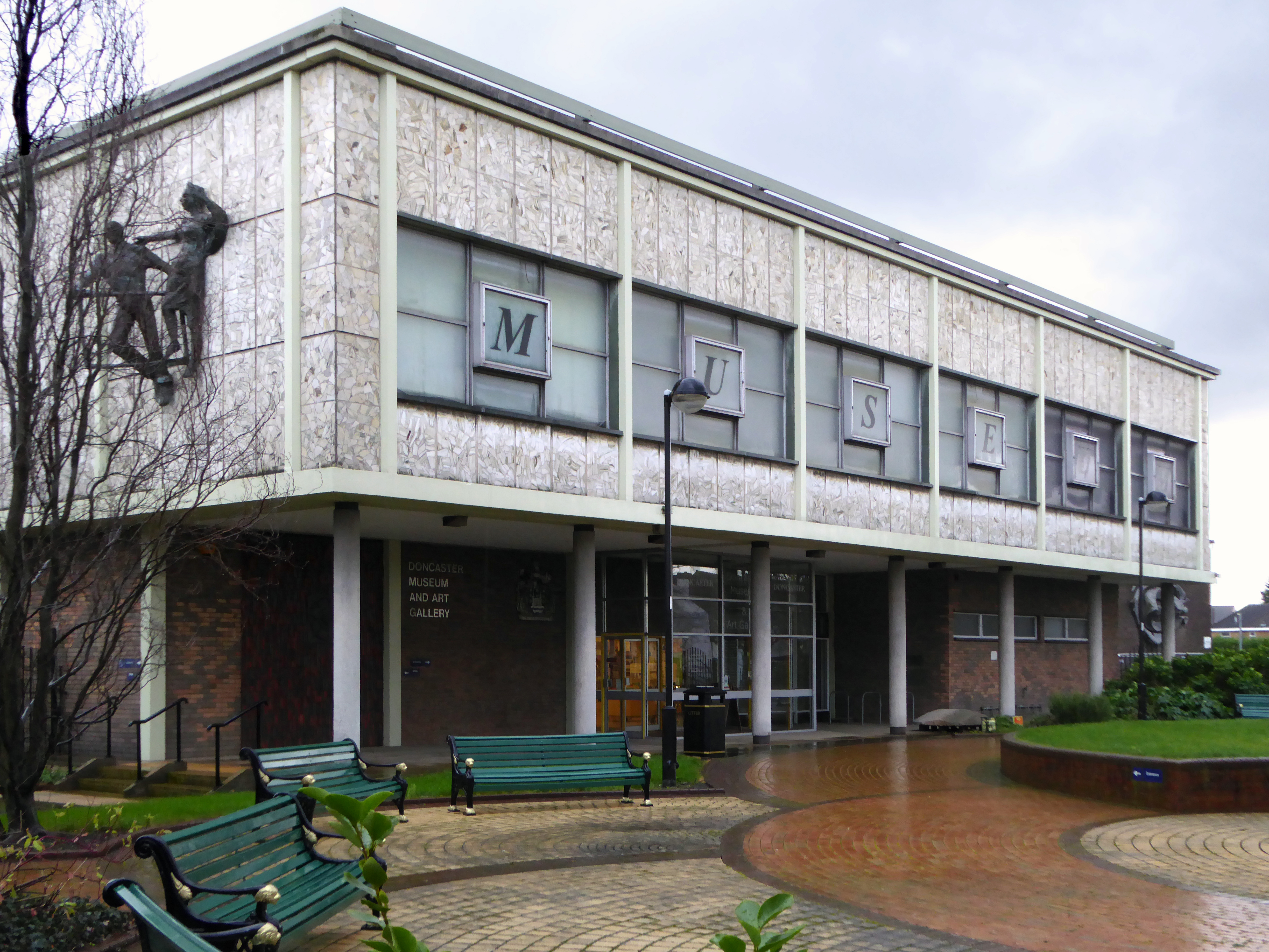
Adjacent is the Magistrates’ Court 1972.
City Architect WC Brown.
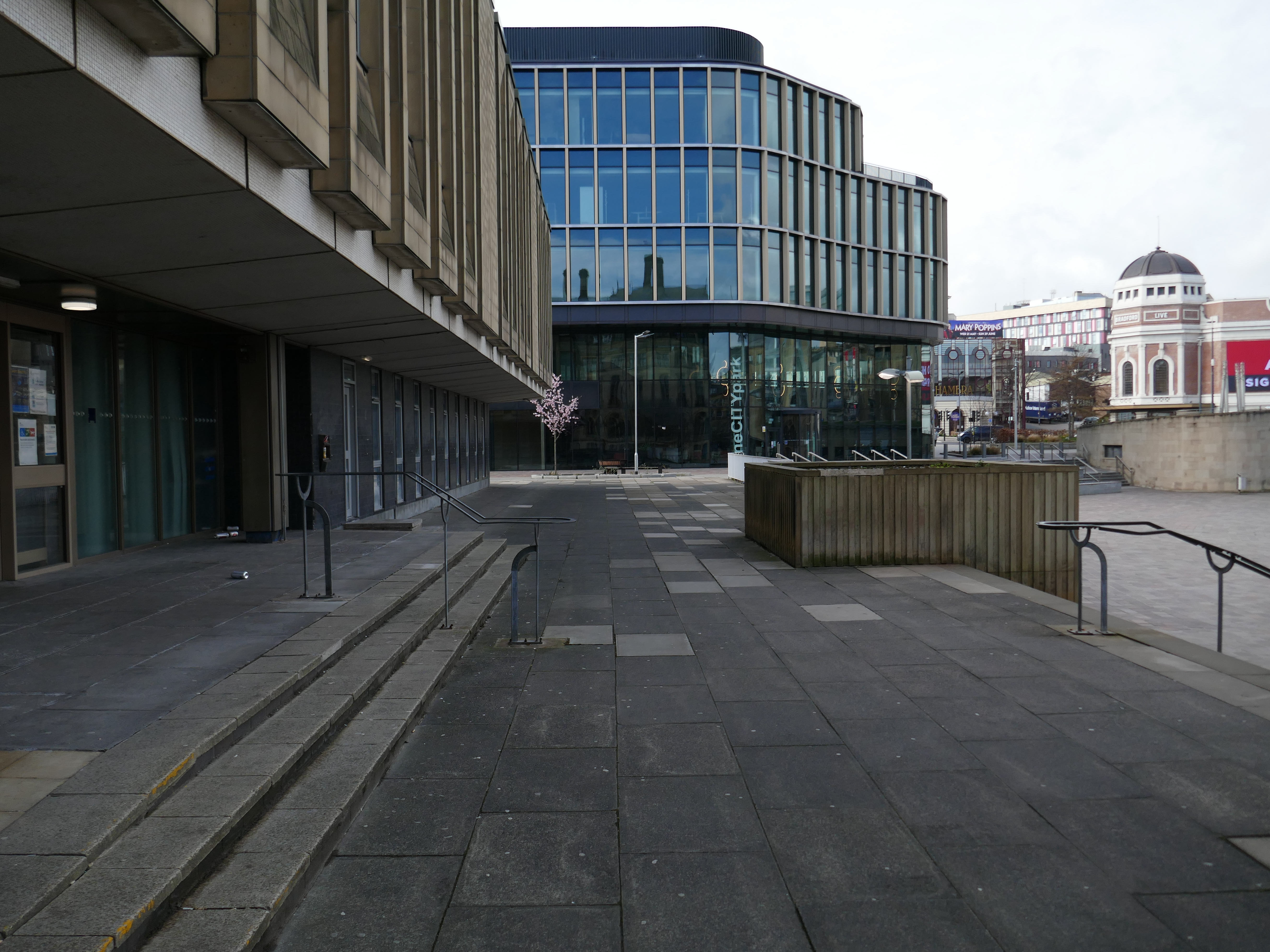
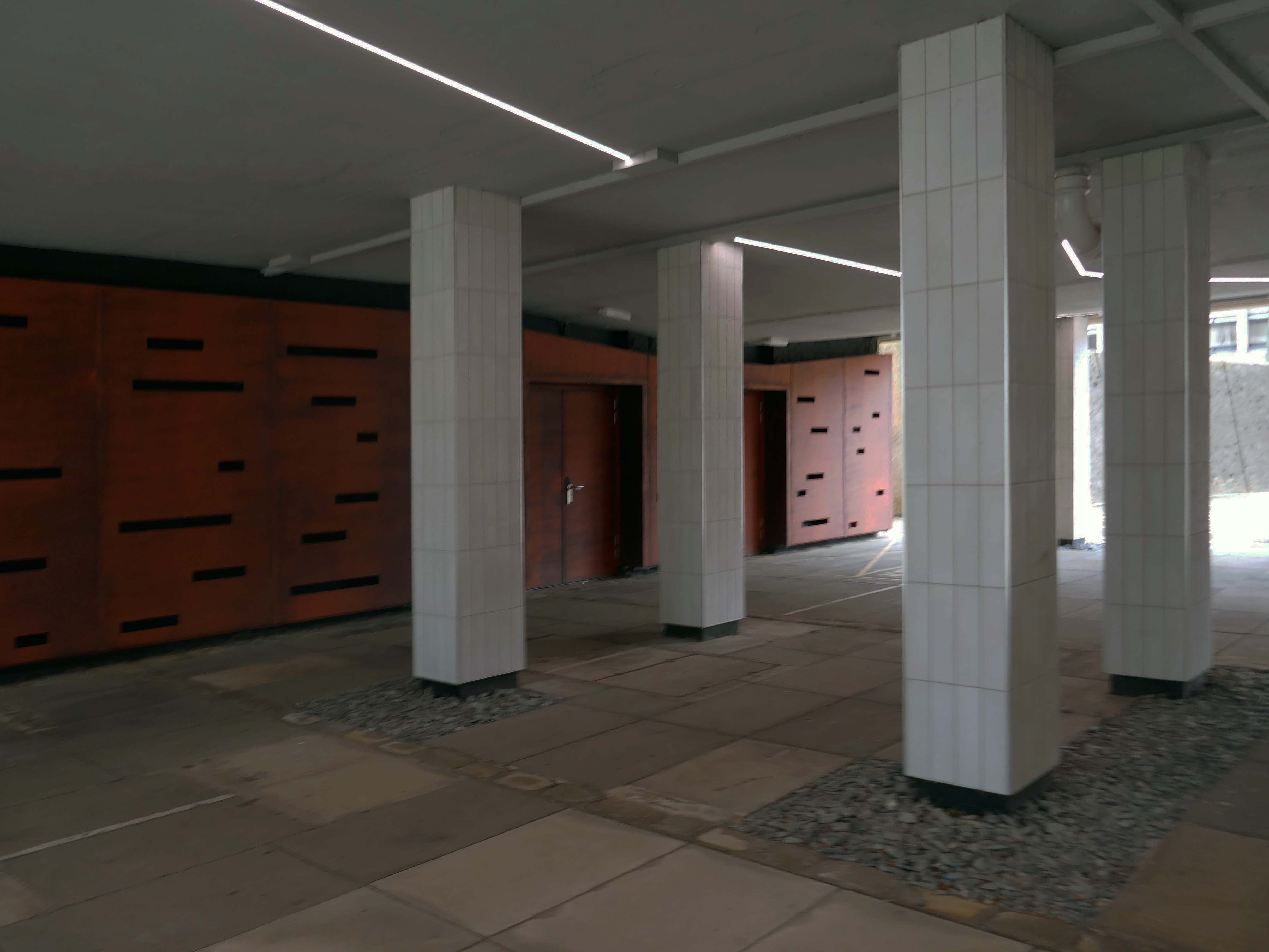
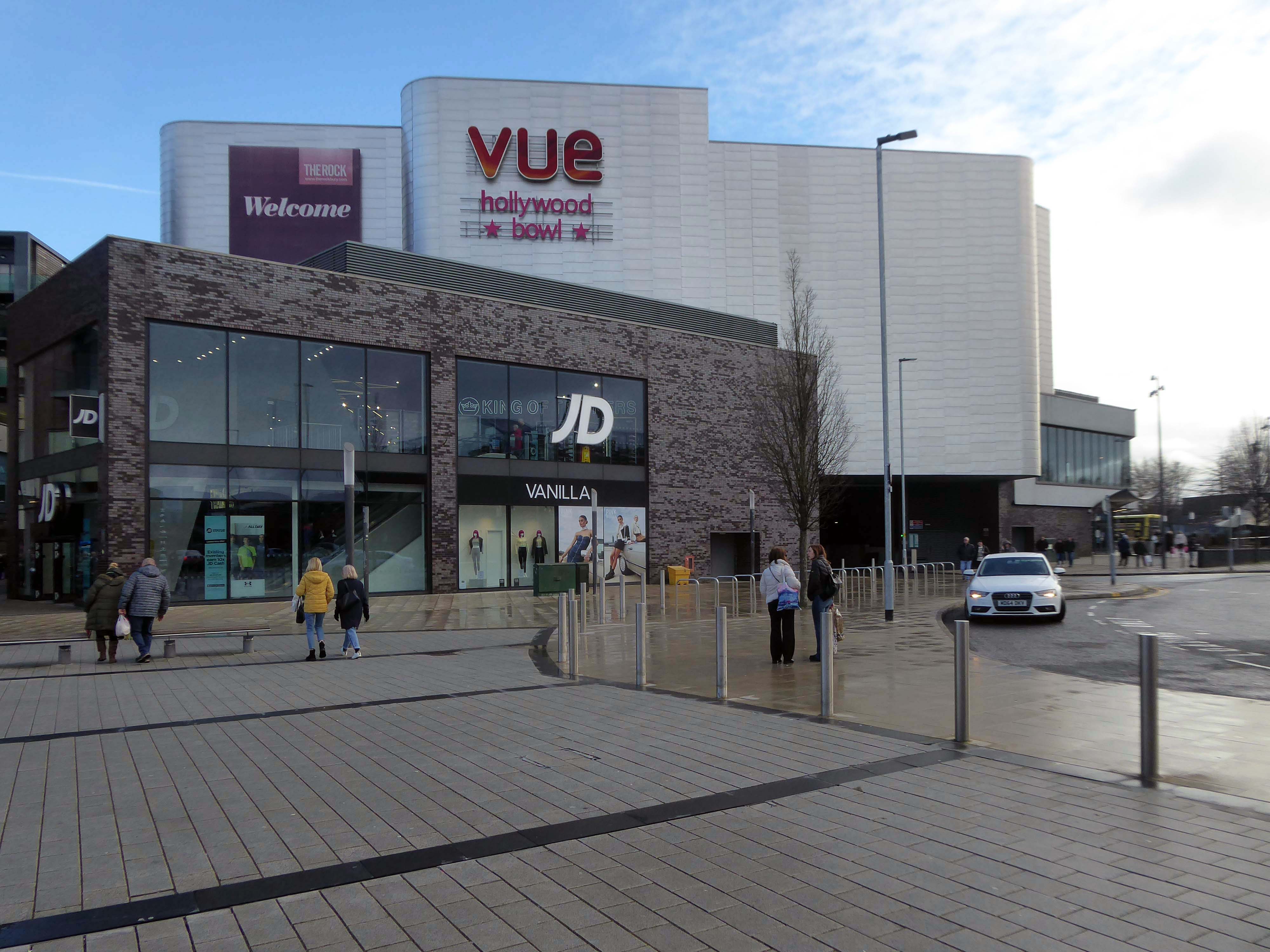
With a view through to One City Park 2024 Sheppard Robson.
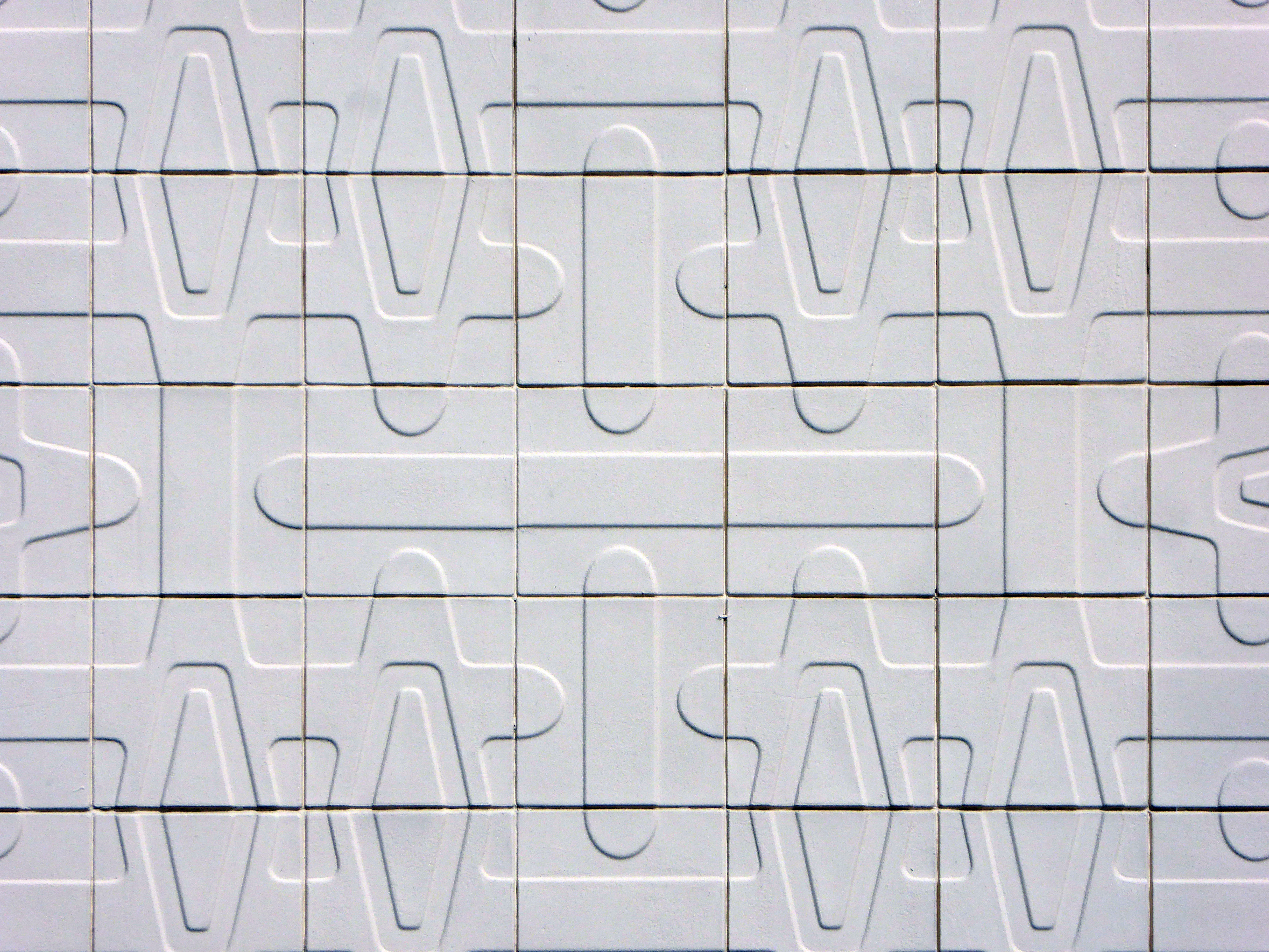
One City Park in Bradford, England, draws attention with its striking architecture. The building’s curved design and forward-thinking concept create significant interest. For Sheppard Robson Architects, sustainability and the needs of people were paramount in the design. The facade of the complex features 1,700 glassfibre reinforced concrete elements from Rieder, making a distinctive design statement. The sandstone-coloured concrete components serve as both an architectural feature and a key element in creating a sustainable, visionary work environment.
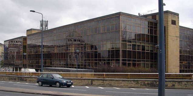
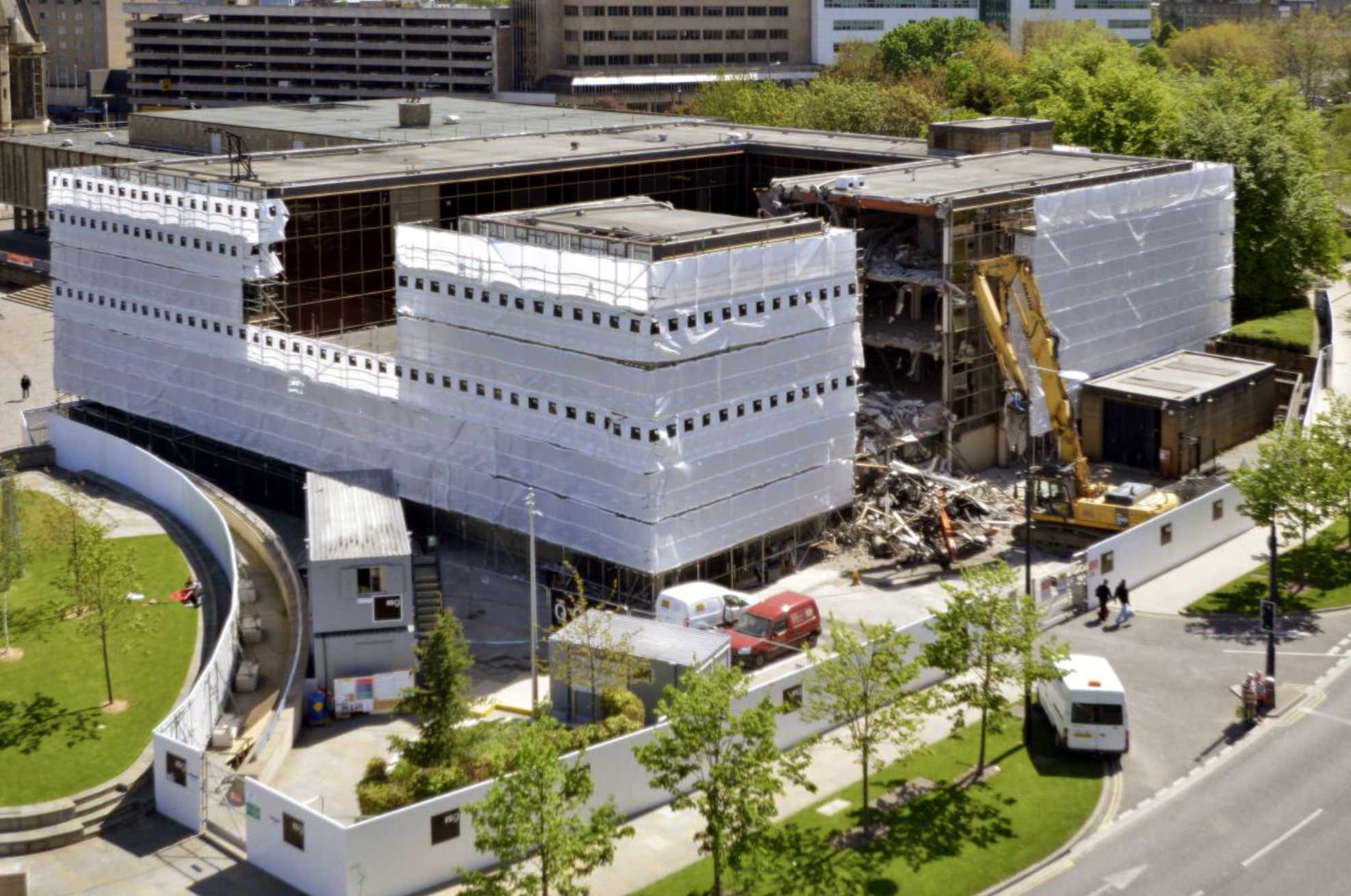
One City Park has been built on the site of the old Police Station opened in 1974 and demolished in 2010.
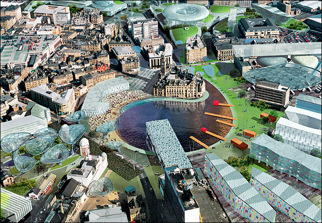
The area was once the centre of Will Alsop’s 2003 masterplan.
Which three years later are somewhat diluted:
The latest images of the scheme for the Bowl are generally disappointing and at the risk of a bad pun, the lake is now a watered-down version of Alsop’s vision.
Philip Veitch – of local practice Waller and Partners.
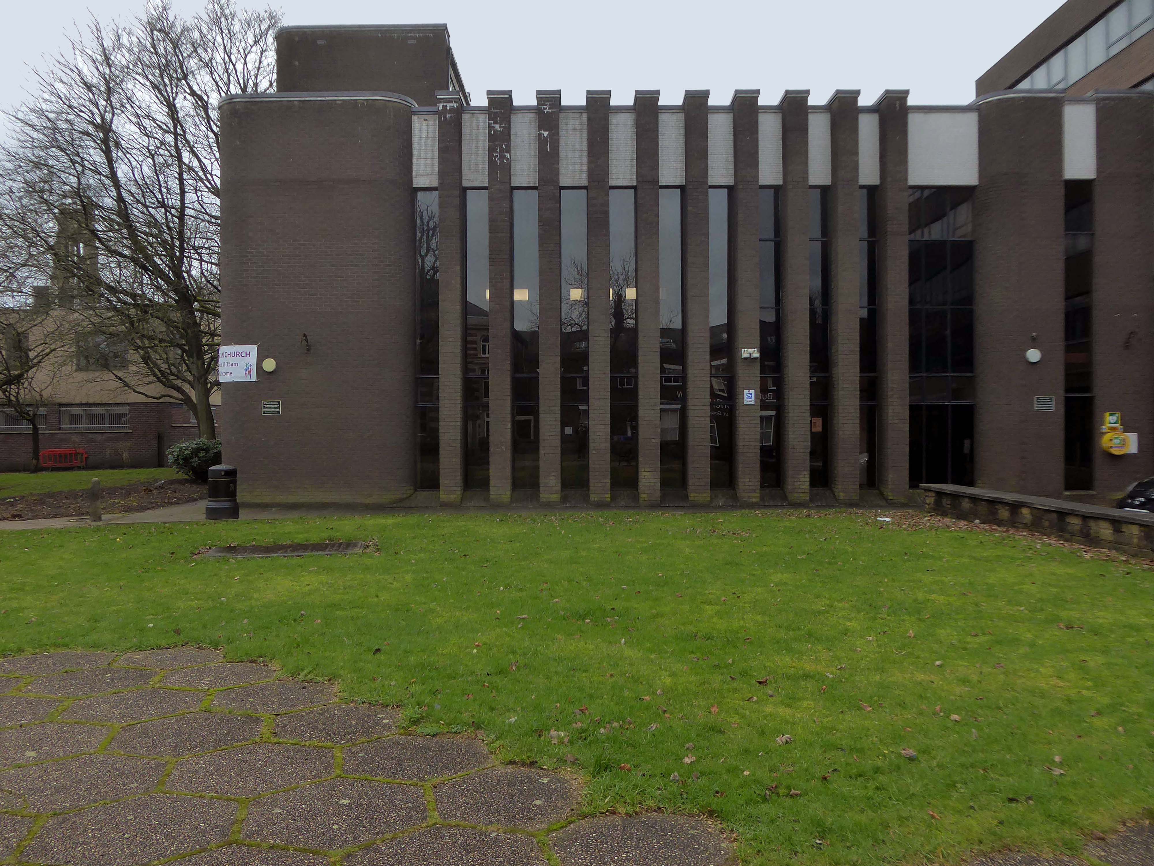
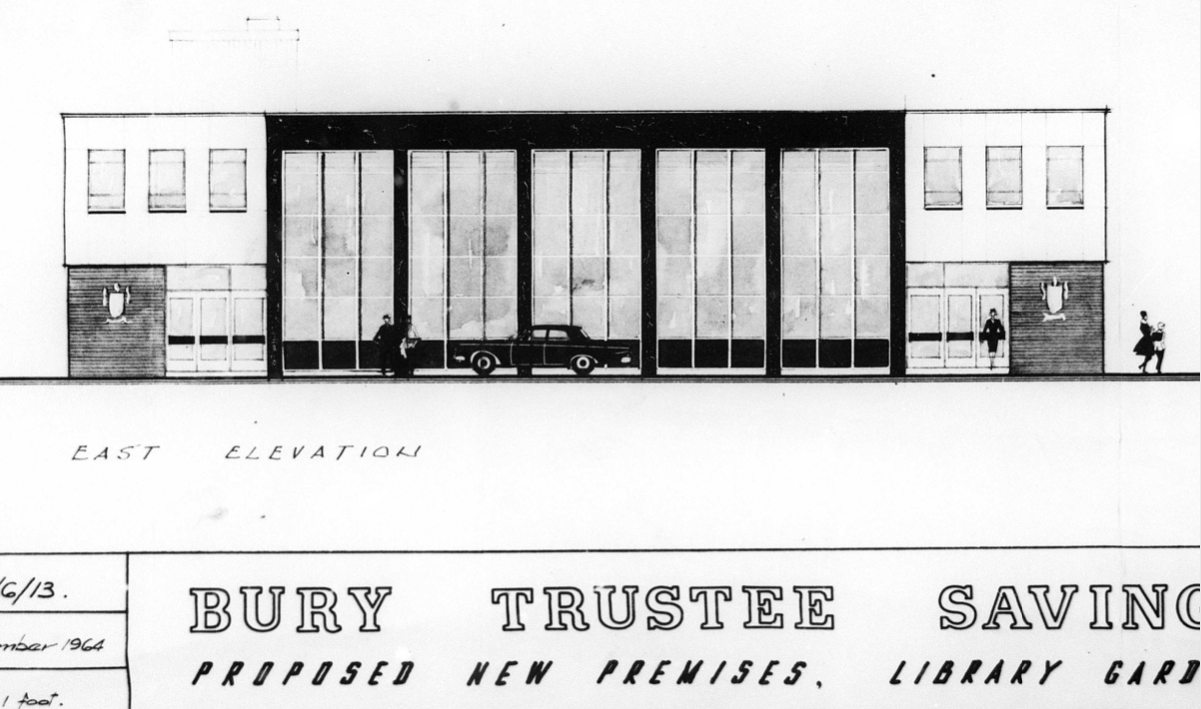
The Norfolk Gardens landscaping has opened up a fresh toward the Central Library 1965.
Architect – City Architect WC Brown with project architects G Sunderland and KLS Glen.
The Exchange of 1976 by Trevor H Anson PSA Architect.
Turn right around to take a look at the rear of the Ice Arena.
In January 1966 Mecca Leisure Limited opened the ice rink in Bradford under the name of the Silver Blades Ice Rink, it was reputed to be “The finest rink in the world”, with coloured lighting in the barriers, sparkling chandeliers over the ice, and a plush bar and restaurant.
The resplendently dressed skaters were entertained with organ music. The opening gala at the rink had performances by British skaters who had just returned from the World Championships, they included Sally Anne Stapleford, John Curry and ice dancers Bernard Ford and Diane Towler.
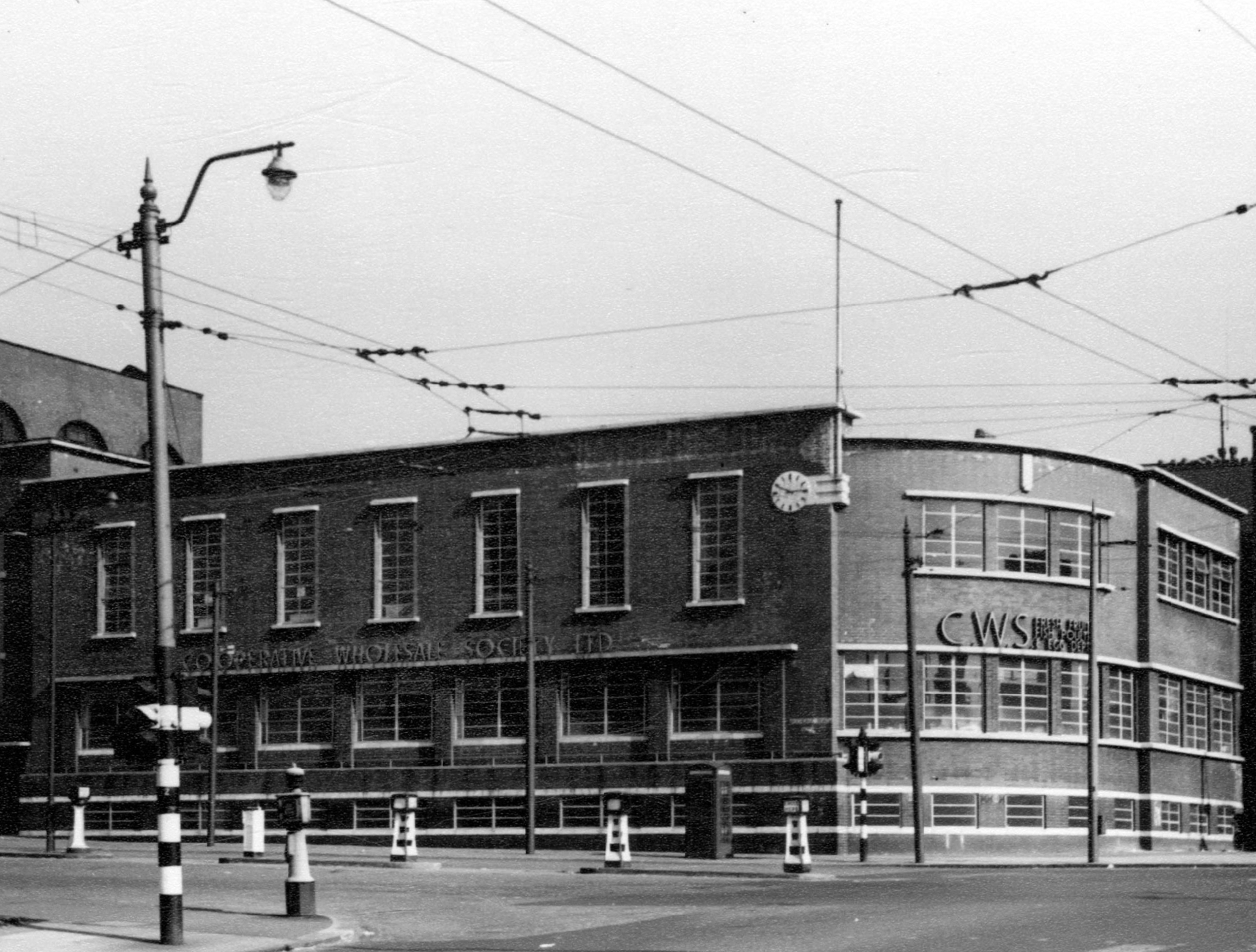
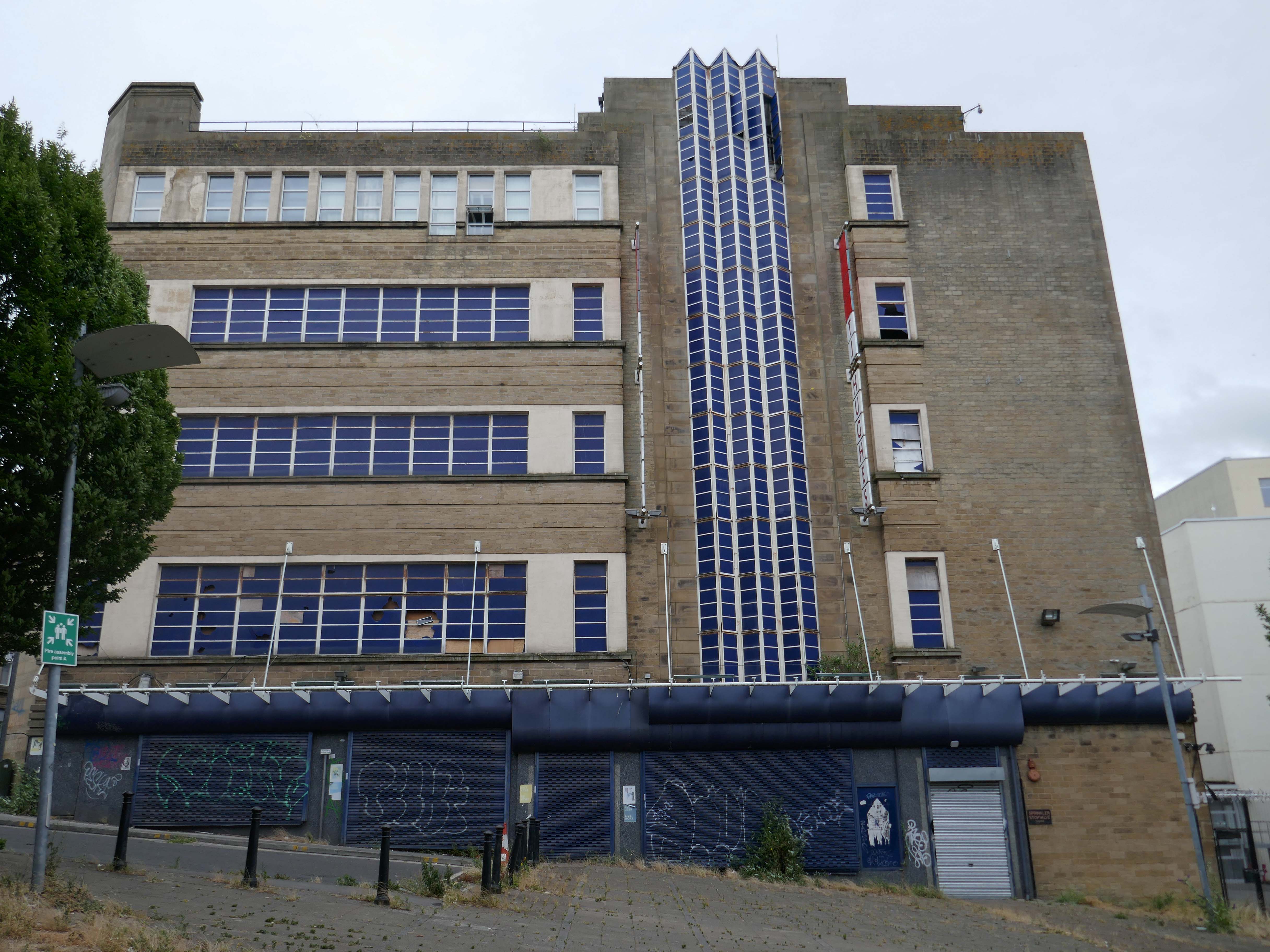
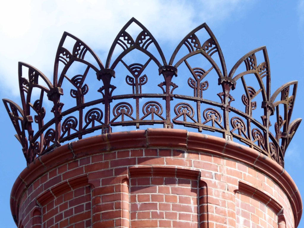
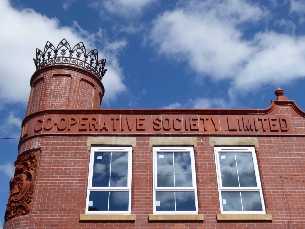
Architect W A Johnson worked for the Cooperative Wholesale Society from 1899 until 1950. He was heavily influenced by the German architect Erich Mendelsohn after 1930, evident in his embrace of the International Modernist style. Johnson travelled widely in Germany and Holland, and Mendelsohn’s Schocken store in Stuttgart 1928 is quoted as being a particular inspiration for the Bradford Co-op.
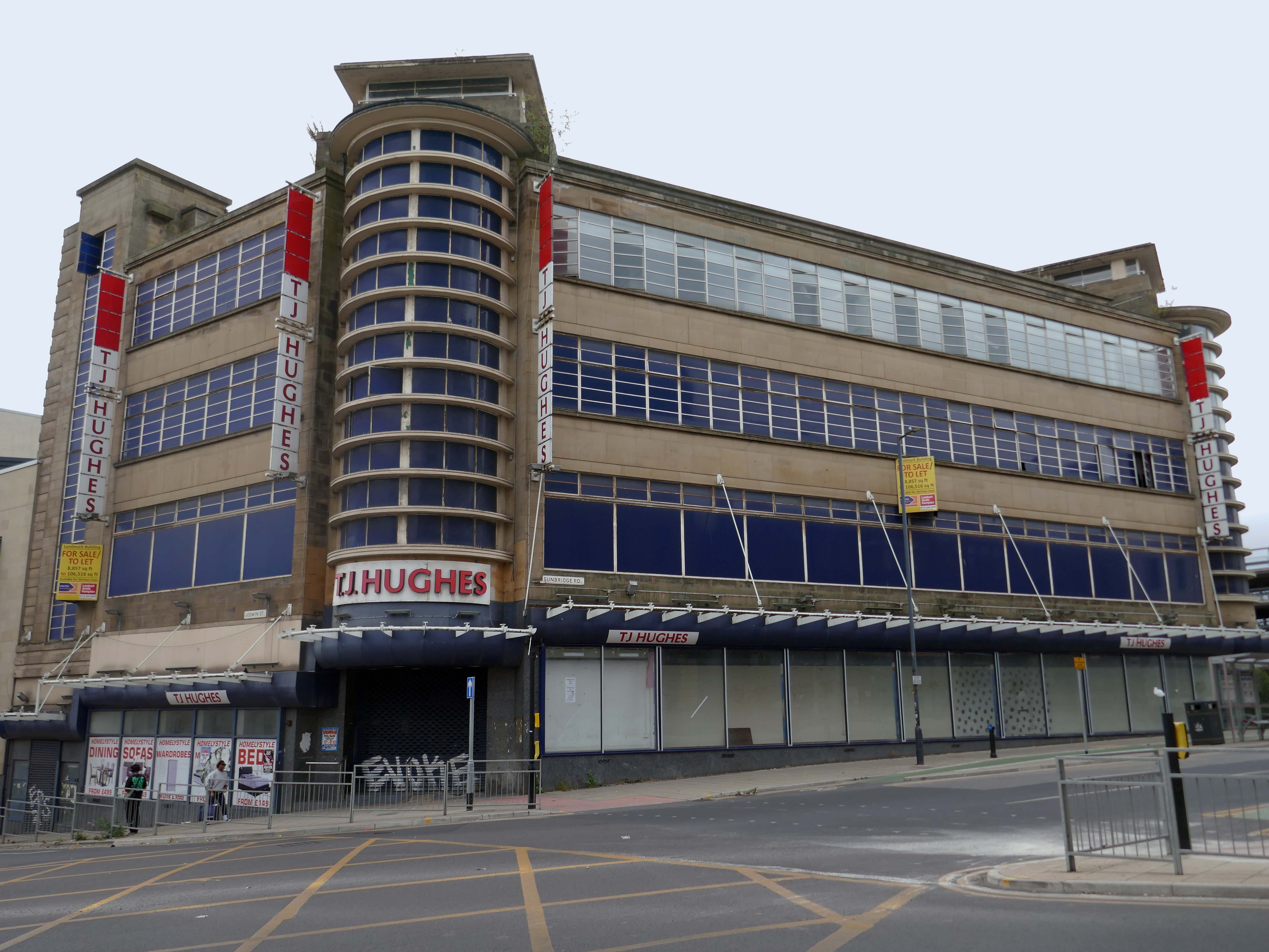
Sunwin House had been – one of the most modern and stylish looking shops in Britain, when it was built in 1936, according to The 20th Century Society.
But the charity warned that the building, whose architectural style was inspired by Germany’s Bauhaus art movement, had stood empty for nearly 15 years and was in danger of creeping neglect.
Sunwin House, which was most recently used as a TJ Hughes department store after the firm went into administration in 2011, is one of 10 buildings featured on The 20th Century Society’s risk list for 2025.
The Freehold of Sunwin House, 65 Sunbridge Road, Bradford has been sold to a Bradford based investment company who have plans to refurbish the whole building principally based off a Retail/ Emporium use.
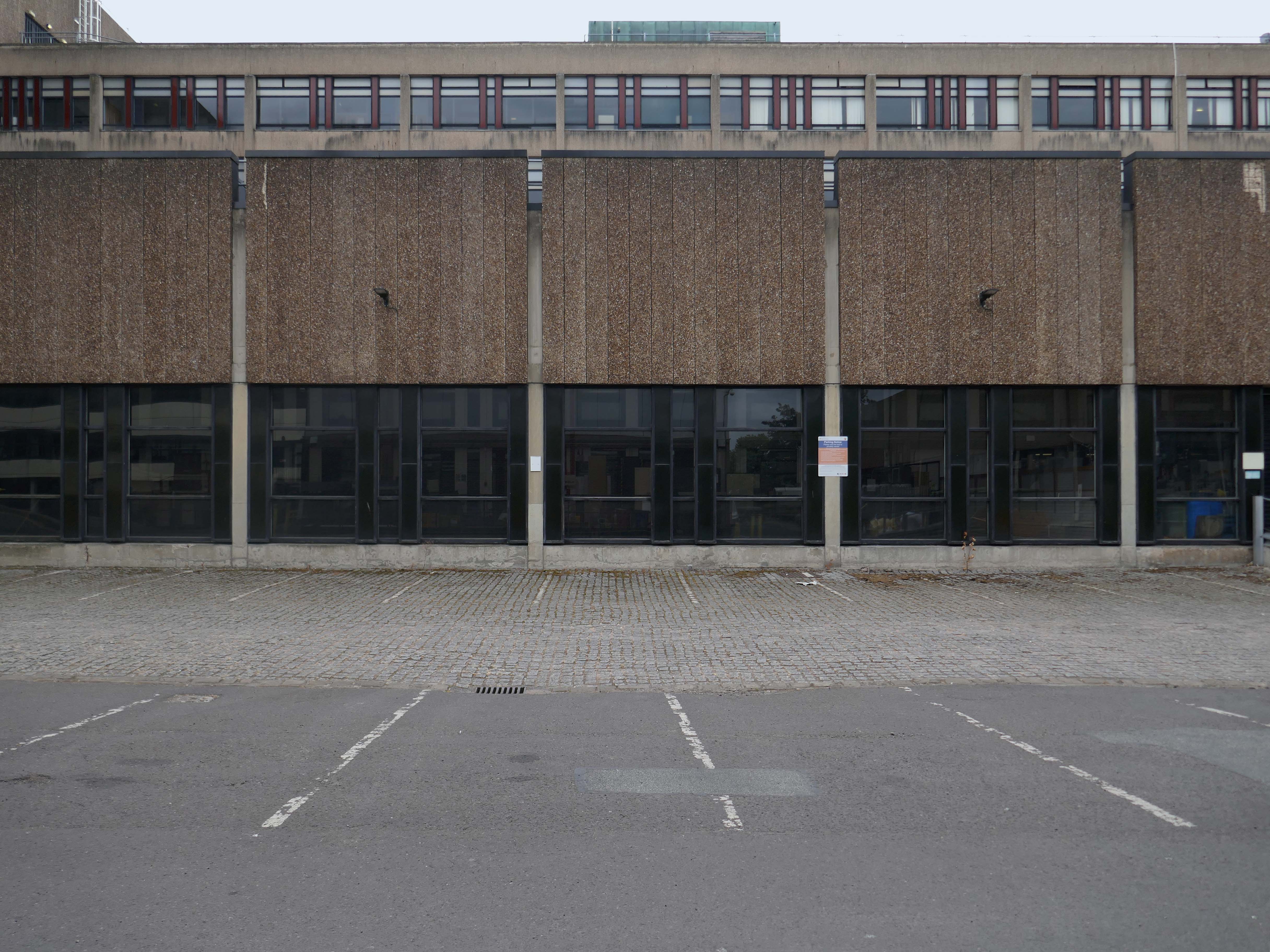
The building was purchased by Legal and General from the Co-operative Wholesale Society in 2005 subject to a lease to T J Hughes, who ceased trading in 2012. Following Administration, and the release and separation from the former Godwin Street Annexe, the original 95,000 sq ft Grade II Listed Store became an independent asset in 2017.
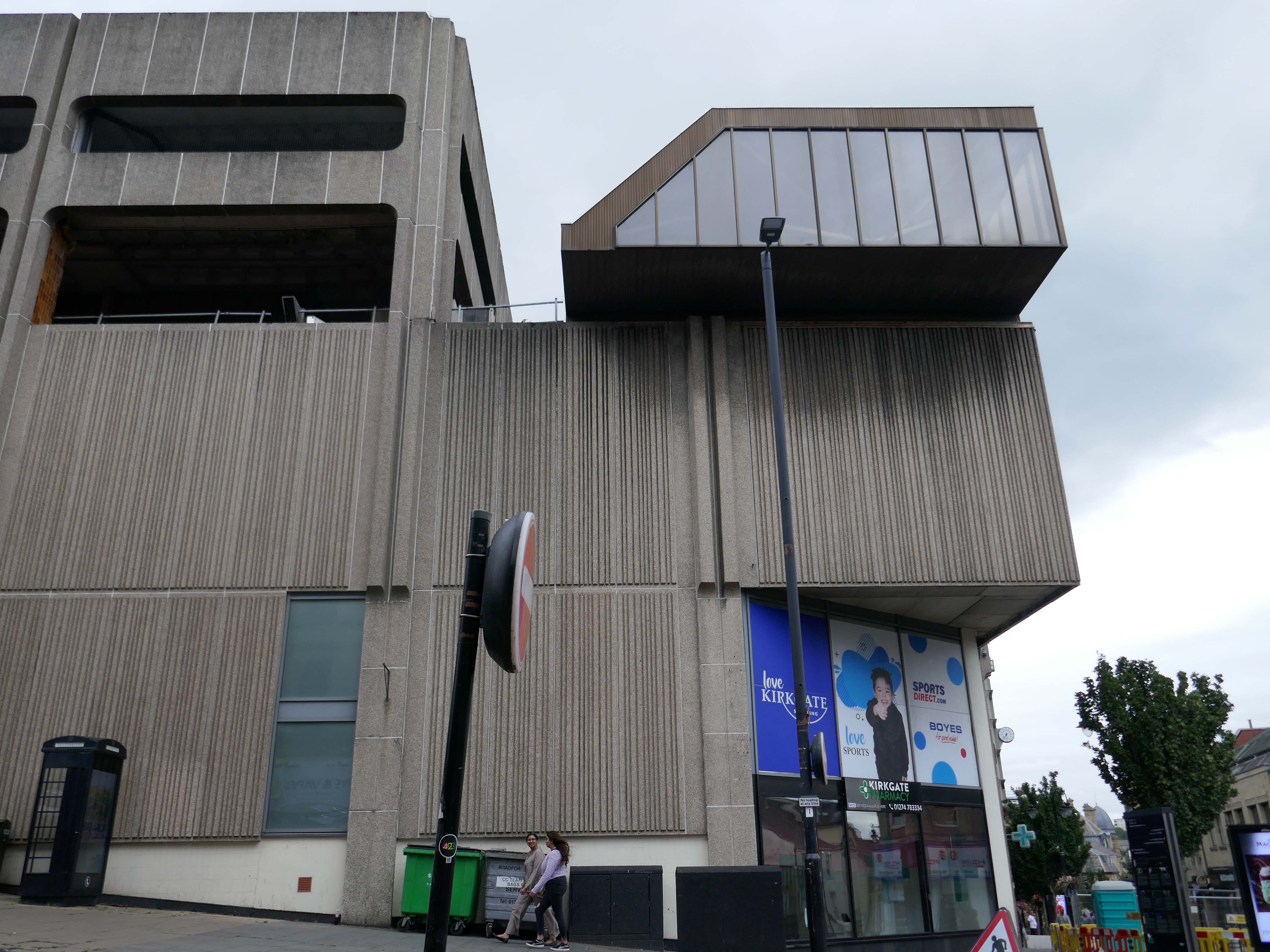
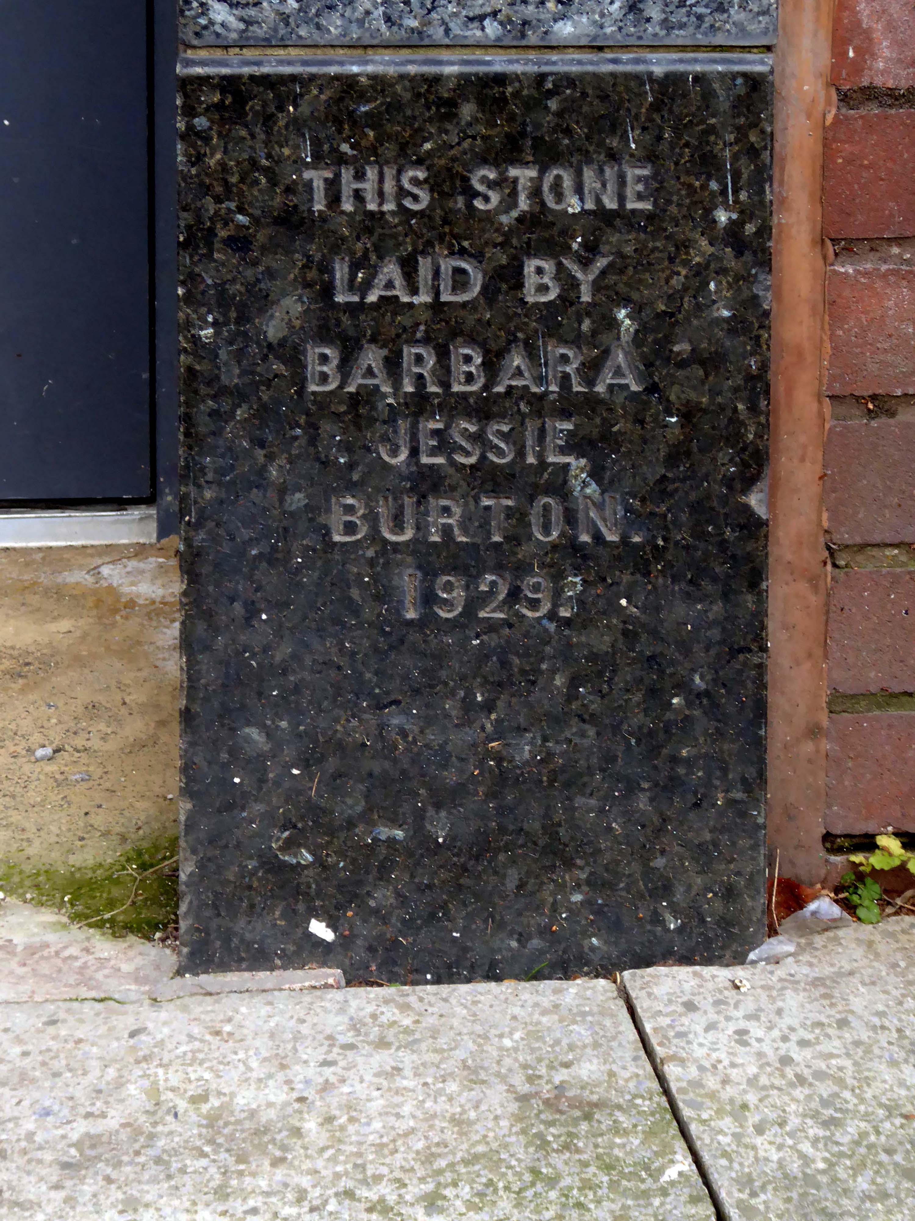
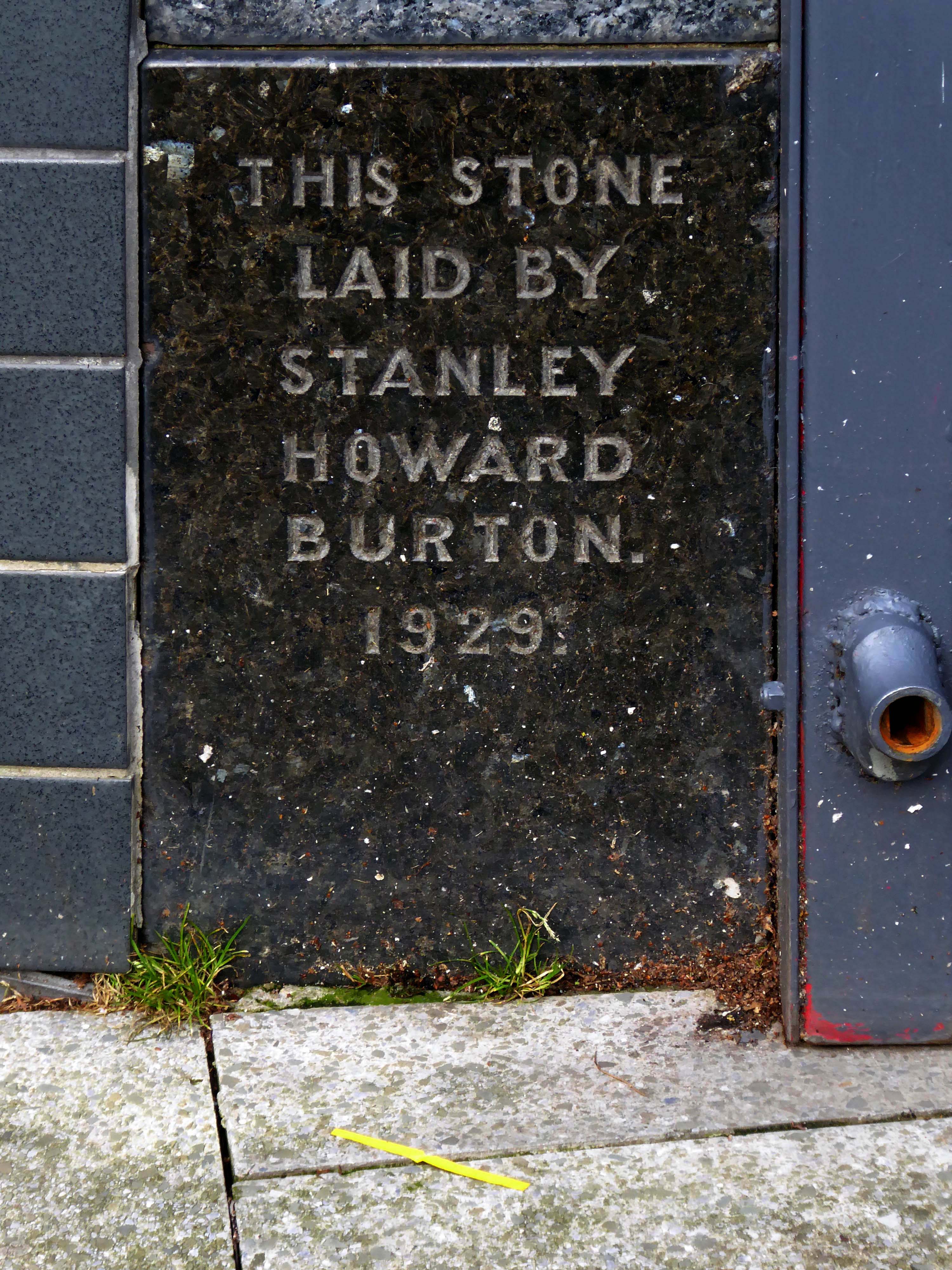
A stride away is the now closed Kirkgate Centre and Market – John Brunton and Partners 1975.
Demolition work will begin later this year to make way for the recently approved City Village development, comprising up to one thousand new homes, with the aim of creating a stronger, more welcoming, and sustainable future for Bradford.
Some residents have welcomed the changes, with the Kirkgate Centre previously described as a blight on the landscape. But others, like Barbara, lament the loss of the places they knew and loved.
Every time you go anywhere something has gone missing. Some of the changes are alright, some of them I think they could do without.
In 1979, the building won a European award from the International Council of Shopping Centres.
But the Historic England report described its design as mundane and repetitive.
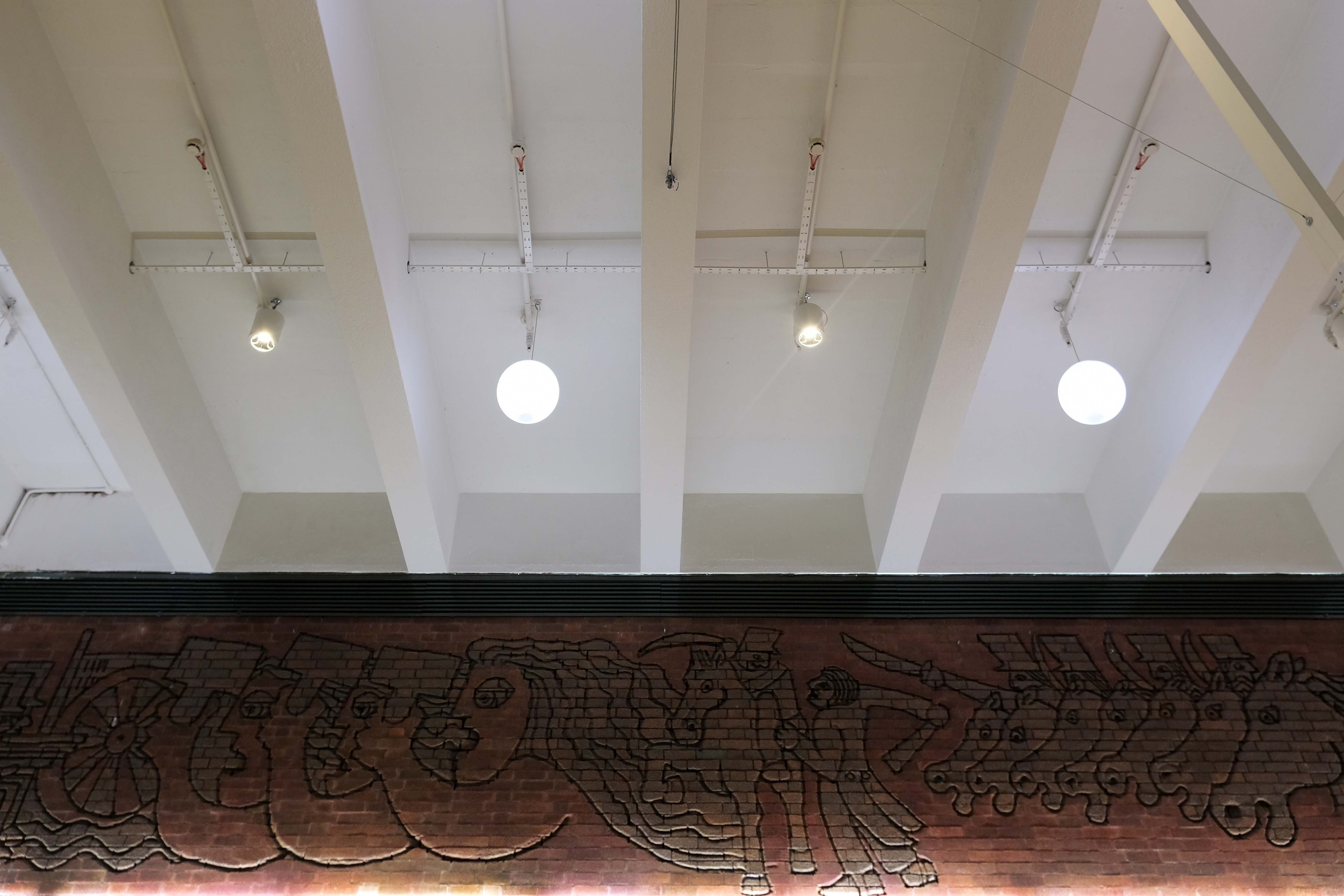
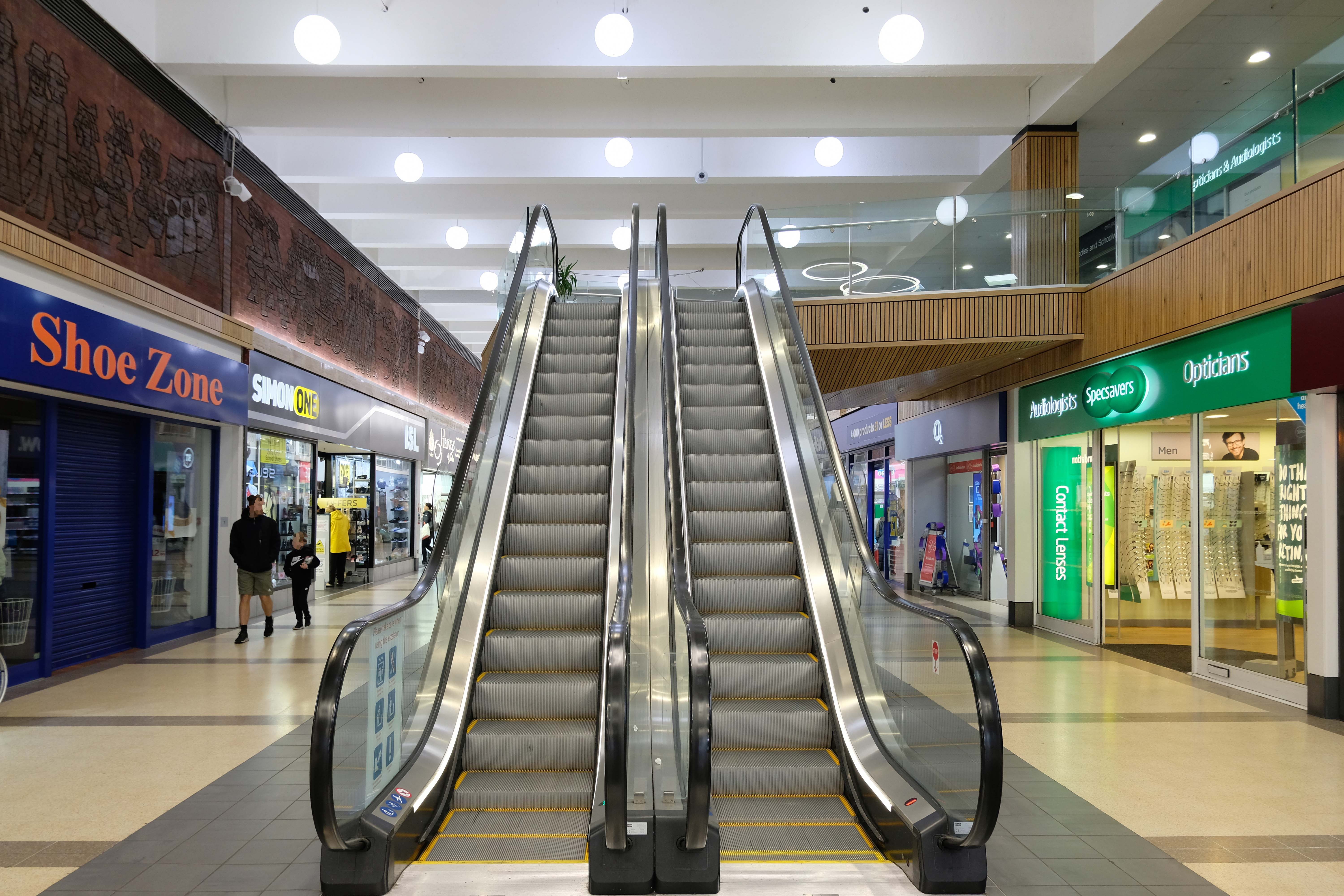
The William Mitchell concrete reliefs housed in the market are to be conserved along with the Fritz Steller tiles.
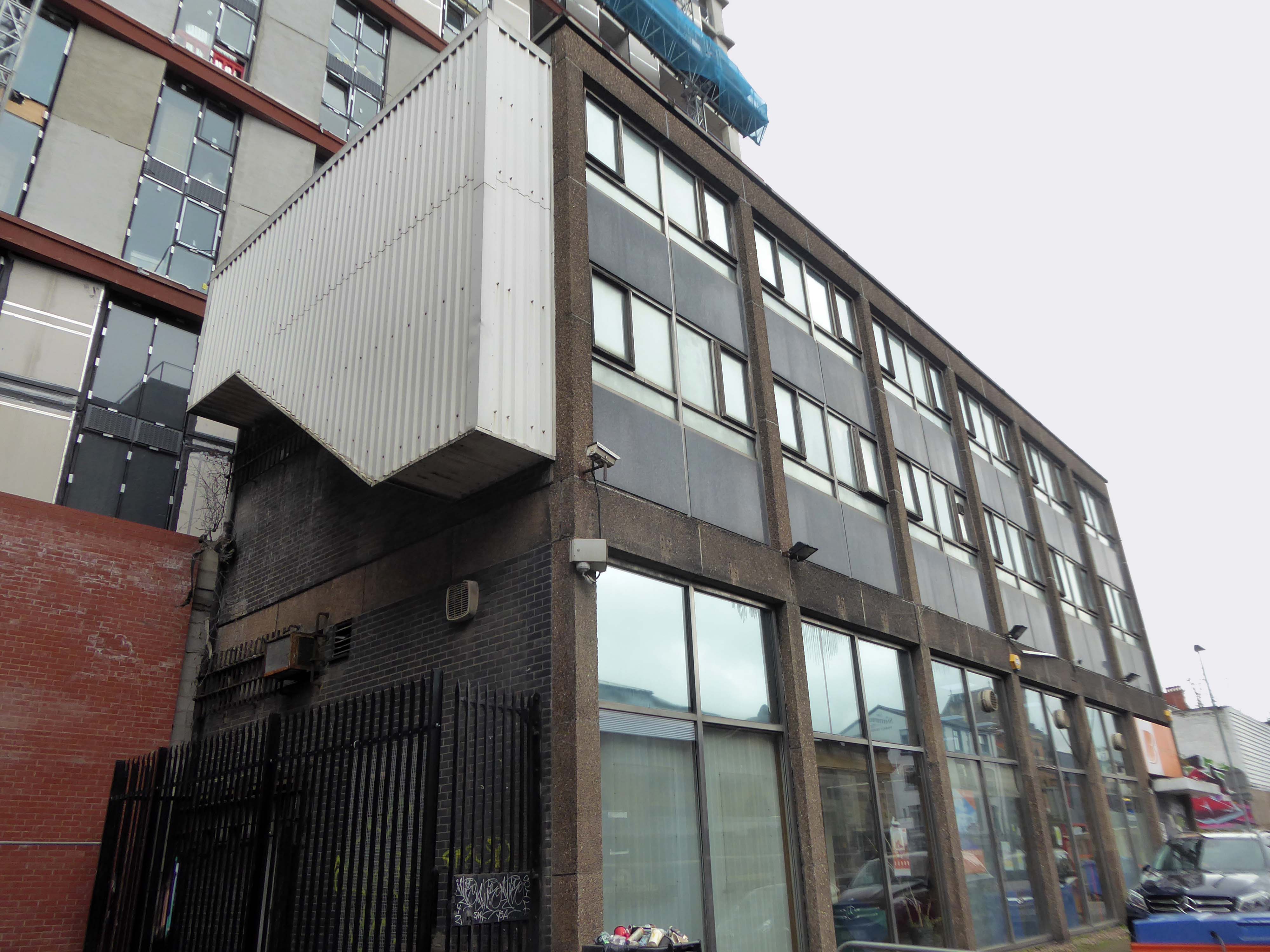
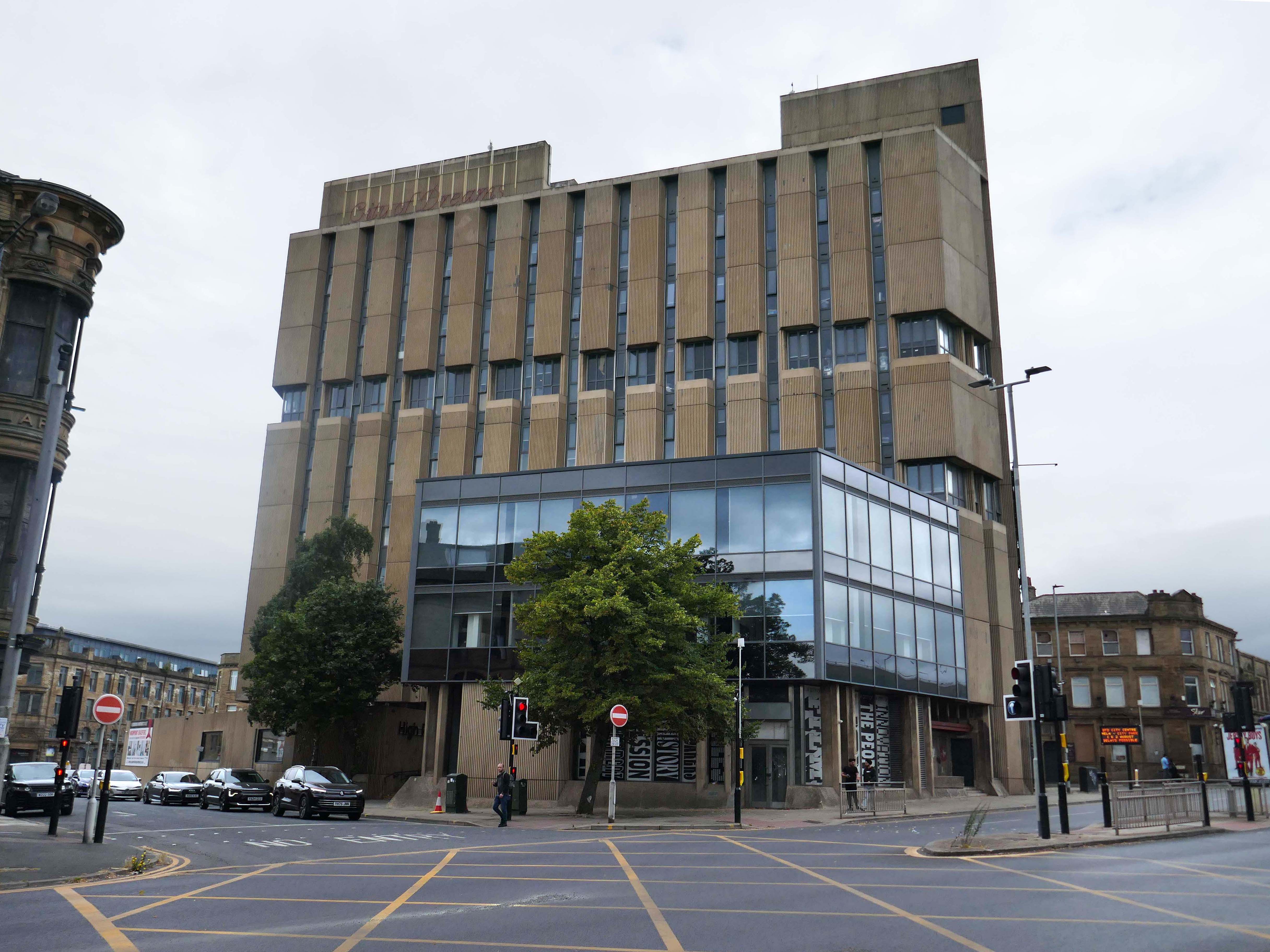
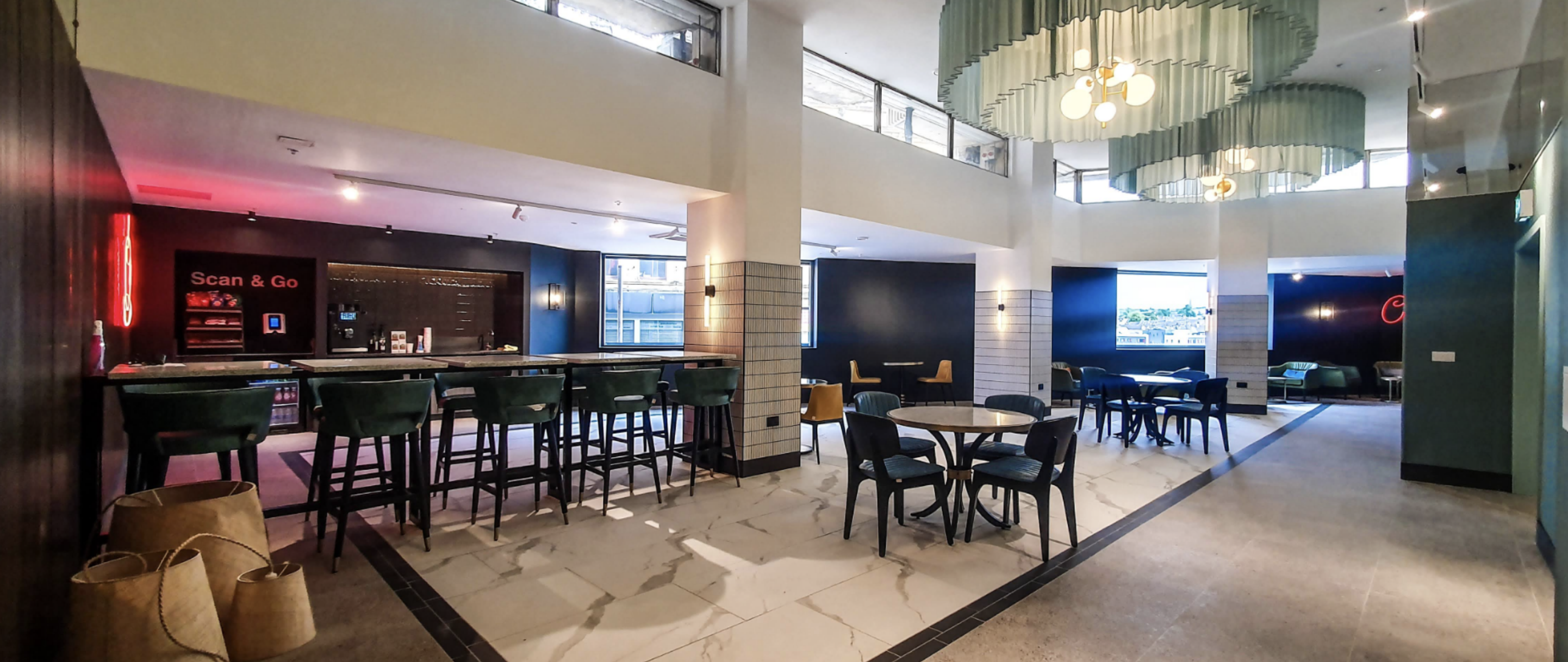
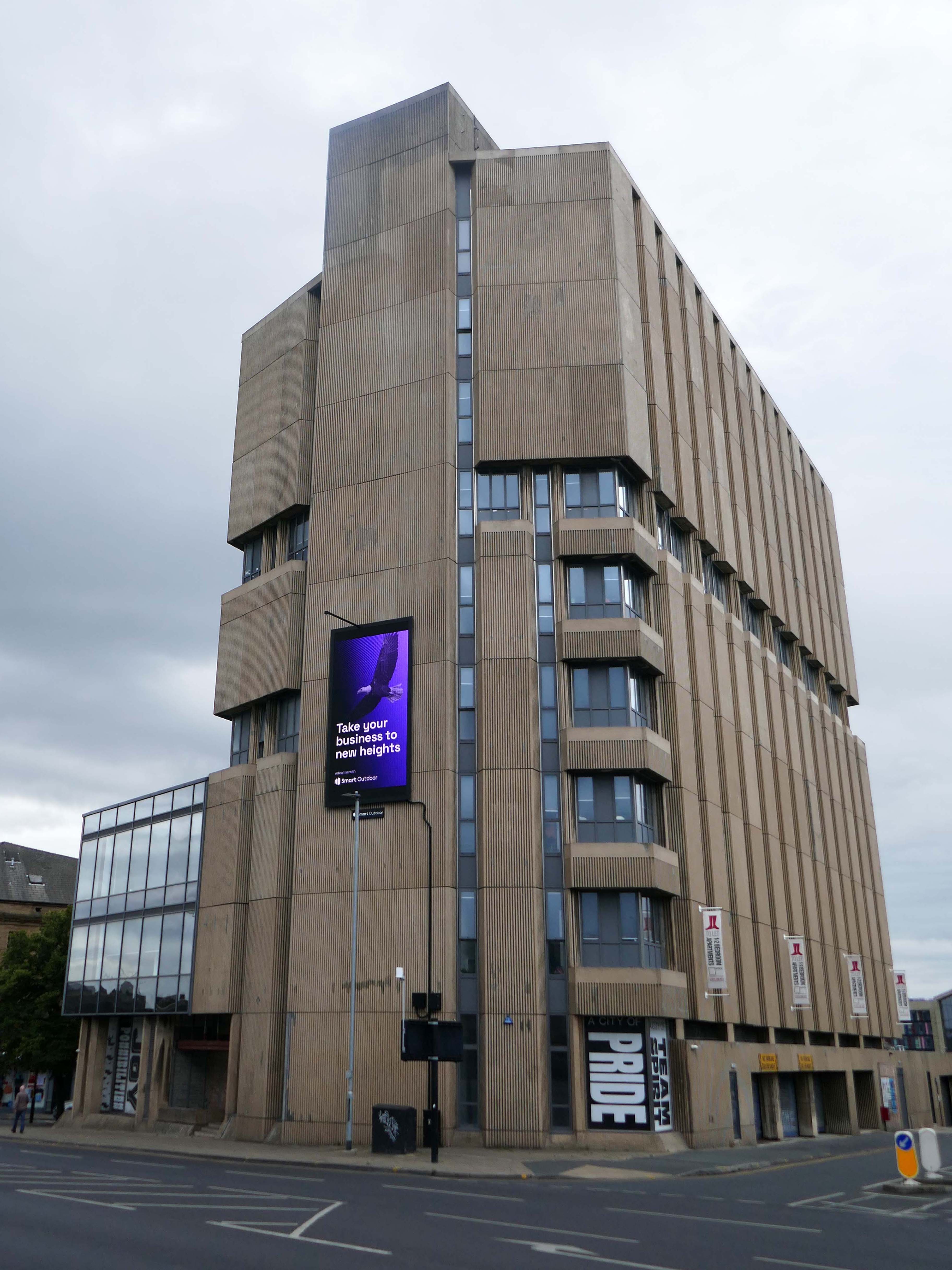
Higher up the hill John Brunton’s Highpoint has survived the call for demolition.
The derelict former headquarters of Yorkshire Building Society, on one of the highest parts of the city centre, looms over the city centre, and to many people is the city’s ugliest building.
It is now home to an innovative residential apartment complex with a community at its heart, which embraces ideas of sustainability, preservation, and rejuvenation that will bring a new lease of life to this abandoned landmark.
A tower block in Bradford likened to a structure from sci-fi movie Blade Runner has been named as the best brutalist building in the country.
Built in the 1970s, High Point, the former headquarters of the Huddersfield and Bradford Building Society, was recently converted into eighty seven flats as part of a £12m regeneration scheme.
National newspaper The Telegraph named the building top of its brutalist list – ahead of the Barbican, in London, Bristol’s Clifton Cathedral and Preston bus station.
Si Cunningham, who chairs Bradford Civic Society, said it remained one of the city’s
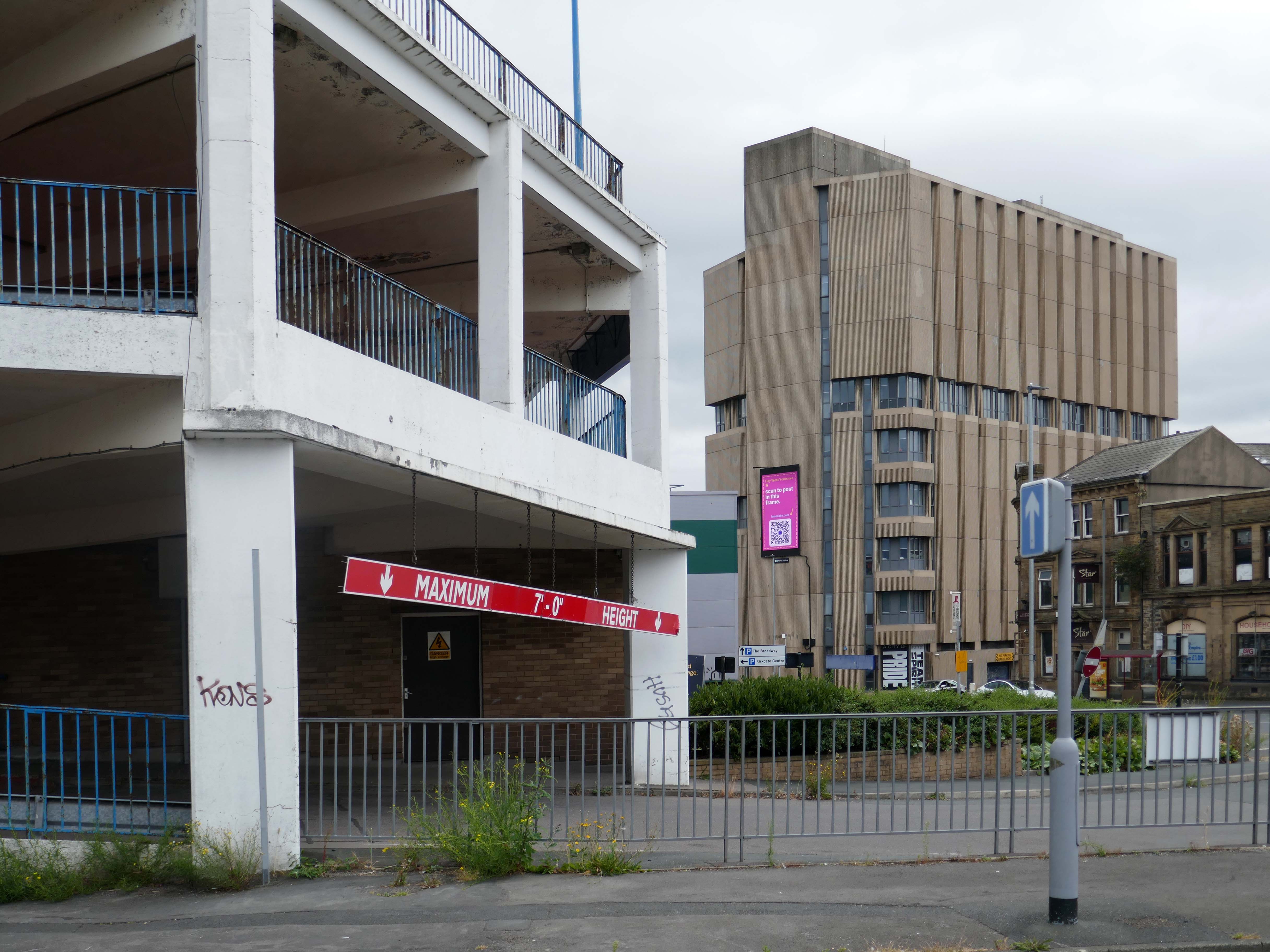
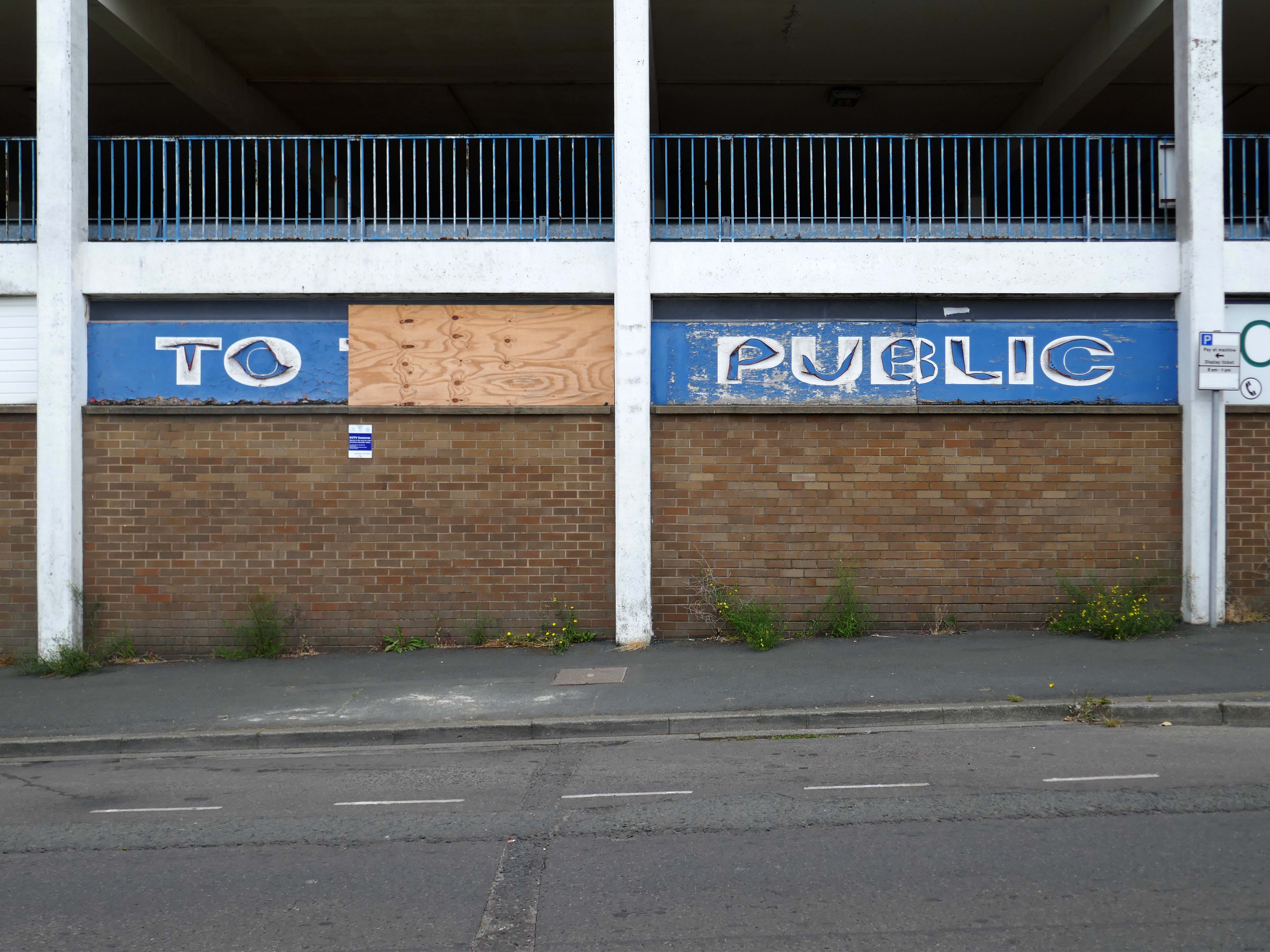
Highpoint’s neighbour the Oastler Centre is closed and awaiting demolition.
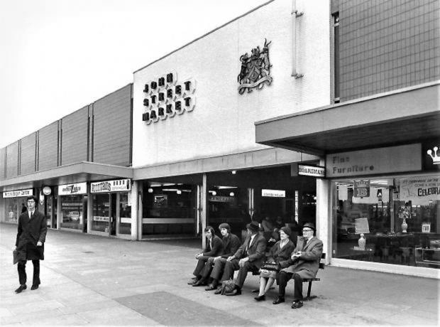
The Oastler Shopping Centre, formerly known as the John Street Market contained 176 stalls comprising a retail area, with an additional twenty three external shops and twenty seven storerooms. The cafes and stalls within the centre were various food, clothing and craft shops with some of the cafes and stalls having been in business since the 1960s.
The original outdoor open-air market was renovated to an indoor market in the early 1970s to make economic improvements to the upper side of the city centre and was named for the abolitionist Richard Oastler.
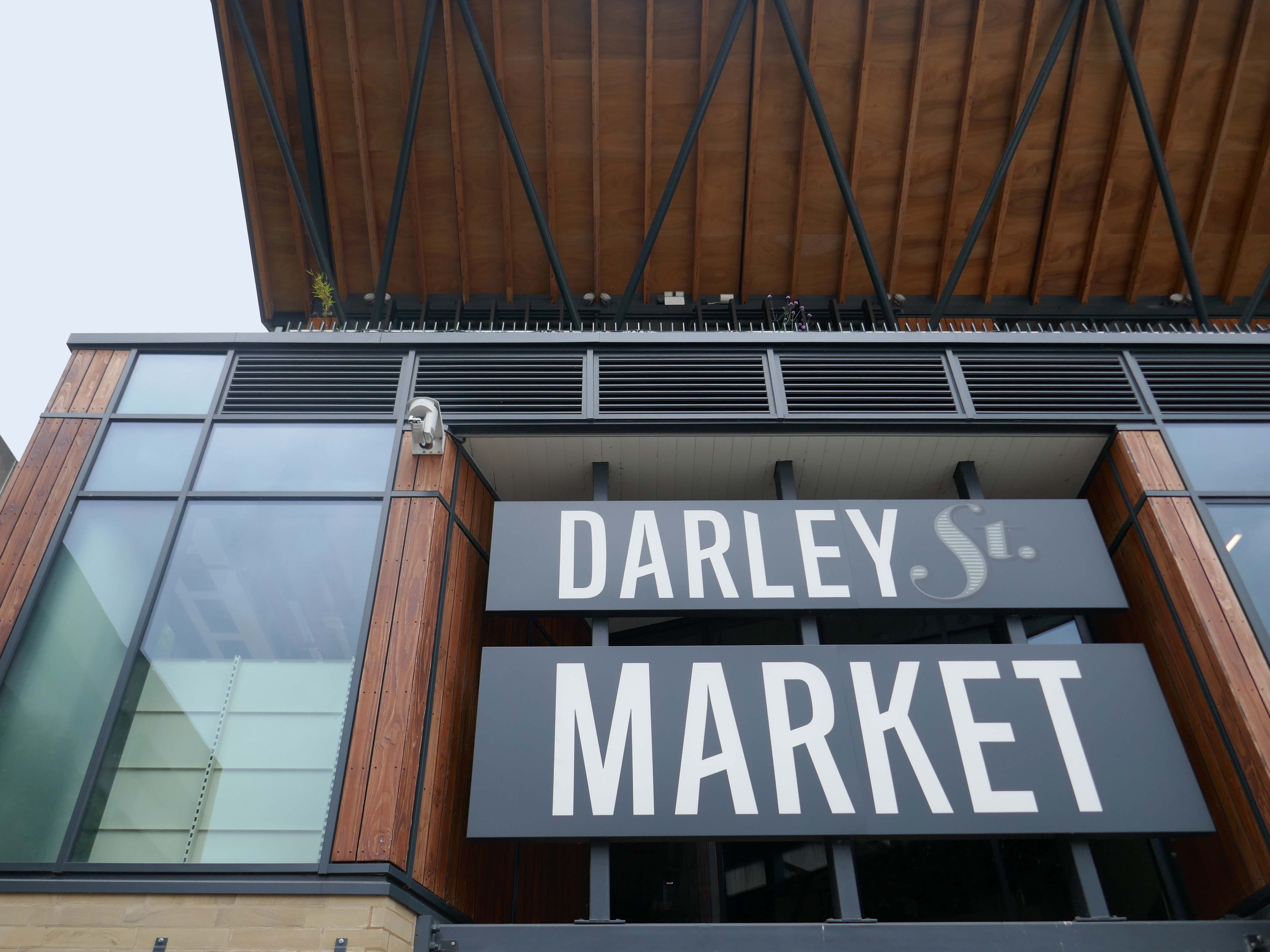
As part of the Bradford’s regeneration projects in line with the successful UK City of Culture 2025 bid, the Oastler Centre was scheduled to be demolished in late 2023 to make way for the new Darley Street Market.
The Oastler Marker had its final day of trading on 28 June 2025.
The centre along with the nearby Kirkgate Market will be demolished and replaced with green space, housing and new commercial spaces in line with the new Darley Street Market and planned City Village, an area of green space nearby the site.
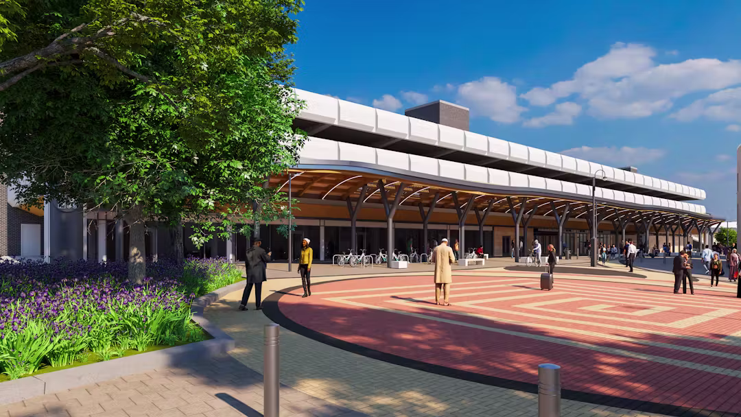
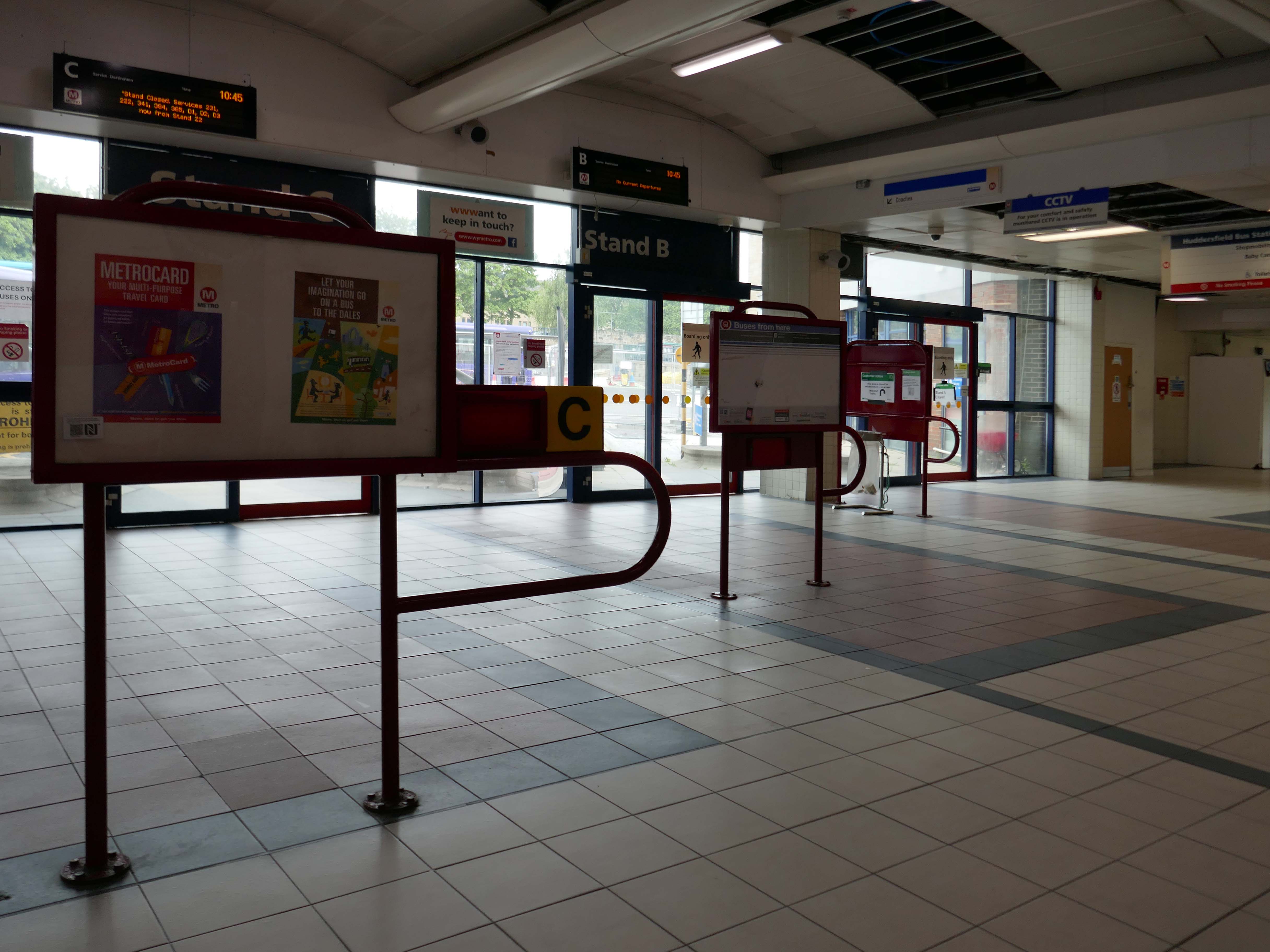
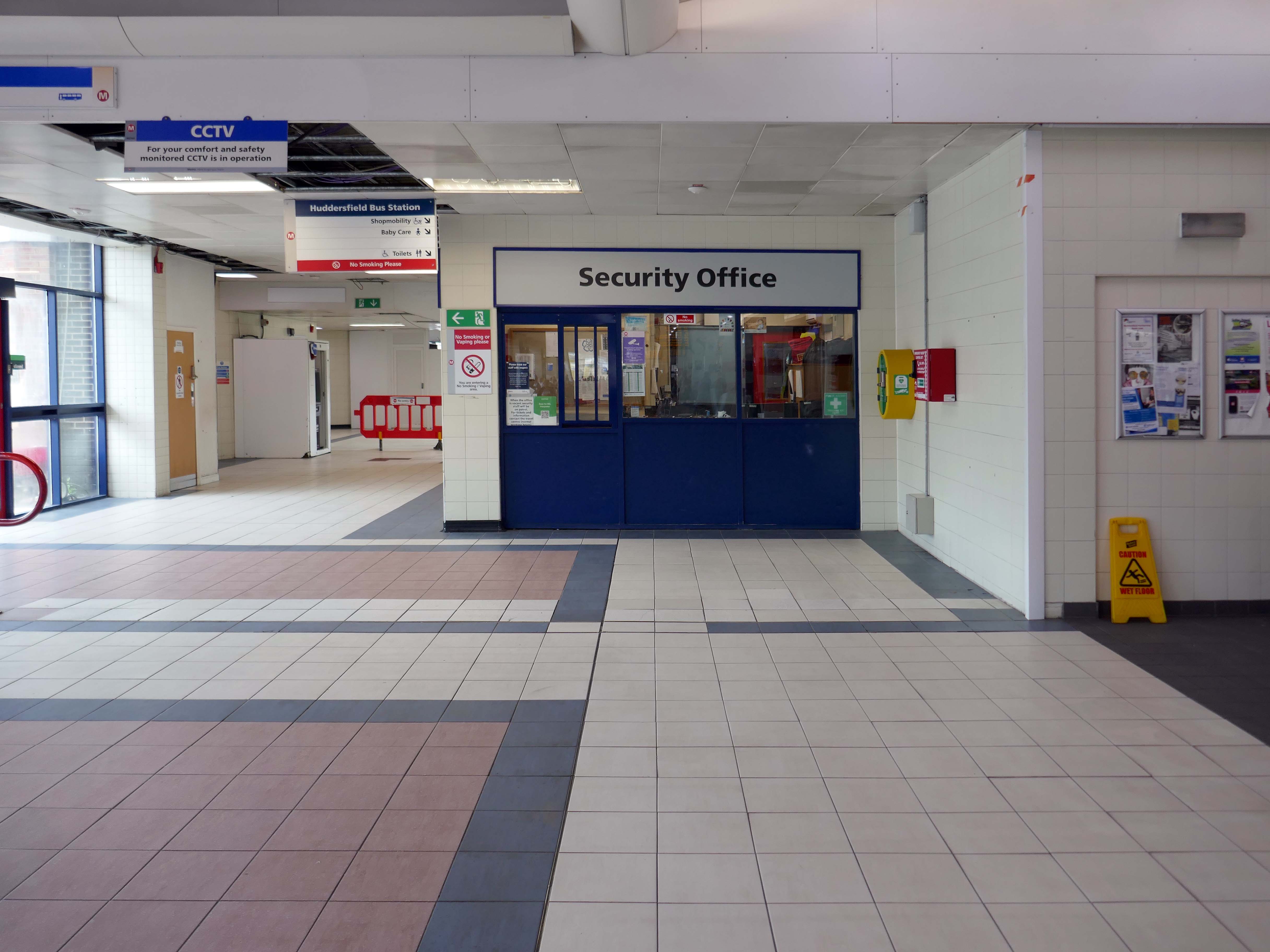
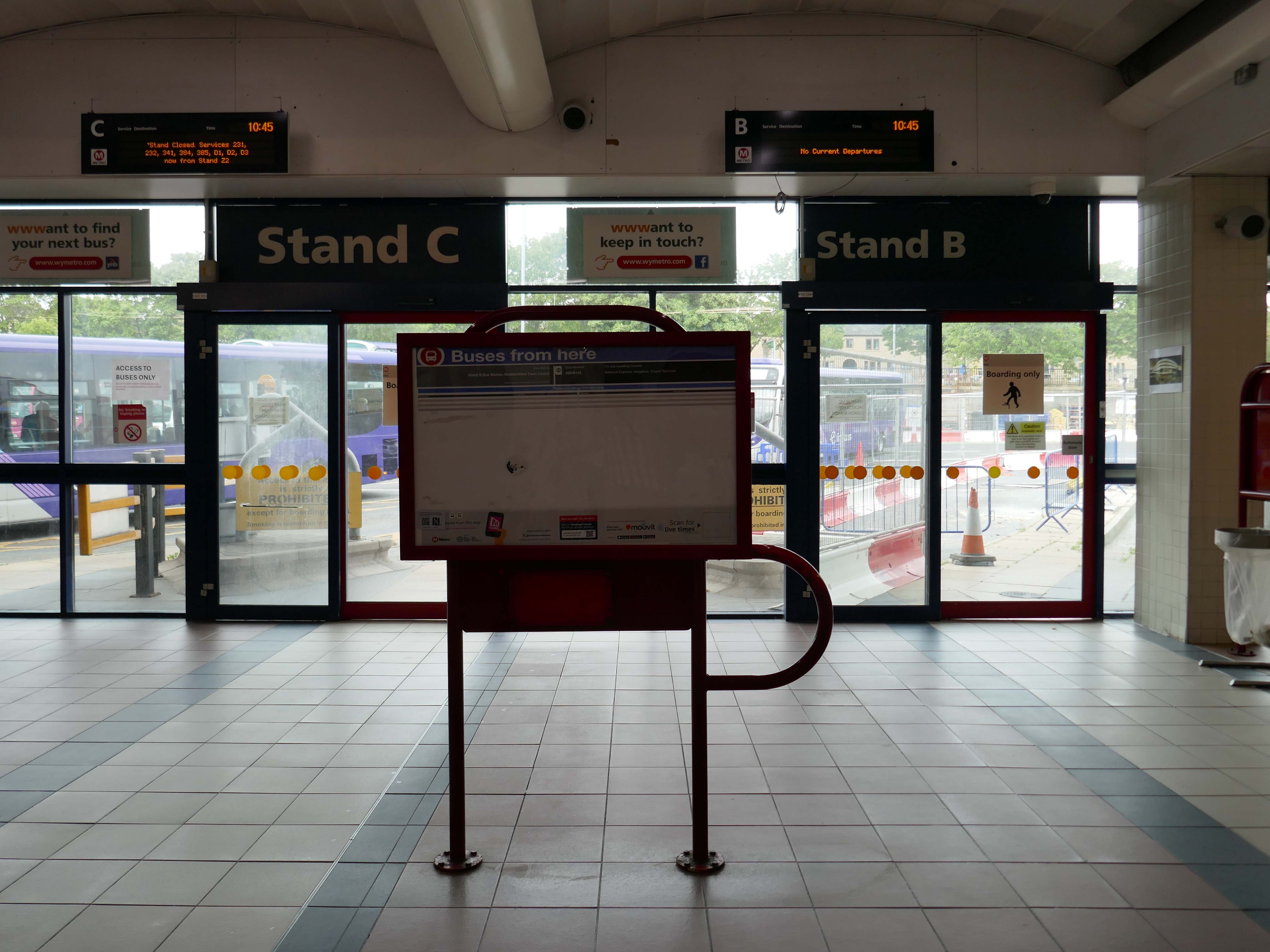
We are transforming Huddersfield Bus Station into a fully accessible facility.
Work is underway on the £28 million facility, which is funded by the West Yorkshire Combined Authority and Kirklees Council.
I was informed by the seriously erudite Christopher Marsden, that the bus station and car park were the work of Derek C W Vane: Borough Architect 1972-1974.
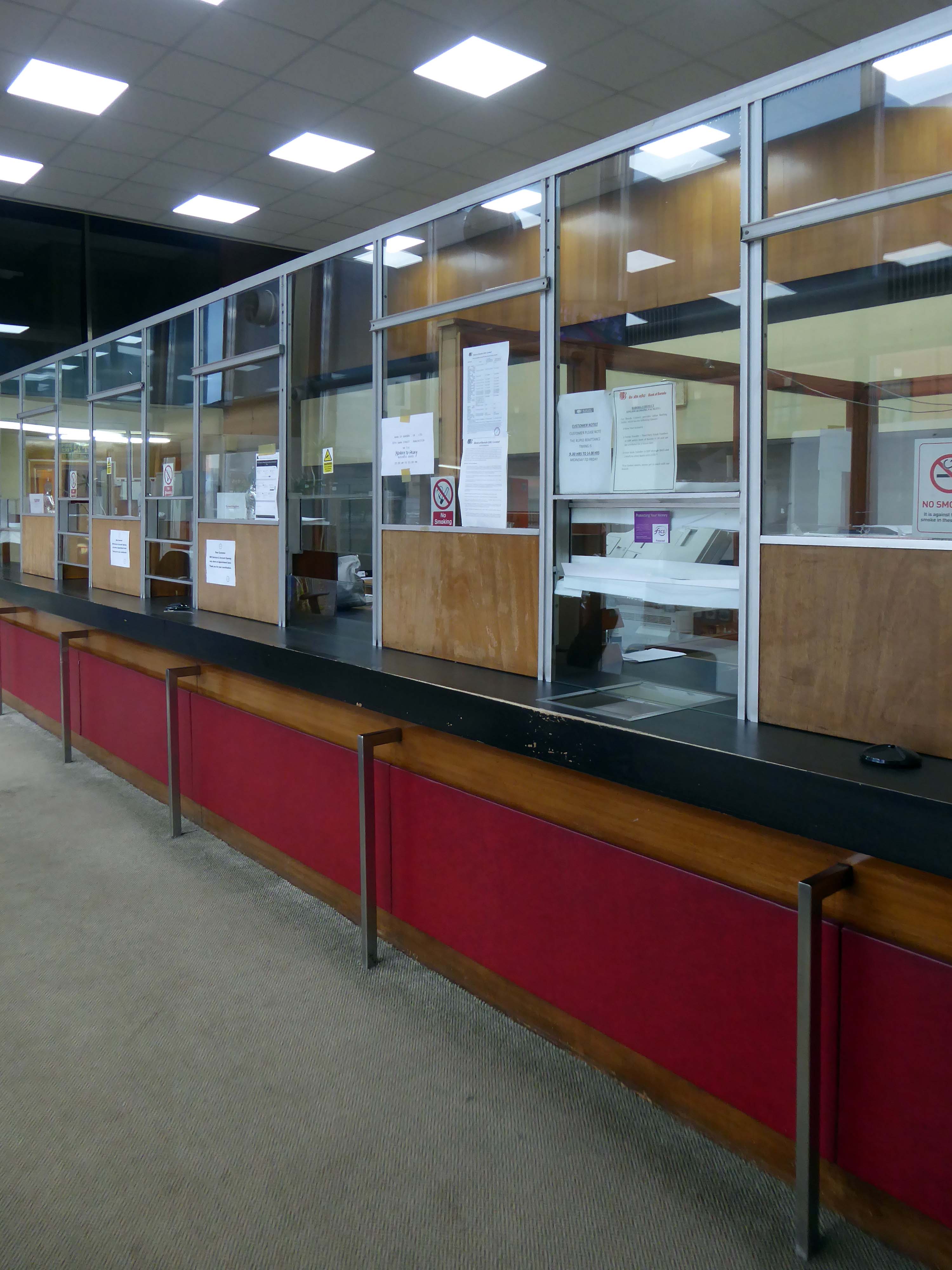
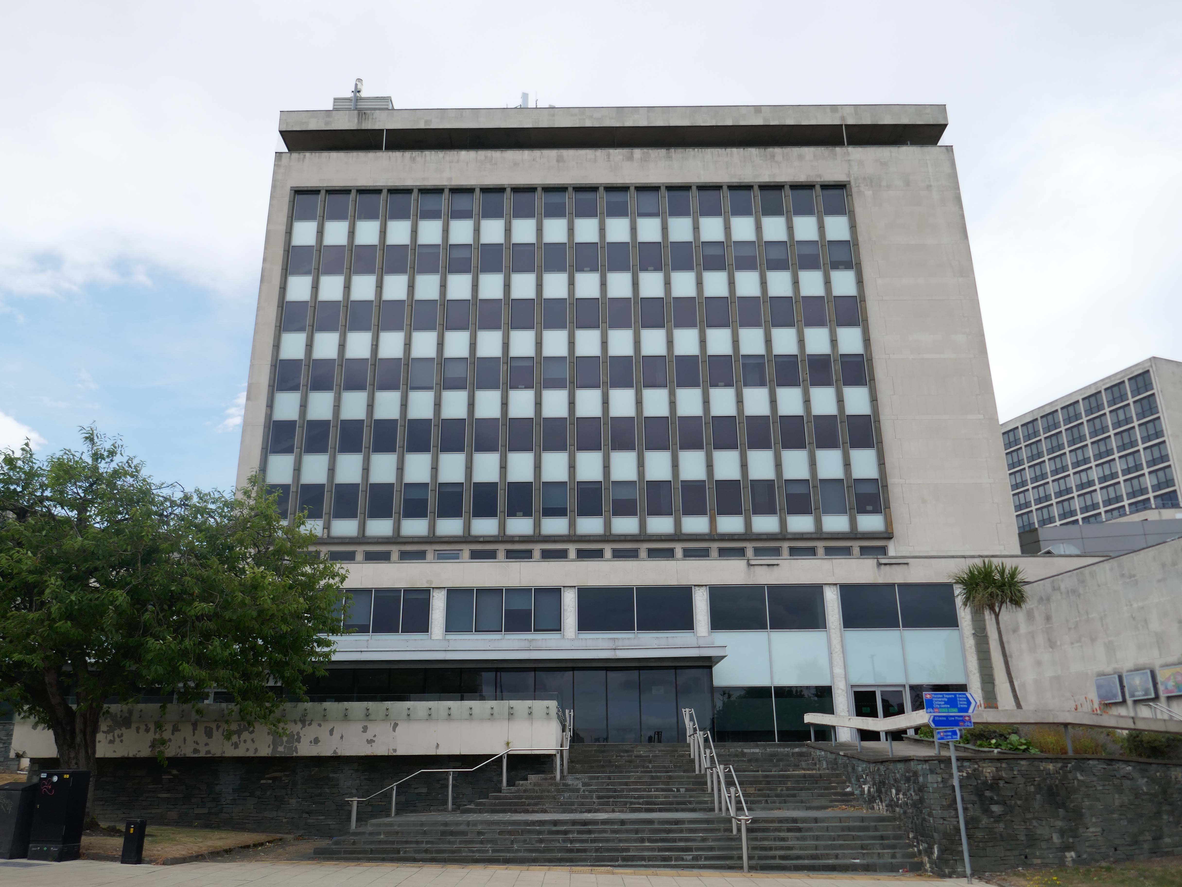
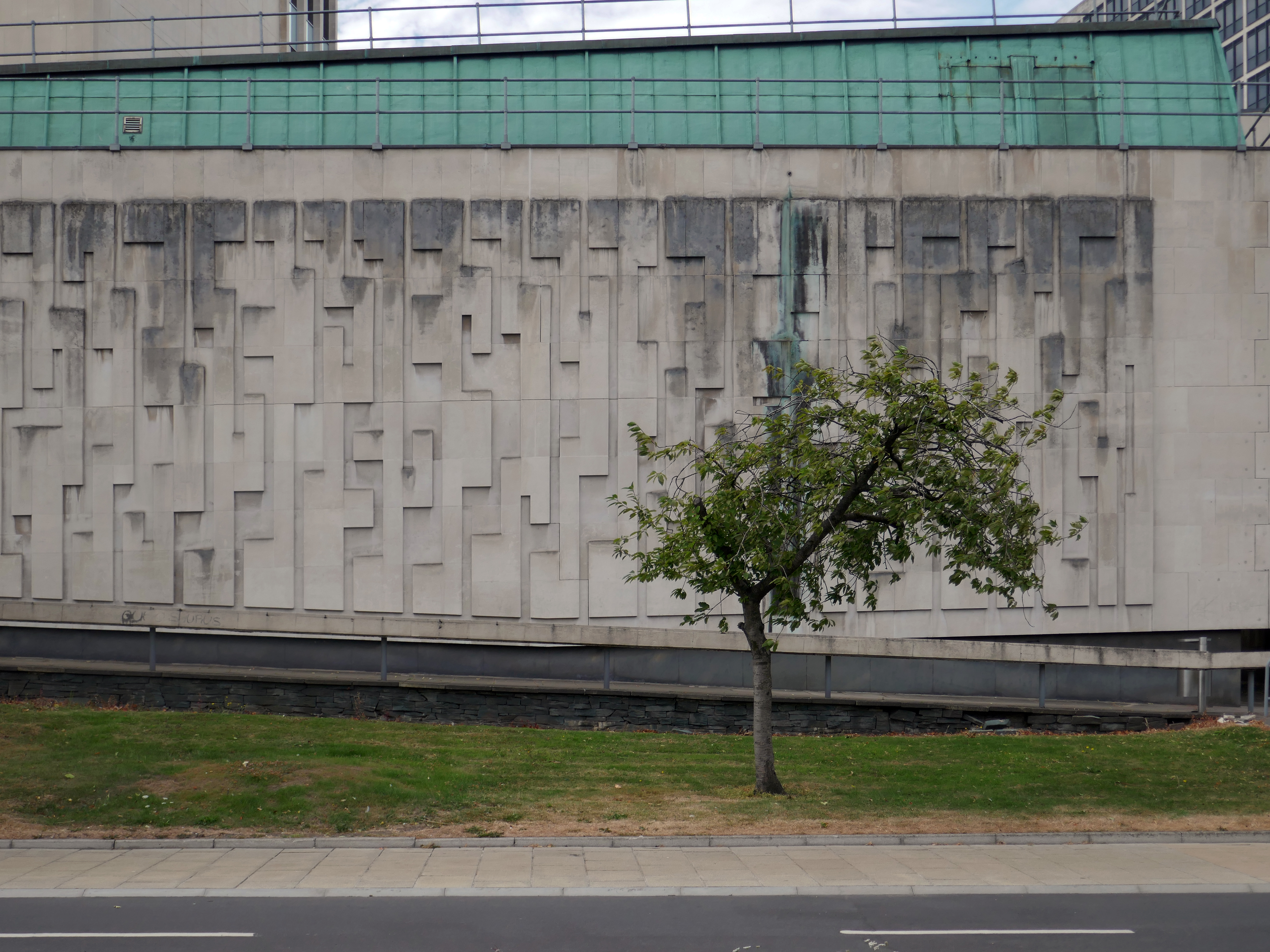
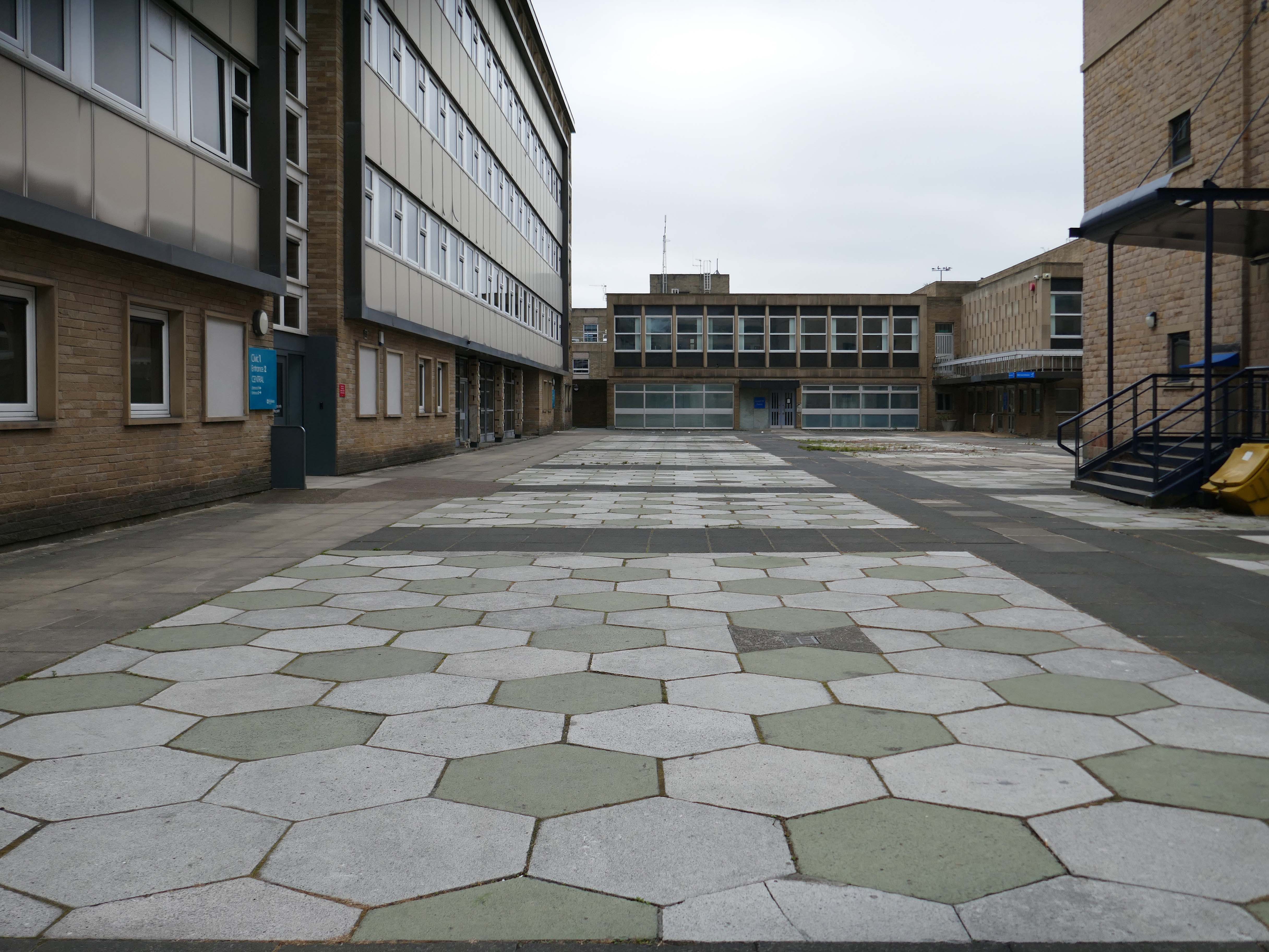
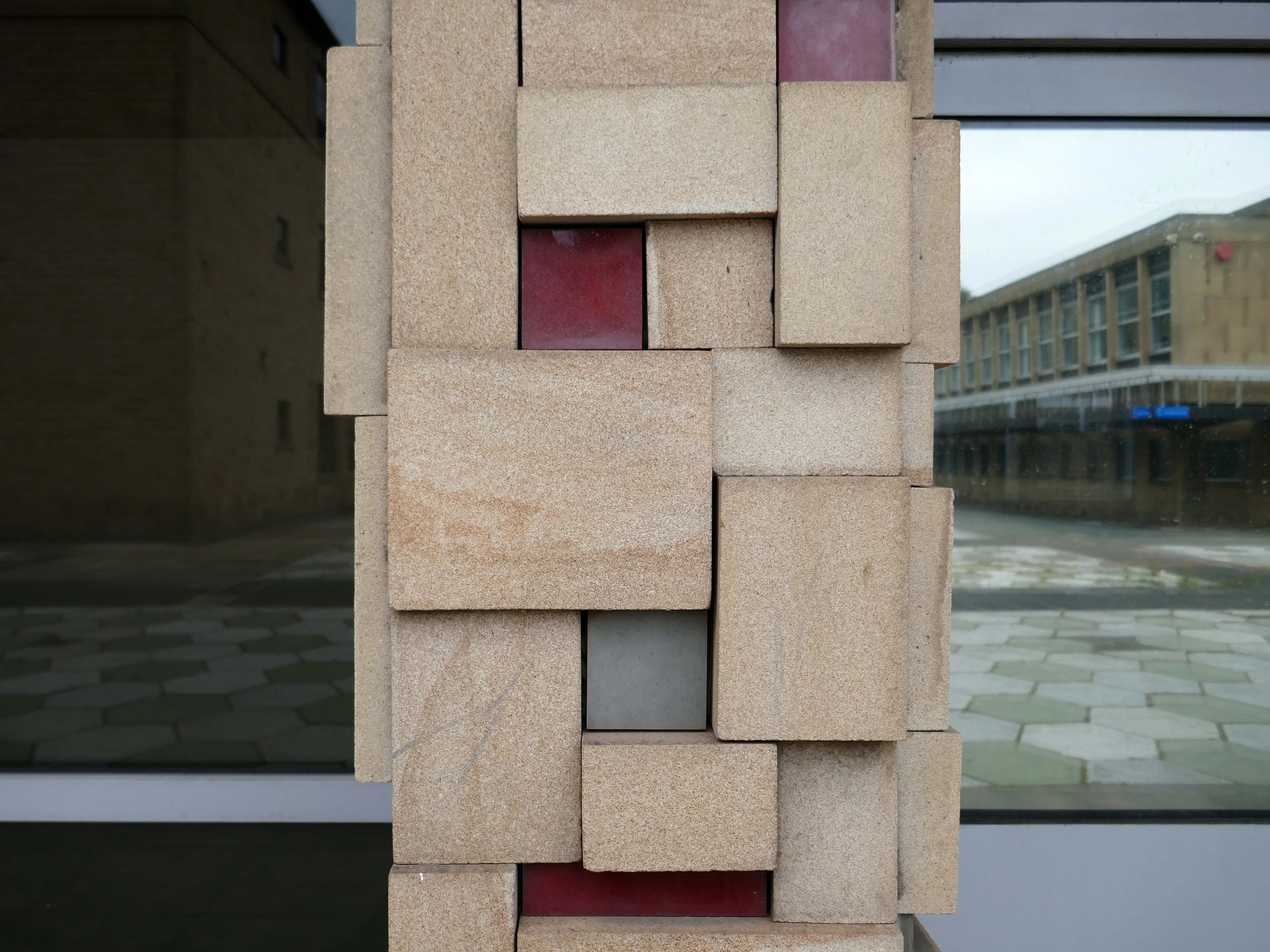
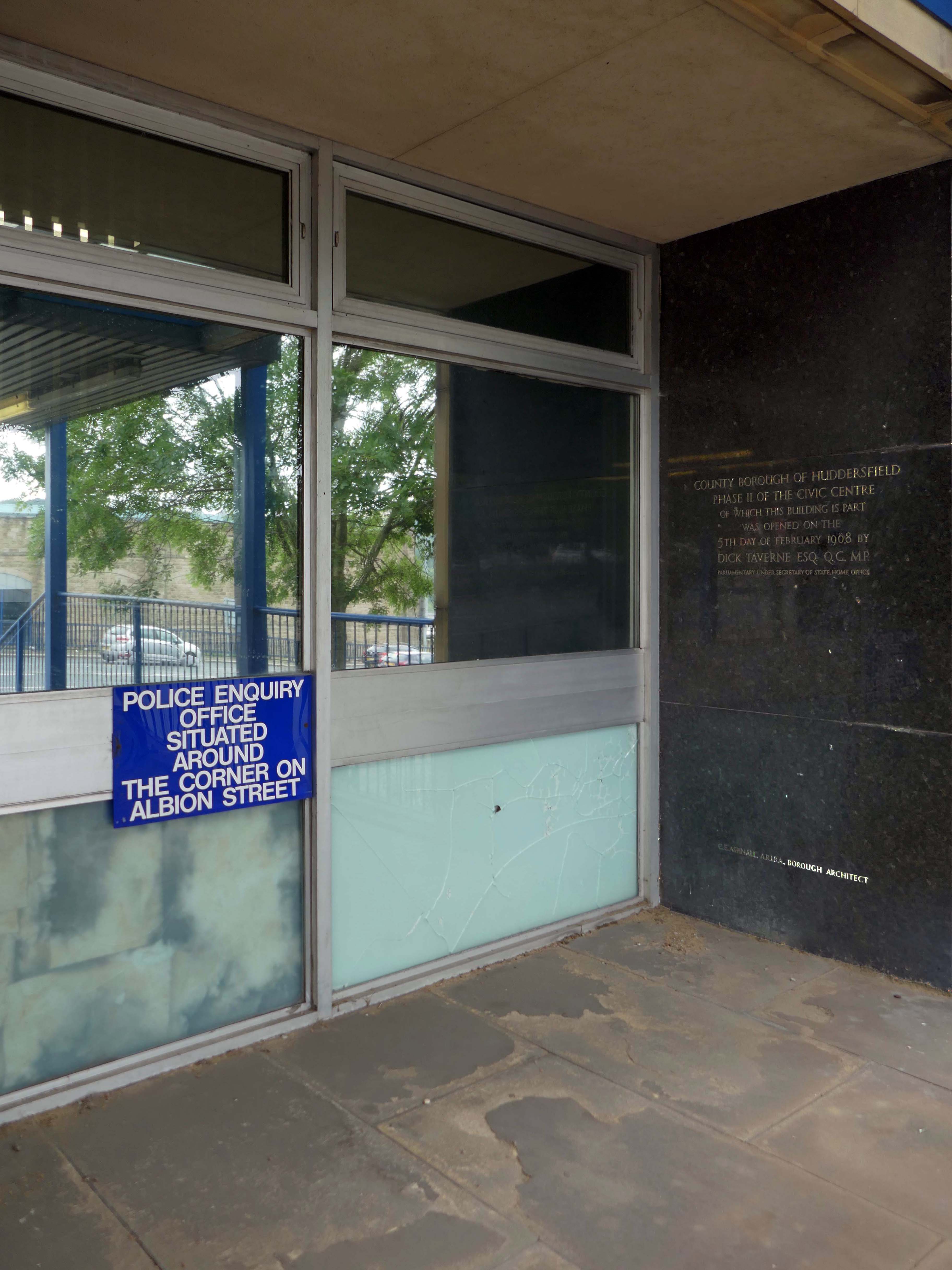
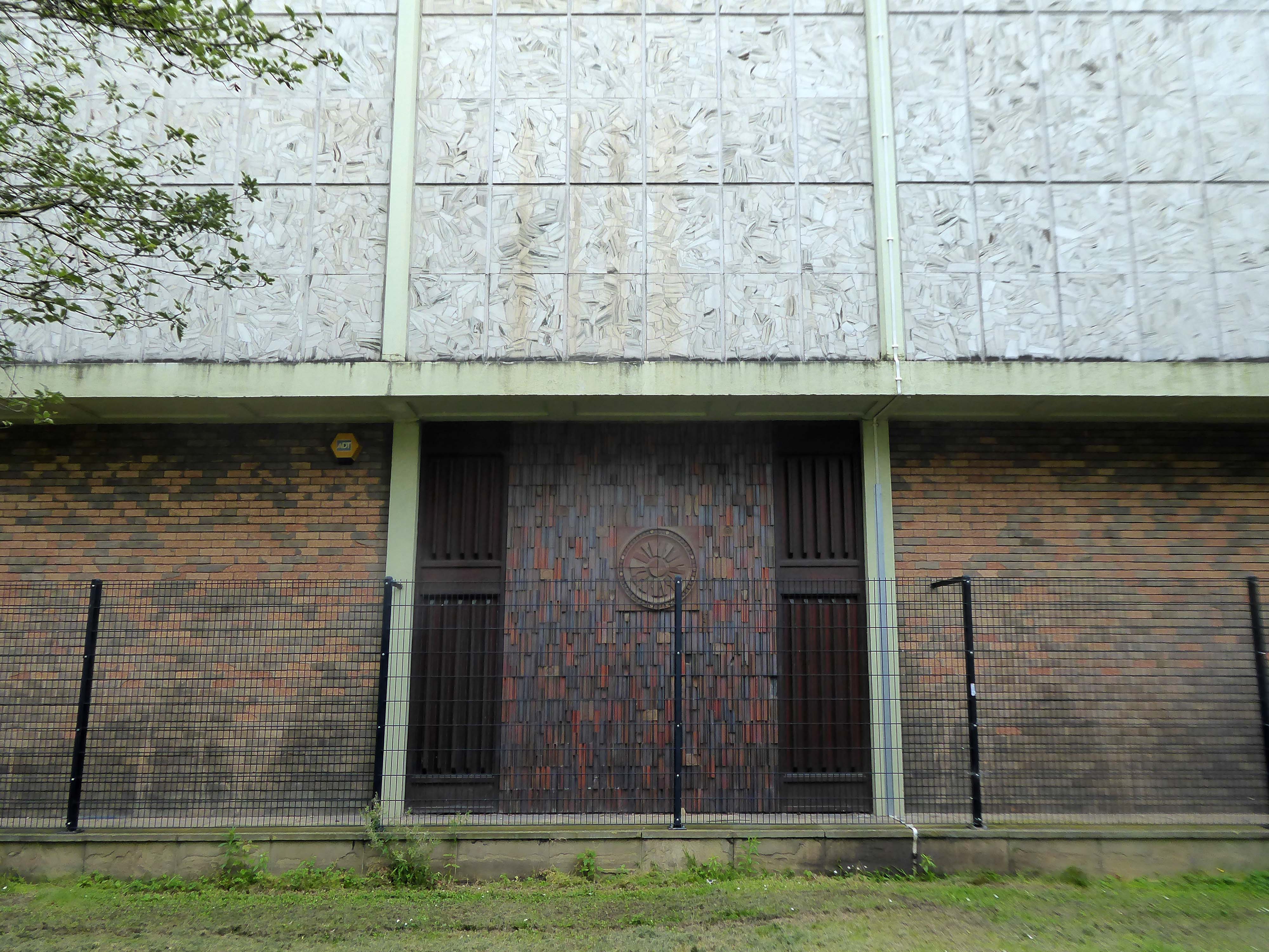
We then cross over the road to the Civic Centre, with its gold leaf facade, and the perennially empty piazza, which along with the Magistrates’ Courts and Police Station, was the work of the Borough Architects team – led by Charles Edmund Aspinall.
Exsilite panels set in the stone faced columns – a brand name for a synthetic, moulded, artificial marble.
Exsilite is made by fusing grains of silica and pigments to form a slab that simulates onyx marble.
Exsiliteis a Latin word meaning – spring/leap/burst forth/out, leap up, start up, bound; emerge into existence.
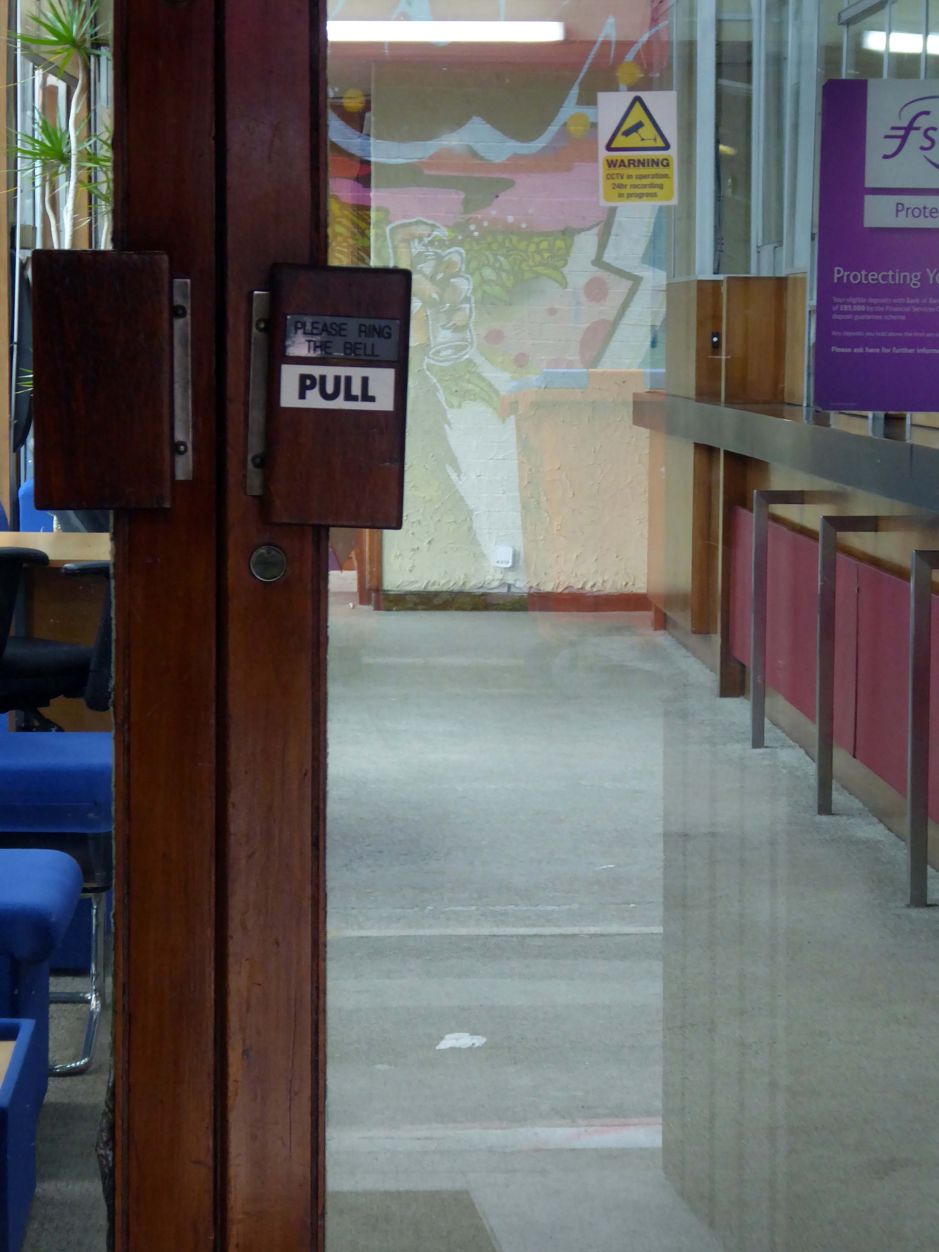
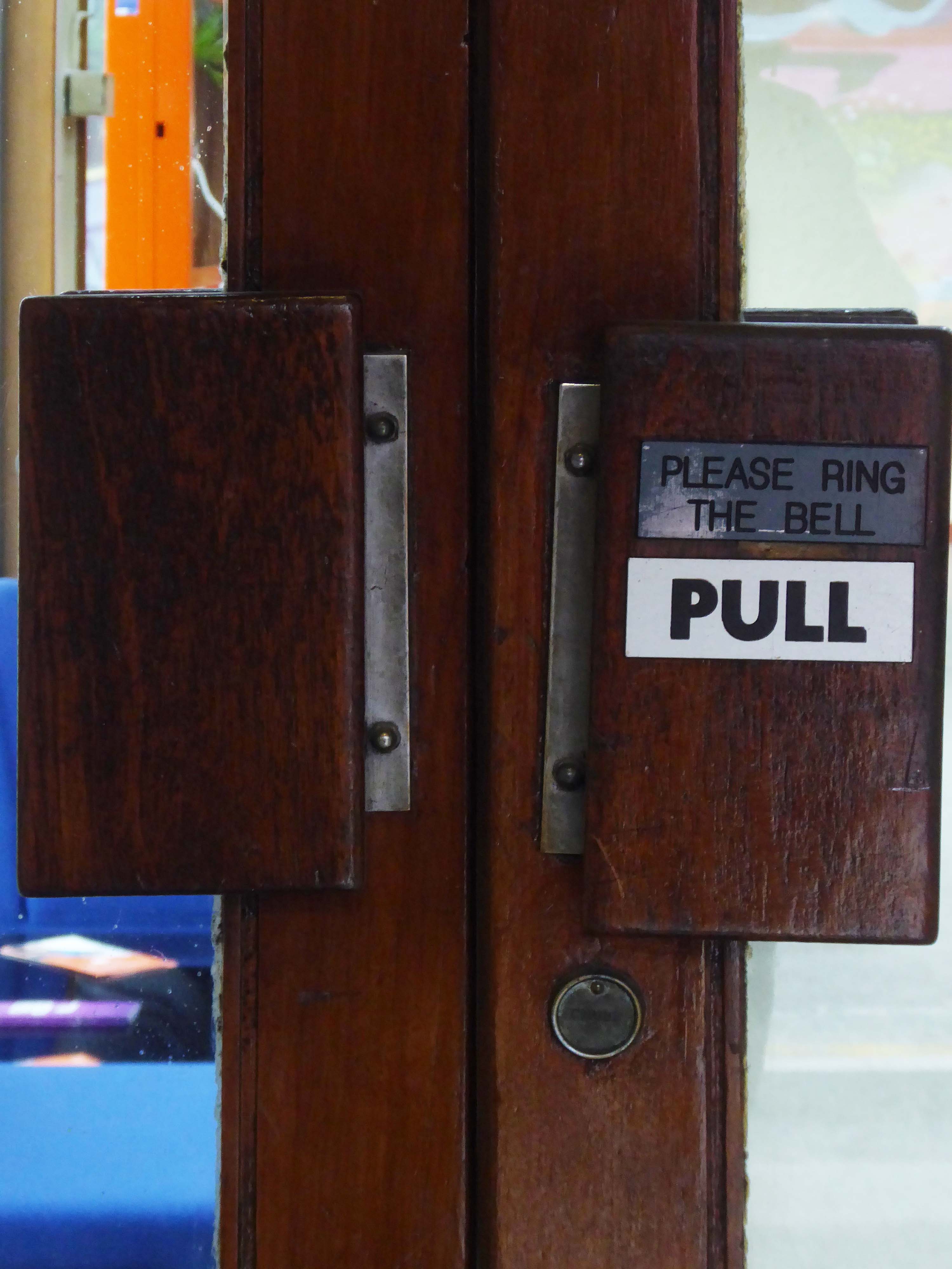
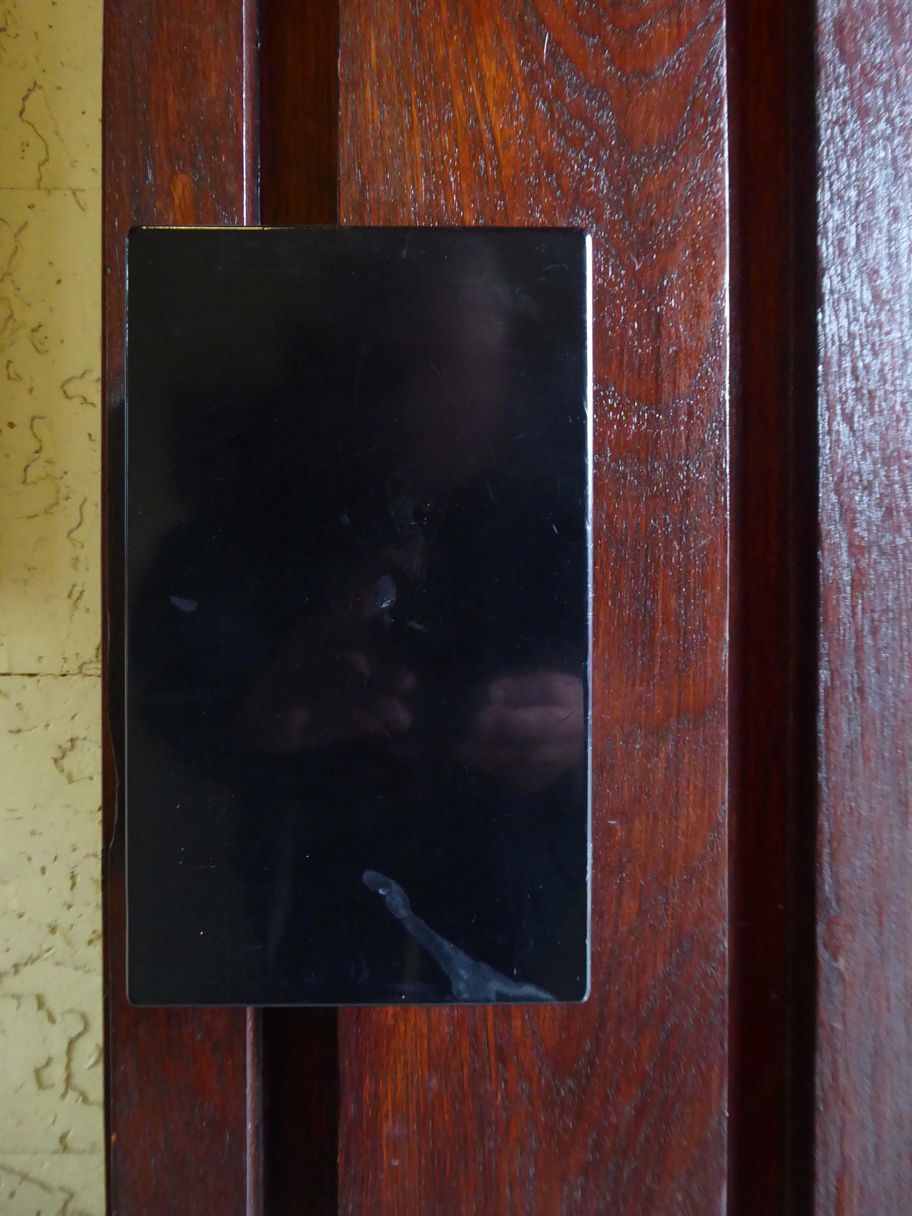
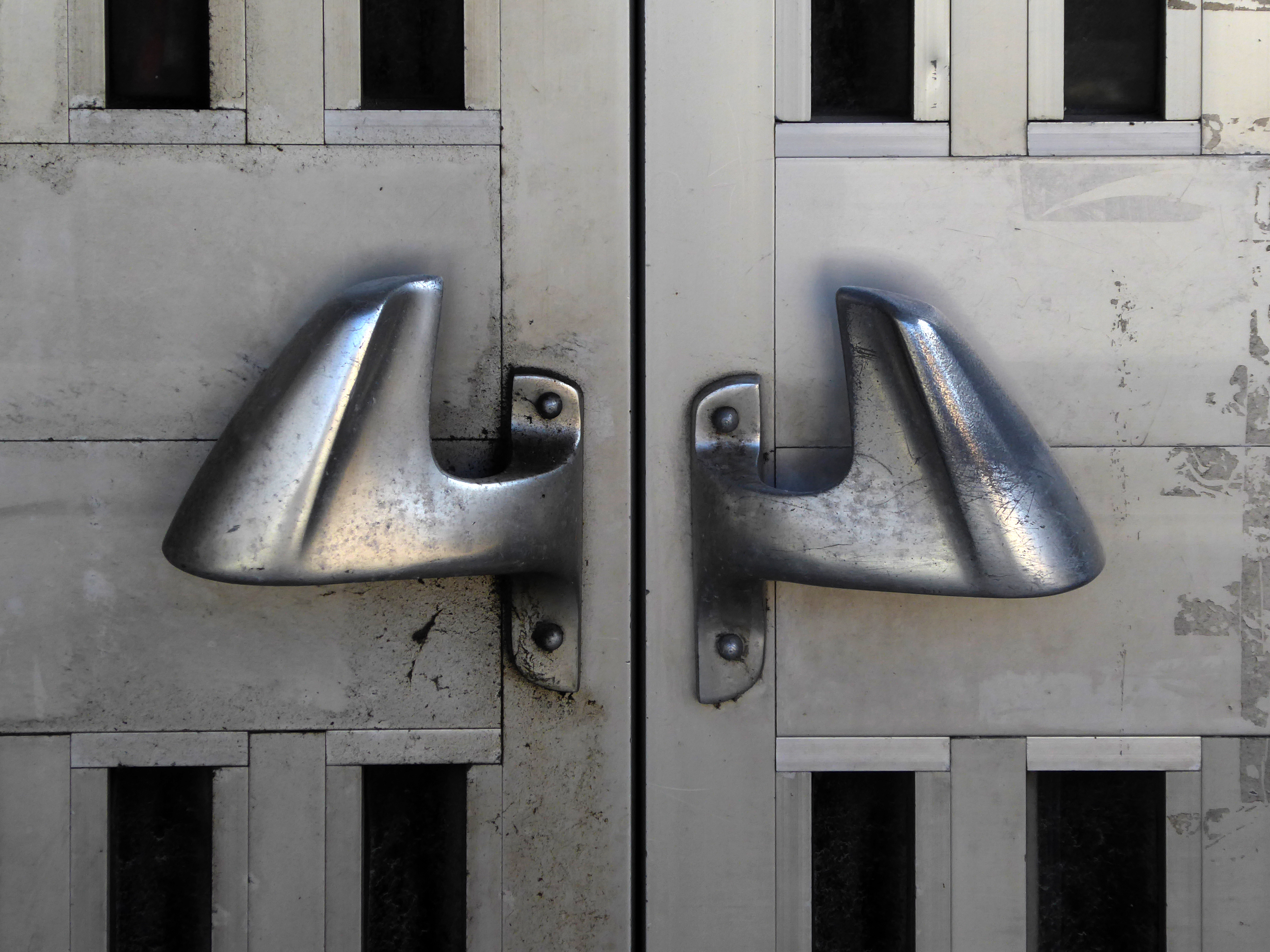
It is to be note that the doors and distinctive handles from the Courts to the Piazza have been removed.
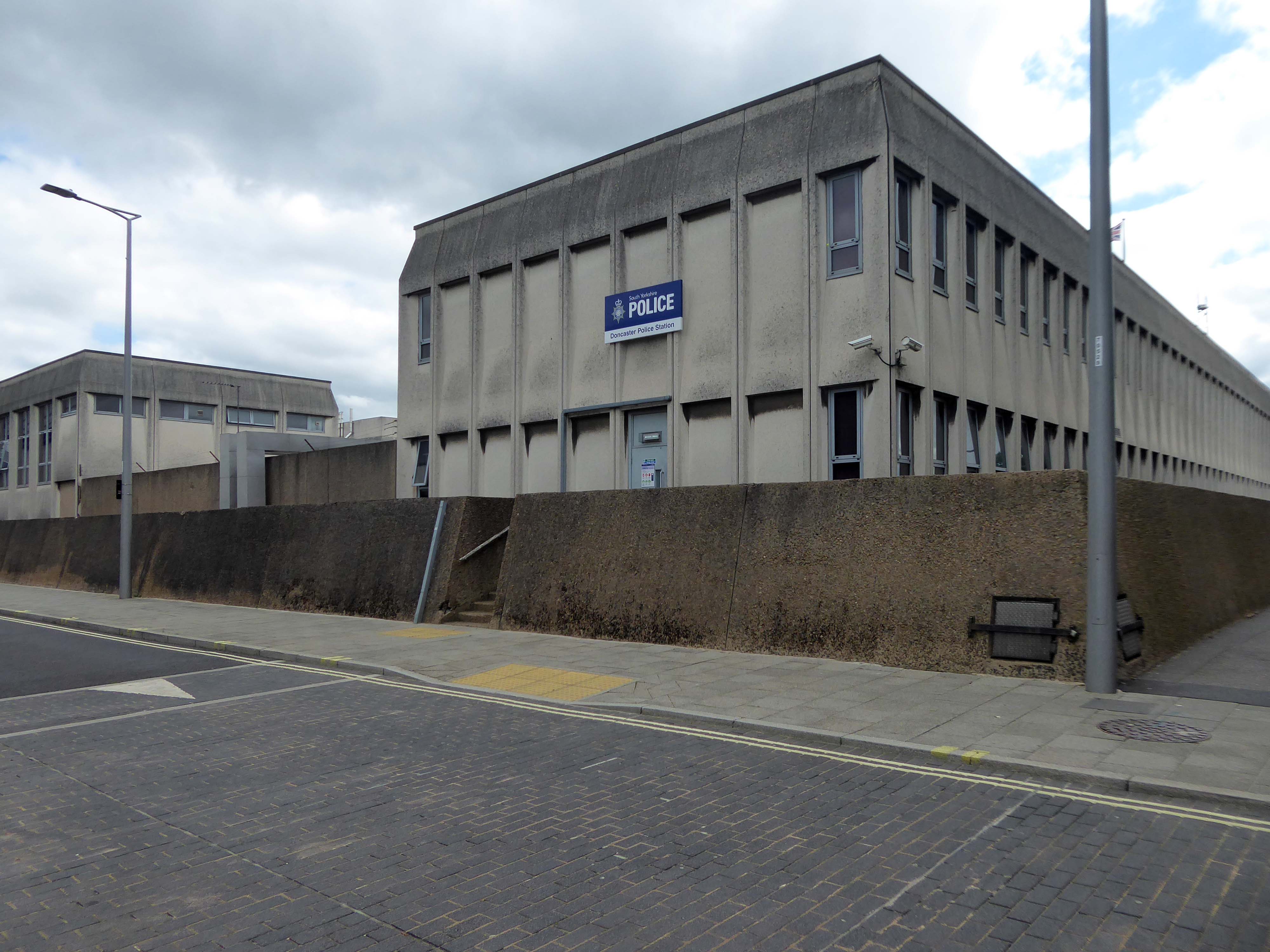
The Police Station is to be vacated on completion of the new Police Station.
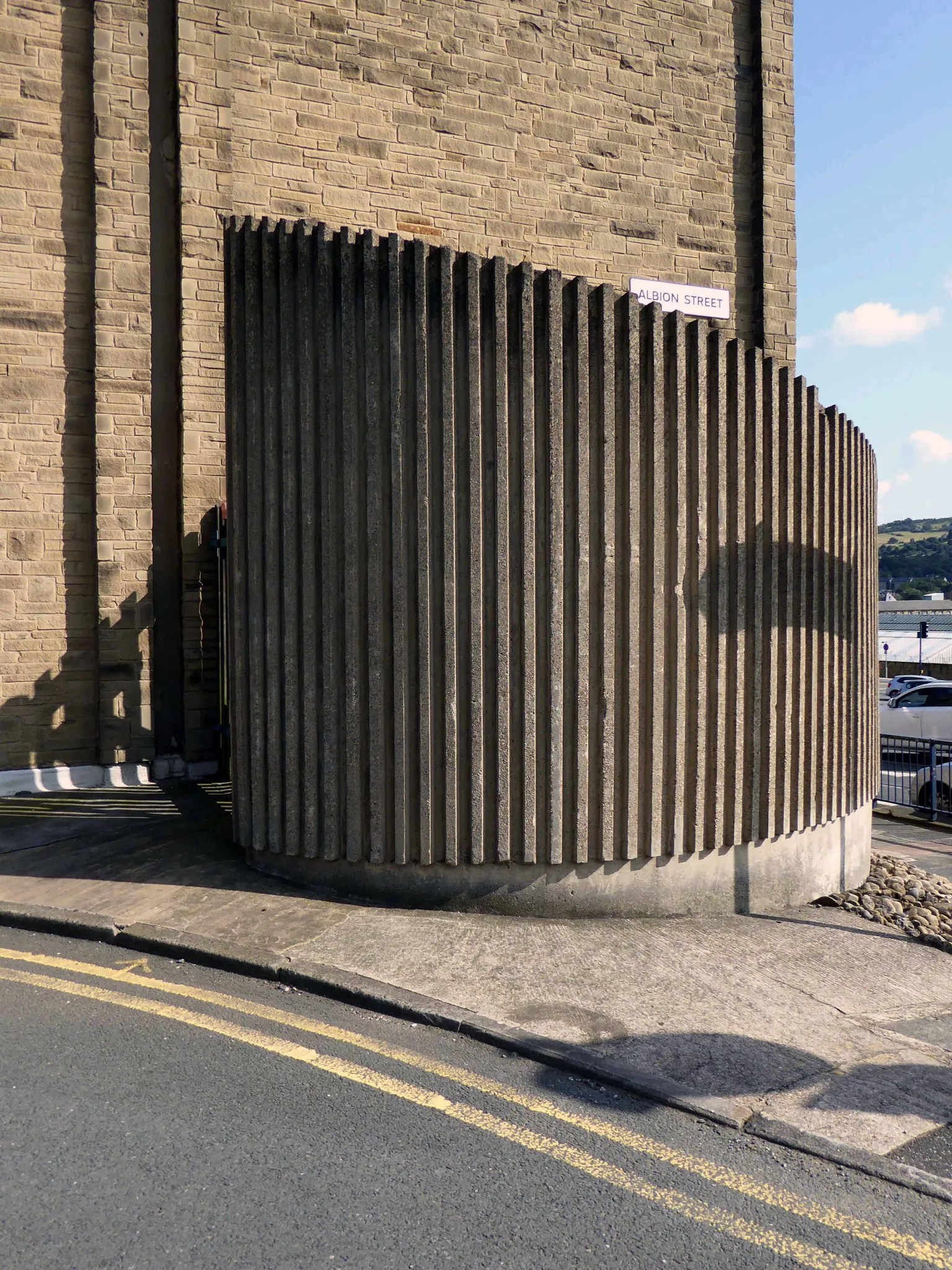
Next to the curved and ribbed concrete wall, concealing an electrical sub-station.
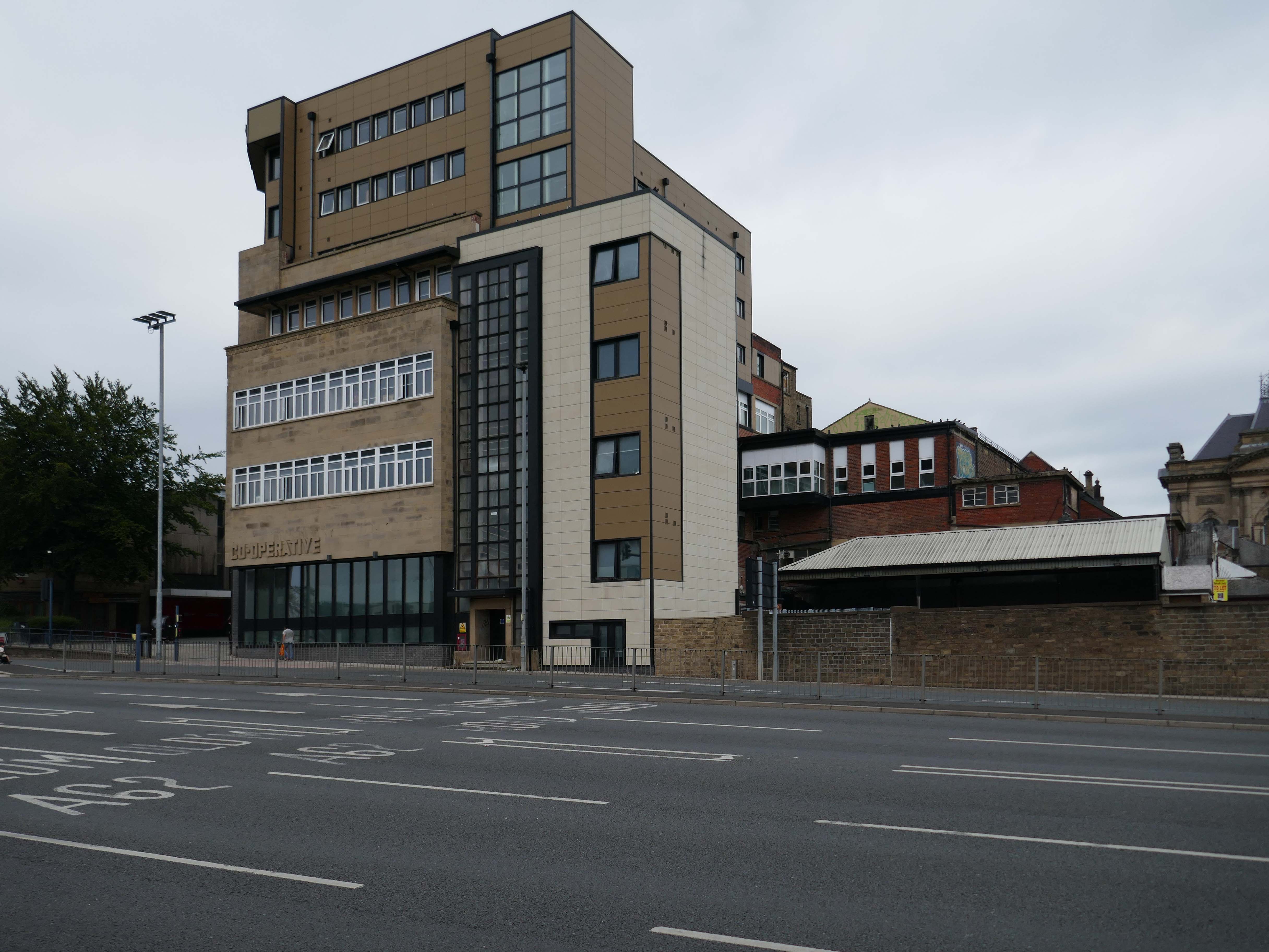
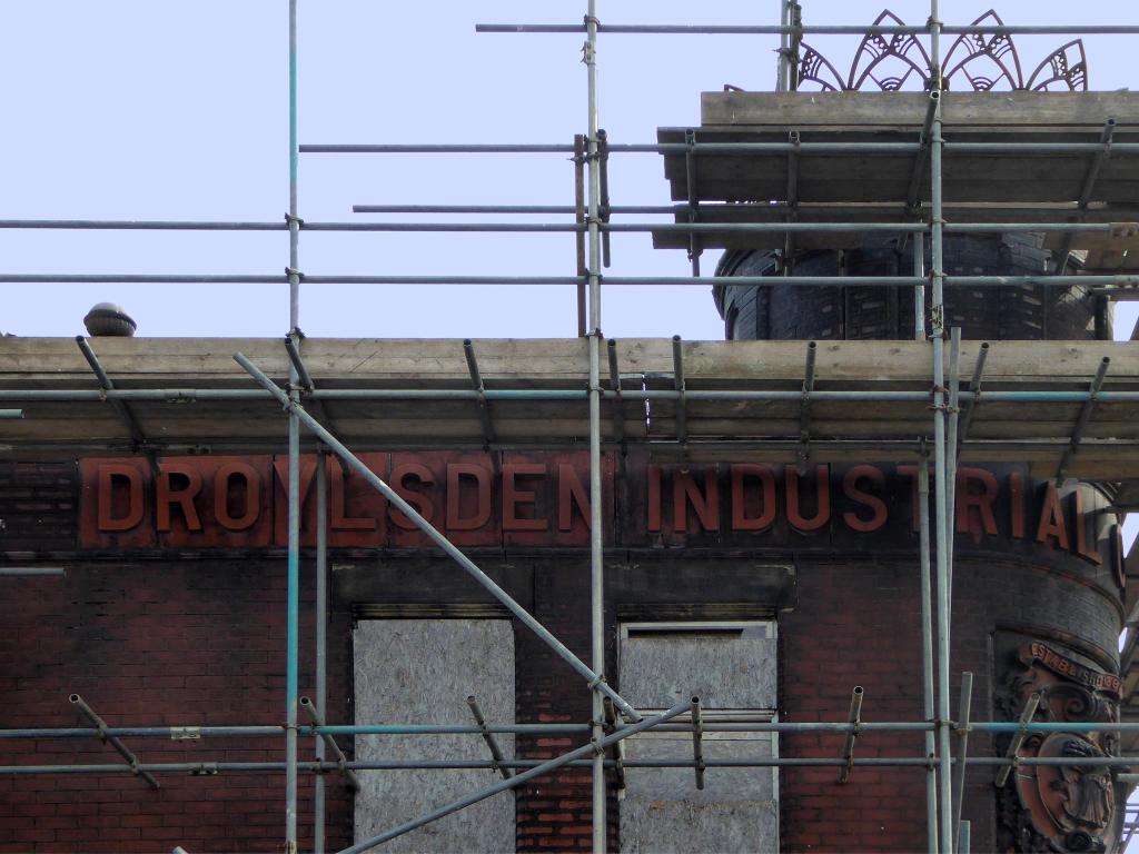
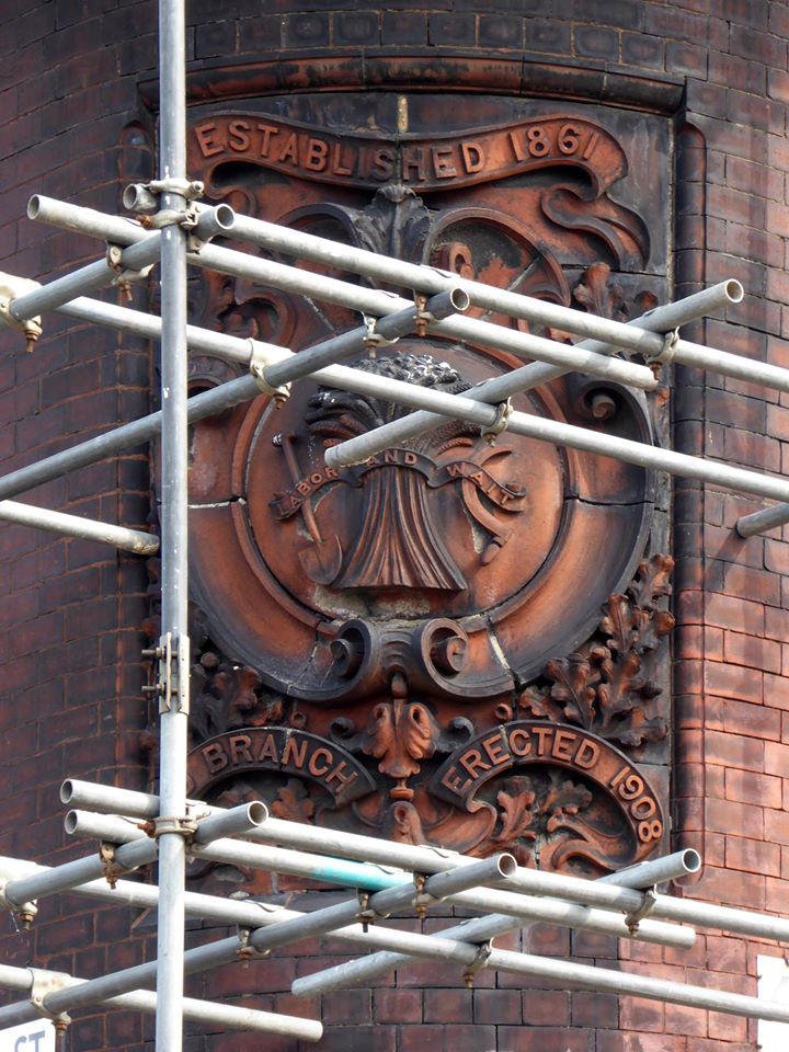
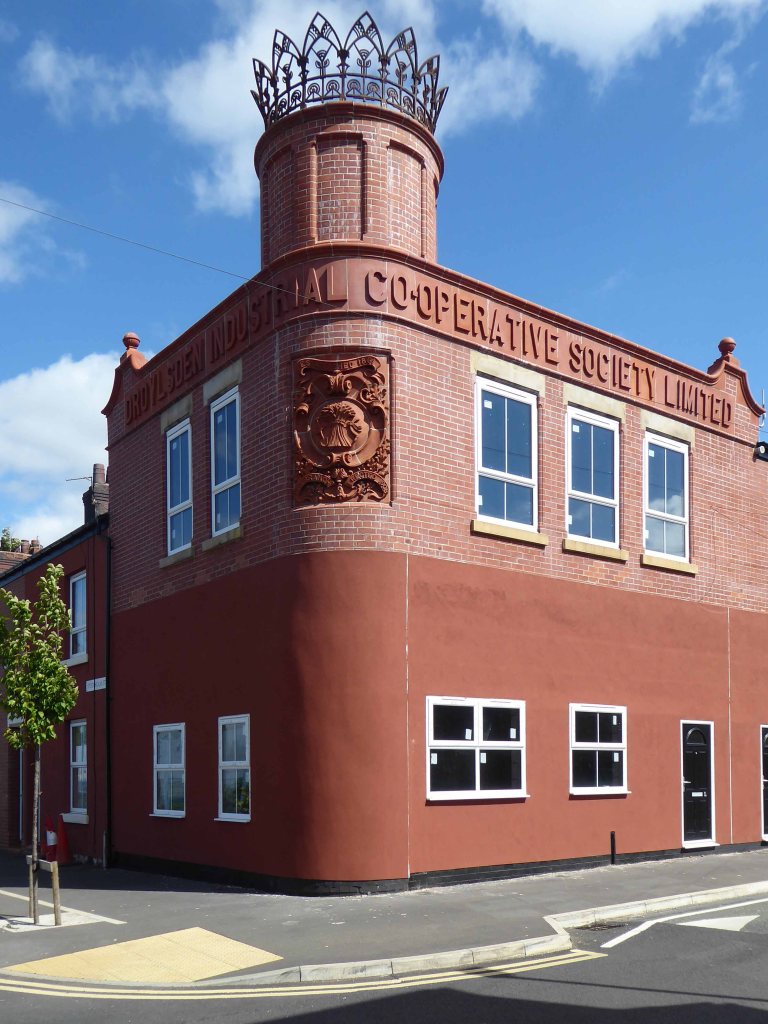
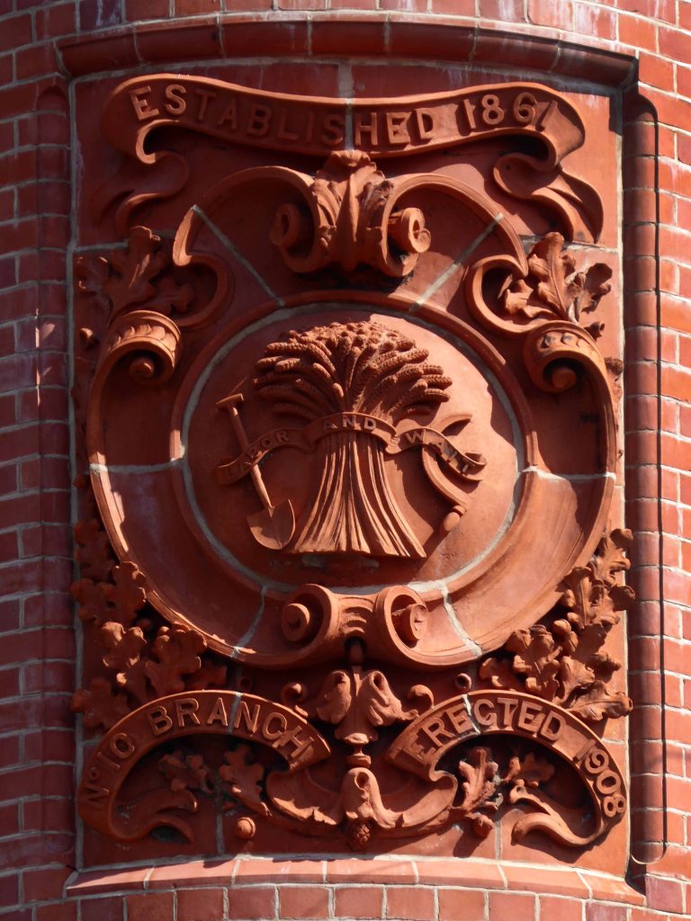
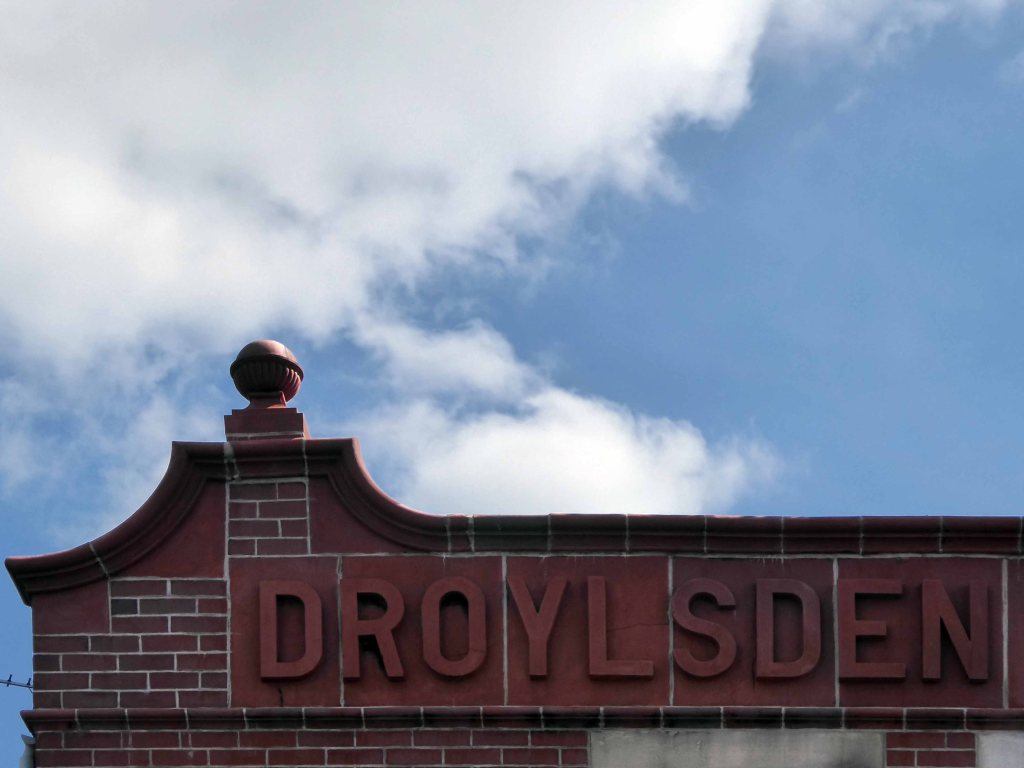
Further on down the road the former Co-operative store 1936 JW Cropper.
On opening day, the Examiner said the Co-op gave:
The town of Huddersfield a store that is entirely modern in design and equipped on the most up-to-date lines-a store of which the townspeople generally, and co-operators in particular, can be proud.
It has subsequently been seriously disabused by insensitive refurbishment and extension.
We cross over to view the access road to the service area of the market – now closed.
It was formerly topped off by a multi-storey car park – since demolished.
Then onward to the Grade II Bath House at Broadbent’s Engineering in Huddersfield.
1955, by Abbey Hanson architects – designing architect Andrew Buck, project leader Geoffrey Rowe.
The building is a very rare, possibly unique example of a purpose built bath house for foundry workers
* Its continuing function as a bath house has preserved its original purpose in both its layout and its fixtures and fittings as well as its design
* The design of the building manifests inspiration from both W Dudok and Frank Lloyd Wright, and achieves a high standard of accomplishment in its interpretation of contemporary architectural influences
* The use of local stone for external walls distinguishes it from brick built pithead baths of similar style, and the imaginative use of finishes lends further distinction
* The interior survives almost entirely intact, with original wash basins, shower and tap fittings, lockers, floor and wall surfaces, doors and light fittings.
One of Huddersfield’s hidden architectural gems has been transformed into an attractive and unusual gallery-cum-coffee house and restaurant, destined to become a popular public space for meeting, eating and art appreciation. But among the attendees at a special unveiling event there were men who remembered its original function – as a bath house where scores of foundry workers could shower away a day’s grime.
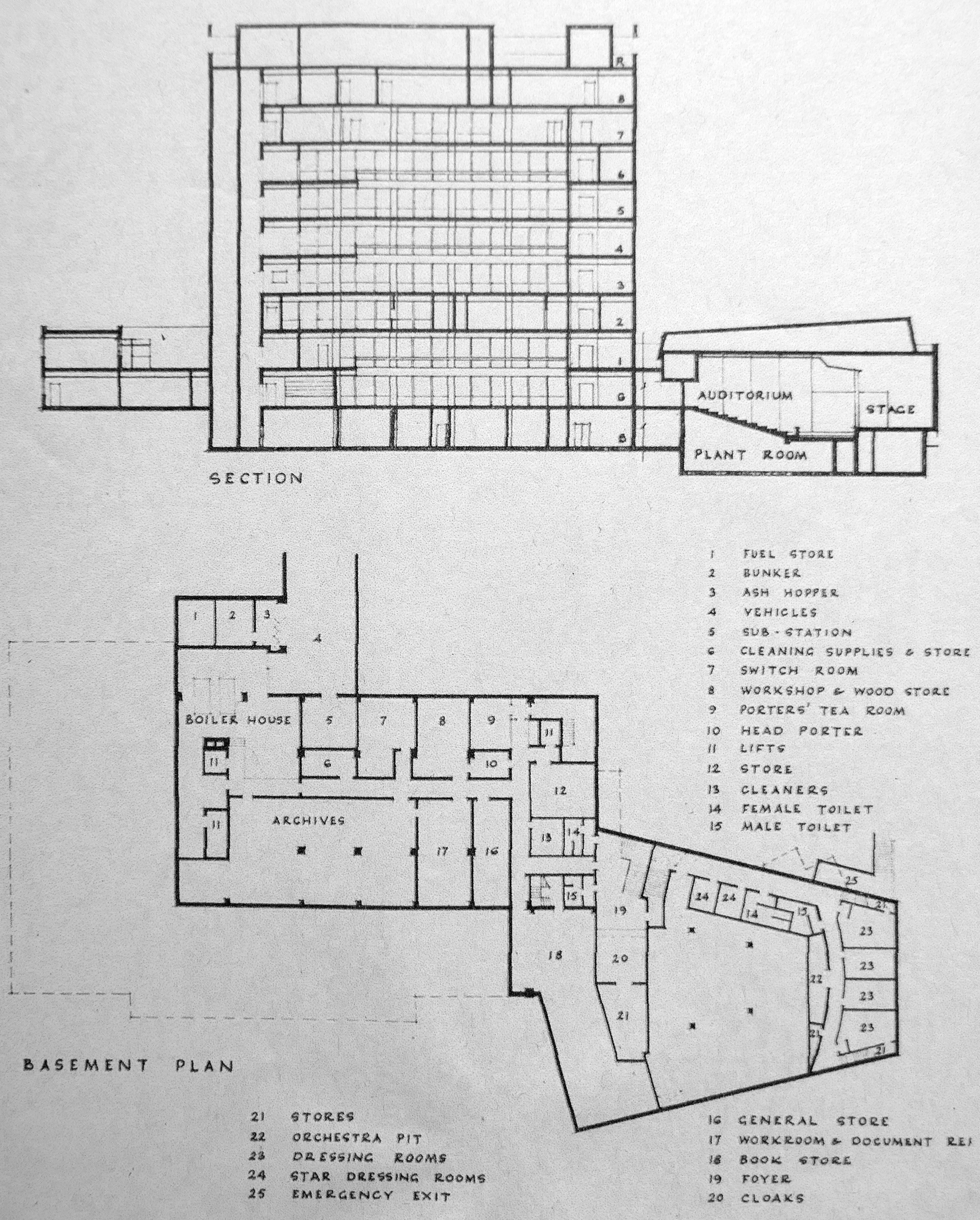
Up around the the bend and here we are at the Grade II listed Queensgate Market, 1968-70 to the designs of the J Seymour HarrisPartnership, with Leonard and Partners as consultant engineers.
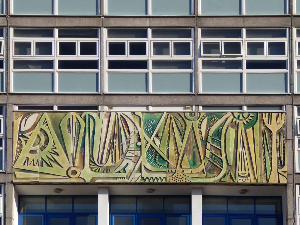
Another feature of Huddersfield Market which sets it apart from other post-war market buildings is its incorporation of works of art. Fritz Steller was a German-born refugee architect who had settled in Stratford-upon-Avon. He pioneered the production of large scale ceramic art, having been interested in the use of a wide variety of materials in sculpture. The development company Murrayfield had a policy of incorporating public art into their schemes, and the project manager of J Seymour Harris, the architects for the Huddersfield development, was Gwyn Roberts, a friend of Steller. One of the Borough Councillors at Huddersfield was Clifford Stephenson, an enthusiast for public art and particularly for modern ceramic sculpture. This combination led to the appointment of Steller to produce designs for the new market hall. The size of the panels necessitated the construction of a special kiln for their firing, and experimental mixes for the composition of the clay which was resistant to acid rain and chemicals.
Straight ahed to the service entrance at the rear of ThePiazza.
The council wants to demolish the Piazza buildings as soon as possible.
Phase 3 was originally to be the Queen Street plot but Greenhead College’s plans for a new education building on the site failed to secure Government funding. Since then the council has been looking at alternatives – including a hotel, residential or offices – but now believes a new multi-storey car park could be the best way forward.
Phase 5 was to have been a £90 million events and concert venue with a multi-storey car park attached but that is no longer affordable. A review of the venue is underway and the council now thinks a “flexible multi-purpose” venue is the way forward. It would have a fully-seated capacity of 1,200 or 2,000 with a standing floor and seated balcony.
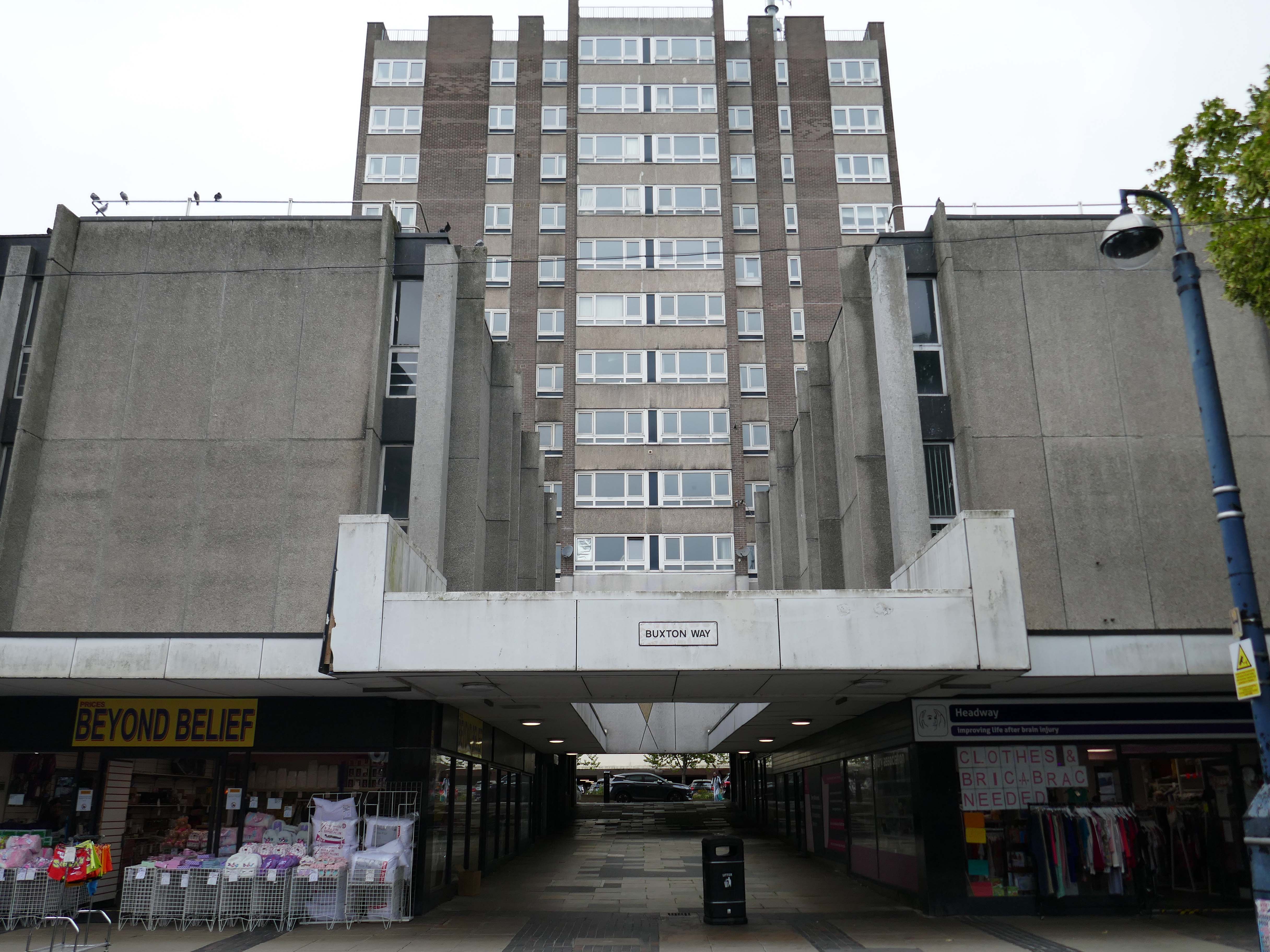
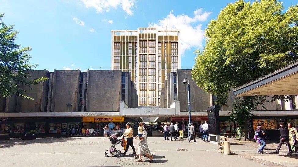
Turning our back on the market and away to Buxton House 1968.
Kirklees Council’s plans for the £16 million re-development of a Huddersfield town centre block of flats have collapsed.
Buxton House, between New Street and Albion Street, failed to meet modern fire safety standards and the council moved tenants and bought out owners and leases, pending a full-scale refurbishment.
Planning permission was granted in July 2024 to re-model the tower block to create forty one, one and two-bedroomed flats along with five studio flats with construction set to start in November 2025.
However, it has now been revealed that the council has failed to find a contractor and the scheme is on hold indefinitely.
The flats are part of a larger retail development by Bernard Engle & Partners.
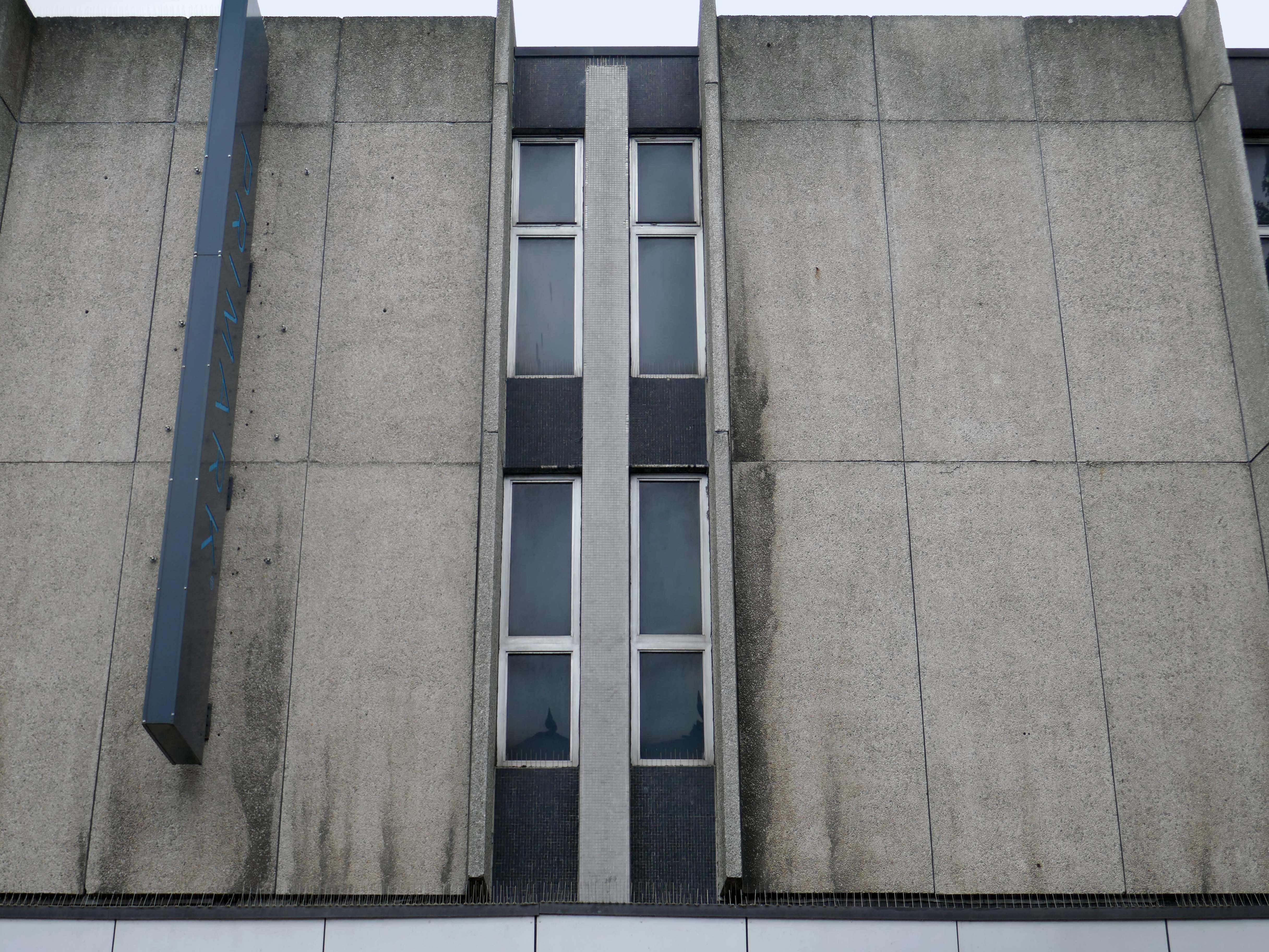
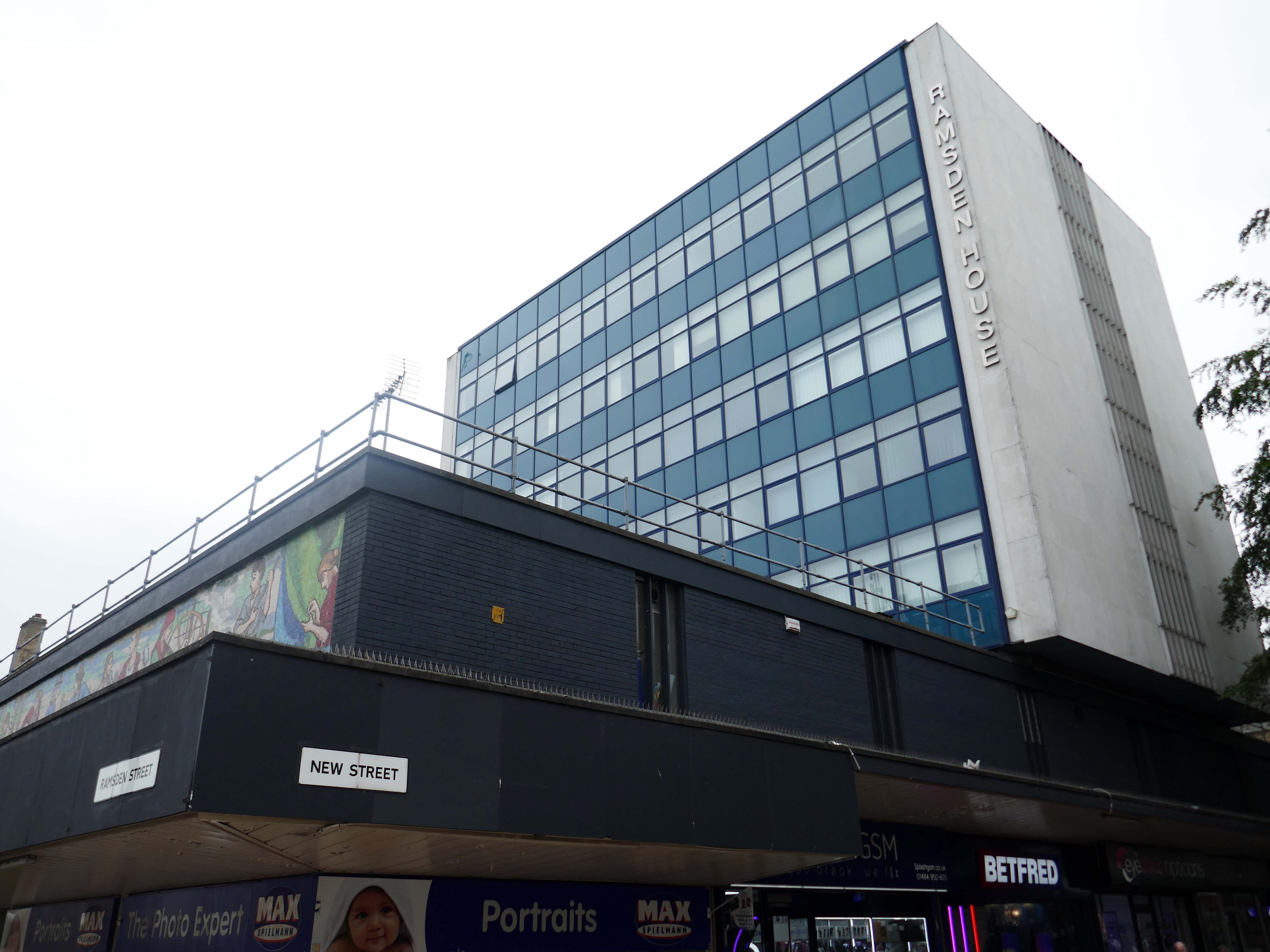
Across the way Ramsden House a slab on a podium, part of the Murrayfield Redevelopment 1968 J Seymour Harris Partnership.
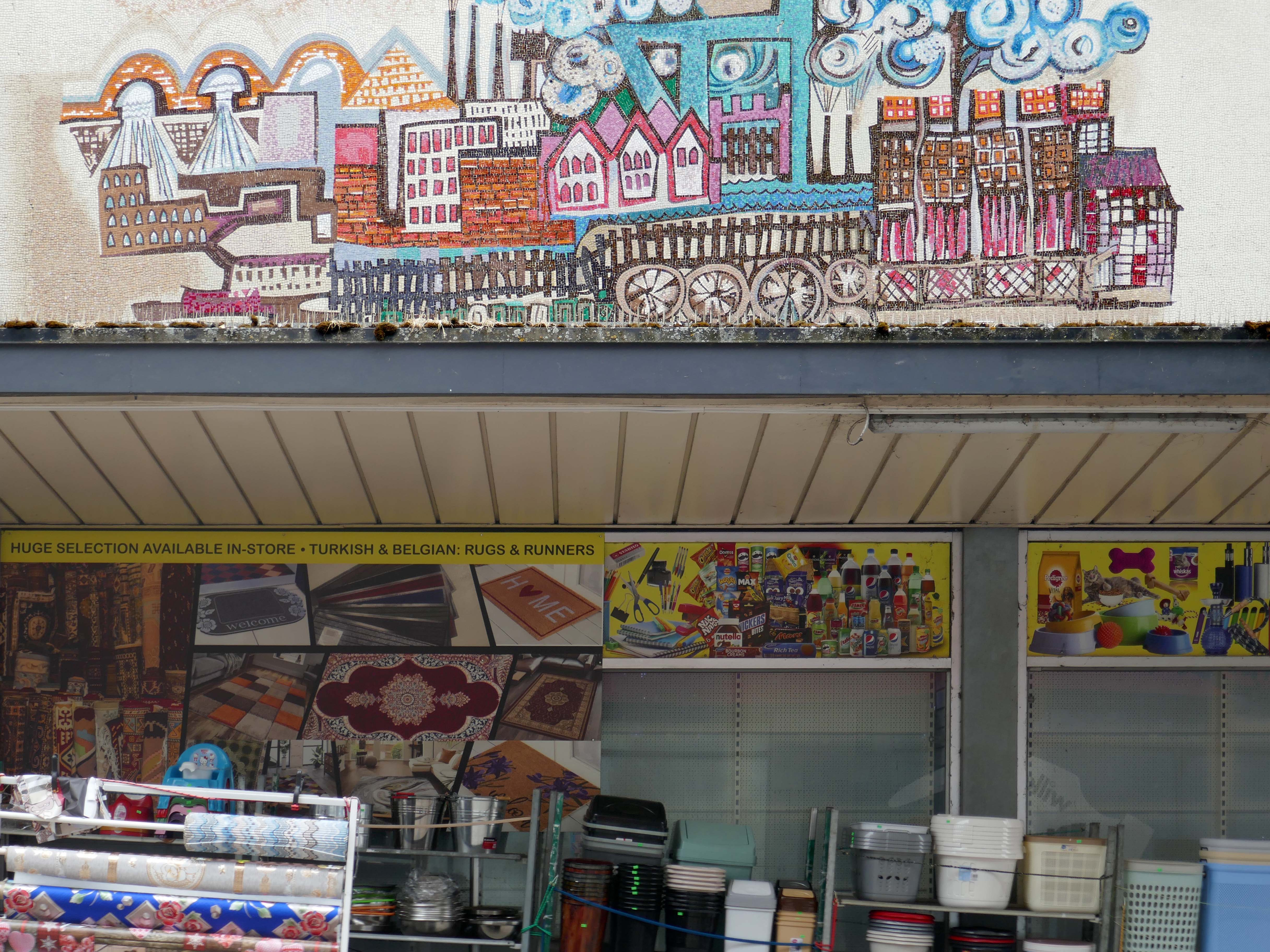
This block was the first and only phase of four that’s still intact. It’s a slab and plinth project with underground servicing marble finishes and two art mosaics that relate to the town. The Ramsden Street elevation mosaic depicts ‘Development of the woollen industry from a cottage craft to the beginning of the industrial revolution’ designed by Huddersfield artist, Harold Blackburn.
Princess Street bears ‘Facets of the Local Scene’ by Mural Consultants Ltd.
Across the way Whitfield’s Department Store 1963 Ralph Hudson.
The longstanding furniture & piano dealers, Whitfield’s expanded from numbers five and seven with this six6 storey tower.
Influenced by a tour of modern European retail premises the company chairman supplied the architect with photos of ideas.The glossy metallic finish reflects the excitement of the notion of an Ercol show room on the fourth floor and G-Plan on the fifth. Pianos were on the first floor and TVs & radio and their servicing were in the basement. Welcome to stylish living sixties style!
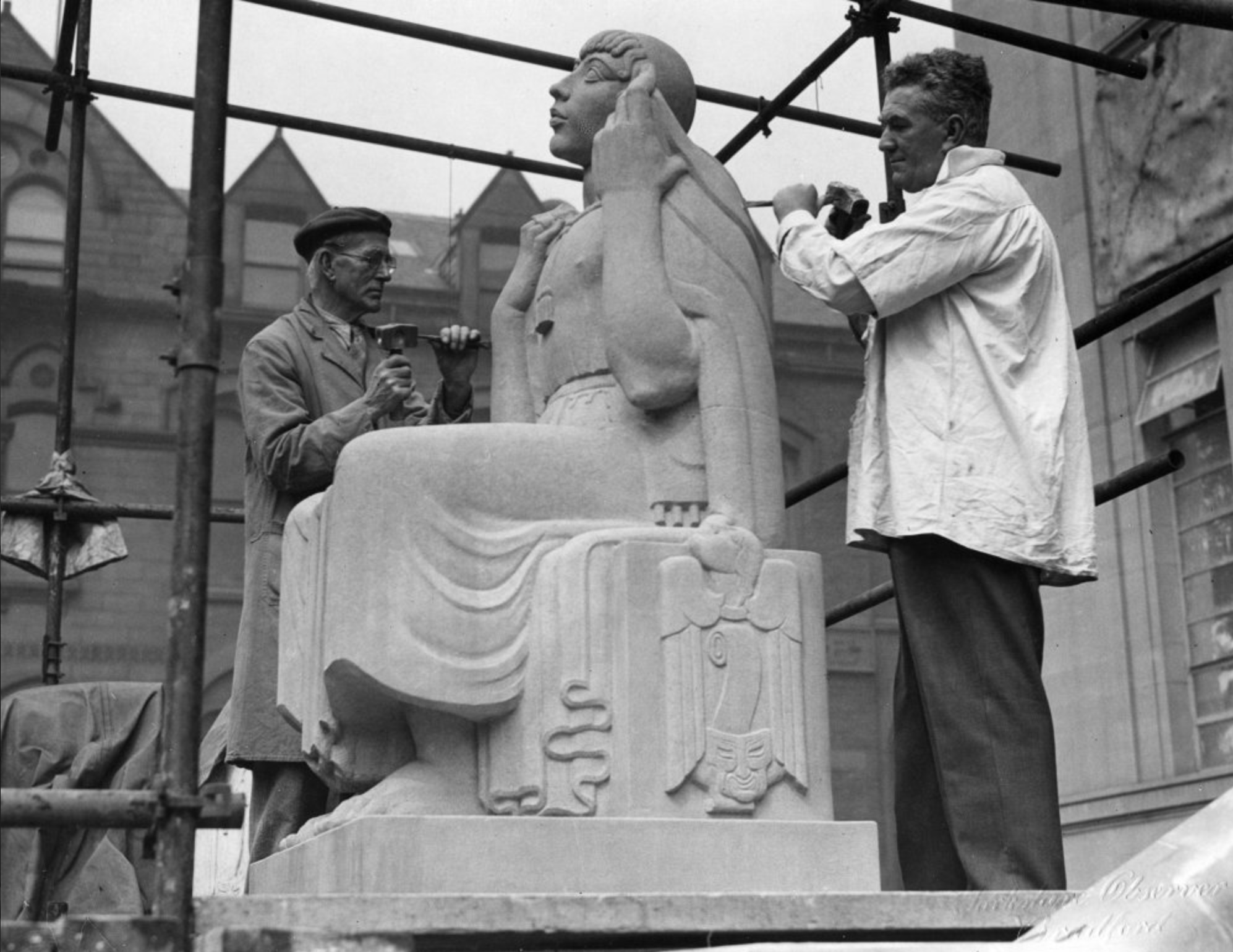
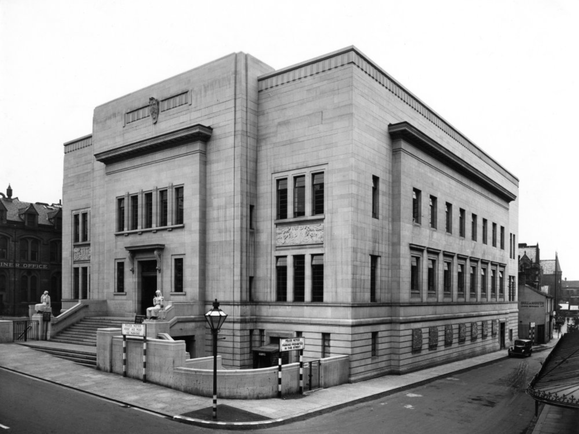
Public Library 1940 Architect: EH Ashburner&James Arthur Woodford.
James Woodford at work – on the right, sculpting figure representing the Spirit of Literature
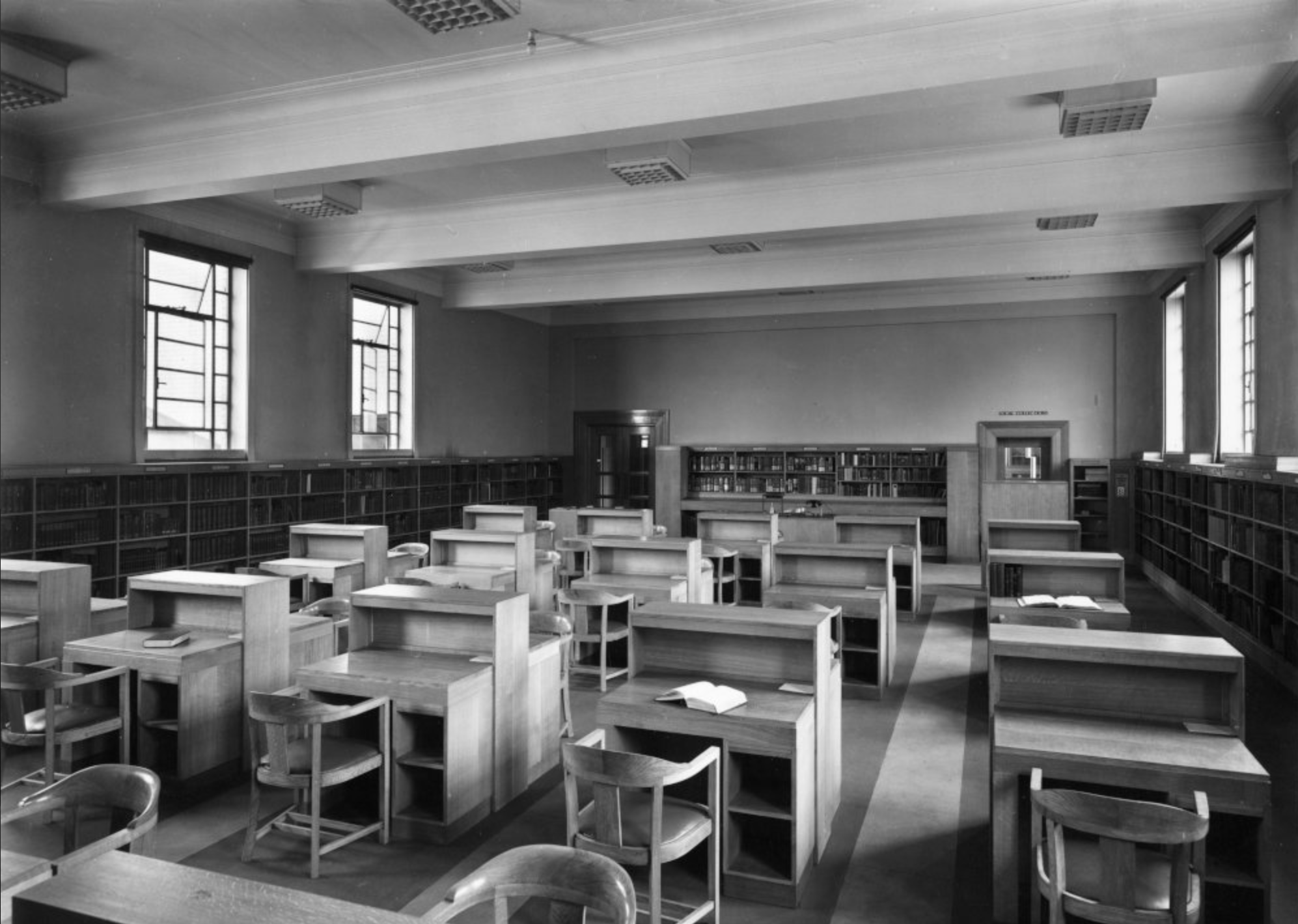
Reference Library.
Image – Charles Pickard 1940.
The food hall and library is due to open in summer 2026 but more problems have been uncovered with the former library and art gallery which will become the new museum. Internal works are underway and more asbestos than expected has been found and an extra £1 million has been needed to pay for removal.
The council has also found several other “significant issues” that also needed to be resolved.
It could be mid-2029 before the museum is ready to open.
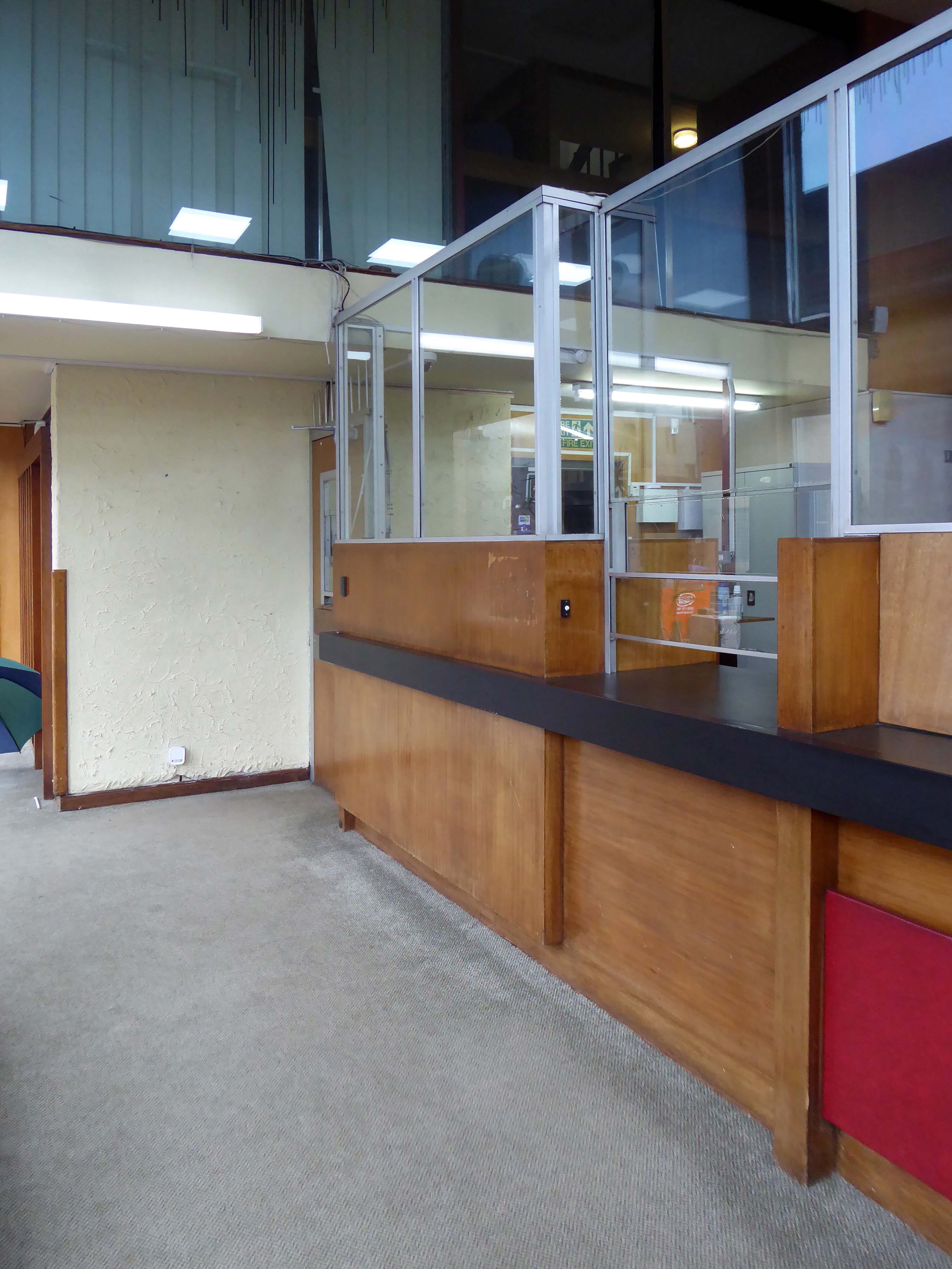
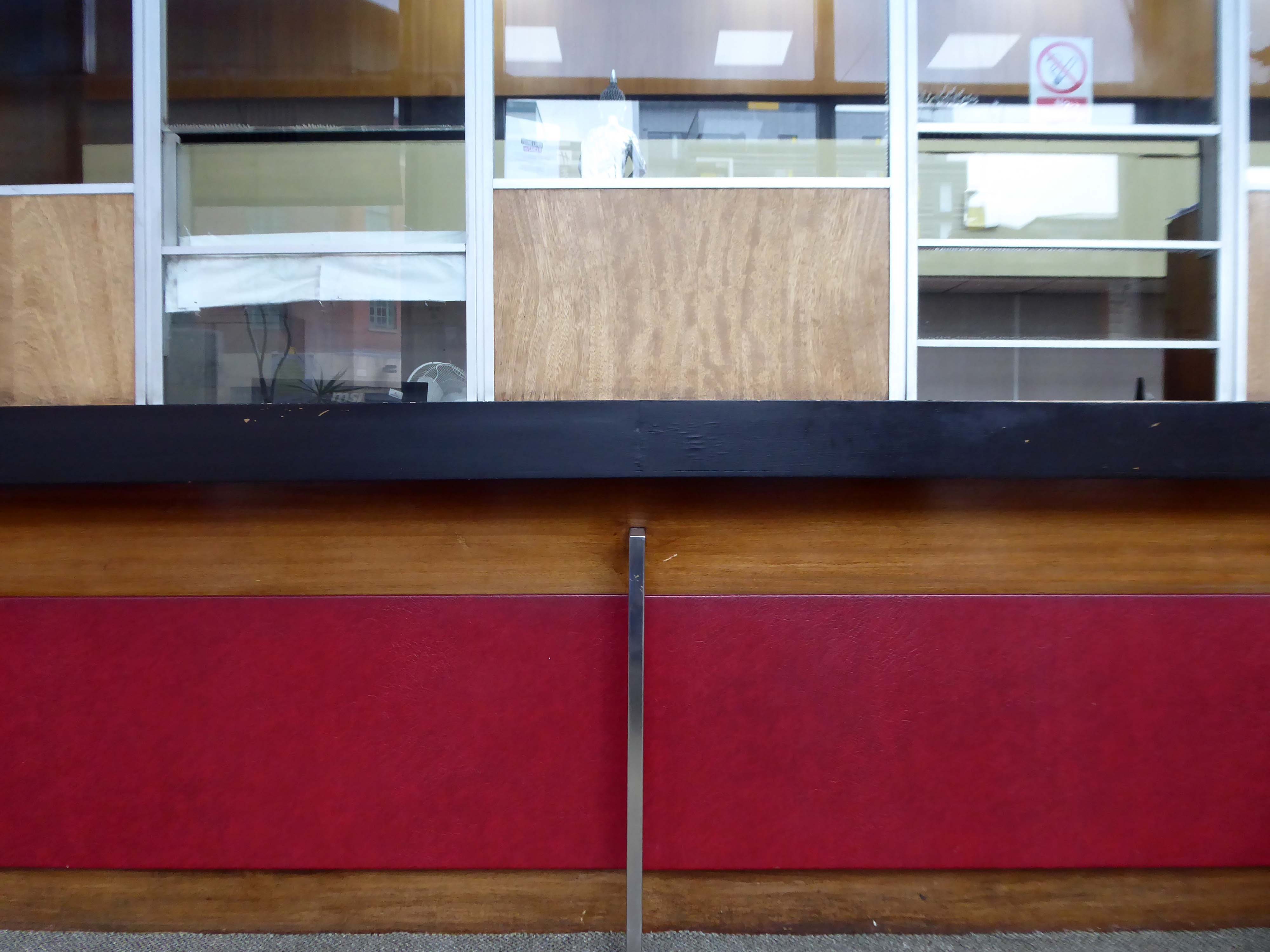
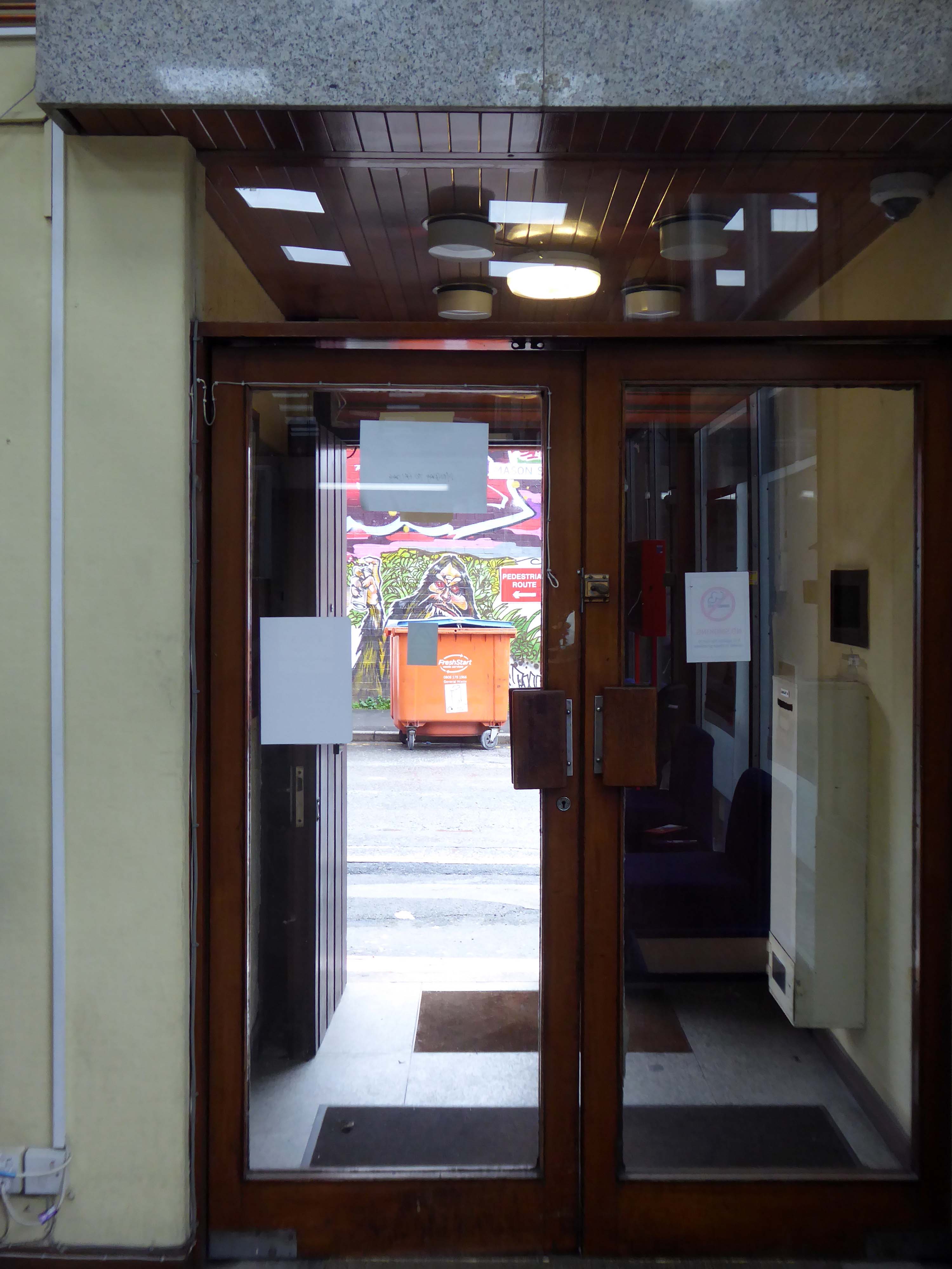
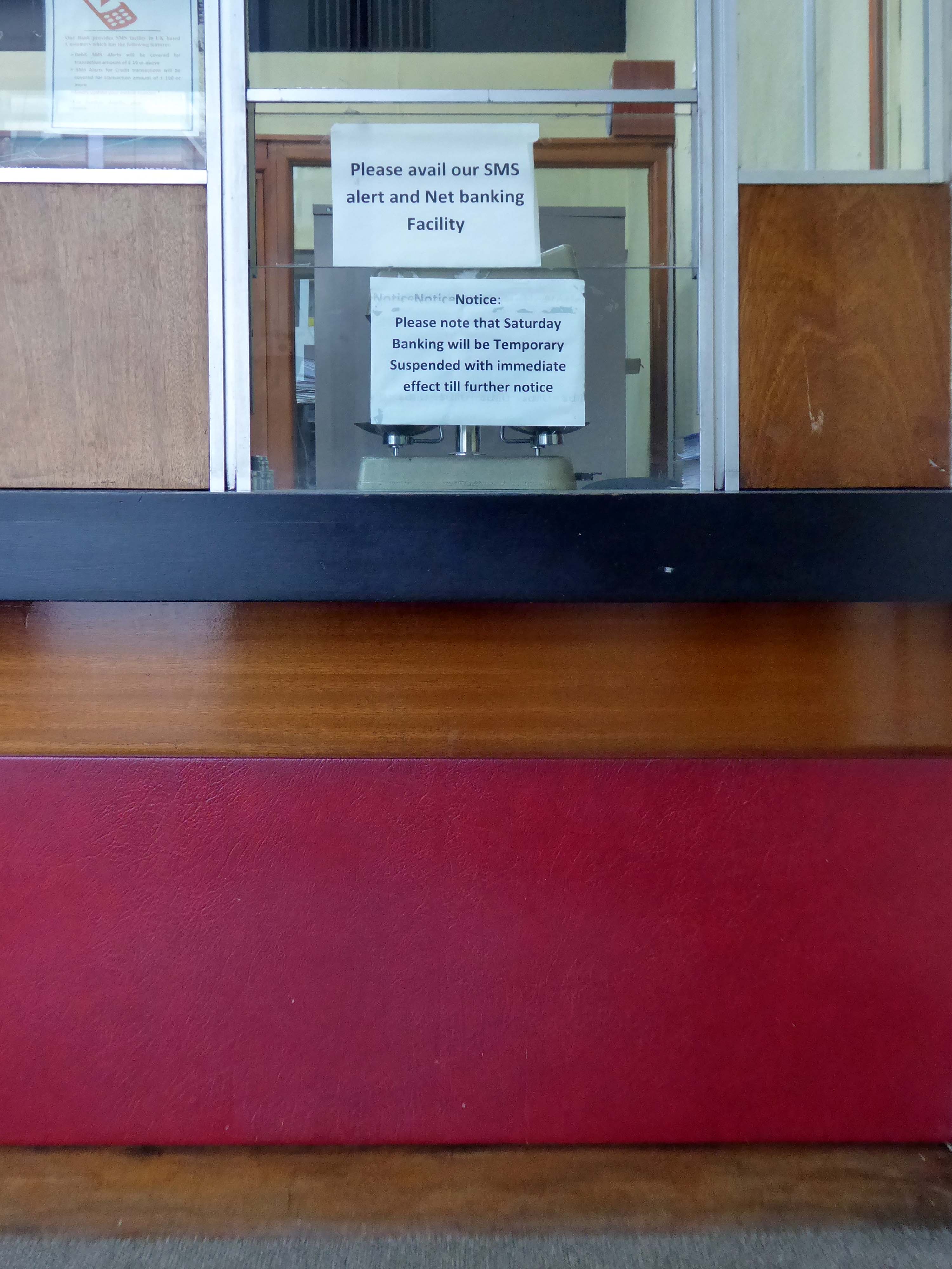
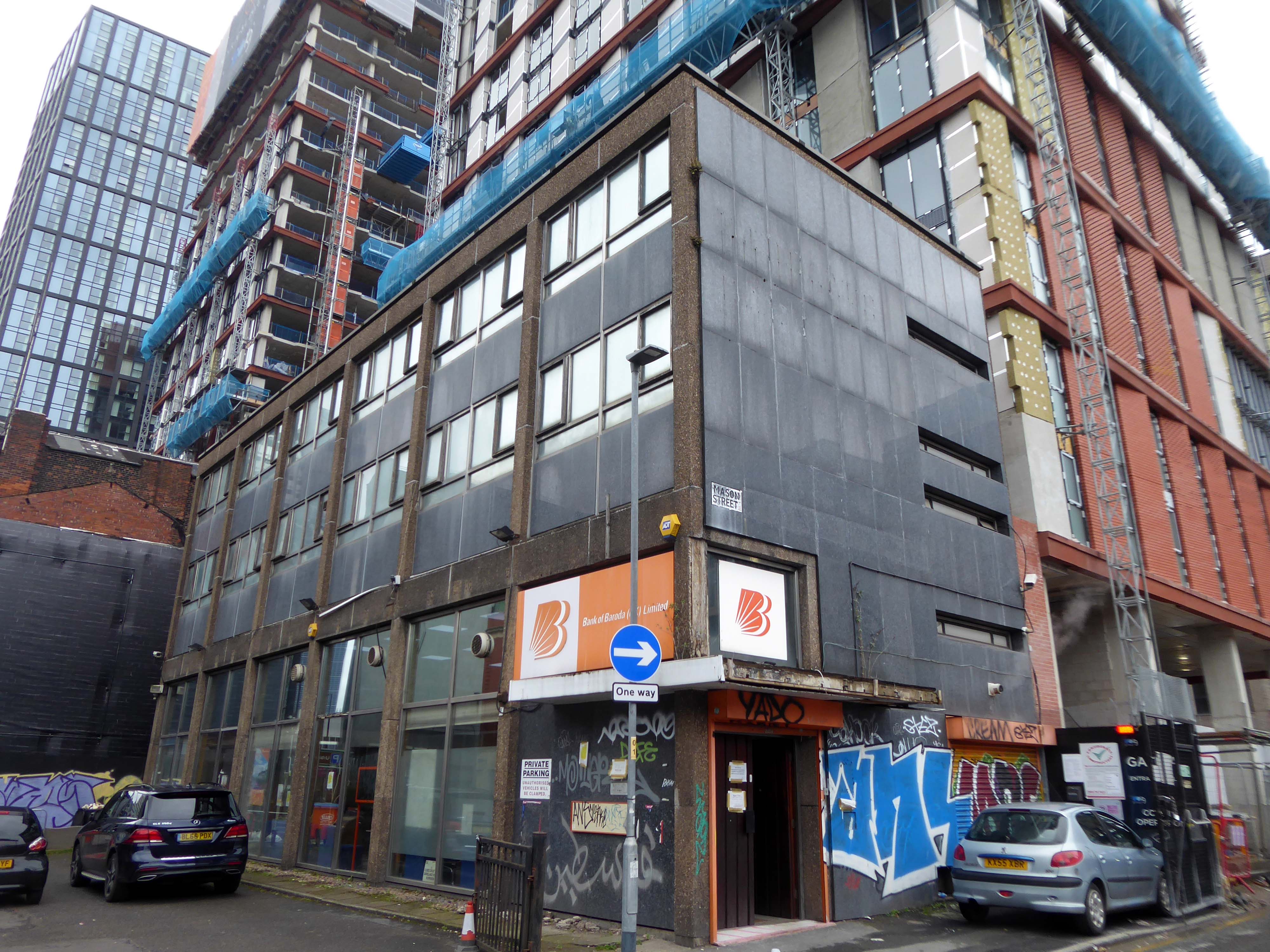
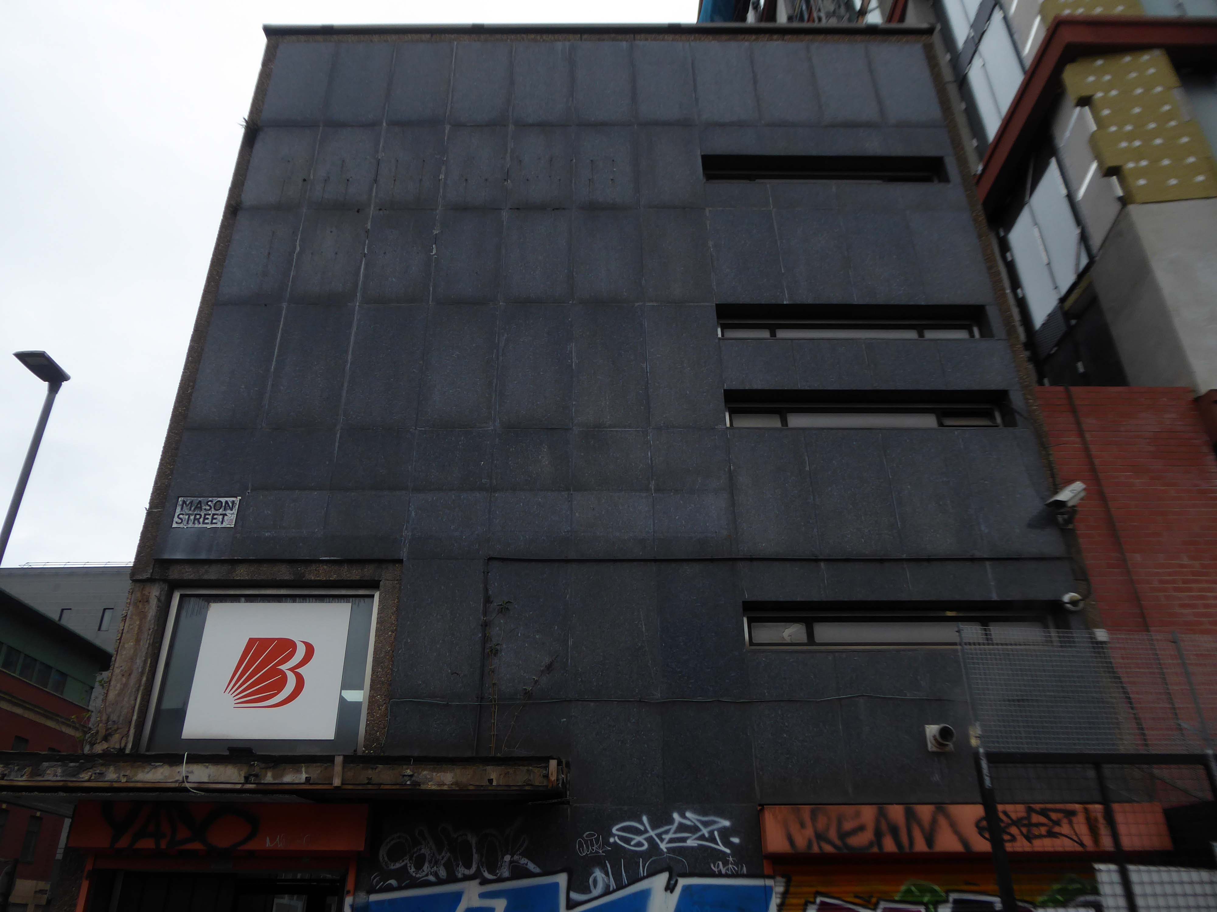
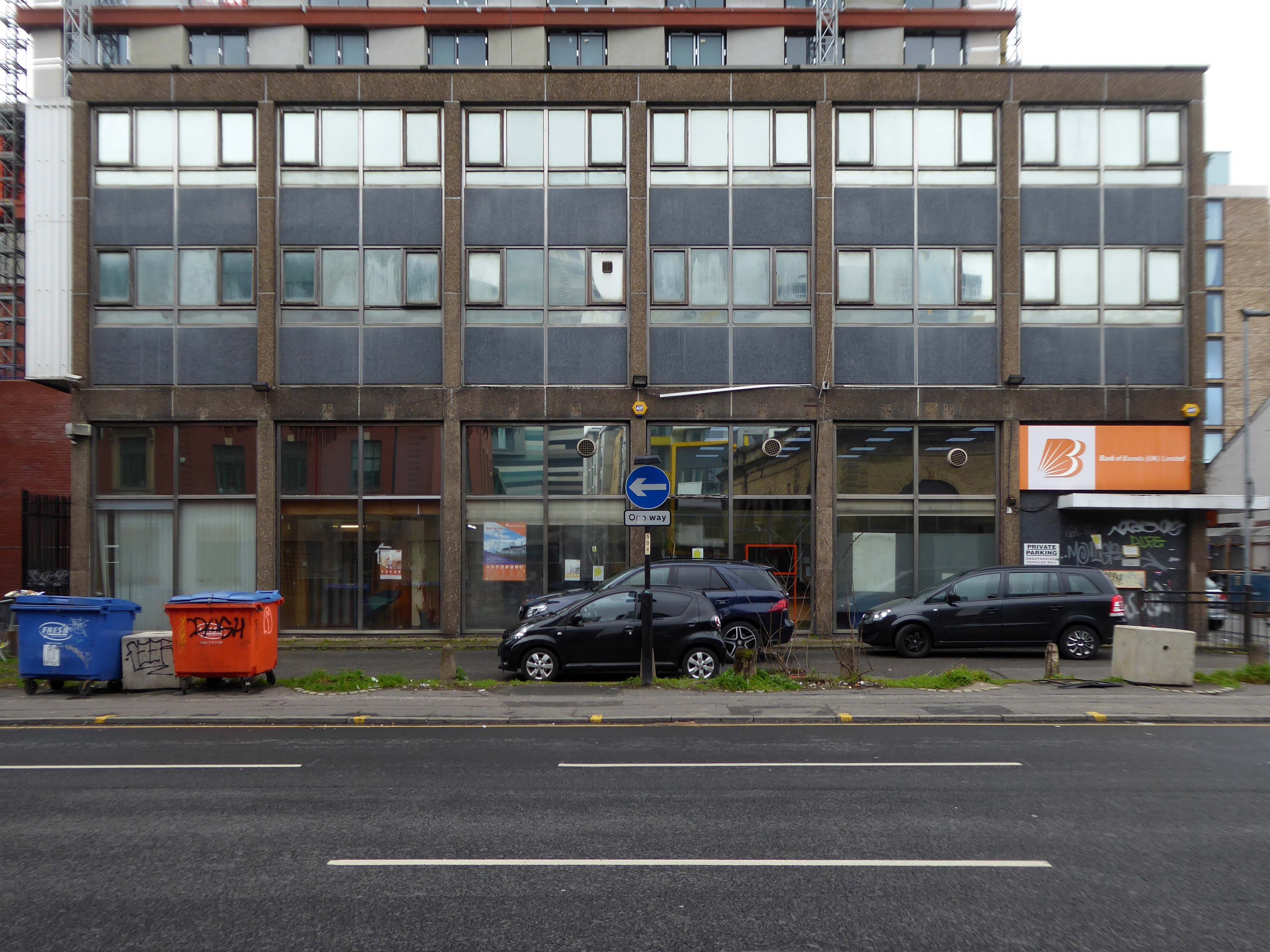
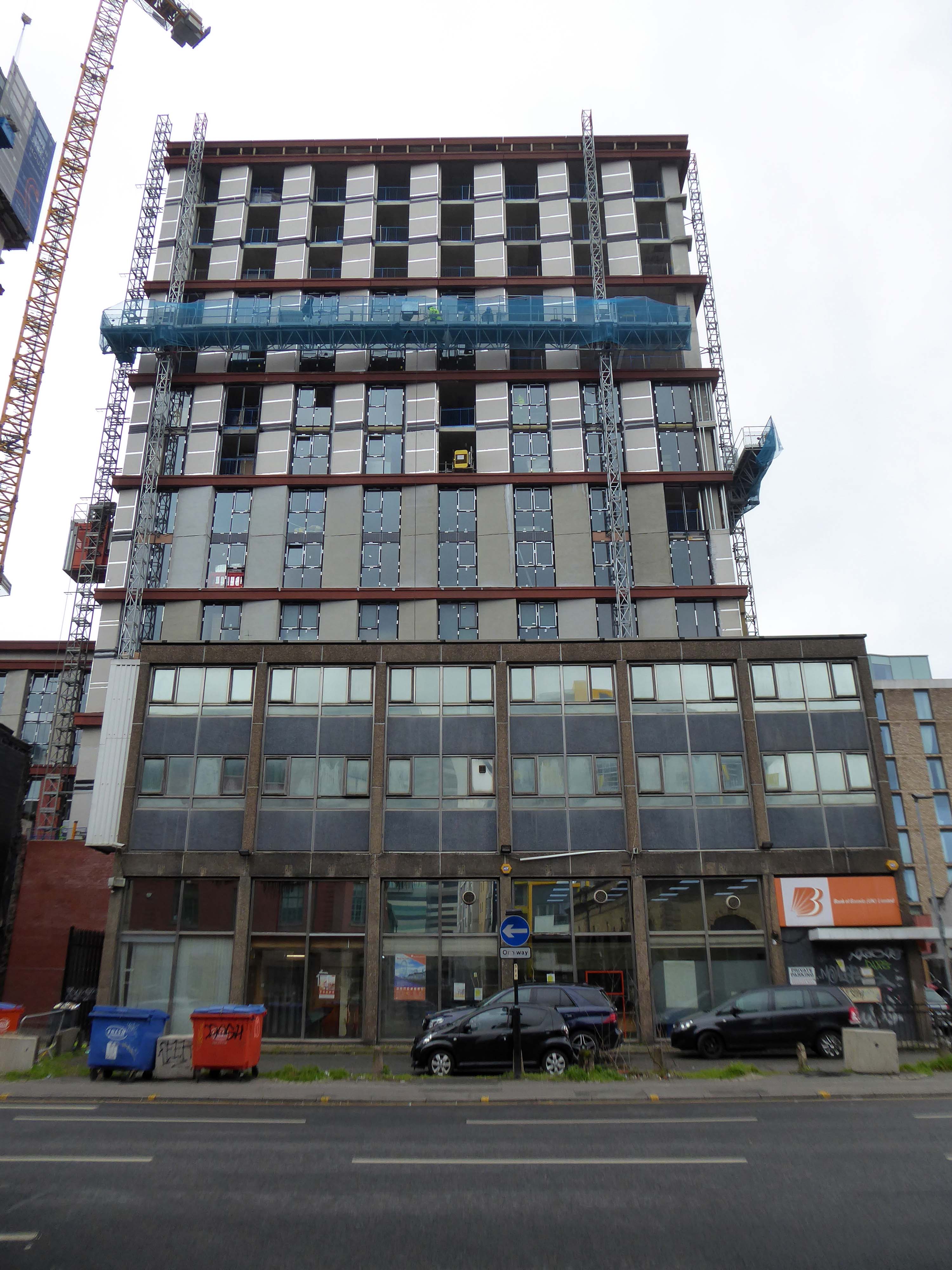
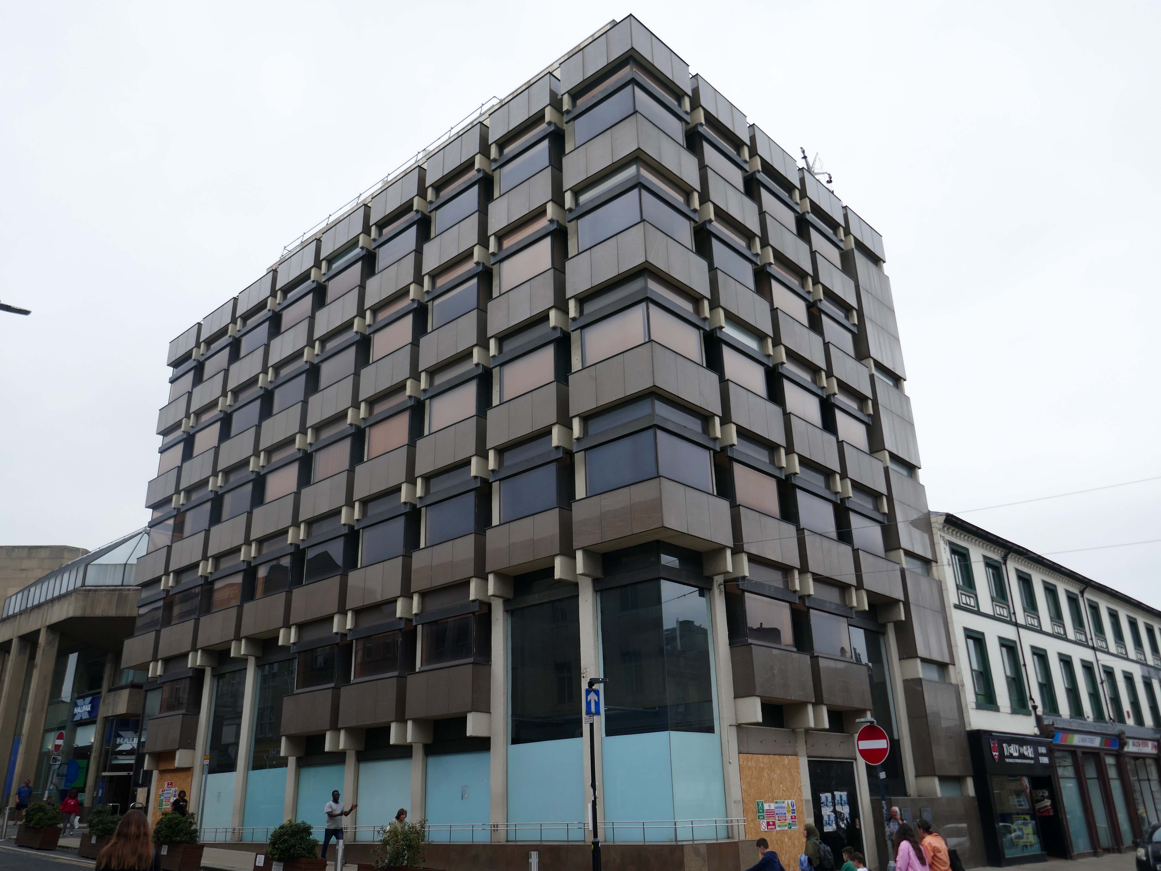
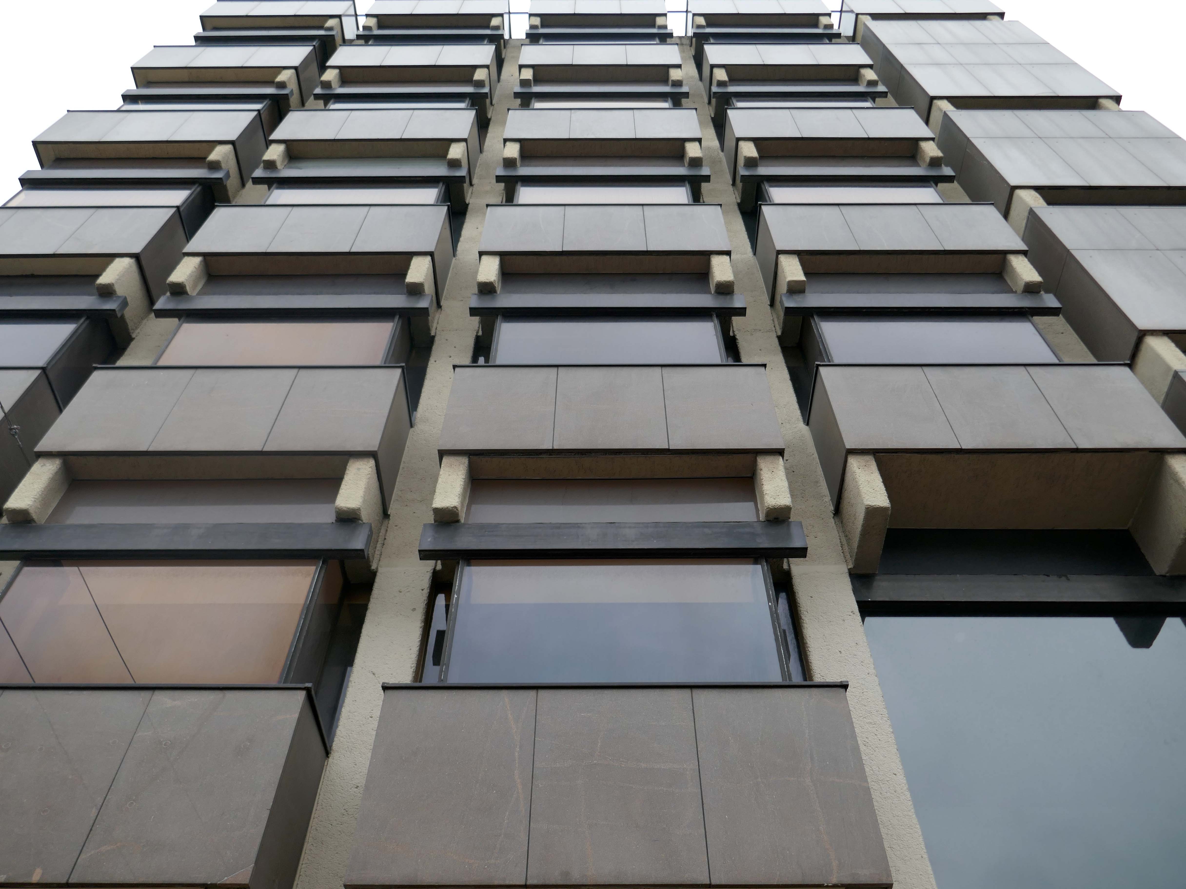
Off we go to the MidlandBank – then HSBC then not a bank at all, 1970 Peter Womersley with Roger Shaw of Kitson & Partners.
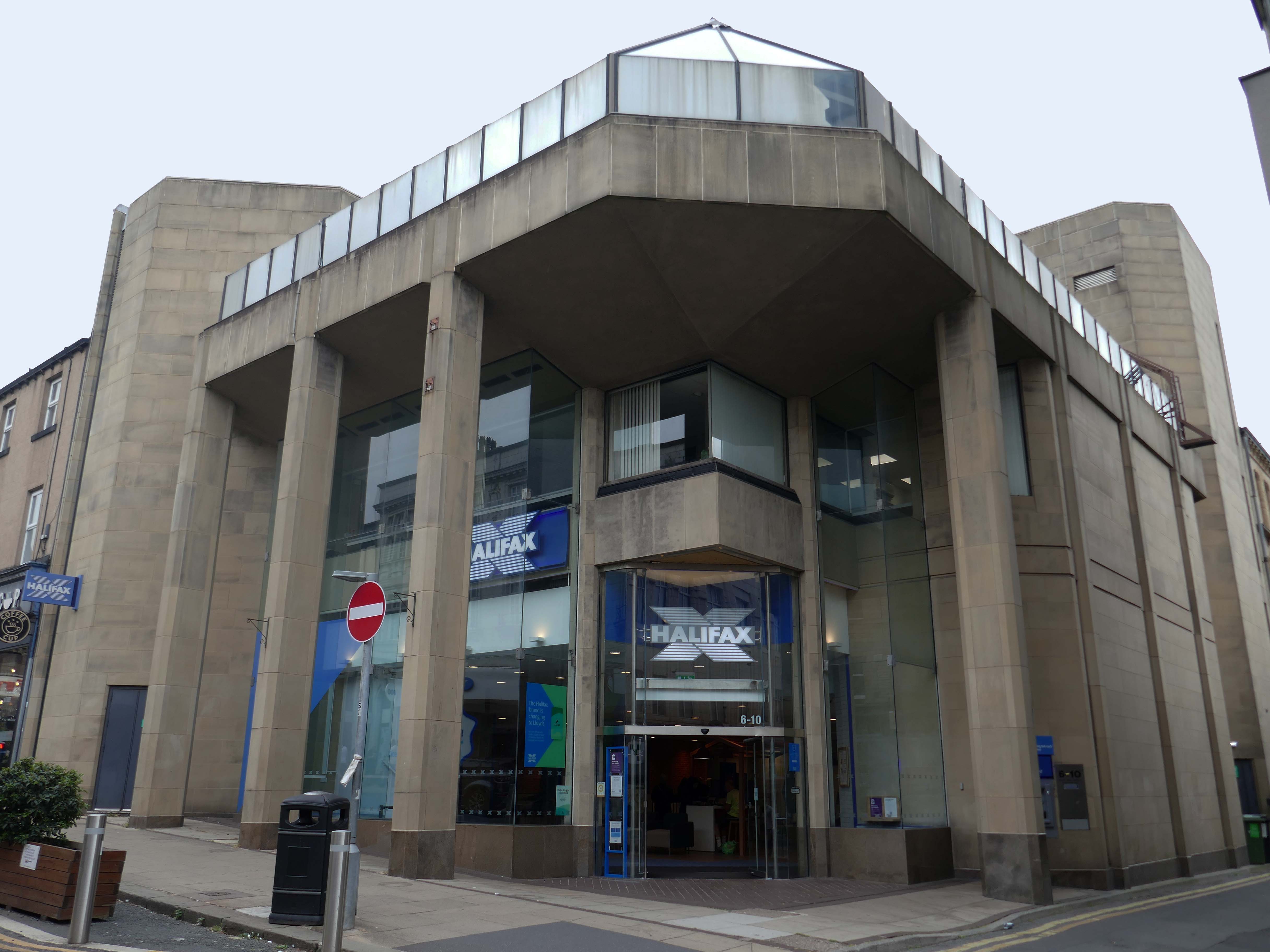
Next door the Halifax Building Society 1981 Abbey Hanson Rowe.
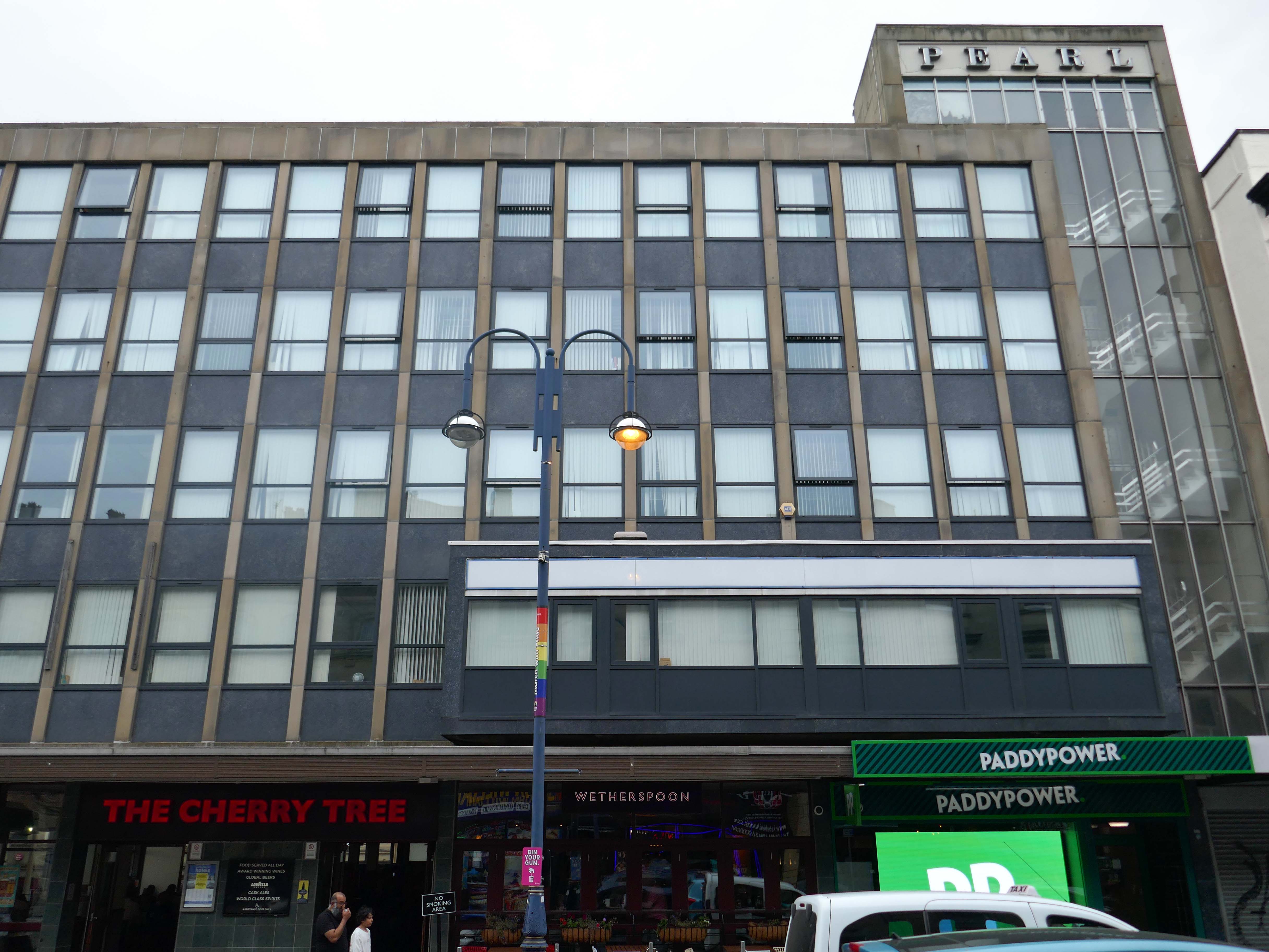
back to the main drag and the Pearl Assurance Building 1963 Elsworth Sykes & Partners.
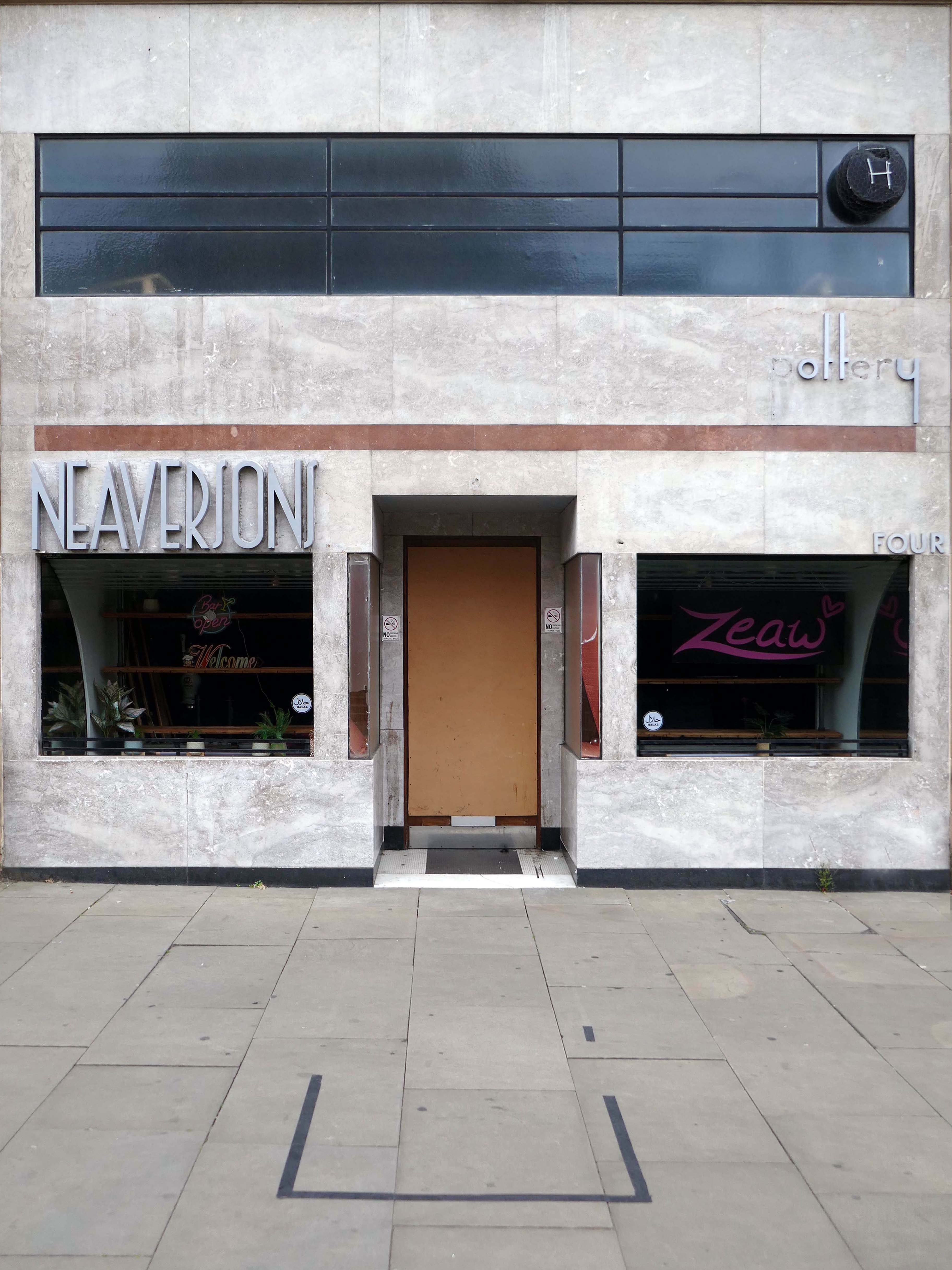
The nipping down the lane to Neaversons1935 with two Moderne fascia elevations by shop fitters Sharp & Law of Bradford, Grade II Listed as part of the Kirkgate Buildings.
Once selling bijou household goods, following occupation by several bars and cafes, currently empty.
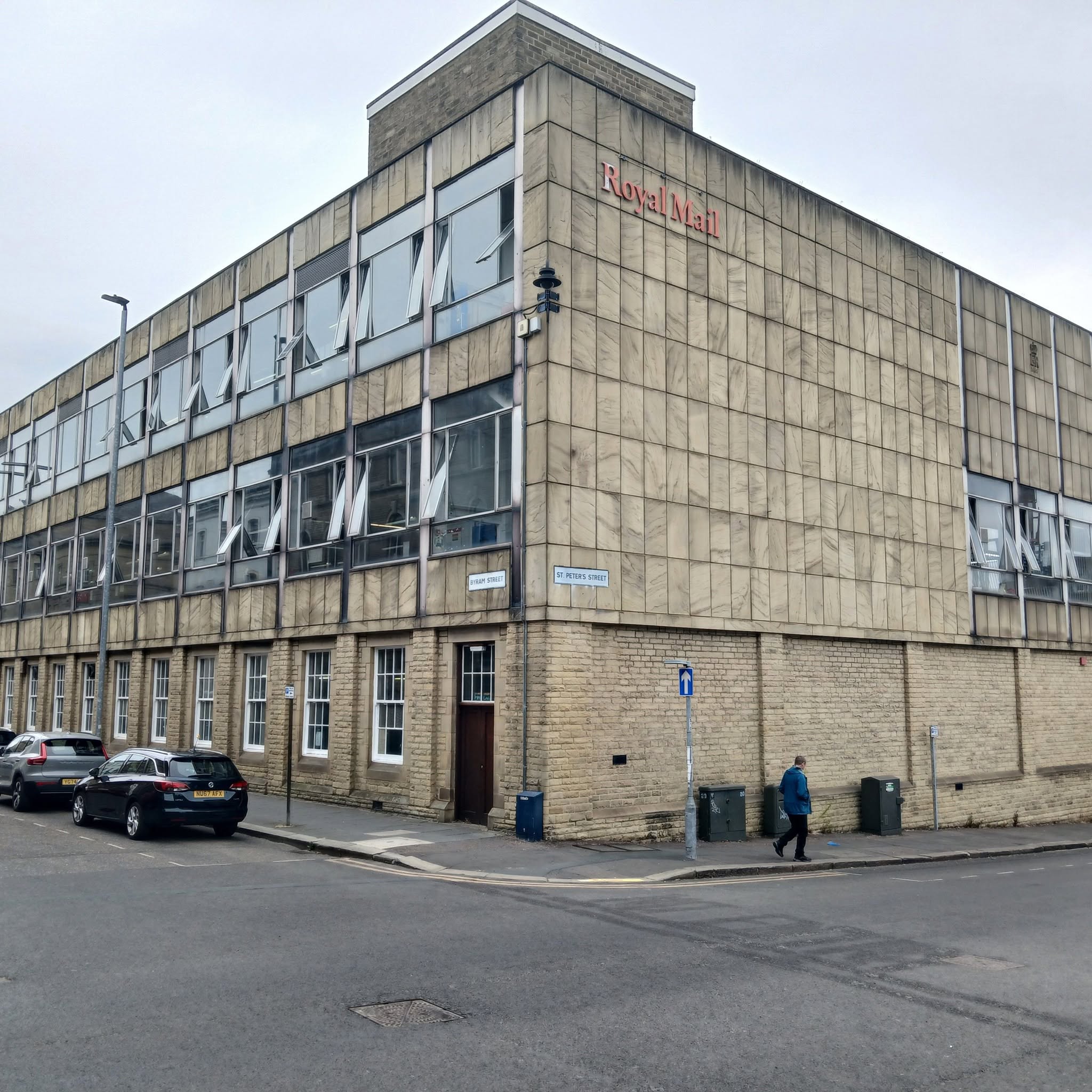
Finally just in time to catch the last post at the Royal Mail Sorting Office – Post Office extension 1968 Office of Public Works.
I began walking when quite young, then like Felix, I kept on walking, walking still.
The photograph was taking during the Whit Walks in 1958 – aged three, I was engaged in religious pilgrimage, as we know there are many reasons for walking, this is but one.
I was fortunate to grow up at a time when youngsters were permitted to roam freely, less traffic, less anxiety, gave me access to a wider axis of exploration.
The photograph would have been taken I assume, by my mam, on the Brownie 127. When aged nine I wandered alone through the local woods and exposed twelve frames of 44mm 127 film, the prints are long gone, yet I remember each of the photographs and locations clearly.
I went to school, then I didn’t, then I went to Art School, eventually becoming a teenage Constructivist, tutored by Jeffrey Steele, a leading light in the British Systems movement.
The rigidity of the grid, symmetry and orthogonal framing have stayed with me.
Then I went to work for a very long time indeed, then all of a sudden I didn’t. Taking early retirement aged 59 some ten years ago, subsequently taking to the roads, streets and hills of Britain in search of nothing in particular.
In recent years there has been a rapid development in the culture of walking, theories, films, guides, songs and literature. I am fully cognisant of such, yet believe at heart that walking can be free of such baggage, we can stride unhindered, atavistic and carefree/less.
Walk tall, walk straight and look the world right in the eye.
Getting lost is about the unfamiliar appearing.
In my own small way, I have become part of that baggage, having been asked to lead a walk around Stockport by the the modernist neé Manchester Modernist Society.
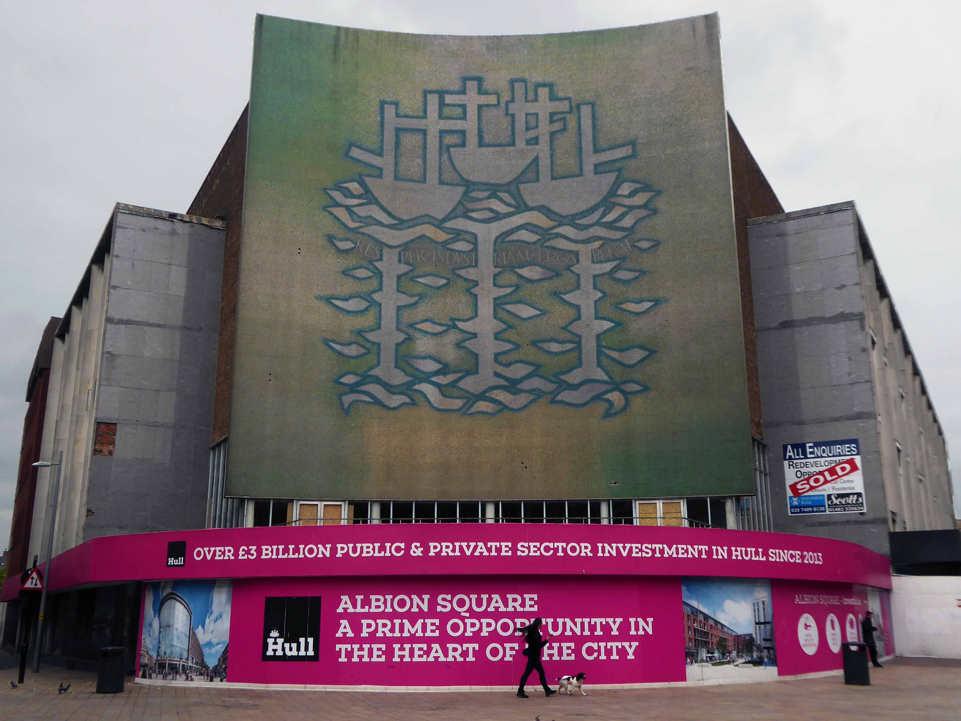
The photograph depicts Alan Boyson’s concrete screen wall, attached to the former Cooperative super store designed by Philip Andrew. The two worked to gather on the Hull Cooperative store, which is adorned by Alan’s huge Three Ships mosaic.
Philip was a childhood friend of Alan Boyson and it was Alan’s father, manager of the Marple Co-operative Society, that recommended Philip for an apprenticeship job in 1951 to the chief architect at the CWS in Manchester HQ.
In preparation for the tour, I visited the town’s Local Heritage Library and read extensively from serendipitous charity shop finds.
The two hour route was designed around an economy of distance and elevation, allowing time for others to take in, what may be for them unfamiliar surroundings. A group of around twenty or so folk became sociable and engaged, with a suitably concise and apposite contribution from myself. There are those who busied themselves taking snaps along the way, chatting amiably or simply gazing in amazement.
The service building above the former Debenham’s store.
Famed as an imaginary TV police station, this civic building is a civic building I simply can’t resist. I return on a regular basis to wander and snap. This is an open public space that seems little loved and has few visitors.
From then onwards I have been taking folks on Modernist Mooches on a regular basis, two or so a month, during the less inclement times of year.
At about the same time I was asked to exhibit my photographs in Stockport, I chose to mooch about at night. Walking around an almost deserted town, avoiding the glare of streetlights, there is a mild frisson to be about when nobody else is about. The air feels different, exposures are longer, the almost waking world feels arrested, by the low available light.
My local shopping centre and as such part of my weekly walking and shopping life.
NCP Car Park located on Stockport Station approach.
Regent House
Asda superstore
I found a copy of Charlie Meecham’s book Oldham Road in a charity shop.
Inspiring me in 2014, to walk in mostly straight lines, though often as not zig zagging along the main arterial roads of Manchester.
Taking pictures on Sunday mornings, in order to avoid traffic, mildly amused to be ignoring the primary function of the routes.
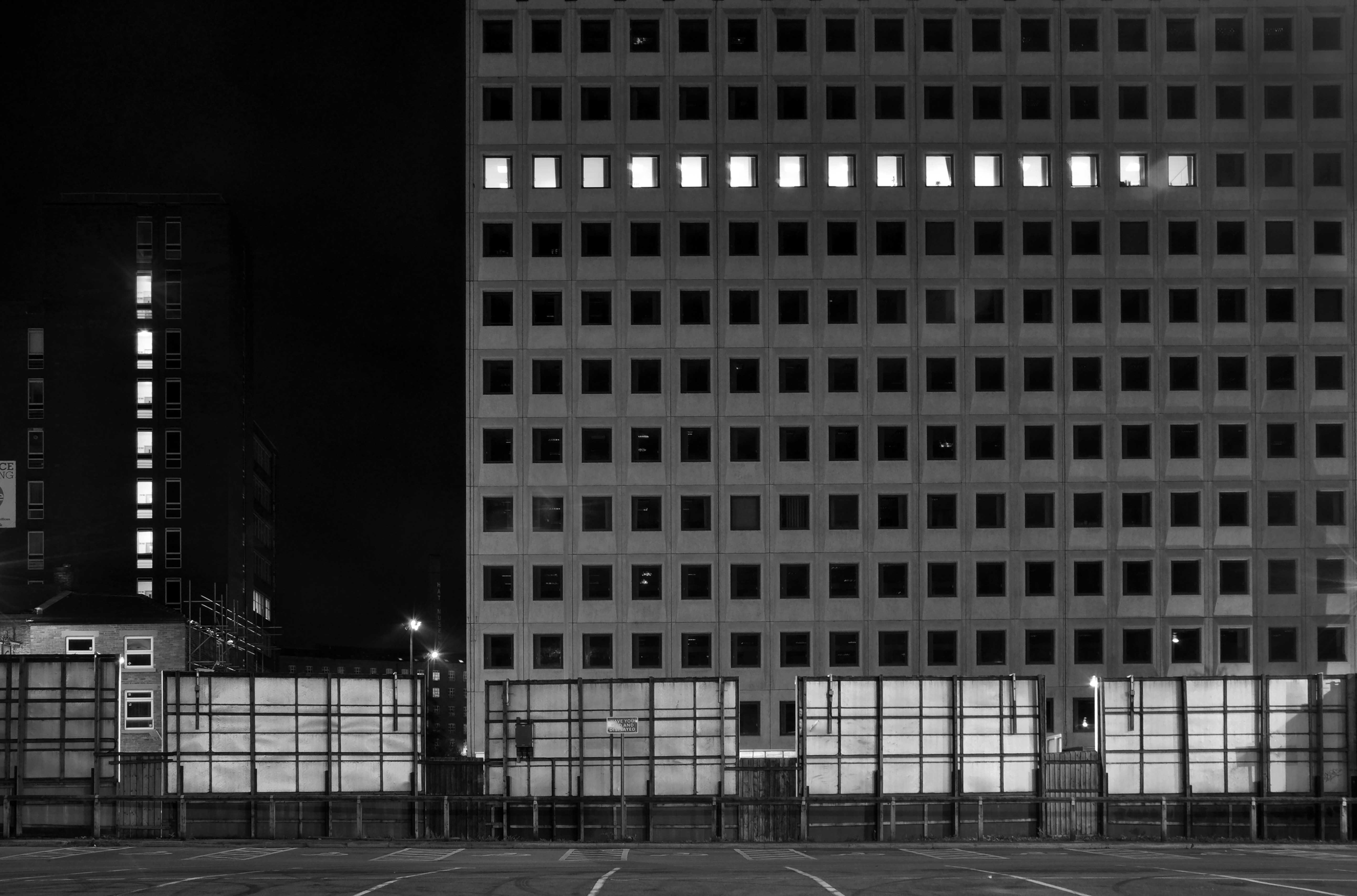
This is one of the more familiar roads, having walked up and down several times over several years. It was to have been an extension of the Mancunian Way, forming a trans-pennine motorway. Much of the property lining the route was cleared in preparation, it was never built, and for years a strange semi-deserted ambience hung over the A57.
Bus Depot
Railway Bridge
The car showrooms which later became an African Evangalist church.
Having cleared away both Victorian and Sixties housing, new architectural forms arose in West Gorton.
Now, everywhere I go, I see launderettes – so arriving in Hanley with time on my hands, wandering around I found this exemplary example.
Having a blog entitled Manchester Estate Pubs, the national media became interested in my photographs. I had spent quite some time, wandering around in search of this endangered architectural typology.
This was Billy Greens in Collyhurst, named for a local boxer, now demolished.
Which in turn became the second modernist calendar.
Followed the following year by fish and chip shops.
So building a vocabulary for my mooching, discovering yet another chippy, laundry, pub, Burton’s, telephone exchange, glazed stairway or underpass.
These things find you, yearning for some small amount of attention and affection.
The Trawl – my favourite peg board menu, my favourite Bridlington chippy.
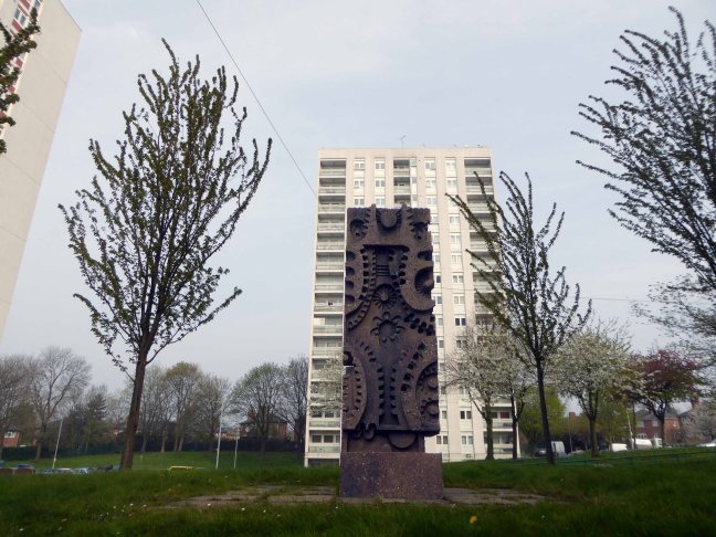
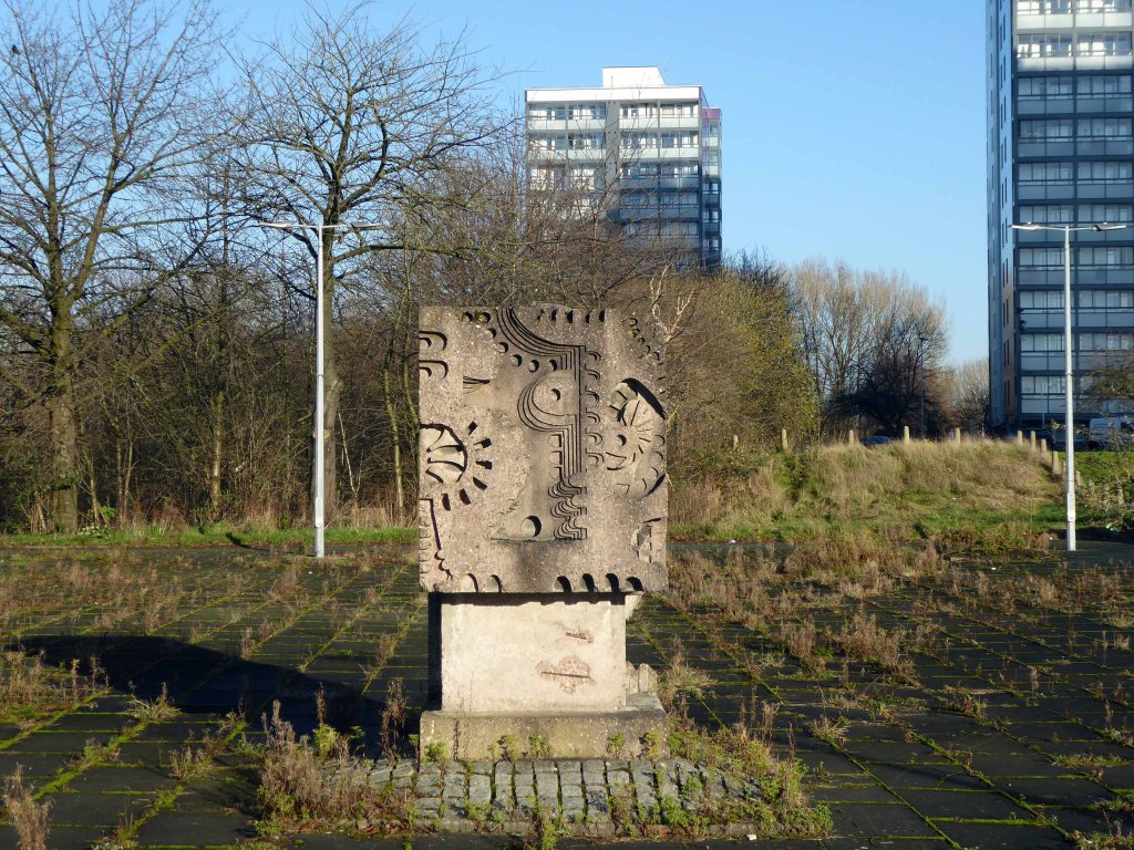
We are now coming to the end of the car park year – seen here on the wall of my command centre.
Home to William Mitchell’s Totem, the homes long gone and the Council pledged to move the totem too.
The state of play this week, the detritus removed and the base filled in, repaved and safe for a while.
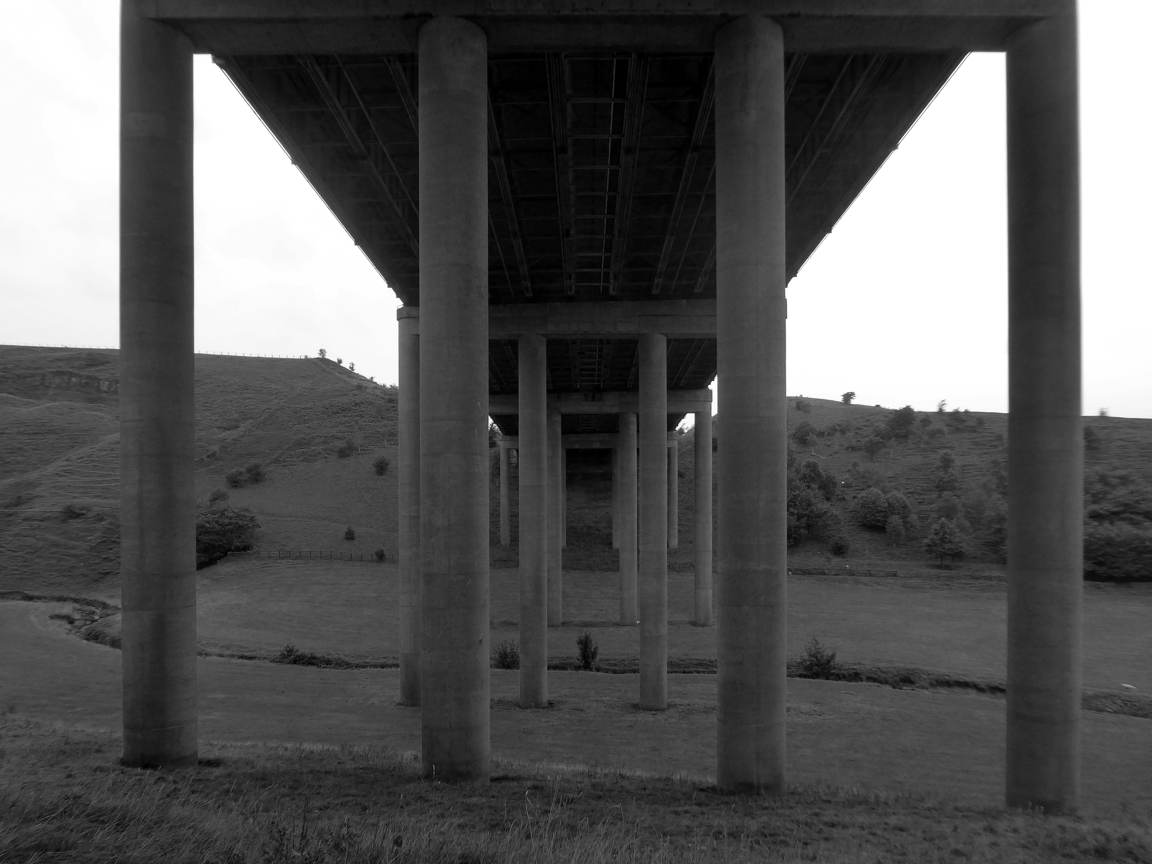
Off now to the Weaver Valley another day another river, passing under Weaver Viaduct
The looking toward KouraGlobal – leader in the development, manufacture, and supply of fluoro products and technologies, opened a new HFA 152a production facility at their Runcorn site in the UK.
Further rural Modernism as we pass under and traverse the M62, whilst walking around the Piethorn Valley
The newest of the Modernist Mooches was to Burnley where we visited the Keirby Hotel.
The former GUS Offices with a mural by Diane and William Morris.
Plus the Charles Anderson concrete relief at the Crow Wood Hotel.
Finally a little light relief – a visit to the Boots factory in Nottingham.
Having innocently board a bus outside the station with a Boots head code , I alighted within the factory gates. Then innocently walking around taking snaps, unheeded until the men in the van stopped me in my tracks.
Who are you, what are you doing?
I am the Modern Moocher going about my business – well it turns out this was not permitted and I was red carded by the earnest security guards and asked to leave forthwith. Suitably rebuked, I politely bade them farewell and headed for the gates.
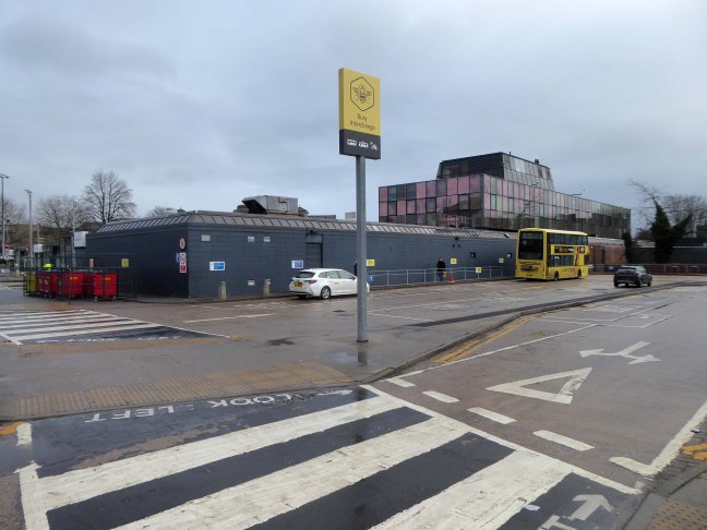
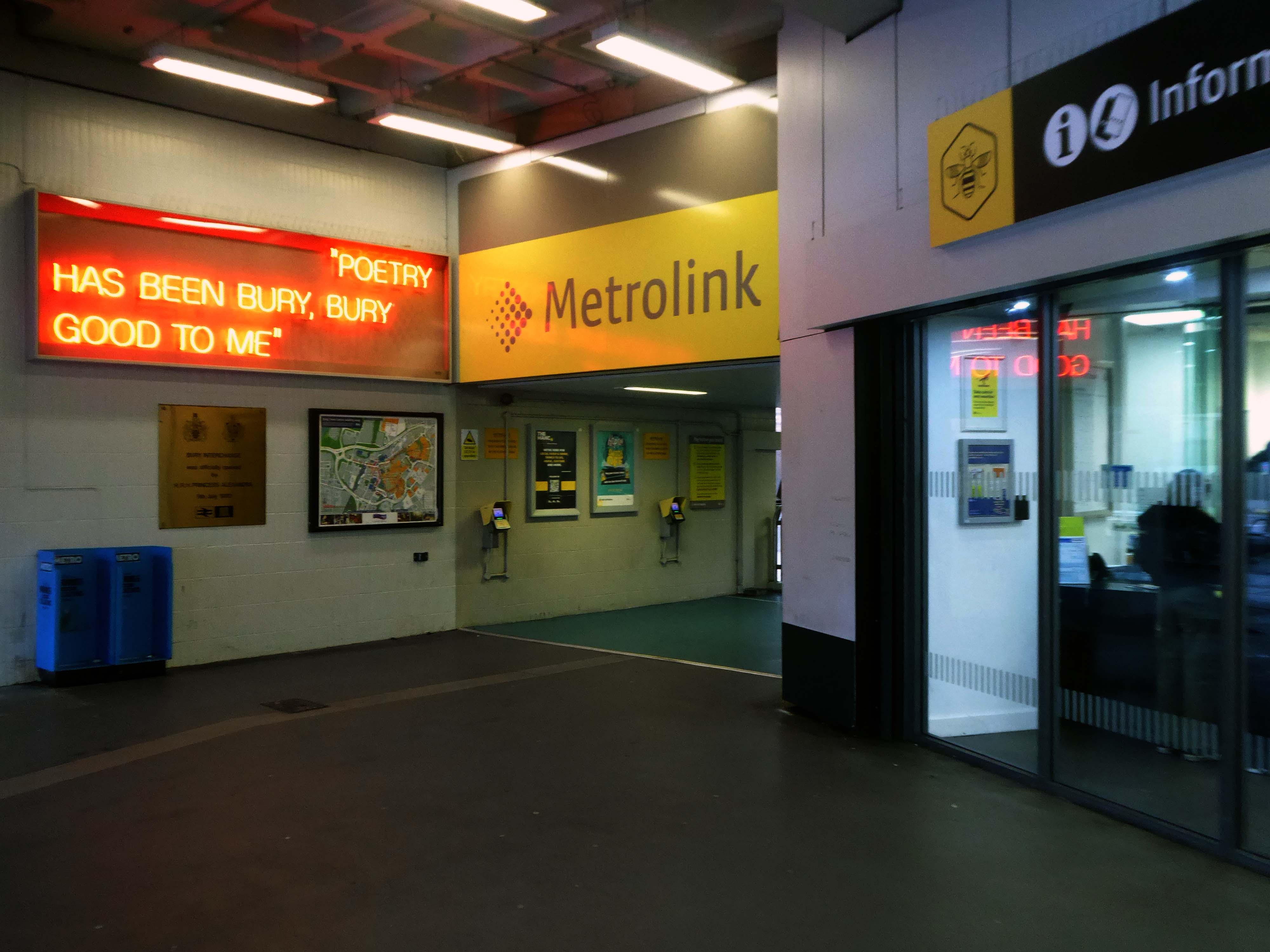
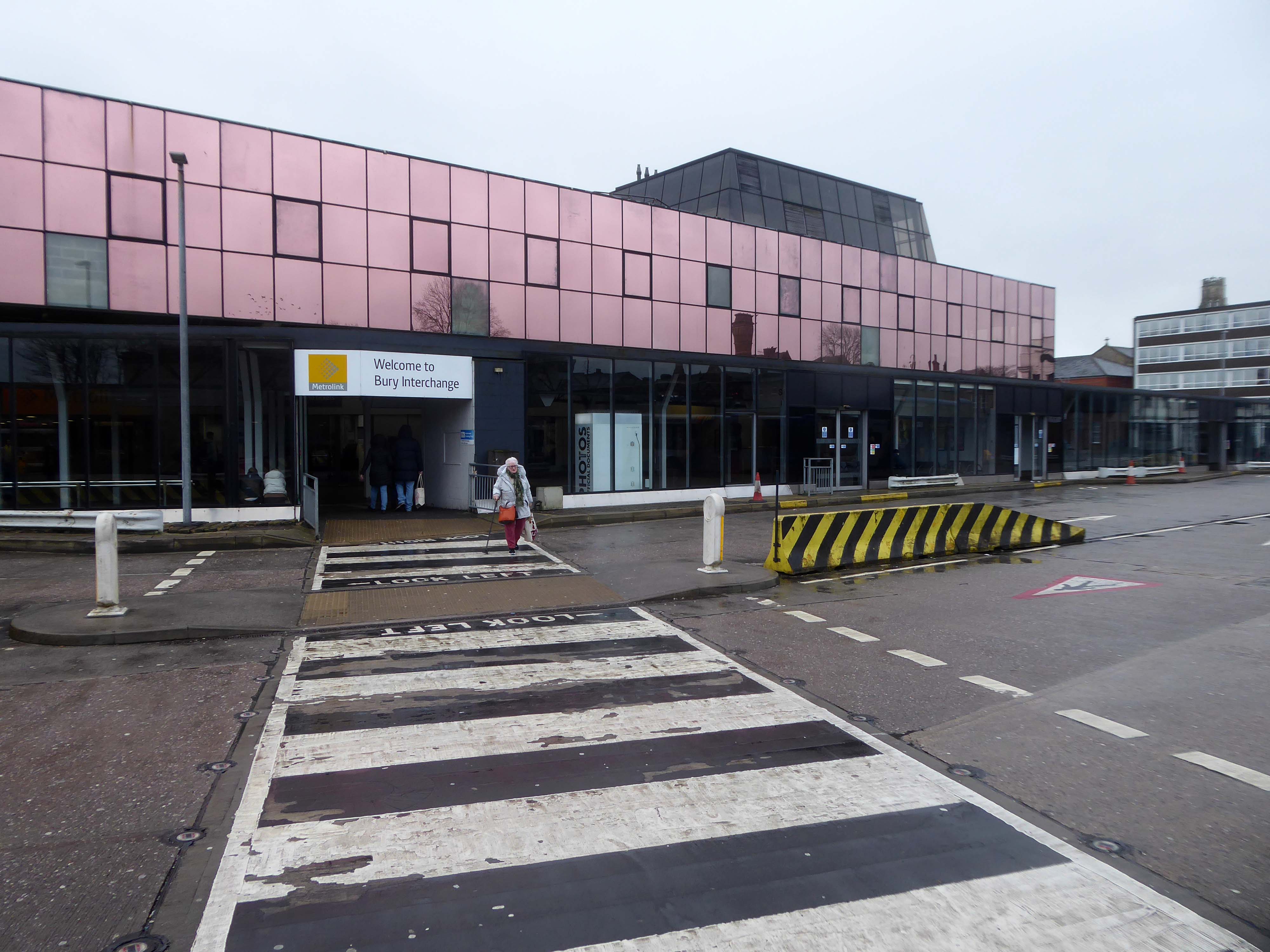
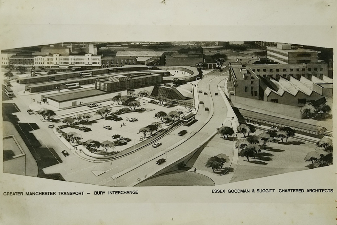
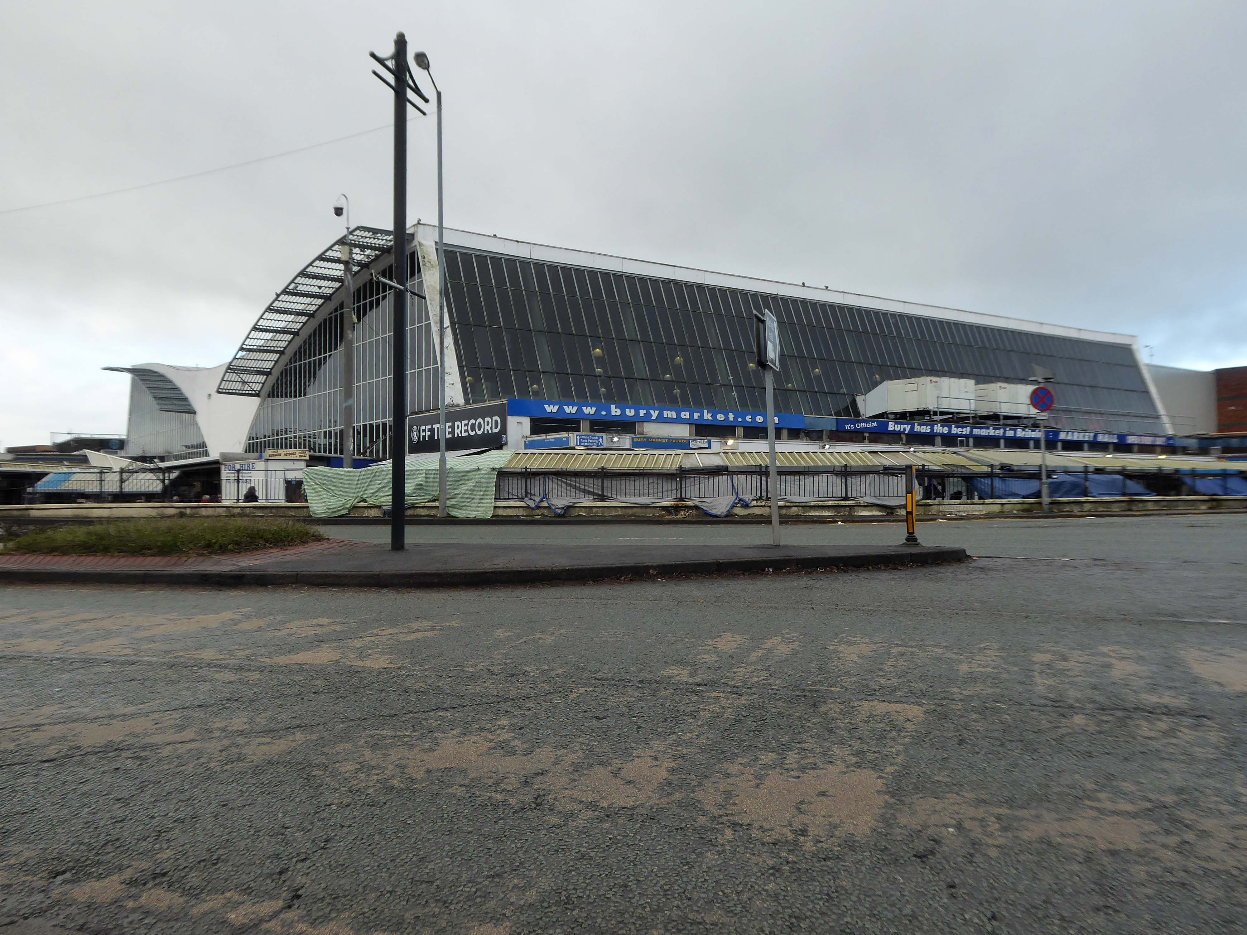
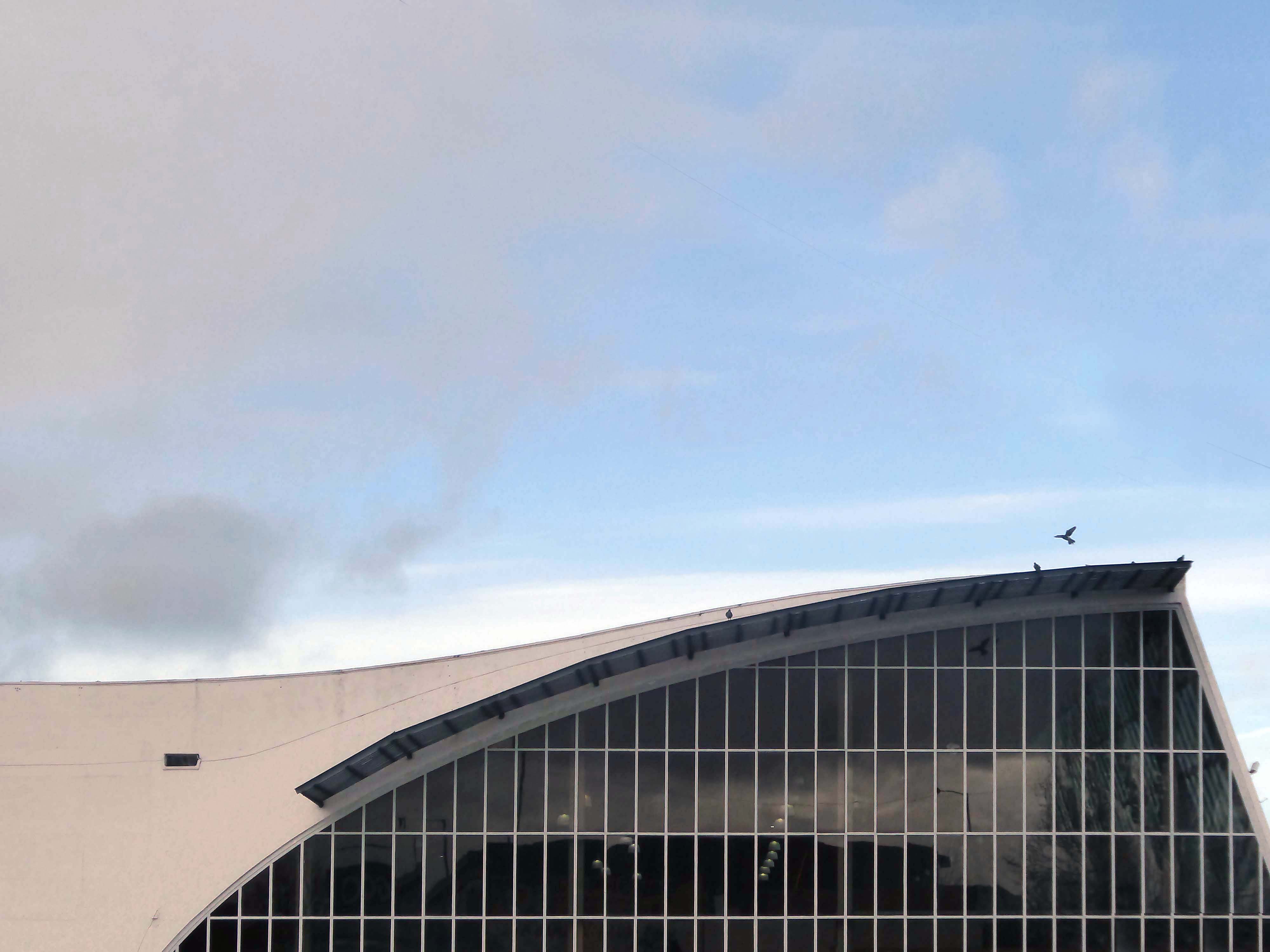
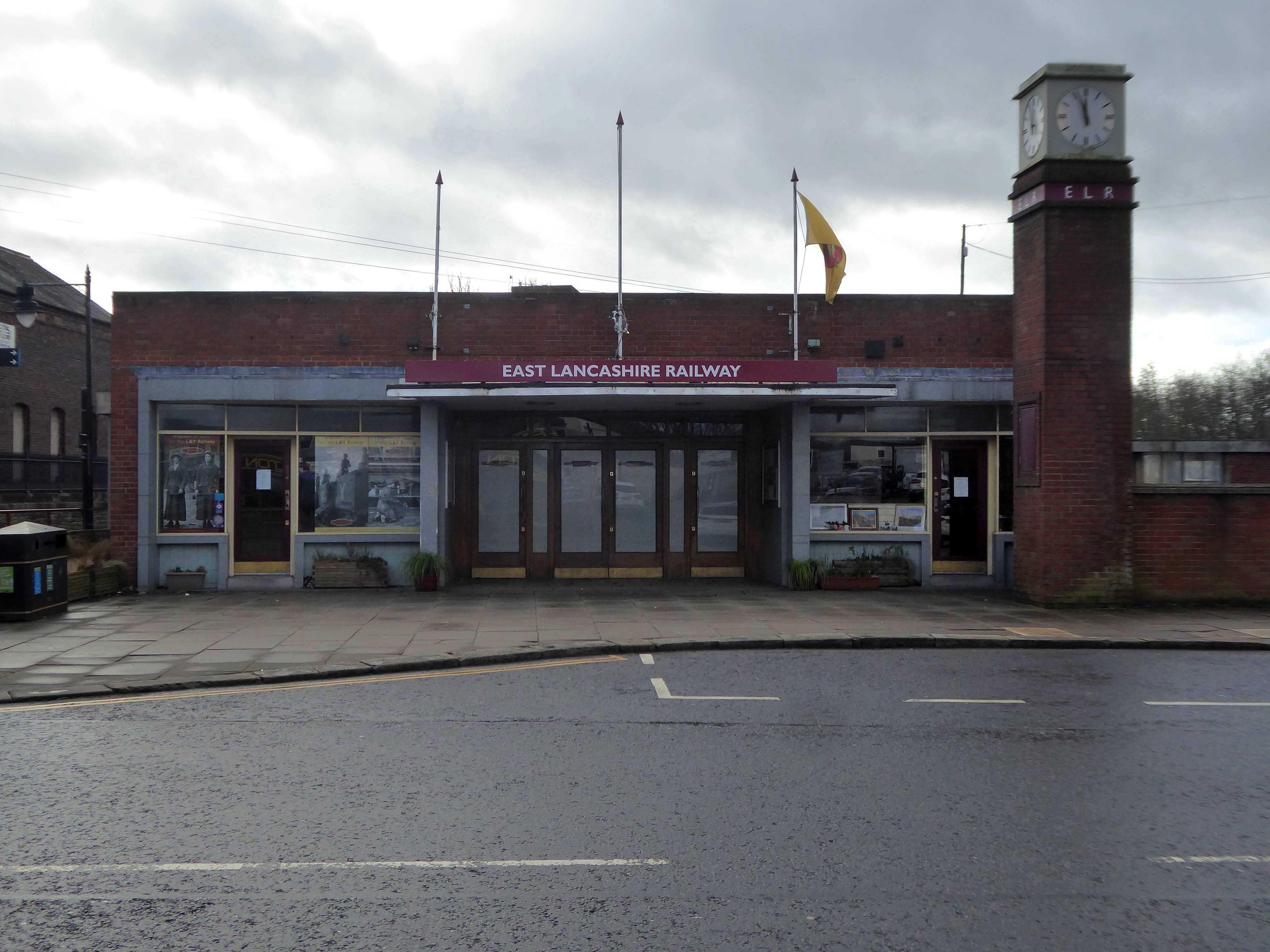
Arriving at and looking around the Interchange – 1980 architects: Essex Goodman & Suggitt
It is the northern terminus of the Manchester Metrolink’s Bury Line, which prior to 1992 was a heavy-rail line.
A new short spur line was constructed to connect the new station. The railway had originally run into Bury Bolton Street which was further away from the town centre, and was closed by British Rail on the same day that Bury Interchange opened.
It also incorporates a bus station.
Bury Interchange replaced the bus termini scattered around Bury town centre, notably around Kay Gardens.
An £80m transformation is coming to the Bury Interchange, which will see step-free access at the Metrolink, a “vertical circulation core” to better connect the Metrolink with the bus facility, and an integrated travel hub with spaces for cycle storage.
The work is much-needed, explained Transport for Greater Manchester’s Alan Lowe, he said that the interchange was built in the 1980s and very much is of its time.
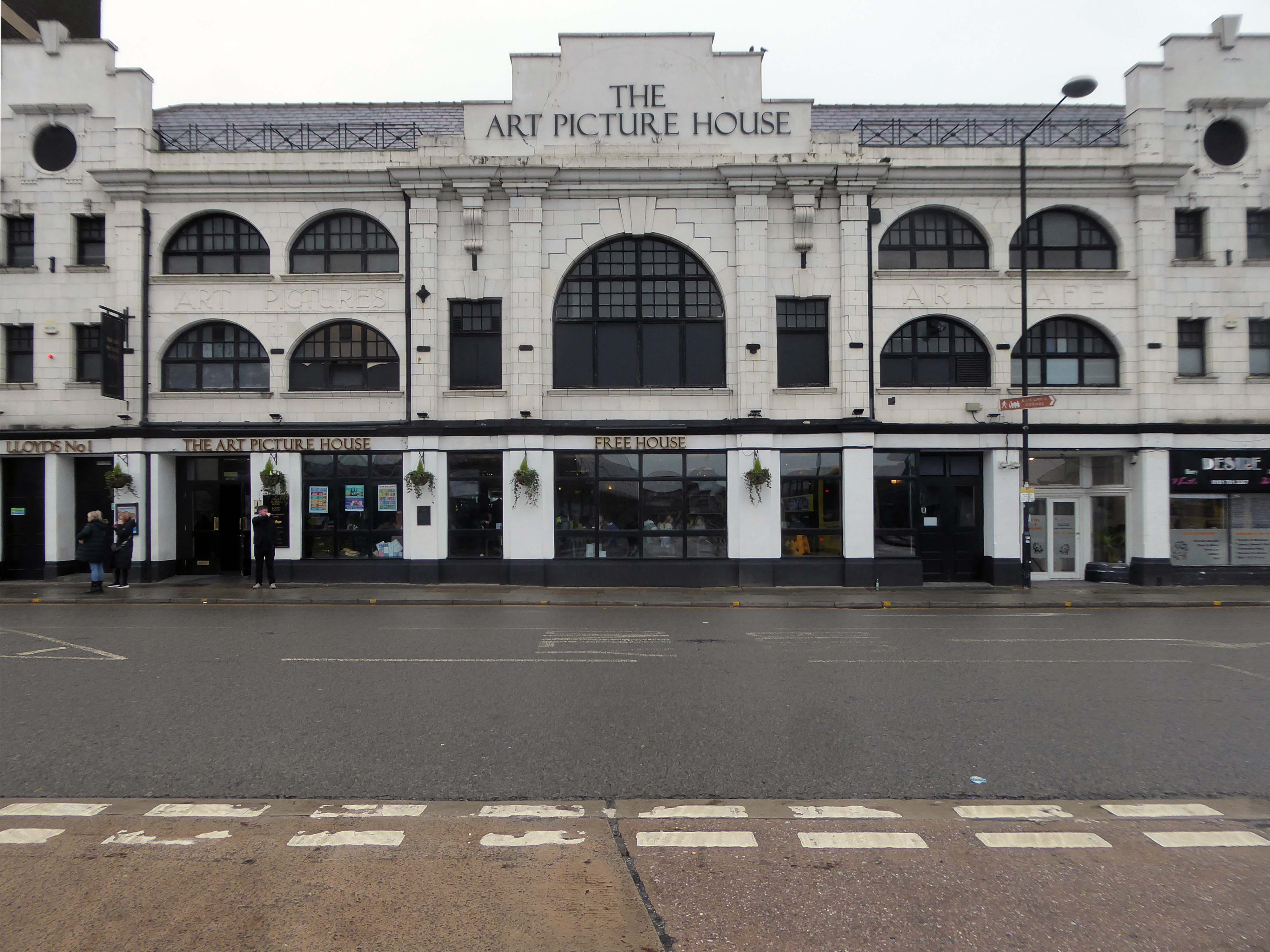
The Art Picture Palace was a 1923 rebuild of the earlier Art Picture Hall both designed by architect Albert Winstanley. The Art Picture Palace was opened on 26th January 1923. A remarkably complete survivor of a 1920’s cine-variety house executed in an elaborate style.
Films ceased in February 1965 and it became a bingo club. Later converted into a billiard hall until 19th May 1991 when it became a bingo club again, it later became a Chicago Rock Cafe.
Cinema Treasures
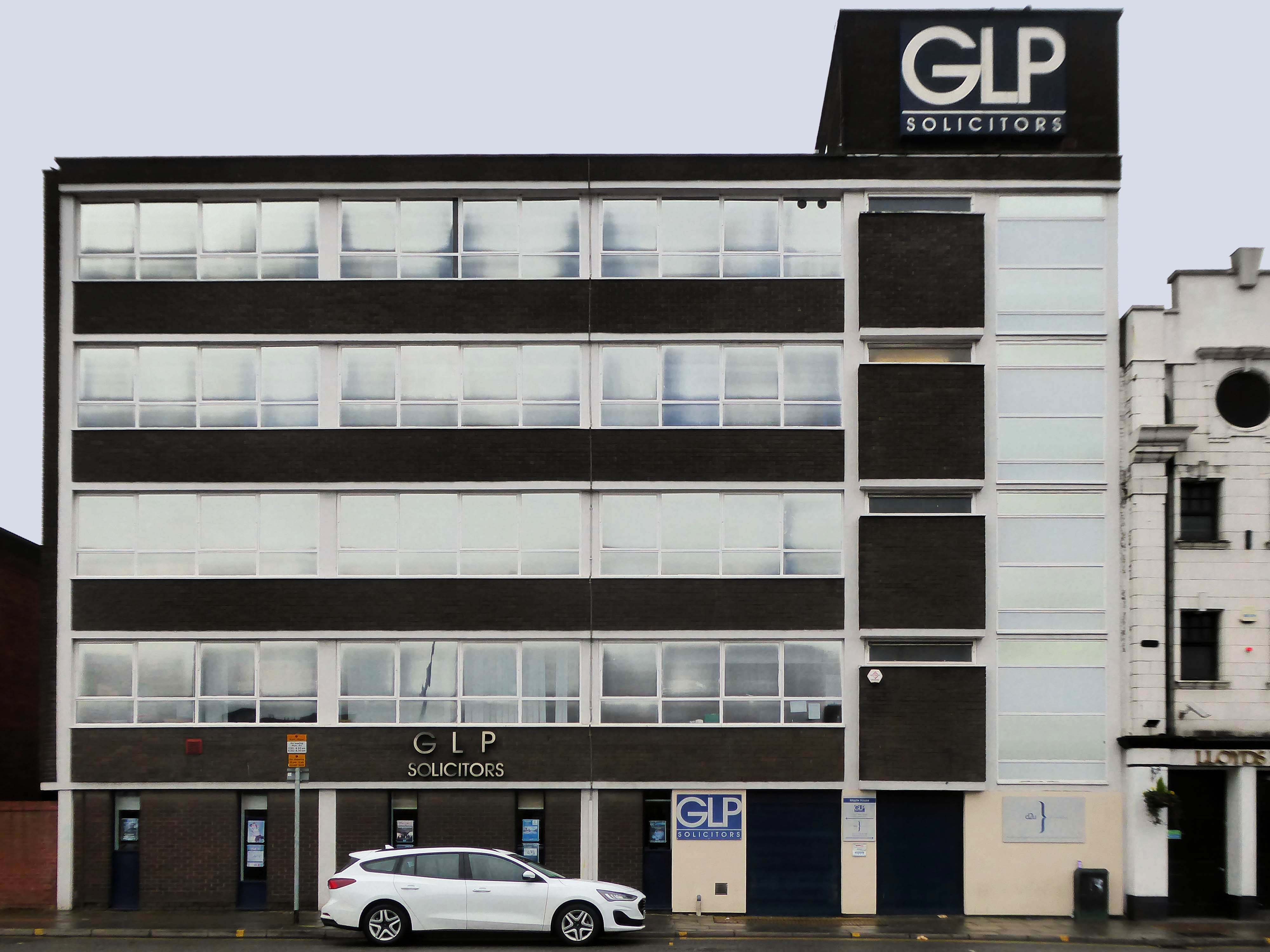
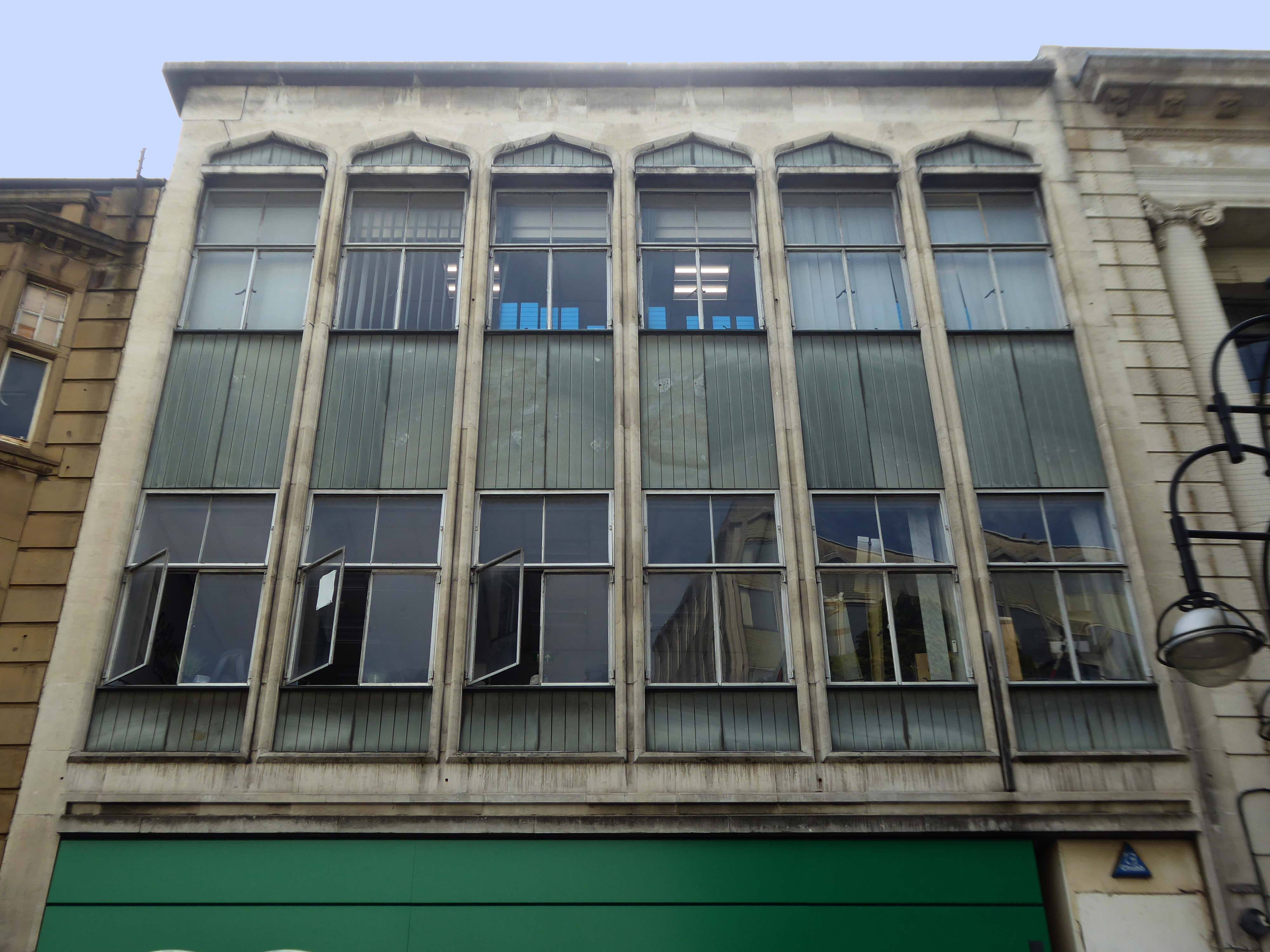
Next door a typical steel glass and brick banded office block Maple House.
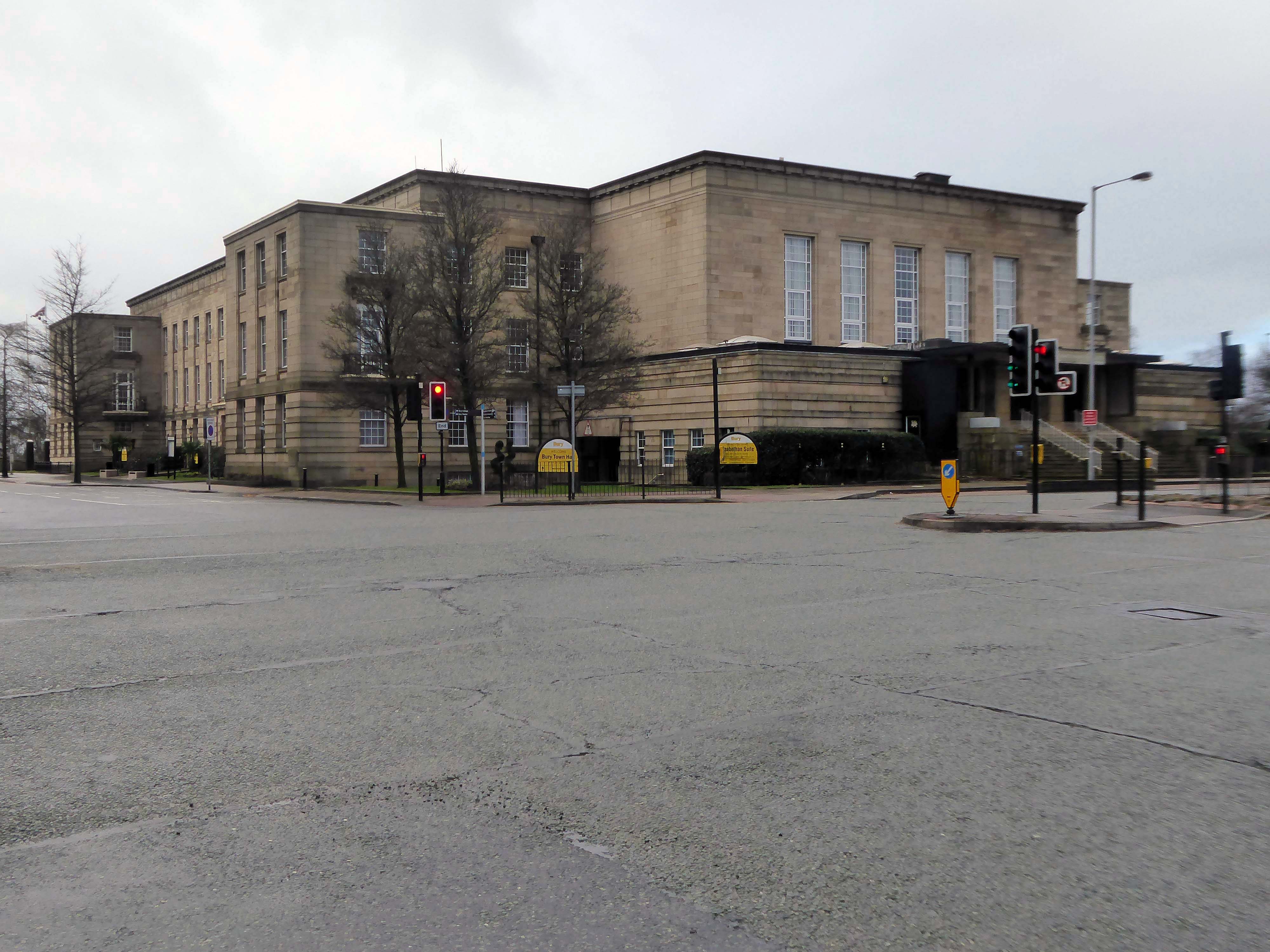
Around the corner and over the road to the Town Hall 1939-40 architects: Reginald Edmonds of Jackson & Edmonds then 1947-54.
Large and Dull – Niklaus Pevsner.
Back through the Interchange to the former Cooperative Store of the 1930’s.
The Portland Stone towers still visible – the elevation largely retro-clad in glass.
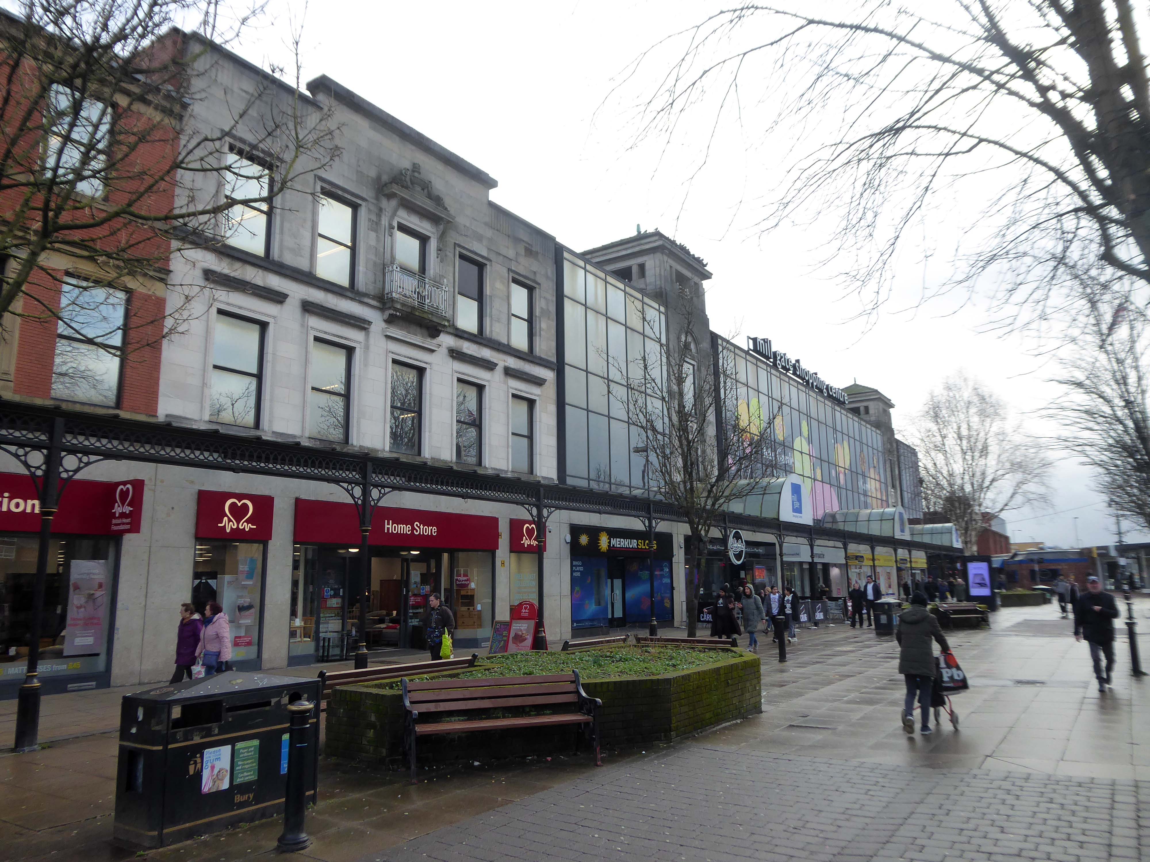
Passing through the Millgate Shopping Centre of the 1980’s.
Unambitious but successful, the floors cheerfully tiled – Niklaus Pevsner.
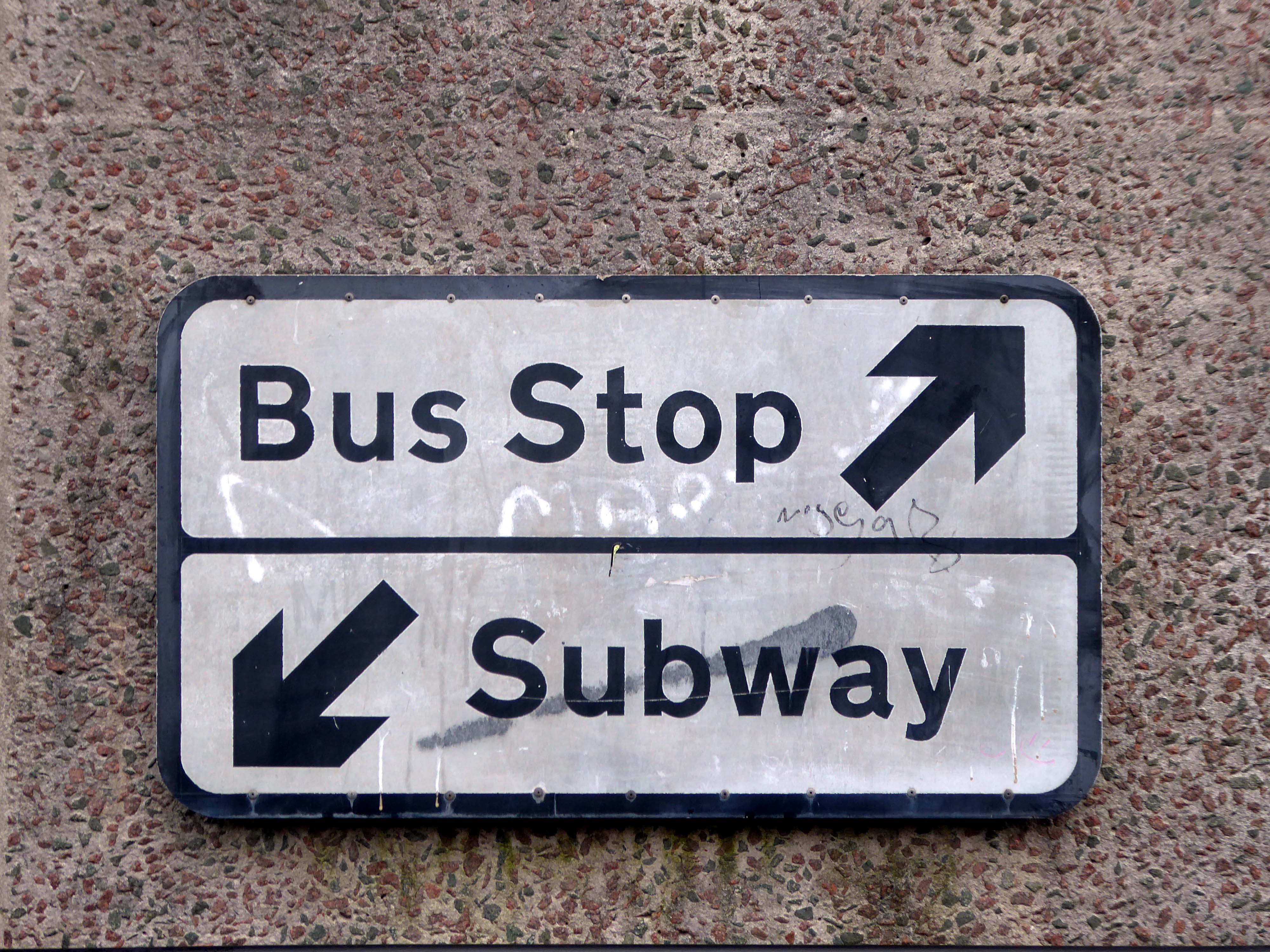
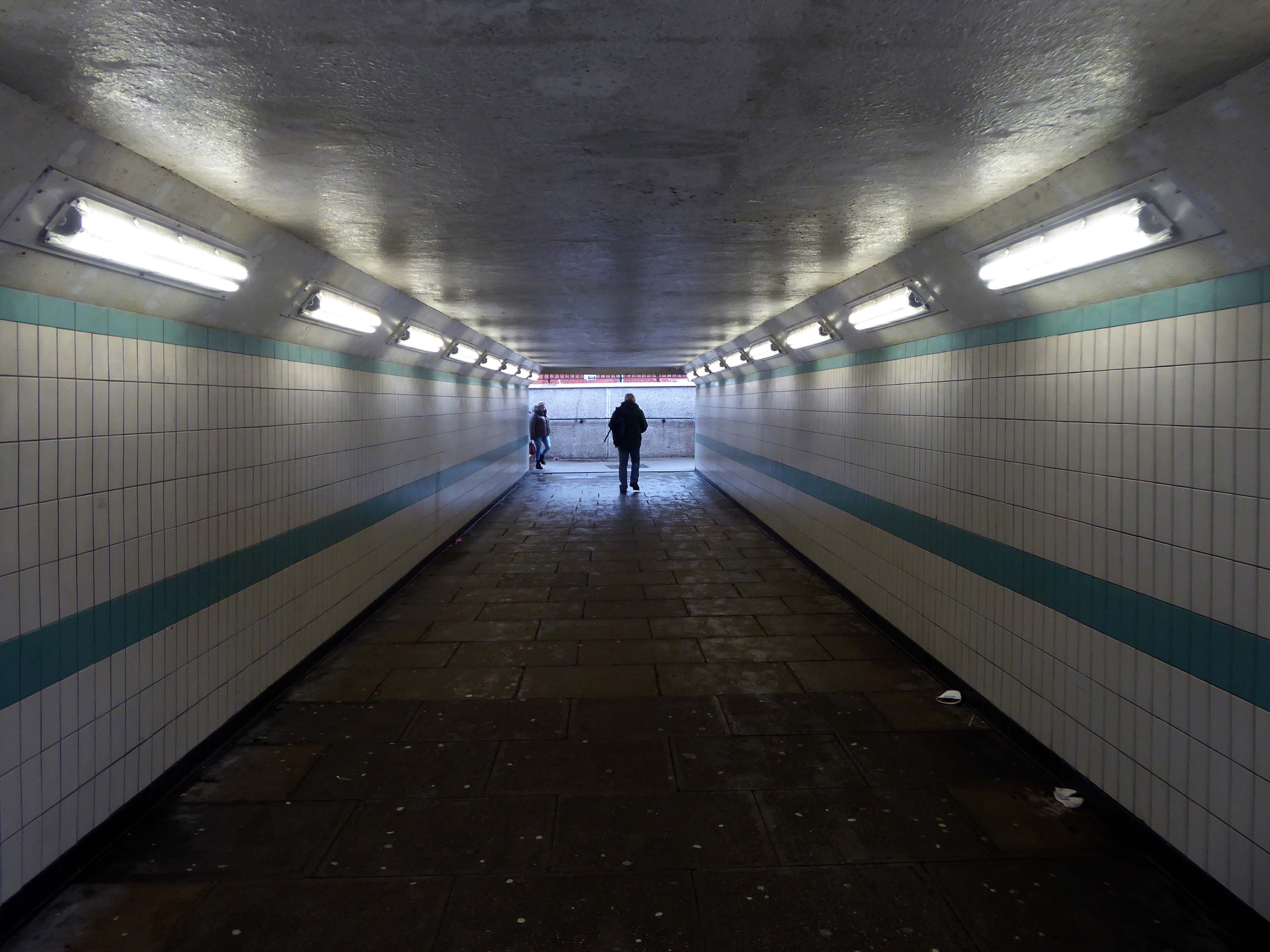
Down in the subway at midday.
The better to get a view of the Market Hall 1971 – architects: Harry S Fairhurst.
The Indoor Market Hall is currently closed due to the discovery of Reinforced Autoclaved Aerated Concrete – within the building structure. RAAC is a lightweight type of building material that was used between the 1950s and 1990s.
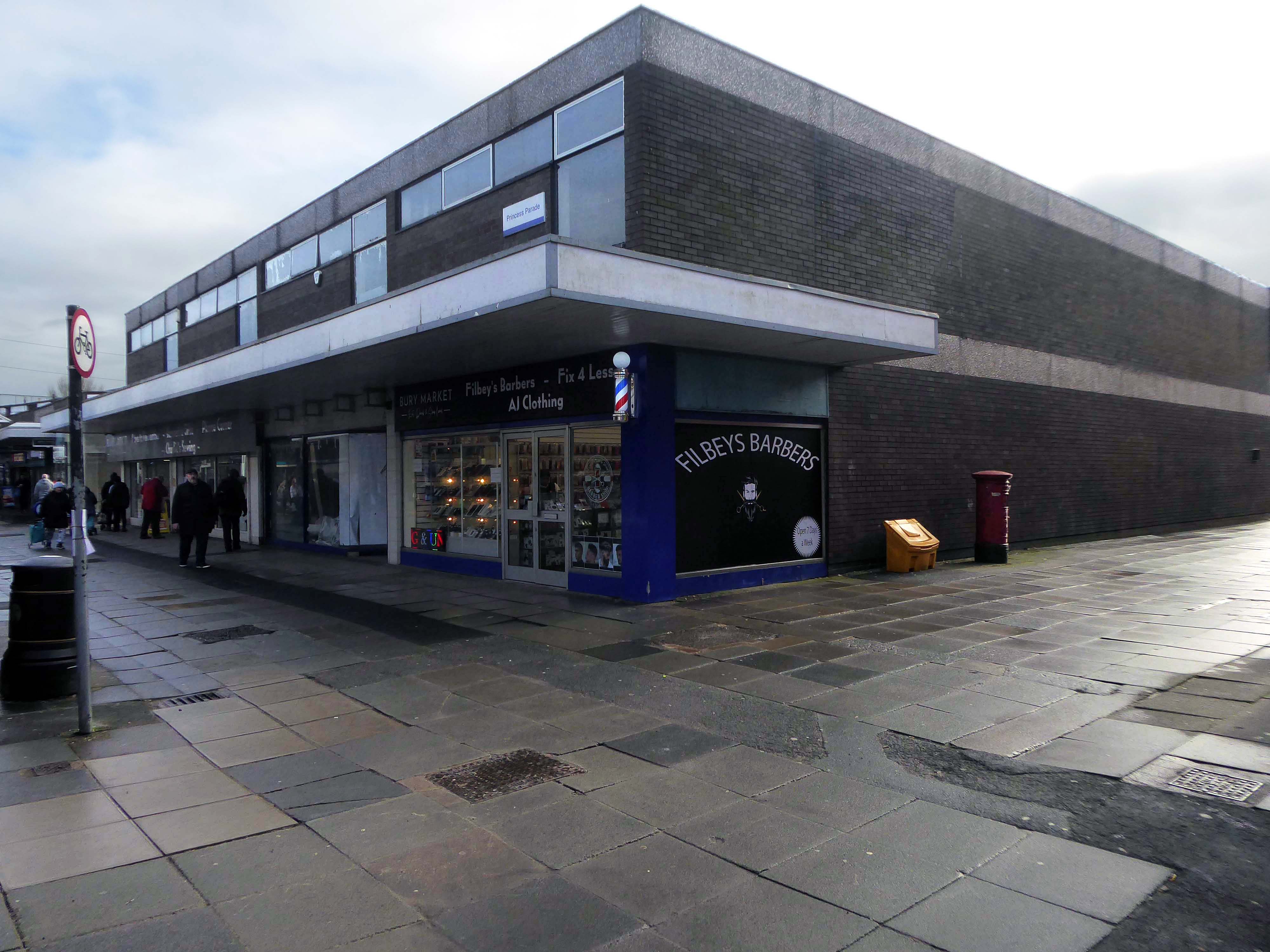
Back under the road – where we find a delightful Telephone Exchange.
The Rock is a vibrant retail and leisure centre which is home to a range of high street fashion brands, independent retailers, tantalising eateries and fantastic entertainment – it’s the perfect place to visit any day of the week.
It is the work of architects BDP – completed in 2010 at a cost of £350 million.
Our masterplan for The Rock took into account the historical street pattern and public realm context to give the scheme its own identity, and make visual connections to local landmarks.
The retail and leisure scheme brings many exciting brands to Bury for the first time.
New pedestrian streets rejuvenate and improve connections to adjacent areas stitching the town back together.
The development will also contain 408 one and two-bedroom apartments.
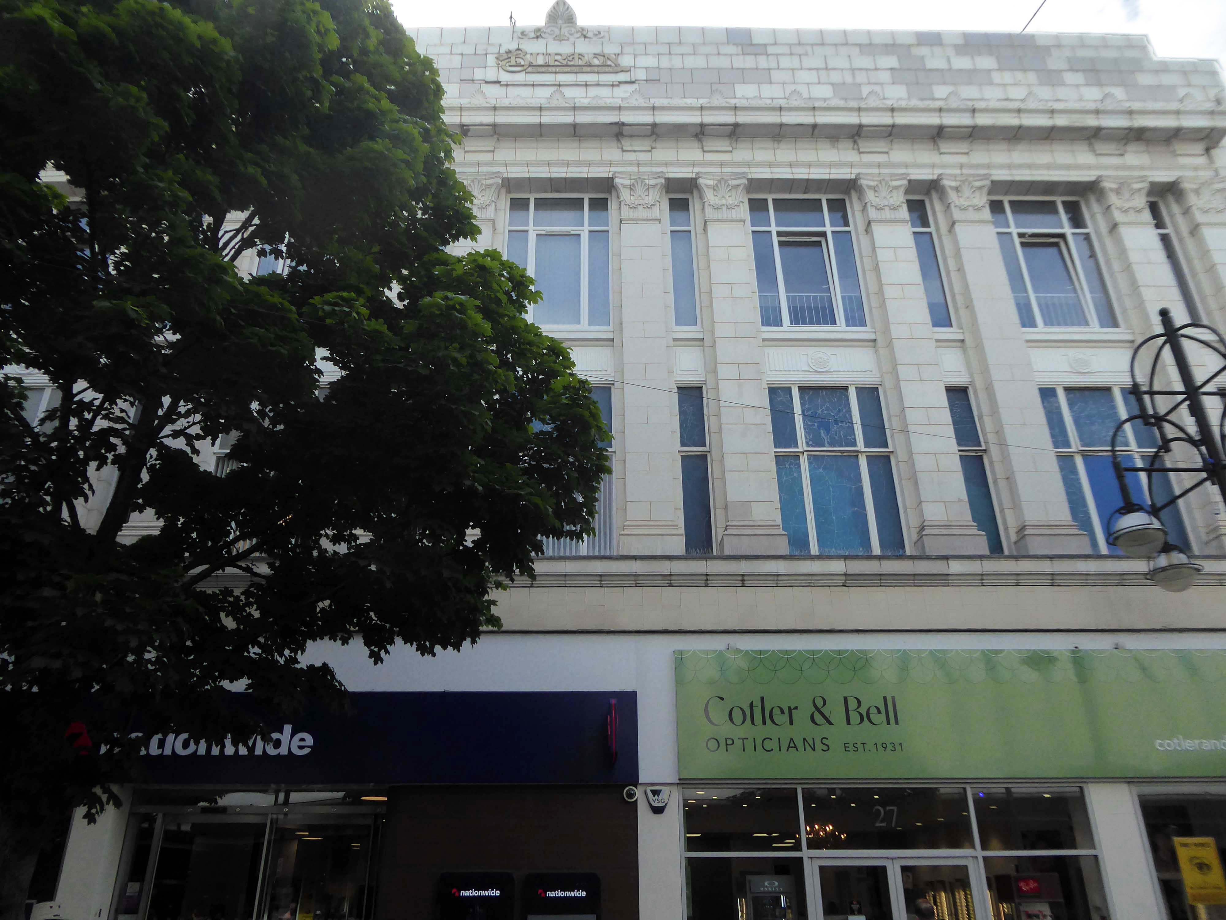
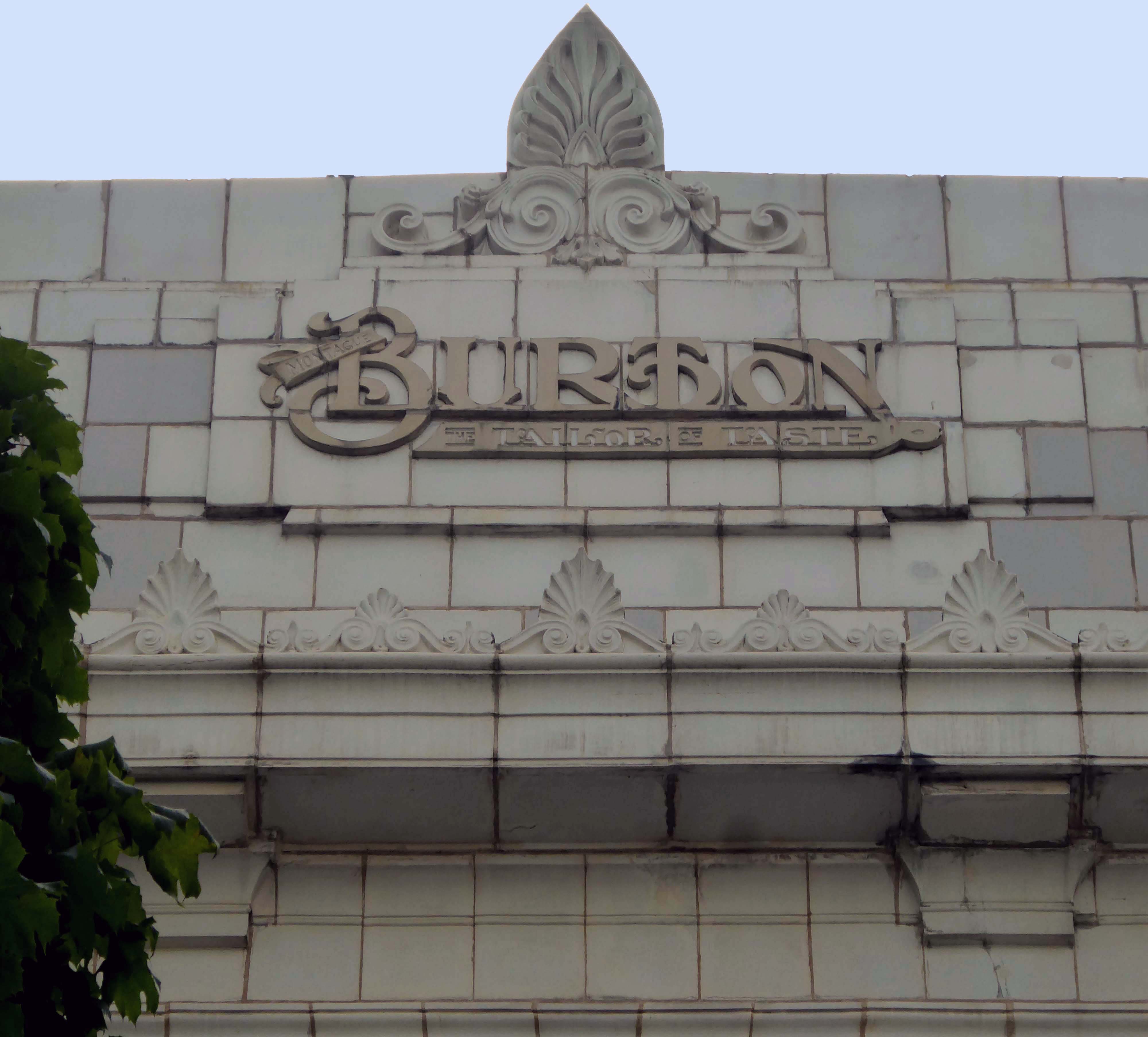
Back to basics at a former Burton’s hiding its faience facade.
Typical inter-war infill on our crazy mixed up mongrel high streets.
Ribblesdale House
Application by Shop and Store Developments Ltd submitted August 1965. Architect on application was Samuel Jackson and Son of Ocean Chambers in Bradford but during the application process this changed to John Brunton & Partners – Brunton was a partner in Jackson’s firm, at the same address. It had a restaurant and shops on the first floor.
The street level buildings were destroyed by fire on 14 May 1947 and were replaced with a new brick and concrete entrance and footbridge in 1952.
British Rail closed the station on 17 March 1980, when it was replaced by a new bus/rail interchange station further east into the town centre. Bury Interchange railway station served up until 1991 before the entire Bury Line was converted to light rail operation. It reopened in 1992 for Metrolink operation.
Bury was once the centre of multiple train links and the lost station of Knowsley Street.
Over the road the former Temperance Billiard Hall 1910 architect Norman Evans.
Planning application January 1965 – work started in June 1965. The architectural firm was Richard Byrom, Hill and partners. Richard Byrom was submitting building applications in the 1930s in Bury and locally.
The rendering on the building is original but the windows have been changed. The Job Centre took over the building in 1993. It is in a conservation area and the Civic Trust had some concerns!
Many thanks to David French for the above information.
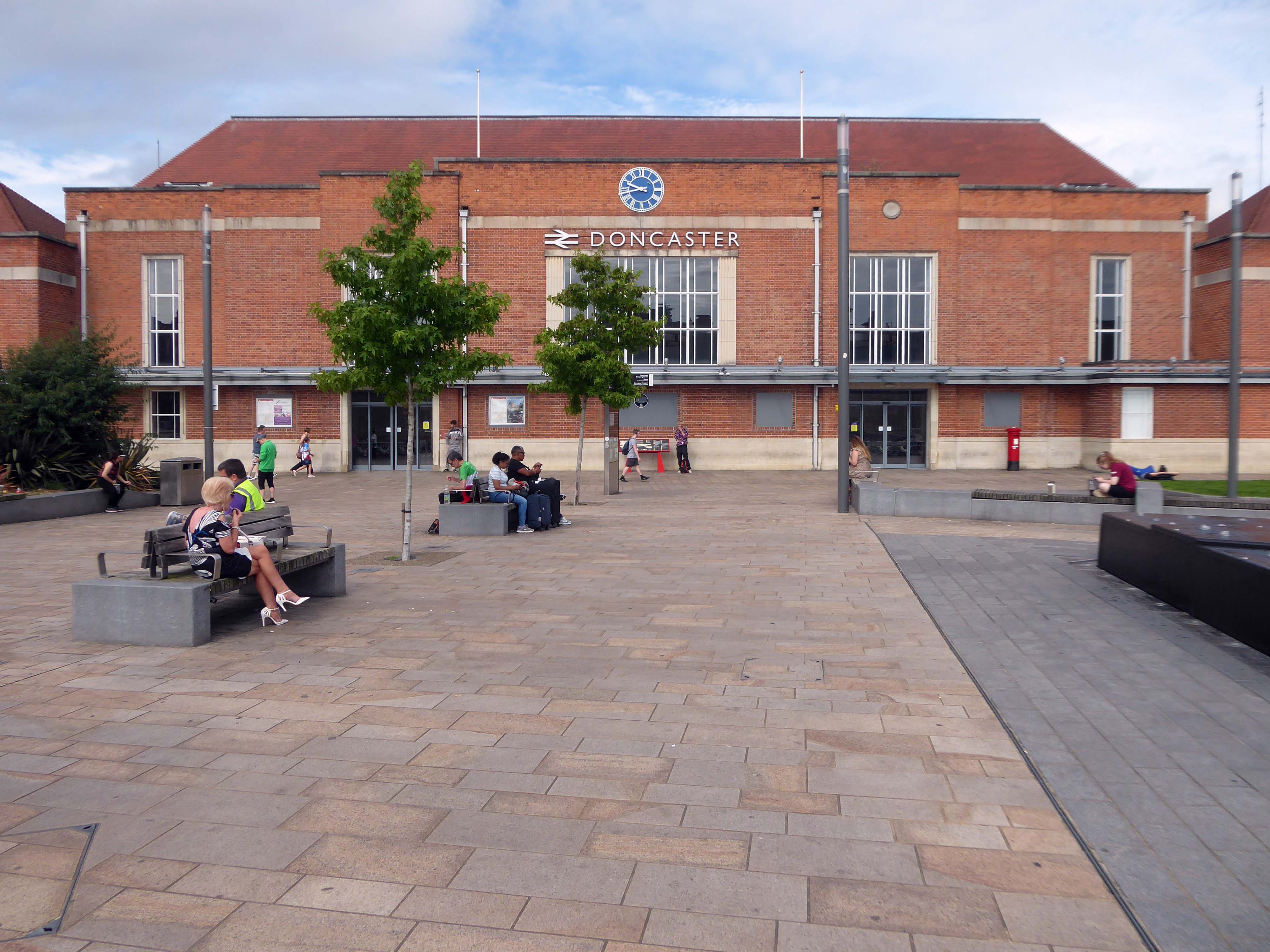
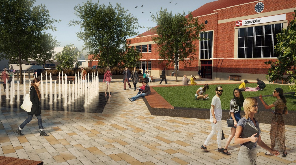
Arriving by train and ascending into the light – here’s the station lights.
The railway station has sharpened up its apron and facade.
We have transformed the station forecourt. It has become a quality gateway which delivers a great first impression for visitors arriving in Doncaster by train. This will help stimulate interest from investors and developers, helping to attract new investment and create jobs for the borough and wider region.
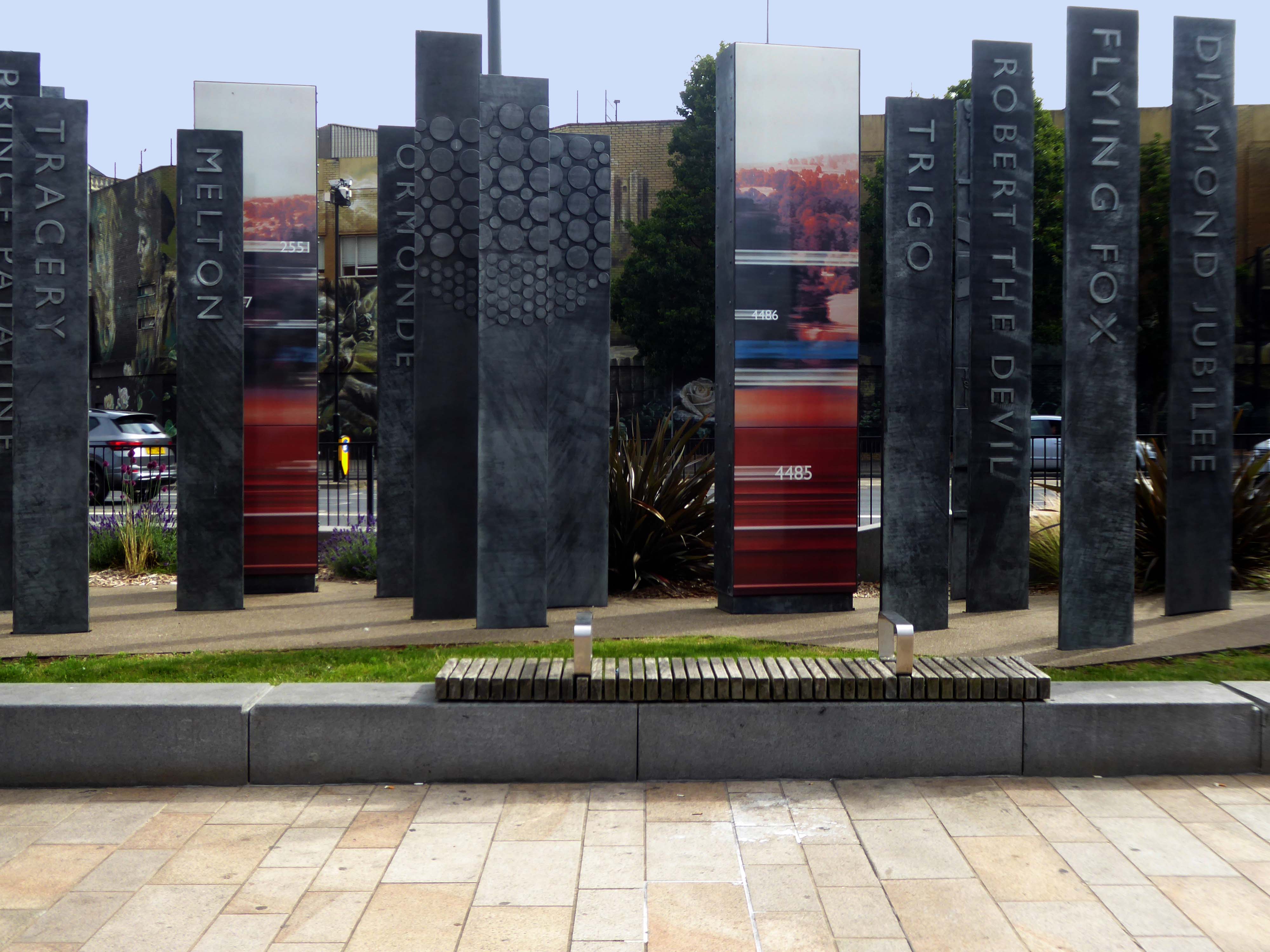
Celebrating engineering, speed and connectivity and stretching forty metres in length the public art at Doncaster Station consists of forty seven monoliths which are a nod to Doncaster’s past, present and future. With a fountain and three impressive water walls, the art takes centre stage in the new public space as you step out of the train station and head into the town centre.
The concept was devised by Doncaster Council and further developed by Chris Brammall.
Typically the high and low streets of Britain’s industrial towns and cities, are an amalgam of architectural style and fashion, spanning at least two or three centuries.
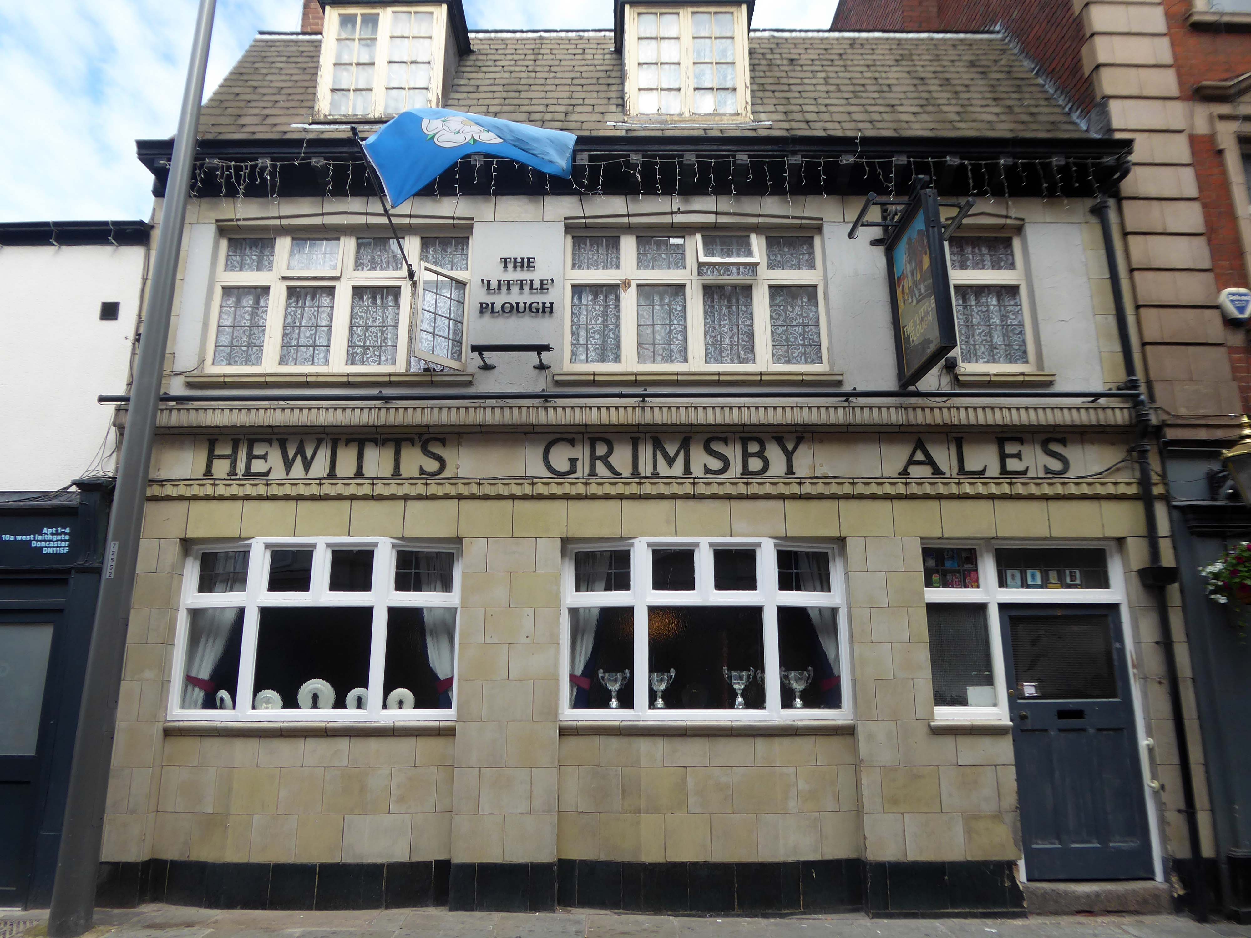
Behind the buff faience frontage is a lovely, small two-room pub with a well preserved interior created under plans of 1934. It was remodelled by the Grimsby brewers Hewitt Brothers Ltd who were Doncaster’s biggest pub owners for many years.
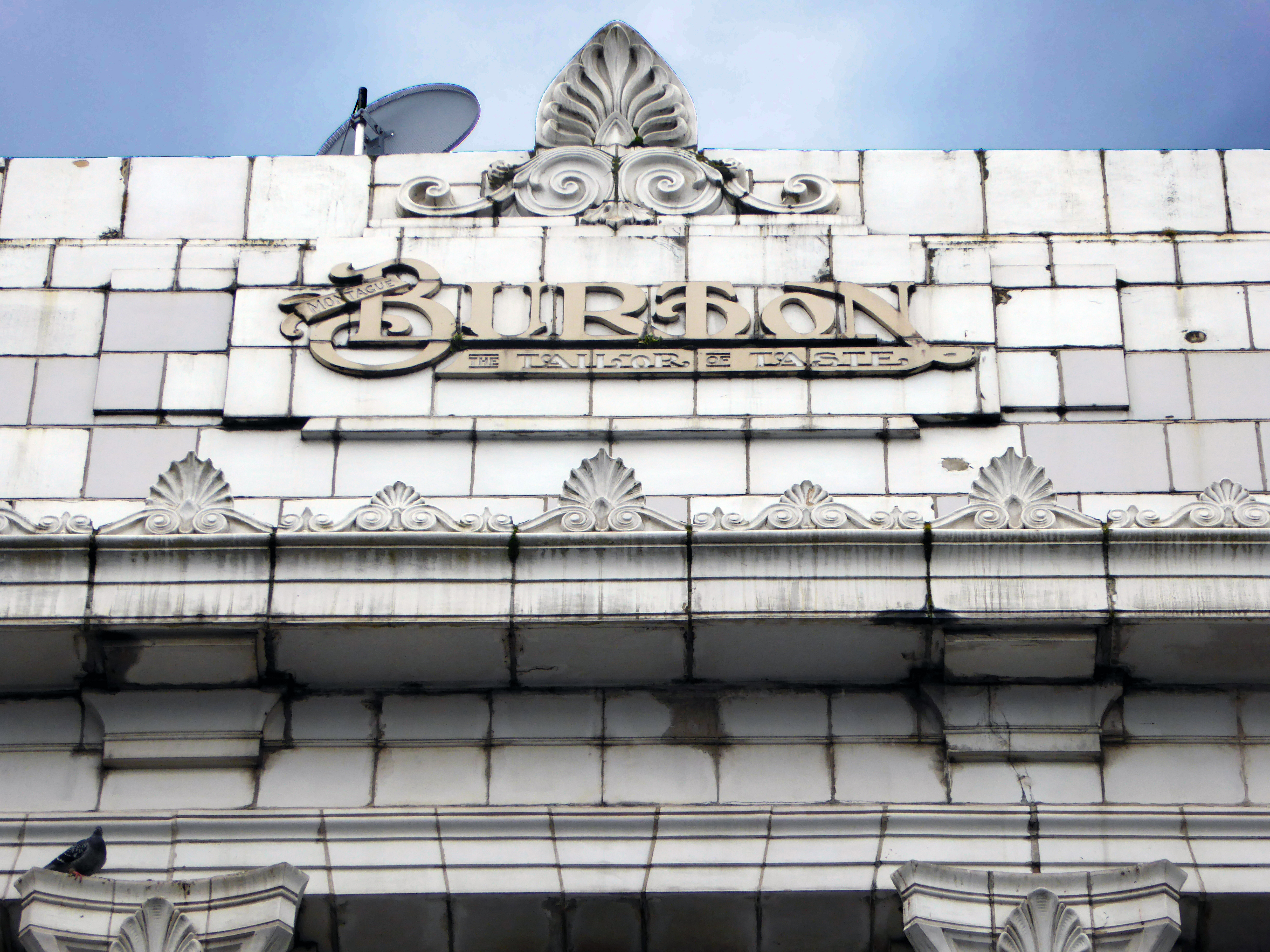
Of course, every town had a Burton’s – the tailor of taste.
This post war infill has that distinctive Festival of Britain feel, original metal window frames, Portland stone and blueish slate like panels.
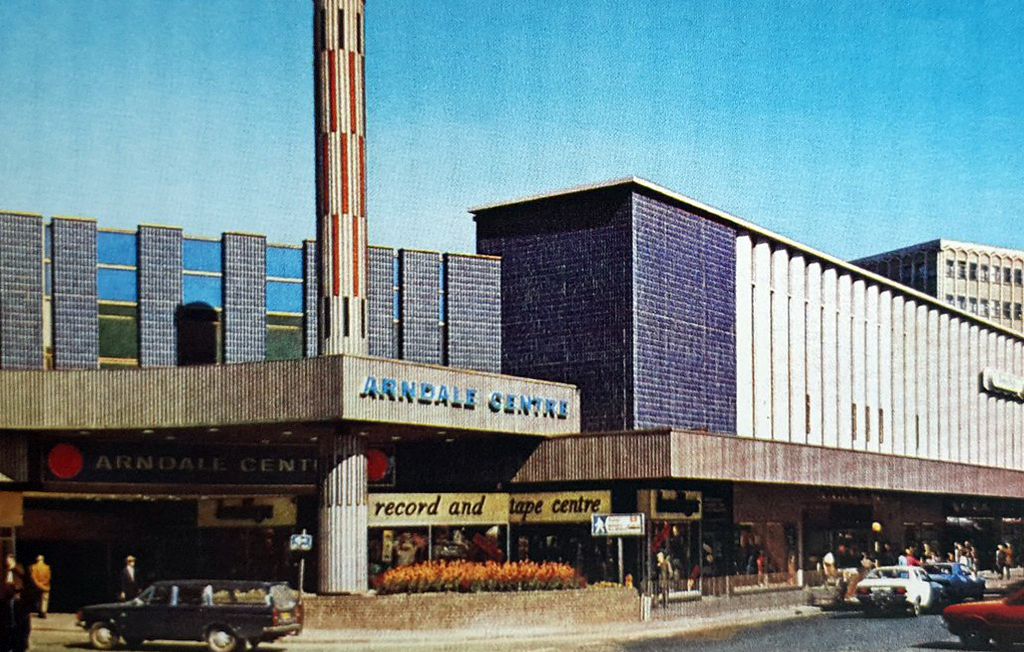
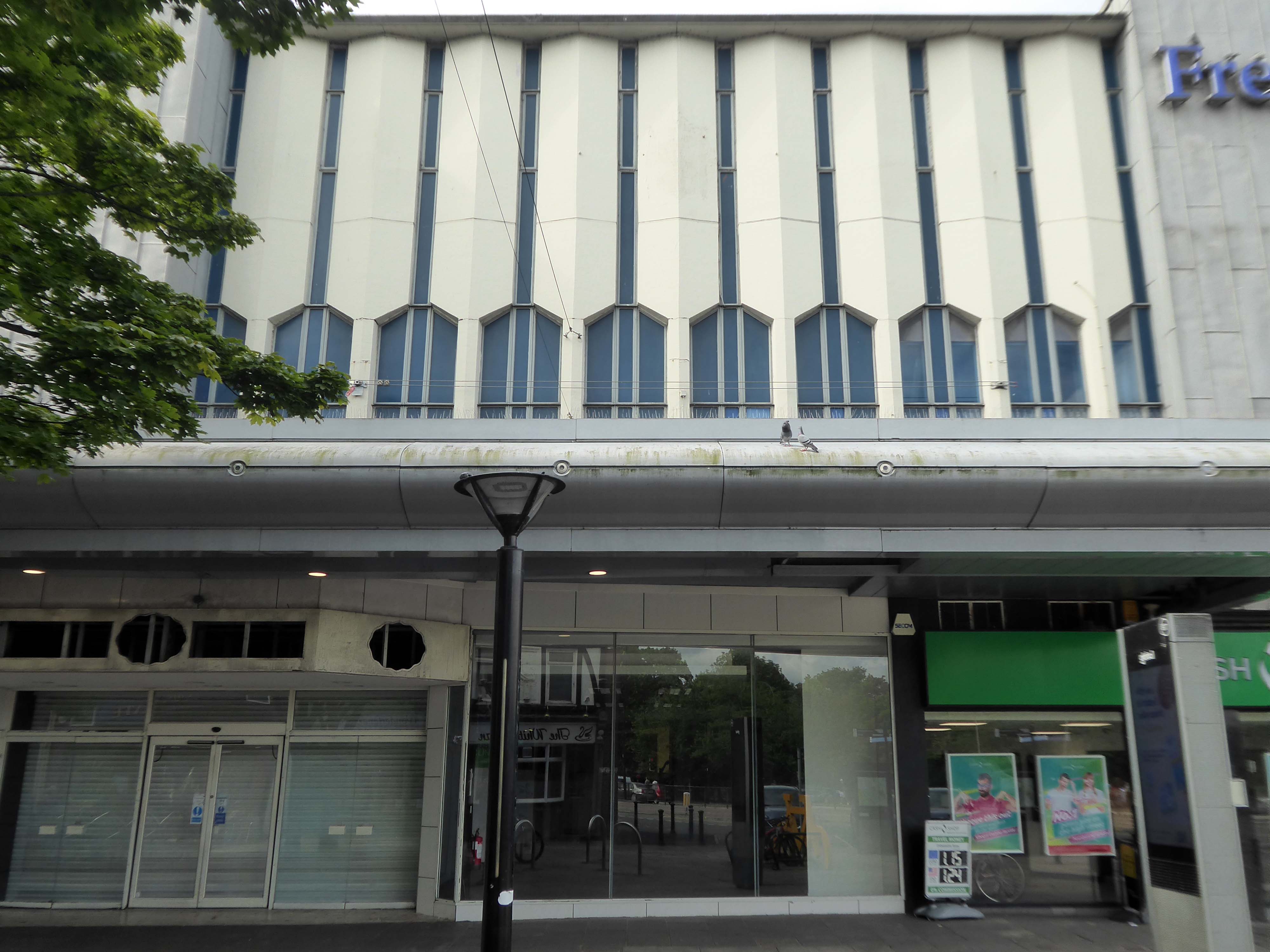
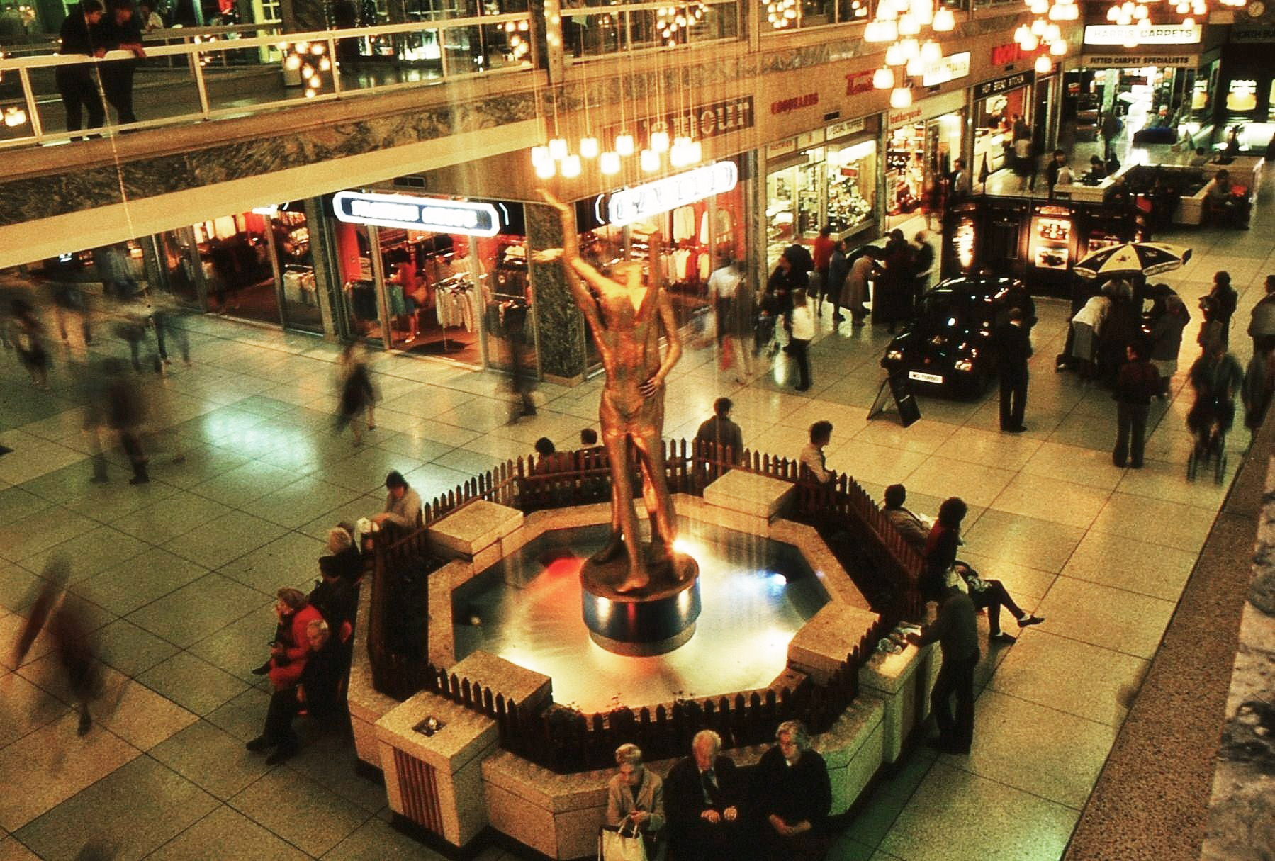
The revamped Frenchgate Shopping Centre, officially opened on October 4th 1968, has in places an upper tier, resistant to zinc over cladding.
The centre has been the heart of the city for over 40 years and was originally called the Arndale Centre because it was built, owned and managed by the Arndale Group. It was renamed in 1988 after a change of ownership, with the new name reflecting the name of the street which passes to the east of the centre and which is one of Doncaster’s main shopping streets.
The sale of the centre came just a year after Frenchgate had undergone a £200 million facelift to transform it into the country’s first shopping centre with integrated public transport and retail interchange.
We propose this is fundamentally transformed though the addition of apartments that wrap along the back of the first-floor retail with a further 2.5 new storeys placed on top. We also feel additional height -up to seven or eight storeys, is justifiable to the corner of Frenchgate and Trafford Way.
The Lovers were once located in the Arndale, removed to a local garden, unloved – then later reinstated in the Waterdale Centre, where we will embrace them a little later.
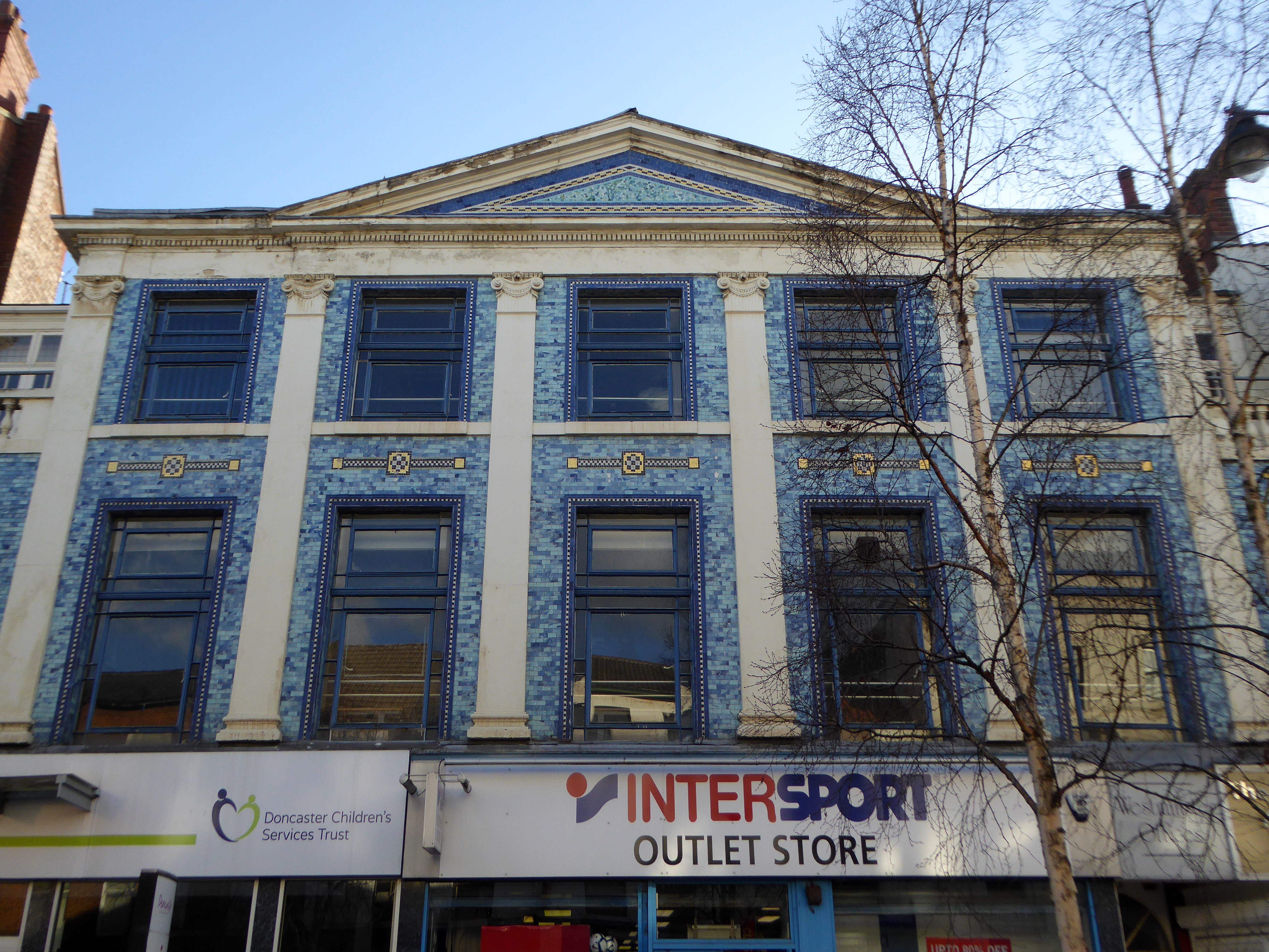
Turn right to take in the 1920s mosaic remake remodel of the Grade II listed Blue Building.
The Blue Building which used to be the Doncaster Design Centre and Tourist Information Centre was originally the home of John Whitaker, a wine merchant, and son of James Whitaker who was Mayor of Doncaster in 1758.
In 1925 the complete building was demolished apart from the facade which was retained and given a facing of decorative blue tiles. The intention was to build a shopping arcade from High Street to Printing Office Street. Only part of the arcade, known as the Westminster Arcade was built. It had a number of shops, the largest being that of Woodhouse & Co Furnishers.
Two adjacent 60s extensions – to the right a redundant post office to the left an almost redundant telephone exchange, with the earlier brick built exchange in smack dab the middle.
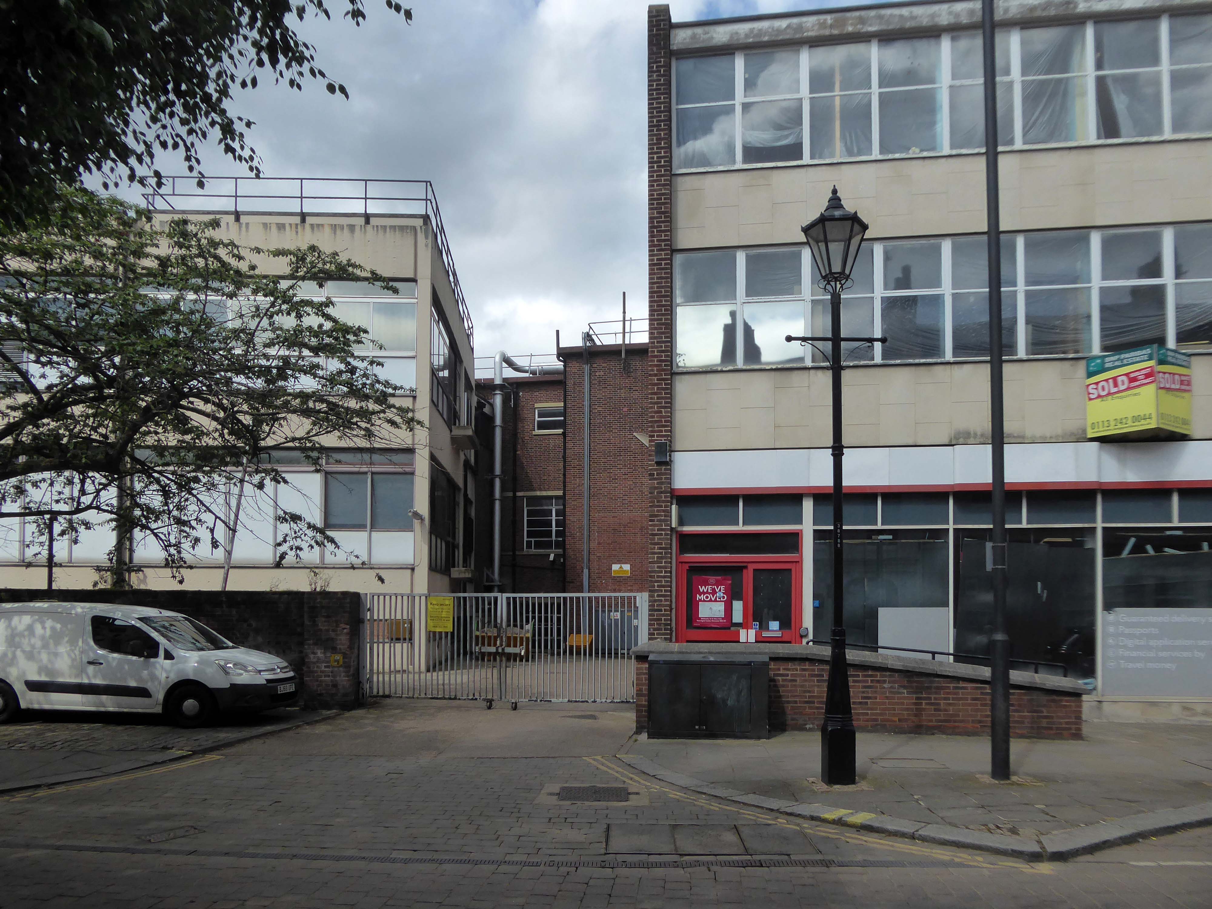
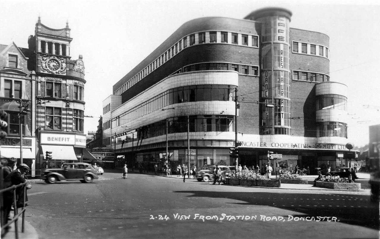
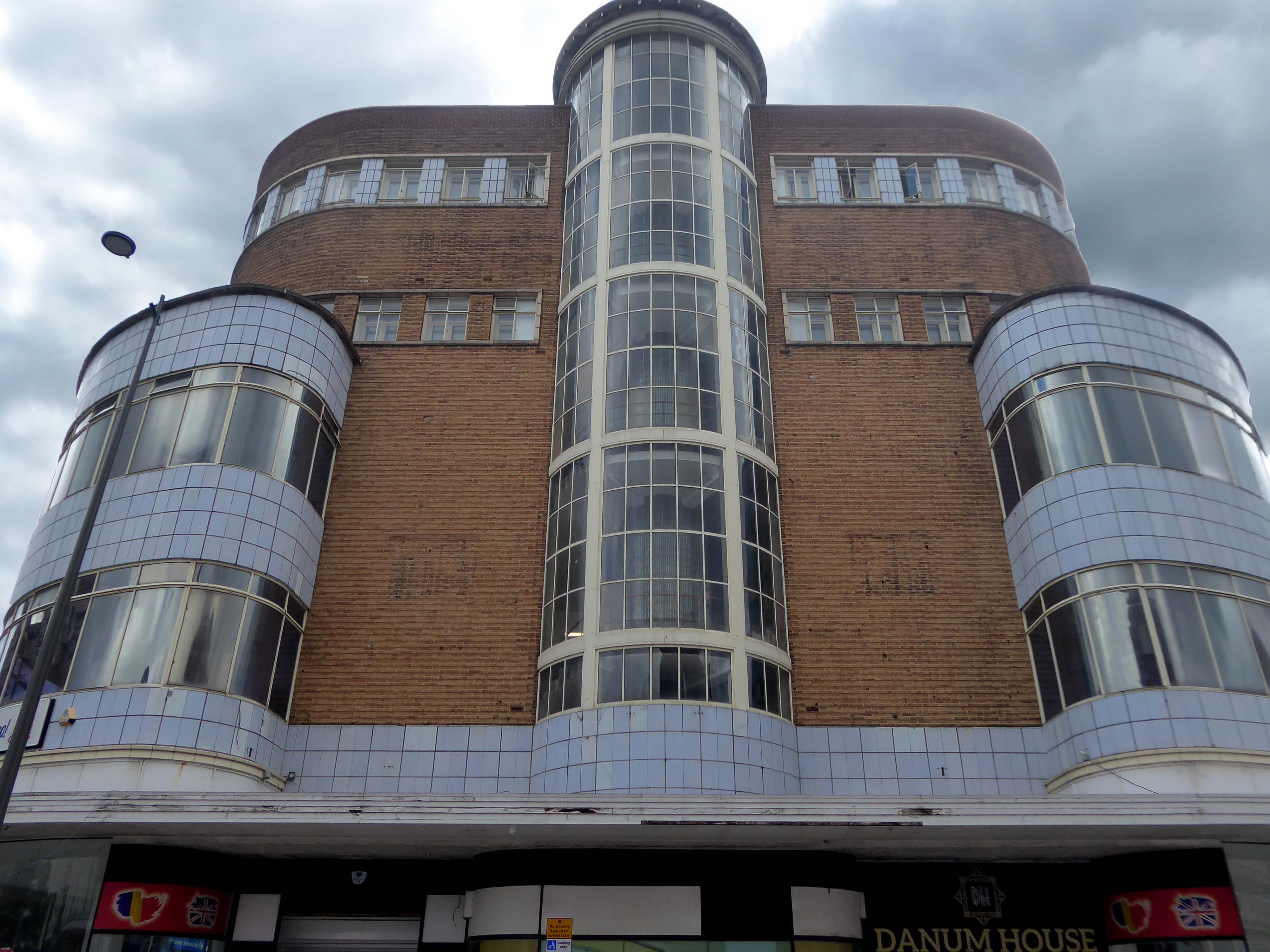
Turn another corner and it’s all at the Co-op now – the Grade II listed Danum Co-operativeBuilding, department store and offices: 1938-40 designed by T H Johnson & Son for the Doncaster Co-operative Society Ltd.
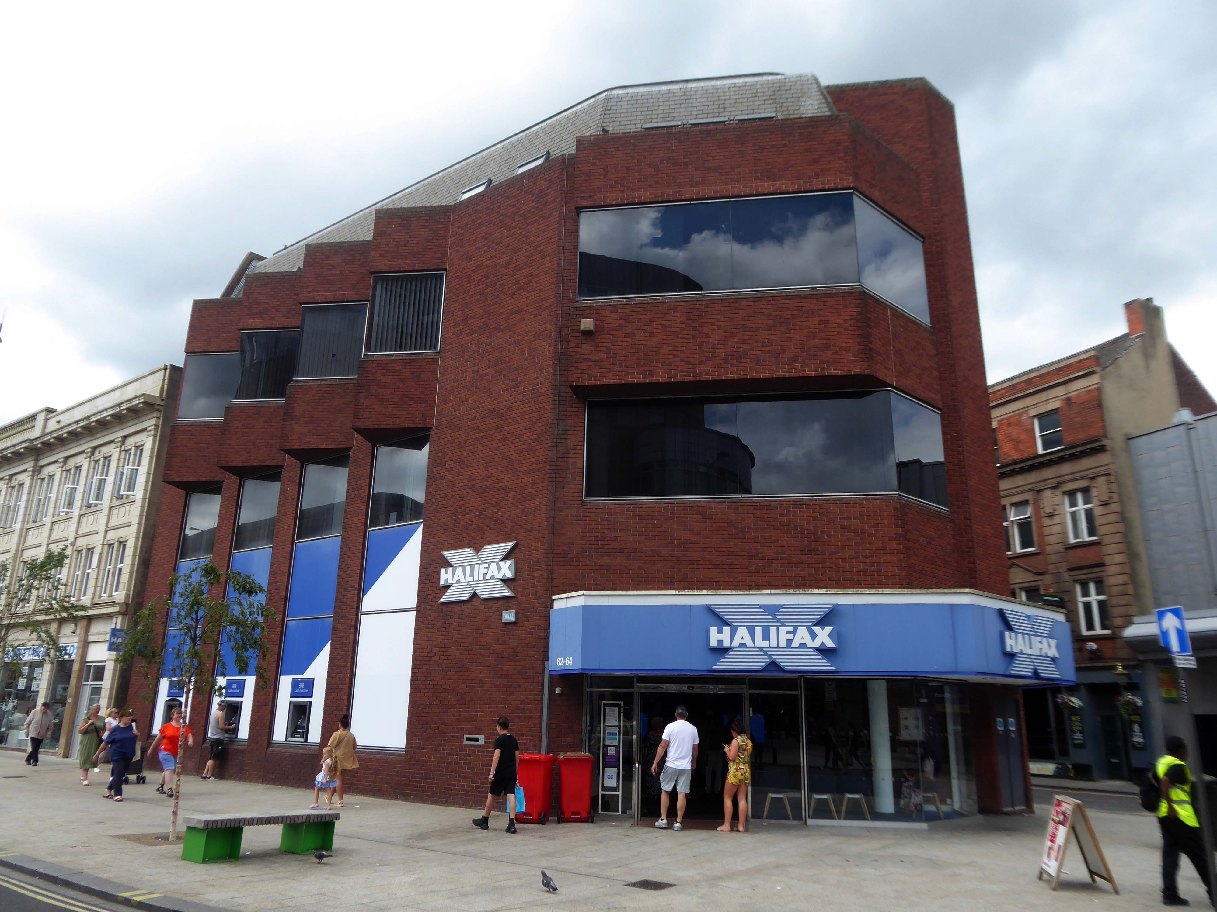
Over the road a zig-zag Halifax Building Society branch, tightly contorted by its corner footprint.
To the right of the Danum, this former Boyes store, having relocated to the Wilko site, the building is ripe for residential conversion.
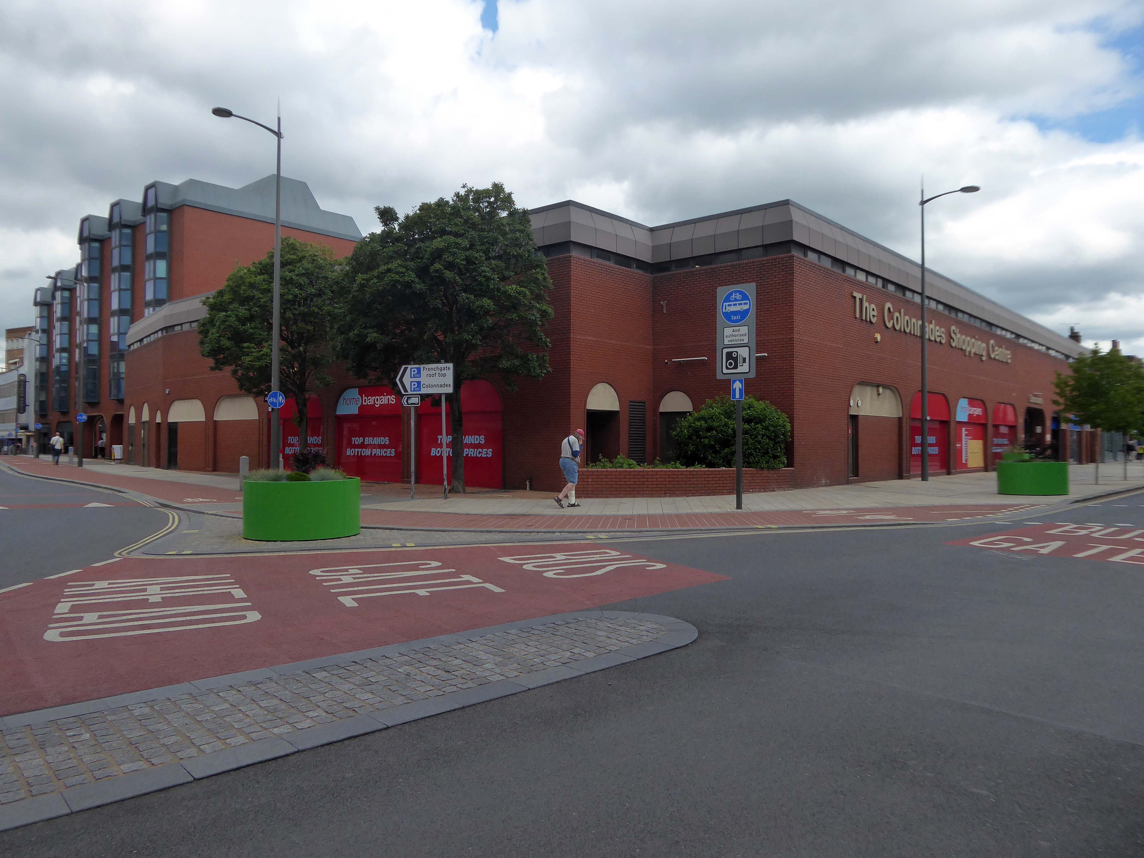
To the left the Colonnades Shopping Centre a fierce angular glass and brick bunker of mixed office and retail space – the sole occupant seeming to be Home Bargains.
A £3.3m makeover of the Colonnades shopping mall in Doncaster town centre was completed in 2019.
The scheme of works was co-ordinated by Doncaster Council and funded by the Sheffield City Region Local Growth Fund.
Built in the 1980s, the brick built building received a major overhaul. The investment saw the visual appearance enhanced inside and out. The five floors were transformed into the prime office space needed in the town centre and the enhancements to the retail area were also finished.
The shift in the town’s axis to the Frenchgate and Market areas, seems to have taken the wind out of its sails.
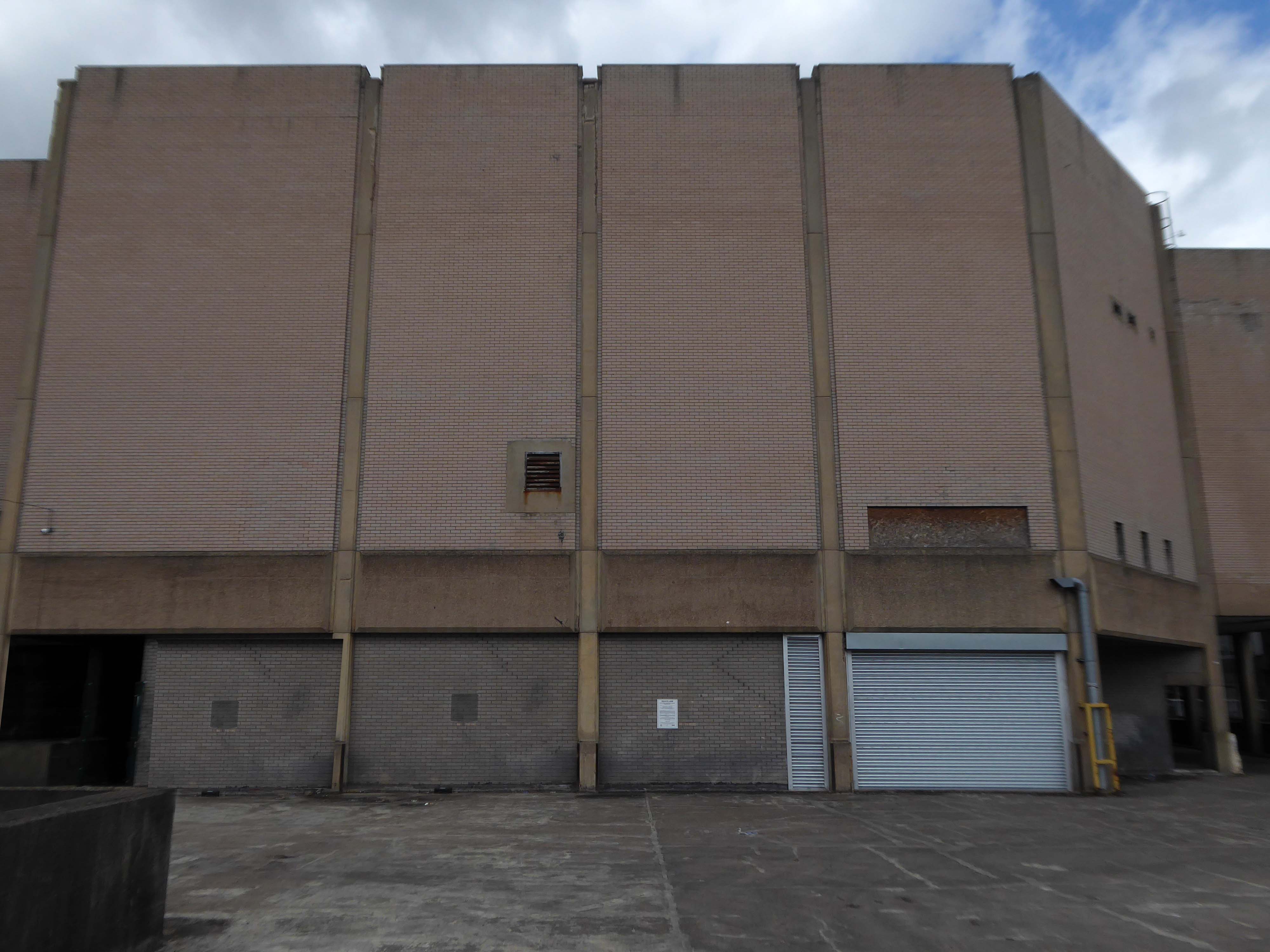
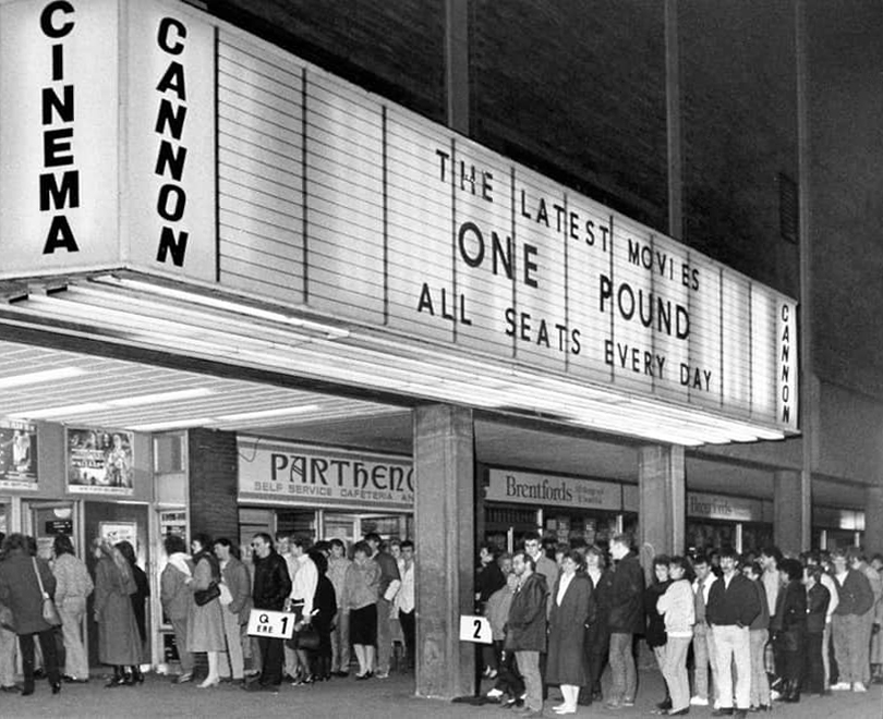
The former flicks now a redundant pale brick behemoth – no more and ABC.
Doncaster’s new £250,000 ABC cinema, part of the Golden Acres development near the town centre, was opened on May 18th 1967.
Closed in January 1981 for conversion into a triple screen it re-opened on 9th April 1981 with seating in the three screens for 477, 201 and 135.
The Cannon Group took control in the mid-1980’s and it was re-named Cannon and it closed on 18th June 1992, screening its opening film Doctor Zhivago.
Cinema Treasures
The Golden Acres development seemed to have morphed into the Waterdale Centre.
It is currently being reshaped to provide a line of desire twixt the Civic and Cultural areas, from the town centre. There are still the remnants of homes, shops and a pub amongst the demolition – almost inevitably there is new paving.
Waterdale is a well-known part of Doncaster’s town centre. During its heyday it was a bustling area with people flocking to shops and the like – it was a place you had to visit while you were in town. However, it had suffered a steady decline which continued when the southern bus station closed – Frenchgate Interchange opening, and Doncaster College moved to the Hub at the Waterfront. With limited public transport entering the area and no student population on its doorstep, less people had reason to pass through.
Demolition of the College.
The Civic and Cultural Quarter is transforming Waterdale reconnecting it to the town centre. The quality and content of the plans is raising the profile of this part of town to new levels. The carefully thought out layout and consistent building design is giving the area a clear identity. It is already becoming a big attraction that draws people in and encourages redevelopment in the neighbouring areas.
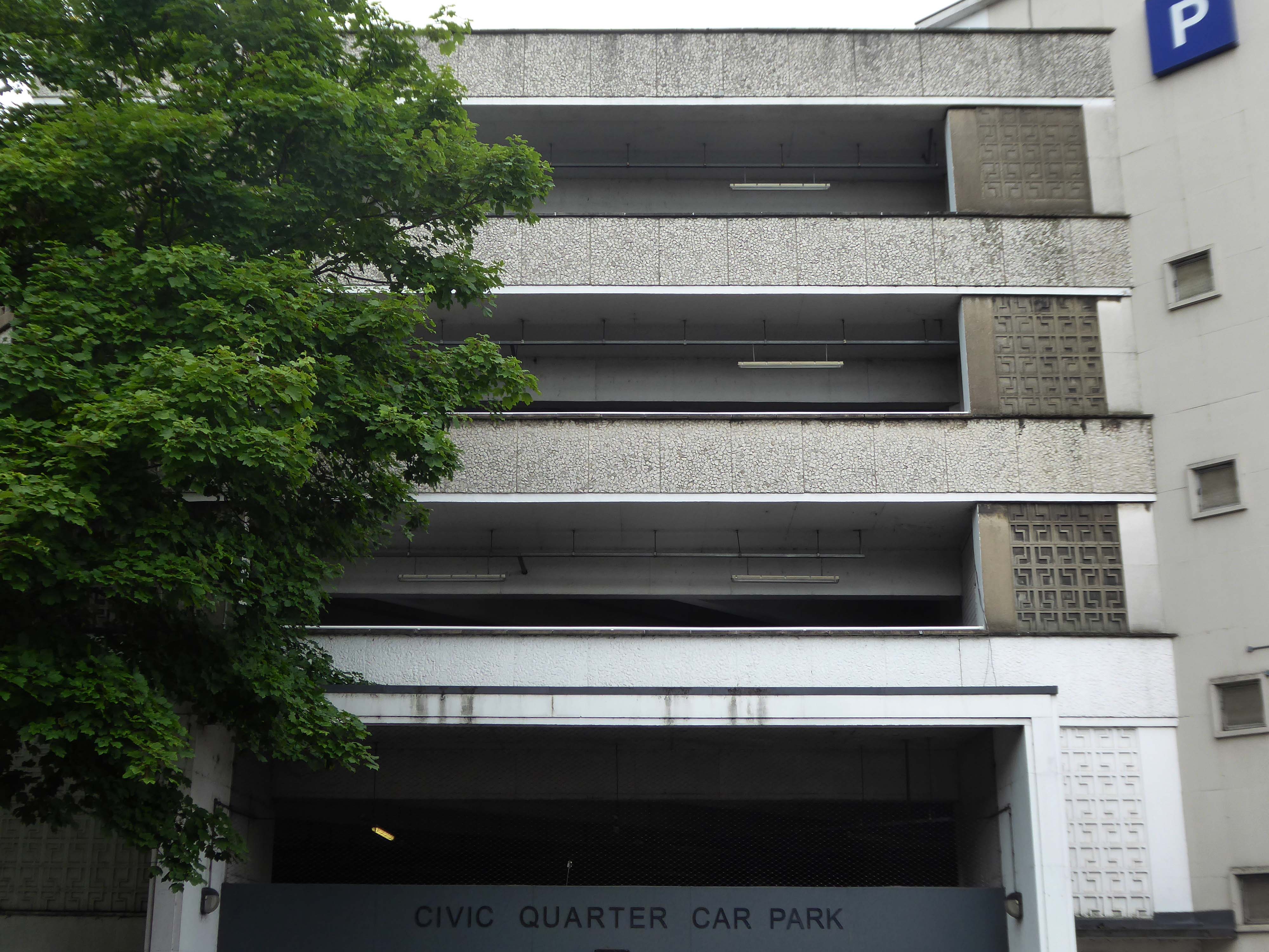
The weary walker is diverted toward the Civic Quarter Car Park.
The former Civic Offices are to be demolished.
Demolition of the Central Library is well under way.
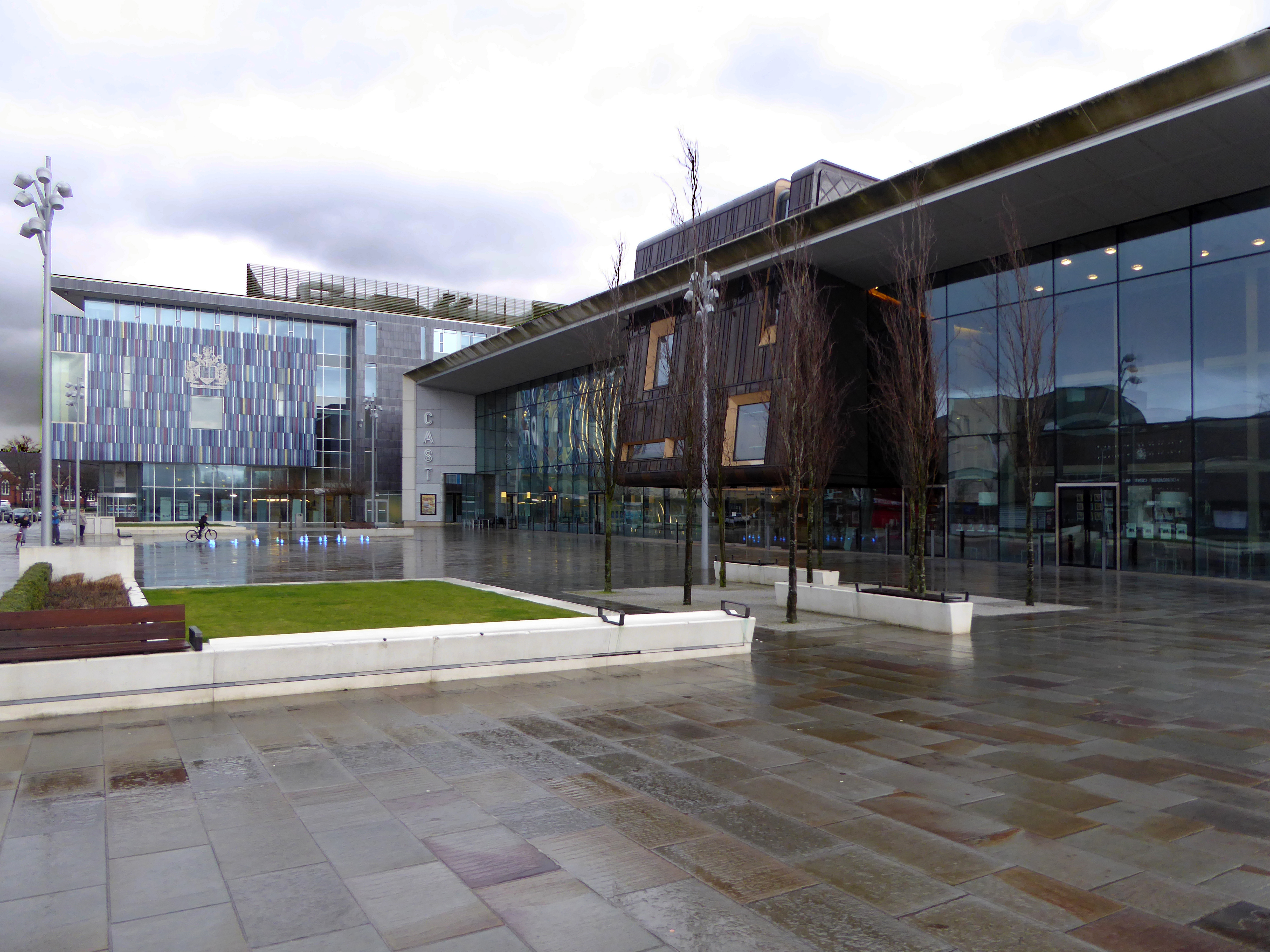
Facing the former library we find the CAST Theatre, Civic Buildings and Savoy Cinema, grouped around Sir Nigel Gresley Square.
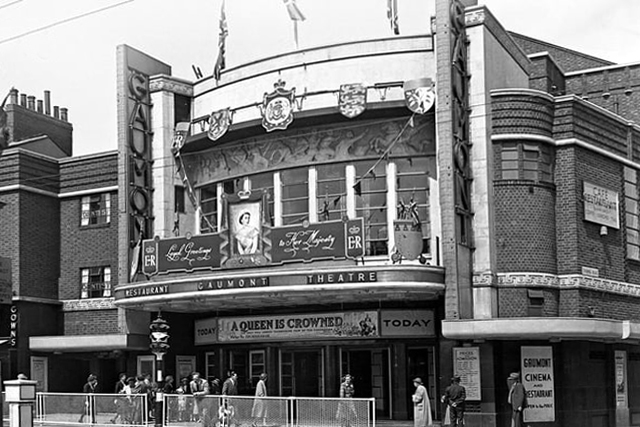
Within the square is a frieze, salvaged from the former Gaumont Cinema, the work of sculptor Newbury Abbot Trent.
The Gaumont Palace Theatre in Hall Gate at the corner of Thorne Road, Doncaster opened on 3rd September 1934 with Jesse Matthews in Evergreen.
It was designed by architects WE Trent and W Sydney Trent.
In 1949 WH Price the Borough Surveyor produced an outline plan for the area, with a green space at its heart, it was never realised. In 1955 Frederick Gibberd produced his plan to include a ten storey Town Hall, Art School, Technical College and Civic Theatre, revised and reduced in 1963 – eventually his Police Station and Law Courts were completed in 1969.
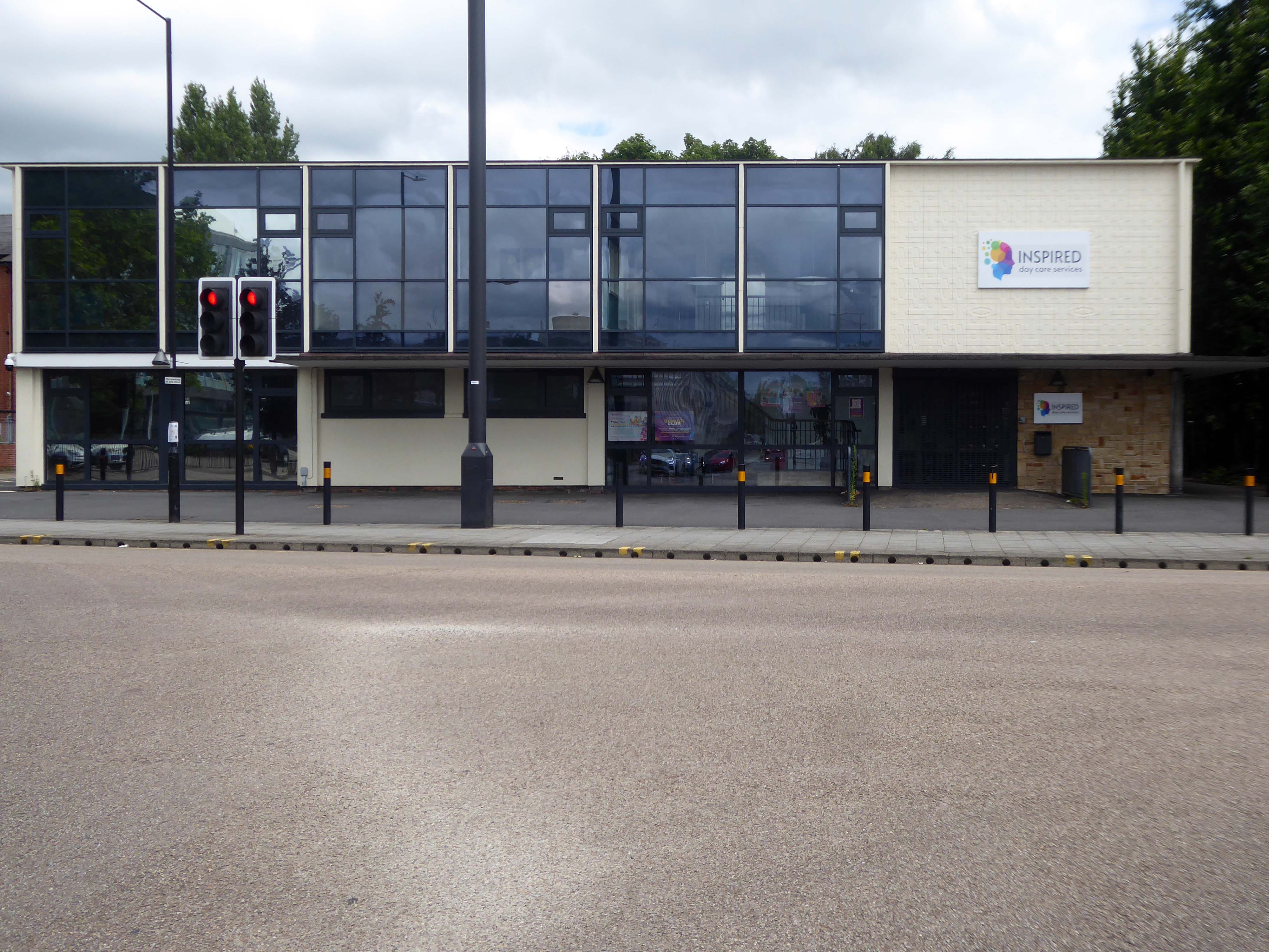
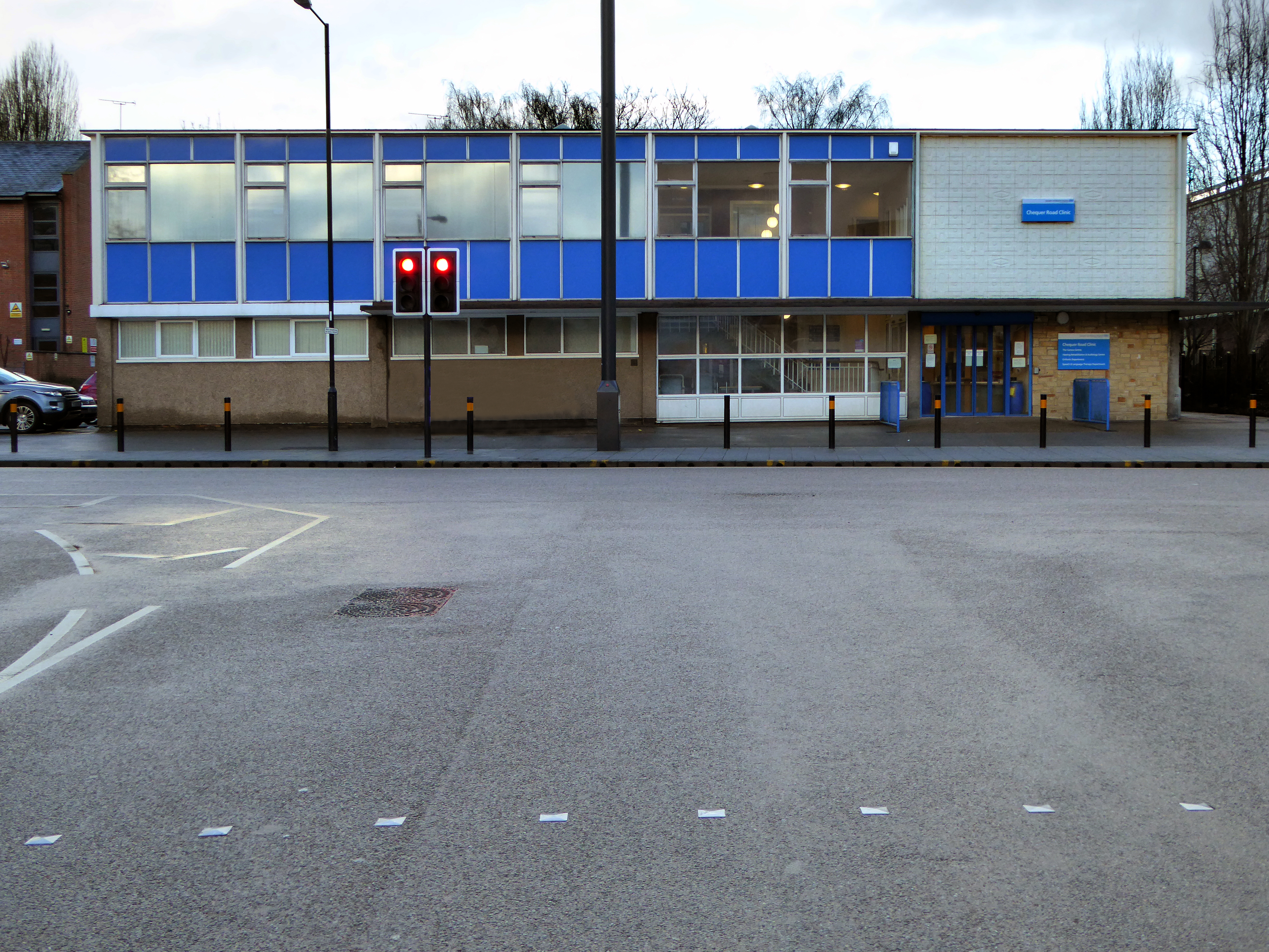
The former NHS Clinic at the ‘T Junction’ is transformed into a day care service.
The building was designed in the office of the Doncaster Borough Architect’s Department in a team led by borough architect Mr LJ Tucker.
The ceramic designs were a later addition when it was discovered that the large open areas of glass overheated almost everything inside, the work was undertaken by LJ Tucker and family.
The sculptural work by Franta Belsky, now has a skip for company.
As a footnote the work by Fabio Barraclough reveals a murky past.
Barraclough was born in Madrid in 1923, to a Spanish mother and Yorkshire father who founded Madrid’s Chamber of Commerce. He moved to London with his family in the 1930s as a refugee from Francoist Spain. He taught fine art and sculpture at Rugby School, where colleagues considered him “highly entertaining, a most unorthodox and highly gifted” teacher. He established himself during the 1960s and early 1970s as an authority on sculpture, publishing in academic journals and becoming a member of the Royal British Society of Sculptors.
In 2000, it was revealed that Barraclough, while outwardly living the life of anti-apartheid activist since the 1970s, had been a paid informant of the South African state security police. The media was used to promote his image as a “brilliant, liberal artist with apparently impeccable credentials” in order to gain public trust, while he was funnelling money from anti-apartheid groups to the police. He died on 6th January 2019.
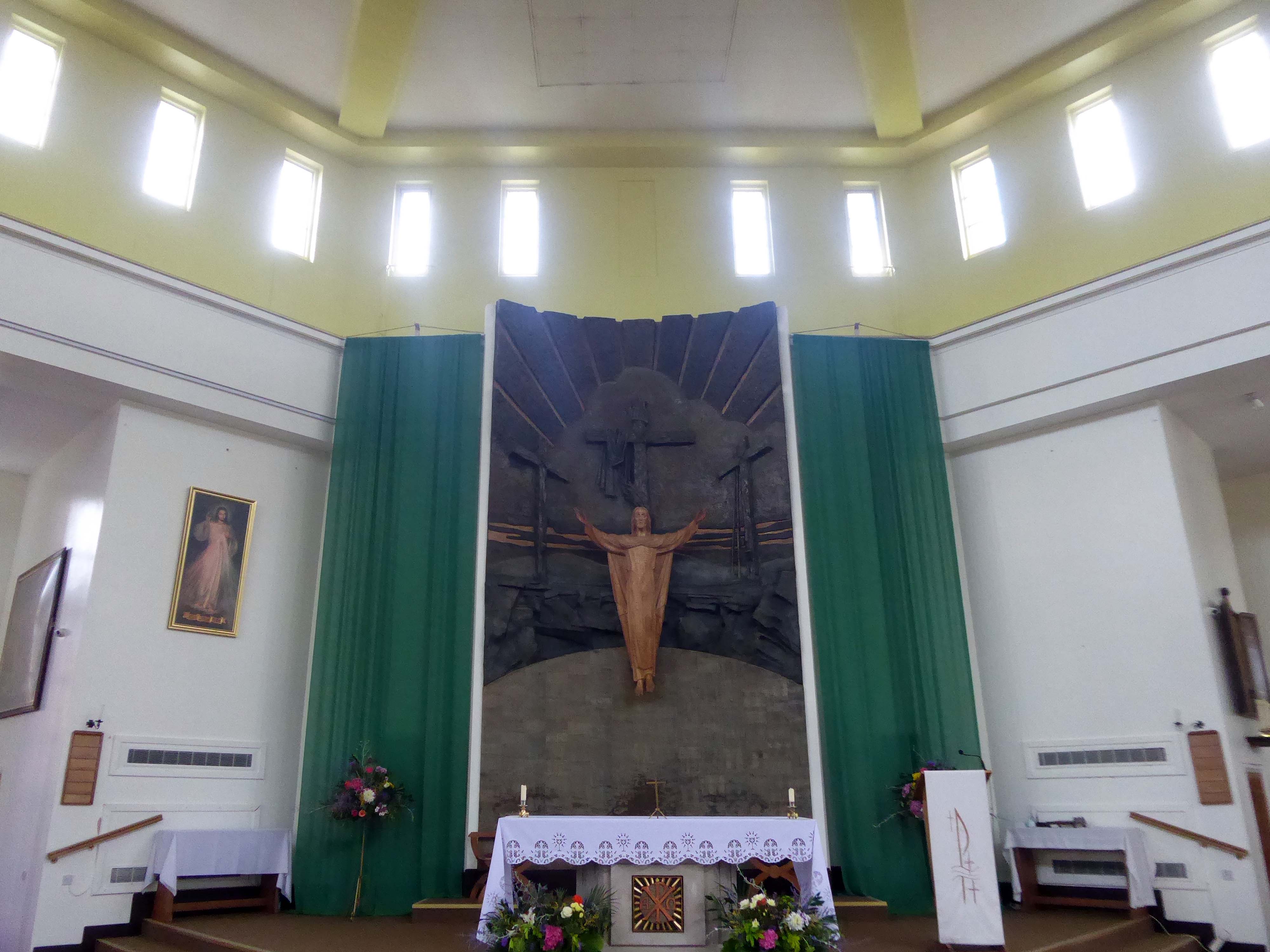
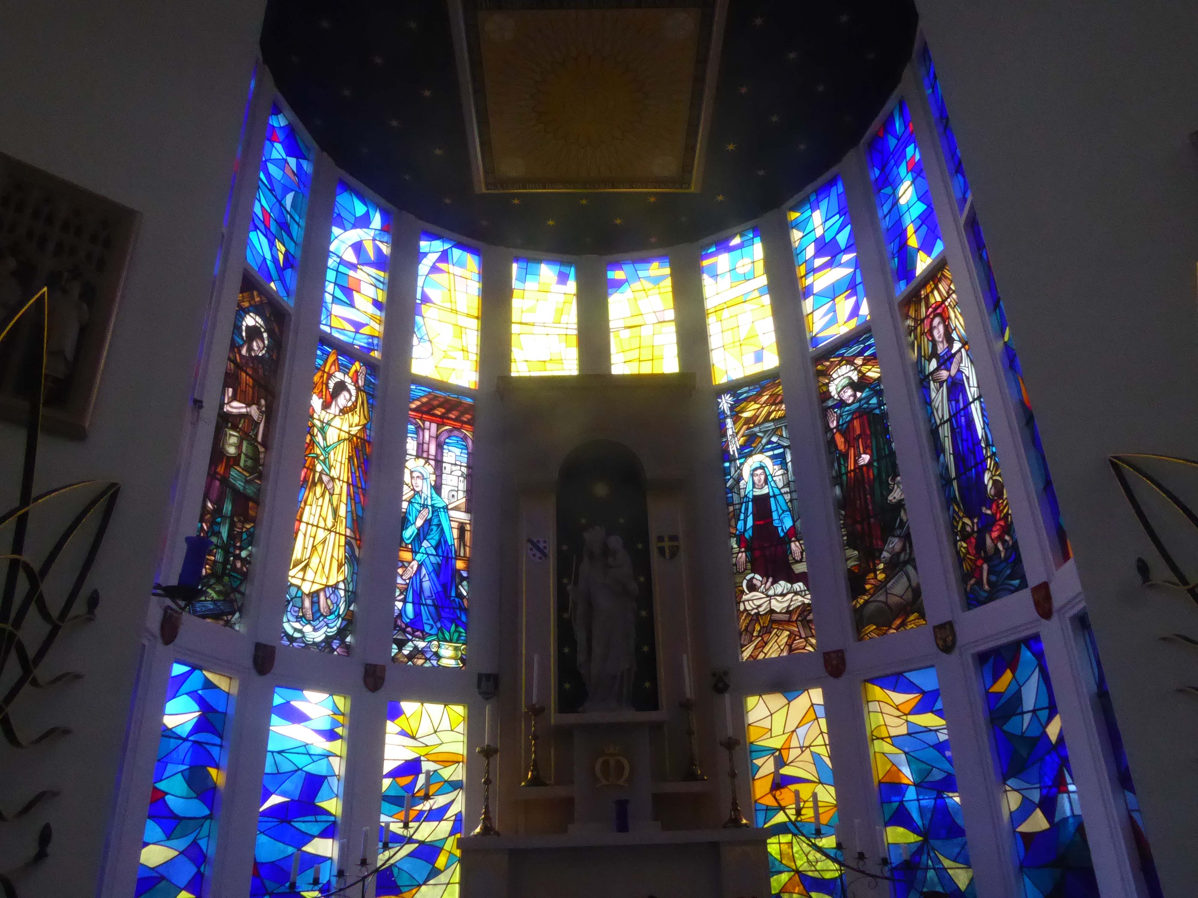
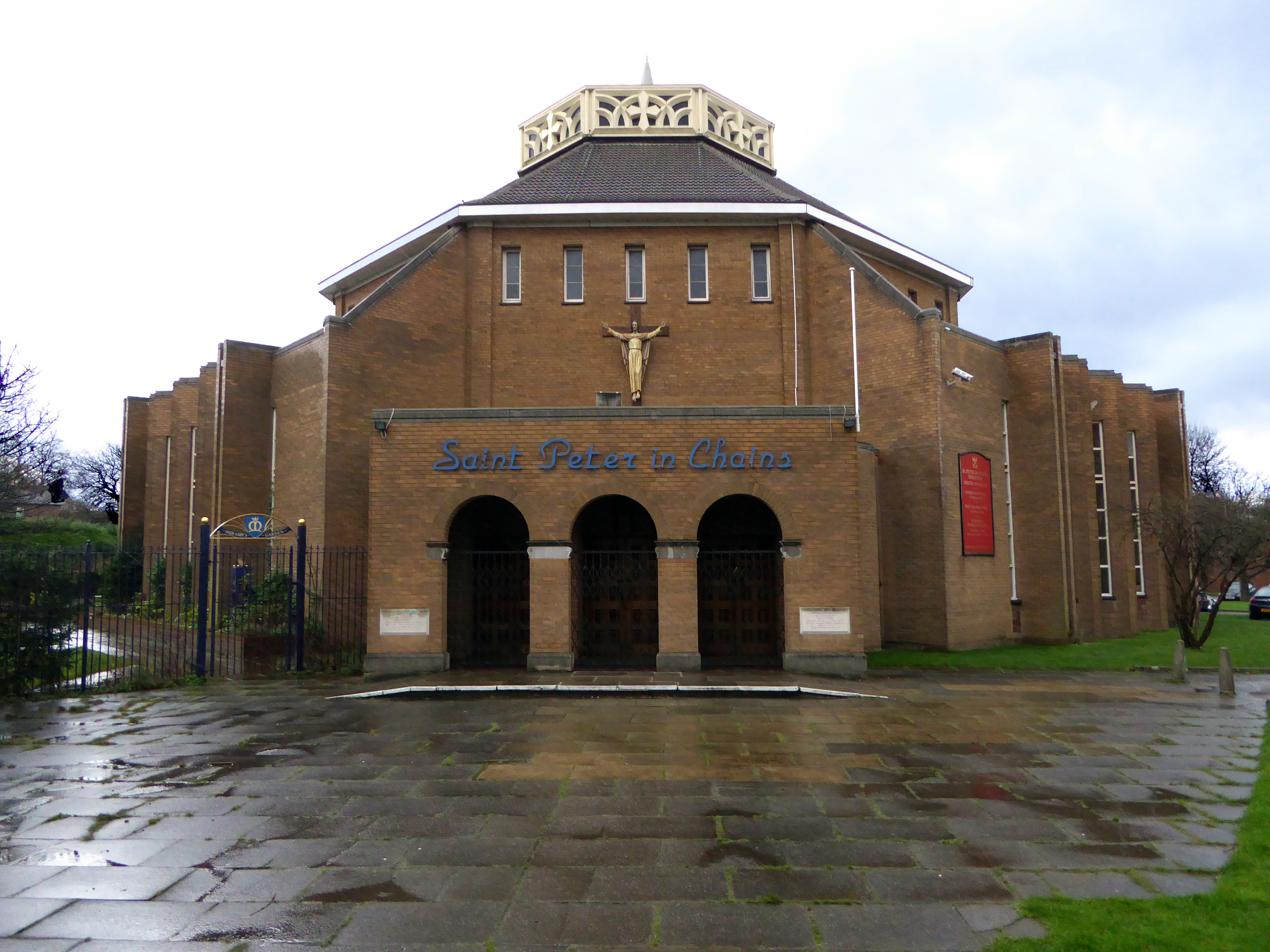
Over the way faros the green sward is St Peter in Chains RC – A large and striking design by JH Langtry-Langton, incorporating important furnishings by J F Bentley from the predecessor church, along with good furnishings of the 1970s. The churches houses the modern successor to the medieval shrine of Our Lady of Doncaster.
Figurative stained glass by Patrick Feeny for Hardman in 1973 and abstract glass fitted in 2000 as part of reordering and revival of the shrine.
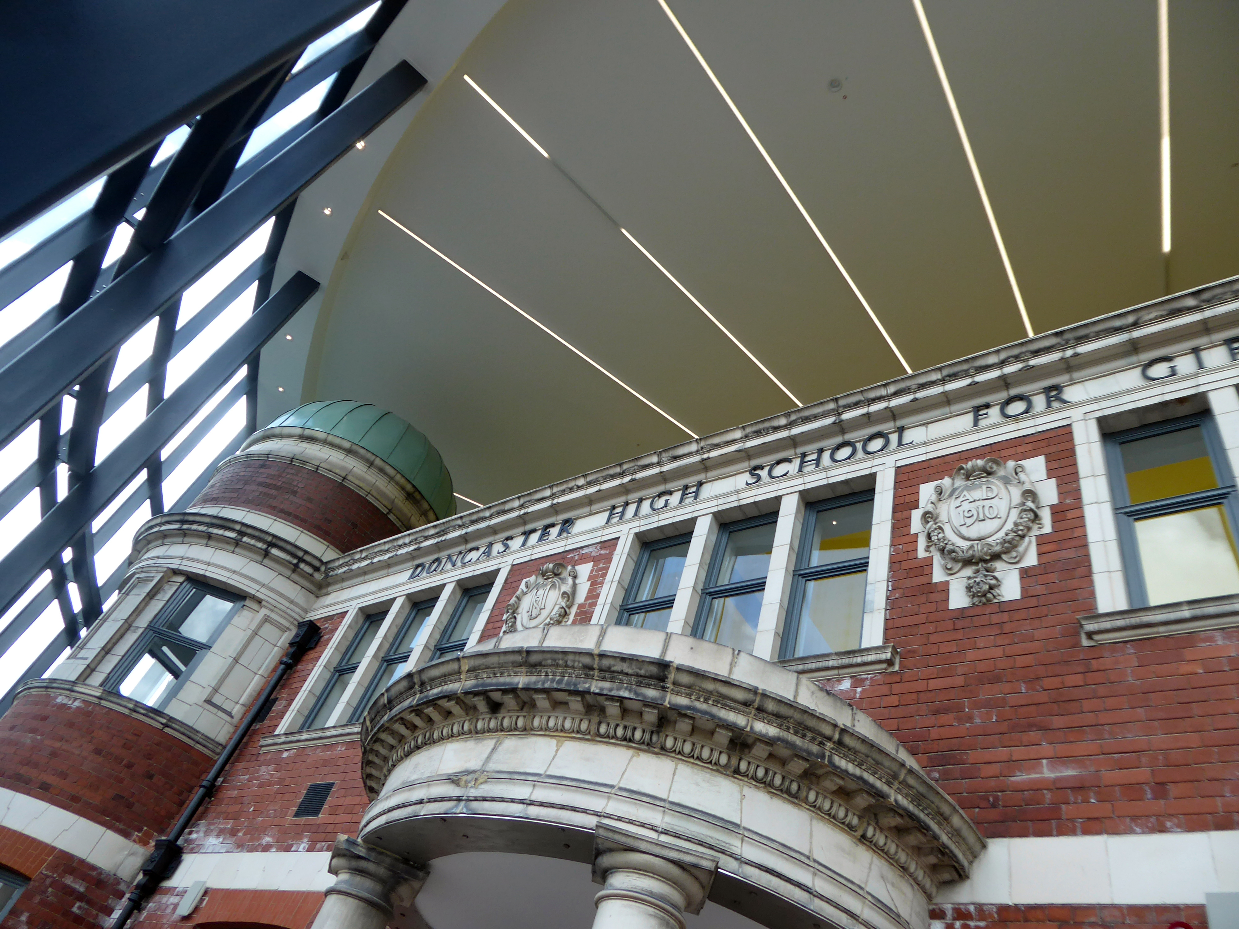
Designed by architects Bond Bryan and built by main contractor Willmott Dixon, the new cultural and learning hub has been created following the restoration of four existing buildings.
A key focal point of the scheme is the restored frontage of the Edwardian former Doncaster High School for Girls, which has been framed by Senior’s slimline SF52 aluminium curtain wall and showcased within a new steel-frame building. The glazed facade, which was fabricated and installed by Senior’s supply chain partner Chemplas, also features Senior’s aluminium commercial doors.
The A62, which runs from Manchester to Leeds, via Oldham and Huddersfield, was once the main route across the Pennines, connecting the largest city in Lancashire with Yorkshire’s largest city. However with the completion of the M62 towards Leeds in the early 1970s it lost much of its importance and traffic to the motorway, which runs a few miles to the north. These days, the A62 serves as a busy primary route between Manchester and Oldham, an extremely very quiet route over the Pennines, and then a fairly busy local road linking Huddersfield with Leeds.
Most maps show that the A62 starts its journey in the middle of Manchester by leaving the A6 Piccadilly and running along Lever Street – the original route was the parallel Oldham Street. However, owing to a bus gate Lever Street is not generally accessible from Piccadilly. We head out easterly on a busy street – non–primary, until we meet the Ring Road where we pick up primary status that we retain until Oldham. We turn left at this point and then immediately right to start the A62 proper.
In 2014, having taken early retirement from teaching photography, I embarked on a series of walks along the arterial roads of Manchester.
This whole undertaking was prompted in part by Charlie Meecham’s 1980’s Oldham Road project.
The work questions whether a sense of local identity can be maintained in an area of constant redevelopment and community displacement.
This area was first developed in the 19th century for cotton manufacture, coal extraction and later electrical and heavy engineering. The road was lined with shops and there was a vibrant community.
When I first started working on the project, most of the early industry had ceased operating and the mills were either abandoned or being dismantled. However, some had been refurbished either for new industrial use or later, made into apartments. Some run down areas were cleared making way for new housing. Clearance also provided opportunity to build new schools, trading estates and create green space. Most of the older community centres such as theatres and cinemas along the road were also abandoned and later cleared.
Like many of the original Odeon Theatres built by Oscar Deutsch, the site chosen was a little out of the main town centre – where land prices were cheaper, and the Odeon Morecambe is a good example of this. It is located at the corner of Euston Road and Thornton Road in this Lancashire seaside town. The Odeon was opened on 2nd September 1937 with Sandy Powell in “It’s a Grand Old World”. It had seating provided for 1,084 in the stalls and 476 in the circle.
Taken over by the Classic Cinemas chain in December 1967, it was re-named Classic Cinema, and was closed on 28th February 1976 with Kenneth Williams in “Carry On Behind”.
The stunning Moderne style exterior much of which including the projectionists walkway is now much deteriorated.
Next to the Police Station another Roger Booth building – recently seen on the small screen in The Bay.
Backtracking to take in the Crescent Café entrance.
Which became Hart’s Restaurant now trading as the Black Thai.
Into the town centre to look at the former Centenary HouseCo-op 1927.
Bought by the city council as part of the West-End Masterplan, the intention is to refurbish the building’s upper floors to provide affordable housing and accommodation for local arts businesses, retaining the Co-op late shop that occupies one-half of the ground floor.
Let’s take a look along the front – where we find a former Woolworths.
Along with other stores from the same period.
Alongside sits the former Littlewoods.
By 1939 there were 24 stores. A number of these were purpose-built for Littlewoods to designs by J S Quilter & Son. John Salmon Quilter – 1841-1907 was, in fact, long dead, but his architectural practice had been continued by his son Cecil Molyneux Quilter – 1879-1951. Quilter specialised in commercial architecture, notably public houses. He designed a new Blackpool store for Littlewoods, on the corner of Church Street and Corporation Street, which was faced in Empire stone. He also designed a store in Chester, and may have been responsible for the one in Morecambe. This faience-clad art deco building is the best surviving example of a pre-war Littlewoods store – indeed, it may be the best surviving Littlewoods of all time – even preserving diamond L motifs on the entrance lobby floors. These clearly copied Woolworth’s diamond W.
Finally to the Midland Hotel 1932-3 by Oliver Hill
Concrete and rendered brickwork, painted white. Curved plan, with convex side facing west towards the sea. Three storeys. Windows are steel-framed casements with rendered surrounds. Above each storey are projecting horizontal bands. The entrance front has a rounded left-hand corner, and a convex central staircase projection rising above roof level. This projection has a tall window of steel casements above the doorway, divided into three by mullions, both of which are capped by sea horses, painted red, which were carved by Eric Gill. Projecting at the right is a single-storey cafe of circular plan, now known as the Ravilious Restaurant. The west side has a single-storey projecting sun lounge, which is an addition, its windows replaced in PVC-coated steel. Between the solid centre and ends of the facade the 1st and 2nd floors have their walls recessed to form balconies.
Interior: above the cantilevered circular open-well staircase is a ceiling panel carved in low relief by Eric Gill and painted by Denis Tegetmeier. They were also responsible for the pictorial map of north-west England in what was originally the children’s room at the south end of the building. Also in this room is Eric Gill’s Portland stone panel, originally in the lounge, carved in low relief with a representation of Odysseus and Nausicaa. It was moved to its present position when internal walls were demolished during the 1970s. The cafe walls were originally painted with frescoes by Eric Ravilious, representing morning and evening in an idyllic seascape setting. These deteriorated rapidly because the plaster and paint used were incompatible and were obliterated within 2 years of completion, but were repainted in the late 1980s using photographic evidence.
The Super Swimming Stadium at Morecambe, Lancashire, was one of the grandest of the 1930s modernist seaside lidos. This massive structure measuring 396ft. by 110ft. was said to be the largest outdoor pool in Europe when it opened in 1936, accommodating some 1200 bathers and 3000 spectators. Unusually for an inter-war lido, it was designed not in-house by a Borough Engineer but by two architects, Kenneth MB Cross and Cecil Sutton, who styled it to harmonise with the Streamline Moderne of Oliver Hill’s adjacent Midland Hotel.
The stadium was closed down in 1975 on grounds of structural problems and demolished just a year later.
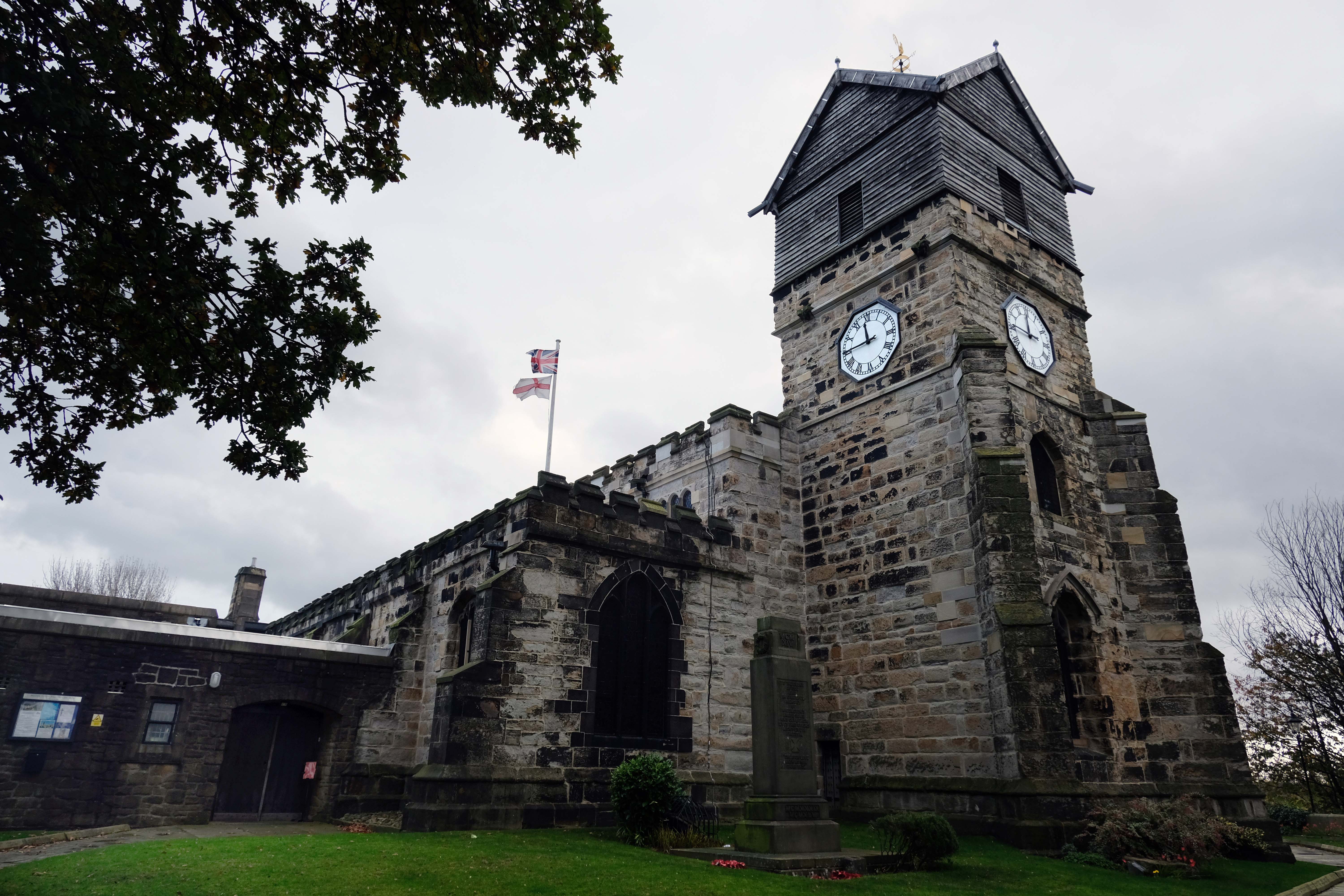
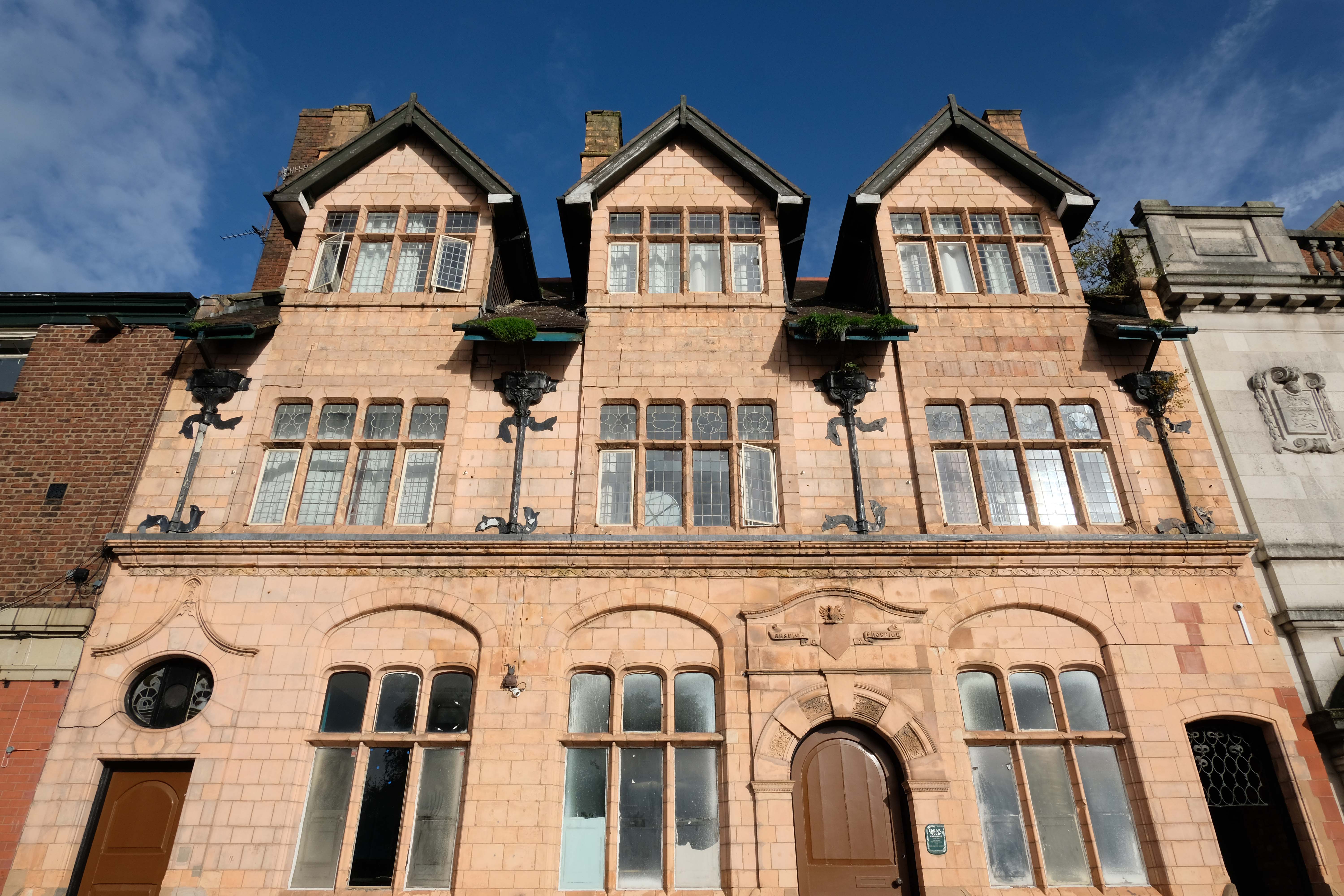
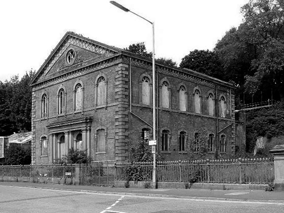
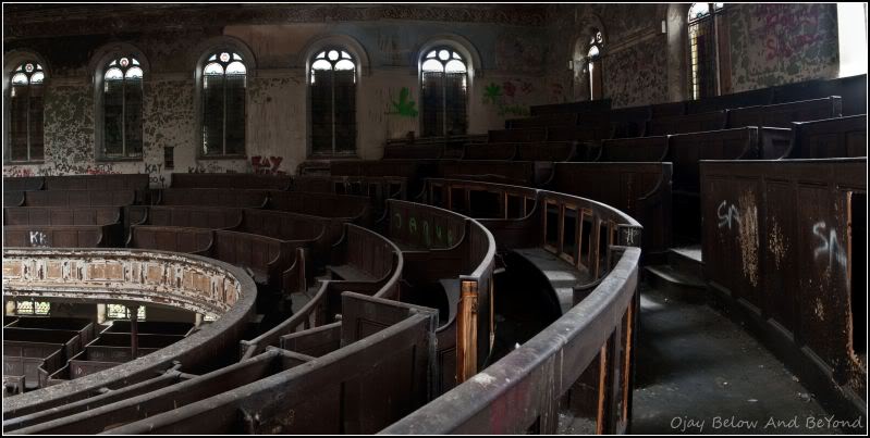
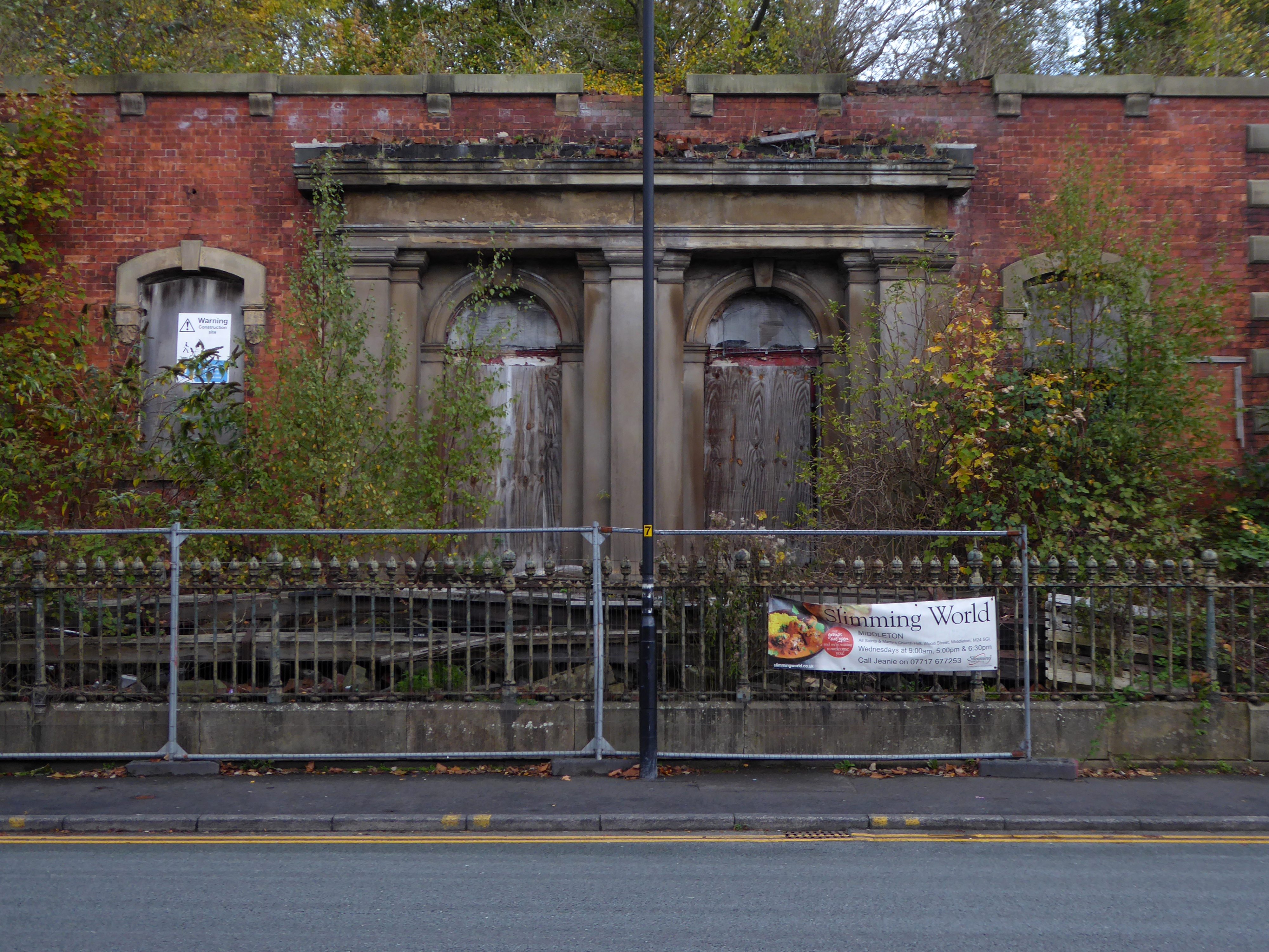
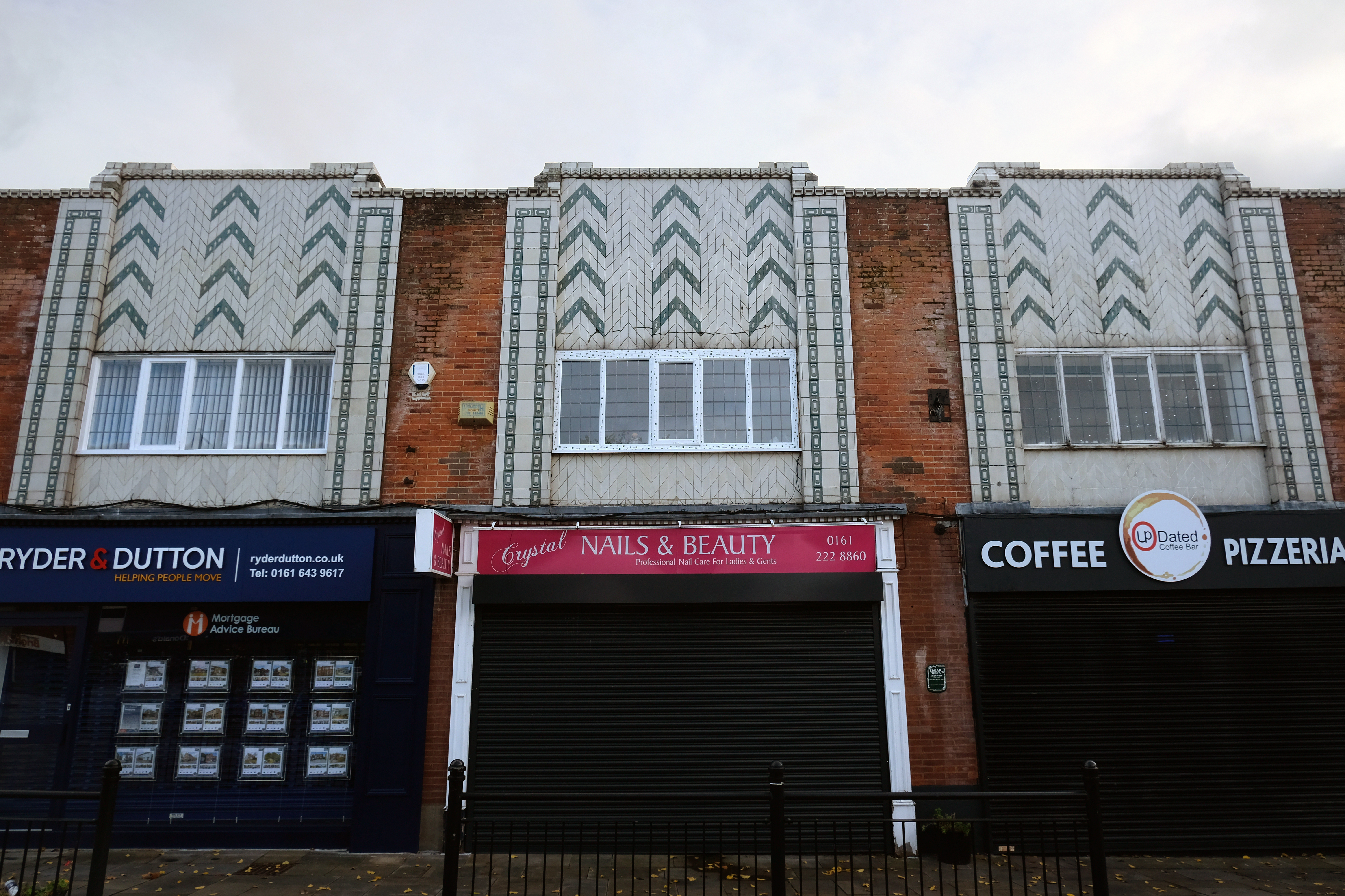
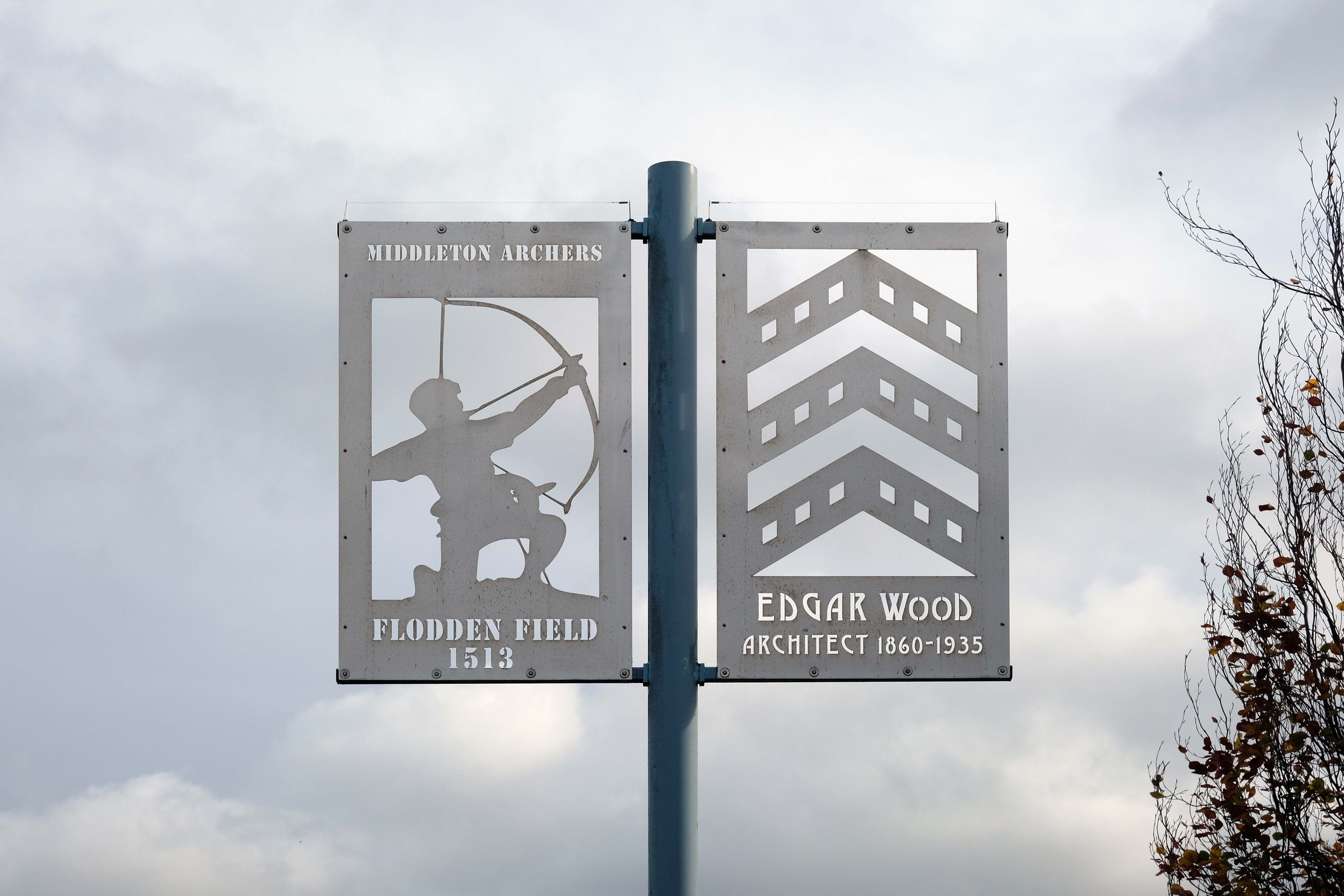
Middleton has not the gloom of so many South Lancashire towns its size. It benefits from its position close to the hills, but it has also the advantage of a large medieval church on a hill and of a number of buildings by one of England’s most original architects of the period around 1900.
He was the most advanced English architect of his generation, stylistically moving through through art nouveau, vernacular, expressionist and finally art deco phases a decade or more before other designers. He became England’s uncontested pioneer of flat roofed modern buildings. He worked more like an artist than an architect, designing buildings, furniture, stained glass, sculpture, metal and plaster work. His buildings are mostly clustered in the towns of Middleton, Rochdale, Oldham, Huddersfield and Hale. Influenced by the writings of William Morris, he saw himself as an artisan serving the people of these localities.
Sixty-seven sets of designs for the proposed free library at Middleton were received by the Corporation of that borough in response to their advertisement; and a joint committee comprising of six members of the Corporation and six non-members has awarded the premium to Mr Lawrence Booth, architect of this city.
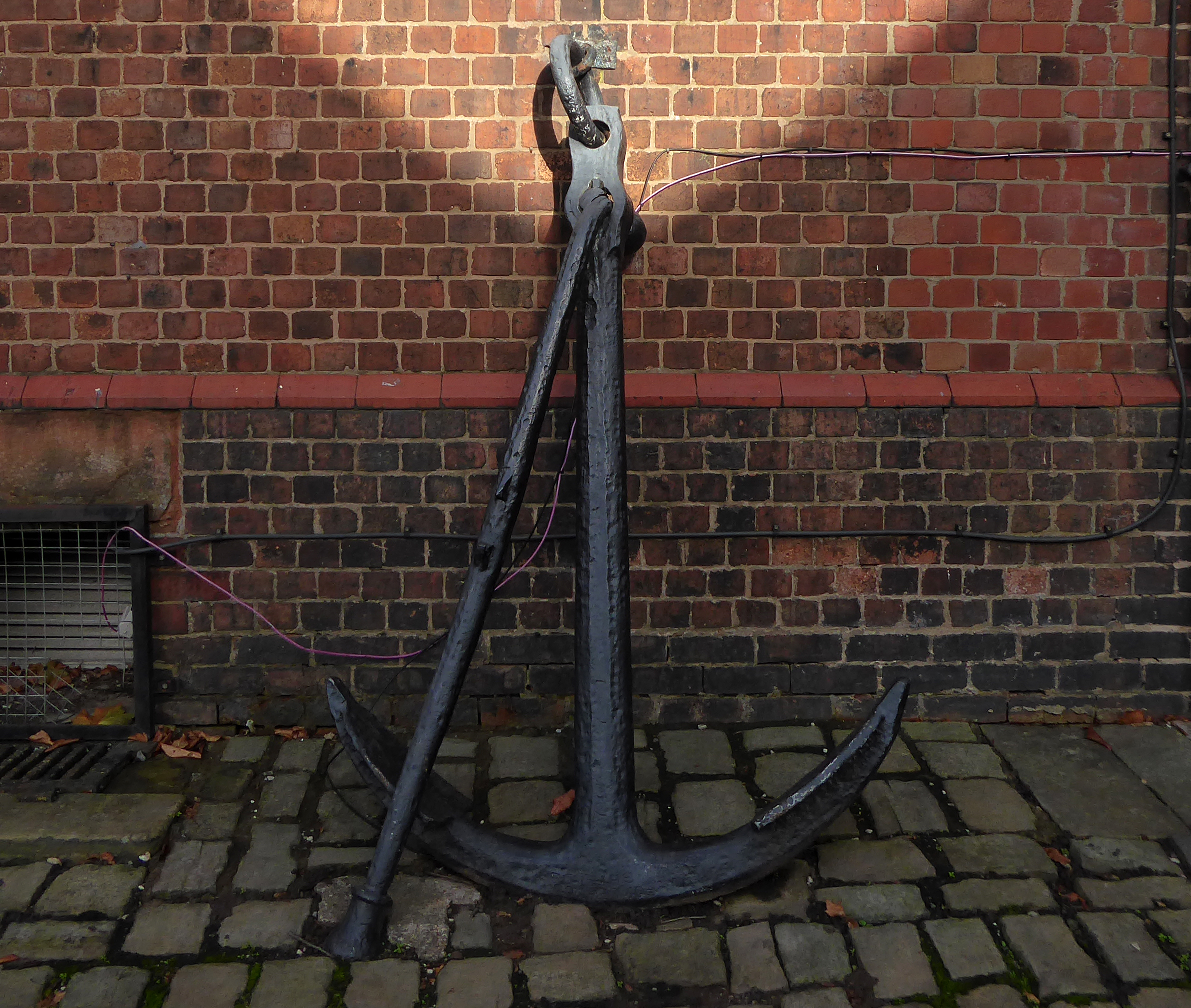
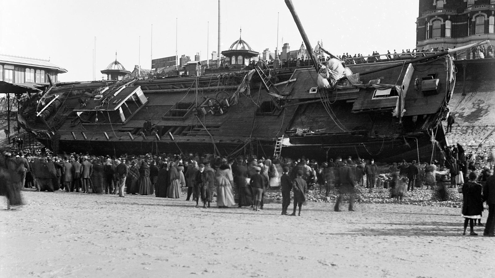
Curiously, we encounter an anchor.
Around 10pm that evening when weather conditions deteriorated to near hurricane-force gales, with the Sirene making little headway despite tacking.
Losing her helm, her sails in tatters and within sight of the Great Orme, the gales drove her back through the night towards the Lancashire coast. Eventually, and with great difficulty, Captain Gjertsen and his crew managed to manoeuvre the stricken vessel between the Central and North Piers. Becoming increasingly unmanageable, and swept in by the rushing tide and gale force winds, the Sirene looked a doomed vessel. She was helpless in the close shore currents, and unable to drop anchor she was at the mercy of the waves. She was carried alongside the North Pier, tearing off a section of the pier superstructure and part of her own keel.
Thousands of people lined the Promenade to witness the spectacle as she came in on the south side of the pier; many more stood on the pier itself, but there was a mad rush for safety when the ship collided against the structure.
The captain and crew survived, including the ship’s cat, many offers were made for the cat, but the captain refused them.
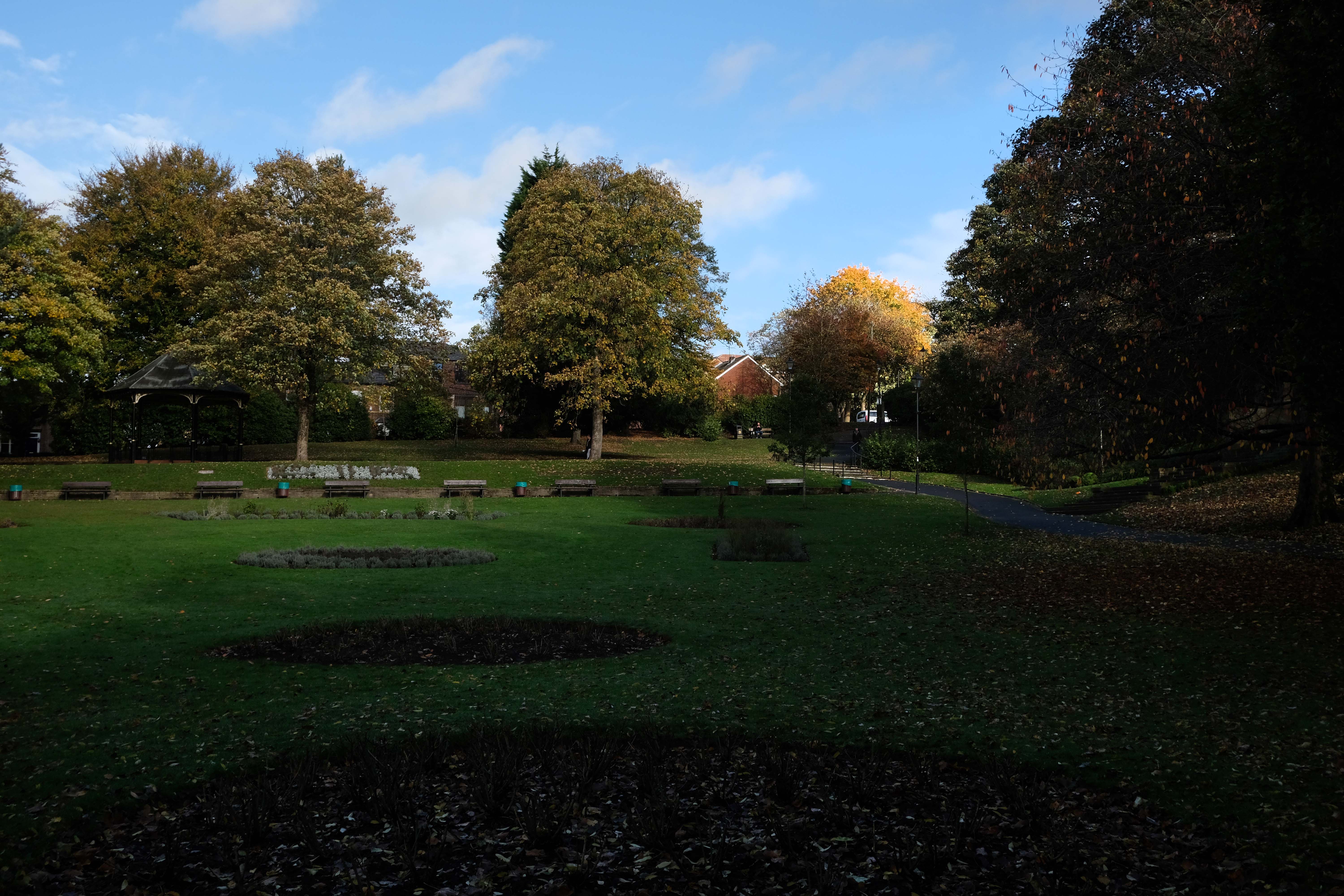
Onwards through Jubilee Park opened in 1889 to commemorate the Golden Jubilee of Queen Victoria.
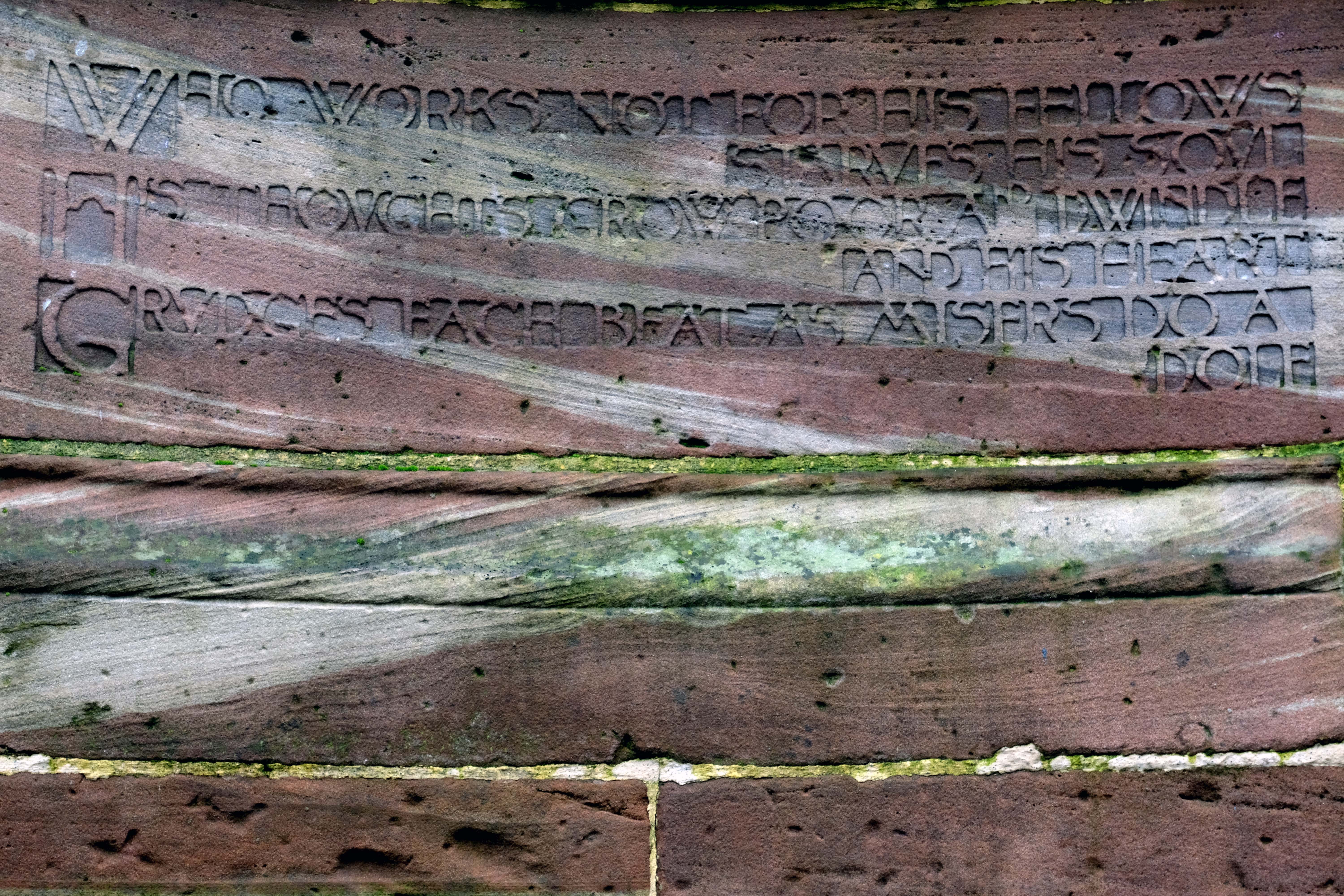
In 1906 Alderman Thomas Broadbent Wood commissioned his son, Edgar, to design a flight of steps to lead up to a contemplation spot in the park – the inscription reads:
Who works not for his fellows starves his soul.
His thoughts grow poor and dwindle and his heart grudges each beat, as misers do a dole.
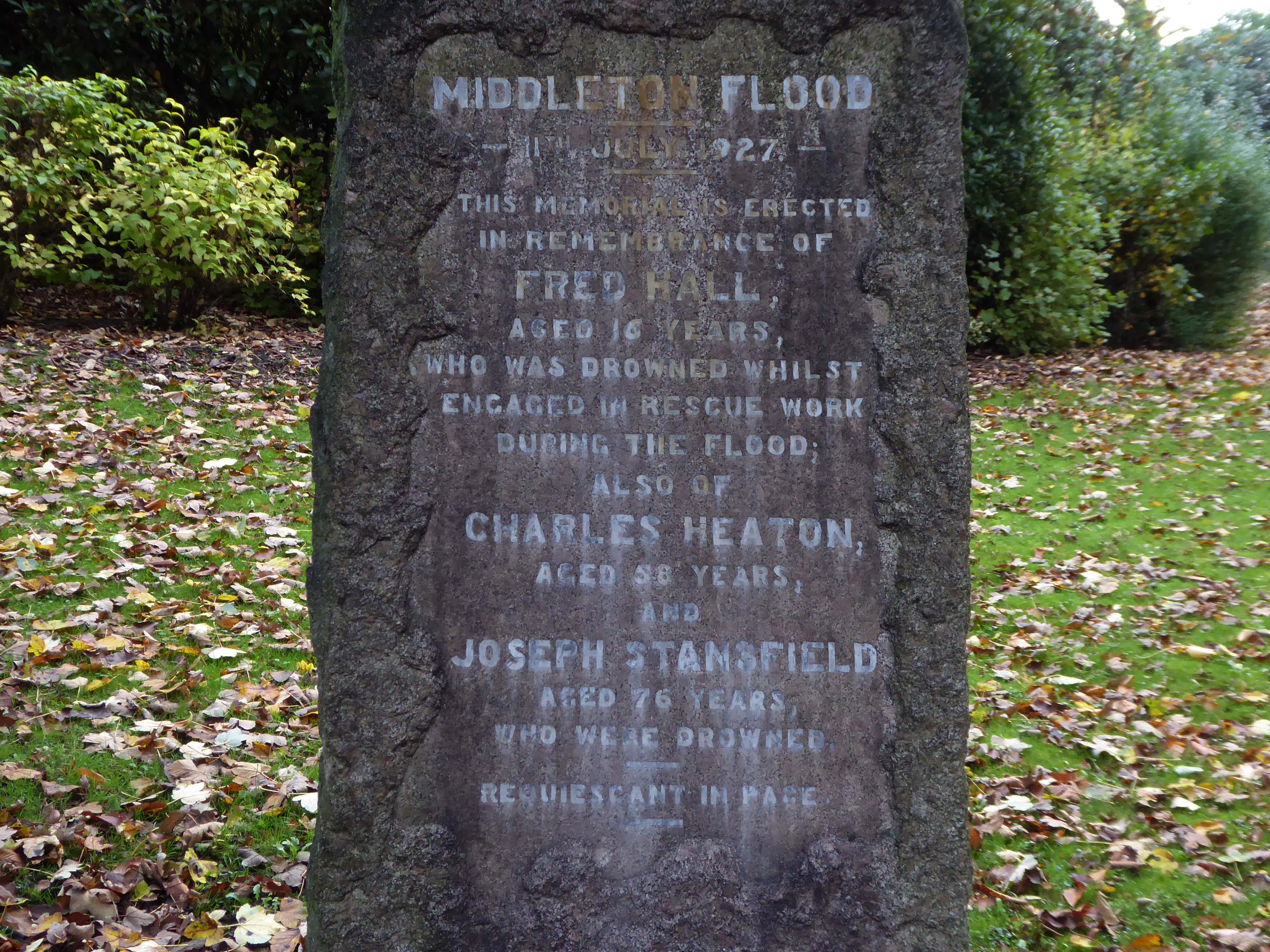
Nearby we find a memorial to the Middleton Flood – following torrential rain, the canal embankment at Mills Hill broke, flooding the already swollen River Irk, subsequently deluging the town.
Much of the present building was erected in 1412 by Thomas Langley – born in Middleton in 1363, who was Bishop of Durham and Lord Chancellor of England. He re-used the Norman doorway from an earlier structure to create the tower arch. Also distinctive in this region is the weather-boarded top stage to the tower.
The church of St Leonard was enlarged in 1524 by Sir Richard Assheton, in celebration of the knighthood granted to him by Henry VIII of England for his part in the Battle of Flodden in 1513. The Flodden Window, in the sanctuary, is thought to be the oldest war memorial in the UK. It commemorates on it the names of the Middleton archers who fought at Flodden. The church also has one of the finest collections of monumental brasses in the north of England, including the only brass in the UK depicting an English Civil War officer in full armour, Major-General Ralph Assheton.
George Pace designed a war memorial and, in 1958, added a choir vestry and installed new lighting.
Wikipedia
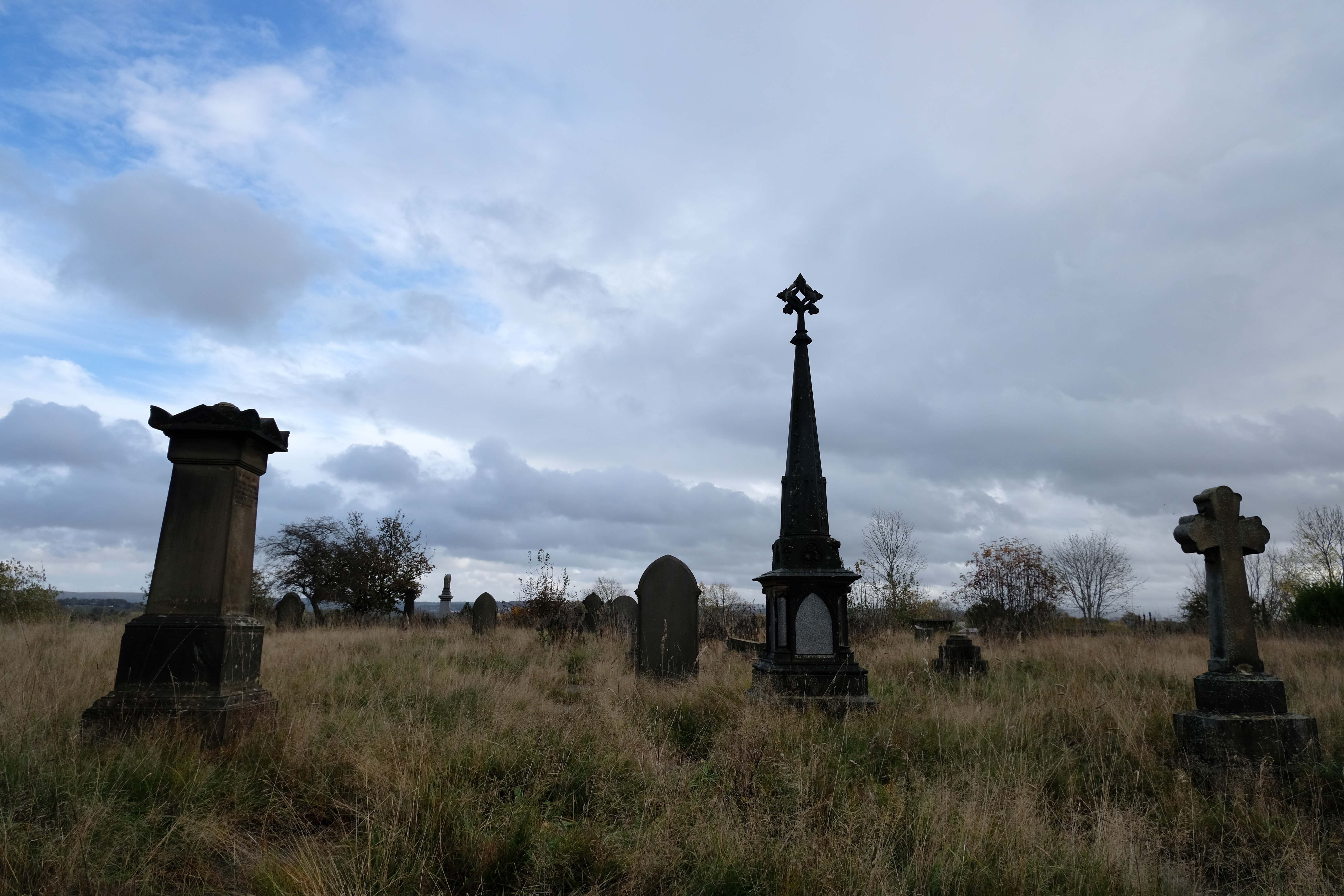
Middleton Old Cemetery once the Thornham and Middleton Burial Ground, which became the local authority cemetery in 1862.
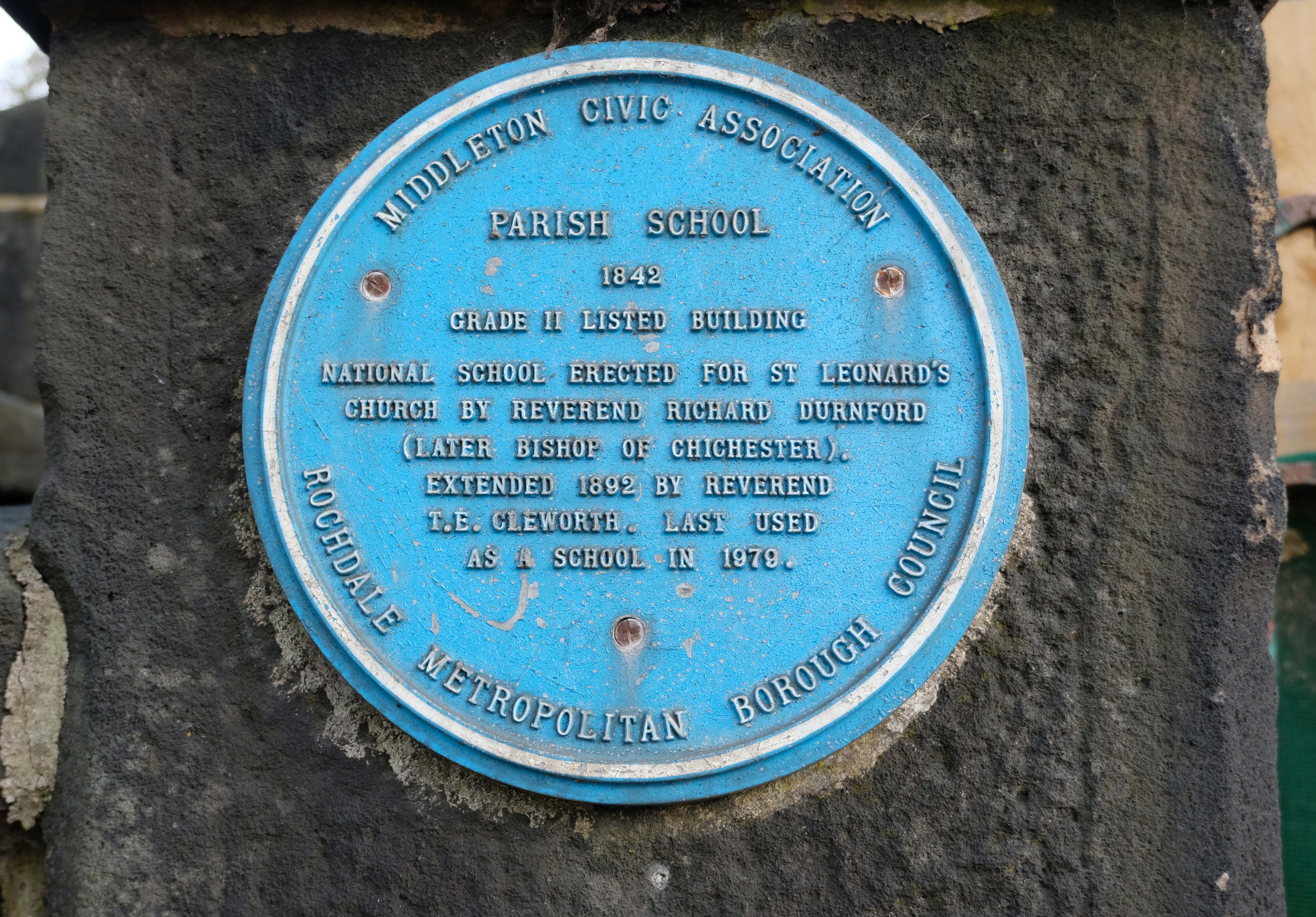
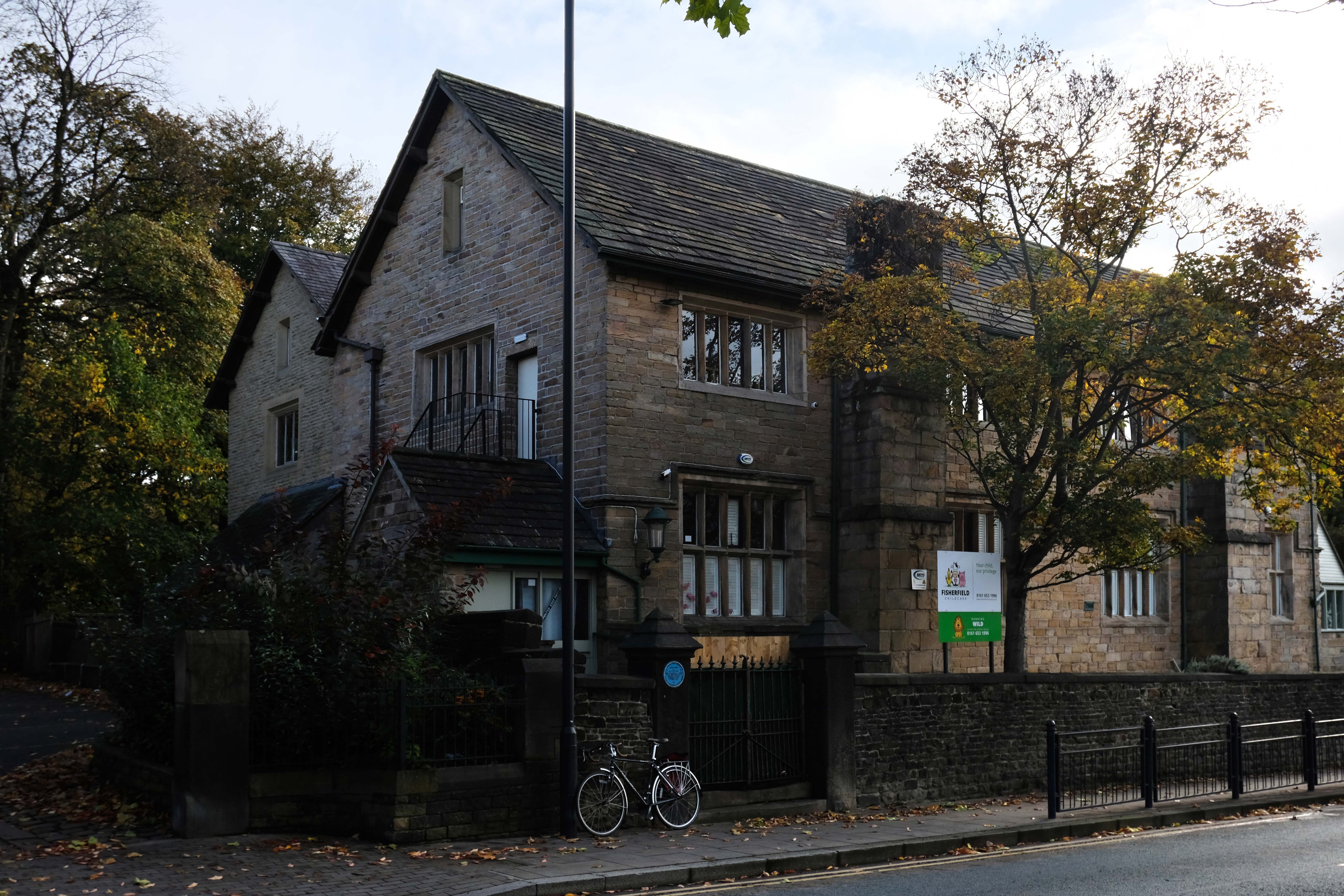
Retrace to the Library – adjacent is the Parish School 1842
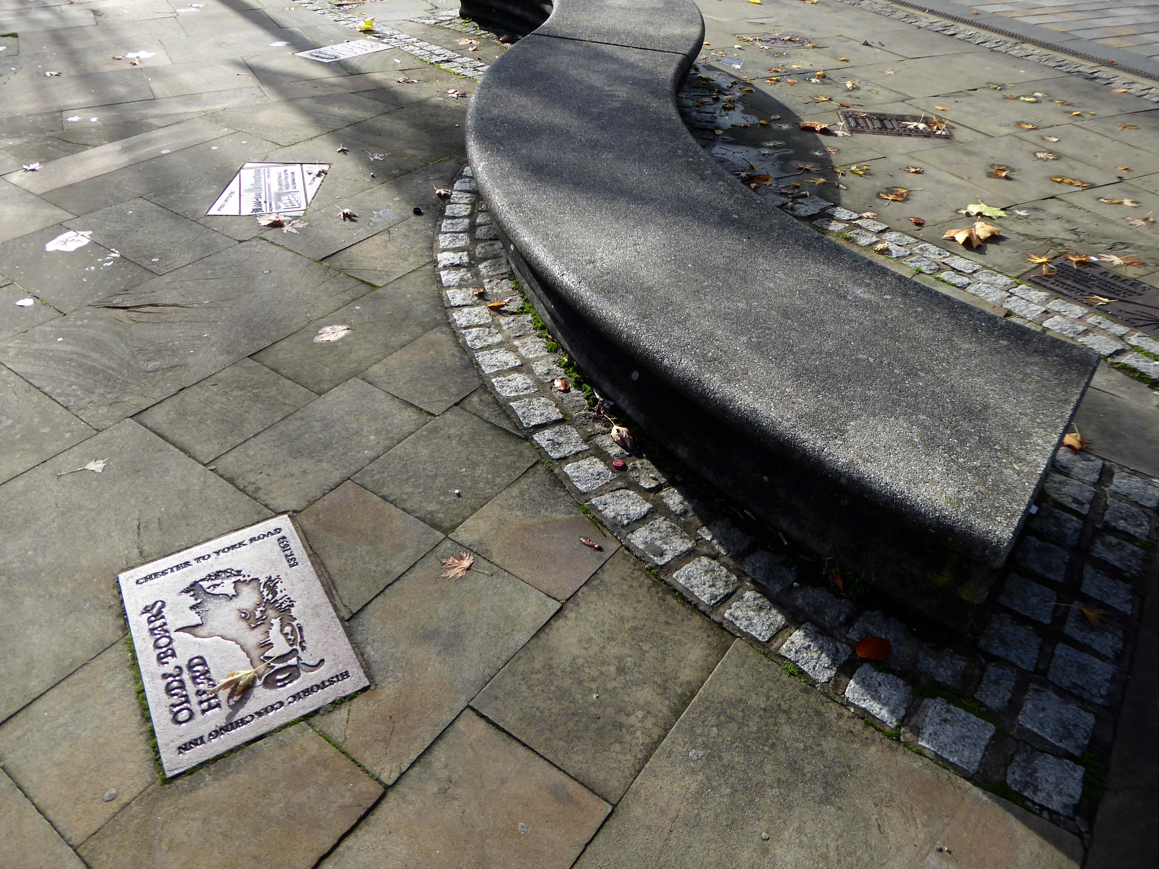
Part of the timber framing to the right of the front door has recently been tree-ring dated and confirms a building date of 1622. The first tenant was Isaac Walkden, son of Middleton schoolmaster, Robert Walkden. Isaac died during a typhus epidemic in the summer of 1623. His will, preserved at Lancashire Archives, includes an inventory of all his possessions listed on a room by room basis. There were a total of 9 beds and 20 chairs or stools in the 6 rooms. This, together with barrels, brewing vessels, pots, glasses, etc, strongly suggest the building was an inn. The Walkden family went on to run the Boar’s Head until the end of the 17th century. They also farmed nearby land including what is now Jubilee library and park.
In 1888, the fledgling Middleton Corporation purchased the building from the church with the intention of demolishing it to build a town hall. Discussions were held in 1914 but, thankfully, the plan was abandoned due to an outcry from the public spearheaded by architect Edgar Wood.
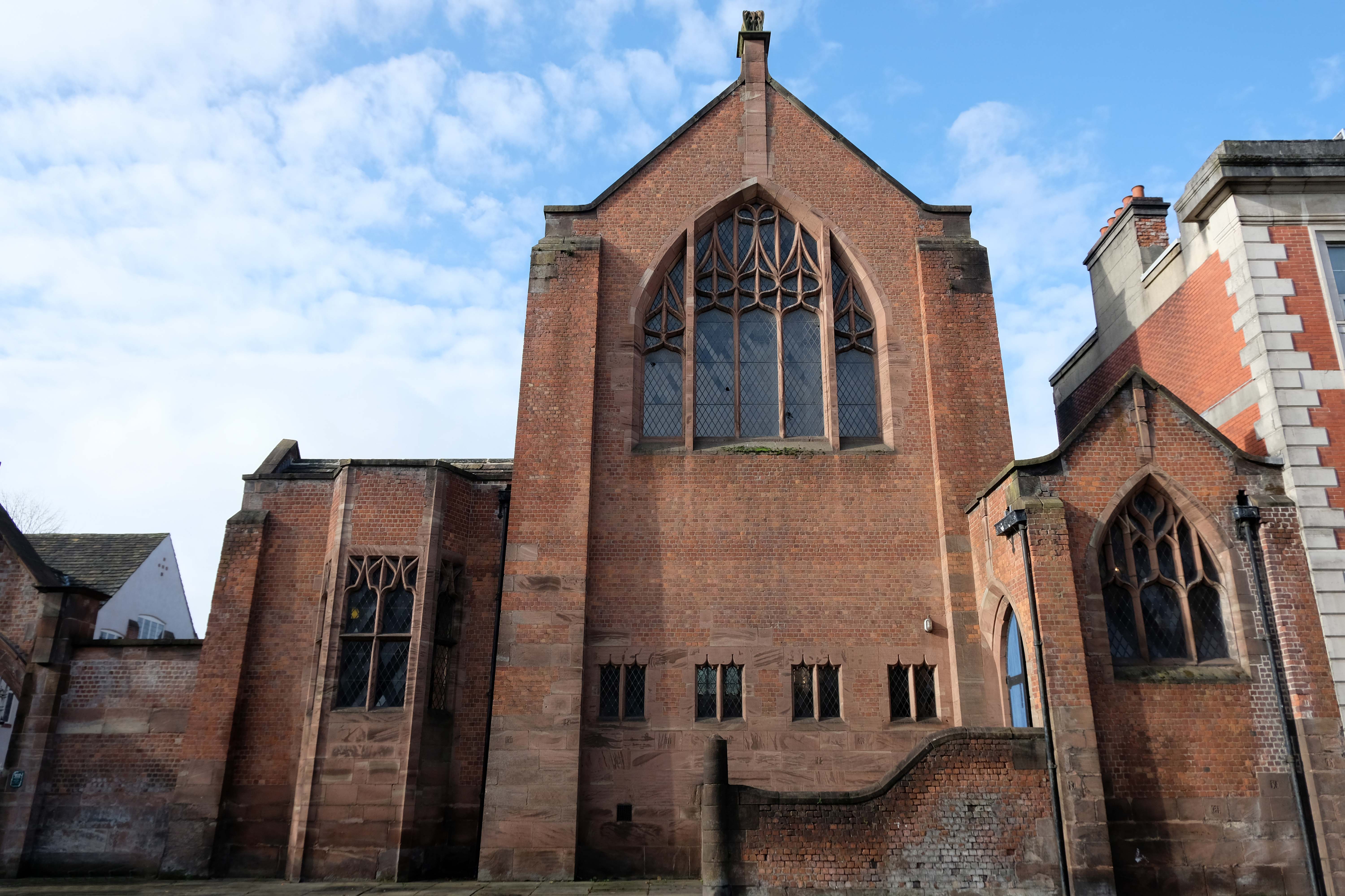
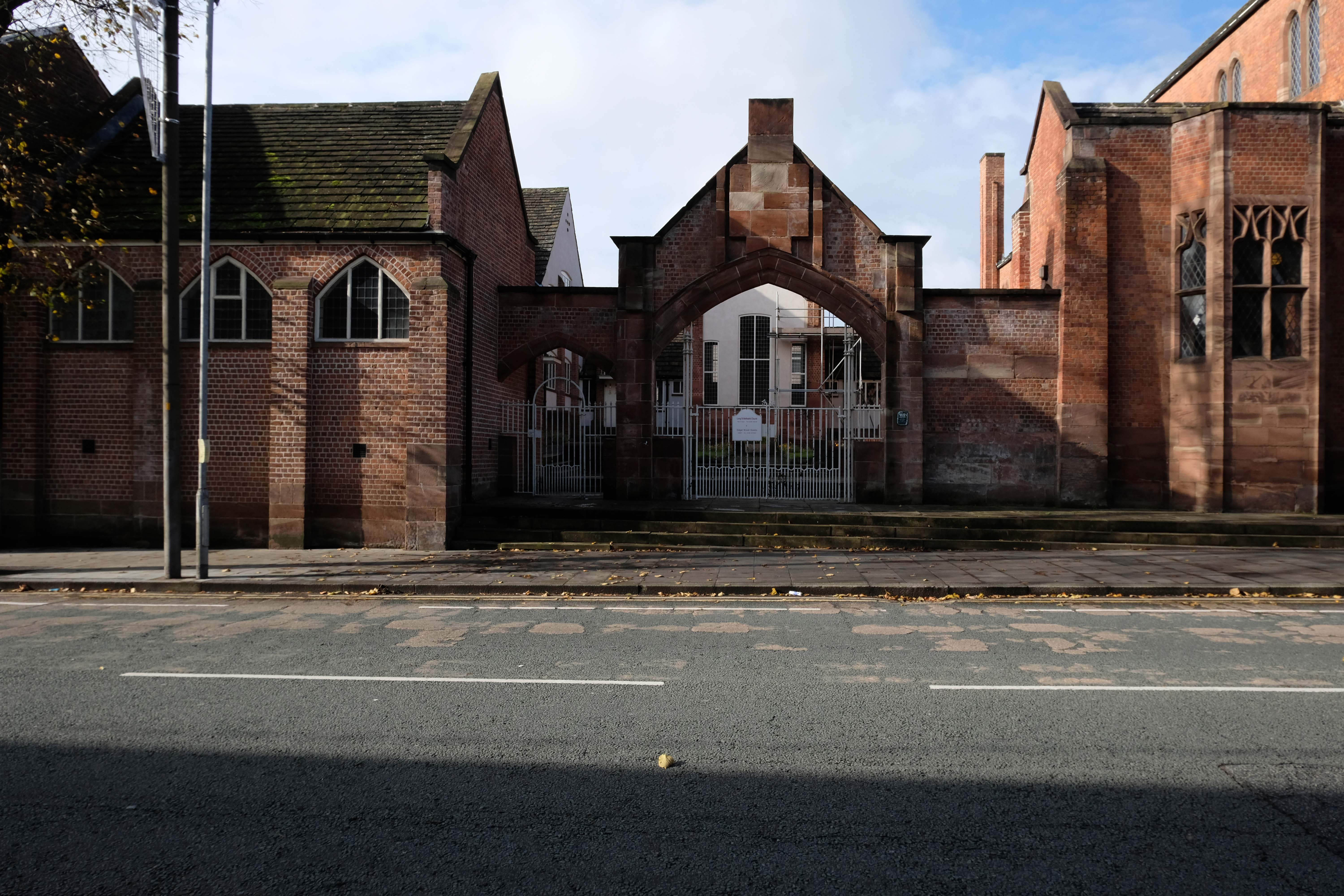
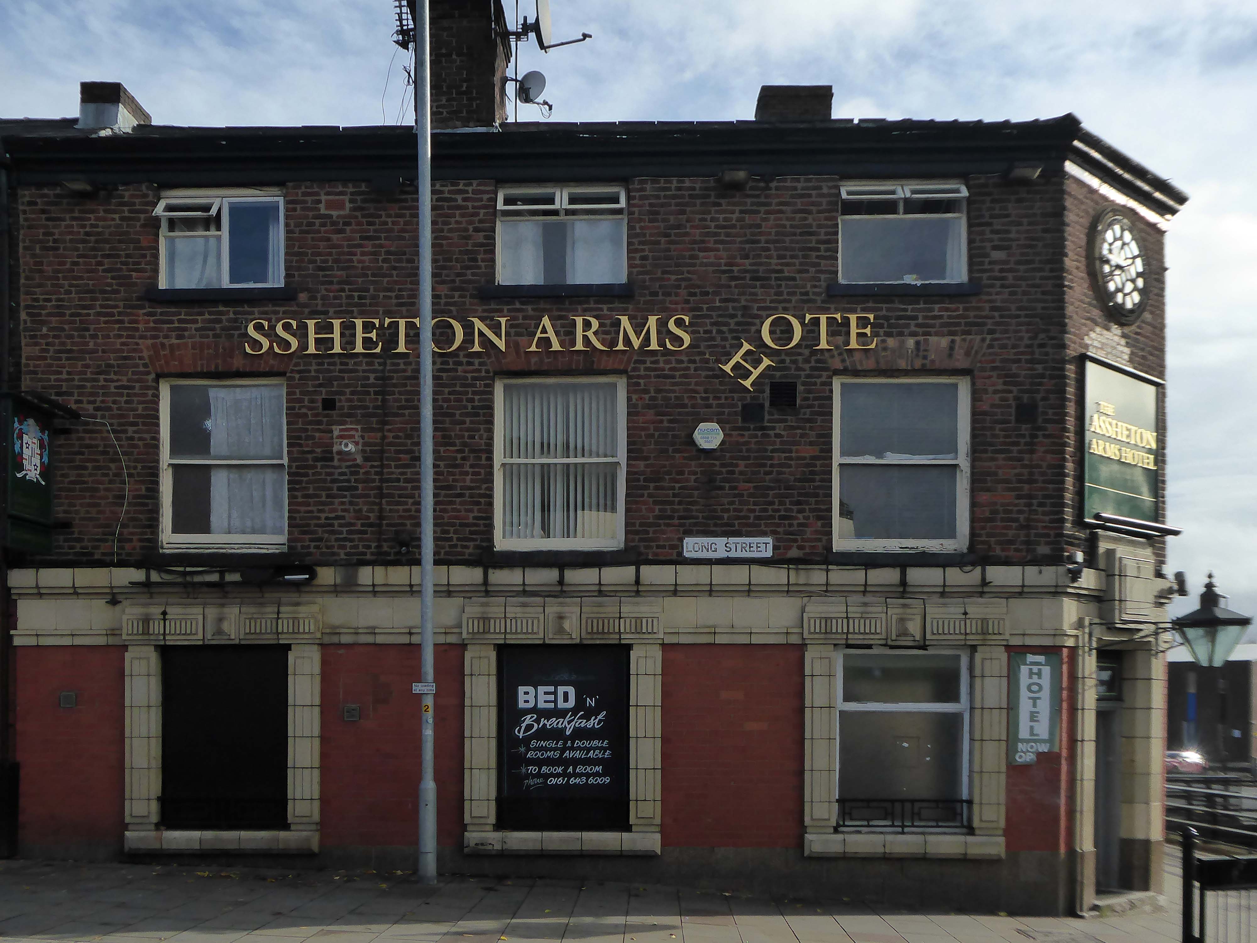
Further down Long Street to the Assheton Arms Hotel.
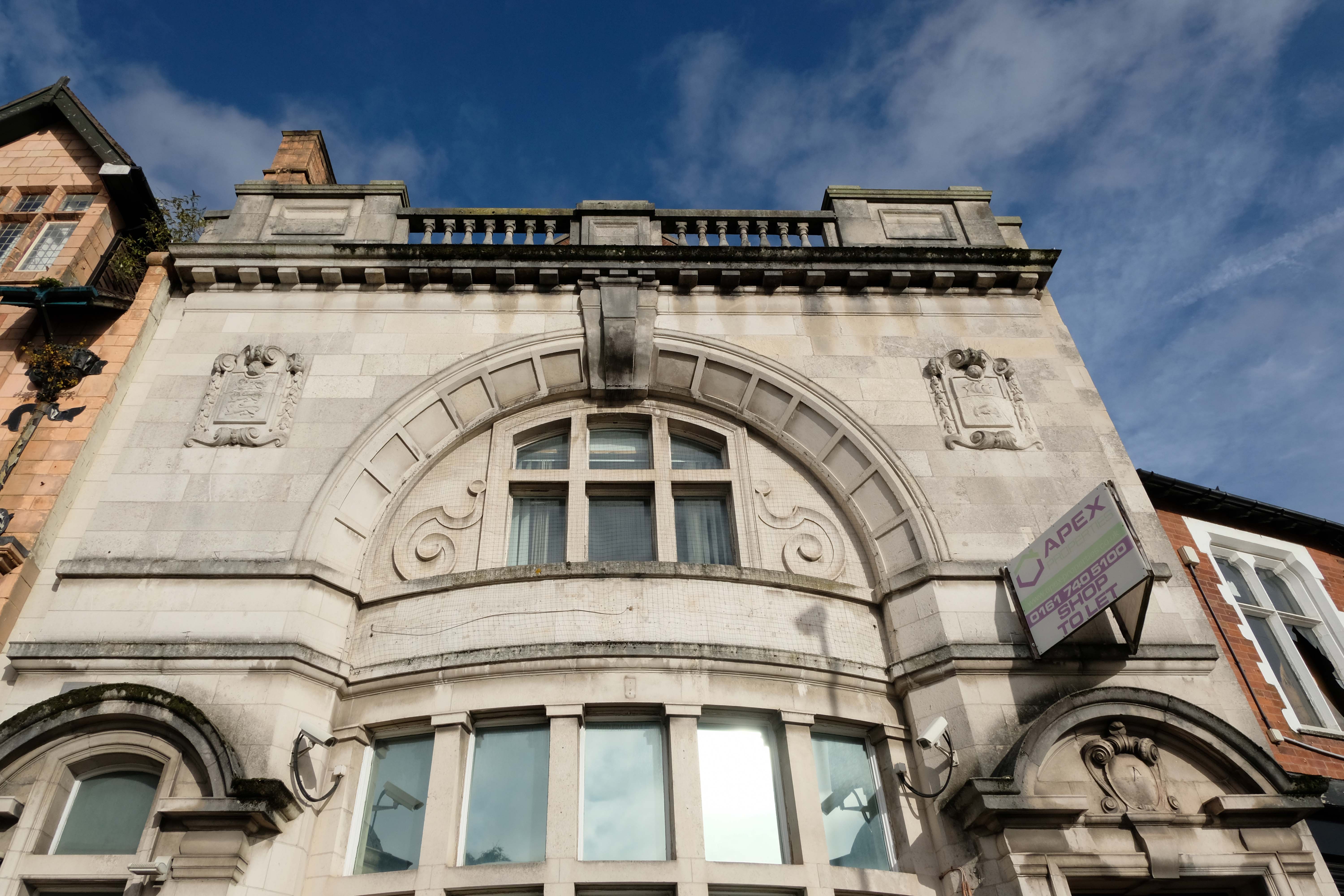
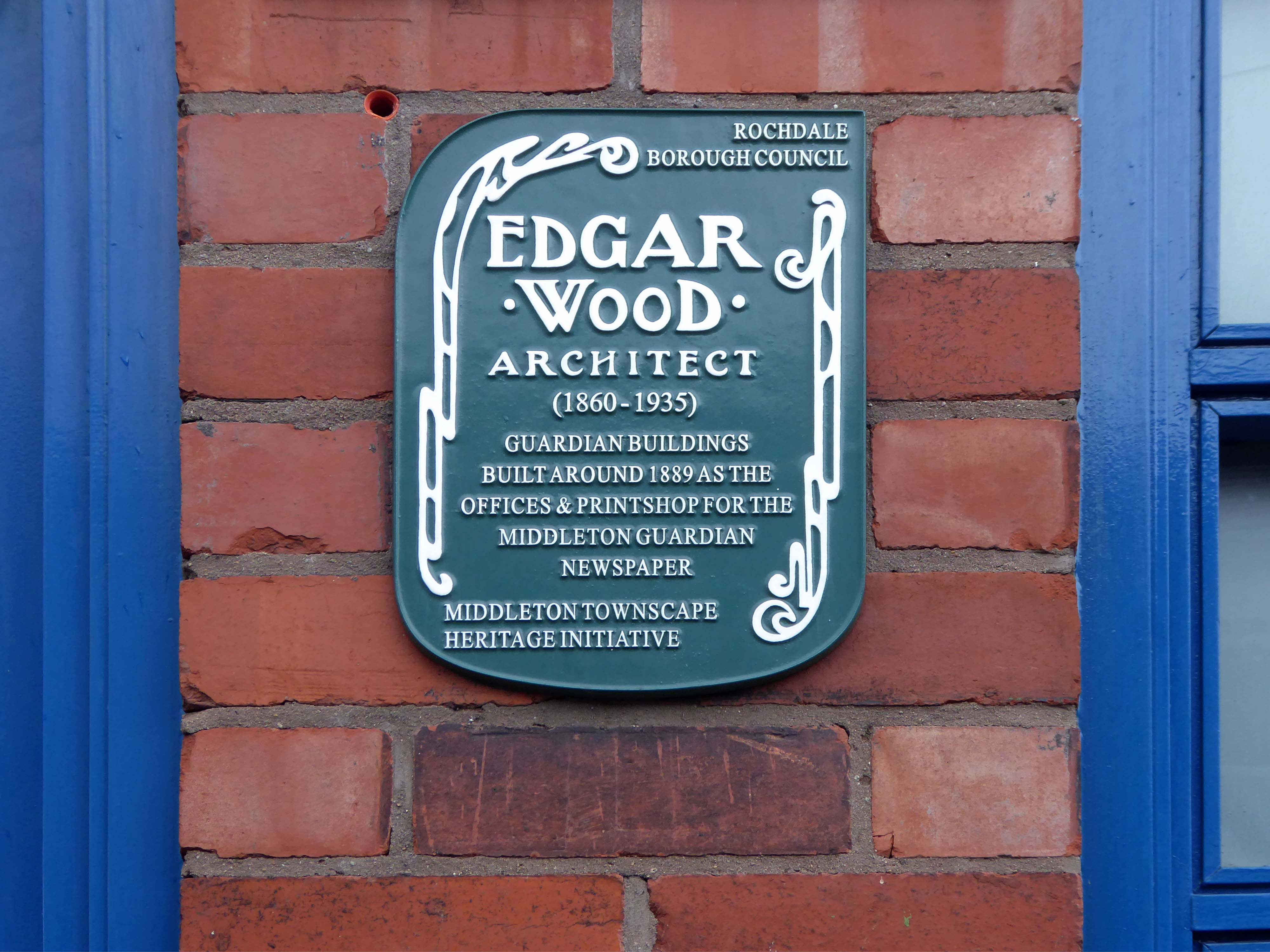
Then around the corner to the Manchester & Salford Bank again by Edgar Wood
Next door the former Market Place Bank latterly RBS.
Plans to convert a long-vacant town centre bank into a nightclub have been revived despite previously being rejected over anti-social behaviour concerns.
An application to change the use of the former Royal Bank of Scotland, in Middleton, was refused by Rochdale council’s planning committee eighteen months ago, with members citing a history of alcohol-fuelled trouble in the area.
Further up Market Place the faience fronted Bricklayers Arms formerly a Bents and Gartsides boozer – delicensed in 2012 and Converted to a takeaway.
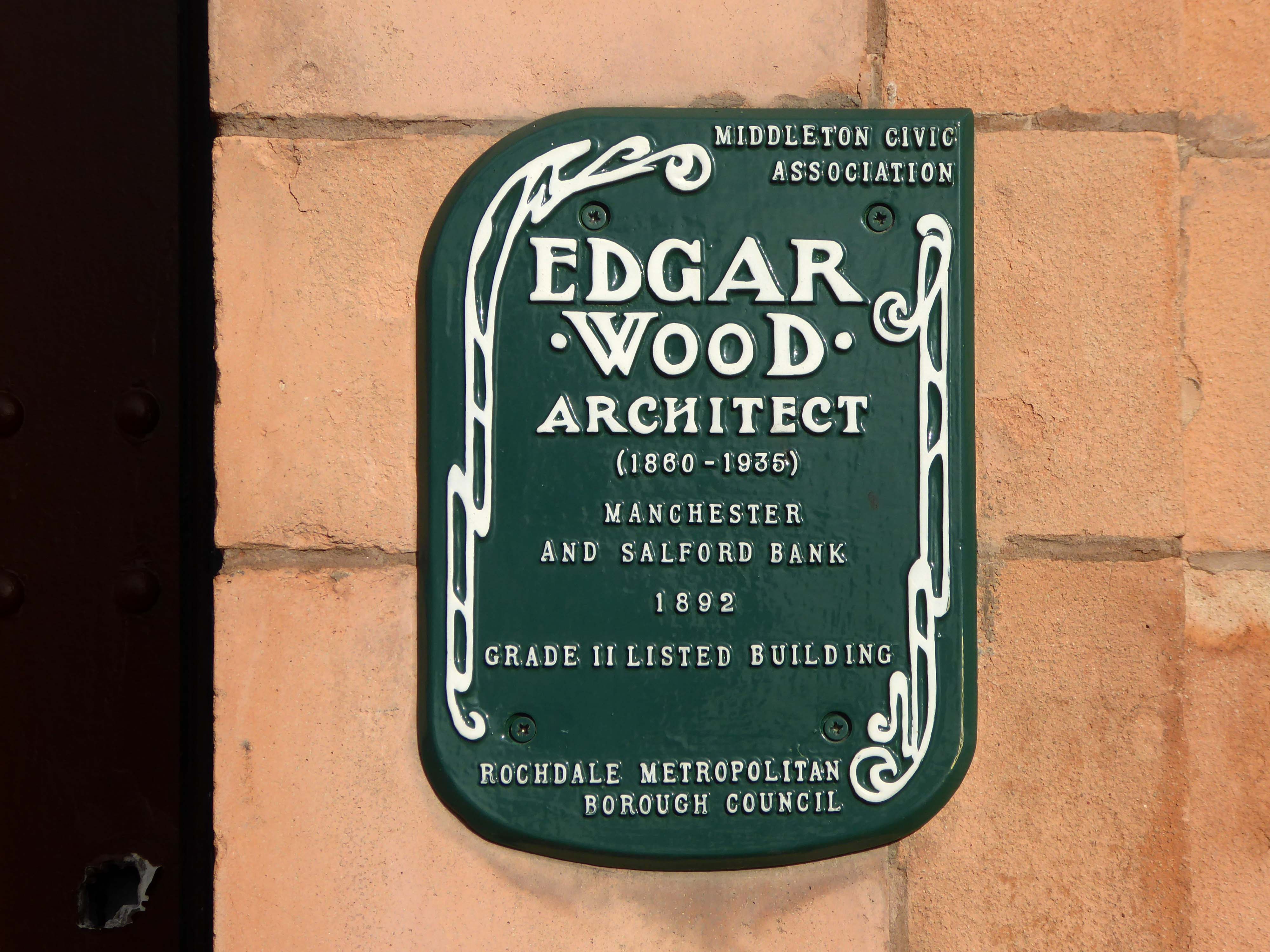
Moving along Wood’s much altered Guardian Buildings 1889.
The Guardian Buildings, were commissioned by Fred Bagot, the proprietor of the Middleton Guardian newspaper and a man with a reputation at the time for keeping a tight control of finances. In consequence, Guardian Buildings were one of Edgar Wood’s low budget buildings, of which there are several in and around Middleton. The building housed the operations of the newspaper with the cellar containing the printing machines and the tall ground floor housing a shop, office and more machines. The whole of the first floor, with its pair of oriel windows, was taken up by the composing room.
It fell into disrepair after the church moved to smaller premises in Alkrington in the 1960s.
The building collapsed in July 2012, when it was hit by a fire.
On Townley Street Lodge Mill built in1839 beside the River Irk battling on despite recent setbacks.
In August 2019, Martin Cove and Paula Hickey opened a small ice cream shop on the ground floor of the mill – named the Ice Cream Shop at Lodge – selling locally-made ice cream from Birch Farm, Heywood.
Across the way the magnificent Sub Station and Electrical Department Offices.
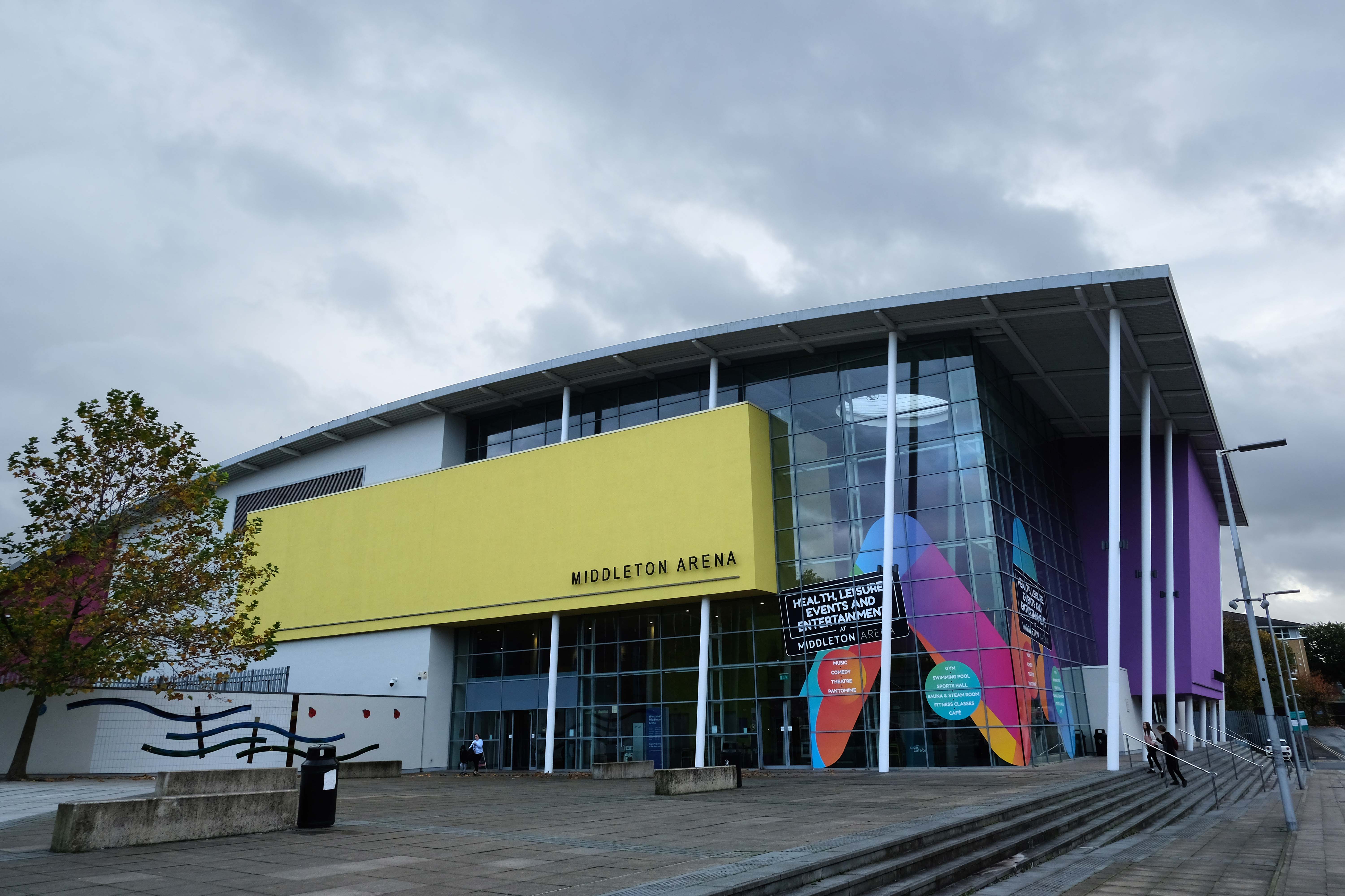
Then taking a turn around the banks of the Irk down Sharp Street onto Lance Corporal Joel Halliwell VC Way, where we find the Middleton Arena – BDP 2009
Then over the road to Oldham Road and Grade II ListedWarwick Mill 1907 G. Stott of J. Stott and Sons.
The mill recently changed ownership and new owner, Kam Lei Fong (UK) Ltd, has been working with Rochdale Borough Council over the past nine months on proposals to redevelop the site.
The plans will form the cornerstone of a new masterplan for Middleton town centre focusing on delivering new homes, business space, highway and environmental improvements, new walking and cycle routes to pave the way for the planned extension of the Metrolink into Middleton Town Centre.
The station, with 13 stands, cost £4.5 million and replaced the previous station which dated to the 1970s.
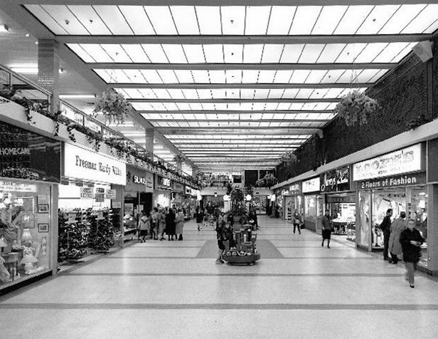
The Middleton Arndale Centre commenced trading in 1971, although it was officially opened by Her Royal Highness the Duchess of Kent in March 1972.
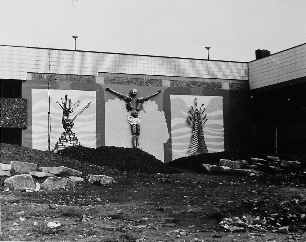
Once home to The Breadman designed by Rochdale’s town artist of the time, Michael Dames.
Photo: Local Image Collection – Touchstones
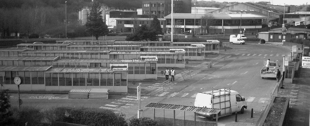
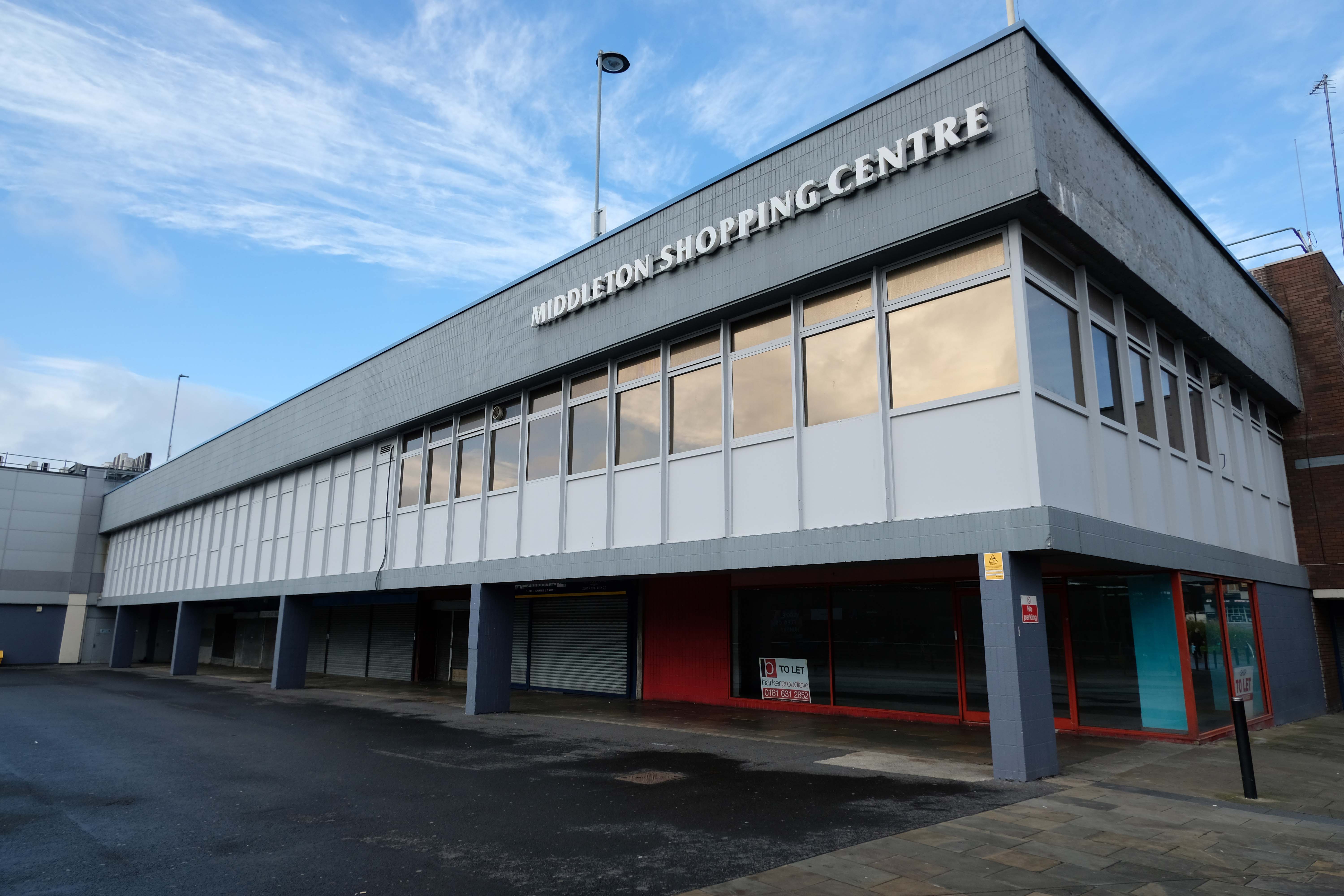
Now trading as the Middleton Shopping Centre
The brick reliefs illustrating the town’s history are by Fred Evans of Dunstable, who completed the work in one week during May 1972 using a high powered sandblasting blaster.
Thanks to Phil Machen for the top tip.
At the centre of the public domain the Middleton Moonraker 2001 by Terry Eaton
According to folklore, the legend has several different interpretations. One version is that a traveller came upon a drunken yokel trying to rake a reflection of the moon in a village pond, convinced it was cheese.
This version conveys the notion that the men were drunk and acting foolishly.
However, an alternative narrative – and perceived to be the most reliable version – tells a different story and dates back to the time when smuggling was a significant industry in rural England.
It appears that many residents wish to rid themselves of the Moon Raker moniker and presumably become Middletonians.
There’s so much more to Middleton’s history than the Moonraker. Why did they spend all that money on a fairytale?
There were 3,000 Lancaster bombers built in Middleton during World War Two, a magnificent contribution to the effort to beat Hitler.
The bulbs inside the moon which light it up at night haven’t worked for five years.
Bernard Wynne
Along Long Street the Cooperative store what was – next door the long gone Palace Cinema demolished in 2001.
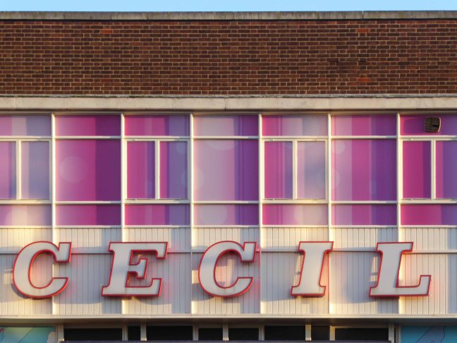
Turn right out of the station toward the Cecil Cinema.
The Theatre De-Luxe was built in 1911 at the corner of Anlaby Road and Ferensway with its entrance in Anlaby Road and its auditorium along the side of the pavement in Ferensway. Kinematograph Year Book of 1914 lists 600 seats and the owners as National Electric Picture Theatres Ltd.
In 1925, the theatre was rebuilt to a radically altered ground-plan and renamed the Cecil Theatre.
The Cecil Theatre’s demise came during bombing on the night of 7/8 May 1941 when German incendiary bombs reduced the building to a shell; and it remained like that until demolition in 1953.
Work on the new Cecil Theatre was begun in April 1955 and it was opened on 28th November 1955 with 1,374 seats in the stalls and 678 in the balcony.
Architects: Gelder and Kitchca
At the time of opening it had the largest CinemaScope screen in the country measuring 57 feet wide, and the first film shown was Marilyn Monroe The Seven Year Itch.
In the 1980’s it was taken over by the Cannon Cinemas chain. The cinema operation was closed on 23rd March 1992 and the cinemas were ‘For Sale and/or Lease. It was taken over by Take Two Cinemas and renamed Take Two Cinema. It was closed on 27th February 1997 and the two screens in the former circle were stripped out and converted into a snooker club.
Whilst bingo continues in the former stalls area of this post war cinema, the former mini cinemas in the circle still contain the snooker tables, but the space is unused. The screen in the former restaurant/cafe area remains basically intact, but is unused.
Whilst circumnavigating the Cecil one can’t help but notice the KCOM HQ – and its distinctive white telephone kiosks.
The work of City Architect A Rankine OBE RIBA
When Hull City Council founded KCOM back in 1904, as Hull Telephone Department, it was one of several local authorities across the country granted a licence to run its own phone network.
1952 Call Father Christmas service was introduced.
Having heard of a recorded message service in Scandinavia, Hull Councillor J M Stamper suggested the idea of putting Father Christmas on the telephone. The Call Father Christmas service was introduced shortly afterwards, the first of its kind in the UK. By dialling a Hull Central number children could hear recordings of a Christmas story and carol singing.
The success of the Father Christmas service led to the creation of other recorded information lines, such as Bedtime Stories, Teledisc and Telechef.
This recipe line was introduced in 1950s and was still going strong until the 1990’s, with 50s recipes such as meat loaf and corned beef with cabbages being replaced by dishes such as Italian Chicken Bake.
Sea trade created a large Danish community which Hull’s very own Amy Johnson was descended from. Her grandfather was Anders Jorgensen, who anglicised his name to the more pronounceable Andrew Johnson. A Danish pastor was appointed and an old chapel in Osborne Street was purchased in 1841.
It was on May 9, 1954, that the present church, with its now familiar separate bell tower, was consecrated by the Bishop of Copenhagen.
Hull was the most severely damaged British city or town during the Second World War, with 95 percent of houses damaged. It was under air raid alert for one thousand hours. Hull was the target of the first daylight raid of the war and the last piloted air raid on Britain.
Of a population of approximately three hundred and twenty thousand at the beginning of the war, approximately one hundred and fifty two thousand were made homeless as a result of bomb destruction or damage.
Overall almost one thousand two hundred people were killed and three thousand injured by air raids.
Despite the damage the port continued to function throughout the war.
The earliest housing was built just after World War II, starting with what is known locally as Australia Houses.
A circular five storey housing block off Porter and Adelaide Streets, with a communal garden in the middle. These flats consist of deck access flats and some traditional style Art Deco tenements. Some are three bedroom, and have been refurbished over the years.
Porter Street – three six-storey blocks containing seventy dwellings of 1954
Contractor J Mather
New Michael Street and Melville Street aka Upper Union Street one hundred and eight dwellings in three nine-storey blocks of 1958
Contractor Truscon
The designer behind Hull’s tower blocks was Andrew Rankine RIBA, who from 1939 remained City Architect until his retirement in 1961.
Just around the corner:
Over the last three years both companies have worked on undertaking the complex development of an off-site constructed, low carbon, Code 5 housing product. Working with Hodson Architects on the design the project will provide 3-bed family houses on the Thornton Estate in Hull. The scheme will increase provision of suitably sized accommodation in the area for families.
The project will see Premier Interlink manufacture the steel framed modules at the factory in Brandesburton East Yorkshire starting this March. The five houses are to be prefabricated off-site, with each house comprising of four separate units which are then assembled on site. This offers the benefit of reducing construction time, improving efficiency, reducing material wastage and offering an improved thermal envelope.
The Goodwin Trust, a brilliant and pioneering community group, decided the new version of pre-fab, or ‘modular’ housing, was exactly what was needed to provide affordable housing for the people it also cares for in so many other different ways.
Back toward the station and Hammonds of Hull/House of Fraser – soon to be a food court, artisan everything outlet.
Built in 1952 on Paragon Square to designs by T. P. Bennett, with extensions added in 1954 and 1957. Within a couple of years the business had grown again by opening its own hairdressing salon, and in 1960 added a new warehouse to accommodate their furniture workshops and stock rooms. This itself was extended within four years, while a fourth floor was added to the main store.
On the right a civic building Festival House of 1951.
Apprenticed to Lutyens‘ assistant Oswald Milne and later working with Charles Cowles-Voysey
With his good friend, John Betjeman, he helped found the Victorian Society in 1958.
On 1st May 1951, the foundation stone of Festival House was laid, to commemorate the first permanent building to be built in the city centre since the 1941 Blitz. Placed under the stone was a time capsule containing coins, stamps, a Festival of Britain programme, a copy of that day’s Hull Daily Mail, and a booklet about the city. Festival House was owned by Hull Corporation on behalf of the people of Hull.
Before us Alan Boyson’s Three Ships – now listed and set for preservation.
The fate of the attached former CO-OP/BHS is less secure.
Architect: Philip Andrew
Onward to the Queens Gardens the almost filled in former Queens Dock – forever fourteen feet below sea level.
We encounter Tonkin Liu’s Solar Gate – a sundial that uses solar alignment to mark significant times and dates in Hull. The super-light innovative two-shell structure is place-specific, responding to pivotal historic events and to the cultural context of its location in Hull’s Queens Gardens adjacent to the ancient site of Beverley Gate.
Carved stone panels Kenneth Carter1960 – Ken’s art career began as an inspiring teacher, first at his alma mater, Hull College of Art, and later as principal lecturer at Exeter College of Art.
A number of decorative fountains featured in the ponds; those at the eastern end designed as part of the sculptured panels of 1960, byRobert Adams, described by Herbert Read as belonging to:
The iconography of despair. Here are images of flight, of ragged claws, scuttling across floors of silent seas, of excoriated flesh, frustrated sex, the geometry of fear.
And behind we glimpse Frederick Gibberd’s fine Technical College.
Above the current market office is an impressive painted mural by art students from Dresden commissioned especially for the market in the 1950s in a Socialist Realist manner, depicting farming and industrial scenes.
The Gordon Cullen tiles have been renovated and re-sited within the exit corridor.
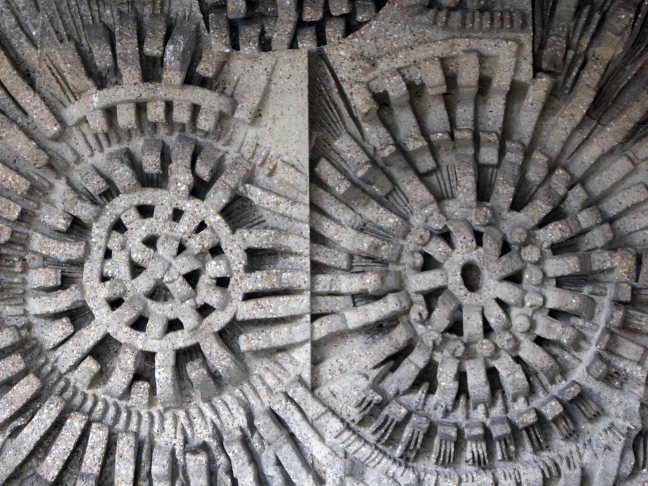
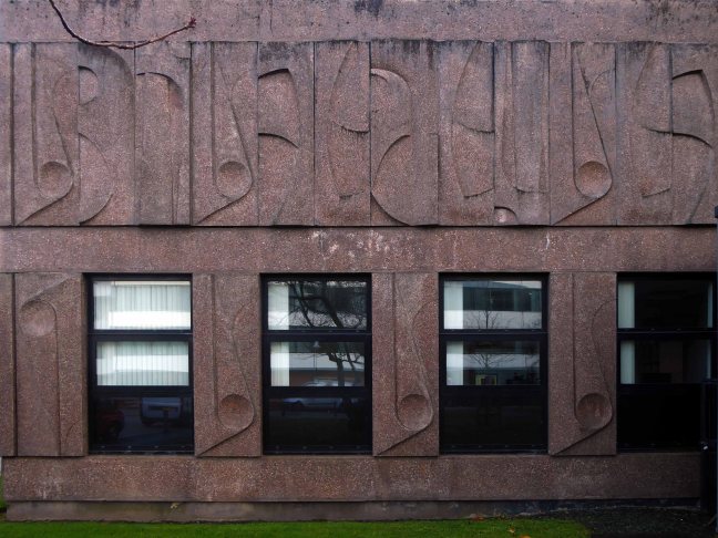
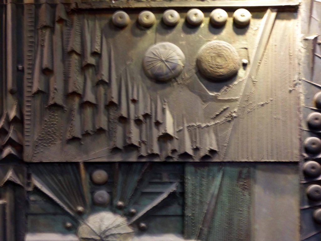
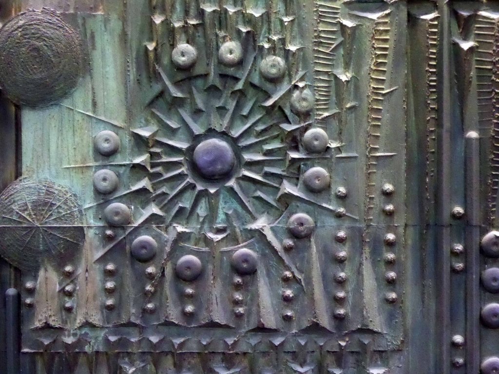
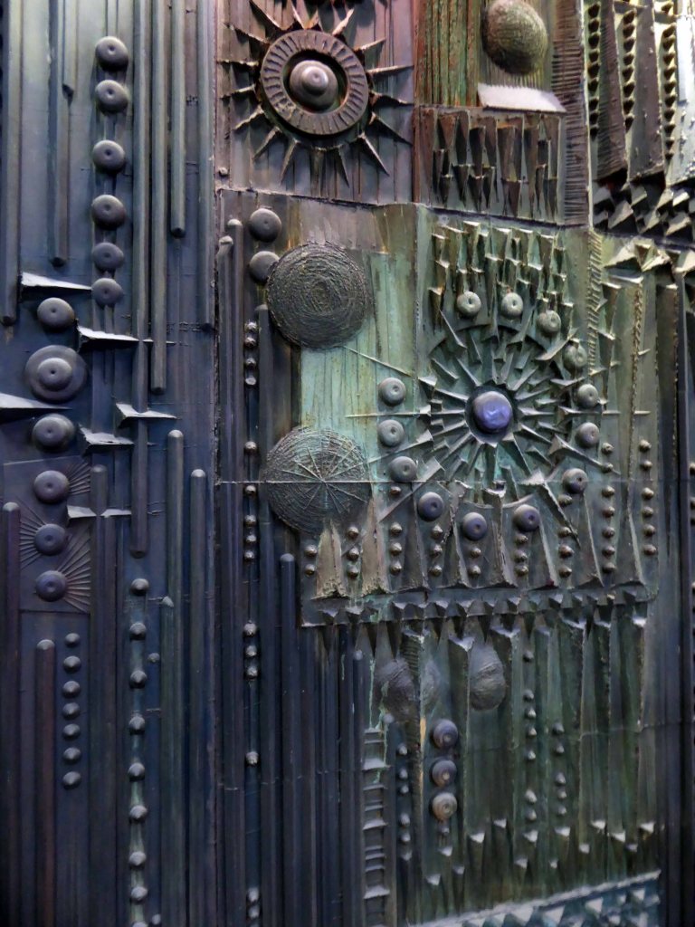
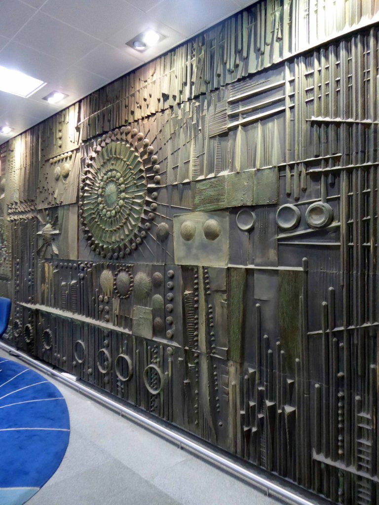
Still in clear view the stone relief work of John Skelton November 1956. Three of the eight column have incised Hornston stone works, depicting the activities of the CWS.
Get yourself there pronto – current restrictions considered of course.
A social history of Wythenshawe and its Civic Centre can be found here at Archives +.
A general history of the garden city’s development can be found here at Municipal Dreams.
Lest we forget, the story begins with a level of overcrowding and human misery that is – thankfully – almost unimaginable in Britain today. In 1935, Manchester’s Medical Officer of Health condemned 30,000 (of a total of 80,000) inner-city homes as unfit for human habitation; 7000 families were living in single rooms.
The estate was always considered to be, in some sense, the realisation of an ambitious vision.
The world of the future – a world where men and women workers shall be decently housed and served, where the health and safety of little children are of paramount importance, and where work and leisure may be enjoyed to the full.
Cooperative Women’s Guild
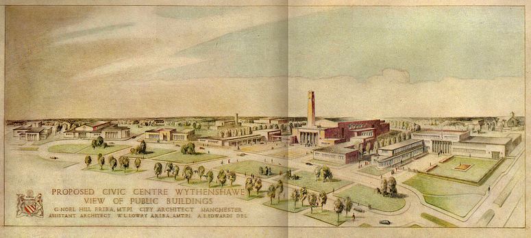
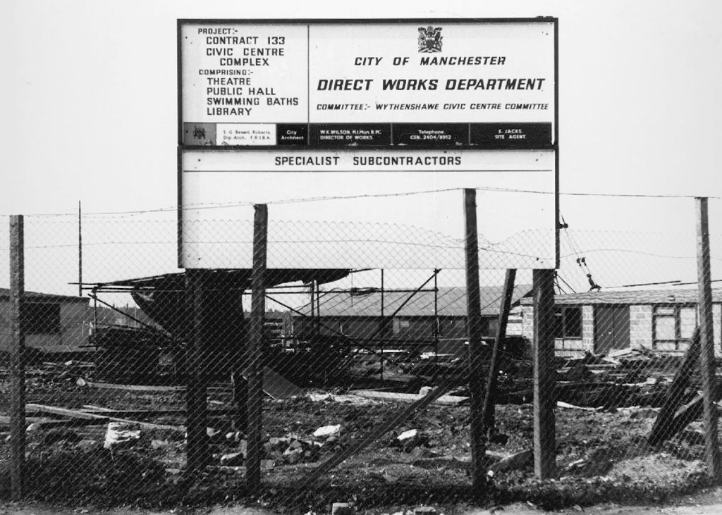
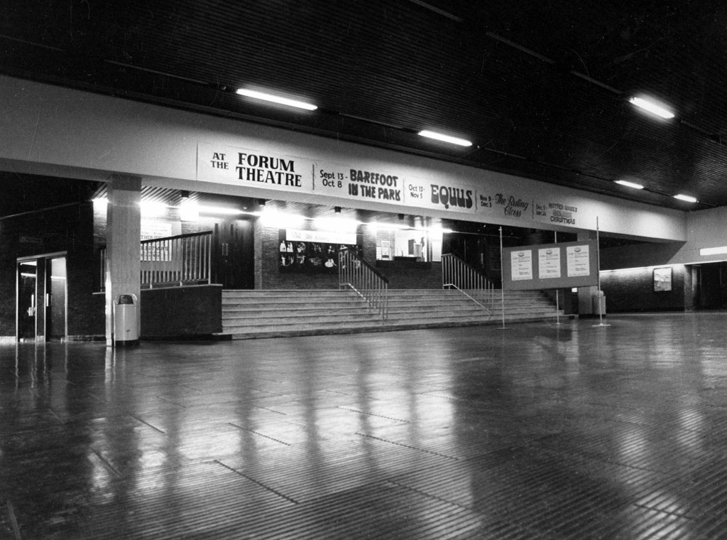
Work began in the interwar years, and continued following the hiatus of 1939-45. The shopping centre named the Civic Centre was open in 1963, the actual Civic Centre containing a swimming pool, theatre, public hall and library in 1971.
A triumph for Municipal Modernism conceived by the City Architects and realised by Direct Works. This post war development owed more to the spirit of Festival of Britain optimism, new construction methods and materials, rather than the grandiose functionalist classicism of the original scheme.
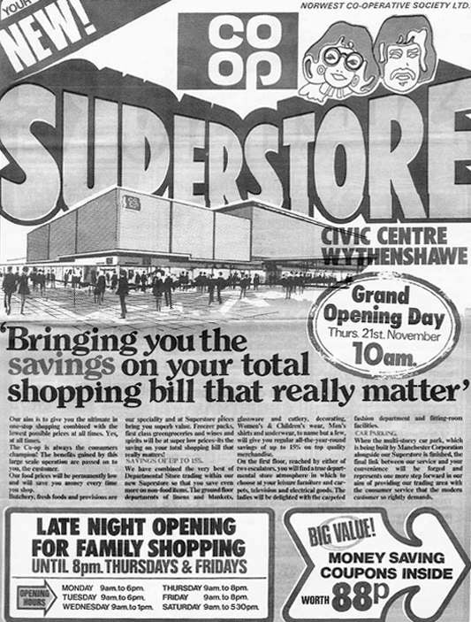
The Co-operative Superstore was a key element in the provision of provisions.
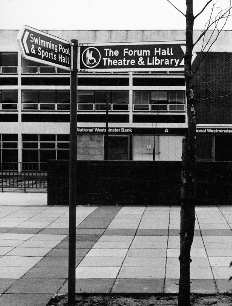
There still is – The Forum is a bright and modern hub for co-located services used by community and business.
The original Forum opened in 1971. One of Manchester’s largest public buildings, it had a leisure centre, library, theatre, main hall and meeting rooms. By the mid 1990’s it was under used, had deteriorated internally and externally and needed substantial investment.
The new Forum, along with a new police sub-divisional headquarters and improved transport link was designed to help strengthen the town centre, and provide a landmark project to raise Wythenshawe’s profile within Manchester and beyond.
In the 1980’s they put on a superb array of shows including Roll on 4 O’Clock which starred John Jardine, Jack Smethurst and Glynn Owen. Oh What a lovely War; What the Butler Saw and Habeas Corpus by Alan Bennett. Bury’s own Victoria Wood starred in Talent which she wrote. Another Manchester icon Frank Foo Foo Lammar, famous as the top drag queen of the North-West whose club was re-known for its great party nights appeared in The Rocky horror Show.
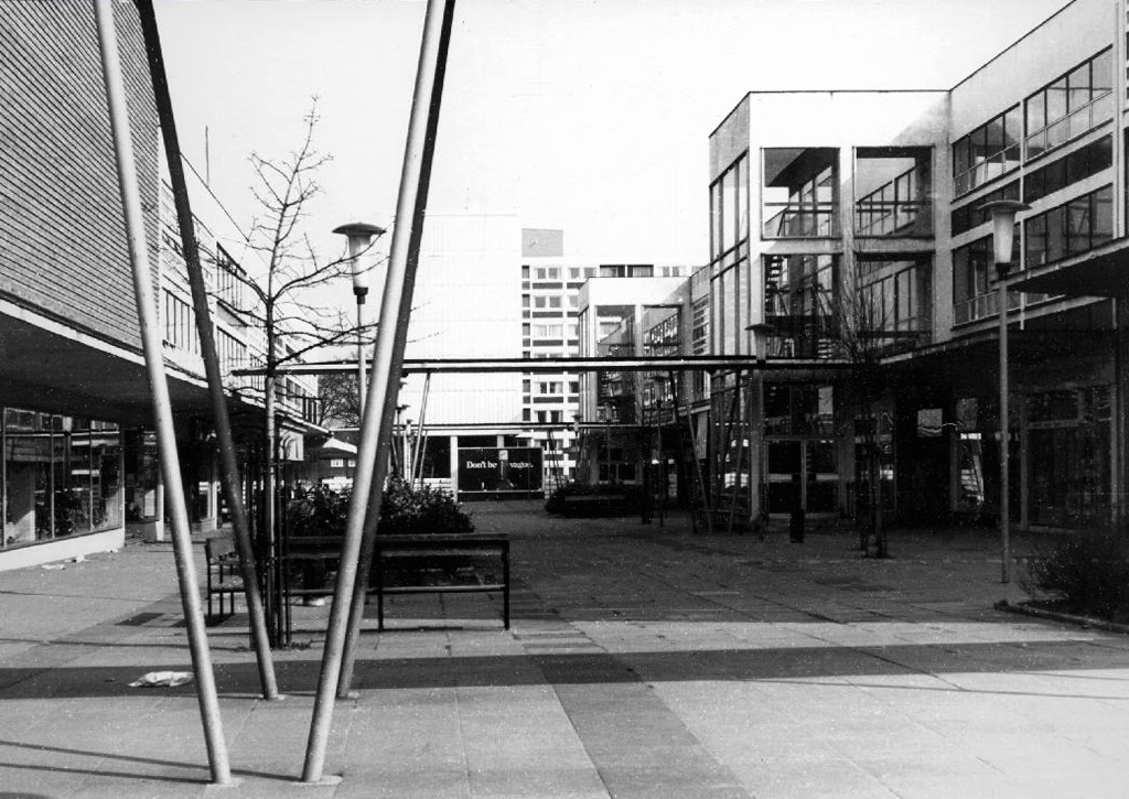
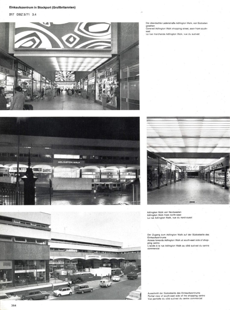
A land of elegant covered walkways and raised beds.
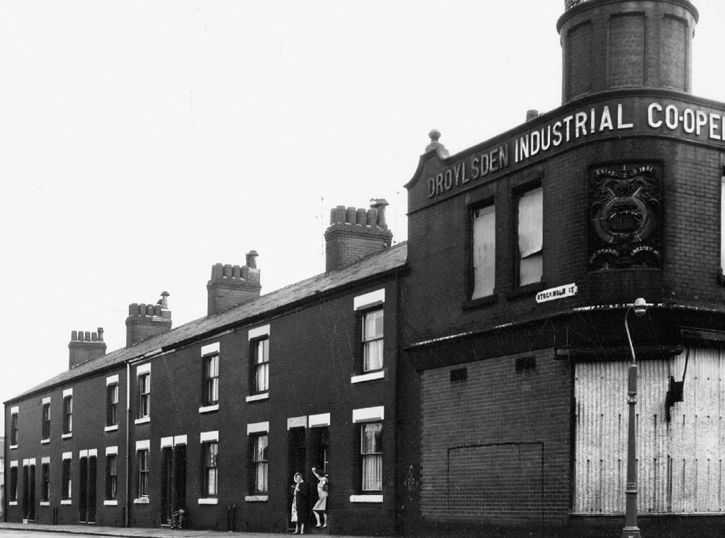
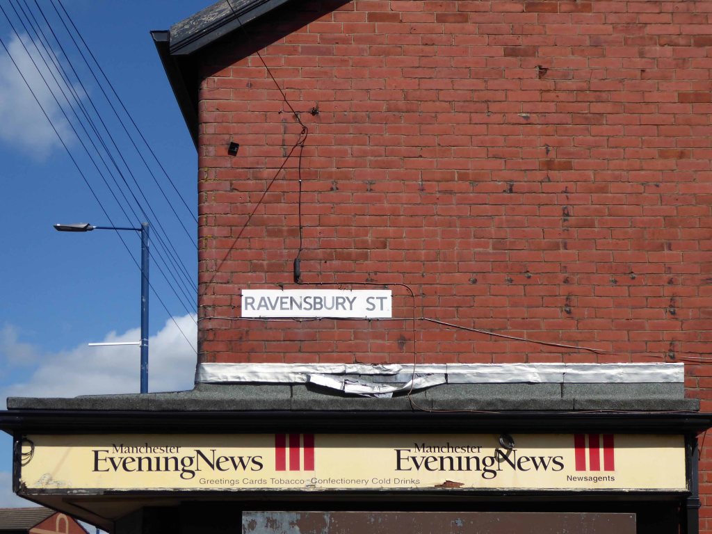
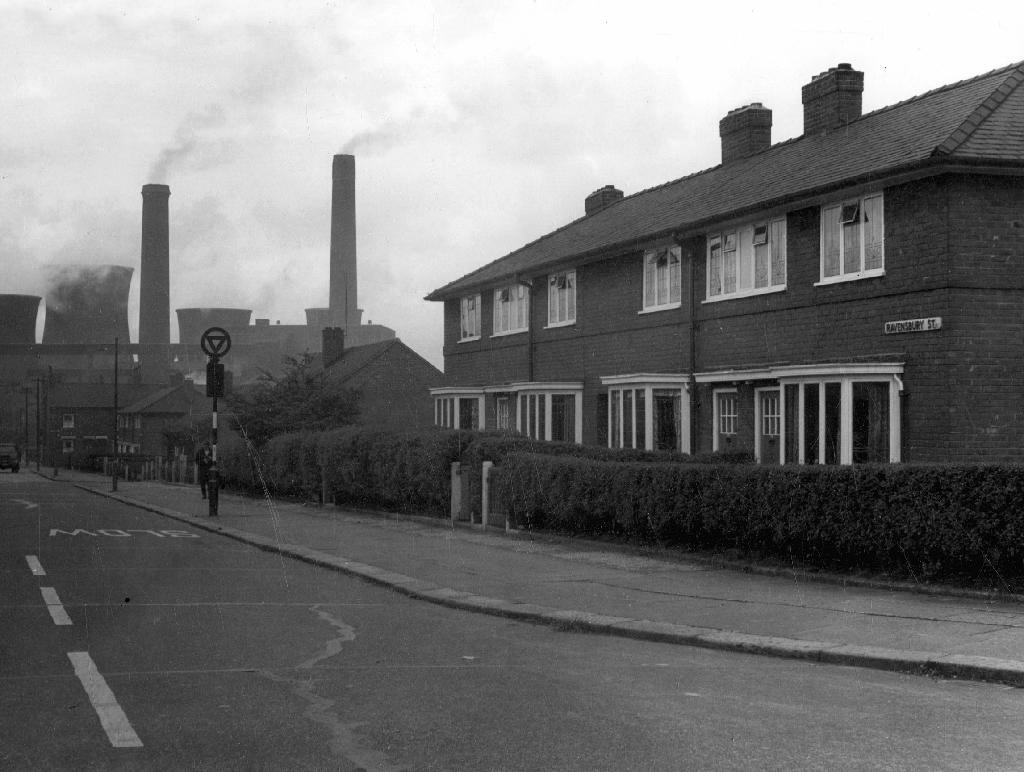
On the corner of Ravensbury and Stockholm Street Clayton Manchester there stands a Cooperative Shop of 1908.
We have previously visited another fine example on Northmoor Road.
In 1902 the area is still set to open ground.
This Manchester Local Image Collection photograph of 1912 shows new terraced homes emerging to meet the housing needs of the world’s first industrial city.
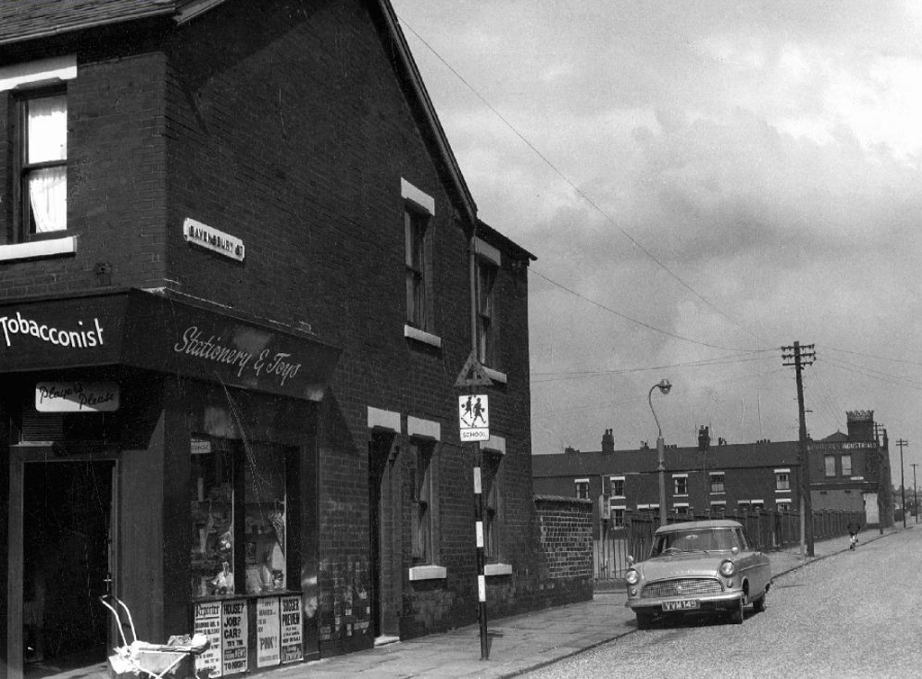
Changing patterns in shoppers habits sealed the fate of many local and corner shops, as larger supermarkets opened, increased mobility and car ownership became more common.
When I first visited the building was undergoing renovation work.
The beautiful terracotta tile work and corona obscured by scaffolding .
I returned last week to find the job almost done – converted to flats, in an area which has seen a great deal of improvement to the general housing stock, paving and street furniture.
A joy to see a fine building almost returned to its former glory, with a much needed social purpose, reviving the city’s western edge.
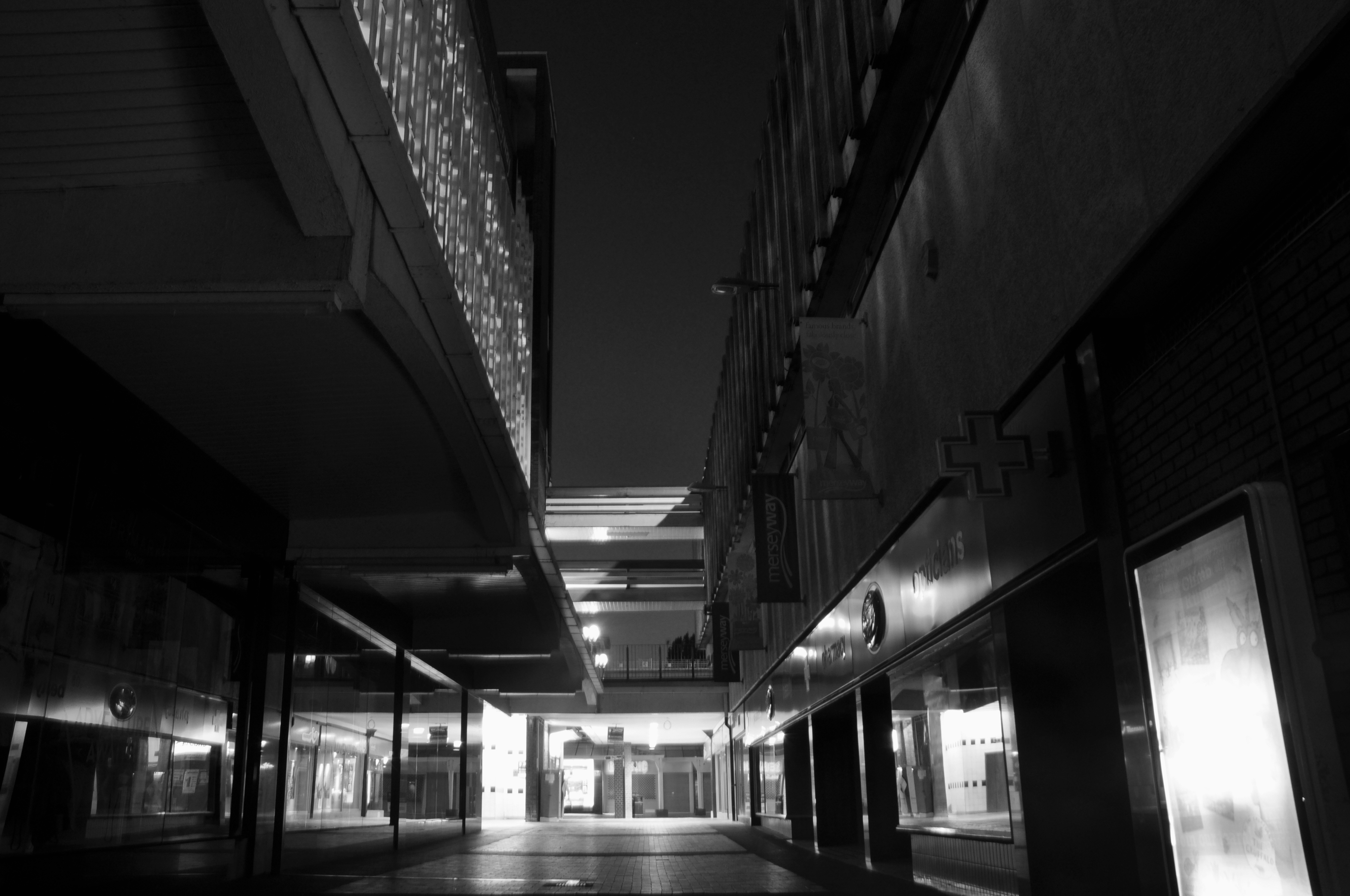
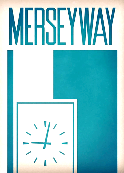
Once widely admired, Ian Nairn esteemed architectural writer, thought it an exemplary exposition of modern integrated shopping and parking, sitting perfectly in its particular topography – way back in 1972.
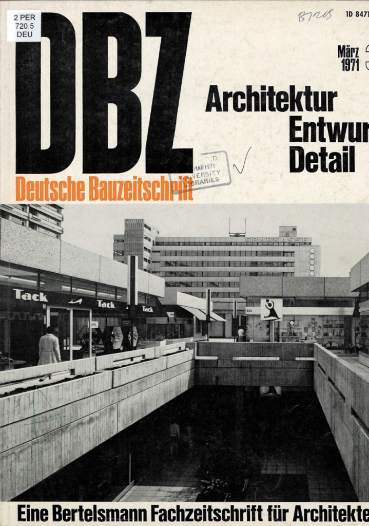
This German magazine dedicated several pages to coverage of Merseyway back in 1971.
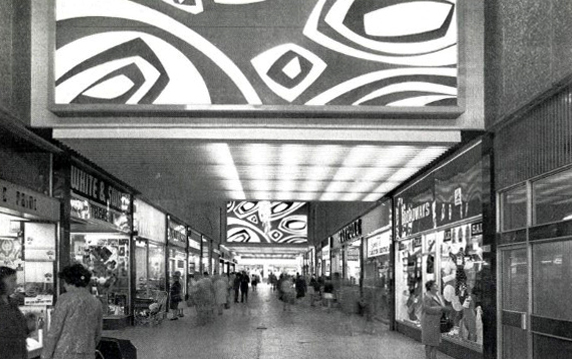
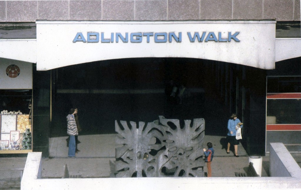
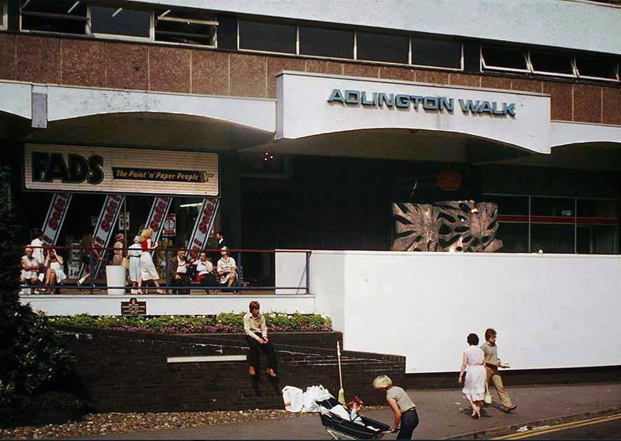
Note the long lost decorative panels of Adlington Walk.
Many thanks to Sean Madner for these archive images.
Mainstream Modern has recorded its conception and inception, as part of a wider appreciation of Greater Manchester’s architecture.
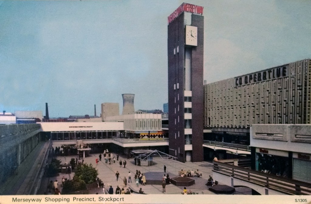
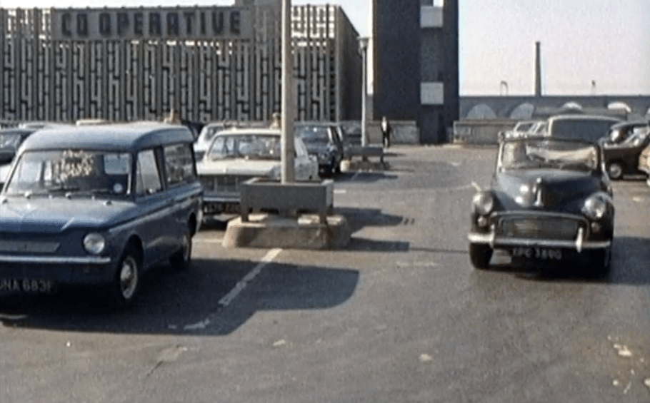
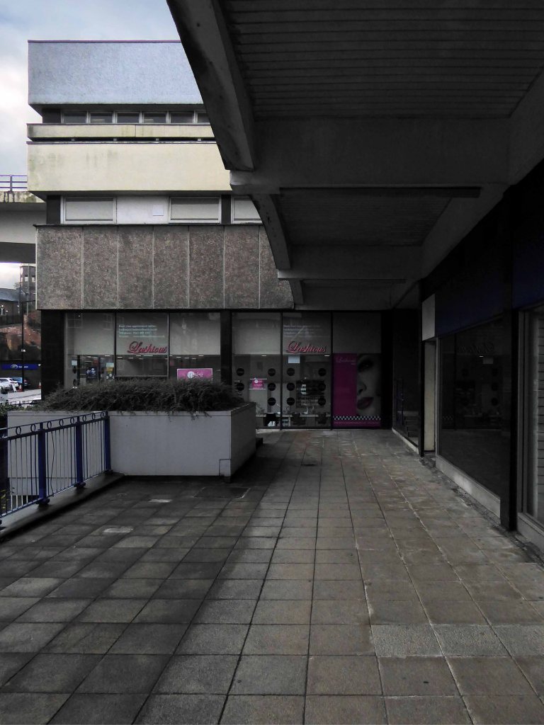
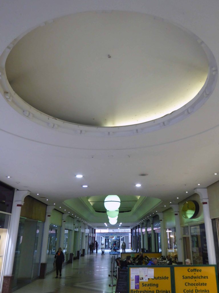
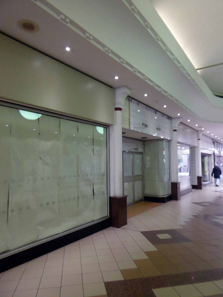
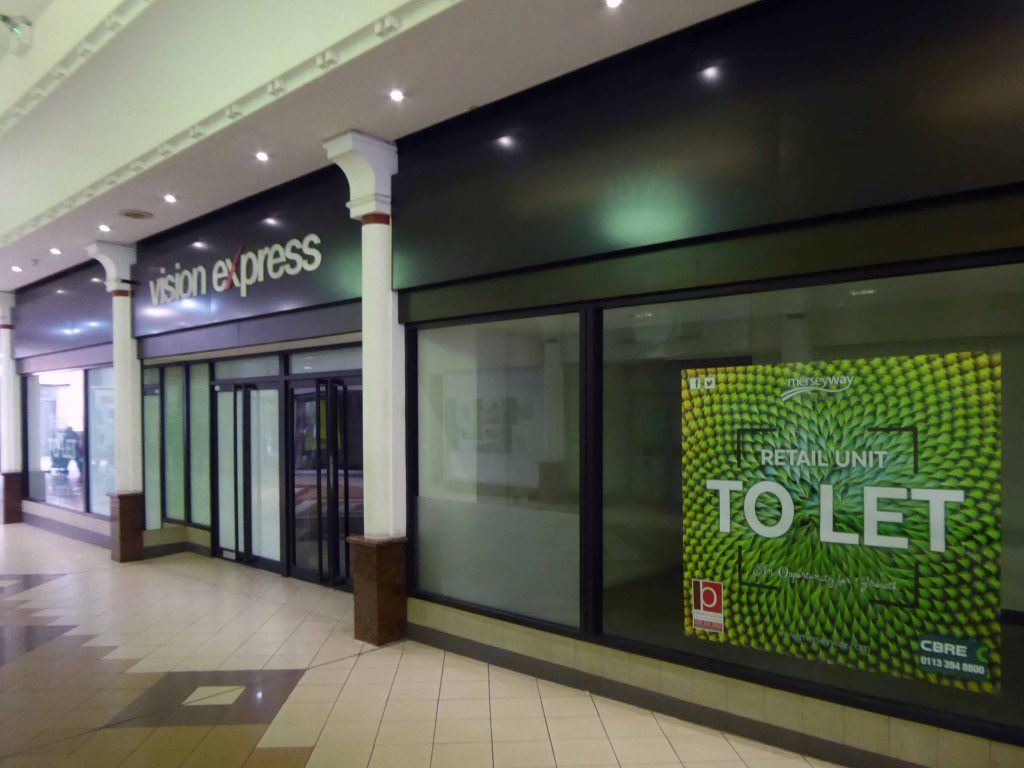
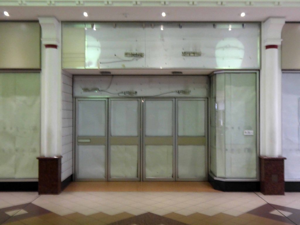
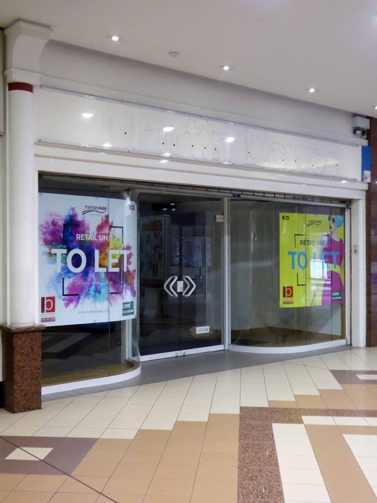
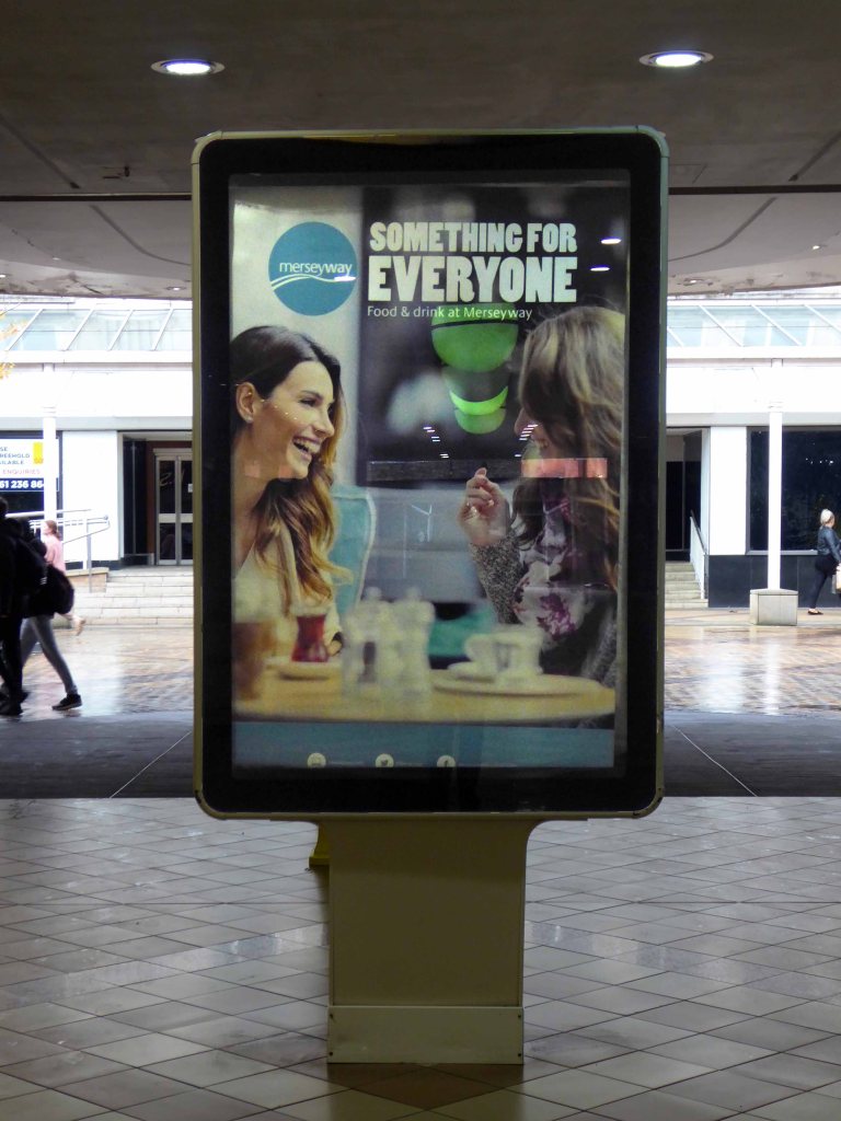
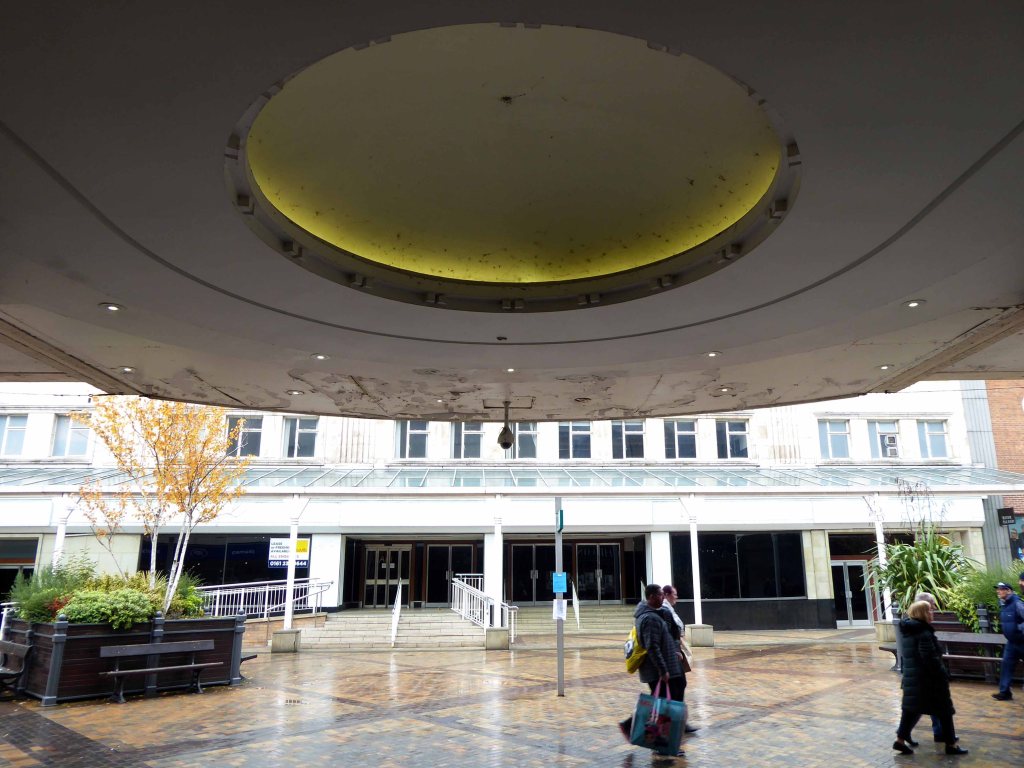
The architects were Bernard Engle and Partners in conjunction with officers of Stockport Corporation and the centre opened in 1965. The separation of pedestrians and cars, the service areas, the multi level street, the city block that negotiates difficult topography to its advantage, are all planning moves that are of the new, ordered and systemised, second wave modernism in the UK. The aggregate of the highways engineering, the urban planning and the shifting demands of retailers frequently arrived at a form and order such as this. In this way Merseyway is unremarkable, it’s like many other centres in many other towns – consider the rooftop landscape of Blackburn. It is, however, typical and has been typically added to and adjusted during its life and presents perhaps the face of the last retail metamorphosis before the out-of-town really made the grade.
Each successive remaking and remodelling has seriously compromised the integrity of the development. We are left with dog’s dinner of poorly realised Post Modern and Hi-Tech additions, along with a failure to maintain the best of the original scheme.
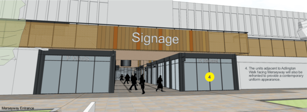
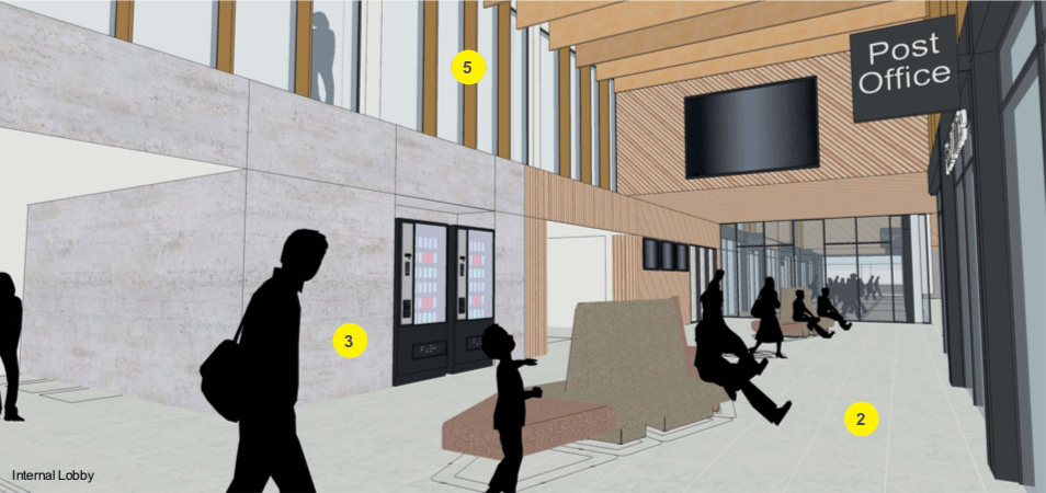
Plans are now afoot to revamp the precinct – starting with Adlington Walk.
Proposed facilities include a soft play space, new seating, buggy stores, high grade toilets, parent and child facilities and a multi faith prayer room.
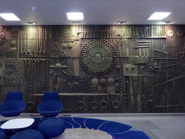
Today on my way elsewhere, in search of something or other, I walked into the lobby of the CIS.
I asked permission from the Receptionist to take a few snaps, was referred to the Head of Security, who referred me to the Receptionist, who ‘phoned Paul, who turned out to be Steve, who thought that it would be OK.
So I did – here are those very snaps, my thanks to the cooperative staff of the Cooperative Insurance Society.
We were there at the behest of Esther and Leigh, gathering to say farewell to Alan Boyson’s Three Ships, as it transpired we were there to celebrate its reprieve, following their campaign for listing.
Over a million tesserae glowed in the low winter sun – so did we.
As Helen Angell read her poem – Christopher Marsden and Esther Johnson recording the performance for posterity.
The Three Ships are attached to a former Cooperative Store – complete with a formerly working Cooperative Store clock – where we meet at four minutes to six – forever.
We had previously encountered Hammonds of Hull/House of Fraser – soon to be a food court, artisan everything outlet.
And this Festival of Britain style functionalist council building.
Onward to the Queens Gardens the almost filled in former Queens Dock – forever fourteen feet below sea level.
We encounter Ton Liu’s Solar Gate – a sundial that uses solar alignment to mark significant times and dates in Hull. The super-light innovative two-shell structure is place-specific, responding to pivotal historic events and to the cultural context of its location in Hull’s Queens Gardens adjacent to the ancient site of Beverley Gate.
Carved stone panels Kenneth Carter 1960 – Ken’s art career began as an inspiring teacher, first at his alma mater, Hull College of Art, and later as principal lecturer at Exeter College of Art.
A number of decorative fountains featured in the ponds; those at the eastern end designed as part of the sculptured panels of 1960, by Robert Adams, described by Herbert Read as belonging to:
The iconography of despair. Here are images of flight, of ragged claws, scuttling across floors of silent seas, of excoriated flesh, frustrated sex, the geometry of fear.
Top of the shop William Mitchells relief – time to pause and reflect.
Paying homage to Frederick Gibberd author of the College and Queens Gardens scheme.
En passant catching a glimpse of this splendid non-functioning water feature.
So here we are outside, you and I in 2015 – it seems like yesterday.
Whereas yesterday I was inside not outside, but more of that in a moment.
It seems that you were listed in 2009 and deservedly so.
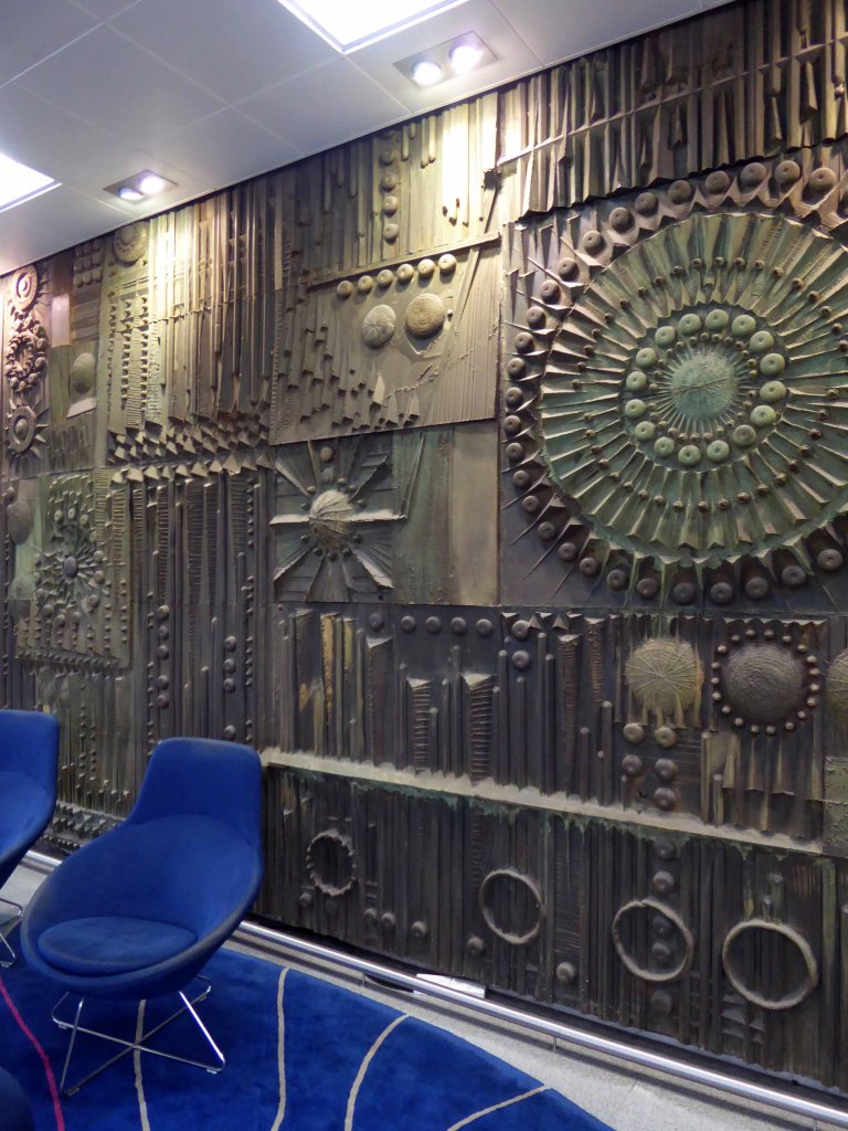
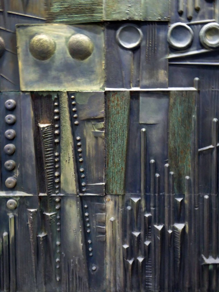
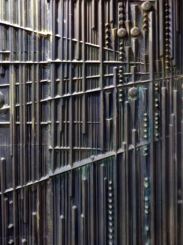
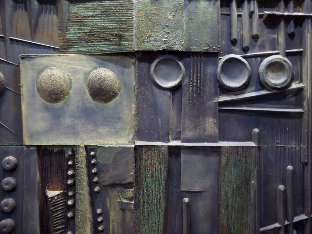
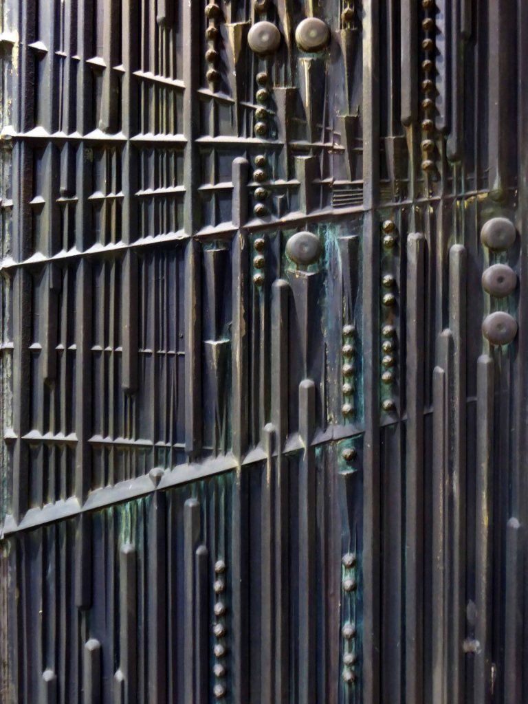
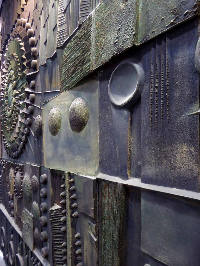
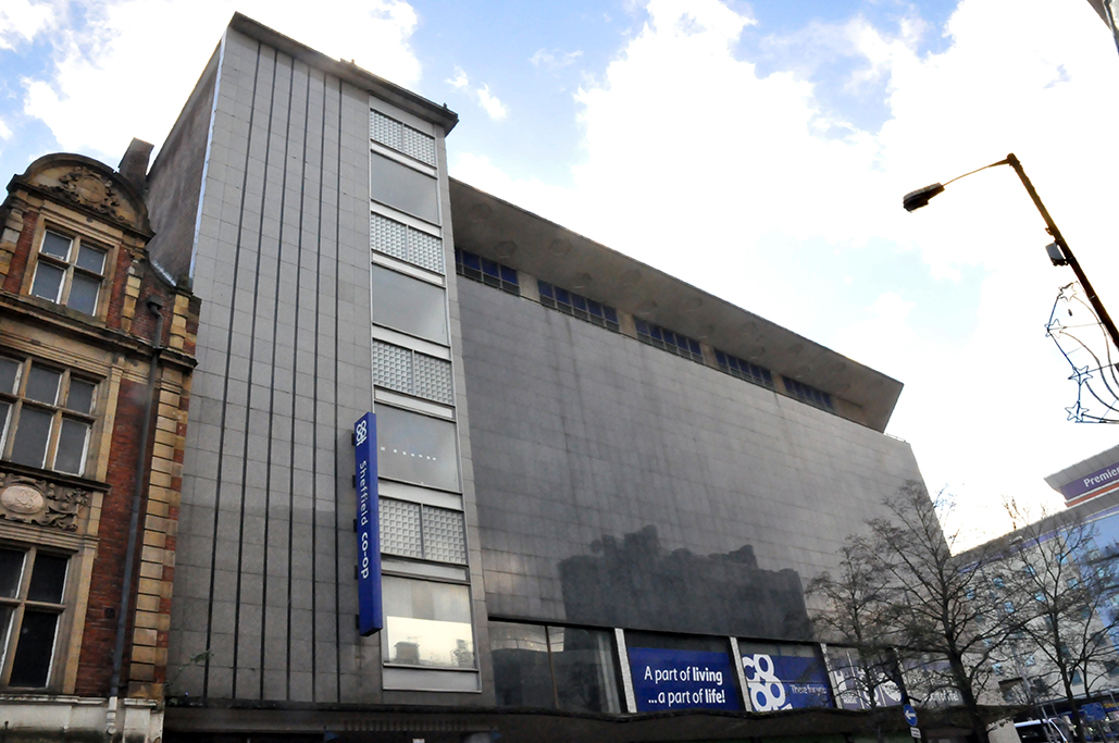
1964 by George S Hay, Chief Architect for CWS, with interior design by Stanley Layland, interior designer for CWS. Reinforced concrete with Blue Pearl granite tiles and veneers, grey granite tiles and veneers, buff granite blocks, glass, and brick.
There’s just so much to stand and stare and marvel at.
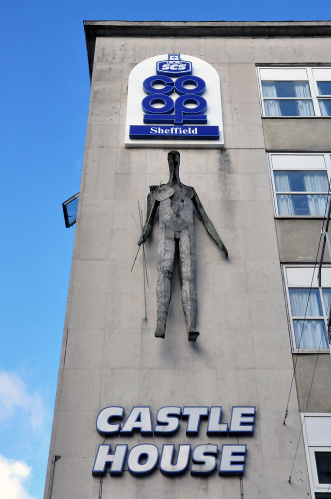
Vulcan by Boris Tietze commisioned by Horne Brothers 1961 for their head office building No. 1 King Street. Glass fibre on a metal armature the 8 foot high figure holding a bundle of metal rods.
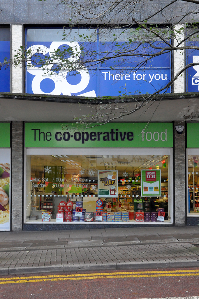
You were just about still open then, then you weren’t, then you were again – but a Co-op no more alas.
Work is underway on plans for a tech hub in Sheffield after a funding package was agreed.
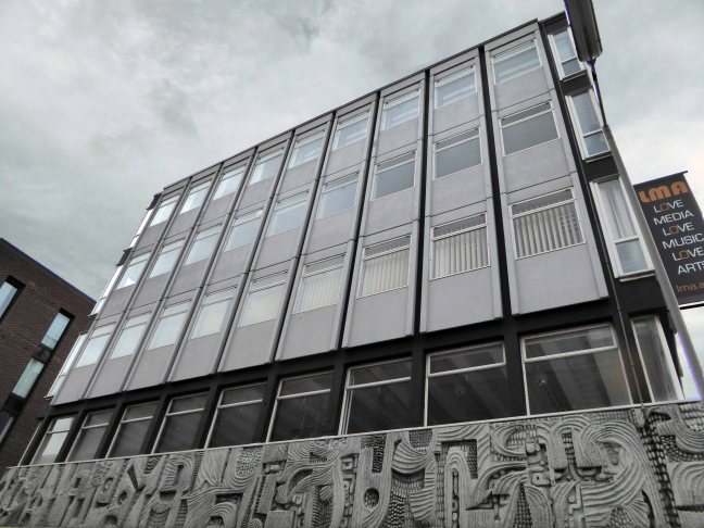
Followed by a casual stroll towards 2019 where we are talking a peep inside courtesy of owners Kollider and book shop La Biblioteka.
I’d never ever seen the interior, save through the photographs of Sean Madner who captured the key features in 2014, prior to refurbishment.
So the Modernists and I pitched up this Sunday afternoon, the conclusion of our Sheffield Walk.
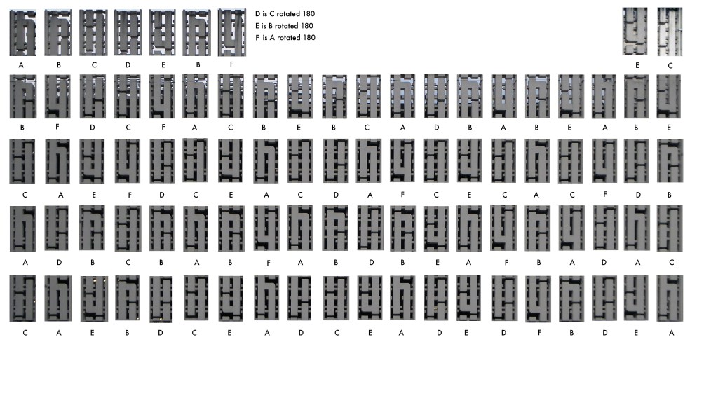
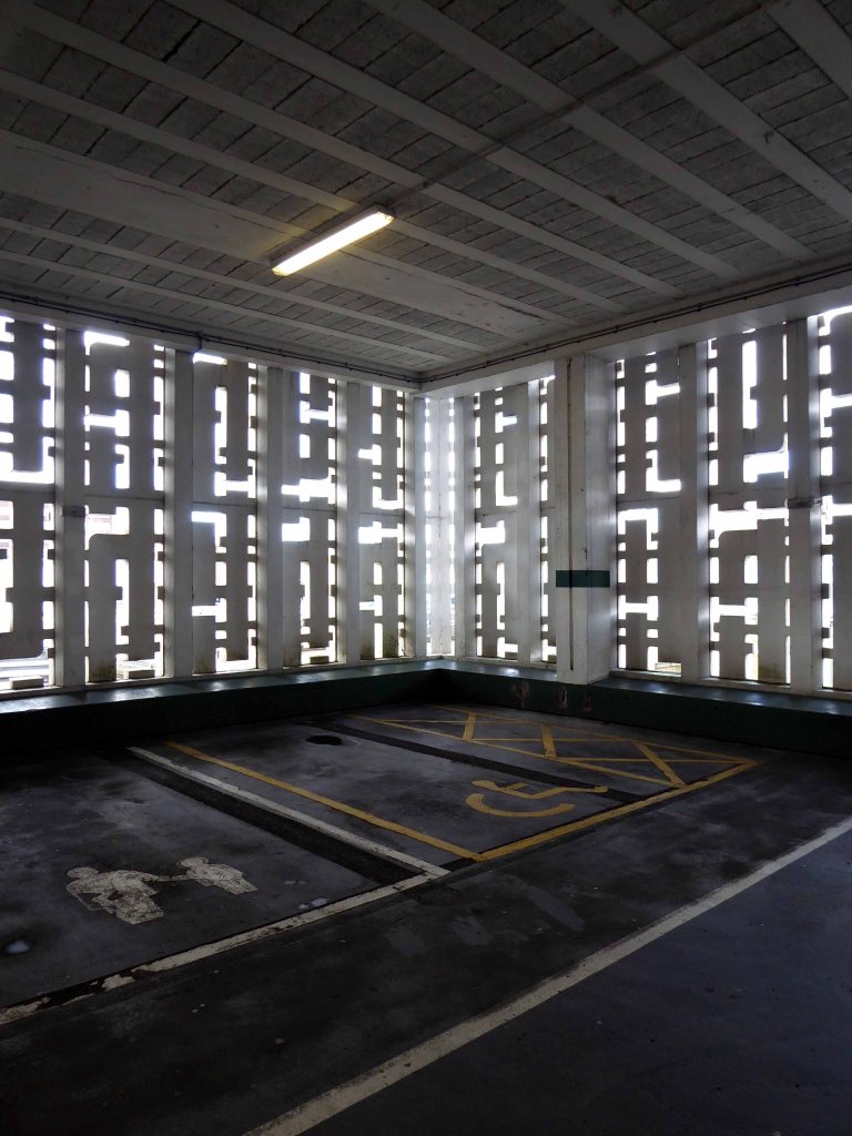
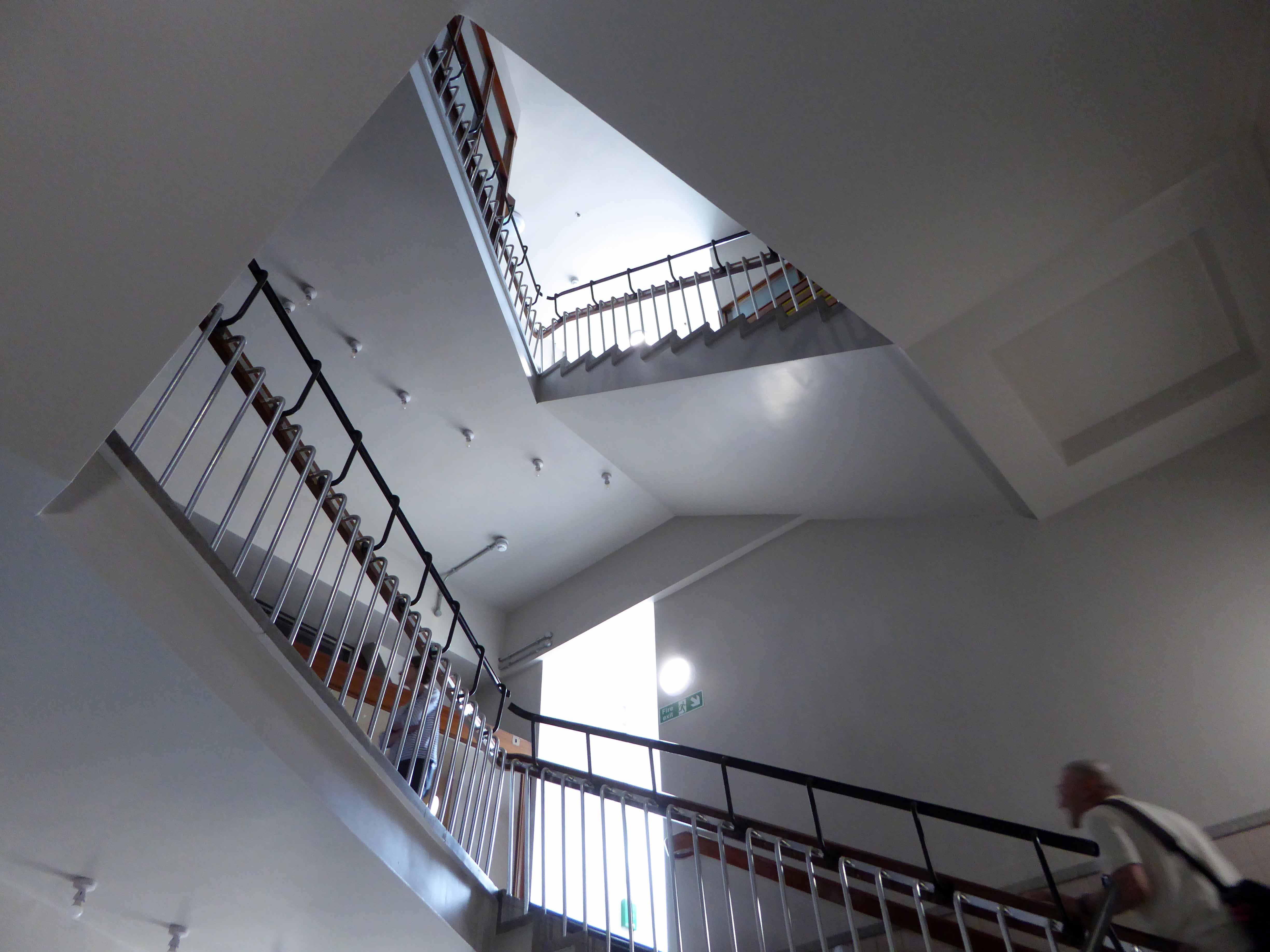
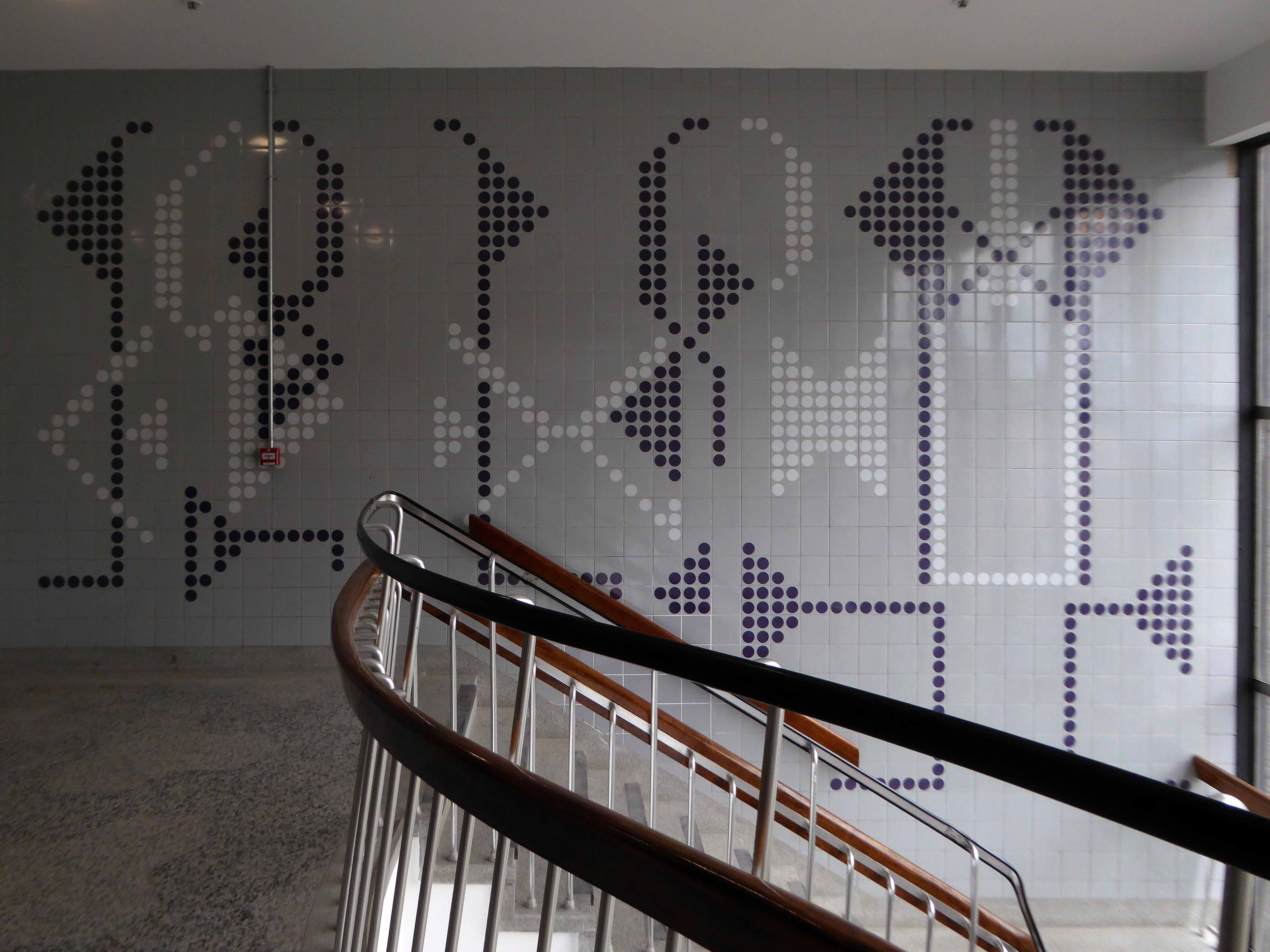
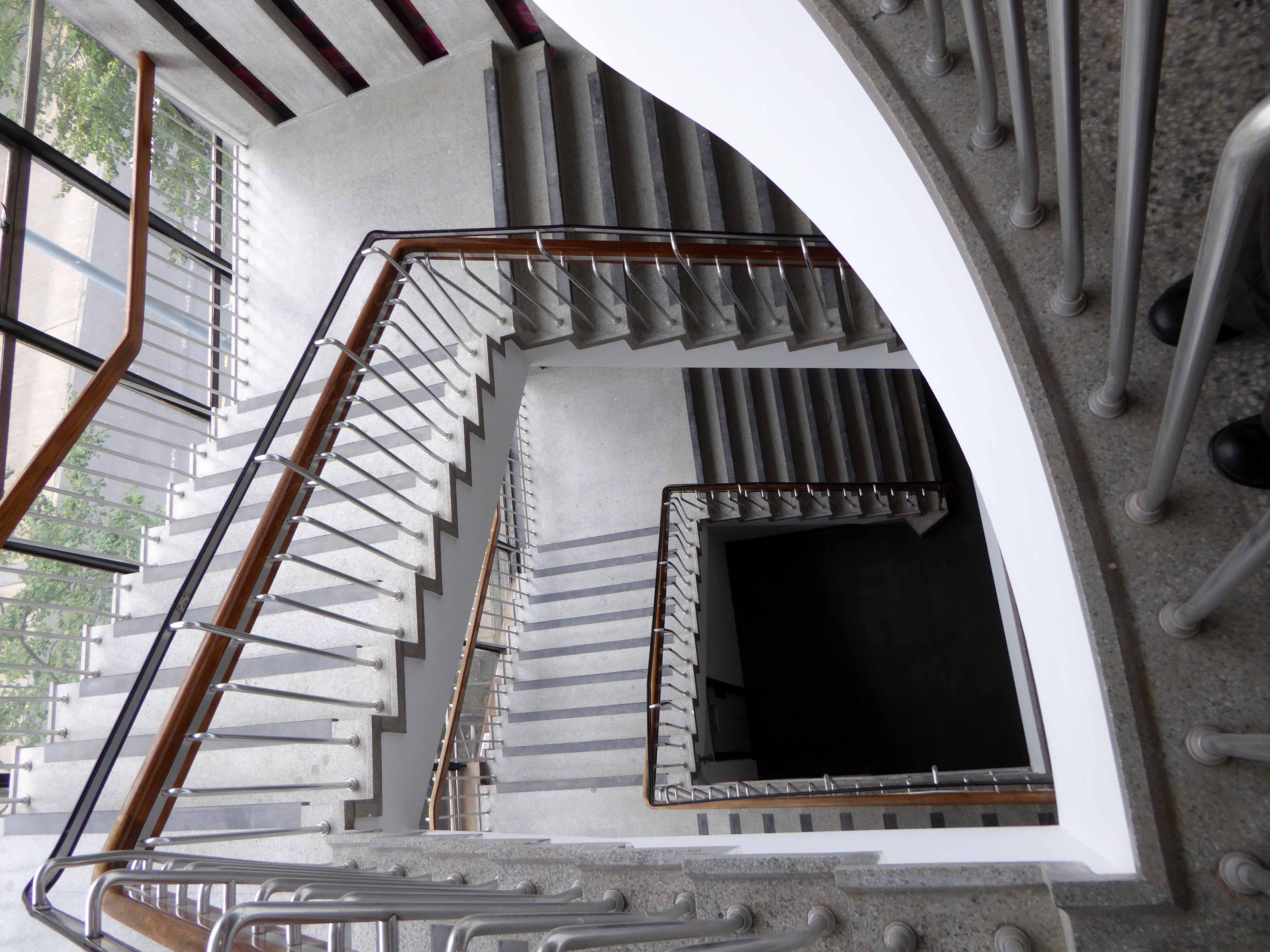
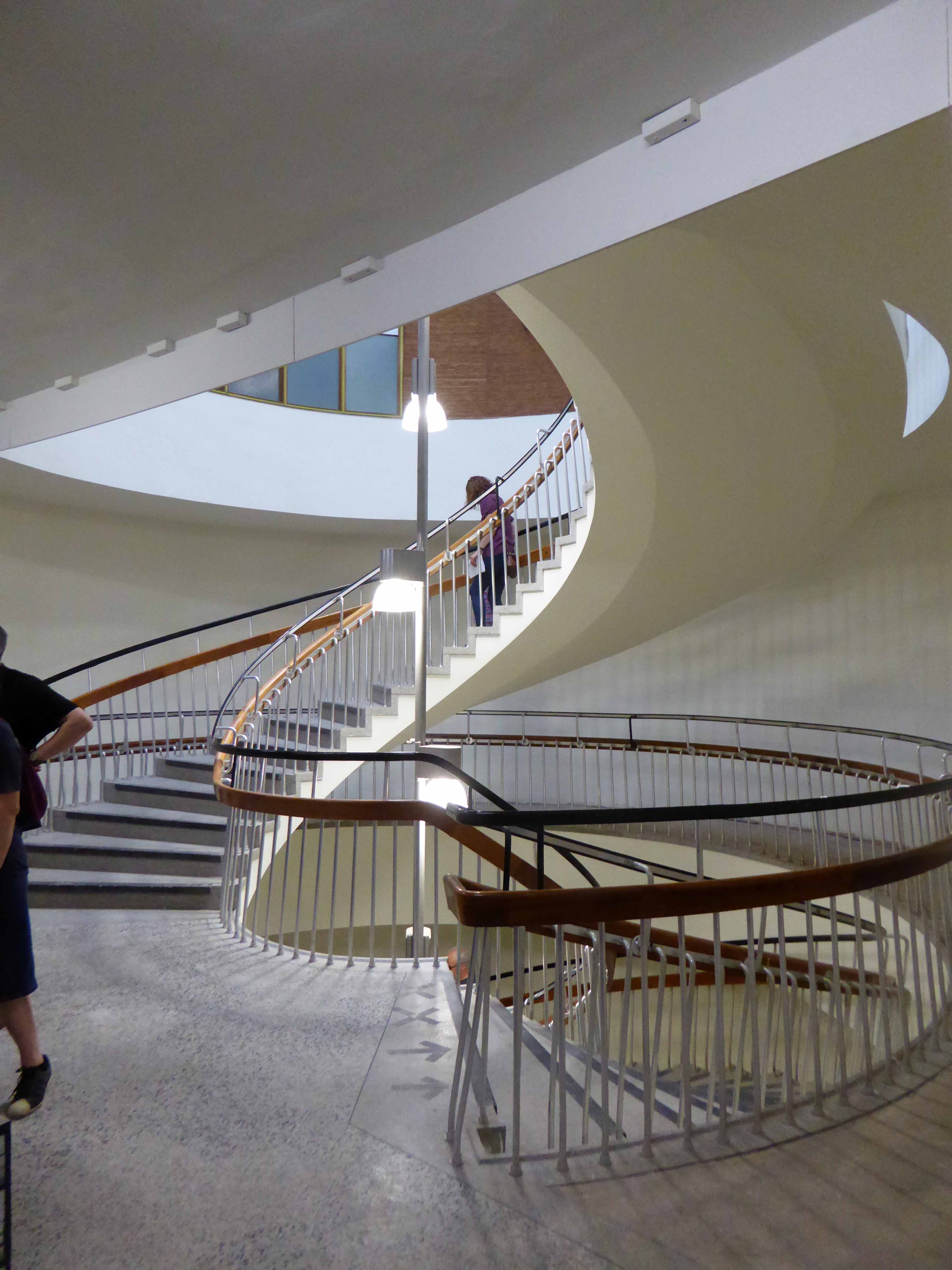
Lets take a look at the end stairwells, two very distinct designs one dotty one linear, both using Carter’s Tiles.
Configured from combinations and rotations of these nine modular units and two plain tiles.
Configured from combinations and rotations of these twelve modular units and two plain tiles.
The site has retained some of its original architectural typography.
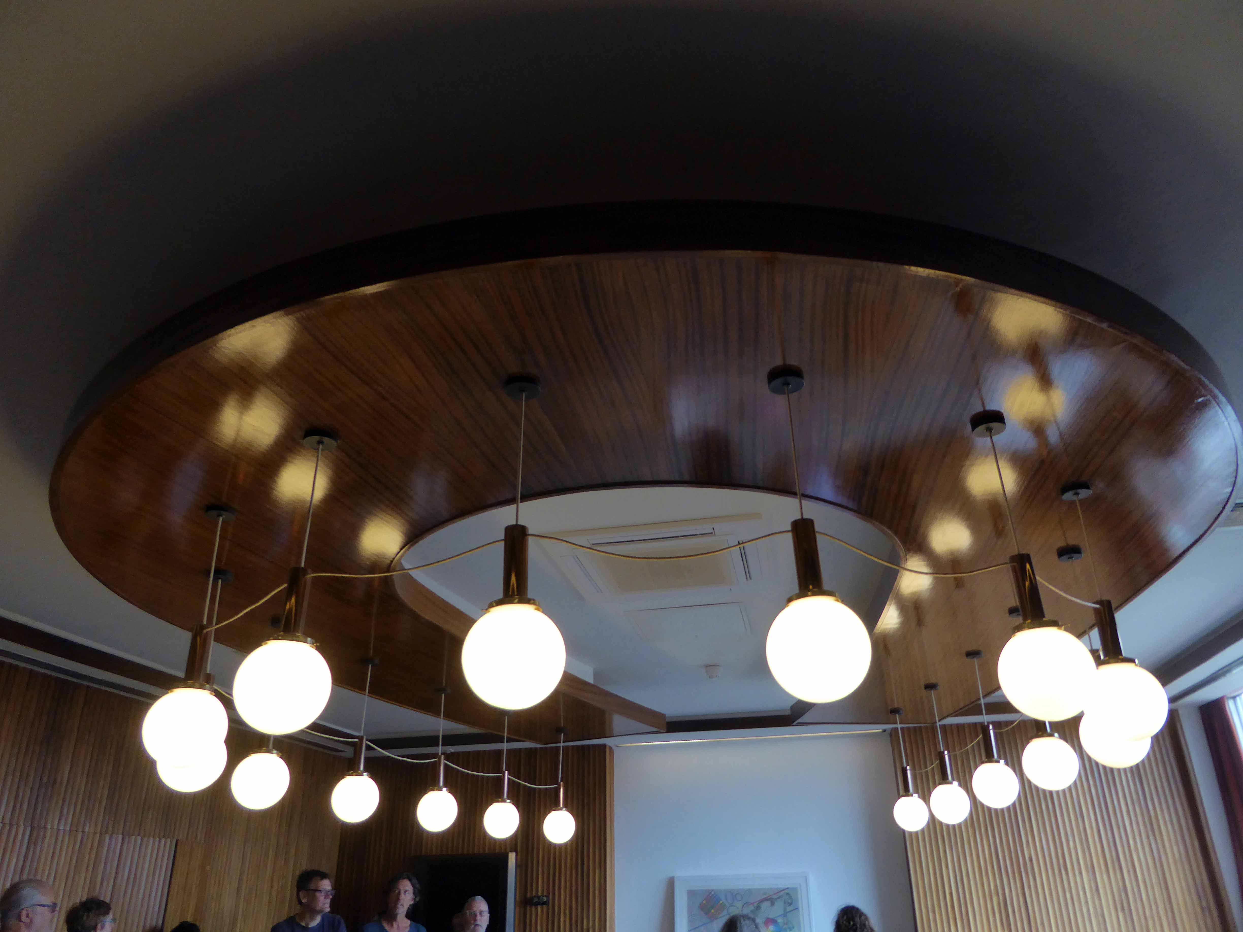
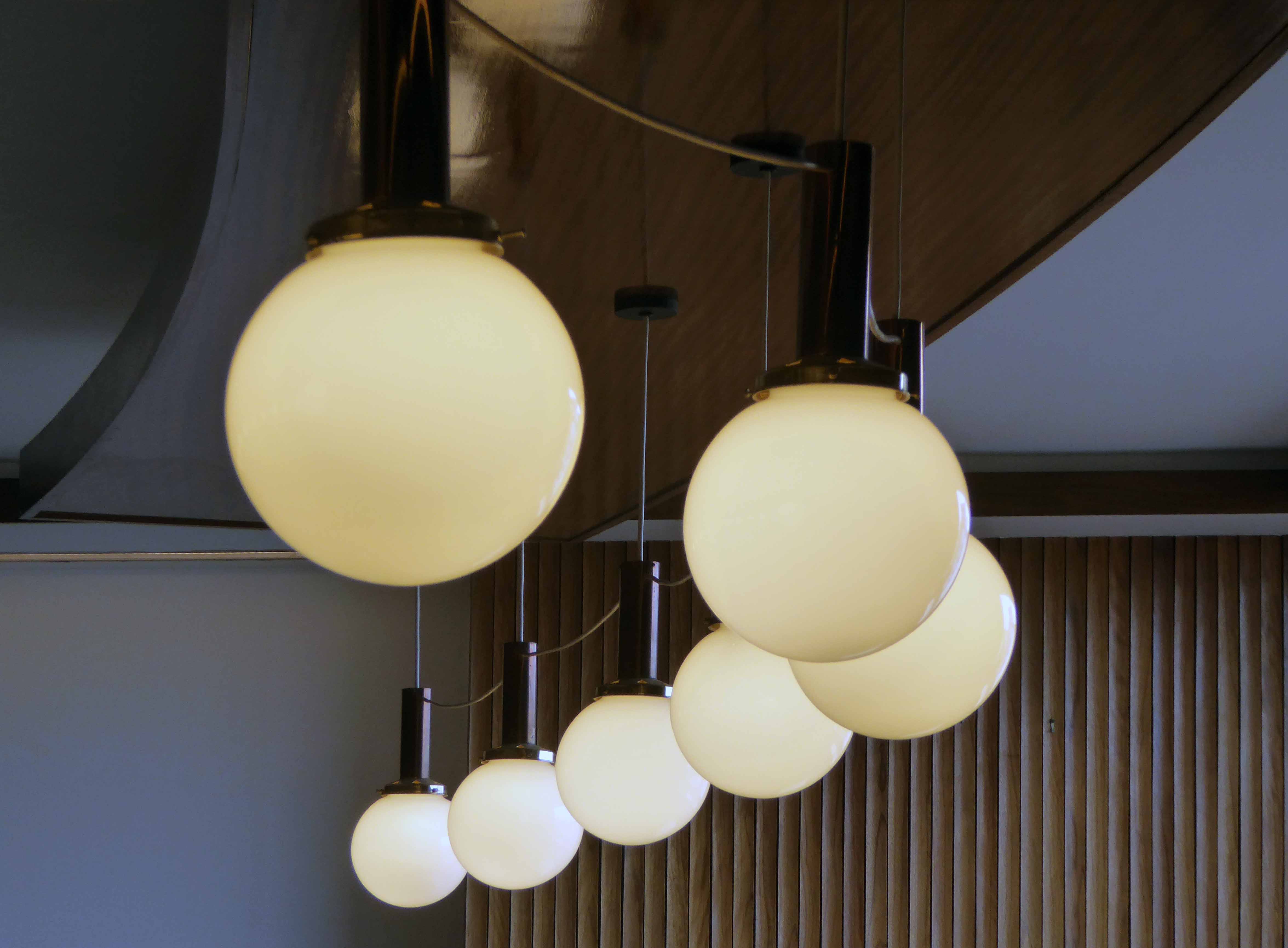
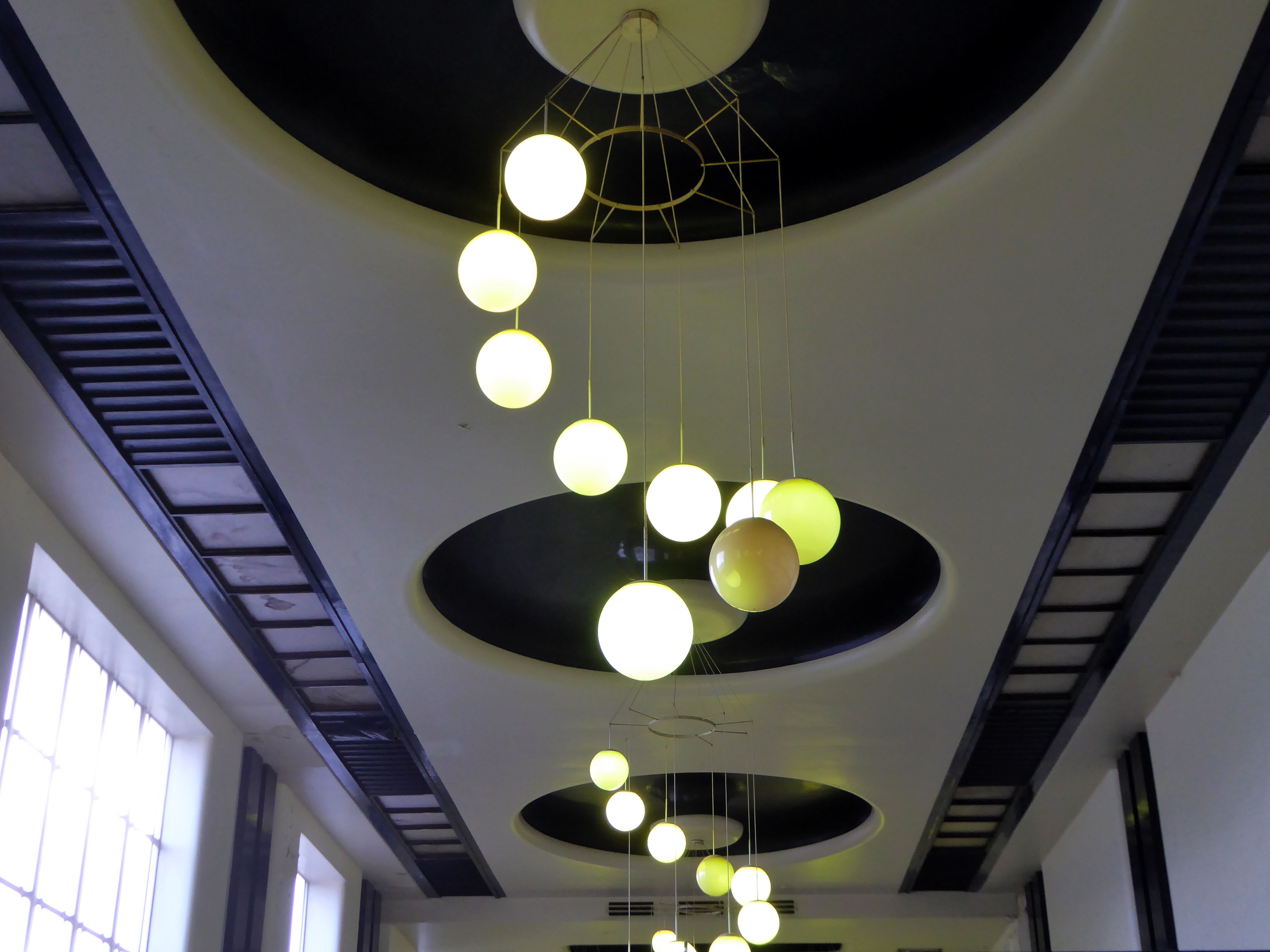
The former top floor restaurant has a suspended geometric ceiling with recently fitted custom made lighting.
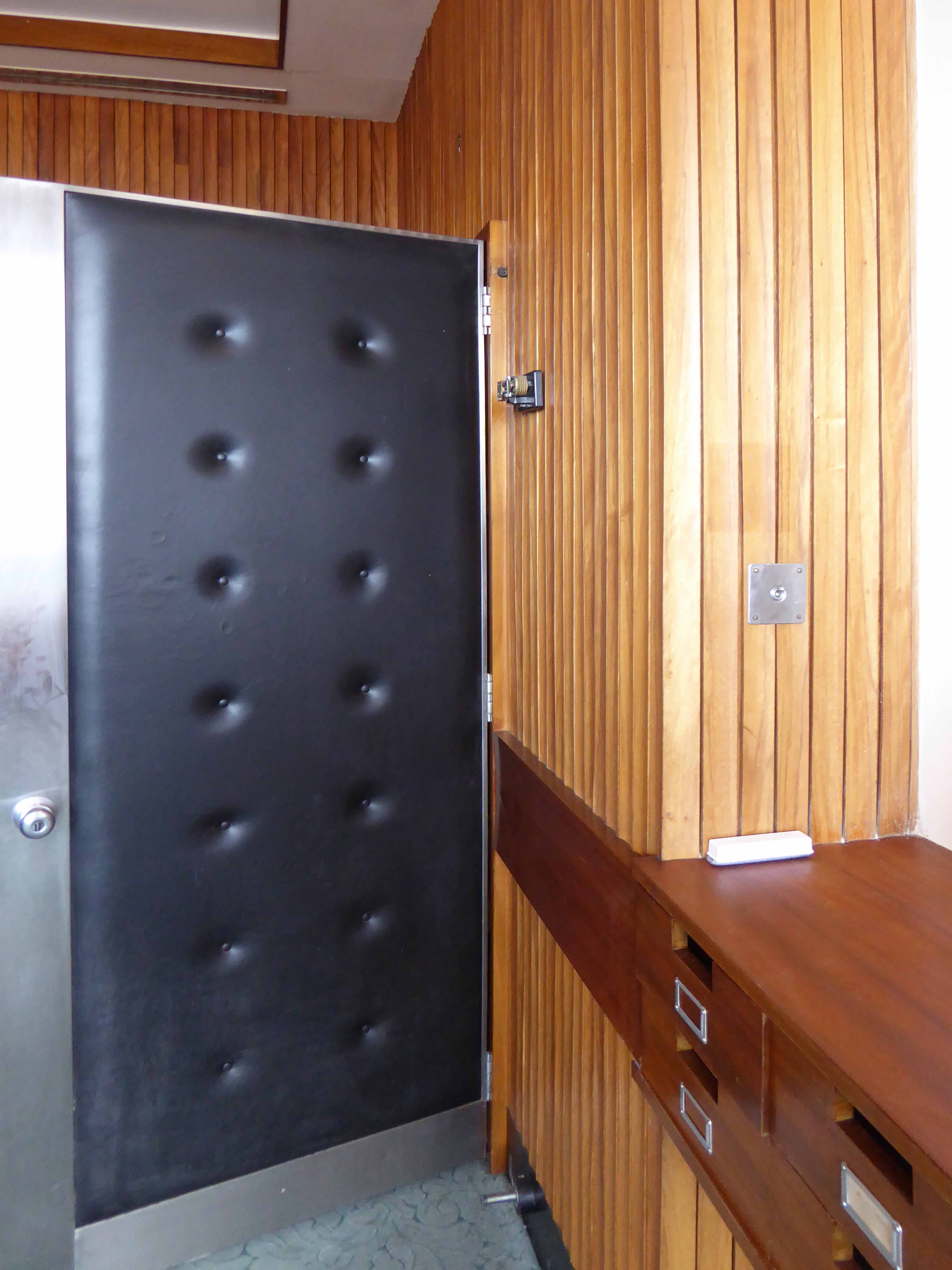
The timber-lined boardroom has a distinctive horseshoe of lighting, augmenting the board room table – which is currently away for repair, oh yes and a delightful door.
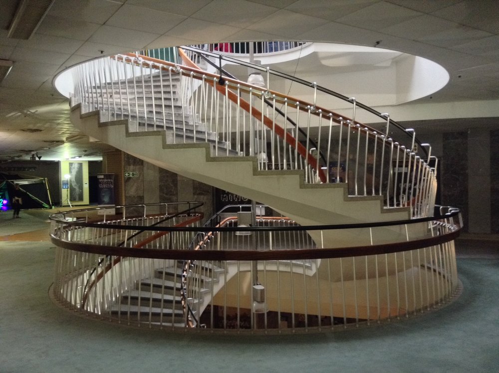
High atop the intoxicating vertiginous swirl of the central spiral stairway is the relief mural representing a cockerel and fish made of aluminium, copper and metal rod, with red French glass for the fish’s eye and cockerel’s comb.
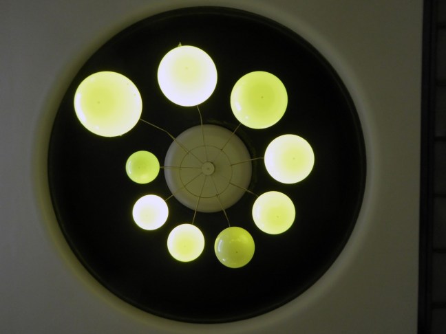
Illuminated from above by this pierced concrete and glass skylight.
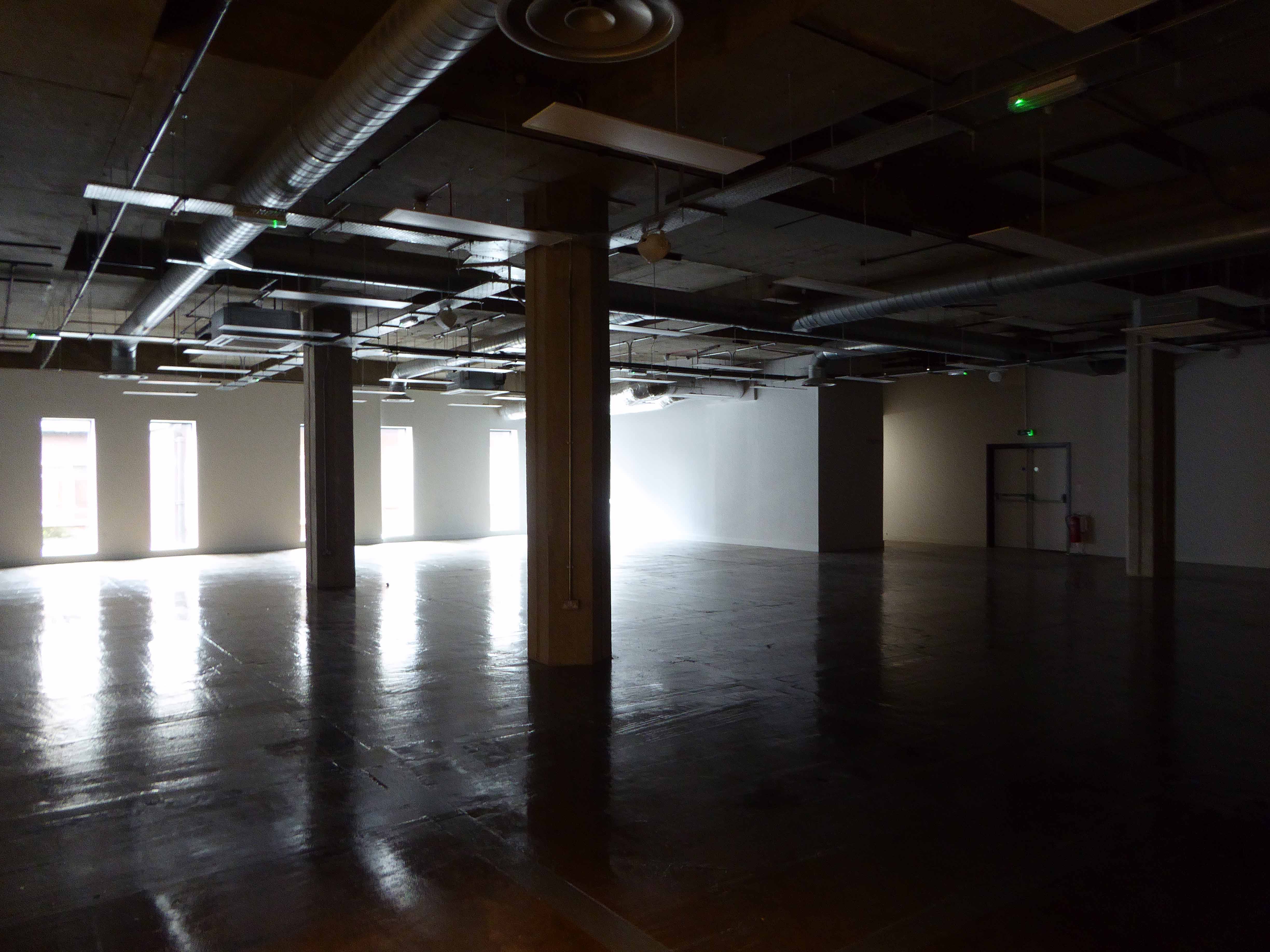
Many of the internal spaces have been ready for their new tenants.
This is a fine example of Modernist retail architecture saved from decay and degradation by the timely intervention of a sympathetic tenant.
Long may they and Castle House prosper – Sheffield we salute you!
The railway station was built in 1849 replacing a temporary structure constructed a year earlier. It was rebuilt in its present form in 1933 and has had several slight modifications since that date, most notably in 2006, when the new interchange and connection to Frenchgate Centre opened.
The front elevation is realised in a typical inter-war brick functionalist style.
Of particular note are the lobby lighting fixtures and clock, the booking hall and offices are listed Grade II.
There are plans to redevelop the station approach replacing the current car parking with a pedestrianised piazza.
The High Street boast a former branch of Burton’s with its logo intact.
An intriguing Art Deco shop frontage – combining a menswear outlet with a pub.
Further along an enormous Danum Co-operative Store in the grandest Deco manner – 1938-40. Designed by T H Johnson & Son for the Doncaster Co-operative Society Ltd.
Currently partially occupied with no access to the glass stairways.
Following the development of the Frenchgate Centre the Waterdale Centre sunk into a slow decline.
And the Staff of Life has lost a little of its estate pub period charm, following successive typographic makeovers and paint jobs.
From 1949 onwards plans were afoot to develop the Waterdale area of Doncaster – civic buildings, courts, educational provision and the like, WH Price the Borough Surveyor at the helm. In 1955 Frederick Gibberd was appointed to oversee the site, though many of his designs were unrealised, his Police Station and Law Courts opened in 1969.