So on a light bright sunny day, I took another look around.
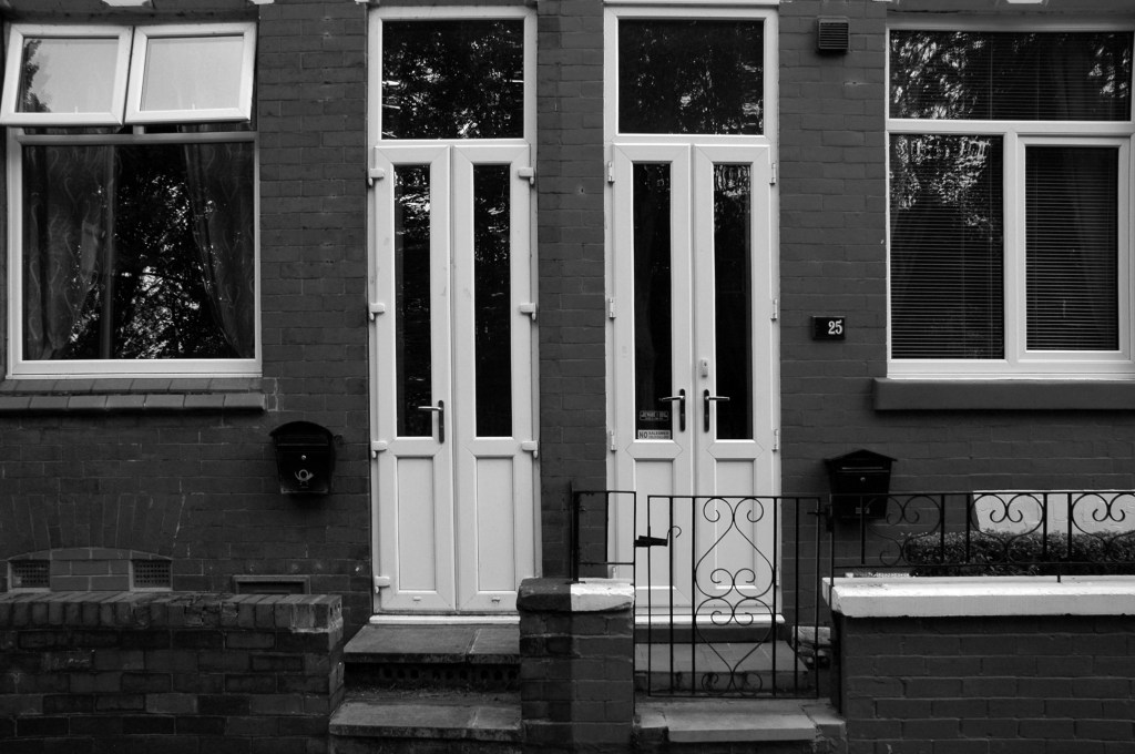
Salford’s town centres are important to the city’s future. They provide employment for local people, retail and leisure opportunities, homes, a sense of community, and a place for local people to interact. However, it is well known that town centres are changing and that they need to adapt and reposition themselves so that they can thrive and meet the needs of the local communities.
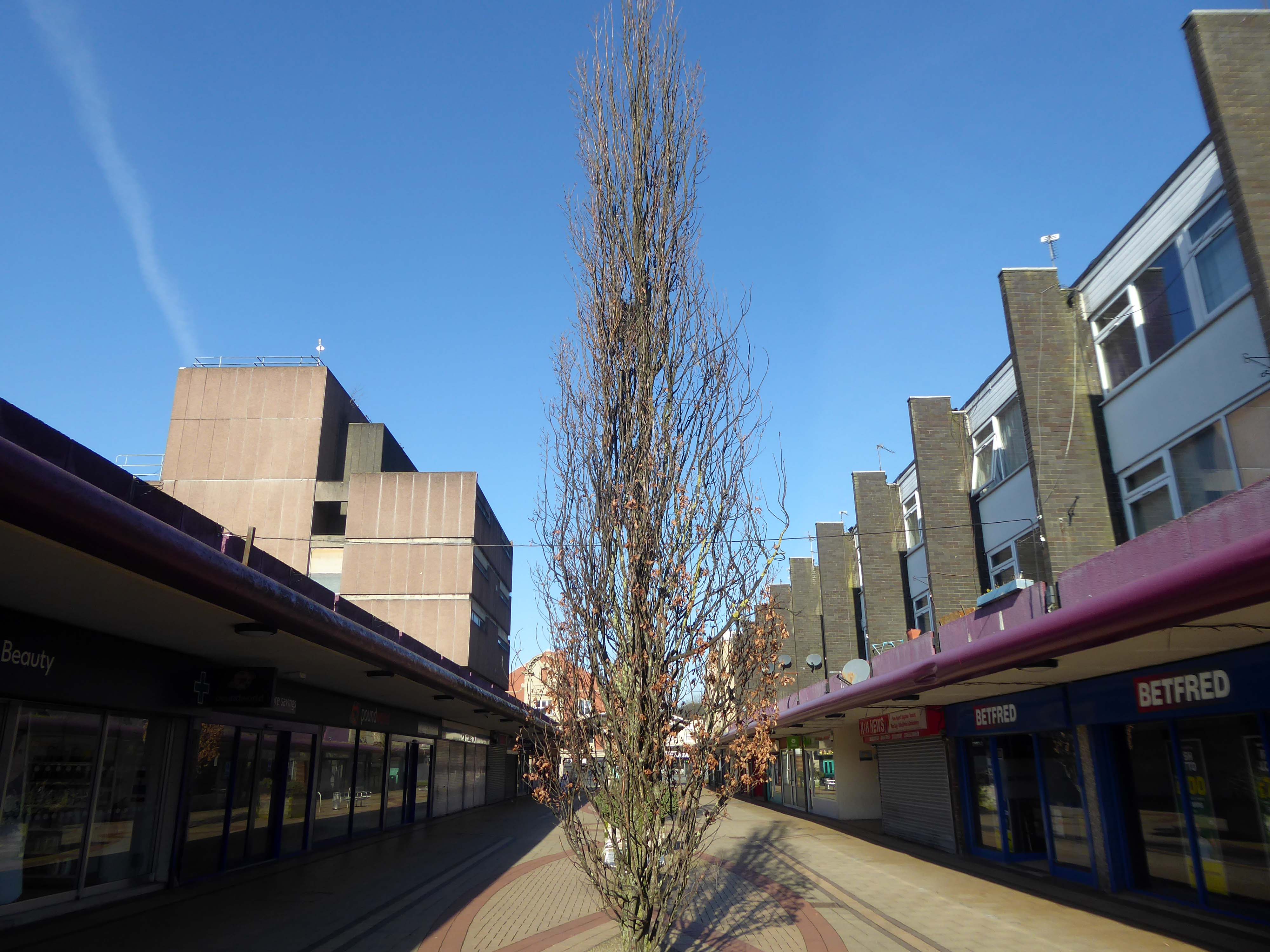
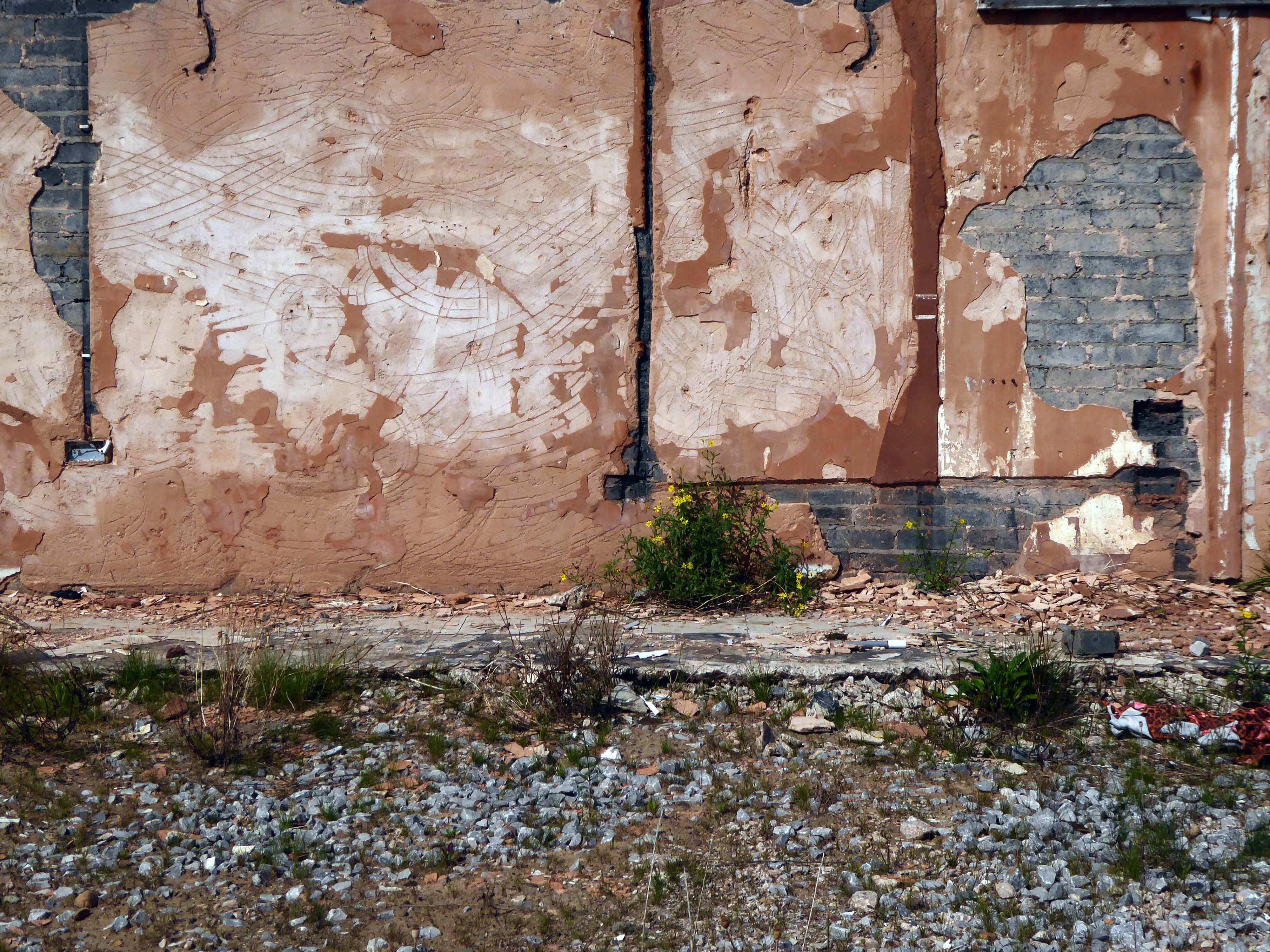
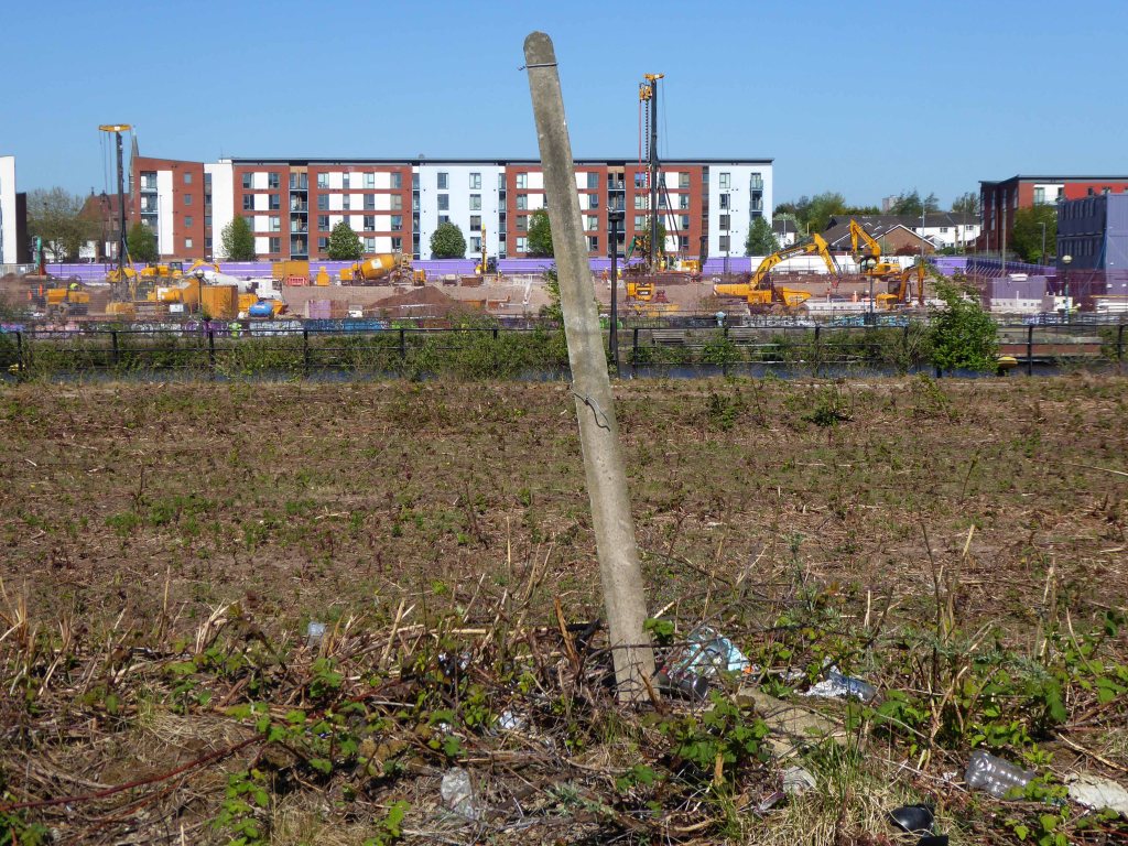
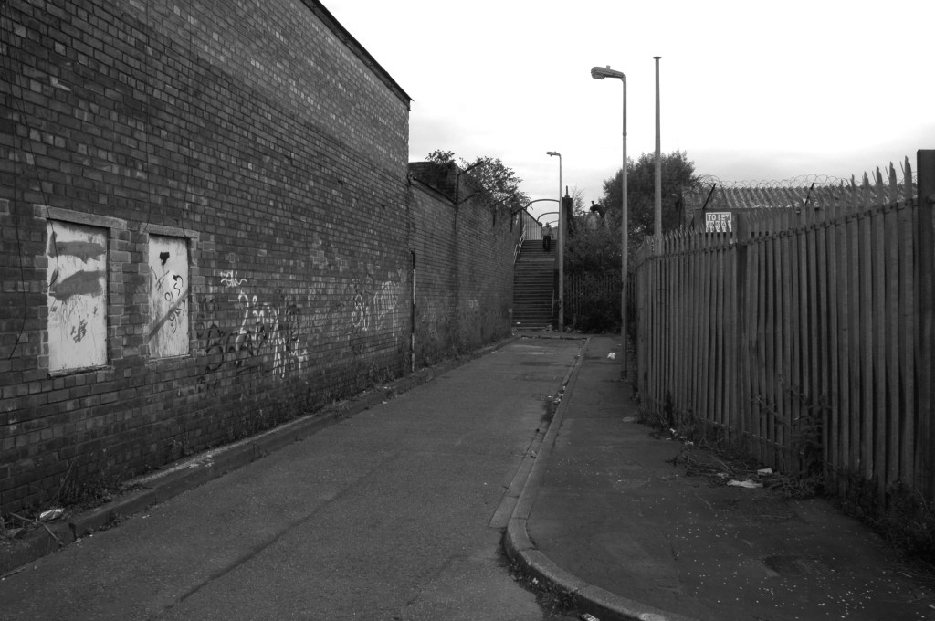
Despite Swinton’s many strengths, it faces similar challenges to other towns. The shopping centre and other buildings in the town centre are dated and in need of investment. Demand for local housing has grown by 23% in the last five years, but there is a lack of high-quality family and affordable housing in the right locations in the area.
The city council has identified Swinton town centre – along with Eccles, as a priority area for regeneration. On that basis, the council has engaged with the community and local stakeholders to establish a clear vision for the town that will help to guide change and future investment, whilst protecting what local people consider important for Swinton.
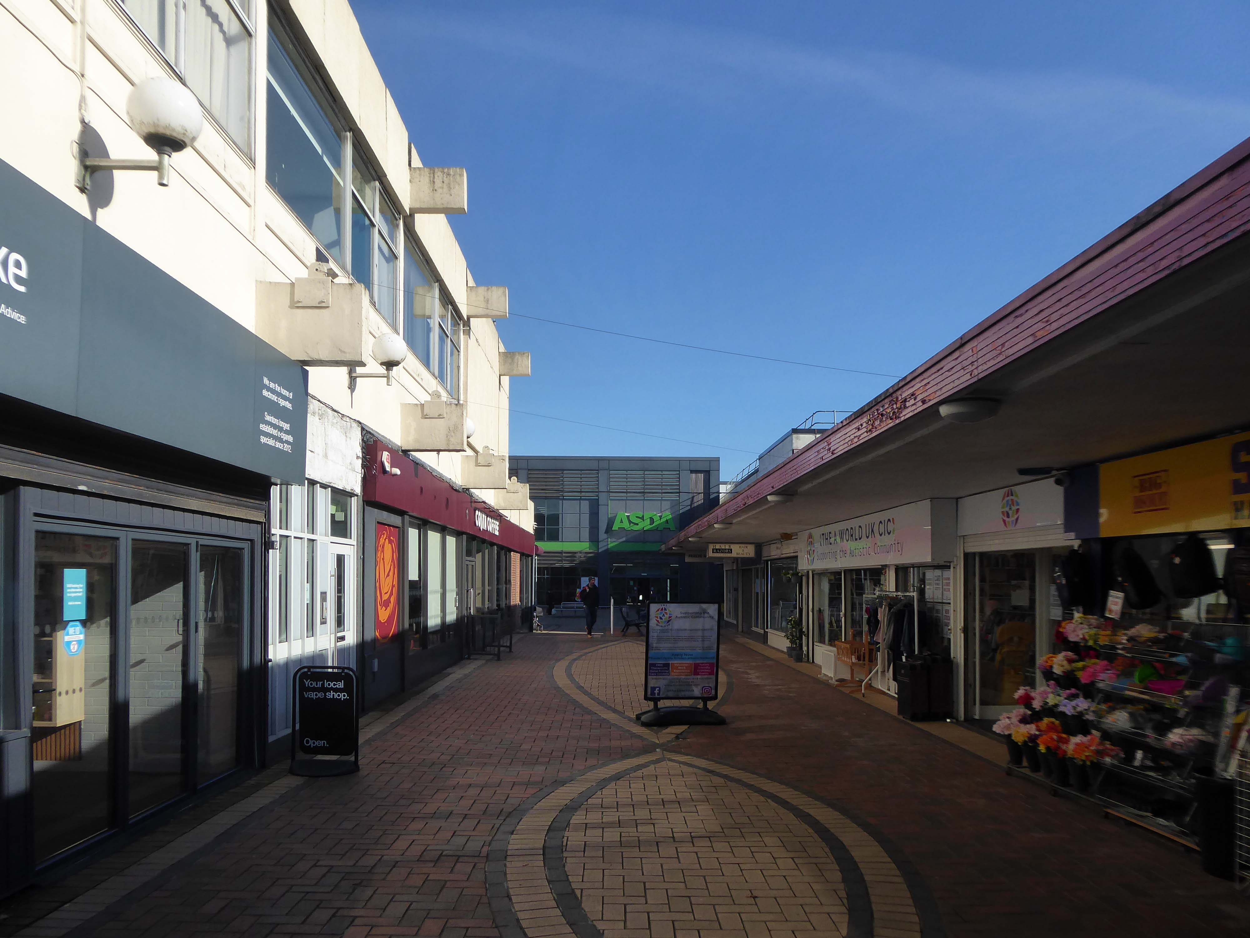
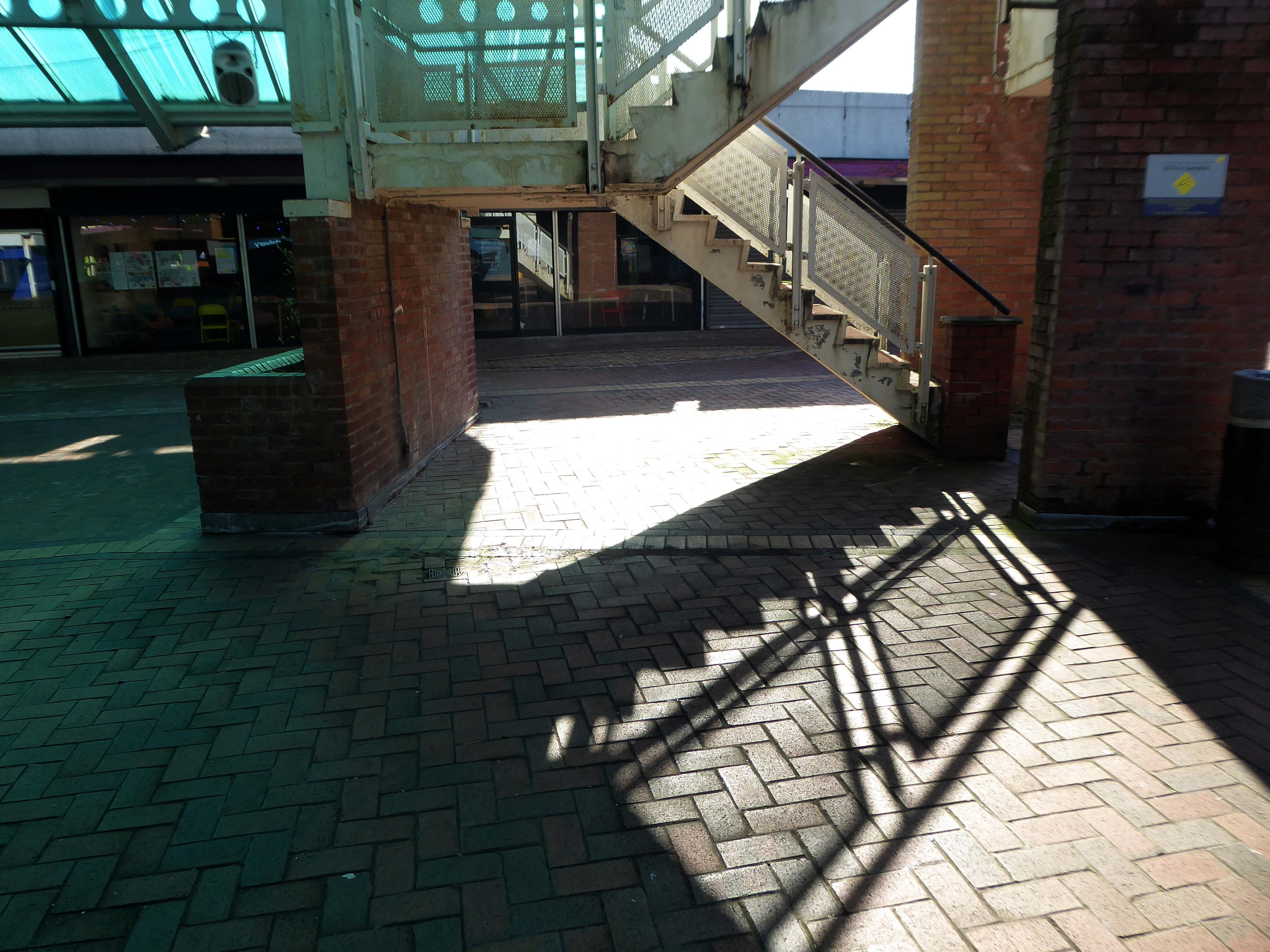
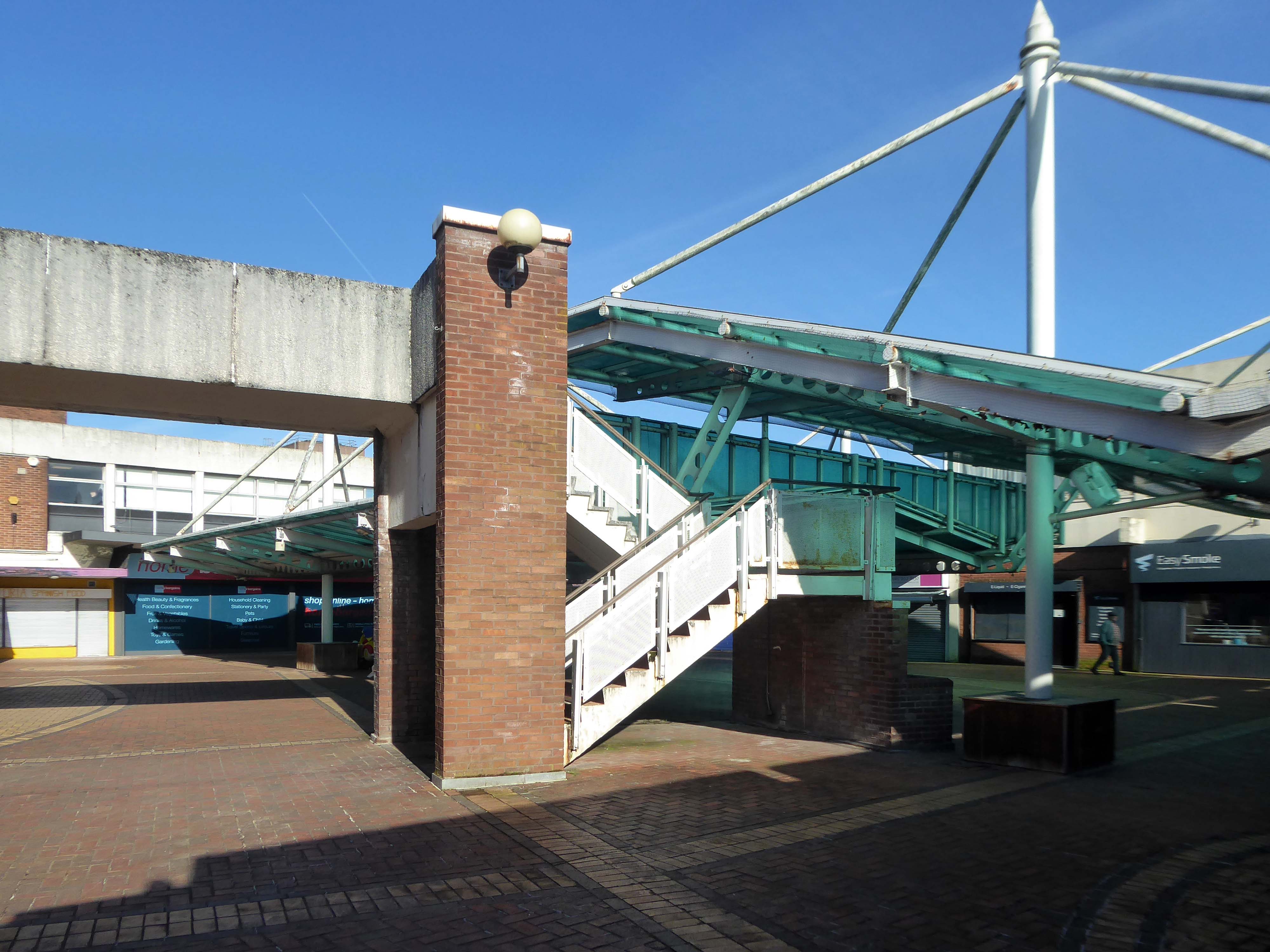
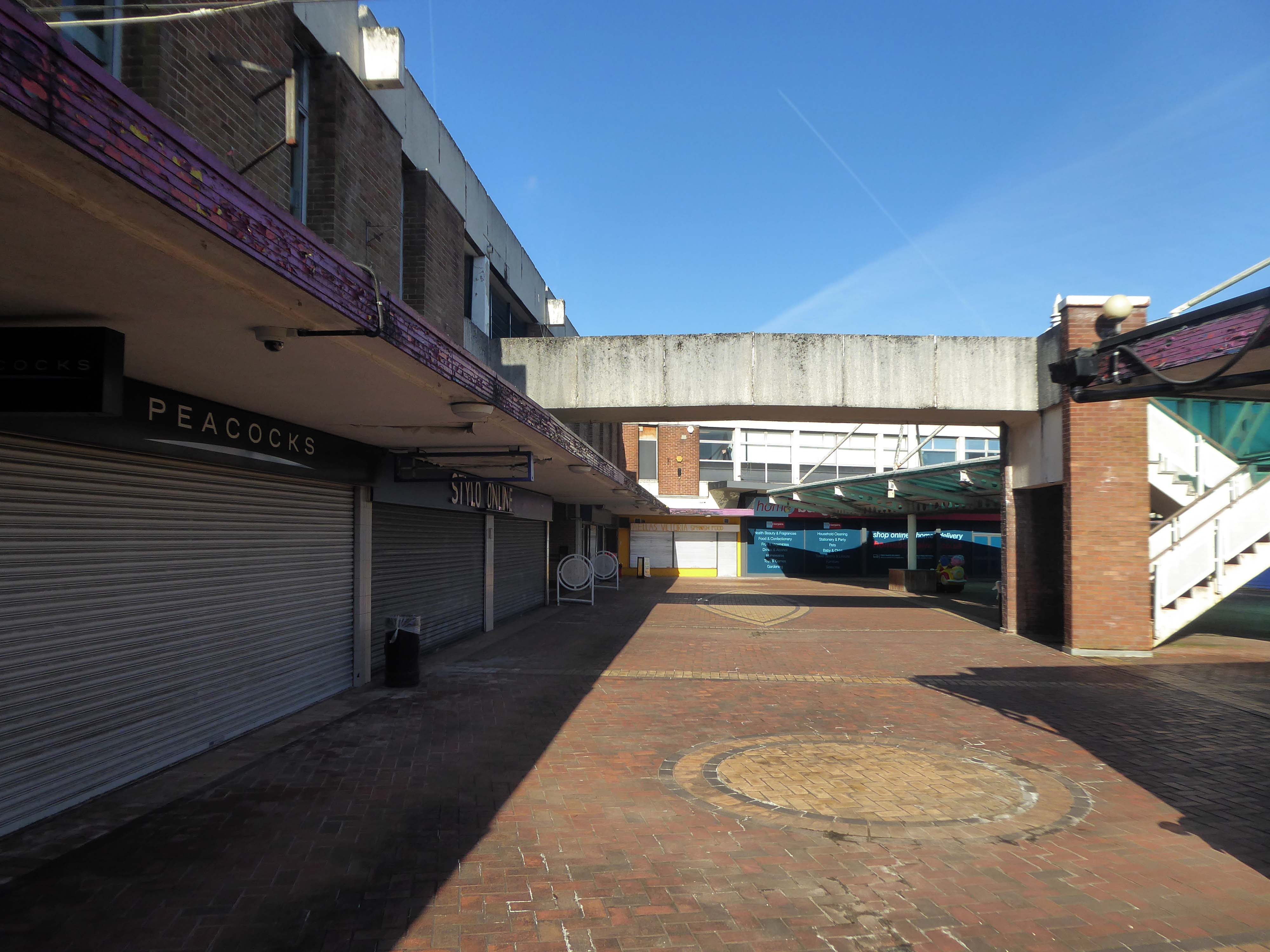
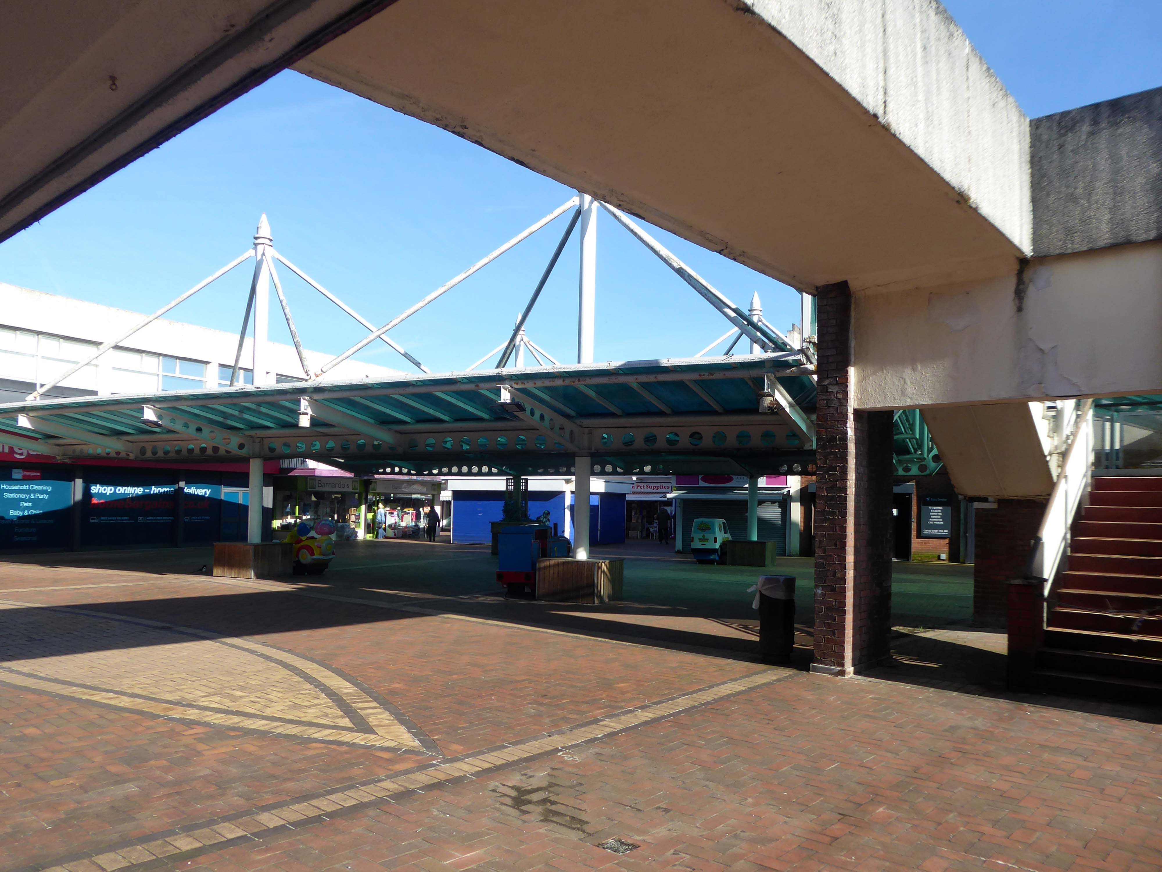
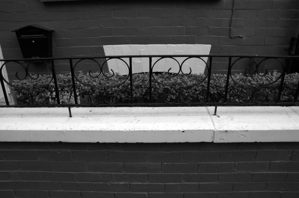
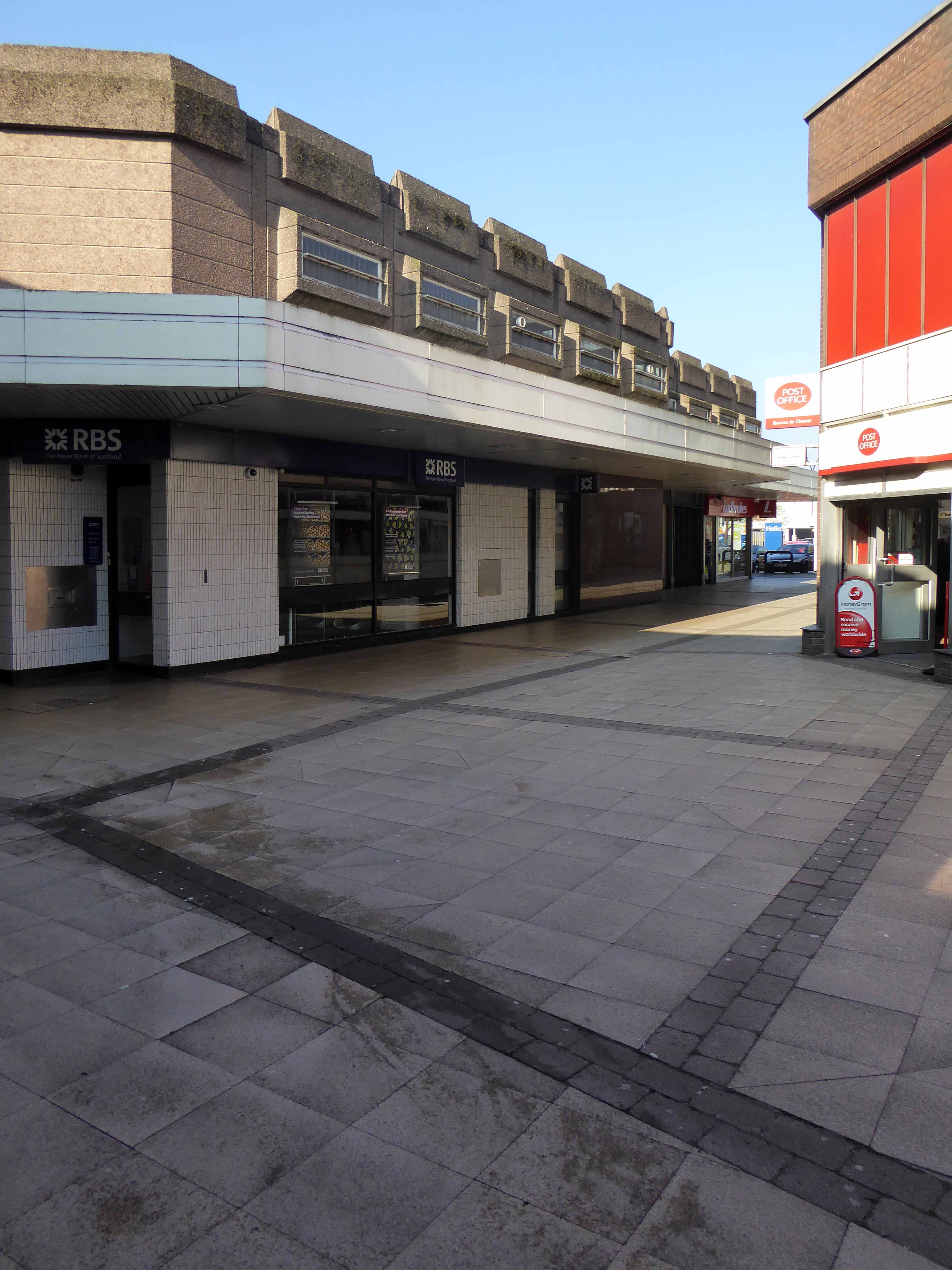
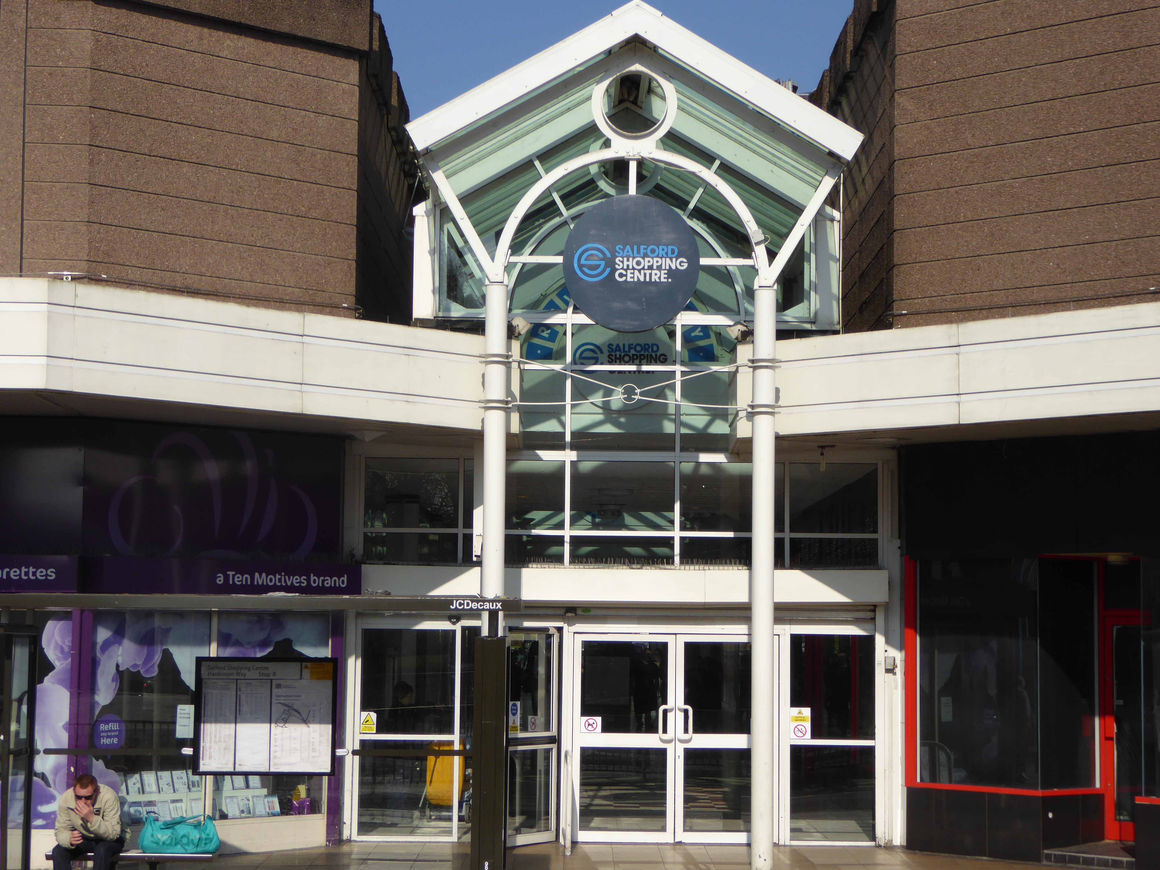
Swinton Square is in private ownership and therefore not something that the council has any direct control over. It is also important to acknowledge that the issues facing Swinton precinct are not unique to Swinton and those challenges are varied but linked to changing shopping habits, decline in the retail offer, competition from out-of-town centres as well as changes in the wider economy.
We do have an open dialogue with the owners of Swinton Square, the West Bromwich Building Society, who are aware of the vision and aspiration for Swinton.
One of the aims of the council’s events and animation programme is to encourage additional footfall and dwell time within the town centre.
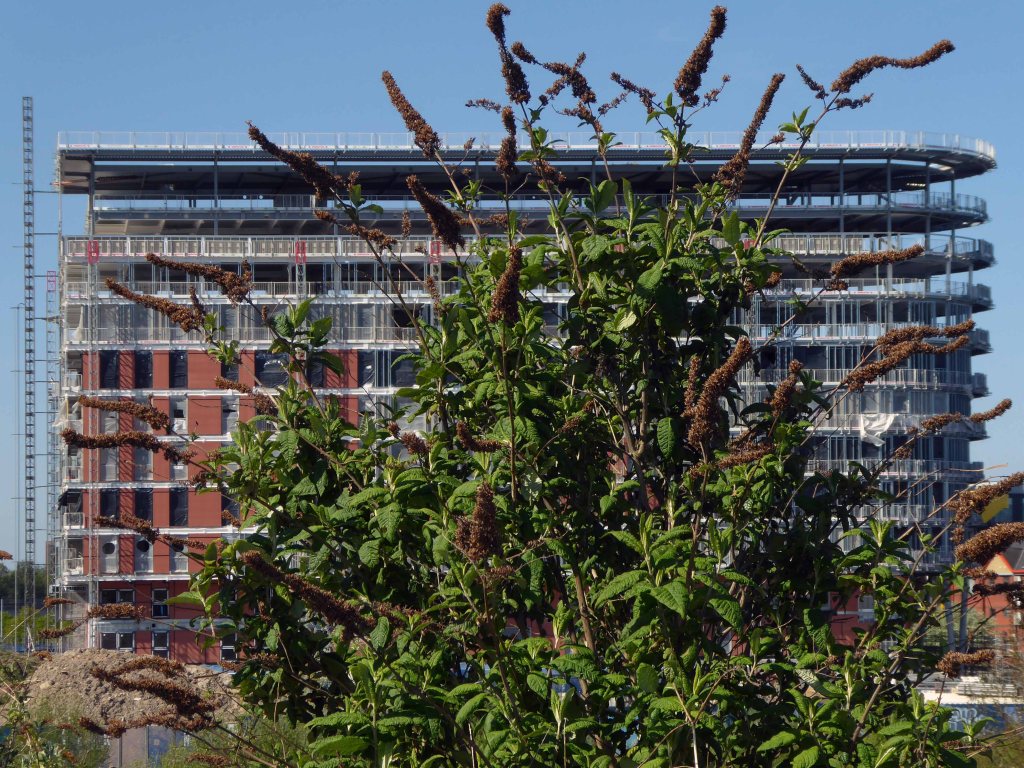
Maple gave architects Aedas RHWL the freedom to express themselves on a prominent multi-storey car park development in Salford. Their imaginative design created a great concept – the nine storey New Bailey car park appearing to be wrapped in ribbons that echo the lattice patterns and intersections in the ironwork of nearby Victorian bridges.
The pedestrian in a car park is happy to shine its tiny light on Salford’s regeneration – and has lead a Modernist Mooch around the area named Salford Nouveau!
English Cities Fund and National Car Parks have officially launched the new 615 space, nine storey car park at New Bailey, which is due to open in early December.
The £12 million car park, which was designed by architect Renton Howard Wood Levin Architects and constructed by Morgan Sindall has been forward funded by Legal and General and let to NCP on a 35 year lease.
This purpose built flagship multi-storey car park features a number of benefits for customers. These include state of the art larger and quicker lifts, energy efficient LED lighting and automatic number plate recognition. The online booking service includes pre booking facilities and level monitoring communicates to drivers which levels have available parking spaces. There are also direct links to the NCP customer contact centre via a number of help points throughout the car park, as well as 27 CCTV cameras for increased safety and six charging spaces for electric cars.
The car park is also conveniently located adjacent to Salford Central train station.
A good, clean and modern car park, easy to navigate and sensibly sized spaces.
The only downsides are that it’s not cheap and getting into it from Trinity way is hard, as the traffic blocks the junction meaning it takes may cycles of the traffic lights to get across the junction.
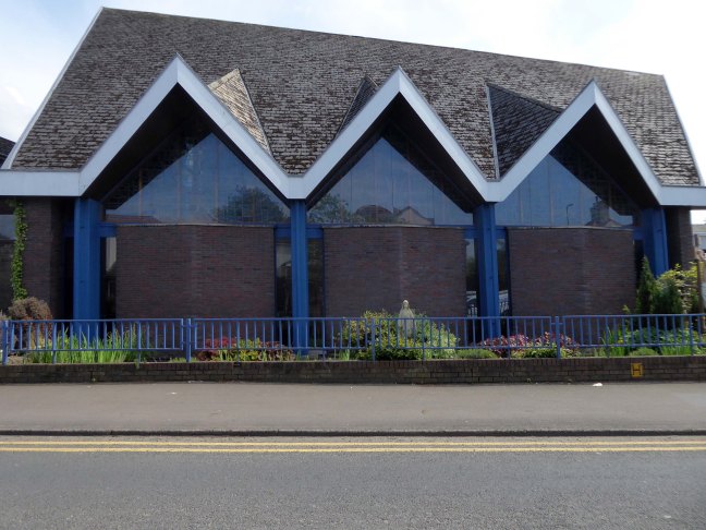
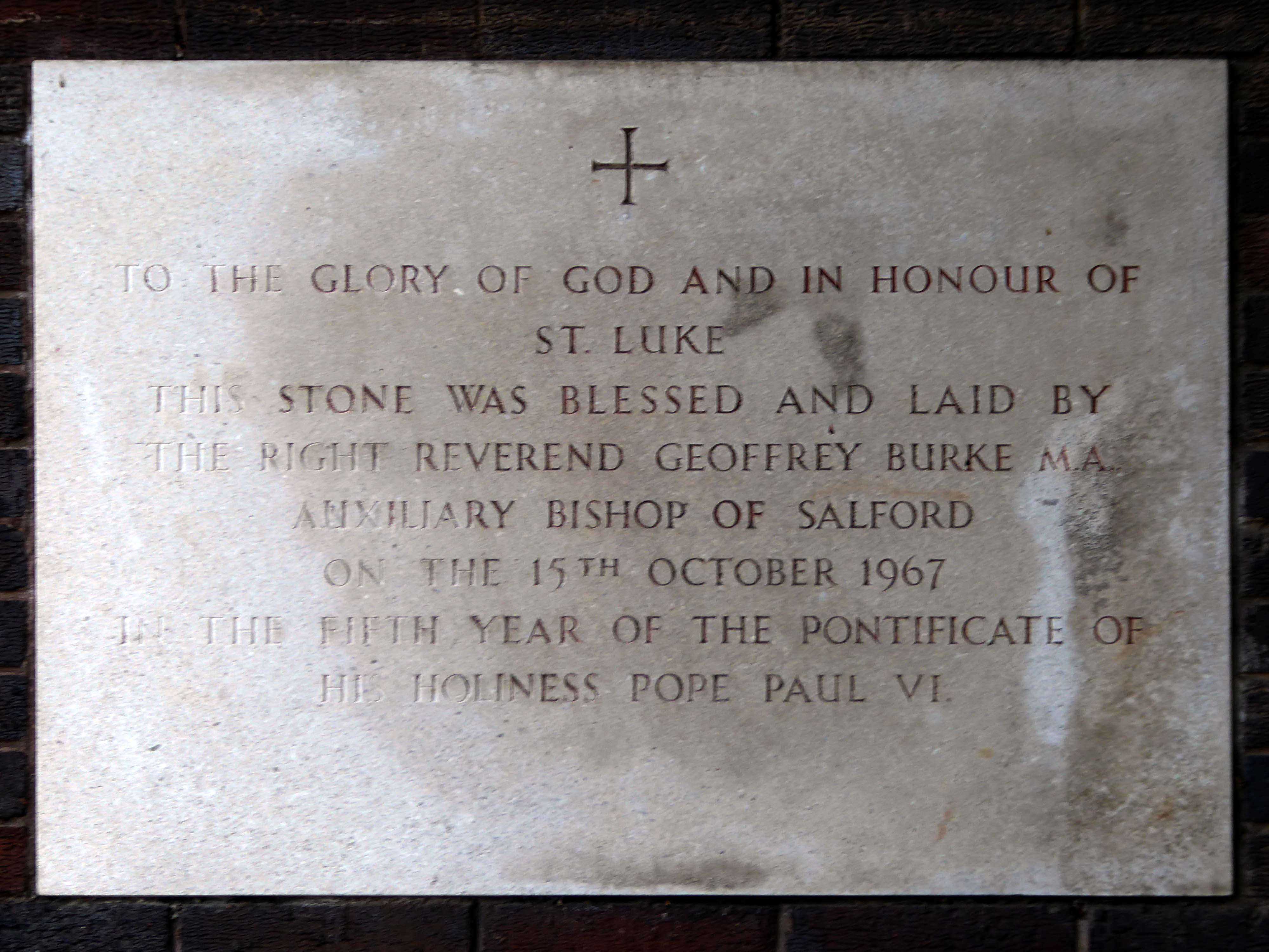
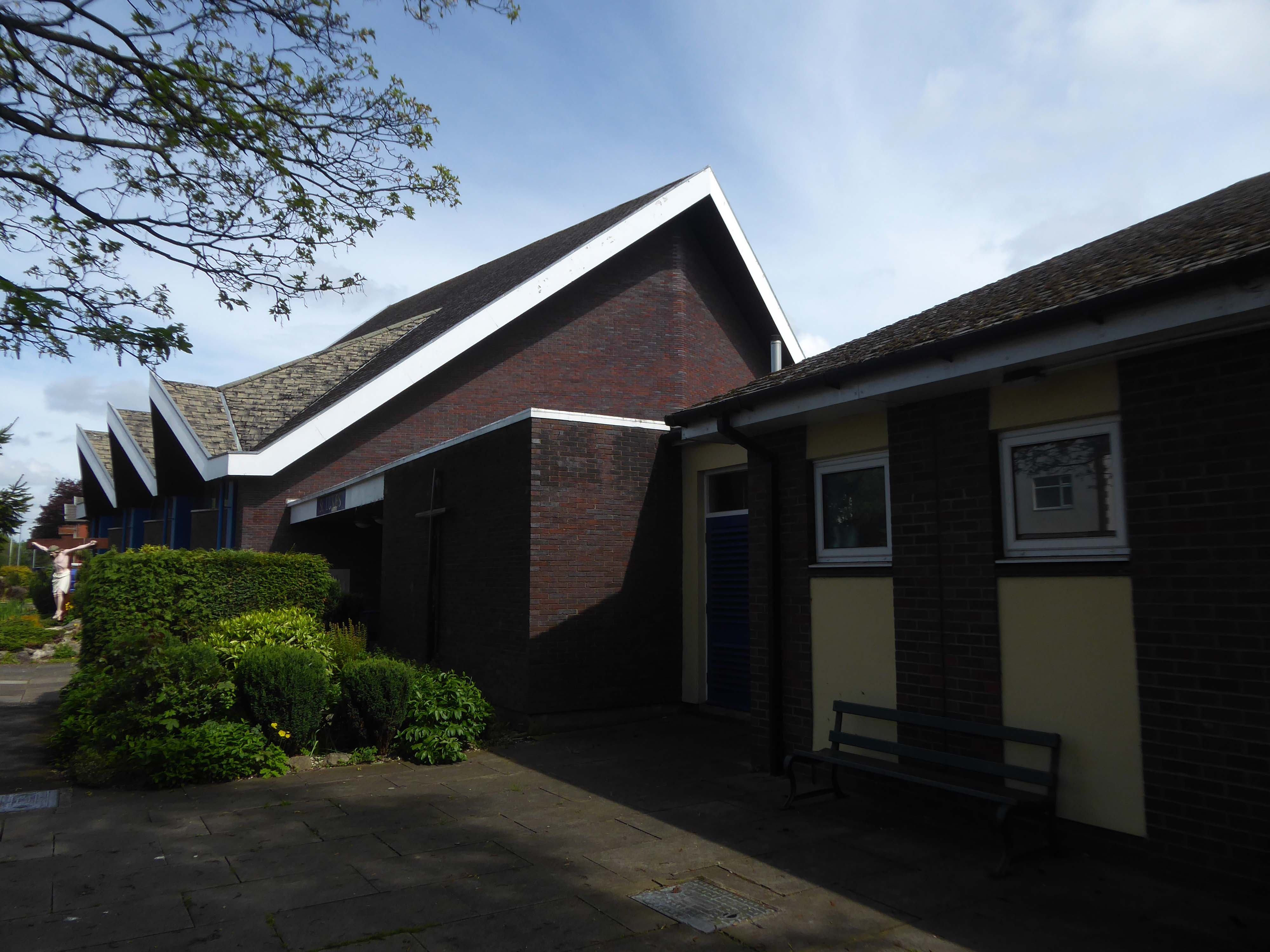
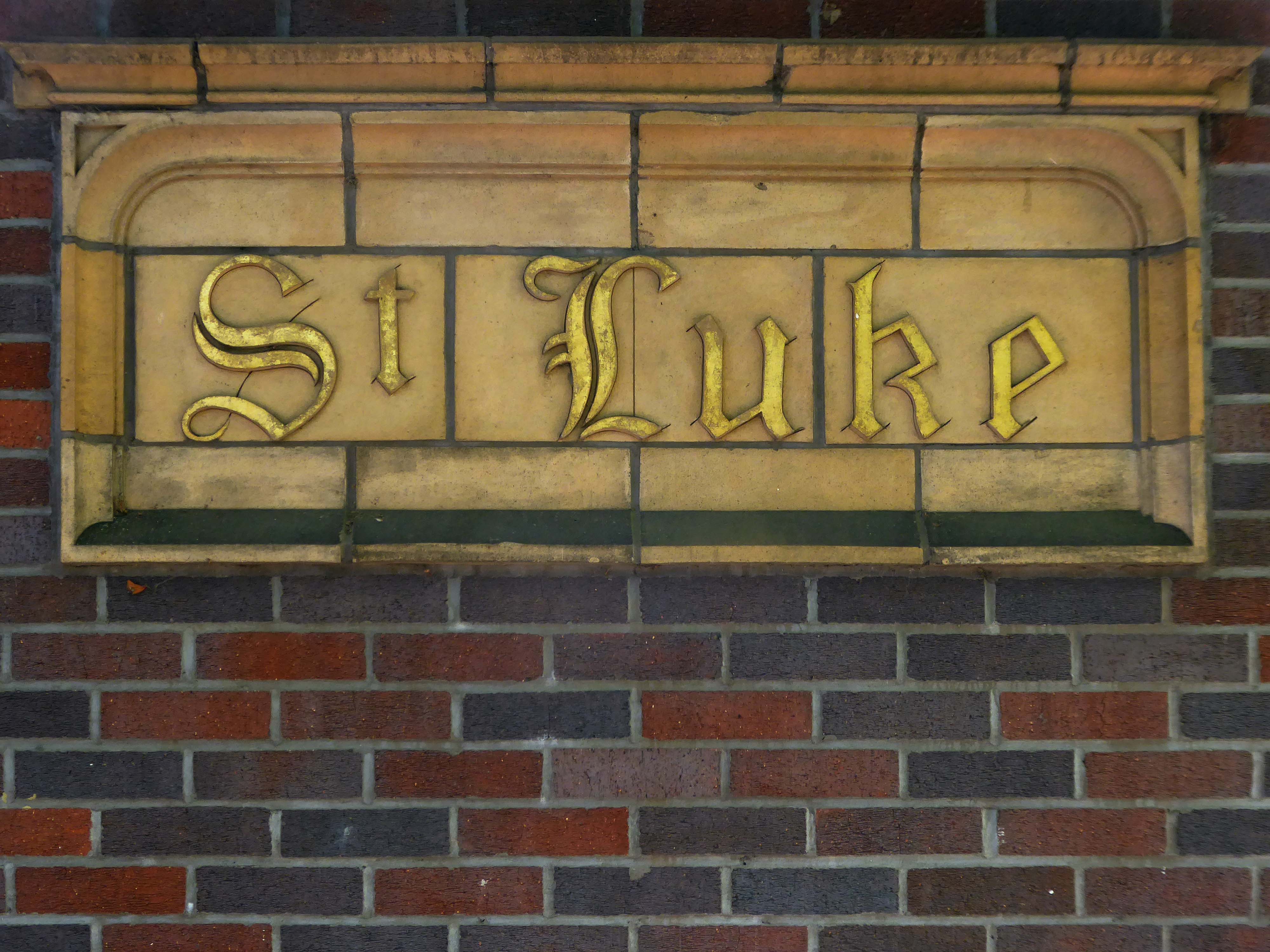
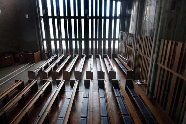
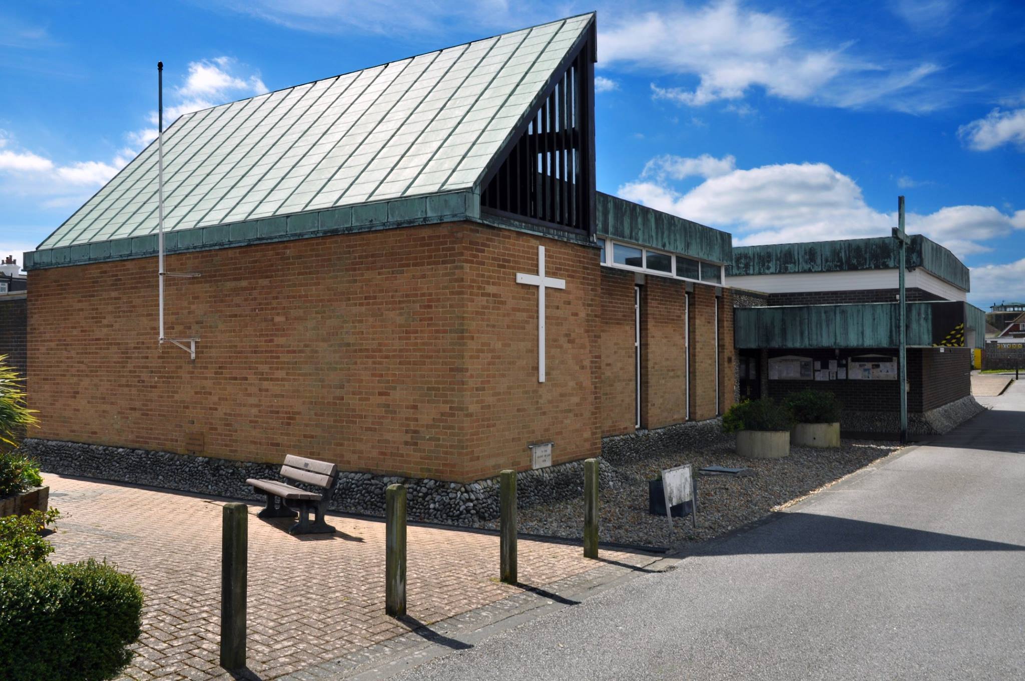
It was decided to build a new church in 1963, when the architects Burles, Newton & Partners were appointed and drew up a scheme for a church seating 470. Financial restraints delayed the start of building work until 1966. The contractors were William Thorpe and the foundation stone was laid by Bishop Burke in October 1967. The church was opened two years later in 1969. The church was built to reflect the emerging liturgical reforms of the Second Vatican Council, with a wide interior affording full views of the altar. The same architects designed a presbytery, added in 1974-5. A sanctuary reordering took place at some point when the Blessed Sacrament Chapel became the Lady Chapel and the tabernacle was placed behind the altar. The altar rails were removed, and the sanctuary carpeted. Perhaps at the same time the font was brought from the baptistery into the body of the church.
Description
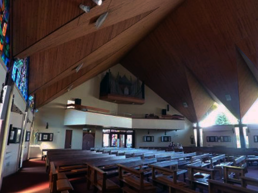
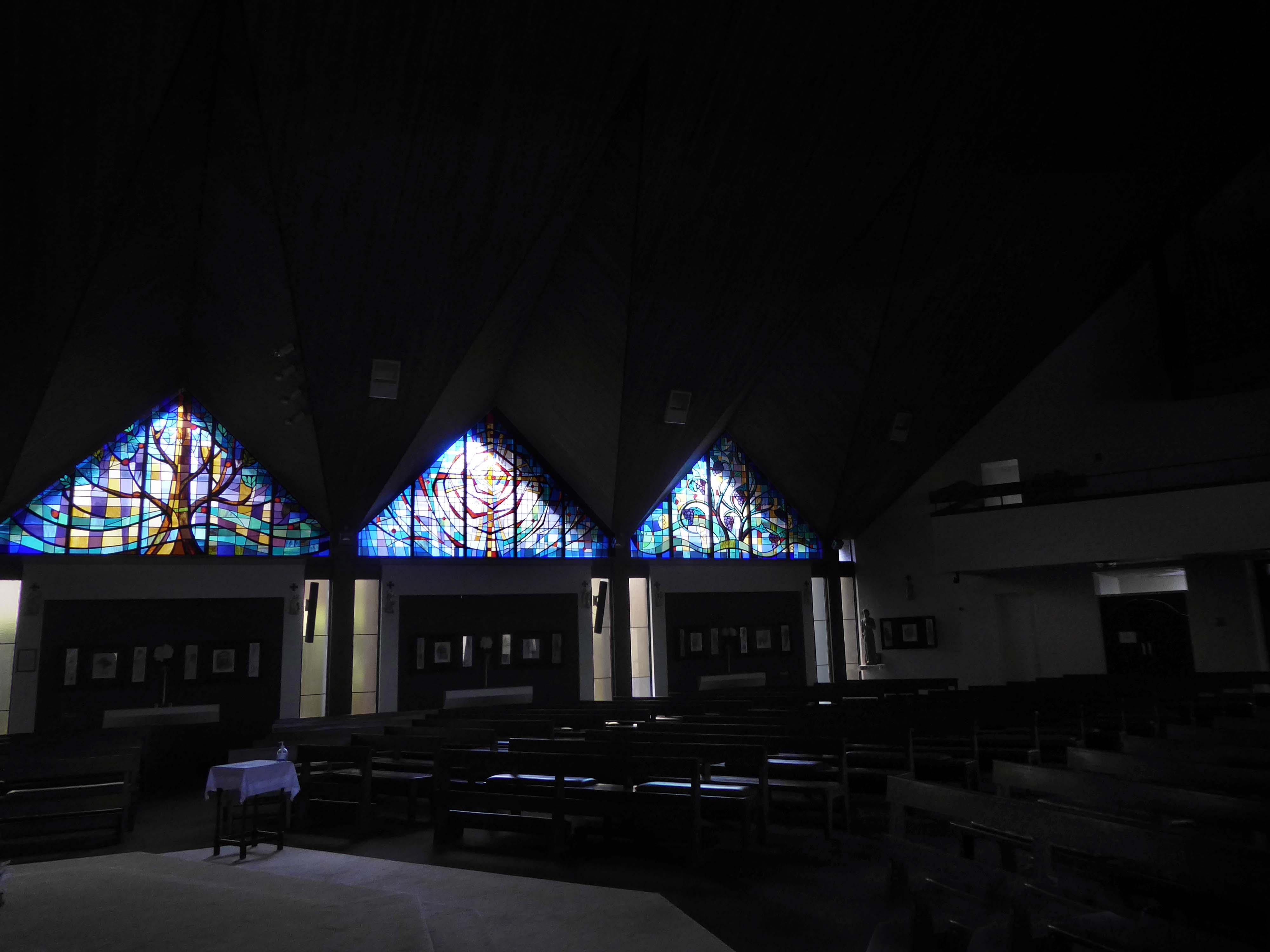
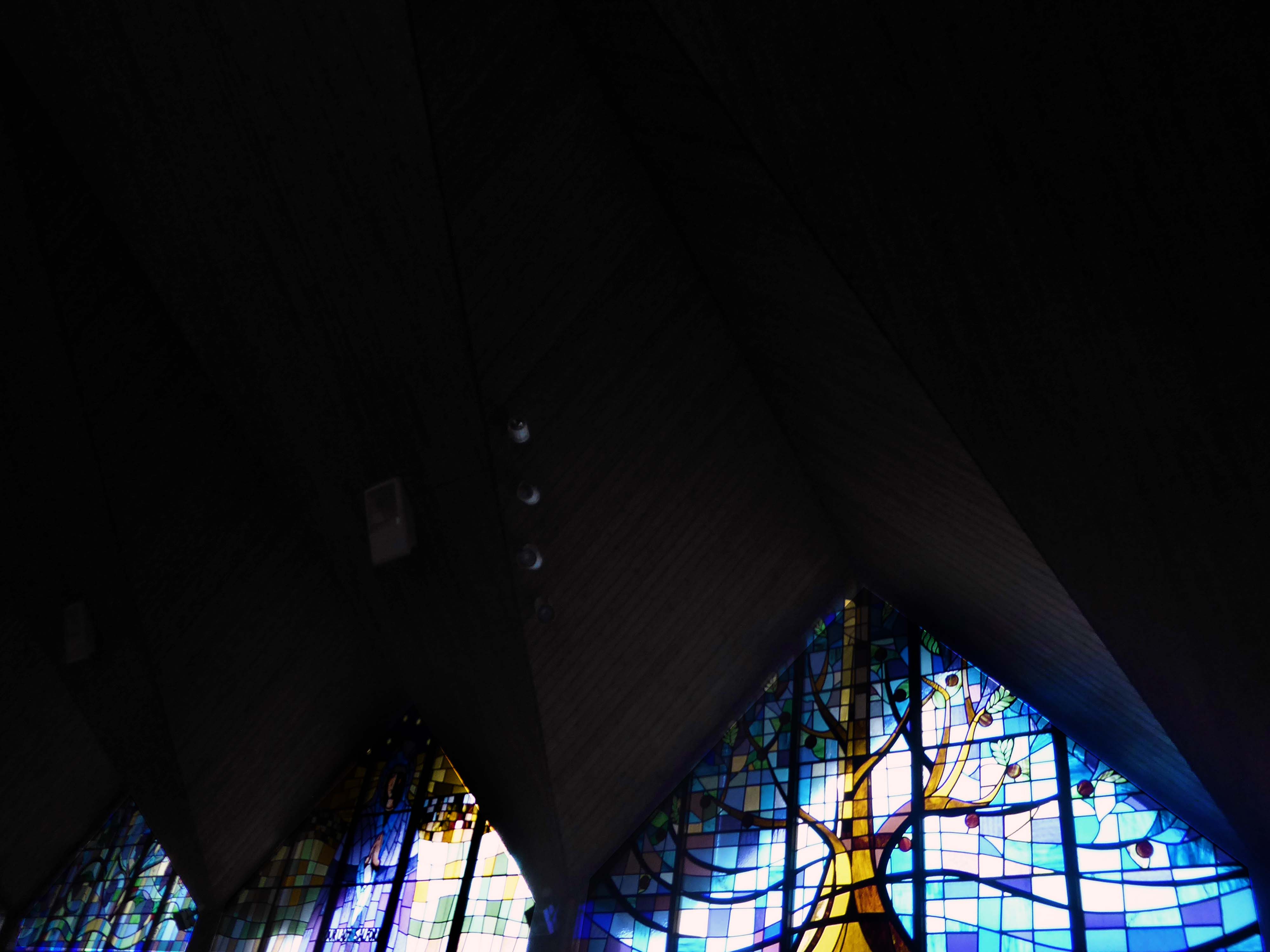
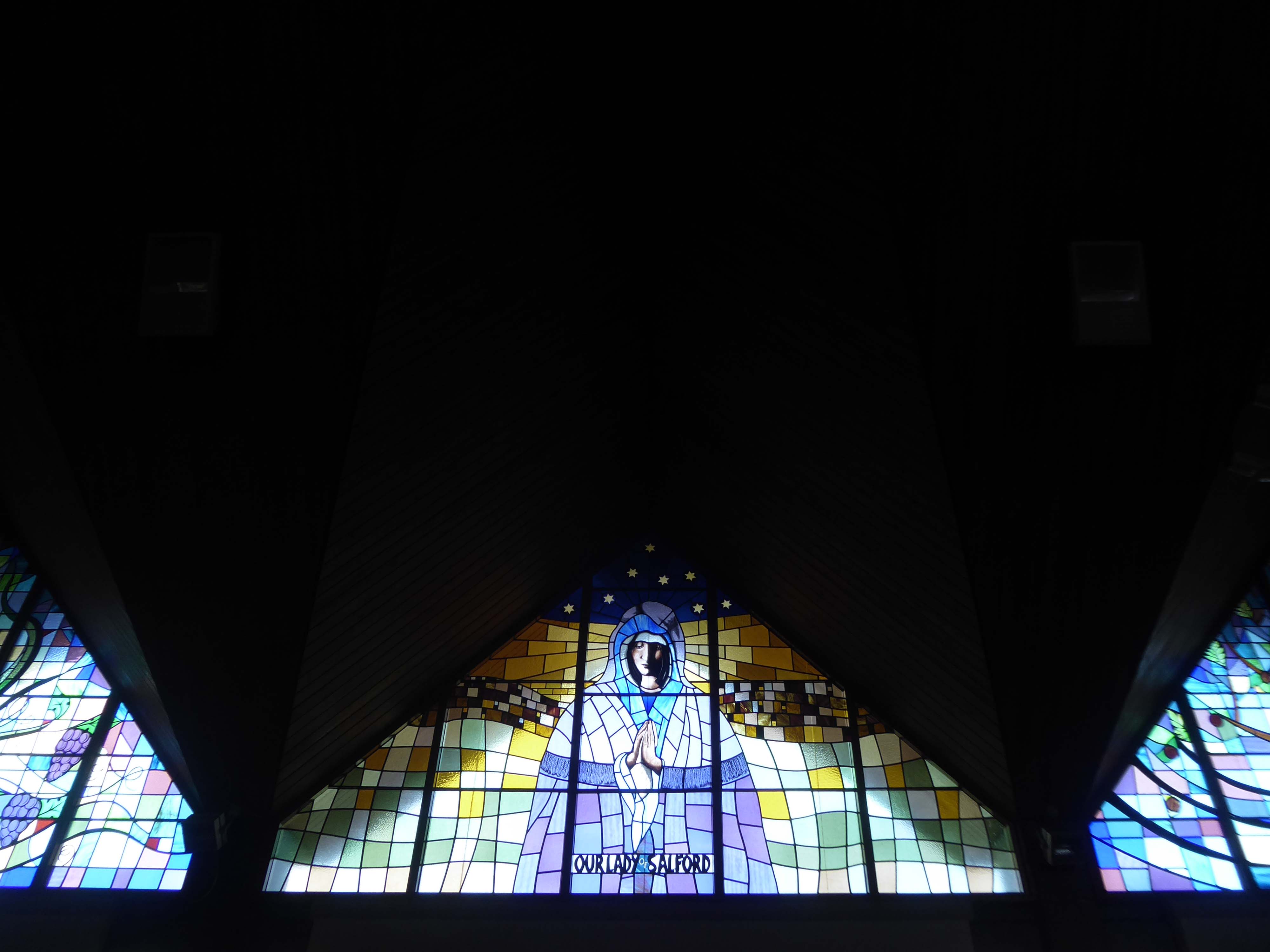
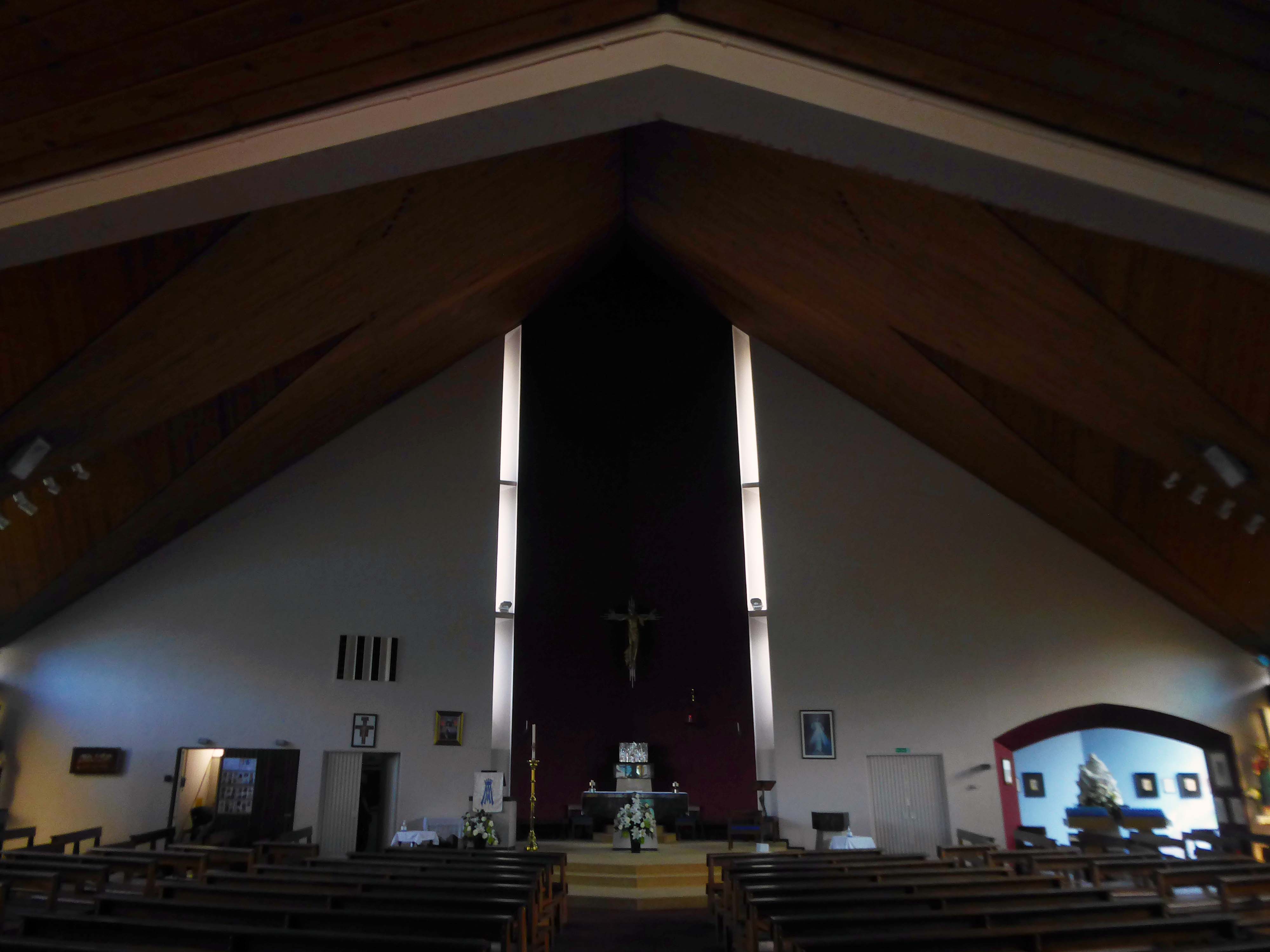
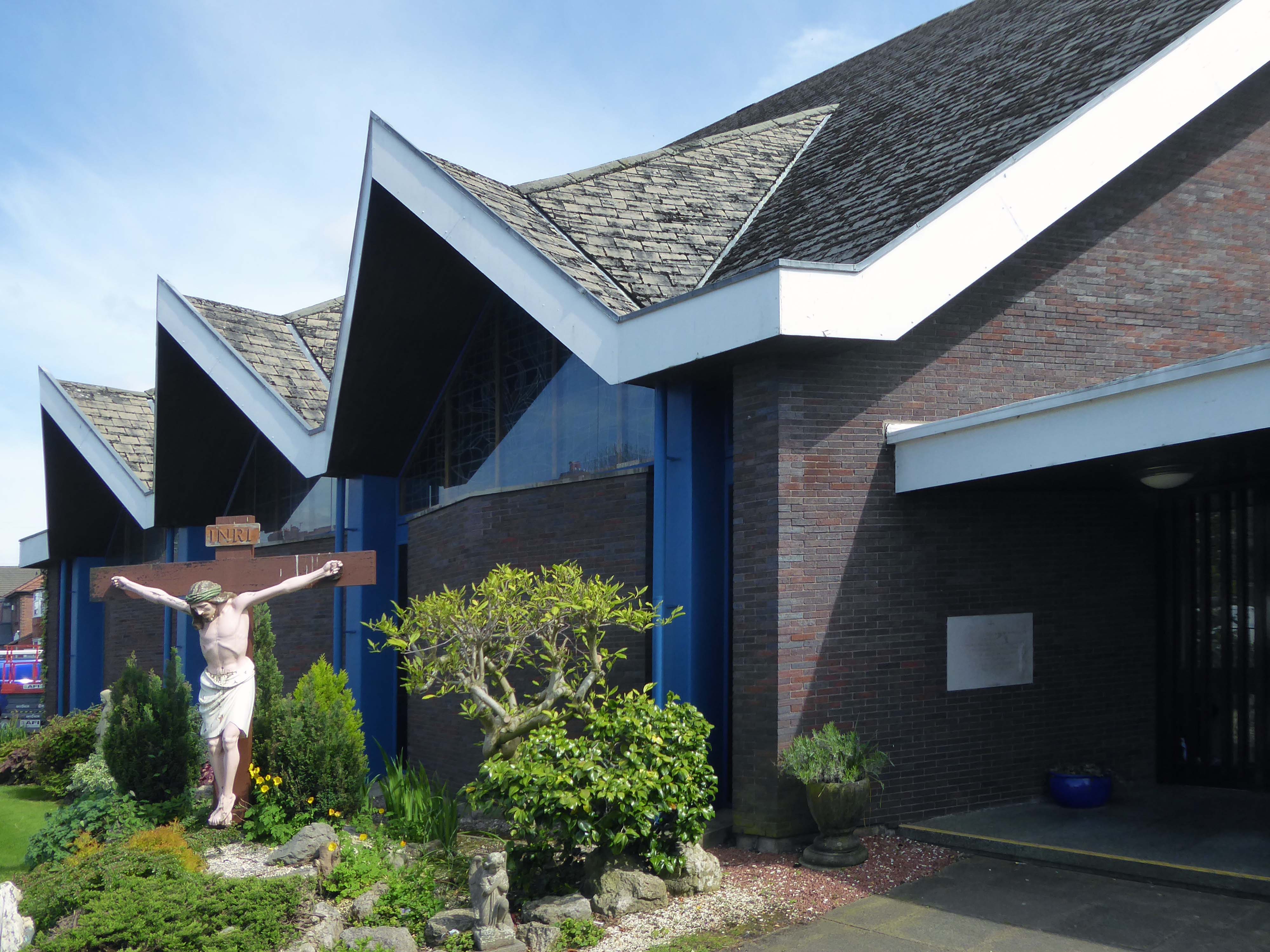
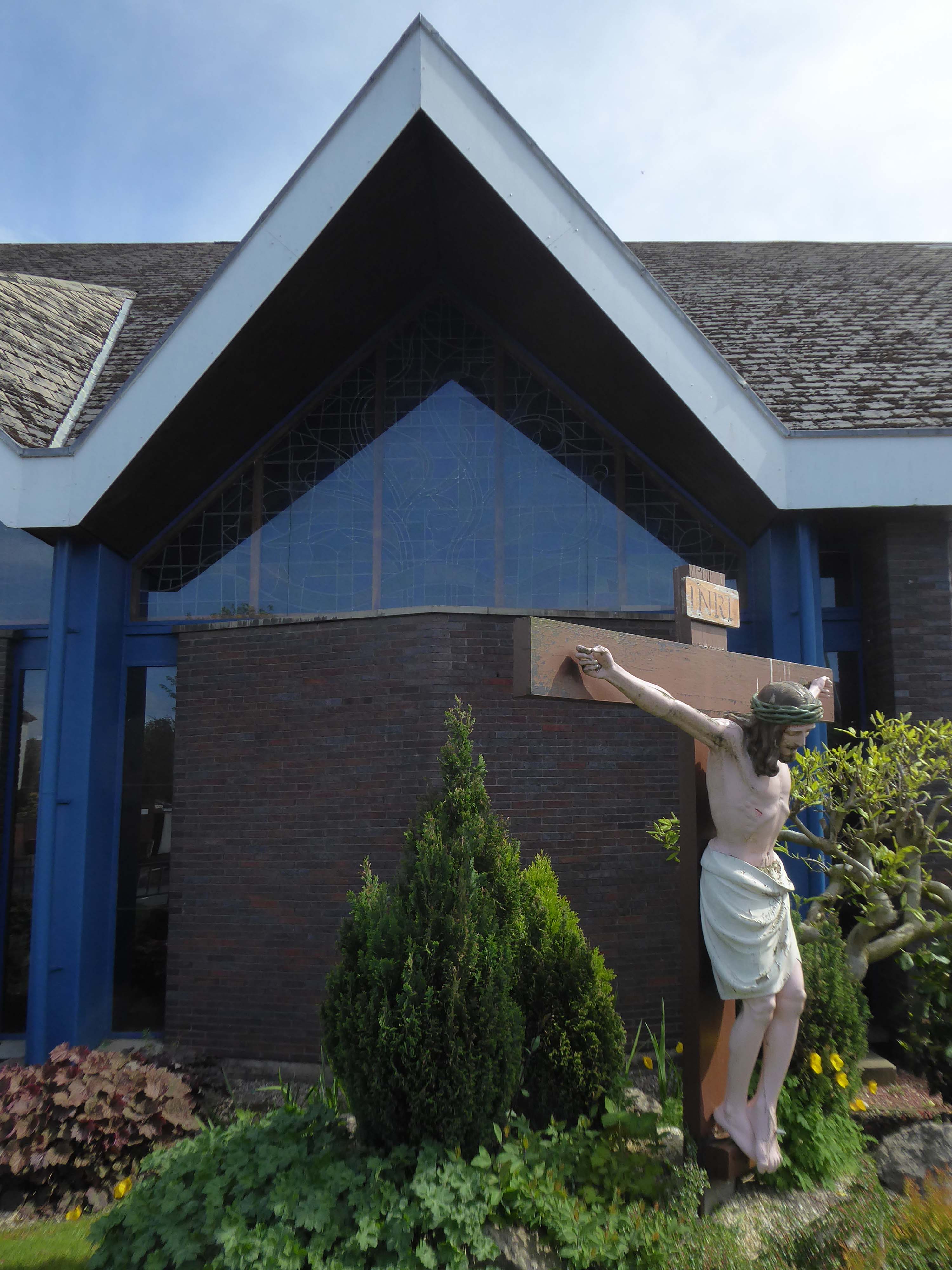
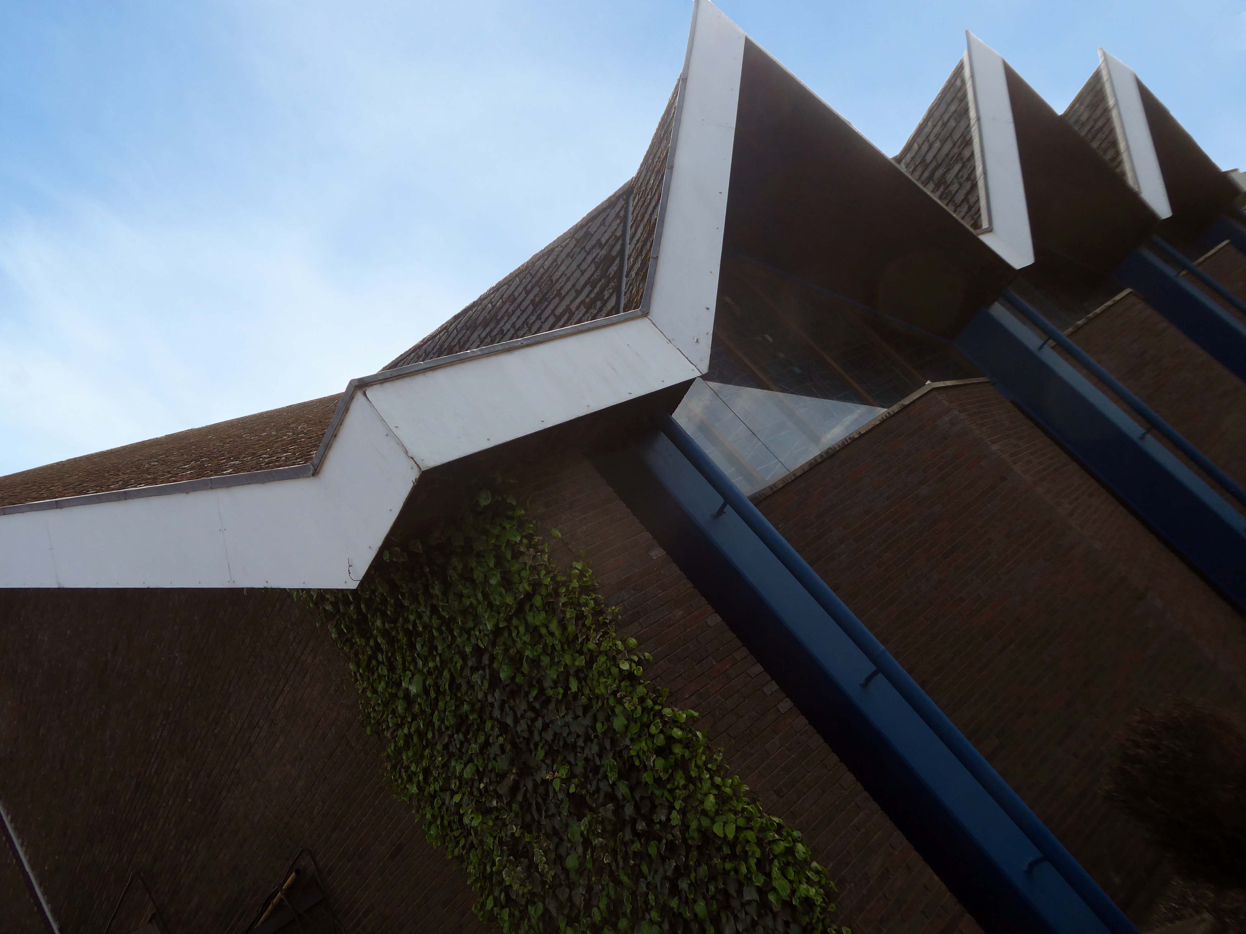
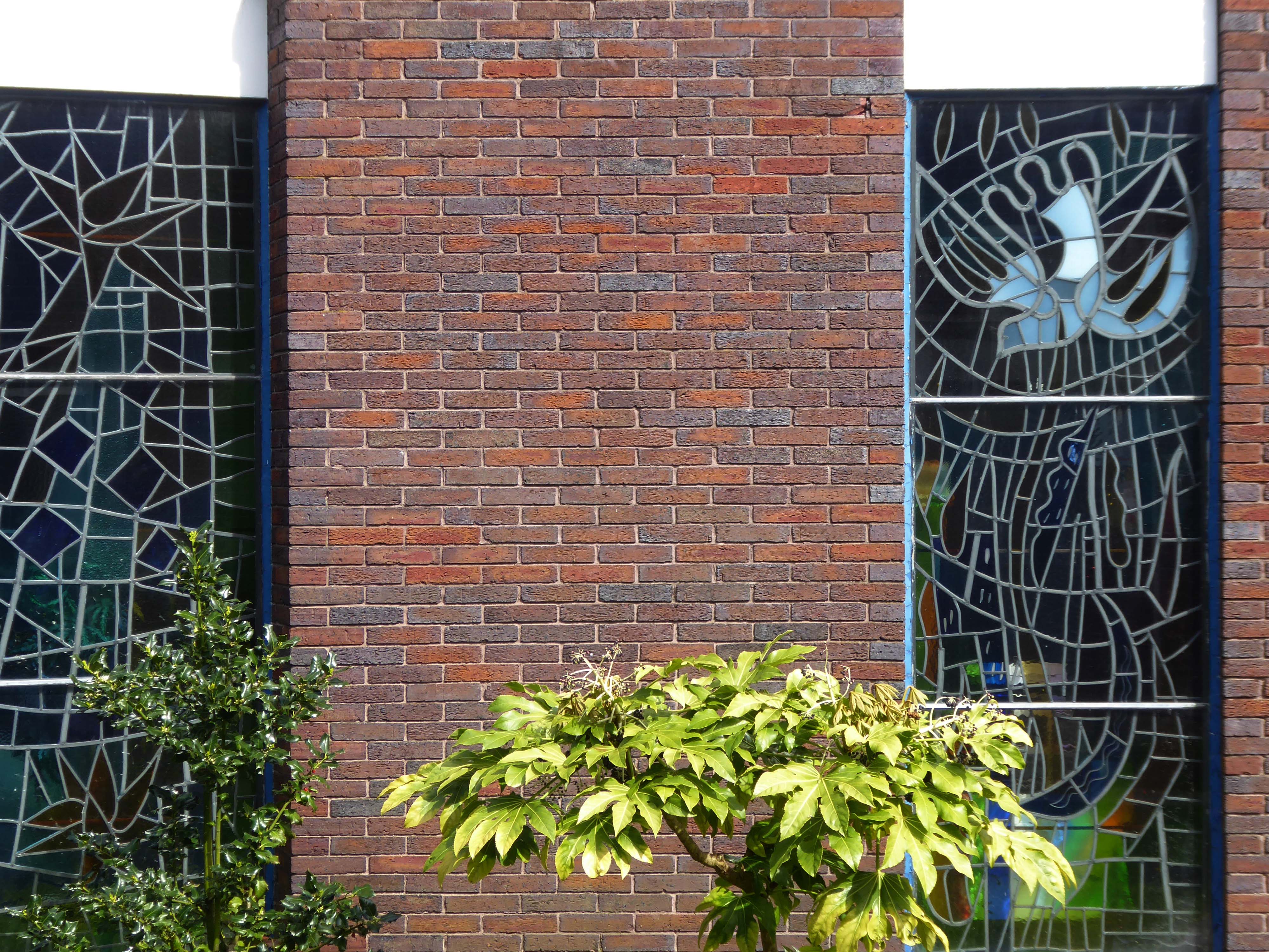
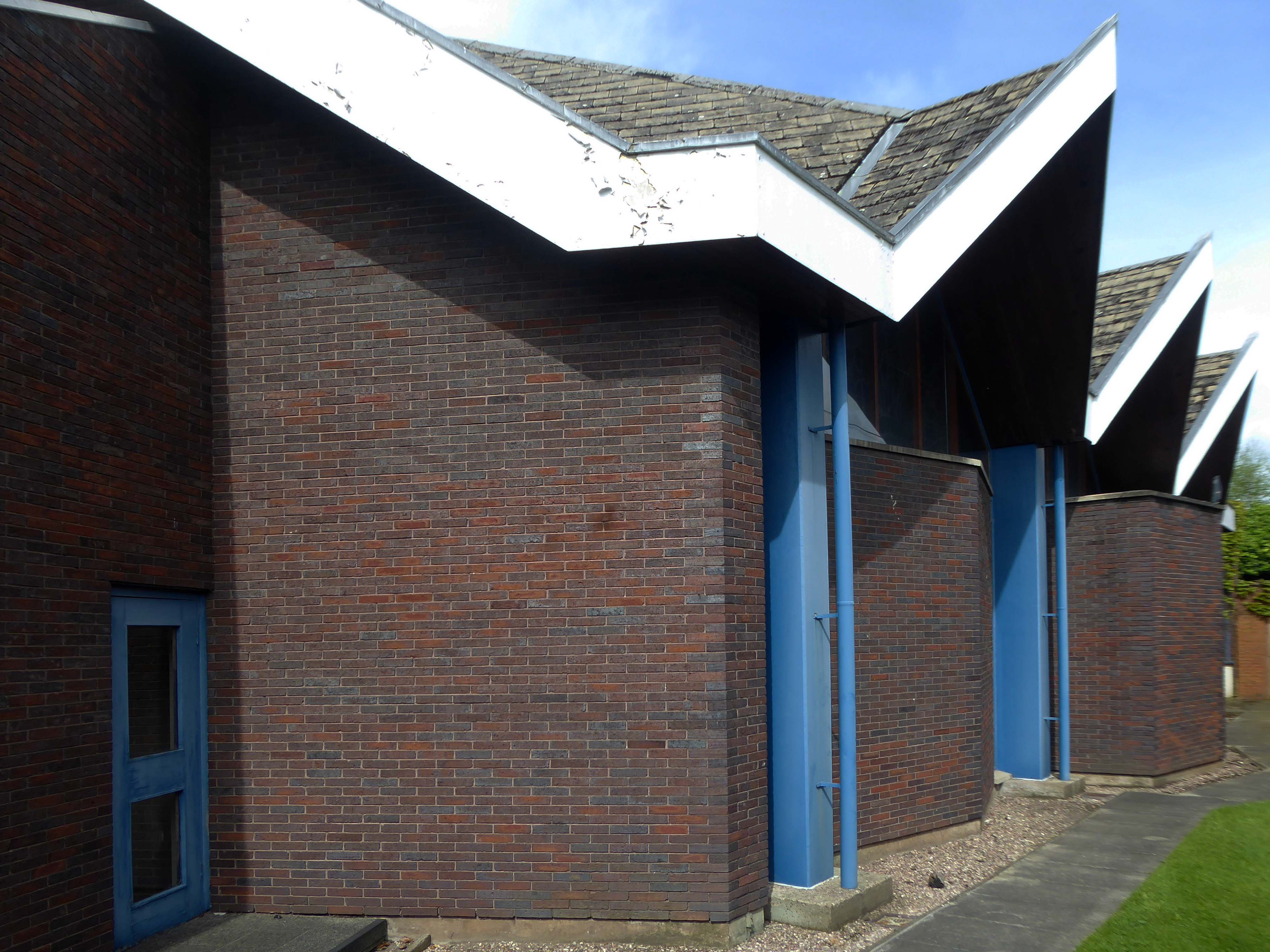
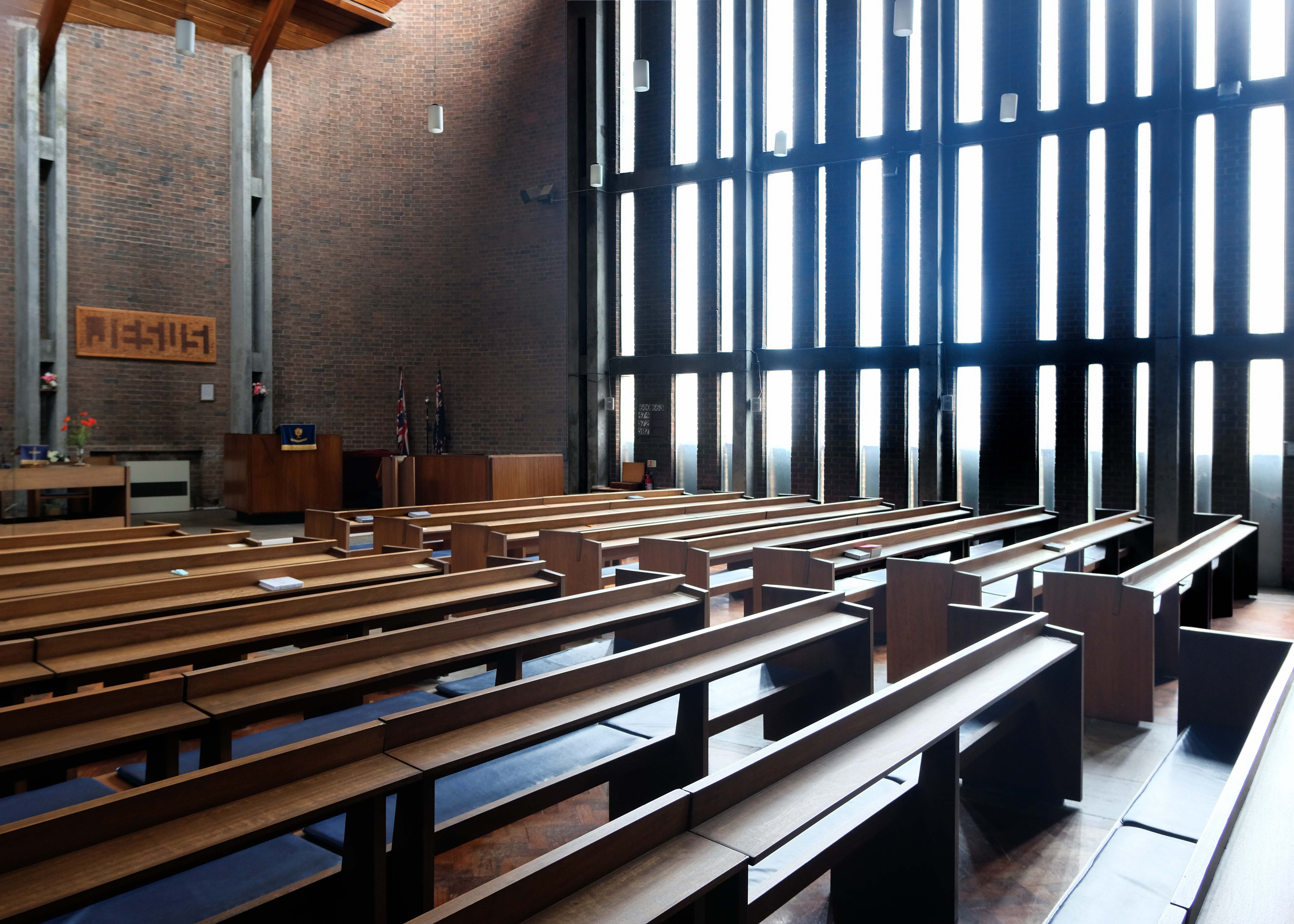
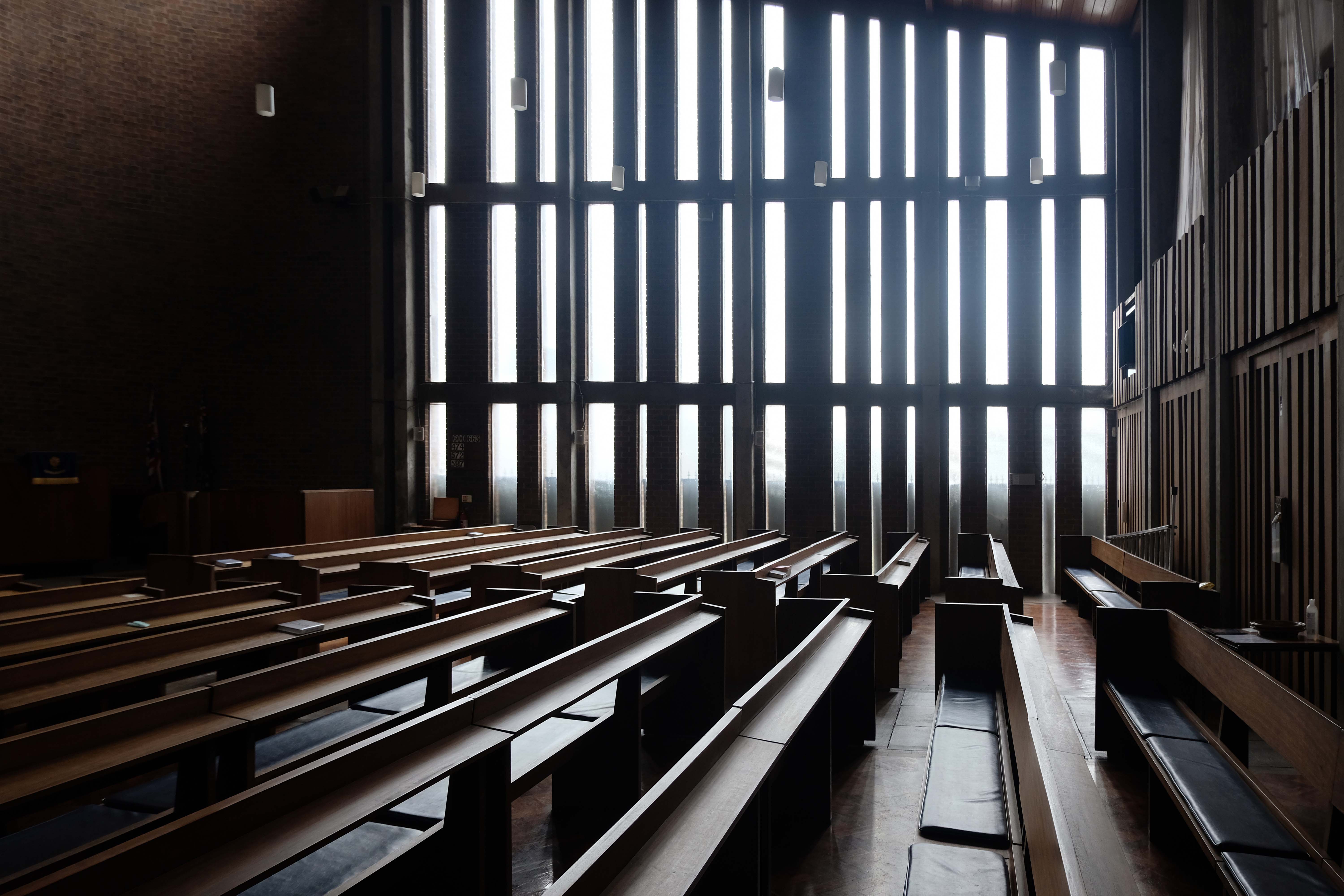
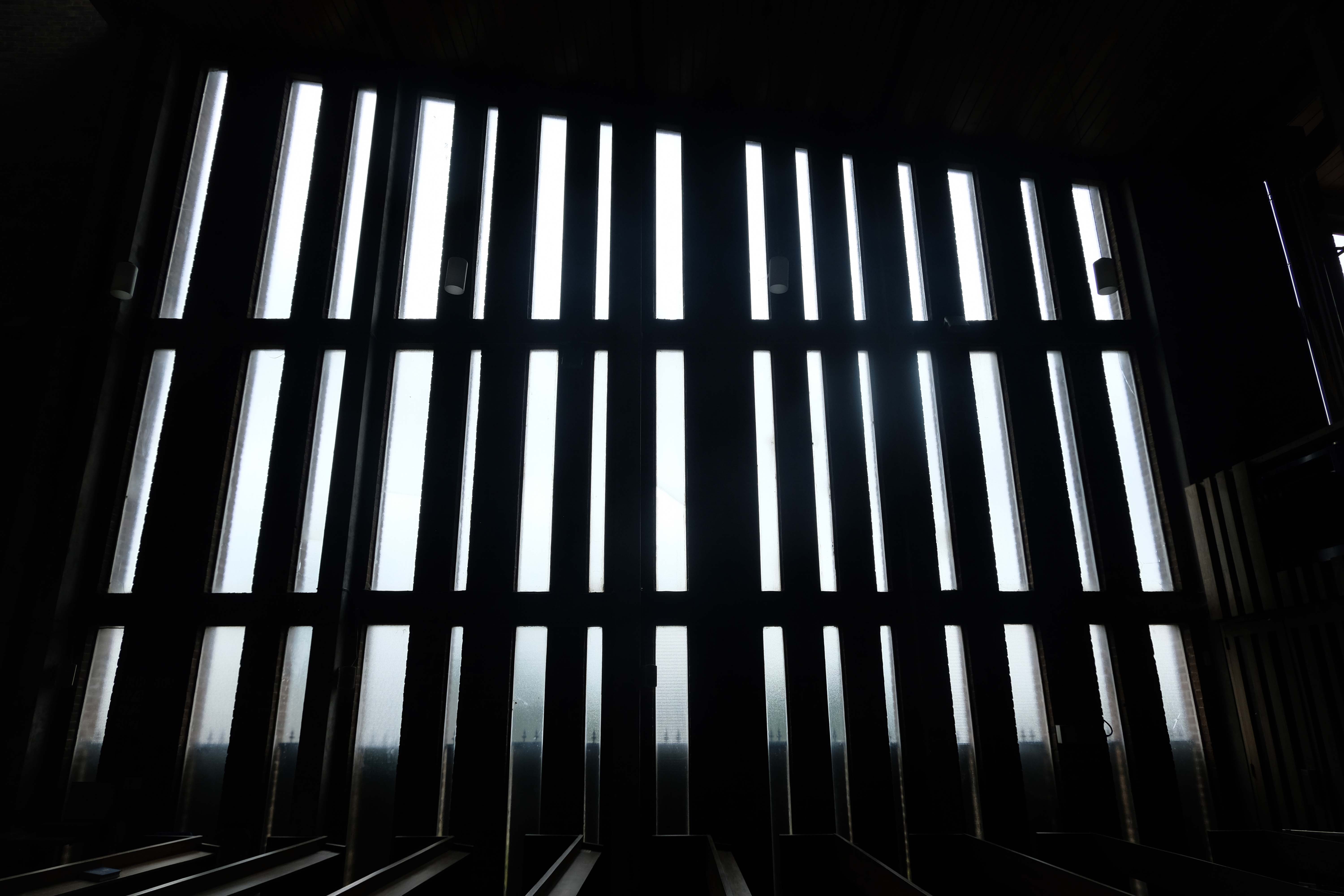
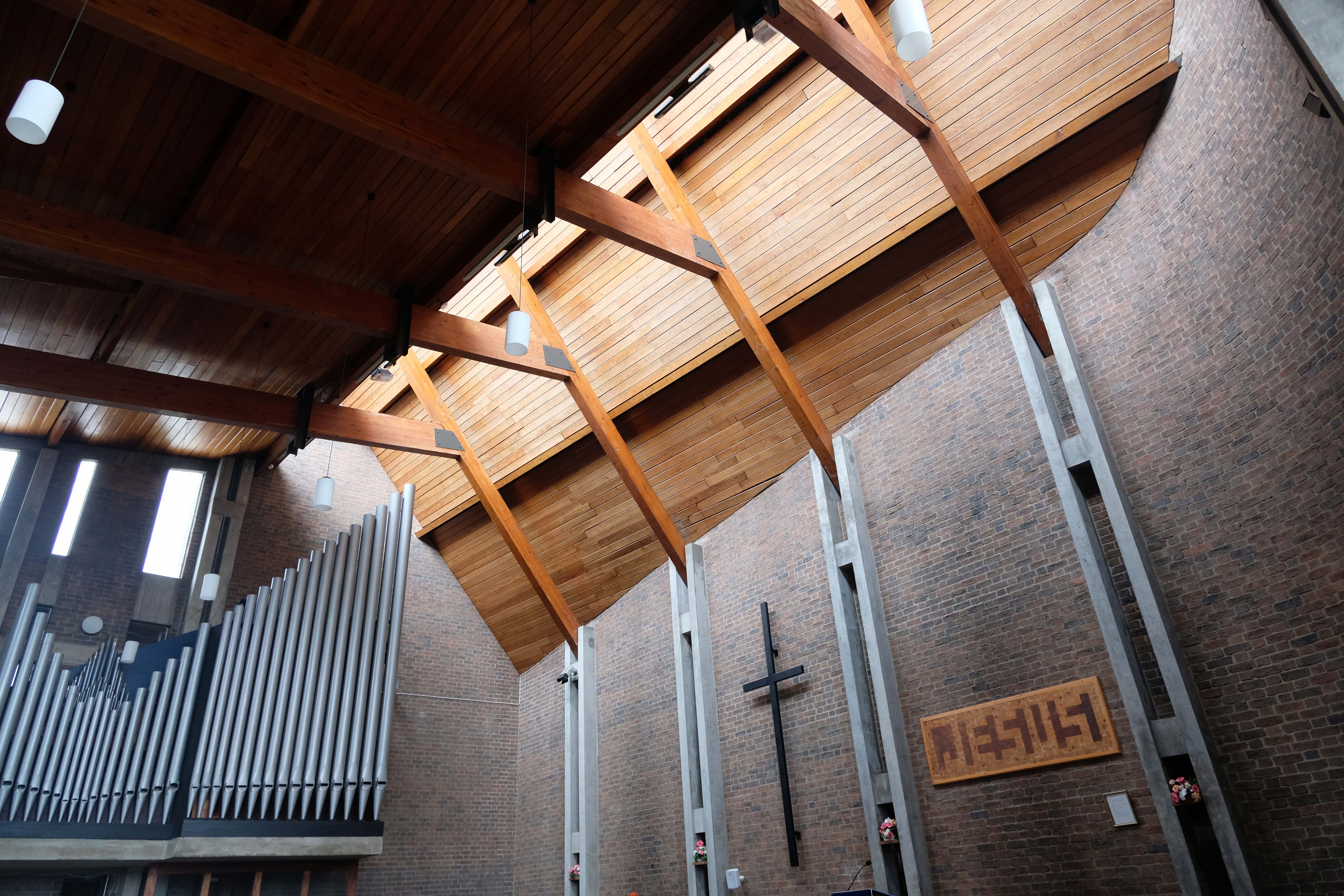
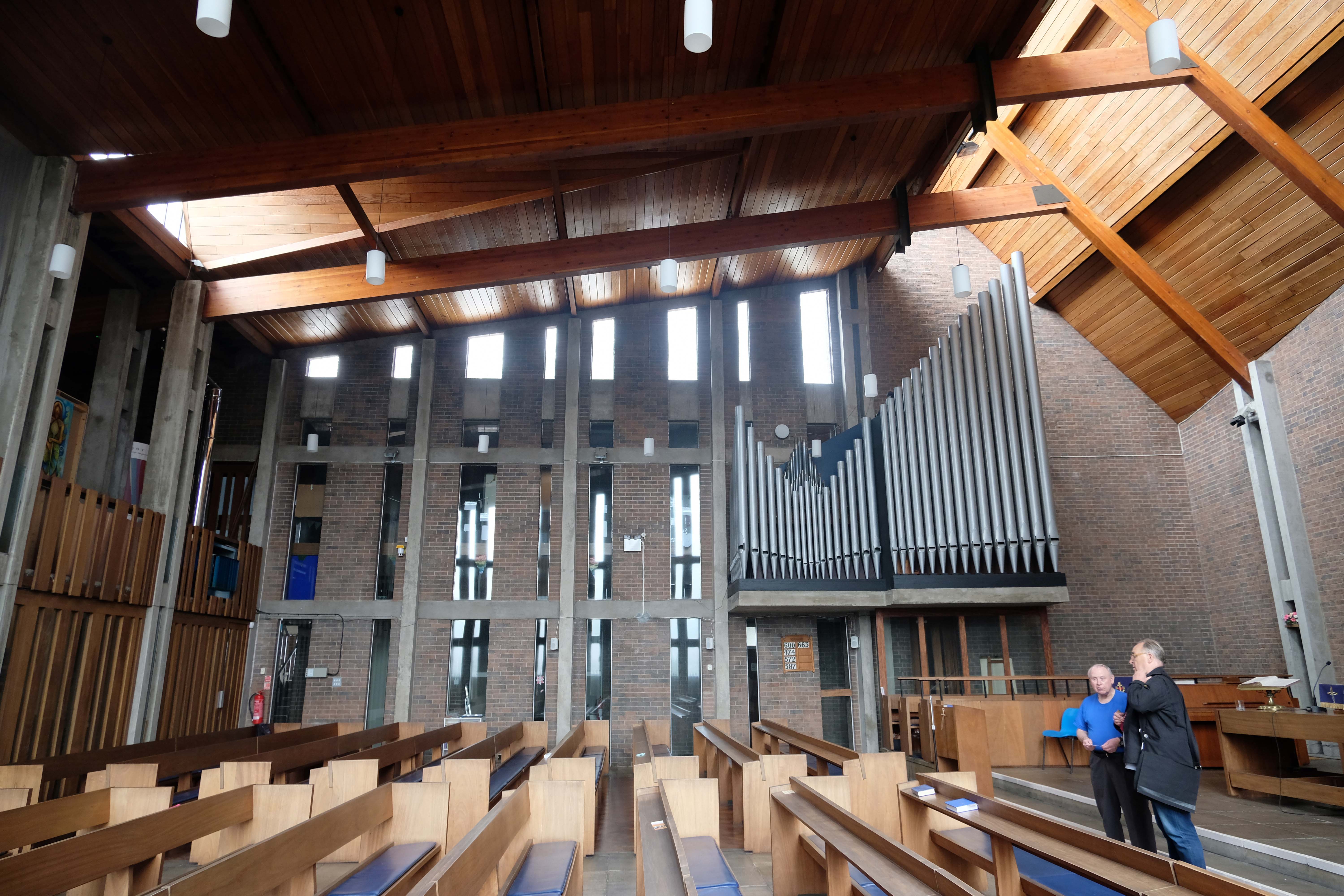
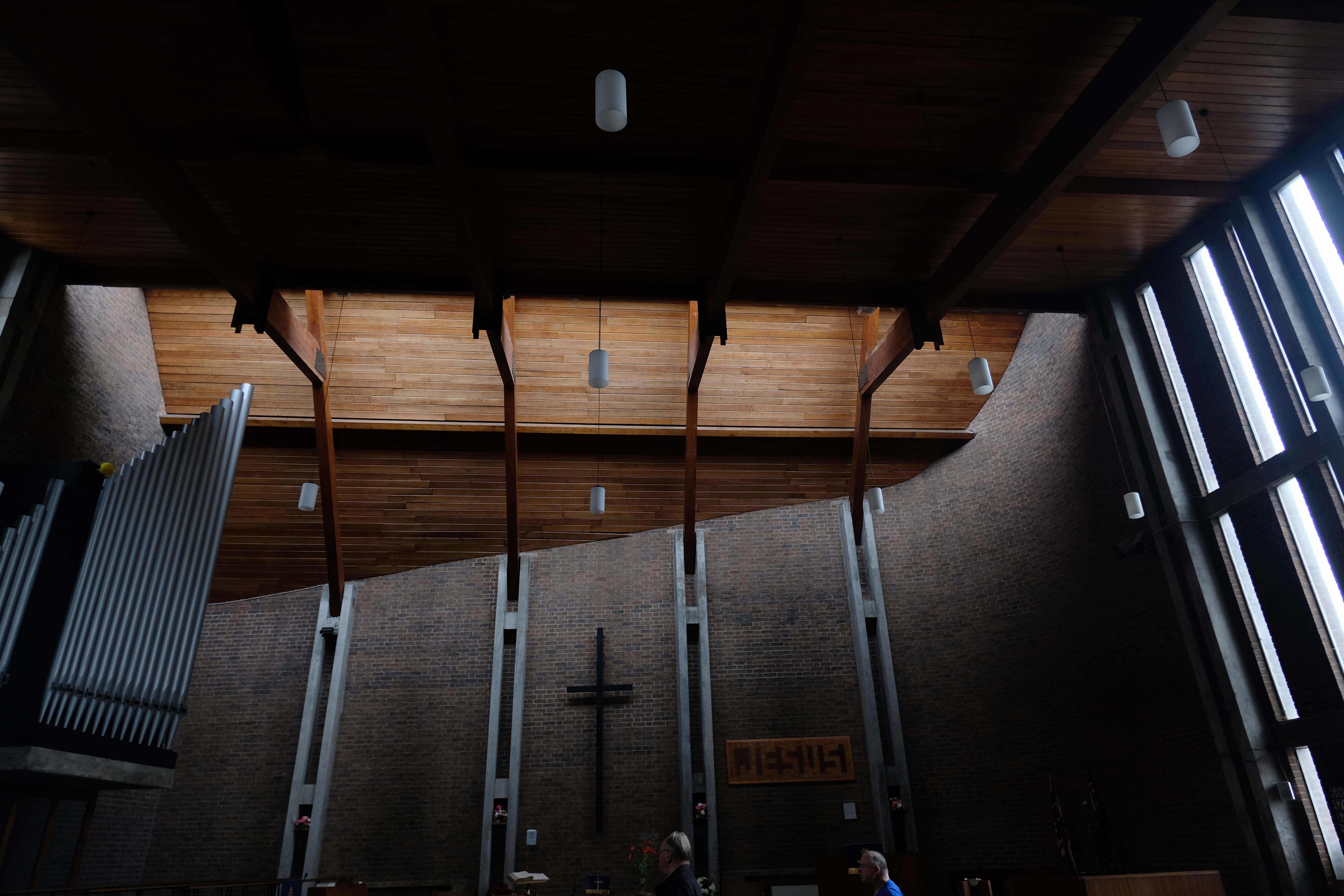
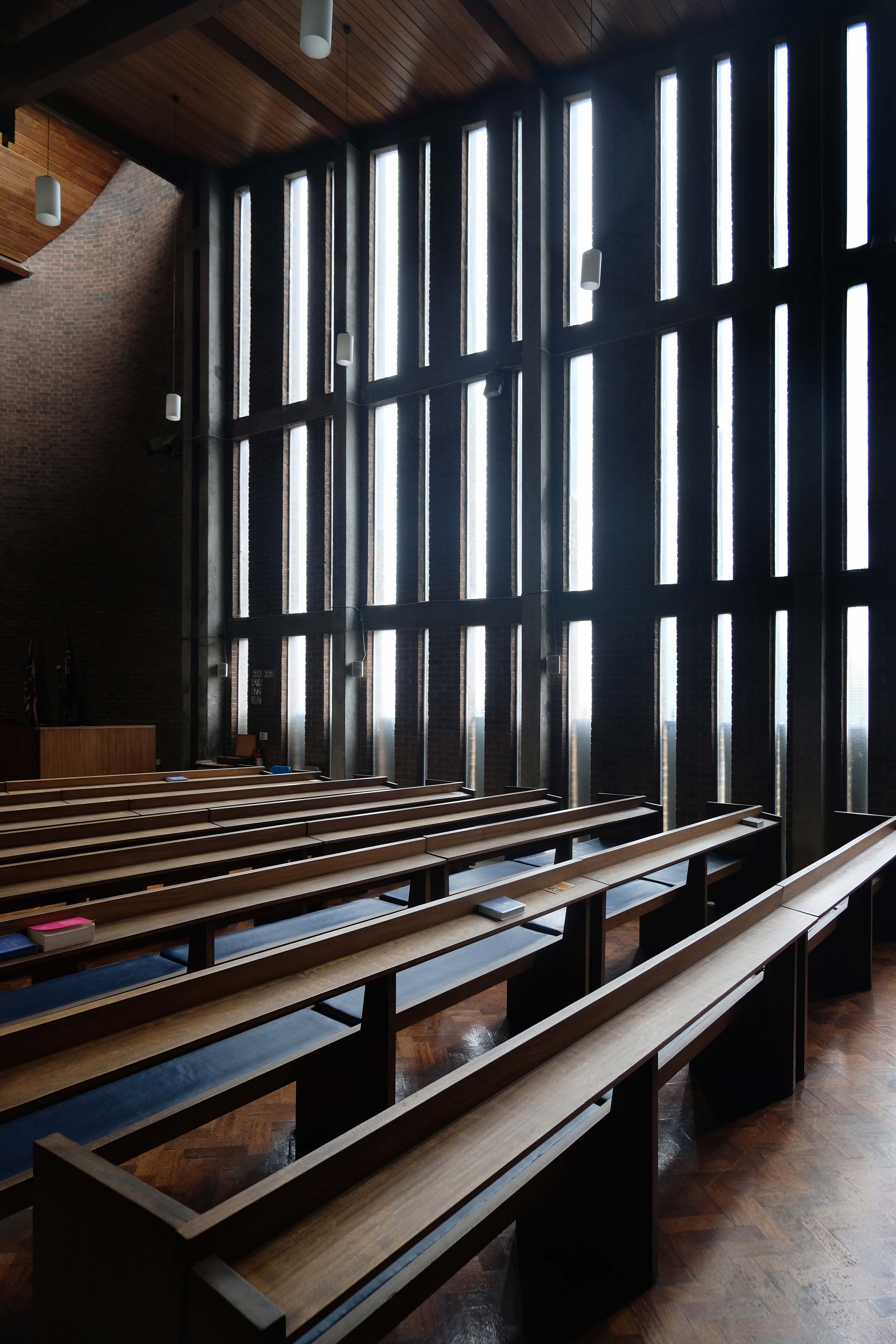
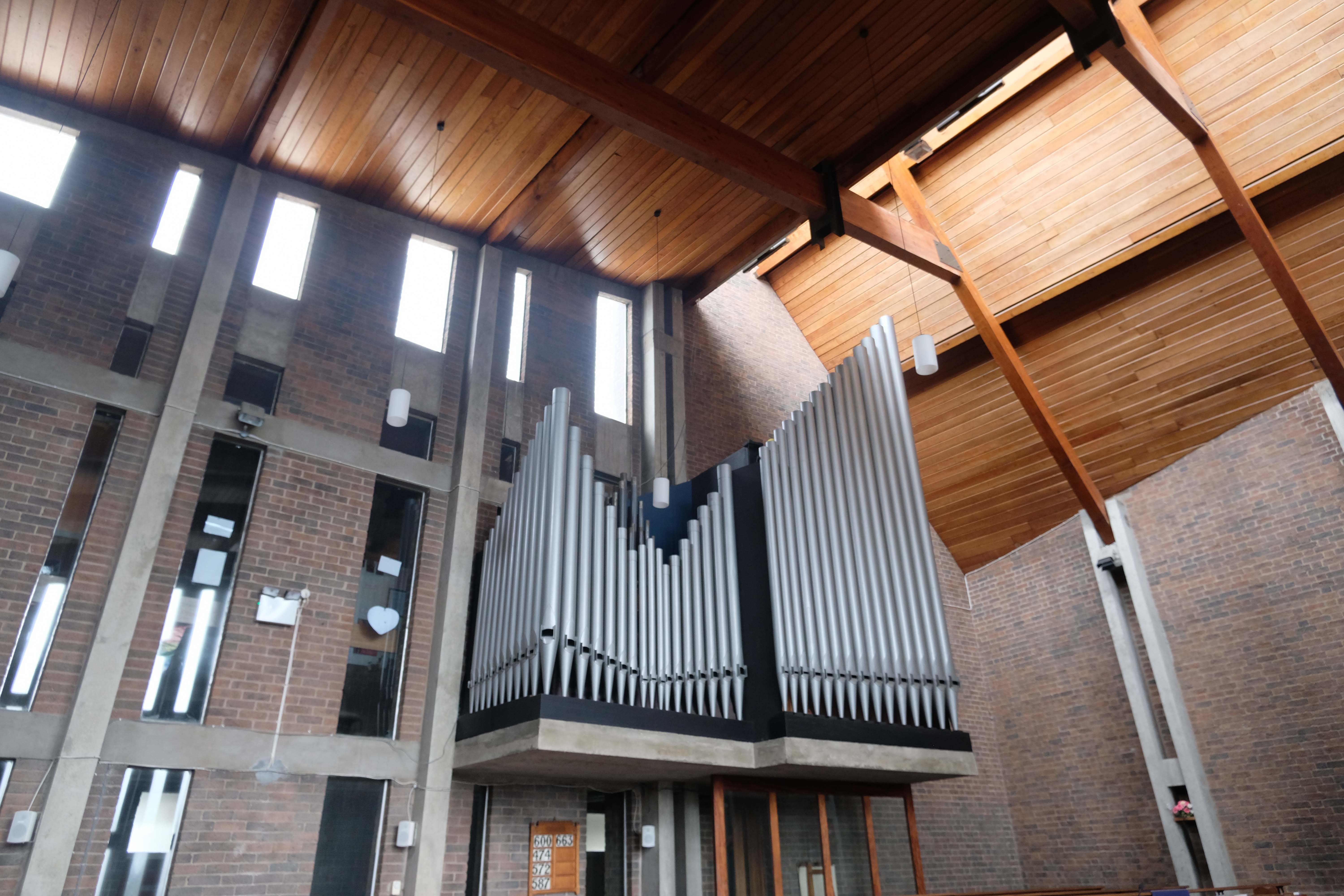
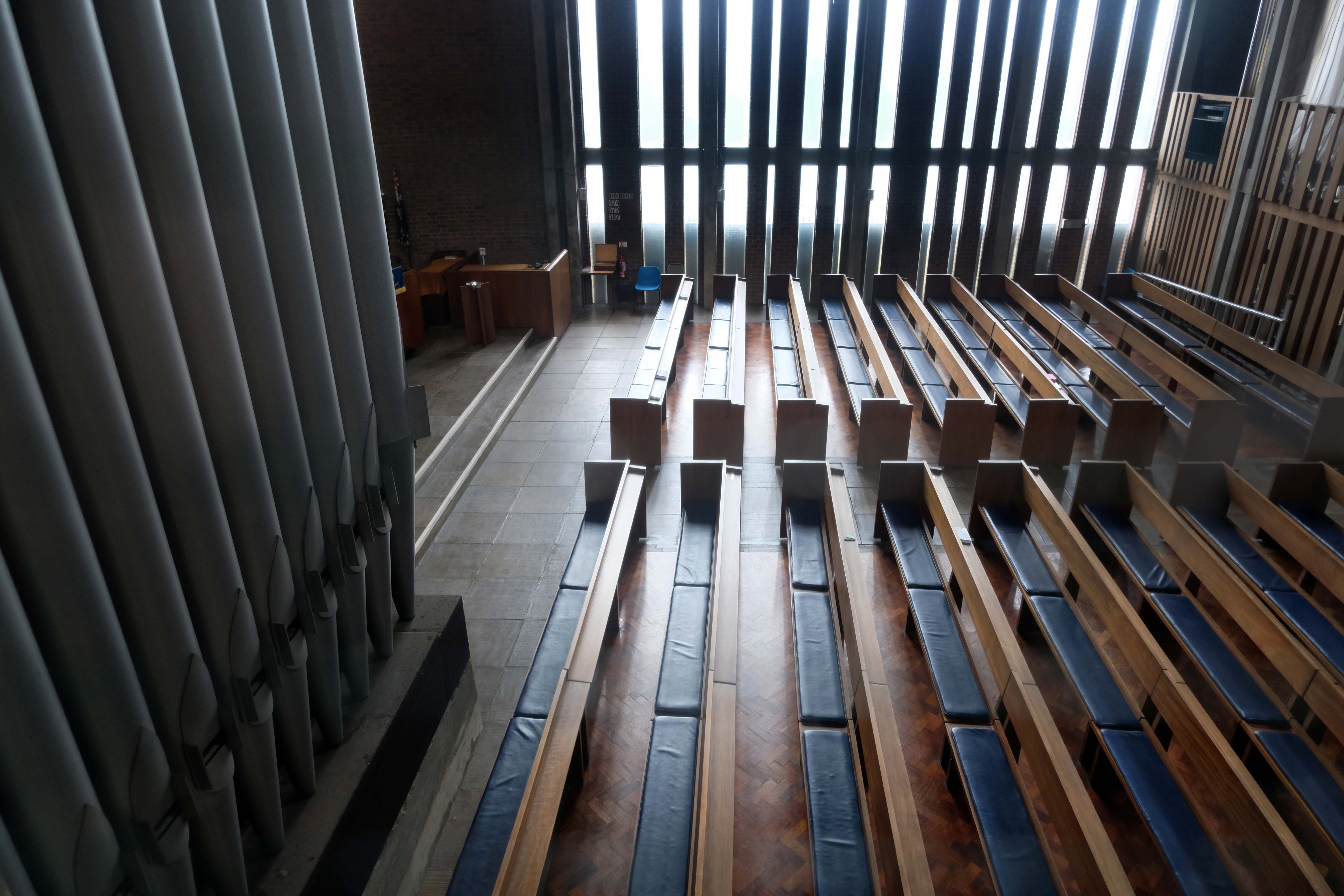
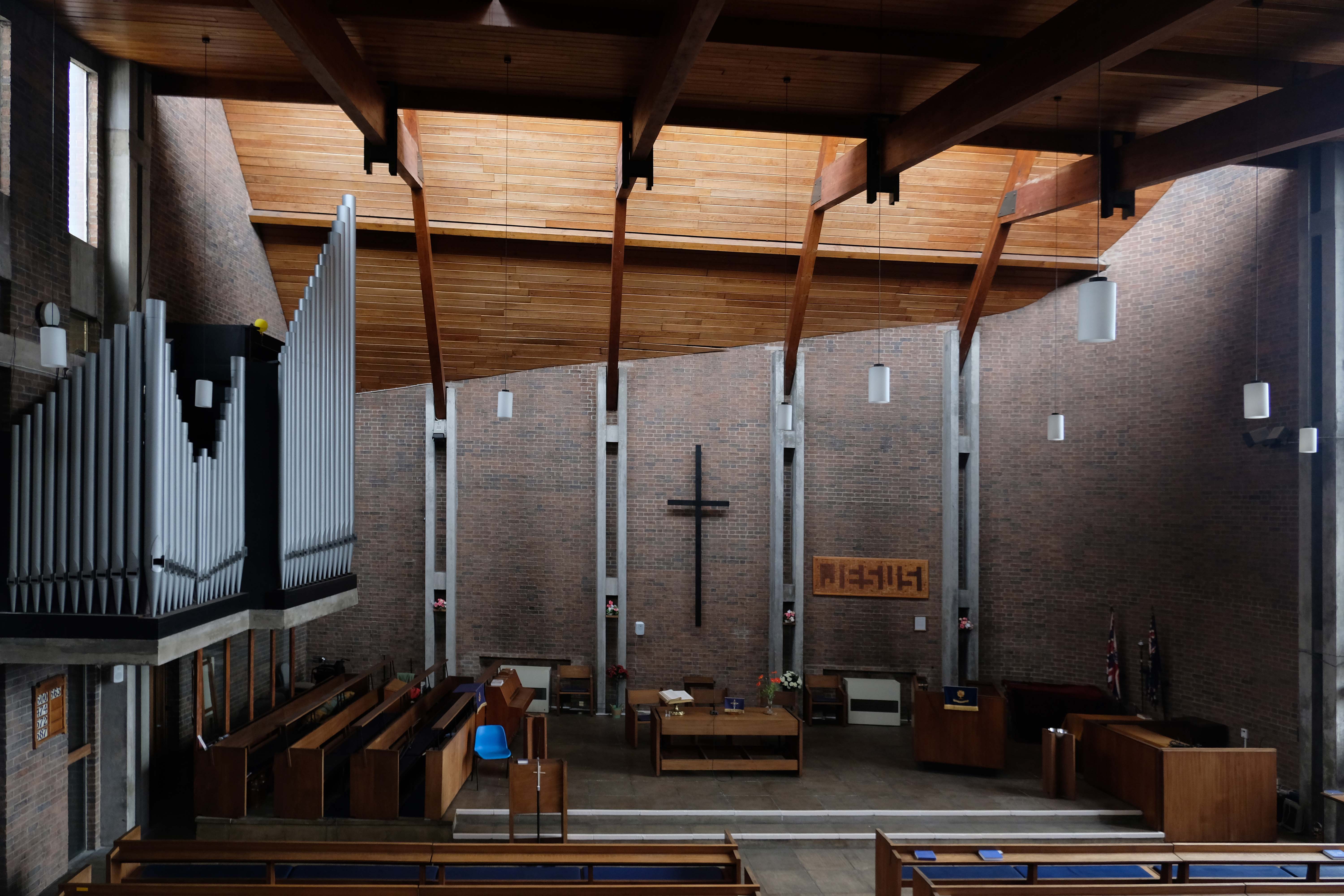
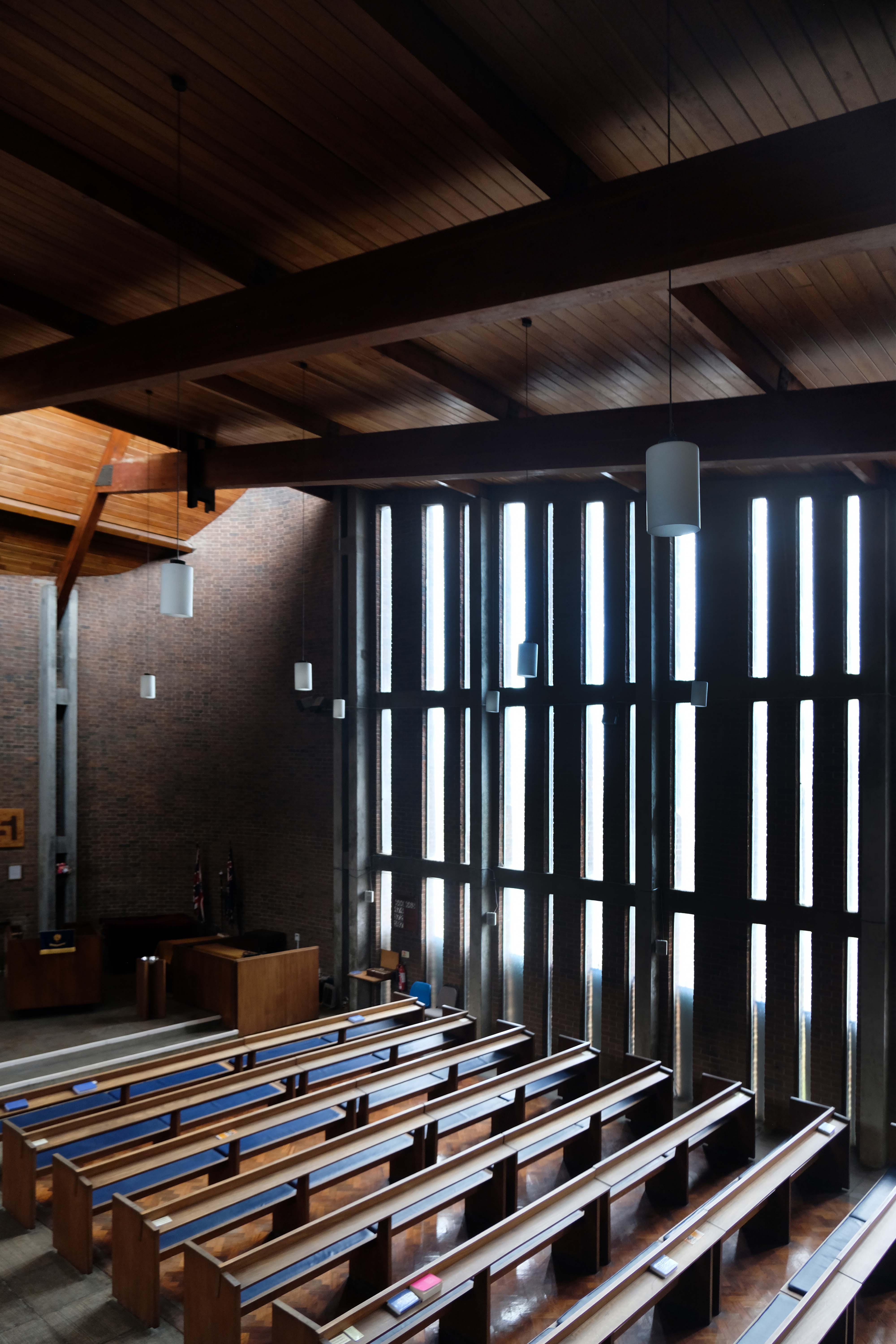
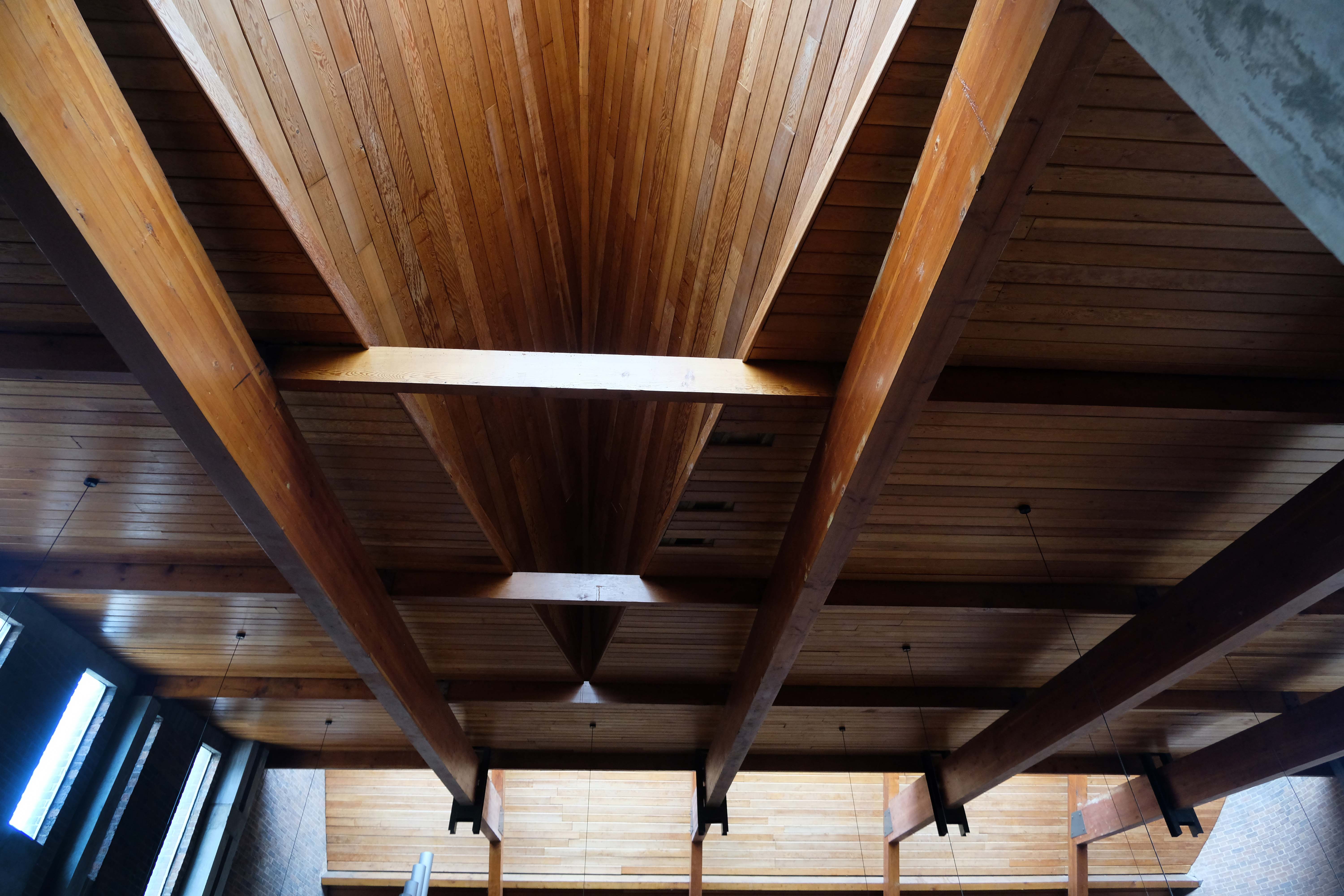
All orientations given are liturgical. The church is a steel-framed structure with loadbearing gable walls built on a series of rafts to guard against mining subsidence. It was designed to ensure that the congregation would have unimpeded views of the sanctuary, and the architects described the layout as ‘in conformity with the Spirit of the new Constitution’. The plan is near rectangular, angled at the east end, with a striking roof swooping up at the east end and trios of sharply pointed gables on each side.
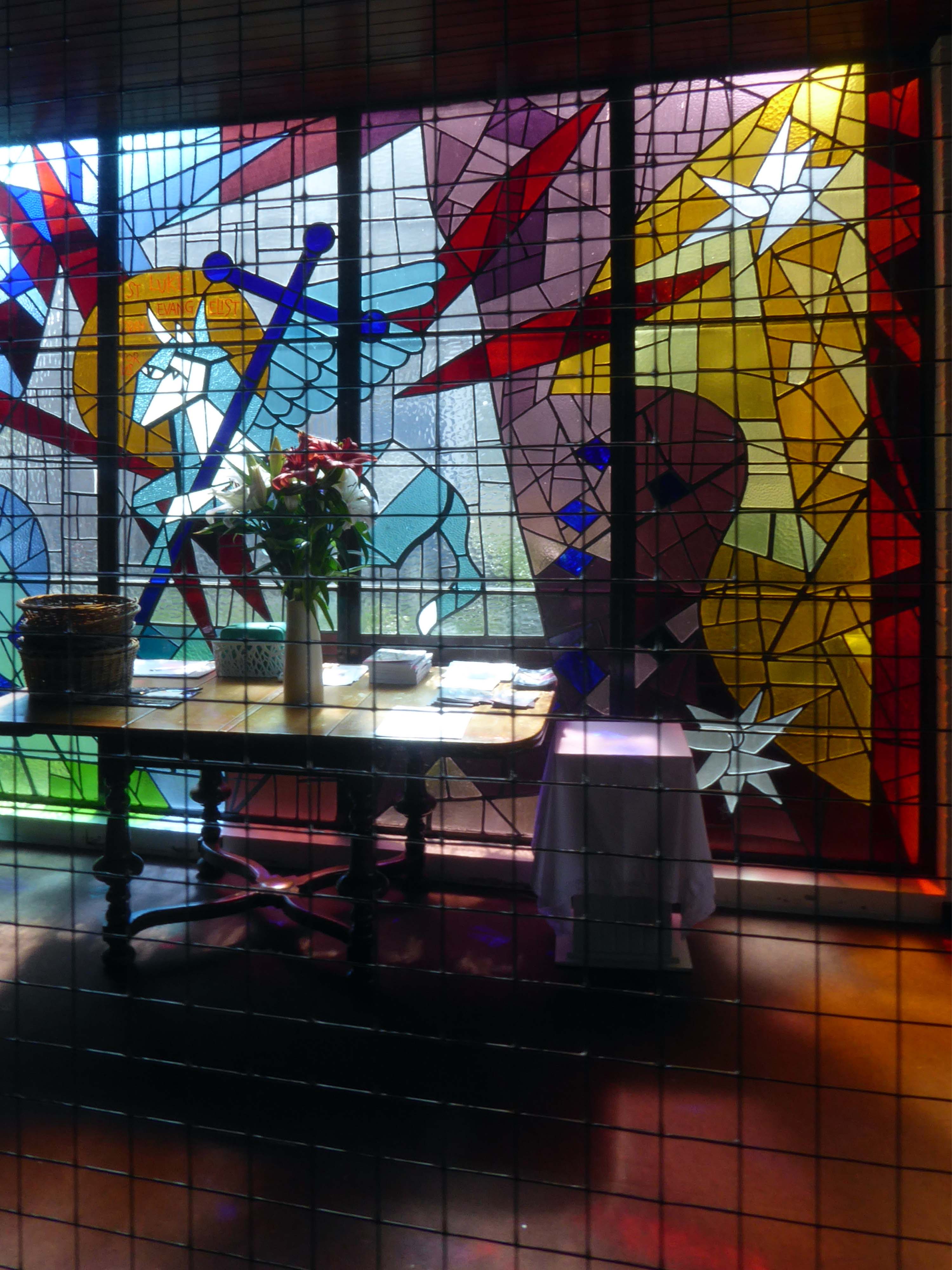
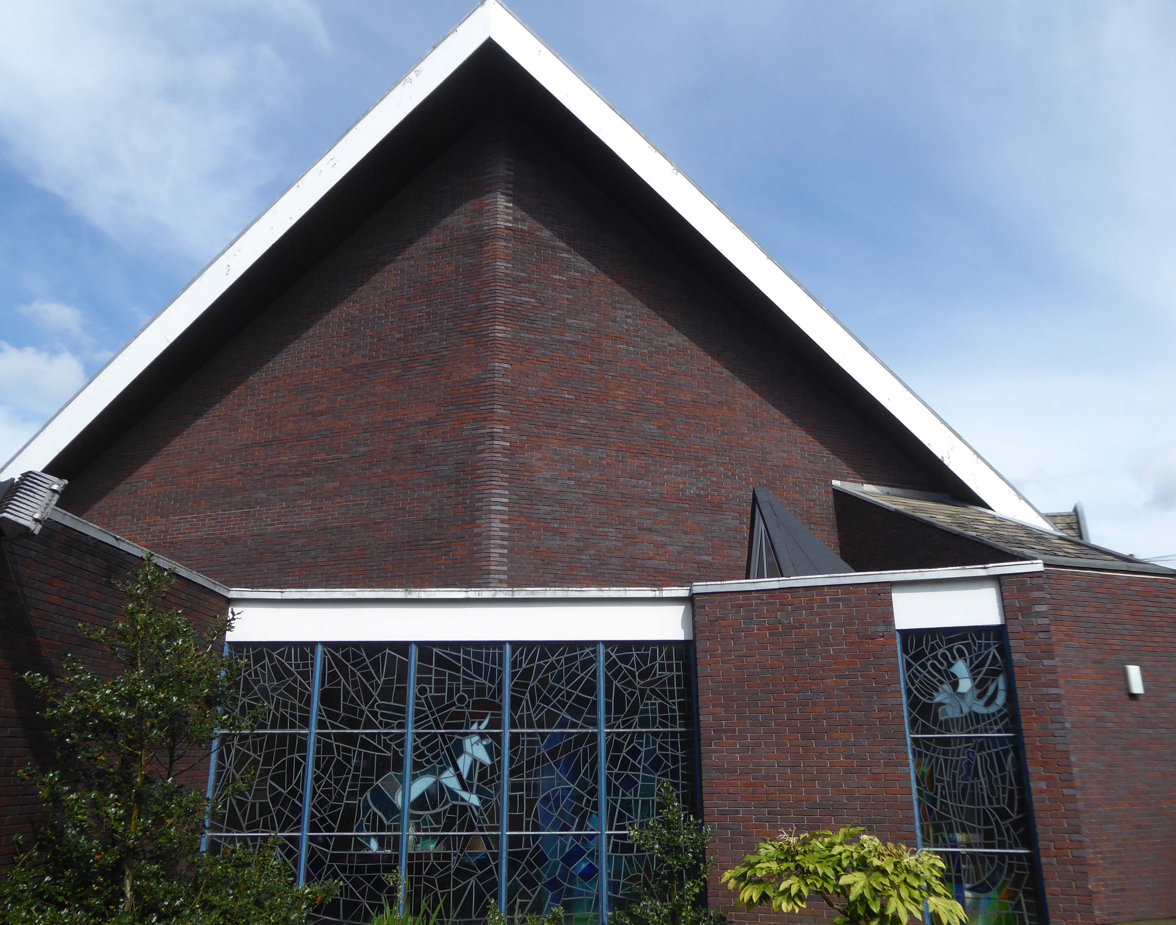
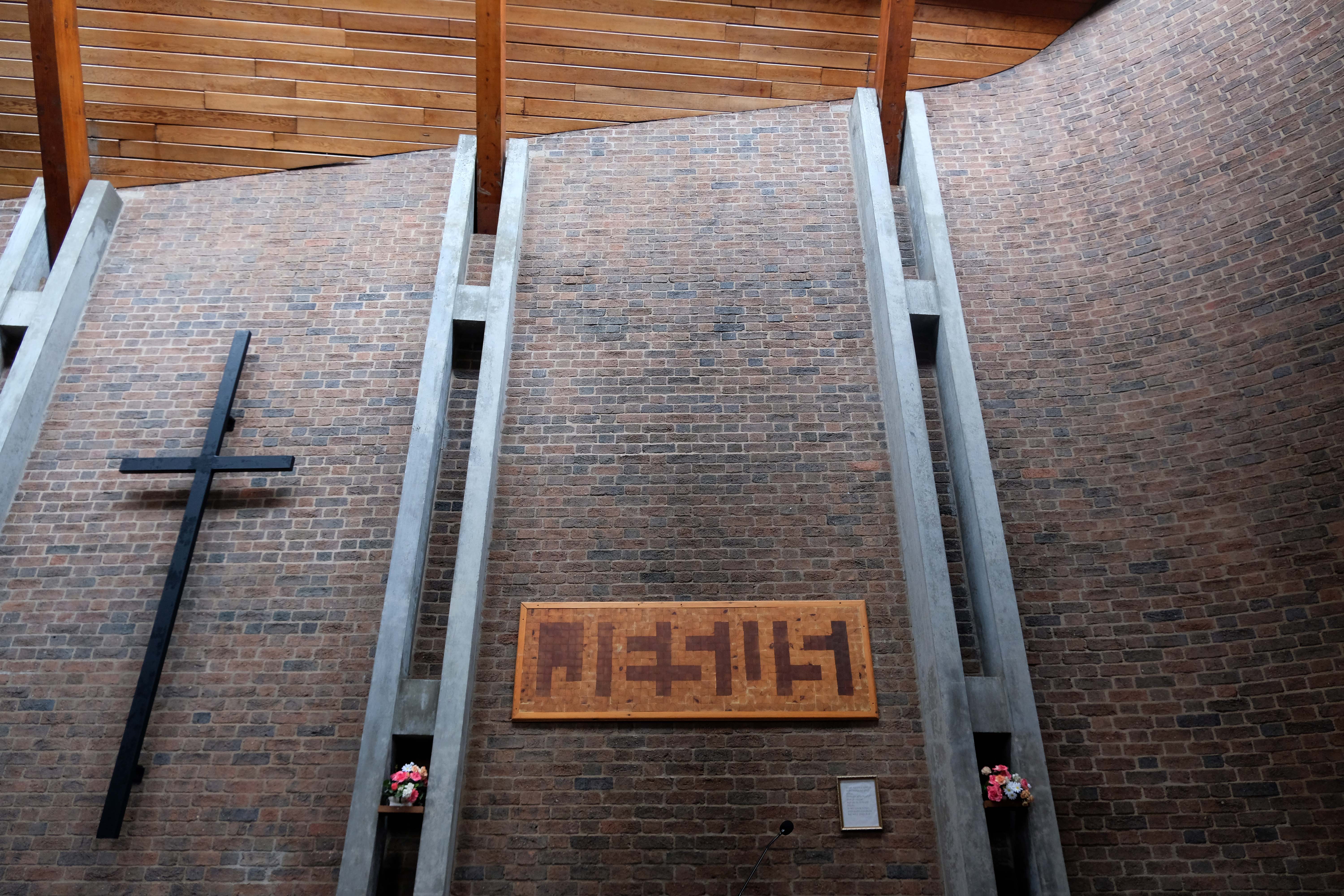
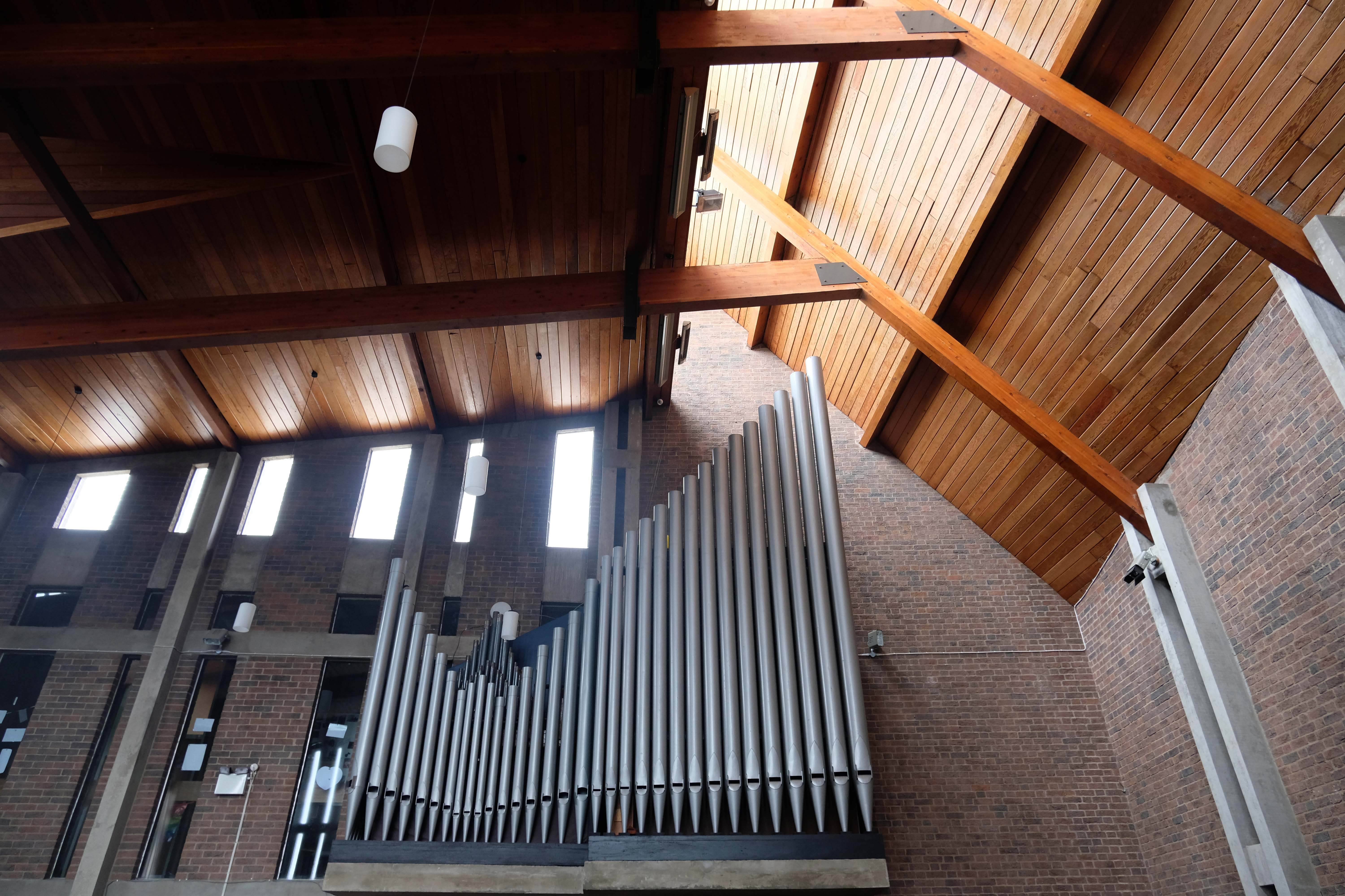
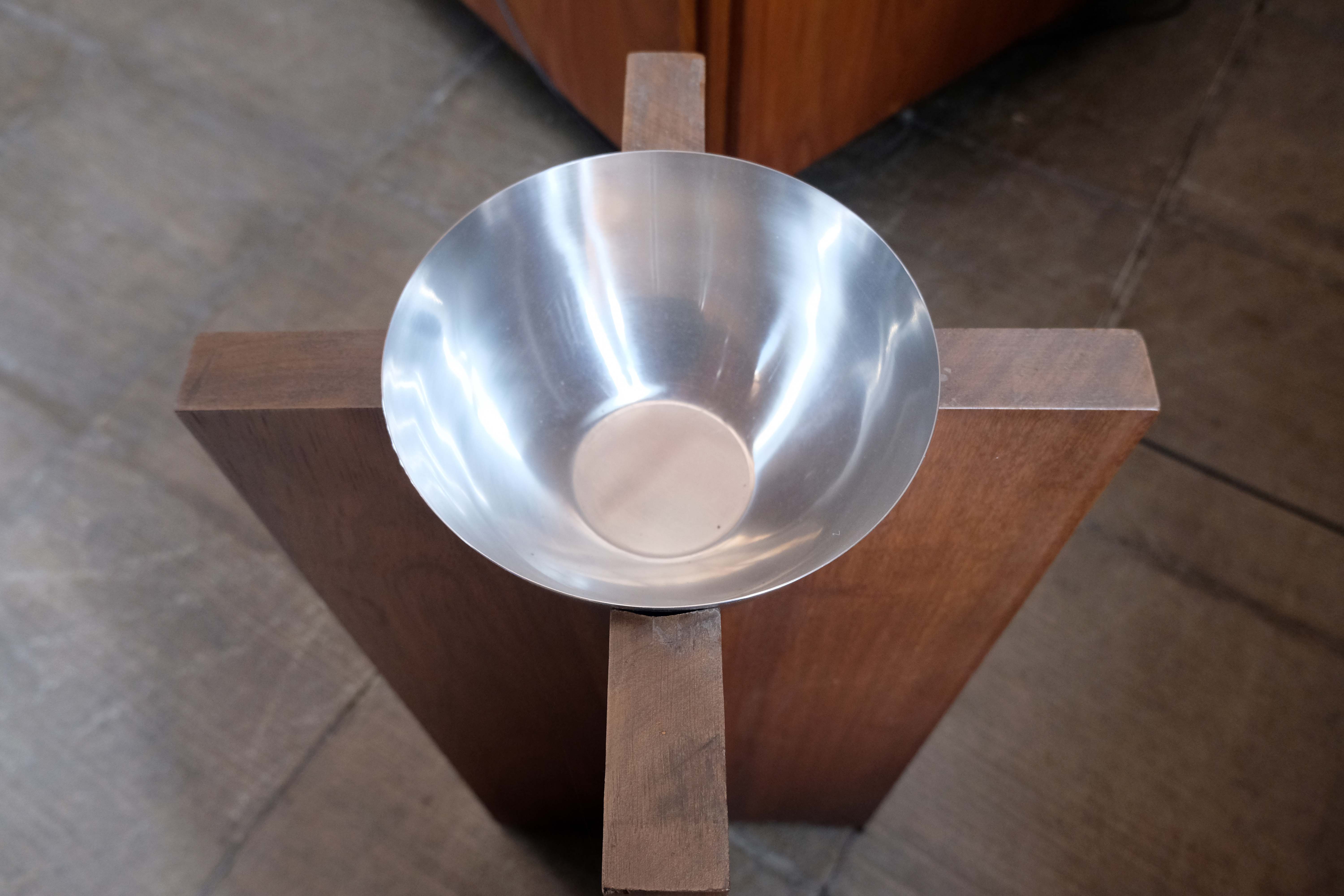
The building is entered on the northwest side via a low porch which gives to a narthex and a former baptistery lit by a pyramidal roof light, attached on the west side. Light pours in to the narthex from a screen with semi-abstract stained glass with the ox symbol of St Luke, an original fixture. The nave is an impressive and memorable space with the boarded roof forming dramatic shapes which frame the east end and sanctuary, where a pair of full-height slit windows are angled to cast light without creating glare and frame a Crucifix. The roof rises up on each side of the big triangular windows on the north and south sides. Those to the south have stained glass showing the Tree of Life the True Vine and the Cross of Faith designed by Roy Coomber of Pendle Stained Glass in 2002-3. There is a cantilevered west gallery with a pipe organ set into the wall above it and a southeast chapel, now a Lady Chapel, formerly of the Blessed Sacrament, with stained glass on sacramental themes. A Pietà in the chapel probably originated in the previous church. The tabernacle, of stainless steel with high relief abstract modelling, was repositioned behind the altar at the time of the reordering. This item and the sanctuary Crucifix with a gilded figure are by an unknown artist. Stations of the Cross are by Harold Riley, installed in circa 2003. They consist of triptychs executed in pencil and wash. Other works by Riley include a study of the Virgin dated 2003 and a print of his painting Our Lady of Manchester.
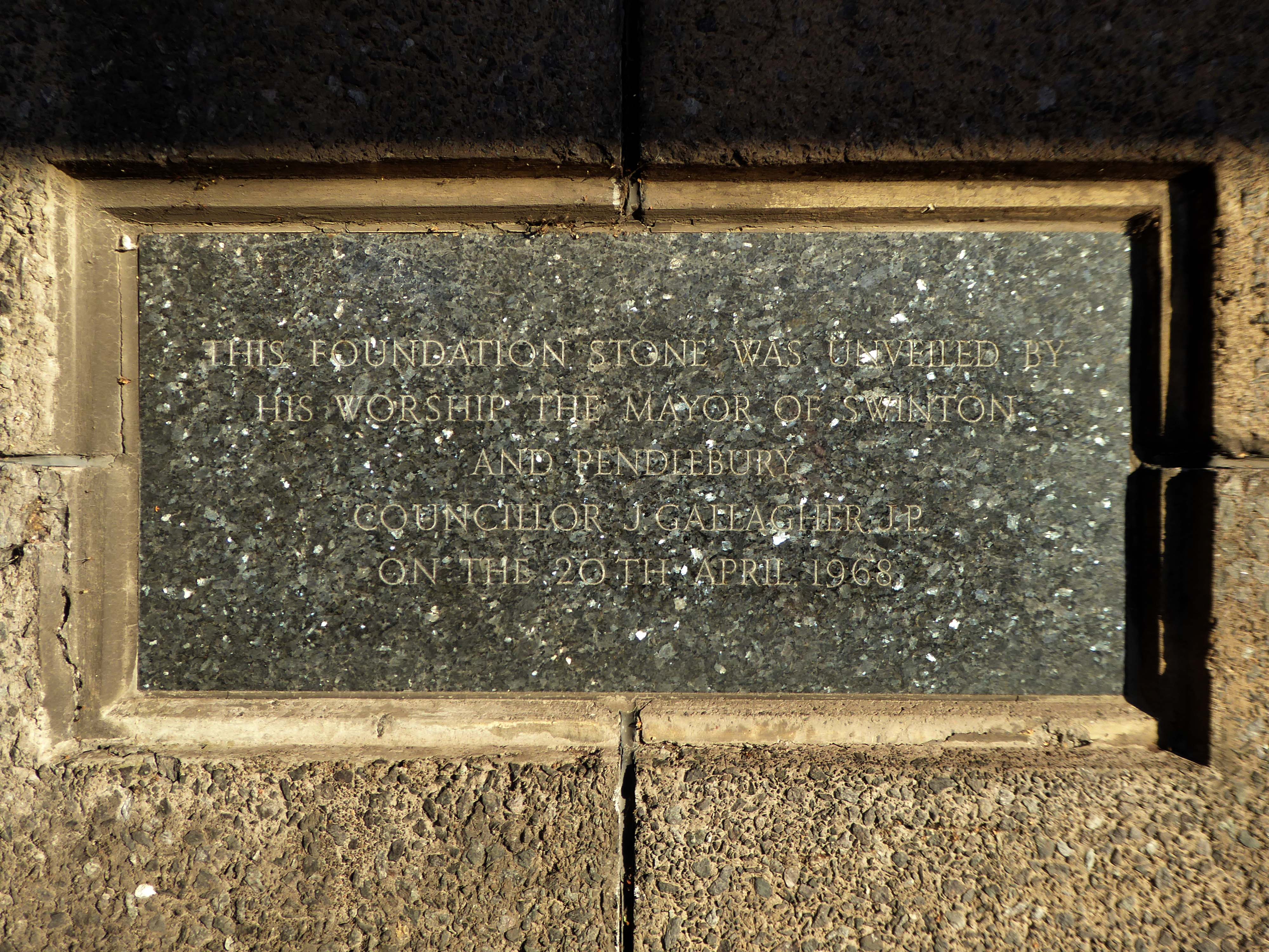
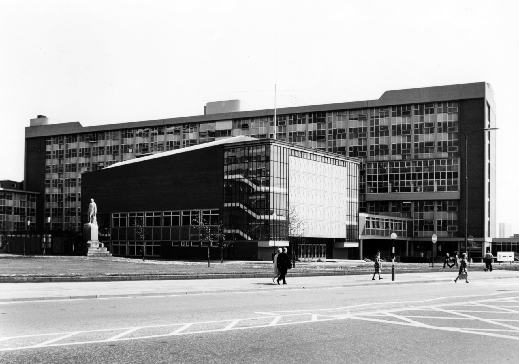
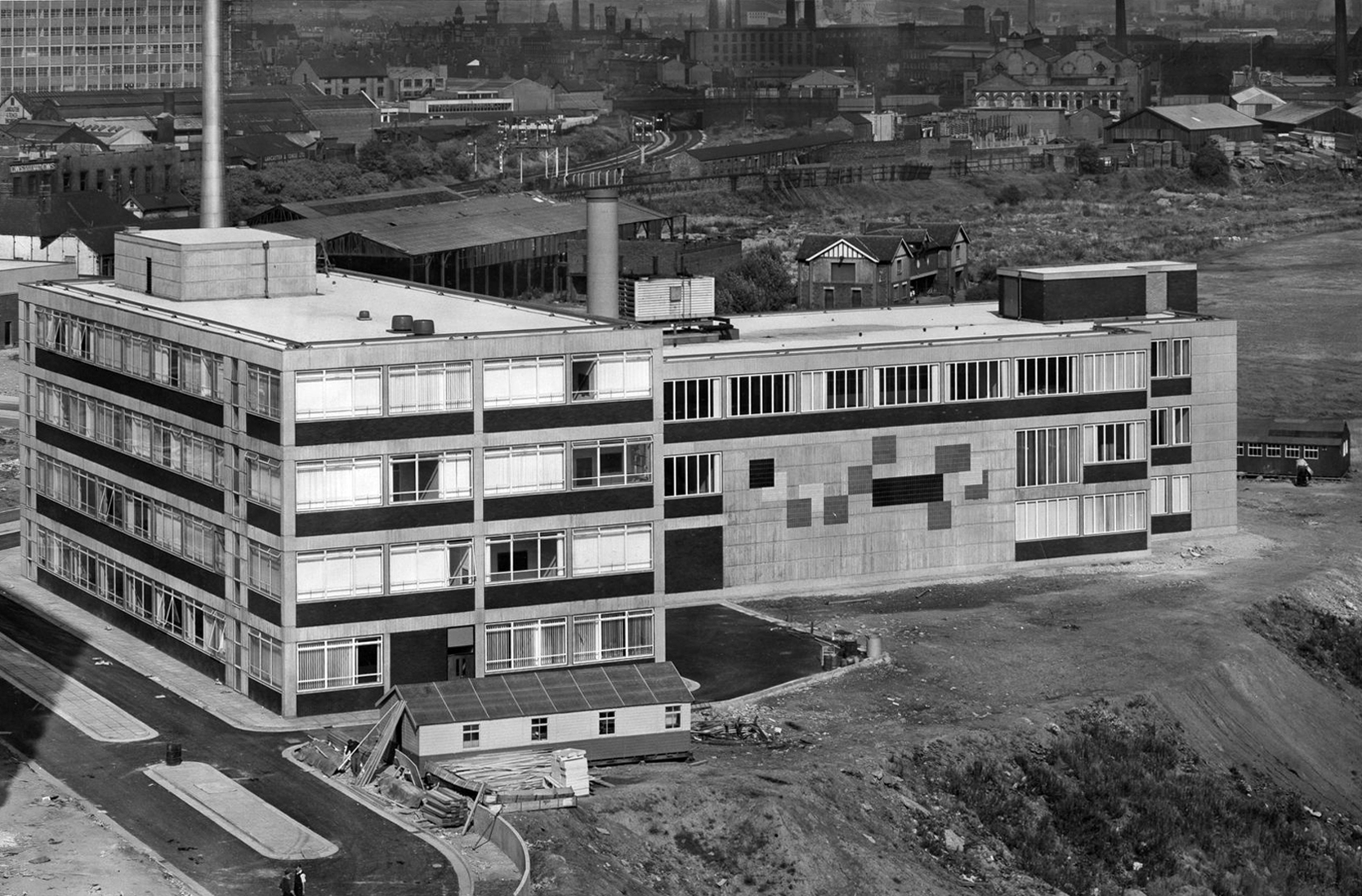
Completed in 1969 to designs by Leach Rhodes and Walker in collaboration with the Borough Engineer John Whittaker
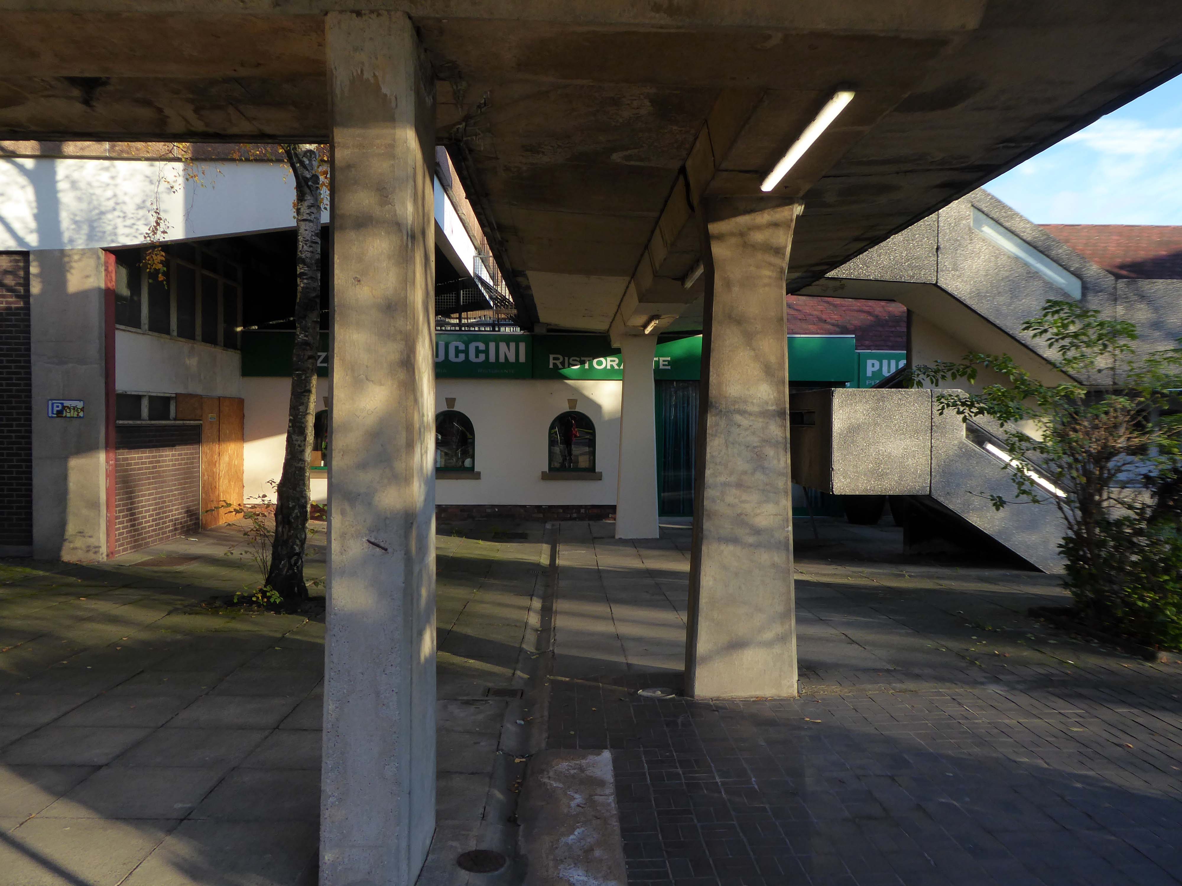
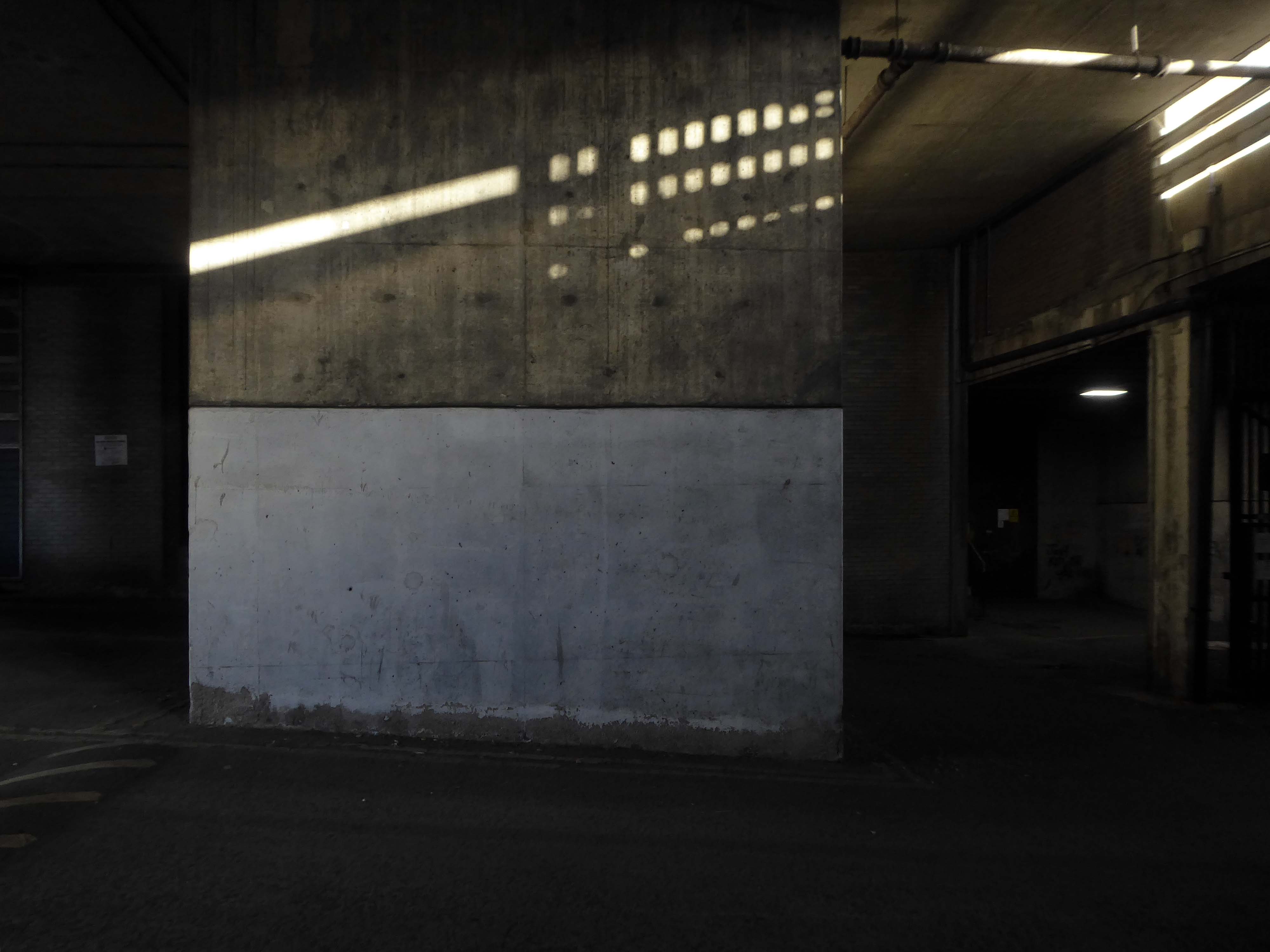
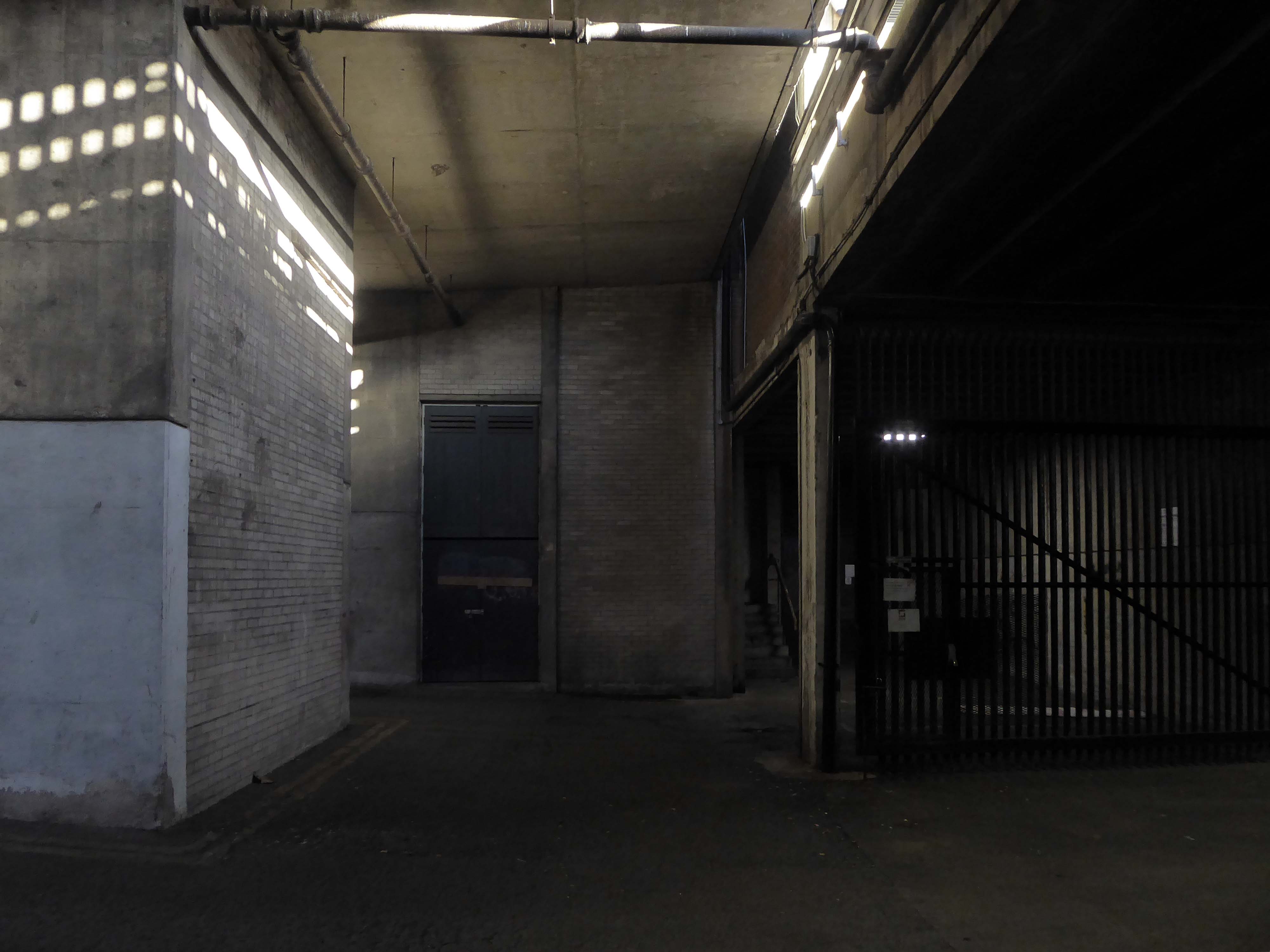
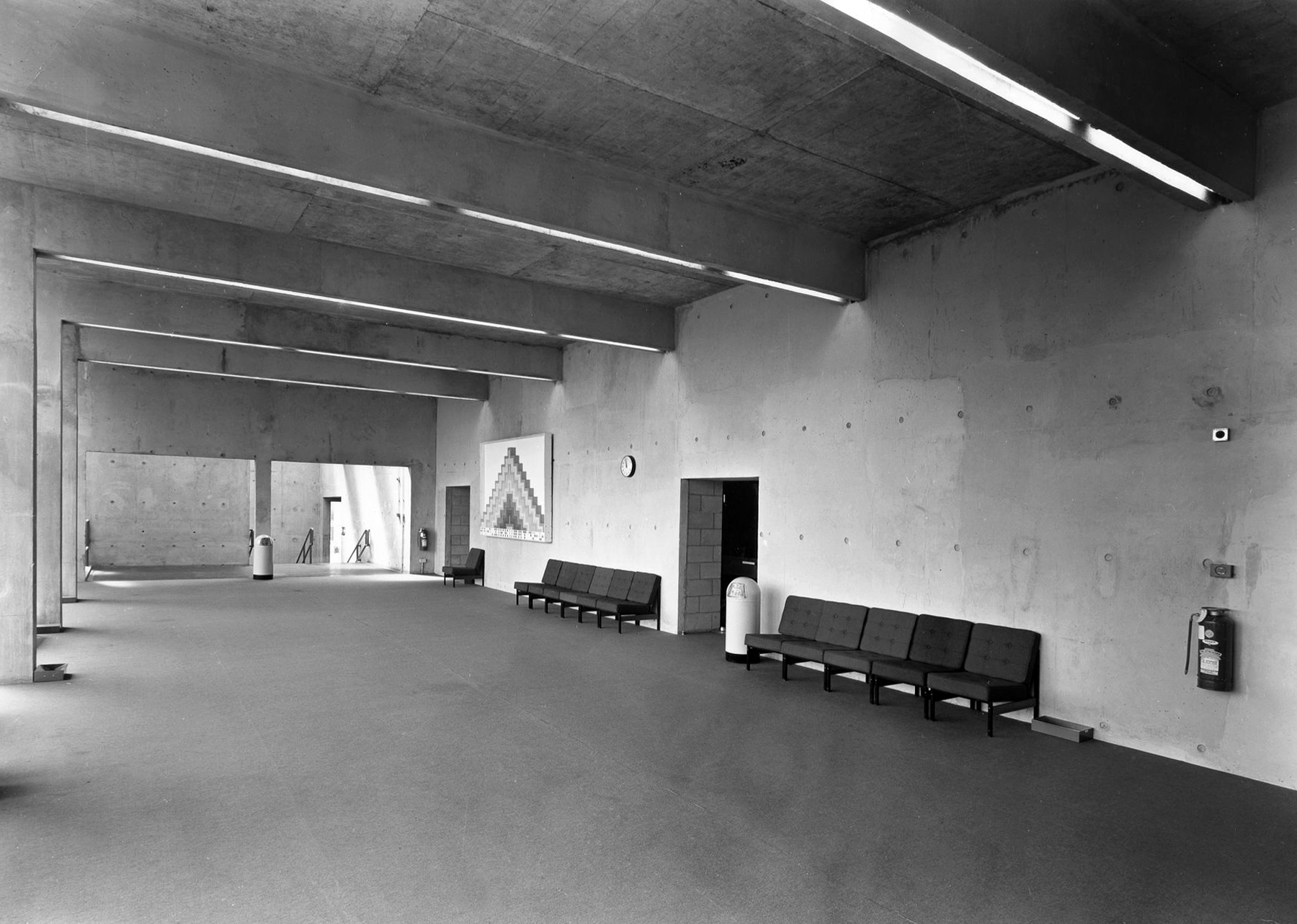
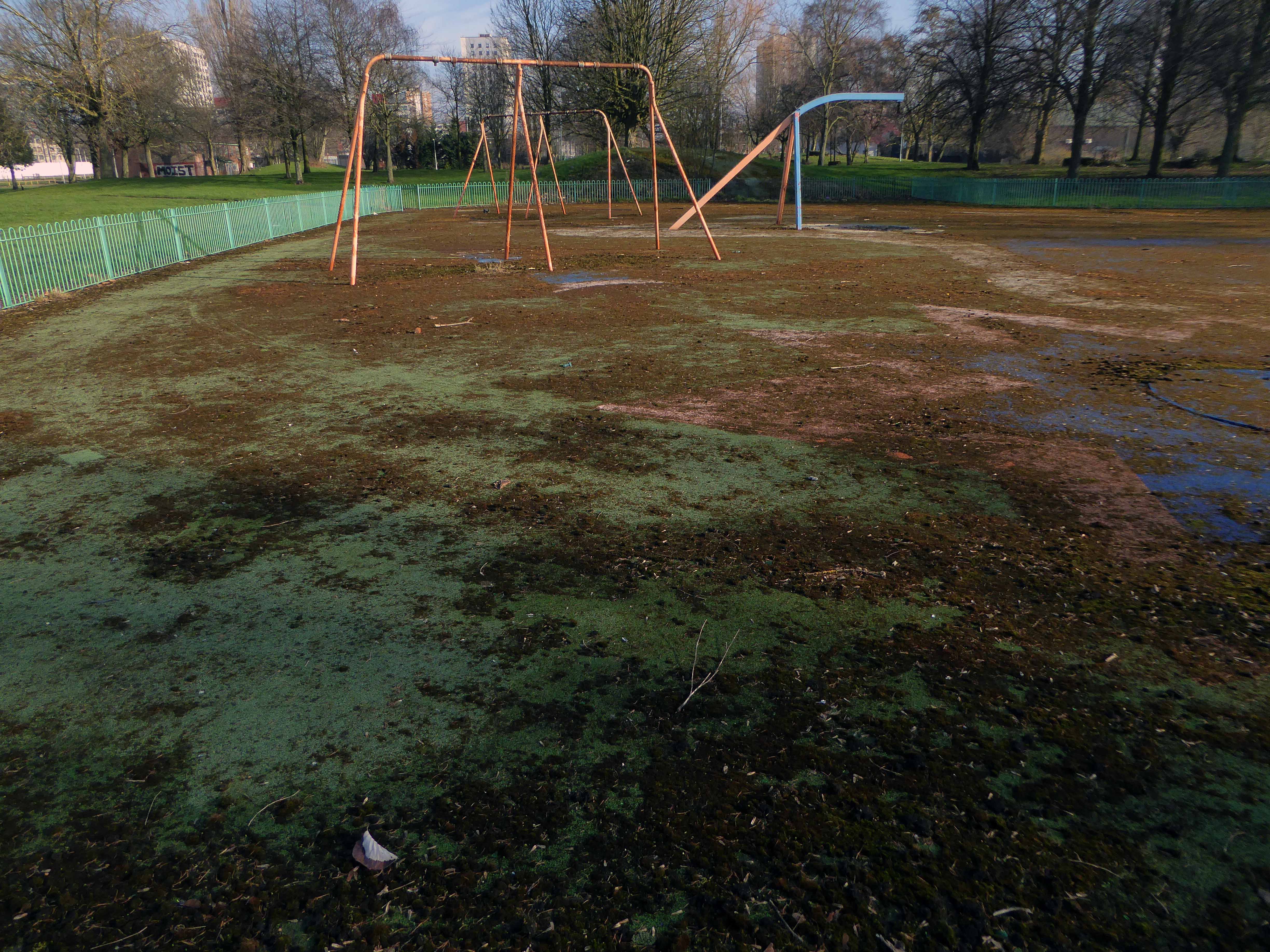
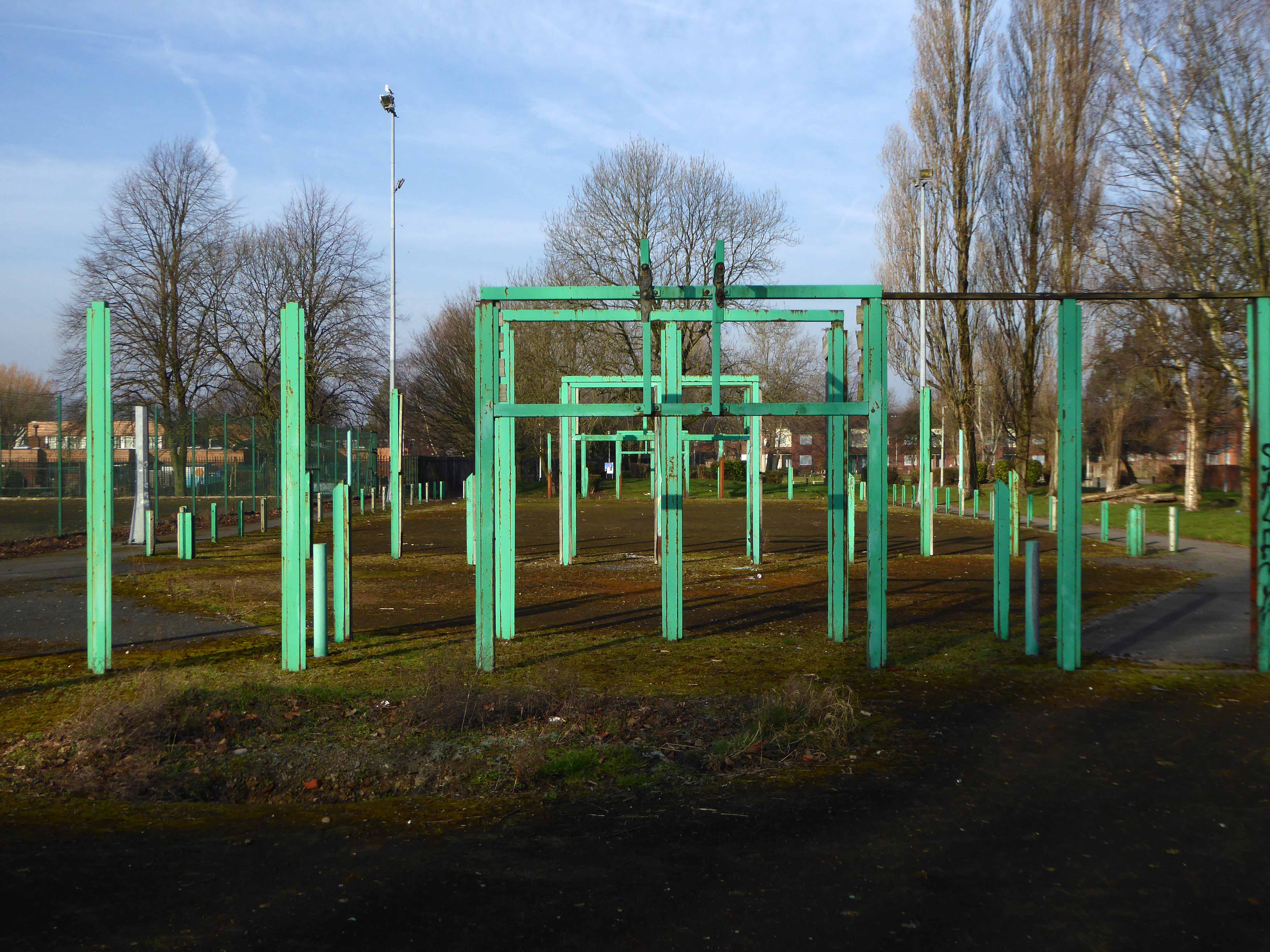
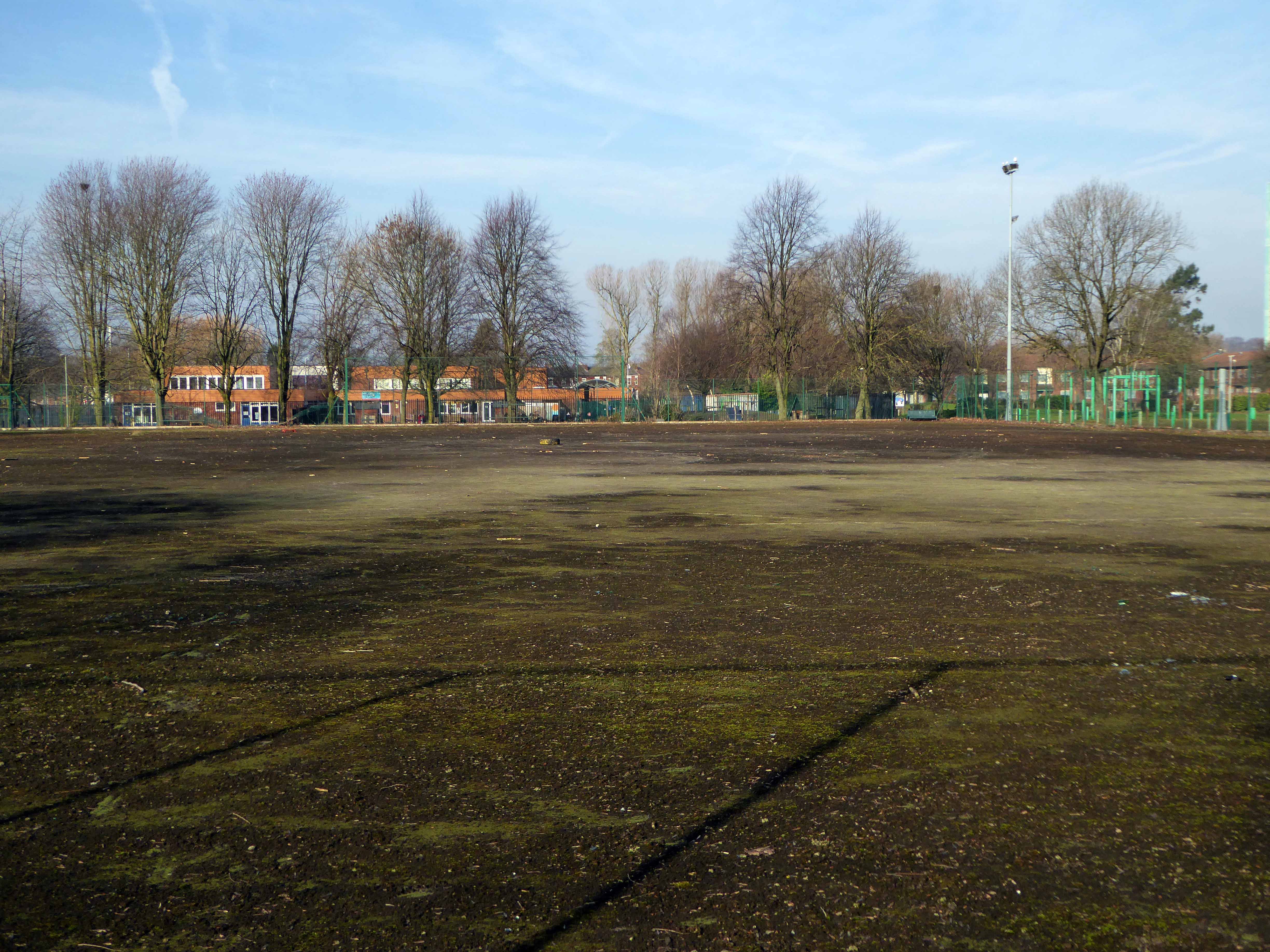
Constructed at the tail end of the Sixties – the last gasp of Municipal Modernism in the Borough, providing education, edification and entertainment for the local population.
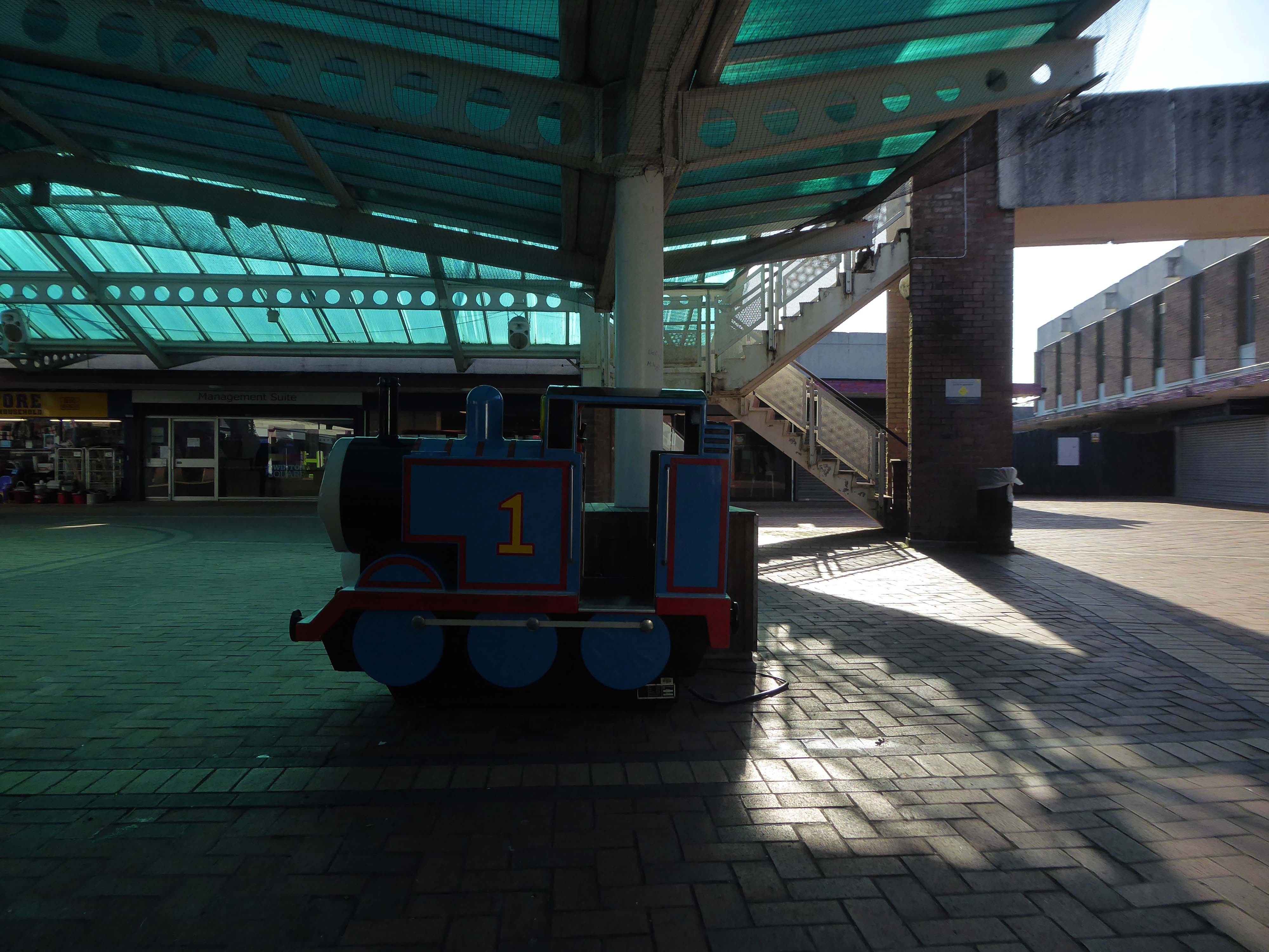
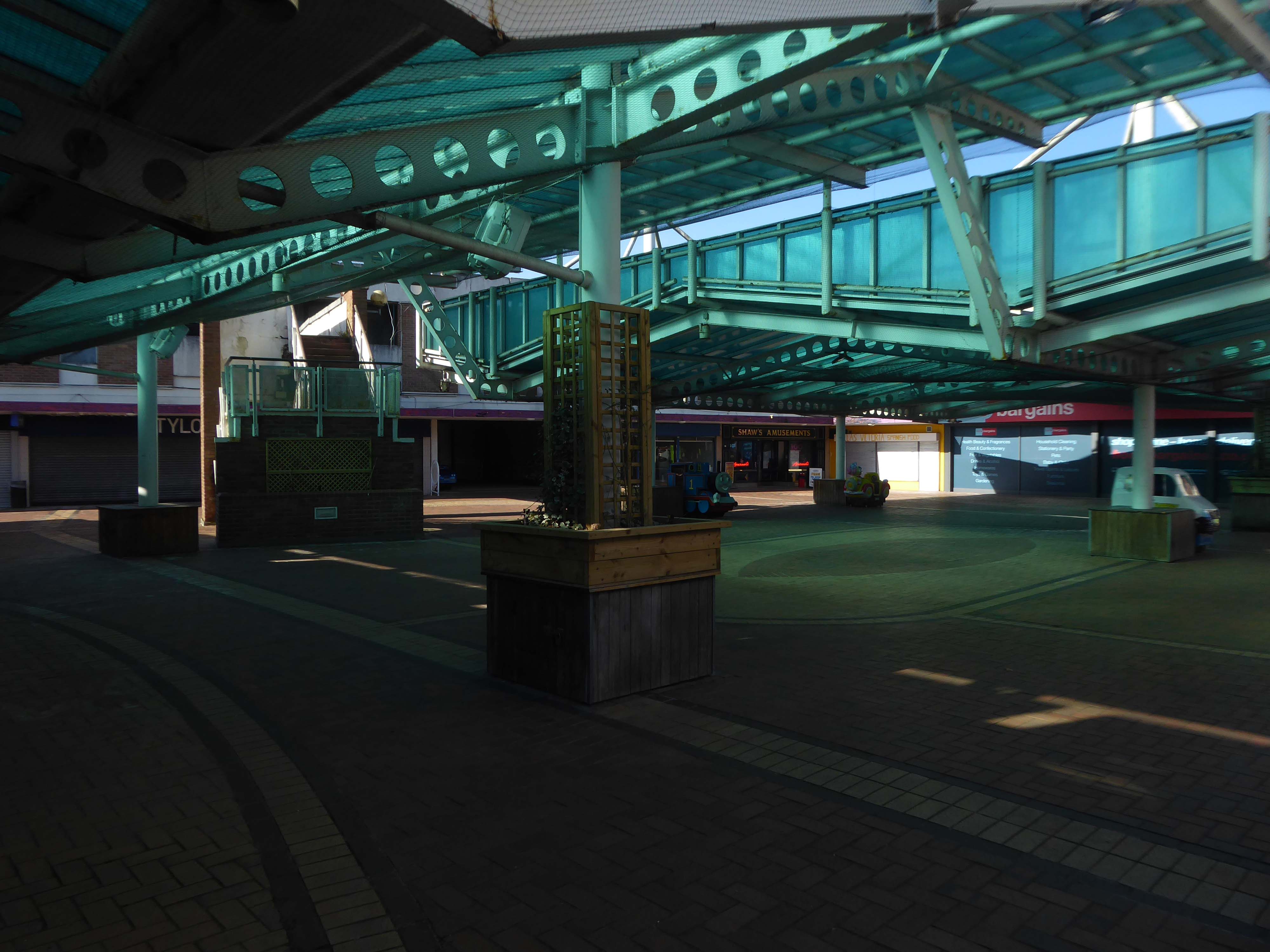
The fountain is gone, the building is closed – the party’s over.
The Fast Cars are history – well they were history, until I was told that they are still speeding along!
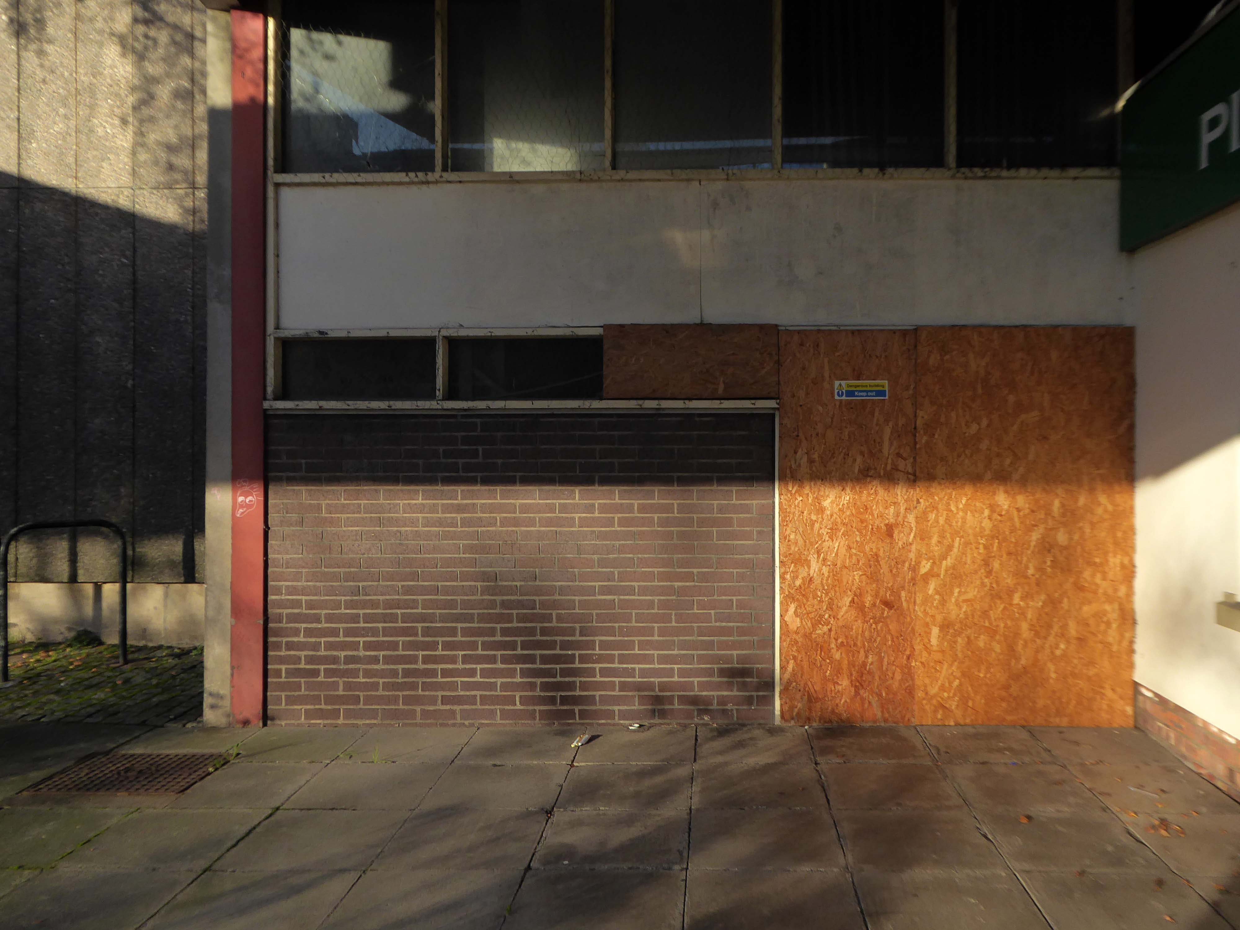
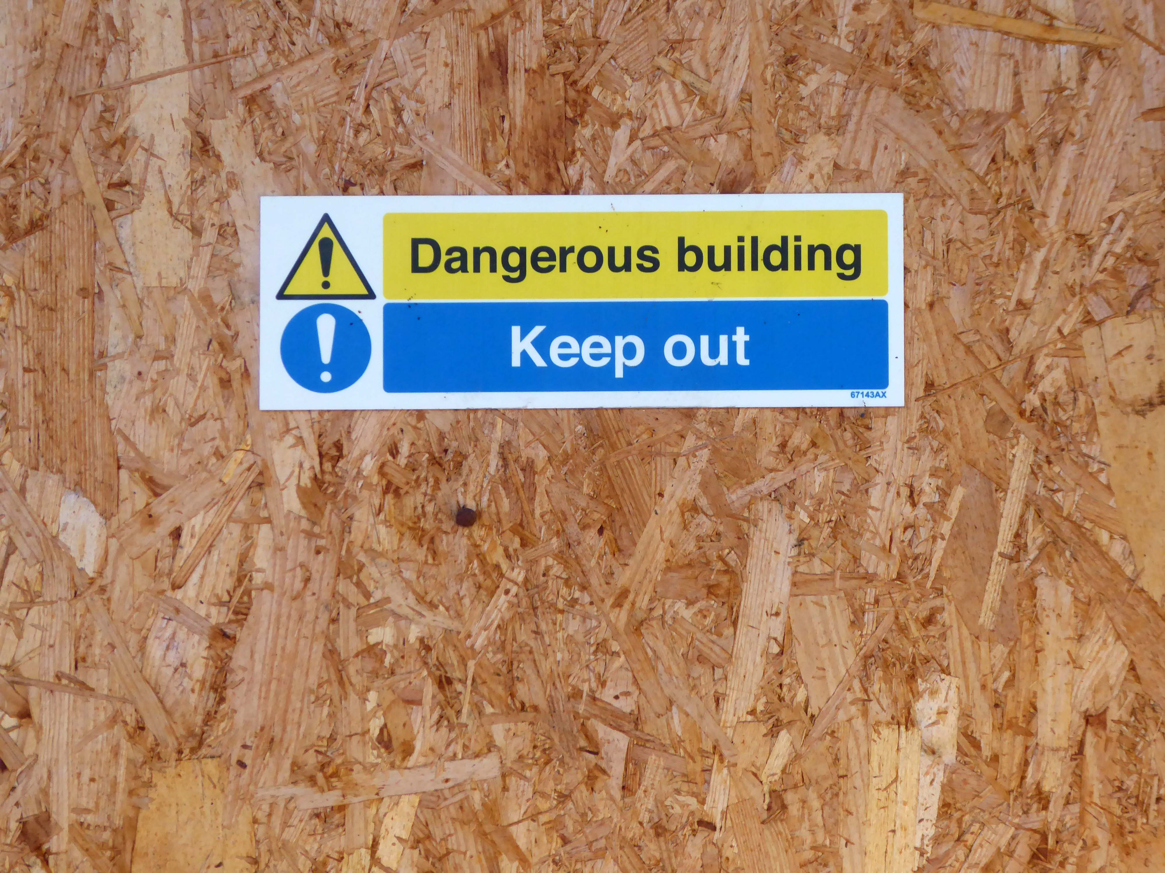
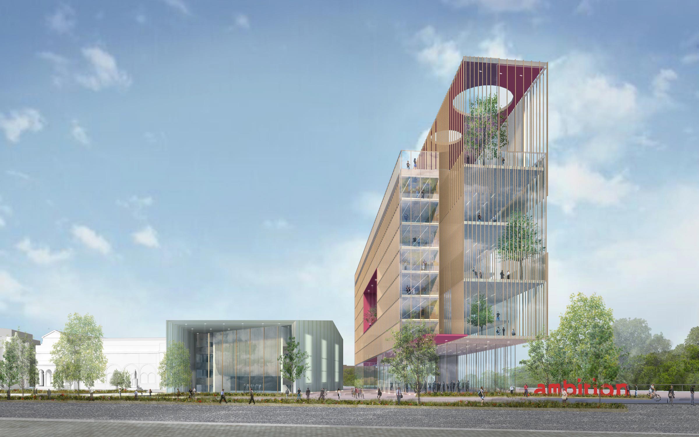
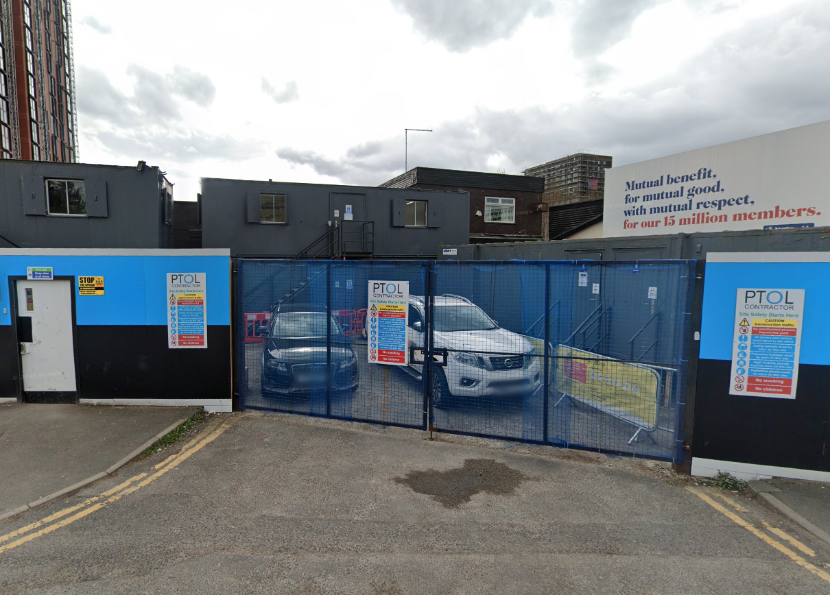
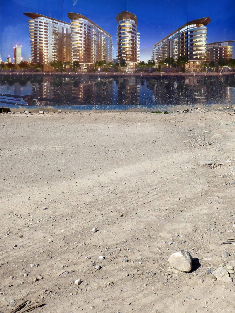
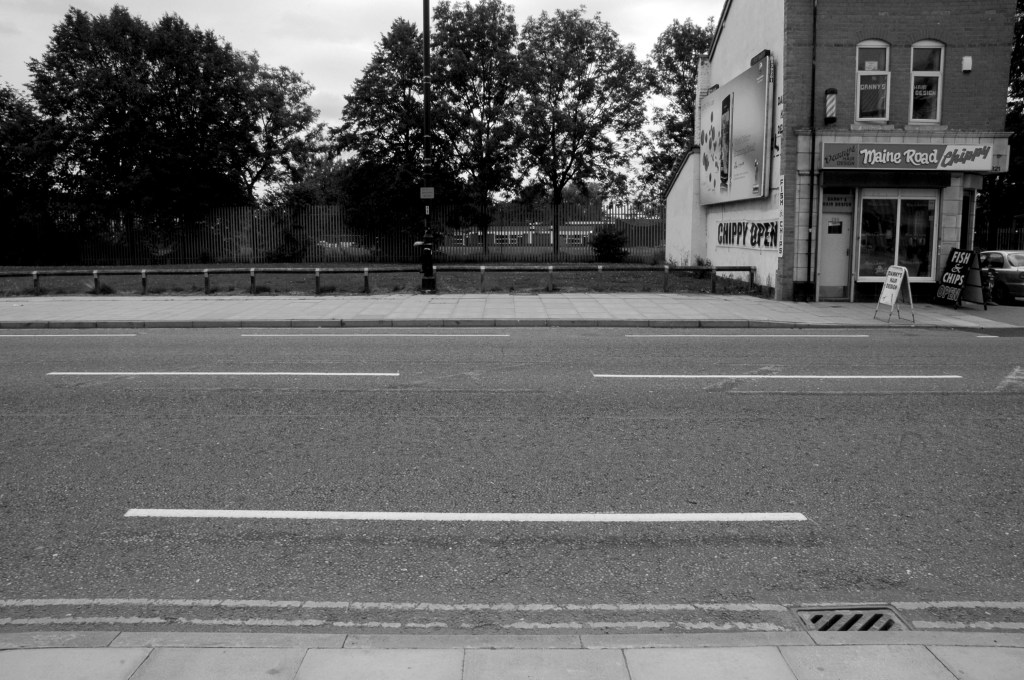
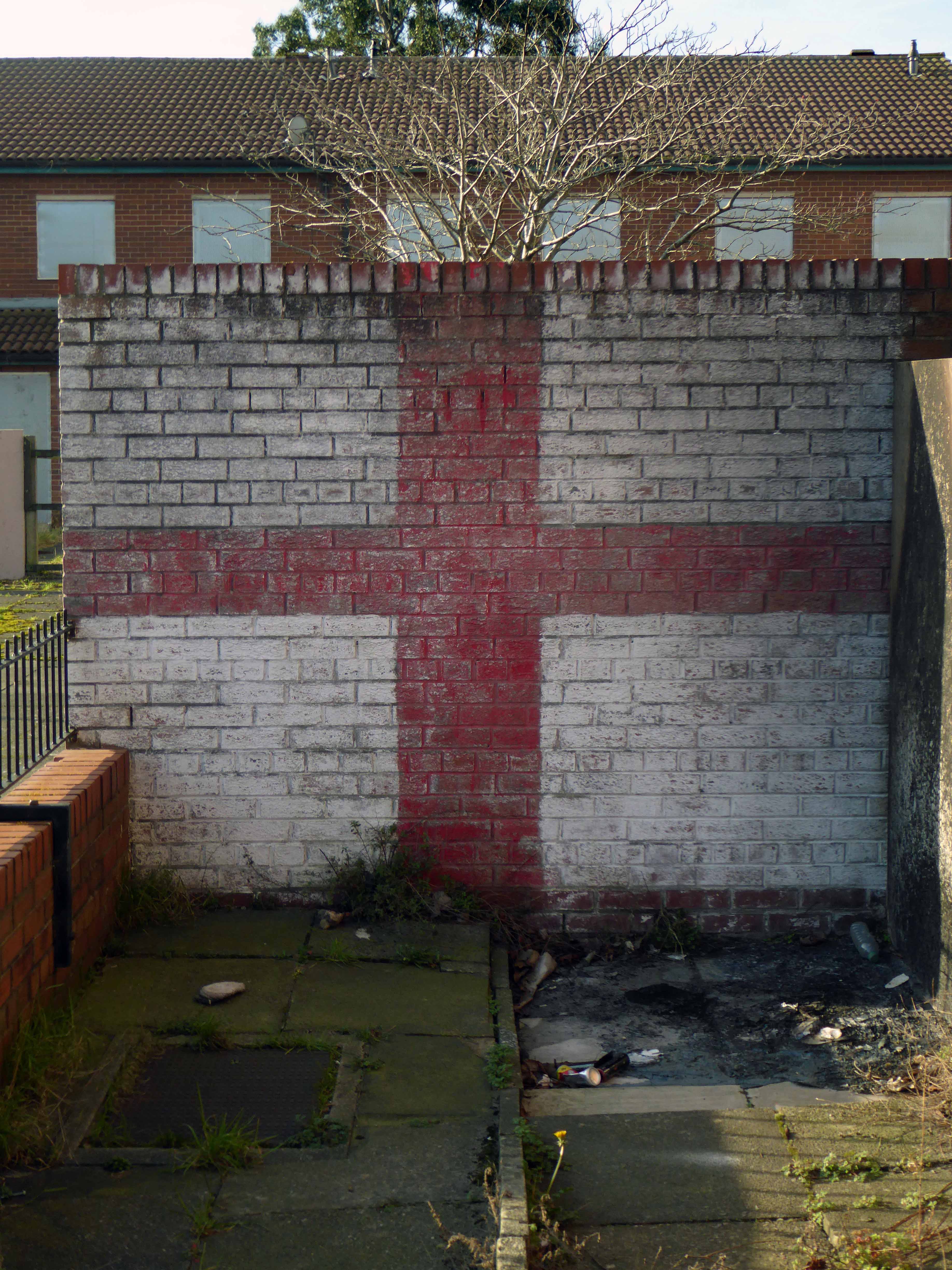
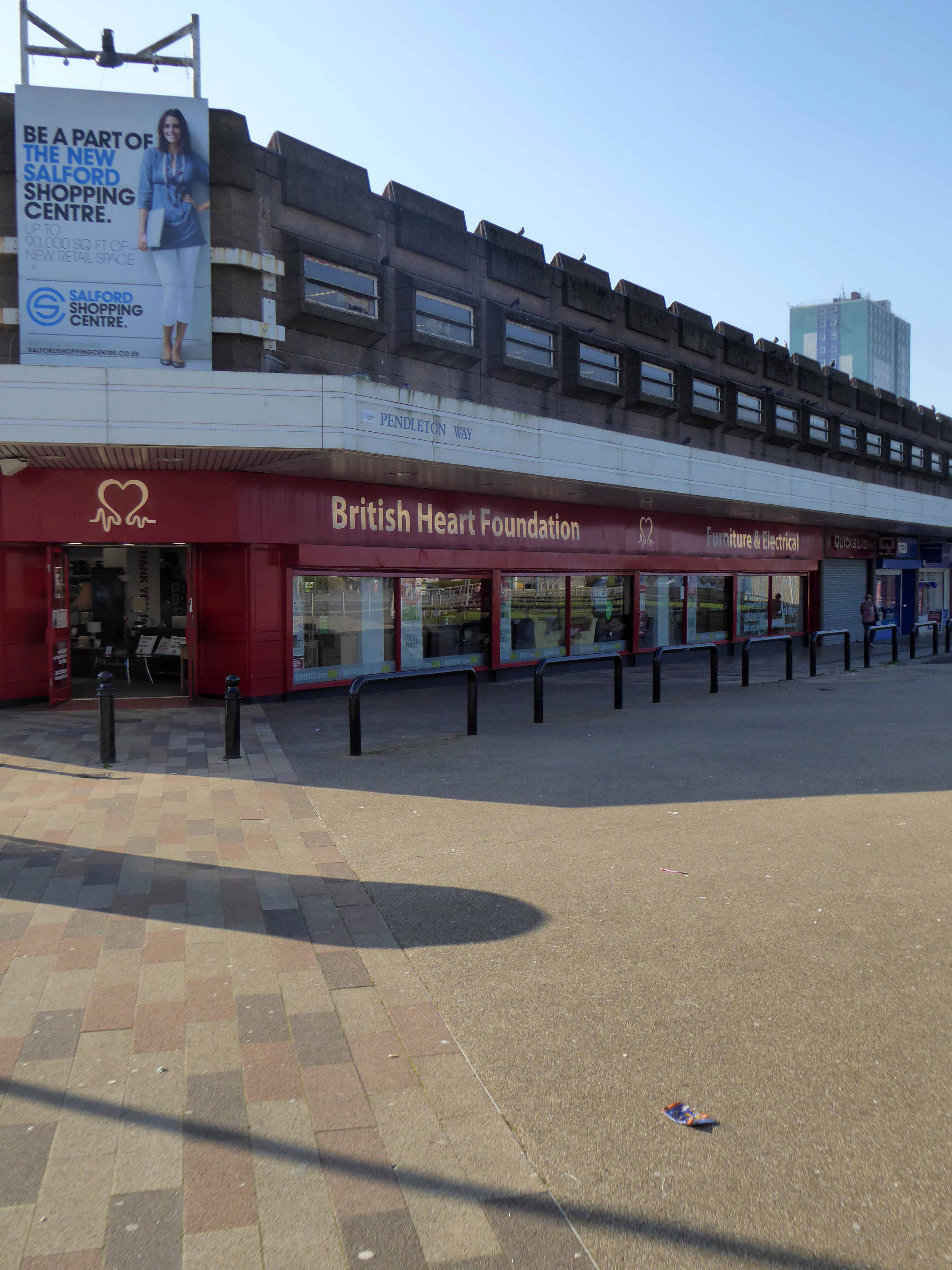
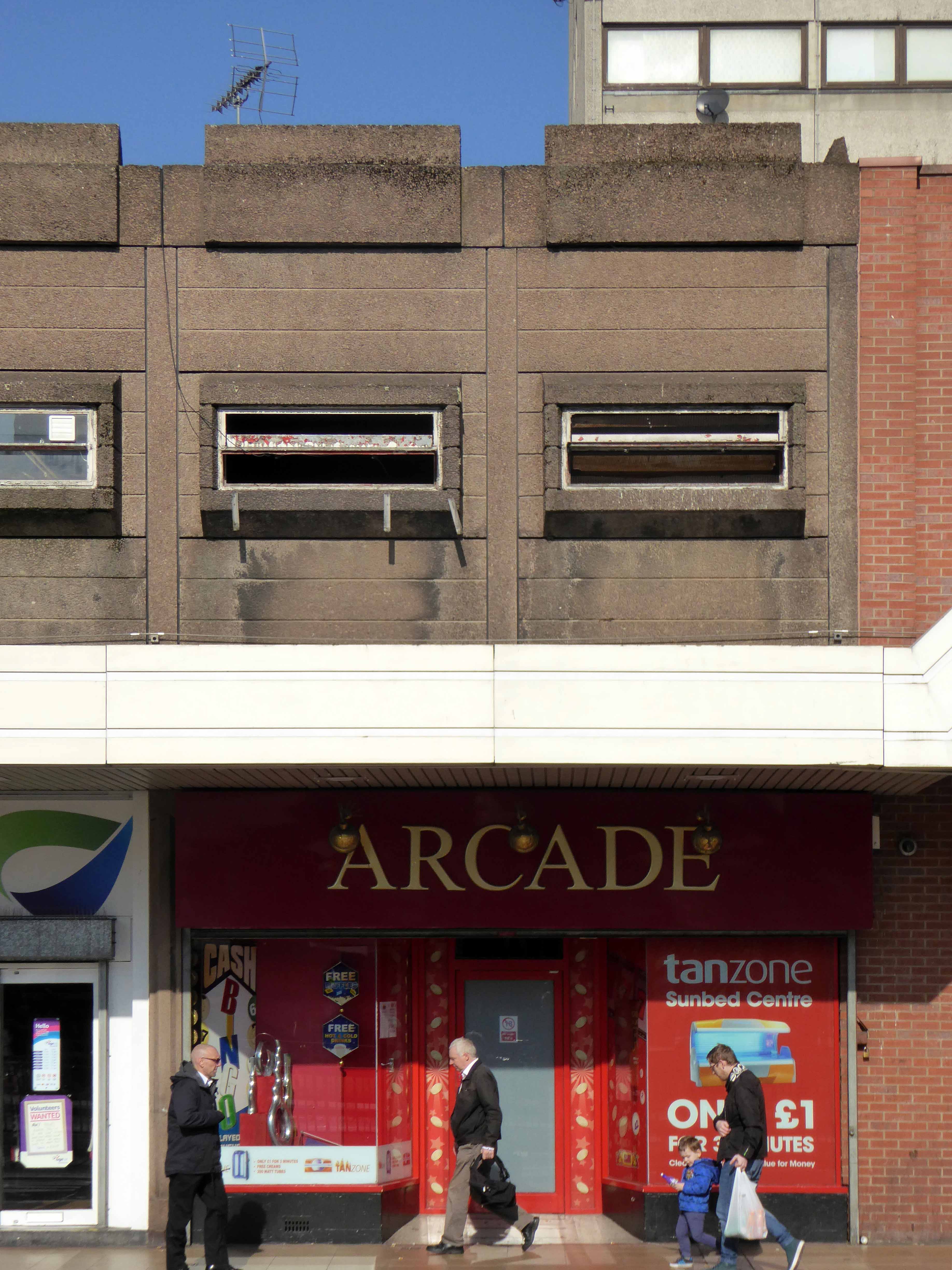
A council has spent £348,000 on a masterplan for a town centre that the public has never seen.
Consultants have been used to come up with ideas to regenerate Swinton in Salford.
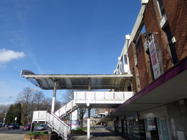
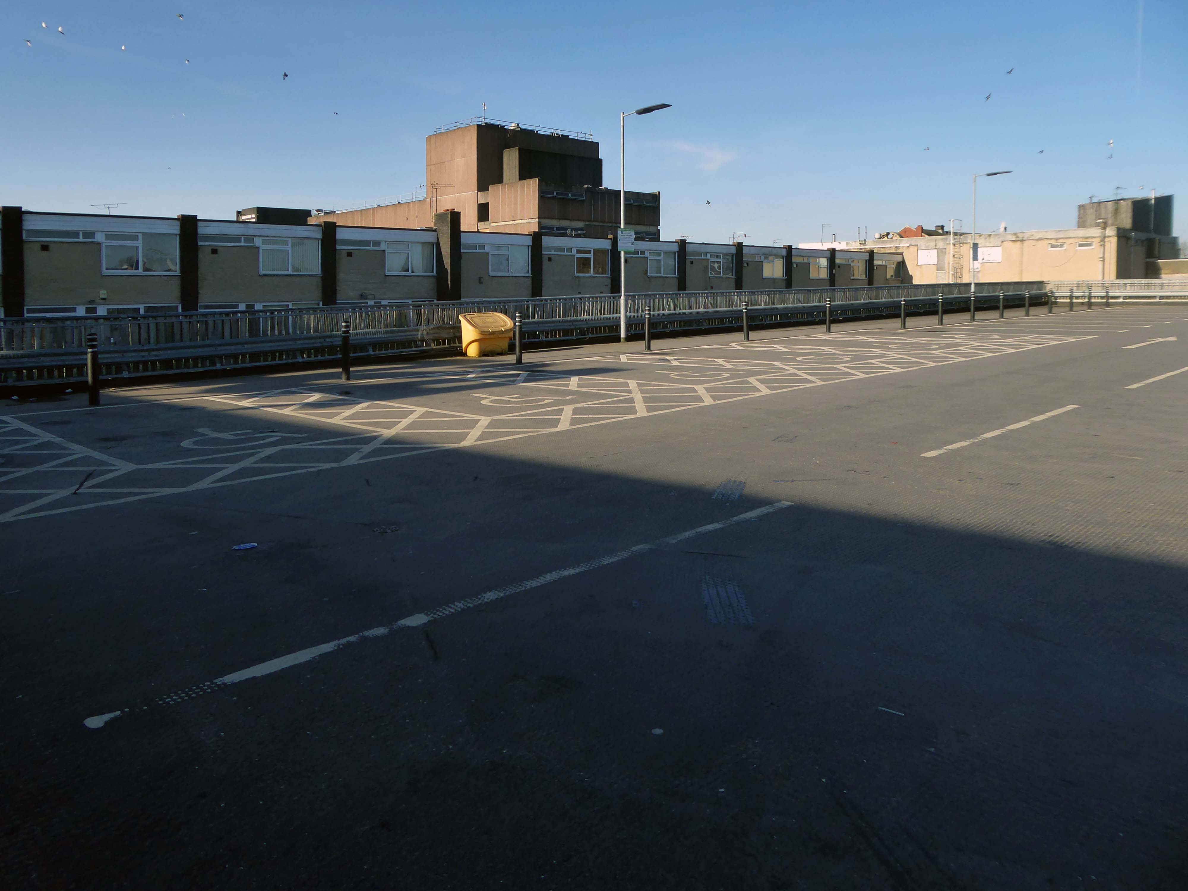
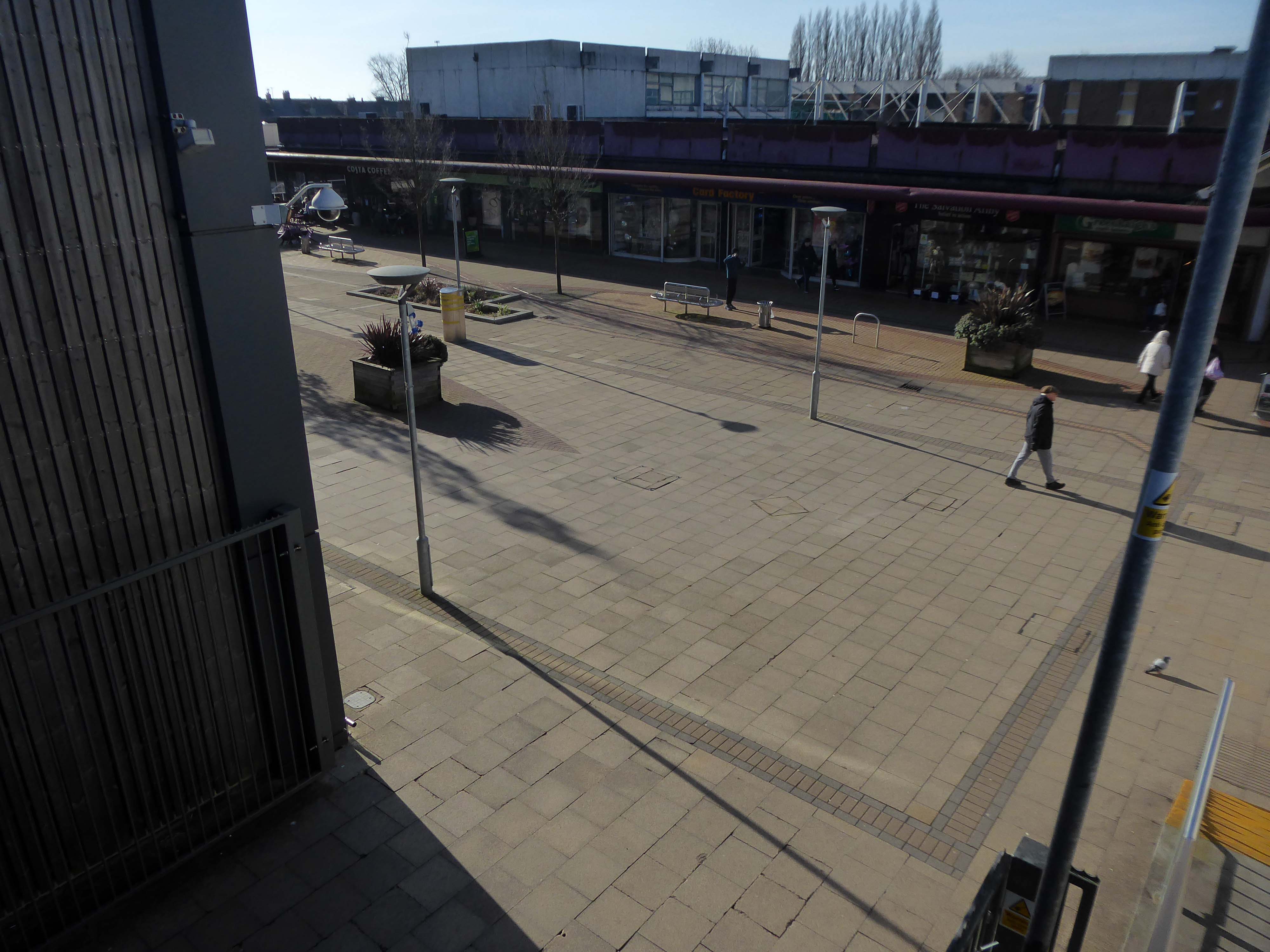
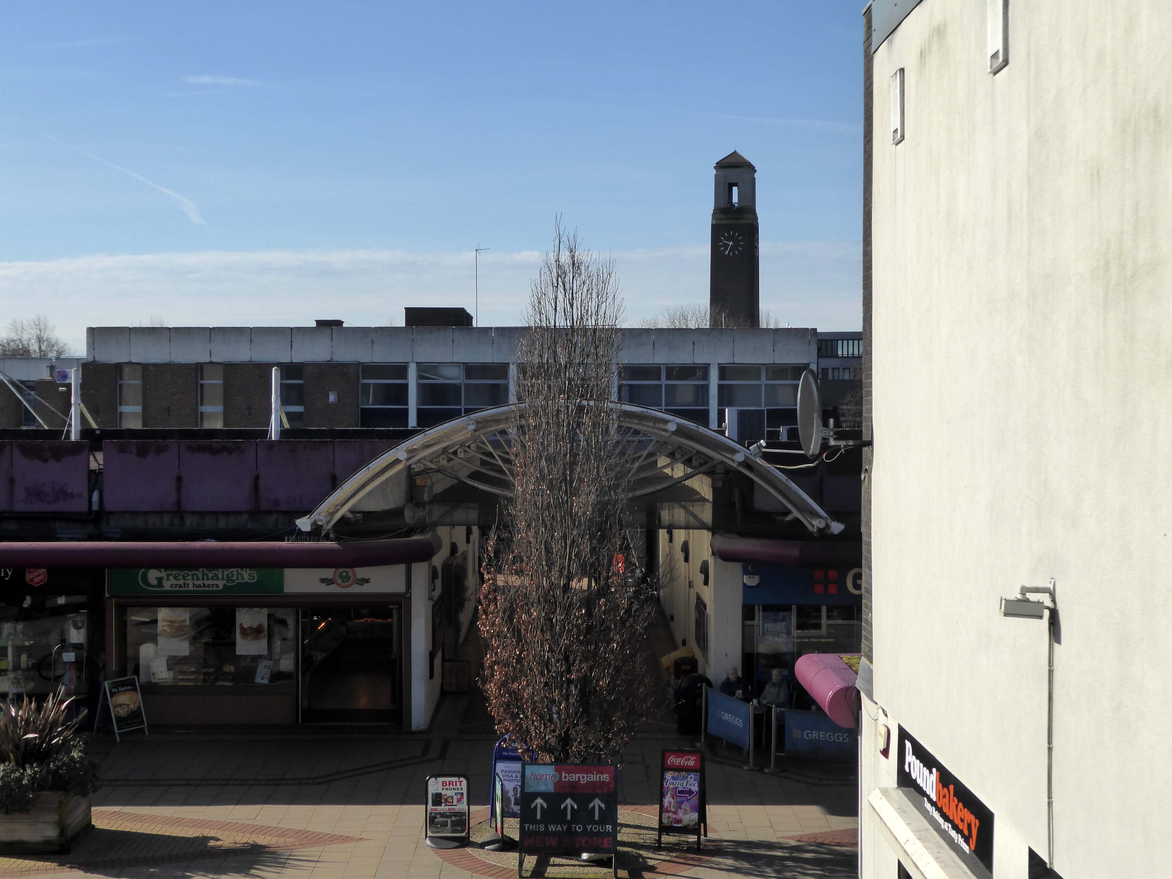
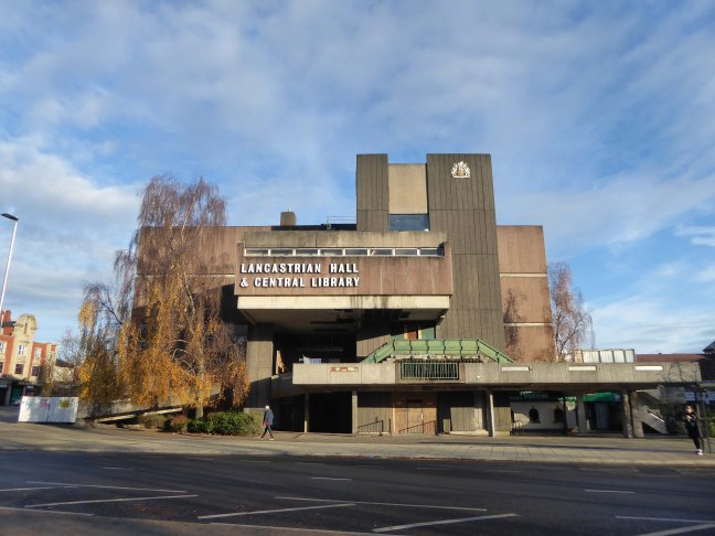
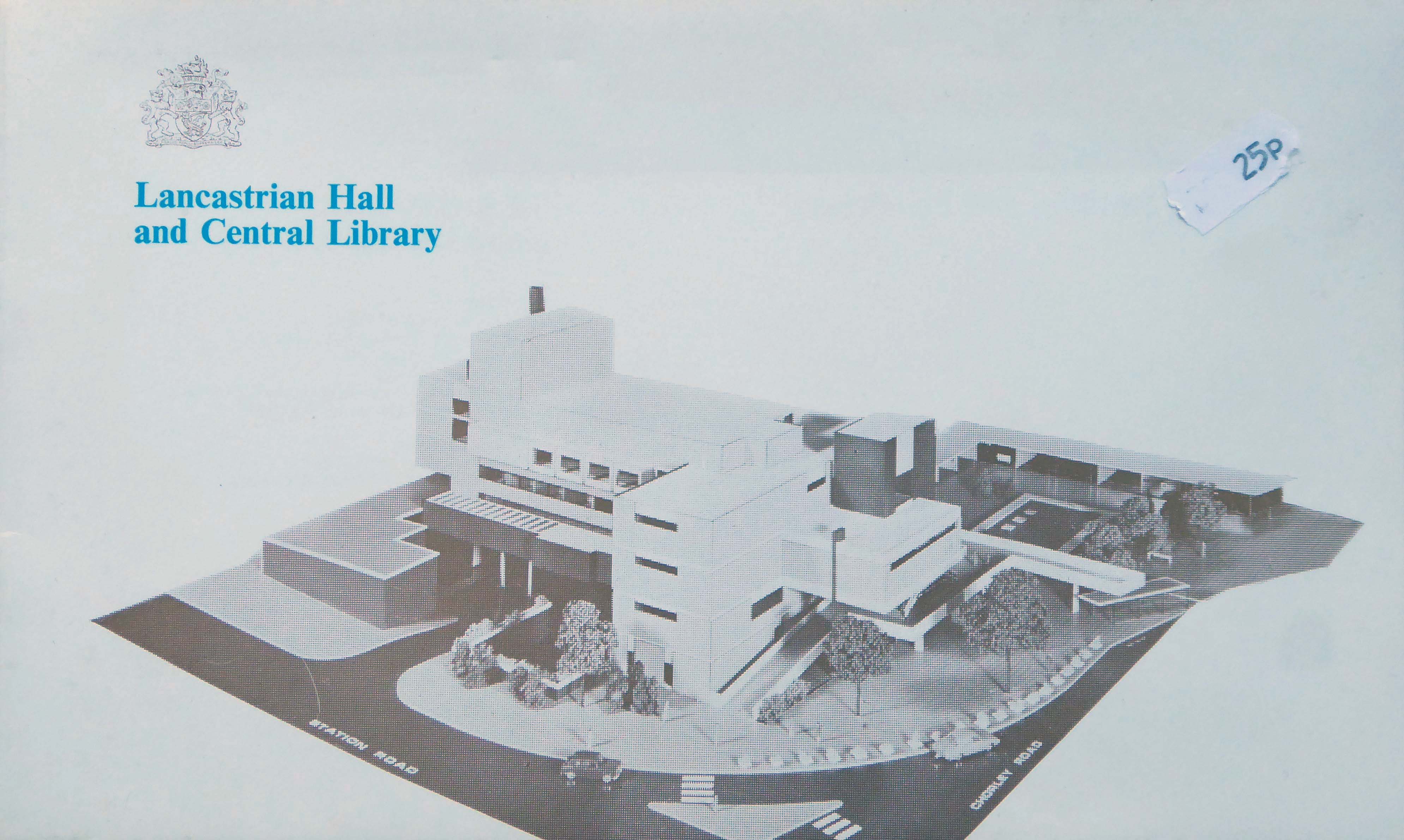
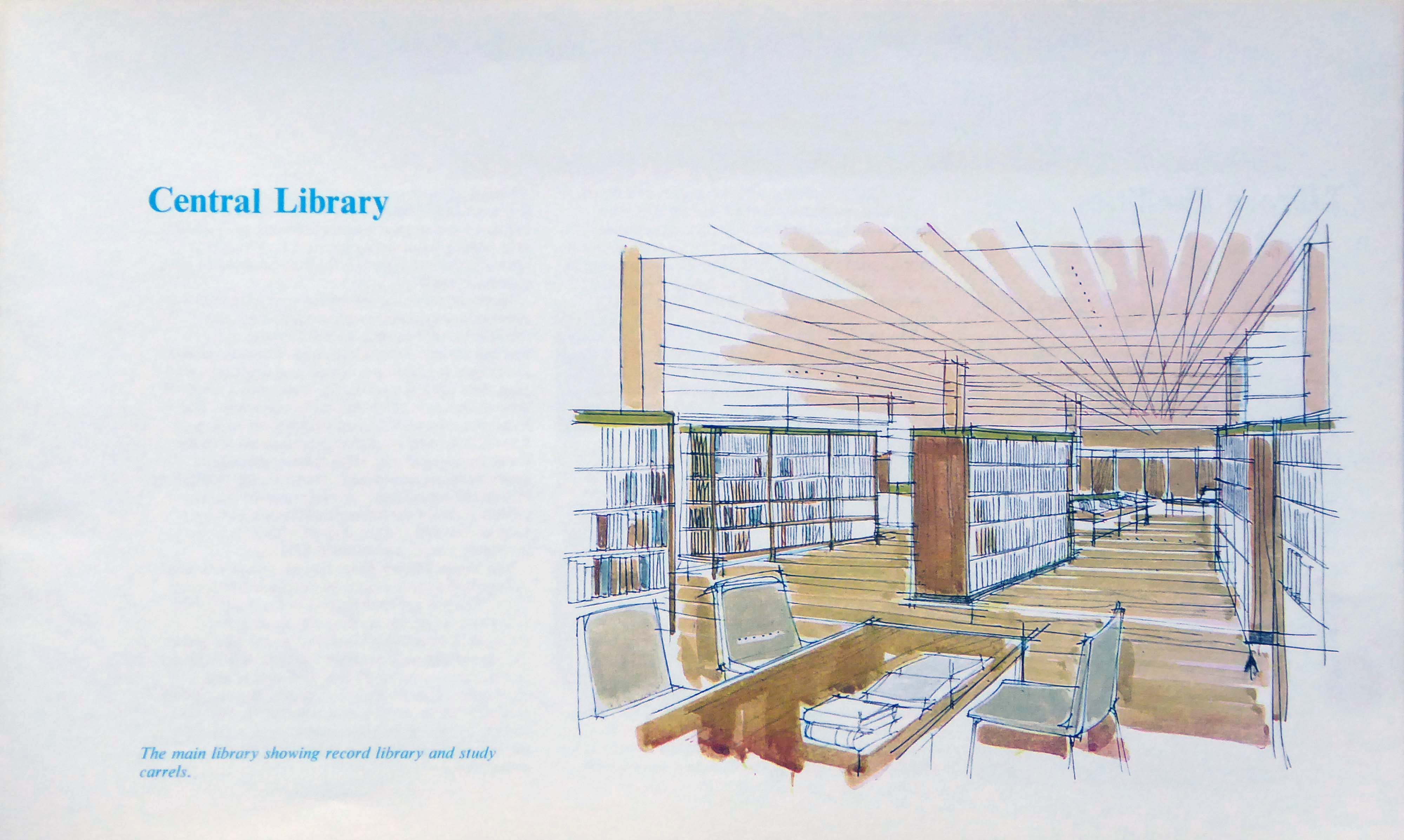
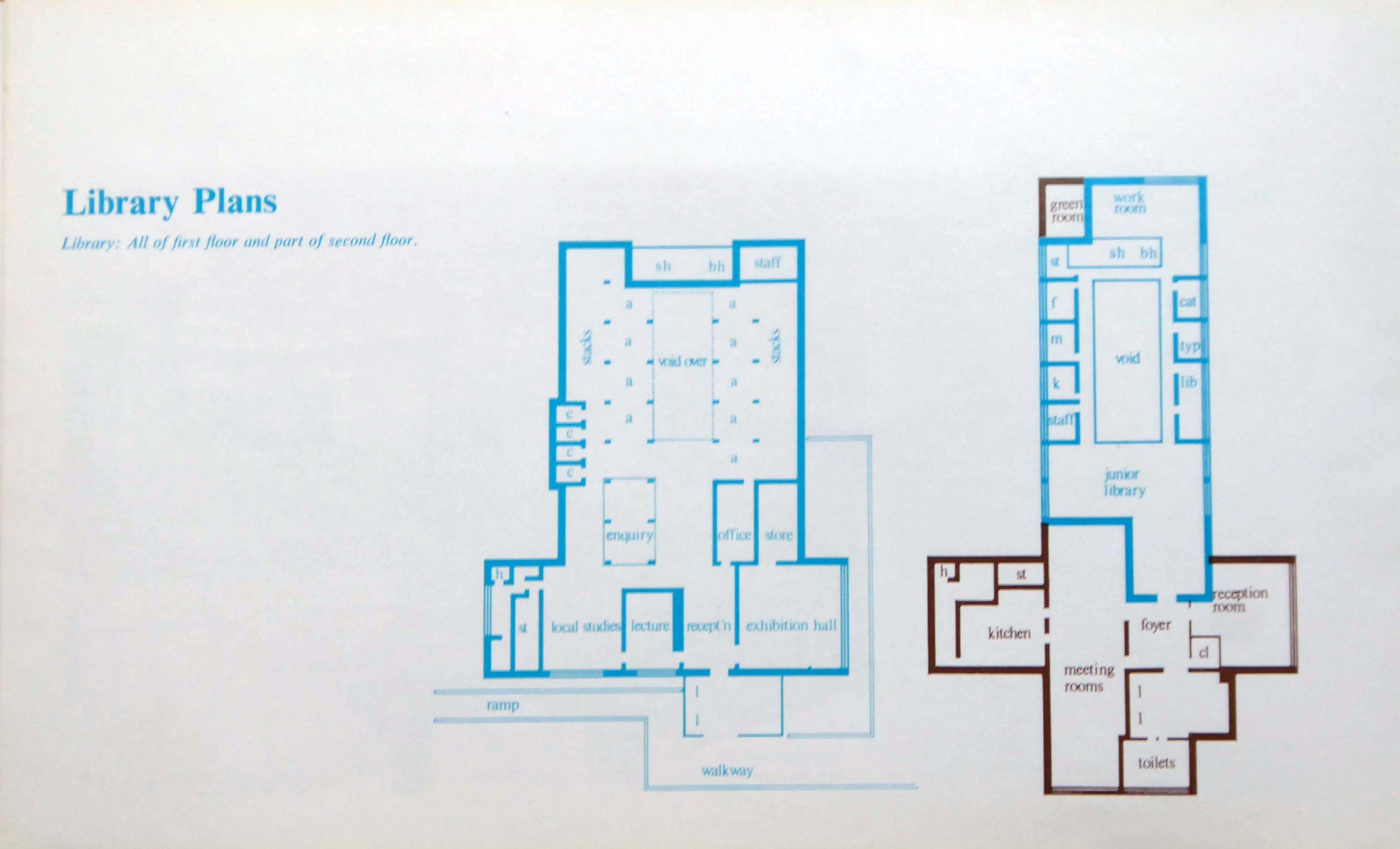
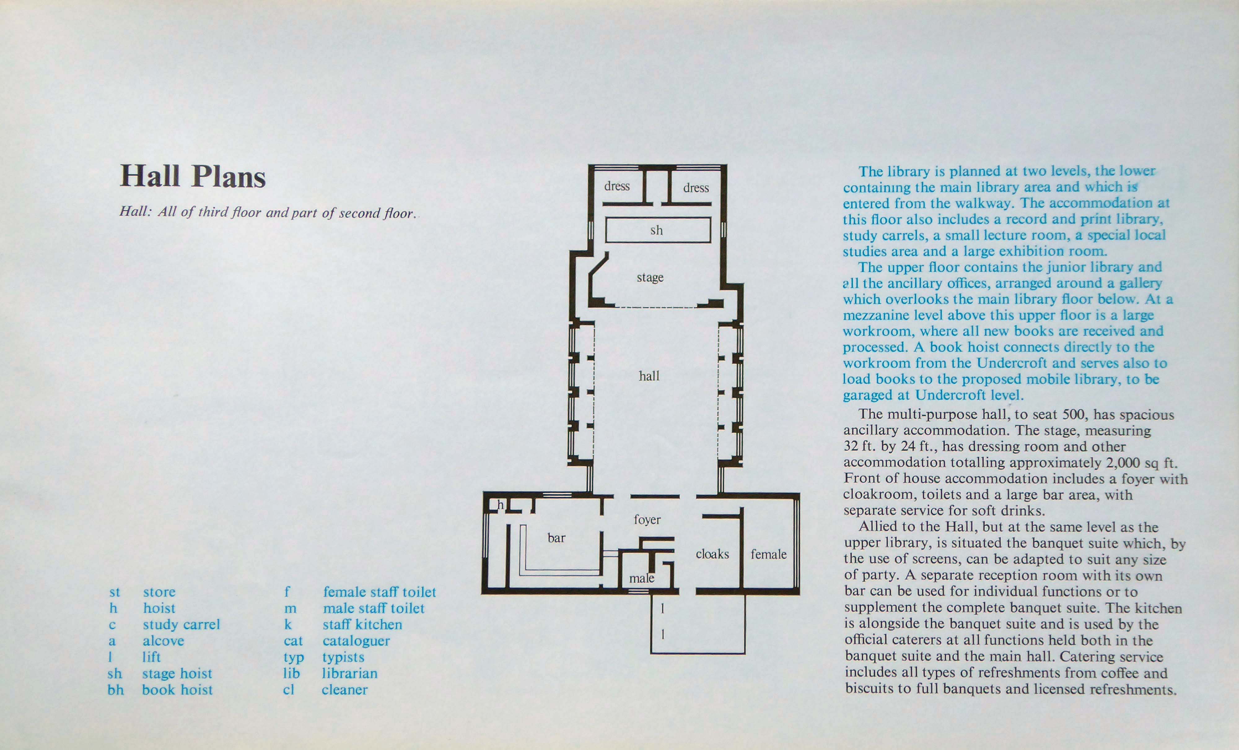
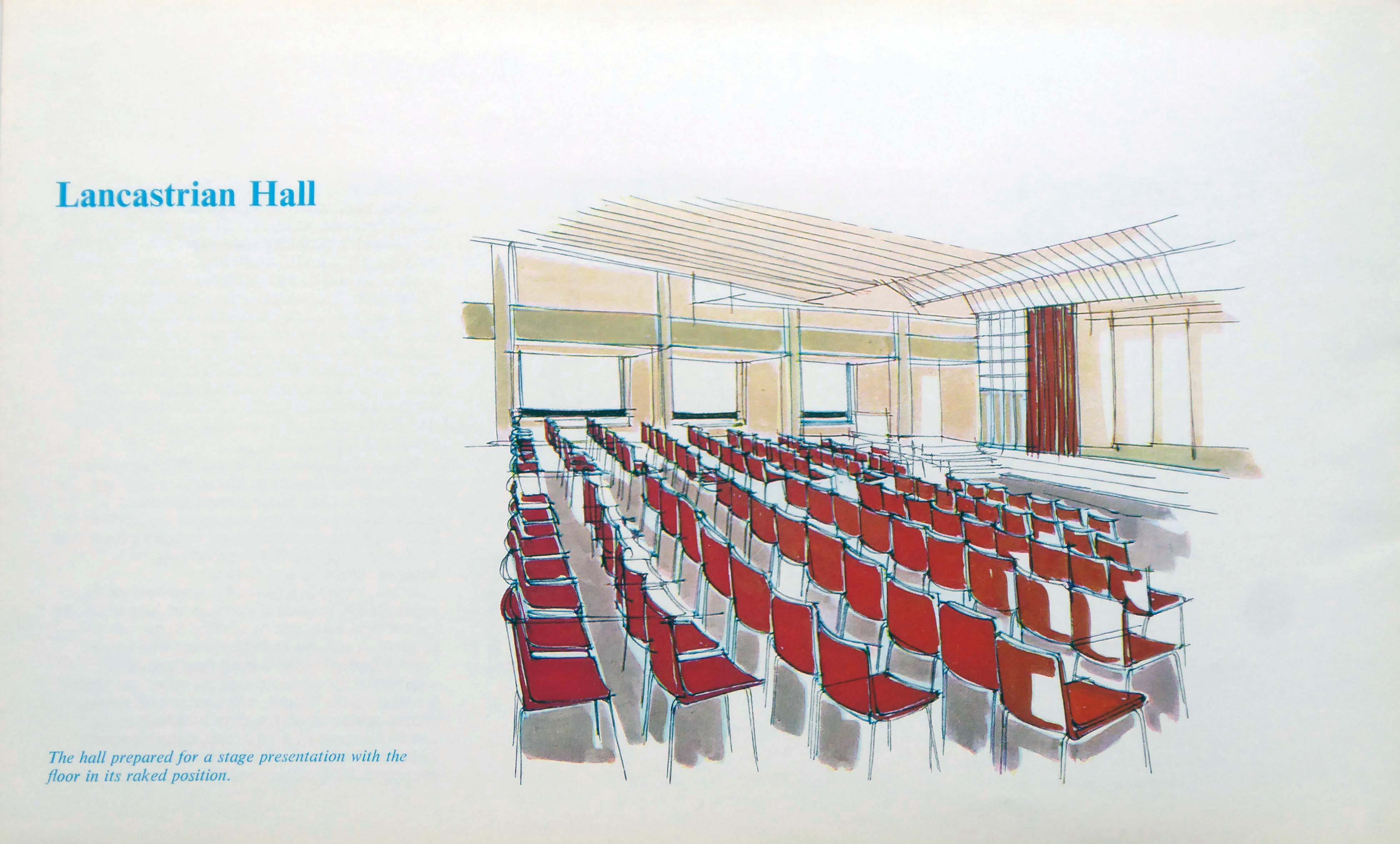
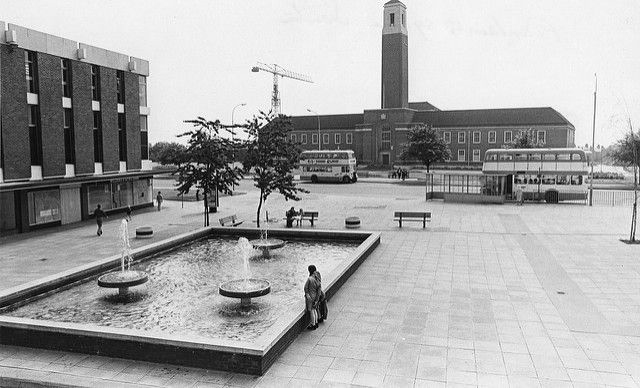
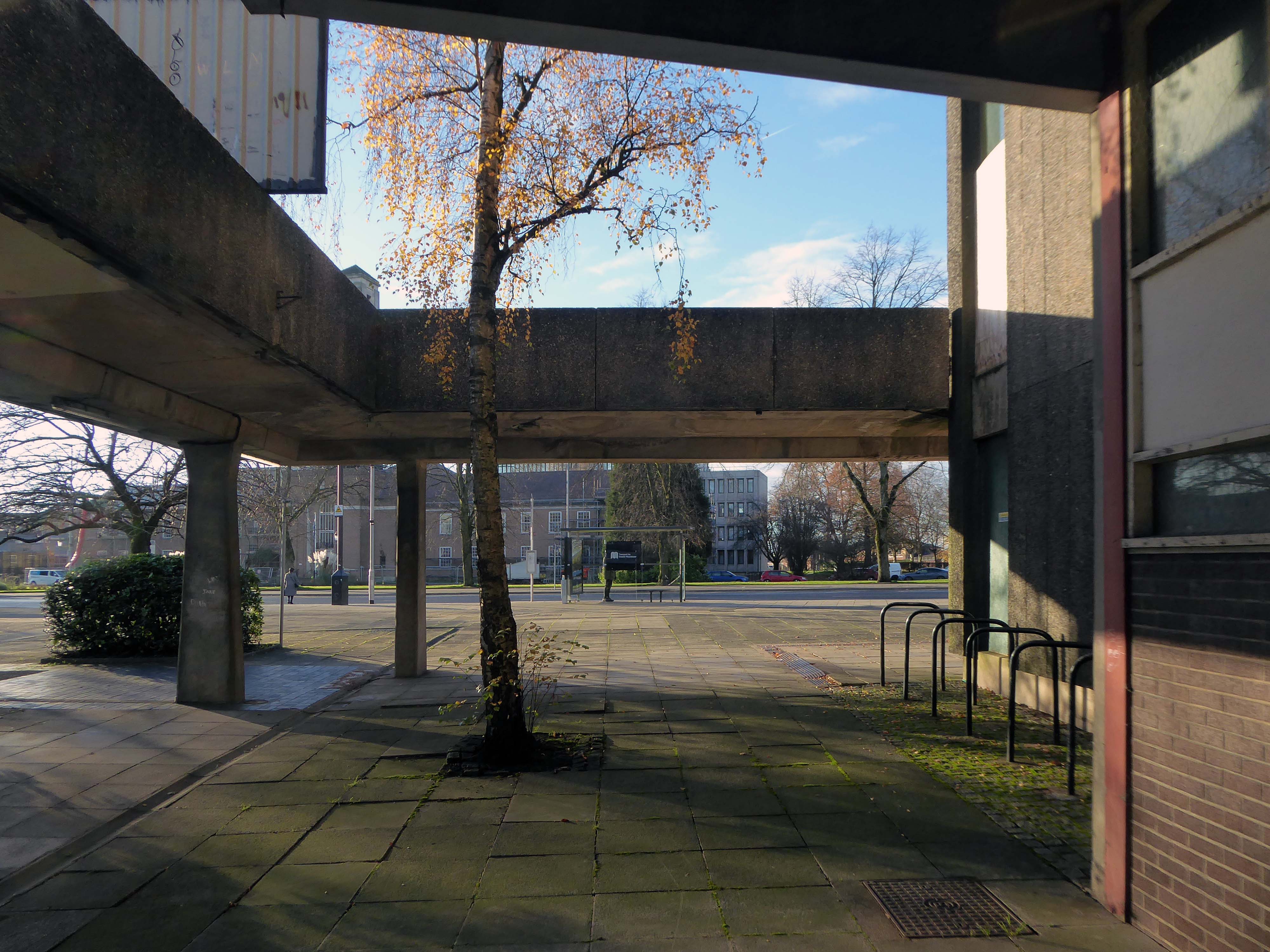
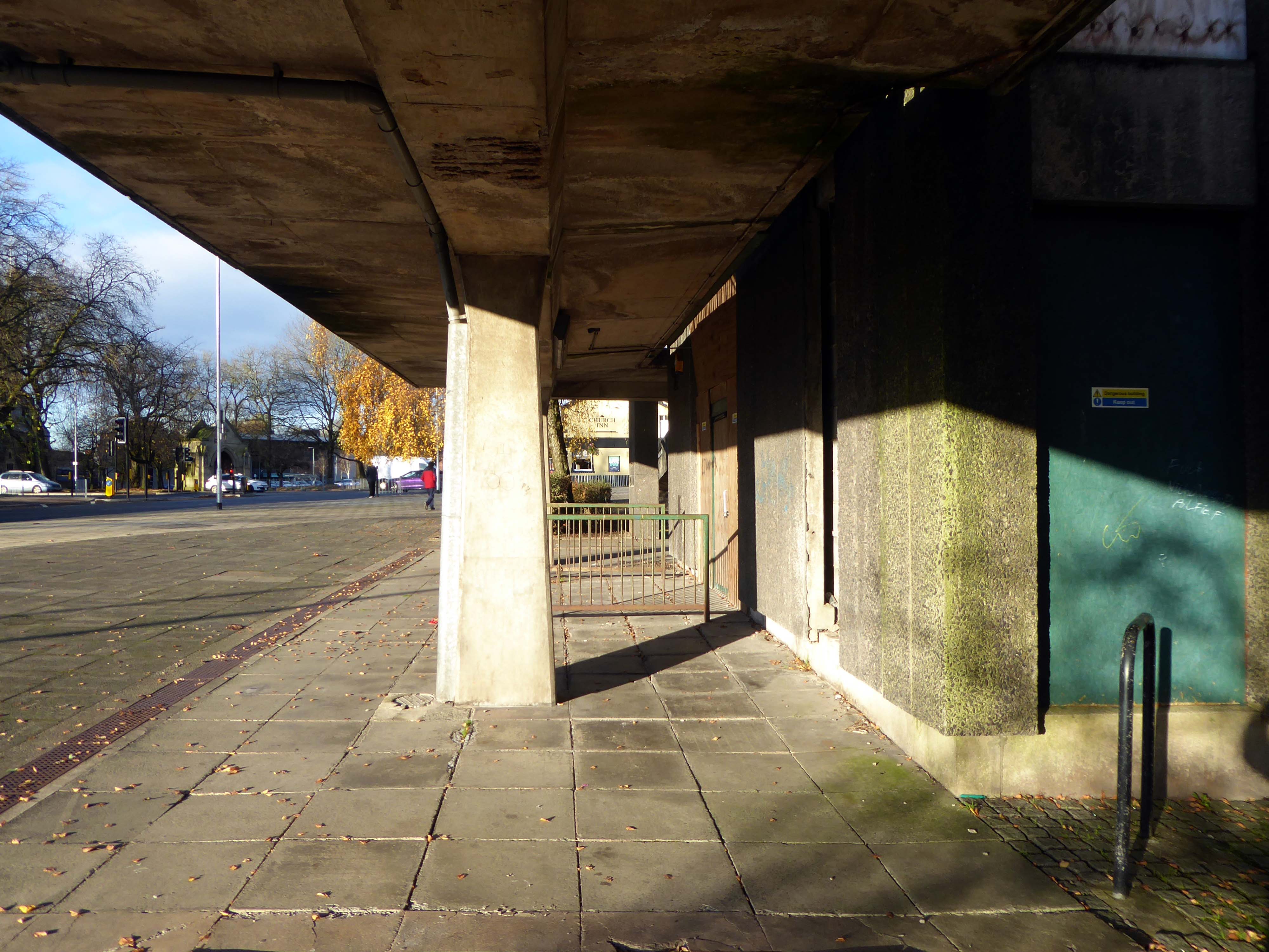
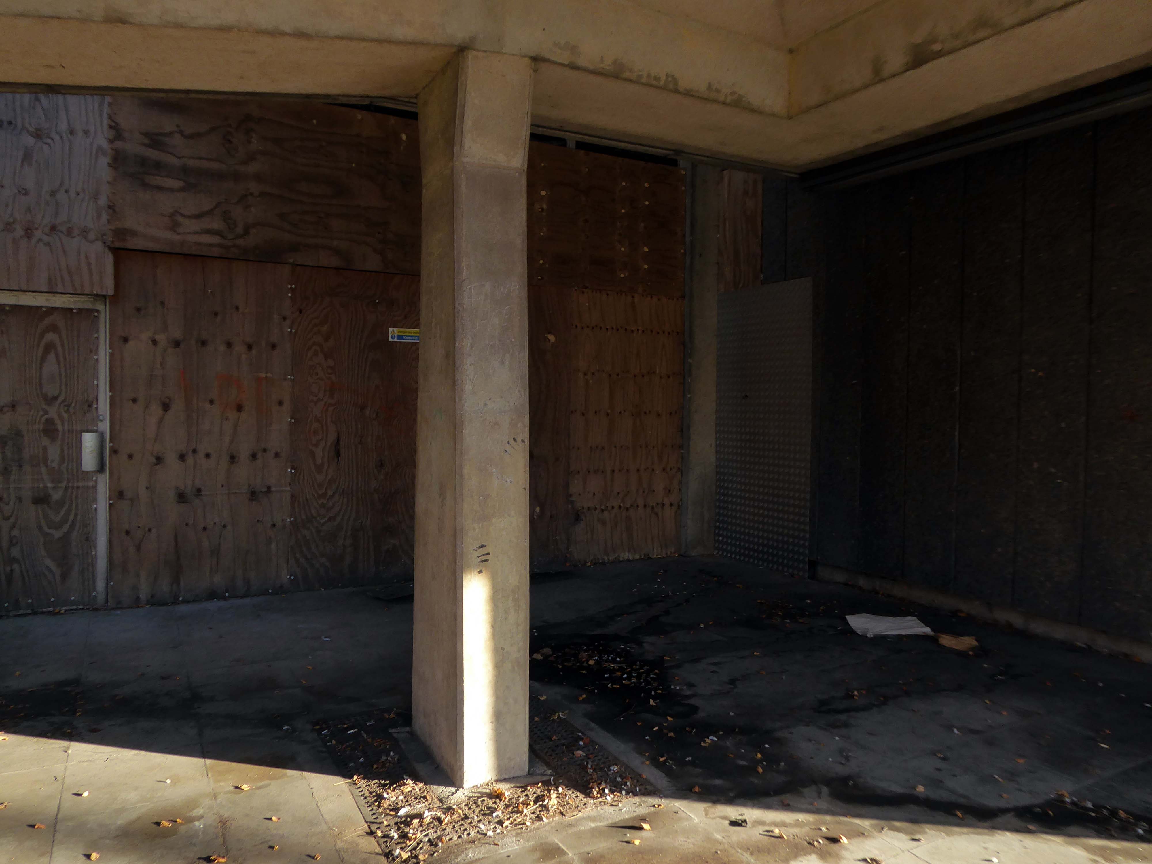
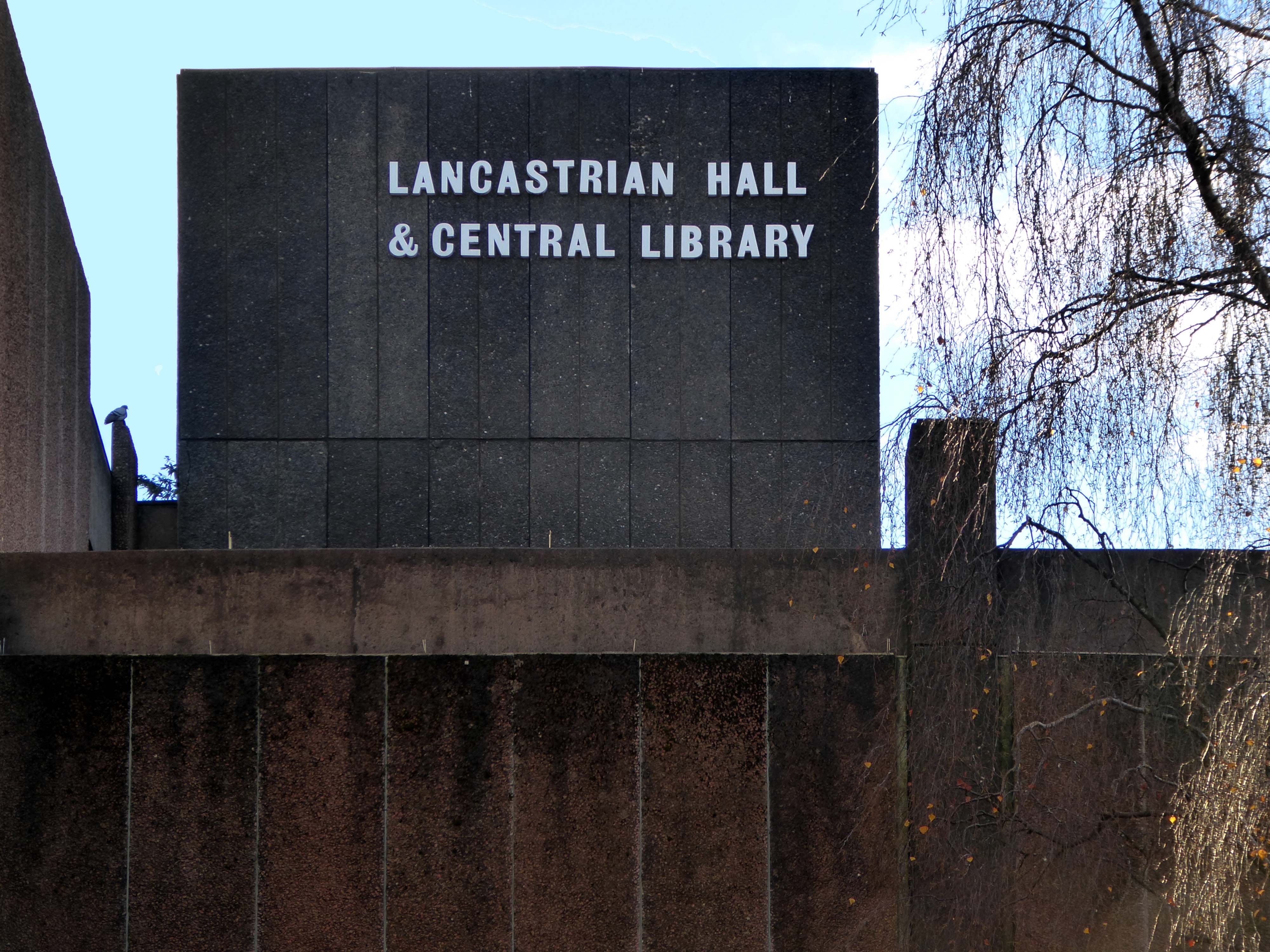
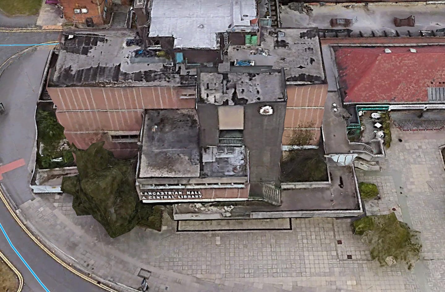
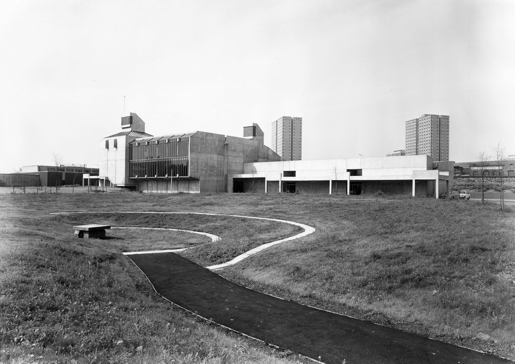
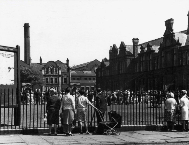
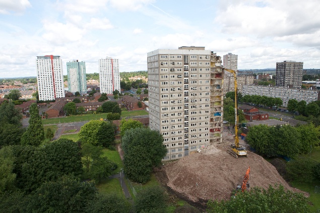
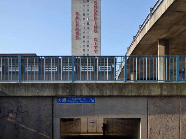
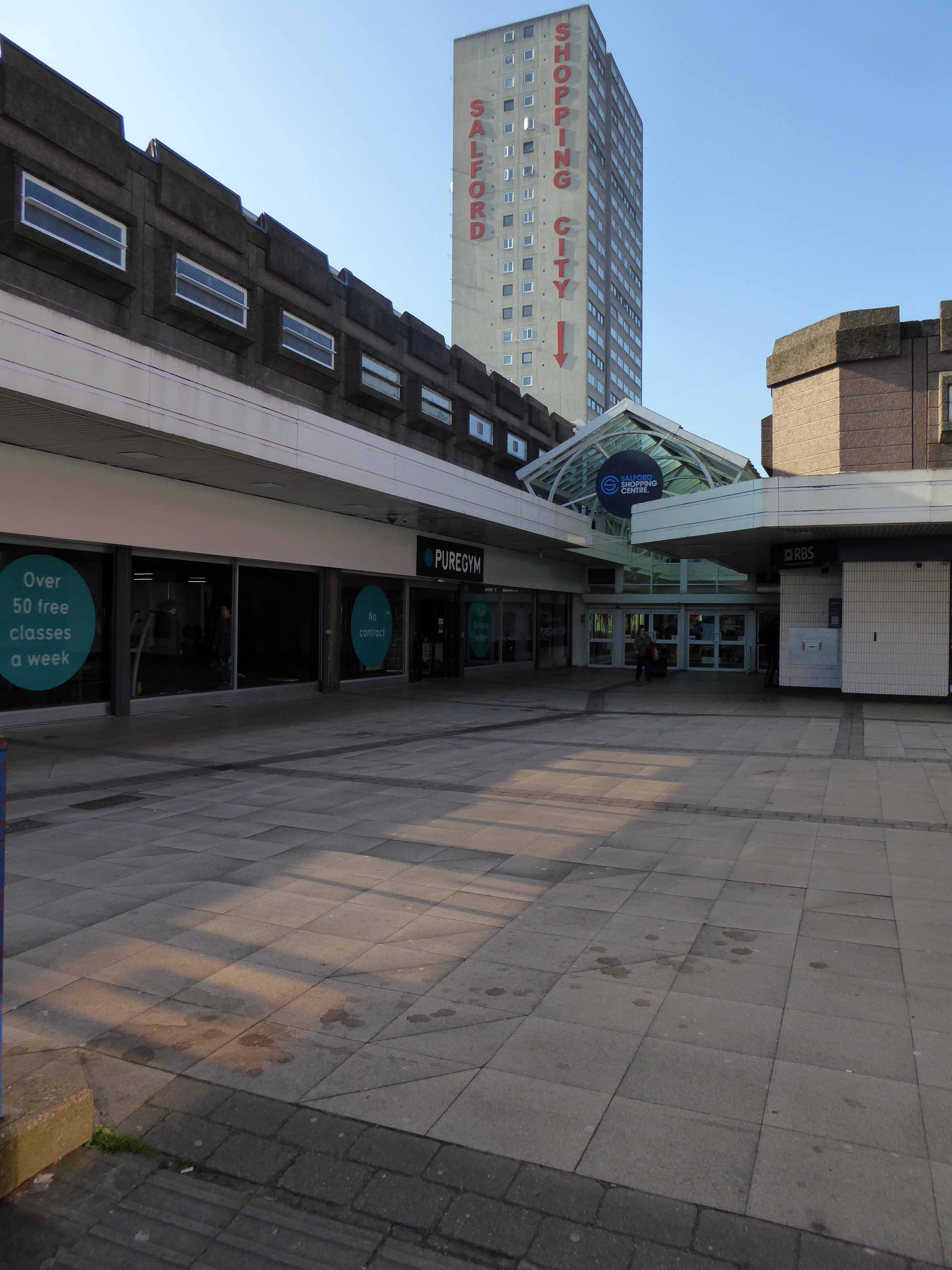
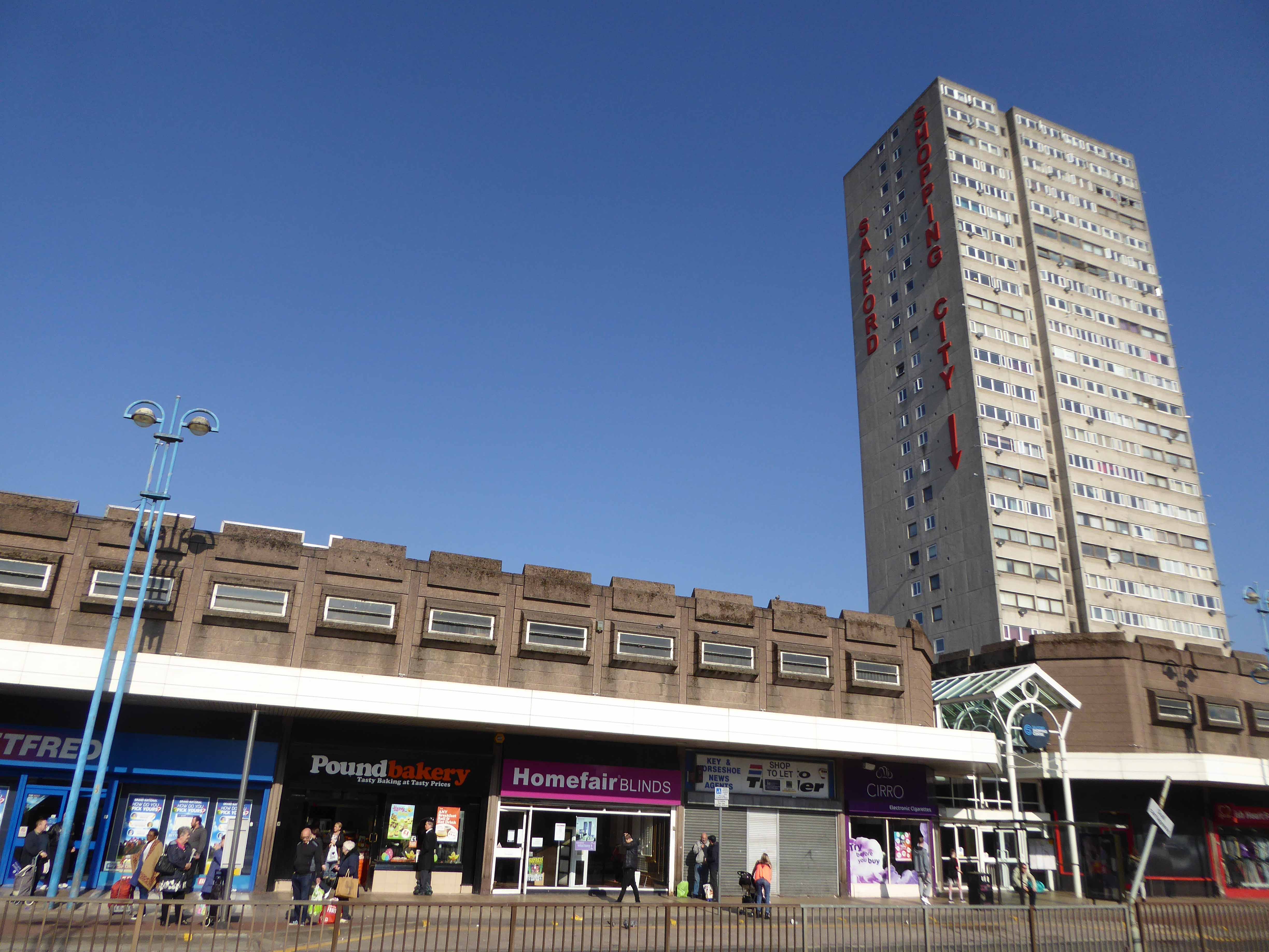
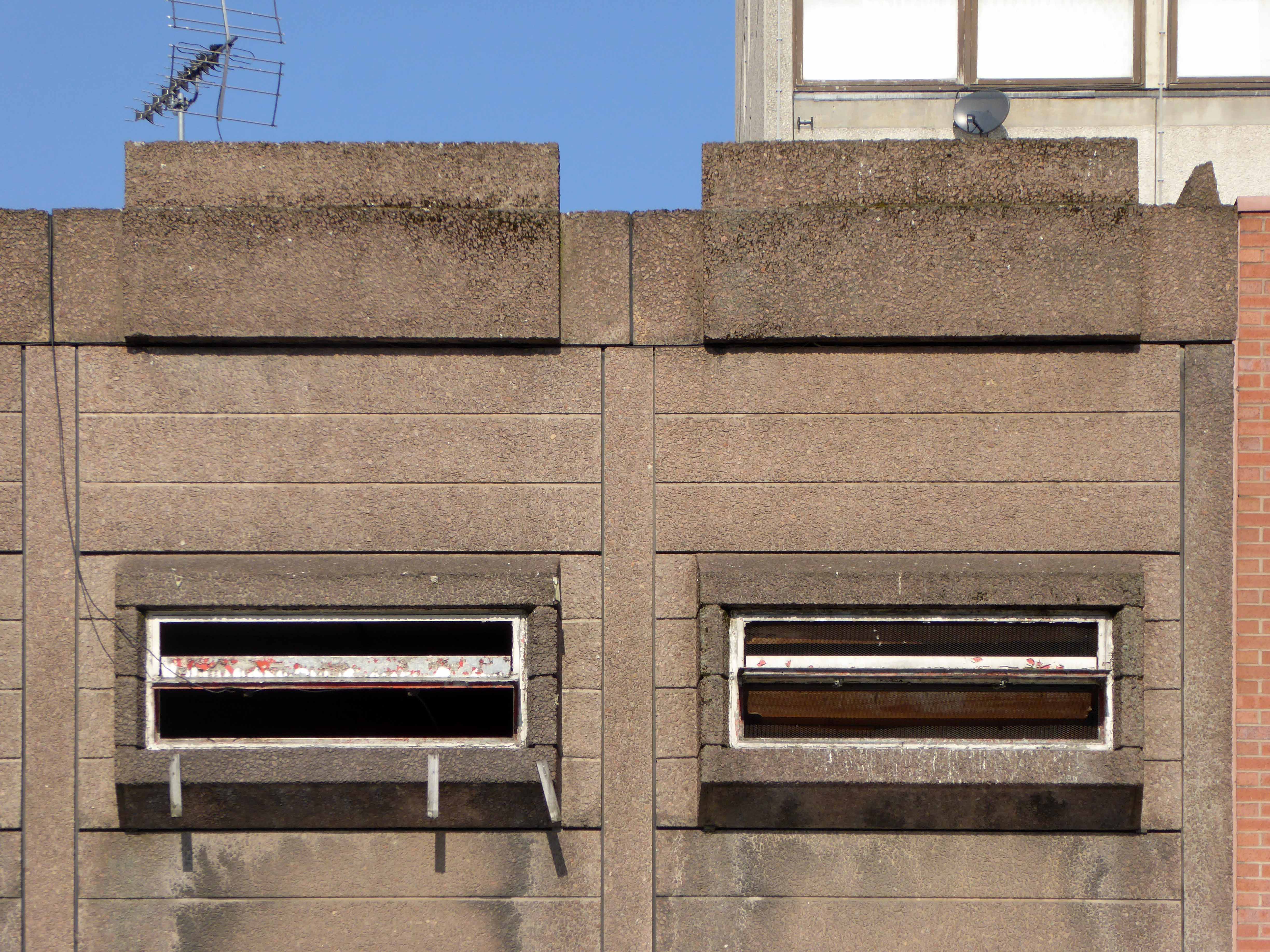
The town centre is dominated by the imposing Lancastrian Hall, opened in 1969, with an adjoining shopping mall.
The hall housed a council library and was used for civic and community meetings, wedding receptions and election counts.
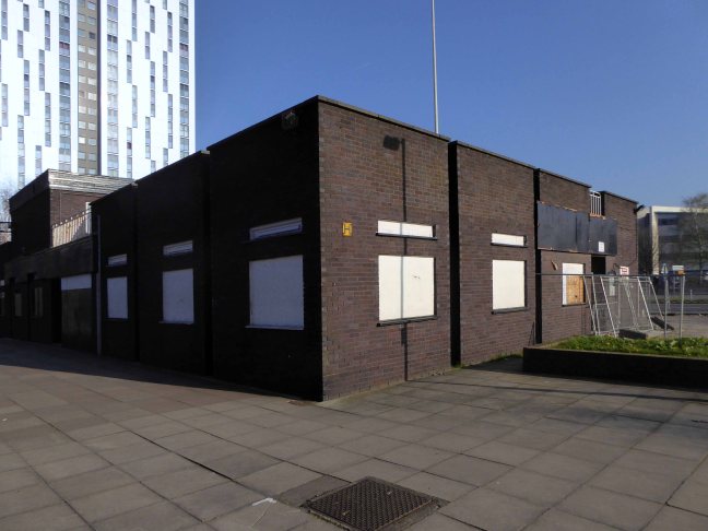
But it has been closed since 2015 after the library moved to the new Gateway Building on the other side of Chorley Road.
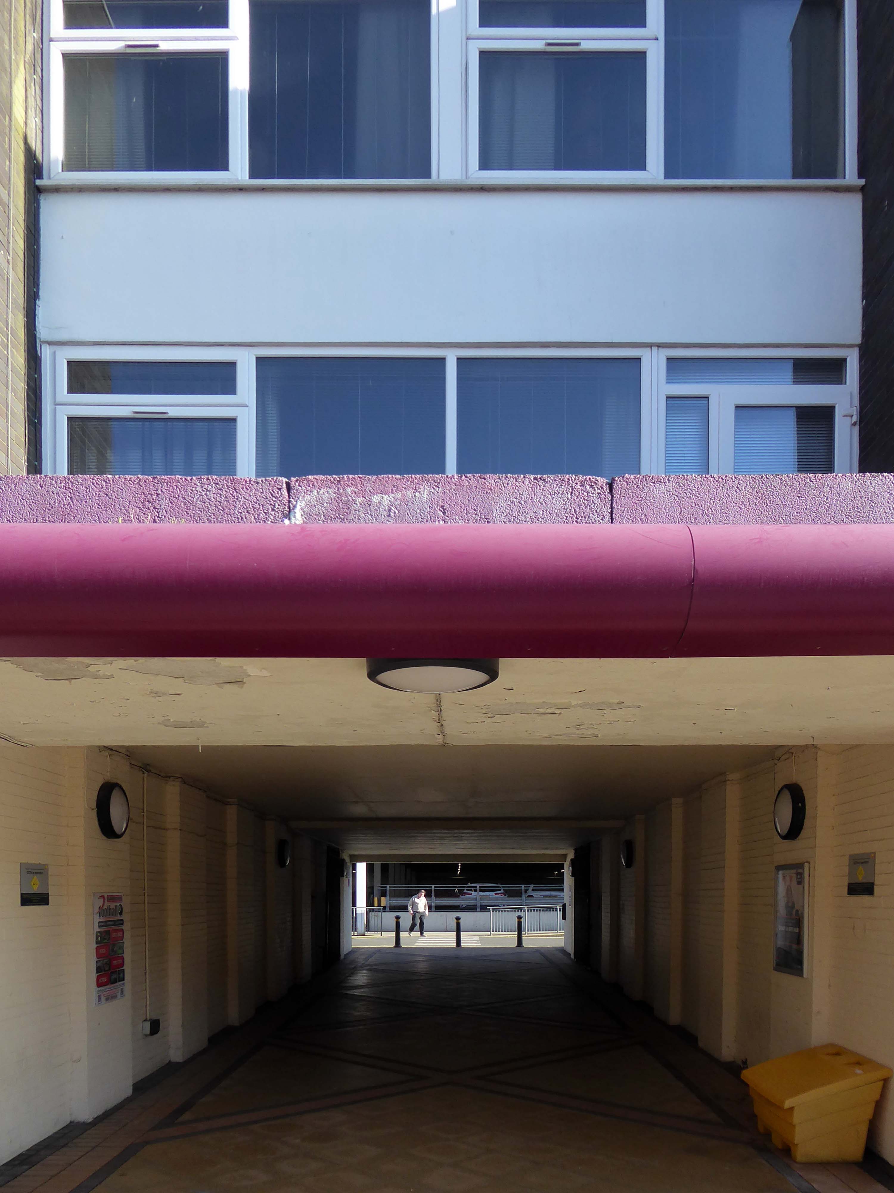
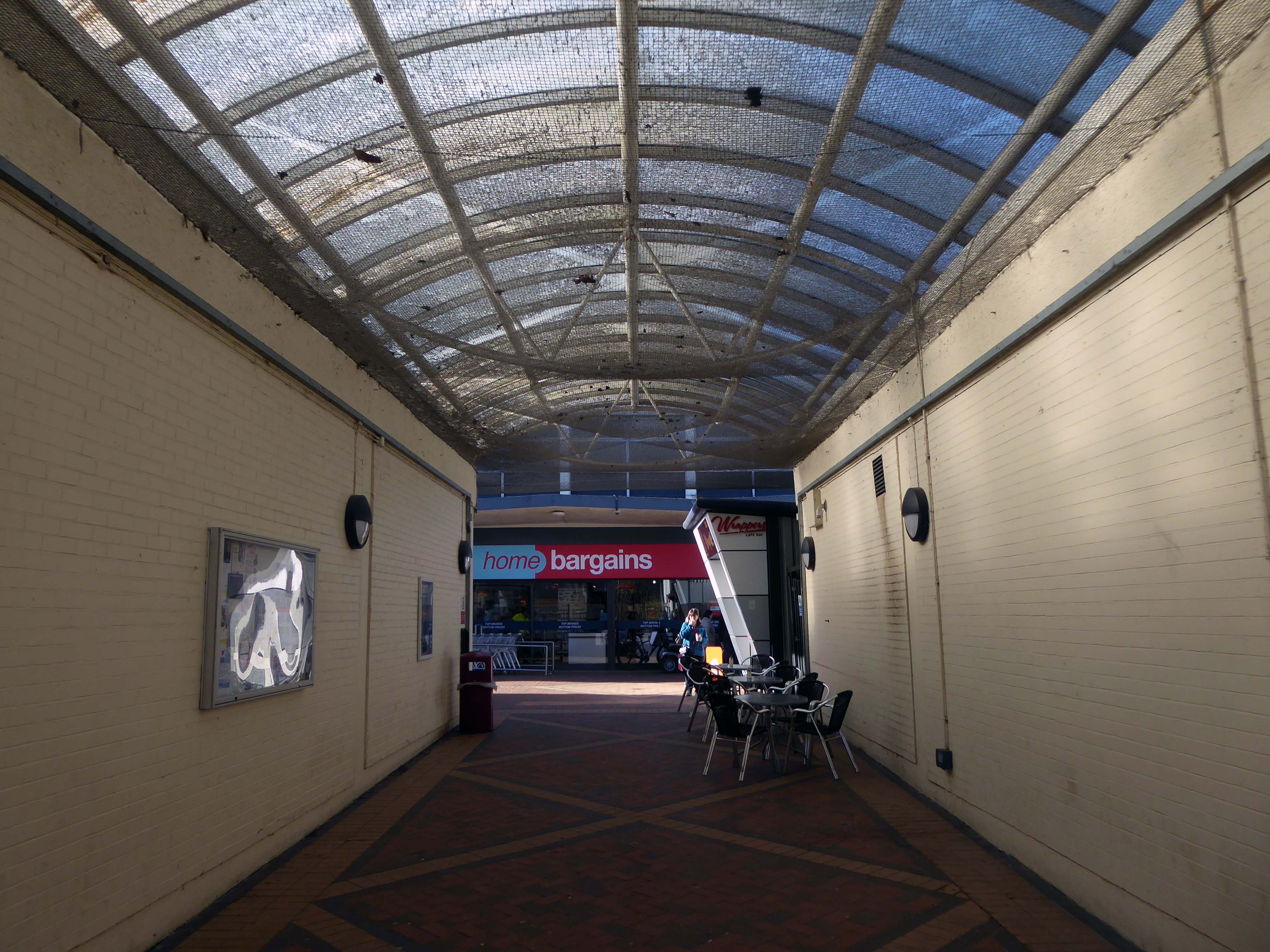
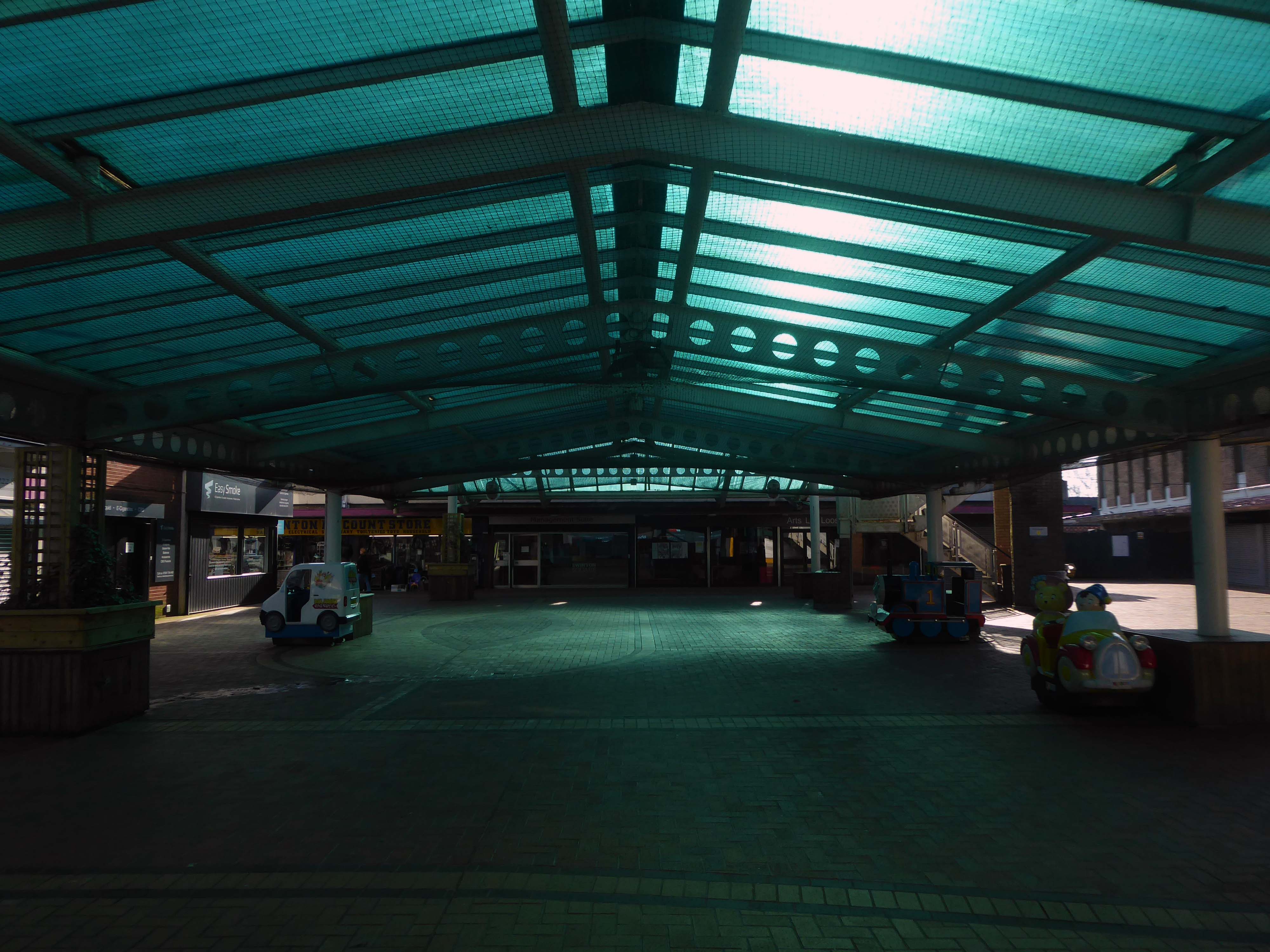
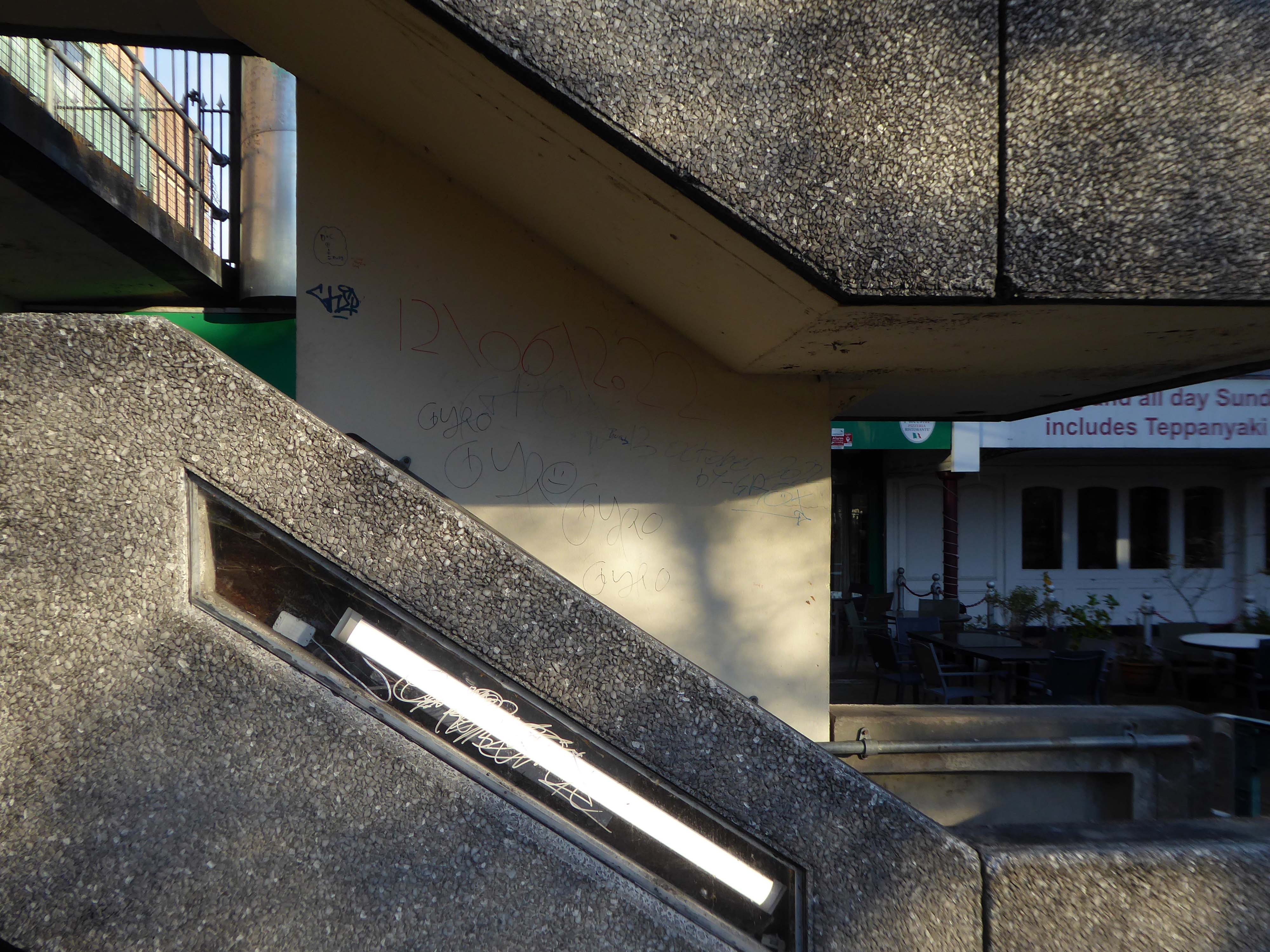
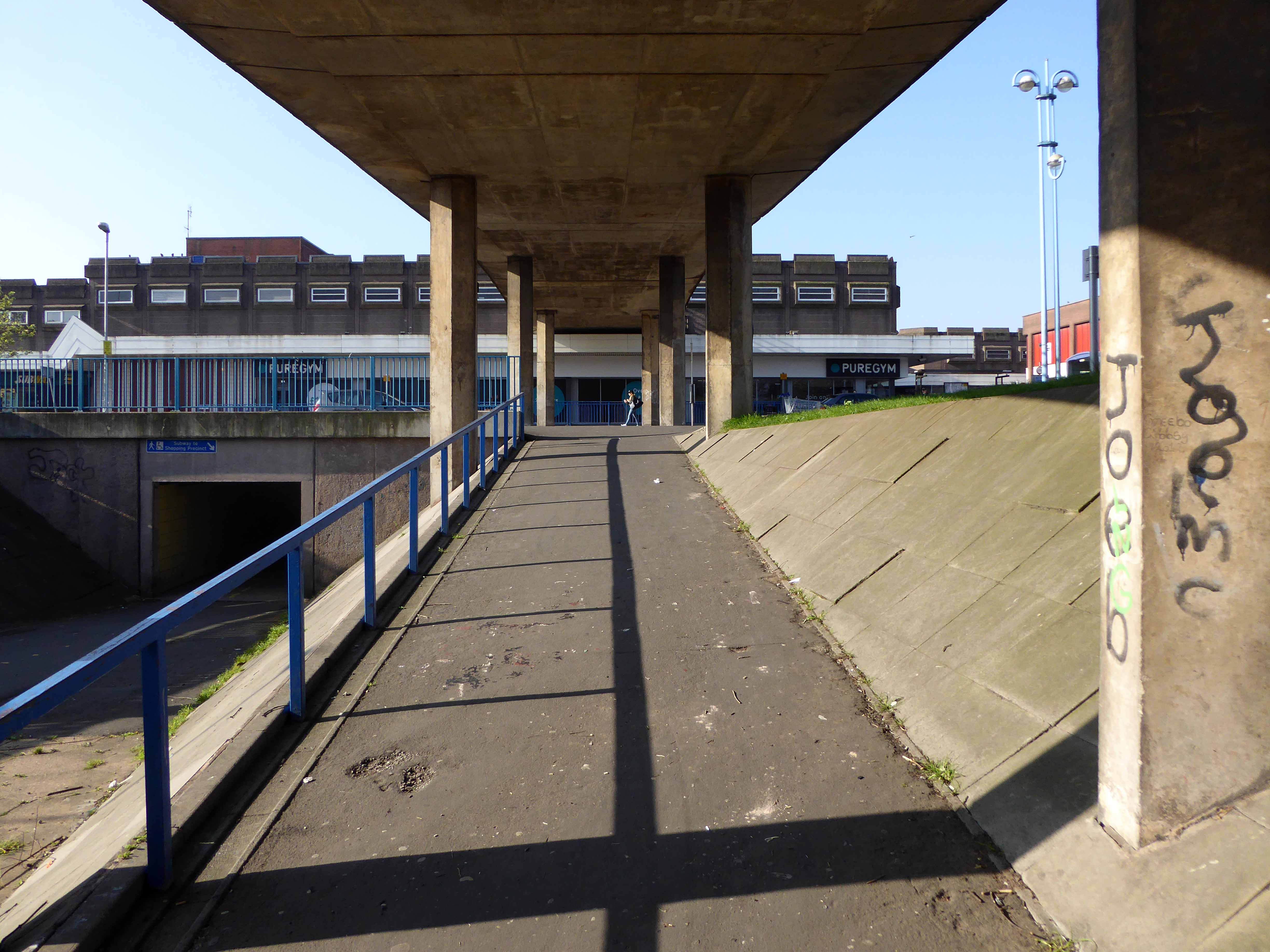
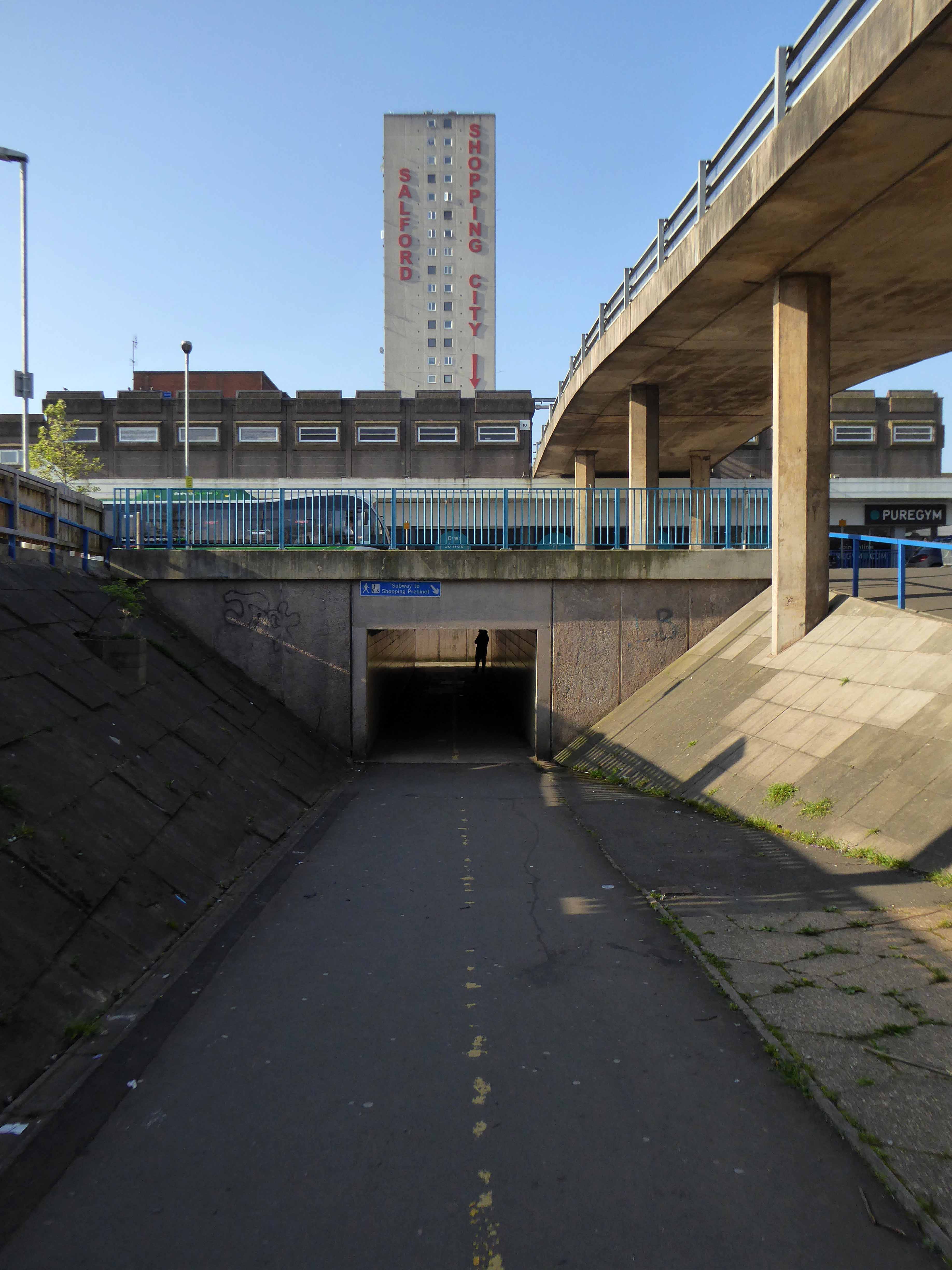
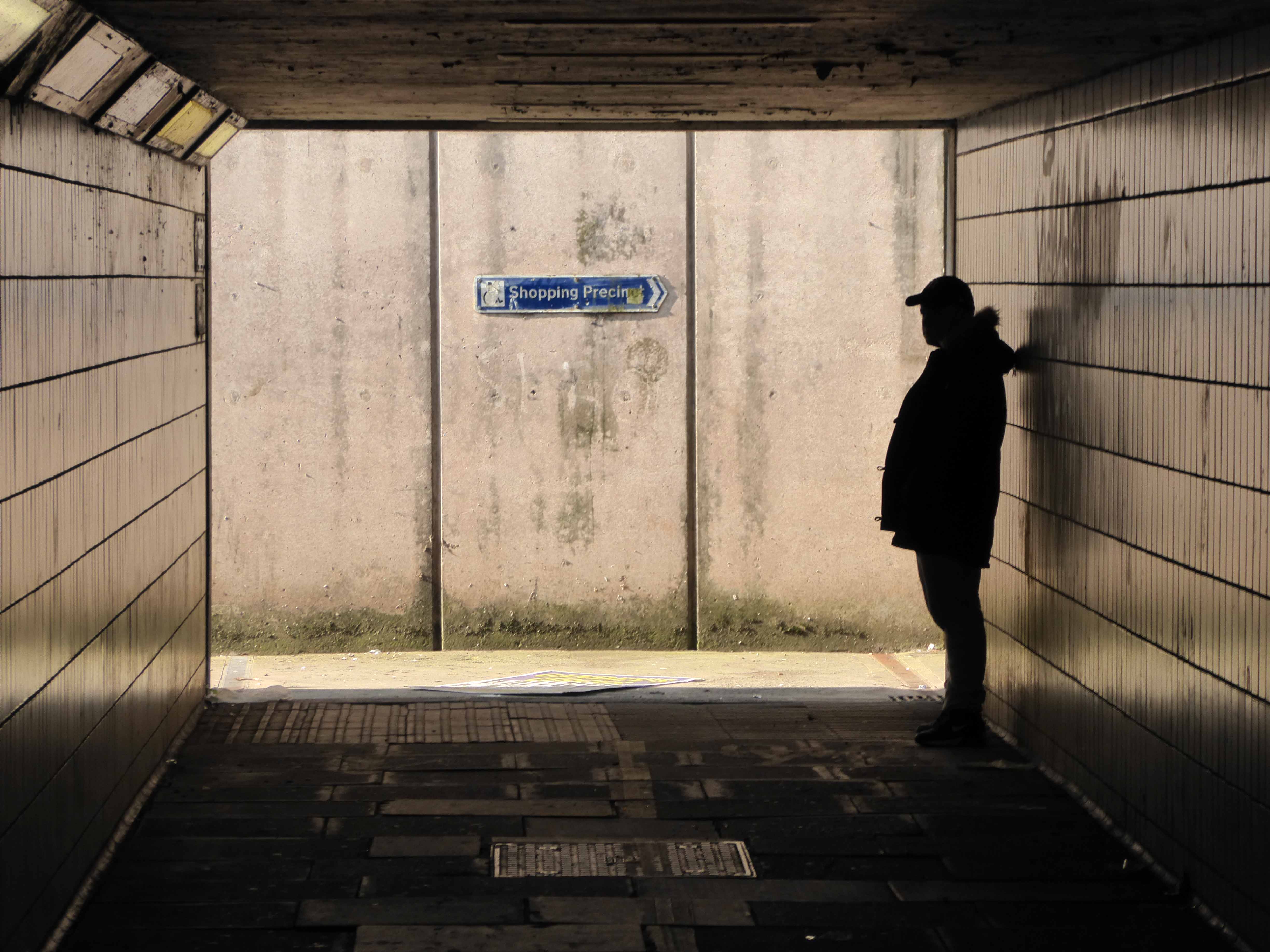
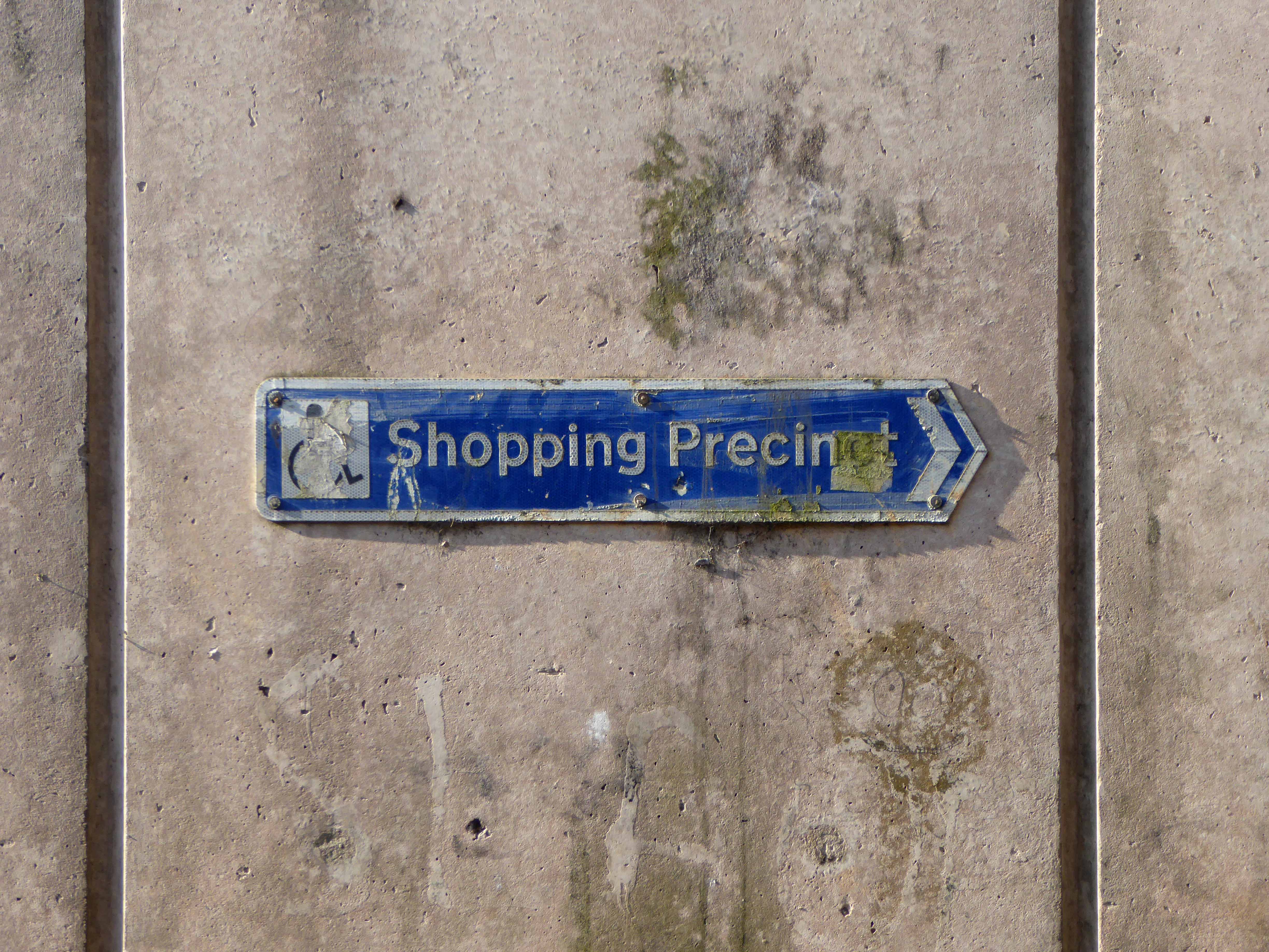
So this magical structure of stairways, undercrofts, elevated walks and majestic concrete clad volumes is under threat.
Swinton and the Lancastrian Hall deserve much better.
Over 550 people took part in the recent visioning work, and we are grateful for their time and valuable contributions.
An overwhelming majority of those who shared their views saw Swinton as a good place to live and bring up a family – somewhere friendly, with a strong sense of community.
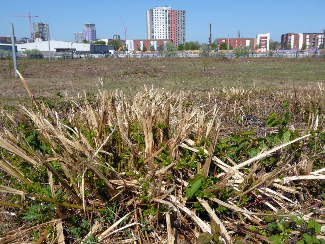
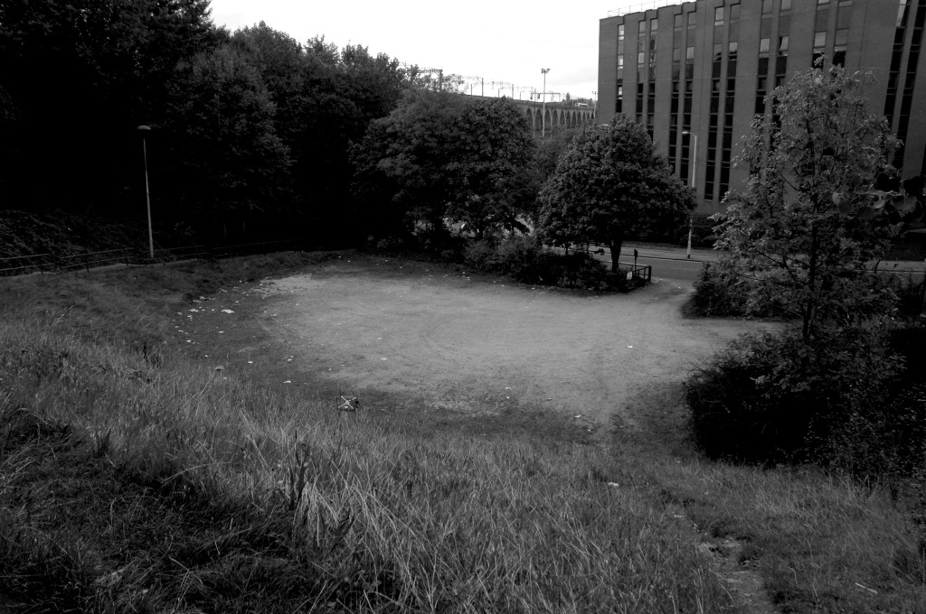
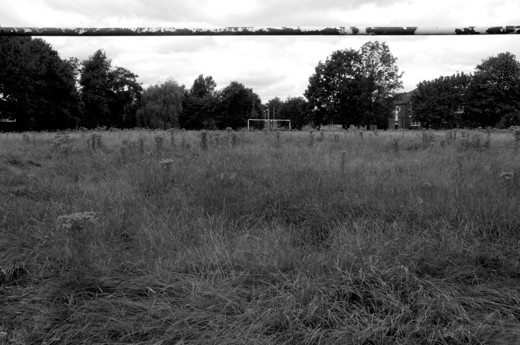
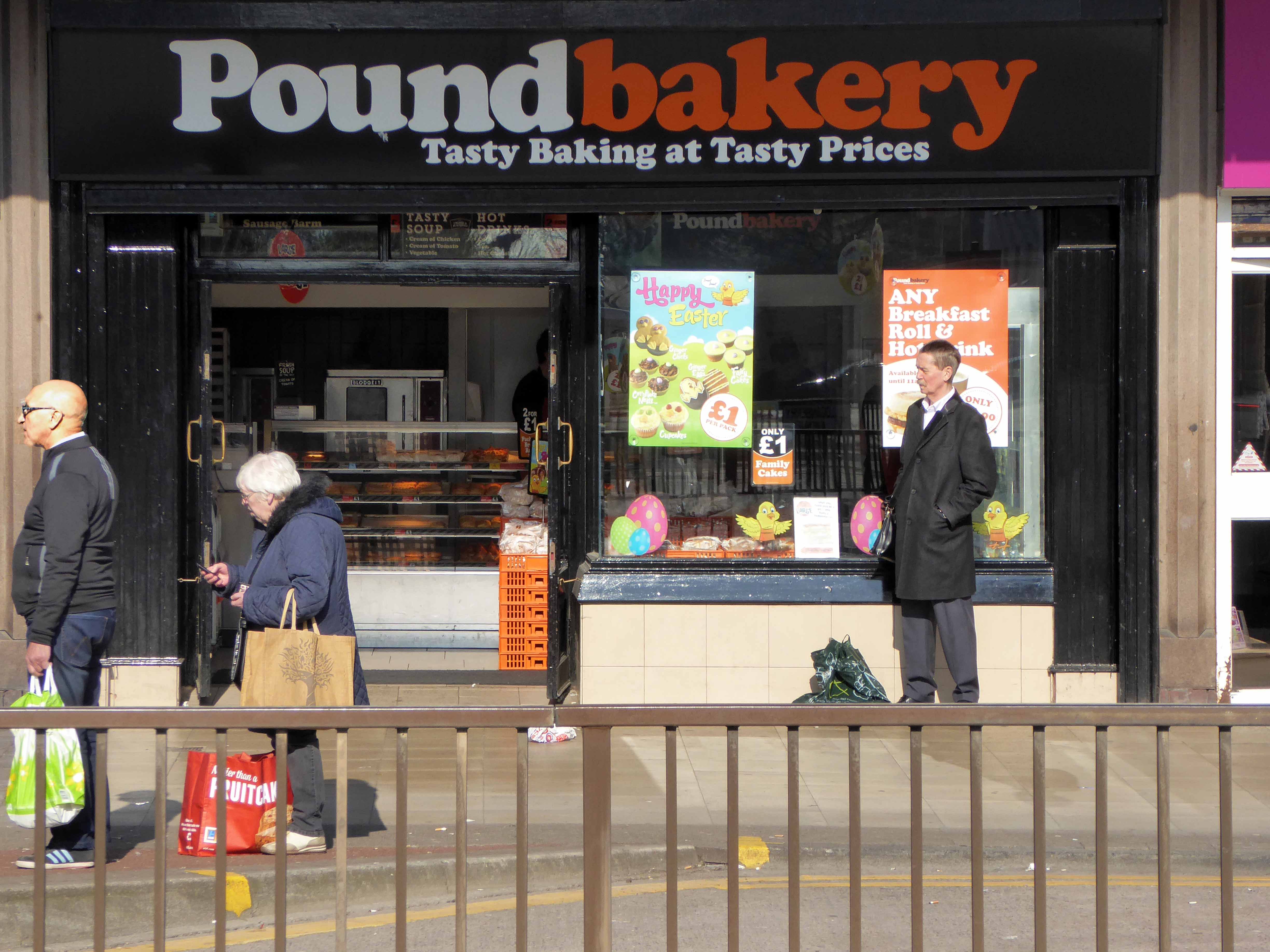
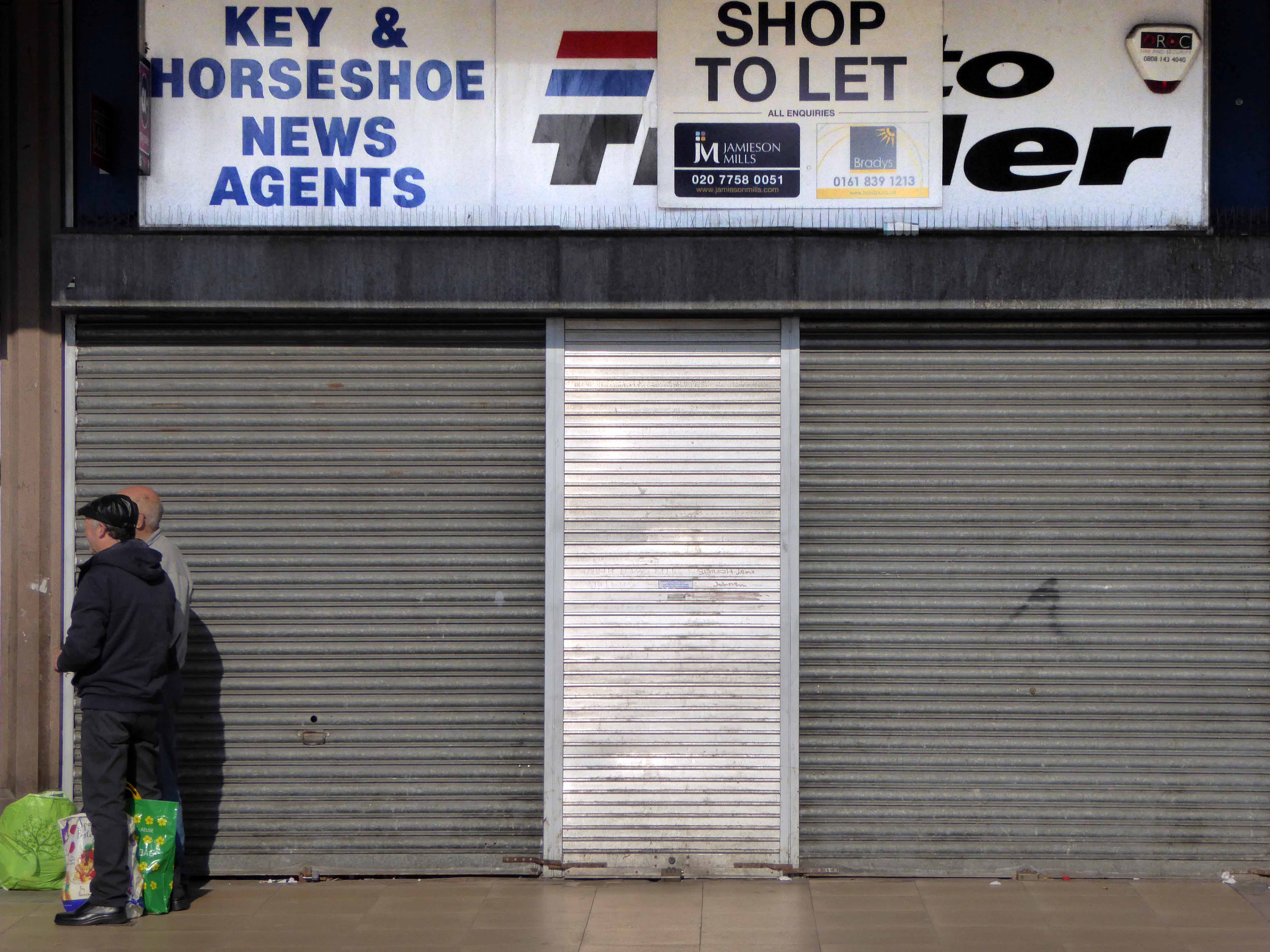
People valued their local green spaces, but strongly felt that there needed to be more investment in the town centre, and a plan to tackle empty buildings and shops.
Overall, people felt that Swinton needed to be a more vibrant place, with more going on – and more reasons for people to visit and spend their leisure time there.
This is an opportunity to create tomorrow’s local centre, but that does rely on removing the Lancastrian Hall, rethinking the shopping centre, and repurposing the Civic Centre and the spaces around it.
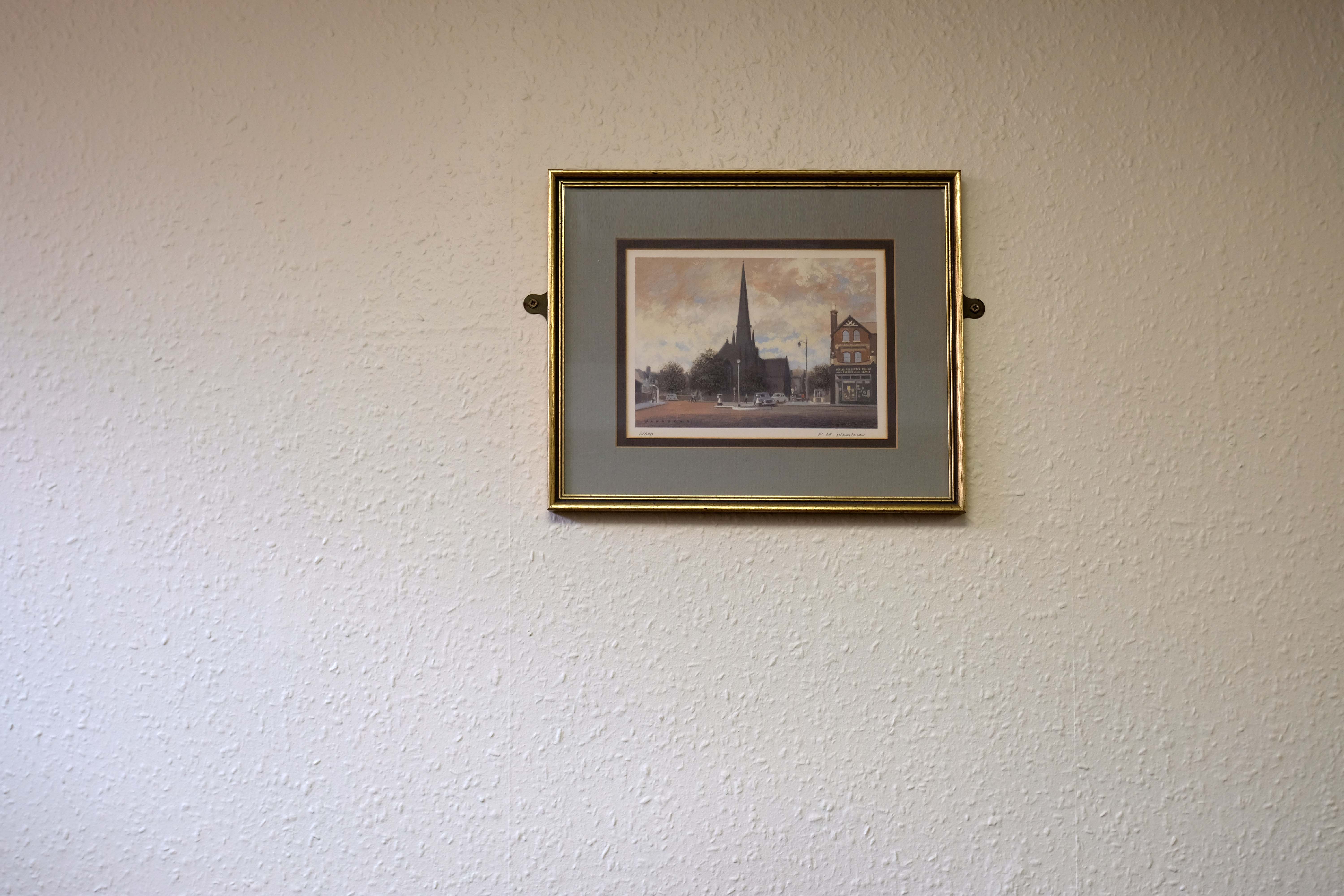
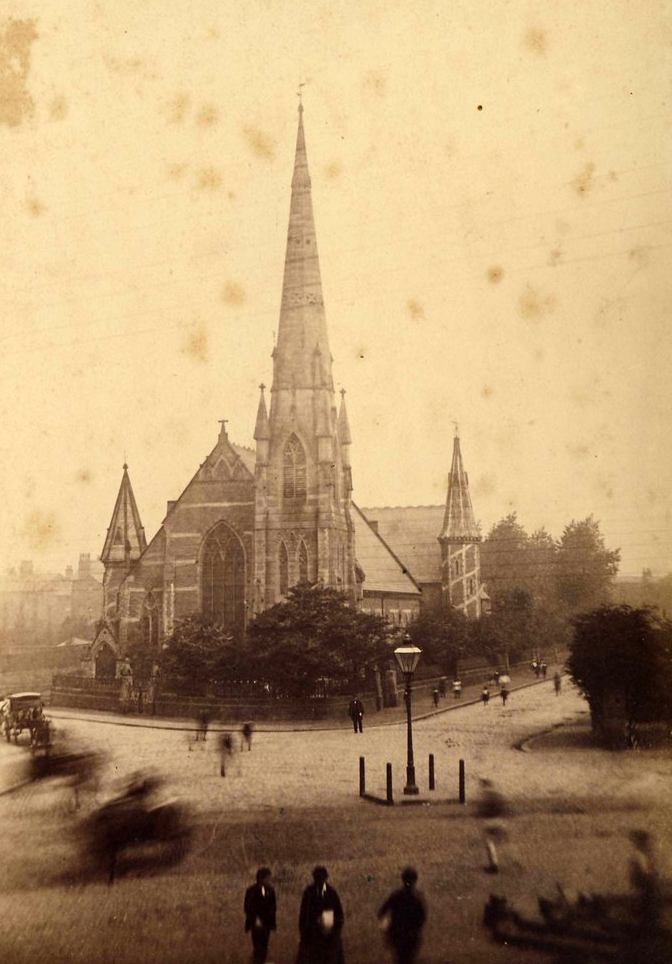
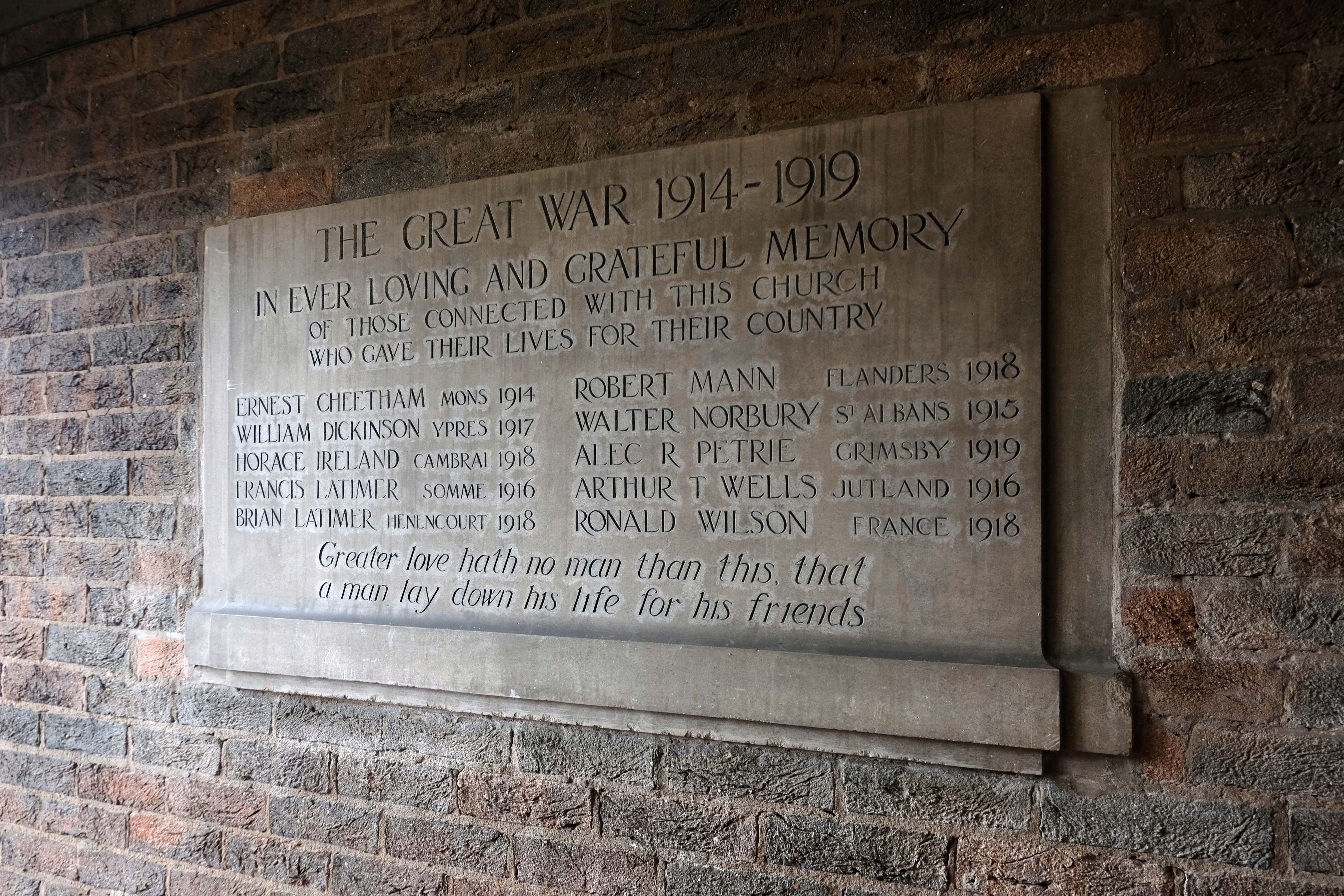
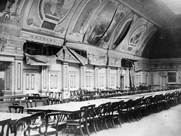
The Cornerstone of the building was laid in front of a crowd of 2,000 on Good Friday 1859 and the church was opened for public worship on Good Friday 6th April 1860. In the press of the day, the church was described as – a Cathedral looking church.
Photo: Flickrcabinet photograph by Enos Eastham of Eccles.
In 1965 it was announced that a new Eccles motorway would be built through the church land.
Work began to demolish the Church and replace it with a new smaller church, but the old church did not go down without a fight as workers could not pull down the steeple. After eleven days of battering and buffeting by eighteen pounds of gelignite and two eight ton bulldozers, the steeple finally surrendered.
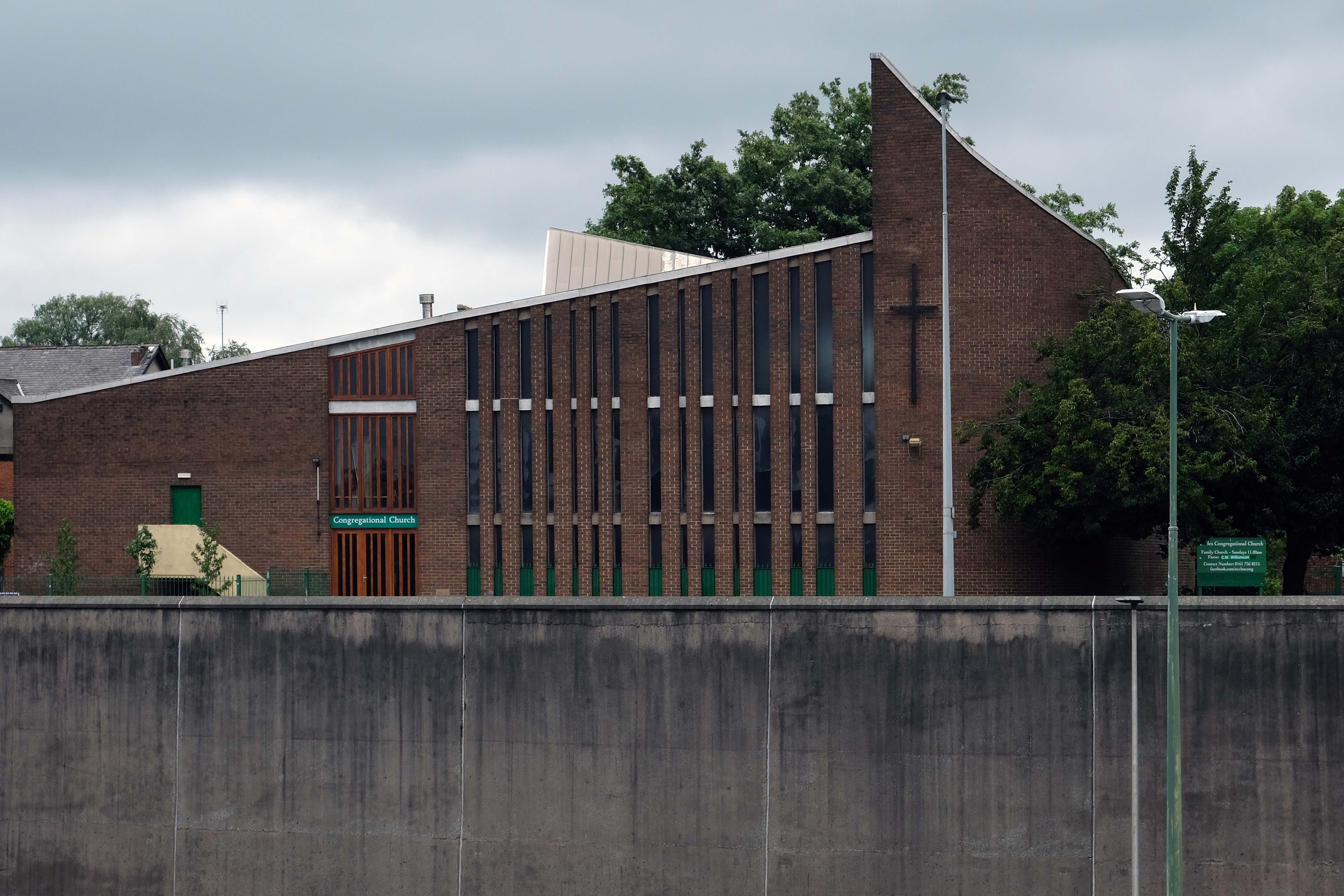
Then there wasn’t – then there was this:
On Friday 11th July 1969, the new church officially opened with a splendid ceremony. A minor hitch occurred when the organ blew a fuse during the second verse but the Congregation sang through it while organist Mr Kenyon frantically fumbled about and rectified the matter.
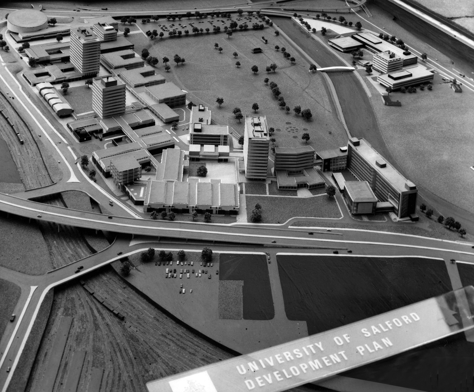
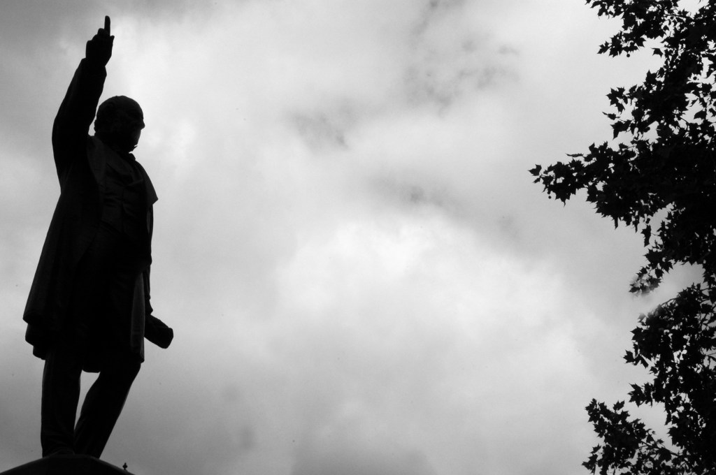
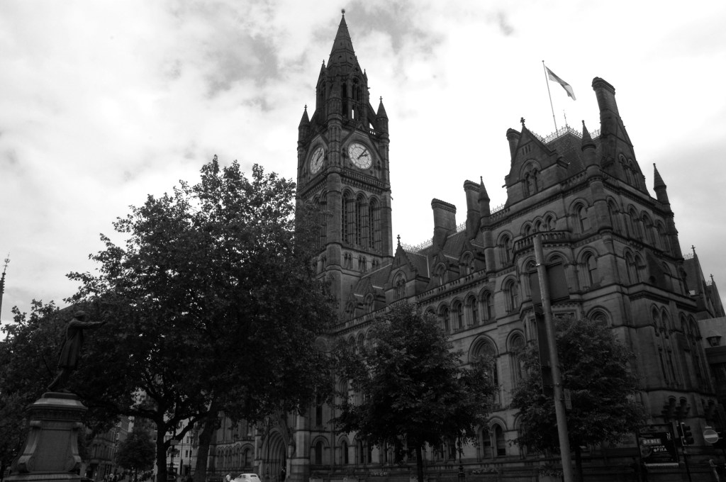
The original master plan would have swept away the Victorian Technical Institute and Salford Art Gallery.
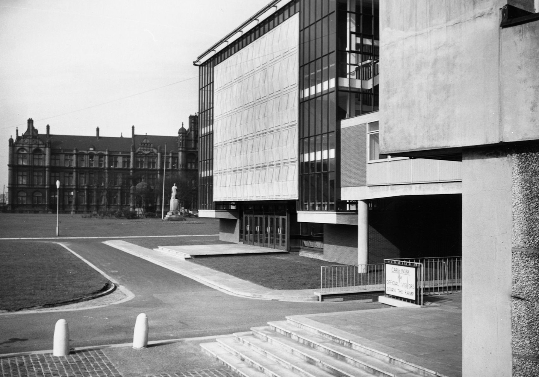
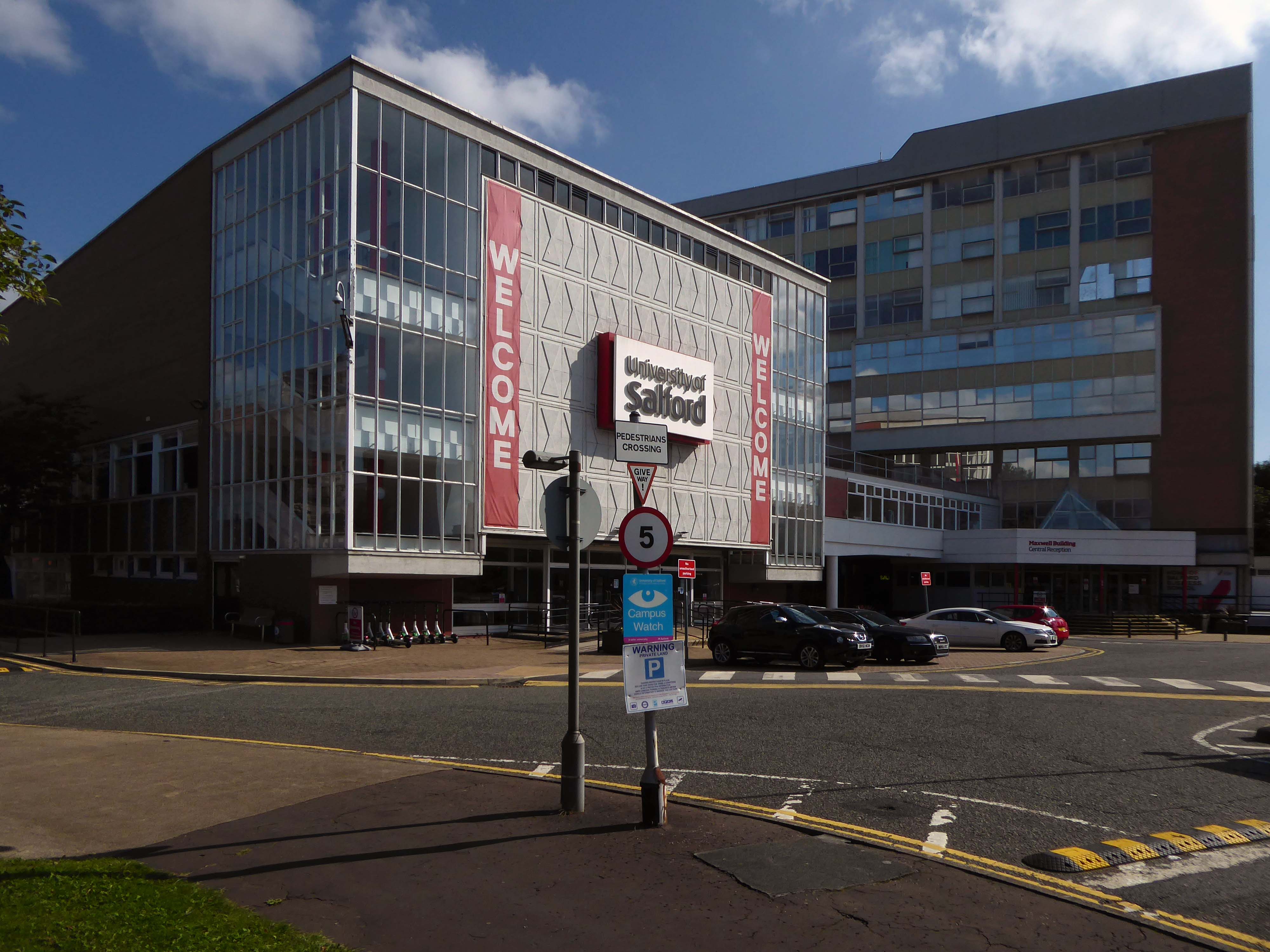
Across the road are the Maxwell Buildings.
They were built between 1959 and 1960 to a design by the architect C H Simmons of the Lancashire County Architects Department.
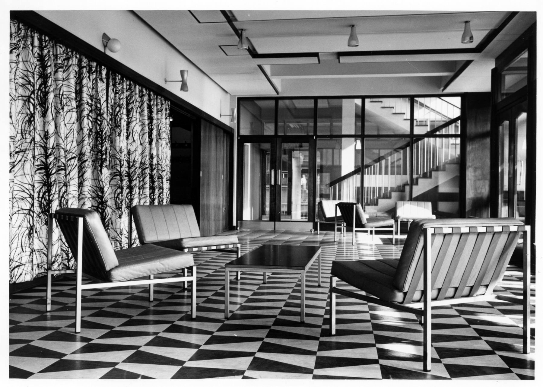
The interior decorative order of Sixties’ institutions was integral to the architectural design, sadly this is no longer so.
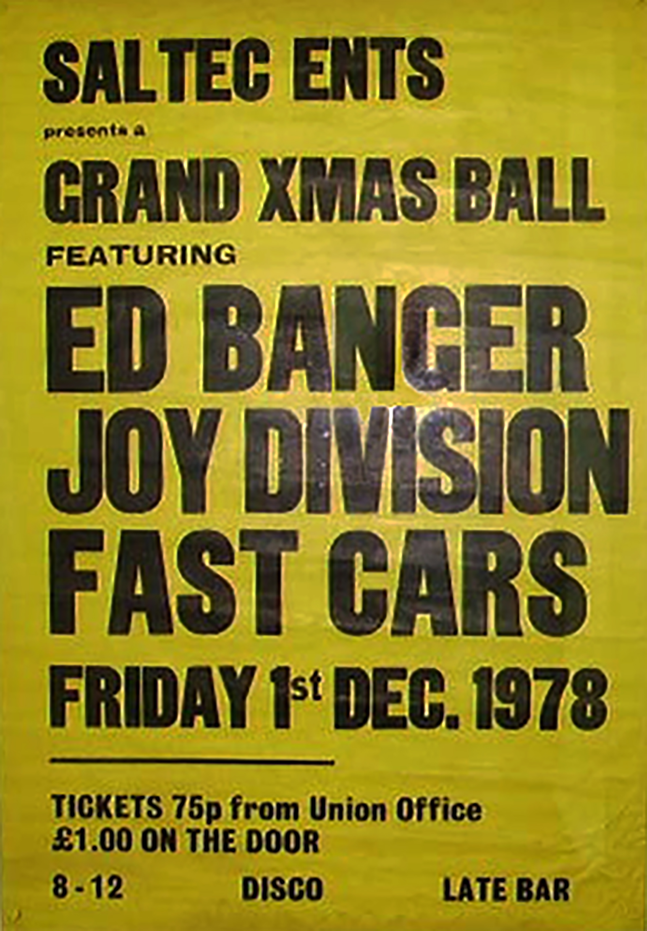
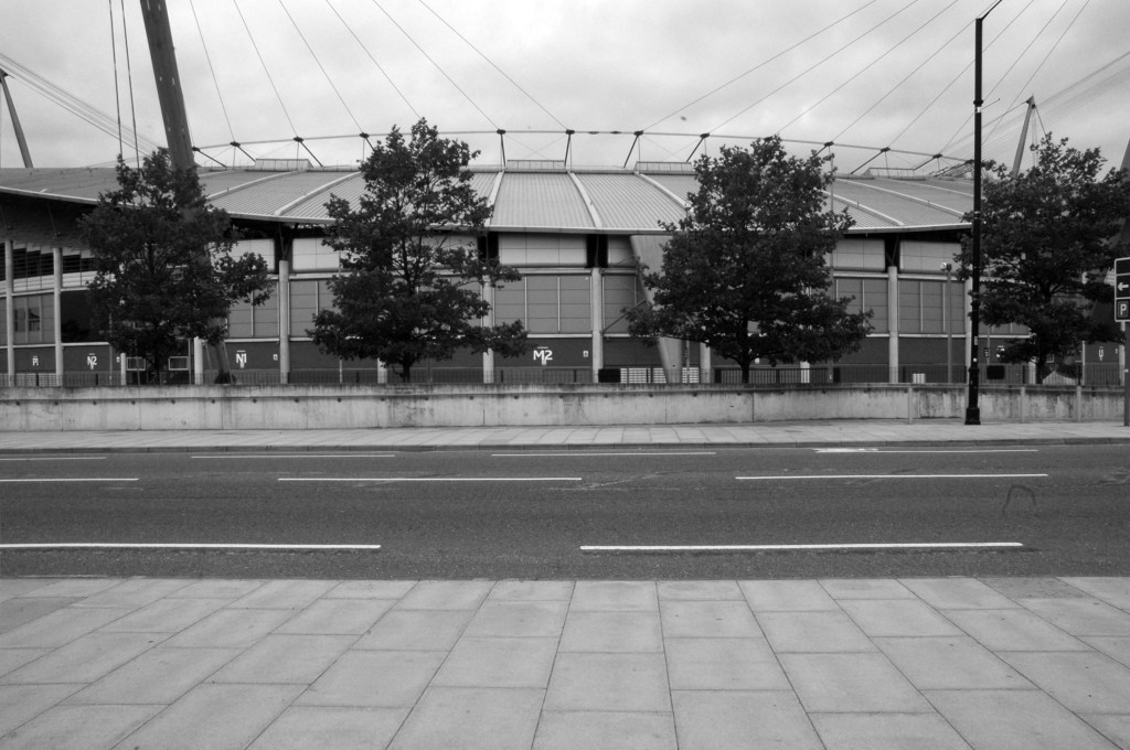
The hall has a great musical heritage.
Featuring the Fast Cars who we have previously encountered in Swinton at the Lancastrian Hall.
Which may be the subject of ambitious redevelopment.
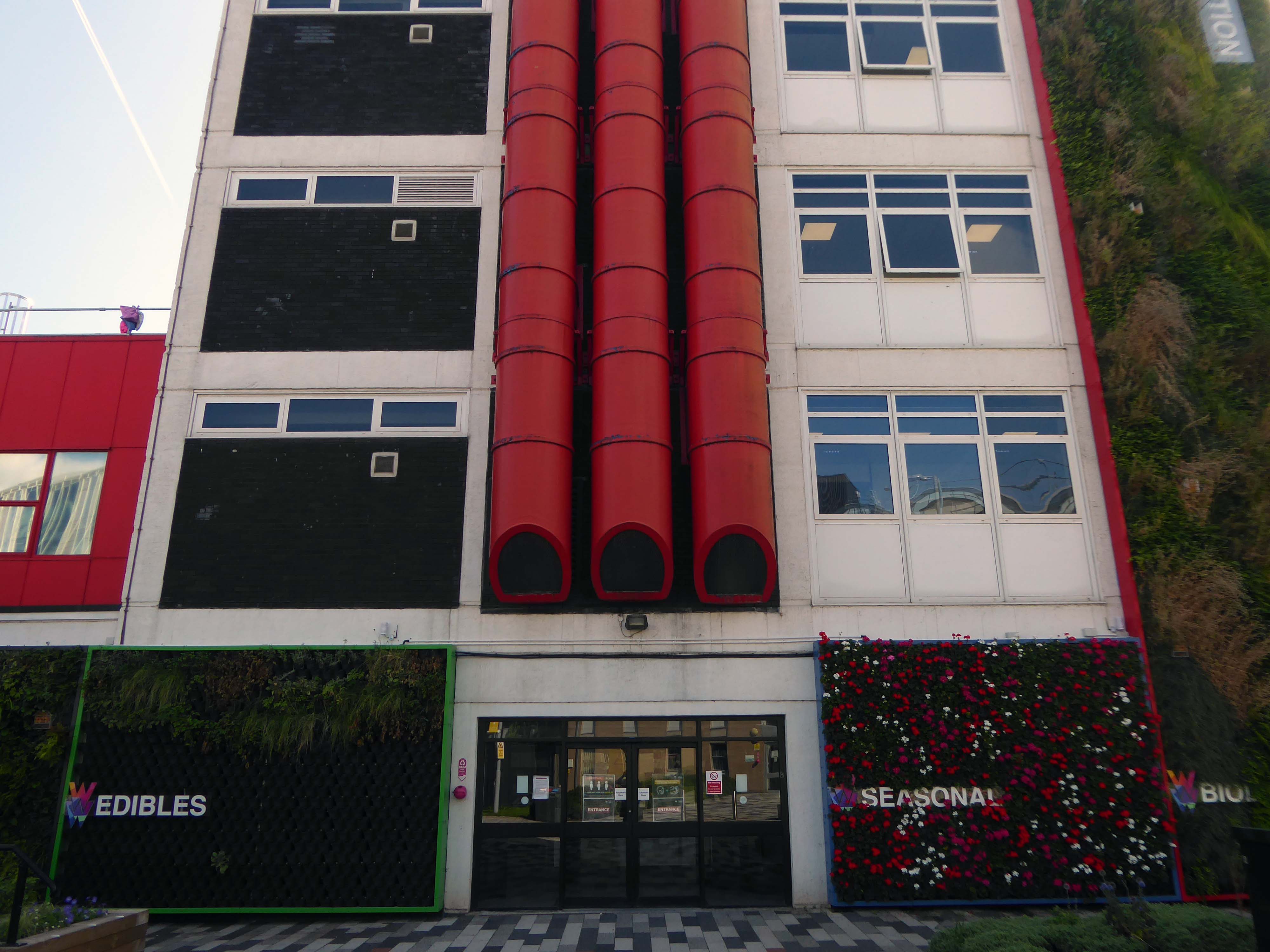
Take a turn around the corner to the Cockcroft Building.
The east facing mural painted out and obscured by retrofitted infrastructure.
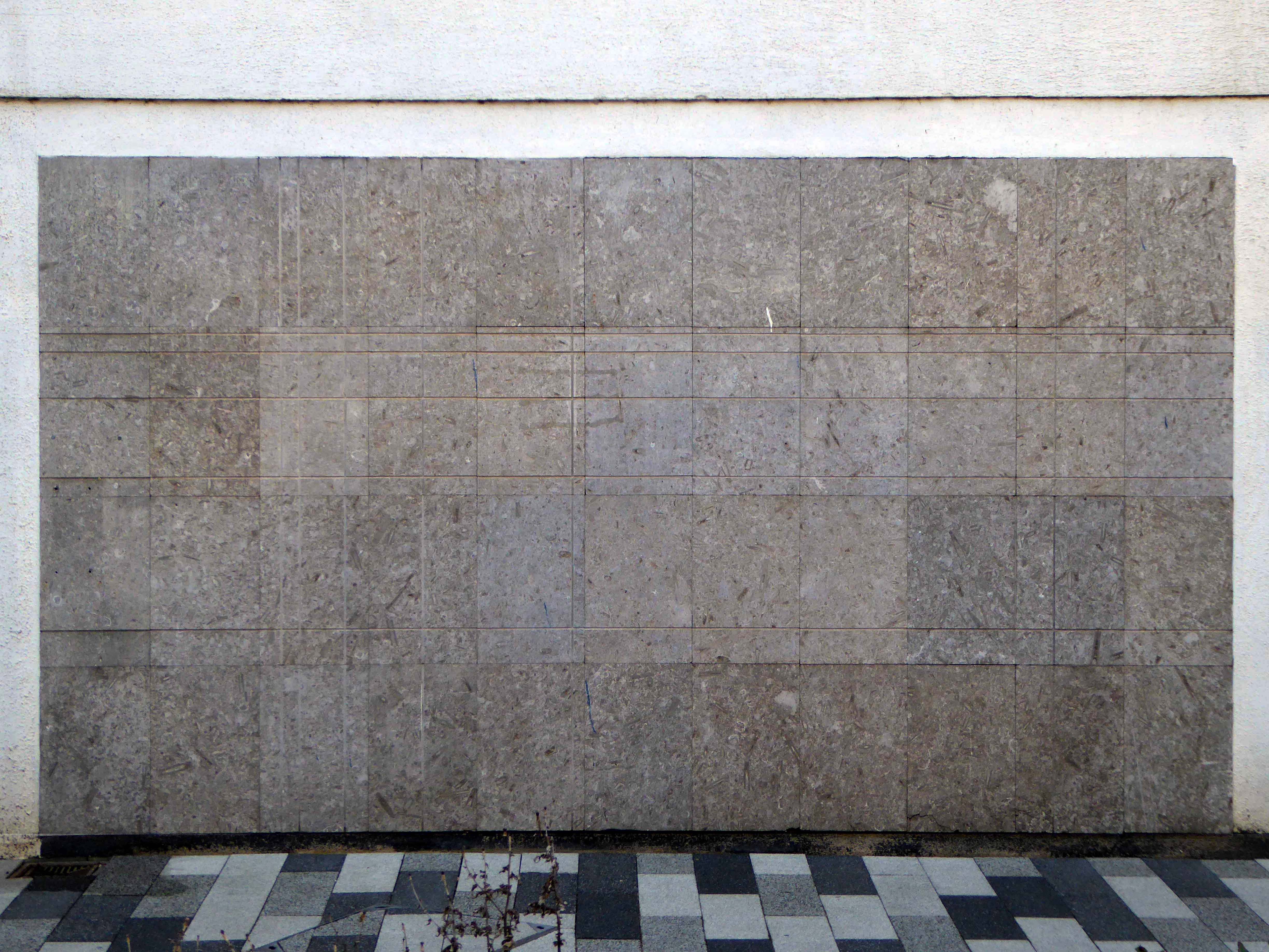
These incised stone panels obscured by plants.
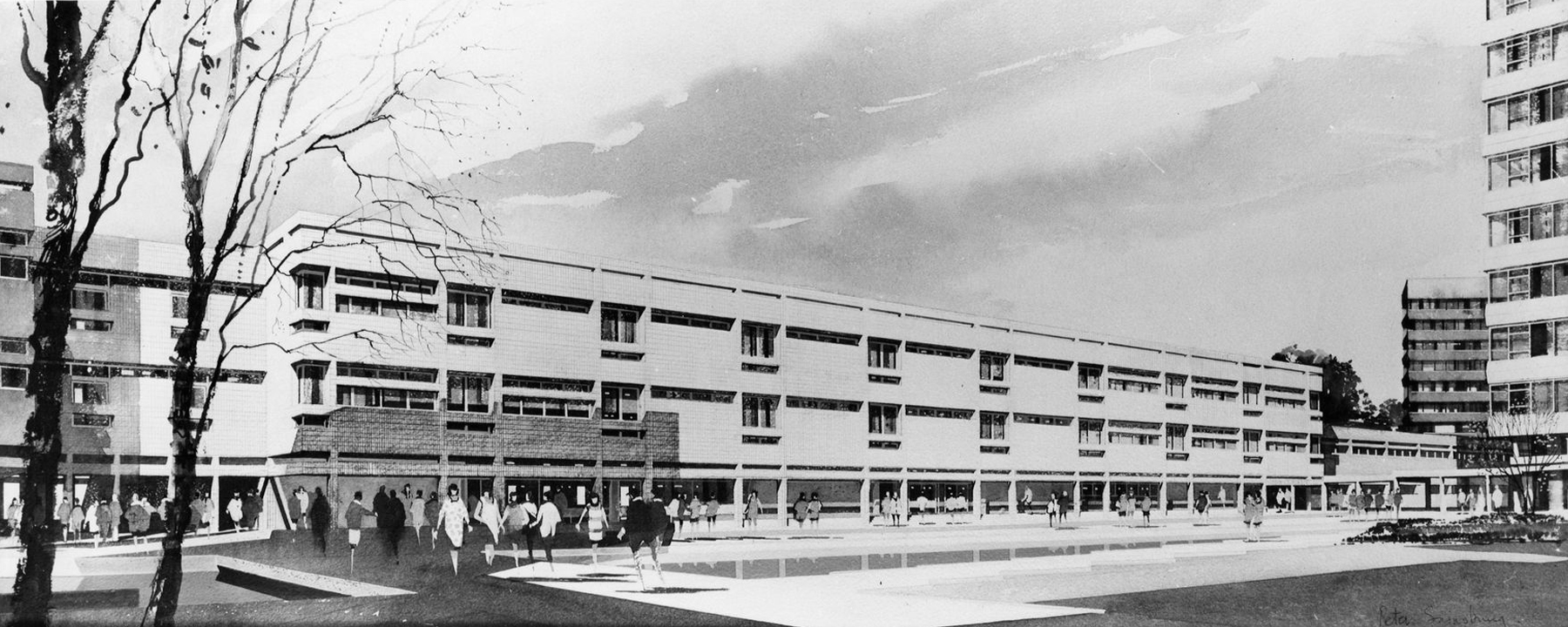
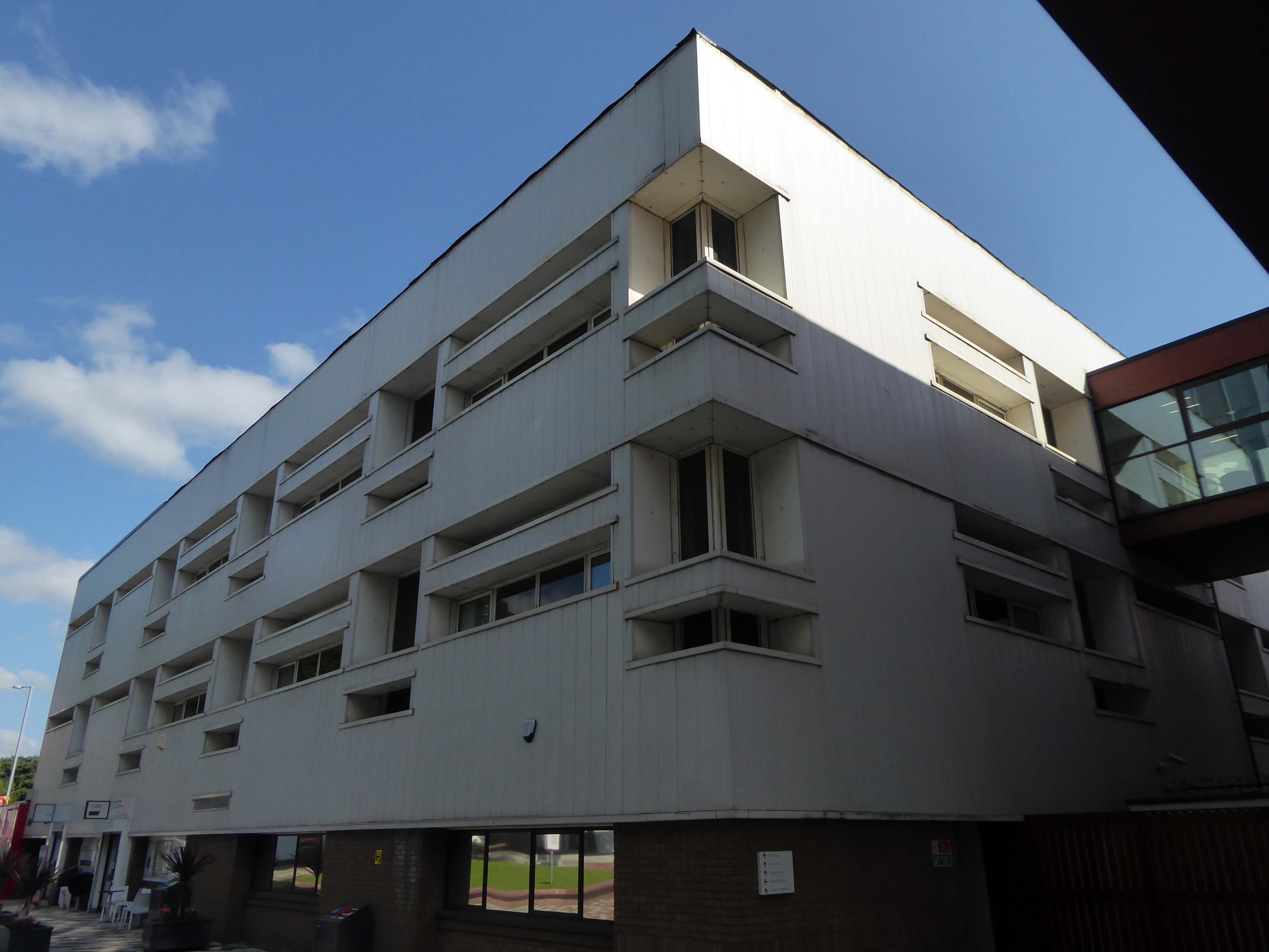
To the left is the Clifford Whitworth Library – this is the original architectural impression – signed Peter Sainsbury.
The original fascia was tile clad.
Subsequently replaced by uPVC boards.
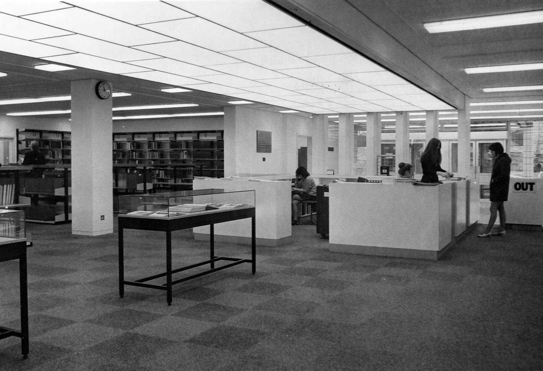
Yet again the original interior was integral too the architectural scheme and period.
Across the way the Chapman Building.
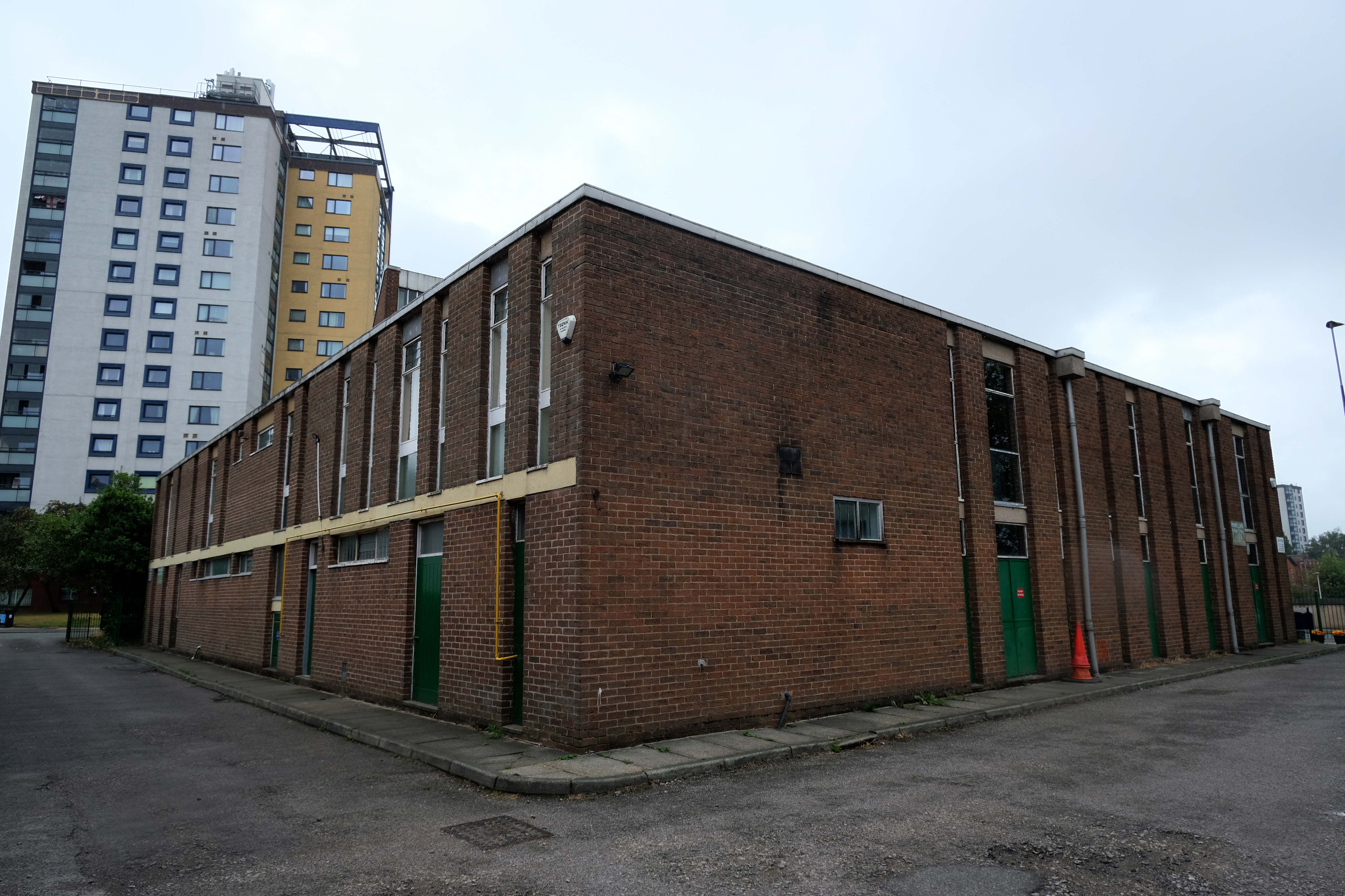
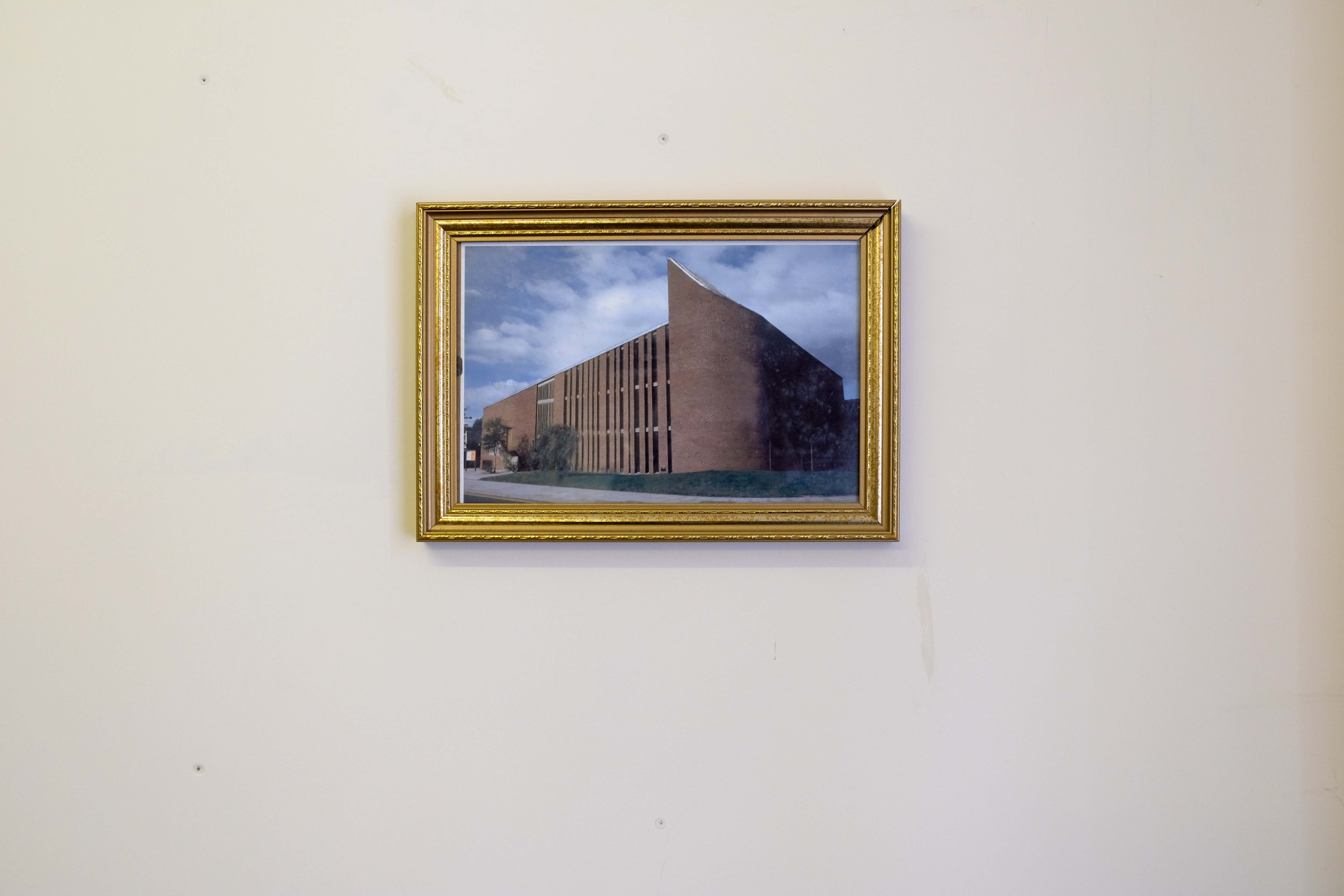
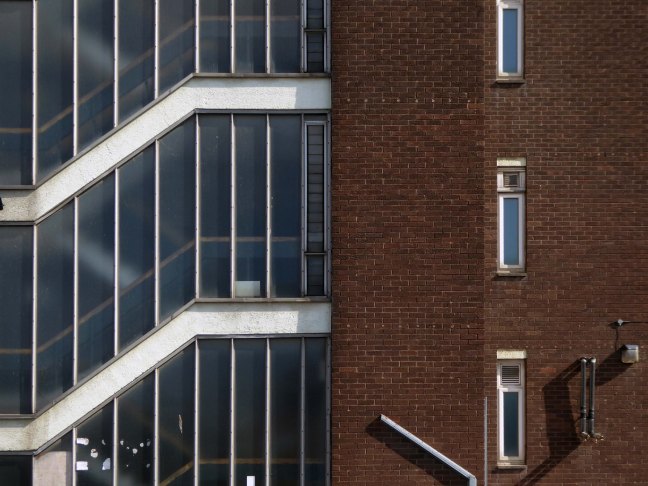
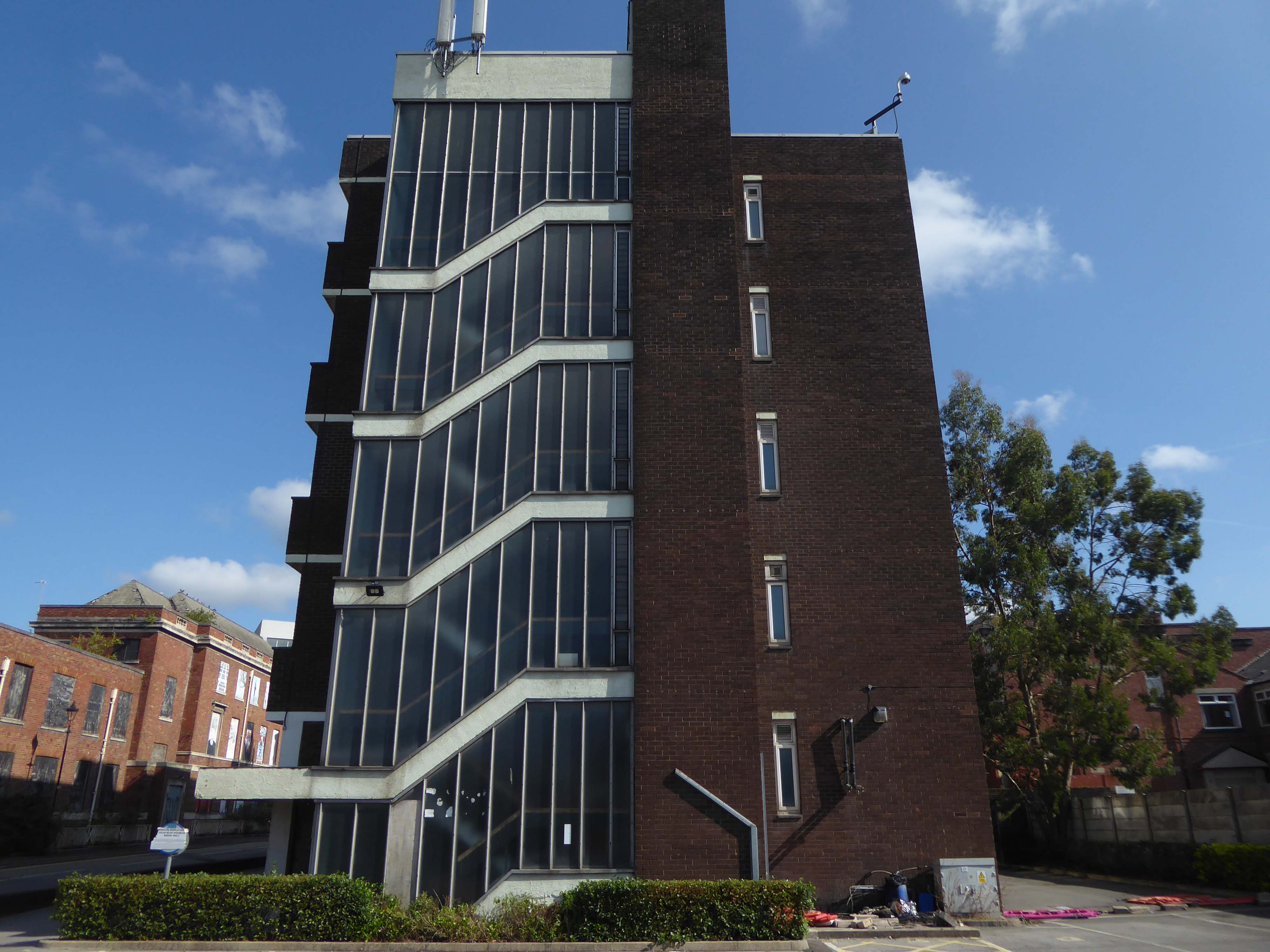
It was designed by WF Johnson and Partners of Leamington Spa, as a lecture theatre block and gallery. It sits with its long axis running parallel to the railway behind. The series of grey volumes, occasionally punctuated by colourful floods of red and green trailing ivy, hang together in a less than convincing composition. The orientation and access to the building seem confused and detached from any cohesive relationship to the rest of the campus, but there is something perversely attractive about the right essay in the wrong language. The reinforced concrete building contained five lecture theatres, communal spaces, an art gallery, AV support areas and basement plant rooms. Following a major refurbishment in 2012, several additions were made to the exterior and its total concrete presence somewhat diminished. It still houses lecture theatres and a number of other learning and social spaces.
To the rear of the building there are some of the original details, now painted a series of funny colours.
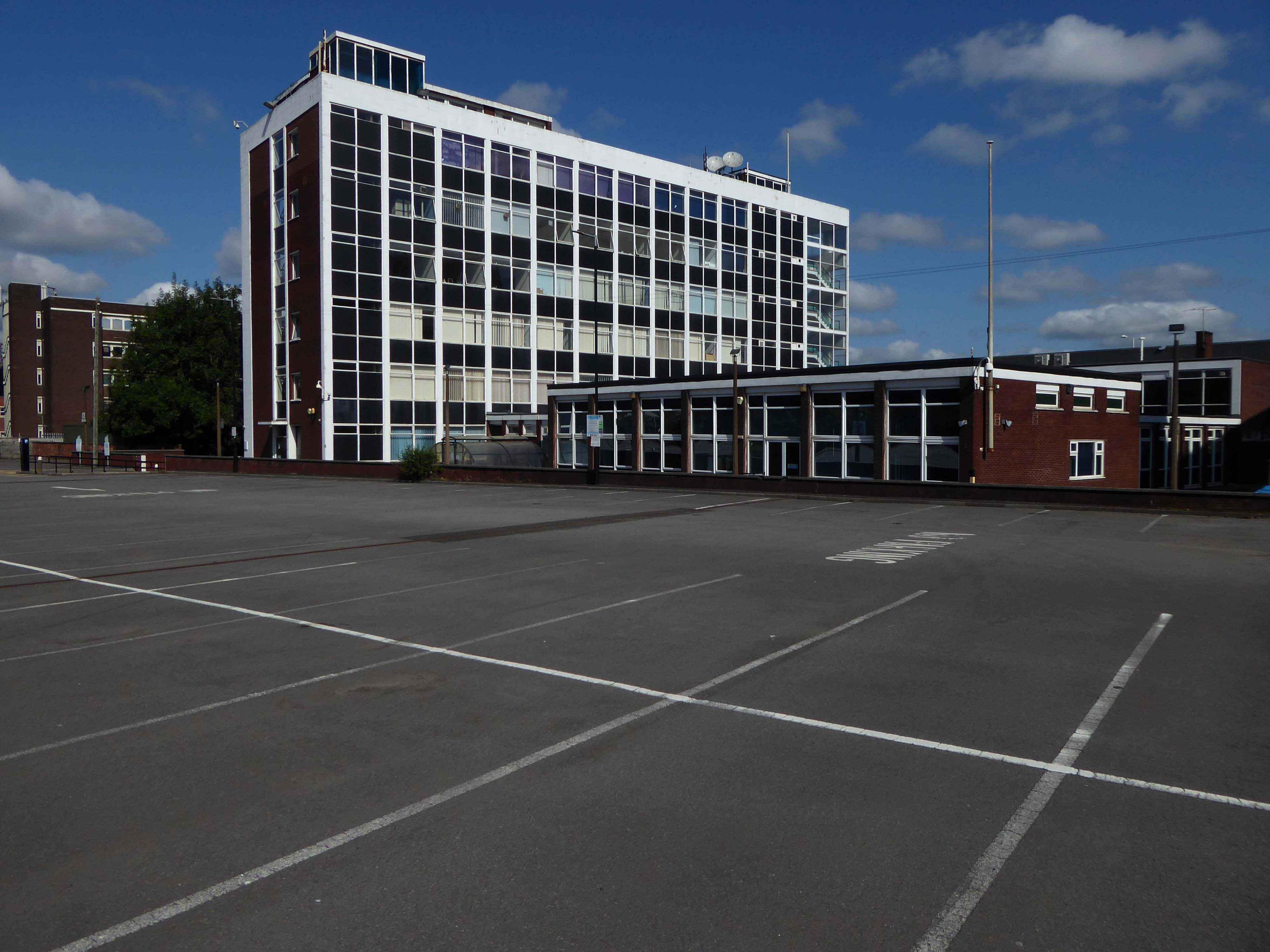
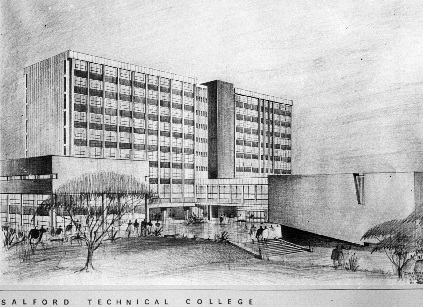
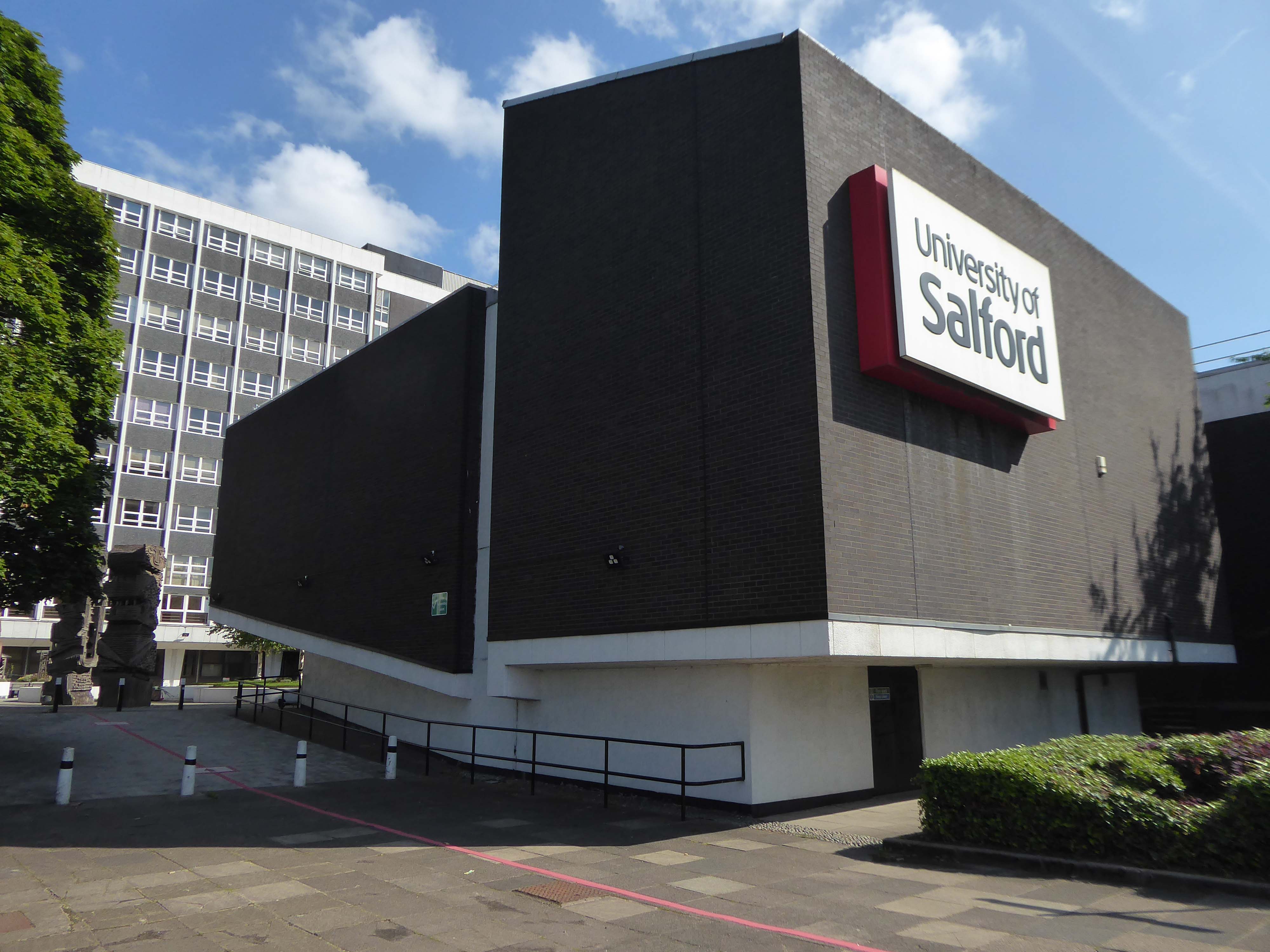
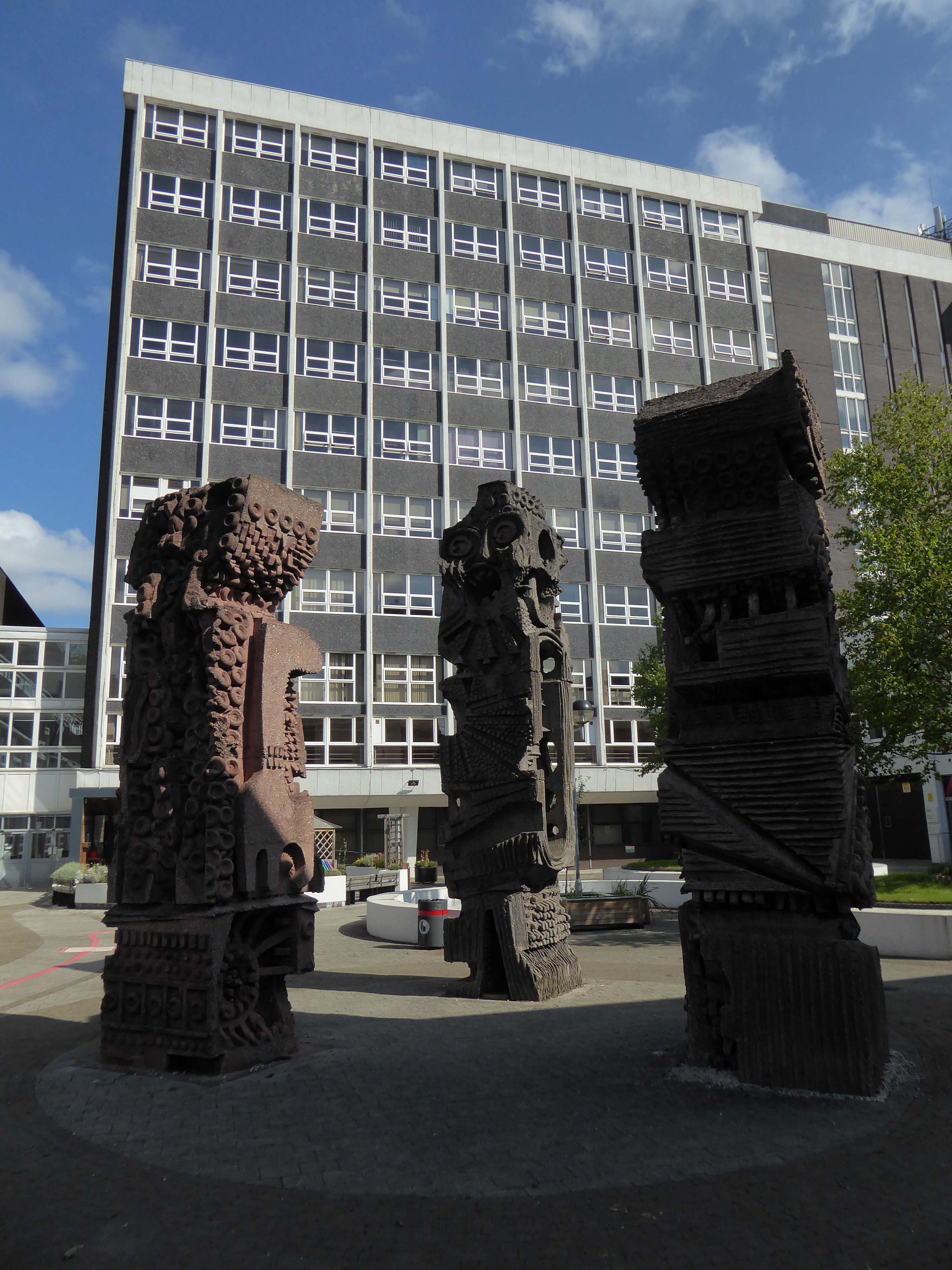
A ways down the road the former Salford Technical College.
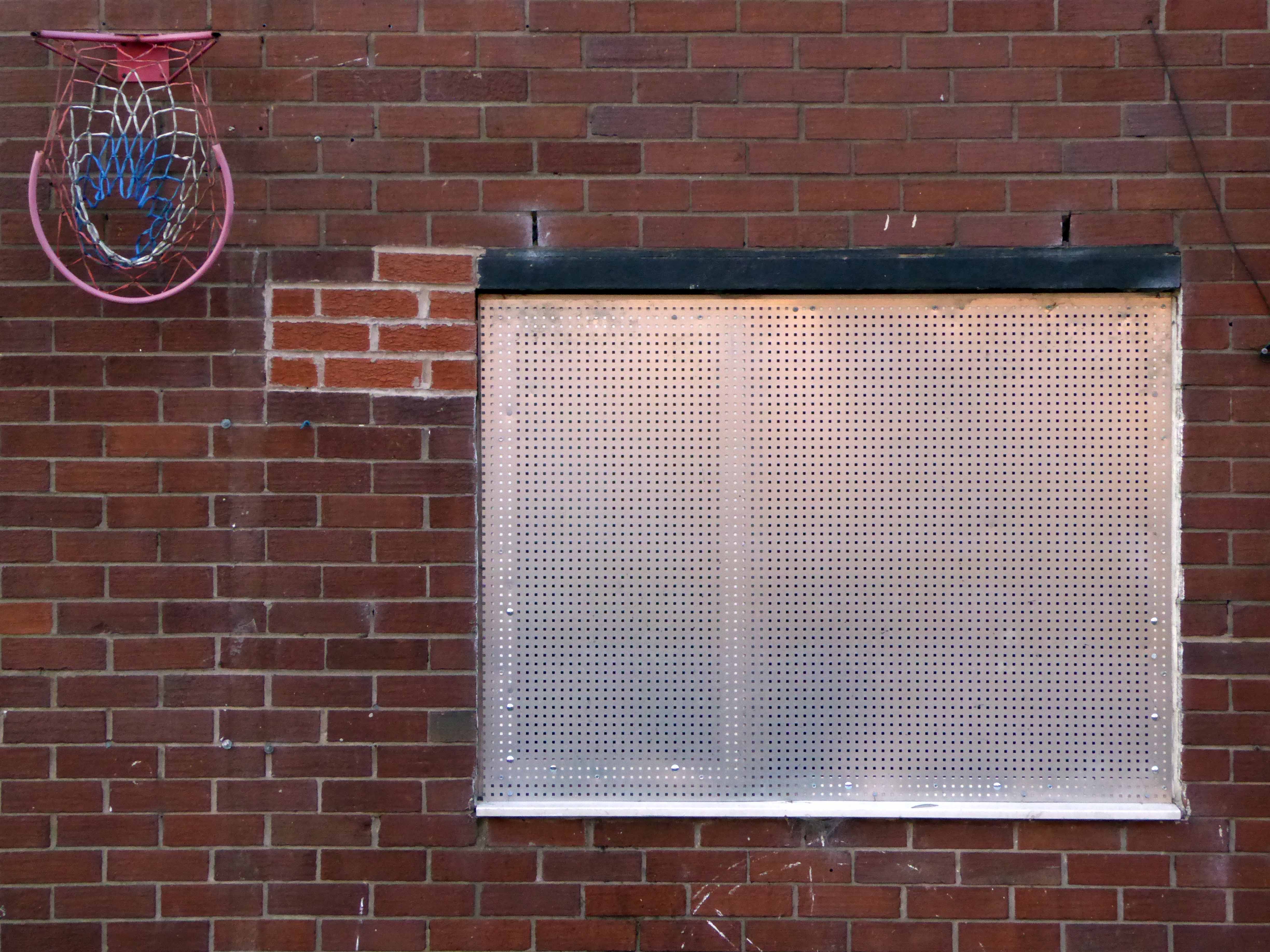
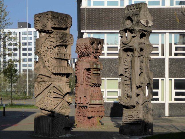
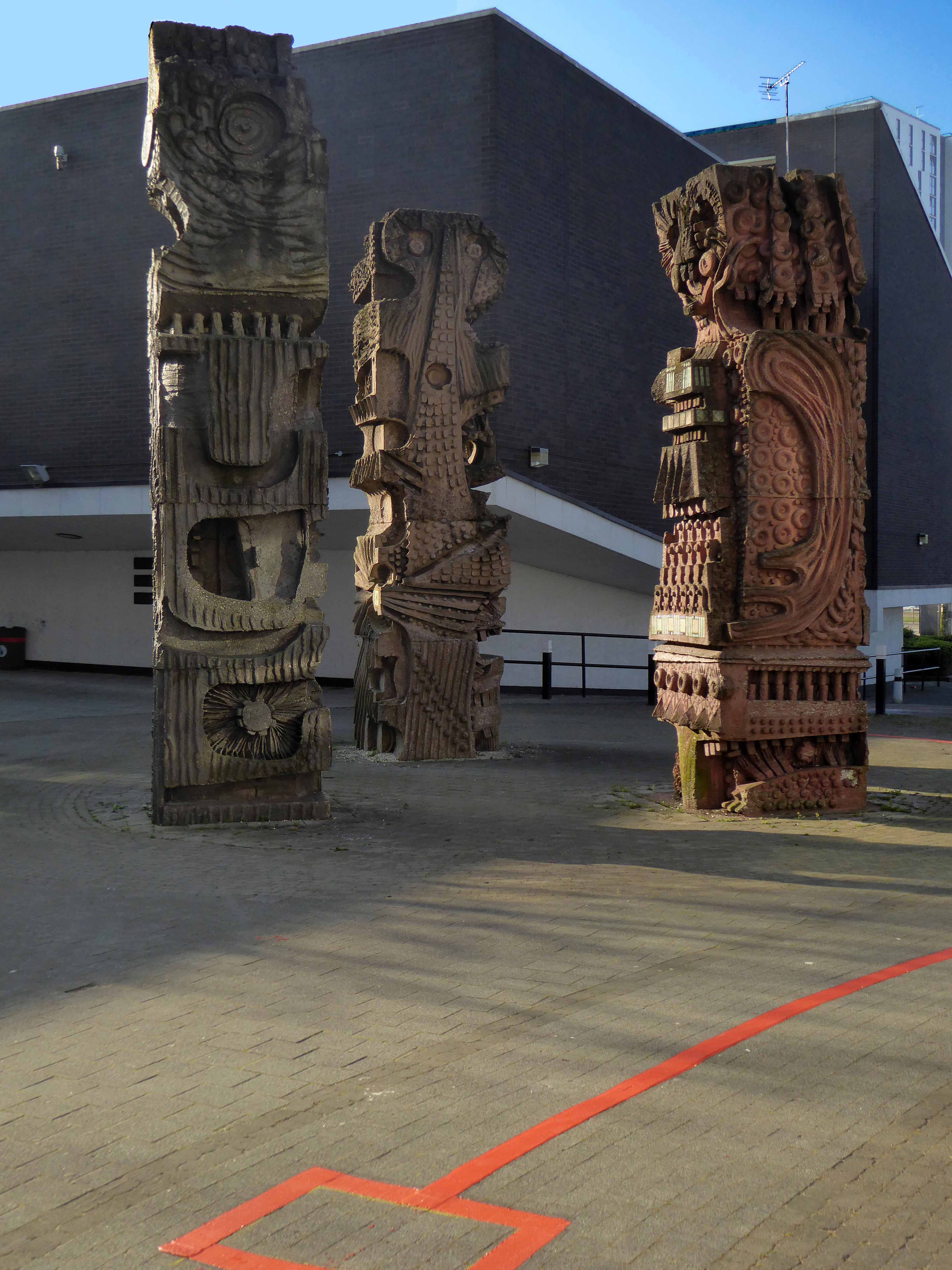
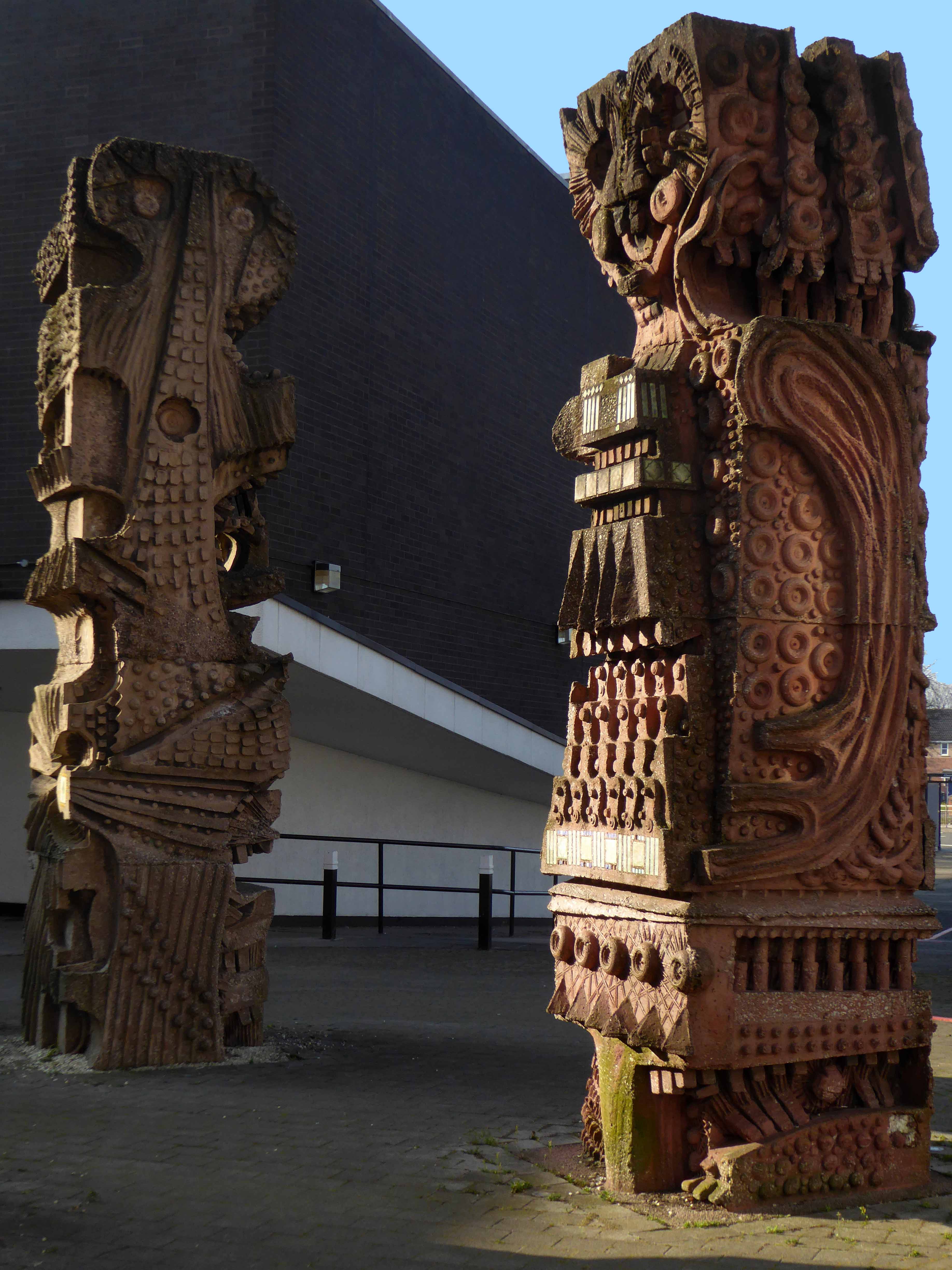
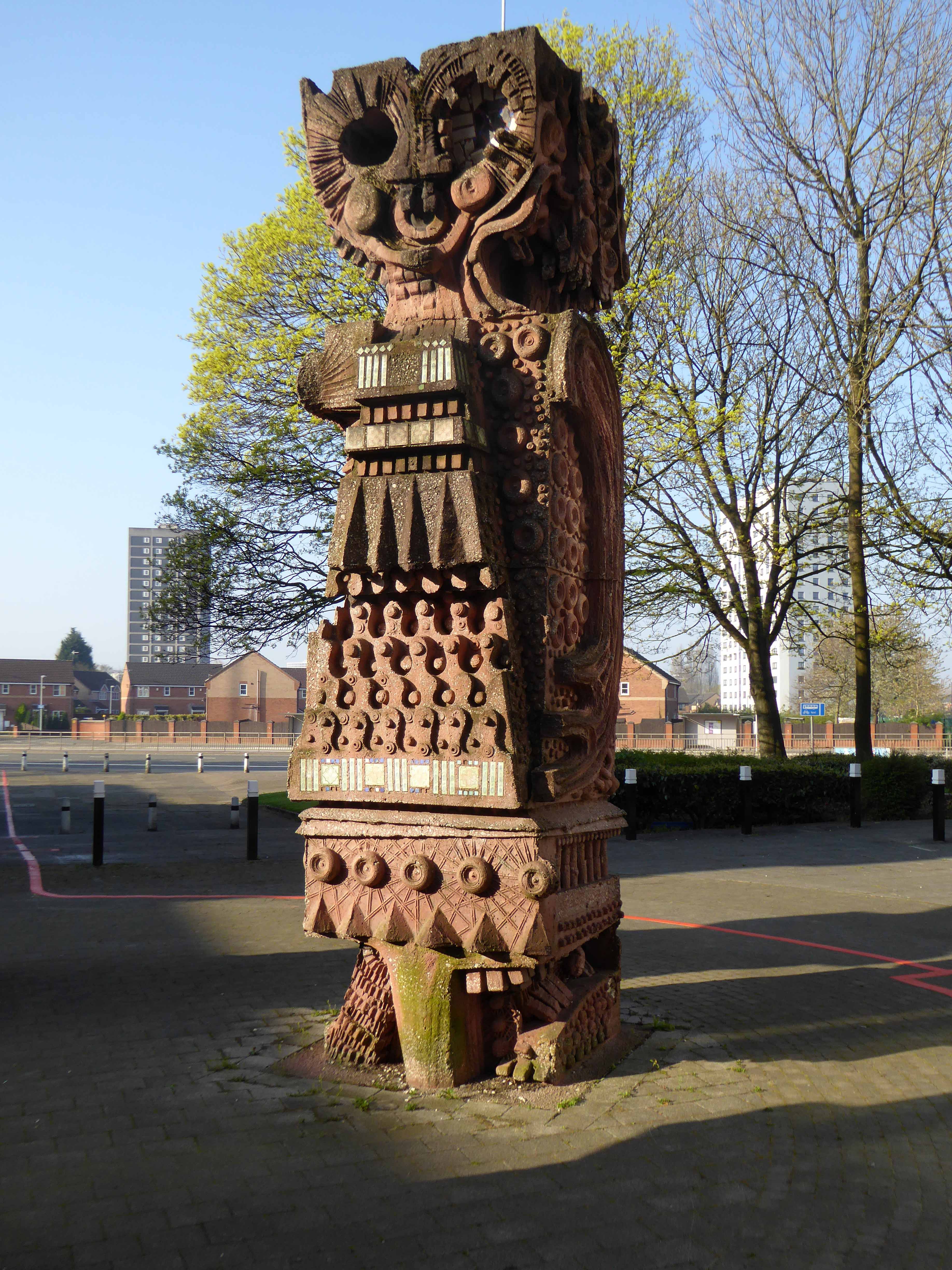
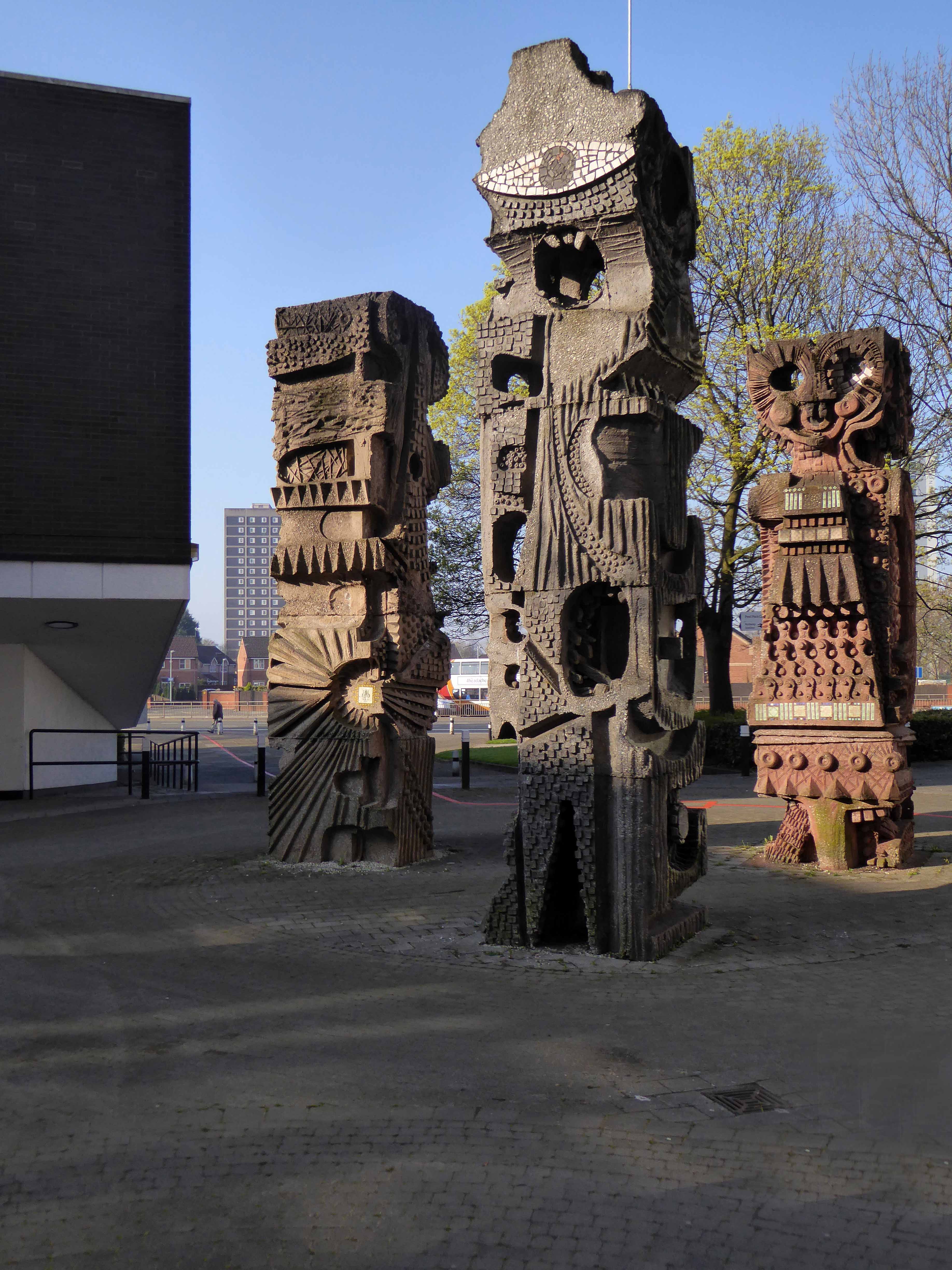
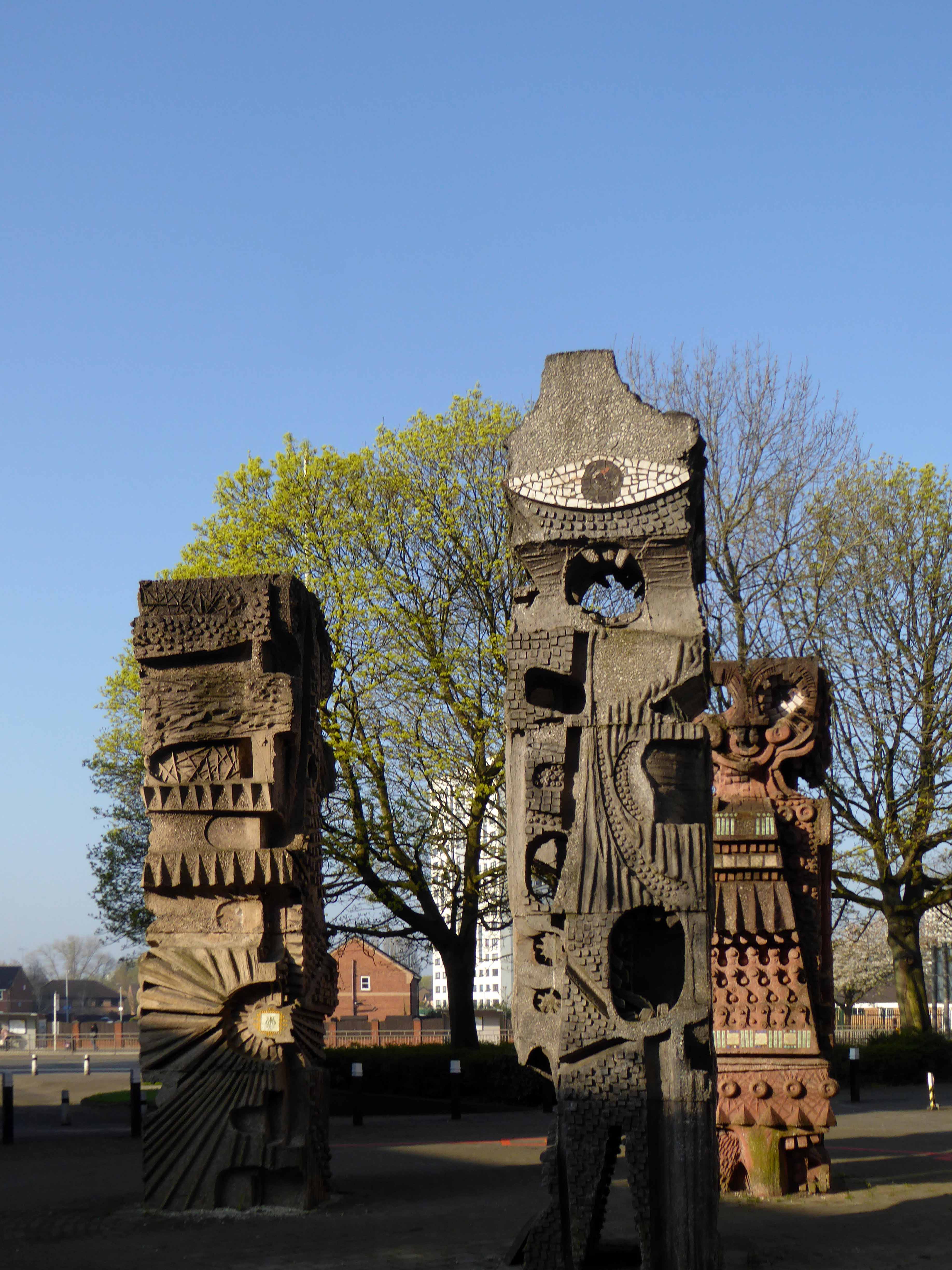
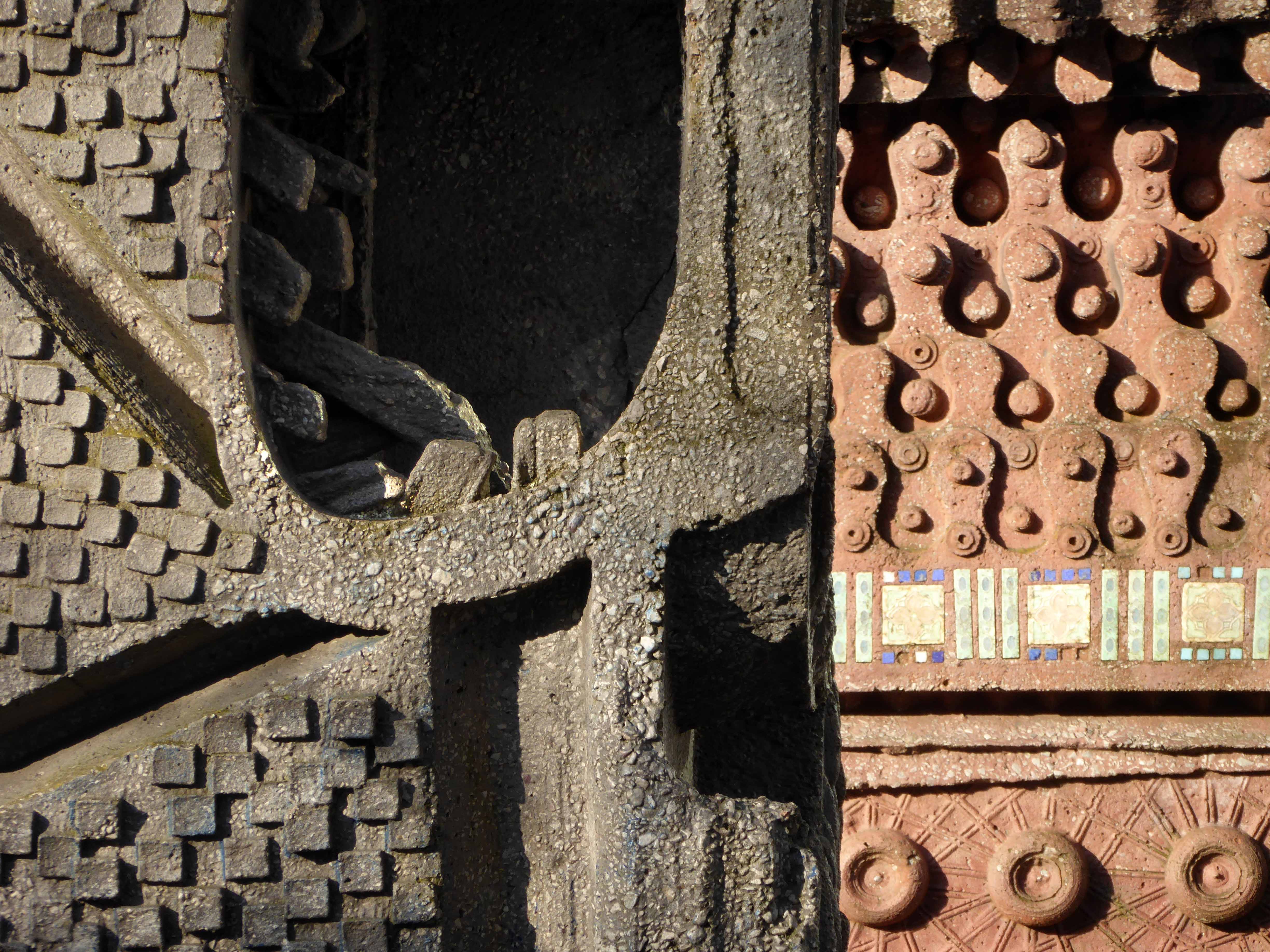
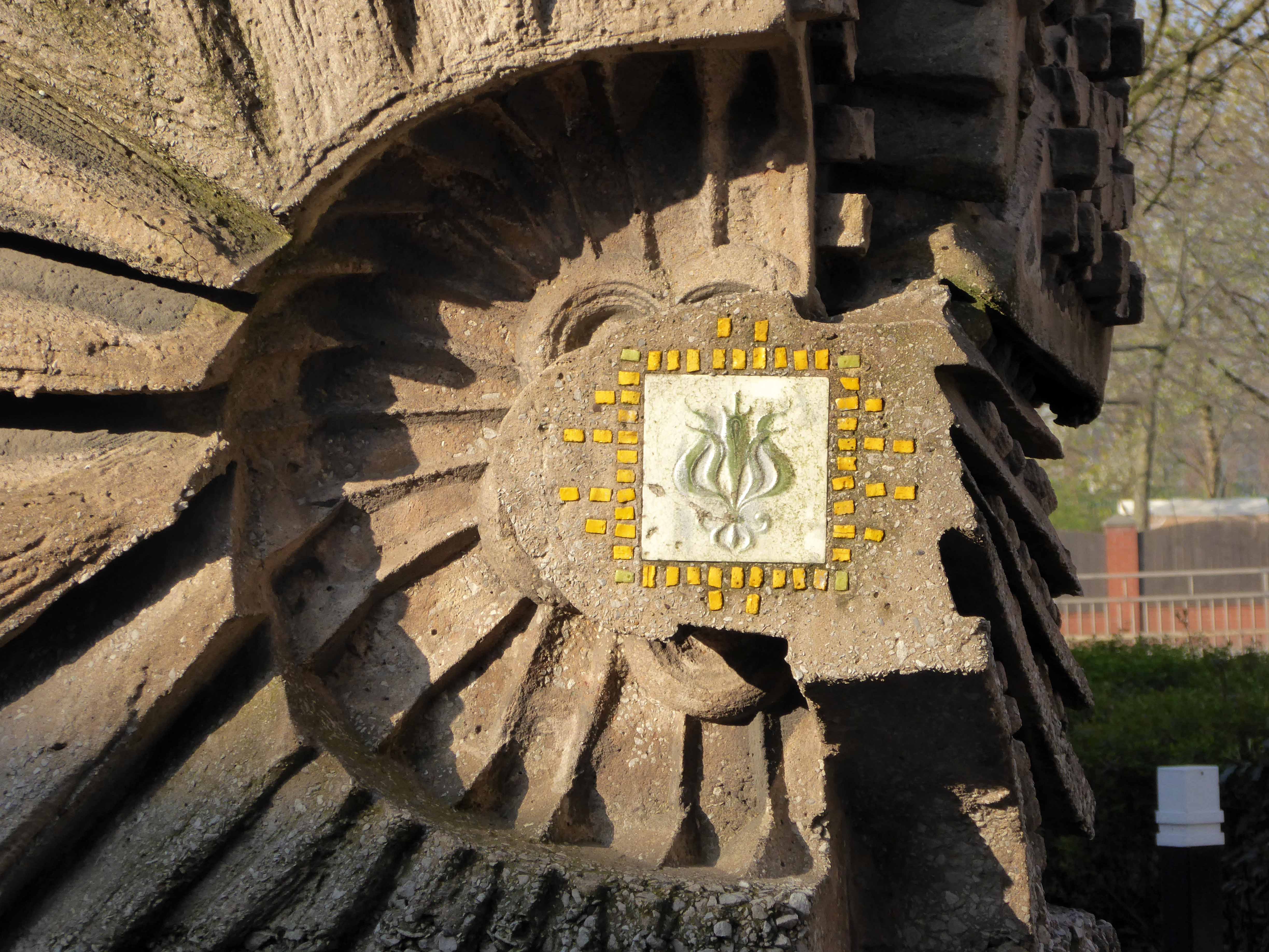
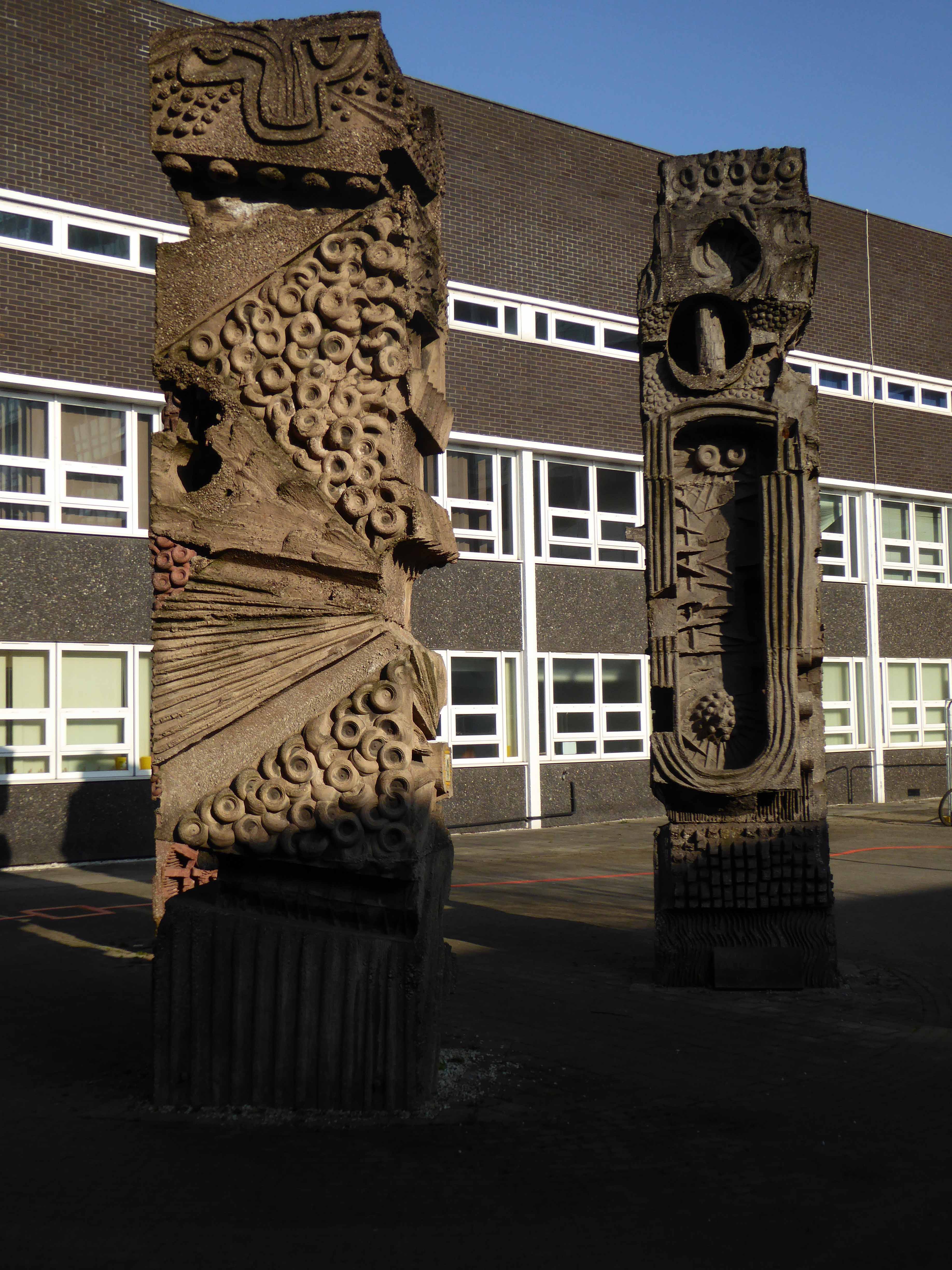
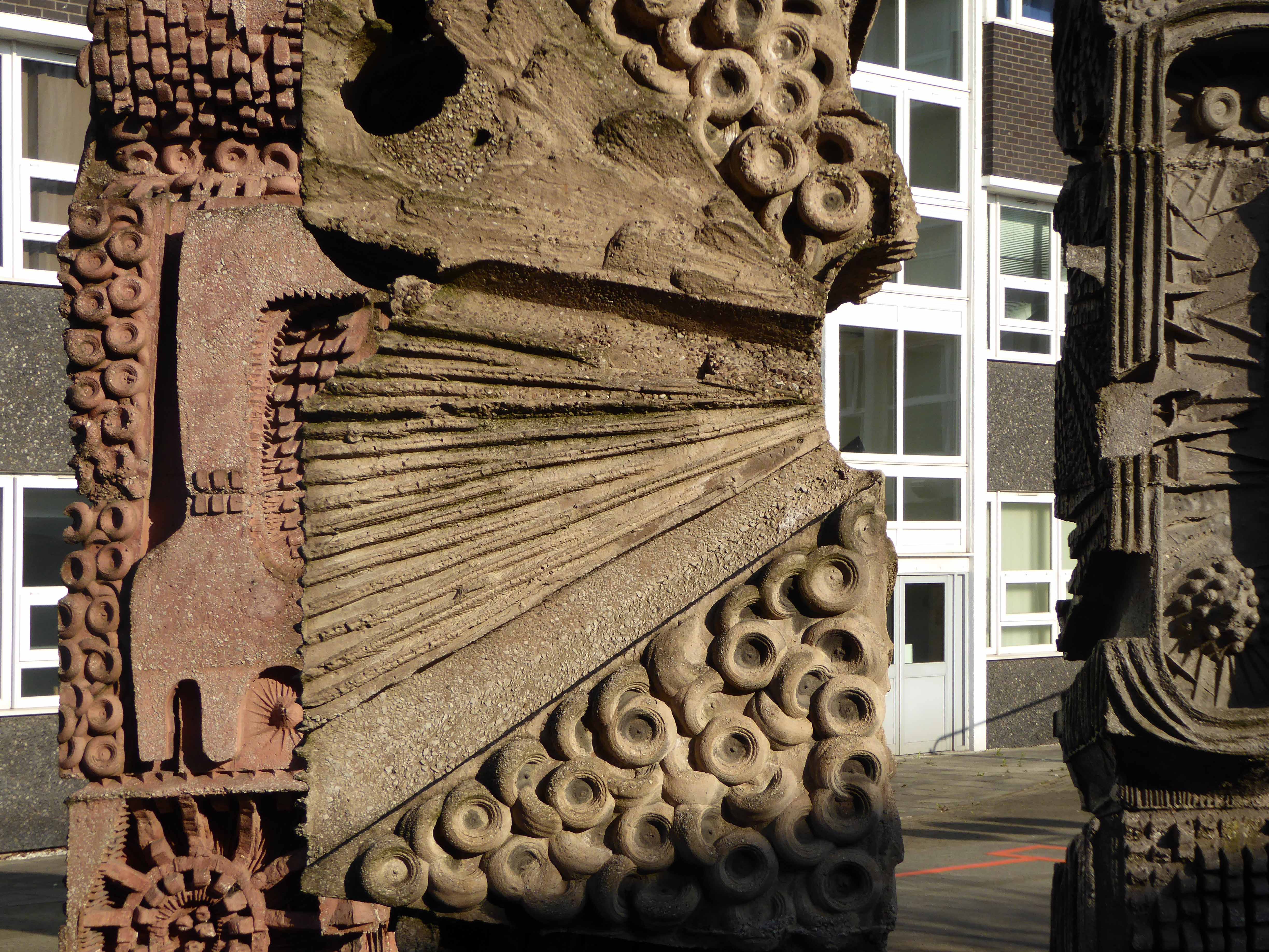
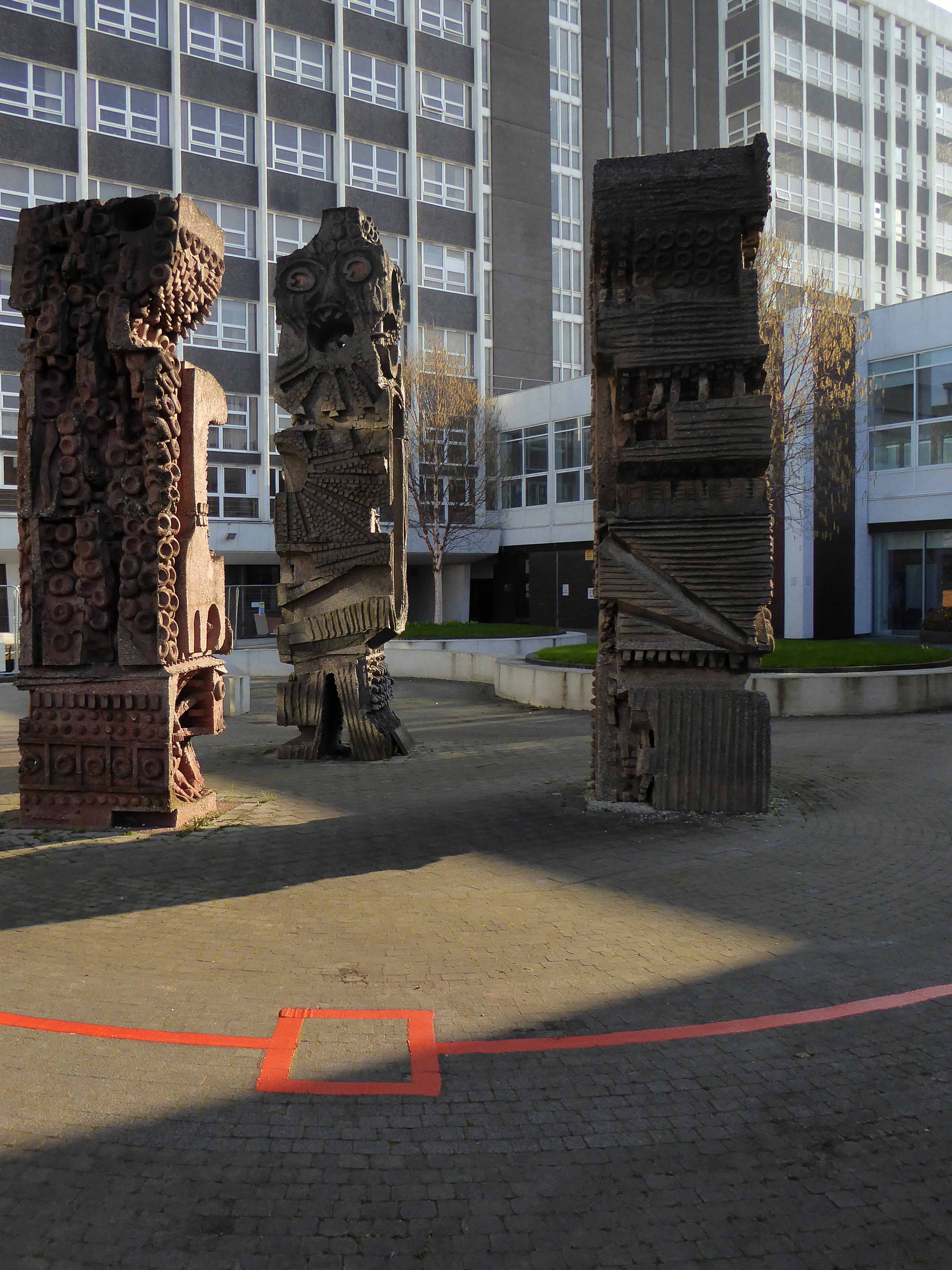
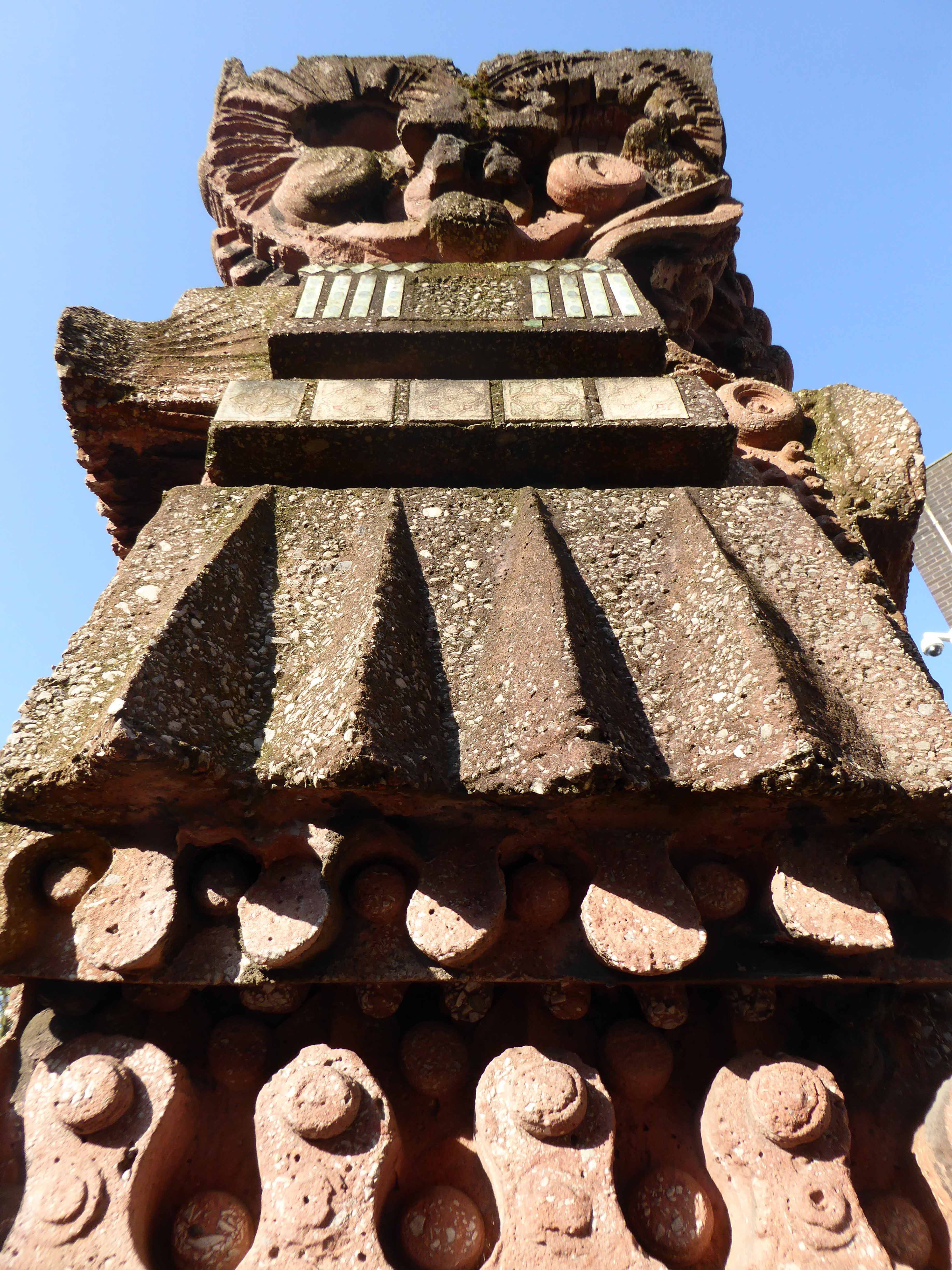
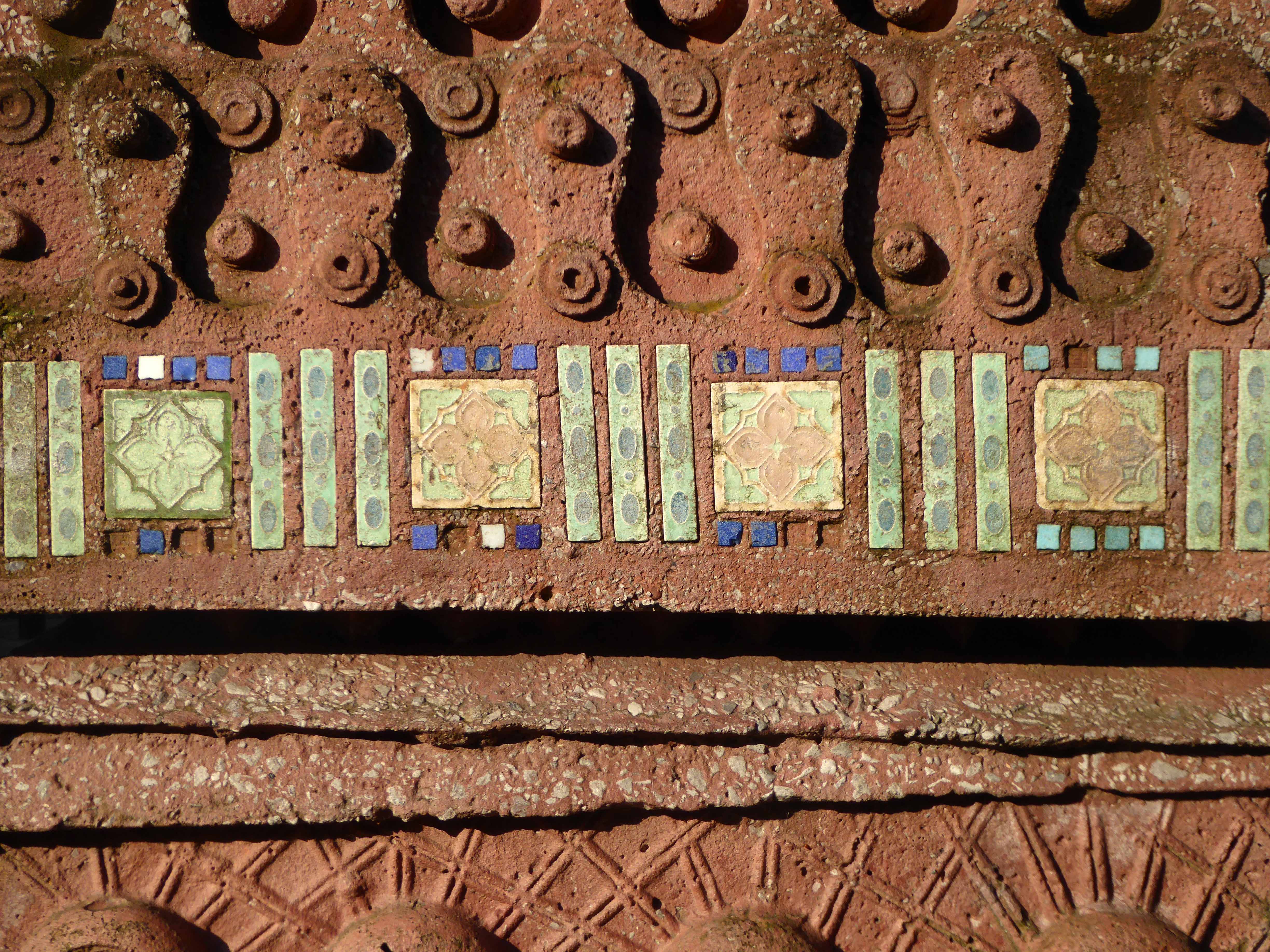
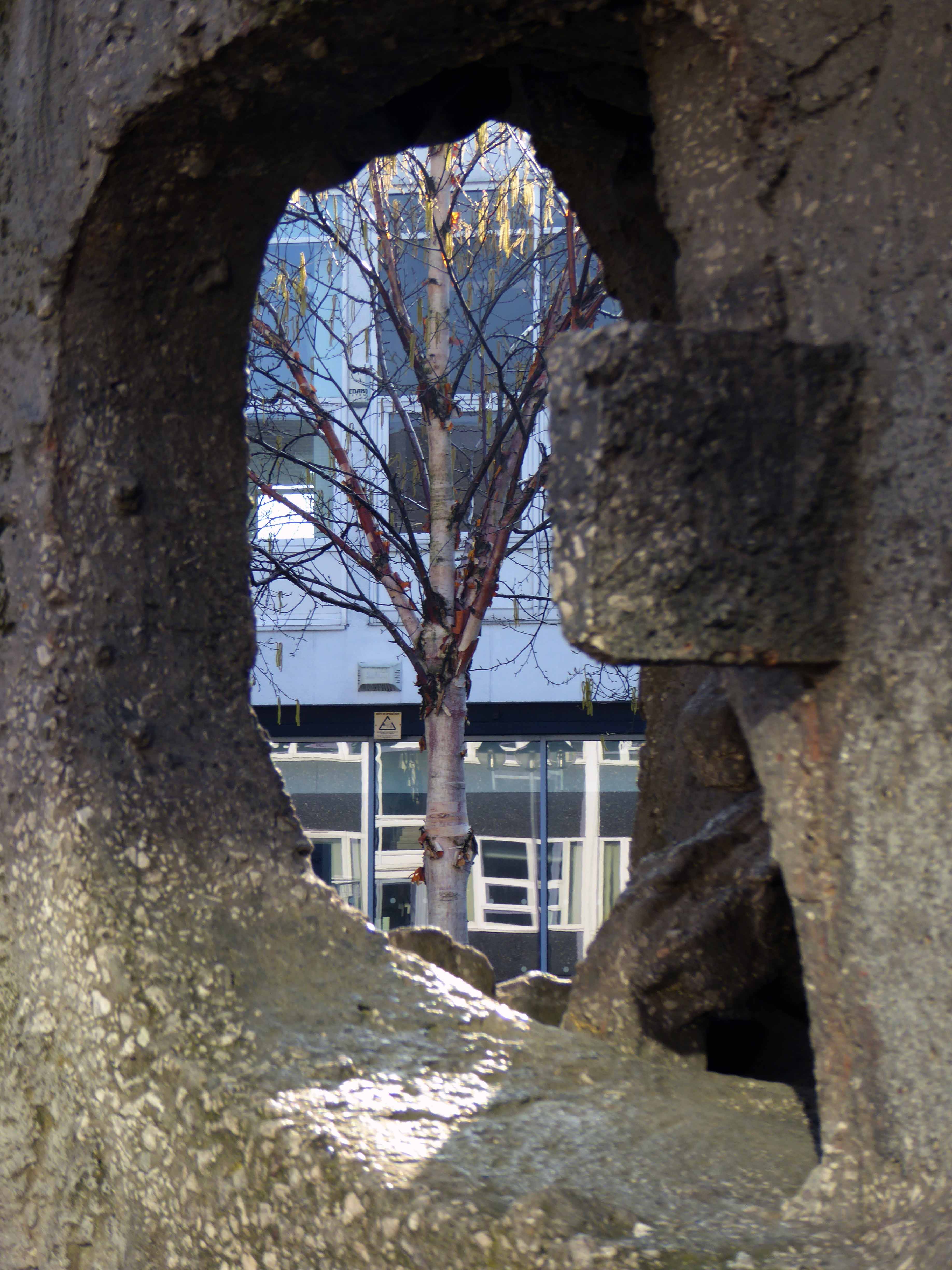
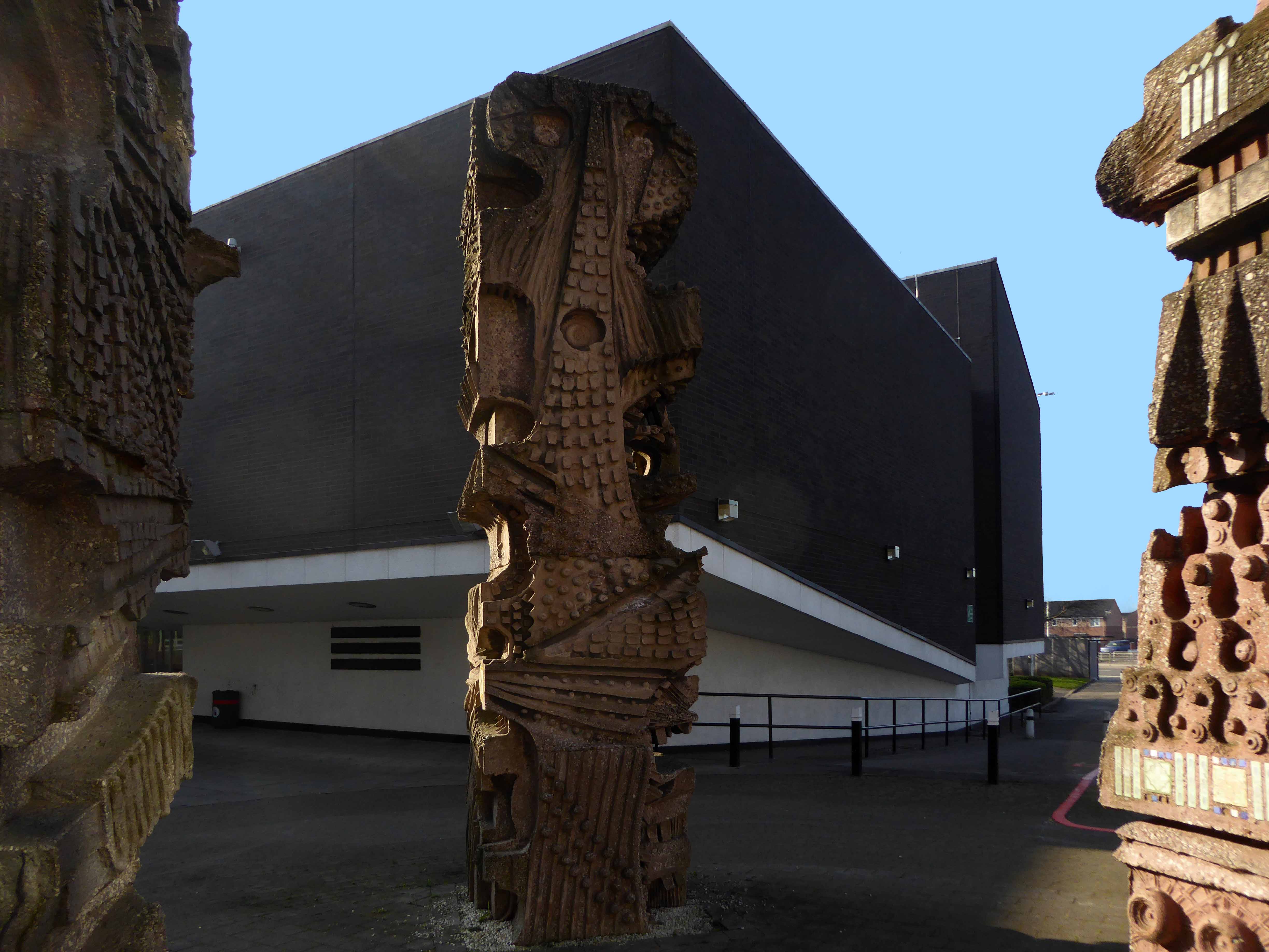
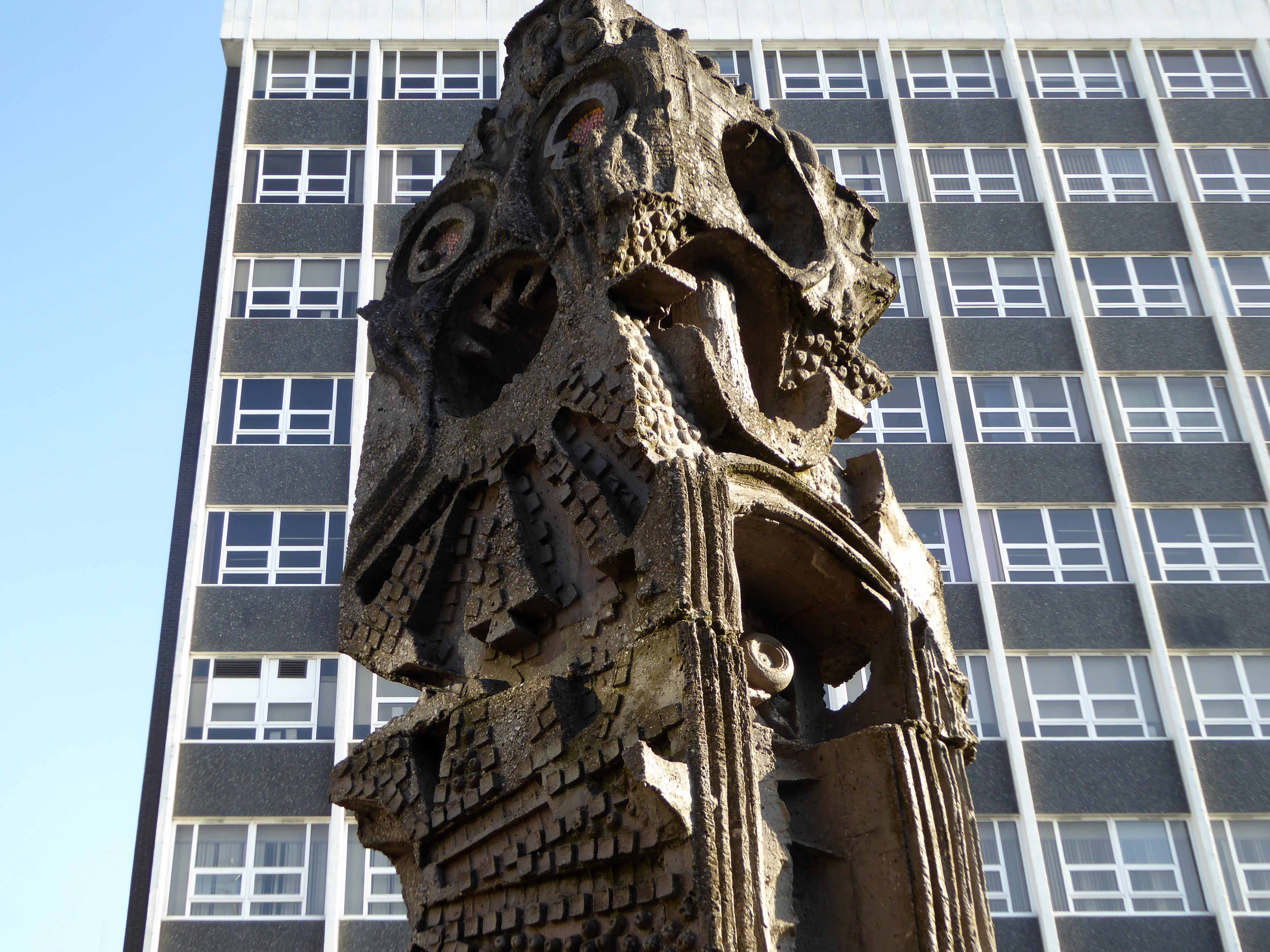
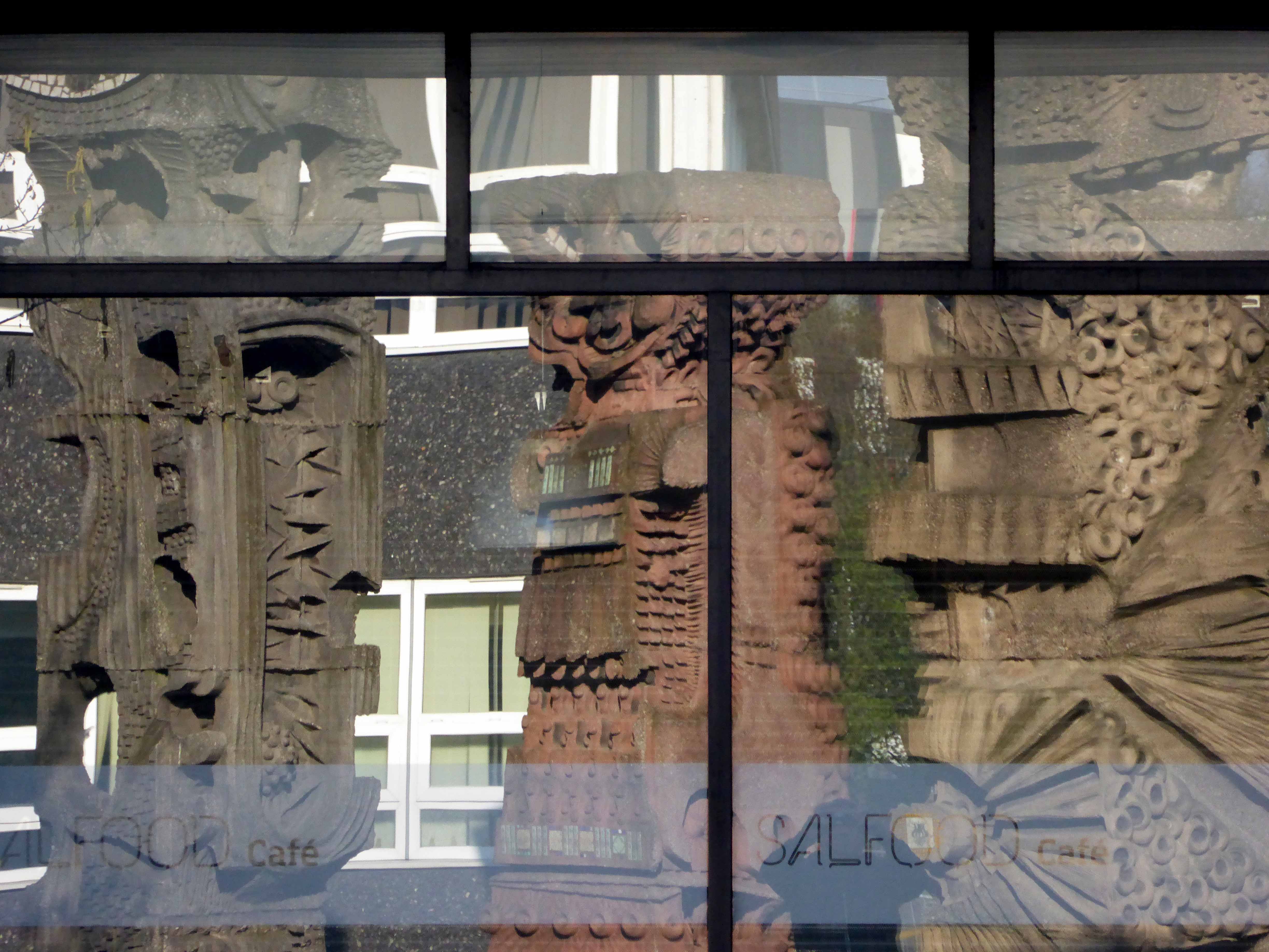
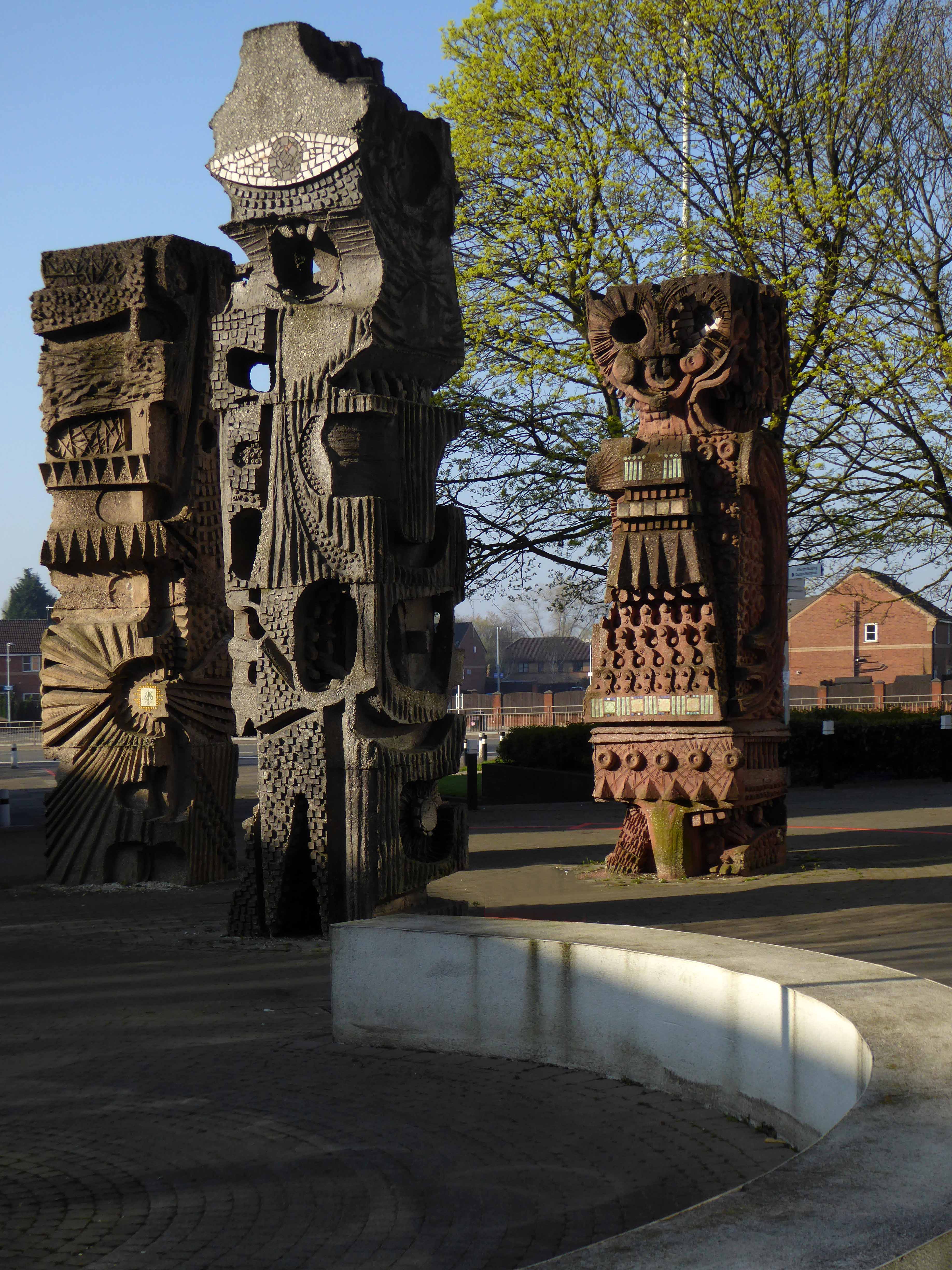
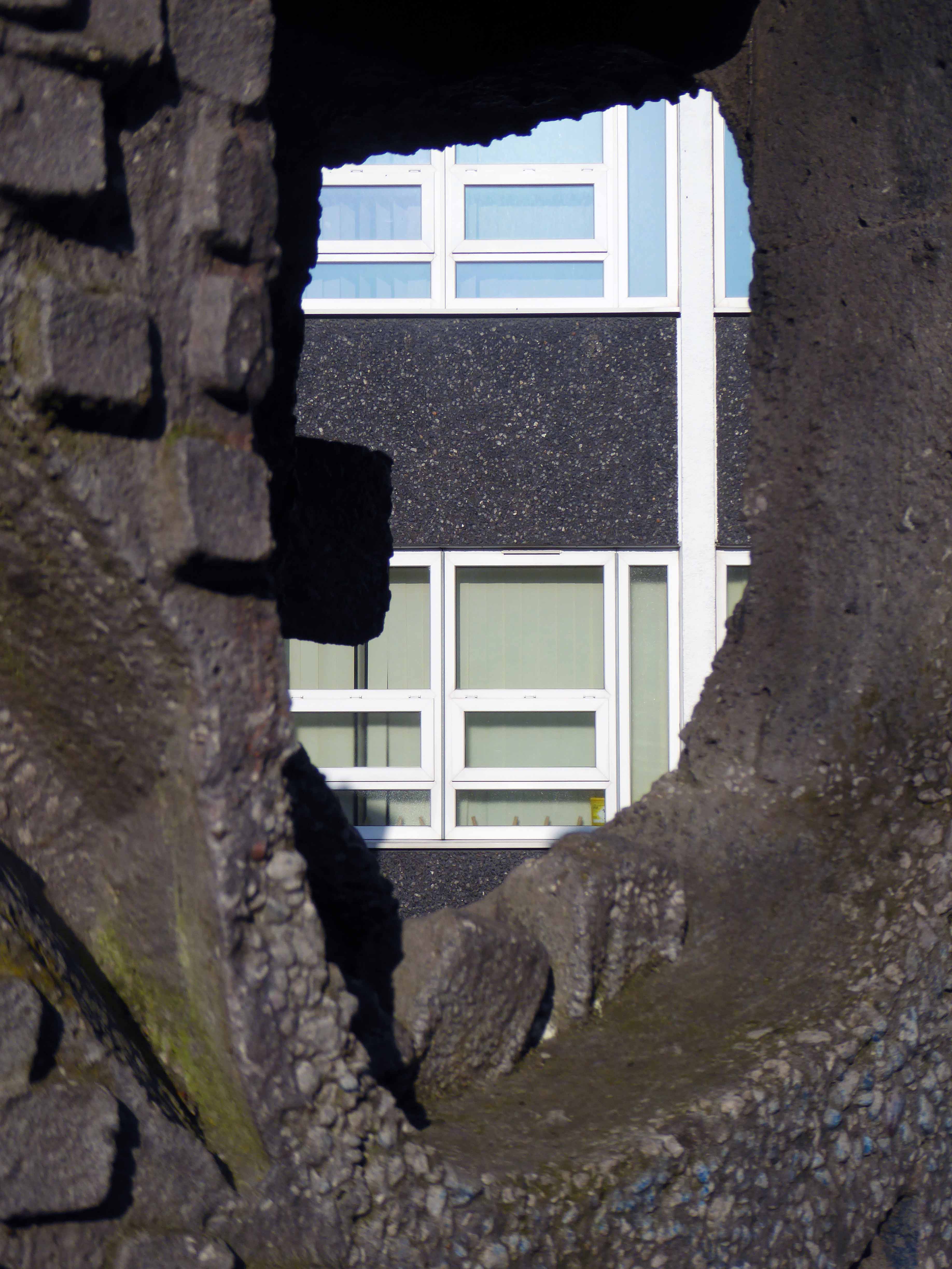
Now the part of the University of Salford, this grouping is probably the most significant work by Halliday Meecham during this period. The blocks wrap to almost enclose a courtyard and they step up in height towards the rear of the site. To the front is a lecture theatre block in dark brick. The multi-storey elements are straightforward in their construction and appearance and have had their glazing replaced. Perhaps the richest elements here are the three totemic structures by artist William Mitchell, which were listed at Grade II in 2011. Mitchell was actively engaged with the experiments of the Cement and Concrete Associations during the 1960s and produced a wide variety of works for public and private clients; other works regionally include the majority of the external art and friezes at Liverpool Metropolitan Cathedral and the Humanities Building at Manchester University. These textured concrete monoliths appear to have an abstract representation of Mayan patterns and carry applied mosaic. They were made on site using polyurethane moulds. There is another Mitchell work hidden behind plasterboard in the inside of the building.
April 1965 saw the Salford City Reporter proudly boast in an article that
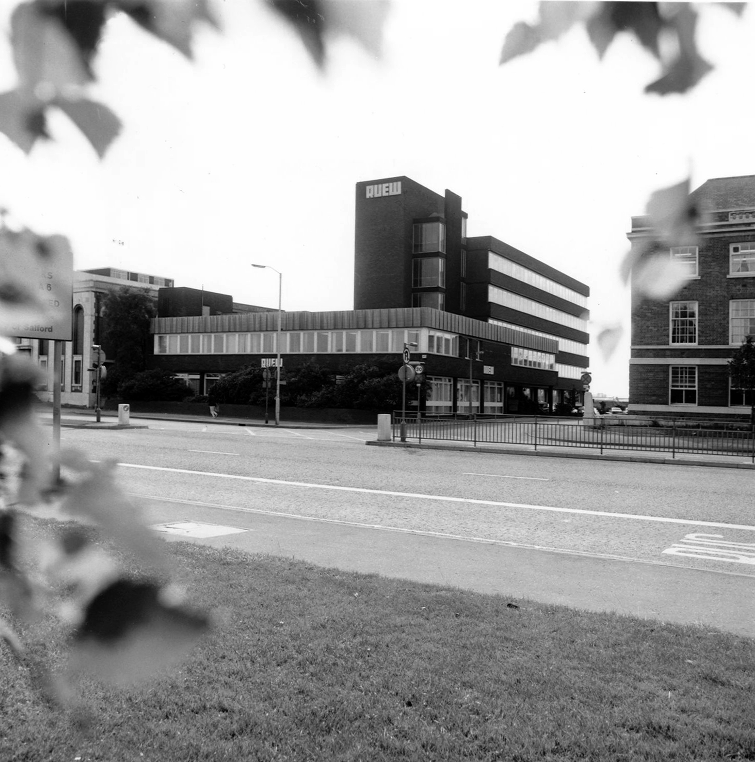
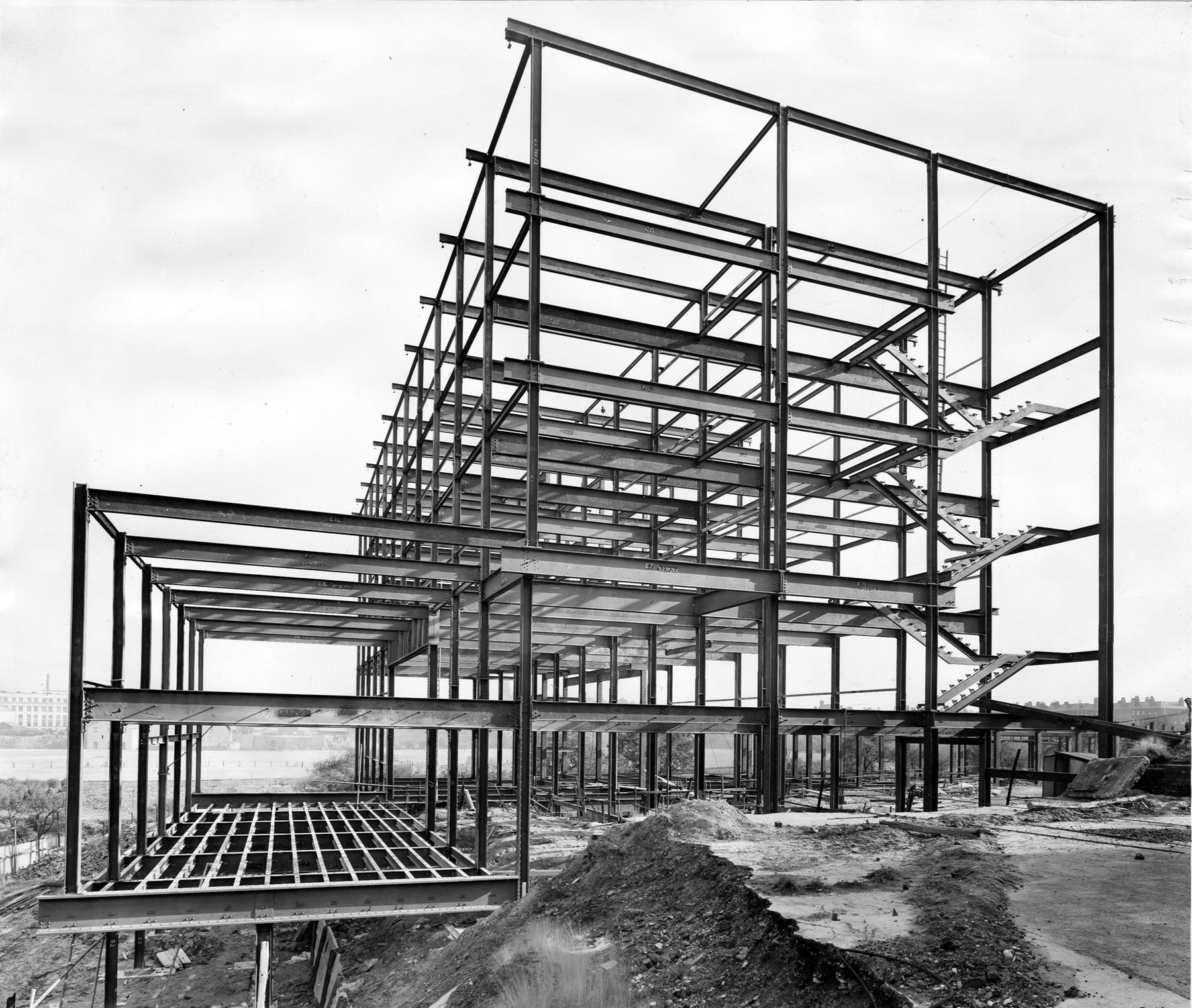
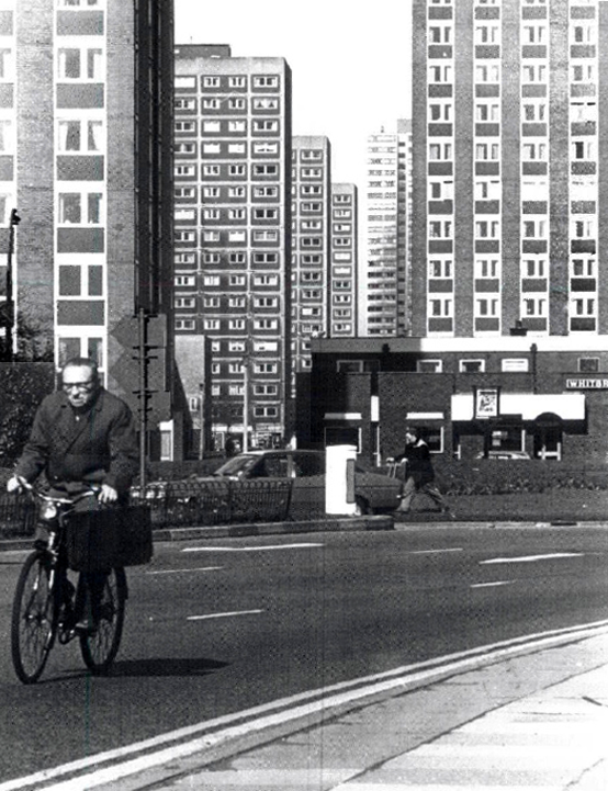
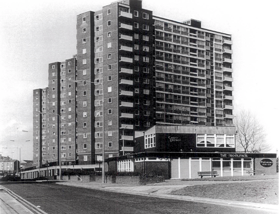
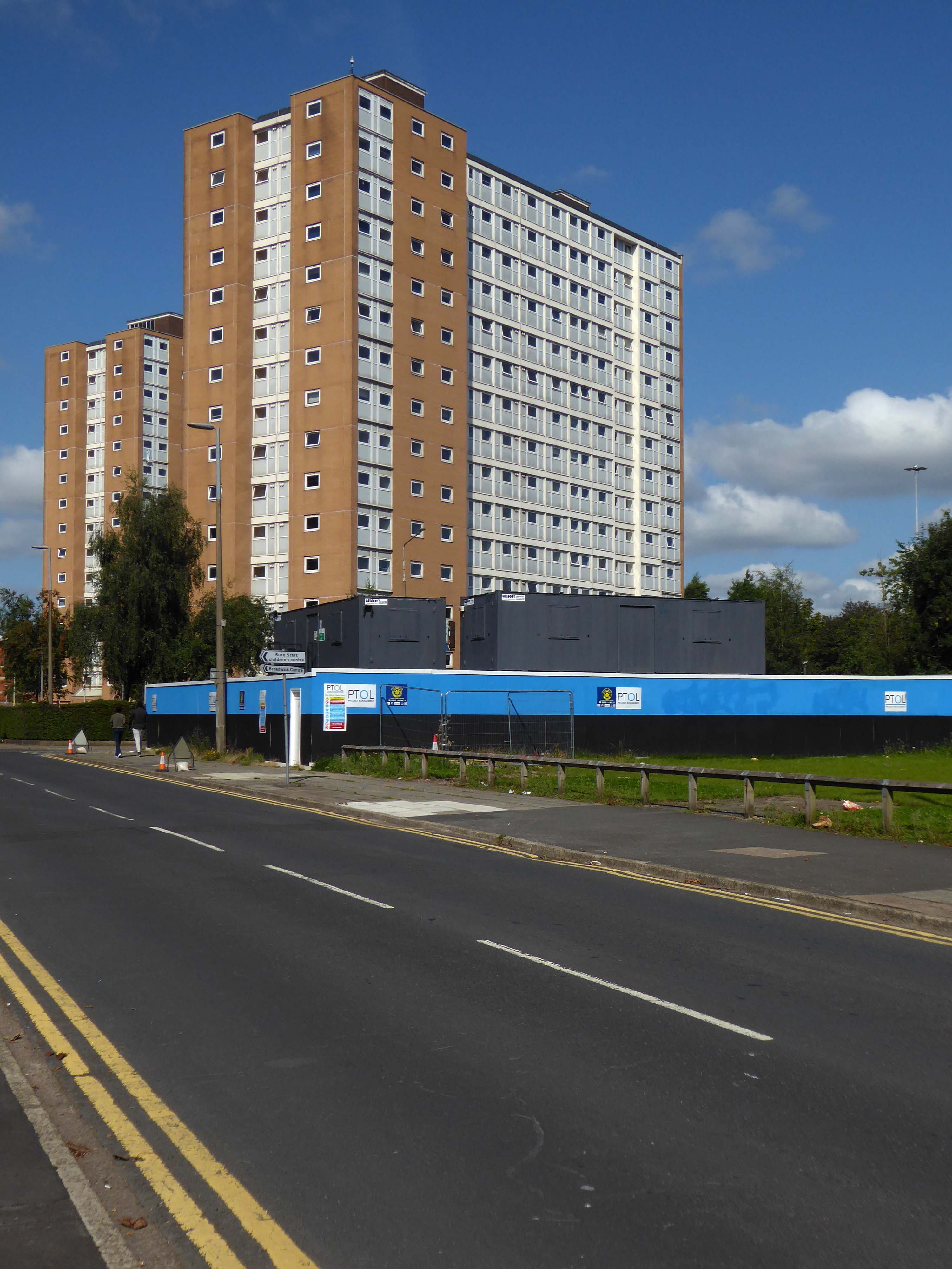
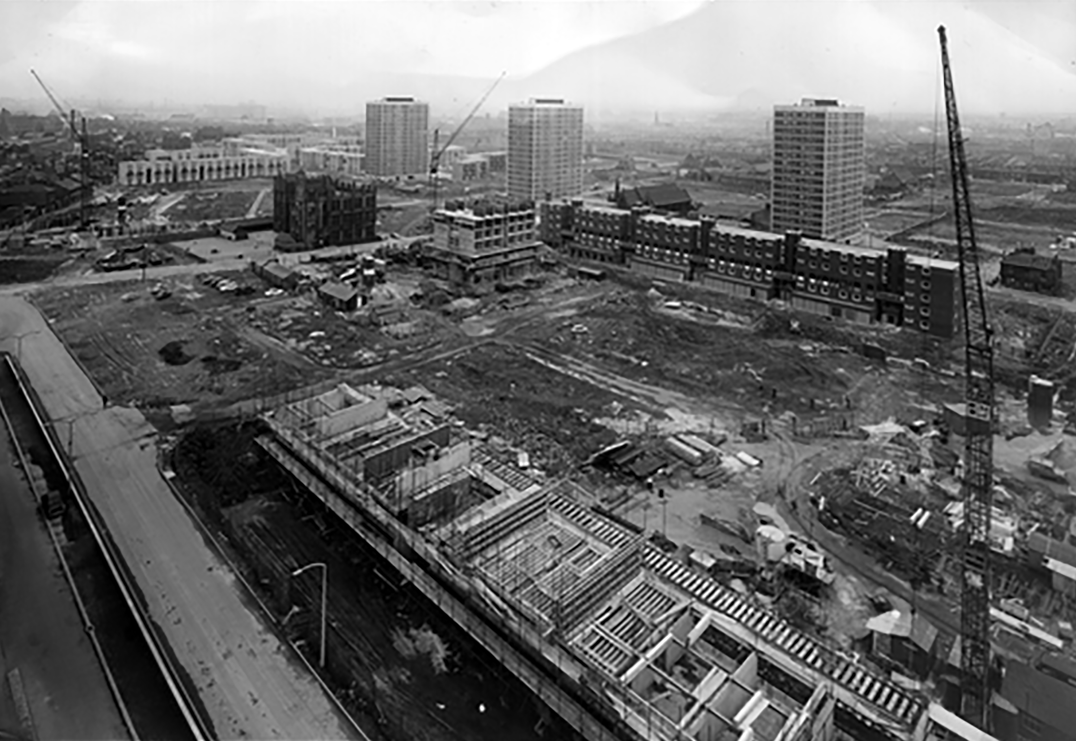
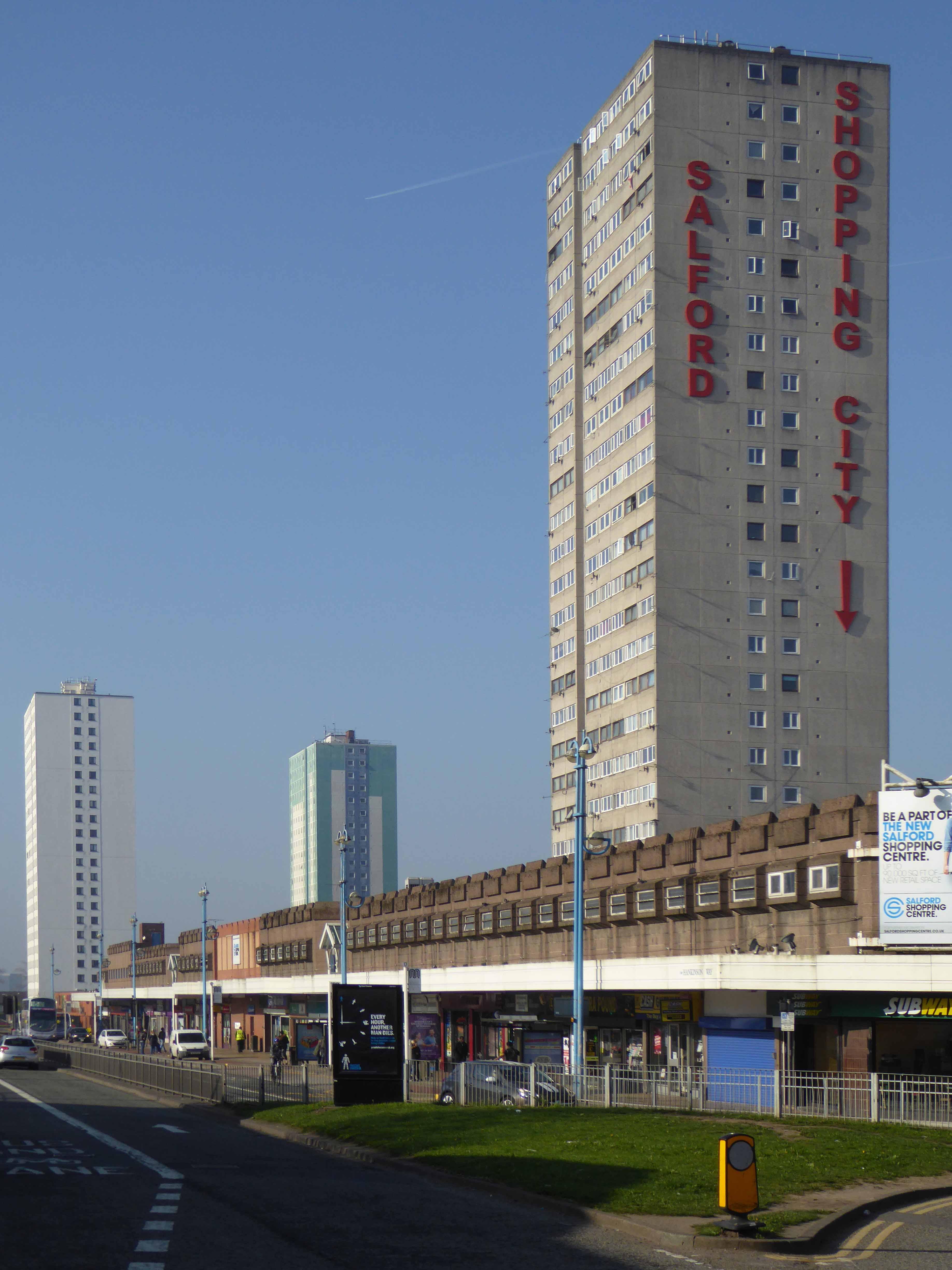
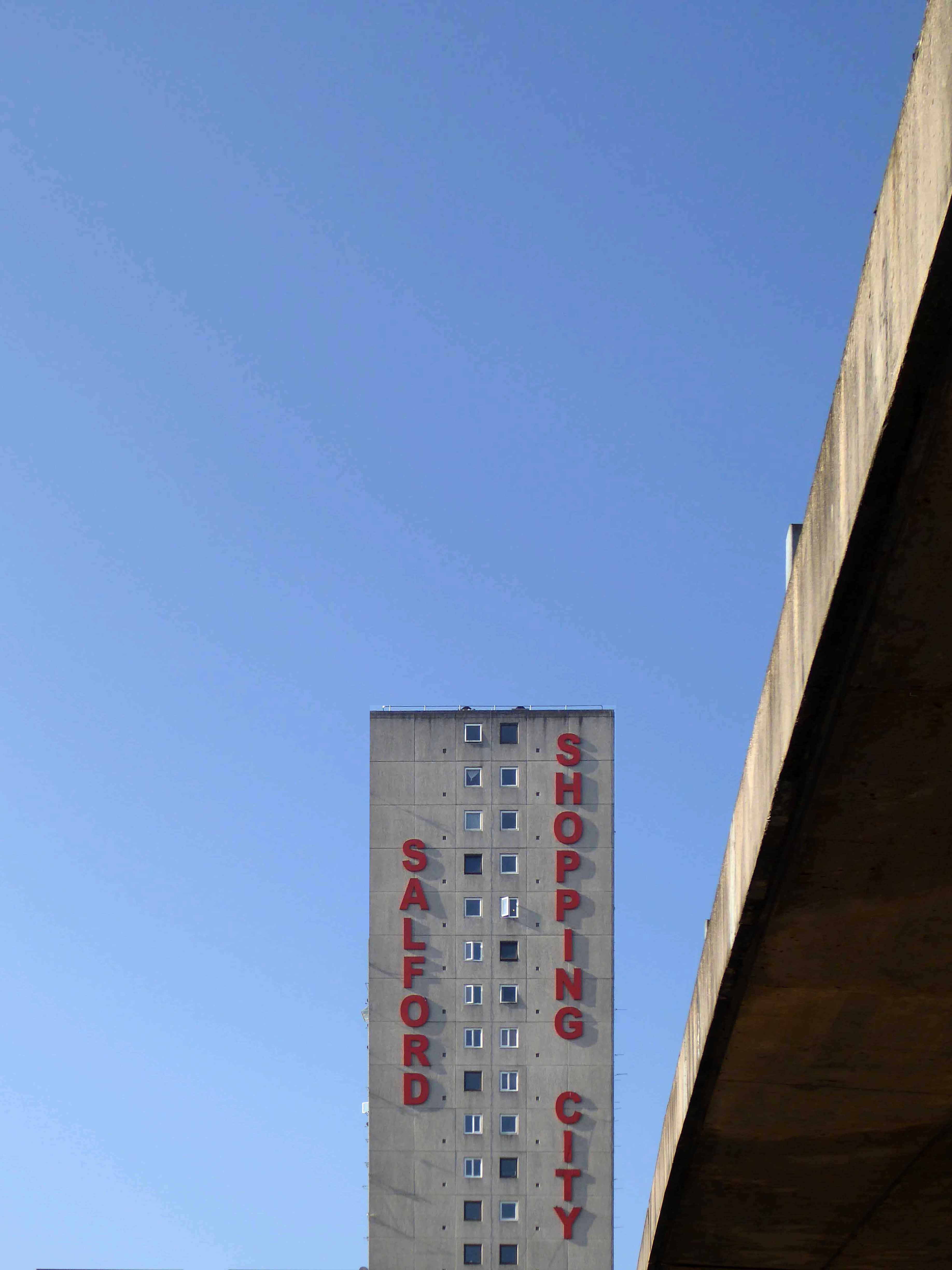
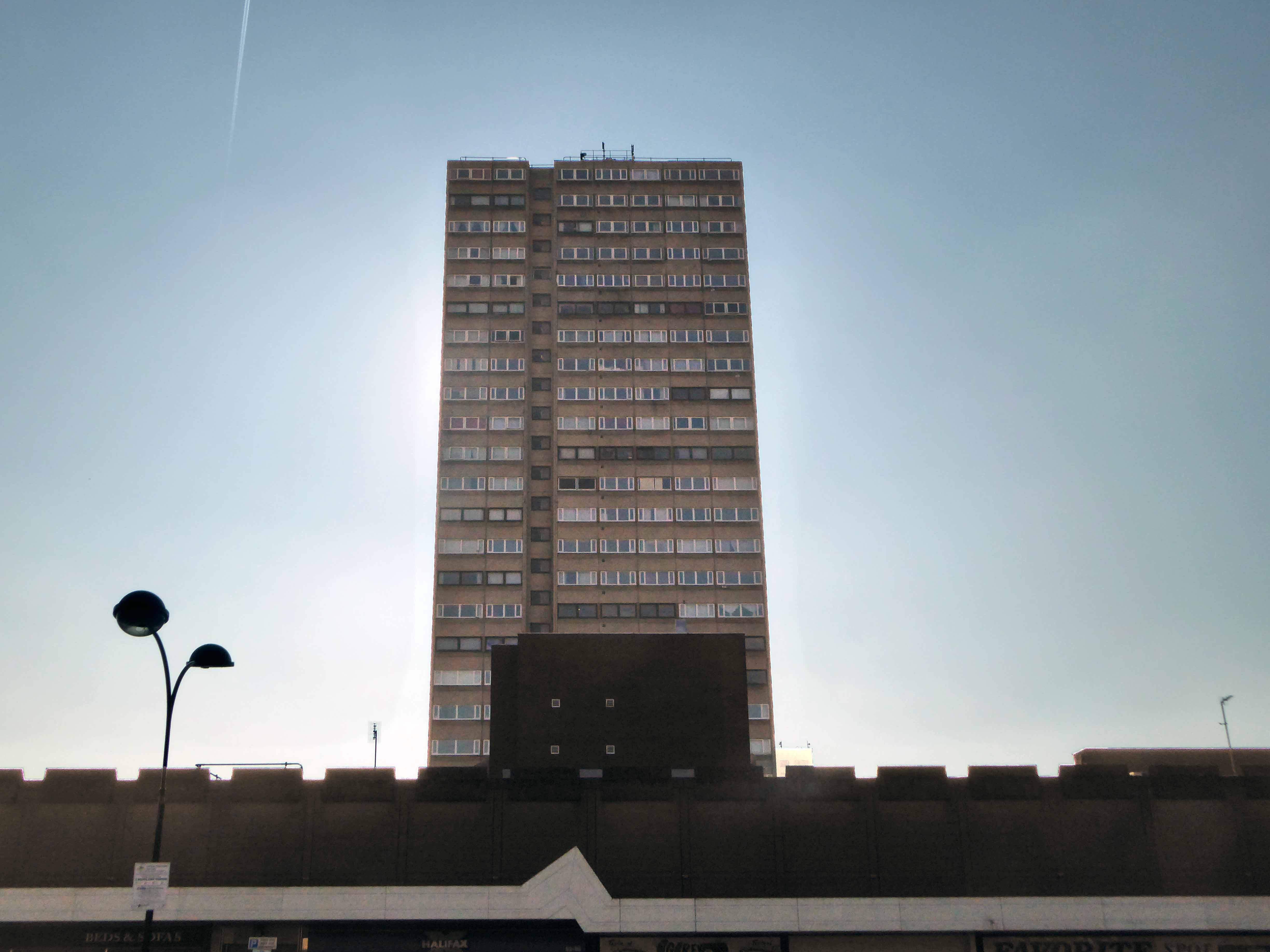
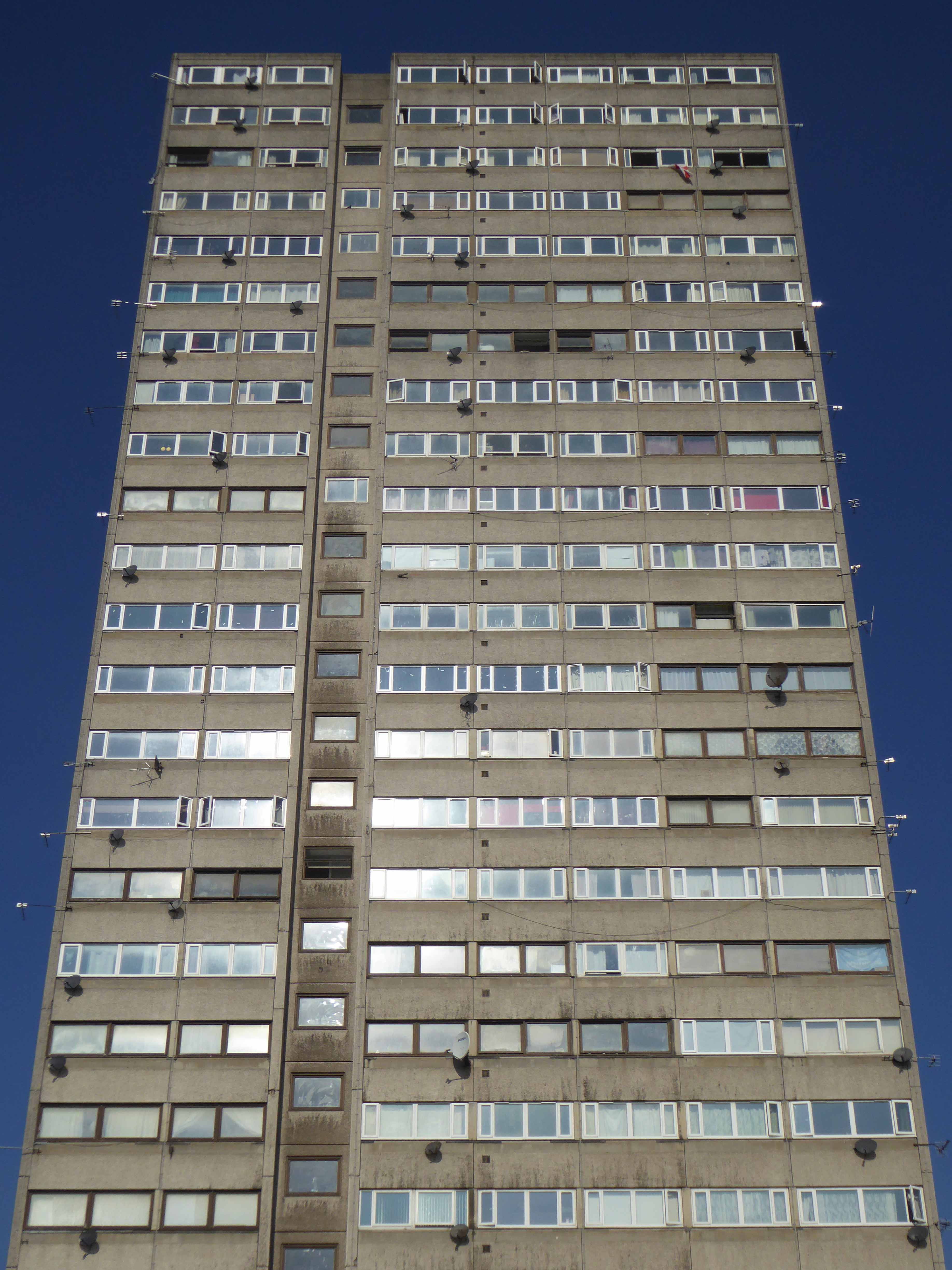
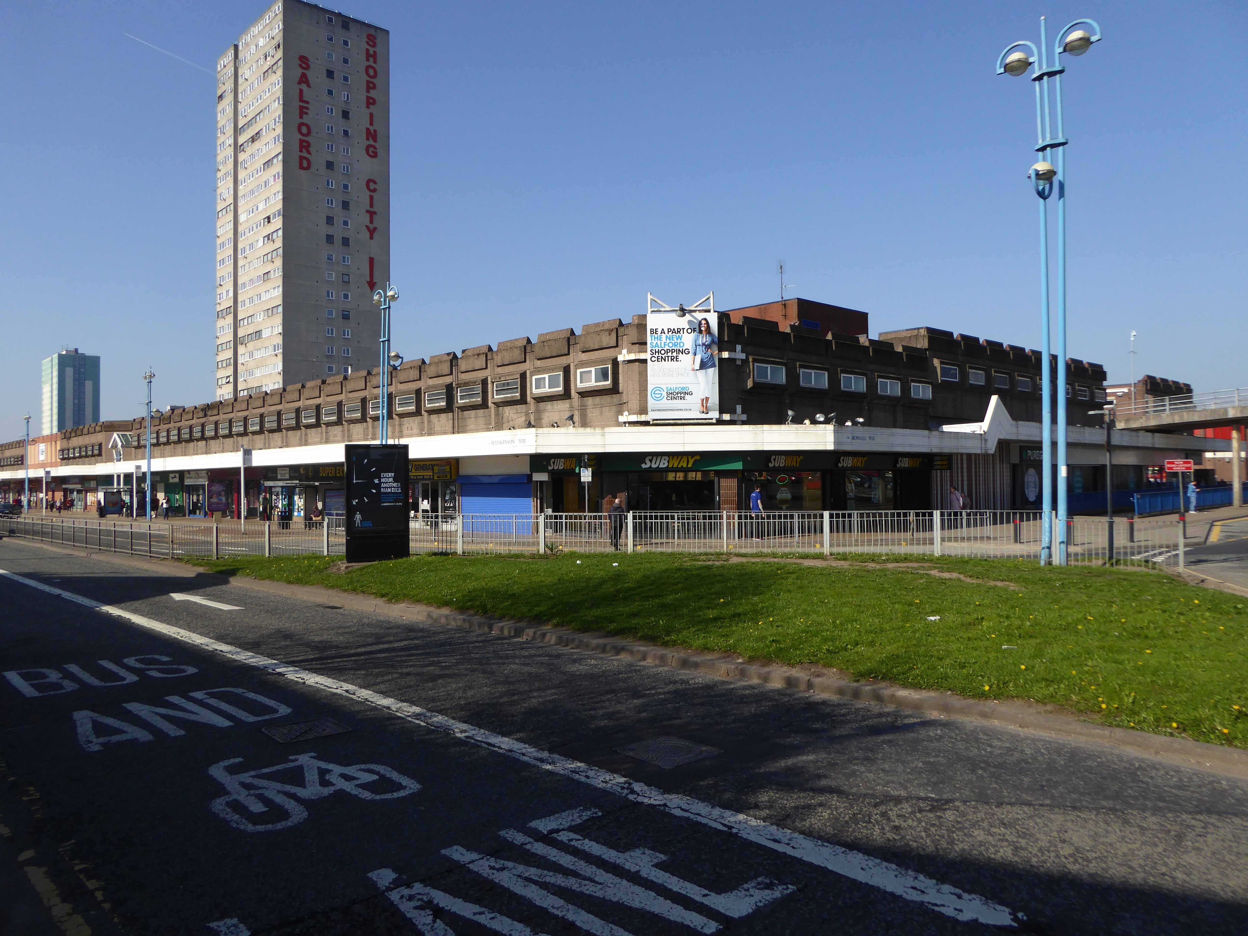
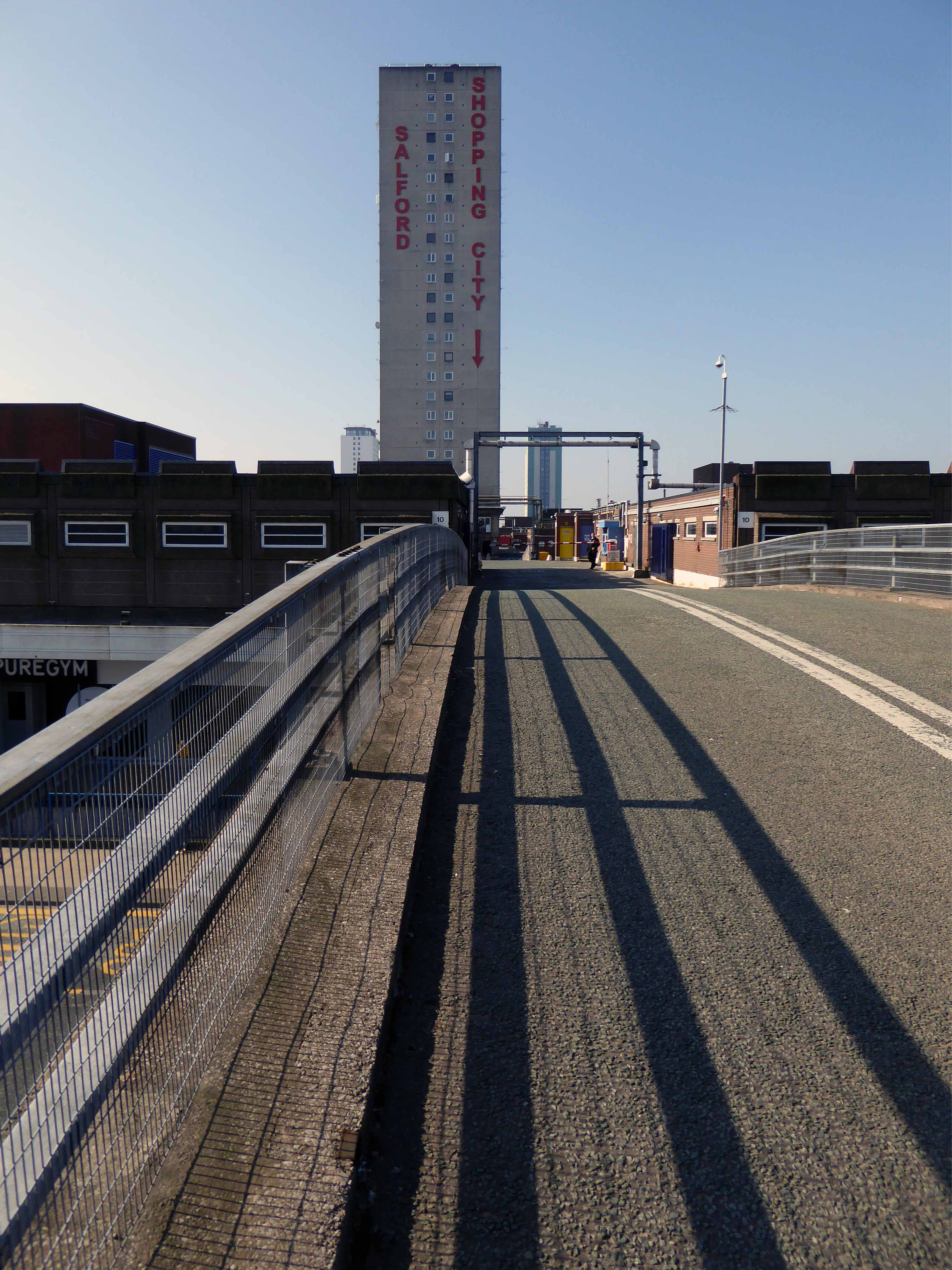
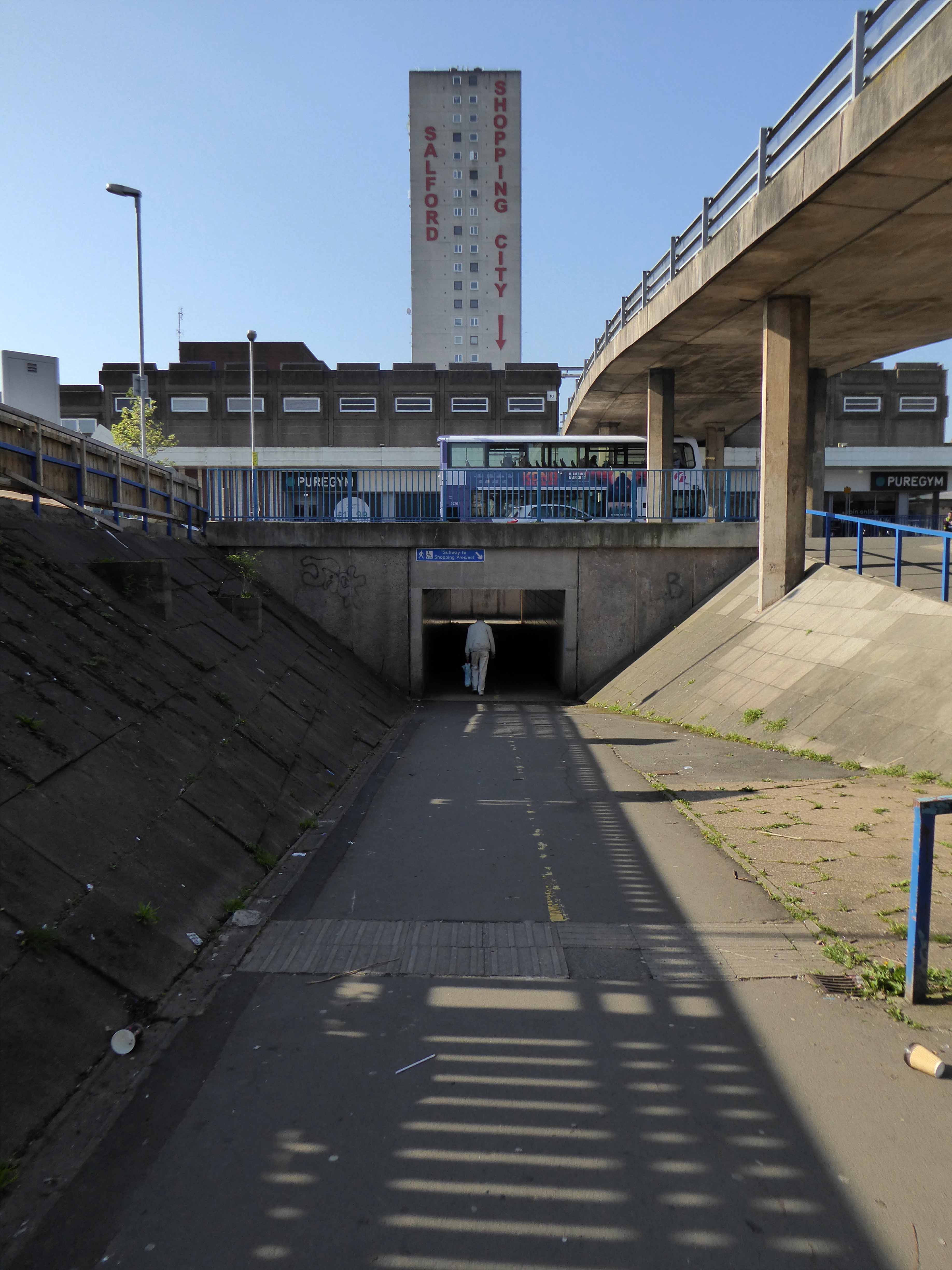
The Ellor Street dream begins to come true – complete with interviews with residents of the newly constructed Walter Greenwood, Eddie Colman and John Lester Courts all which towered some 120 feet above the Hanky Park skyline.
These particular blocks of flats were of special significance because their completion was the end of the first stage of the Ellor Street redevelopment scheme which was to provide 3,000 new homes, the £10 million pound Salford Shopping Precinct and a new civic centre – which never got built – making this A Salford of the Space Age.
The tower blocks are now clad and the site a construction base for cladders.
Full details of Salford’s complex and extensive redevelopment can be found here at Tower Block.
Walter Greenwood Court was demolished in 2000/2001, whilst Eddie Colman and John Lester Court are now student accomodation for the nearby Salford University.
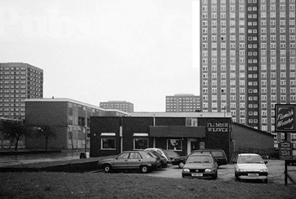
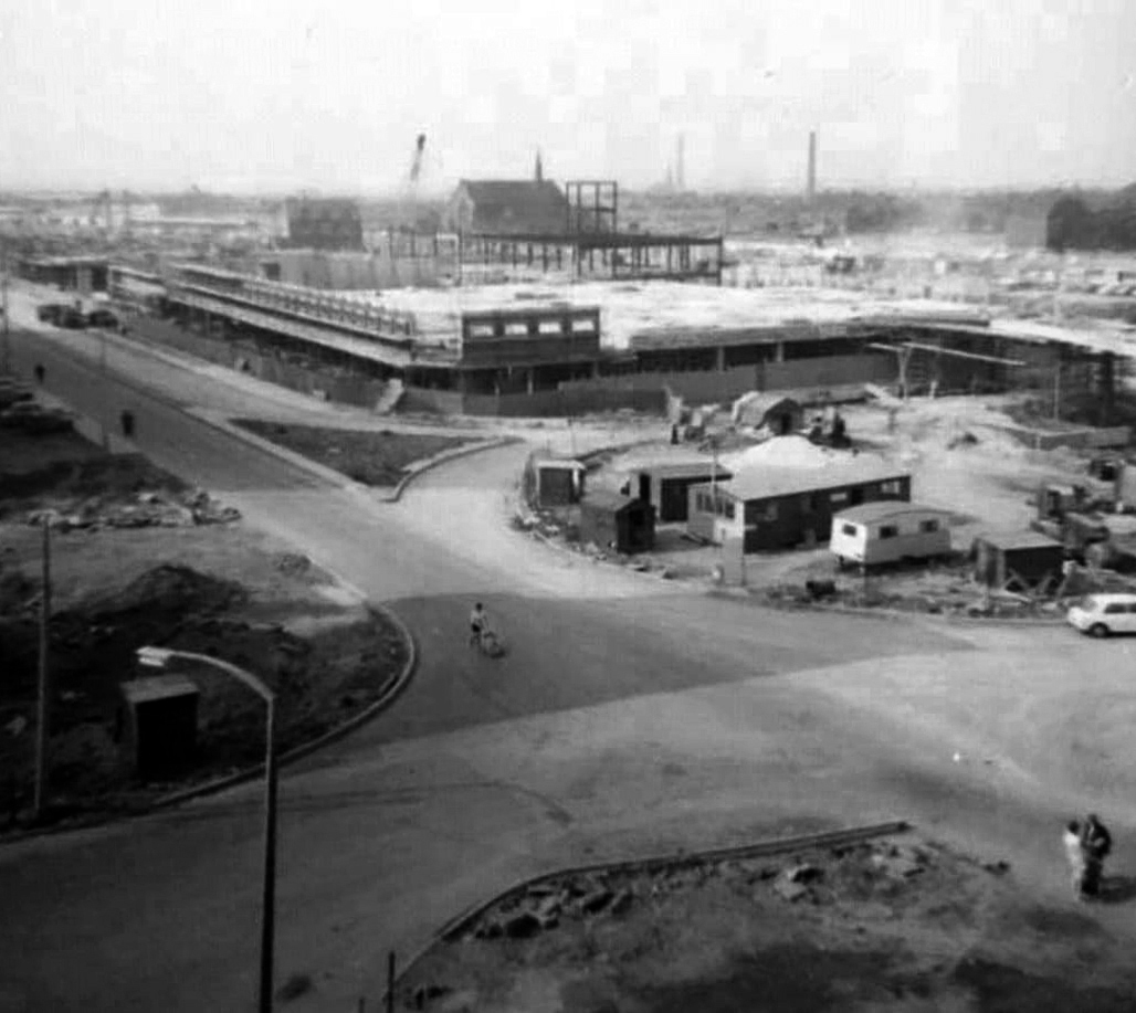
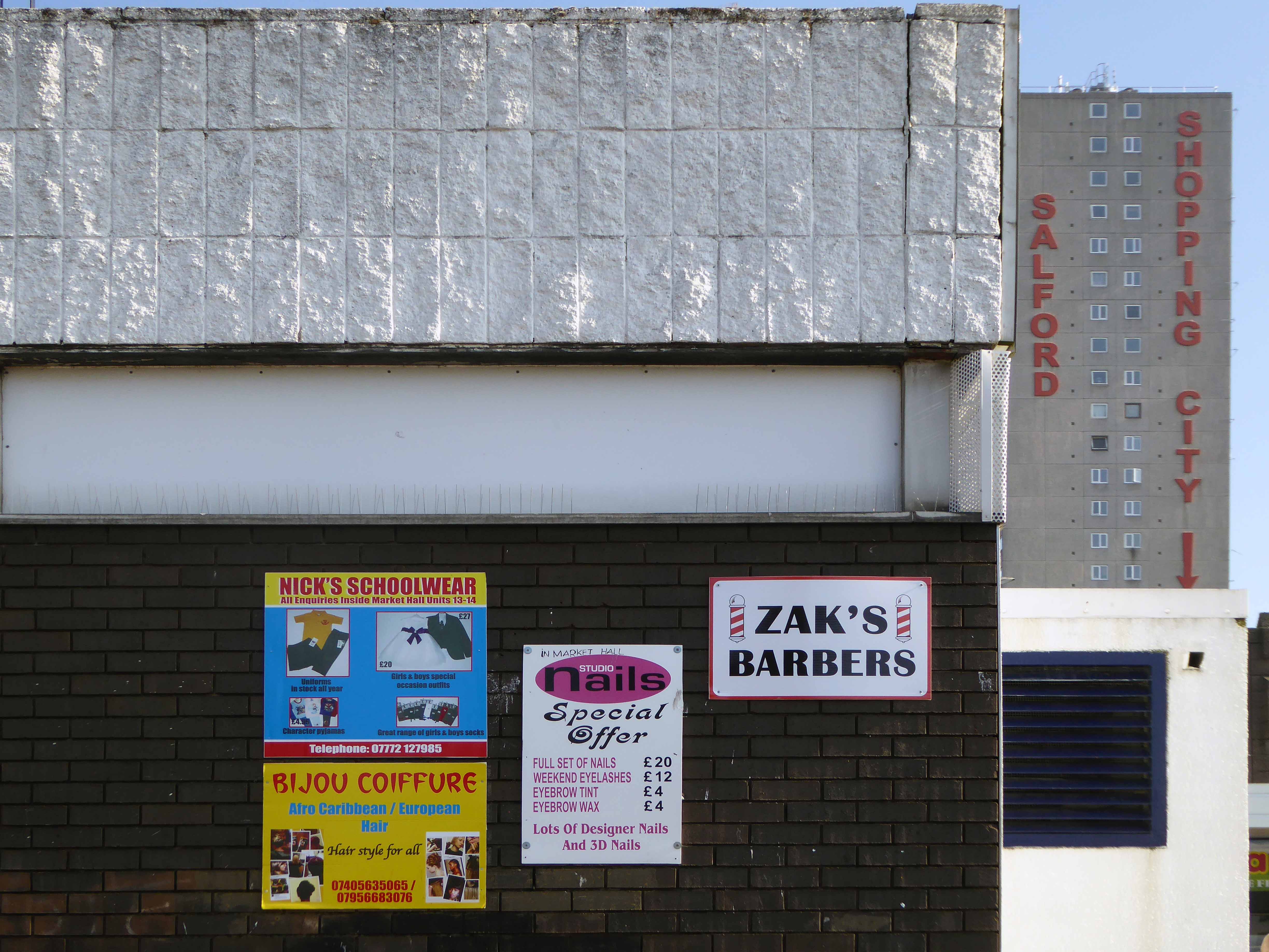
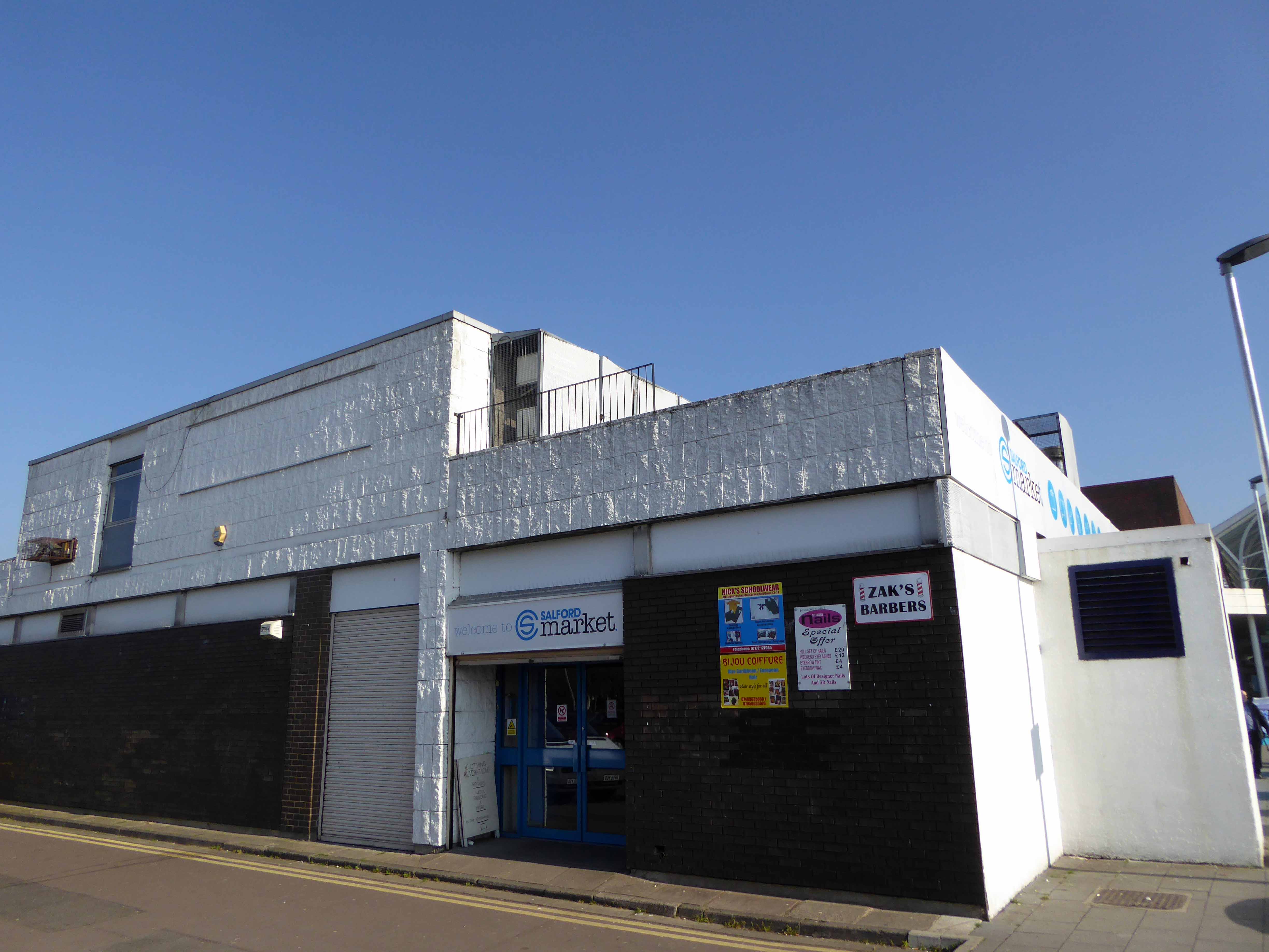
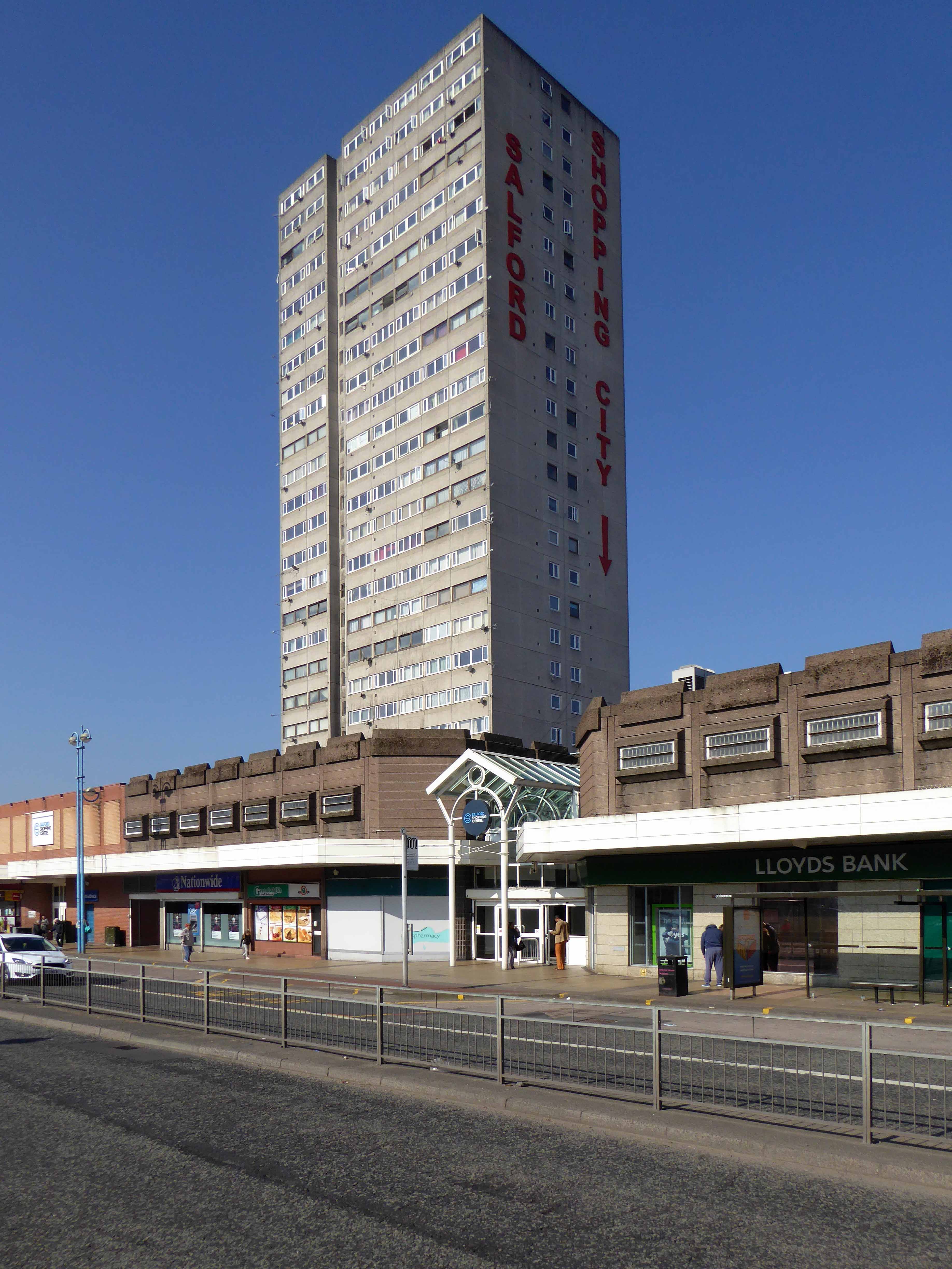
The construction of the shopping centre and surrounding areas continued and on 21 May 1970 the new Salford Market officially opened. From 1971 onwards new shops inside the precinct itself began to open.
However, due to a lack of funds and a political scandal which saw chairman Albert Jones jailed for eight months construction of Salford Precinct was halted. The site had only 95 shop units compared to the proposed 260, the hotel and two storey car park were never built.
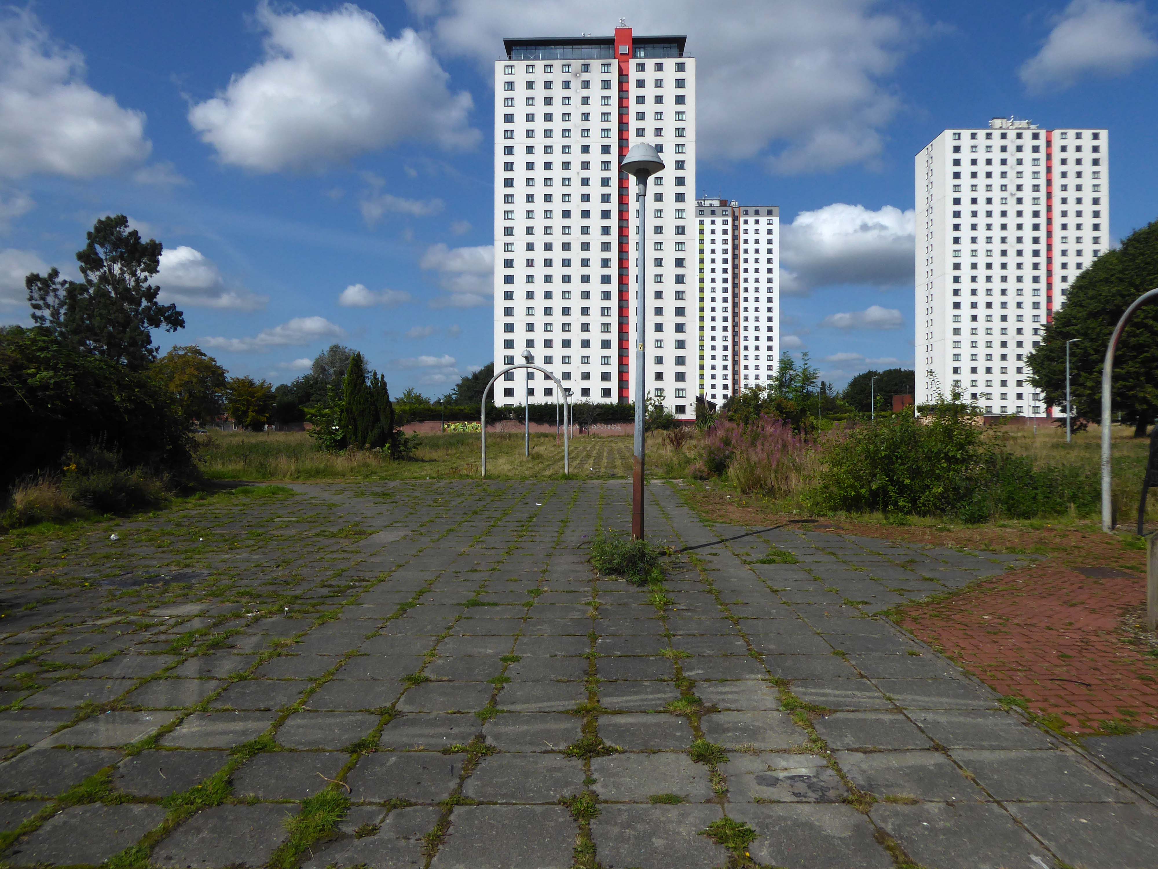
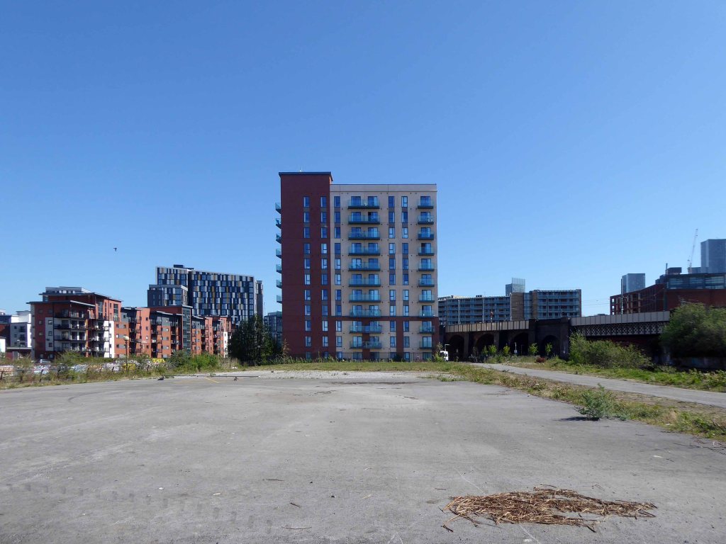
The architectural core of the site has been retained, including the 23 storey Briar Court residential tower.
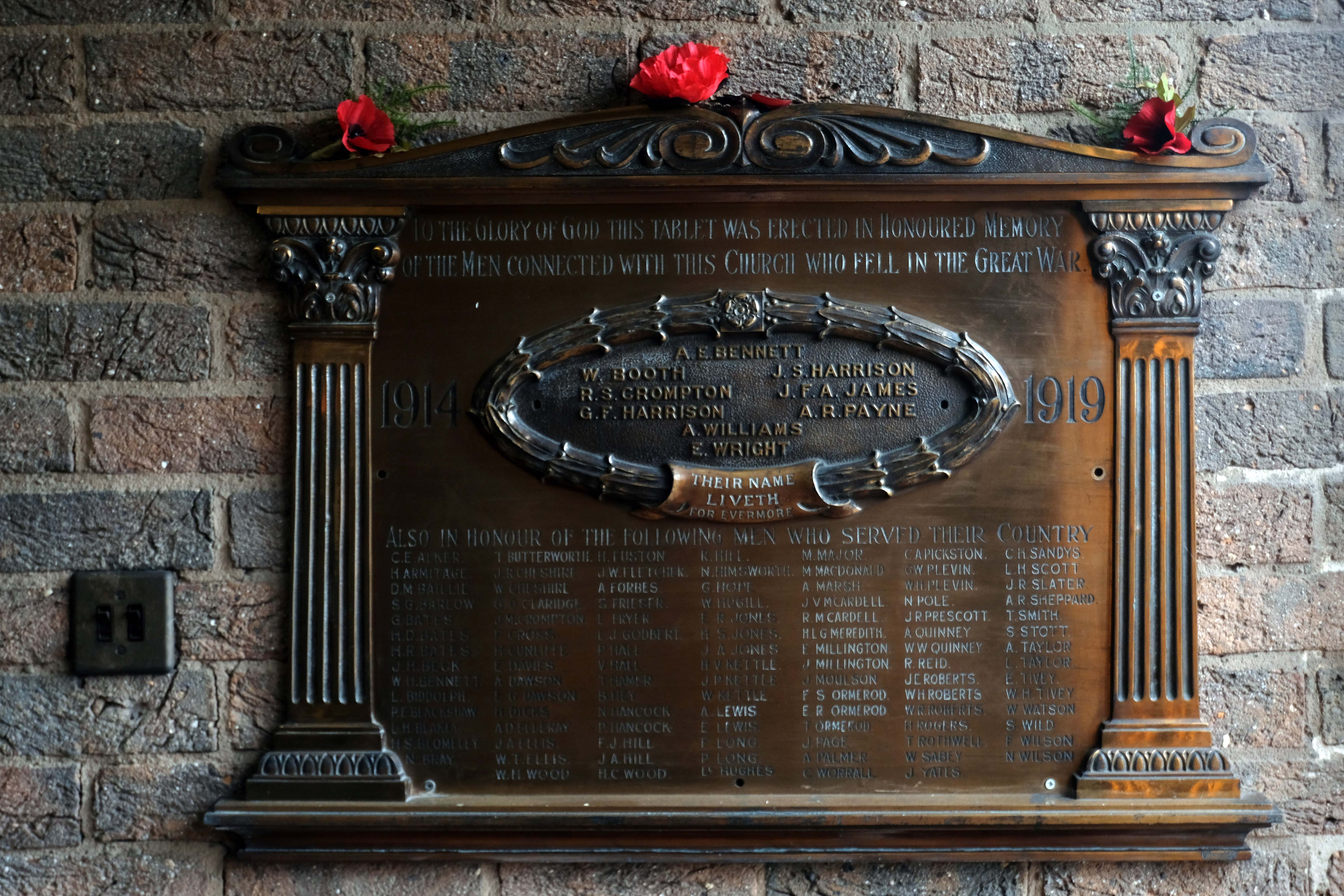
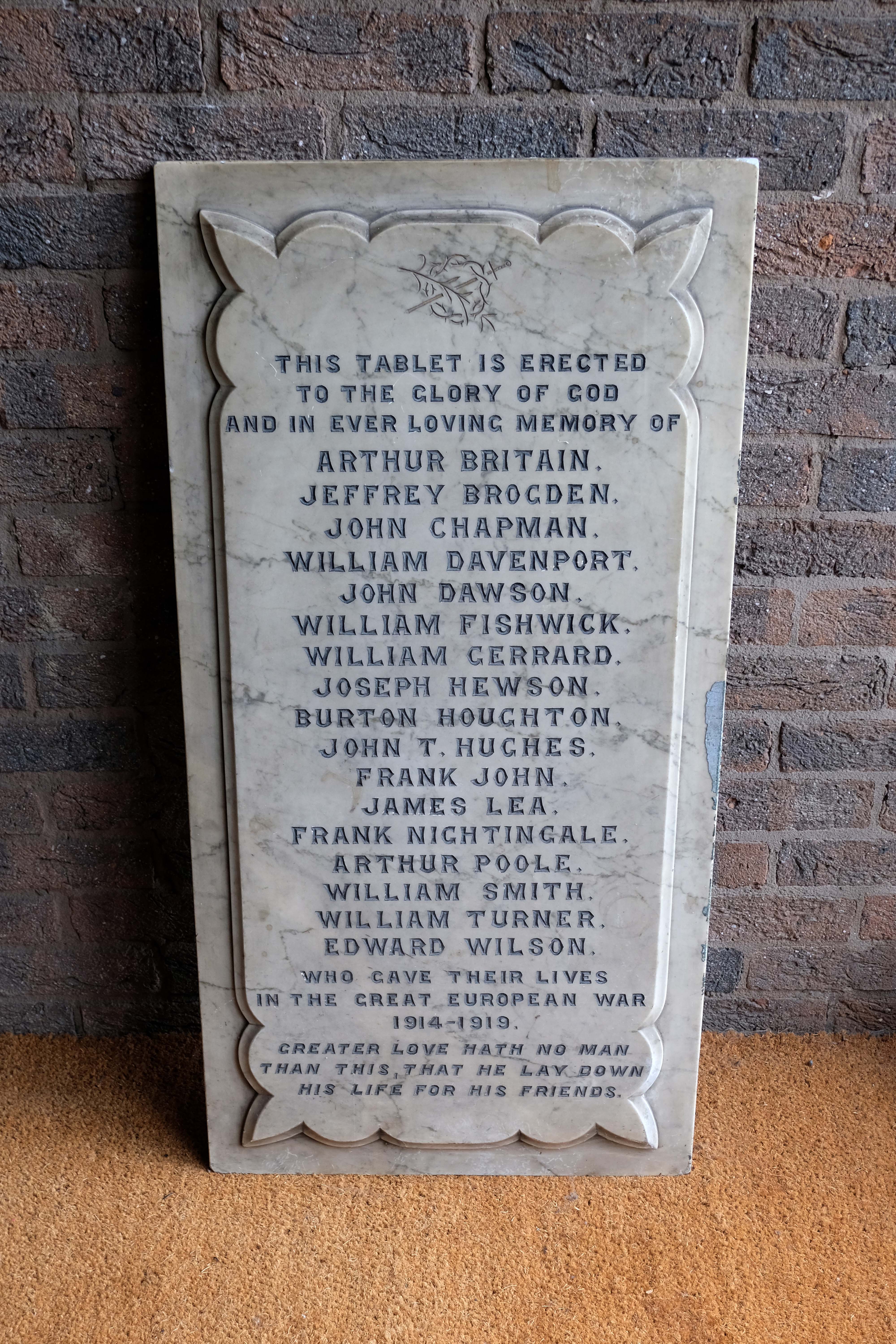
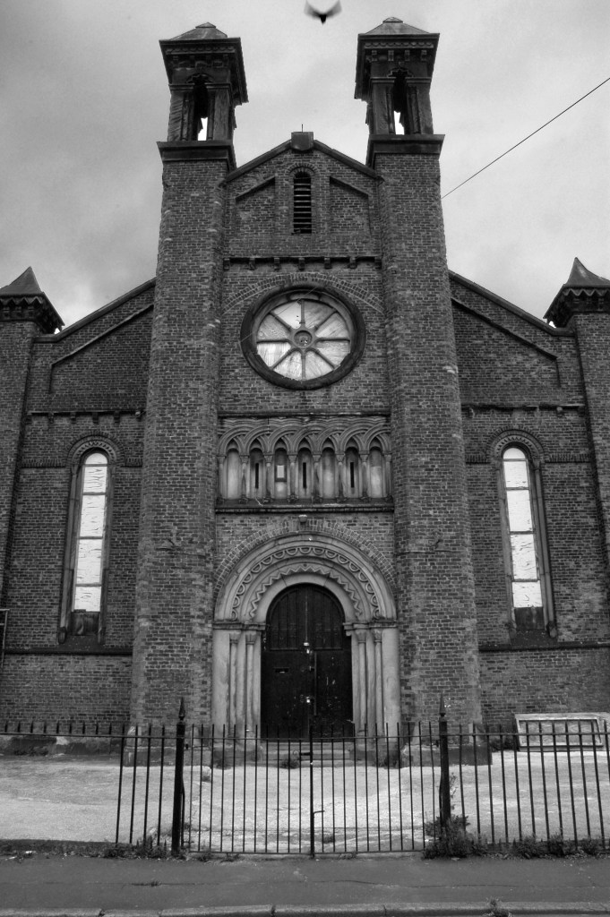
Tucked in behind is Mother of God and St James RC Church.
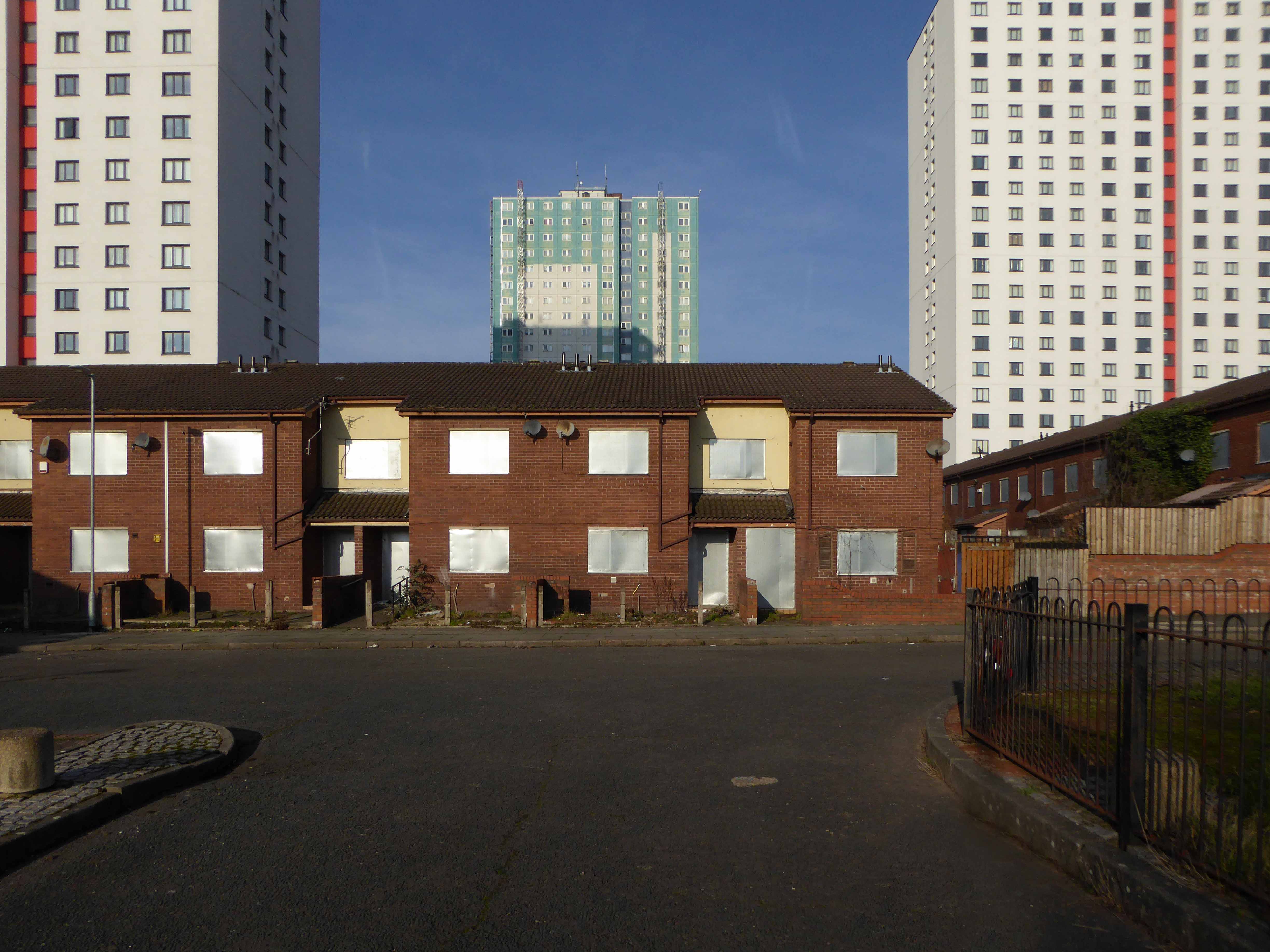
Clearances took place from the middle of the twentieth century and new high-rise housing blocks were built, as well as a shopping centre.
There was a Catholic presence in the area from 1854, when schools were built. What was described in The Tablet as a beautiful church, an Early English Gothic design by M. Tijou – presumably Herbert Tijou, architect of the chapel to Loreto College, Manchester, was opened by Cardinal Manning, Archbishop of Westminster in 1875.
One hundred years later this church was demolished and replaced by the present building.
The architects were Desmond Williams & Associates, the design bearing some similarity to their St Sebastian, Salford. In 2010 the church of All Souls, Weaste, was closed, and the marble sanctuary furnishings brought to the church.
Description
All orientations given are liturgical. The church is steel framed with brick walls and a monopitch roof (originally covered with copper, now with felt). Bold brick forms create a presence, and the design is somewhat defensive, with few windows. The building is entered from a lower porch which forms a narthex. The slope of the roof and the stepped clerestory lighting create a striking impression inside, and full-height windows towards the east end incorporate stained glass figures said to have originated in the previous church. Marble sanctuary furnishings are presumably those from the church in Weaste and appear to be of later twentieth century date, while the font is of traditional type with a clustered stem and may have come from the earlier church.
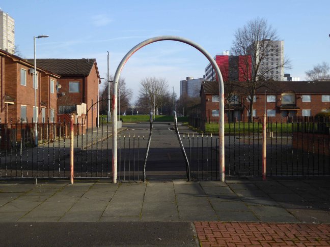
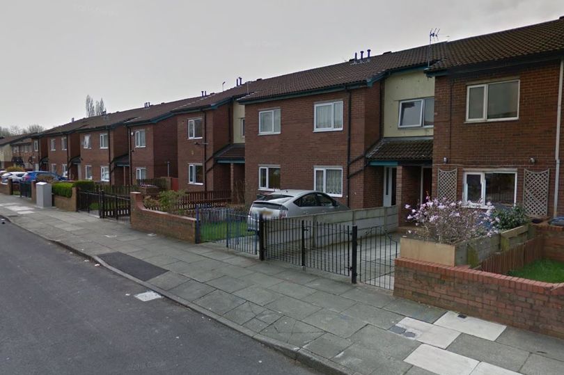
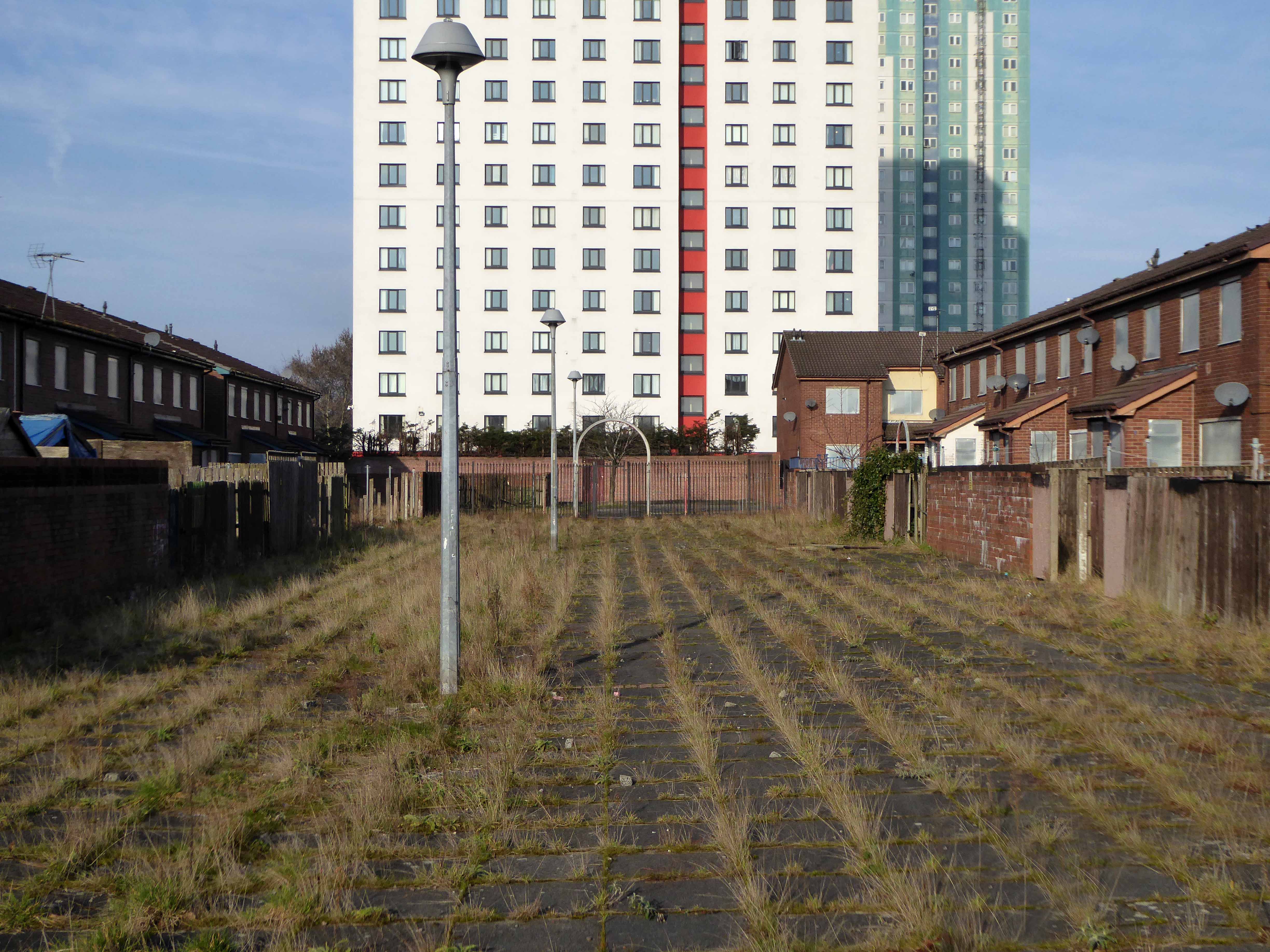
Returning to The Crescent the High Street Estateis all but demolished, save for one resident and their row.
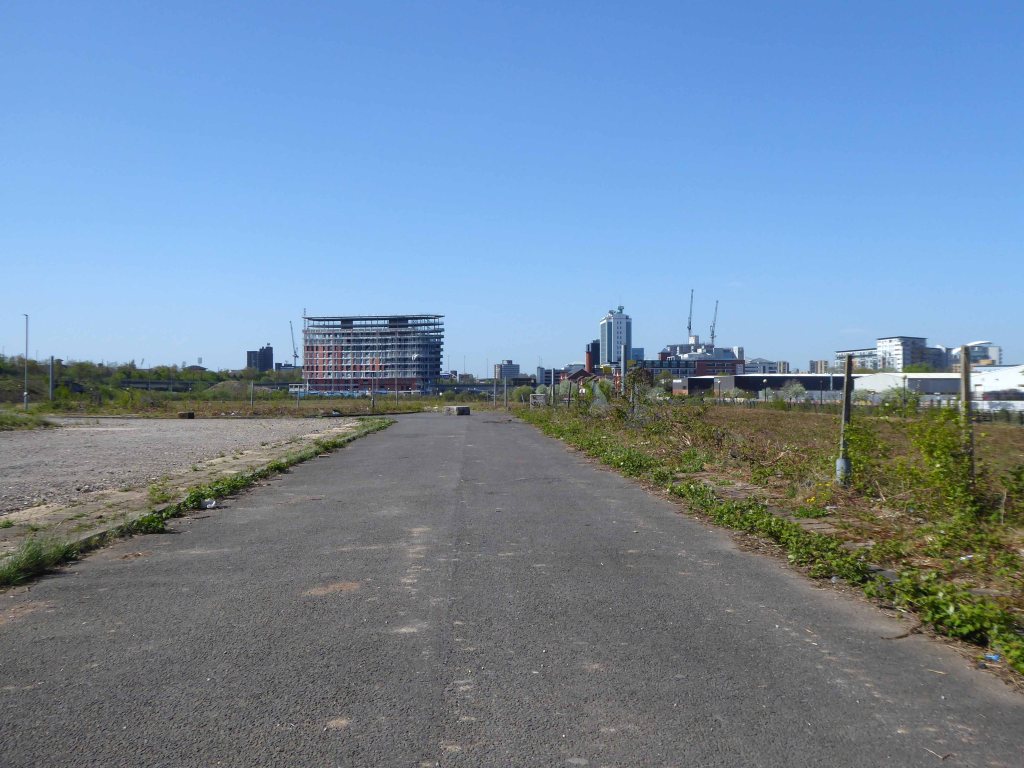
This is an area which has seen a succession of clearances, redevelopment and shifts in demographics during a relatively short and intense period of change.
That process of change continues to hastily unfold.
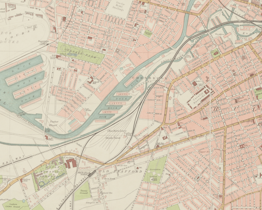
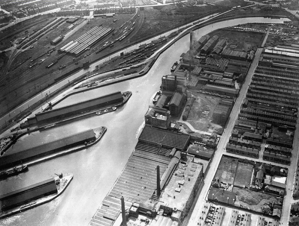
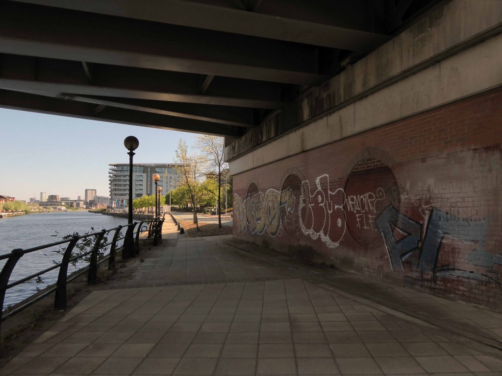
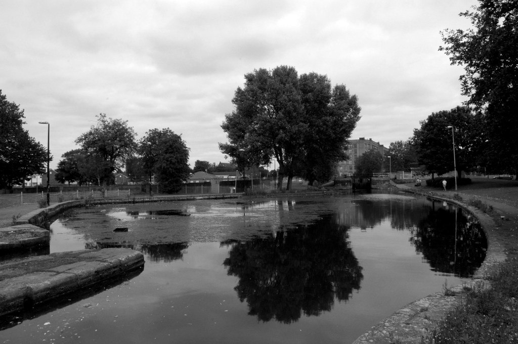
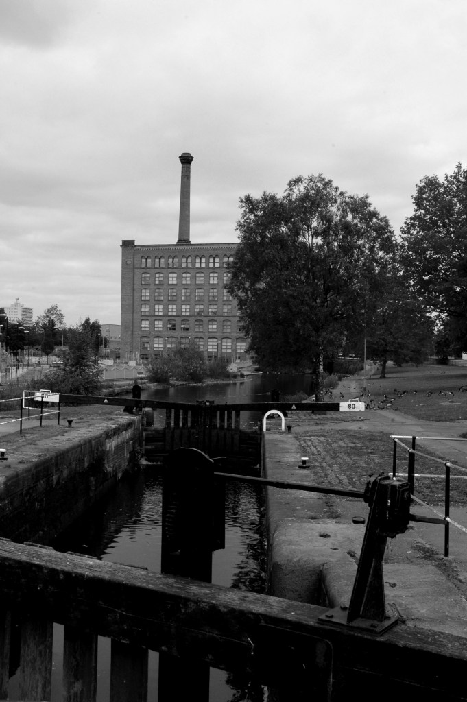
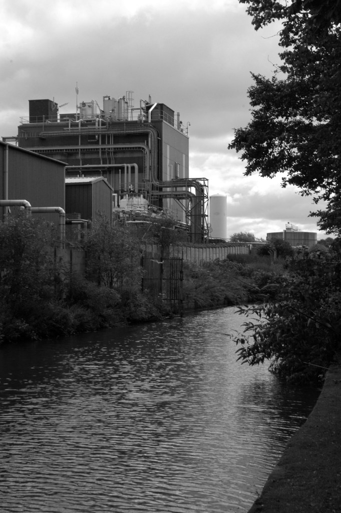
The River Irwell bisects Salford and Manchester, joining the rivers Irk and Medlock, and then turns west toward Irlam, as part of the Manchester Ship Canal. Its course ends just east of Irlam, where it empties into the Mersey.
Urban development is ever so often dependent upon rivers – for sustenance, commerce and amusement. The Irwell and latterly the developments of the canal system has provided all of these in superabundance.
By 1870 the Pomona Gardens is thriving , boasting a concert hall and banqueting suite – further details here from Skyliner.
In the summer of 1887, a nearby chemicals factory exploded, damaging the palace – the area was under threat and destined to rot away to obscurity: the following year the gardens closed forever.
By 1900 the Ship Canal, docks and railways had arrived – Manchester and Salford are at the centre of an unprecedented growth in manufacture and trade.
189119231950
During the 1970’s the docks began a rapid decline, largely due to containerisation. The increasing size of freight-carrying ships meant they could no longer navigate the ship canal and this, combined with increased trading with Europe and the east, saw use of Manchester Docks decrease. In 1982 the remaining docks closed and the area became derelict. Recognising the need to redevelop the area, Salford City Council purchased the docks in 1984 using a derelict land grant. The Salford Quays Development Plan was adopted in May 1985, proposing complete reclamation and development of the area for commercial, residential and leisure use.
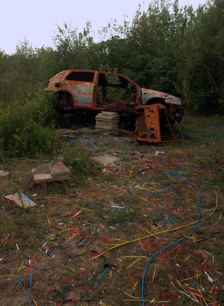
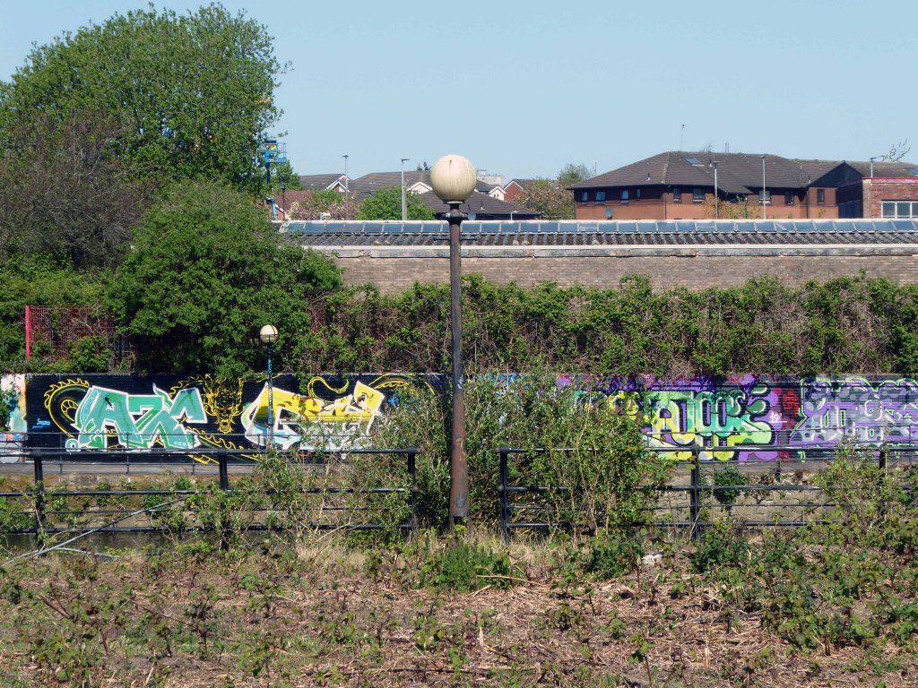
Manchester and Salford begin the long haul from post industrial decline to service centred cities – there were even seeds sewn for the development of a luxury marina. When I first visited Pomona the area was seriously overgrown and the underground wiring stripped out.
201020102020
Remnant of the initial scheme – pedestrian access, balustrade and lighting.
What would poor old Pomona make of all this?
There was a failed attempt to prevent further development and return the area to nature. Peel Holdings prevailed and pressed on relentlessly with their programme of urbanisation.
So it’s April 2020 – I’m on my way from somewhere else to somewhere else, I’ll cut across Pomona Island – the building site is in lockdown – ain’t nobody home.
This is a film that has stayed with me for most of my life – first seen as a nipper, fascinated by the fact that it was shot in a very familiar landscape.
As years have passed I have watched and rewatched it, finally resolving to track down the local locations used in its filming.
Studying and pausing the DVD, making thumbnail sketches of frames, researching online – referring to Reelstreets.
I have previously written about the way in which the movie shaped a particular image of the North.
And examined particular areas of Manchester such as Barmouth Street.
The film generated world wide attention and remains just as popular today.
Still watched, still loved, still relevant – here are a selection of photographs I took in 2011 – cycling around Manchester, Salford and just a little closer to home in Stockport.
Timpson’s shoe shop now demolished opposite the Etihad
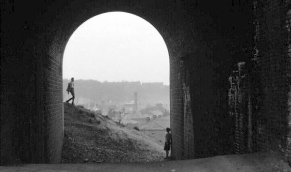
Phillips Park the back of the gas works in Holt Town
The Devil’s Steps Holt Town
Rochdale Canal
Ashton Canal
All Souls Church Every Street Ancoats
Piccadilly Gardens as we view the city from a moving bus.
Manchester Art gallery – where they watched the Whit Walks.
Albert Square part of the earlier bus ride.
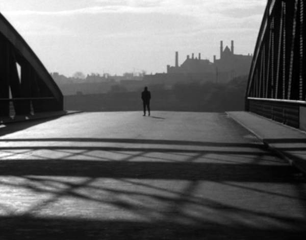
Trafford Swing Bridge
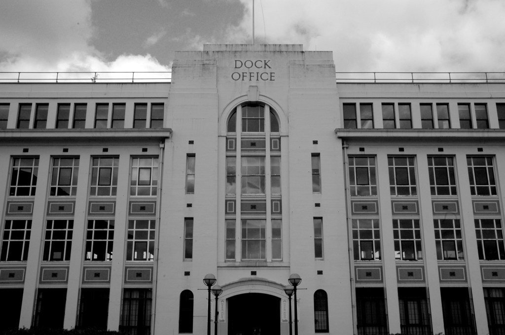
Dock Offices
Chimney Pot Park Salford
Pendleton
Barton Aqueduct
Through my tour I have attempted to capture a sense of the settings as they are – how, if at all, the areas have changed.
There may be some minor inaccuracies or omissions which I am happy to amend.
You may wish to visit the sites yourselves, the majority of which are easily accessible, above all watch the film and appreciate that which is around you.
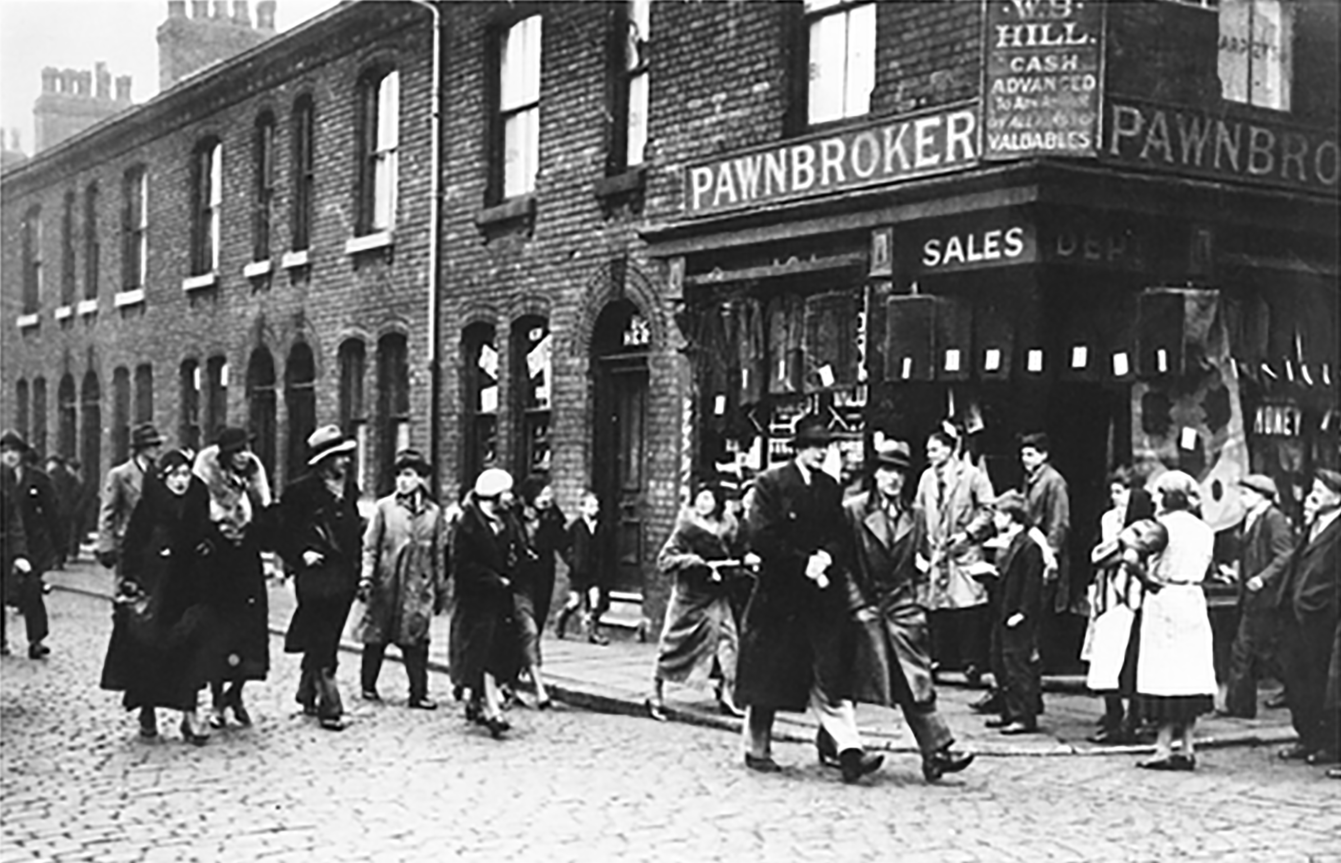
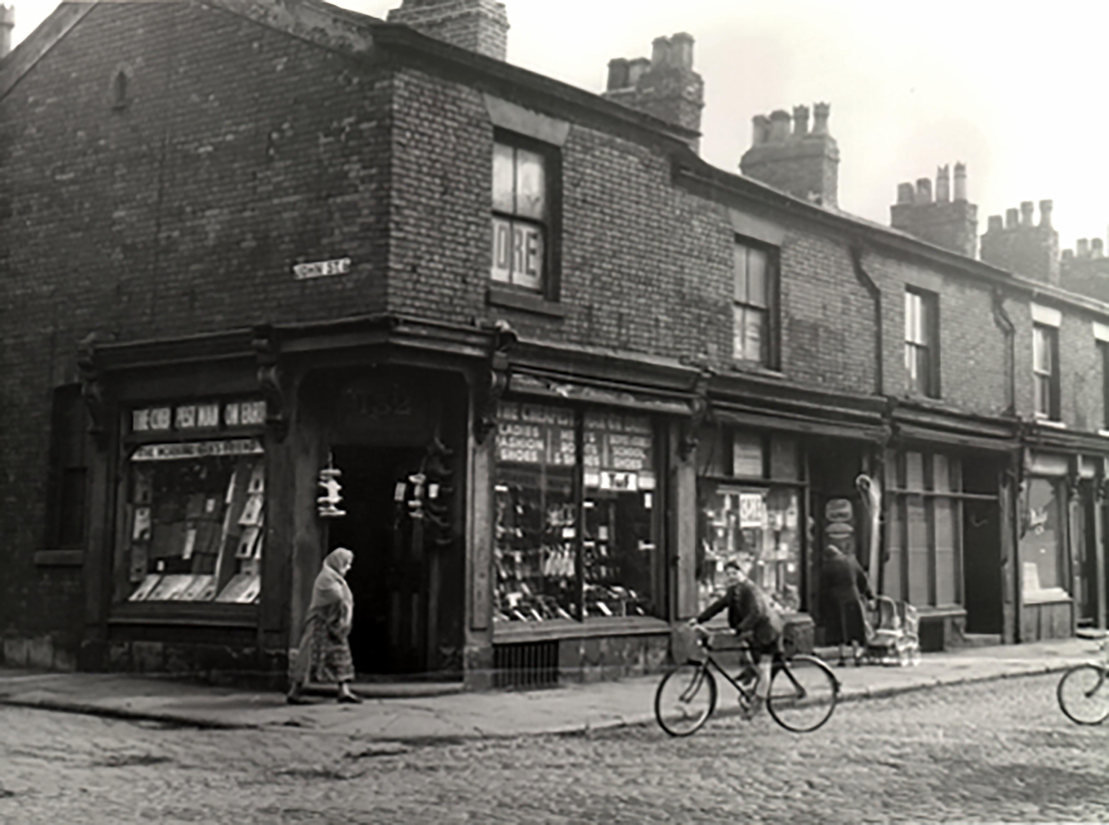
High Street Pendleton 1930s – the cast of Love on the Dole walk down High Street Pendleton, passing Hill’s Pawnbroker, author Walter Greenwood is ninth from the right.
This was a dense area of back to back terraces adjacent to pubs, schools, churches, mills, docks and cattle markets. Communities formed from shared patterns of employment, education, leisure and worship.
These communities survived into the 1960s and the coming of slum clearance, followed by an intense period of rebuilding in the modern manner.
Patterns of employment, economic boom and bust, the exponential expansion in higher education, all contribute to the change in character of the area, along with slow and sudden demise in social housing.
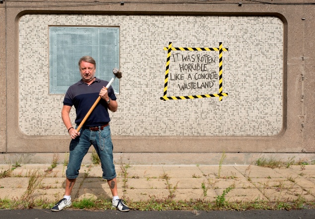
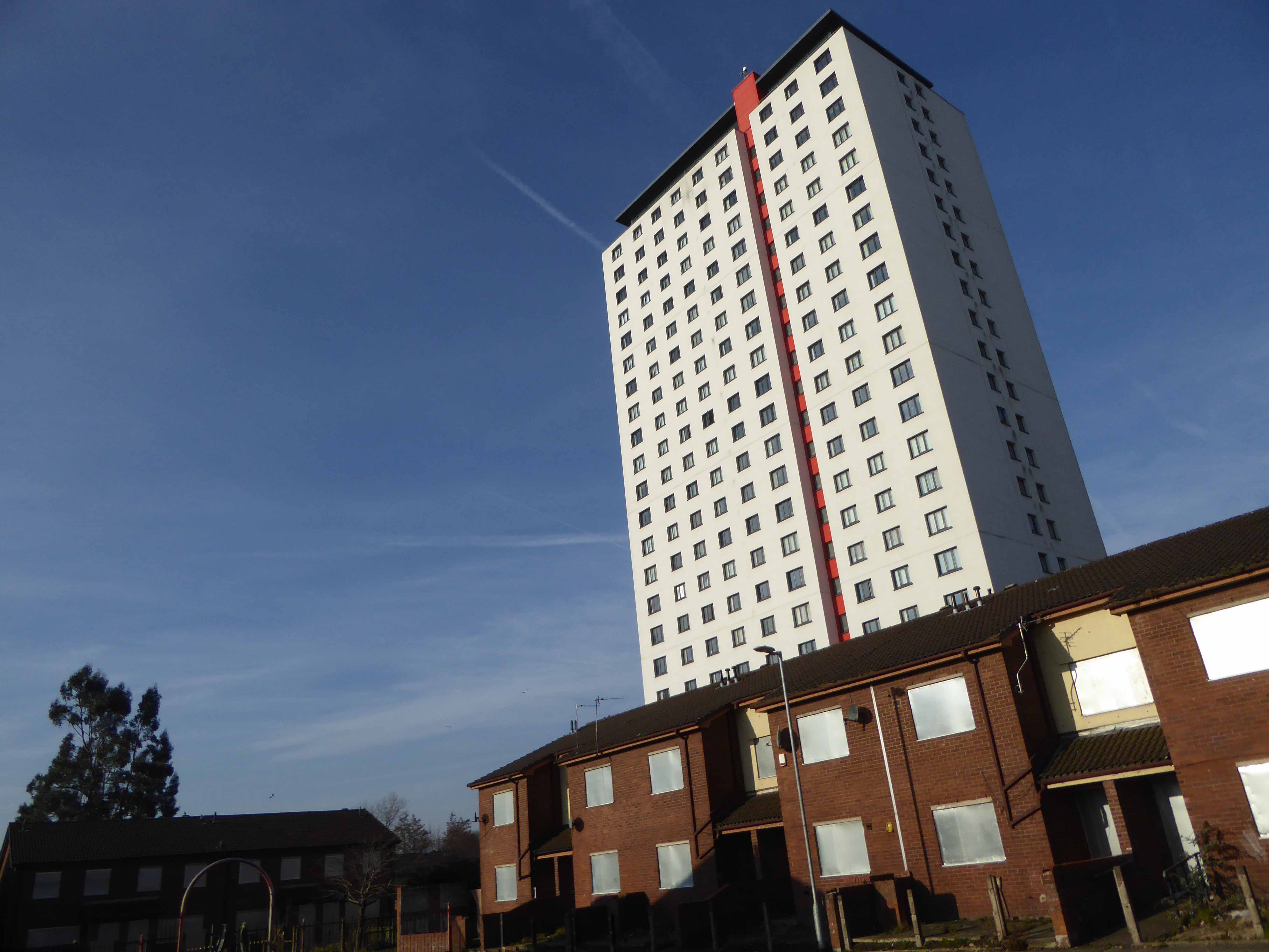
2014 and the area begins to be reshaped yet again – this time by former resident Mr Peter Hook, who grew up in the area, the low slung former New Order bass meister described it in a book as – rotten and horrible, like a concrete wasteland
The Orchards tower block, the first of three, is removed piece by piece, each of the 14-storey blocks took around six weeks to be demolished.
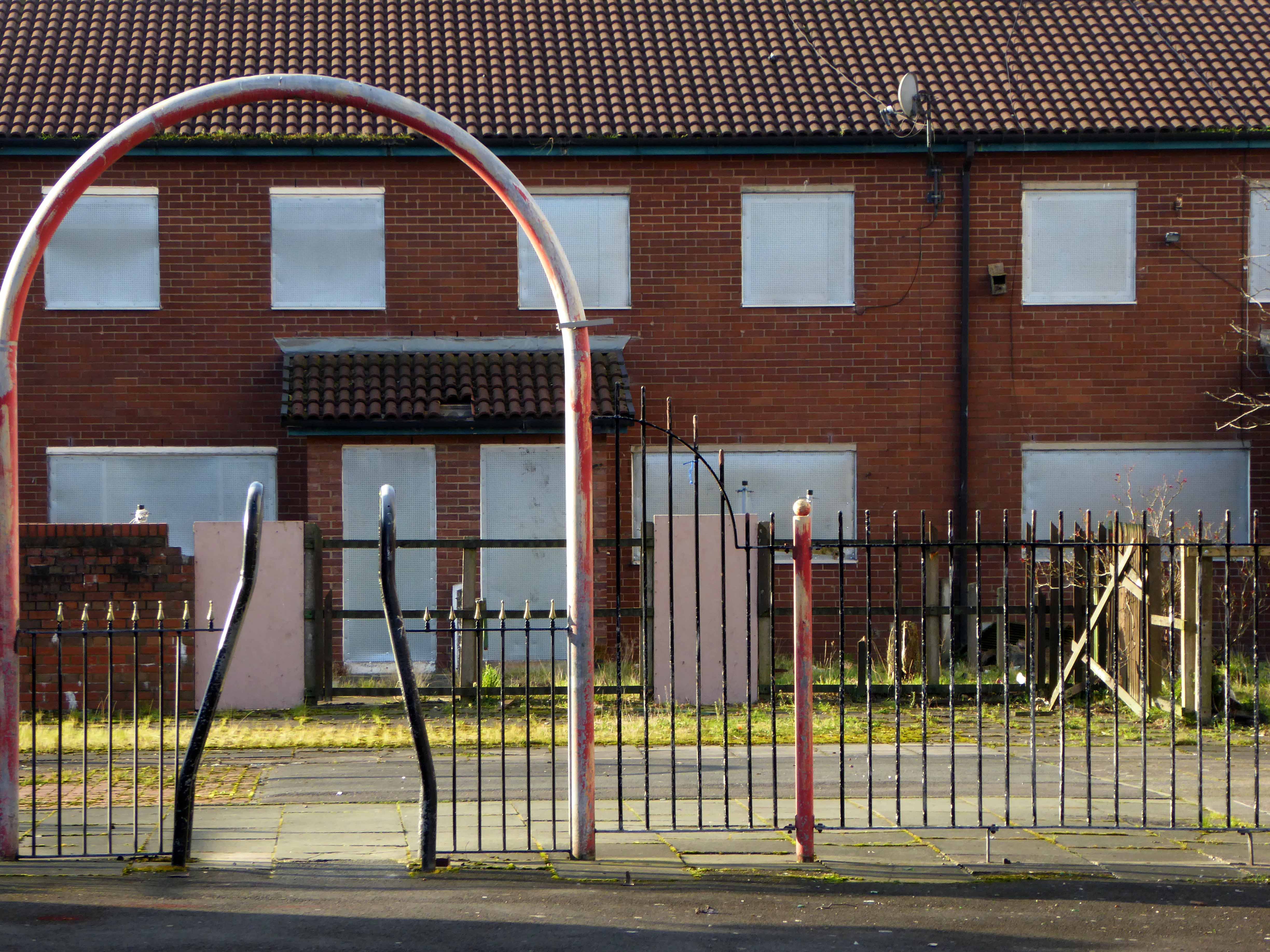
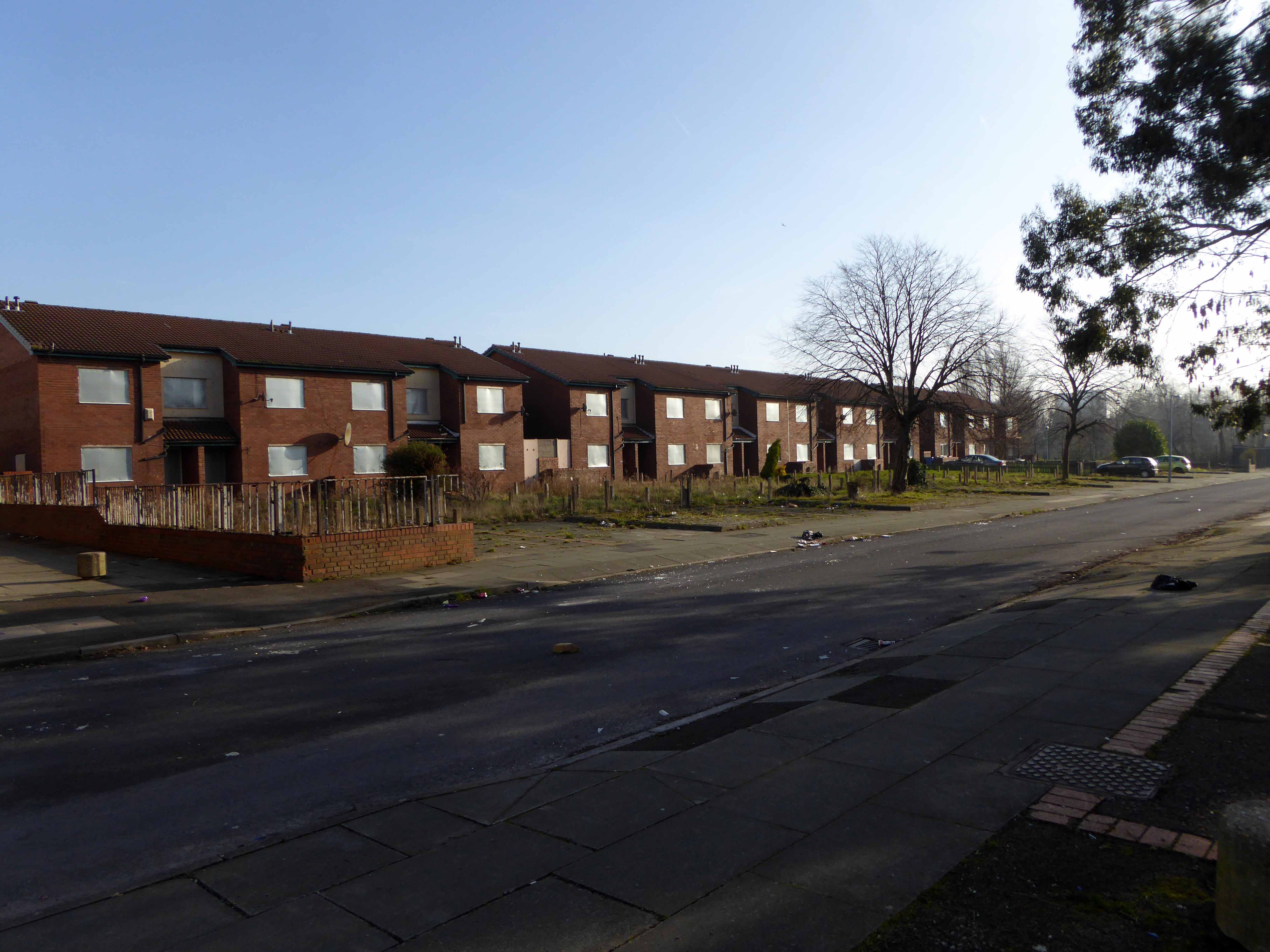
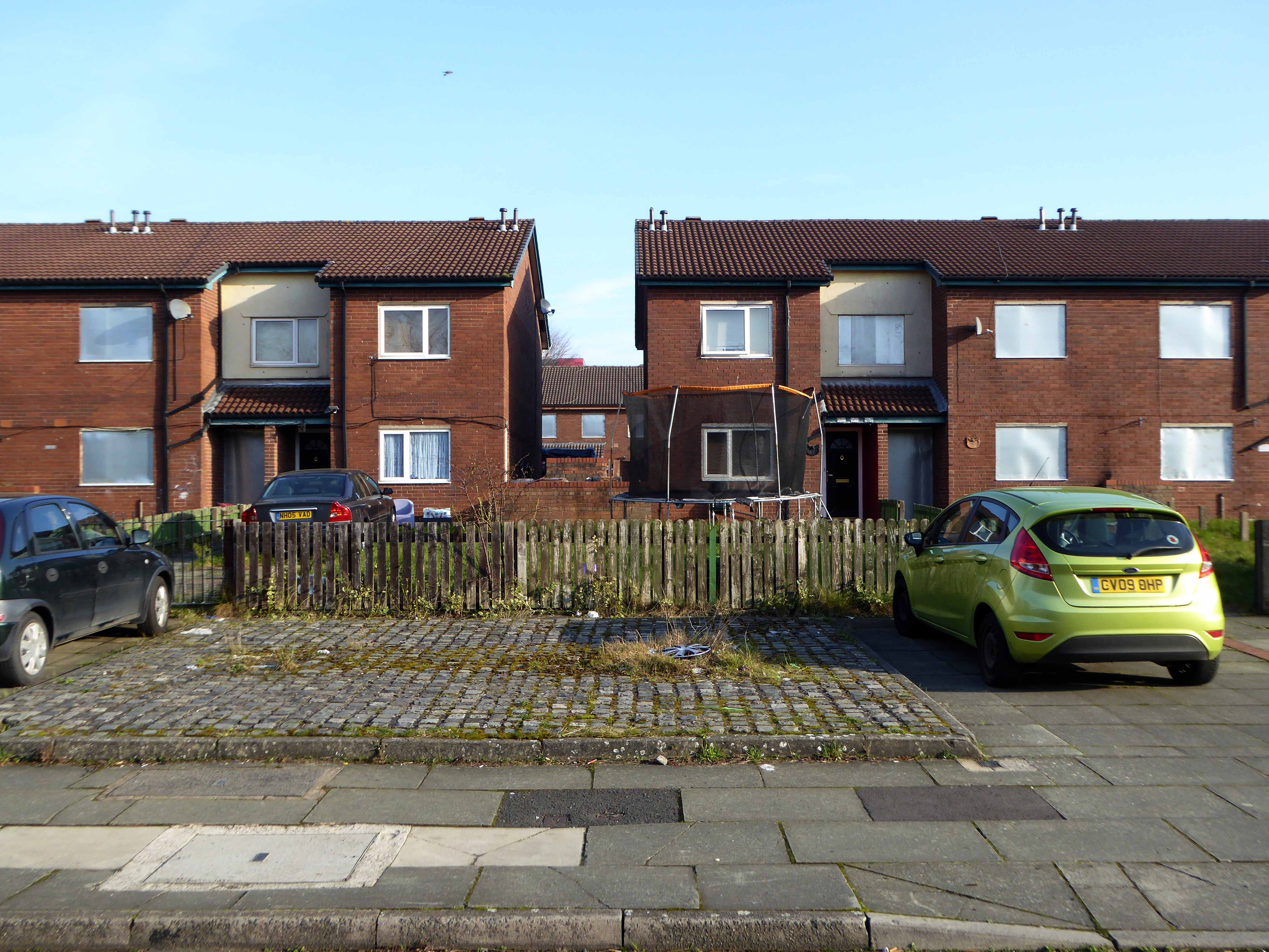
The citizens of High Street Estate await the ‘dozers with apprehension and a sense of grim inevitability.
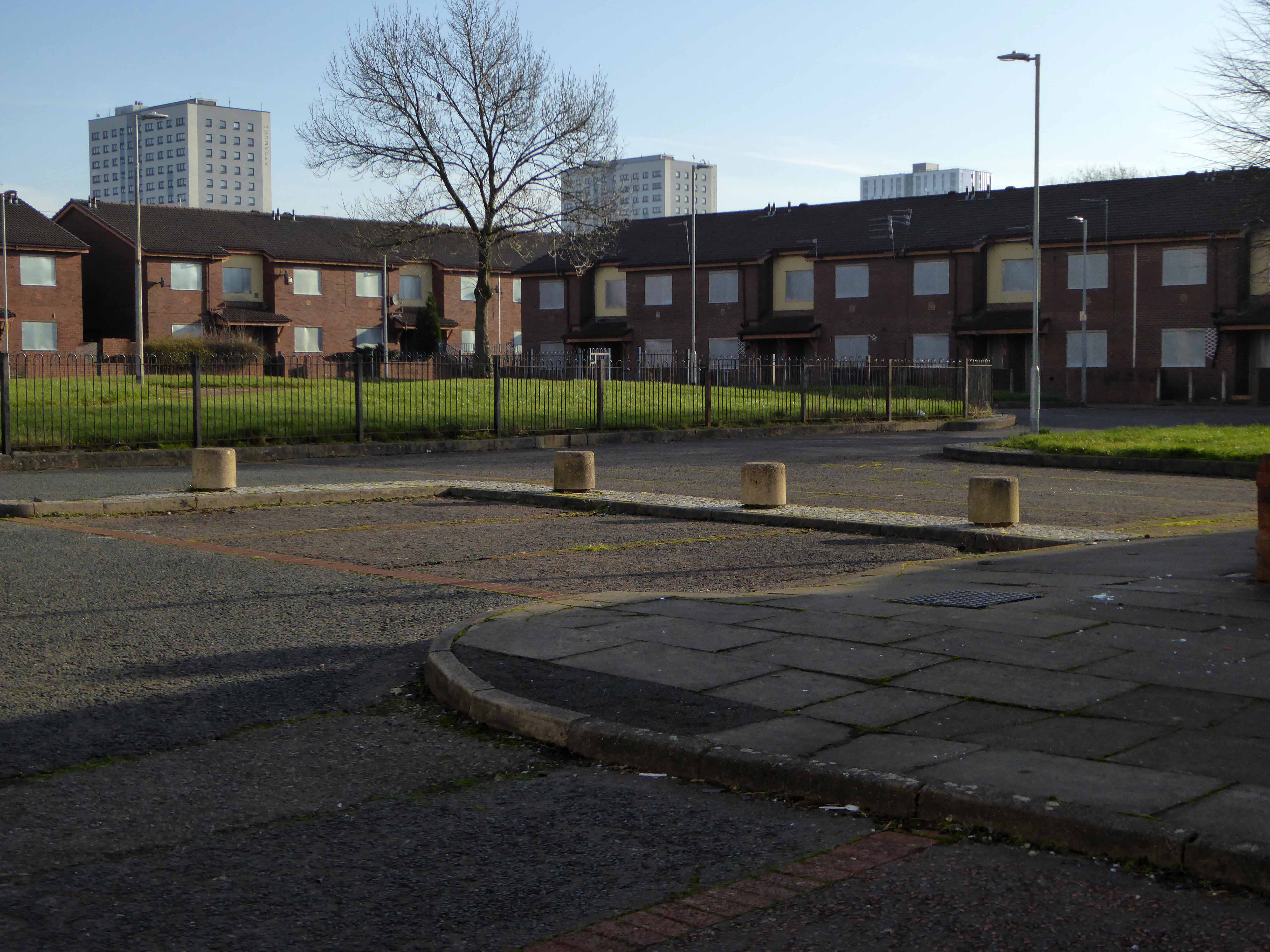
Clearance begins with the promise of new homes, tenants and homeowners are relocated, houses are tinned up or demolished wholesale. – a few remain in situ dissatisfied and afraid.
Altogether, 885 houses in Pendleton are being bulldozed and, to date, 584 have already been demolished, including houses on Athole Street and Amersham Street. Over the Pendleton Together project’s £650million thirty year life, only around one third of new houses being built will be affordable.
Meanwhile, after years of anguish and uncertainty, Fitzwarren Court and Rosehill Close, previously down for demolition, are being saved. Salix Homes will now bring flats in Fitzwarren Court and houses in its ownership on Rosehill Close up to the Decent Homes Standard.
So welcome to Limboland – as financial arrangements shift, shimmy and evaporate – government policy, local authority pragmatists, private partnerships and funding perform a merry dance of expediency, around an ever diminishing circle of demolition, development, stasis and deceit.
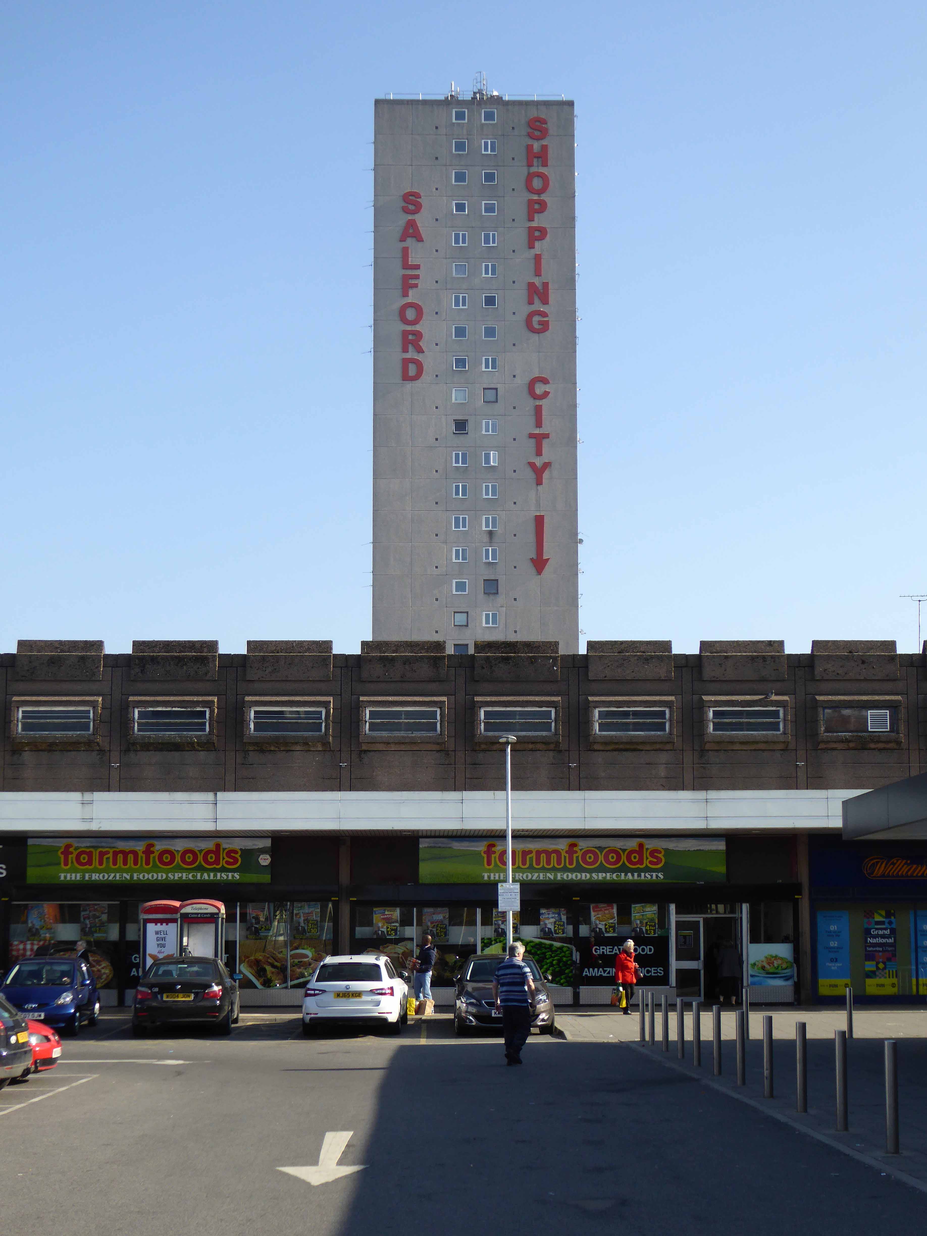
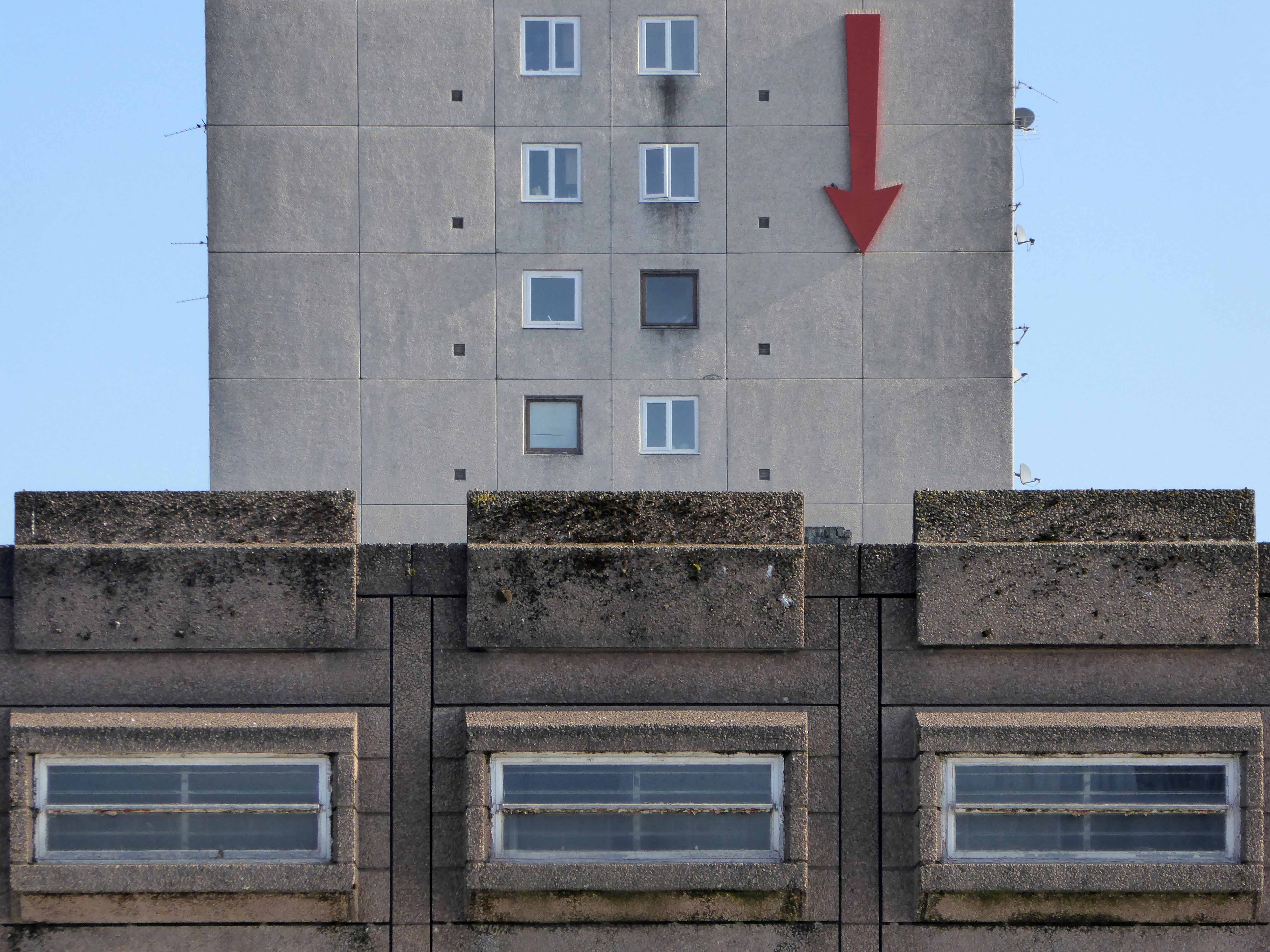
The construction of the shopping centre and surrounding areas continued and on 21 May 1970 the new Salford Market officially opened. From 1971 onwards new shops inside the precinct itself began to open.
However, due to a lack of funds and a political scandal which saw chairman Albert Jones jailed for eight months construction of Salford Precinct was halted. The site had only 95 shop units compared to the proposed 260, the hotel and two storey car park were never built.
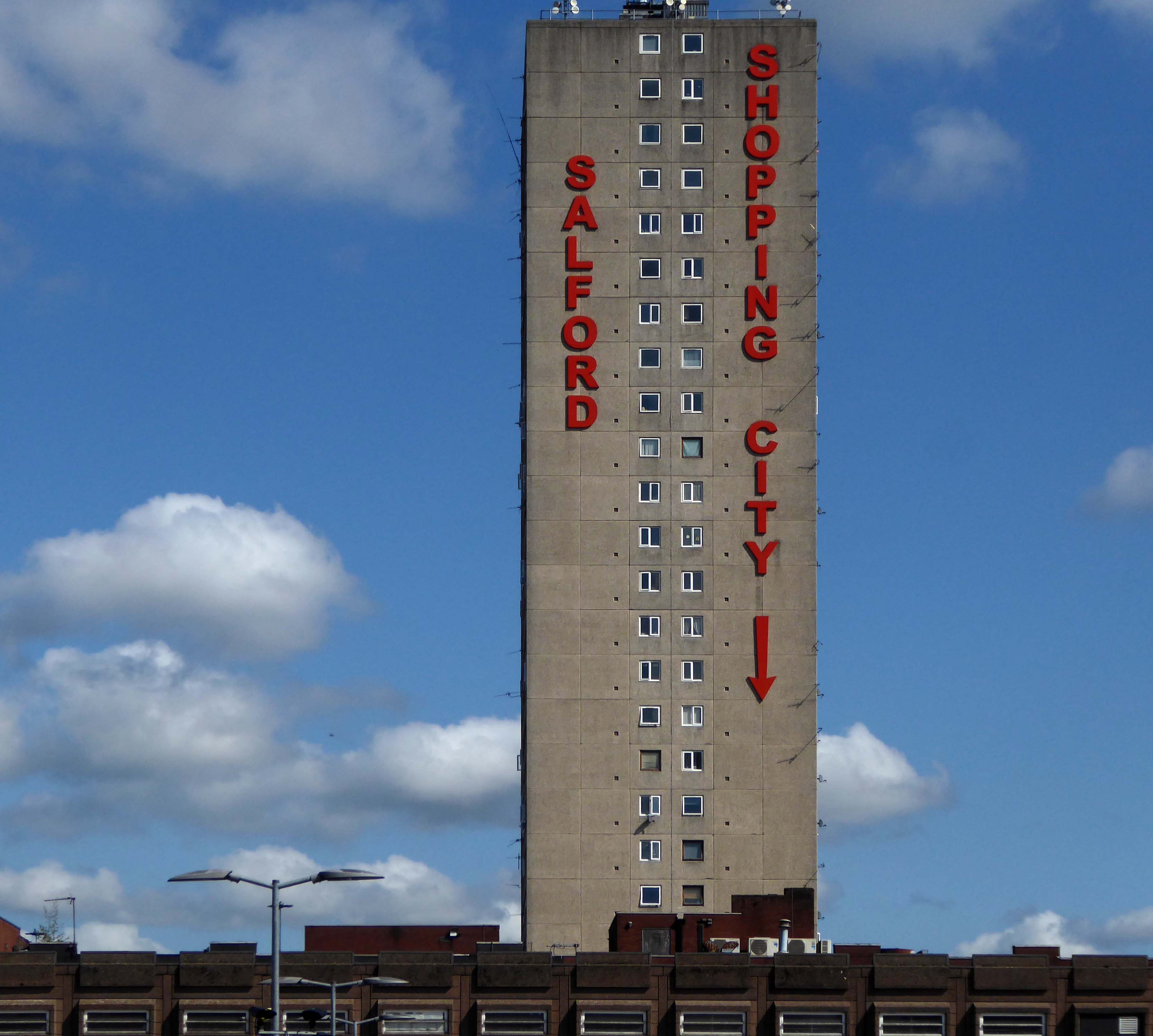
In 1991 the building was refurbished at a cost of £4 million, this included the installation of roofs across various walkways, making large swathes of the centre undercover. The shopping centre which at the time was known as Salford Precinct was renamed Salford Shopping City.
On 9 August 1994 the Manchester Evening News reported that Salford City Council was planning on selling off Salford Shopping City to raise money for local housing repairs, these plans split the ruling Labour Party council, one councillor telling the press that it would be like selling off the family silver.
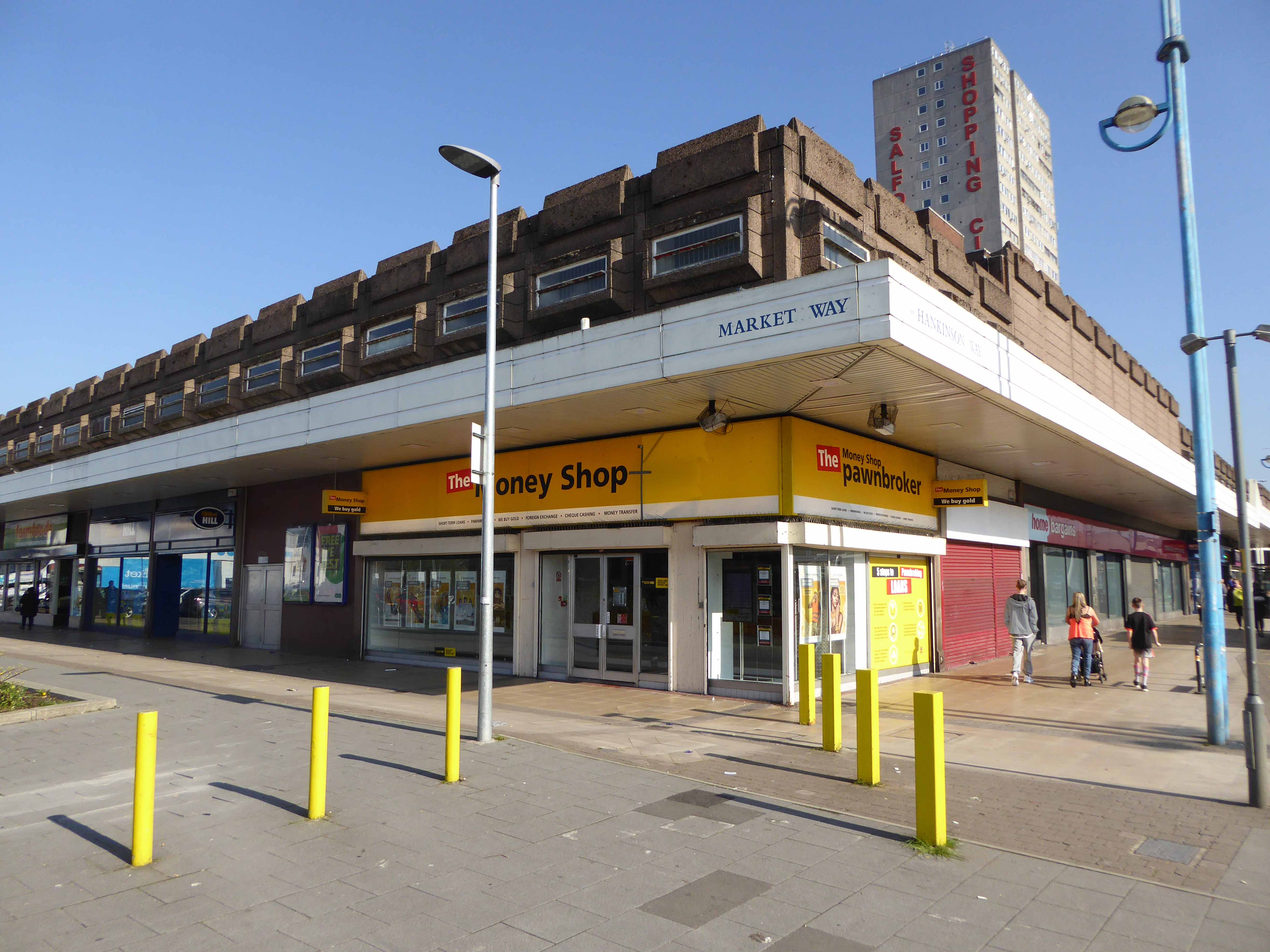
In 2000 Salford Shopping City was eventually sold to a private company for £10 million in an effort to cut the council’s deficit. It was then later sold in March 2010 to Praxis Holdings for £40 million, the company stated that it wanted to invest in the precinct and link it to the new food superstore.
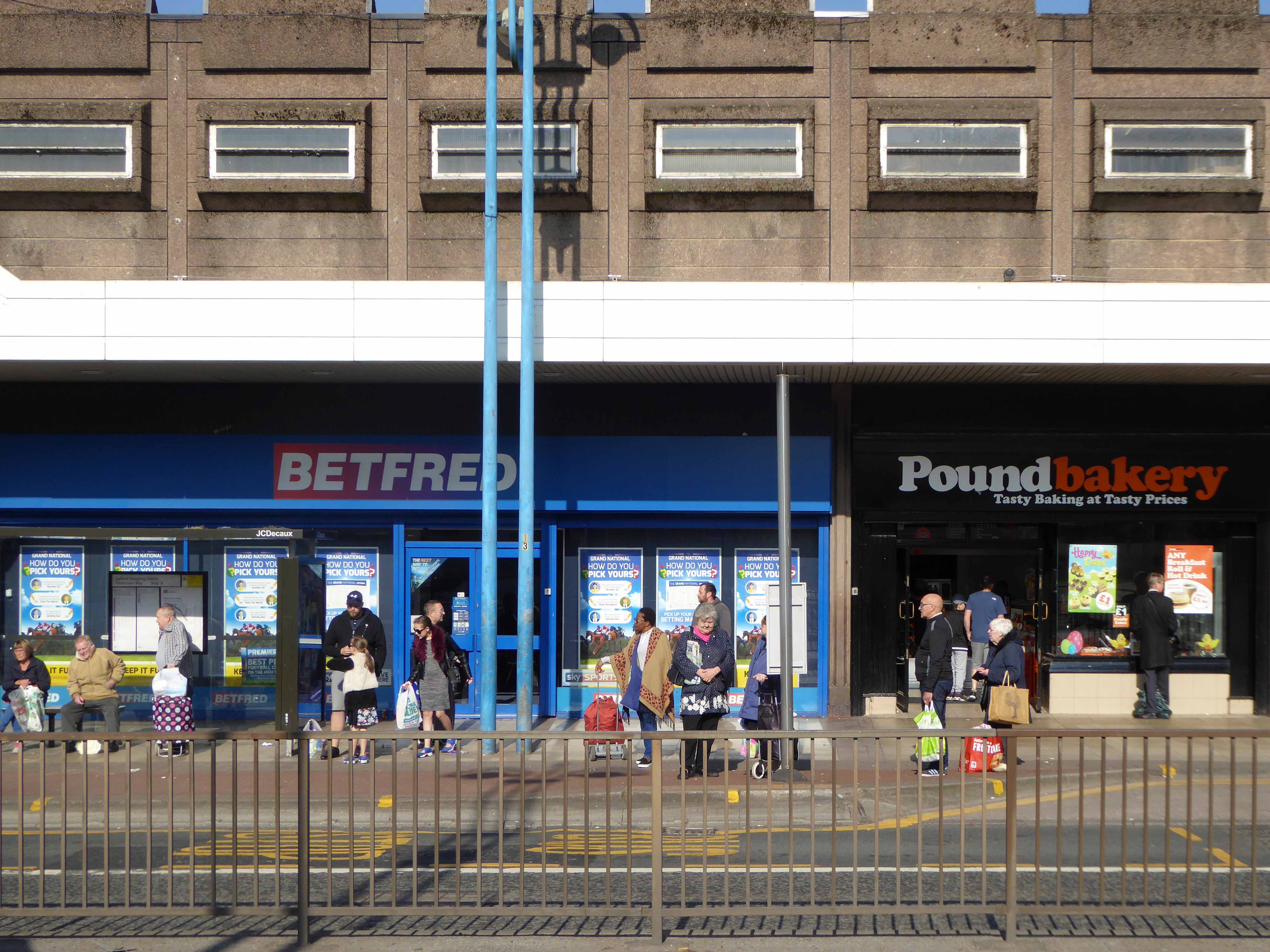
This is a tale of our times – 60s and 70s redevelopment designed and built in the rampant spirit of free enterprise and uber-buoyant consumerism, falling foul of an economic downturn, subsequent unemployment and shrinking retail spending. Property is ping-ponged between local authority and speculative developers.
Following the riots of 2011 pledges were made regarding the future of the site, plans are still afoot, as yet to be rendered corporeal. Although the area has benefitted from an influx of students and a refurbishment of housing stock, there is pressure on the prosperity of the precinct from thriving retail developments in nearby Manchester and the Trafford Centre.
The architectural core of the site has been retained, including the 23 storey Briar Court residential tower, though diluted by more recent additions, misguided post modern detailing that threatens the integrity of full many a post war development.
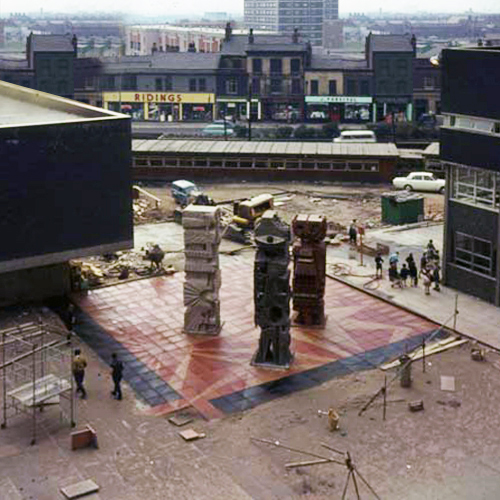
The three concrete totem sculptures of 1966 by William Mitchell, which stand in the courtyard of the Allerton Building, University of Salford, are recommended for designation at Grade II for the following principal reasons: * Historic Interest: as a good representative example of the commissioning of public artwork as an integral element of the design of new higher education colleges and universities in the post-war period, here succeeding in imbuing a distinct identity and image on an otherwise relatively plain complex.
So it seemed appropriate to cycle to Salford early one sunny Saturday morning, in an otherwise relatively plain manner in order to see the three totems.
William Mitchell was a leading public artist in the post-war period who designed many pieces of art in the public realm, working to a high artistic quality in various materials but most notably concrete, a material in which he was highly skilled, using innovative and unusual casting techniques, as seen in this sculptural group. He has a number of listed pieces to his name, both individual designs and components of larger architectural commissions by leading architects of the day.
Historic England says so, they loved them so much they listed them Grade II.
I loved them so much I listed them lovely, especially in lowish spring light, set against a clear blue sky and framed by the surrounding academic buildings.
It’s up there somewhere isn’t it, a dark elsewhere, a mythological other place.
I was curious, searching for clues.
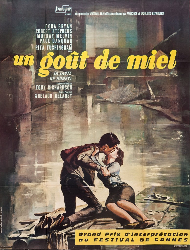
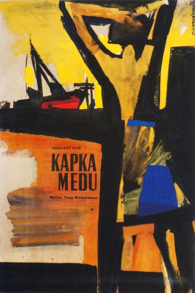
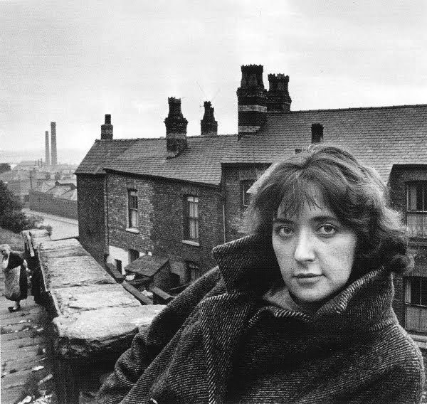
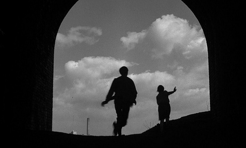
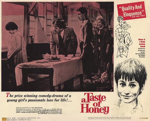
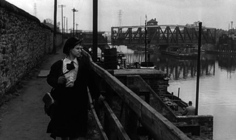
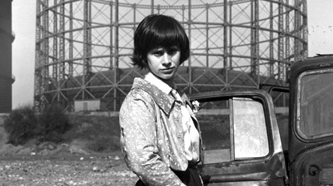
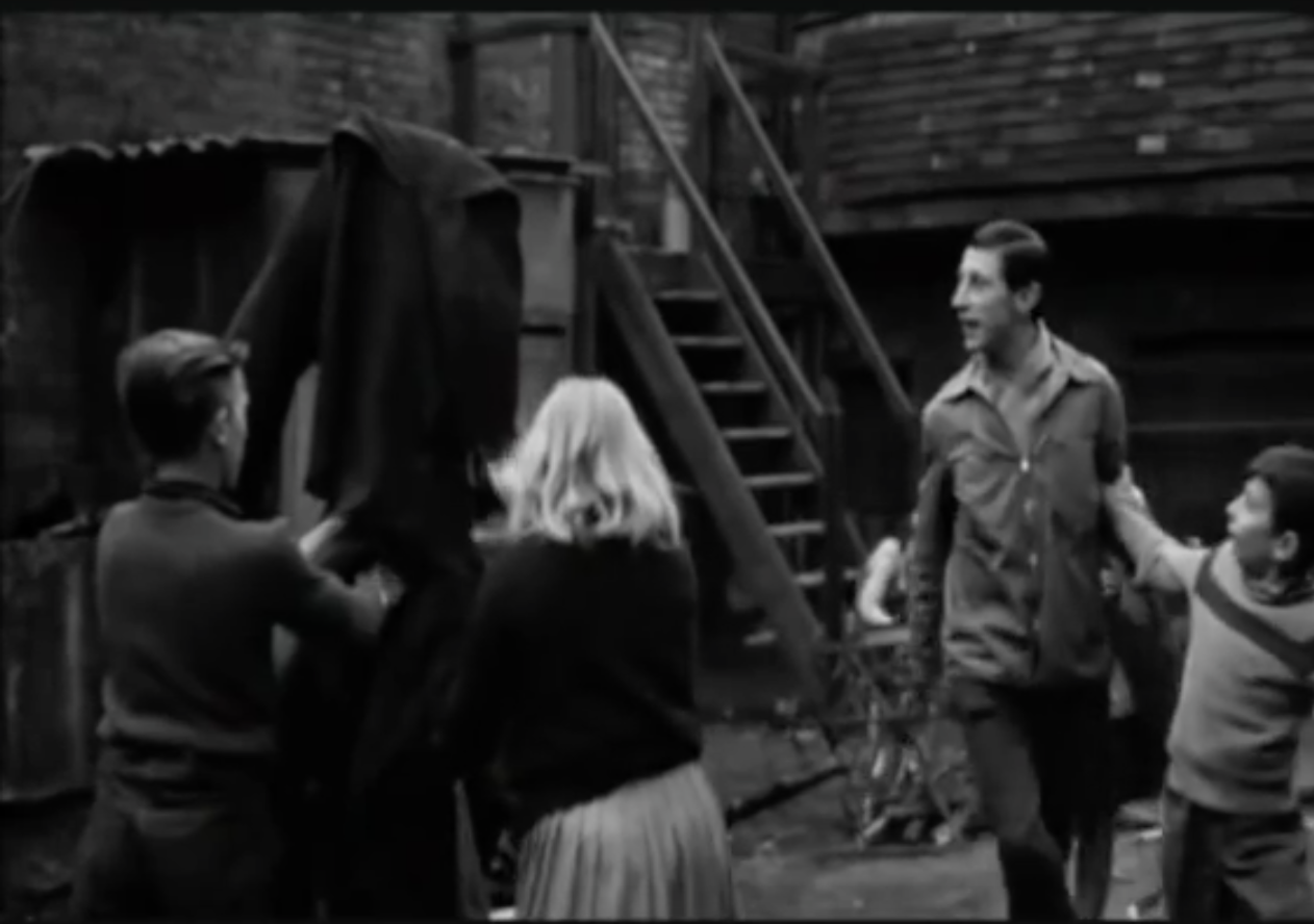
I began in a nearby place in a faraway time, my first reference point, the film adaptation of Shelagh Delaney’s play A Taste of Honey.
Set in Salford by Salford born teenager Shelagh.
A teenager becomes pregnant by a black sailor. She leaves her feckless mother and her flashy new boyfriend to set up her own home. She moves in with a young gay man, who helps look after her as she faces an uncertain future.
The film’s release in 1962 broke new ground in terms of its matter of fact depiction of contentious and sensational subject matter. My interest in this instance rests with the visual image of the North that it created.
Larkhill Road Edgeley Stockport
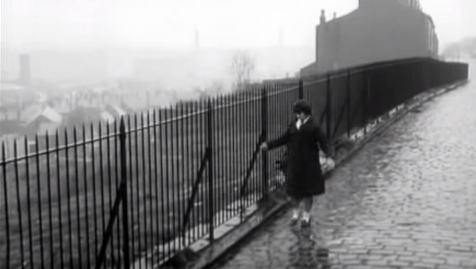
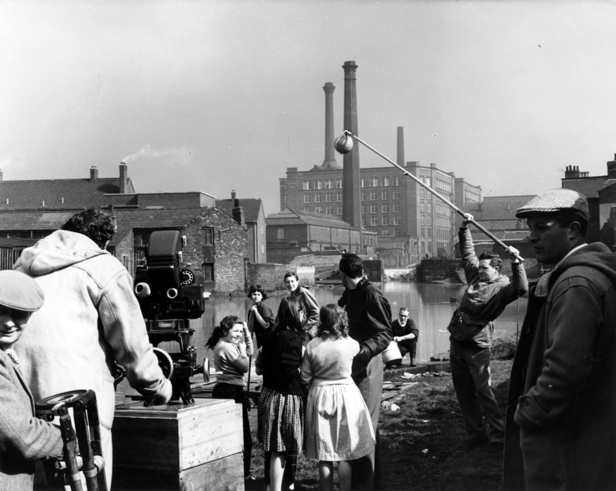
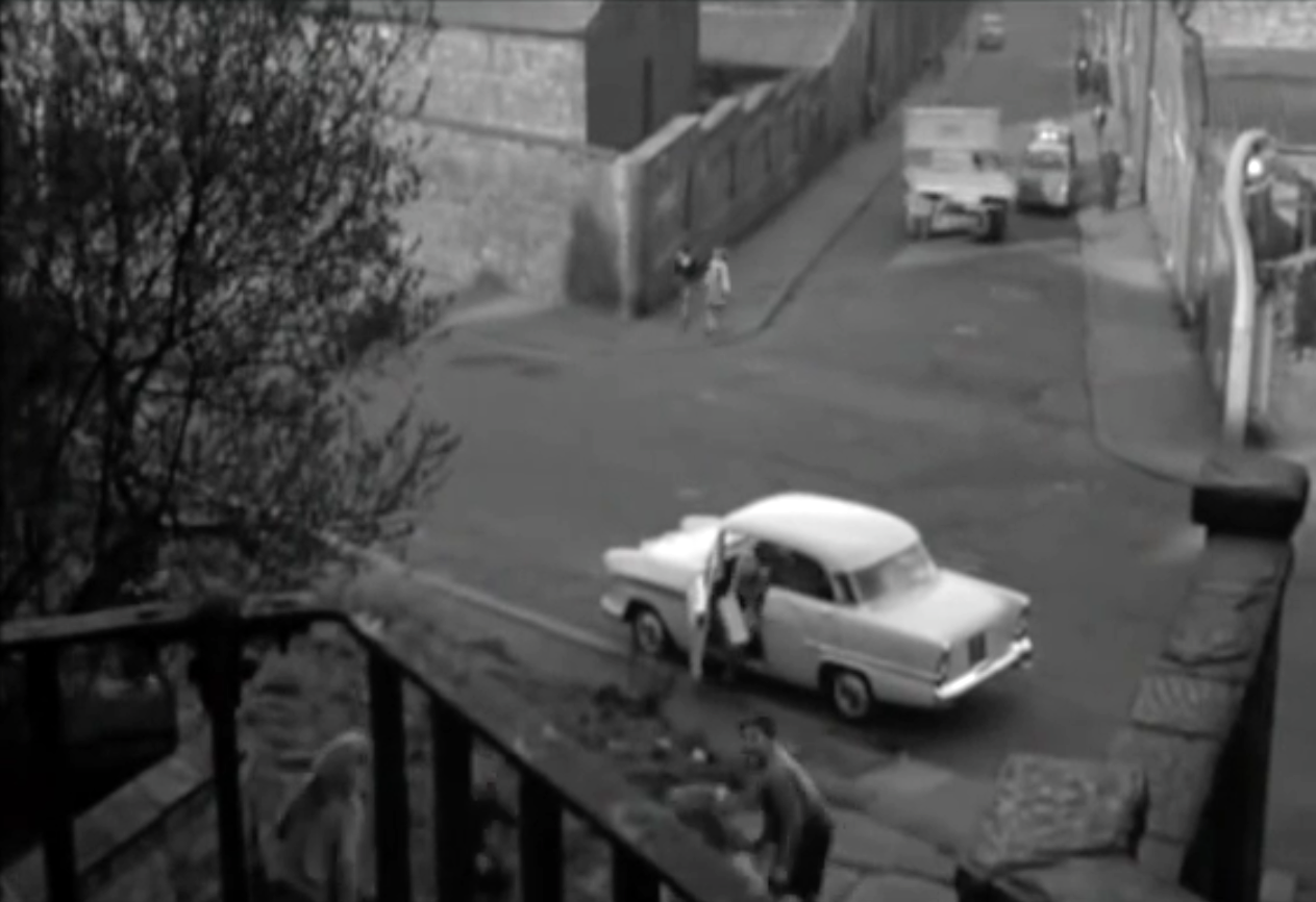
Shot almost entirely on location in black and white by cinematographer Walter Lassally, we are treated to dark treeless vistas, cobbled streets, industrial areas almost perpetually in decline, bleak canals and terraced homes.
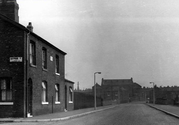
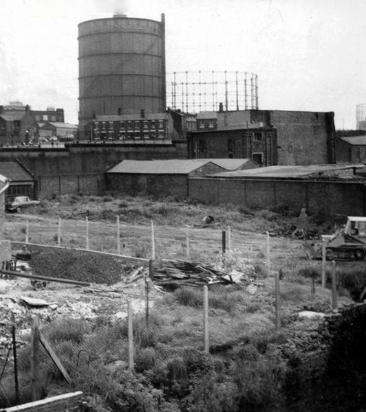
As shown in these archive images of the 1950s, illustrating locations that would subsequently be used in the film adaptation.
There is a comprehensive list of locations here at Reel Streets
Cambrian Street Holt Town Manchester
Phillips Park Gasworks Manchester
Director Tony Richardson was a product of the British Free Cinema movement, which had previously produced short, sharp documentary and drama work, driven by a leftist outlook and using a restless, immediate approach, aided by the new lightweight cameras and faster film stocks. This is an ethos and methodology that would be carried over into the feature productions of the Woodfall Films company.
Rochdale Canal Manchester
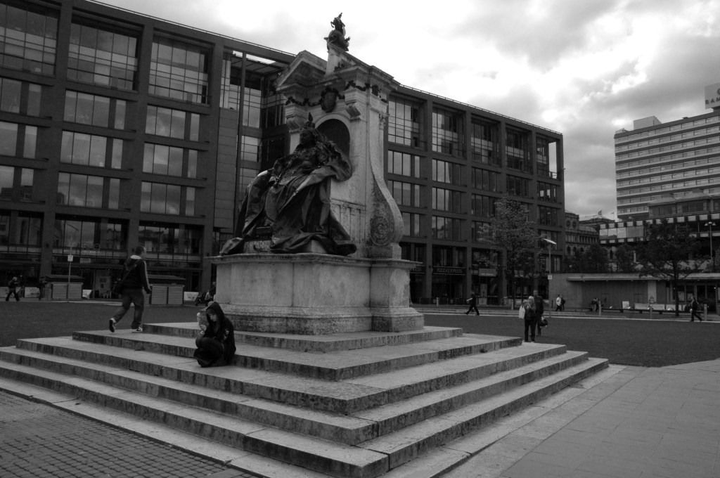
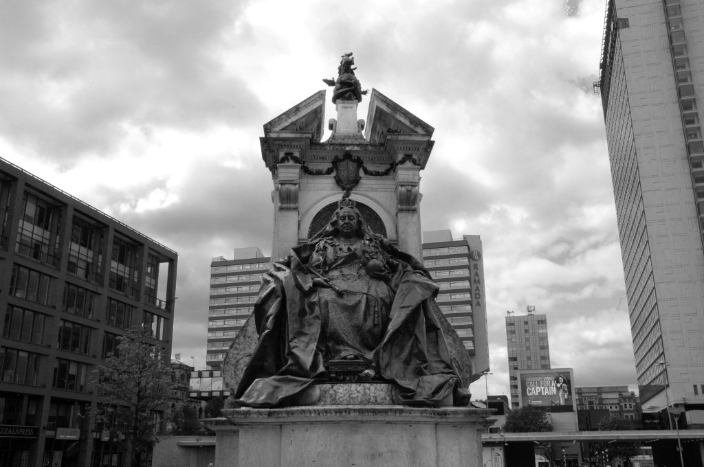
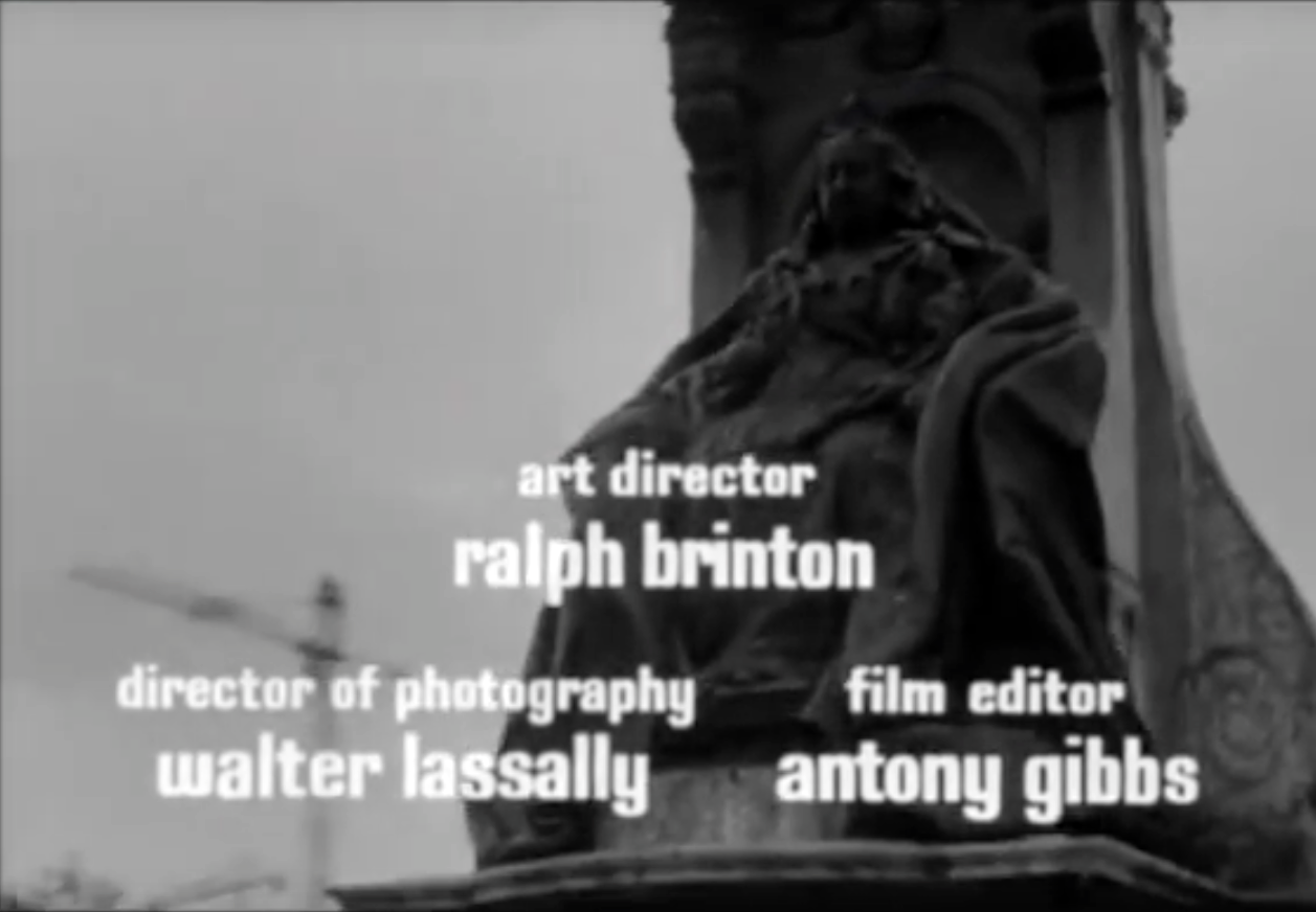
The film was shot in the flat, low, even light of the Winter which heightened the mildly desolate character of the landscape, though ostensibly Salford set many of the locations are in nearby Manchester and Stockport. An early long and free flowing title sequence and establishing shot, is a bus tour around Central Manchester, a city centre which at the time was still graced by a thick accumulation of dark industrial emissions and miasma.
A soot blackened Queen Victoria mute and imperious in Piccadilly Gardens, the freshly blooming cranes of post-war renewal tentatively appearing in the background.
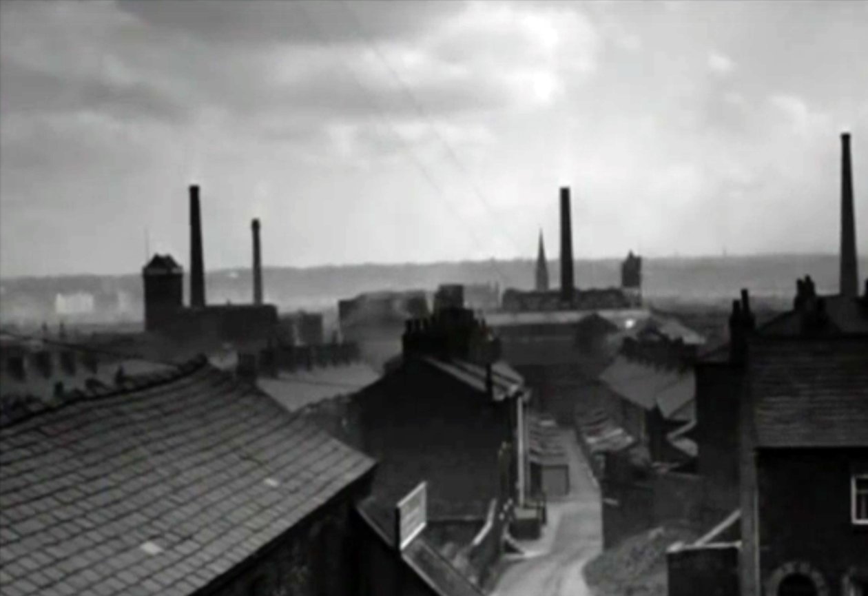
The skyline punctuated by factory chimneys, the tight huddled streets of terraced houses chuffing billowing great grey clouds of smoke – a view familiar in the work of LS Lowry.
Barton Bridge
Trafford Swing Bridge
Stockport Rail Viaduct
Phillips Park Gasworks
The location of the home that Jo sets up was ironically the stage set workshop of the Royal Court Theatre (the very theatre where the play was developed and produced) in London – that most northern of cities.
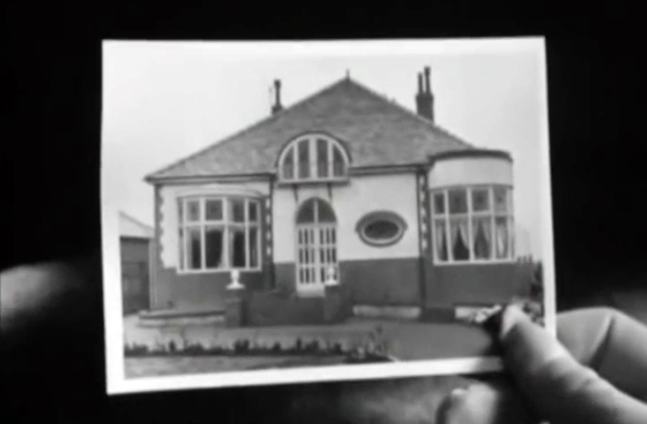
There is a brief respite from this milieu, through a picture in picture sequence based on the image of a suburban bungalow – which along with the coming age of mass motor car ownership, offers the promise of escape.
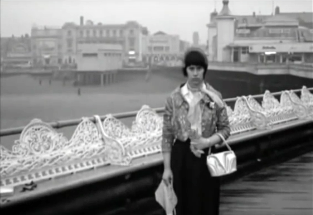
A giddy day trip to Blackpool represents the temporary release from a contrasting and constricting world, a trip which for Jo emphasises the divide between Mother and her lover.
So we the viewers are left with a cloudily clear, black and white world, a pervasive construct that the North and Manchester is eagerly beginning to casually shuffle off.
Where streets are no longer paved with Eccles Cakes and whippets are hip.
Identity through landscape and location can both define and constrain, but that landscape, its representation, and the identity that it produces are all mutually mutable.
Take some time to watch and rewatch the film, freeze frame where are we?