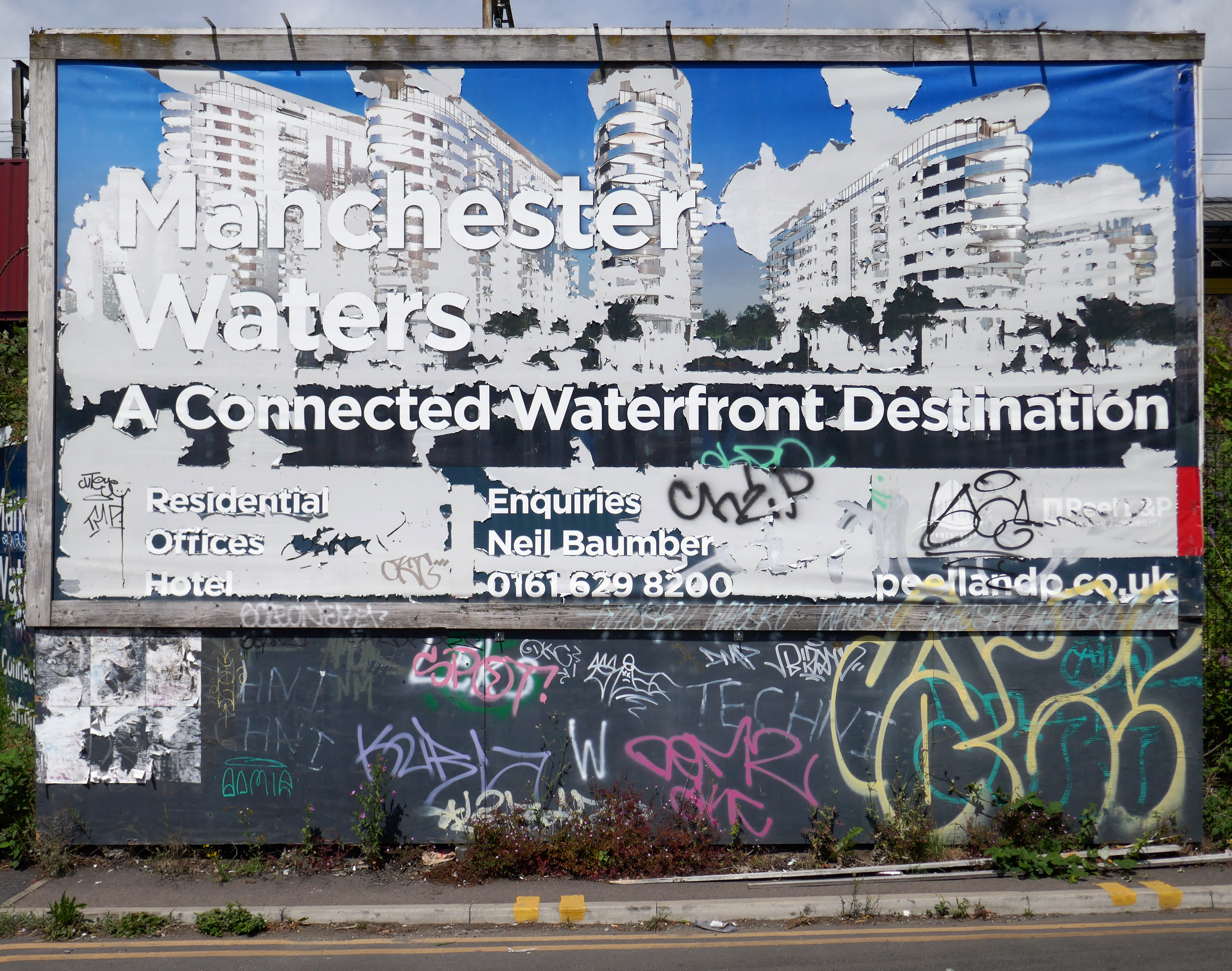
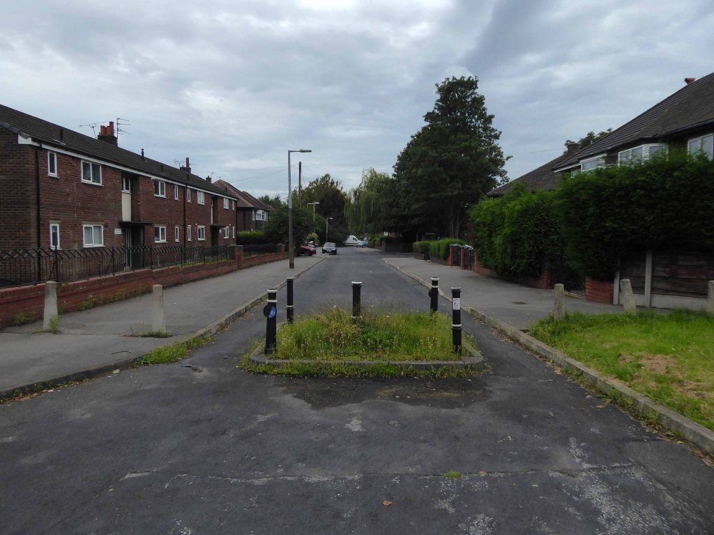
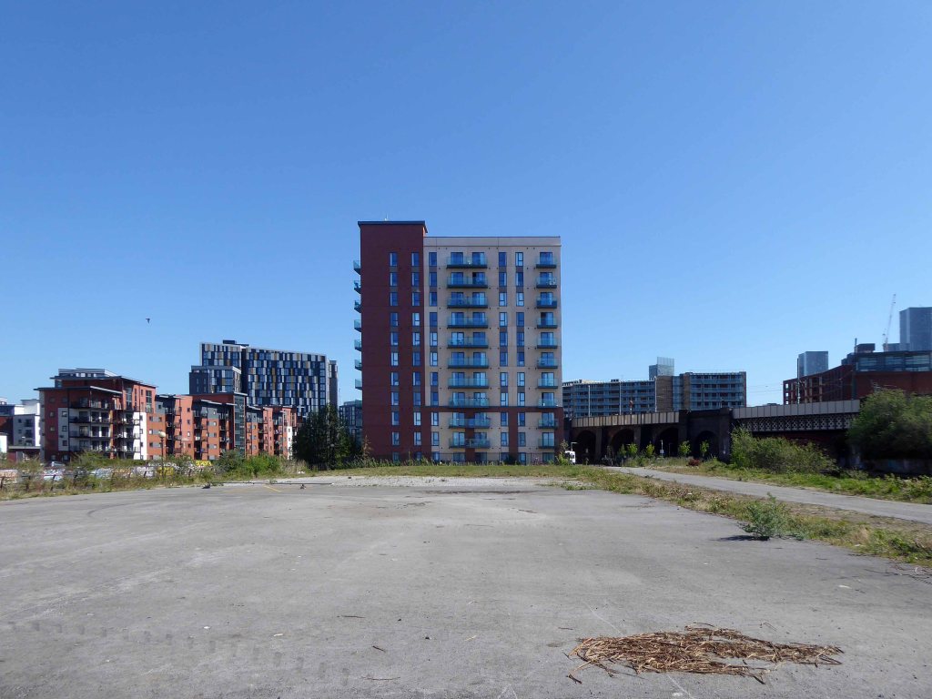
X1 has launched the first phase of its major Manchester Waters development on the outskirts of the city centre. The development will be delivered in partnership with property developer and landowner Peel and is located on Pomona Island. Phase one will include 755 flats, with the first completions scheduled for 2019.
Thus far phase one has arrived, other phases less so.
A Covid induced hiatus has meant that the masterplan has hit the buffers.
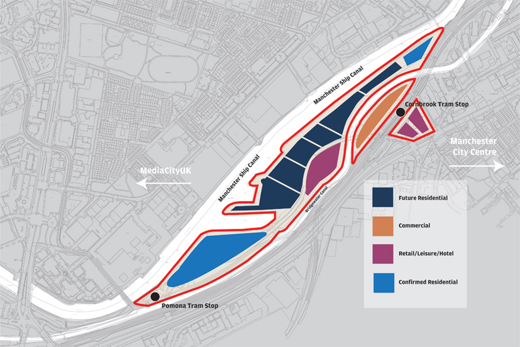
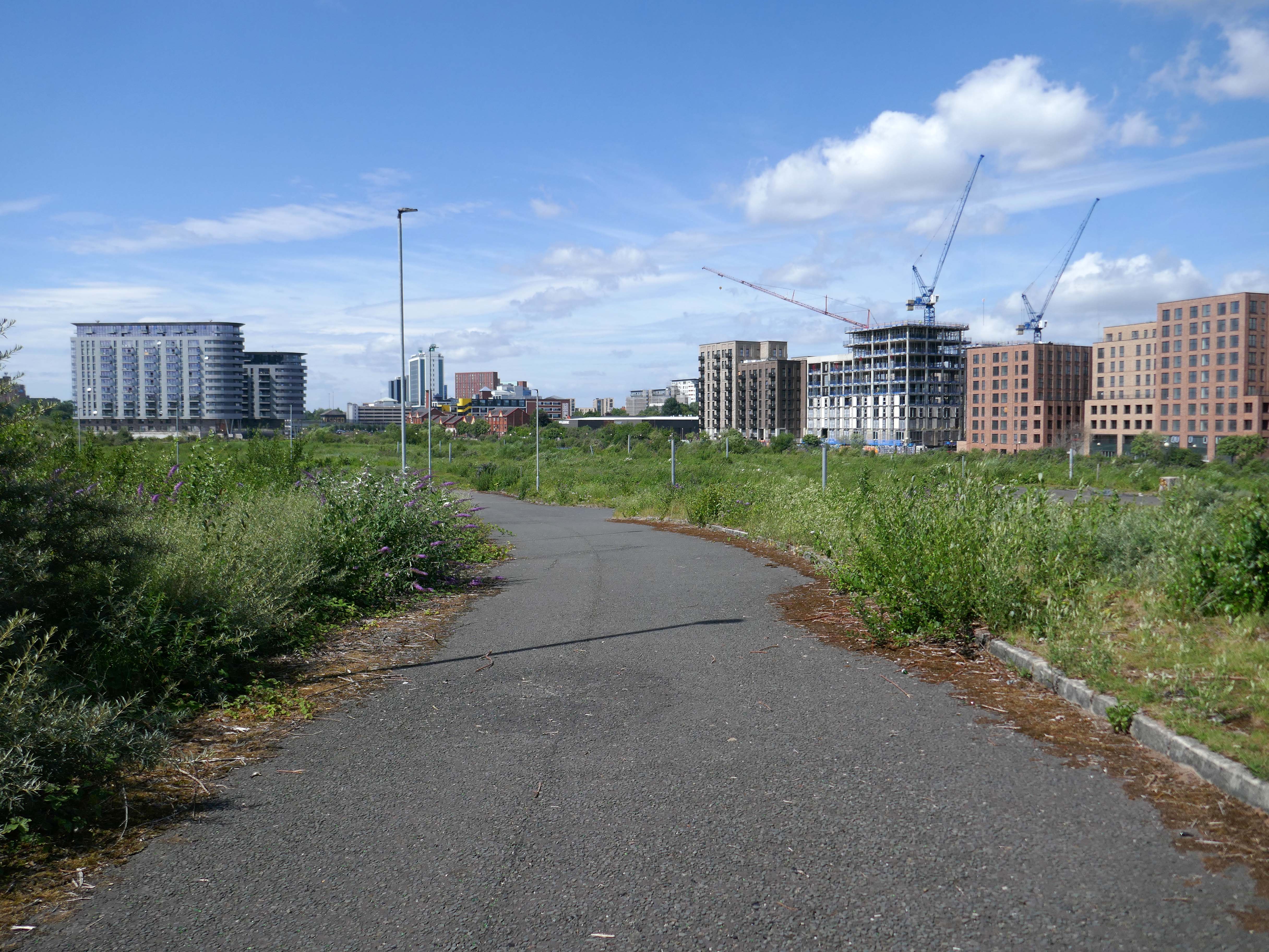
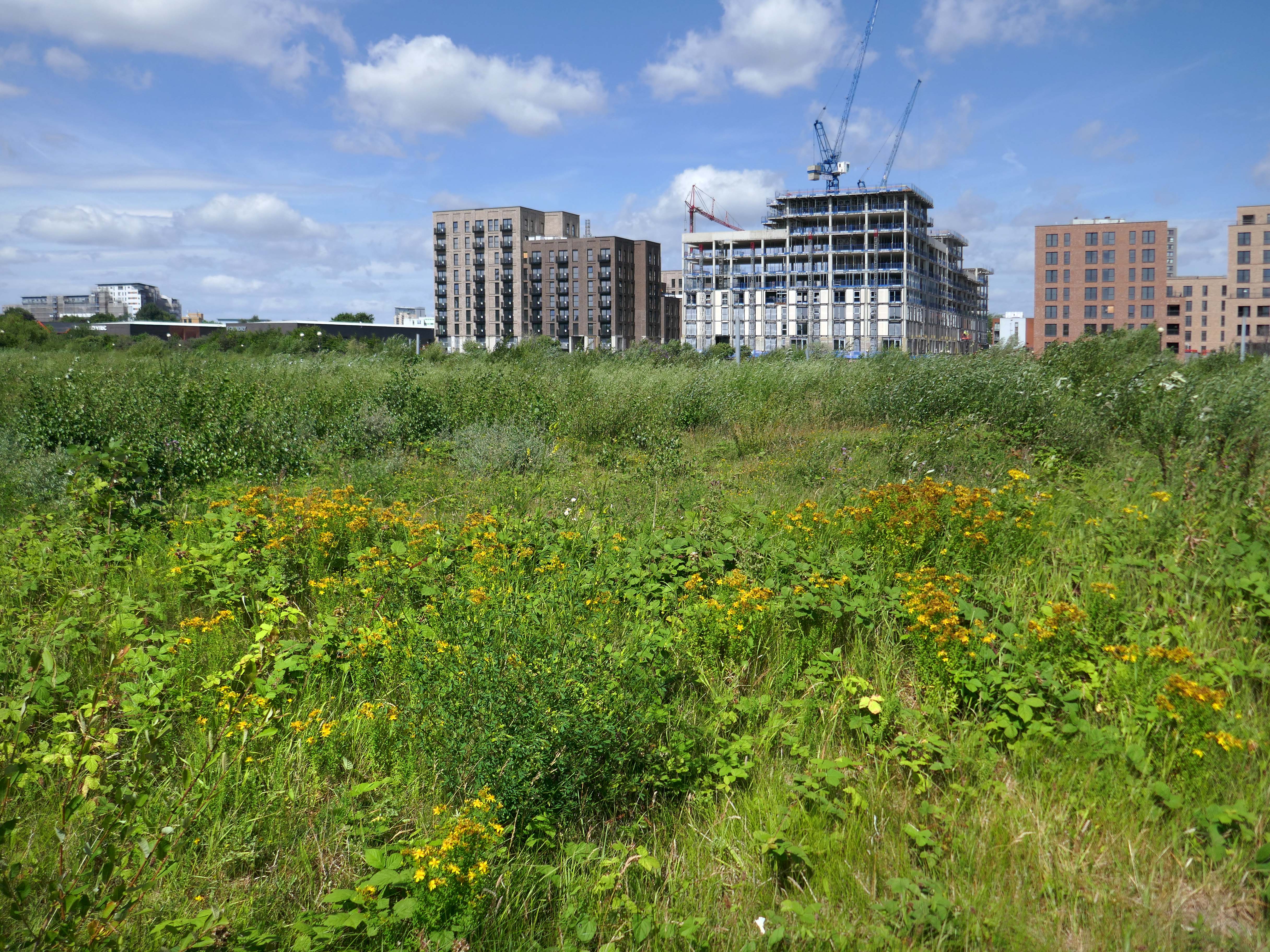
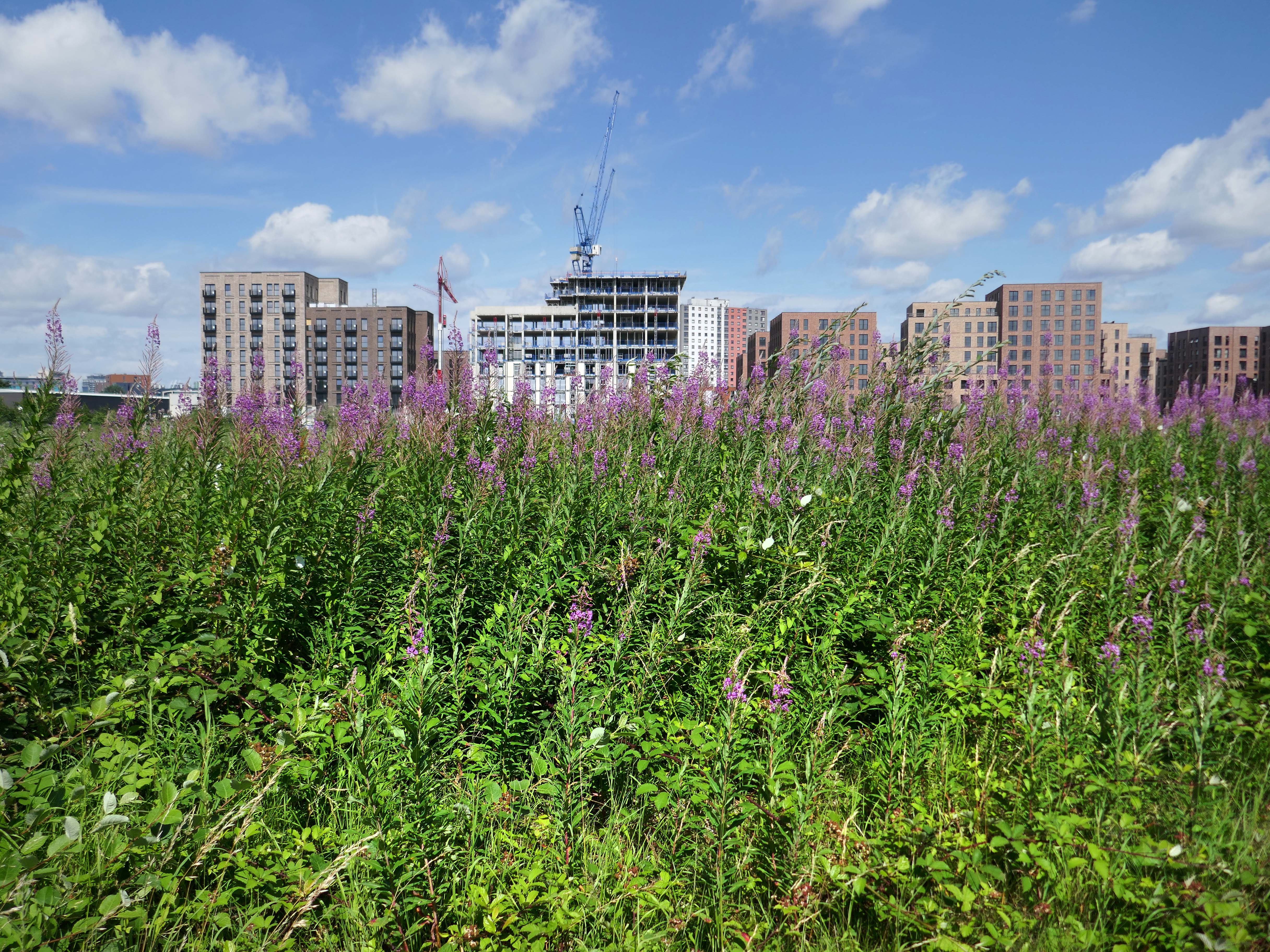
The revamped masterplan, covering almost 25 acres of currently underdeveloped brownfield land, would transform around 60% of the masterplan area into public realm and open space to help promote active lifestyles and the natural beauty of the waterfront site which is surrounded by the Manchester Ship Canal and the Bridgewater Canal.
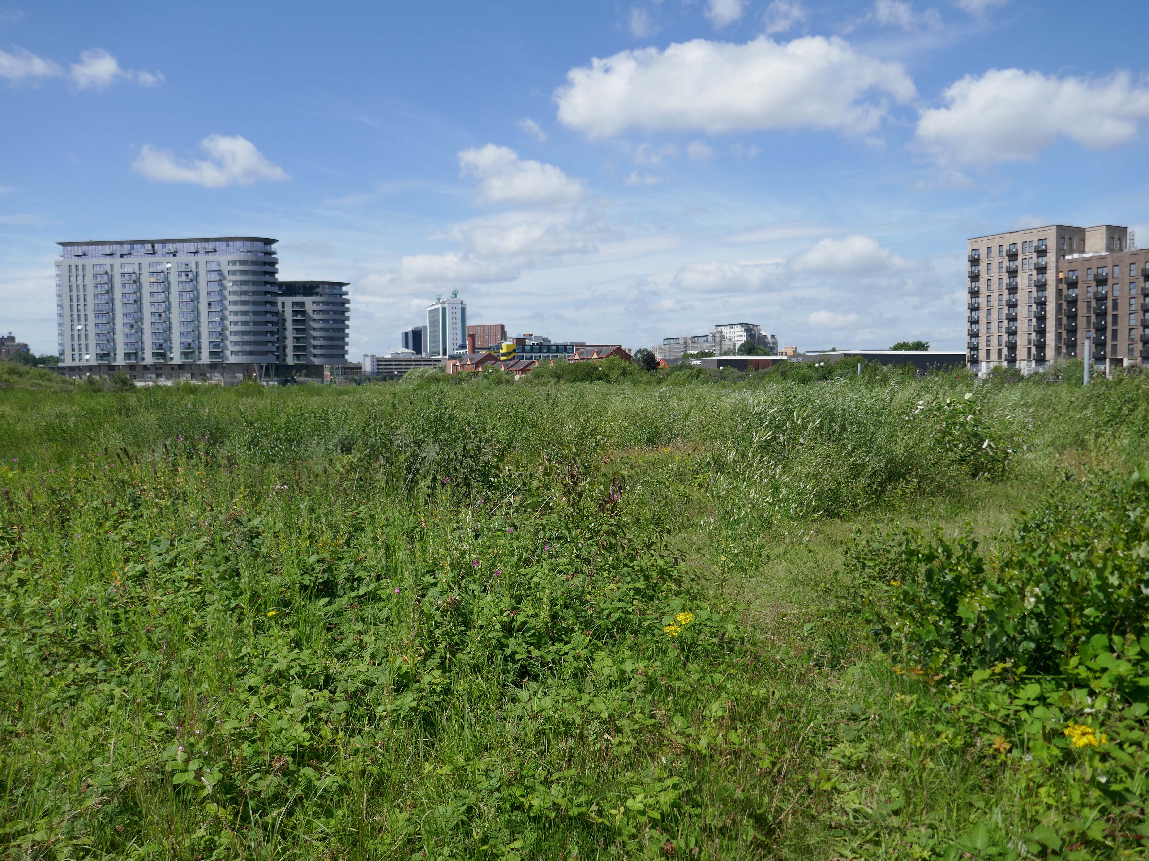
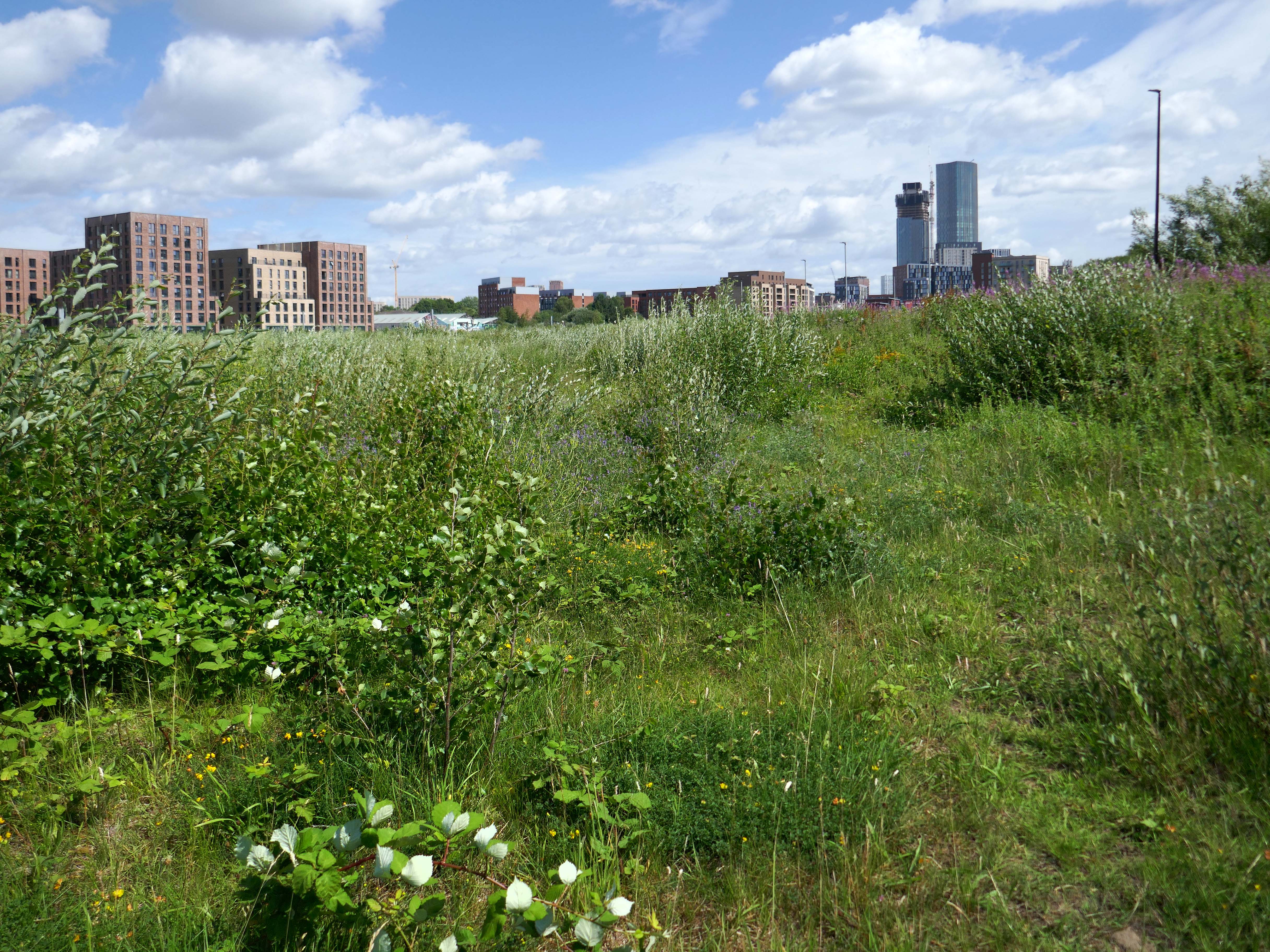
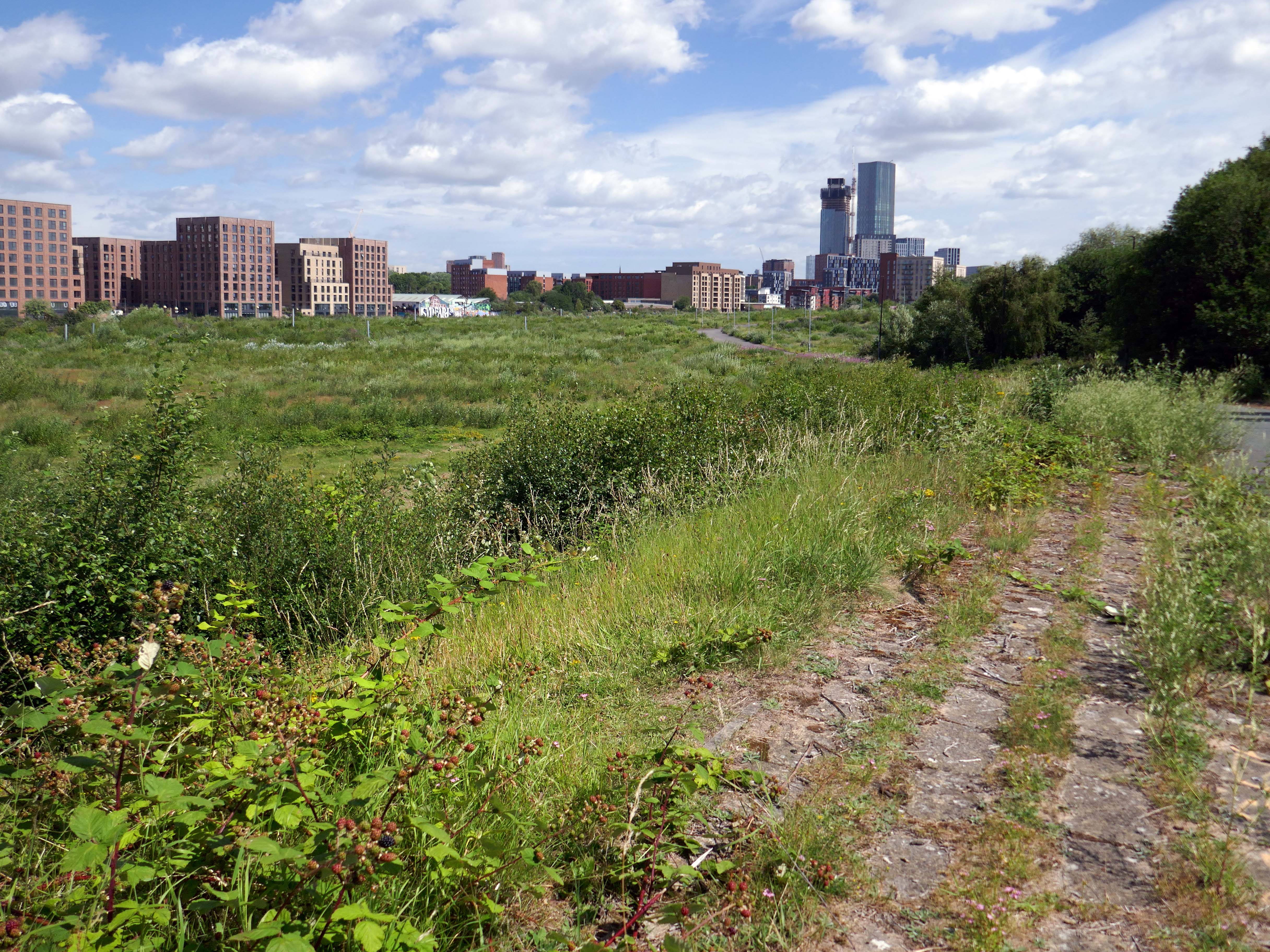
Over time there has been resistance to the tidal wave of regeneration that is sweeping down the Ship canal engulfing Pomona Island.
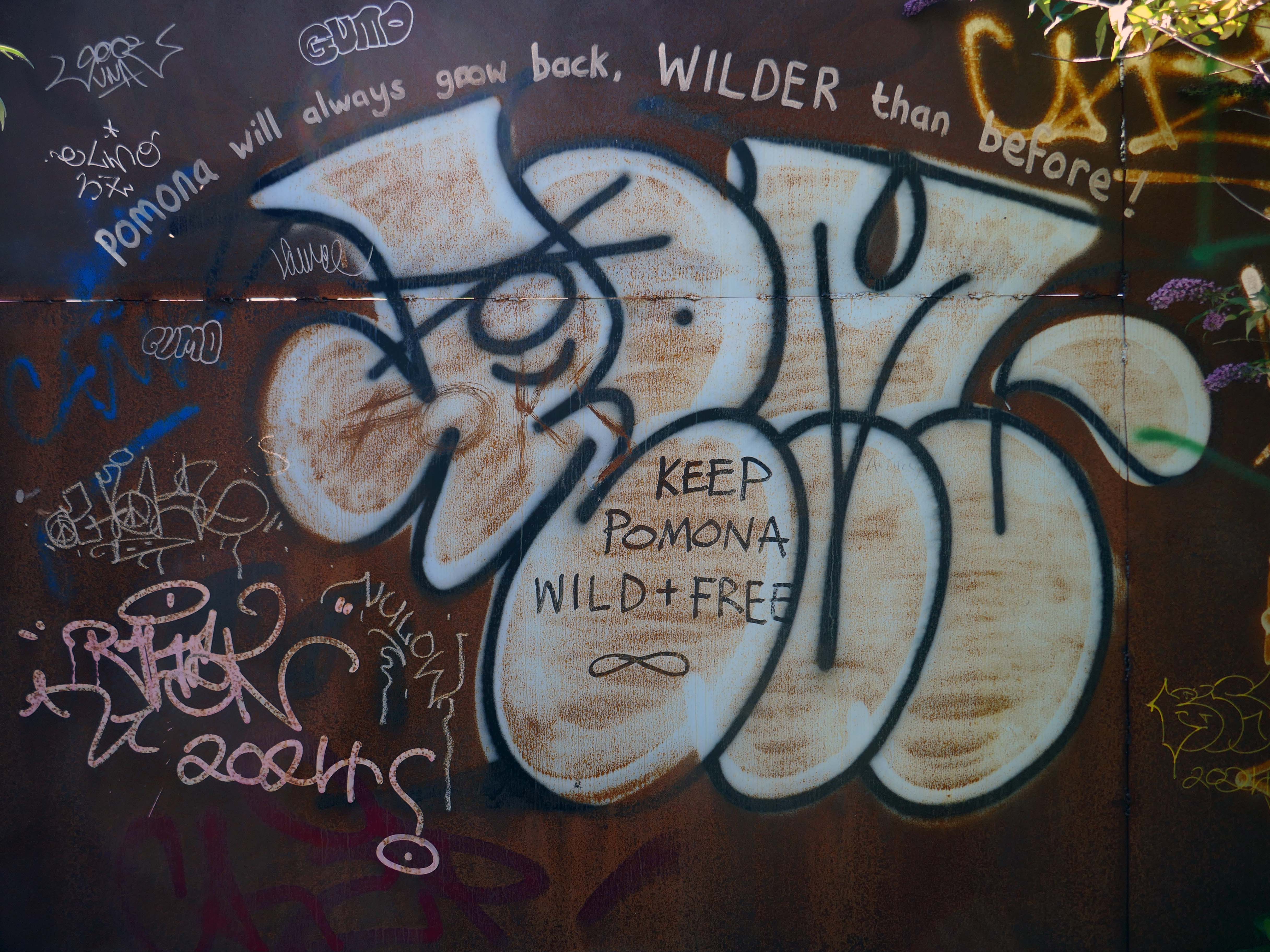
Save Pomona are a group of Manchester/Salford and Trafford residents committed to seeing the future of Pomona be a community based and sustainable one rather than a purely commercial one that benefits only a few.
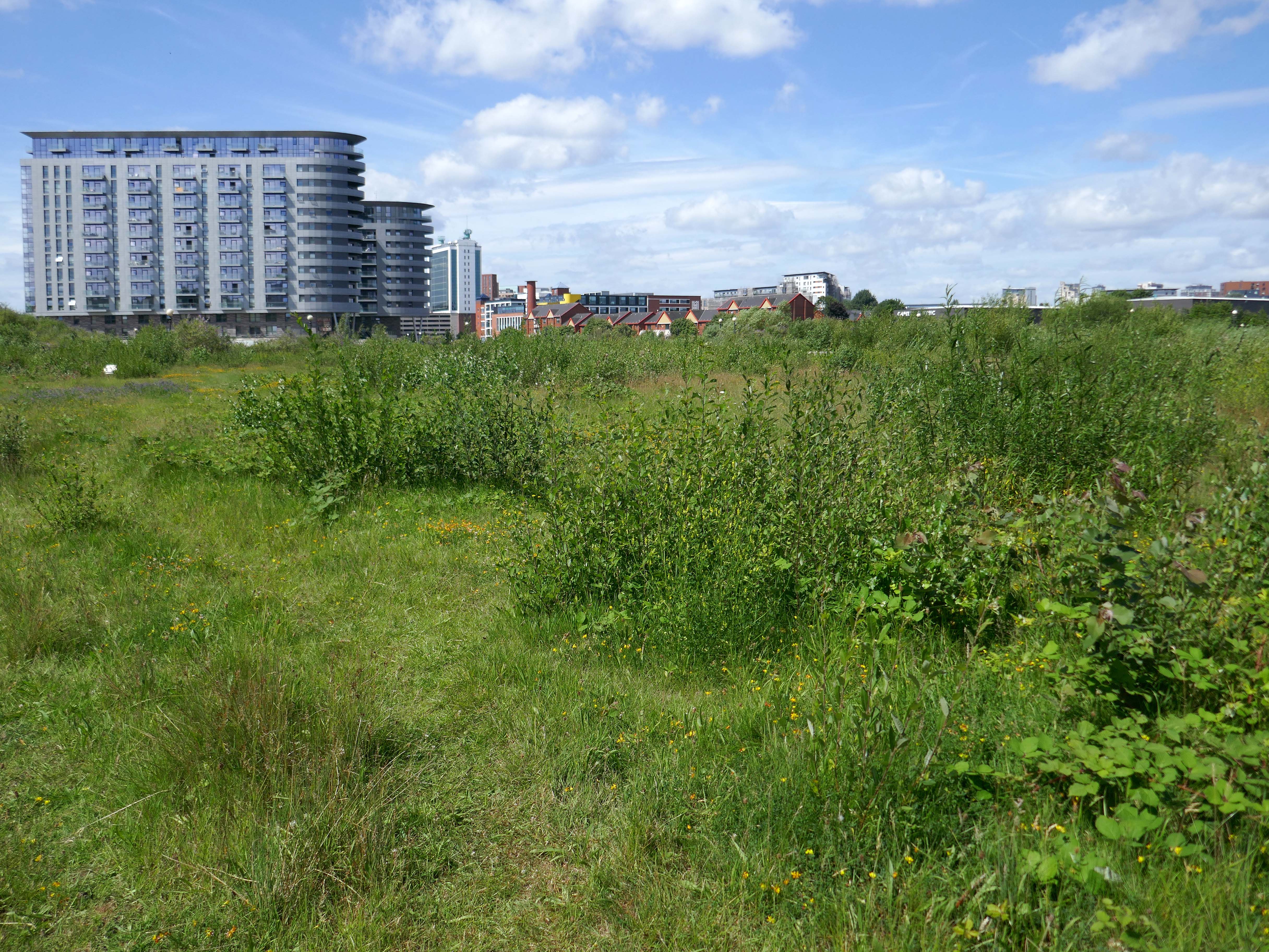
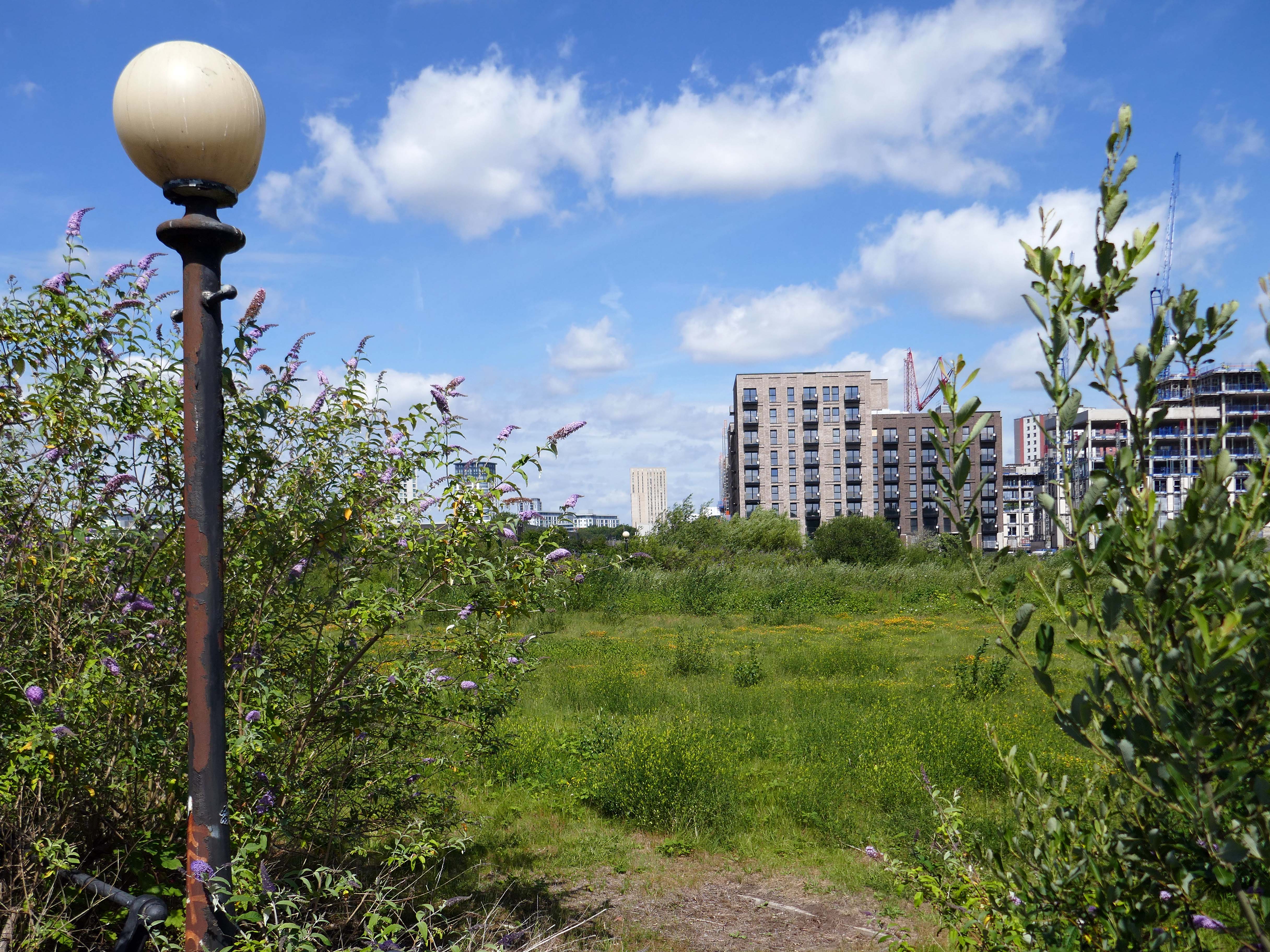
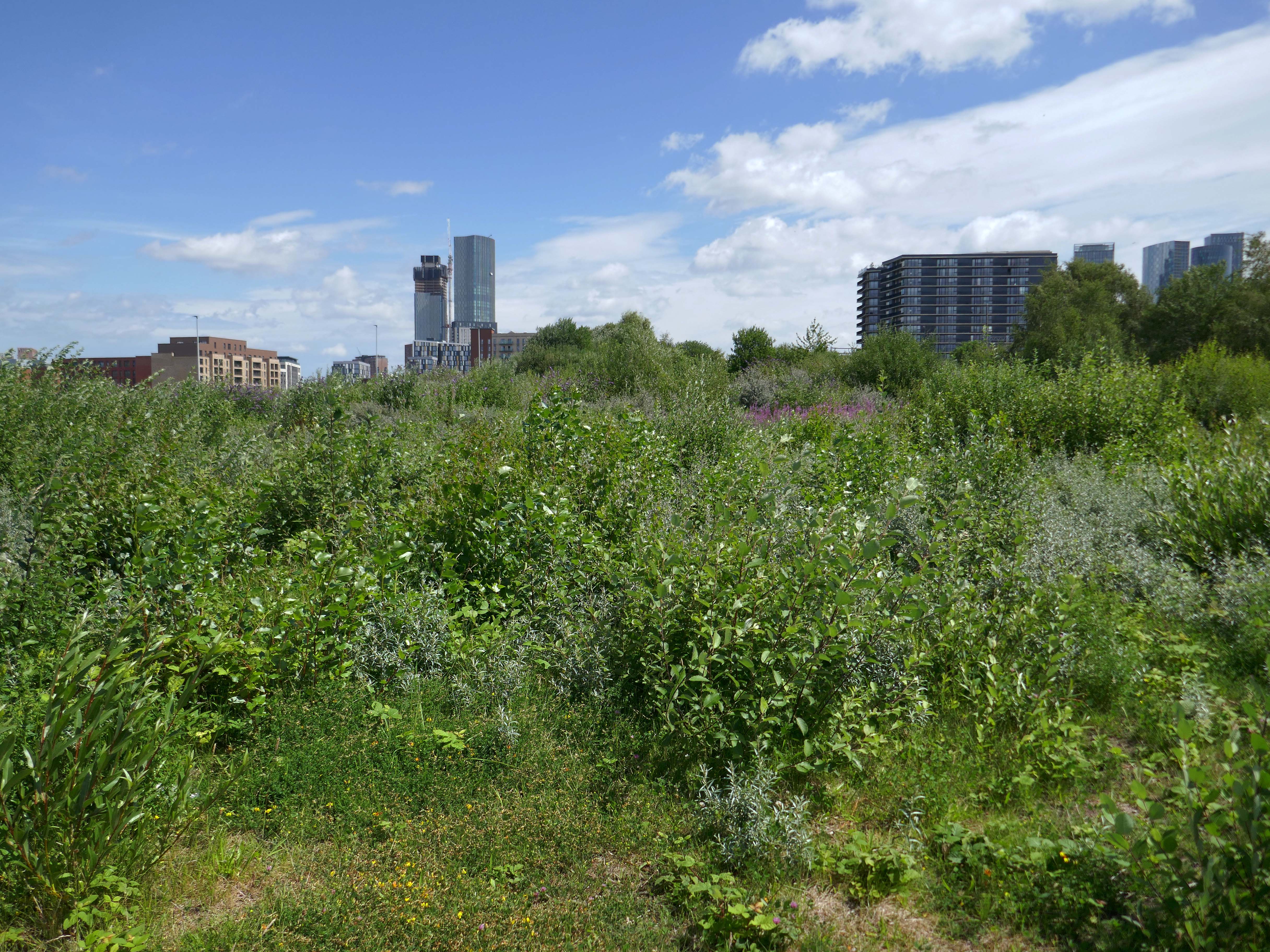
Last Thursday, campaigners aiming to save the old dockland site across the Manchester Ship Canal from Ordsallheld a Pomona Day, and yesterday it was the Pomona Festival as the community turned out to view the wildlife and flora that has sprung up on the abandoned dockland site.
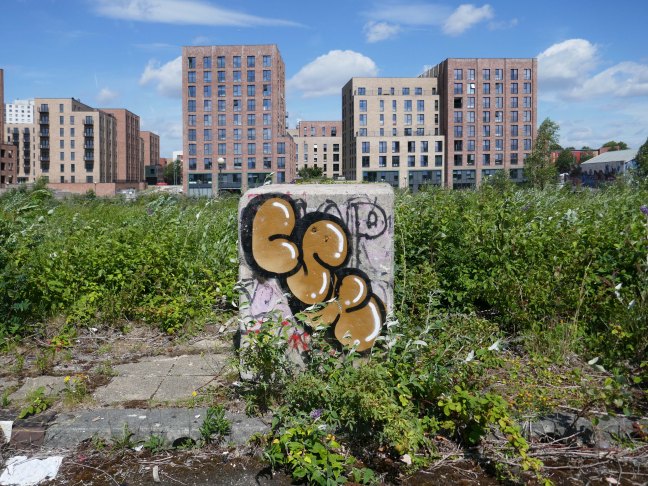
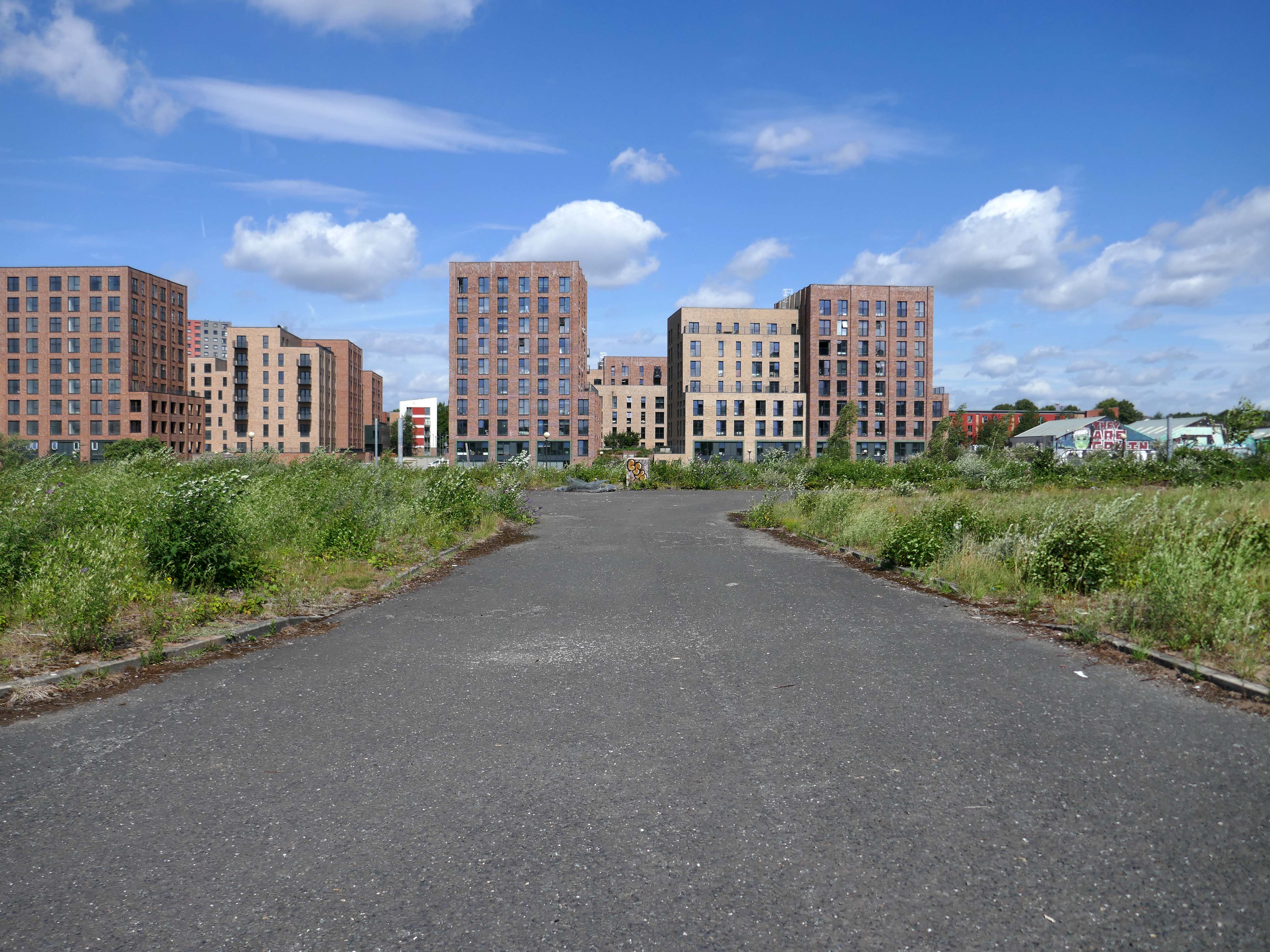
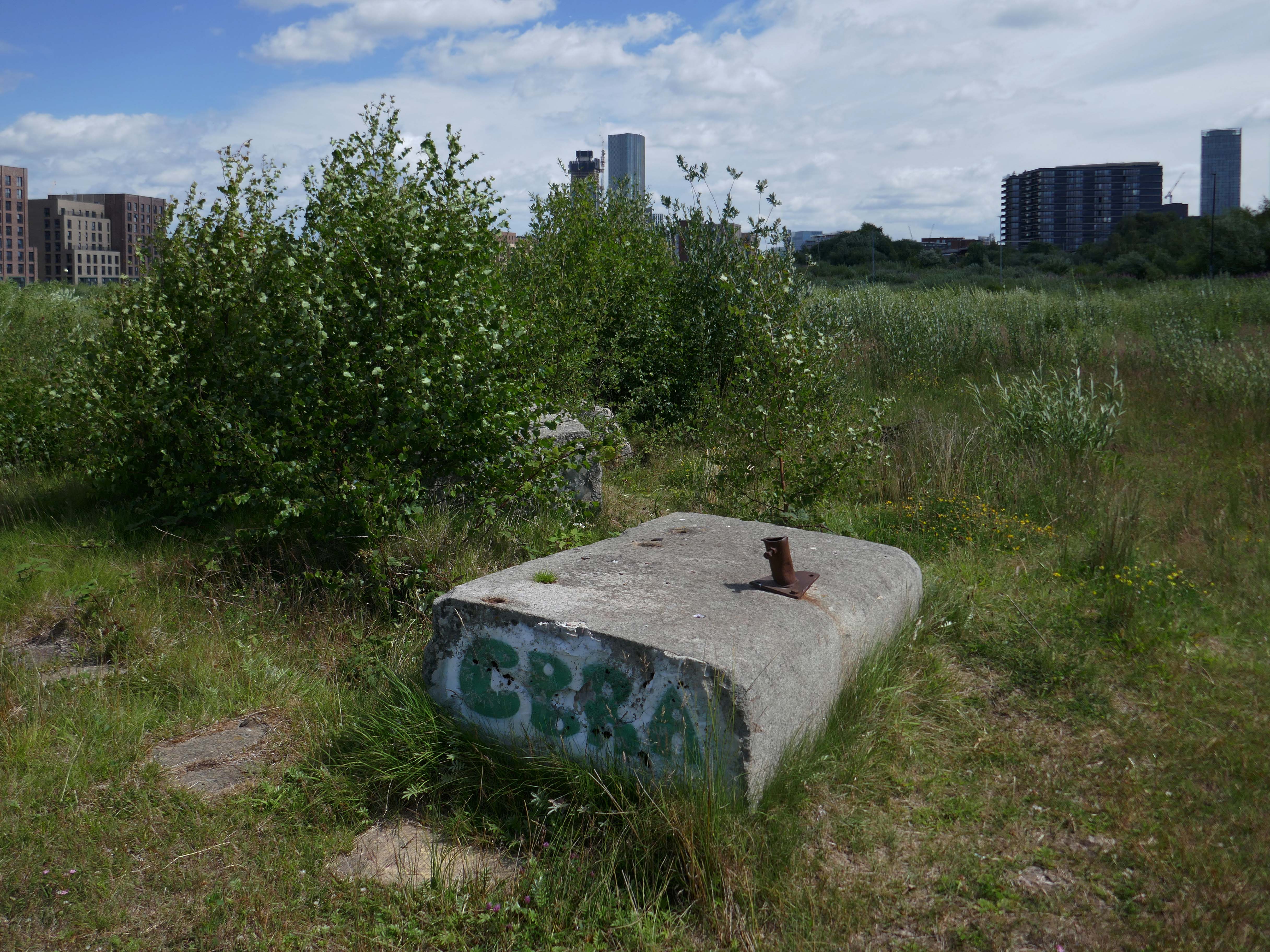
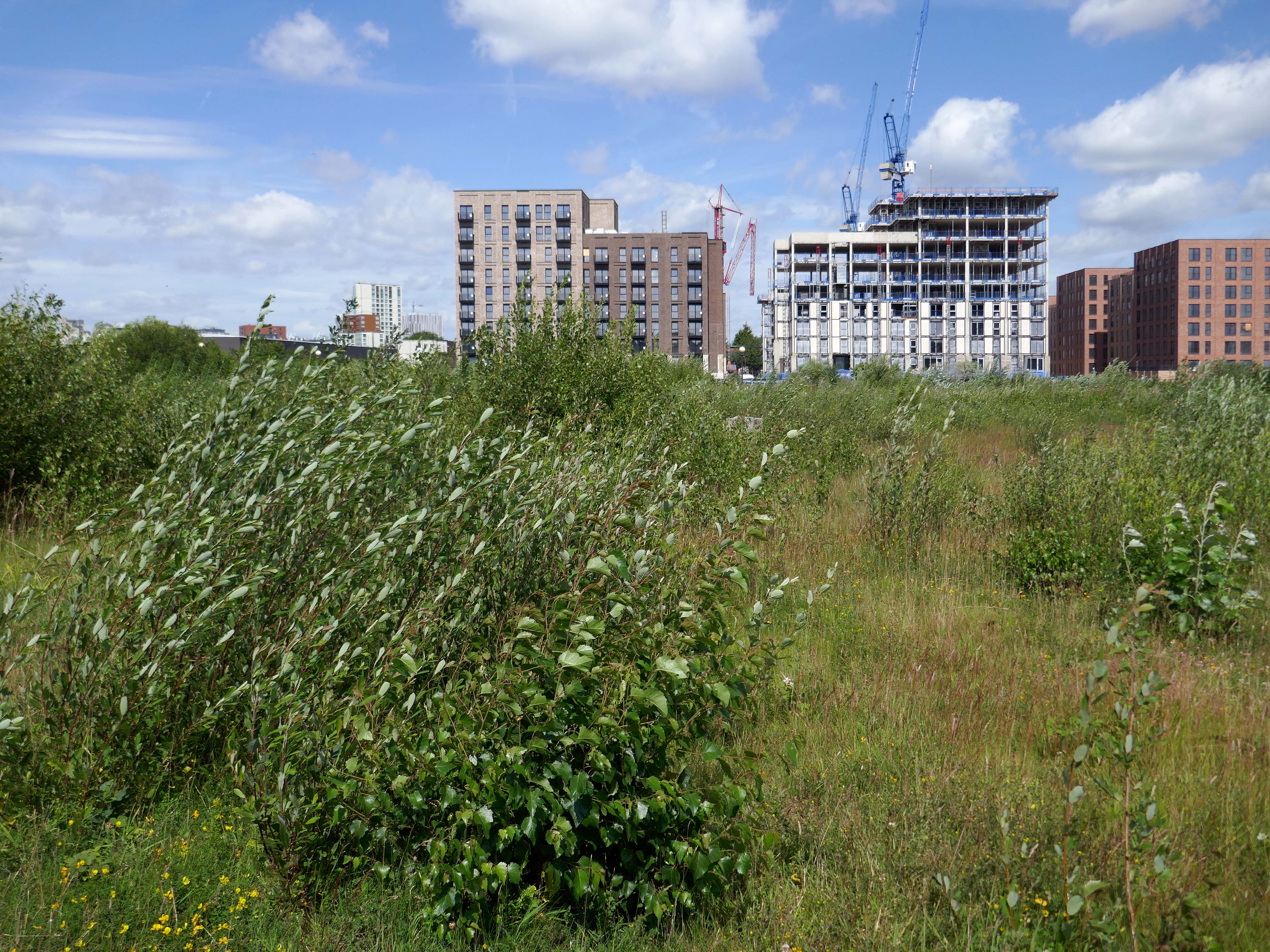
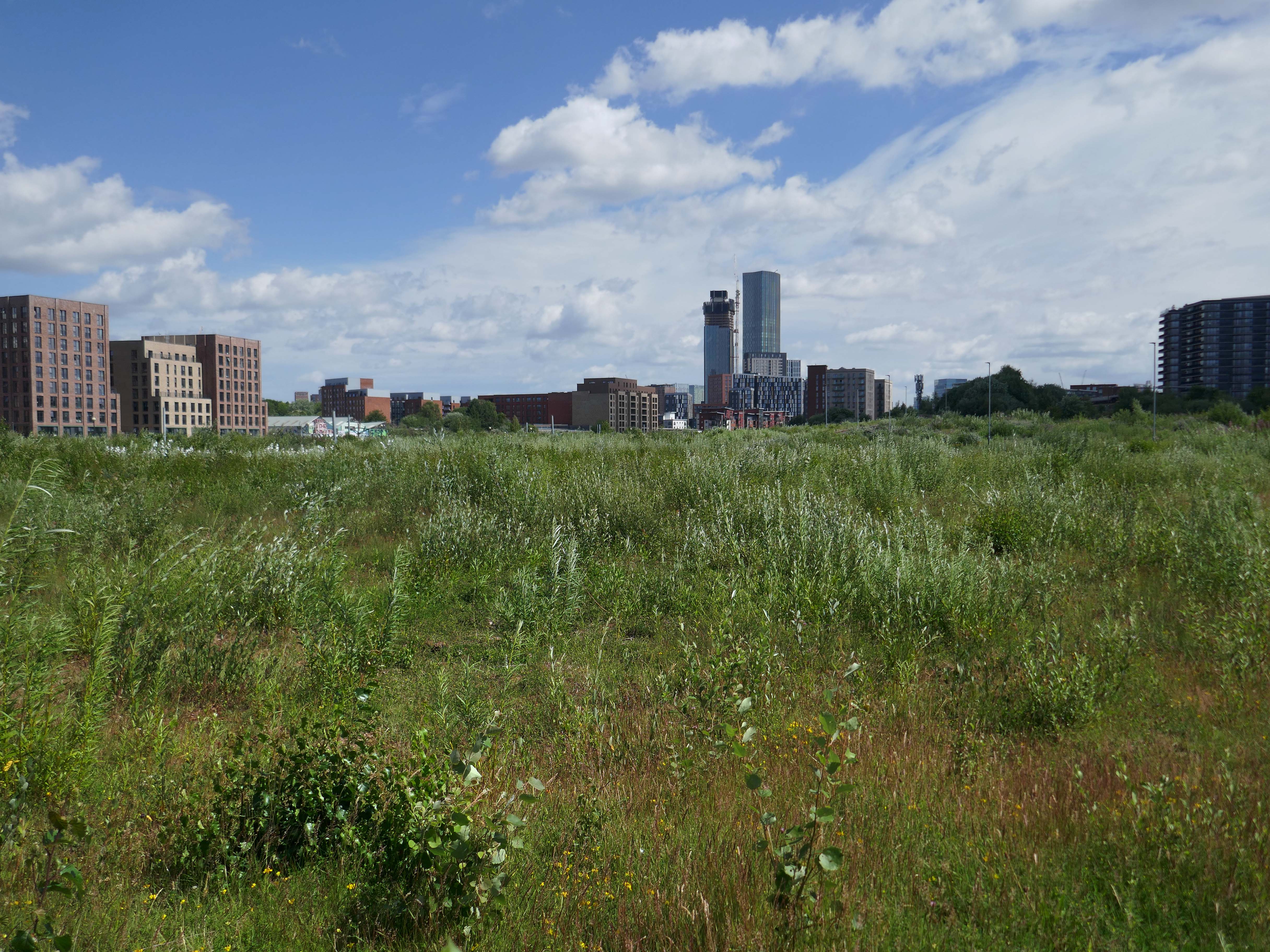
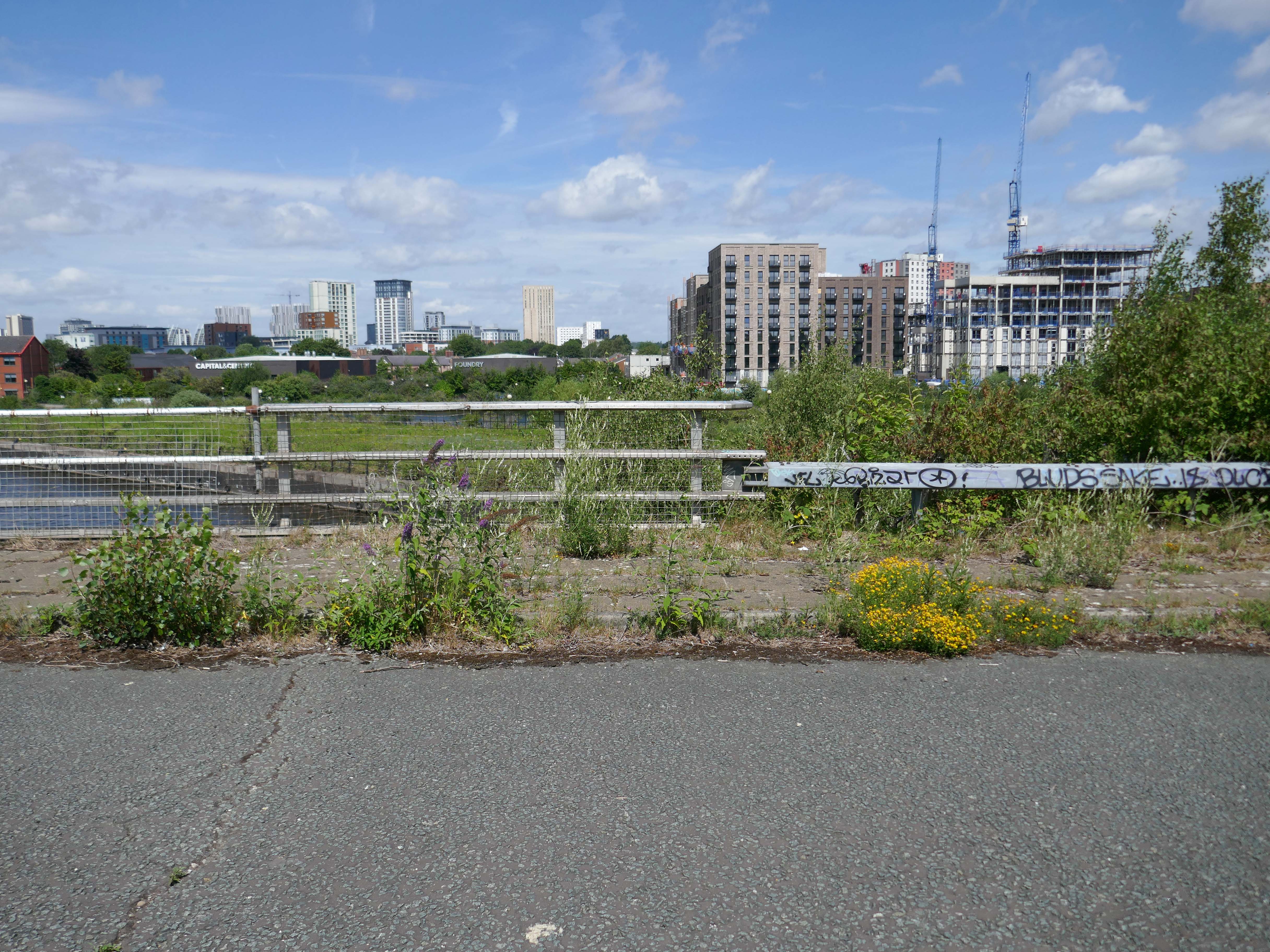
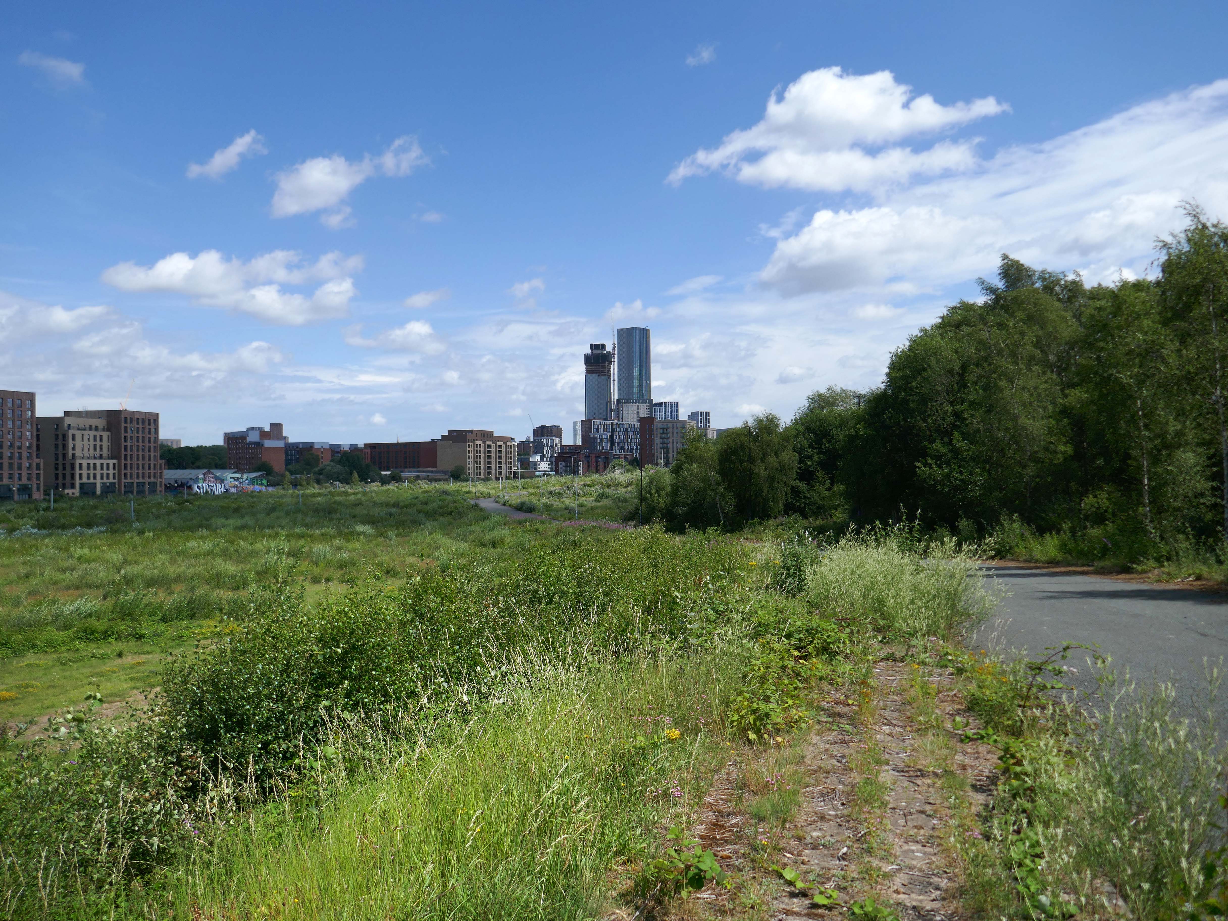
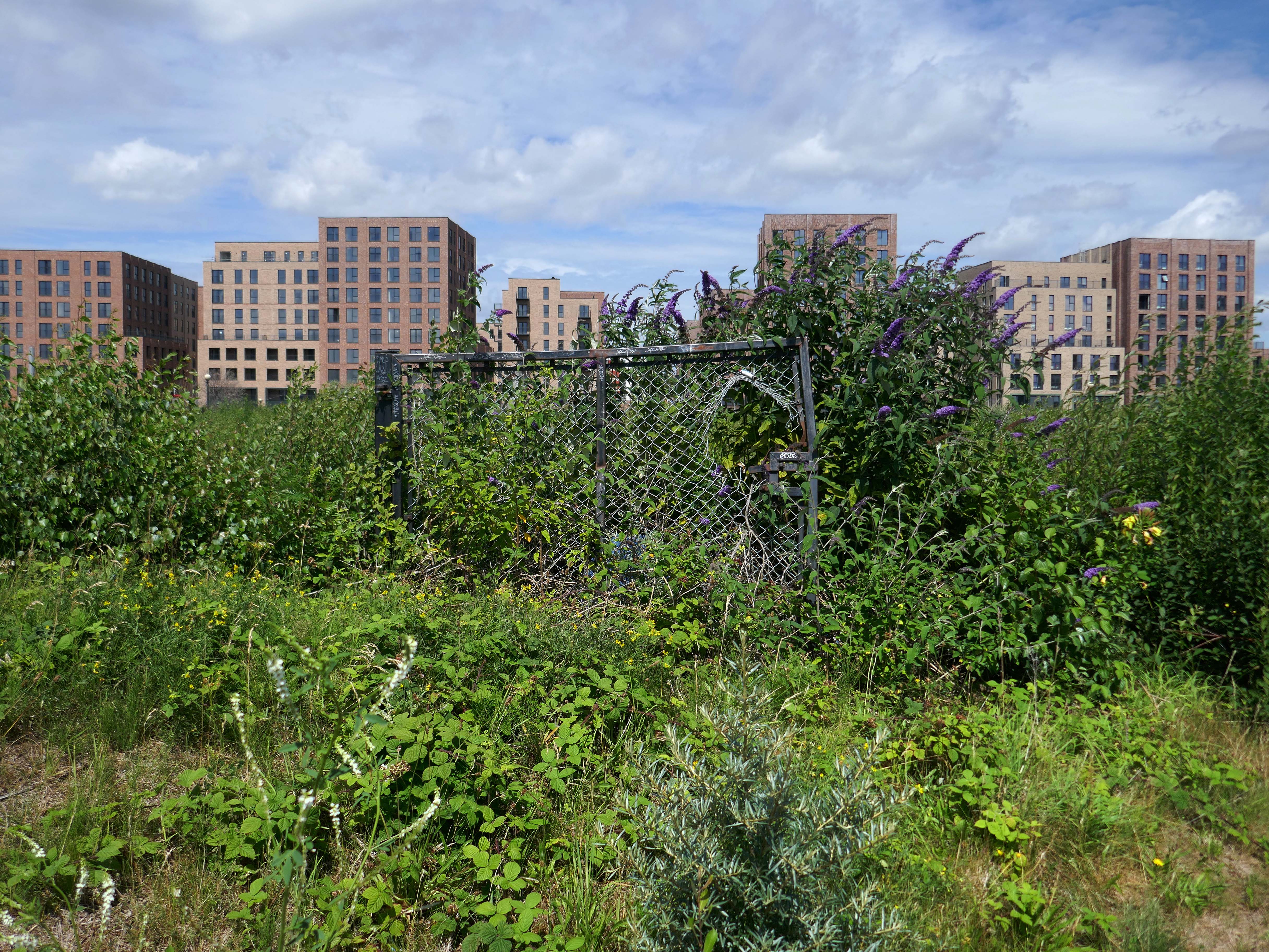
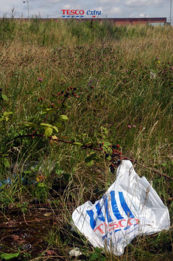
Peel have already cleared most of the scrub, before they submitted the planning application, probably because they know they can get away with it and because they think there is less chance of objection from the public.
Several Years ago Martin Zero celebrated the flowers and fauna in video from.
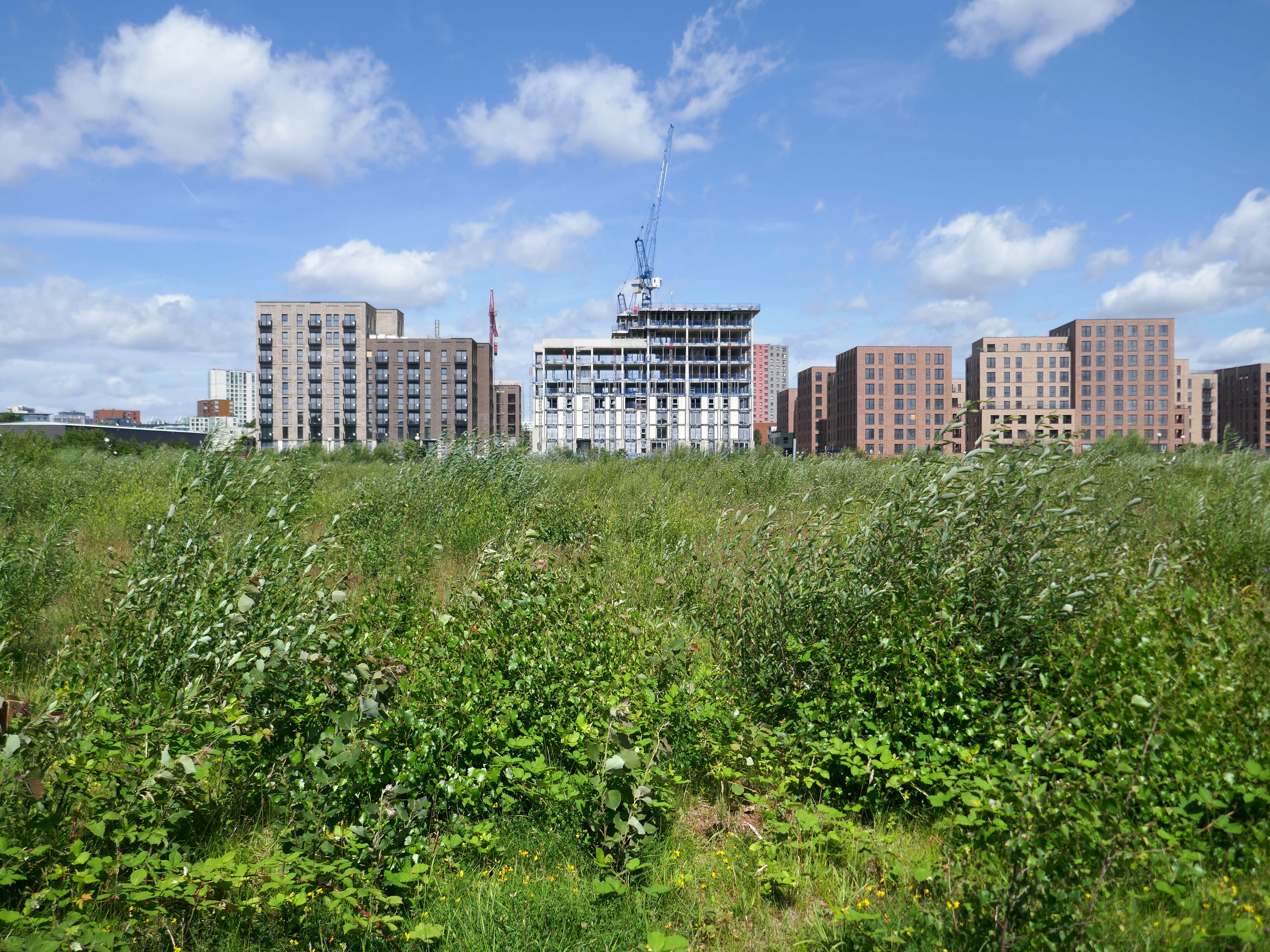
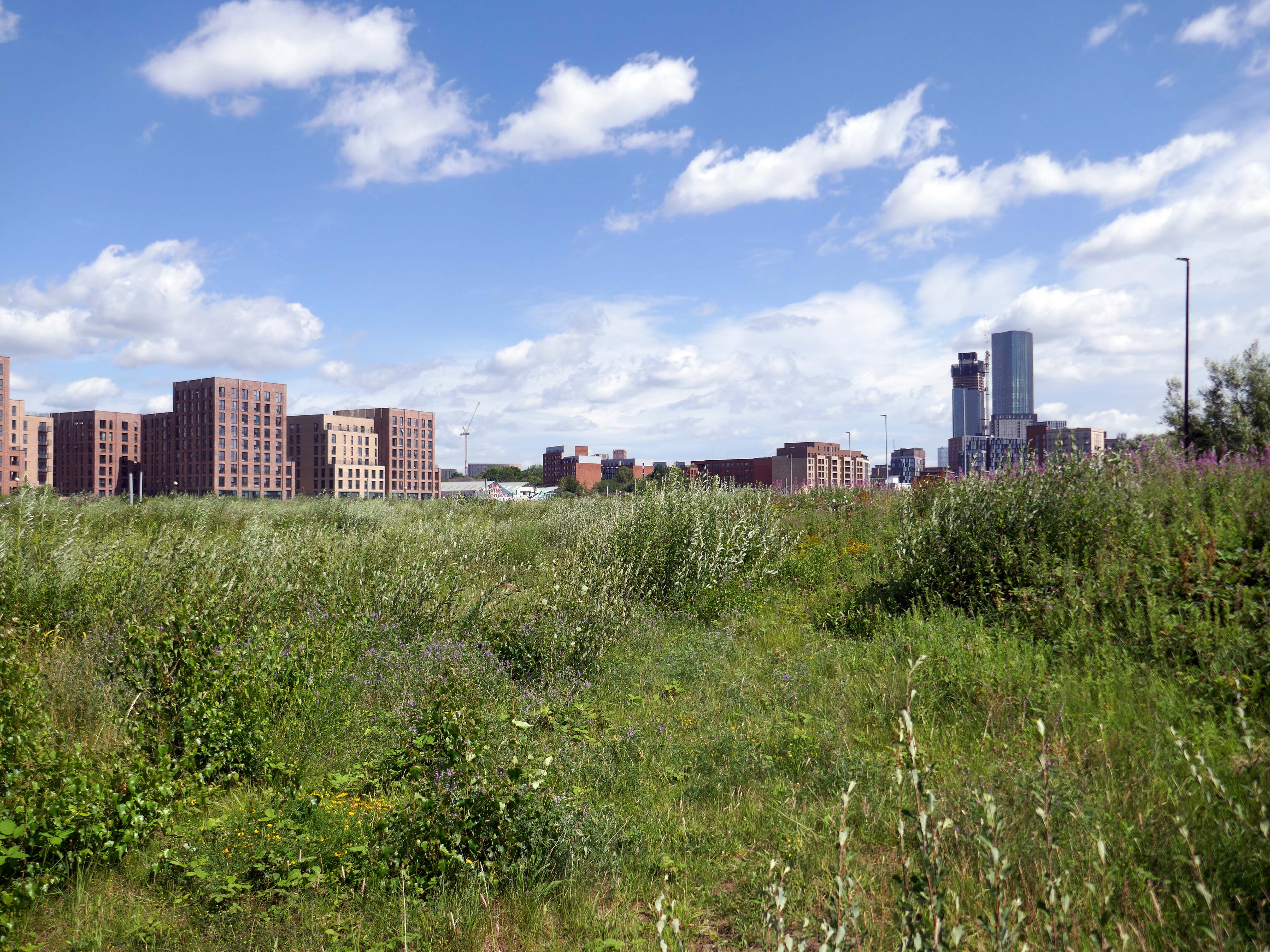
However the overwhelming might of Peel Holdings, along with the collective commercial imperatives of the local Local Authorities, has proved to be an unstoppable force, with few unmovable objections.
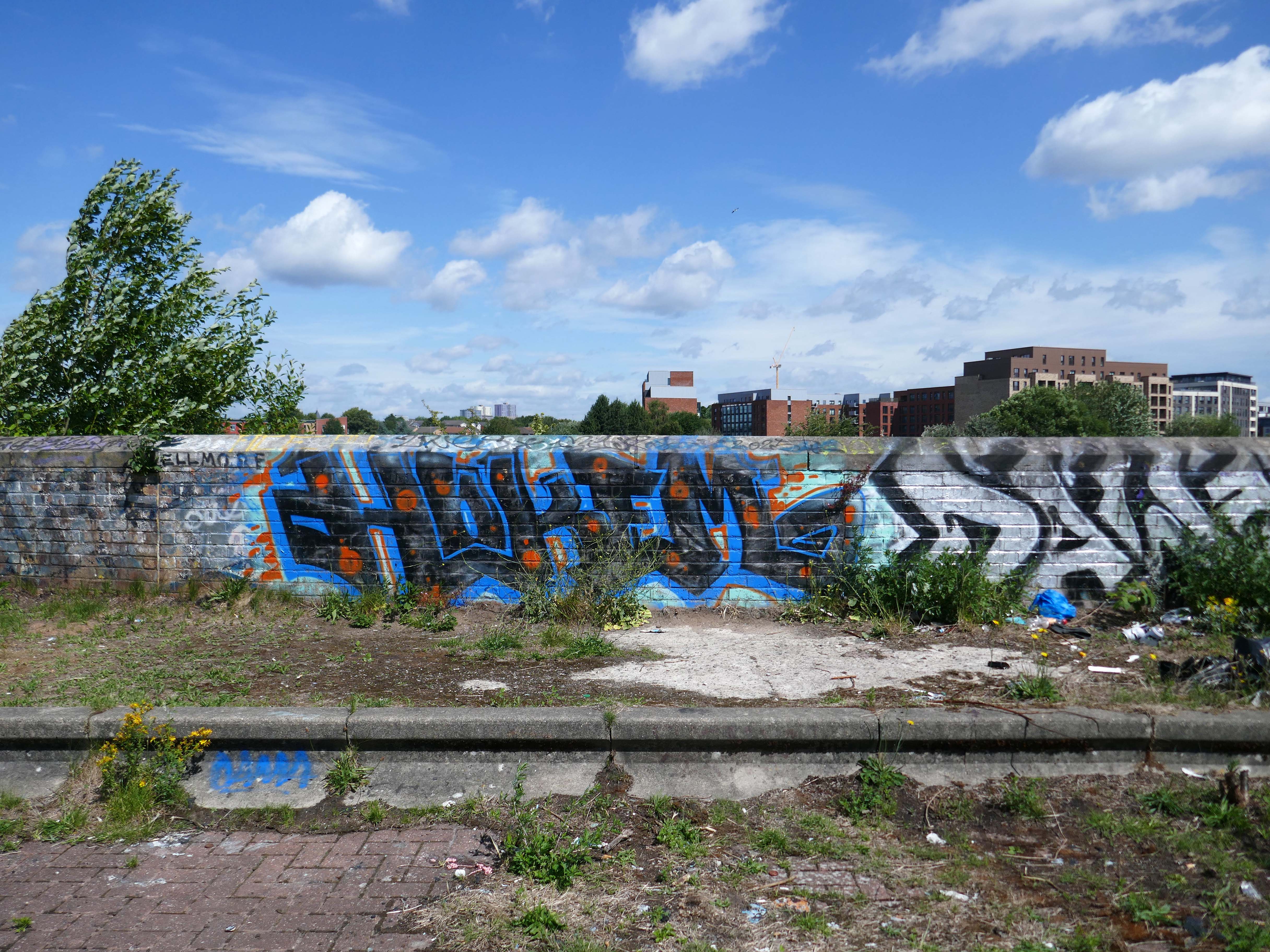
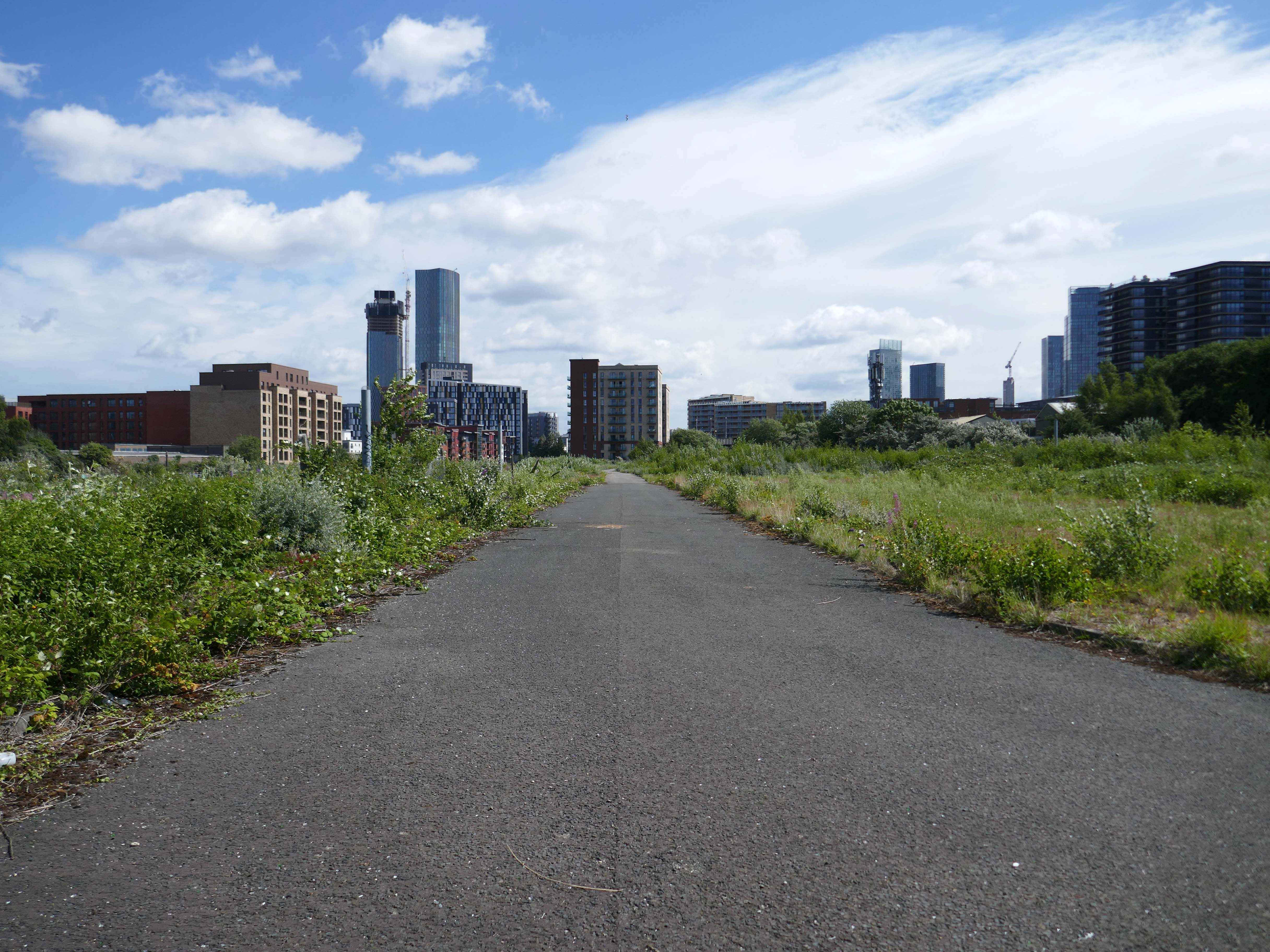
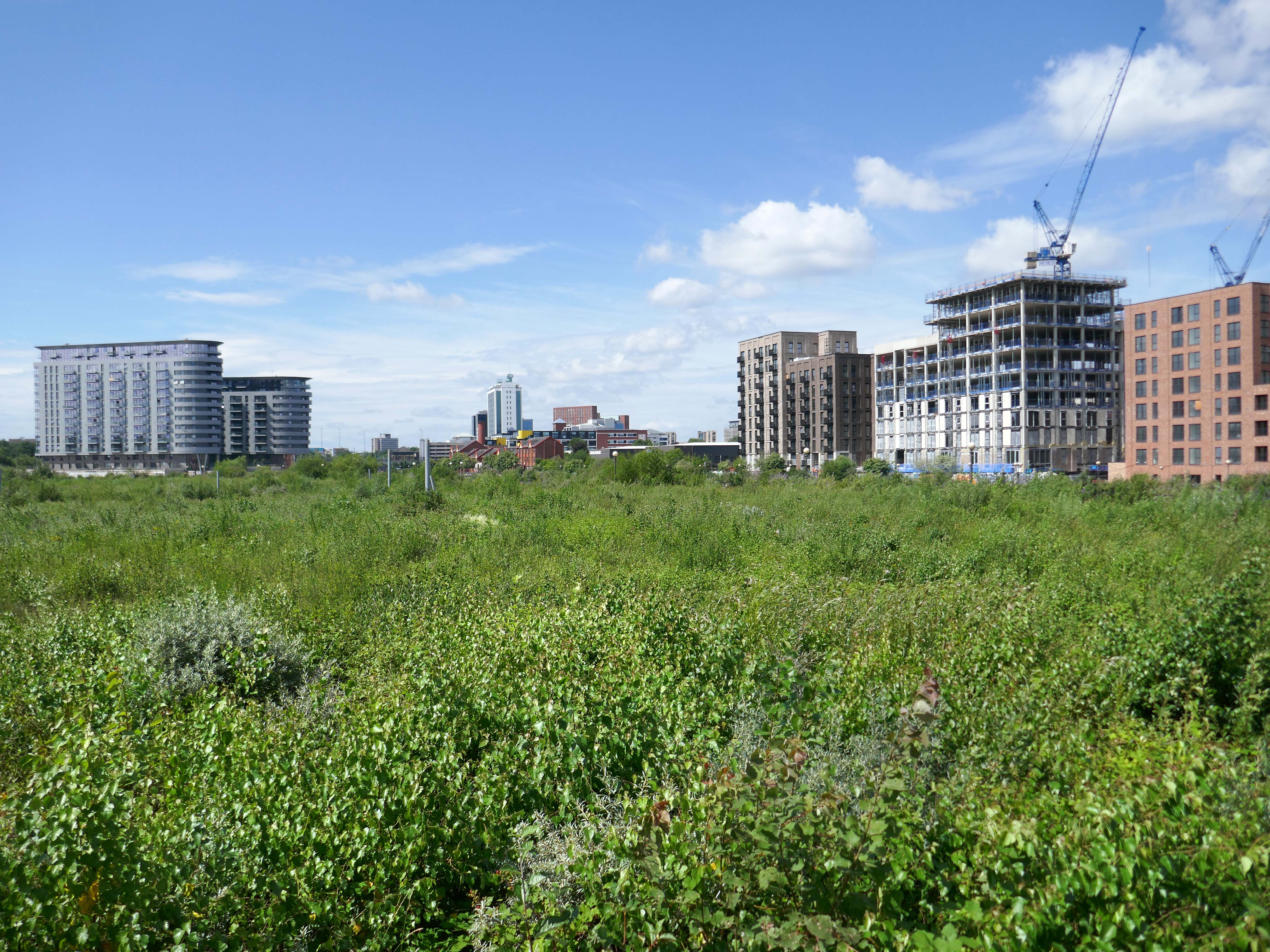
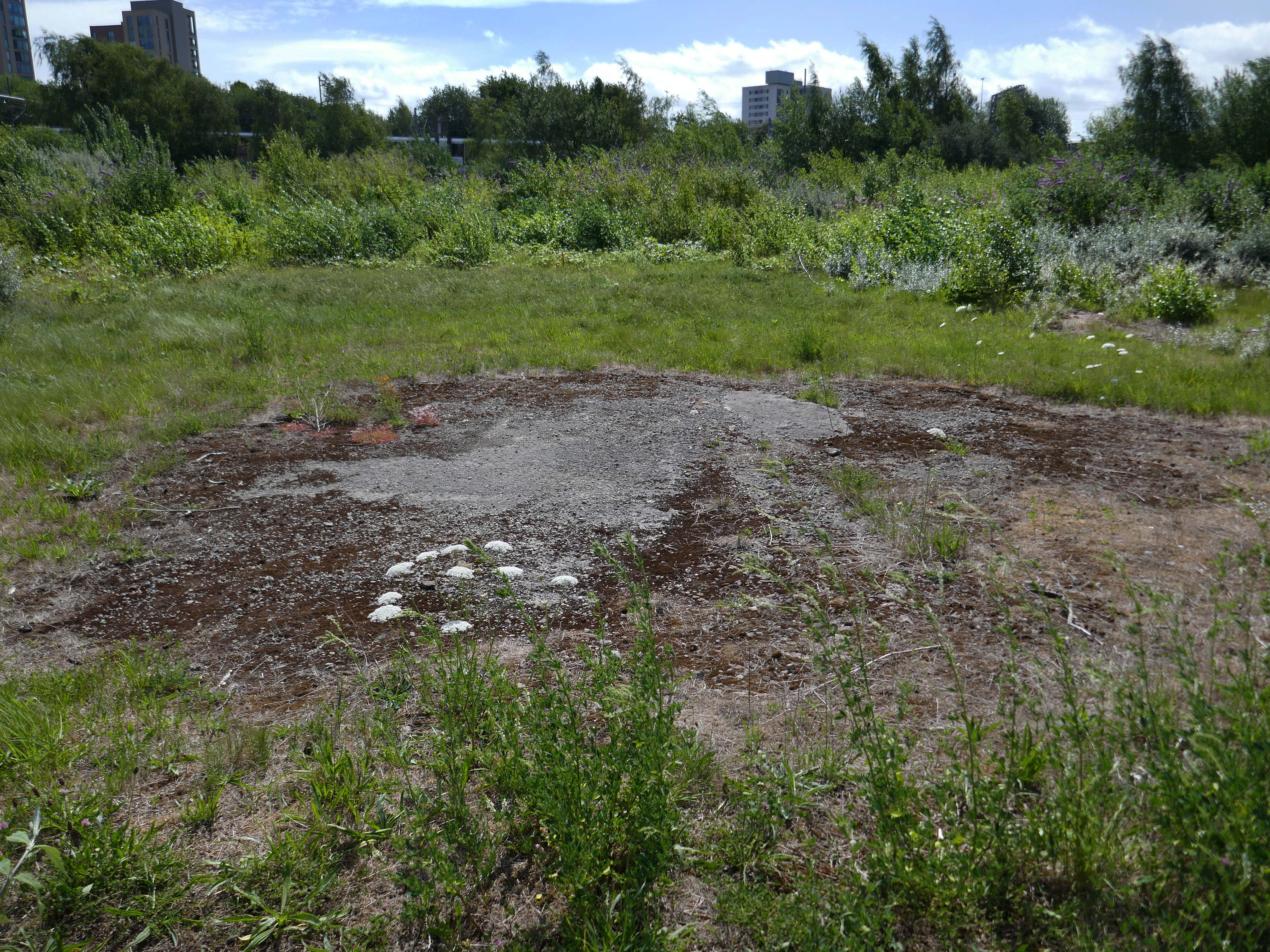
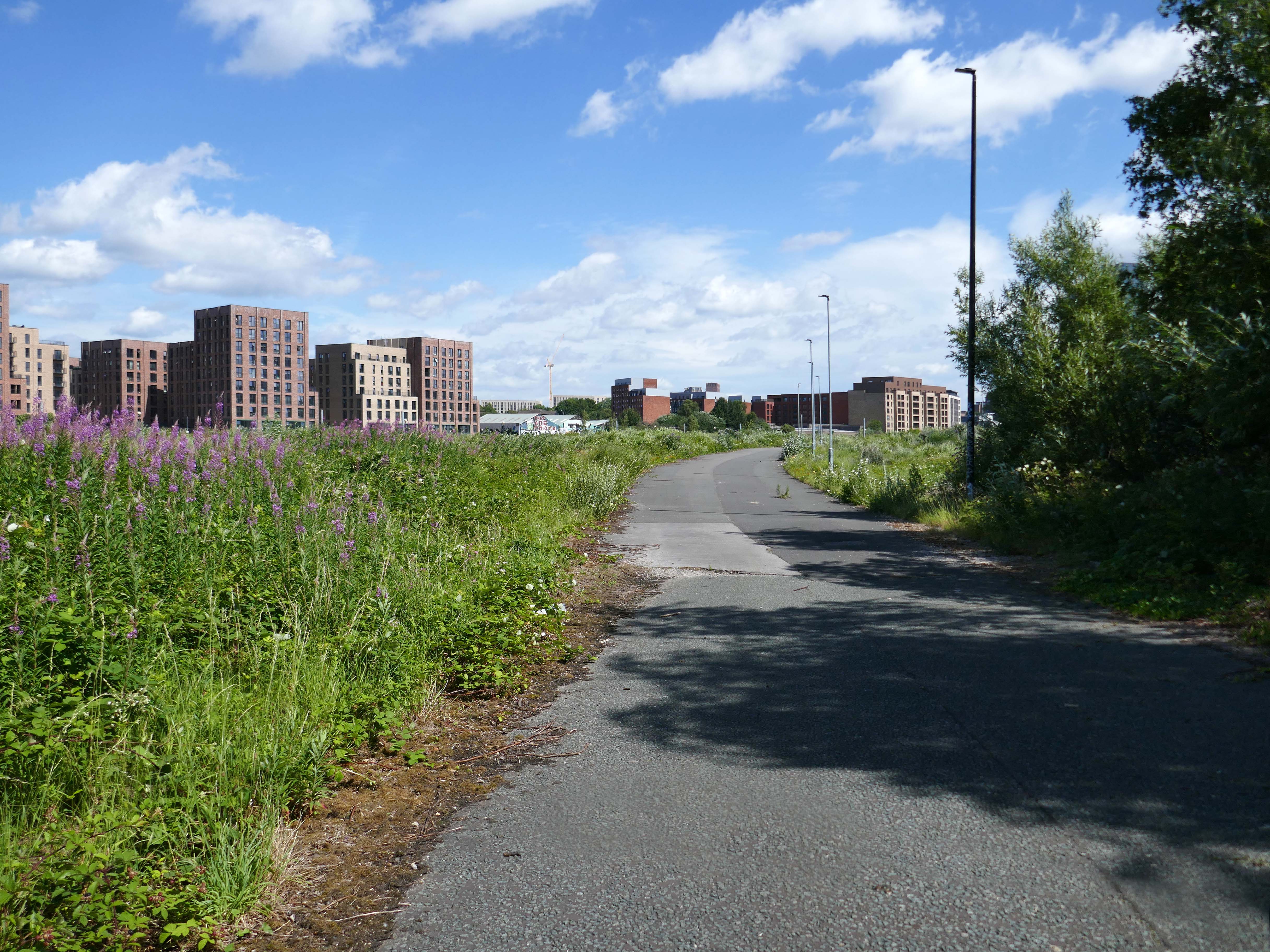
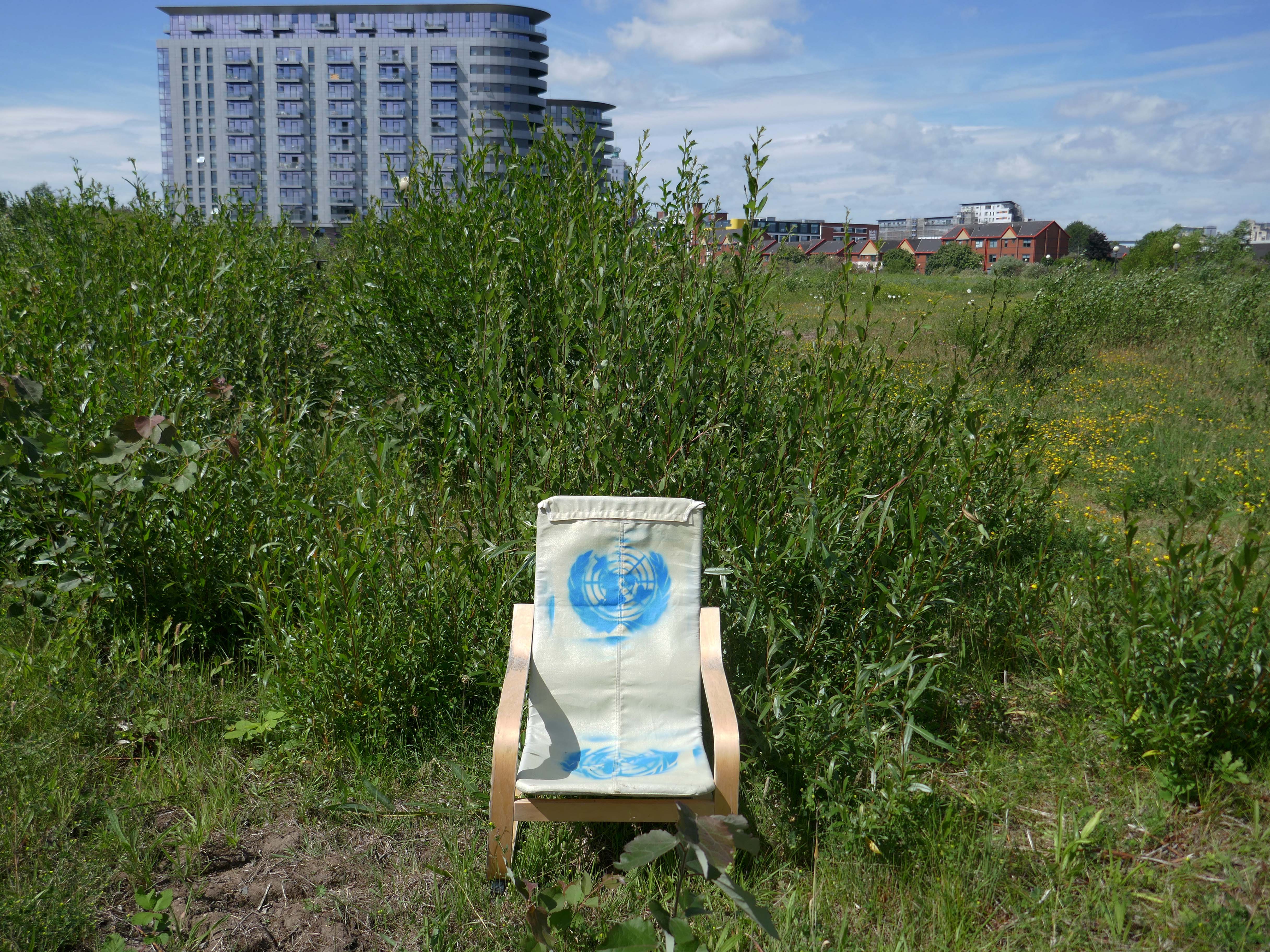
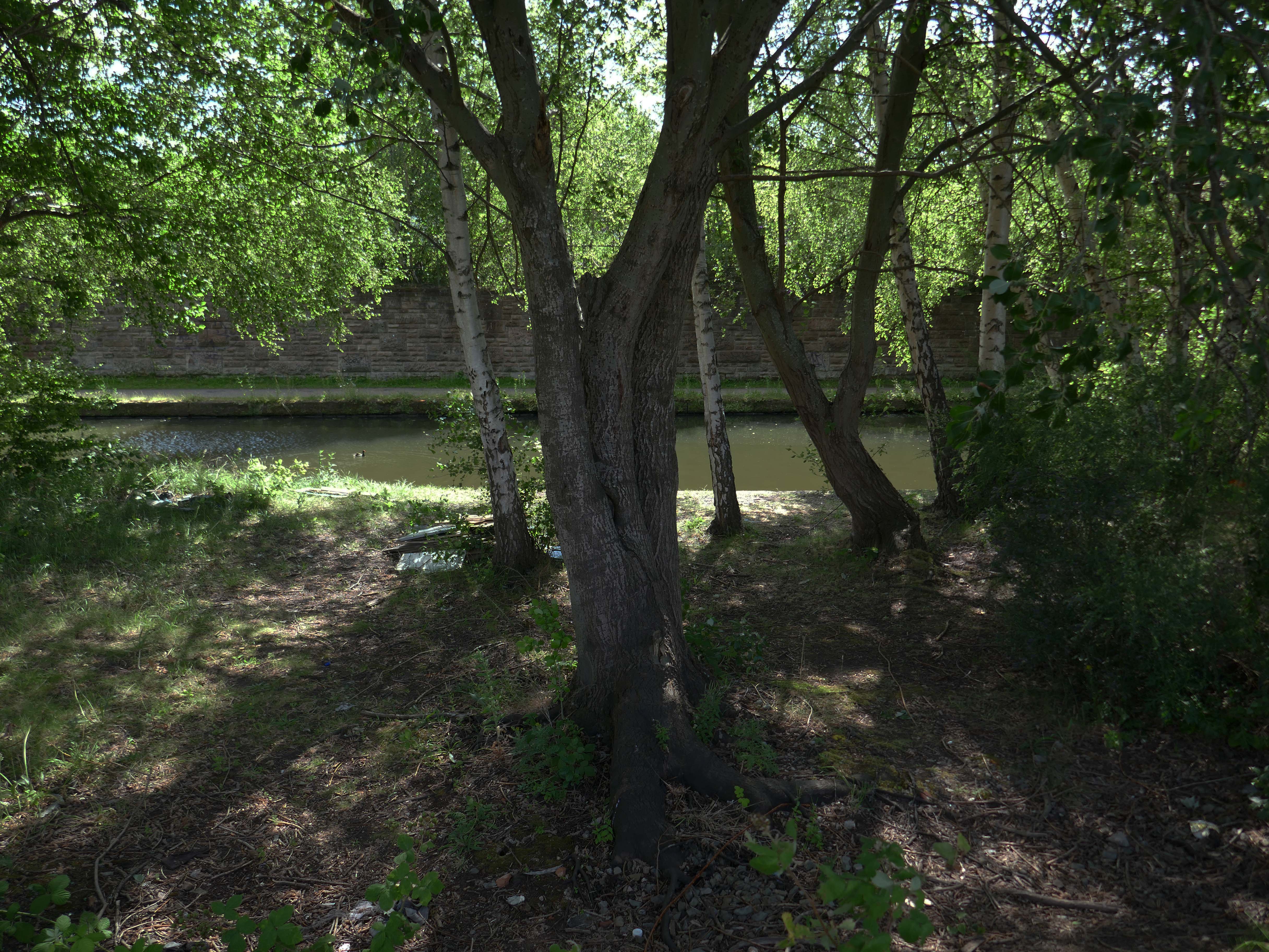
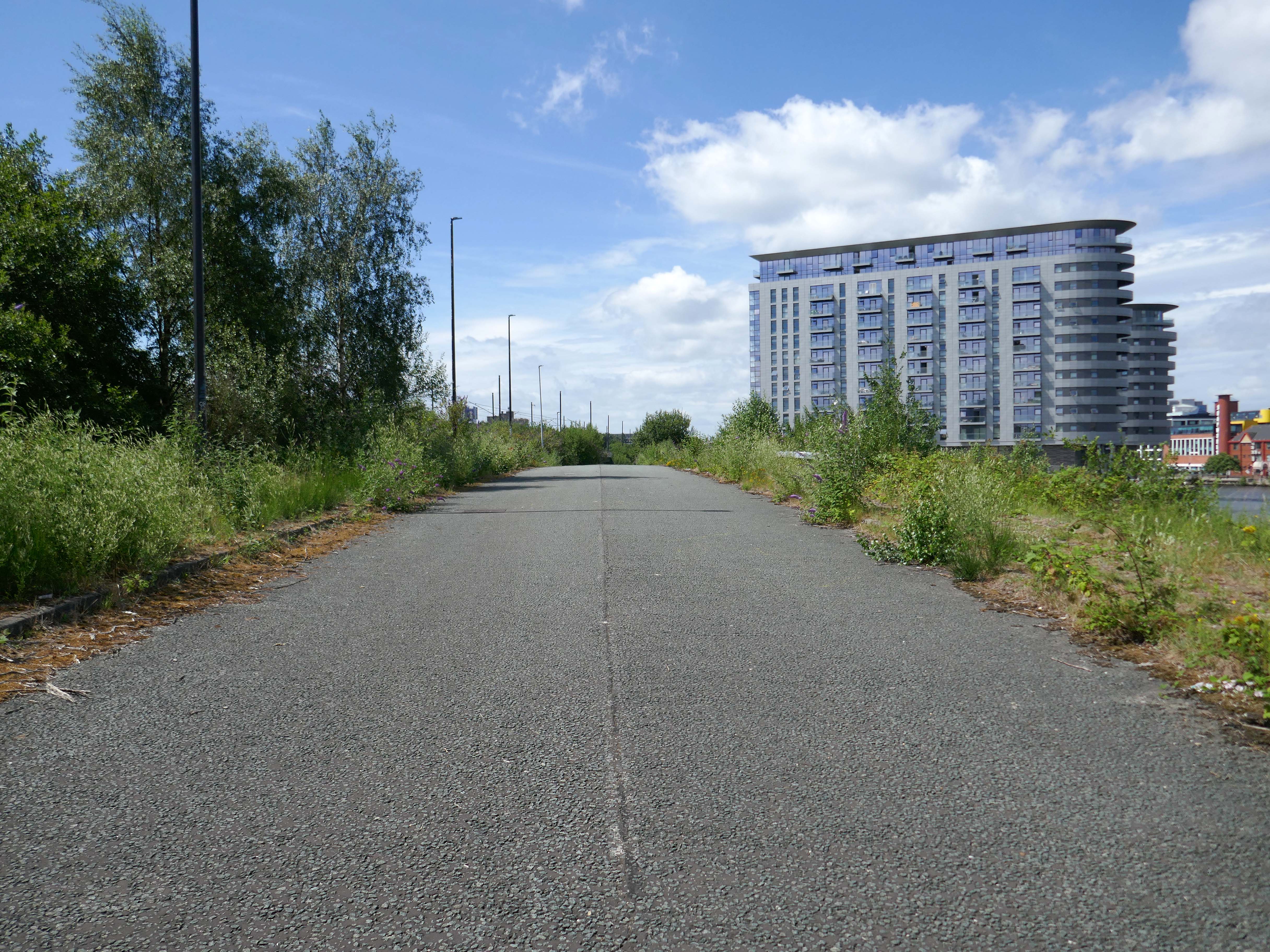
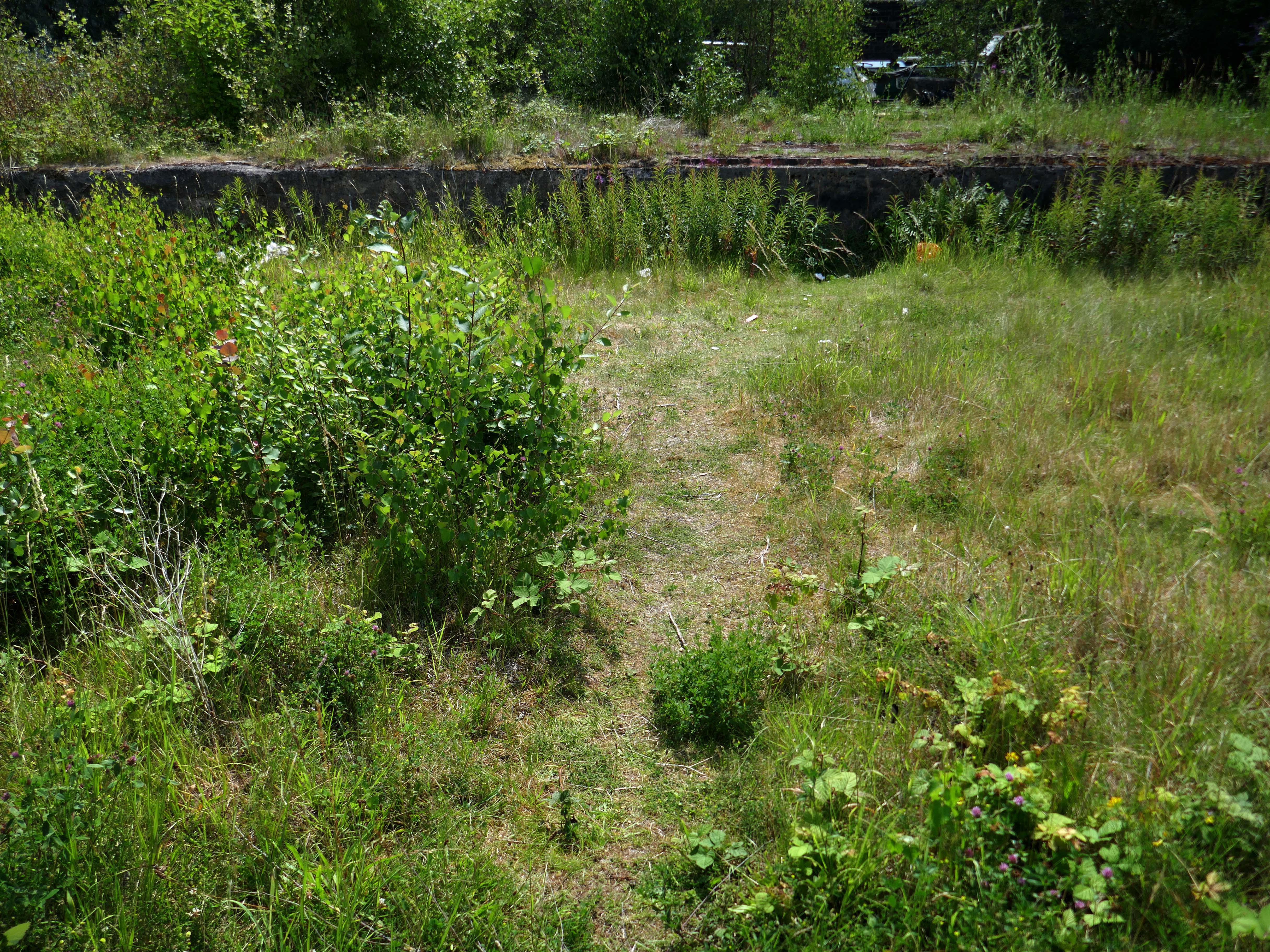
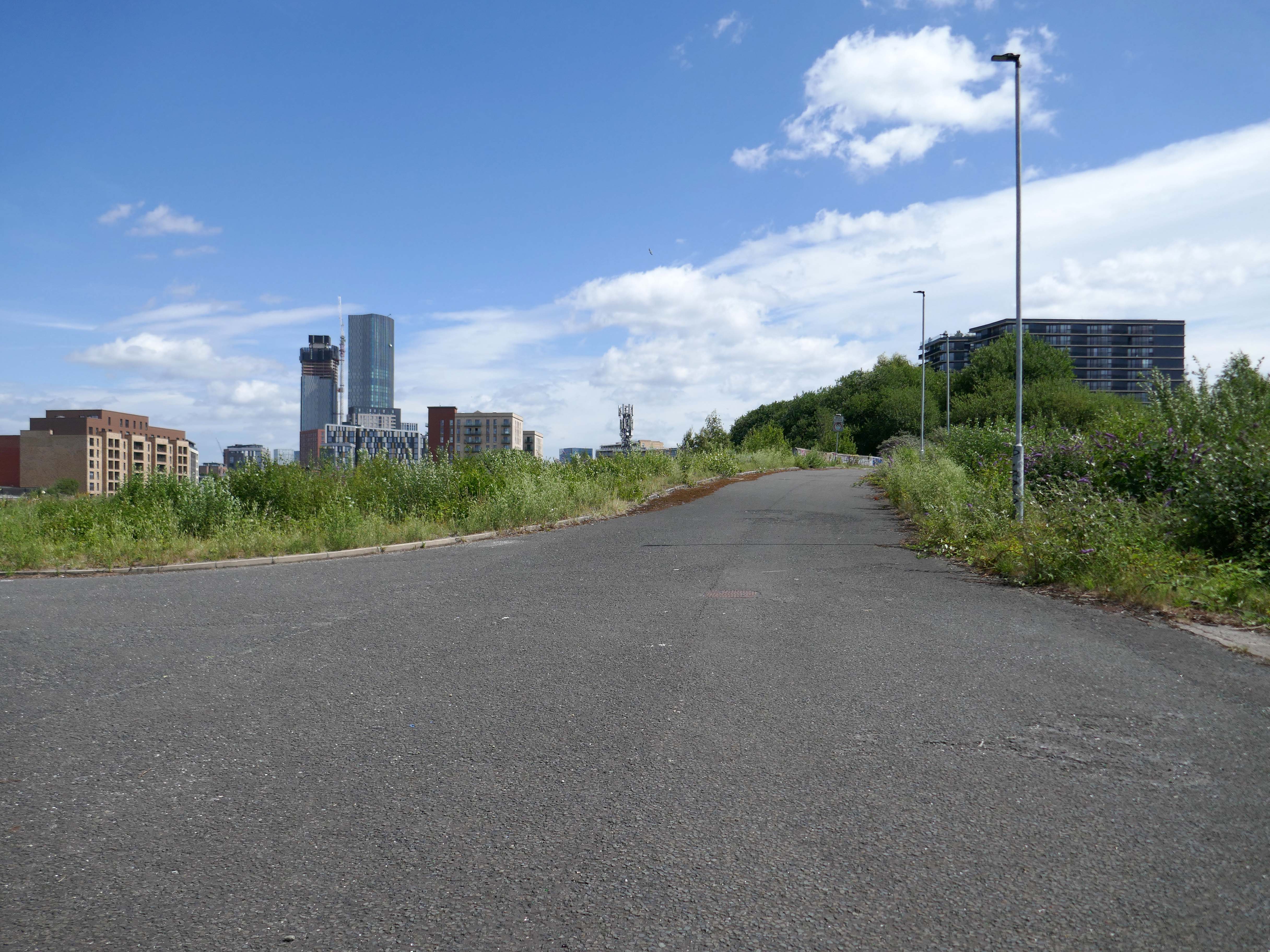
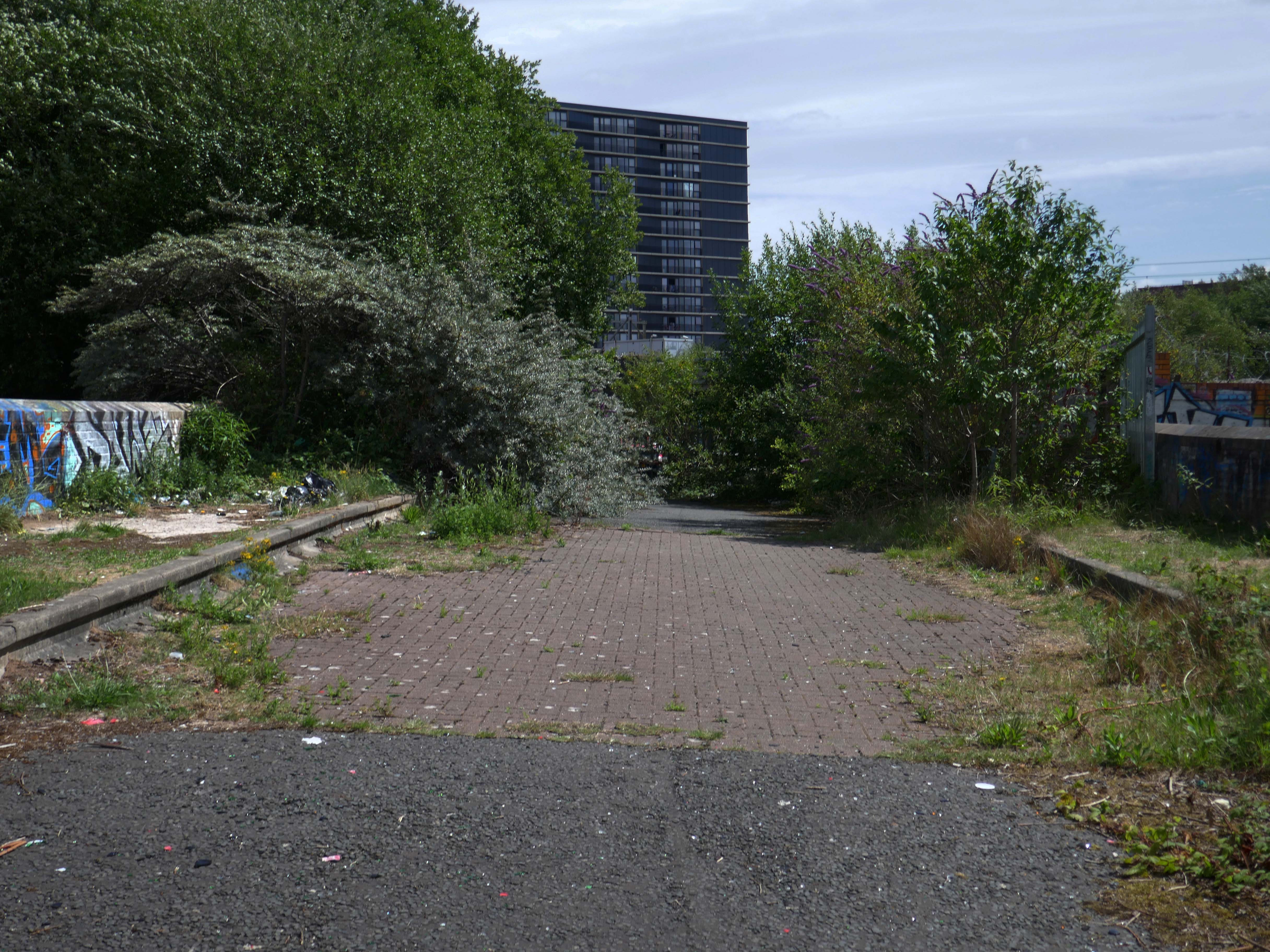
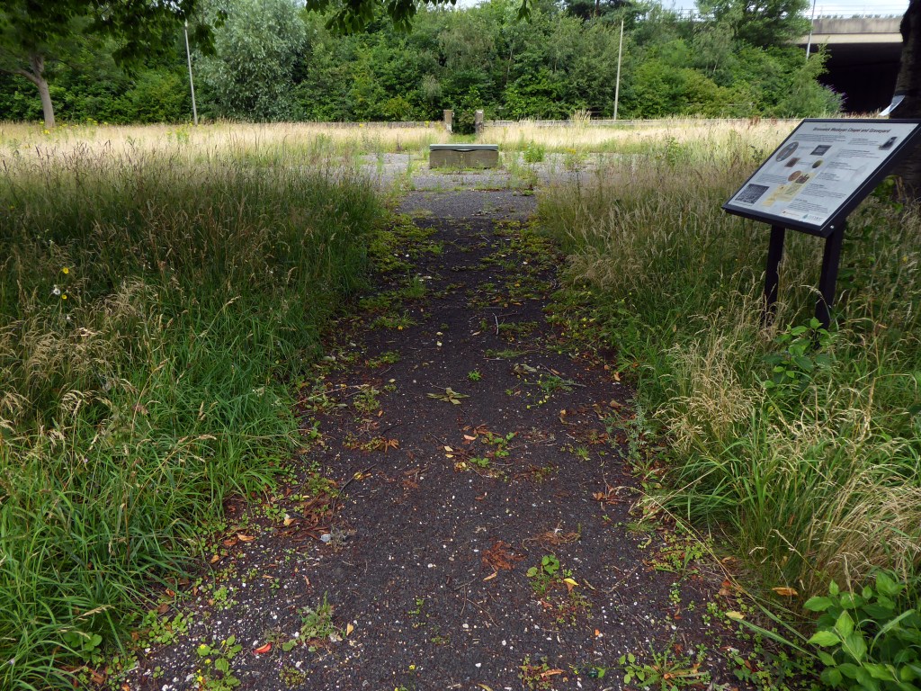
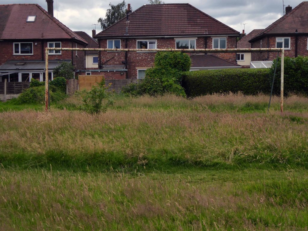
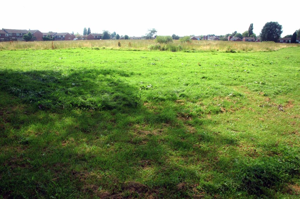
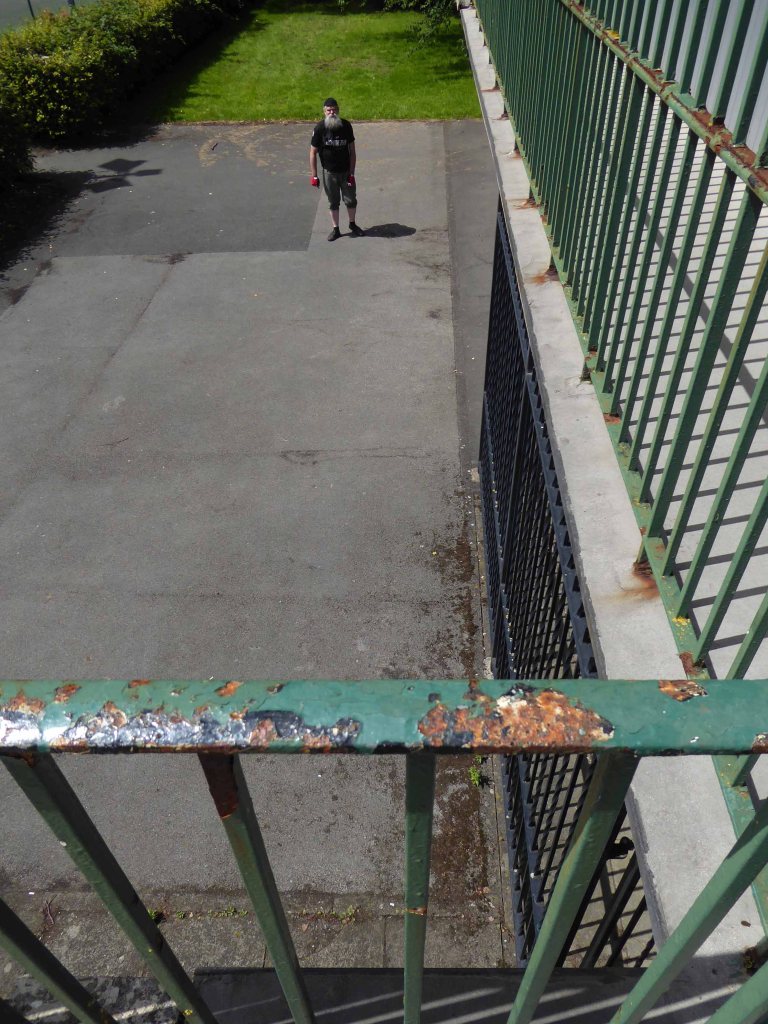
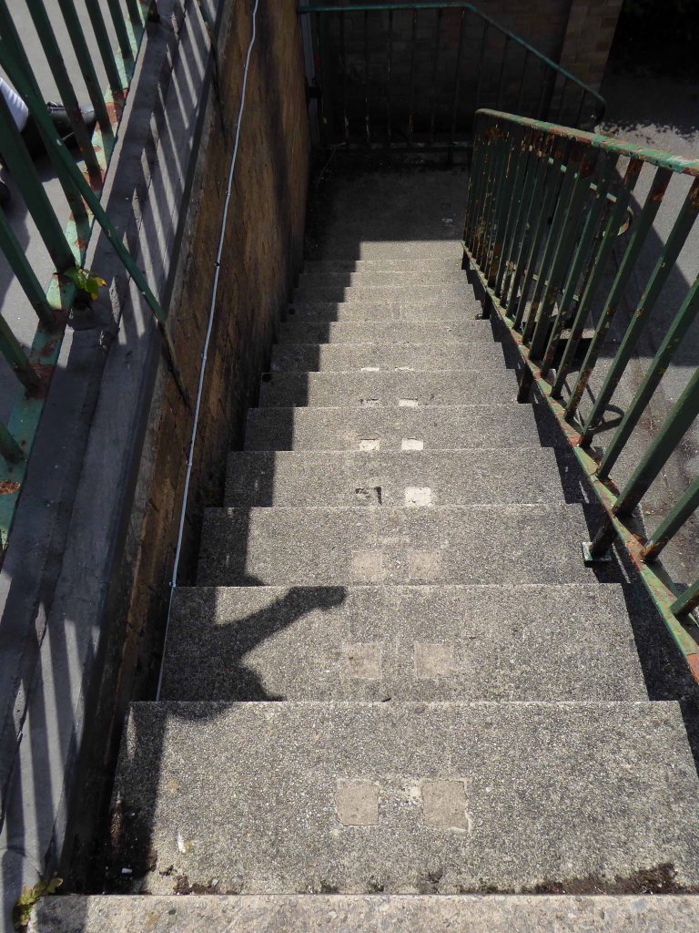
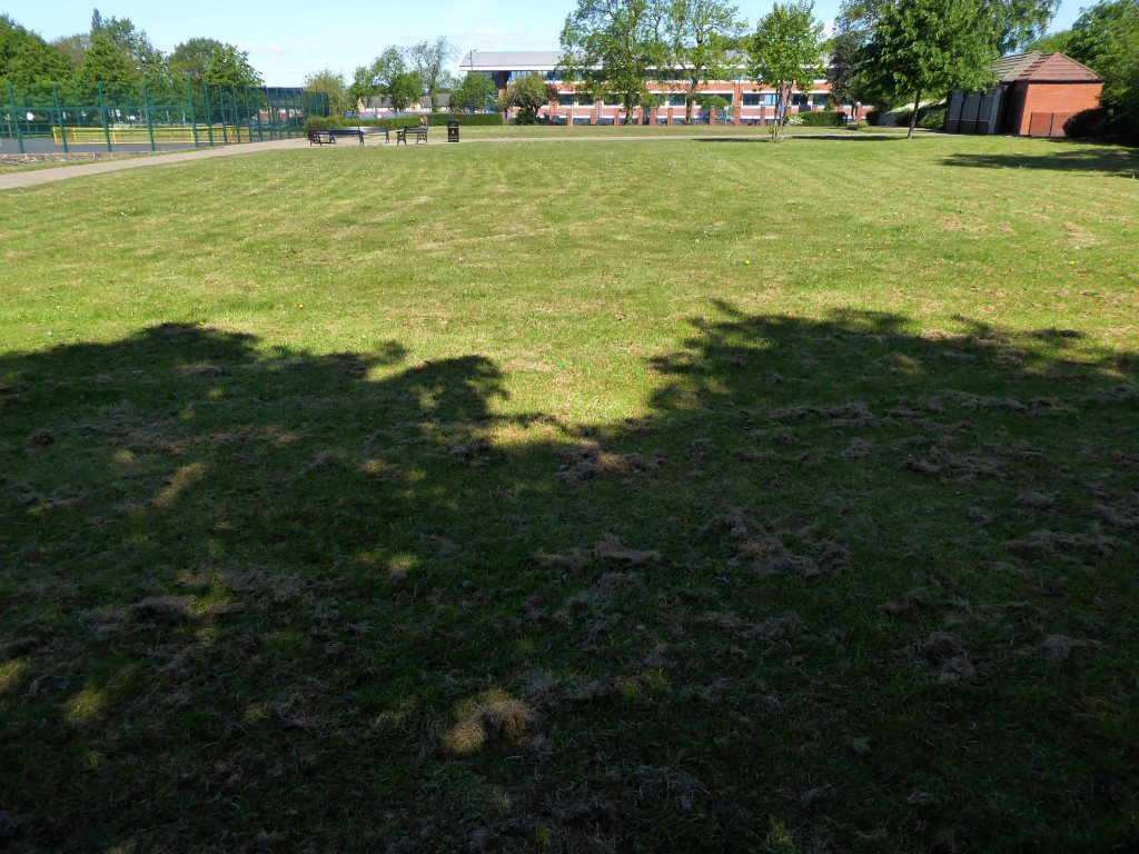
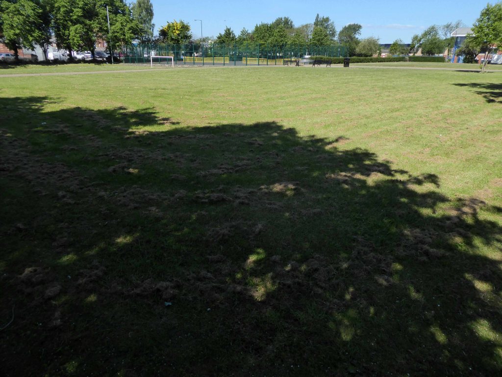
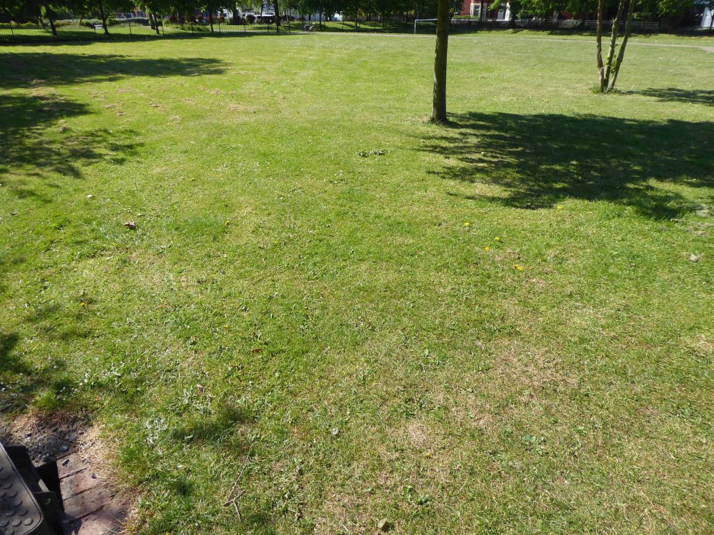
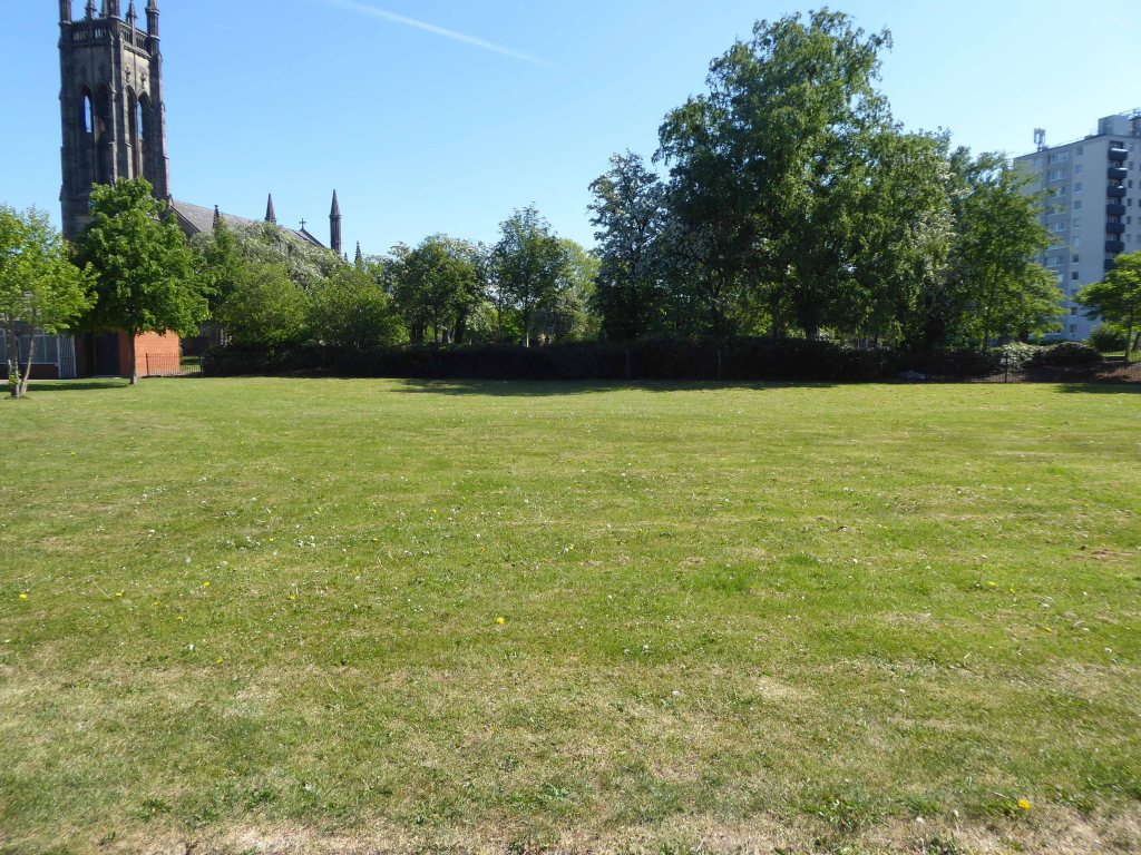
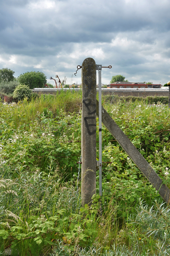
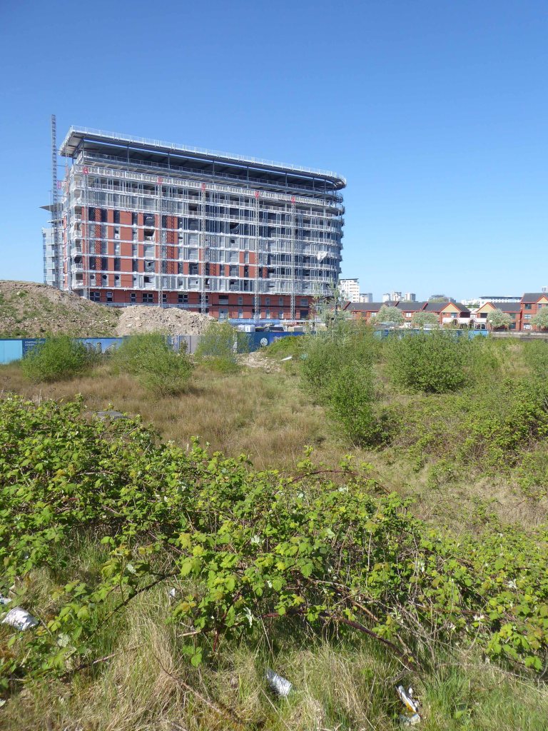
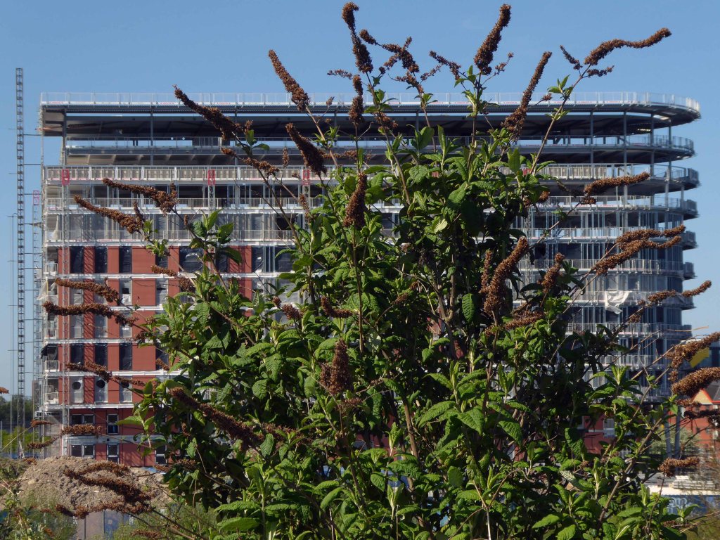
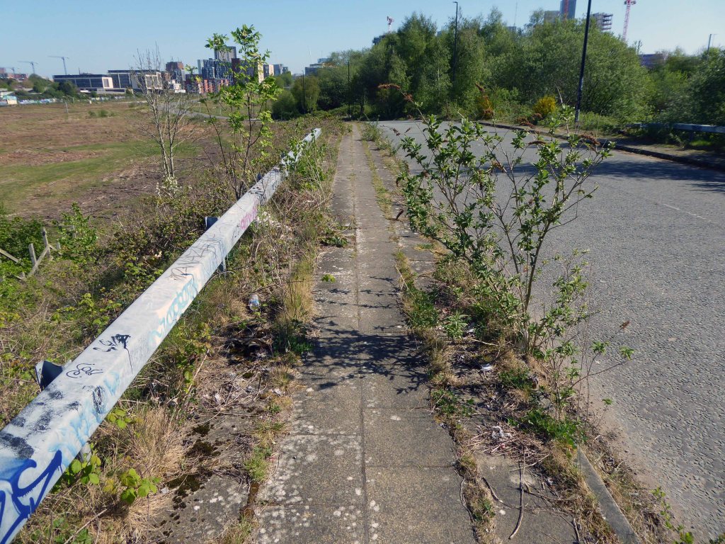
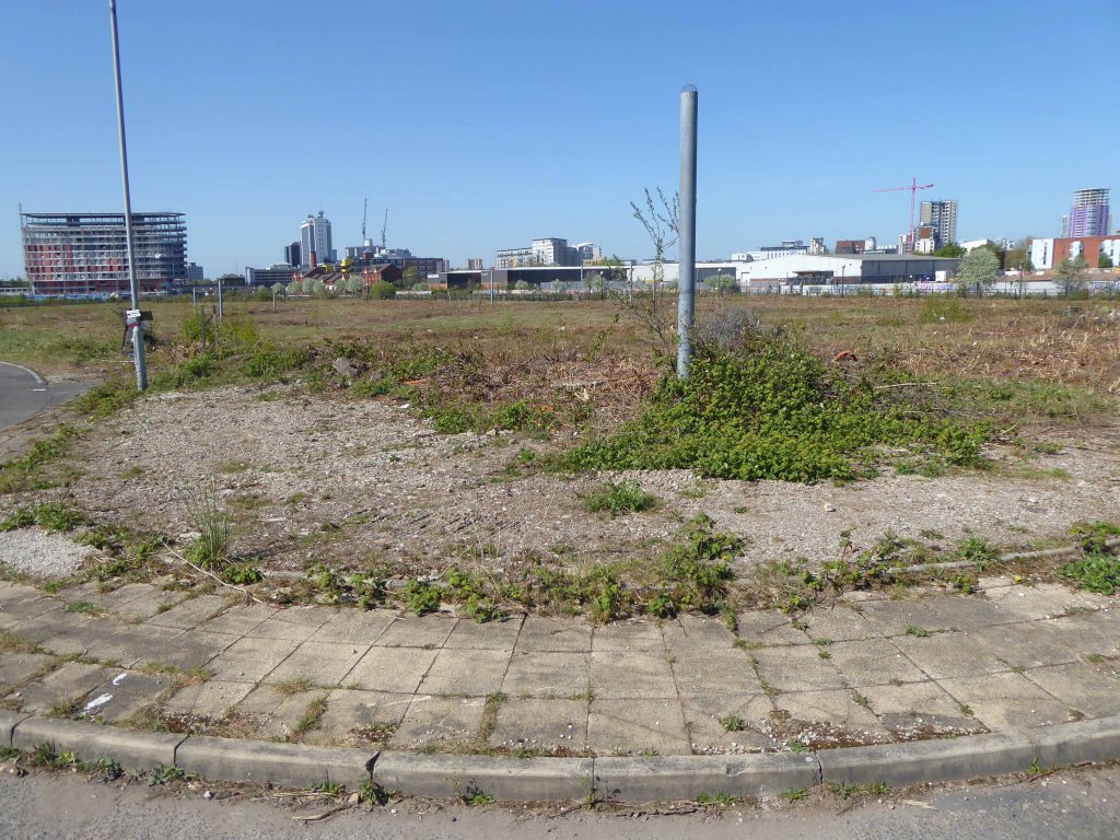
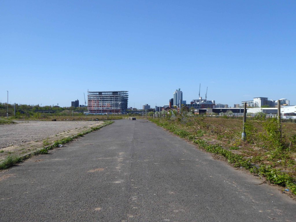
Friday July 4th 2025, I happened to slip through the often locked gates at Cornbrook, to take a look at the current state of play. Over time the site has been mechanically scraped and cleared, but the undergrowth simply grows back again.
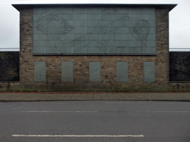
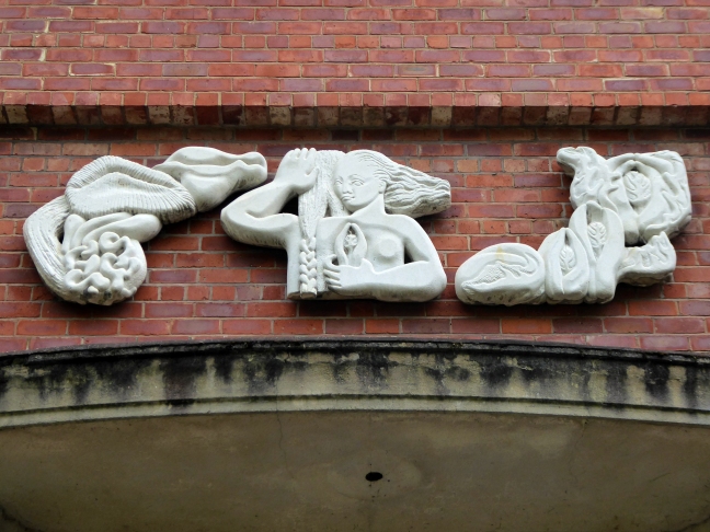
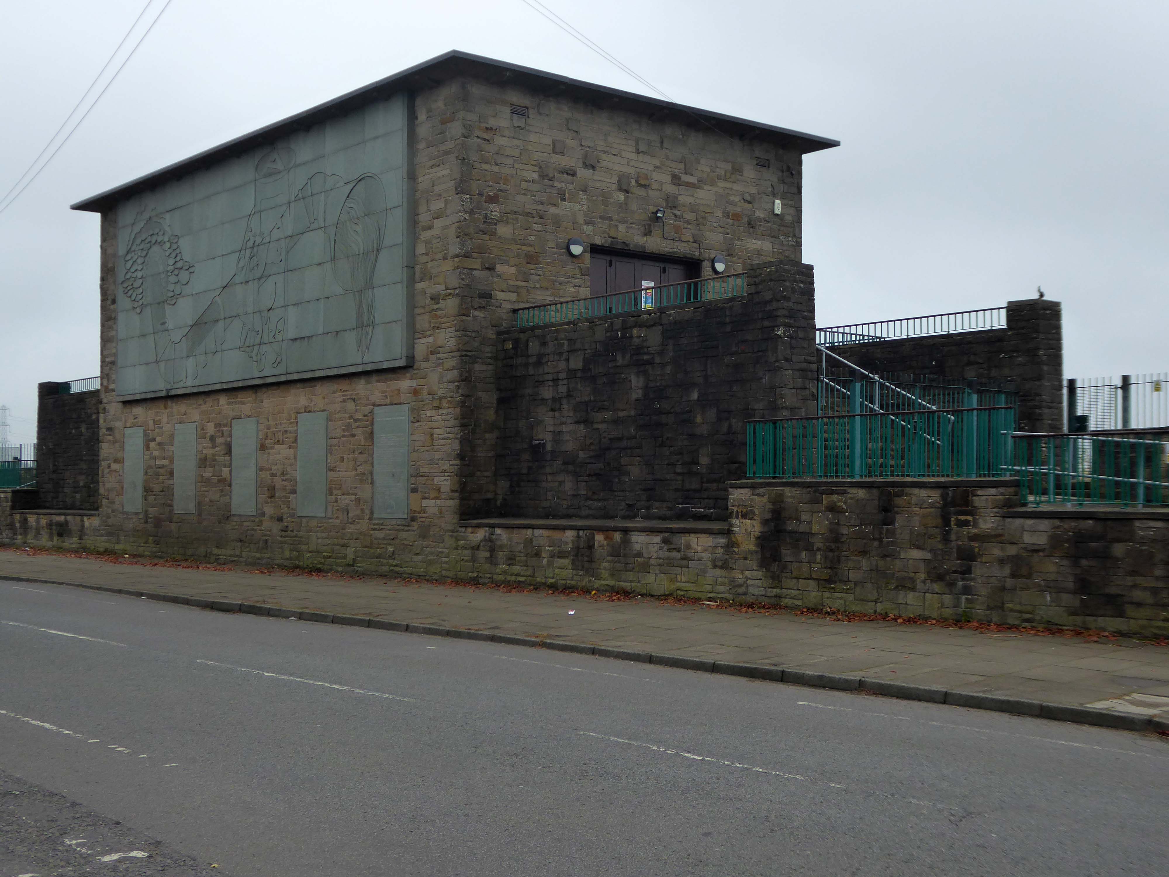
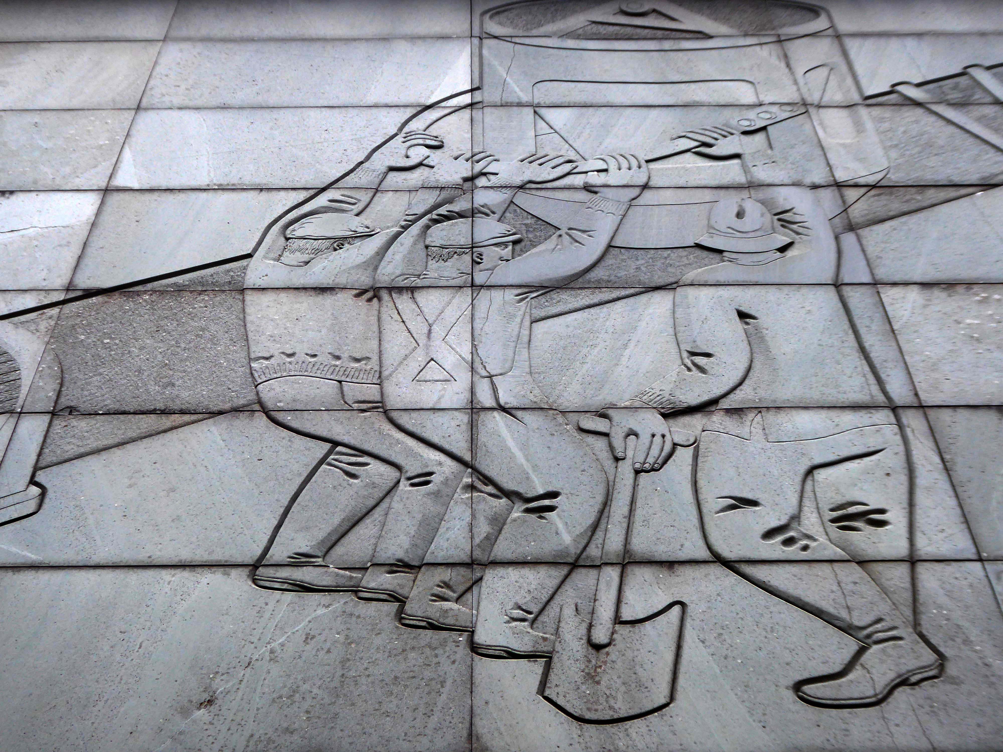
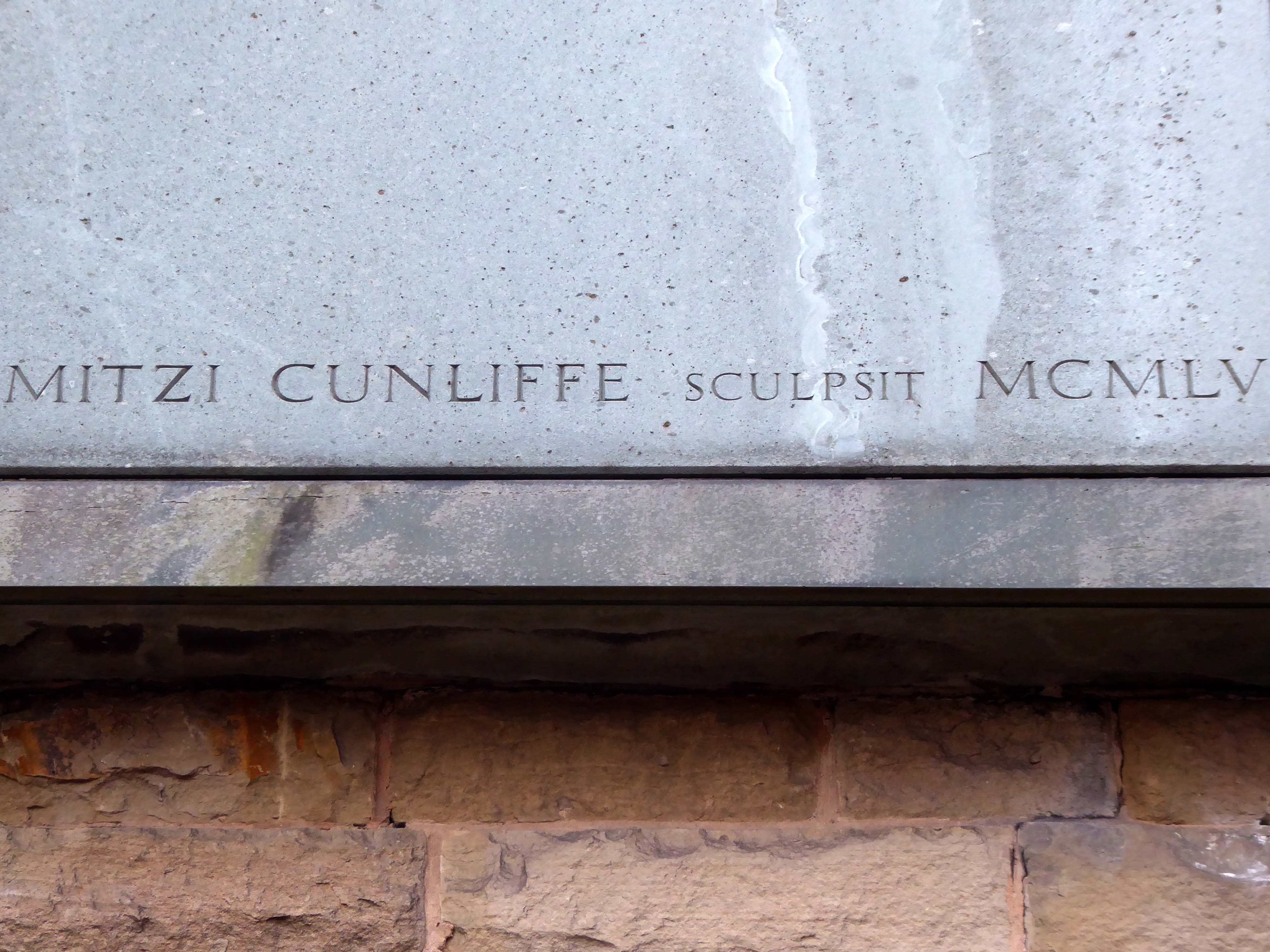
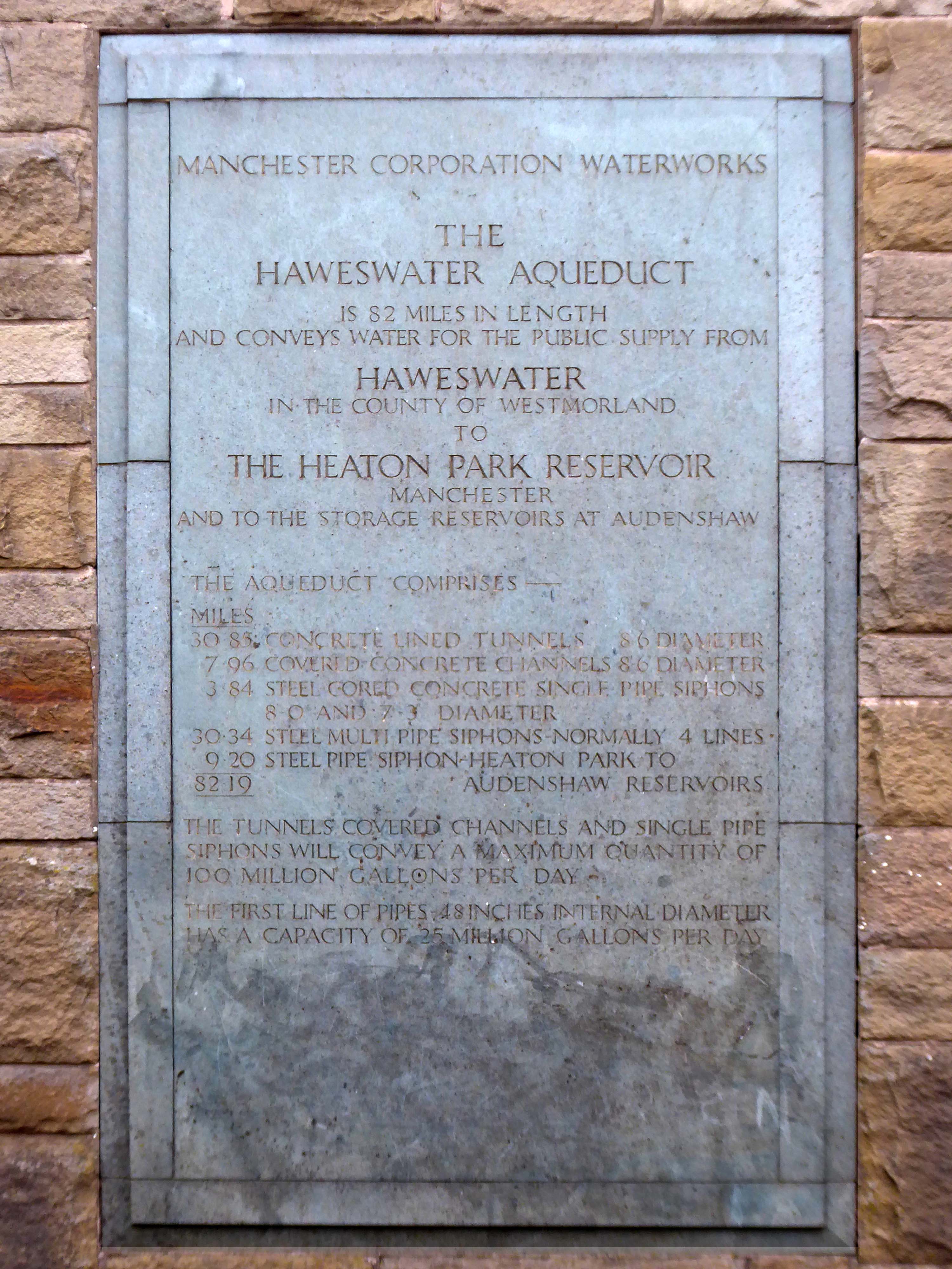
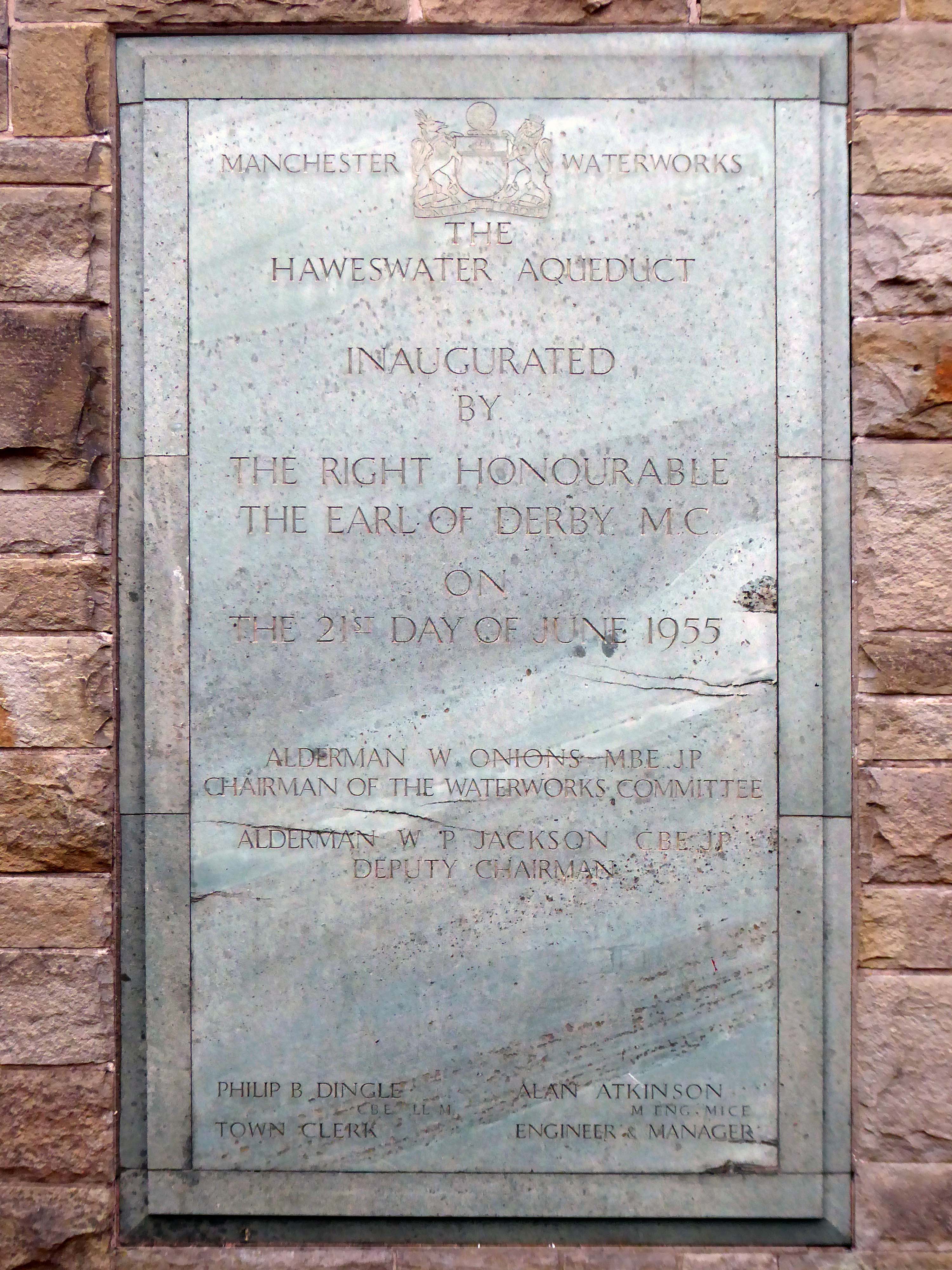
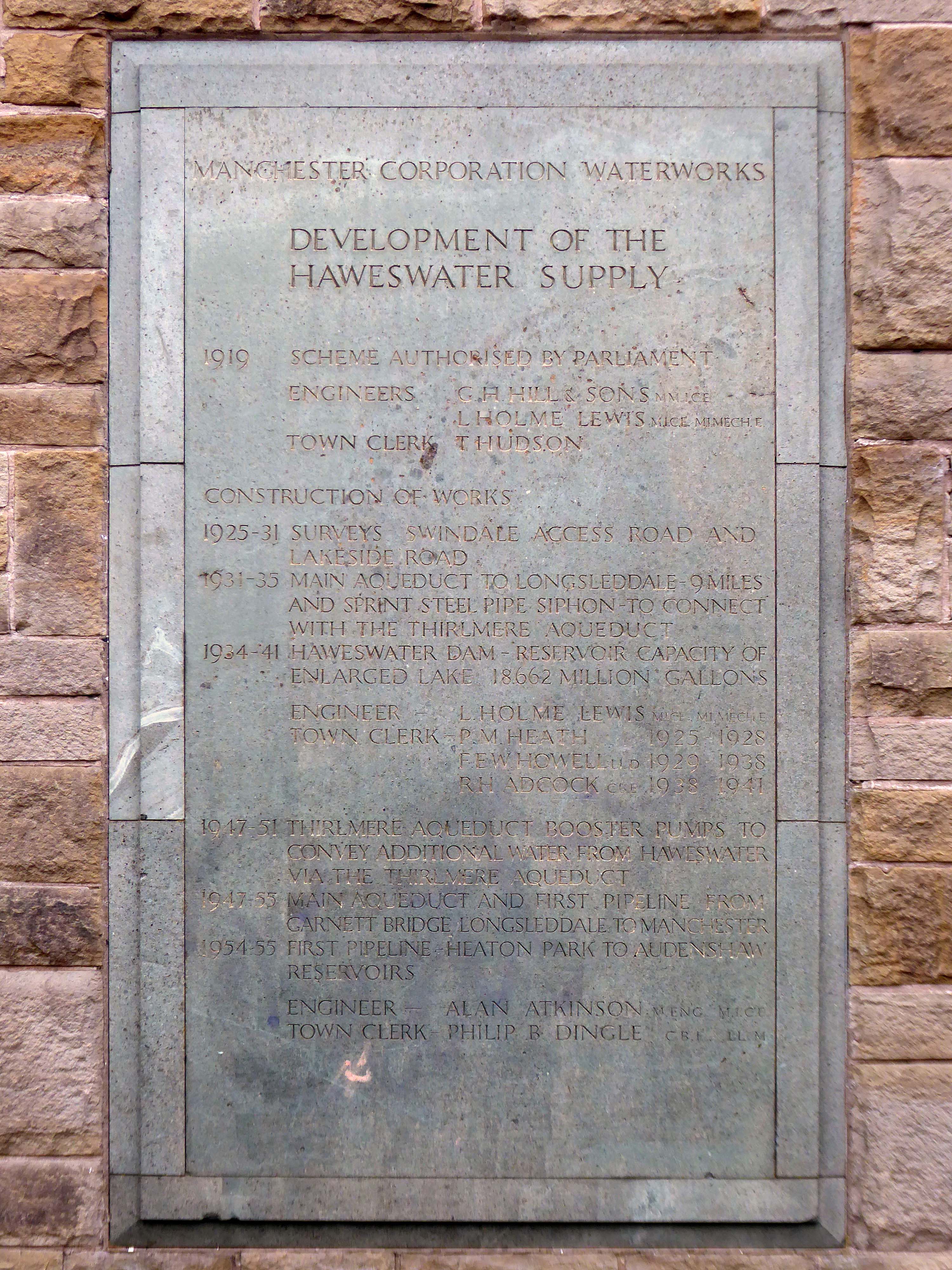
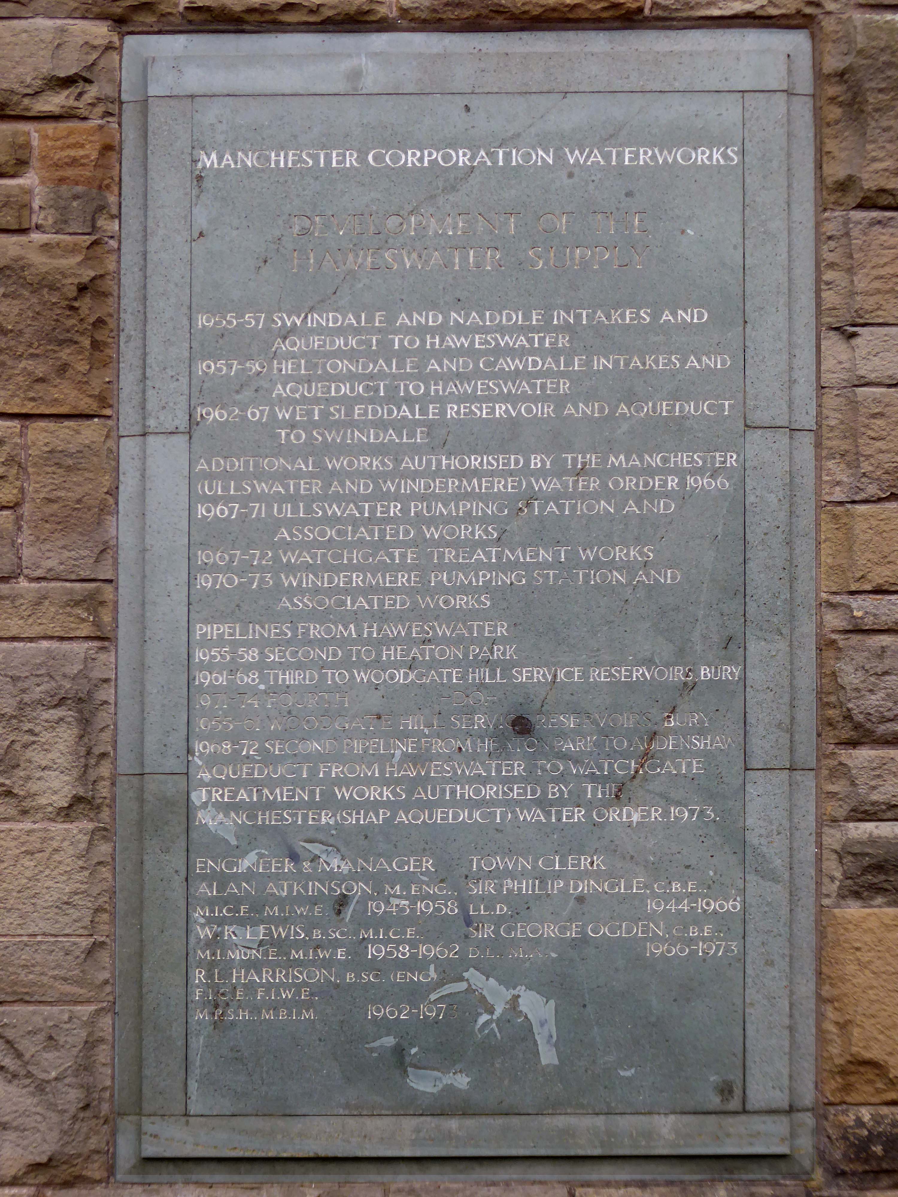
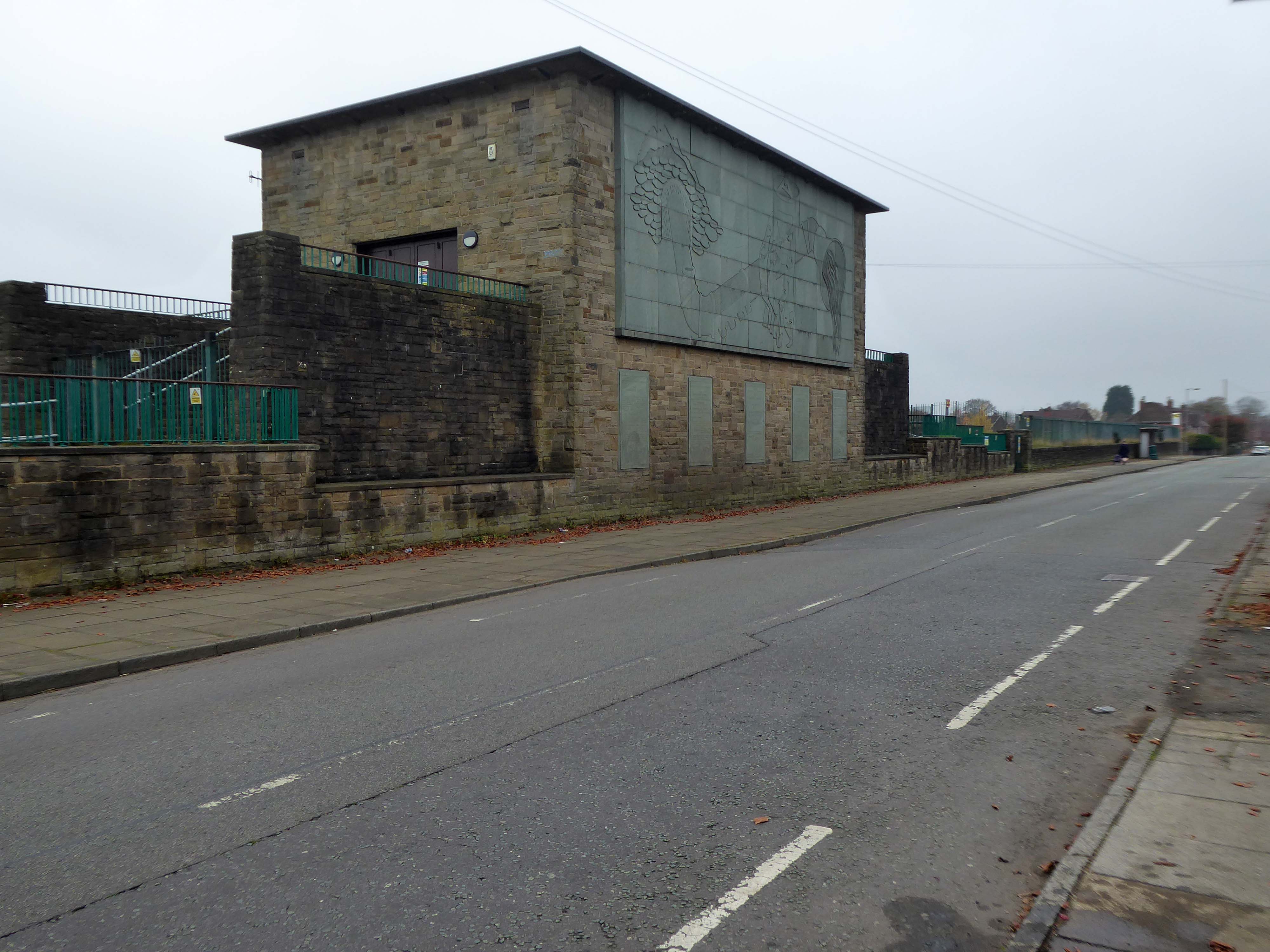
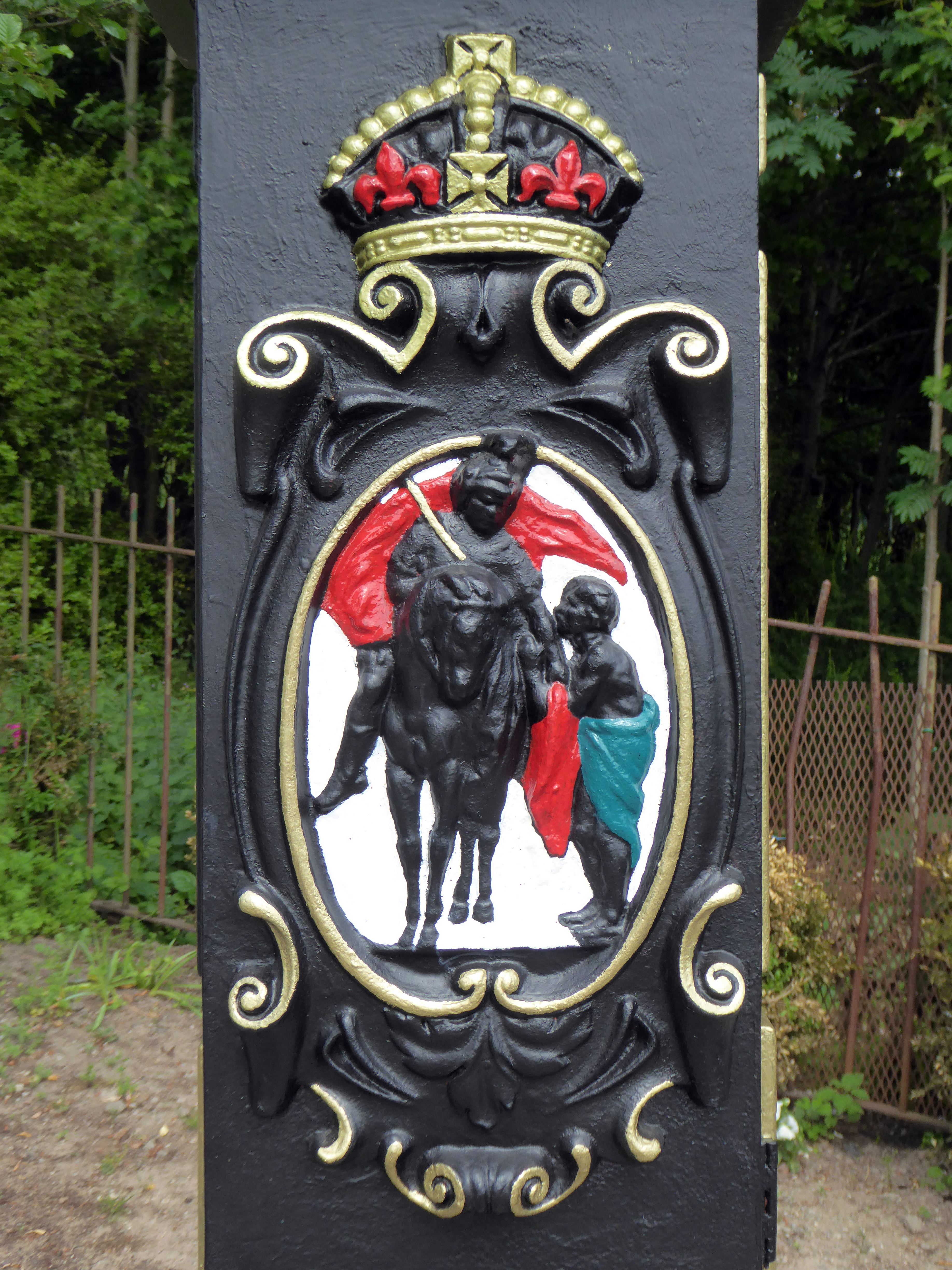
Built between1954-5 by the Manchester City Architect’s Department, Chief Architect Leonard C Howitt, for the Manchester Corporation Waterworks. Alan Atkinson, engineer. Incorporates large relief by Mitzi Cunliffe, signed and dated 1955. Yorkshire sandstone, with Westmorland greenstone from Broughton Moor used as relief. Roof not seen above dentiled overhang.
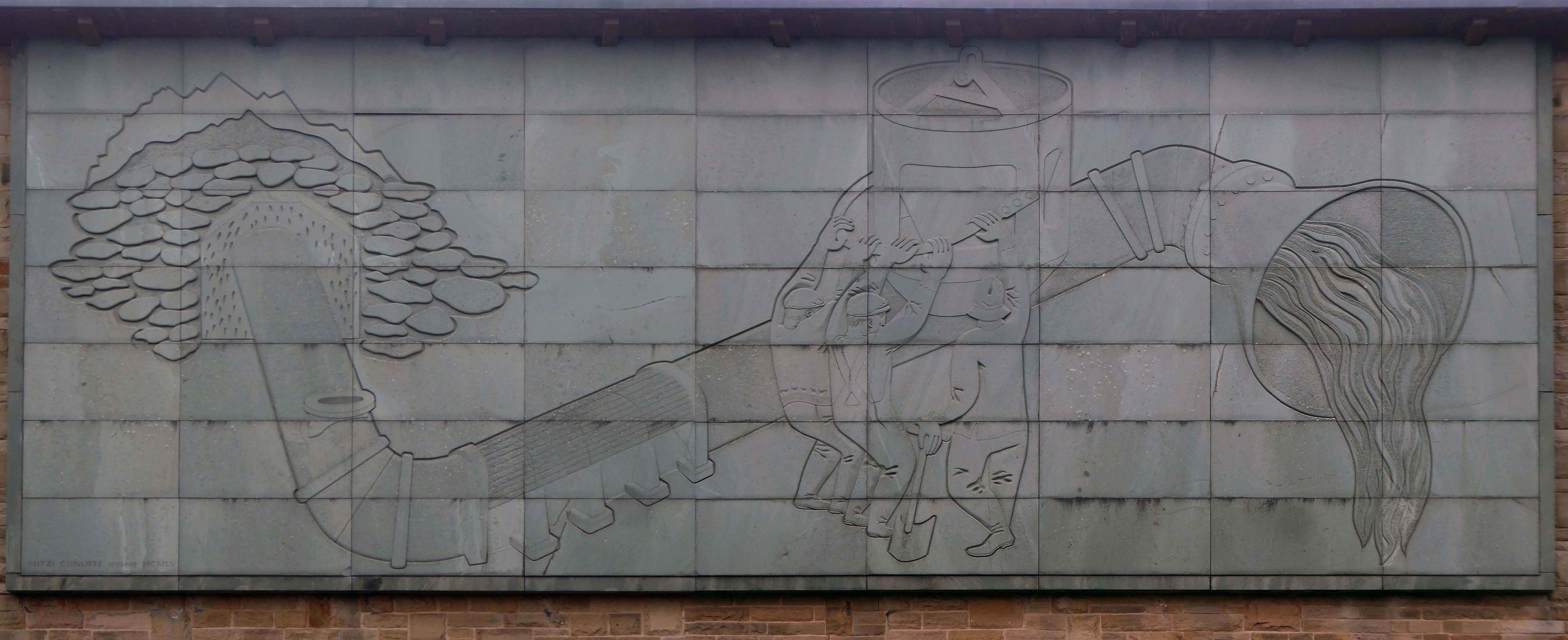
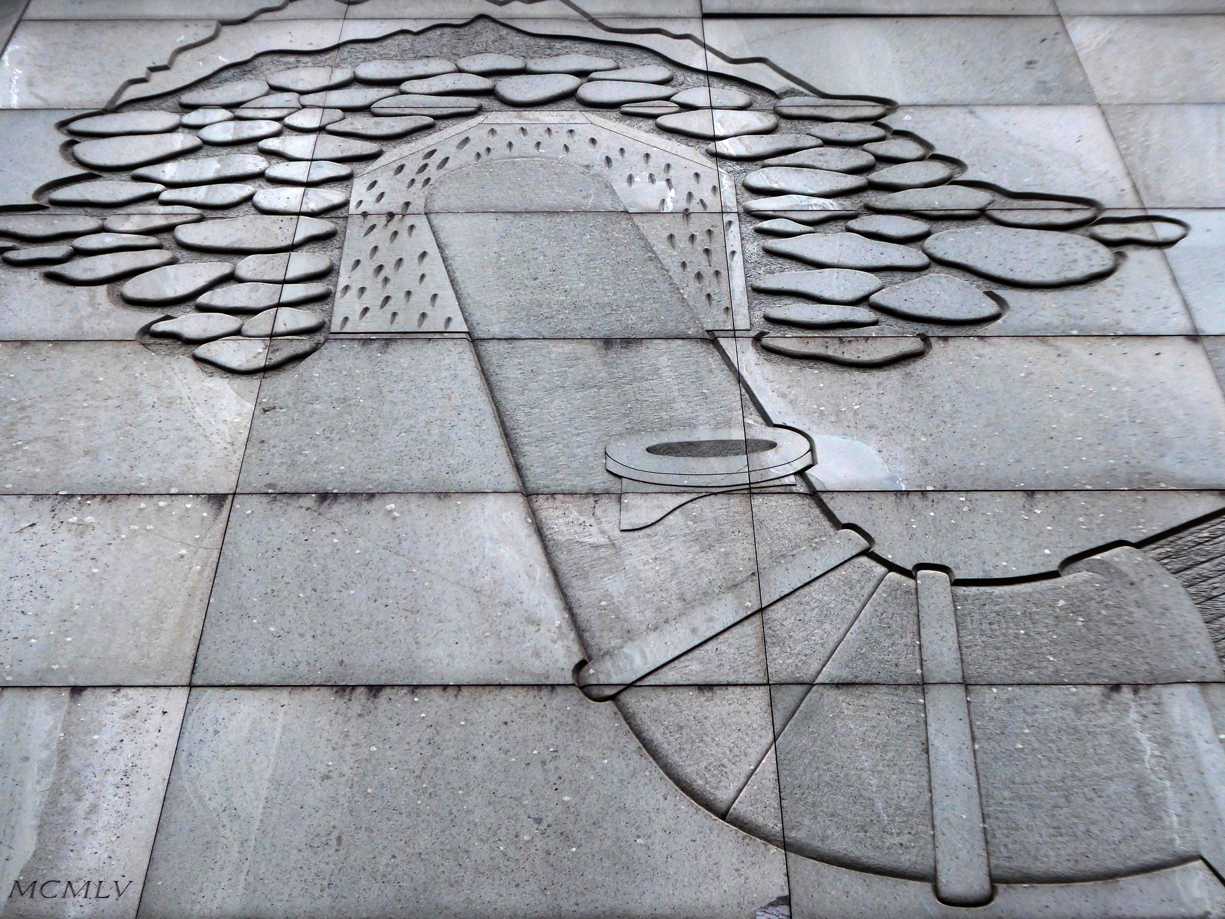
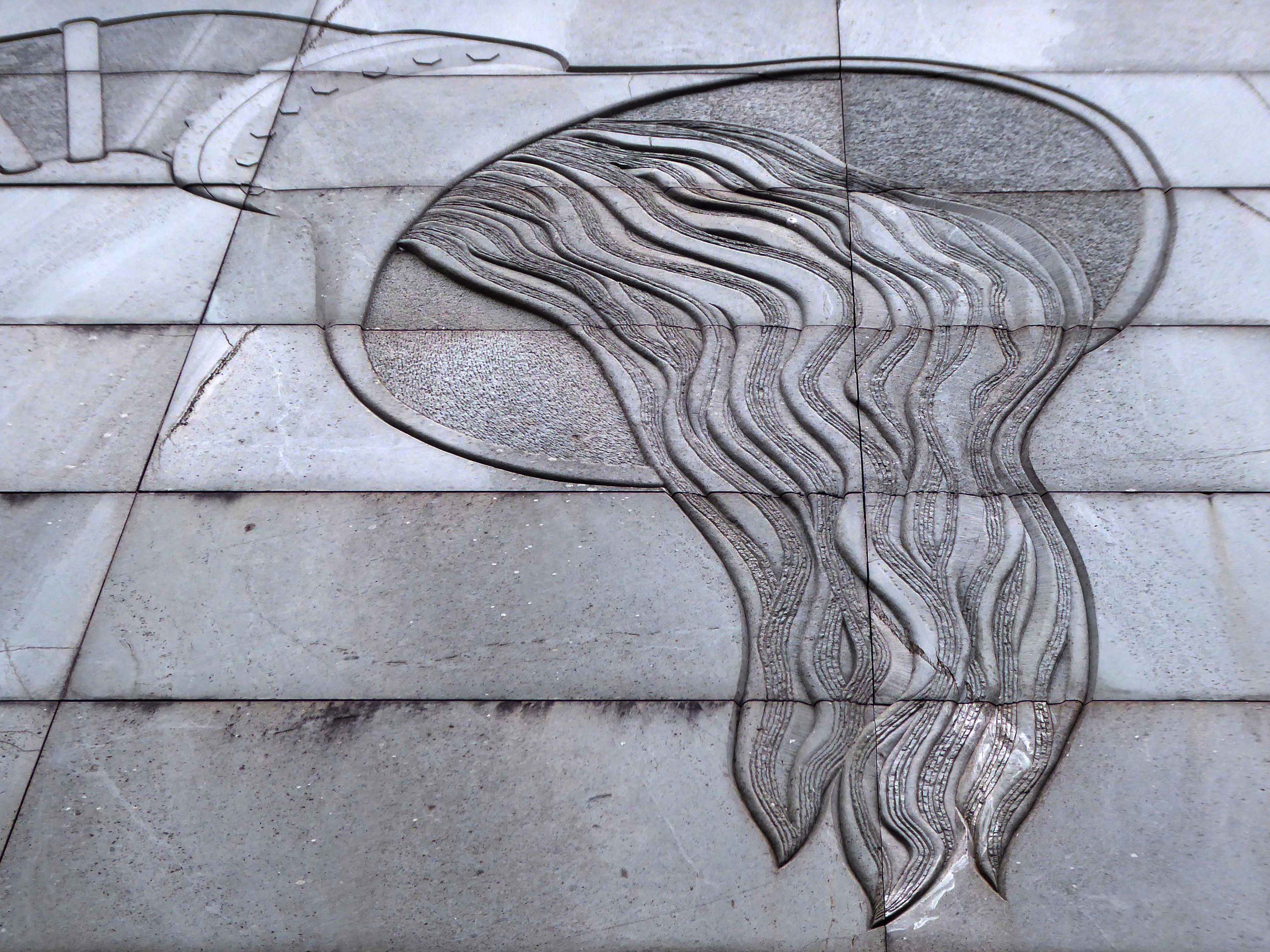
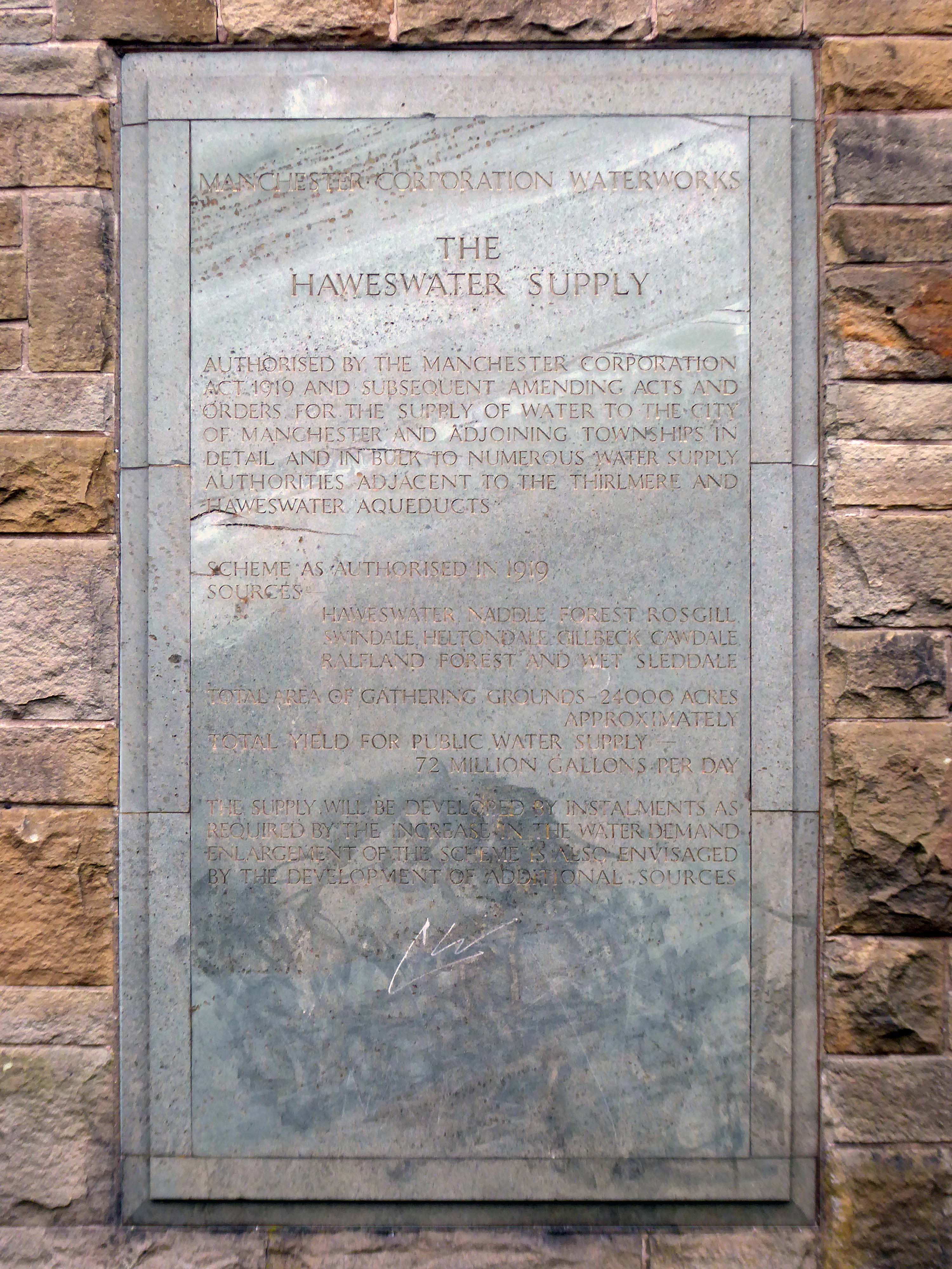
Carved relief is a highly stylised depiction of the bringing of water from Haweswater to Manchester with contemporary figures supporting the pipeline and a curious flat relief designed to be seen from below. It was designed to commemorate those who constructed it as well as the origin and course of the aqueduct. Beneath it five plaques tell the history of the Haweswater supply.
Completely preserved interior fully lined in beige marble, with contrasting green marble skirting continued as door surround. Behind the Cunliffe mural is a wood relief section in sycamore depicting the 82 mile route of the pipe.
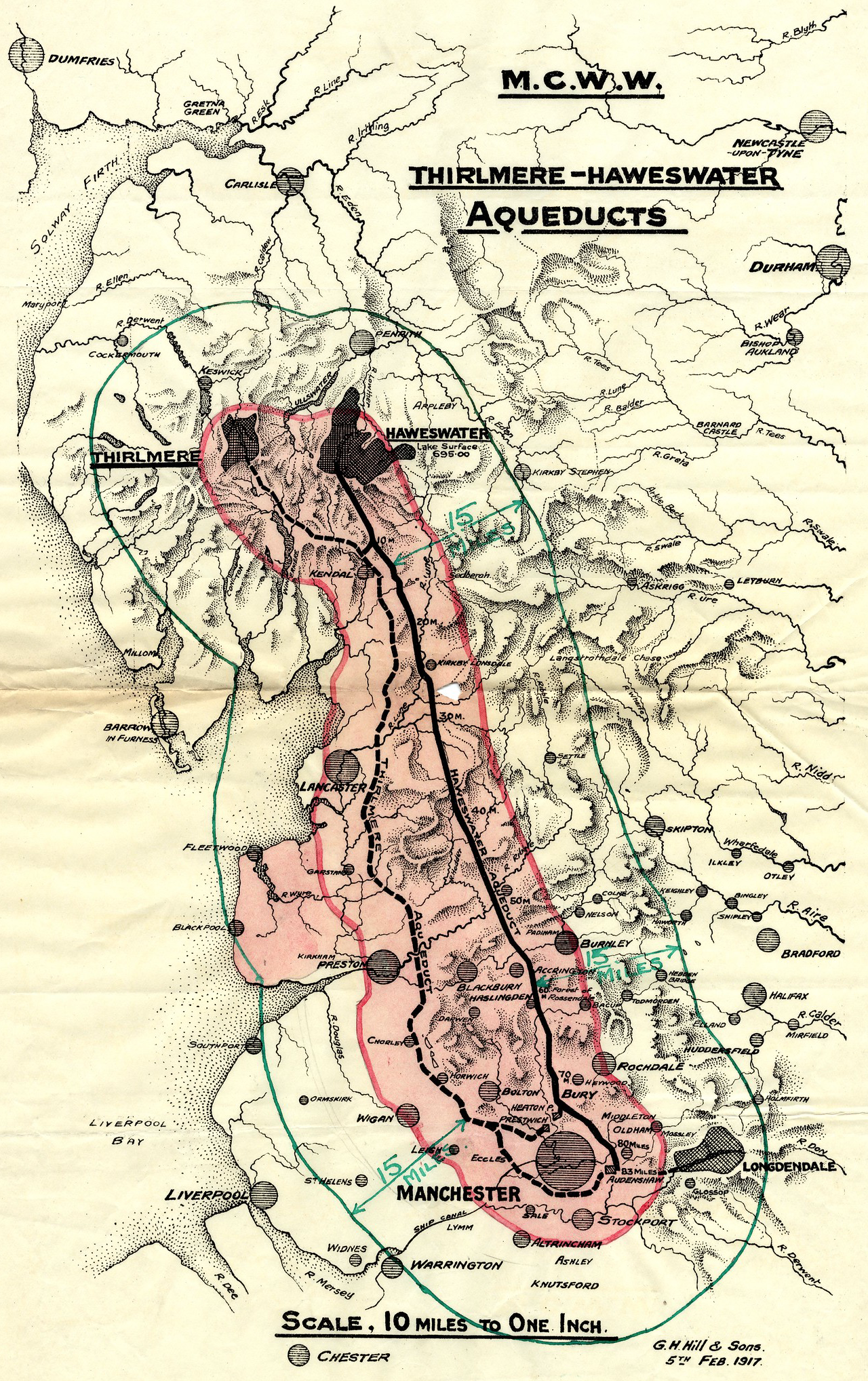
The bringing of water to Manchester from a new reservoir at Haweswater was a major undertaking which cost £14,000,000. The sectional relief plan and the mural were conceived as part of the original brief to give a ‘monumental’ character to the city’s remarkable achievement. Included as a remarkable synthesis of architectural design and fine sculpture, with the dominance of the latter in this tiny building. The building materials and the reliefs are all symbolic of the achievement in bringing of water from the Lake District to Manchester.
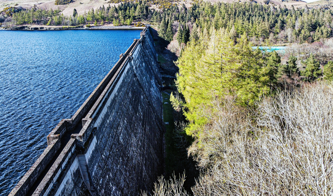
In 1929 work started to build the dam wall across the valley floor. At the time of construction, its design was considered to be at the forefront of civil engineering technology because it was the world’s first hollow buttress dam.
Before the valley was flooded in 1935, all the farms and dwellings of the villages of Mardale Green and Measand were demolished, as well as the centuries-old Dun Bull Inn at Mardale Green. The village church was dismantled and the stone used in constructing the dam; all the bodies in the churchyard were exhumed and re-buried at Shap.
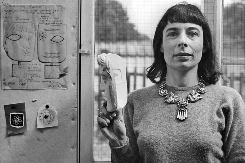
I have previously led Mitzi Cunliffe walks in south Manchester – taking in her works at Owens Park and Manchester High School for Girls.
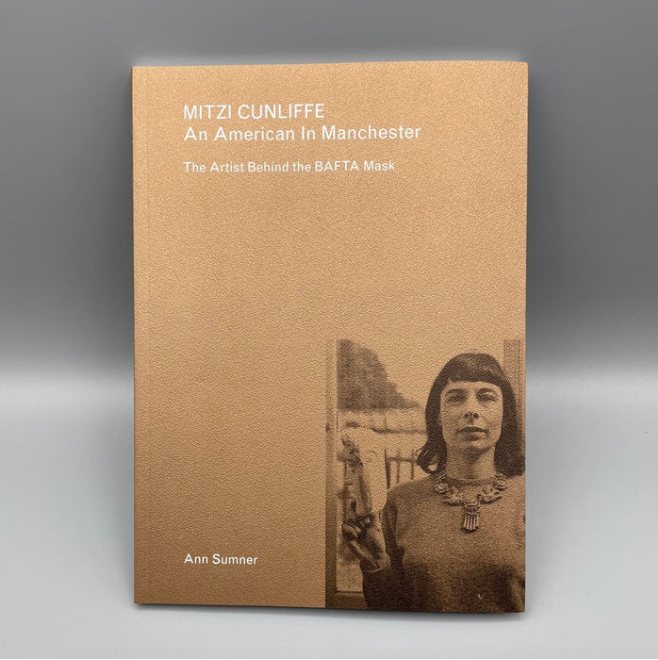
Mitzi Cunliffe is primarily known as the designer of the BAFTA Award, but her work encompasses both ceramics and textiles, in addition to her extensive public art works – as illustrated here.
Mitzi Cunliffe – An American in Manchester is available from the Modernist Shop.
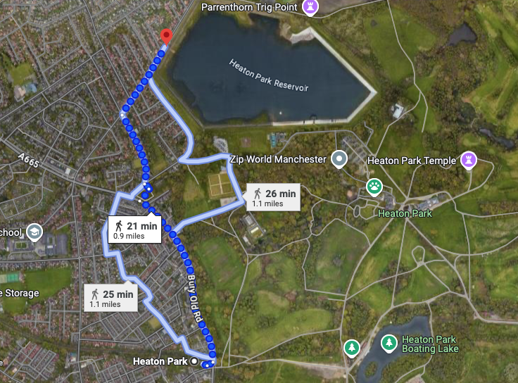
I took the tram to Heaton Park Station and walked the rest of the way.
The imposing structure, clad in the dramatic relief dominates this domesticated street of well behaved semis. As I stood admiring the work, a passerby joined me in a mutual appreciation of its beauty and significance.
Do yourself a favour – take a trip, take a look for yourself.
The A57 was nearly a coast to coast route. It passes through three major city centres (Liverpool, Manchester, and Sheffield – with elevated sections in each) and several smaller ones, multiplexes with the A6 and the A1, follows the banks of two canals and negotiates the remotest part of the Peak District. In one city it part of it is a tram route, whilst in another its former route is also a tram route. After all these adventures, it sadly gives up just 40 miles short of the east coast, Lincoln apparently proving too big an obstacle.
The A57 crosses the River Irwell at Regent Bridge before entering its moment of motorway glory as the A57(M) Mancunian Way skirting the south of Manchester’s city centre on an elevated section and crossing the A56 and A34. This includes a half-completed exit that goes the wrong way up Brook Street – a one way street. The original A57 ran further north through the city centre along Liverpool Road (now the A6143) and Whitworth Street – B6469 as far as the A6 London Road which marked the start of a multiplex.
At the end of Mancunian Way, we reach a TOTSO, straight on being the short unsigned A635(M) and thence the A635 – for Saddleworth Moor, Barnsley and Doncaster whilst the A57 turns south, briefly multiplexing with the A6, and then branching off along Hyde Road. This section of road was extensively cleared for the westward extension for the M67, and consequently has seen a lot of redevelopment.
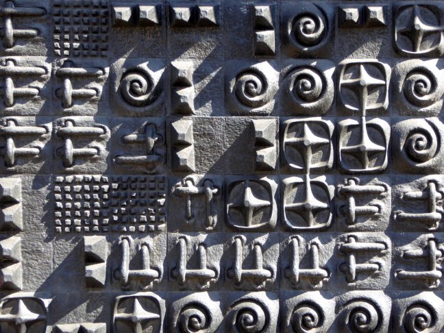
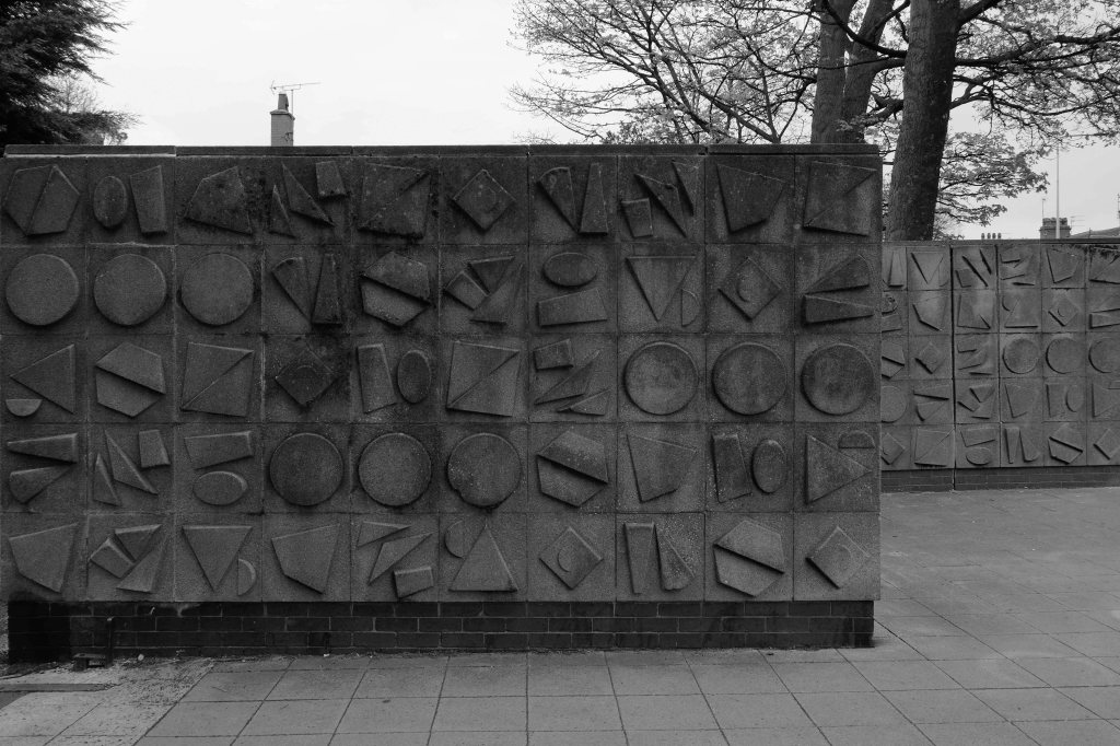
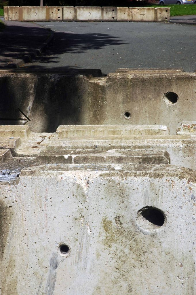
At the entrance to the park on Holderness Road are eight concrete walls.
They are covered in square, cast concrete modular panels.
Said to be the work of the City Architect in 1964.
Municipal Dreams lists the City Architect at that time to be JV Wall, having replaced David Jenkin in that same year.
My money’s on Wall – well it makes sense don’t it?
I had taken the bus from Hull Interchange on a chill April morning.
The driver obligingly giving me a shout at the appropriate stop – right outside the gates.
They are not universally loved:
A further testament to the concrete pourer’s art is to be found adorning the entrance to East Park. They are so horrible that I could find nothing on the net to indicate who designed them, shame is a powerful motive for reticence. So here they stand to welcome the visitor; after this the actual park couldn’t be any worse.
Prompted by Gillian and Adam’s – A Different North project, my thoughts turned once again to notions of the North, similar notions have been considered in my previous posts:
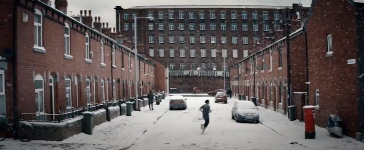
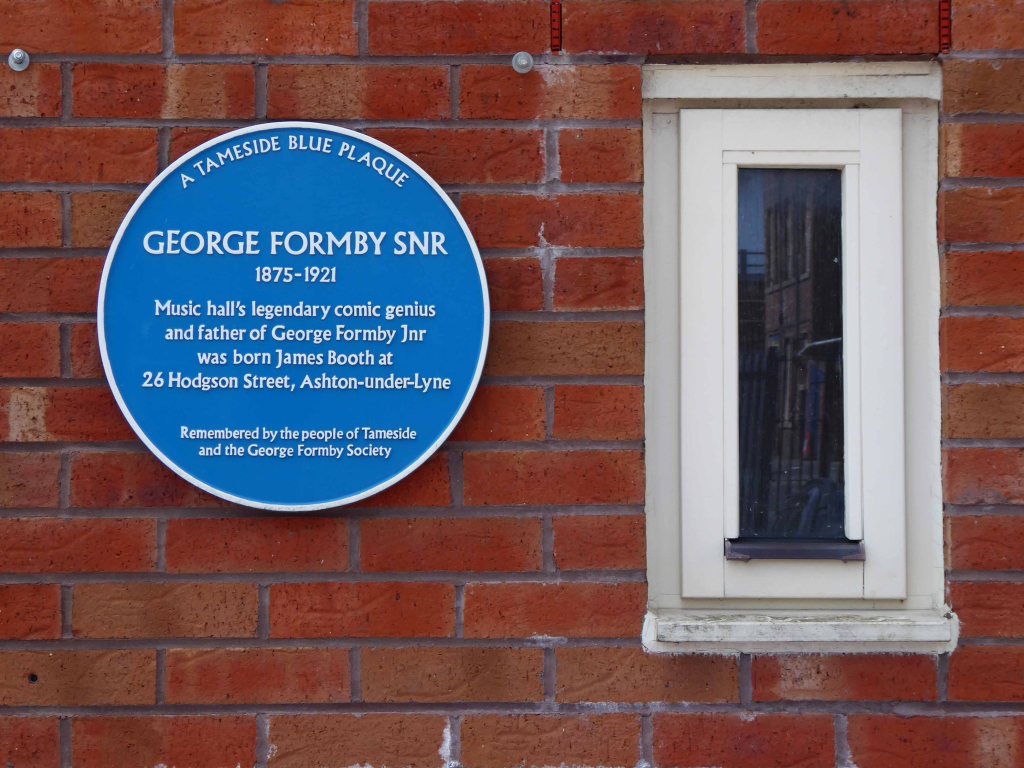
I recalled the 2016 season Sky Football promotional film, it had featured a street in Ashton under Lyne, it had featured Hamilton Street.
A street spanning the West End and the Ryecroft areas of the town, the town where I had lived for most of my teenage years. The town where my Mam was born and raised in nearby Hill Street, nearby West End Park where my Grandad I had worked, nearby Ashton Moss and Guide Bridge.
This is an area familiar to me, which became the convergent point of a variety of ideas and images, mediated in part by the mighty Murdoch Empire.
Here was the coming together of coal and cotton, an influx of population leaving the fields for pastures new.
In the film, Leytonstone London born David Beckham is seen running down the snow covered northern street.
A credit to our emergent mechanical snow generation industry.
According to snowmakers.com, it takes 74,600 gallons of water to cover a 200 by 200-foot plot with 6 inches of snow.Climate change is cutting snow seasons short, we make snow to compensate, more energy is spent making snow, more coal is burned, more CO2 is released.
It is to be noted that locally there has been a marked decline in snowfall in recent years, the Frozen North possibly a thing of the past.
The temperatures around the UK and Europe have actually got warmer over the last few decades, although when you are out de-icing your car it may not actually feel as though it has. Whilst this can not be directly link to climate change, it is fair to assume that climate change is playing a part.
It is also to be noted that Sky Supremo Rupert Murdoch has described himself as a climate change “sceptic”.
Appearing arms raised outside of the home of a family clustered around the television, in their front room.
Filming the ad was great and the finished piece is a really clever way of showing that you never know what might happen in football, I always enjoy working with Sky Sports and I’m proud to be associated with their football coverage.
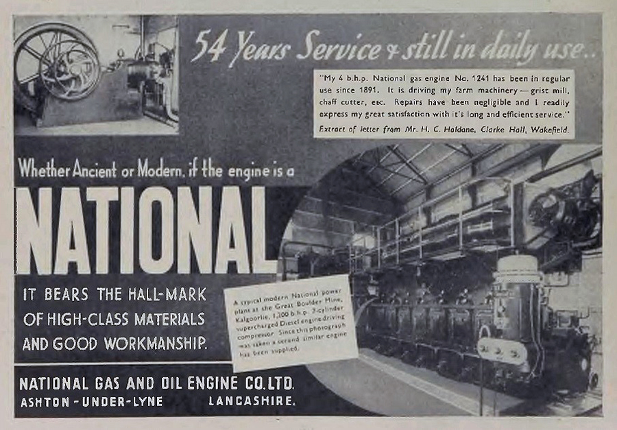
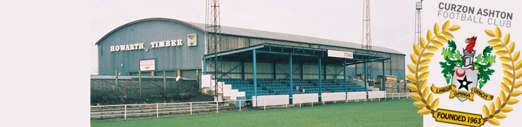
The area does have a football heritage, Ashton National Football Club played in the Cheshire County League in the 1920s and 1930s. They were sometimes also known as Ashton National Gas, due to their connections with the National Gas and Oil Engine Company based in the town.
Illustrative of a time when sport and local industry went hand in glove.
The National Ground was subsequently taken over by Curzon Ashton who have since moved to the Tameside Stadium.
Ashton & Hyde Village Hotels occupy the front of shirt sponsors spot on our new blue and white home shirt, while Seed of Speed, our official conditioning partners, feature on the arm, and Minuteman Press occupy the back of the shirt. Meanwhile, Regional Steels UK Ltd. are the front of shirt sponsors on our new pink and black away kit.
Illustrative of a time when sport and local industry continue to work hand in glove.
Local lad Gordon Alexander Taylor OBE is a former professional footballer. He has been chief executive of the English footballers’ trades union, the Professional Footballers’ Association, since 1981. He is reputed to be the highest paid union official in the world.
His mobile phone messages were allegedly hacked by a private investigator employed by the News of the World newspaper. The Guardian reported that News International paid Taylor £700,000 in legal costs and damages in exchange for a confidentiality agreement barring him from speaking about the case.
News International is owned by our old pal Rupert Murdoch, the News of the World no longer exists.
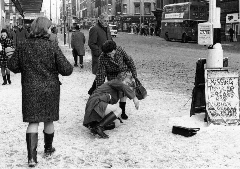
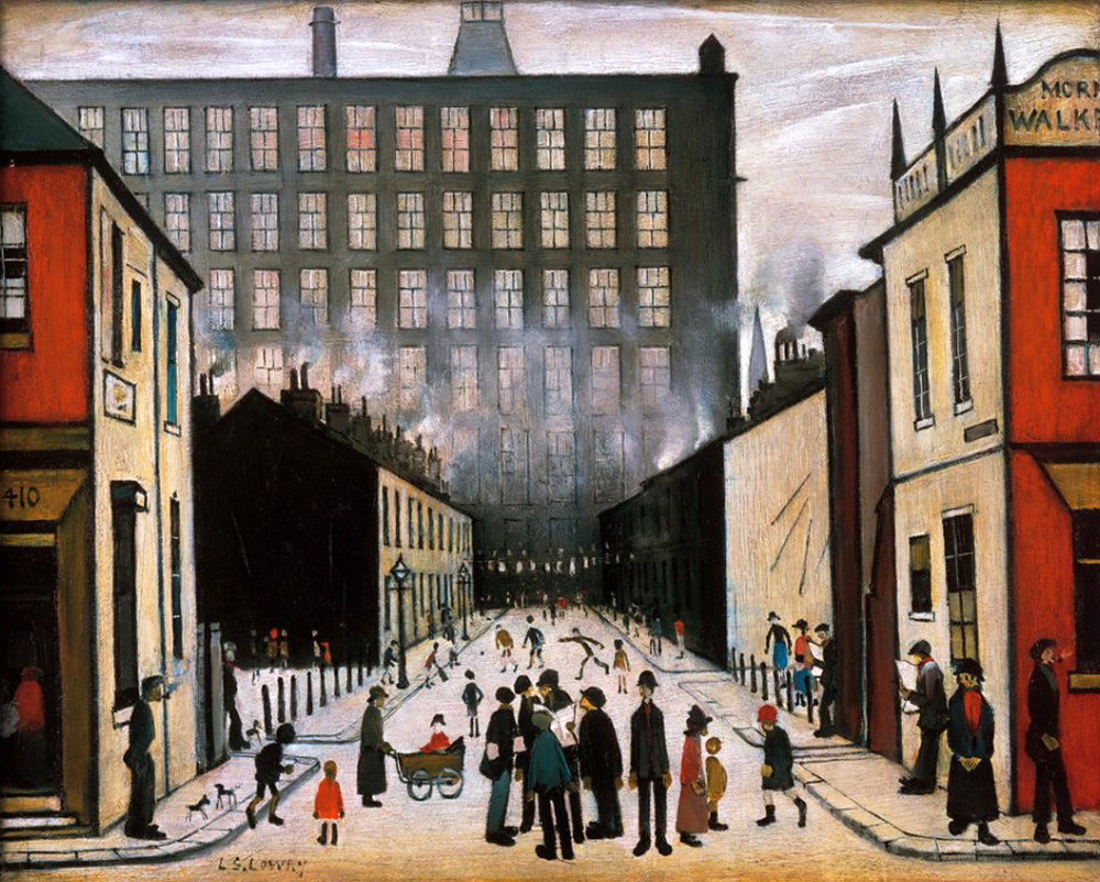
The view of Hamilton Street closely mirrors LS Lowry’sStreet Scene Pendlebury – the mill looming large over the fierce perspective of the roadway. The importance of Lowry’s role in constructing a popular image of the North cannot be overestimated.
He finds a grim beauty in his views of red facades, black smoke and figures in white, snowy emptiness. He is a modern primitive, an industrial Rousseau, whose way of seeing is perhaps the only one that could do justice to the way places like Salford looked in the factory age.
For many years cosmopolitan London turned its back on Lowry, finally relenting with a one man show at the Tate in 2013 – I noted on the day of my visit, that the attendant shop stocked flat caps, mufflers and bottled beer, they seemed to have drawn the line at inflatable whippets.
Drawing upon other artists’s work, in a continuous search for ways to depict the unlovely facts of the city’s edges and the landscape made by industrialisation.
But Murdoch’s Hamilton Street is as much a construct as Lowry’s – the snow an expensive technical coating, Mr Beckham a CGI apparition. Our contemporary visual culture is littered with digital detritus, saving time and money, conjuring up cars, kids and footballers at will.
An illusion within an illusion of an illusory North.
Green screen chroma keyed onto the grey tableau.
Mr Beckham himself can also be seen as a media construct, for many years representing that most Northern of institutions Manchester United – itself yet another product of image manipulation, its tragic post-Munich aura encircling the planet, with an expensive Empire Made, red and white scarf of cultural imperialism.
David’s parents were fanatical Manchester United supporters who frequently travelled 200 miles to Old Trafford from London to attend the team’s home matches, he inherited his parents’ love of Manchester United, and his main sporting passion was football.
Mr B’s mentor was of course former Govan convener – Mr A Ferguson, who headed south to find his new Northern home, creating and then destroying the lad’s career, allegedly by means of boot and hairdryer.
Here we have the traditional Northern Alpha Male challenged by the emergent Metrosexual culture, celebrity fragrances, posh partner, tattooed torso, and skin conditioner endorsements.
It is to be noted that the wealth of the region, in part created by the shoemaking and electrical industries, have long since ceased to flourish, though still trading, PIFCO no longer has a local base.
The forces of free market monopoly capitalism have made football and its attendant personalities global commodities, and manufacturing by and large, merely a fanciful folk memory.
Hamilton Street would have provided substantial homes to workers at the Ryecroft Cotton Mills.
Ryecroft Mill, built in 1837,was the second of a series of four mills built on the site, the first was built in 1834. In 1843, over 10,000 people were employed in Ashton’s cotton mills – today there are none.
This industrial growth was far from painless and Ashton along with other Tameside towns, worked long and hard in order to build the Chartist Movement, fighting to establish better working conditions for all.
The tradition of political and religious non-conformity runs wide and deep here, the oft overlooked history of Northern character and culture.
Textile production ceased in the 1970s and the mill is now home to Ryecroft Foods, a subsidiary of Weetabix.
Ashton like many of Manchester’s satellite towns created enormous wealth during the Nineteenth and Twentieth centuries. The workers of Ashton saw little of that wealth, the social and economic void left by the rapid exodus of the cotton industry to the Far East, is still waiting to be filled, in these so called left behind towns.
Photo Ron Stubley
Here is a landscape nestled in the foot of the Pennines, struggling to escape its past and define a future.
Once a rare sight on our roads the ubiquitous SUV reigns supreme on our suburban streets – the level of UK car debt currently stands at £73 Billion.
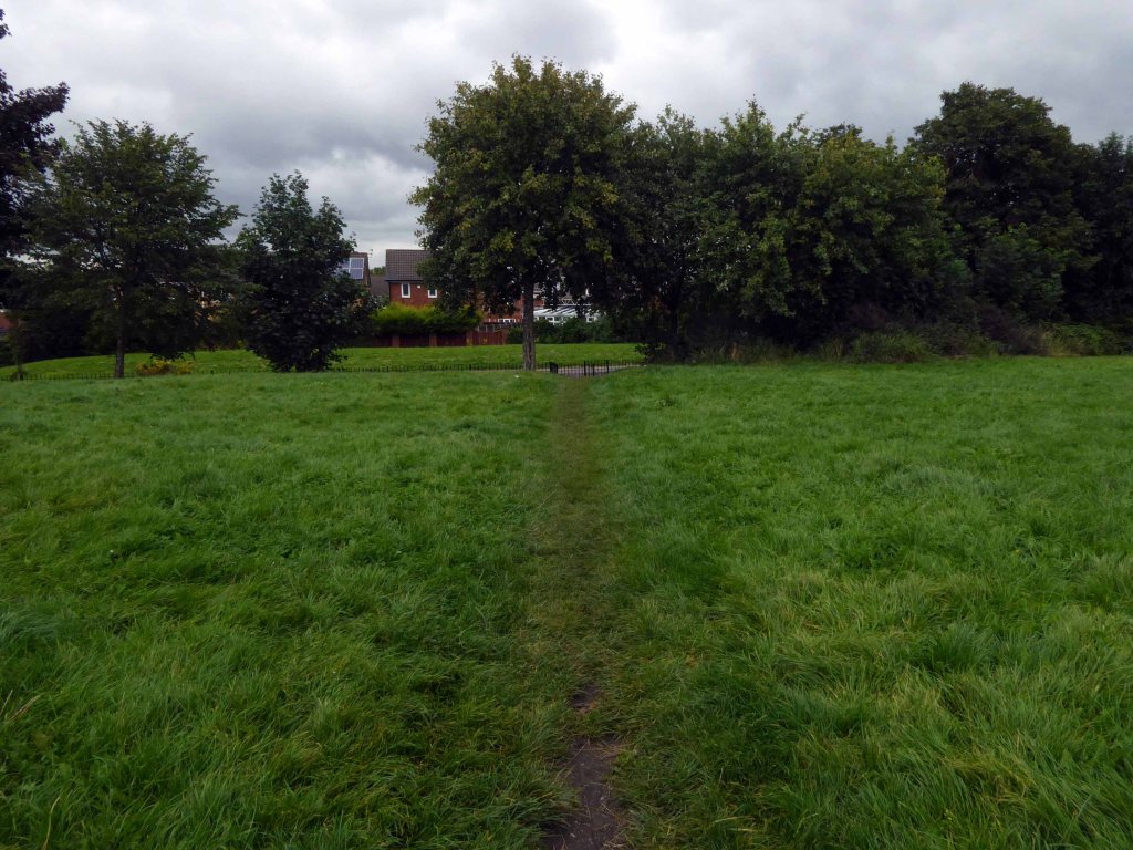
We weaved in and out of the highways and byways of South Reddish.
Through Unity Park where the goals are lower than low.
The hoops are higher.
And the bowls are rolling.
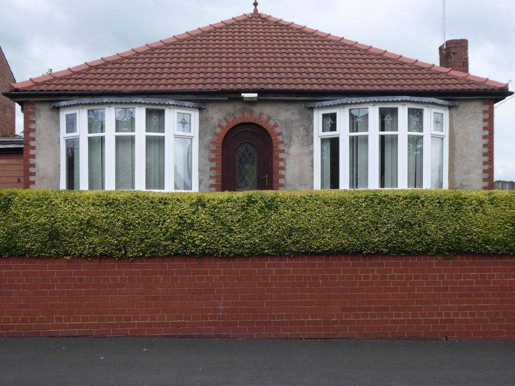
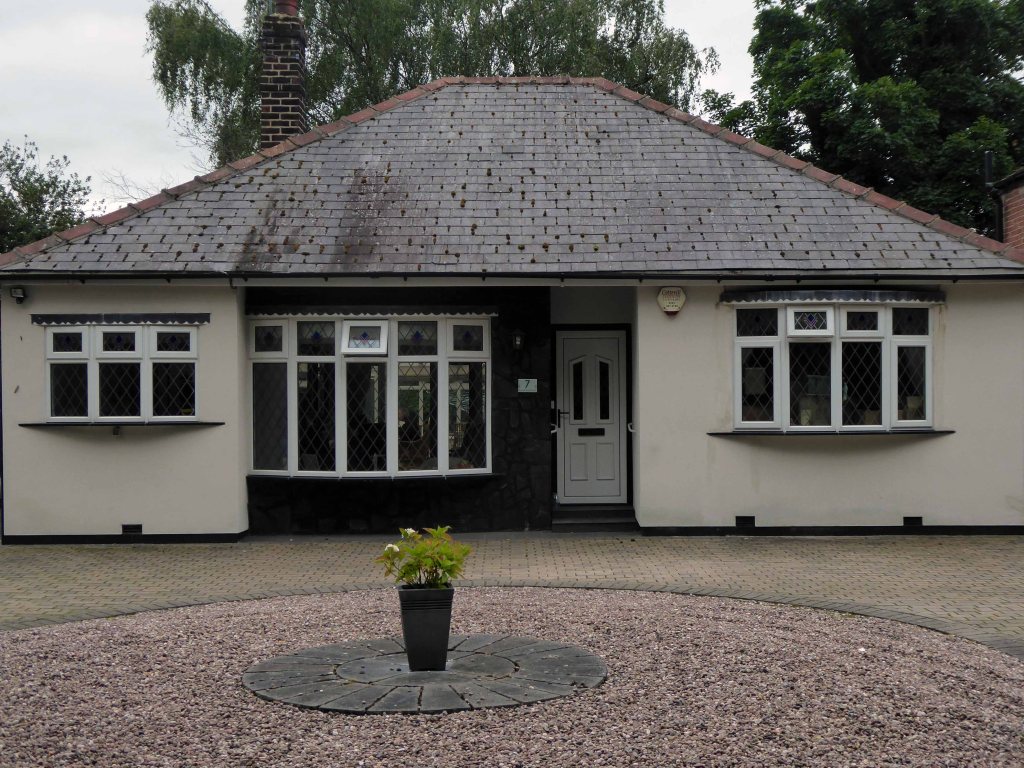
Past the perfect Platonic bungalow.
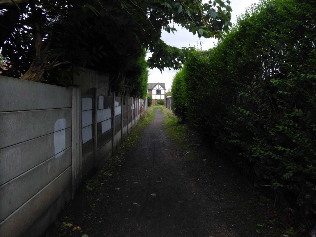
Taking the well worn path betwixt and between the houses.
Crossing open country.
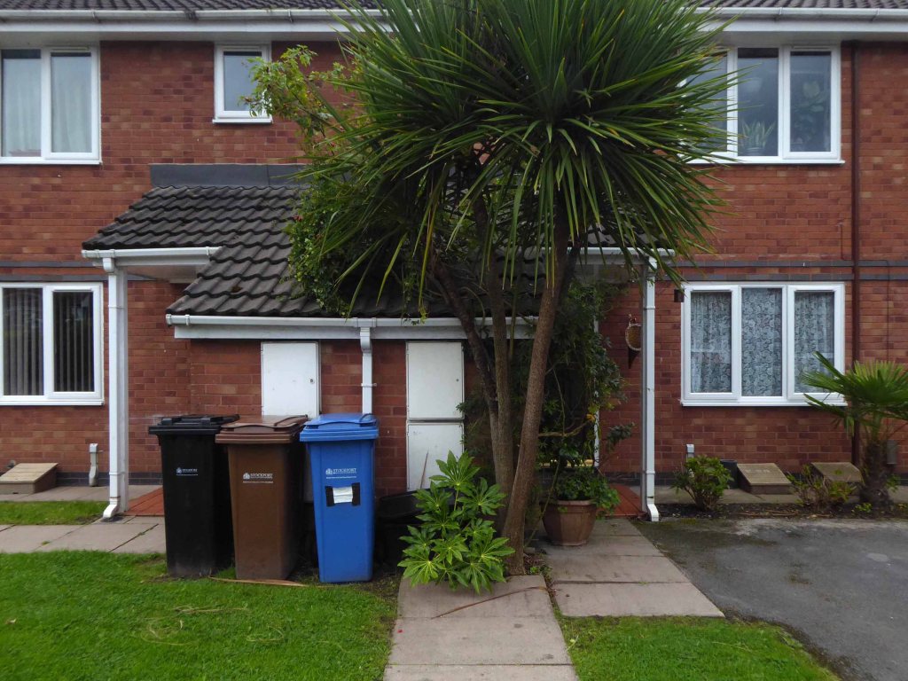
Encountering exotic planting worthy of the French Riviera.
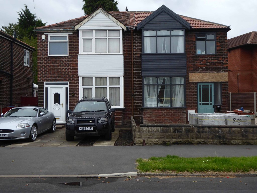
Noting the voguish transition of the local semi-detached housing from white to grey and the now familiar sight of the Range Rover in the former front garden.
The reverse of a roadside sign can often be far more interesting and attractive than the obverse face.
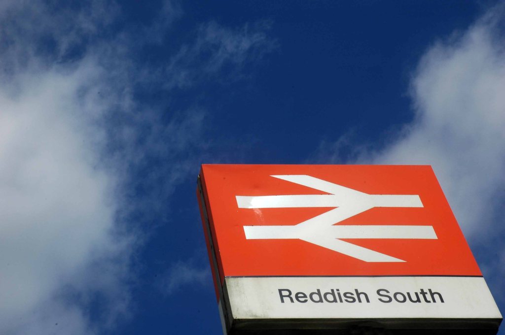
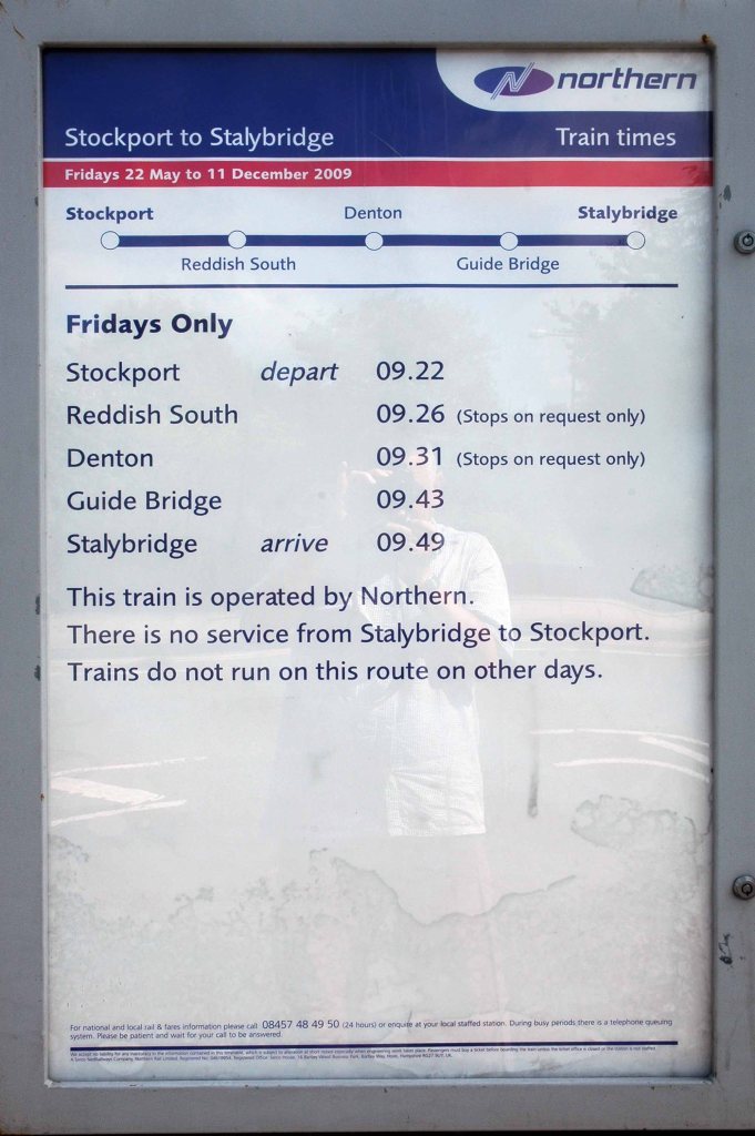
Reddish South Station sustained by the once a week parliamentary train, on the Stockport to Stalybridge Line, coincidentally the only time, as a goods guard, I ever worked a passenger train, was along here, one Christmas long ago.
We stopped at Denton, a request stop, the seasonally boozy passenger gave me a fifty pence tip.
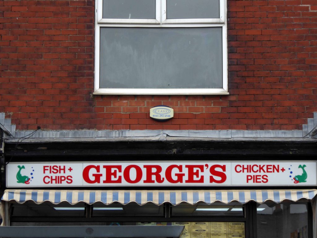
George’s – where I bought a bag of chips on the way back, great chips, friendly and safe service with a smile.
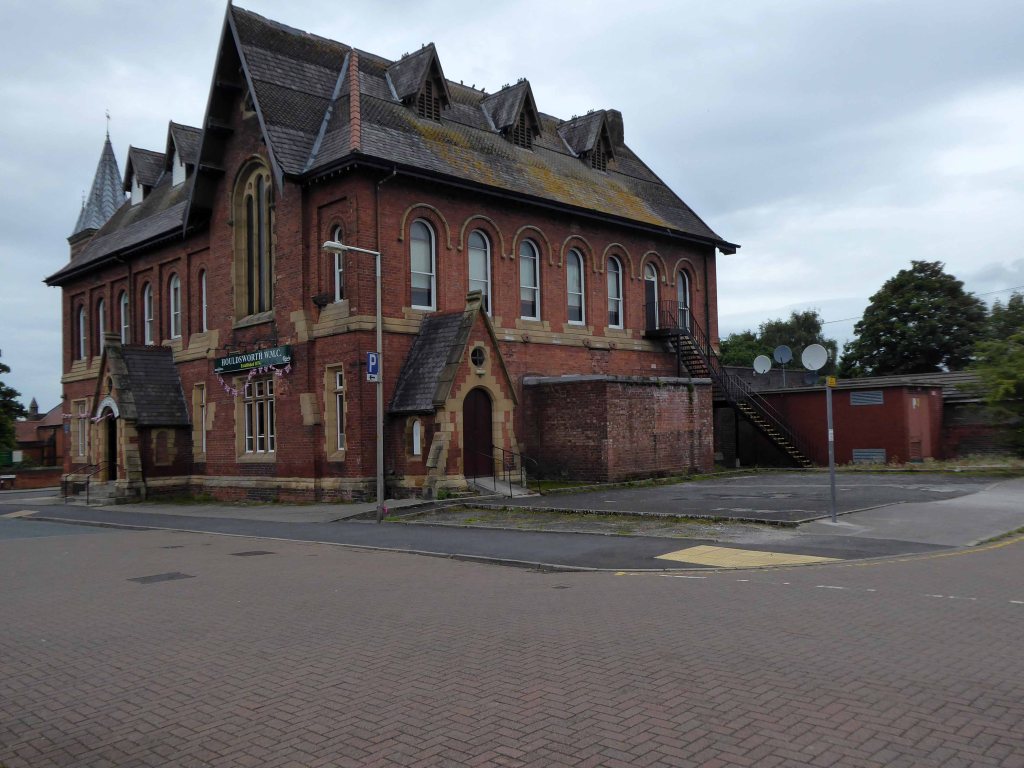
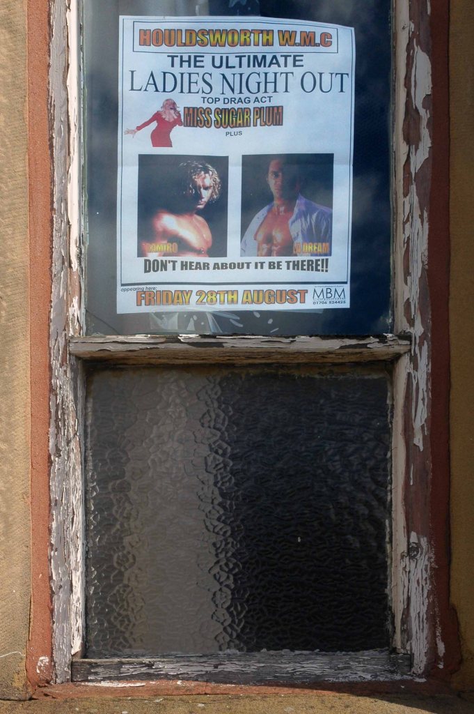
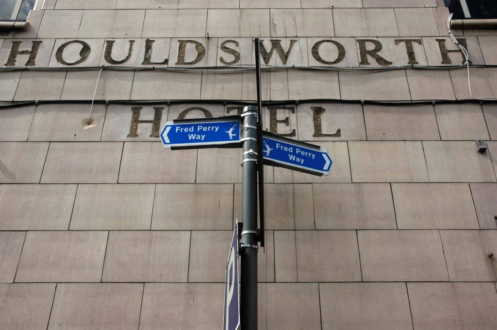
Houldsworth Working Mens Clubdesigned by Abraham Henthorn Stott forming part of the model community developed by the late-C19 industrialist Sir William Houldsworth, which included cotton mills, workers’ housing, school, church and a park.
Church of St Elisabeth 1882-3, by Alfred Waterhouse one of the finest Victorian churches in the country – both of the buildings are Grade II Listed.
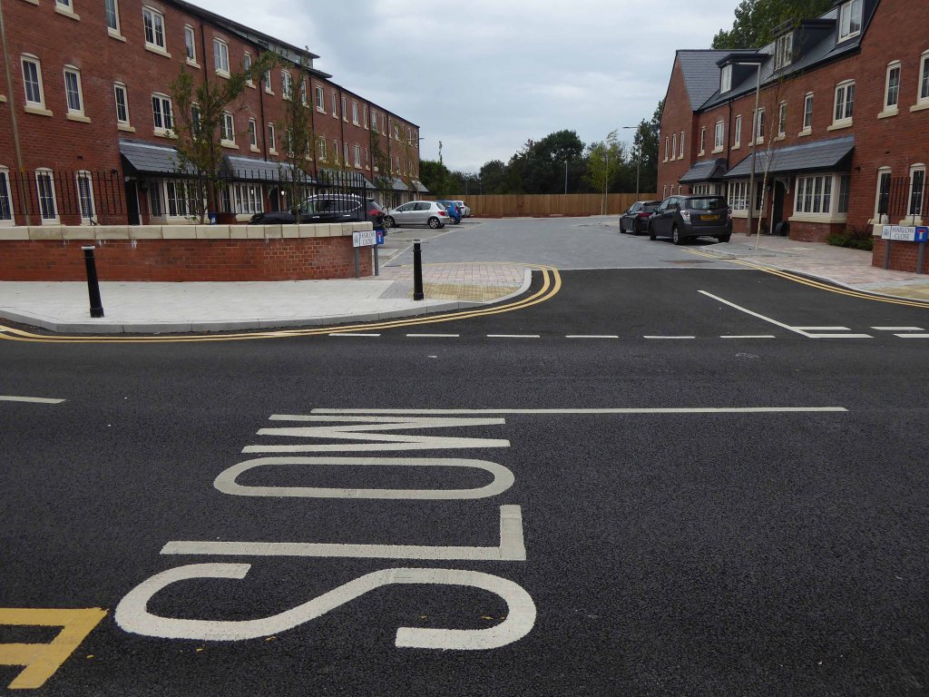
Over the way the former Victoria Mill, converted into apartments.
With adjoining new build.
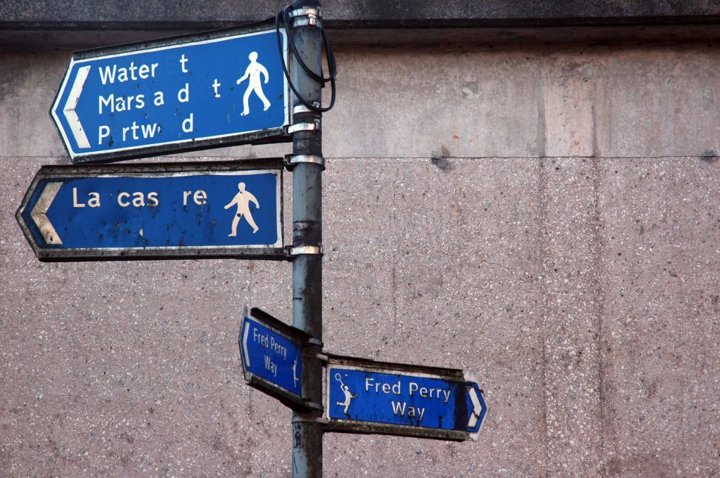
We faithfully followed the signs, noting a change from blue to green.
Somewhere or other we went wrong, our luck and the signs ran out, we instinctively headed north, ever onwards!
Traversing the Great Wall.
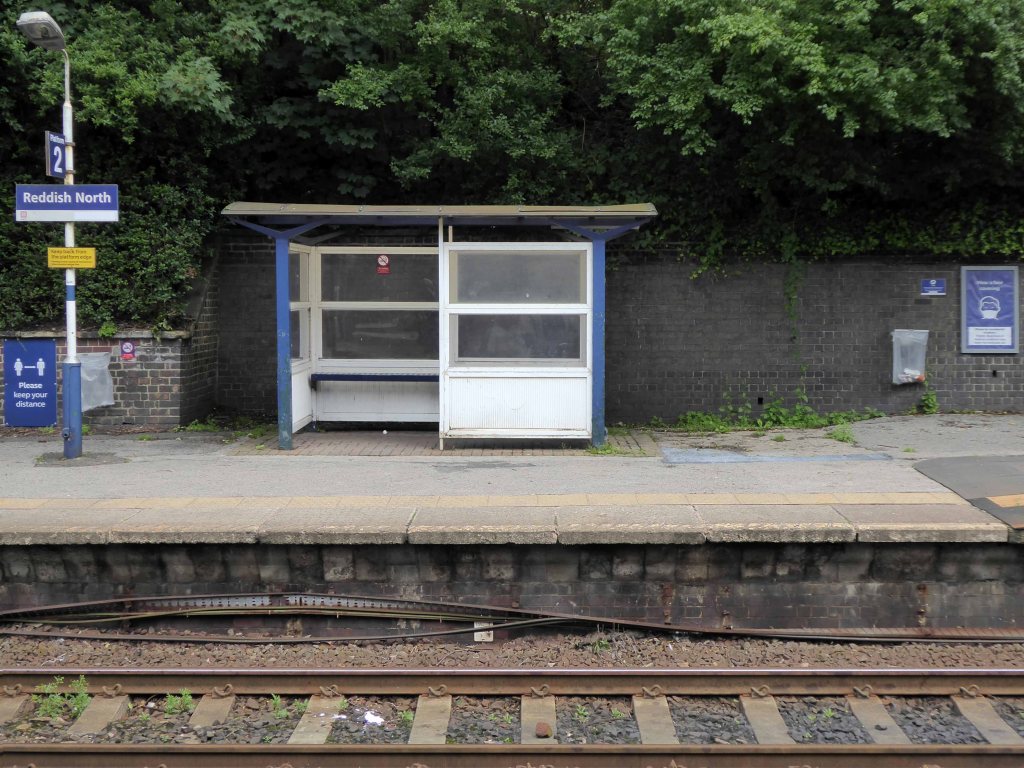
Mistakenly assuming that the route ended or began at Reddish North Station that’s where we landed.
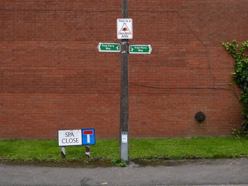
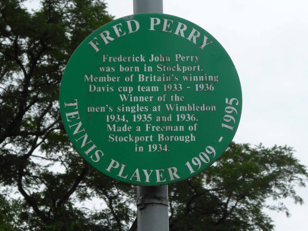
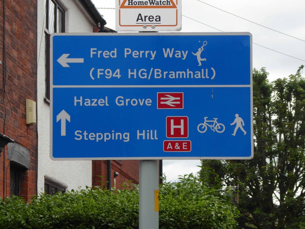
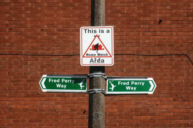
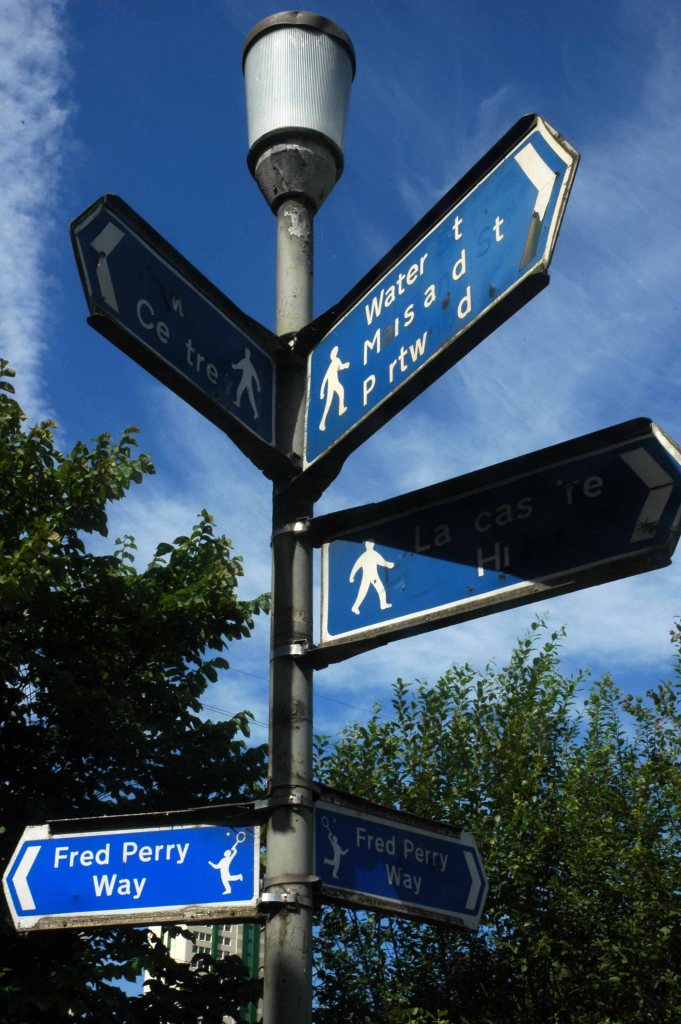
Back tracking intrepidly along the road we found the source of the Fred Perry Way.
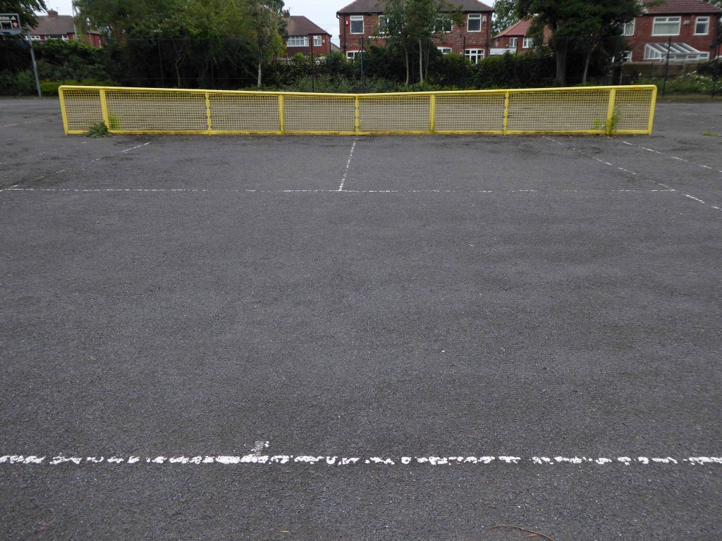
In the North Reddish Park – where tennis can still be played today albeit with a somewhat functionalist net, on an unsympathetic surface.
Journey’s end.
To forget, you little fool, to forget!
D’you understand?
To forget!
You think there’s no limit to what a man can bear?
I’ll do anything twice or more – so here we are again, this time on foot.
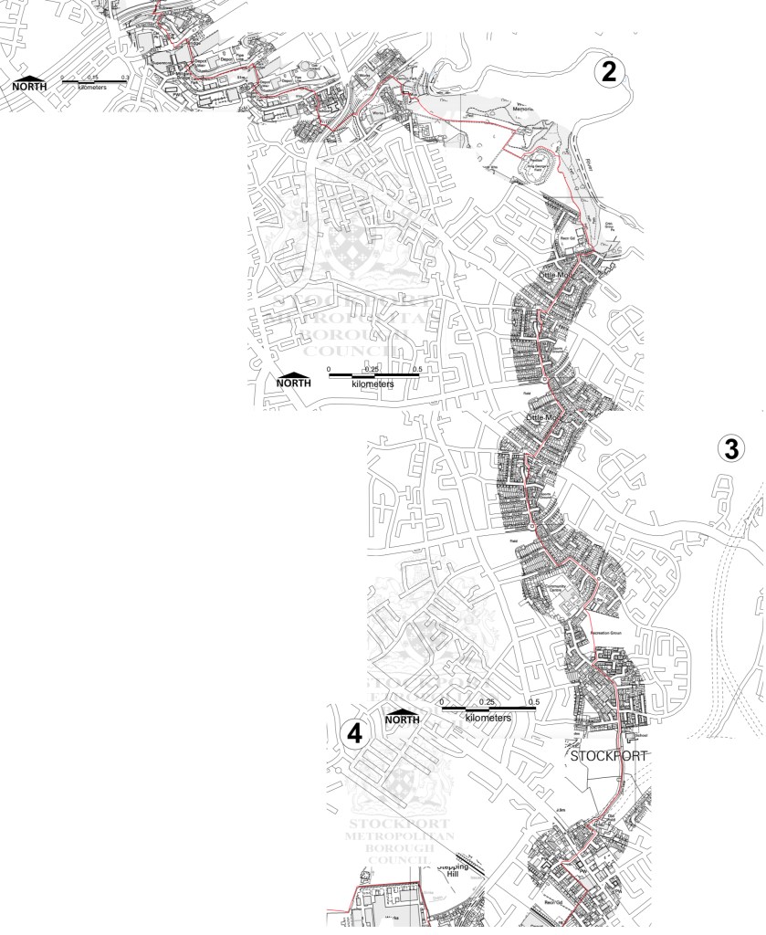
Let’s start at the very beginning, a very good place to start – in the middle, the section from the town centre to Hazel Grove.
Maps are available here for free – we declined the offer, deciding to follow signs instead, many of which were missing or rotated, the better to misinform and redirect – such is life.
We are mostly lost most of the time, whether we like it or know it or not.
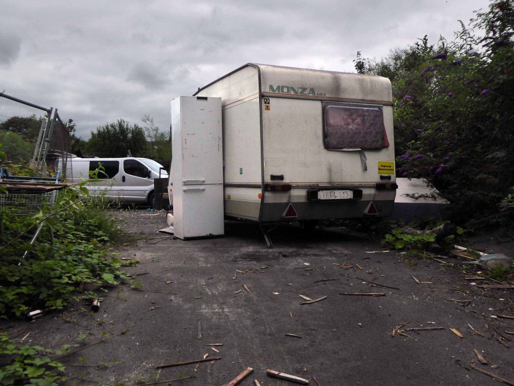
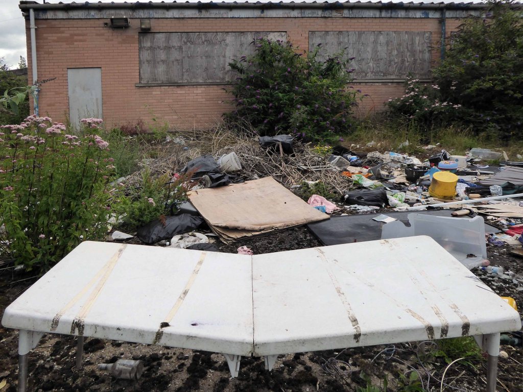
We begin at the confluence of the rivers Mersey and Goyt – which no longer seems to be a Way way, the signs having been removed, and proceed down Howard Street, which seems to have become a tip.
The first and last refuge for refuse.
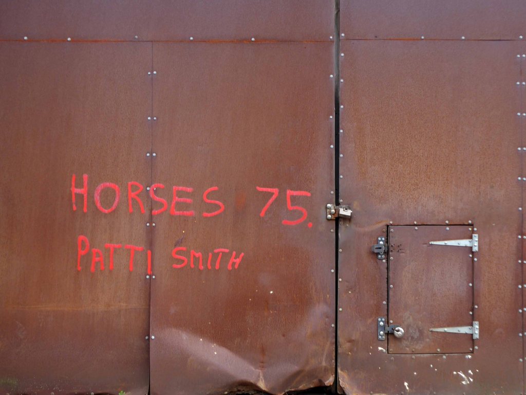
Passing by the kingdom of rust – Patti Smith style.
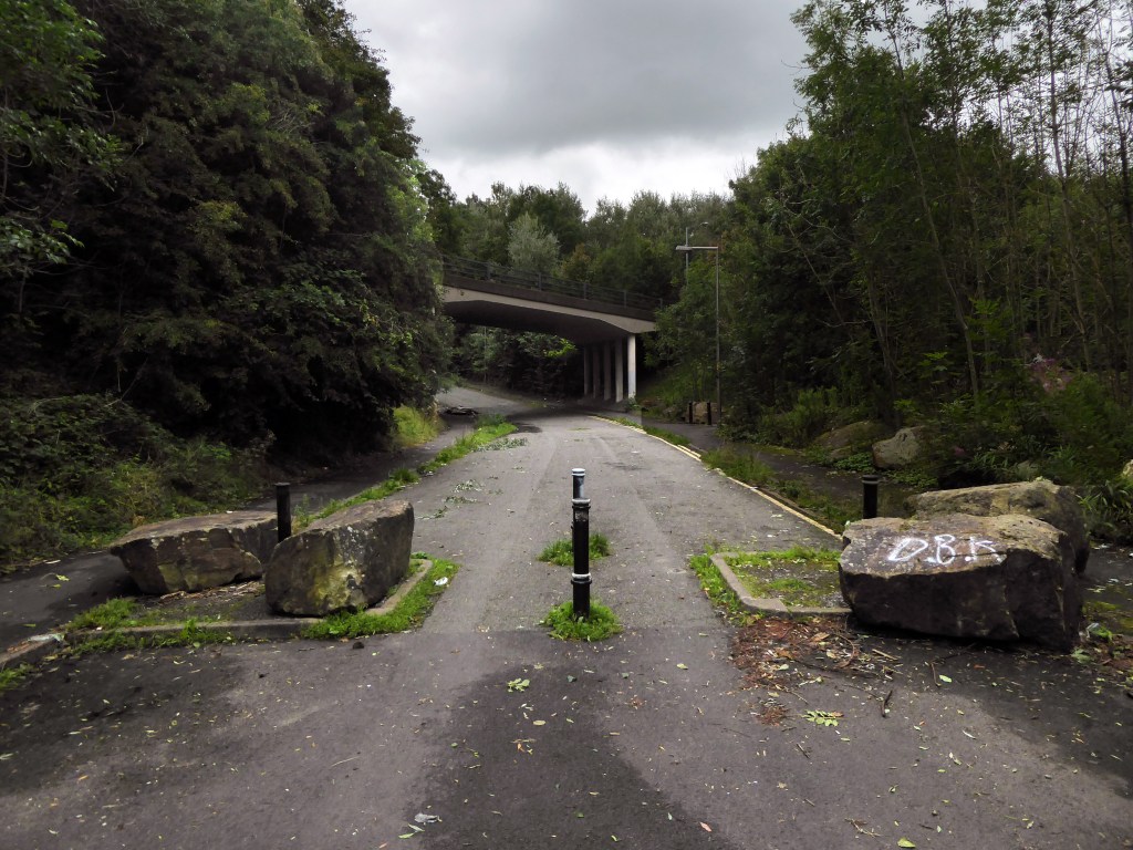
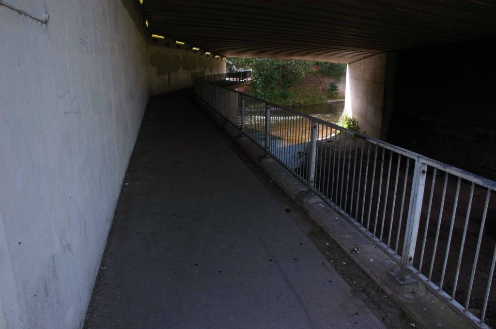
Passing under the town’s complex internal motorway system by underpass.
Almost opposite the entrance to the museum, now set in shrubbery, are the foundations, laid in September 1860, of what was to be a forty metre high Observatory Tower. Despite a series of attempts, funds for the tower could not be raised and the ‘Amalgamated Friendly Societies of Stockport’ eventually had to abandon the idea.
Historic England
Out east and passing alongside the running track.
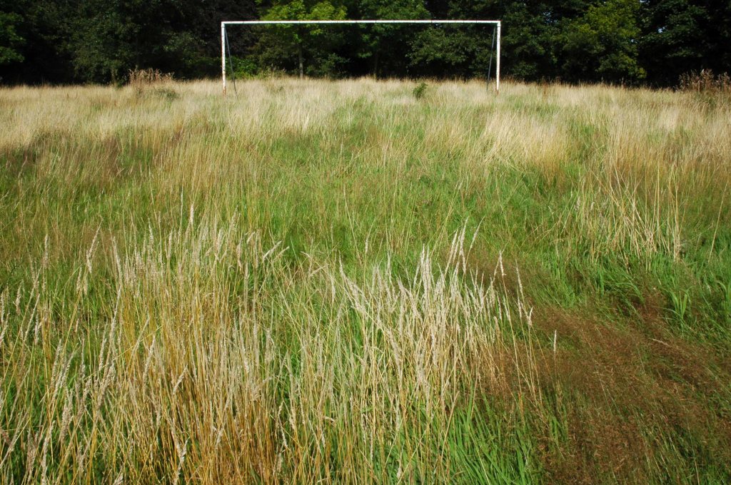
Lush meadows now occupy the former football field, twixt inter-war semis and the woodland beyond.
Out into the savage streets of Offerton where we find a Buick Skylark, incongruously ensconced in a front garden.
The only too human imperative to laugh in the face of naturalism.
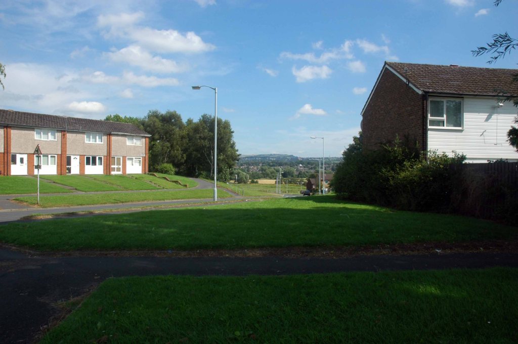
We have crossed over Marple Road and are deep in the suburban jungle of mutually exclusive modified bungalows.
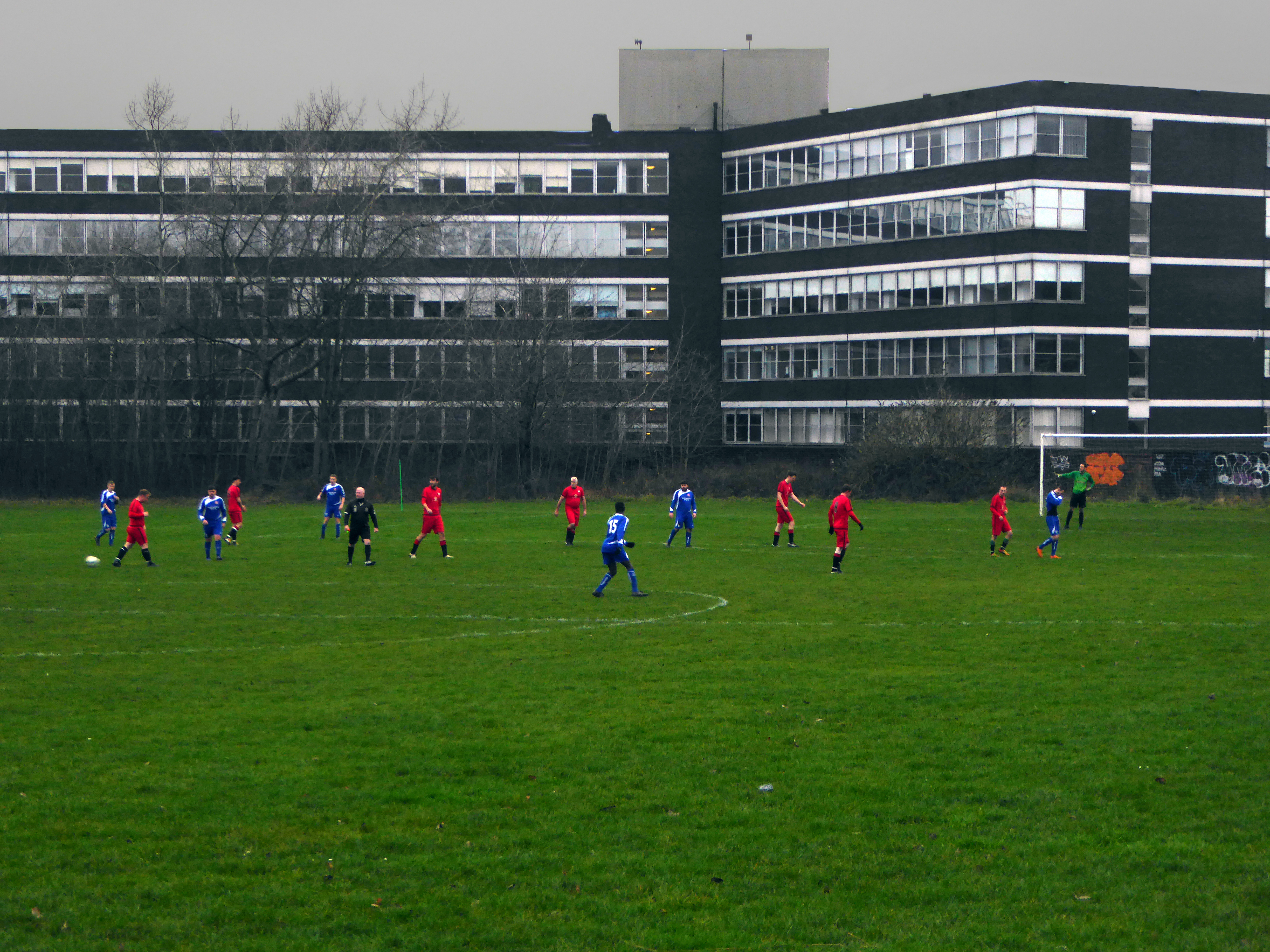
Off now into the wide open spaces of the Offerton Estate – the right to buy refuge of the socially mobile, former social housing owning public.
People living on Offerton Estate have been filmed for a programme entitled ‘Mean Streets’ which aims to highlight anti-social behaviour in local communities.
The next thing we know we’re in a field, a mixed up melange of the urban, suburban and rural, on the fringes of a Sainsbury’s supermarket filling station.
We cross the A6 in Hazel Grove and here for today our journey ends
Ignoring the sign we went in the opposite direction.
As we reach the edge of Mirrlees Fields – the site of the only Fred Perry laurel leaf logo emblazoned way marker.
The Fields are currently designated as a green space and are not available for residential development. But MAN would like to overturn this designation for over one third of the Fields.
MAN Energy Solutions UK is the original equipment manufacturer of Mirrlees Blackstone diesel engines.
Before the Blackstone MAN came in 1842 – the fields were all fields.
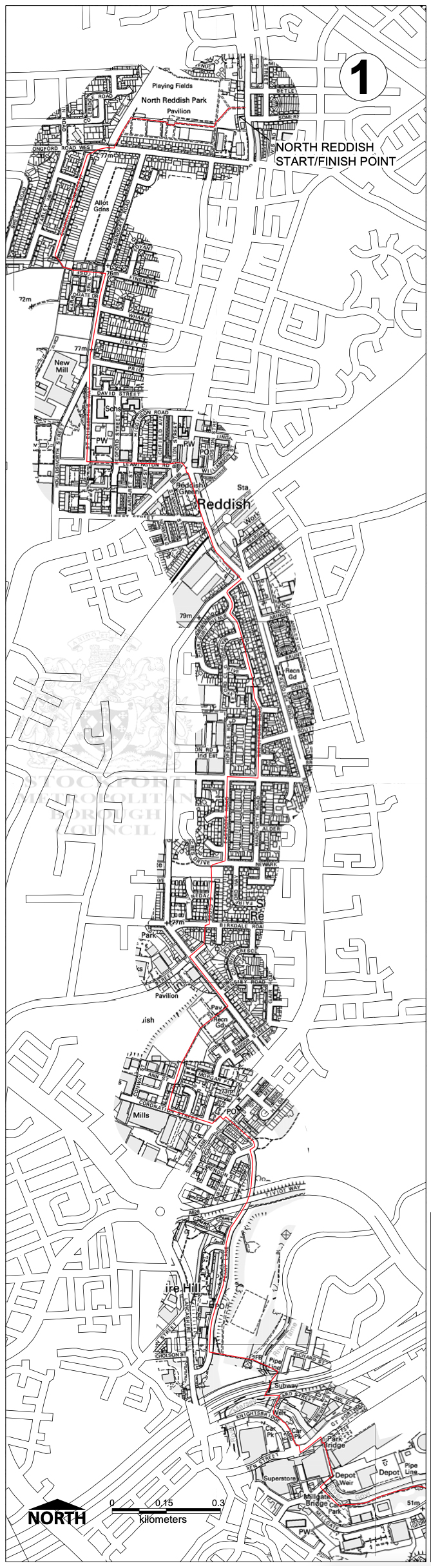
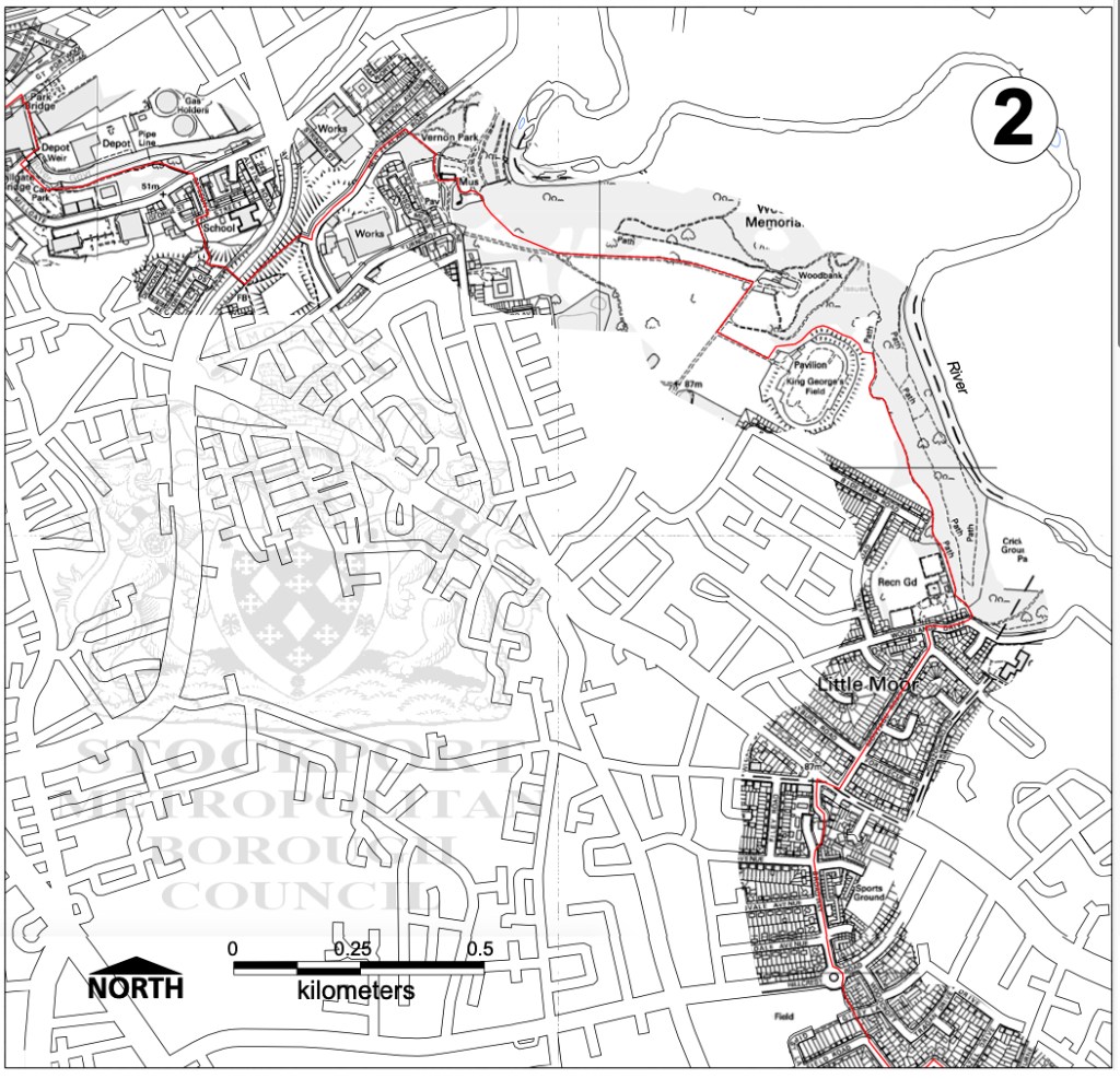
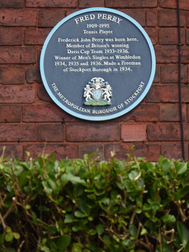
Some time ago in Stockport Fred Perry was born, lived and moved away – in pretty rapid succession. Nevertheless the Borough claims him as their own and to celebrate the fact, they have devised a Way.
Not the way or an away day but a named way, the Fred Perry Way.
Stretching from North Reddish in the north to Woodford in the south – zigging and zagging through and across highways and byways, avenues and alleyways.
Combining rural footpaths, quiet lanes and river valleys with urban landscapes and park lands.
For the long distance walker it may be useful as a link route. The Fred Perry Way provides a link between the Bollin Valley Way, and through that, the North Cheshire Way, and via a short link between Mottram & Woodford, the Tame Valley Way and Etherow Goyt Valley Way at Stockport. A full crossing of historical North Cheshire could be devised, linking Black Hill & Crowden on the Pennine Way with Hilbre Island, utilising also the Wirral Way/Wirral Shore Way.
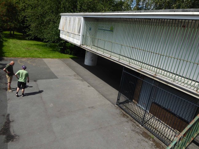
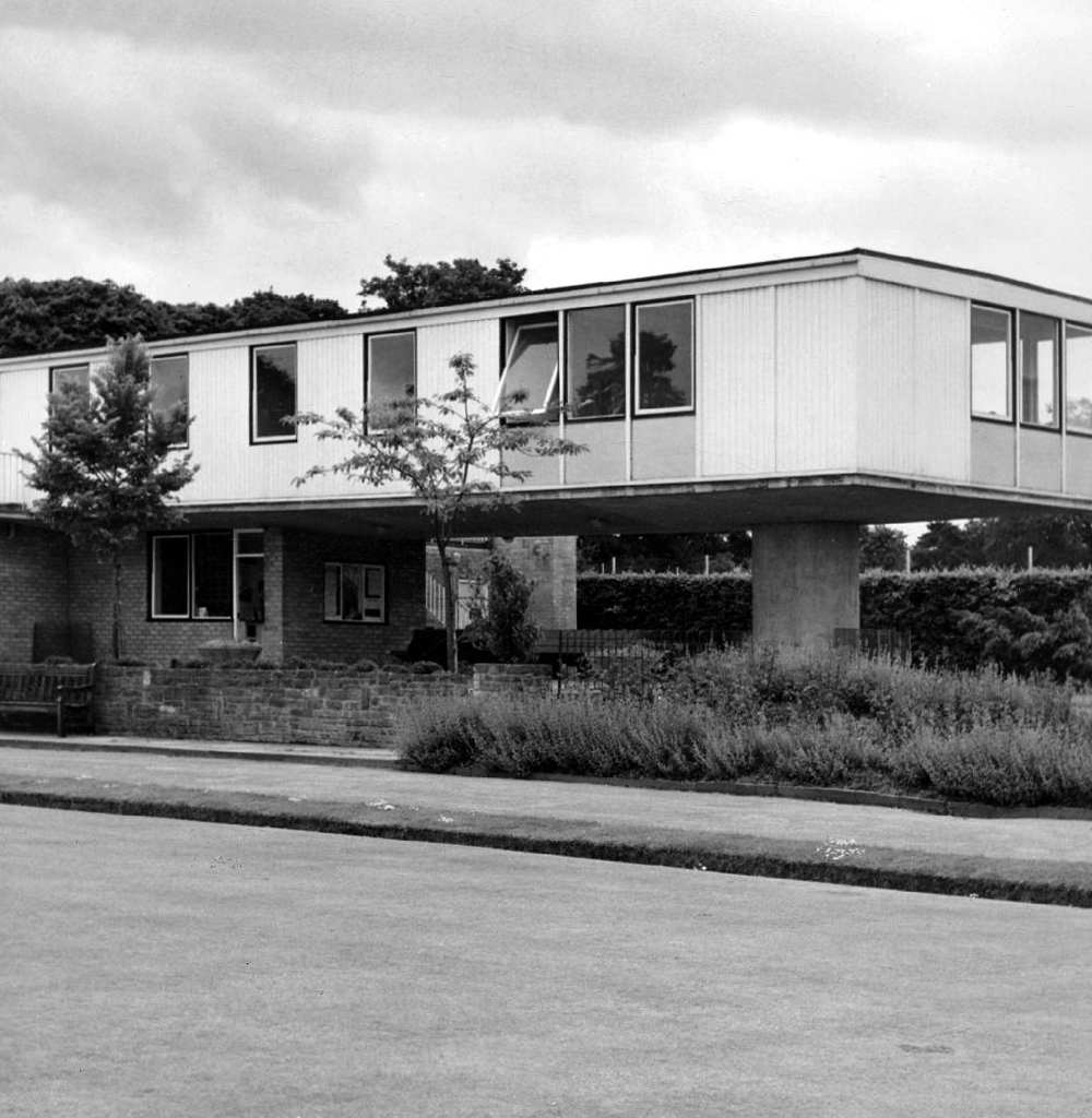
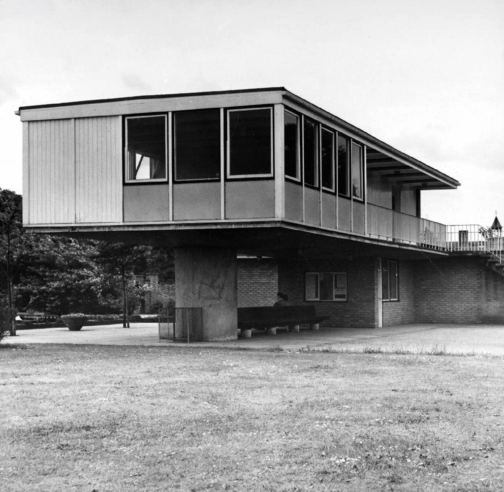
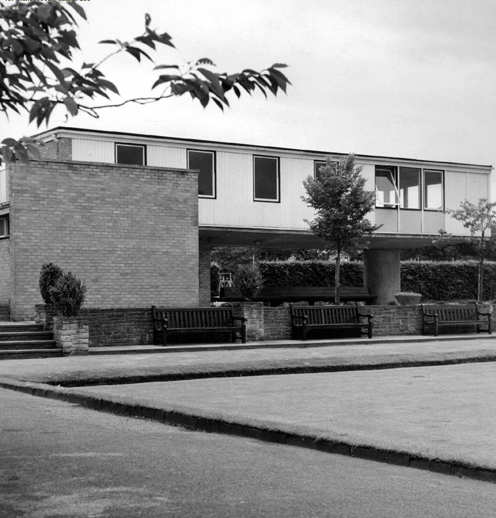
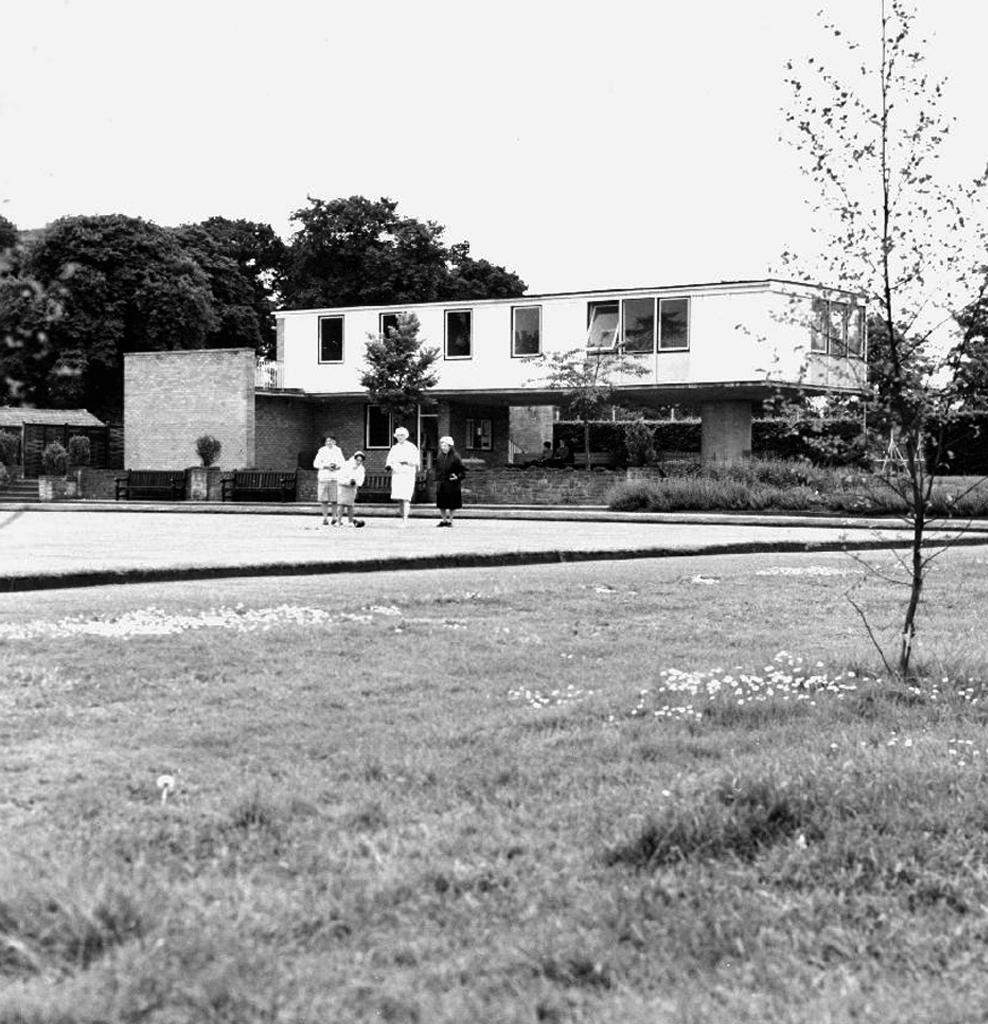
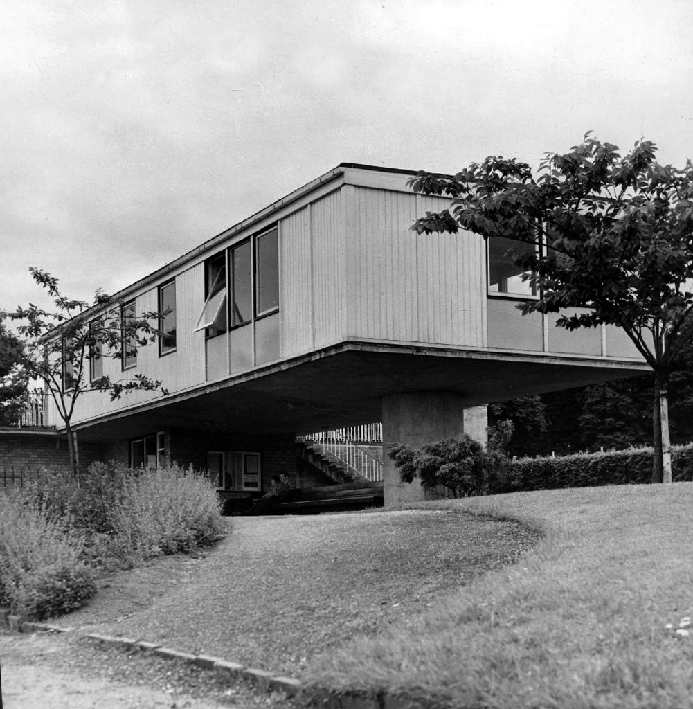
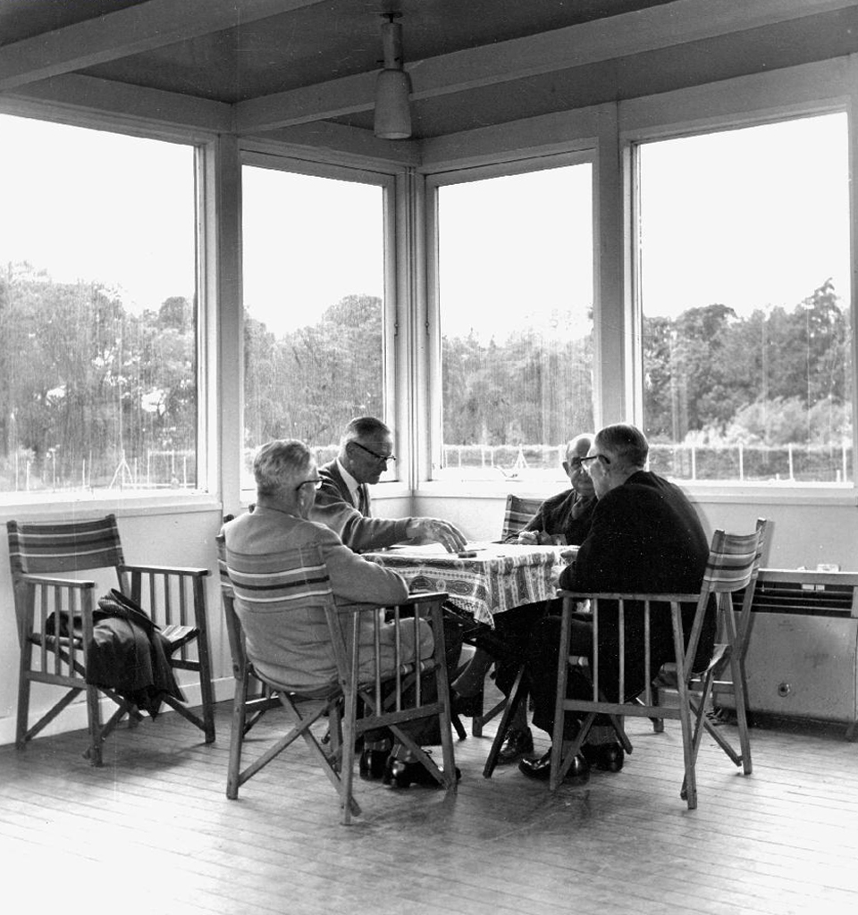
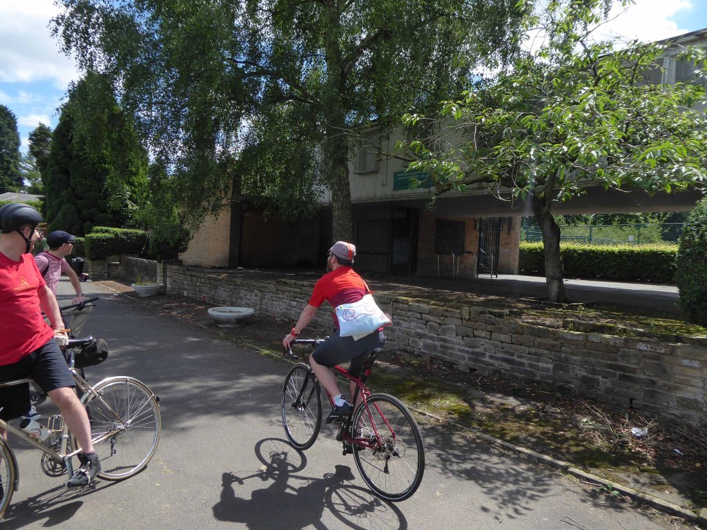
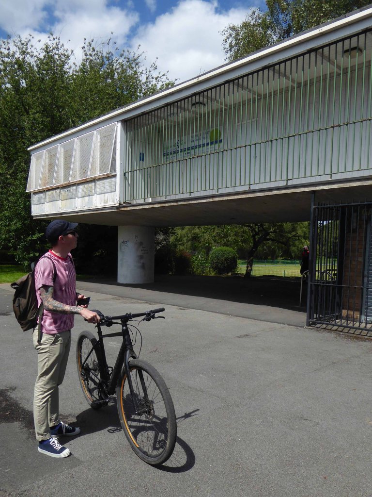
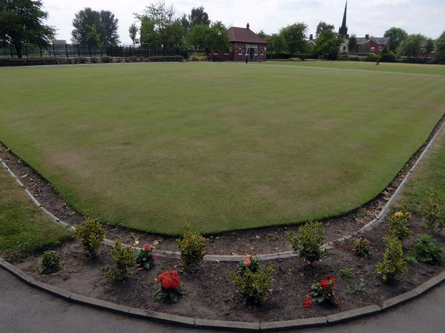
A collective decision was made to pass under the cantilevered and much revered bowls and tennis pavilion.
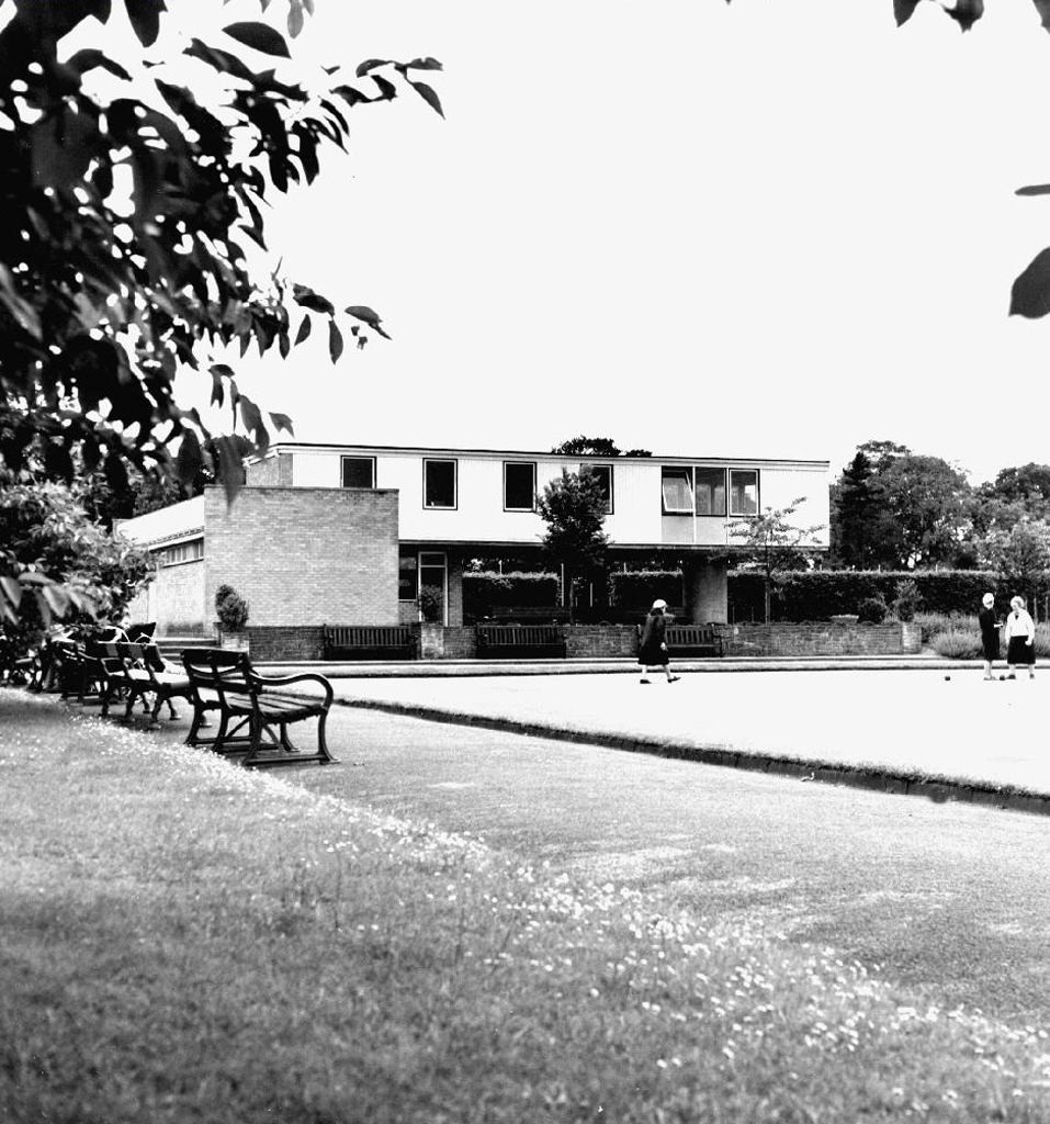
The building opened in 1960, designed by L.C. Howitt City Architect.
In striking contrast to Wythenshawe Hall of 1540 – recently restored following an arson attack, the bowls and tennis pavilion shows no inclination toward Tudor-bethan revivalism.
Sleek and aloof, supported by a single piloti, offering elevated and ground level views of the sporting areas.
This is a short history of a park, a short history of my family and me.
The movement of earth and people, a tale until now untold now told.
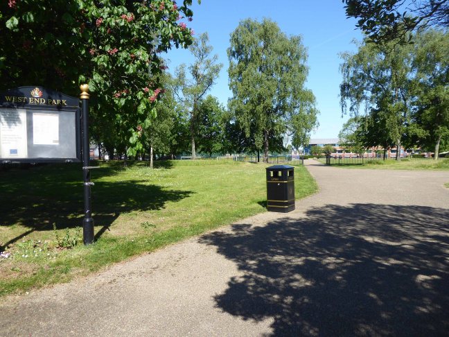
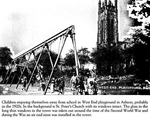
West End Park is a public park, opened in 1893. The site is bounded by Stockport Road, Manchester Road and William Lane. It was developed on land associated with St Peter’s Church.
St Peter’s was built between 1821 and 1824, and was designed by Francis Goodwin. A grant of £13,191 was given towards its construction by the Church Building Commission. The land for the church was given by the patronage of George 6th Earl of Stamford and Warrington, whose cousin, Revd Sir George Booth, had been Rector of Ashton from 1758 until 1797
The benevolent Victorian landowners thought it politic to provide parks for the working folk, fresh air, exercise and perambulation being preferable to the demon drink.
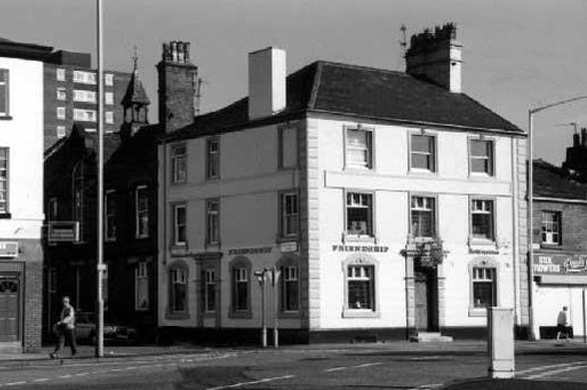
Friendship Old Street – now a solicitor’s office
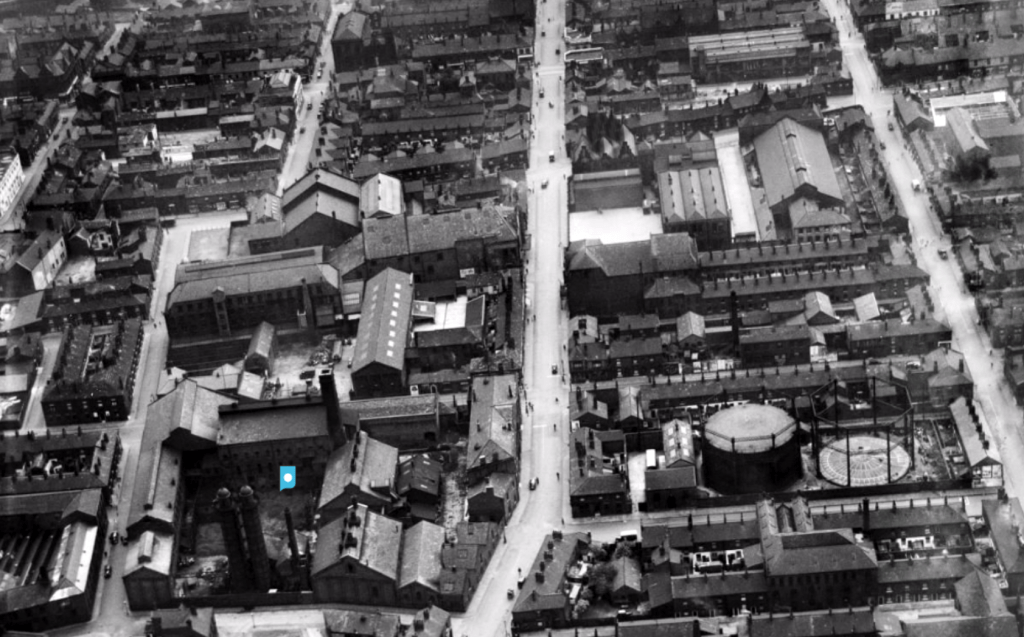
The area around the park was a dense warren of housing and industry.
There’s a plaque for George – there isn’t one for Sam.
During the Great Depression men were required to work for the Dole – Sam was required to dig out a sunken garden in the park – he was a collier by trade, a good man with a shovel, built for back breaking work on Ashton Moss.
Thirty yards wide, forty yards long and three yards deep, shifted by hand.
Three thousand six hundred cubic yards of earth.
One cubic yard of topsoil weighs about two thousand pounds on average.
Seven million two hundred thousand pounds of earth.
I worked there in the 1970s along with Alec and Danny bedding out the sunken garden, maintaining the bowling green, tennis courts and playground.
Keith Ingham
There were two permanent gardeners in the park, and a keeper in the summer – plus Danny Byrne and me brought in to help at busy times.
Throughout the 70s and onwards, economic decline hit the area hard, the closure of the cotton mills and little hope for the future. Rising unemployment and severe cuts to public spending did little to assure a rosy future for West End Park, or anything or anyone else for that matter.
Help was at hand – one of many public projects funded by our old friends the EU. Changes in the way that parks were used and further spending cuts sounded the death knell for the flowers and bowling. Large open grassed areas were cheaper and easier to maintain.
And so the sunken garden was filled in, this time by mechanical means – all in a days work for a bloke with a JCB.
So I sit and reflect on the labour and conditions that created this and many of our public parks, our legacy is a much impoverished version of the original vision.
I think of my grandad Sam and his comrades, the sweat of their collective brows buried forever.
Our legacy the small state, a bring and buy your own world economy.
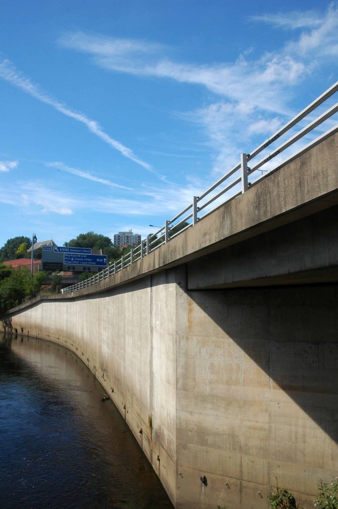
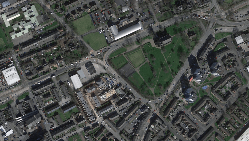
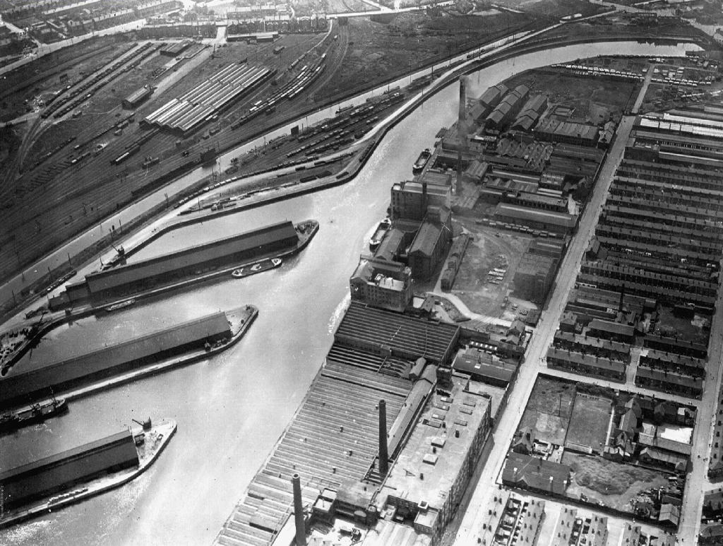
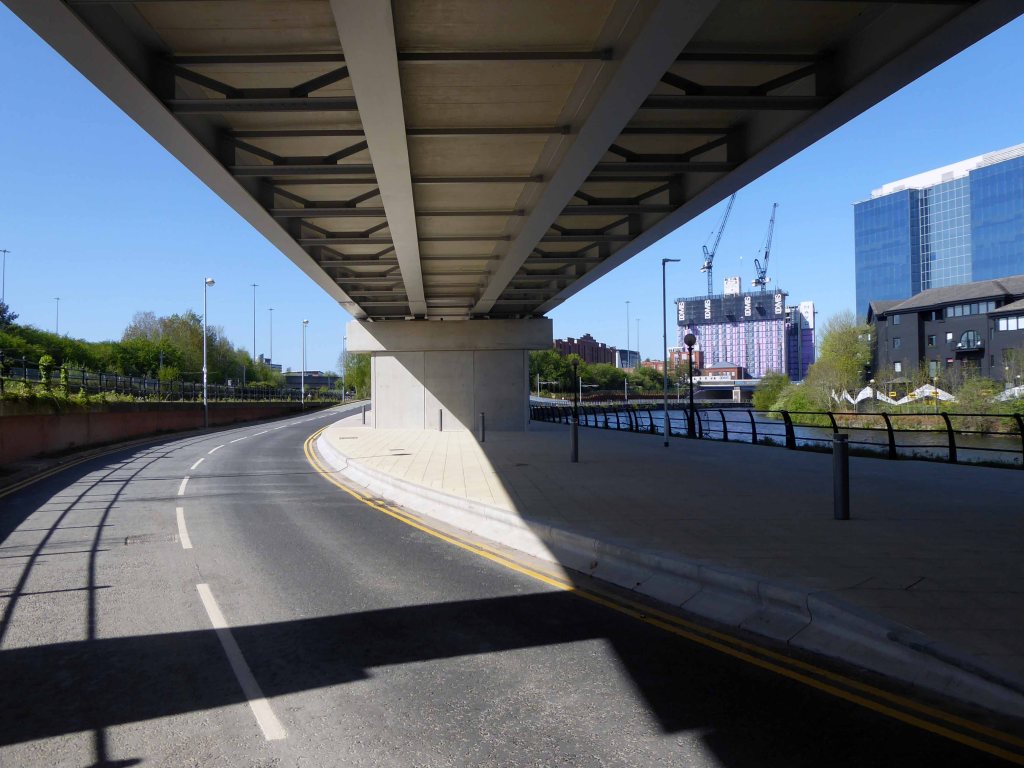
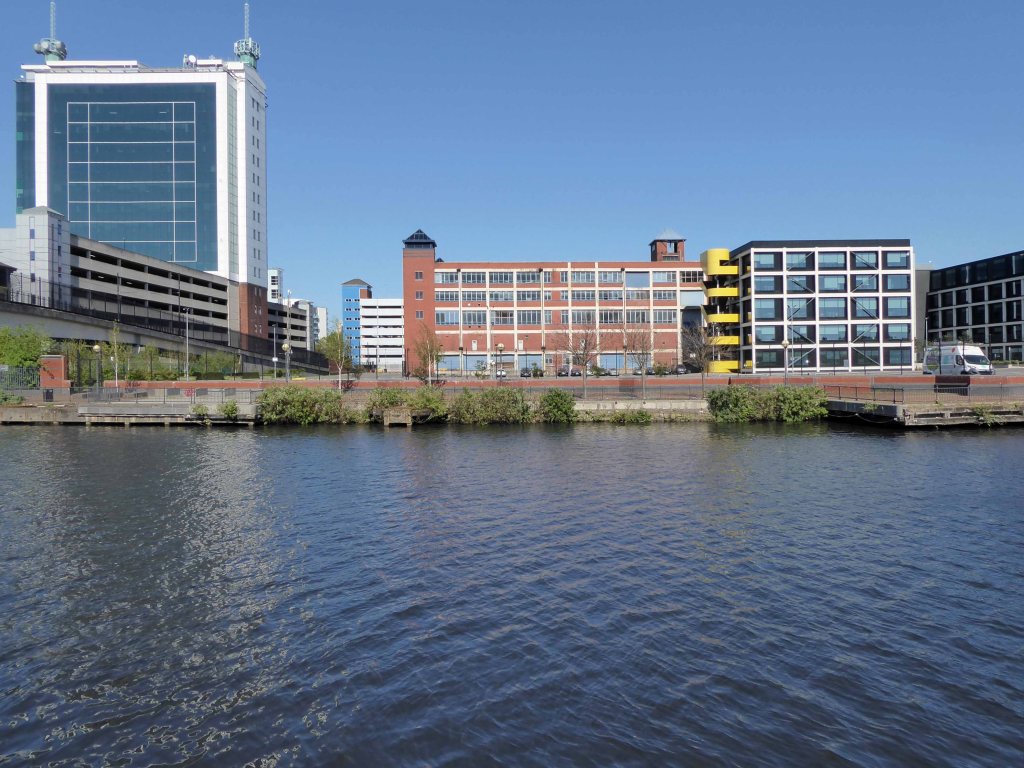
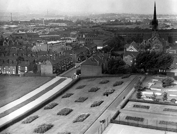
The River Irwell bisects Salford and Manchester, joining the rivers Irk and Medlock, and then turns west toward Irlam, as part of the Manchester Ship Canal. Its course ends just east of Irlam, where it empties into the Mersey.
Urban development is ever so often dependent upon rivers – for sustenance, commerce and amusement. The Irwell and latterly the developments of the canal system has provided all of these in superabundance.
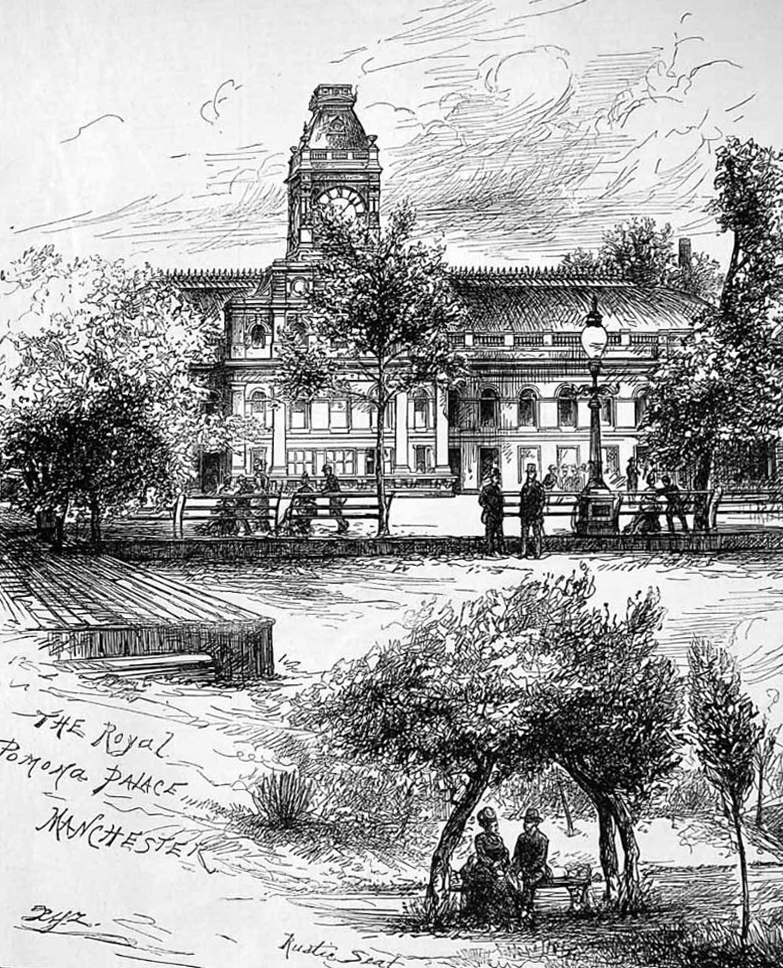
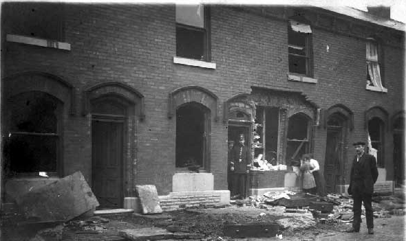
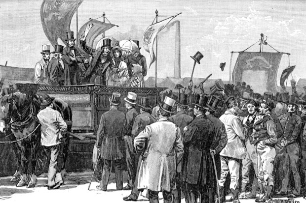
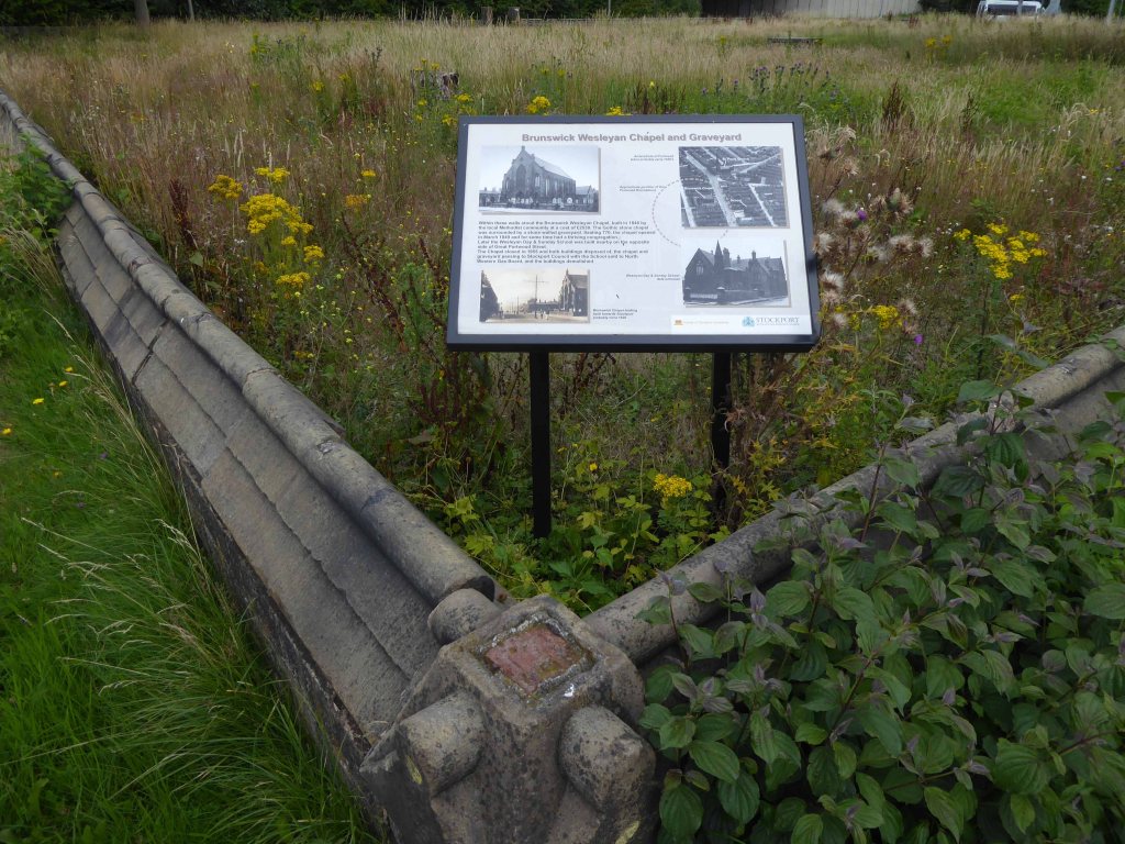
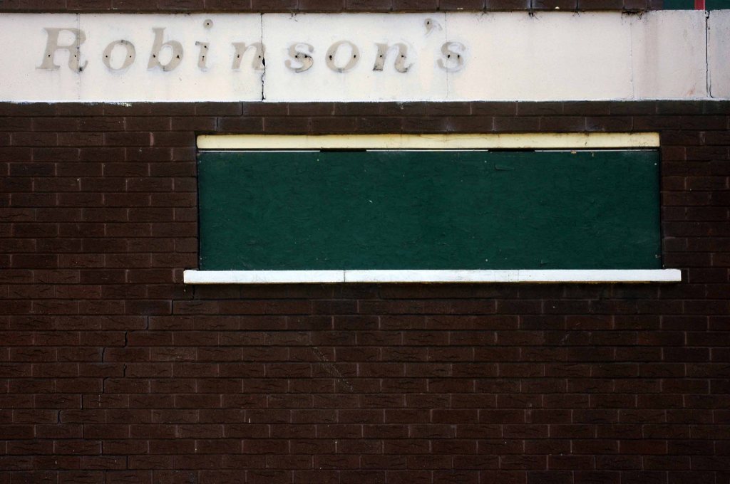
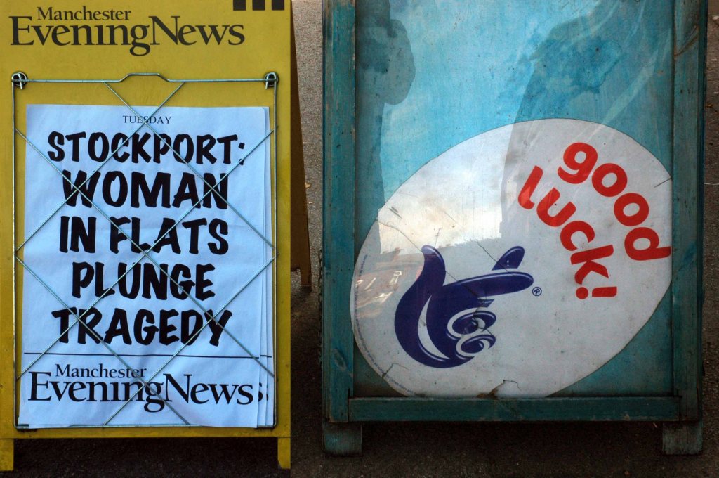
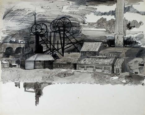
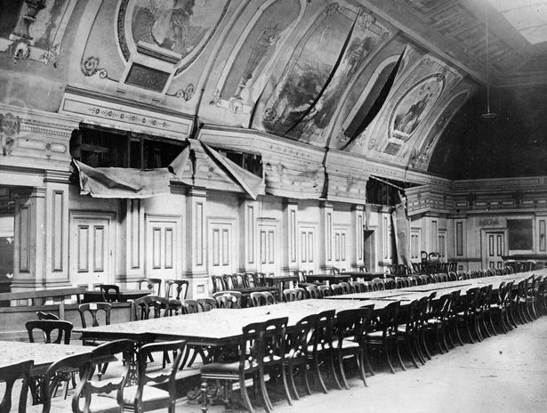
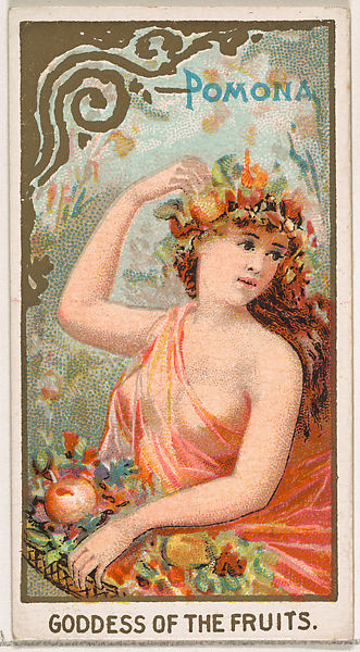
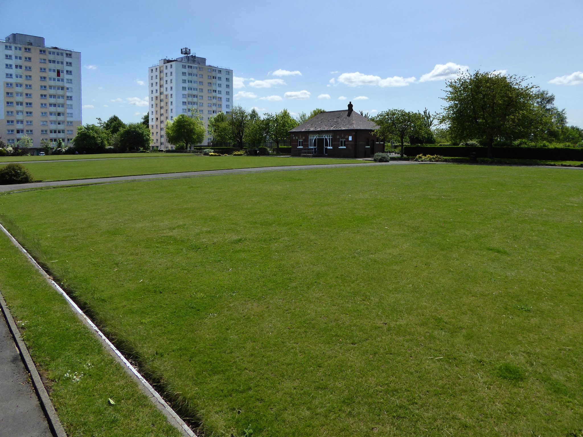
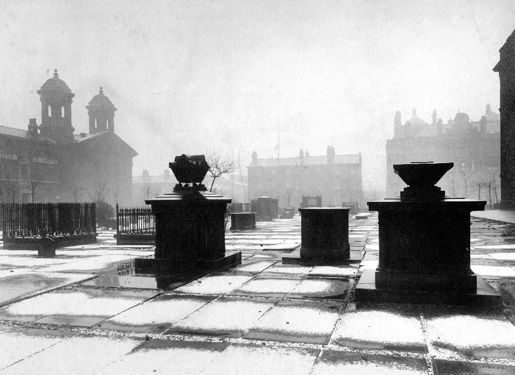
By 1870 the Pomona Gardens is thriving , boasting a concert hall and banqueting suite – further details here from Skyliner.
In the summer of 1887, a nearby chemicals factory exploded, damaging the palace – the area was under threat and destined to rot away to obscurity: the following year the gardens closed forever.
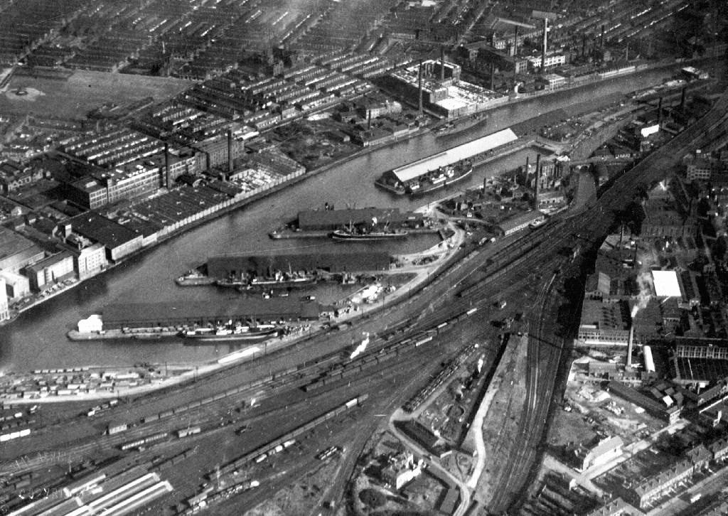
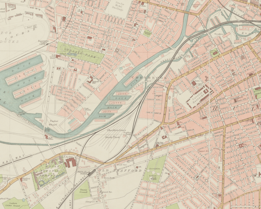
By 1900 the Ship Canal, docks and railways had arrived – Manchester and Salford are at the centre of an unprecedented growth in manufacture and trade.
189119231950
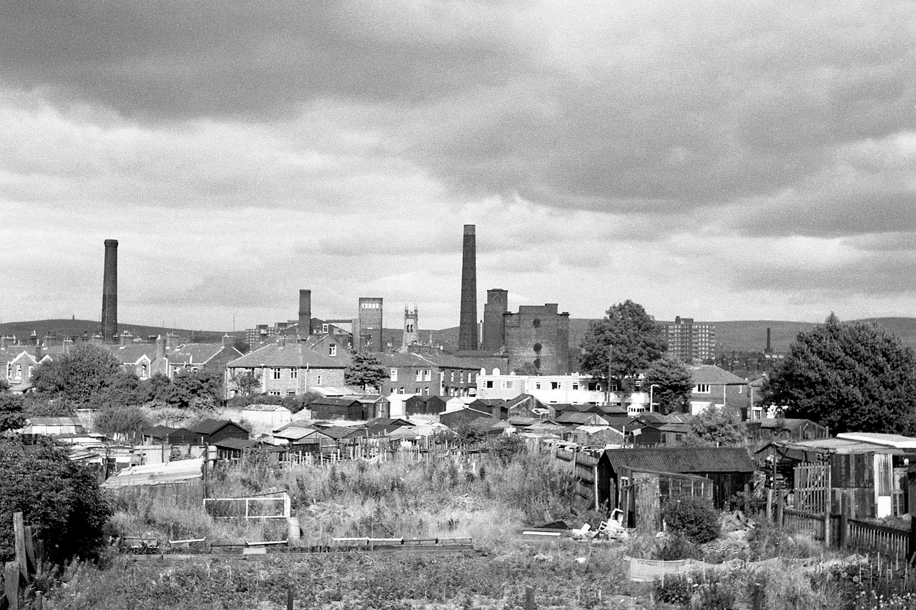
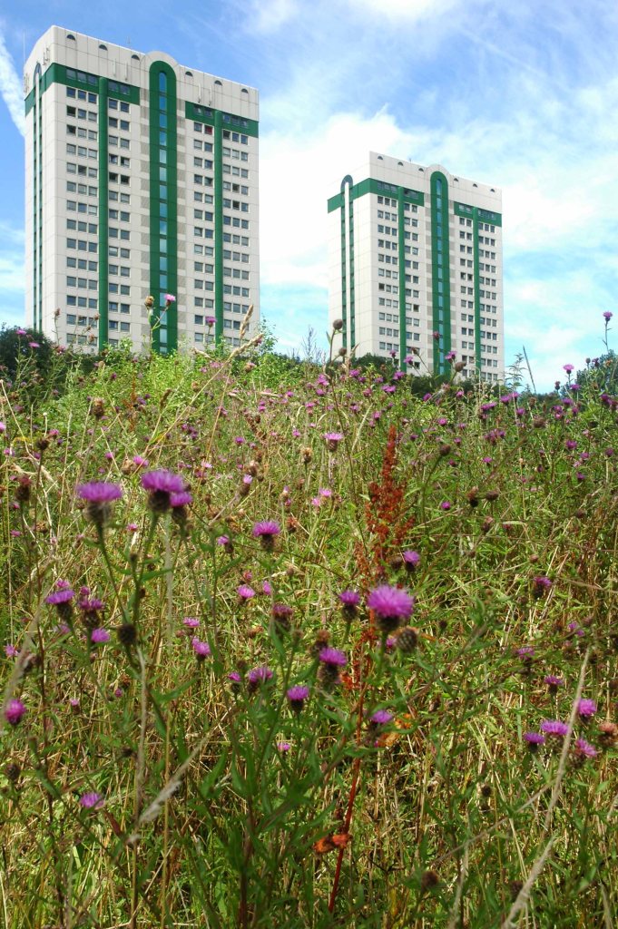
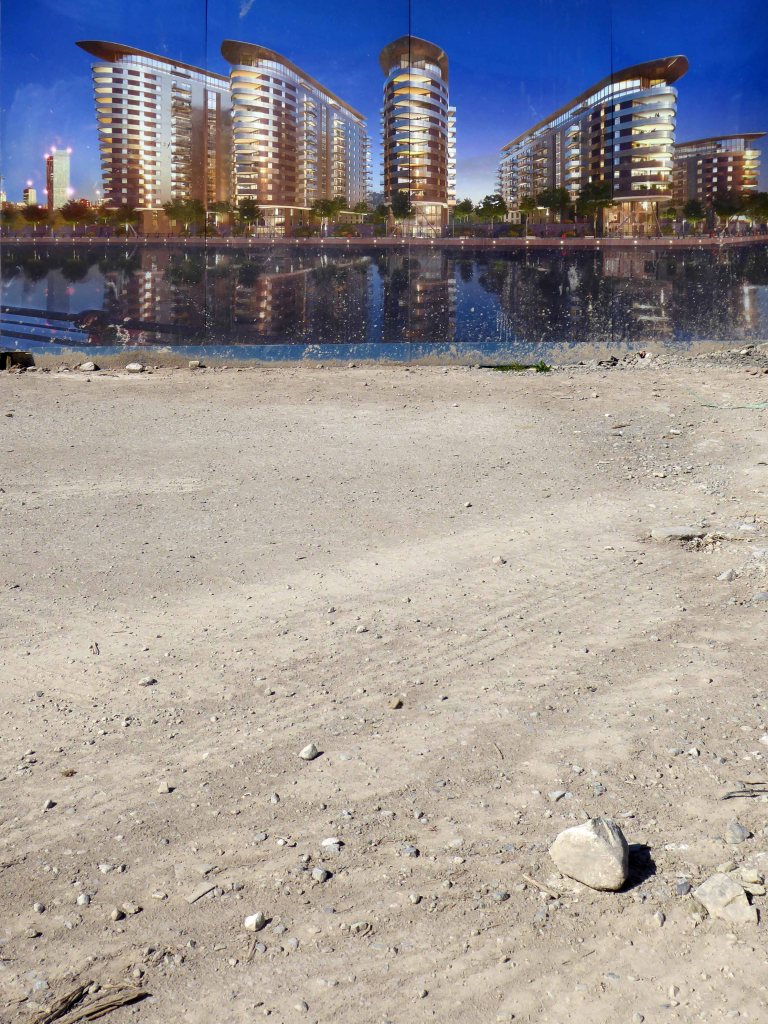
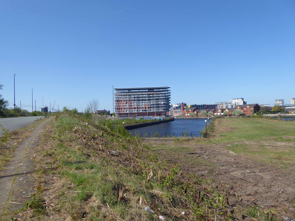
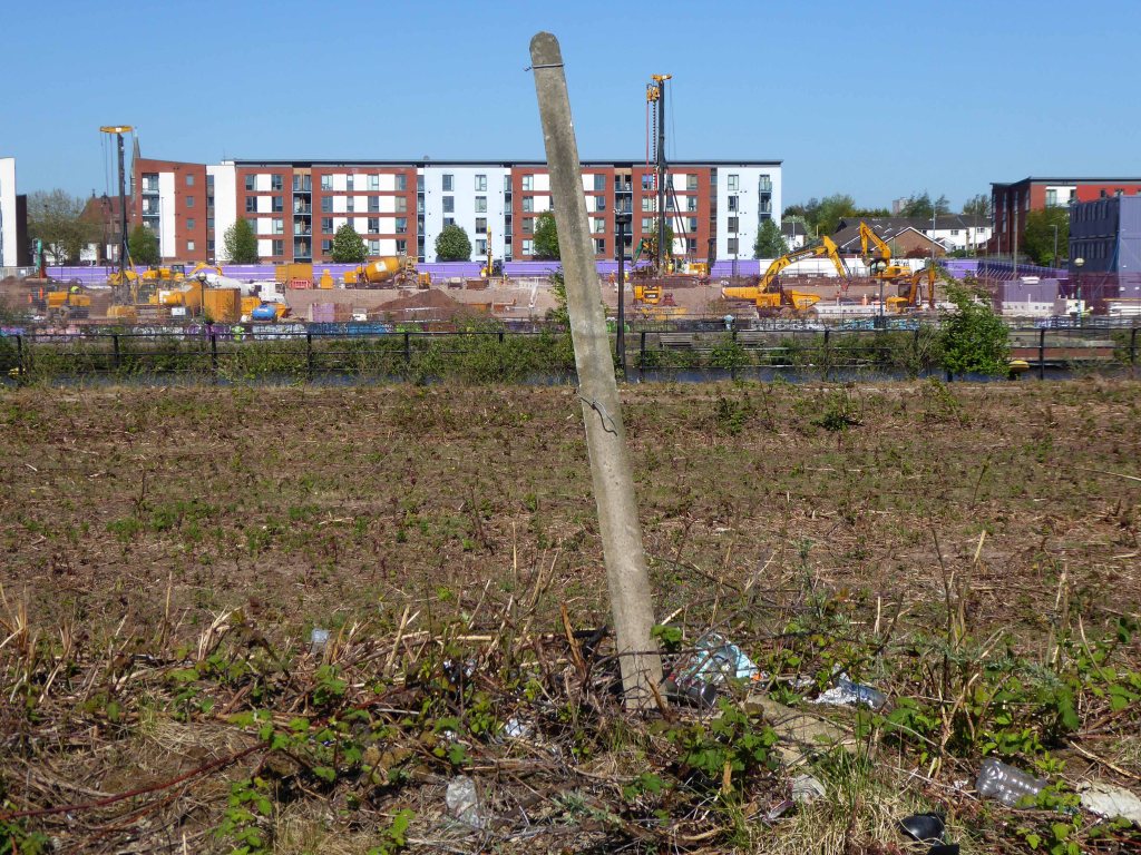
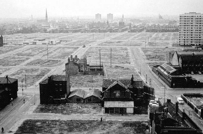
During the 1970’s the docks began a rapid decline, largely due to containerisation. The increasing size of freight-carrying ships meant they could no longer navigate the ship canal and this, combined with increased trading with Europe and the east, saw use of Manchester Docks decrease. In 1982 the remaining docks closed and the area became derelict. Recognising the need to redevelop the area, Salford City Council purchased the docks in 1984 using a derelict land grant. The Salford Quays Development Plan was adopted in May 1985, proposing complete reclamation and development of the area for commercial, residential and leisure use.
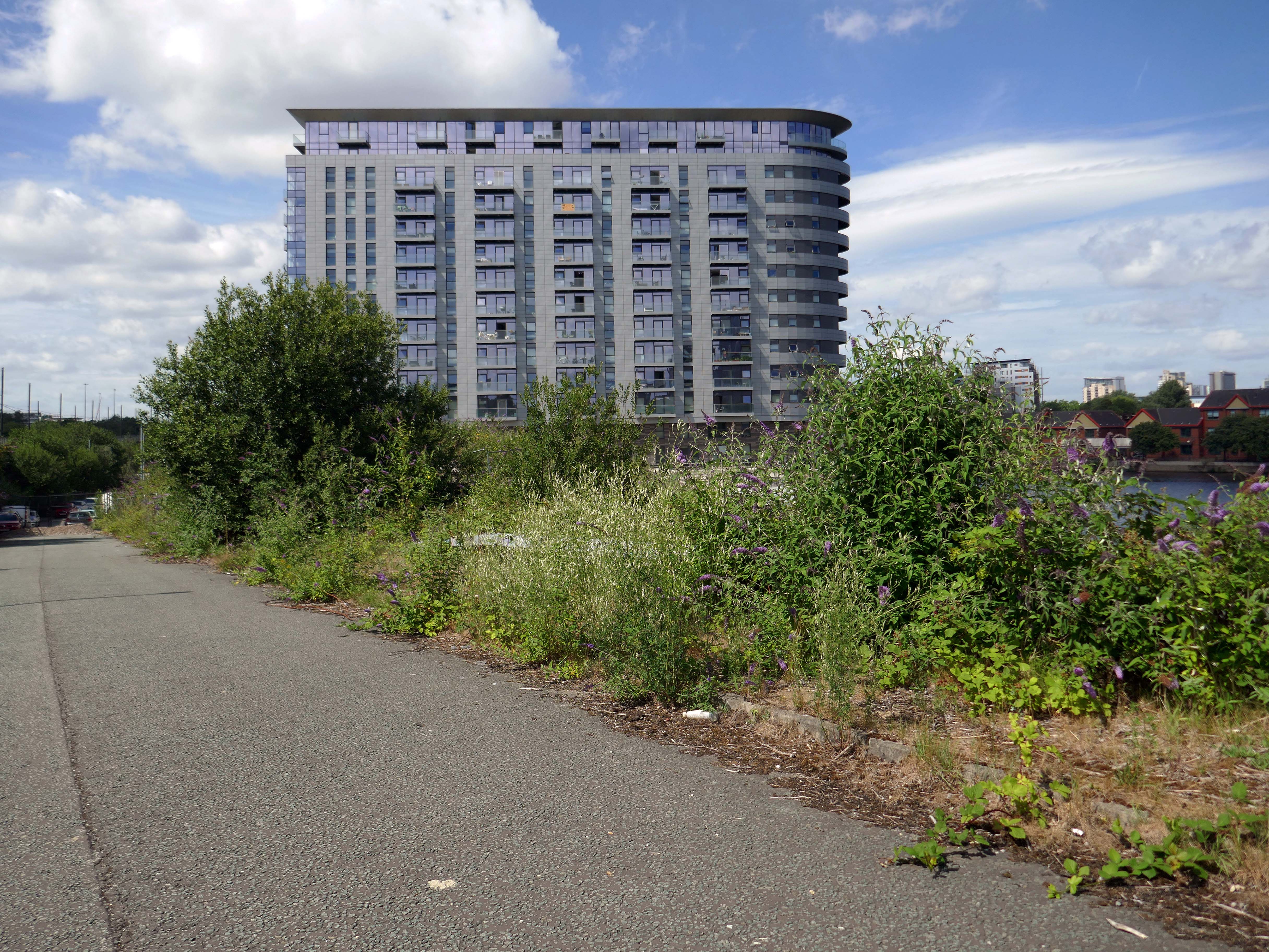
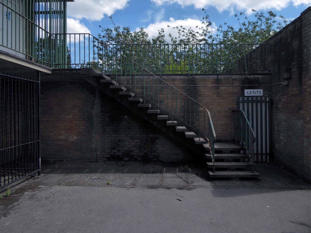
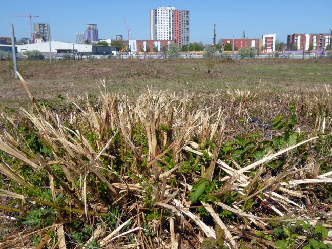
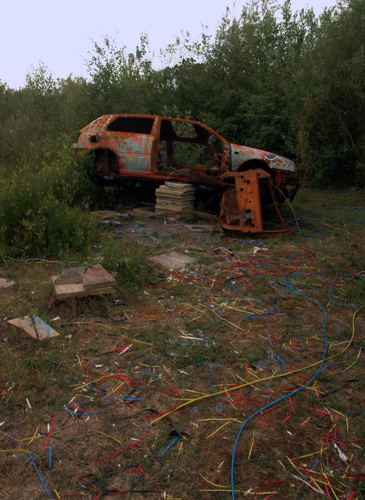
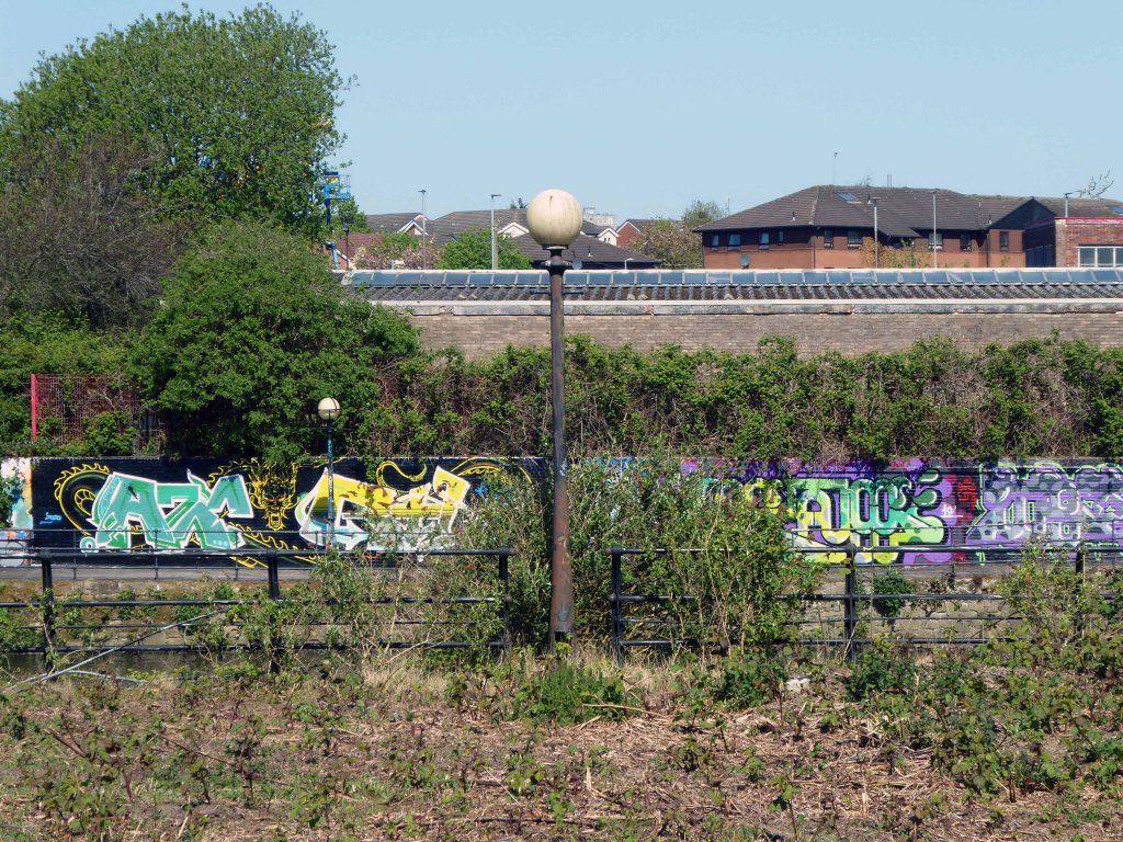
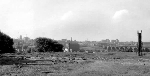
Manchester and Salford begin the long haul from post industrial decline to service centred cities – there were even seeds sewn for the development of a luxury marina. When I first visited Pomona the area was seriously overgrown and the underground wiring stripped out.
201020102020
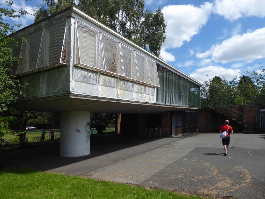
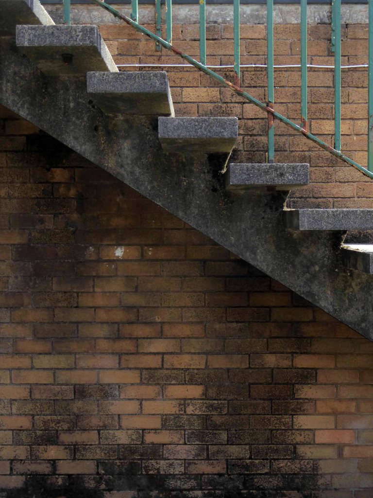
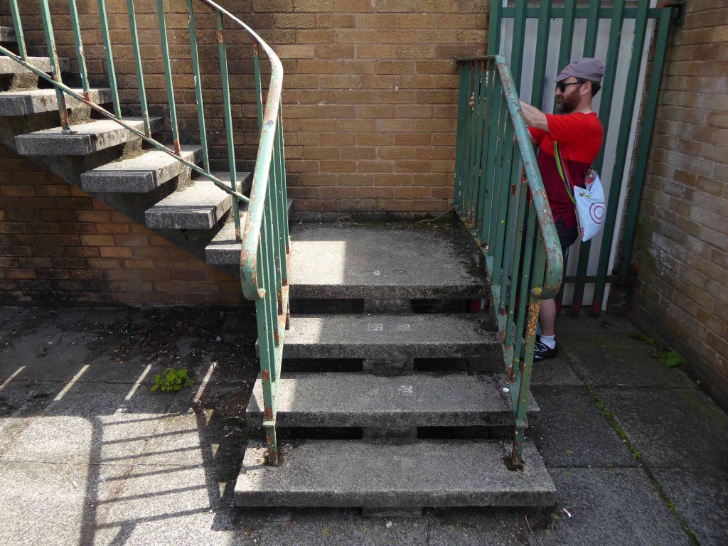
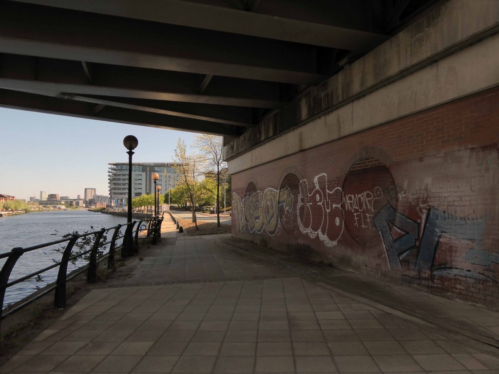
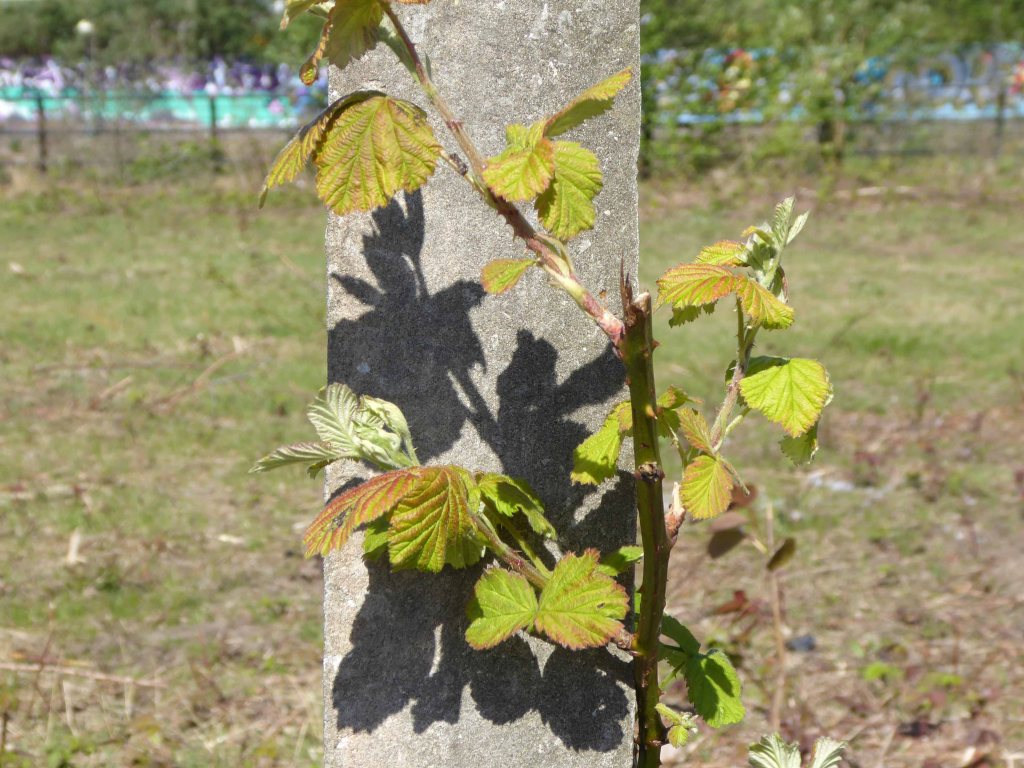
Remnant of the initial scheme – pedestrian access, balustrade and lighting.
What would poor old Pomona make of all this?
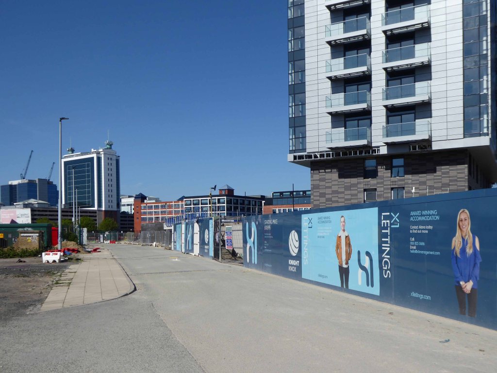
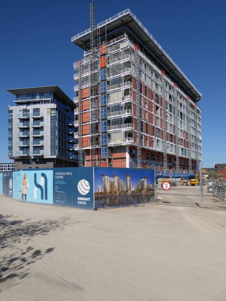
There was a failed attempt to prevent further development and return the area to nature. Peel Holdings prevailed and pressed on relentlessly with their programme of urbanisation.
So it’s April 2020 – I’m on my way from somewhere else to somewhere else, I’ll cut across Pomona Island – the building site is in lockdown – ain’t nobody home.
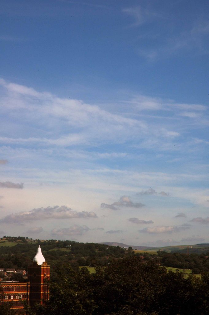
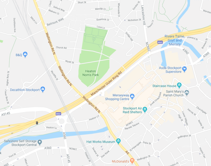
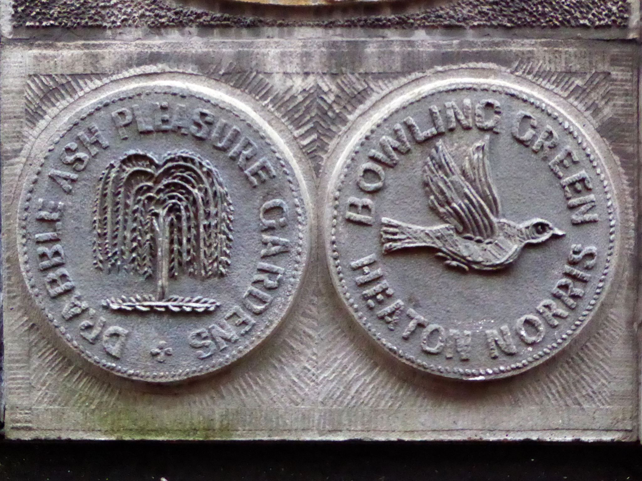
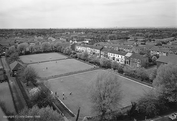
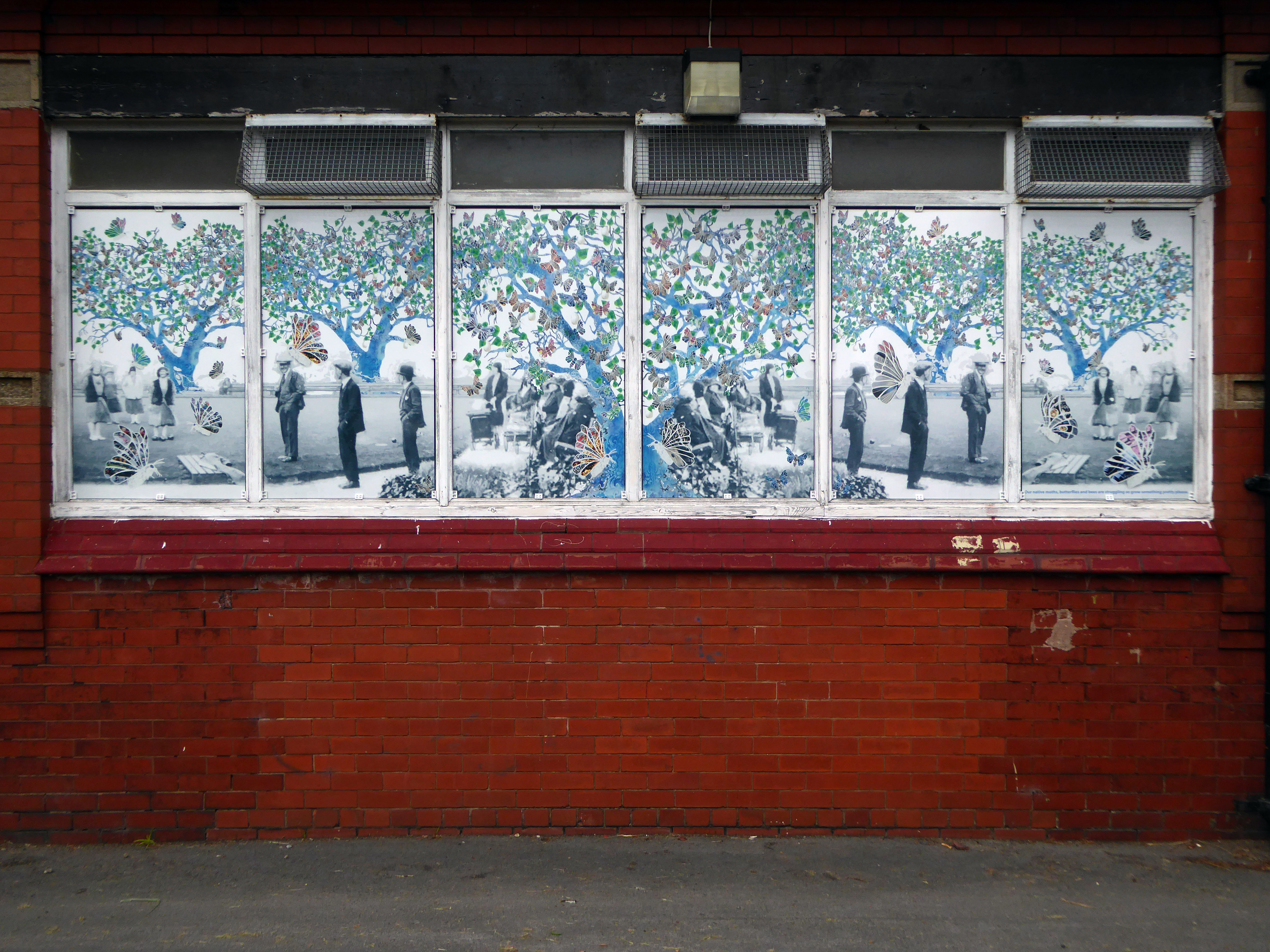
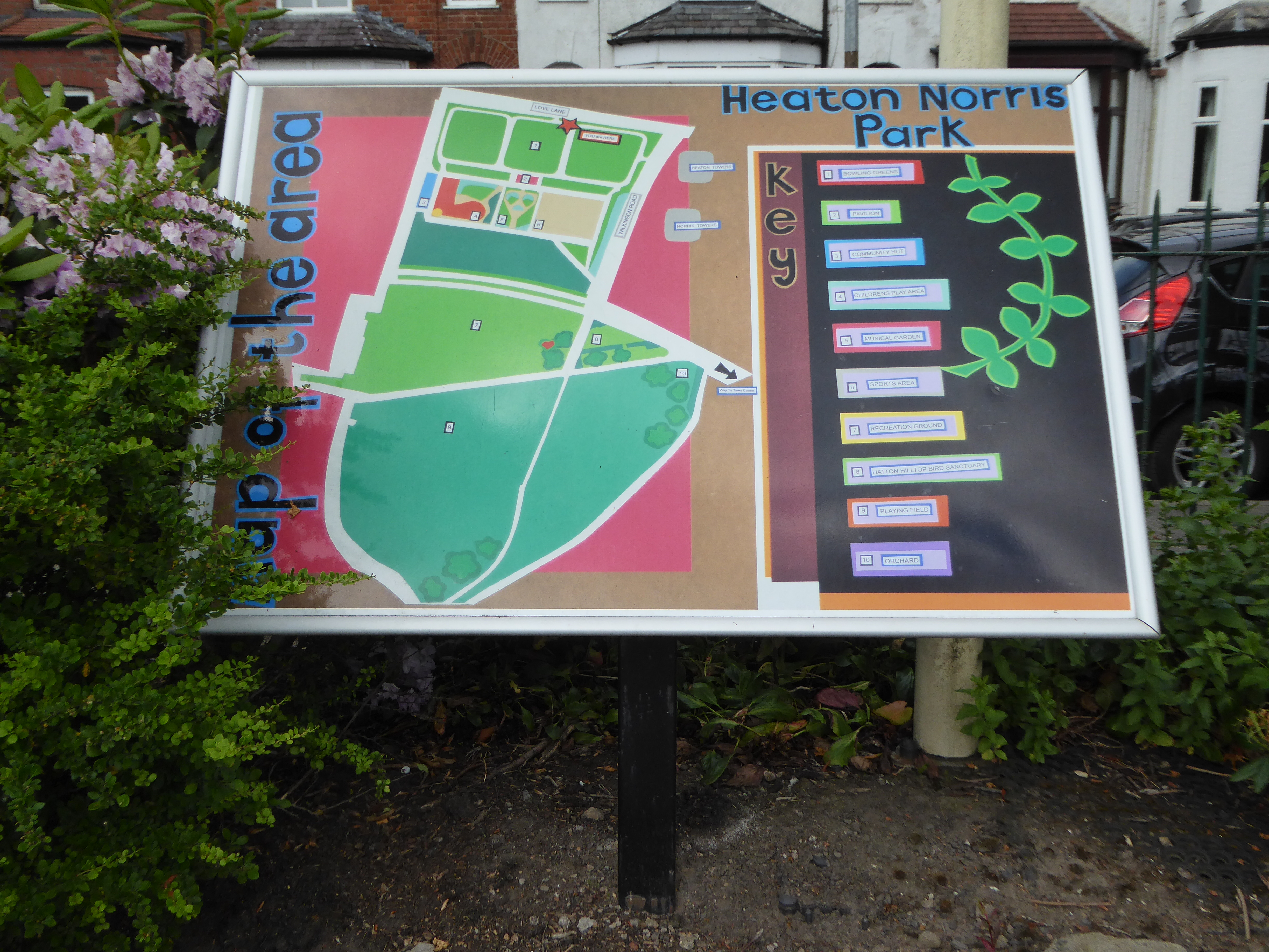
Heaton Norris Park’s elevated position gives stunning views of the Stockport town centre skyline and of the Cheshire plain. The central position of the Park means that it is a green retreat for shoppers and local residents. Also it is within easy reach of the Stockport town centre. The land for this park was acquired by public subscription and as a gift from Lord Egerton.Work on laying out the site as a public park began in May 1873, and it was formally opened on June 5th 1875. Since then it has undergone a number of changes. The construction of the M60 has shaved several acres off the park’s size.
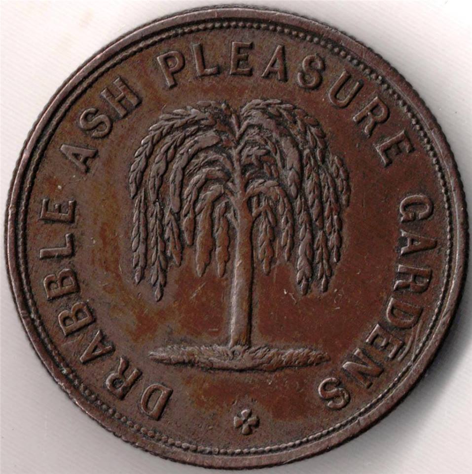
The park is predated by the nearby Drabble Ash Pleasure Gardens – entrance strictly by token only, as commemorated on the BHS Murals in Merseyway.
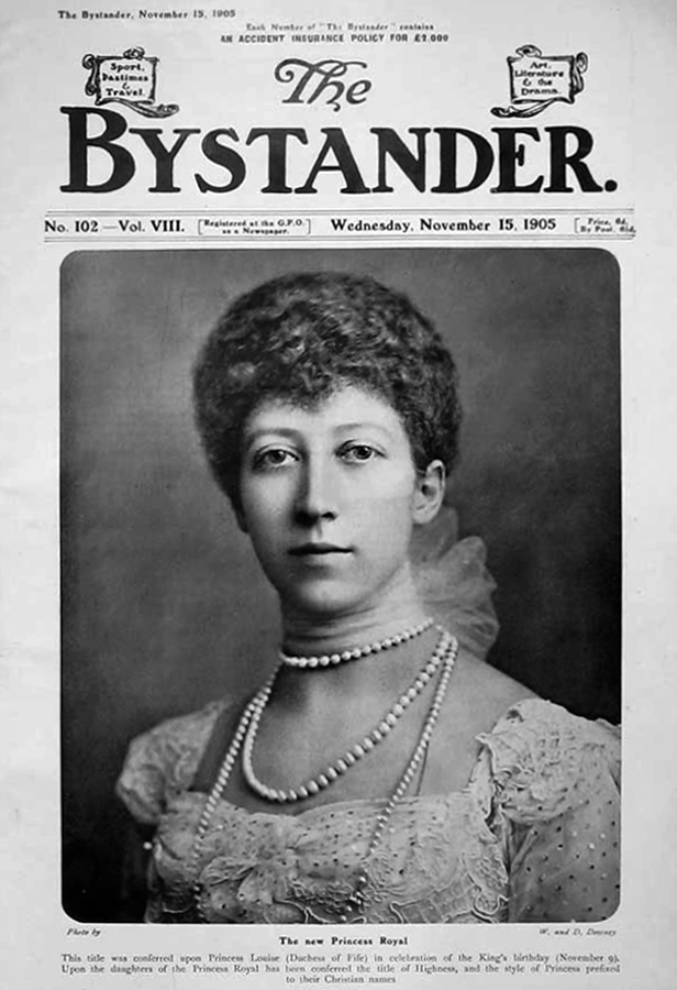
5 November 1905 – Edward VII declares his eldest daughter The Princess Louise, Duchess of Fife, the Princess Royal.
He also orders that the daughters of Princess Louise, Lady Alexandra Duff and Lady Maud Duff are to be styled as Princesses of the United Kingdom of Great Britain and Ireland with the style Highness.
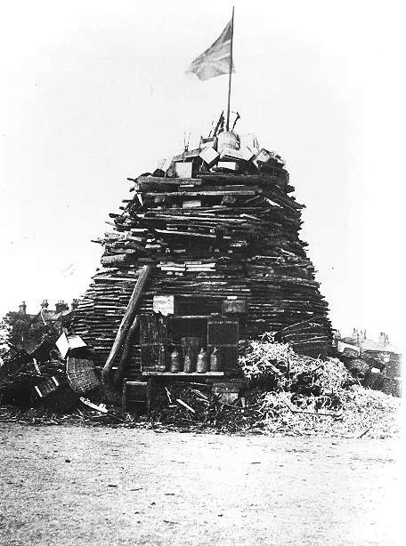
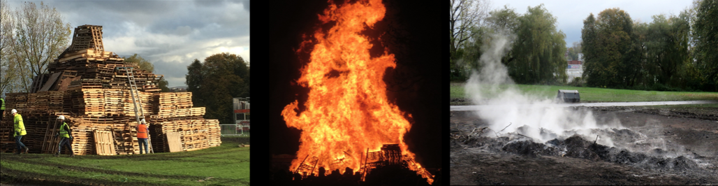
So they built a big bonfire on bonfire night at Heaton Norris Park – sometimes they still do.
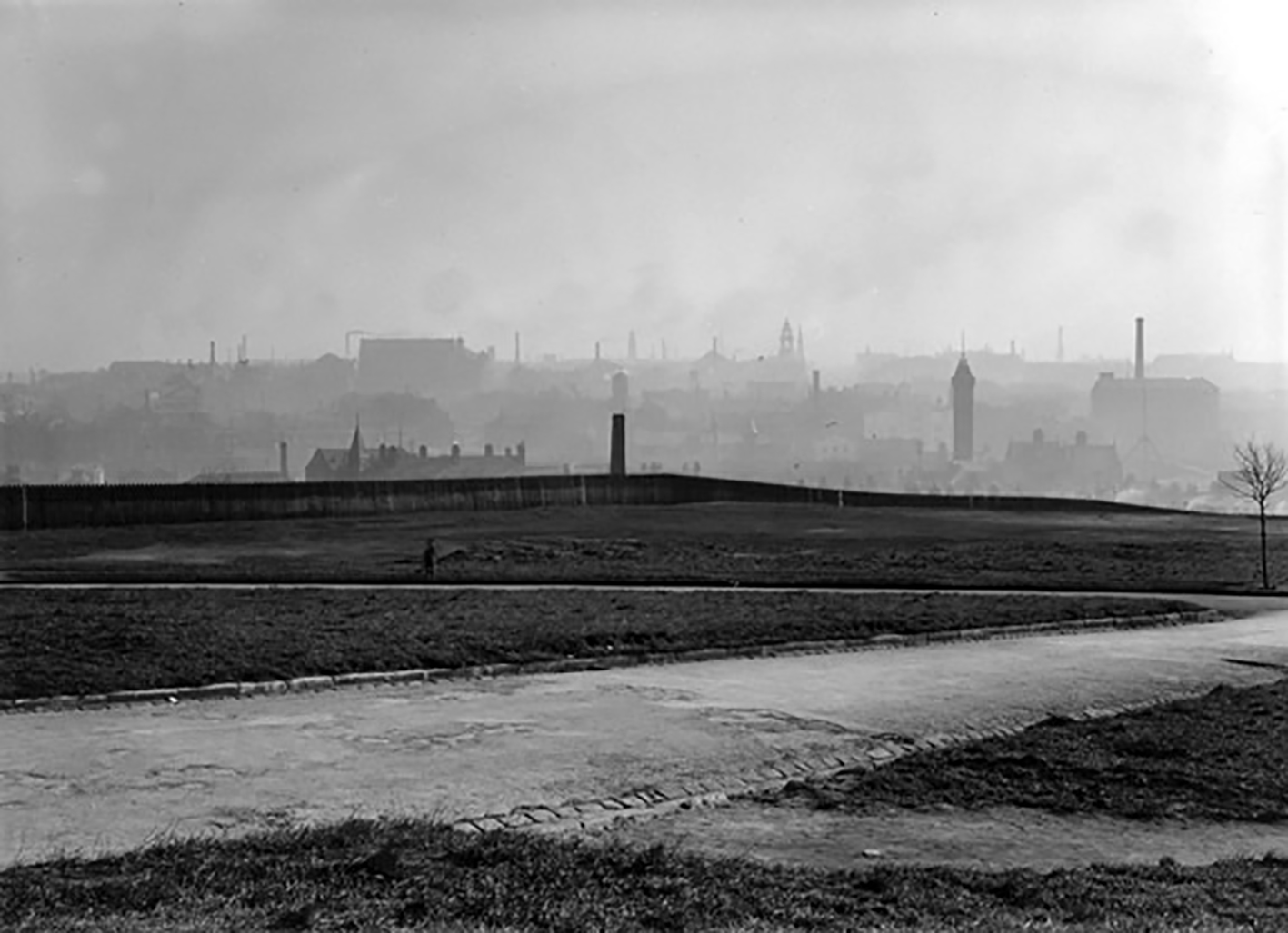
In 1935 the area seems to be little more than windswept cinders and thin forlorn grass, traversed by broad uneven paths – overlooking the dark industrial mire below.
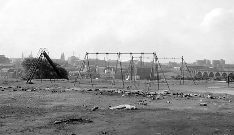
Into the 1960s and although now there is the provision of a children’s play area, the park is still in need of a little more care and attention, the immediate surroundings a dense dark warren of industrial activity and terraced housing.
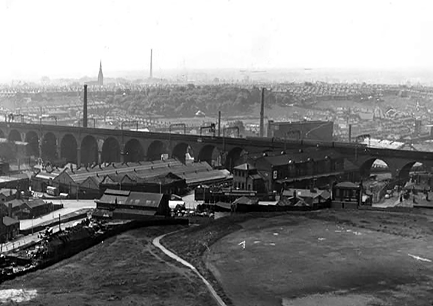
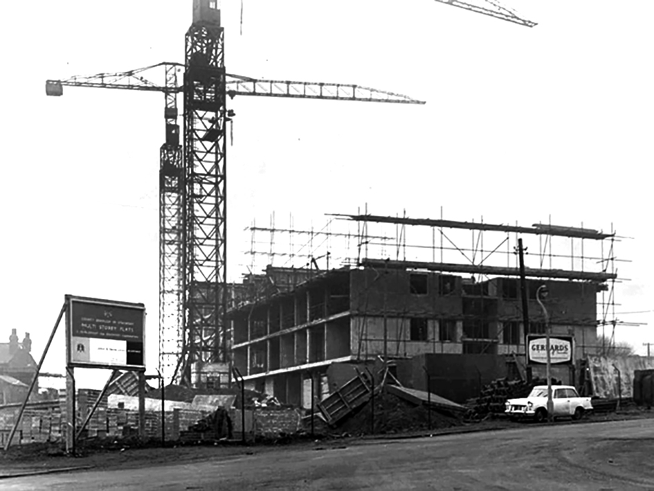
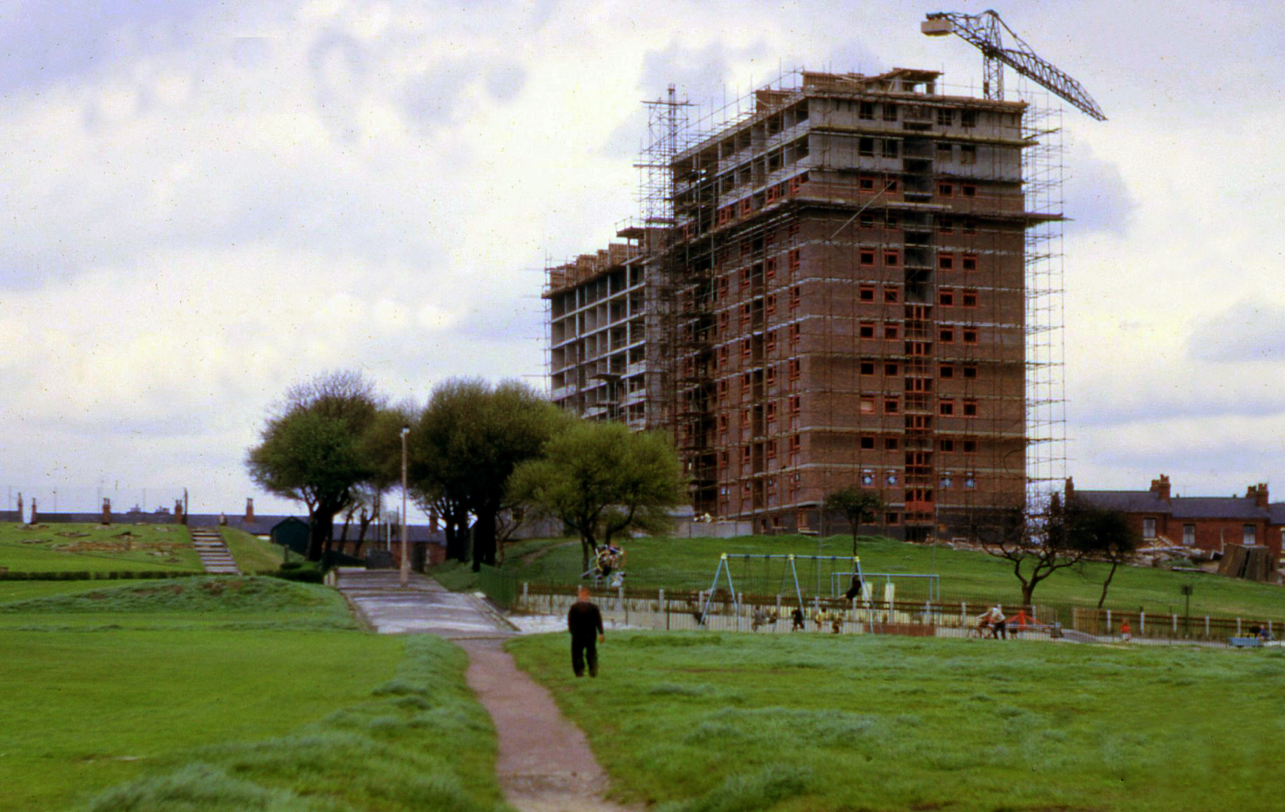
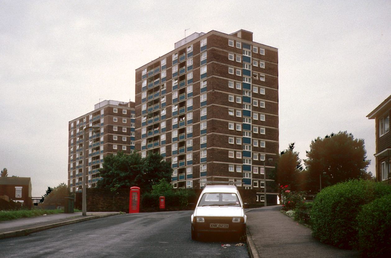
In 1968 the construction of two twelve storey Stockport County Borough Council residential blocks begins, alongside the recreation grounds, Heaton and Norris Towers, creating 136 new homes.
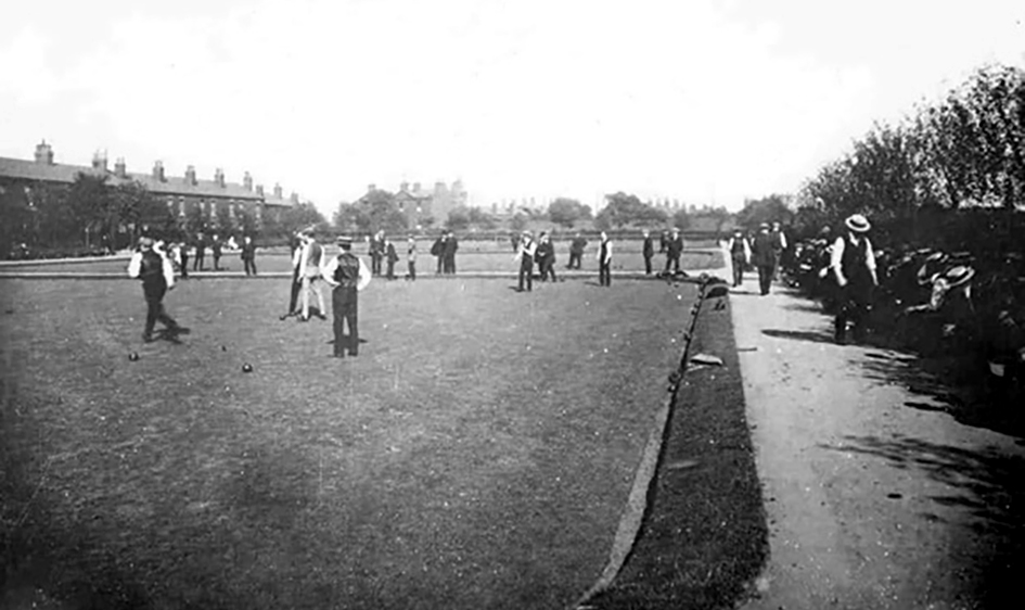
The 1970s sees the banked gardens bedded out with summer flowers and a crazy golf course on the edge of the bowling area. Both of these features are now a thing of the past, the future financing, care and maintenance of our parks is always precarious, especially during times of central government funding cuts and enforced austerity.
The park now has a Friends group to support it, along with I Love Heaton Norris. The area is cared for and used by all ages and interests children’s play, bowls, tennis, conservation area, football, picnic and floral areas – somewhere and something to be very proud of, social spaces for sociable people.
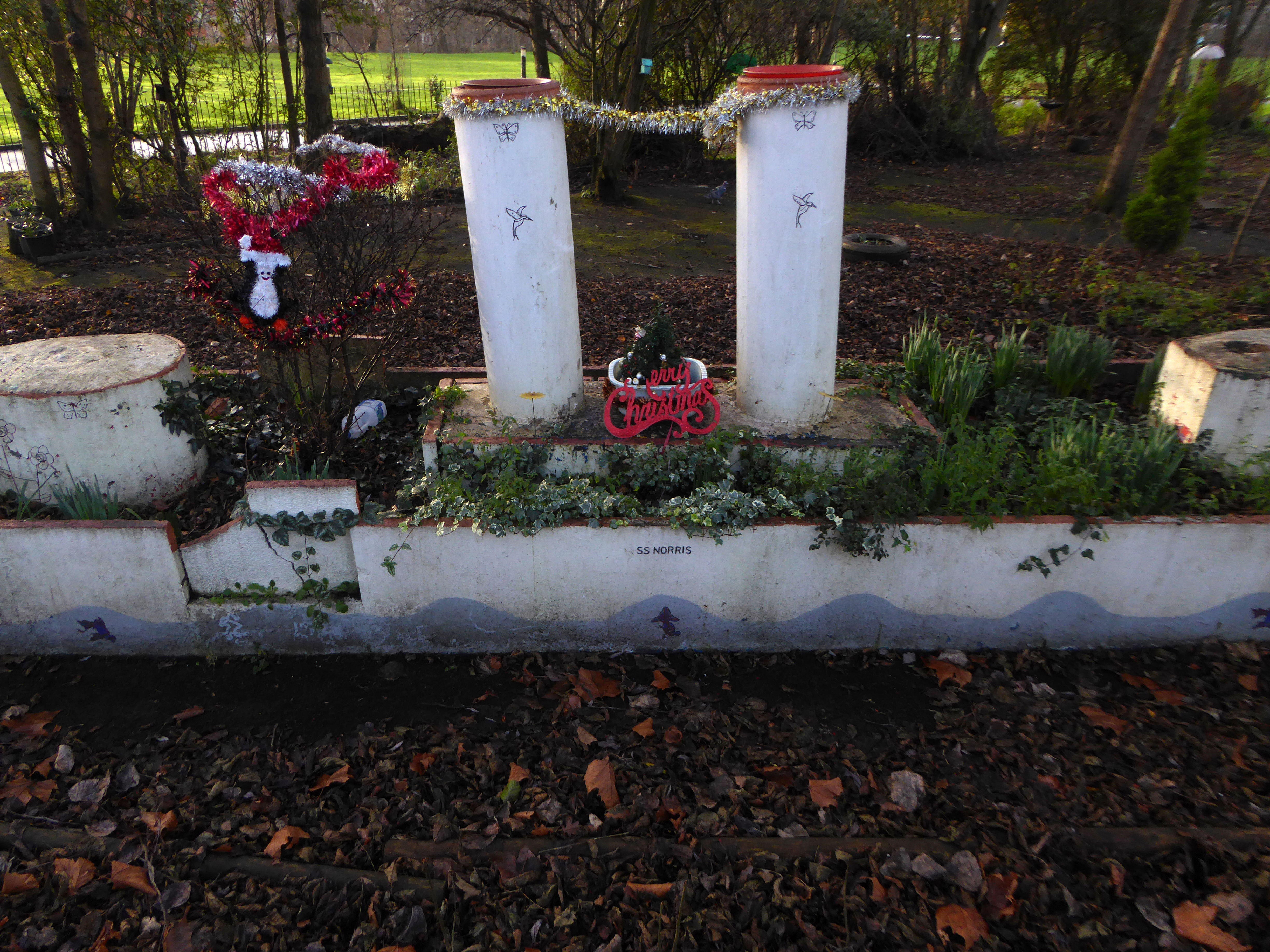
And much beloved of Natalie Bradbury the SS Norris concrete boat.
Take a walk over the concrete bridge or along Love Lane and treat yourself to a day in the park
Once upon a time there was almost nothing, as there often is.
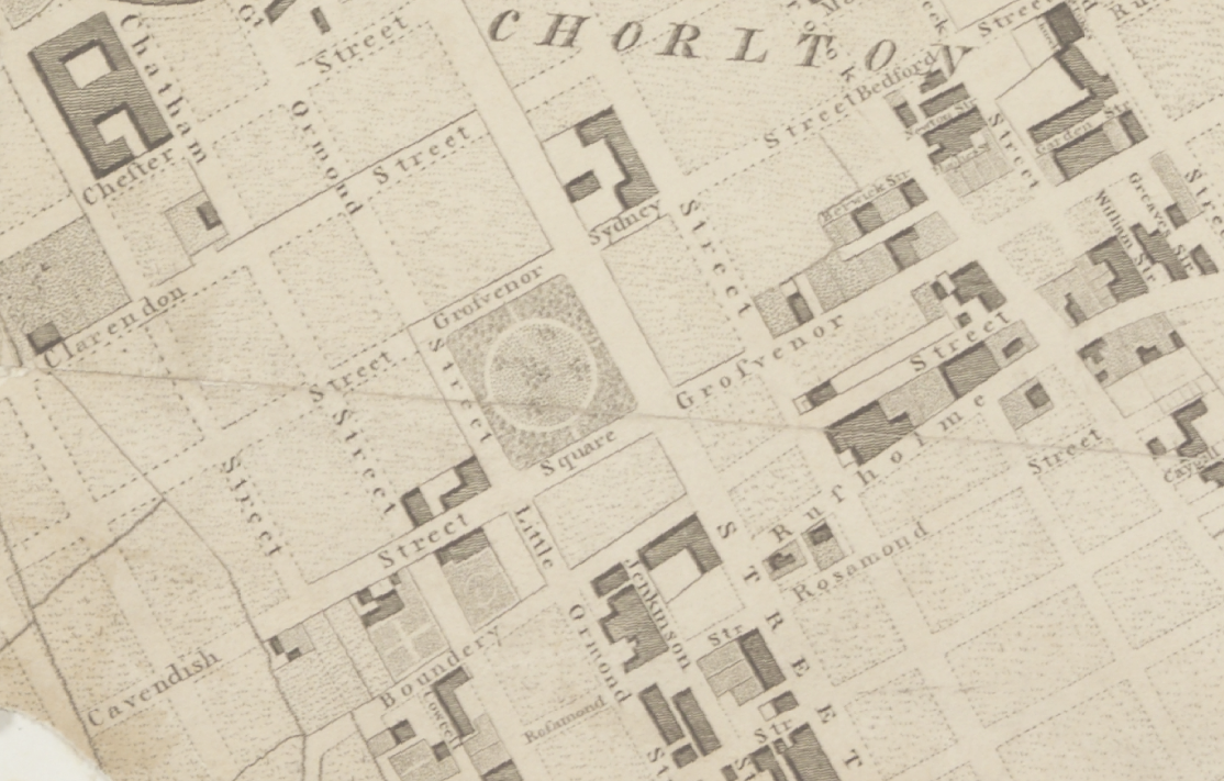
Green fields, sylvan glades and a pleasant park in Grosvenor Square.
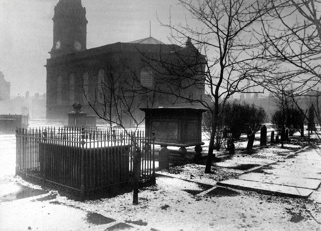
Then all of a sudden, at the heart of the Square sat All Saints Church.
Underneath Manchester’s All Saints Park is a hidden history – an estimated 16,000 bodies. For this was the site of a former Victorian Cemetery, set up to cater for the parishioners of All Saints.
All Saints Burial Ground officially opened on Wednesday 19 April 1820. The first interment was that of twenty-one-year-old Fanny Knowles, who lived on London Road. Her funeral was conducted by the founder himself, Charles Burton. It would be another month before the next interment took place. In the first year burials were slow with only 55 interments, however, by 1851 the number had increased to over 600 per annum.
The whole area having been a centre of housing, education, entertainment, commerce, public services and worship, was becoming the fiefdom of first the Polytechnic and subsequently the Manchester Metropolitan University.
But formerly there were peoples’ homes here.
Then the 1960s saw a huge programme of slum clearance in Manchester and whole communities across the Square and nearby Hulme were moved, rehoused in a thoroughly modern milieu.
Shops came and went.
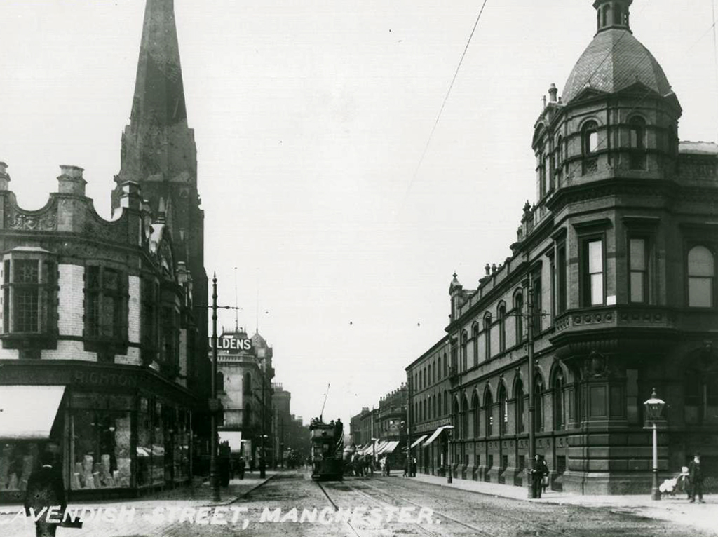
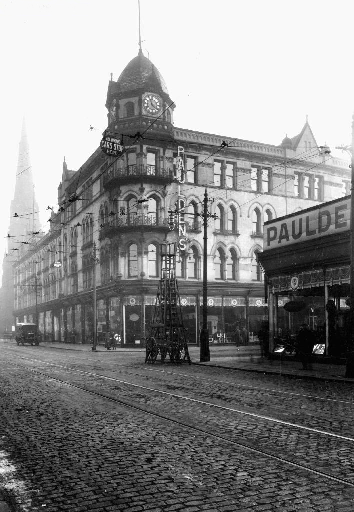
Paulden’s magnificent store was destroyed by fire in 1957
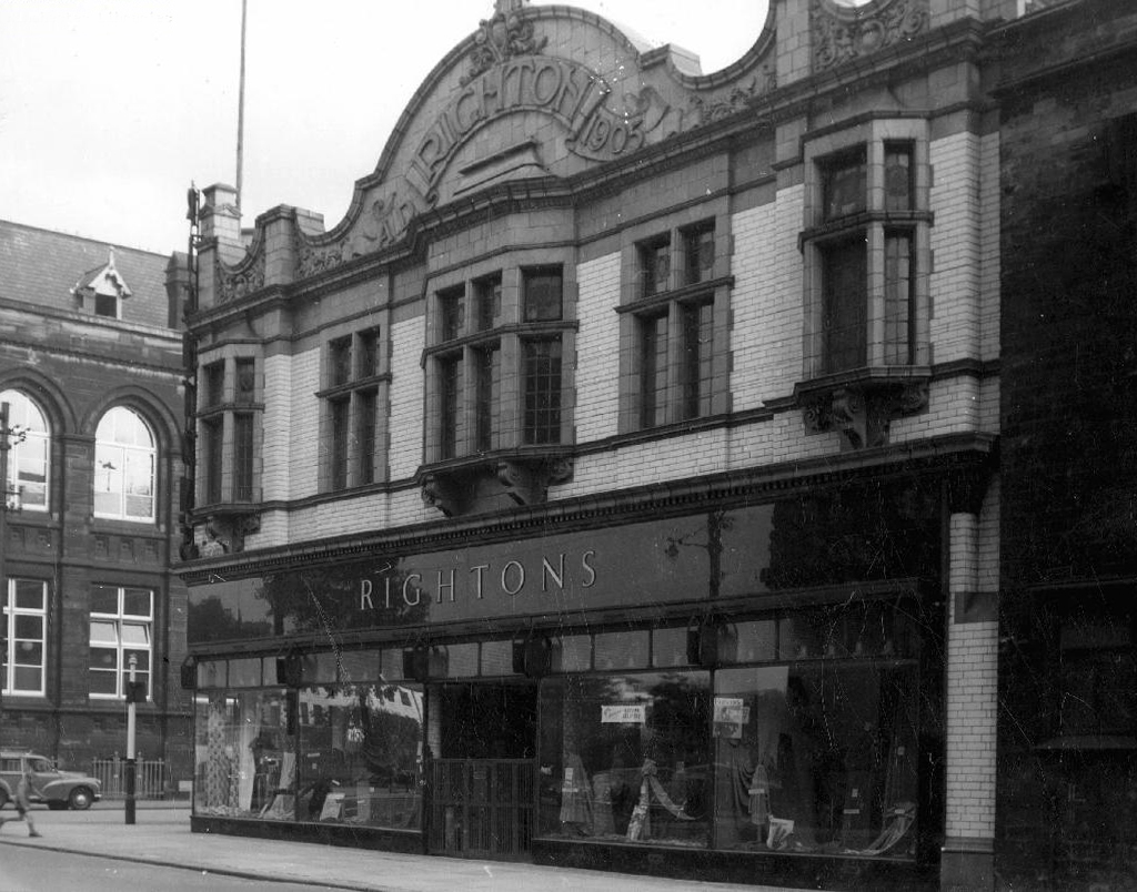
Rightons haberdashers has survived though no longer haberdashing, having been amalgamated into MMU.
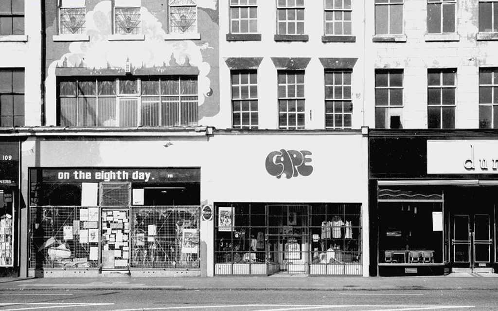
One day On The Eight day moved a little to the left
The fascia has been retained but the name has not been changed to protect the innocent.
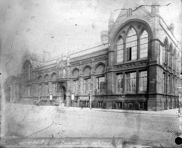
Next door the Chorlton on Medlock town hall still has its portico in place, the adjacent Adult Education building has been surgically removed.
Richard Lane, the architect of the Friend’s Meeting House on Mount Street, designed the Chorlton-on-Medlock Town Hall on Grosvenor Street. It continued in that role from 1831 until 1838 when Chorlton-on-Medlock became part of the city of Manchester. In the years that followed it was used by the local community for a variety of functions but the redevelopment of the area meant that the local population diminshed and the building became redundant. In 1970, the interior was removed, a new structure added to the rear and it became part of the Polytechnic which became the Manchester Metropolitan University.
The Fifth Pan African Conference was held there between October 15th and 21st in 1945.Ninety delegates from across Africa, Europe and the Caribbean, attended the meeting and among the delegates were a number of men who went on to become political leaders in their countries including: Hastings Banda, Dr Kwame Nkrumah, Obafemi Awolowo and Jomo Kenyatta.
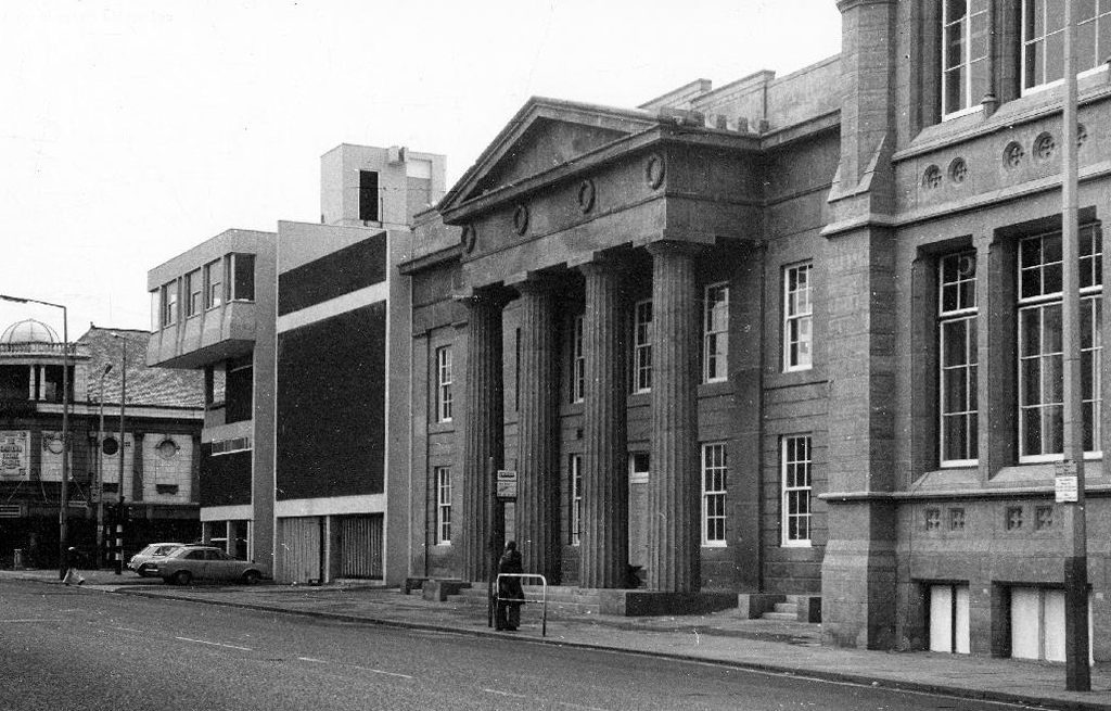
Former Chorlton Poor Law Guardian’s HQ then Registry Office, now the Ormond Building of Metropolitan University – and at the far right edge St Augustine RC.
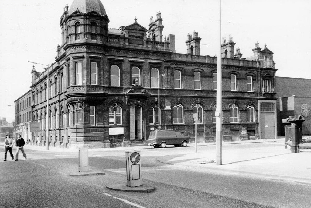
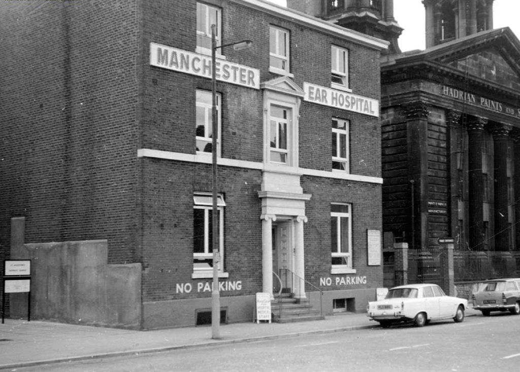
The Manchester Ear Hospital on Lower Ormond Street, shortly before being transferred to Manchester Royal Infirmary. Most of the building was demolished, but the facade retained as part of MMU’s Bellhouse Building.
To the right the Presbyterian Church.
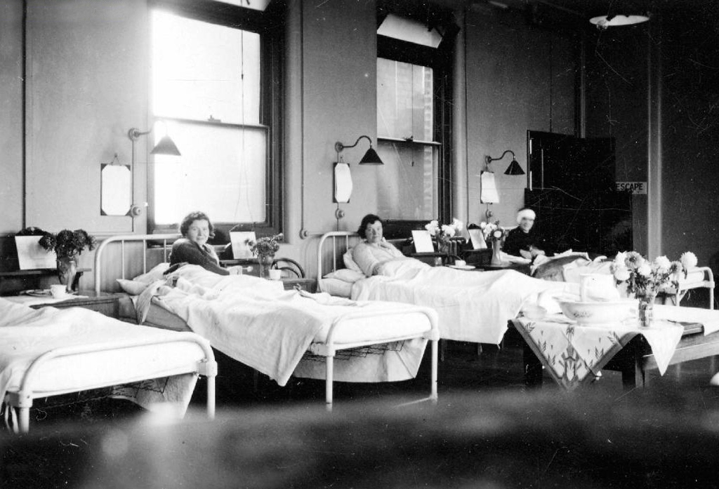
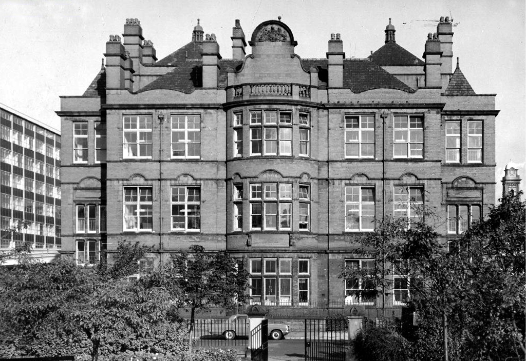
Cavendish Street School
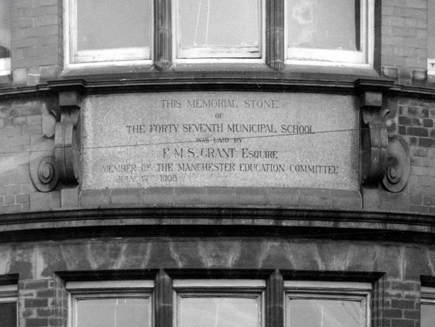
The memorial stone on the front of the school, laid on June 17th, 1908, declared that it was the Forty Seventh Municipal School. Strangely, it seems that it was called the Cavendish Street School despite the fact that it wasn’t on Cavendish Street.
Manchester History
It was subsequently utilised by the Polytechnic sculpture department – then demolished to make way for something else of an educational nature.
Some or all of our social and architectural history has been overwritten, lost or swept aside by the tide of history.
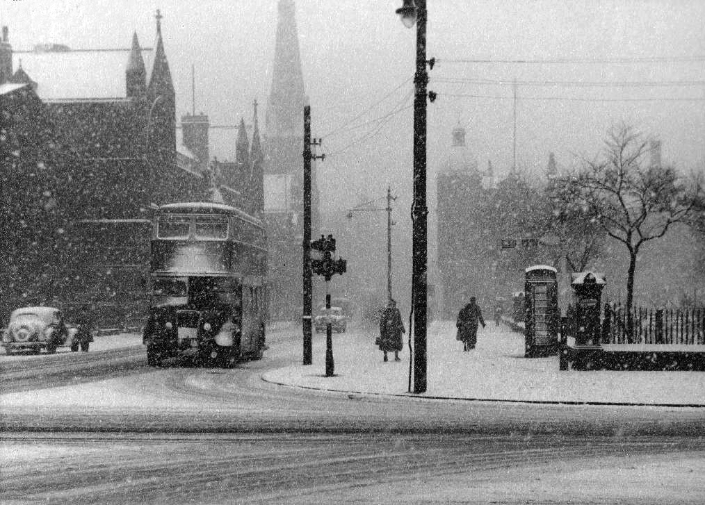
Though on a dark snowy night you can still make out the bright red corporation buses, passing by in a dark cloud of diesel.