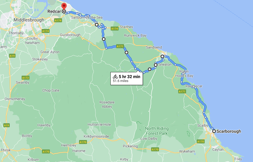
The last post on the concrete coast was from Filey
Now we’re heading south to Bridlington and beyond.
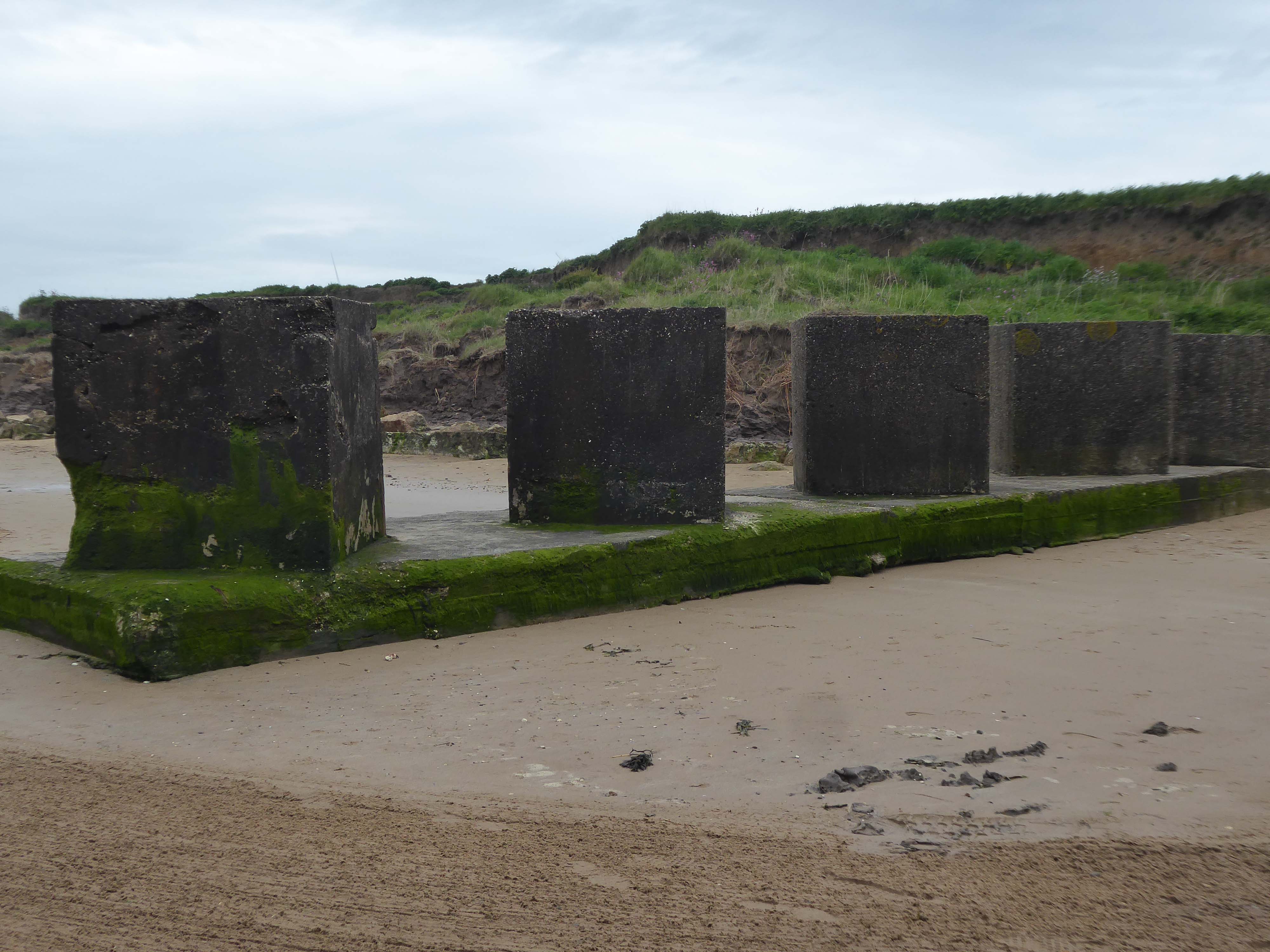
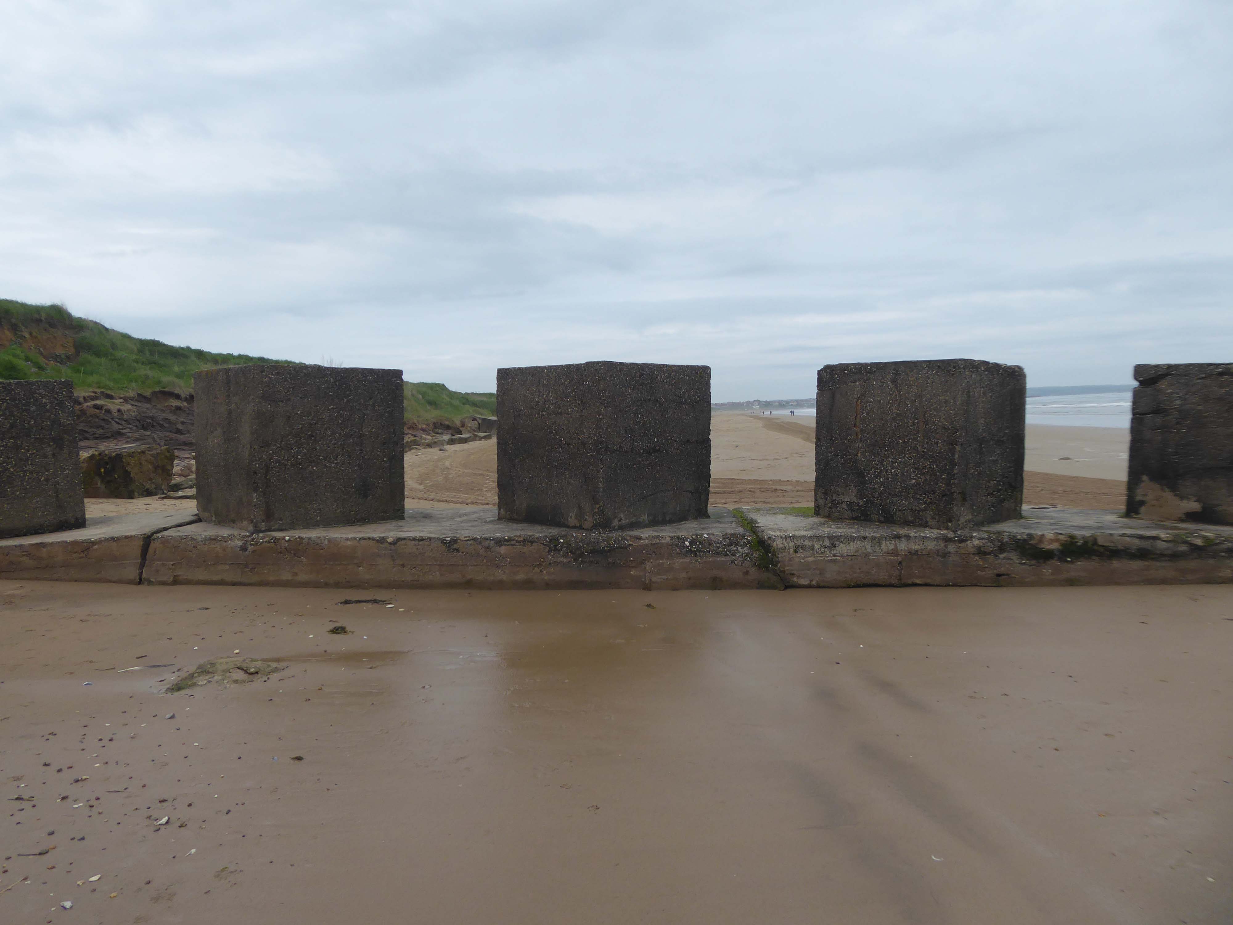
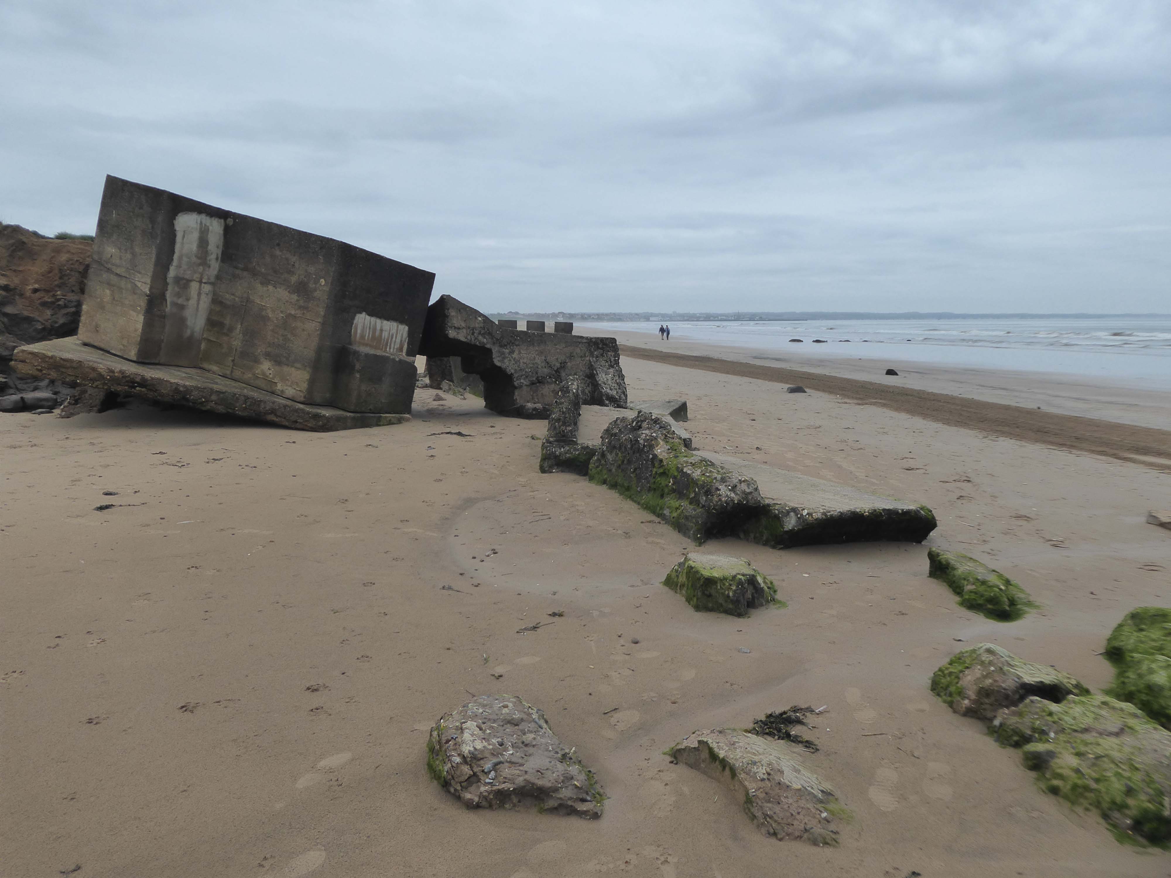
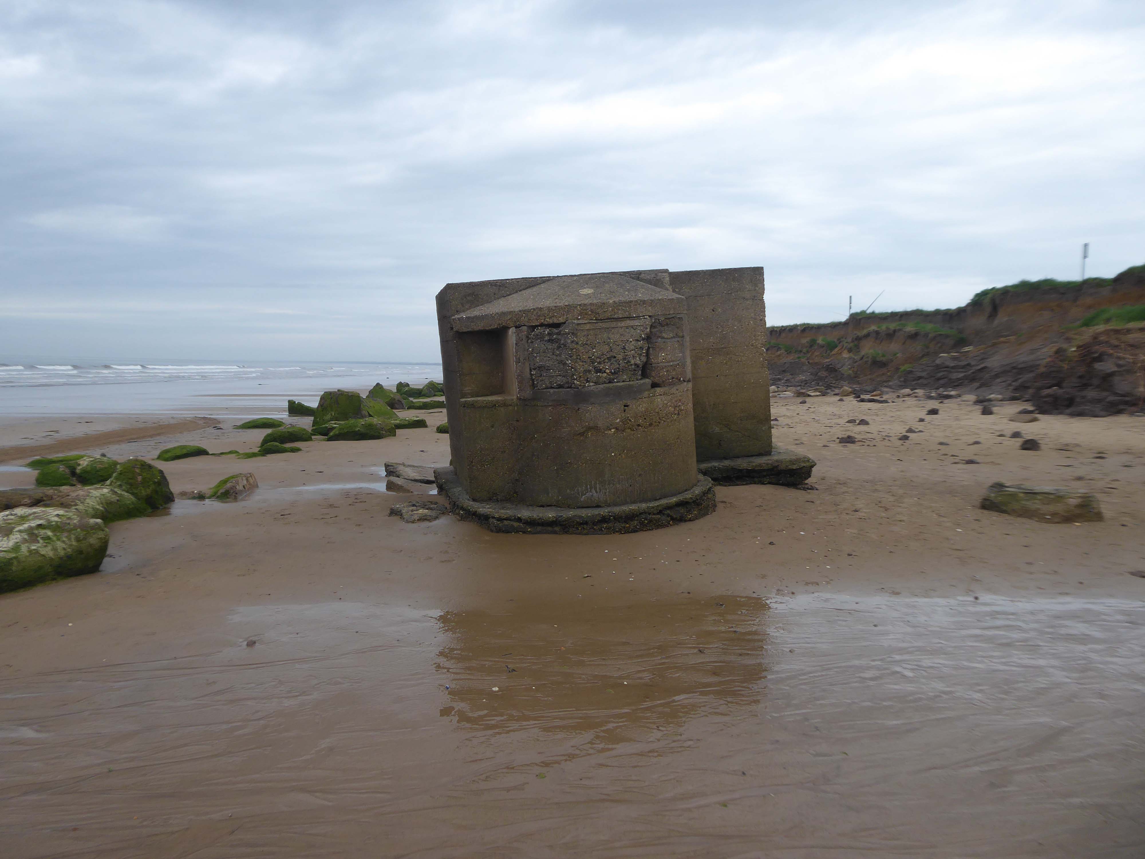
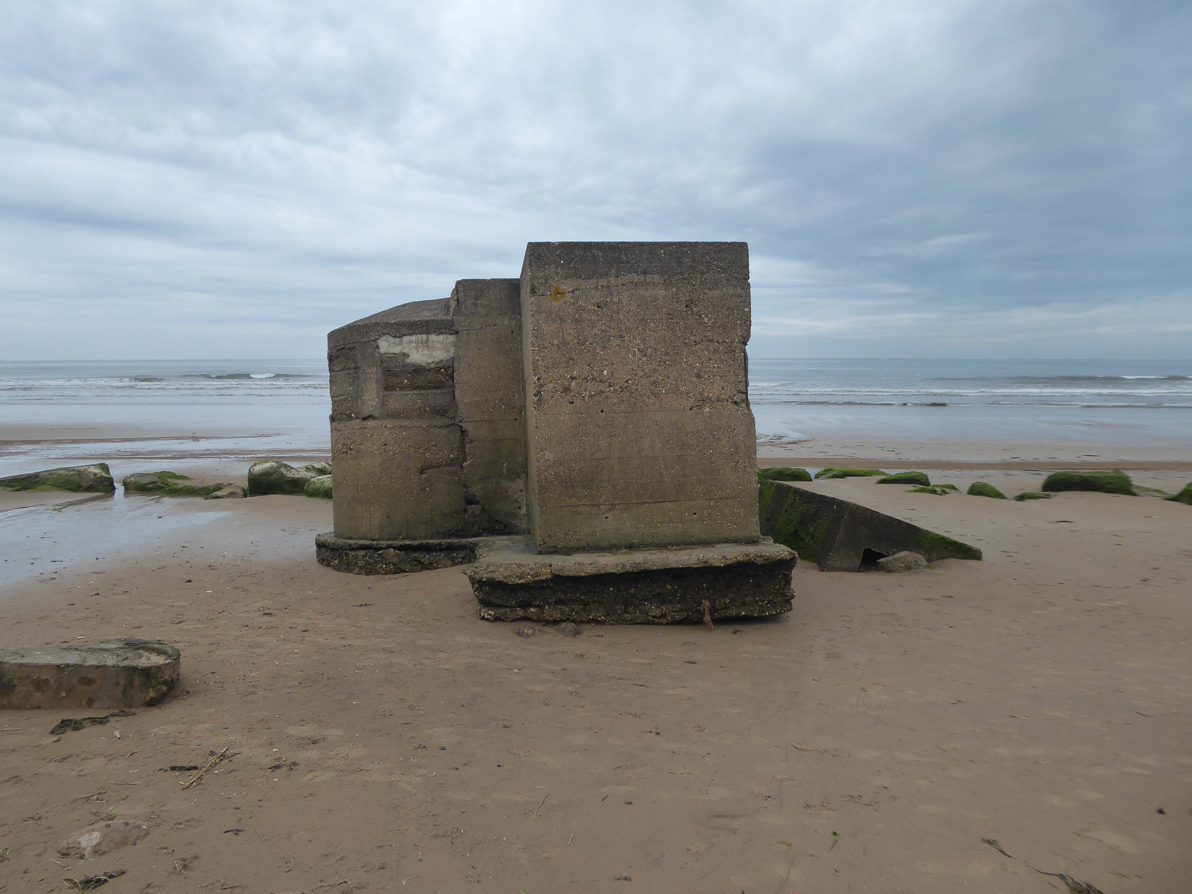
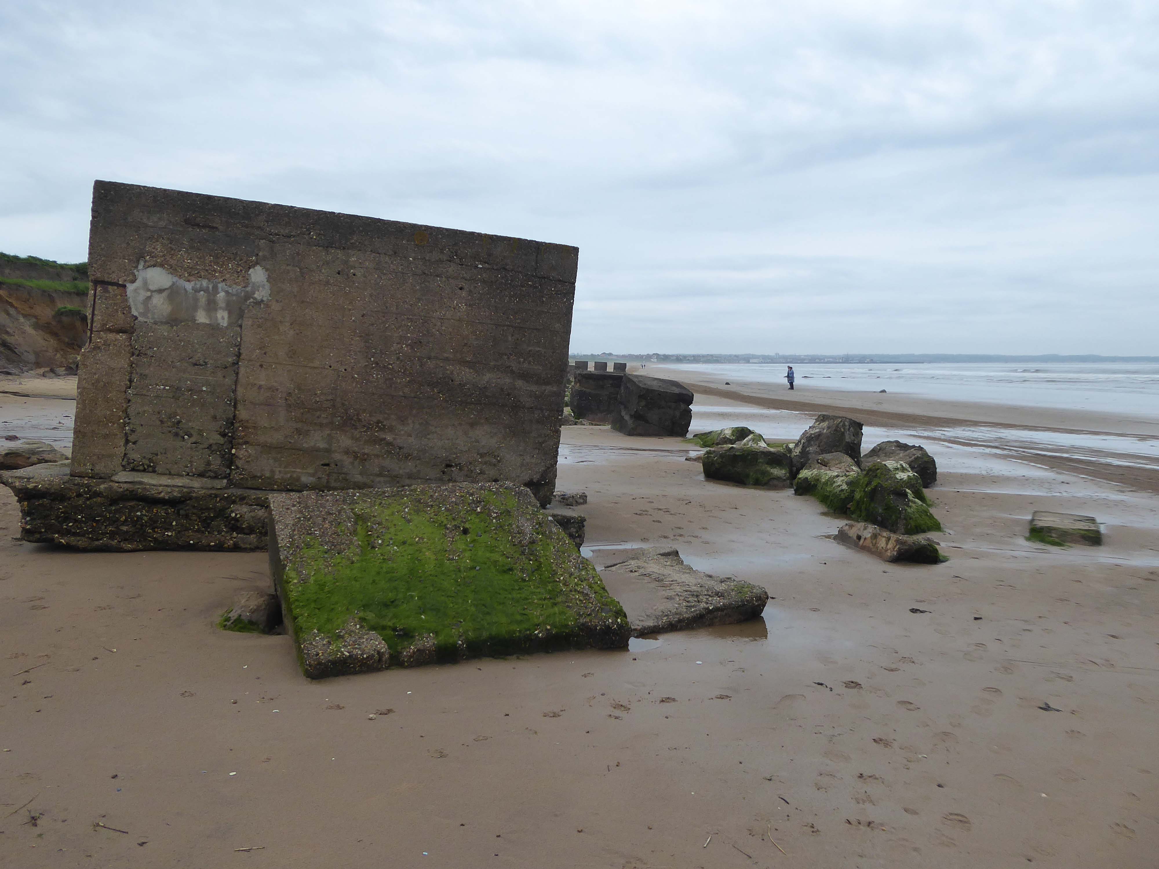
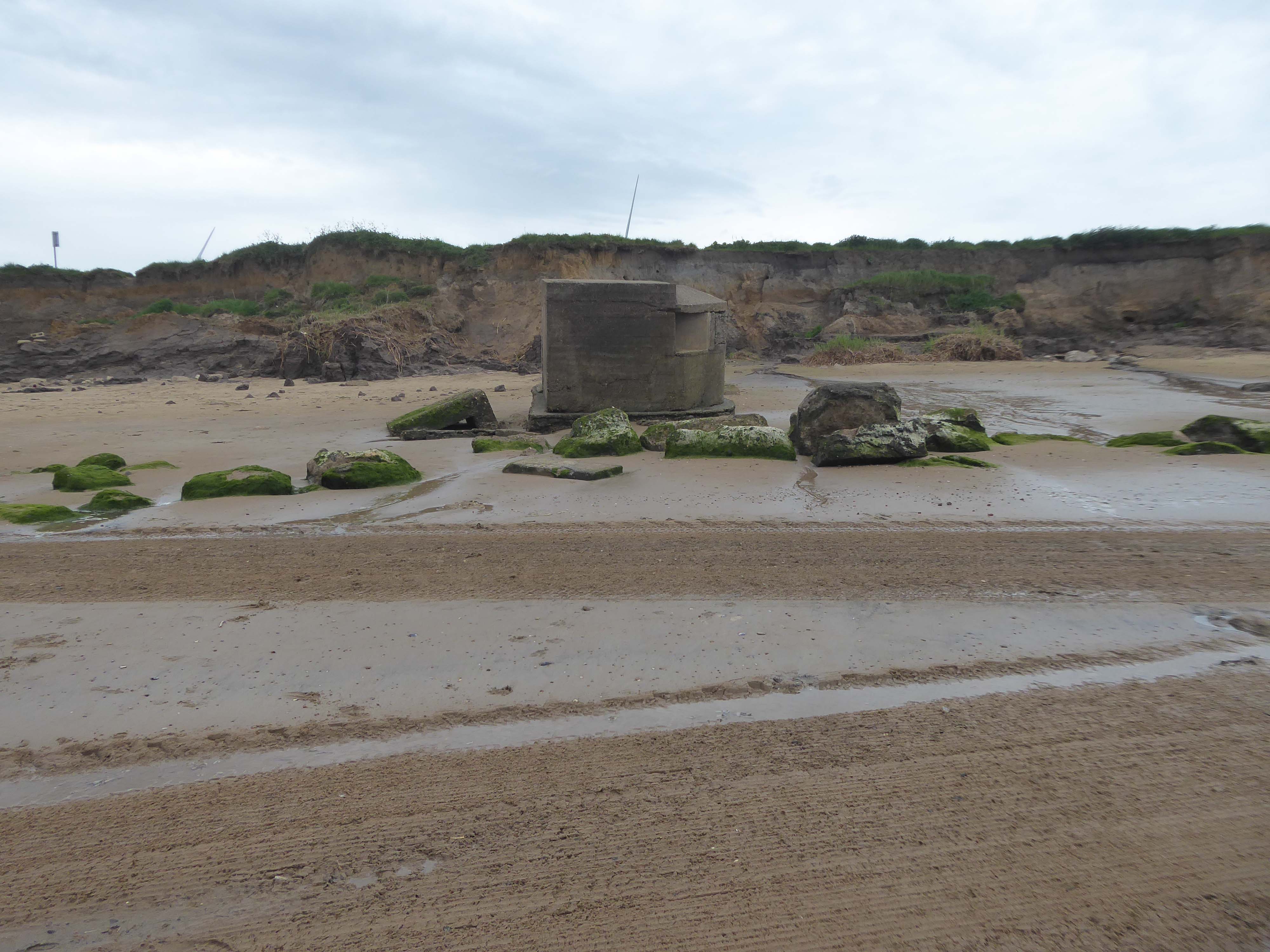
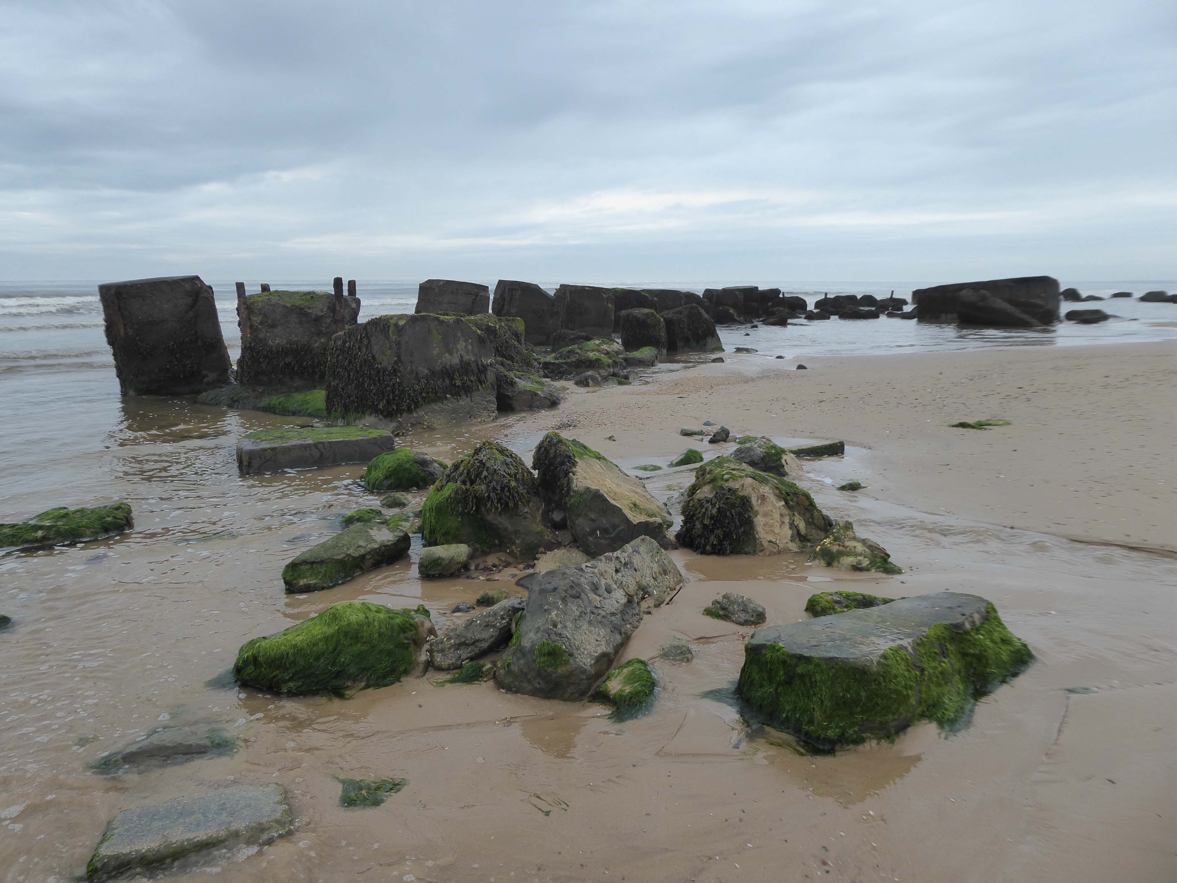
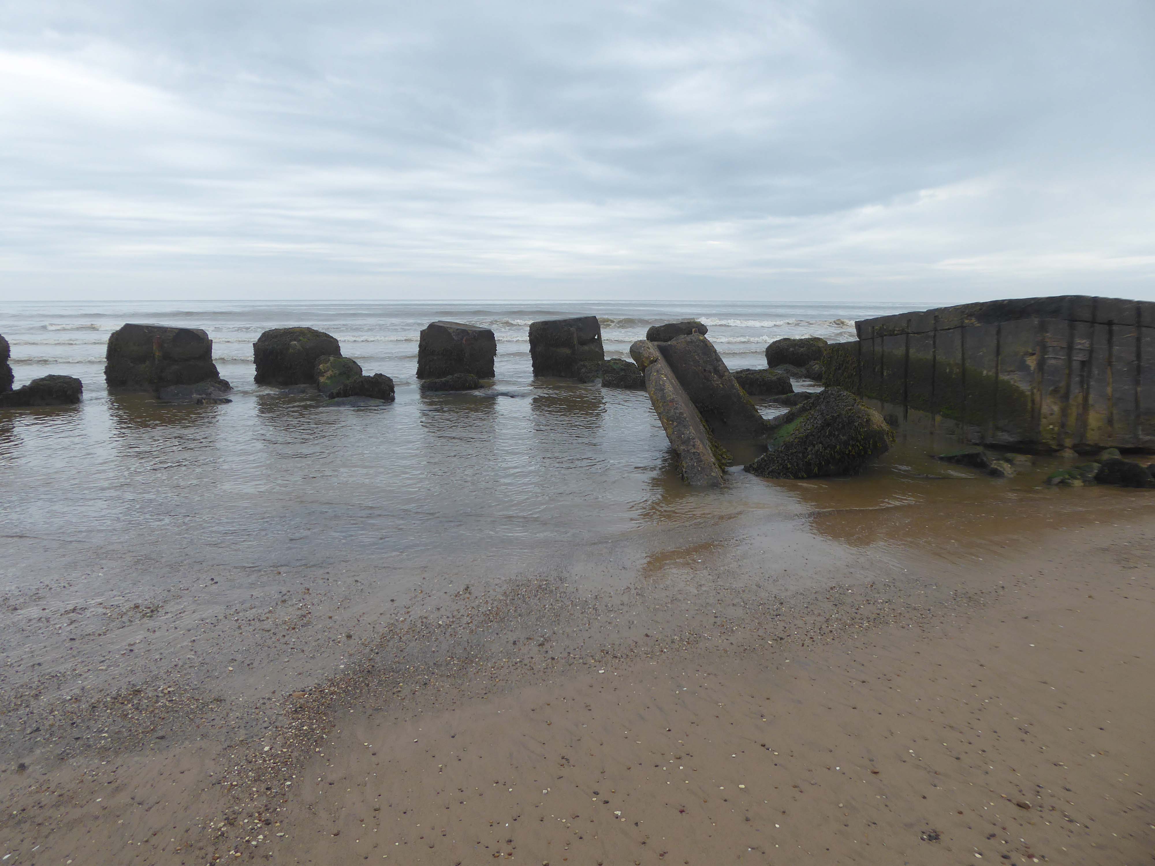
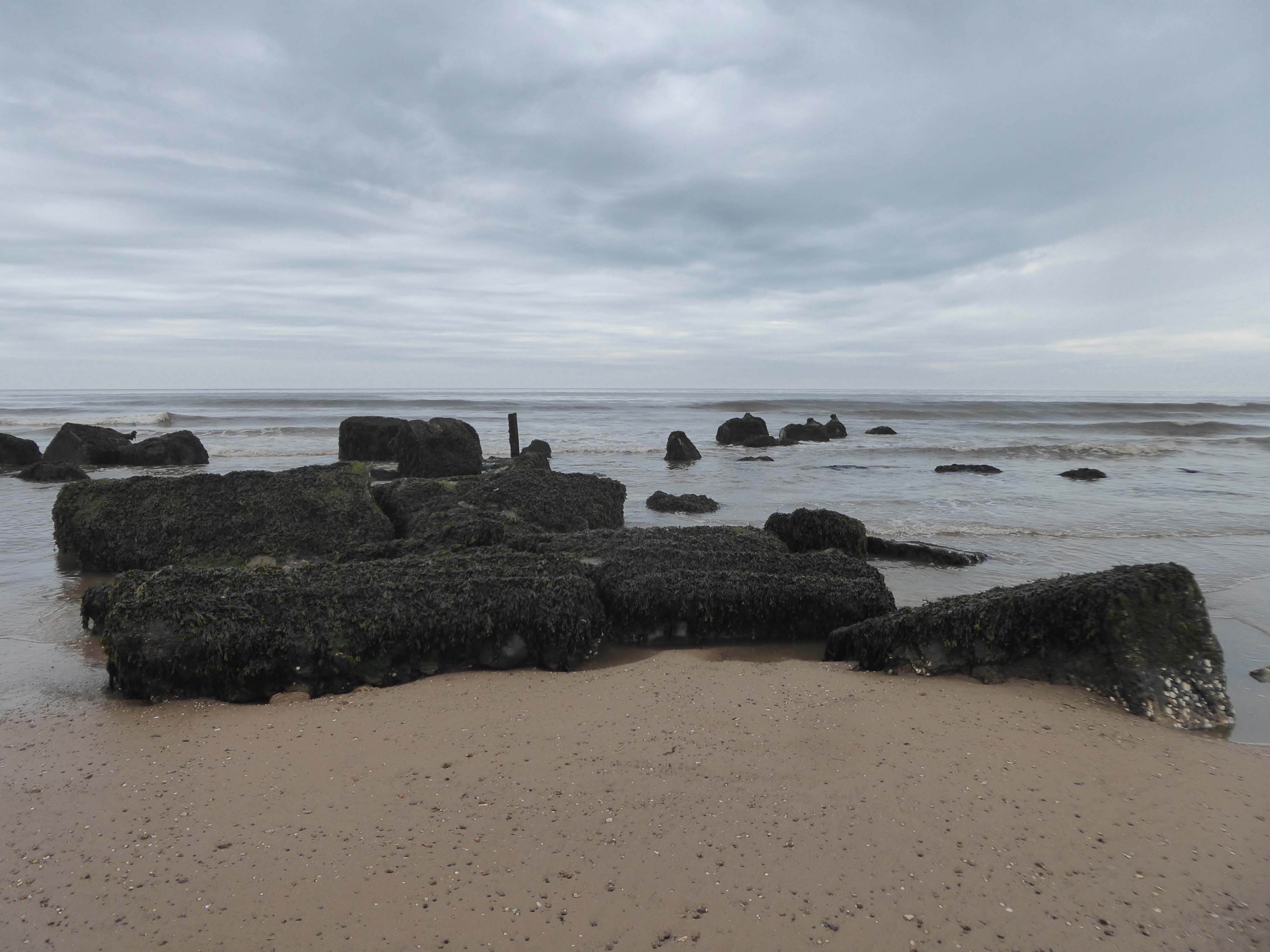
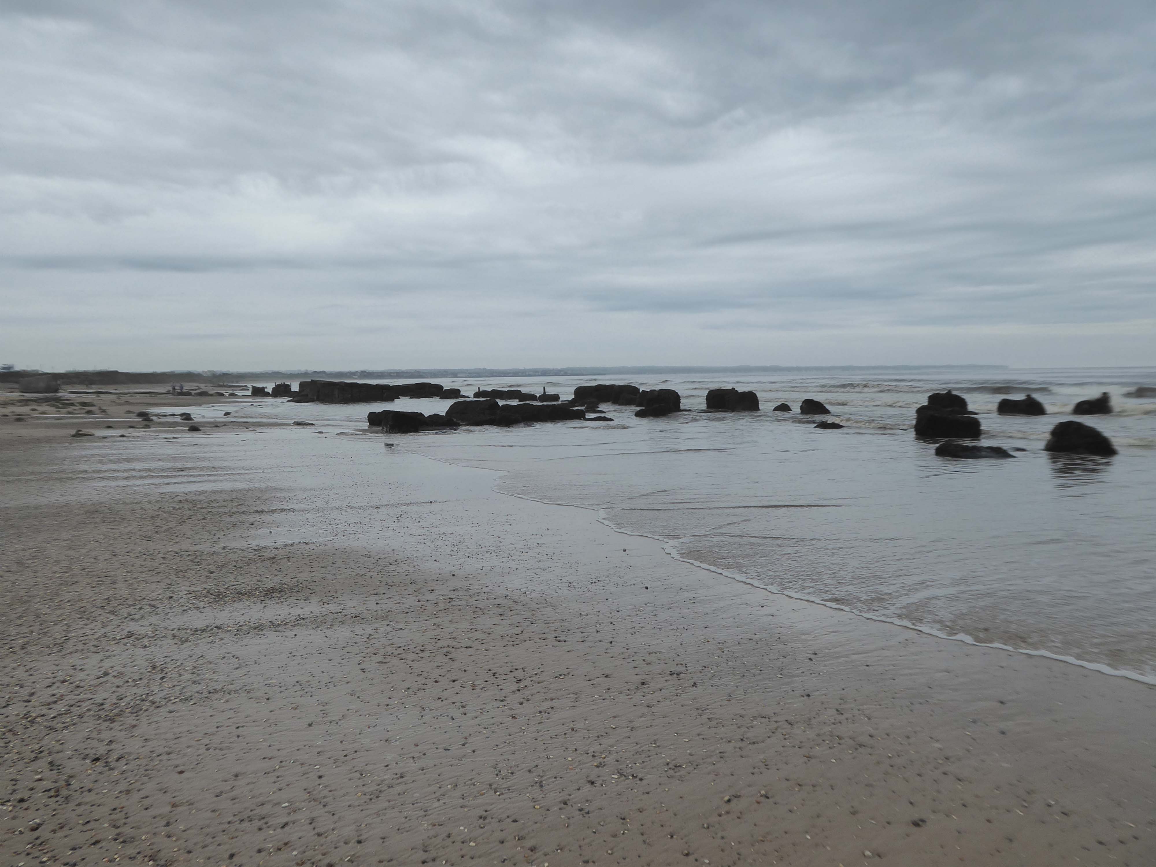
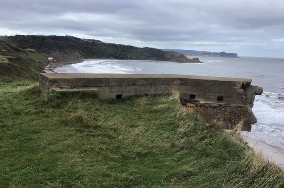
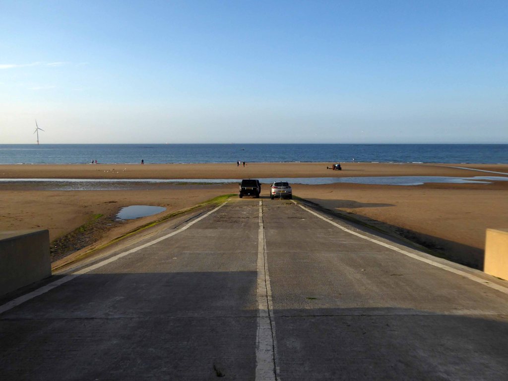
Where we find another dense cluster of sea defences, some but not all extant.
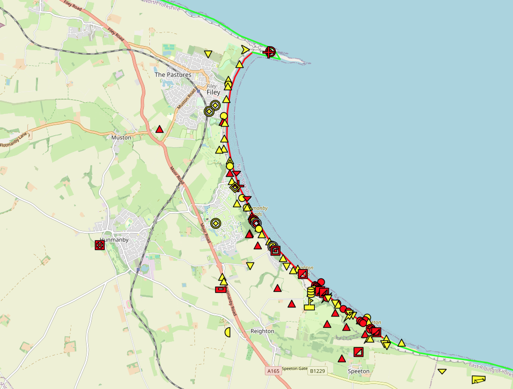
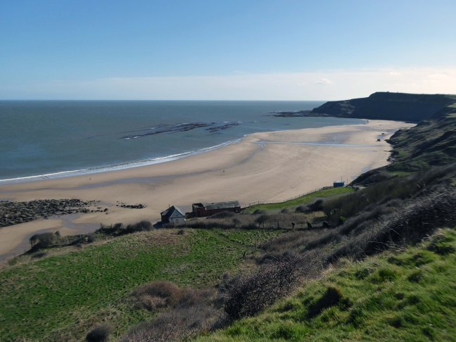
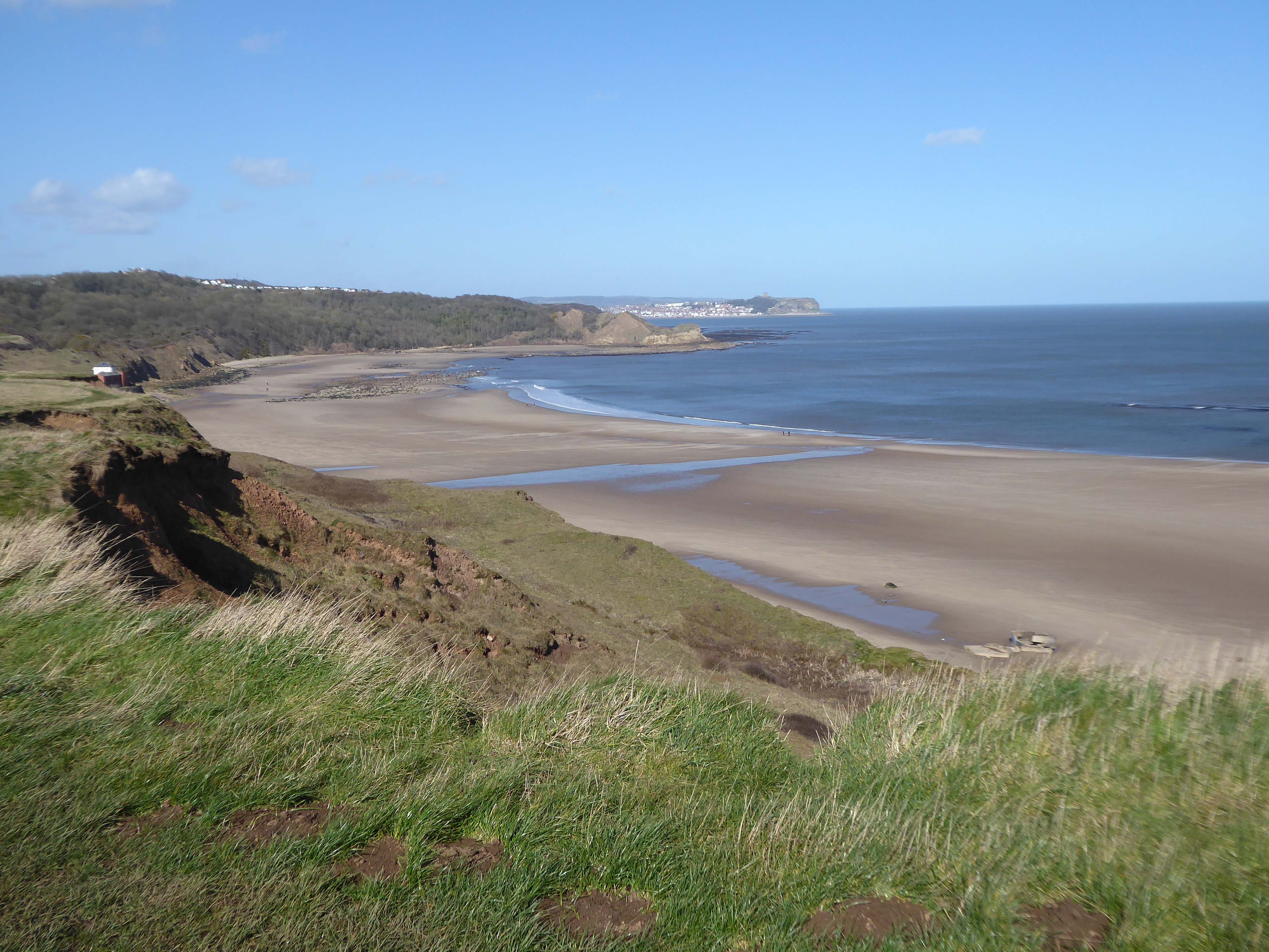
After the south coast, both East Anglia and the Yorkshire Coastline were identified as vulnerable to invasion. Bridlington Bay, was and ideal location for an invasion; flat sandy beaches for amphibious landing crafts, above the foreshore flat landscapes perfect for tanks and gliders to land, an isolated small population with only the residence of Bridlington close by and finally the control of an established port at Bridlington, once it was under German control. According to the Defence of Britain Survey undertaken in the Late 90’s, Northern Command had some of the best defend beaches in the country, this includes Bridlington.
Here there are forces, past and present, at work shaping the landscape and the manmade addenda.
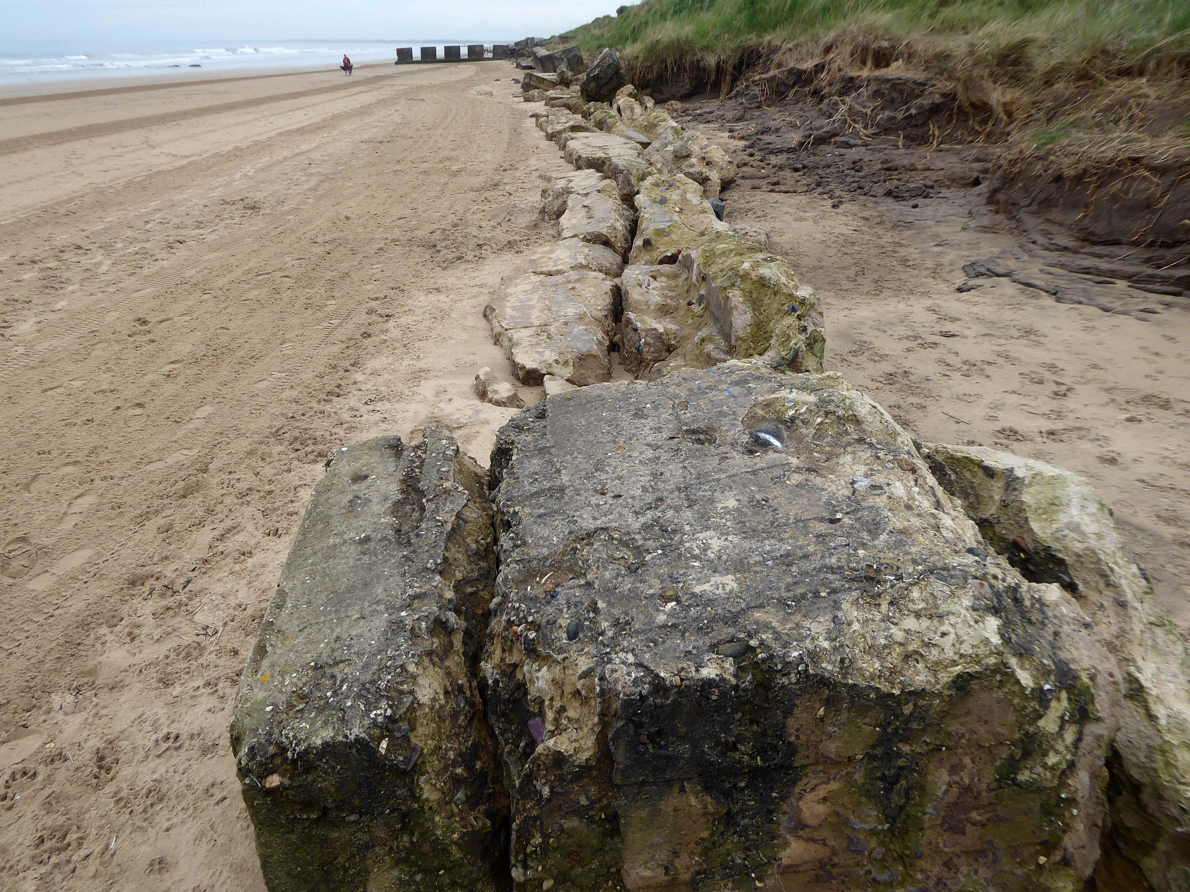
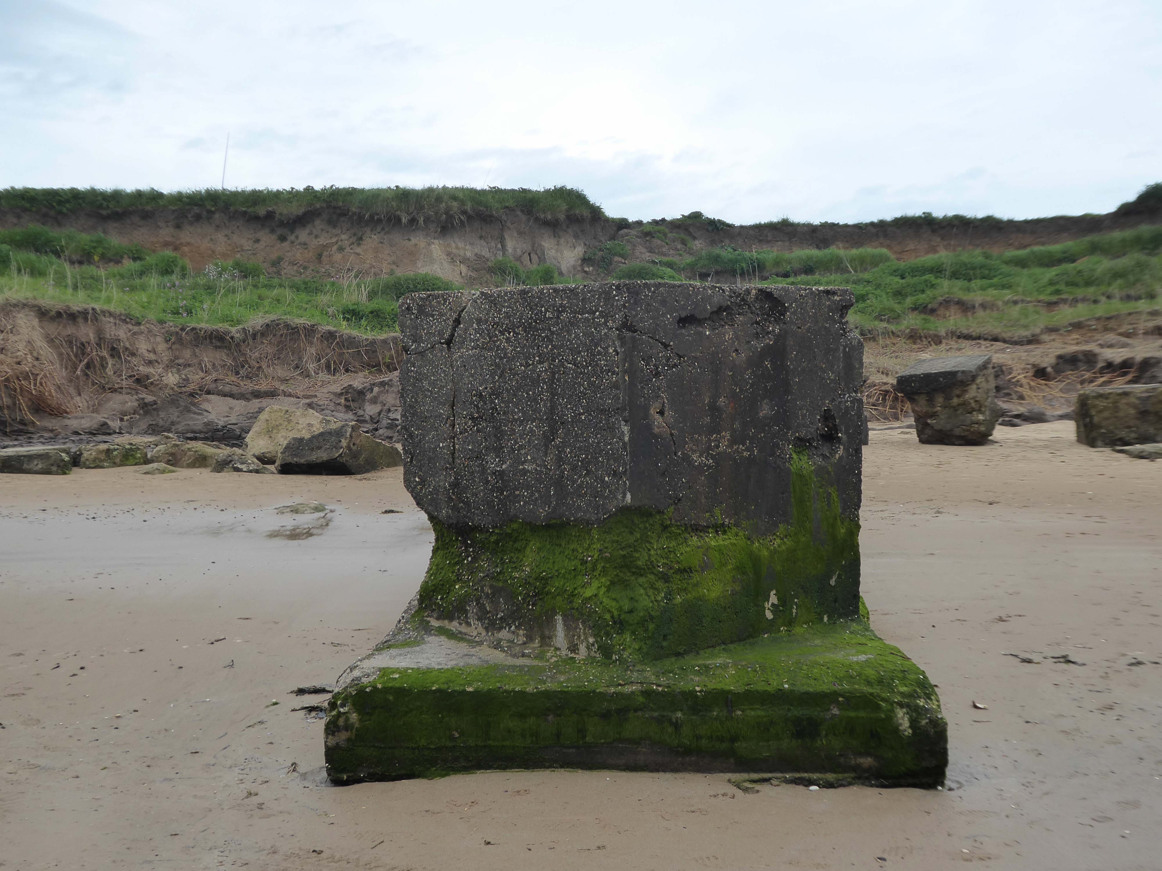
The remorseless waves, wind and rain eroding the coastal clay and contorted concrete.
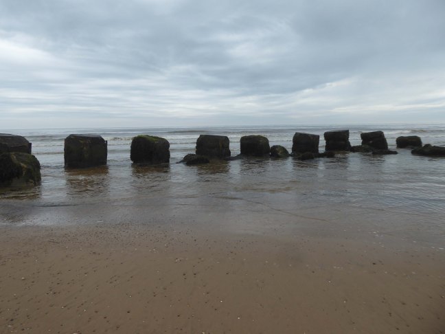
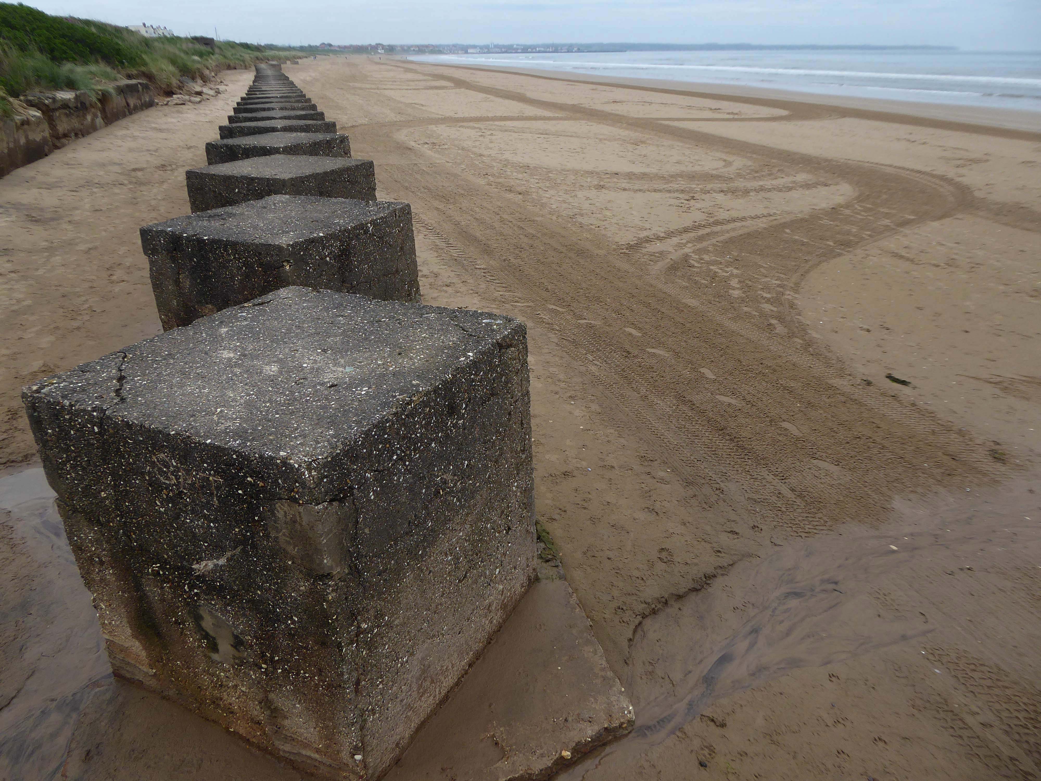
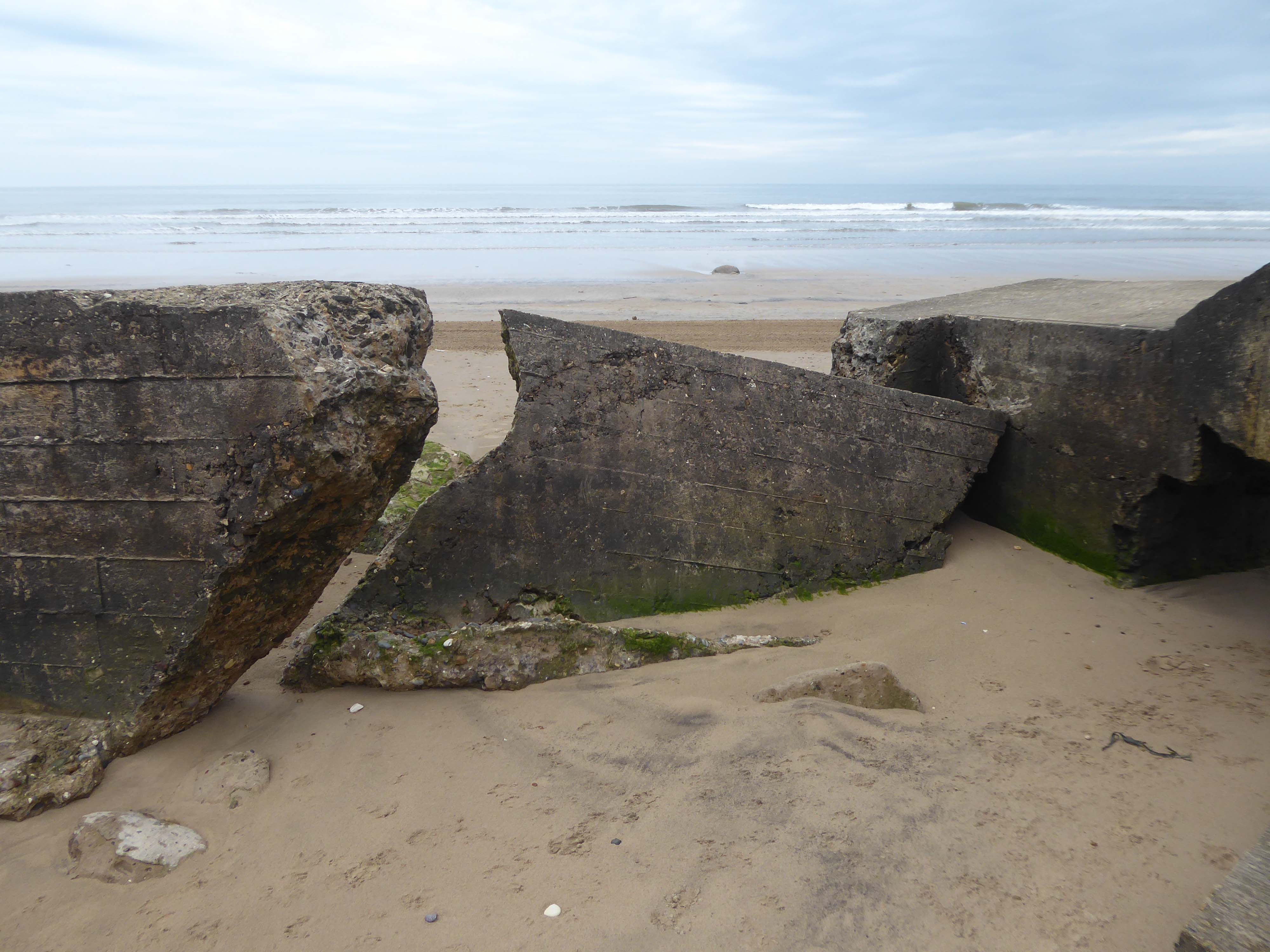
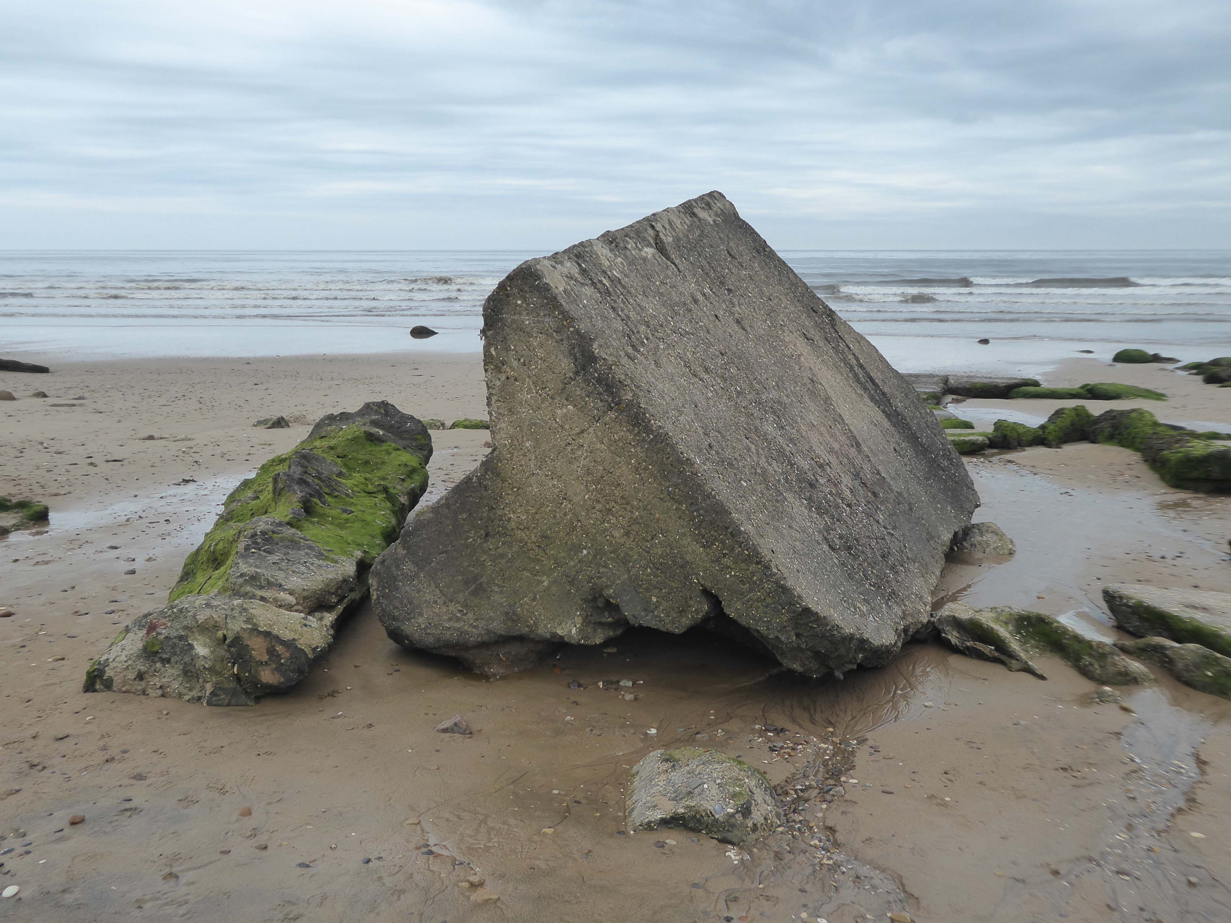
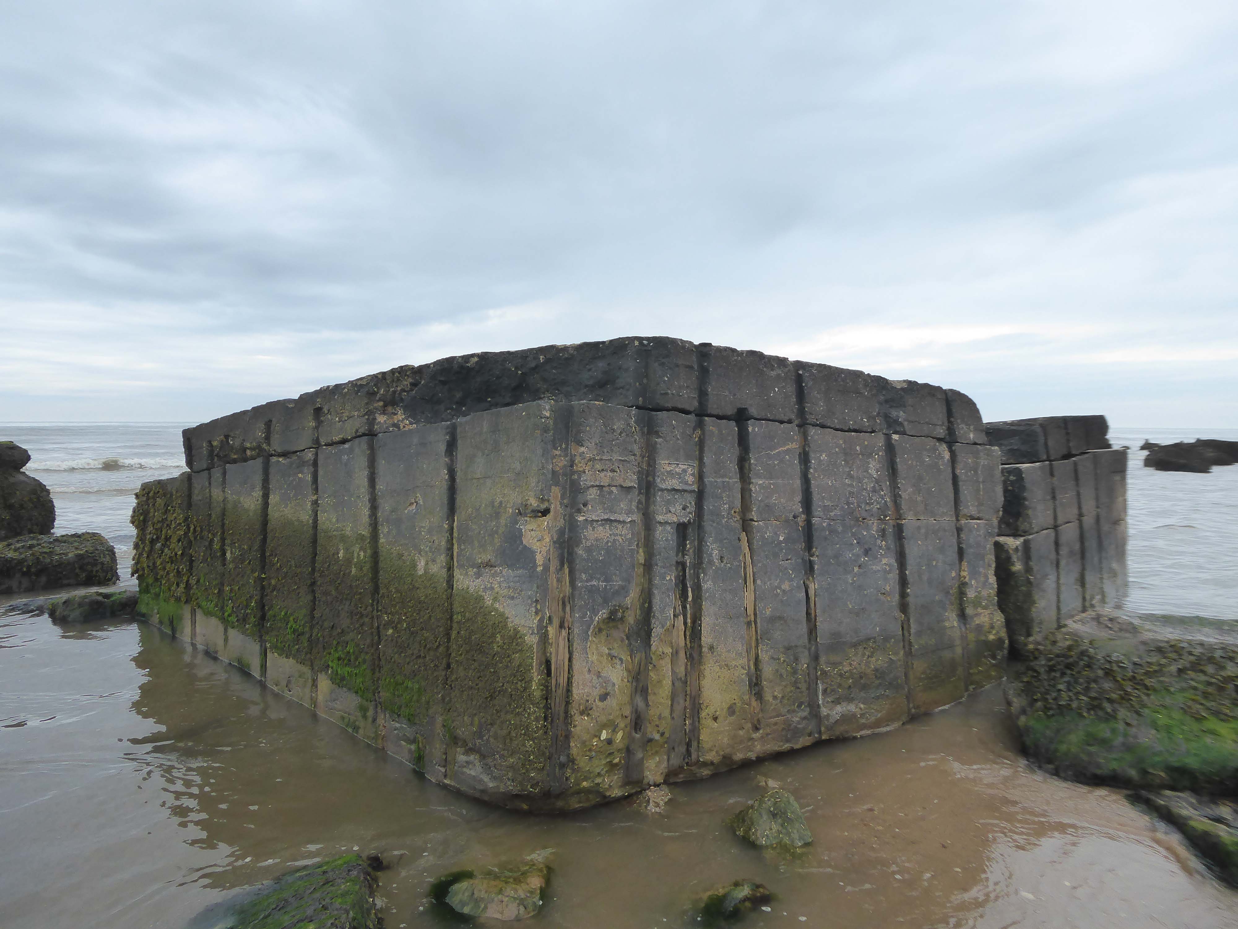
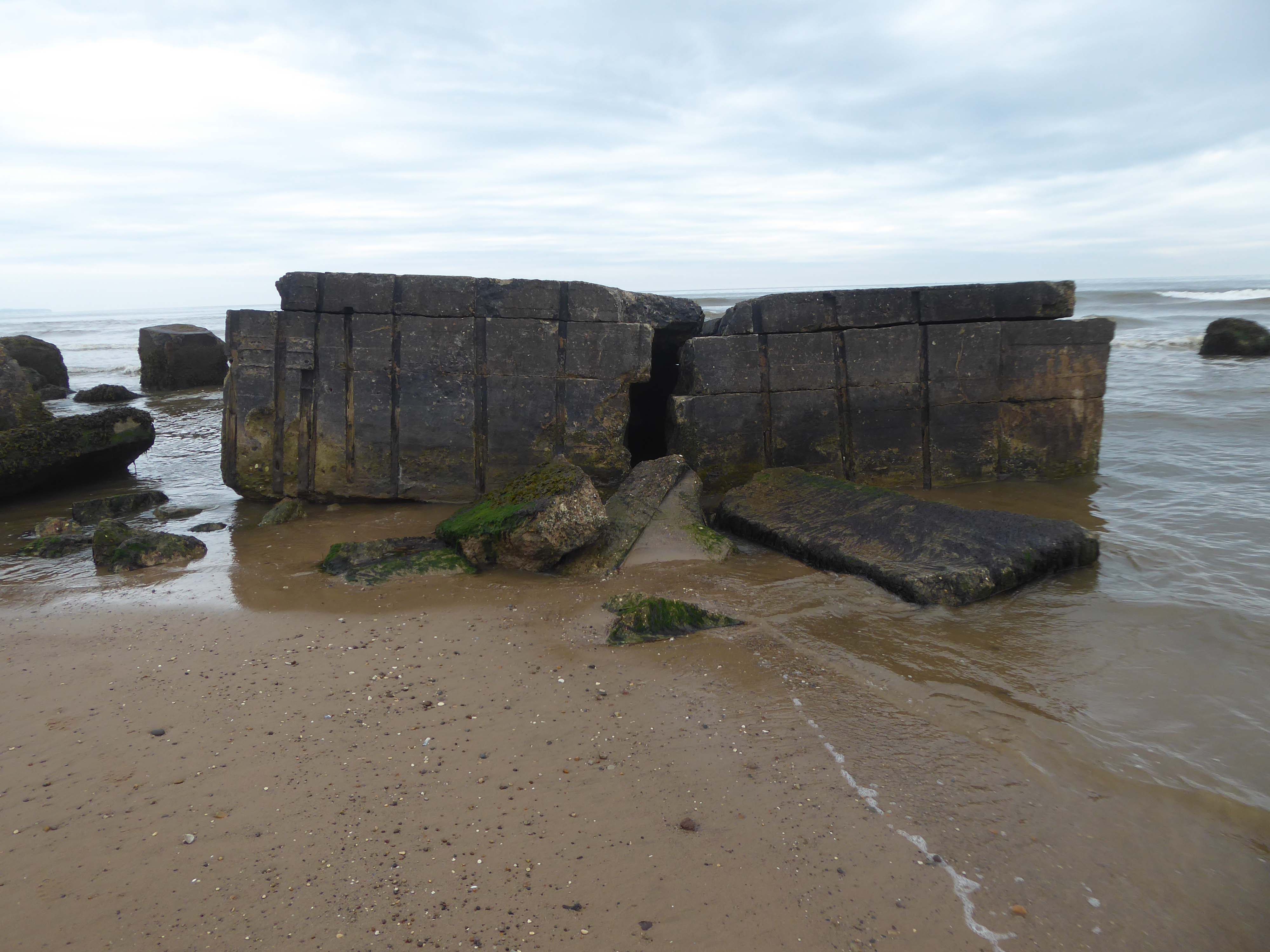
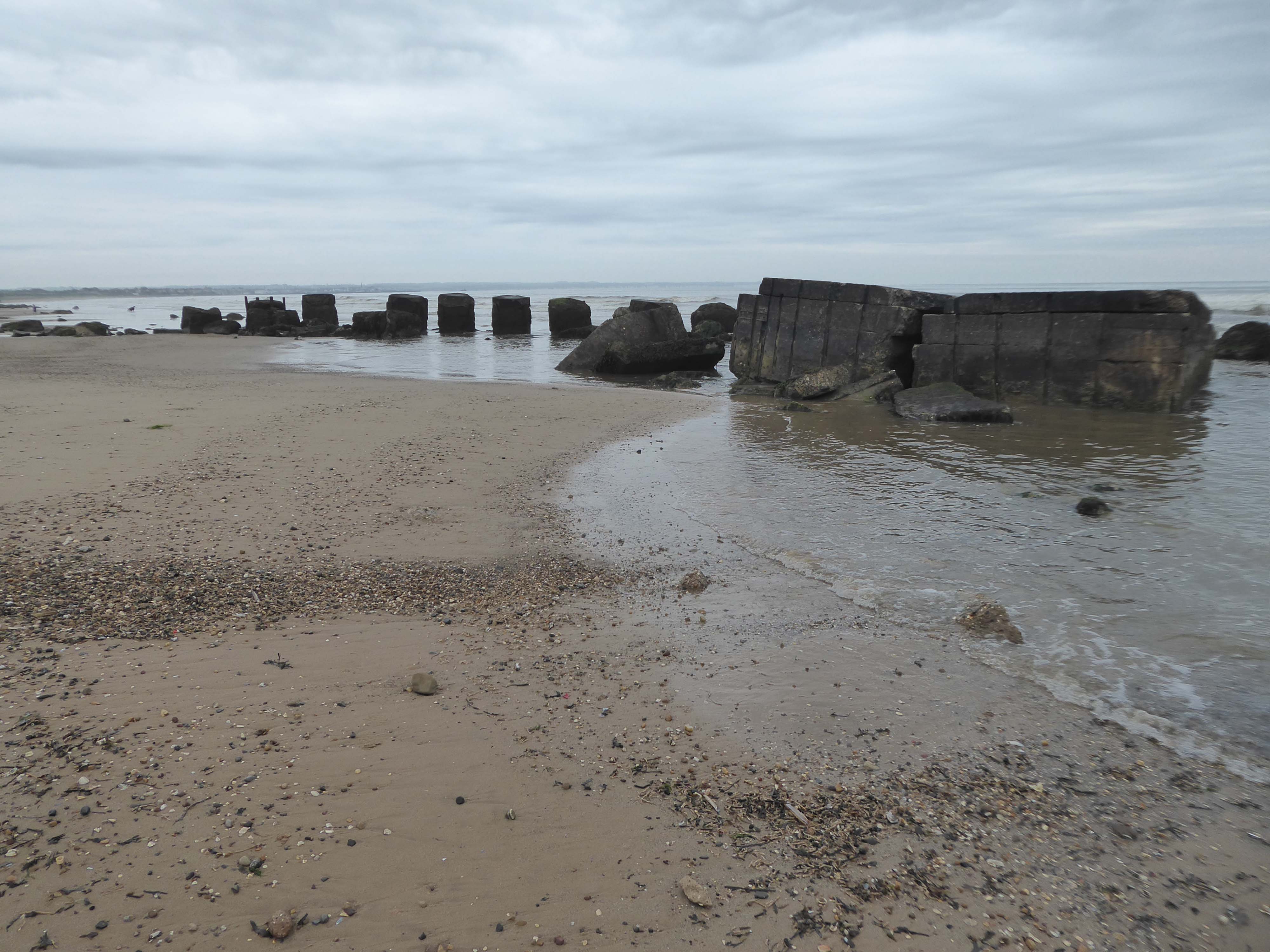
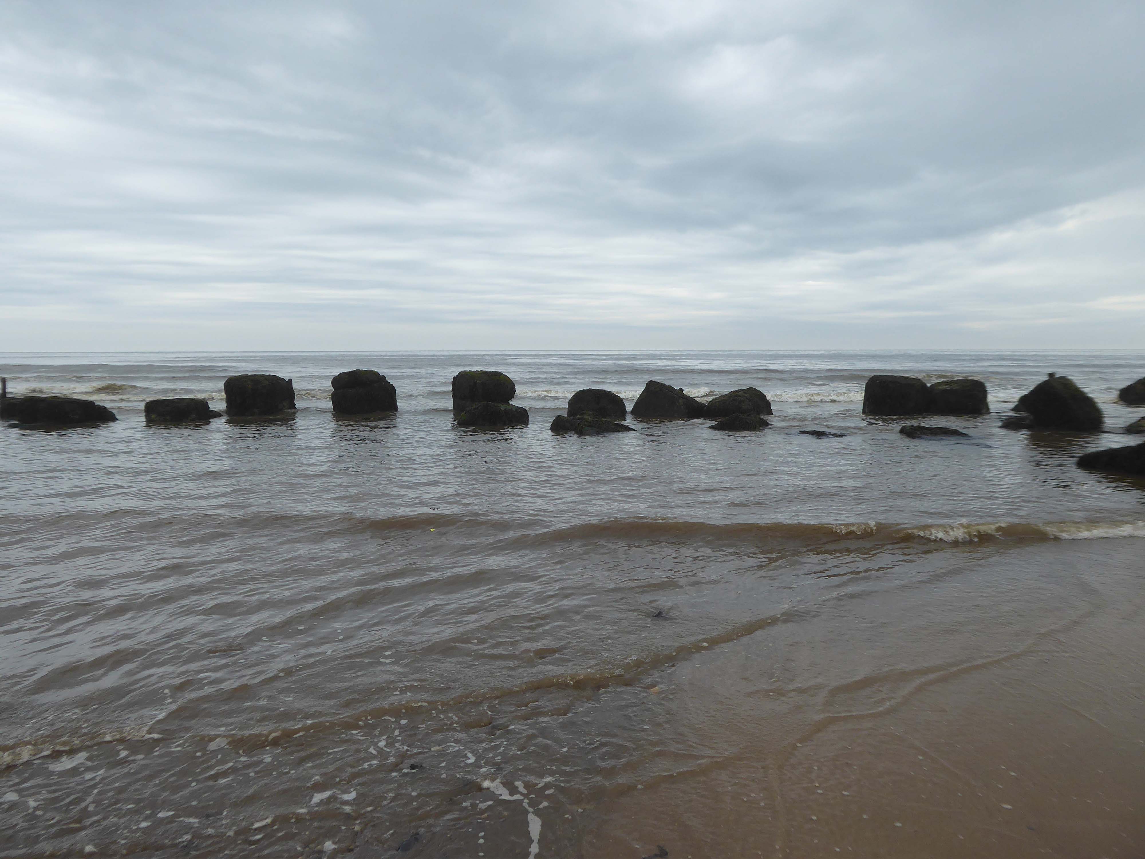
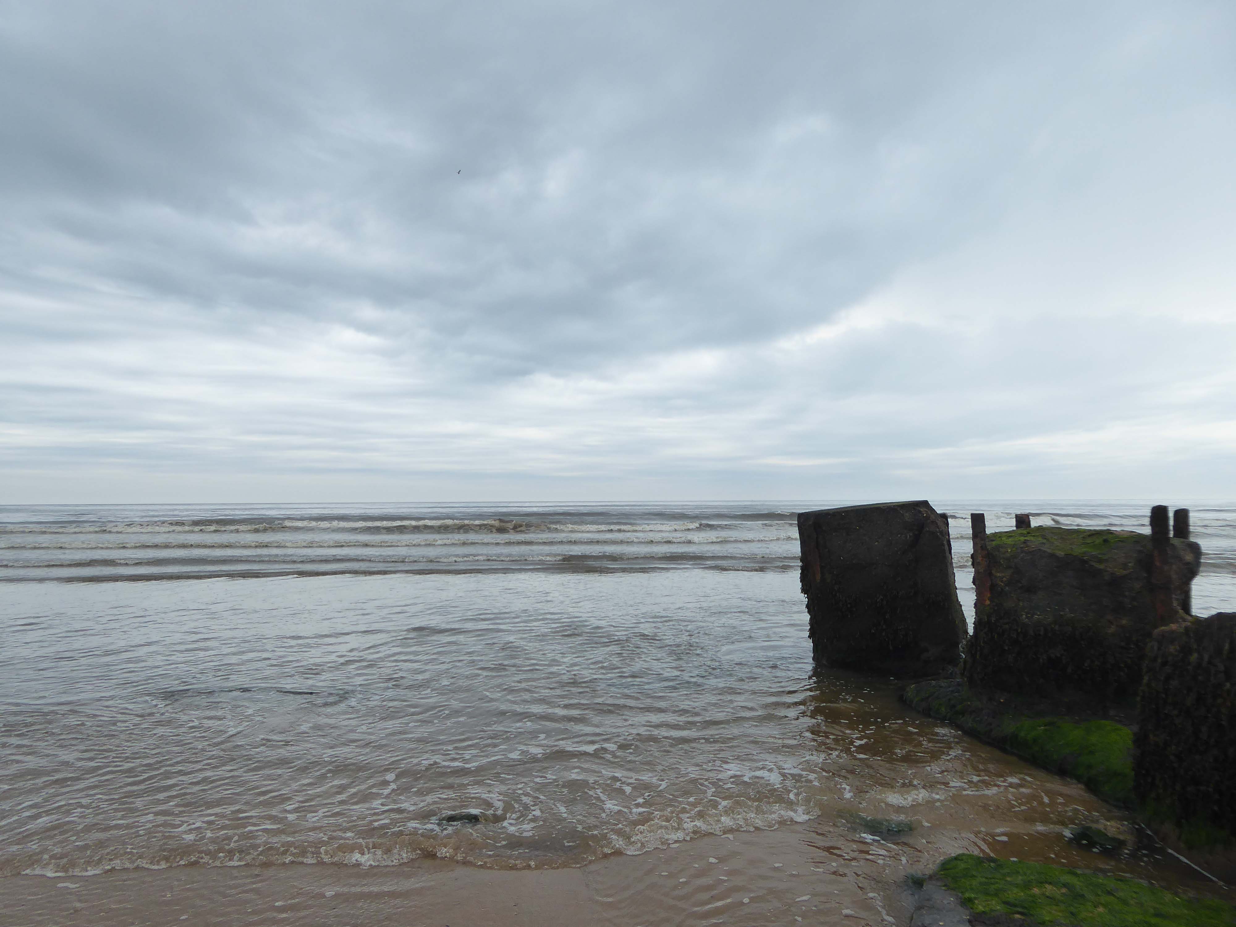
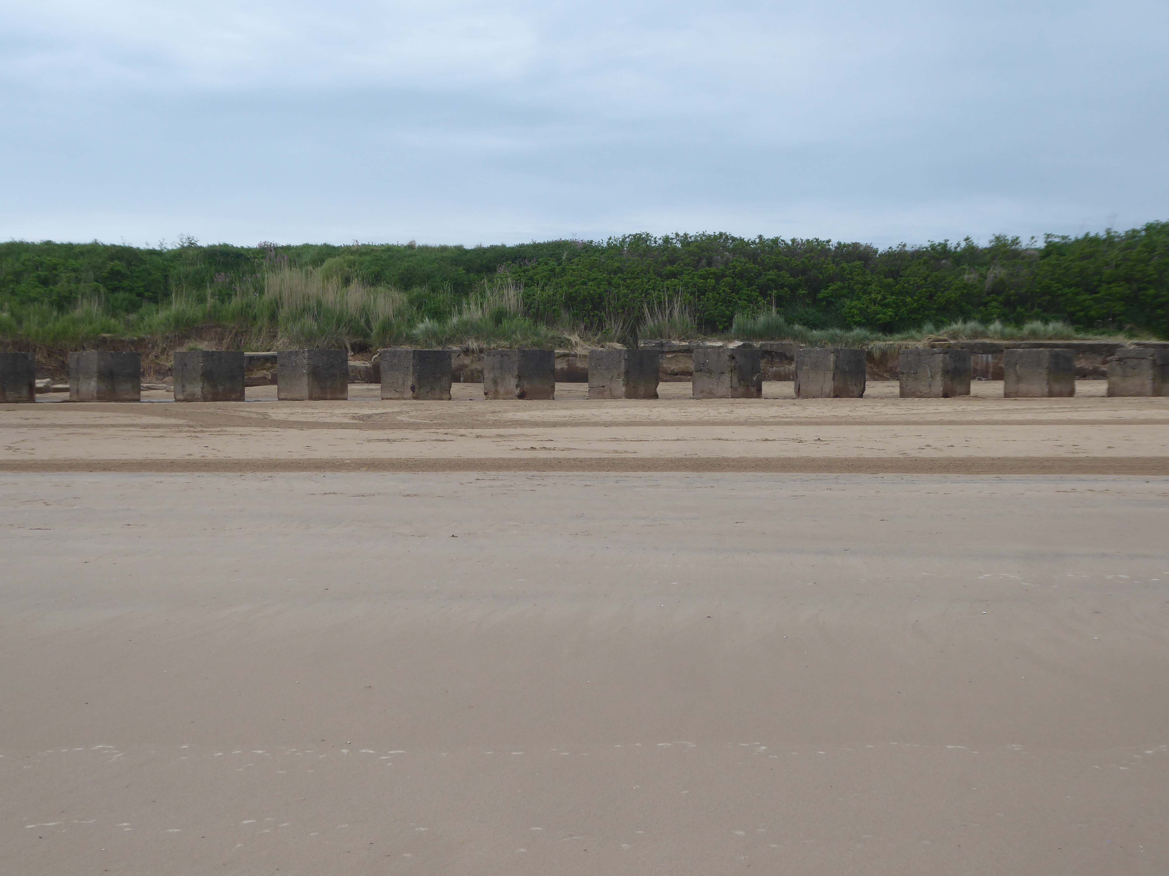
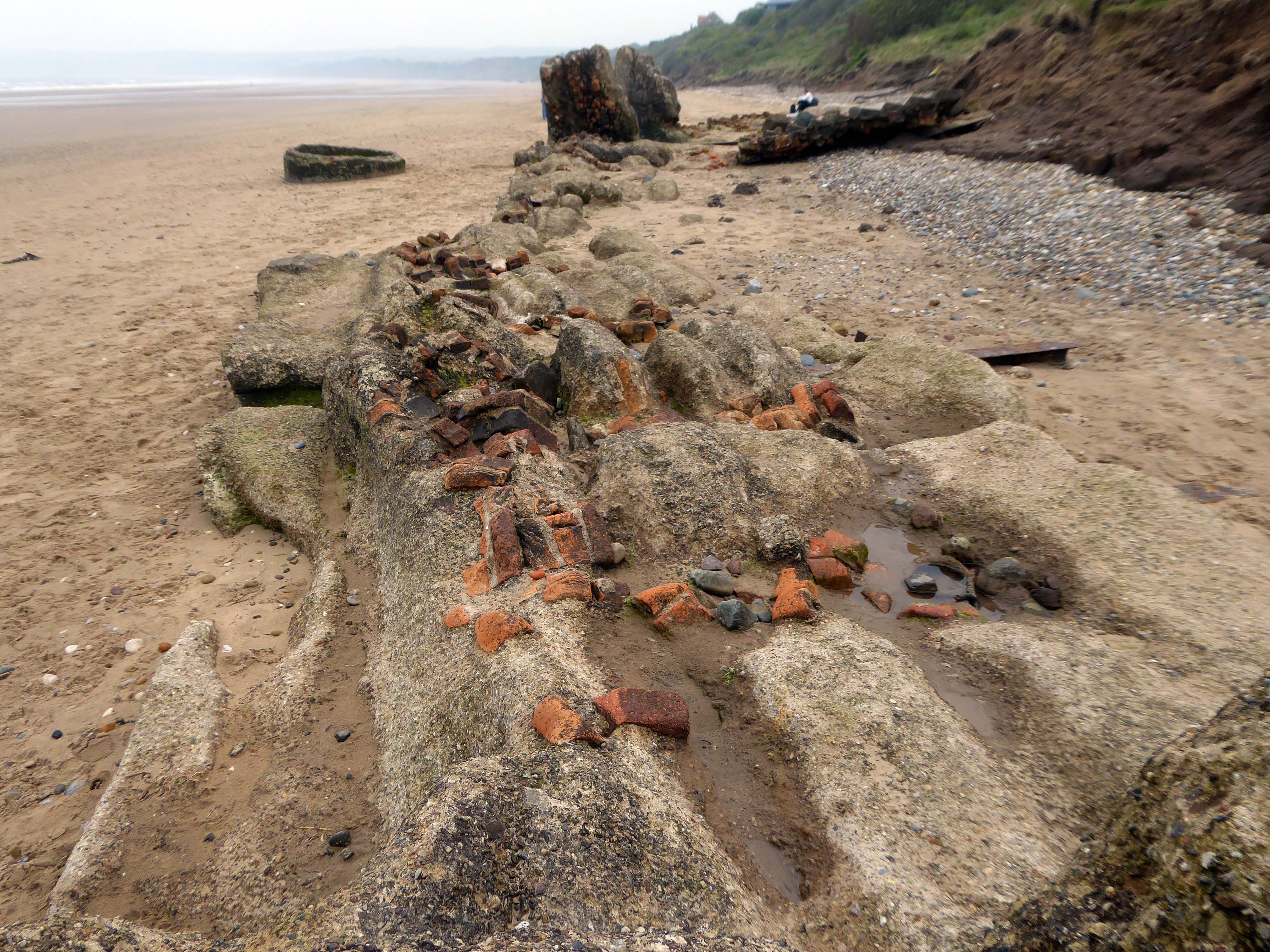
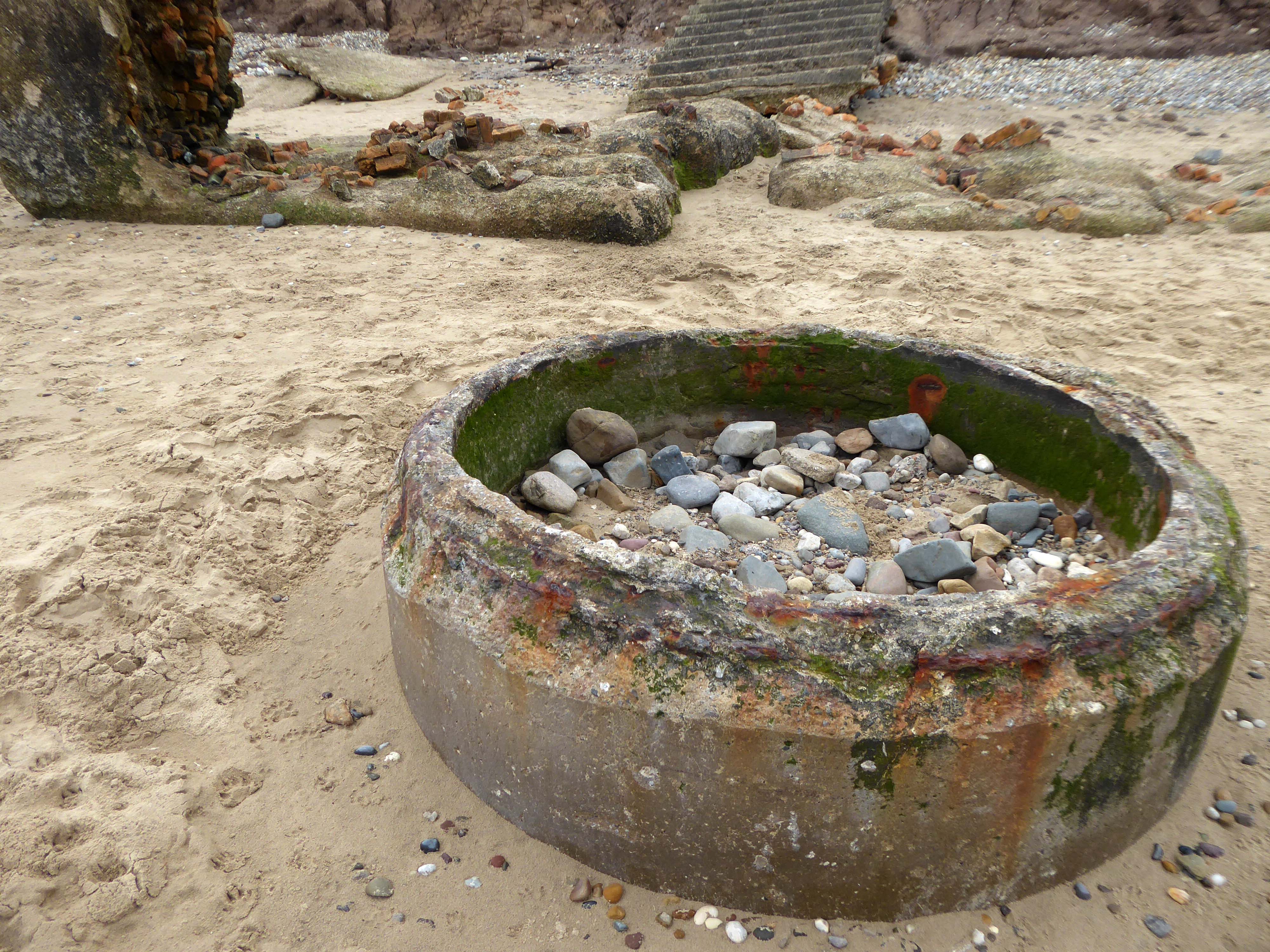
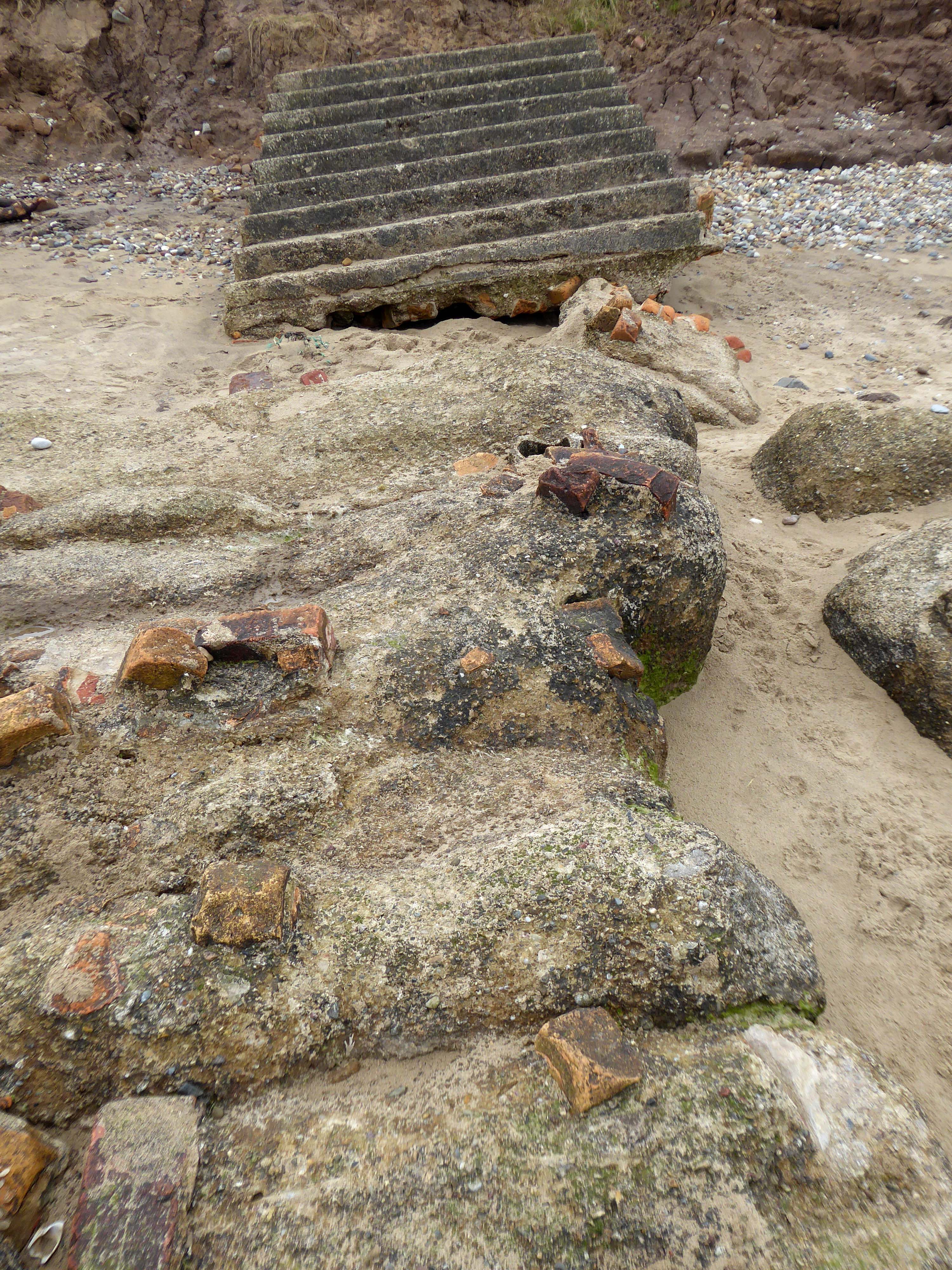
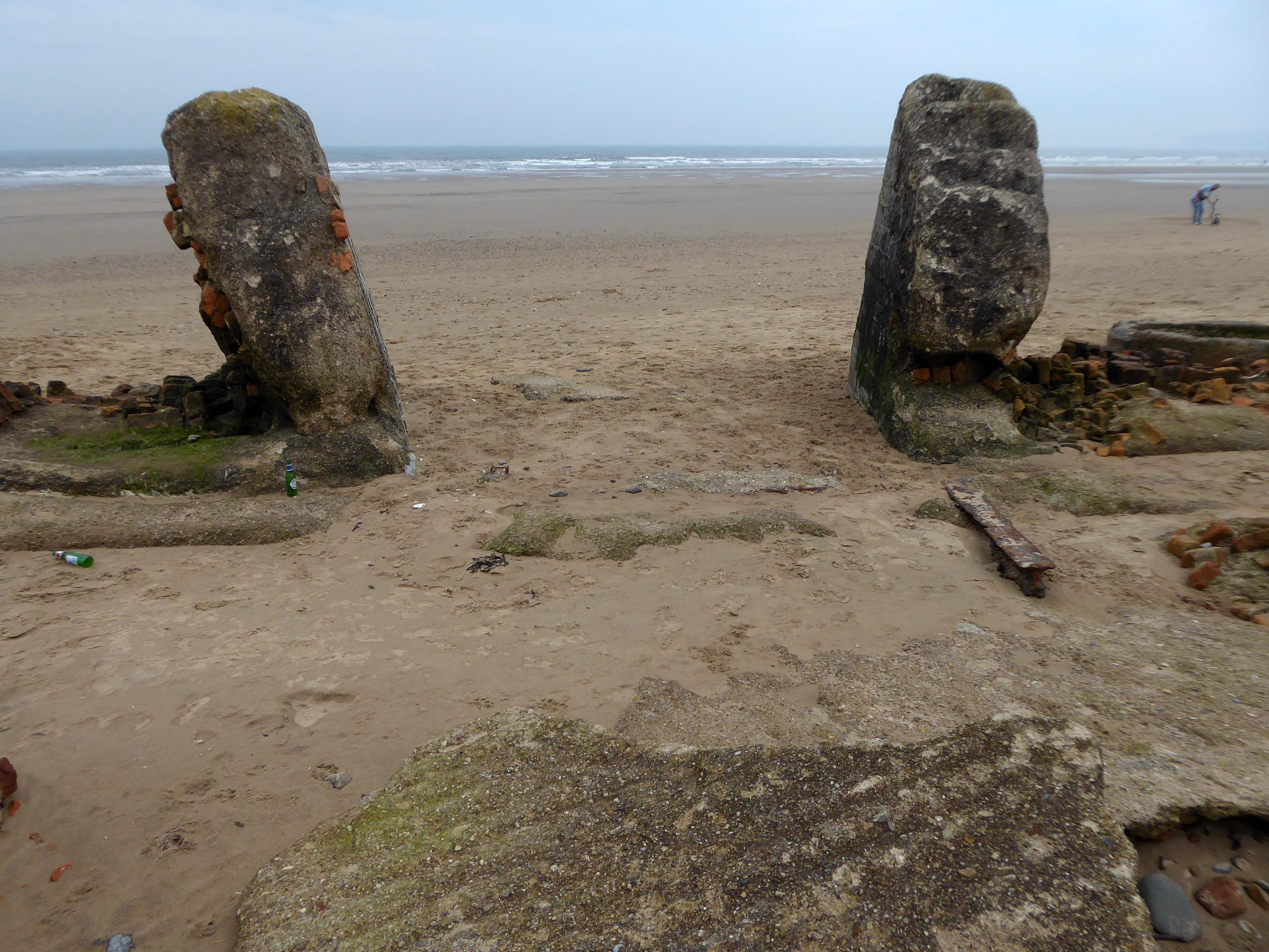
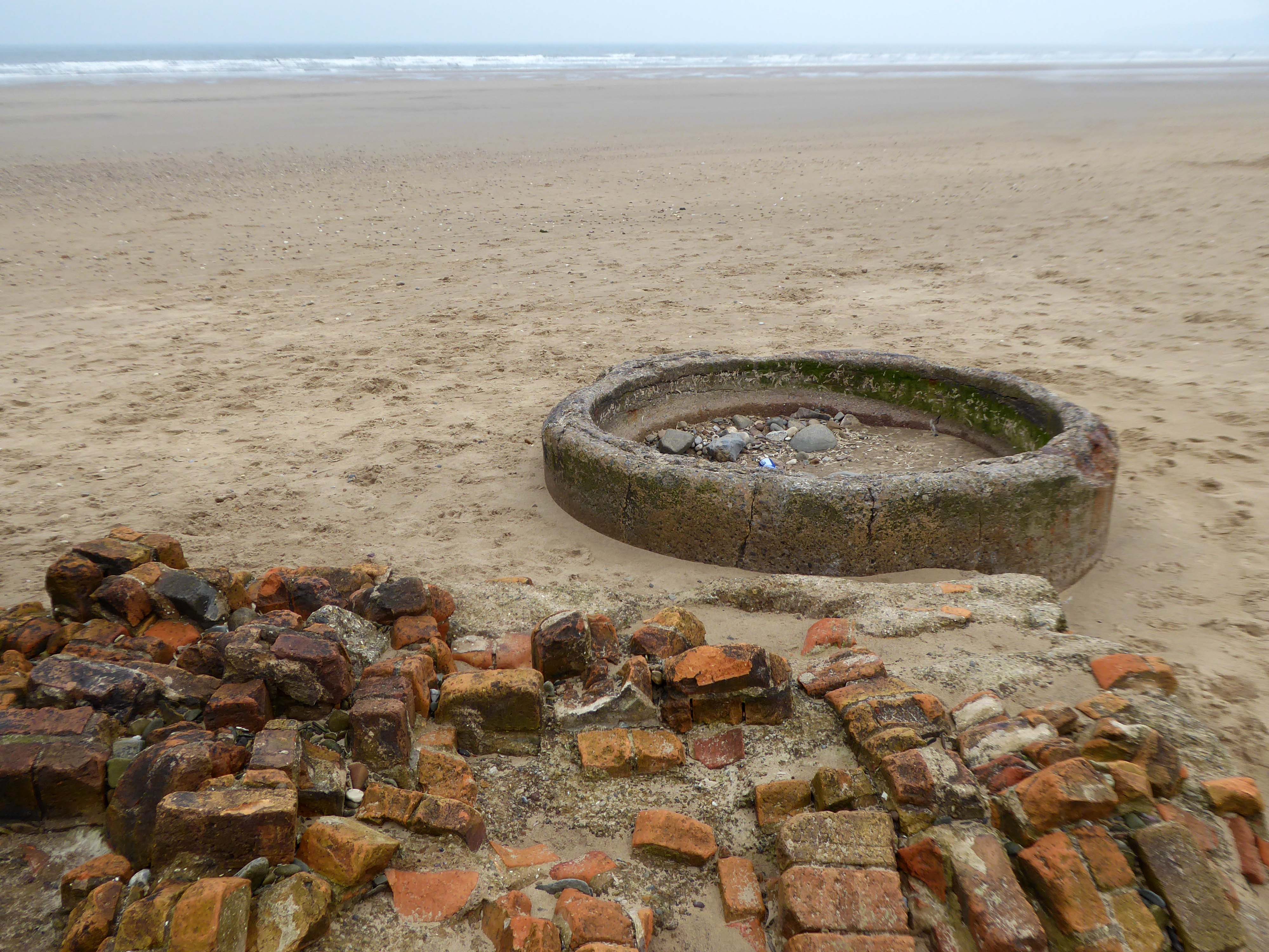
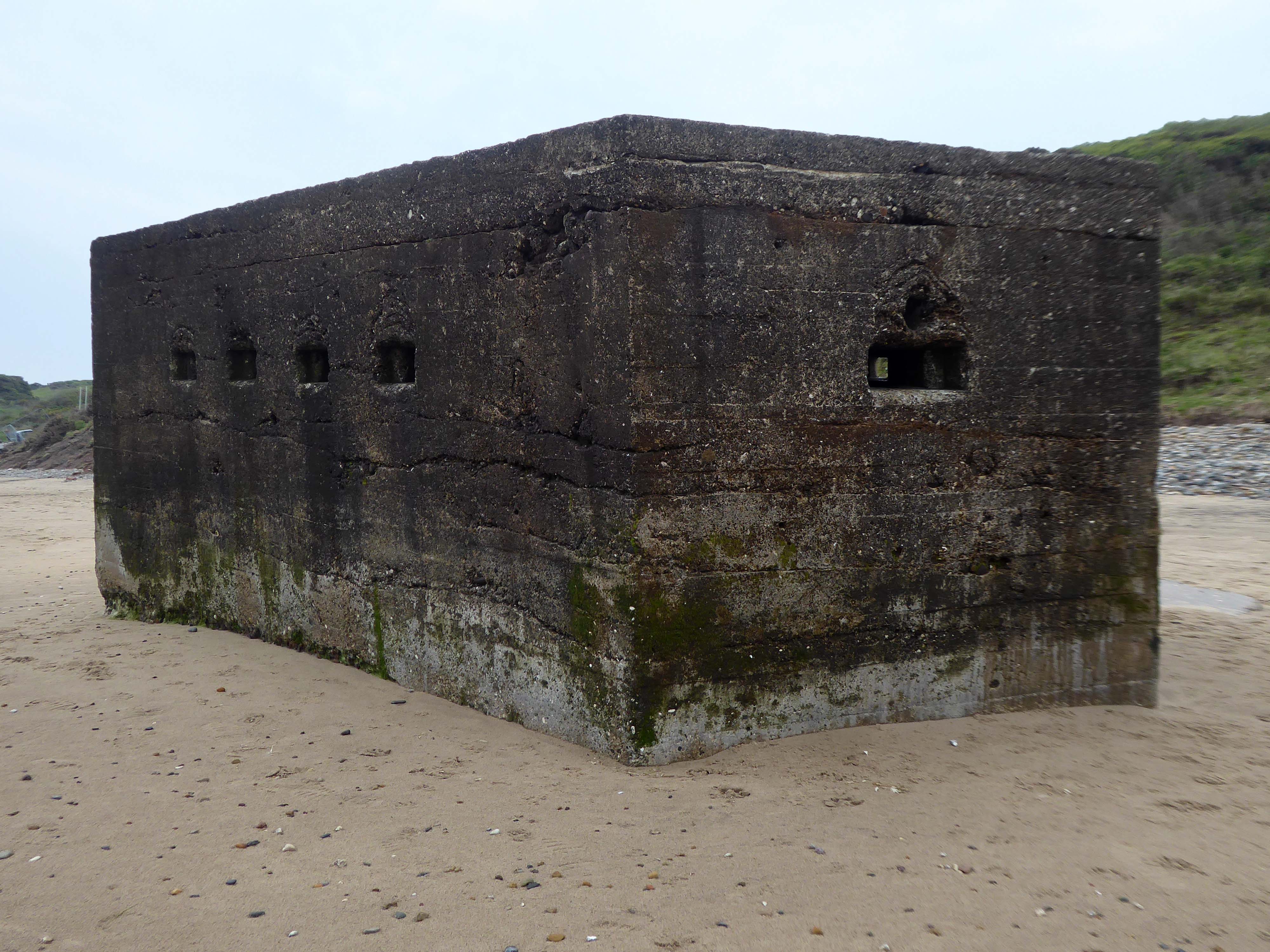
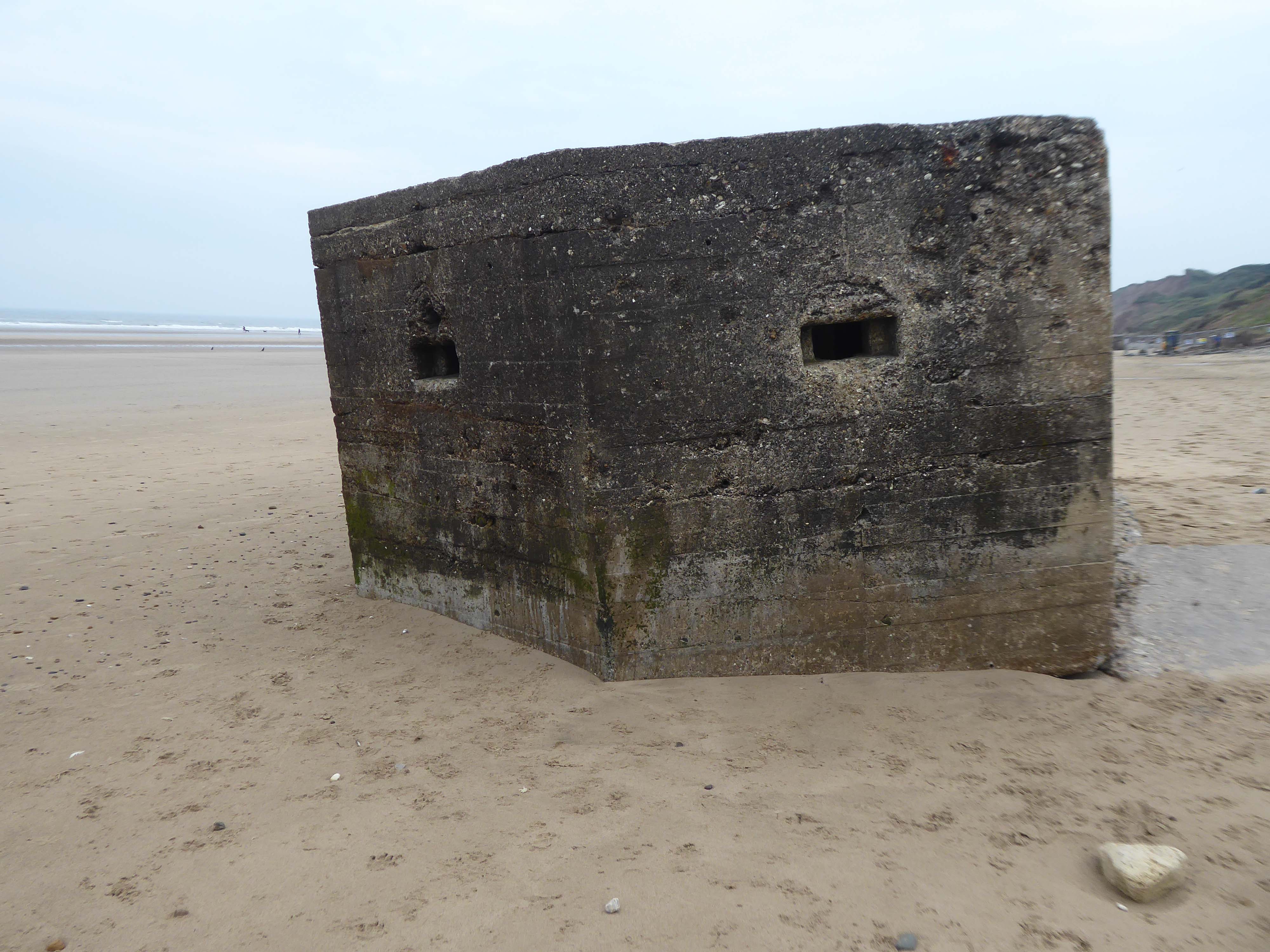
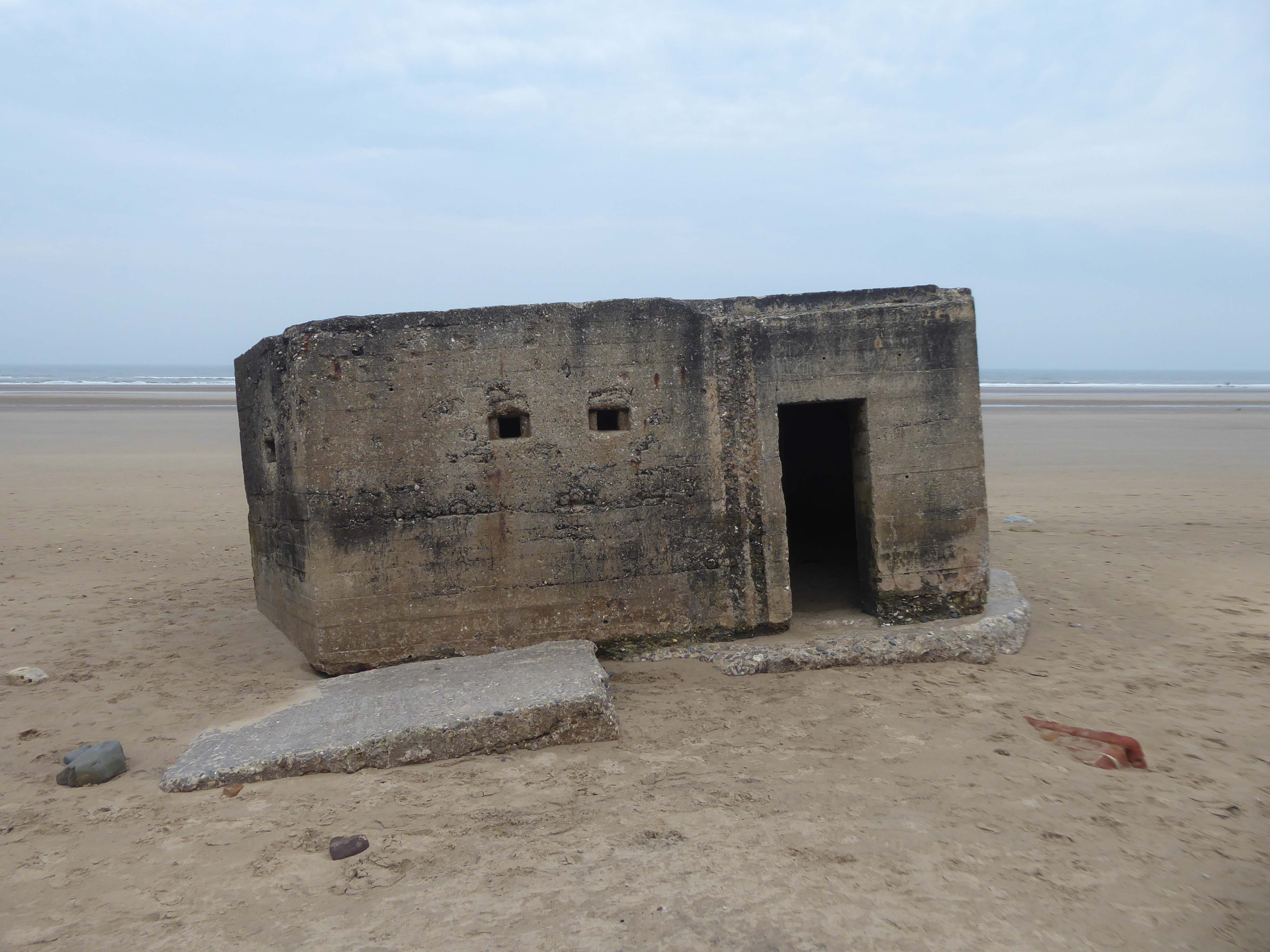
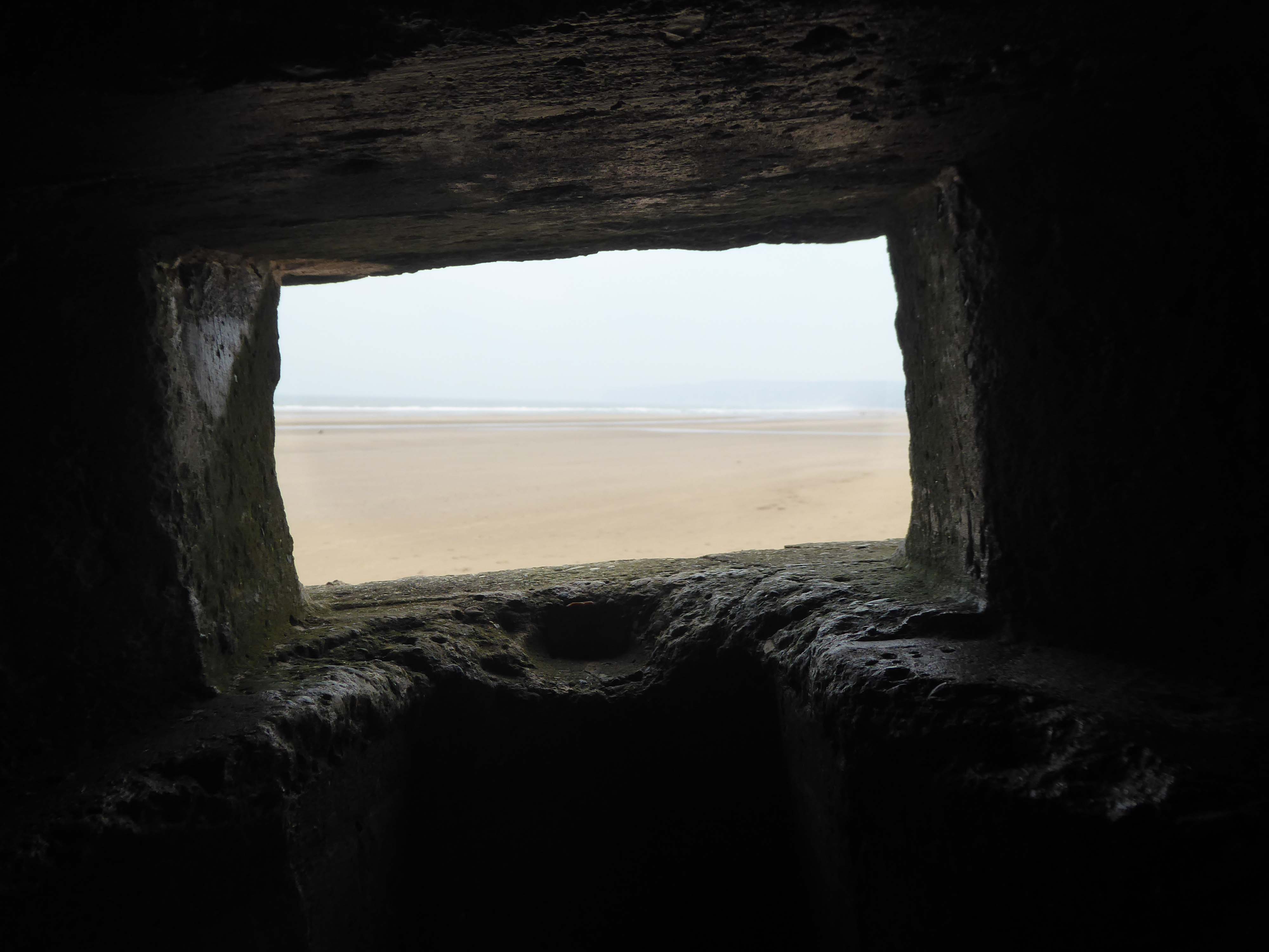
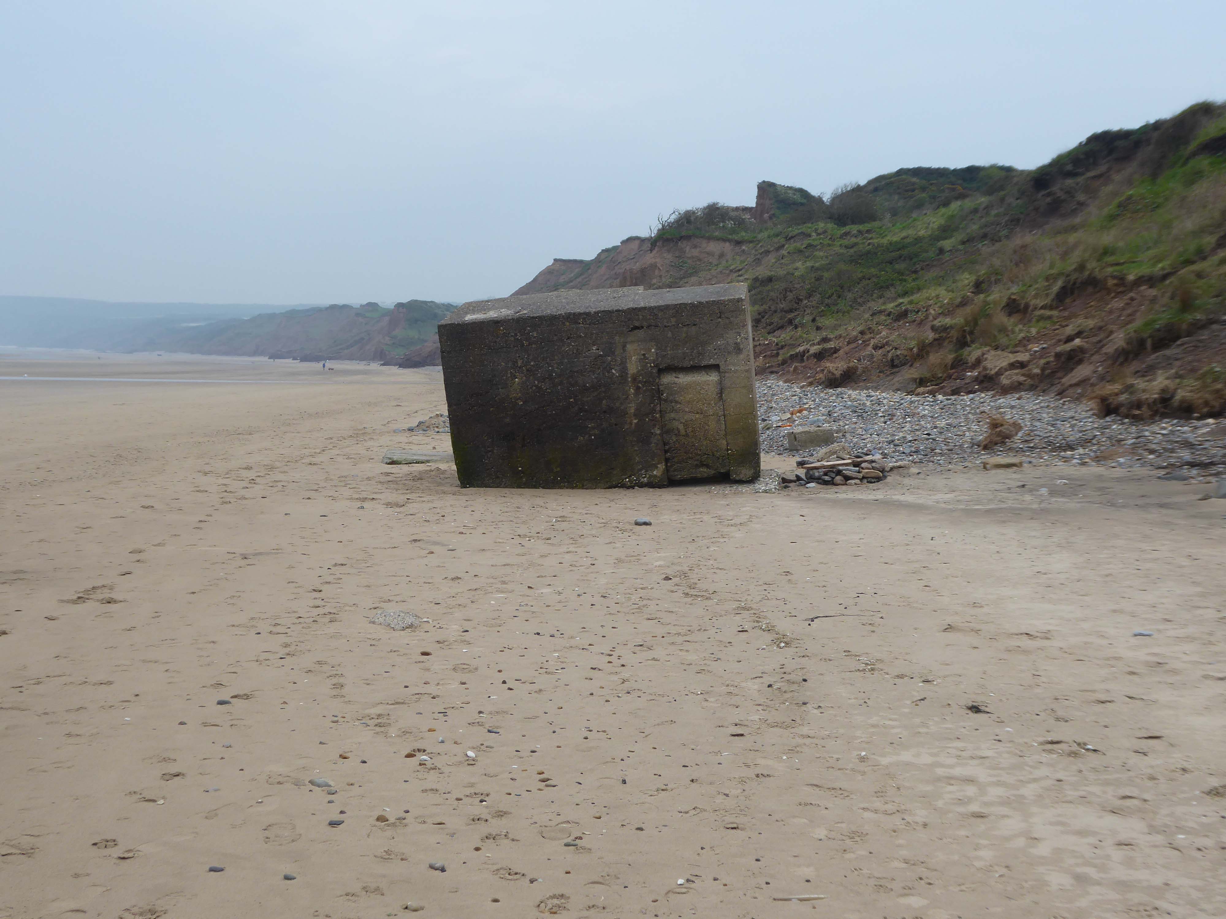
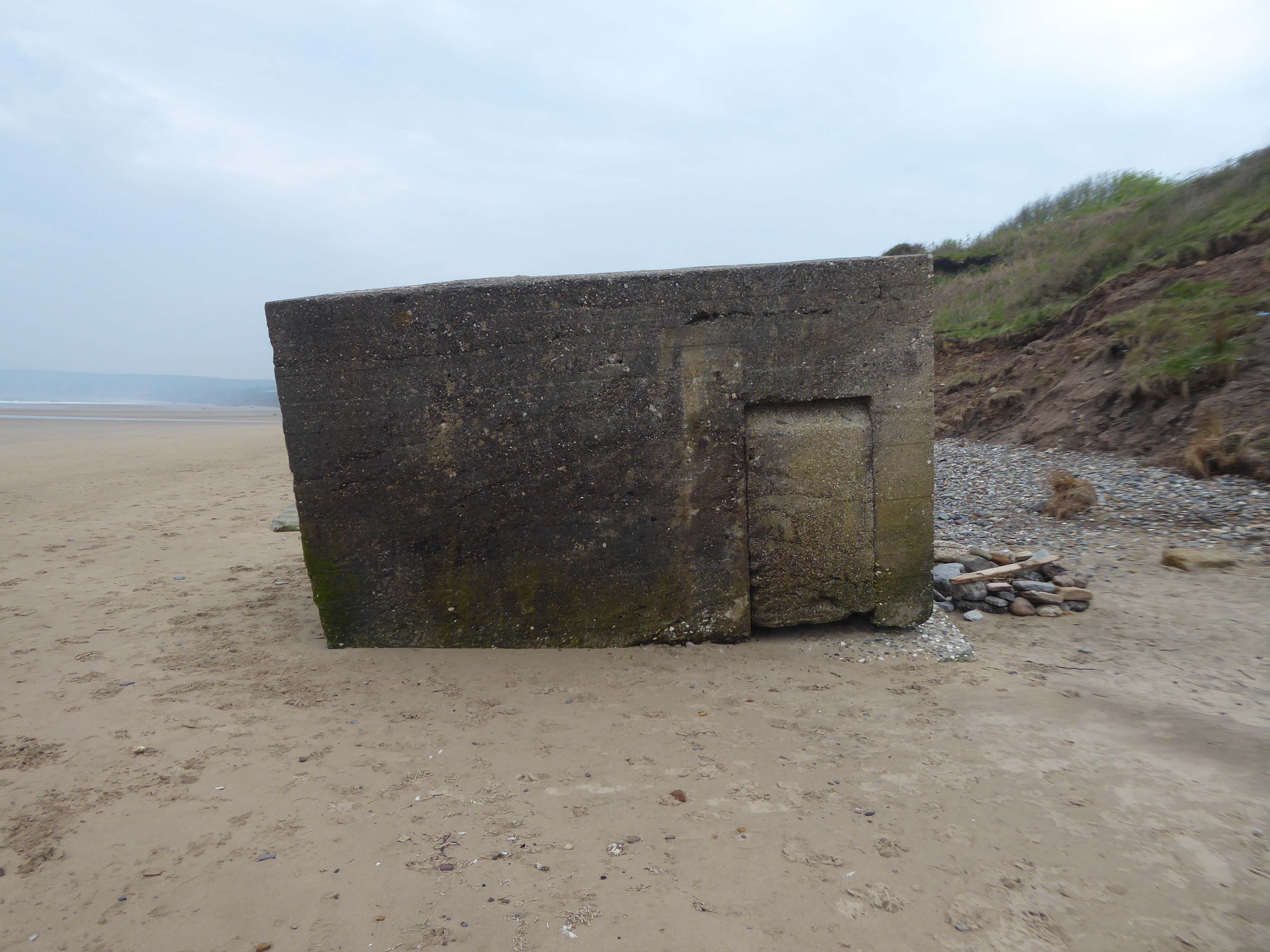
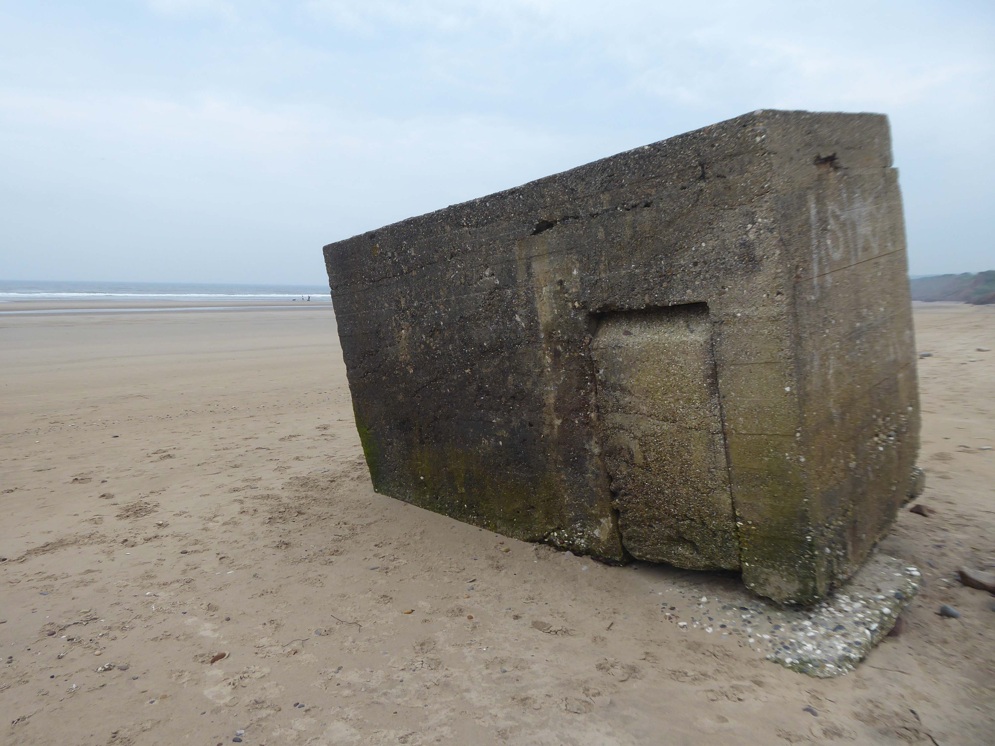
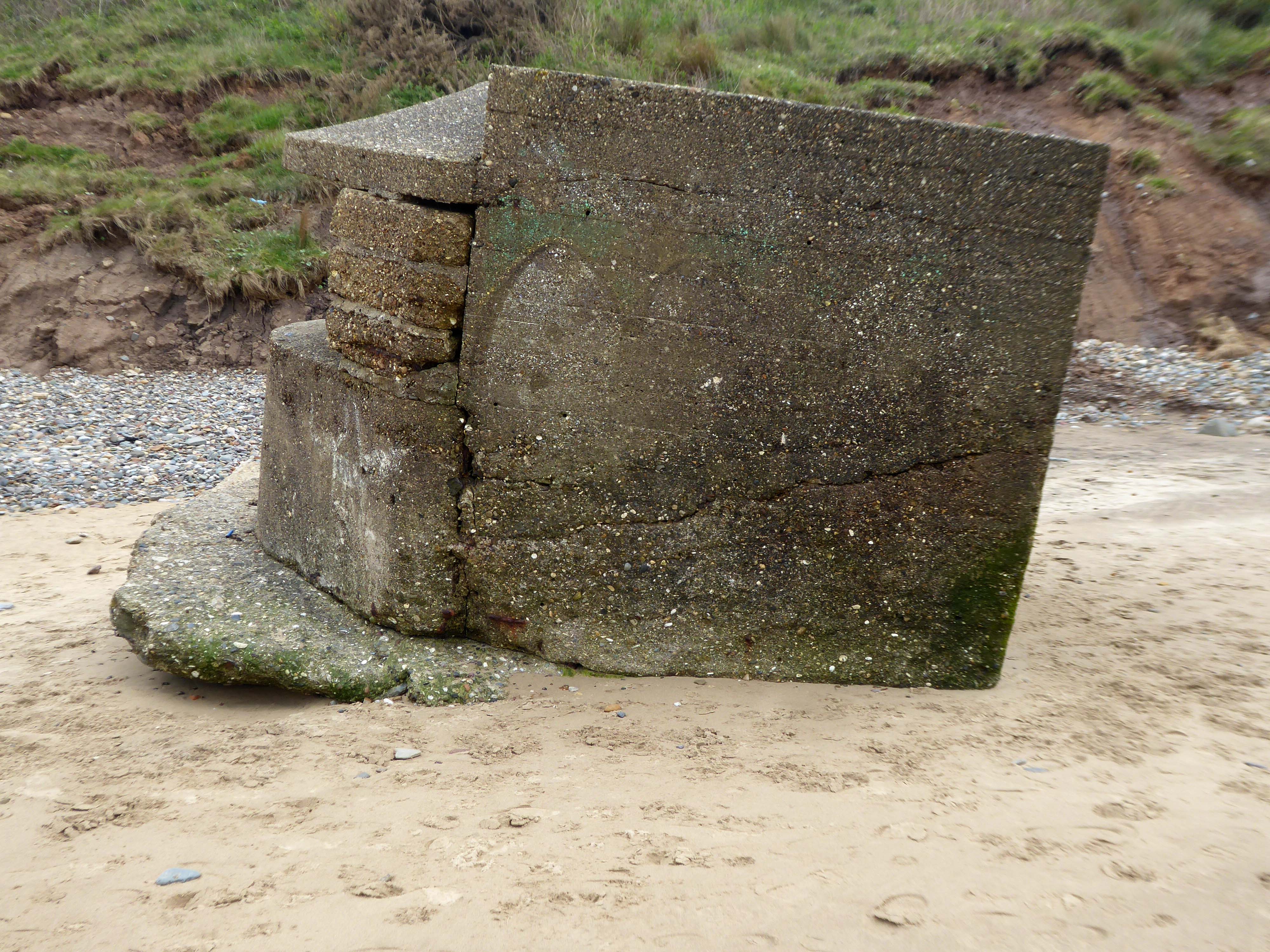
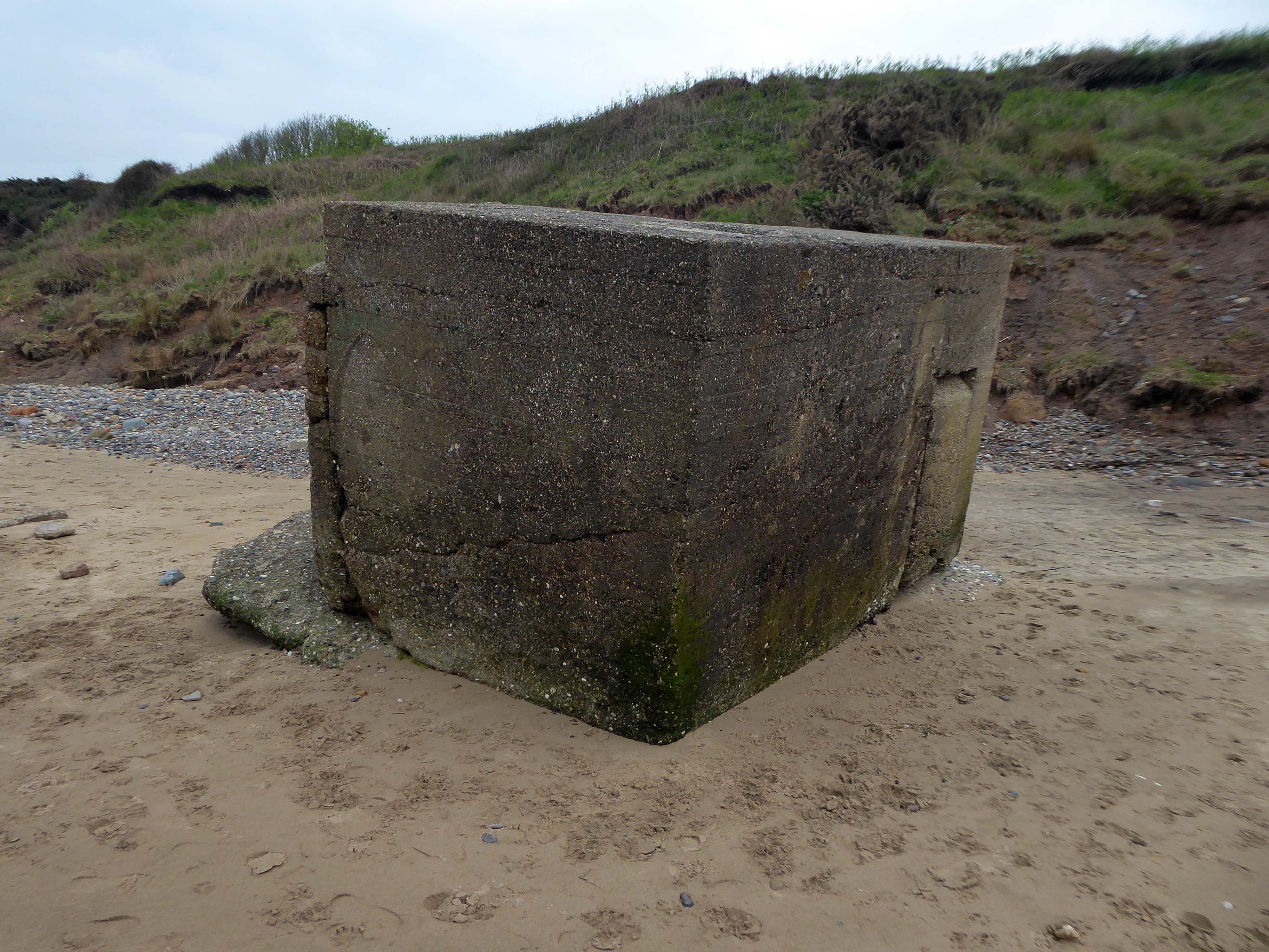
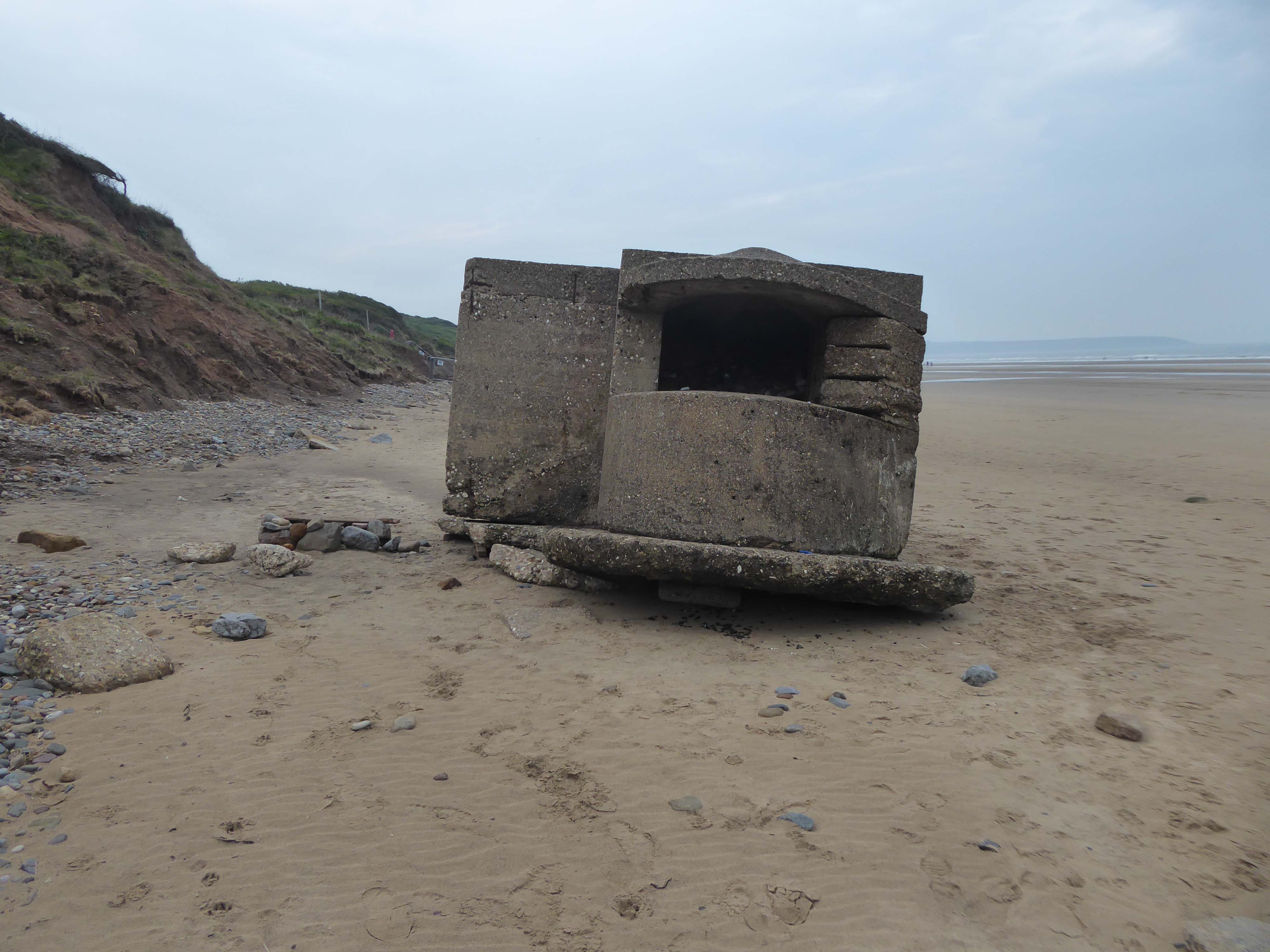
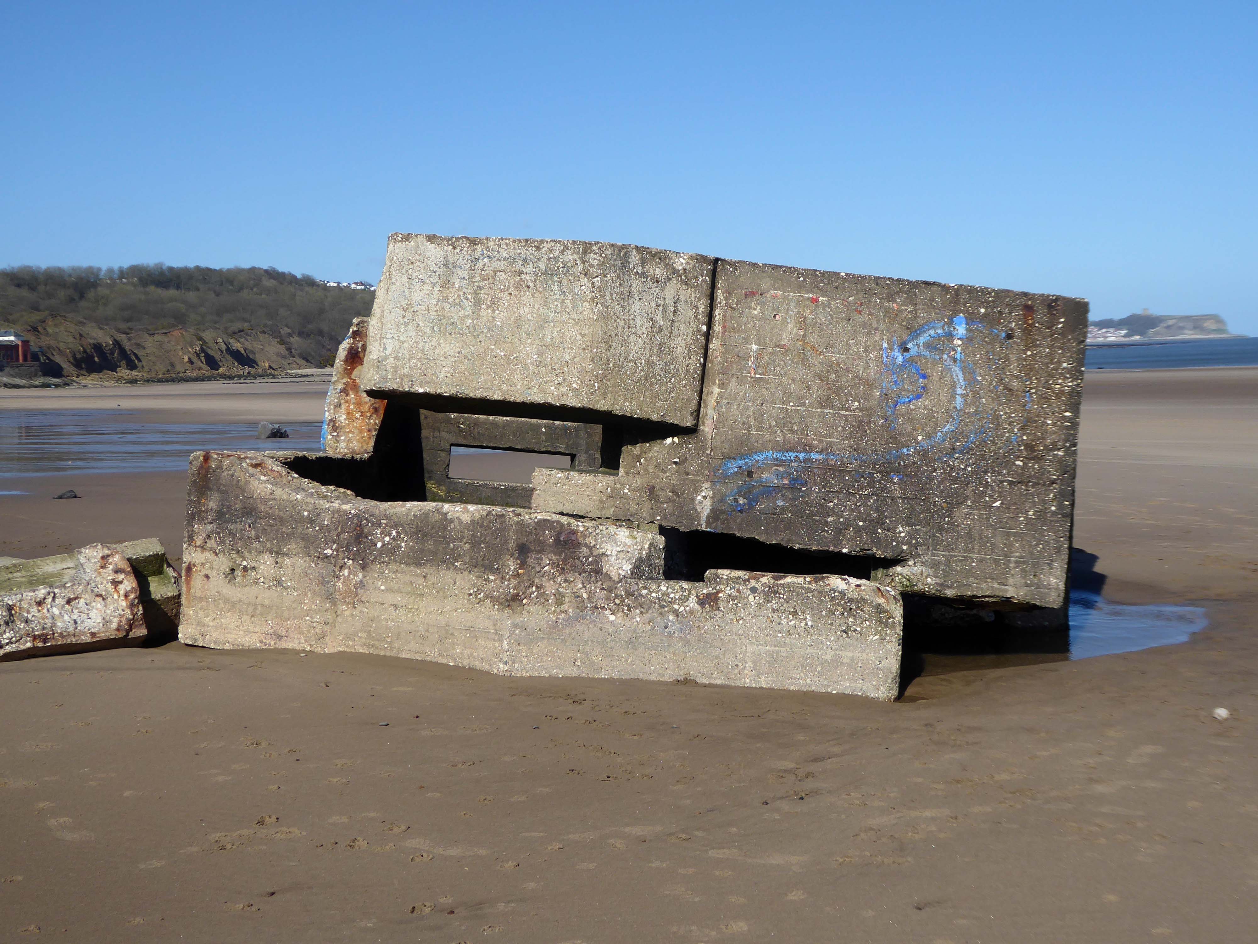
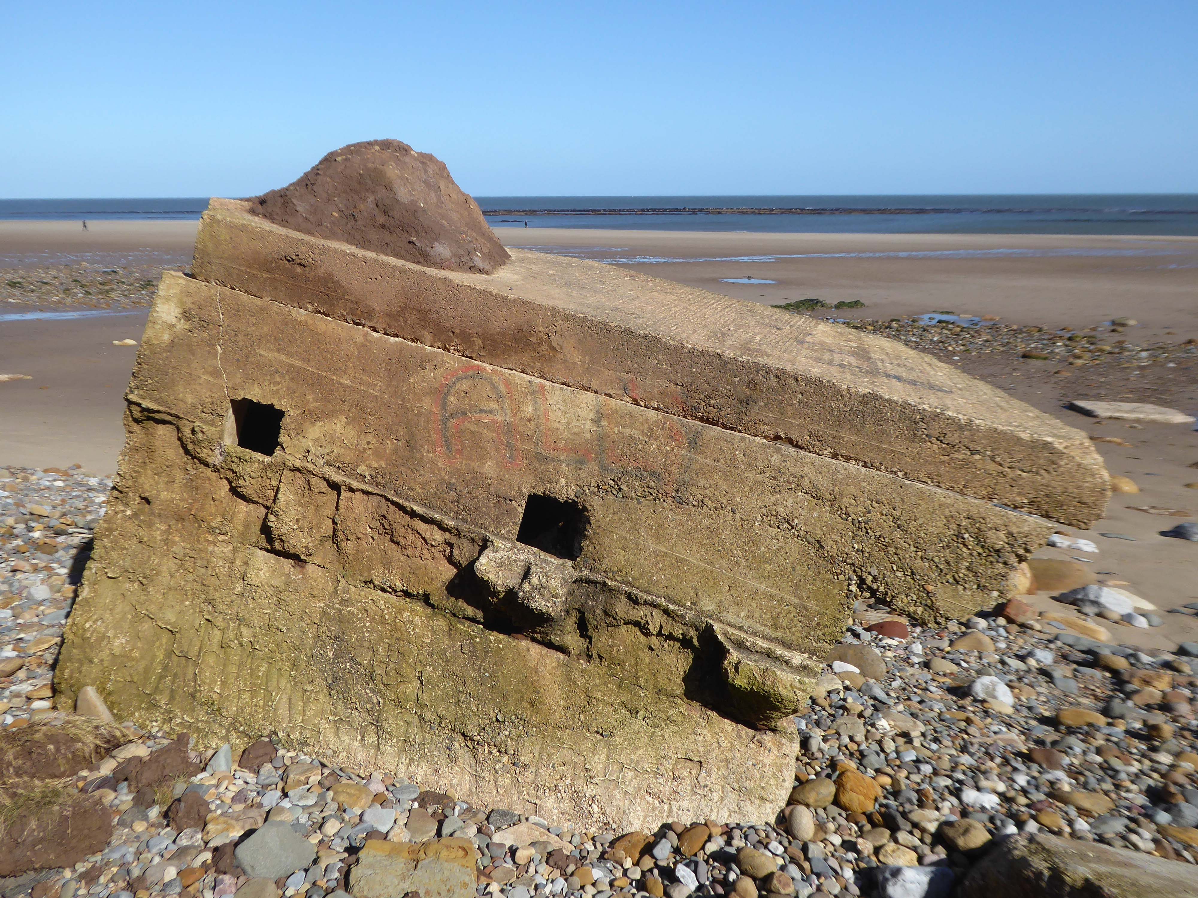
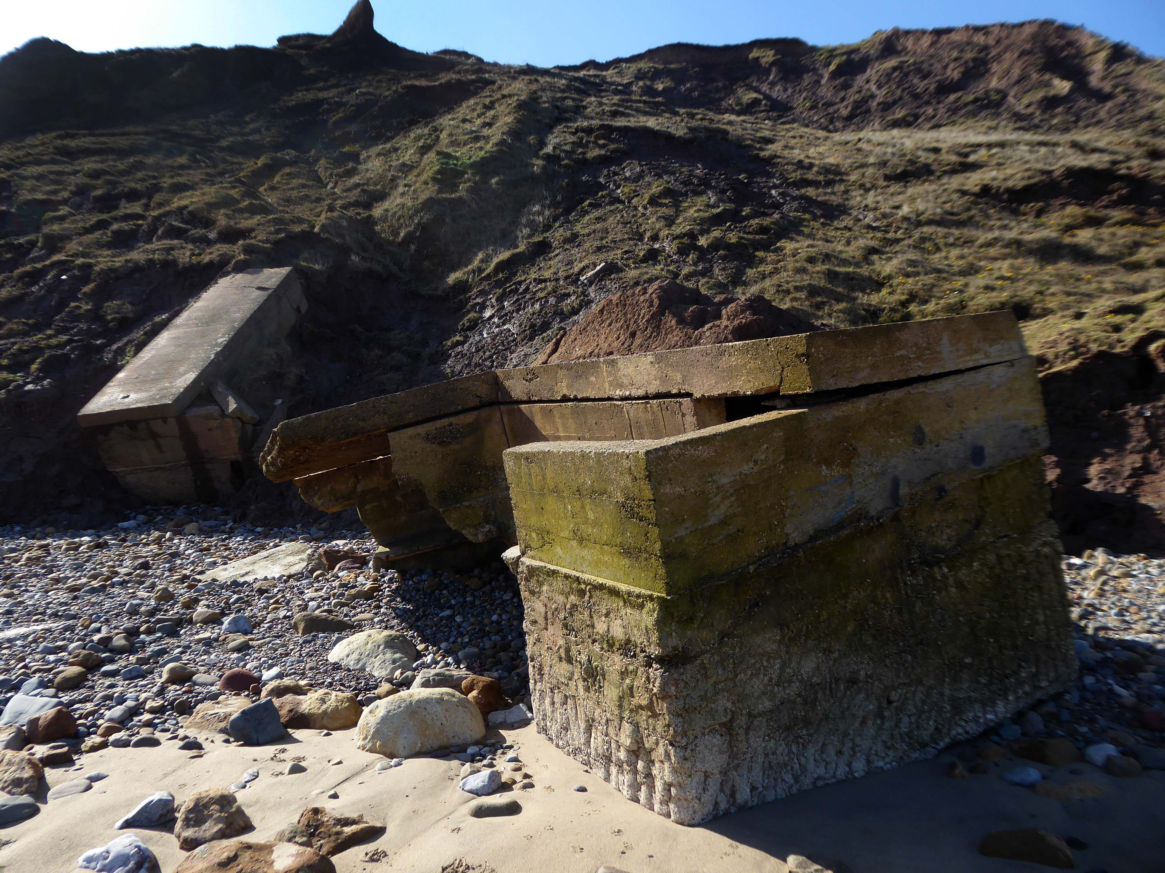
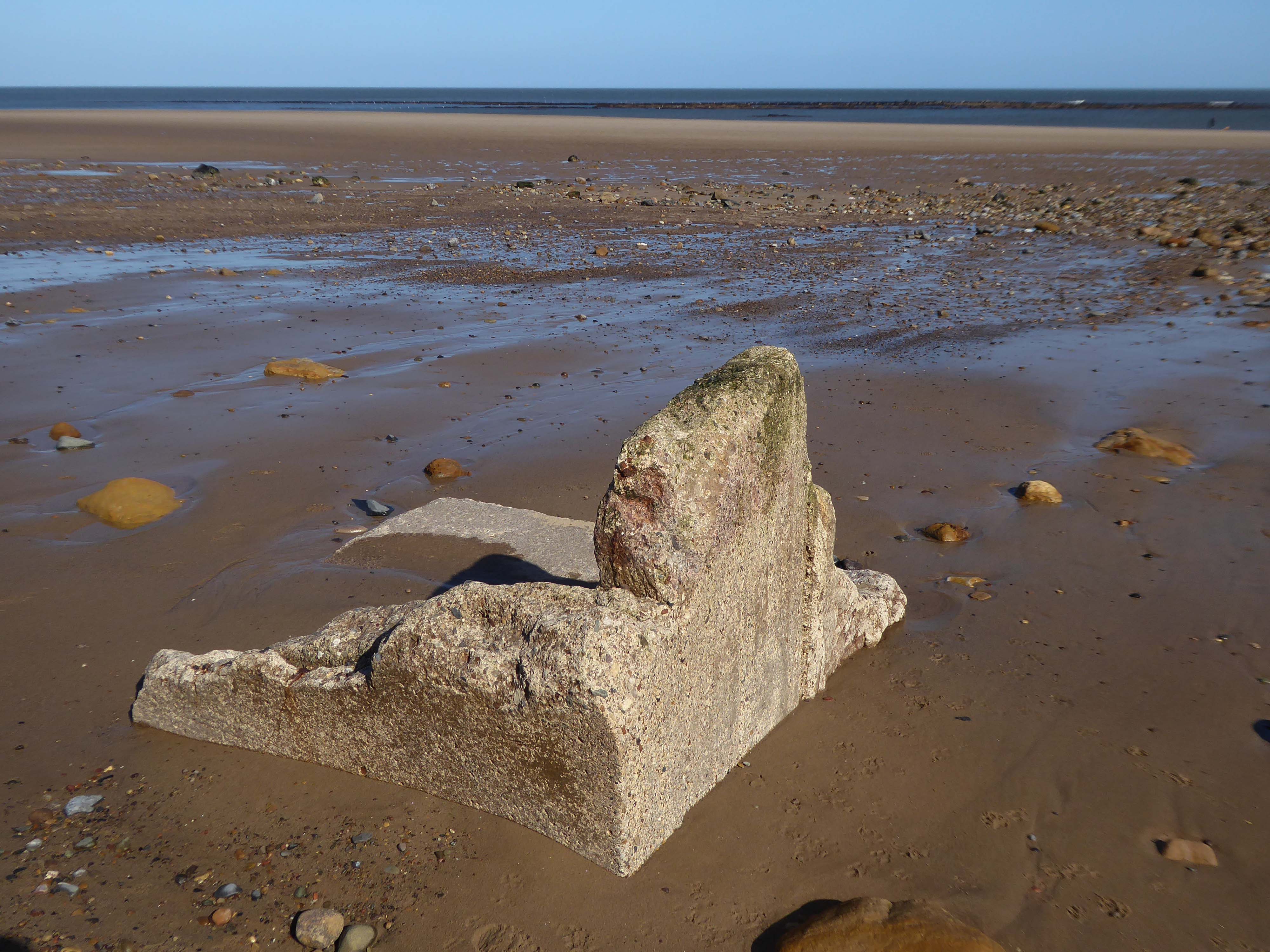
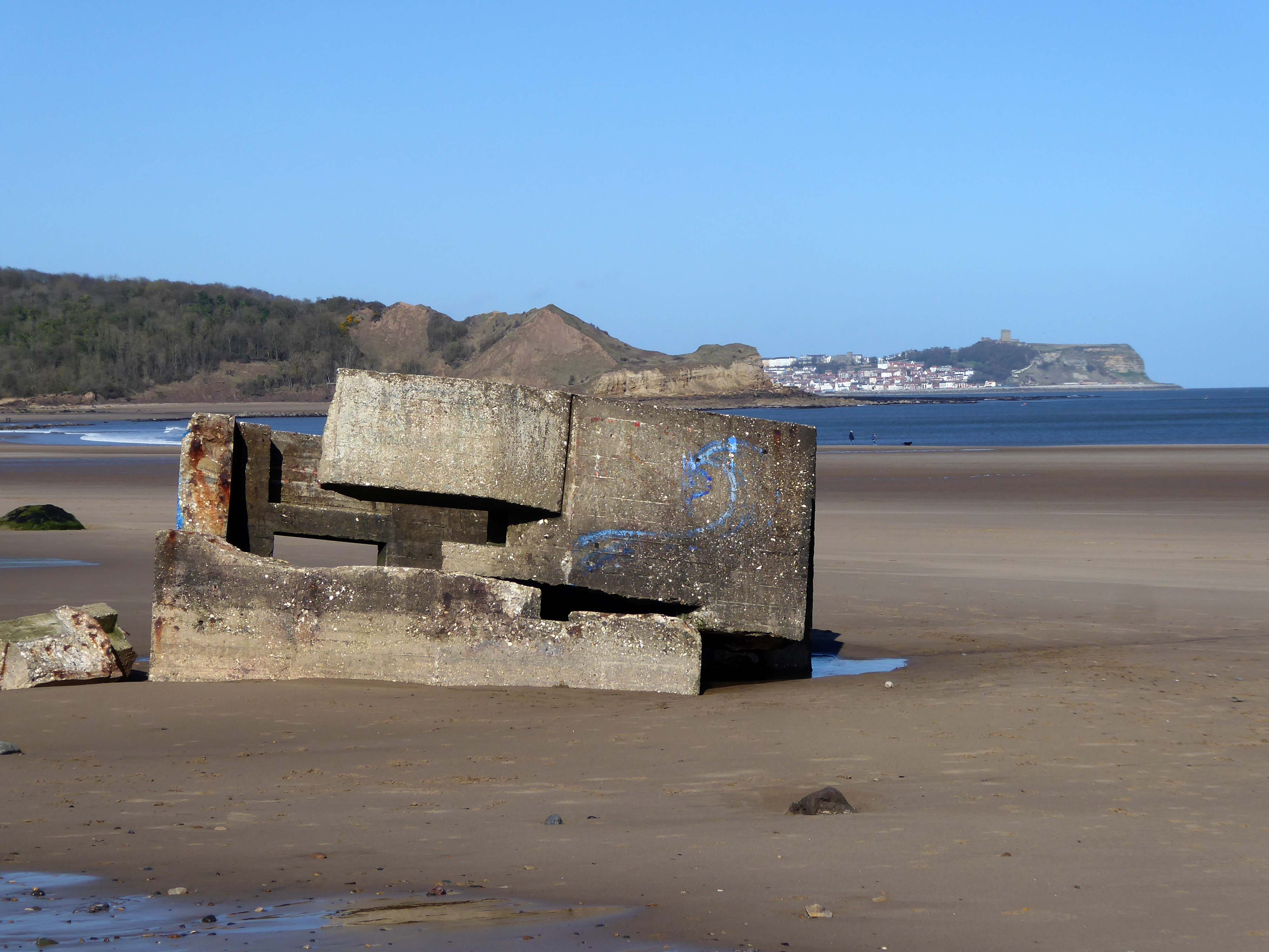
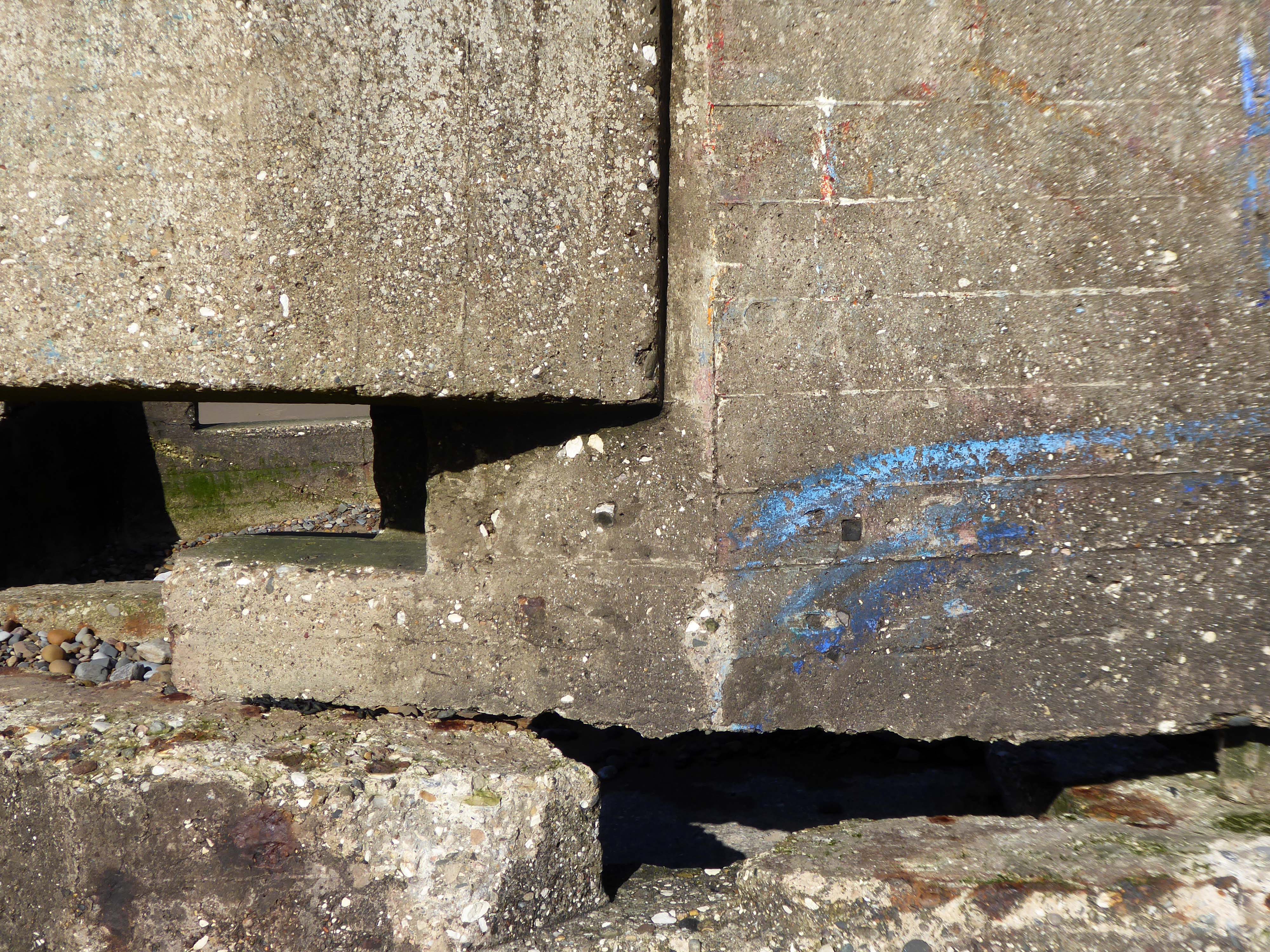
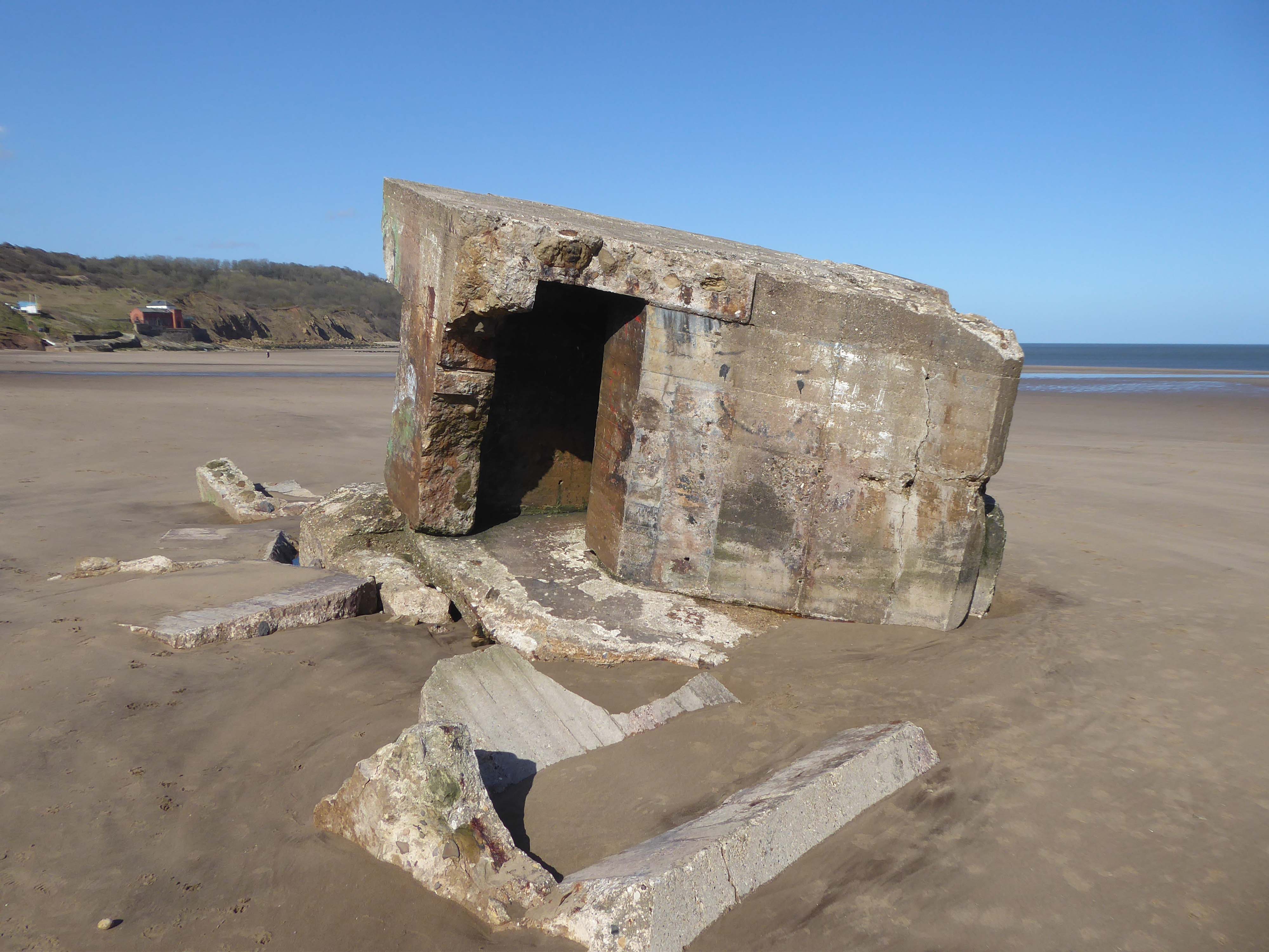
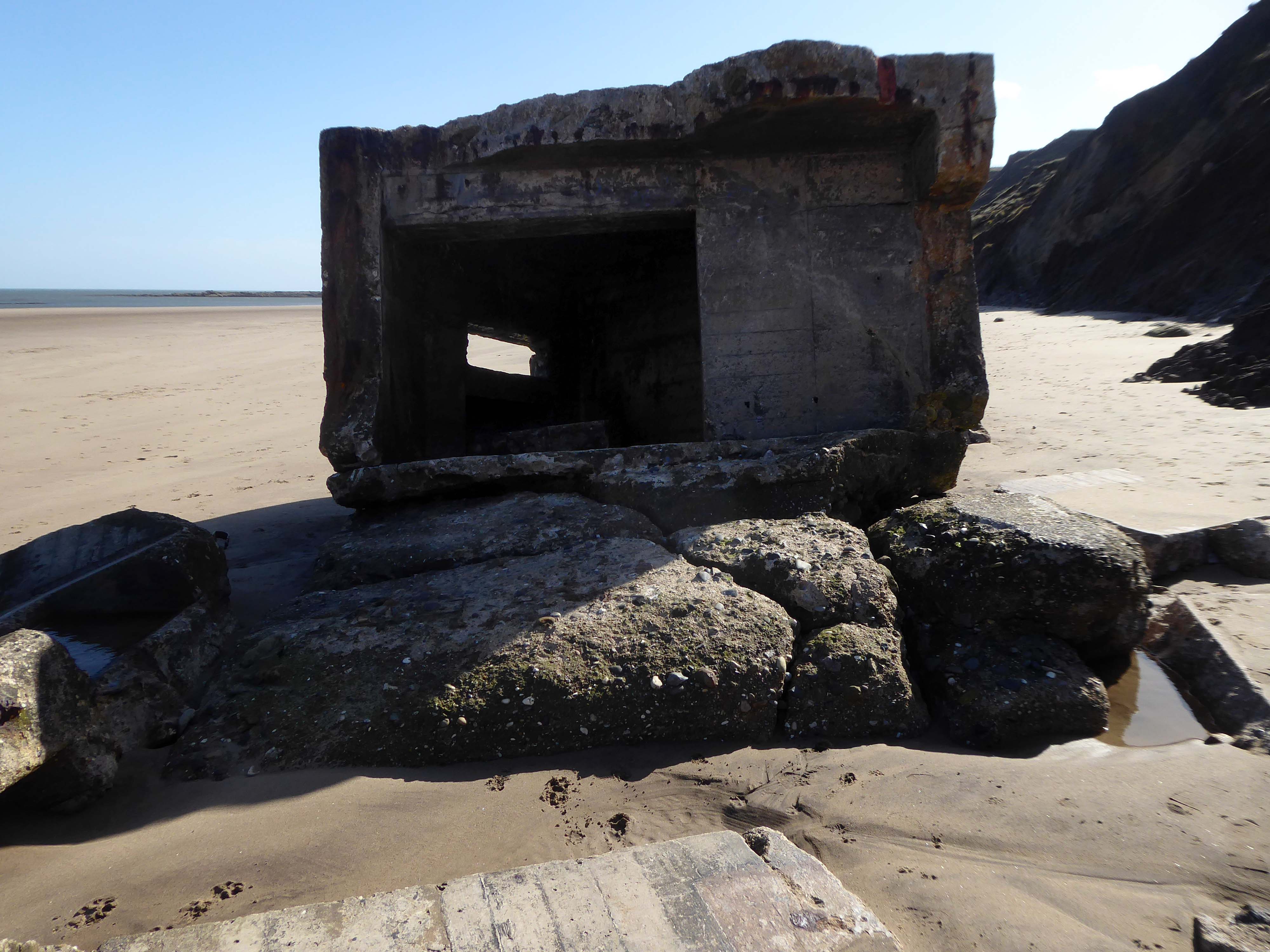
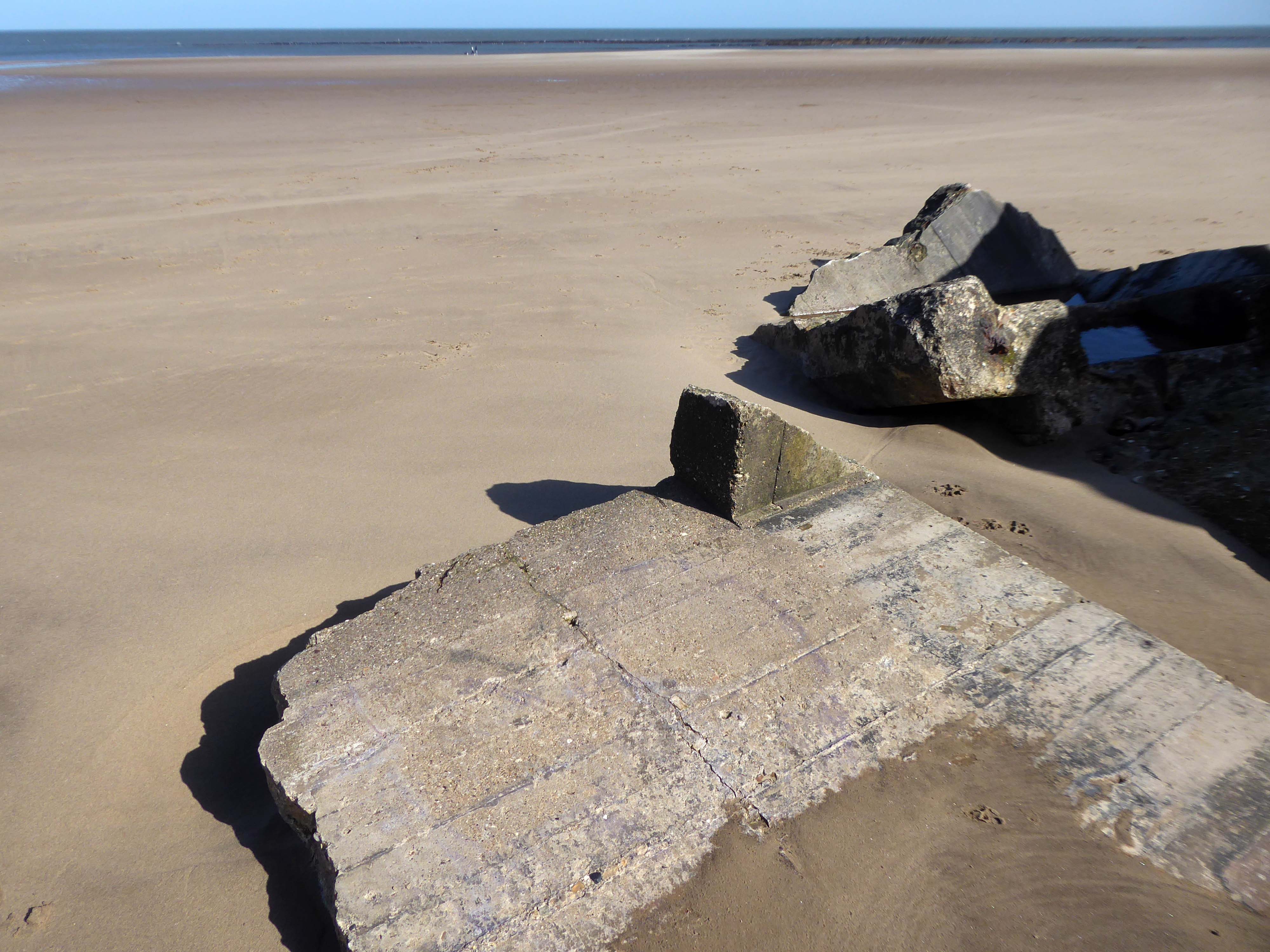
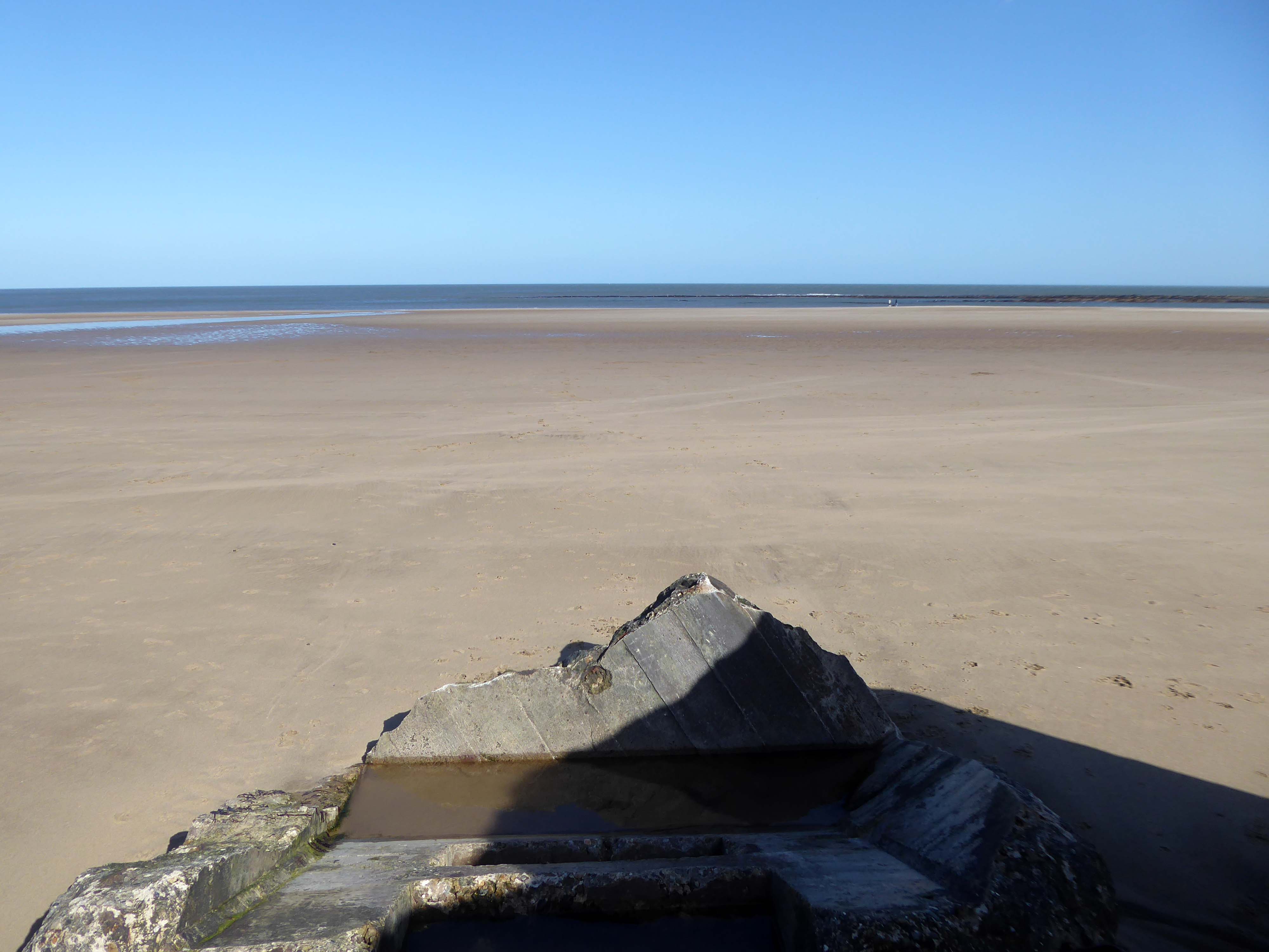
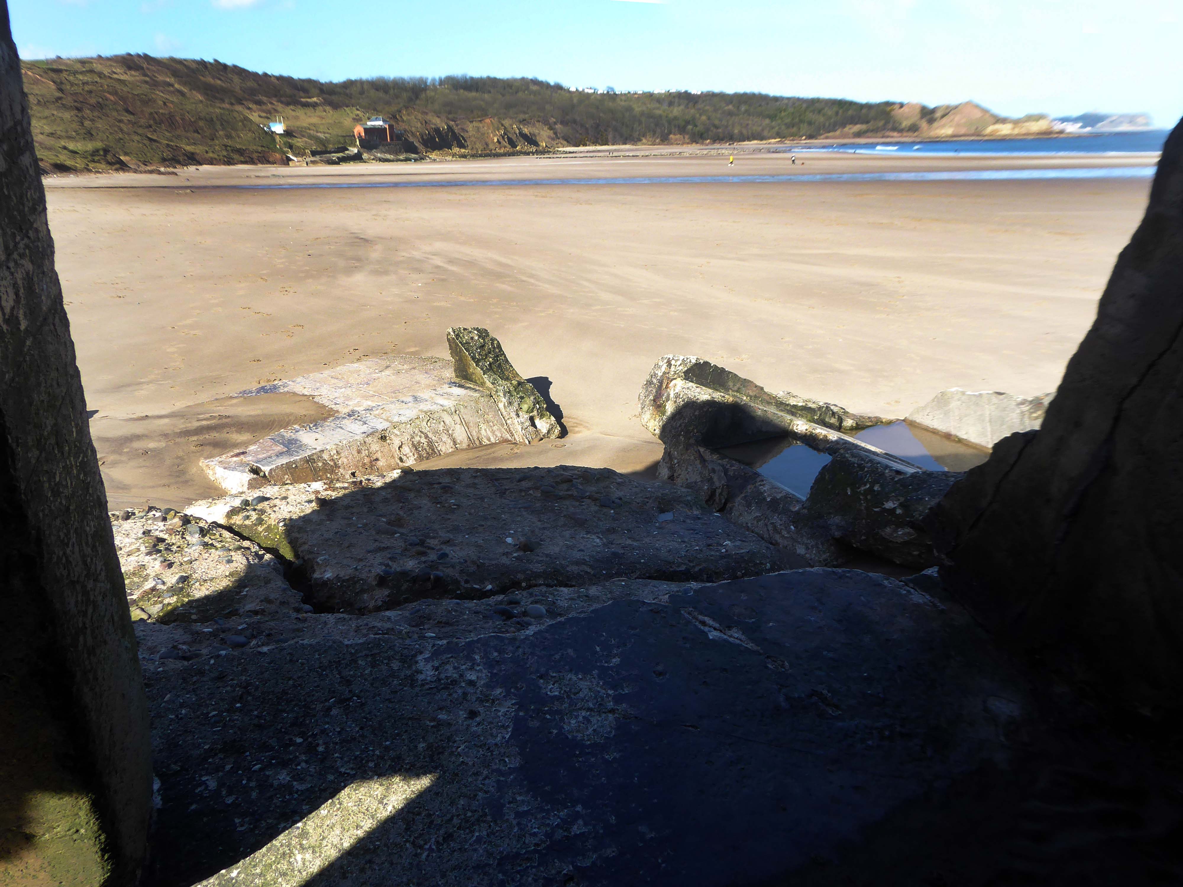
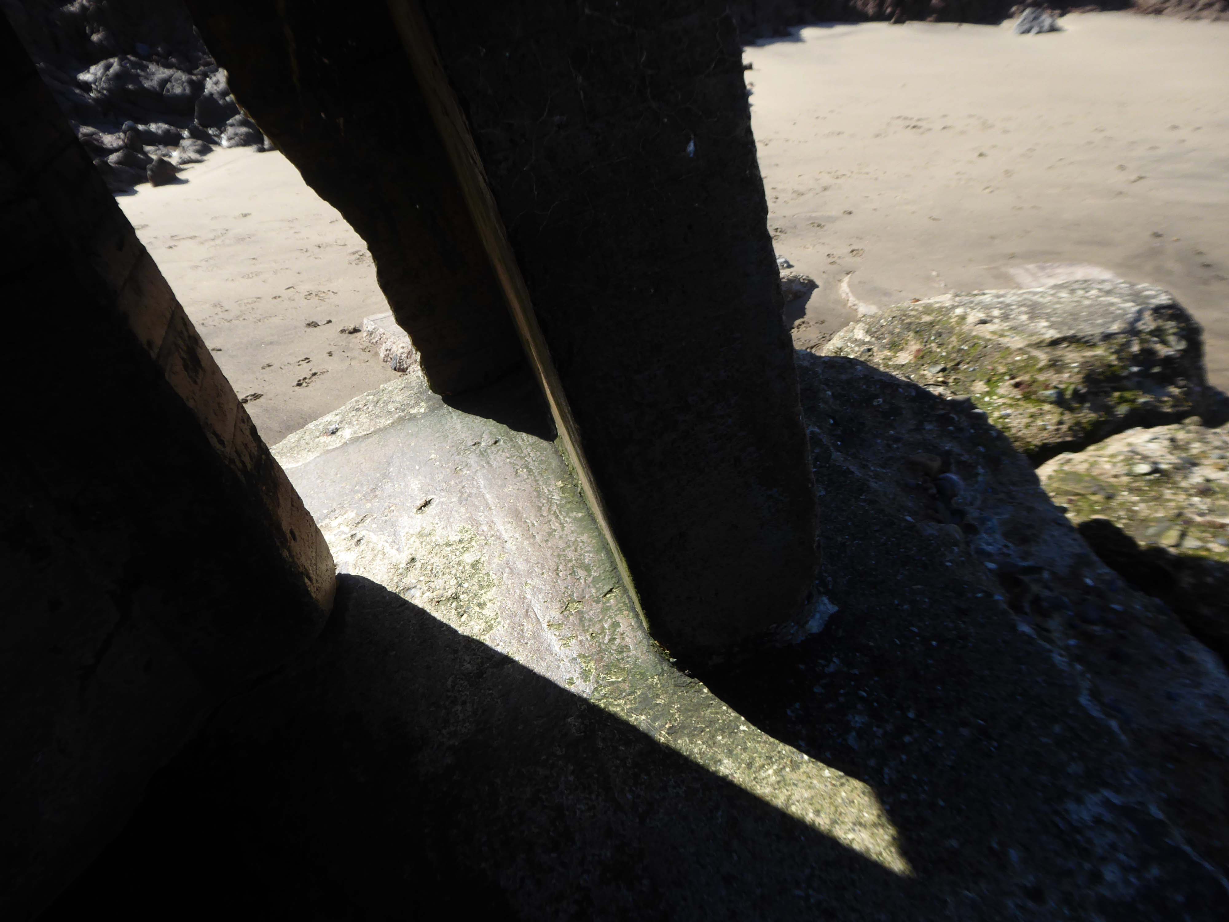
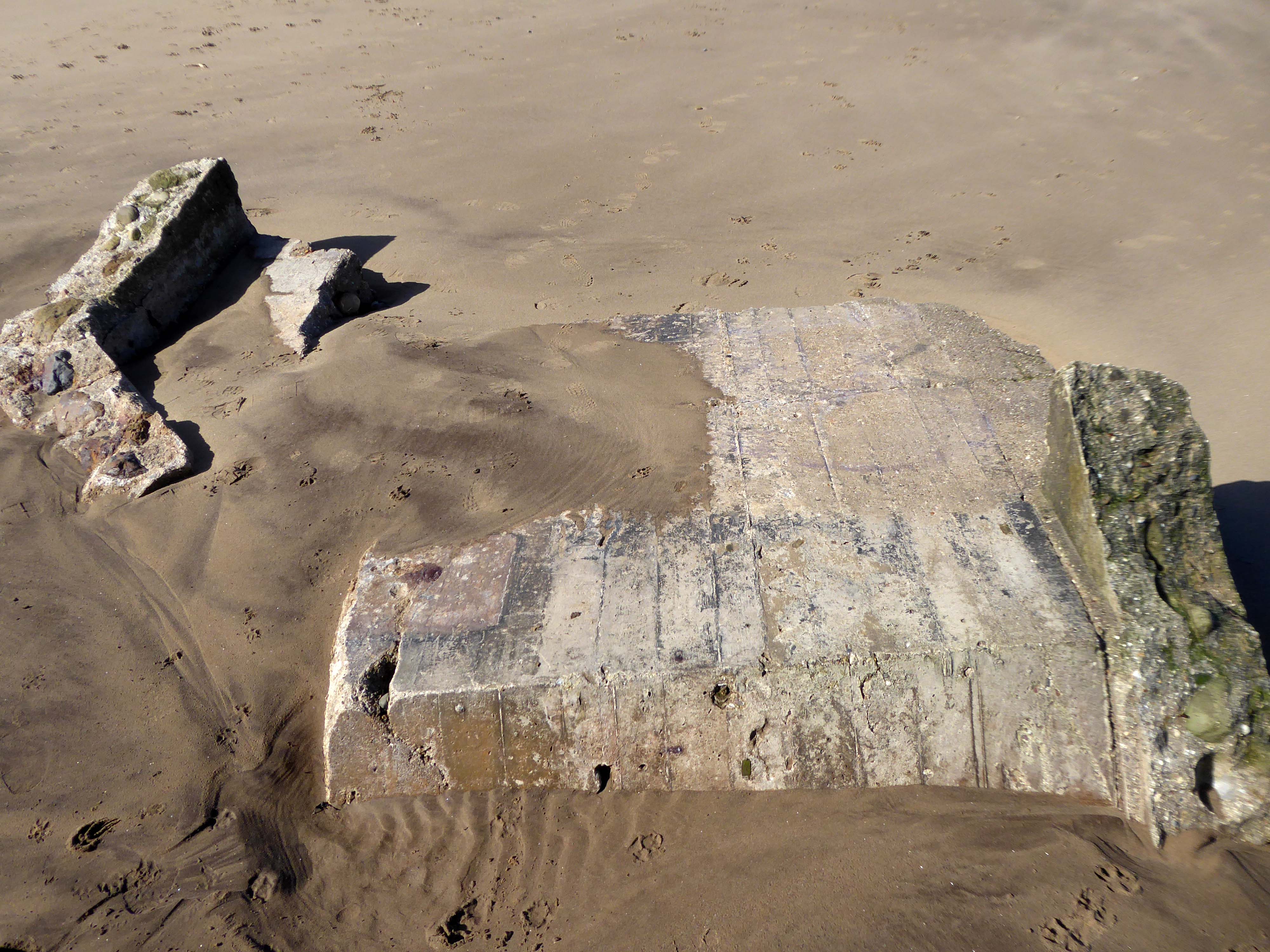
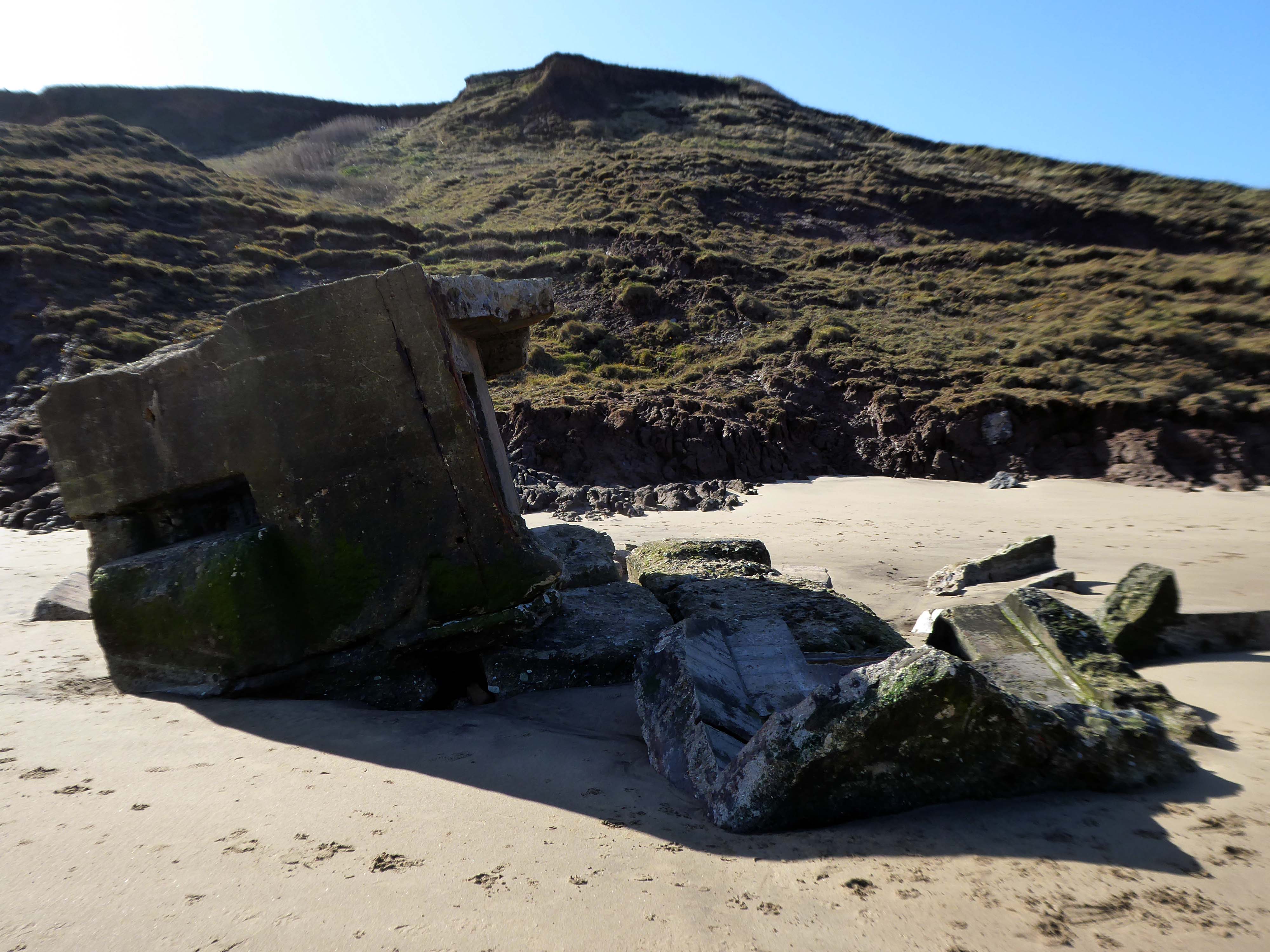
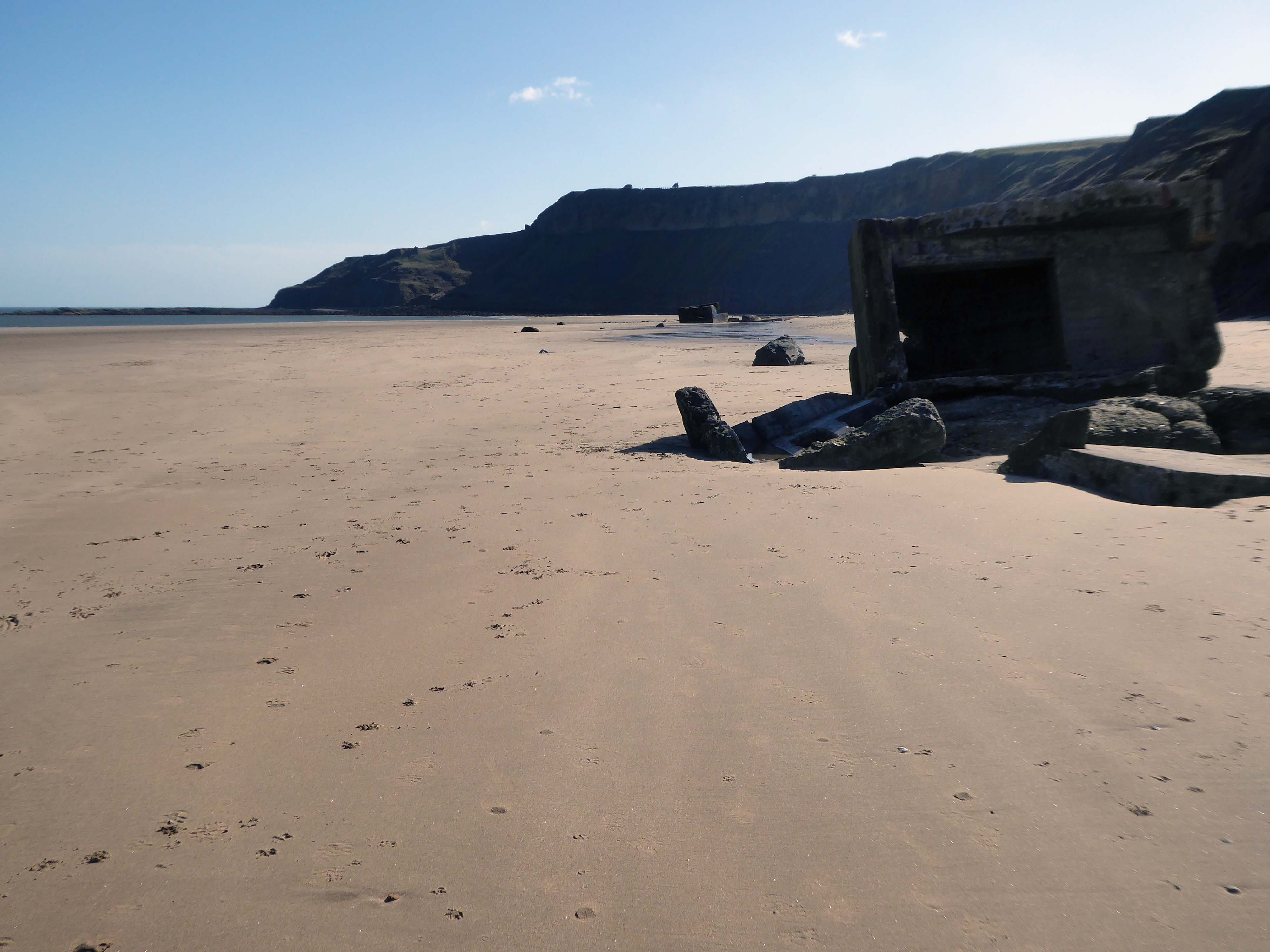
Anti-tank blocks line the foreshore here; with deep foundation they are meant to be so immovable that tanks cannot go through them and rather have to go over them, exposing the weakly armour undersides of the tanks, which can then be fired at. The anti-tank blocks are arranged in batches of both parallel and perpendicular to the sea, which helps to divide up the beach and channel enemies towards the pillboxes and into fire.
Once more unto the beach, dear friends, once more, or close the wall up with our English dead.
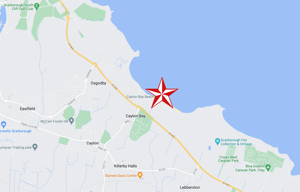
Having visited Cayton Bay last year I ventured forth last week, to Filey and beyond.
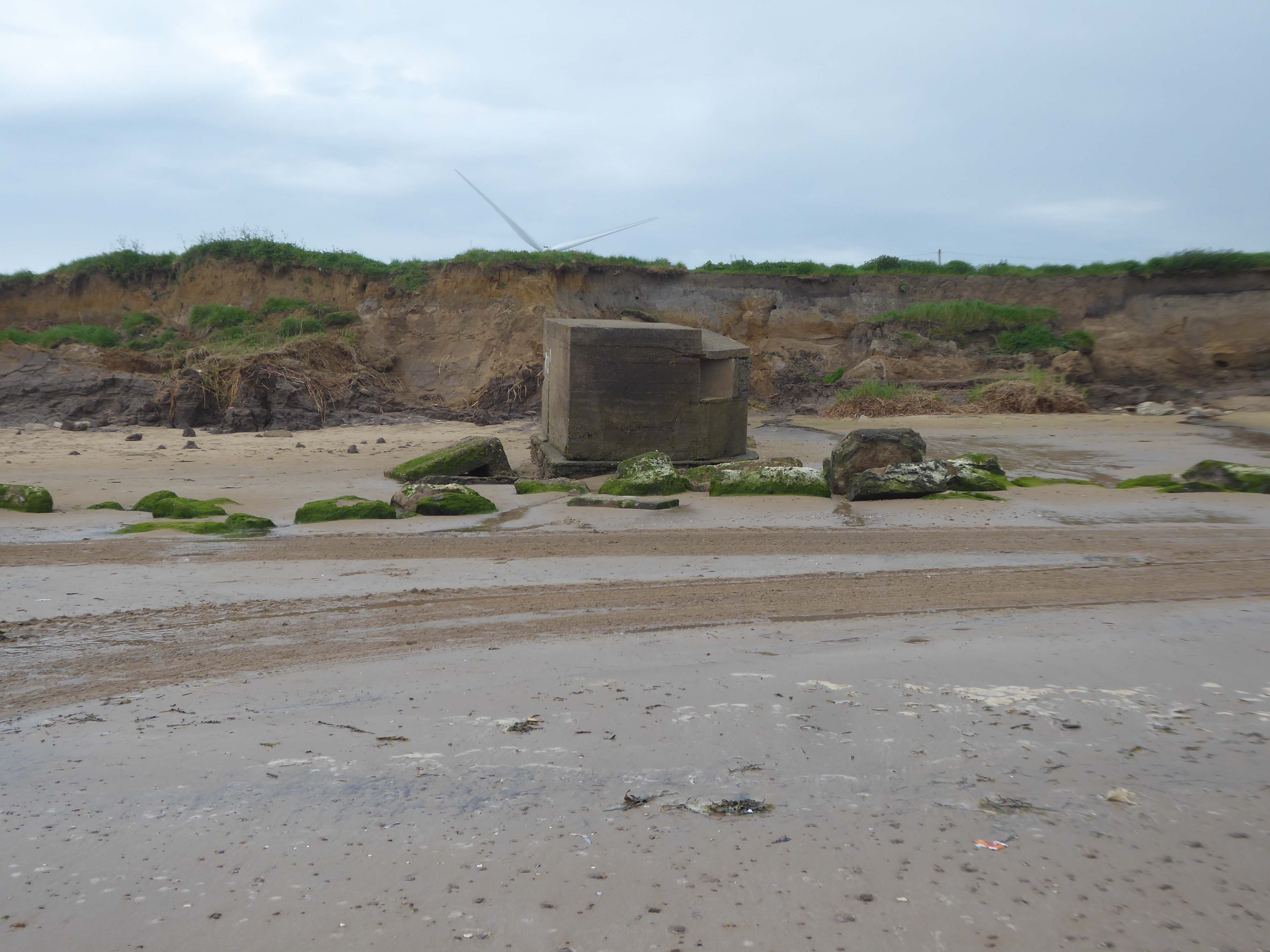
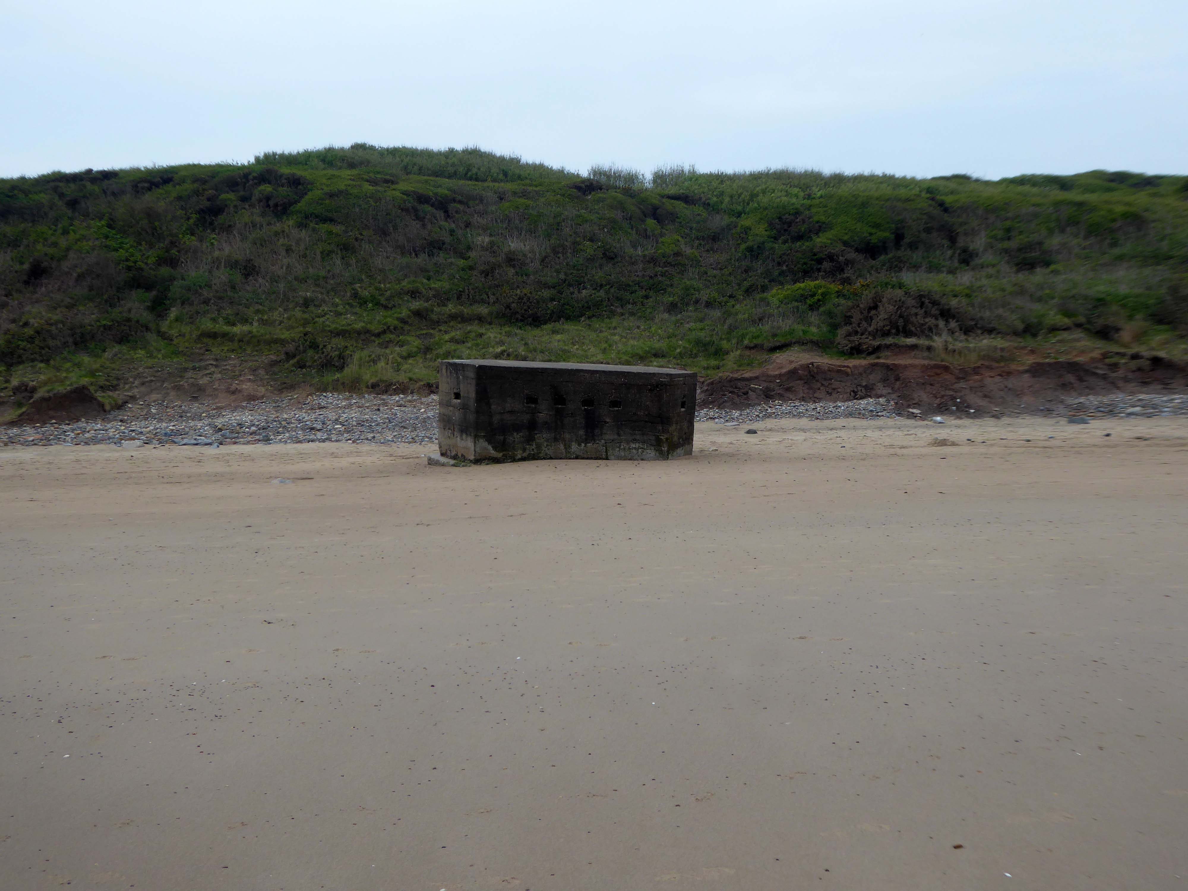
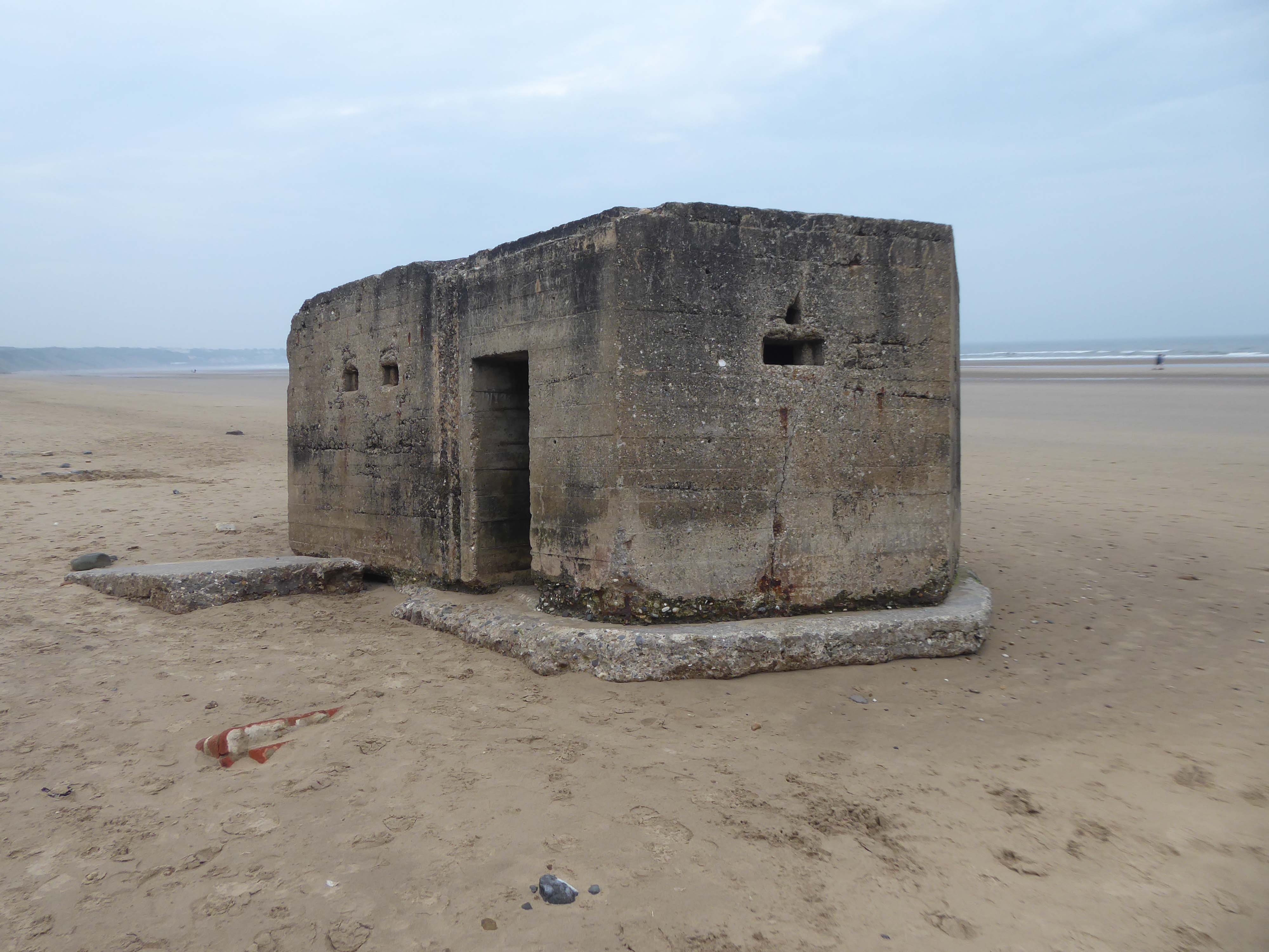
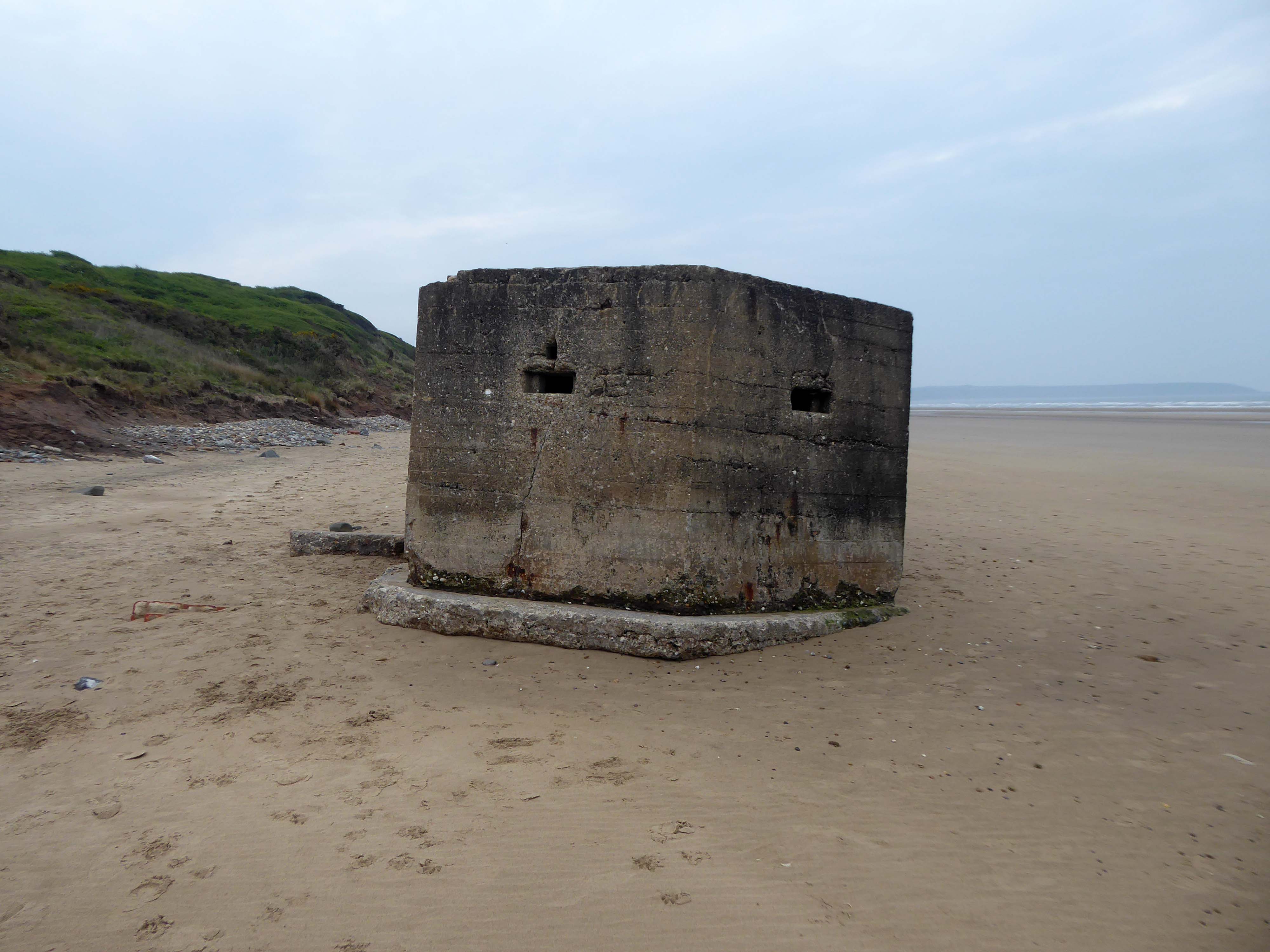
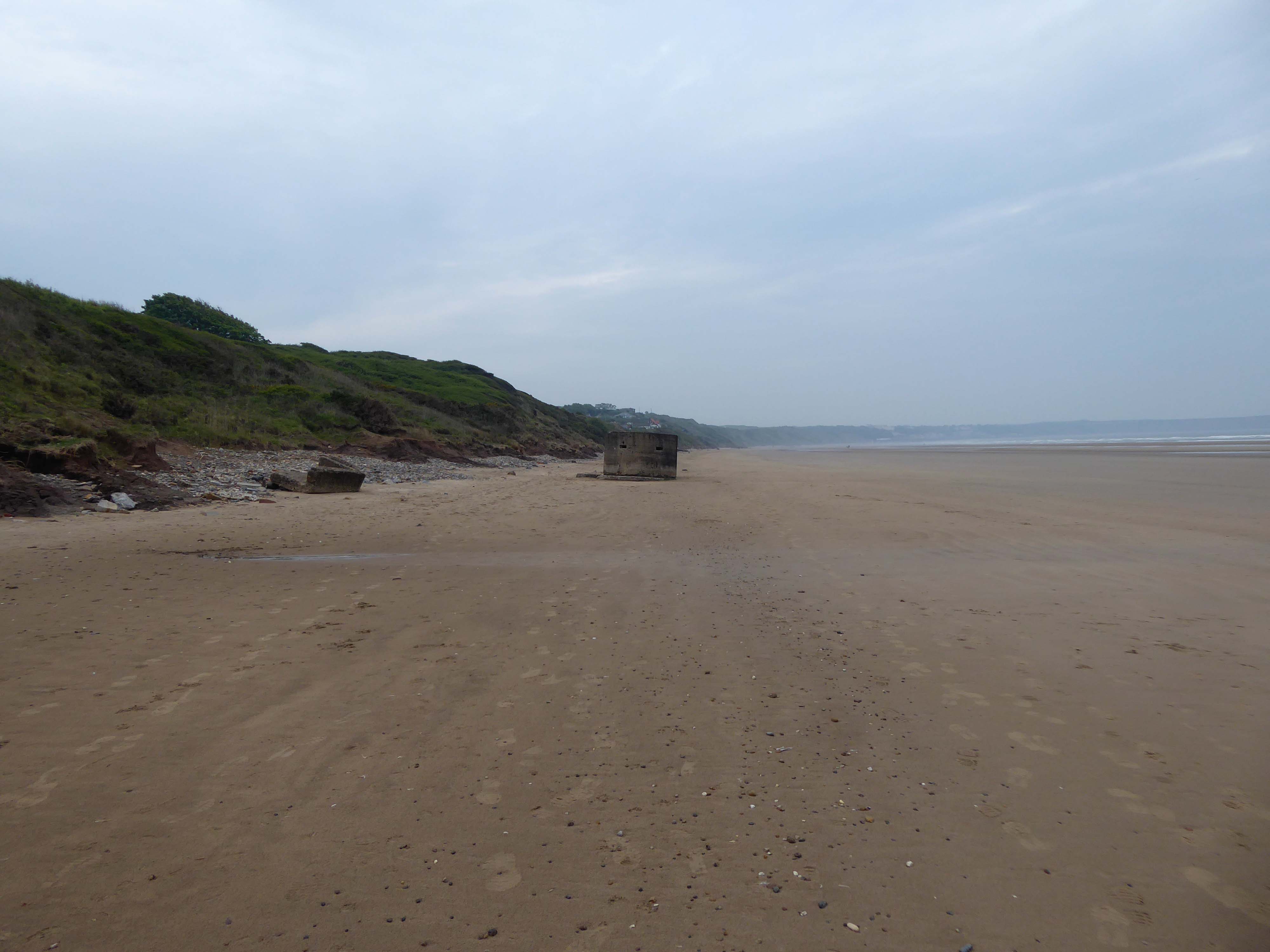
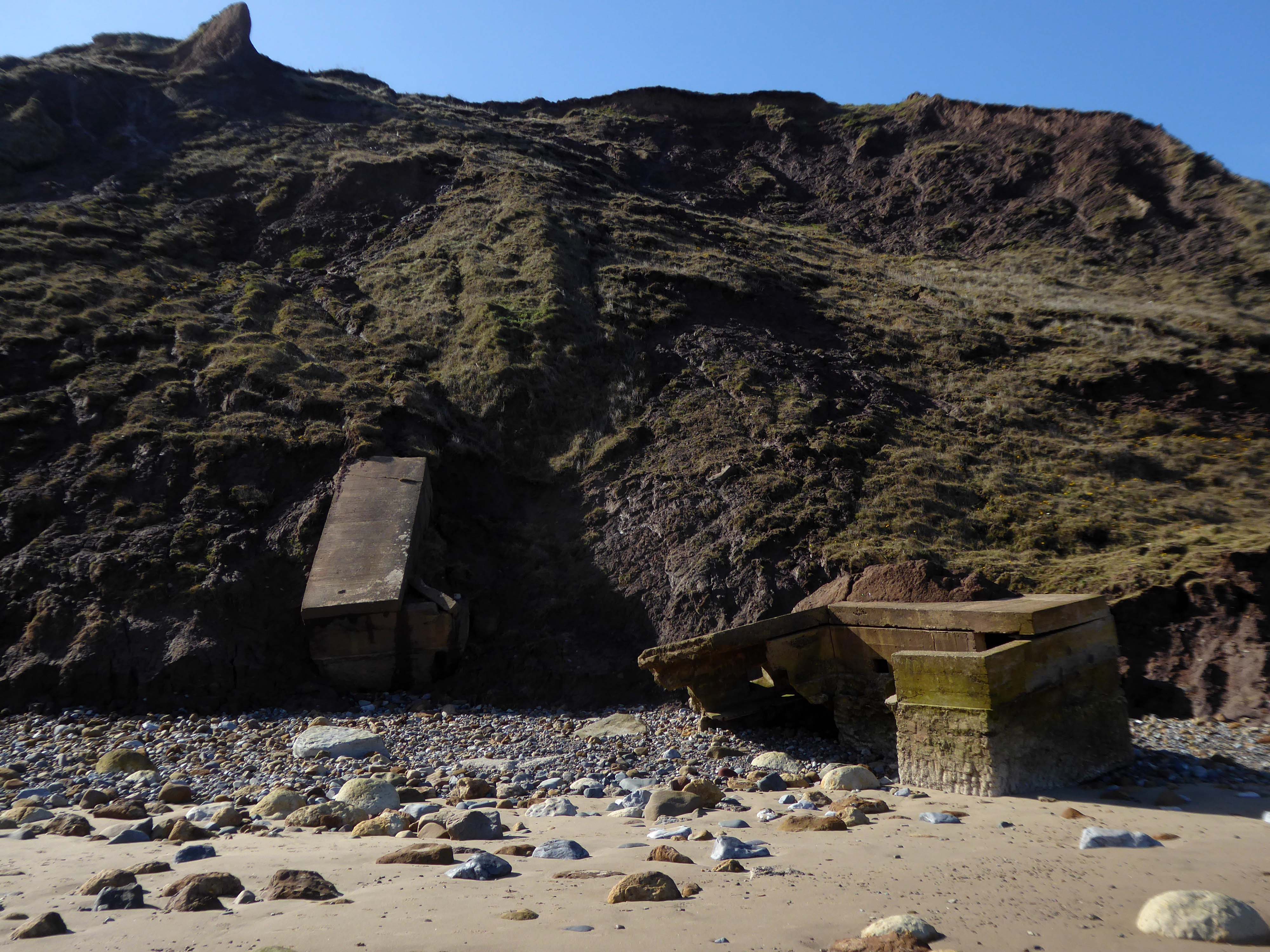
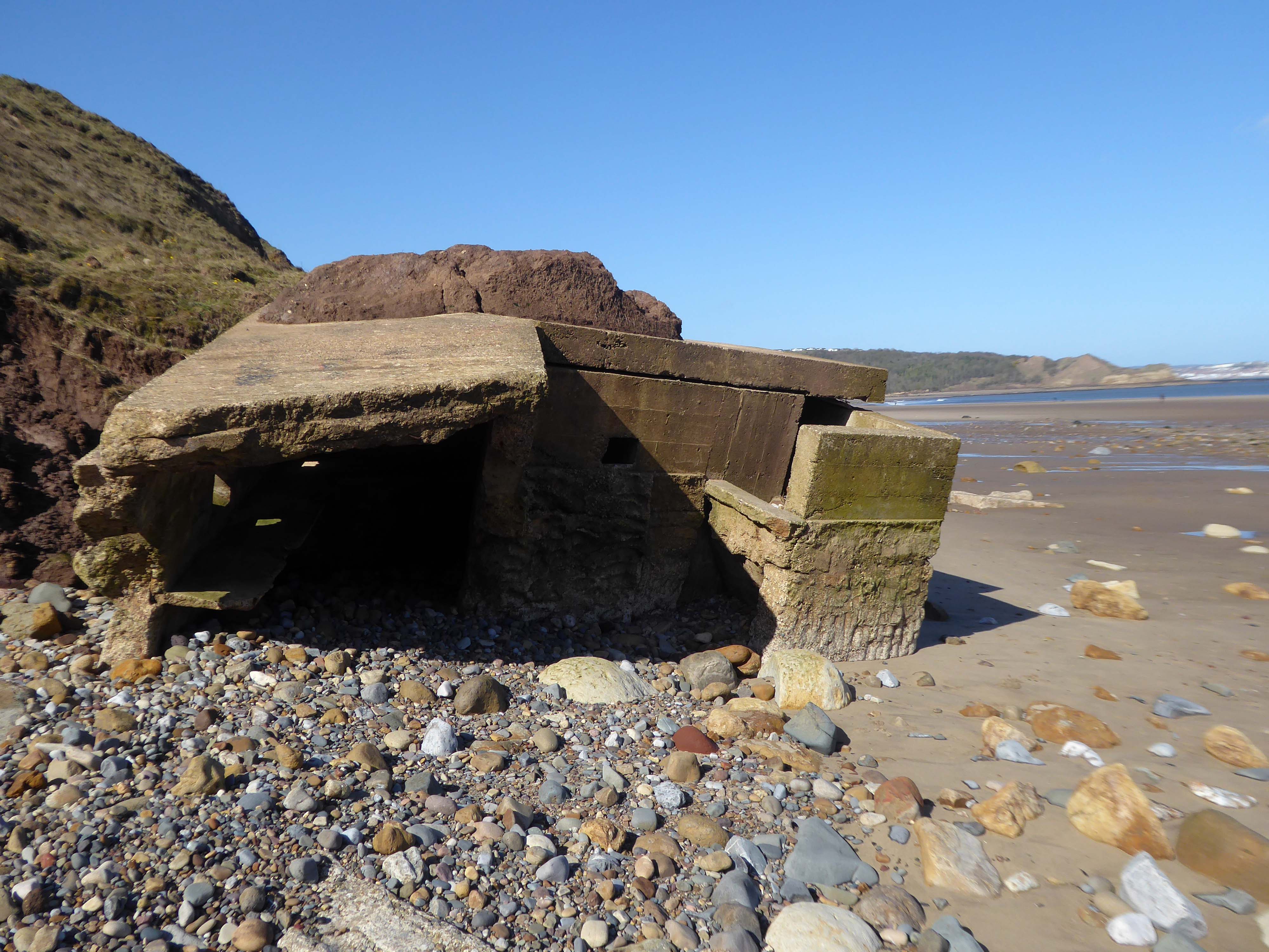
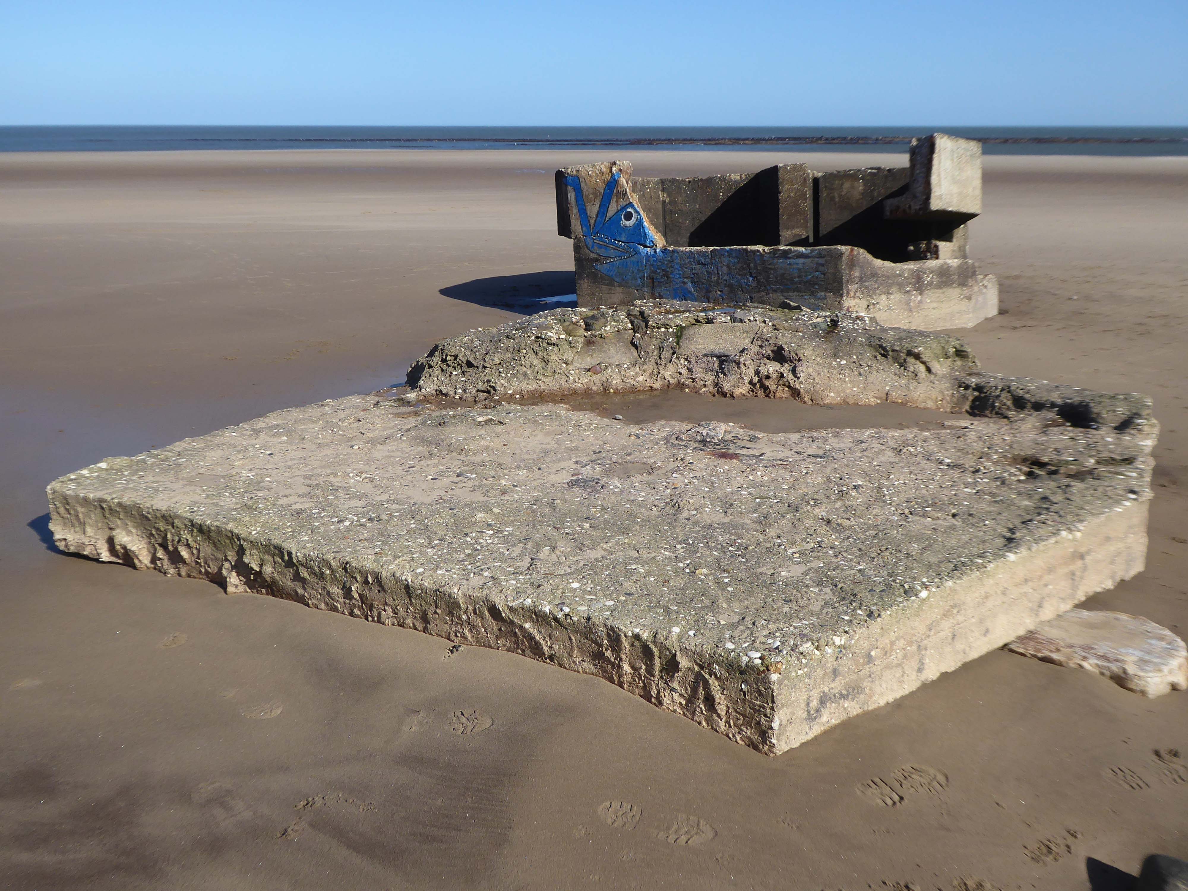
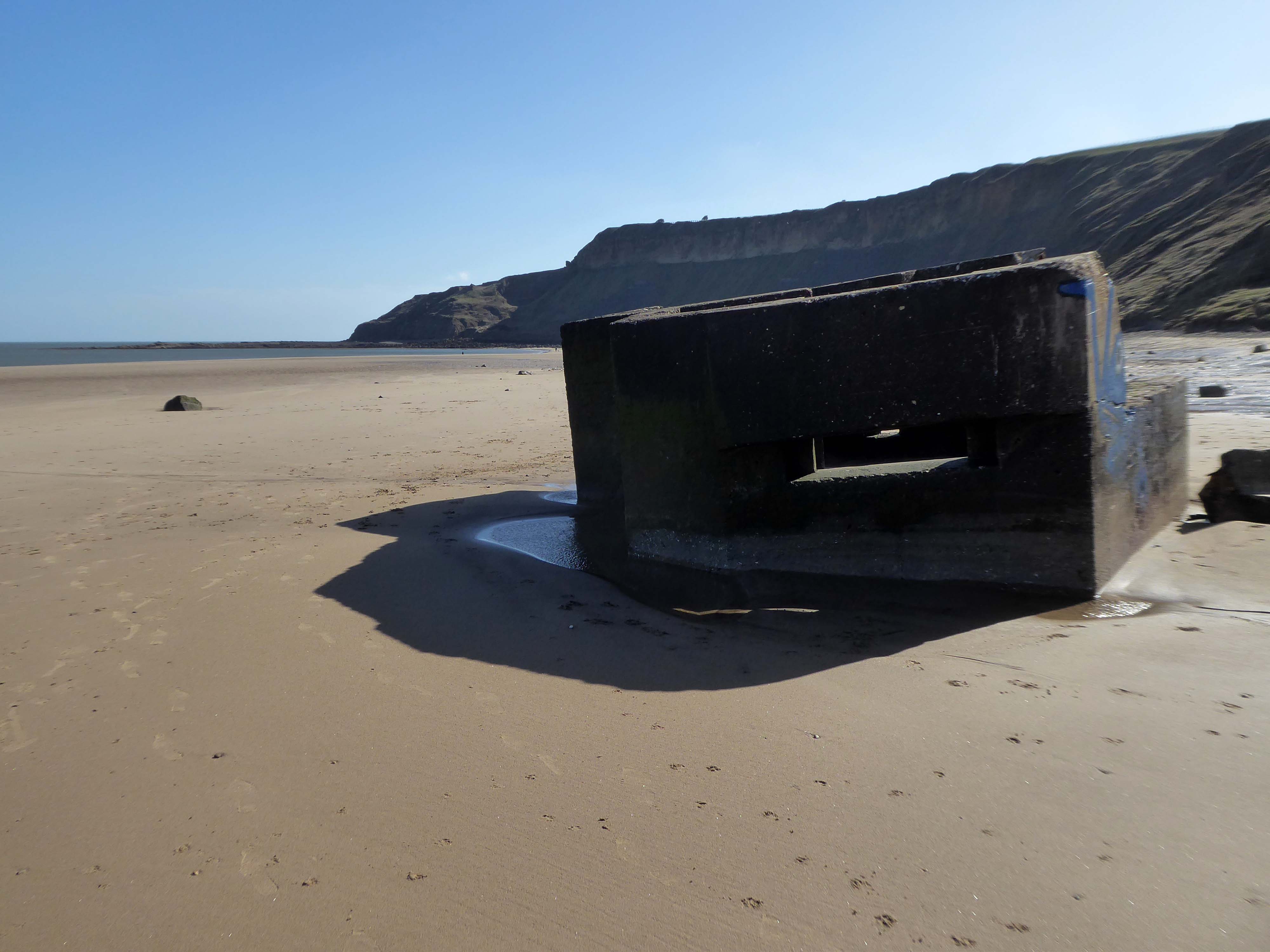
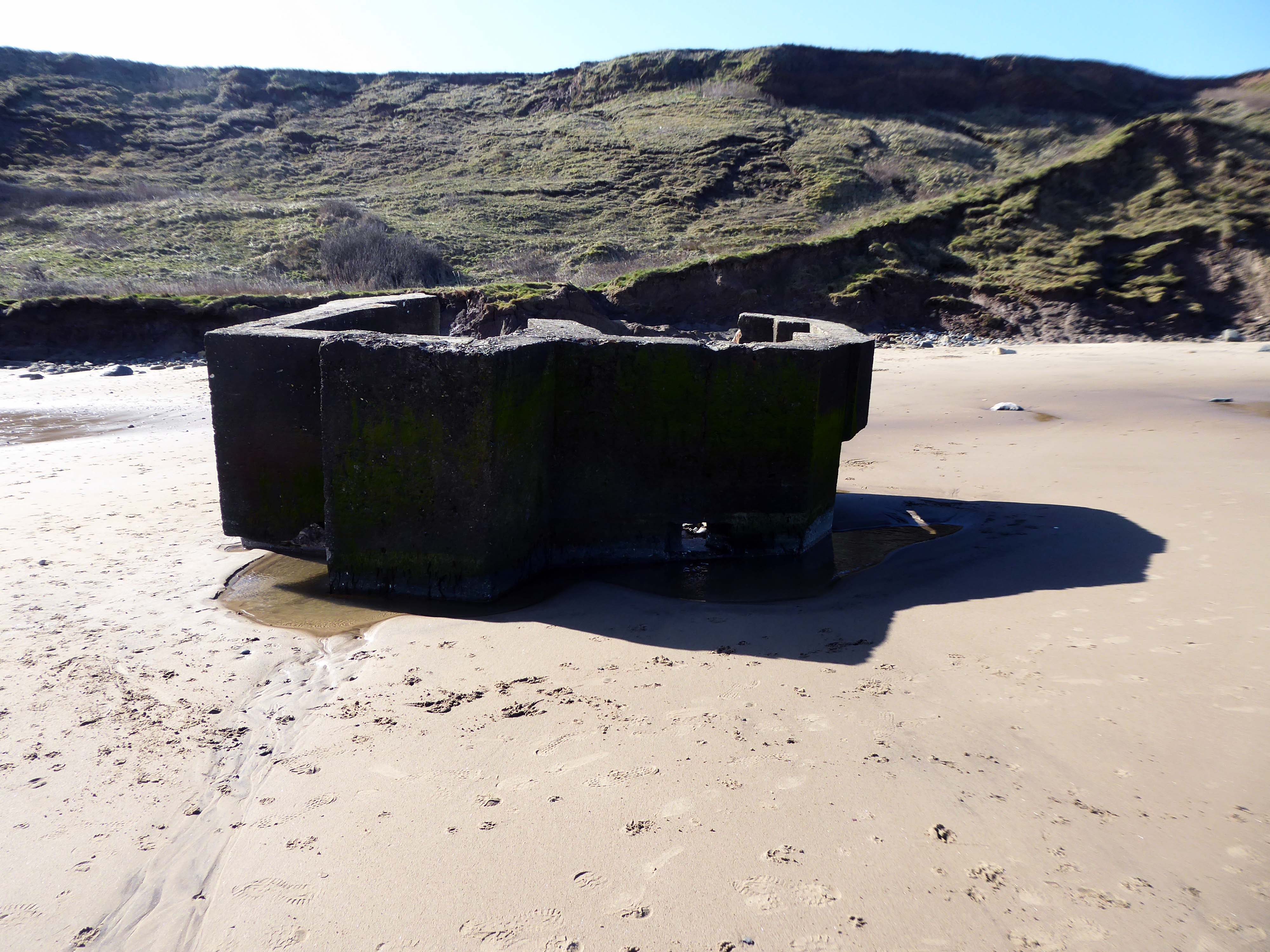
The shore toward Hunmanby Gap when faced with the threat of invasion, was home to a plethora of coastal defences, formed from raw concrete between the years 1941 and 1942, along with attendant armed forces.
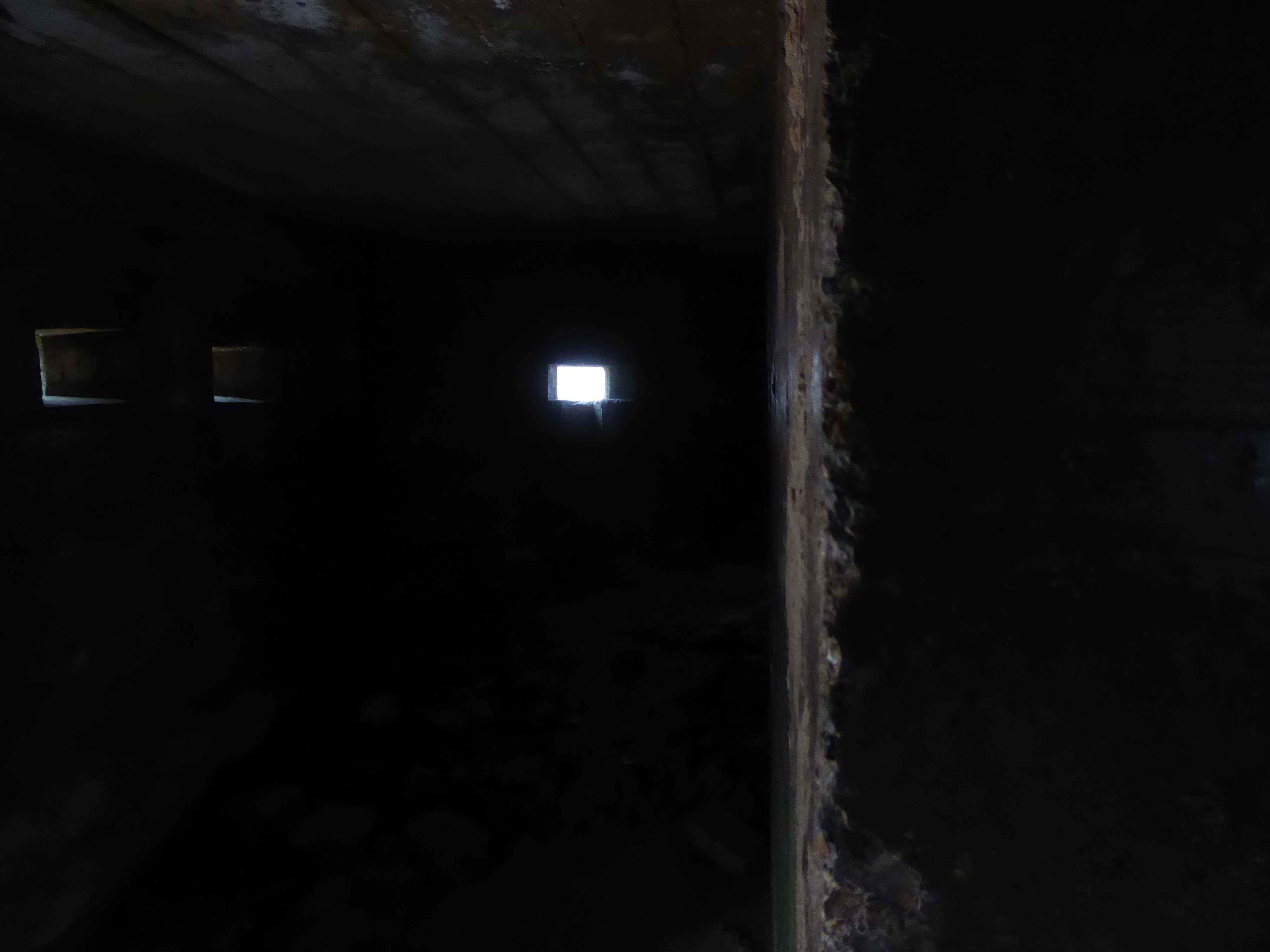
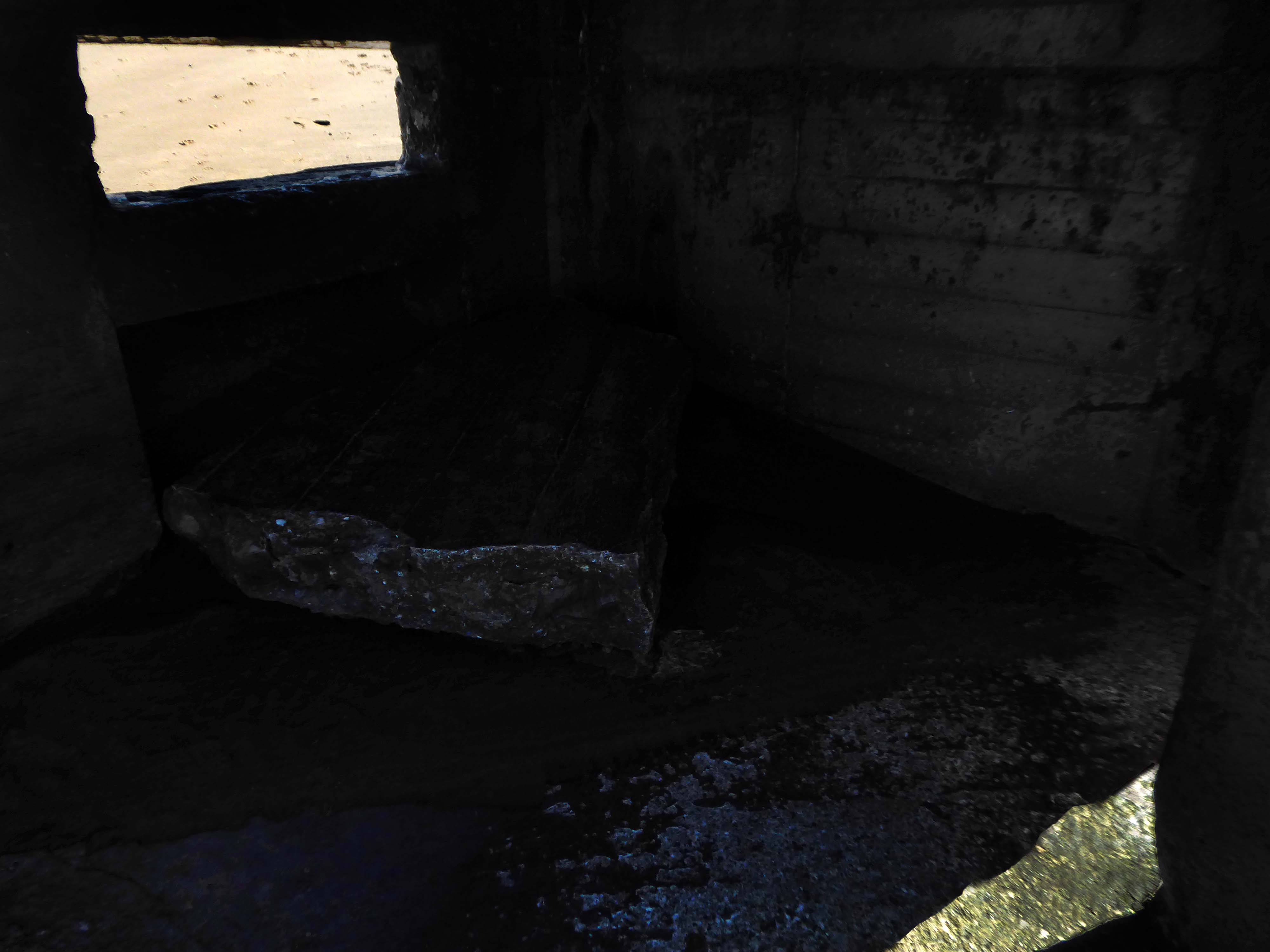
Pill boxes, anti-landing trenches, anti-tank obstacles, beach lights, coastal batteries, flame fourgasses, gun emplacements and machine gun posts were clustered along the coast.
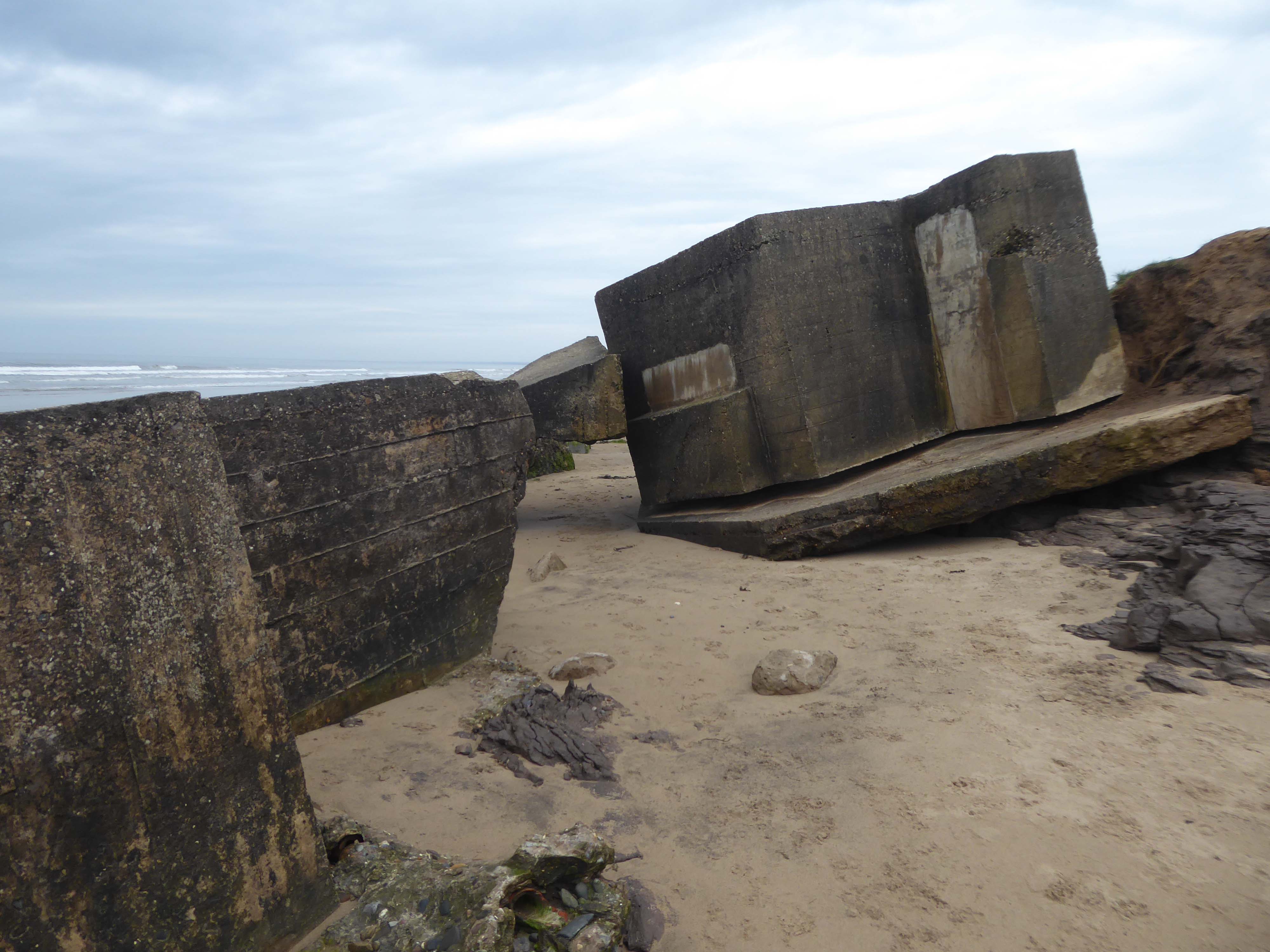
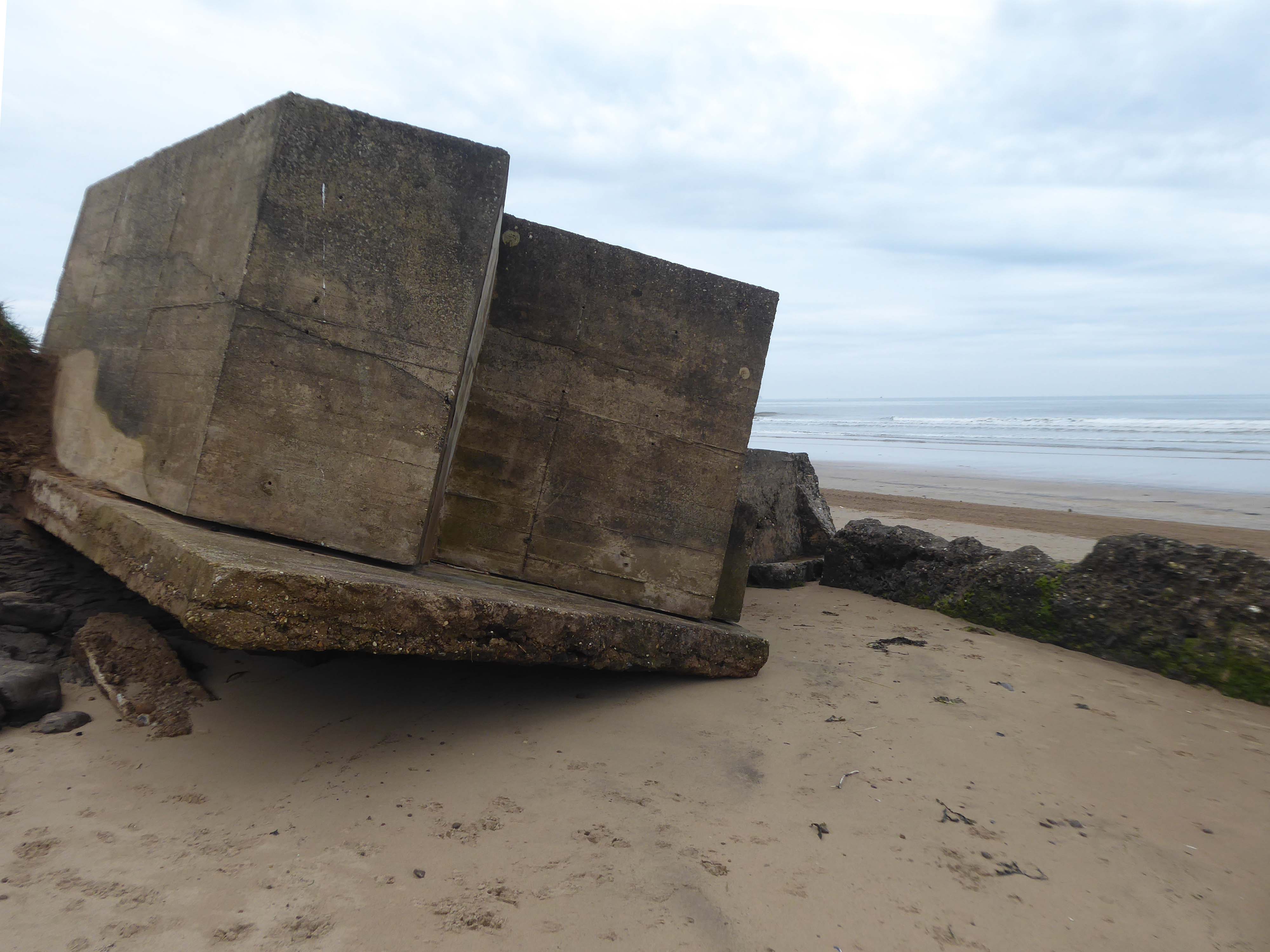
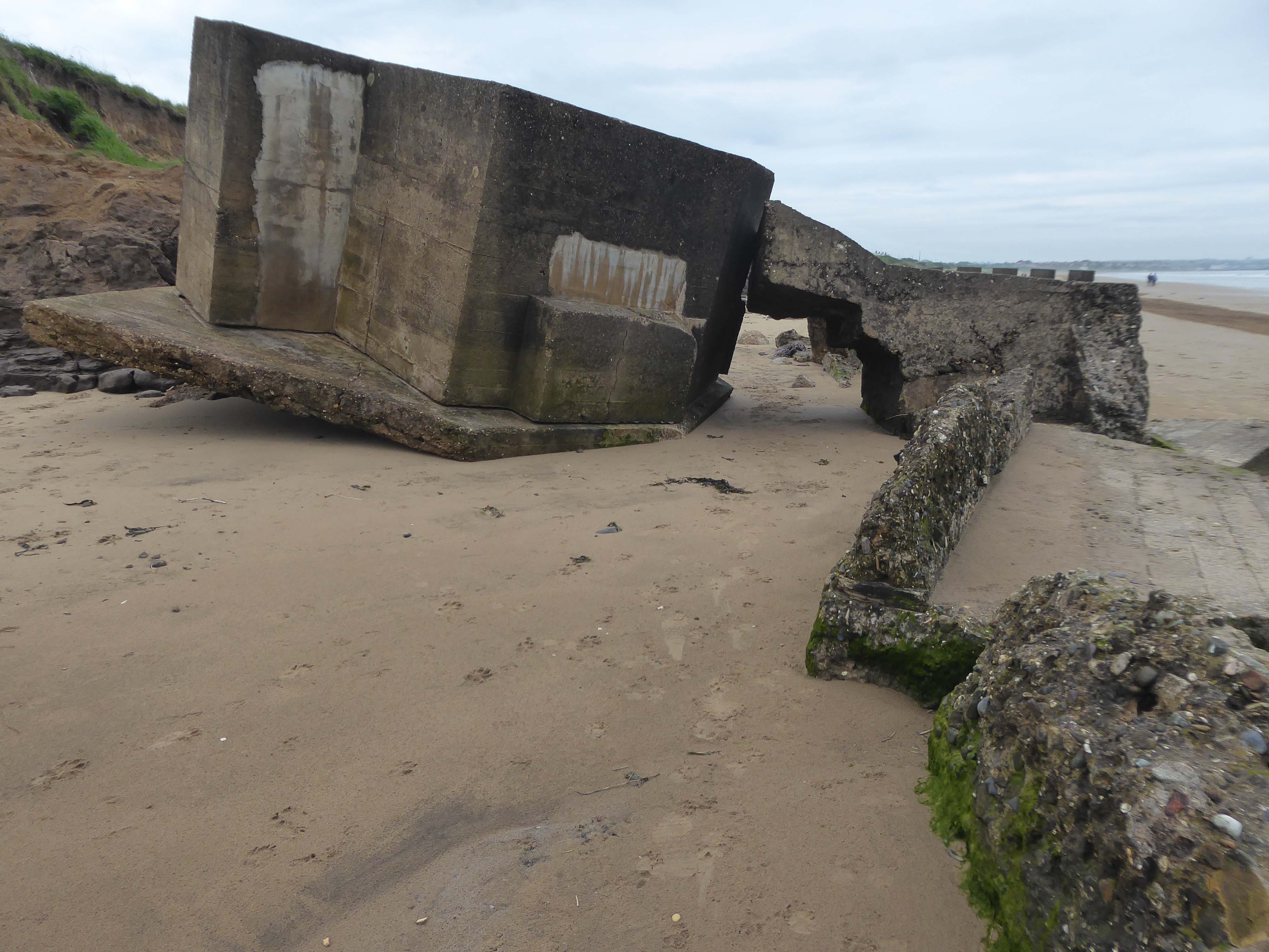
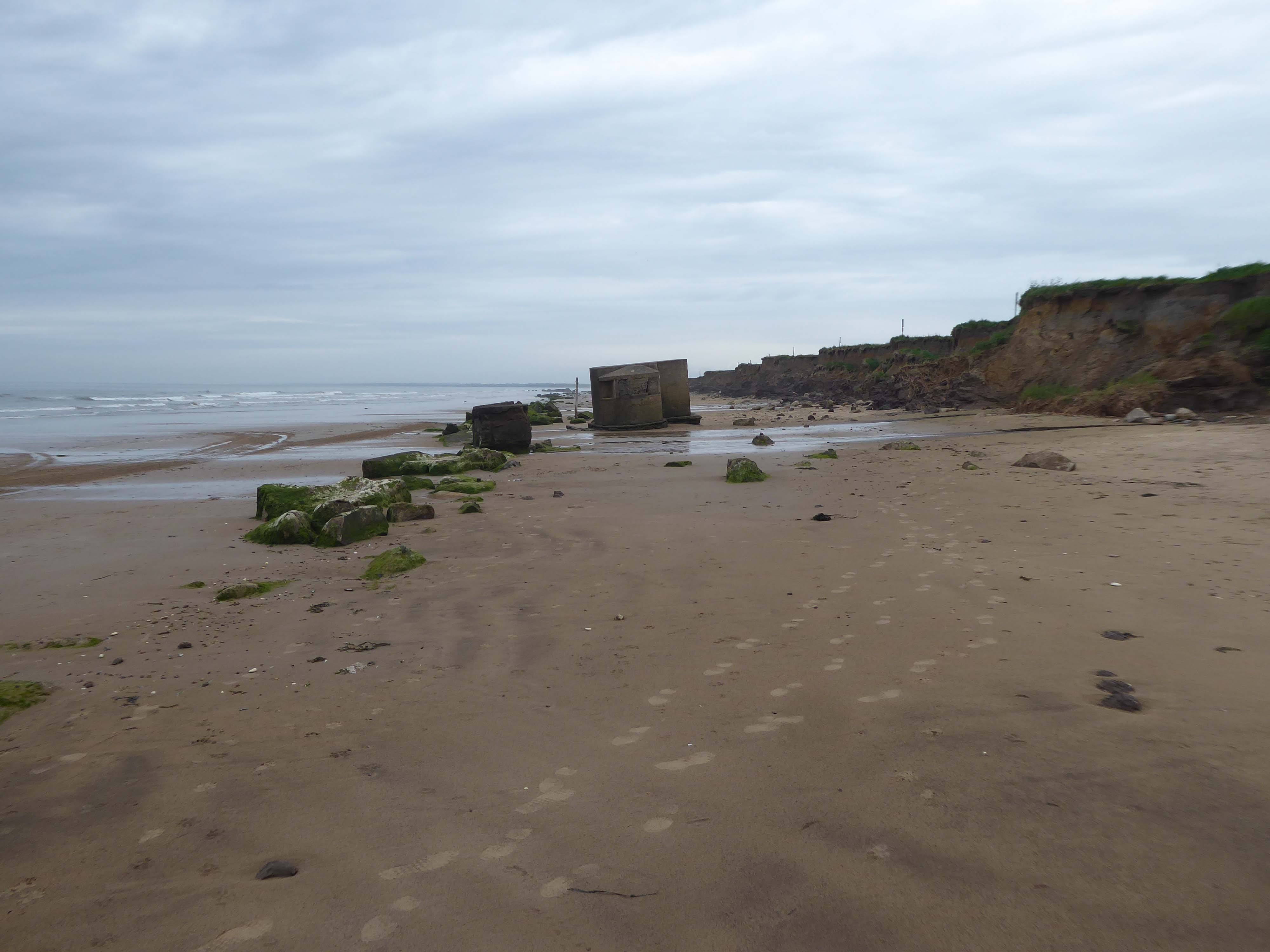
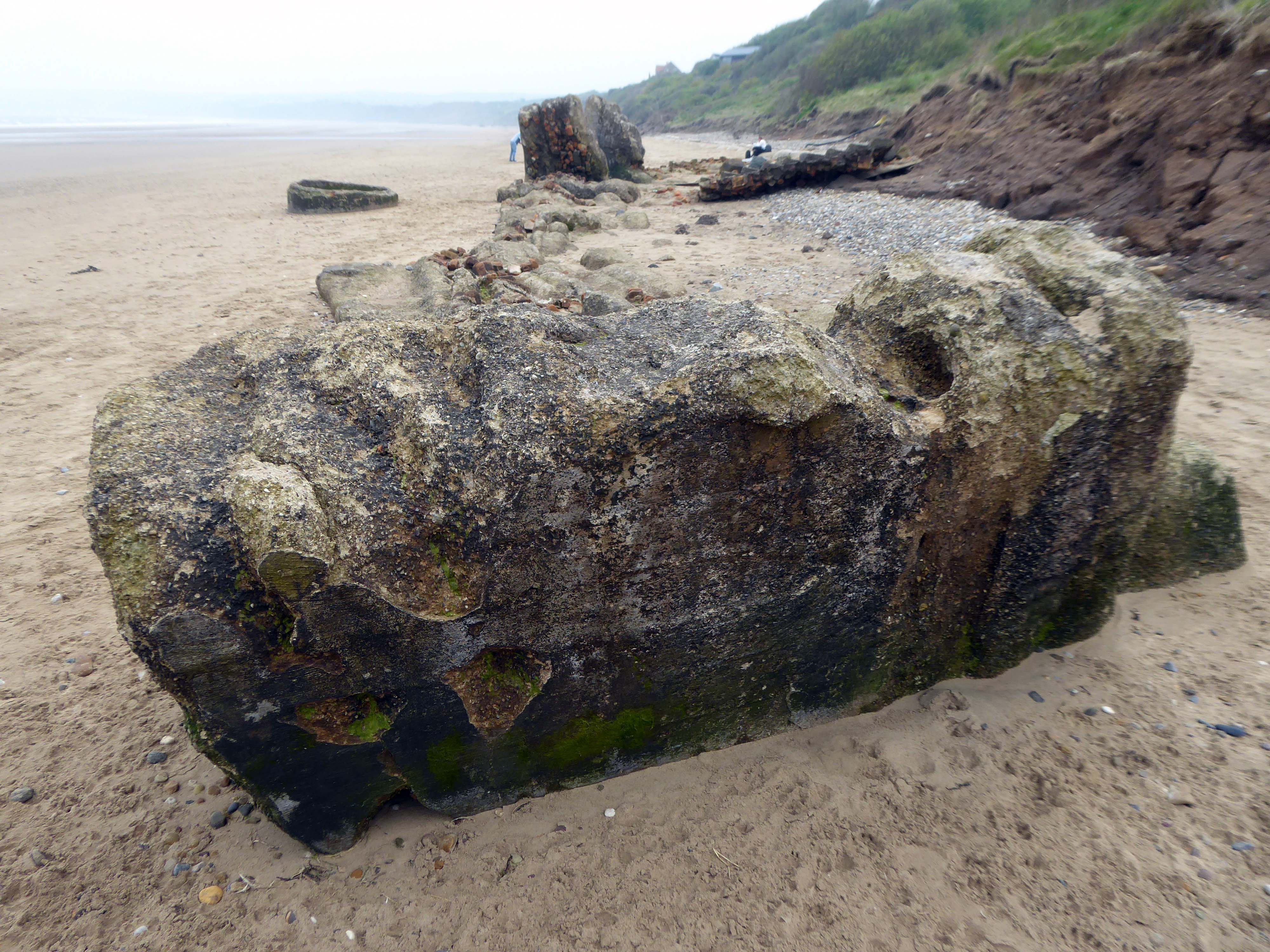
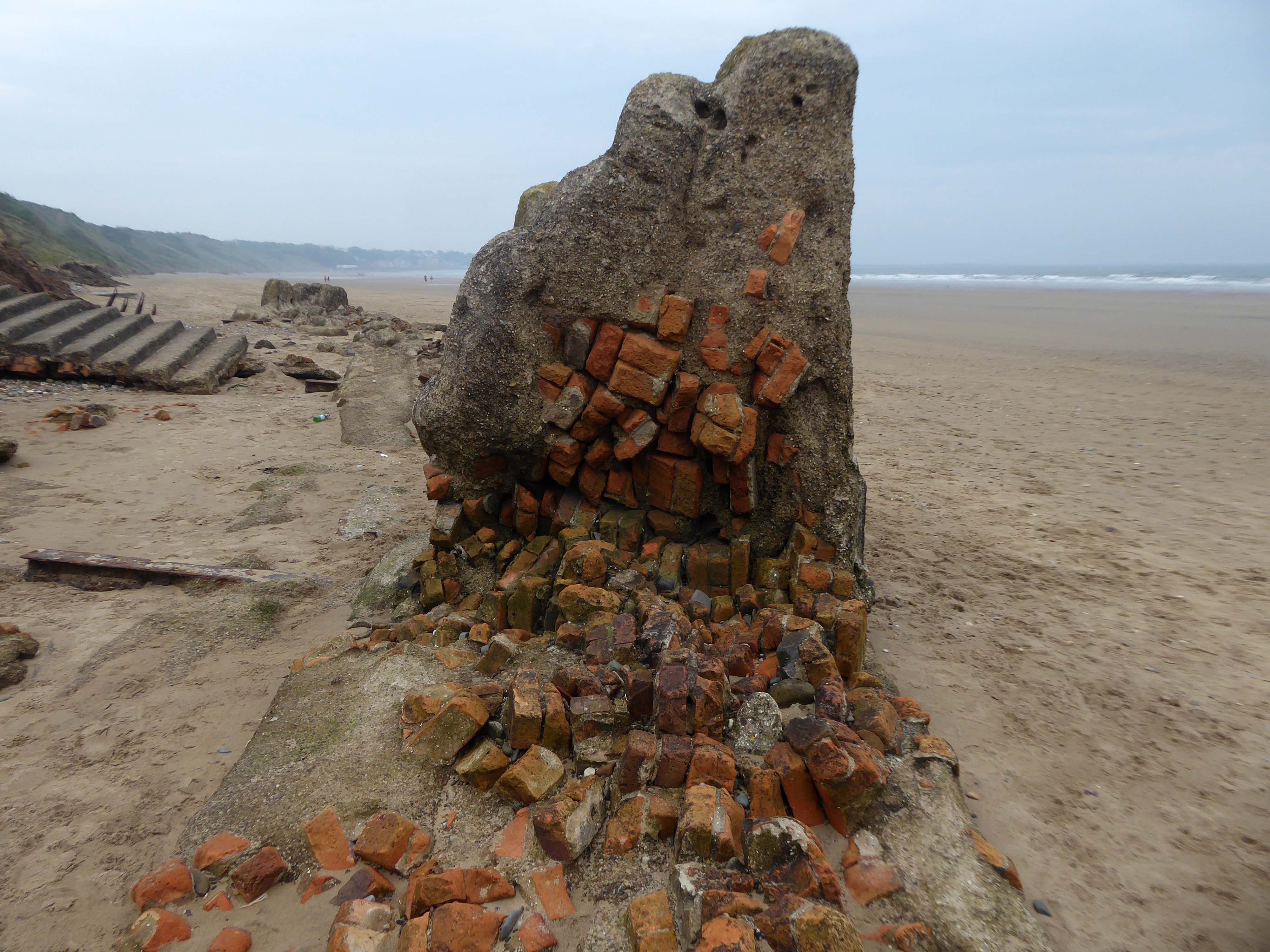
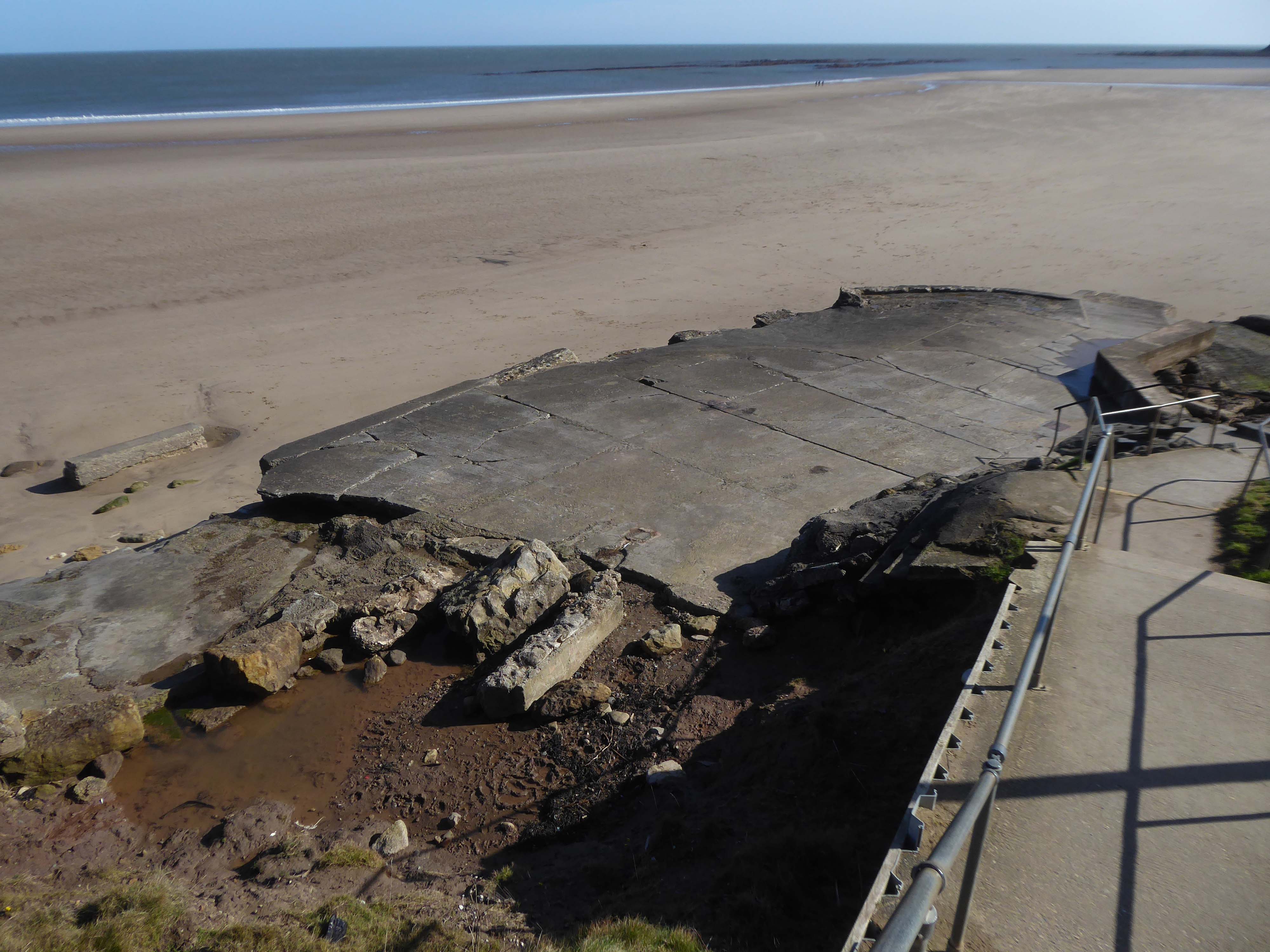
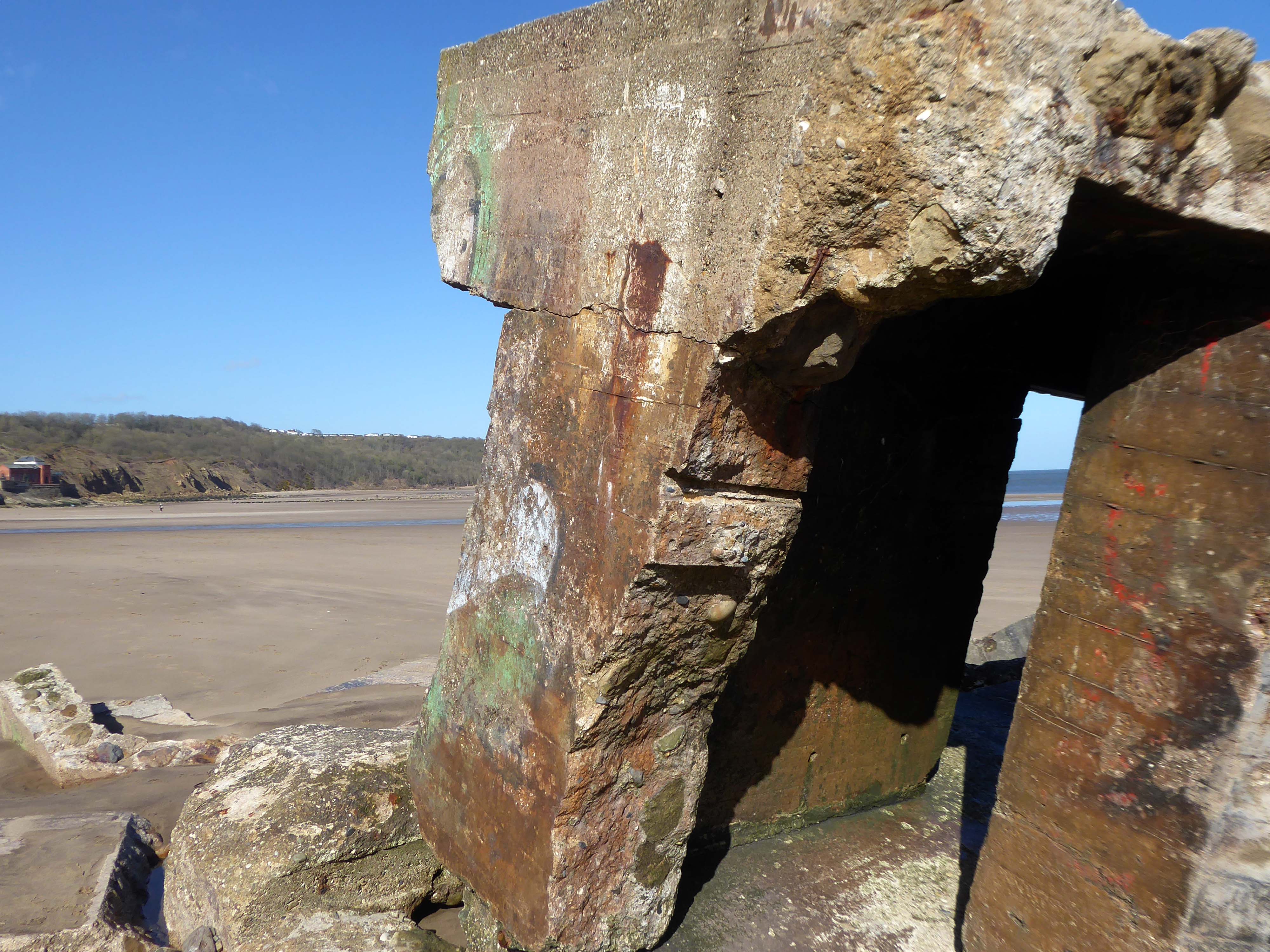
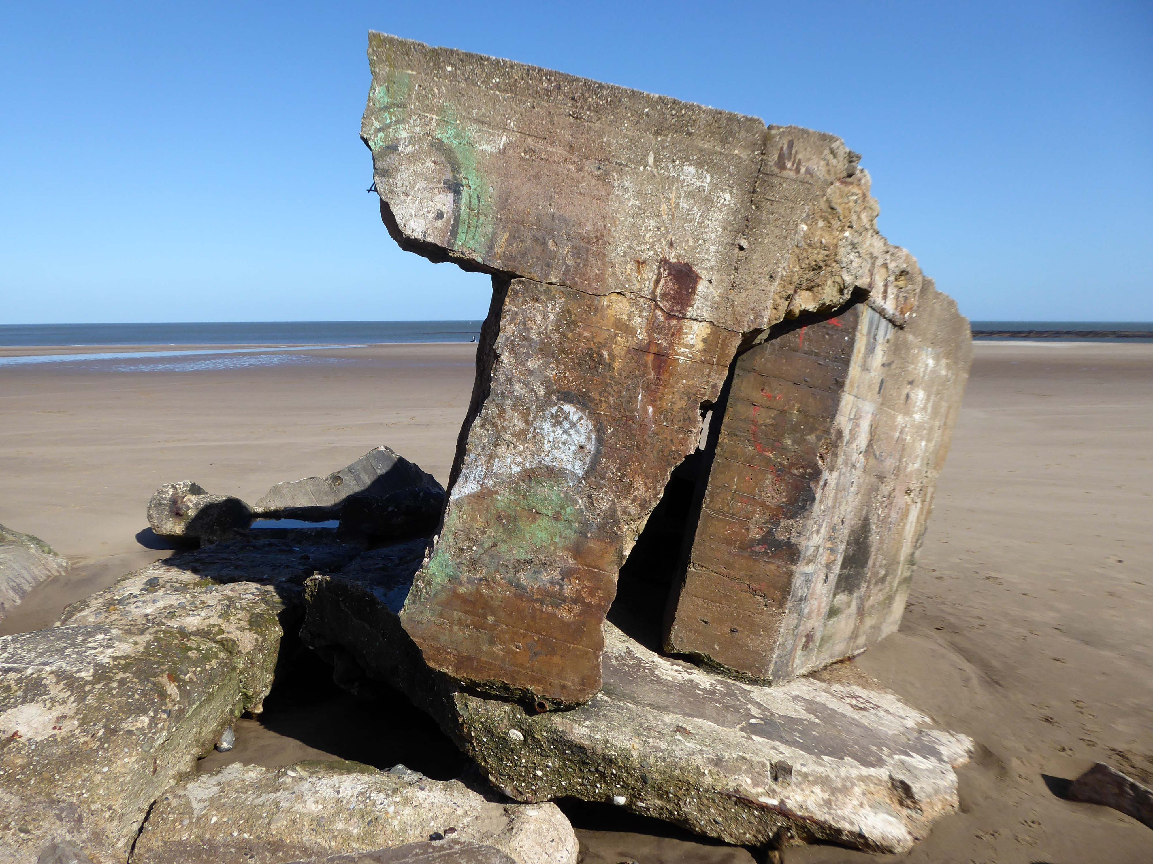
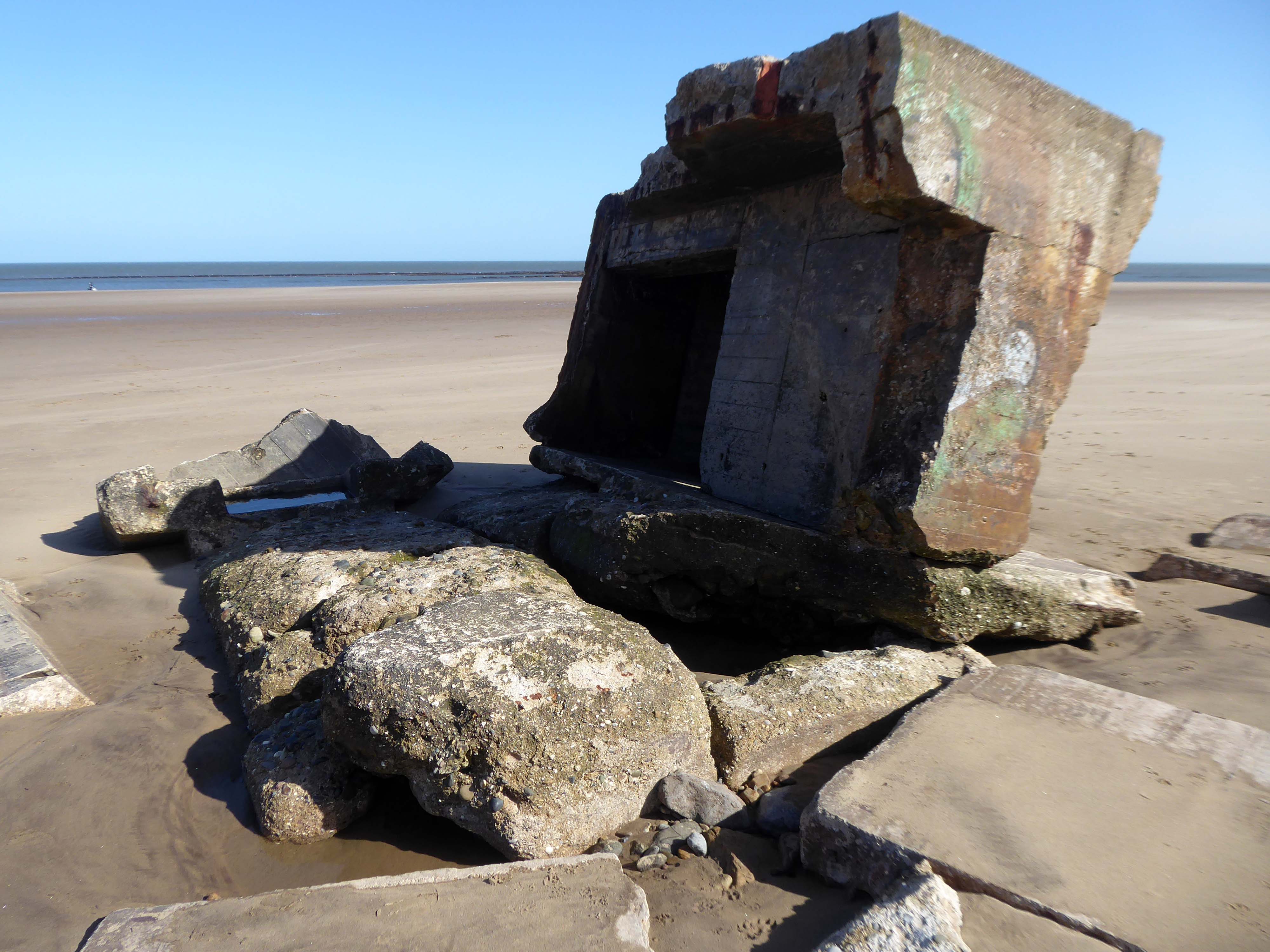
The majority have subsequently been removed, a few are extant – slipping from their cliff-top positions, as the soft clays have been eroded.
Their remains are now skewed and diminished by the weather and the North Sea’s formidable waves, taking on striking sculptural forms, embedded in the shifting sands.
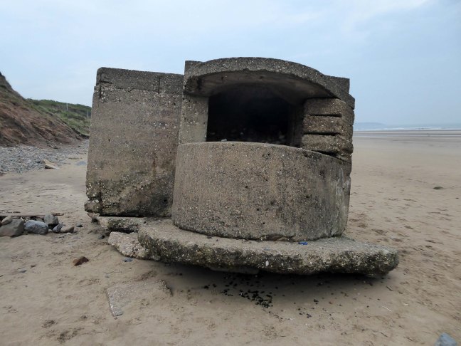
During May 1940 the branch of the Directorate of Fortifications and Works – FW3, at the War Office was set up under the Directorship of Major-General G.B.O. Taylor. Its purpose was to provide specific pillbox designs to be constructed throughout the countryside at defensive locations.
During June and July 1940 saw the FW3 branch issue seven basic designs. However, often, once in the field, the local construction companies modified these under the direction of the area commands.
The FW3 pillbox design concept was to provide a simple fieldwork standard that could be constructed very quickly. Most designs consisted of or incorporated some of the following features:
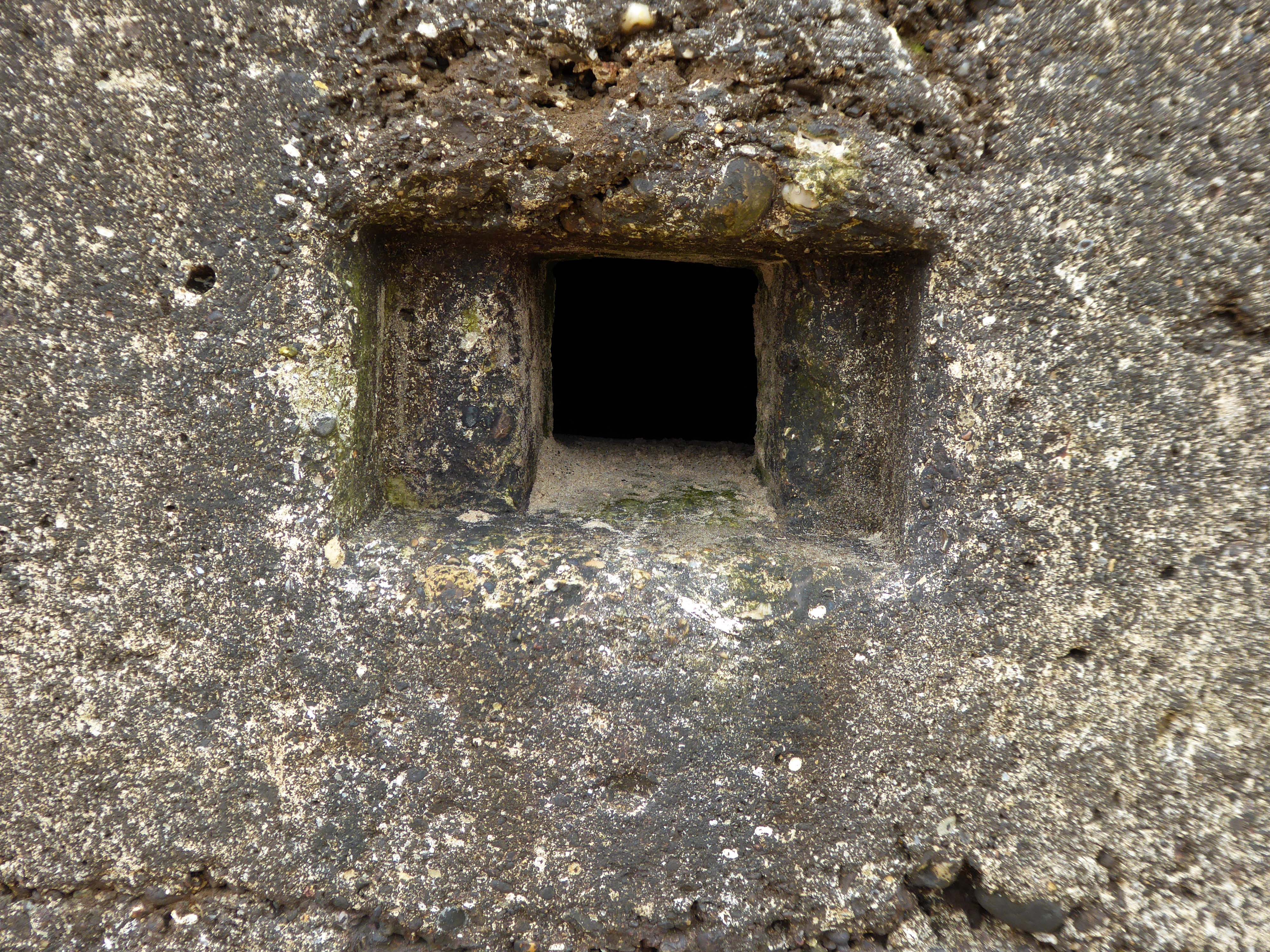
Minimum of Bullet/Splinter Proof protection No attempt was made to provide living accommodation Some designs were enhanced to Shell Proof standard Simple Blast Walls to protect open entrances External flat side walls with rectangular or polygonal shape
The use of common designs with standard sizes for doors, loopholes and flat sides made it easier to mass produce items for concrete shuttering and hence the speed of construction. However, with the general countrywide lack of material it was often necessary to use bricks as the shuttering. This often fools the casual observer into believing that the whole structure is constructed of brick. Closer examination often reveals the integral reinforced concrete back-bone.
The soft clays of the cliffs are subject to constant erosion.
In 2008 fresh landslips have occurred around Cayton Bay. The bungalows built on the old holiday camp at Osgodby Point have started to suffer serious erosion. The cliffs around the Cornelian and Cayton areas are just made of soil. So erosion is to be expected. It may taken time. But there is not much which can be done to prevent the seas moving in.
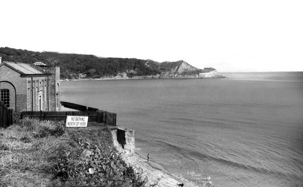
The Pumping Station was partially demolished in 1956.
Several well worn layers of geological time have been hanging around for a while now.
Whilst the long-gone critters are but fossilised versions of their former selves.
The rocks found at Cayton Bay are Jurassic aged from the Callovian stage. At the north end of Cayton Bay, the Cornbrash Formation can be seen, comprised of red-brown, sandy, nodular, bioturbated limestone with oysters and other bivalves.The Cornbrash lies beneath the start of the Cayton Clay Formation. Walking south towards Tenant’s Cliffs, Lower Calcareous Grit is brought to beach level, followed by a calcareous limestone. At the waterworks, low tides reveals a section in the Middle and Upper Jurassic rocks.
On scouring tides, argillaceous limestone and calcareous sandstone can be seen layered along the Upper Leaf of the Hambleton Oolite, which is seen excellently in the low cliff on the southern side of the Brigg. The tough, impure limestone contains well-preserved bivalves and ammonites. The sequence is shown in the diagram but faulting has caused unconformities.
During scouring, Oxford Clay can be seen along the foreshore south of the argillaceous limestone. Walking further south, Red Cliff is reached, where rocks of the Osgodby Formation slope above the Oxford Clay.
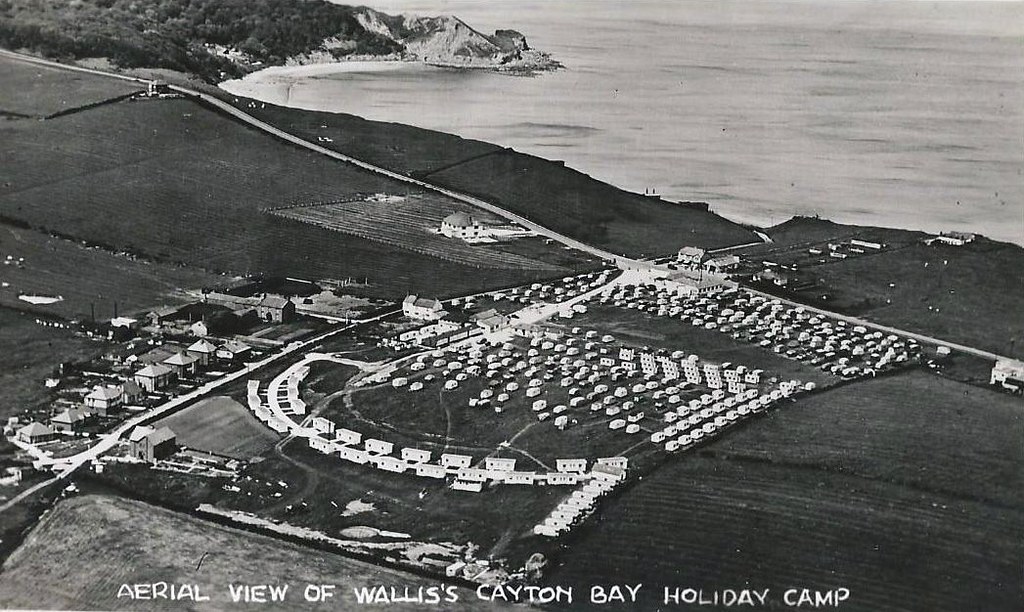
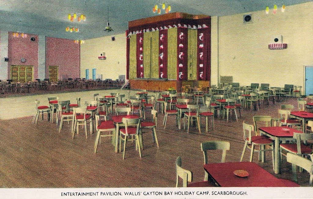
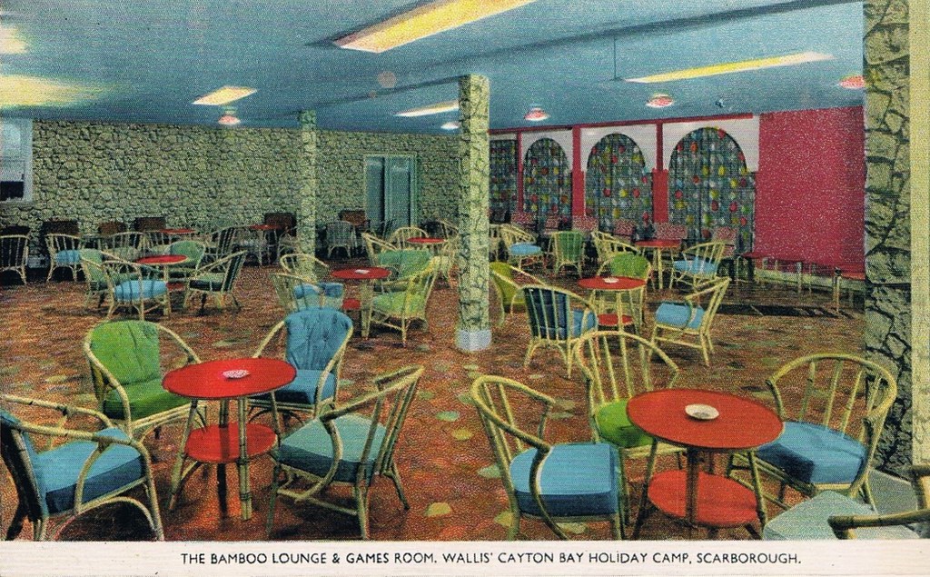
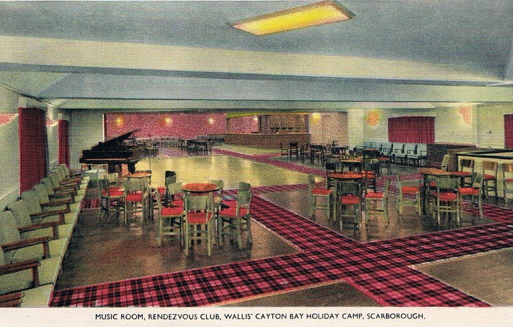
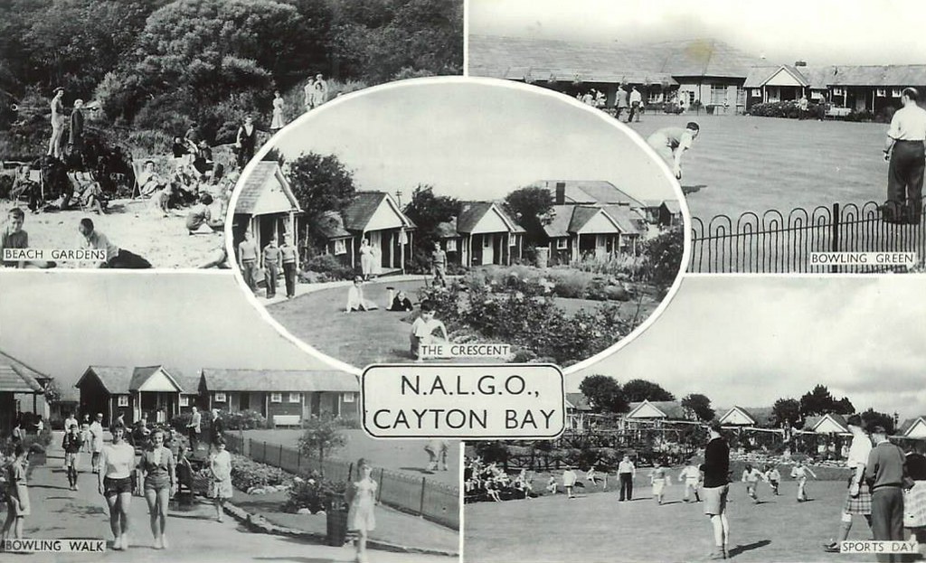
Originally the first Trade Union holiday camp in the North of England, owned by NALGO it opened its doors in 1933. It had 124 wooden bungalows, accommodating 252 visitors. A dining hall with waiter service, a rest room along with recreation rooms for playing cards, billiards, a theatre for indoor shows and dancing was also provided. The new centre also provided Tennis courts, Bowling greens along with a children’s play area. The visitors could walk to the beach where there was a sun terrace and beach house which also had a small shop.
Click here to see photos of the NALGO camp from the 1930s.
One of the earliest visitors were the family of poet Philip Larkin and during the Second World War it became a home for evacuated children from Middlesbrough.
The NALGO camp closed in 1974 and was later sold.
The wide sandy bay was an ideal location for WW2 pillboxes and gun emplacements – anticipating a possible North Sea invasion.
They too are built quite literally on shifting sands.
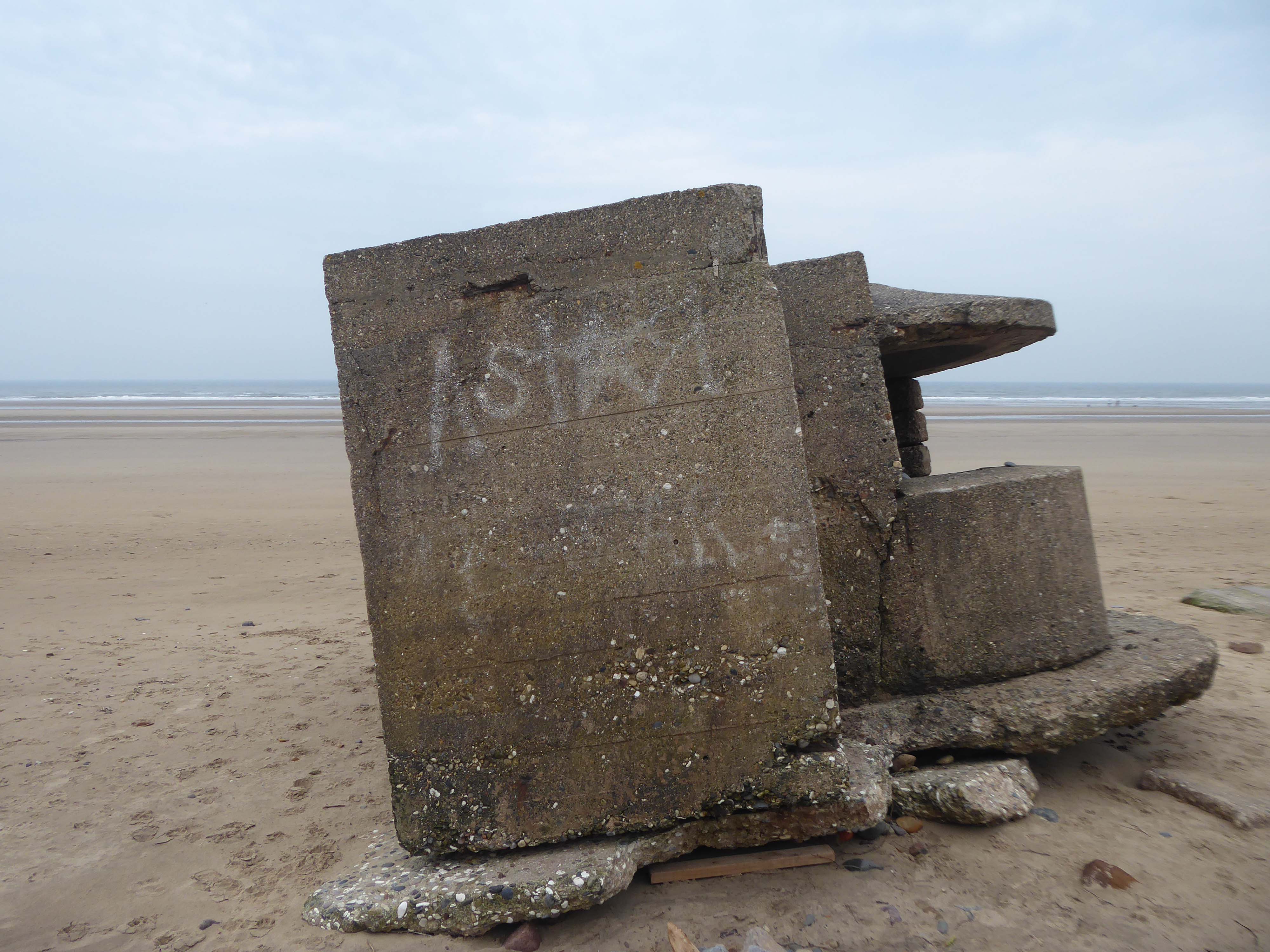
The pillbox – one of many built along the coast to defend against an invasion during World War II – had started to break down, leaving one large piece of stone in a precarious position.
Rob Shaw, of Ganton, noticed the large slab was propped up dangerously against another piece of stone last September.
He said he reported his concerns to Scarborough Borough Council then, but that nothing was done until last month.
The dad-of-two said before the work:
I used to work in construction and I would have been fired if I had left a lump of concrete like that, it could weigh four or five tonnes.
It just needs lying flat on the sand so it can’t fall on anyone.
A spokesperson for Scarborough Borough Council said the council had assessed the pillbox and arrangements had been made for the problem section to be removed.
The Scarborough News
This unstable cliff-top structure was allegedly hastened bay-wards by the Council.
Claims that we pushed the pillbox off the cliff are untrue – our colleagues have many amazing talents but pushing huge concrete structures is not one of them. The structure people can see at the base of the cliff is the other section of the pillbox that has been on the beach for many years.
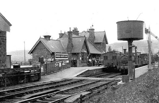
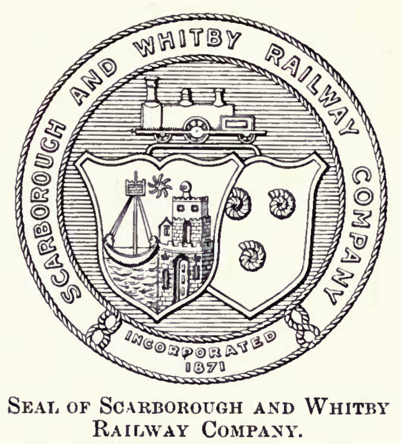
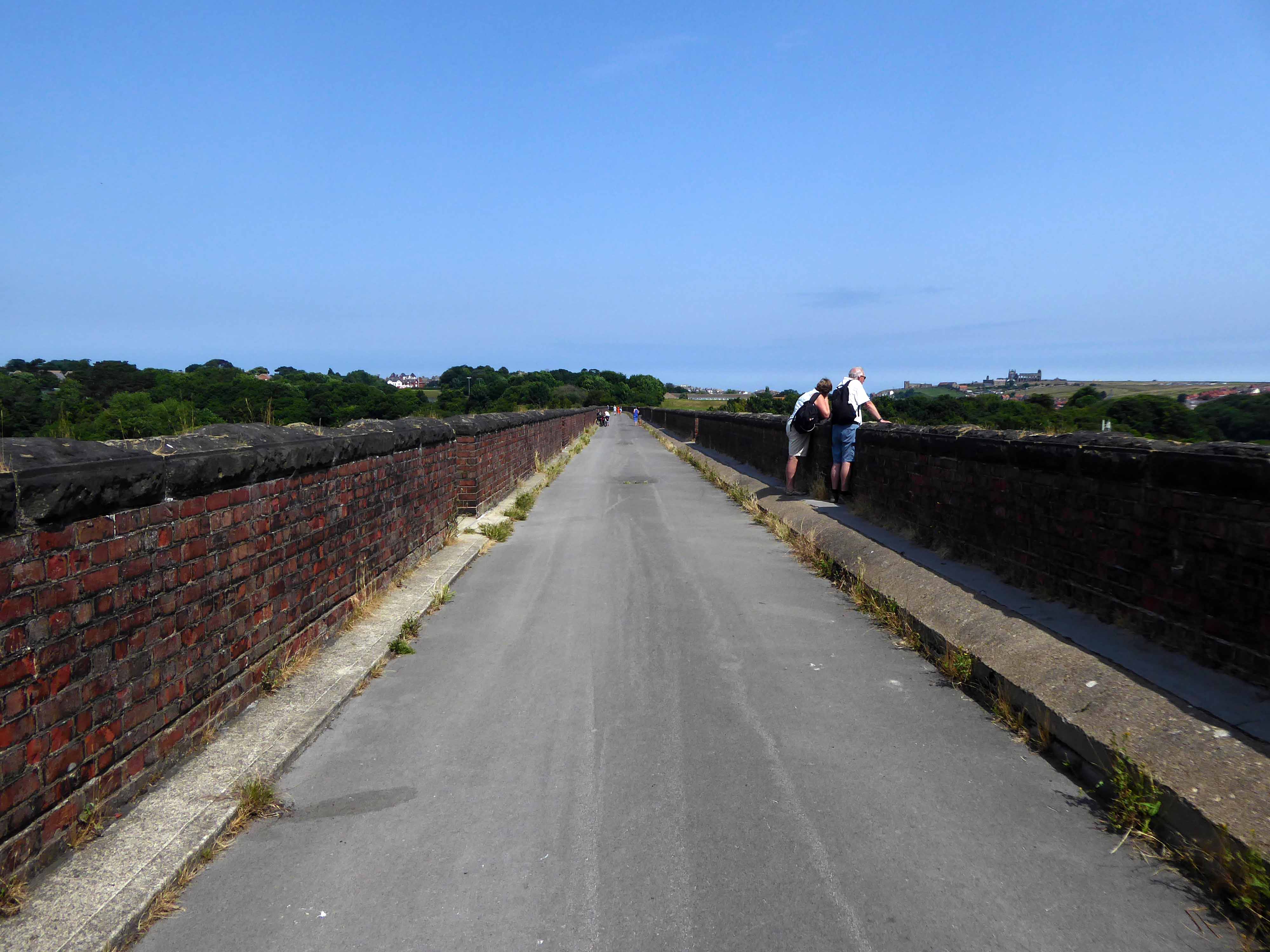
Formerly the Scarbough to Whitby Railway – the line opened in 1885 and closed in 1965 as part of the Beeching Axe.
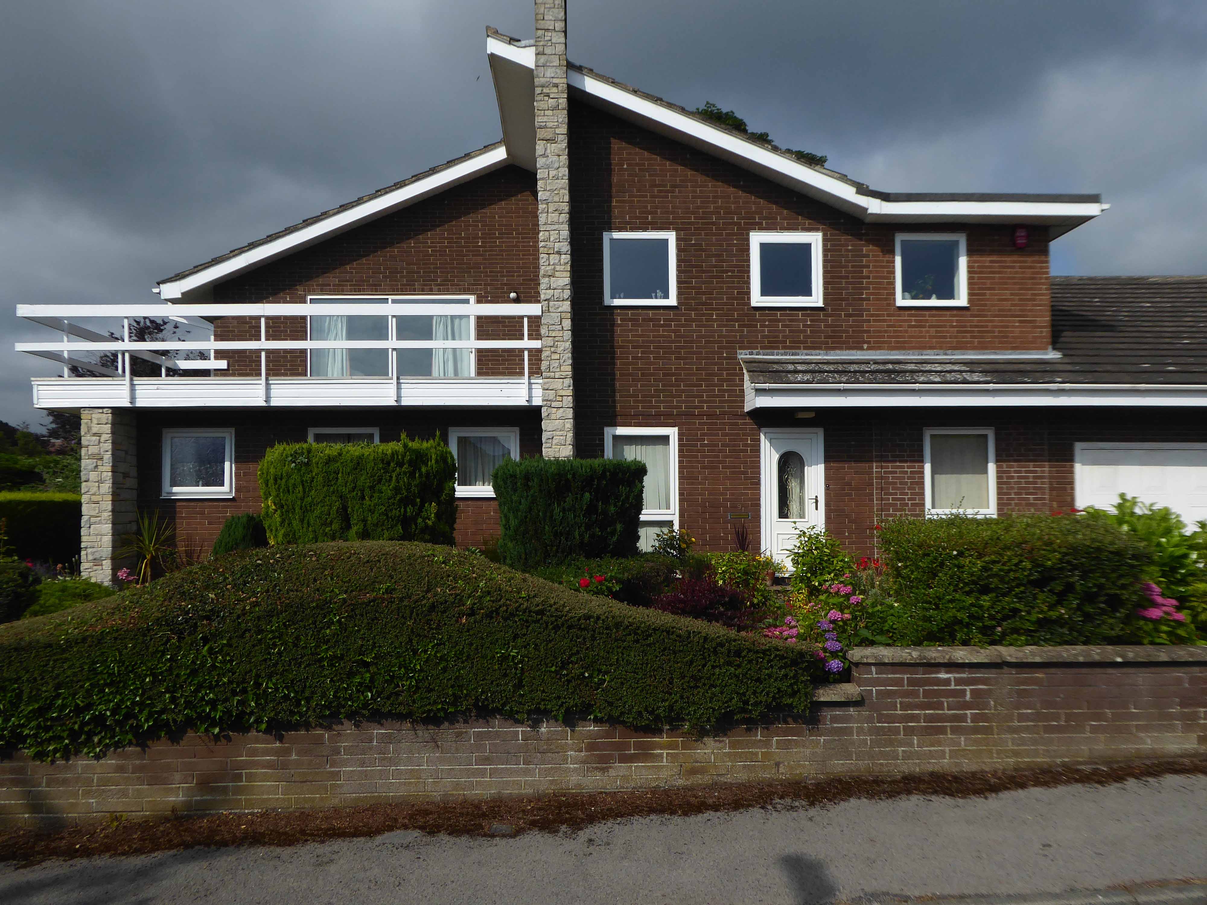
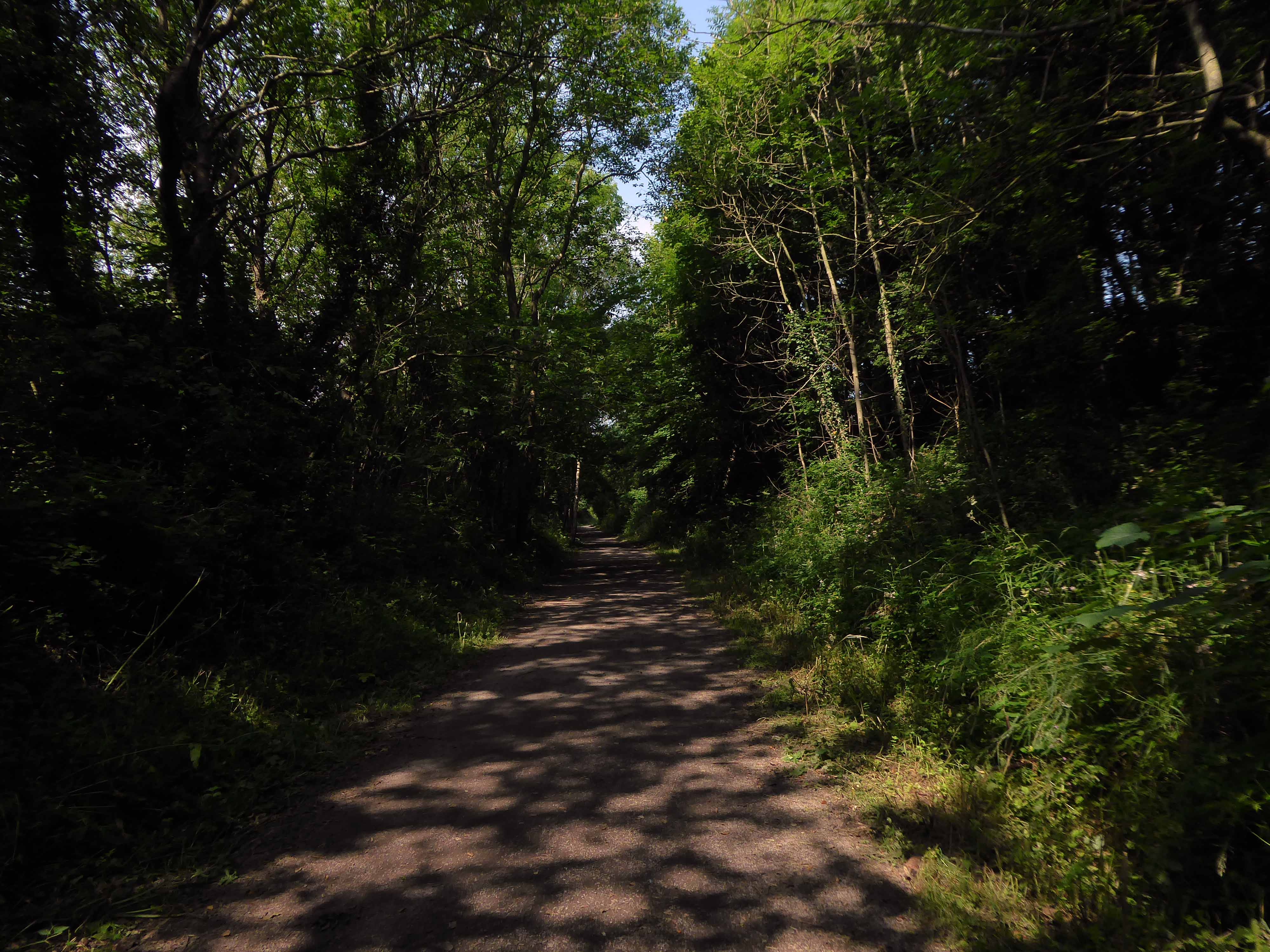
Yet again I chance upon a delightful post-war home.
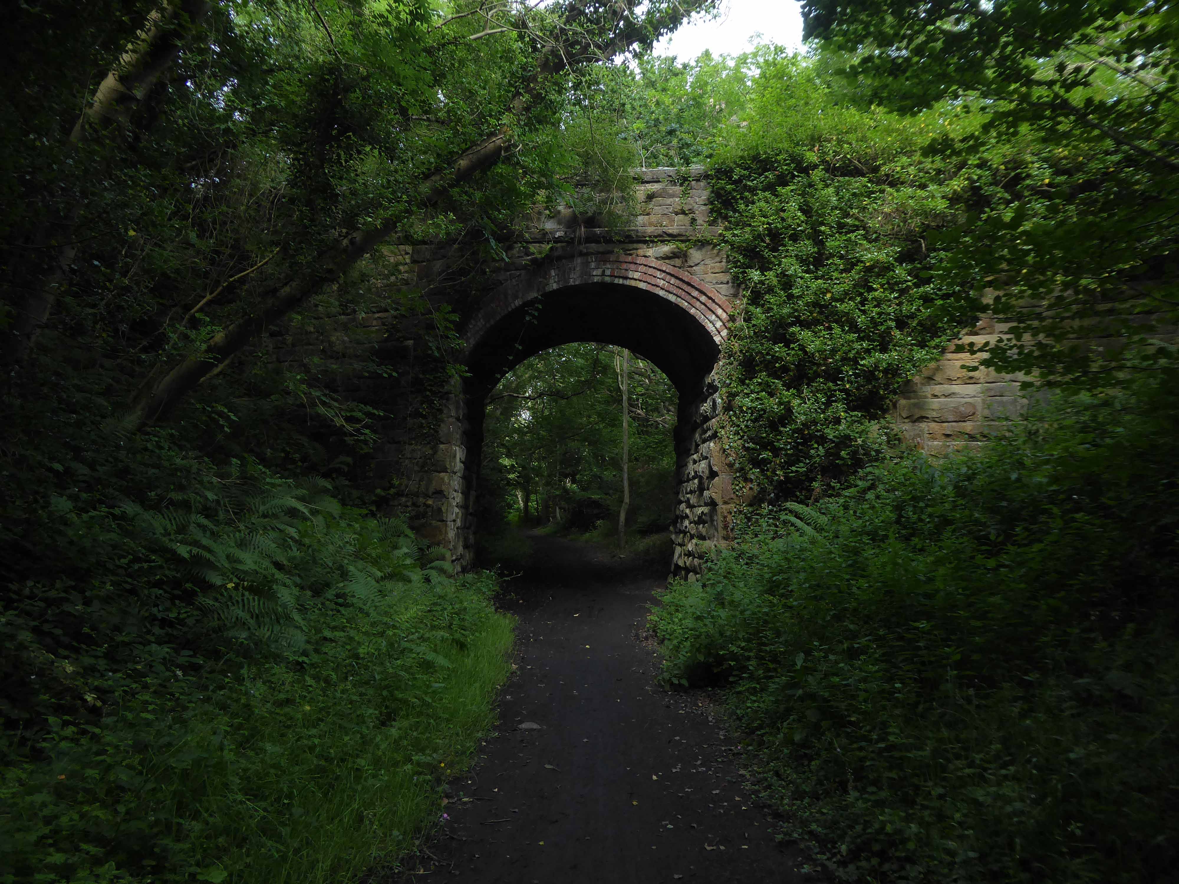
I parted company with the track dropping down to the Esk Valley from the Larpool Viaduct.
Construction began in October 1882 and was complete by October 1884.
Two men fell from the piers during construction, but recovered.
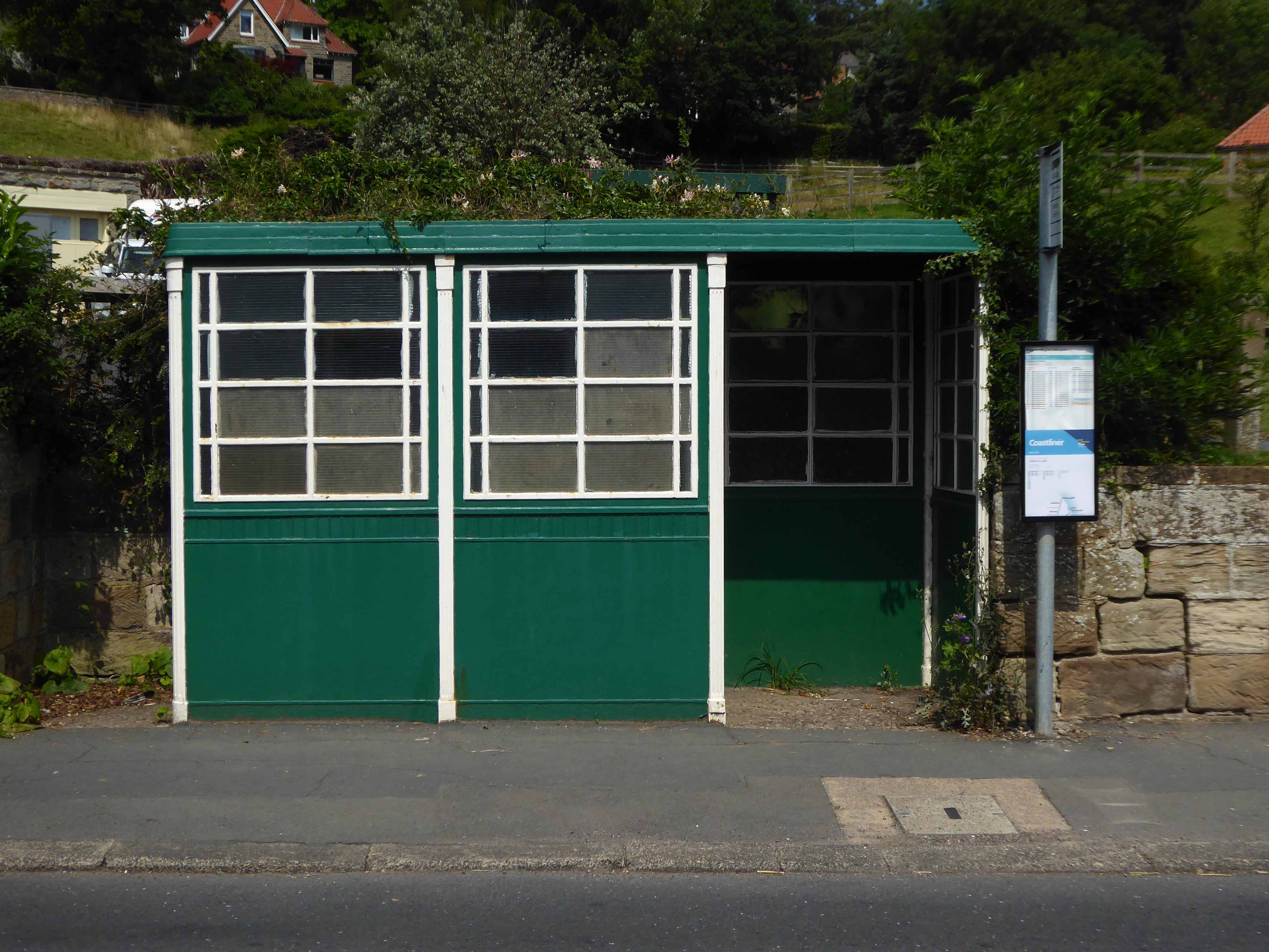
I found myself in Ruswarp, home to this enchanting bus shelter.
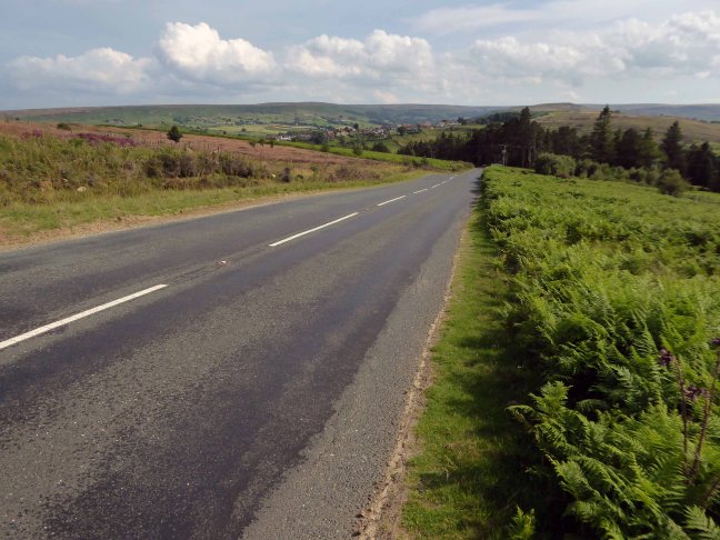
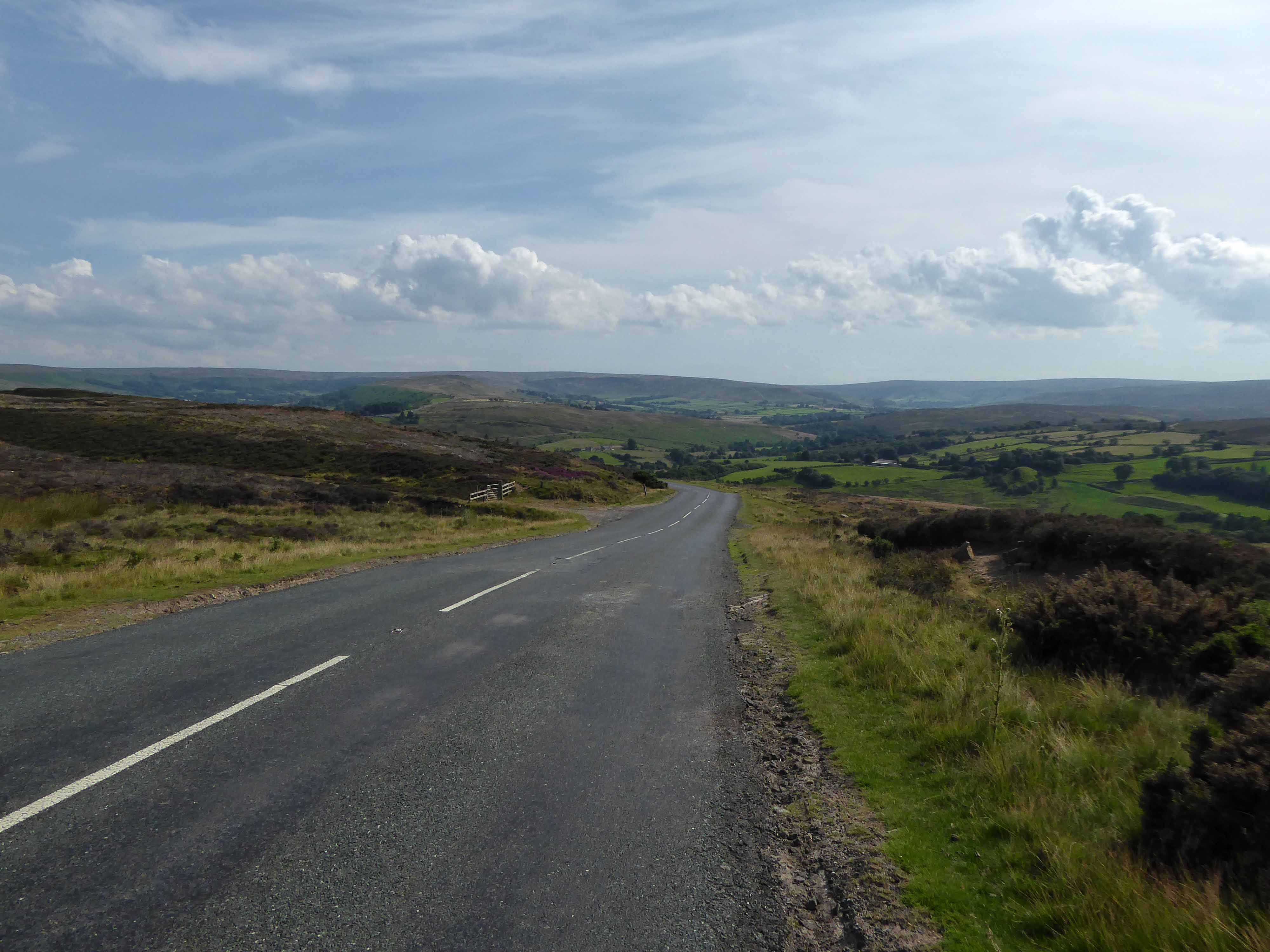
I bombed along the main road to Sleights.
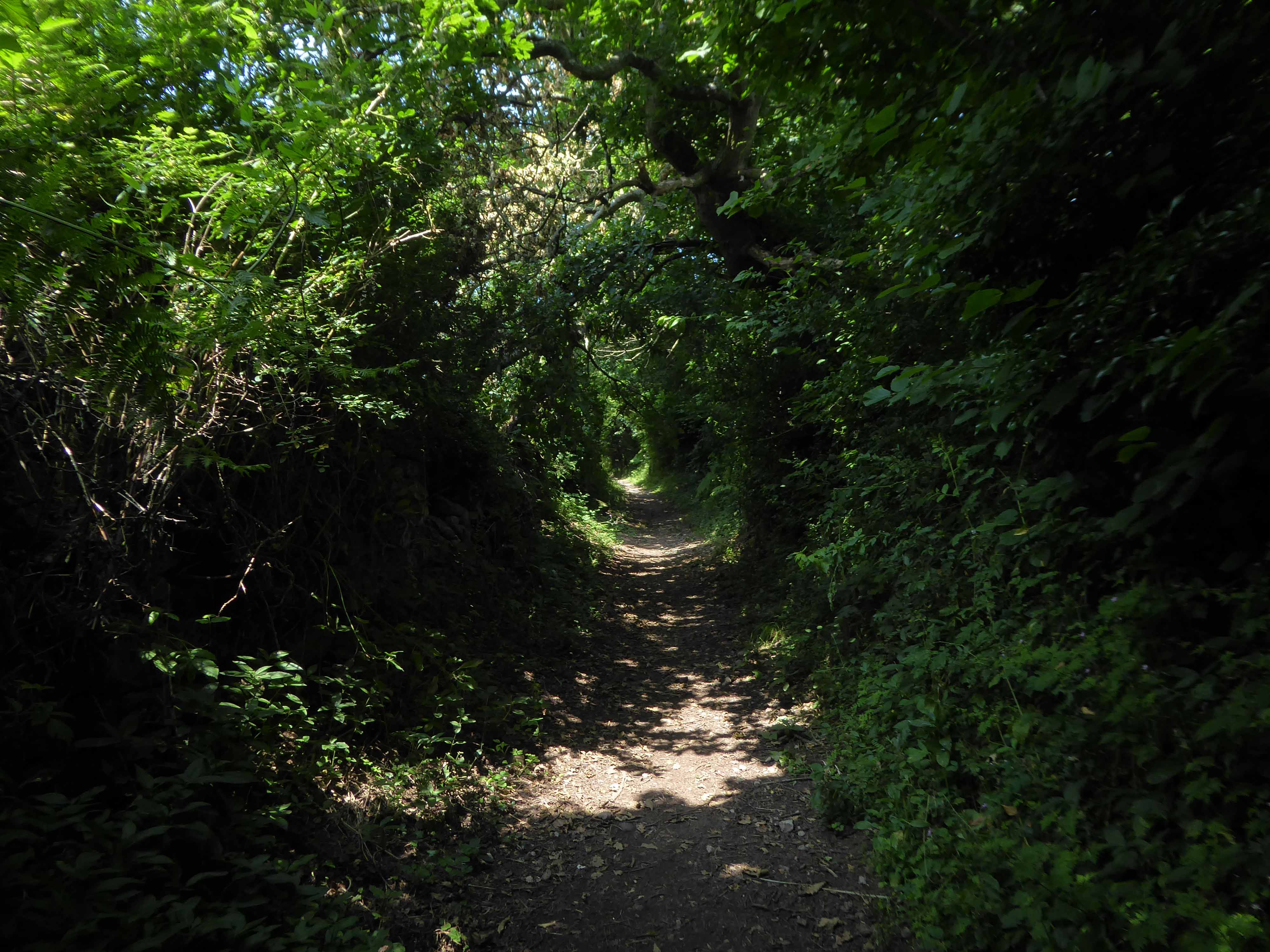
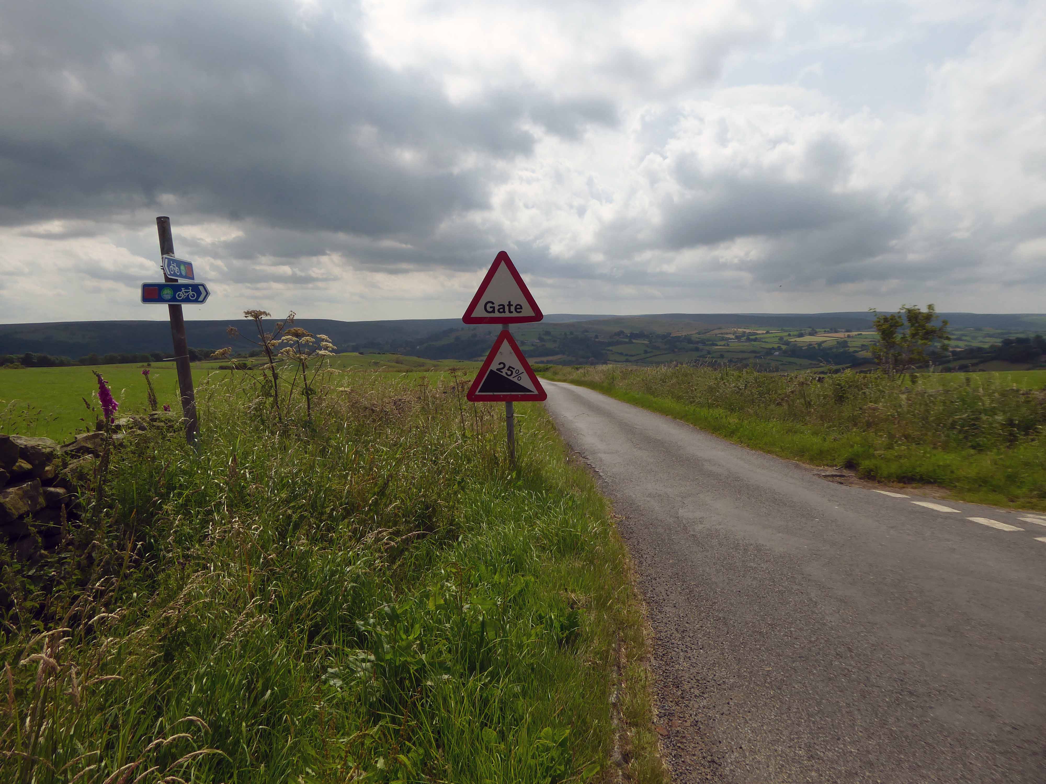
There then followed a hesitant ascent, descent, ascent along a badly signed bridleway, fearing that I had climbed the hill in error I retraced, then retraced.
A difficult push ensued, a precipitous path, rough and untended, rising ever higher and higher.
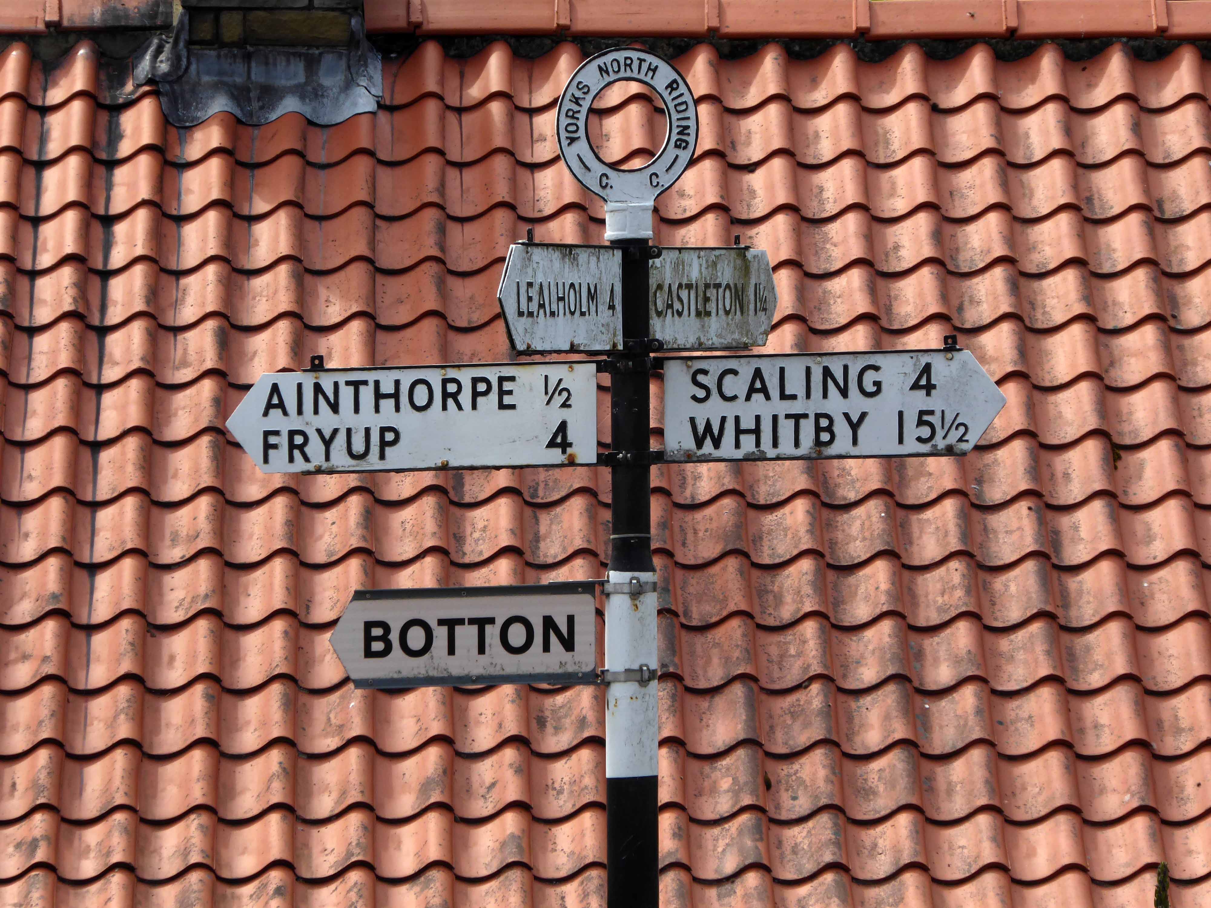
Finally arriving at Aislaby, more than somewhat exhausted – the village is mentioned in the Domesday Book as Asuluesbi.
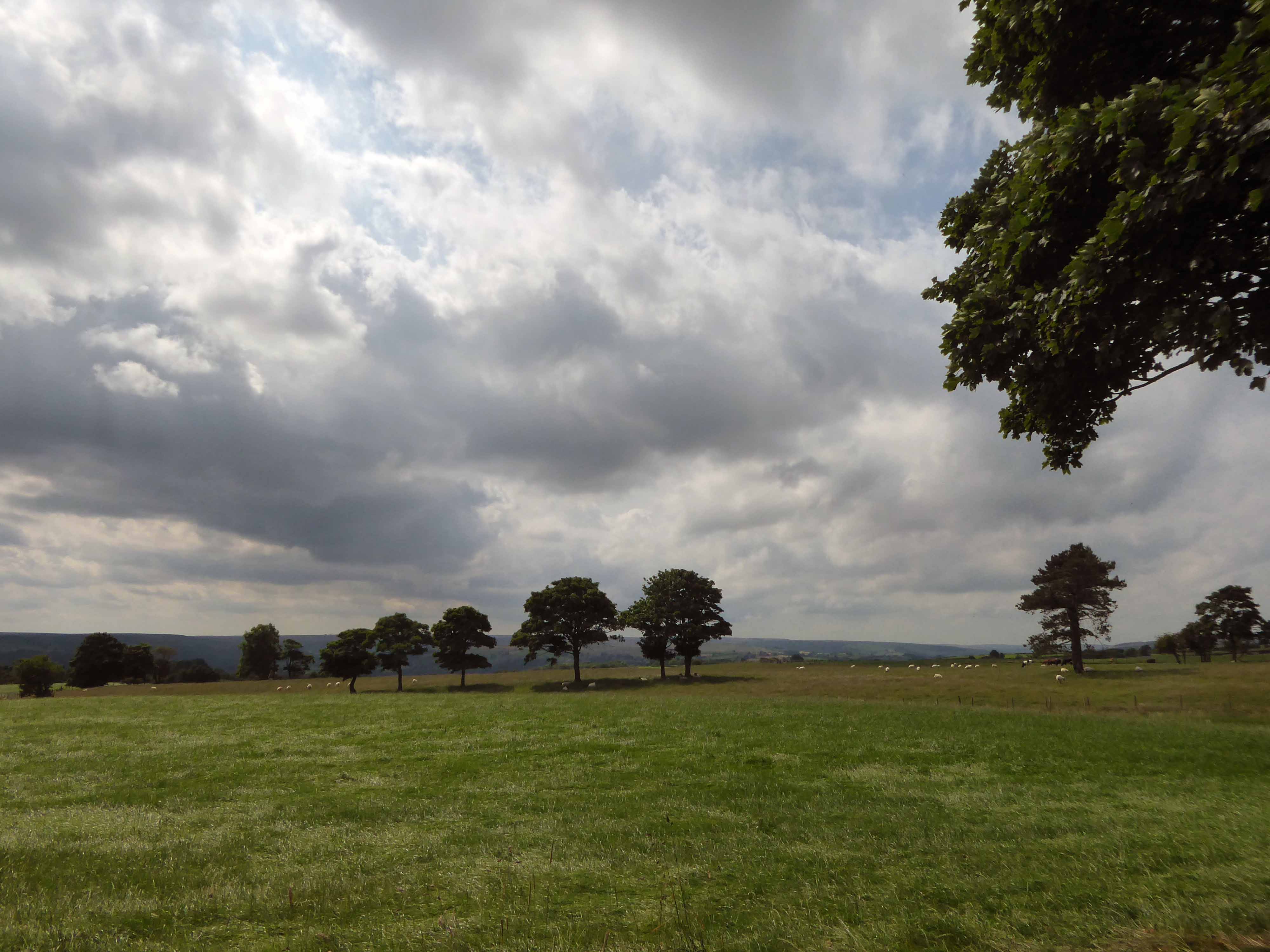
Pausing to catch my breath I took the wildly undulating road to Egton – along the way I was alerted to the presence of a tea stop by two touring cyclists from Nottingham.
The curious name Fryup probably derives from the Old English reconstruction Frige-hop: Frige was an Anglo-Saxon goddess equated with the Old Norse Frigg; hop denoted a small valley.
An old woman at Fryup was well known locally for keeping the Mark’s e’en watch – 24 April, as she lived alongside a corpse road known as Old Hell Road.
The practice involved a village seer holding vigil between 11pm and 1am to watch for the wraiths of those who would die in the following 12 months.
Castleton Moor ghost.
In the village I was given further directions by two elderly gents, who had been engaged in a discussion concerning their long term mapping of acid rain levels in the area.
One was wearing a Marshall Jefferson t-shirt.
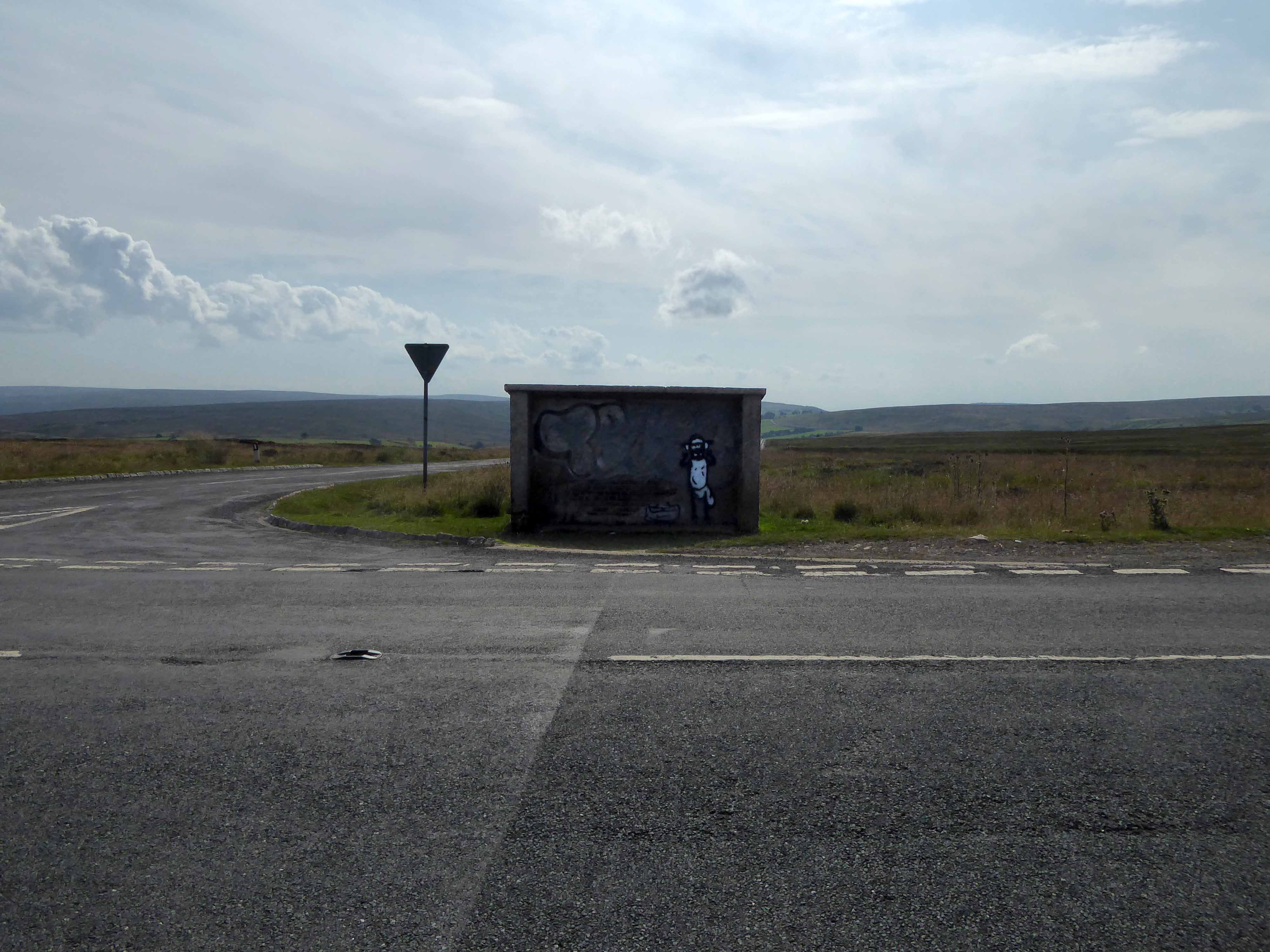
I climbed Langburn Bank onto the flatish open moorland.
Taking a brief break to snap this concrete shelter.
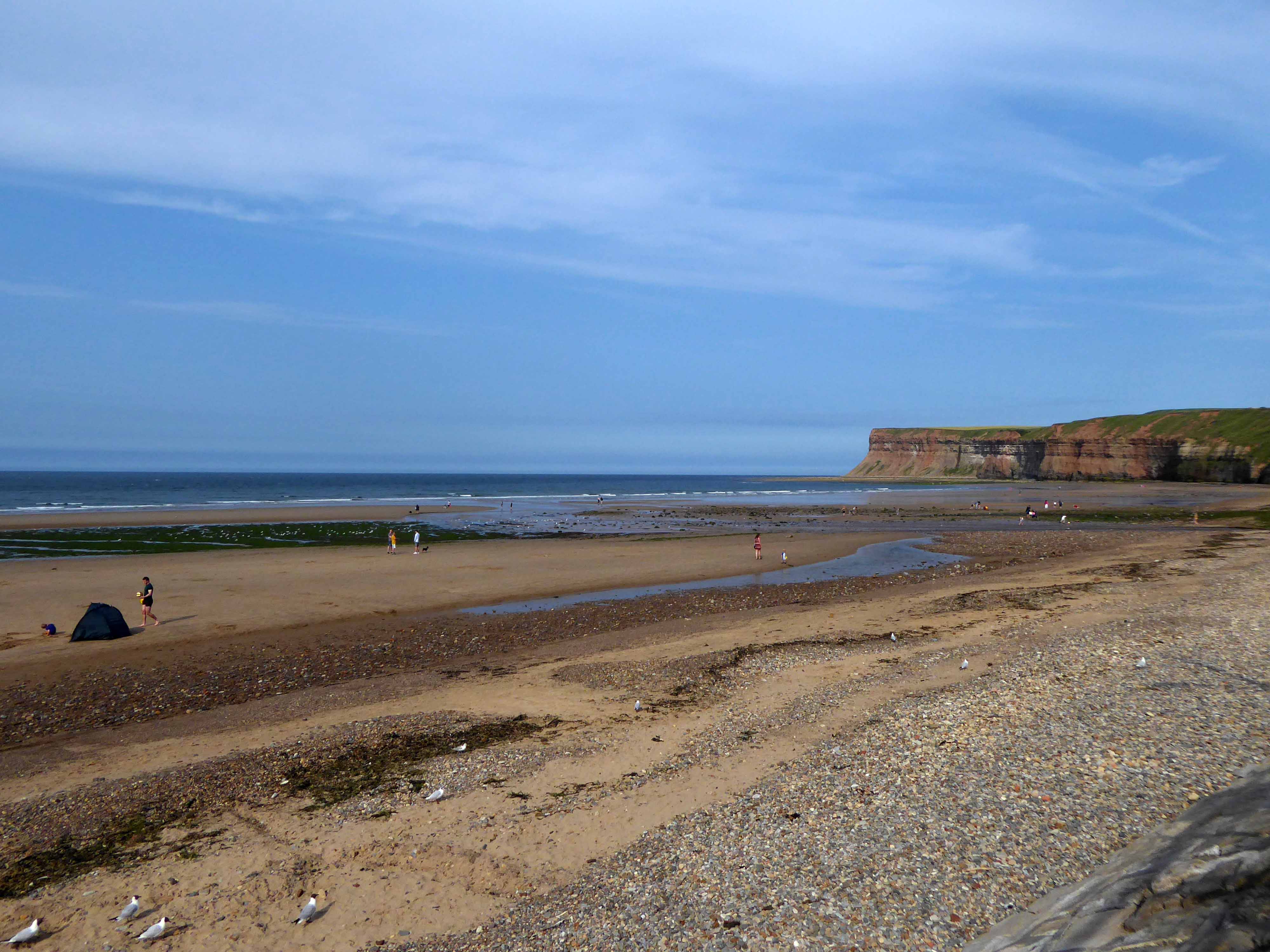
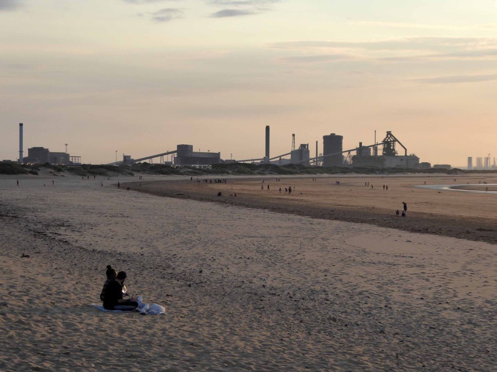
There then followed a hair stirring series of hairpin descents to the coast at Saltburn.
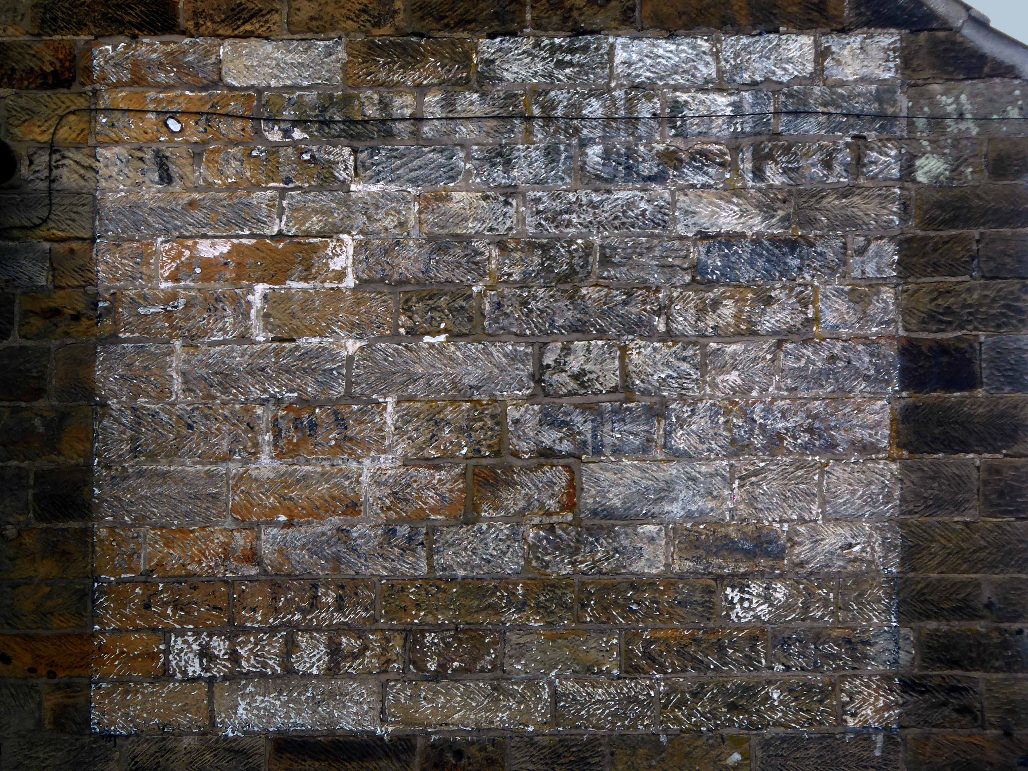
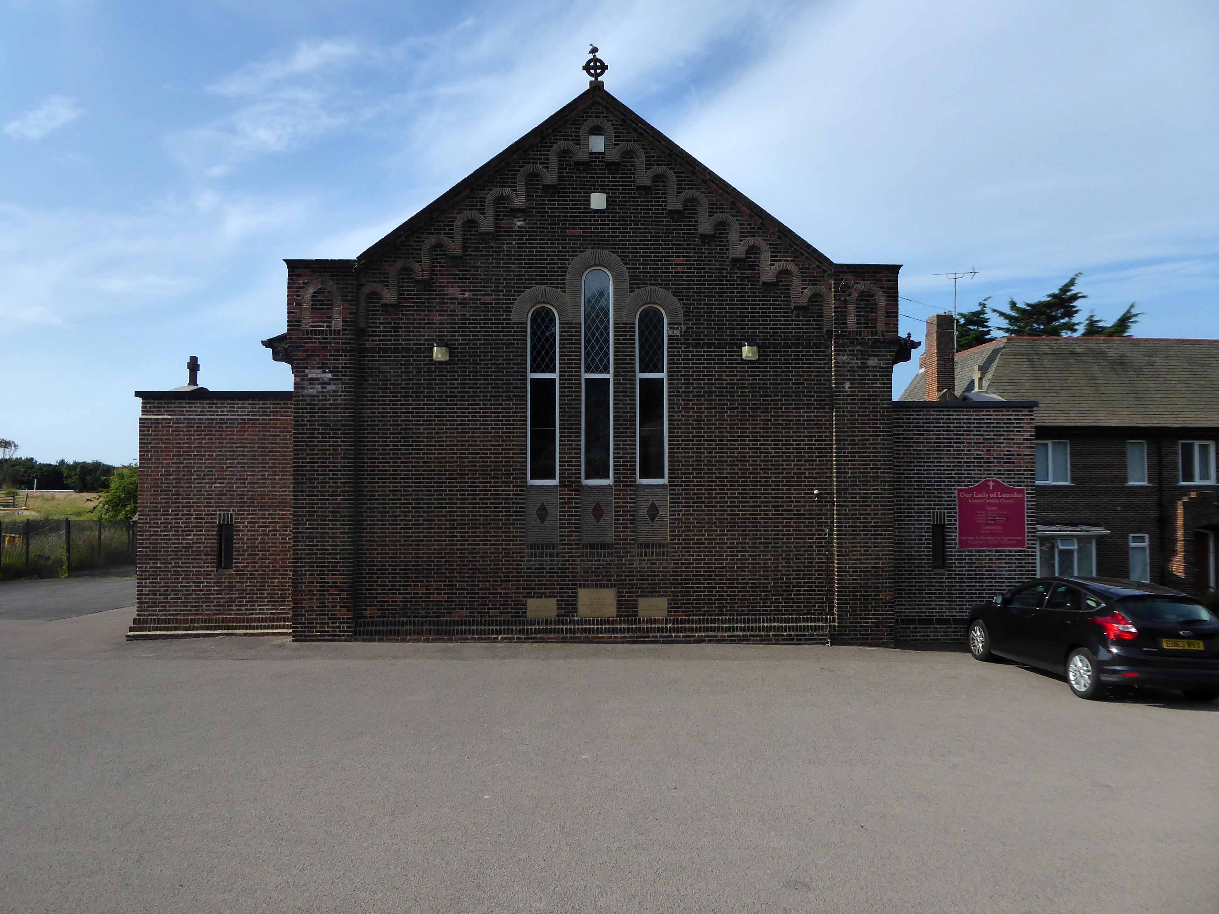
Built in 1928, this church was designed with some care and is an attractive, if fairly modest, Lombard Romanesque-style essay in brick. The use of a semi-circular apse, narrow brickwork and use of tile for decorative effect give it a pleasing appearance, typical of restrained but elegant work between the wars.
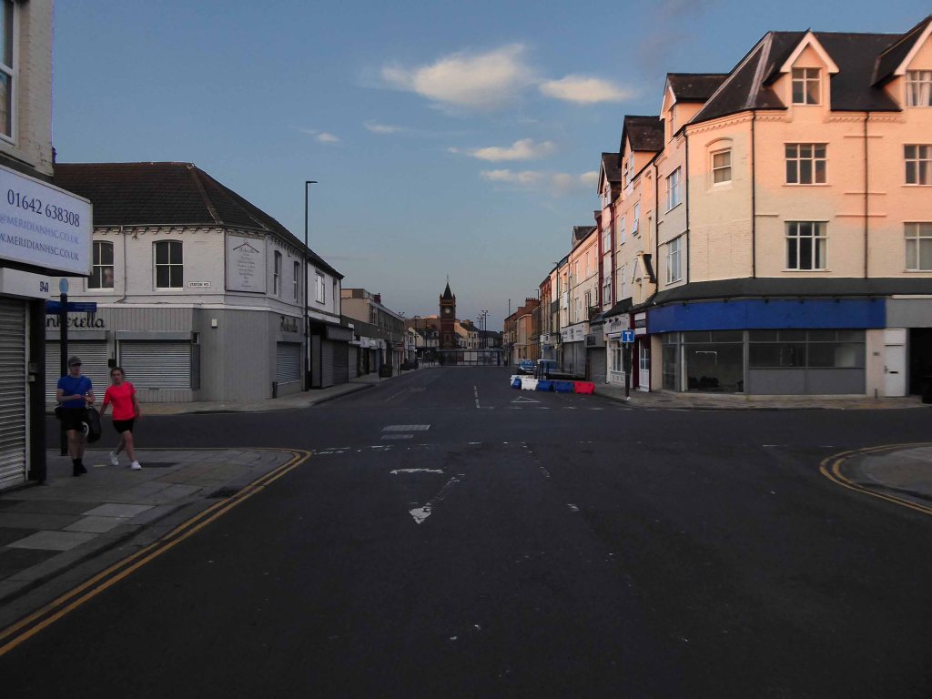
I arrived and took a look around, first time in town, here’s what I found.