Burnage – Garden Village

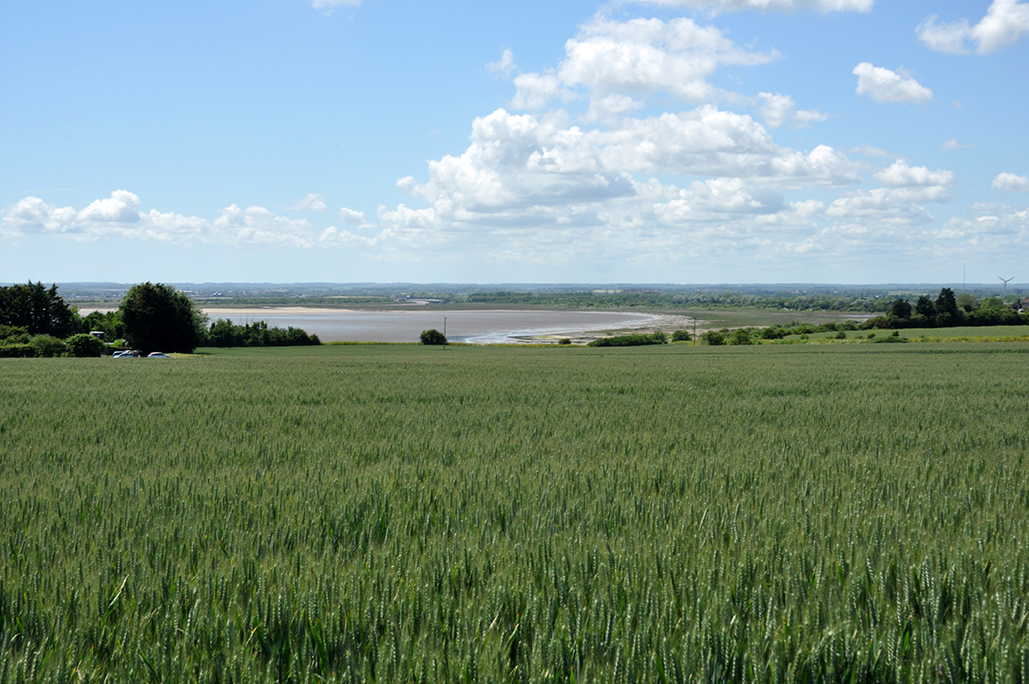
Spring’s in the air, let’s take a walk down leafy lanes, far from the traffic’s roaring boom and the silence of my lonely room – well not that far.

Burnage.


Screen Shot 2016-03-23 at 10.33.12

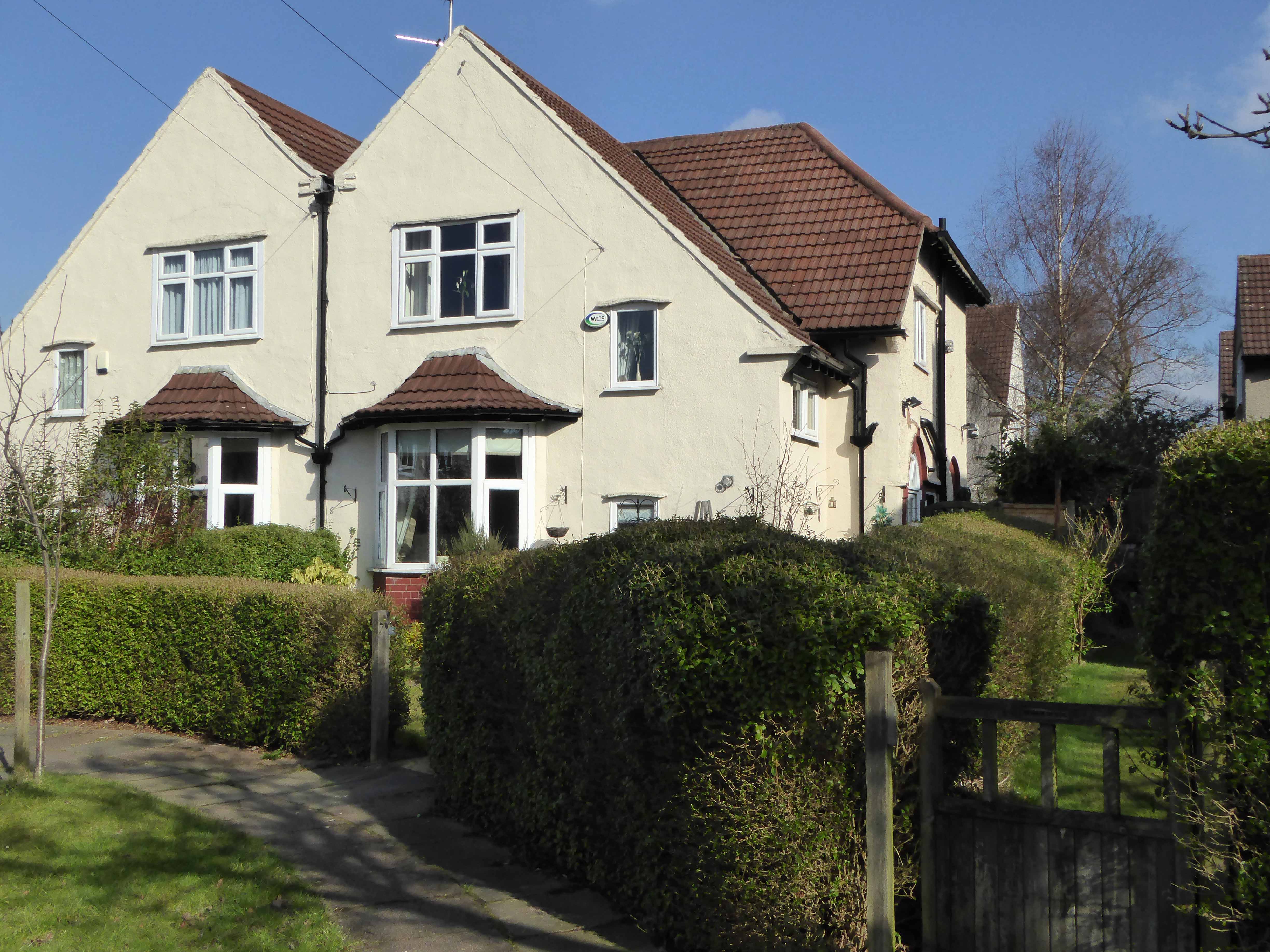
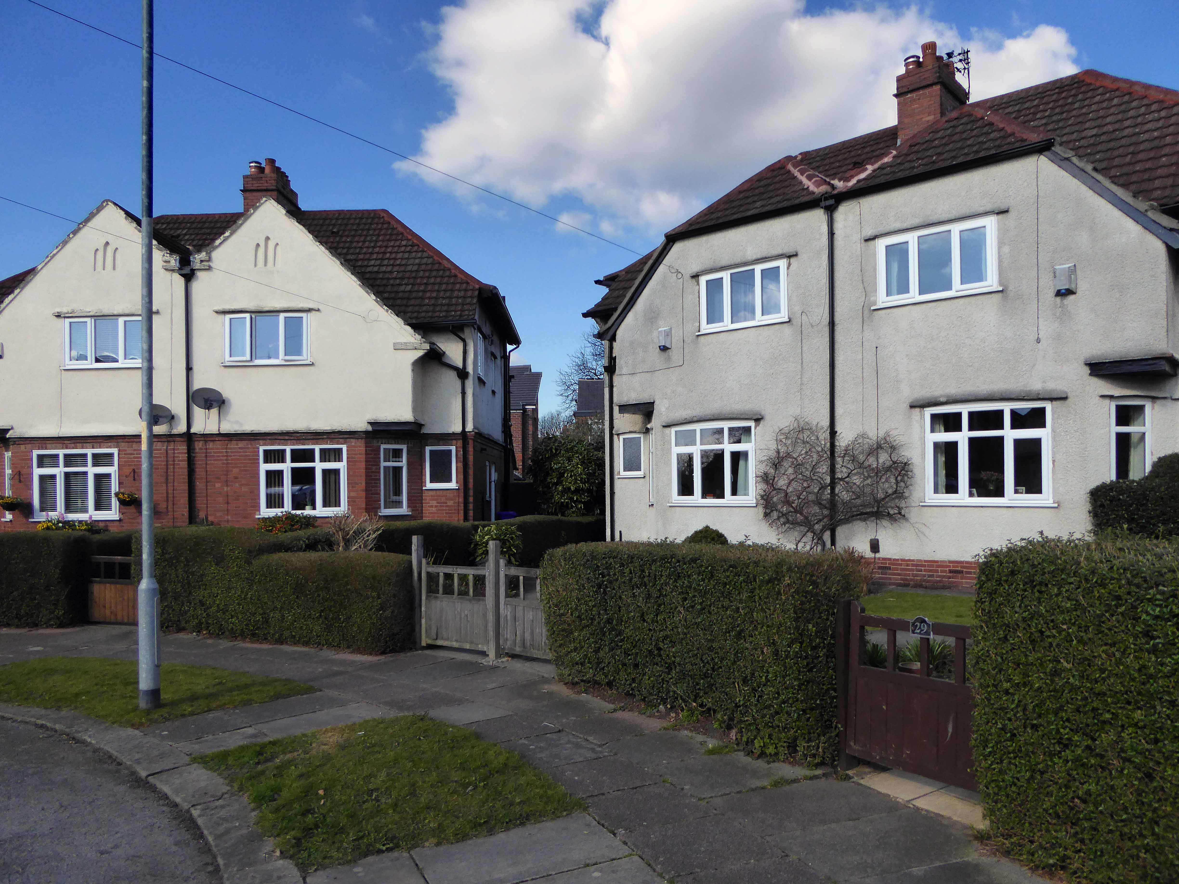
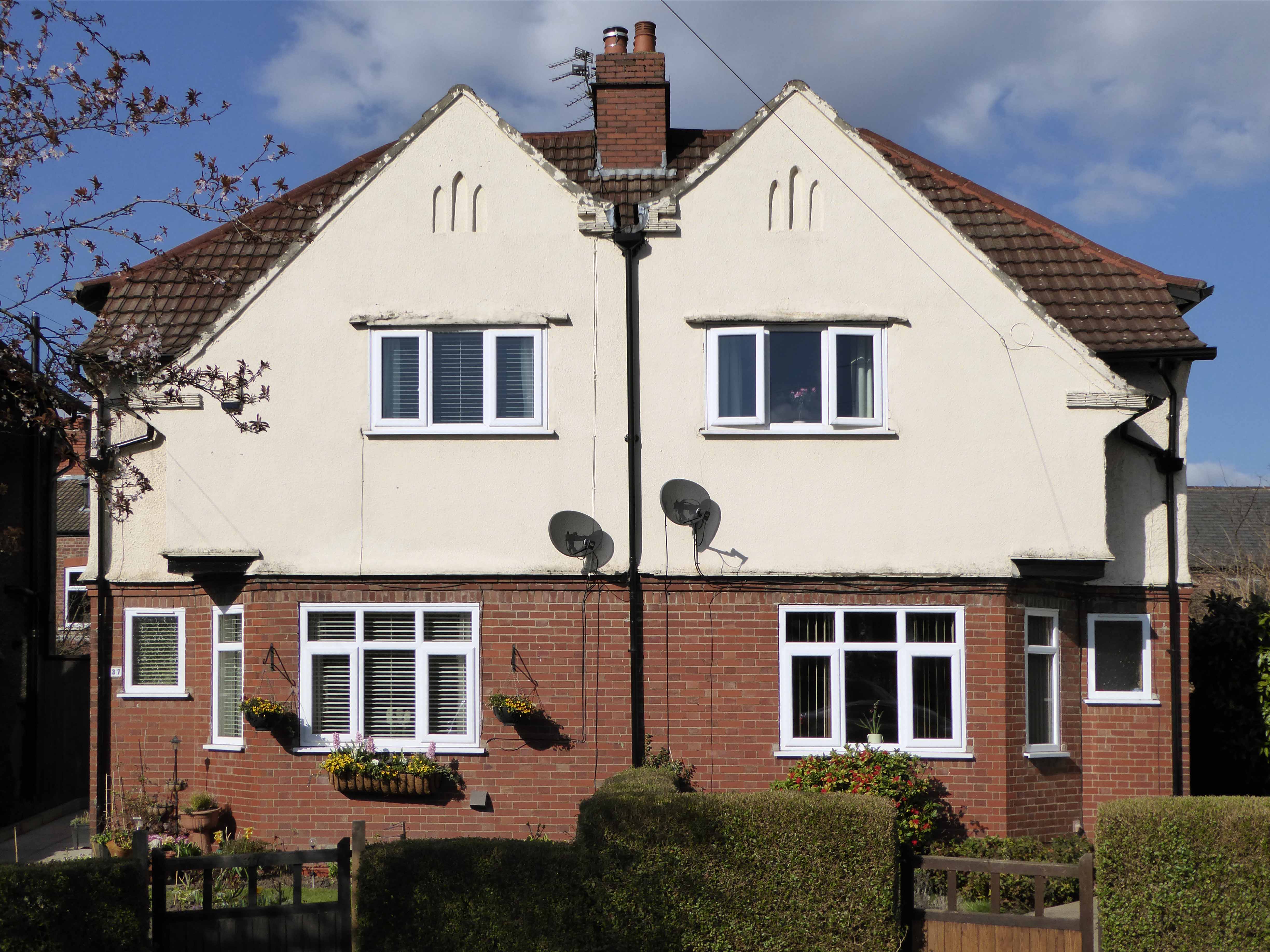
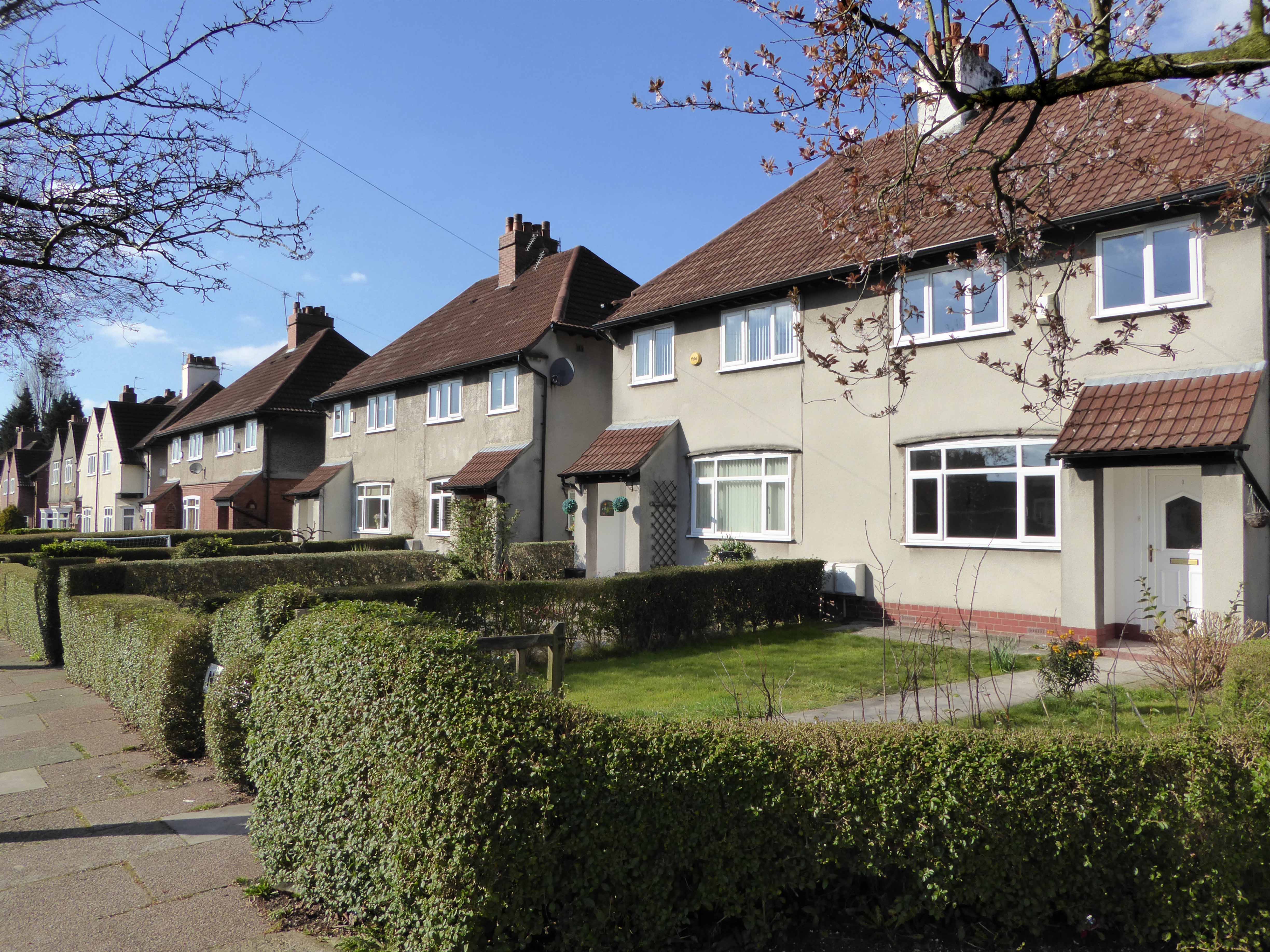
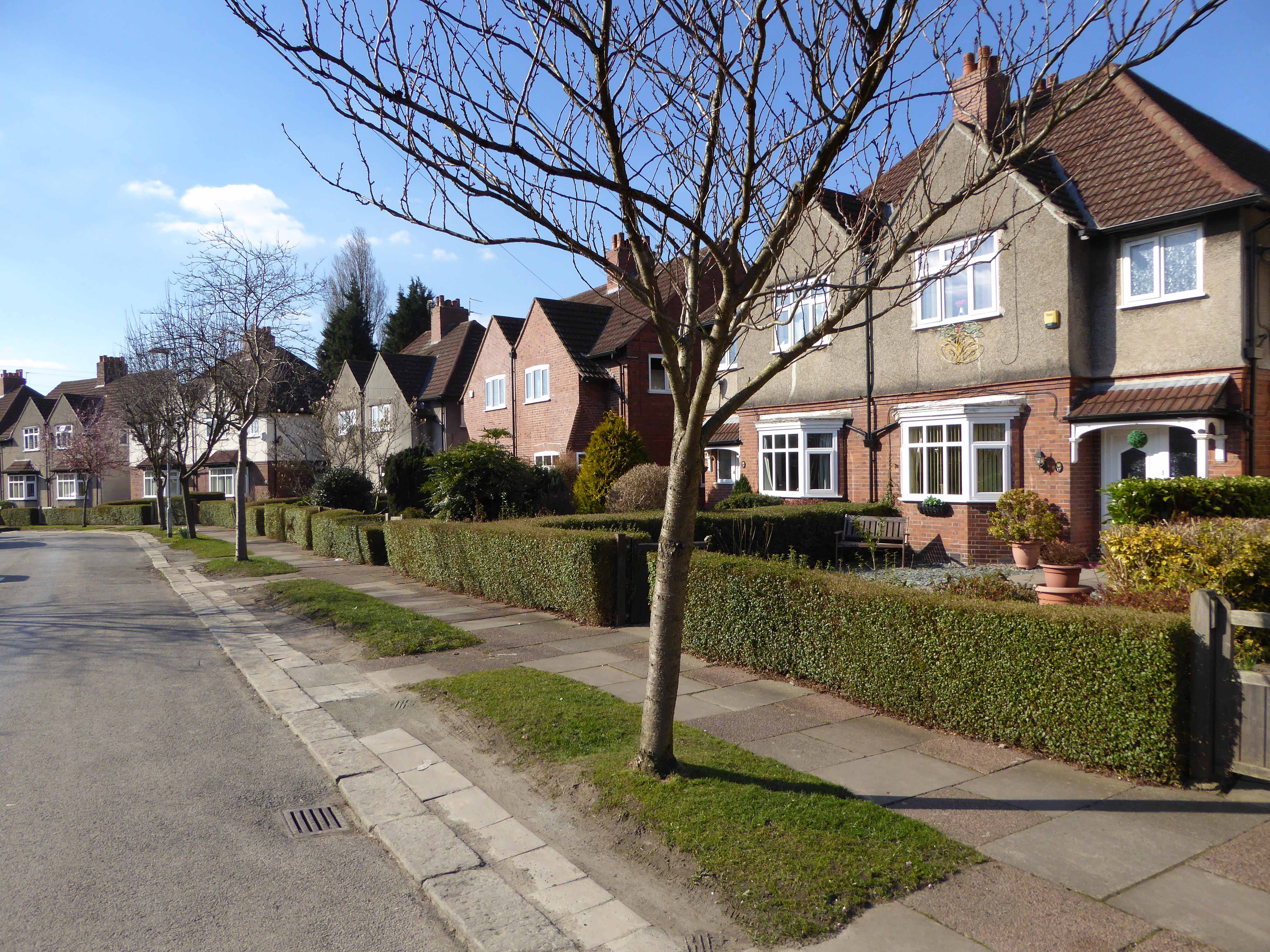
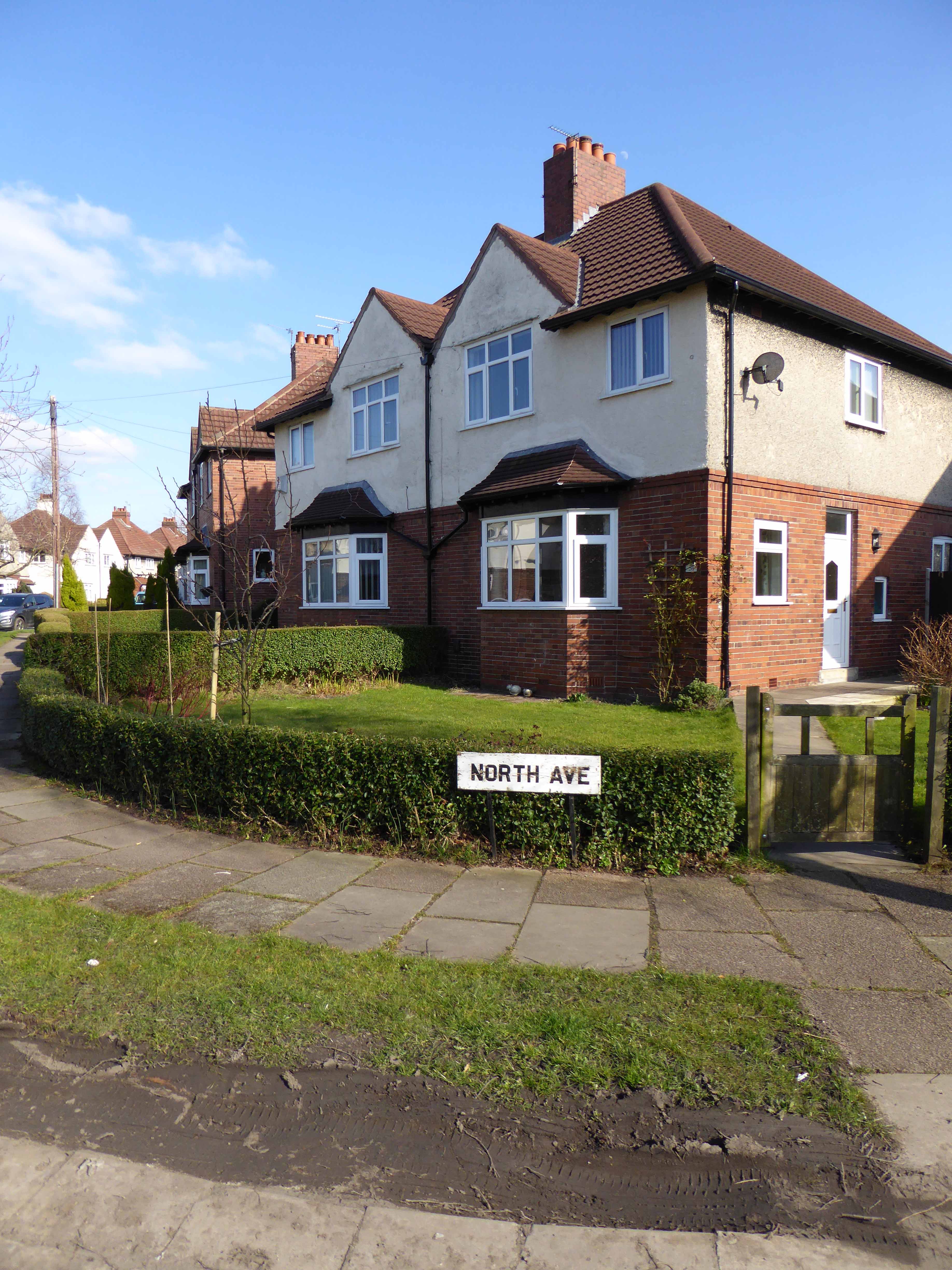
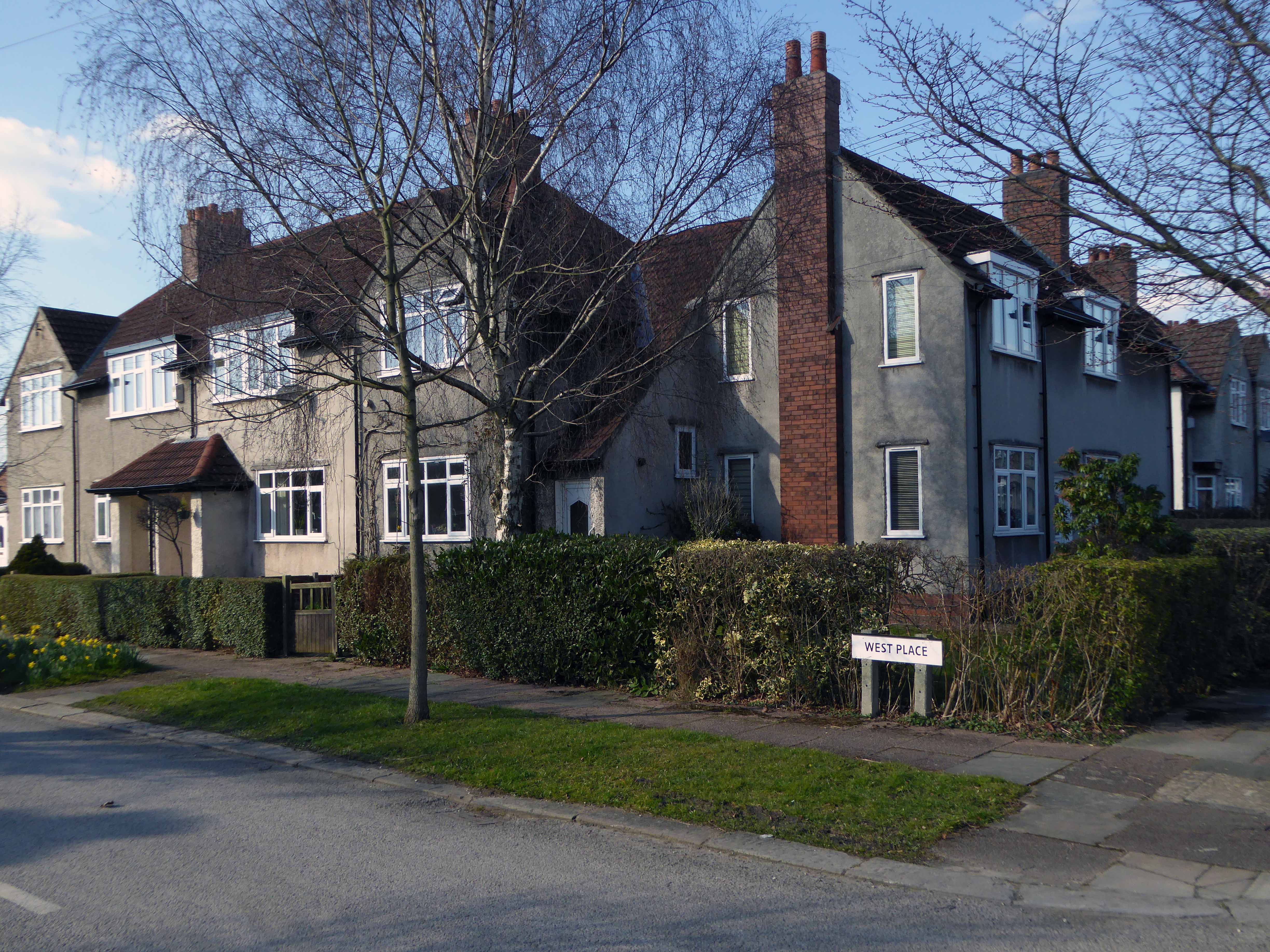
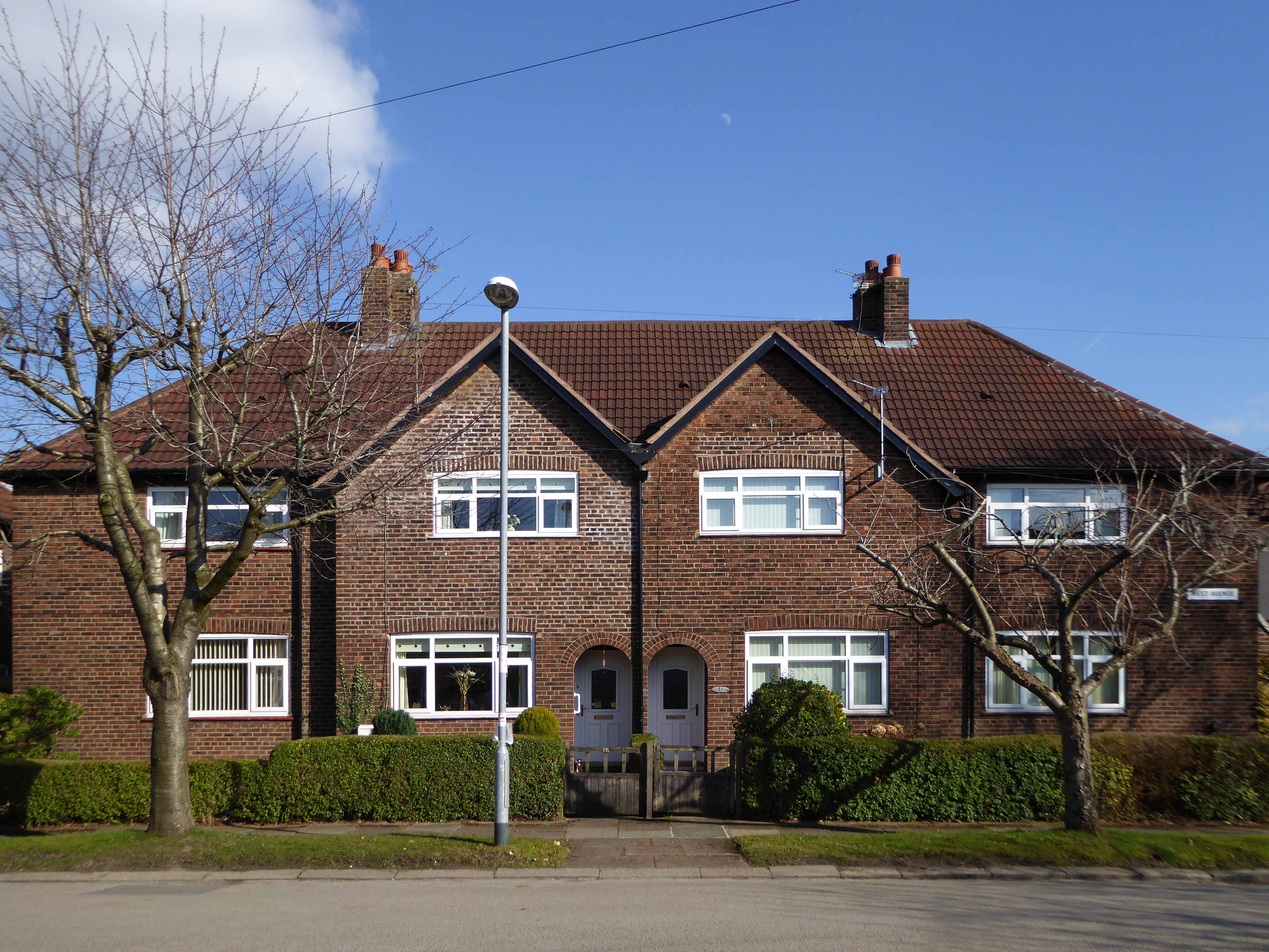
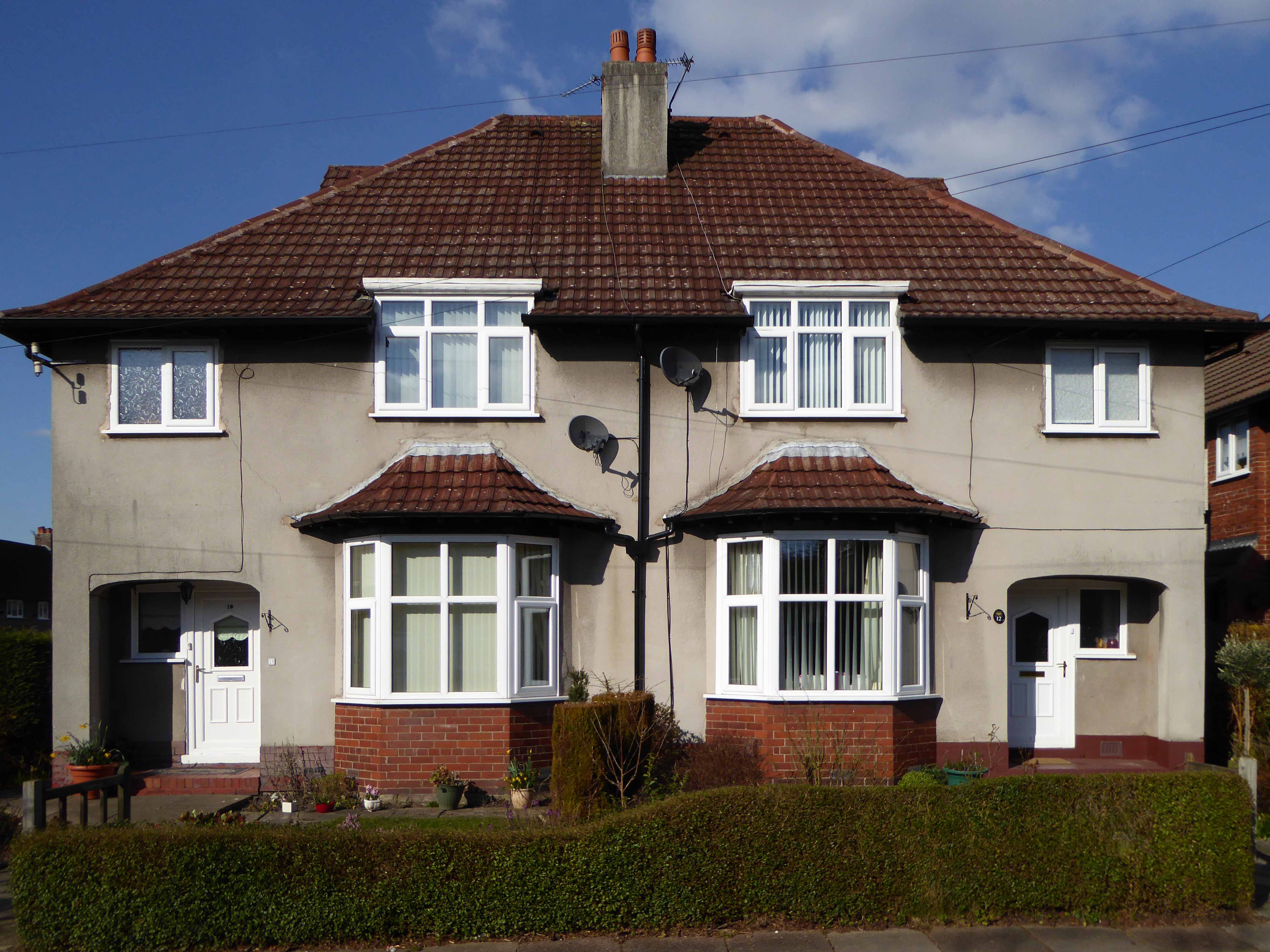
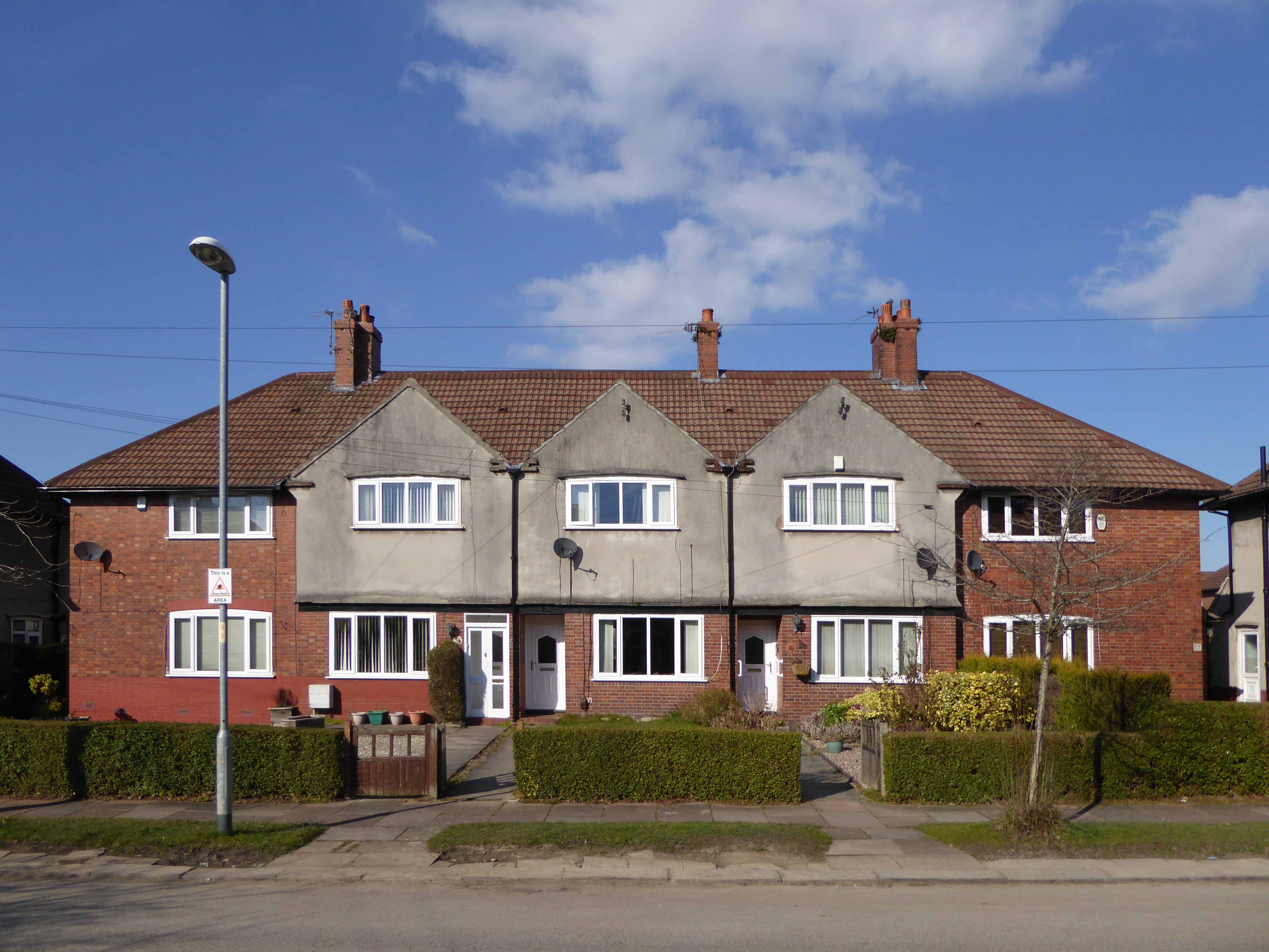
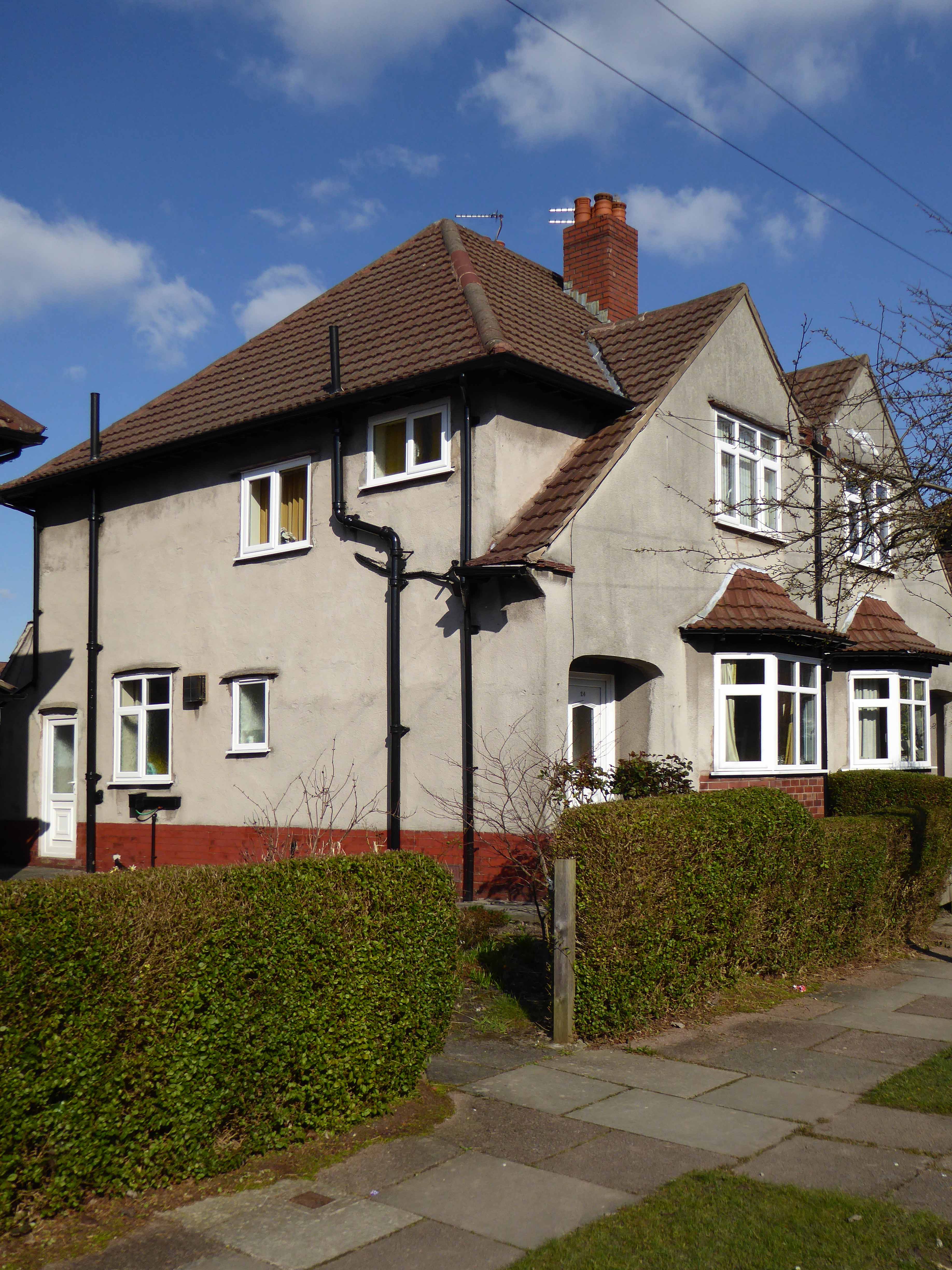
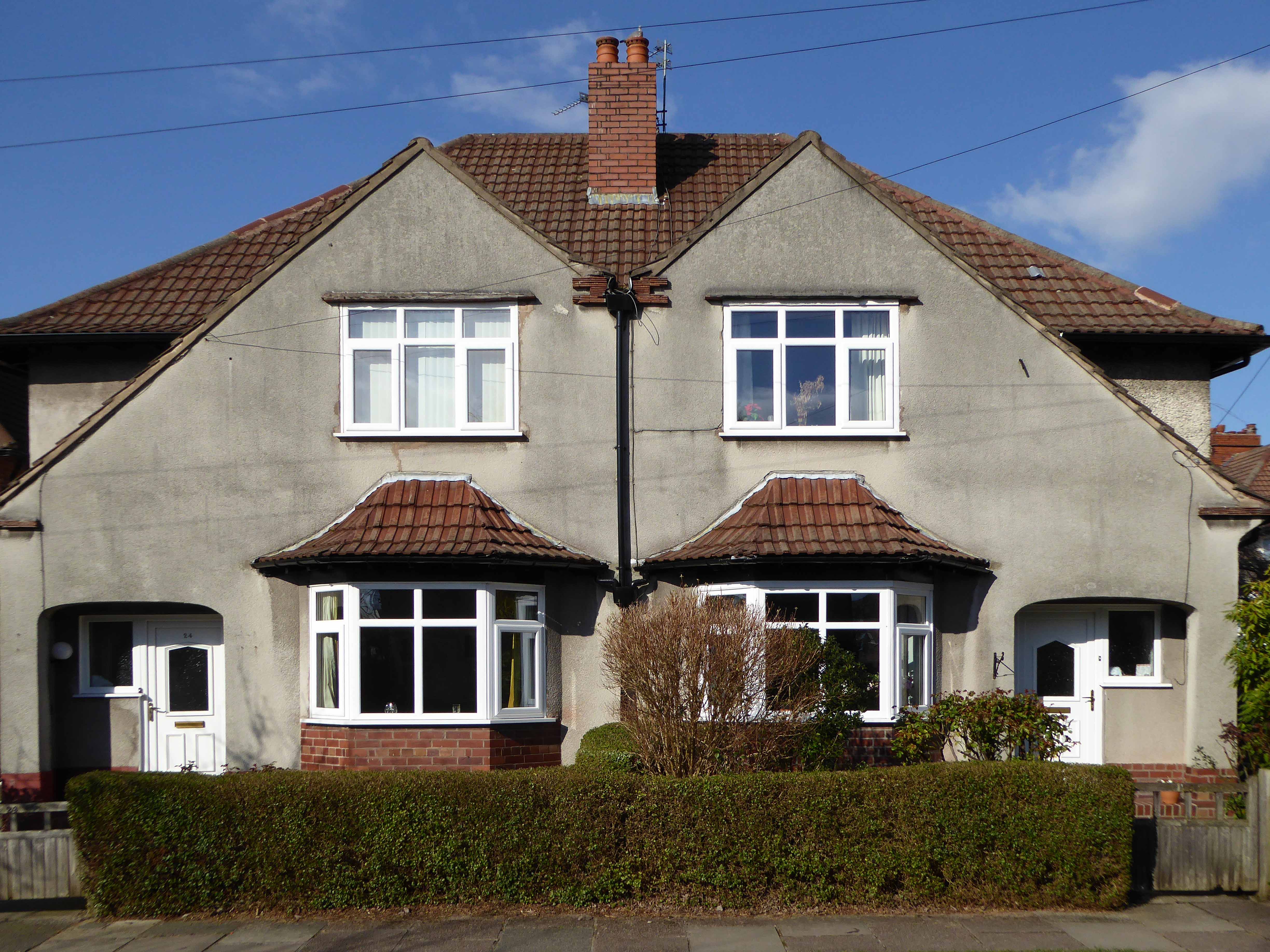
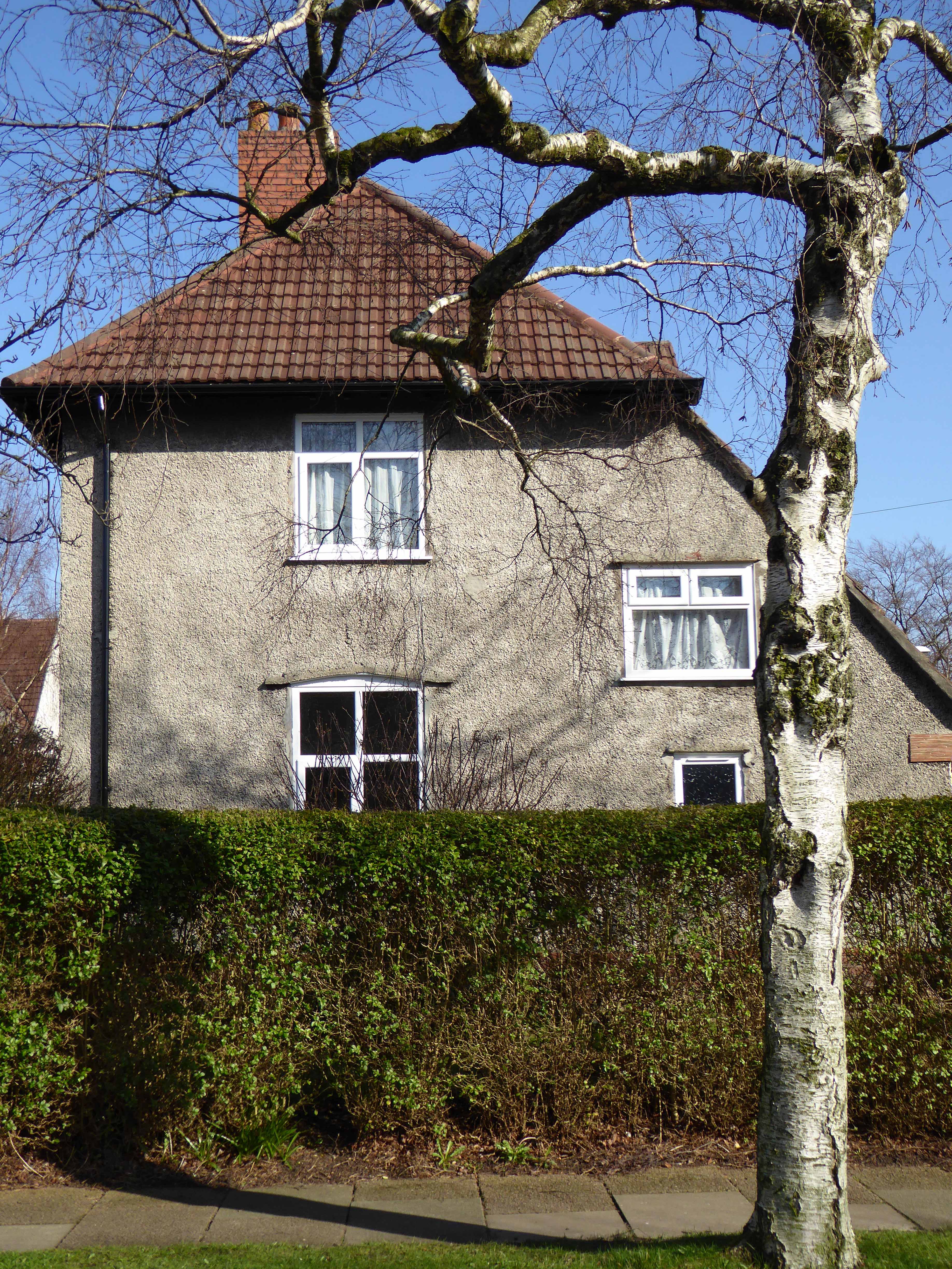
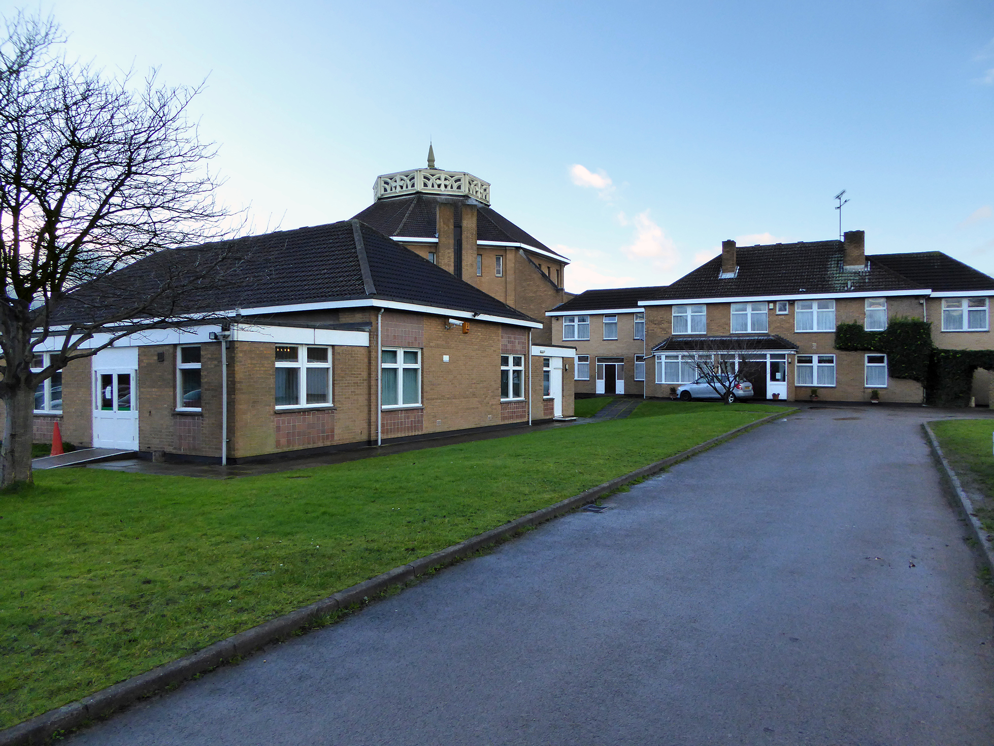
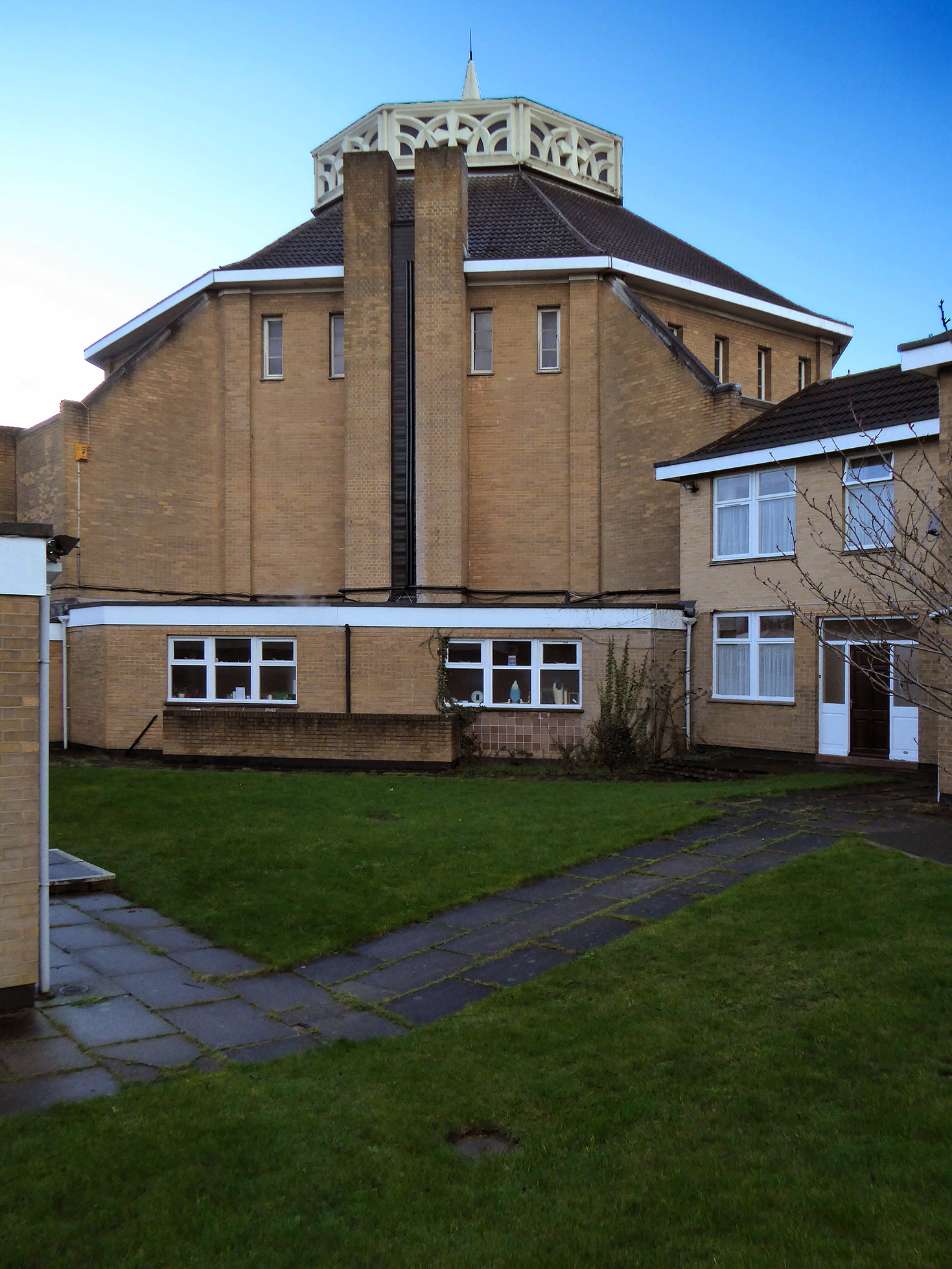
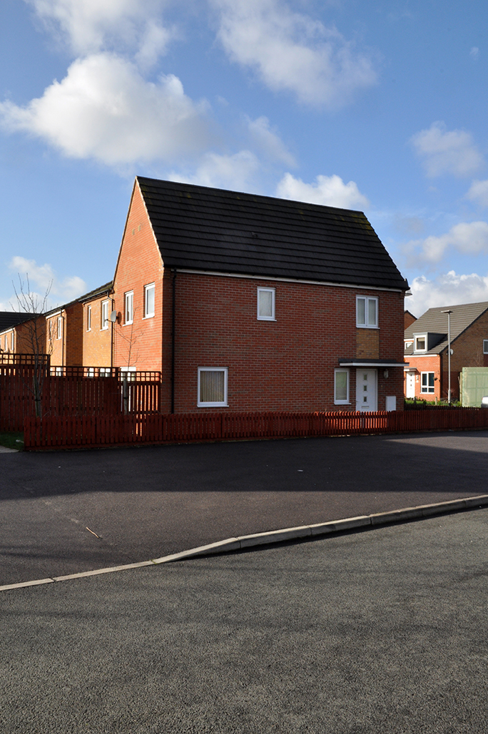
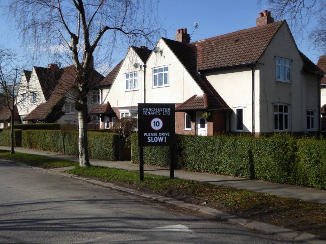
The housing estate of 136 houses known as Burnage Garden Village, a residential development covering an area of 19,113sqm off the western side of Burnage Lane in the Burnage ward. The site is situated approximately six kilometres south of the city centre and is arranged on a broadly hexagonal layout with two storey semi-detached and quasi detached dwelling houses situated on either side of a continuous-loop highway. The highway is named after each corresponding compass point with two spurs off at the east and west named Main Avenue and West Place respectively. Main Avenue represents the only access and egress point into the estate whilst West Place leads into a resident’s parking area.

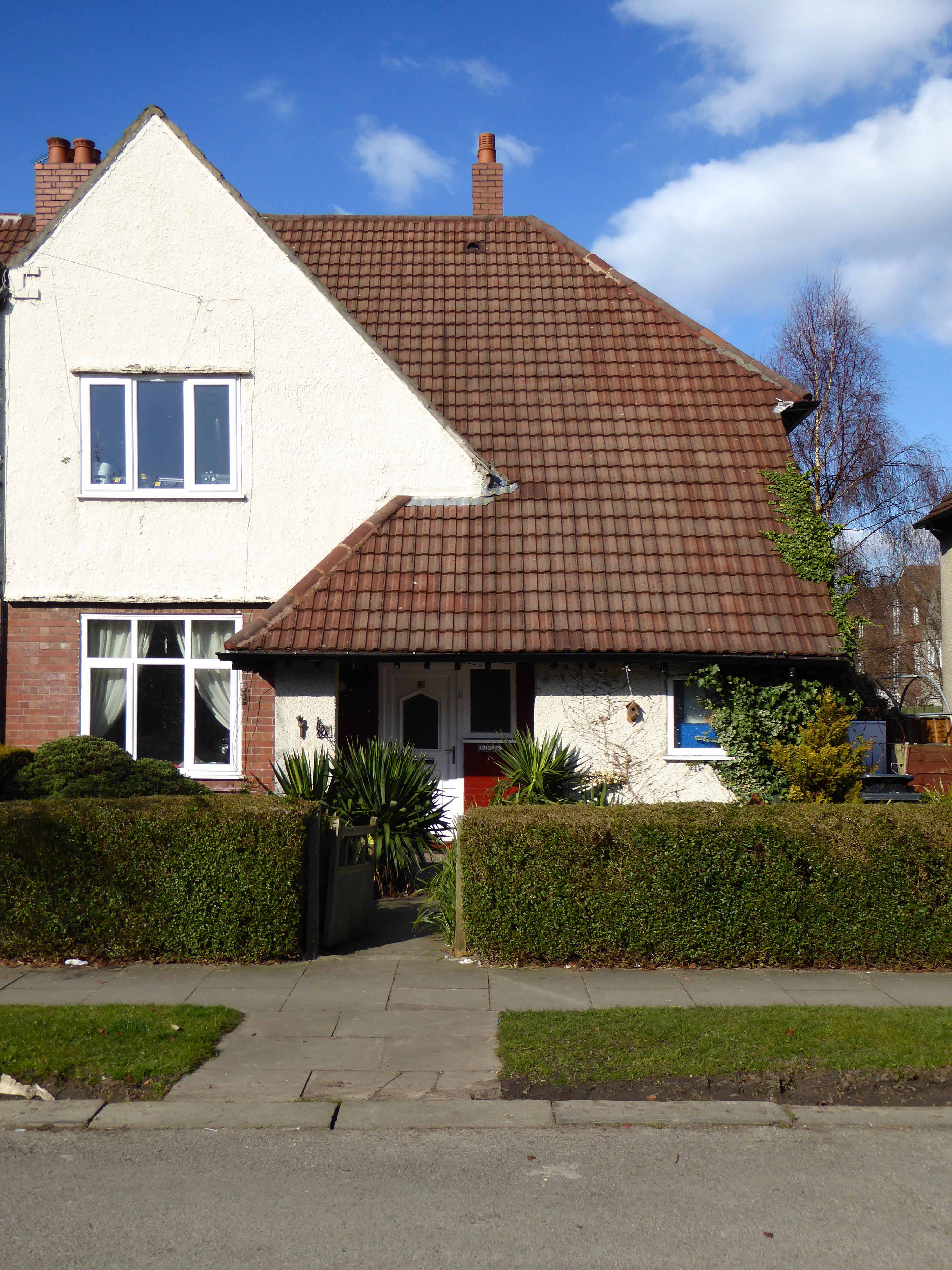
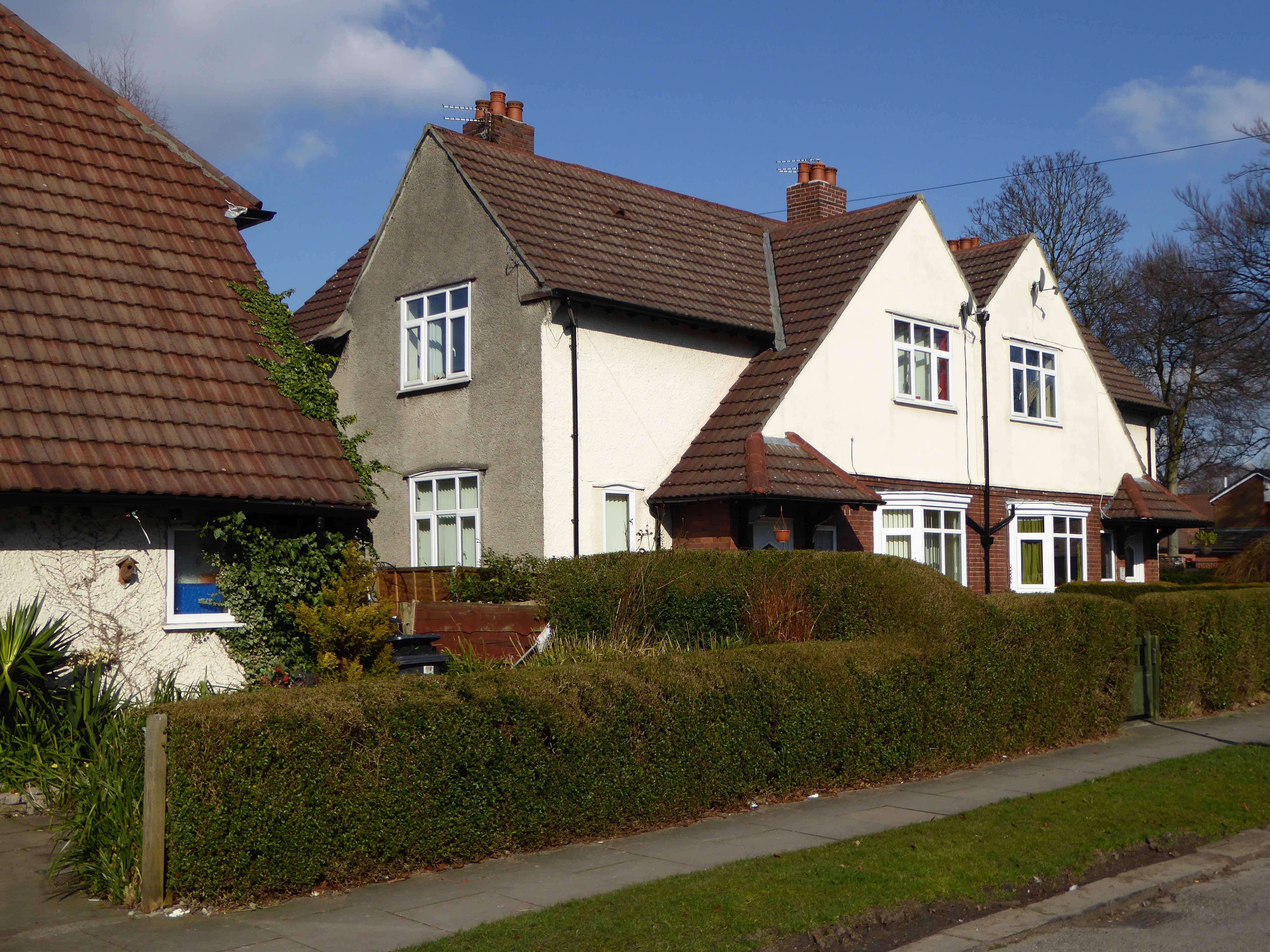
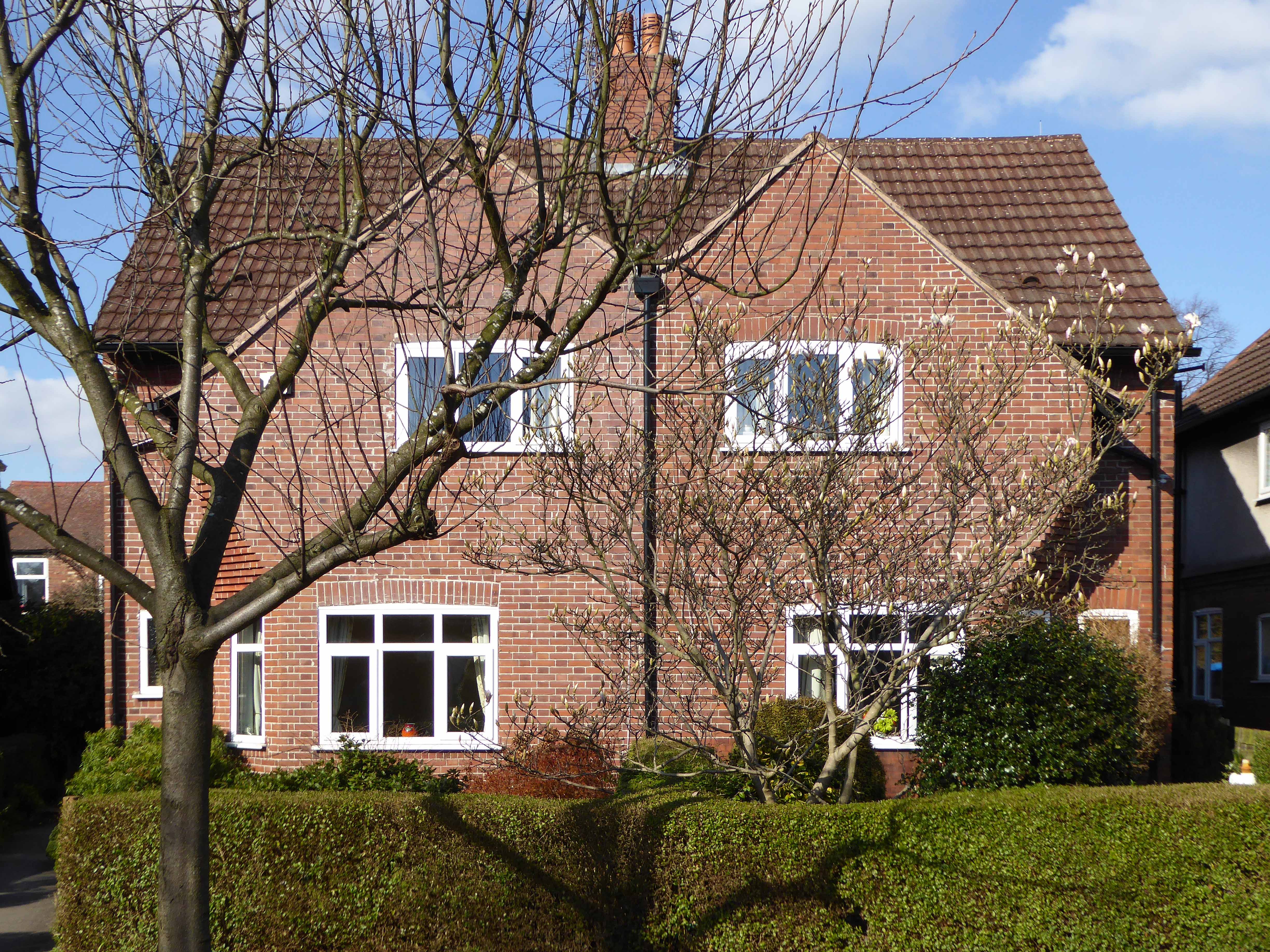
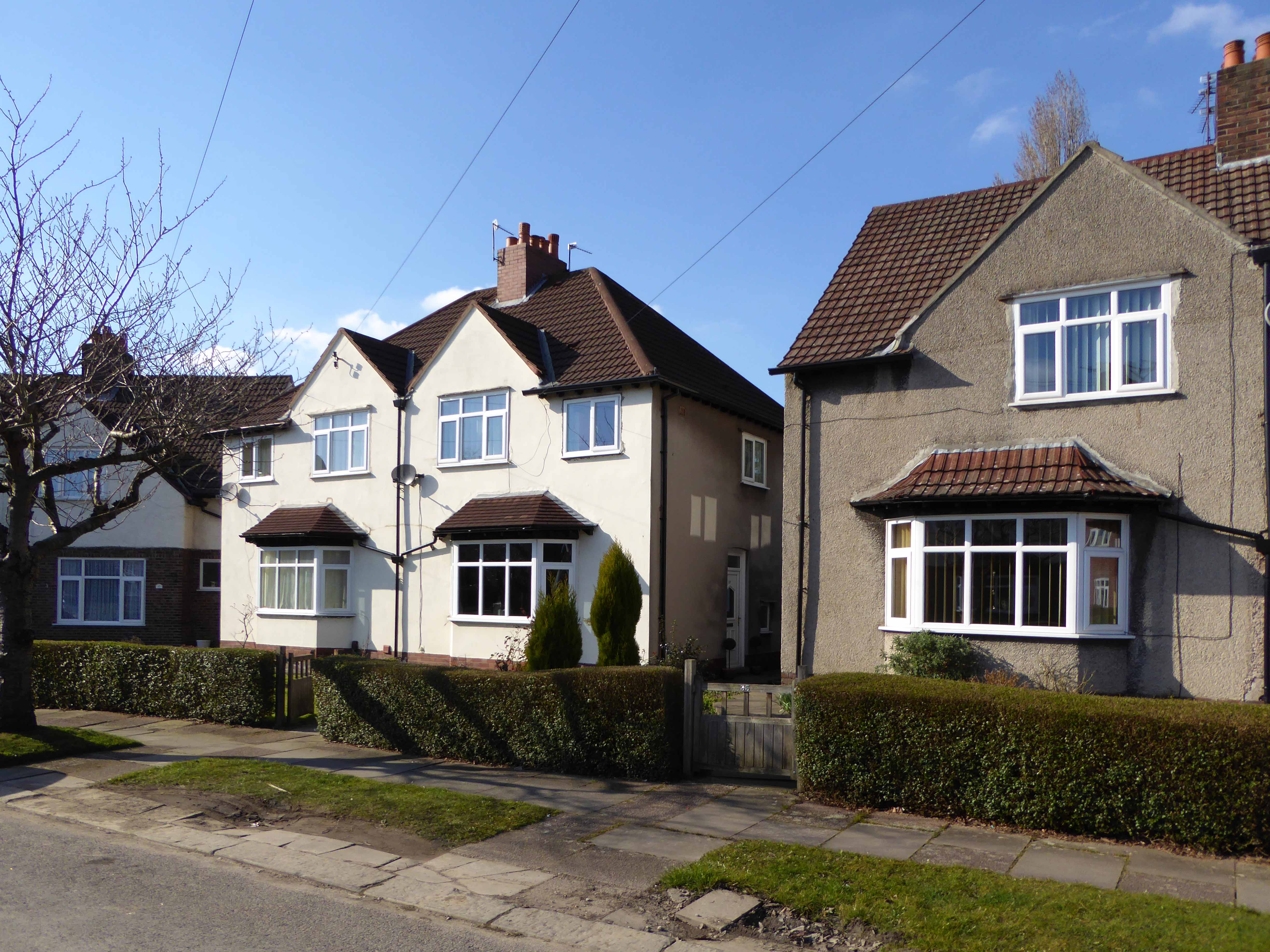
The layout was designed by J Horner Hargreaves. Houses are loosely designed to Arts and Crafts principles, chiefly on account of being low set and having catslide roofs.

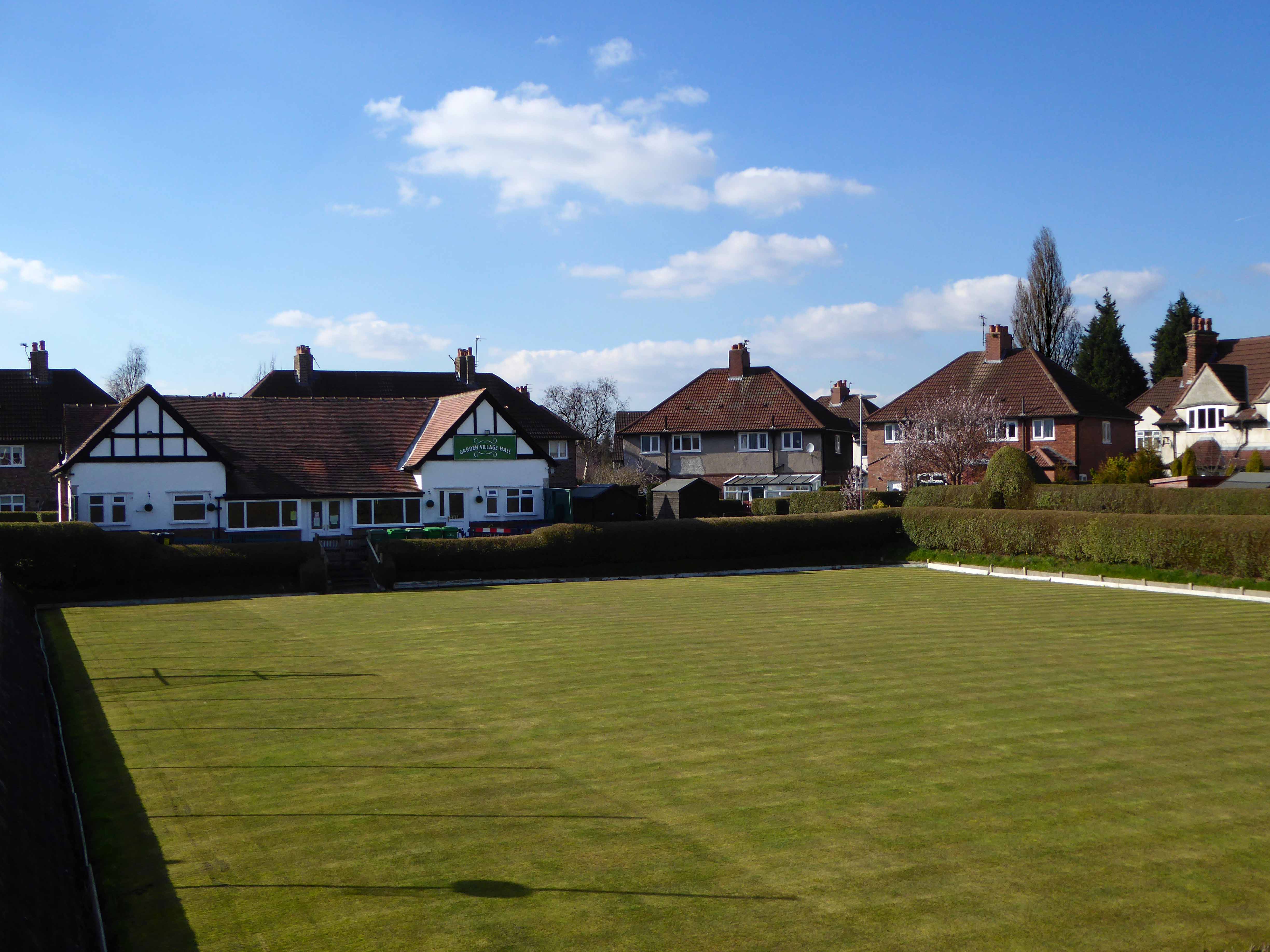
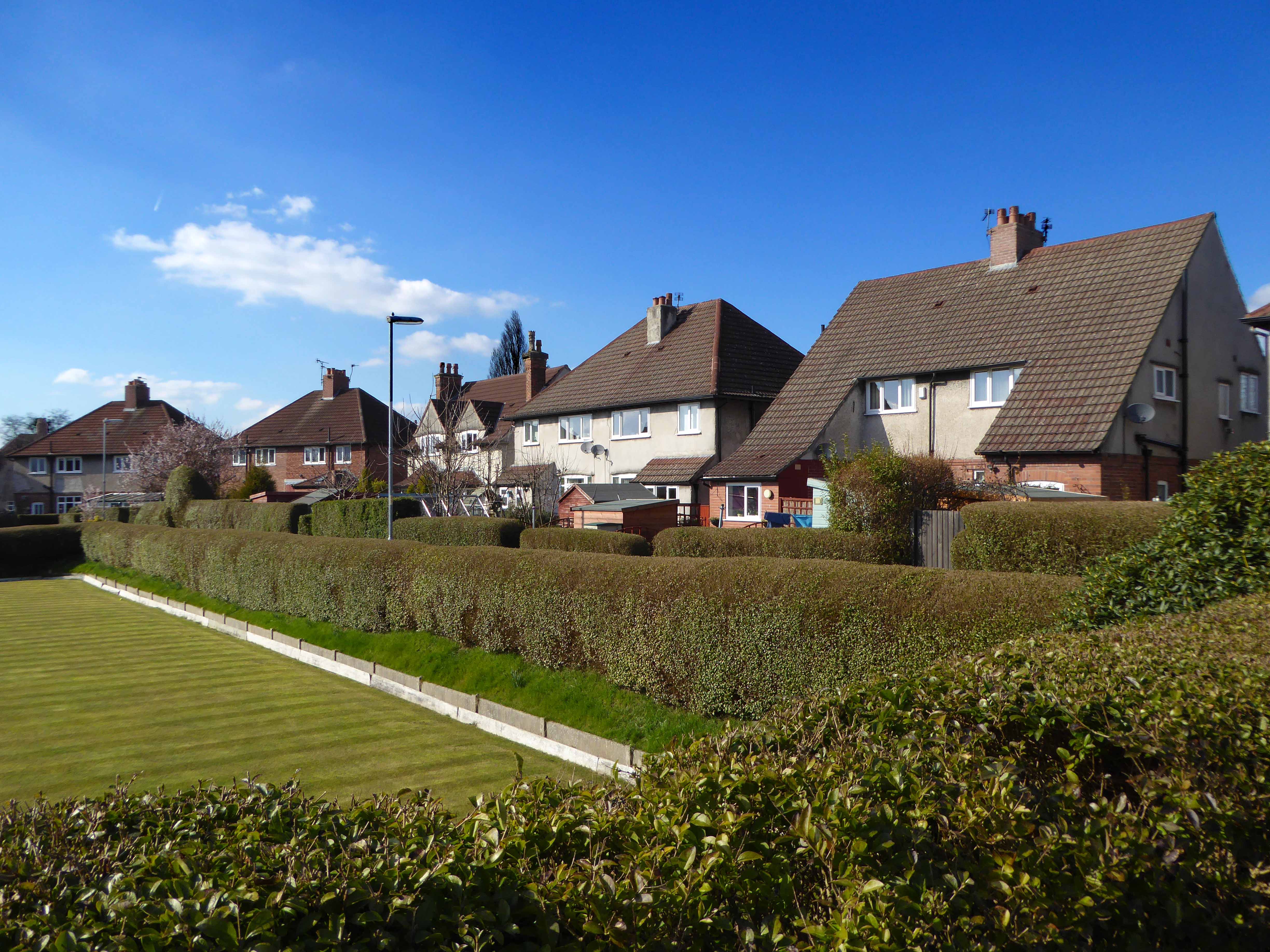
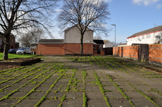
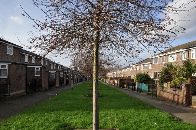
At the centre of the garden village and accessed by a network of pedestrian footpaths, is a resident’s recreational area comprising a bowling green, club house and tennis courts. The estate dates from approximately 1906 and was laid out in the manner of a garden suburb with characteristic hedging, front gardens, grass verges and trees on every street. 


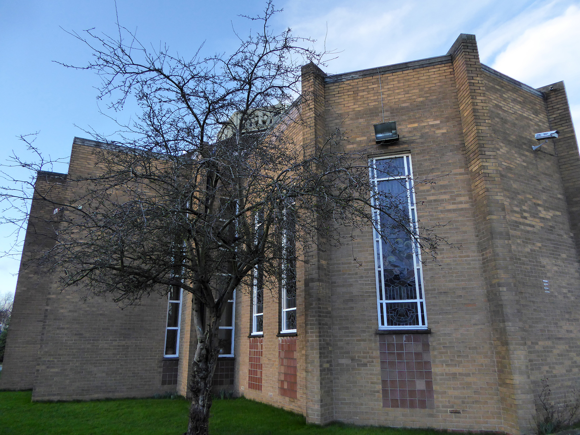
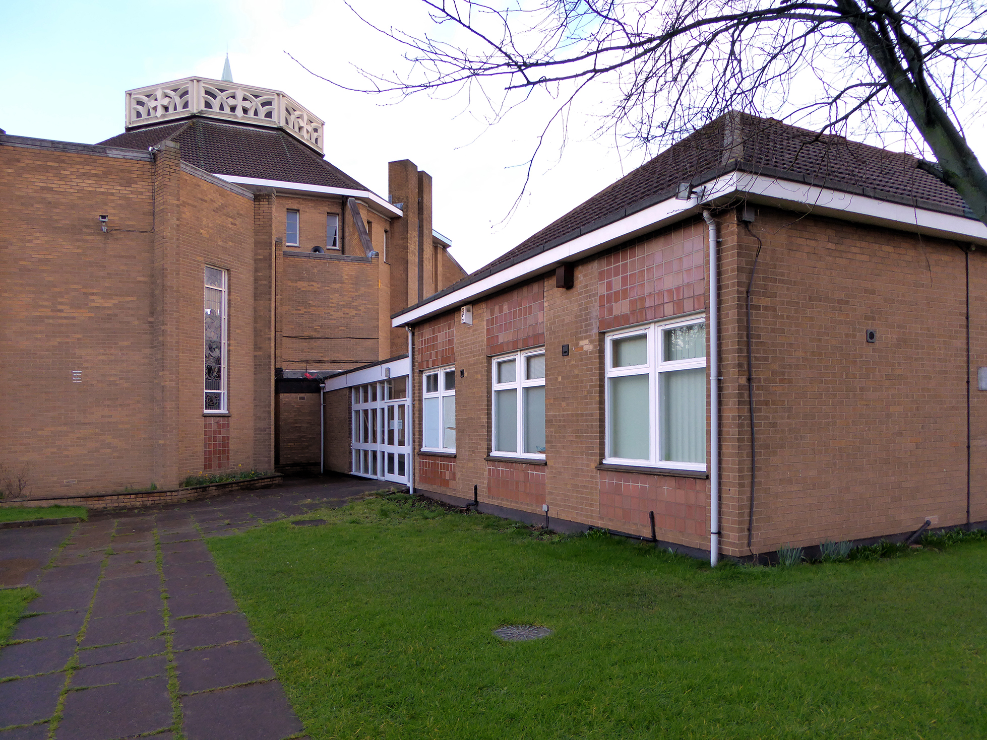
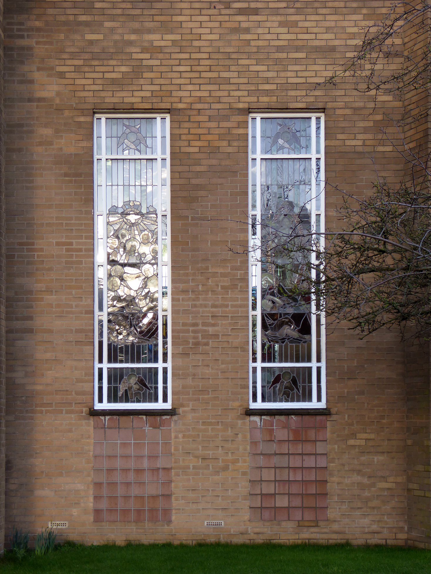
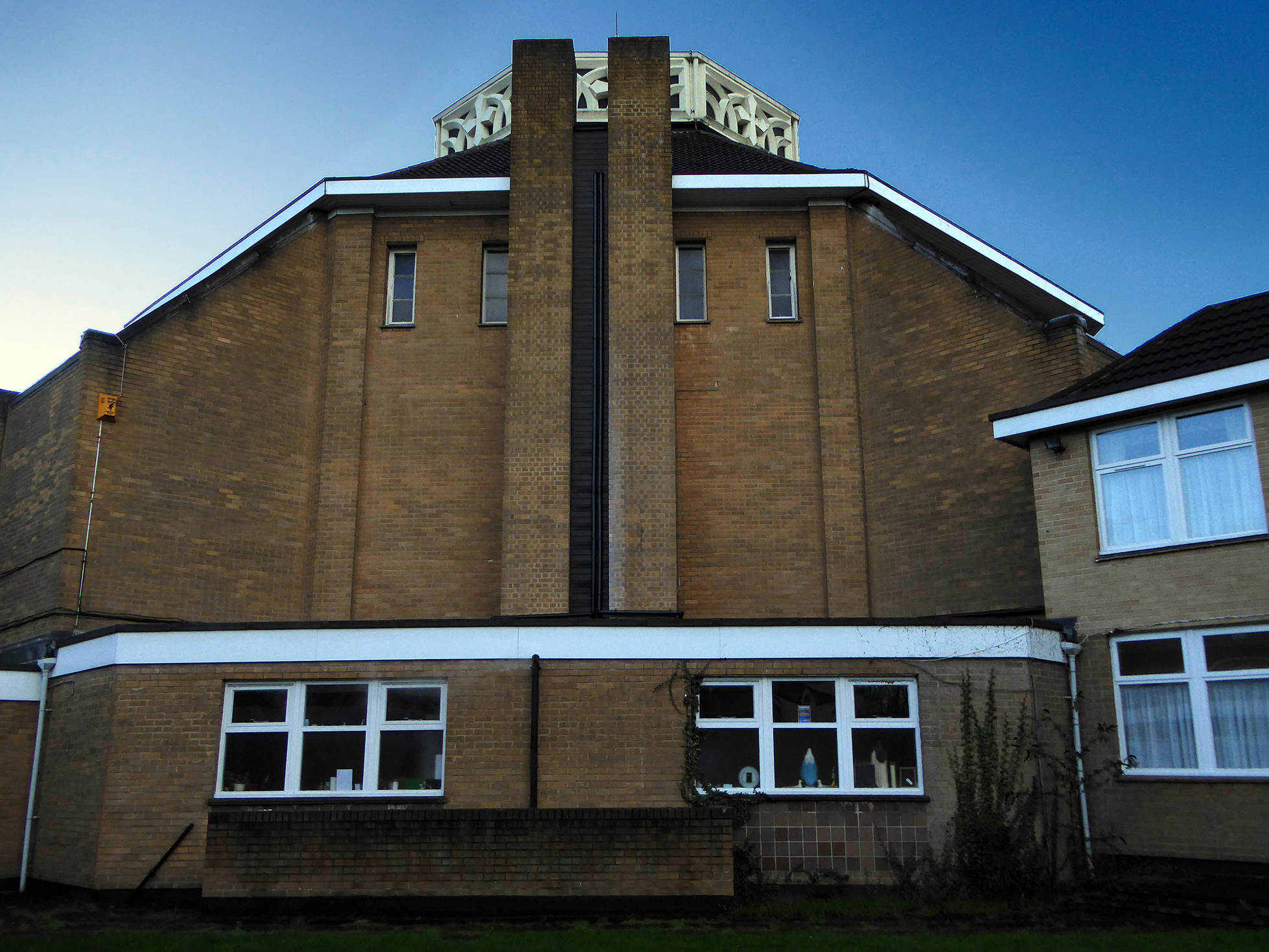
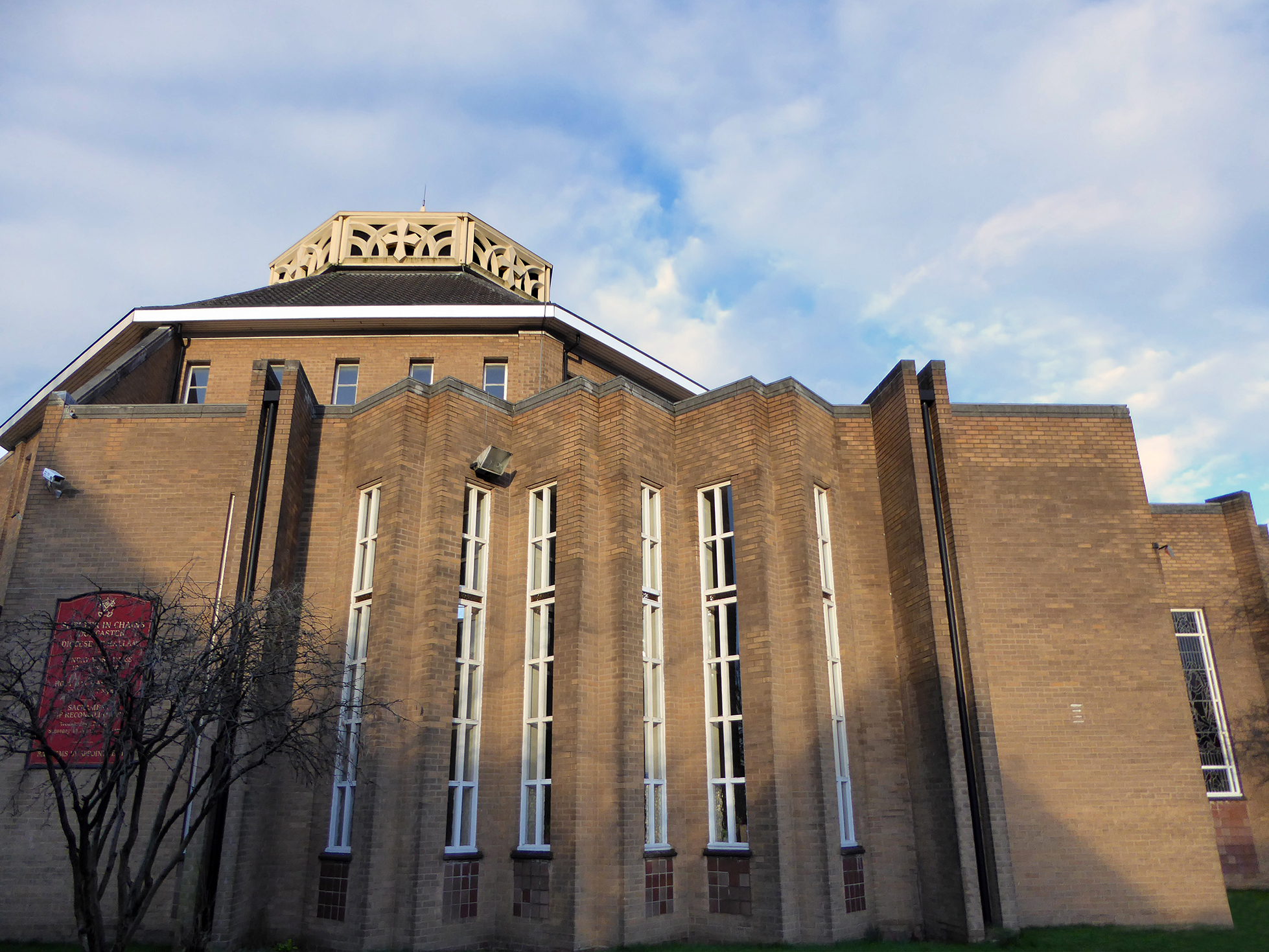
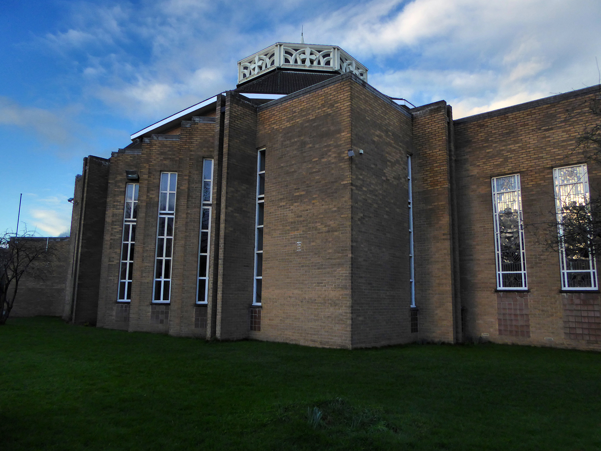
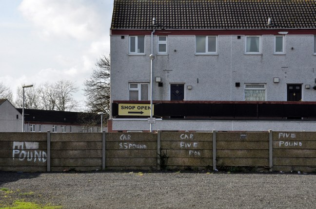
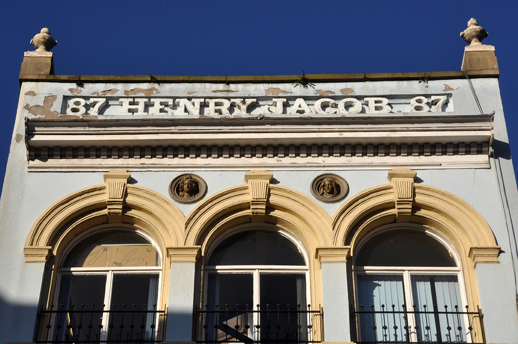
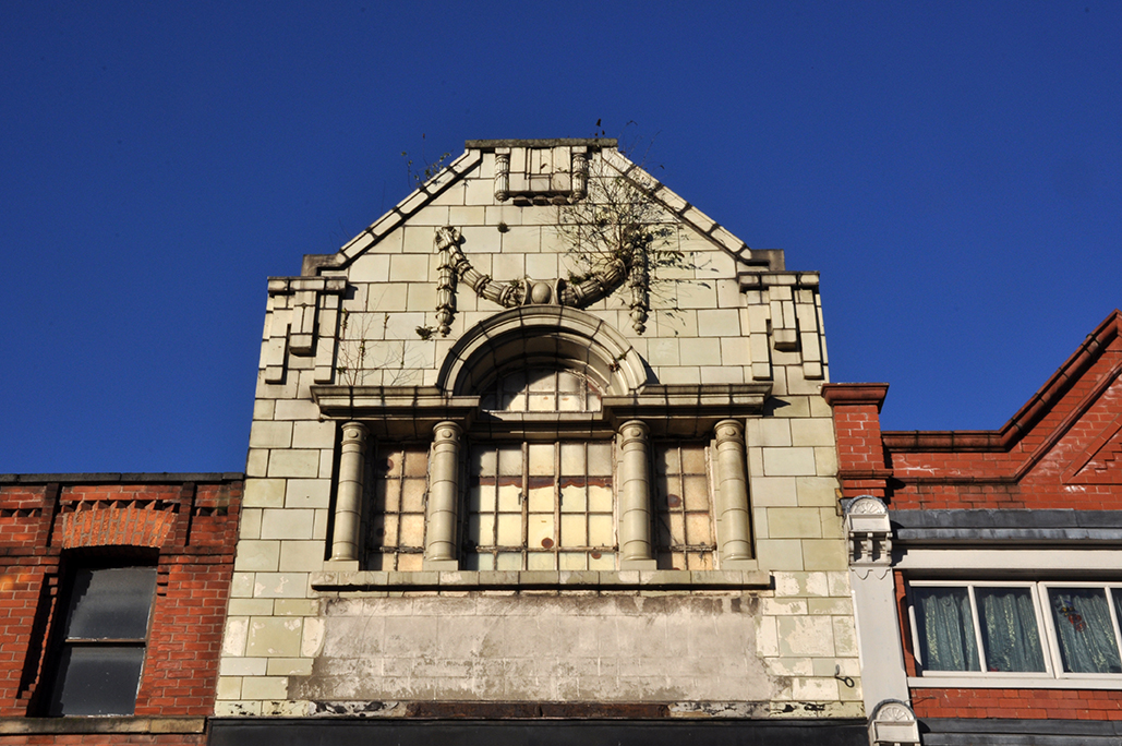
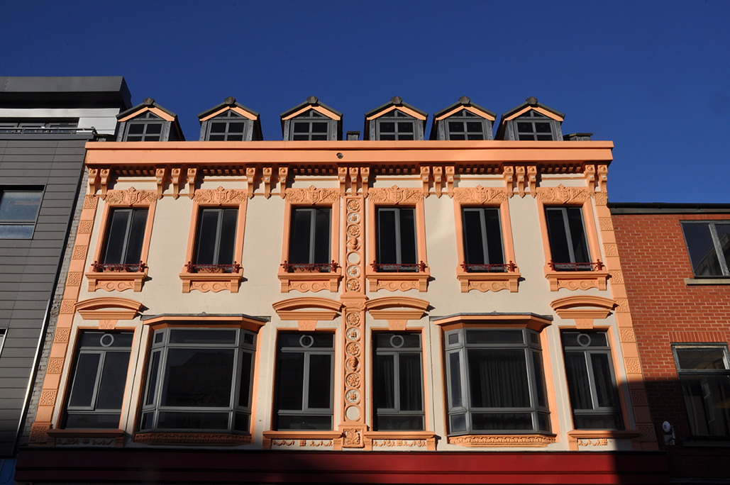
A rare and almost perfectly preserved example of Edwardian Mancunian suburban architecture, save a uPVC epidemic of identical doors and window frames. On a sunny day the variegated brick and render simply sings, like so many chirpy sparrows.

These homes are a variation on a theme, a fugue of tile, brick, pointy counterpointed gable, light and shadow – linked by scale, style and well laid wide concrete roads, filled with good intentions and cars.

Take a hike or bike south of the city, now that Spring is here.

Police Station – Blackpool

I’ve been here before, innocently snapping – without incident.

A super-large Roger Booth cop shop and courts, concrete combo.

So why not go back just one last time, prior to demolition and redevelopment.

So I did.

Following the acquisition and demolition of Progress House the Bonny Street Station is to be relocated, and the former site, under the ownership of Blackpool Council, set to become who knows what – who knows?

Progress House, Clifton Road, Marton.

940662392

The Council knows, it plans to develop a new site for the defunct Central Rail Station

A giant of the steam age that became a car park

8454435614_0fb026e809_b

It is 50 years since Central Railway Station closed with the land being used for a car park ever since. It was proposed as the site for the super-casino until that bid failed to win government backing. Since then plans for an indoor snow-based attraction have also failed to make any progress.

Today happily, snow-based attractions are still failing to make any progress.

Blue skies and chill early March air greeted me, across the wind swept, precast concourses and piazzas – warmish grey, against brightish blue.

I simply didn’t expect the boy in blue – ten minutes of light/half hearted interrogation.

“Who, what, why, where are you?”

Responding in a clear concise and non-confrontational manner, I was free to go about my legal business, taking these pictures for you.

P1020045

P1020047

P1020049

P1020051

P1020052

P1020053

P1020054

P1020055

P1020056

P1020057

P1020058

P1020061

P1020062

P1020063

P1020064


P1020065P1020066

P1020067

P1020068

P1020069

P1020070

P1020071

P1020072

P1020073

P1020074

P1020075

P1020076

P1020078

P1020081

P1020082

P1020083

P1020087

Police Station – Morecambe

It seems that post-war Lancashire police stations are under threat, often the work of County Architect Roger Booth, and to my mind buildings of both interest and quality, they are nevertheless disappearing fast.

Wigan is now a smart new hotel, now cracks a noble heart good-night, sweet prince; and flights of angels sing thee to thy rest – in your merrily clad Premiere Inn.

article-2178295-003BAAB100000258-271_634x422
1776190137

Blackpool and Bury are both to be demolished.

What is going on, are we running out of crime?

On the day of our visit to Morecambe, there was no obvious evidence of miscreants on the prowl, though appearances can be deceptive -consider this incident of  March 2008:

Morecambe Police Station was evacuated on Wednesday night after an elderly man took a suspicious package into the building. 

Police said the man brought the object into the reception, said it was suspicious and quickly left. 

Officers called the Bomb Disposal Team from Chester who said it was an ‘improvised device’. All houses near to the station in Thornton Road were evacuated and the area was cordoned off for two and a half hours. 

 The area was declared safe shortly before 8.30pm. 
 
Further research reveals:
Screen Shot 2016-03-21 at 17.05.59

Though locals are also encouraged to use online services:

Screen Shot 2016-03-21 at 17.05.26

The modern day cop shop faces an uncertain future it seems. So get out there toot sweet, take a look behave responsibly at all times and remember folks it’s not a crime to snap a Bobby or their place of work.

It is not illegal to take photographs or video footage in public places unless it is for criminal or terrorist purposes.

There will be places where you have access as a member of the public, but will have to ask permission or may be prevented altogether. These could include stately homes, museums, churches, shopping malls, railway stations and council or government buildings. You need to check the situation out on a case by case basis.

County Archives – Preston

The things that you see from a passing train, those things that arouse your curiosity.

Blackpool bound, to the left a horizontal slab on stilts.

Well, well.

Whatever could that be?

Well we shall see, shall we?

Some days later alighting at Preston Station, I hotfooted it hurriedly down the road to who knows where.

Peeping coyly from behind the surrounding trees, in the shadow of County Hall – the Lancashire Archives, yet more of Roger Booth’s handiwork.

A low stone clad block stood elegantly on slender supports, inside the courtyard, a grid of aluminium and glass, the people peeping out. The core of the building shrouded in a solid serrated brick screen.

It really is a treat.

Go see for yourself

The Lancashire Archives

Haymans and Coverley Point – Vauxhall

Vauxhall a London borough south of the river, a drained marsh.

– A home to earlier market gardens.

Vauxhall former site of the renowned Pleasure Gardens.

tom-and-jerry-vauxhall

Vauxhall post war housing development, including two adjacent tower blocks Haymans and Coverley Point. labelled as a concrete jungle home to mainly manual workers, forty percent non-white, amid a mix of Eastern European and Portuguese emigres.

Vauxhall playground of the free-runners, film location and thrill seekers:

Haymans Point is an imposing, concrete, council estate tower block in the north of Lambeth, part of the Vauxhall Gardens Estate, which has an active residents and tenants association. The rooftop is fairly restricted in terms of outlook due to its high walls, but some interesting features are available including atmospheric interior corridors, outdoor walkways and underpasses over public spaces.

They are currently undergoing a transformation from problem area to greener pastures, through a collaborative community regeneration project.

– It’s also giving young Lambeth citizens work experience in the construction industry.

img94joktmu73938

Vincenzo  got his interest in construction from his Mum, who was a Brixton-based painter and decorator, and his original work experience with London charity Build-it was decorating Lambeth Council blocks in Blenheim Gardens. “I’m fanatical about learning things. I like moving about and in building you’re always somewhere different. Nadine from Build-it said this job would be hard work, so I was right on it”

Two blocks without a chip on their respective shoulders, set in a green sea of history.

Go take a walk in the garden, go take a look.


Mayfield House – Bethnal Green

Building Conditions in Bethnal Green – Post 1945

“The immediate problem after the war was to house those whose homes had been bombed. Longer-term objectives were to complete and extend earlier clearance programmes in order to reduce the population density and separate industry from residential areas, as reaffirmed in the County of London Plan of 1943. Some 5,000 people lived in temporary housing, including requisitioned properties and hutments or mobile homes, prefabs, of which the L.C.C.’s first in East London were in Florida and Squirries streets. All but 15 of its 190 ‘prefabs’ were in use in 1955, together with 309 requisitioned properties; at least 48 mobile homes were still in use in 1966.  War damage had been repaired by 1953 and attention shifted to slum clearance; flats were to be allotted to those in cleared areas rather than by a waiting list. The L.C.C. and M.B. co-operated in drawing up five-year plans:  by 1954 there were 16,852 permanent homes of which 2,434 were unfit, 1,711 in the L.C.C.’s clearance areas and 675 in the M.B.’s, together with 48 individual houses. The L.C.C. demolished 510 and the M.B. 550 between 1956 and 1960 and the M.B. demolished another 151 unfit and 46 other houses in 1961-2. Most were replaced by municipal estates, although both councils also acquired sites scheduled for industry, business, or open space. It was estimated that to find a site and build an estate took six years.” 

Thanks to http://www.british-history.ac.uk/vch/middx/vol11/pp135-147

The six-storeyed Mayfield House opened with 54 flats in 1964 on the east side of Cambridge Heath Road, south of the town hall.

Exploring London in an accidental and often tangential manner, often offers many surprises. Ostensibly in search of the V&A Museum of Childhood I tumbled into Mayfield House. The whole area, as can be seen in the above link, is home to several estates and homes, designed by the eminent architects du jour, Mayfield receives no such attribution, possibly the work of the borough office.

None the worse for that a building of some note, famously housing one of London’s first coin operated laundries, as seen in the promo video for The Streets – Dry your eyes.

Screen Shot 2016-03-17 at 16.35.58

The flats also contain a Somalian Centre, Bethnal Green having been home, for many years to Somali seamen – the subject of a recent photographic exhibition by Sarah Ainslie

DSC_0236

Photographs copyright © Sarah Ainslie

Ali Mohammed Adan – Seaman

“I first came to London by ship in March 1958. I stayed in Aldgate for a night and went to Newport where my cousin had a house. There are many Somalis there. From that day until I retired in 1990, I was in the Merchant Navy, and I brought my family over from Somaliland. In 1970, I moved back to London to Bethnal Green but my wife and daughters chose to stay in Newport.

In Somaliland, I owned over a hundred camels and sheep. Nobody keeps camels anymore, everyone sold them and moved to the city. They say, ‘It’s too much work.’ But keeping camels and sheep and living on a farm, it’s a good life because you eat every day. Everybody wants to do it again now.”


An intriguing structure with a dominant grid on the front elevation, sharp signage, extravagant exterior rear stairs, modular concrete screened, low-level car parking and a recently enclosed glassed gallery.

2686397_93fb4162


London – city of surprising surprises.


Library – Morecambe

I love libraries.

I love Morecambe.

Therefore I love Morecambe library.

Built and opened in 1967, designed by the County Architect  Roger Booth who was also responsible for a whole host of buildings in Lancashire between 1962 and 1983.

image-6.php

Almost fifty years on, the building still speaks of modernity, optimism, light and learning. It’s well used and loved by the public and the charming and helpful staff – many thanks, for your time and assistance.

P1020260 copy

Application was made for listing, this was not accepted – there have been significant changes to both the external and internal structure over time.

image-9.php

The vertical, impressed cast concrete panels, shown above, have been replaced by brick.

image-2.php

The original suspended *bean can* lighting system has also been replaced. At night, I was told it was hard to navigate the building using the limited spot illumination, so a box of bike lights were kept and handed out, to permit the safe, well-lit passage of library users.

P1020279 copy

Concentric hexagonal rings of suspended strip lighting are now in place.

image-10.php

Sadly the vivarium, contained  in a glassed link corridor, was short lived.

Archive photographs from Lancashire Lantern Images

The staff were more than happy to allow me take photographs, I was even afforded, at my own risk, to access the roof area through a very secret door!

I urge you to visit Morecambe and its charming library soon.

http://www.lancashire.gov.uk/libraries-and-archives/libraries/find-a-library/morecambe-library.aspx

Queen Elizabeth Hall – Oldham

Attached to the Civic Centre, developed and opened in 1977, to commemorate the Queen’s Silver Jubilee, she ain’t no human being, she’s a building.

An low exterior slab of classical municipal modernism, with a series of wonderful and surprising new attachments, ideal for all occasions!

The most amazing set of heavily patinated, square sectioned, inorganic pipes which are precipitously cantilevered  onto the front elevation.

Illuminating!

The lobby boasts further exotic lighting, this time on the ceiling, and applied metal reliefs attached to the back wall and booking office.

I’ve never been in the main auditorium, yet – but life is full of little surprises.

Others have – boxers, boozers, bands, concerts, carousers, dancers, thespians – the lot.

The council have a mind to put a stop to all this wayward architecture and replace it something new, shiny and anonymous.

C_71_article_1488157_image_list_image_list_item_0_image

But they’re having to wait for the Men from the Ministry to cough up the cash – which may or may not be tied up in a nearby Northern Powerhouse, Mr Osborne may just have to be lead up the A62 by the nose, with a promise of the most popular Tea Dance in the area.

Screen Shot 2016-03-11 at 15.59.07

I do advise you to go and have a look before you can’t.

DSC_0680

DSC_0667

DSC_0670

DSC_0662

DSC_0660

DSC_0671

DSC_0674

DSC_0664

DSC_0677

DSC_0669

DSC_0673

DSC_0672

DSC_0679

DSC_0666

DSC_0678

DSC_0675

DSC_0663

DSC_0665

DSC_0668

DSC_0676

Milbank Tower – London

Millbank Tower is a 118 metre or 387 feet high skyscraper in the City of Westminster at Millbank, on the banks of the River Thames in London.

The Tower was constructed in 1963 for Vickers and was originally known as Vickers Tower. It was designed by Ronald Ward and Partners and built by John Mowlem & Co. It is a landmark on the London skyline, sitting beside the River Thames, half a mile upstream from the Palace of Westminster. The tower has been owned by David and Simon Reuben since 2002, while still being managed by its former owner Tishman Speyer Properties.

It is a Grade II listed building.

From 1995 the Labour Party rented two floors in the base at the south of the site for use as a general election campaign centre, including the ground floor, which had a lecture theatre, and also a meeting space that was used for press conferences. Labour ran its 1997 General Election campaign from these offices; after the election, the party vacated its headquarters at John Smith House, Walworth Road SE17, to move to Millbank. Just five years later, however, the £1 million per annum rent forced the party to vacate the tower and relocate to 16 Old Queen Street.

The United Nations also had offices in Millbank Tower, but moved out in June 2003, also citing high rents. Other public bodies have continued to occupy the building, including the Central Statistical Office, the predecessor of the Office for National Statistics, the Parliamentary and Health Service Ombudsman, the Local Government Ombudsman, the UK India Business Council and the Records Management Service.

Since 2006, the Conservative Party have based their campaign headquarters at 30 Millbank, in the same complex as Millbank Tower.

Other floors in the tower are occupied by various organisations and commercial companies, including Environment Agency, the World Bank, Altitude 360 London, foreign exchange specialists World First; the Specialist Schools and Academies Trust, the UK India Business Council, the Audit Commission, event caterers Salt and Pepper, Private Food Design, the firm Lewis PR, the London office of the Open Society Foundations, the Local Government Boundary Commission for England and XLN Telecom.

I know because a computer told me so.

It feels like a hub of power, its location, scale and sheer physical presence speak of it.

Say it loud – I’m block and I’m proud!

So I wandered around one cold bright sunny Sunday afternoon, unchallenged.

Exploring your ramps, car parks, piazzas and intimate spaces.

Fight or feel the power.

Civic Centre – Oldham

“The Civic Centre tower is the Oldham’s centre of local governance. The fifteen storey building has housed the vast majority of the council’s offices since its completion in 1977. Standing at the summit of the town, the tower stands over 200 feet 61 m high. It was designed by Cecil Howitt & Partners, and the topping out ceremony was held on 18 June 1976.The Civic Centre can be seen from as far away as Salford, Trafford, Wythenshawe and Winter Hill in Lancashire, and offers panoramic views across the city of Manchester and the Cheshire Plain.”

Part of the building joins onto an older office block which dates from the mid-1960s. That was originally headquarters for Oldham’s Regional Health Authority before their move to St. Peter’s Precinct.

I just stand back and gaze in wide wonder at this white giant resplendent against deep blue late Winter skies. High above the surrounding areas of Greater Manchester, it is more than a sum of its parts. The finest materials and finish, bold, optimistic and modern, singing of a civic pride that refuses to be diminished.

Having survived the slow and painful exodus of the cotton industry, and the consequent years of municipal under funding, Oldham is rebuilding itself, with this gem at its centre.

Further info and thanks to: East of the M60


Halifax Building Society HQ – Halifax

Why are we here?

The Halifax was formed in 1853 as the Halifax Permanent Benefit Building and Investment Society. The idea was thought up in a meeting room situated above the Old Cock Inn close to the original Building Society building. Like all early building societies, the purpose of the society was for the mutual benefit of local working people.

Why are we not here?

In 2006, the HBOS Group Reorganisation Act 2006 was passed. The aim of the Act was to simplify the corporate structure of HBOS. The Act was fully implemented on 17 September 2007 and the assets and liabilities of Halifax plc transferred to Bank of Scotland plc. The Halifax brand name was to be retained as a trading name, but it no longer exists as a legal entity.

What have we here?

The Halifax Building was designed by the architecture firm BDP and constructed in 1968-74, as the headquarters for the Halifax Building Society and built with an unusually high budget. The rapid growth of the society over the twentieth century prompted the requirement for a new headquarters building, and in 1968 the aim of the architects was to design not only a practical building but a bold building for a confident client.

The building was Grade II listed in February 2013

In their report, Historic England comment that:

“Though necessarily large in scale, and centrally located in the town, the design is one of humanity, respecting both the townscape in which it was placed, and the employees it was to house…The high budget was reflected in the building’s finishes inside and out. Externally a limited colour palette and use of York stone cladding gave a homogeneity and showed consideration to the local character of the stone buildings of Halifax. Internally, materials were high quality and colour co-ordinated, with landscaping to both the public ground-floor spaces and the executive fourth floor.”

Ian Nairn thought well of it –

I wandered around amazed by the sheer mass of the main volume of the building, and the thin slithers of sunlight and blue sky which abutted its glass and stone skin.

When approached by a curious security guard, I quickly allayed his initial fears, on production of my Manchester Modernist Society membership card and badge.

However fellow urbanists, take care, for the public is often mutually private and public at one and the same time, don’t step over the line.

P1010375 copy

Go take a look make of it what you will.

P1010359 copy

P1010361 copy

P1010367 copy

P1010365 copy

P1010357 copy

P1010358 copy

P1010362 copy

P1010355 copy

P1010377 copy

P1010366 copy

P1010371 copy

P1010354 copy

P1010363 copy

P1010374 copy

P1010372 copy

P1010368 copy

P1010373 copy

P1010364 copy

Oxford Road Station – Manchester

Where are you?

Neither here nor there.

Up in the air.

Betwixt and between.

Possibly on the way to somewhere else, stranded at Oxford Road Station.

Tucked in behind Shaw’s Furniture and The Tatler Cinema.

I love every curvy corner, timber frame and canopy, concrete spiral, empty kiosk and precipitous steps – I’m happy to be stranded.

tumblr_mtlstgyiE41rr41pto1_1280

It opened in 1849 and was rebuilt in 1960.

webmedia-2.php

webmedia-1.php

The station was opened as Oxford Road on 20 July 1849 by the Manchester, South Junction and Altrincham Railway . The station was the headquarters of the MSJAR from its opening until 1904. It had two platforms and two sidings, with temporary wooden buildings. To allow for extra trains in connection with the Manchester Art Treasures Exhibition in 1857, extra platforms and sidings were built. In 1874 the station was completely rebuilt providing two bay platforms and three through platforms. Further reconstruction took place during 1903-04. From 1931 it was served by the MSJAR’s 1500V DC electric trains between Altrincham and Manchester Piccadilly.

The station had become dilapidated by the 1950s, and in connection with the electrification and modernisation programme of the Manchester to London line in 1960, the old buildings were replaced by the current structure by architects W.R. Headley and Max Glendinning and structural engineer Hugh Tottenham. It was designed in a distinctive style in concrete and wood with curves bringing to mind the Sydney Opera House.

Use of the station increased from May 1988 when the Windsor Link was inaugurated between Deansgate and Salford Crescent, connecting lines to the north and south of Manchester.

The station is a grade II listed building.

One of the most interesting and innovative buildings of the period, the most ambitious example in this country of timber conoid shell roofing.

  • Clare HartwellPevsner’s Architectural Guide Manchester.

Further development awaits, widening the viaduct and lengthening platforms as part of the Northern Hub Project.

oxford road

The defunct Platform 6 and lost awning to the left – Photo: 20 3 1971 Tom Burnham

Altrincham bound 931 Metro-Cammell MSJAR 1500 volt DC EMU – all withdrawn by 1971, when the line was converted to AC.

P1010524 copy

P1010499 copy

P1010445 copy

P1010495 copy

P1010431 copy

P1010465 copy

P1010425 copy

P1010467 copy

P1010436 copy

P1010490 copy

P1010471 copy

P1010542 copy

P1010434 copy

P1010446 copy

P1010518 copy

P1010522 copy

P1010540 copy

P1010528 copy

P1010511 copy

P1010504 copy

P1010441 copy

P1010516 copy

Screen Wall Water Feature – Manchester

the-bandwagon-breakin-down-the-walls-of-heartache-dancin-master--2_6729456

Breakin’ down the walls of heartache, 

I’m a carpenter of love and affection.

So sang Johnny Johnson of the Bandwagon.

They were a permanent fixture at the New Century Hall in the late sixties.

Attached to New Century House, the Hall was an integral part of the extensive Cooperative Society property development in Manchester.

Much of that development now faces an ever uncertain future.

None more so than the adjoining screen wall.

P1010590 copy

Set to the north-east side of the building’s entrance forecourt is a concrete sculptural screen wall by John McCarthy with an abstract relief to the south-west side facing into the forecourt. The wall is aligned at a right angle to the building’s main entrance and has a shallow rectangular pool (now drained) set in front. The wall includes numerous openings from which water originally flowed into the pool, but the system is no longer in working order. The pool also originally incorporated small fountains.

Information from Historic England

At a time when the whole of the centre of the city seems alive with construction, refurbishment, gentrification and more quarters than you could shake a stick at, this forlorn and seemingly unloved gem stands, shrouded in shrubs.

I’m a carpenter of love and affection, who would not care to see, this particular wall:

Broken down.

P1010593 copy

P1010595 copy

P1010596 copy

P1010579 copy

10942979_10153057260926600_244358983598520538_o

P1010592 copy

P1010588 copy

P1010589 copy

P1010584 copy

P1010587 copy

P1010586 copy

P1010591 copy

P1010594 copy

P1010585 copy

P1010582 copy

P1010580 copy

St Peter in Chains – Doncaster

A church shrouded in history and mystery – and on the day of my visit:

Torrential rain.

How appropriate as:

On the eve of the Reformation came a reputed miracle for Robert Leche and his family who were saved from drowning after invocation of Our Lady of Doncaster.

Its location on the Great North Road seems to have placed it through the years at the centre myth and magic.

On 30 November 1350, licence was granted for alienation in mortmain by, John son of Henry Nicbrothere de Eyoun and Richard le Ewere of Doncastre to the Carmelite Friars who are coming there to dwell in the town of Doncastre, of a messuage and six acres of land there, to build thereon a church in honour of St Mary and houses to dwell in.

A shrine was established to Our Lady of Doncaster.

Time and the Reformation were not kind to the shrine and Our Lady.

She and the church of St Peter came and went over the years until:

A new church was opened by Cardinal Heenan on Palm Sunday 1973, octagonal in shape. John Bentley’s Tabernacle Door, the four reredos panels and the altar designed for the old church are incorporated in the Blessed Sacrament Chapel of the new church.

The statue of Our Lady of Doncaster now stands in a circular shrine chapel on the north side of the church. Phyffers’ statue stands in an oak reredos with modern stained glass windows depicting St Joseph, the Annunciation, the Nativity and the Assumption.

A large and striking design by J. H. Langtry-Langton, incorporating important furnishings by J. F. Bentley from the predecessor church, along with good furnishings of the 1970s. The churches houses the modern successor to the medieval shrine of Our Lady of Doncaster.

Ambitious in scale, dotted with vertical detail, the main body of the church has an integrated meeting hall and clerical house. I remain however, more than somewhat unconvinced by its brick monumentality.

On September 23, 1974, the budding Liverpool star married his childhood sweetheart, Jean, at St Peters in Chains Roman Catholic Church in his hometown of Doncaster. 

There was no fanfare, no fans, no celebrity guests and certainly no Hello! style deal. Kevin was just 24, his bride a year younger. 

Watching them with a tear in their eyes were his proud parents, Joe, a miner, and Doris.

Screen Shot 2016-02-12 at 10.52.09

Kevin says: ‘Jean and I hadn’t planned to get married for months, but I had a five-week ban for fighting with Billy Bremner and, as they say, every cloud has a silver lining, so we decided to use the time to get married quietly.’ 

P1010134 copy

P1010127 copy

P1010126 copy

P1010123 copy

P1010108 copy

P1010125 copy

P1010128 copy

P1010133 copy

P1010129 copy

P1010132 copy

P1010120 copy

P1010136 copy

P1010130 copy

P1010124 copy

P1010135 copy

Back to Beswicks

You’re never more than a thousand yards from a main road, six feet from a rat, or a quarter of a mile from Beswick, one of many Beswicks.

DSC_0175

Beswick was once a bustling mixed industrial and residential area of east Manchester, alive with back to back terraced housing, pubs, clubs, shops and people.

Sixties slum clearance swept away most of its past when Fort Beswick was built.

webmedia-3.php

Remember the Alamo?

Forget Fort Beswick.

It’s gone – wind the Bobbin up.

The Bobbin copy

Turn it into a Library

Beswick Library

Wind the library up

DSC_0227

Build another

grey-mare-lane-police-station

Call the Police!

But the Police Station has closed now, and moved further on.

0_GMPDHQ_1920x1080

http://www.manchestereveningnews.co.uk/news/greater-manchester-news/greater-manchester-police-rake-17m-6273100

There are traces of the past that remain, homes and pubs that have survived the revival.

Where is Beswick now?

On the edges of the Eastland’s dream, on the outside of everything.

Sheik Mansour ensures the construction of a brand new shiny world.

The private provision of an almost public space.


Everyone knows this is nowhere.

But Beswick?

Coverdale Baptist Church – Ardwick

DSC_0096 copy

At the eastern end of the broad wide curve of Coverdale Crescent sits a church.

Built in 1970 to accommodate the pious observation of the area’s  residents.

The residents of the so-called Fort Ardwick.

coverdalebaptist2

The Fort is no more, demolished, the newer Coverdale Estate now covers the area.

The church aka The Wellcontinues to function as a focus for community and religious activity.

The exterior now seems just a little careworn, though planting and structural maintenance, manage to keep up a modicum of appearances.

Beswick – Manchester

Screen Shot 2016-02-06 at 15.17.13

Between Openshaw and Bradford sits Beswick.

Beswick is a small district located on the east side of Manchester bounded by Ashton Old Road, Ashton New Road and Grey Mare Lane and was incorporated into Manchester in 1838. Pronounced Bes-ick the “w” is silent. Before 1066, in Saxon times, the district was called Beaces Hlaw – Hlaw was an old word for a small hill, often used as a burial mound. By the 13th century it had changed to “Beaces Wic” indicating that the area was predominantly farm land. Who or what the Bes element of the placename signified is open to interpretation, though the simplest and most plausible is that it belonged to a person called Bes or Bess.

In the 60s it was, as I remember it, a typically vibrant mixed East Manchester community, industry, housing, retail, entertainment and goodness knows what bumping along together incautiously, down tight streets of Victorian terraced housing. I worked in the area as a Mother’s Pride van lad, hauling bread, cakes and galvanised trays in and out of a plethora of superabundant corner shops.

The year of 1970, approximately, dawns, ushering in a decade of great change, slum clearance and the building of brand new homes – the end, by and large, of the back to back corner shop world.

A process mirrored in my previous post

10 years later, and long gone the years of postwar full employment, and the made round to go round world of the weekly wage.

The early 1980s saw growing unemployment and world-wide recession. The large new estates suffered most. Inner city districts of Manchester saw street riots in 1981, as did many other major cities around Britain. Manchester had suffered badly as a result of the recession. In 1986, over 59% of adult males living in Hulme were unemployed; in Miles Platting the figure was 46%; Cheetham Hill and Moss Side both had an unemployment rate of 44%. The main group of unemployed were young people under the age of 21. Hulme’s youth employment was recorded at 68%, and Cheetham Hill suffered 59%. 

Manchester 2002

webmedia-7.php

It is true that the new developments have great advantages in many ways over the terraces they replaced. Tenants who live in houses without baths or indoor sanitation and with no hot water are delighted to move into bright new flats and maisonettes, with indoor plumbing, with baths, and accommodation which has more rooms and far better kitchen facilities and central heating, even though they sometimes grumble at the cost of that central heating.

Gerald Kaufman MP

But although we can build a new housing development, we cannot easily recreate the warm community spirit which has vanished with the terraces which have been demolished. There is the noise from neighbours on the deck above and the deck below. The wind-swept balconies along which tenants have to walk are not as cosy as the streets from which they have come. Those welcoming corner shops, with their bright lights on winter evenings, have gone, and sometimes a new development has no new shops for too long a period. Even when they come, there are not enough of them.

The scale of the buildings is often daunting. I have in mind Fort Beswick and Fort Ardwick in my own constituency. The design is frequently all too forbidding. That is why the two estates are called Forts

When the tenants of these development have lived in cosy old houses, however inadequate they were in terms of physical provision, they are bitterly disappointed by the shortcomings of new property which they have looked forward to occupying.

Handsard – Multi-Storey Developments 1974

The year of 1990, approximately, dawns, ushering in a decade of great change, multi-storey development clearance and the building of brand new homes – the end, by and large, of the one on top of another topsy-turvy world.

Fort Beswick was subsequently demolished.

The beat goes on as Len Grant records the most recent redevelopment of East Manchester.

And the M.E.N shouts loud and proud from the roof tops, heralding a brand new, privately funded public domain

Picture credits Manchester Image Archive

Coverdale Crescent Estate – Ardwick

The road to Hell is paved with good intentions and as it would subsequently transpire, loosely attached Bison concrete wall-frame system panels.

Wythenshawe apart, the City of Manchester admitted that it had 68,000 houses described as “grossly unfit” by 1959. 

webmedia.php

Its solution was to demolish 90,000 dwellings between 1954 and 1976 and to erect 71,000 dwellings by way of high rise flats and to move residents out to newly prescribed “overspill” estates – at Heywood and Langley in the north, Hyde in the east and Worsley in the west.

Most of these displaced people, however, found themselves resettled in tall tower blocks, which, no matter how architecturally innovative, or how improved their facilities, proved disastrous in social terms. 

Manchester 2002

In Coverdale Crescent Ardwick such an architecturally innovative development was built.

The estate, which became known as Fort Ardwick, was a deck access block of 500 homes. Completed in 1972, it was built with the same Bison concrete wall-frame system that had been used in neighbouring Fort Beswick.

By the mid-1980s it was clearly suffering from structural faults. The council employed a private firm of consultants to survey the estate, which found that water was leaking through roofs, steel fixings were corroded and concrete was breaking away. The council had to spend £60,000 immediately to bolt 1,100 panels back on to the building’s internal skin. The city architect, David Johnson, claimed that the report highlighted the rapid deterioration of Fort Ardwick’s fabric.

They said it was shoddy, thrown up, not enough care taken. The concrete panels weren’t made properly – the holes didn’t quite line up. You know what it’s like – you’re putting a flatpack cupboard together and something’s not in the right place but you just bodge it instead of sending it back, starting again, because you want the cupboard up and you’ve got other shit to do.

They had to get these consultants in, after they’d finished, to rebolt all the panels or something , so the whole thing didn’t fall down. Cost a bloody fortune my nan said, and that’s our taxes. And even then the rain got in. They’d put straw between the concrete, which sounds a bit medieval to me, and no-one wants wet straw walls, right? Cockroaches and rats and mould and that.

My nan remembers when they knocked down the terraces. I remember when they knocked down the fort. And maybe they had a point about it being shoddy, because soon as the diggers got their claws in, the whole thing fell to pieces, like it was made out of cardboard and bits of sellotape, not concrete and glass. A fort one week, a pile of rubble the next. No-one wept for it, they say.

I didn’t cry, but I stood at the end of the street and watched the diggers pawing at the walls, ripping the place to bits, our old kitchen wall gone and the cooker and the cupboards and the crap plastic clock just there for everyone to see. Except there was no-one else looking.

Sarah Butler

Local MP Gerald Kaufman reported to Parliament in 1974 that, during a conversation with residents, one of them had proclaimed that

“If Labour wins the election, it ought to do two things: abolish the House of Lords, and demolish Fort Ardwick.”

The estate was demolished in the 1980s and the new Coverdale Estate was constructed on the site in 1994.

The House of Lords still stands unabashed by the Thames.

Photo credits H Milligan 1971 LIC and MMU Visual Resource

Pegwell Bay Hoverport

Once, for a very, very  long time indeed there was a shoreline, then sure enough, eventually there was a Hoverport – then there wasn’t.

Opened in 1969 just outside Ramsgate along the Kent coast, Hoverlloyd a Swedish owned company began a cross-channel hovercraft service to Calais.

Along came Prince Philip:

http://www.britishpathe.com/video/prince-philip-opens-hovercraft-at-ramsgate

Can came:

germanrocknight0909141

And went:

lsrn49

The passengers’ every need was attended to with alacrity and style.

“As a Stewardess your appearance was paramount, a beautician would come in during training to teach us how to apply make up.”


Screen Shot 2016-01-31 at 15.25.22


But it simply wasn’t enough.

The life of Christopher Cockerell’s bold British invention, was short and bumpy.

Genevieve Payne, a former stewardess:

“I remember the summer of 1979 as a year of really bad weather and rough seas.”

“I was working on a craft in a force 8, so on this day we were literally hitting the ceiling, passengers were throwing up everywhere.”

“One lady became hysterical I had to slap her to calm her down.”

By the 1980’s Pegwell and the hovercraft were in terminal terminus decline.

ramsgate_hoverport_car-entrance-03

It’s a lot less bother without a hover.

ramsgate_hoverport_terminal-05

What prevails is the shoreline, a concrete landing skirt and the slow process of reclamation, as nature decides that the council is quite right to decide to create a nature reserve.

Thanks to and for further information http://www.hoverlloyd.org/index.html

Here it is today:

DSC_0698 copy

DSC_0701 copy

DSC_0703 copy

DSC_0704 copy

DSC_0705 copy

DSC_0707 copy

DSC_0708 copy

DSC_0709 copy

DSC_0713 copy

DSC_0714 copy

DSC_0715 copy

DSC_0718 copy

DSC_0721 copy

DSC_0723 copy

DSC_0724 copy

DSC_0726 copy

DSC_0728 copy

DSC_0732 copy

DSC_0742 copy

DSC_0744 copy


Oldham Street – Manchester 2016

Following my previous post of archival images of Oldham Street, I took a walk along its length a week ago, to record what remained of the post war past.

Gone again the blackened façades, exuberant and differentiated signage.

Woolworth’s burnt out long ago, never to return, exit also C&A, don’t forget your coat and hat.

Affleck’s – same name different place.

Yates’s three down none to go, the last all-in is all out.

Three pubs prevail, some serving craft ale to the not so crafty.

Methodist Main Hall is mainly well-used and well, loved.

In low Winter light the upper floors dance in shadow and sun-glow, against a brighter than bright blue sky.

A crazy range of saw-toothed roof tops colliding.

Oldham Street survives.