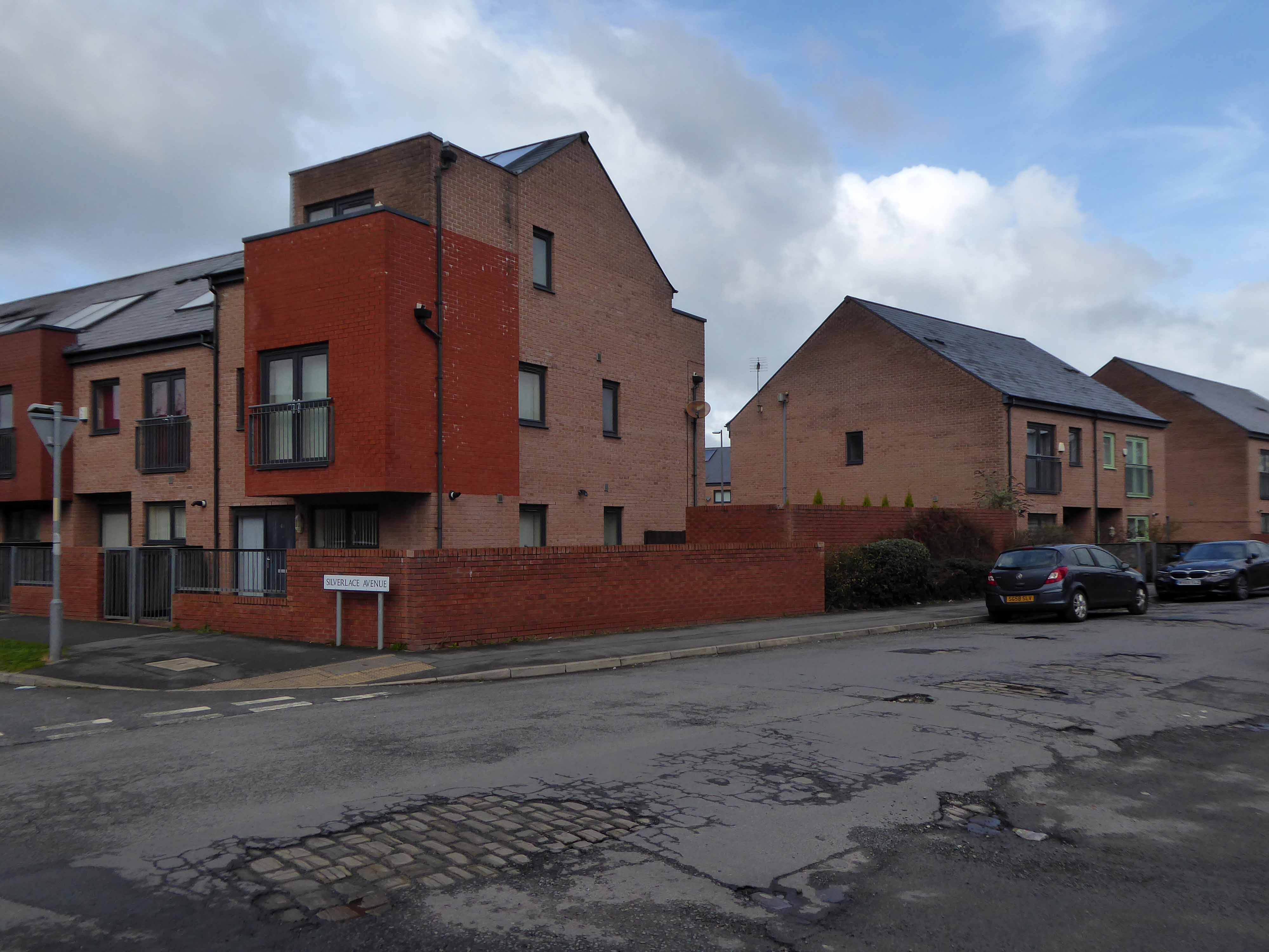
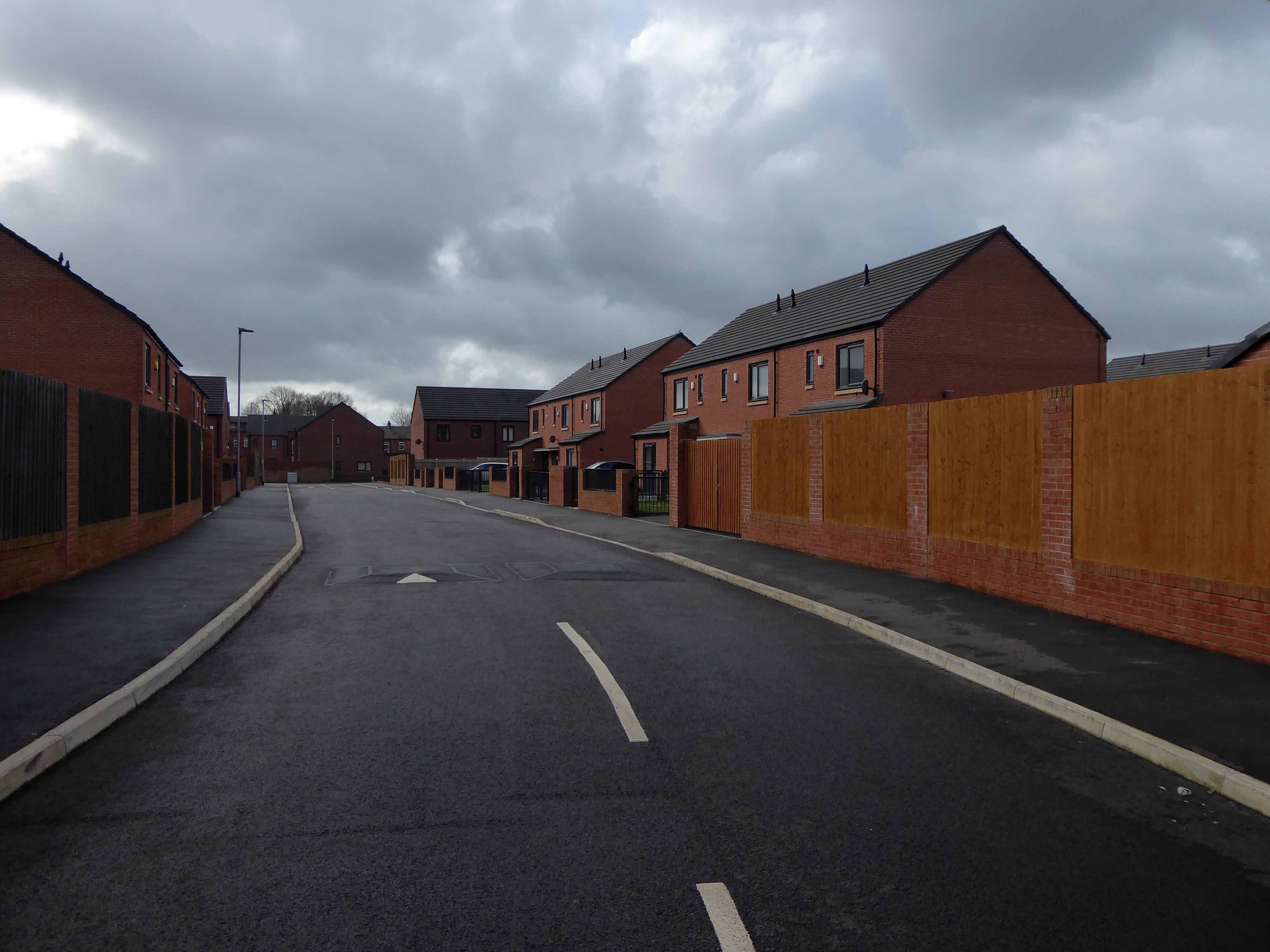
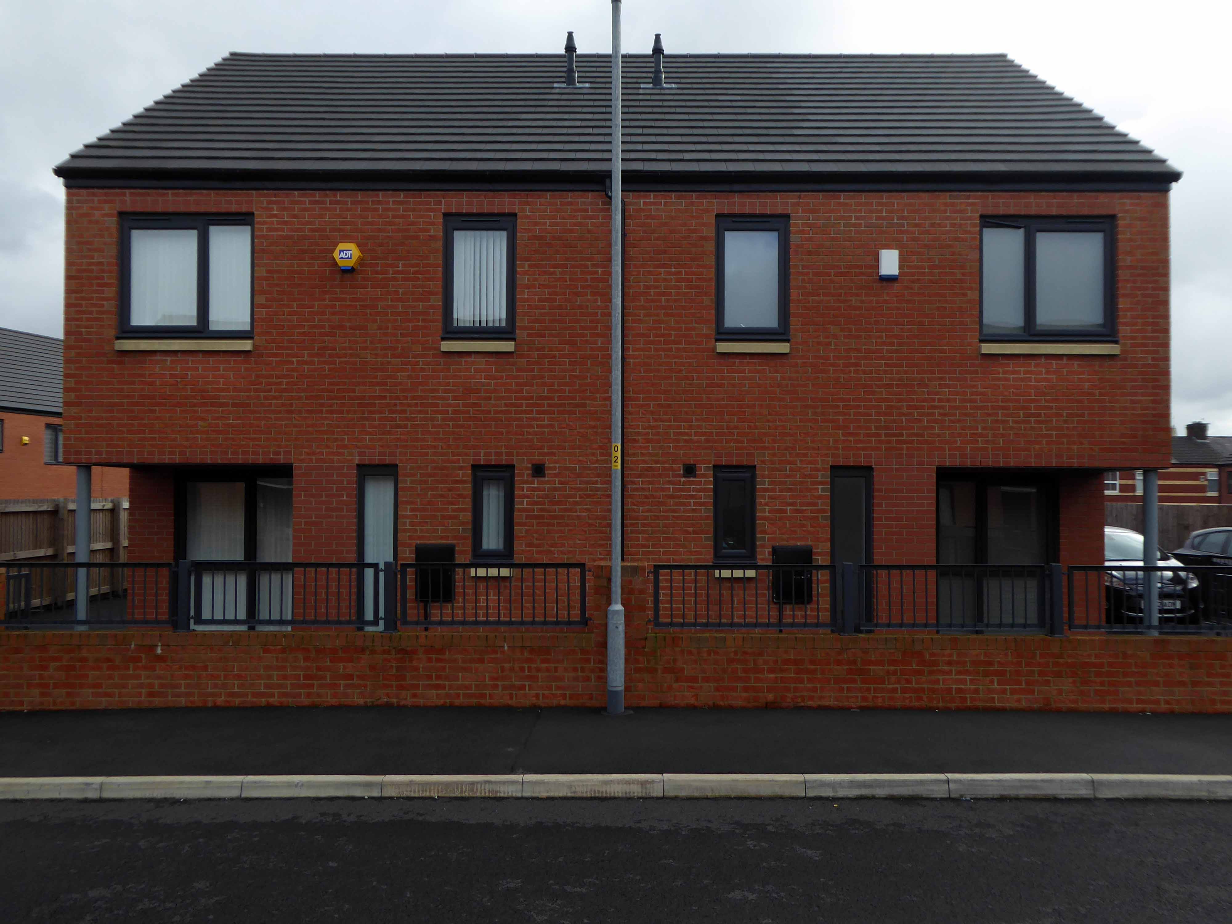
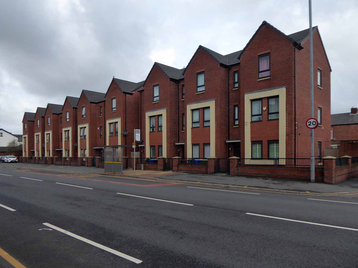
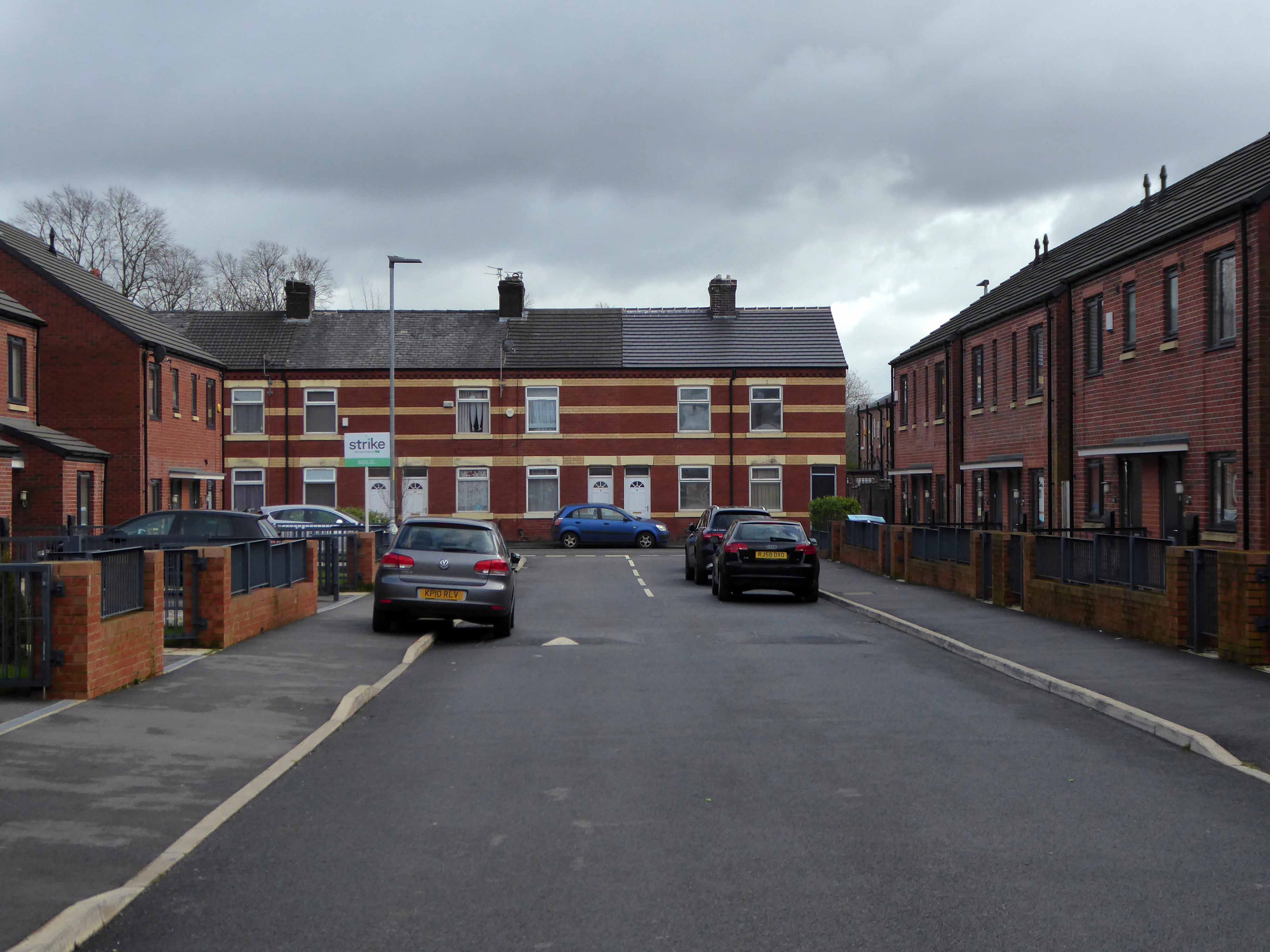
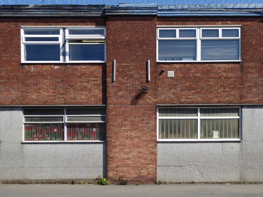
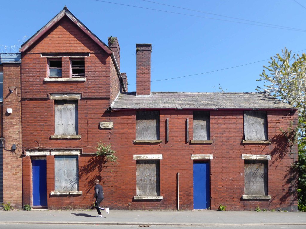
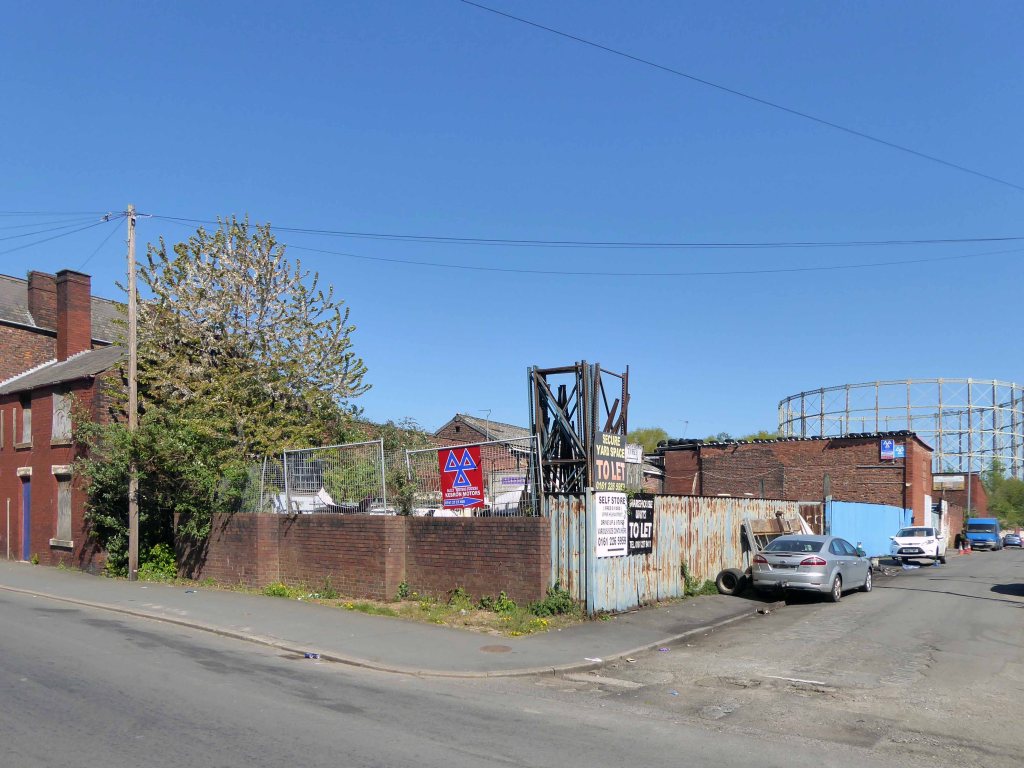
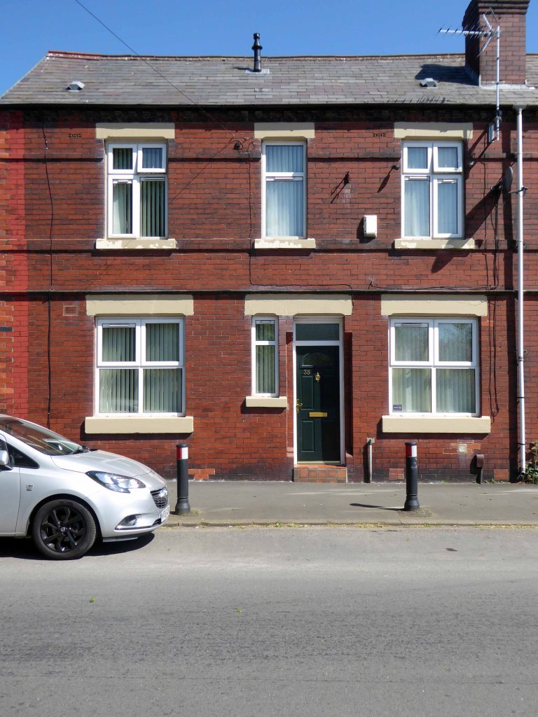
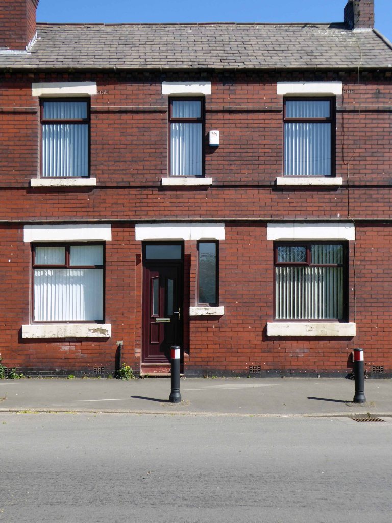
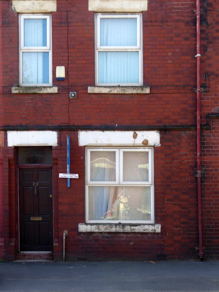
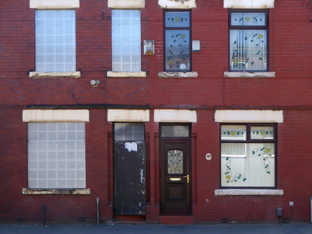
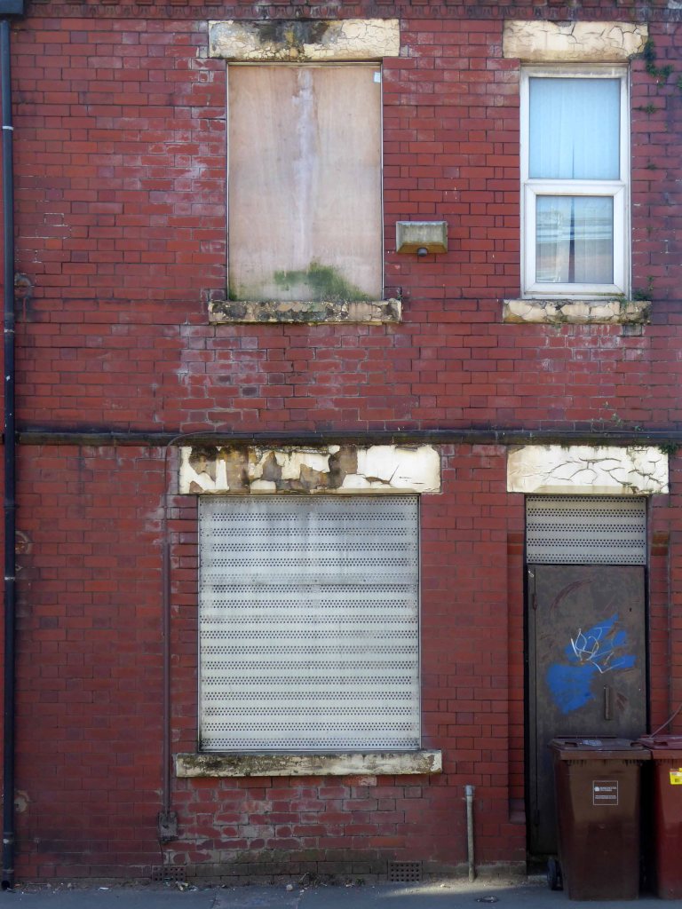
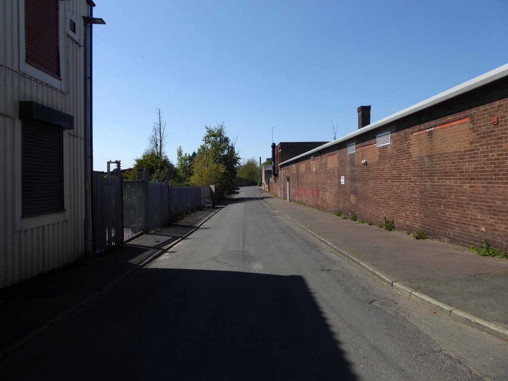
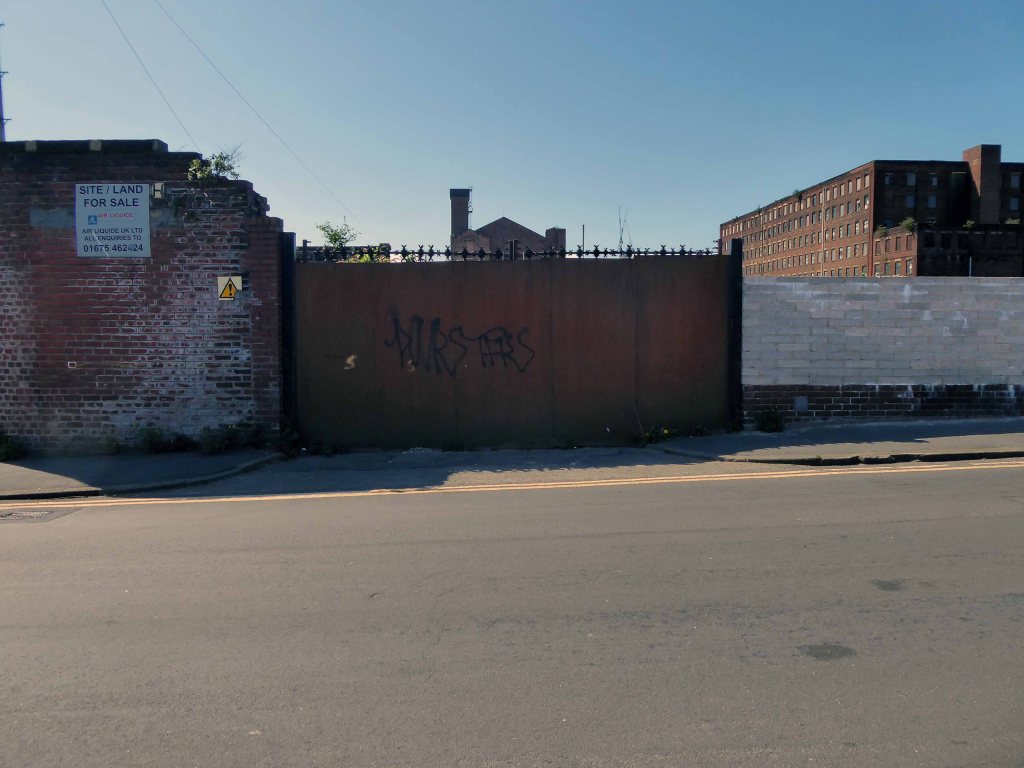
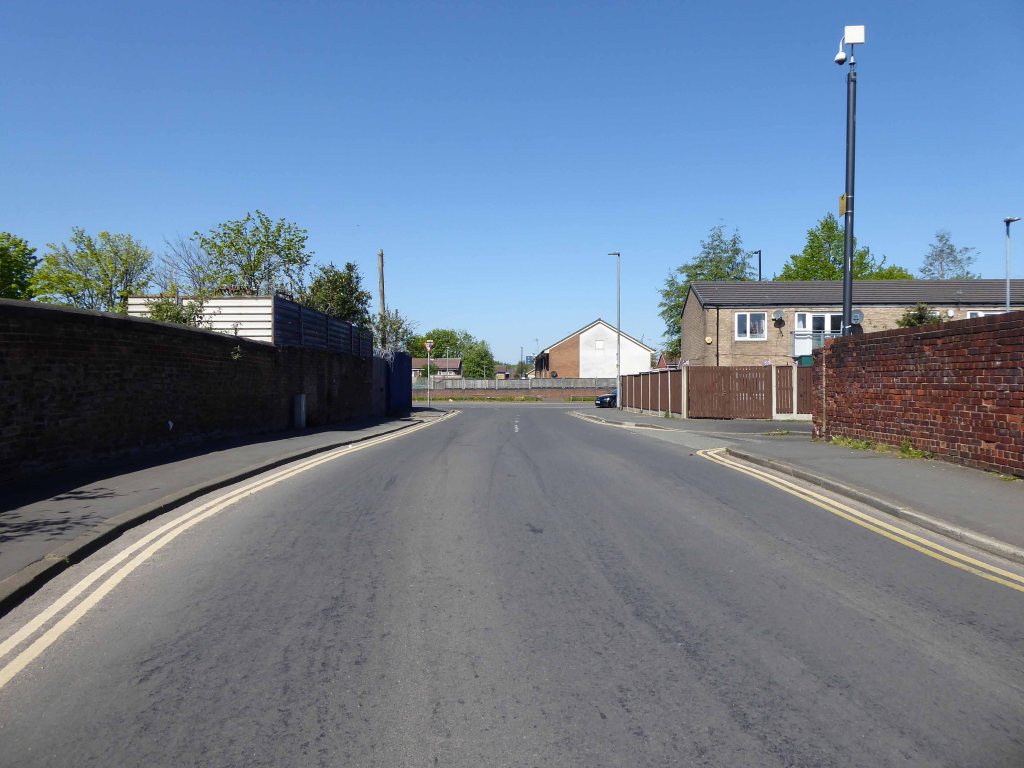
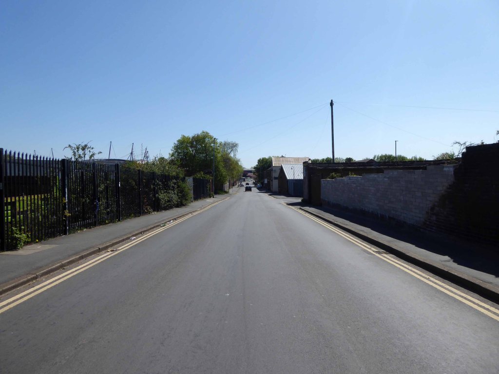
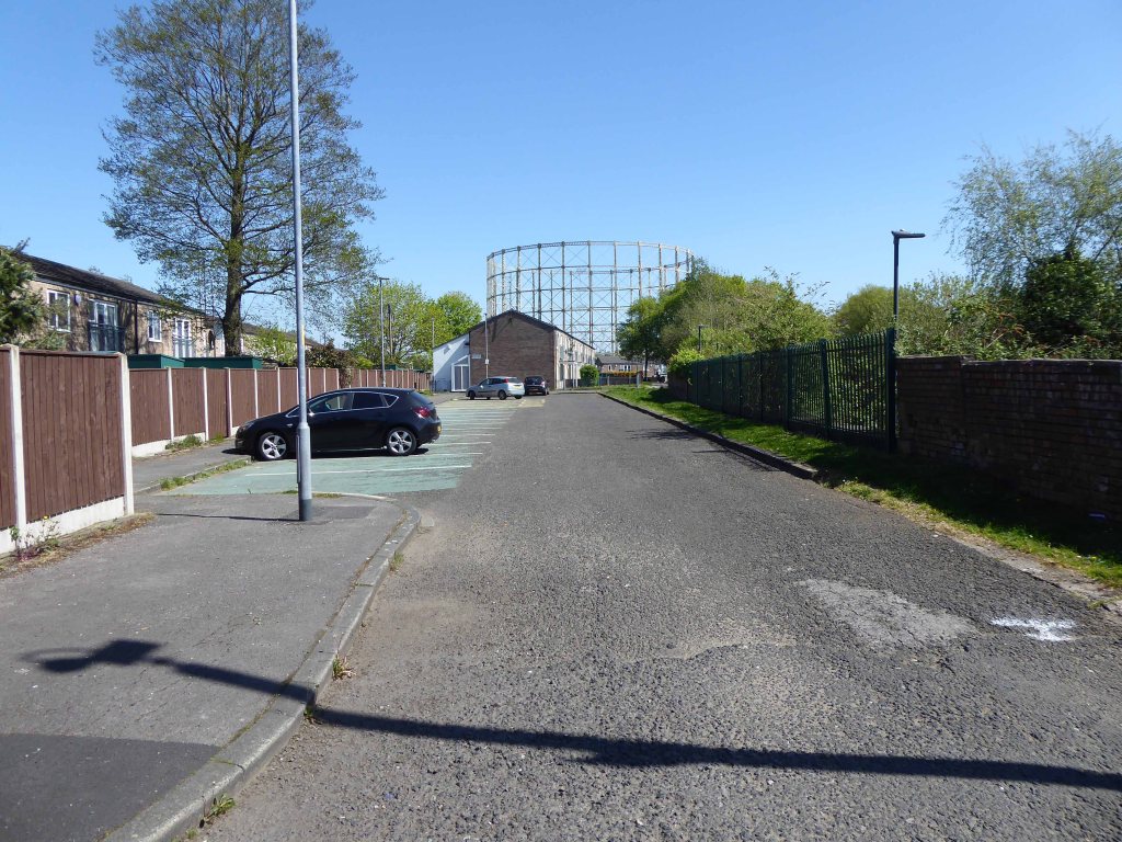
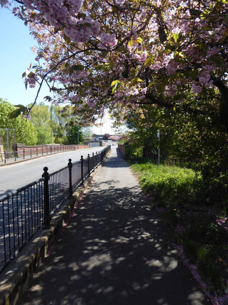
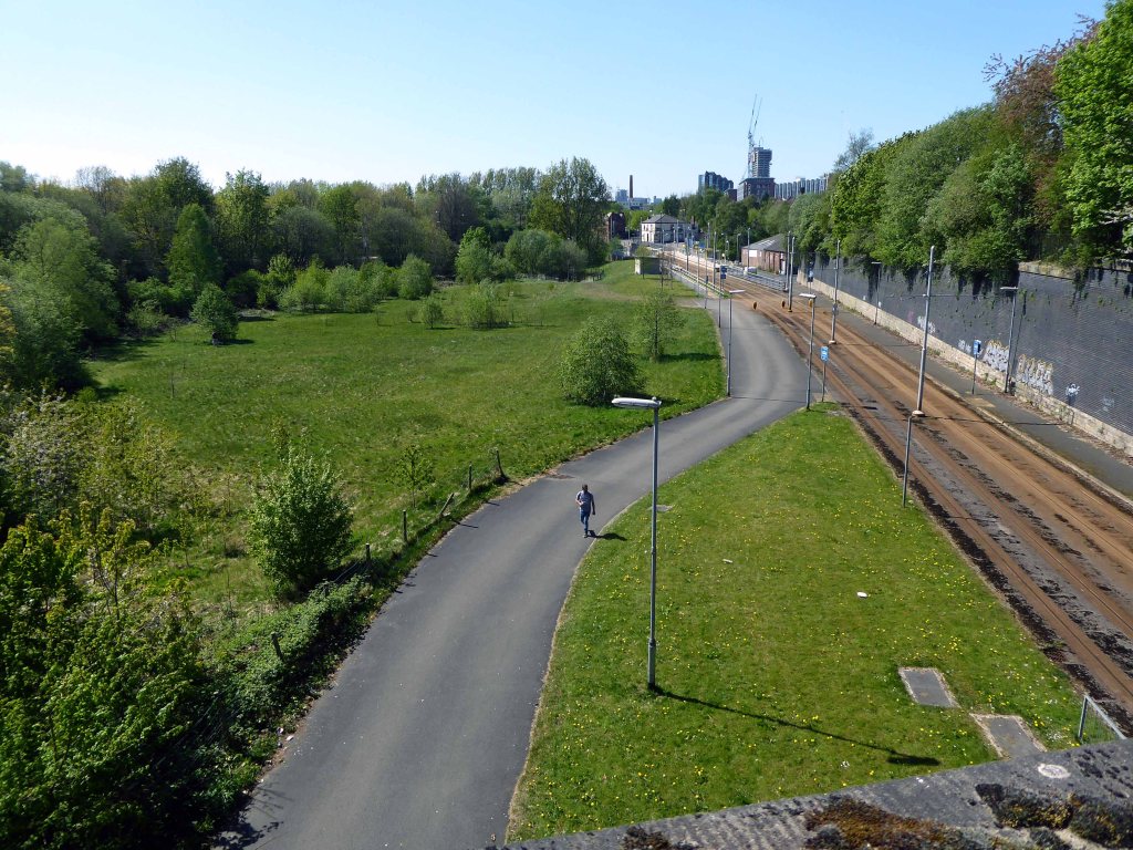
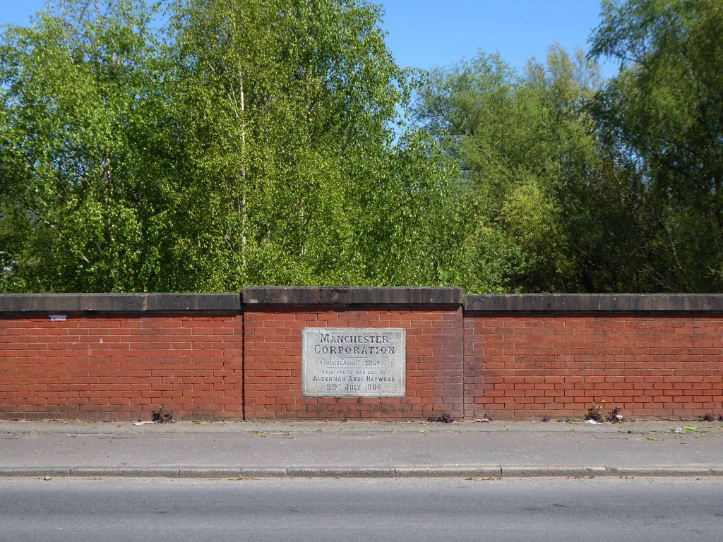
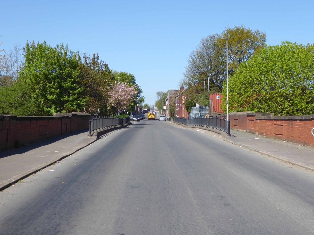
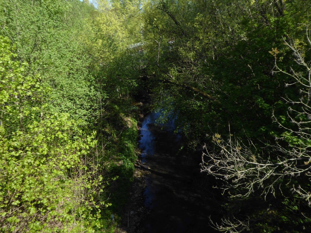
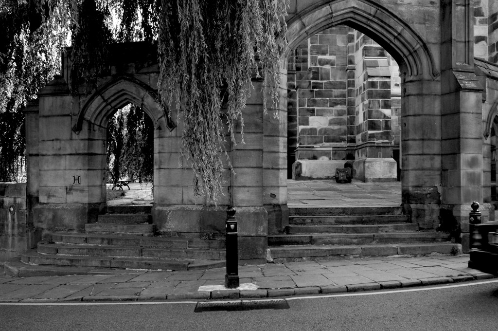
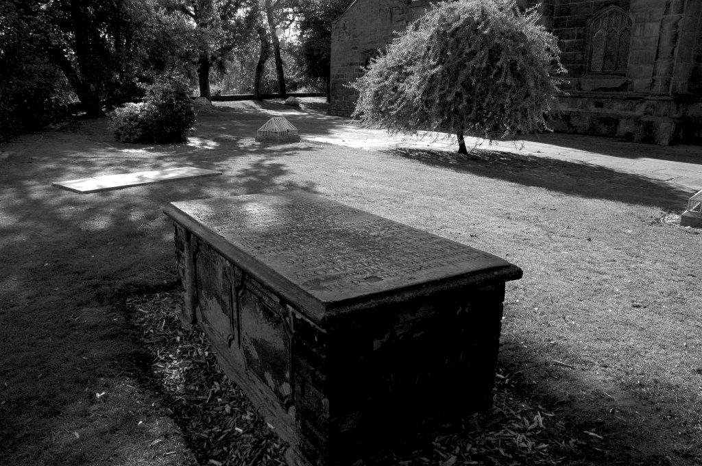
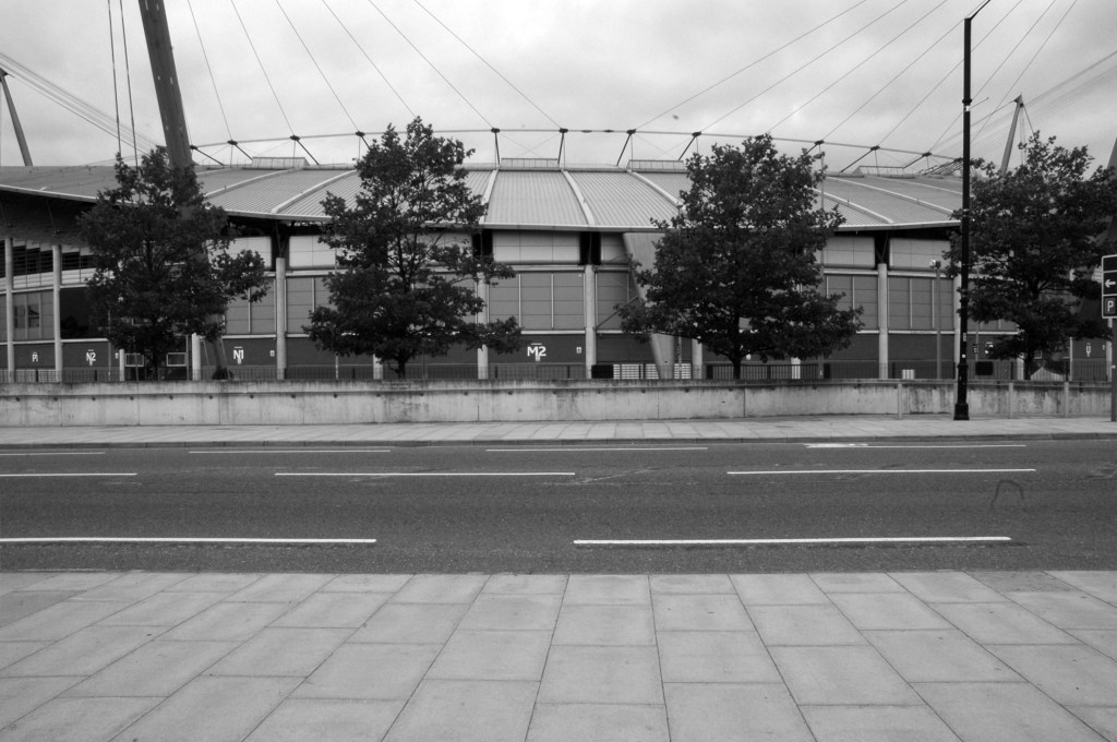
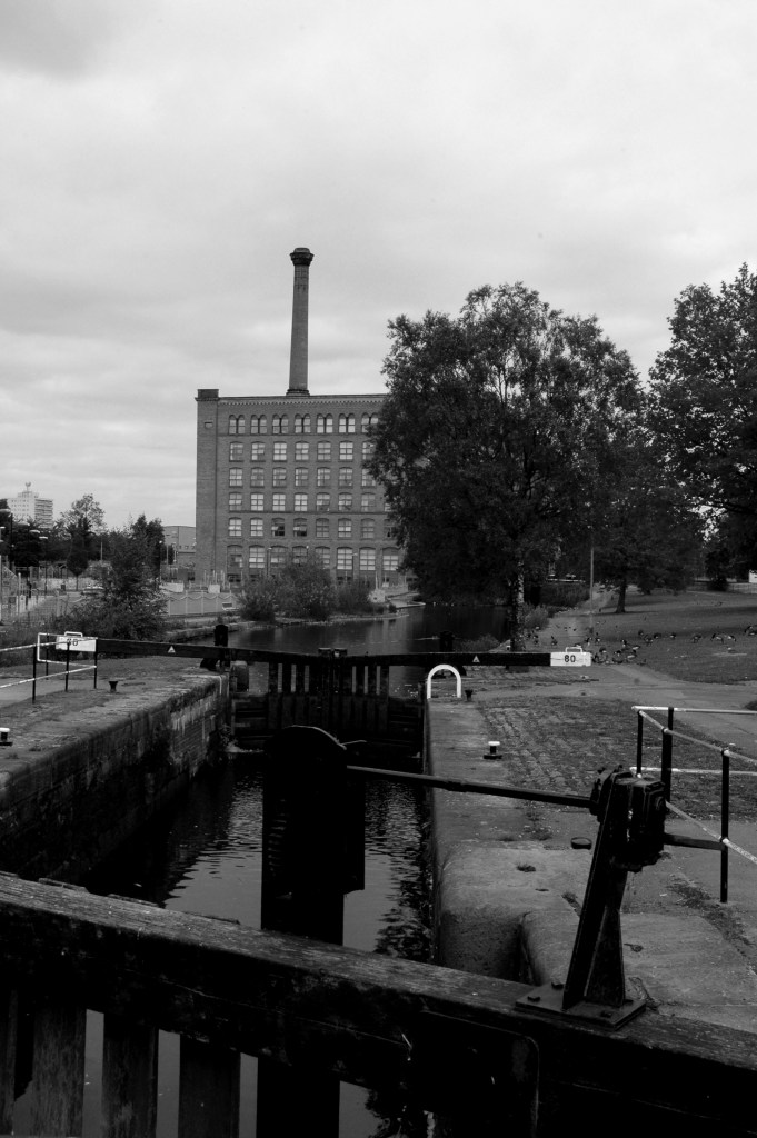
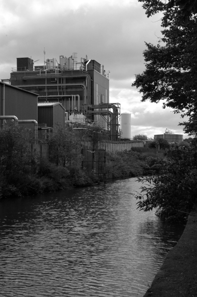
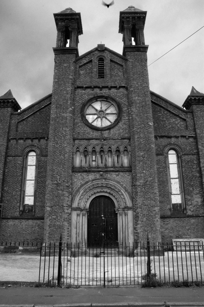
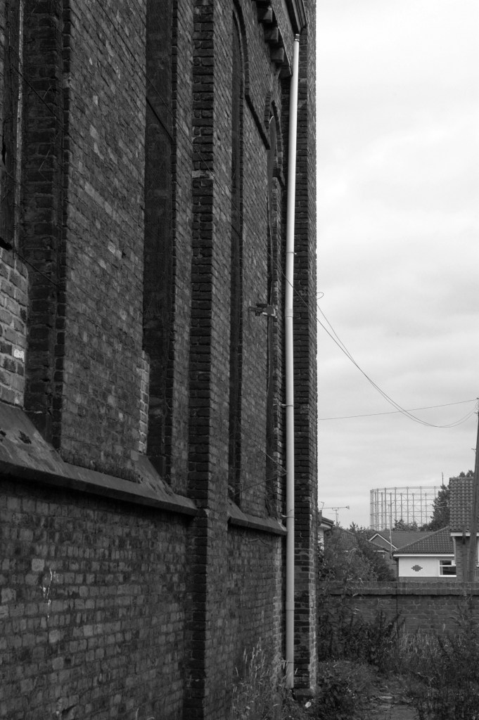
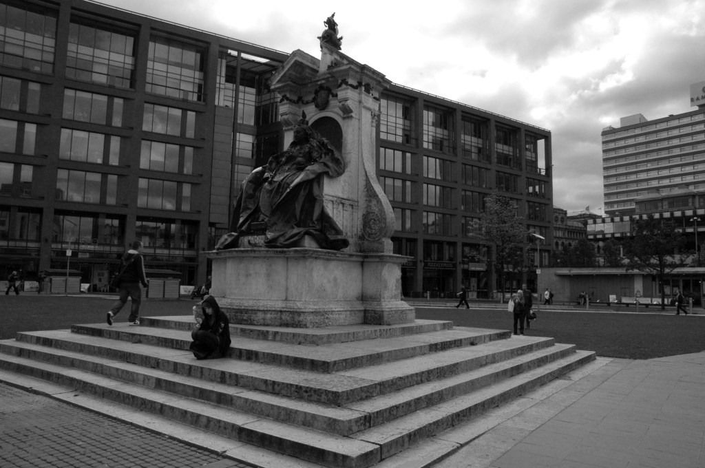
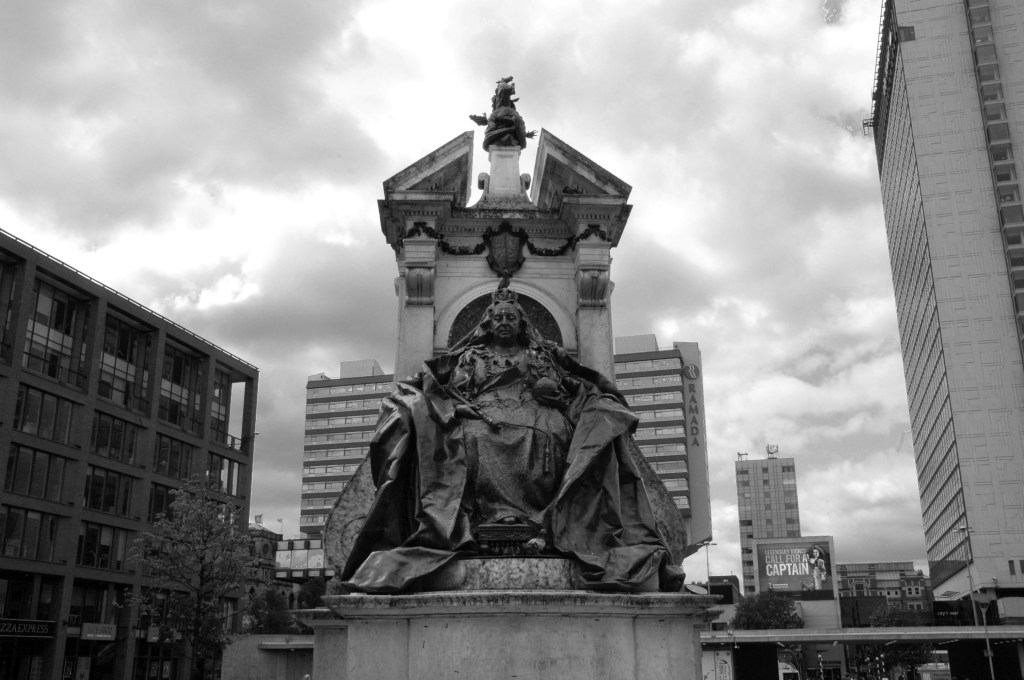
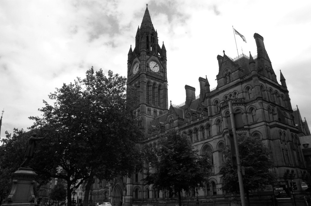
Having photographed the arterial roads of Manchester in 2014, I have resolved to return to the task in 2024.
Some things seem to have changed, some things seem to have stayed the same.


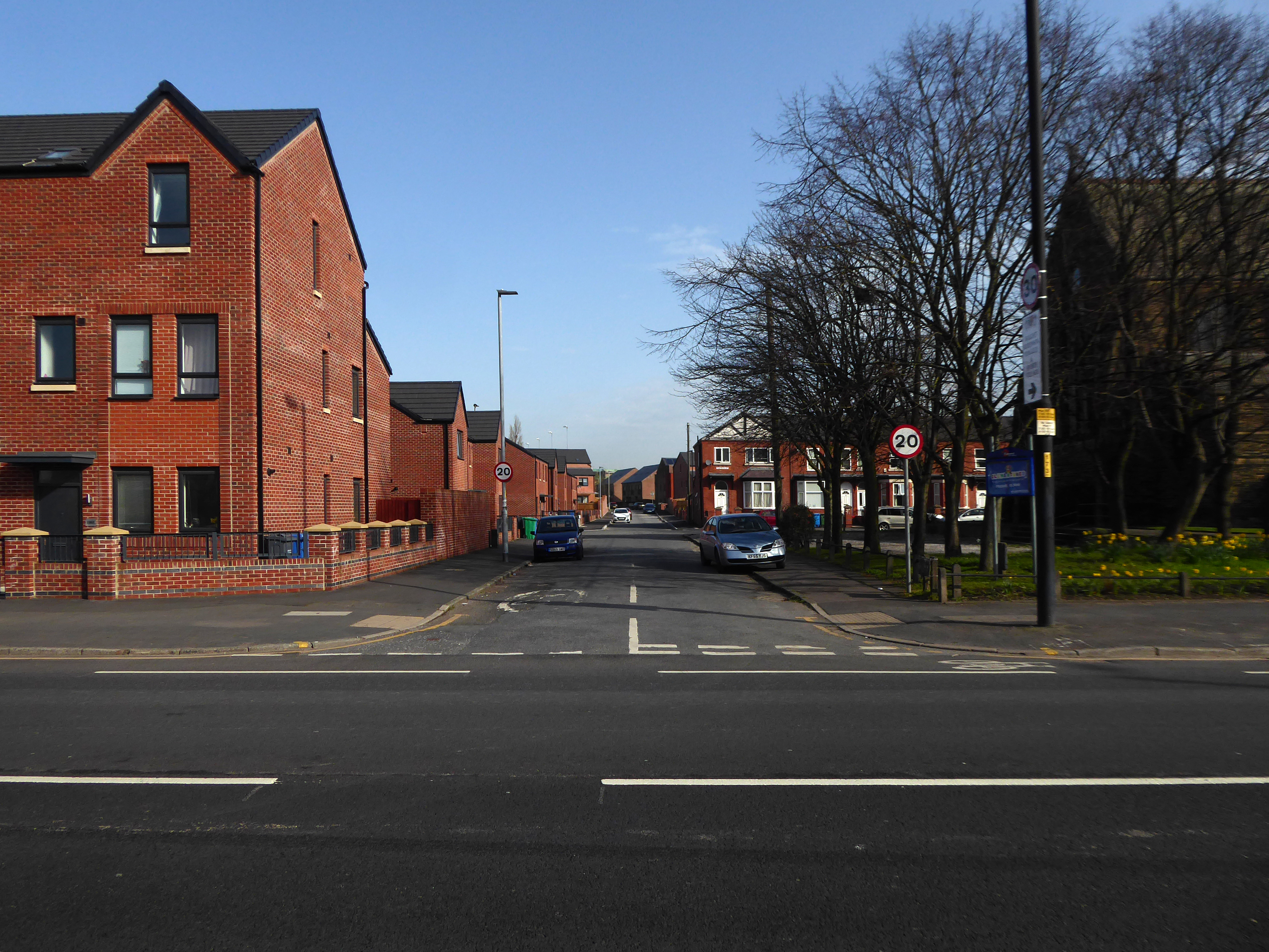
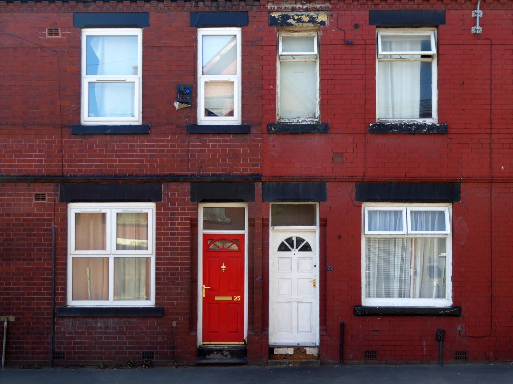
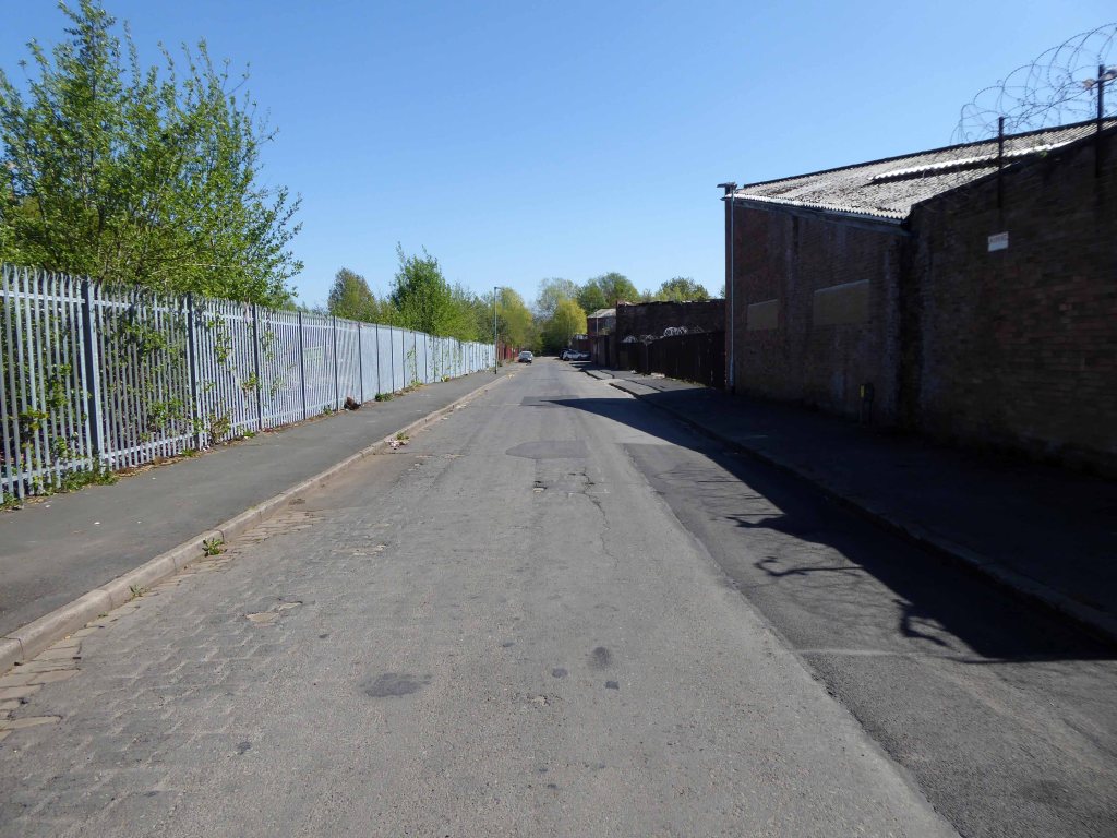
Having photographed the arterial roads of Manchester in 2014, I have resolved to return to the task in 2024.
Some things seem to have changed, some things seem to have stayed the same.
The outline of a presentation for Photonorth – November 16th 2023.

I was asked to talk about the photographs which Sean Madner had selected for exhibition on behalf of the Sheffield Modernists.
Illustrating a wide range of building types in and around Sheffield sheltering beneath the broad umbrella of Modernism.
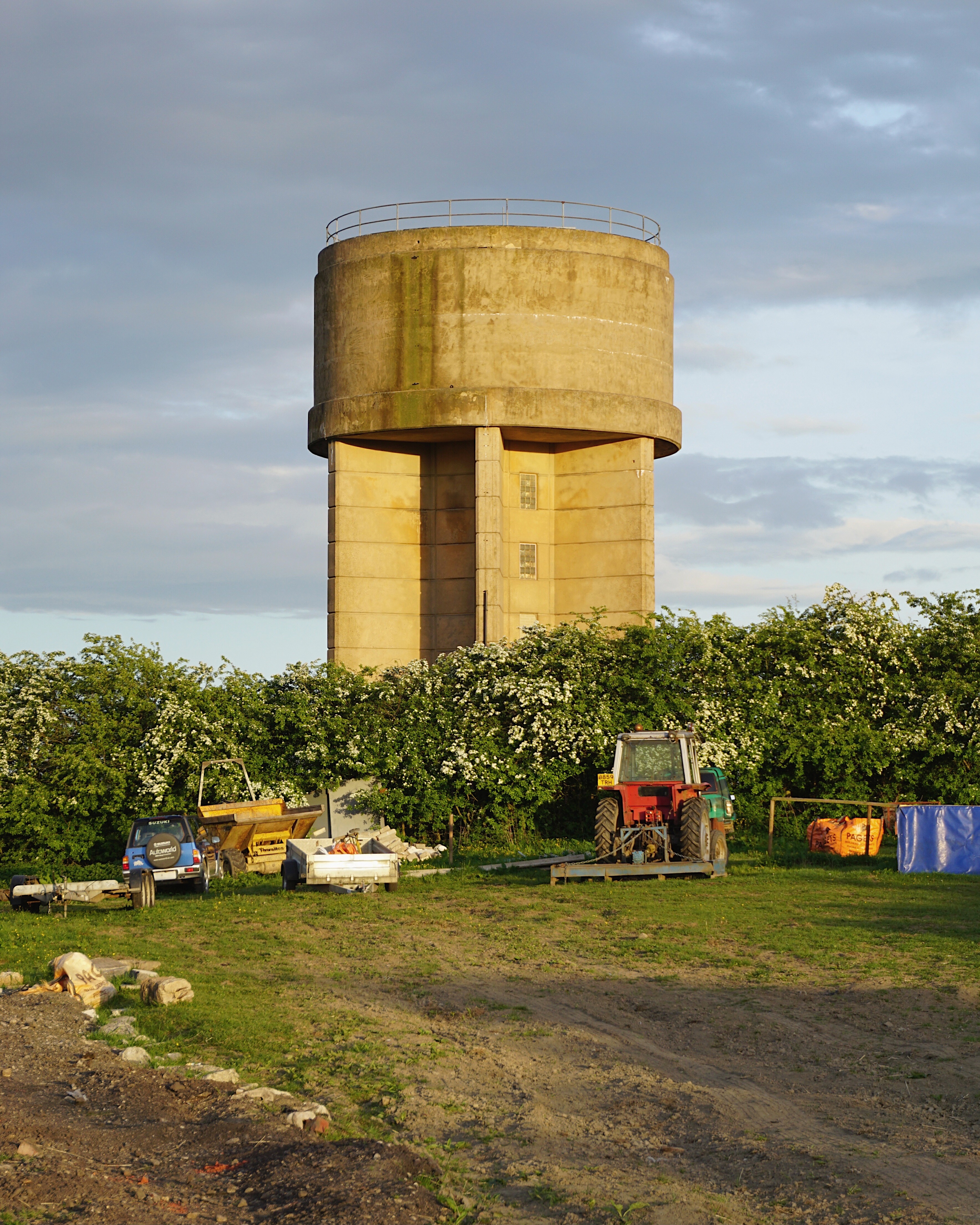
By way of context the photographs are all Topographic in nature – in which a landscape subject is photographed, devoid of people, framed orthogonally and lacking artifice or effect.
Practiced most famously by the 1970s New Topographics photographers, including Robert Adams, Lewis Baltz, Nicholas Nixon, and Bernd and Hilla Becher.

Bernd and Hilla’s photographs lead us to:
1 Potter Hill Water Tower
The British Water Tower Appreciation Society
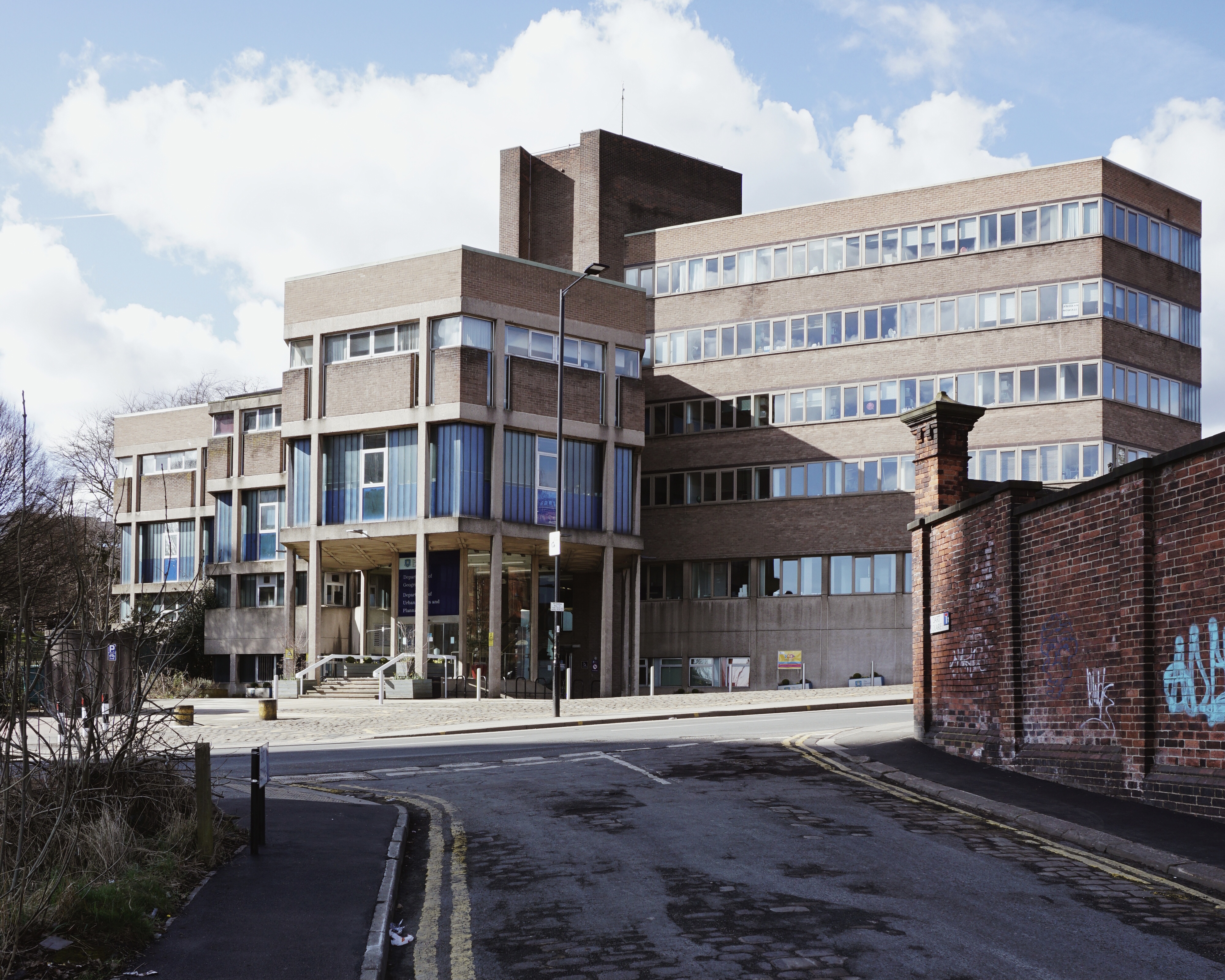
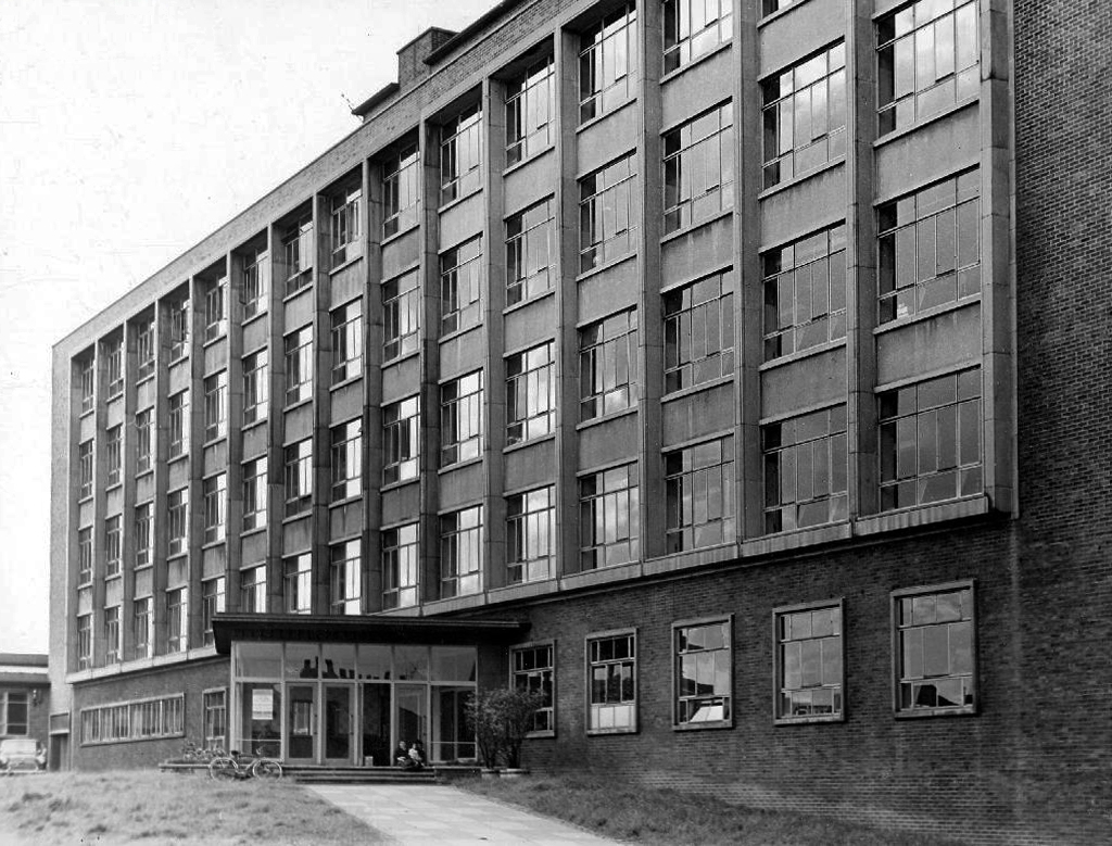
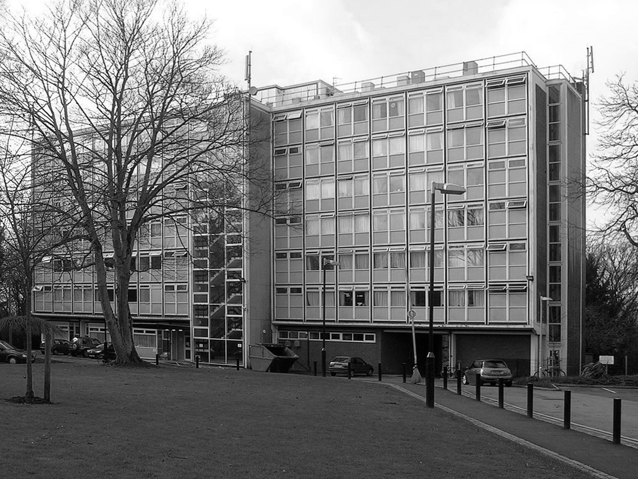
2 Geography Building 1970 Sir William Whitfield
Alterations made 2022
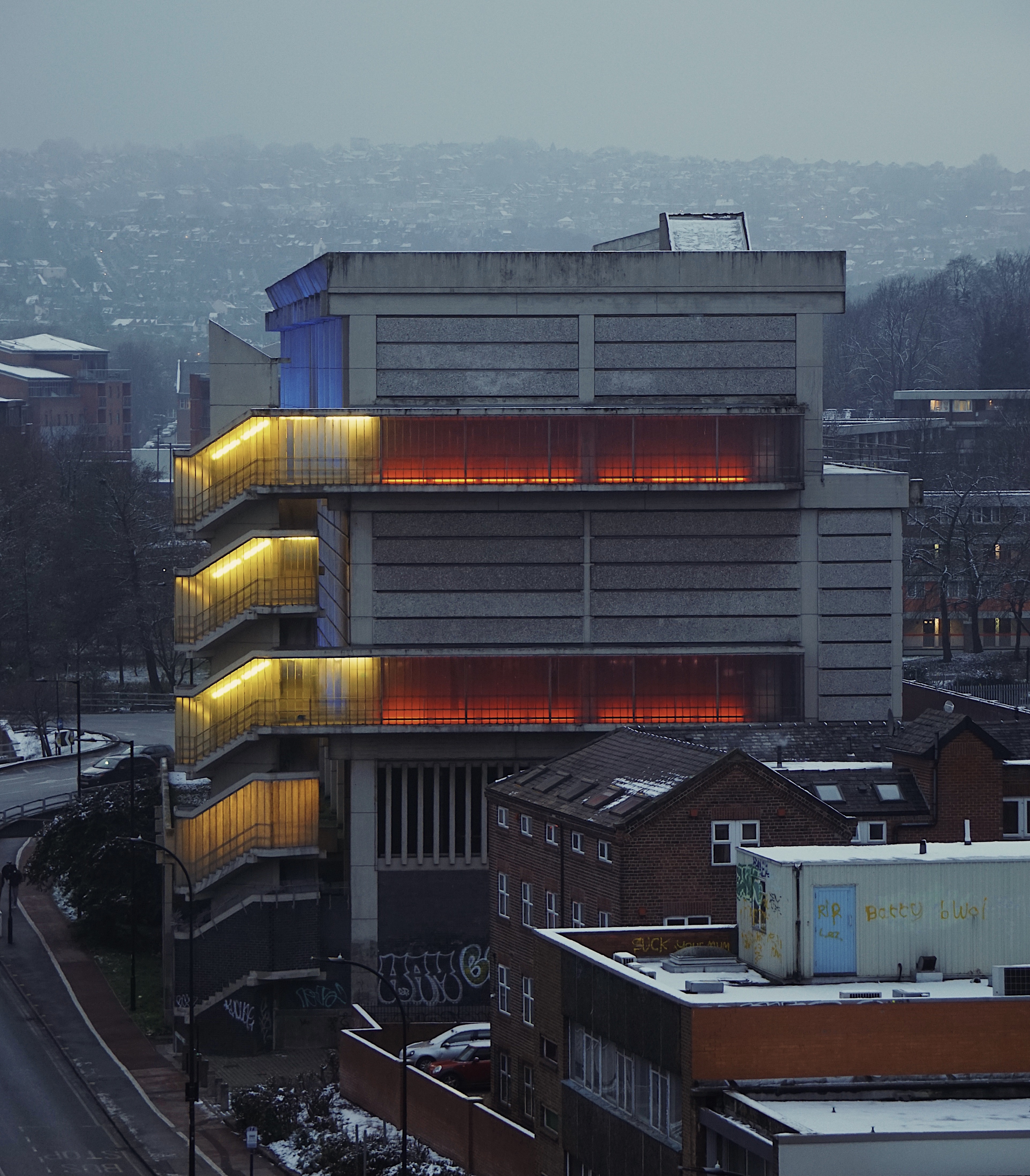
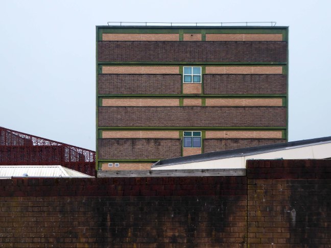
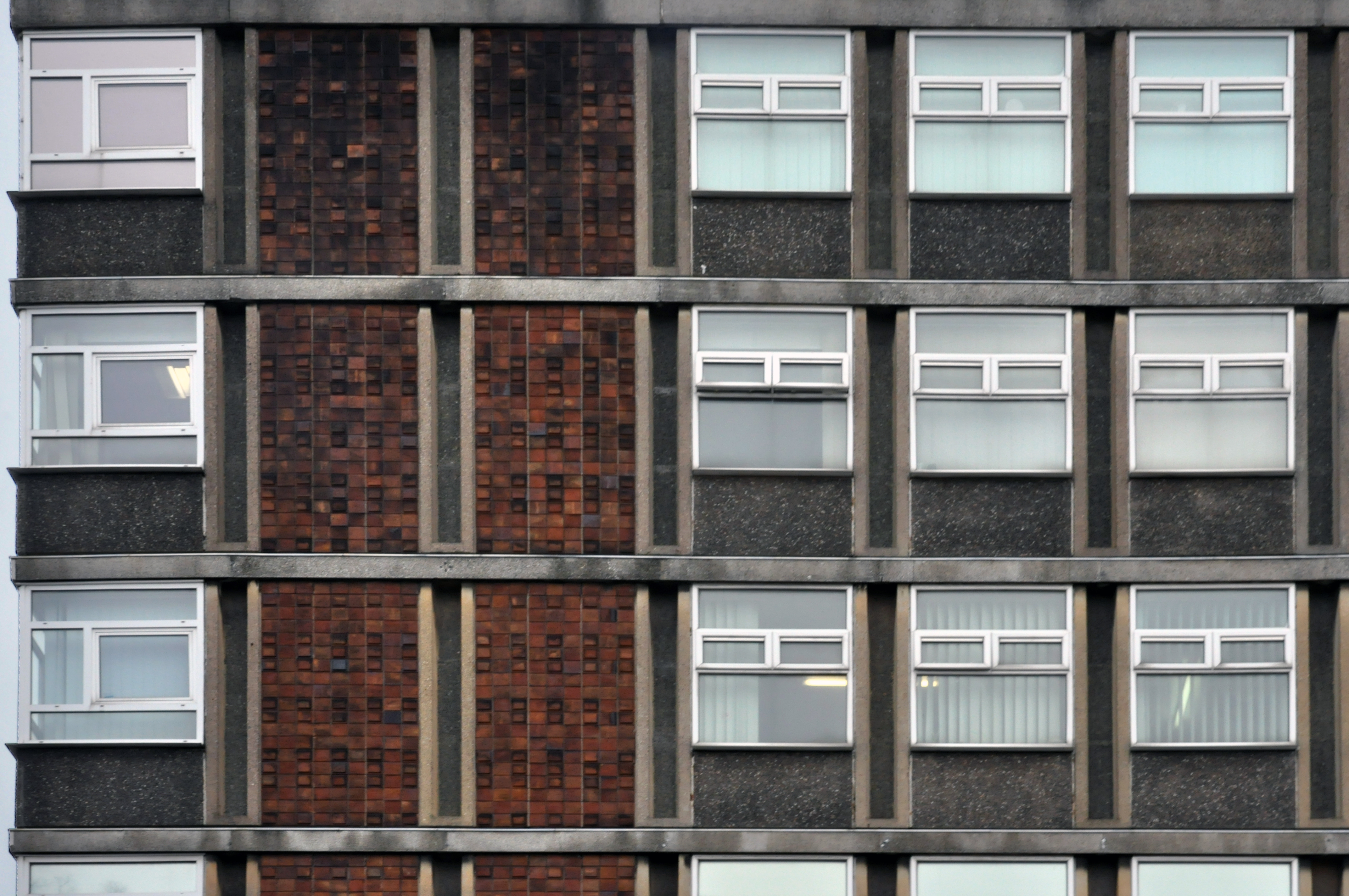
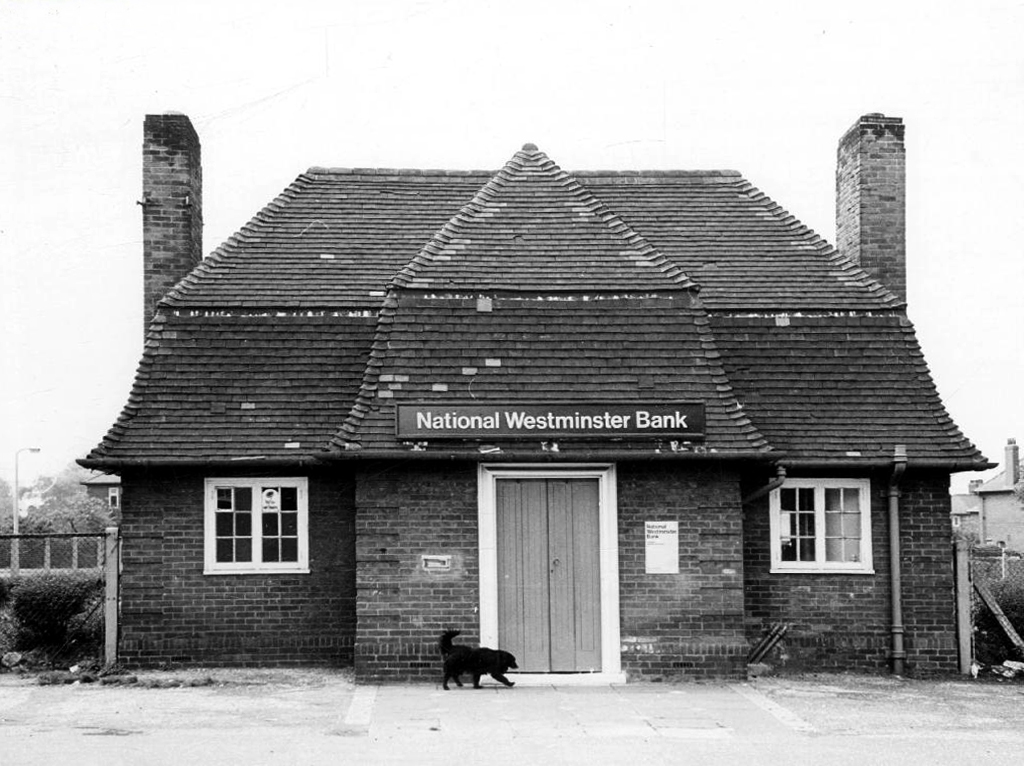
3 Moore Street Substation 1968 Jefferson Sheard
Owen Hatherley describes it as:
A shocking paroxysm of a building, an explosion in reinforced concrete, a bunker built with an aesthete’s attention to detail, a building which is genuinely Brutalist in both senses of the term.
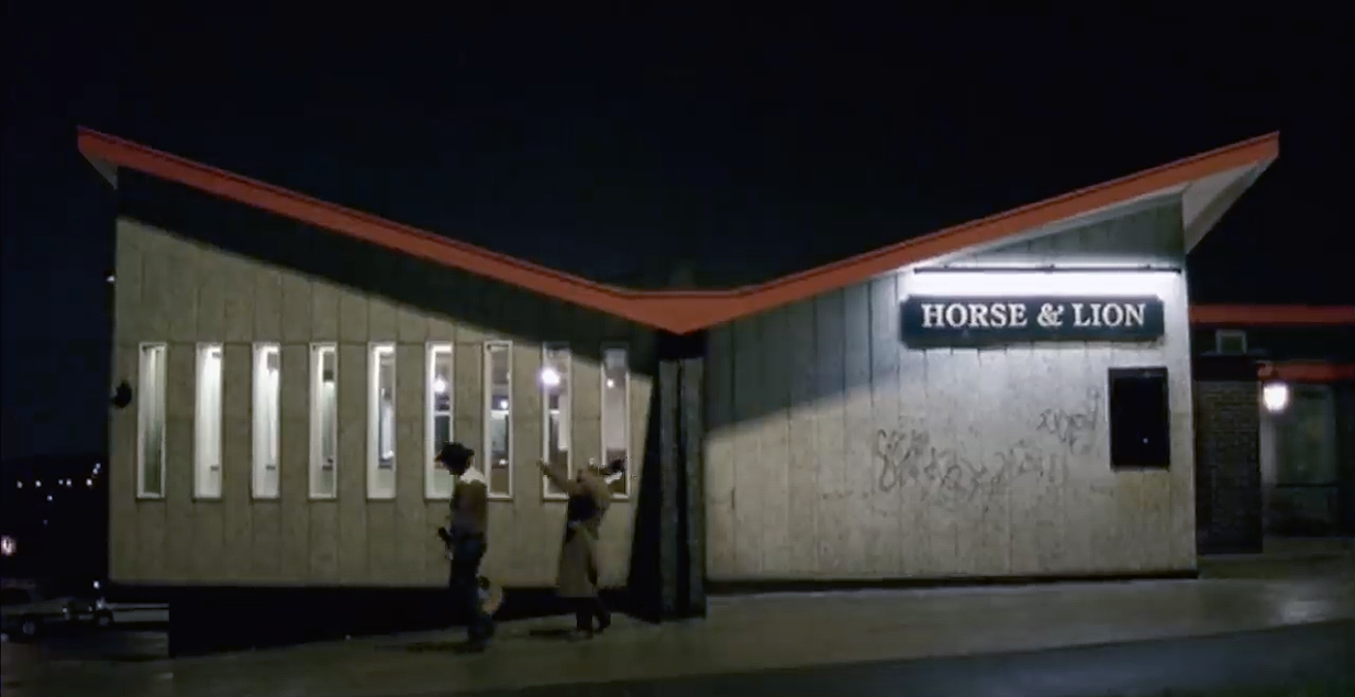
4 Horse and Lion Pub – Bass Charringtons
Prime example of a so-called Estate Pub.
With a hyper parabolic roof a doubly-curved surface that resembles the shape of a saddle, that is, it has a convex form along one axis, and a concave form on along the other.
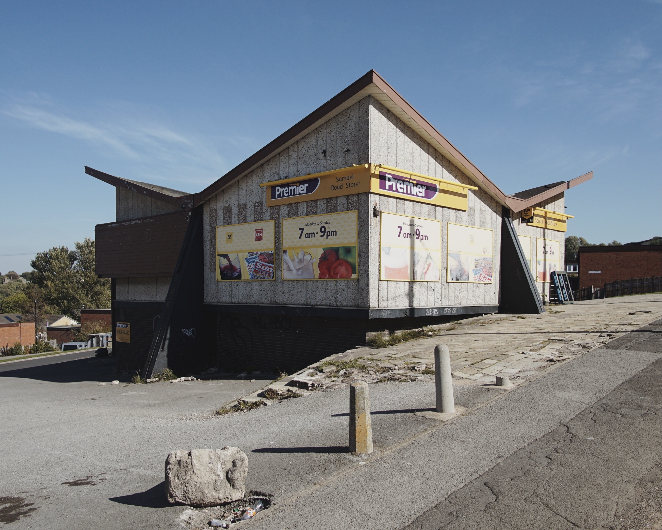
Featured in the video for the Arctic Monkeys’ 2006 number one hit – When the Sun Goes Down at 1.21.
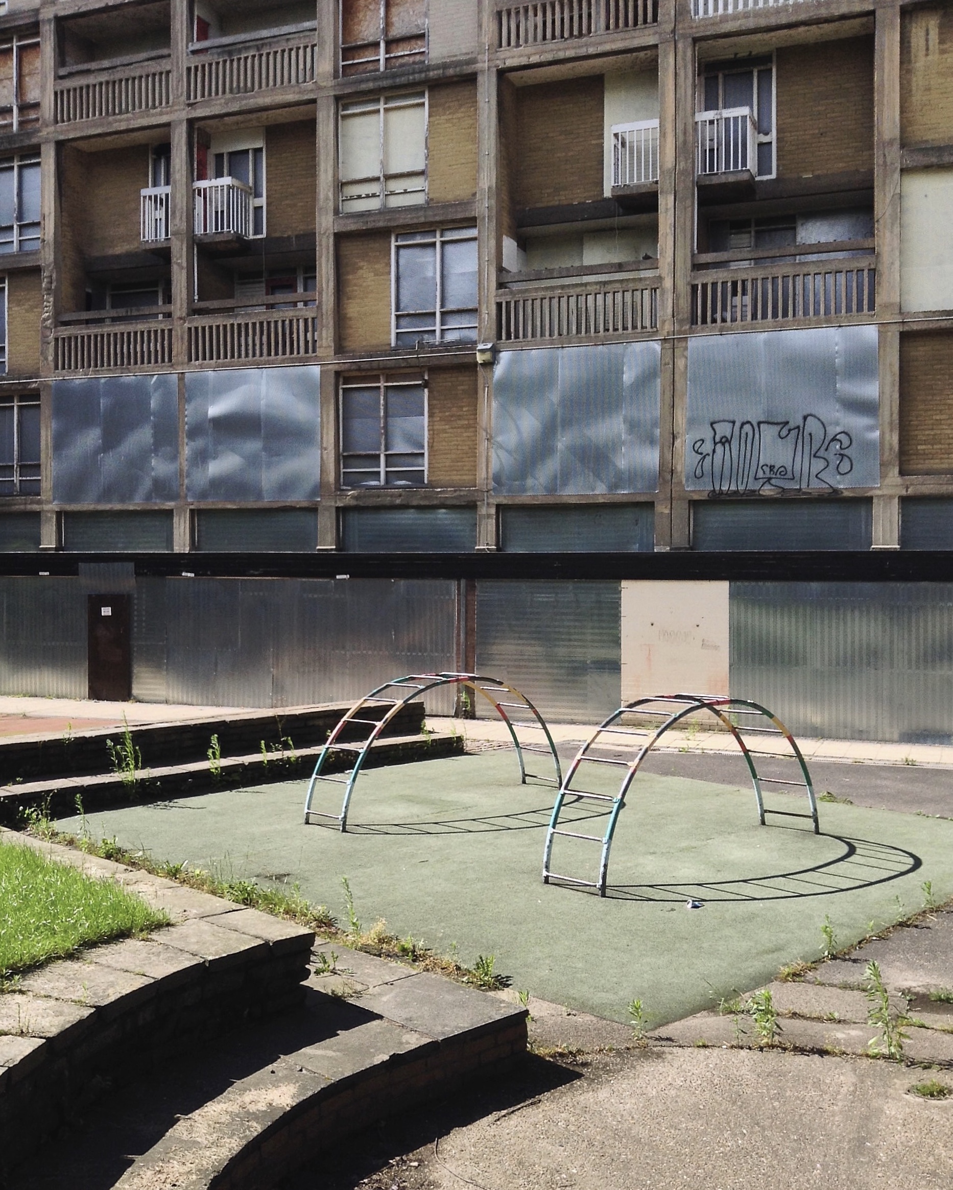
5 Park Hill – 1957 and 1961 Jack Lynn and Ivor Smith under the supervision of JL Womersley,
Grace Owen Nursery – with two Wicksteed climbing frames
The Play Ground should not be put in a corner behind railings, but in a conspicuous and beautiful part of a Park, free to all, where people can enjoy the play and charming scenery at the same time; where mothers can sit, while they are looking on and caring for their children.
Charles Wicksteed
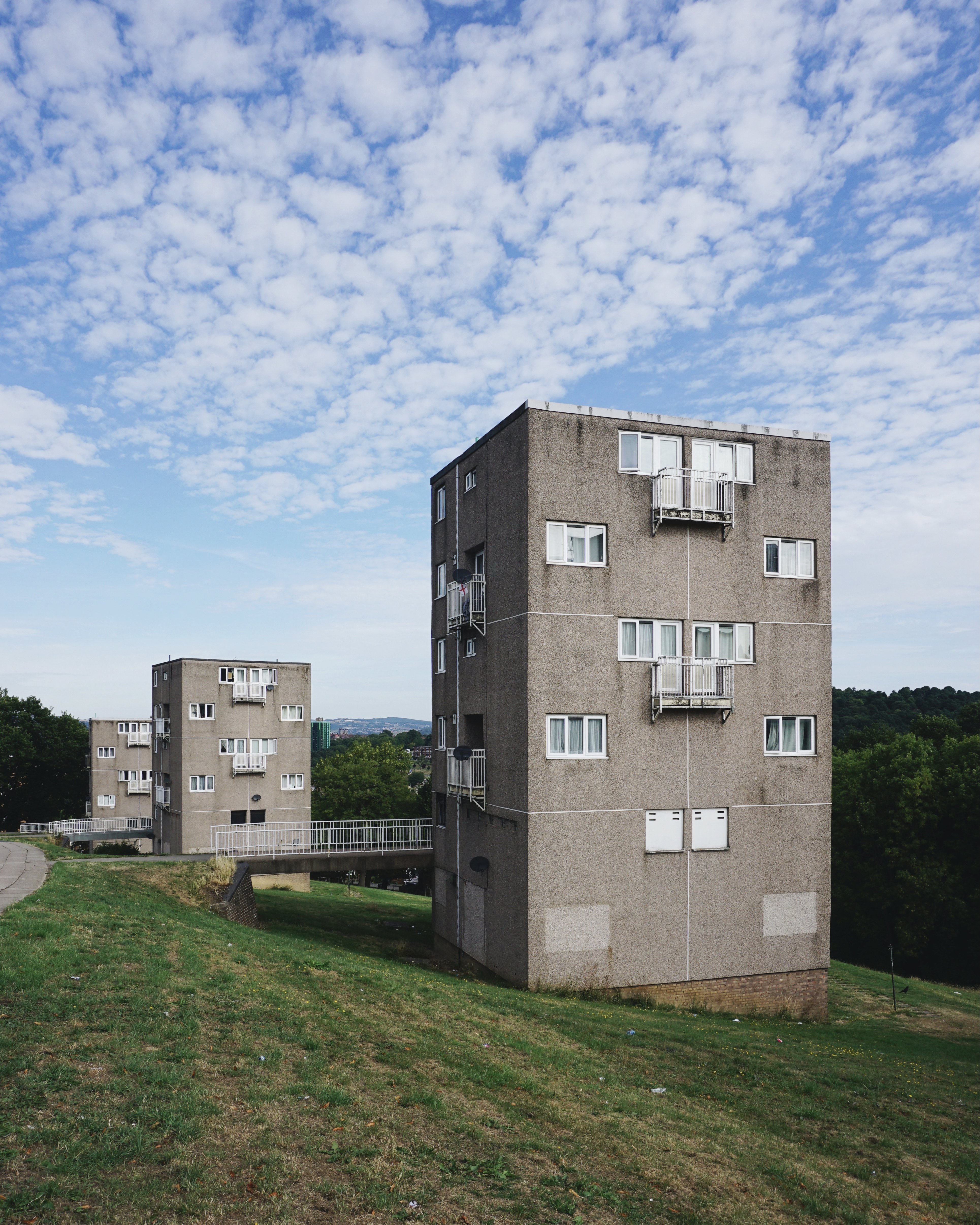
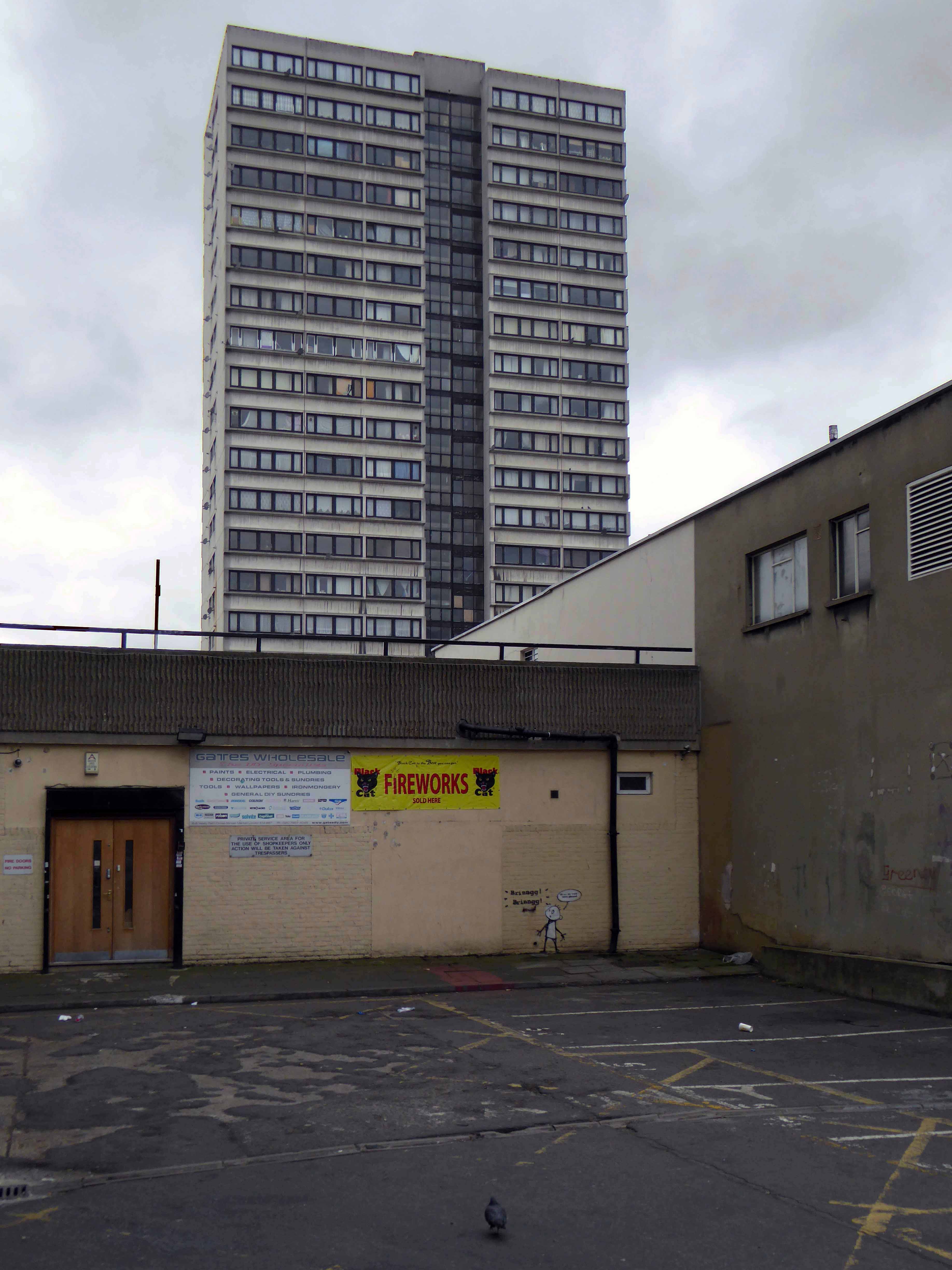
6 Gleadless Estate 1963 Lewis Wormersley City Architect
The Sheffield Blitz in December 1940 killed almost 700 and damaged some 82,000 homes, over half the city’s housing stock. As the city looked to rebuilding, its 1952 Development Plan estimated the need to replace 20,000 unfit homes and build a further 15,000 to cater for the natural increase of population.
Supreme, but often overlooked, achievement … is the Gleadless Valley Estate which combined urban housing types and the natural landscape so effectively that it still looks stunning, especially on a bright winter’s day.

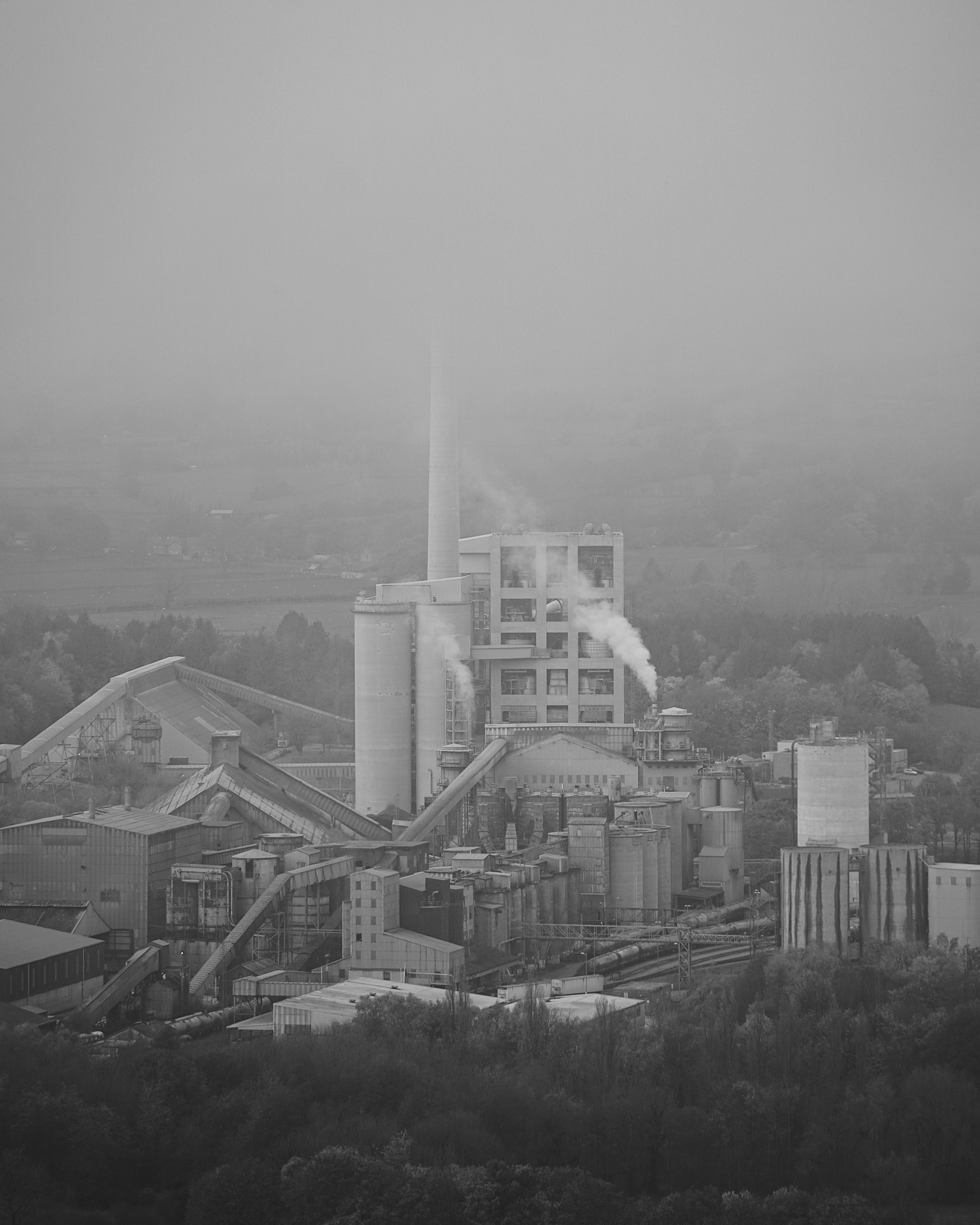
The plant started its first full year of production in 1929
The plant was located at Hope, because it is at the edge of where carboniferous limestone of the Monsal Dale Group, meets Edale Shale, the two main components of finished cement.
Since 1951, when the Peak District National Park was created, most of the outbound traffic from the plant has been exported by rail.
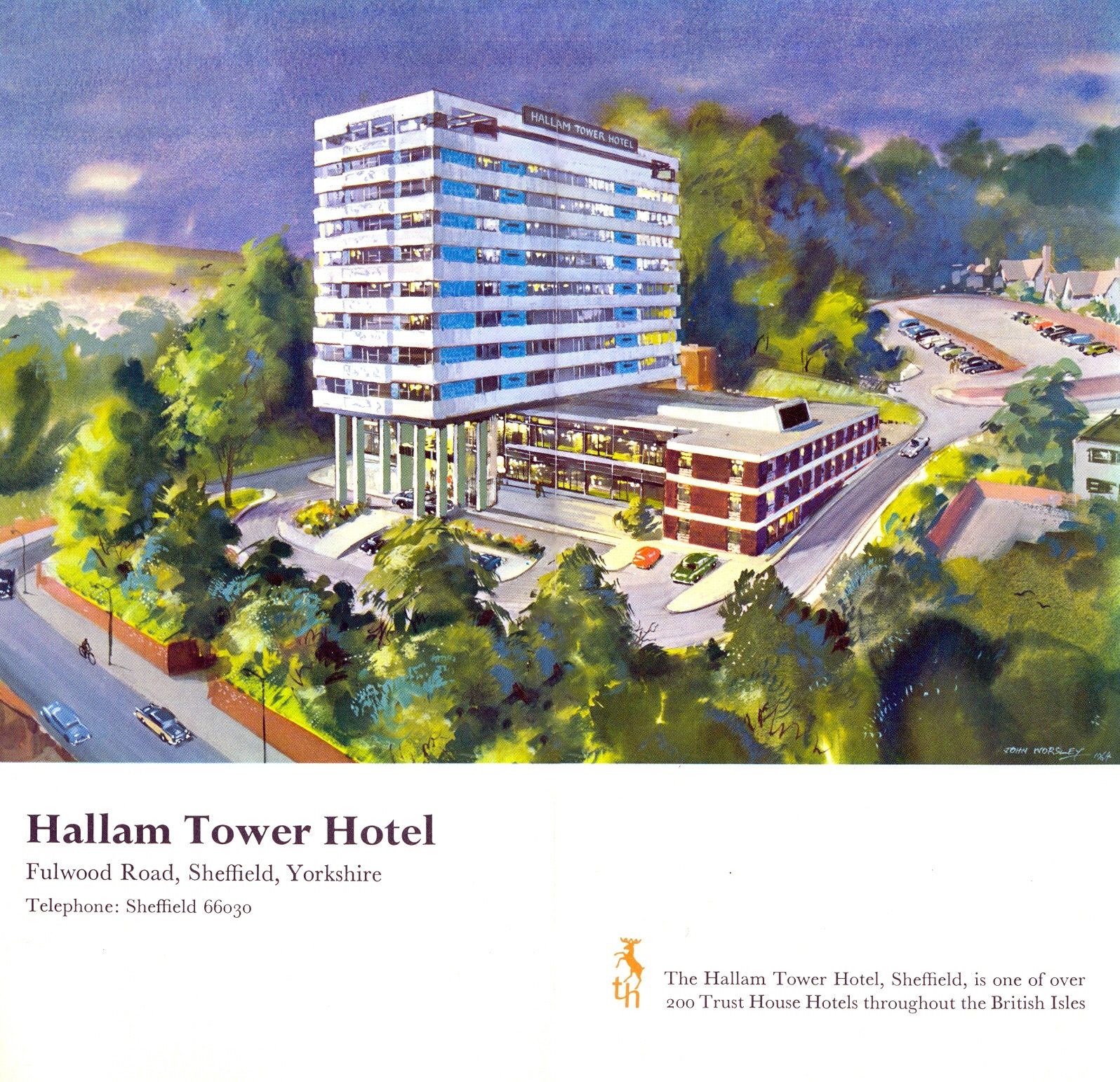
As seen in the Channel 4 TV ident.

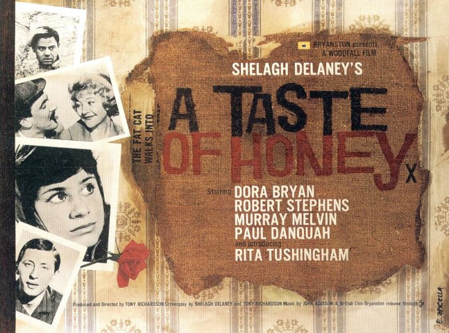
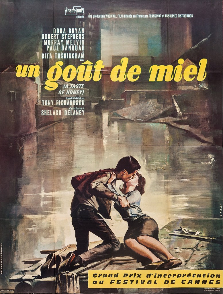
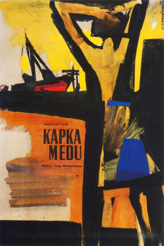
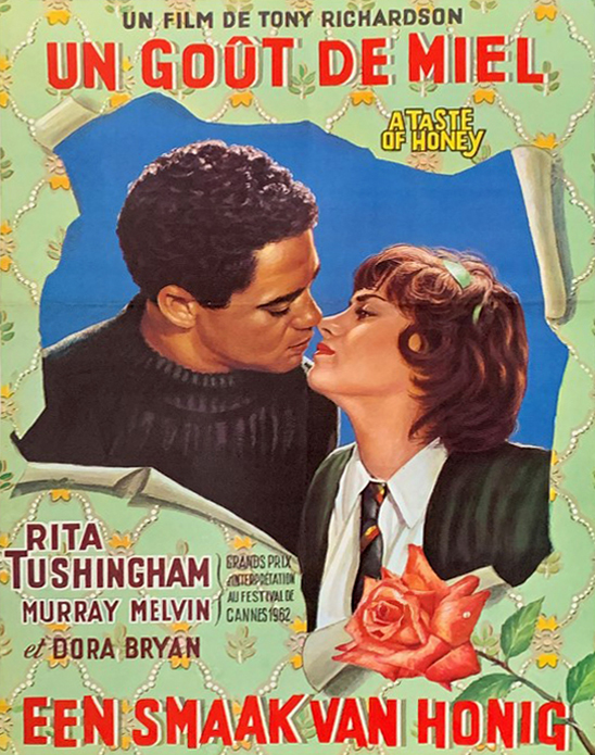
The same location used in Shelagh Delaney’s A taste of Honey.
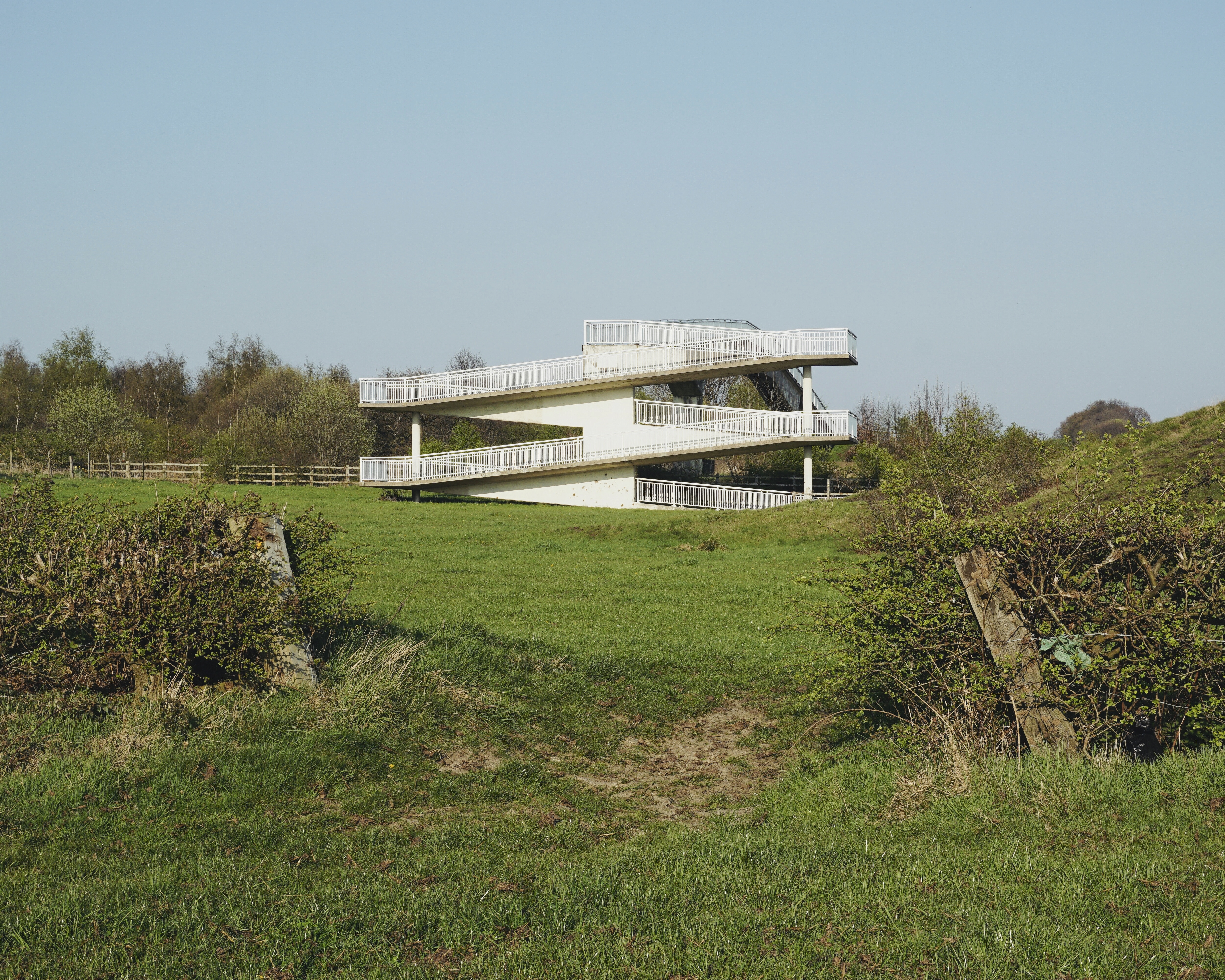
9 Droppingwell Footbridge – West Riding County Architect Colonel Stuart Maynard
Colleagues in the team included Bill Varley, Ron Bridle, Sri Sriskandan and FA Joe Sims. The team was responsible for the introduction of a great deal of new computing technology into bridge design, as well as for some of the most imaginative bridge engineering going on anywhere in the country. Their design efforts were supported by close involvement in research and testing work, for example, on half-joints and concrete hinges. All the above named engineers went on to considerable seniority, some in the Department of Transport, and Sims and Bridle in particular have published various papers and contributed to books on the history of Britain’s motorway development.

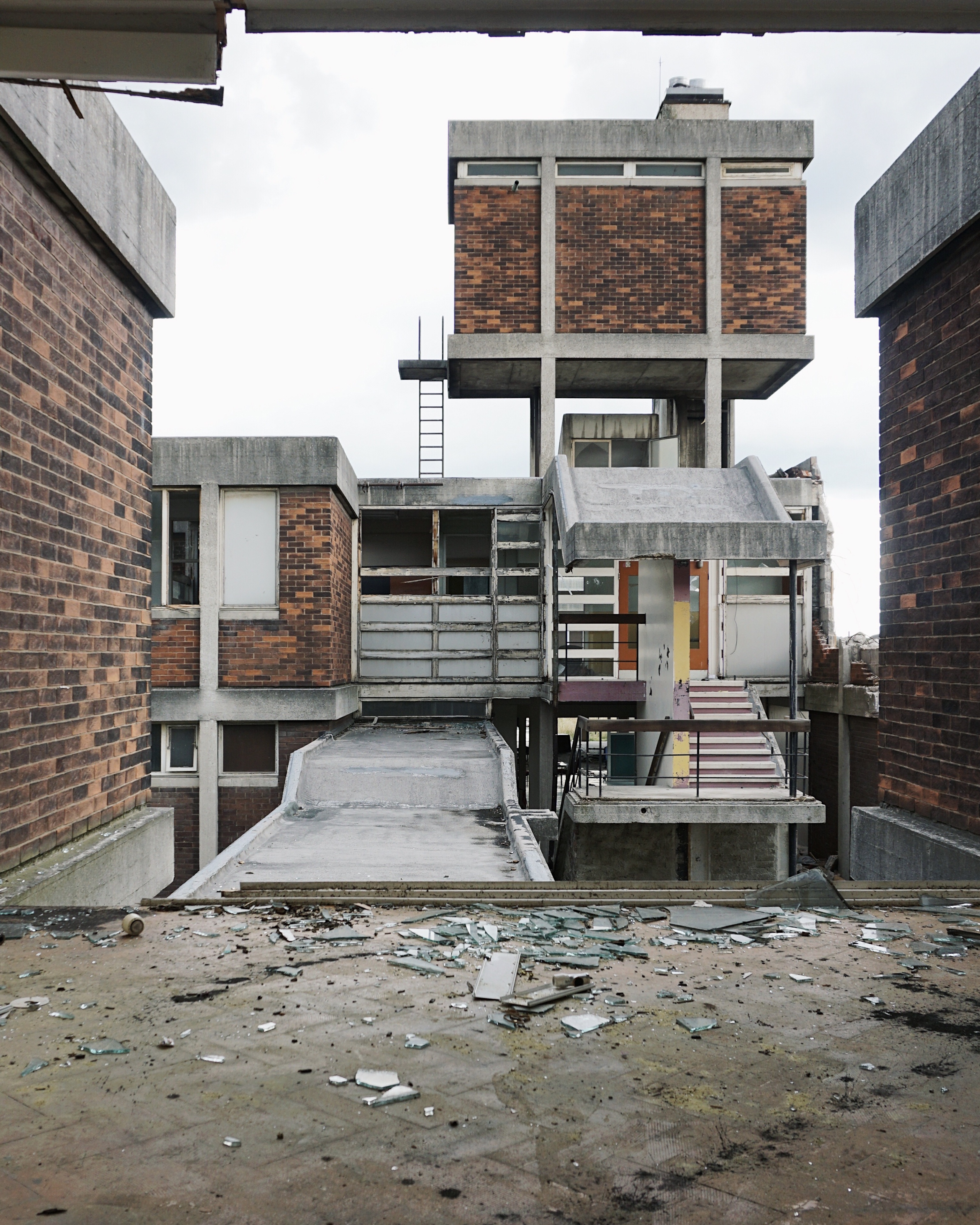
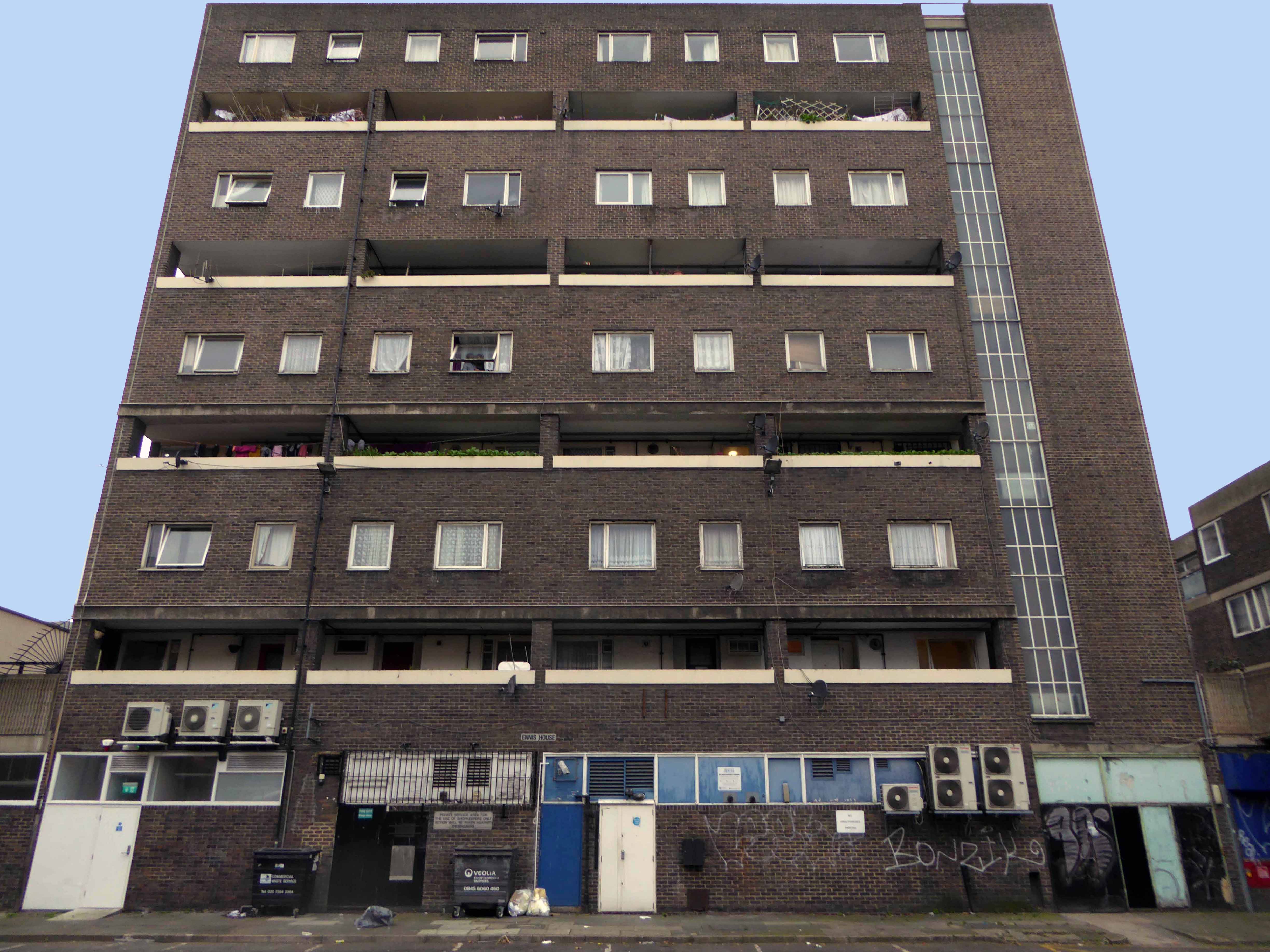
10 Beeversleigh Rotherham 1968-71 Main contractors J Finnegan
It’s thirteen storeys high – housing forty eight dwellings.
11 Park House School 1964 Lyons Israel Ellis Gray
Listed in 2017 – then demolished.
12 Magistrates Court 1978 B Warren City Architect

Built using a structure developed by EM Wincher in Pittsburgh 1930.

14 Westfield Estate Mosborough
Formerly Waterthorpe Farm Estate a rural township which was subsumed by Sheffield’s expanding housing schemes.

The first school of design in the UK, the Government School of Design, was established in 1837 and went on to become the Royal College of Art. It marked the beginnings of the development of technical education in the UK, which expanded in the remaining decades of the 19th century, and was largely instigated by the Science and Art Department of the Board of Trade, formed in 1853. In 1856 the Science and Art Department transferred from the Board of Trade to the Education Department and administered grant-aid to art schools from 1856 and to schools of design and technical schools from 1868.
The Technical Instruction Act 1889 permitted local authorities to levy rates to aid technical or manual instruction. County and borough councils began to provide technical instruction by day and evening classes.
The Local Taxation Customs and Excise Act 1890 diverted ‘whisky money’ from publicans to local authorities for assisting technical education or relieving rates, boosting investment in technical instruction.
By the end of the 19th century continuing education was provided by a variety of bodies in a number of forms:
Under the 1902 Education Act, changes to conditions attached to government grants encouraged the expansion of technical education. Local Education Authorities took over most of the evening continuation schools.
Major changes occurred after the Second World War. Junior technical schools , commercial schools and schools of art were fully integrated into the revised system of secondary education.
The development of technical and art education were inextricably linked to the industrialisation of the north of England.
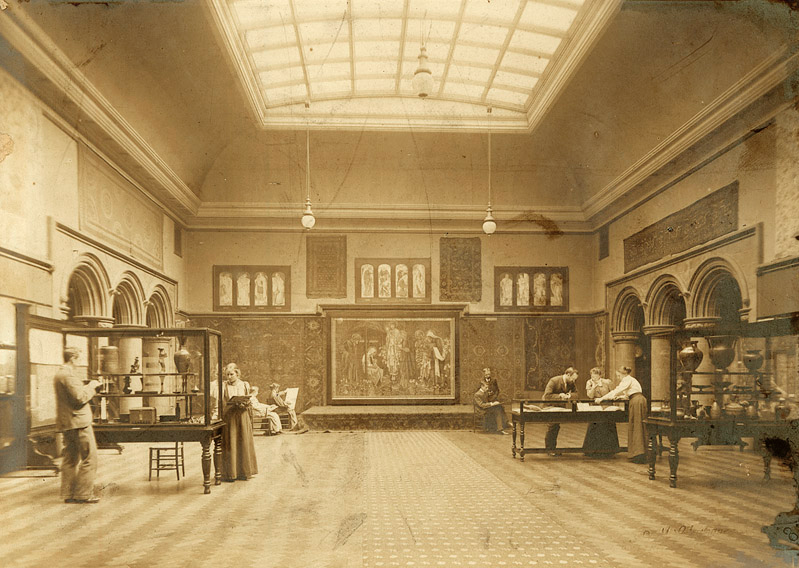
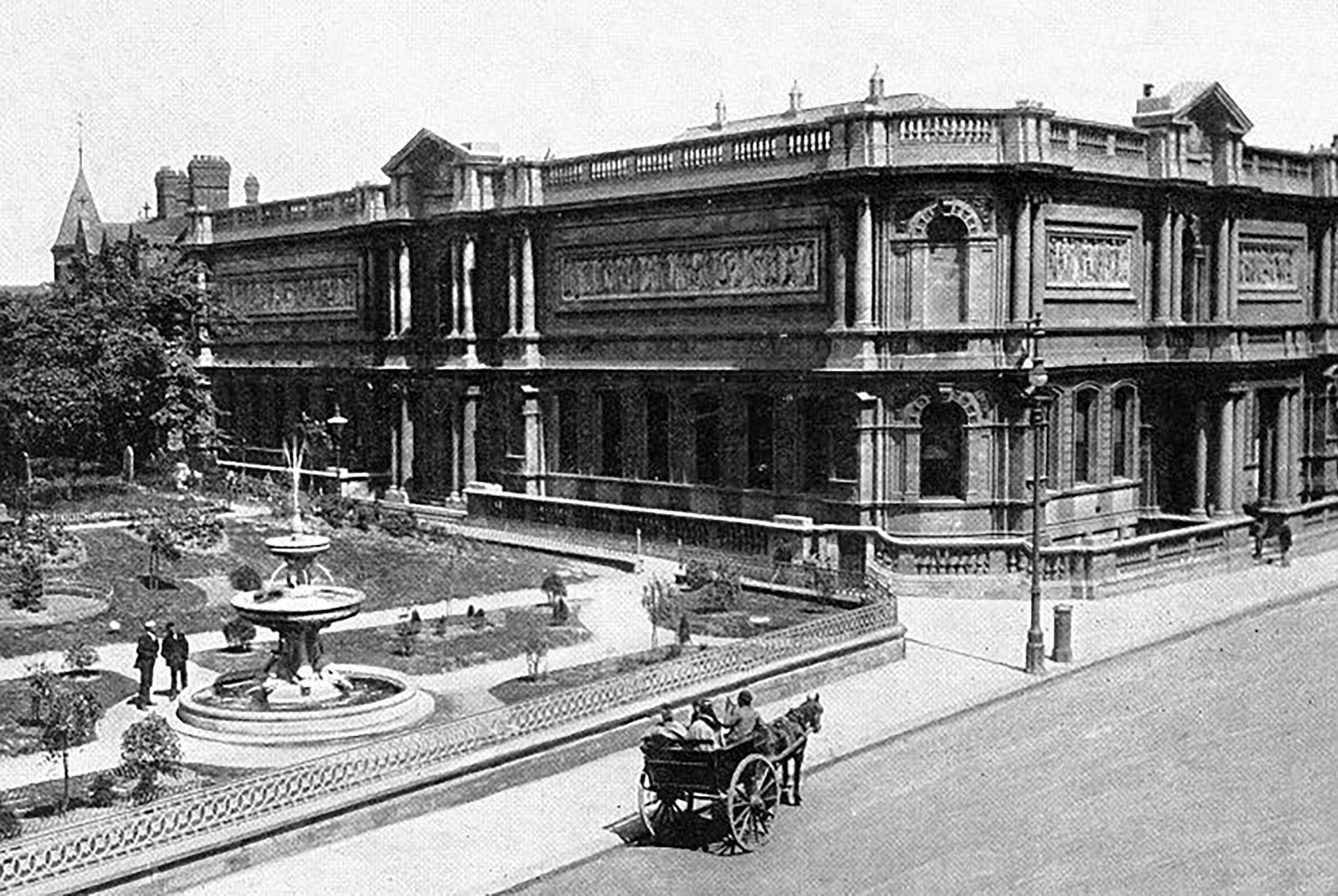
The Textile Court or main gallery space of the Arts and Crafts Museum of the Manchester Municipal School of Art, photographed in 1898-1901.
Manchester School of Art was established in 1838 as the Manchester School of Design. It is the second oldest art school in the United Kingdom after the Royal College of Art which was founded the year before.
The school opened in the basement of the Manchester Royal Institution on Mosley Street in 1838. It became the School of Art in 1853 and moved to Cavendish Street in 1880. It was subsequently named the Municipal School of Art. In 1880, the school admitted female students, at the time the only higher education available to women, although men and women were segregated. The school was extended in 1897.
The mill towns which encircled the city of Manchester each had their own independent colleges of Art and Design.
Textiles in particular required practitioners in surface pattern and garment design and construction, innovative and skilled students were in demand for print, engineering, architecture and general manufacturing – who also required the services of typographers, illustrators, commercial and graphic designers.
Having left school aged sixteen in 1971, all I ever wanted to do was go to Art School.
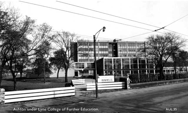
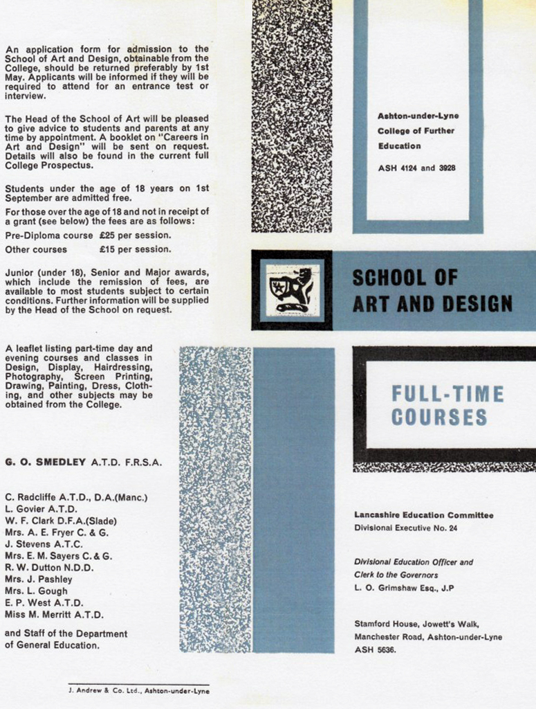
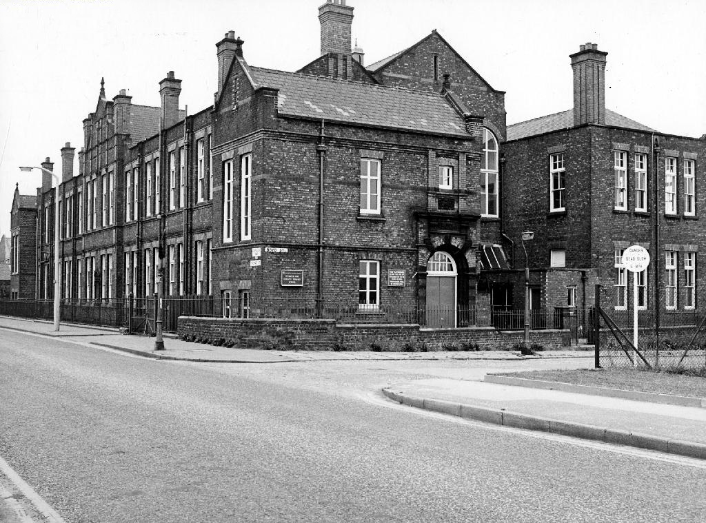
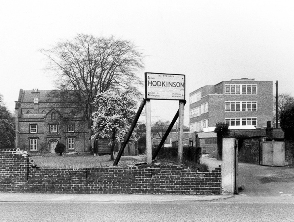
My local college was the then Ashton under Lyne College of Further Education – the full-time mode of study was then a two year Pre-Diploma Course.
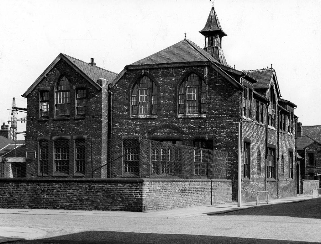
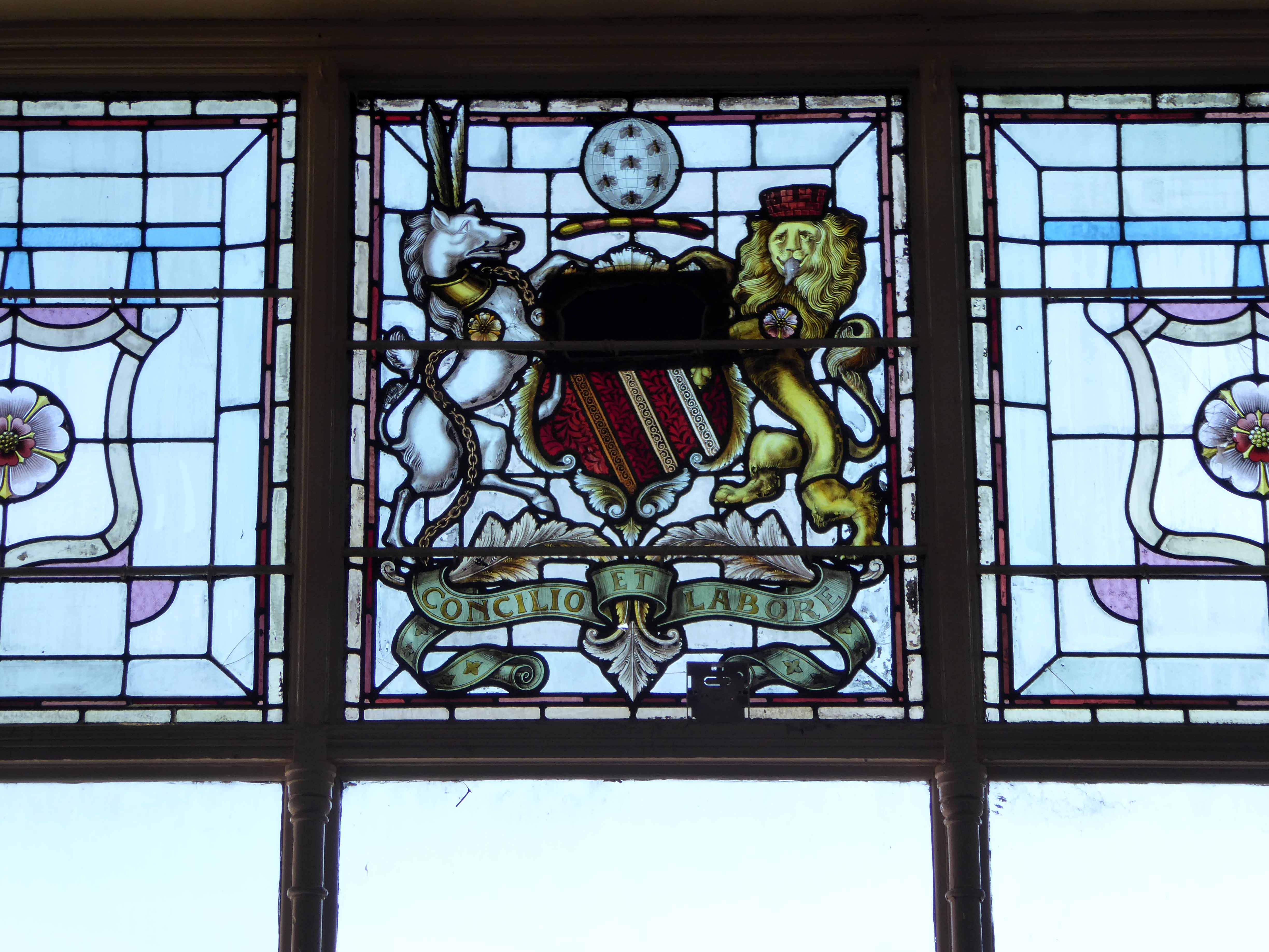
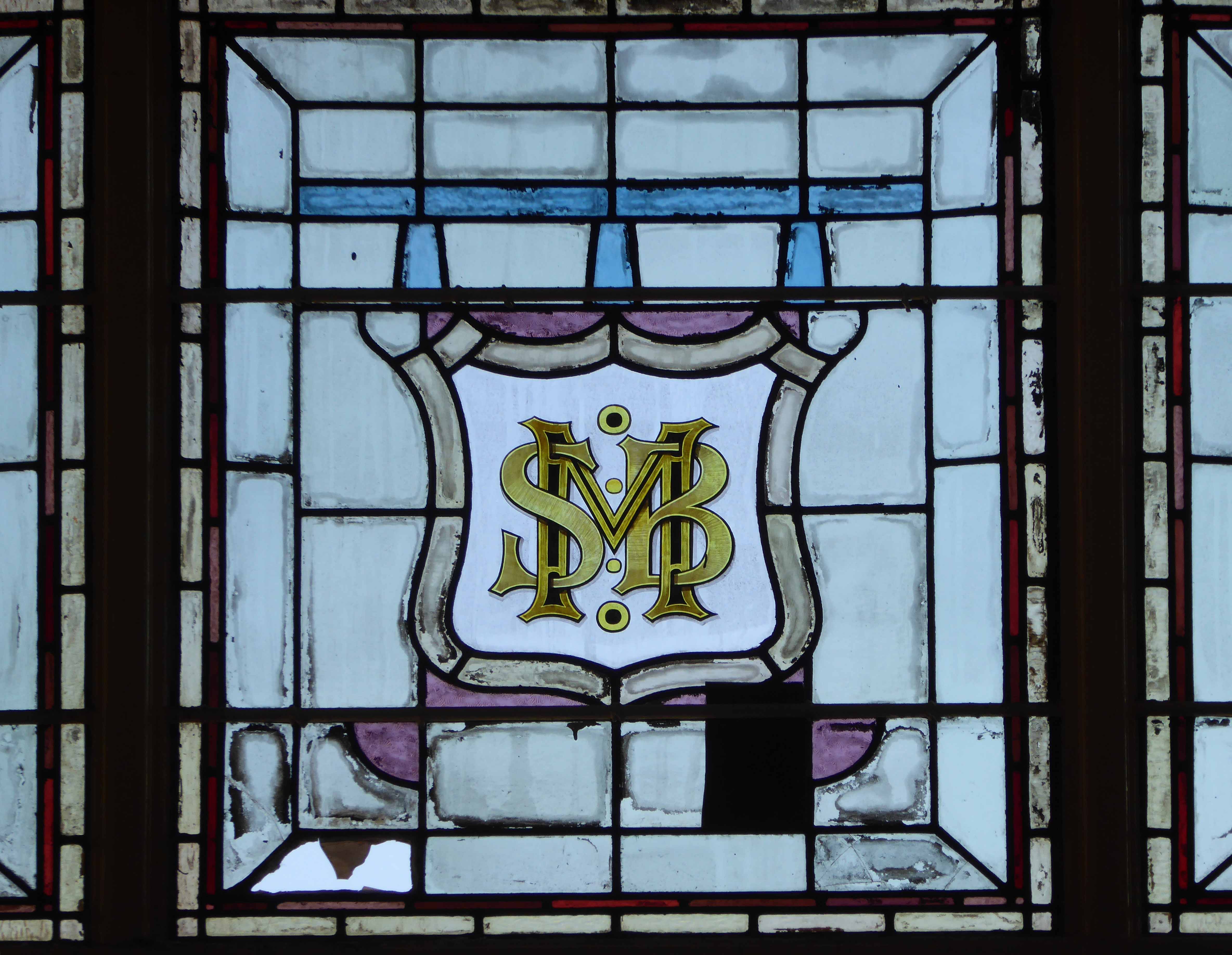
It had begun life as the Heginbottom School of Art based at – Heginbottom Technical Schools School of Art and Free Library Old Street Ashton-under-Lyne.
The new Technical Schools and Free Library, which has just been completed were opened for students without any formal ceremony. The building has been erected from designs prepared by Messrs John Eaton and Sons, architects, Ashton, at a cost, including fittings of £16,000.
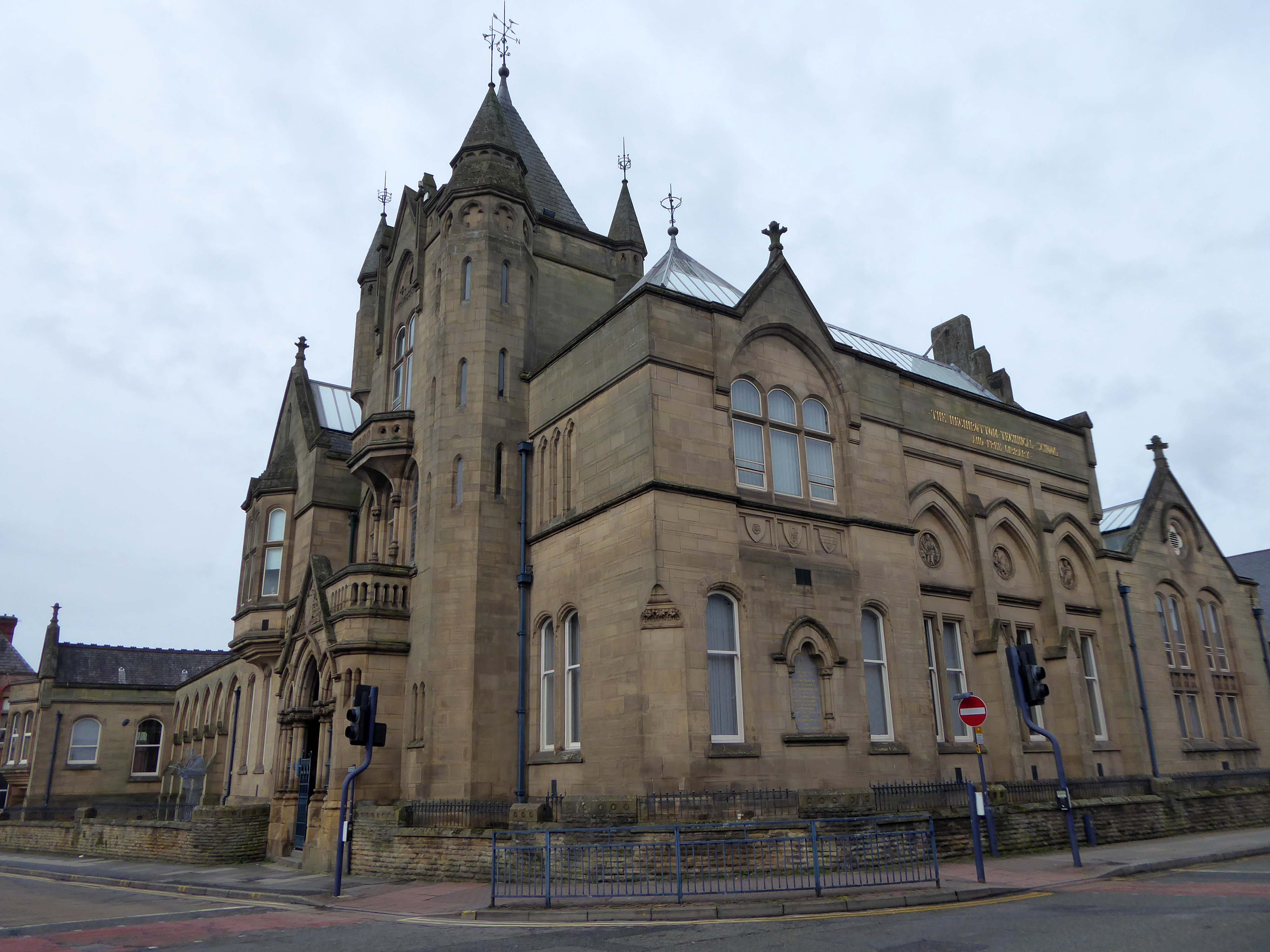
The building is now Grade II listed and the library and college long gone.
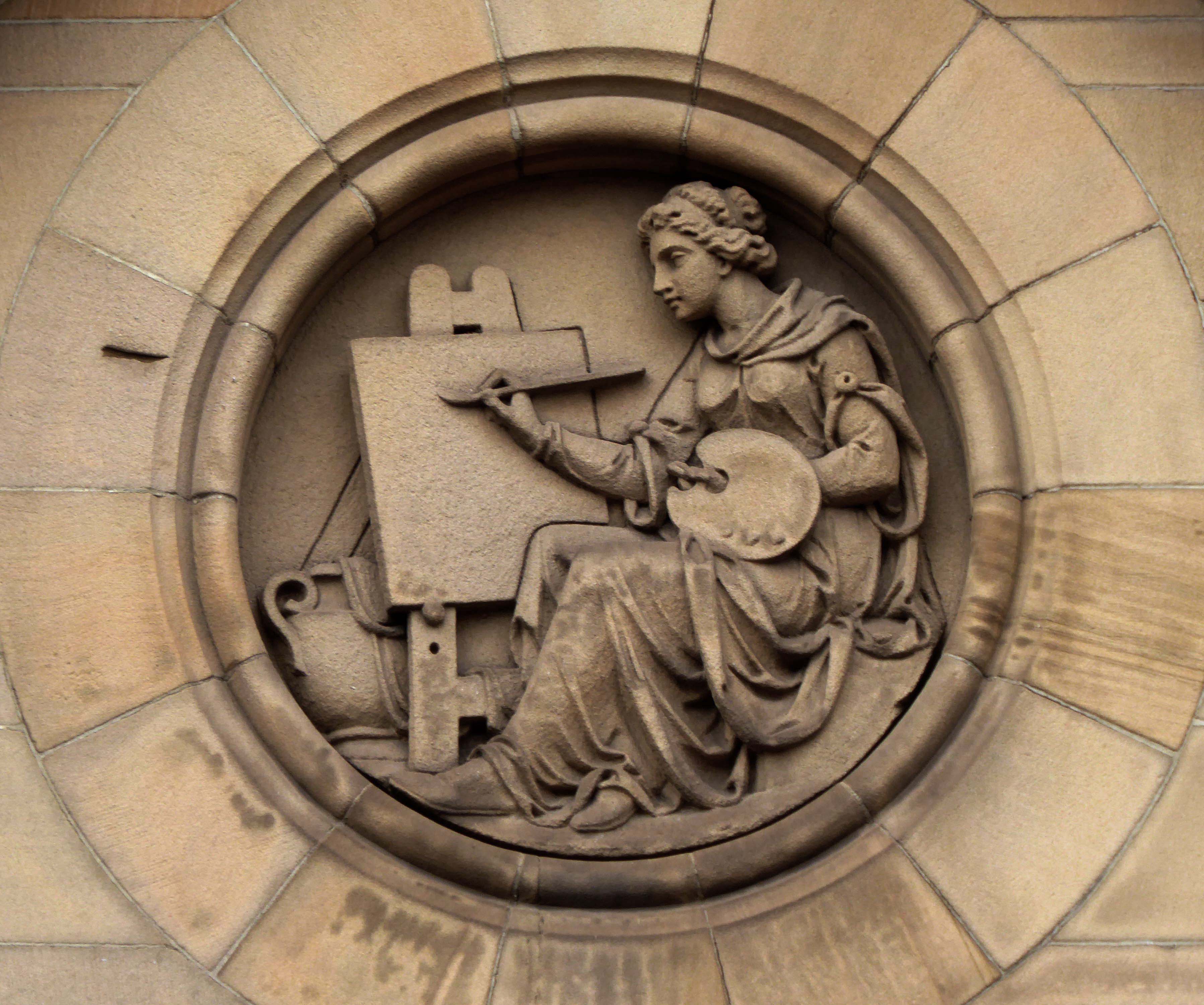
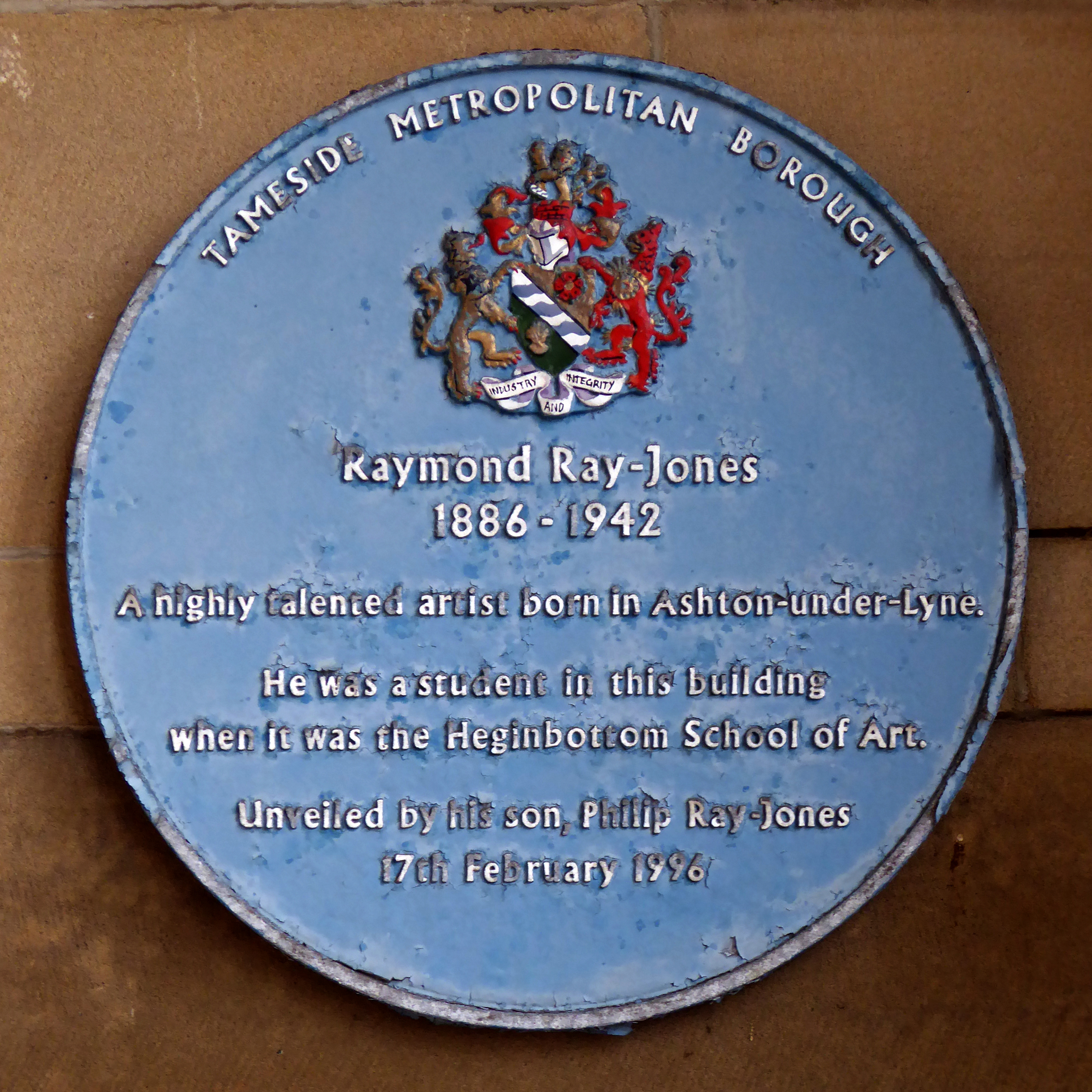
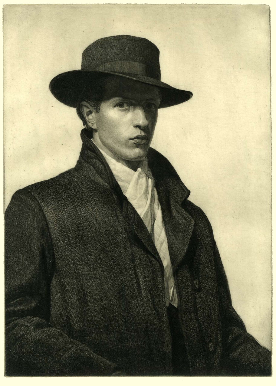
A blue plaque in the main entrance celebrates the former student Raymond Ray-Jones.
Father of photographer Tony Ray-Jones.
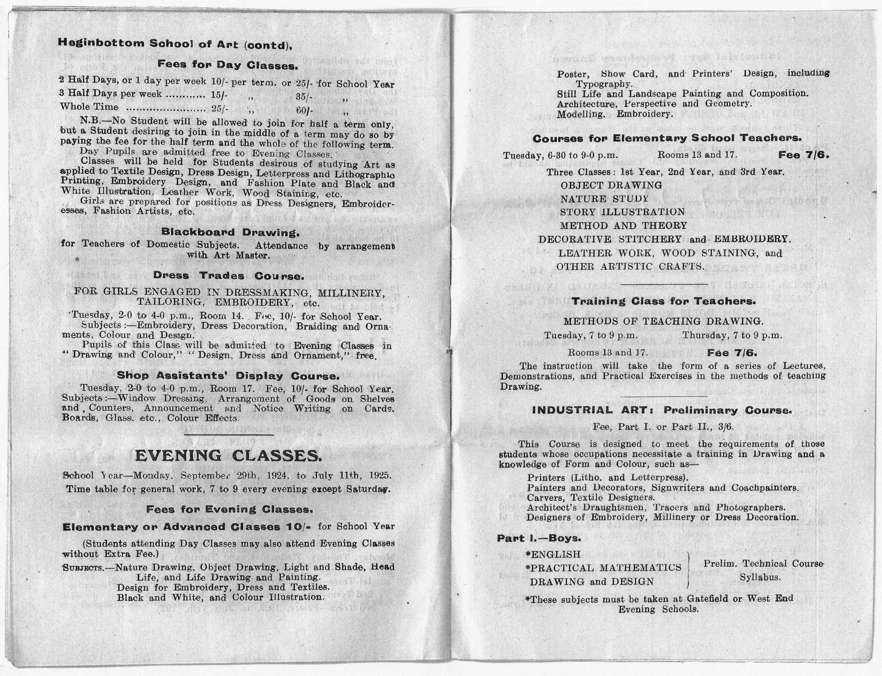
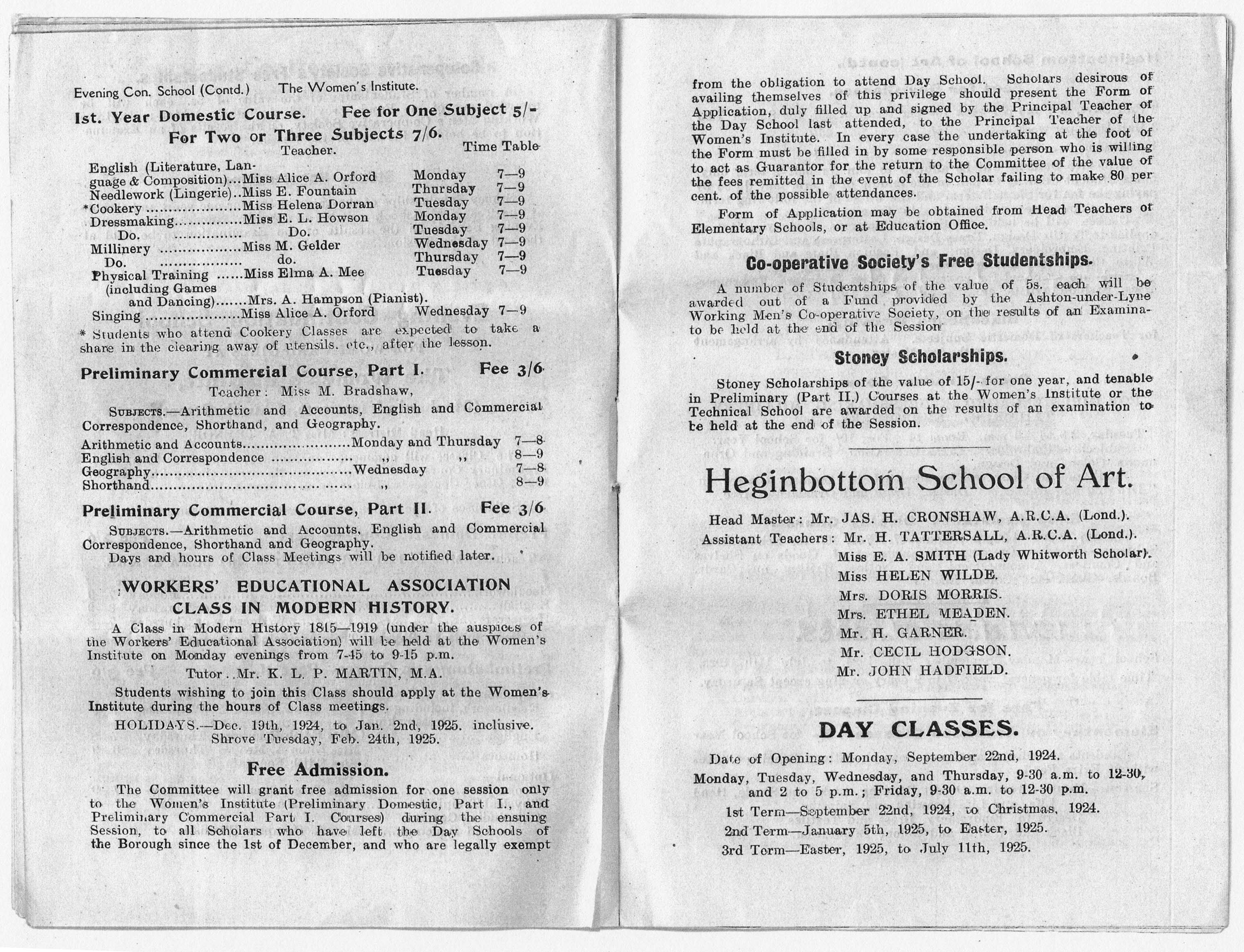
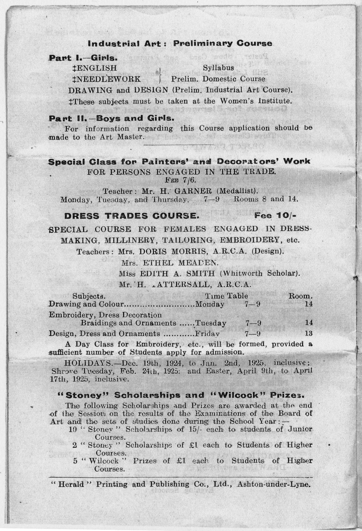
This is the syllabus of 1924-25 – courses take place in evening as students would have been working during the day.
Many of the classes were clearly defined by gender.
Drawing was a seen as a skill which underpinned he majority of disciplines.
Some of the provision was non-vocational.
Forward now to 1959-60.
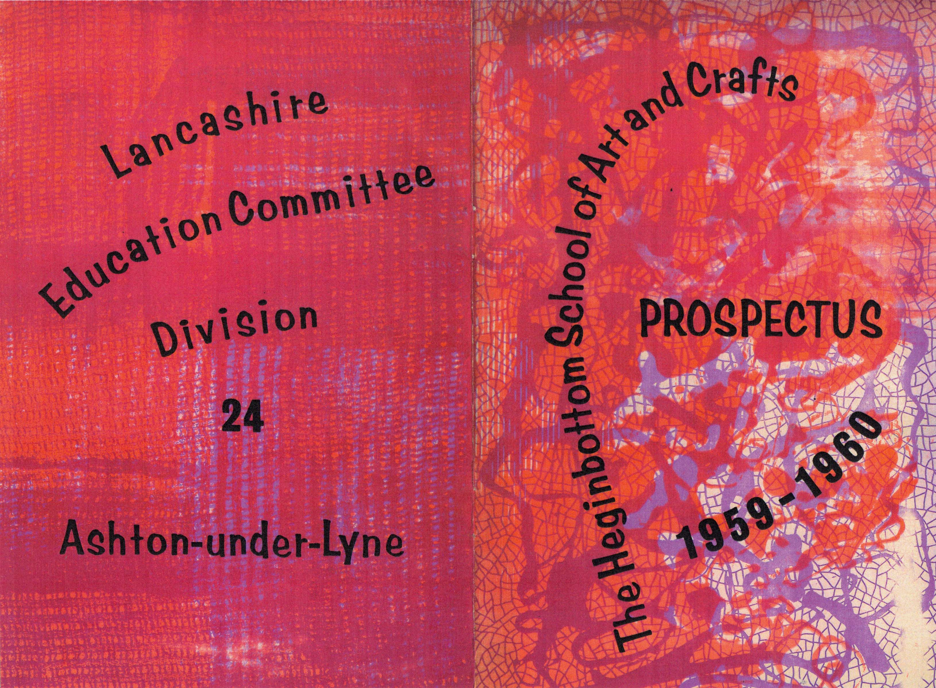
There are now full-time courses in Art and Design – though there were no degree courses until 1974, students would find employment, places on a teacher training course or possibly progress to one of the London colleges, which did have graduate status.
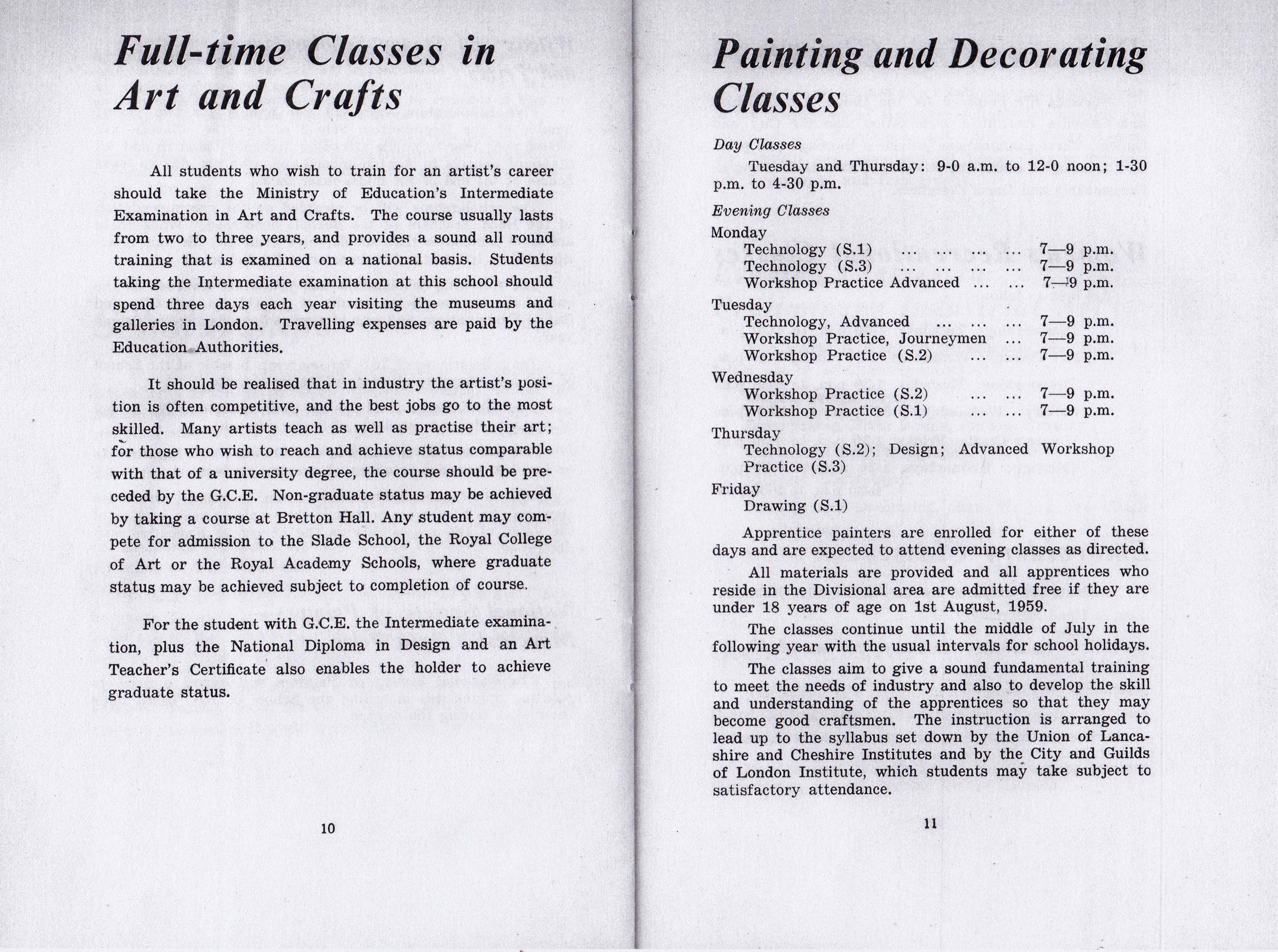
There were still clear distinctions in what were considered women’s skills, which also reflected the patterns of employment.
There was also an increasing distinction between specialisms, Fine and Applied Arts taking diverging paths.
An astounding range of skills were available on a part time evening basis, opening up vocational or non-vocational options.
These were always affordable and well attended.
Art and design education had undergone a major transformation in the early 1960s. The Coldstream report -1960/ 1962 had restructured art education: the existing National Diploma in Design had been replaced with a three year Diploma in Art and Design in 1963. The Dip.AD was conceived as providing ‘a liberal education in art’ and had four areas of specialisation: textiles/fashion, three dimensional design, graphic design, and fine art. Other subjects, such as electronic media, photography and film, were incorporated into fine art or graphic design courses.
The Dip.AD was intended to be the equivalent of a university degree. To achieve this academic entry requirements, at least five O’ levels, were introduced; although exceptions could be granted for “students with outstanding artistic promise”, very few were: only 36 were made in 1967 . The Dip. AD itself contained a compulsory academic element and enhanced art history component: taken together these accounted for 15 per cent of course time and 20 per cent of the final pass mark. One year Pre-diploma (latterly Foundation) courses termed Basic Design, were also introduced, these a product of the Bauhaus approach to art education, pioneered in the UK by and Richard Hamilton, Tom Hudson, Harr Thubron, Maurice de Sausmarez, and Victor Pasmore. Basic Design was a form of creative education involving basic analytic experiment and a clearing of the slate.
Centre for Global Higher Education
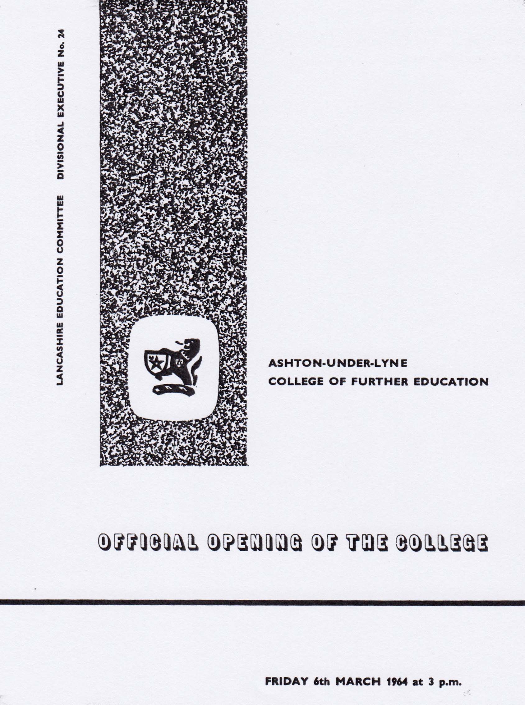
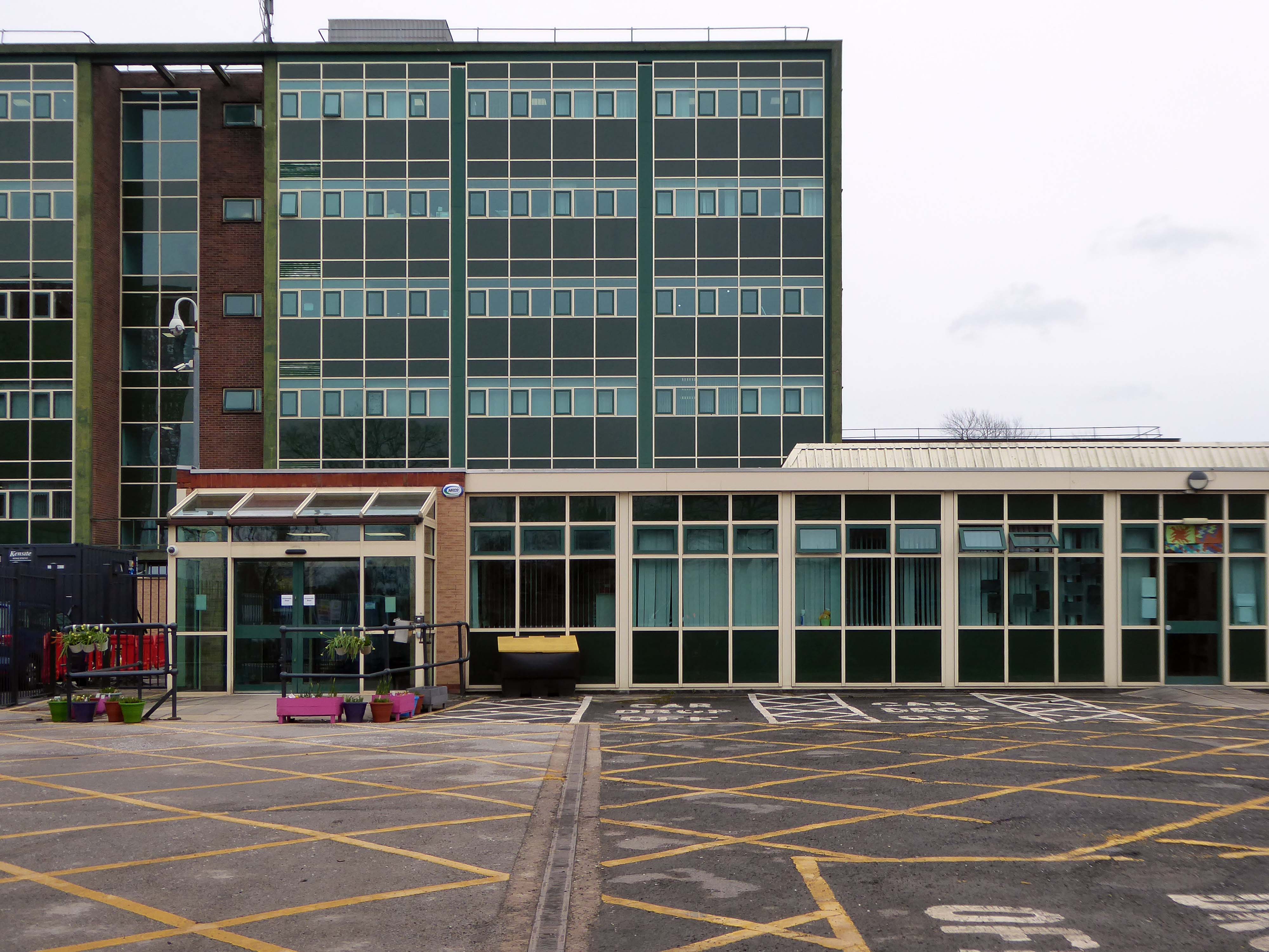
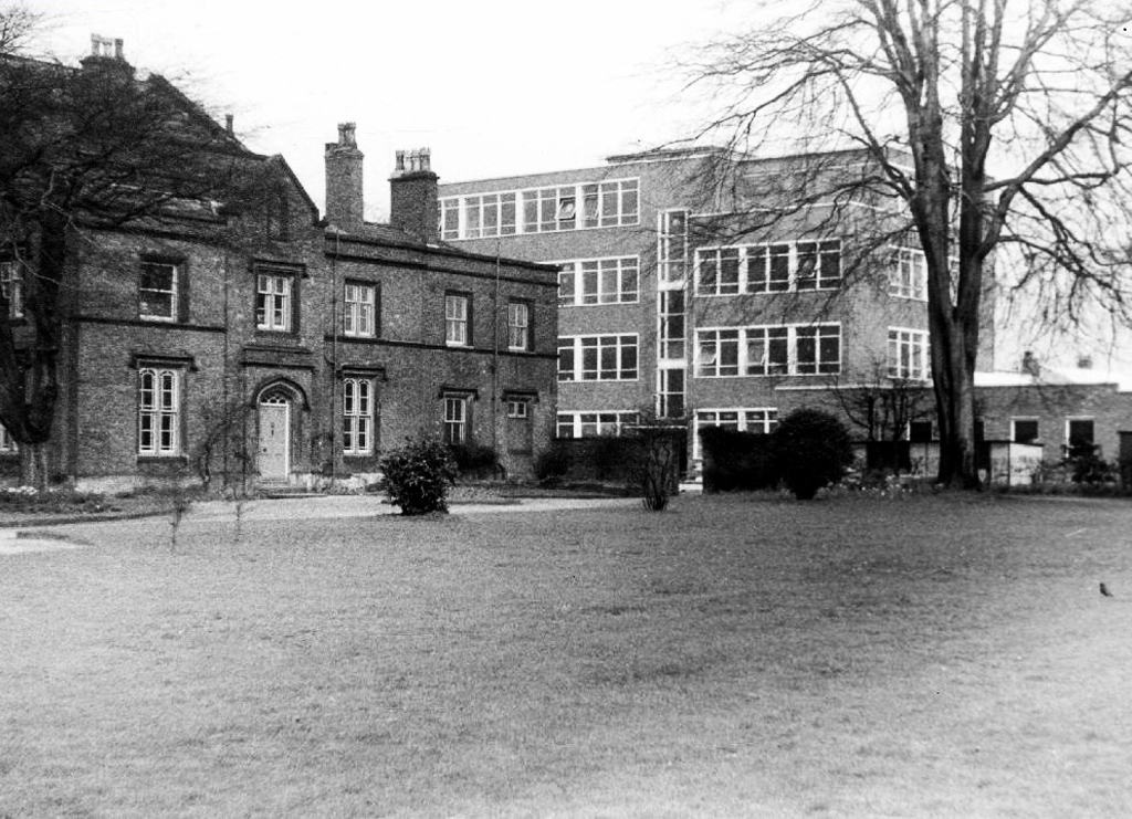
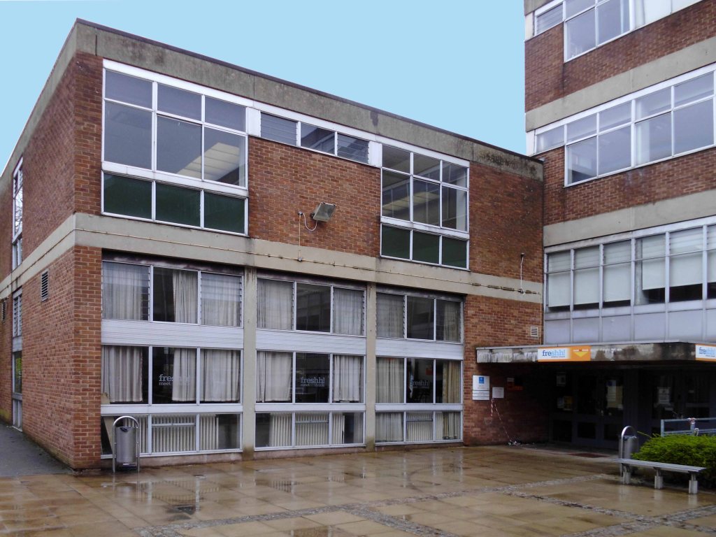
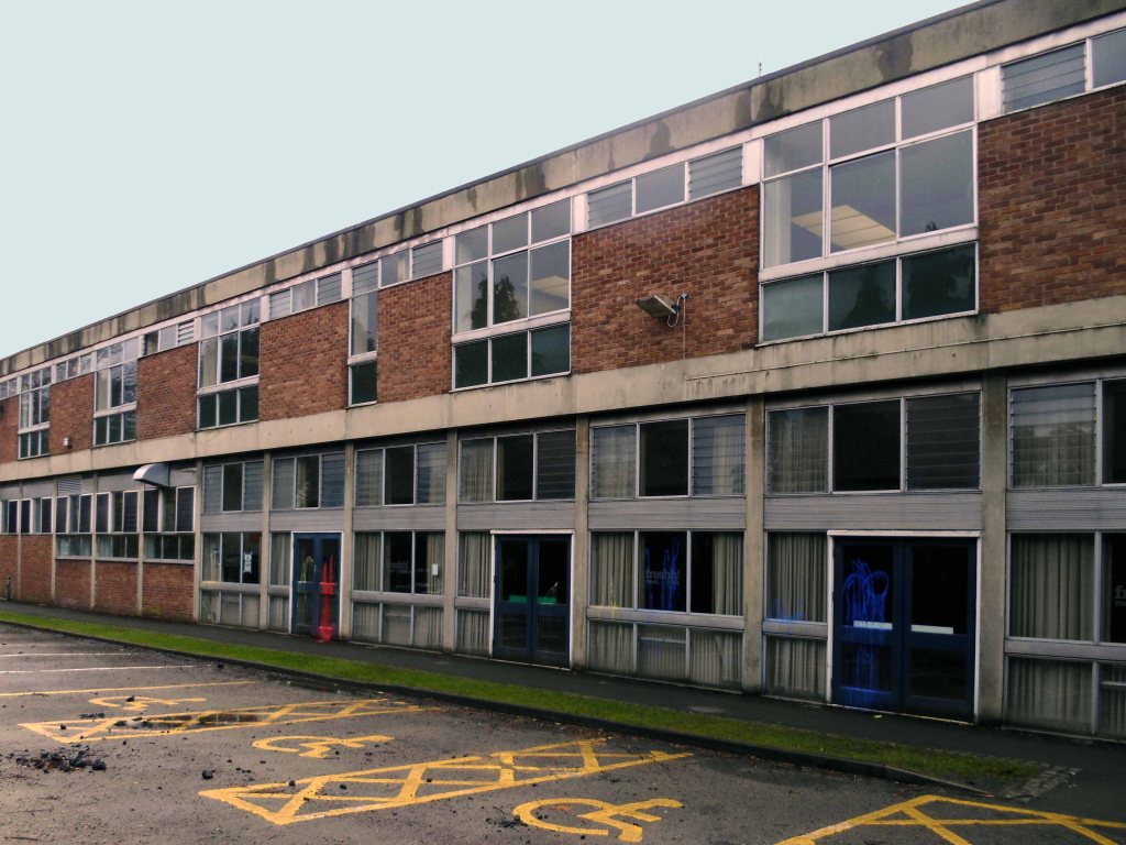
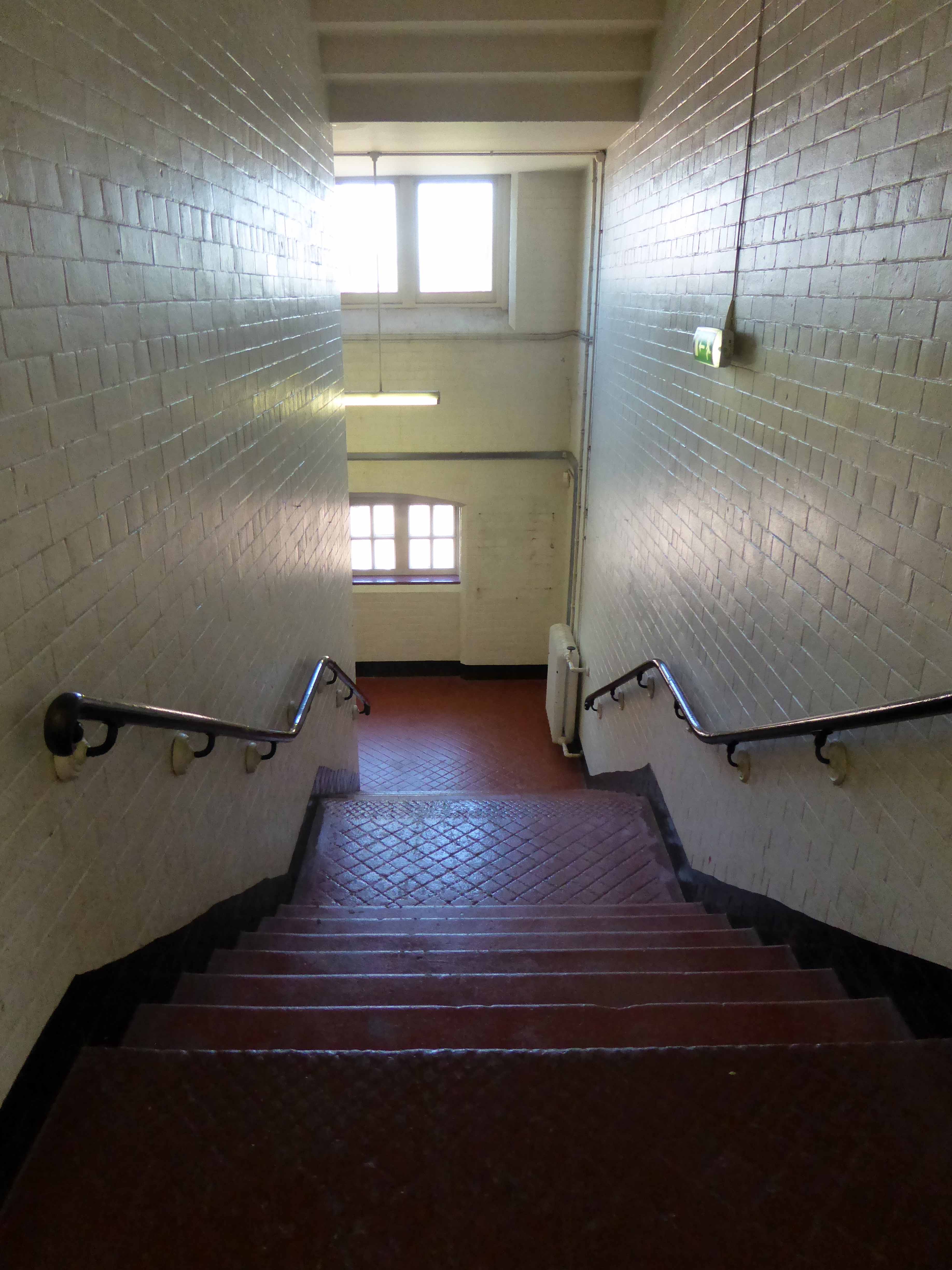
The college which I attended was opened on March 3rd 1964.
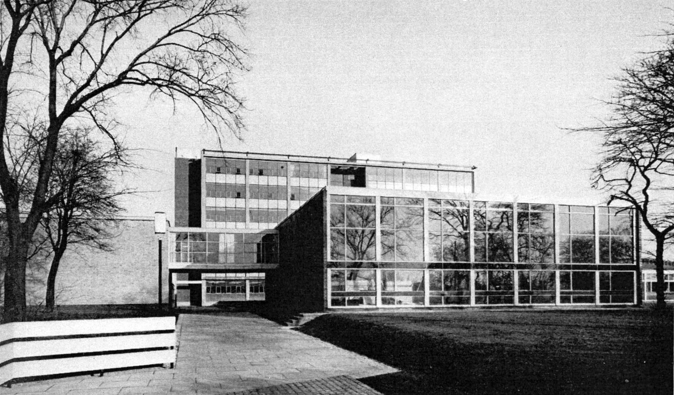

Gone were the autocratic Victorian stylings of the Heginbottom School – The College of Further Education represented a more open democratic age.
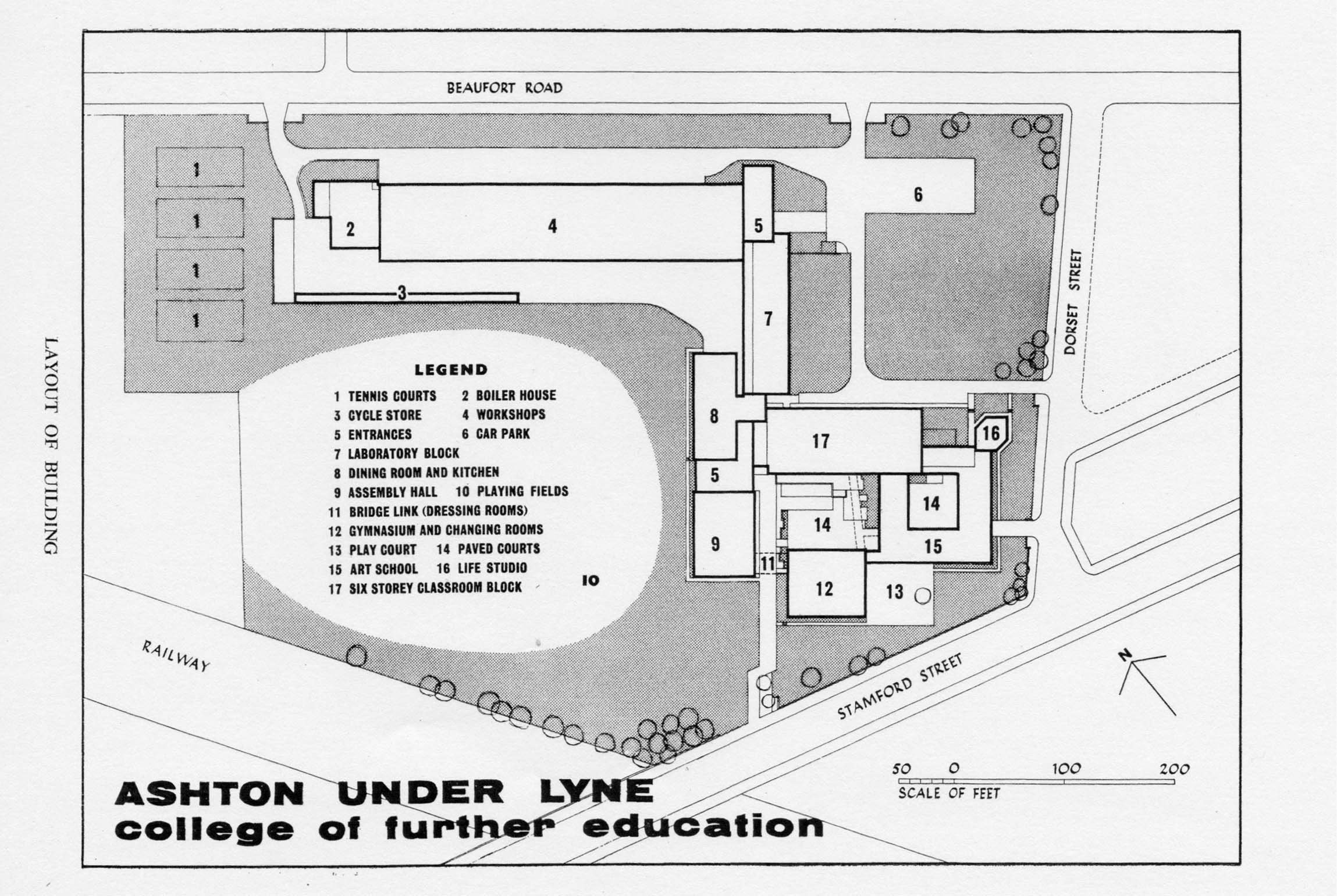

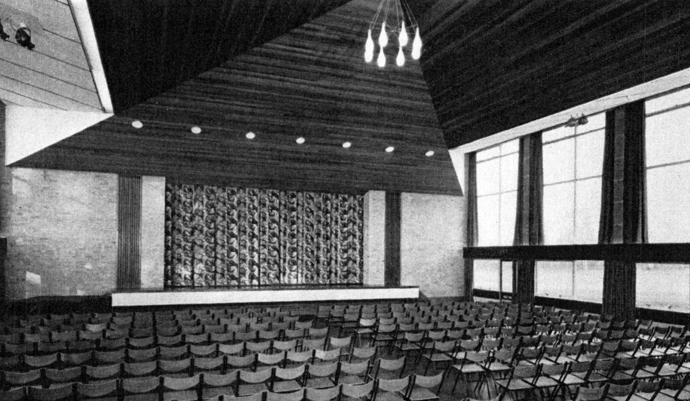
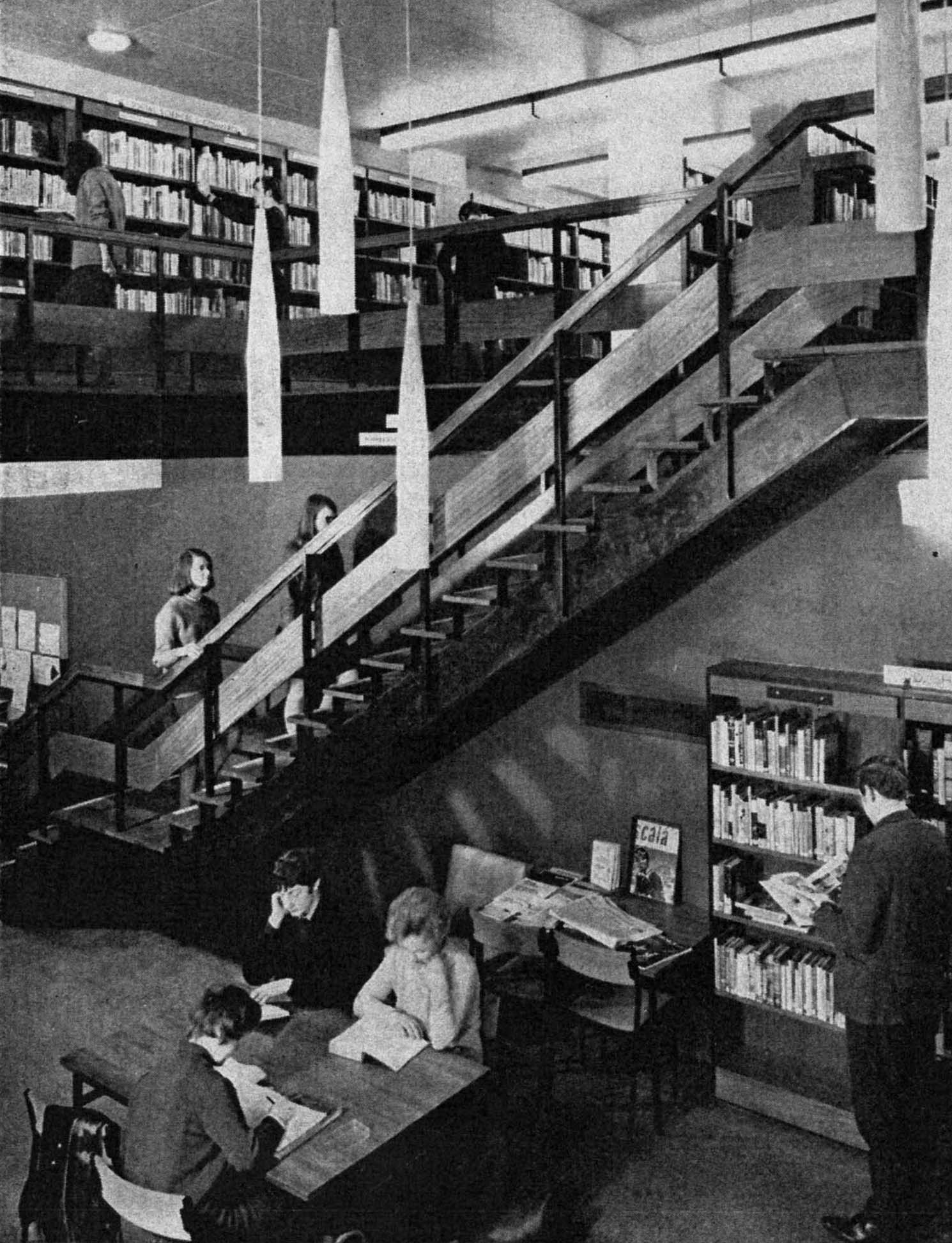
The communal areas were light and airy, with full-length windows, wooden floors, contemporary furniture and fittings.
The teaching rooms and workshops well equipped and staffed, with ample support from technicians and lecturers.
This was a no expense spared build – we were made to feel valued, in an institution purpose built for our education and future lives.
The full-time course was five full days a week, with one late evening for photography and art history.
I attended ever single day for two years, we were eager to learn and following an introductory merry go round of design disciplines, students were able to choose their own route.
I was privileged to have been taught by Bill Clarke as a student of Fine Art – of whom fellow Ashton student Chris Ofili said:
After six months on the foundation course I chose to specialise in painting and drawing. The teacher there, Bill Clarke, introduced me to painting in a way that didn’t make me feel restricted or limited. Not only was it something completely new, but it was something that allowed me to investigate further into who I am. He taught us that it wasn’t so much about painting a scene and making sure you got the shading right, but trying to get to a point where the thing that works is absolutely critical and essential to you as a living, breathing person. I was obviously aware of famous artists, but I suppose I never really thought that was what you could do with your life. He opened the door enough to make me think that it was worth going into the room.
Photo: Andy Duncan 2023
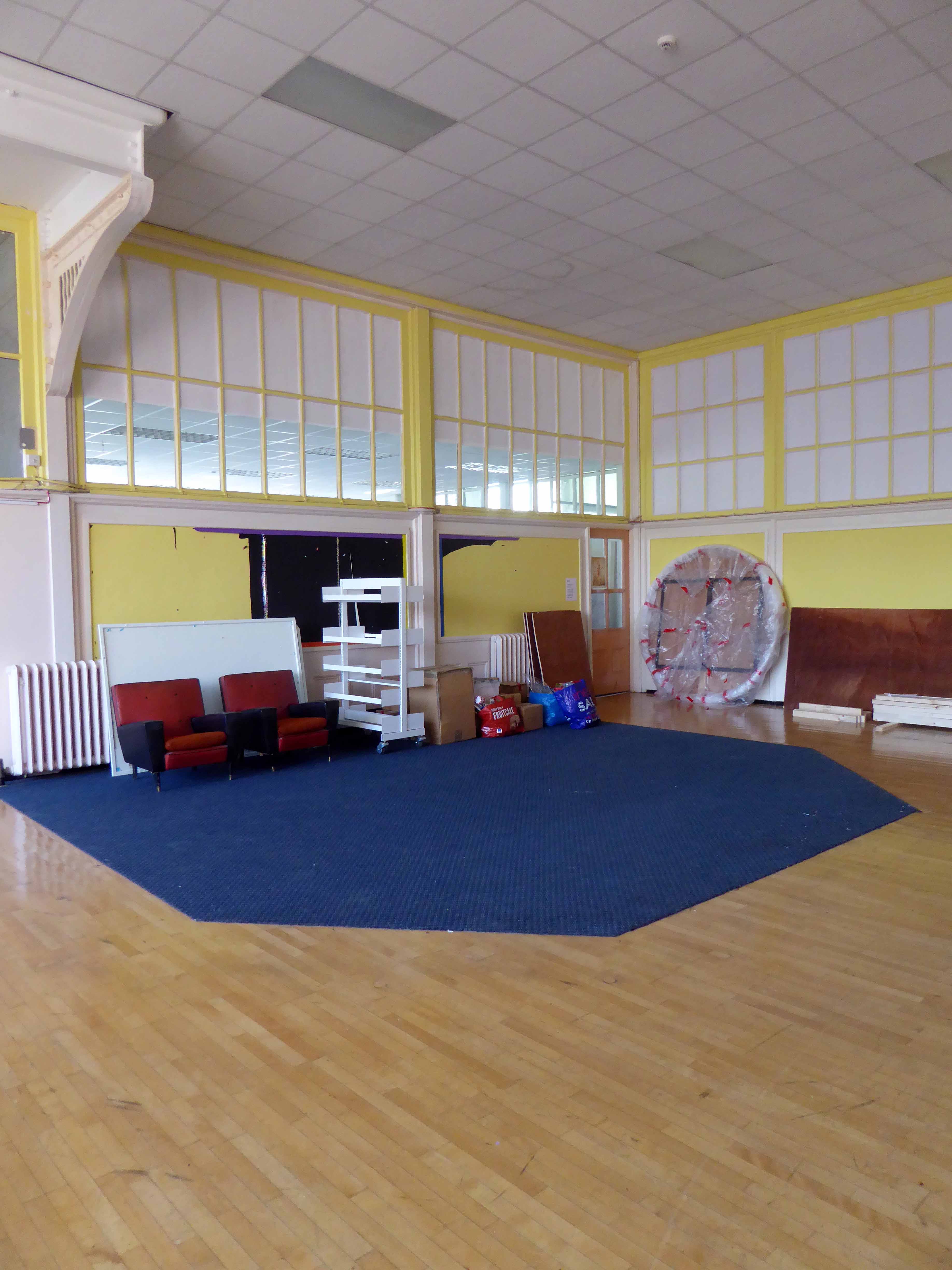
A huge emphasis was placed on observational drawing in the life-room, in addition to more exploratory work in a variety of media.
I also spent a great deal of time in the Print Room working in both etching and lithography with lecturer Colin Radcliffe.
Returning to the college four years ago, I found that the life room was now in use by the Animal Management course.

The site had been undergoing refurbishment and new development.
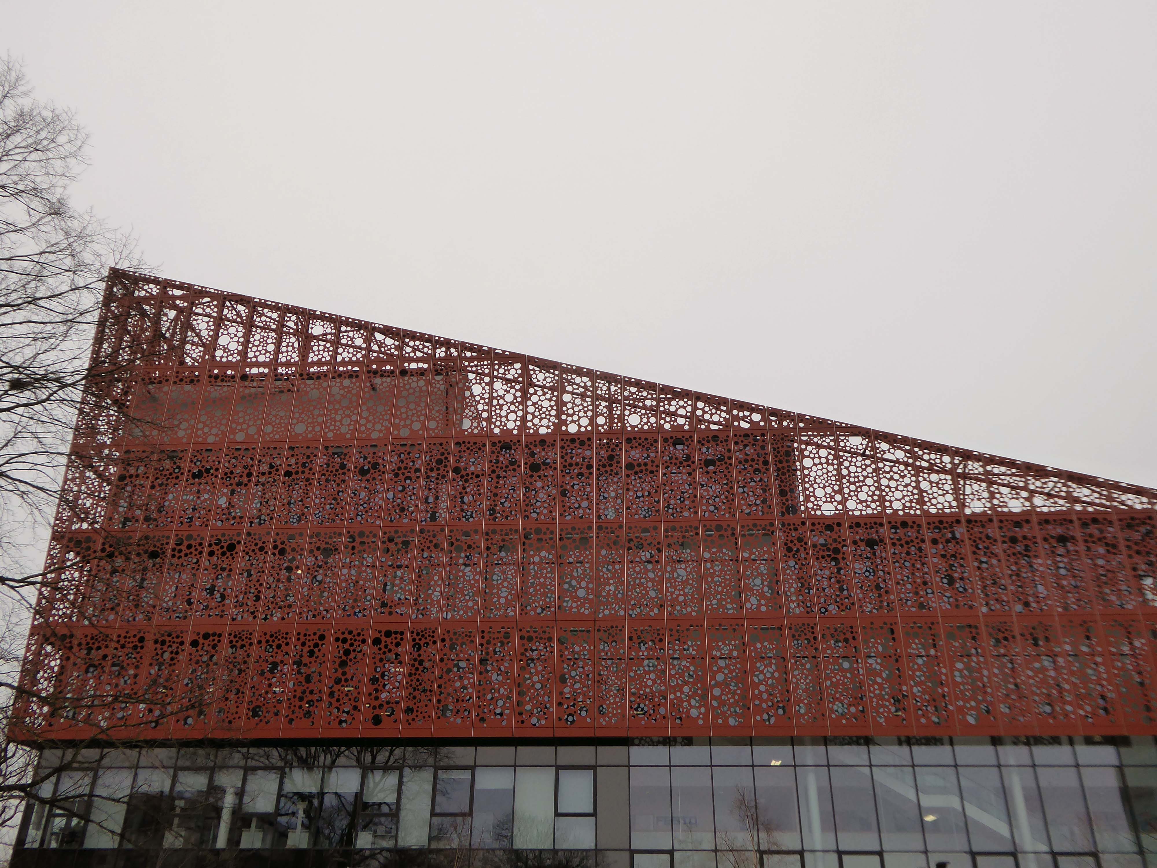
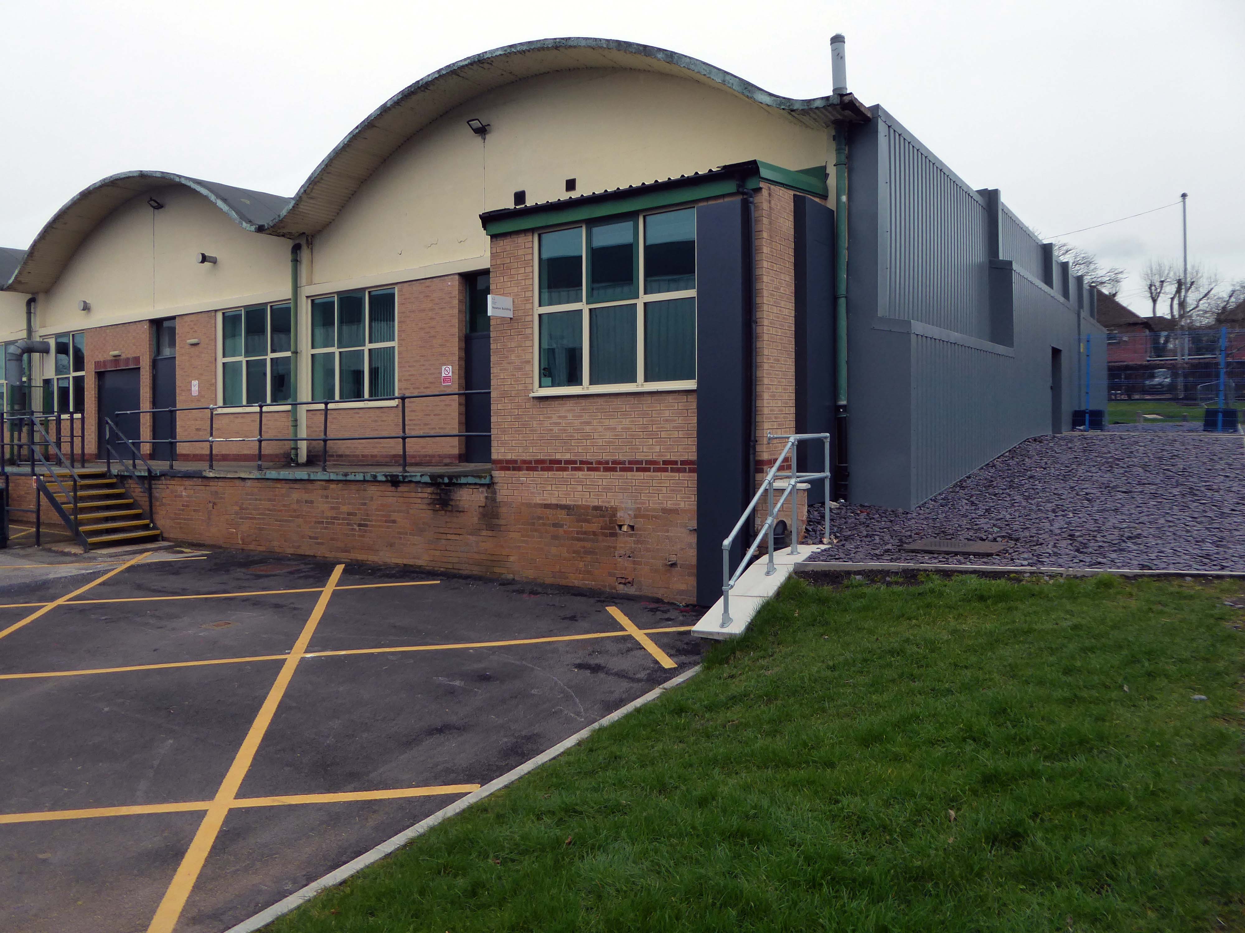
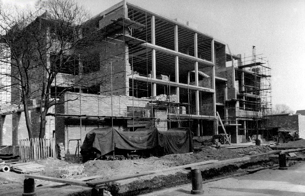
Built by Kier and designed by IBI Taylor and Young the Advanced Technologies Centre has been constructed following a £10.5 million investment.
Levolux designed, supplied and installed a customised architectural facade solution as part of the £10.5 million development of the Advanced Technologies Centre.
ITP supplied our VCL 250 vapour control layer as a protective solution underneath a stunning façade design. With a mono-filament reinforcement scrim for tensile strength, its polyethylene-based membrane ensures that the building envelope is properly sealed to control ventilation, prevent heat loss and protect insulates from interstitial condensation.

The single storey building was previously home to the Ceramics and Textiles rooms.
The Construction Skills Centre has been designed by Manchester-based architects 10 Architect.
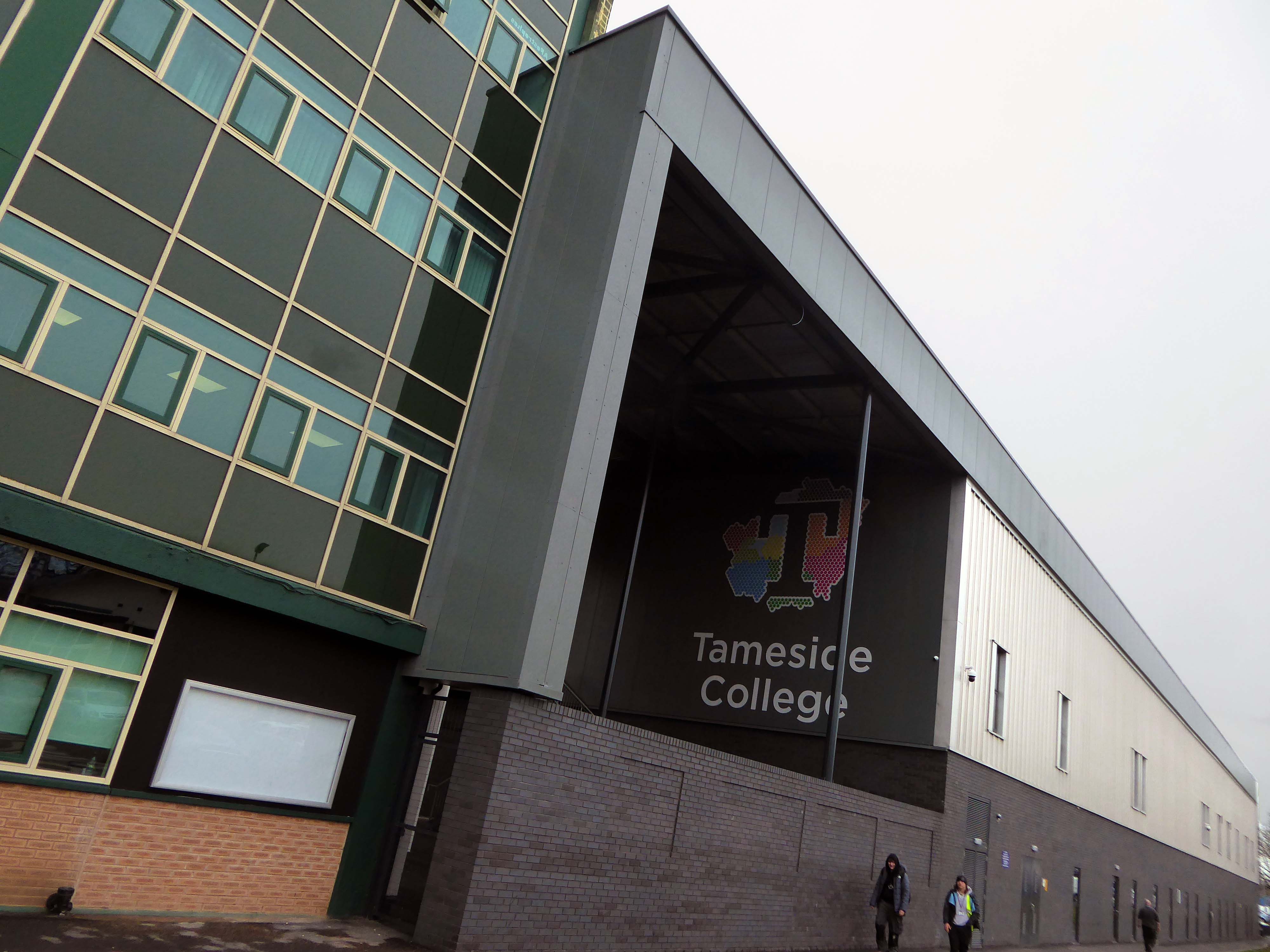
Heckford Signs work with Willmott Dixon approached on a new coloured acrylic sign for the new Construction Skills Building at Tameside College. The aim for this new sign was to create a showcase of the college logo at an eye-catching size, to include 3D elements which would be housed on the East elevation of the impressive new building on campus.

The rolling curves of the original workshops have been retained and updated.
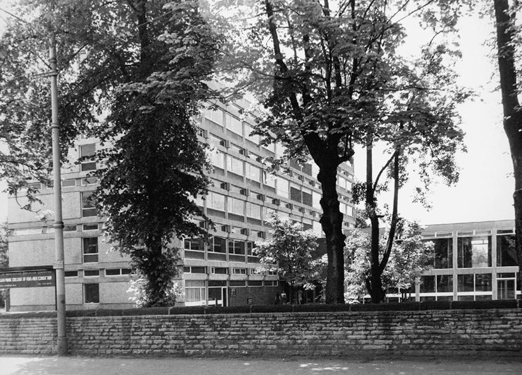
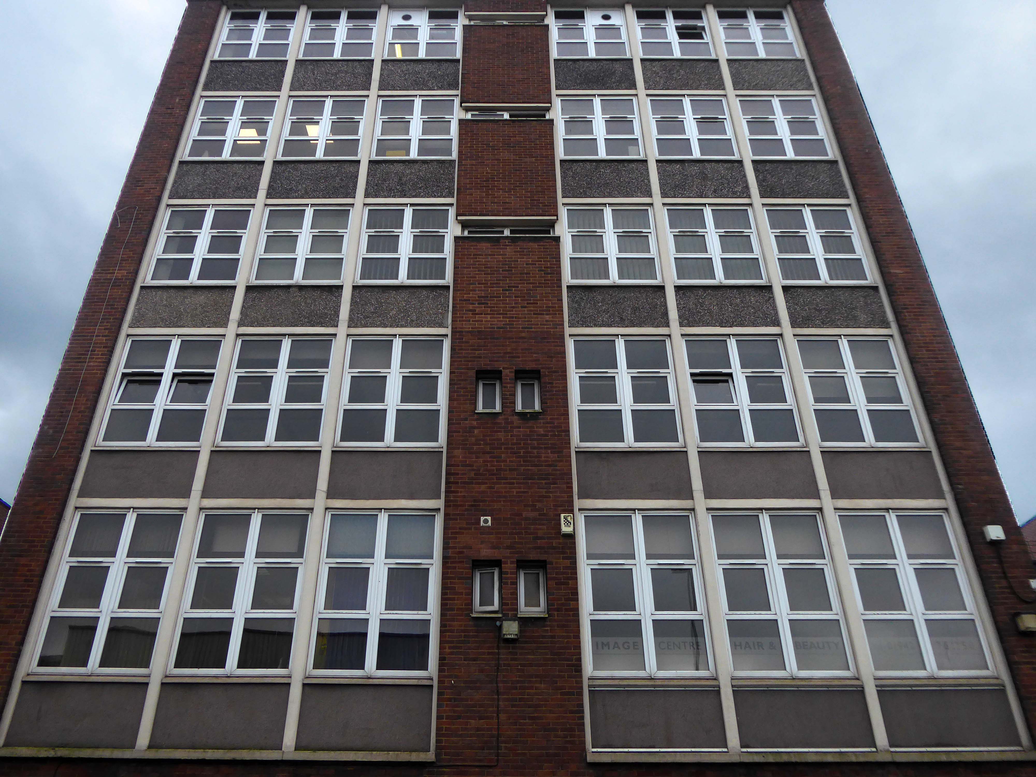
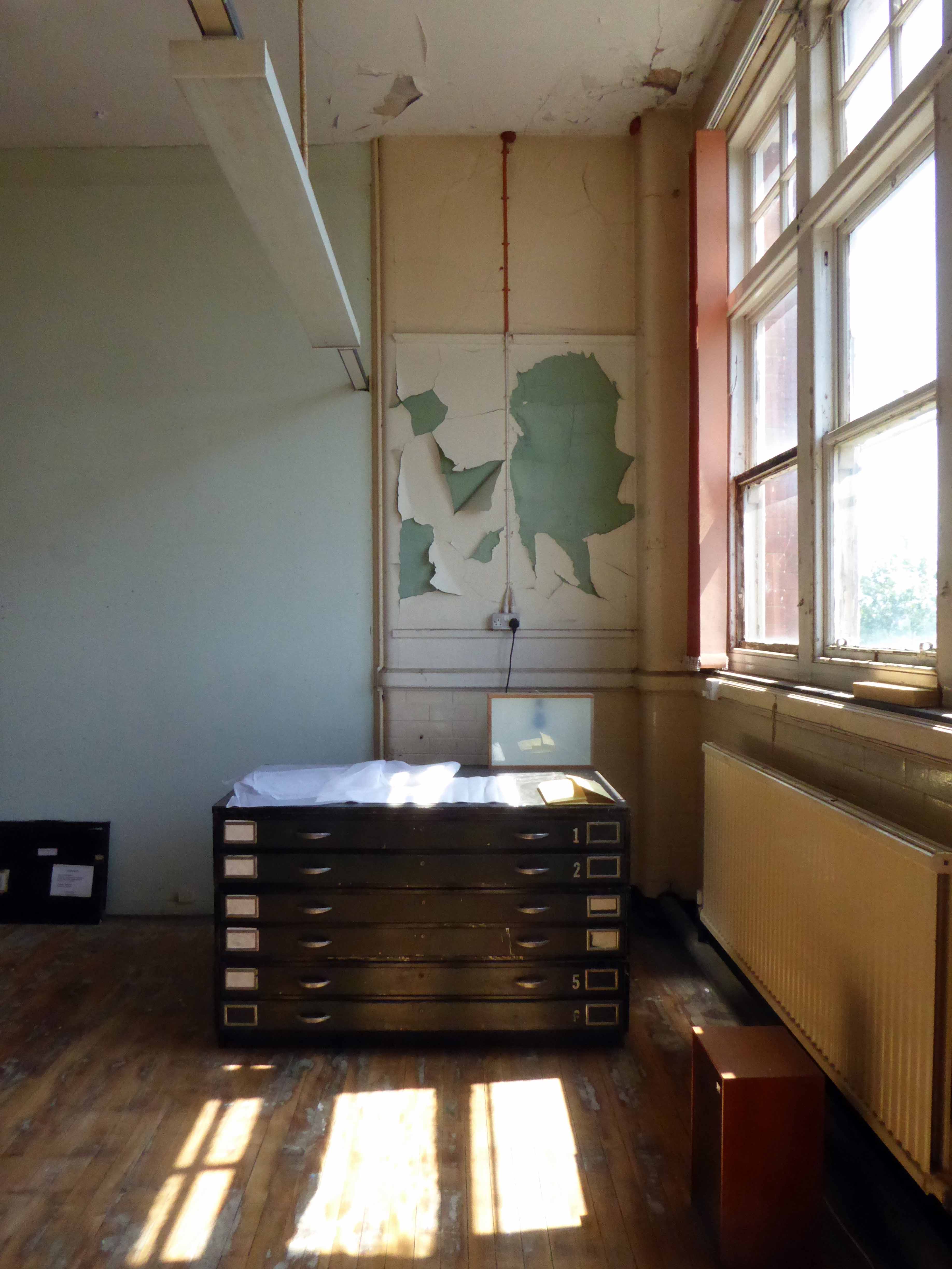
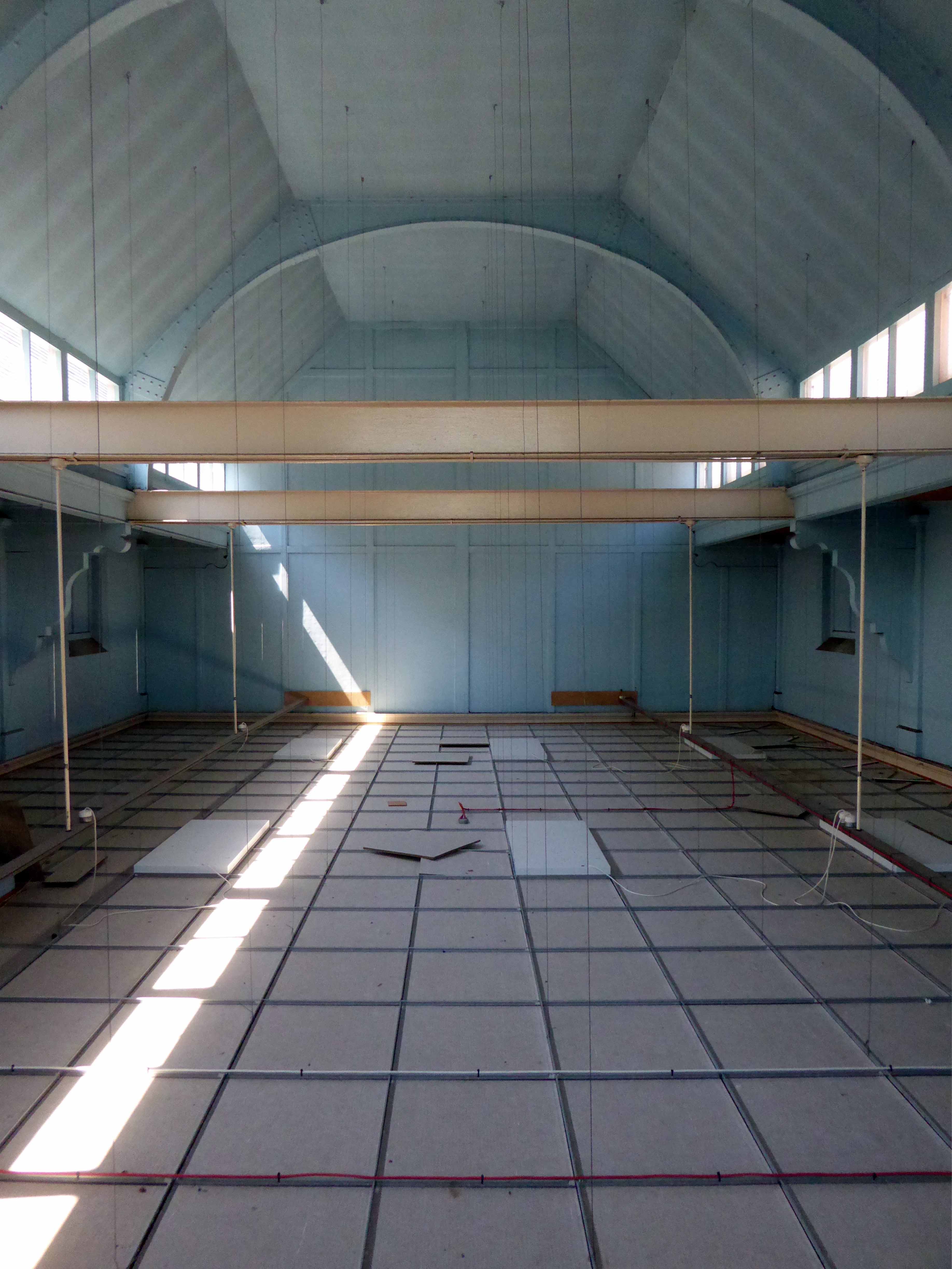
Since leaving the college in 1973, I graduated from Portsmouth Polytechnic with a BA(Hons) Printmaking, subsequently spending thirty years of my working life teaching in a variety of Further Educational sites across Manchester.
Fielden Park College seen here in 1973 – where I taught design to the printing apprentices.
Originally designed by the City Architect SG Besant Roberts in 1965, refurbished by Walker Simpson Architects.
Closed.
Wenlock Way – an annex of Openshaw Technical College, a former primary school which housed courses in Sign Writing, Jewellery, Horology and Retail Display.
Demolished.
Openshaw College – since demolished and rebuilt, becoming Central Manchester College in the 90s.
We were relocated to Taylor Street in the former Bishop Greer School – renamed the East Manchester Centre.
Since demolished to make way for an old people’s home.
Following the reorganisation of Manchester’s FE provision we were moved again to the former Yew Tree High School, Arden Sixth Form College – renamed City College Manchester.
This block was eventually demolished to make way for the new Northenden Centre – which closed last year, which has in its turn been demolished.
Everyone was relocated to the brand new building on the former Boddington’s Brewery site.
Everyone but me, as I left in 2014 to become a modern moocher.
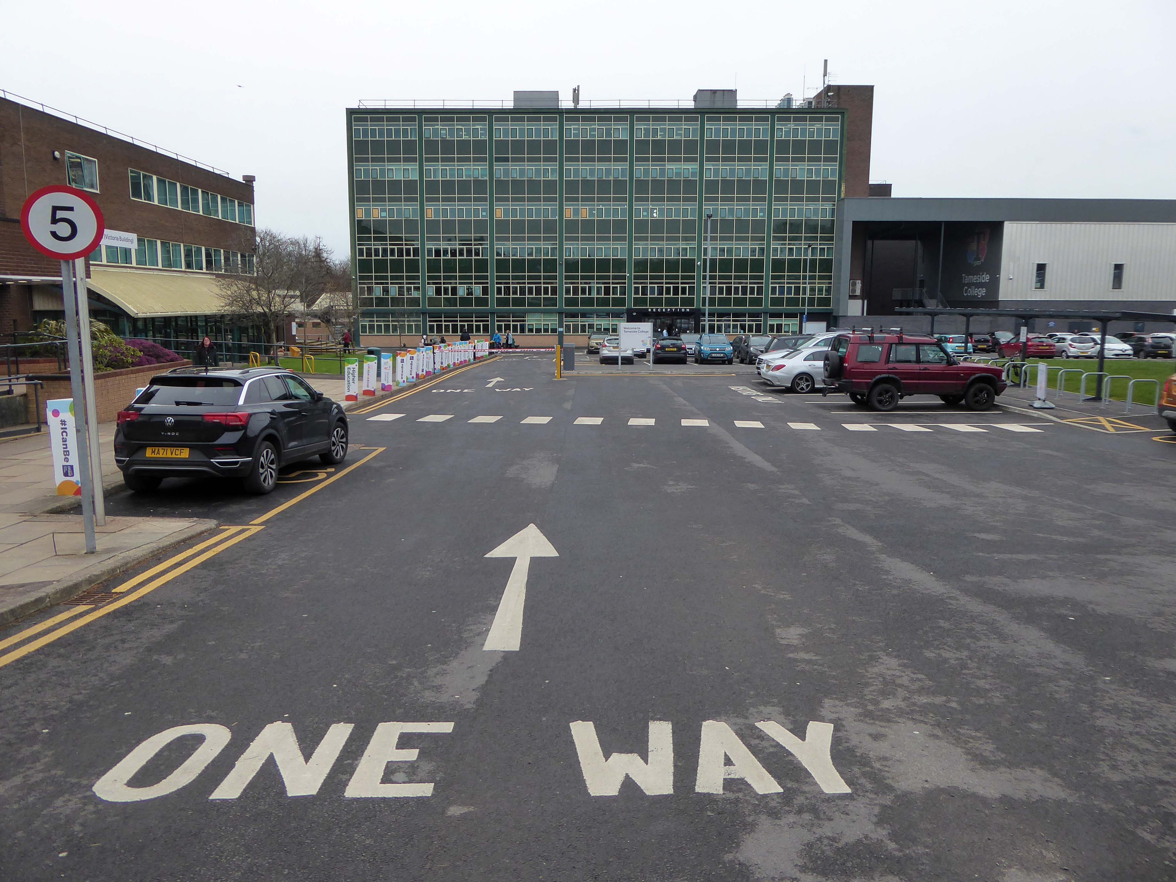
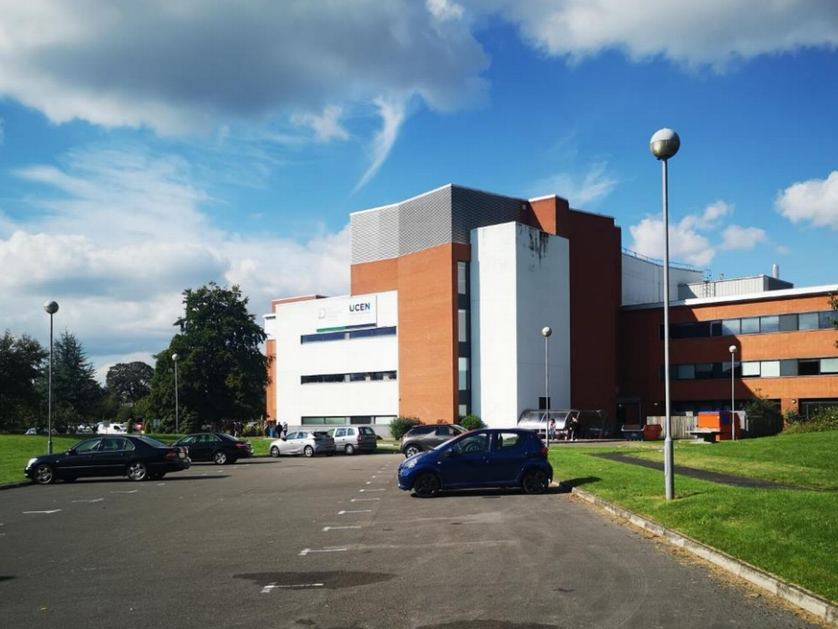
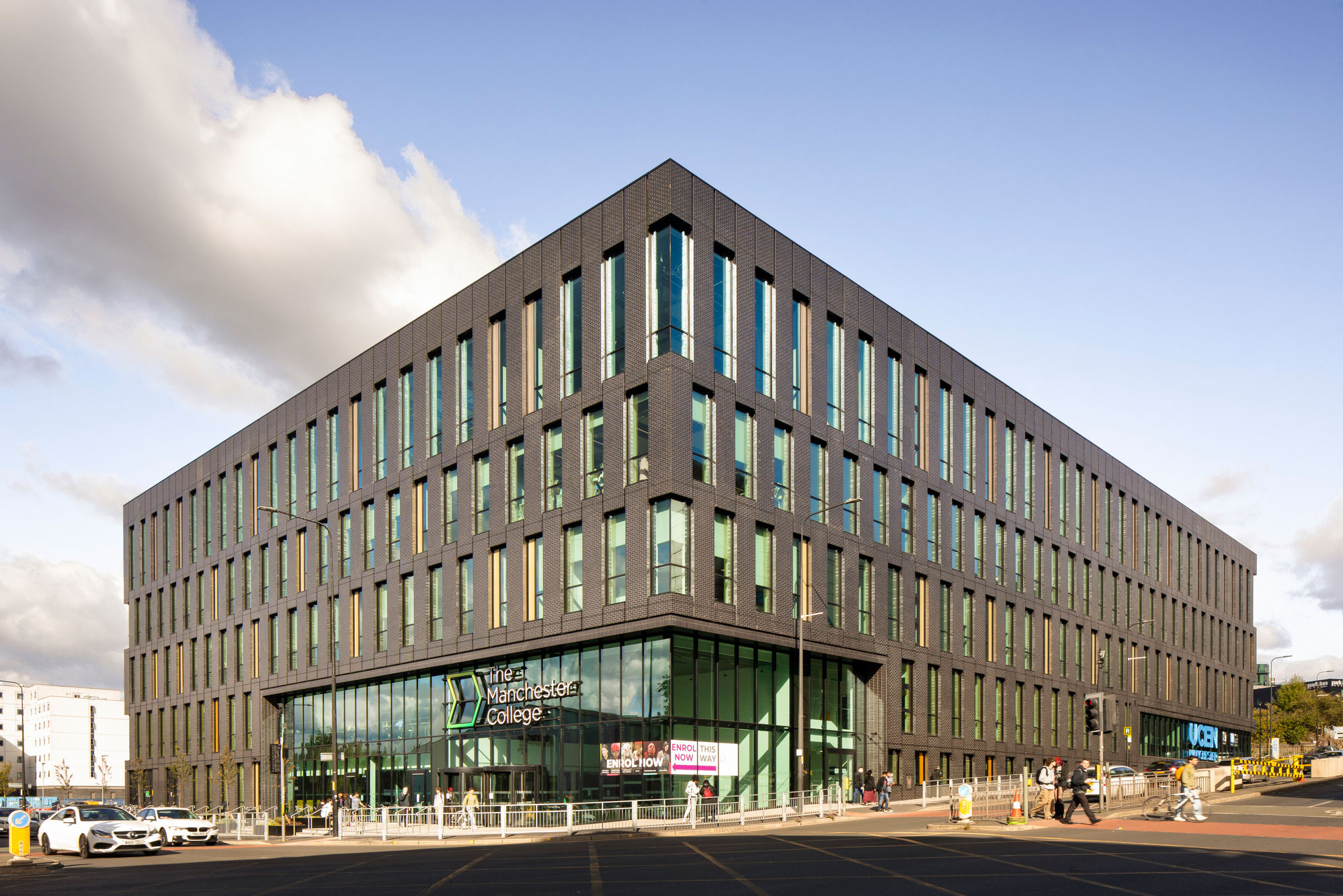
Manchester College City Campus
Following build completion in July, the long awaited 27,000 square metre, four-storey campus, designed by Bond Bryan and Simpson Haugh, offers a range of facilities, creating an exceptional student experience. It becomes the home of the College’s Industry Excellence Academies for Hospitality and Catering, Creative and Digital Media, Music, Computing and Digital as well as its Centres of Excellence for Visual Arts and Performing Arts.
It accommodates a range of Higher Education courses such as the UCEN Manchester’s School of Computing and Cyber-Security, The Manchester Film School and The Arden School of Theatre and the School of Art, Media and Make-up.
Things may come and things may go but the Art School Dance goes on forever.
My thanks to the Tameside Local Studies Centre for assisting me in accessing their archive material.
Ring Rd Wolverhampton WV1 1SA
The Municipal School of Art and Crafts officially opened on 21st June, 1885.
In May 1950 the School of Art and Crafts became Wolverhampton College of Art.

Its aims were to maintain and develop the closest possible relations with industry, collaborate with employers to develop new training courses, and to maintain a high level of achievement in the fine arts.
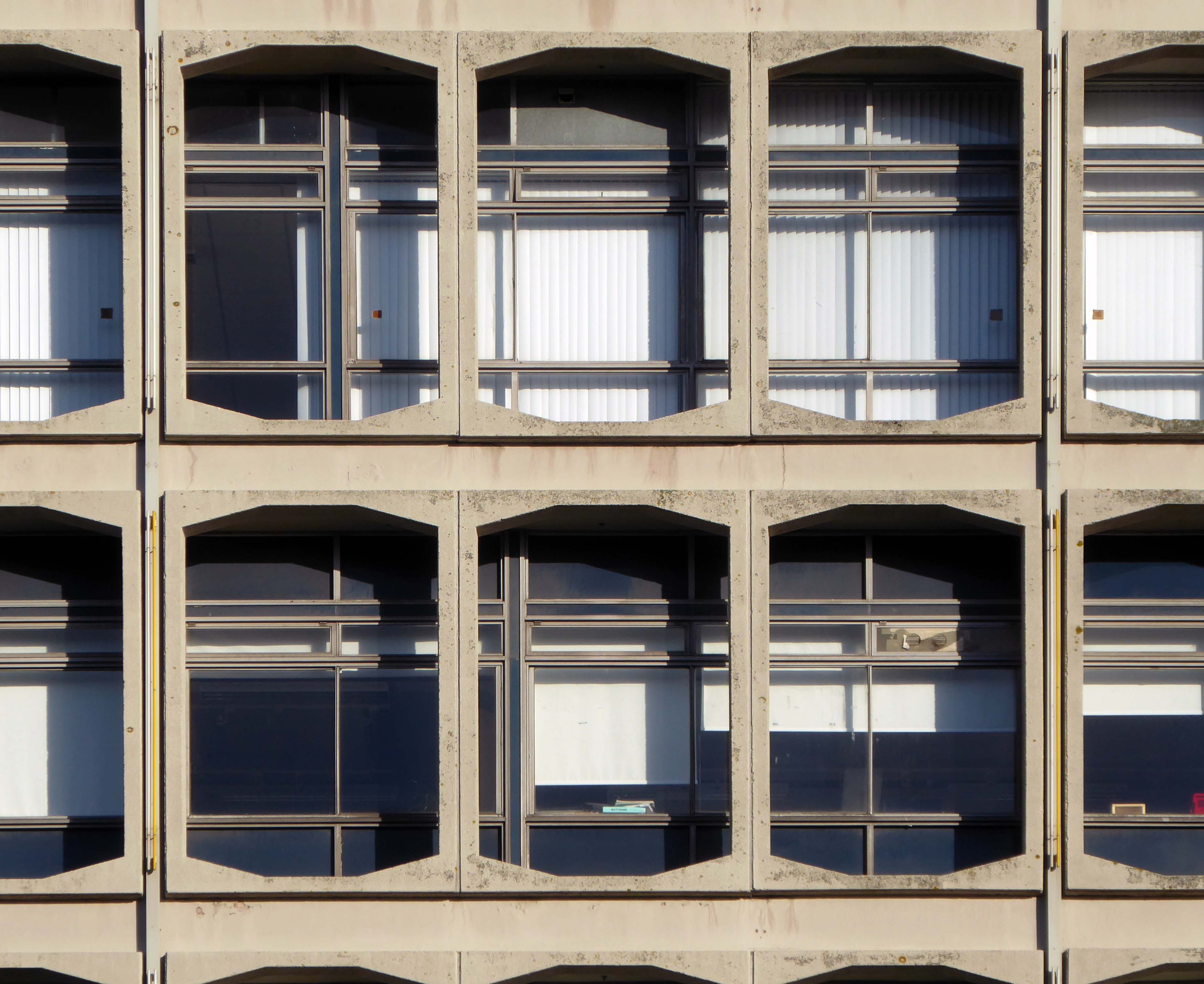
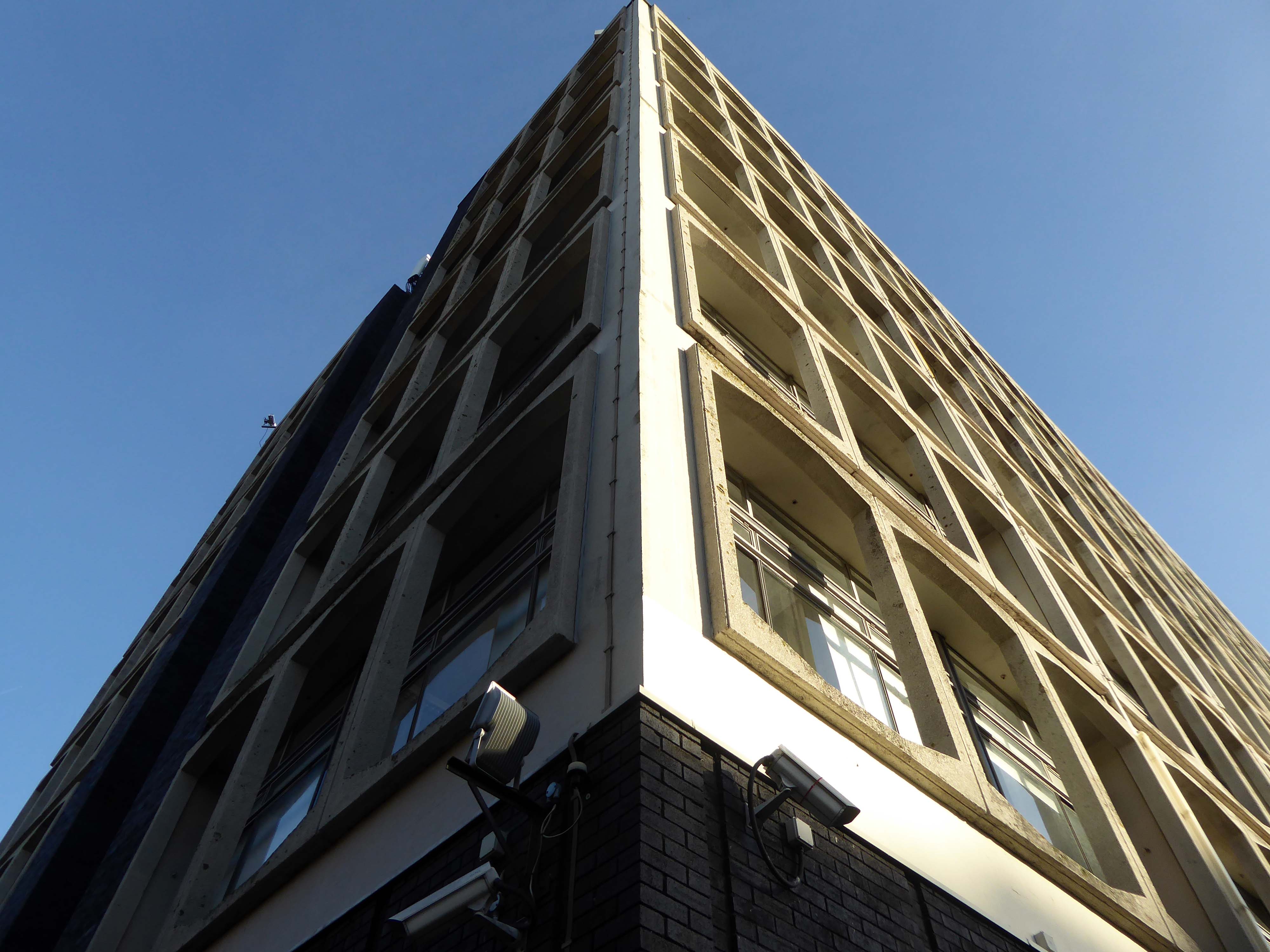
In 1963 the college began running its first degree-level course in the form of a Diploma in Art and Design. Three years later the college had a new Principal, Robin Plummer who oversaw the building of a new college alongside Ring Road St Peters. Work on the new site began in the summer of 1967, and by early 1969 the new building had appeared.
Architects: Diamond Redfern and Partners with A Chapman Borough Architect
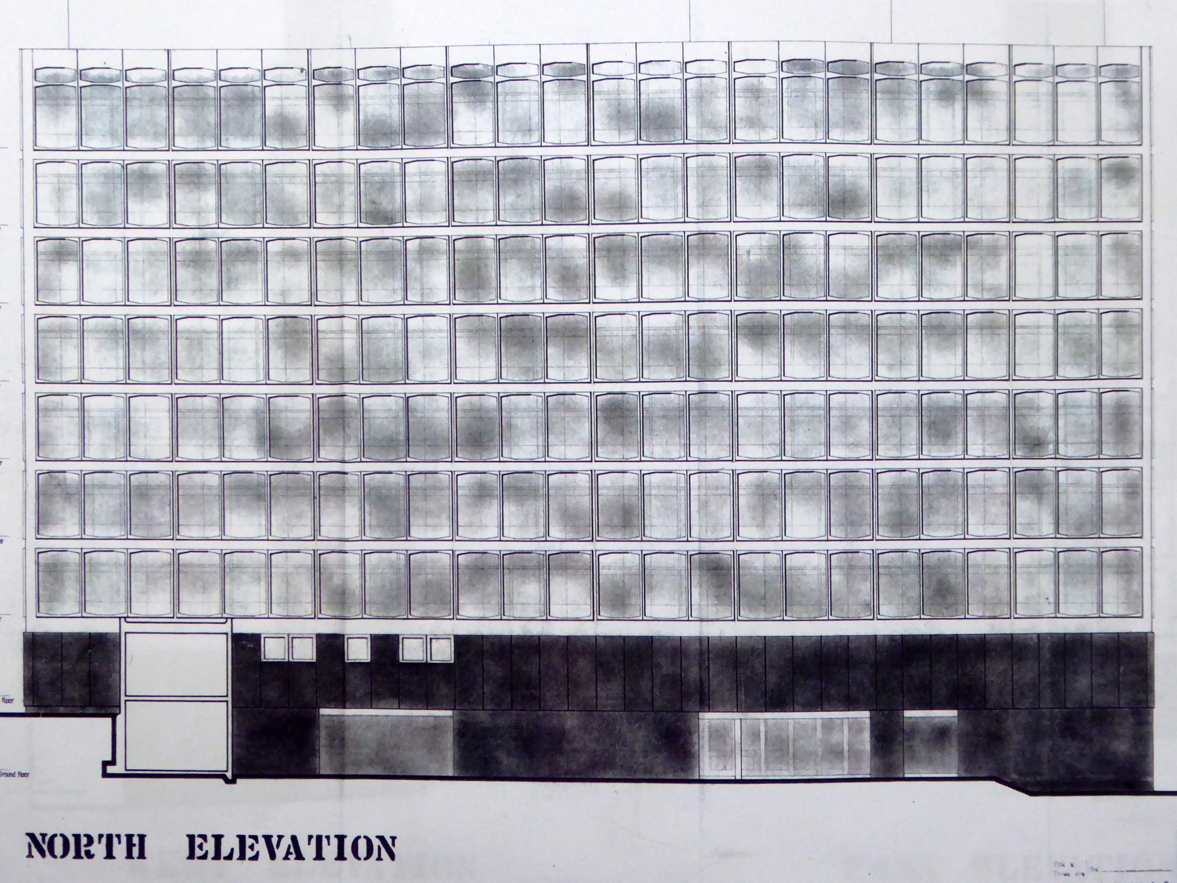
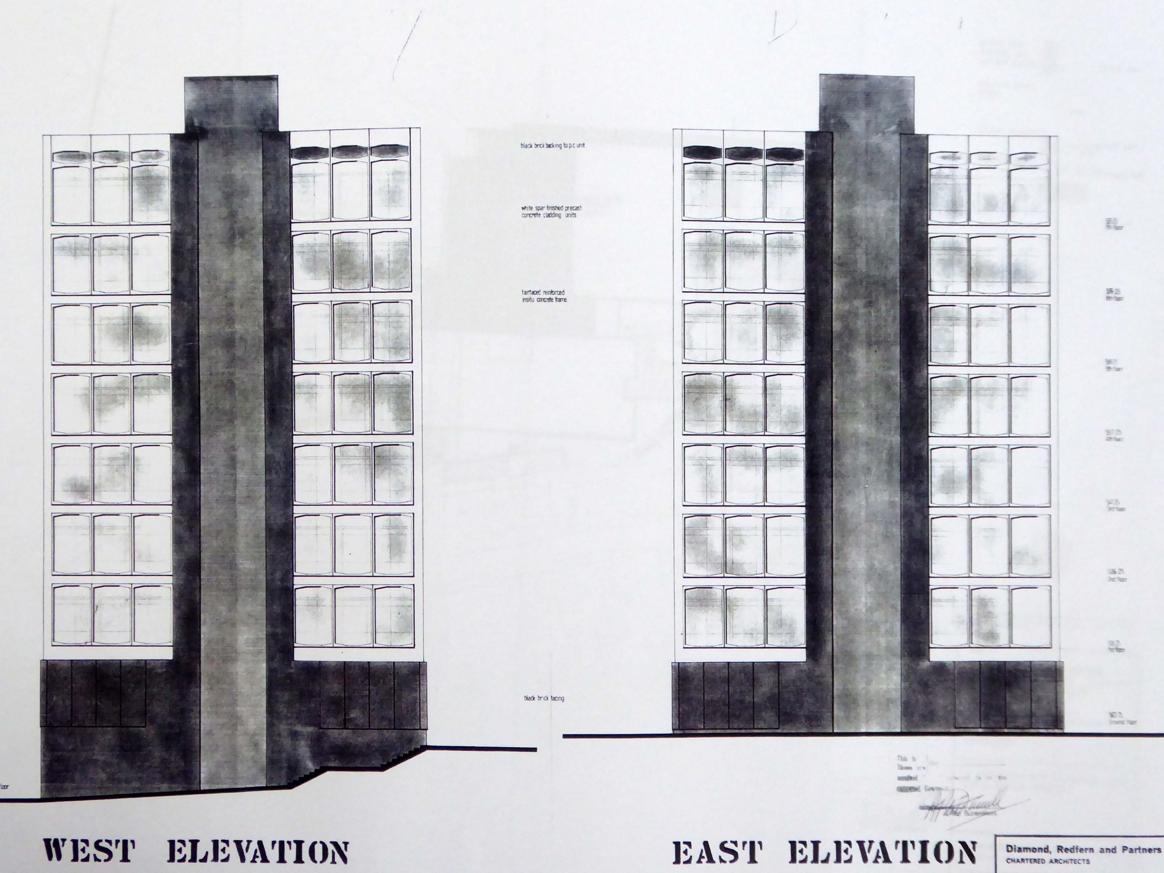
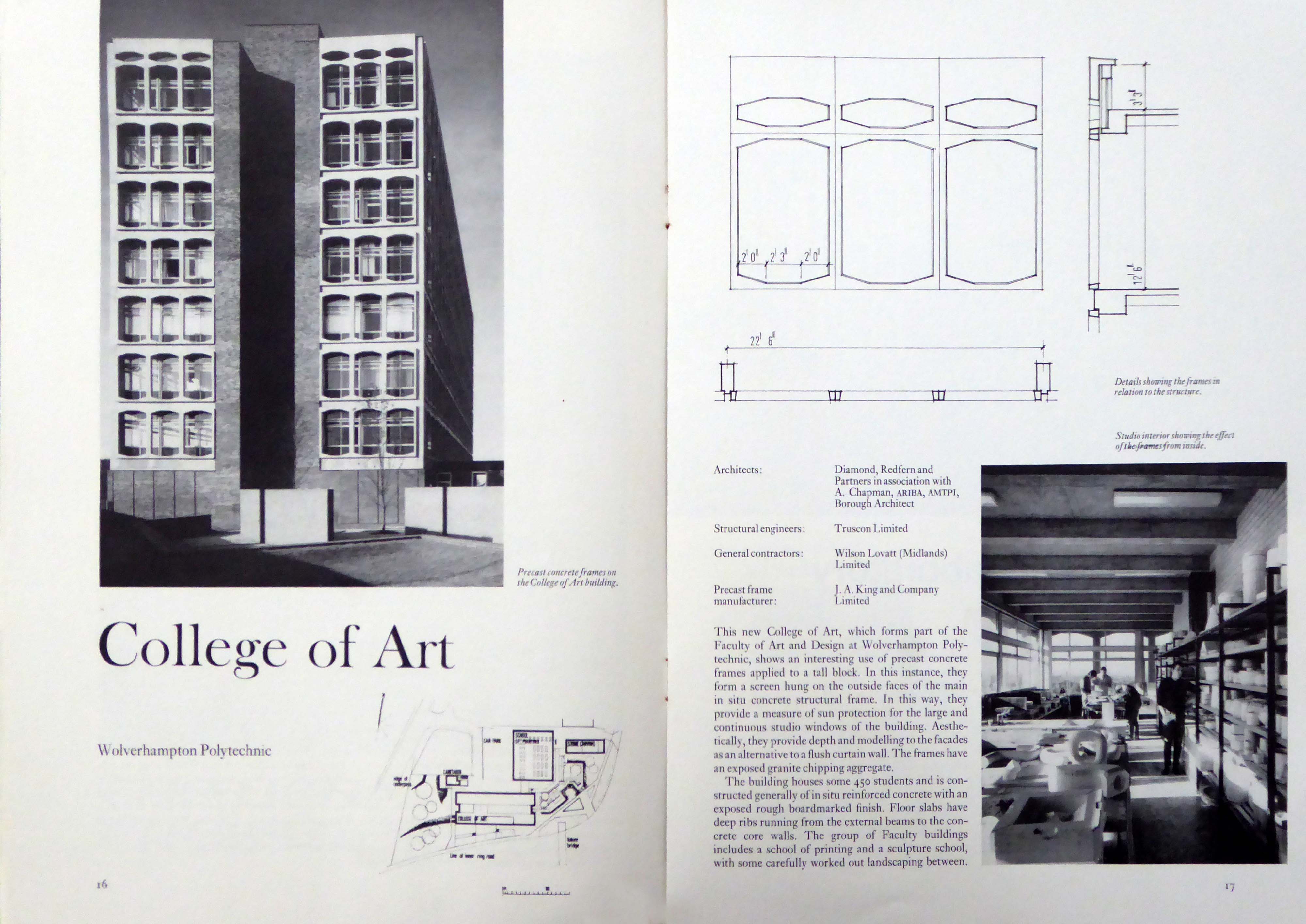
The first degree show was held there on 12th June, 1969 and the first full academic year started in September 1969. The building was officially opened by an ex student, Sir Charles Wheeler on 23rd October, 1970.
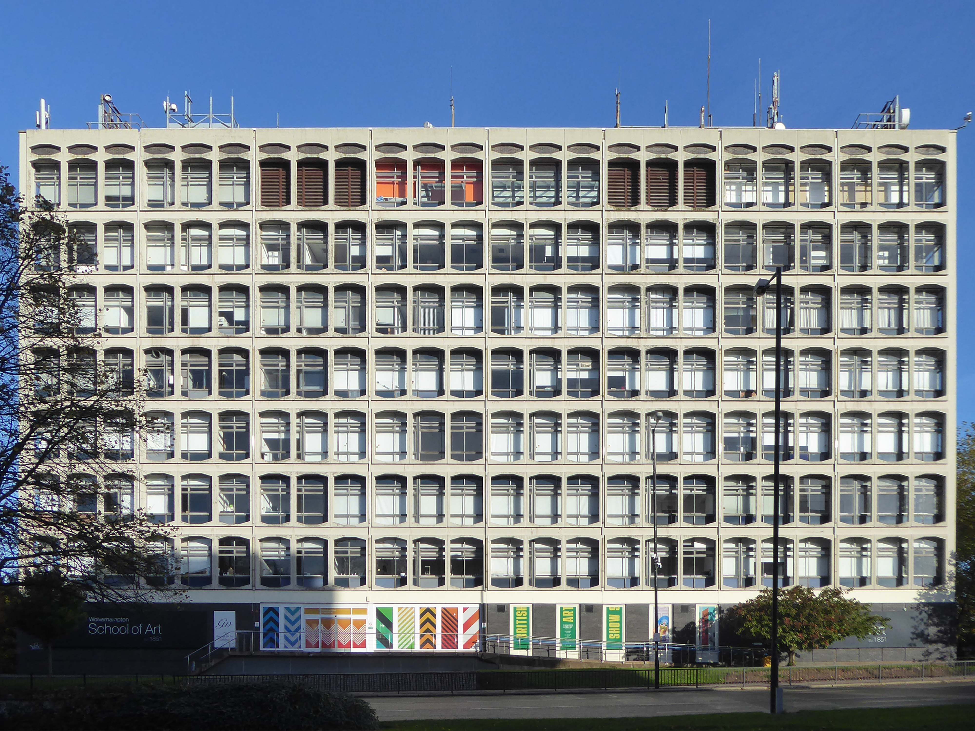
Wolverhampton College of Art merged with Wolverhampton College of Technology to form The Polytechnic Wolverhampton – which was founded on 1st September 1969.
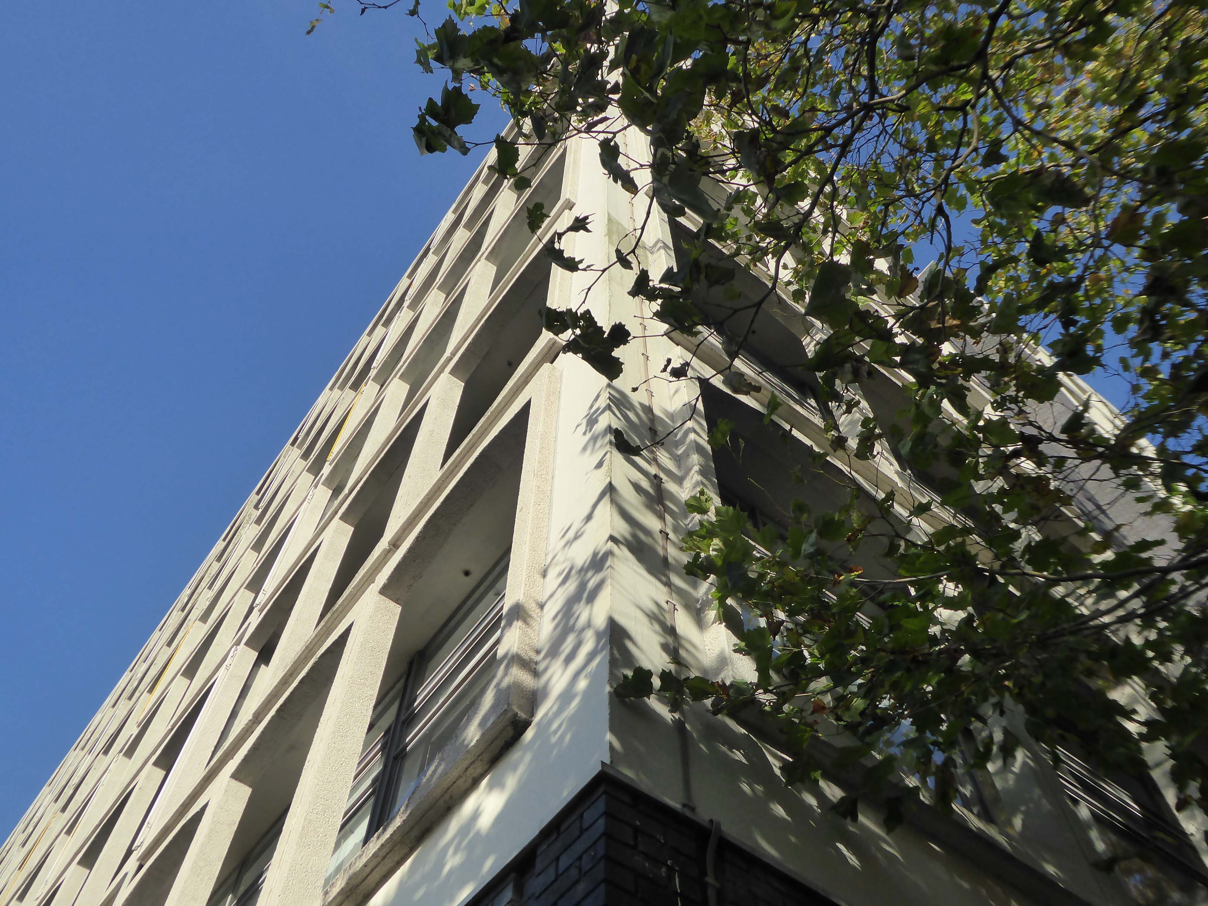
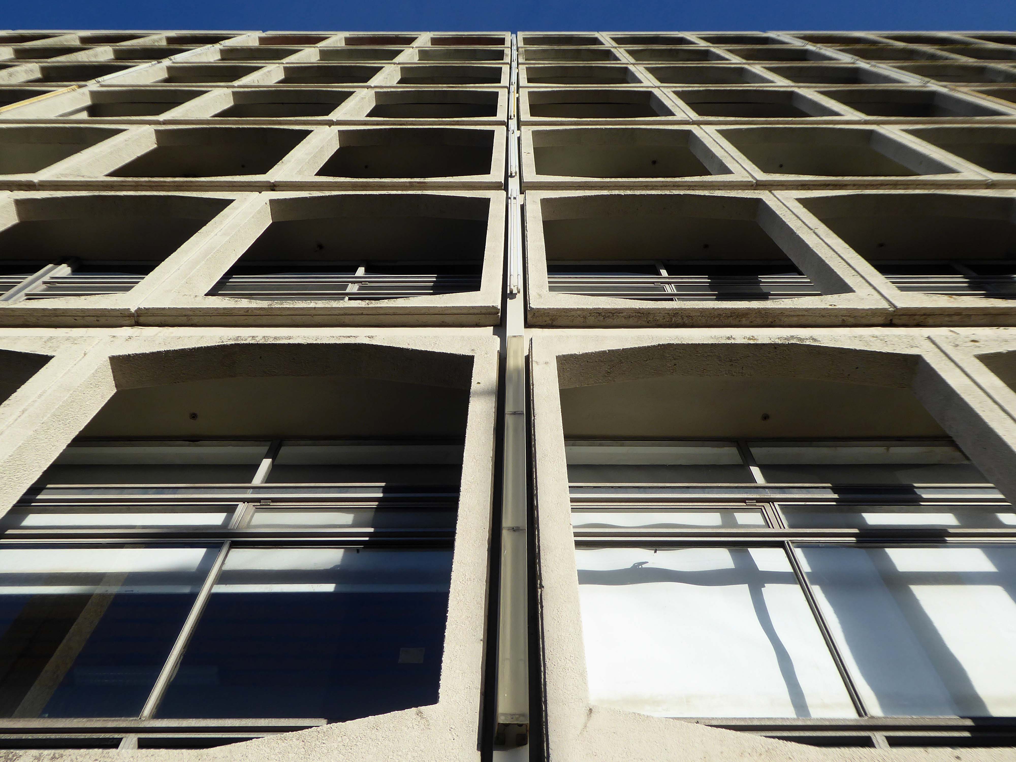
A group of interested parties visited the College, as part of a photographic walk lead by Black Country Type aka Tom Hicks with the cooperation of the School of Art, organised by the Modernist Society.
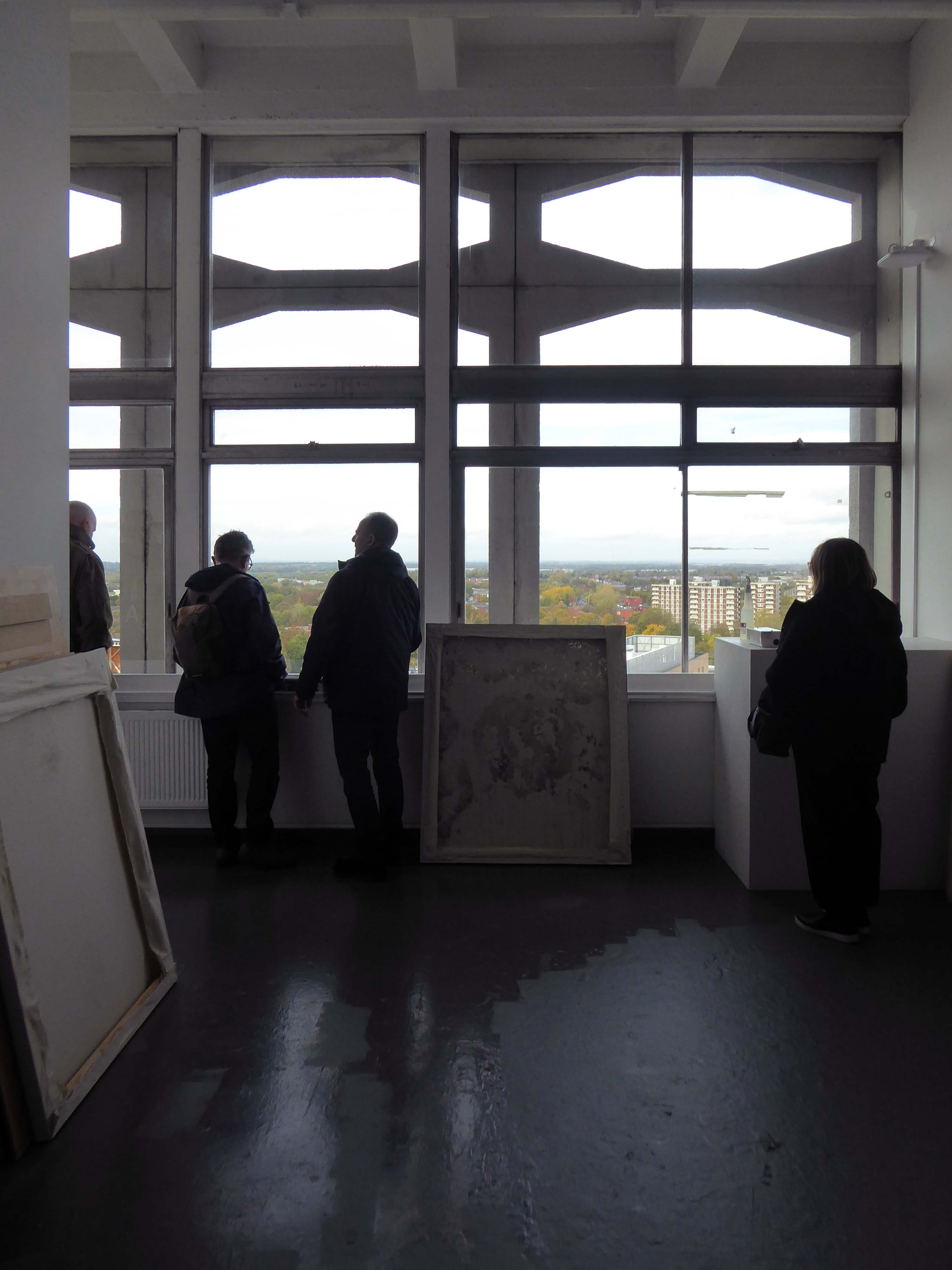
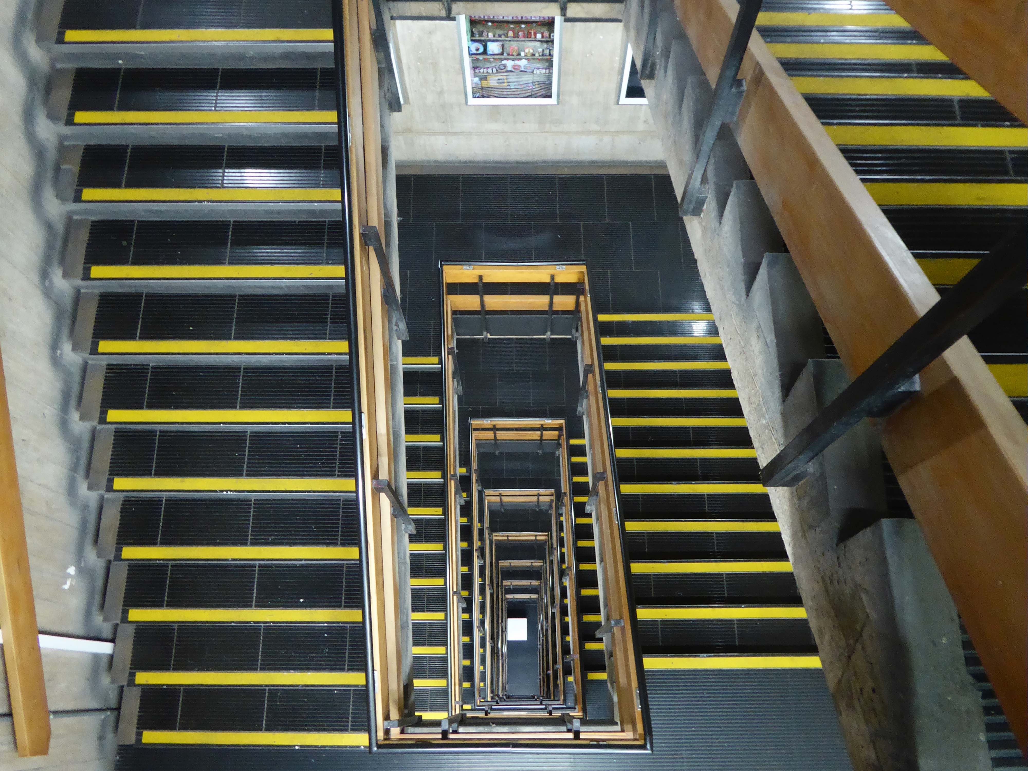
Being a product of the Great British Art School Challenge I was delighted to find the college to be in rude health. Floor after floor of well equipped studios and workshops which service the needs of hoards of eager students.
Accessed by raw shuttered concrete stairwells.
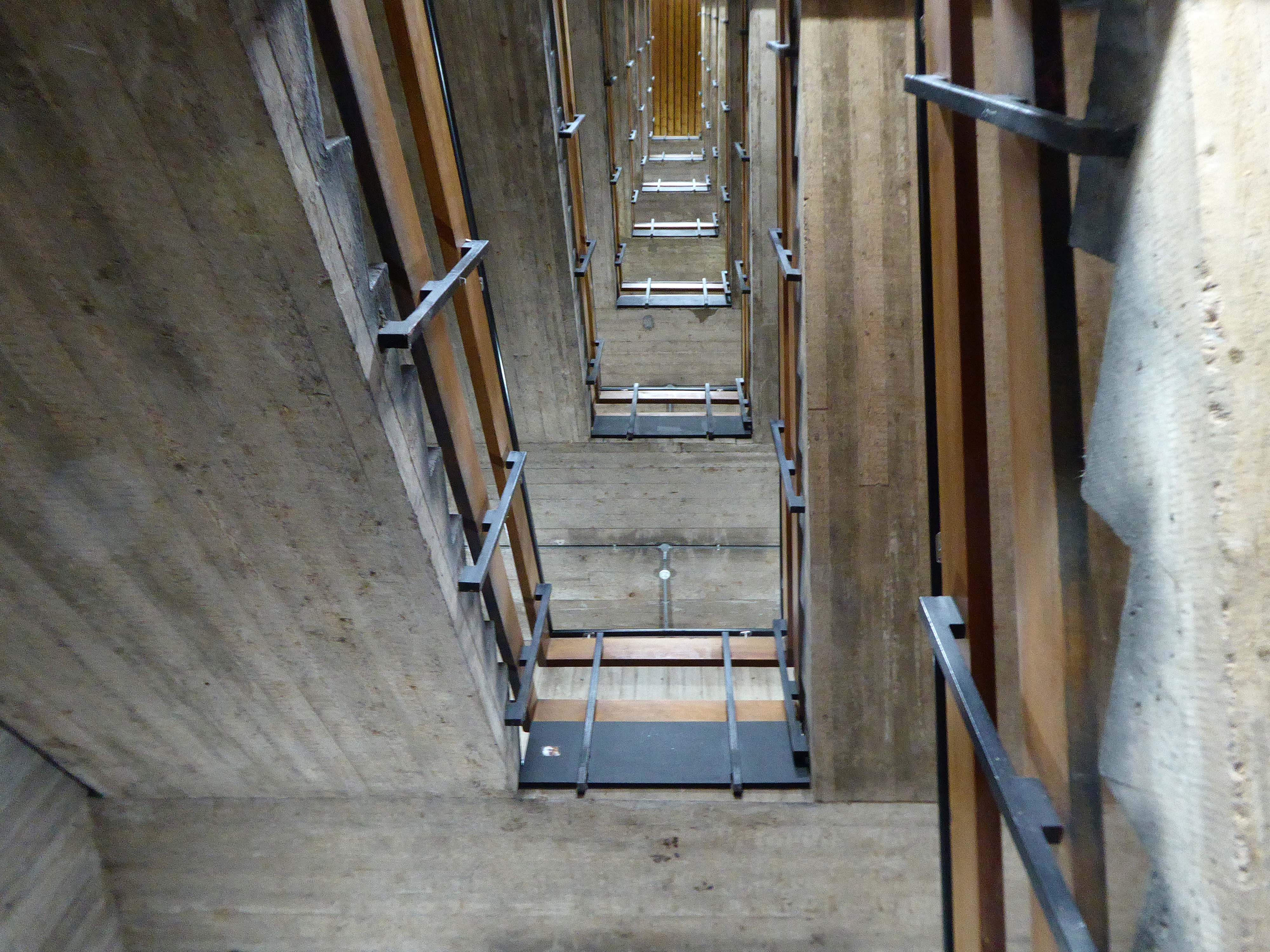
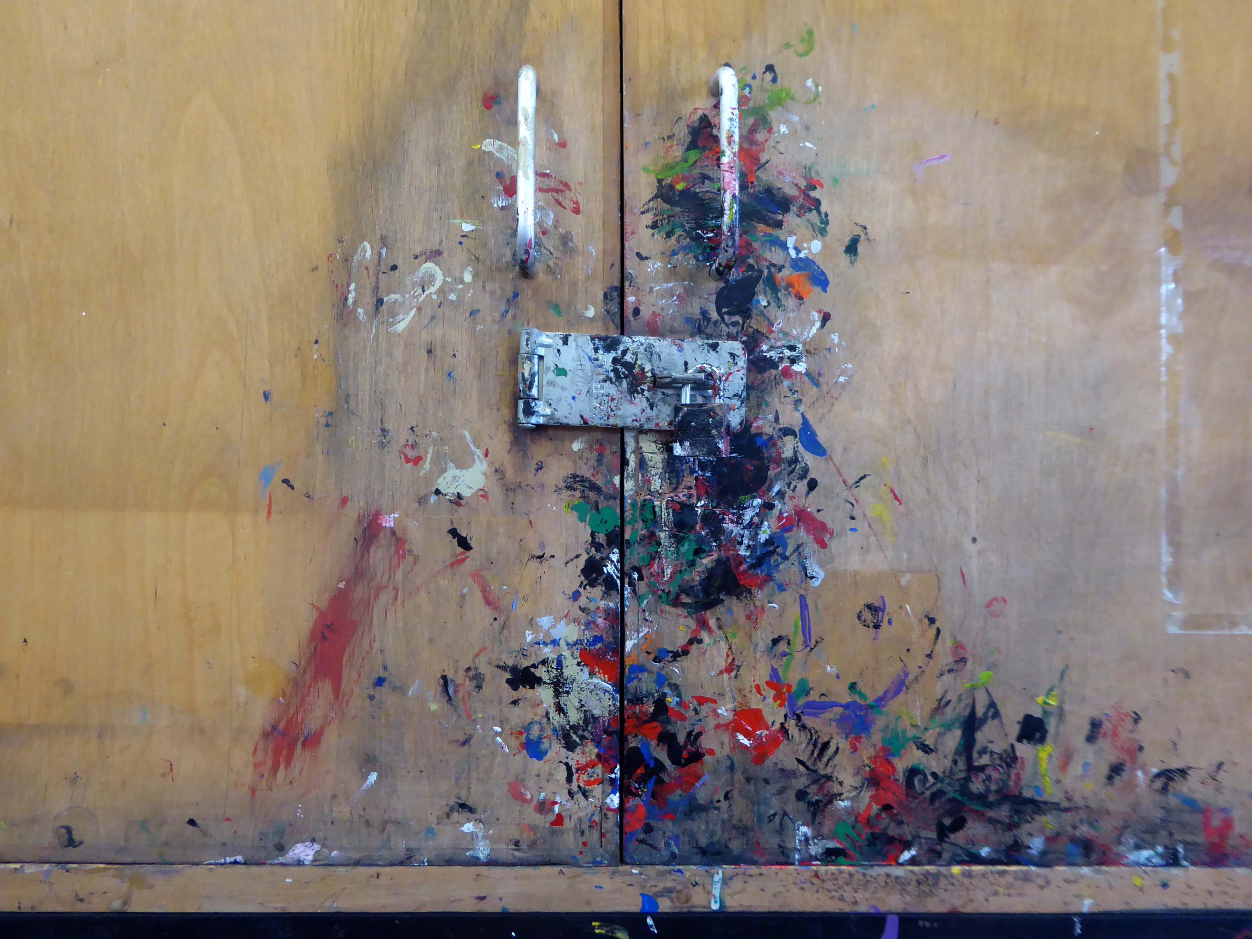
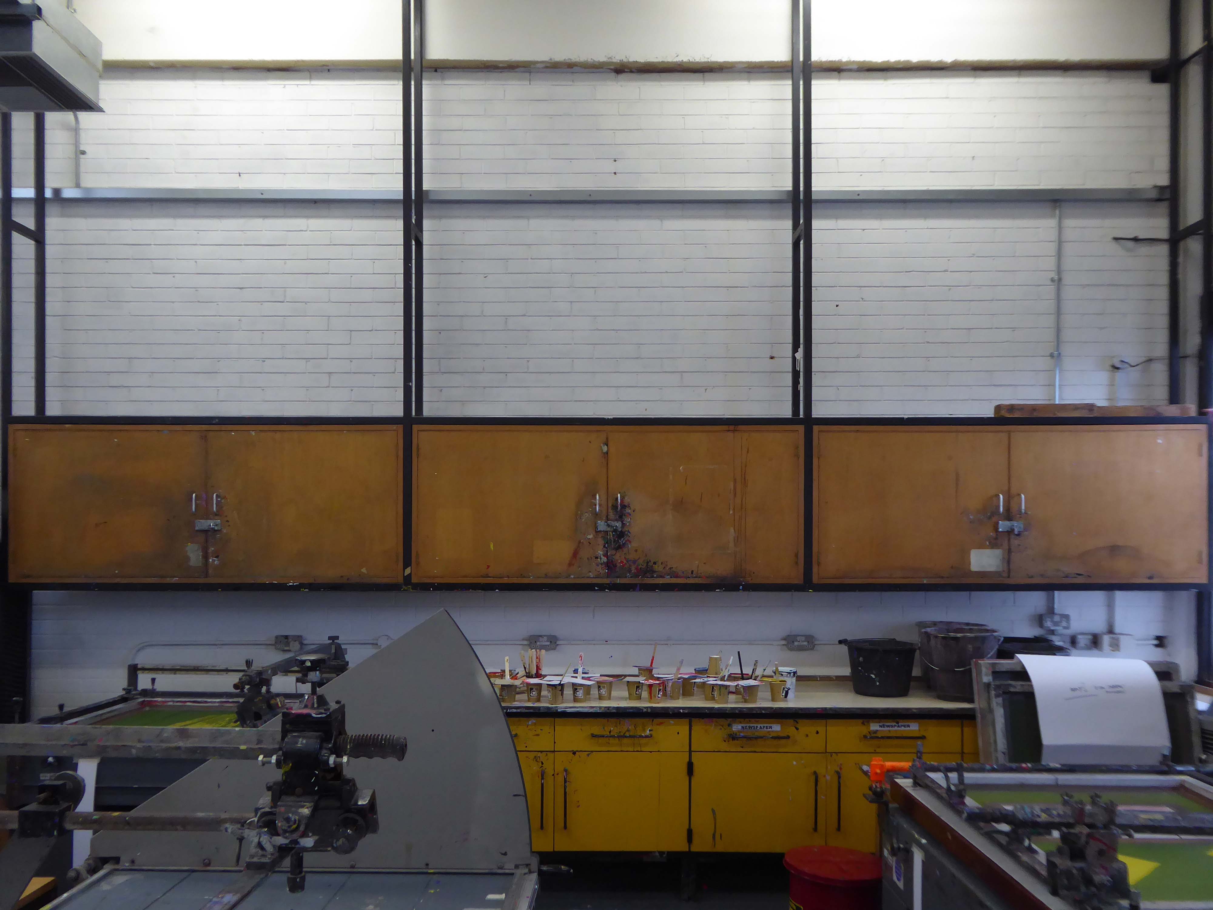
As a historically inky individual I was particularly taken with the extensive printmaking facilities.

Don’t delay enrol today!
Arriving at Wigan Wallgate turn left and left and right.
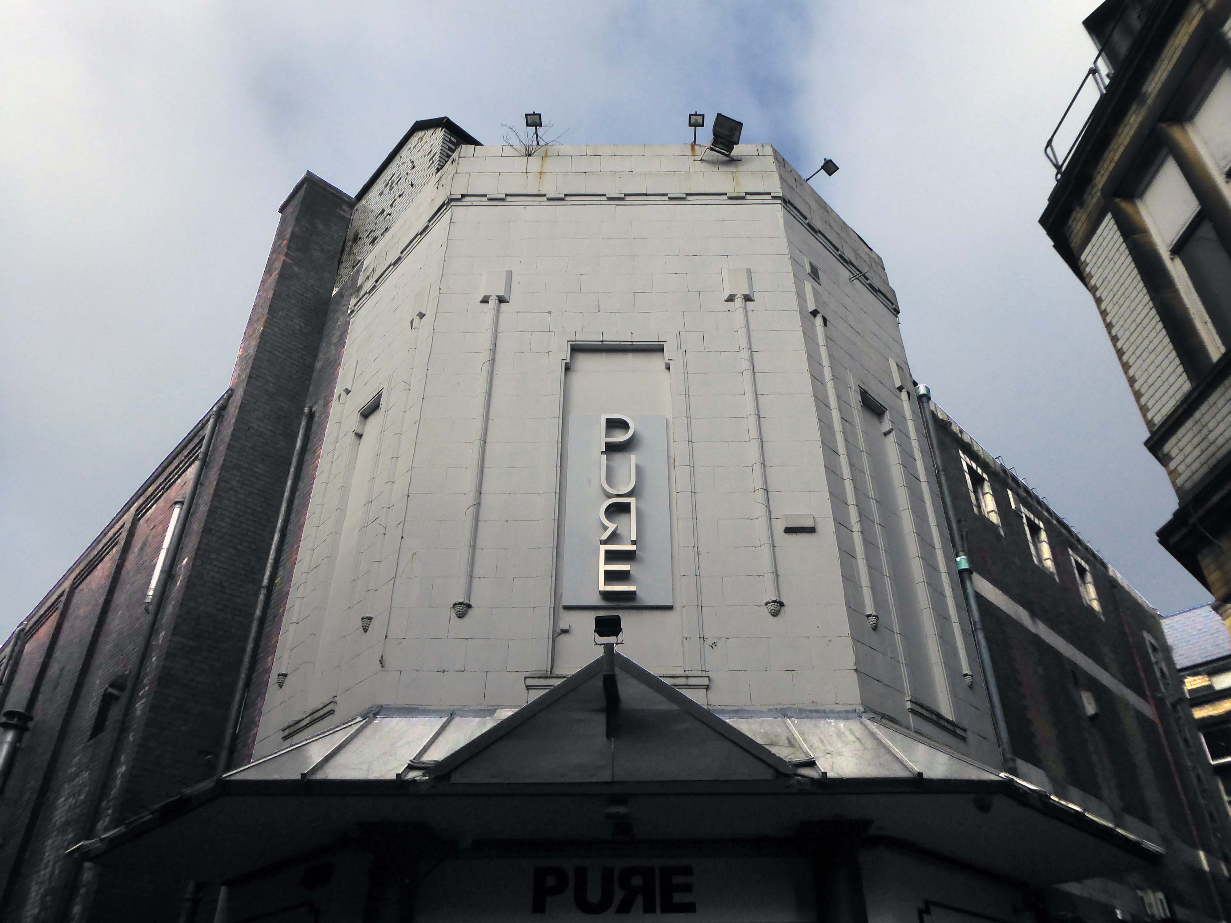
Tucked away along Clarence Yard is the former Princes Cinema.
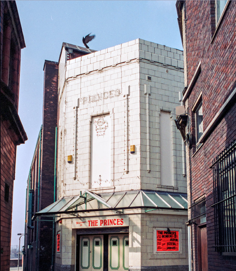
Photo: Ian Grundy
Where once upon a time the flat capped and hatted audience queued at length, for a glimpse of Dracula and Frankenstein.
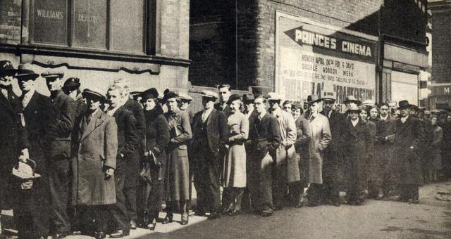
Opened in 1934 and closed on 10th January 1970 with a screening of The Mad Room.
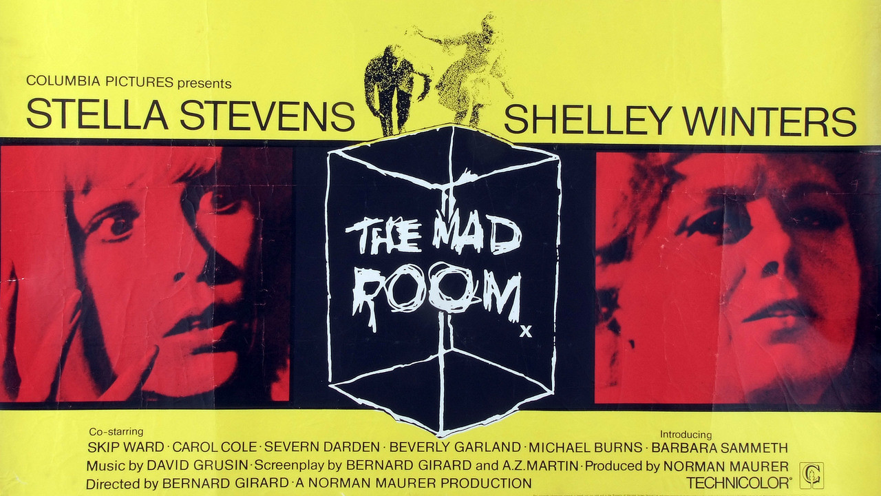
It has subsequently been in use as a nightclub.

Back out onto Dorning Street in search of telephone exchanges, three telephone exchanges.
Inter-war
Sixties.
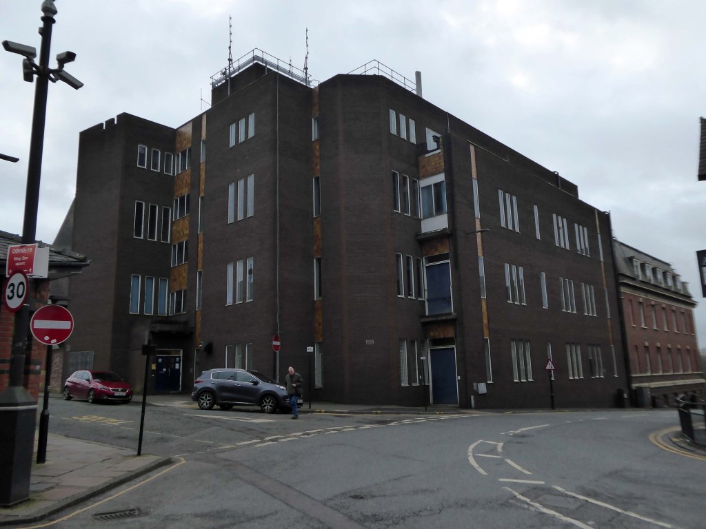
Seventies.
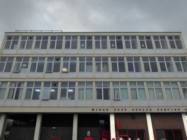
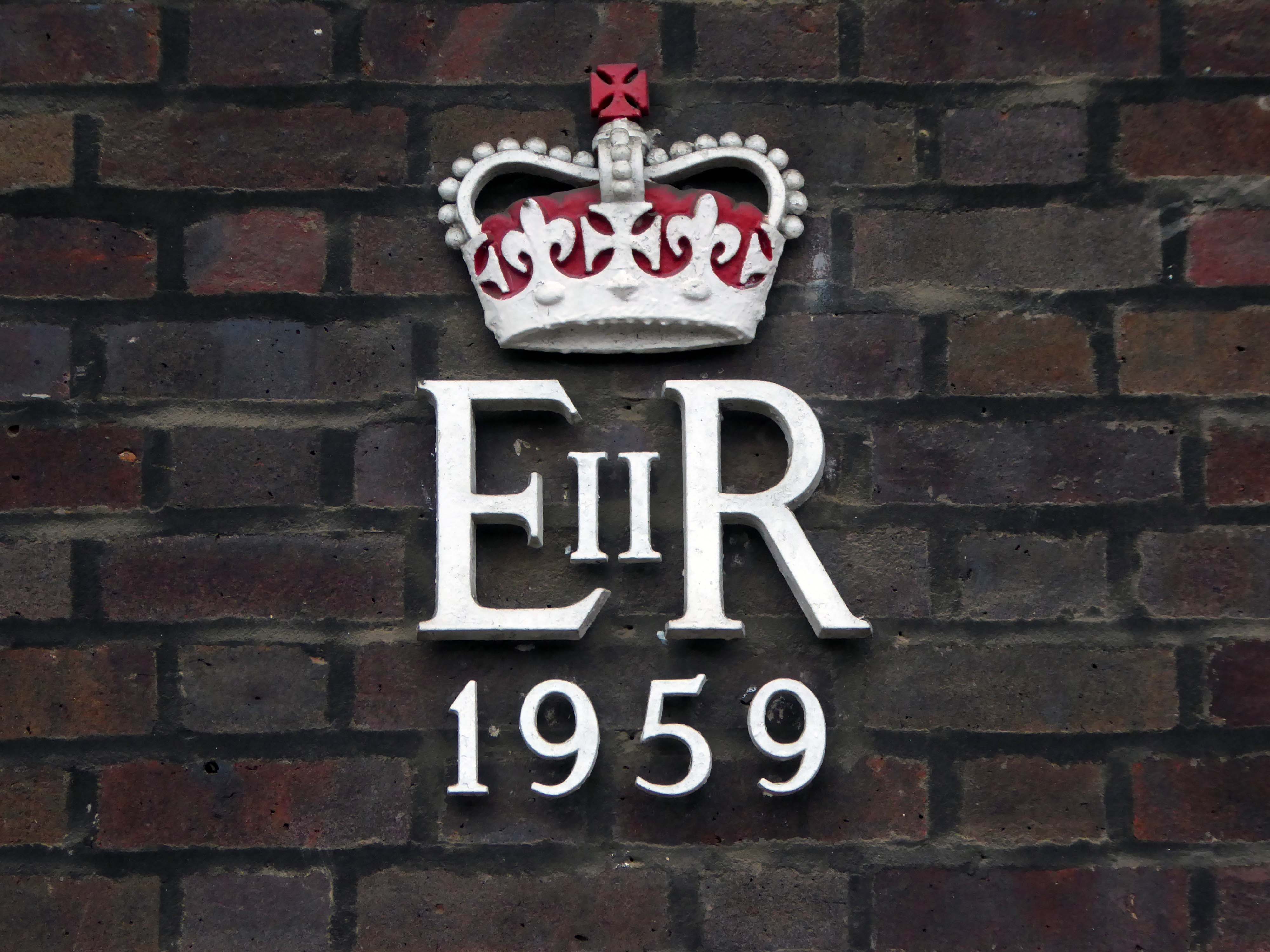
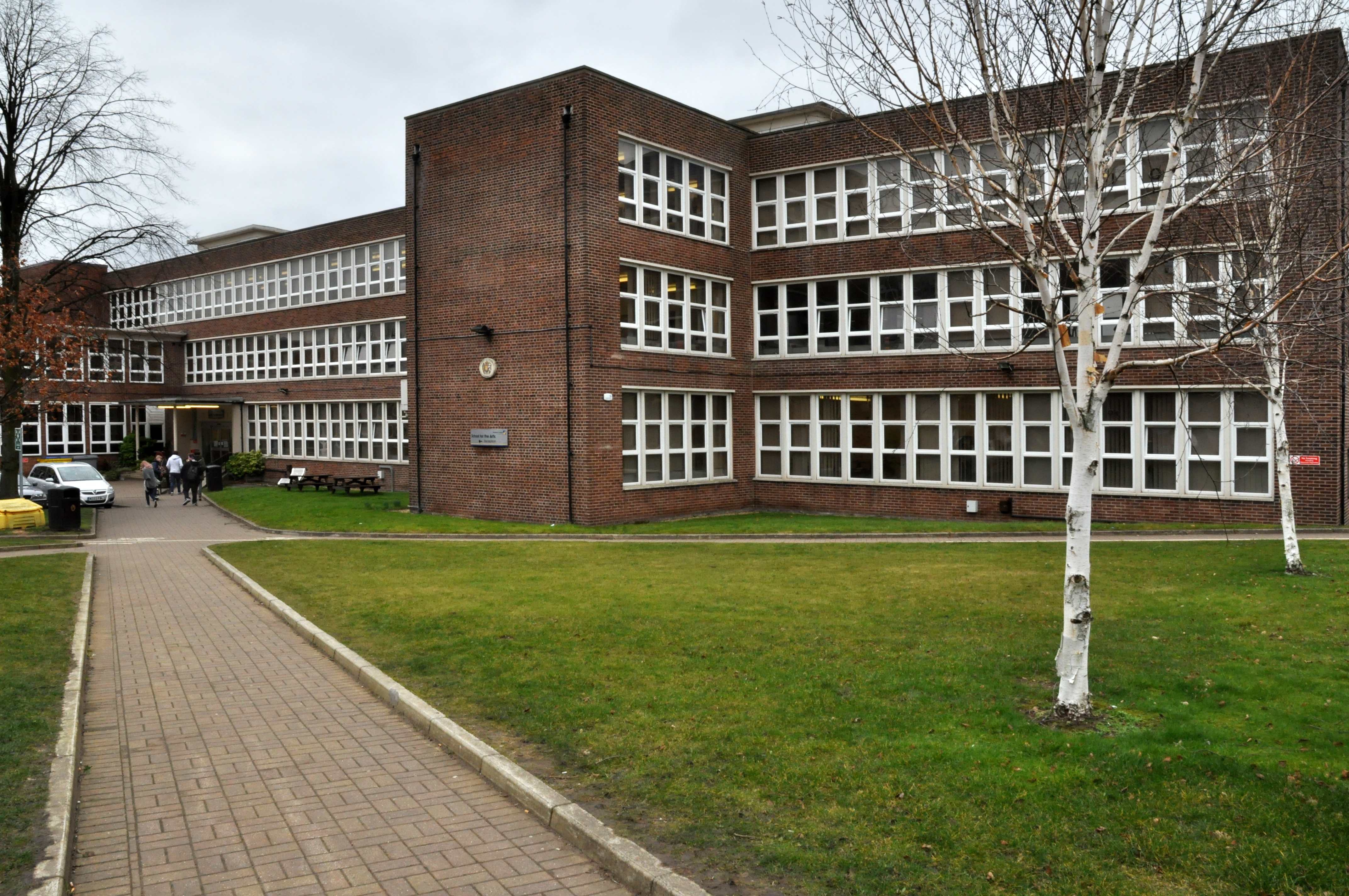
Just around the corner is an expansive GPO Sorting Office of 1959.
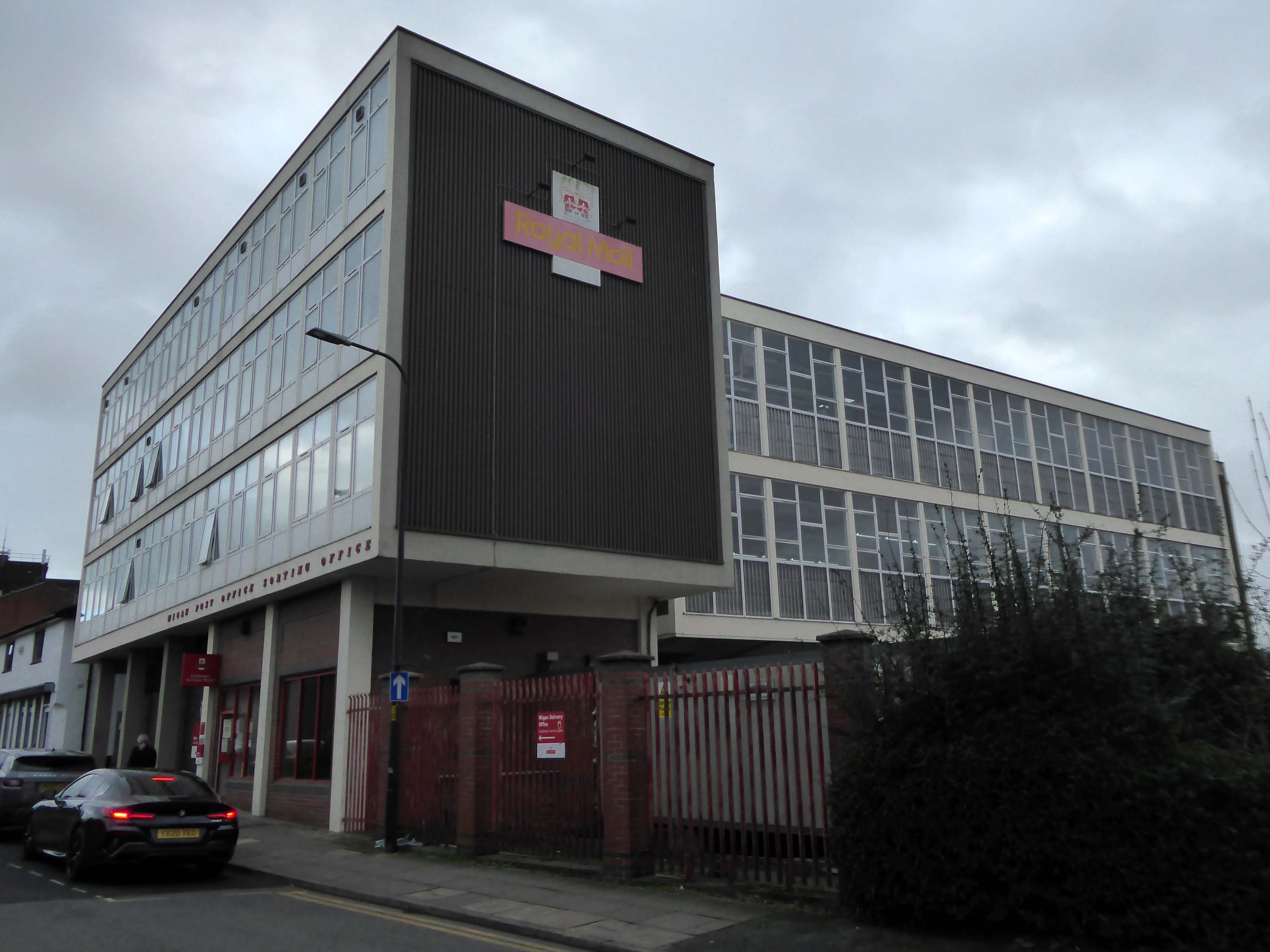
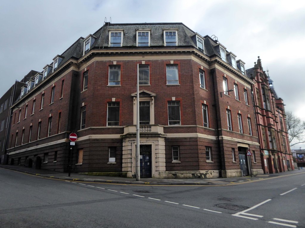
Across the way is the Technical College.
The foundations of Wigan & Leigh College date back to 1857, and the current institution was formed in April 1992 through the merger of Wigan College of Technology and Leigh College.
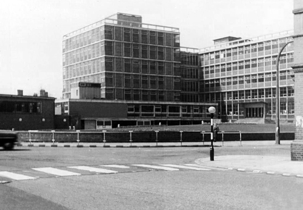
Partly formed from the Thomas Linacre Technical School.
Architects: Howard V Lobb G Grenfell Bains & Hargreaves 1954
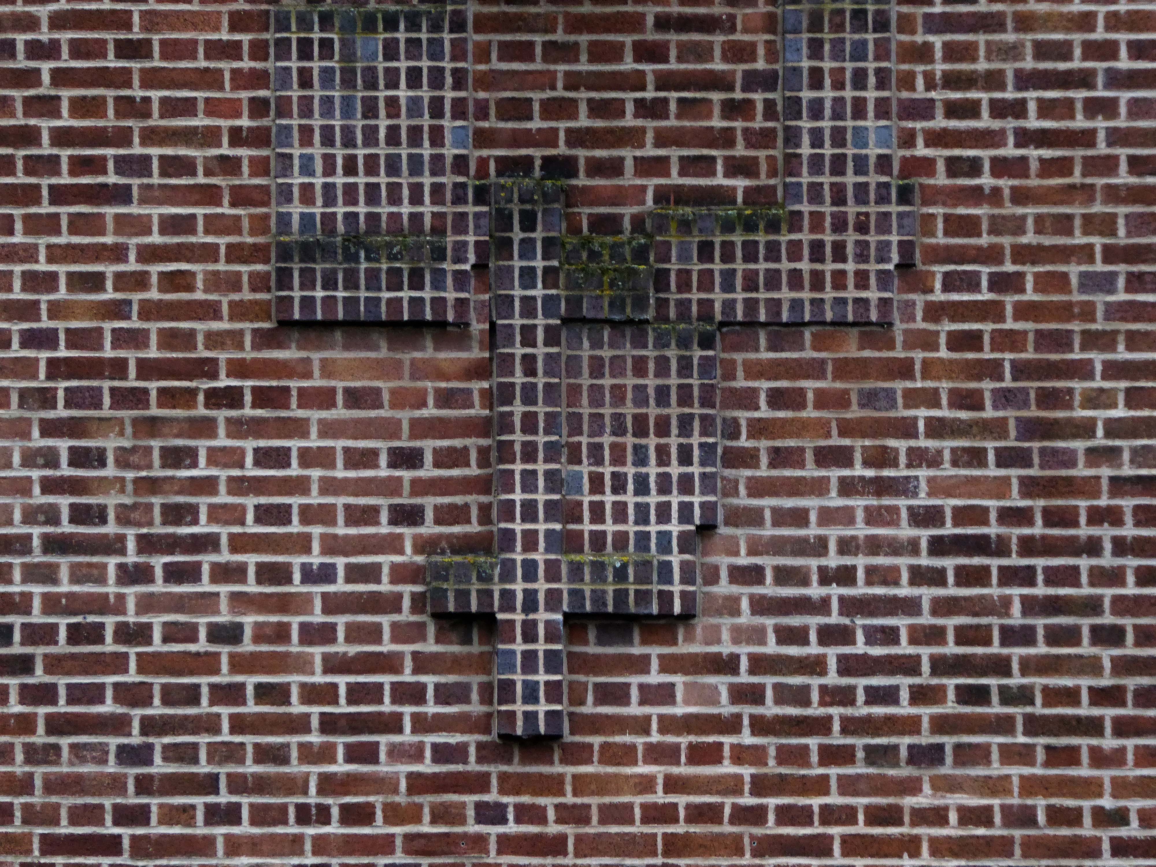
School Hall – RIBA Pix
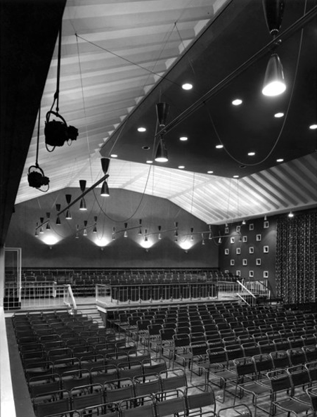
Curious decorative brick motif – a floor plan of the building.
My thanks to Mark Watson for his erudition and insight.
Across the road the former Grammar School now an NHS Centre.
Wigan Grammar School was founded in 1597 and closed in 1972 as part of the comprehensive education movement. it became Mesnes High School until 1989, and then the Mesnes Building of Wigan College.
It was designated a Grade II listed building in 1997.
Architect: A E Munby
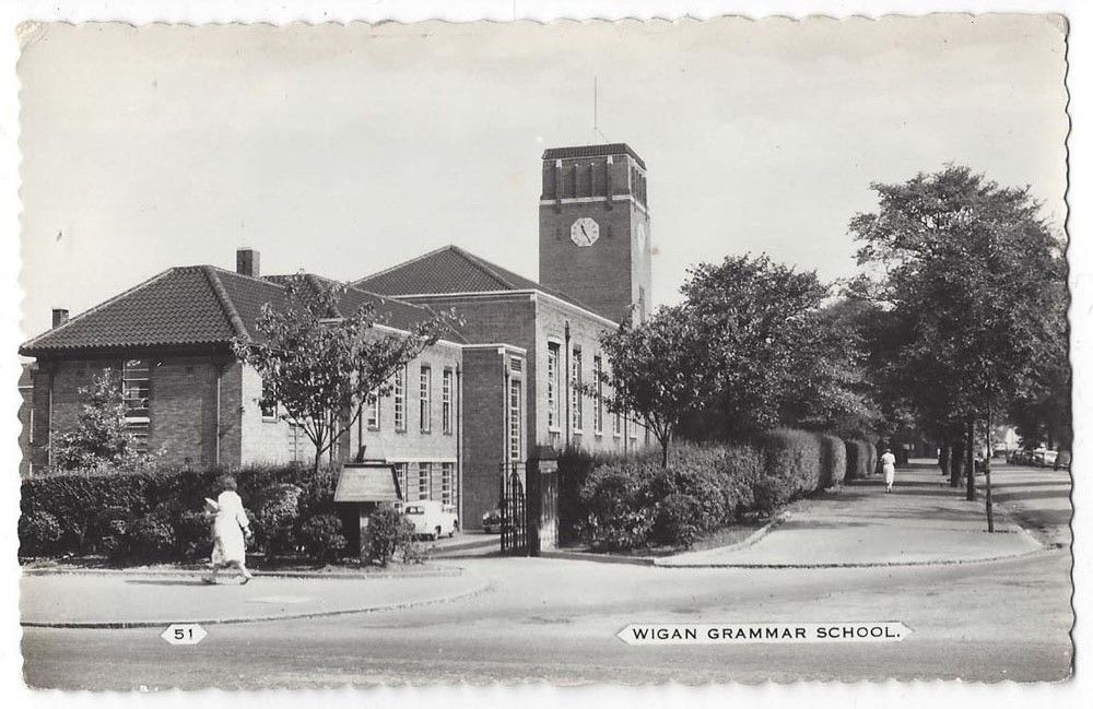
Since 2003, it has been known as the Thomas Linacre Centre and is an out-patient department for the Wrightington Wigan and Leigh NHS Trust.

Let’s head back into town and along Standishgate.
Former Burton Tailors – possibly.
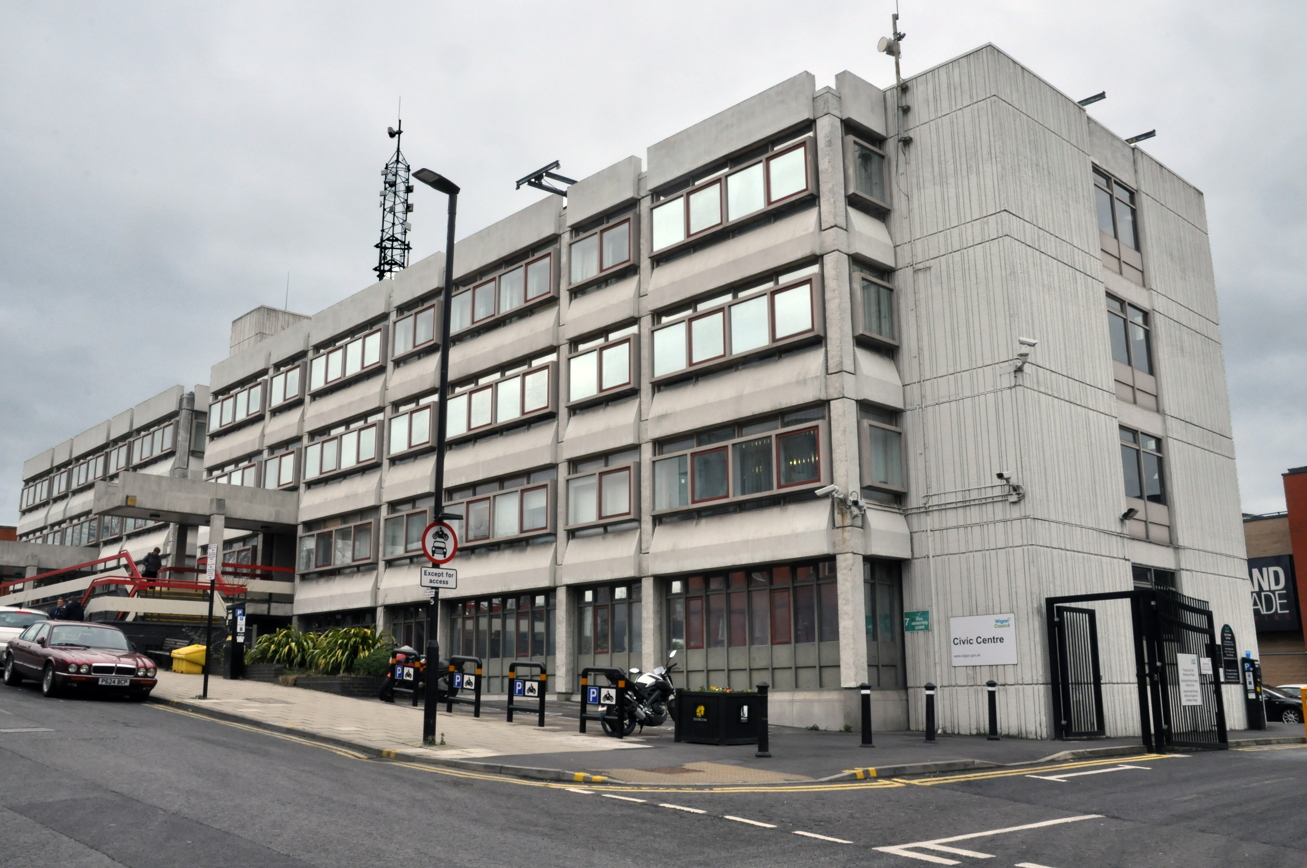
Turn left into Millgate to see the boarded up Civic Centre.
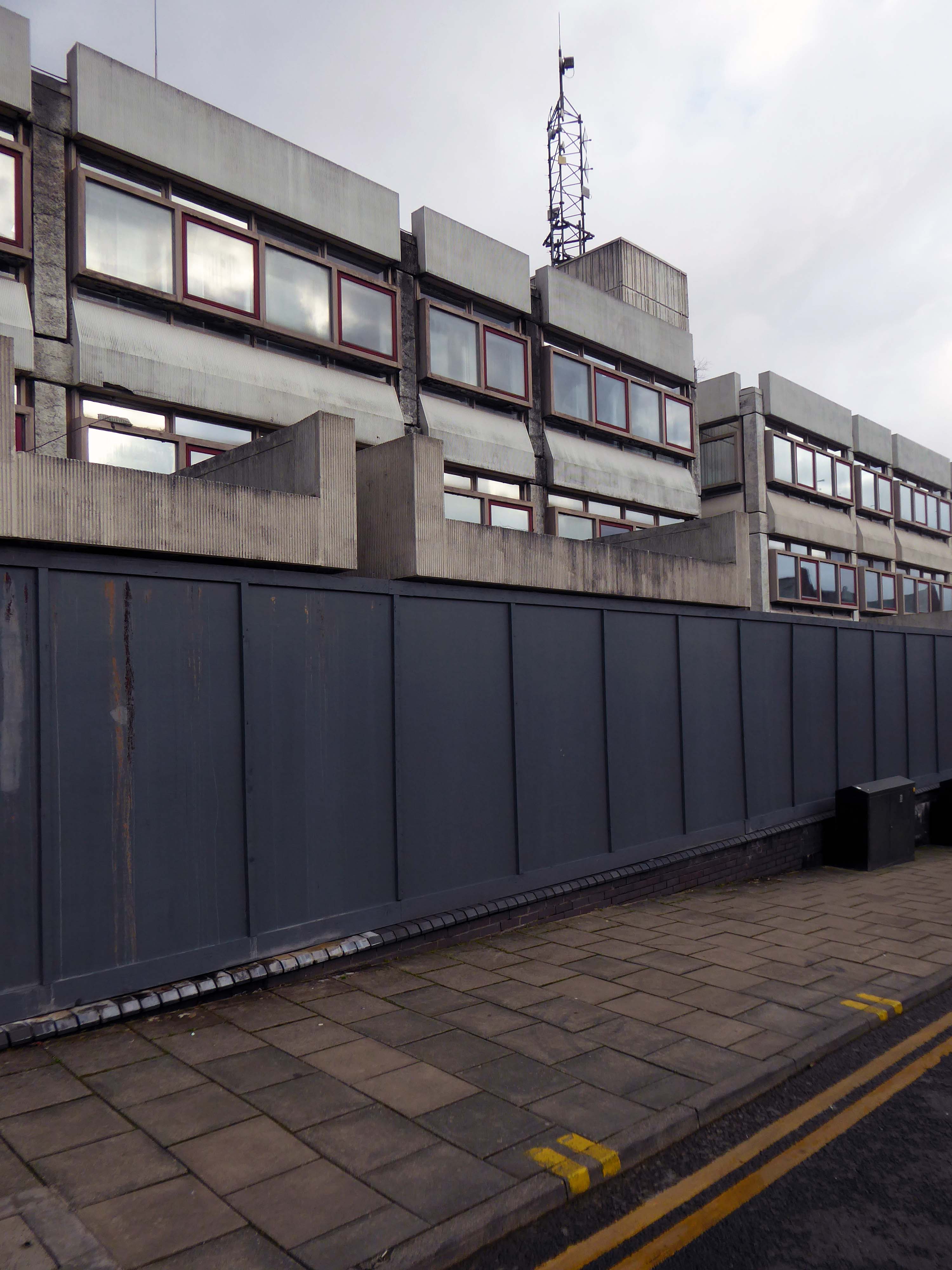
Formerly not boarded up Civic Centre.
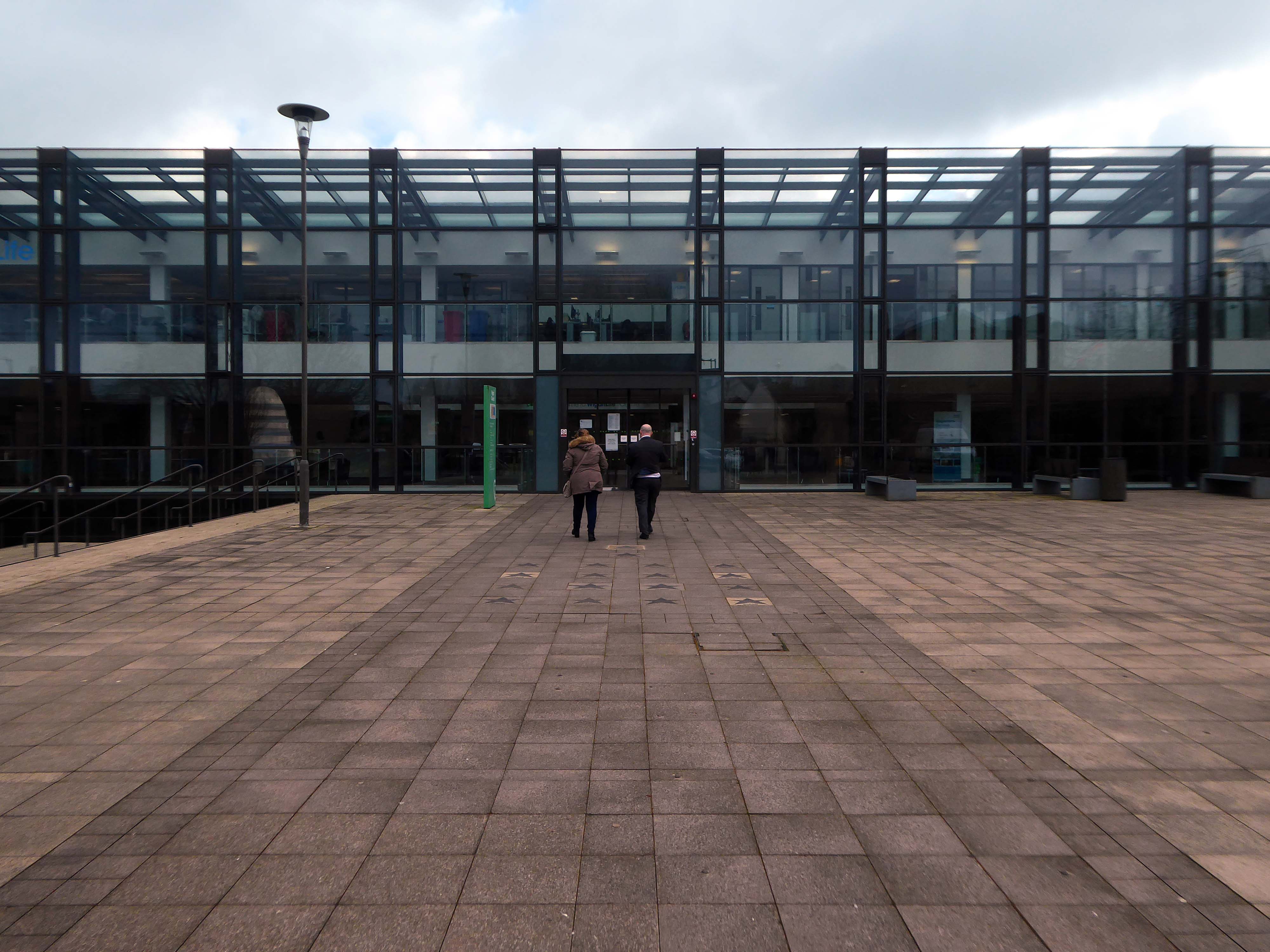
Across the way the new Library and Life Centre by Astudio and LCE Architects
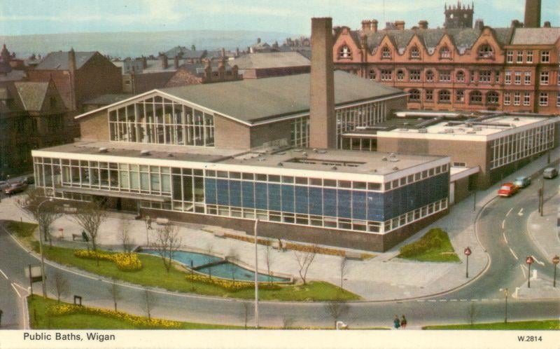
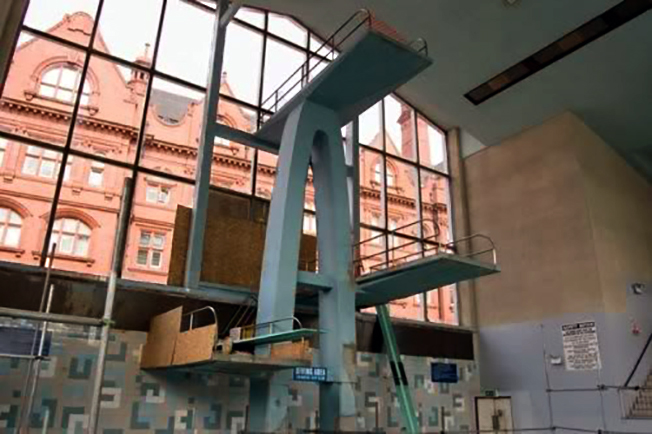
Down the road to where the International Swimming Pool was – opened 1968.
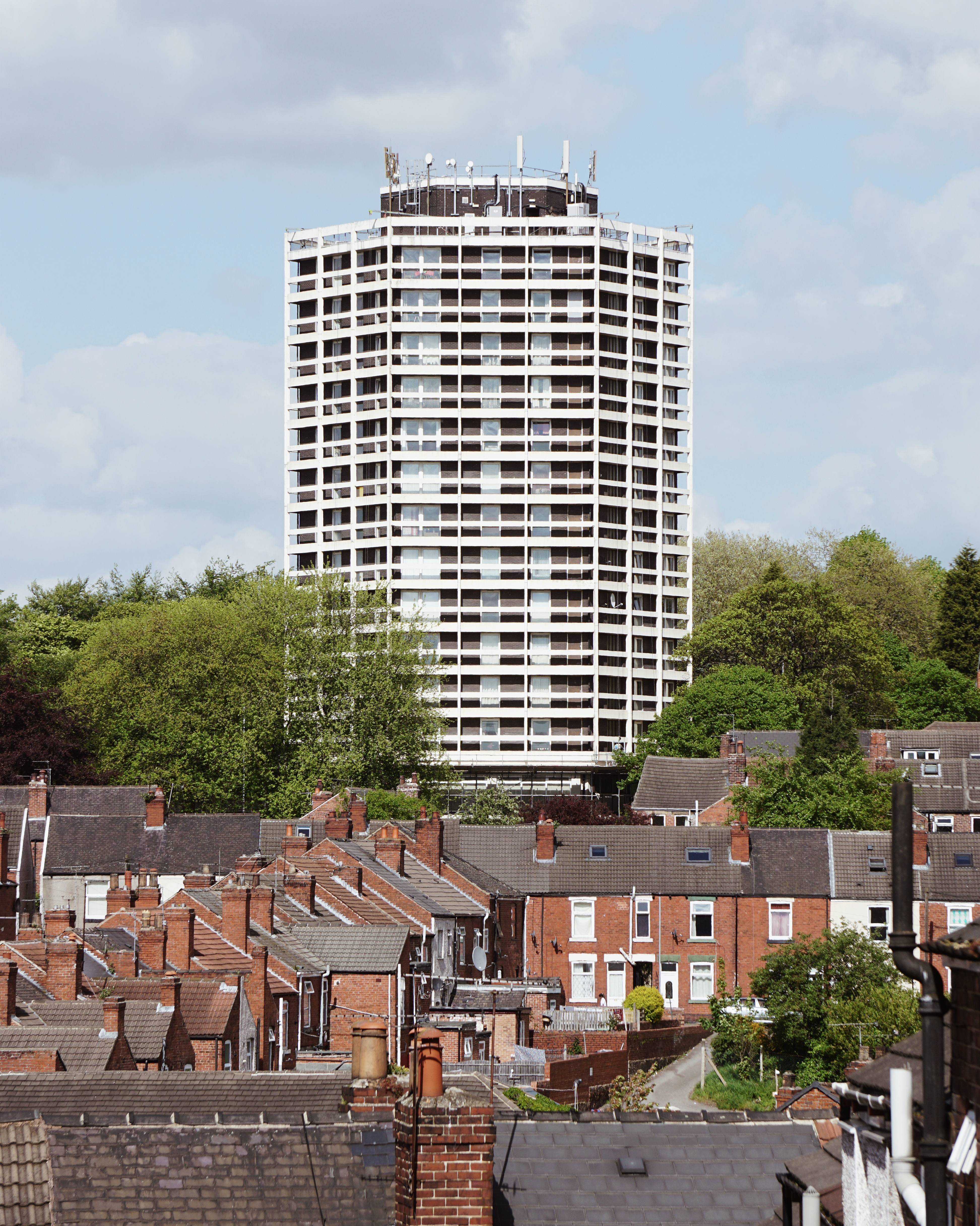
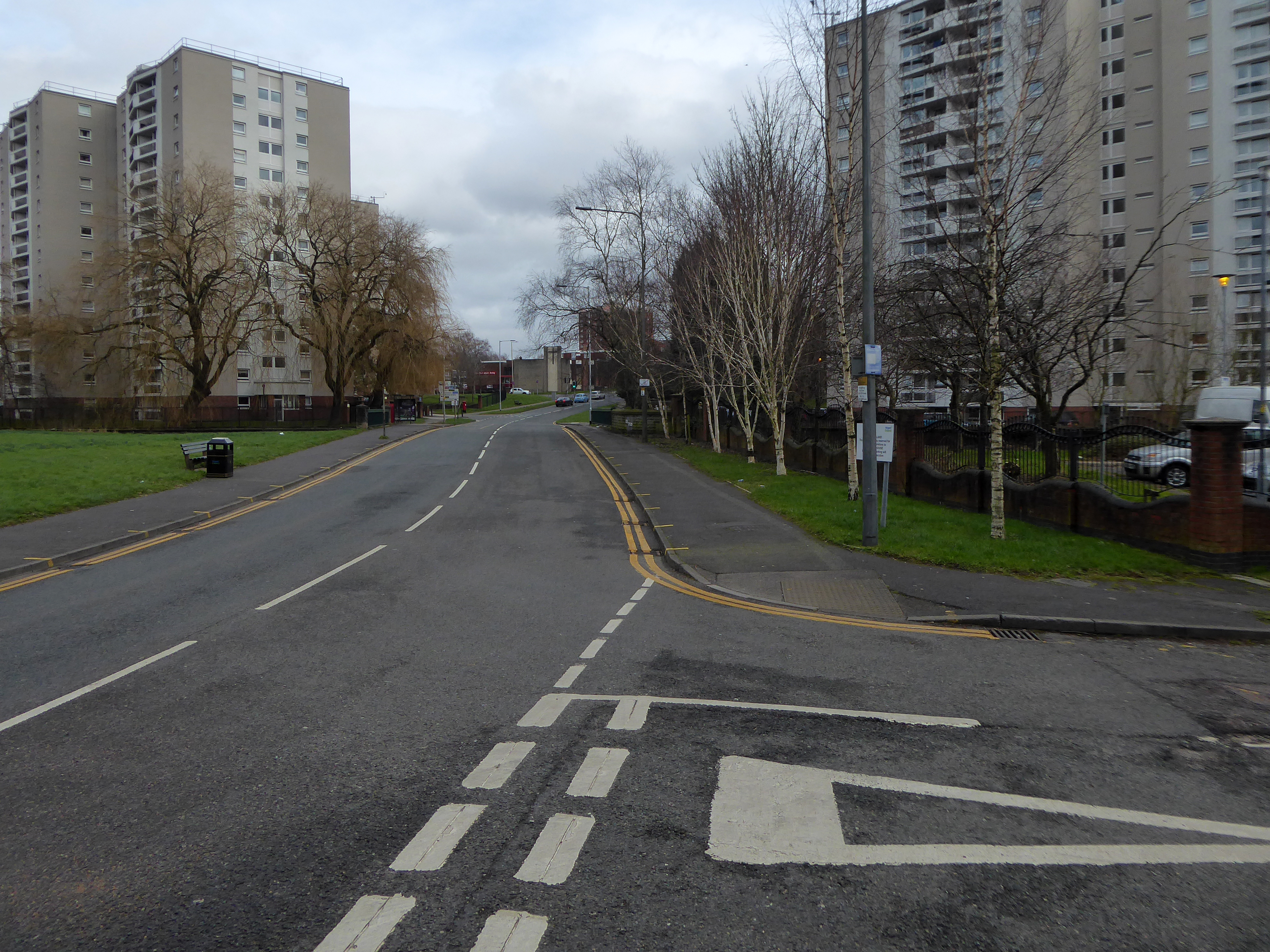
Scholes Comprehensive Development 1964 – five thirteen storey blocks.
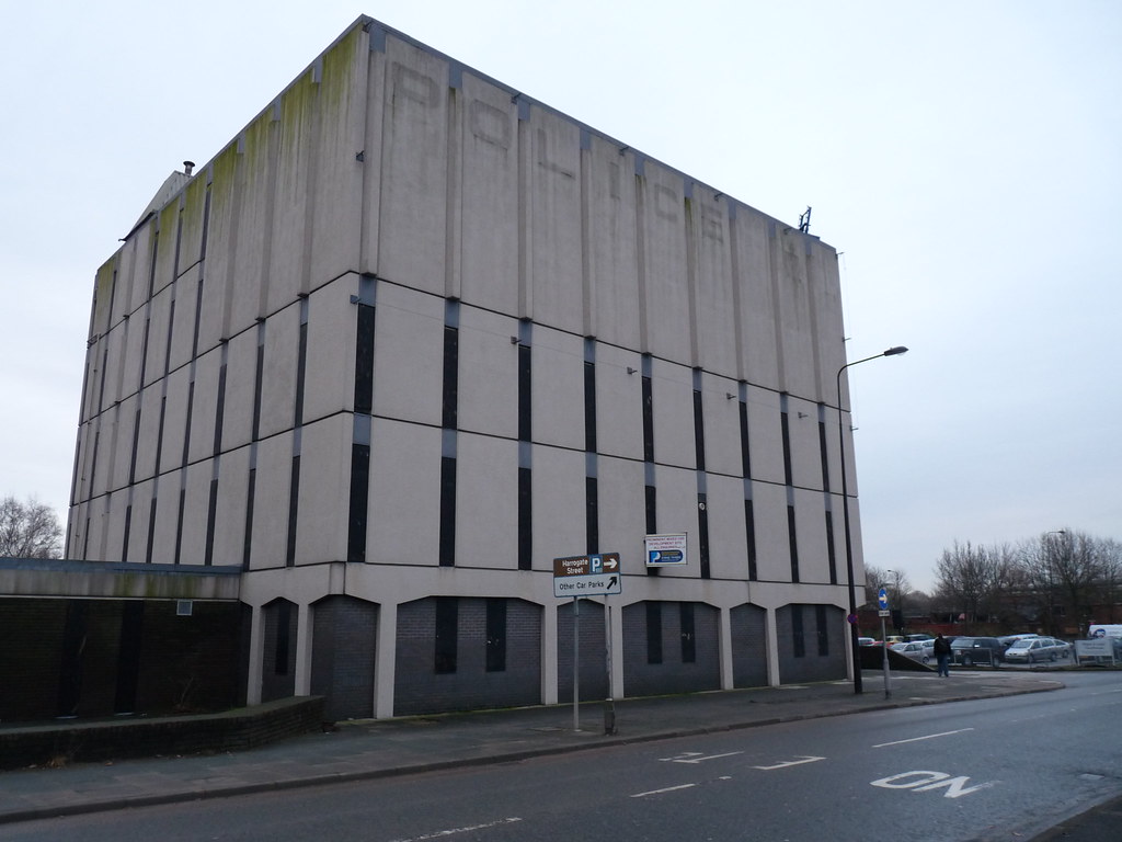
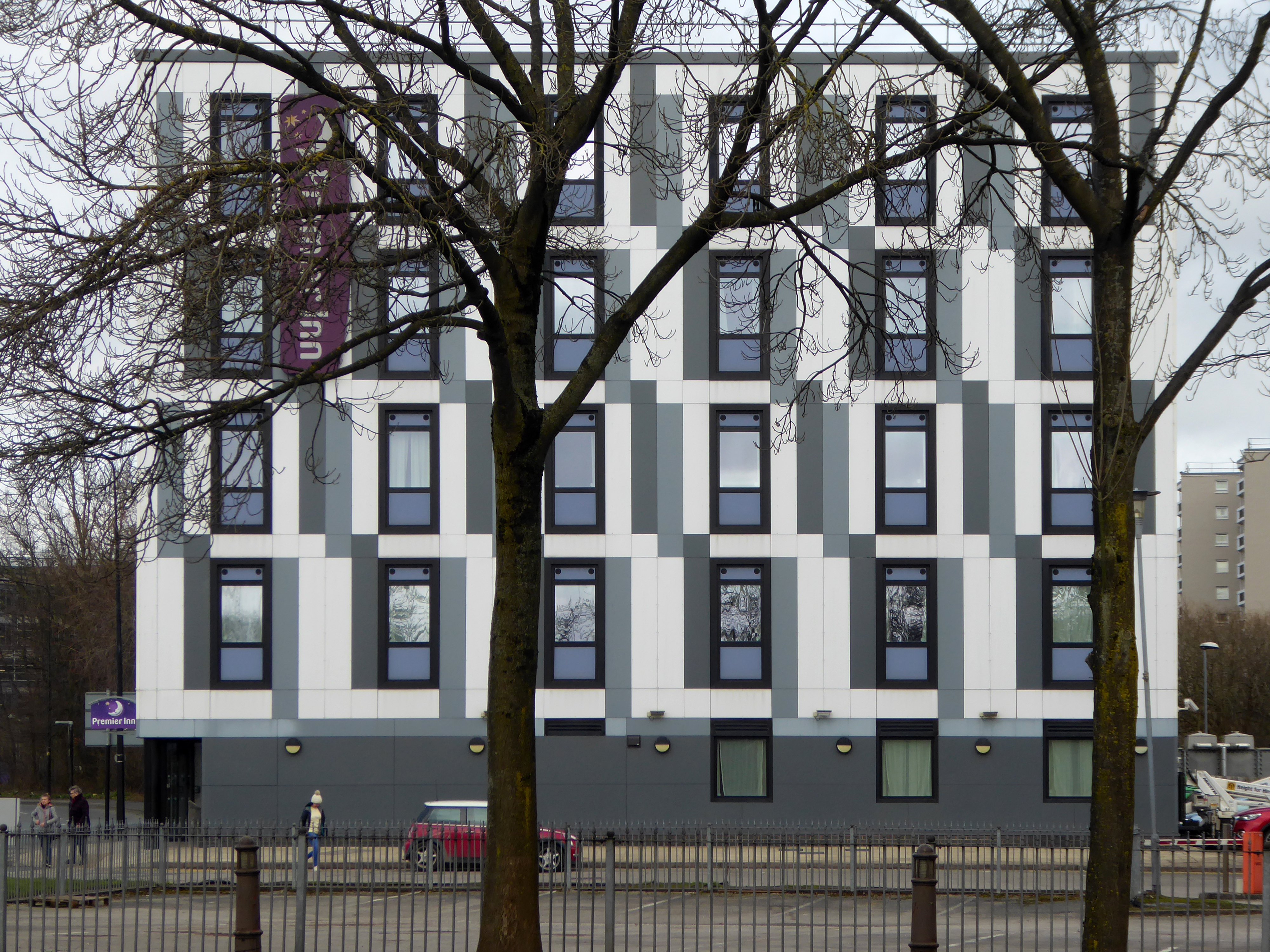
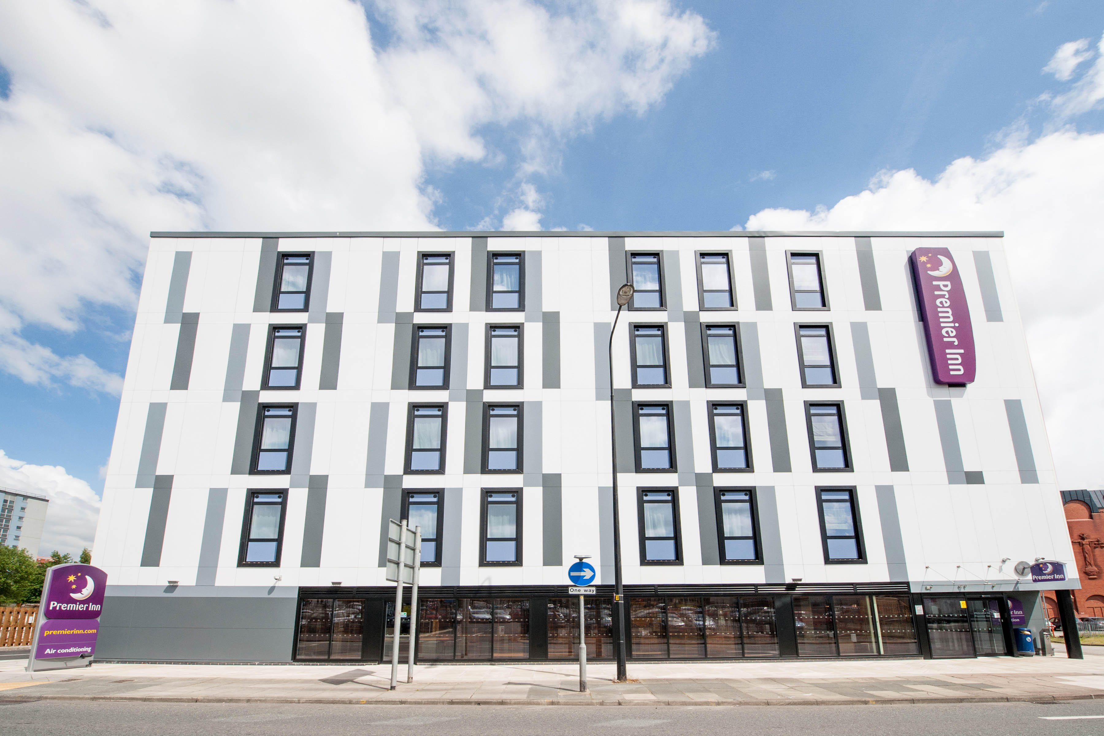
Moving down the street to the former Police Station now Premier Inn on Harrogate Street.
Lancashire County Architect: Roger Booth
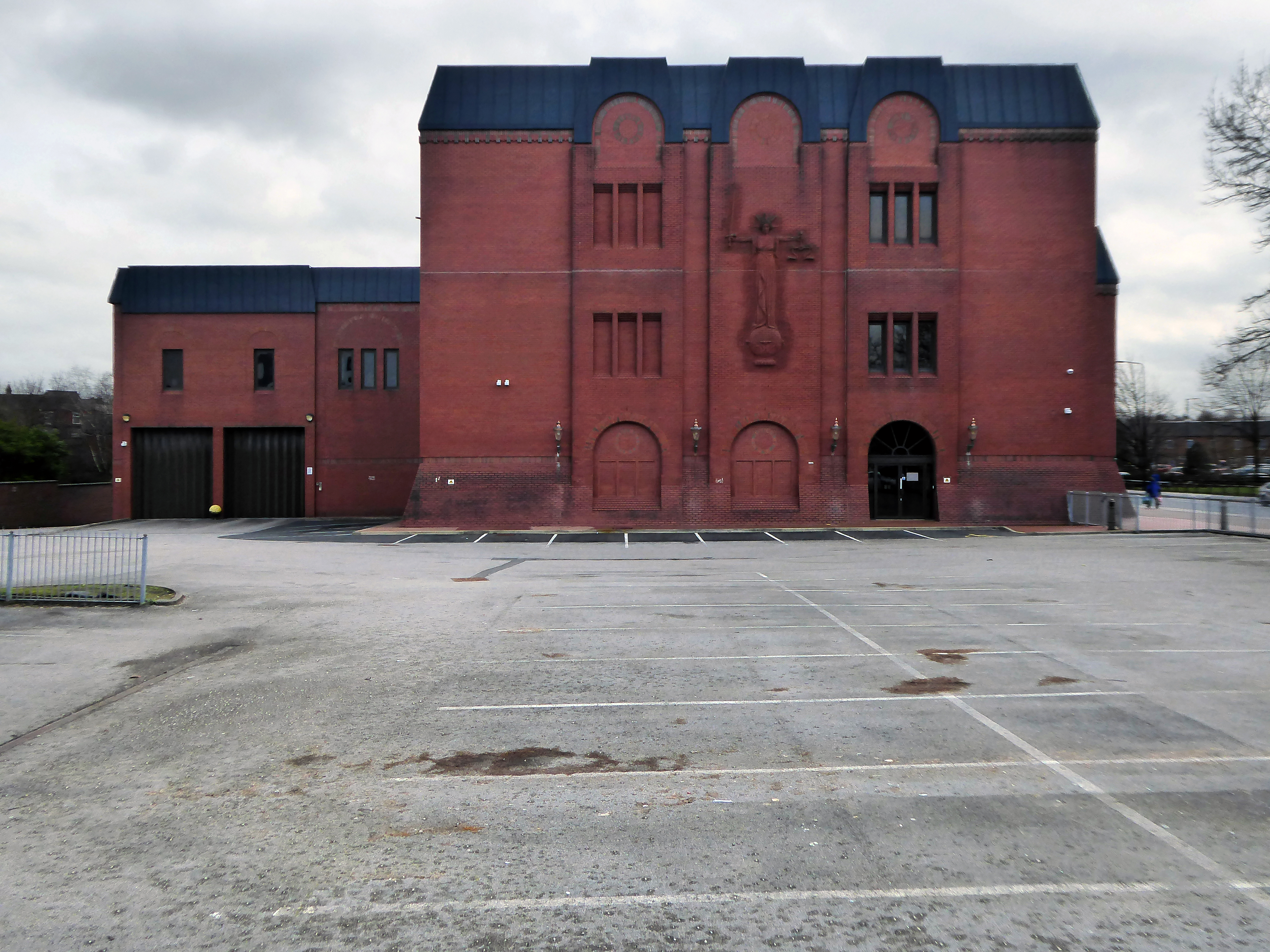
Next door the Post Modern brick monolith of the Wigan and Leigh Courthouse 1990.
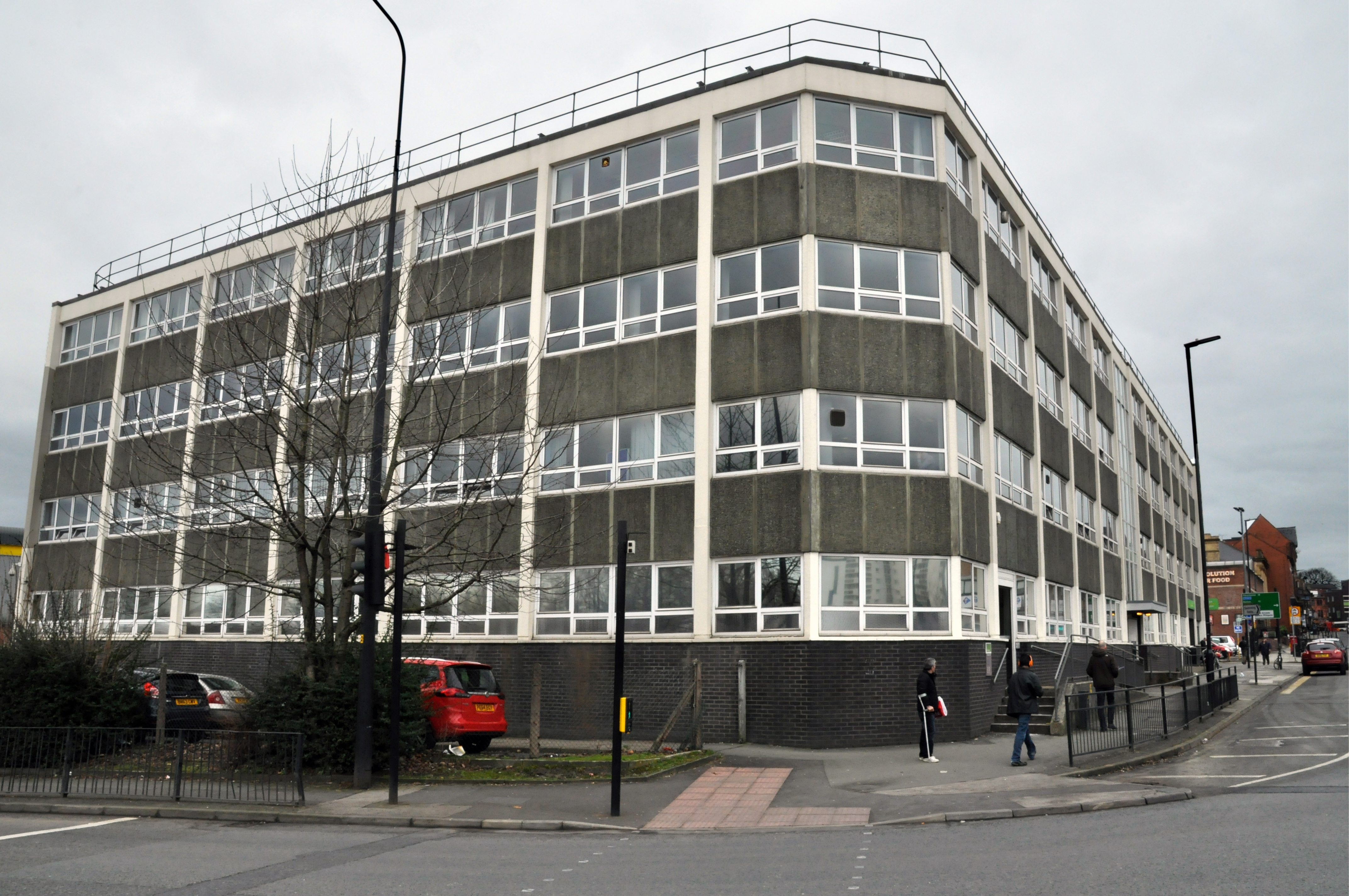
Then back up along King Street to visit the Job Centre.
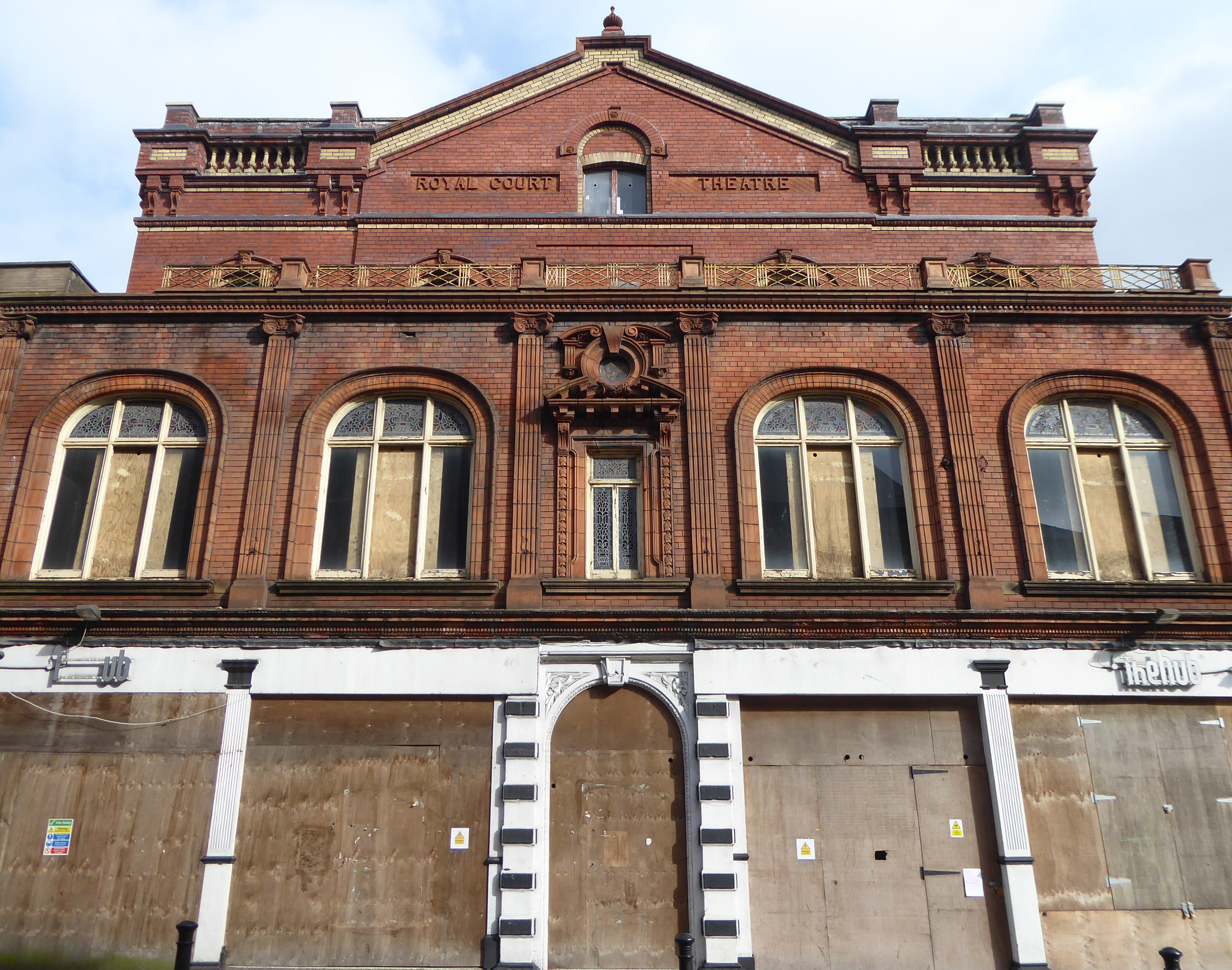
Take a look up at the Royal Court Theatre – 1886 Richard T Johnson
Then back up toward the centre to the County Playhouse.
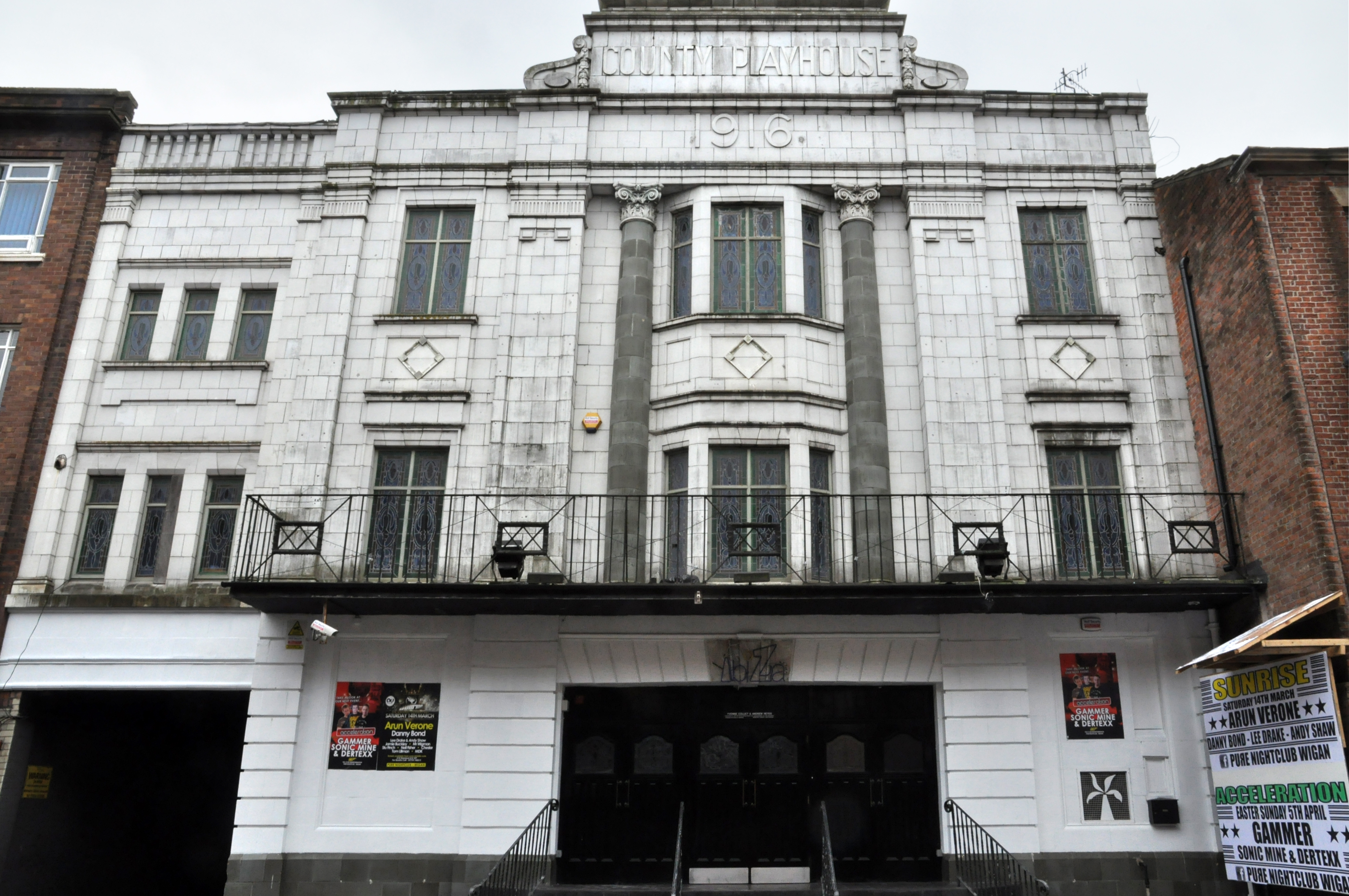
Construction began on the County Playhouse in 1916. However, due to a shortage of materials and labour during World War I, it was not completed until 1919.
Finally opened on 22nd December 1919 with The Peril Within – starring Dorothy Gish.
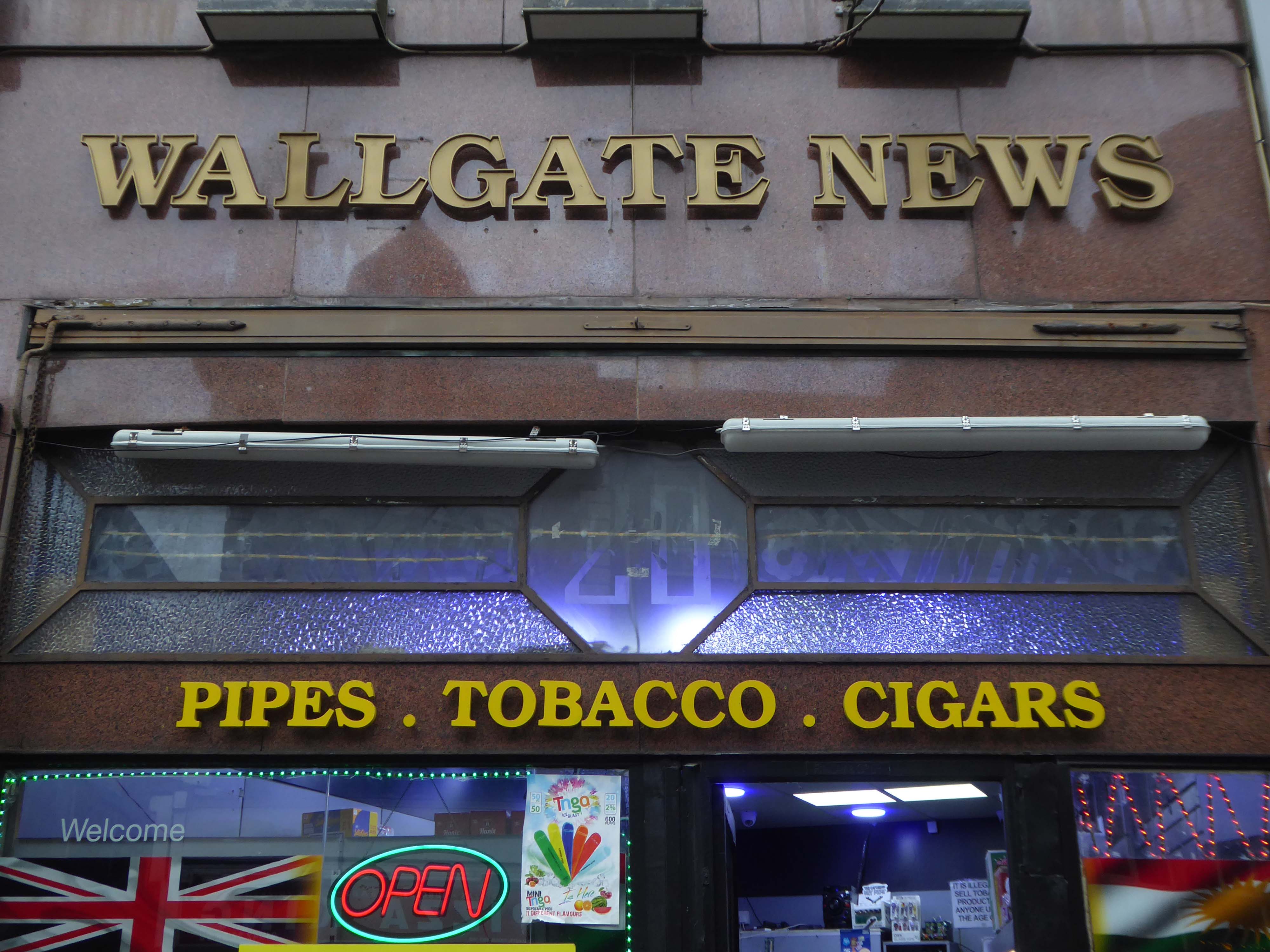
Onwards to the Wallgate News.
Finally to The George public house.
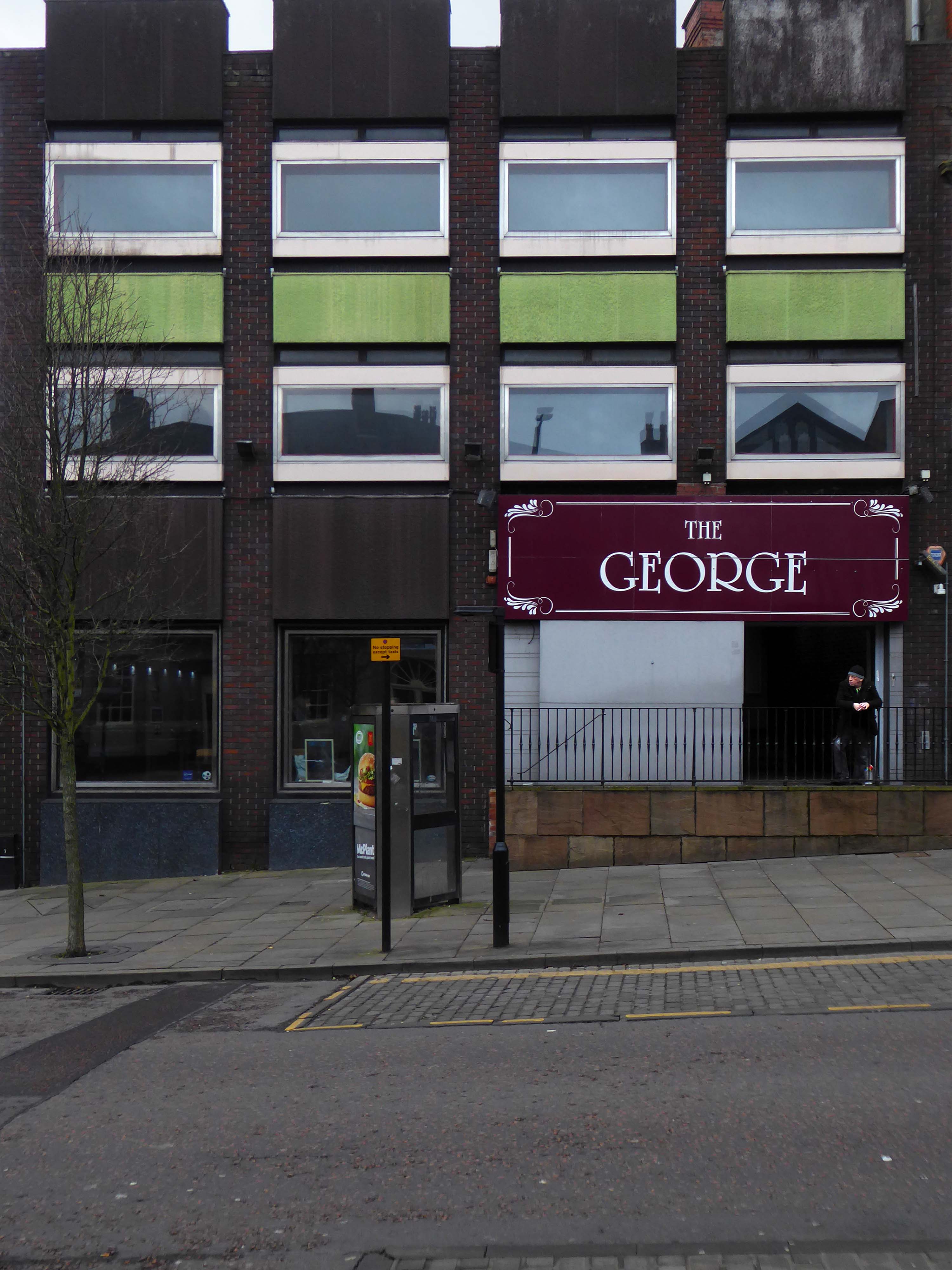
All ages, all different, all characters all like a bevvy.
The George is all you need.
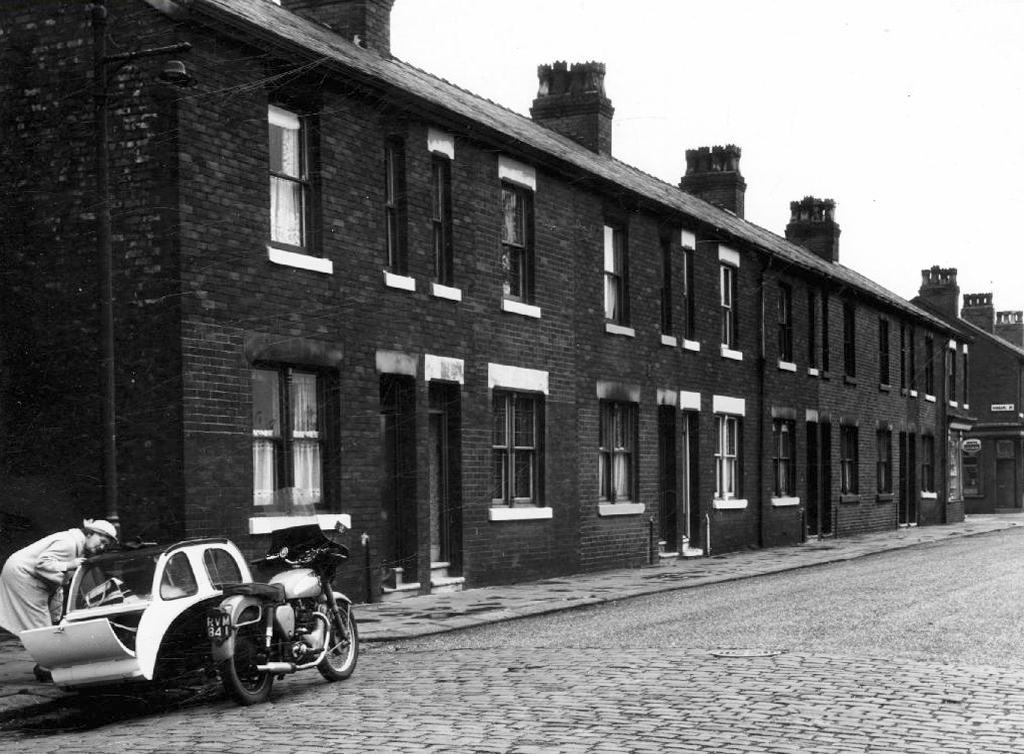
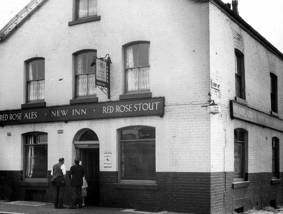
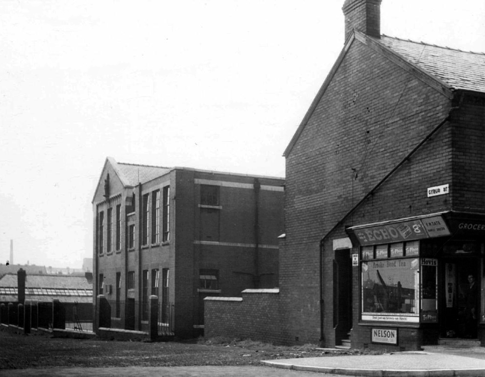
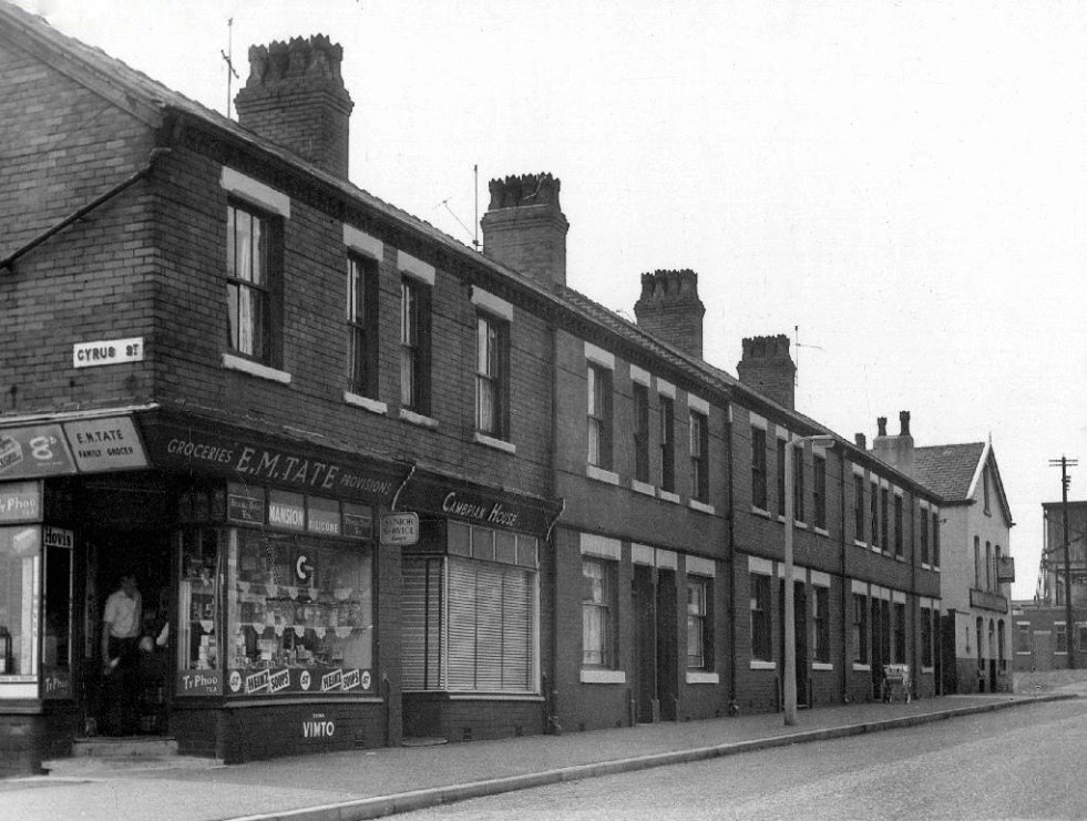
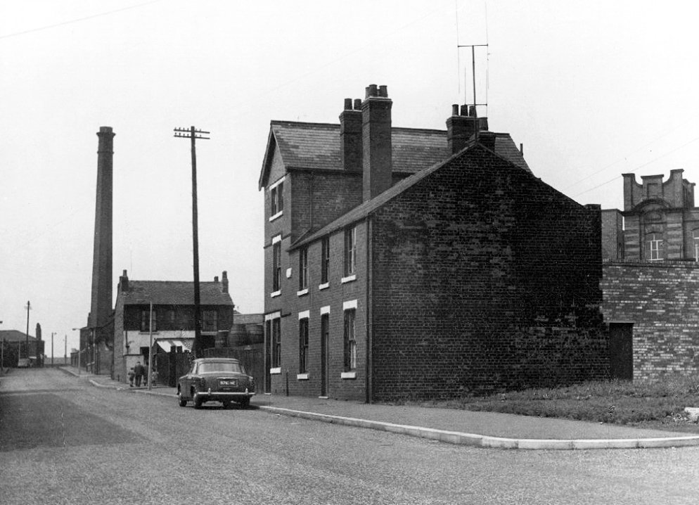
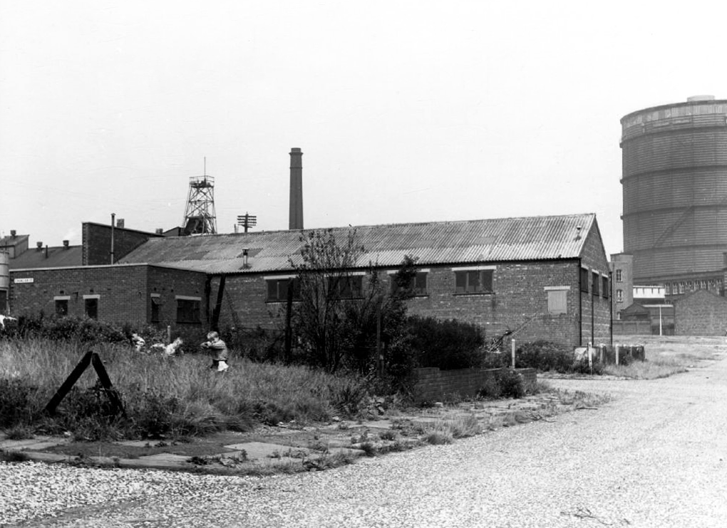
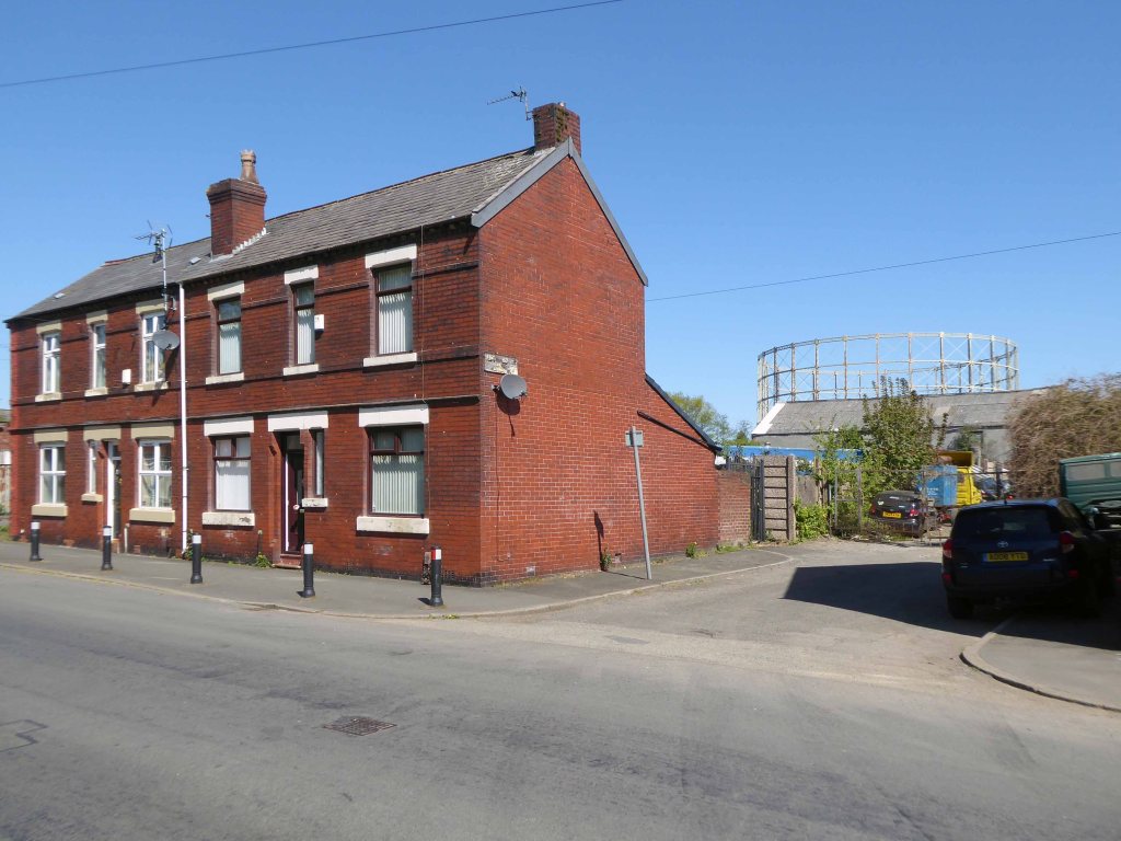
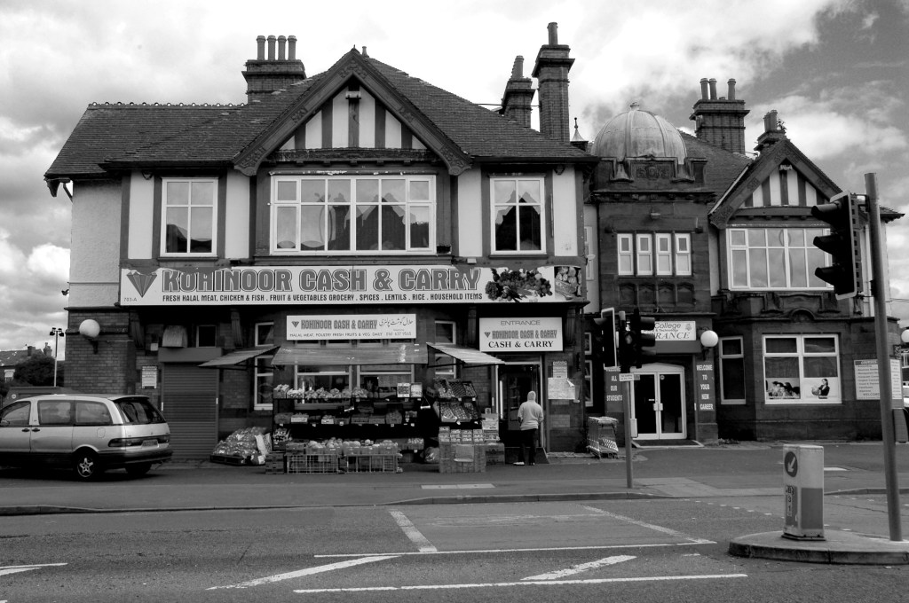
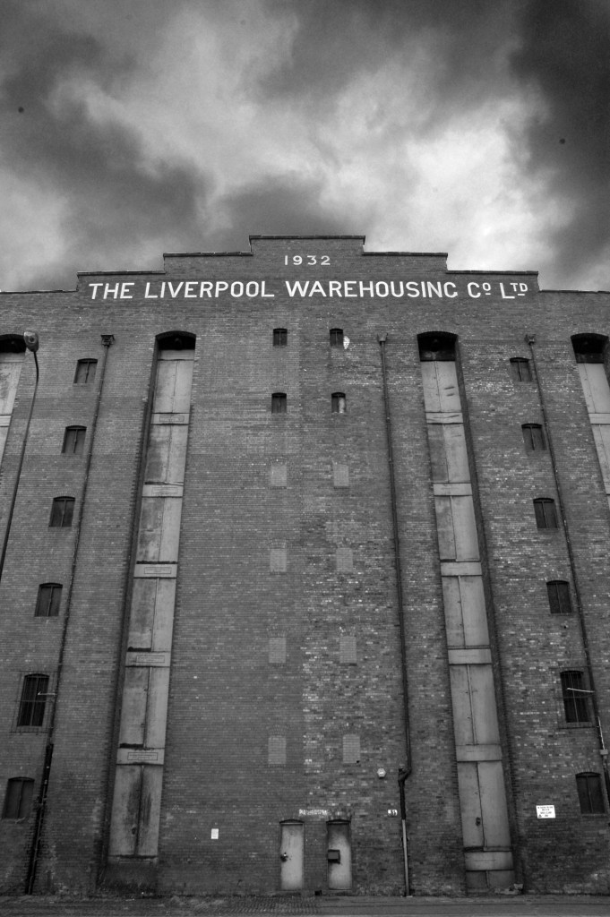
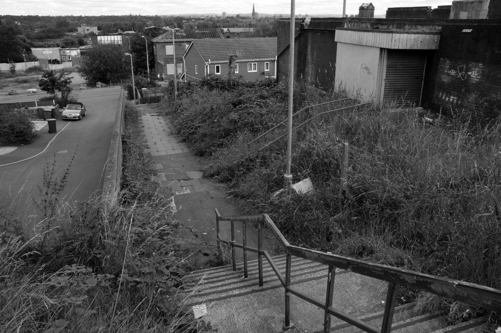
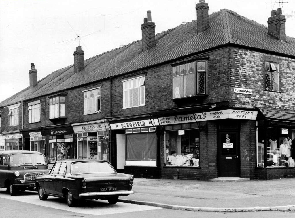
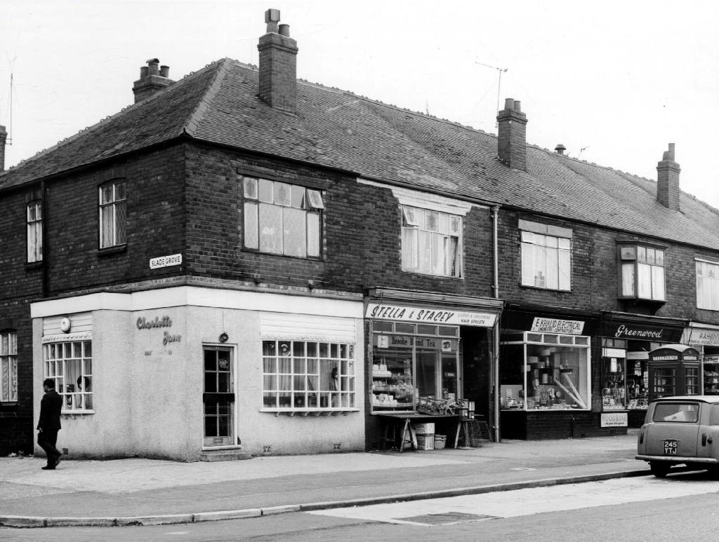
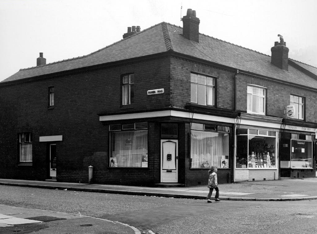
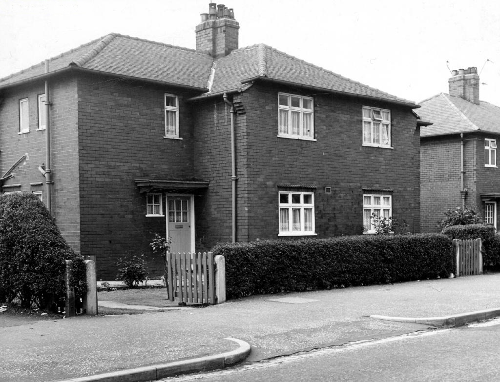
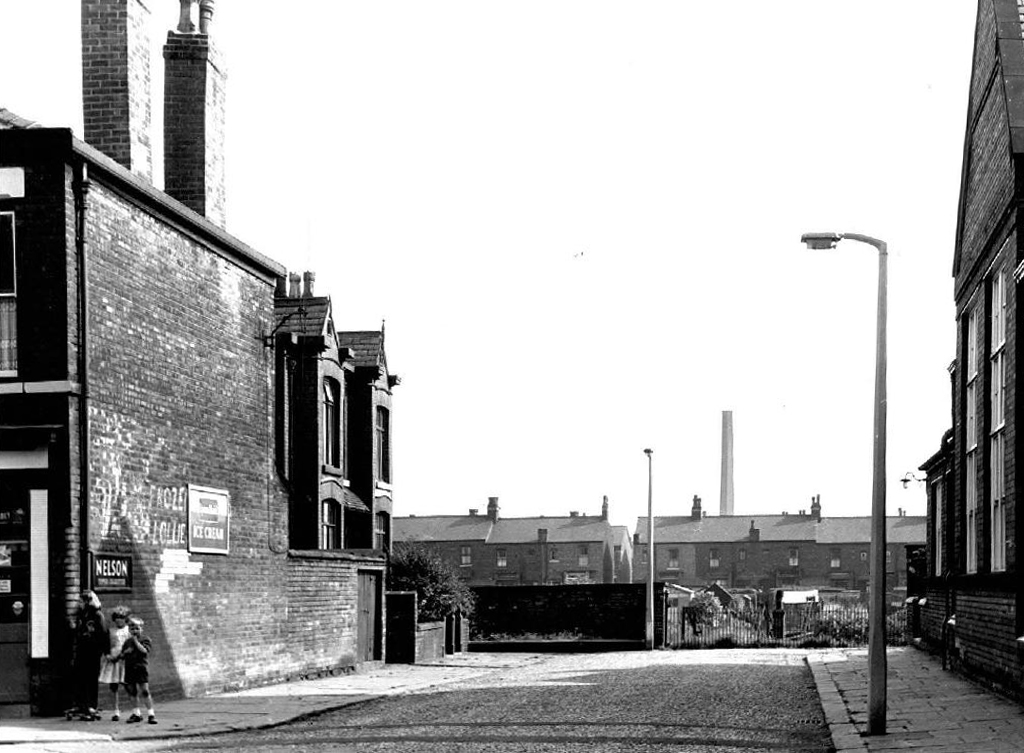
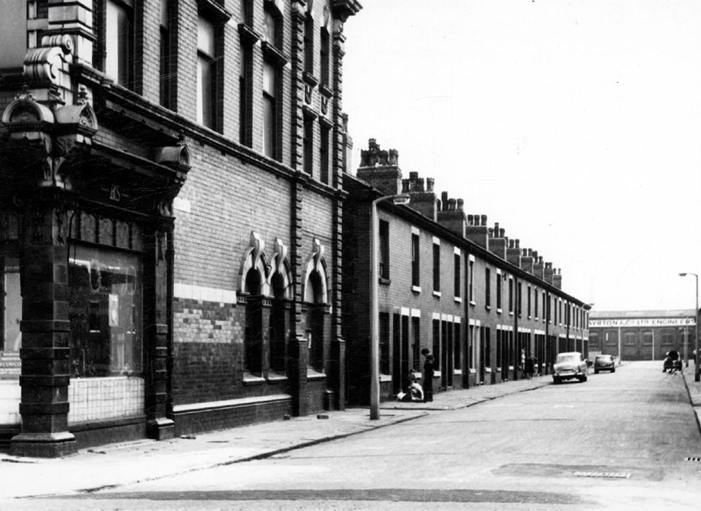
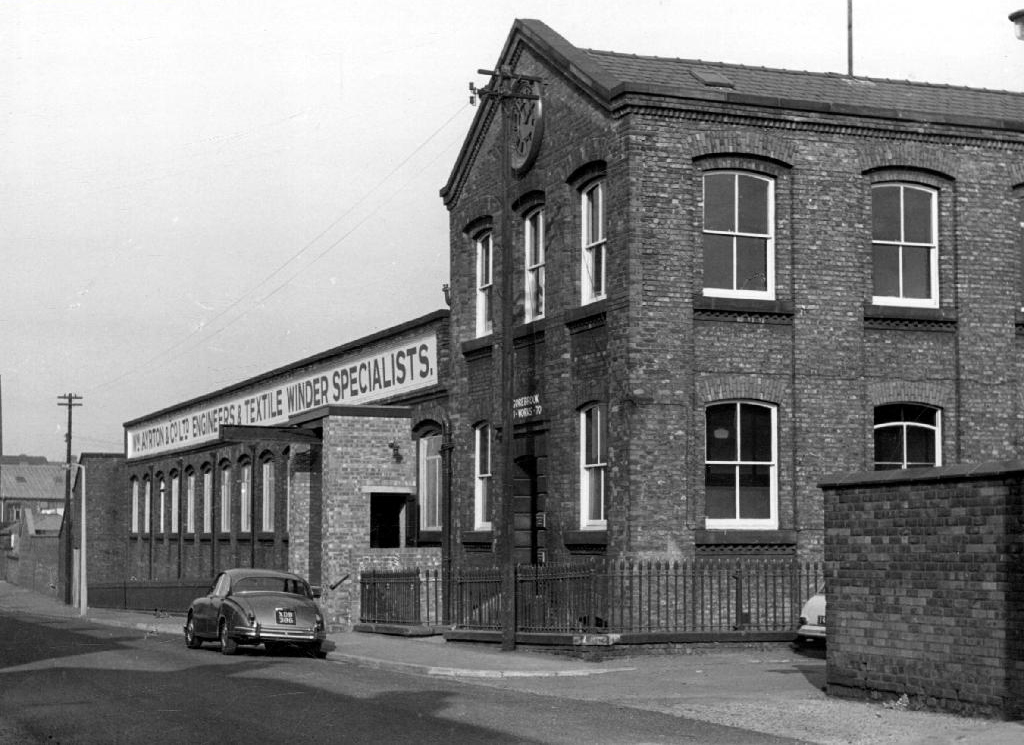
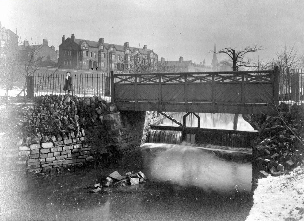
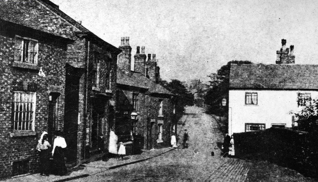
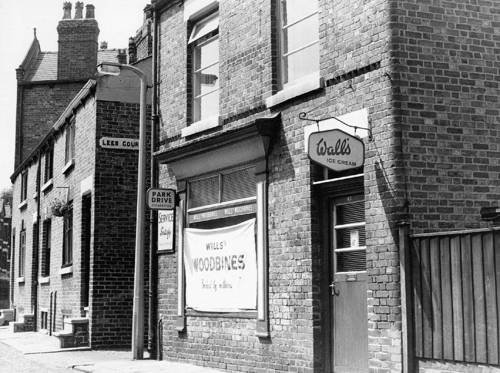
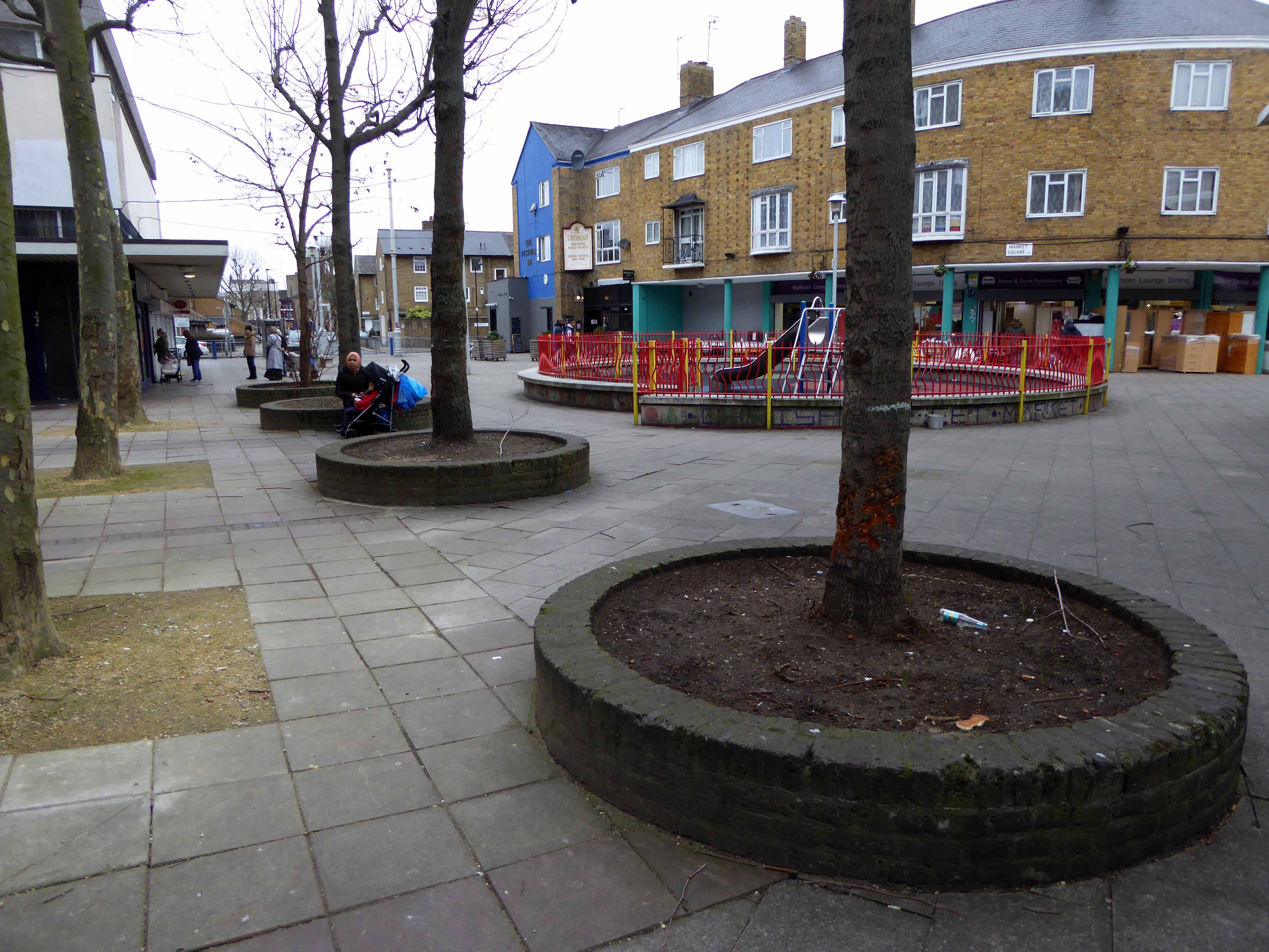
There’s been more than a few comings and goings along Ashton Old Road.
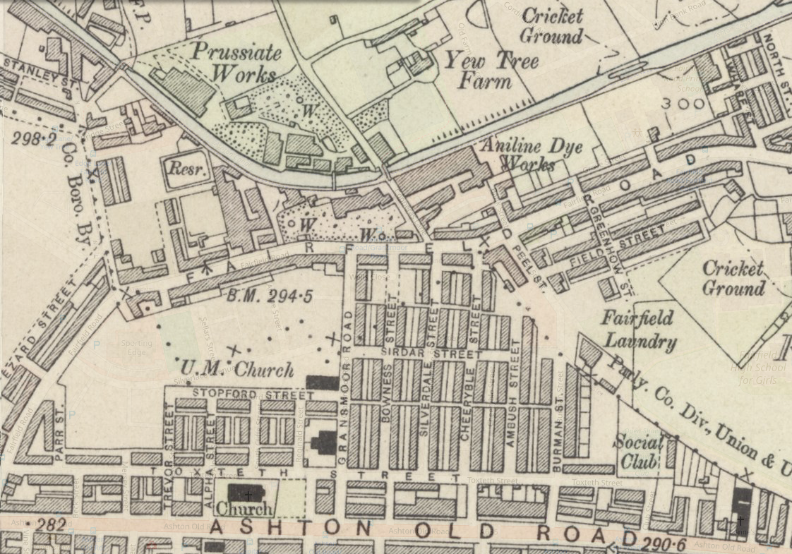
Where once there were fields, homes and industry arrive, as the Industrial Revolution is in full swing.
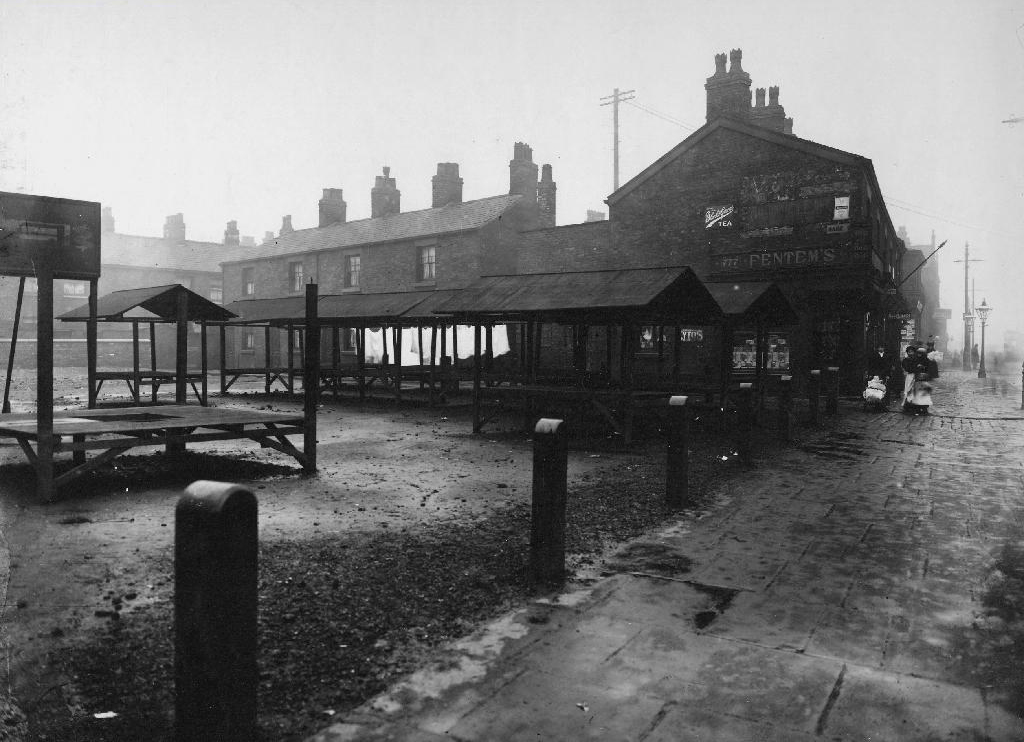
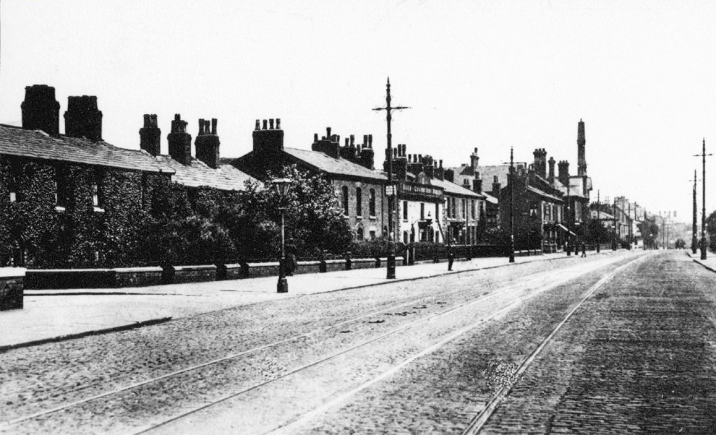
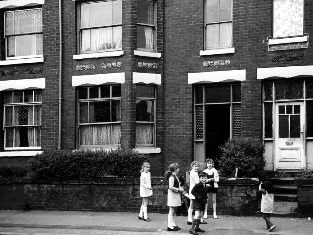
The streets to the north of Ashton Old Road are alive with shops, homes, people and prams.
Along with the occasional motor car.
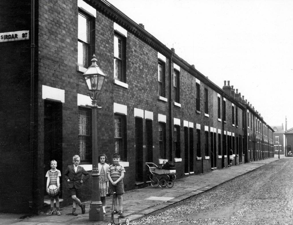
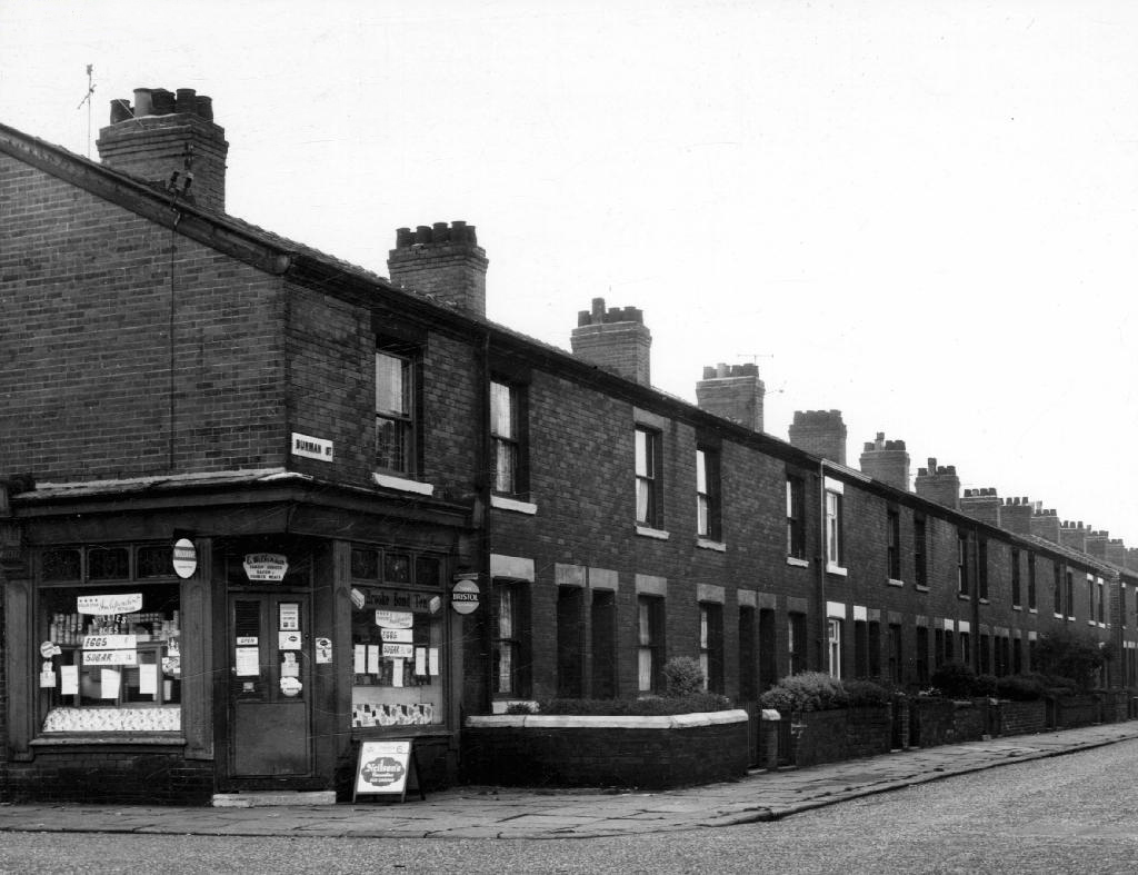
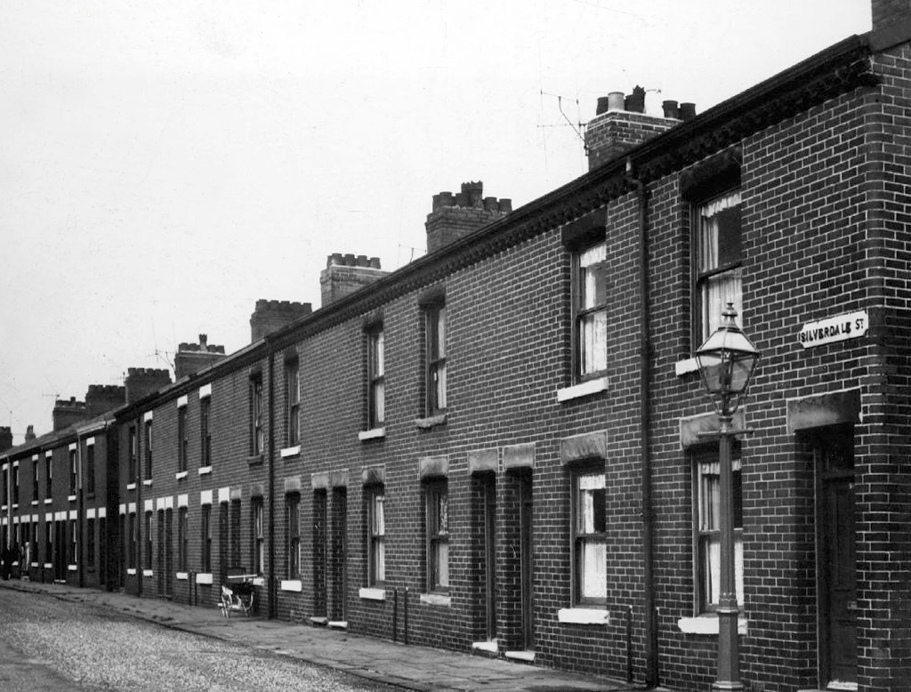
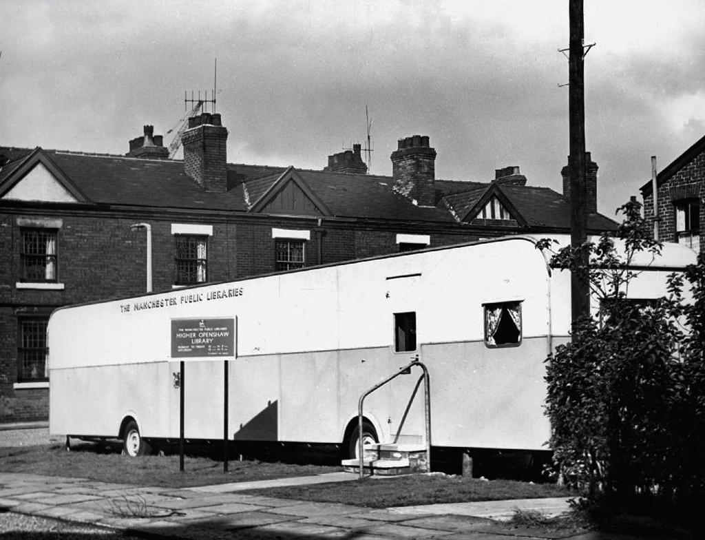
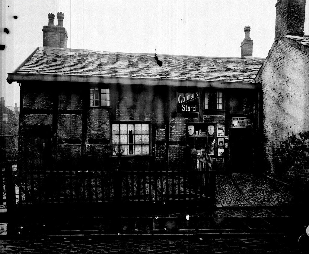
The Old Road boasted some fine busy boozers.
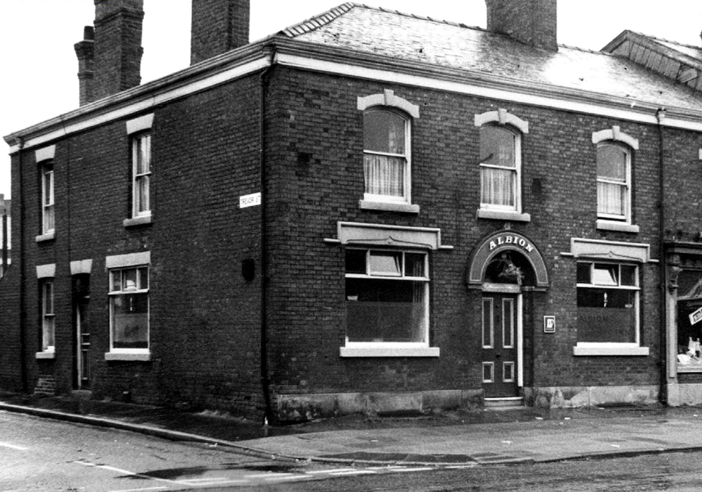
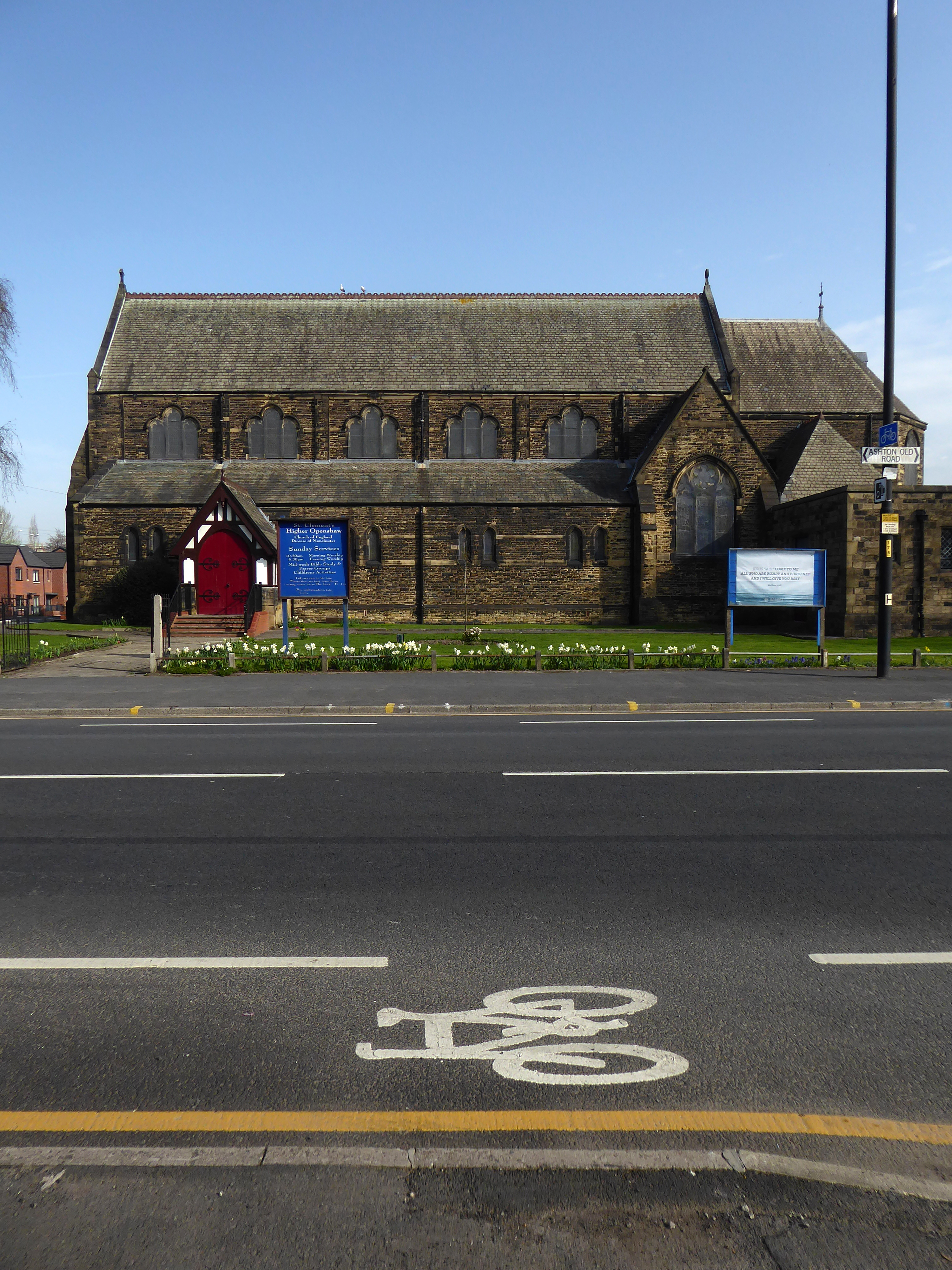
And a splendid church and school.
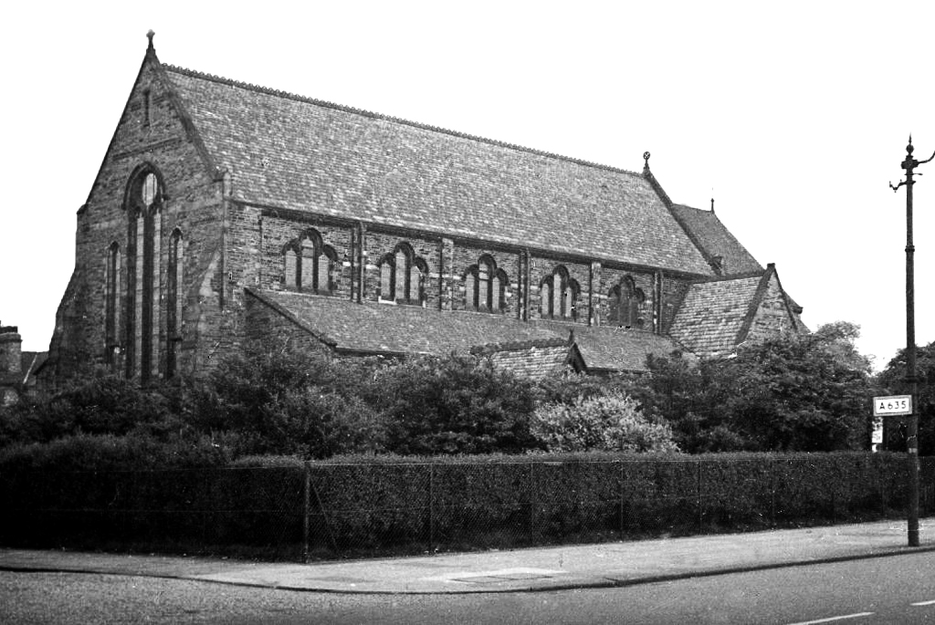
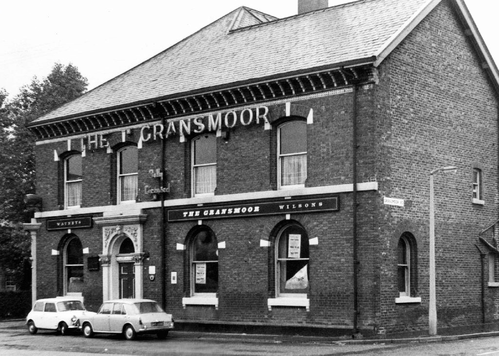
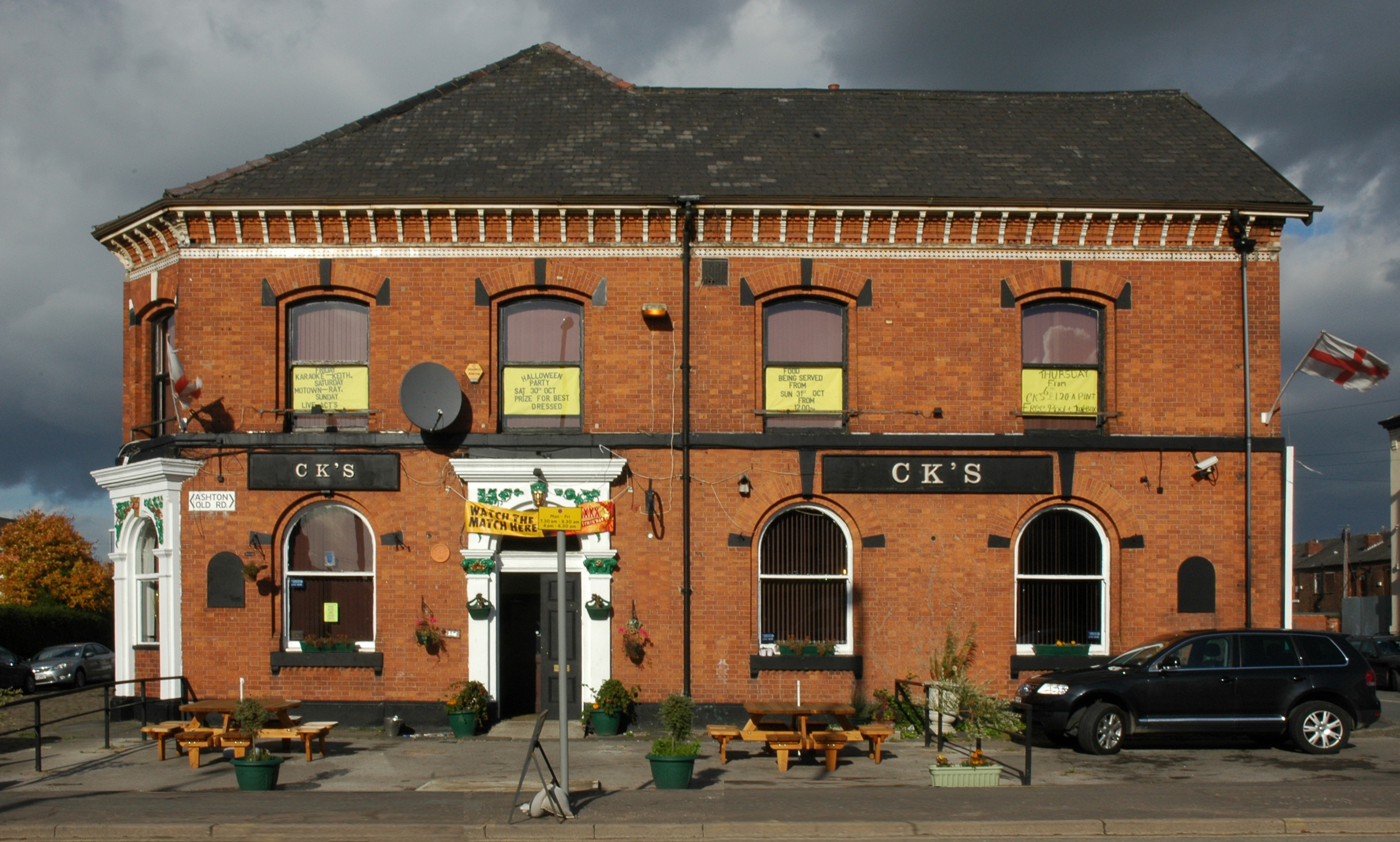
The man responsible for the majority of these archive photographs is Tommy Brooks of 56 Gransmoor Road.
He is my hero, a member go the Manchester Amateur Photographic Society, cycling the streets of Manchester to produce a unique record of life in the Sixties.
The Manchester Image Collection is awash with his work.
Chapeau Tommy!
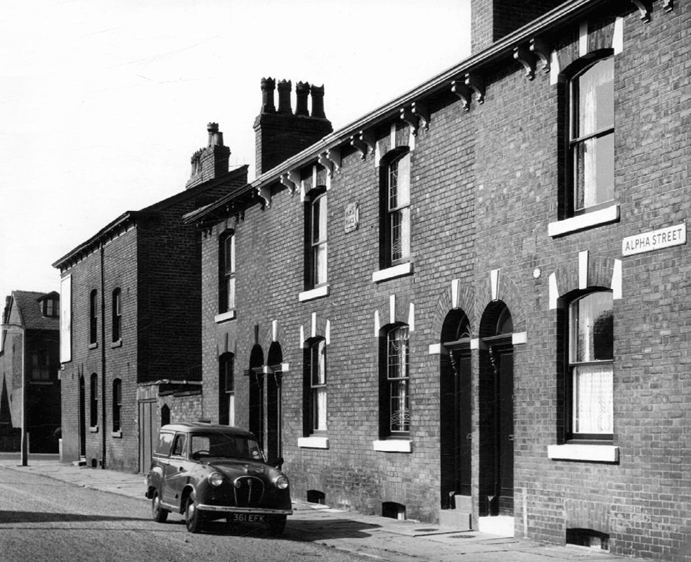
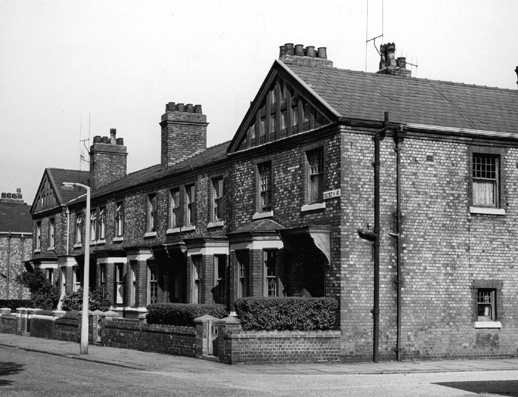
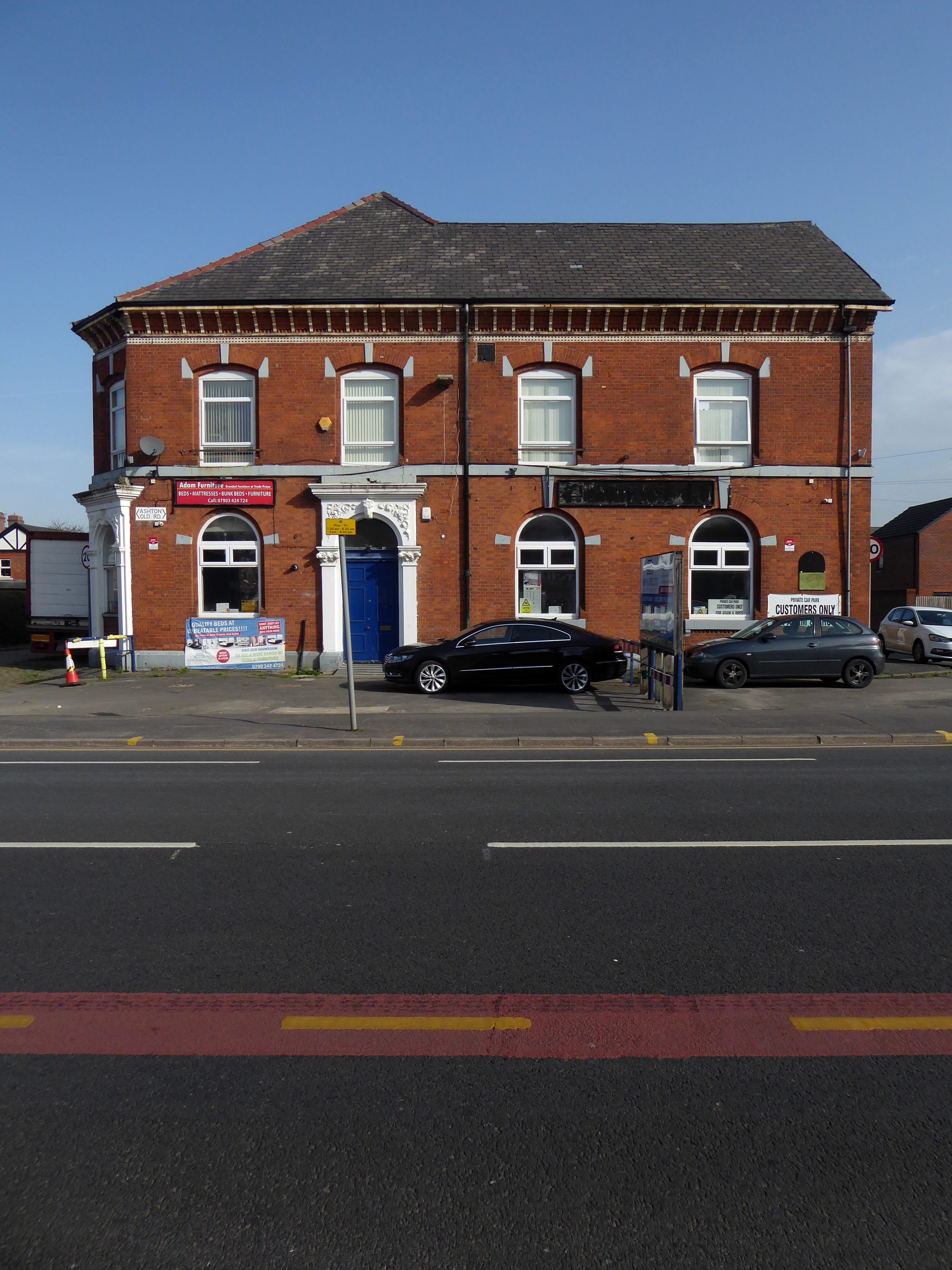
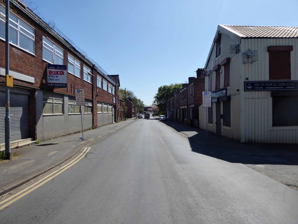
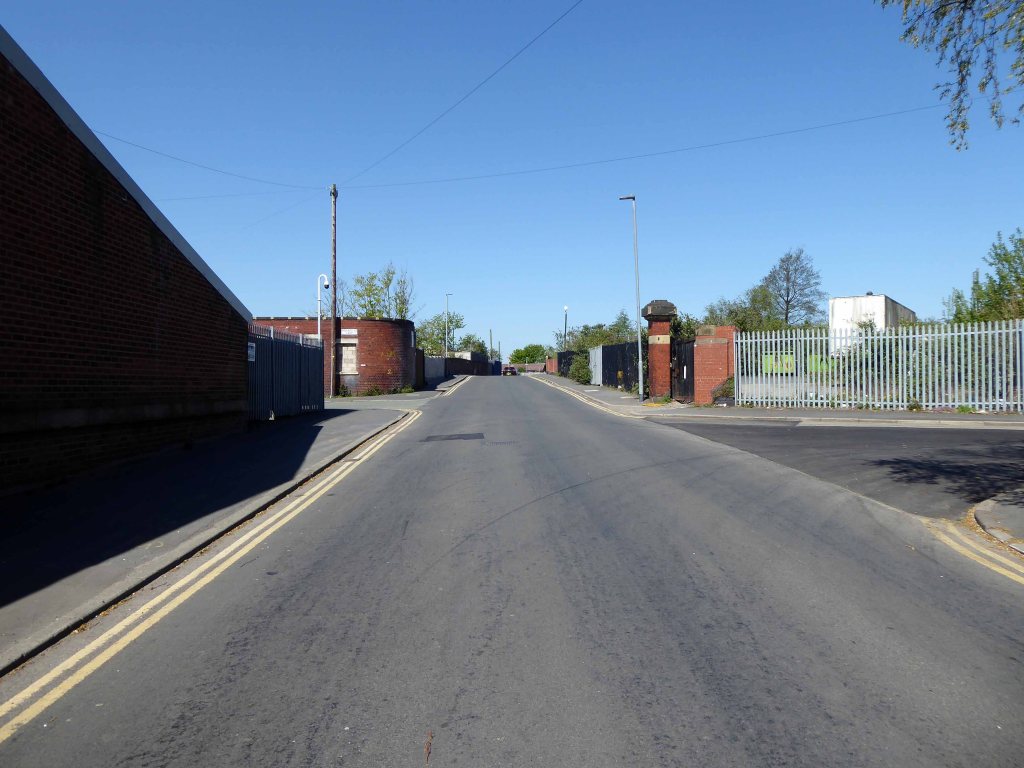
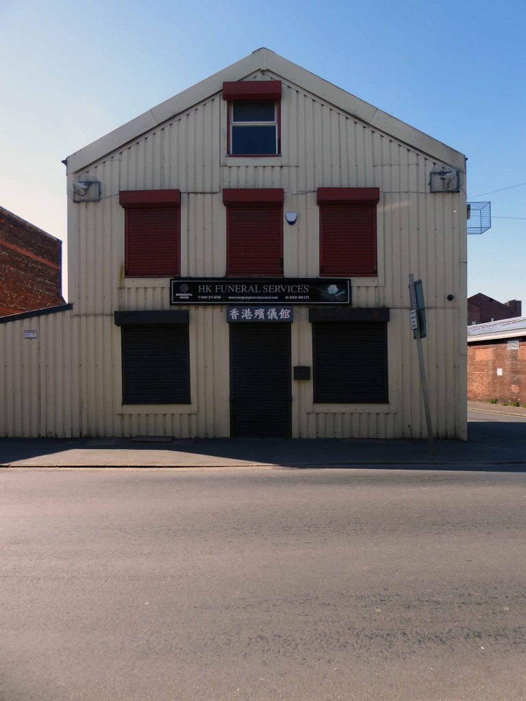
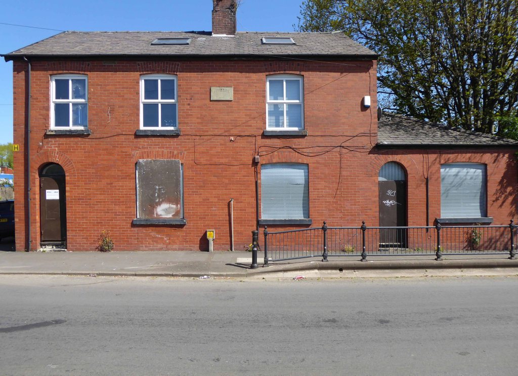
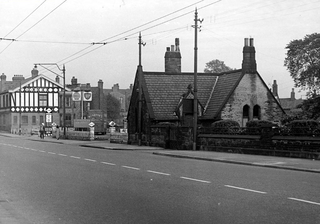
The house is no longer there – the area has recently been redeveloped, some older properties demolished, and new homes built.

Though The Gransmoor is no longer The Gransmoor.
Although it briefly became CKs
Converted to retail use 24th September 2012 after closure. This interesting Victorian building stands back from the road with what may well be a coach road in front. Inside the high ceilings and glorious plasterwork gave the impression of a gentlemen’s club. Though it previously sold cask Banks’s beers in its earlier years, its final days were seen out with only keg beers being available.
St Clements still prevails with a healthy congregation.
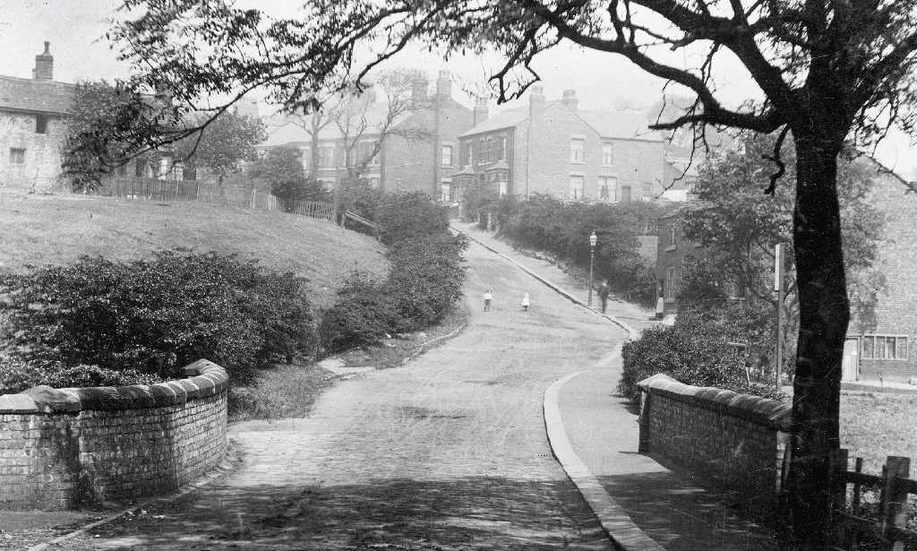
In 2010 several properties were removed and the land levelled.
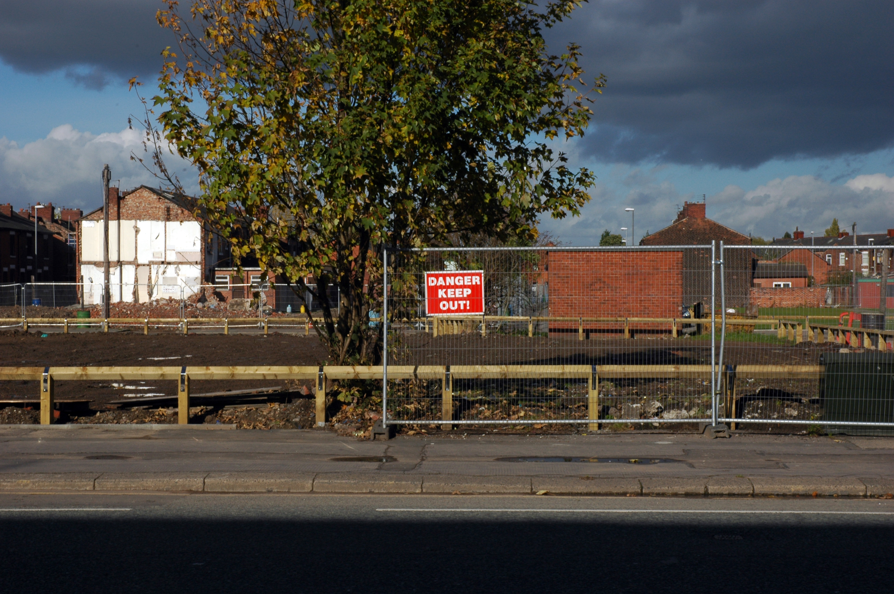
Eleven years later old and new now snuggle up together.
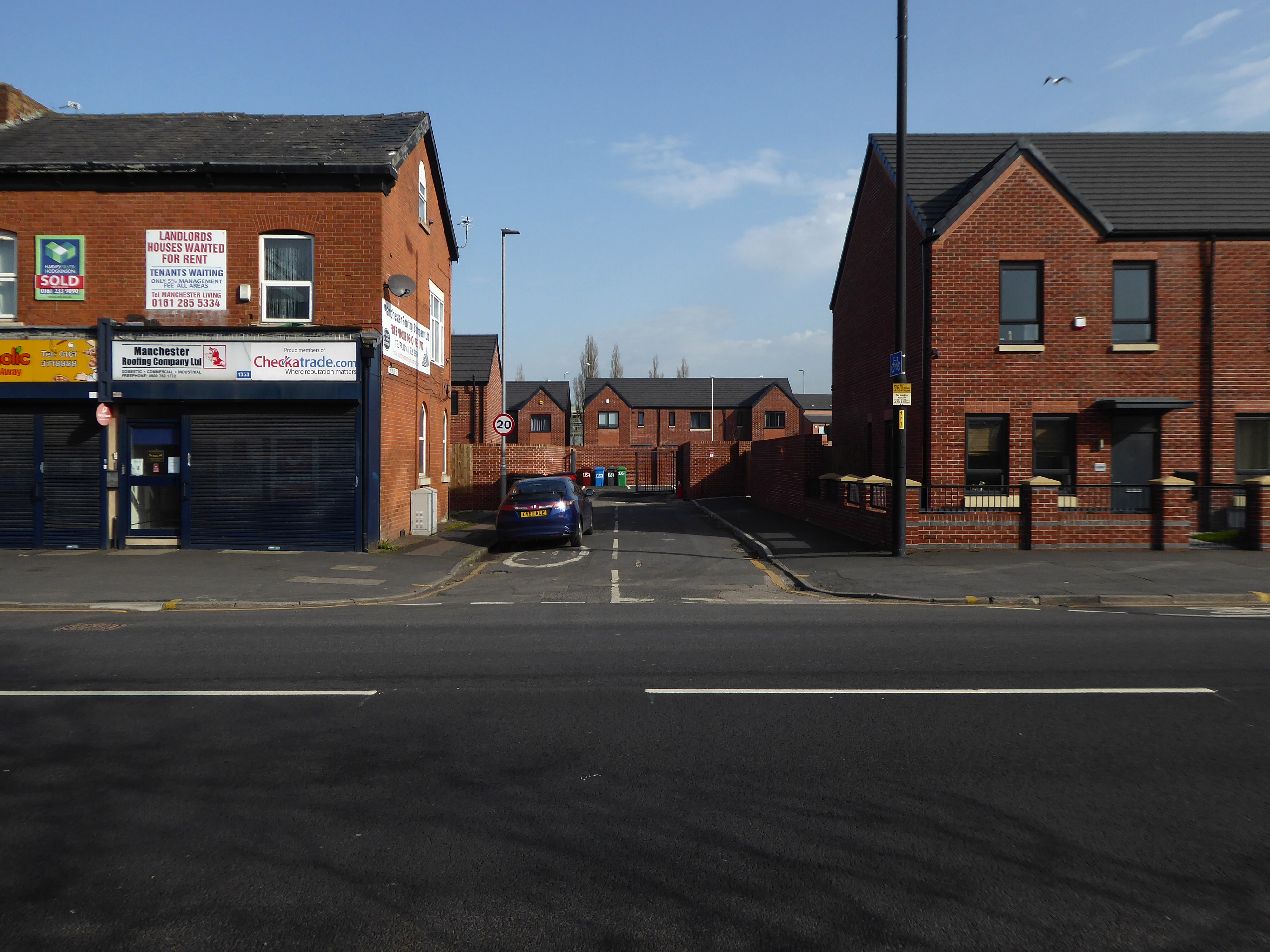
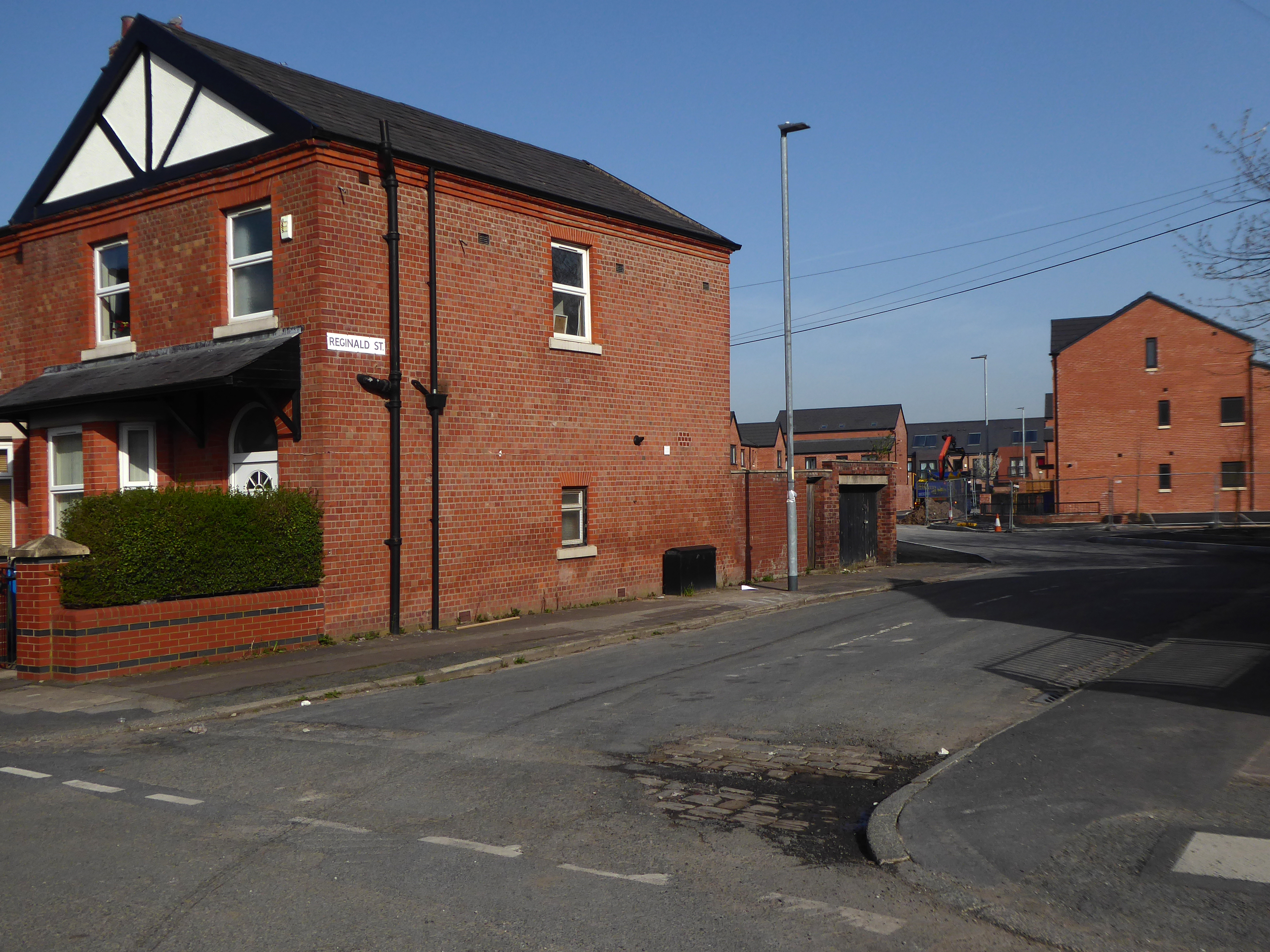
The street structure is more or less unchanged.
Though sadly the wonderfully named Ambush Street is no more.
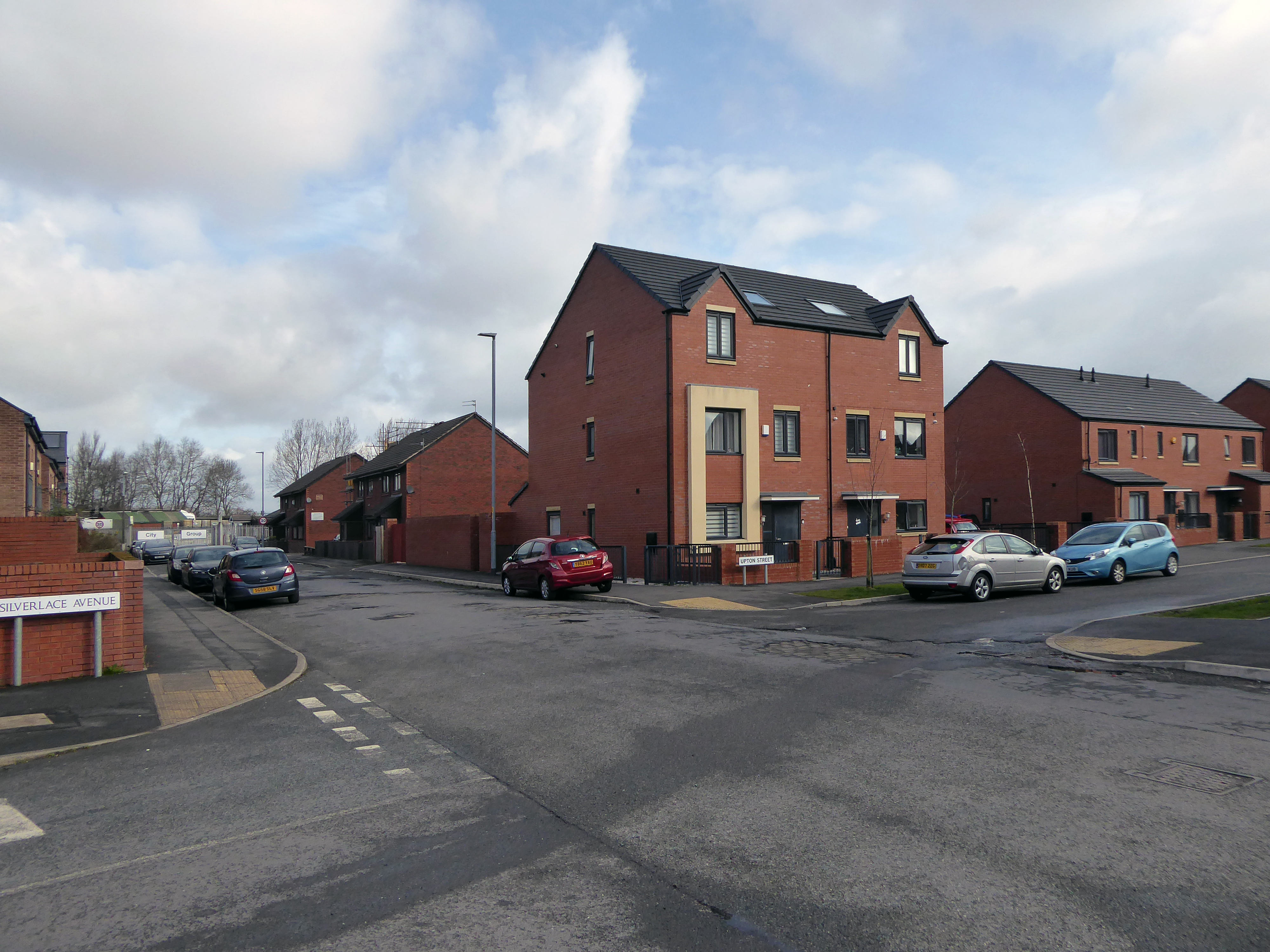
So the big wheel keeps on turning new homes, new folk and new life for East Manchester.
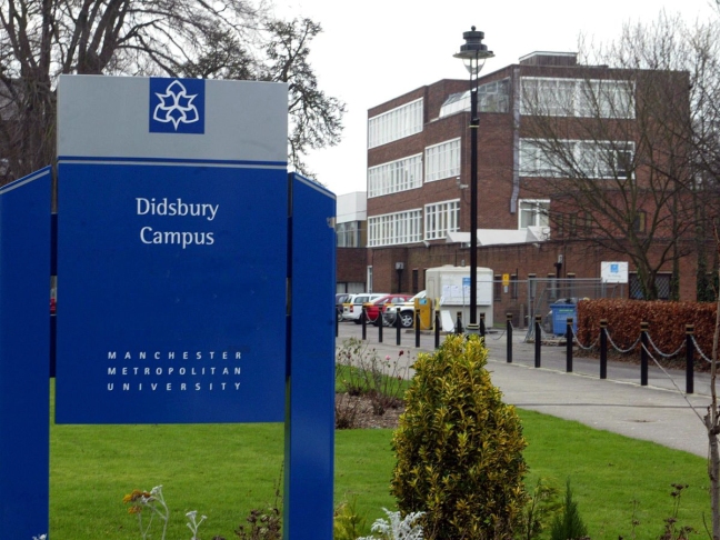
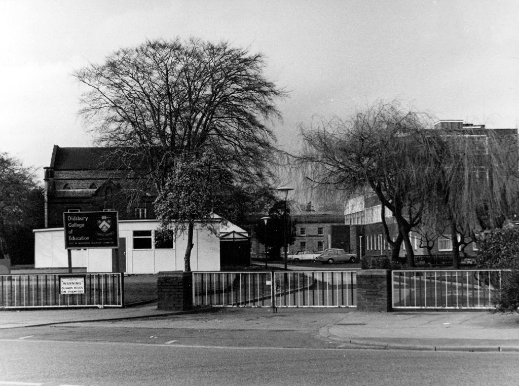
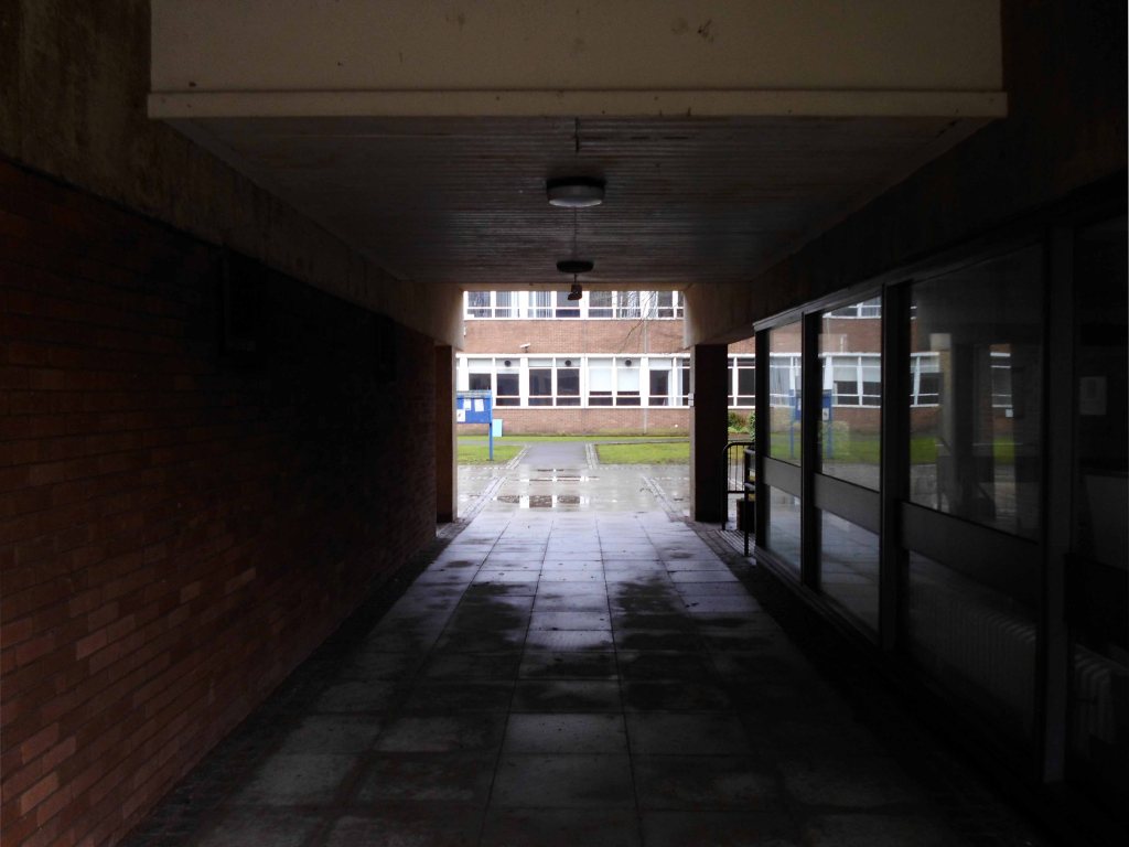
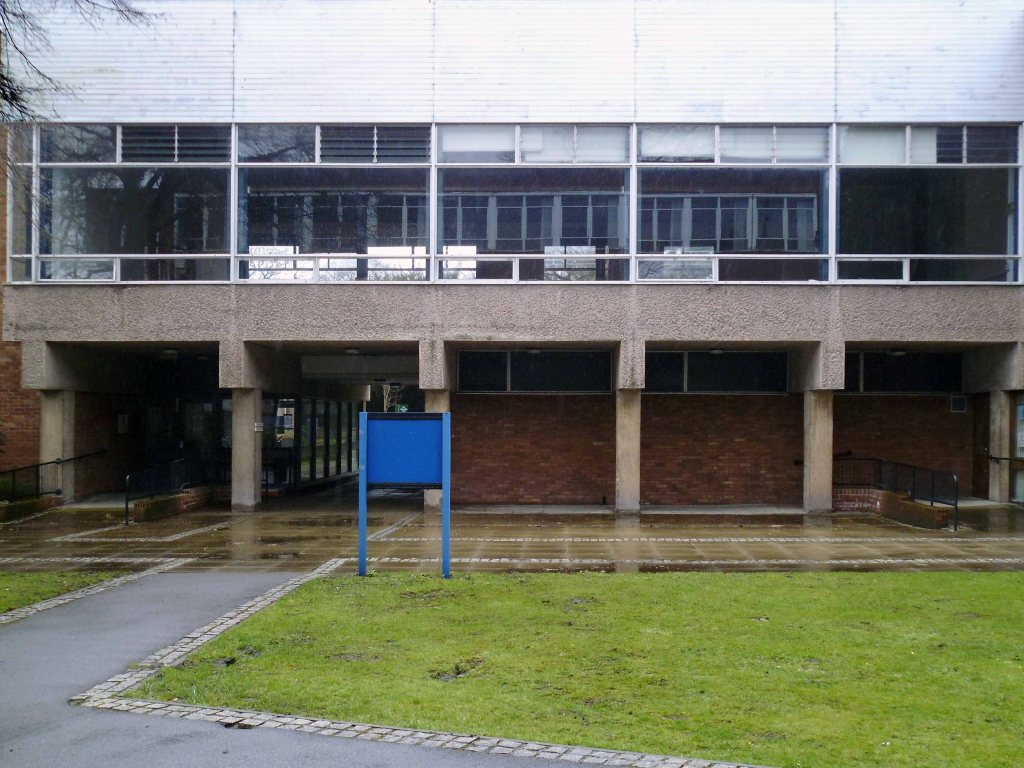
799 Wilmslow Rd Didsbury Manchester M20 2RR
I was here, once upon a time, studying to be an art teacher – which eventually I was, then I wasn’t.
Such is life, things that is eventually isn’t, such is the story of this here site.
Facts courtesy of Wikipedia
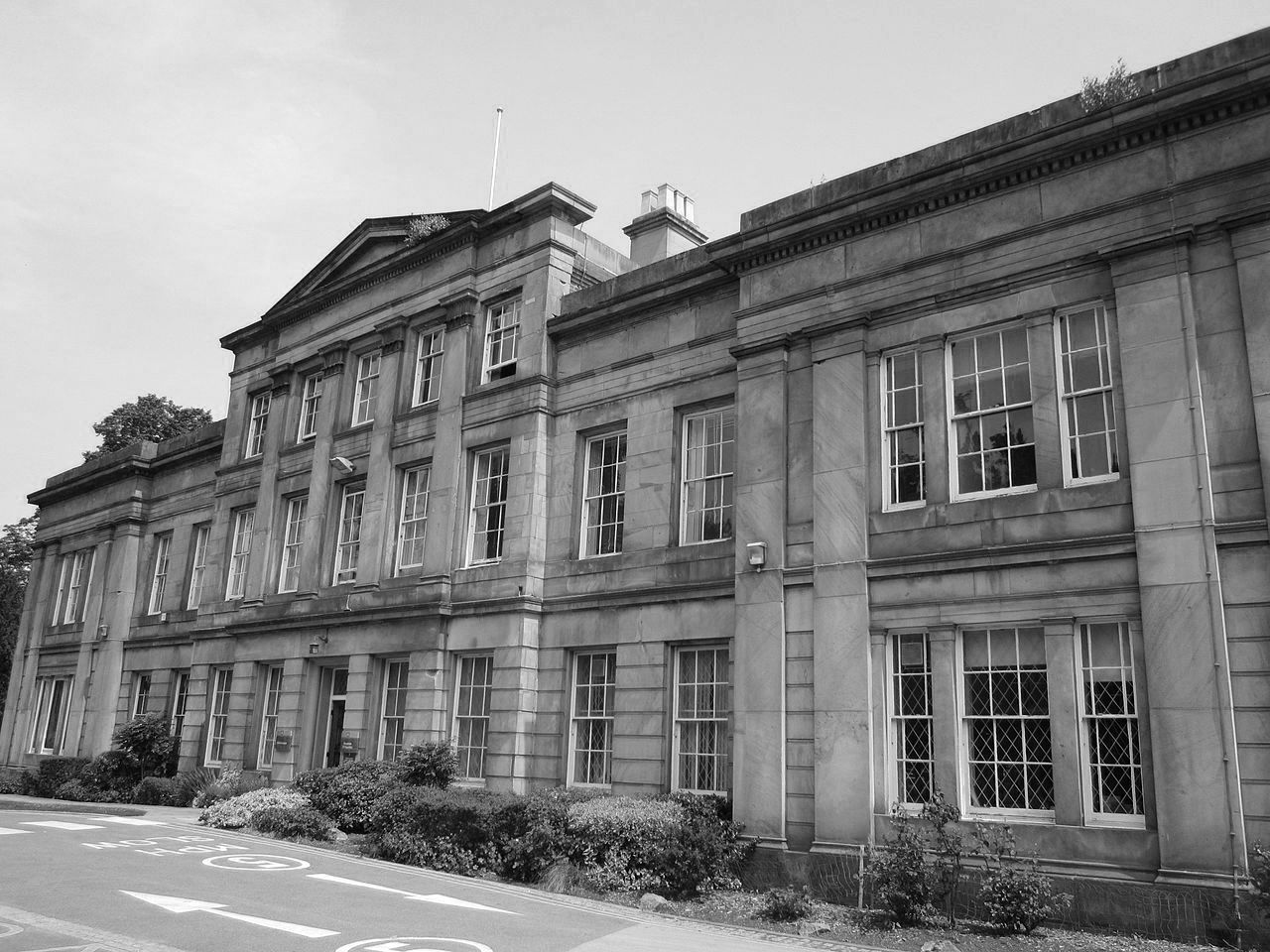
According to local historian Diana Leitch, the site has been in use since 1465; the first house was built in 1603 as part of a large estate with a deer park.
In 1740 the site was purchased by the Broome family, and a new house was constructed after 1785 by William Broome, extant today as the front part of the university’s former administration building, now known as Sandhurst House.
By 1812 the house was occupied by a Colonel Parker, and in the 1820s and ’30s it was a girls’ school.
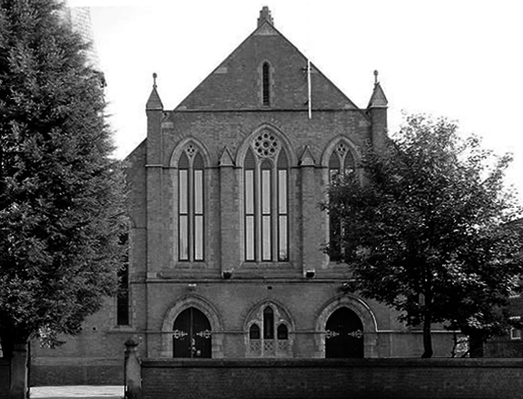
The site was purchased by the Wesleyan Methodist Church on 18 March 1841 for £2,000, and opened as a theological college on 22 September 1842.
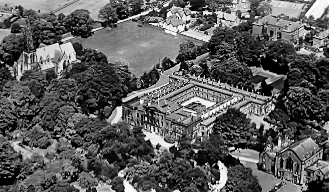
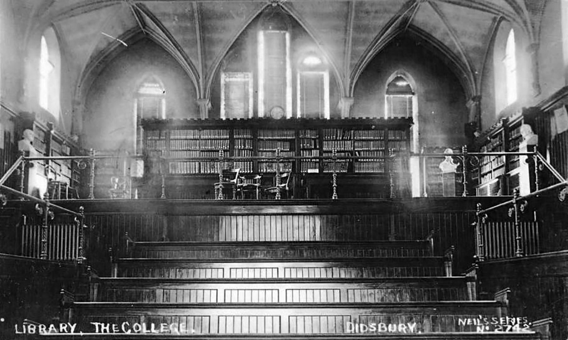
The Old Chapel building, originally the college chapel, is a two-storey building constructed in gothic style, with Flemish bond brickwork, built on a sandstone plinth in 1842. The structure consists of three wings, containing a central hall range, with two domestic wings on each side, initially used as tutor accommodation, forming a symmetrical appearance with the gable end of the upper hall. For many years it was used as a library and lecture theatre.
The ground floor eventually became the student union, and contained a bar and café.
During both world wars the site was used as a military hospital. In 1943 the Board of Education had begun to consider the future of education, following reforms that would inevitably come after the war ended. It was estimated that with the raising of the school leaving age, following the 1944 Education Act, about 70,000 new teachers would be needed annually, almost ten times as many as before the war.
In 1944 a report was produced by the Board of Education on the emergency recruitment and training of teachers, and it was decided that there were to be several new training colleges set up. These colleges were to be staffed by lecturers seconded from local authorities, with mature students selected from National Service conscripts. In 1945 the theological college, which was no longer required by the Wesleyans, was leased to the Manchester Education Authority. The new emergency training college was officially opened on 31 January 1946, with Alfred Body as its first principal.
By 1950, the emergency college was purchased by the City of Manchester and made permanent as Didsbury Teacher Training College, with an initial enrolment of about 250 male and female students. As a result of becoming a permanent college, Didsbury became part of Manchester University’s School of Education.
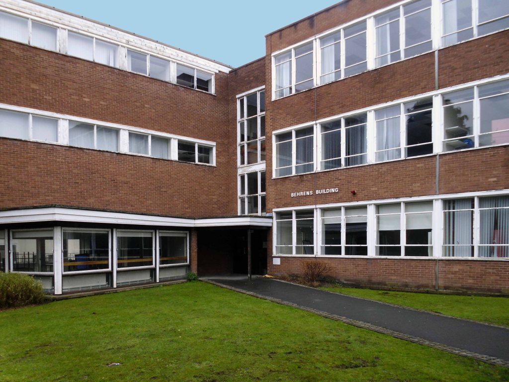
Over the next two decades, numerous buildings were constructed on the site; Behrens, Birley and Simon were all named after prominent local families with ties to the college.
Didsbury became part of Manchester Polytechnic in 1977, renamed Didsbury School of Education.
The adjacent Broomhurst halls of residence have since been demolished.
Both Sandhurst House and the Old Chapel are Grade II listed – the architect was probably Richard Lane.
As of 2018 the site is being redeveloped by local architects PJ Livesey, as a residential area of 93 homes, with the listed buildings being retained.
Here’s a record of my visit, to the soon to be demolished site, in April 2015.
Archive photographs Local Image Collection.
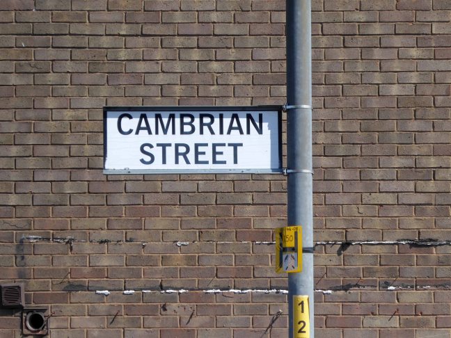
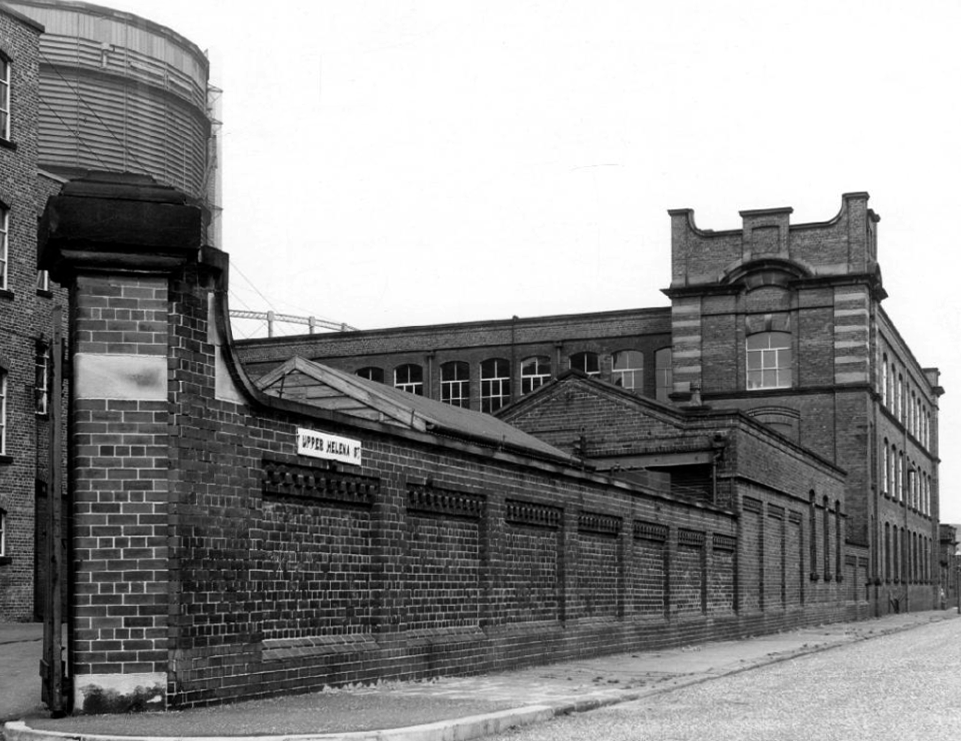
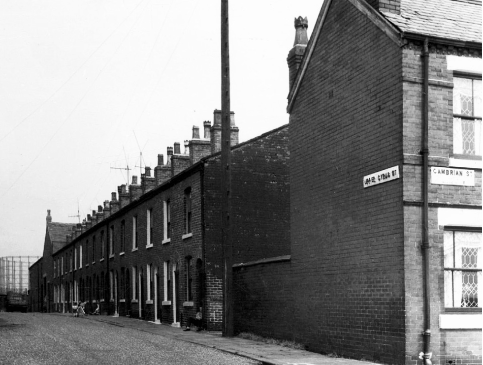
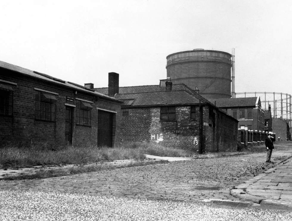
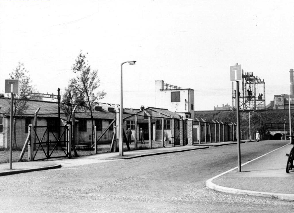
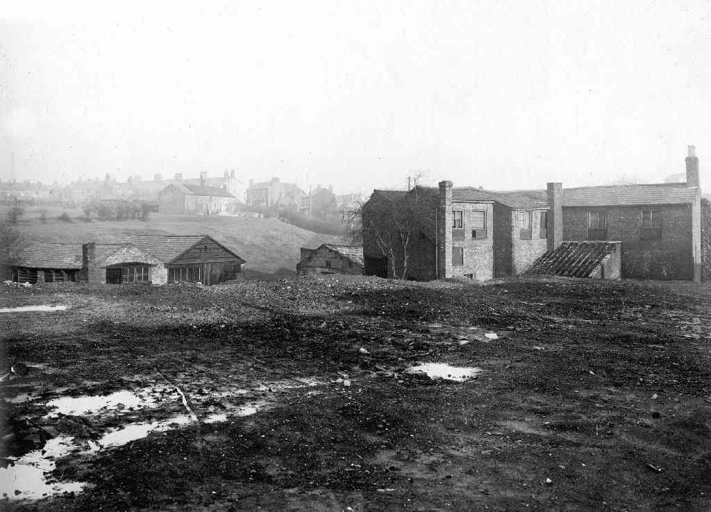
Here we are again in Holt Town, back in 2017 the area was in transition, its past almost erased and its future somewhere, over some far horizon.
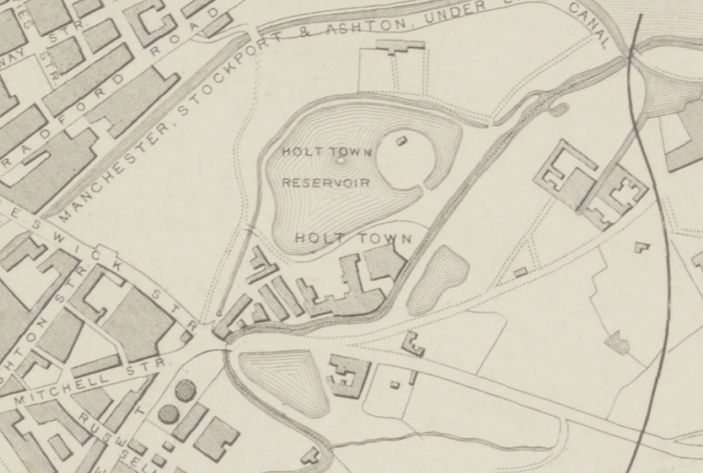
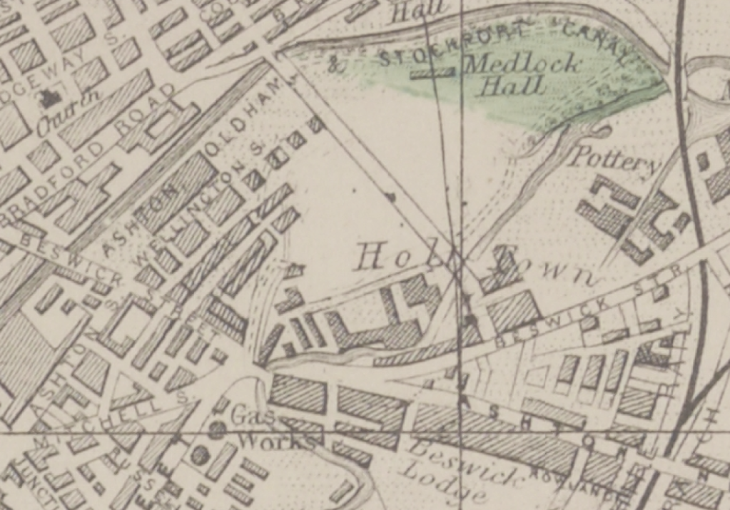
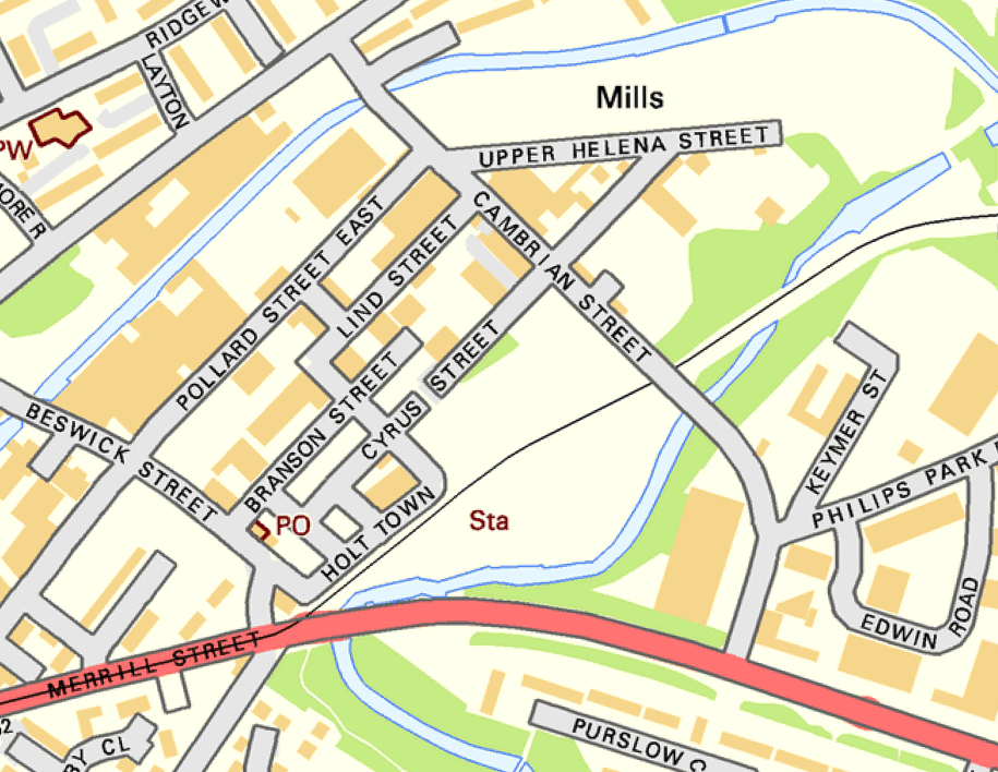
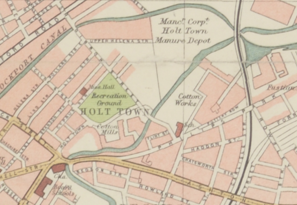
Things have changed, the trees are taller, the buildings decayed – the cafe closed, and the Corporation Manure Depot long long gone.
Plans have promised new affordable homes as part of the Eastlands Masterplan.
Things have changed since A Taste of Honey was in town.
Archive images – Local Image Collection
The area was my playground. Holt Town was always a but scary, there were old factories along the opposite side with wartime helmets in. A scrap yard under the arch. I remember sucking up mercury off the floor with a straw obviously from a spillage, no thoughts of danger, I’m alright now. The Seven Wonders, as we knew it, River, canal, railway, road, waterfall all crossing each other, not sure why? A fantastic industrial area to grow up in. The Don Cinema at the top corner at Mitchell Street and Ashton New Road.
I could go on.
Philip Gregson
Time’s up for the tiny urban cowboys.
Let’s see what’s going on.

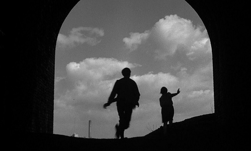
This is a film that has stayed with me for most of my life – first seen as a nipper, fascinated by the fact that it was shot in a very familiar landscape.
As years have passed I have watched and rewatched it, finally resolving to track down the local locations used in its filming.
Studying and pausing the DVD, making thumbnail sketches of frames, researching online – referring to Reelstreets.
I have previously written about the way in which the movie shaped a particular image of the North.
And examined particular areas of Manchester such as Barmouth Street.
The film generated world wide attention and remains just as popular today.
Still watched, still loved, still relevant – here are a selection of photographs I took in 2011 – cycling around Manchester, Salford and just a little closer to home in Stockport.
Larkhill Road scene of the moonlight flit
The descent from Larkhill Road
Stockport Viaduct
Stockport Parish Church
Stockport running for the bus to Castleton
Midway Longsight – where Dora Bryan sang
Barmouth Street were the school scenes were filmed.
Timpson’s shoe shop now demolished opposite the Etihad
Phillips Park the back of the gas works in Holt Town
The Devil’s Steps Holt Town

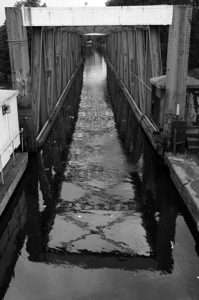
Rochdale Canal
Ashton Canal
All Souls Church Every Street Ancoats
Piccadilly Gardens as we view the city from a moving bus.
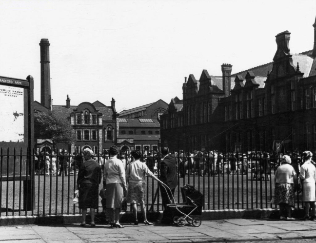
Manchester Art gallery – where they watched the Whit Walks.

Albert Square part of the earlier bus ride.
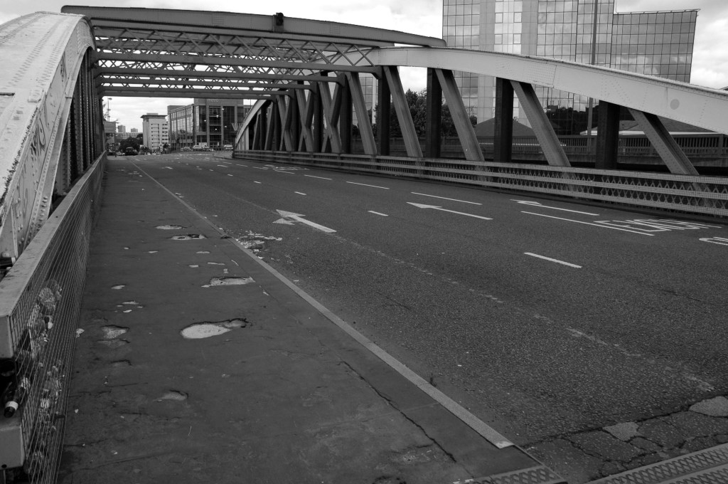
Trafford Swing Bridge
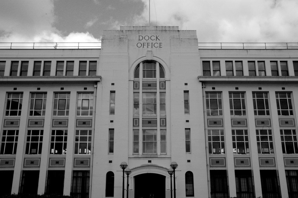
Dock Offices
Chimney Pot Park Salford
Pendleton
Barton Aqueduct
Through my tour I have attempted to capture a sense of the settings as they are – how, if at all, the areas have changed.
There may be some minor inaccuracies or omissions which I am happy to amend.
You may wish to visit the sites yourselves, the majority of which are easily accessible, above all watch the film and appreciate that which is around you.
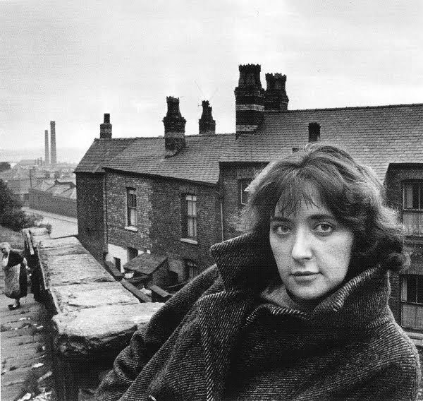
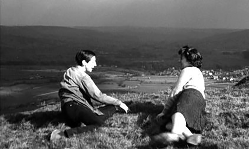
Portrait of Shelagh Delaney – Arnold Newman
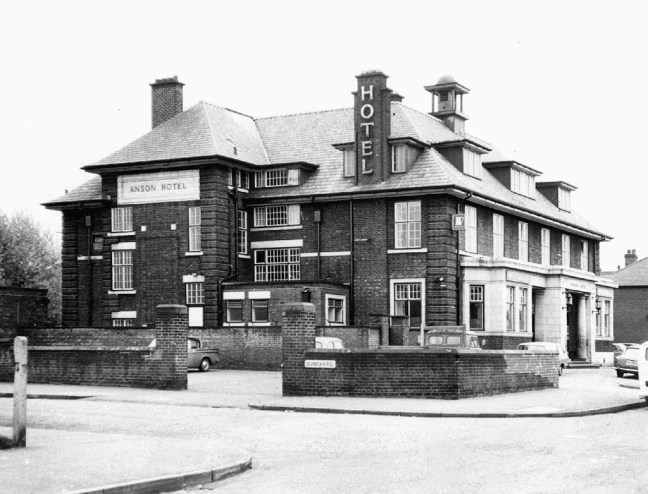
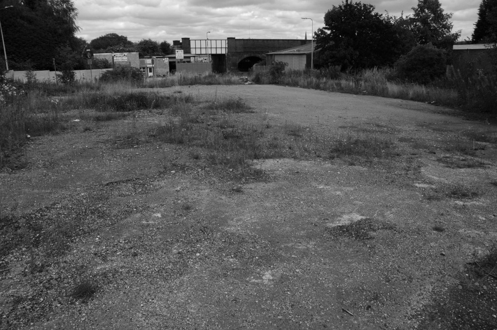
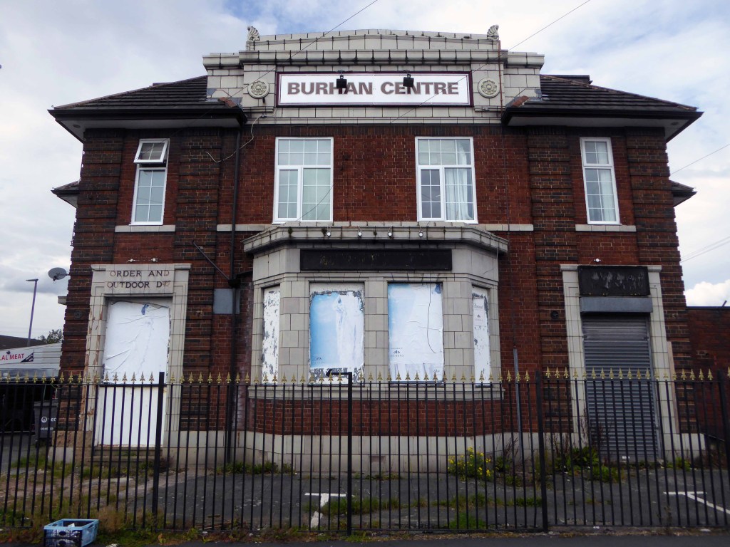
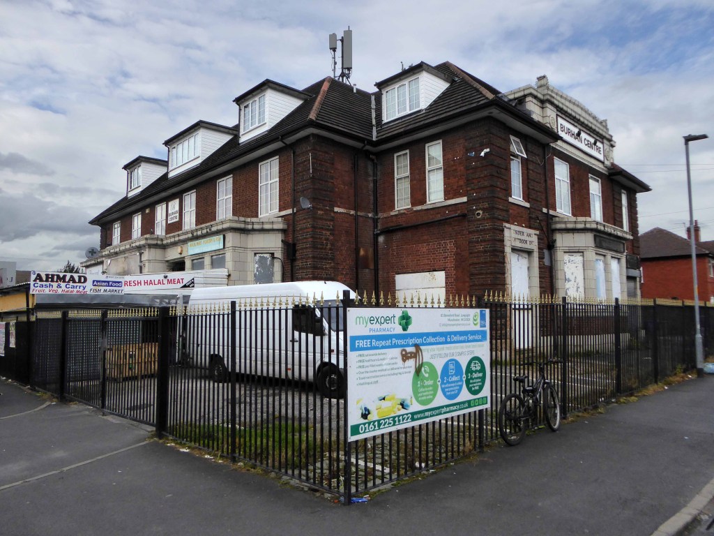
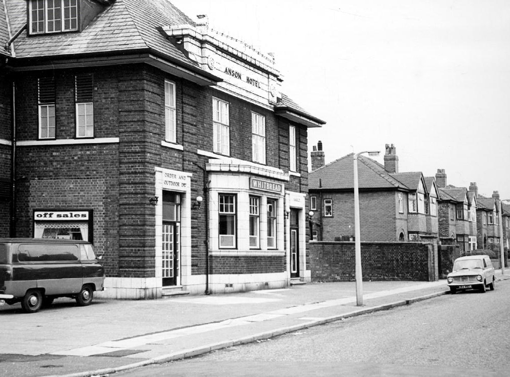
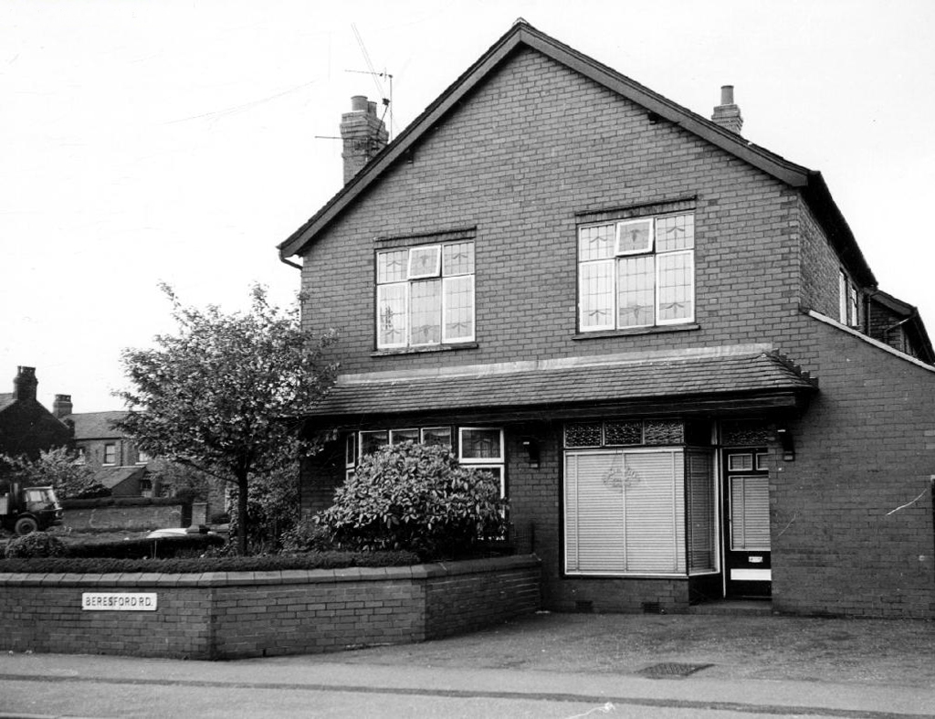
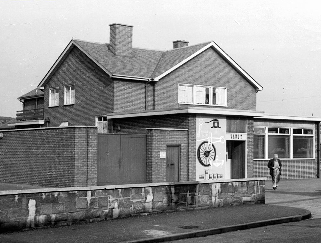
Cycling back from Town, zig zagging between the A6 and Birchfields Road, I headed down Beresford Road and bumped into a behemoth.
A huge inter-war Whitbread boozer long since closed, now a retail food outlet and badged as the Buhran Centre, also trading as Burooj.
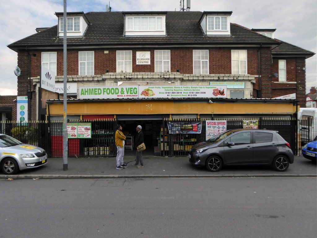
This change of use is far from uncommon, the demographics, socio-economic conditions and drinking habits which shape this and countless other pubs, have since shifted away from the lost world of this immense, roadhouse-style palace of fun.
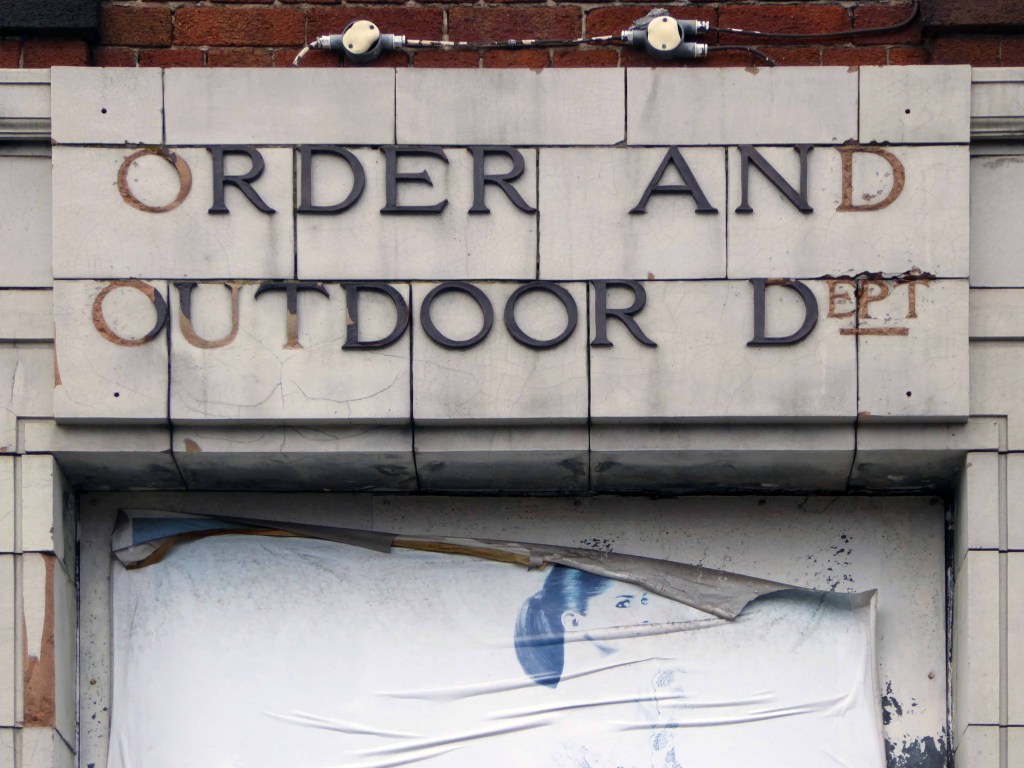
No more outdoor or orders here – the supermarket now supplies the supplies for the self satisfied home drinker.
The sheer scale of the building guaranteed its demise, a three storey house with no more stories to tell.
Searching online for some clues as to its history there is but one mention, on the Pubs of Manchester:

This is my attempt, in some small way, to redress the balance, snapping what remains of this once top pub.
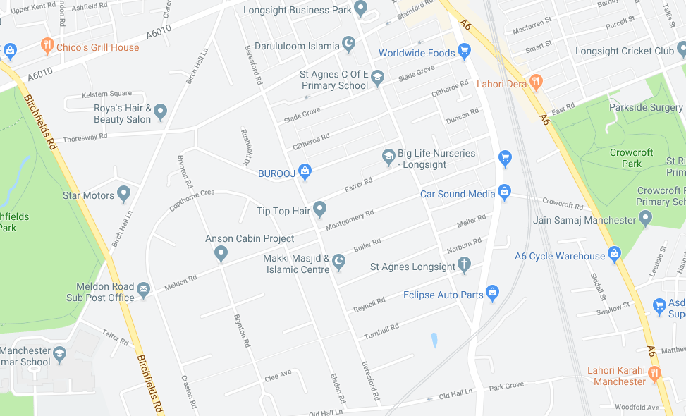
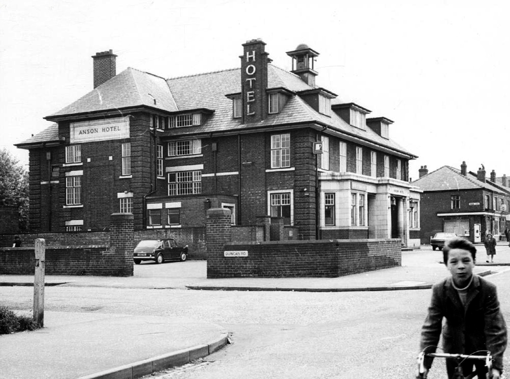
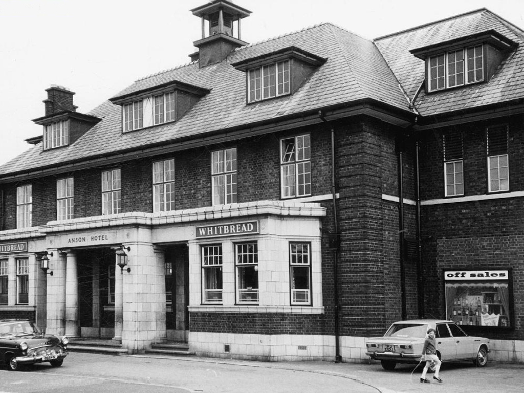
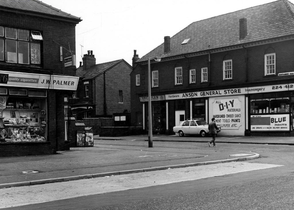
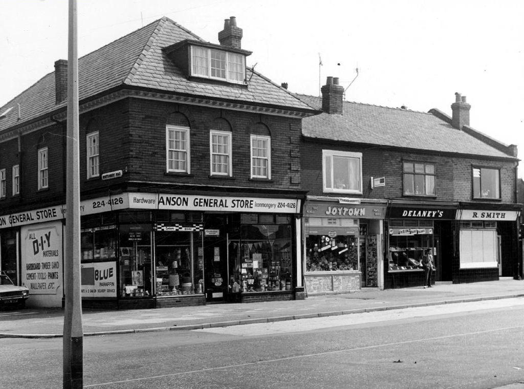
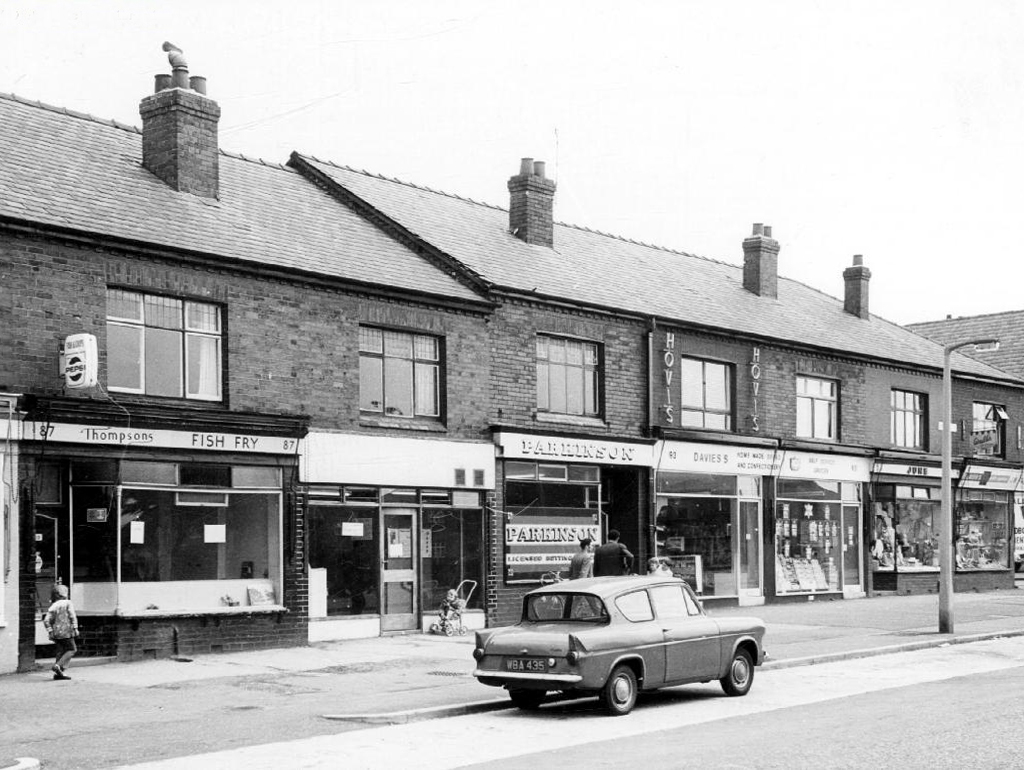
Safe home I searched the Manchester Local Image Collection, hoping to find some clues and/or images elucidating Beresford Road and the Anson in times gone by.
I found a typical inner Manchester suburban thoroughfare, a healthy mix of homes socially and privately owned, industry, independents shops, schools and such. Kids at play, passers-by passing by, captured in 1971 by the Council’s housing department photographers.
This was not a Golden Age – wasn’t the past much better, brighter, cheerier and cleaner reminiscence – simply a series of observations.
Things change.
Including the Anson Hotel.

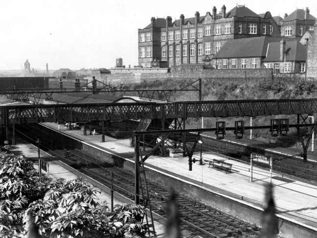
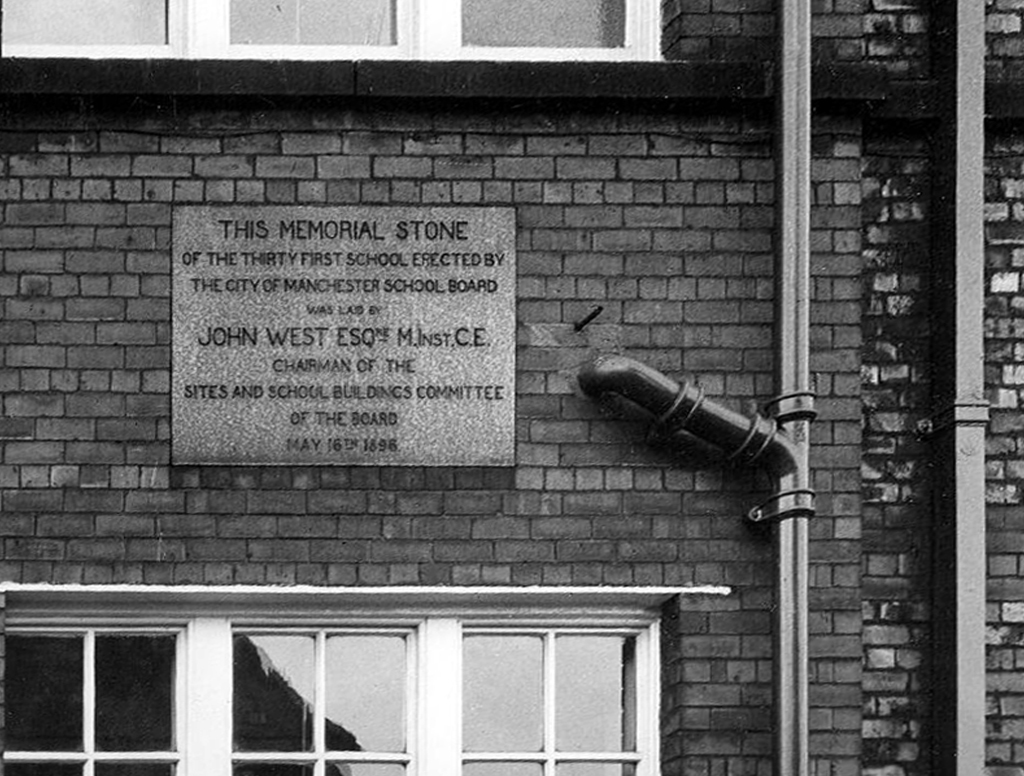
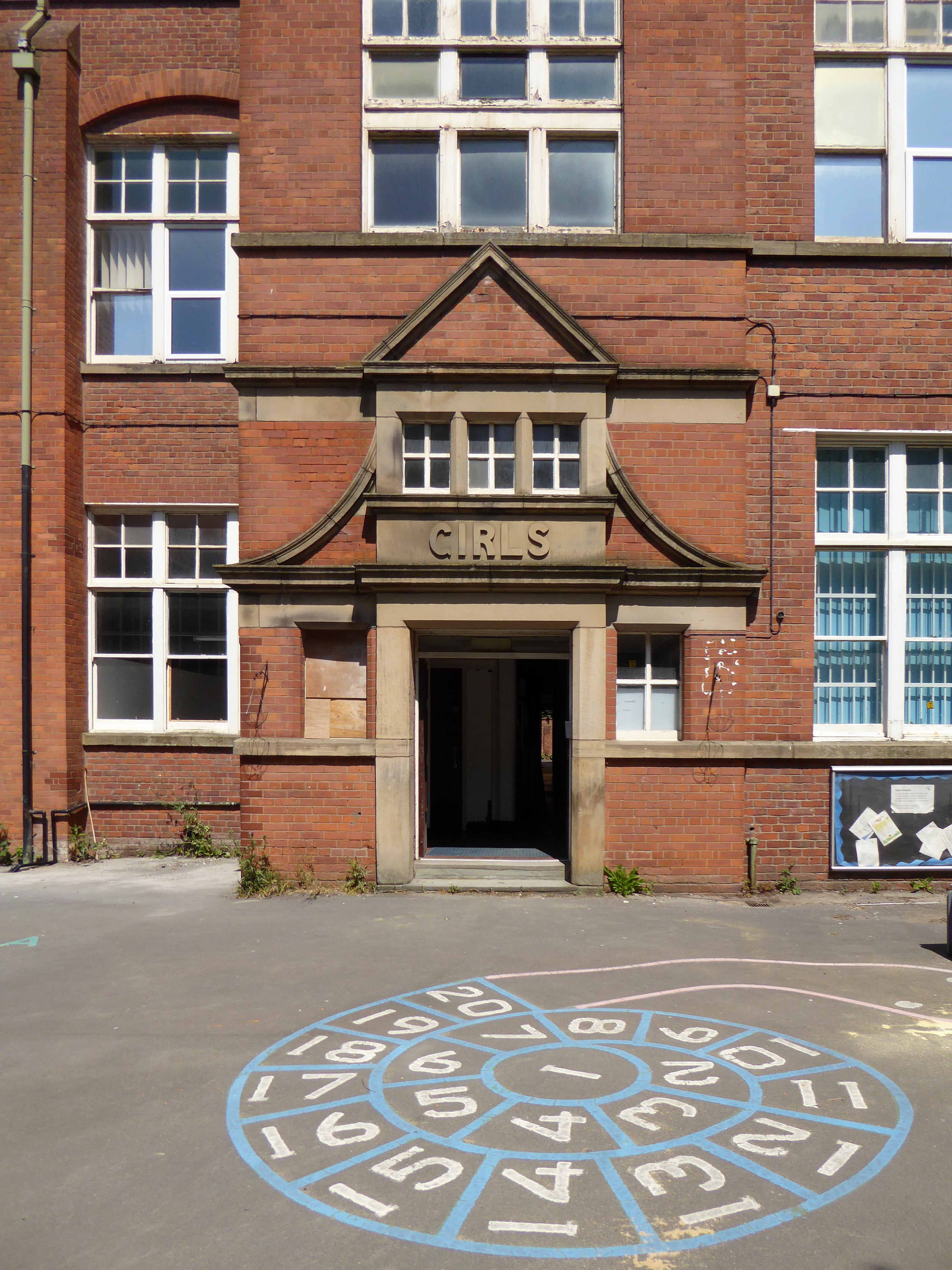
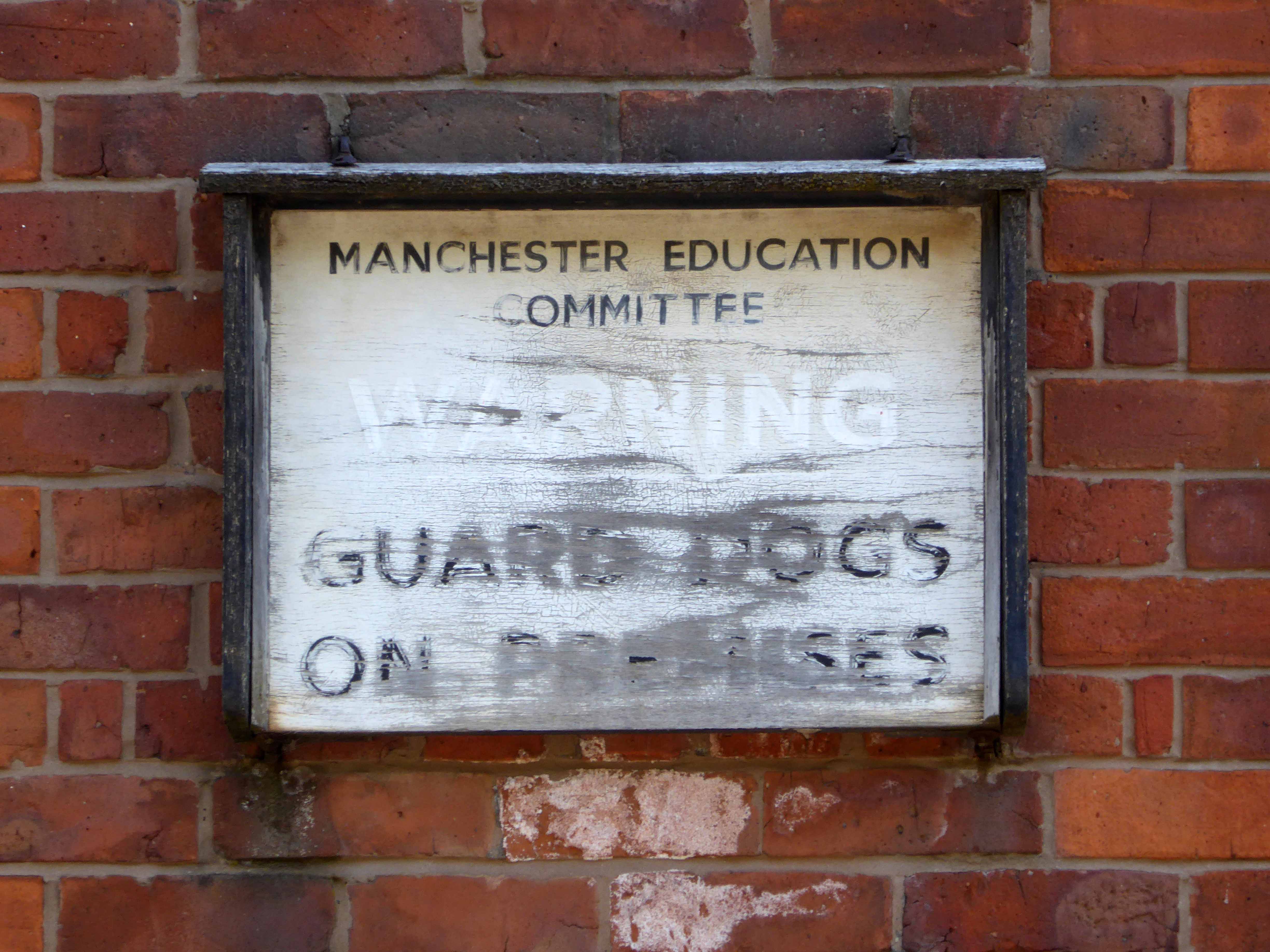
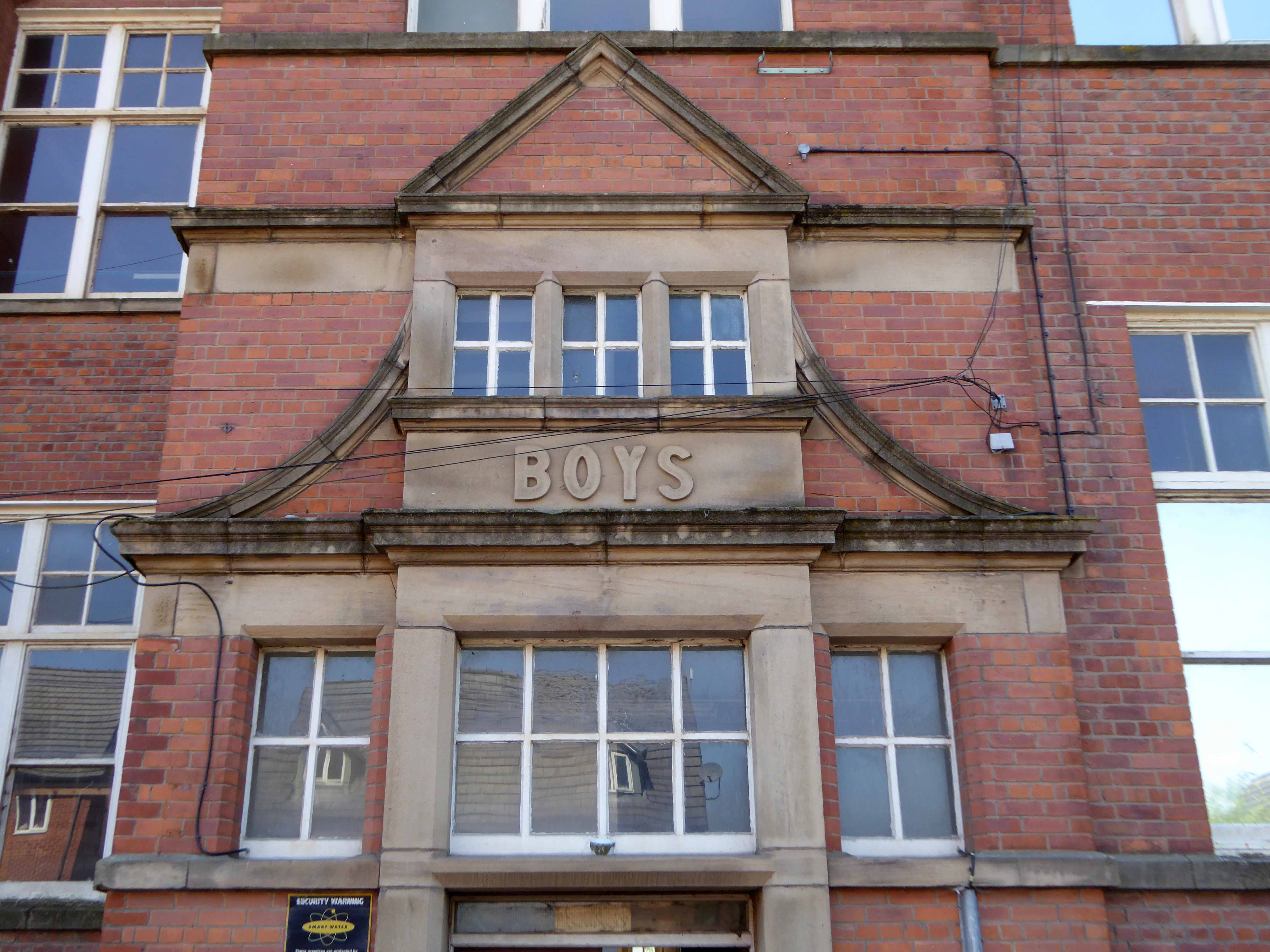
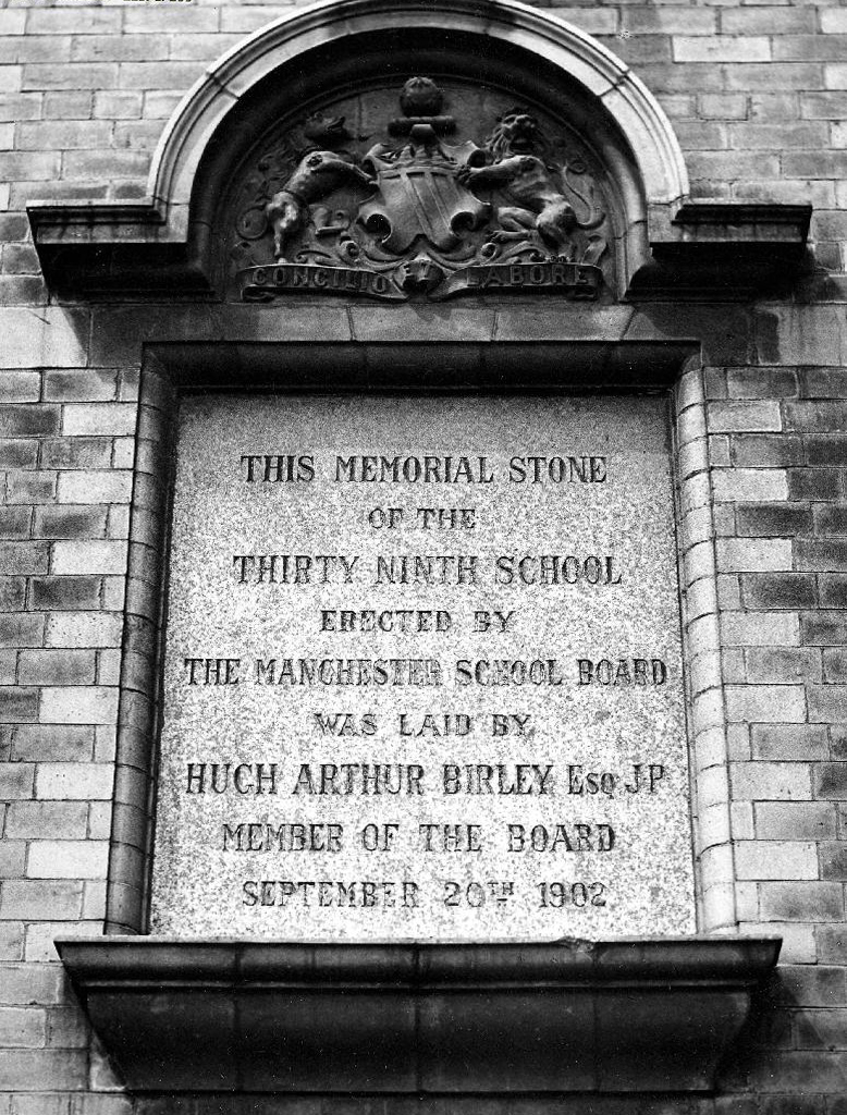
Once there was a school – from May 16th 1898, there was a school.
One of many Manchester School Board schools built in an imposing functional, triple storied style, they often seemed several times too big, for the infants which they contained.
With one thousand five hundred pupils, it was dubbed the largest school in Lancashire.
Nestled in a tight corner formed by the Lanky Cut and the train line below, surrounded by the huddled masses, in their manifold terraced homes.
Once home to cheeky monkey, soon to be Monkee Davy Jones.
His runaway, overnight fame made his humble Gorton home a mecca for adoring fans.
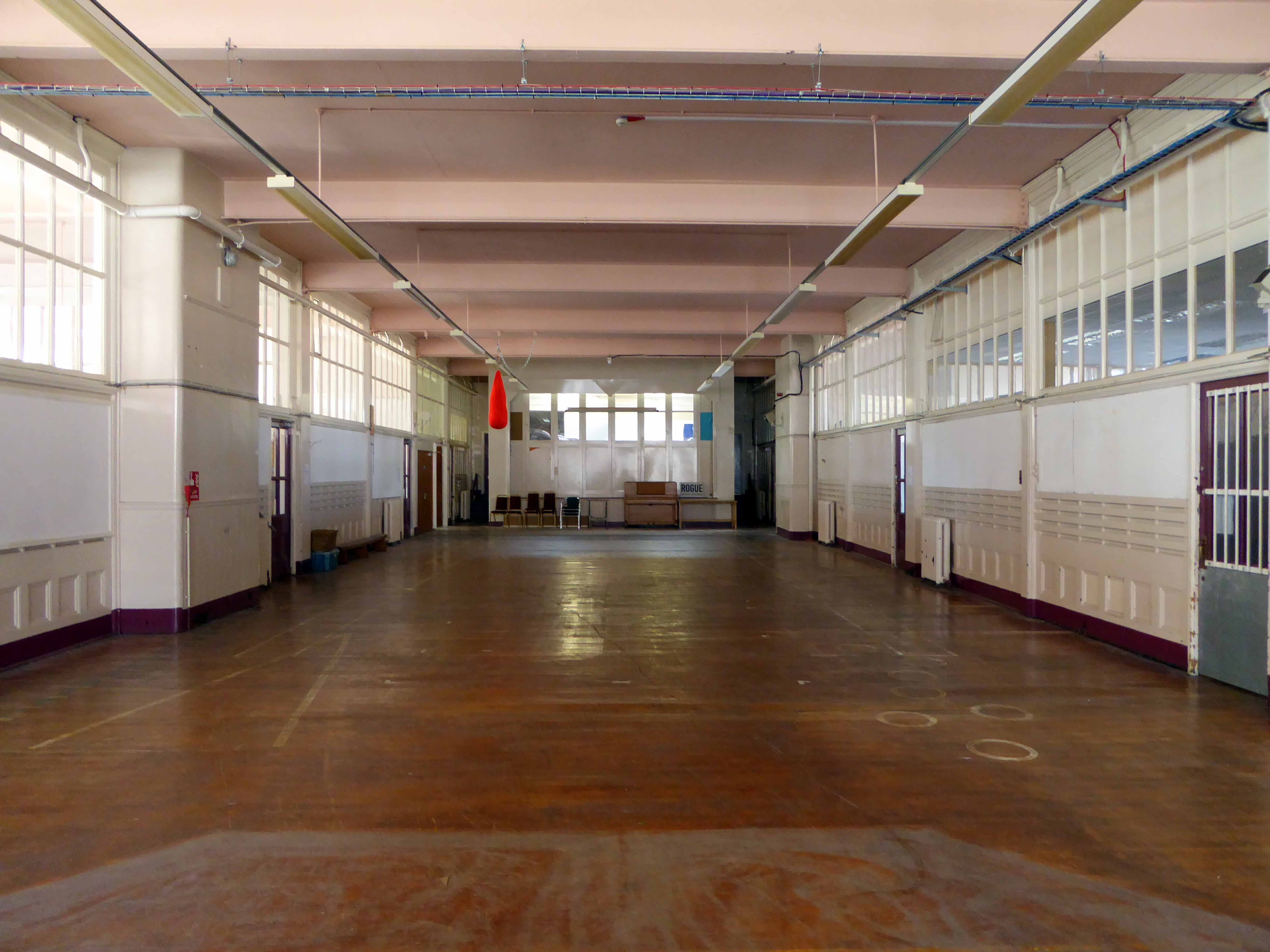
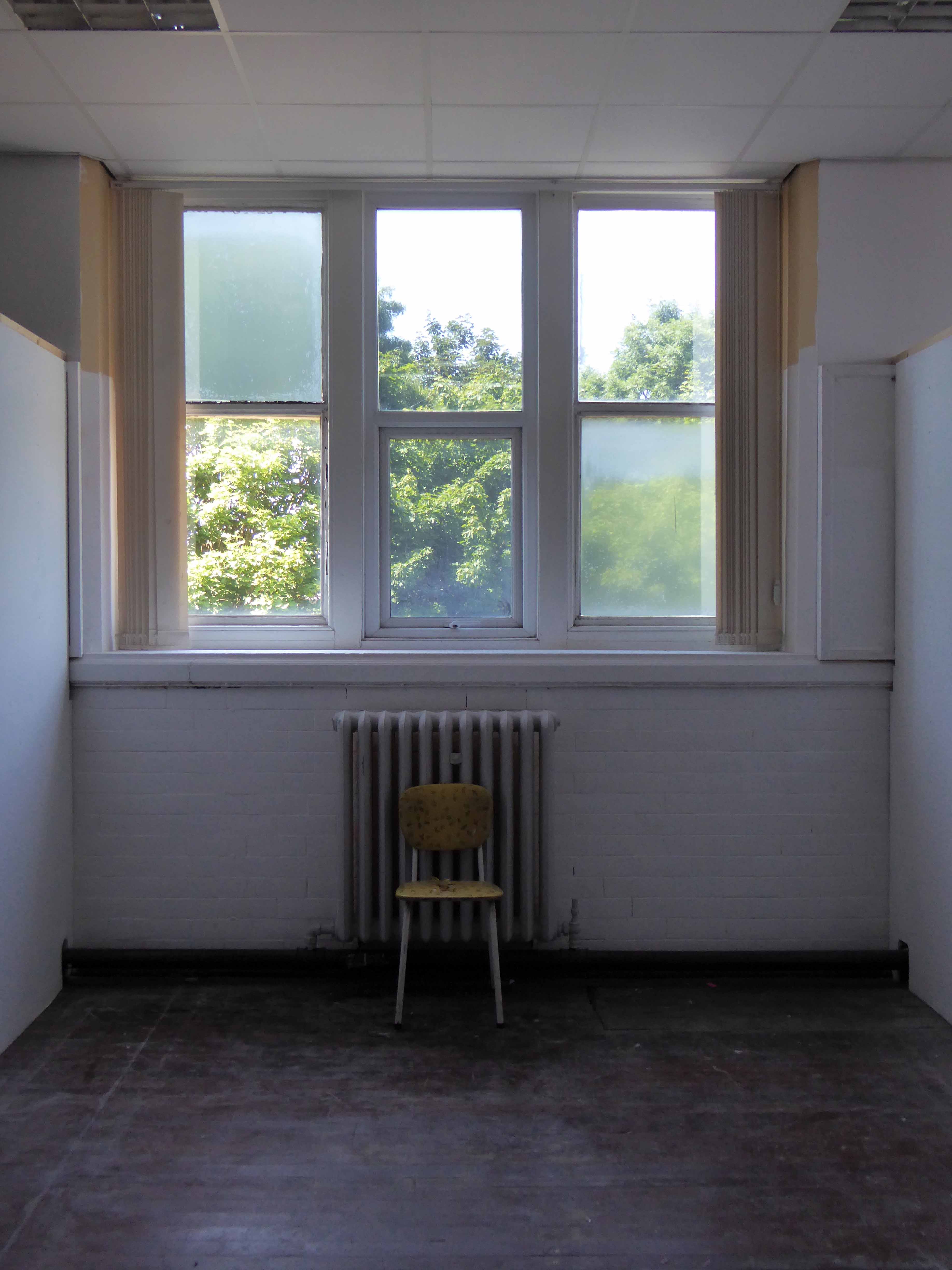
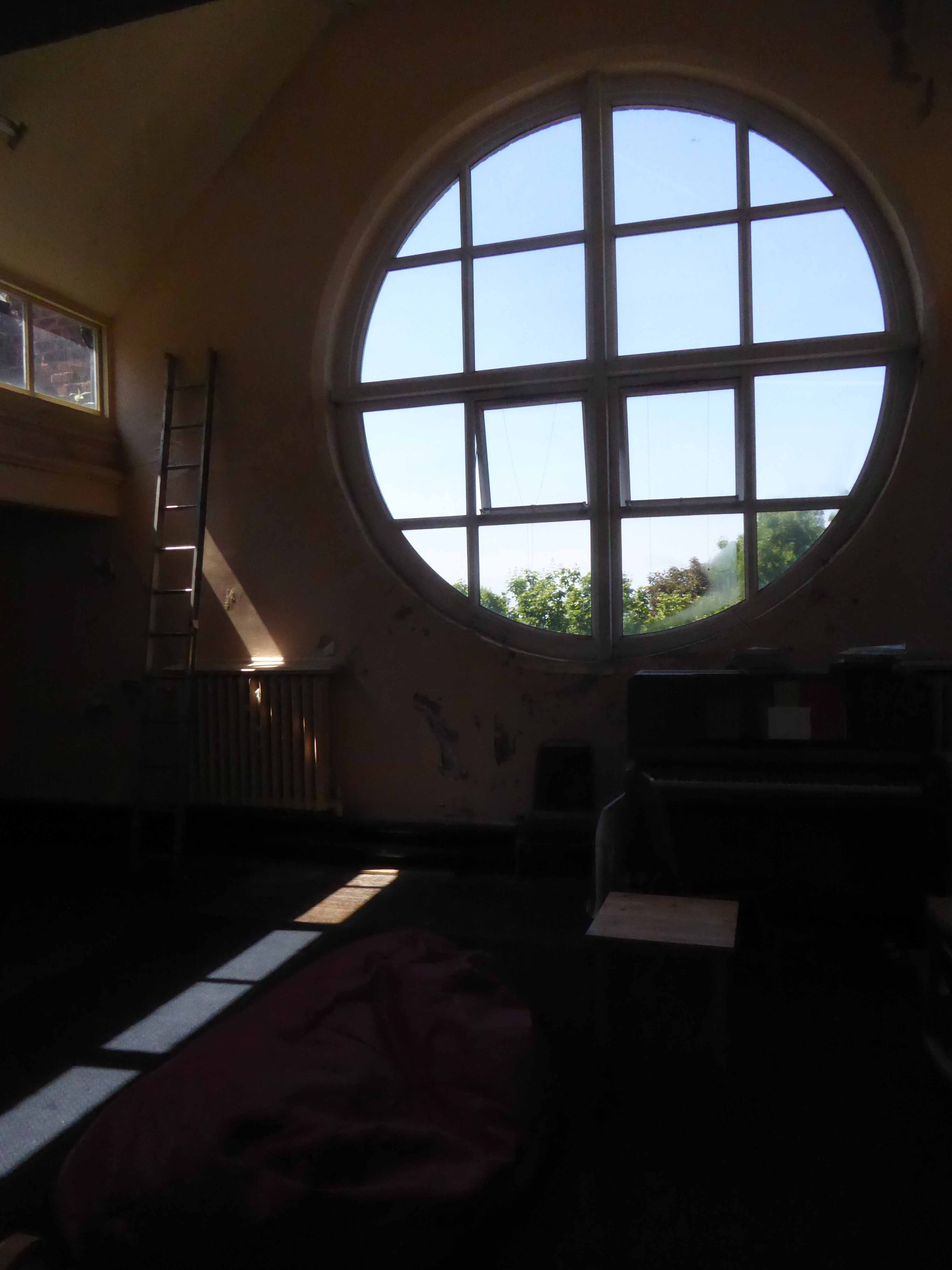
The school’s interior was a mix of wide open halls and closeted classrooms.
Archive photographs from the Manchester Local Image Collection
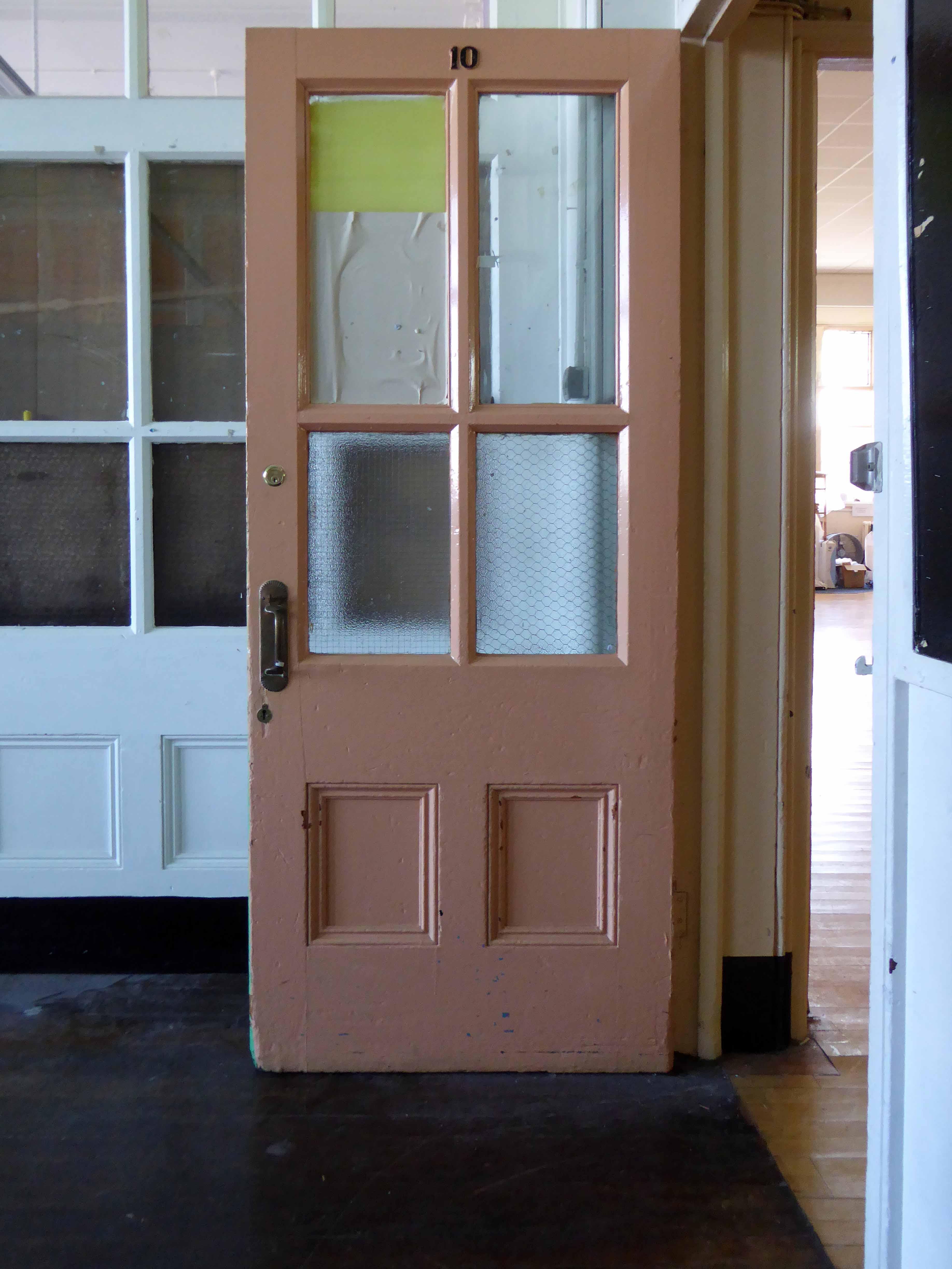
Eventually the school bell rang for the last time, and a newer brighter home was found for the little learners.
Lights were turned off and the doors of Varna Street were closed.
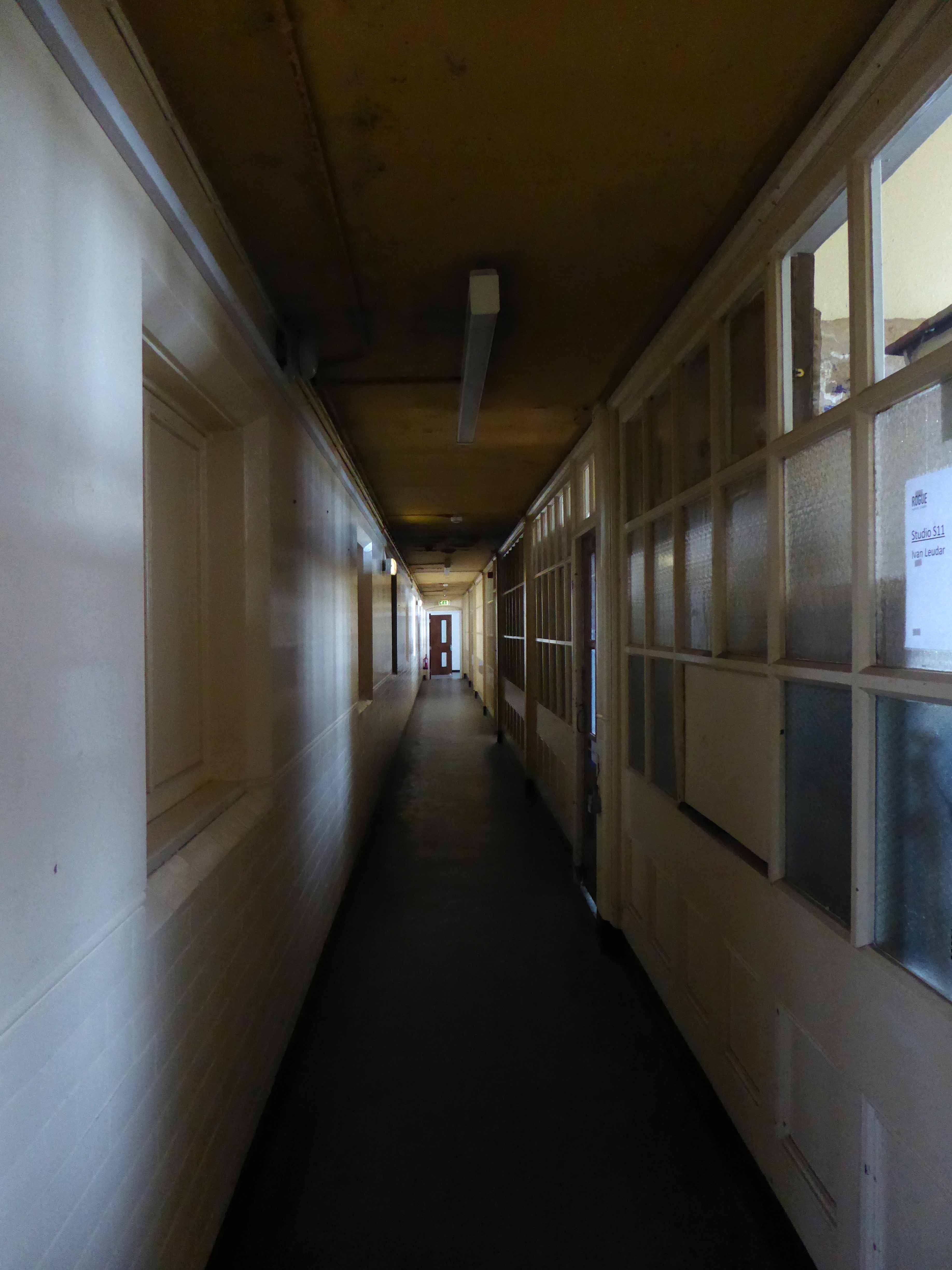
But not for the last time, a new use was found for this recently listed building.
Having lost their city centre base Rogue Studios were offered the site by the local authority, and in double quick time they have created a home for artists, a community resource and project space, which will continue to prosper for years to come.
Many thanks to Ms. Jenny Steele Rogue artist for my guided tour.


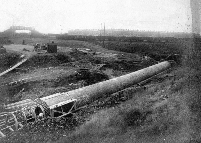
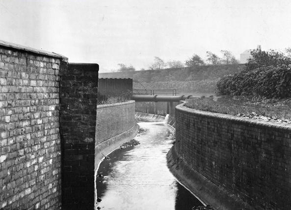
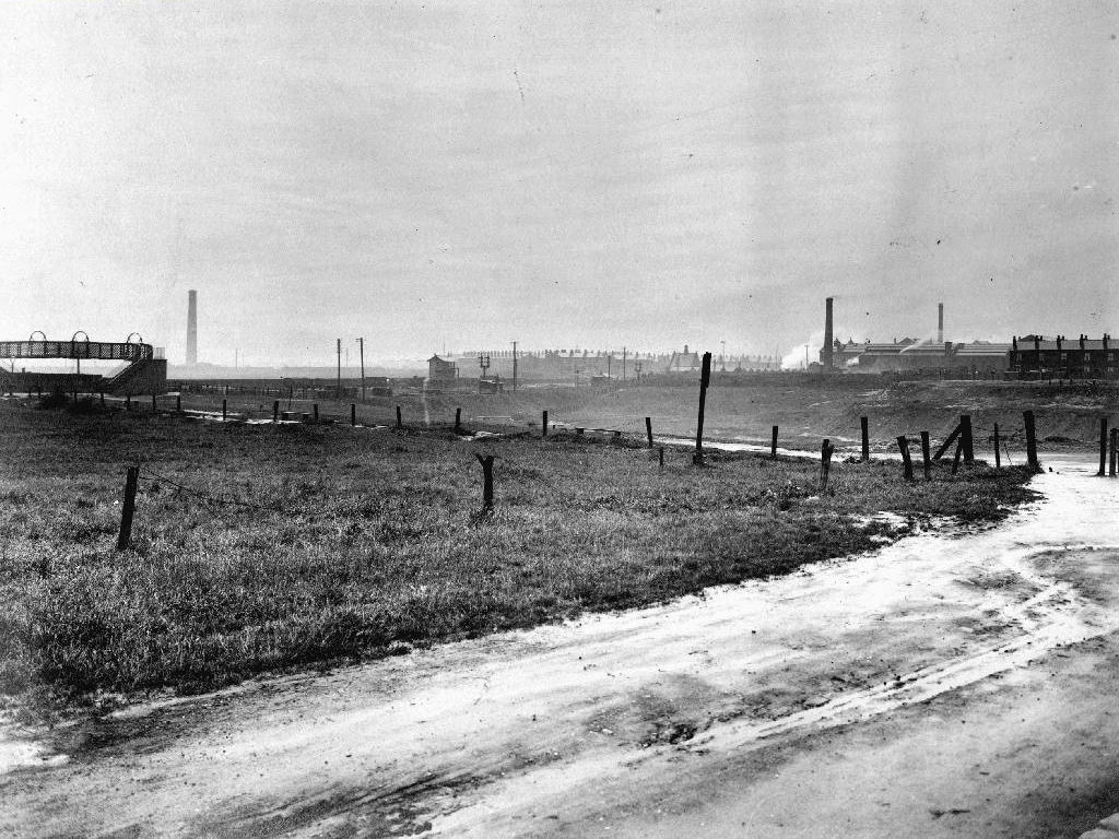
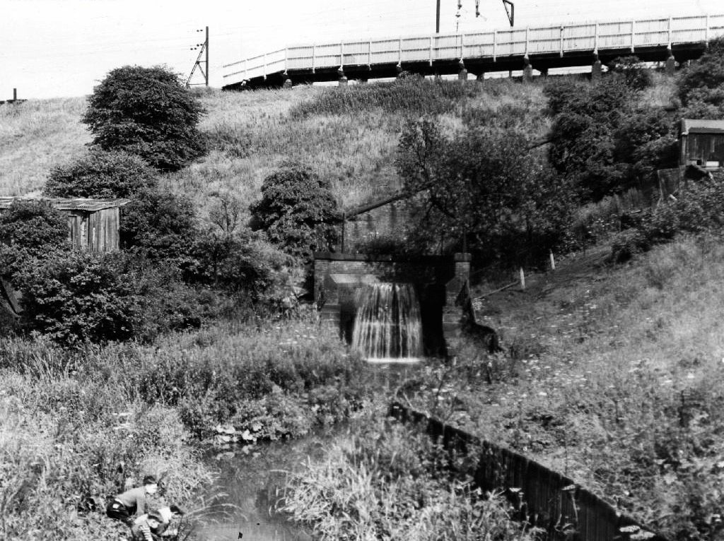
To begin at the beginning, well actually to begin in the middle and walk to the current beginning. The Gore Brook flows from the Lower Gorton Reservoir and from there onwards to meet the Chorlton Brook in the west, though I should imagine that prior to the construction of the waterworks, it was fed by more distant moorland waters.
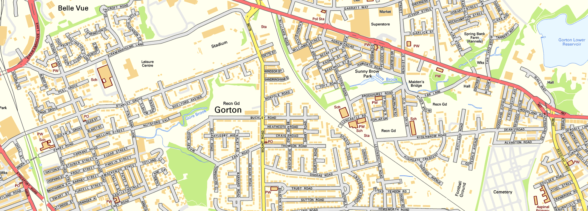
Manchester being on the eastern edge of the Lancashire Plain and the western edge of the Pennines is riddled with rivers, rivers which now wriggle in an under and overground web, across heavily developed urban areas. Following the Industrial Revolution former meadow, common and farmland was overwritten by factories, housing and roads, the rural character of the rivers and brooks soon becoming darkened and polluted by the surrounding industries.
I was lead here by my search for a lost pub The Garratt on Pink Bank Lane, then drawn in further by this site The Red Path of Longsight.
The Red Path is a pedestrian link between Pink Bank Lane and the Gorton boundary at Buckley Road. It roughly follows the course of Gore Brook. The original footpath, running from Buckley Road to the bank of the brook, was made using black cinders. It was probably made in the 1940s to provide access to the allotments located on either side. In the early 1950s , a concrete bridge was laid across Gore Brook and the footpath extended to Pink Bank Lane. This section used red bricks in it’s construction, probably supplied by Jacksons brickworks . Crushed bricks were then used as a topping to make the path smoother and fill in any cracks. The thoroughfare soon became known as the Red Path.
So wide eyed and mapless I bowled up at Brook Terrace, just off Stockport Road Longsight, in search of The Gore and its source.

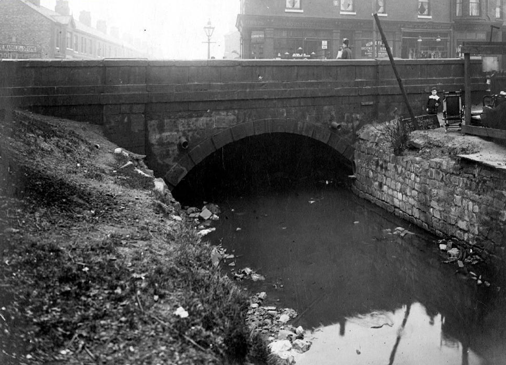
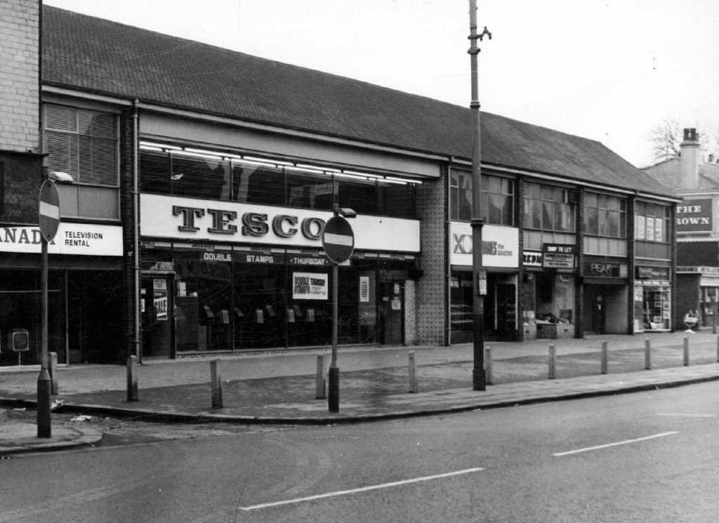
In the early 1900’s the river was still open and bridged, here at Stockport Road, later culverted and covered – anticipating the arrival of Tesco’s and Granada TV Rentals.
From there we pass under the railway along Brook Terrace and into Parry Road.
The underpass is still there and very much in use, as is Stanley Grove School – the Manchester Central Schools’ Kitchens are long gone, along with the food filled, insulated aluminium cases, that fed the hungry mouths of many, with semolina, pink custard, meat pies and lumpy mash.
Onwards to Elgar Street and still no sign of the river, hidden beneath our feet, the corner of Northmoor Road, can be seen on the corner, no longer distributing dividends, but now providing social housing.
We arrive at Pink Bank Lane, a rich mix of terraced homes, flats and factories – and the long lost Garratt, and the long lost Gore.
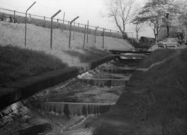
Though the lazy, lazy river has been confined in a brick lined wind, to meet the ever pressing needs of the Gorton Sewage Works.
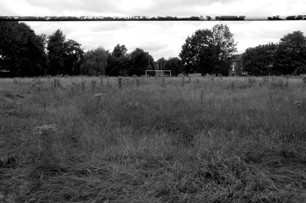
The river then hugs the edge of Annie Lea Playing fields on Buckley Road, until it disappears again as it meets Mount Road, the playing fields are still open ground – the Manchester Cleansing Department, seen on the left – is no more.
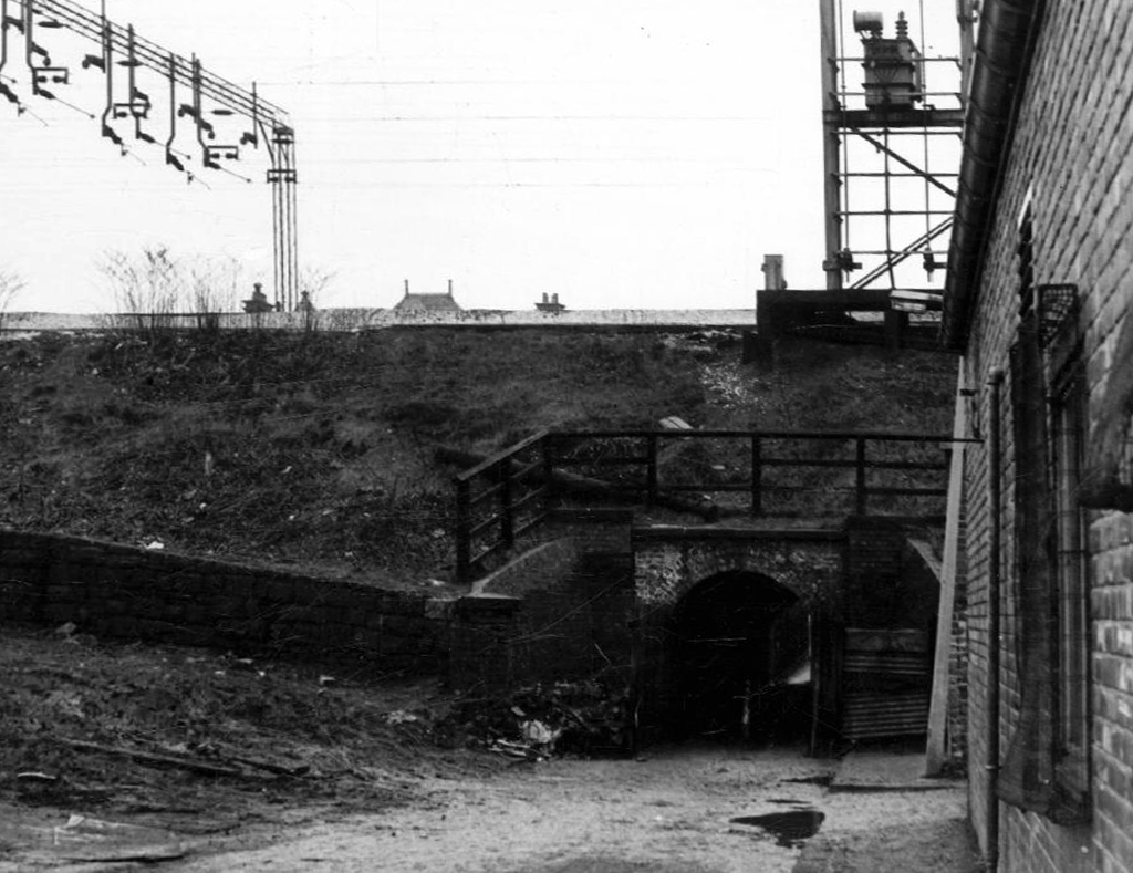
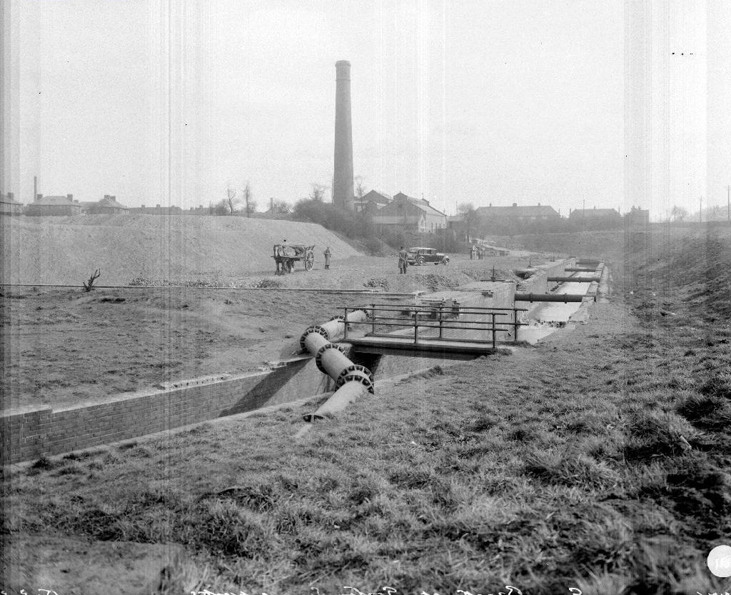
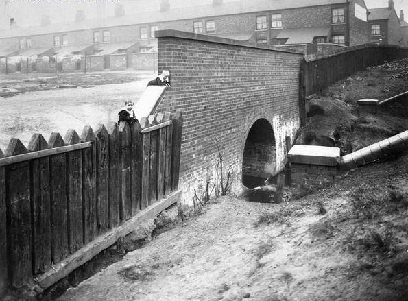
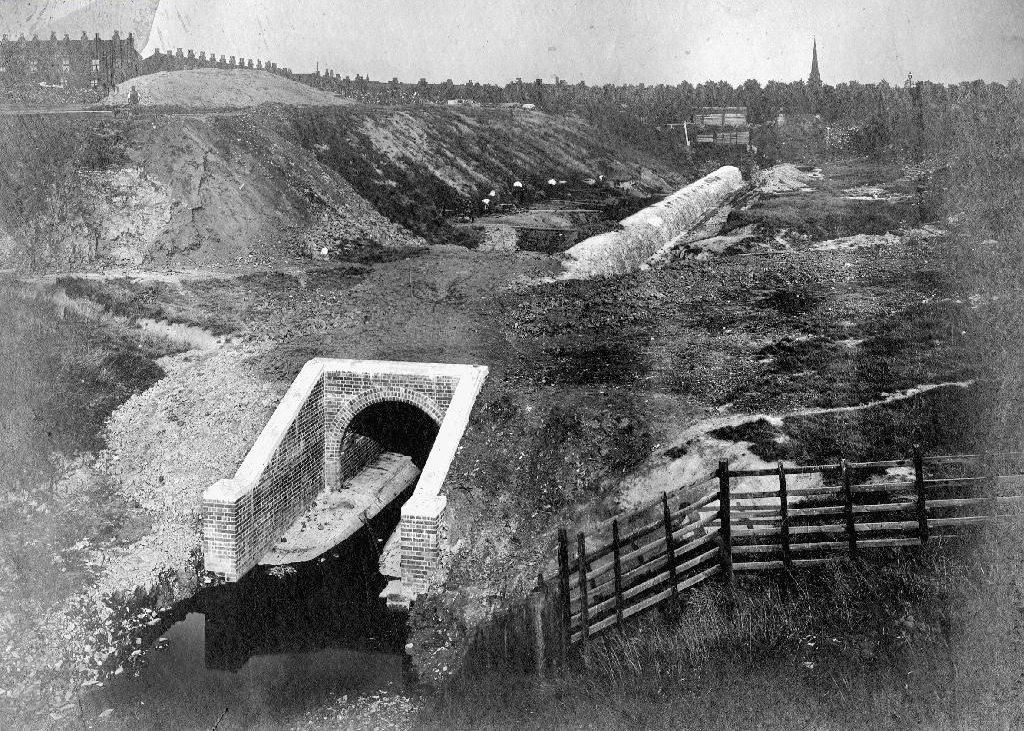
Here on Knutsford Road we see the construction of the tunnels and culverts, the footbridge to the left spanning the railway, is still there.
1907
1911
1914
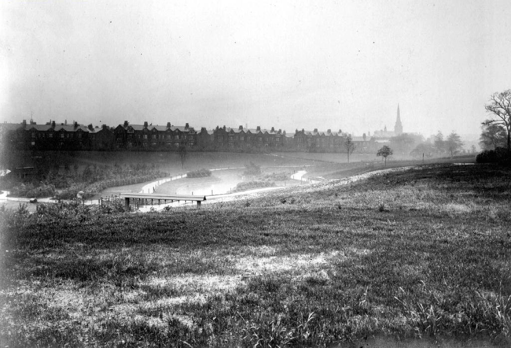
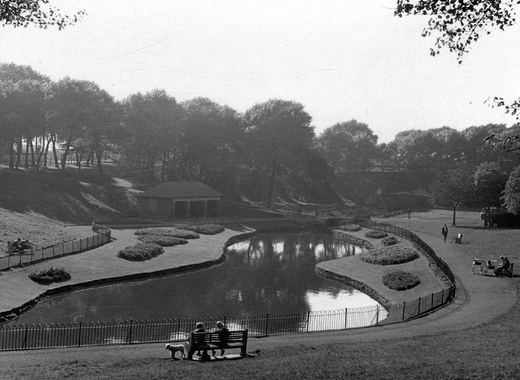
Finally we see The Gore reemerging clear, clean, wide, proud and resplendent in Sunny Brow Park, where it is still maintained as a decorative, duck-filled lake.
1907
1910
1964
Briefly underground again and into the back of Far Lane, skirting the Brookfield Church graveyard.
1920
1937
1964
Then tunnelling under Hyde Road at the back of the church lodge, appearing once again alongside Tan Yard Brow.
1904
1922
1964
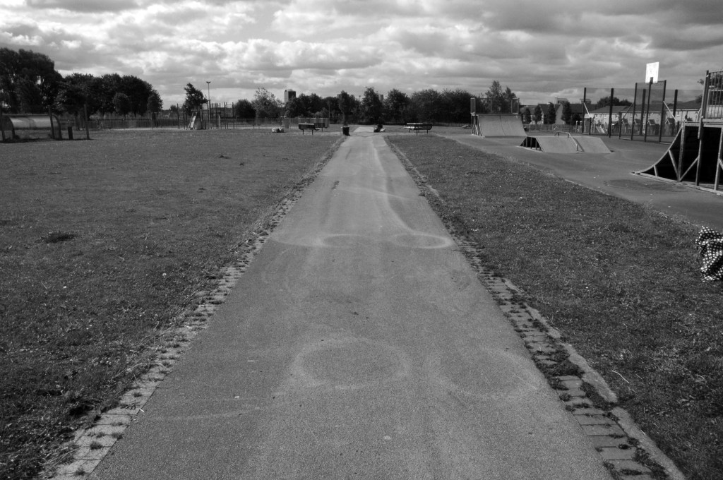
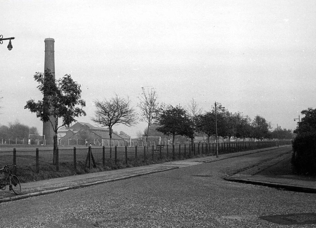
The manmade waterfall continues to cascade, the Fairfield to Old Trafford railway is now the Fallowfield Loop, Manchester Cycleway, young lads no longer mess about in wellies and torn Tek Sac jeans on the bank, the Tannery no longer tans.
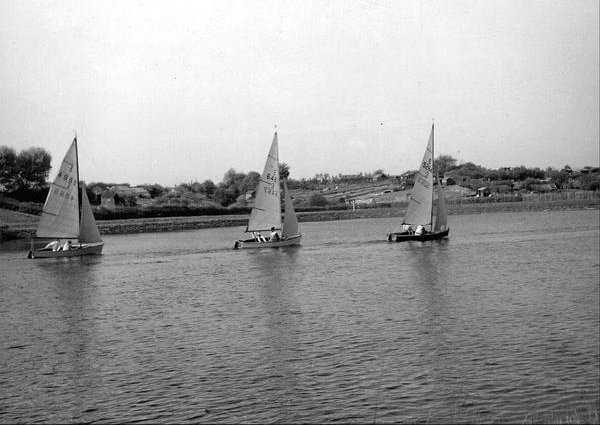
Then we end our journey by the broad expanse of the Lower Gorton Reservoir, implausibly dotted with jolly yachts, and home to a now absent stepped outflow stream. Look up to the east, and there you’ll see the moors, you could go further.
All archive photographs from Manchester Local Image Collection.
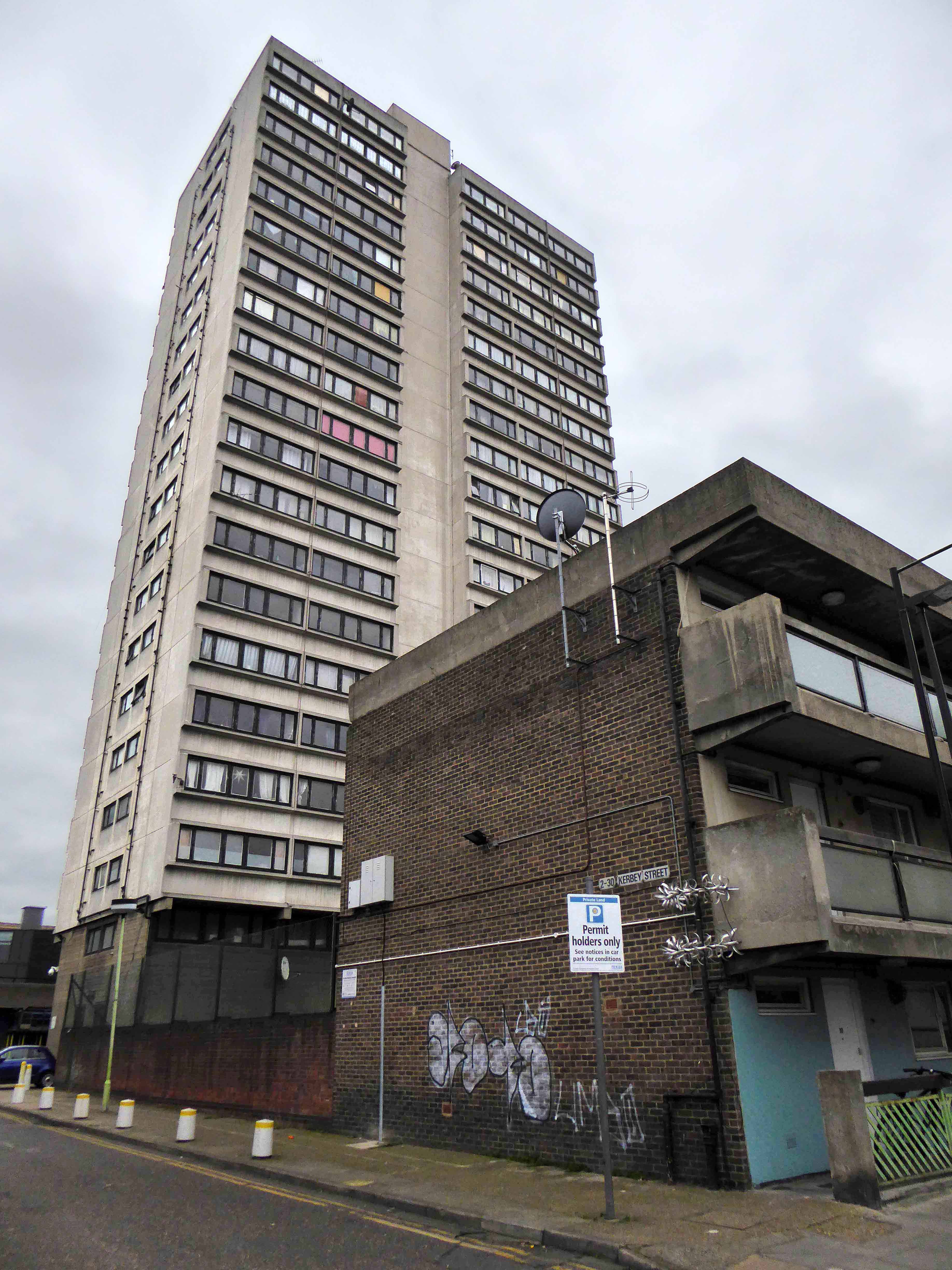
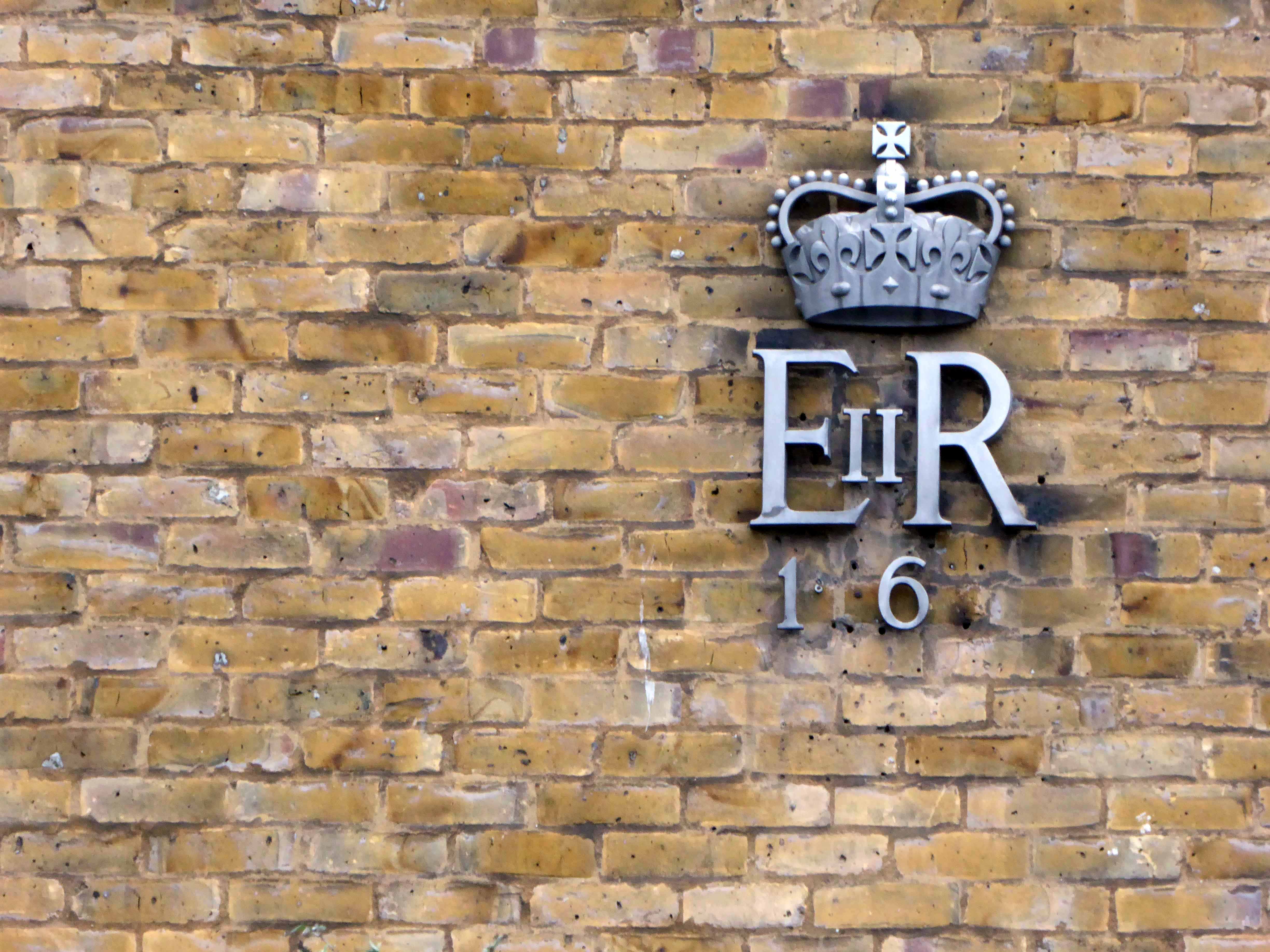
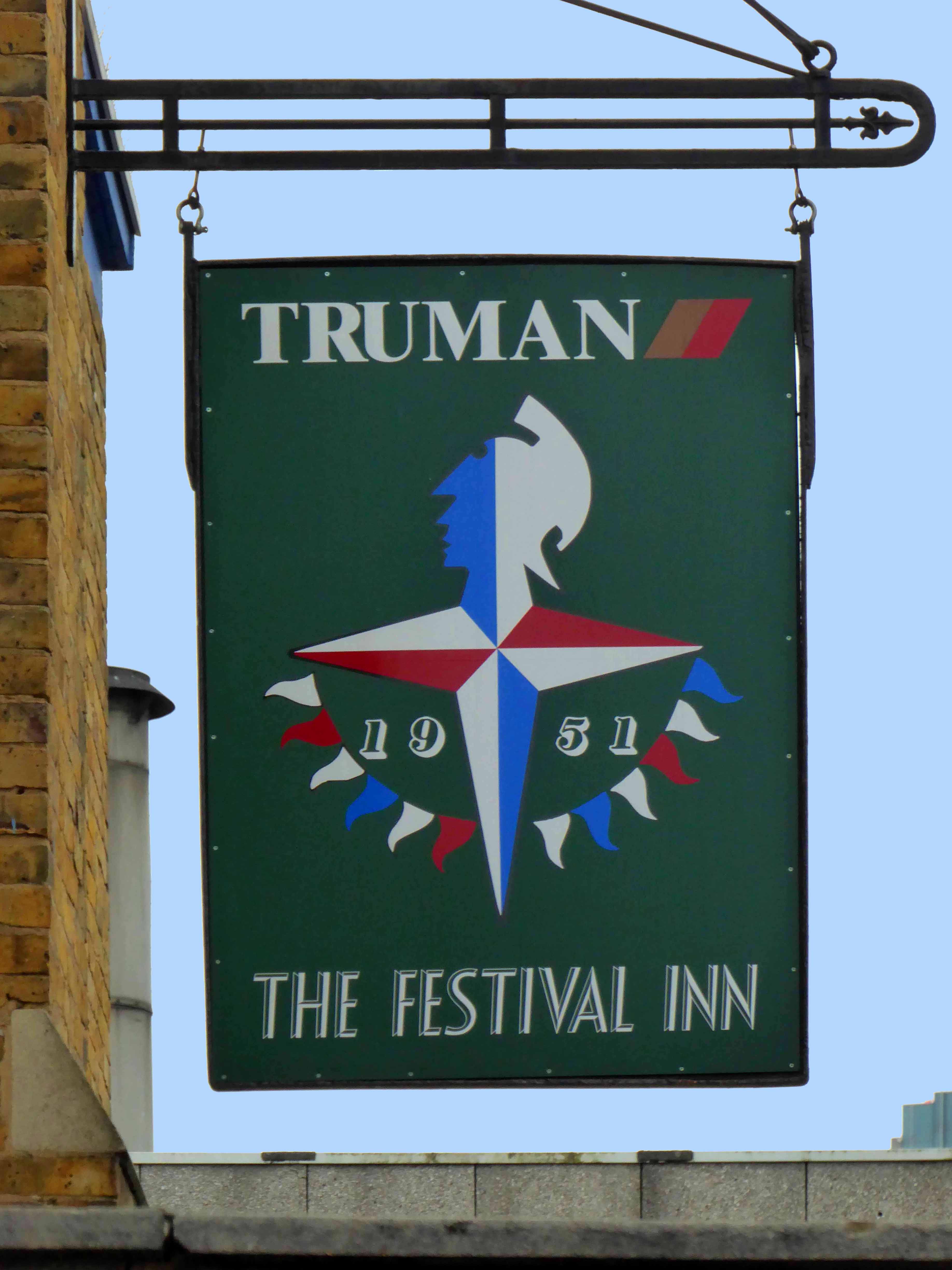
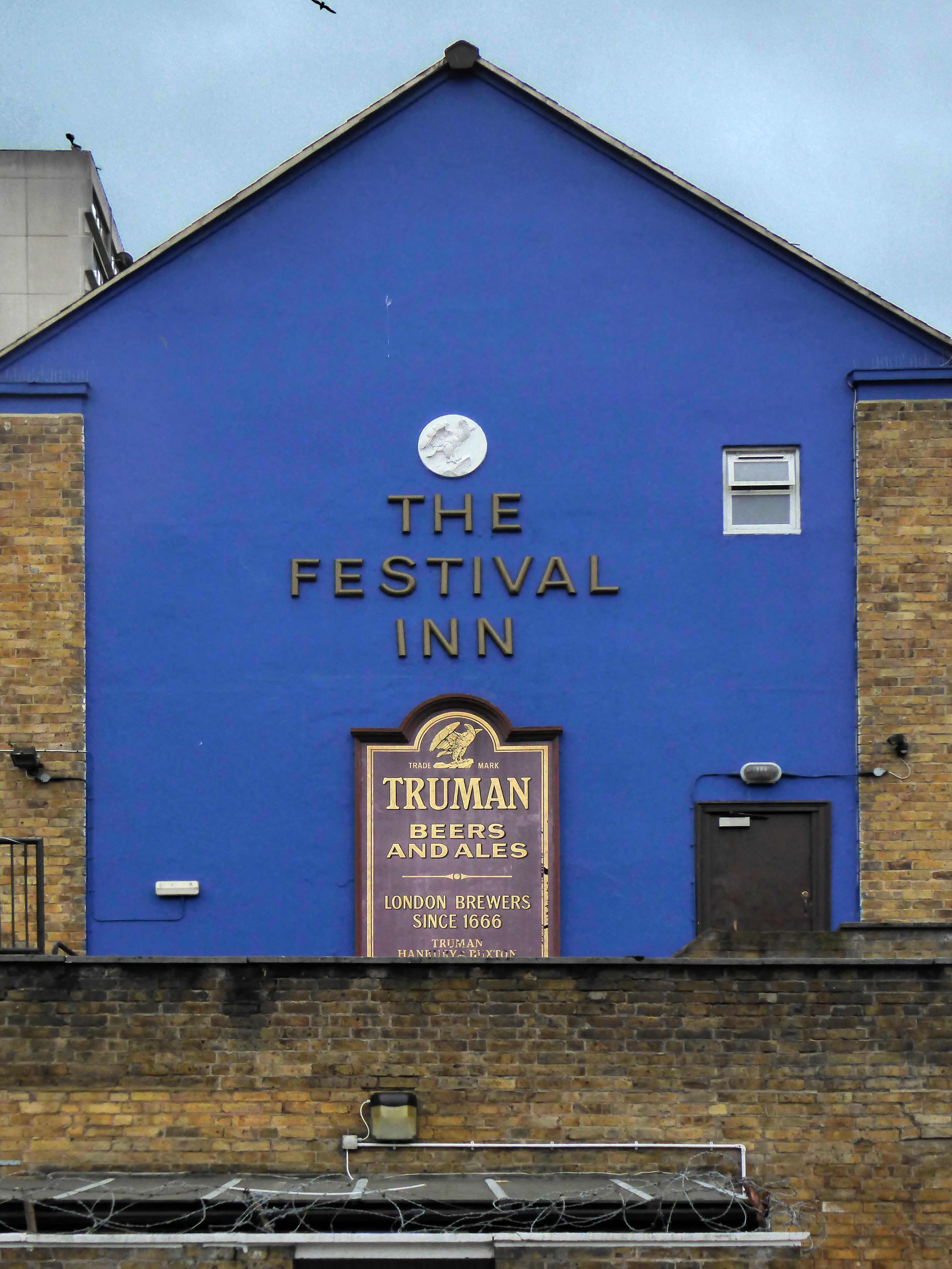
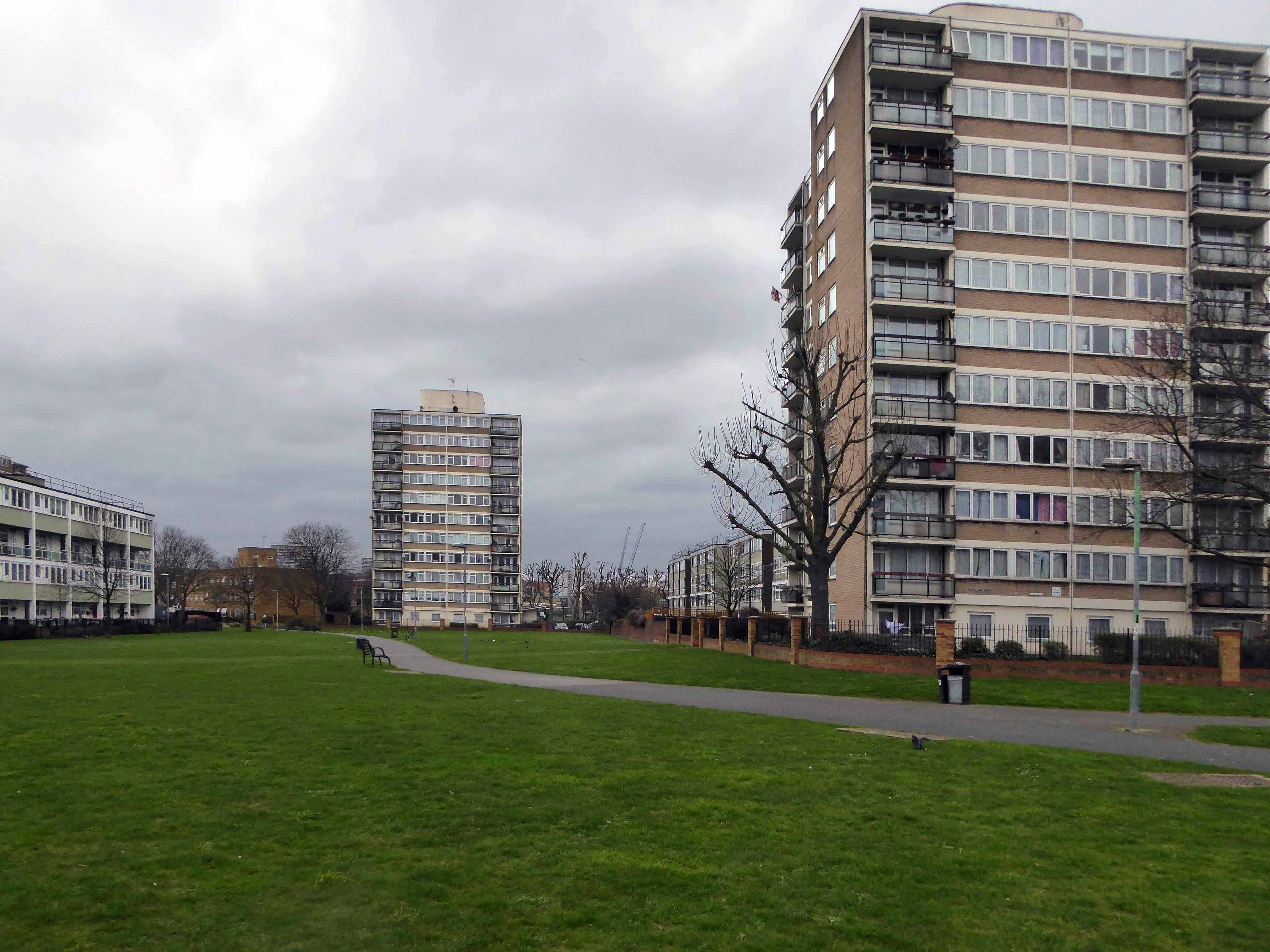
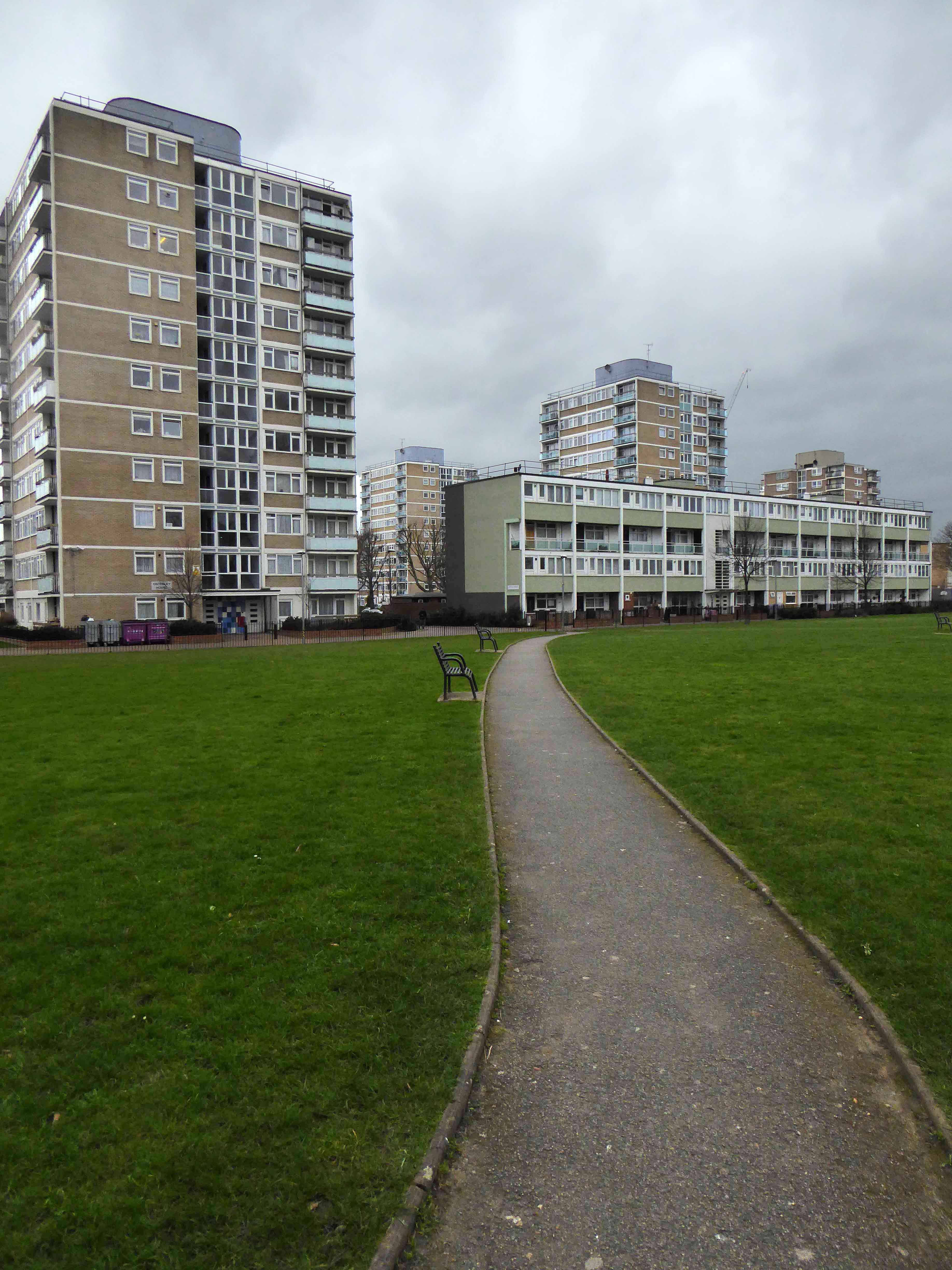
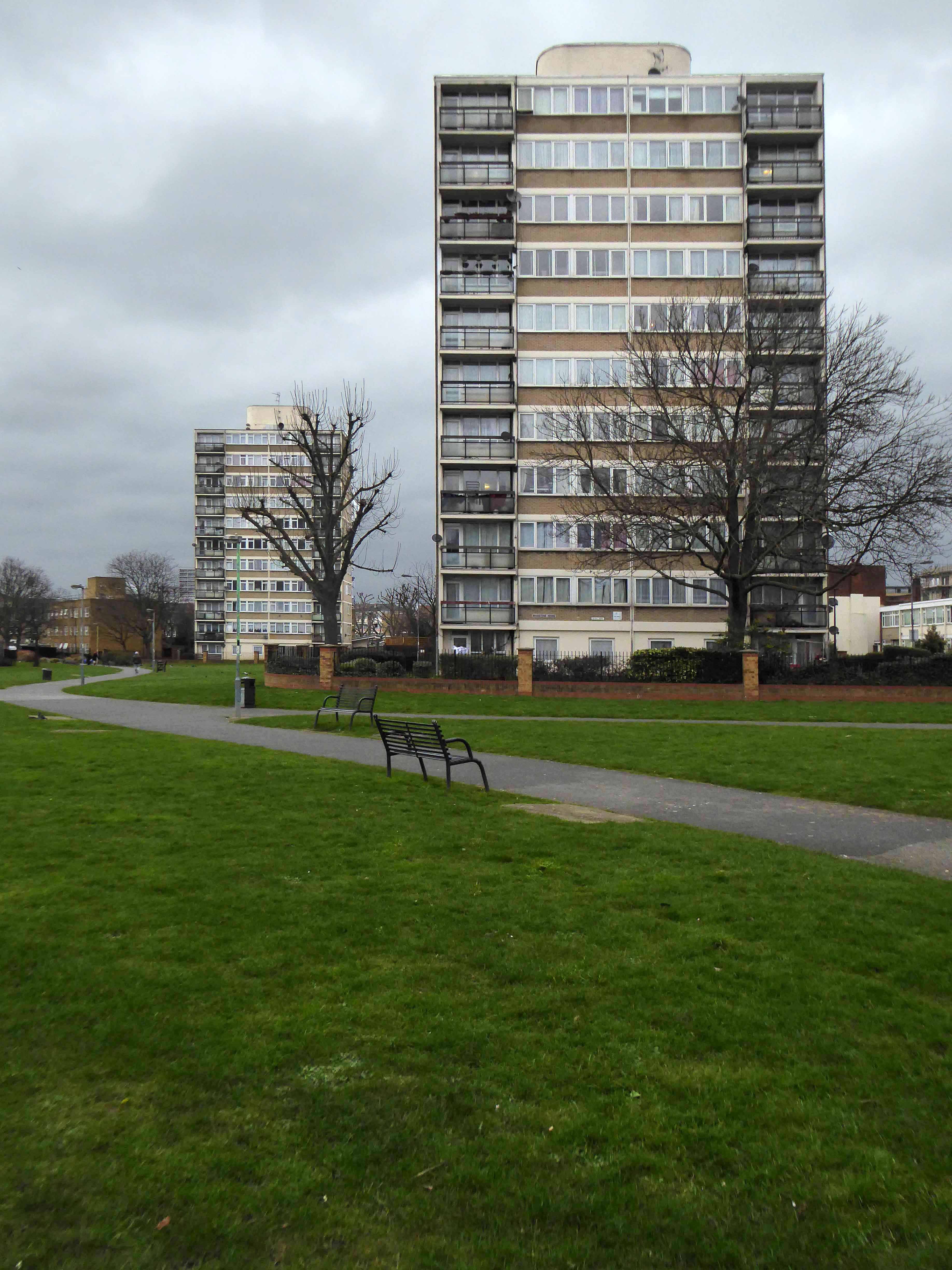
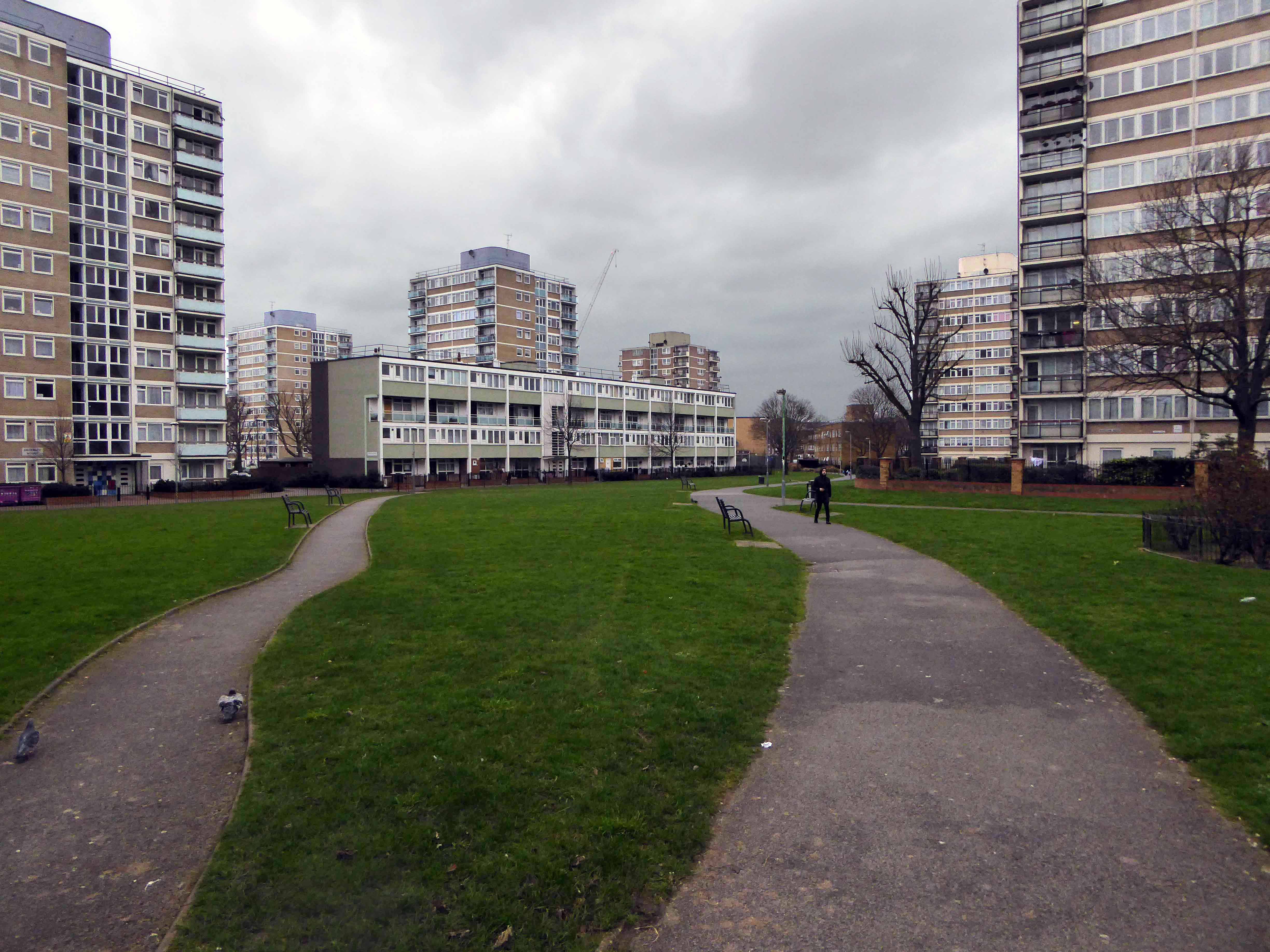
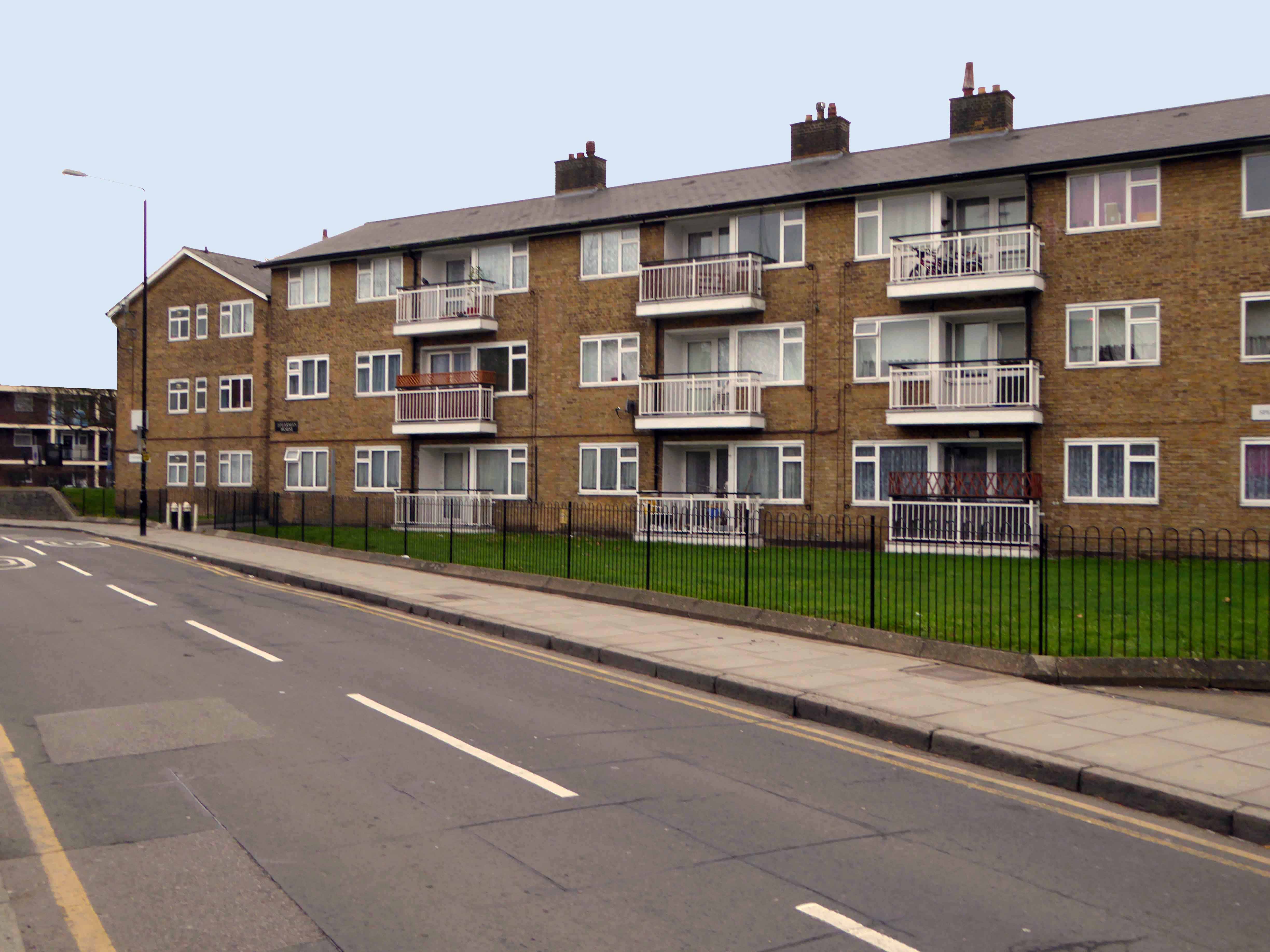
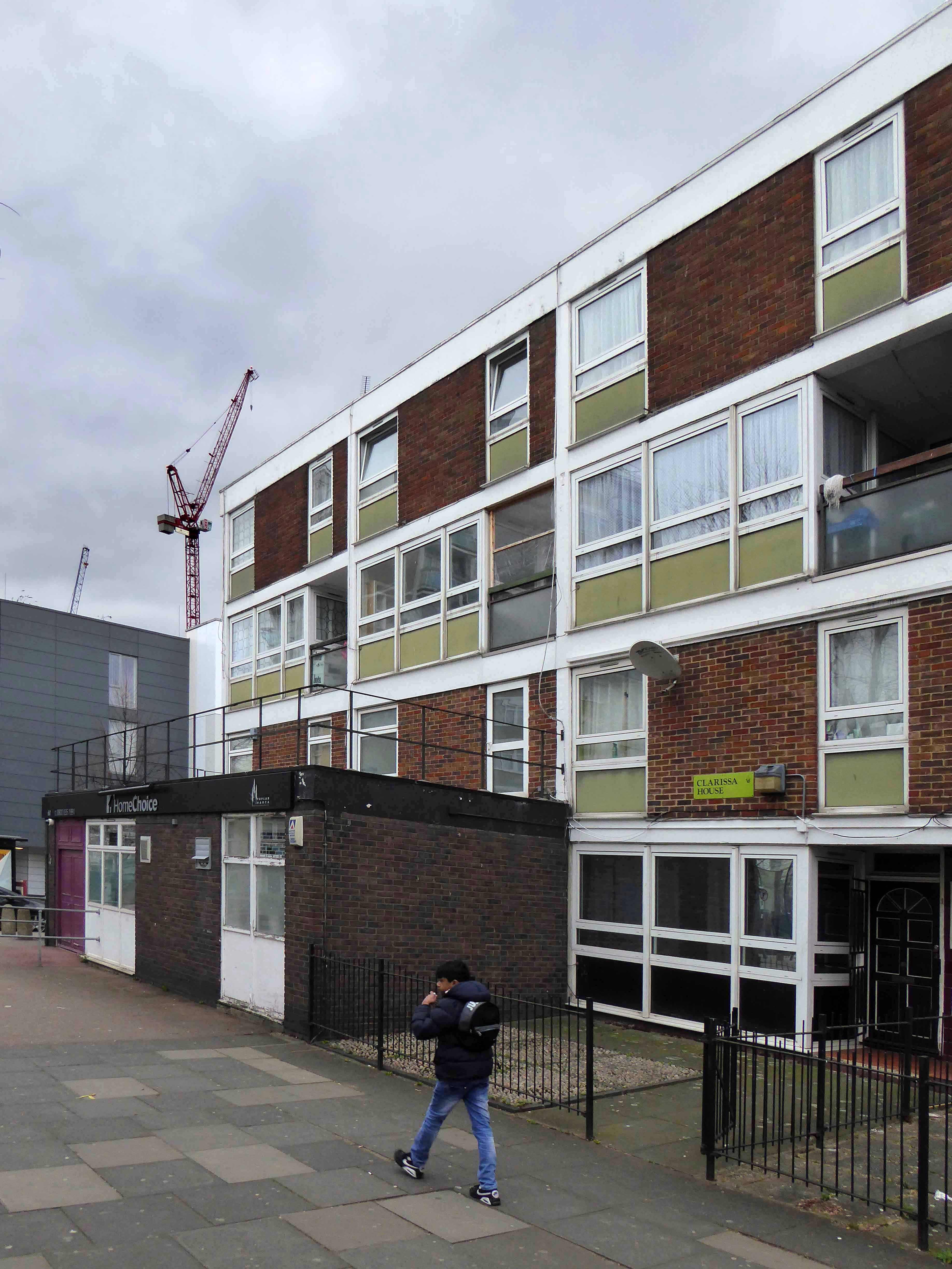
The Lansbury Estate, to the north of East India Dock Road, is the most important, largest and best-known council estate in Poplar. It demonstrates the different trends in post-war council house design and layout. The interest of the estate lies as much, if not more, in the story of its planning and construction, as in what was actually built. This is especially true of its first phase, which formed the basis of the Live Architecture Exhibition in the 1951 Festival of Britain.
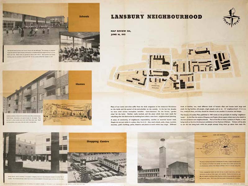
Originally outlined in the 1943 plan for London, replacing the bomb damaged homes of displaced dockers, the estate has weathered well enough, though changes in demographics, the ever greater engulfing tide of gentrification and the containerisation of all ports, brings a fresh set of challenges and changes.
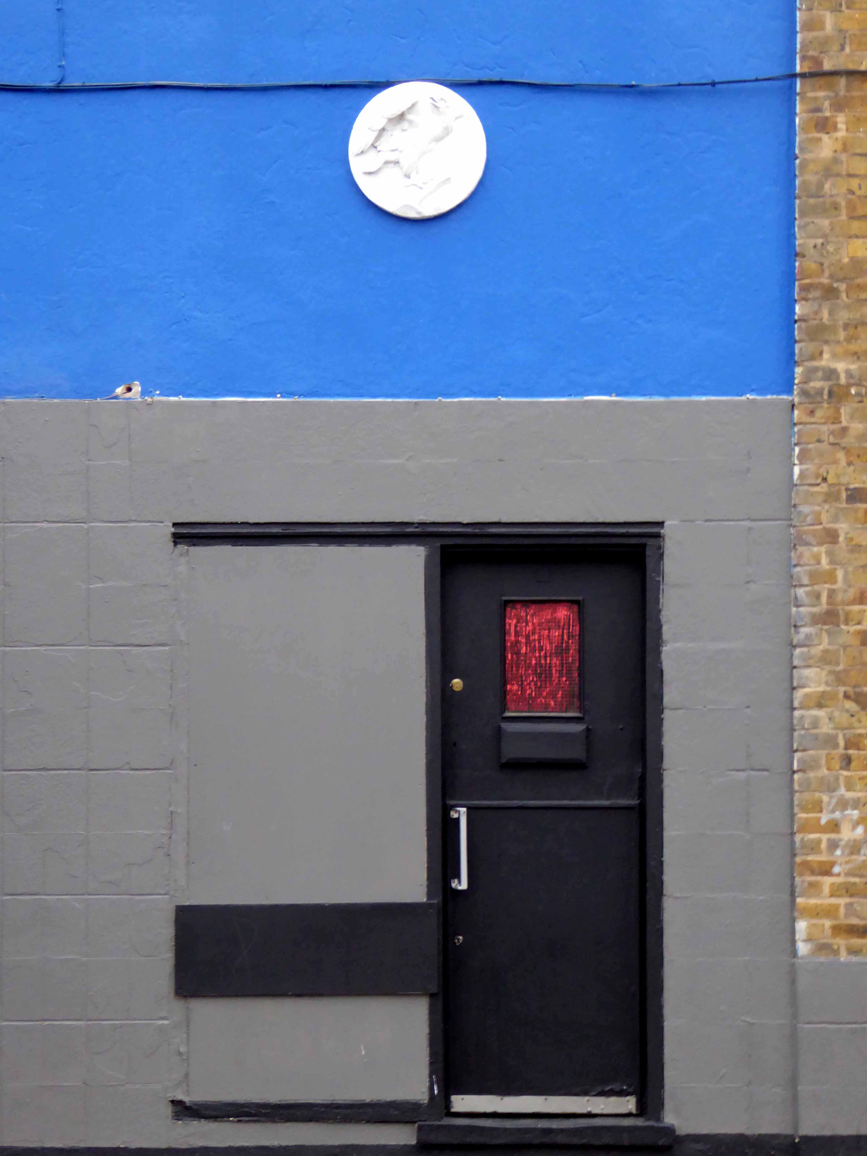
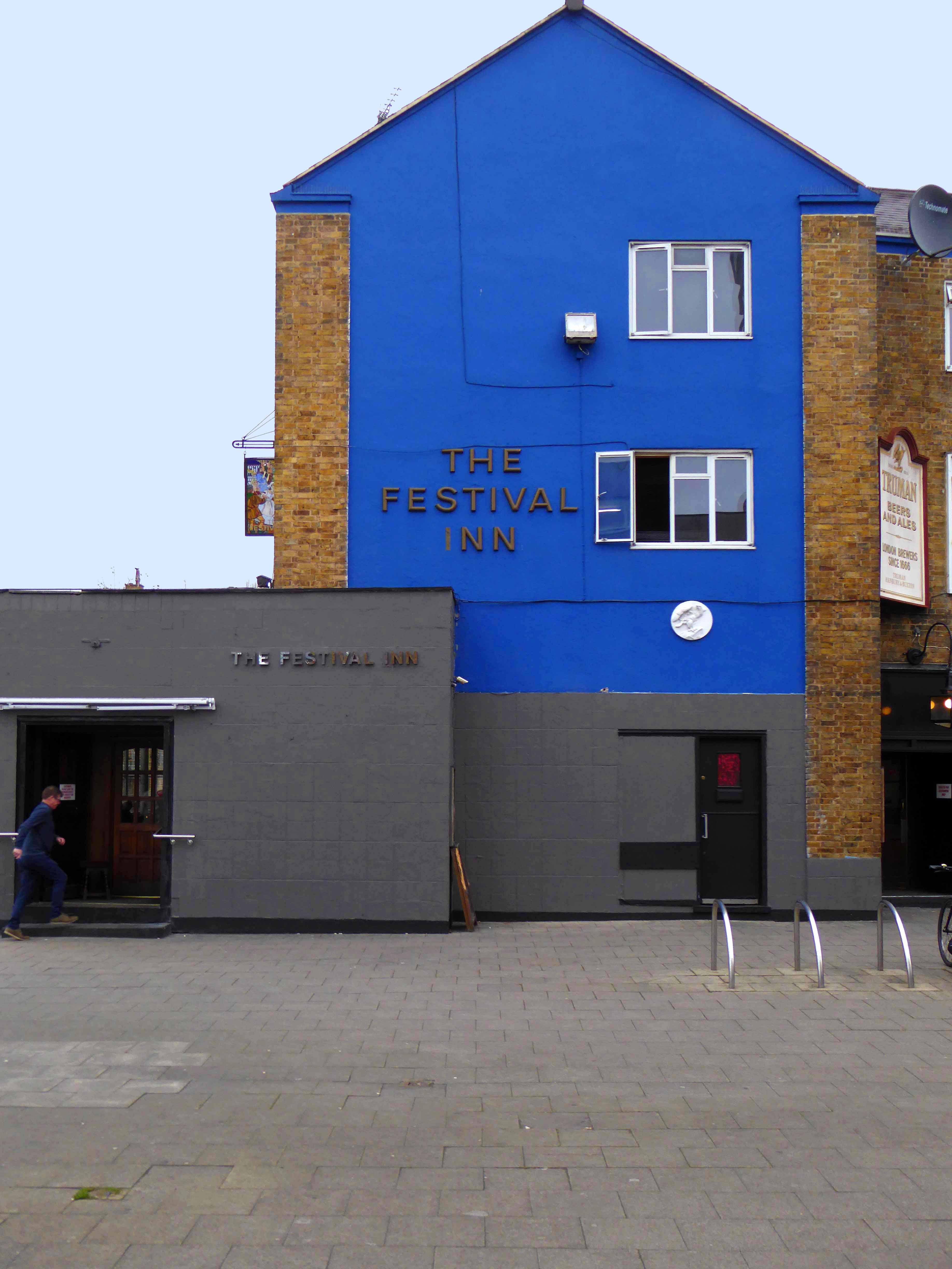
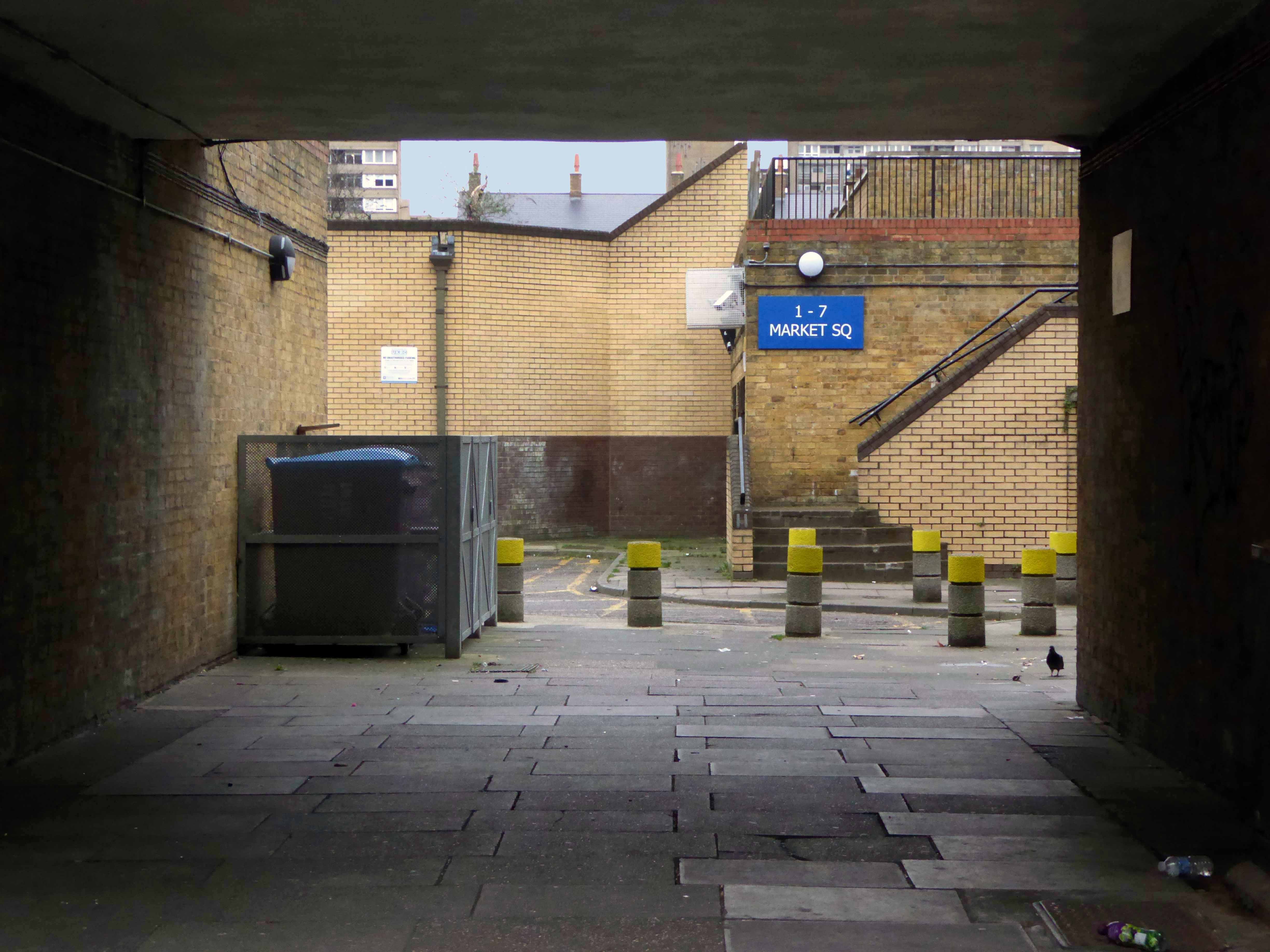
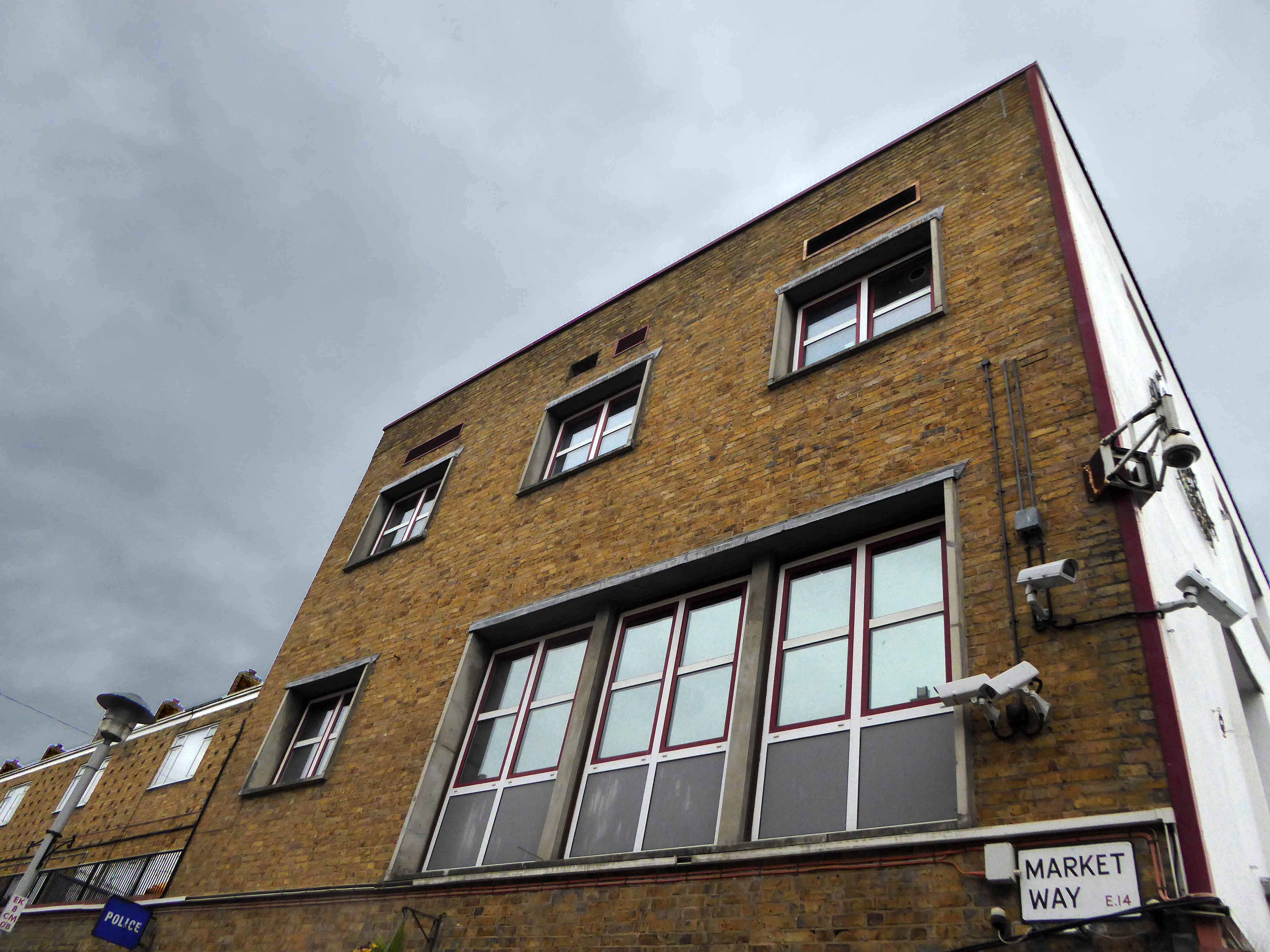
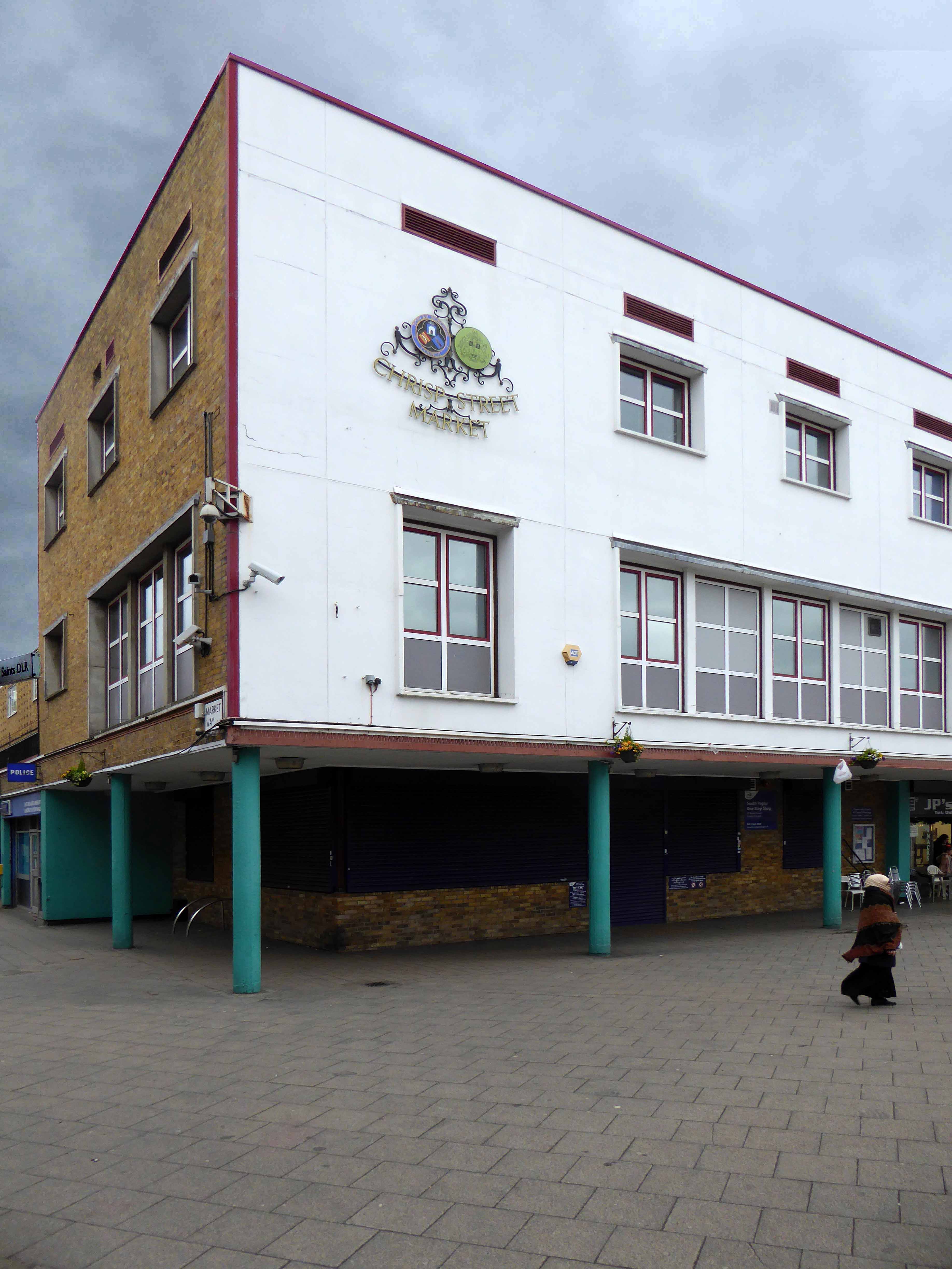
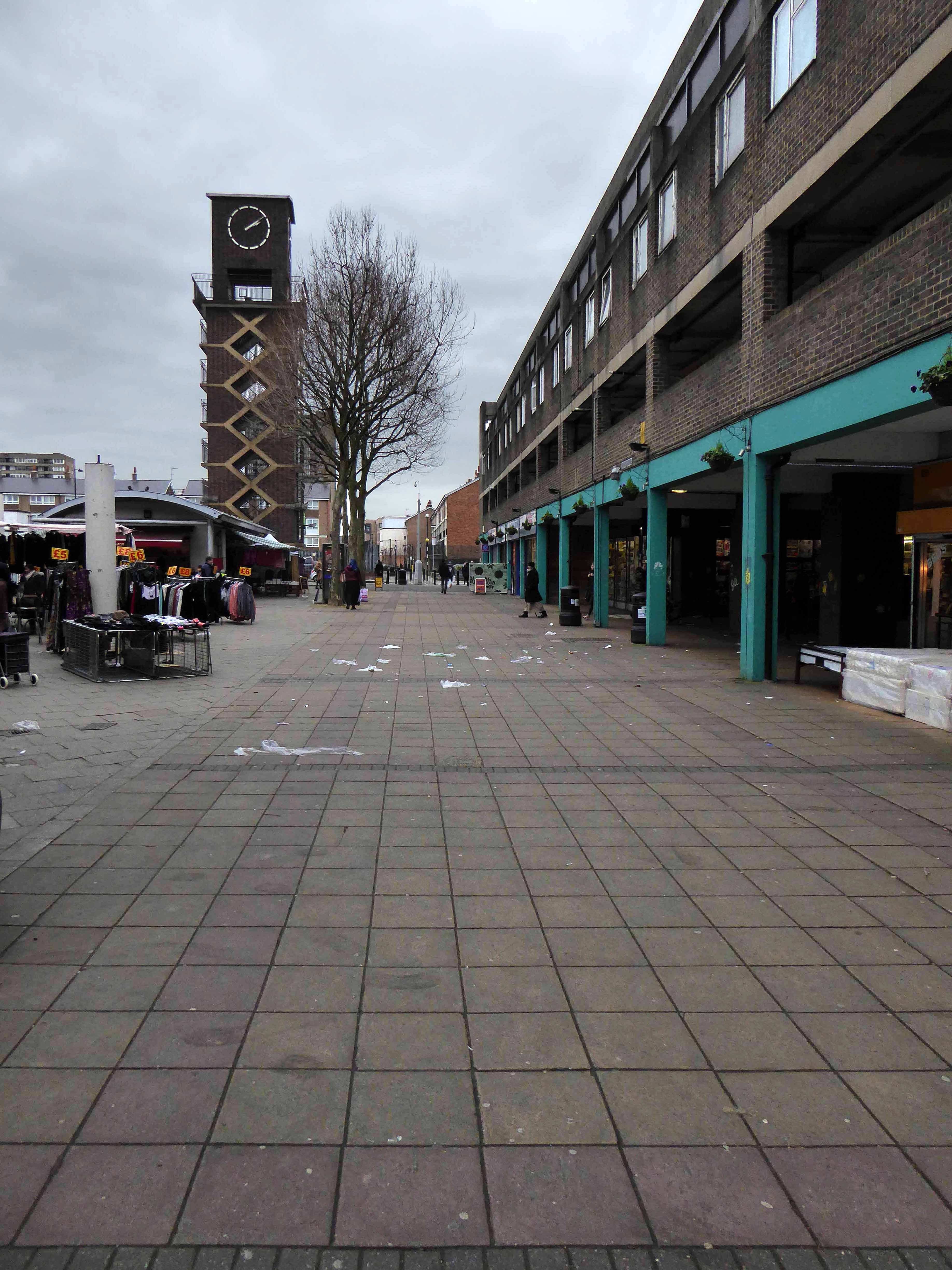
Go east – I visited the V&A Micro Museum, which has become a focus for residents’ and visitors’ memories and projections of a certain uncertain past and future. Arriving by the Docklands Light Railway, I was immediately drawn towards my destination, by the prominent Lansbury Tower, its clock patiently ticking away the time to and from 1951. Welcomed by staff and fellow travellers at the Chrisp Street Market site we began our tour at the heart of the Festival area – further details of which can be found here at Municipal Dreams.
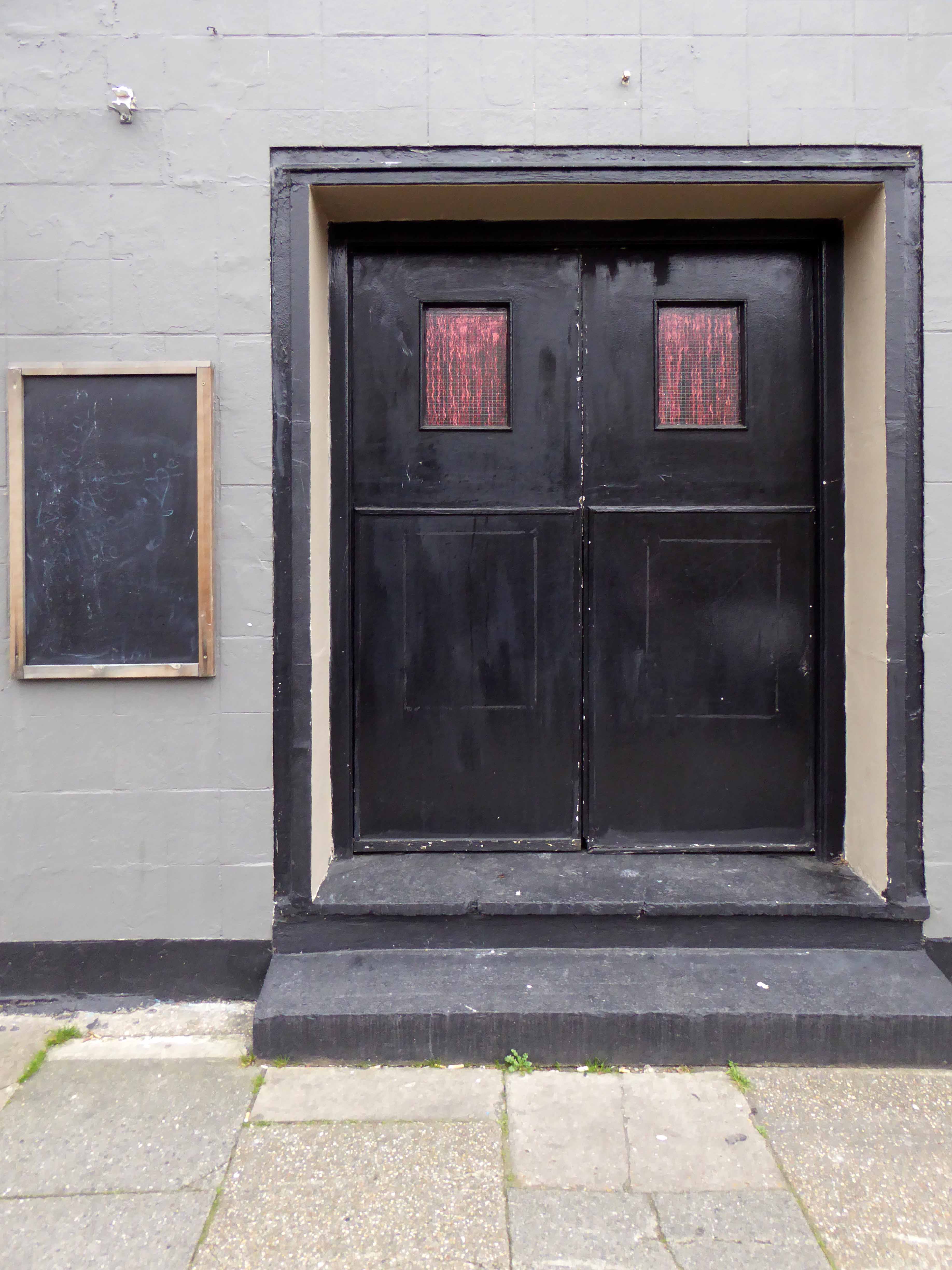
A mix of market, shops, Festival pub, warm cream London brick terraces and low rise, later tower blocks, schools, churches and open grassed communal areas. On a cold and getting colder late winter’s day, a smattering of residents went purposefully about their business.
Life goes on.
Next time everything’s going to be different.

Happy days!
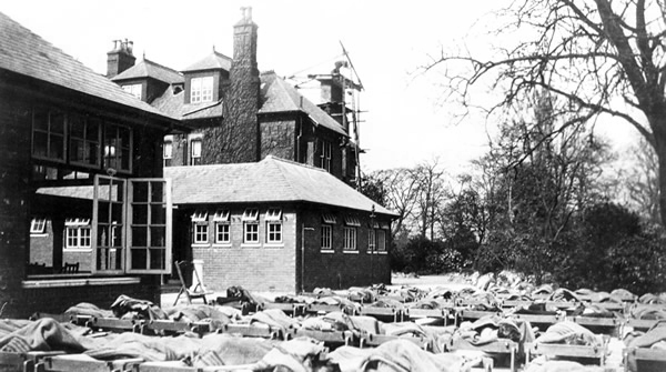
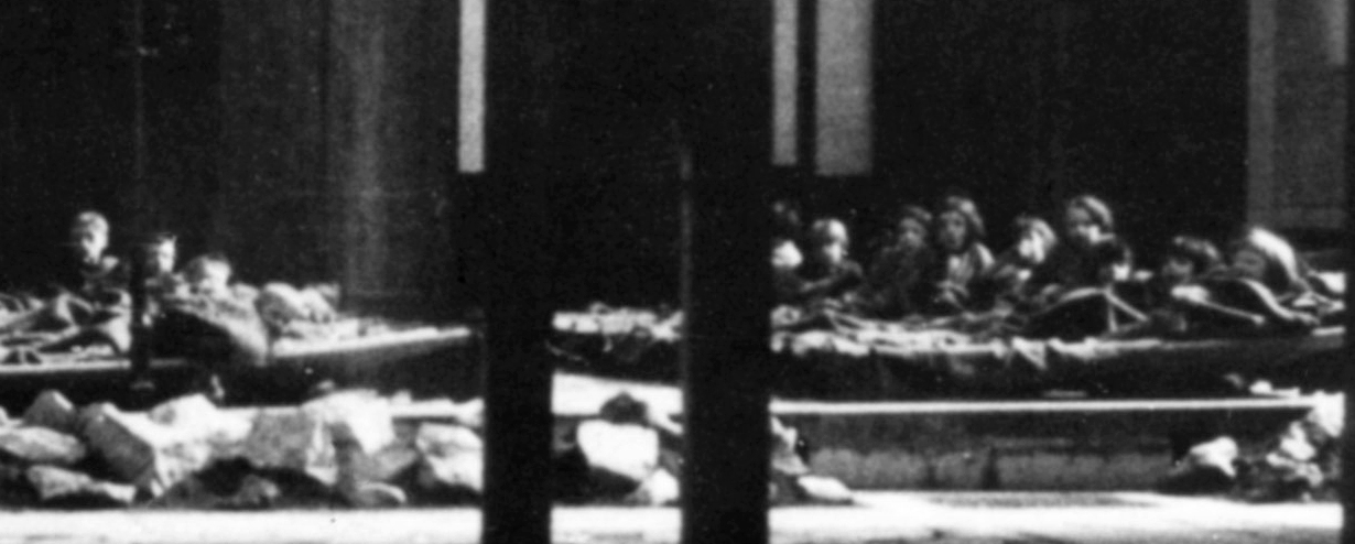
I was a delicate child with bronchitis, must have done me good as I went on to serve 39 years in the army!
We lay on camp beds for an hour in the afternoons, on bad days on blankets on the floor in the main building.
Michael Dooley 10/03/2013
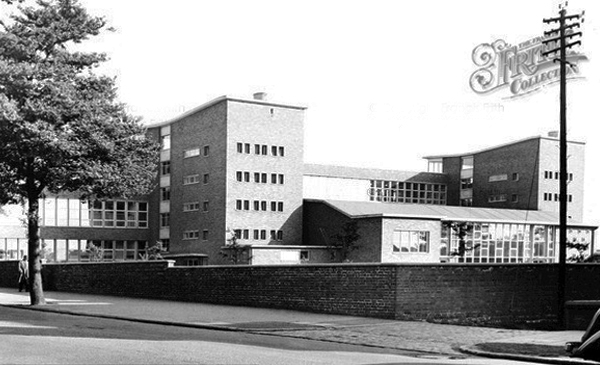
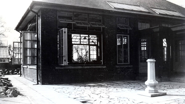
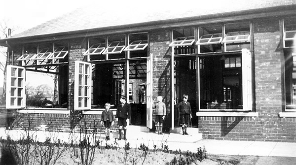
Tithe Barn school stands on land which was originally a house called Longfield, the house sign is on the wall near the side entrance to TBS, which was built around 1871 for John Brown who owned Afleck and Brown’s department store in the centre of Manchester. The gardener for the house lived at what is now known as Tithe Barn Cottage.
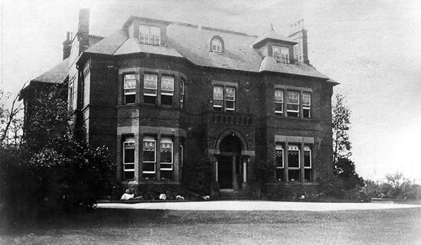
John later sold the house to his brother William whose wife sold it very cheaply to Stockport Education committee in 1929 to be used as an open air school for children who suffered ill health in the town, mainly through smoke pollution. This was called Longfield Open Air School. Pupils travelled there by bus before breakfast, from Portwood and other parts of the town. Most of them had a sleep outside in the afternoon so that they could take advantage of the clean air of Heaton Mersey. As the town became healthier and the chimneys stopped belching out black smoke, the need for an open air school lessened and it closed in 1968.
The original house was demolished and some of the beautiful wooden interior offered to museums in York where the original bath with its enameled sides and copper shower canopy is now on display in the Castle Museum. The only part kept and used by the architect was the Venetian glass bathroom window which Mrs Brown had made to remind her of the beautiful water scenes in Venice. This glass panel was installed outside the Headteacher’s office and is still there today.
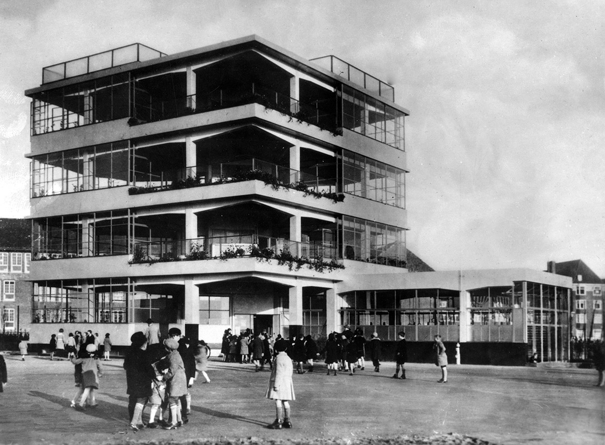
Penluchtschool – Open Air School
An idea that found its way from continental Europe to the British Isles.
Amsterdam – Johannes Duiker 1930
Longfield School in the 1930s
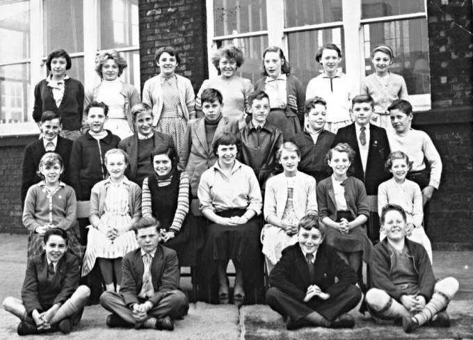
I was lead here on finding this print for sale in Stockport Local Studies Library.
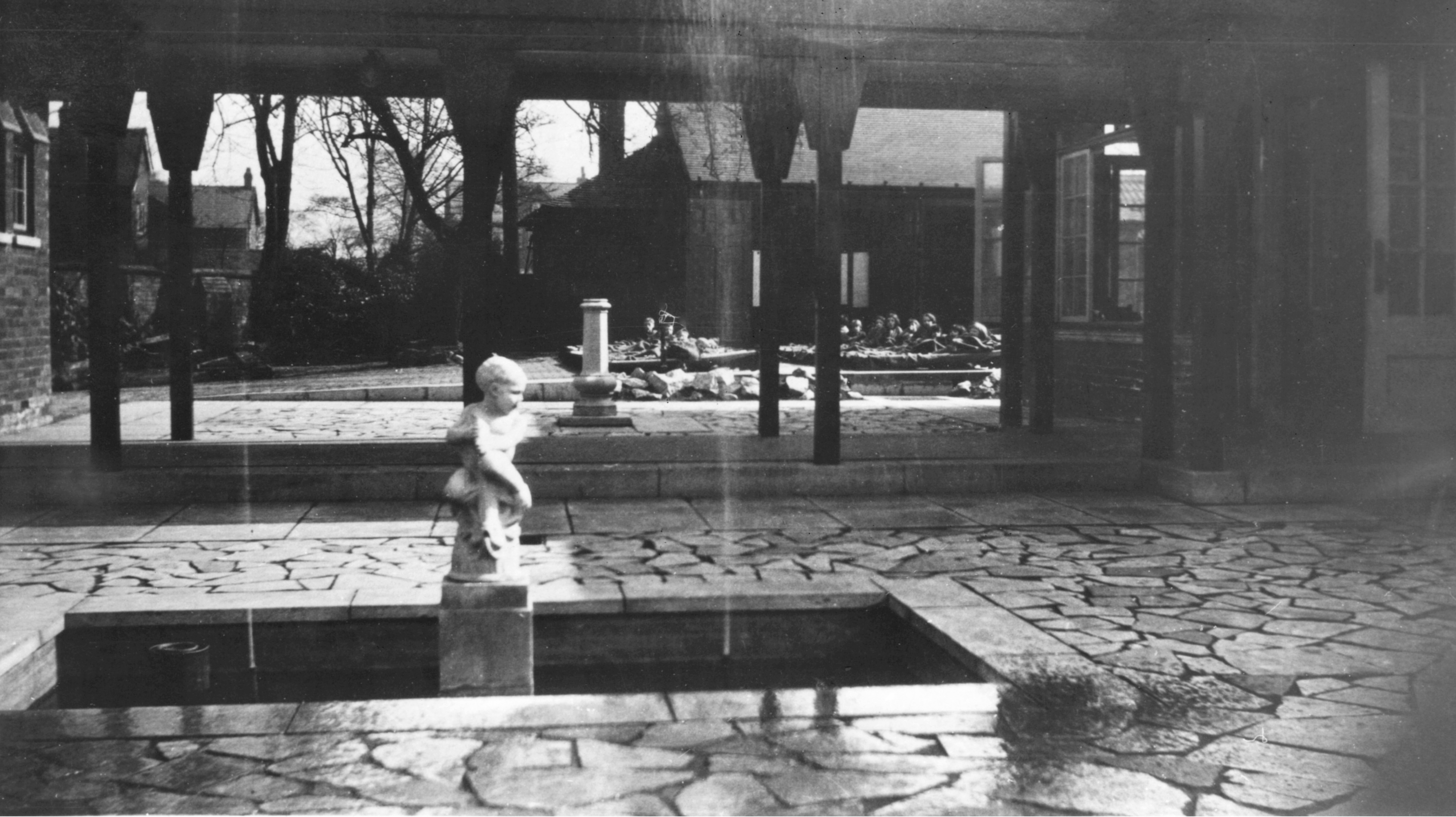
Here are the pupils seen in detail.
The school in 1968