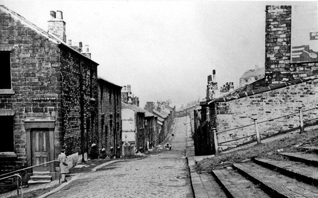
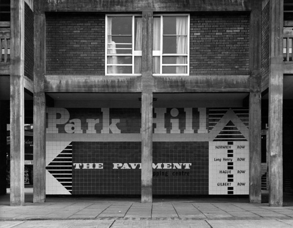
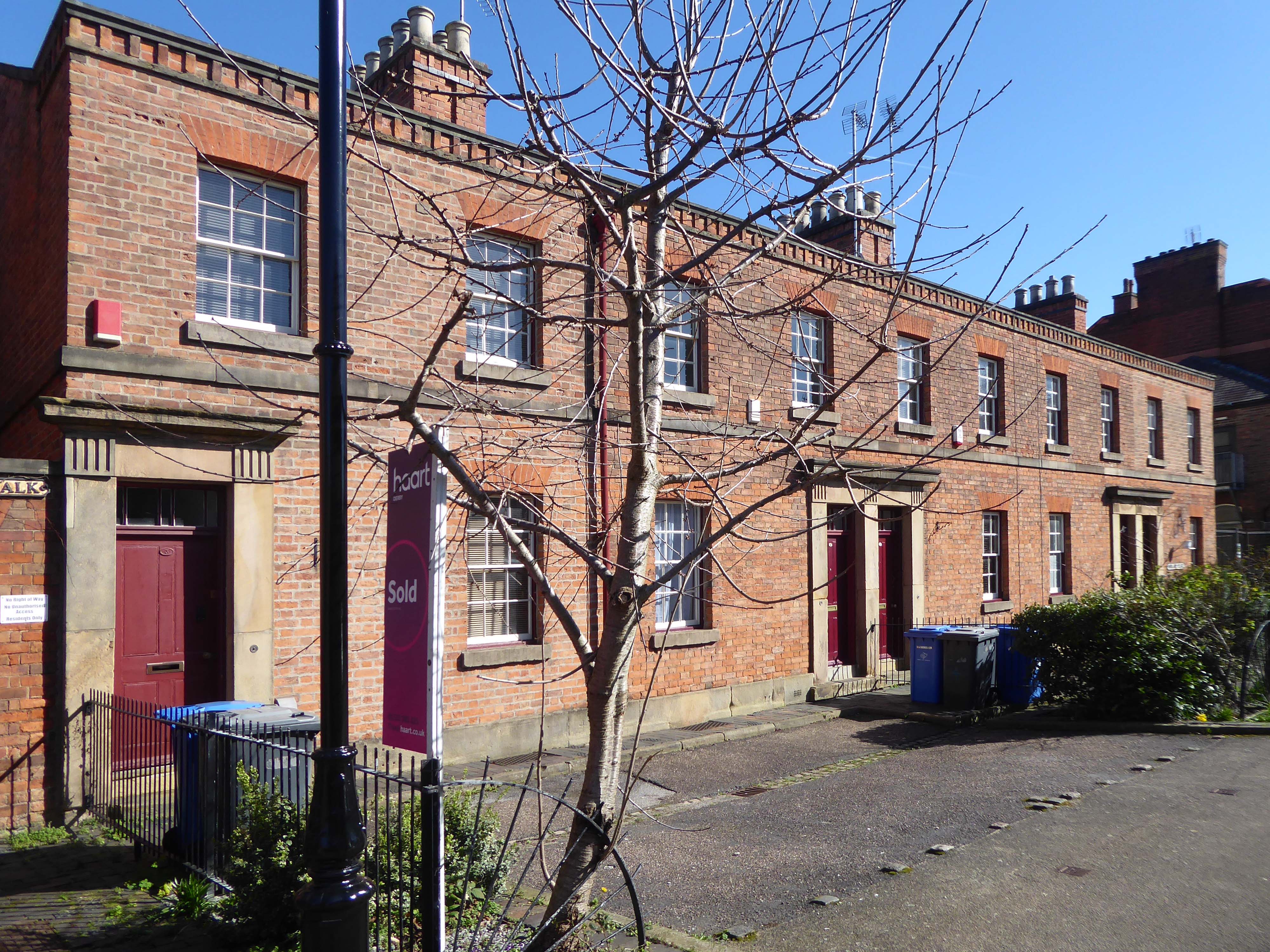
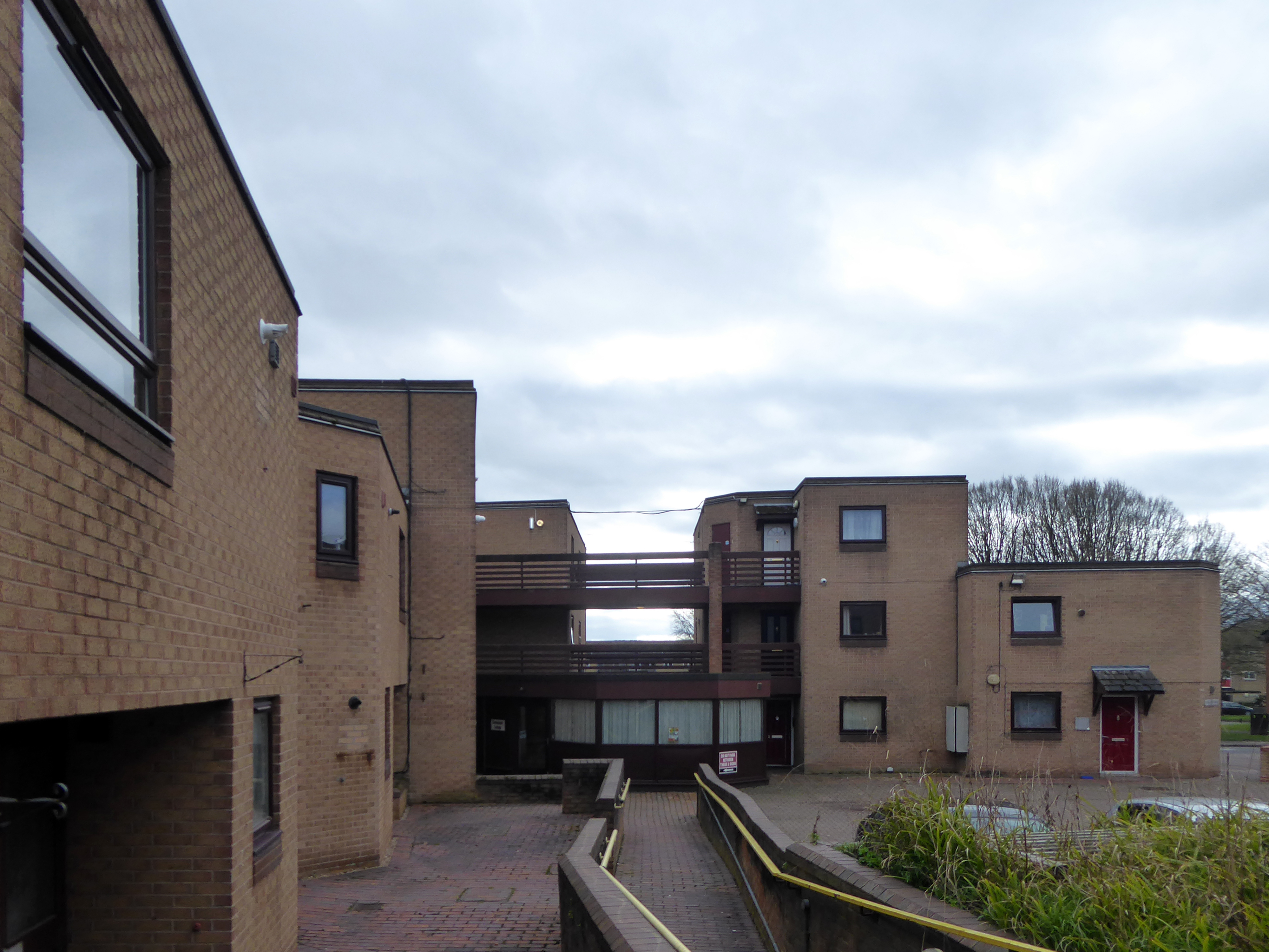
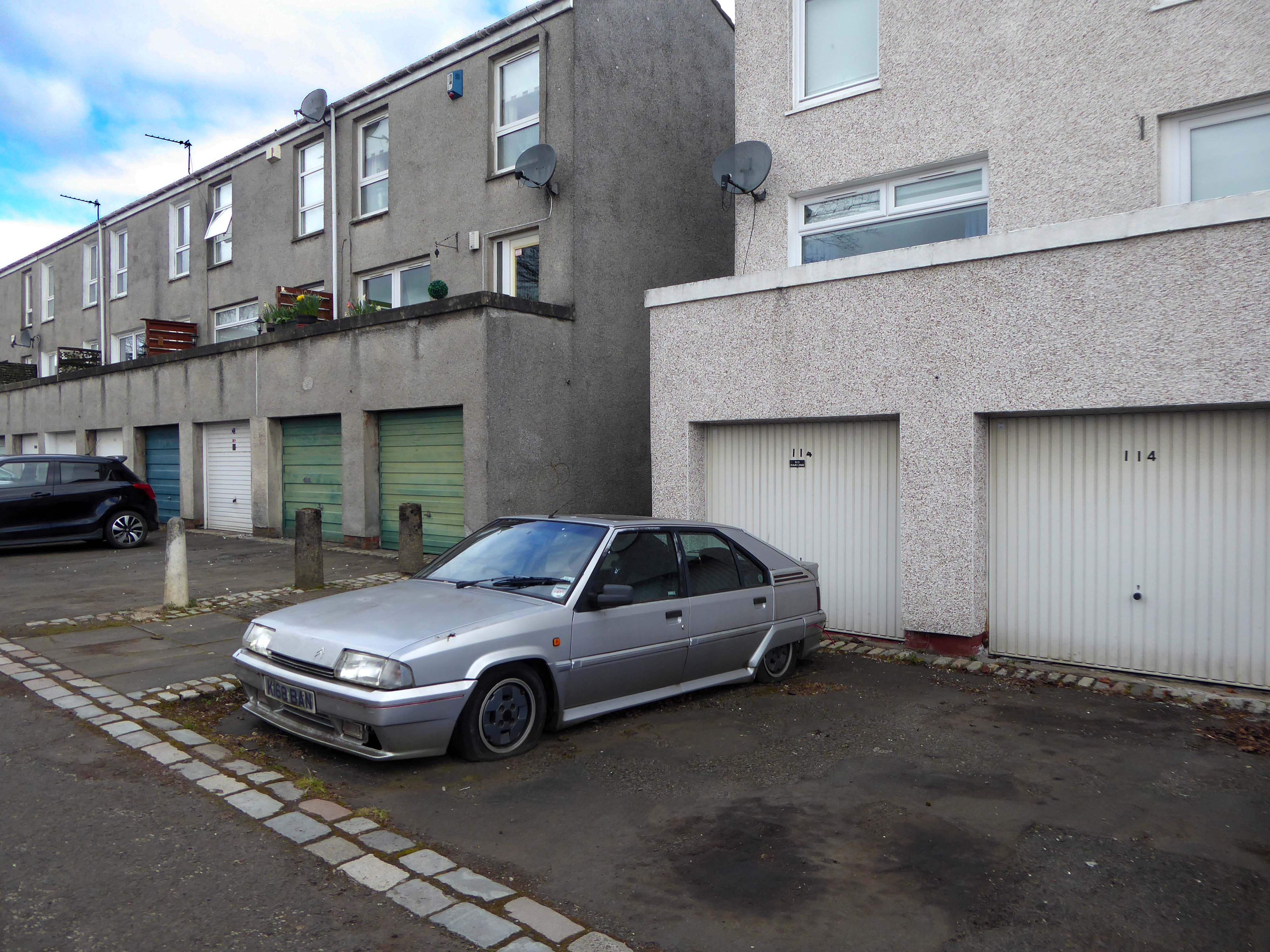
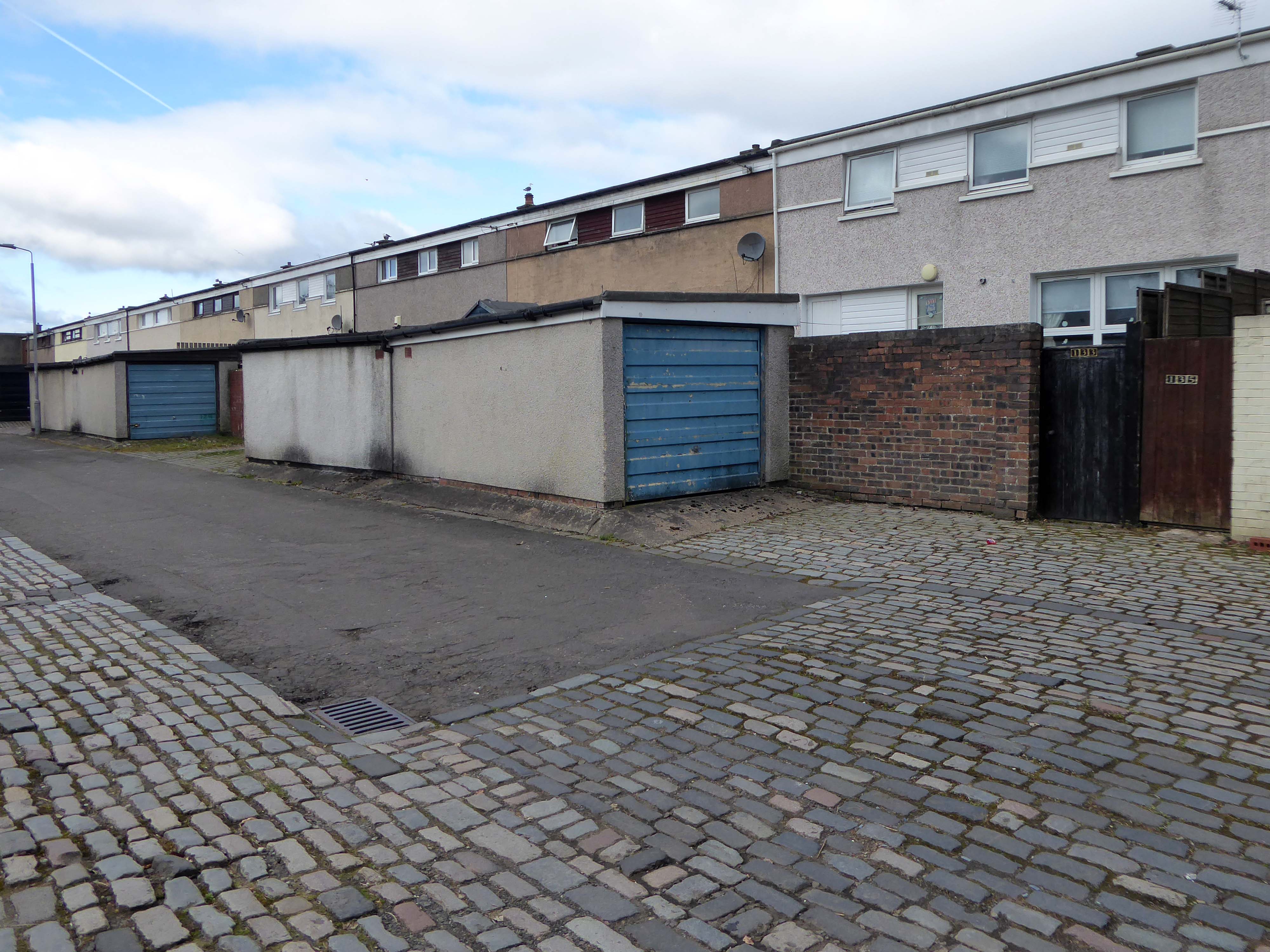
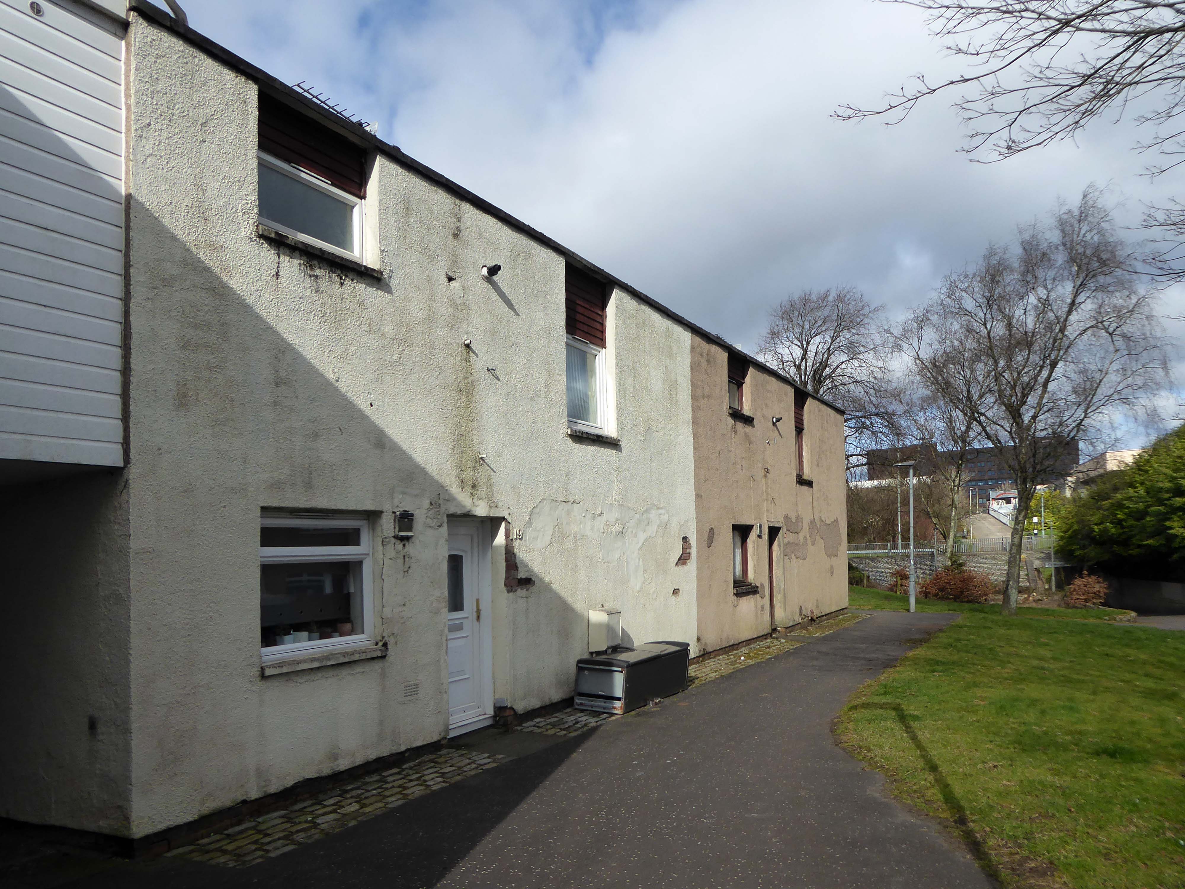
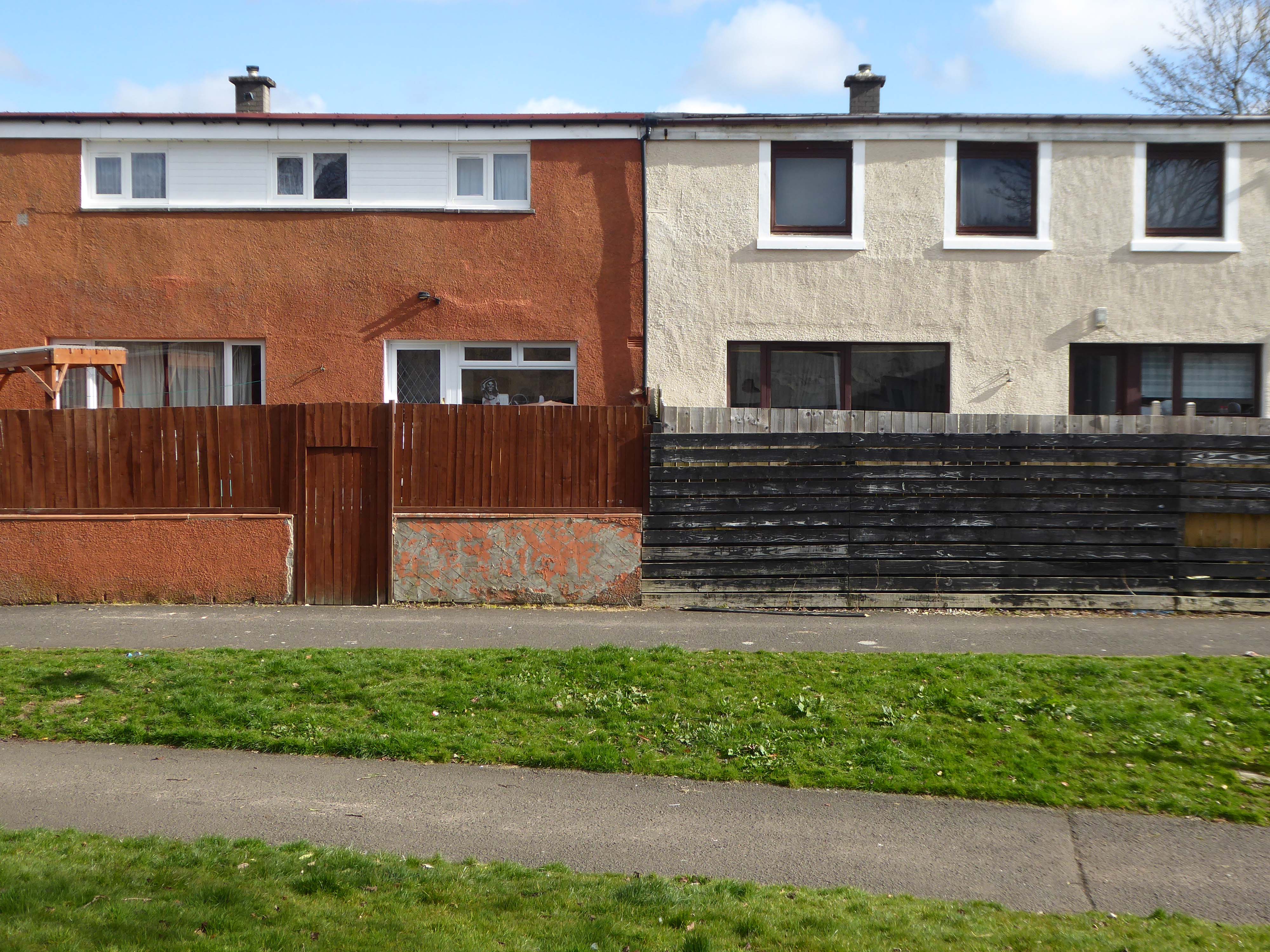
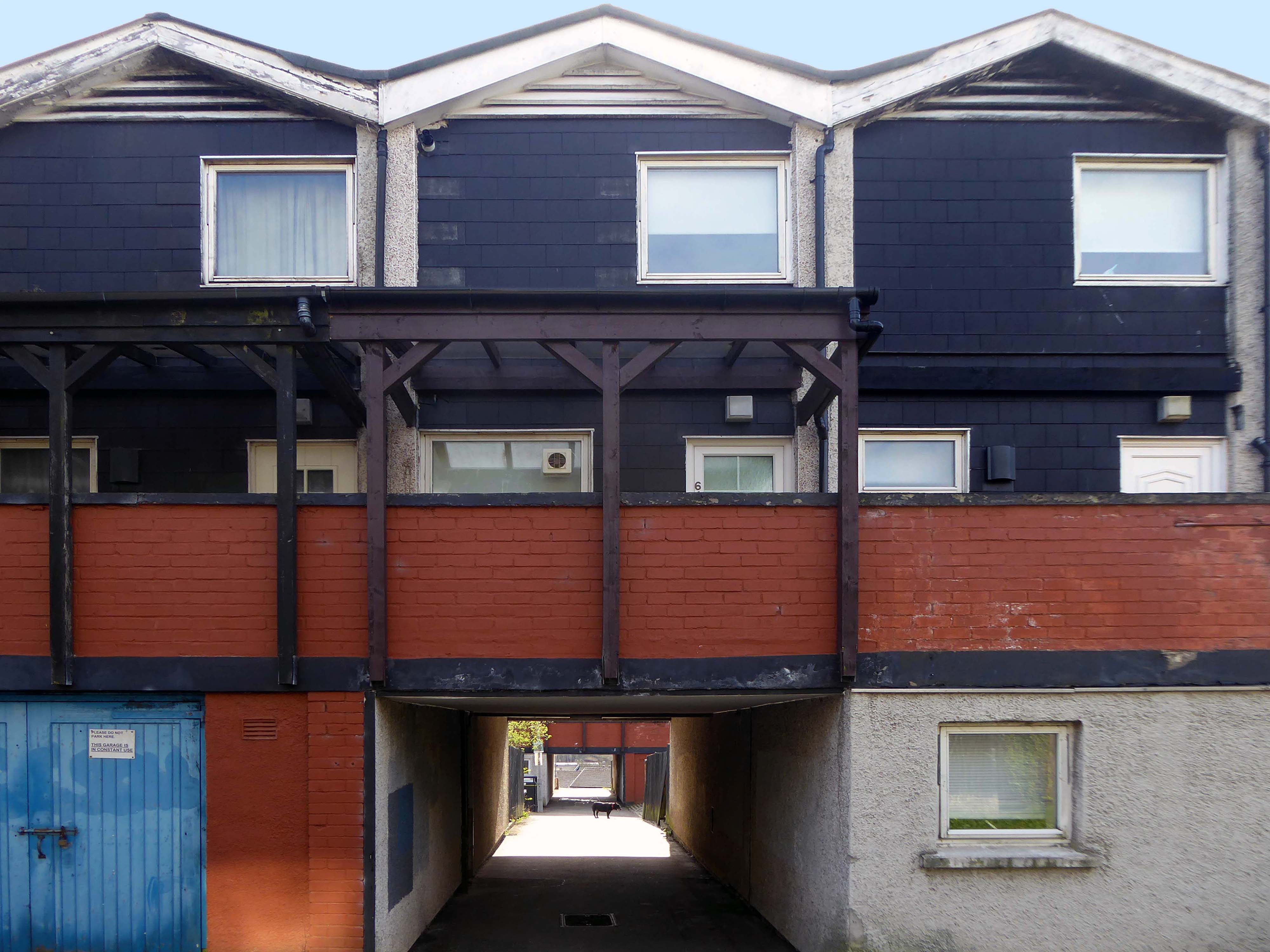
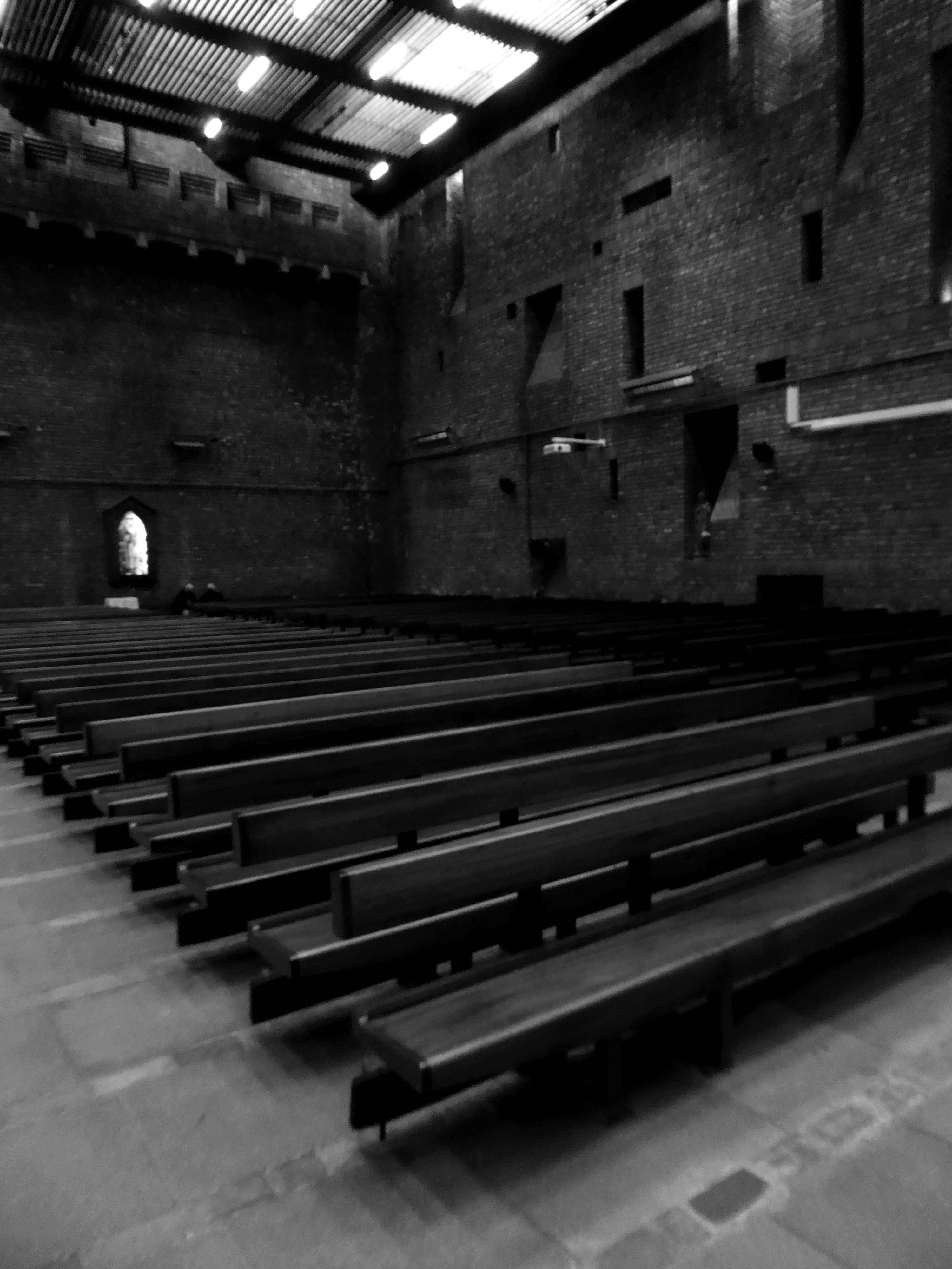
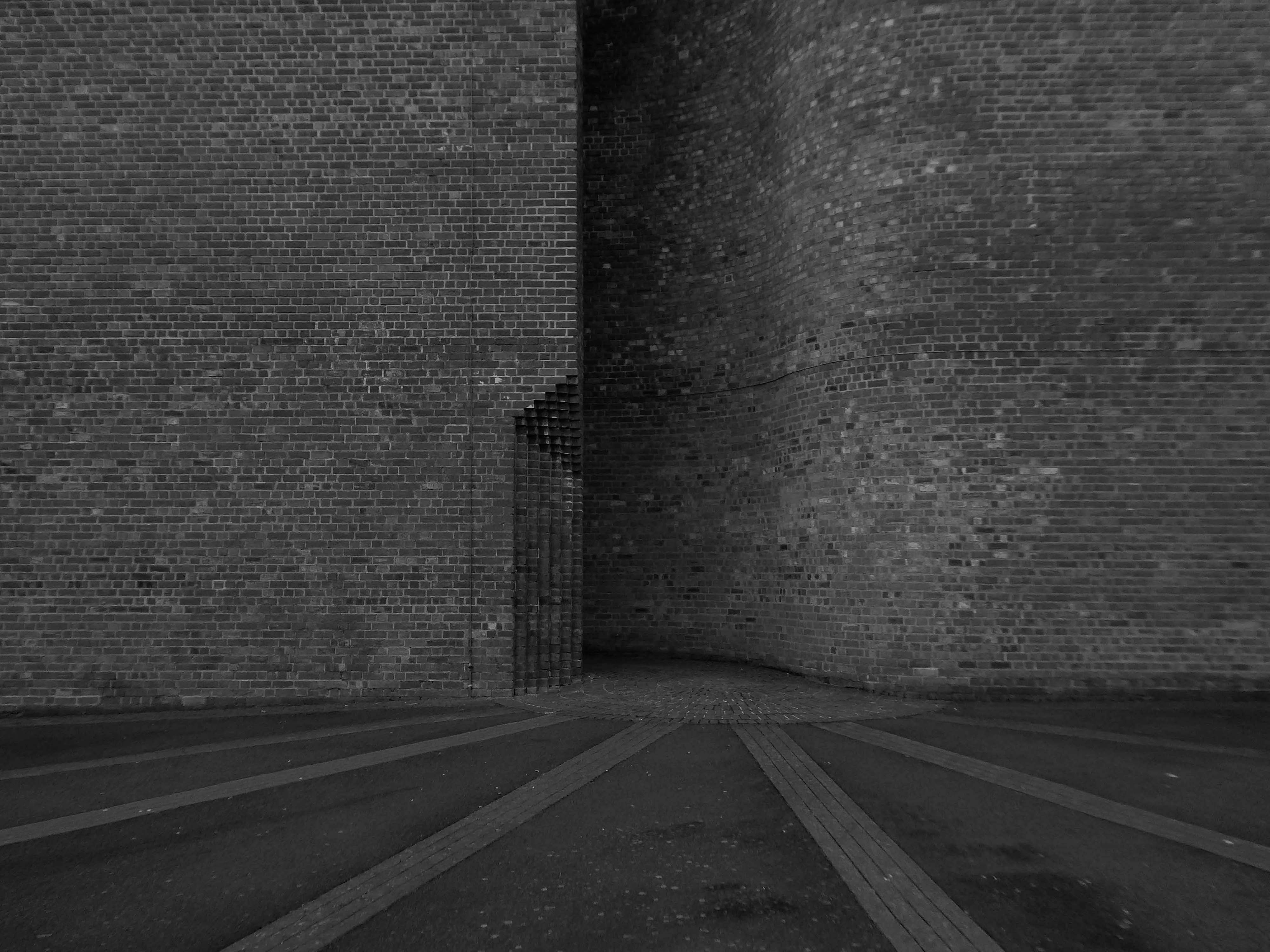
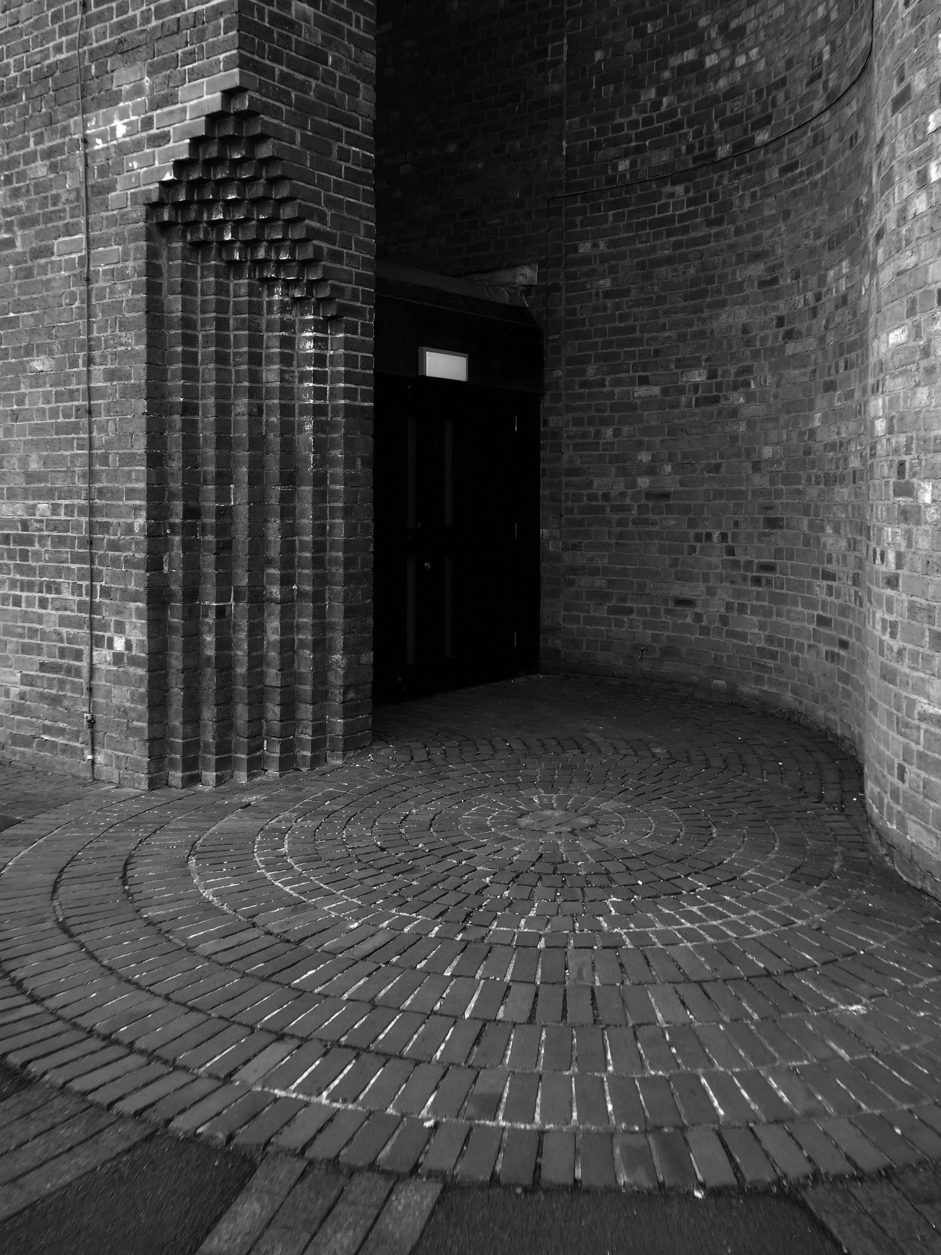
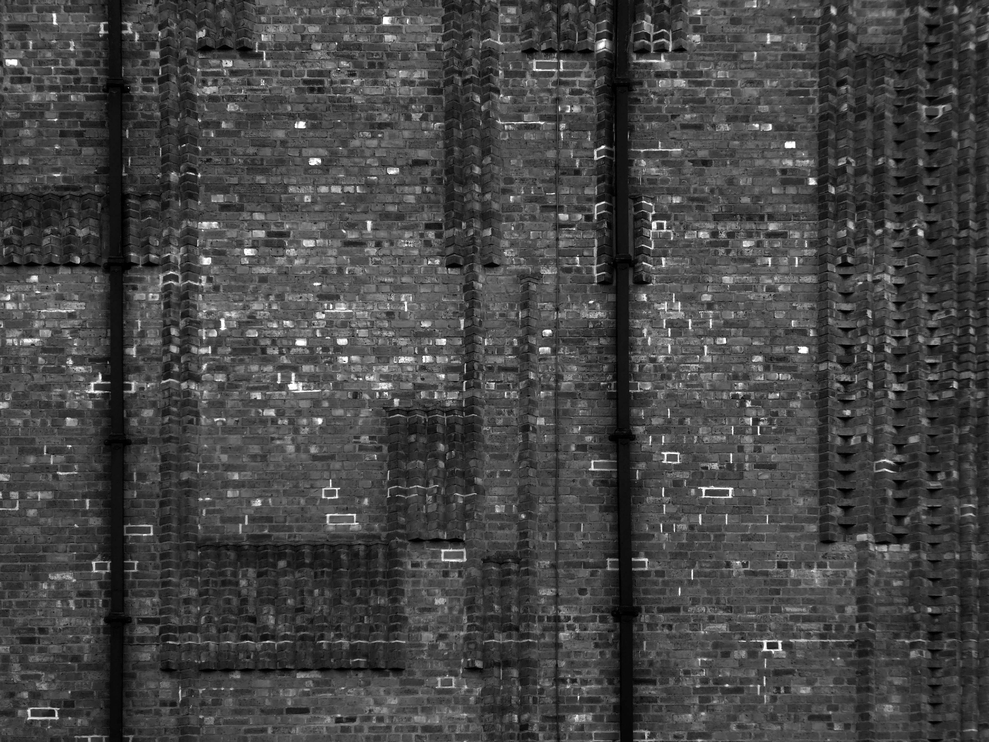
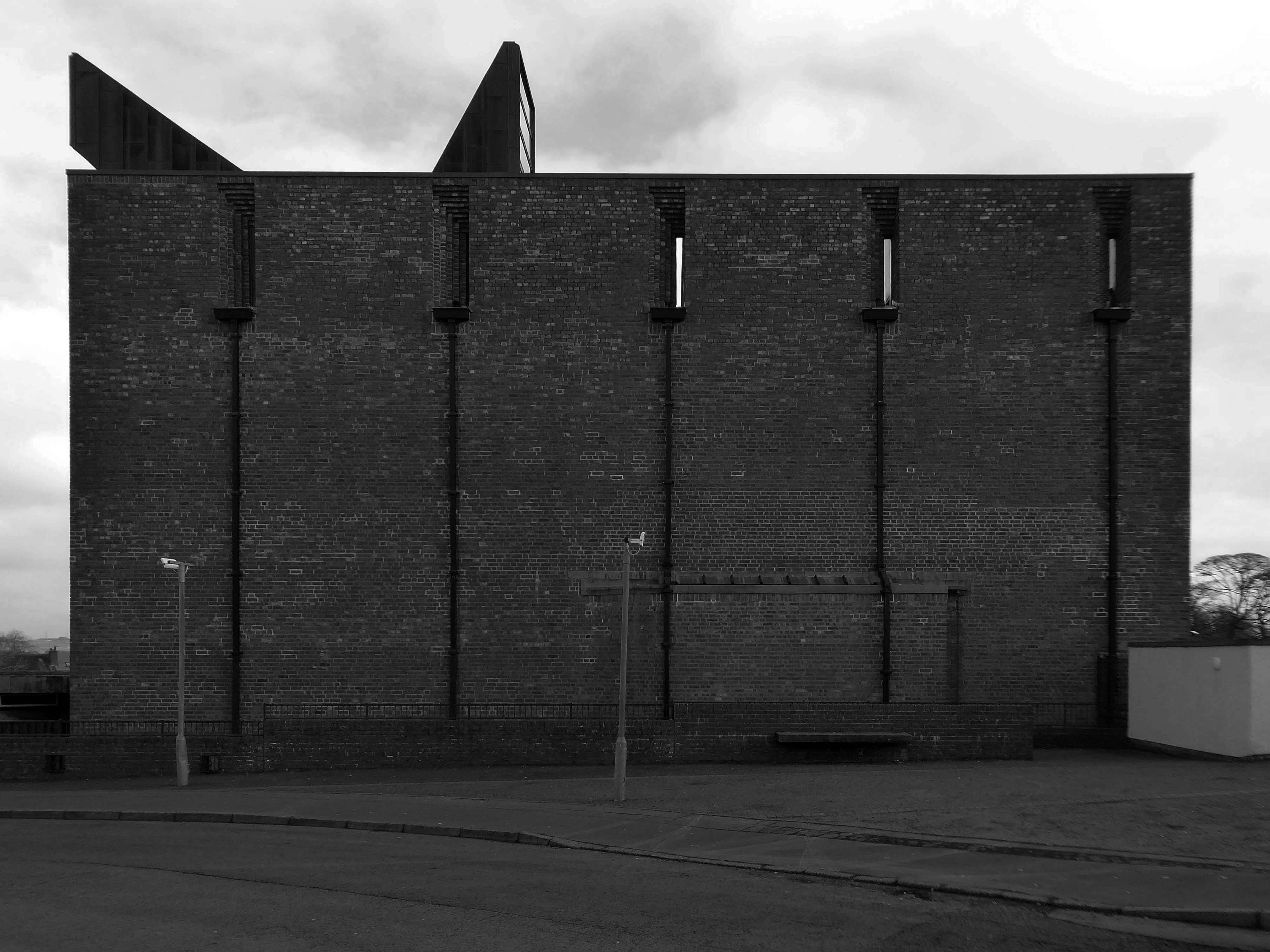
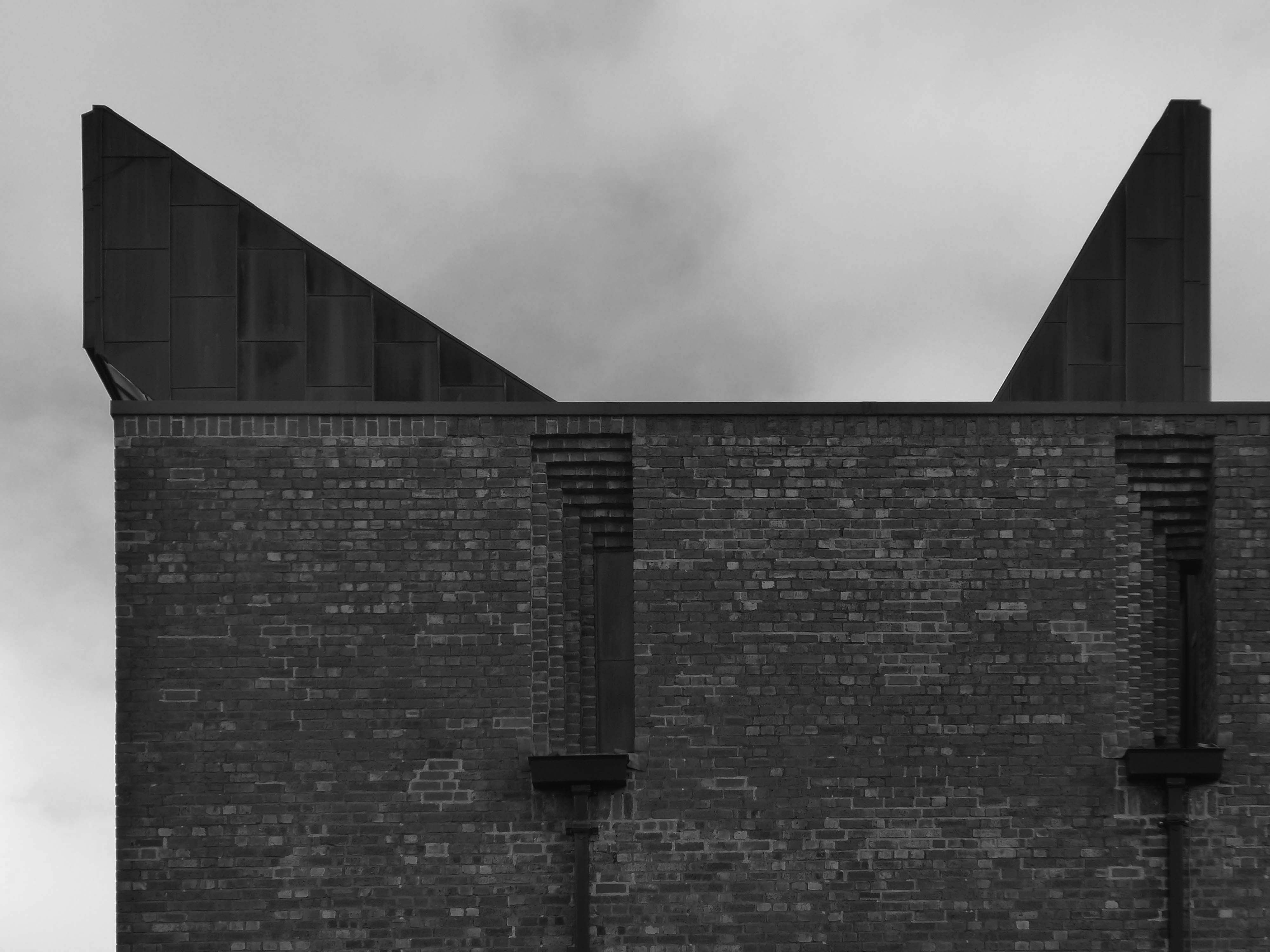
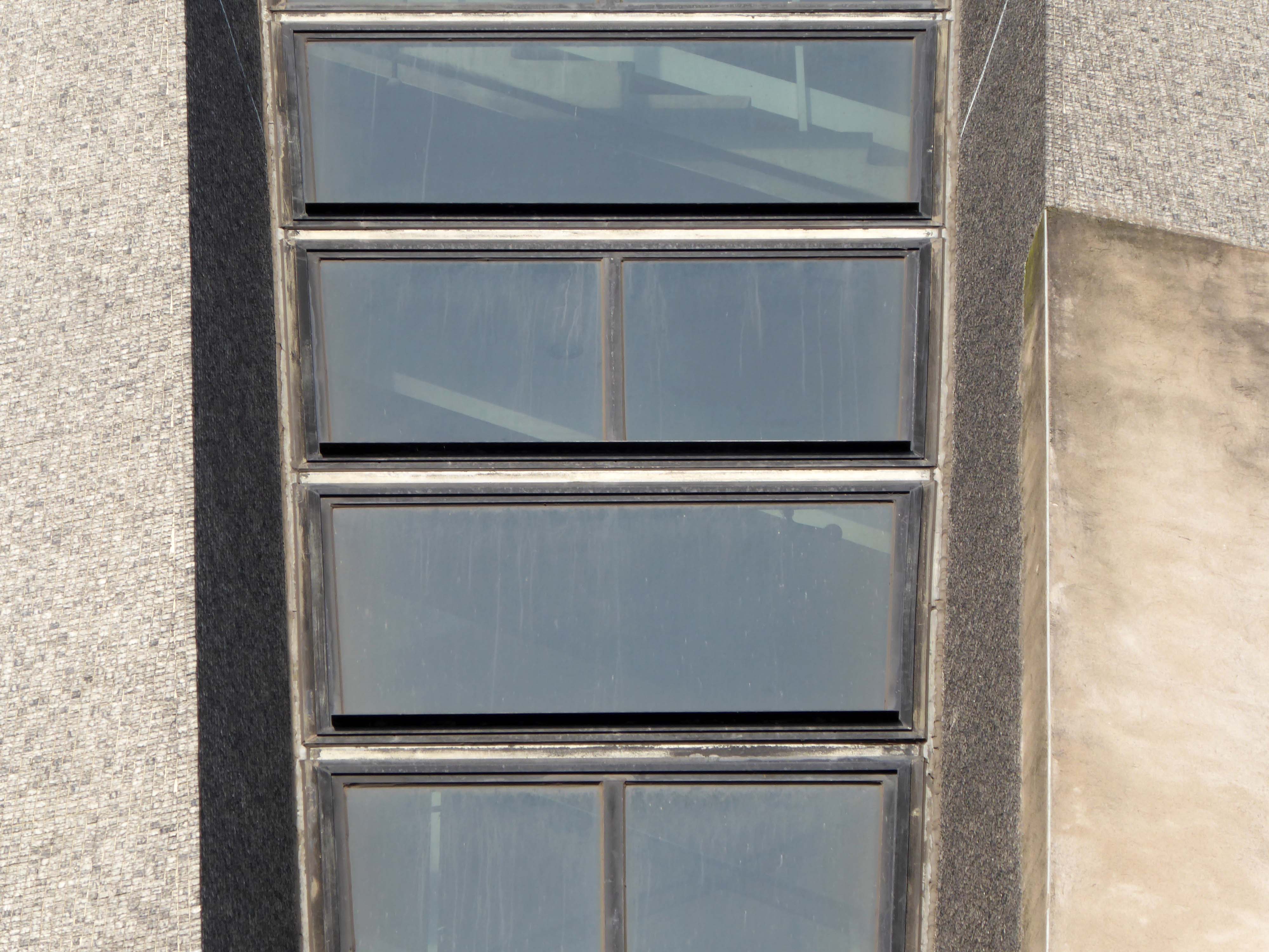
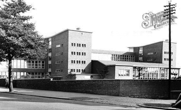
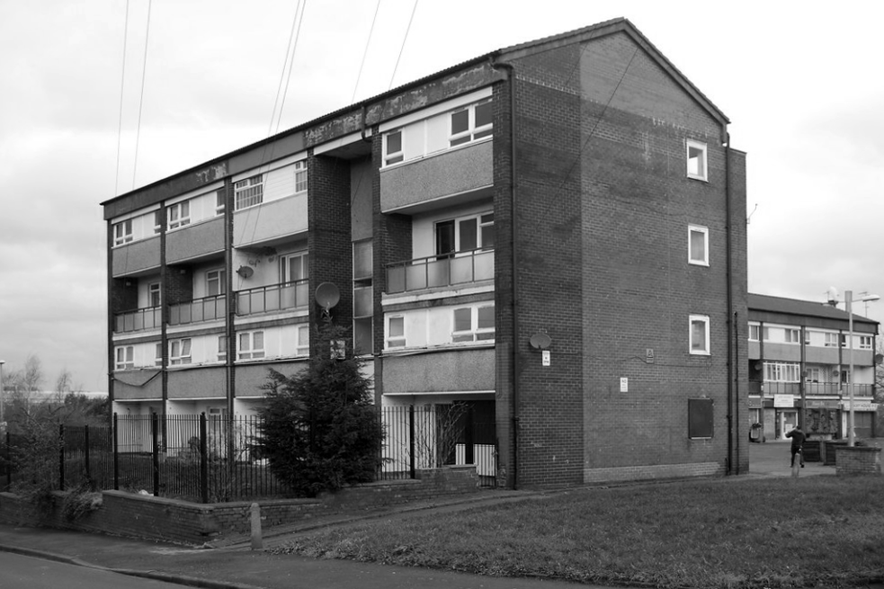
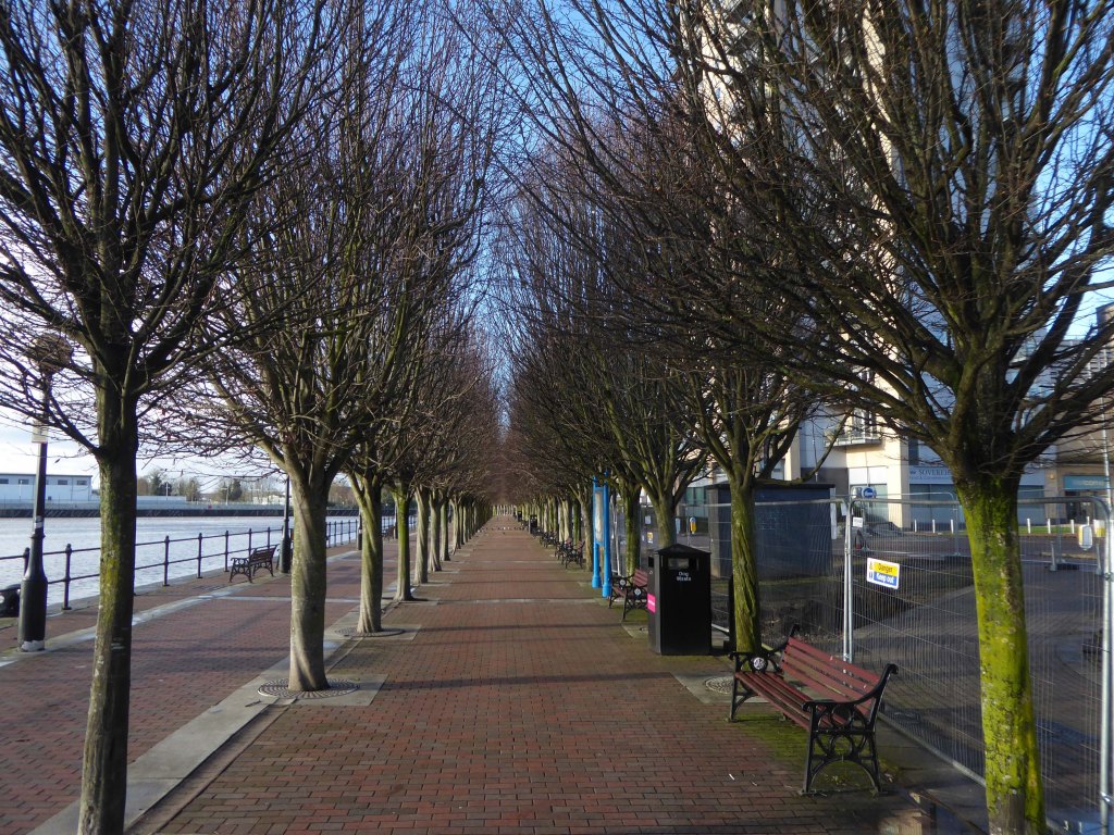
Park Hill was previously the site of back to back housing, a mixture of two and three storey tenement buildings, open ground, quarries and steep ginnels connecting the homes.
Picture Sheffield
John Rennie, the city’s Medical Officer of Health, concluded:
The dwelling houses in the area are by reason of disrepair or sanitary defects unfit for human habitation, or are by reason of their bad arrangement, or the narrowness or bad arrangement of the streets, dangerous or injurious to the health of the inhabitants of the area.
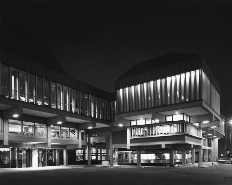
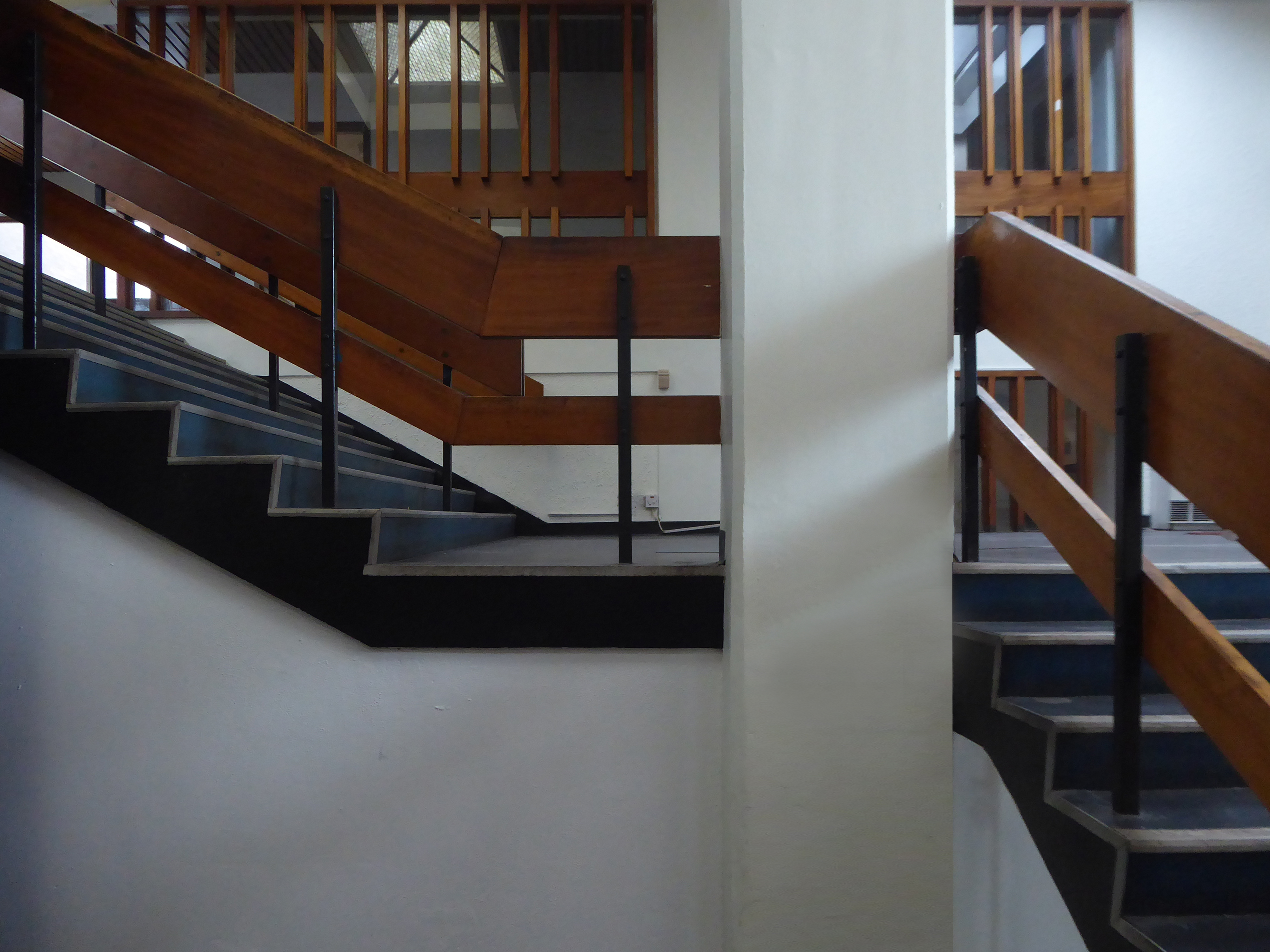
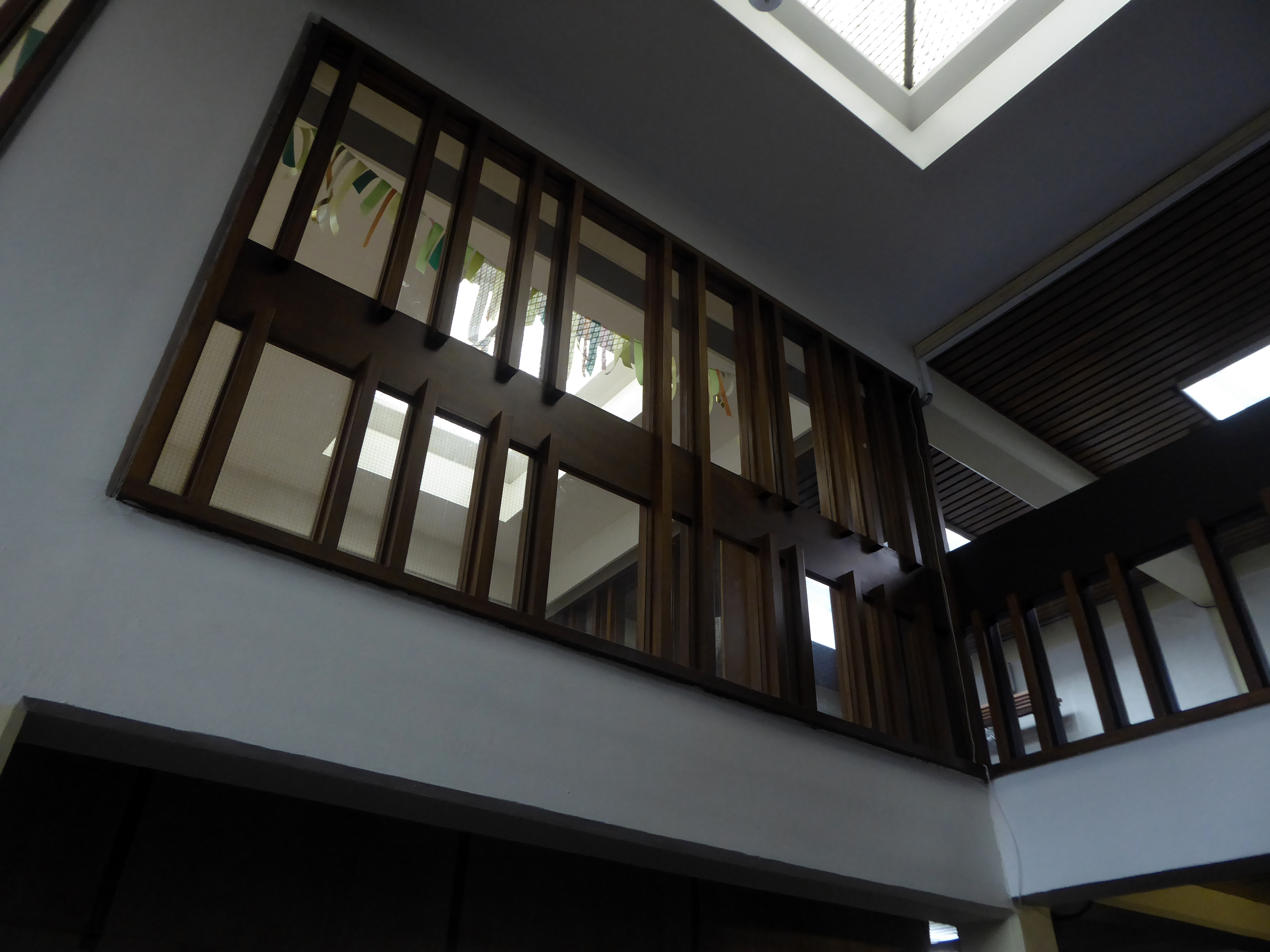
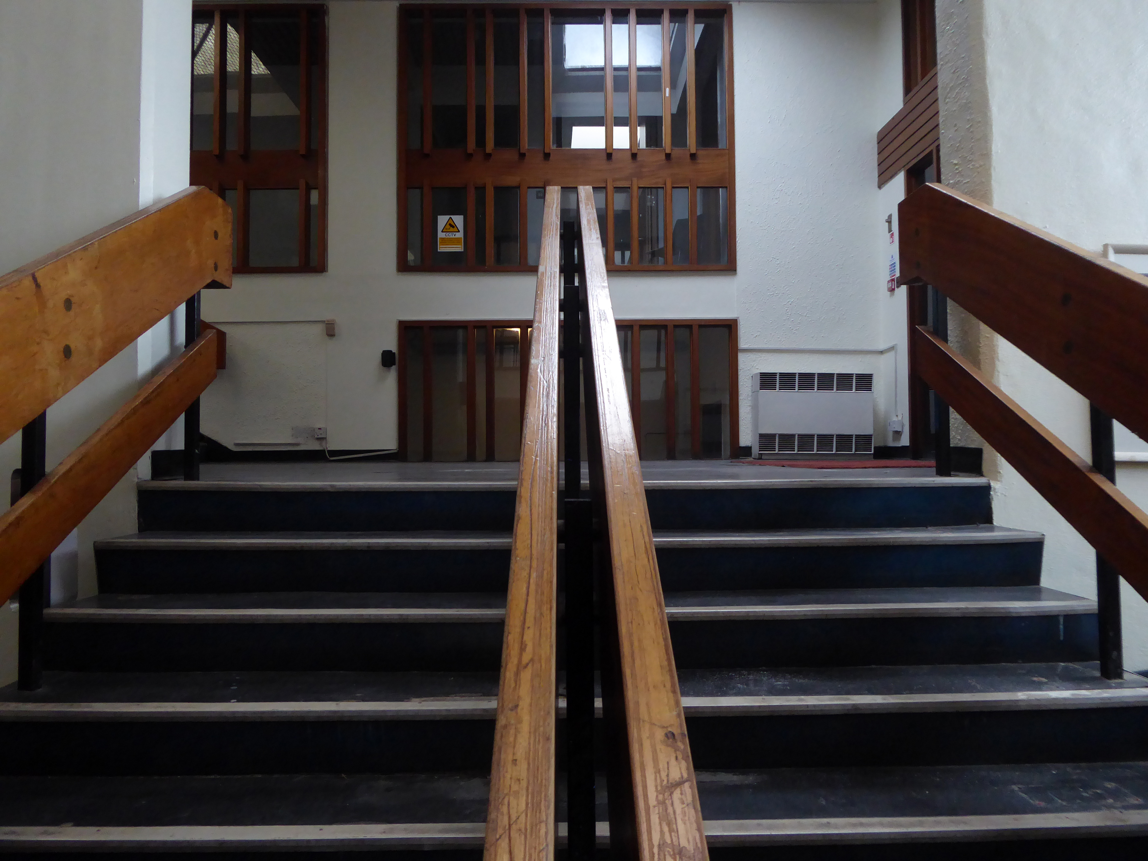
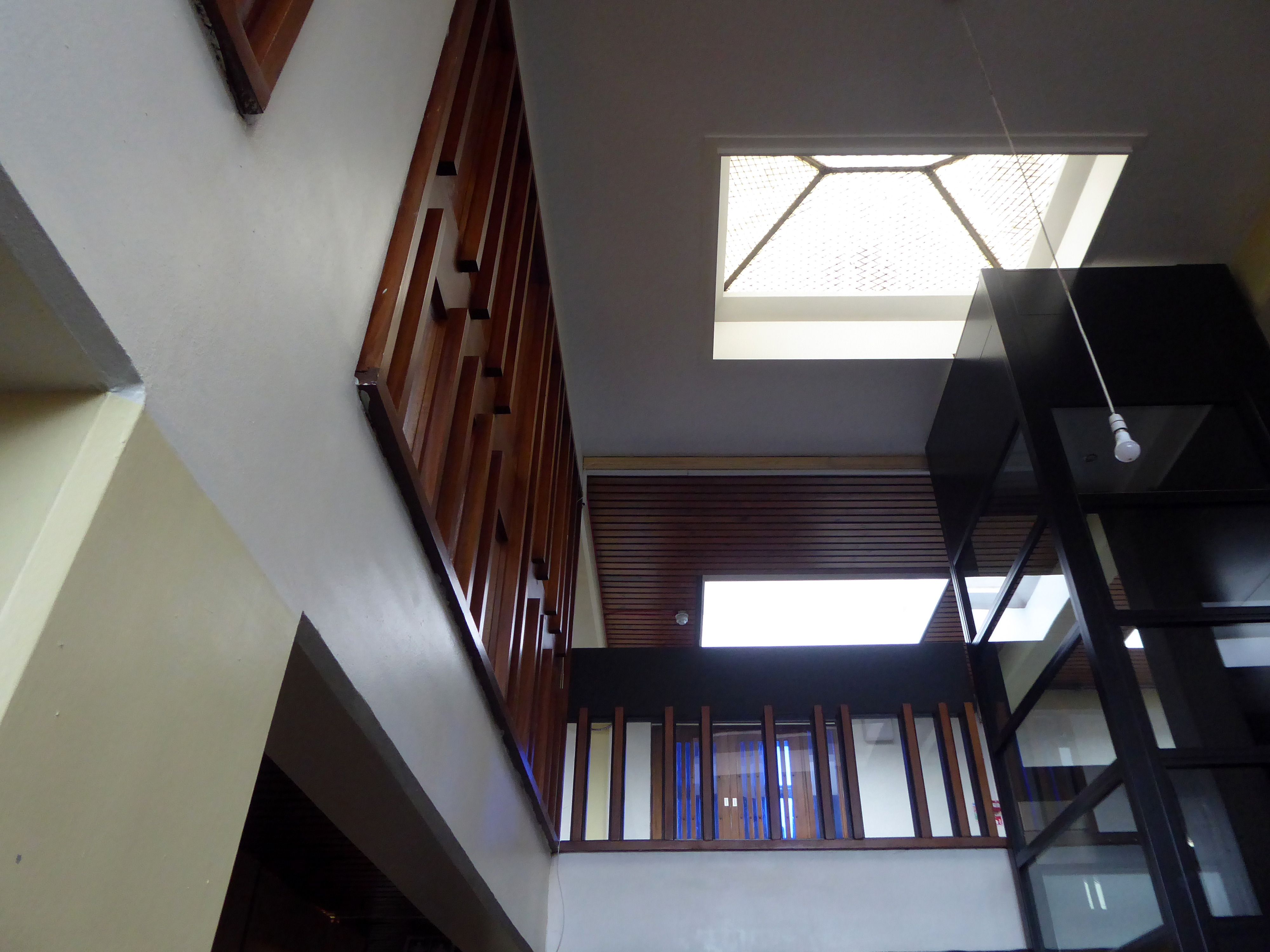
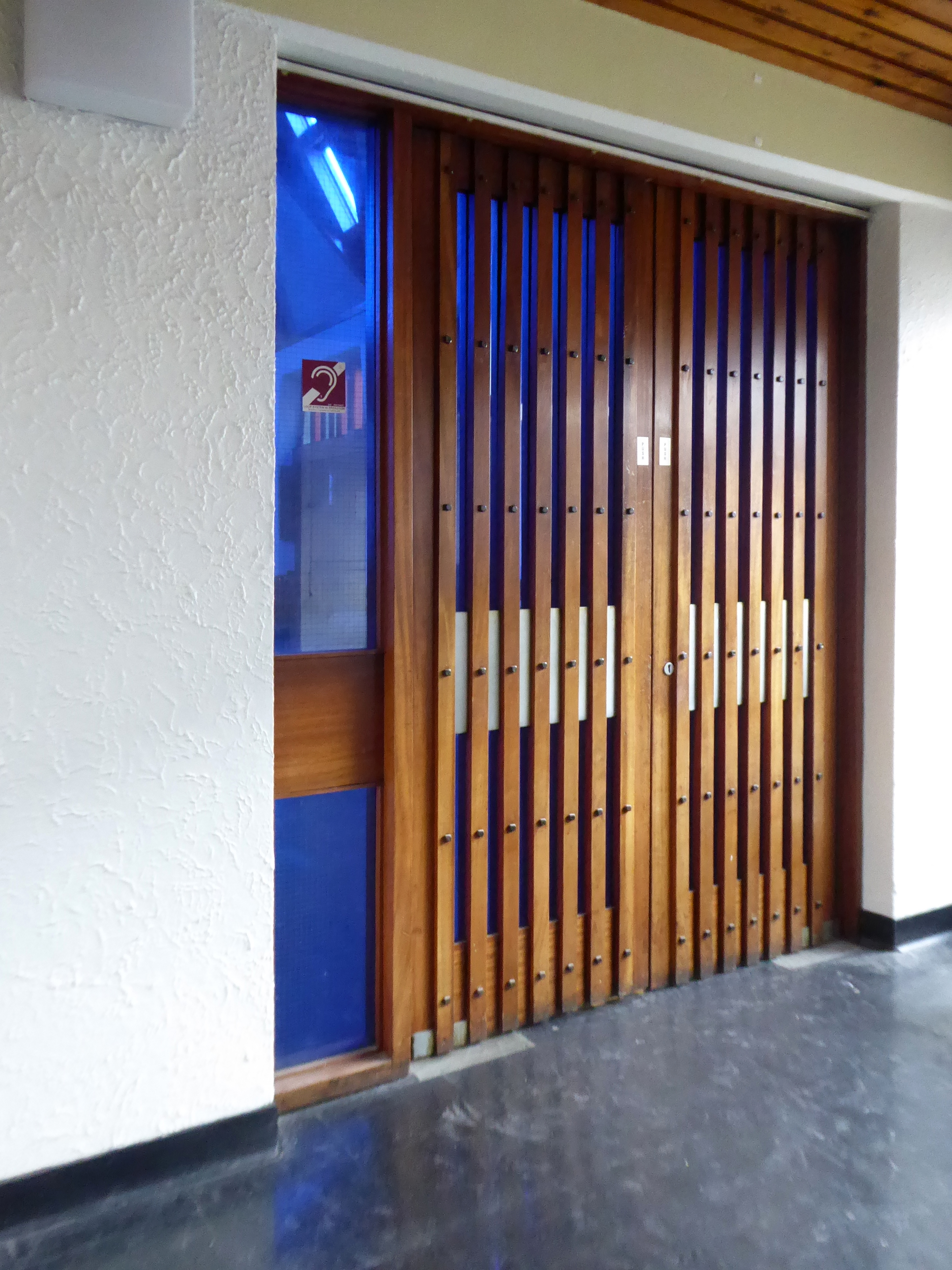
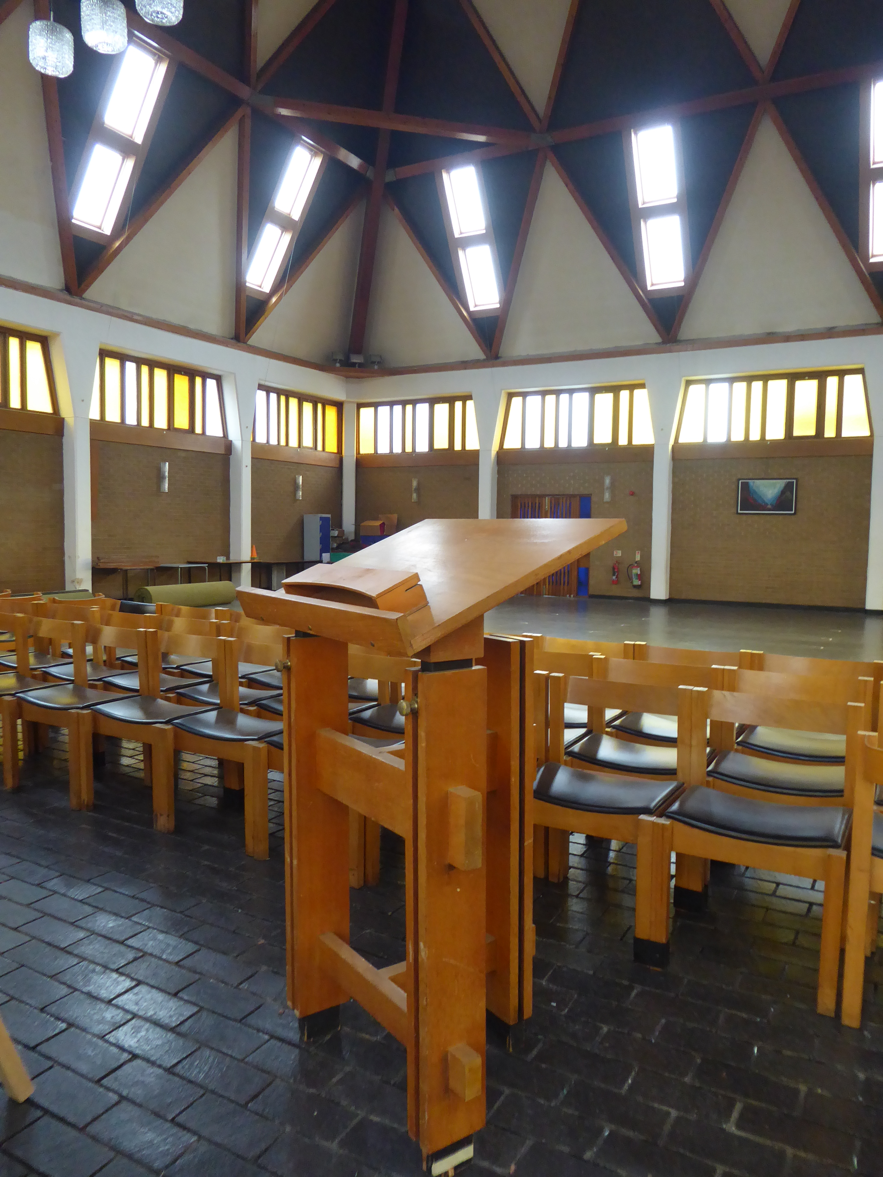
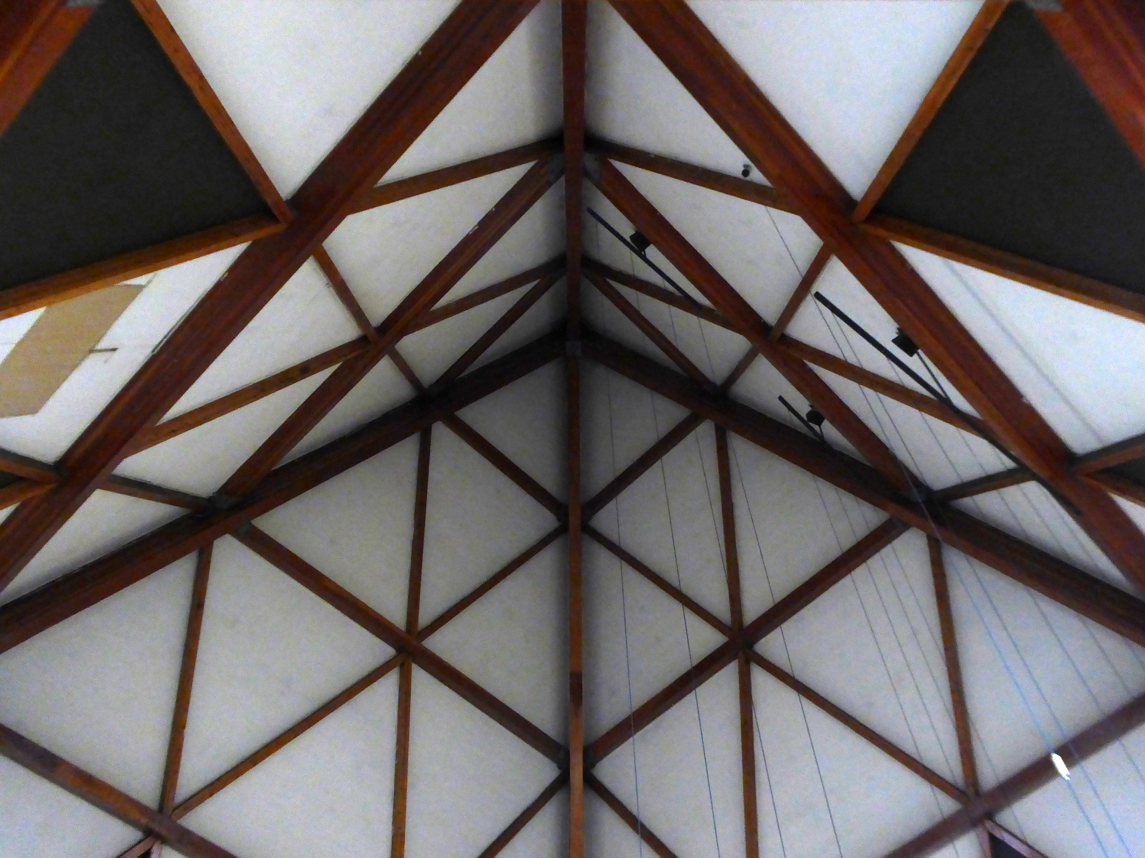
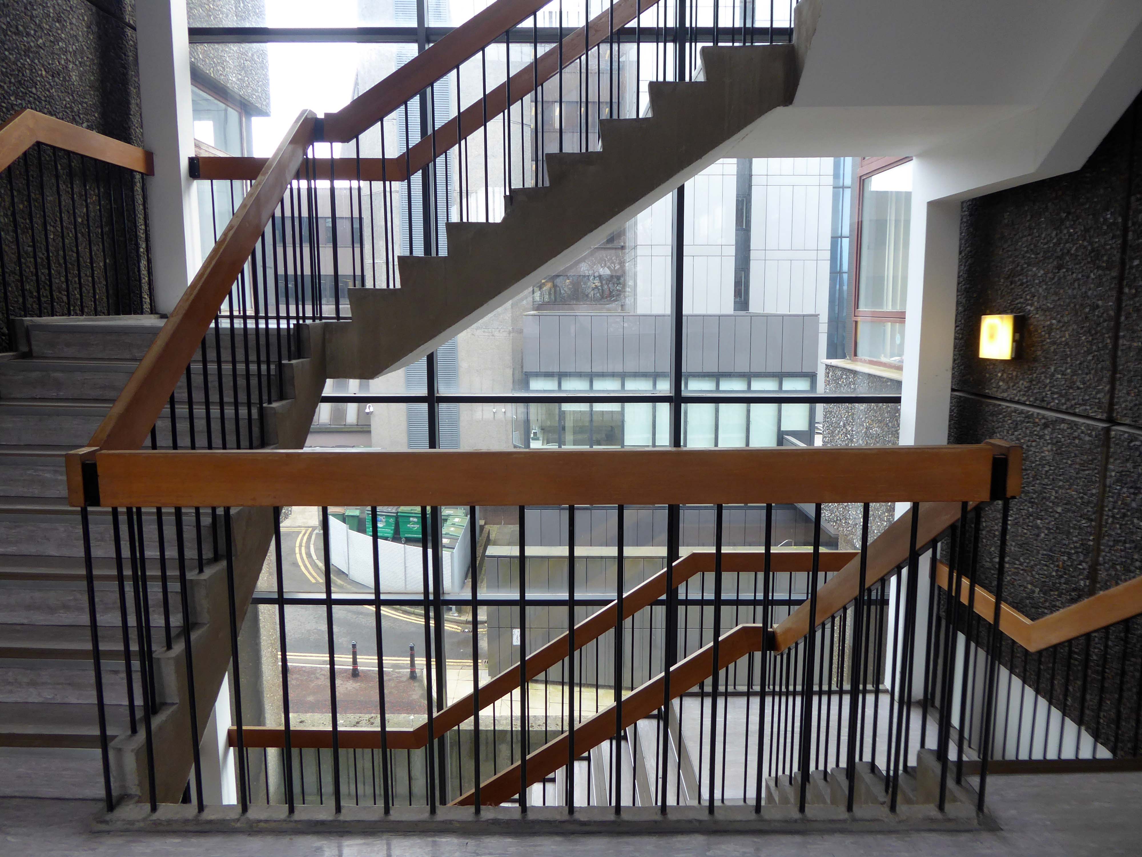
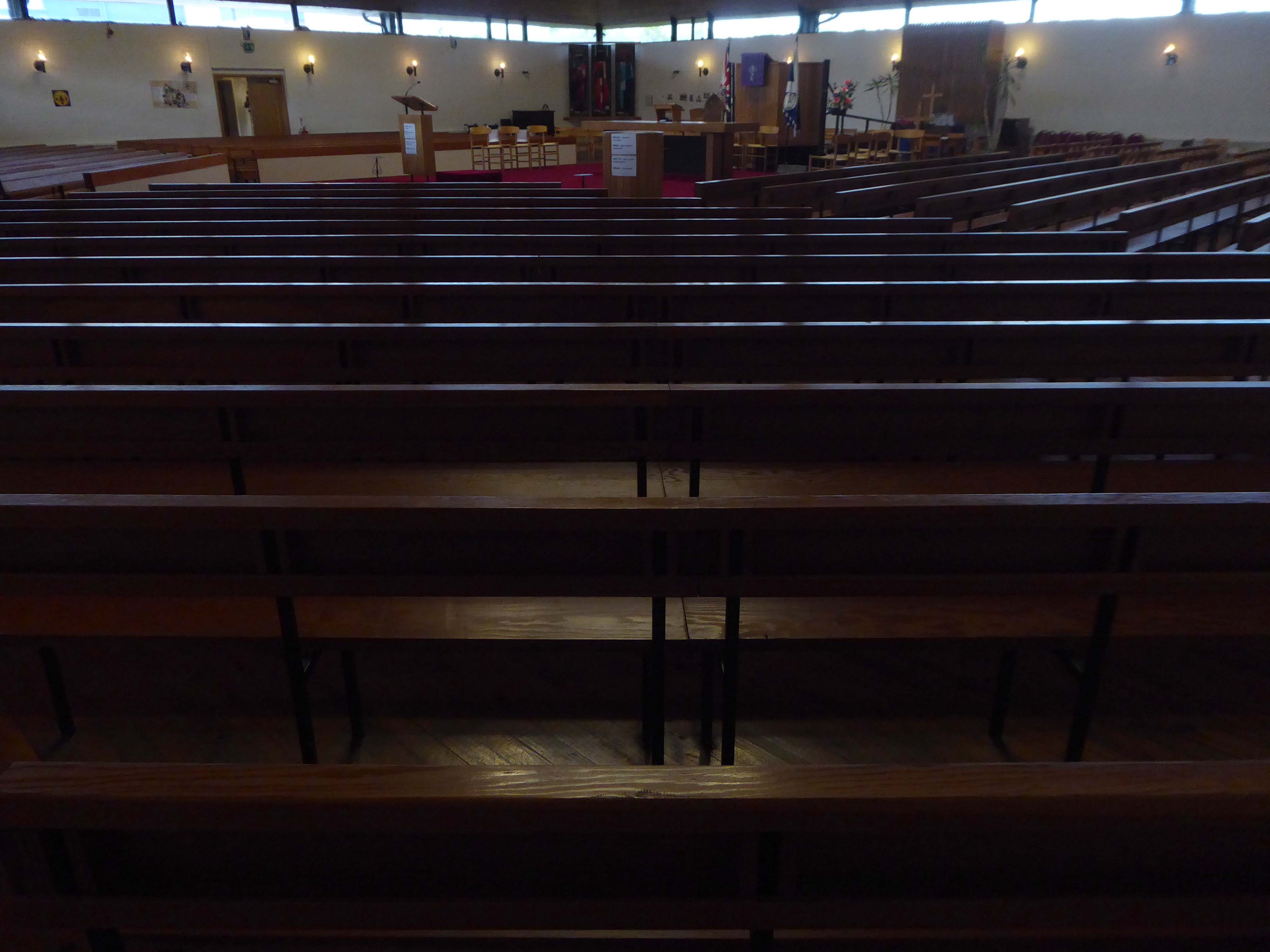
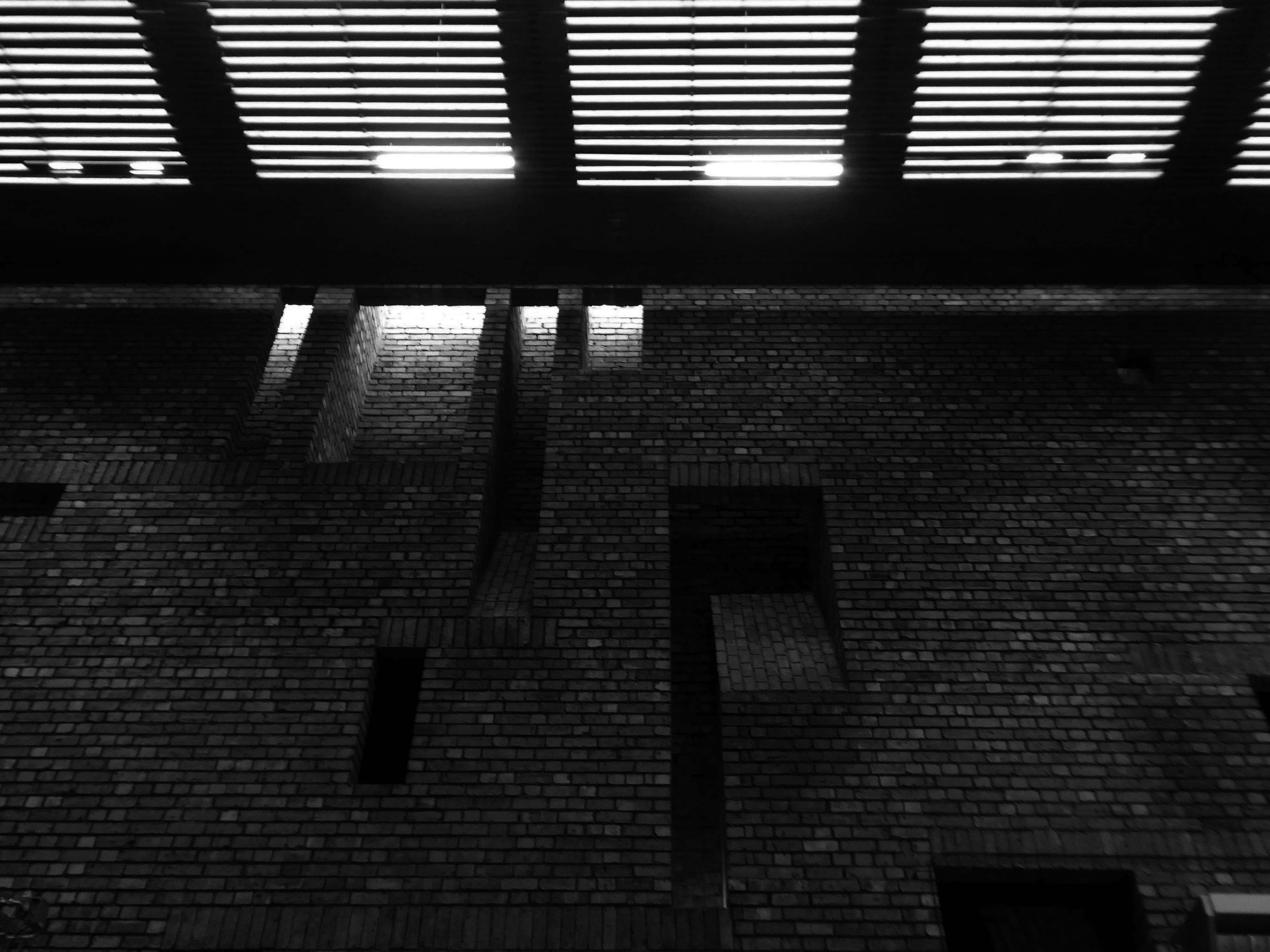
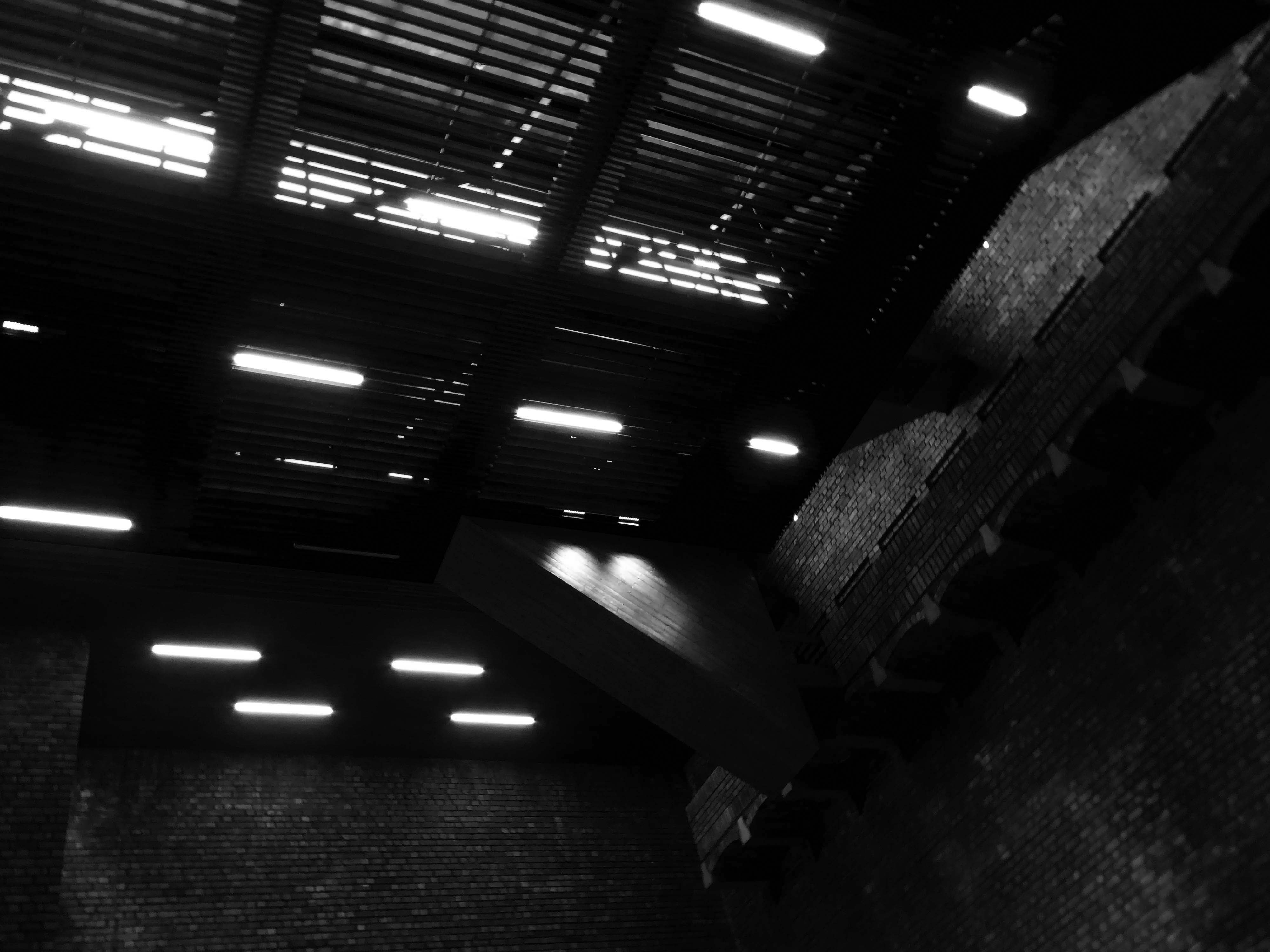
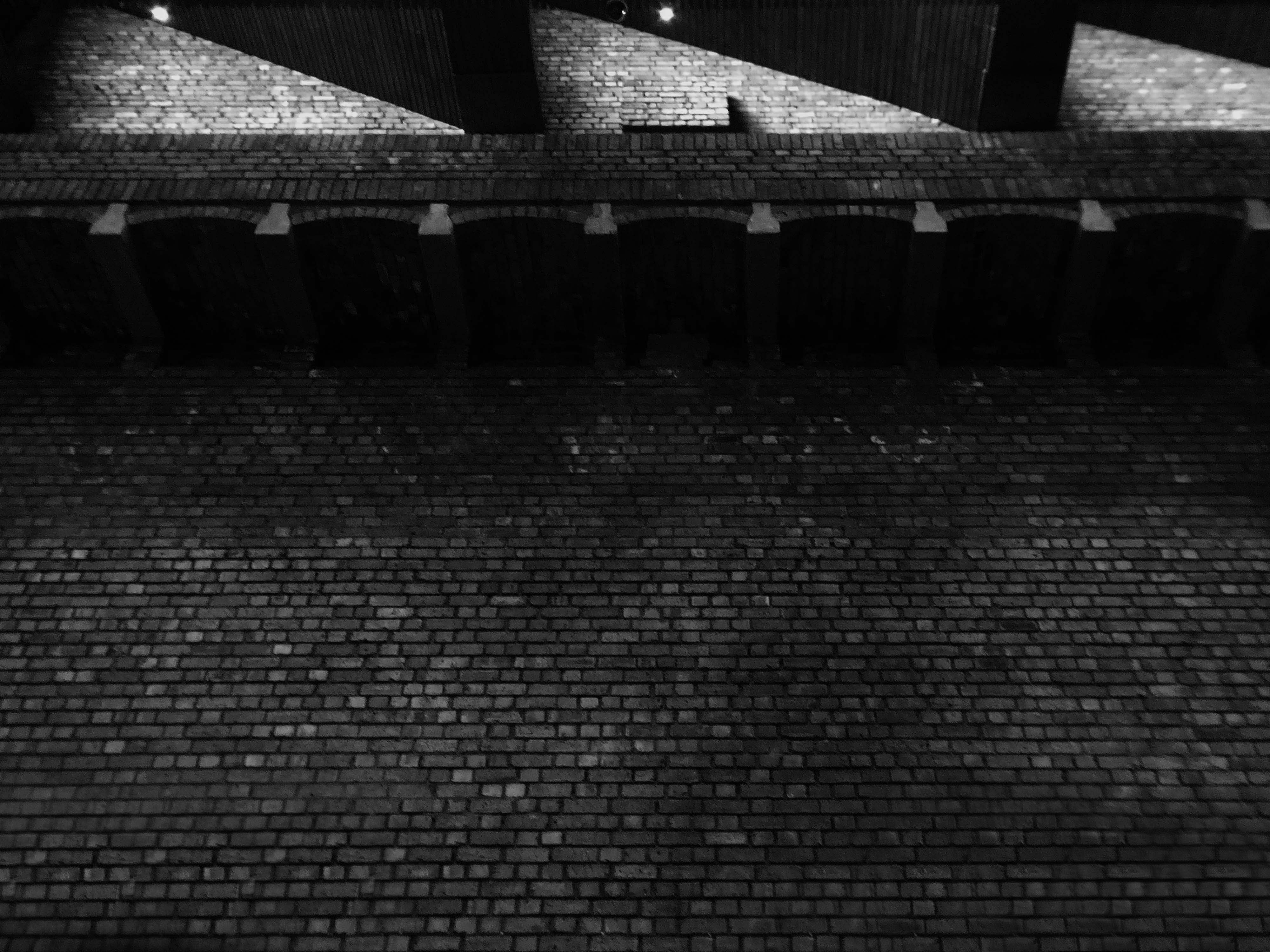
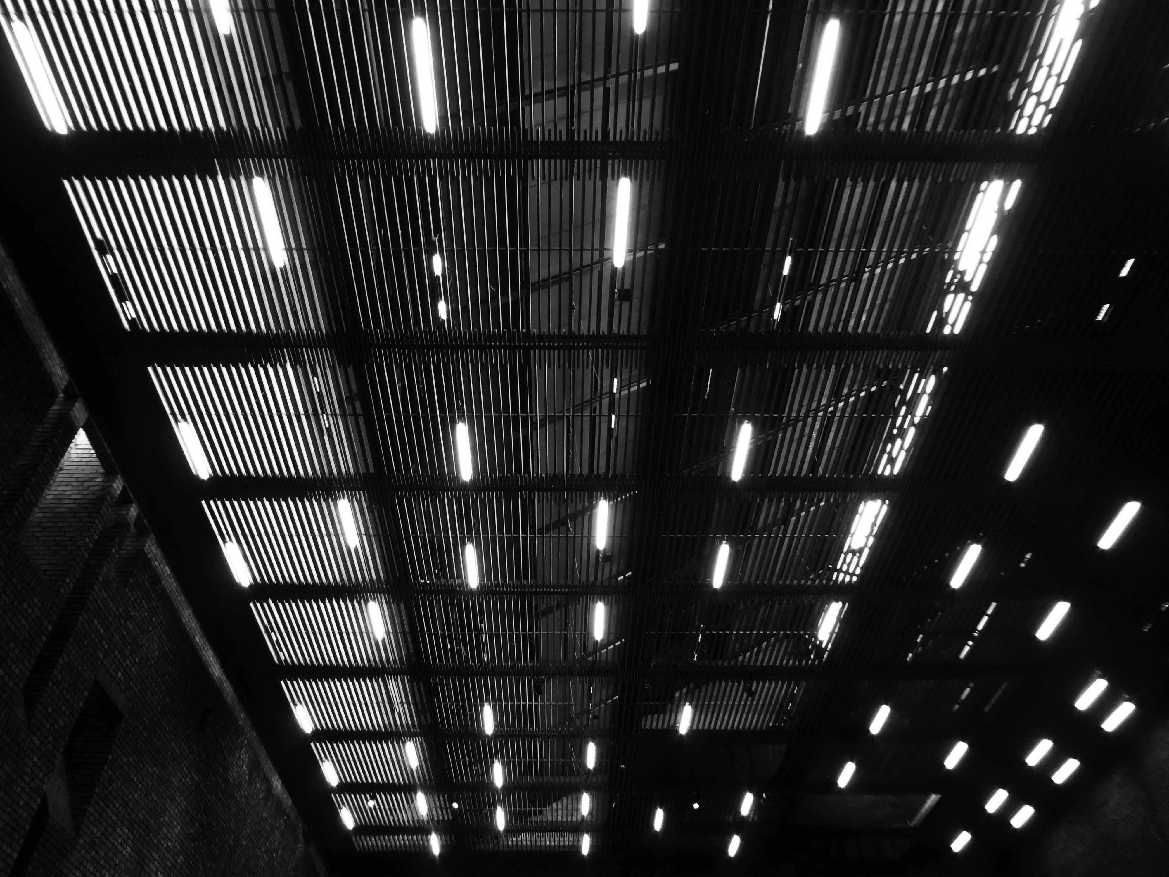
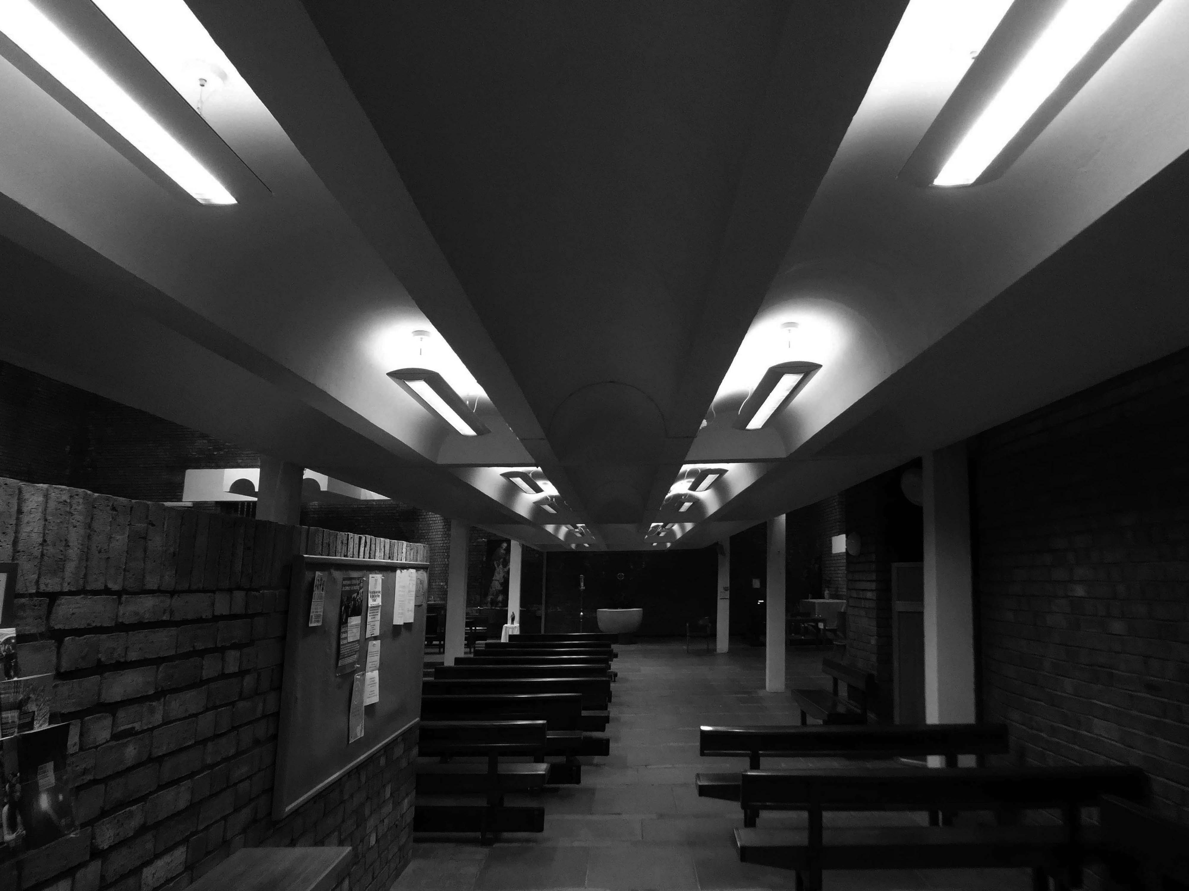
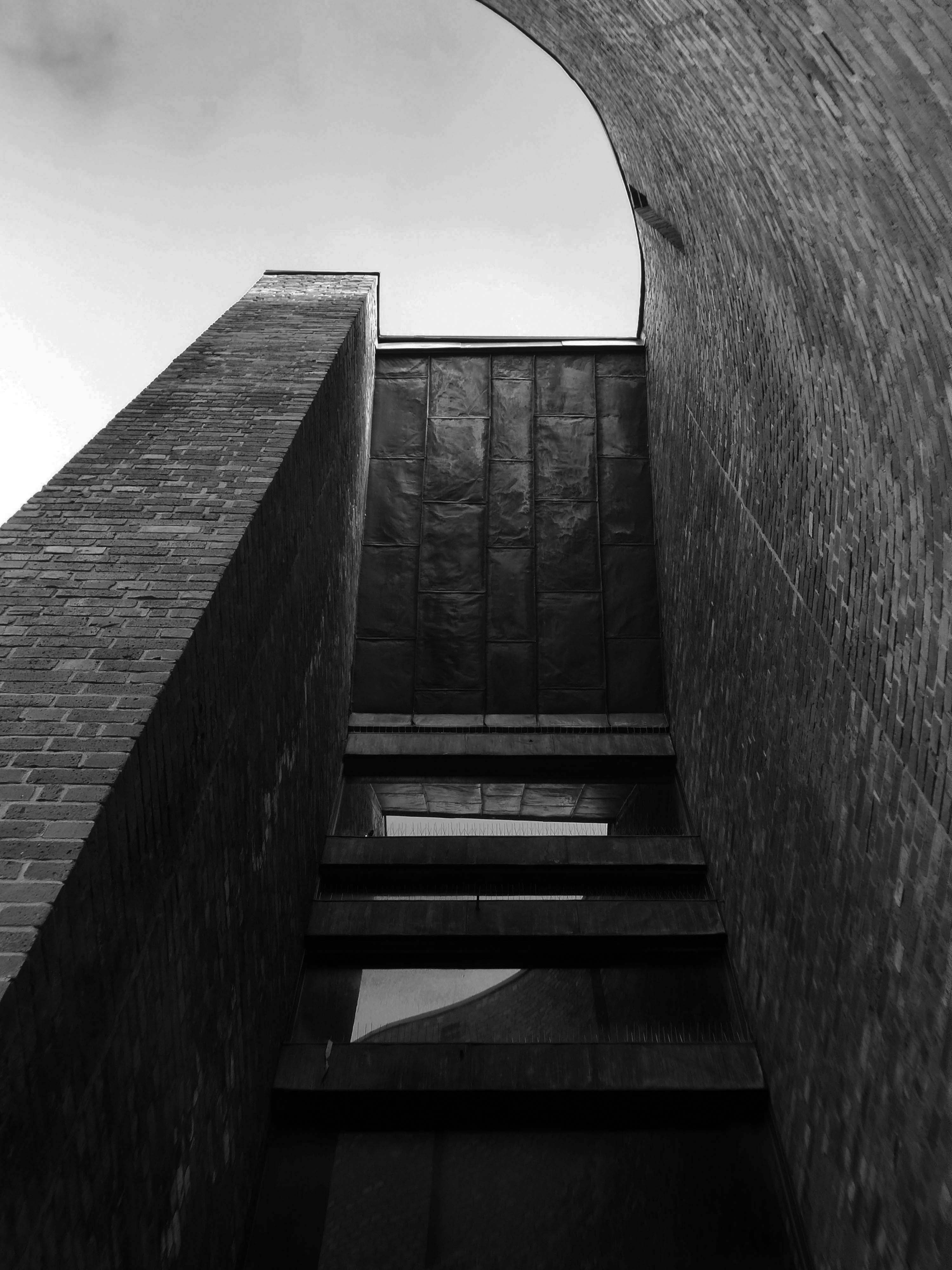
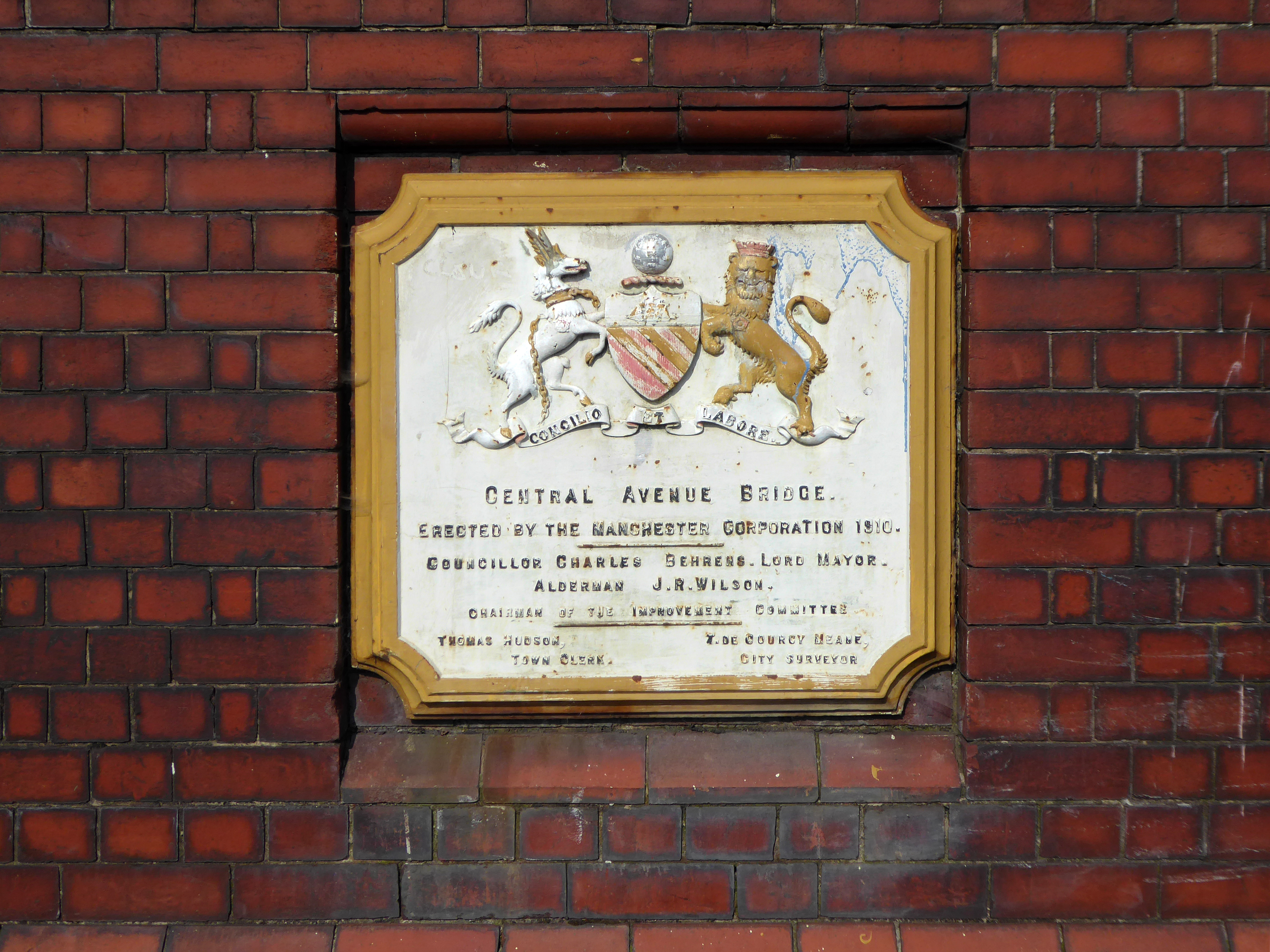
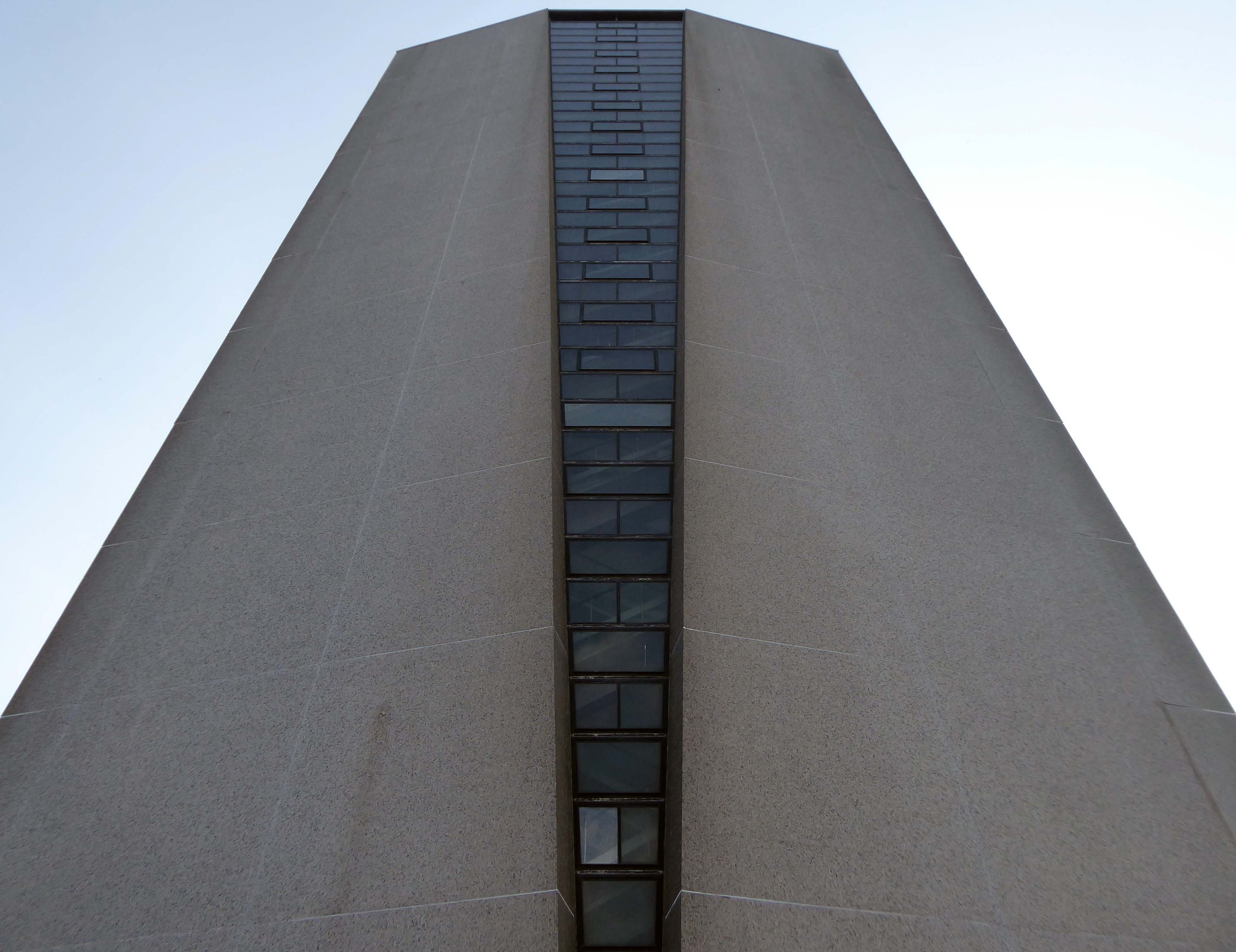
Following the war it was decided that a radical scheme needed to be introduced to deal with rehousing the Park Hill community. To that end, architects Jack Lynn and Ivor Smith under the supervision of J L Womersley, Sheffield Council’s City Architect, began work in 1953 designing the Park Hill Flats.
Park Hill Part One was officially opened by Hugh Gaitskell, MP and Leader of the Opposition, on 16 June 1961.
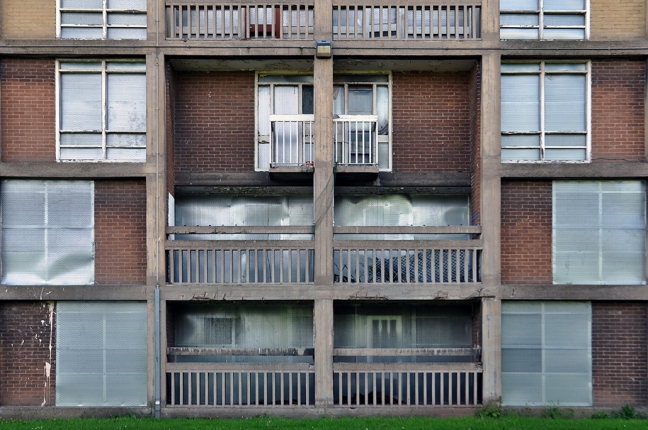
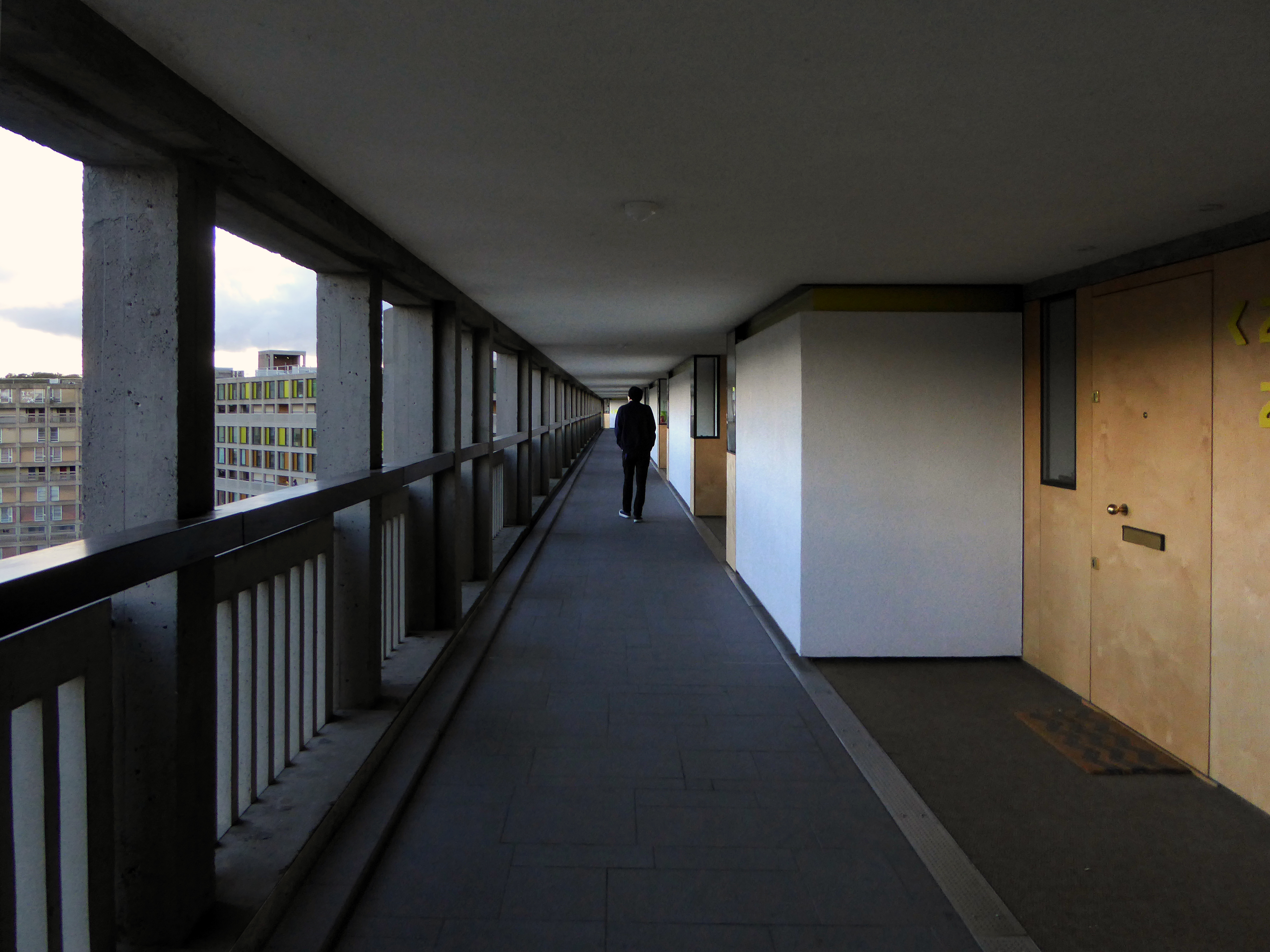
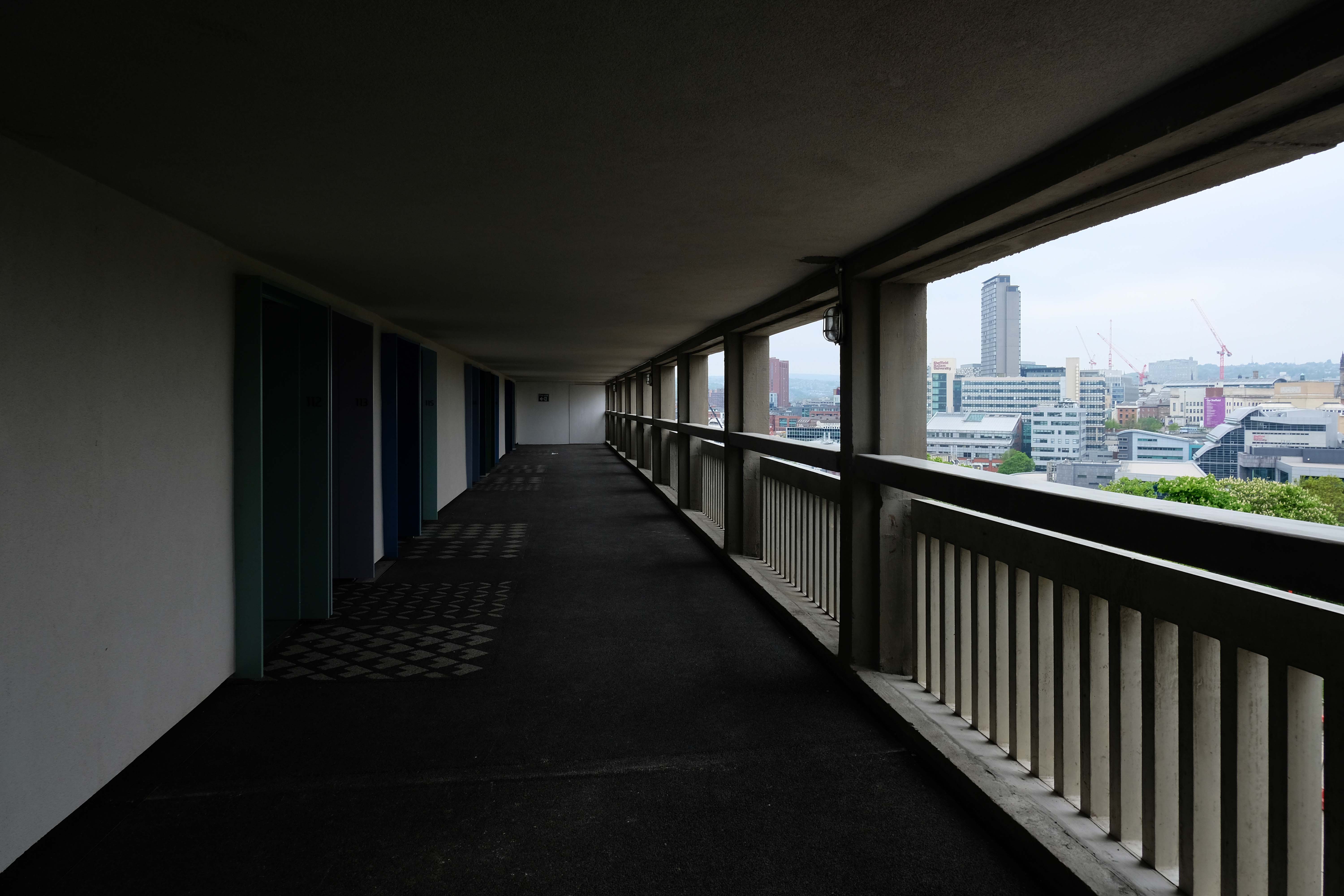
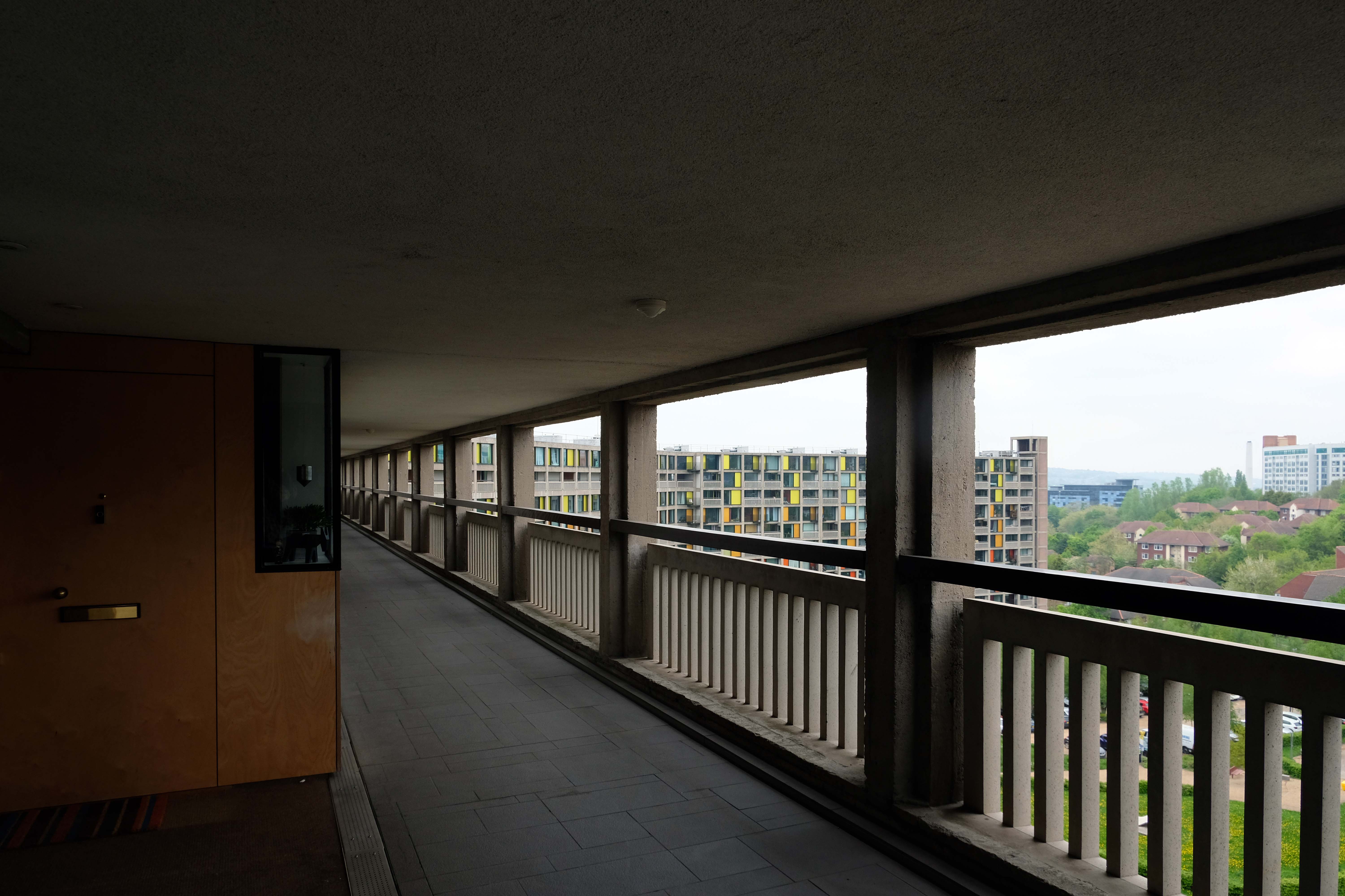
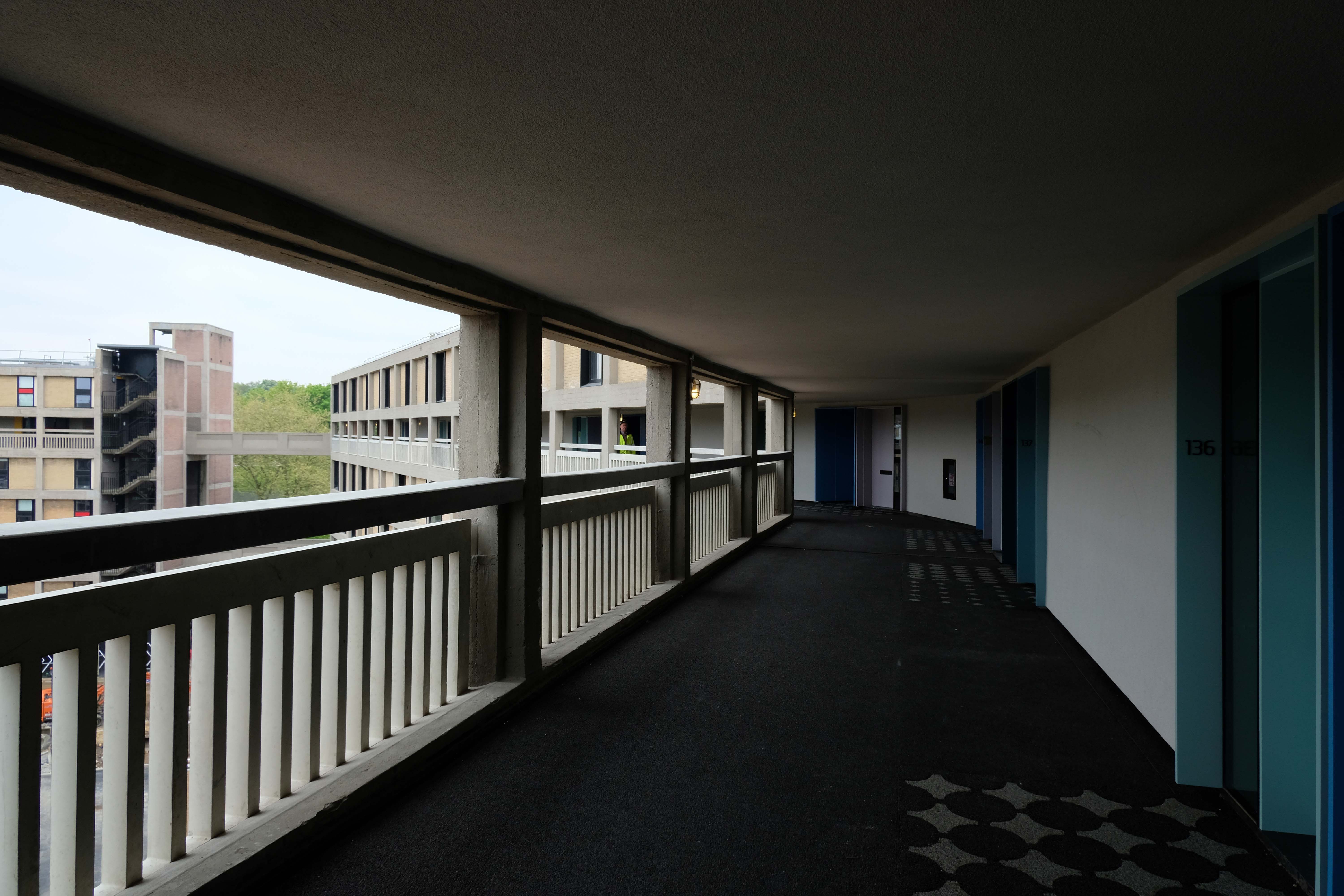
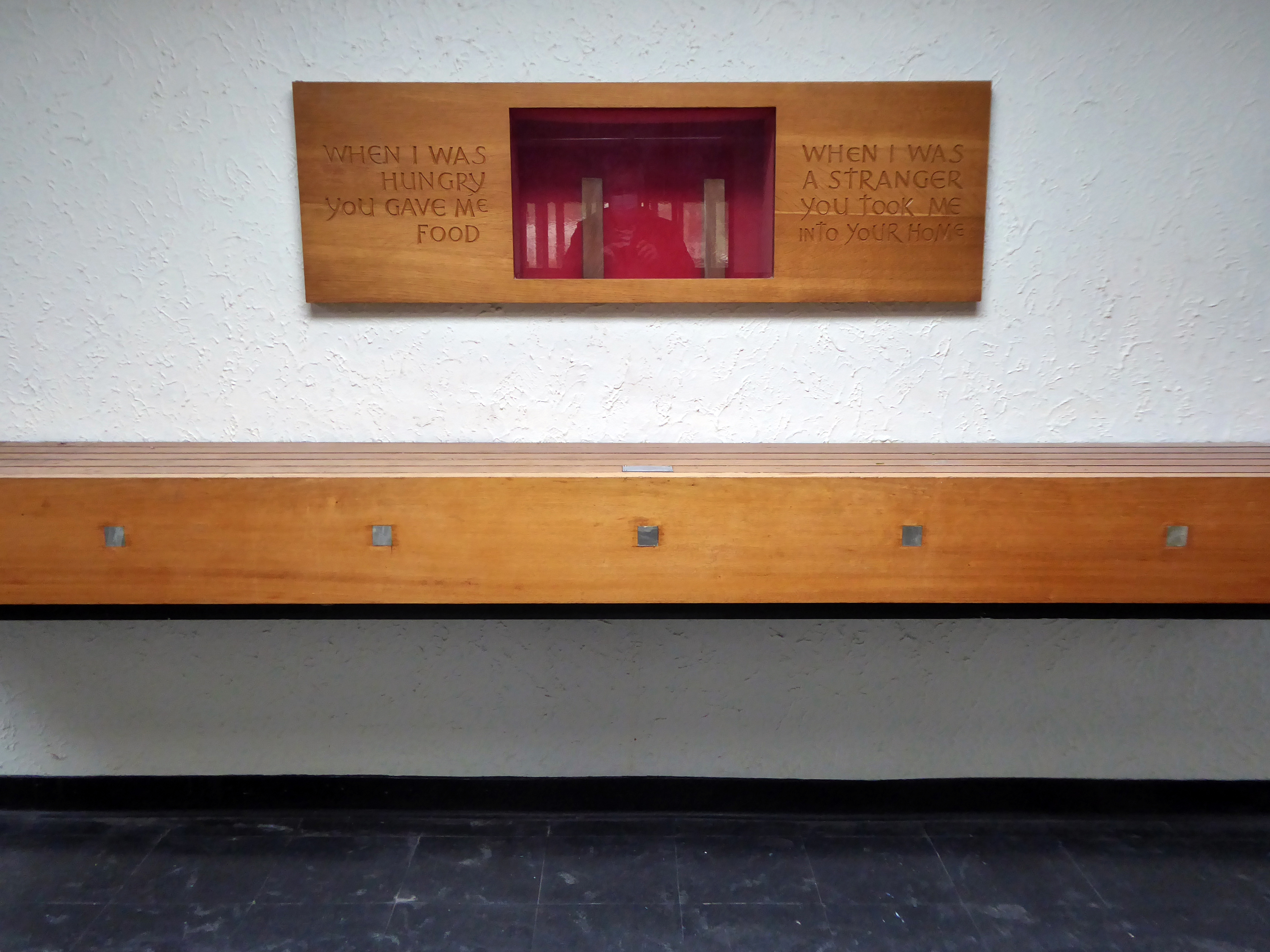
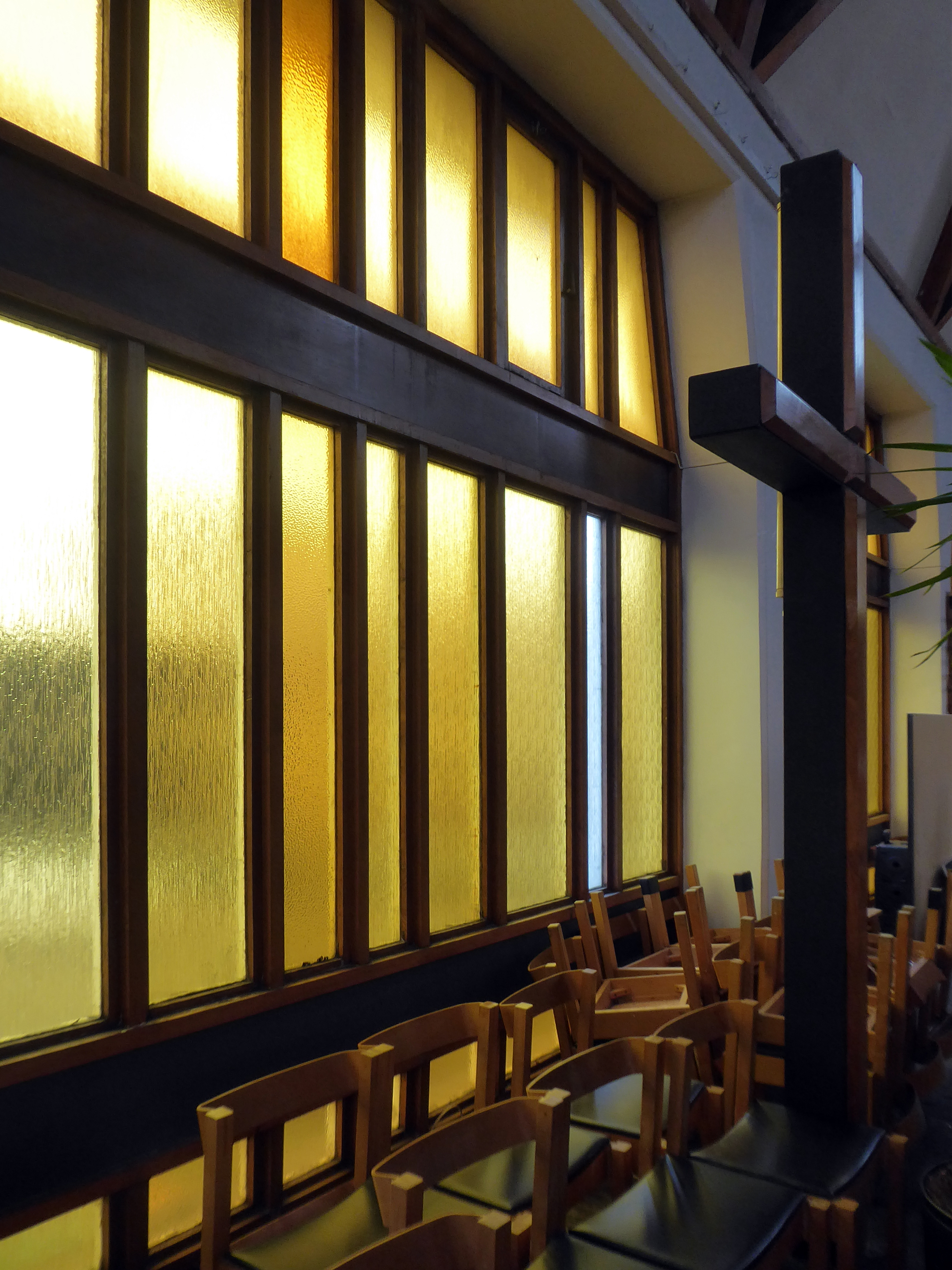
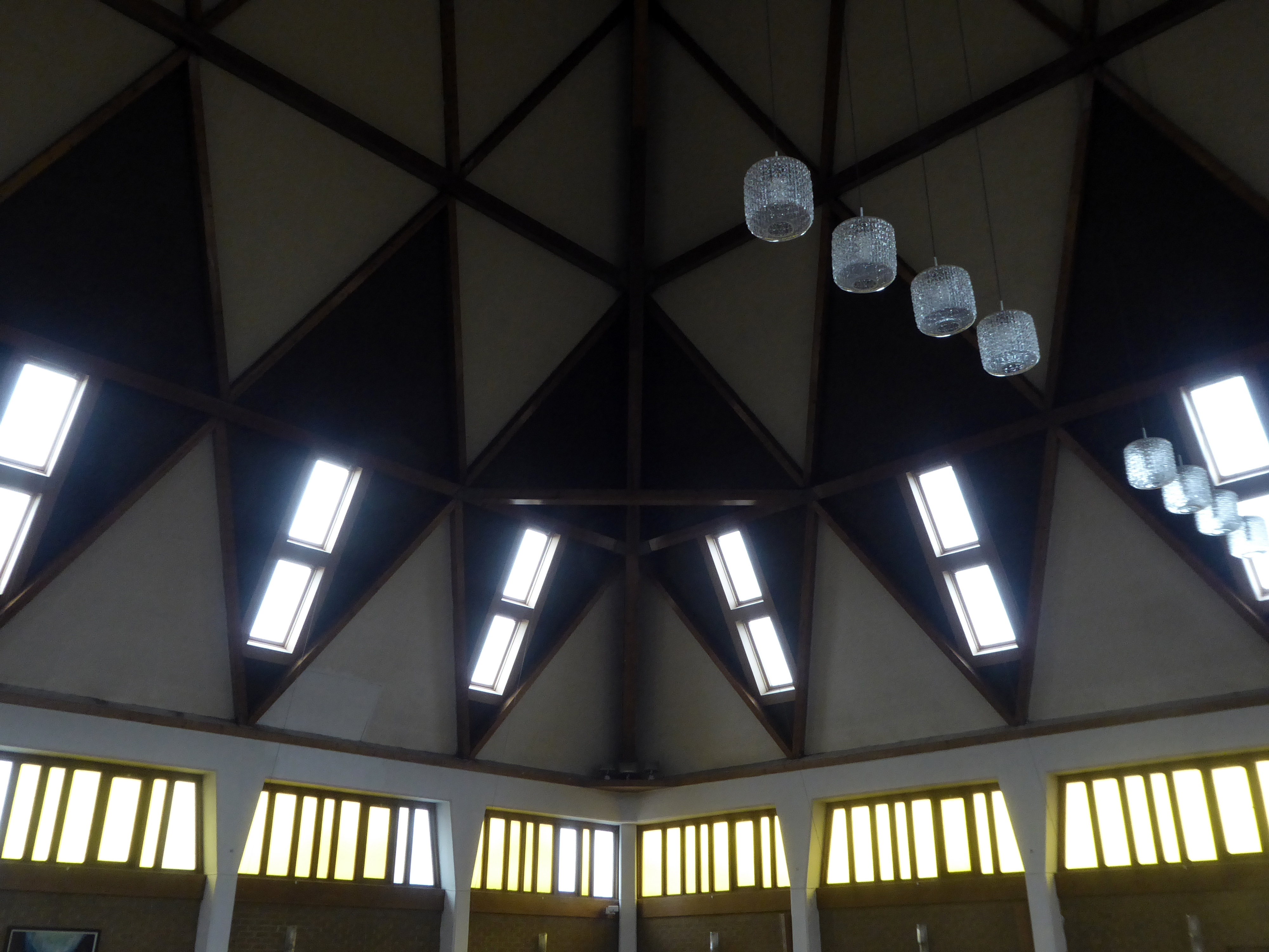
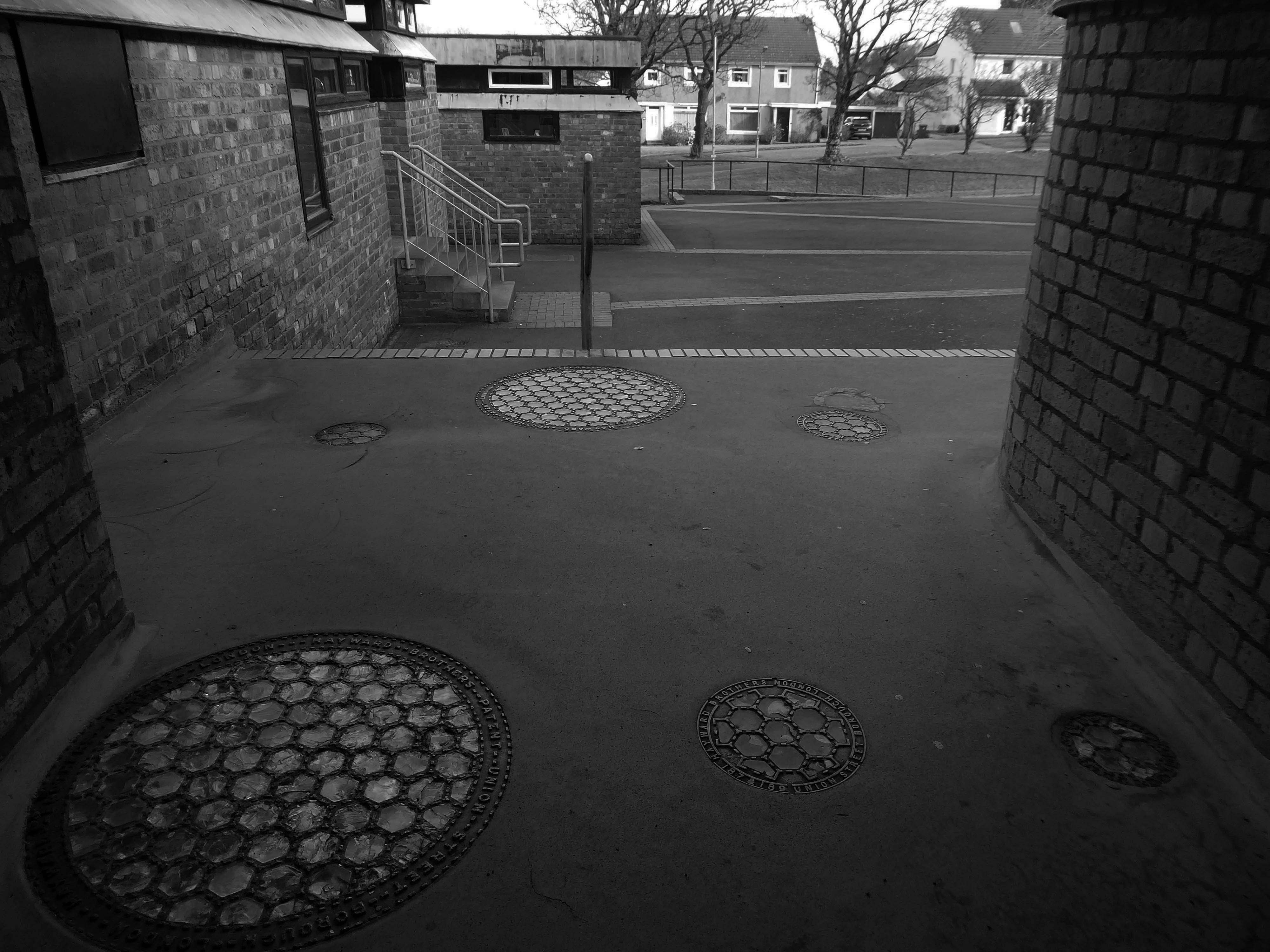
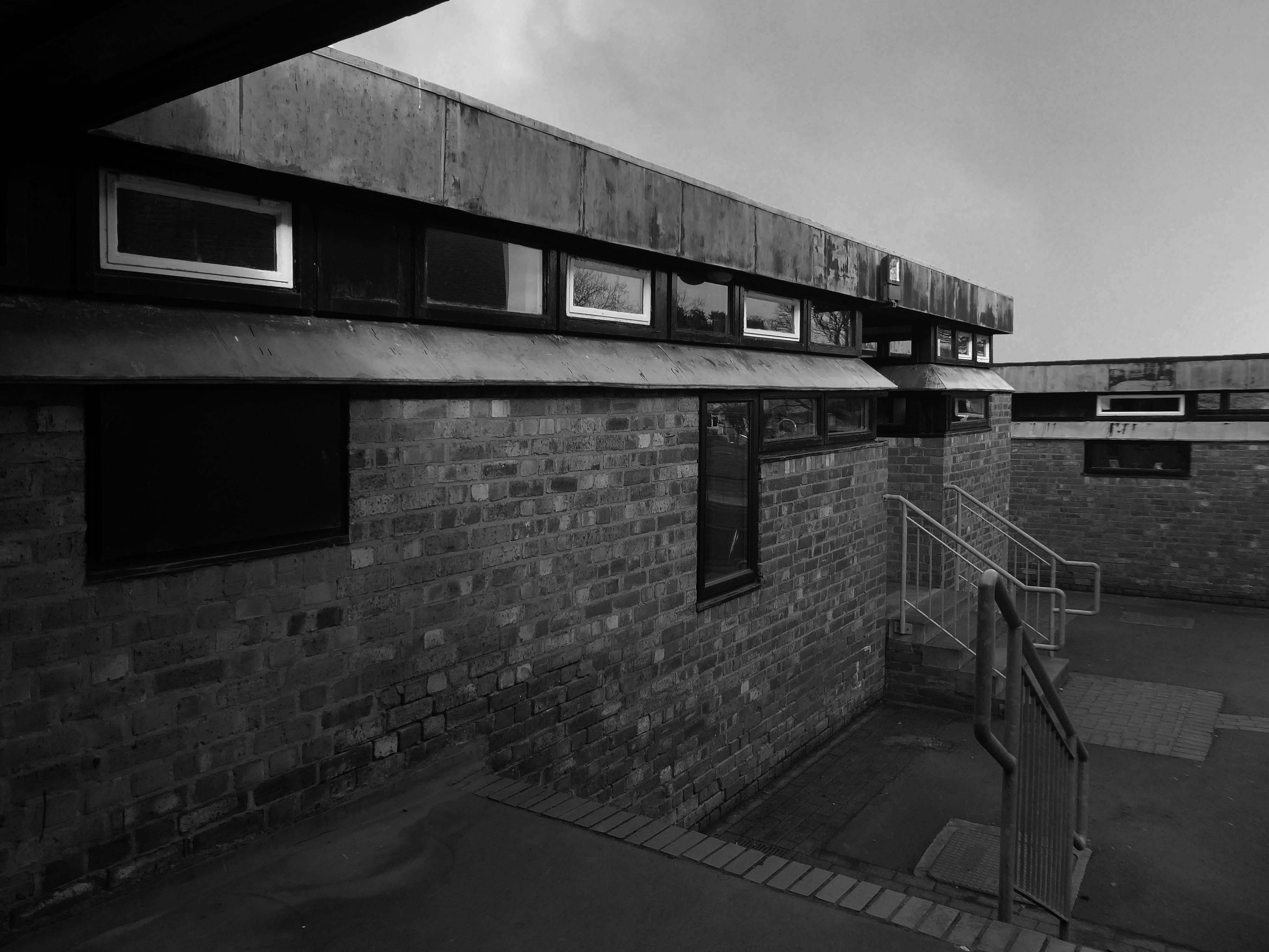
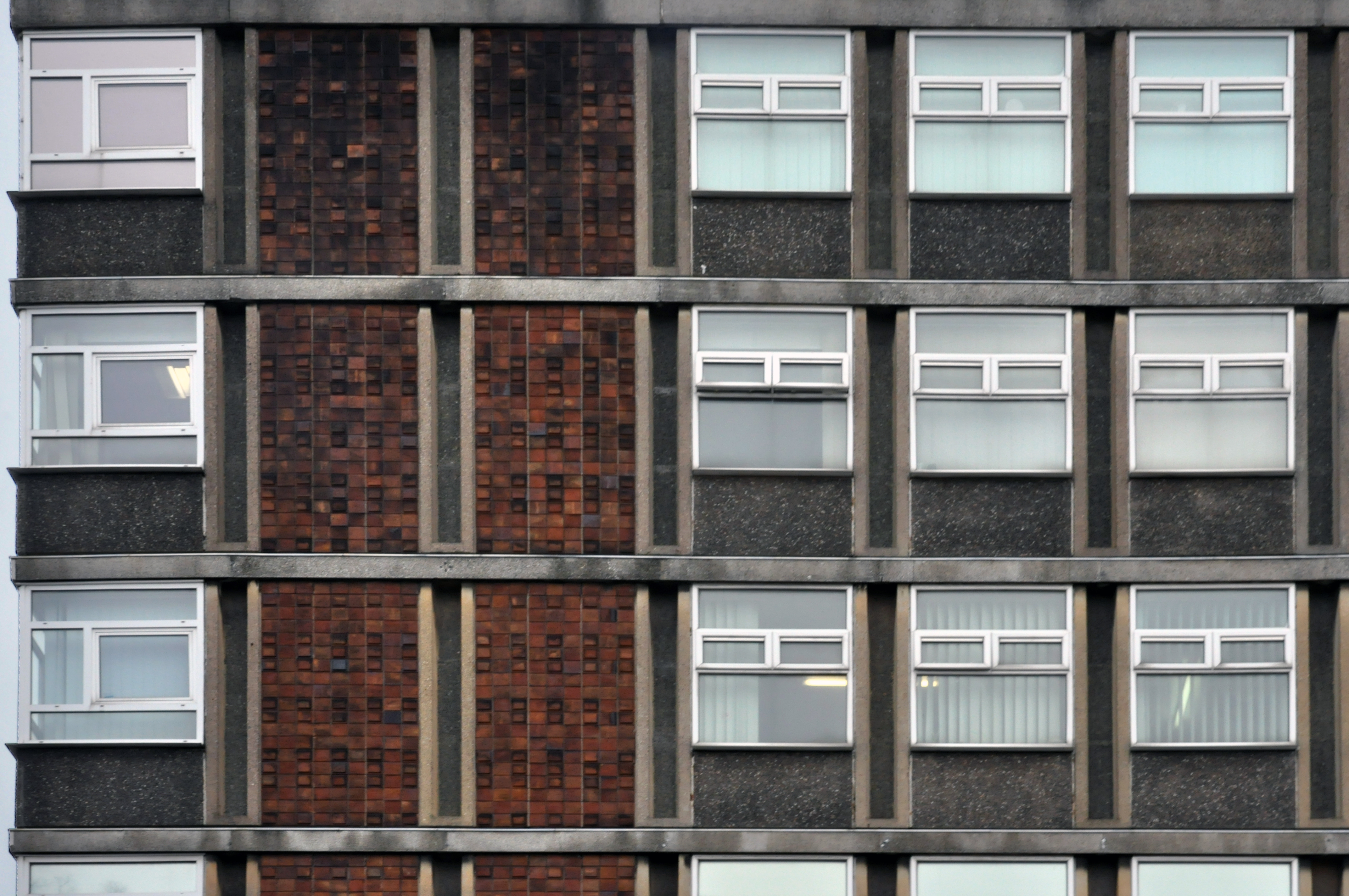
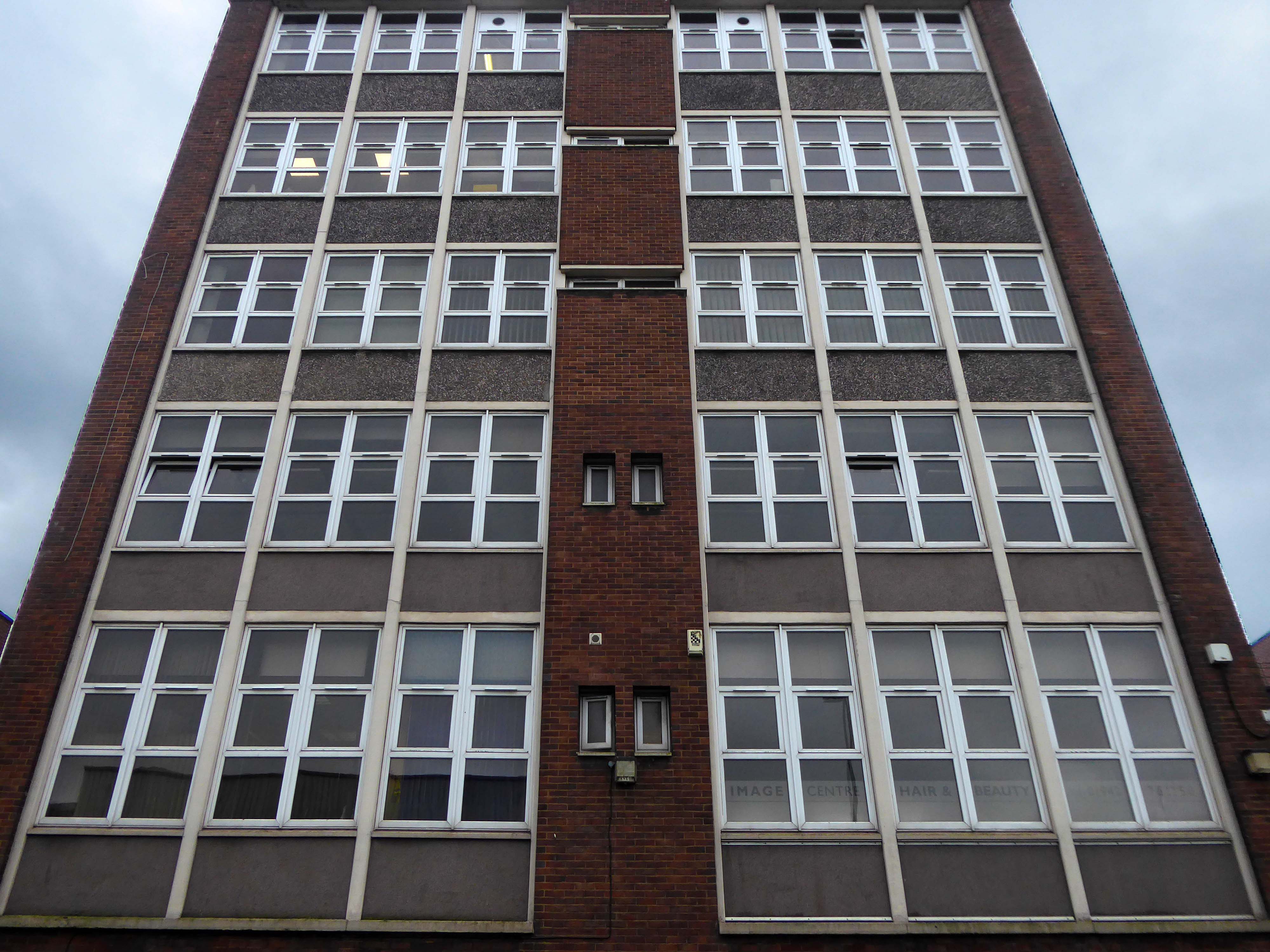
The development integrated playgrounds, schools, shops and pubs into the scheme.
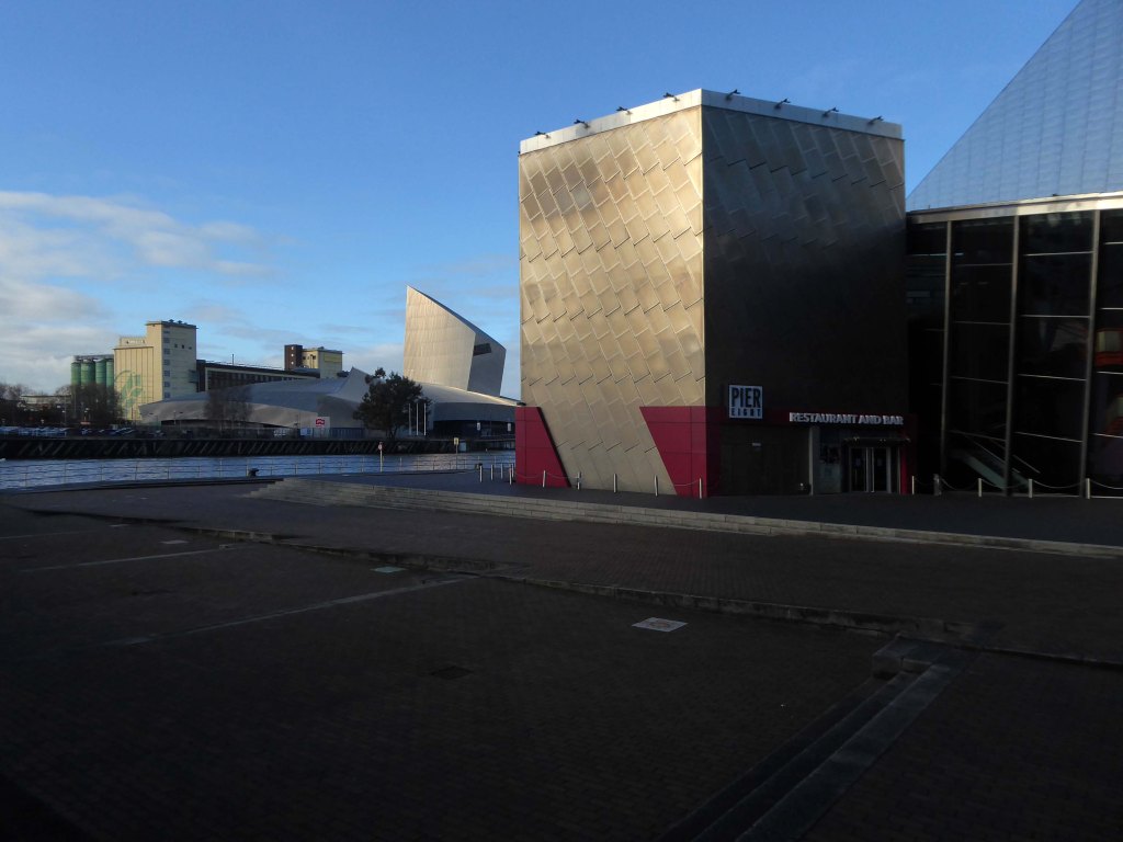
Riba Pix
Picture Sheffield
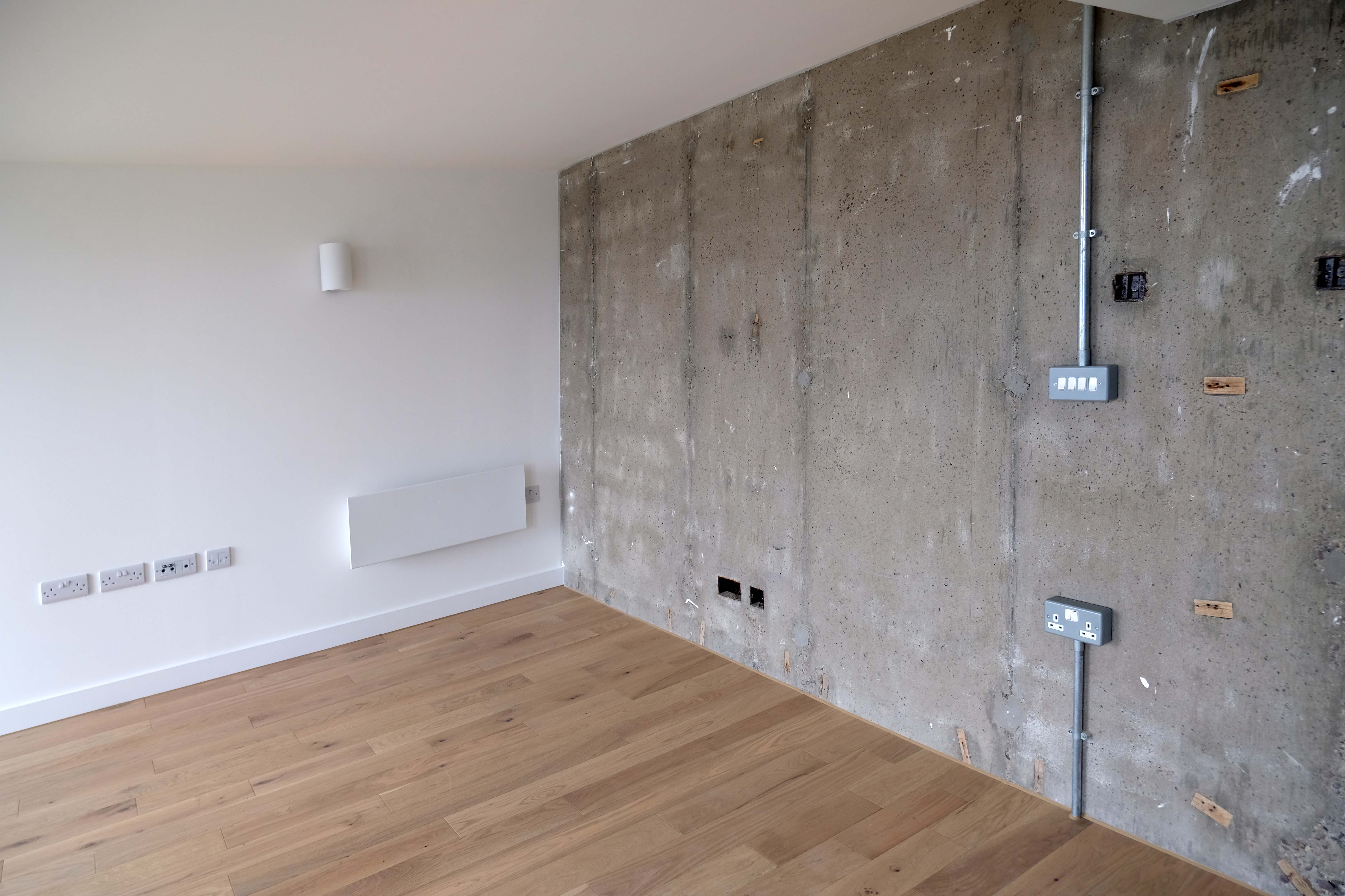
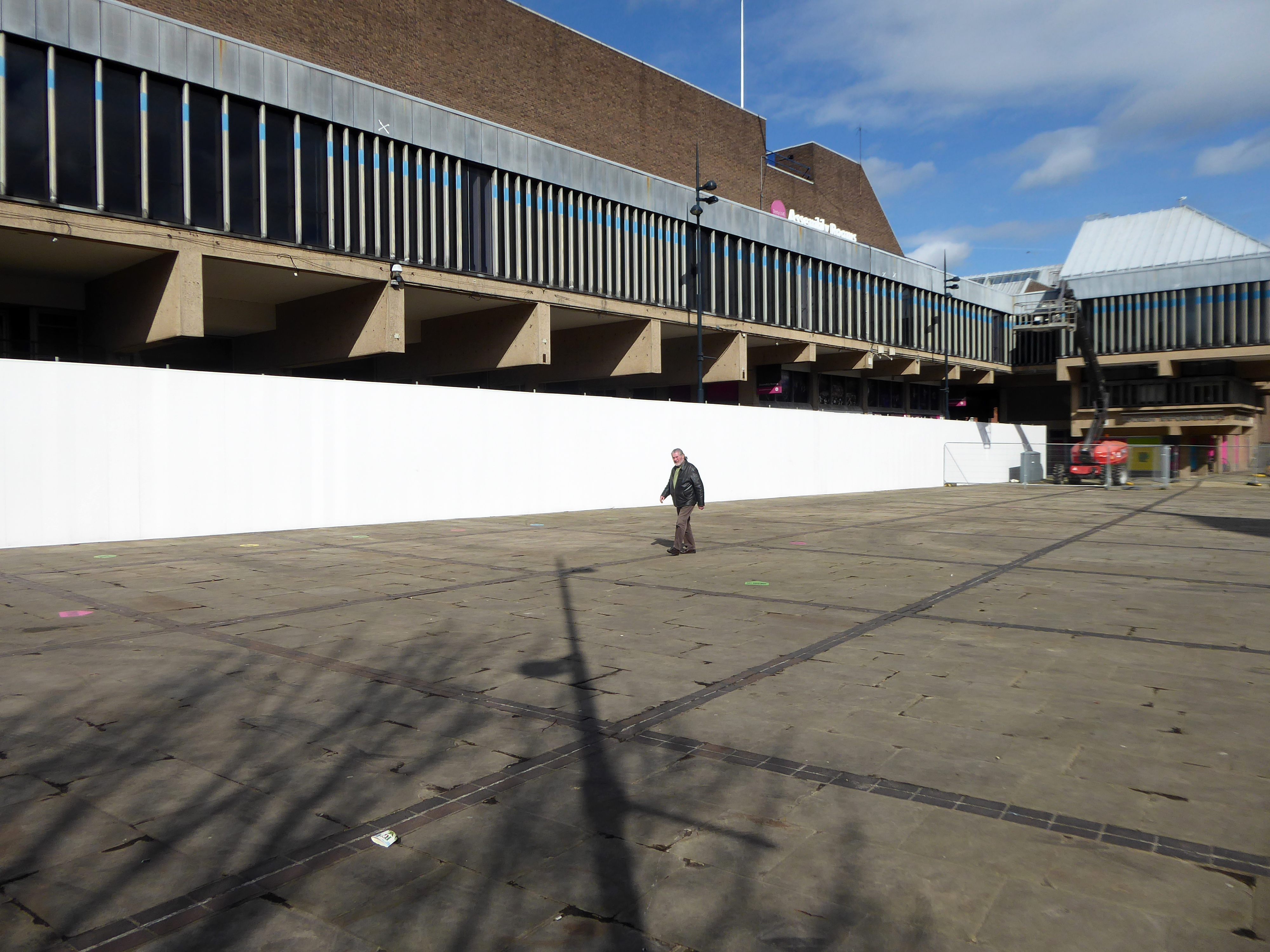
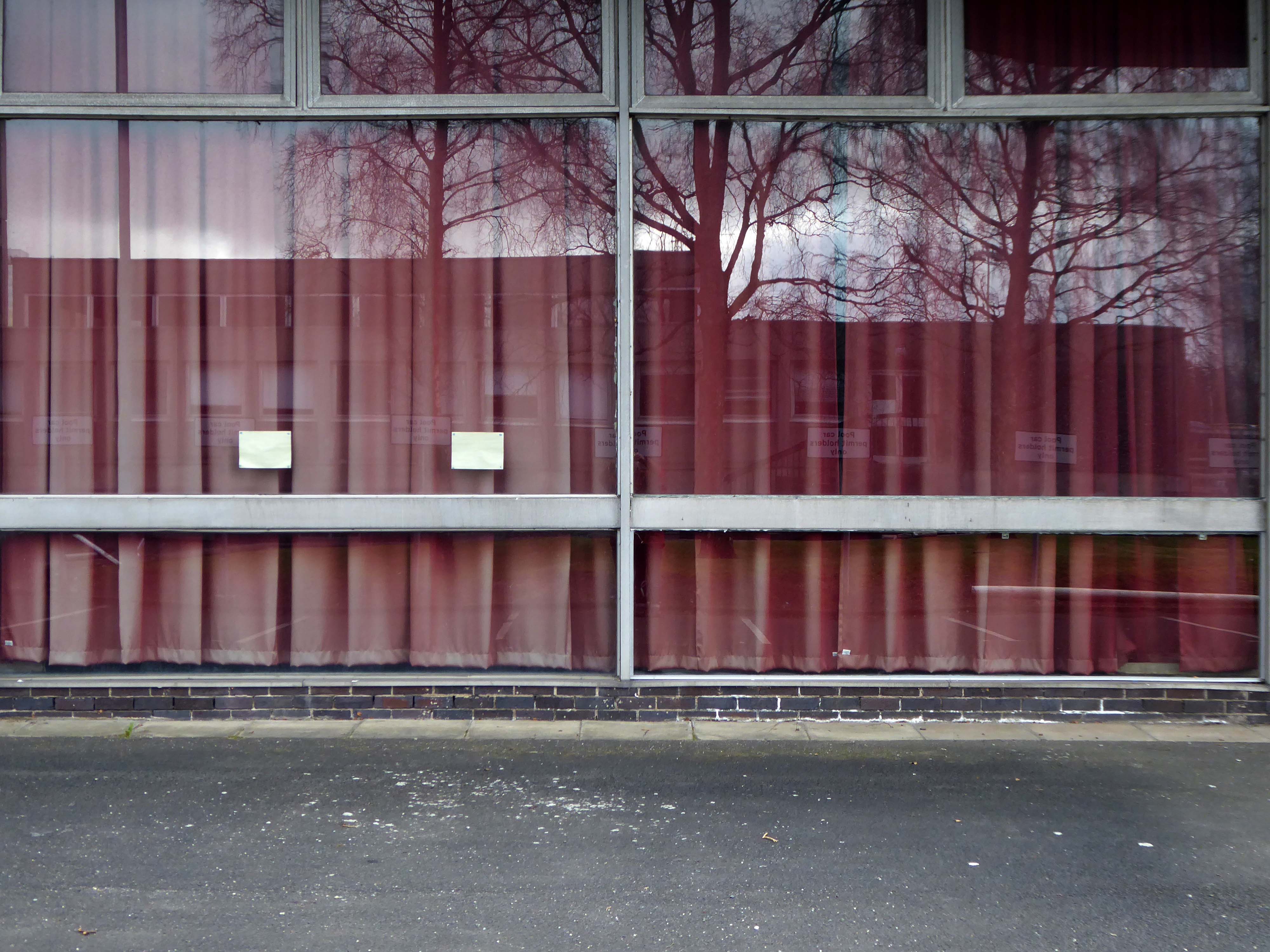
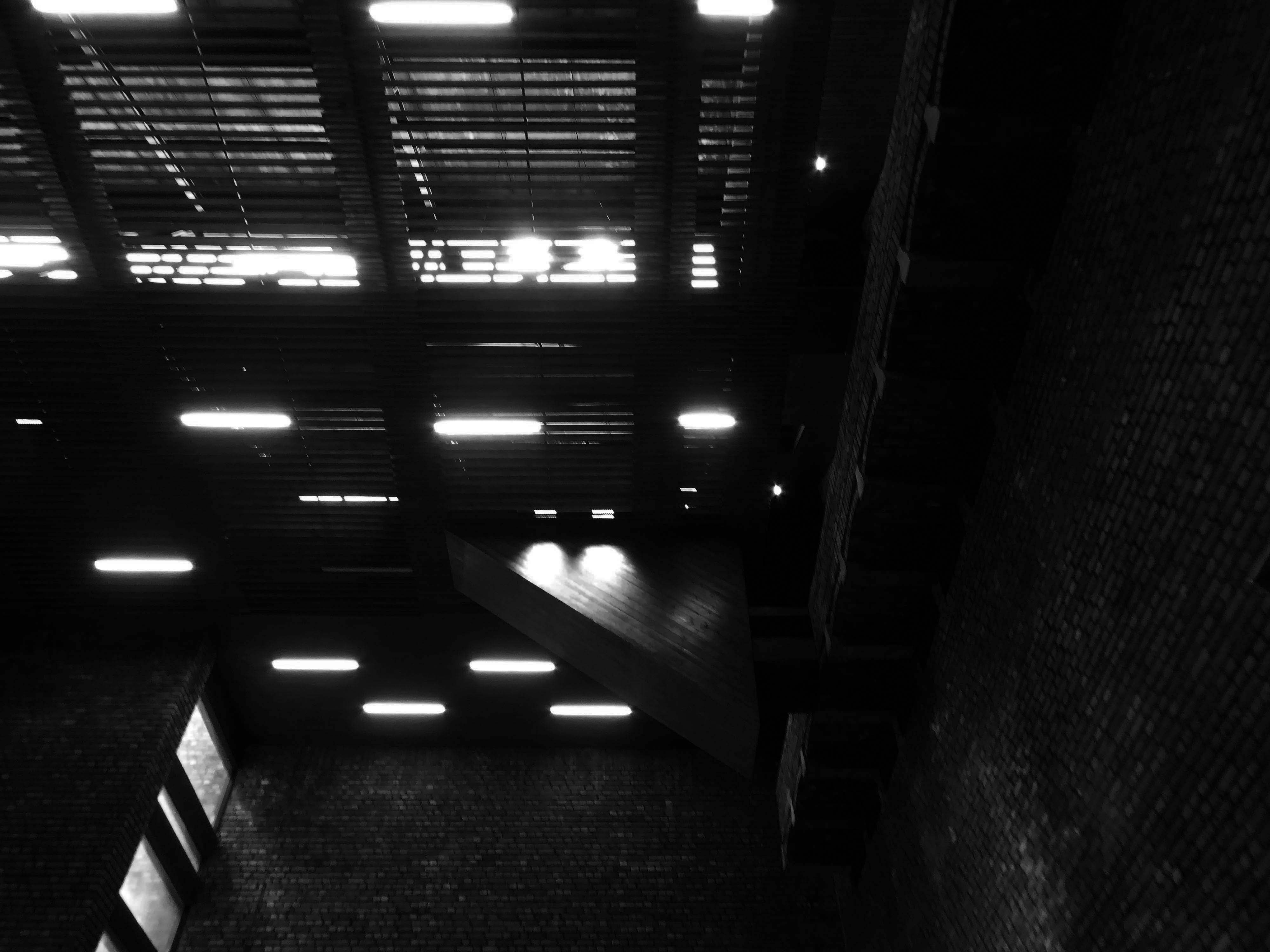
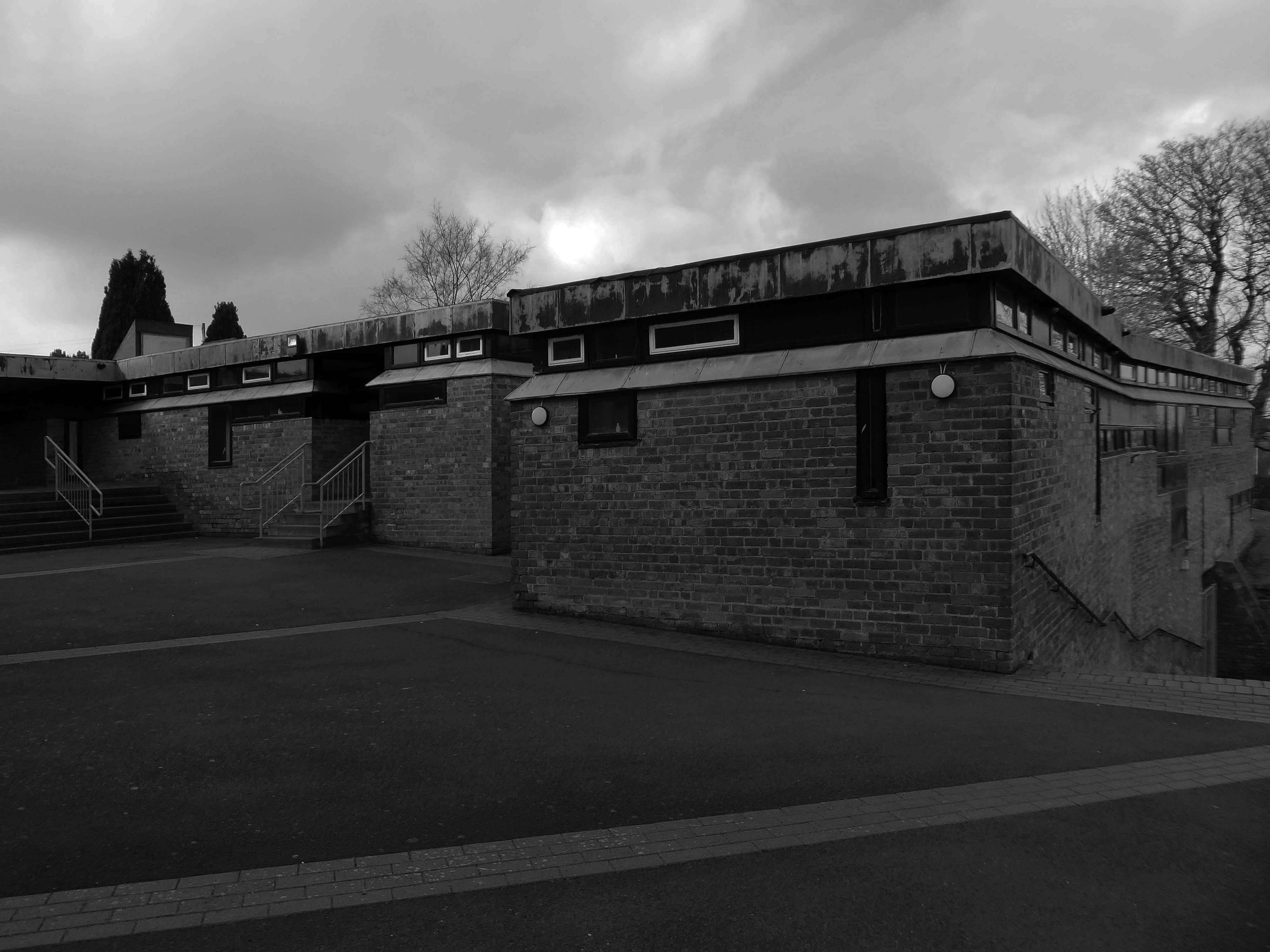
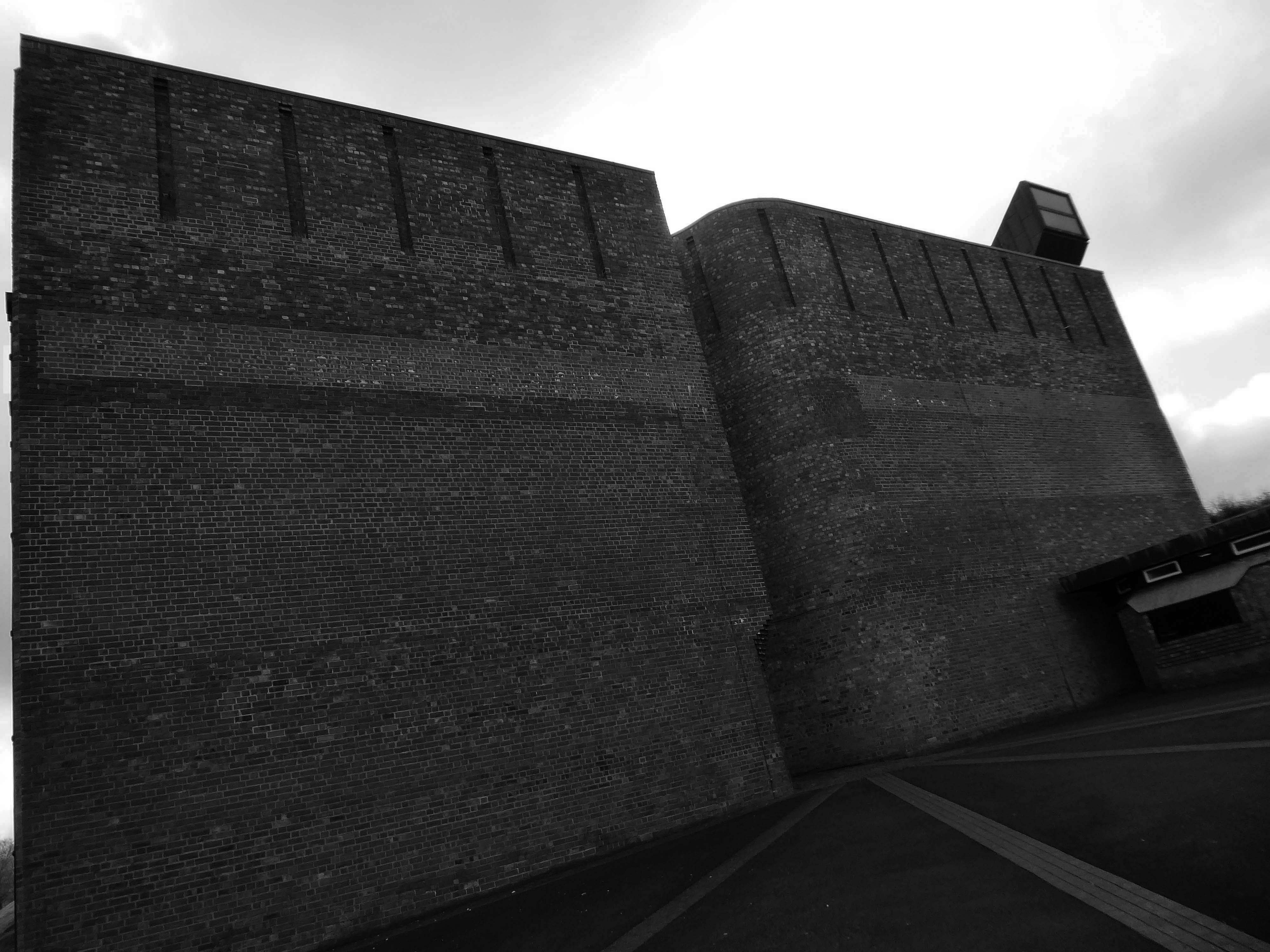
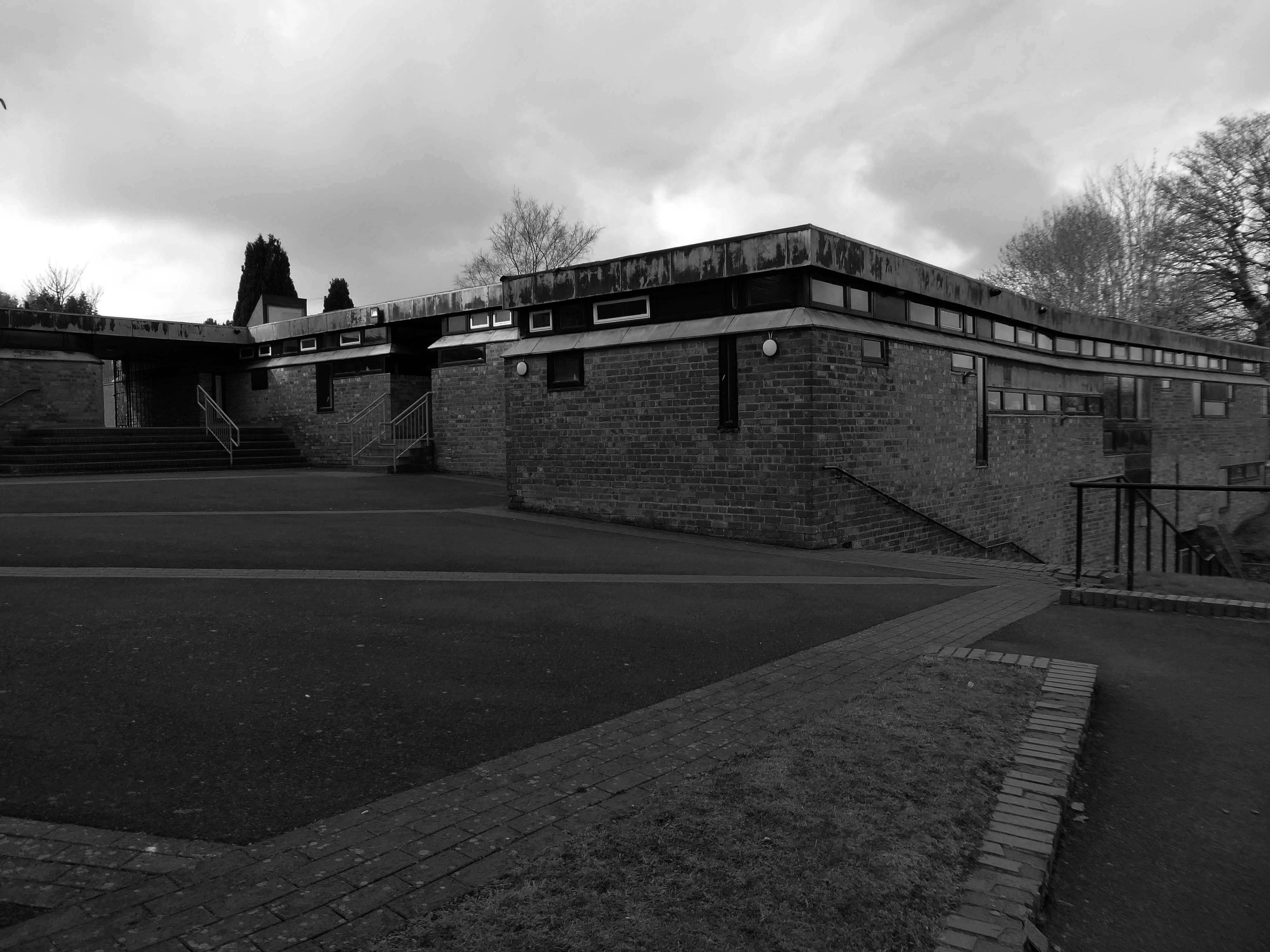
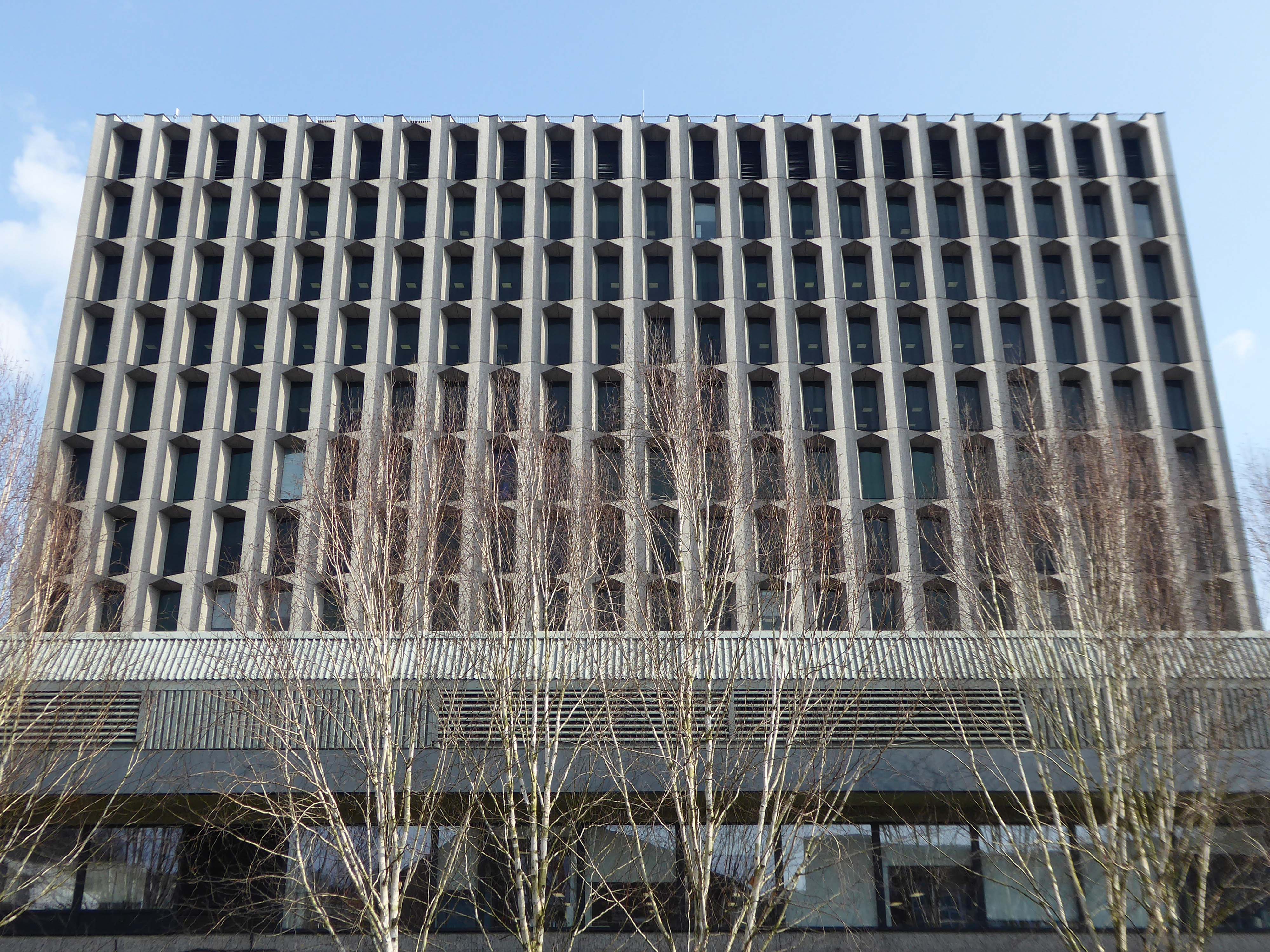
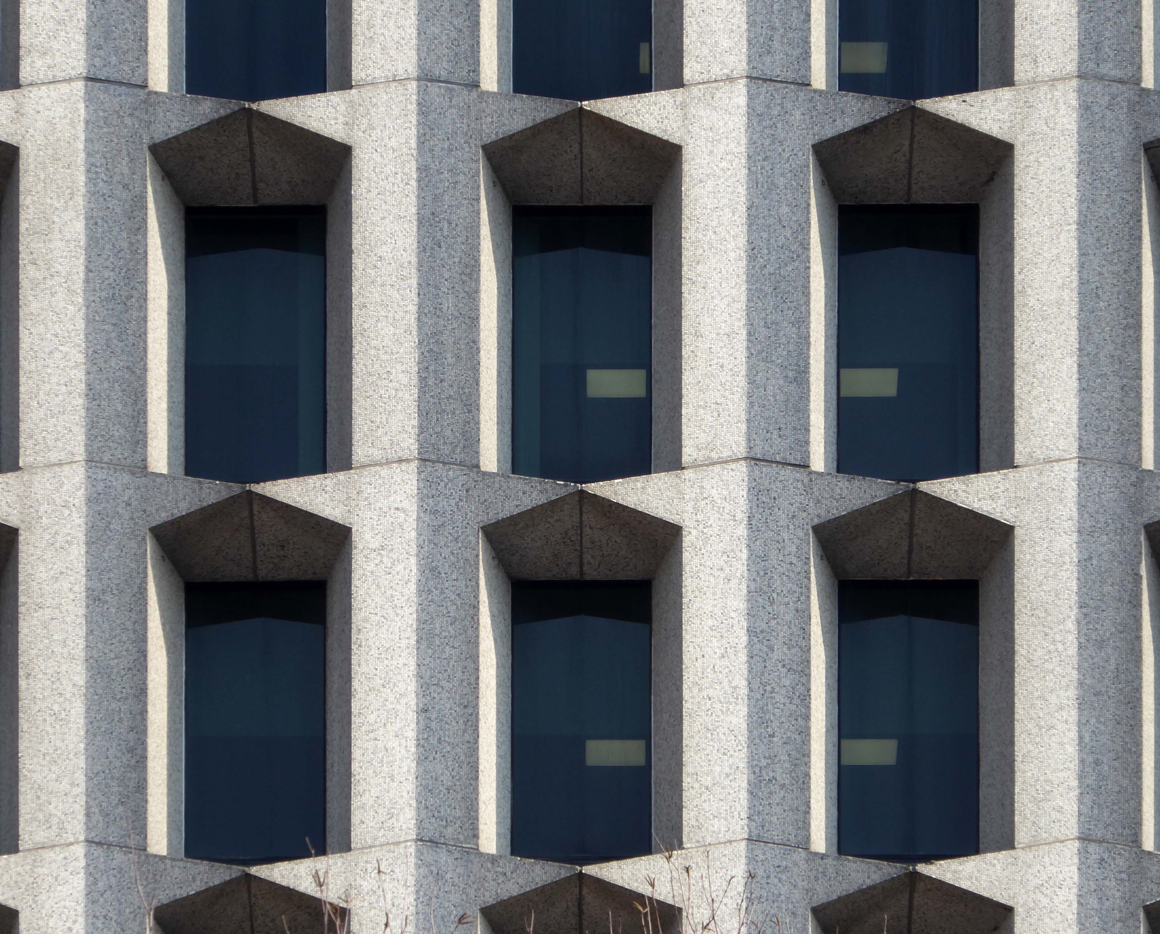
Government restrictions on how potential tenants were allocated to flats, the limitations of the building’s fabric which decayed when not maintained, poor noise insulation and issues with resident security caused their popularity to wane. For many years, the council found it difficult to find tenants for the flats.
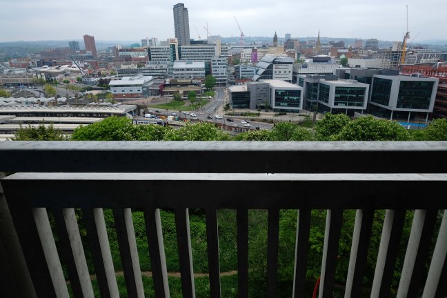
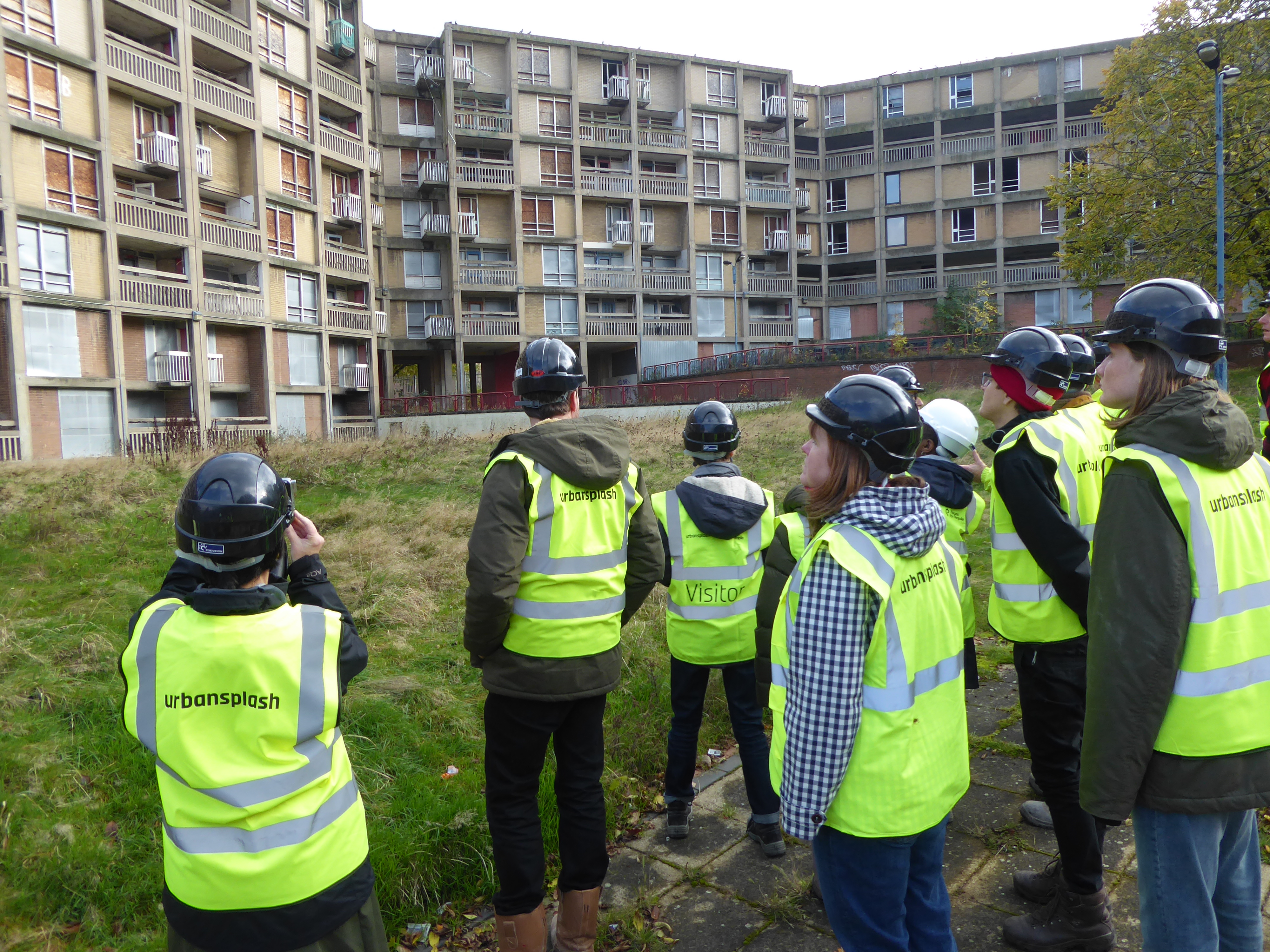
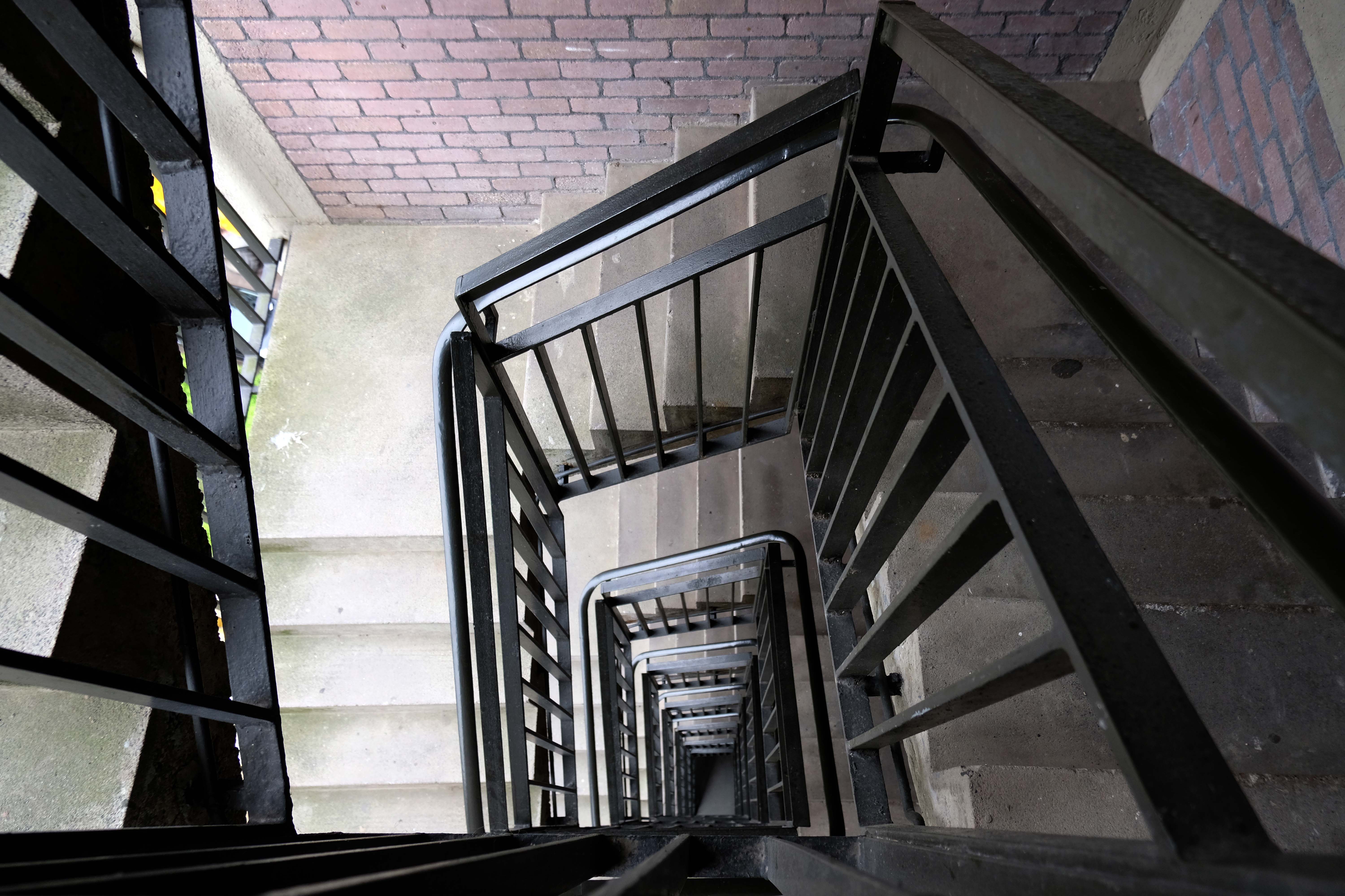
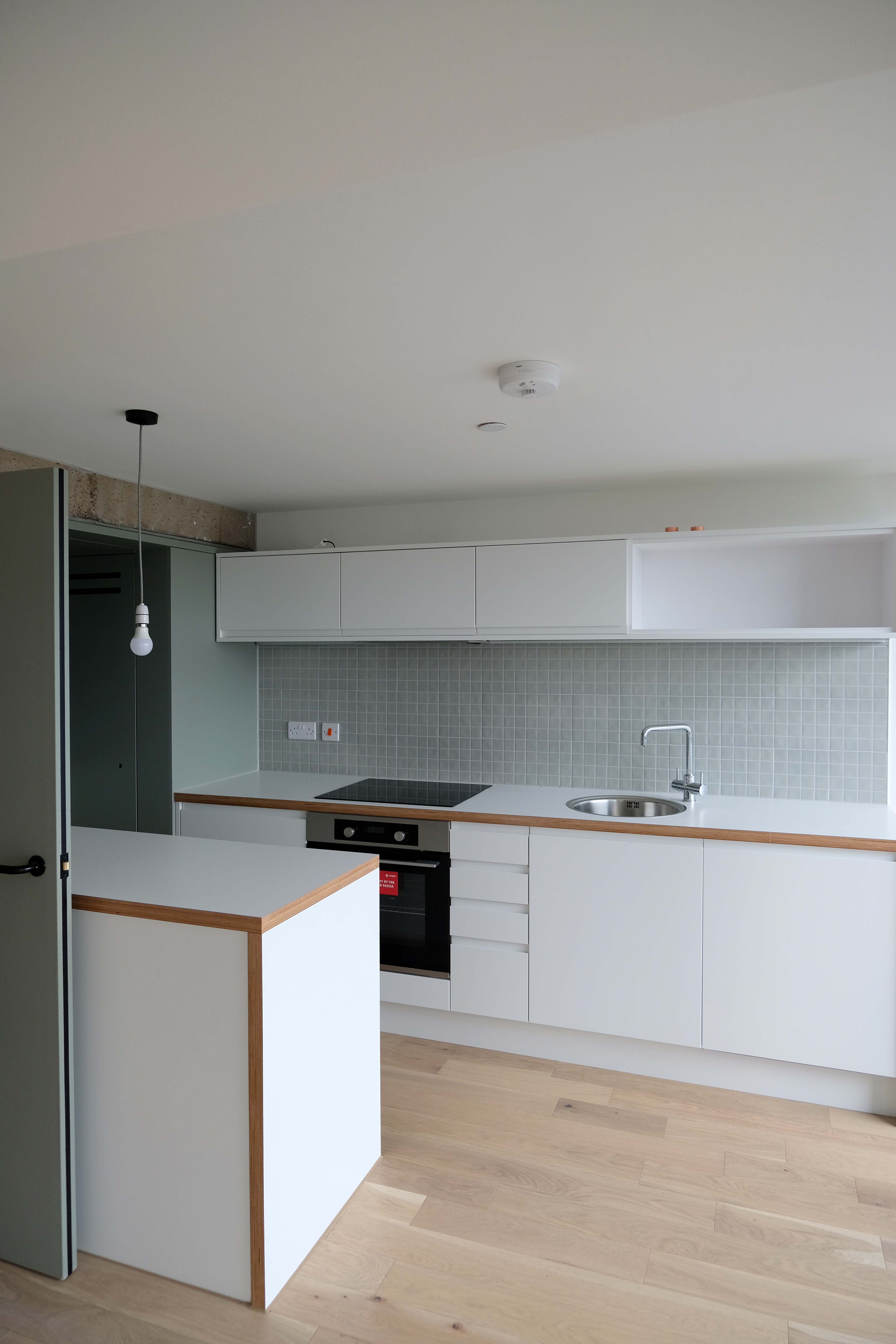
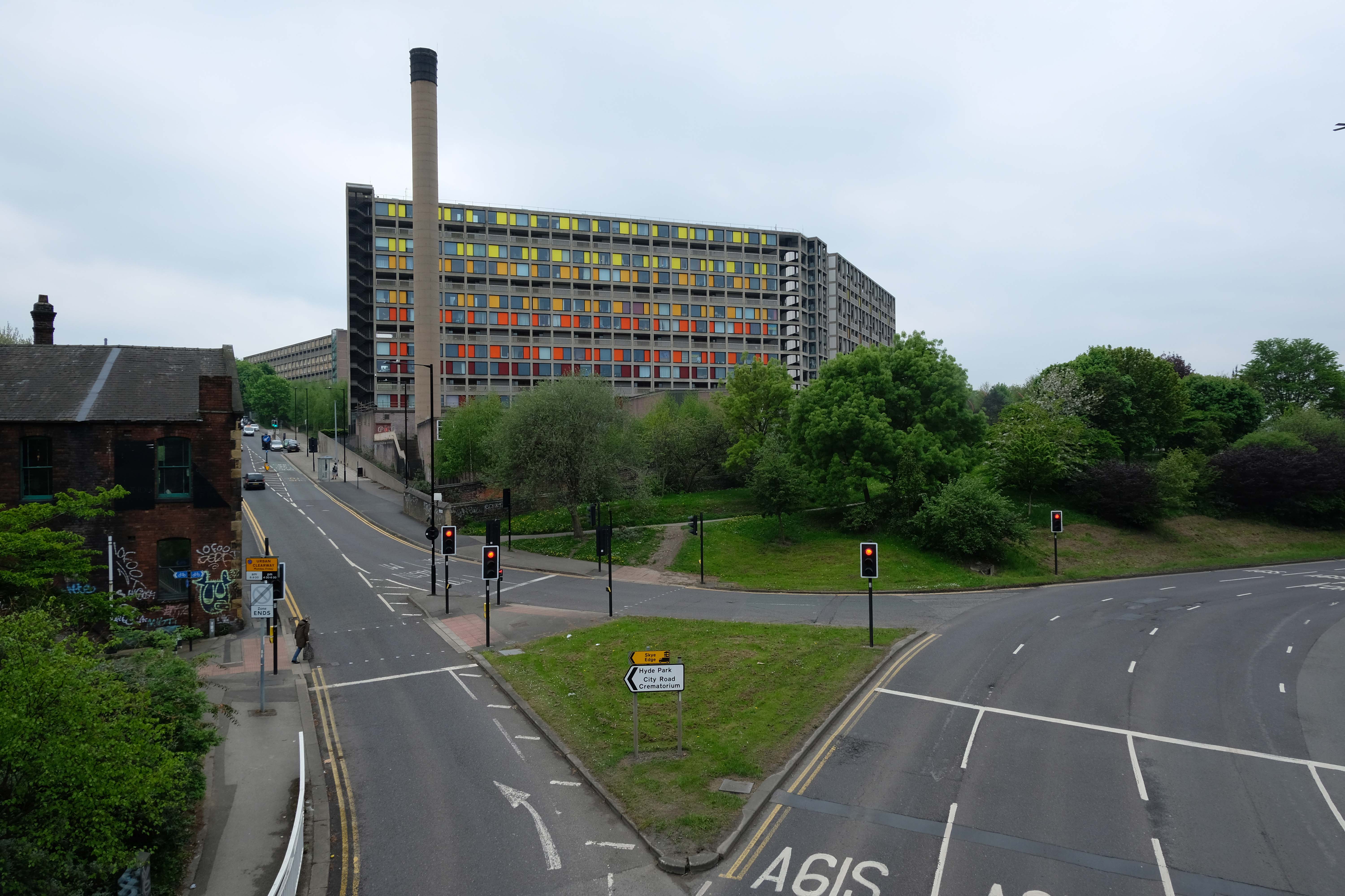
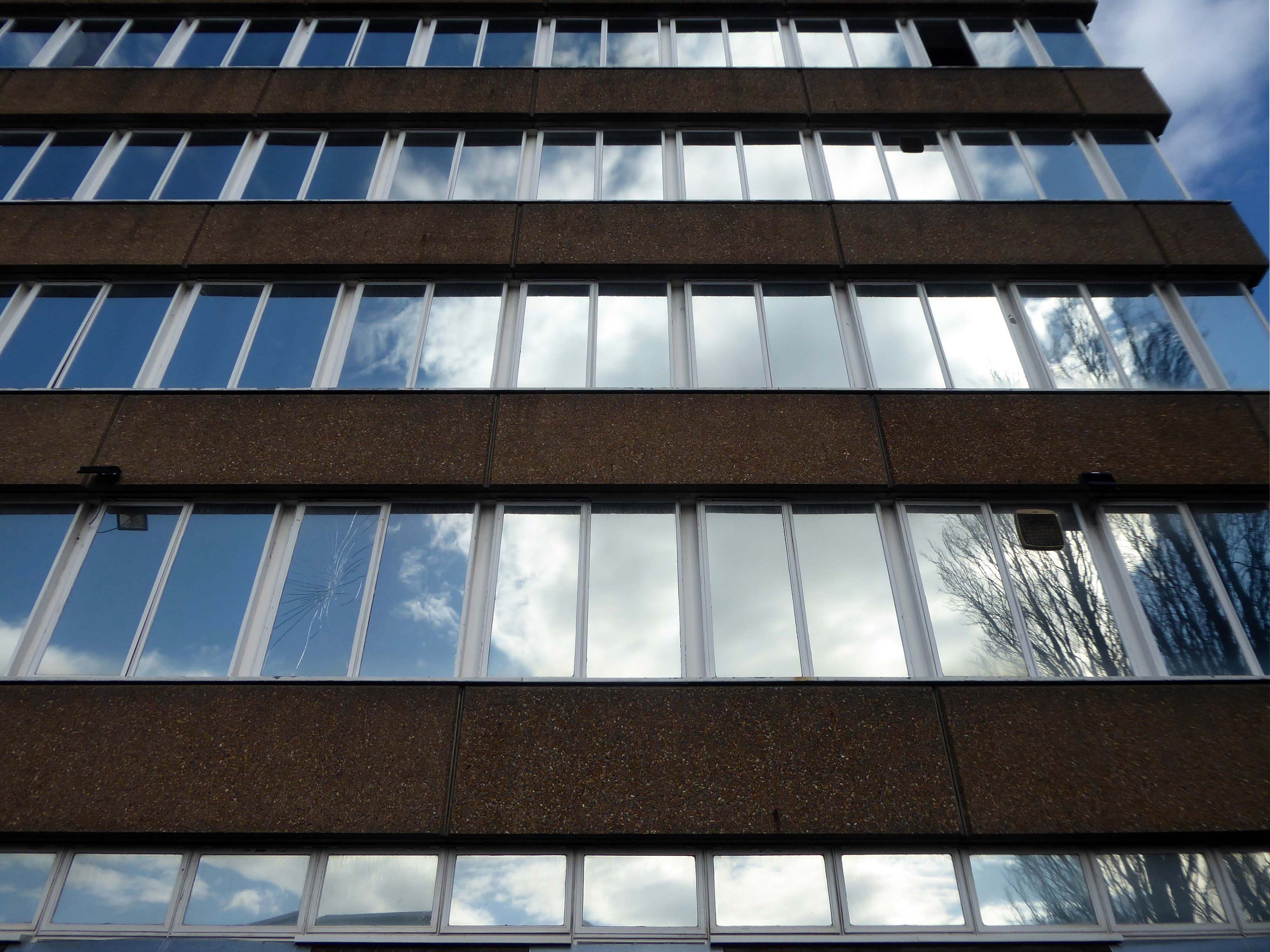
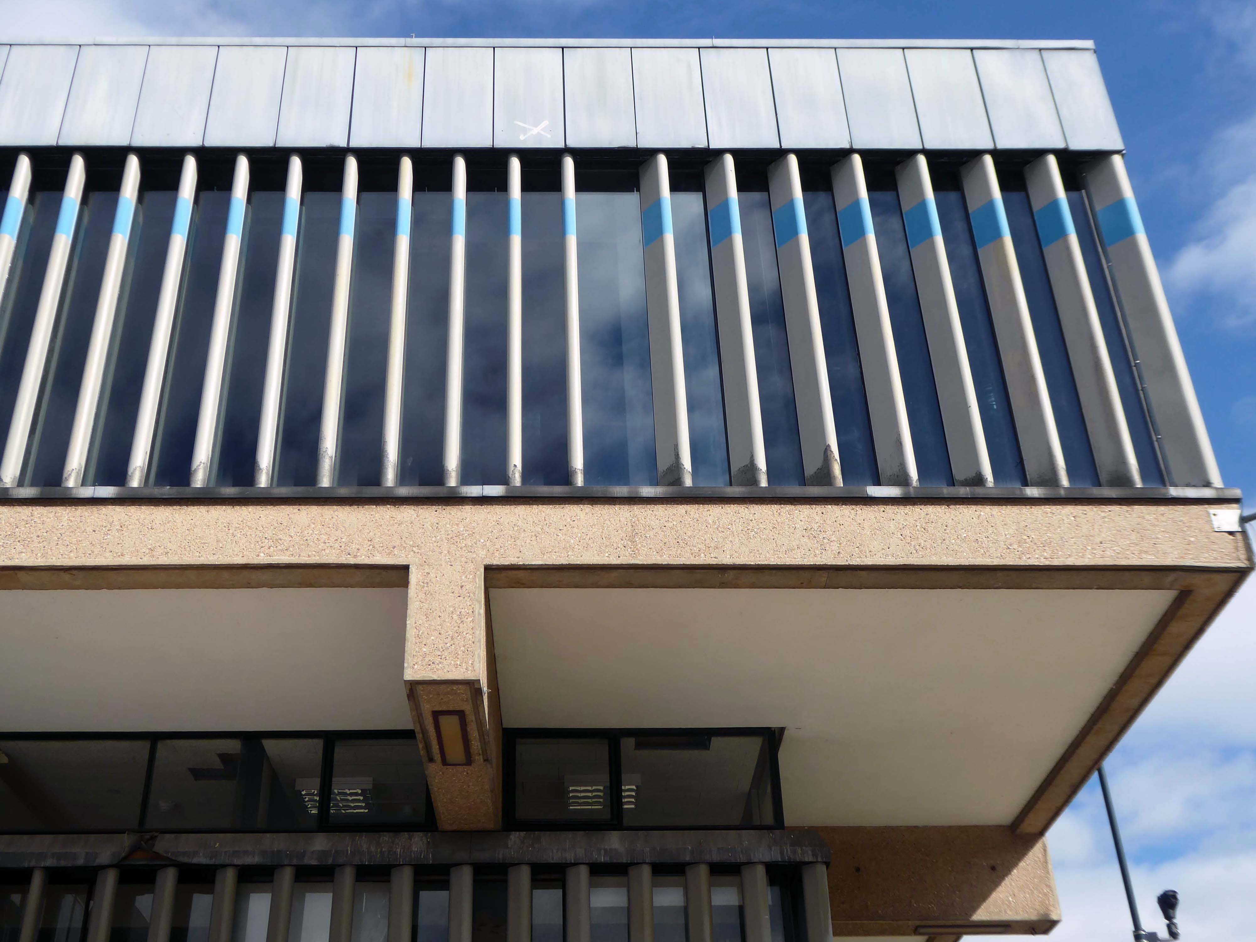
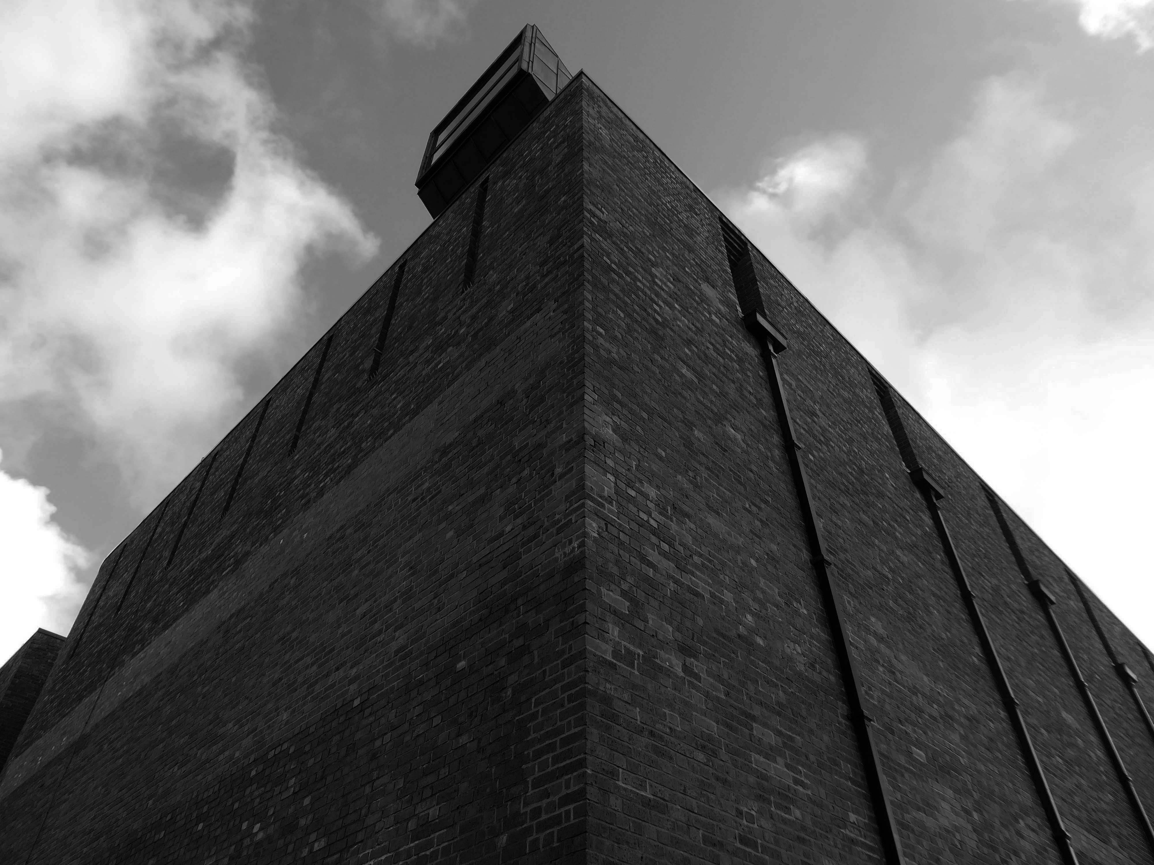
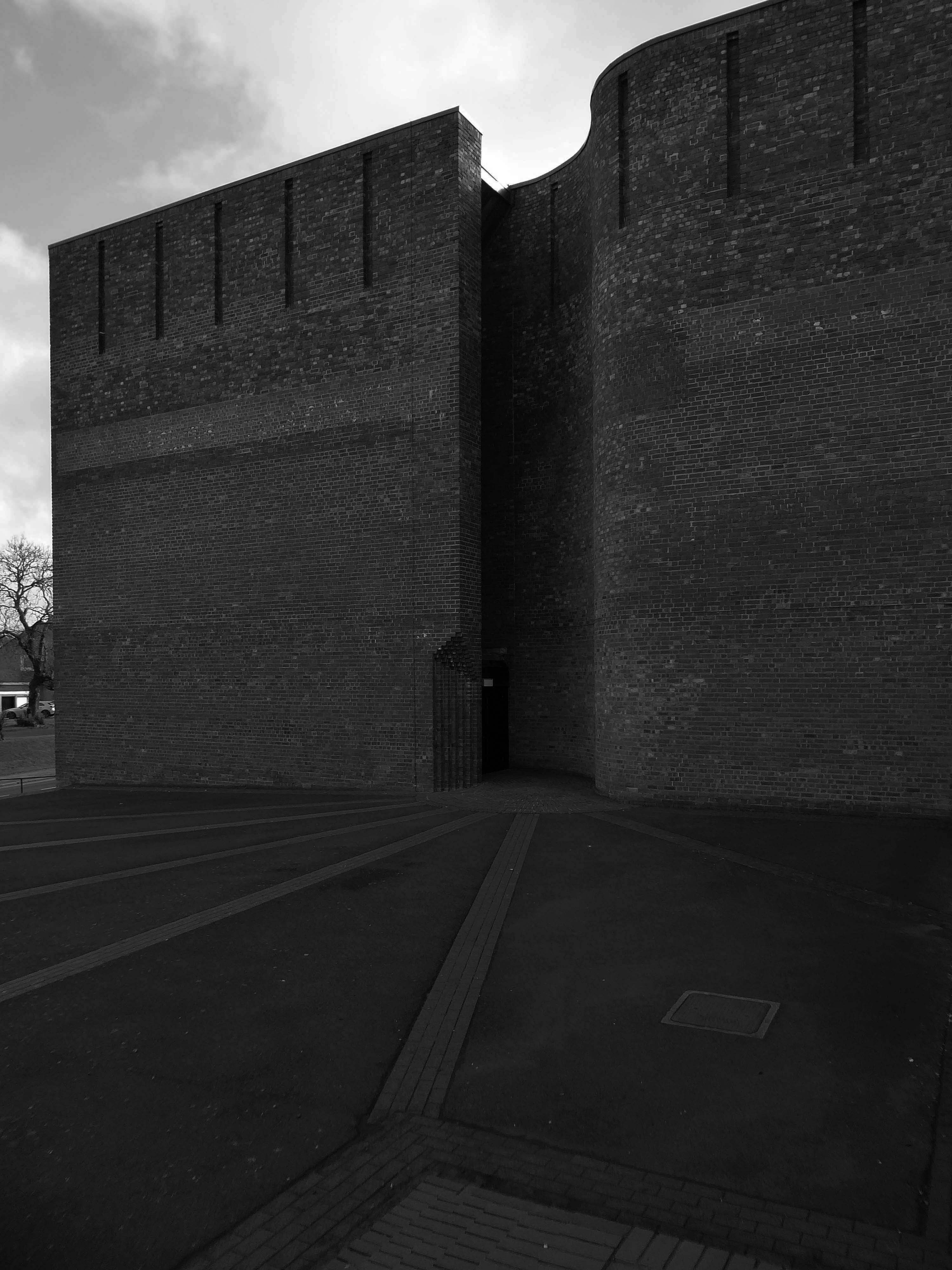
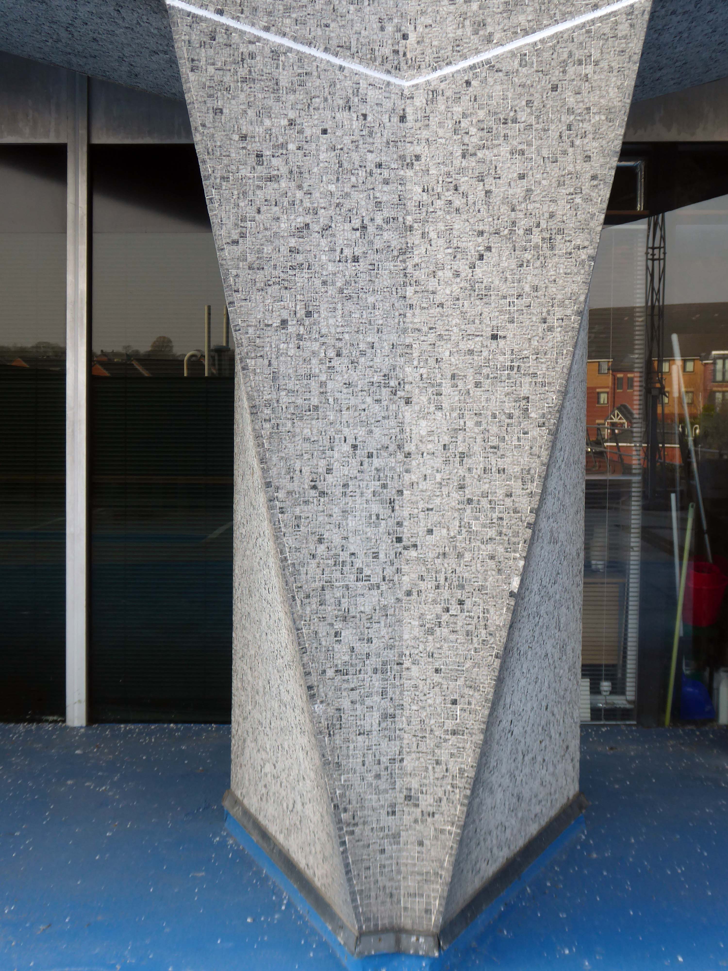
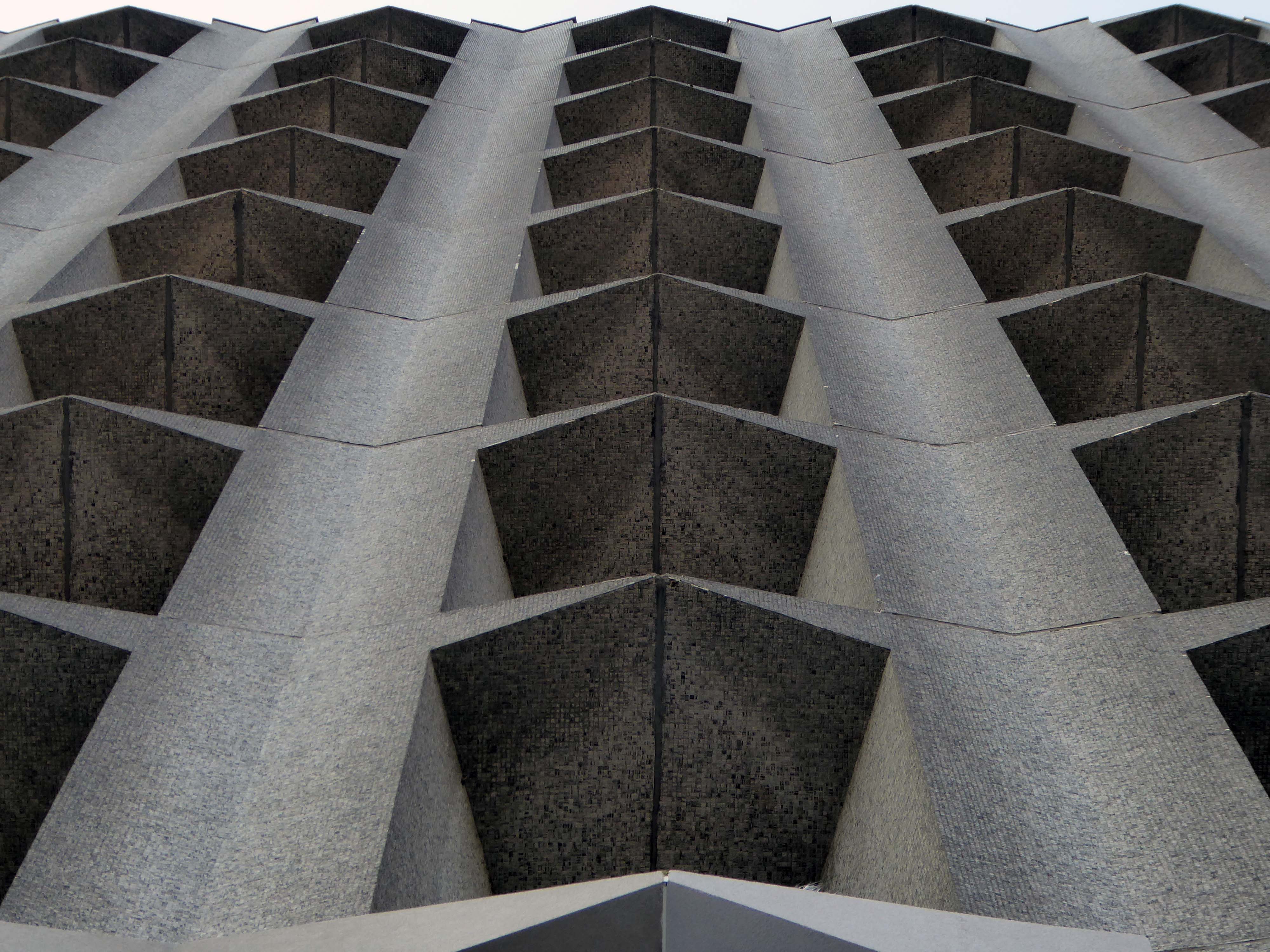
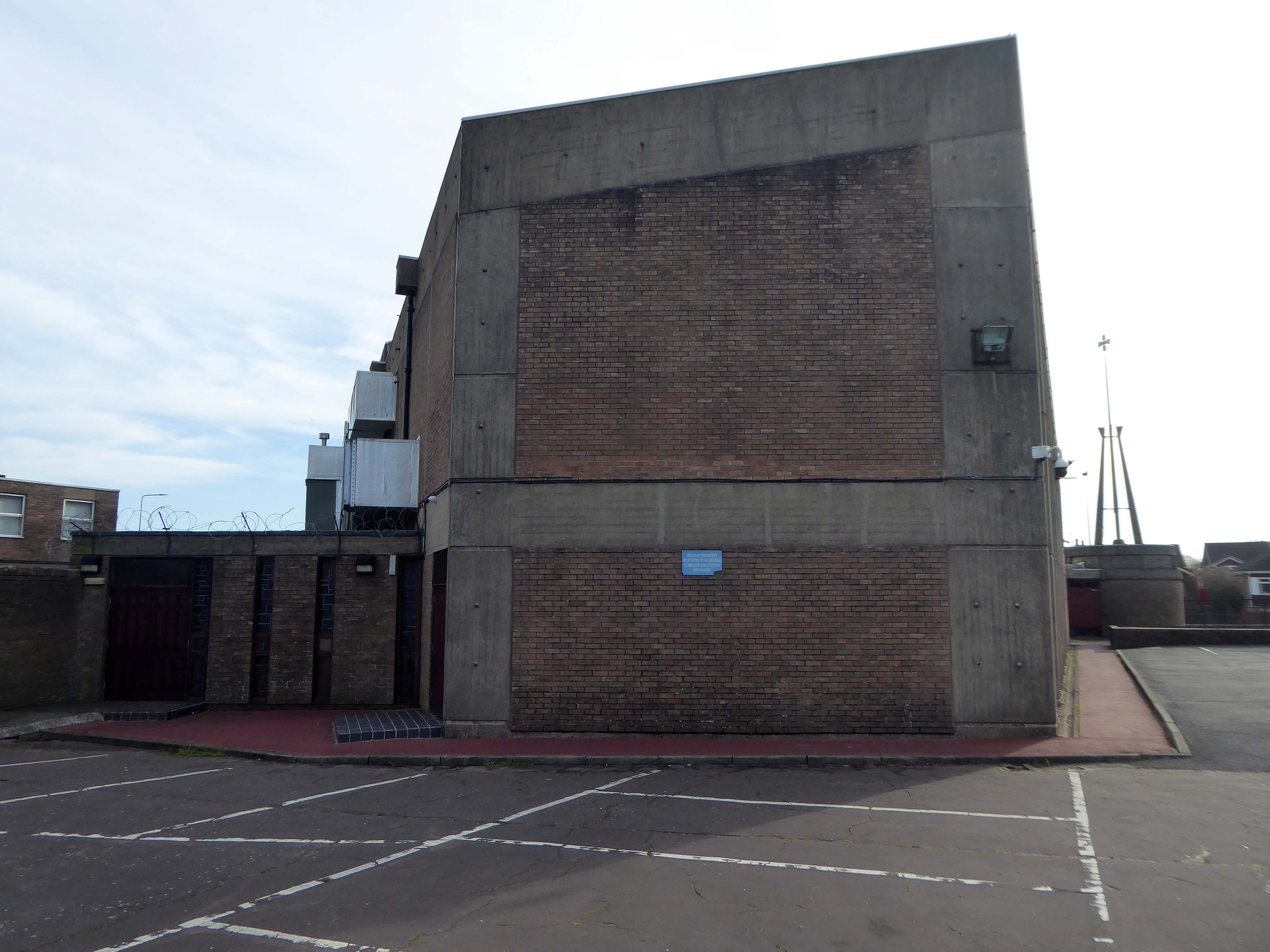
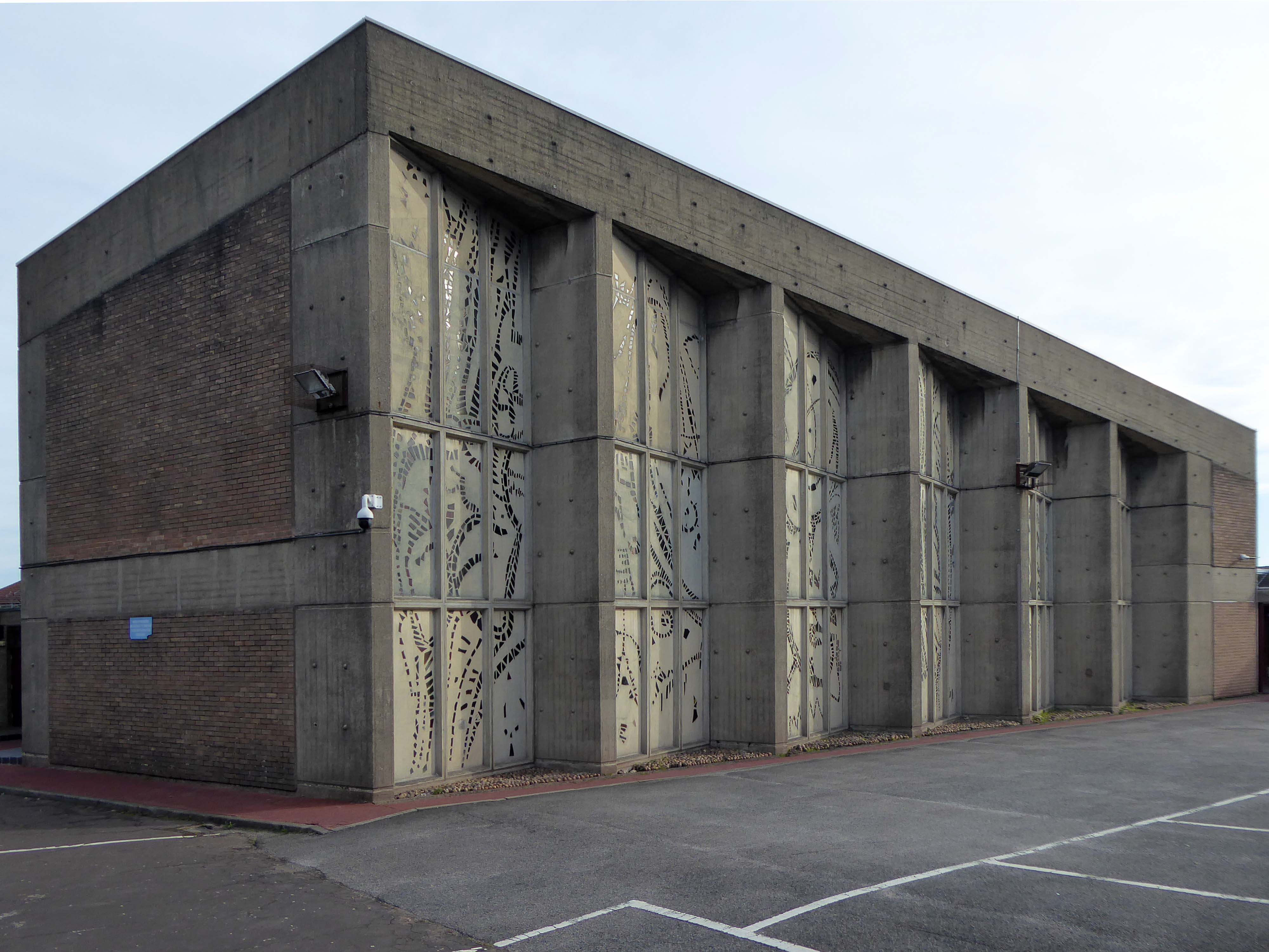
Despite the problems, the complex remained structurally sound, it was controversially Grade II* listed in 1998 – making it the largest listed building in Europe. A part-privatisation scheme by the developer Urban Splash in partnership with English Heritage to turn the flats into upmarket apartments, business units and social housing is now underway.
I first visited the then almost uninhabited site some years ago – meeting the handful of remaining residents.
Mark – “Why are all these photographers coming here from Manchester?”
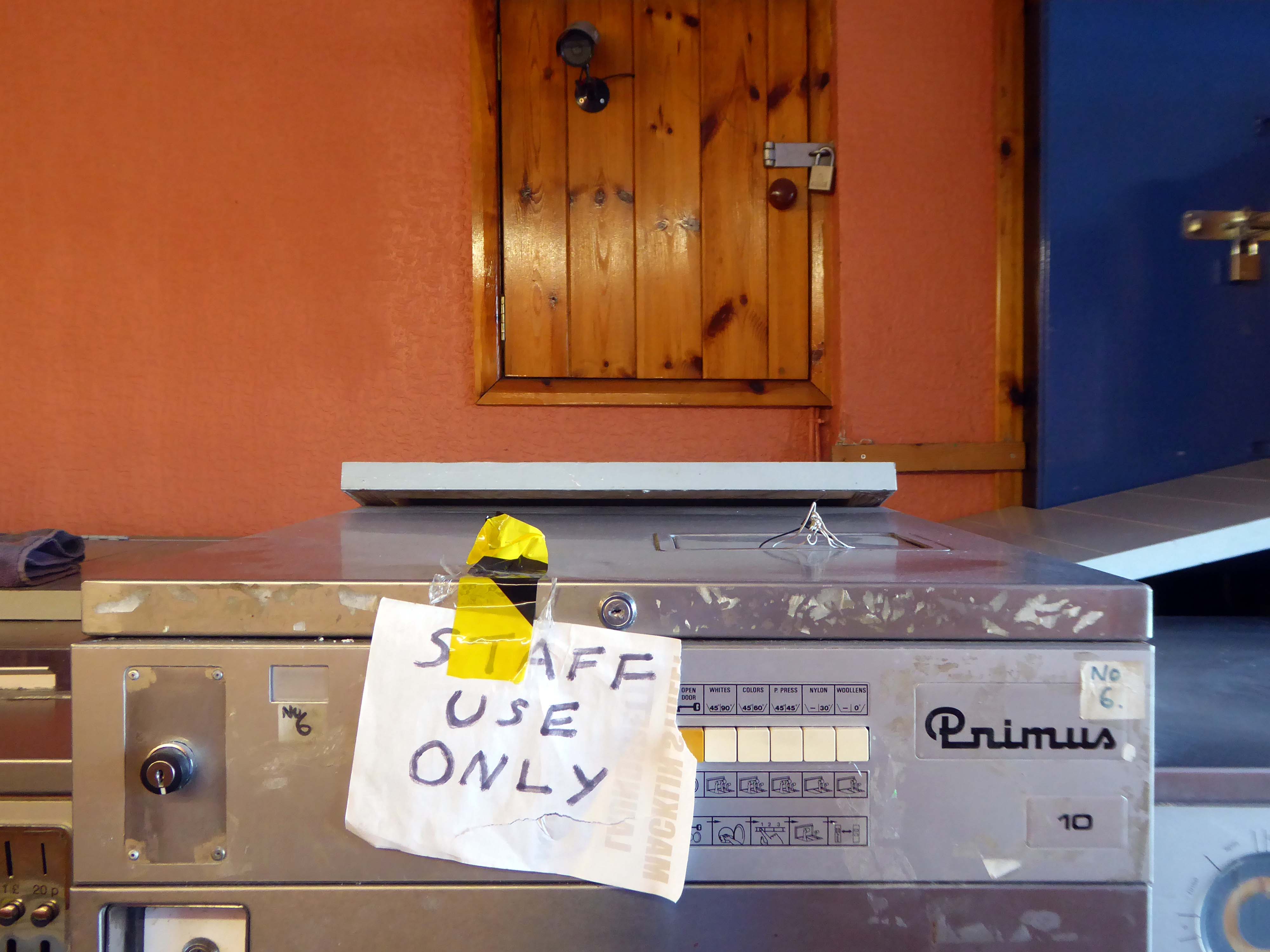
Chatted with Billy the lone cleaner.
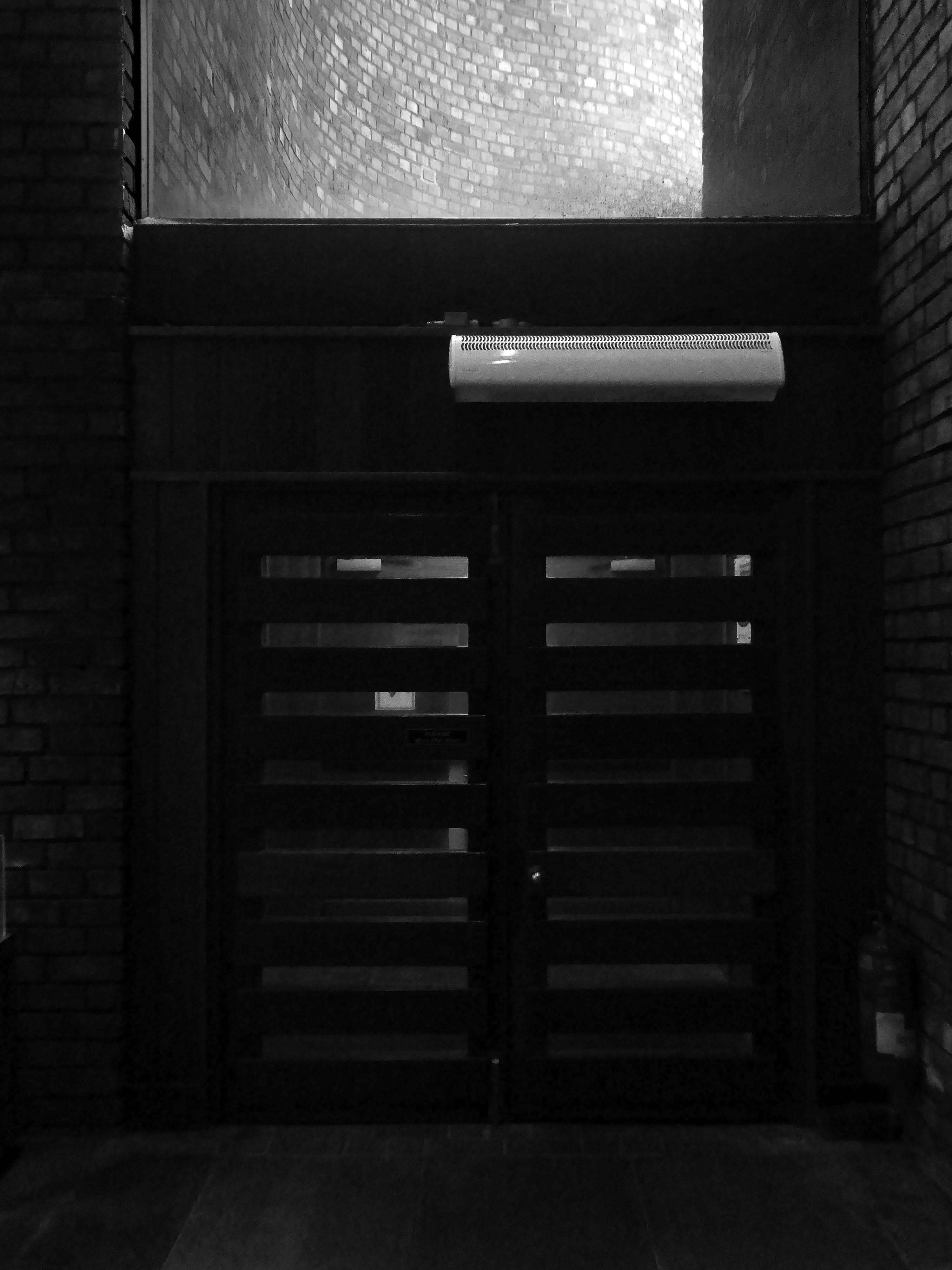
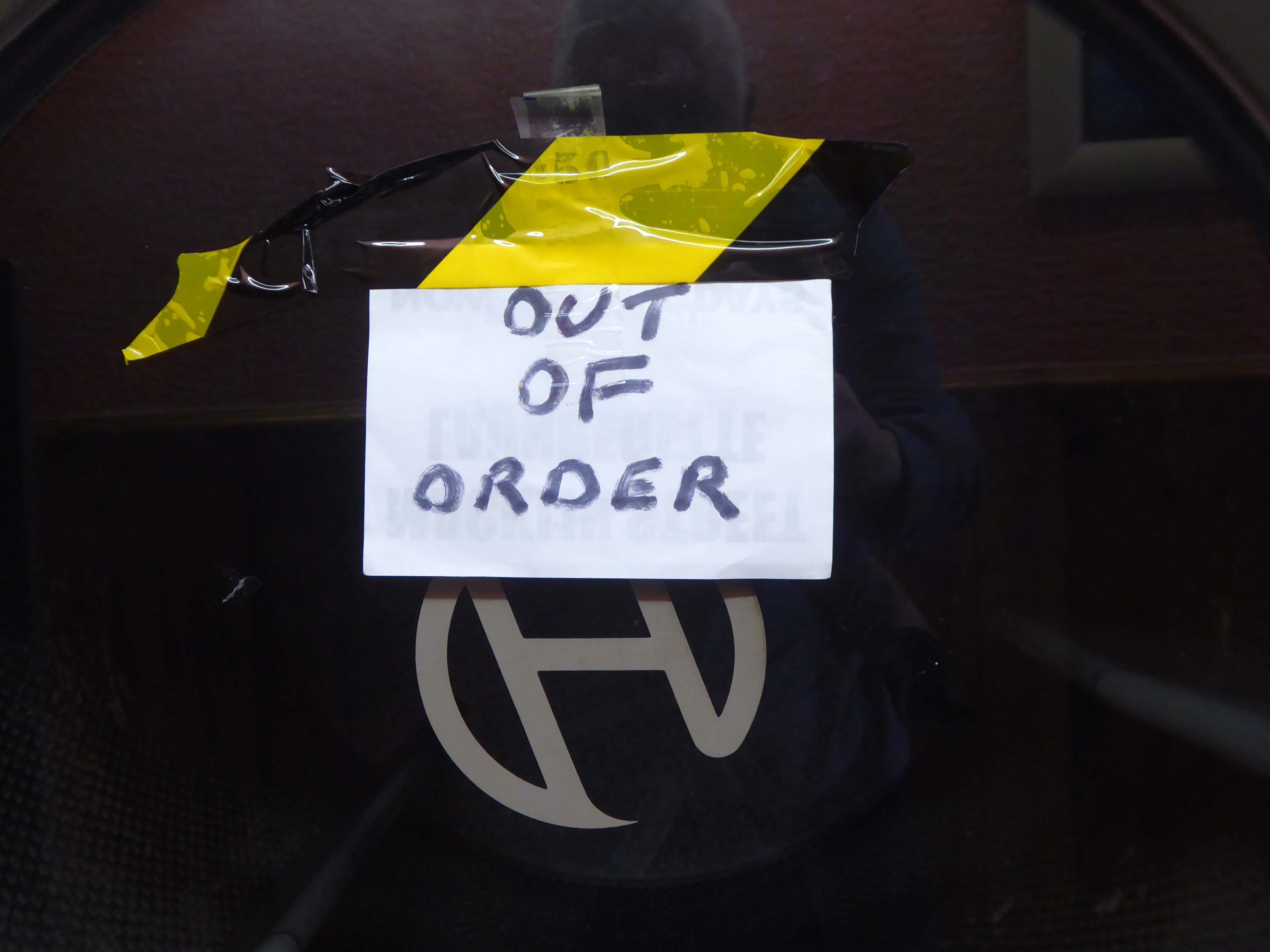
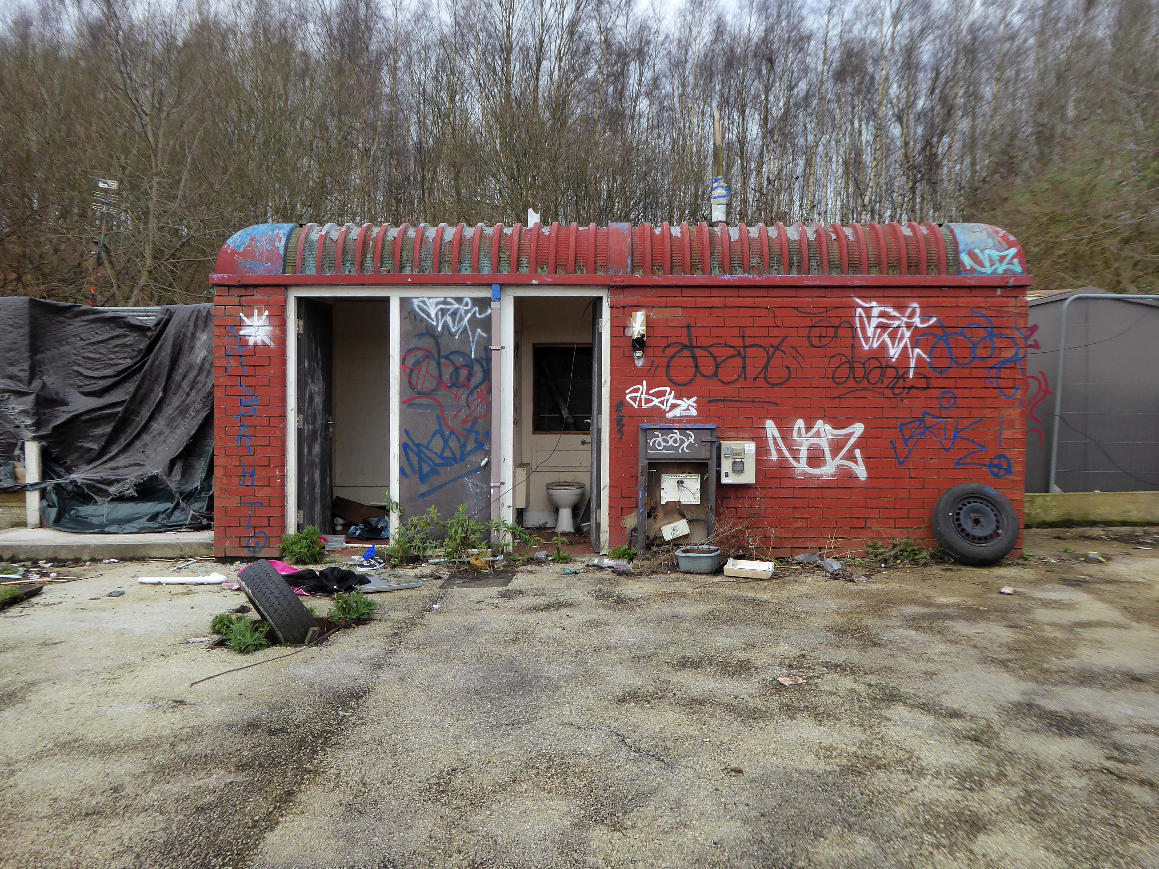
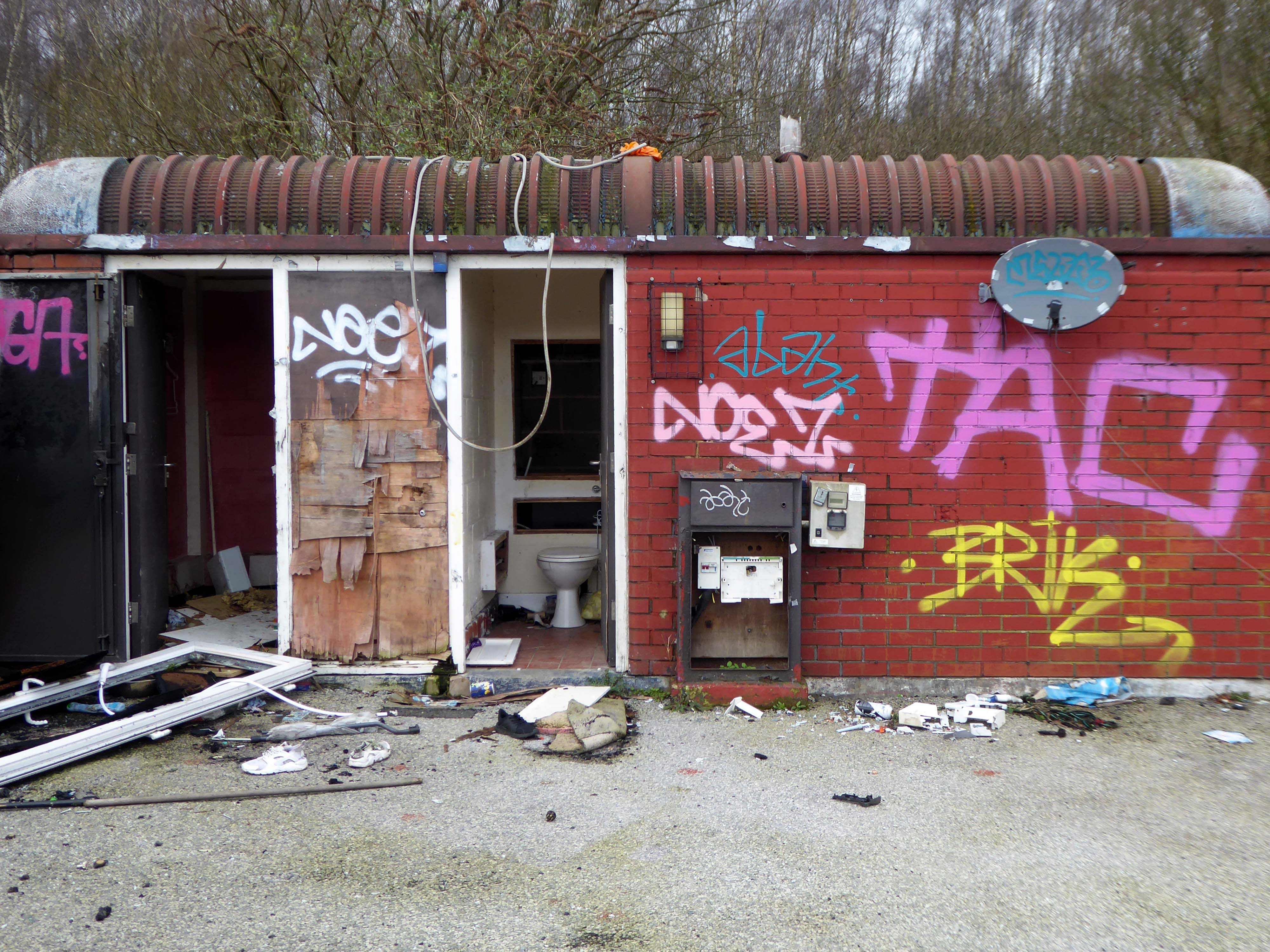
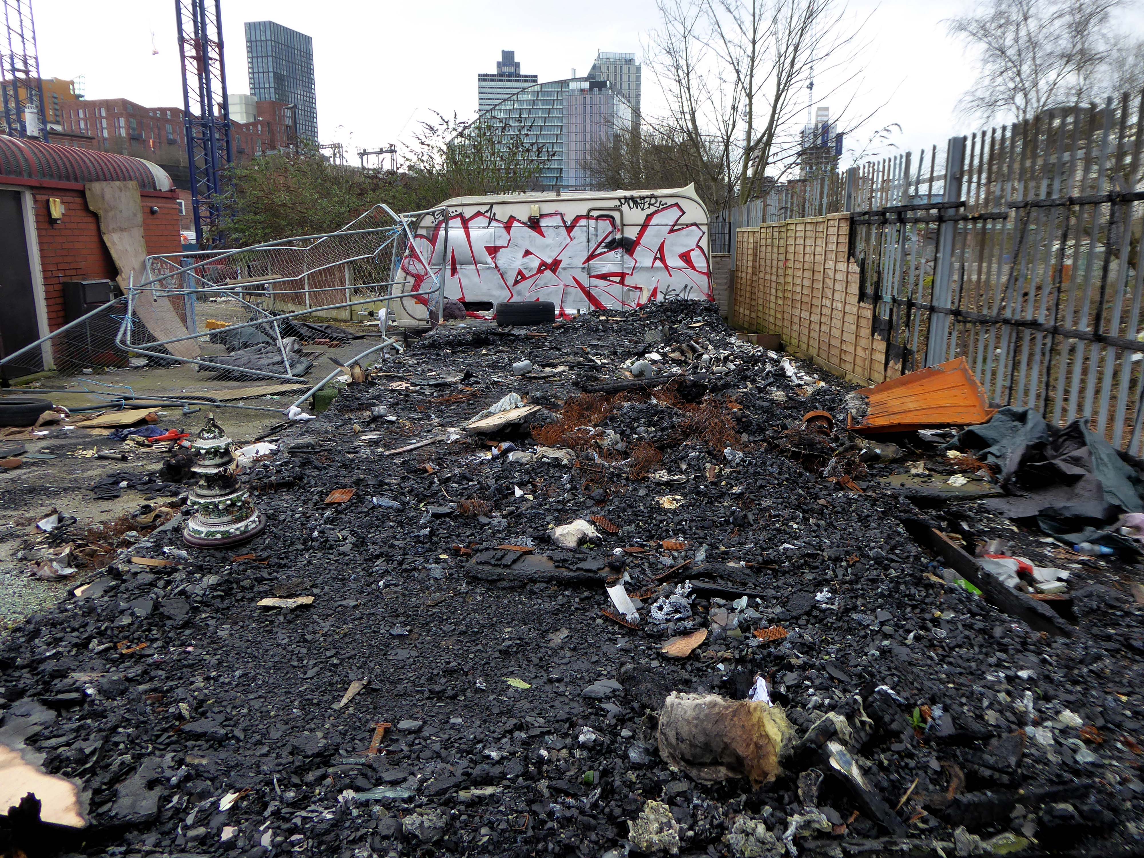
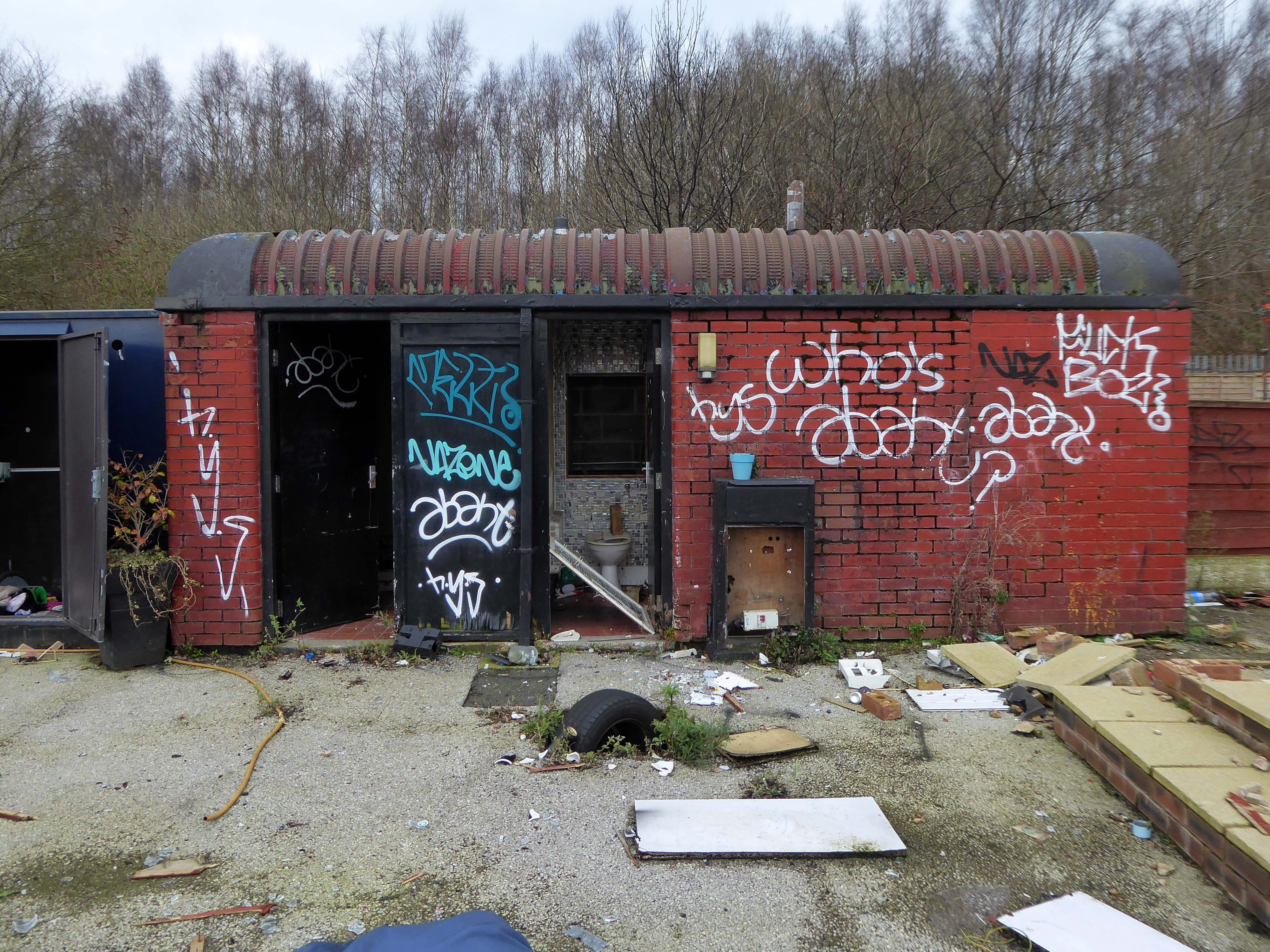
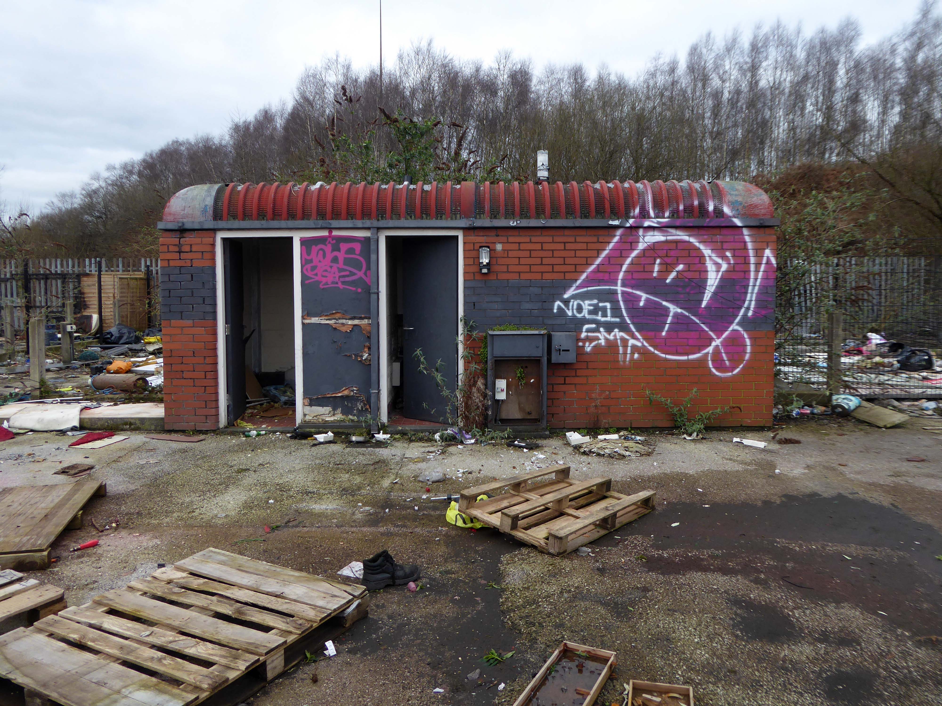
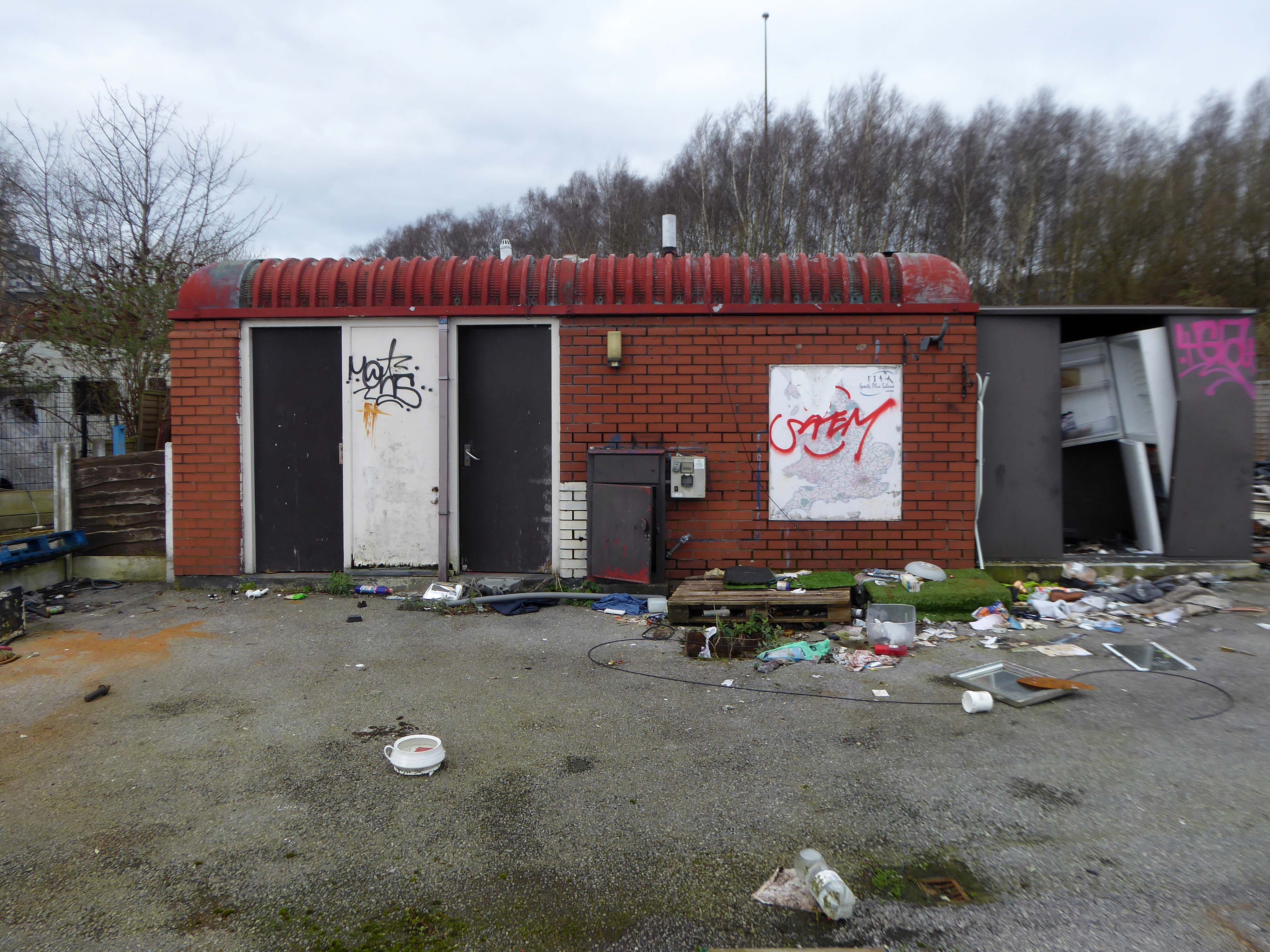
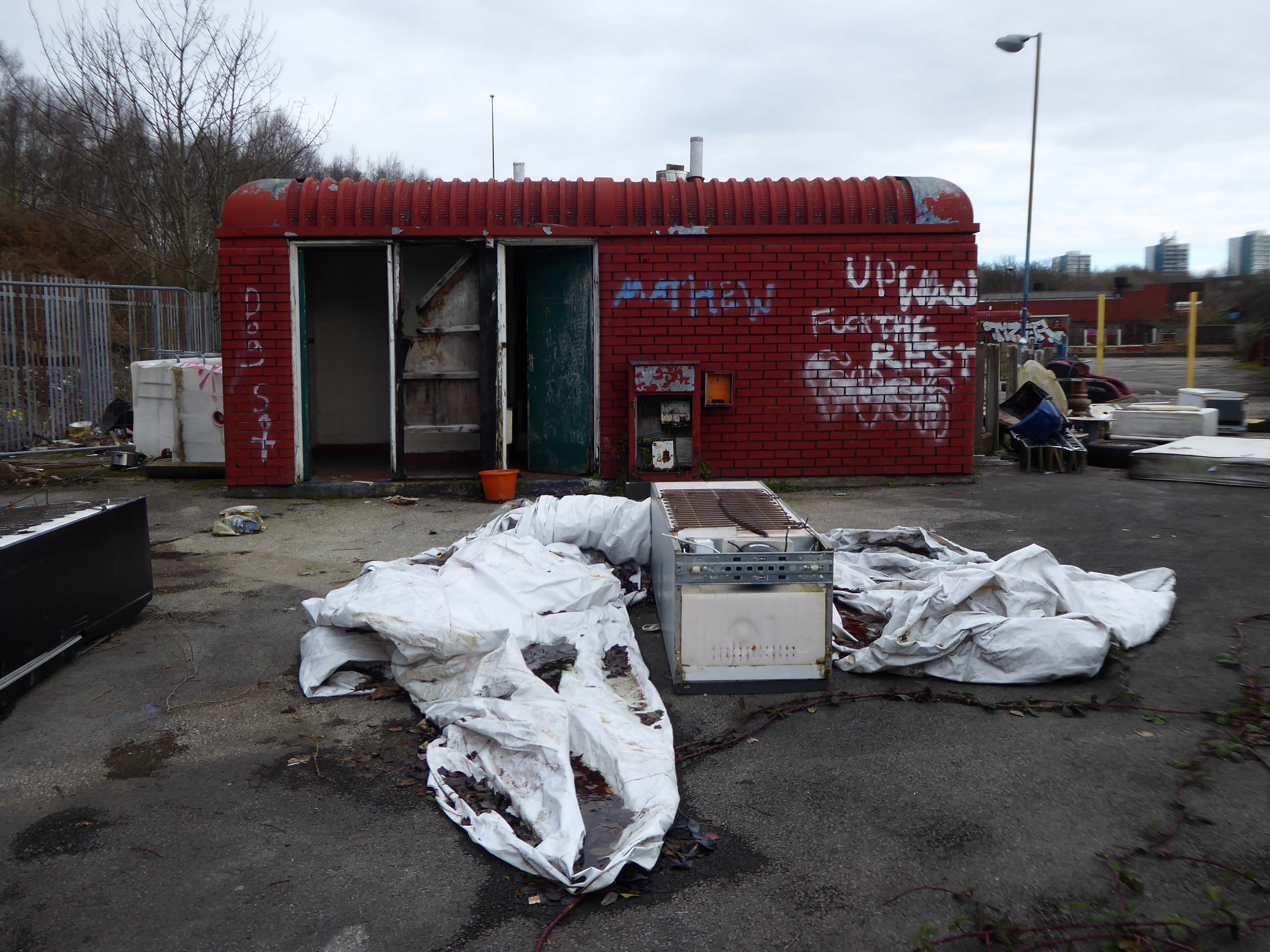
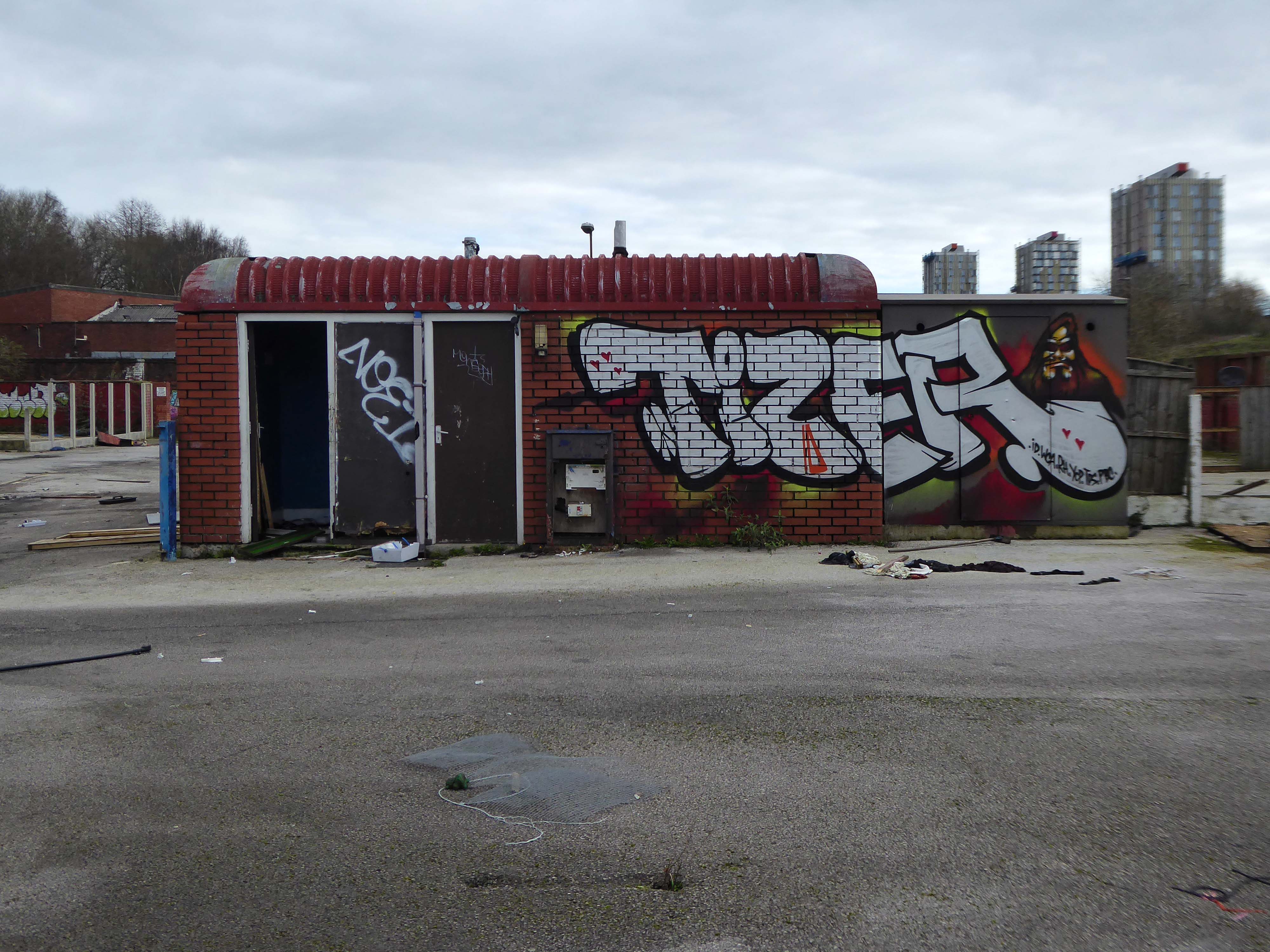
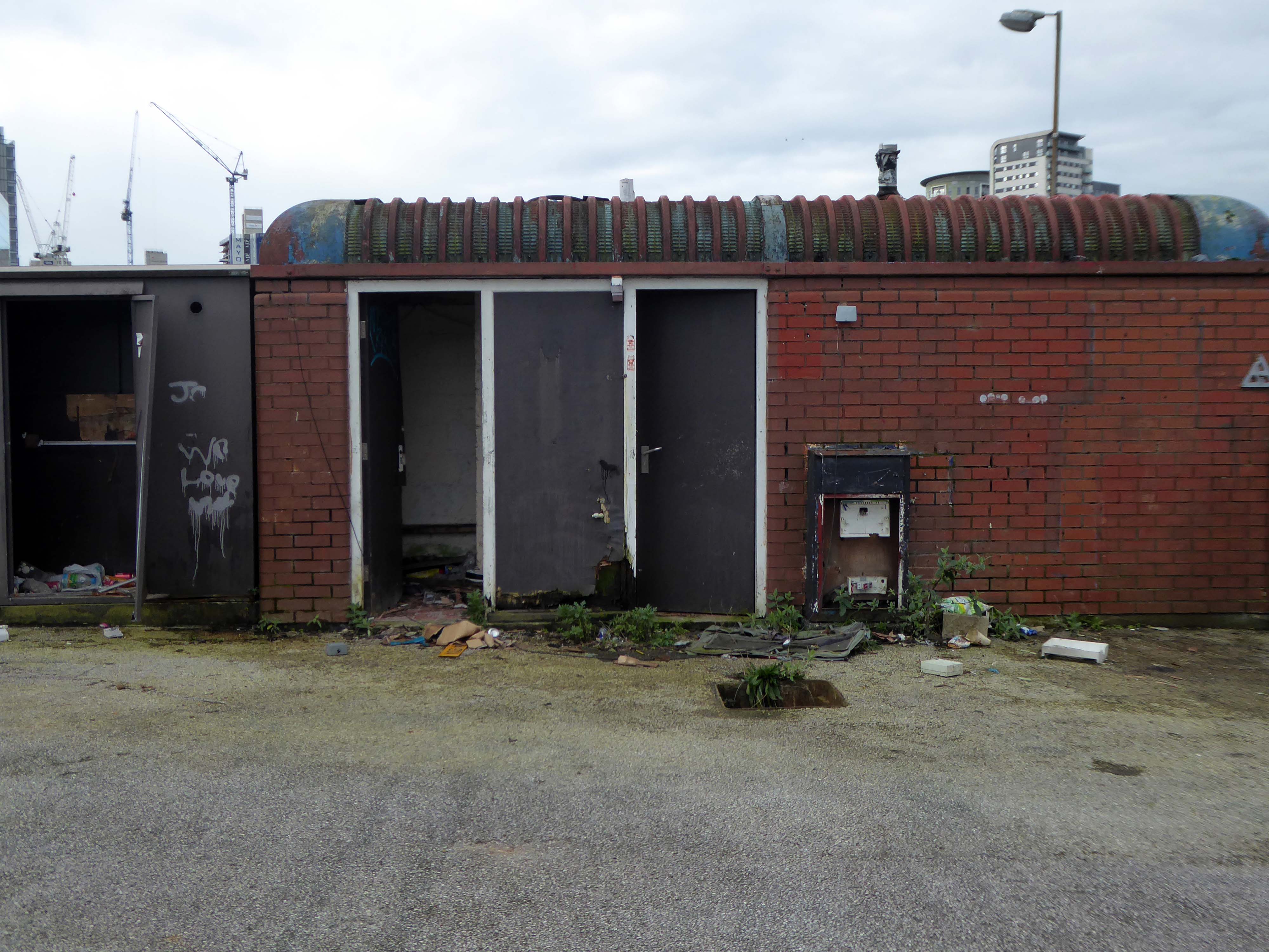
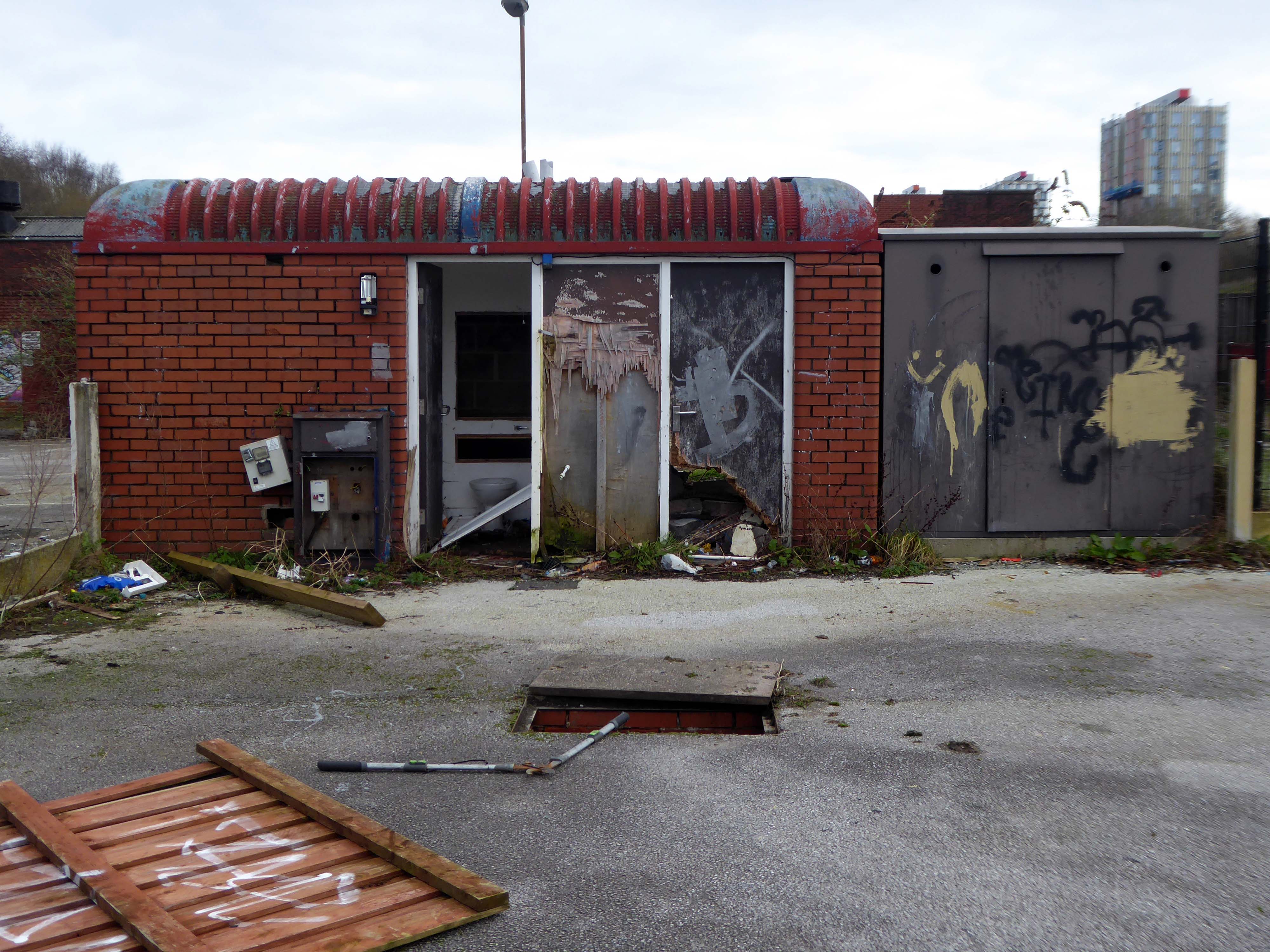
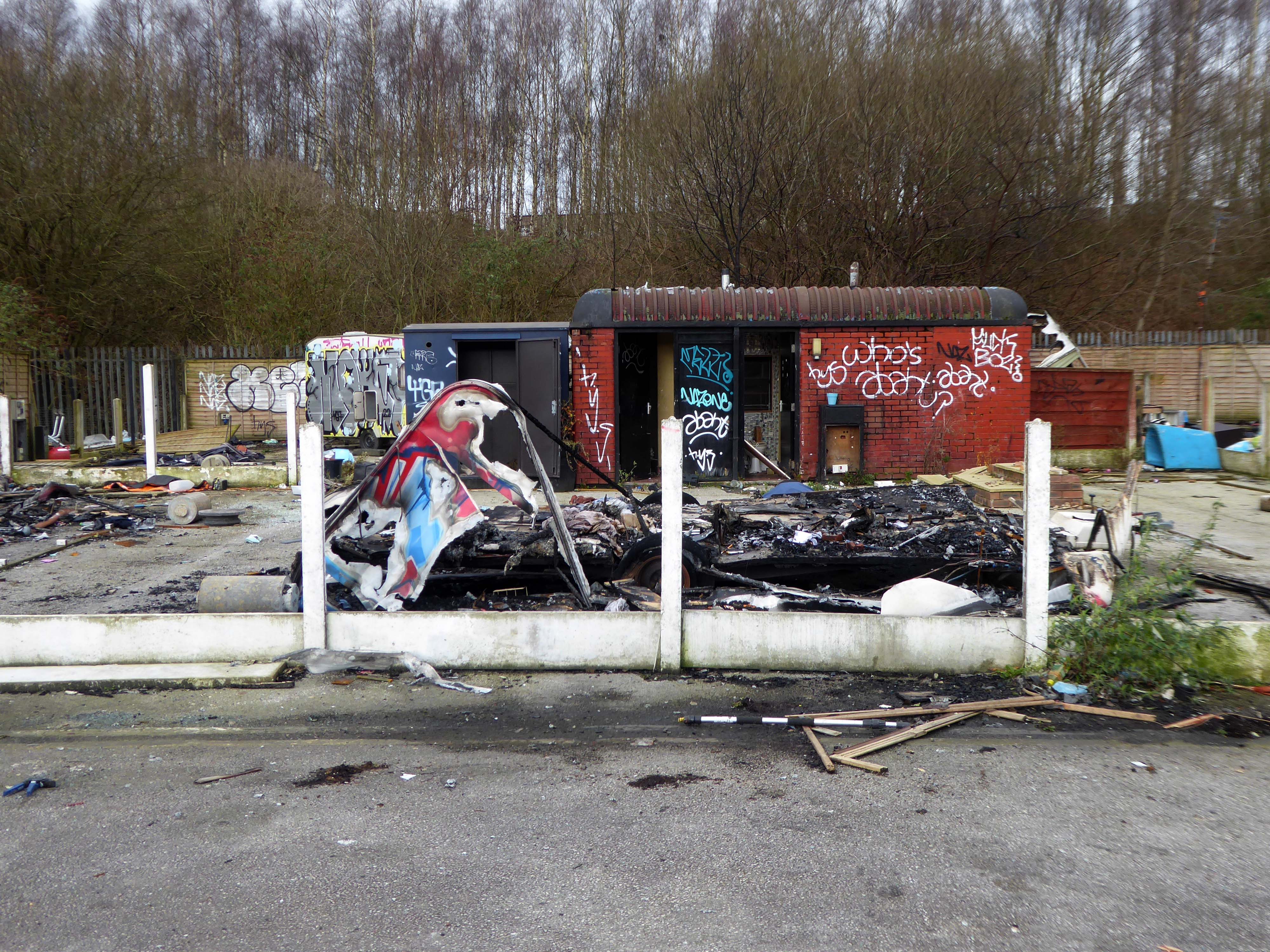
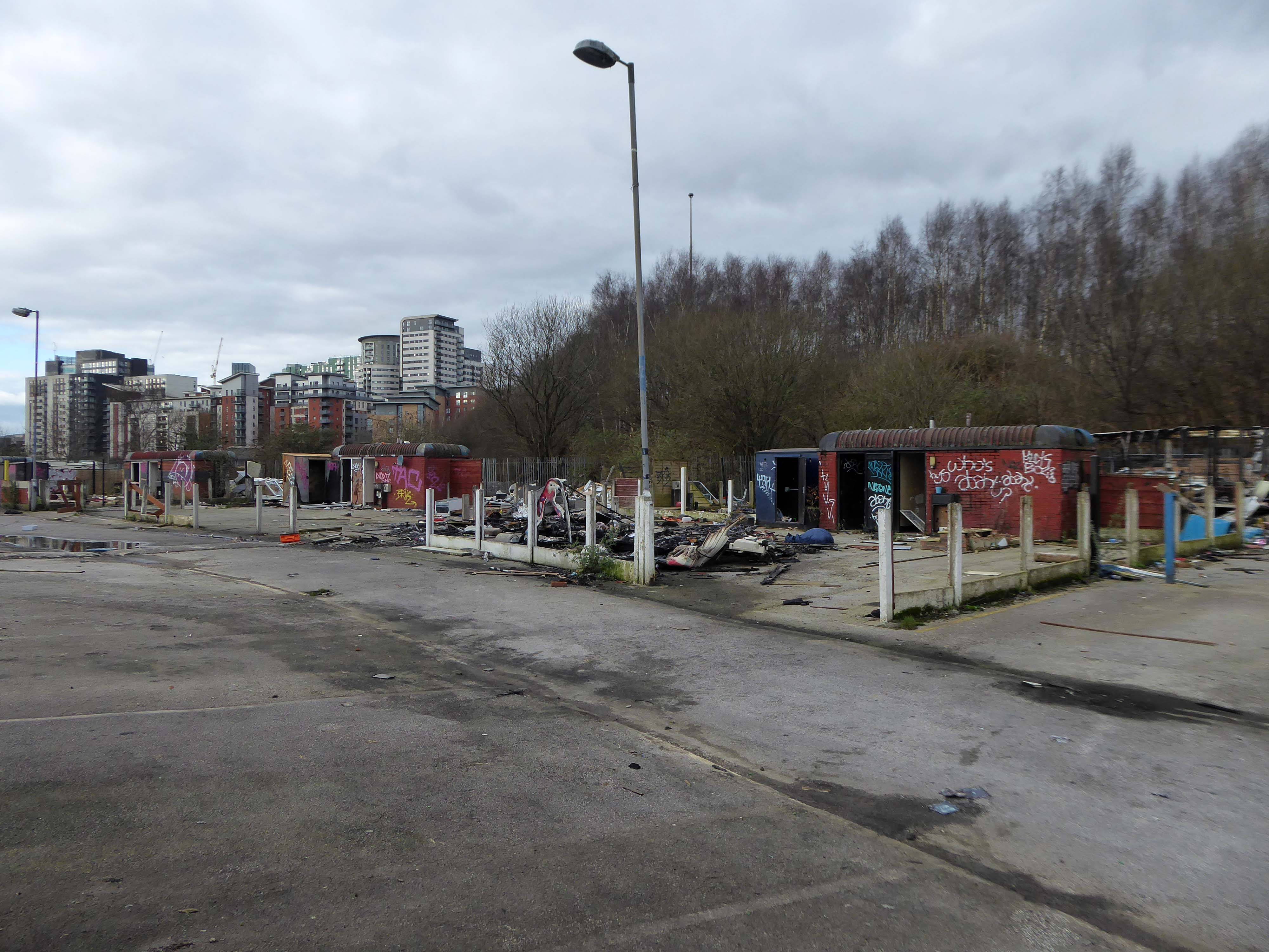
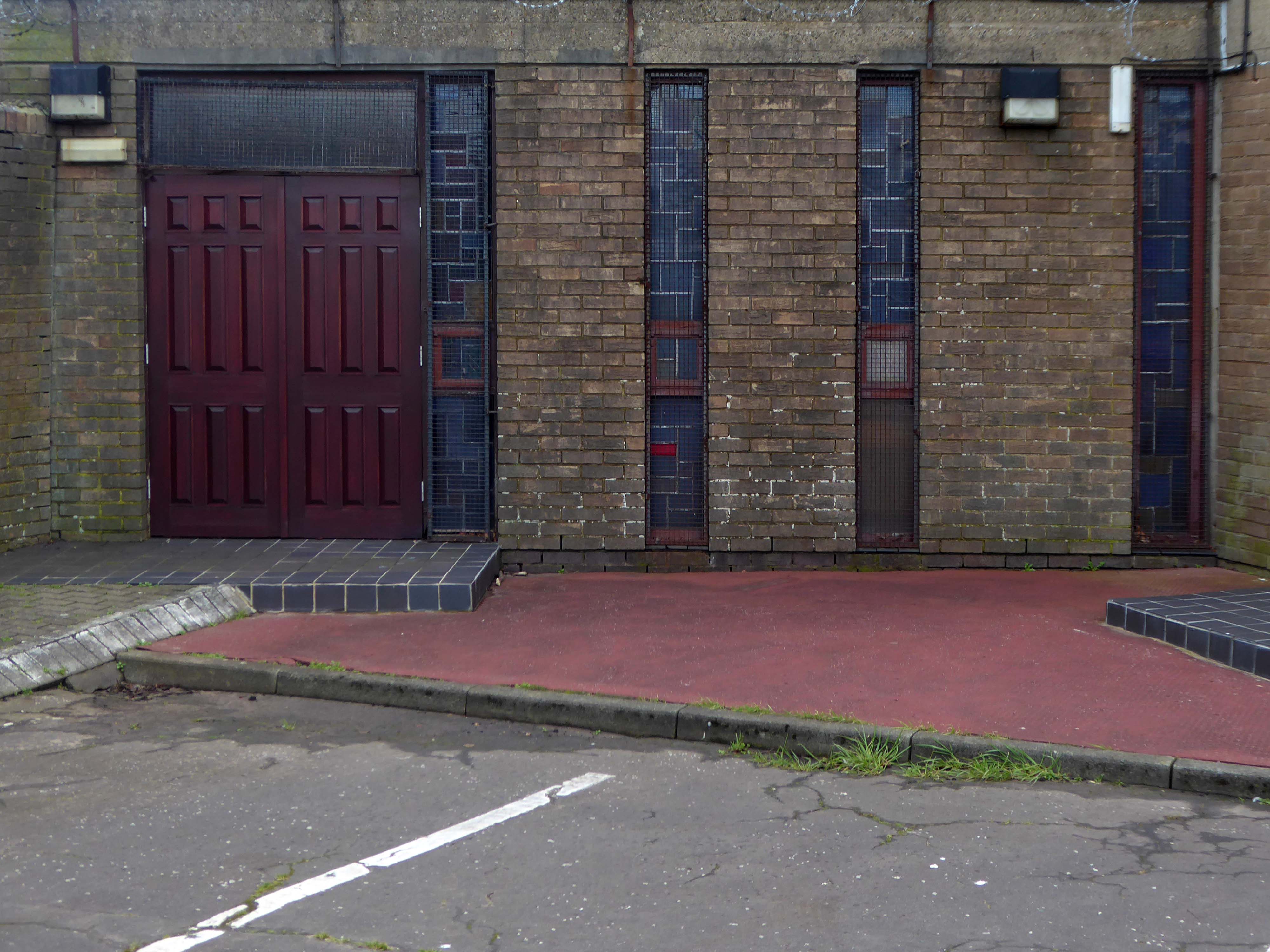
The majority of the site was tinned up and secured in an insecure fashion.
My thanks to all those happy souls who braved the cold winds, sunshine and threat of snow on Sunday 28th October 2018 as part of the Sheffield Modern Weekend
Sharing ideas, memories and animated conversation, as we circumnavigated the fenced perimeter of Europe’s largest listed structure, in search of a personal photographic response to the site.
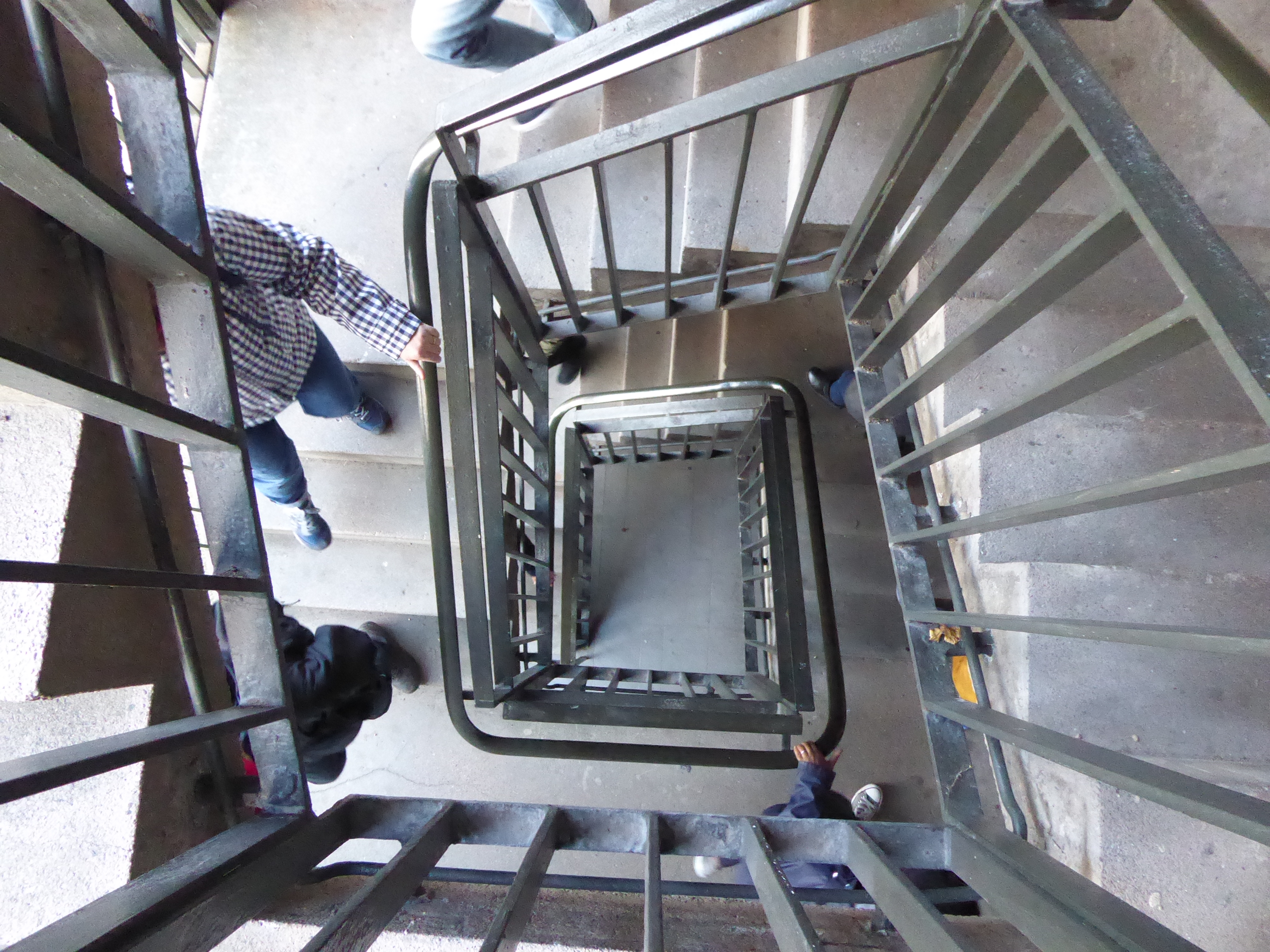
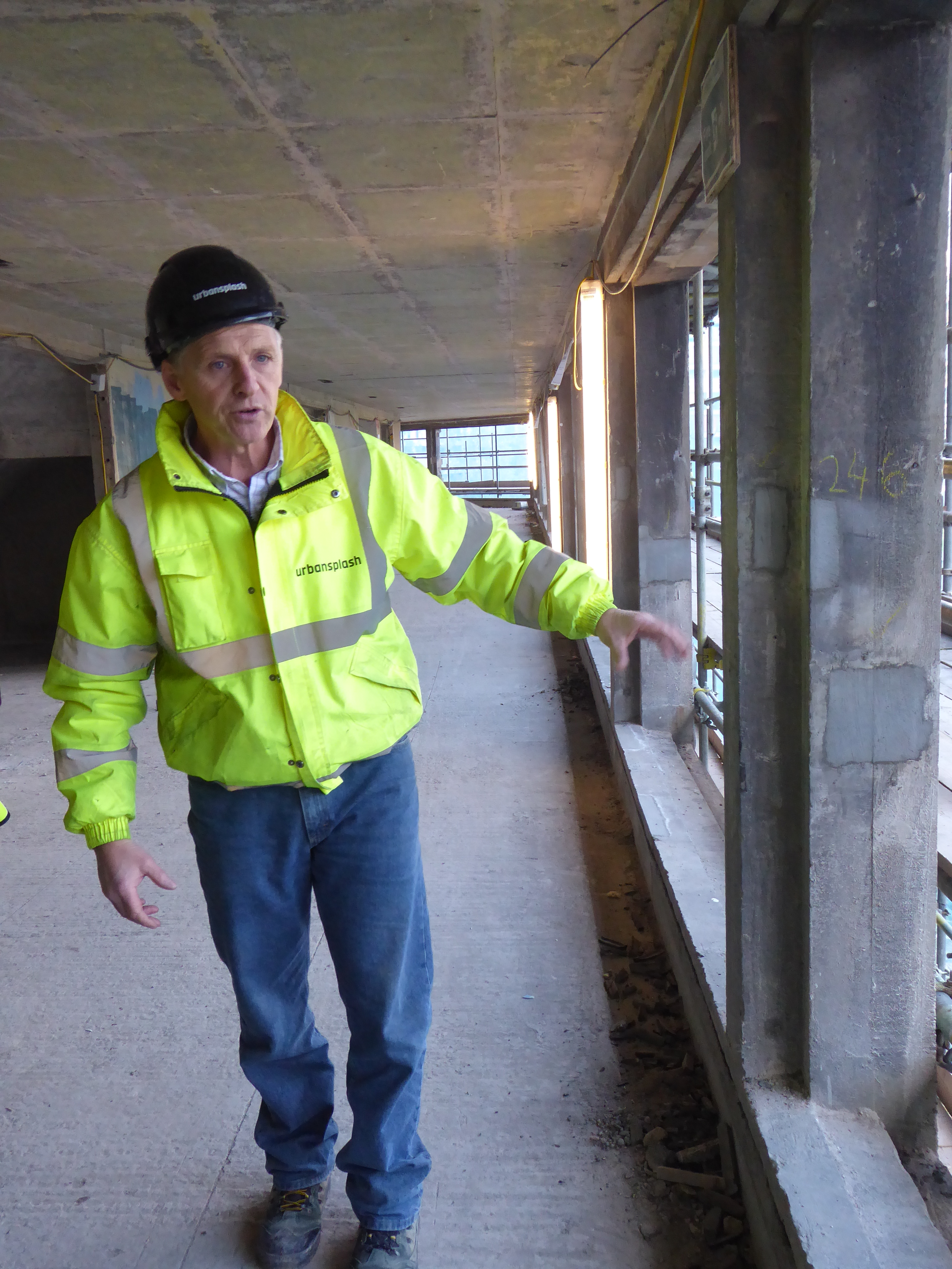
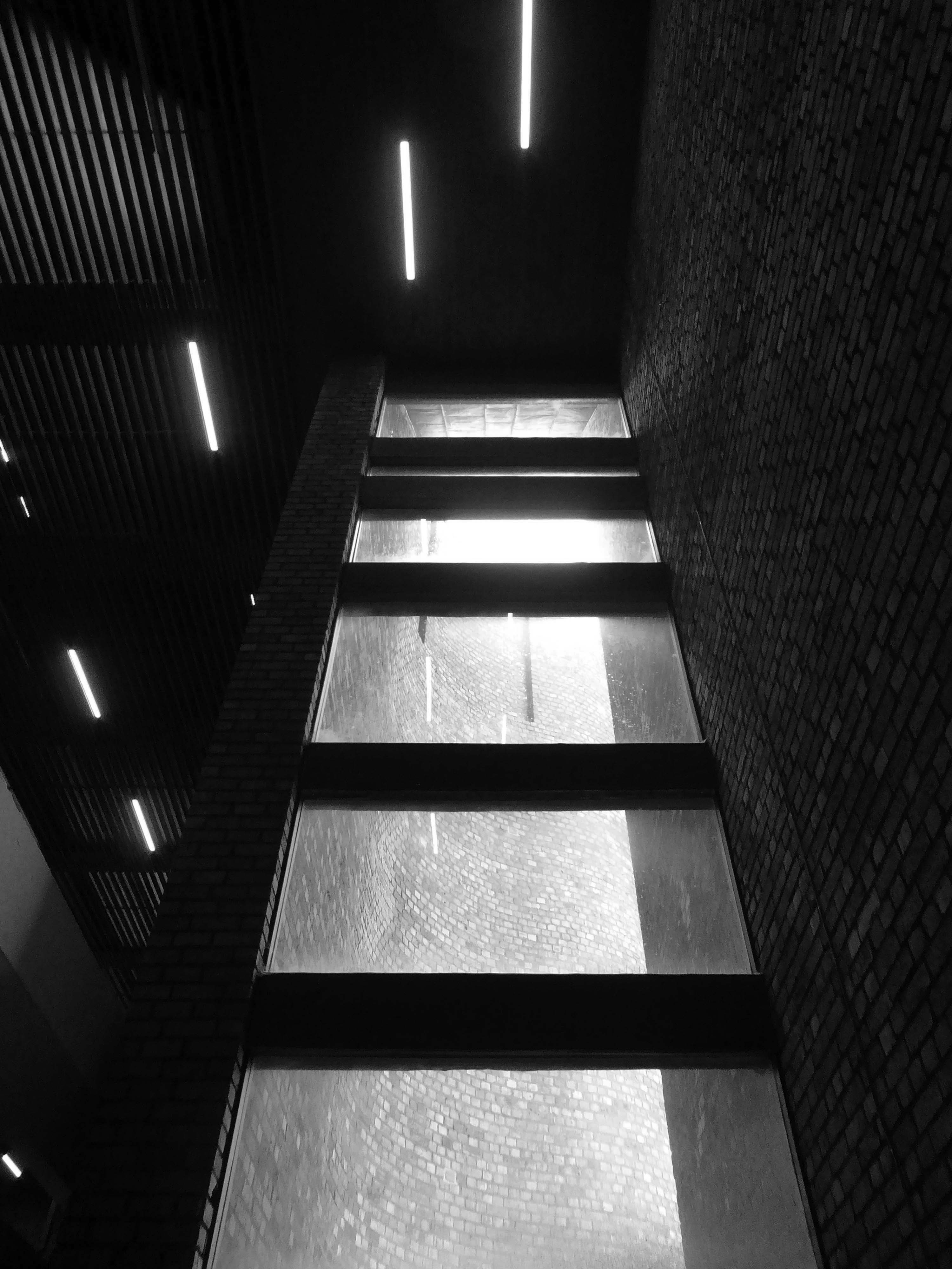
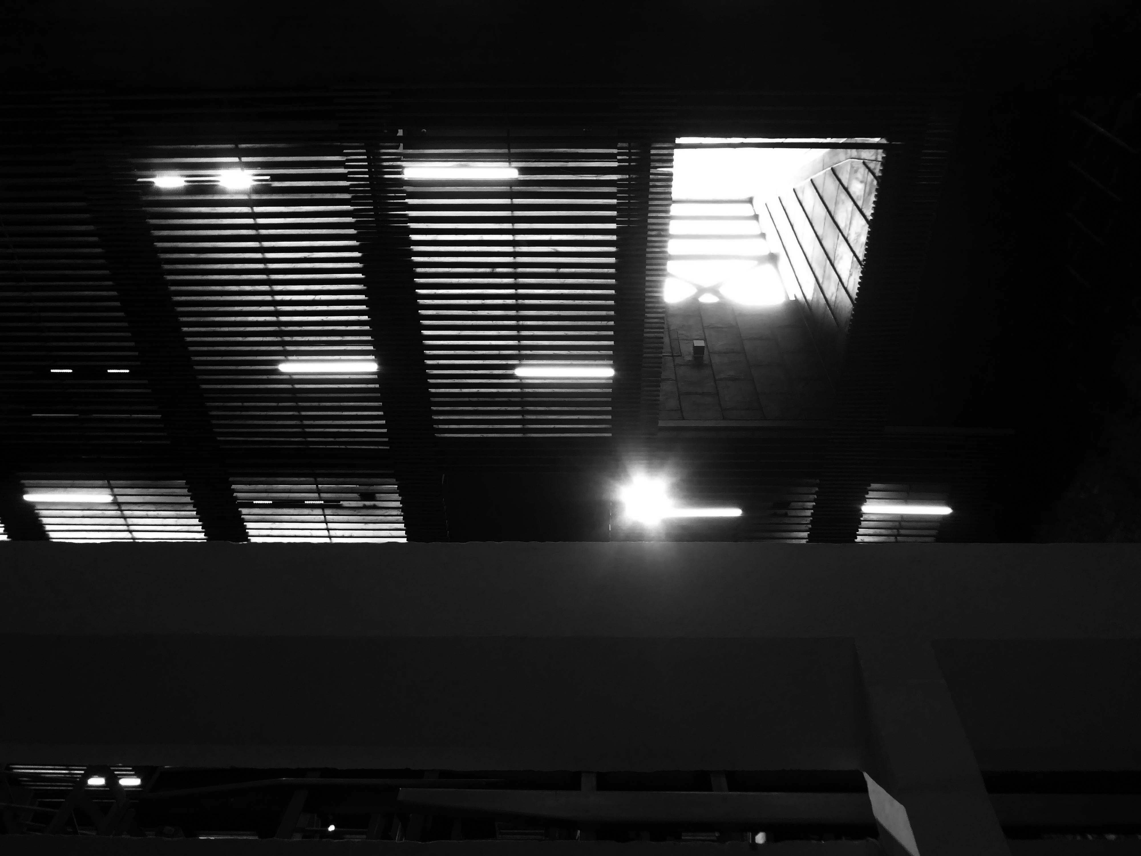
Subsequently I have lead tours of the site under construction at the behest of Urban Splash, in conjunction with Falconer Associates and the Modernist Society.
Observing the site’s transformation first hand.
October 2019
Following the hiatus caused by the Covid epidemic, building work has recommenced.
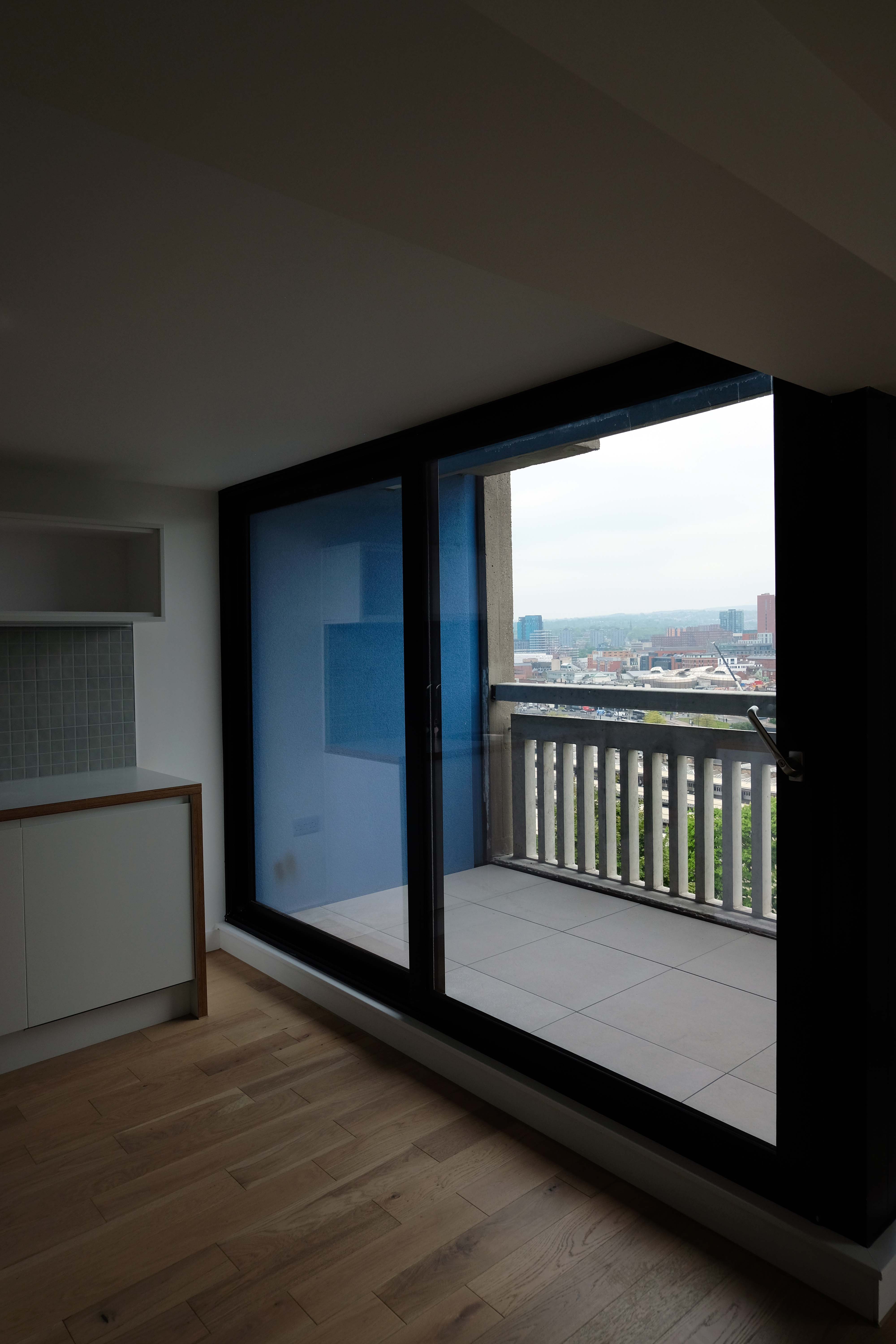
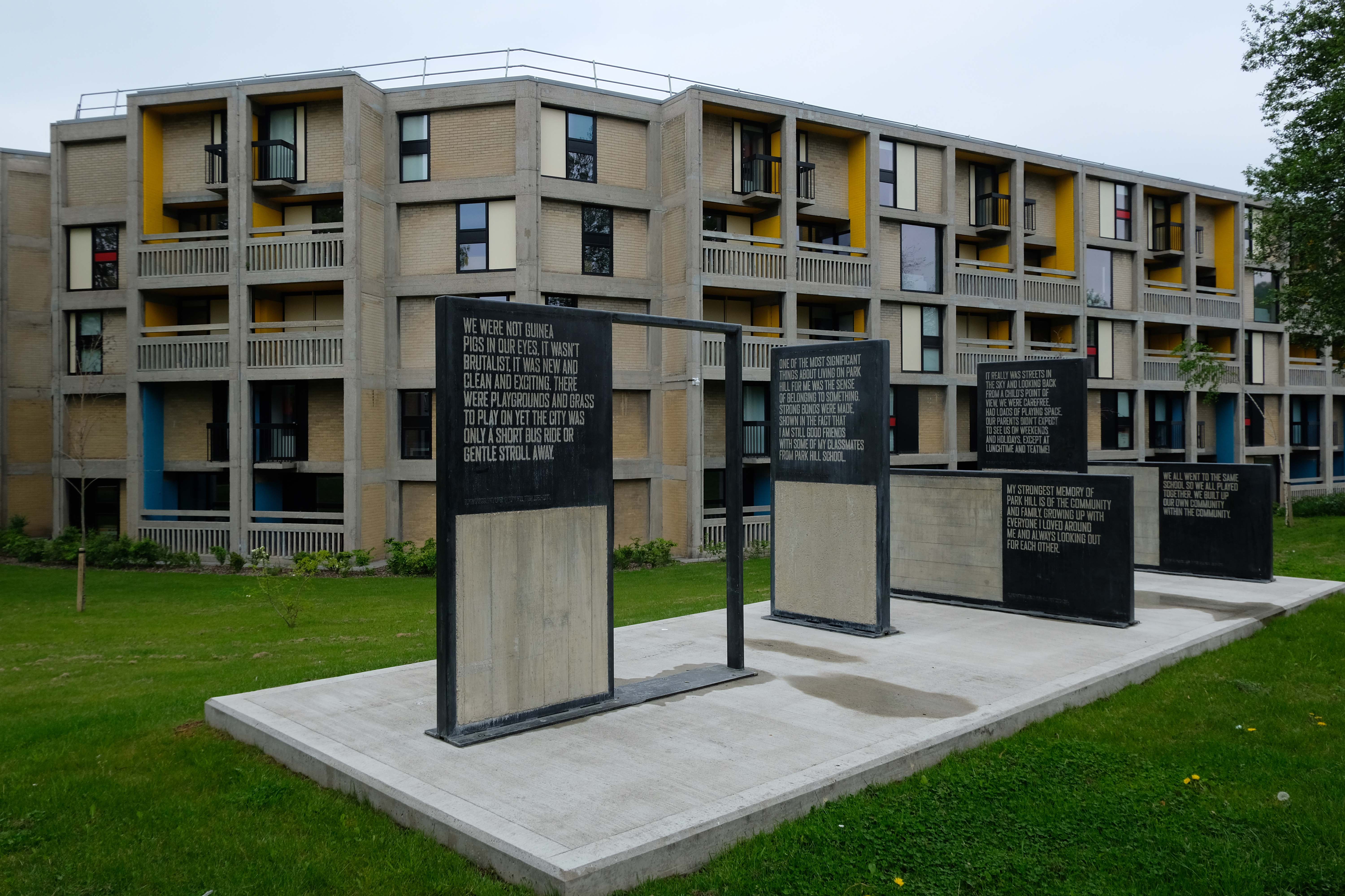
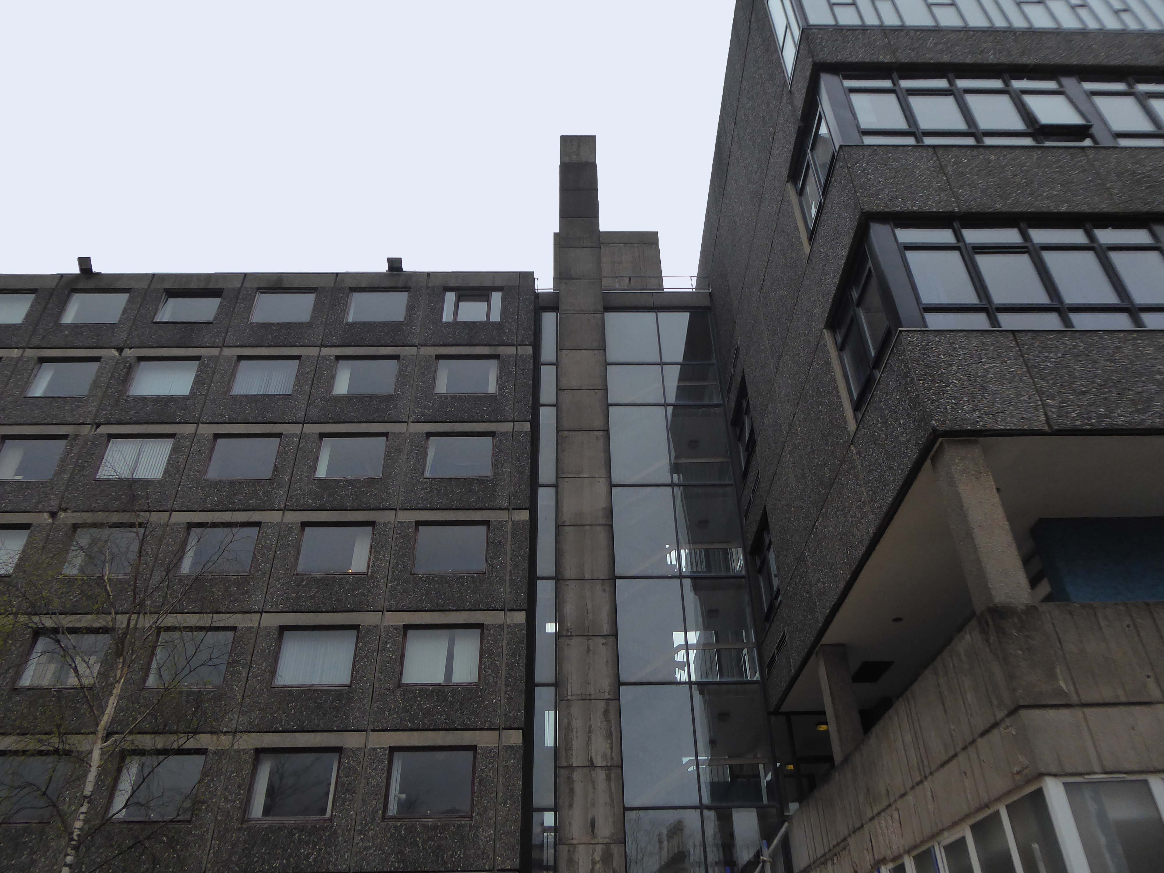
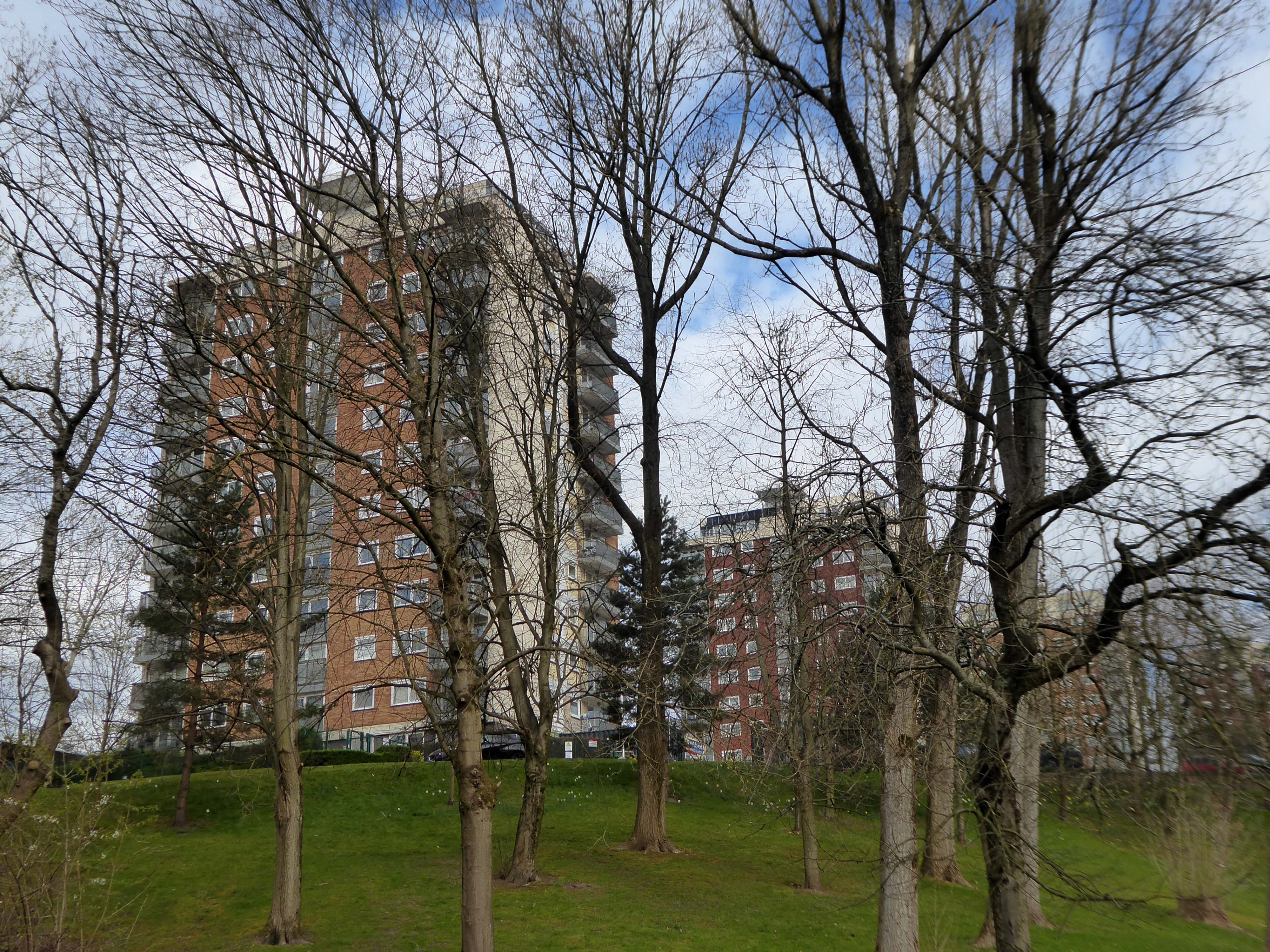
It’s joy to return and view the developments that are taking place – a structure that seemed doomed returning to life, providing new homes within a unique architectural experiment, which continues to evolve.
Each stage designed by a team of architects willing and able to link the wealth of heritage to new possibilities.
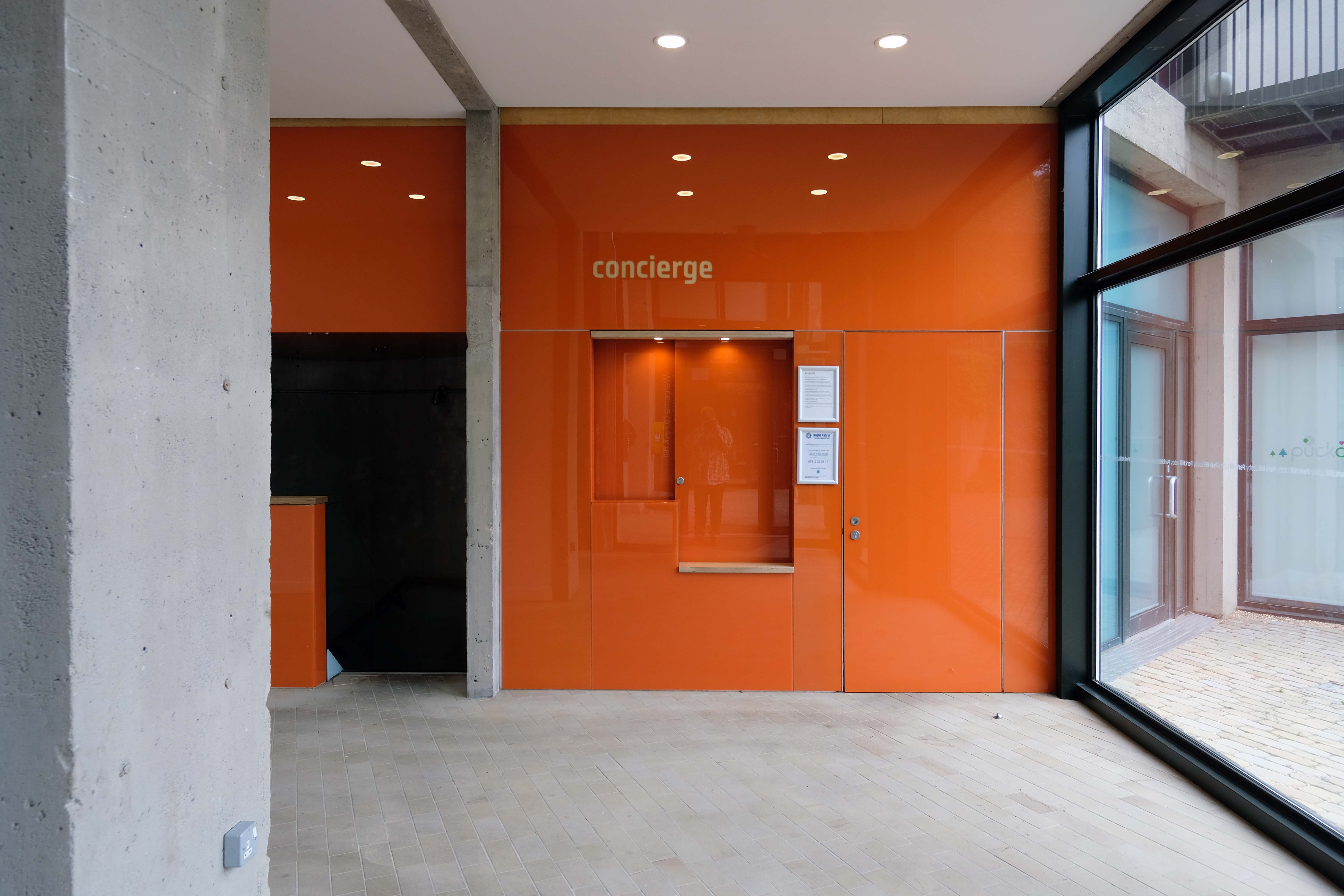
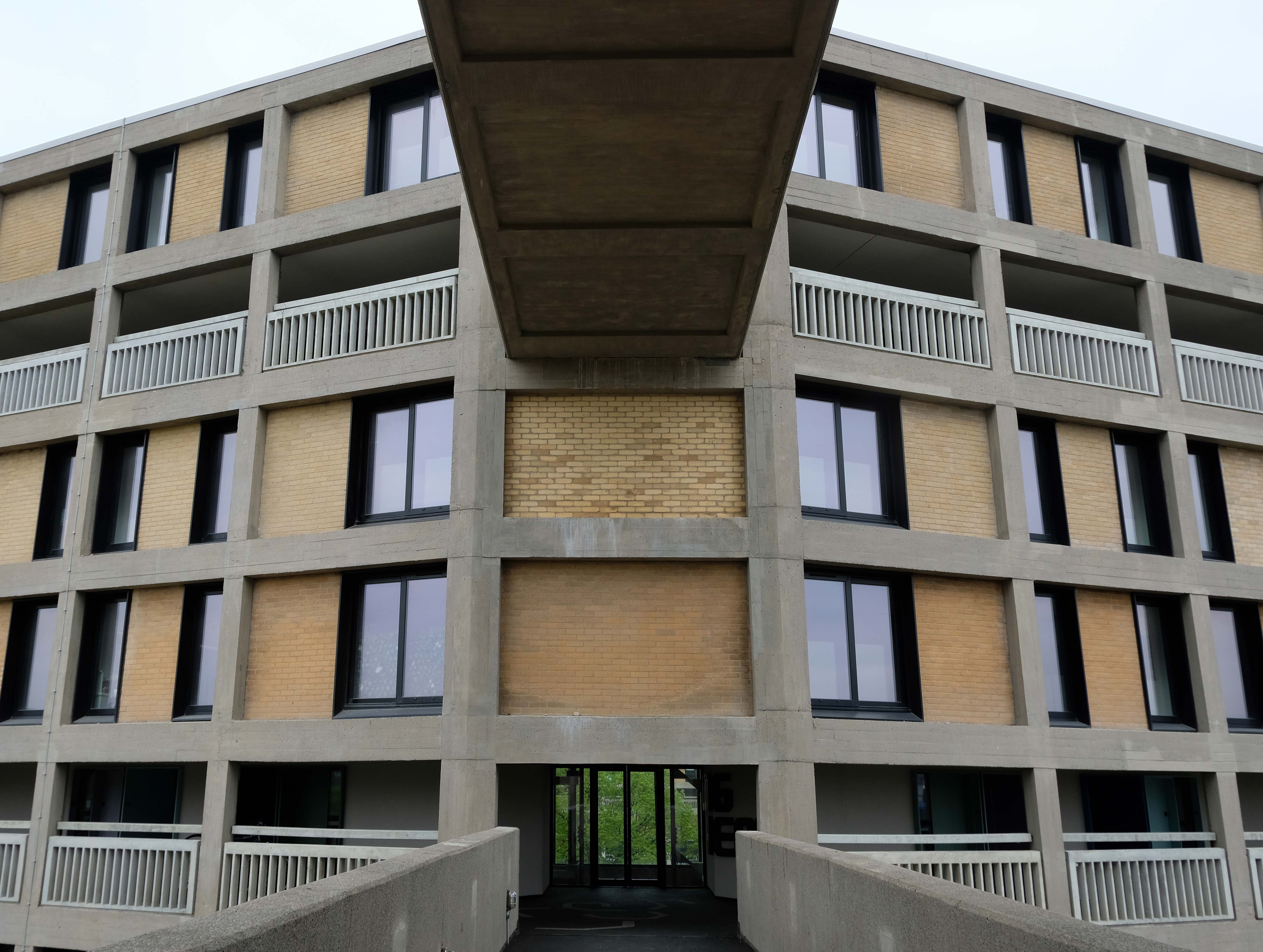
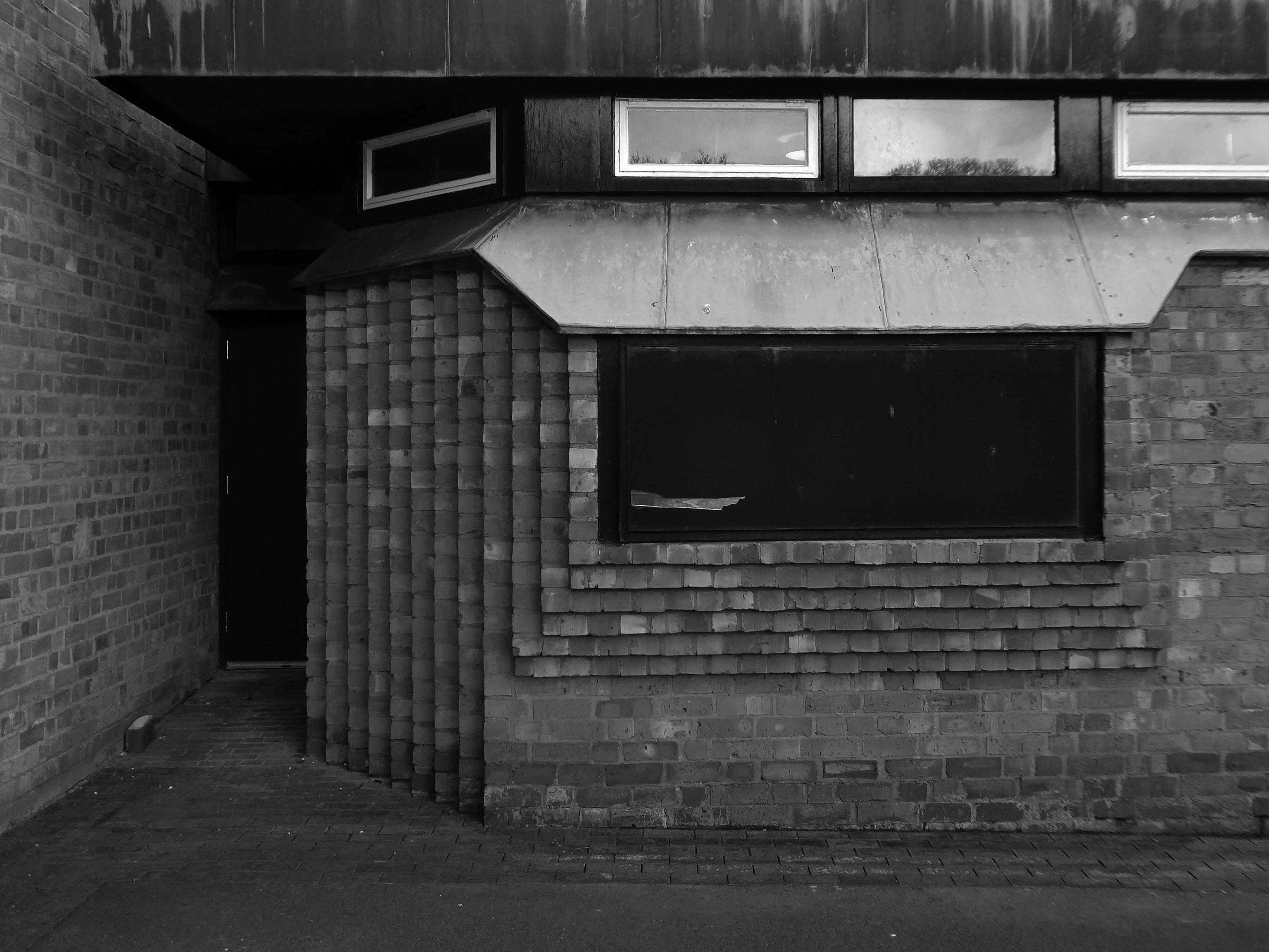
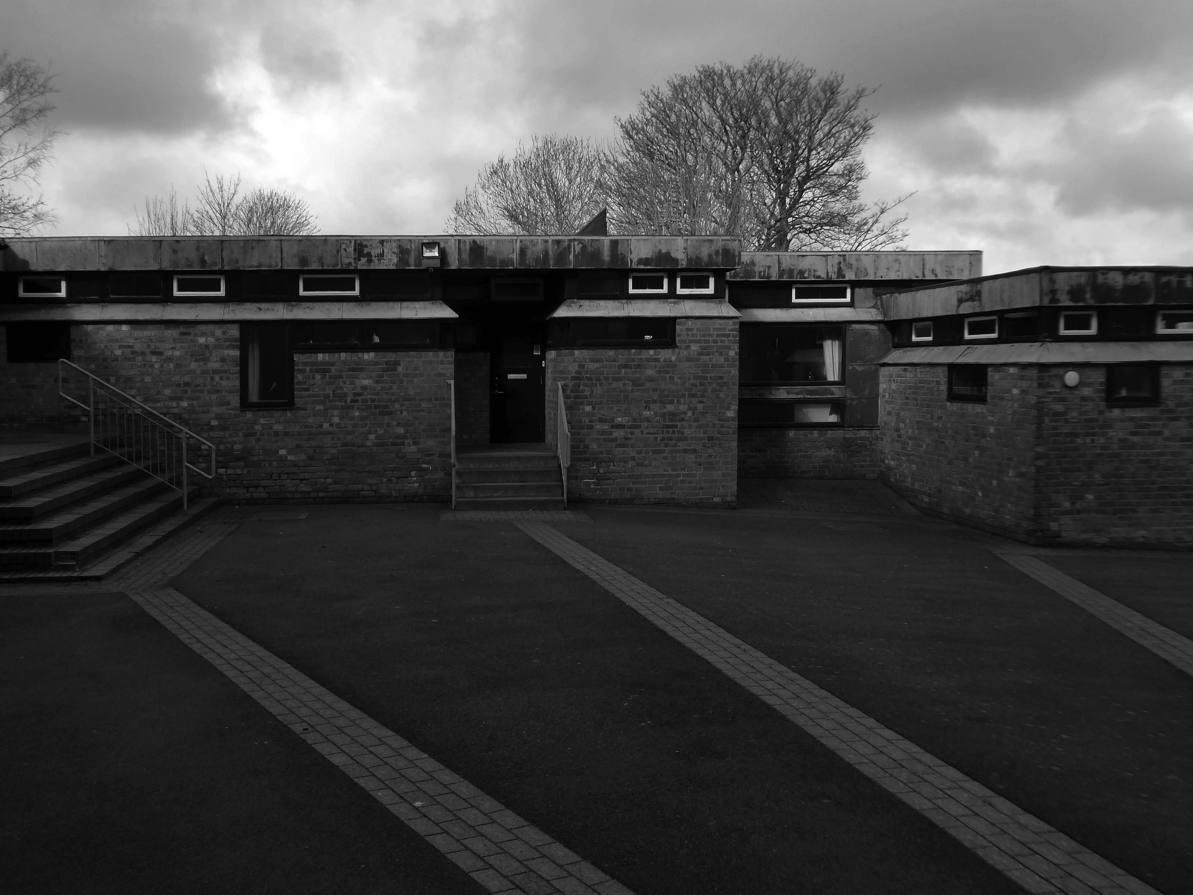
Urban Splash appointed architects Hawkins\Brown and urban designers Studio Egret West for the renovation of Phase One.
The first businesses and residents moved in during 2013. This phase includes 260 homes – of which 96 are affordable homes and 28 shared equity homes on the Government Help to Buy scheme.
Stirling Prize winning architects Mikhail Riches were appointed to undertake the new designs for Phase Two. Demand has been high for the one, two and three homes that also include three two bedroom townhouses.
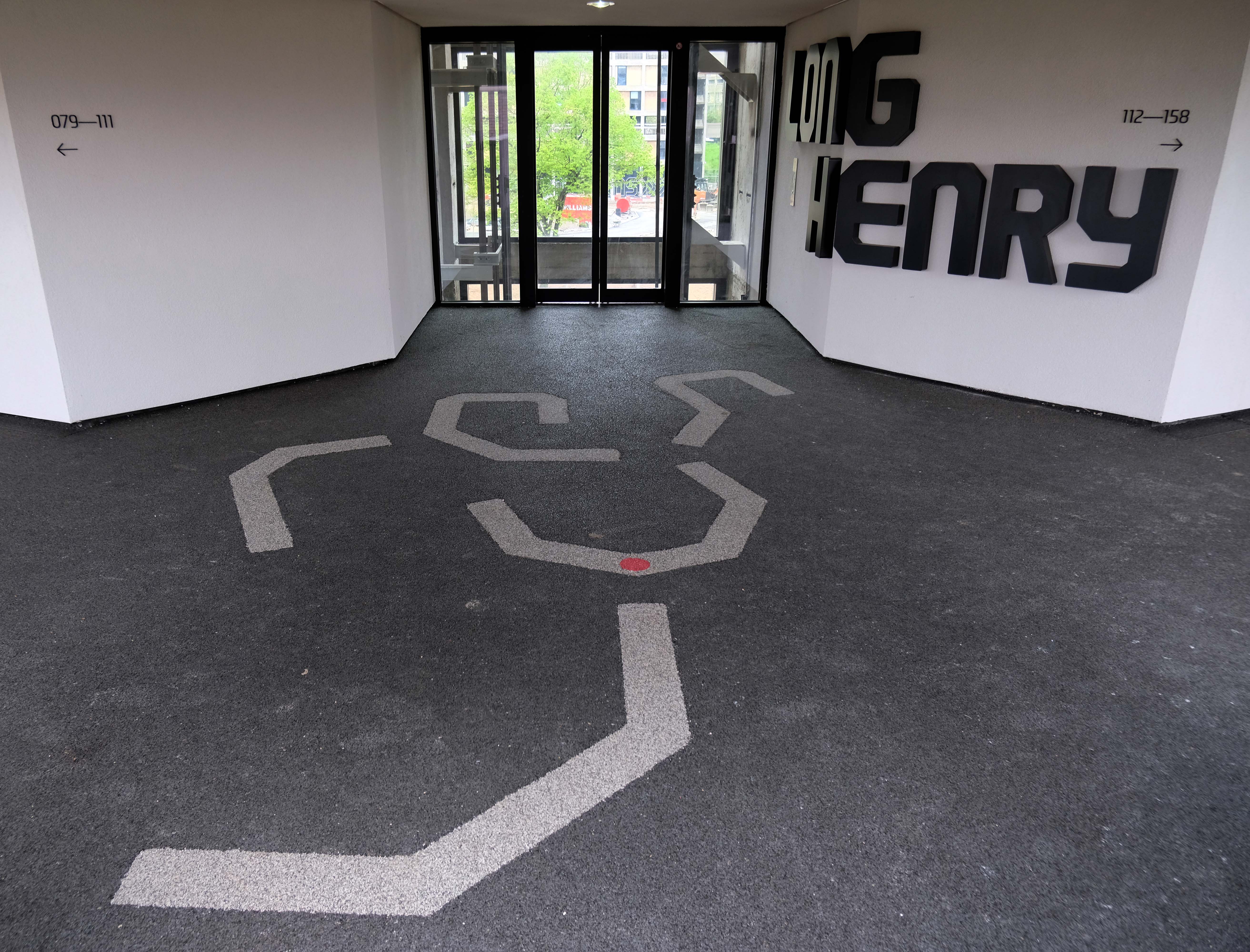
Phase Three is unique student accommodation with the block being configured into four and eight bed townhouses, two and four bed apartments and classic studios for 356 students. The development partner is the Alumno Group and Places for People who have named it Béton House.
It’s May 2022 time to take a post Covid look at work in progress.
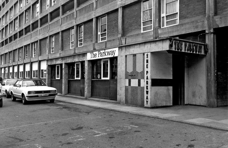
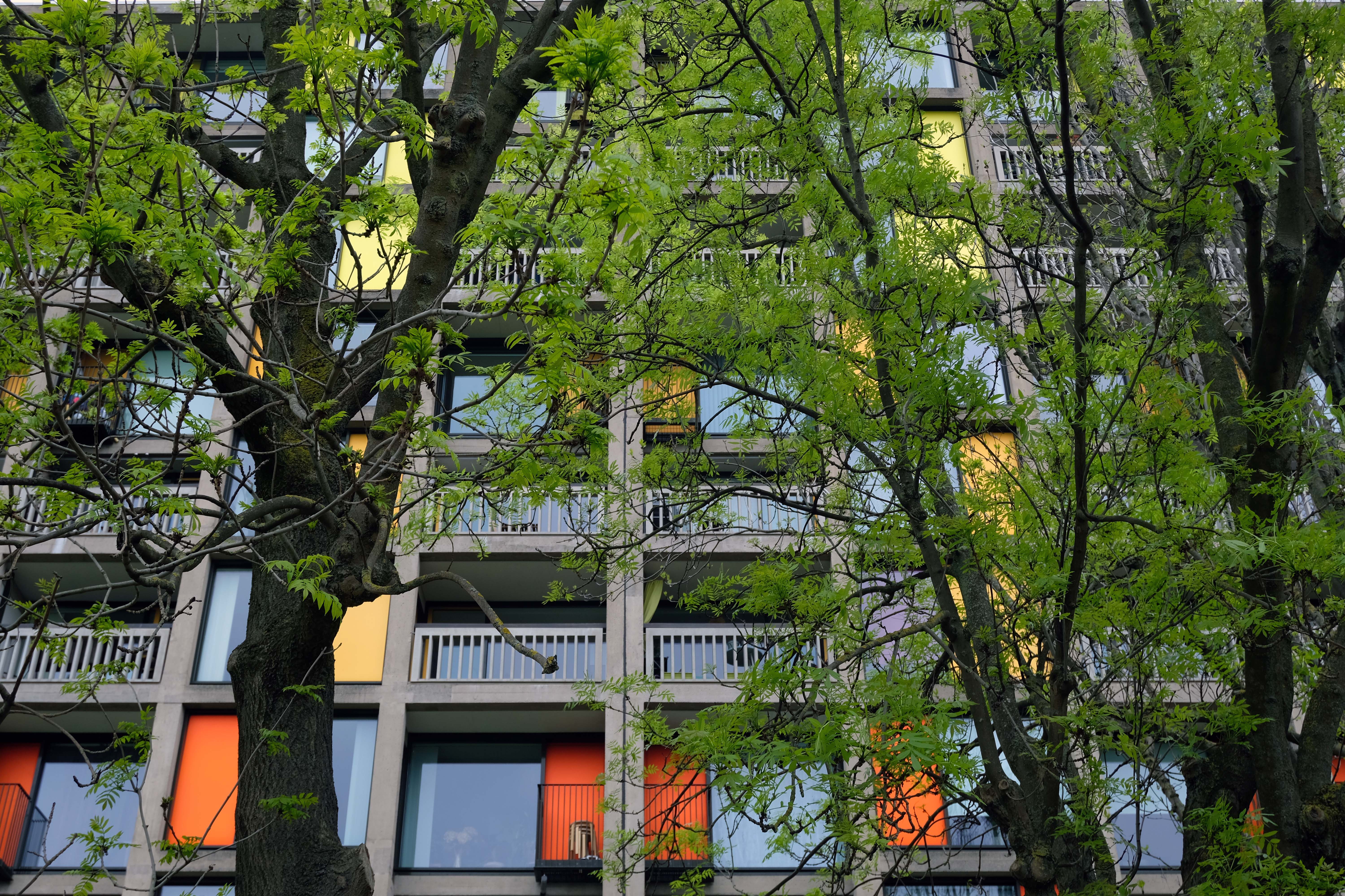
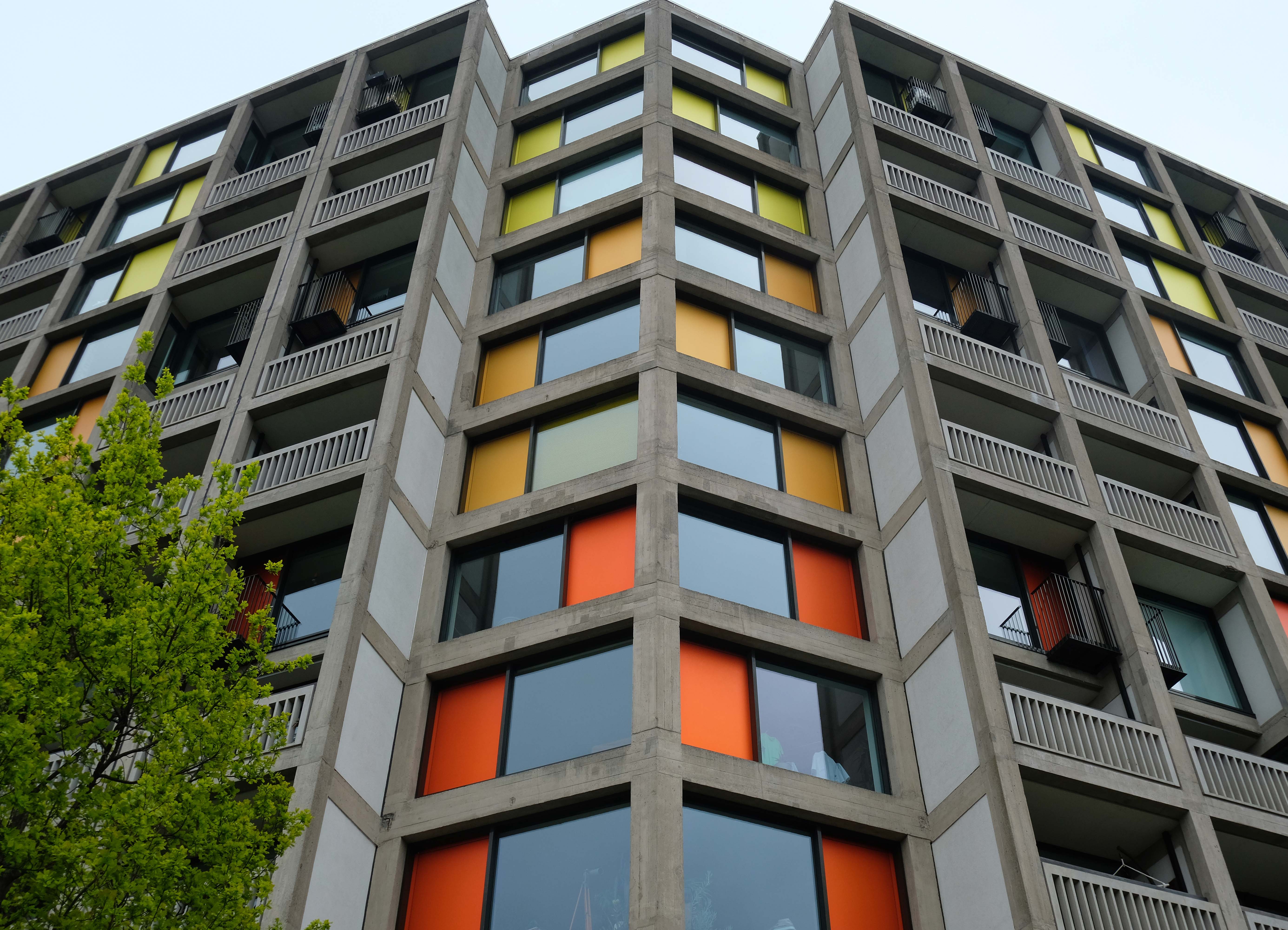
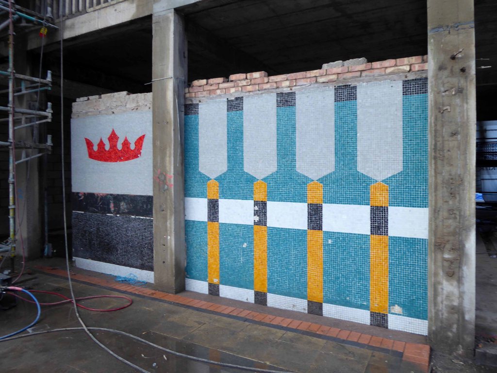
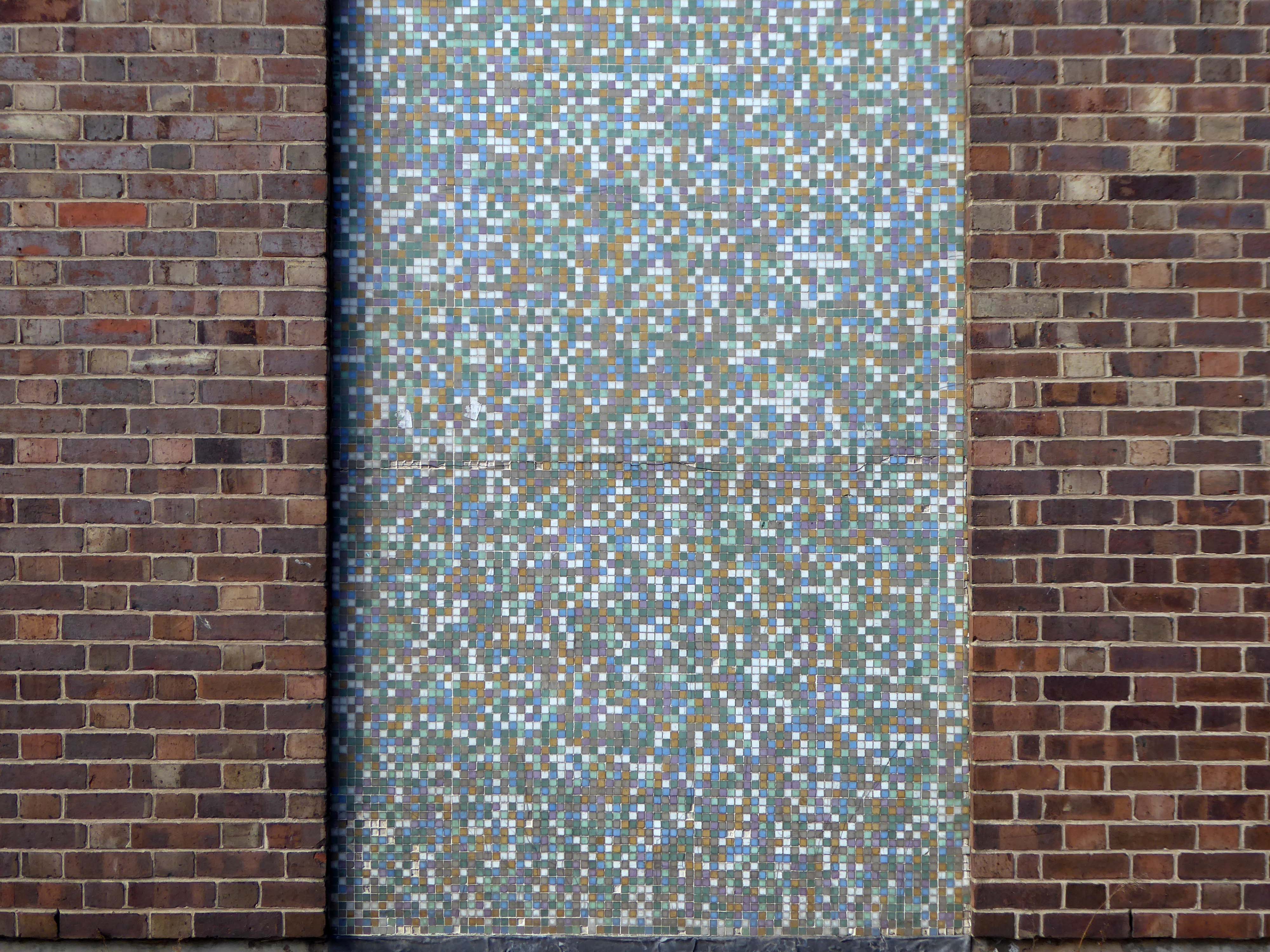
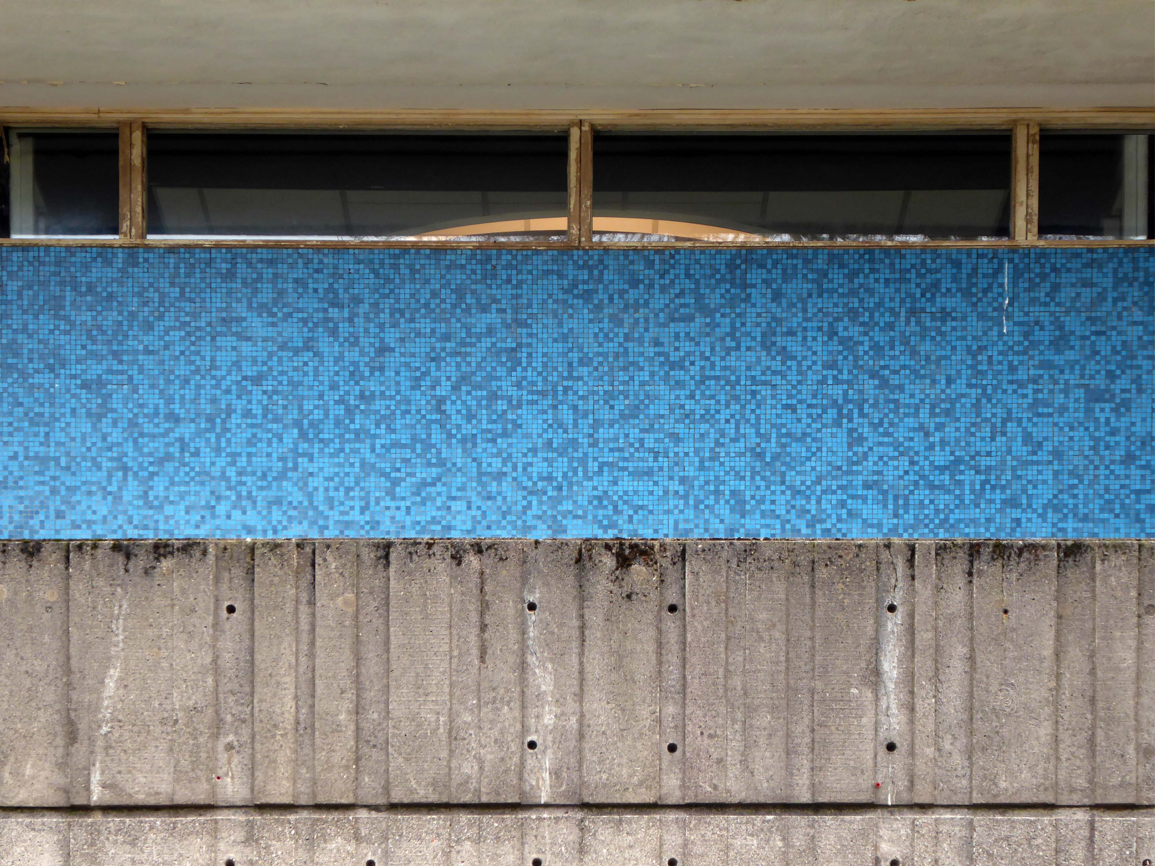
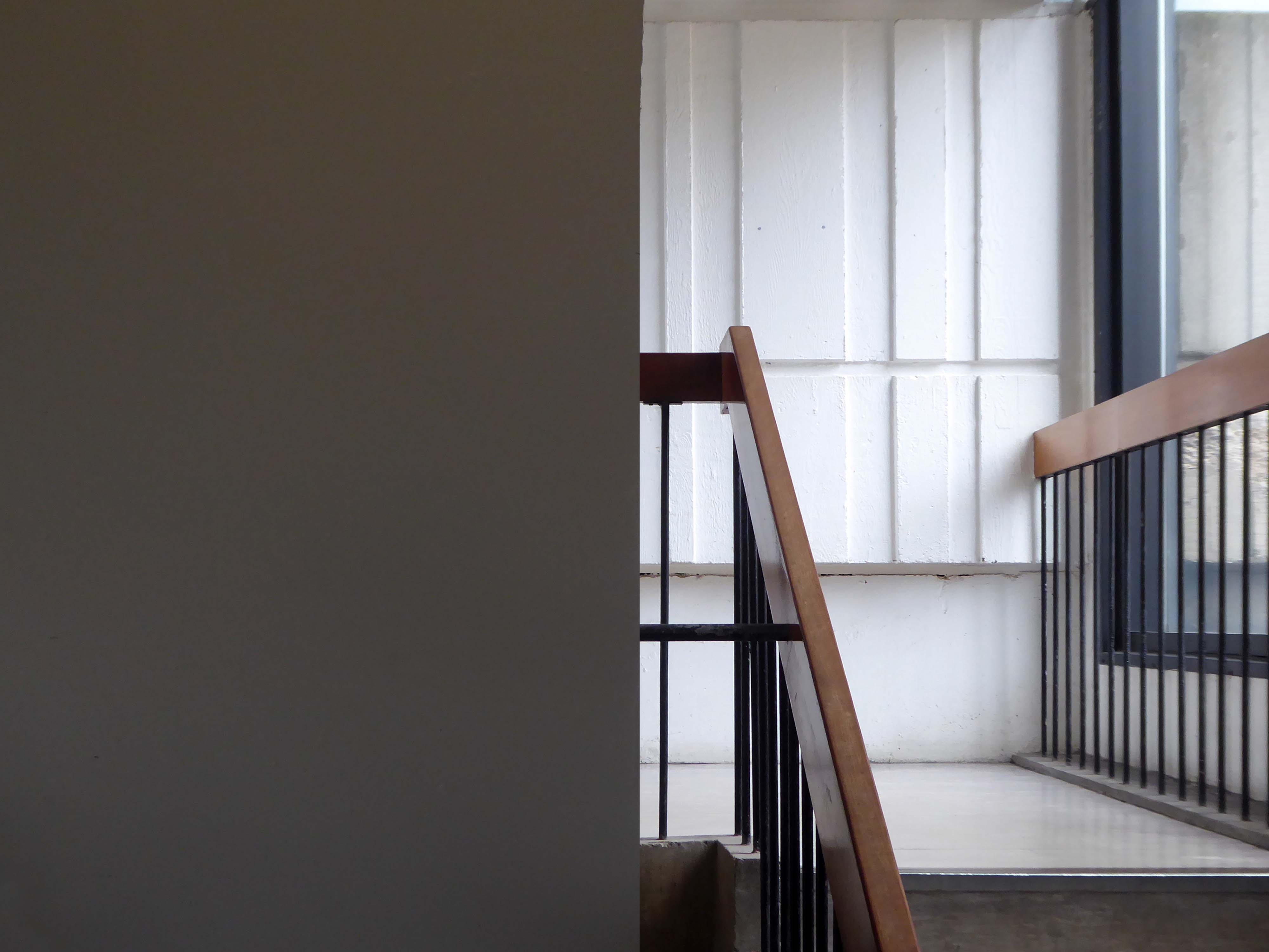
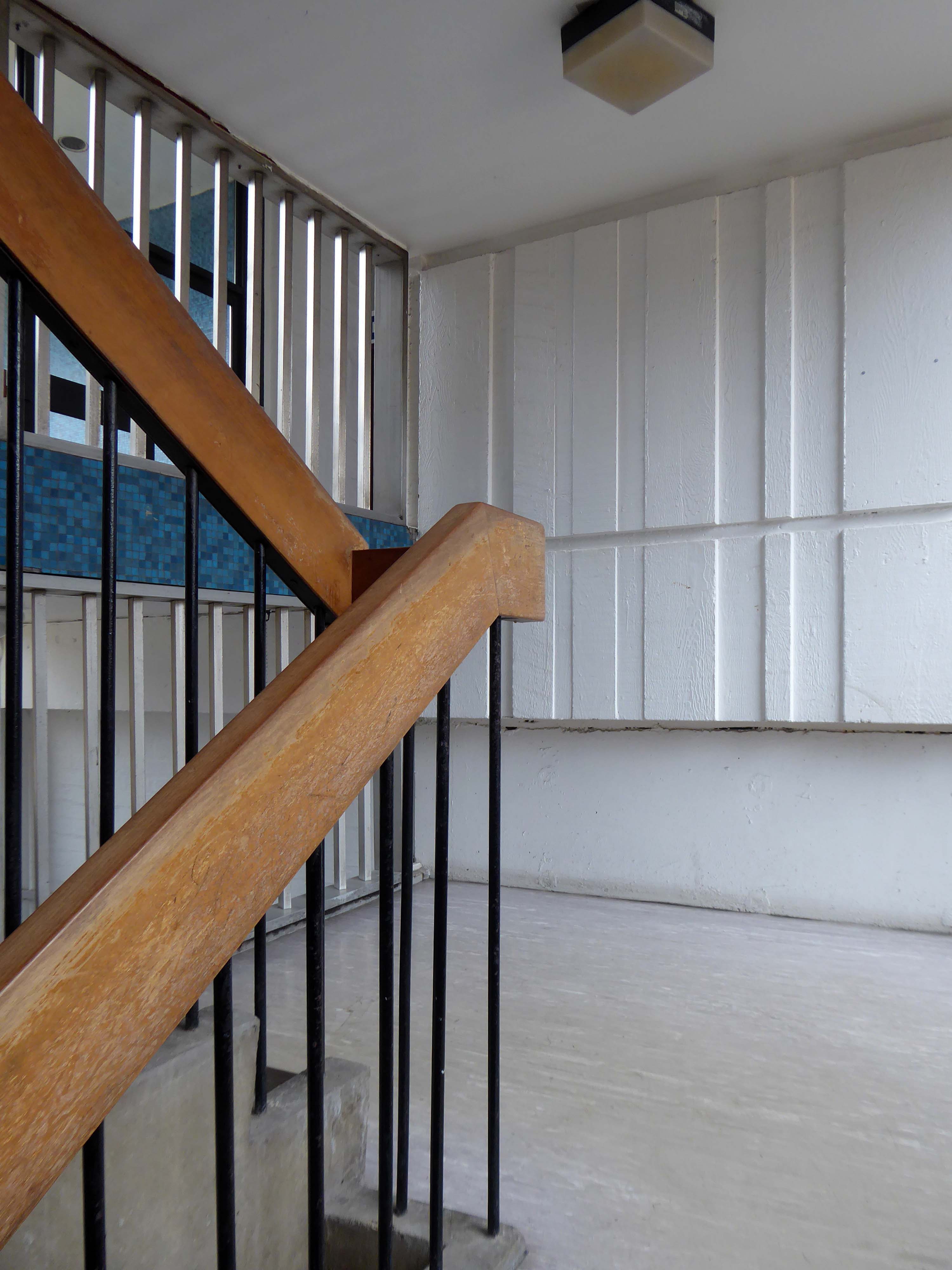
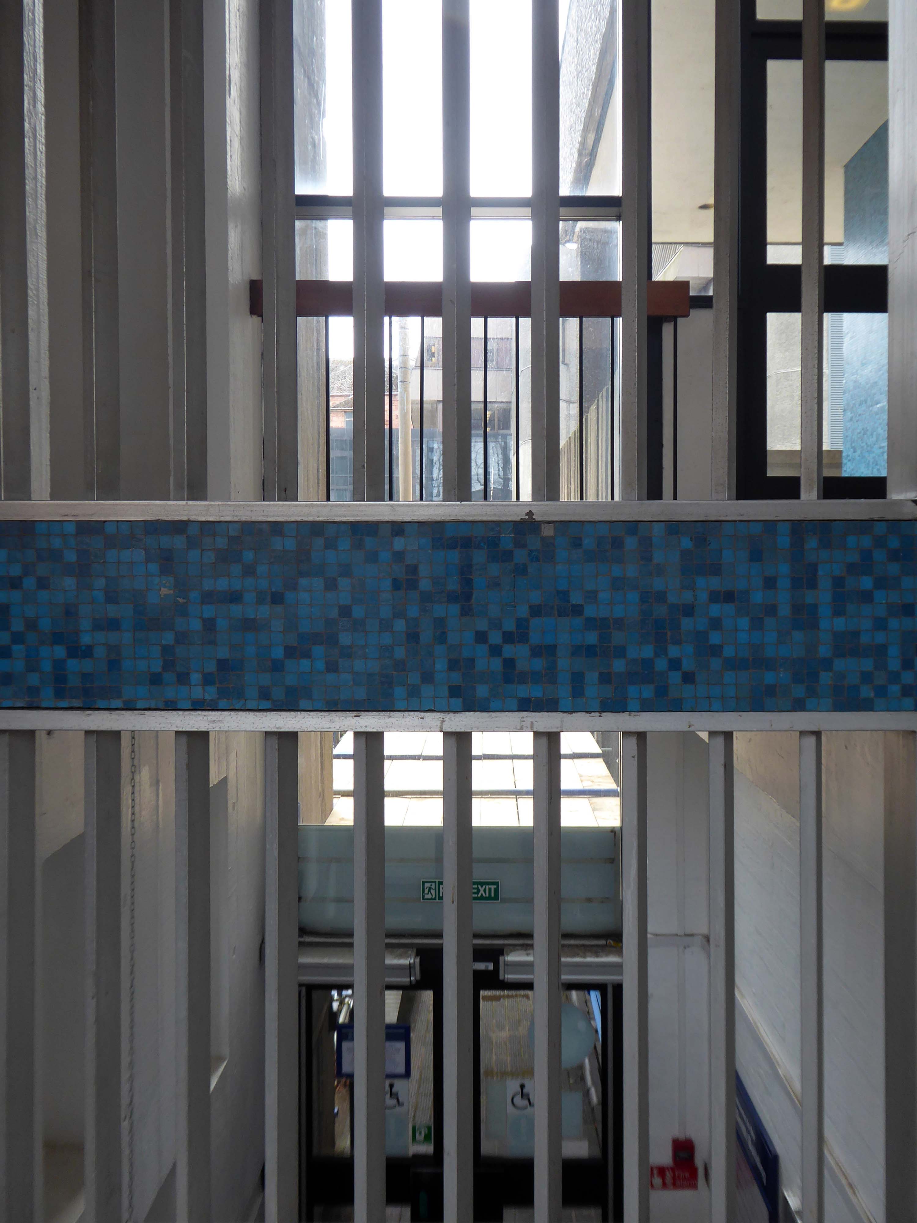
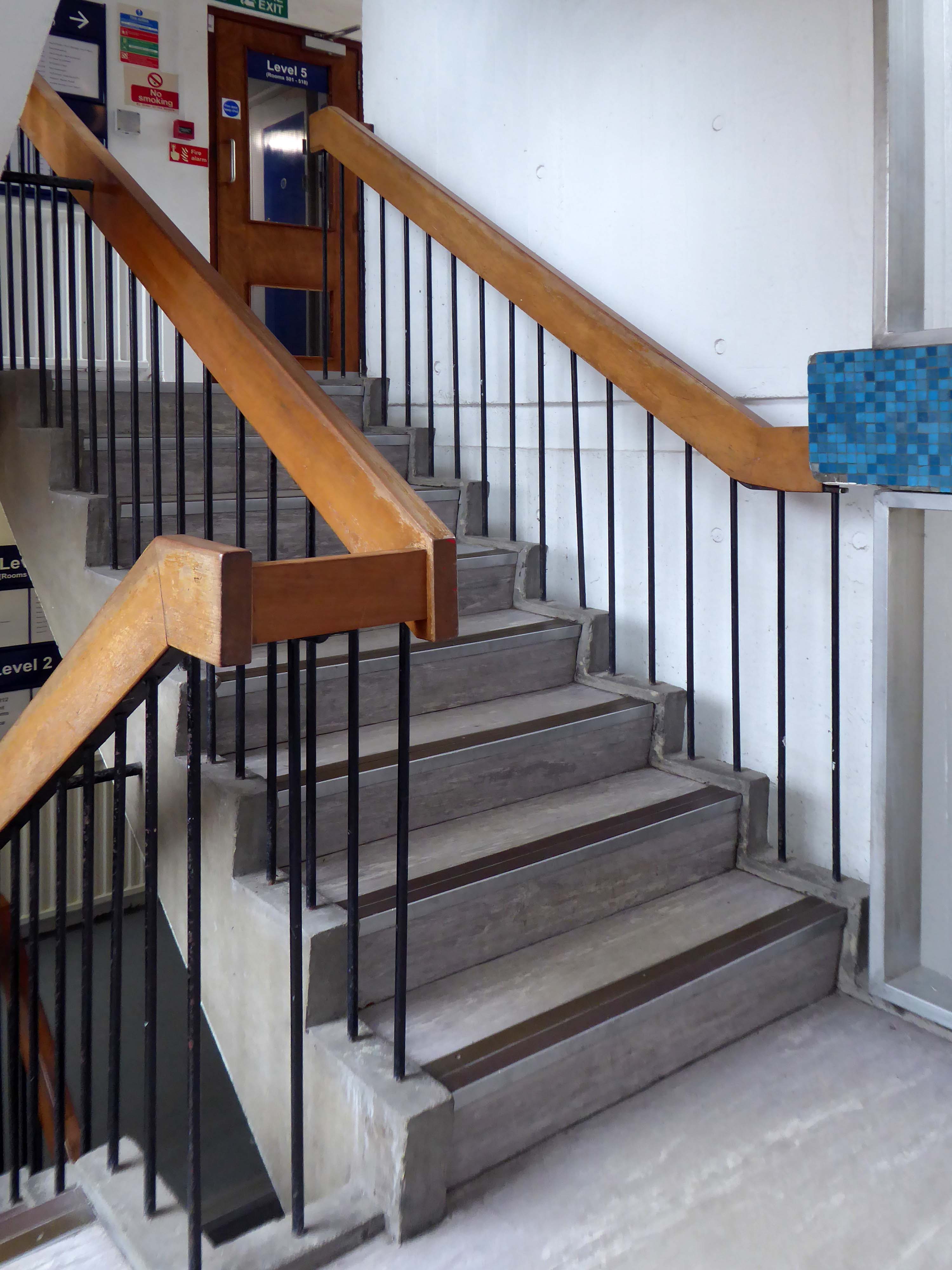
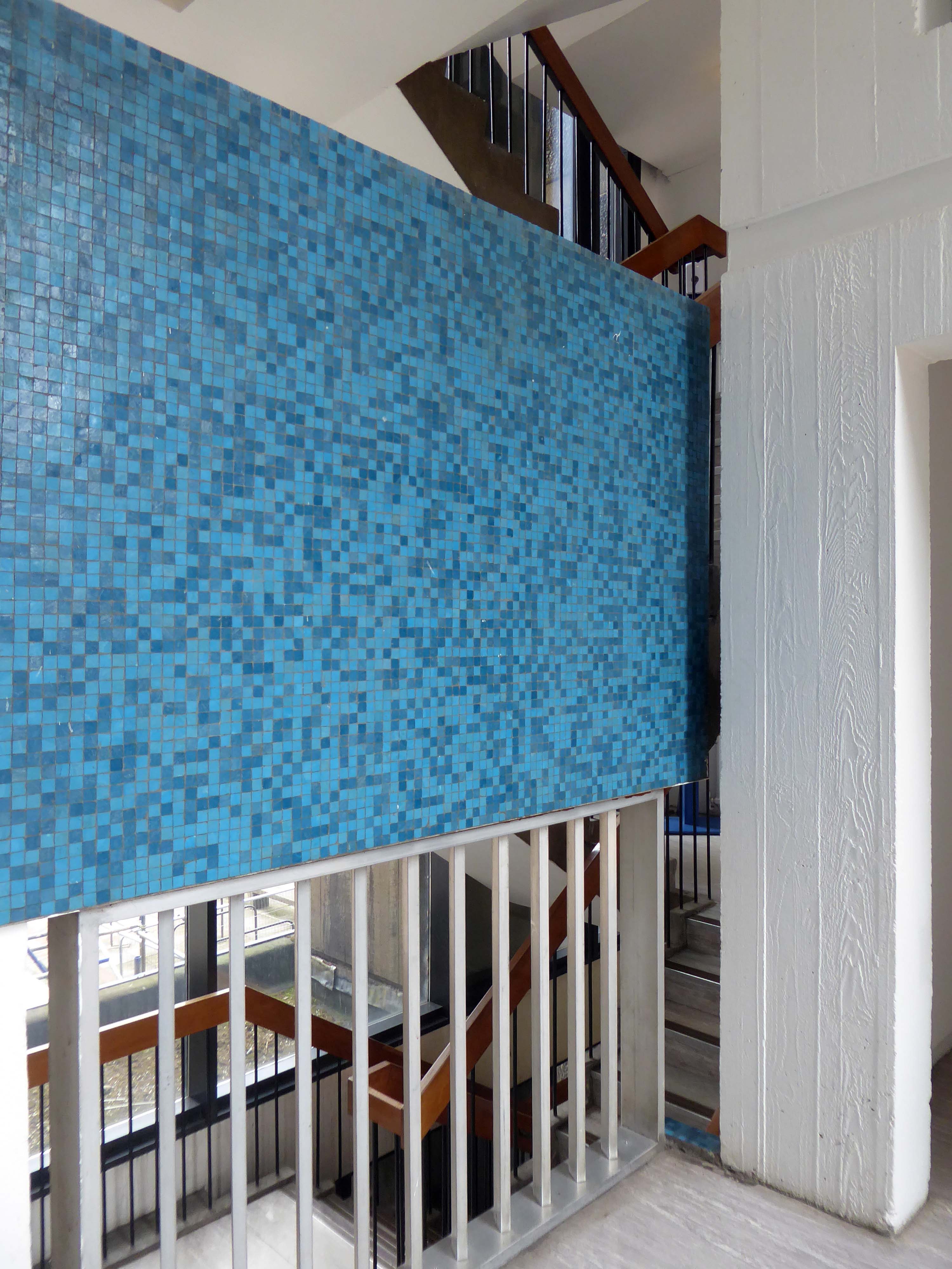
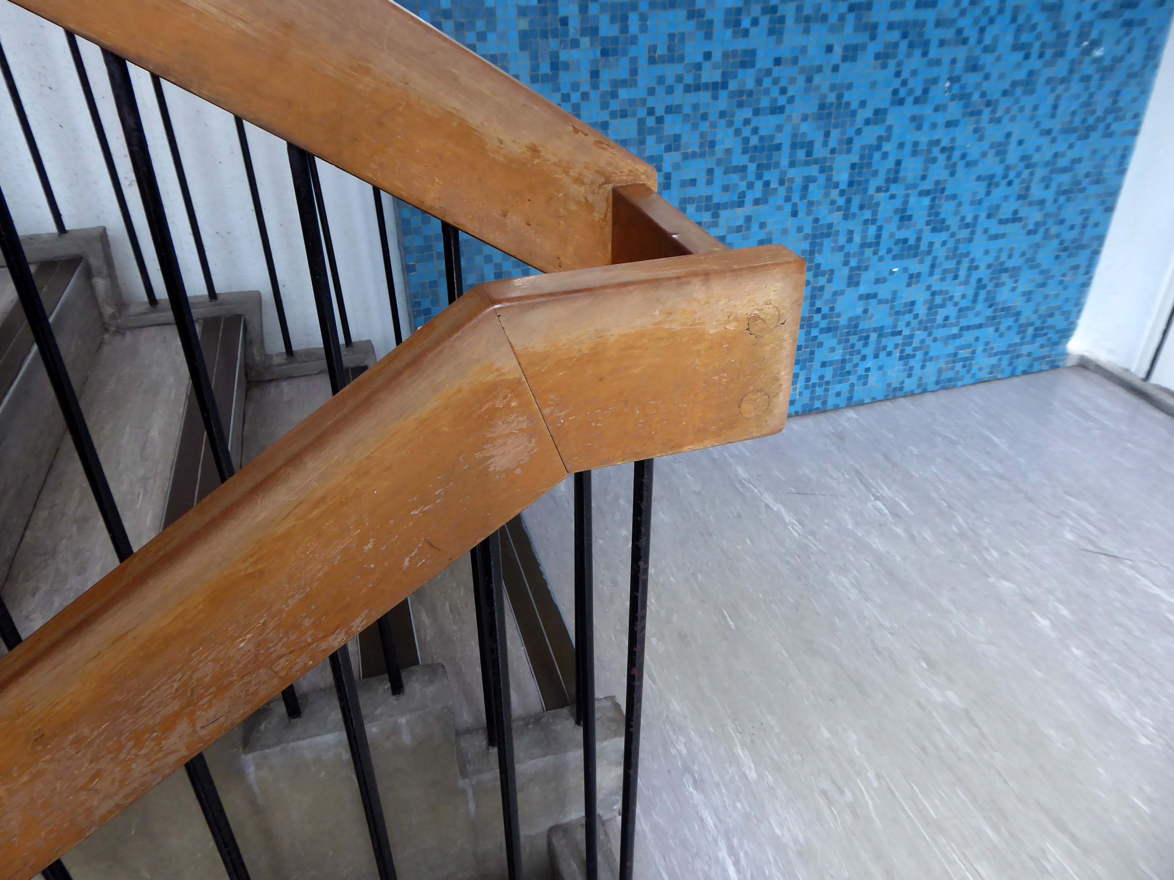
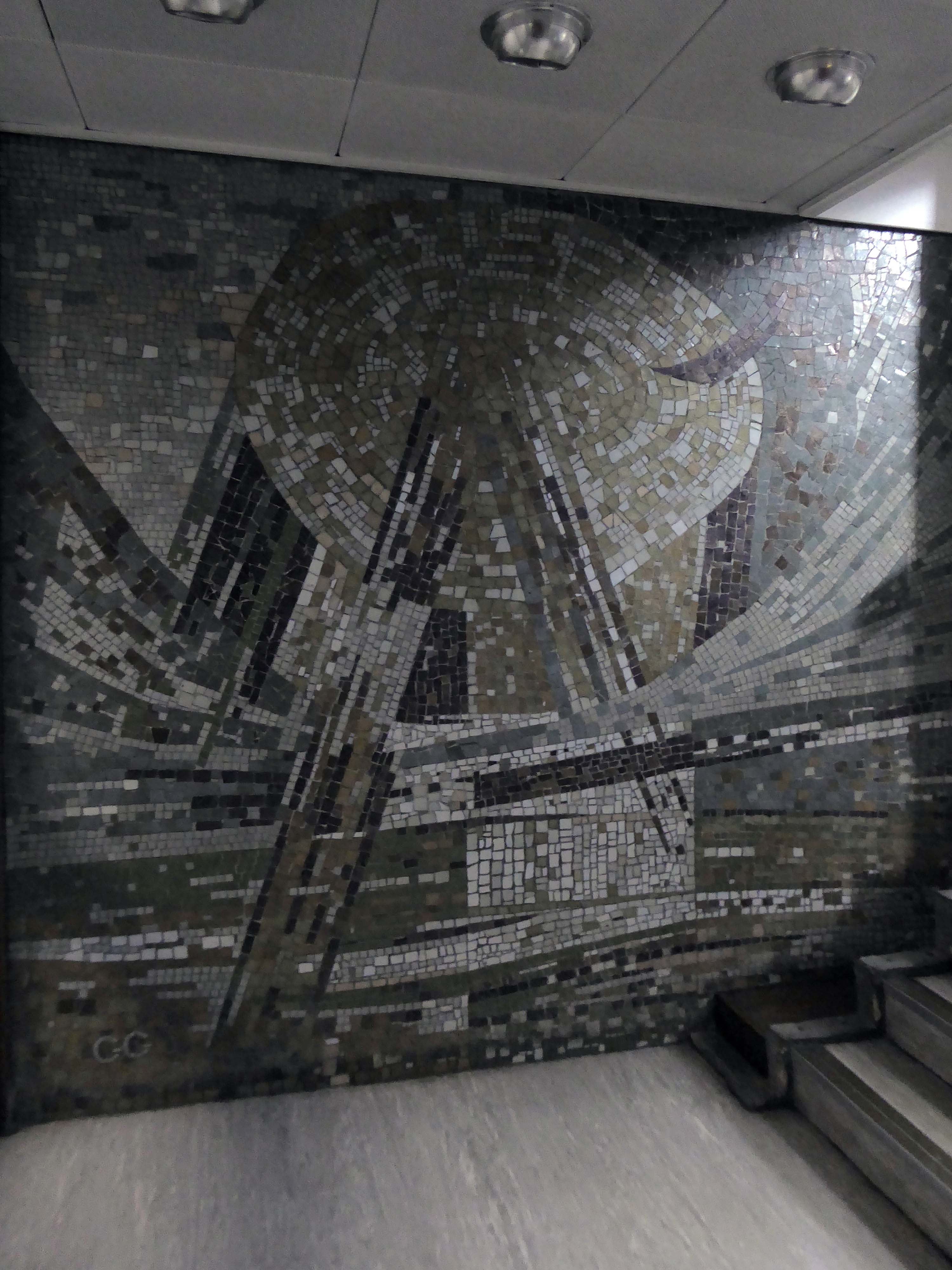
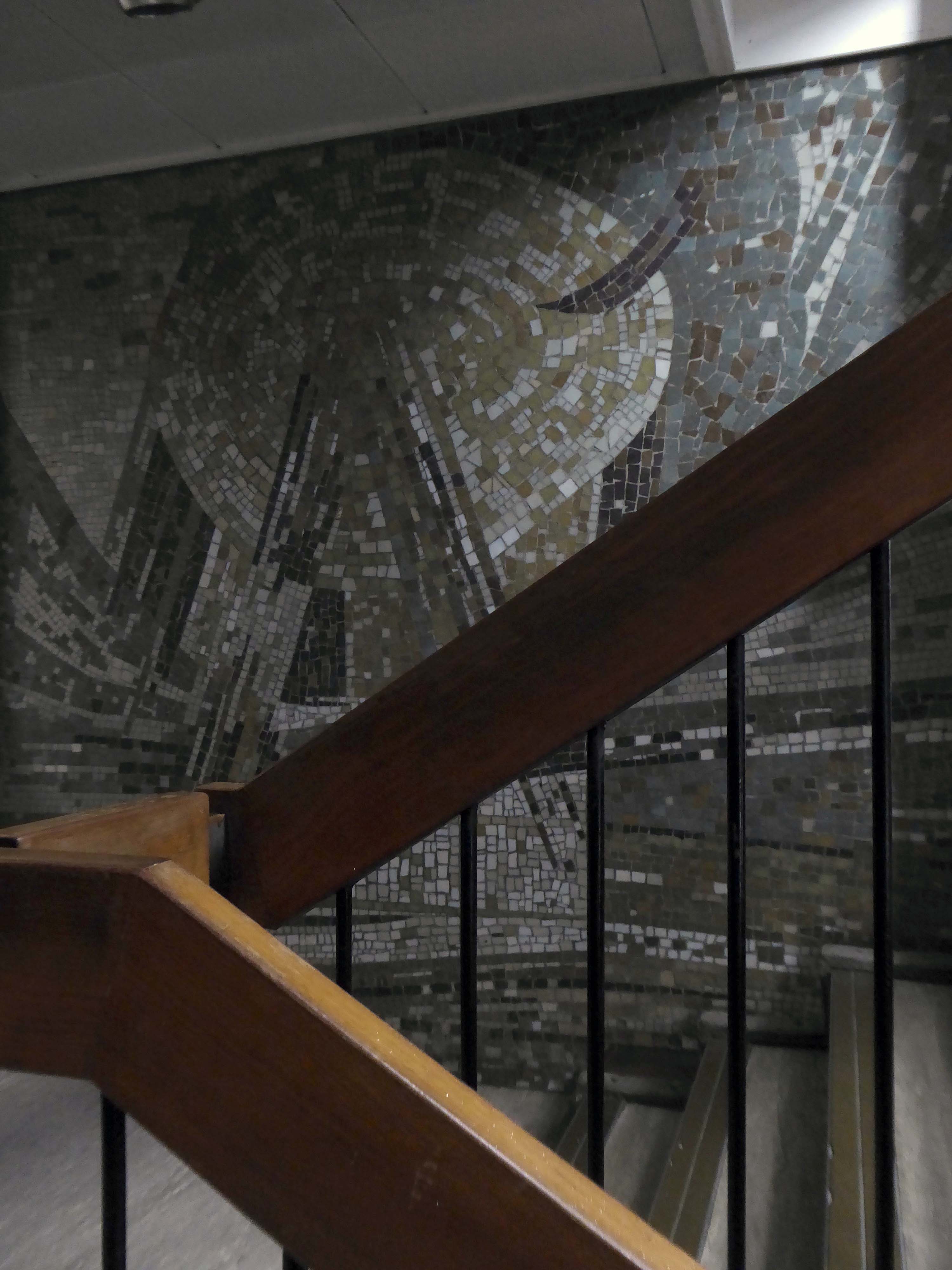
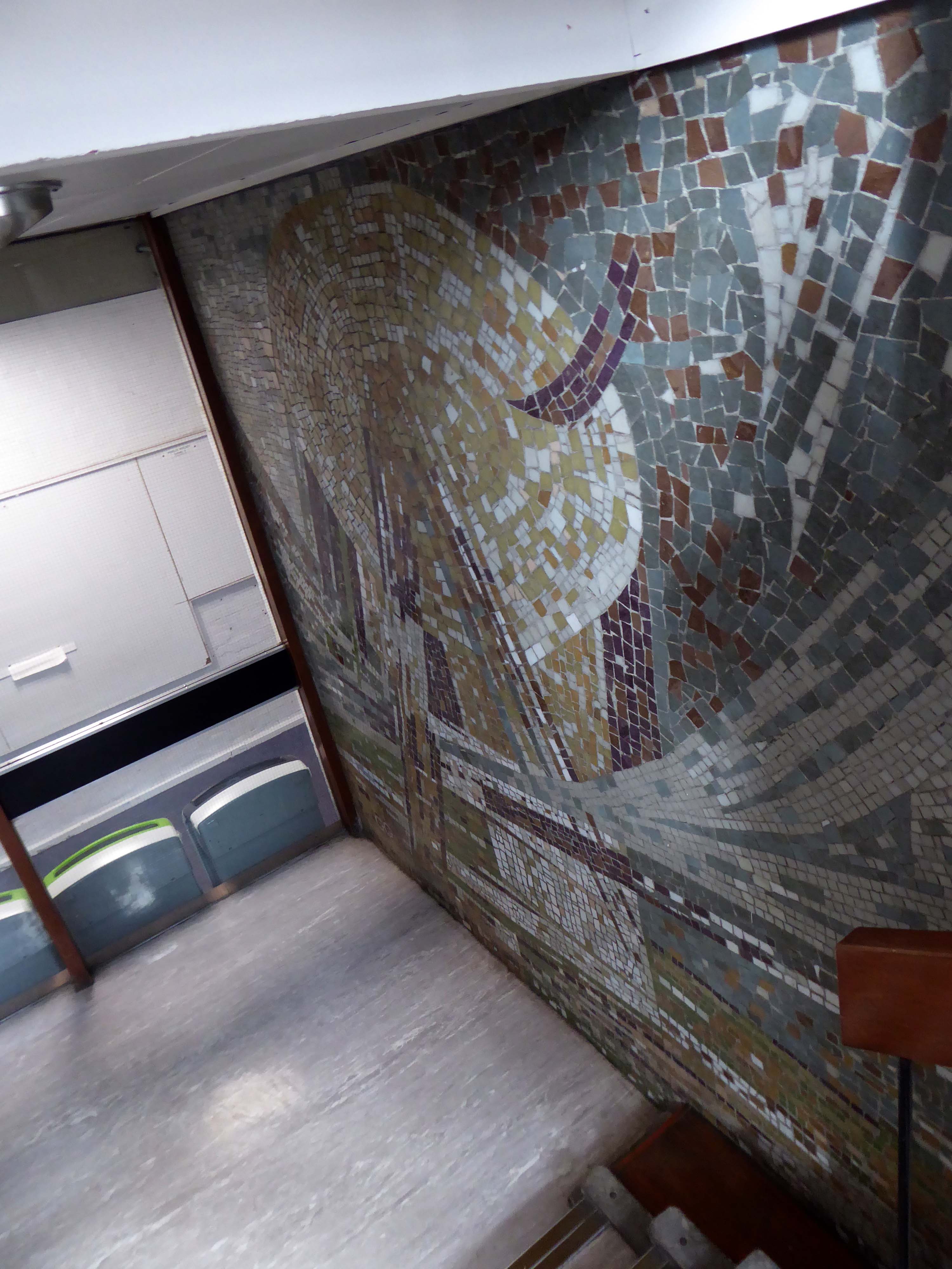
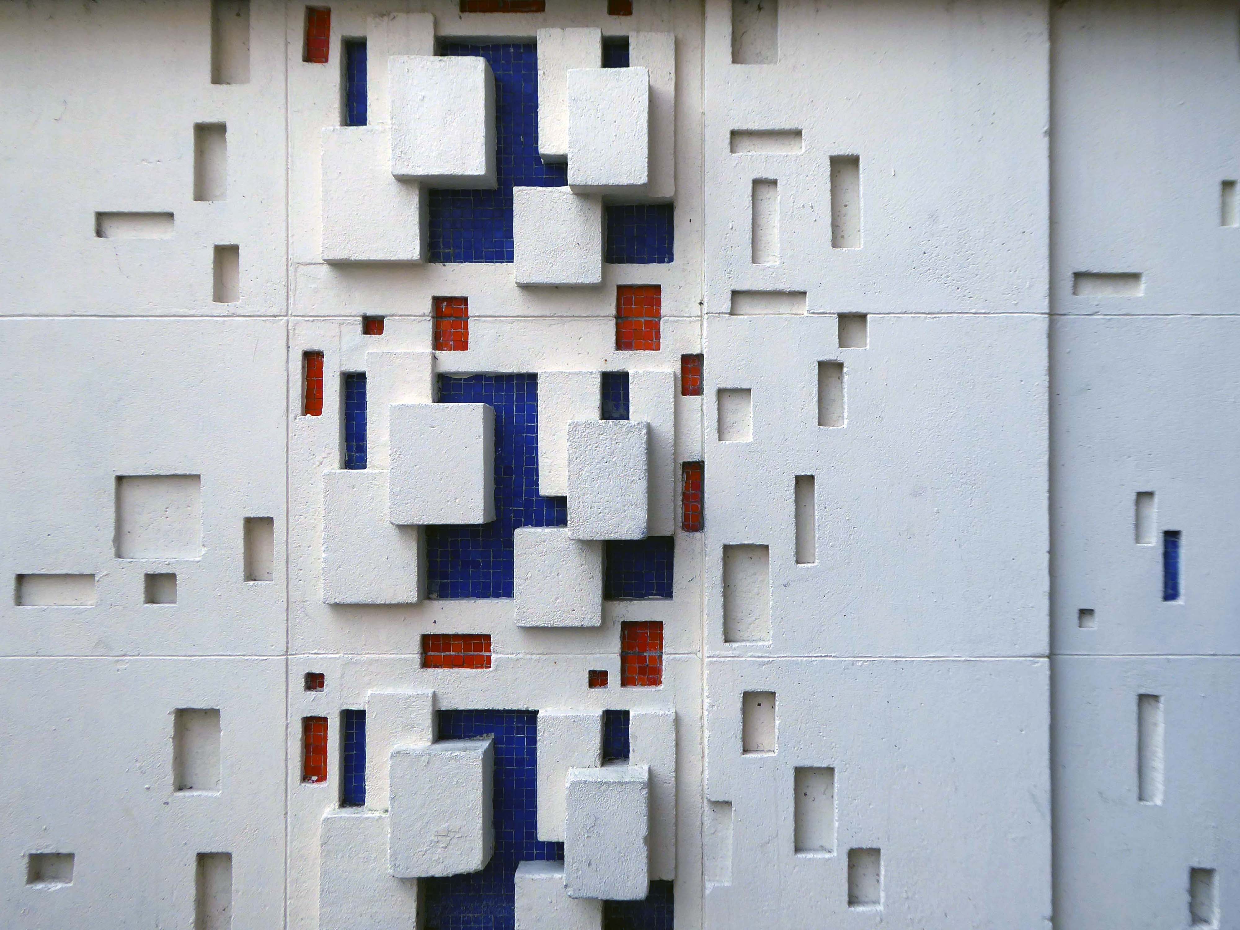
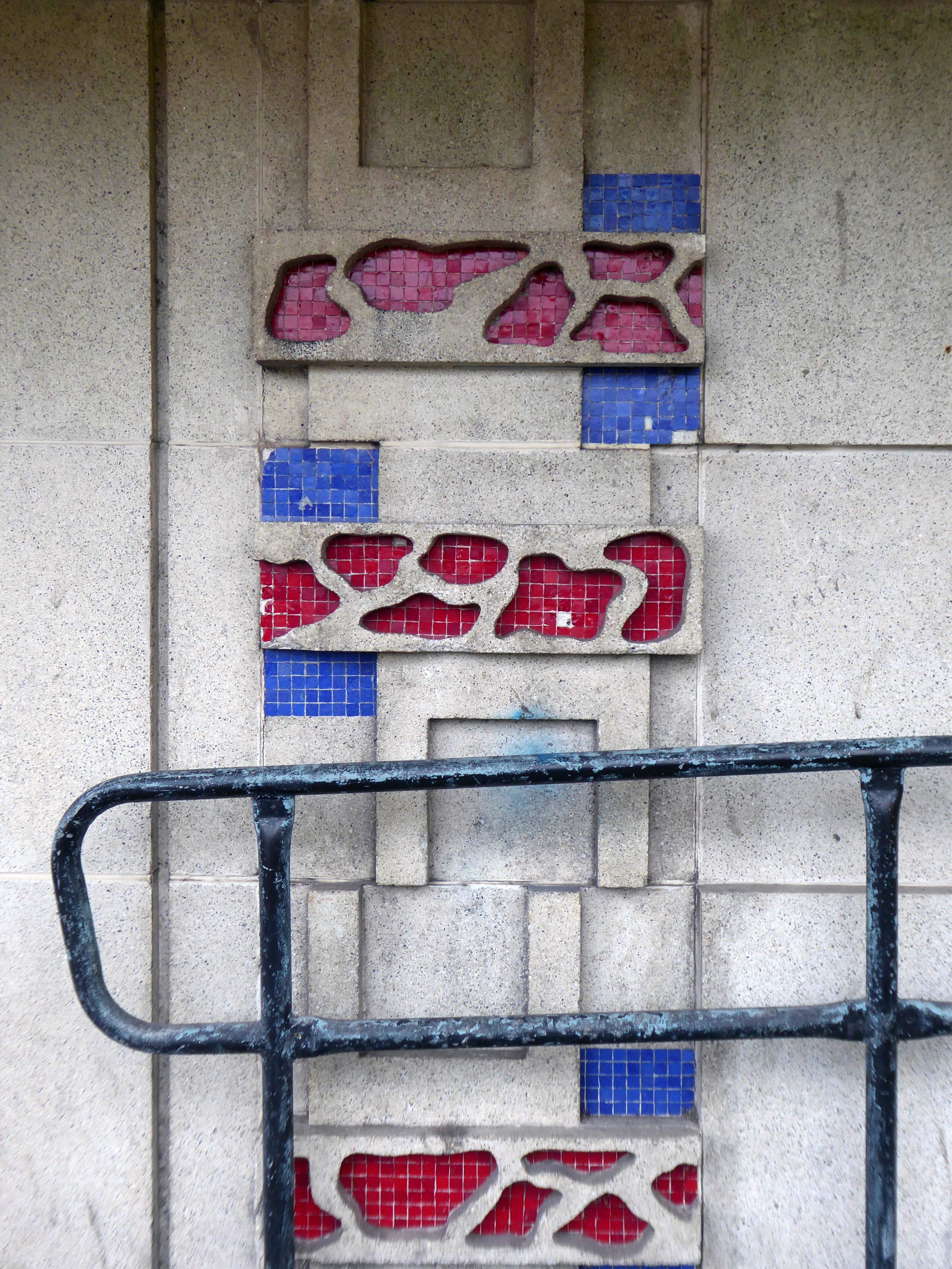
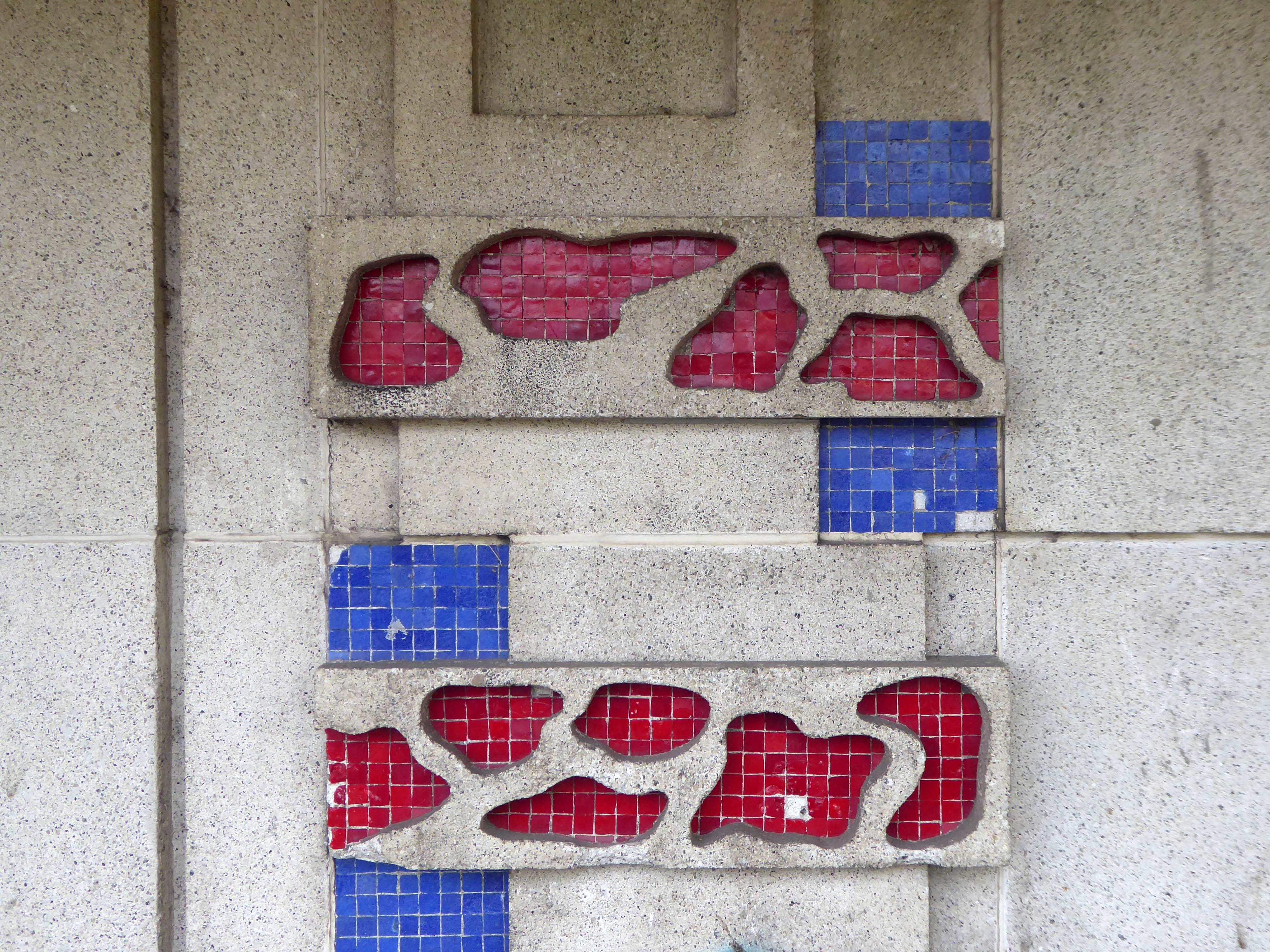
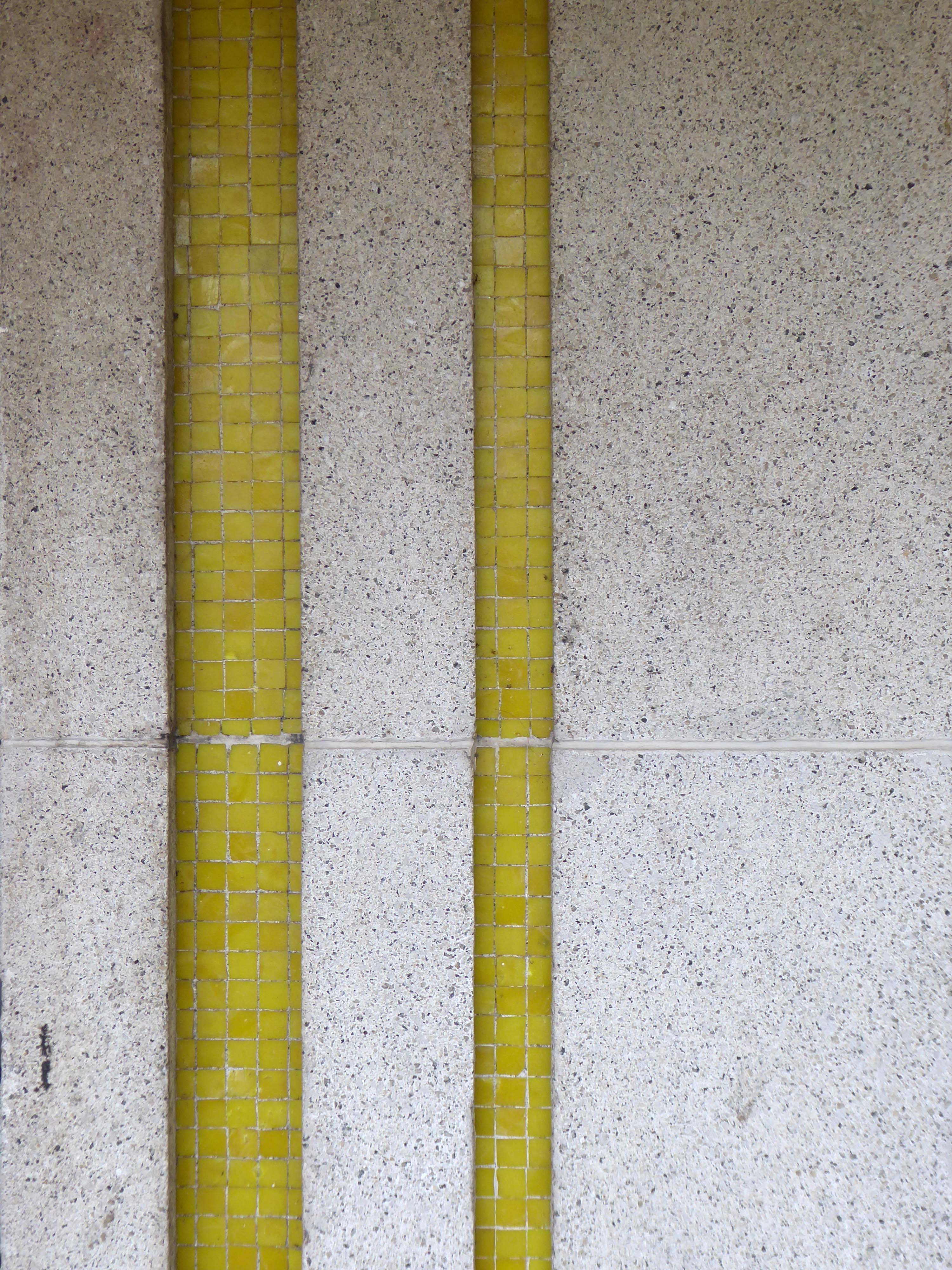
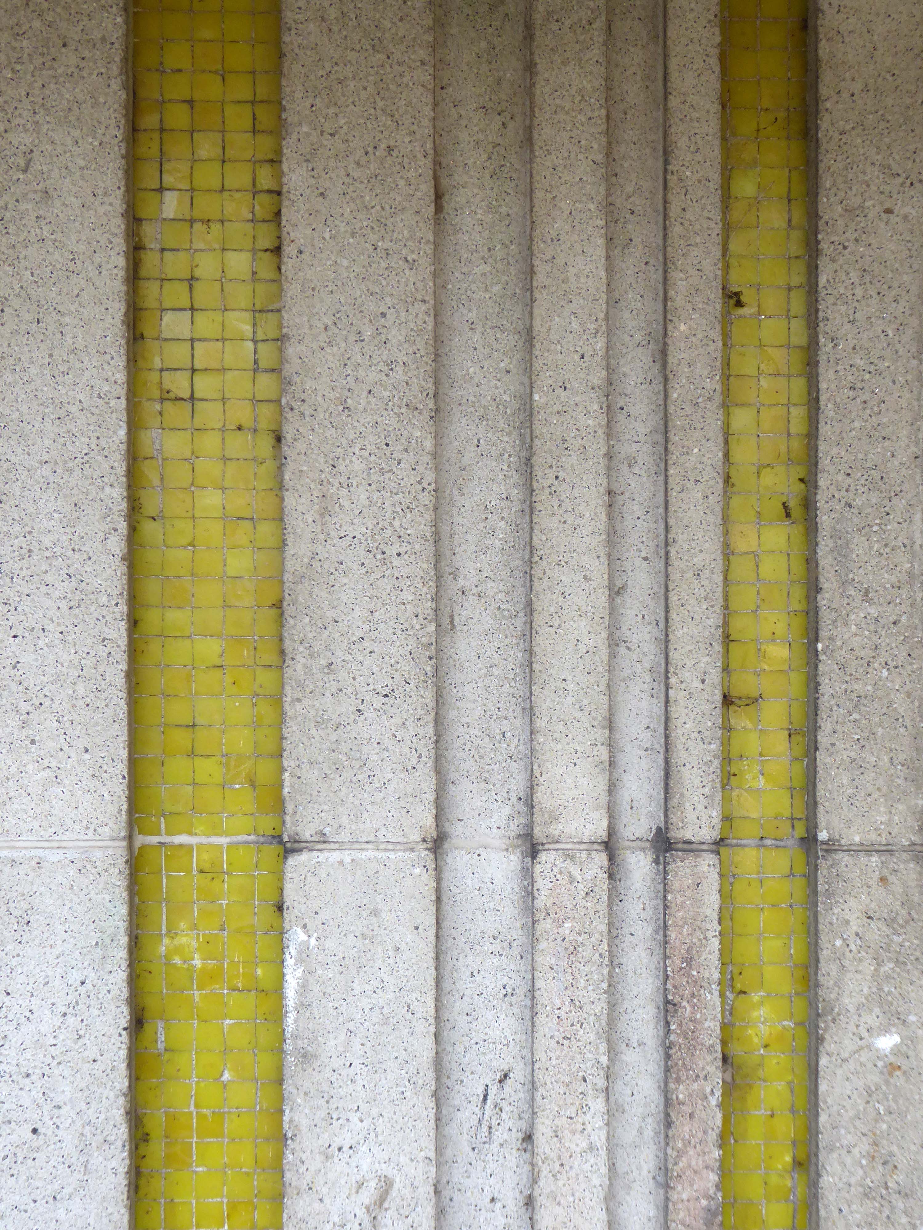
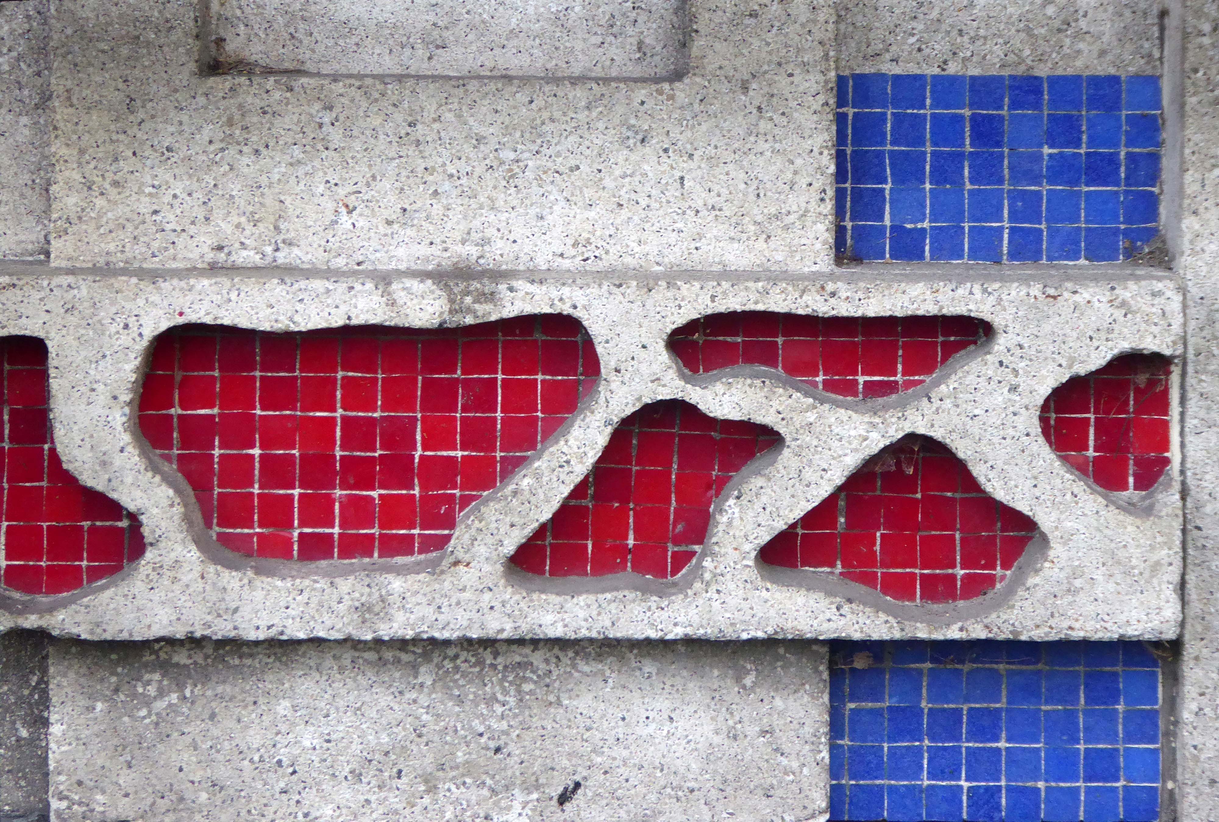
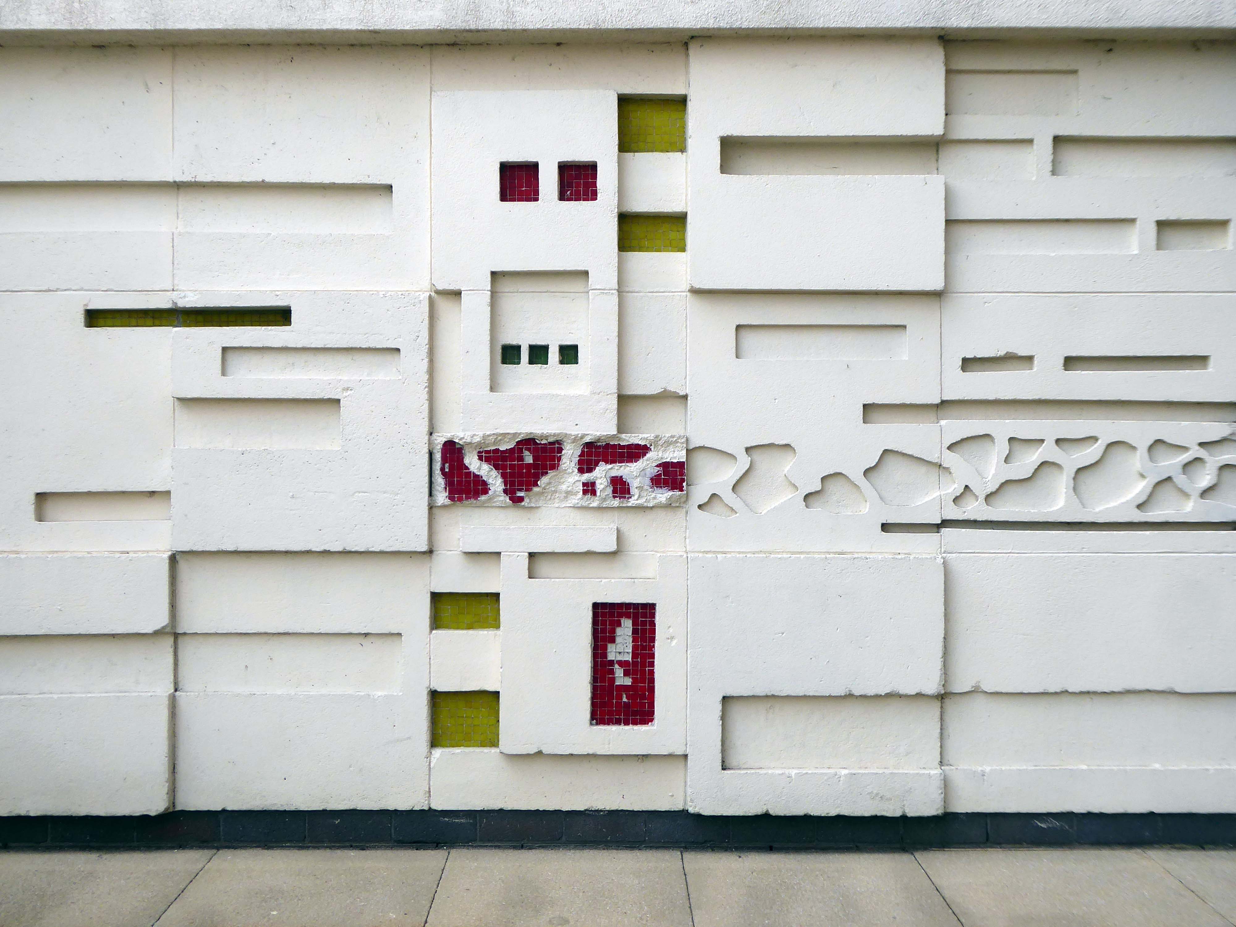
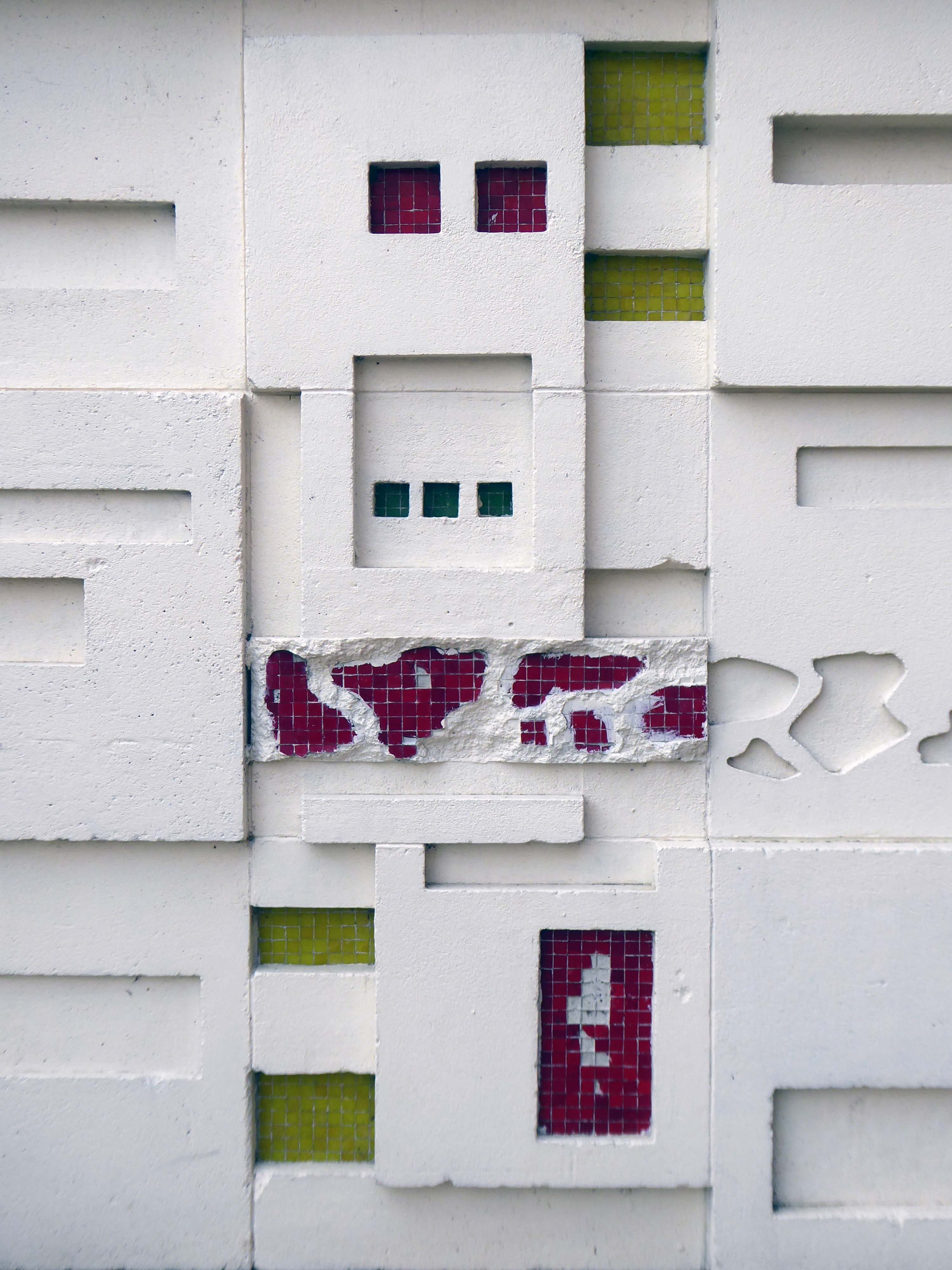
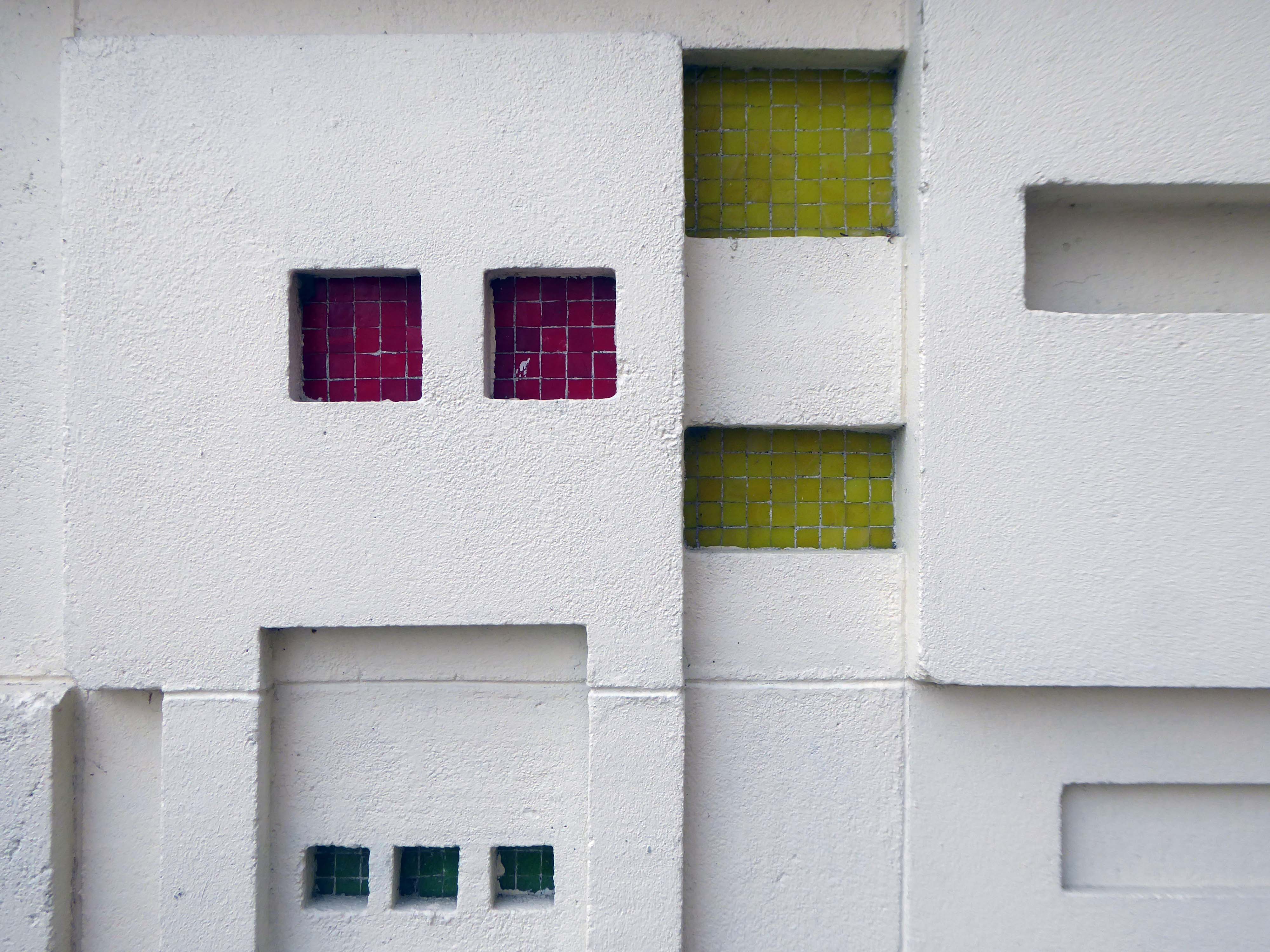
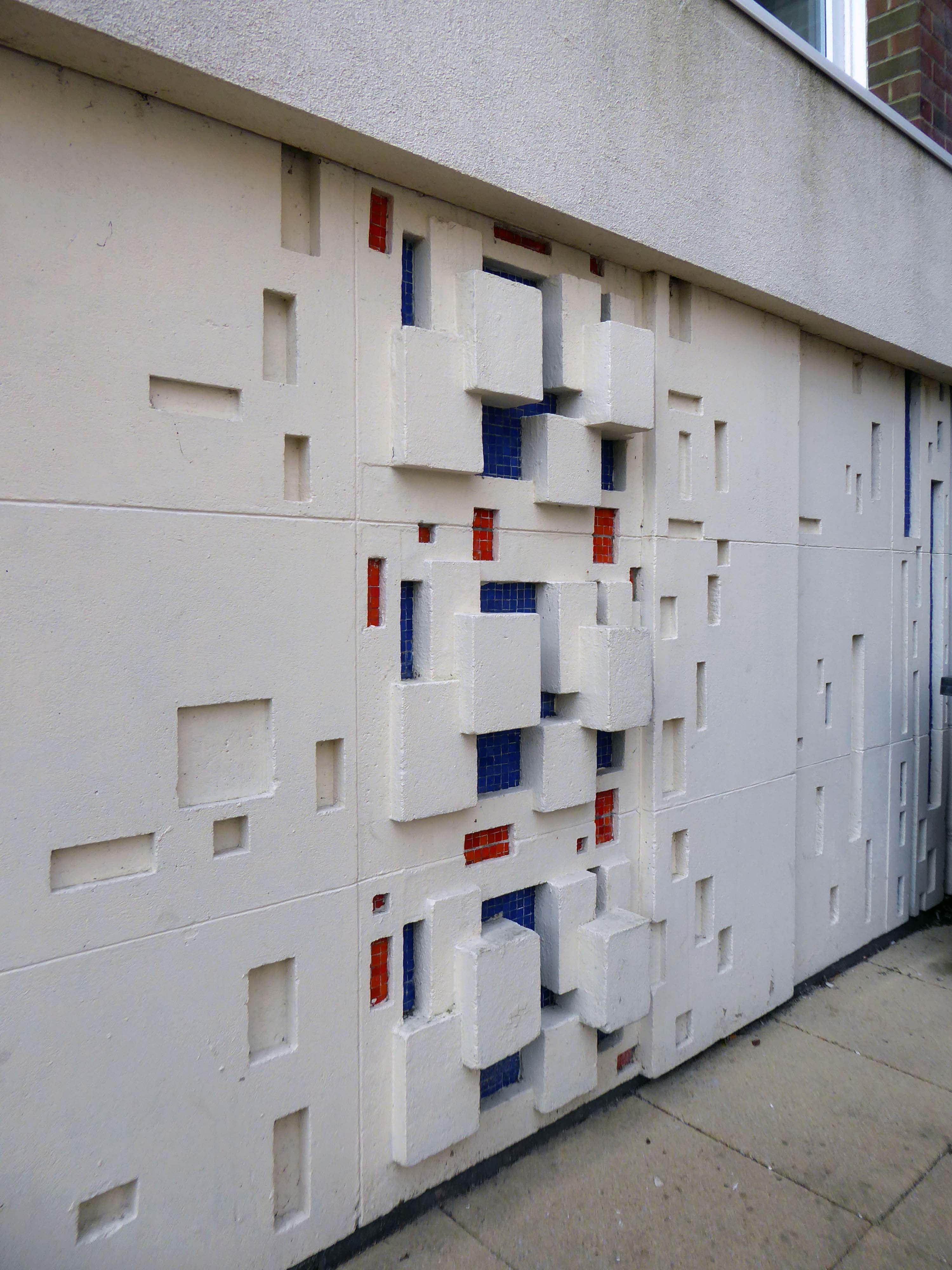
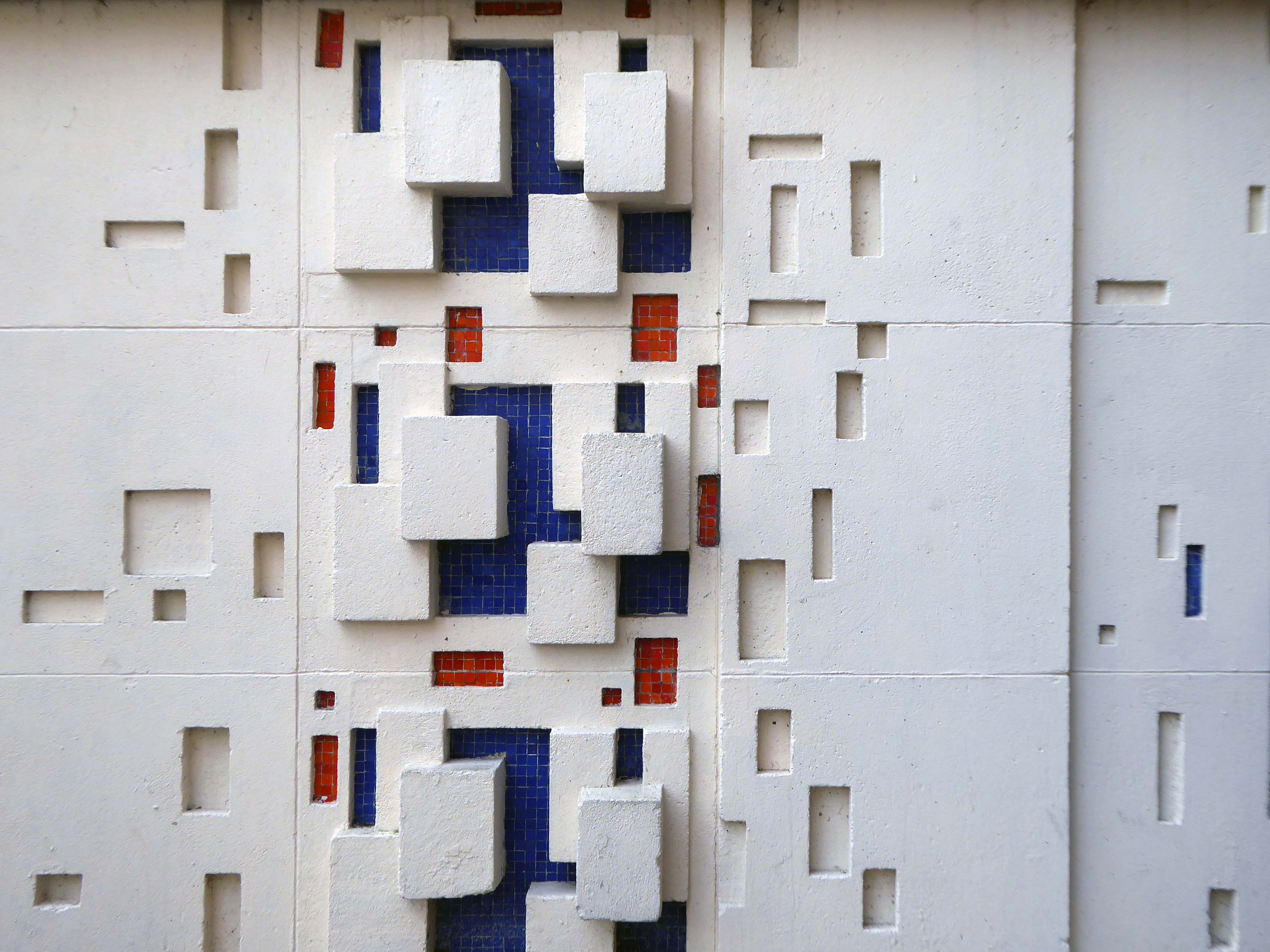
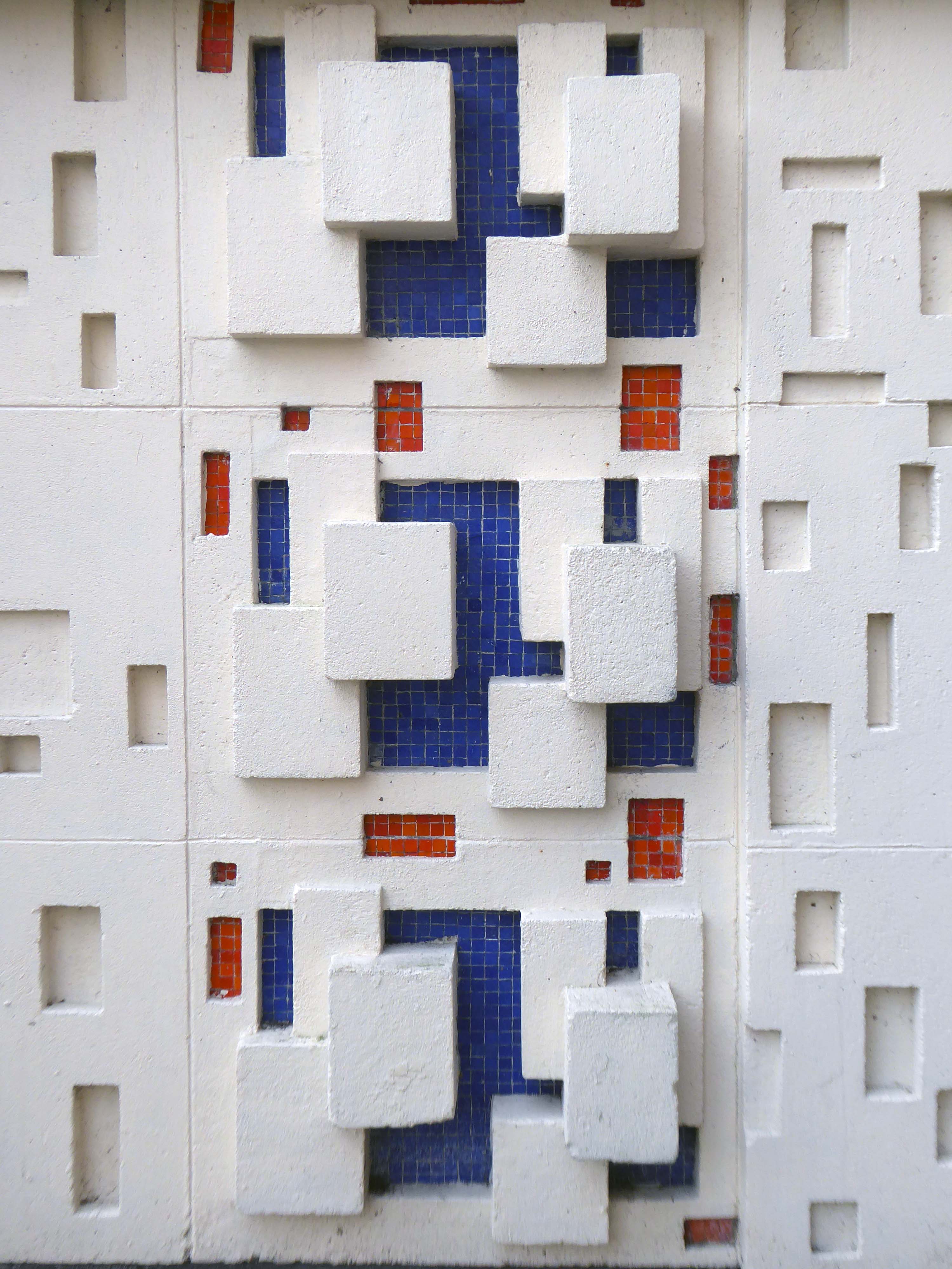
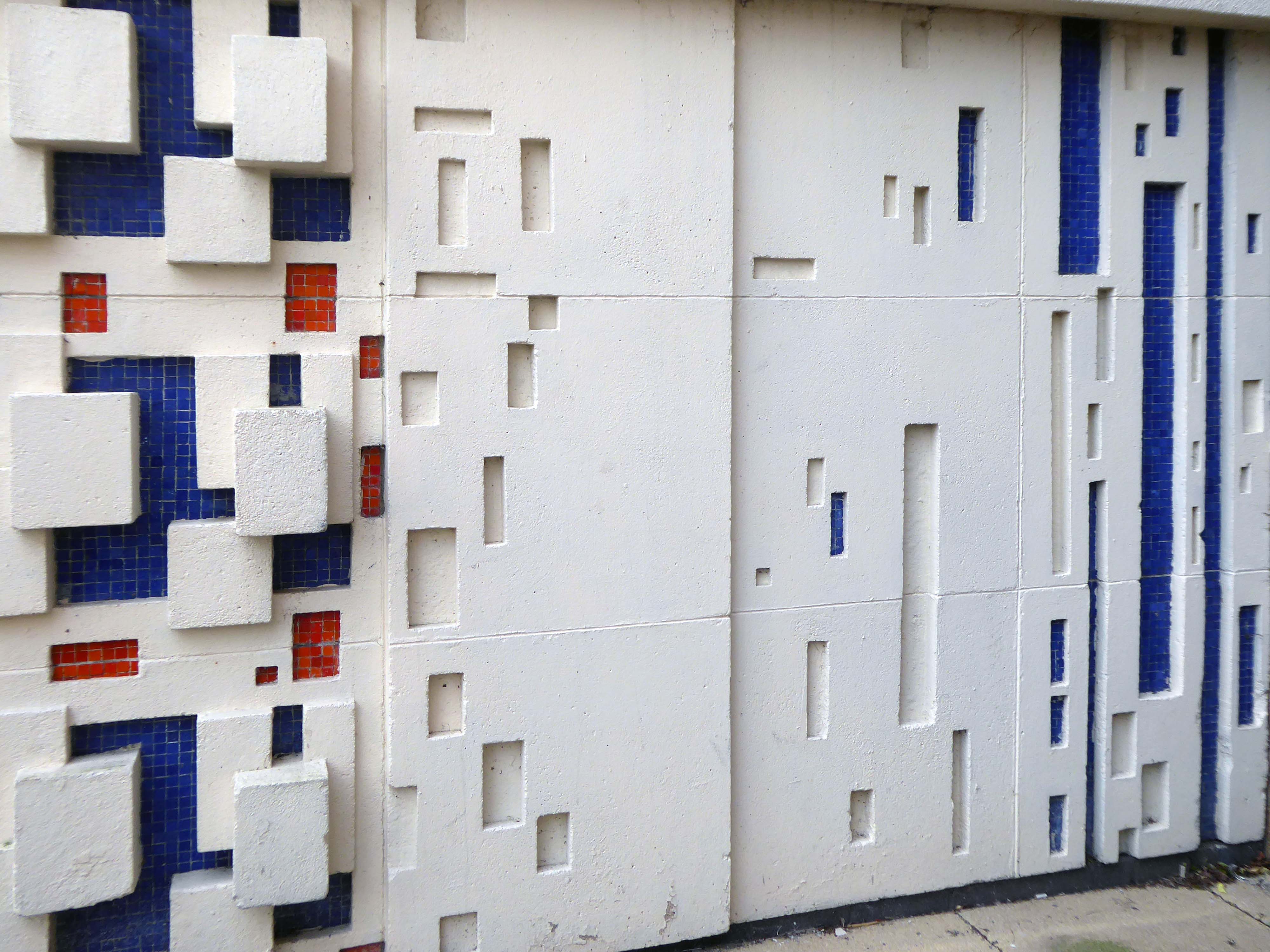
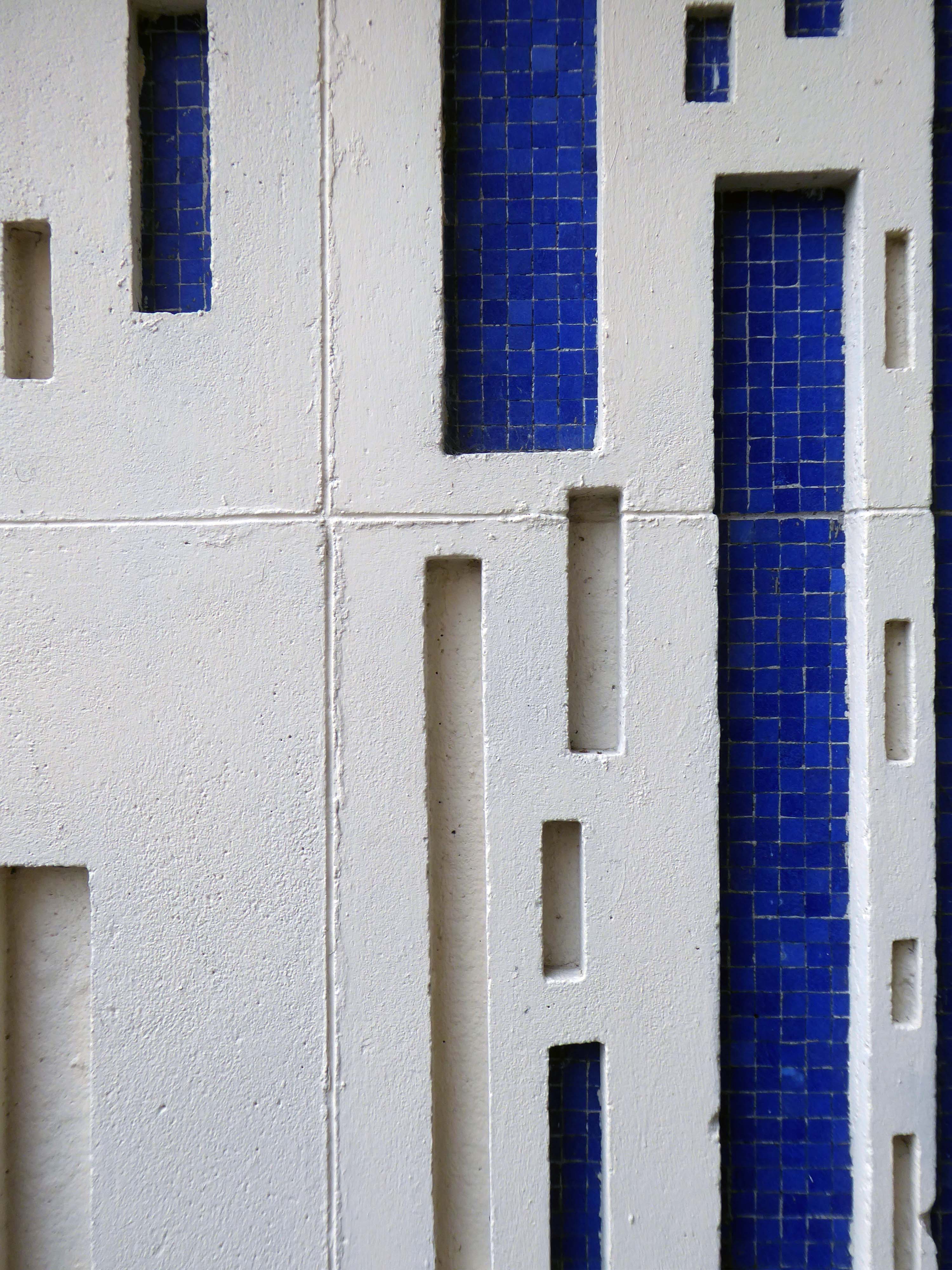
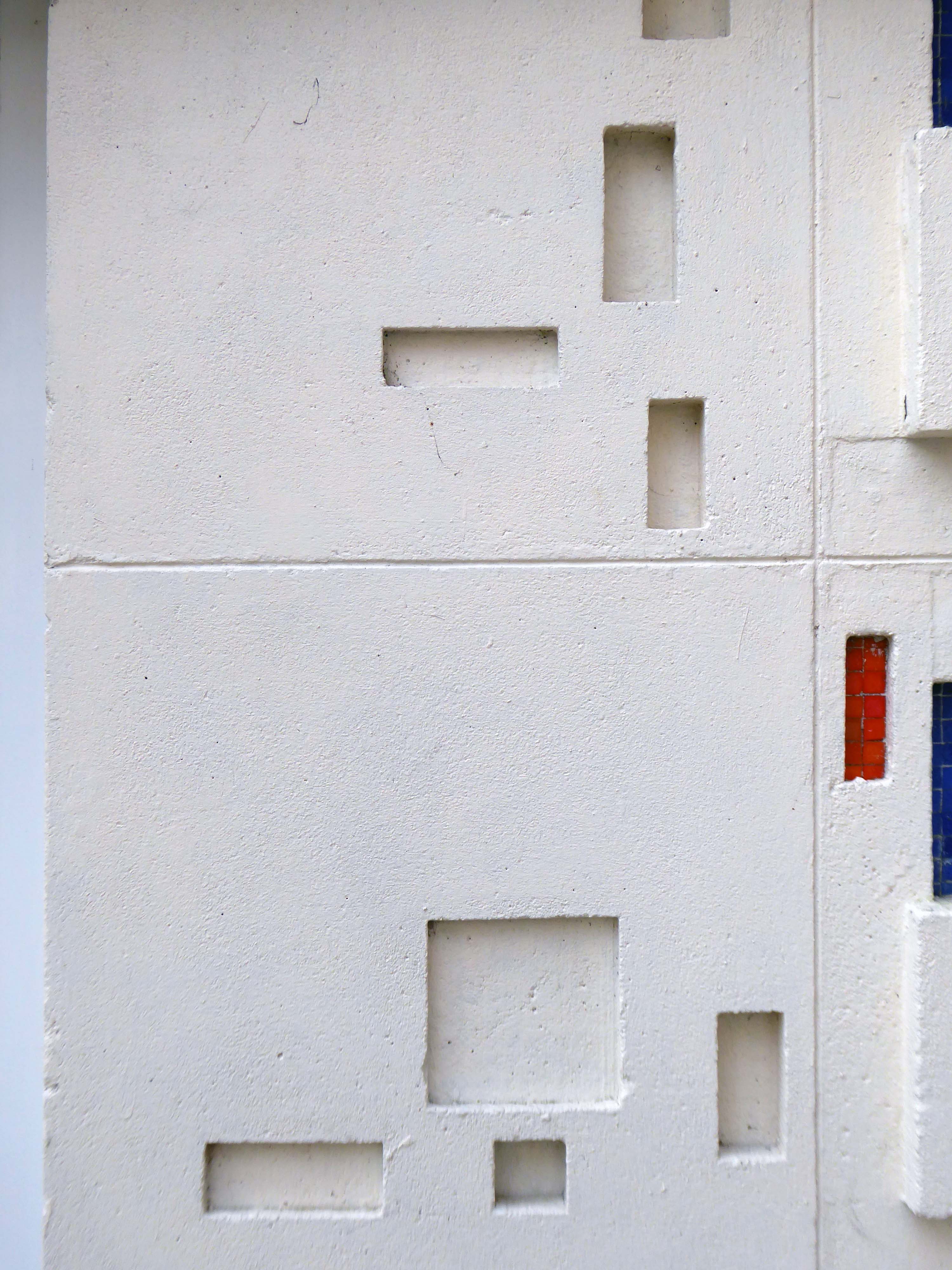
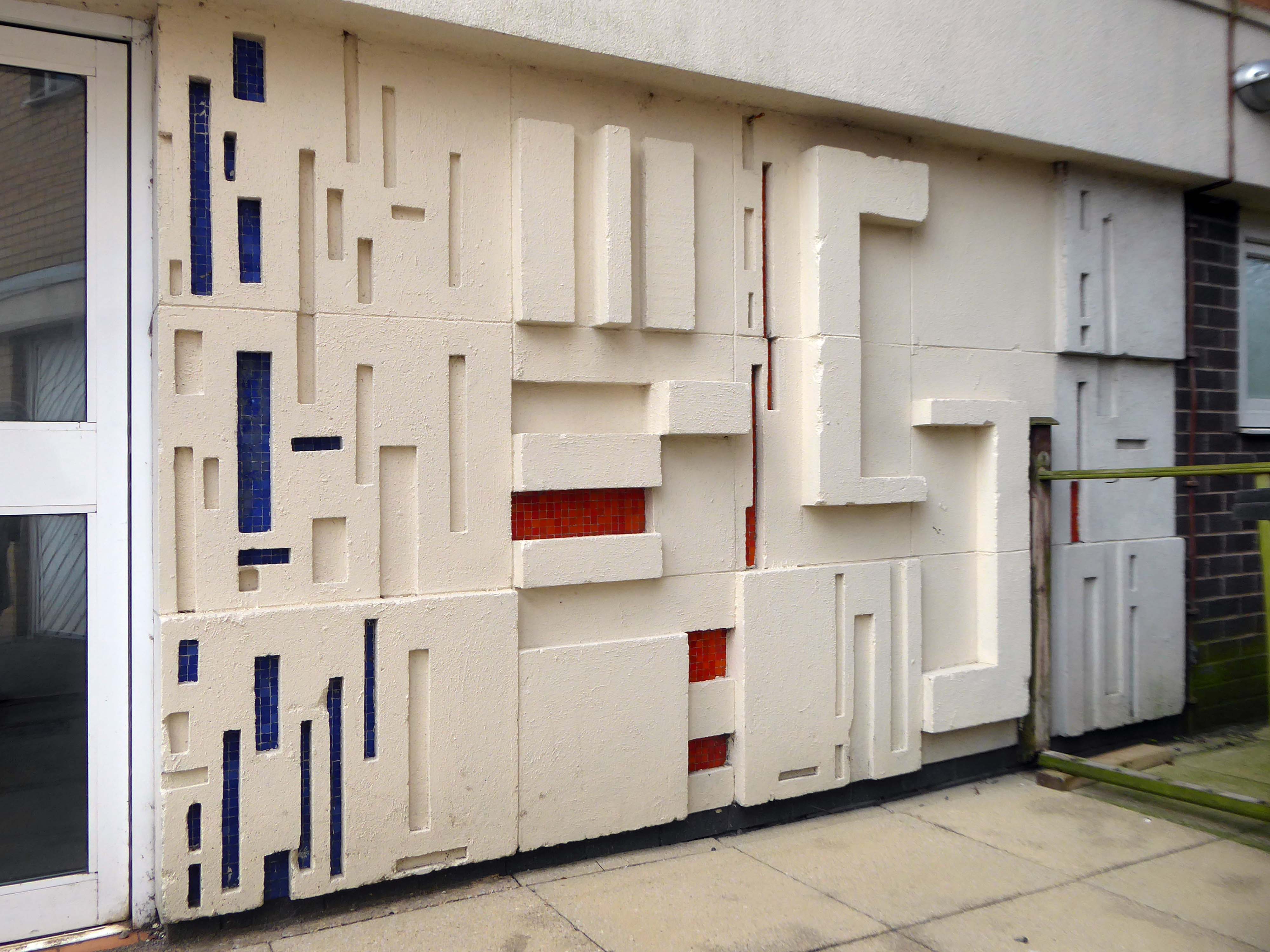
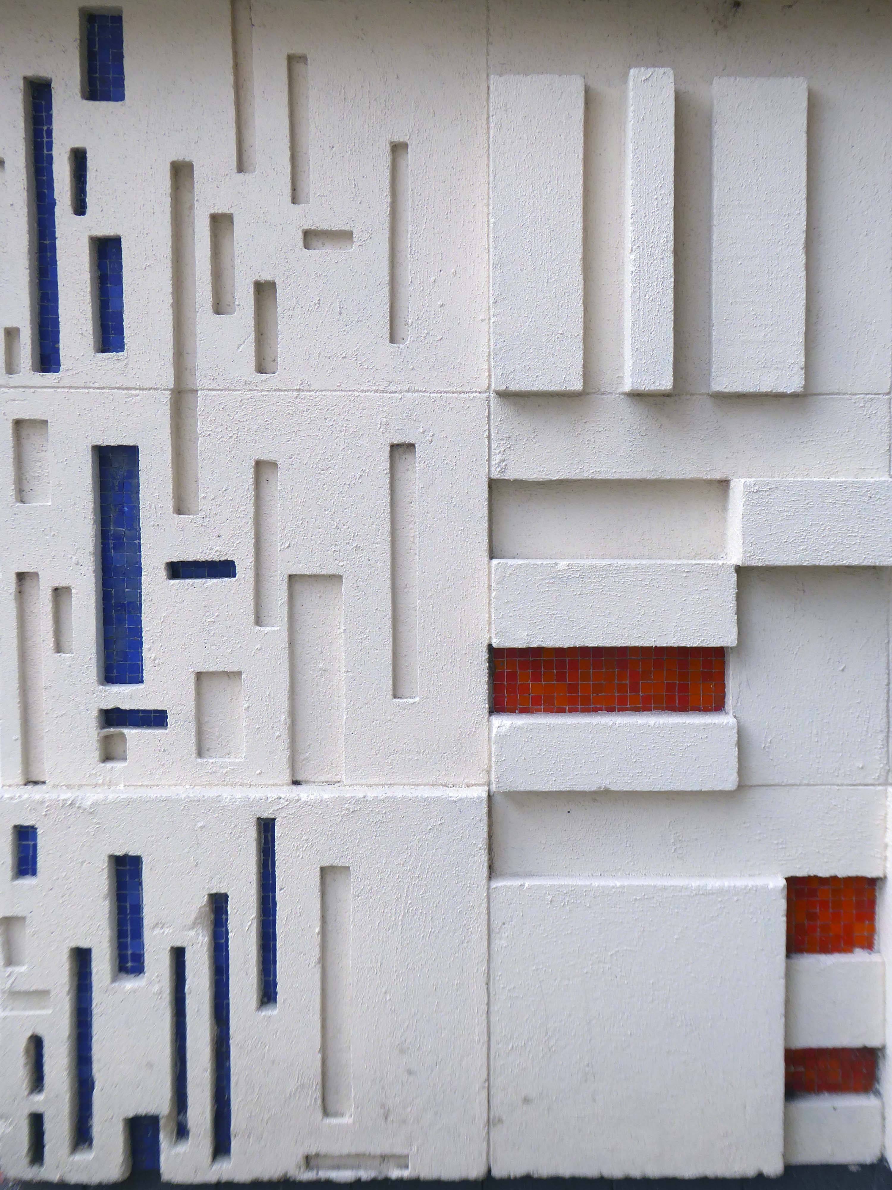
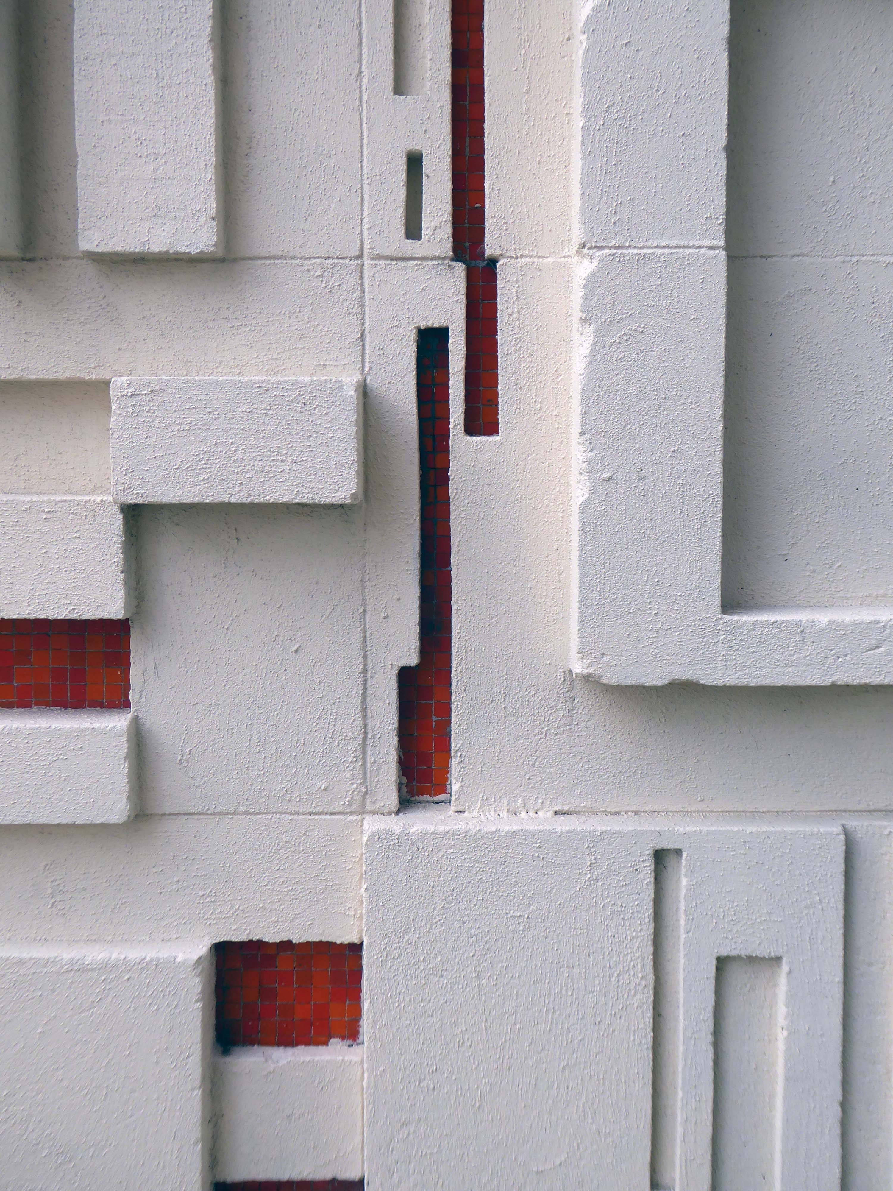
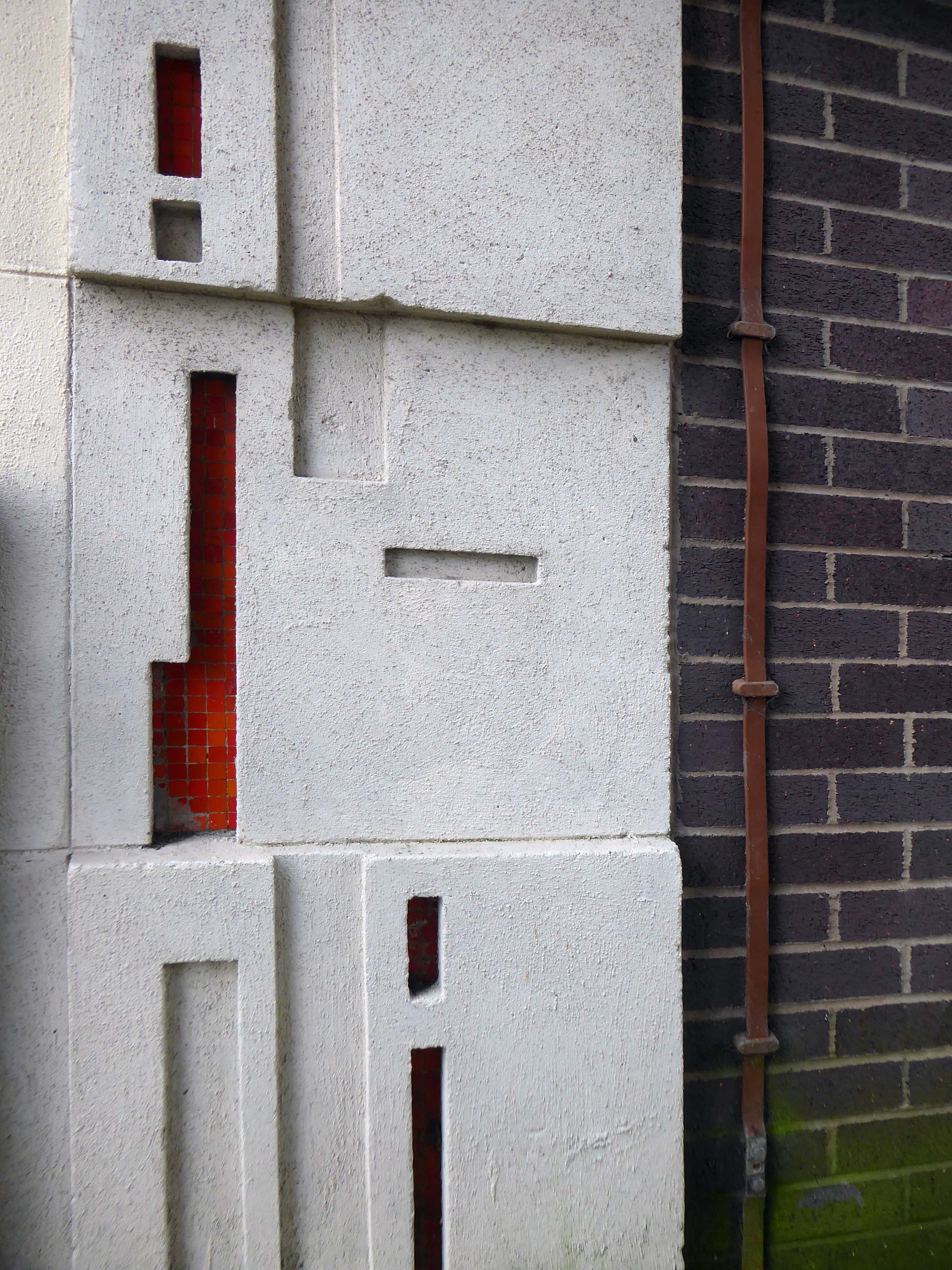
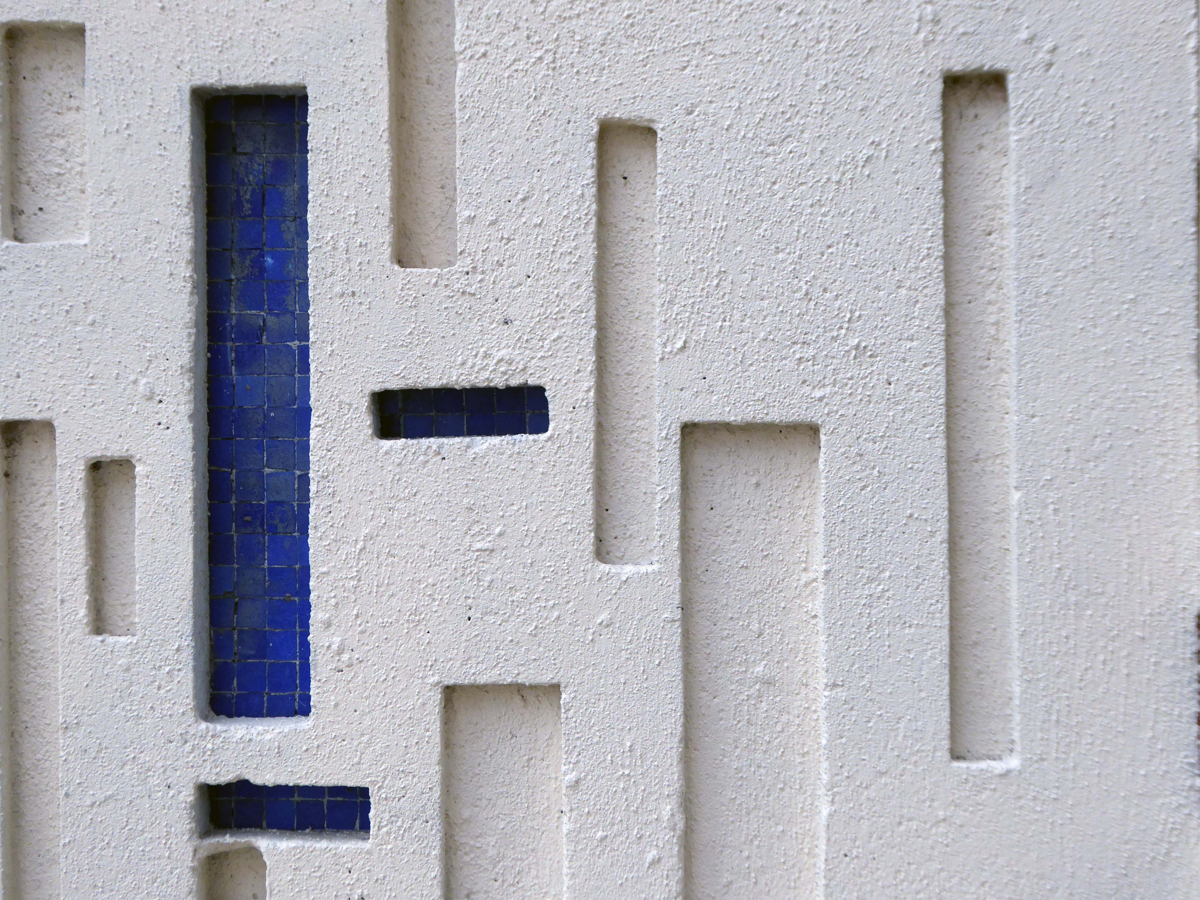
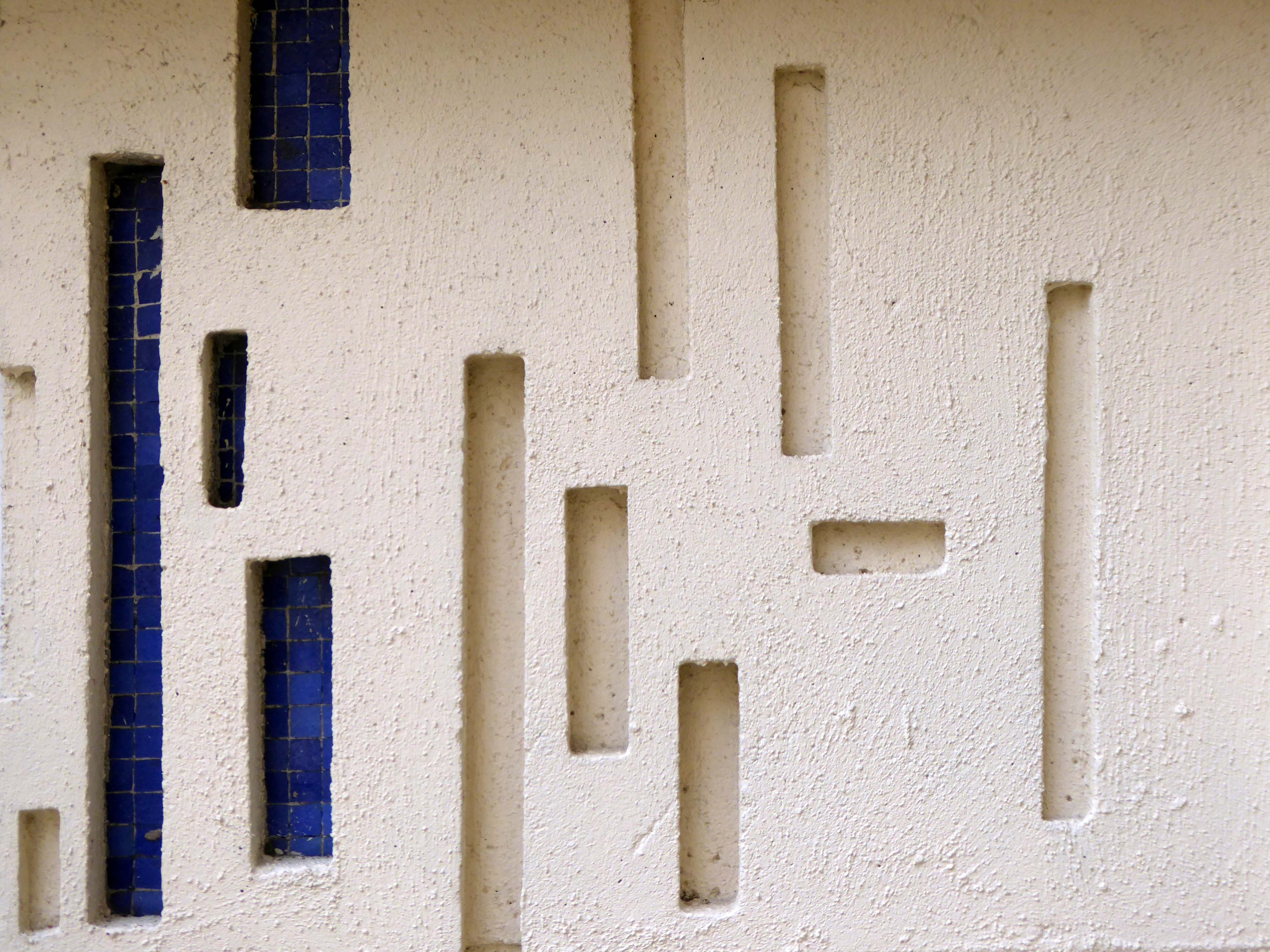
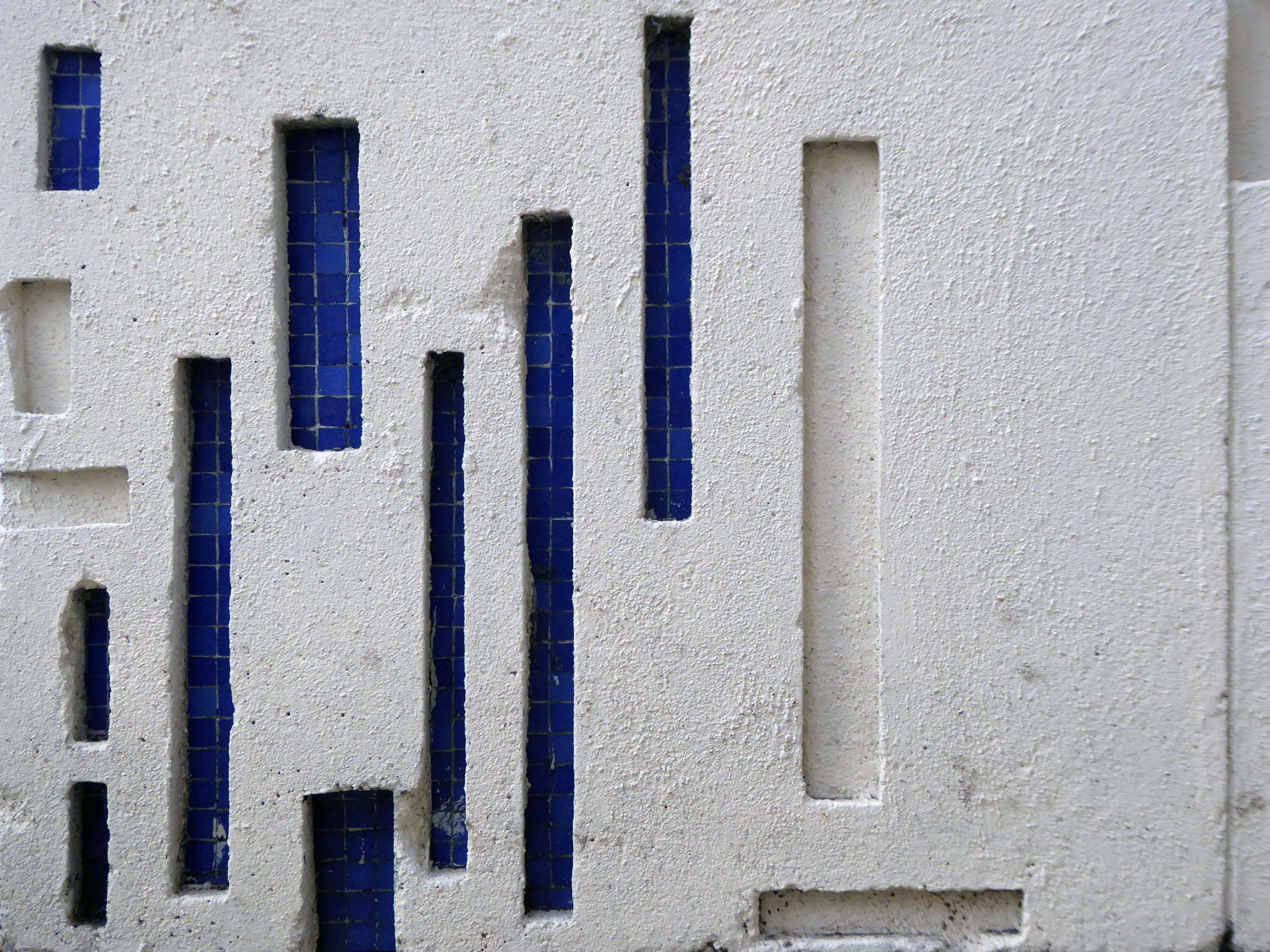
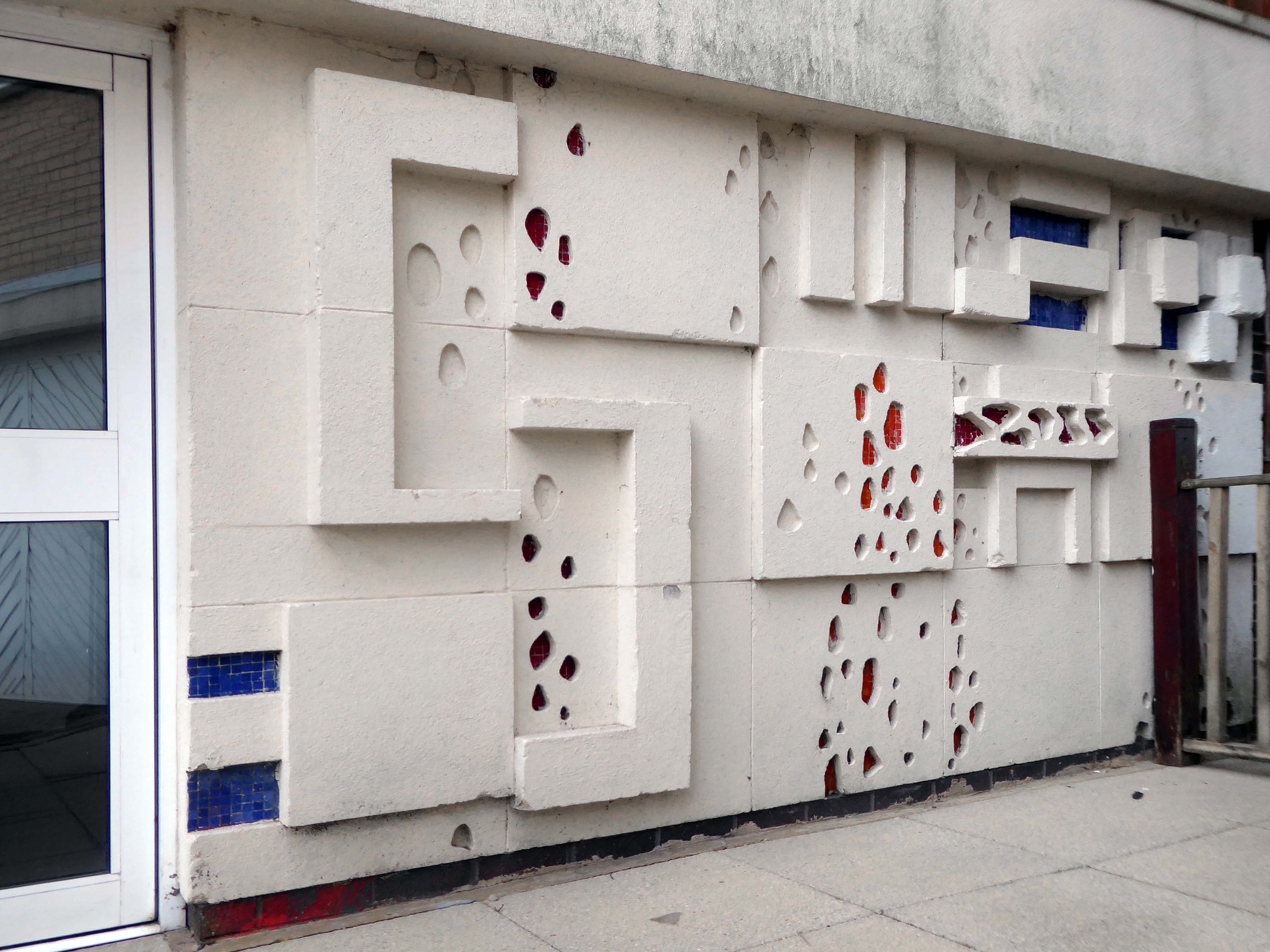
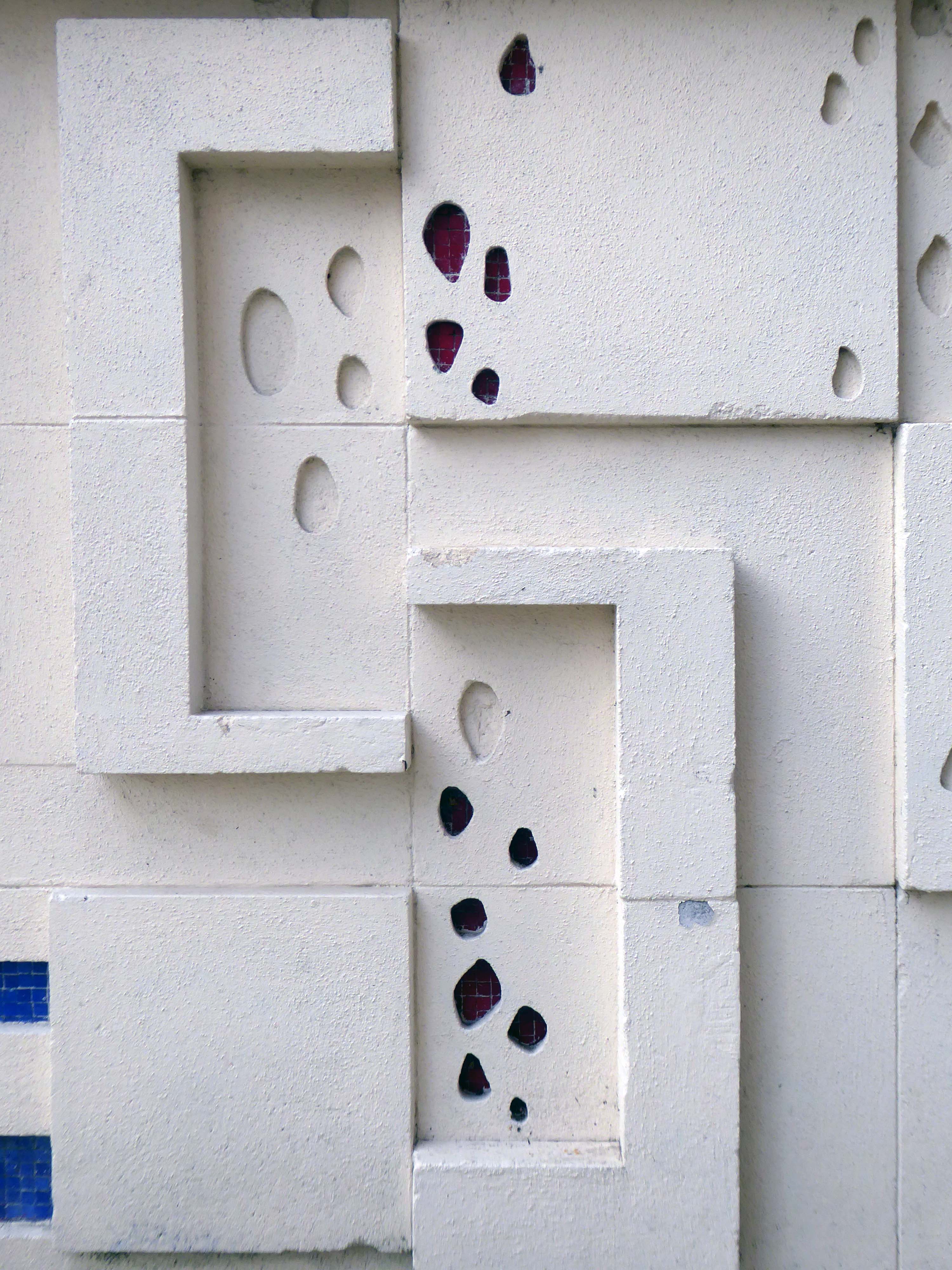
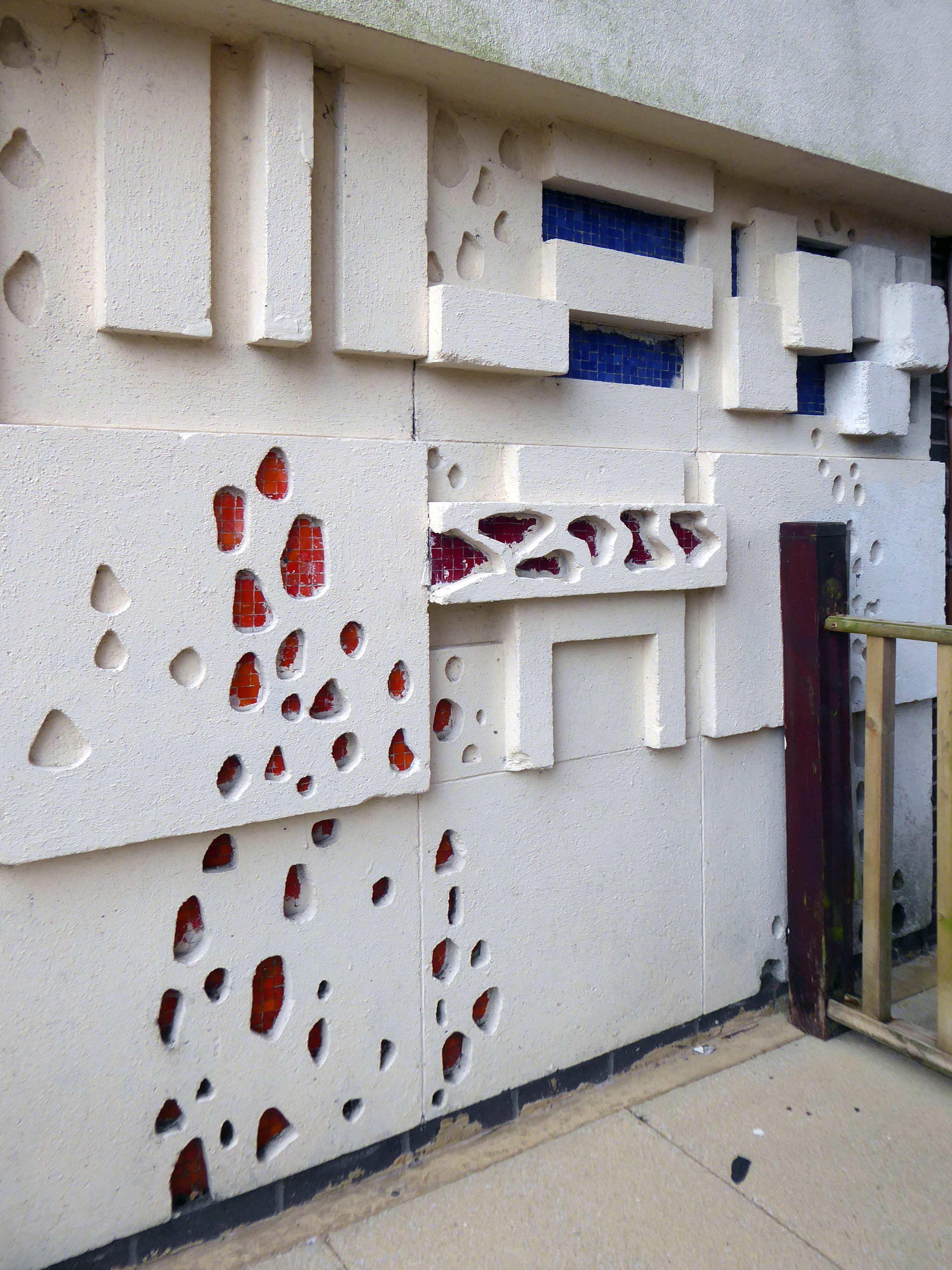
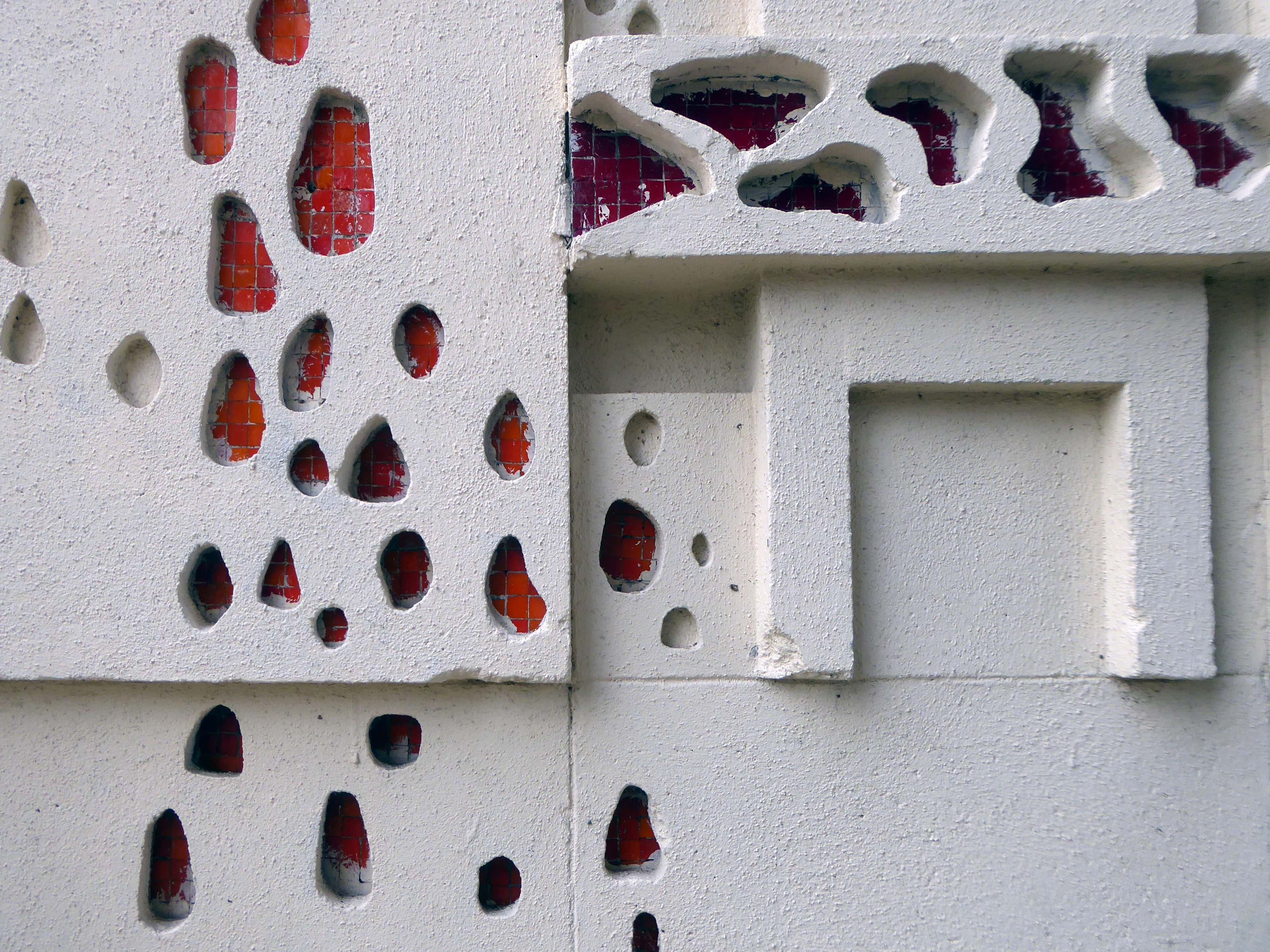
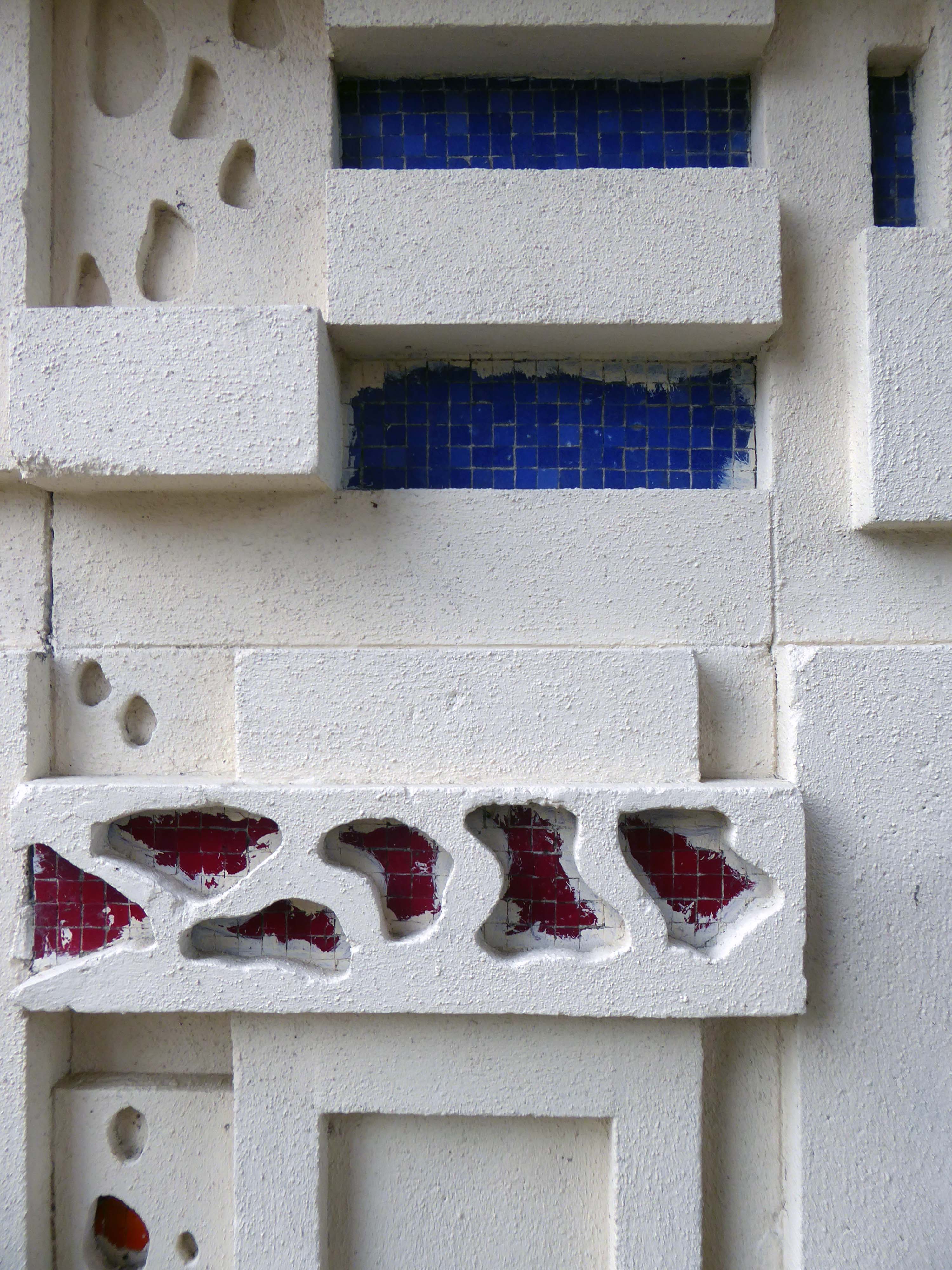
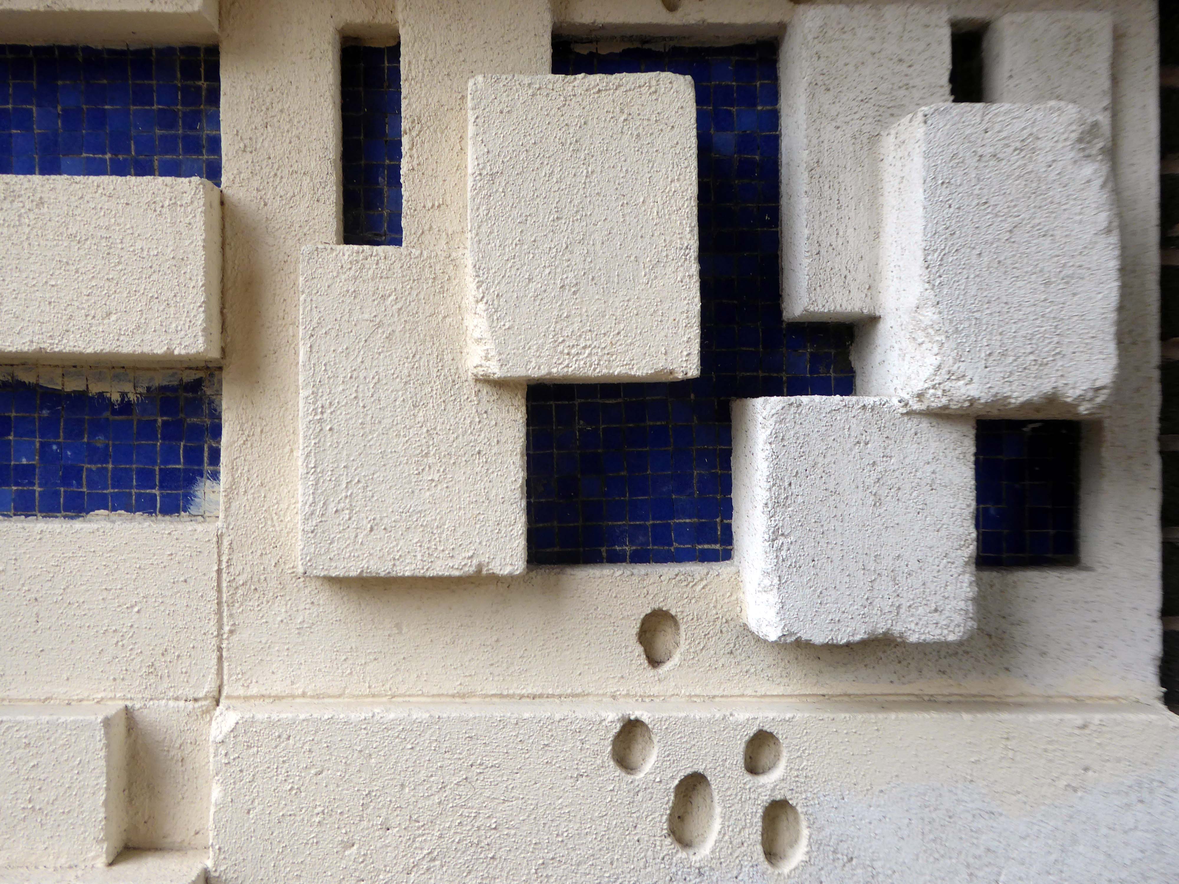
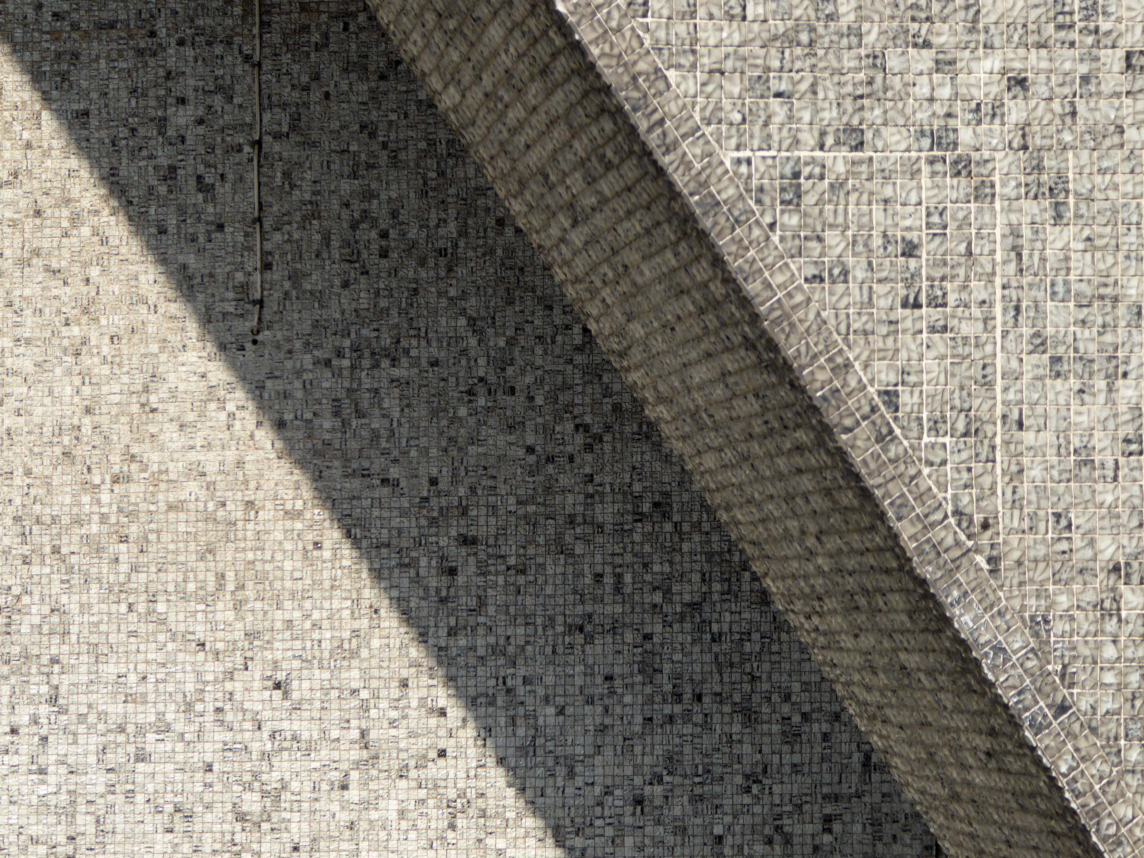
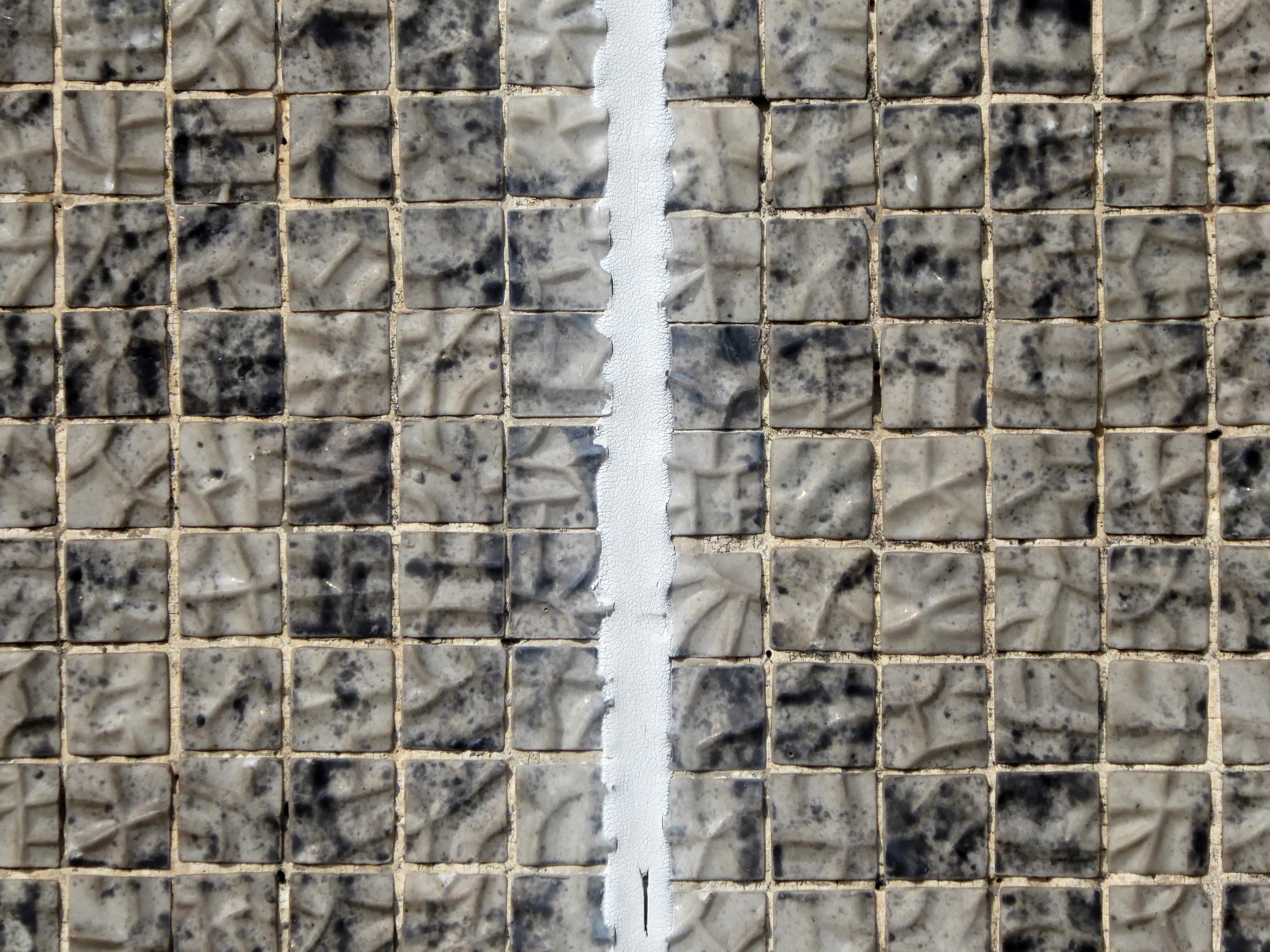
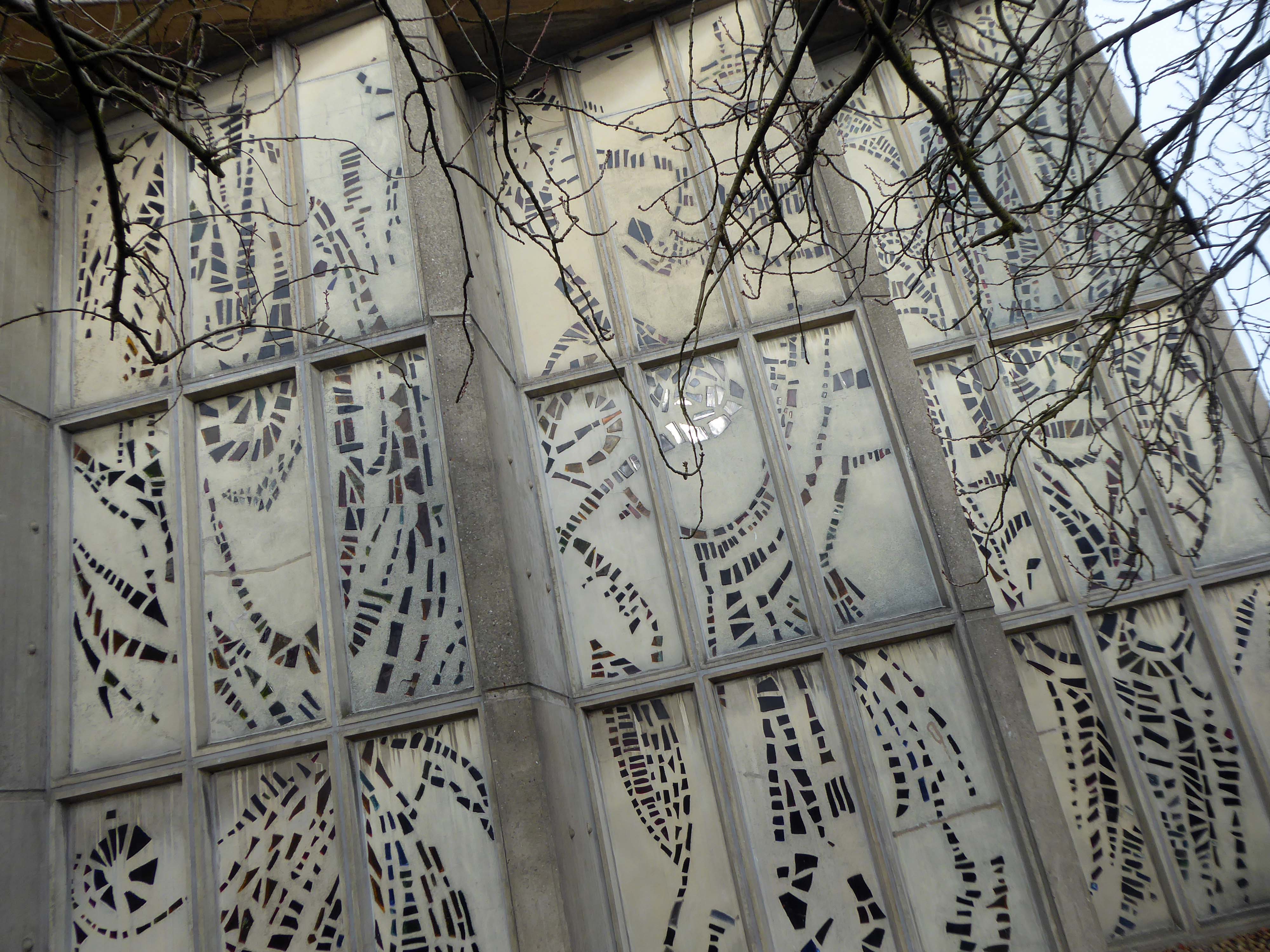
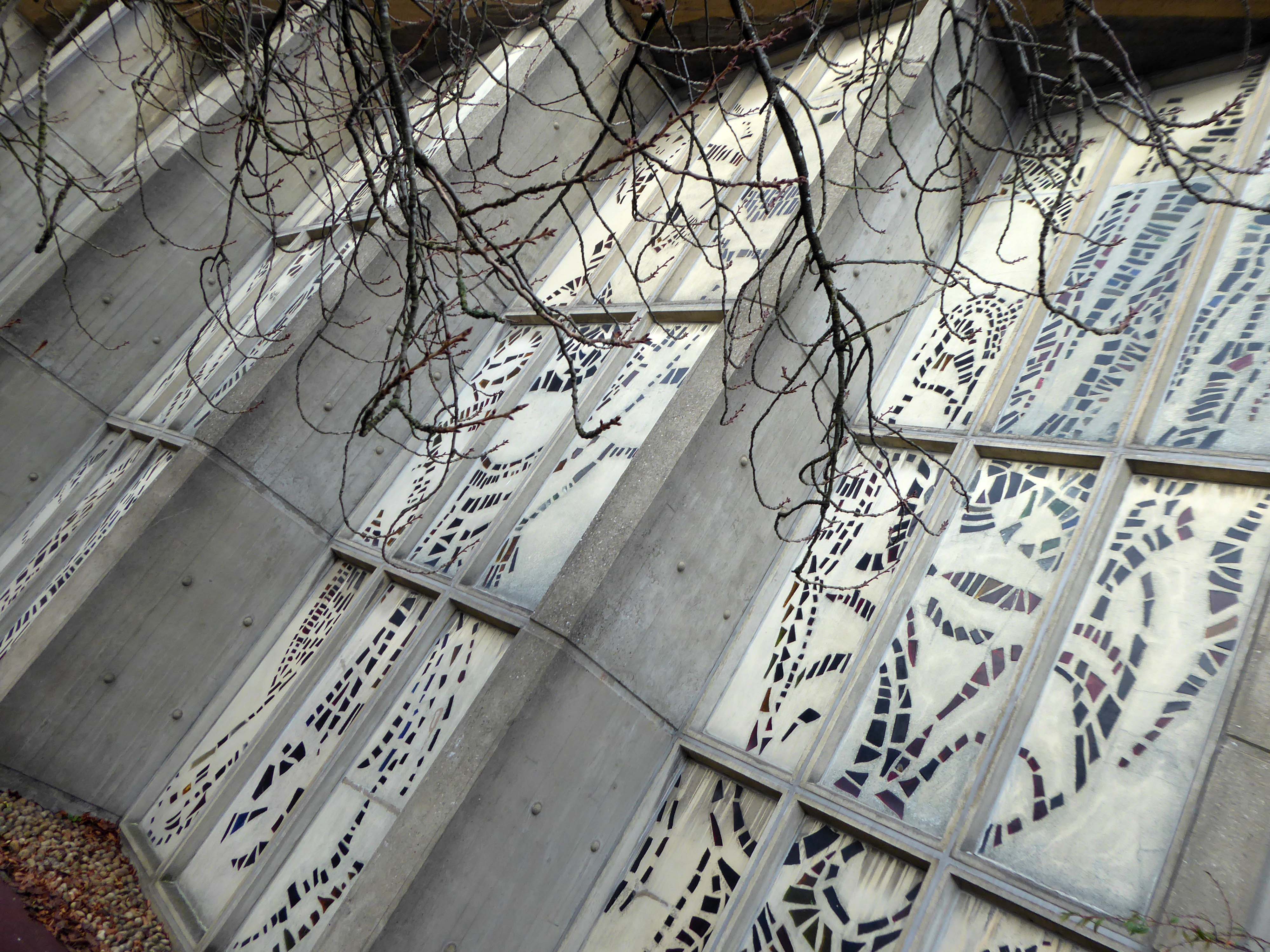
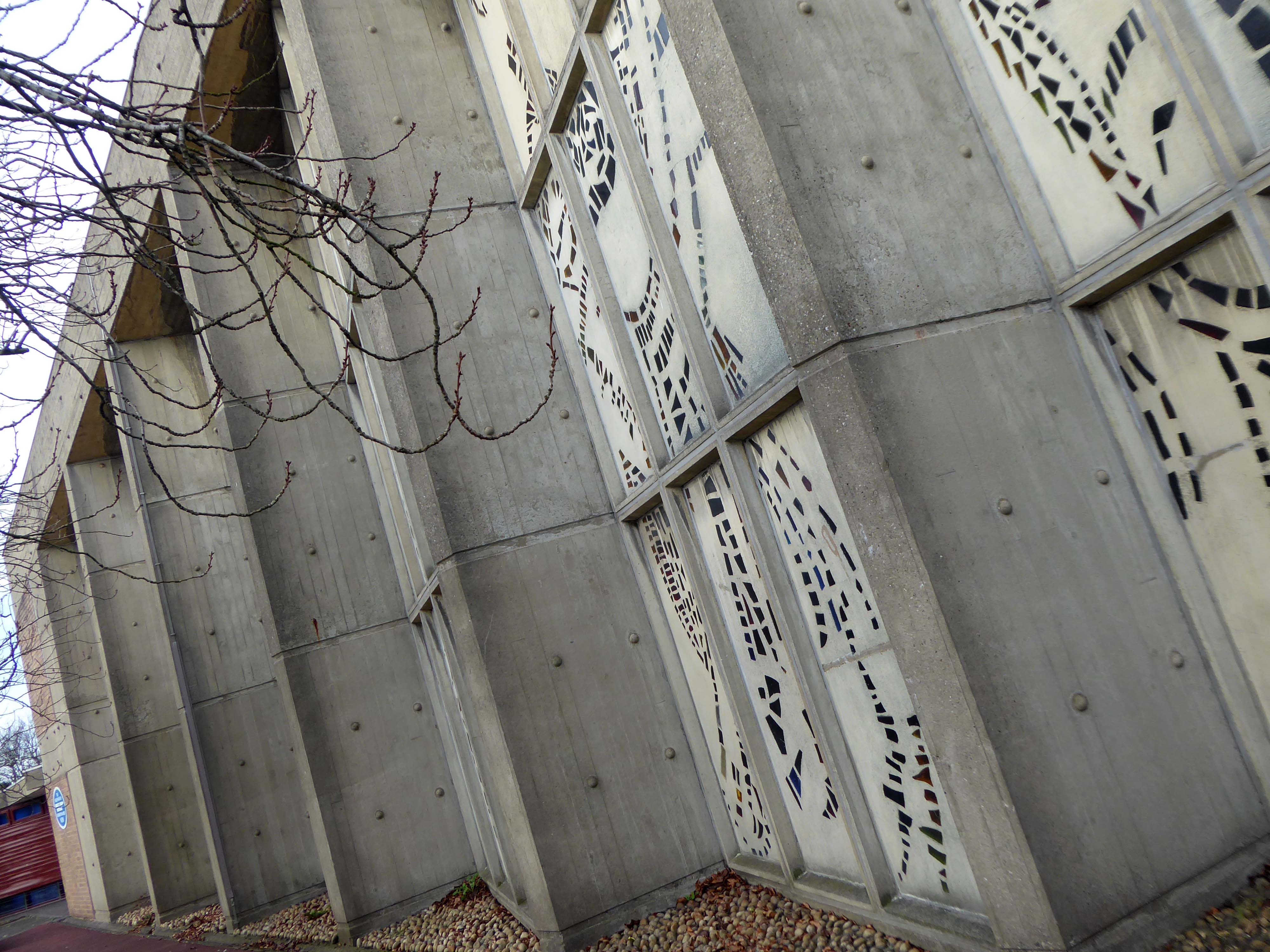
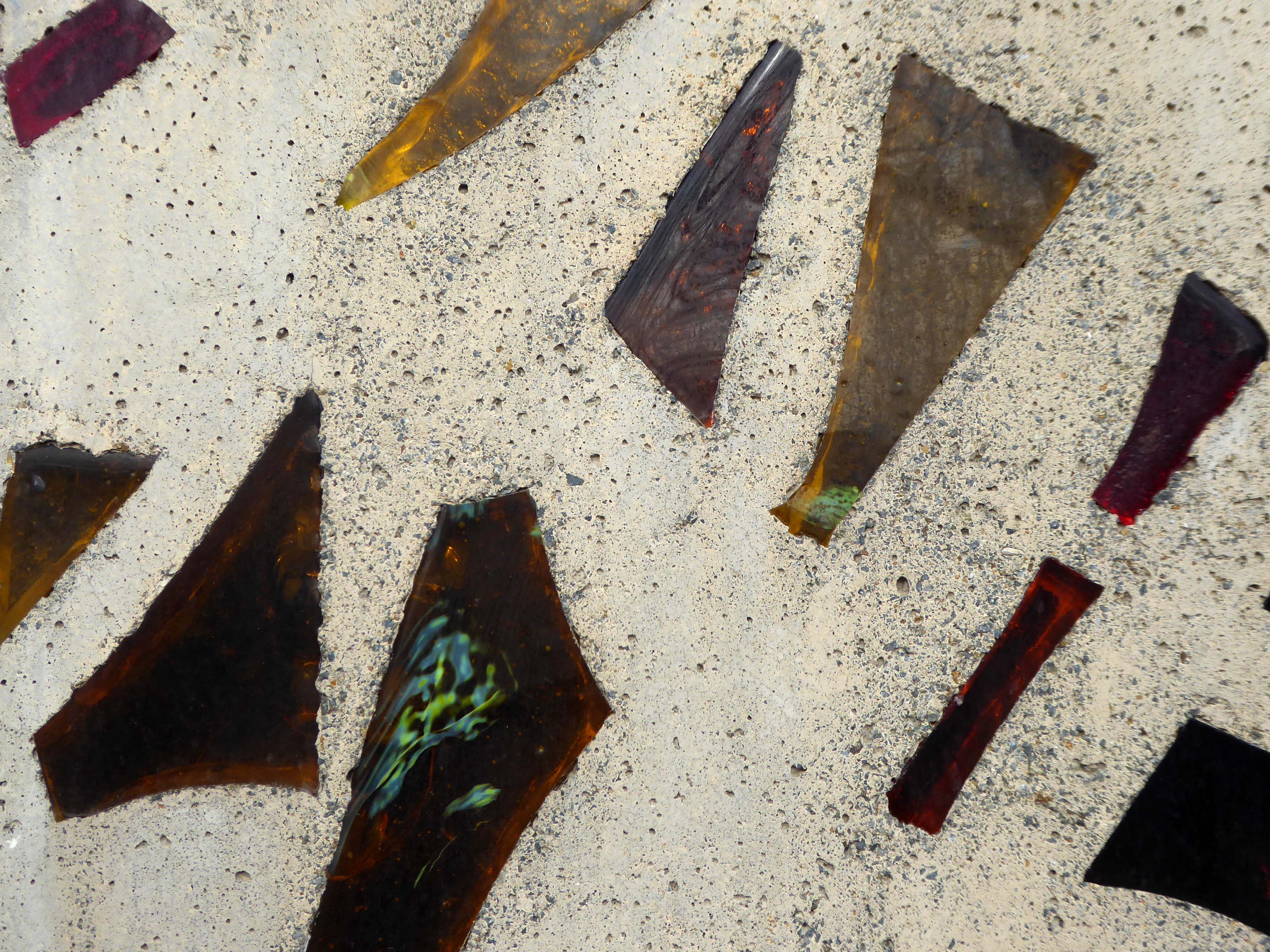
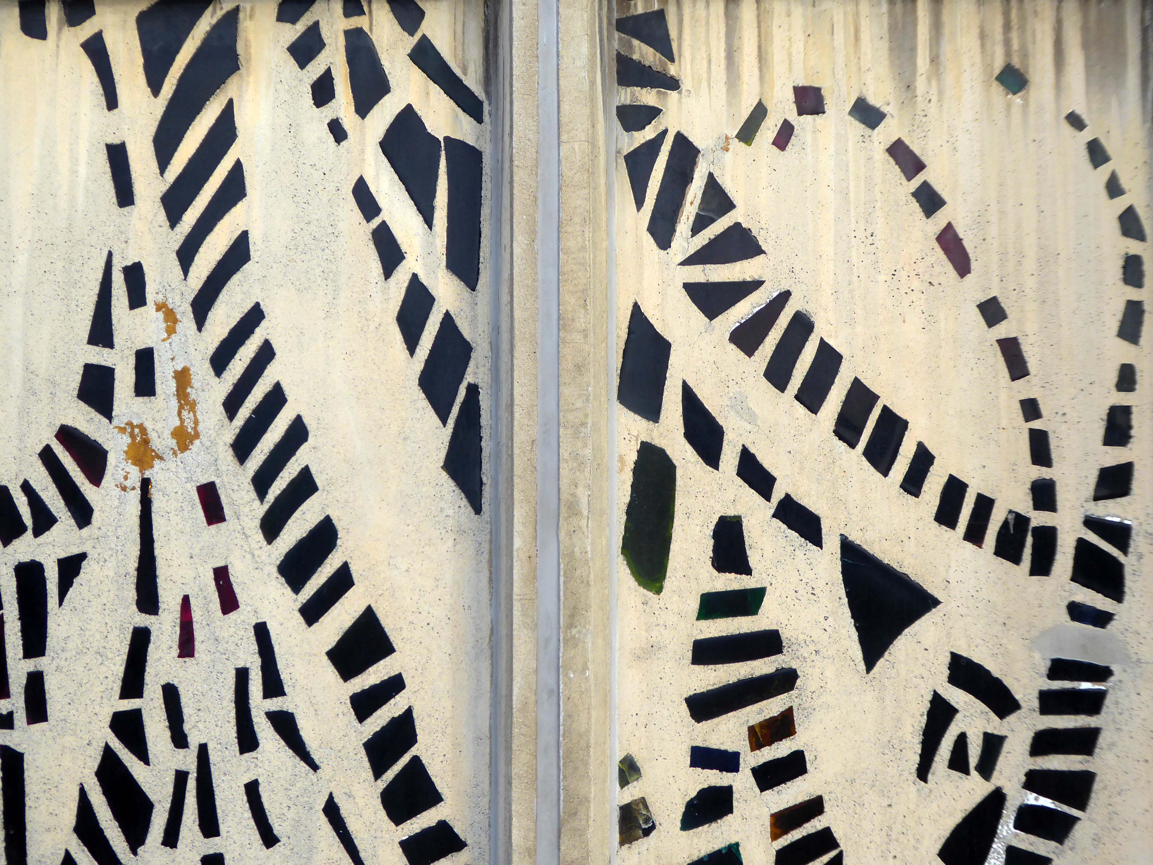
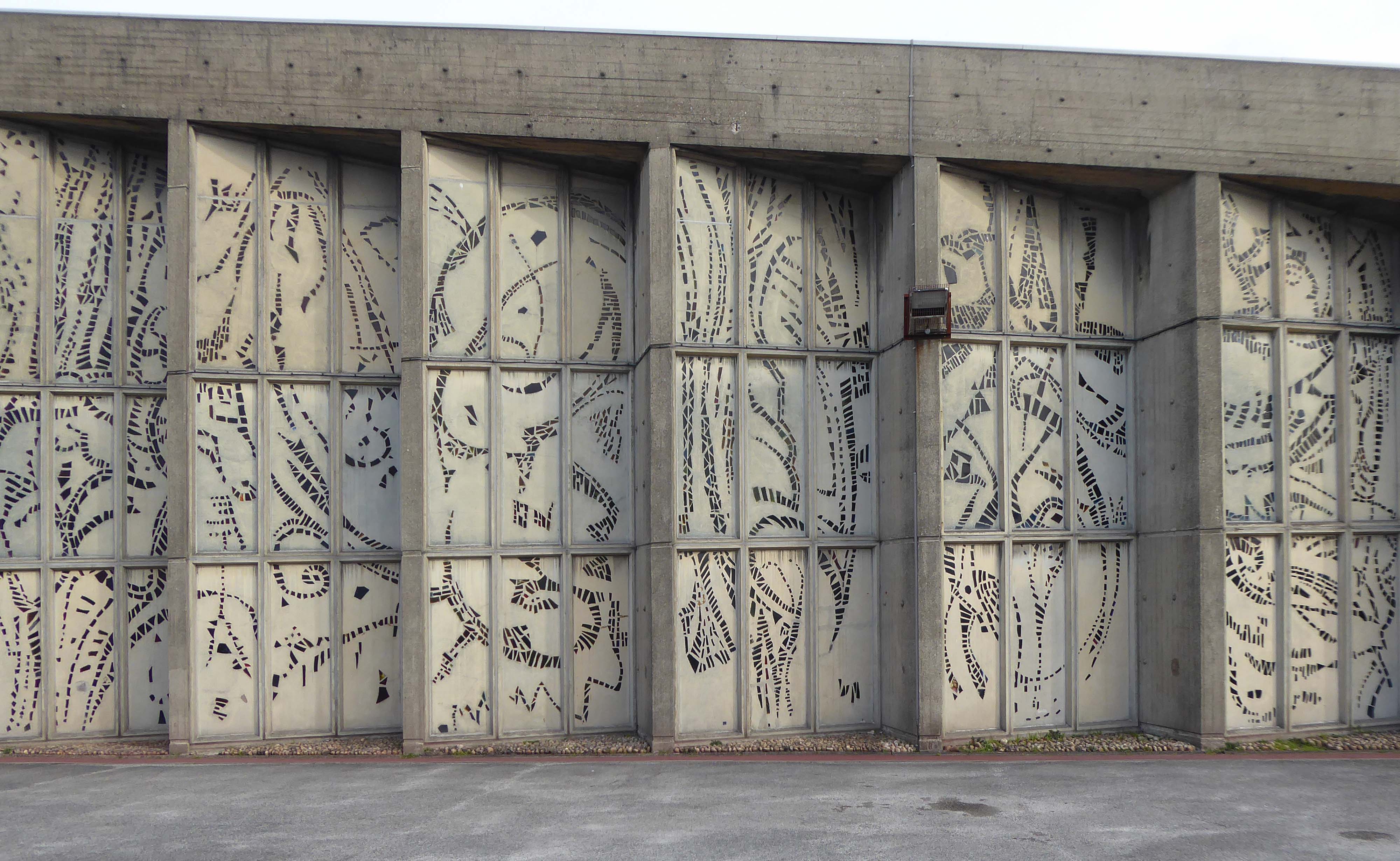
Highlight of any tour is the sight of the restored mosaic which adorned The Parkway pub – my heart literally leaped with joy.
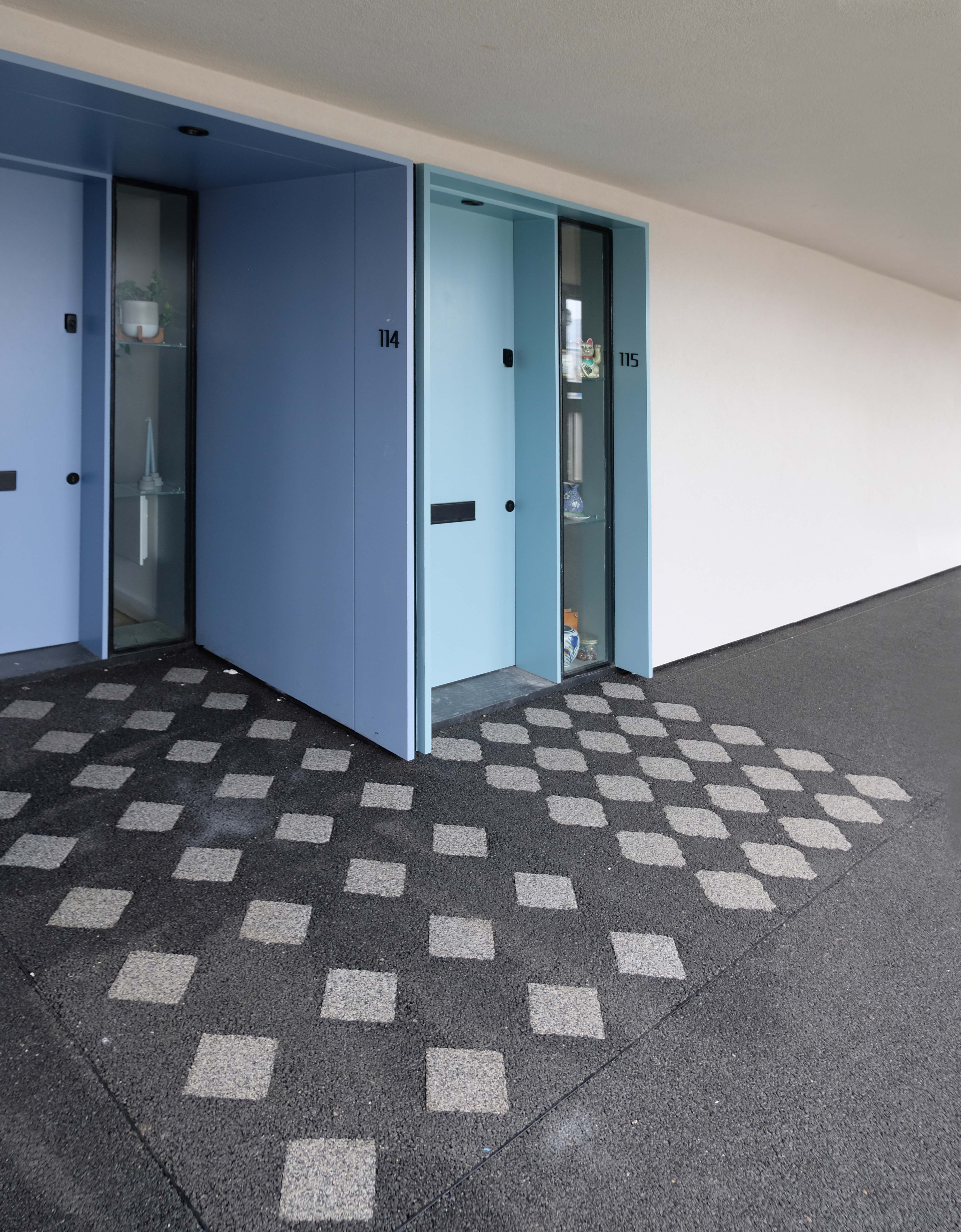
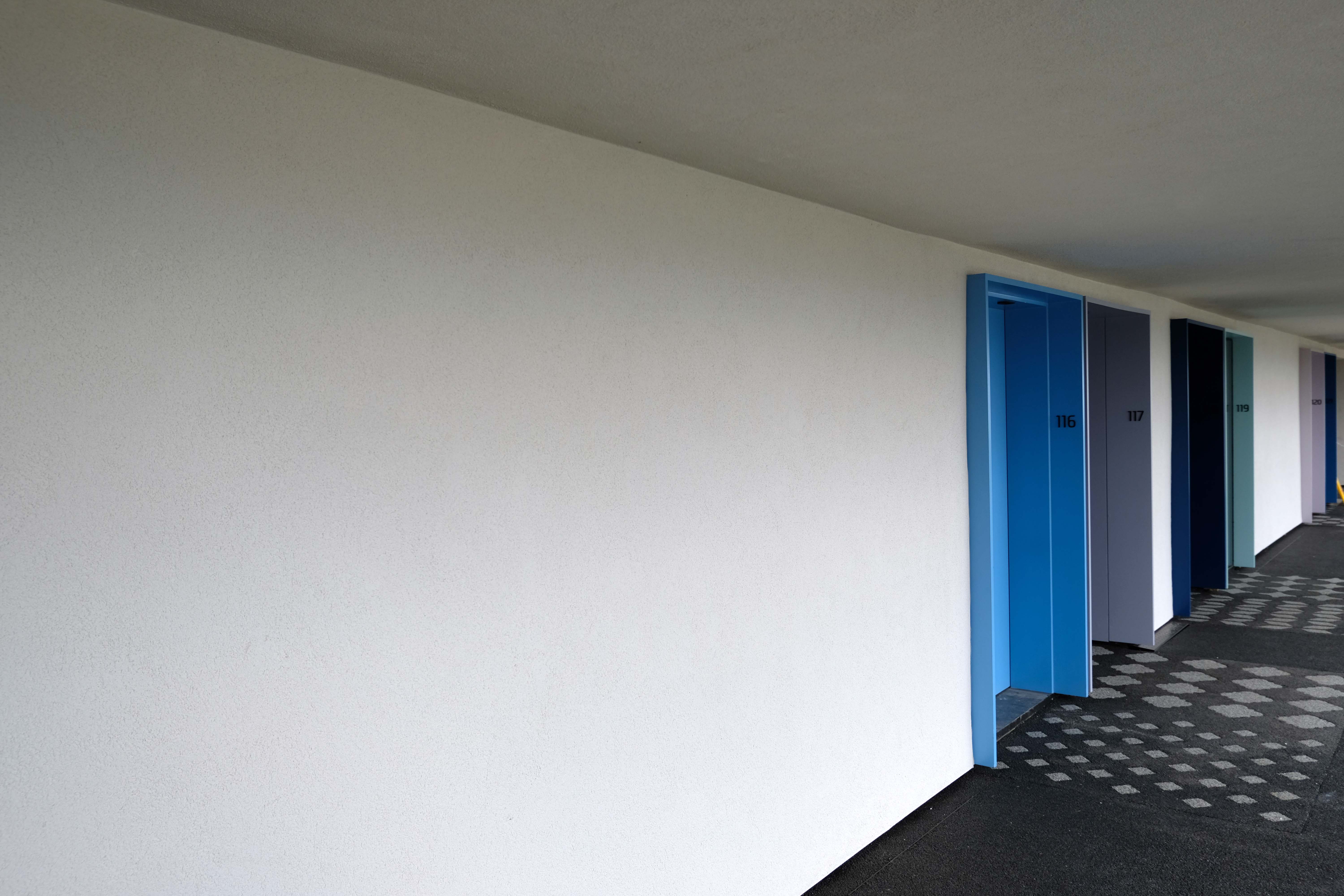
The palette of the mosaic forms the colour coding of the development’s colour coding.
The last word goes to Mr Tom Bloxham:
We were the only ones stupid enough to take it on.
He is sitting in the vegan cafe that now occupies one of Park Hill’s ground floor commercial units, dressed in a black Prada x Adidas tracksuit, with a matching hat.
When I first looked at the place online, I thought: F*ck*ng h*ll, that looks like a disaster. From the outside, it looked really crap. But as you get inside it, you see there is this object of beauty.
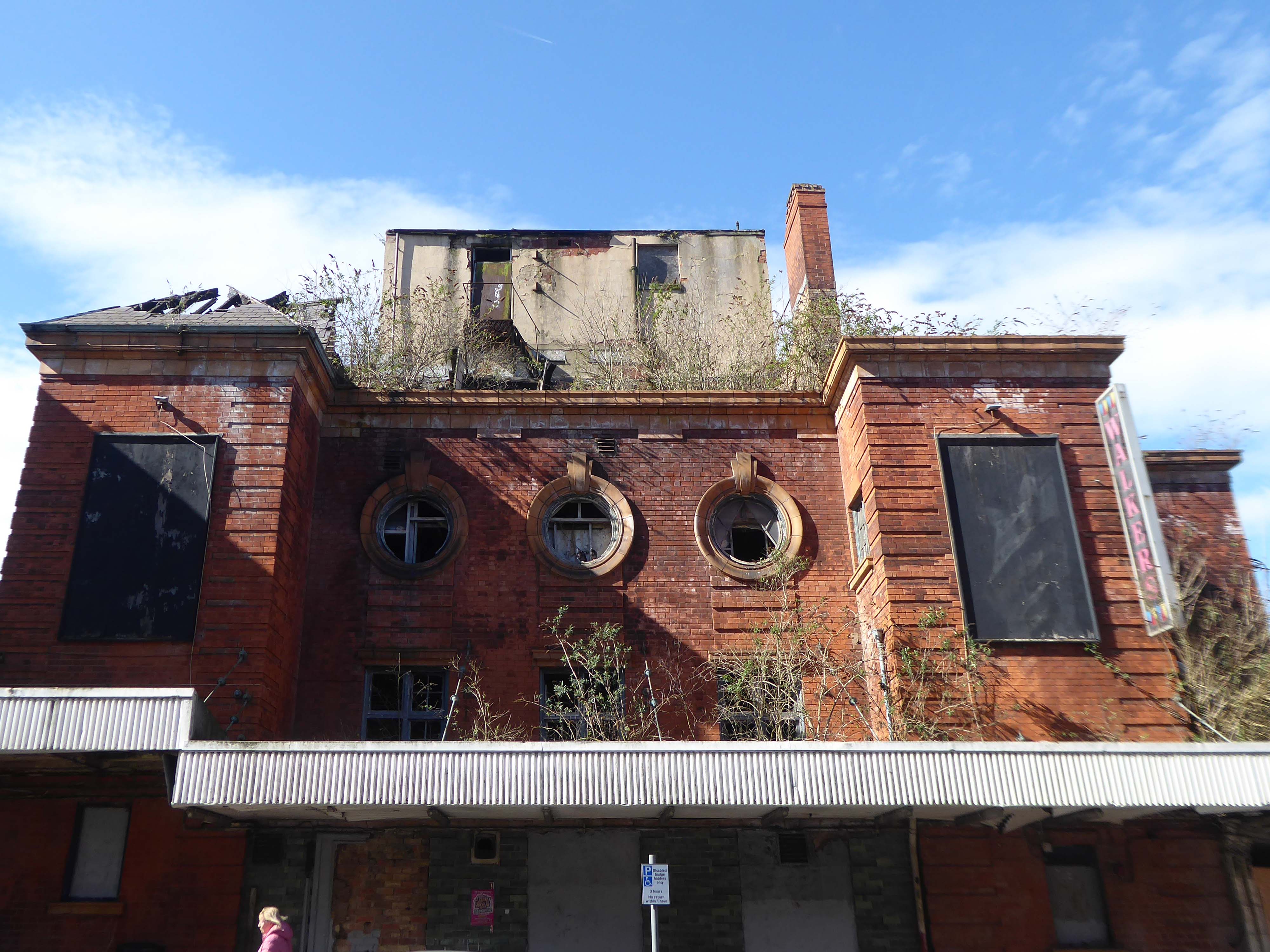
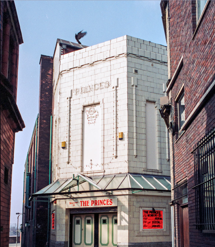
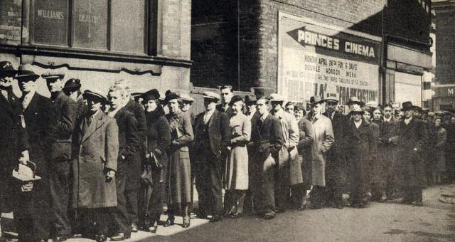
When the Rank Organisation closed the nearby Odeon Cinema on St. Peter Street, the Gaumont was renamed Odeon in 1965.
The cinema was called the ABC Trocadero Entertainment Centre opening on 24th August 1983 with Roy Schneider in Blue Thunder. The cinema changed its name one final time when it became the Cannon.
The Cannon was set to struggle on, then one morning shortly before the cinema opened for the early morning kids club, part of the ornate plaster ceiling collapsed, wrecking the auditorium. The final film to play was Sean Penn in Willow on 17th December 1988.
Cinema Treasures.
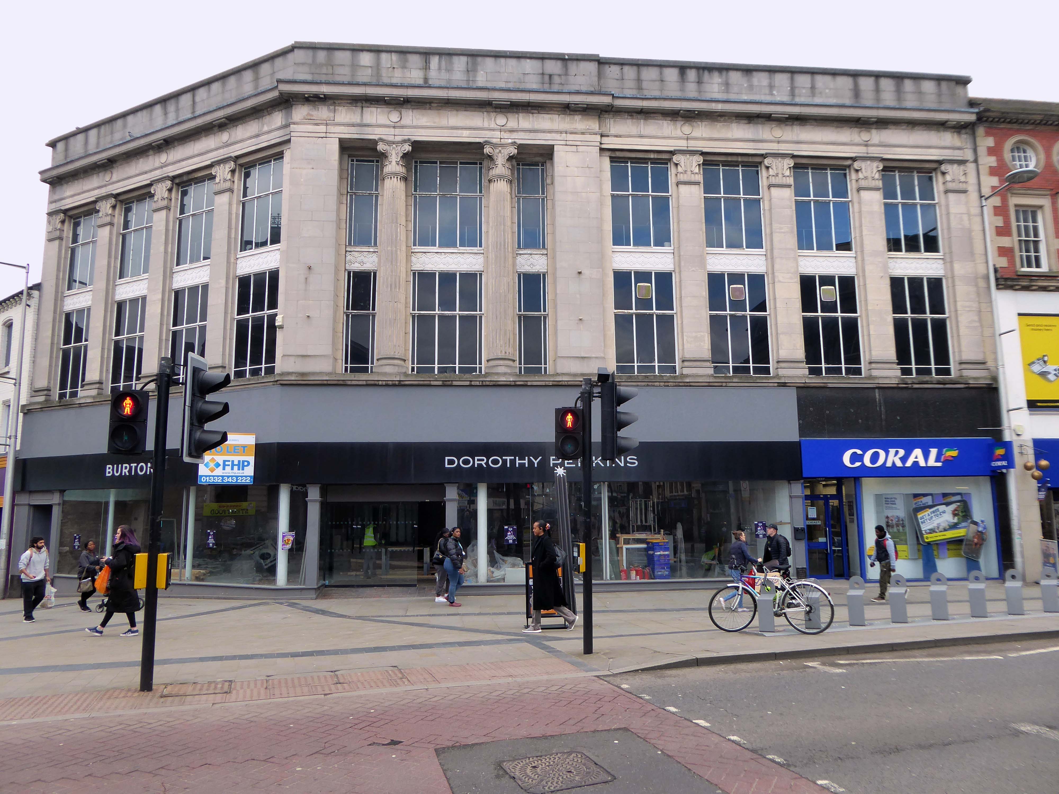
Curious almost Deco almost Burton’s details.
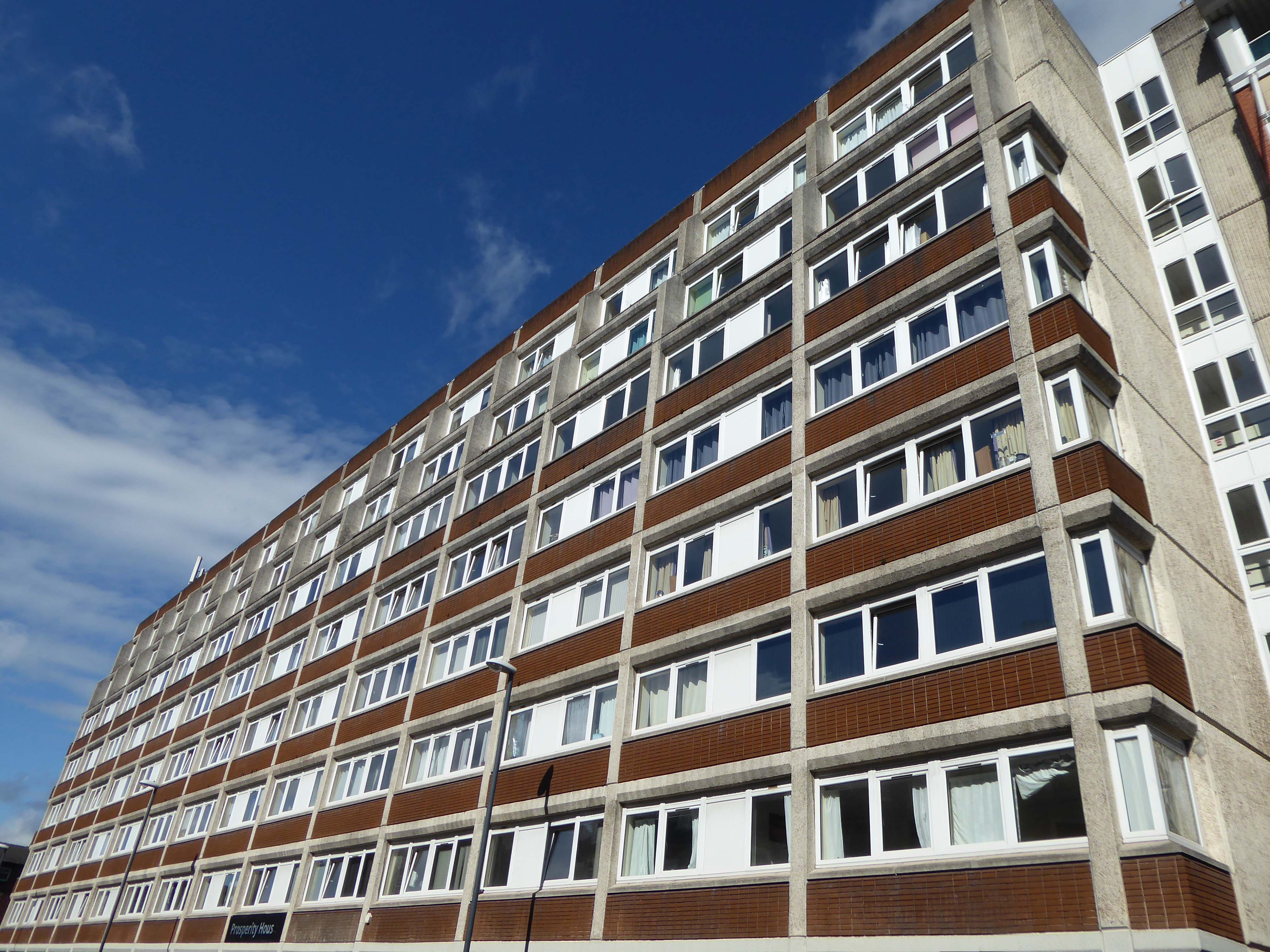
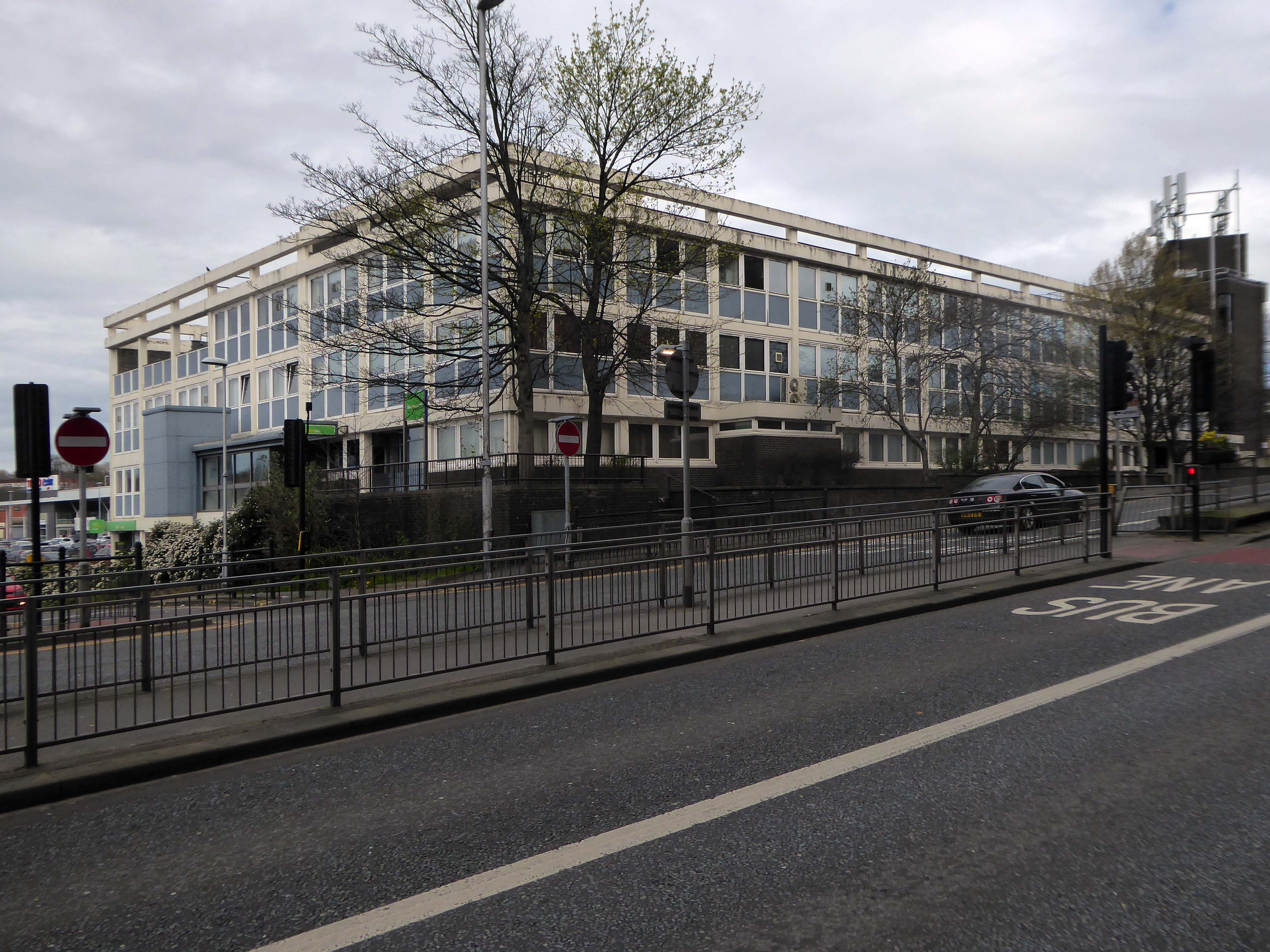
Around the corner to Prosperity House.
Formerly St Peters House, Gower Street, Derby DE1 1SB, Prosperity House is a large eight-story building located in St. Peter’s Quarter, Derbyshire.
Prosperity House has been constructed in two phases, with work to convert the first 91 apartments being completed in March 2017 and the remaining 65 apartments completed in August 2017.
Across the way the Derby Hippodrome – between 1930 and 1950 it operated as a cinema but reopened in 1951 as a theatre before succumbing to the bingo craze in the early 1960s.
Originally designed by Derby architect Alexander McPherson, it still features a number of large circular windows but hit the headlines in 2008 when, after standing empty for a time, repair work caused part of the Grade II listed building to collapse.
By the end of 2023 the Trust aims to have completed a basic restoration of the Hippodrome which would include dismantling some of internal structures where appropriate, rebuilding damaged walls, replacing the roof and re-establishing essential facilities such as toilets, lighting, water and heating. The building will then become a flexible space which can be used by amateur performing arts groups in Derby and become a focal point in the local community.
Thousands of people will have been to events at the Pennine Hotel, which first opened in 1965, and was for many years professional footballers’ favourite place and also a boxing venue, but it finally closed its doors as the St Peter’s Quarter Hotel in 2015.
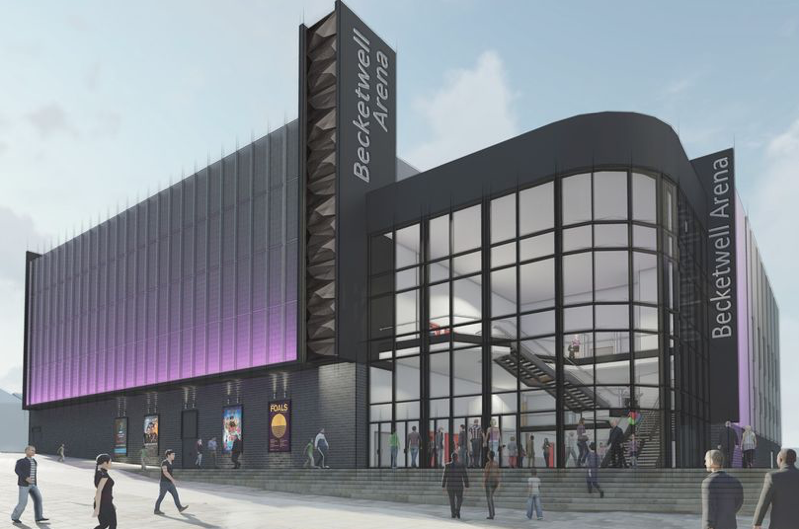
Contracts have been signed between the major players who are due to build and operate a new £45.8 million performance venue in Derby by late 2024. This means that work on the site will start soon and construction could start next January.
Forester House, once home of the Job Centre, is situated on the corner of Newland and Becket Street within Derby City Centre. The property comprises a detached 5 storey office building extending to approximately 42,565 square feet.
The premises have been recently acquired by Universal Total Care Limited for £1.6m.
Located on the corner of Newland Street and Becket Street, Forester House has been earmarked for transformation into a one hundred and eleven bedroom easyHotel, a restaurant that would seat 160 people and a function room. The ground floor of the 1970s building, which formerly housed JobCentre Plus staff, would become home to the large-scale eaterie and the first floor would have space for weddings and conferences.
JSA Architects have plans for a one hundred and ten bed hotel – what happened to the missing room?
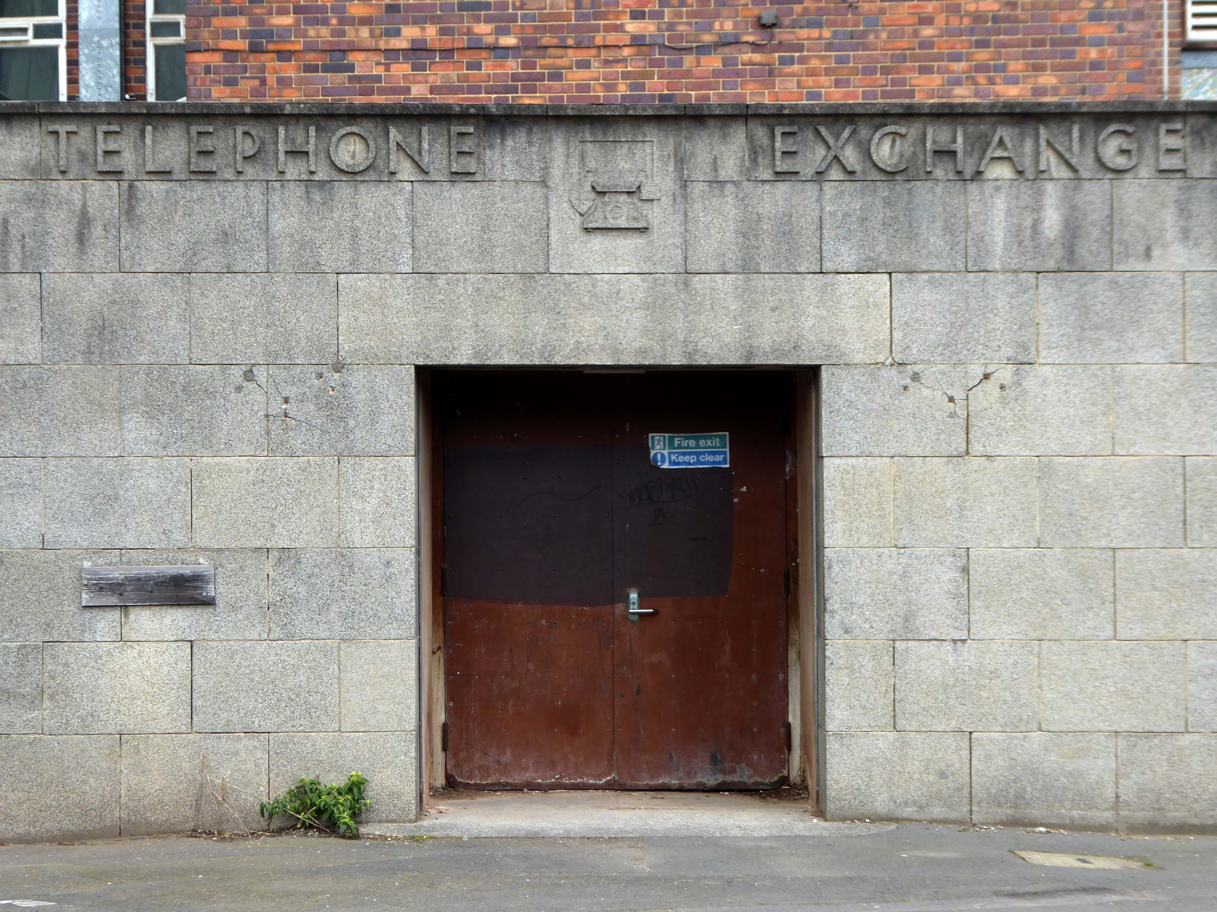
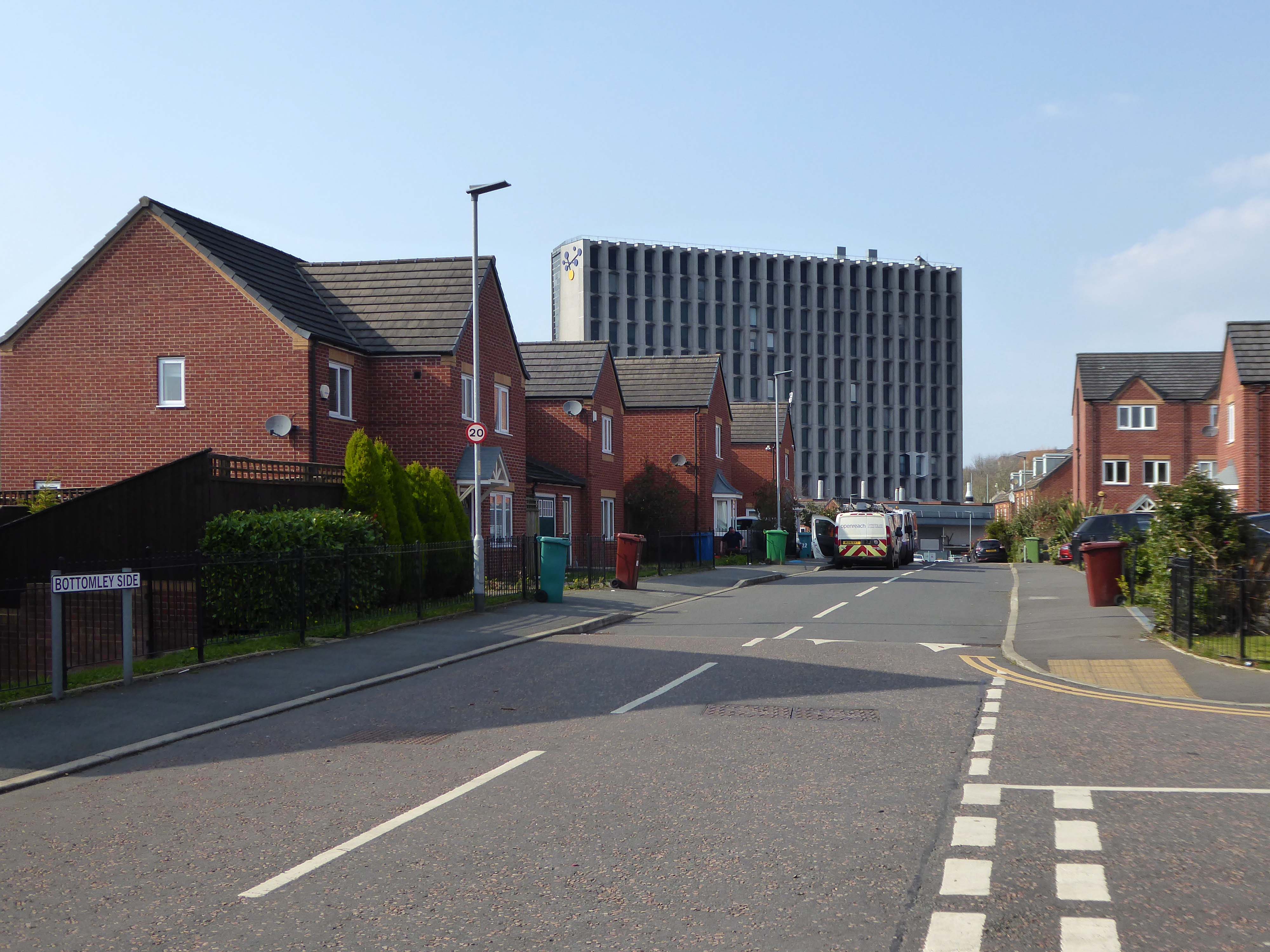
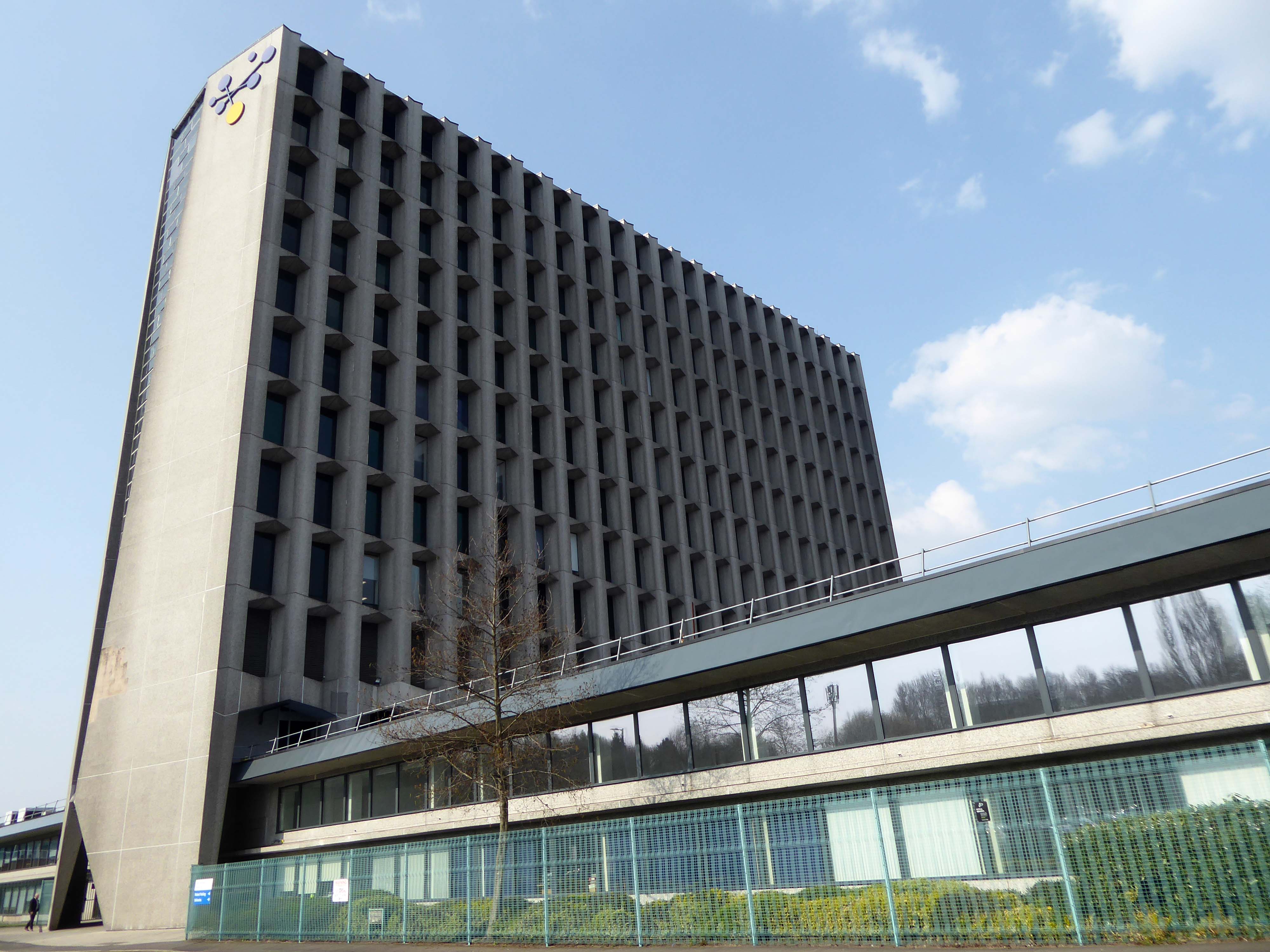
Never mind – let’s take a look at the Telephone Exchange.
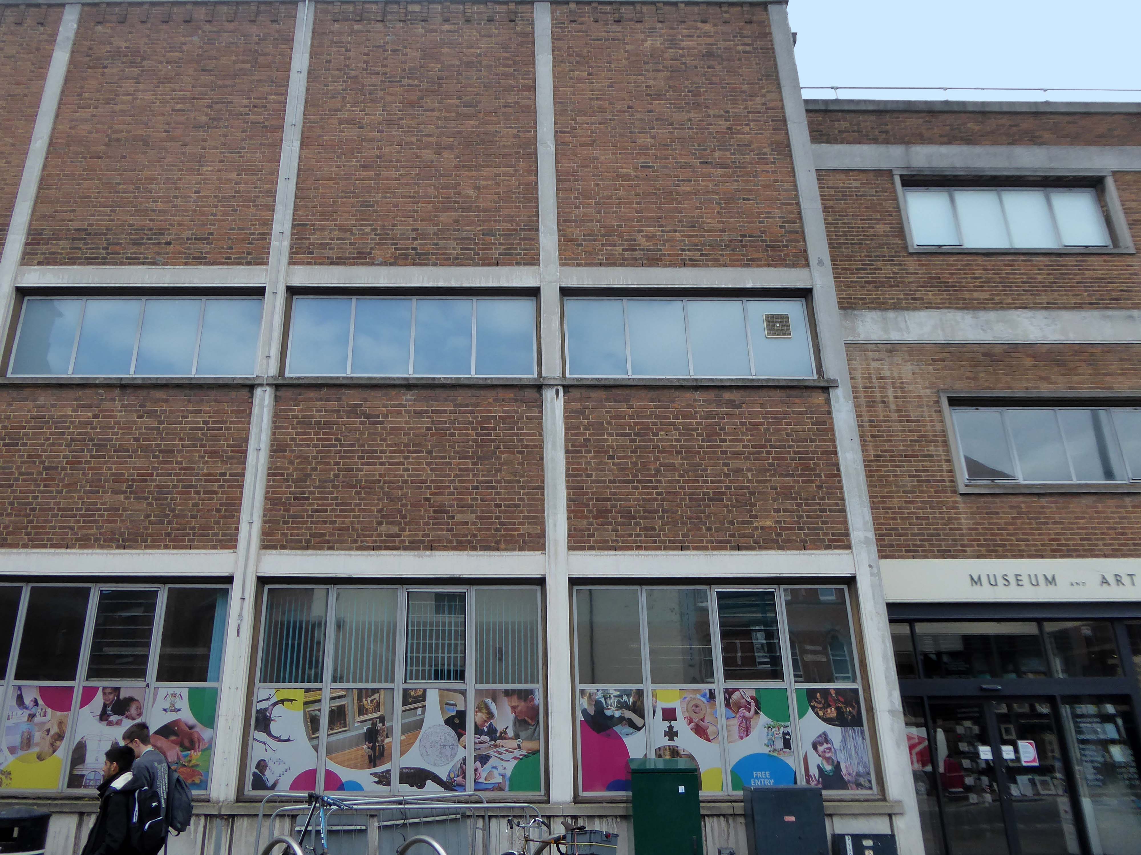
Onwards to the Museum and Art Gallery.
The Art Gallery designed by Story opened in 1882 and in 1883 the museum had electricity supplied for new lighting.
In 1936 the museum was given a substantial collection of paintings by Alfred E. Goodey who had been collecting art for 50 years. At his death in 1945 he left £13,000 to build an extension to the museum. The extension, which now houses the museum, was completed in 1964. Refurbishment to parts of both the new and old buildings were undertaken in 2010–11
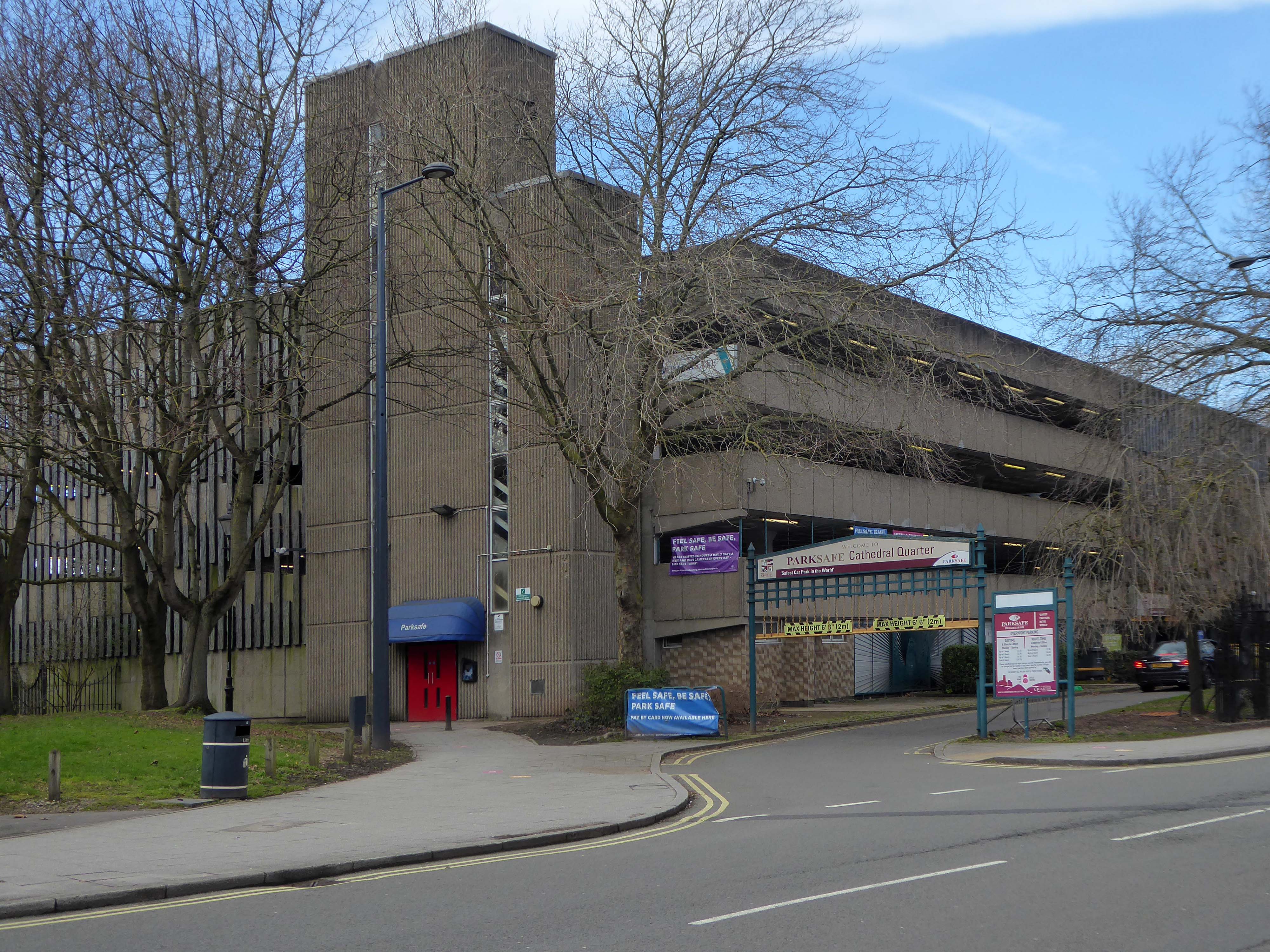
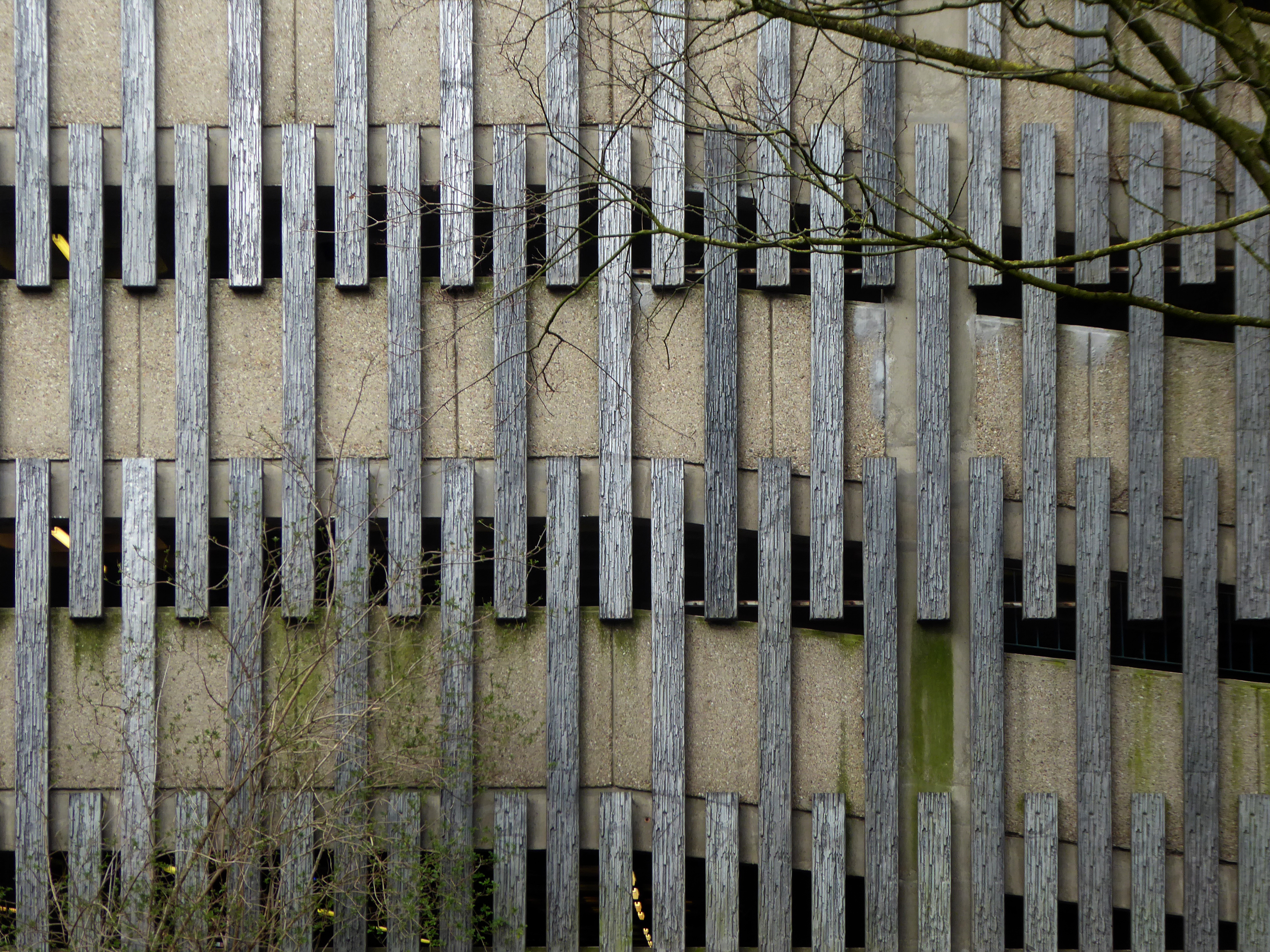
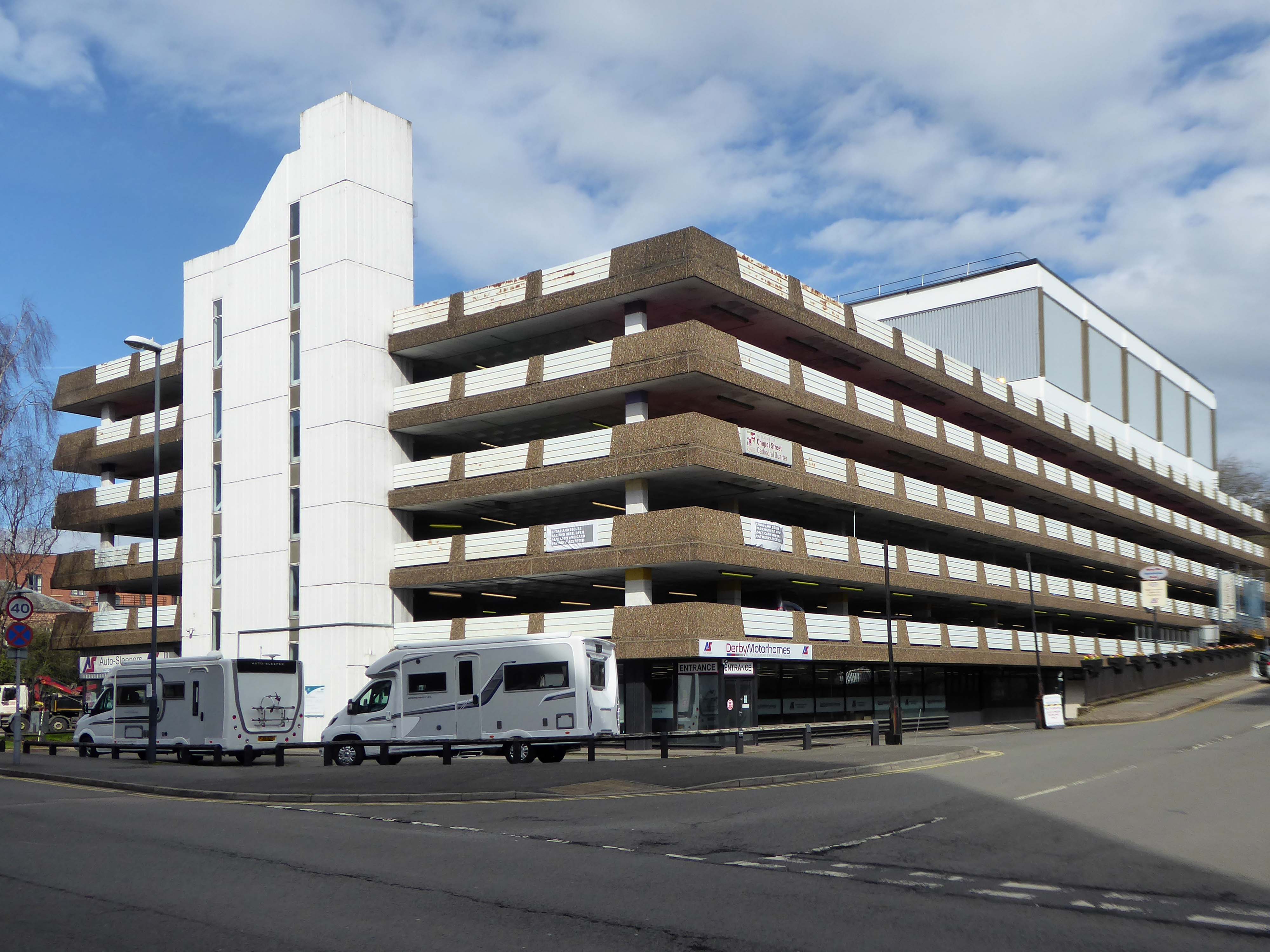
Let’s take a look at the nation’s safest car park – Park Safe.
Located in the Cathedral Quarter area of Derby, our 315 space Derby car park has been completely refurbished in 2010. We are proud to be partners with Derby City Council since 1997.
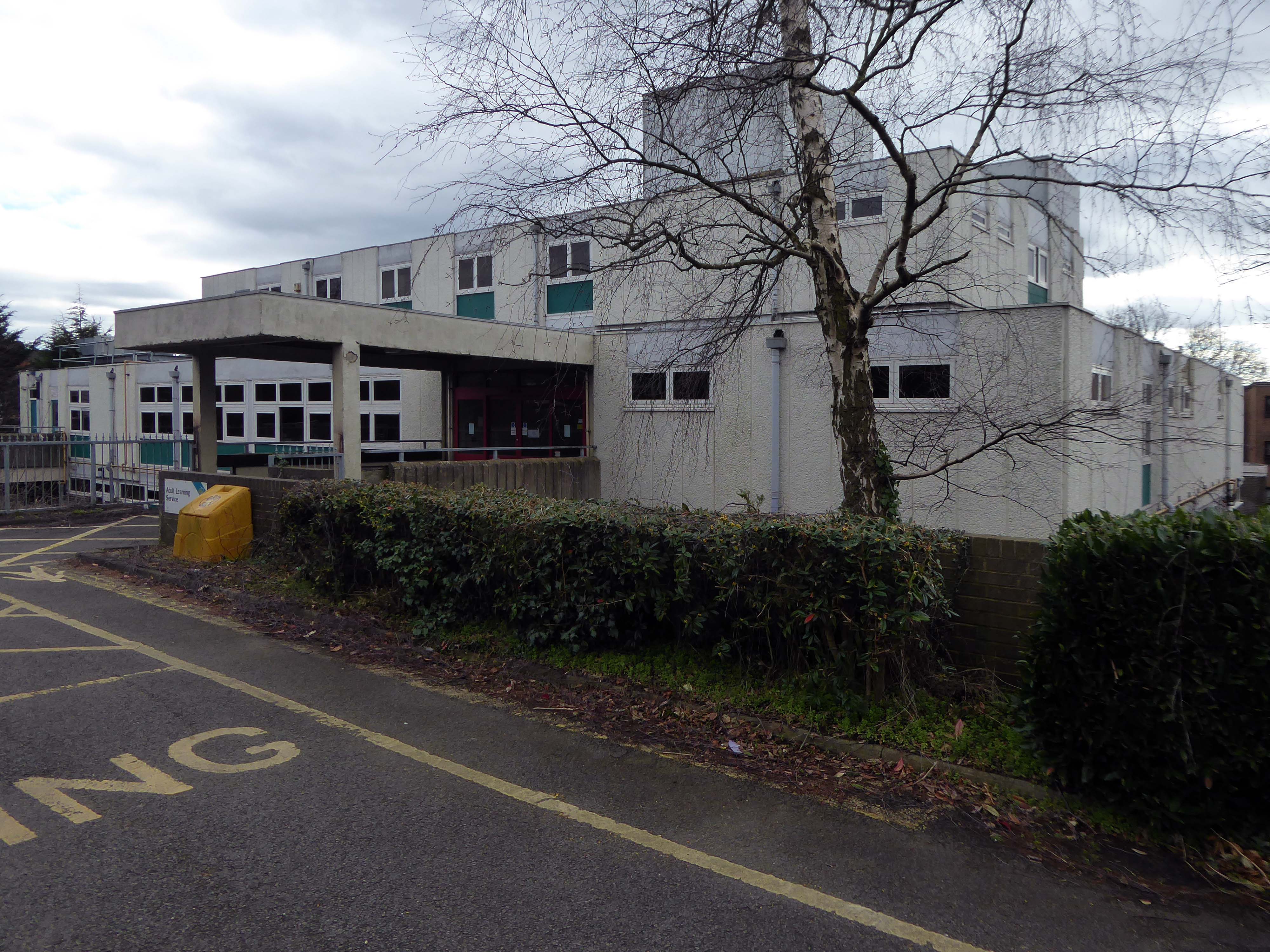
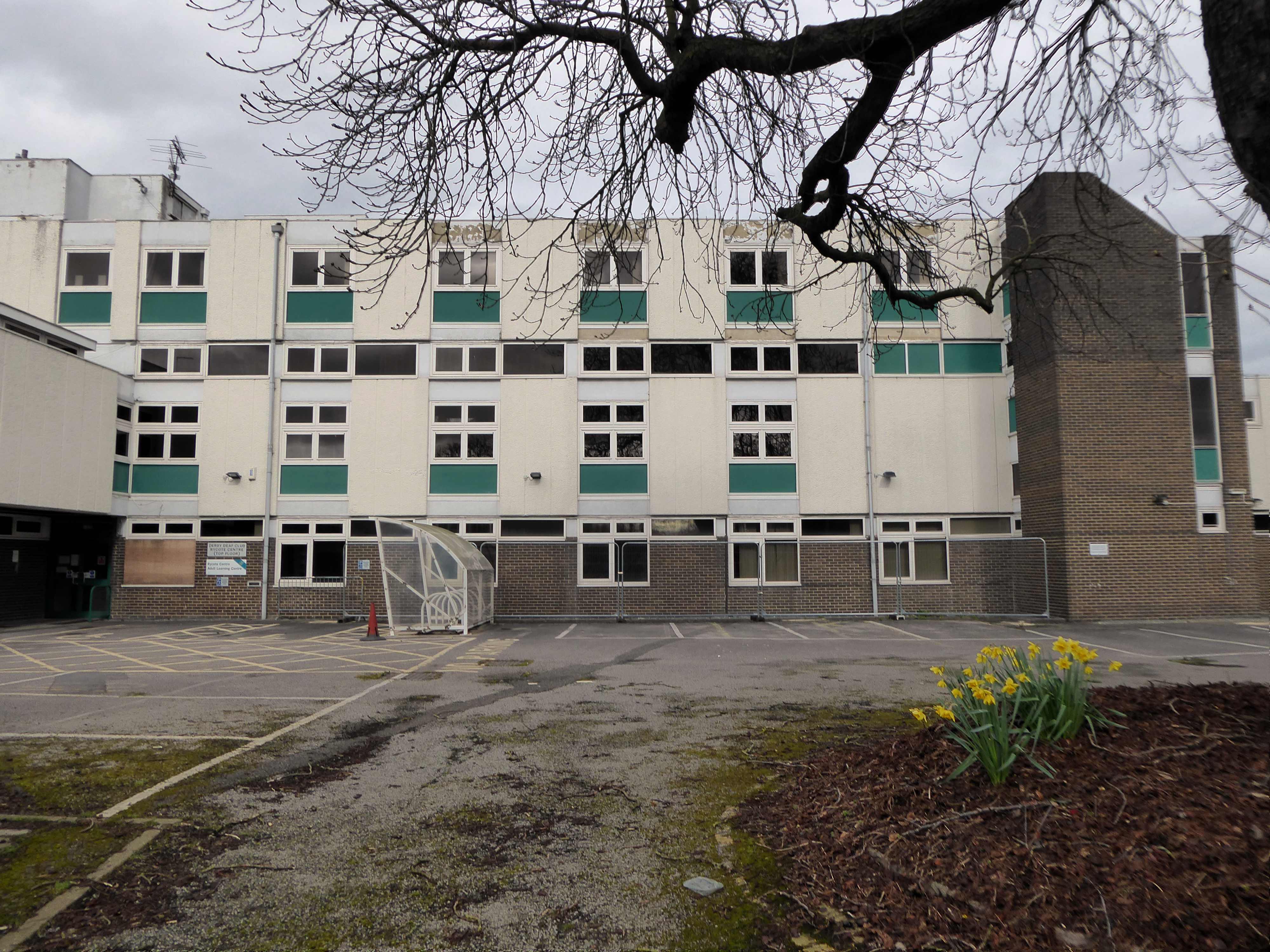
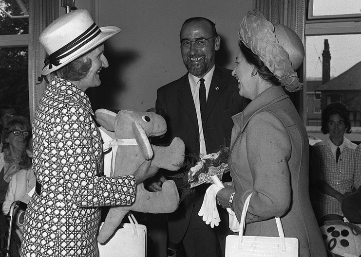
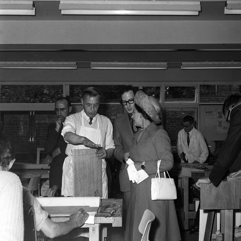
Princess Margaret, right, hands a turquoise cuddly toy dog gift to her lady-in-waiting at the end of her visit to the Rycote Centre, Kedleston Road, Derby, in June 1973.
She was then taken to the Rycote Centre, off Kedleston Road, where she was greeted by Councillor Bill Pritchard, chairman of Derby Town Council and Social Services, and presented with a rather unusual gift.
It’s a shame that these photos from our archive are in black and white, for the Princess, who was wearing a tomato red coat and bright green hat, was presented with a turquoise cuddly toy dog – quite a clash of colours by the sounds of it!
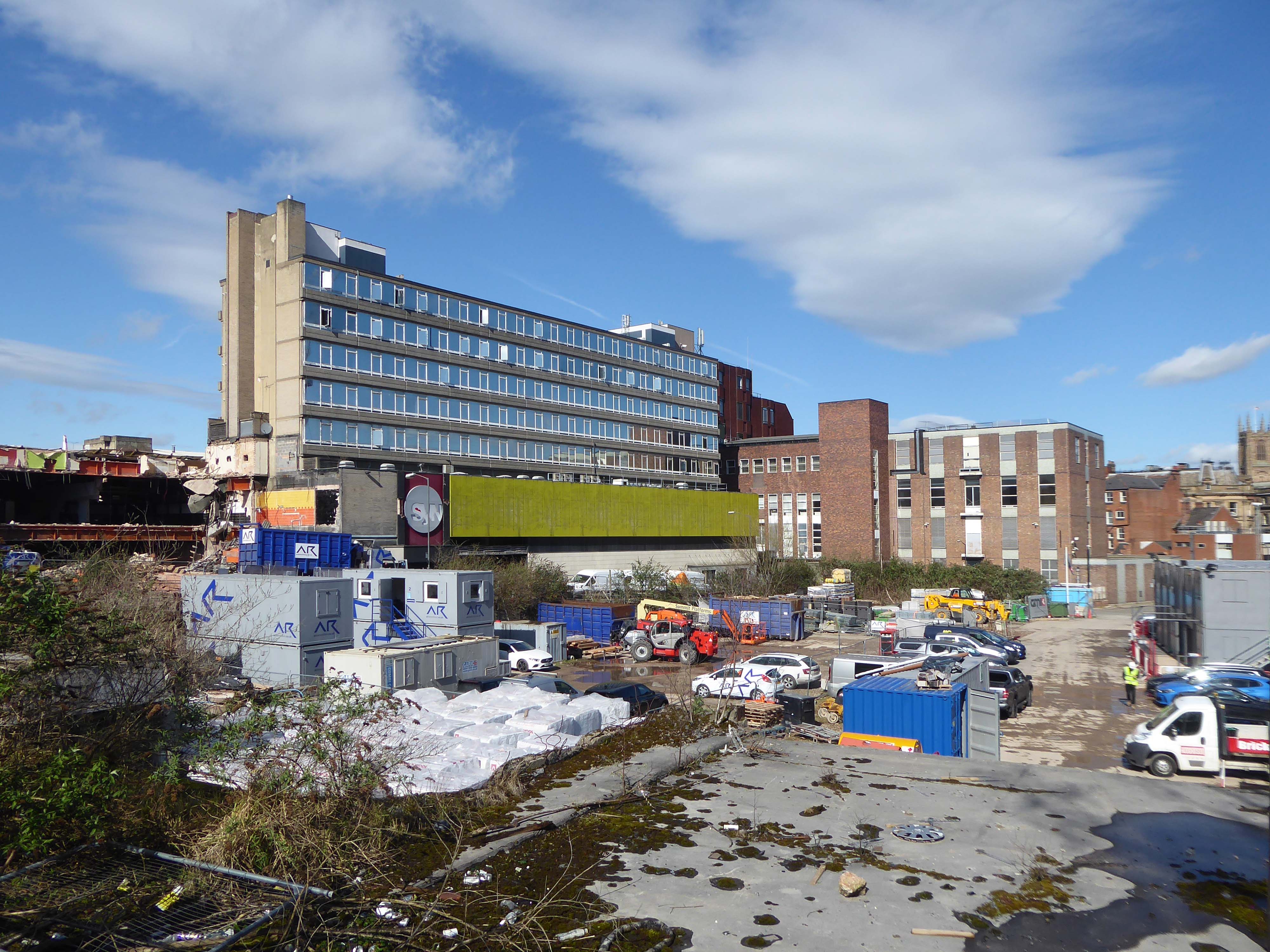
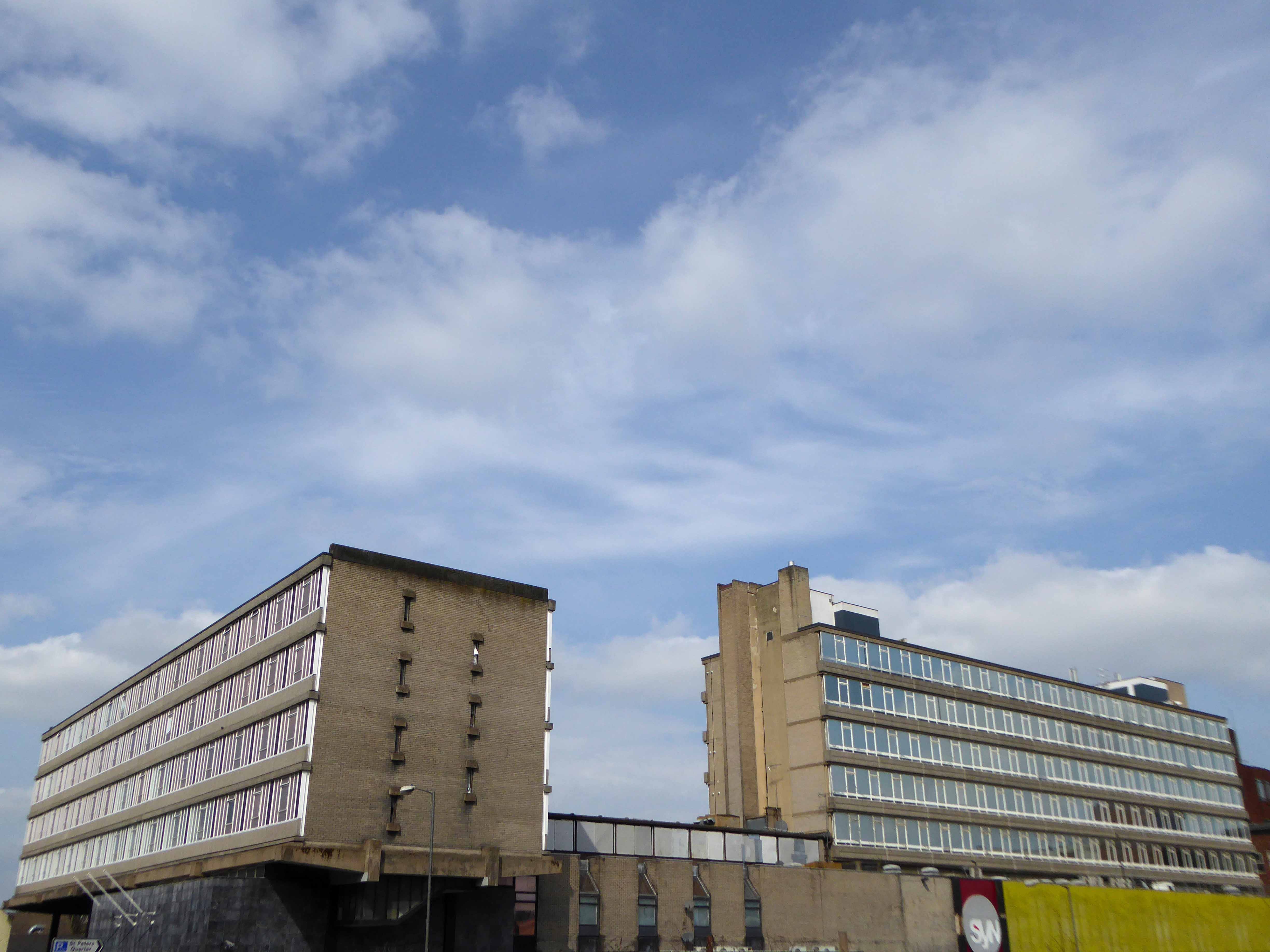
The current Assembly Rooms building was completed in 1977 to replace an 18th-century building of the same name that was destroyed by fire. In 2014 a fresh blaze obliterated the plant room of the new structure, which has been largely vacant ever since.
This summer the city council applied to its own planning department for permission to demolish the building to save the cost of maintaining it.
The Twentieth Century Society’s trustee Otto Saumarez Smith also slated the plans, describing the demolition and pop-up market proposal as a grotesque failure of imagination.
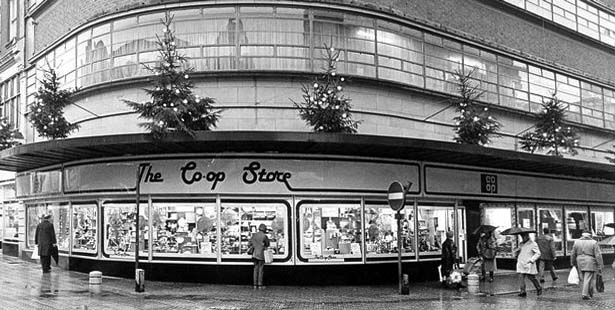
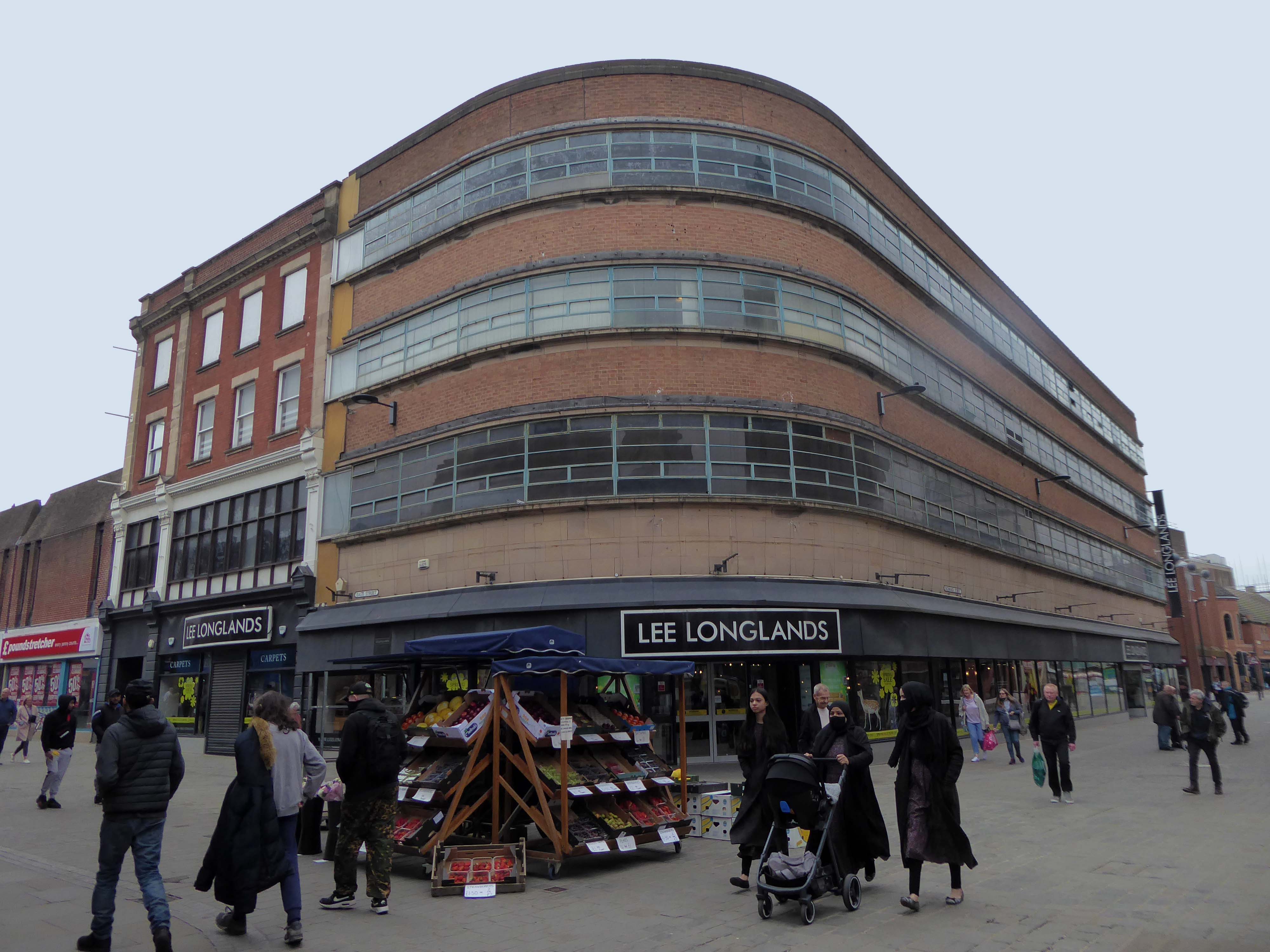
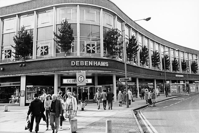
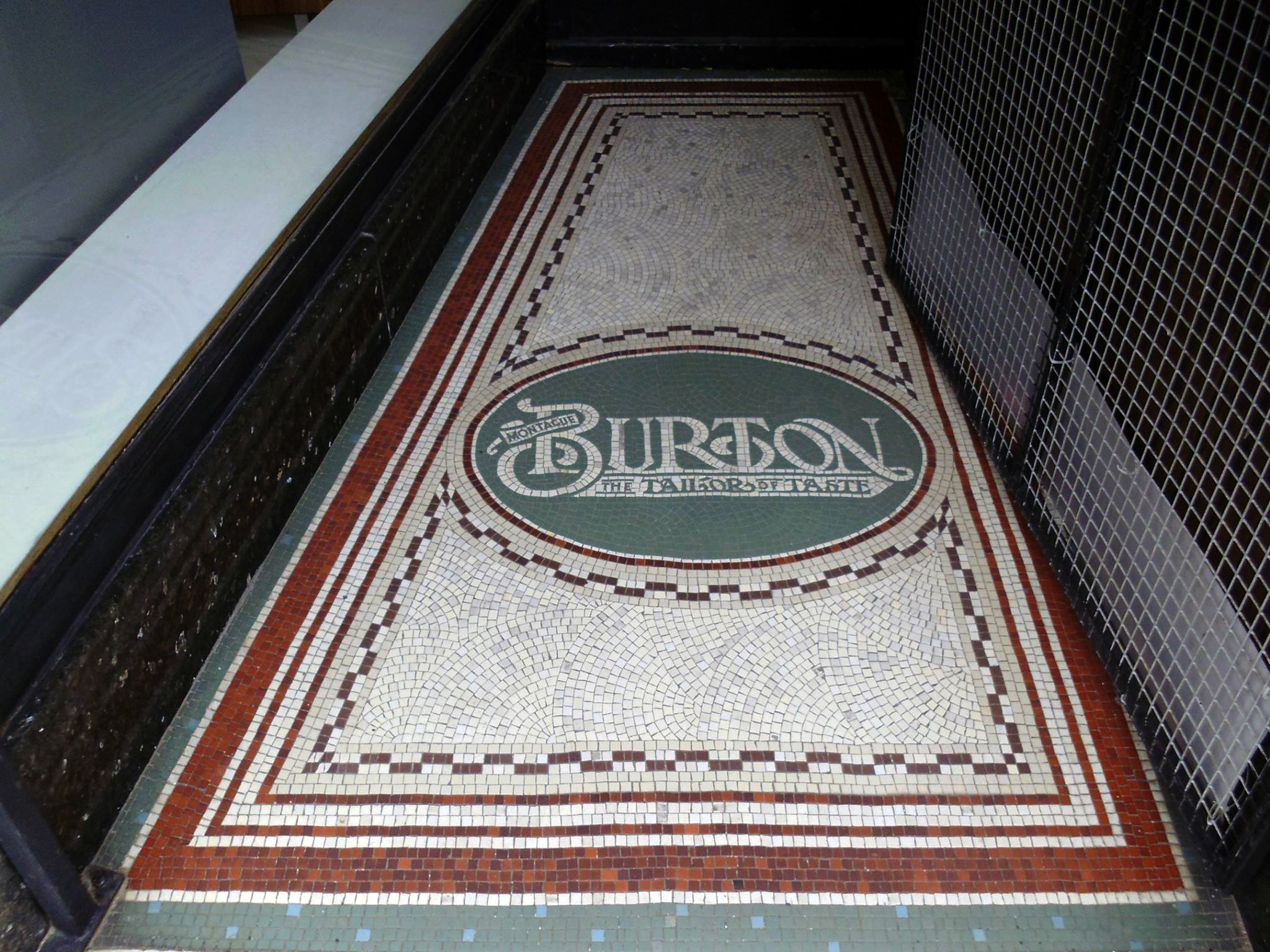
Burton’s has gone for a Burton.
The Co-op is no longer a Co-op.
It was built 1938-40 and designed in-house by Derby Co-Operative Society’s own architect – Sid Bailey.
And having been built by the DCS’s own Building Department it is completely Made In Derby.
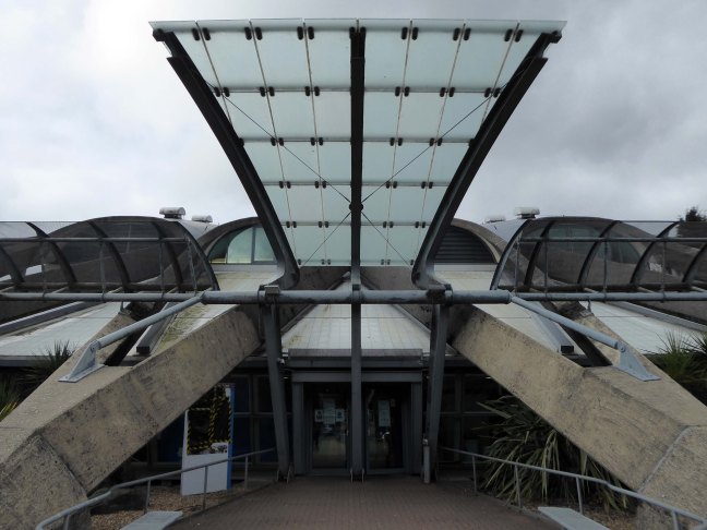
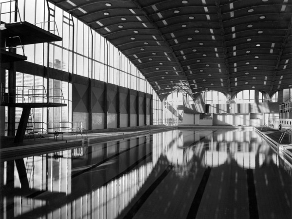
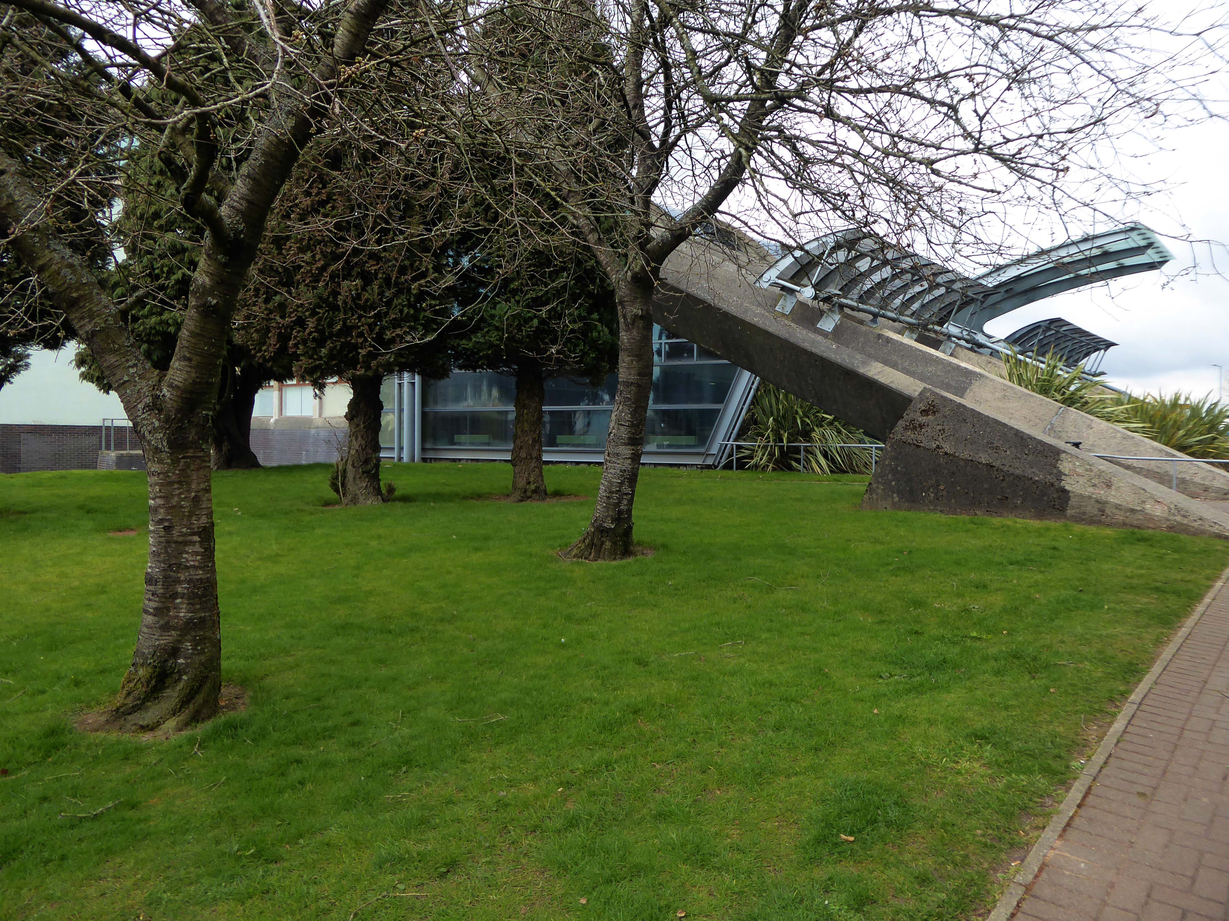
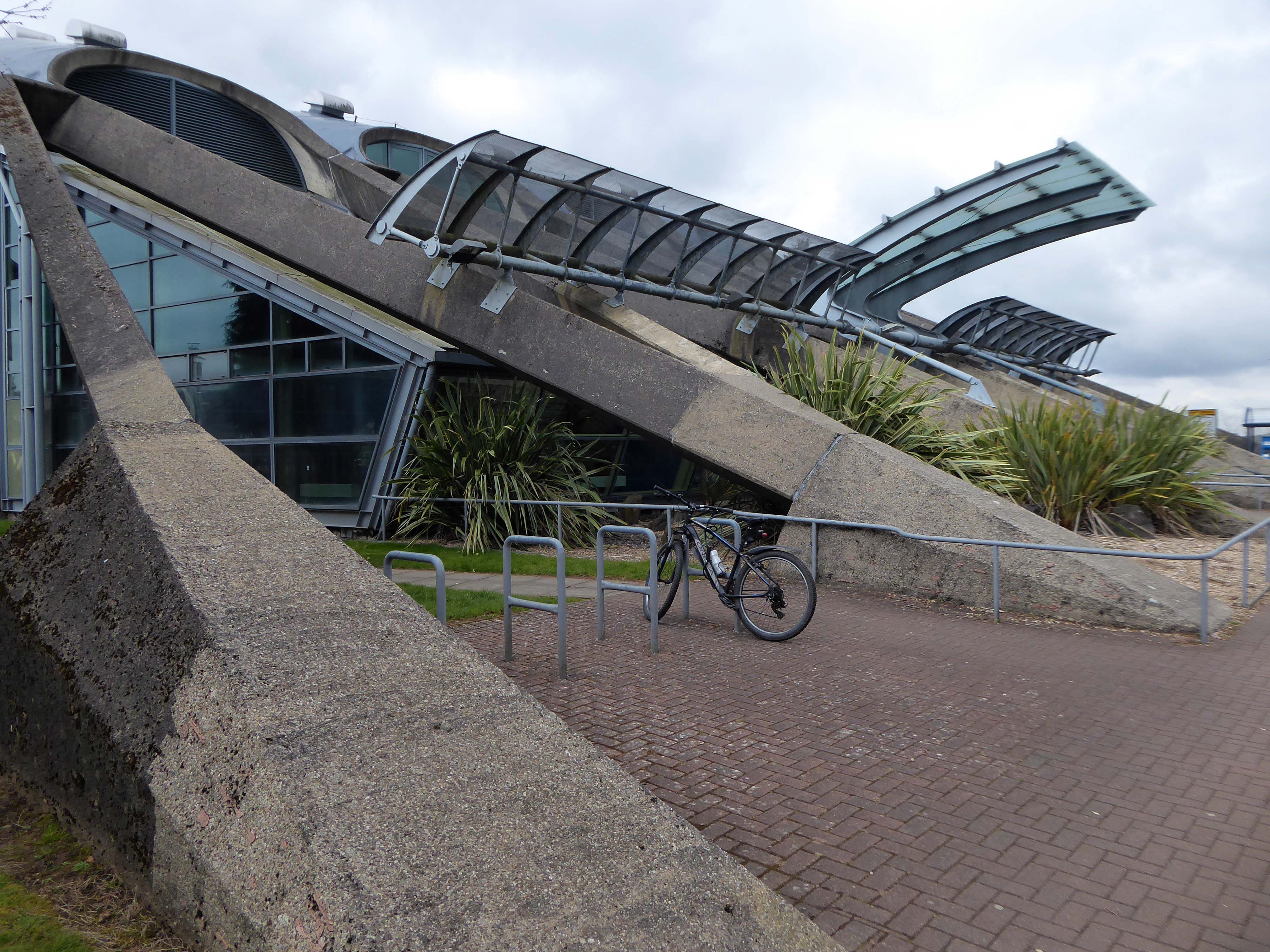
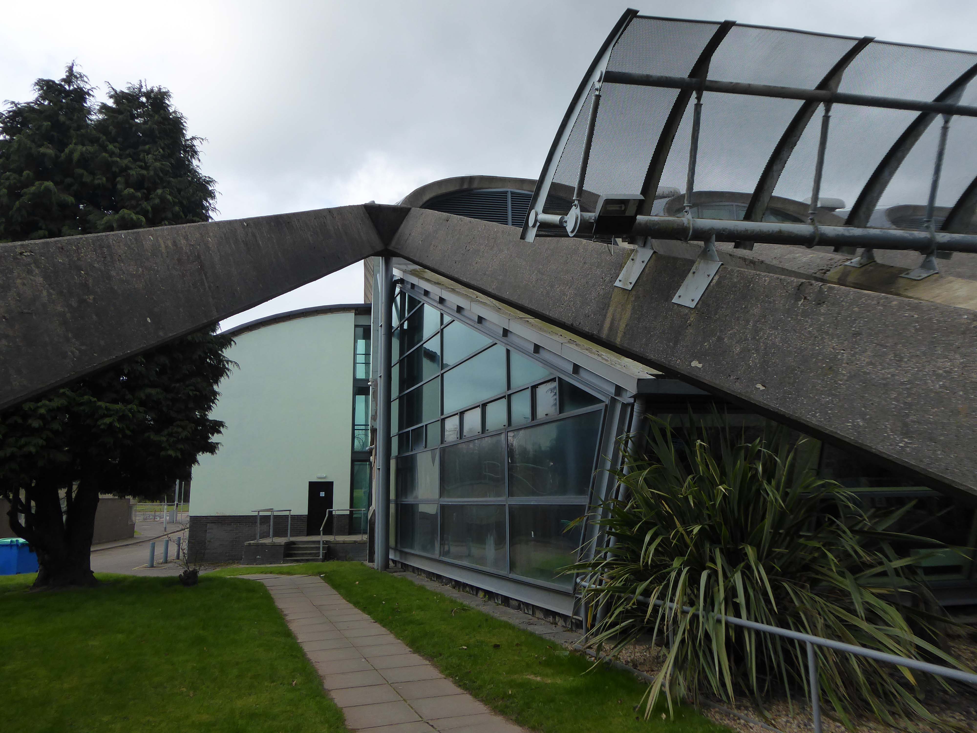
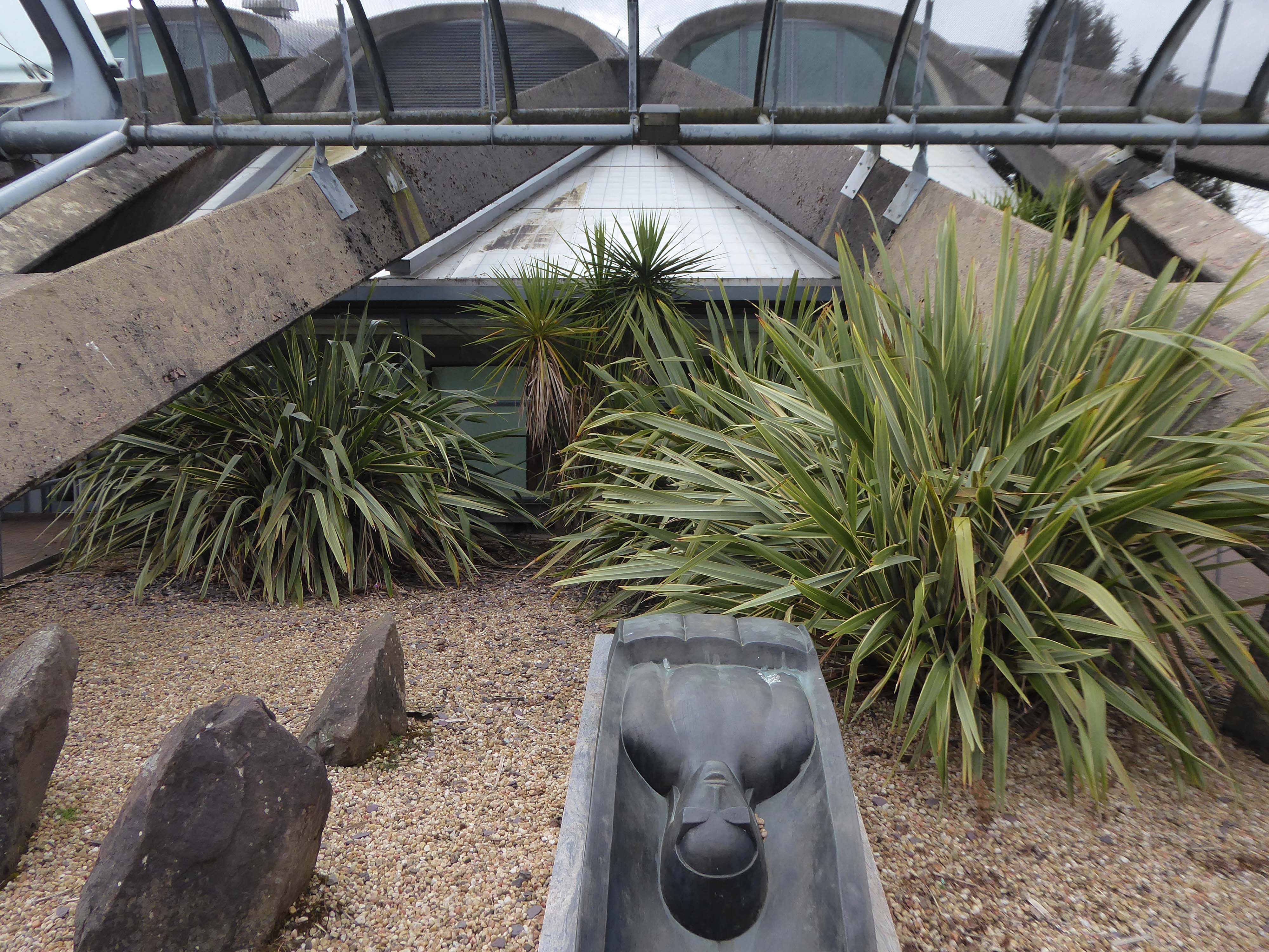
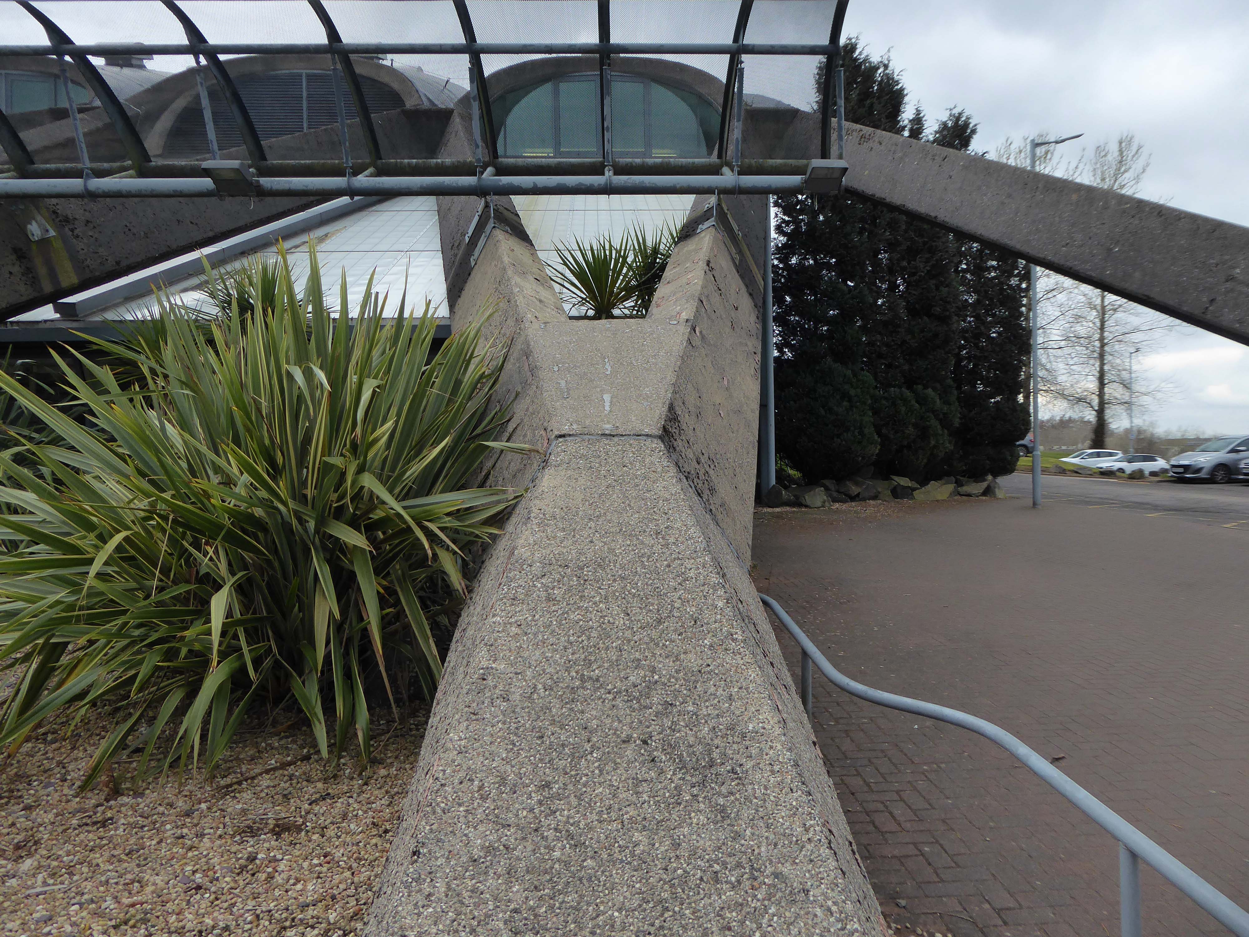
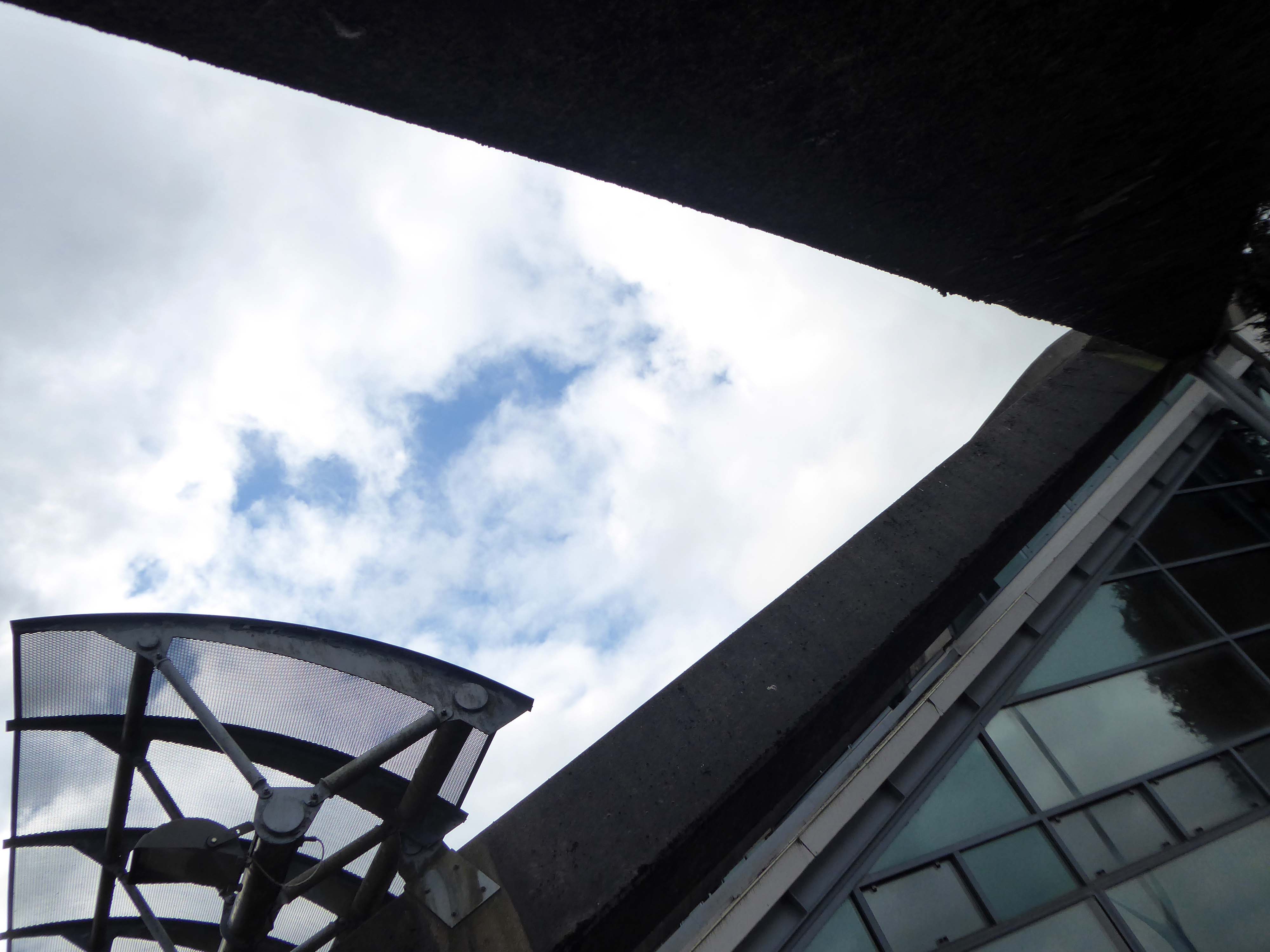
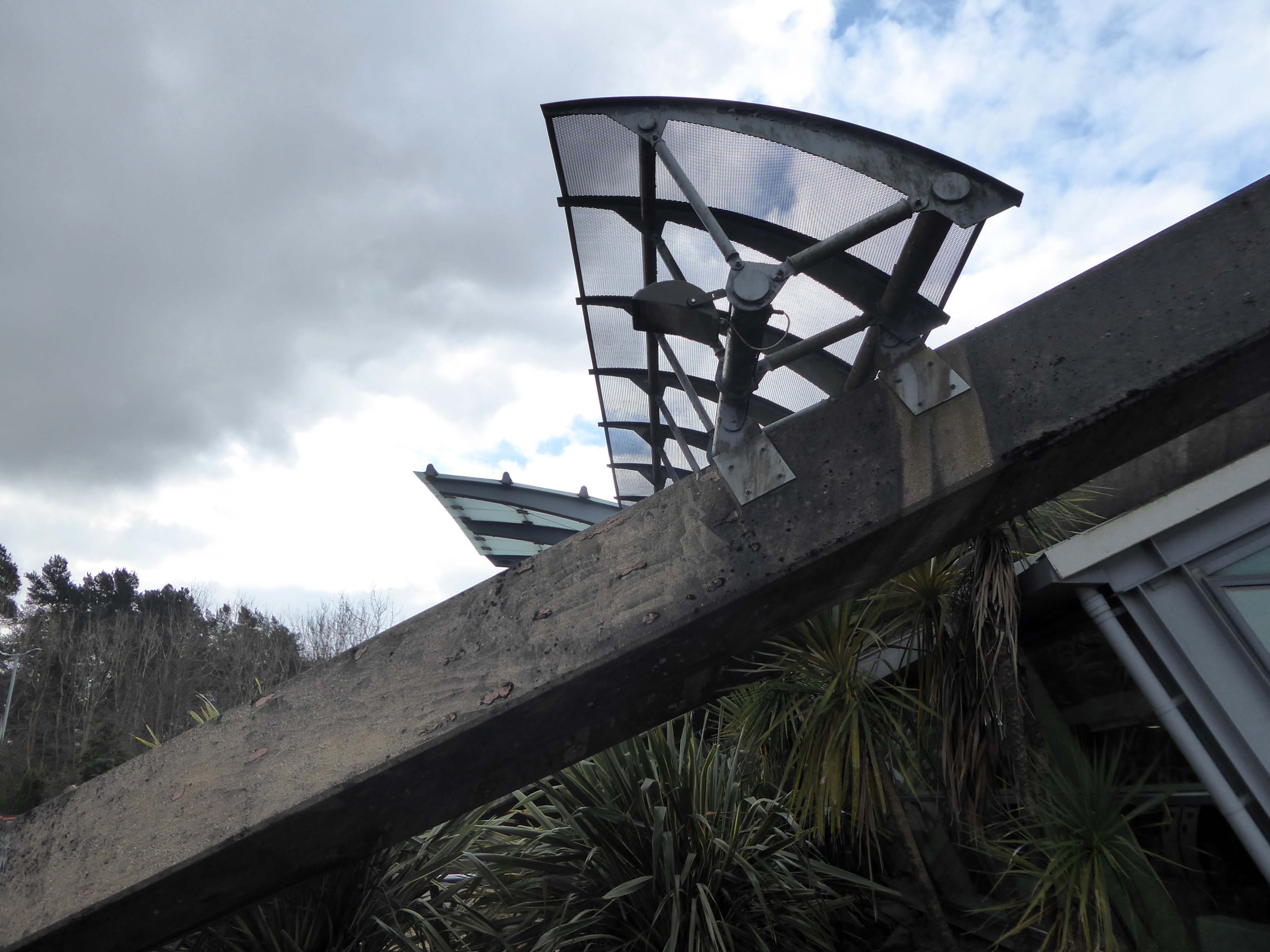
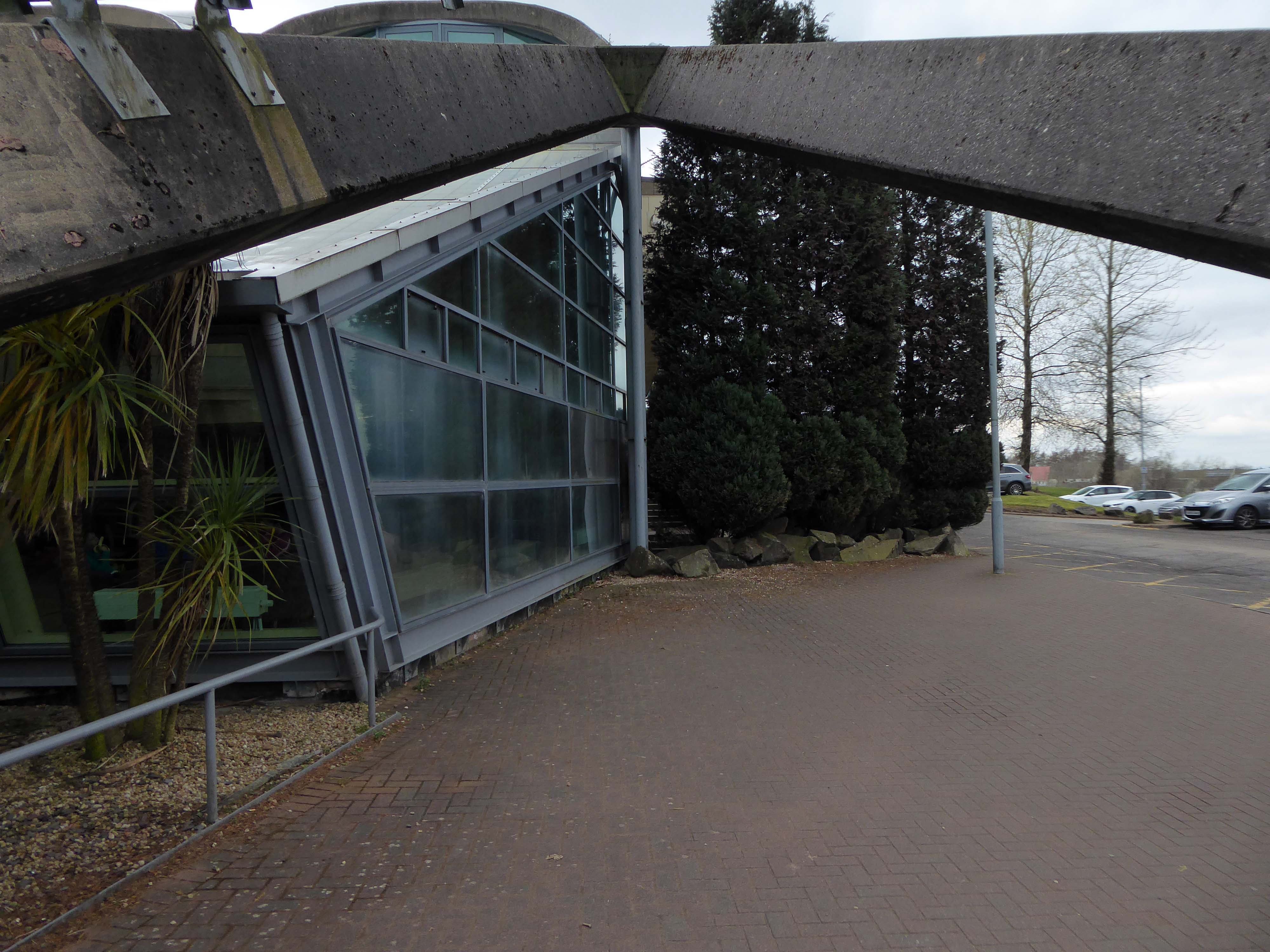
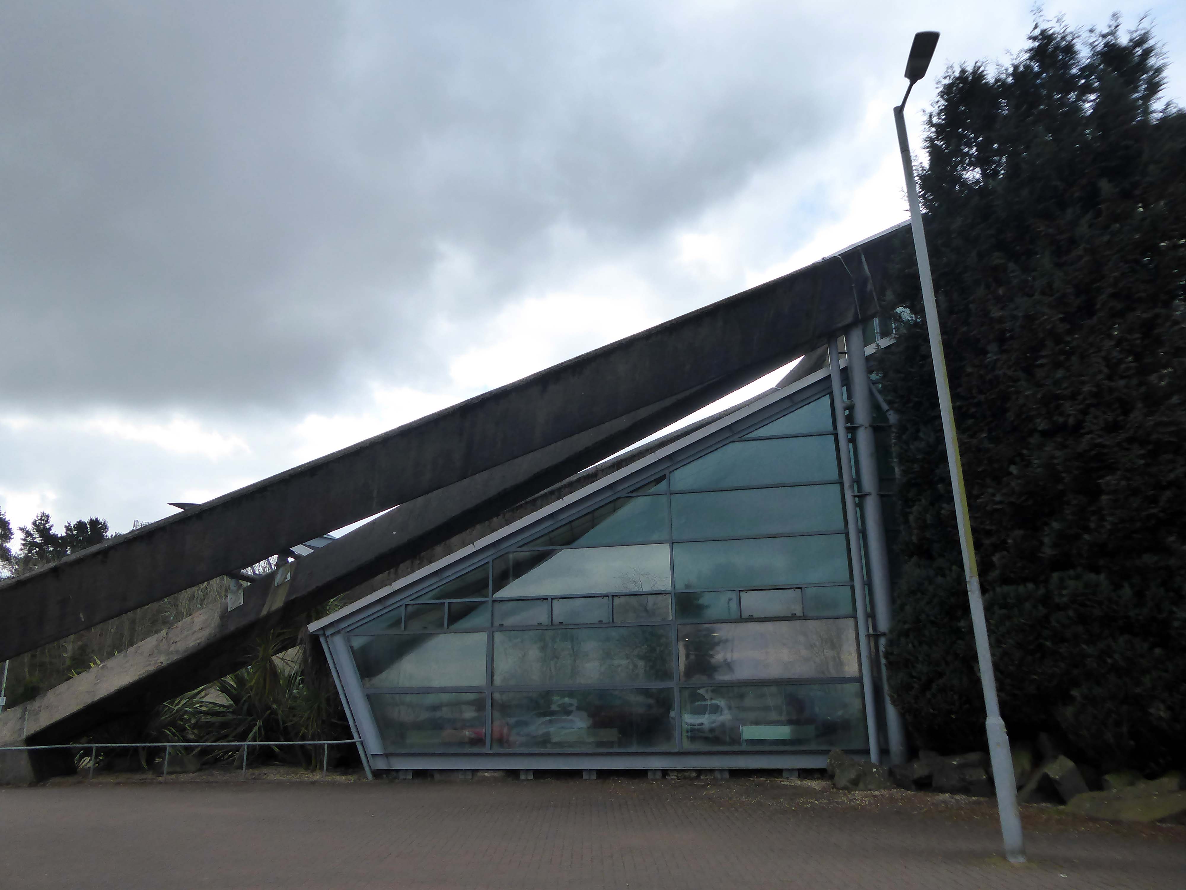
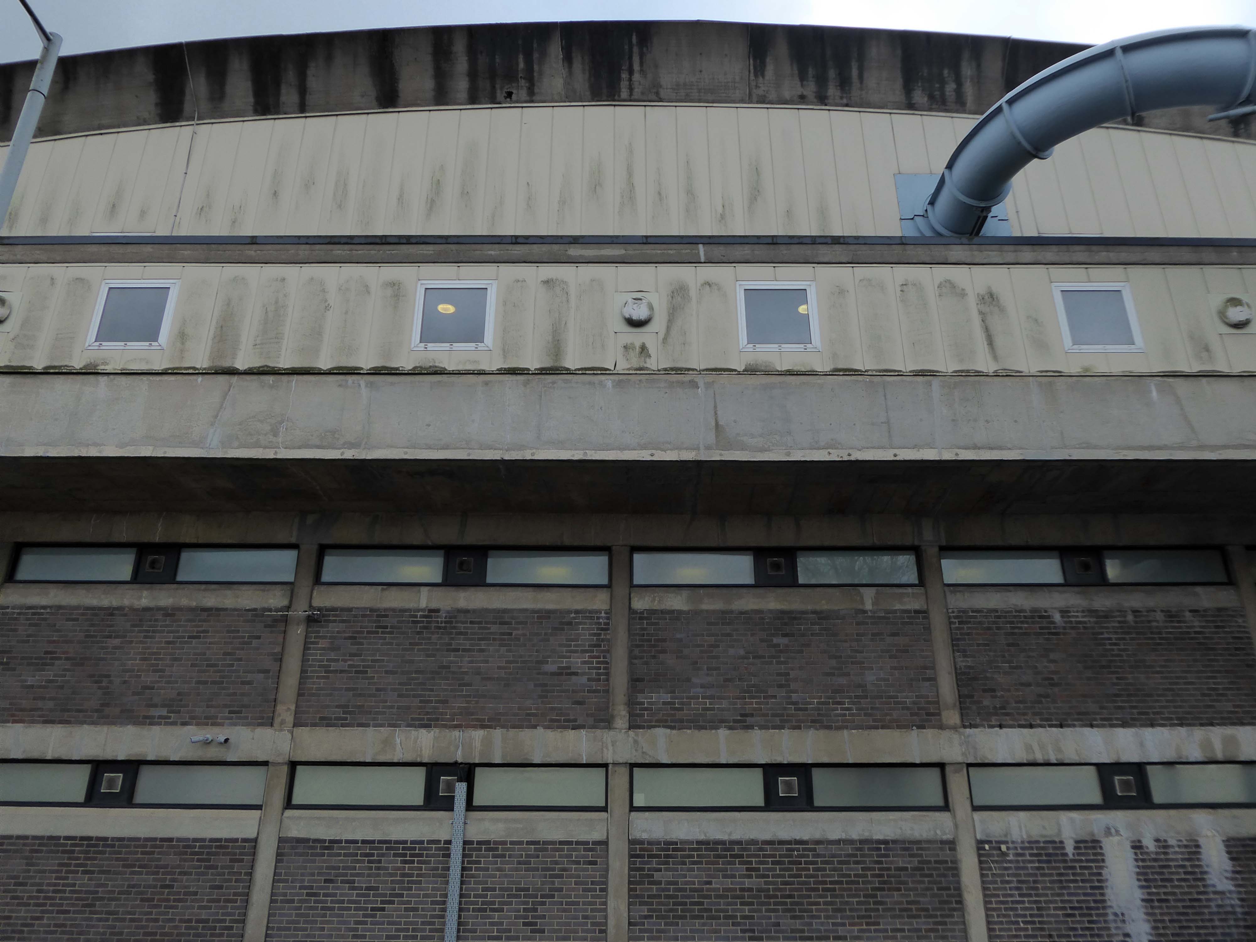
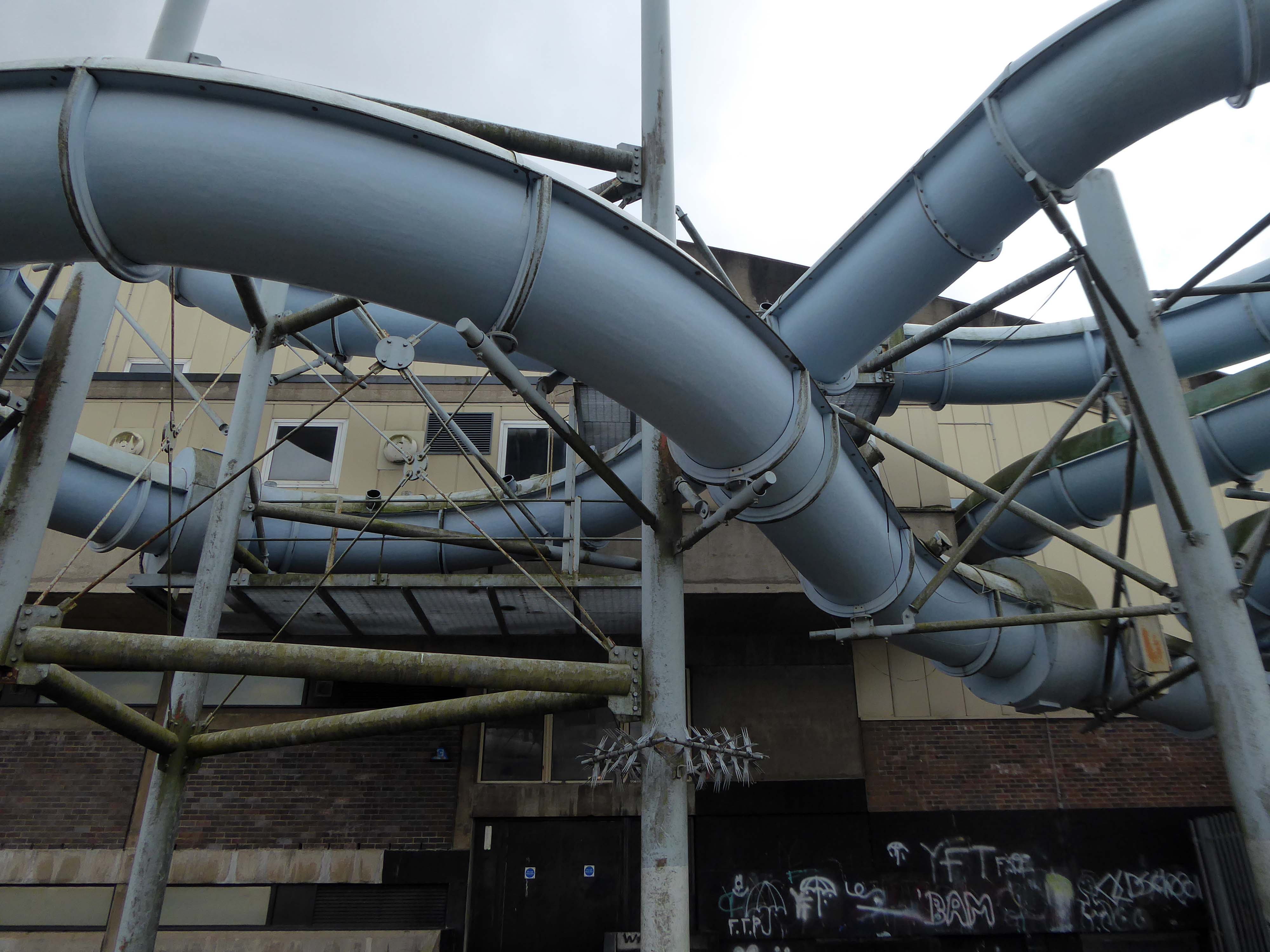
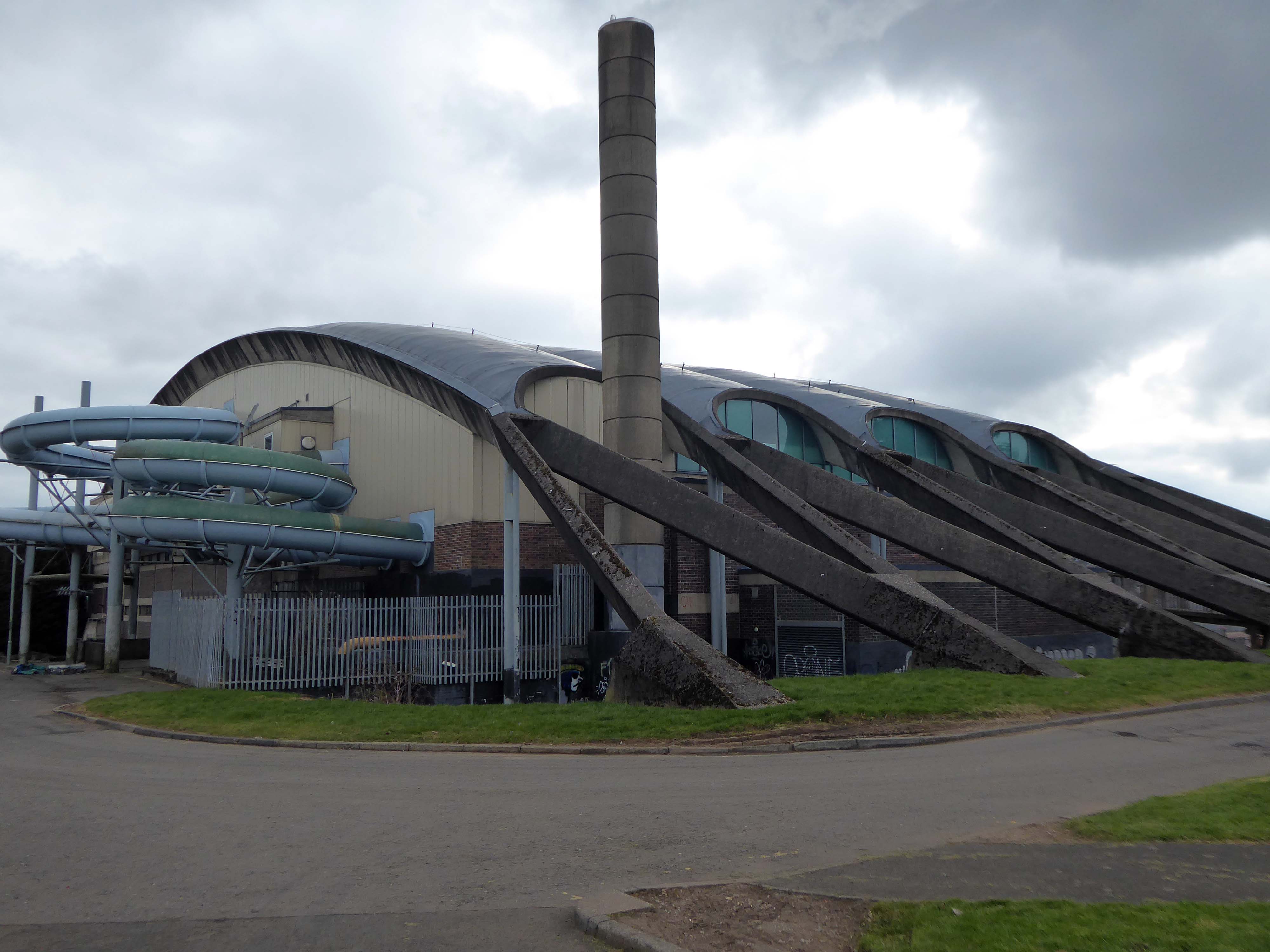
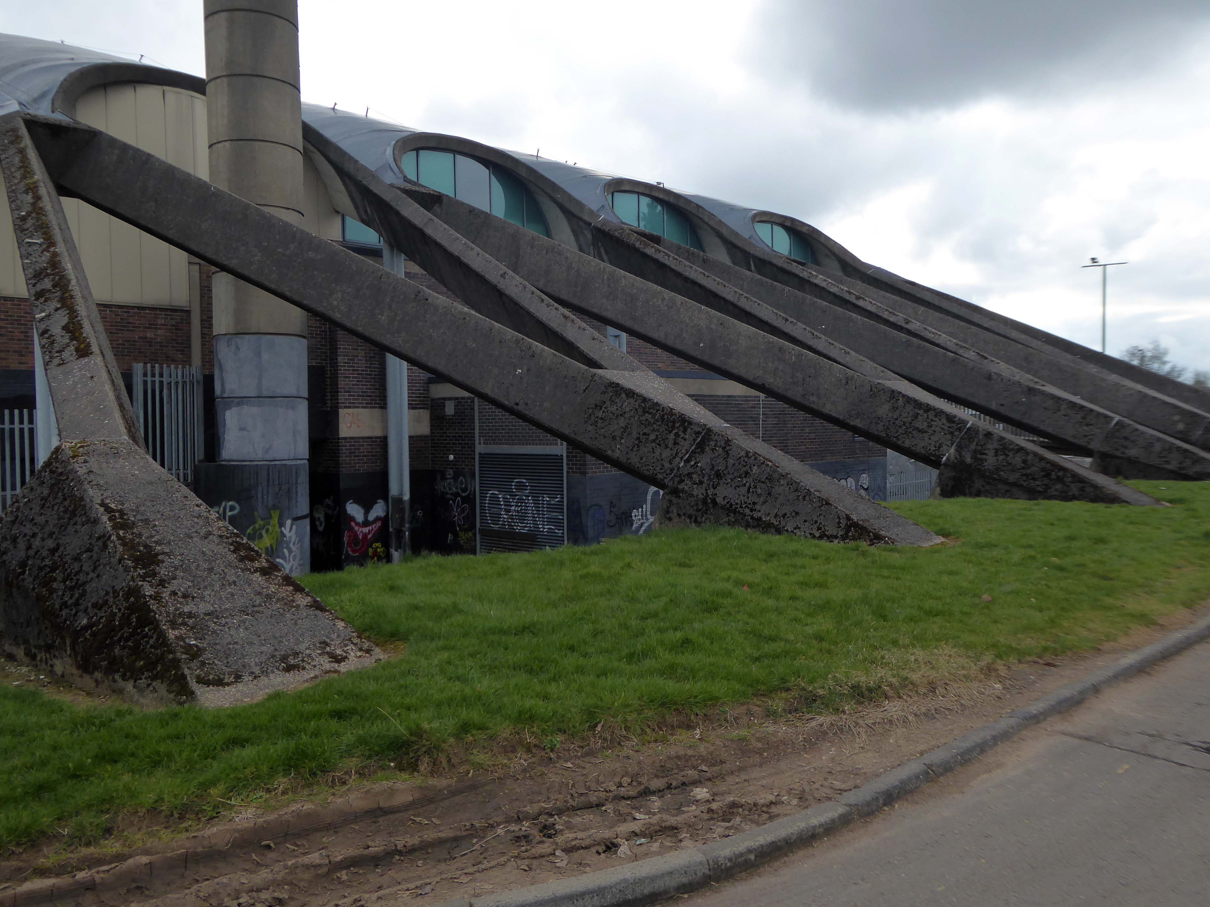
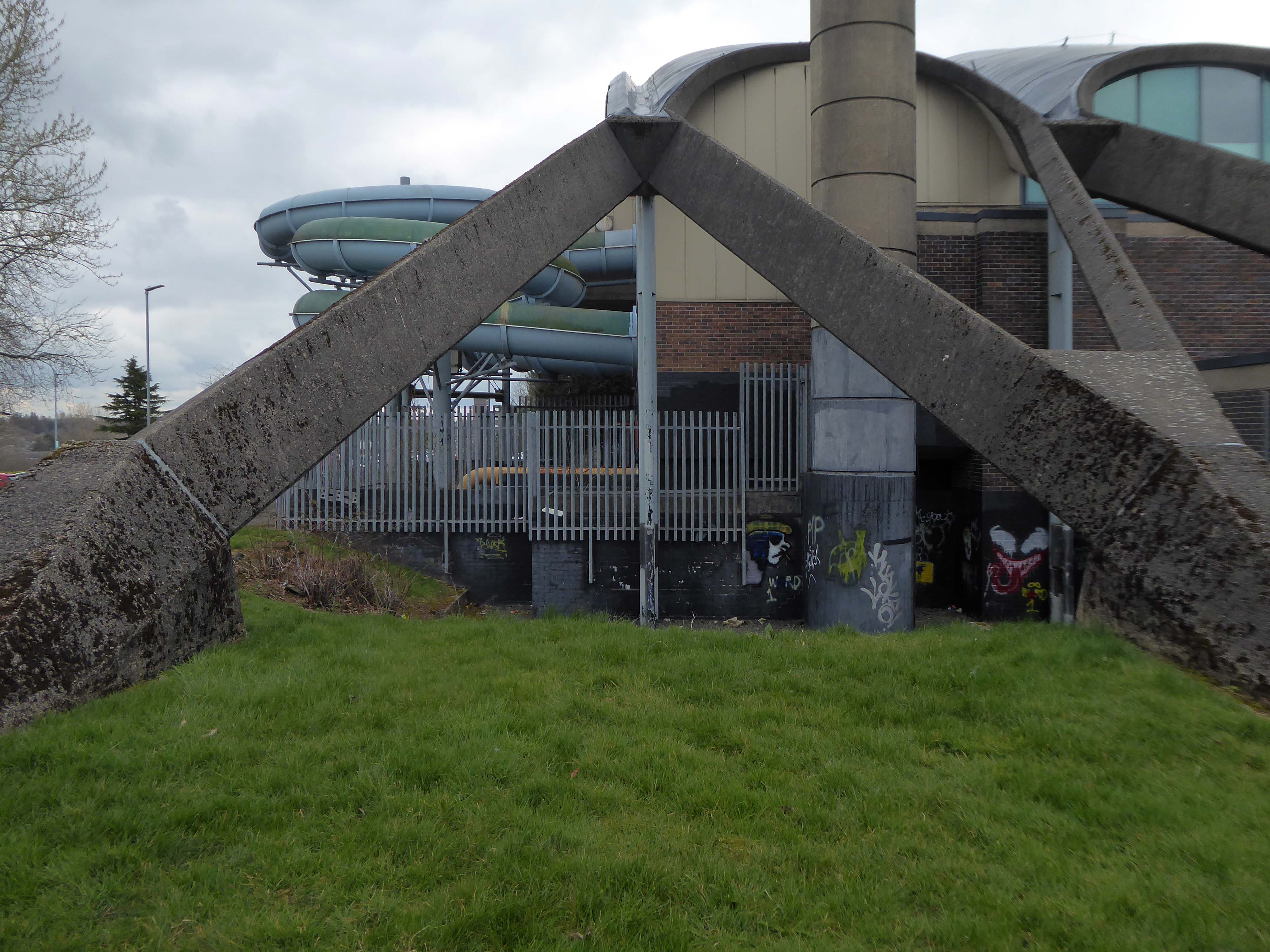
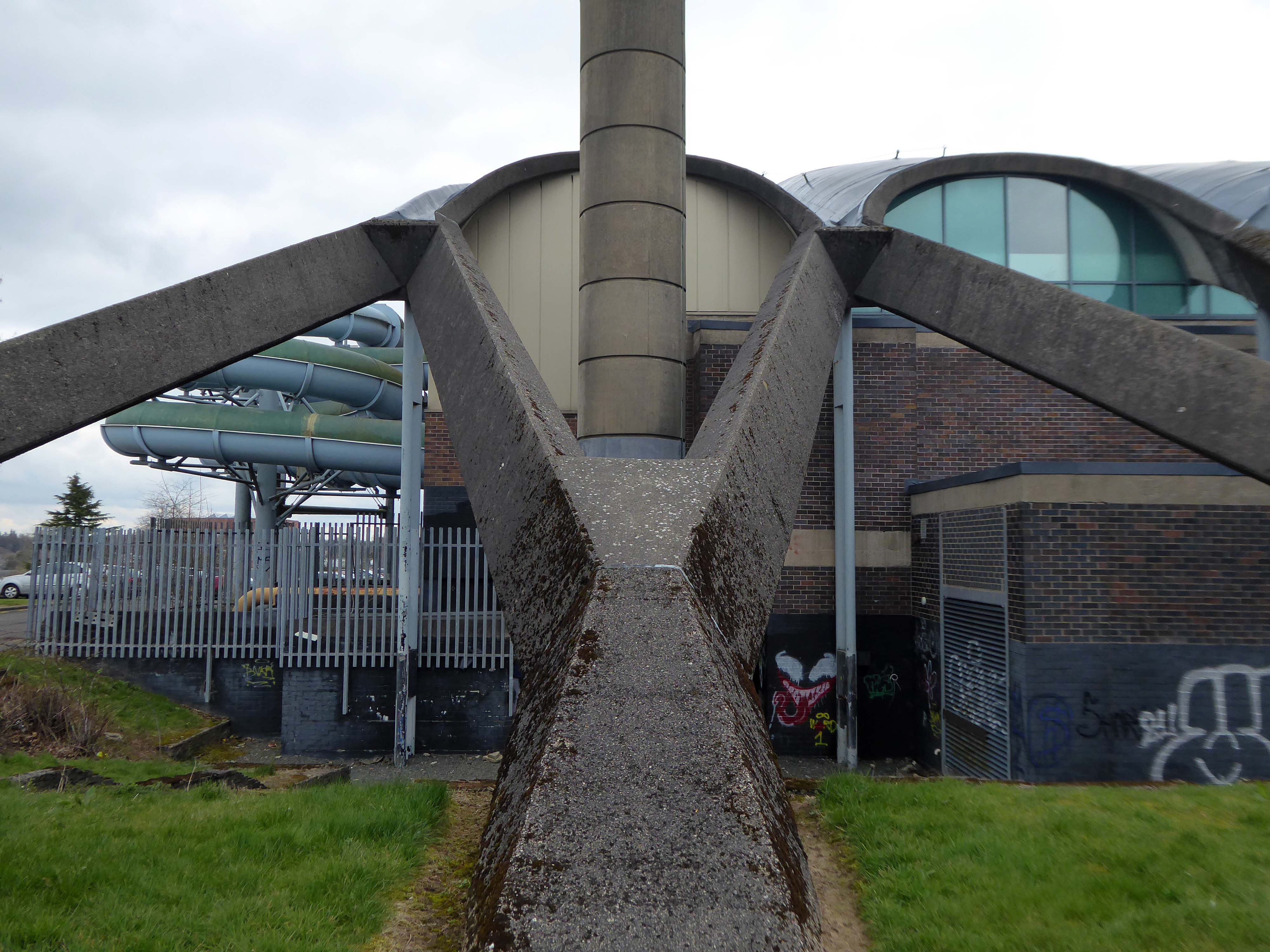
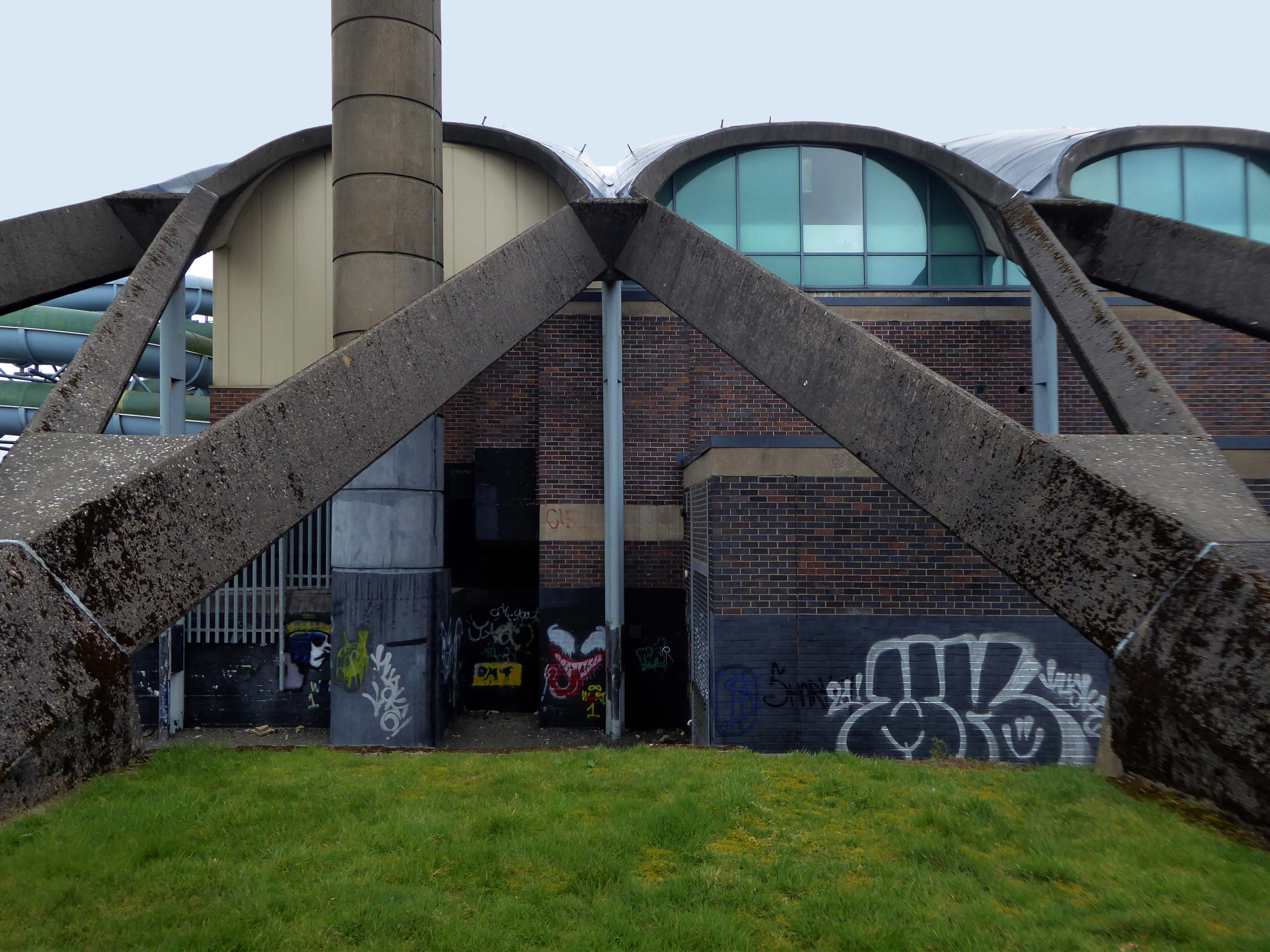
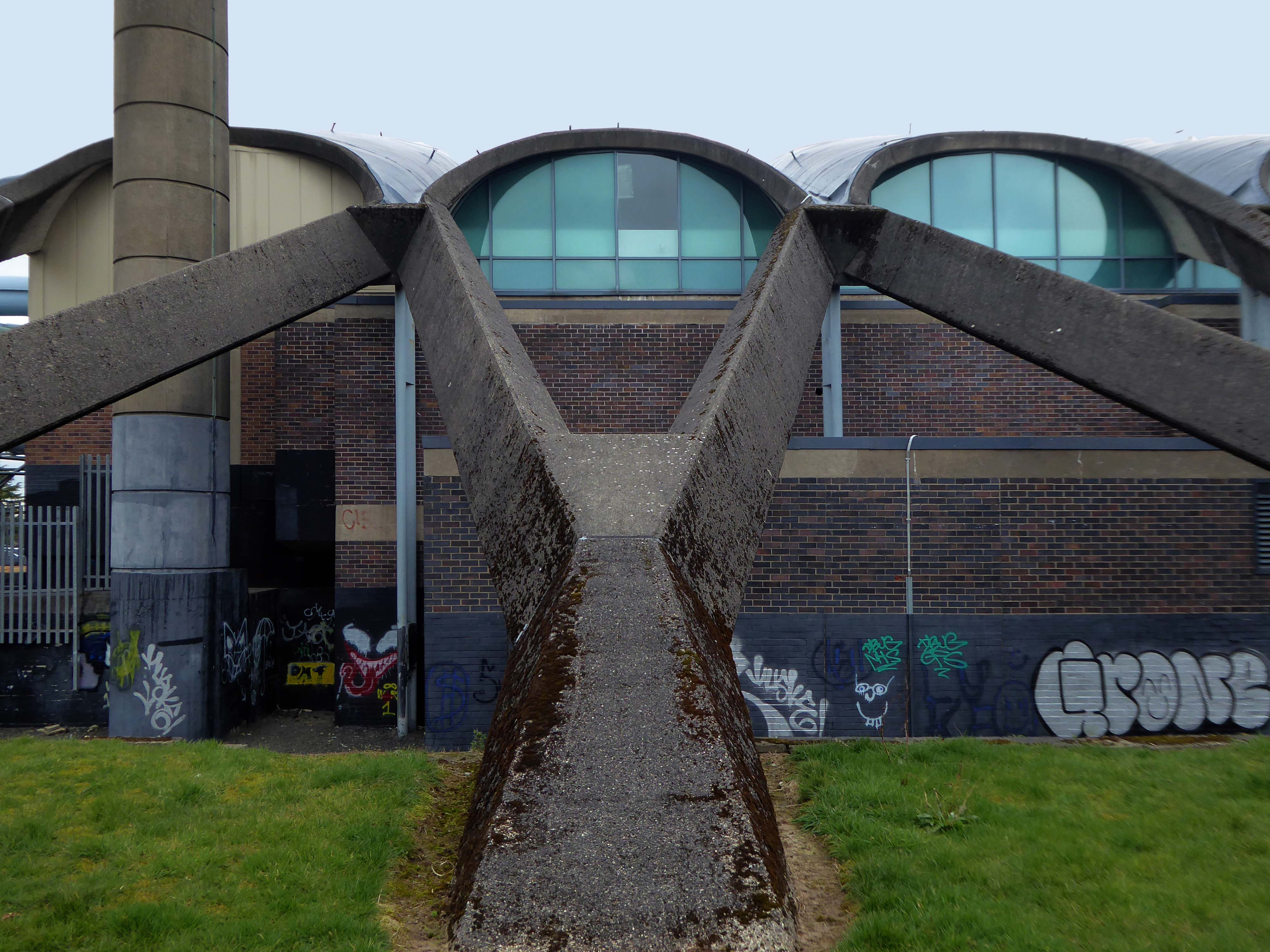
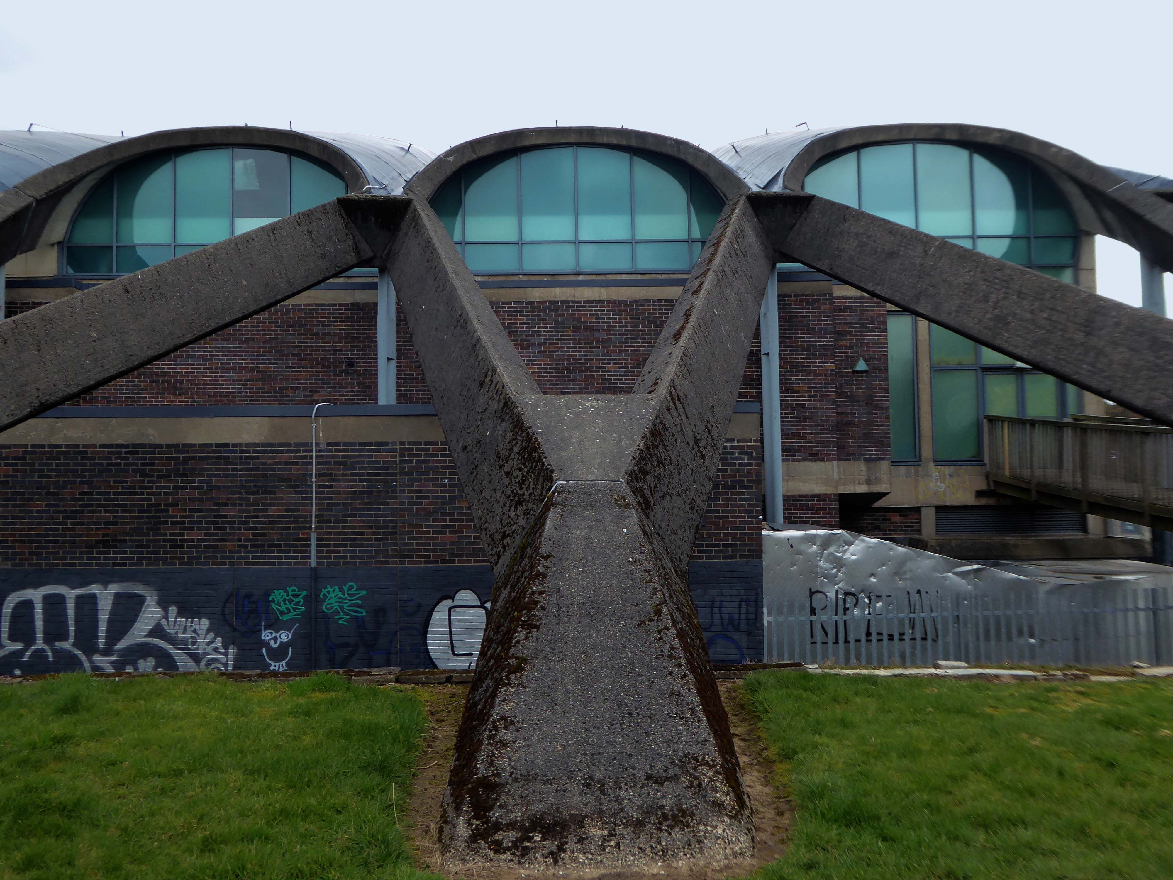
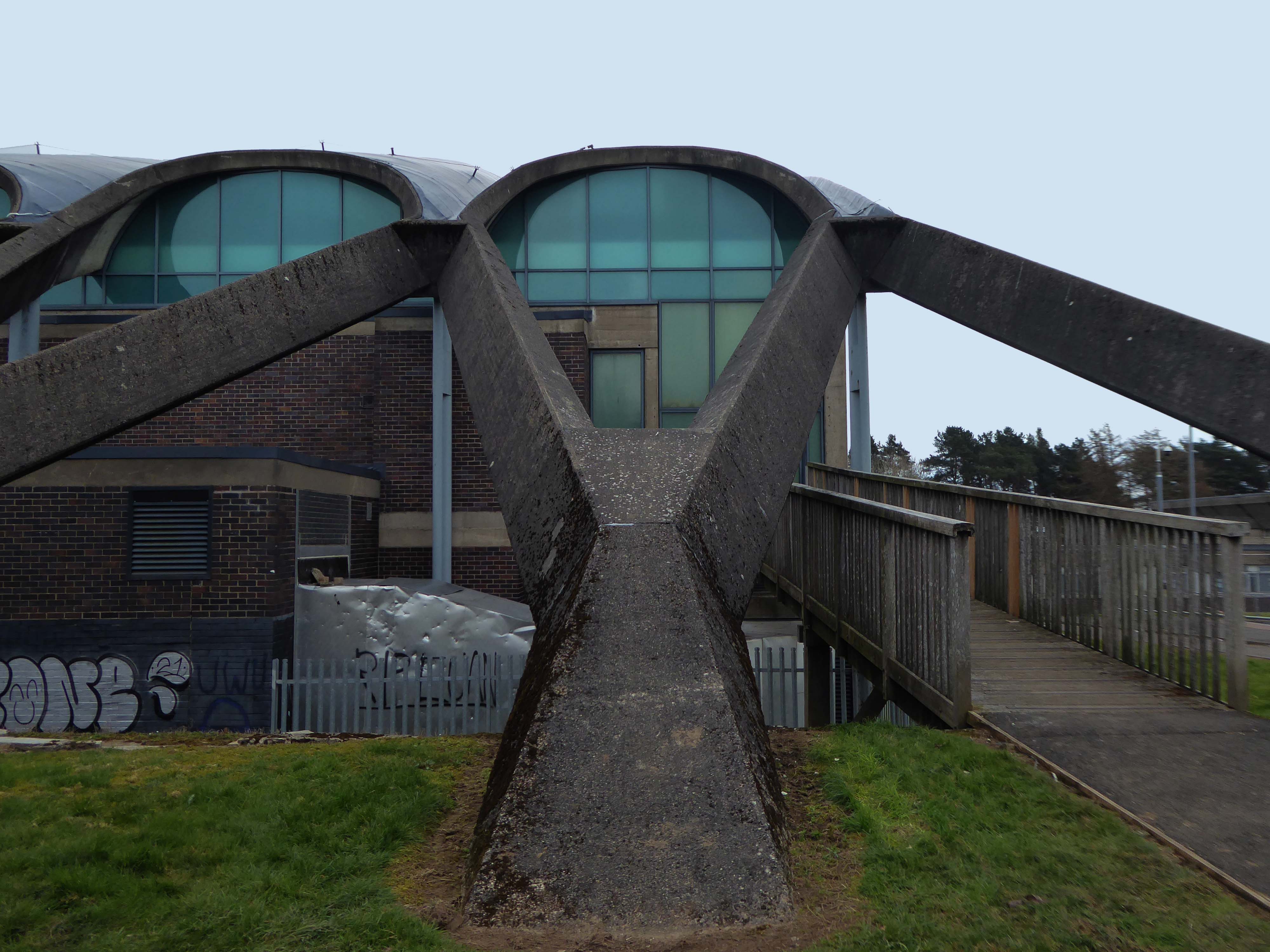
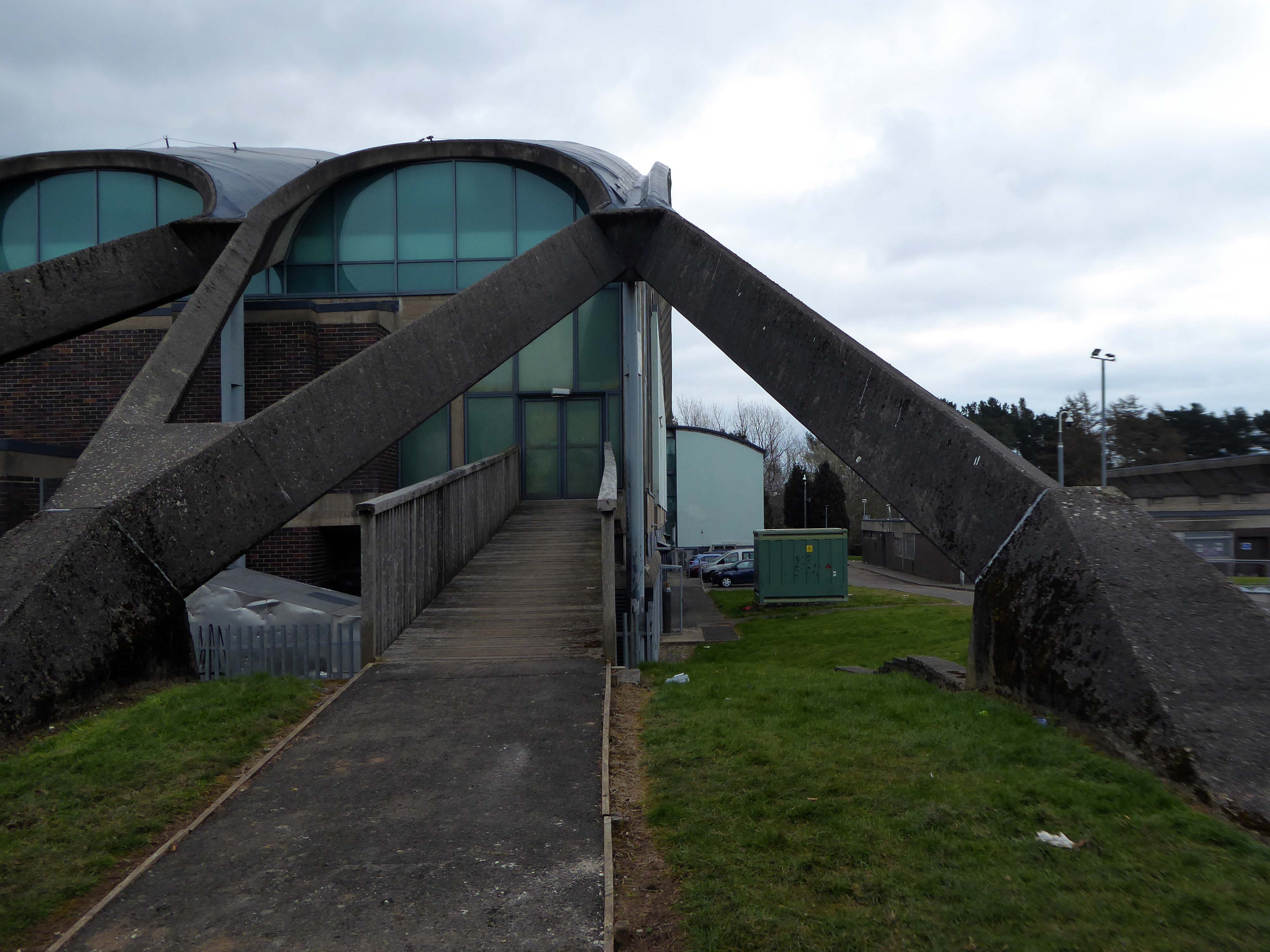
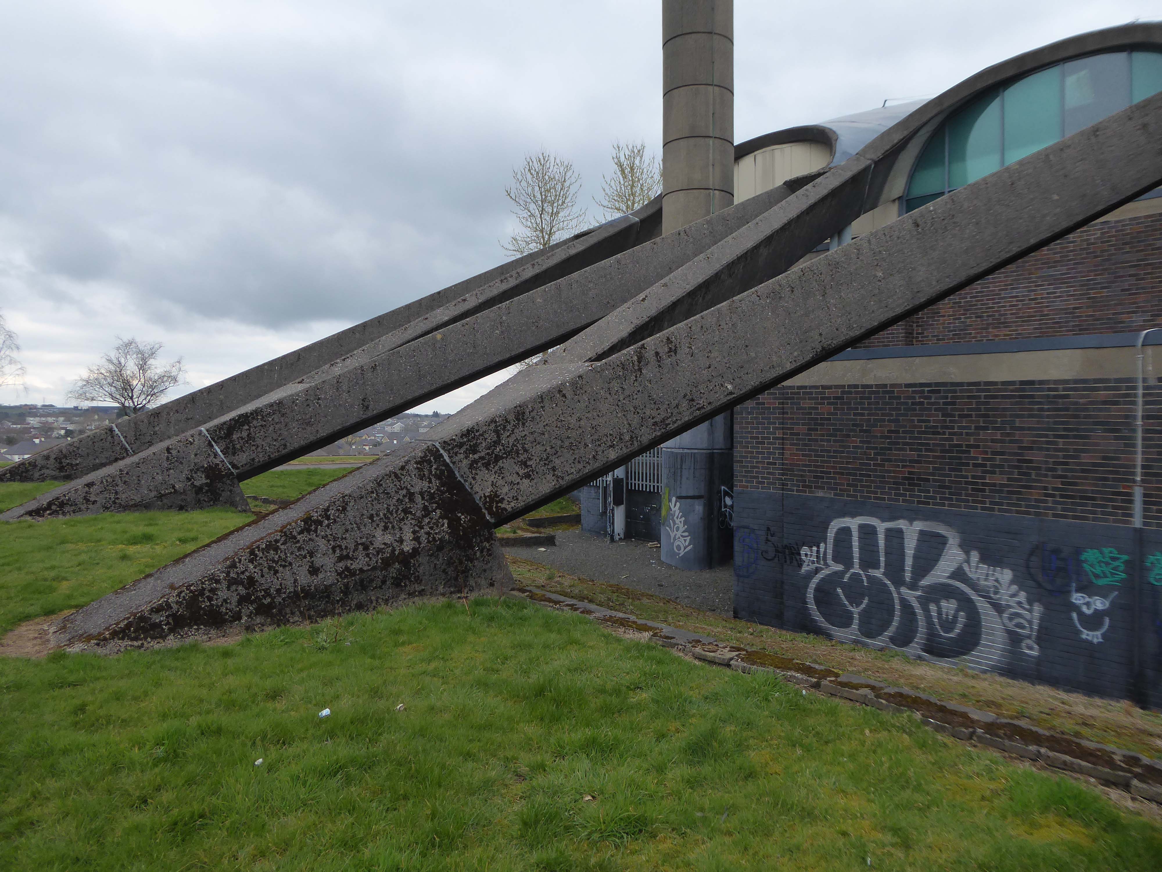
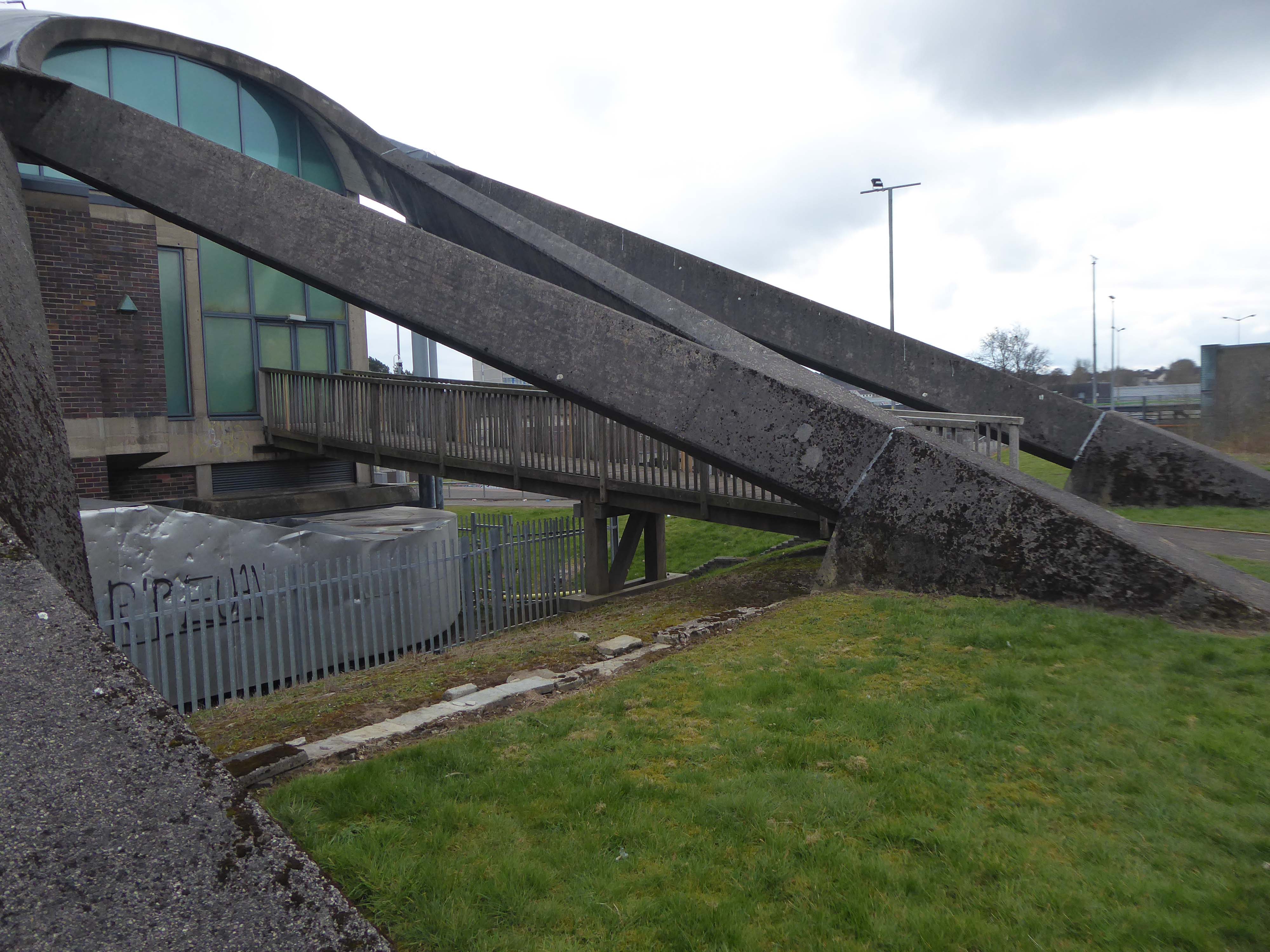
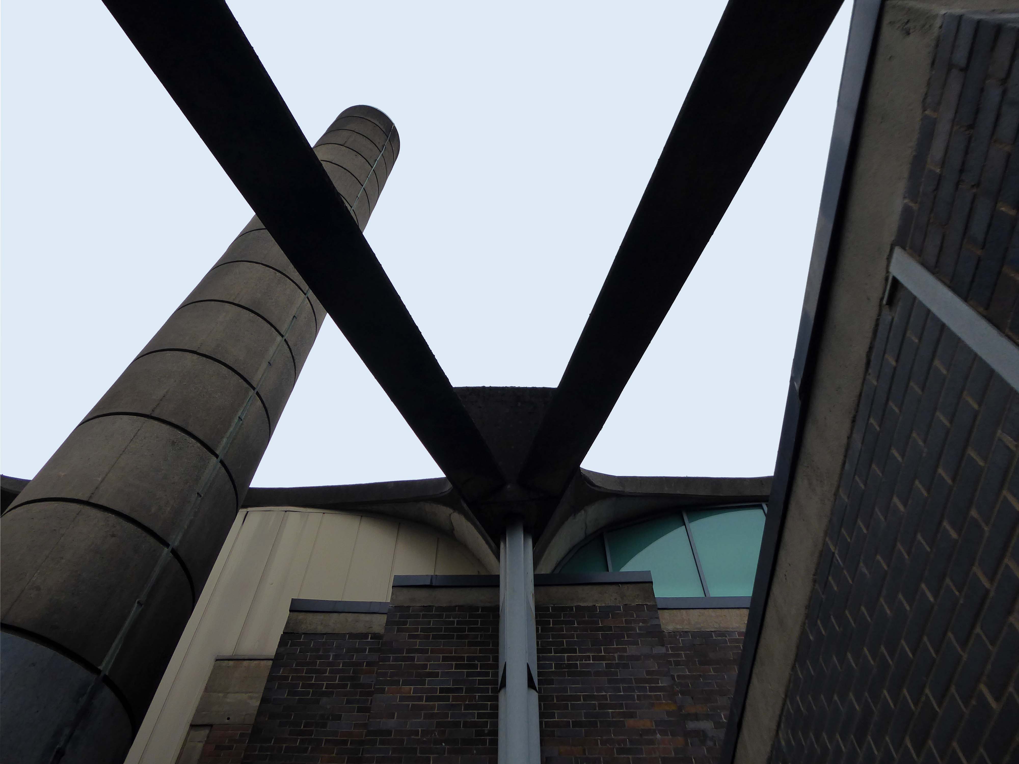
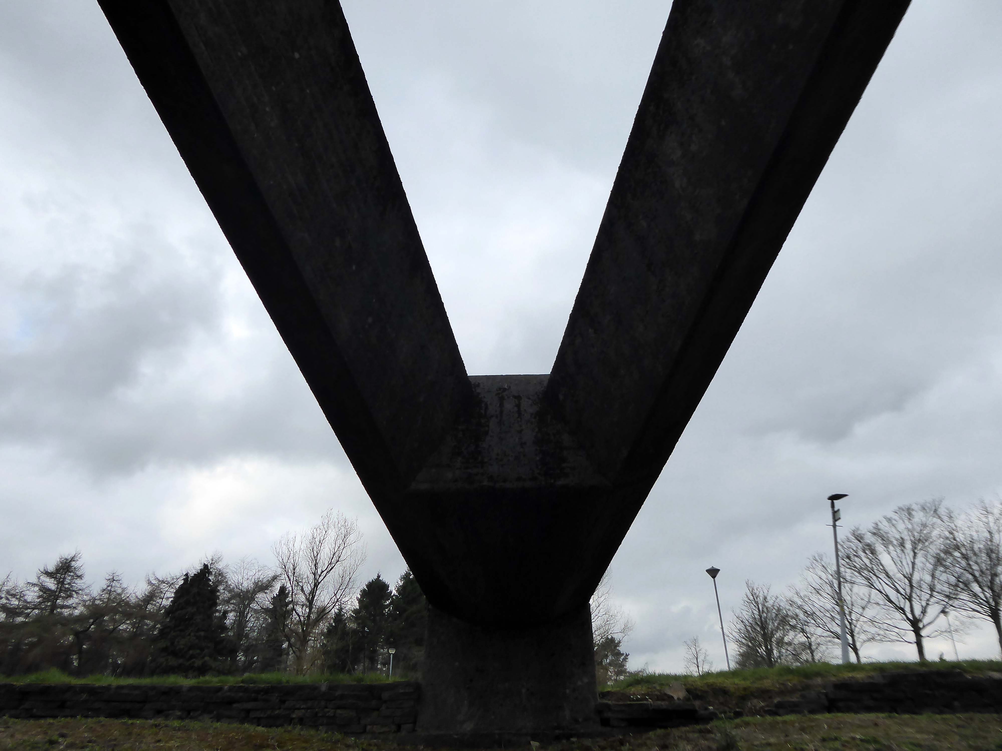
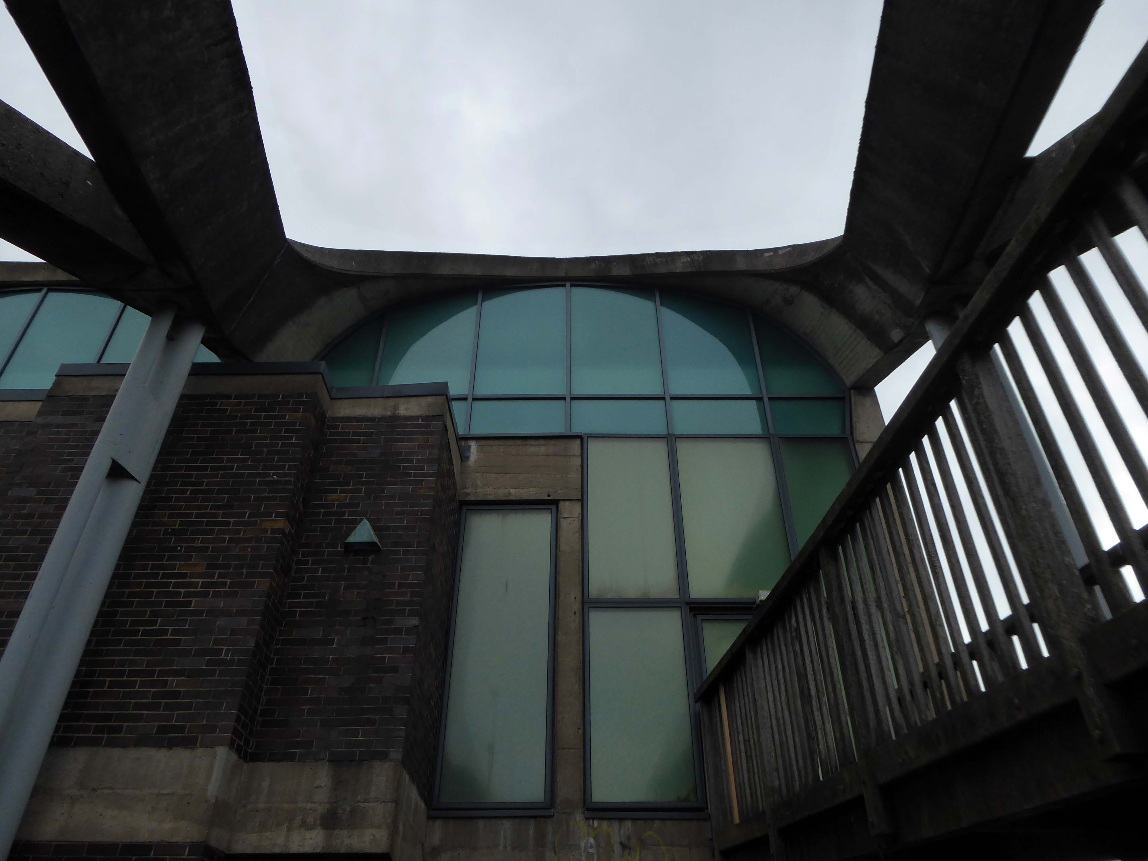
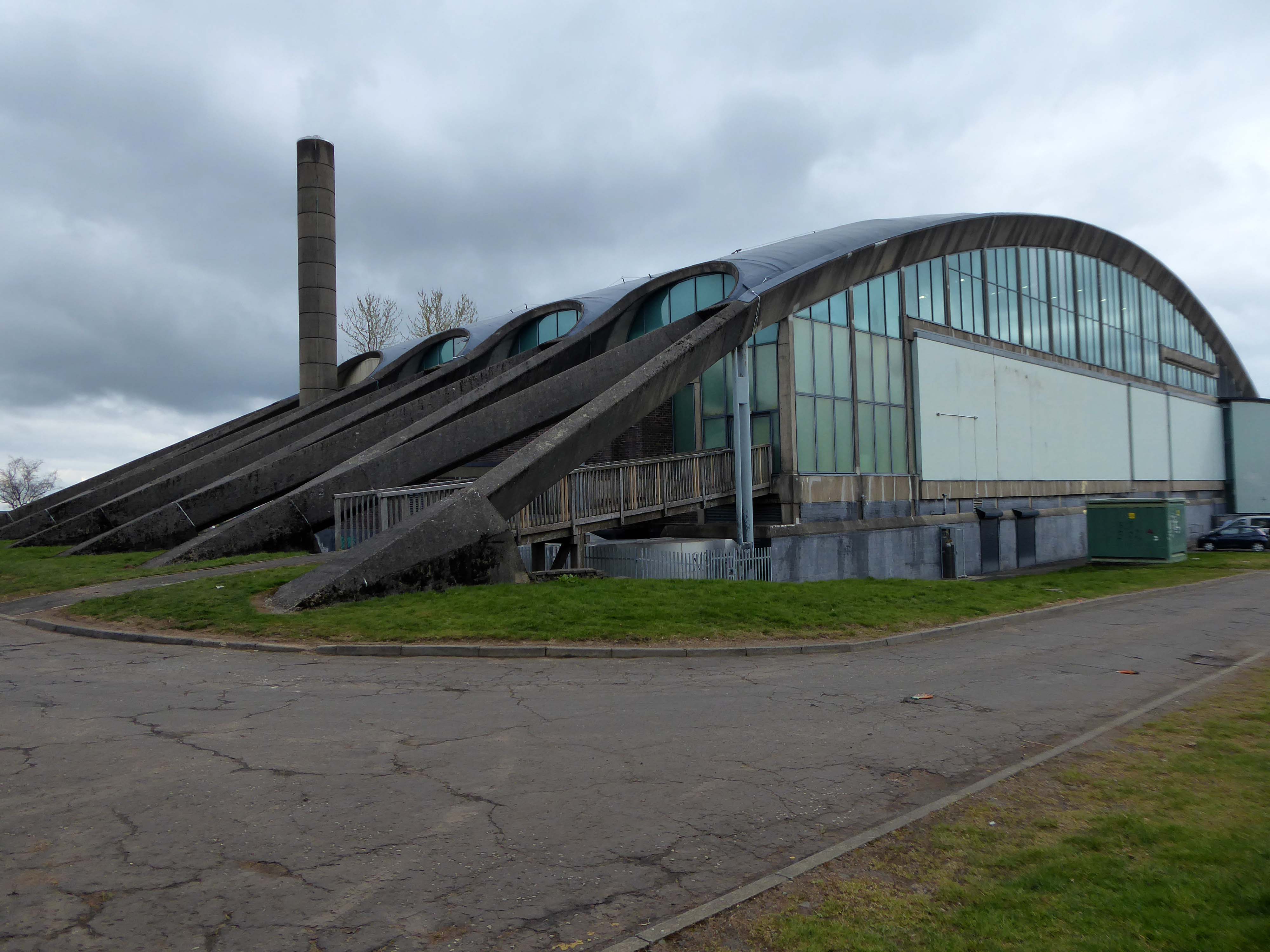
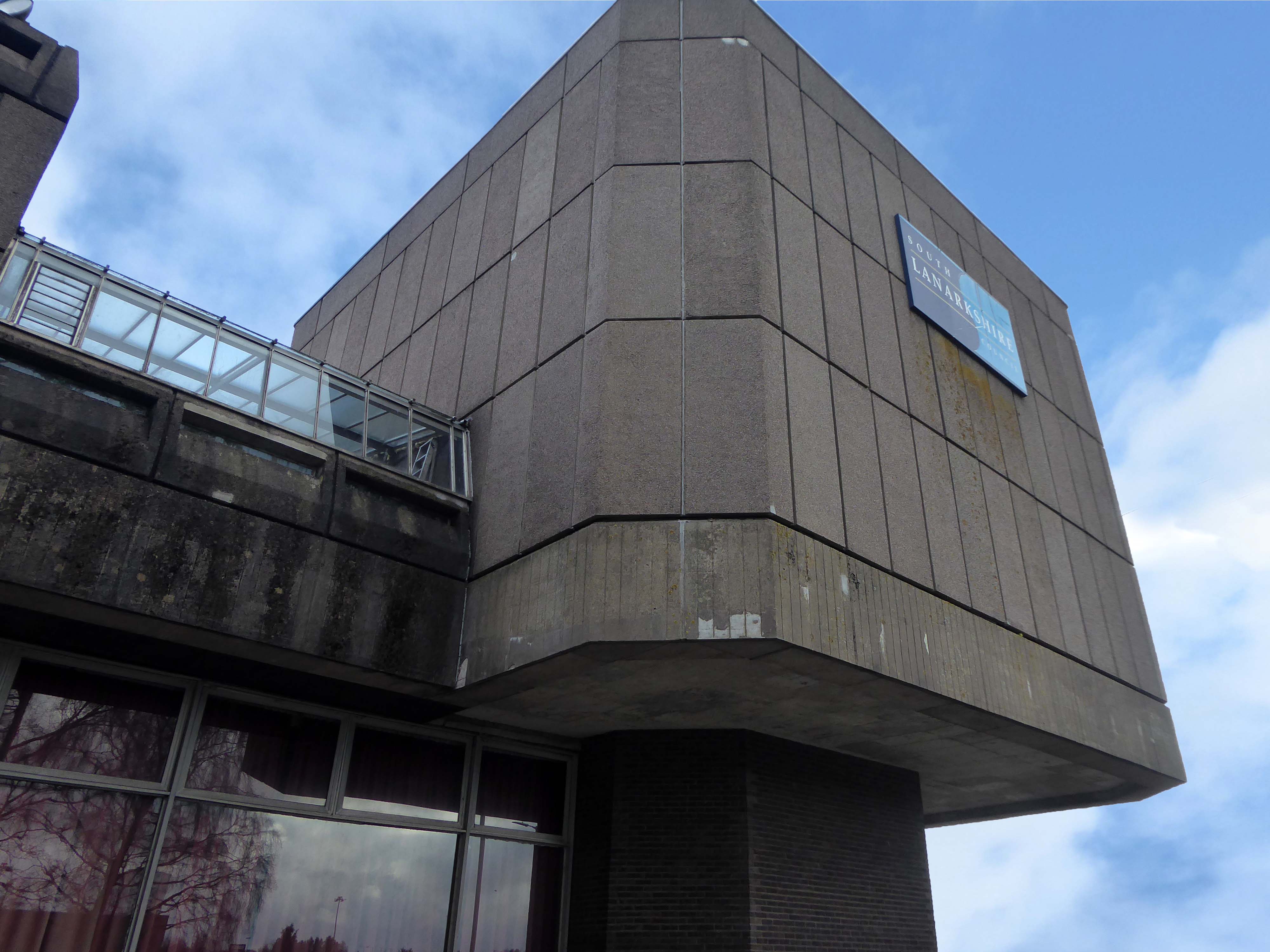
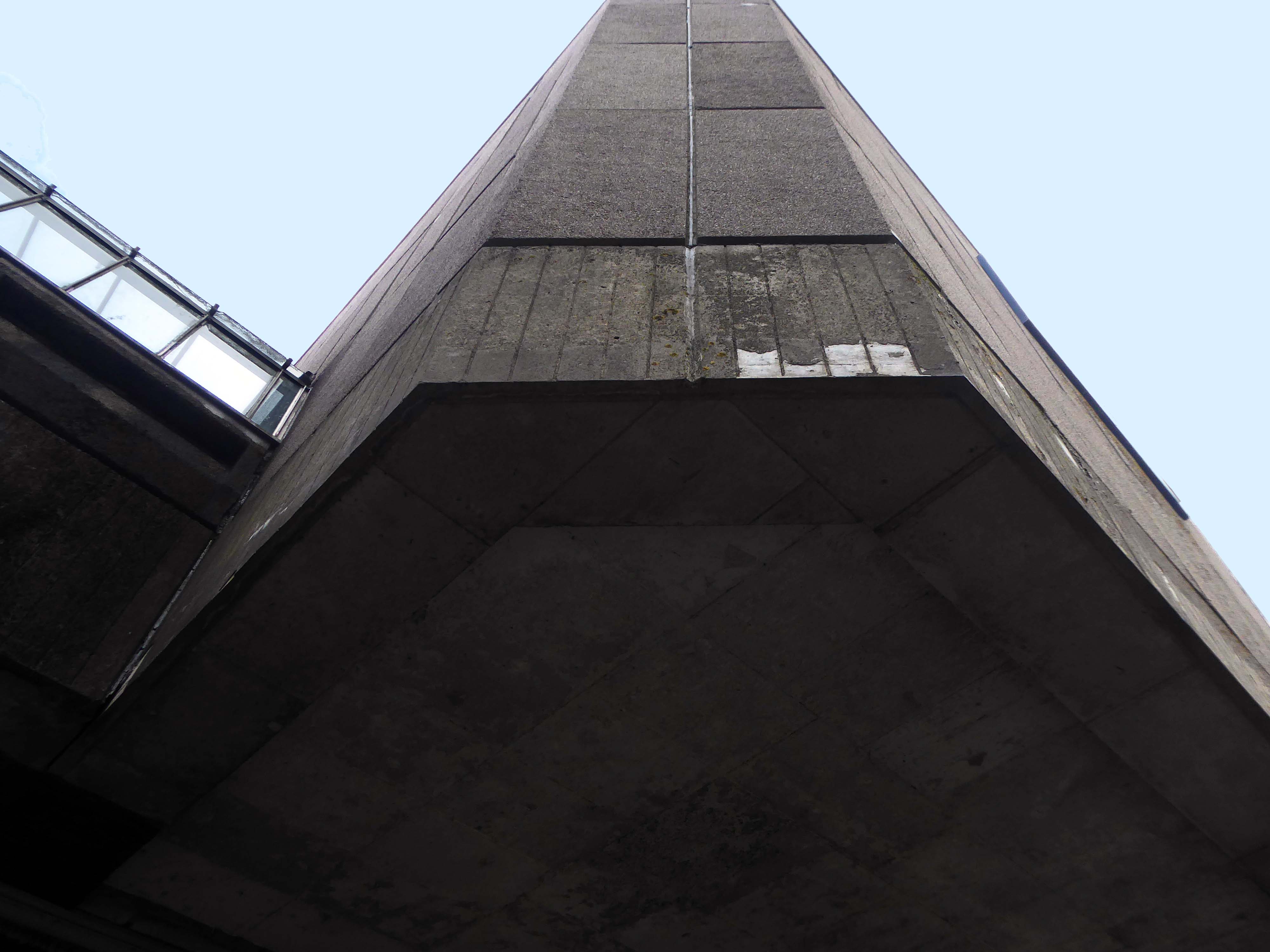
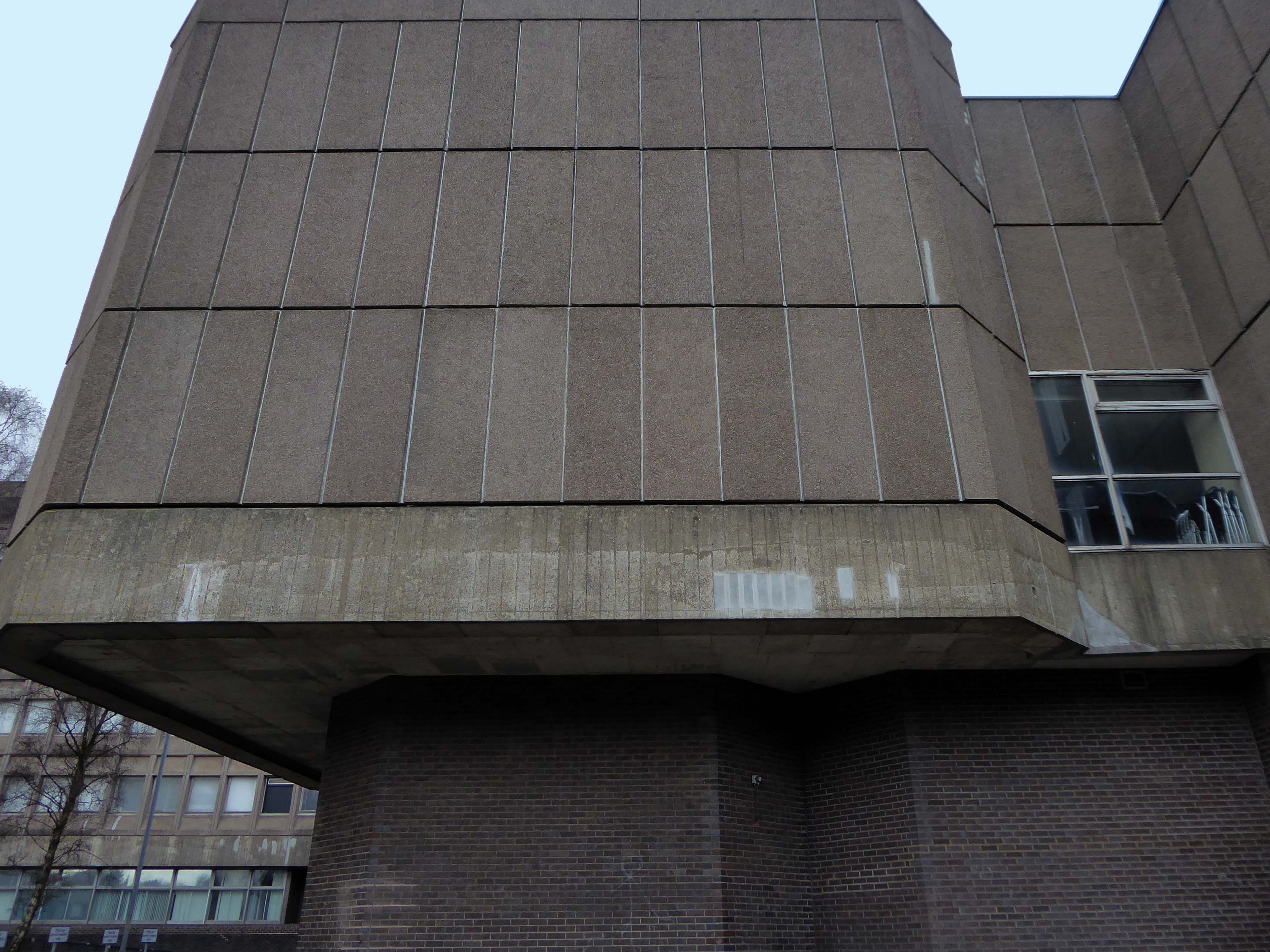
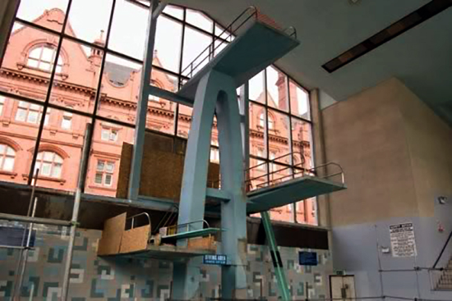
Designed by Alexander Buchanan Campbell and named after former Lord Provost Sir Patrick Dollan, it was opened in 1968 as Scotland’s first 50 metre swimming pool.
It consists principally of pre-stressed concrete and imitates a colossal marquee – the vaulted 324 ft parabolic arched roof appears to be held down by pairs of v-shaped struts that meet the ground at a thirty degree angle.
Buchanan Campbell admitted that he had been influenced by the architecture of the 1964 Summer Olympics in Tokyo, Japan and the designs by Kenzo Tange for the gymnasium there.
In 1993, the international conservation organisation Docomomo International listed Dollan Baths as one of sixty key monuments in Scottish post-war architecture.
The Dollan’s wet recreation facilities include South Lanarkshire’s only 50m swimming pool and SLLC’s most exclusive health suite facility which features a sauna, steam room, sanarium, spa pool and relaxation area.
If you prefer dry recreation facilities then look no further as the Dollan features two gyms. The first is a traditional gym with the latest Life Fitness cardio and HUR compressed-air resistance equipment.
To complement these fantastic facilities there are two fitness studios that play host to a diverse range of fitness and mind, body and soul classes as well as a morning creche.
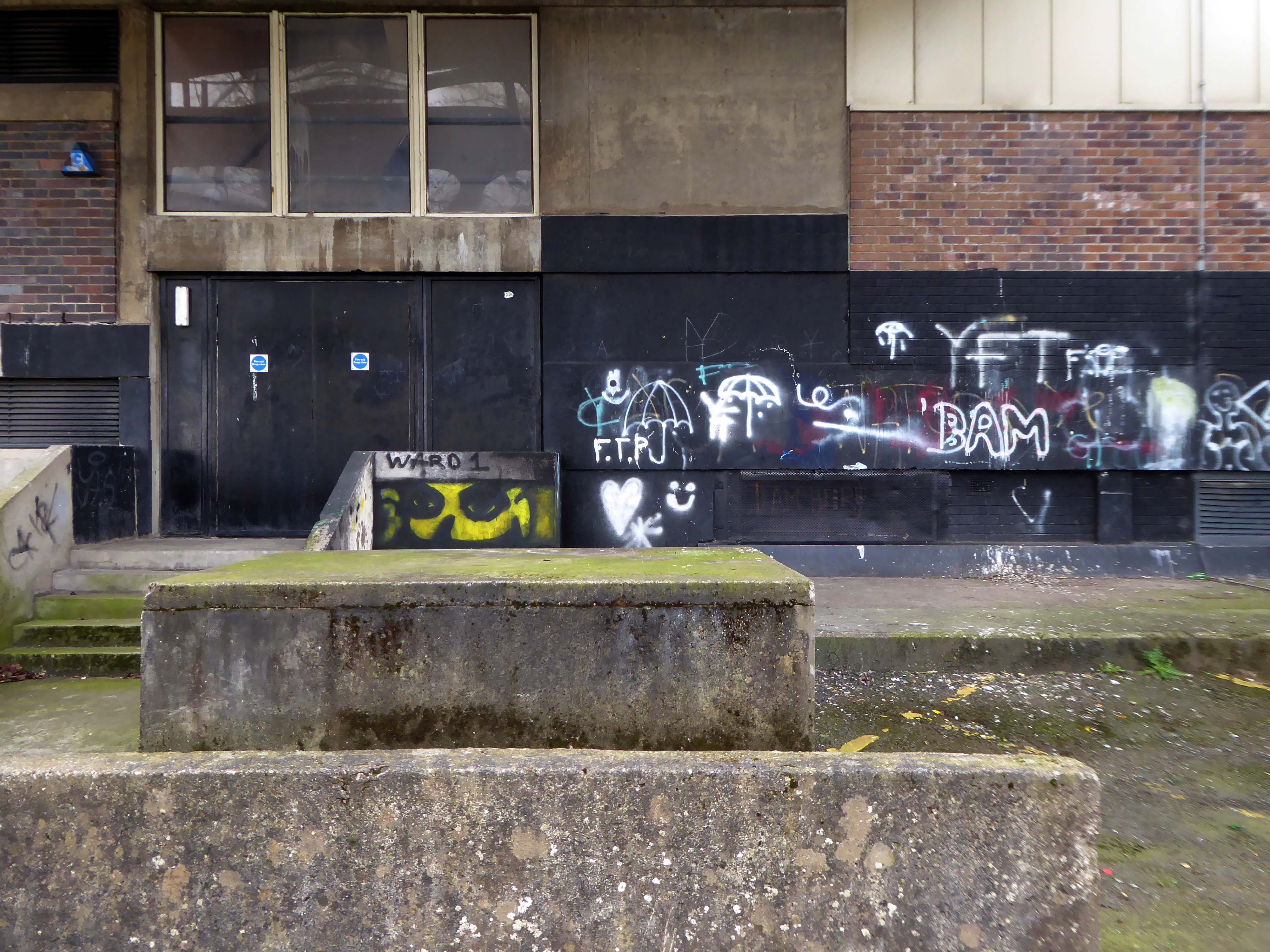
Sadly, I am neither a water babe nor gym bunny – body, soul and mindfulness are maintained in perfect harmony solely by means of modern mooching.
I walked around, I took a look.
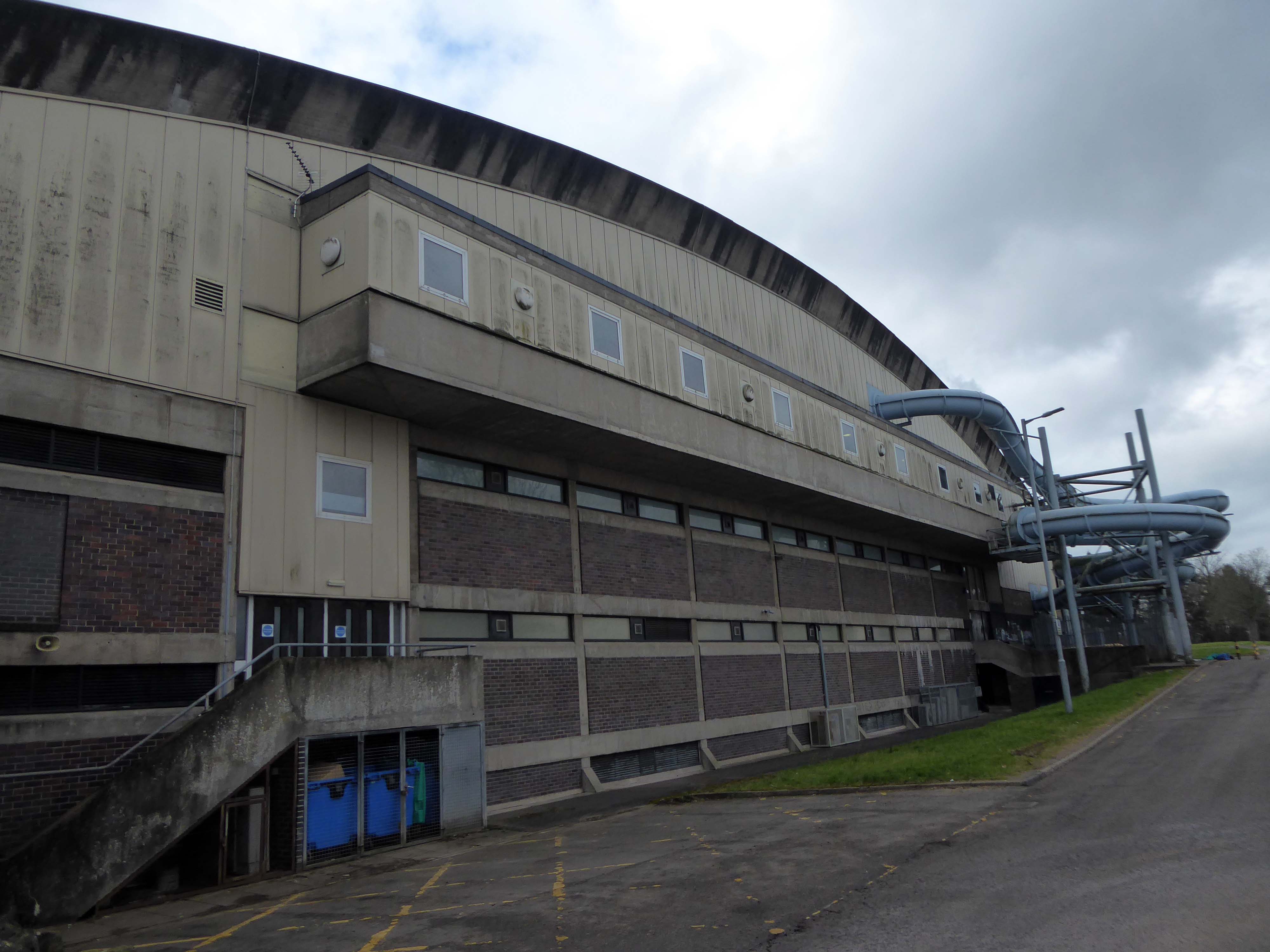
Structural engineering surveys showed that parts of the pool surround and pool tank were in a state of near collapse and emergency work had to be carried out to install temporary structural supports. The centre was closed in October 2008 for major refurbishment, consisting of structural repairs and replacements and the installation of new structural supports. This required a significant amount of structural engineering design input. The structure of the unique roof was not affected.
Substantial redesign and replacement of heating and ventilation and pool water treatment engineering services was carried out. This included new high-efficiency gas-fired boilers, a ventilation system for the swimming pool hall, a combined heat and power system, new water filters, and high-efficiency pumps as part of an upgraded pool water treatment system.
Electrical engineering and lighting systems were almost entirely replaced throughout the building. The external roof covering was replaced and an additional layer of thermal insulation was added to reduce heat loss from the roof and to provide extra protection for the roof structure. New lockers were provided for the changing rooms and the health suite. New tiles were placed for the pool and health suite. The repair work began in July 2009 and the Aqua Centre re-opened on 28 May 2011. The completion of the major repair and refurbishment contract cost over £9 million.
Would that more buildings were saved from the demolition derby.
The wrecking ball has always been the great symbol of urban progress, going hand in hand with dynamite and dust clouds as the politicians’ favourite way of showing they are getting things done. But what if we stopping knocking things down? What if every existing building had to be preserved, adapted and reused, and new buildings could only use what materials were already available? Could we continue to make and remake our cities out of what is already there?
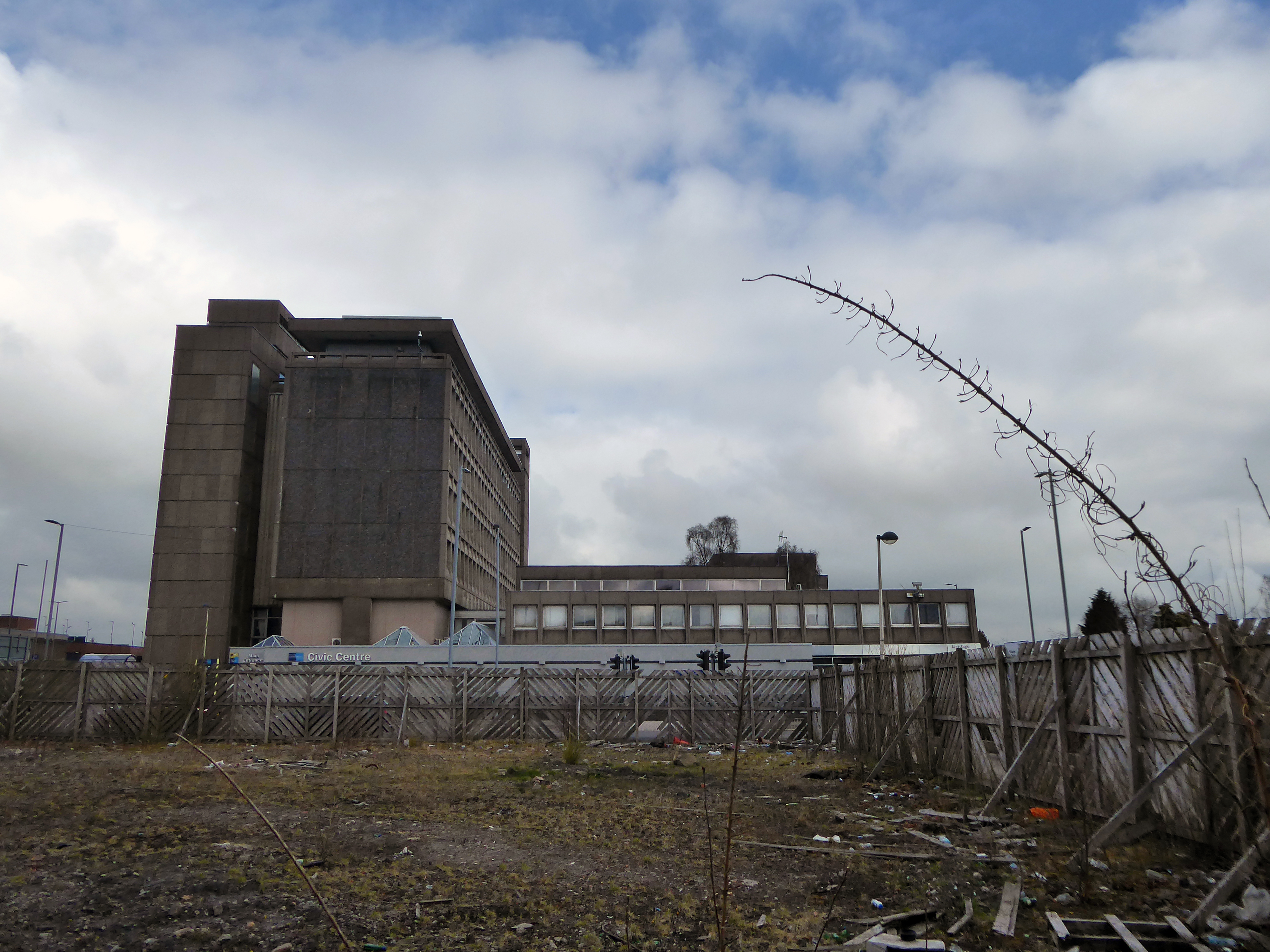
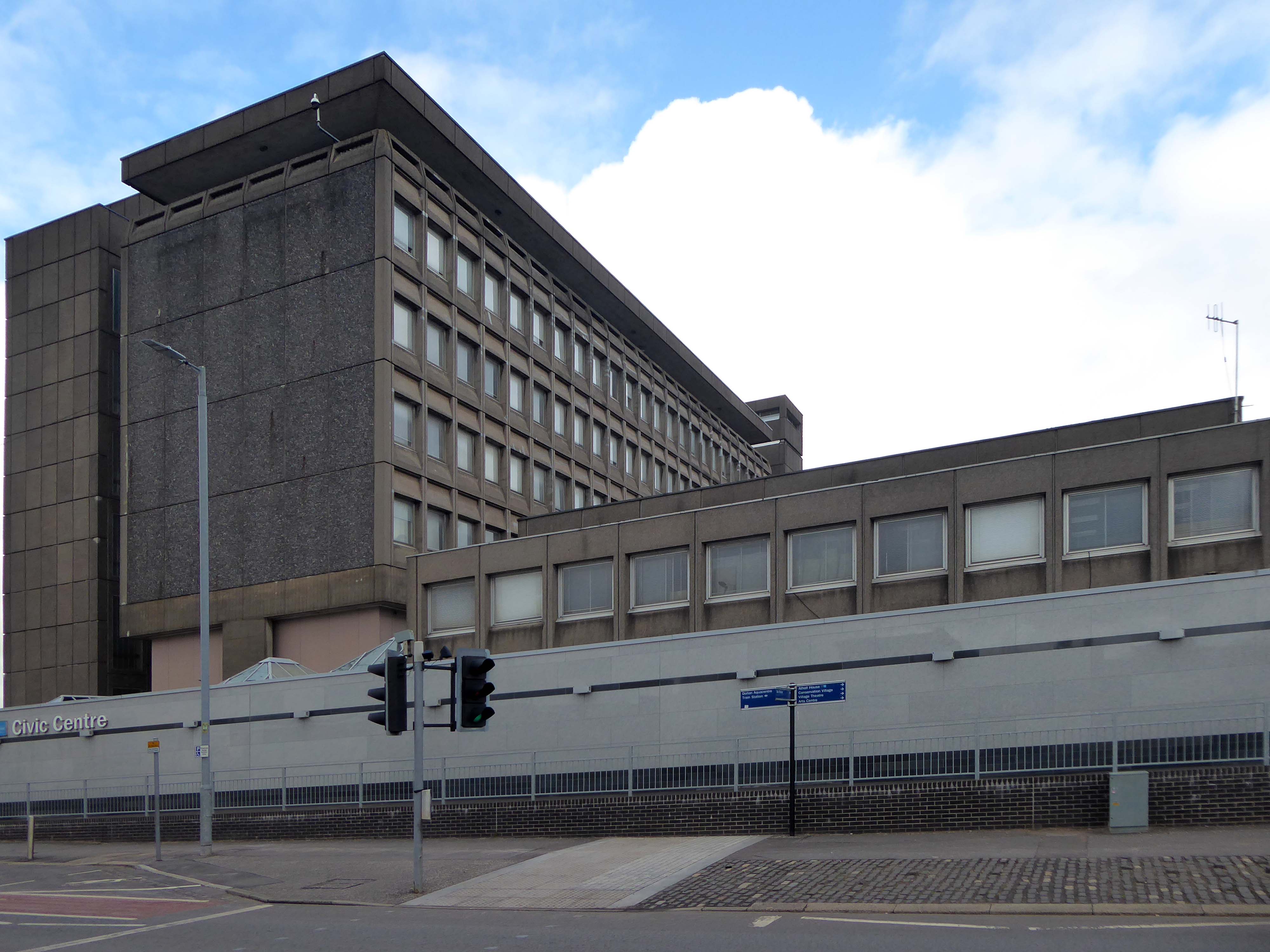
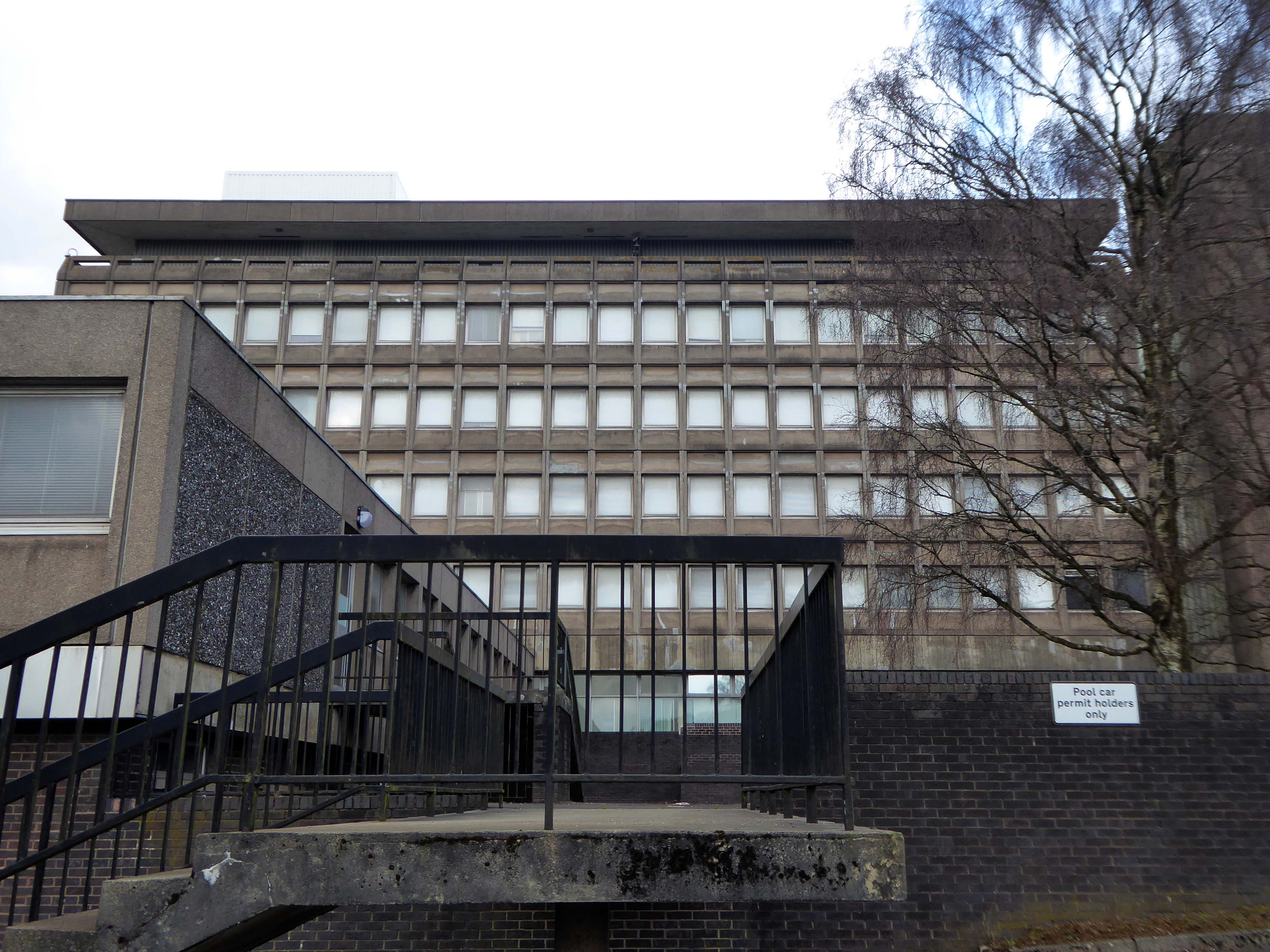
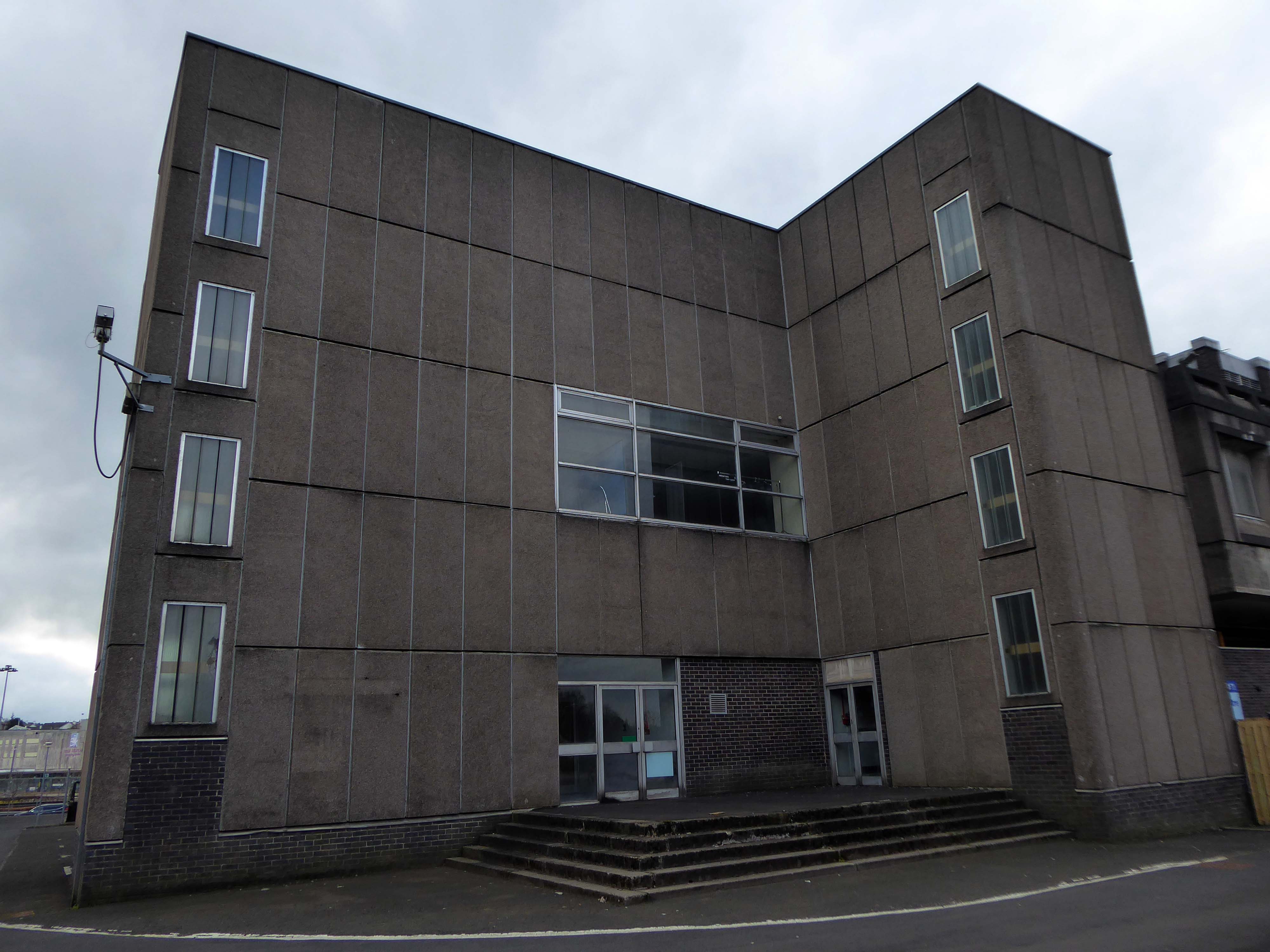
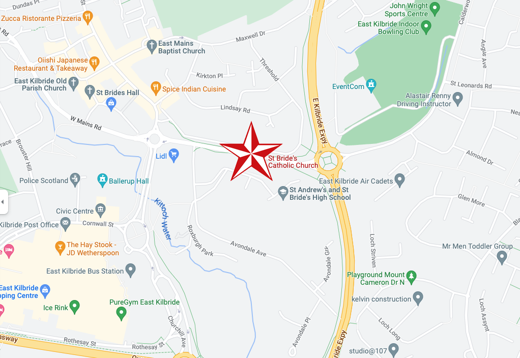
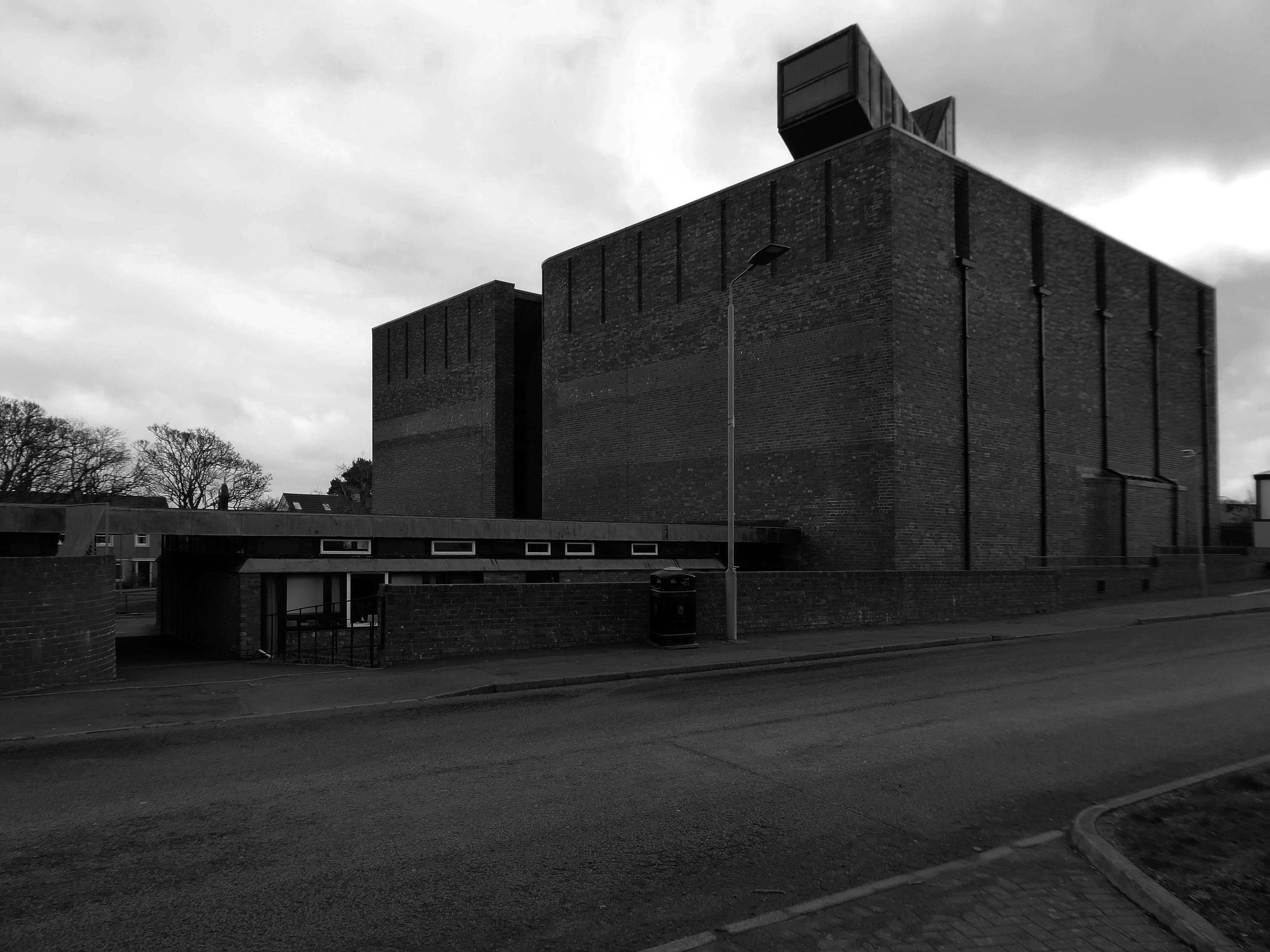
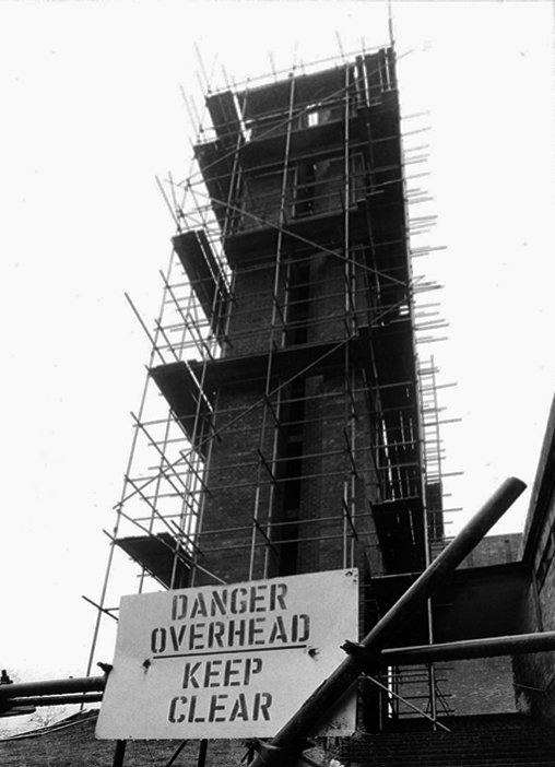
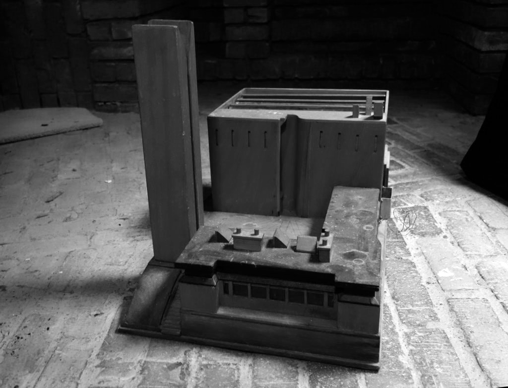
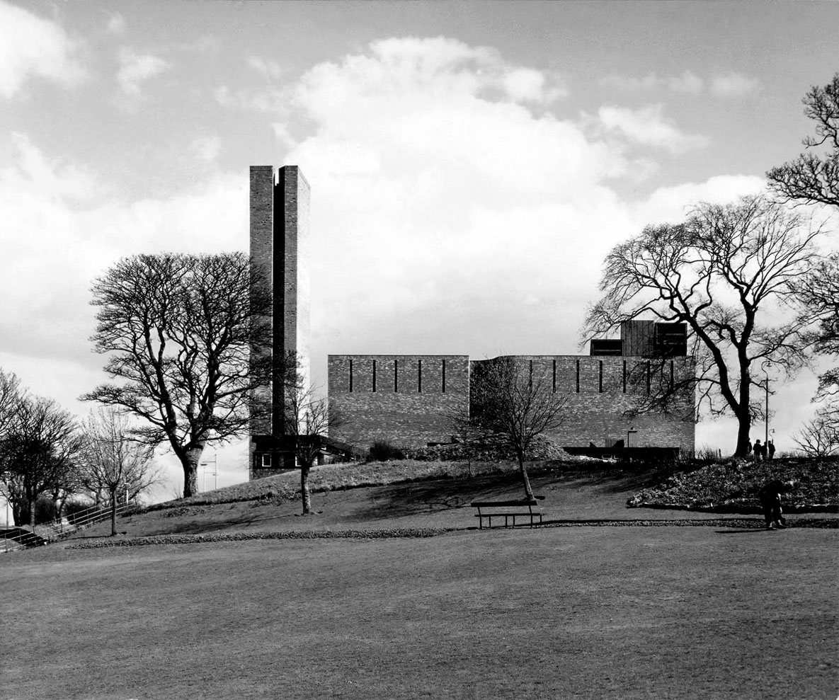
I walked from St Bride’s Church, through a valley to East Kilbride Civic Centre
Commissioned by the burgh of East Kilbride, was designed by Scott Fraser & Browning, built by Holland, Hannen & Cubitts and completed in 1966.
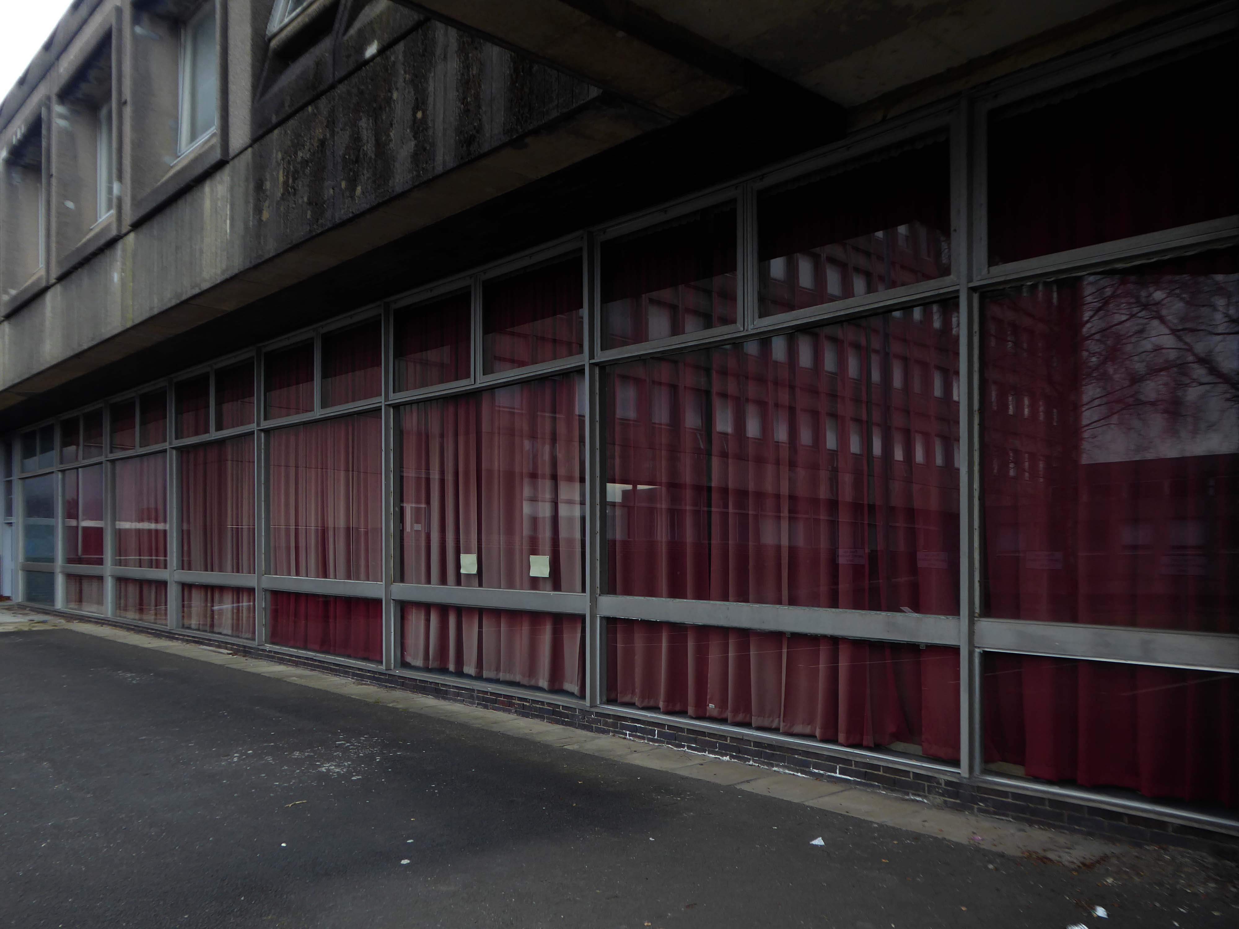
Accommodating Ballerup Hall.
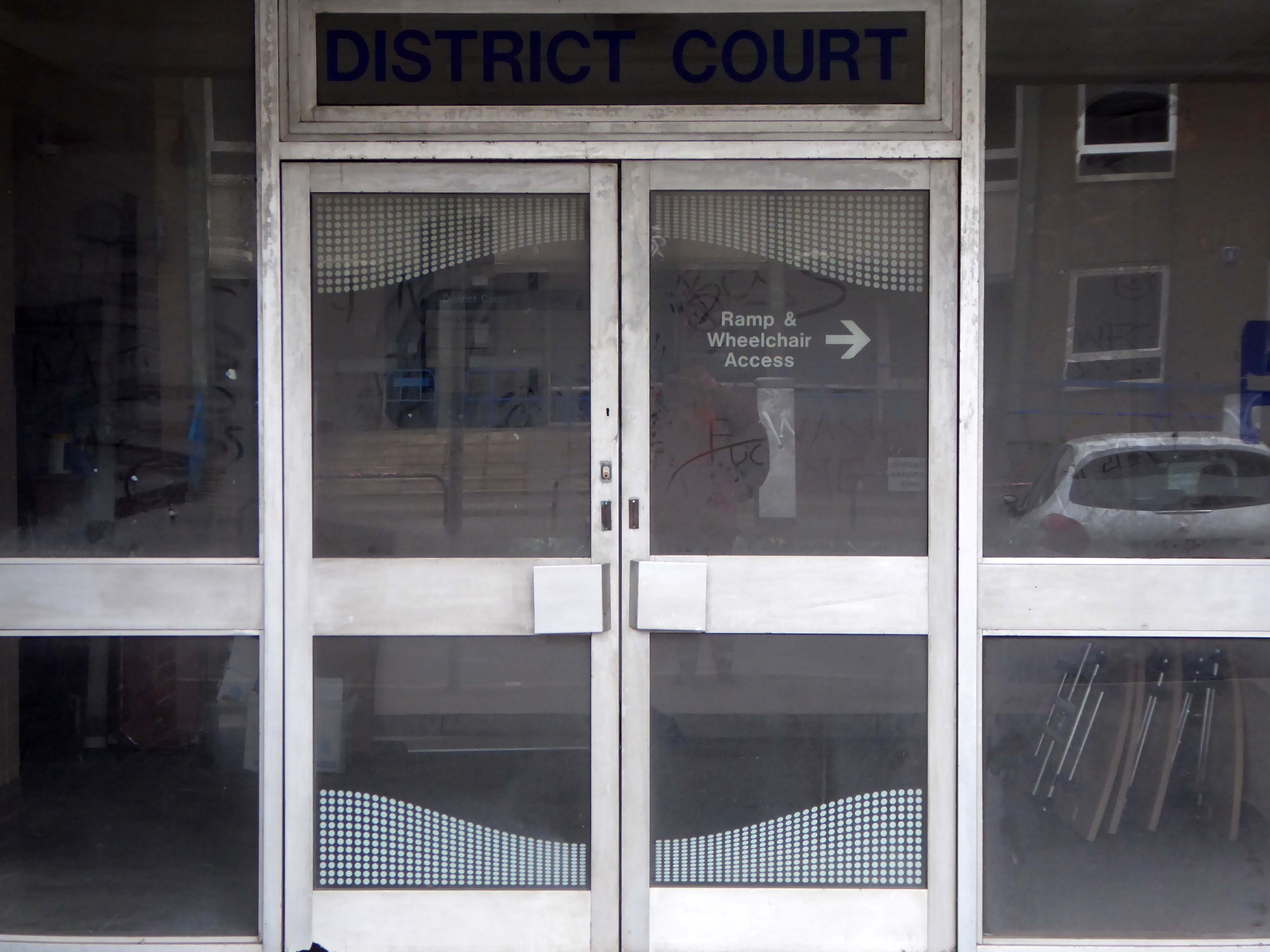
Ballerup Hall is located within East Kilbride Civic Centre and takes its name from its twin town Ballerup, which is near Copenhagen in Denmark. The hall comprises a main hall with stage, kitchen facilities and a bar servery. The adjoining district court room is available after office hours for a limited range of activities.
The stars of British Championship Wrestling return to East Kilbride with a star-studded line up including The Cowboy James Storm and all your favourite BCW Superstars!
I missed the missing link twixt Roddy Frame and the Civic Centre.
If you were lucky enough to catch the 2013 concerts in which Frame marked the 30th anniversary of High Land Hard Rain by playing Aztec Camera’s seminal debut album live, you’ll already have seen Anne’s pictures. Before getting to High Land Hard Rain itself in those shows, Frame treated audiences to a rare set drawn from what he termed his East Kilbride period – the songs he was writing as a teenager that would appear on Aztec Camera’s two Postcard singles, and form the basis of the band’s legendarily unreleased Postcard album, Green Jacket Grey.
While he played those tunes, huge, striking black and white images of his old hometown appeared as a backdrop behind him, setting exactly the right fragile, retro-future new town mood of post-industrial Fahrenheit 451 urban development.
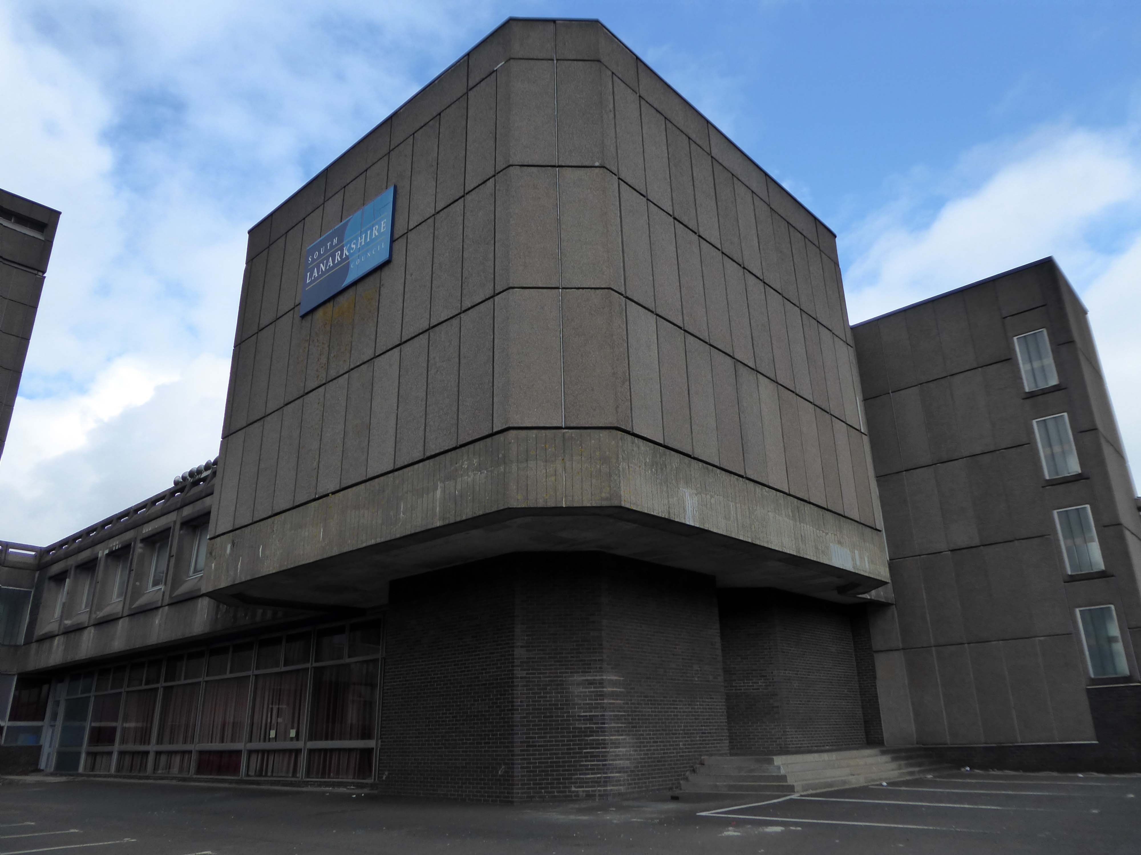
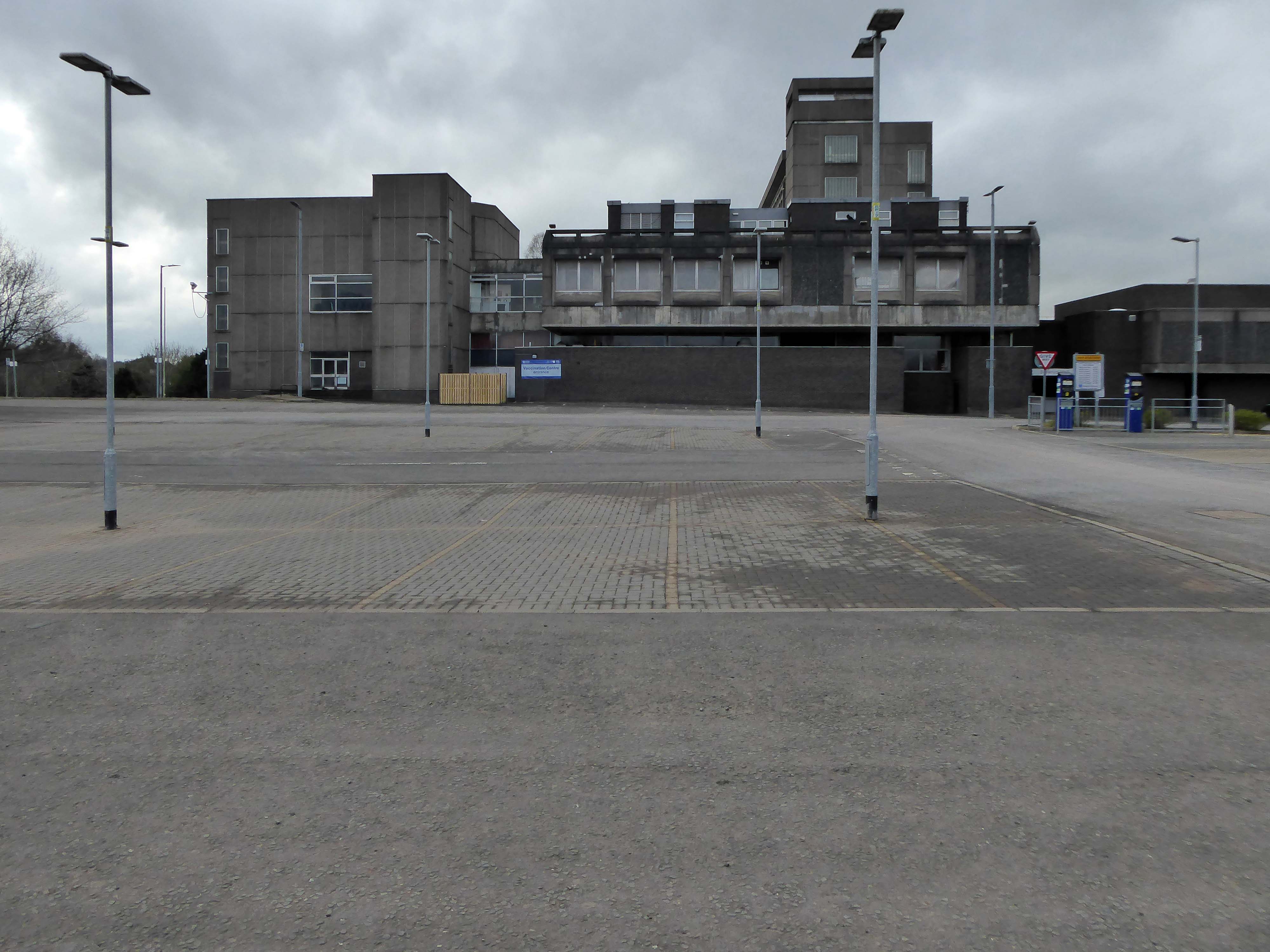
A strategic masterplan for East Kilbride town centre which could see a new purpose-built civic facility is to be put before the council next month.
Last March we told how radical new plans could see the crumbling Civic Centre replaced with – a new front door to East Kilbride.
Despite there being no specific proposals agreed at this stage, South Lanarkshire Council has confirmed that agents of the owners are set to present their strategic masterplan to elected members in February.
It currently sits by the shopping centre and a patch of empty ground.
Several imposing interlocking volumes, formed by pre-cast concrete panels.
East Kilbride was the first new town built in Scotland in 1947. New Town designation was a pragmatic attempt to soak up some of the population from an overcrowded and war ravaged Glasgow. Its design was indeed an anathema to the chaotic and sprawling Glasgow: clean straight lines, modern accessible public spaces; and footways, bridges and underpasses built with the pedestrian in mind. It was designed as a self contained community — with industry, shops, recreation facilities and accommodation all within a planned geographic area.
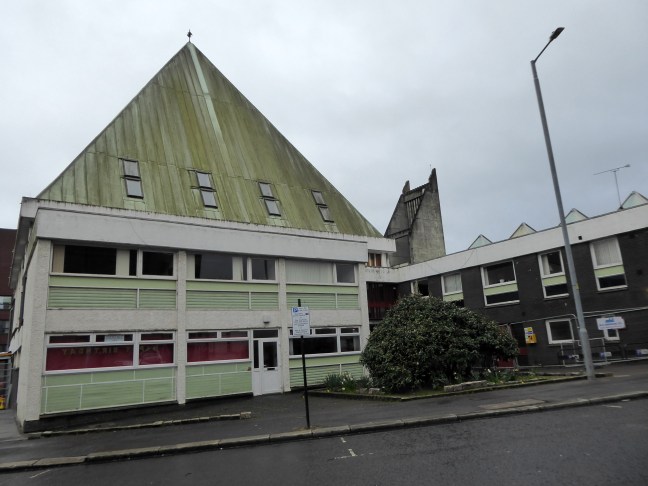
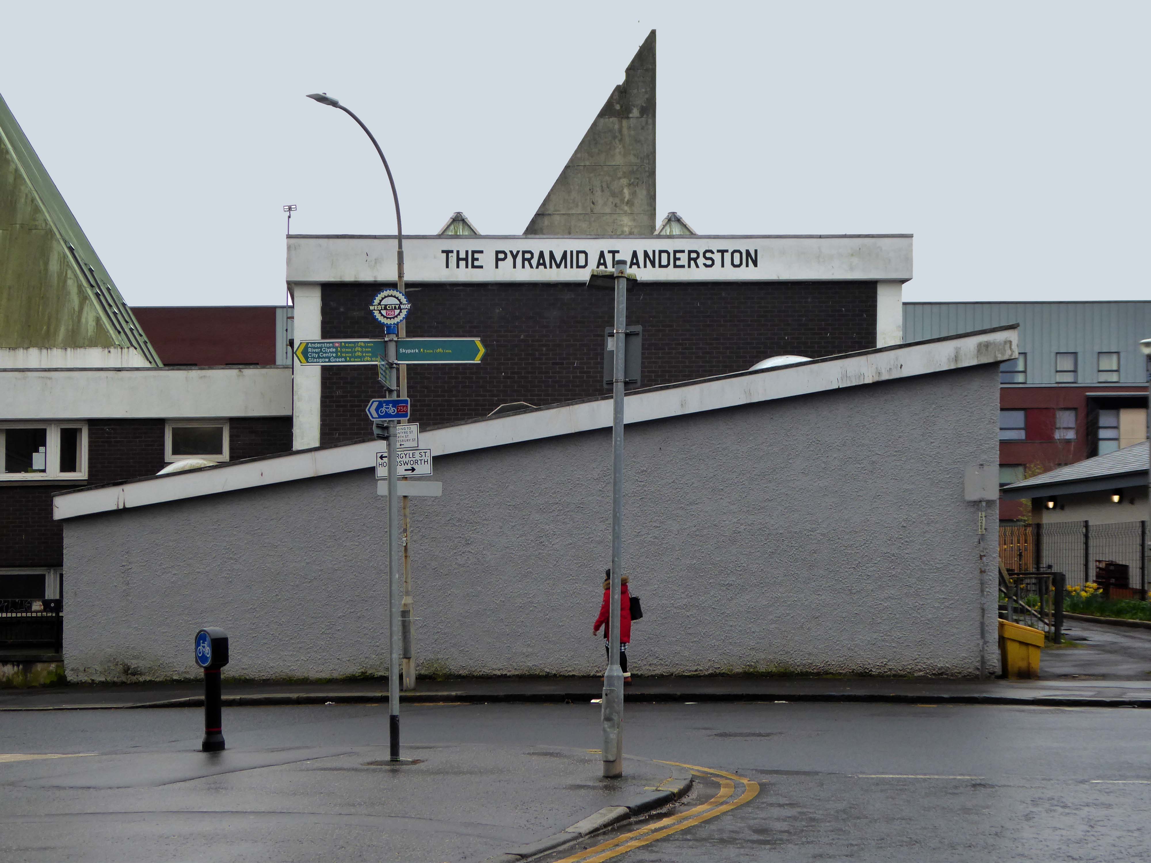
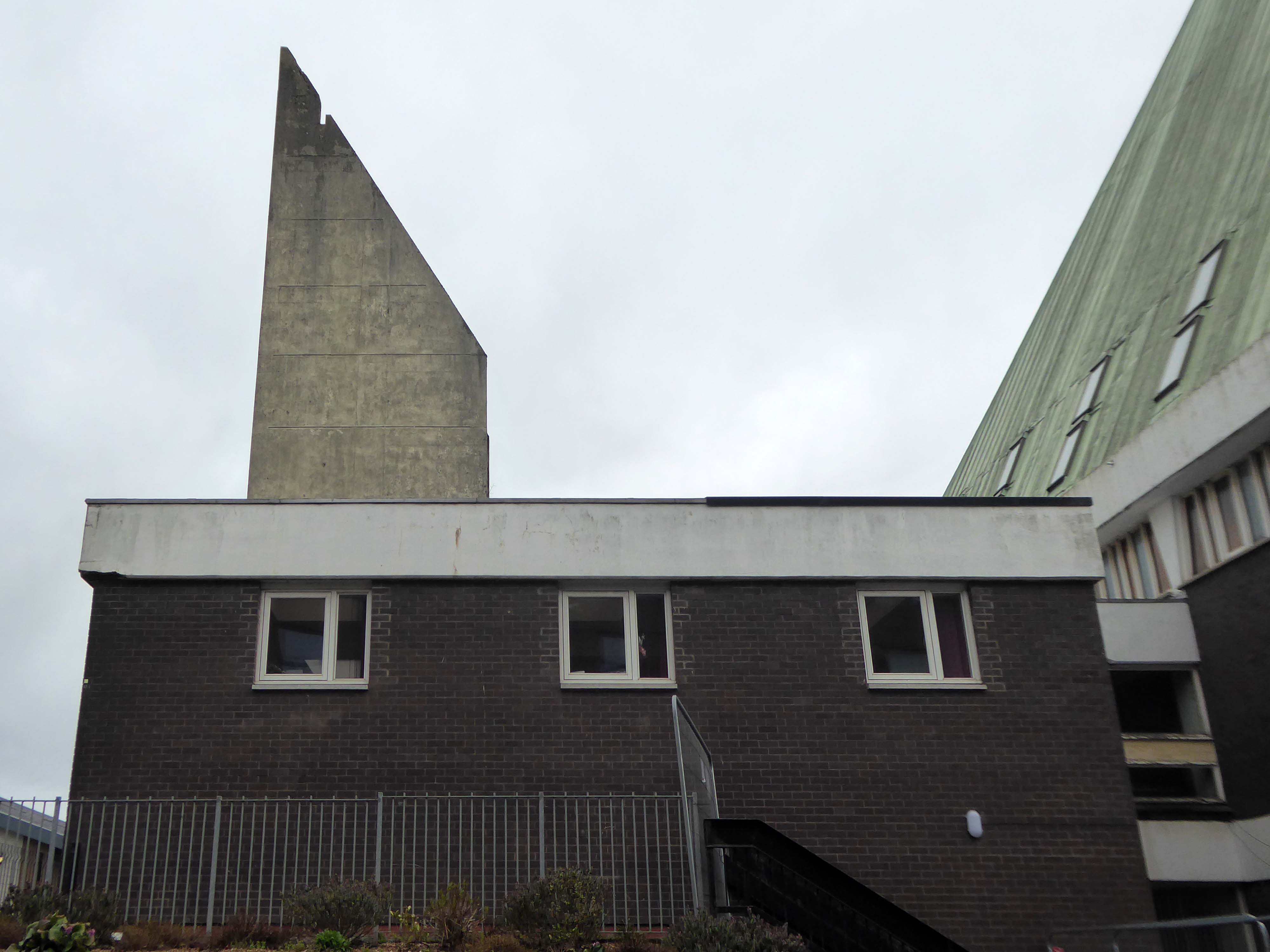
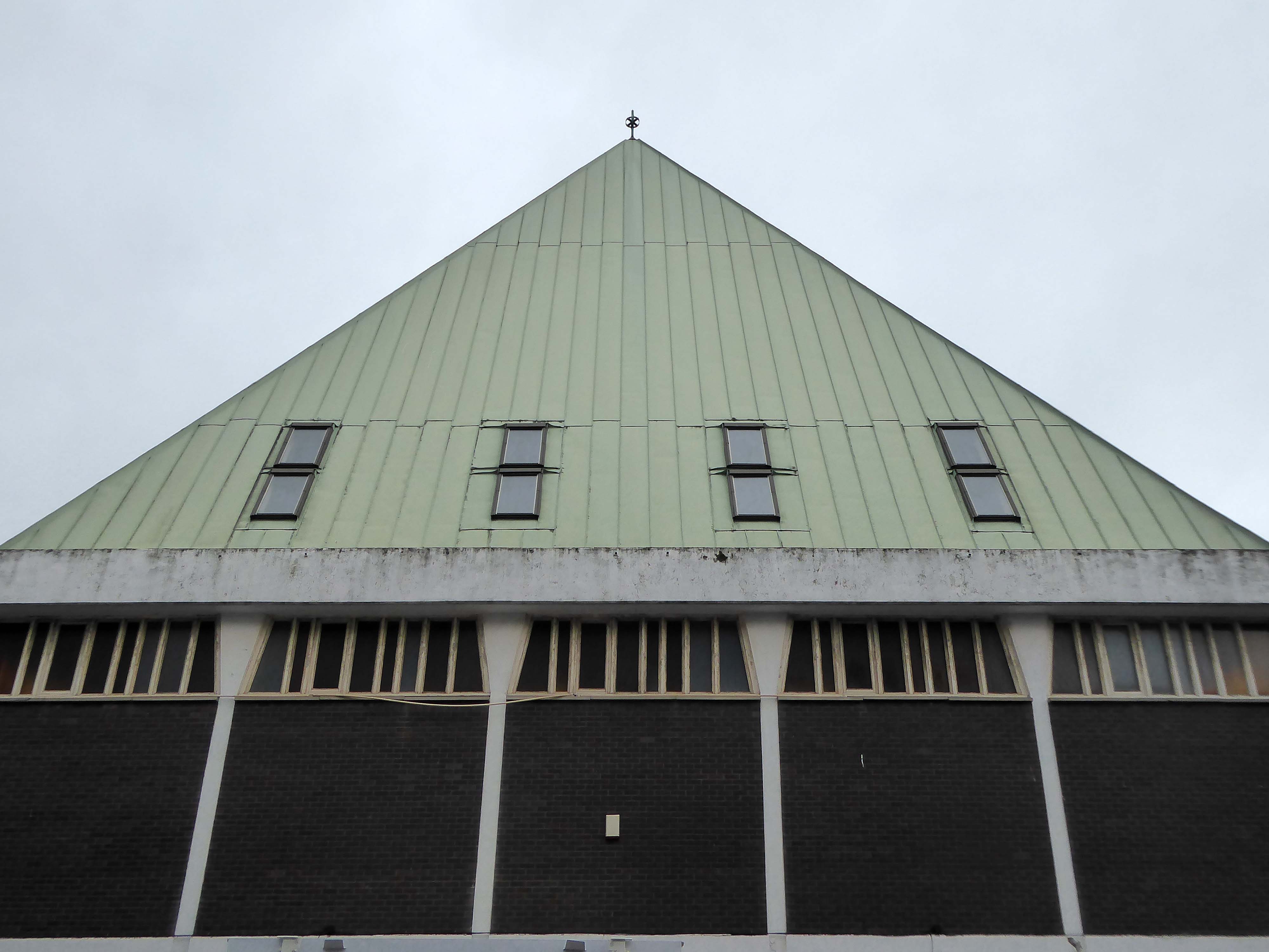
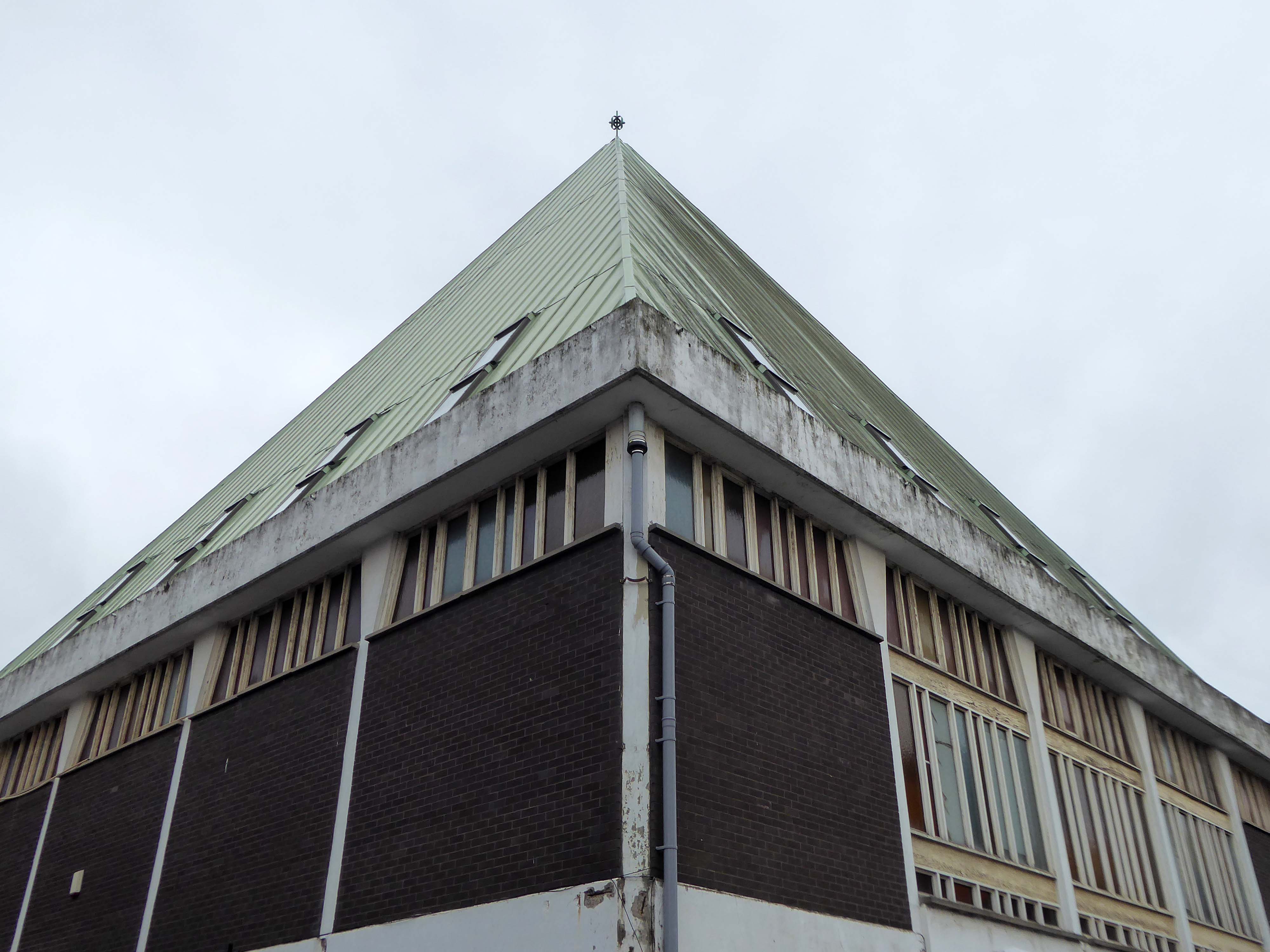
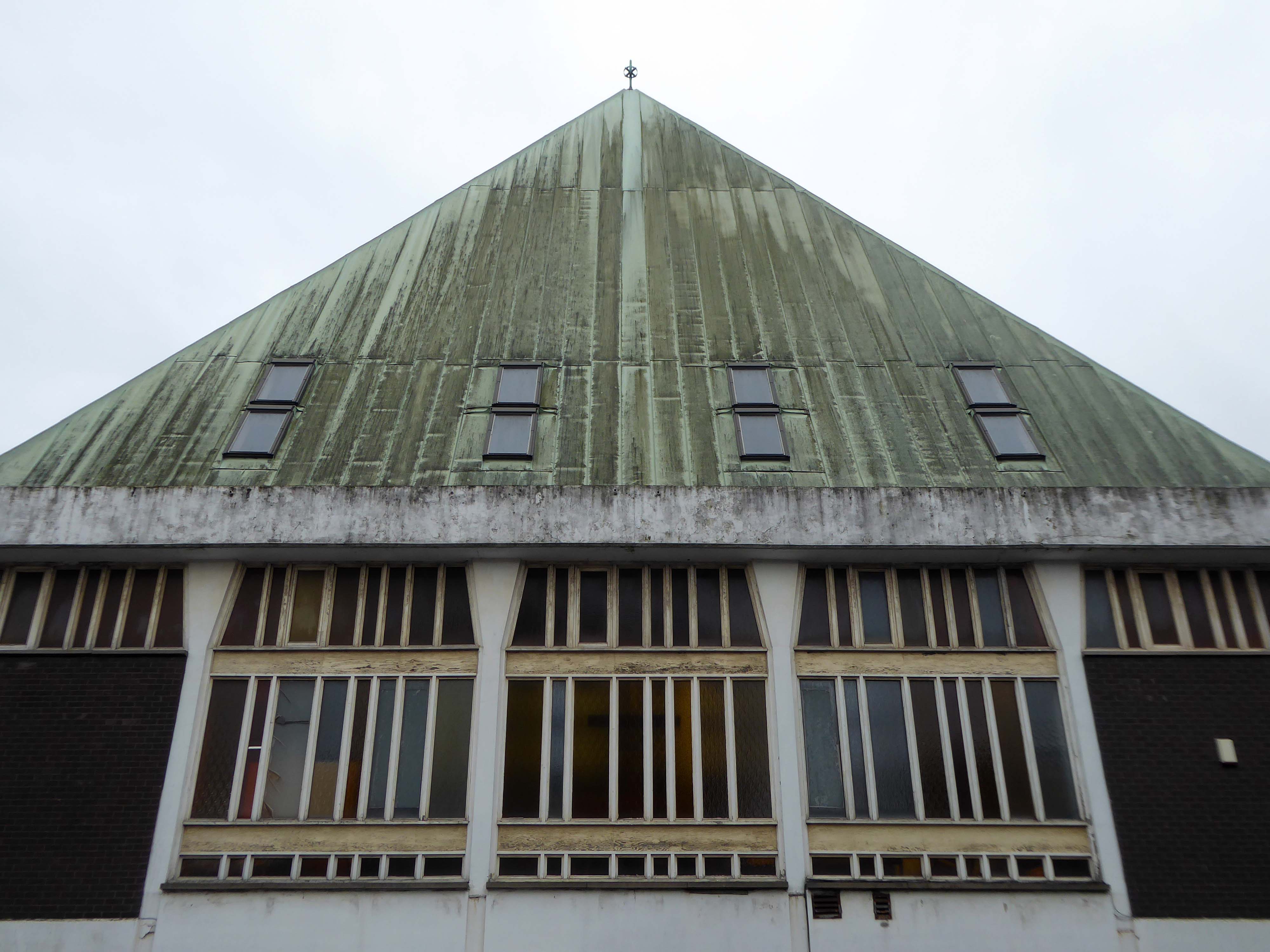
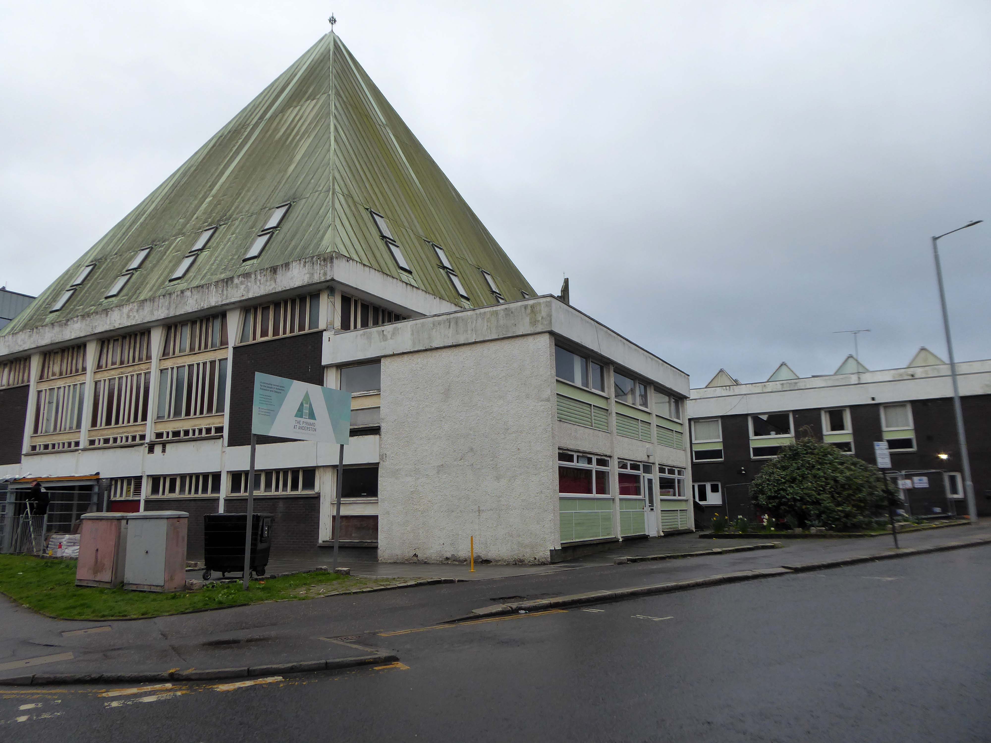
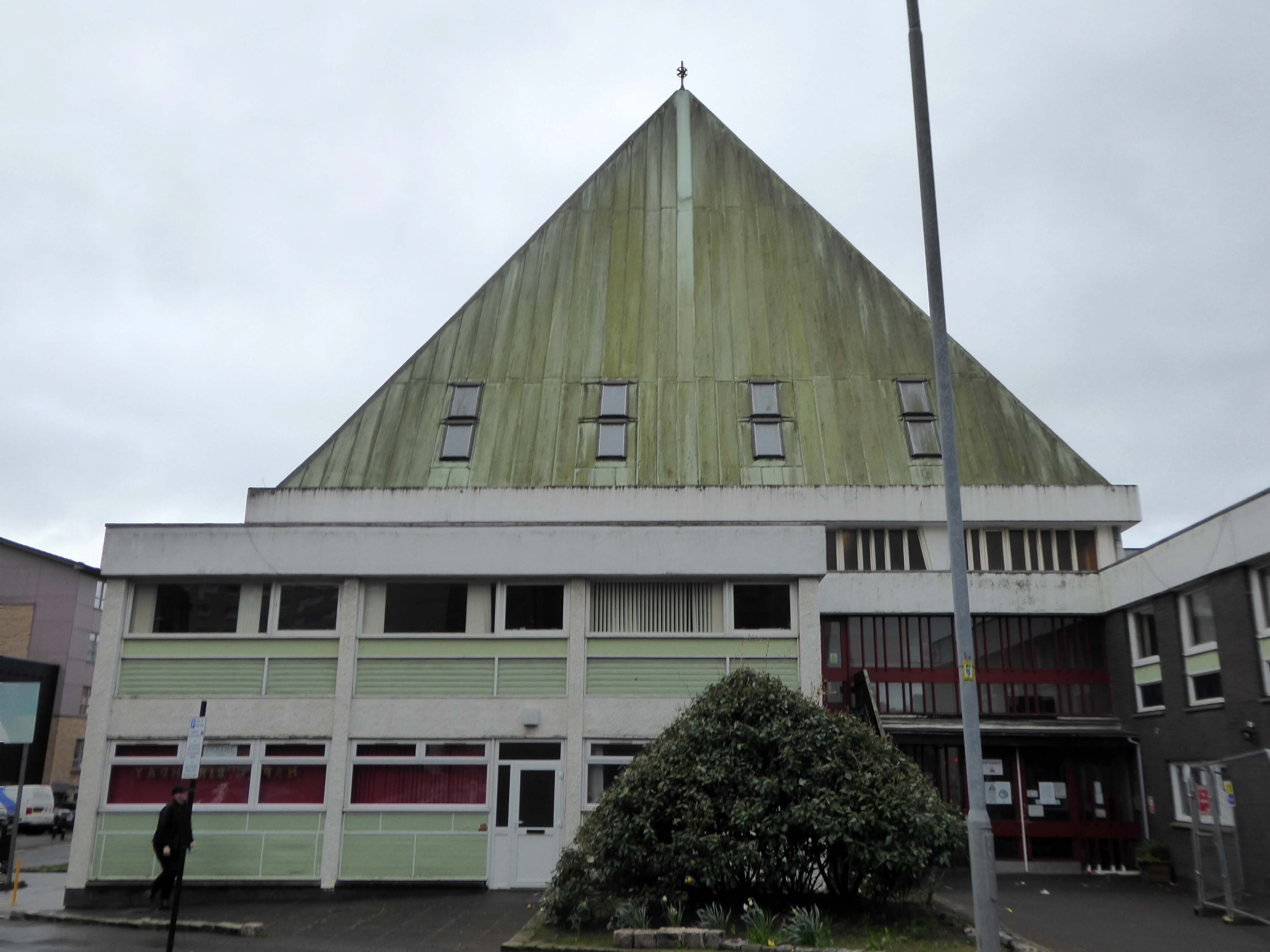
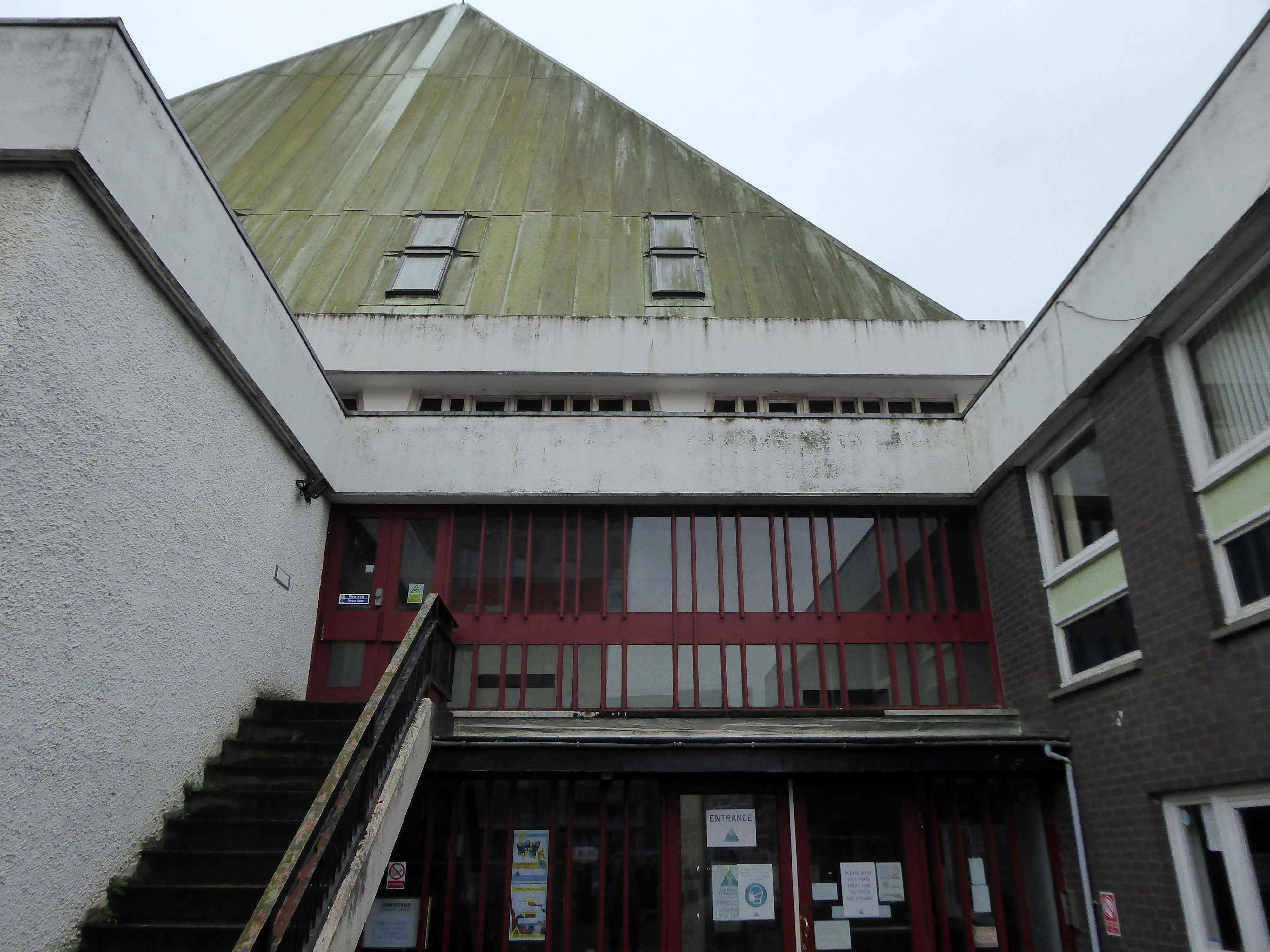
I was walking along St Vincent Street one rainy day.
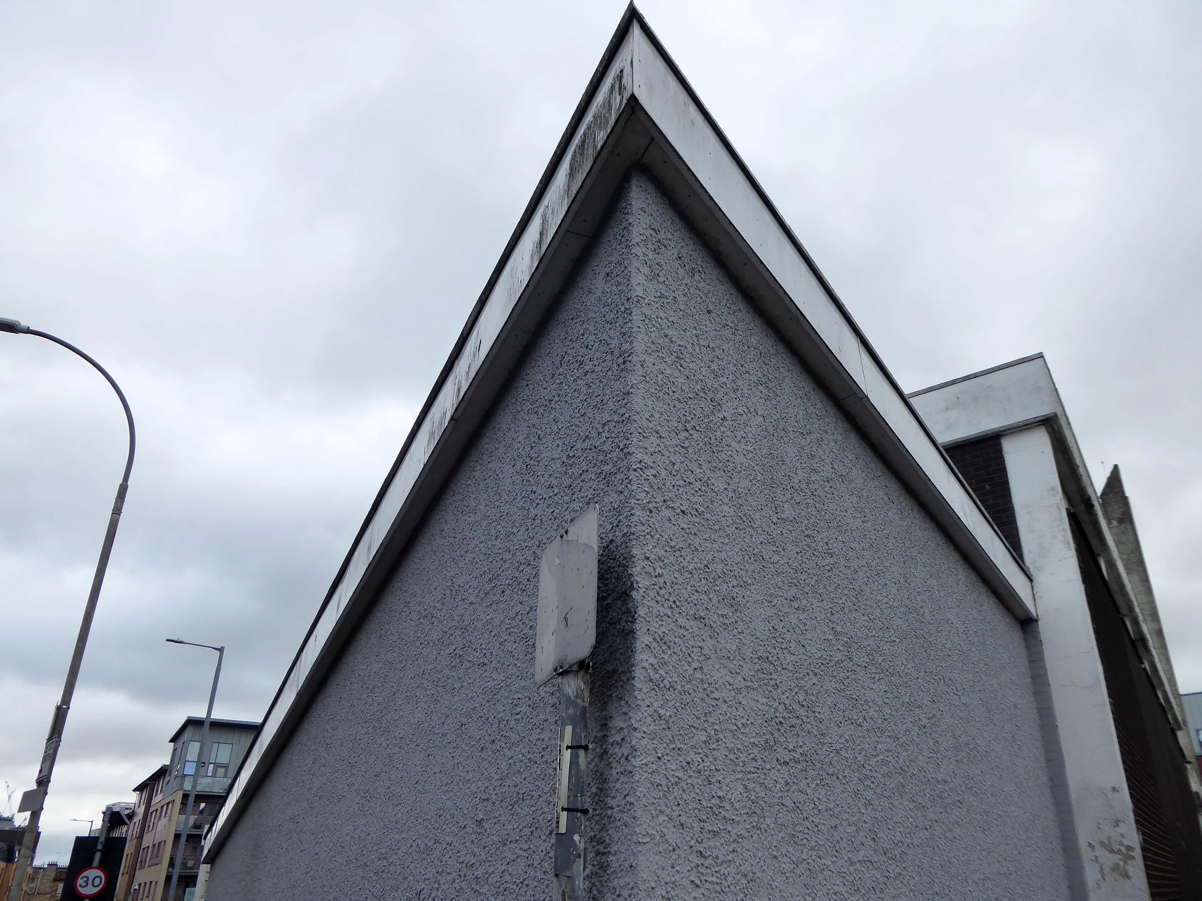
From the corner of my left eye, I espied a pyramid.
Curious, I took a turn, neither funny nor for the worse, the better to take a closer look.
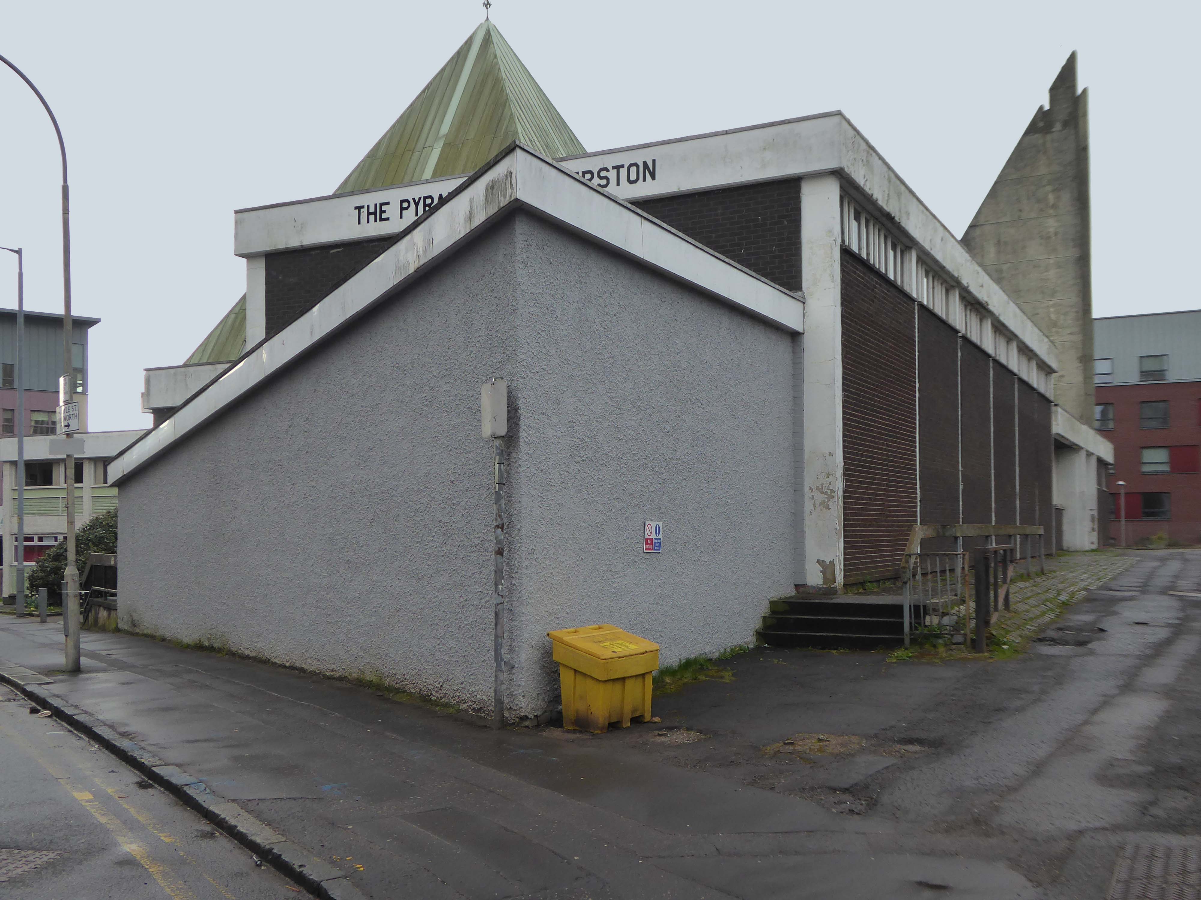
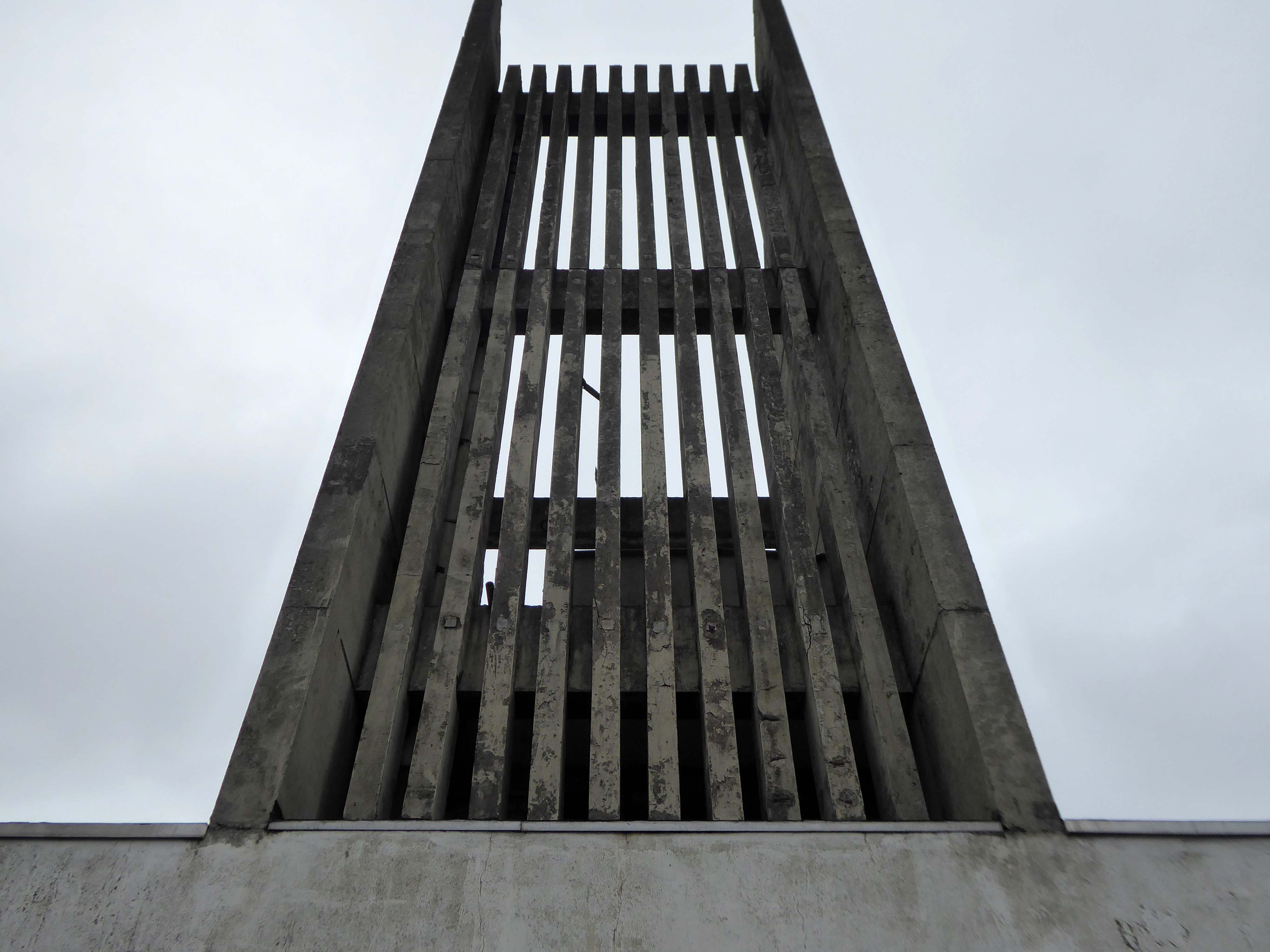
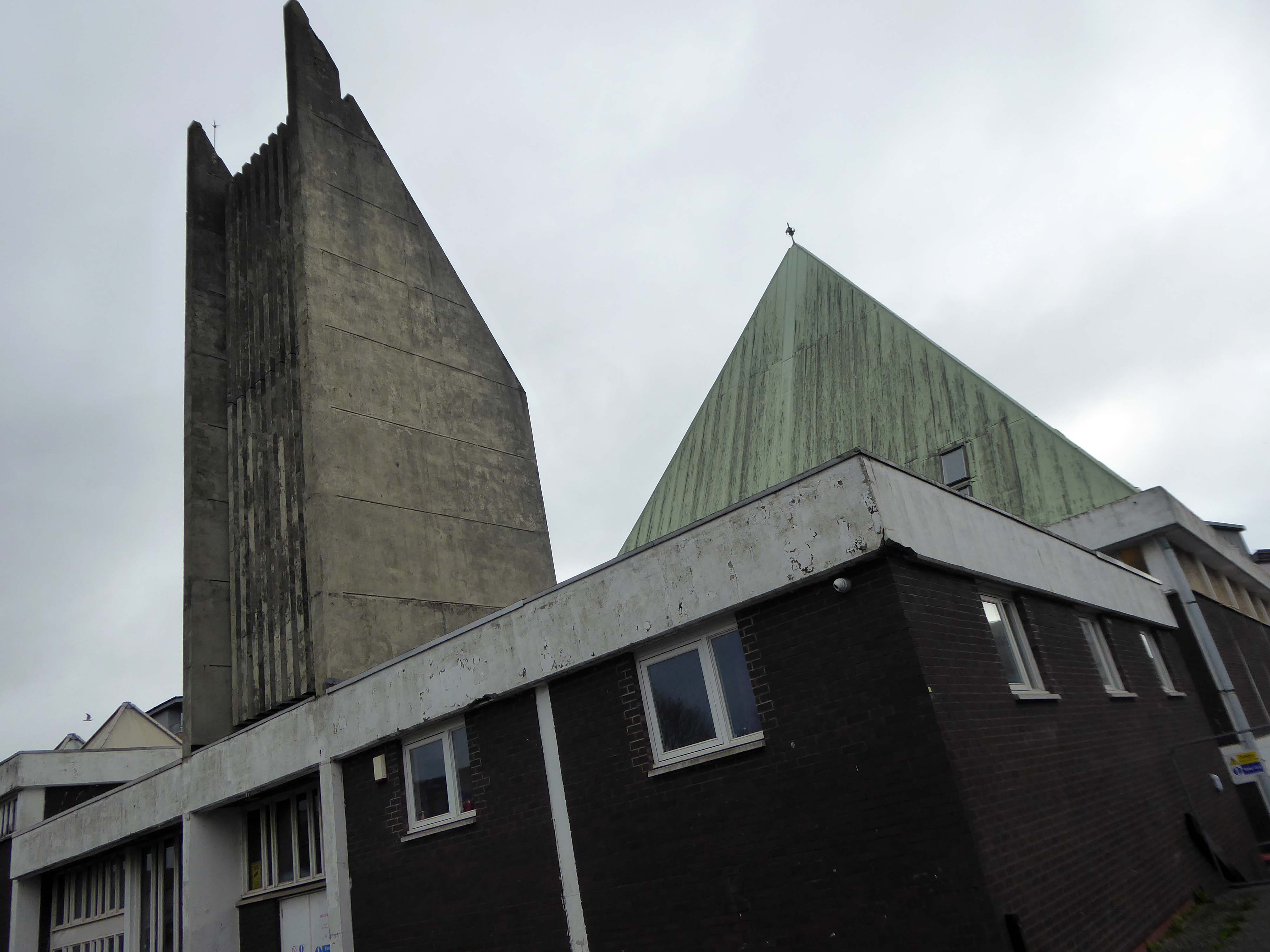
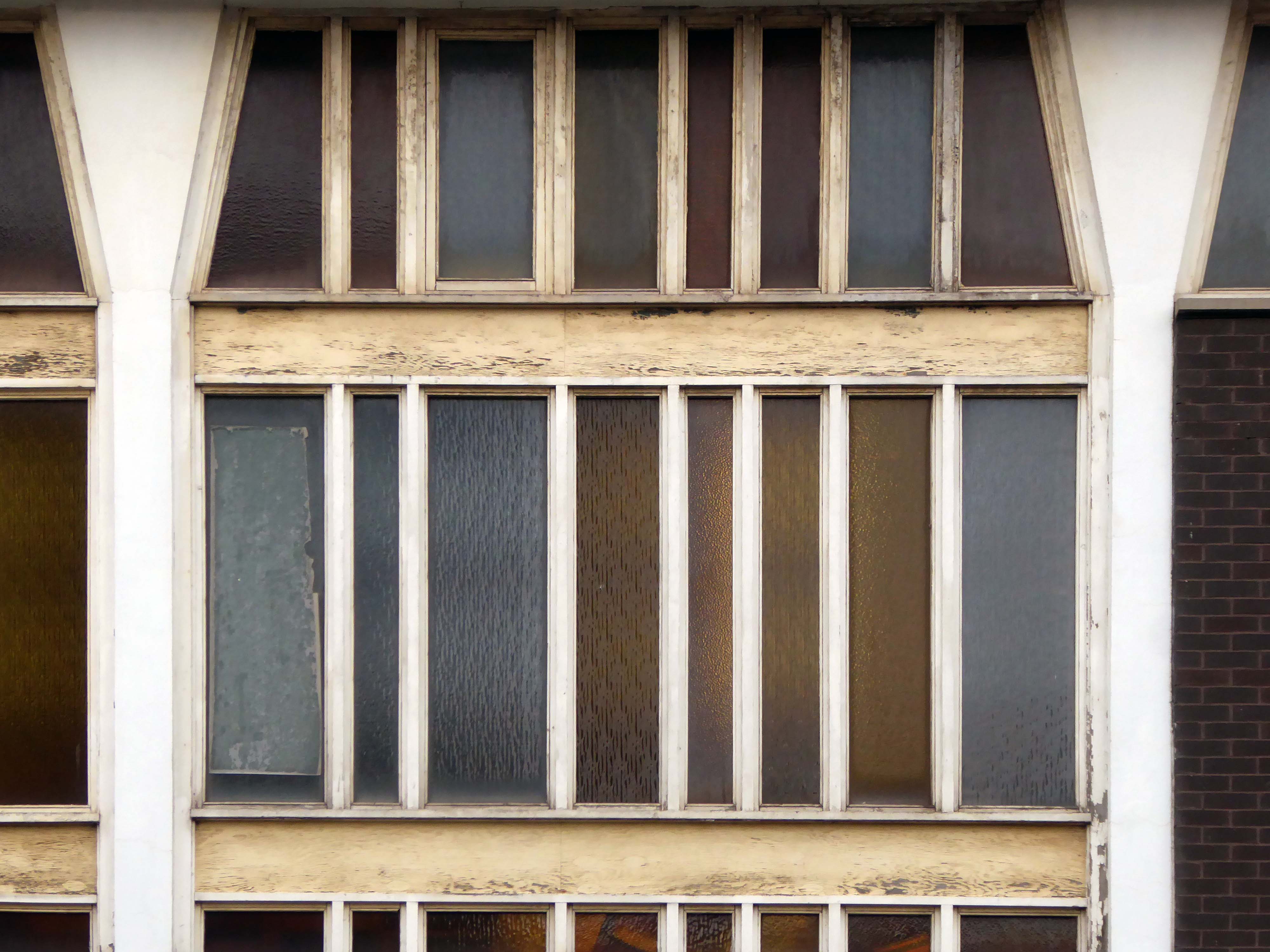
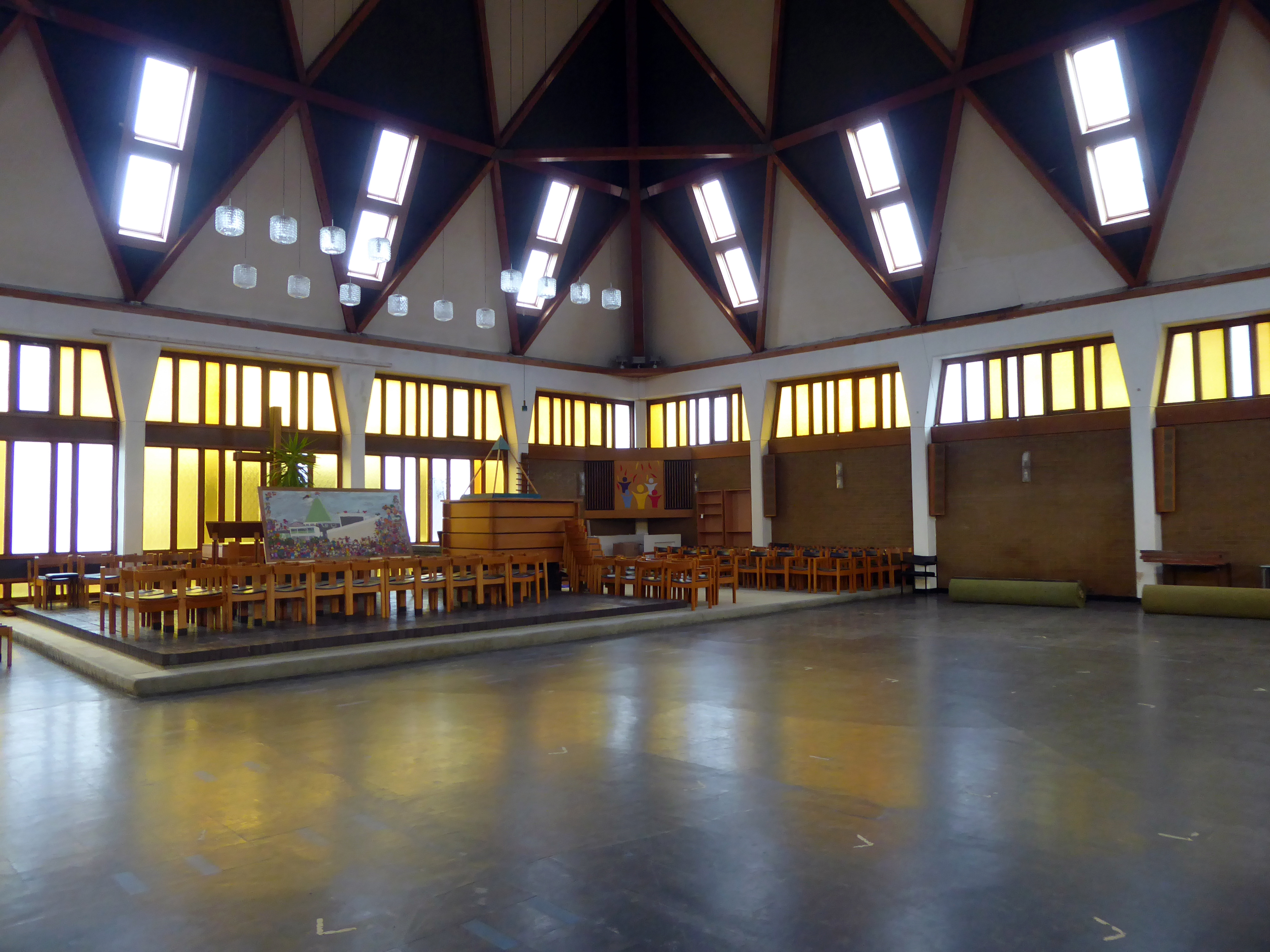
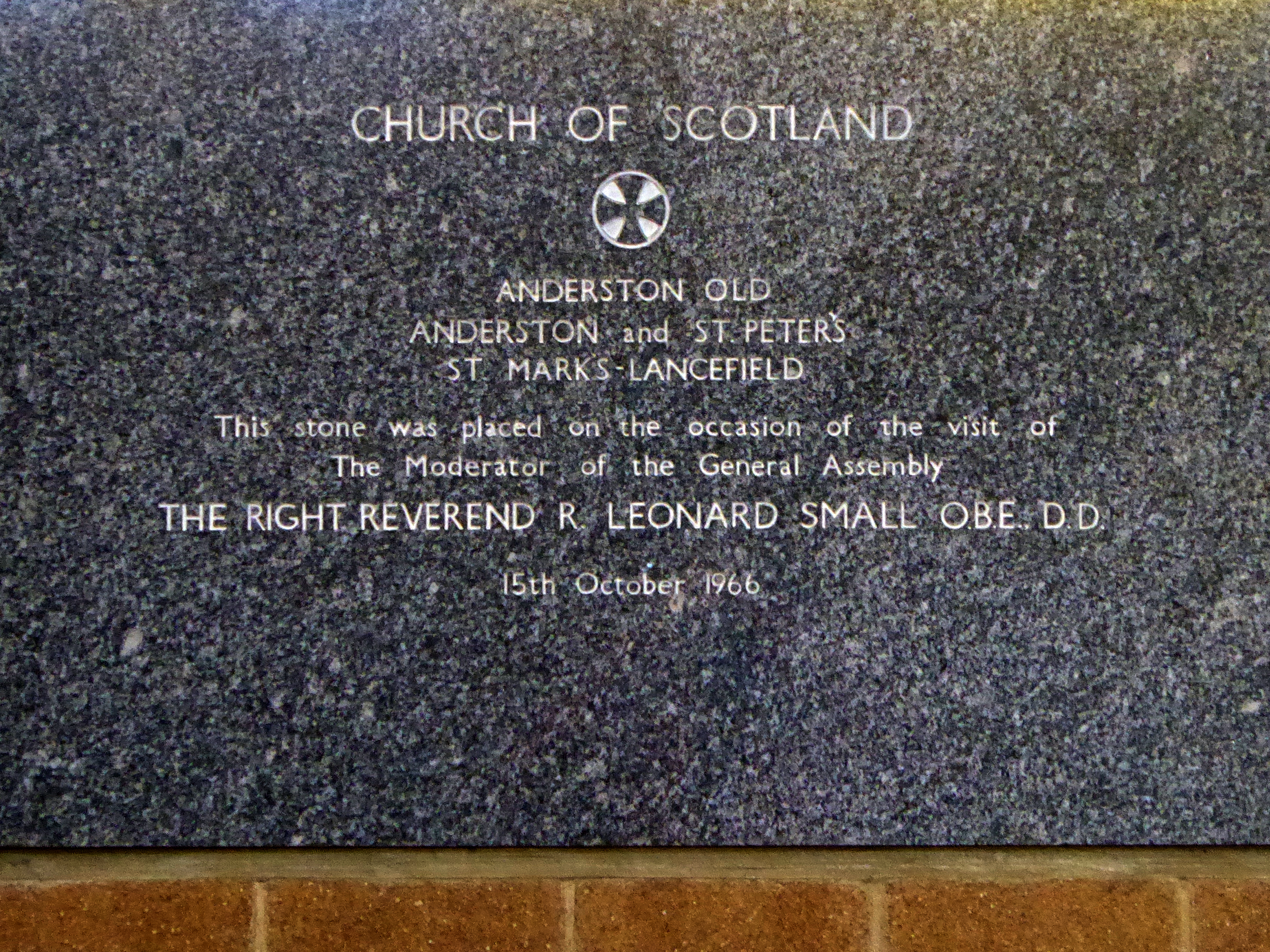
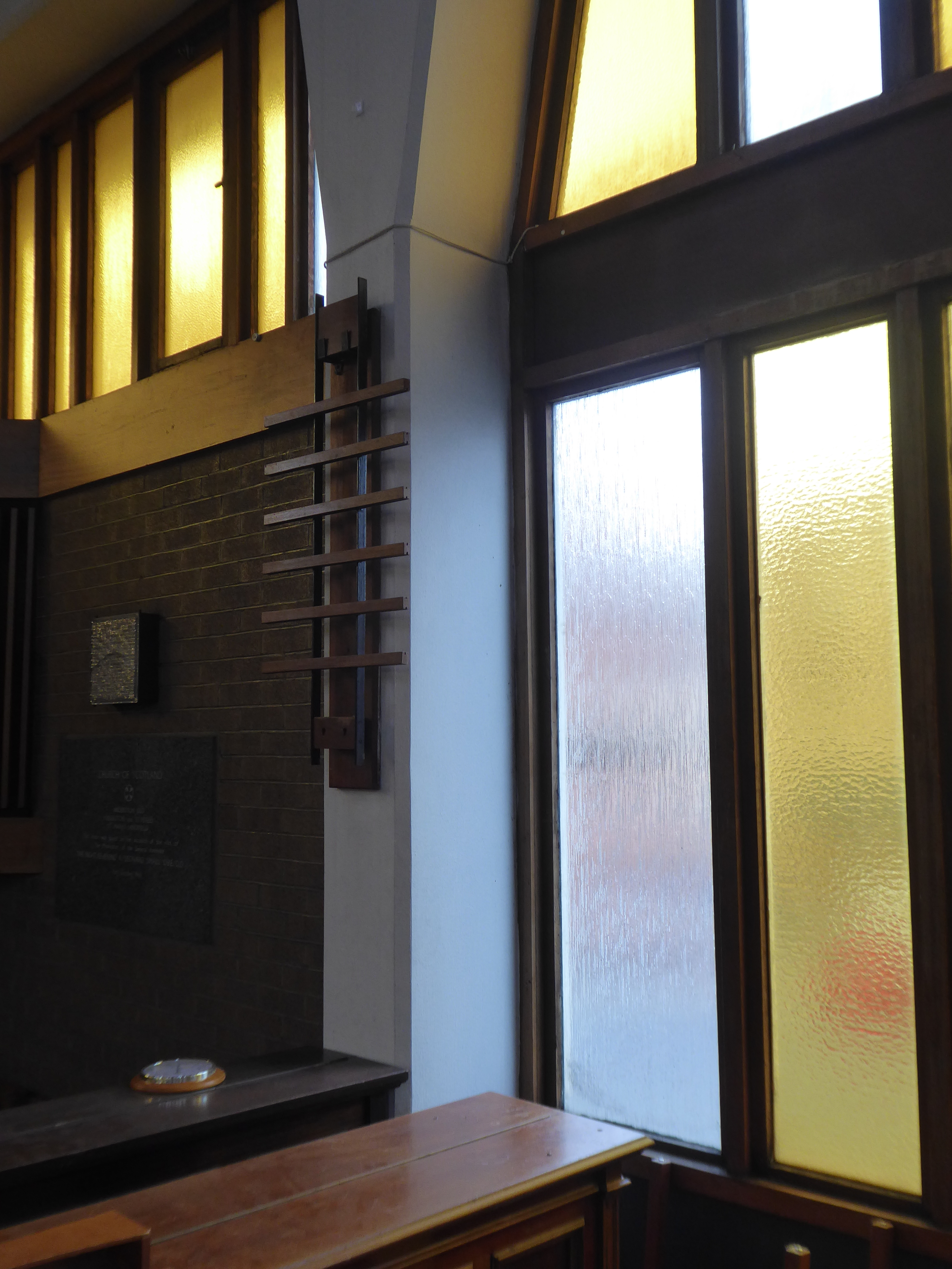
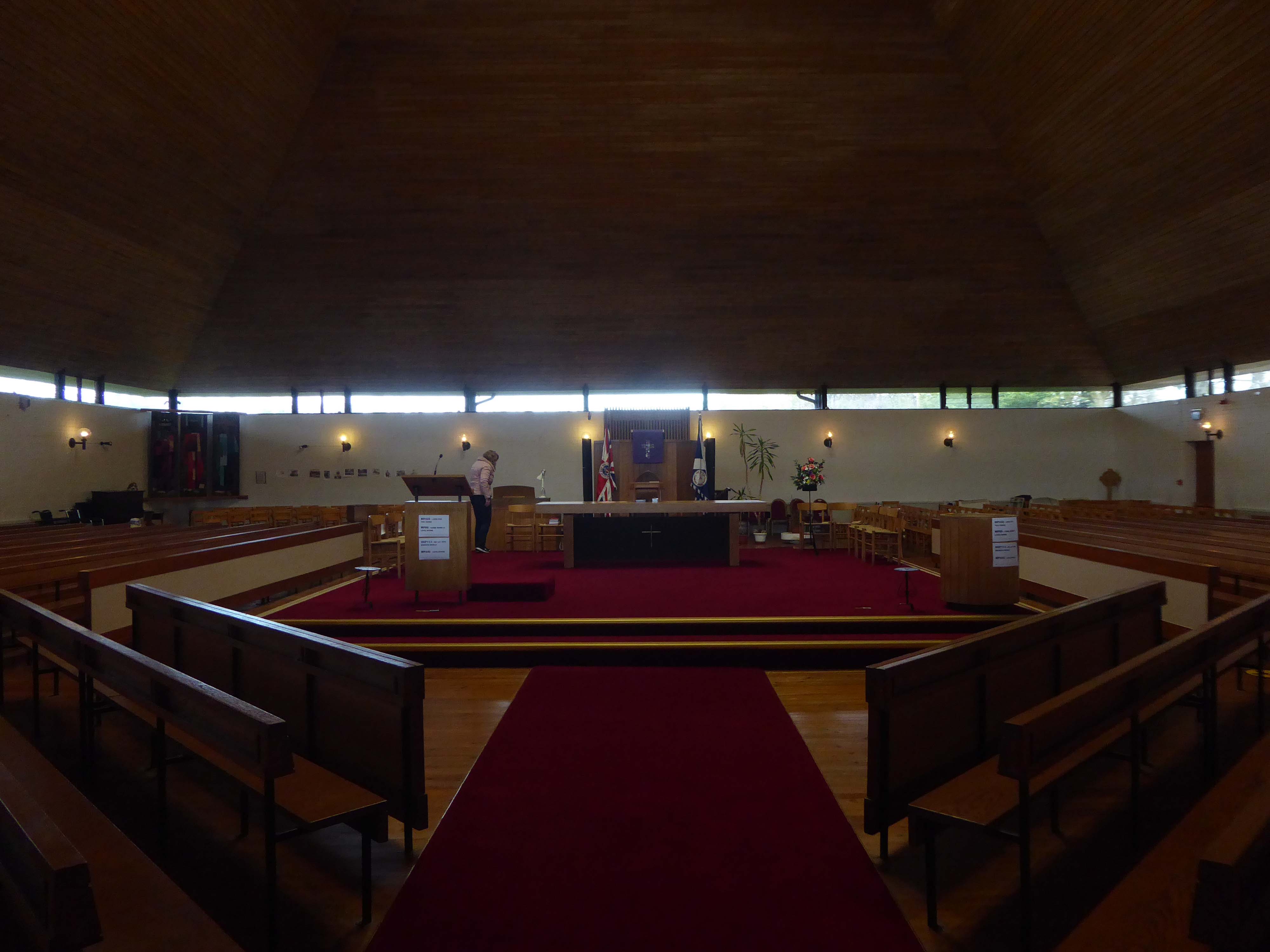
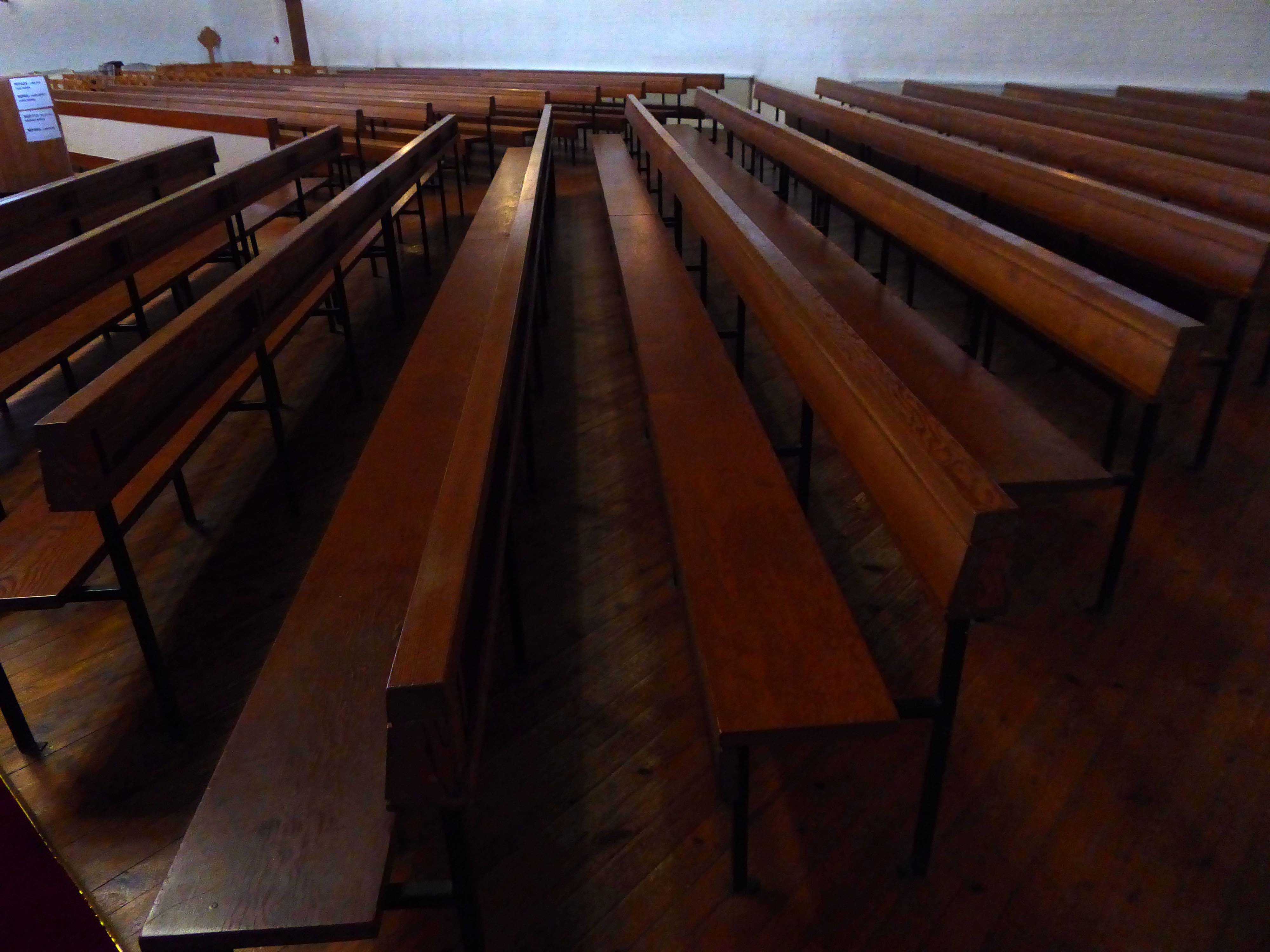
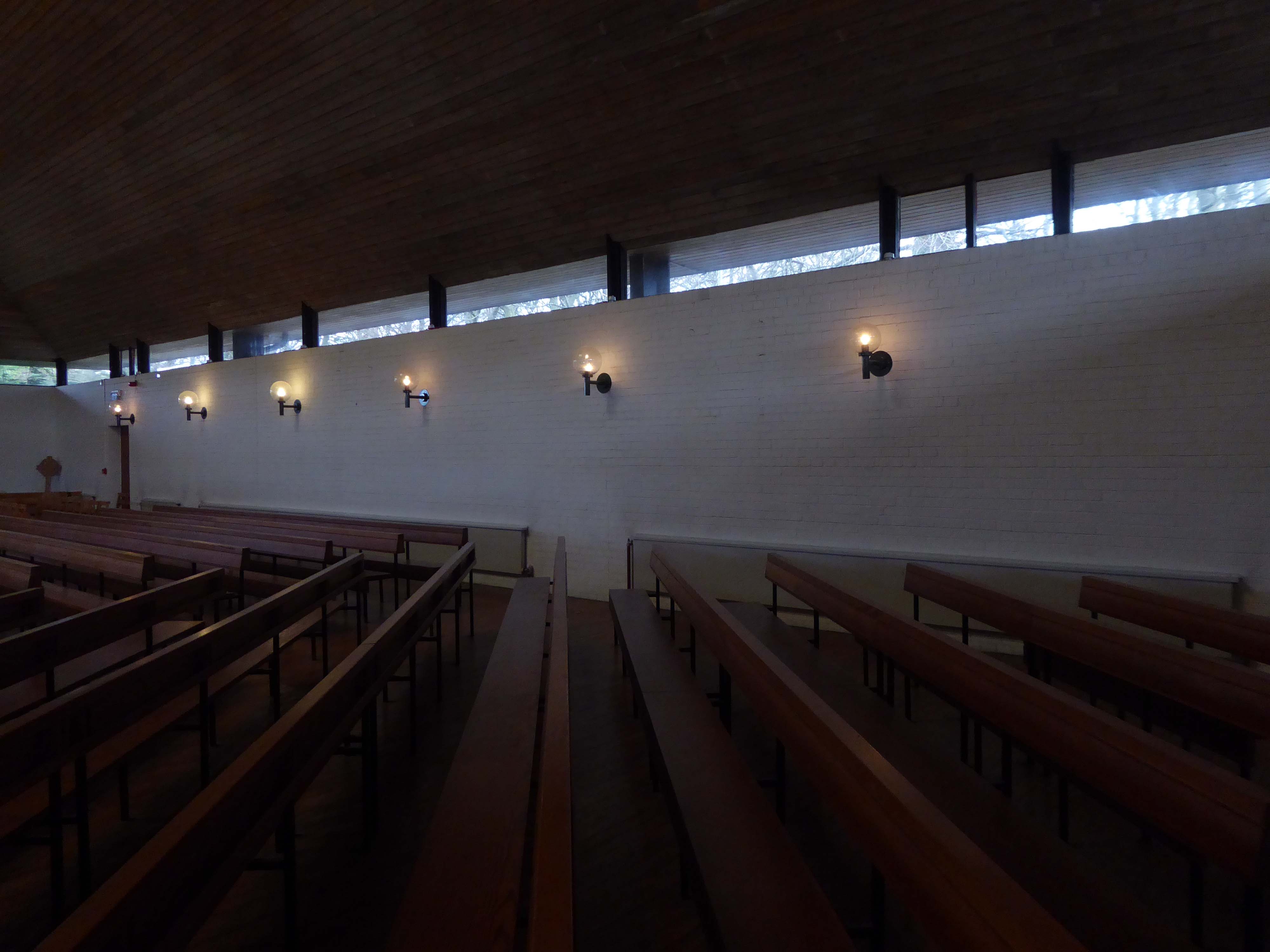
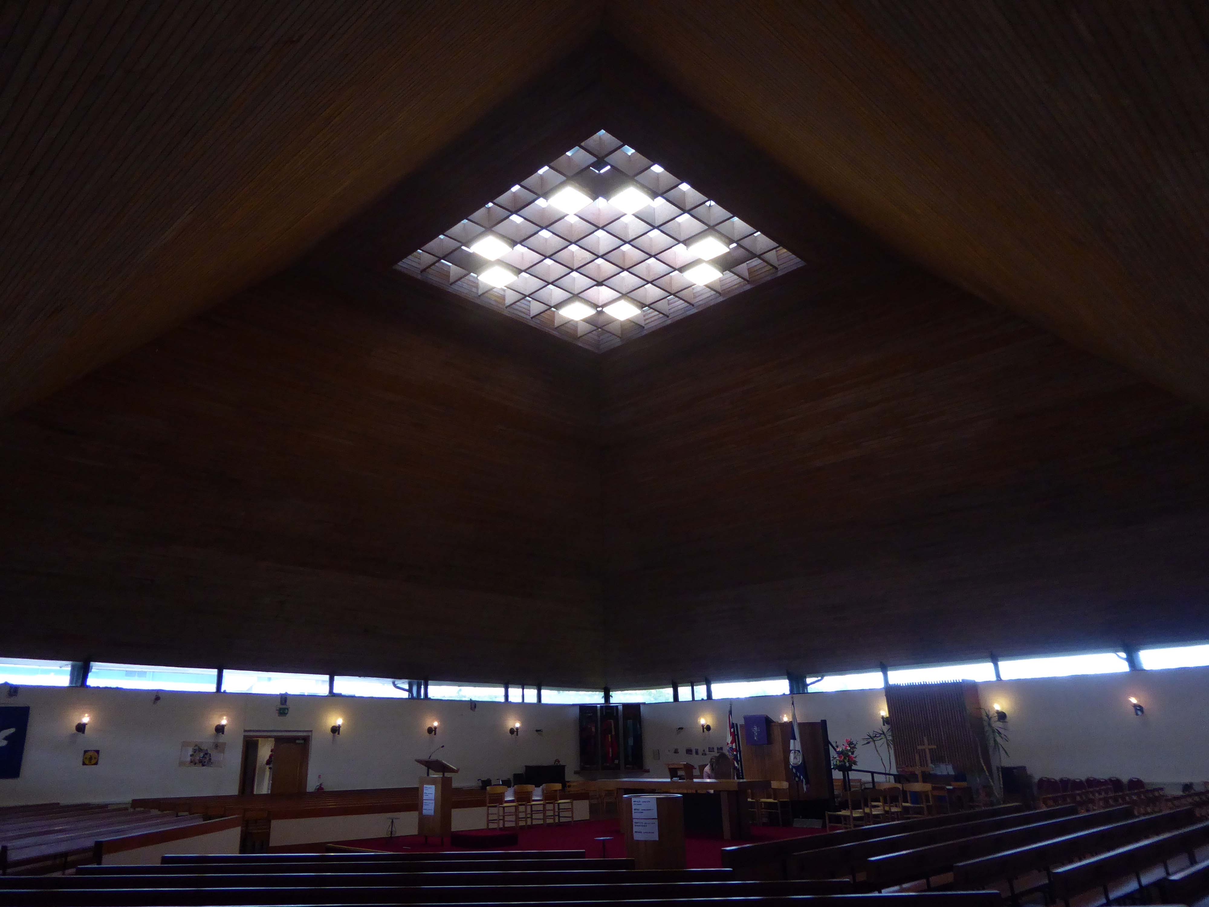
Following a promotion within the Church of Scotland to construct less hierarchical church buildings in the 1950s, an open-plan Modern design with Brutalist traits, was adapted for the new Anderson Parish Church. The building consists of a 2-storey square-plan church with prominent pyramidal roof, with over 20 rooms. The foundation stone was laid in 1966, with a service of commemoration in the now demolished St Mark’s-Lancefield Church. The building was completed in 1968.
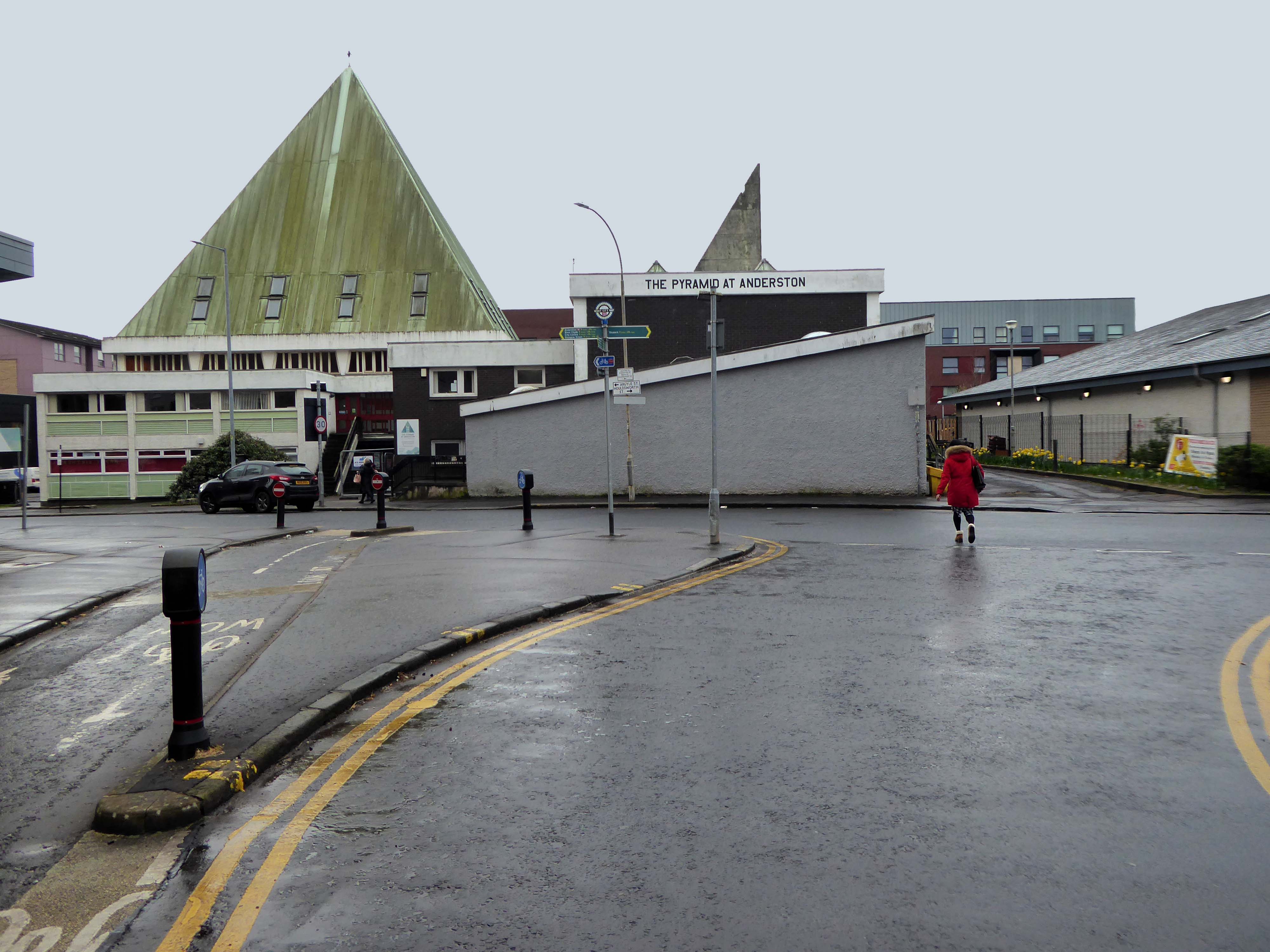
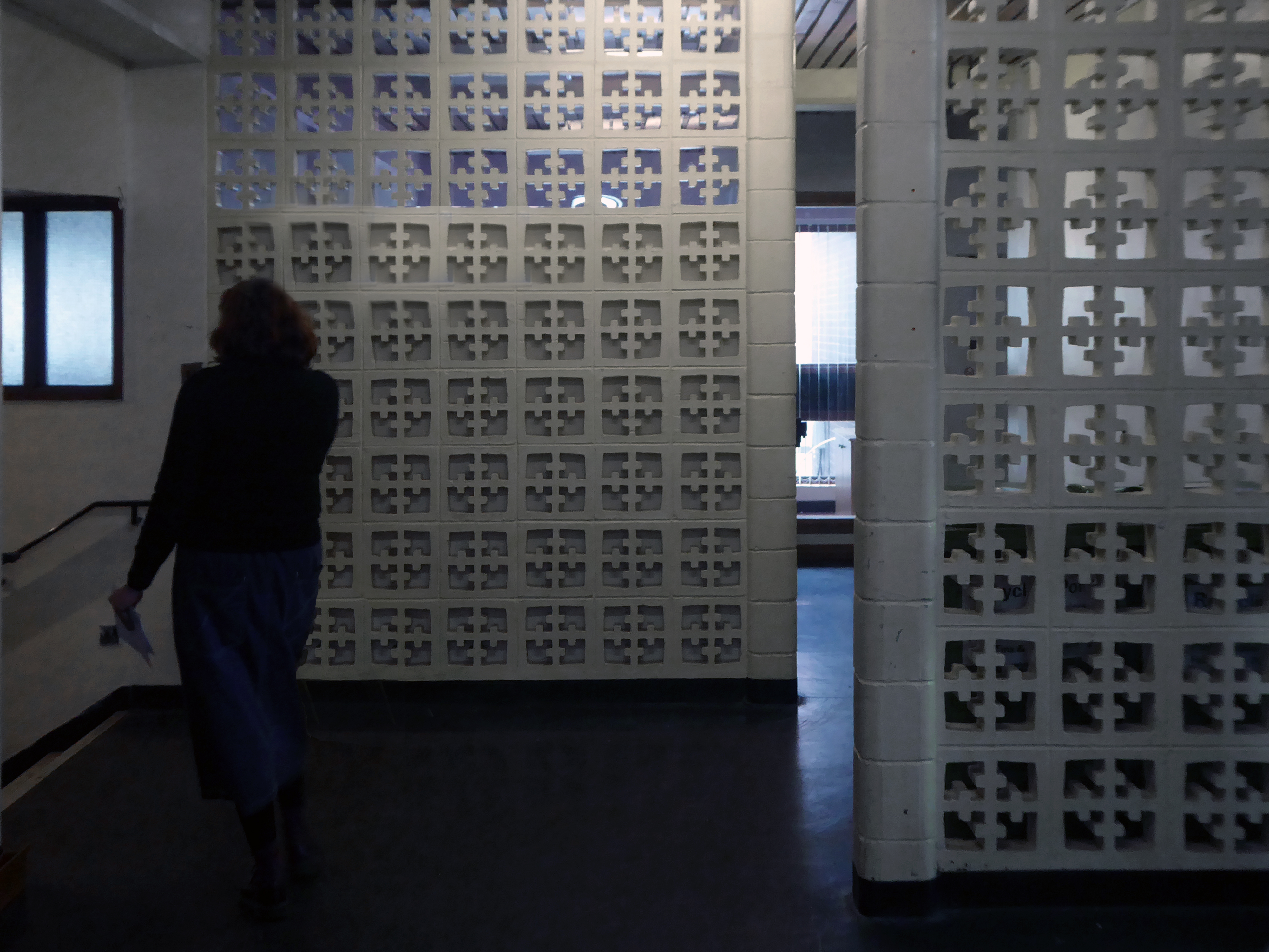
Let’s take a look around outside.
Later that same day, I got a message from my friend Kate to visit her at the centre.
She is charged with co-ordinating a variety of activities at The Pyramid.
In 2019 the Church of Scotland sold the building and it became a community centre for people to:
Connect, create and celebrate.
It also serves as an inspirational space for music, performances, conferences and events.
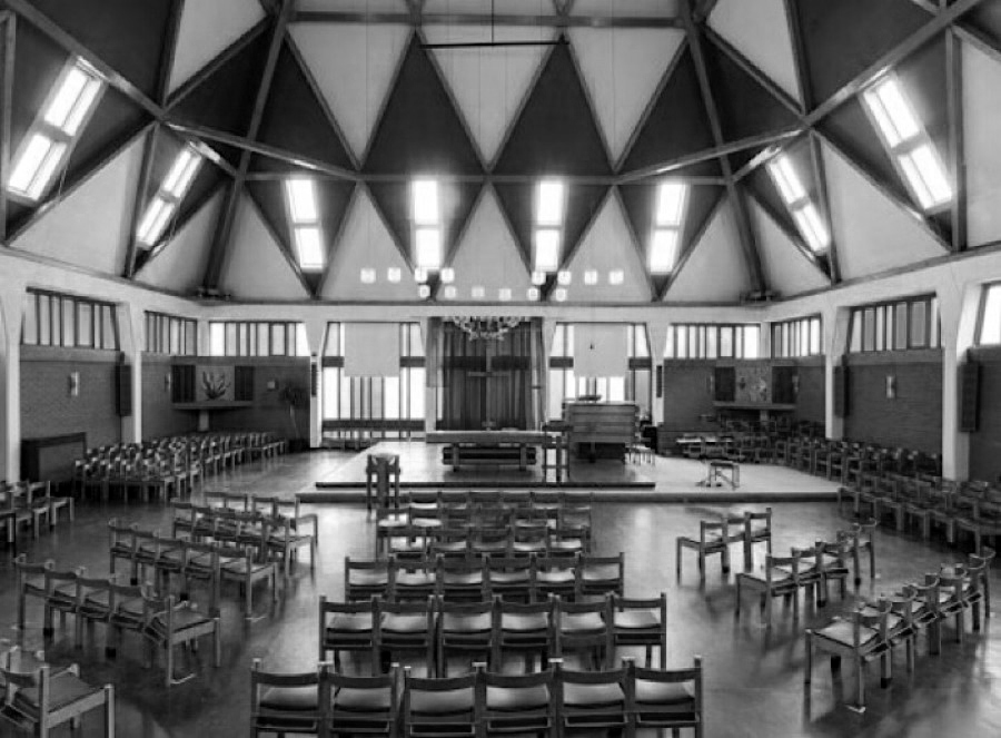
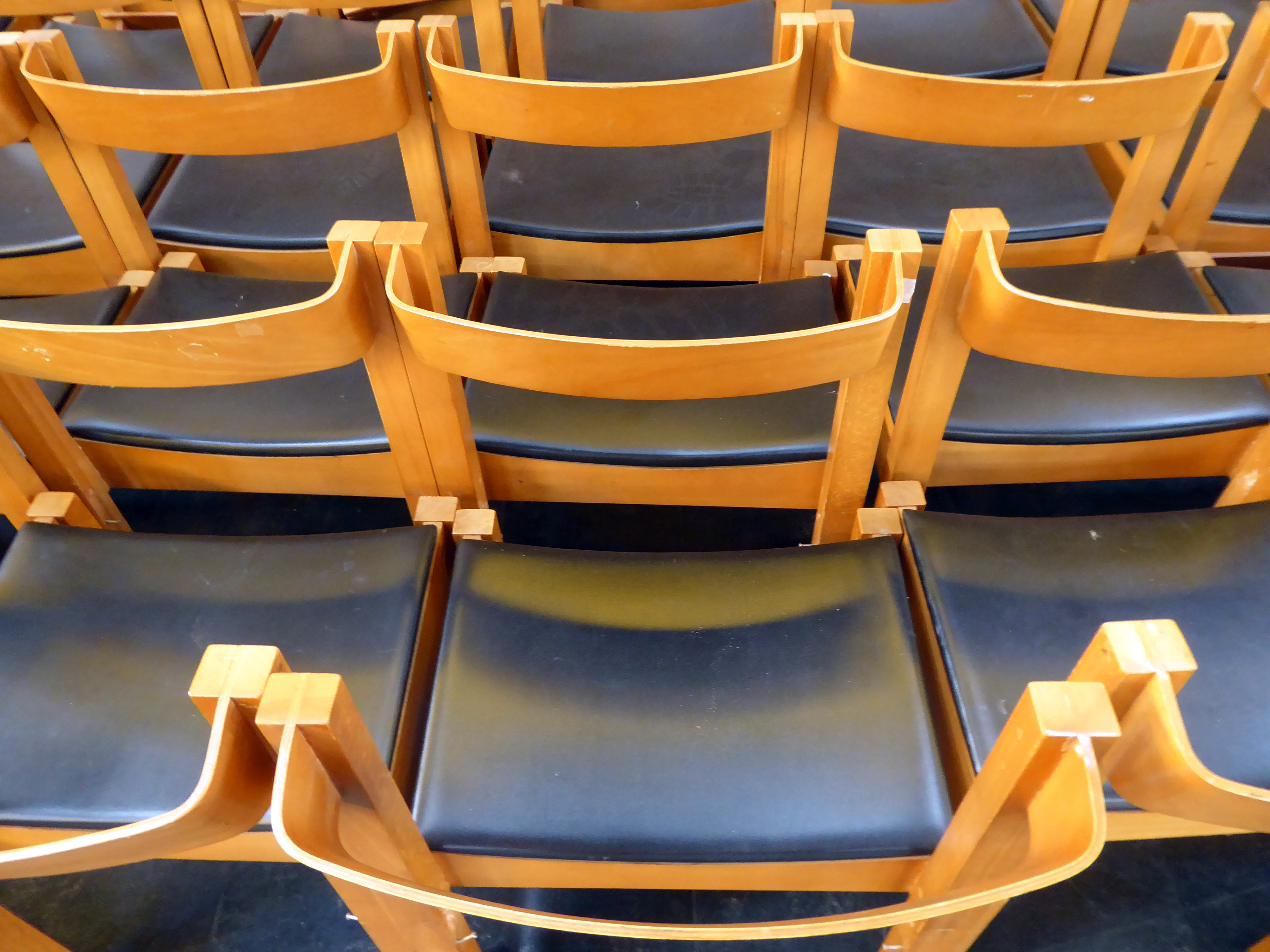
Let’s take a look around inside.
As a footnote the recent STV Studios produced series SCREW was filmed here!
Architects: David Harvey, Alex Scott & Associates – 1967
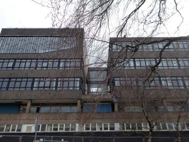
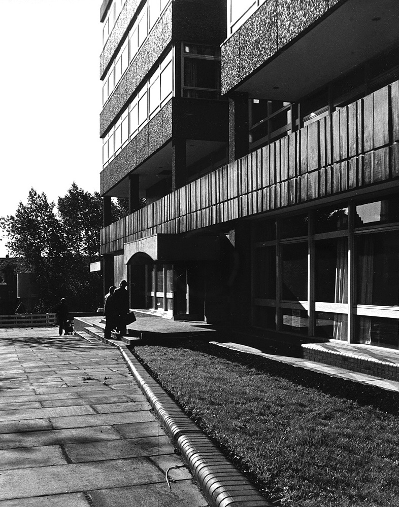
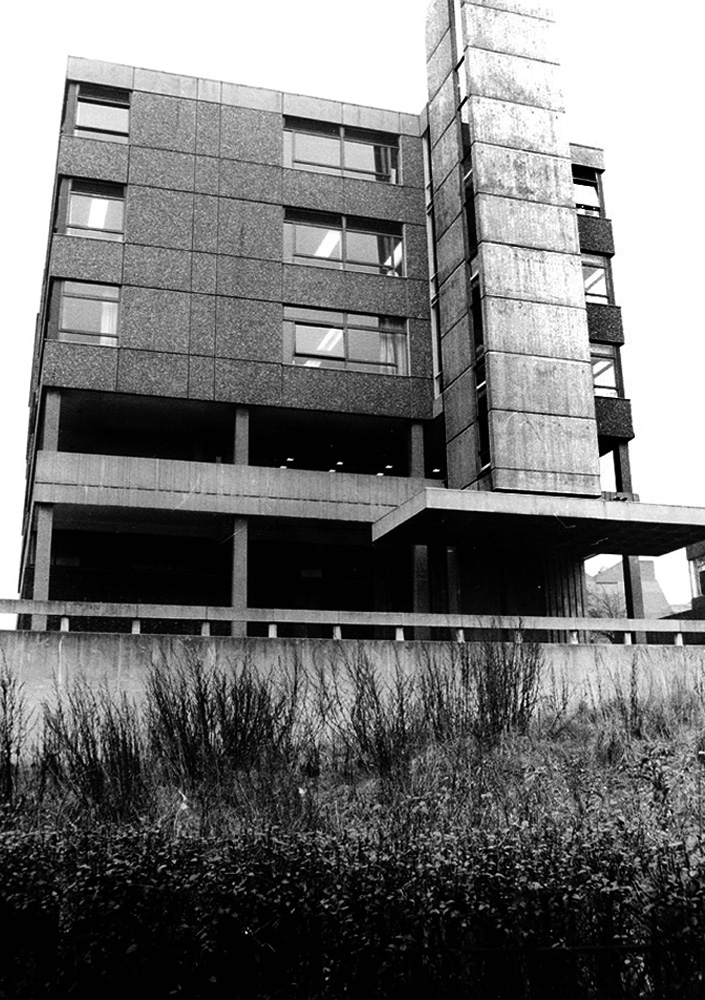
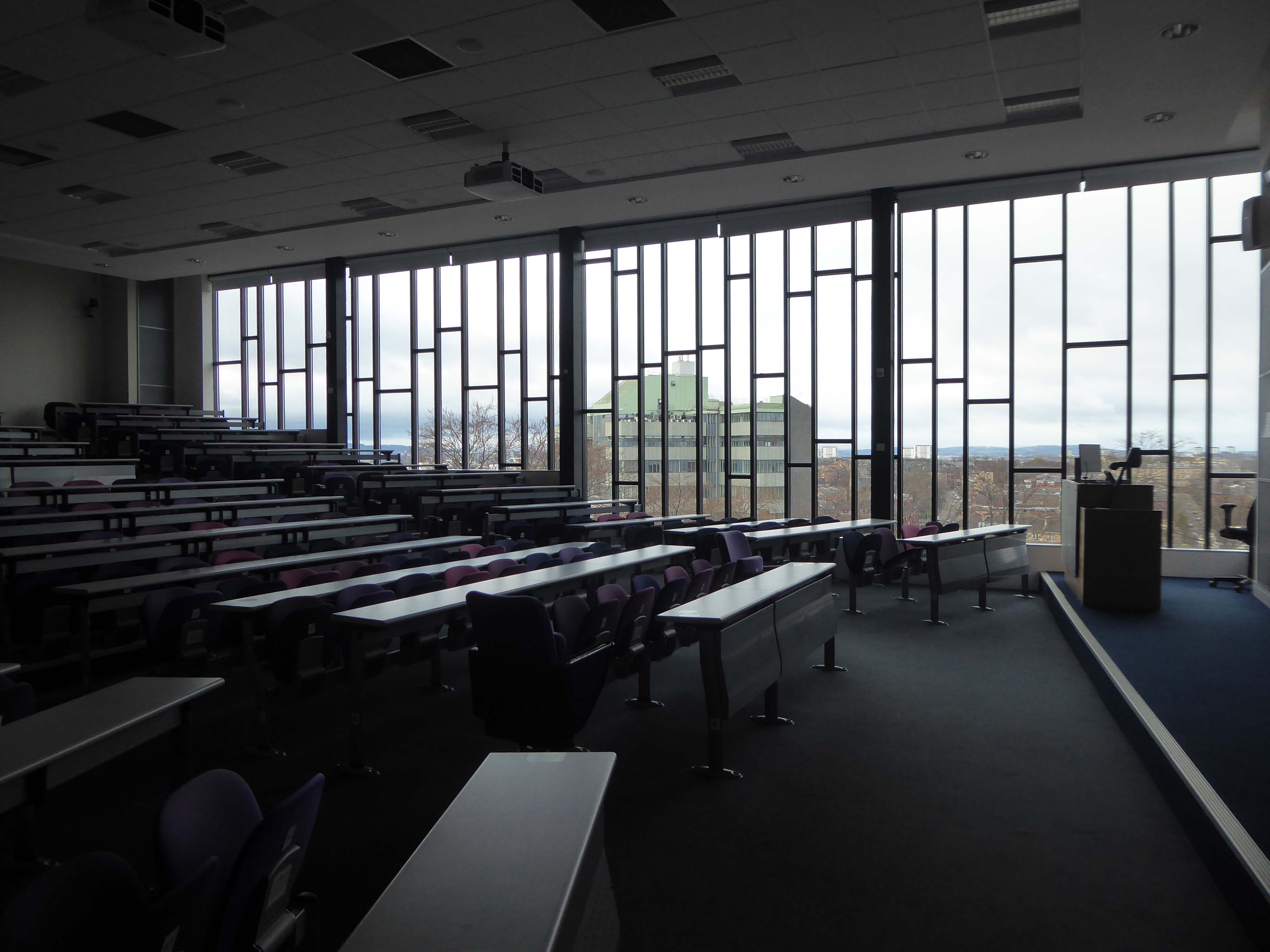
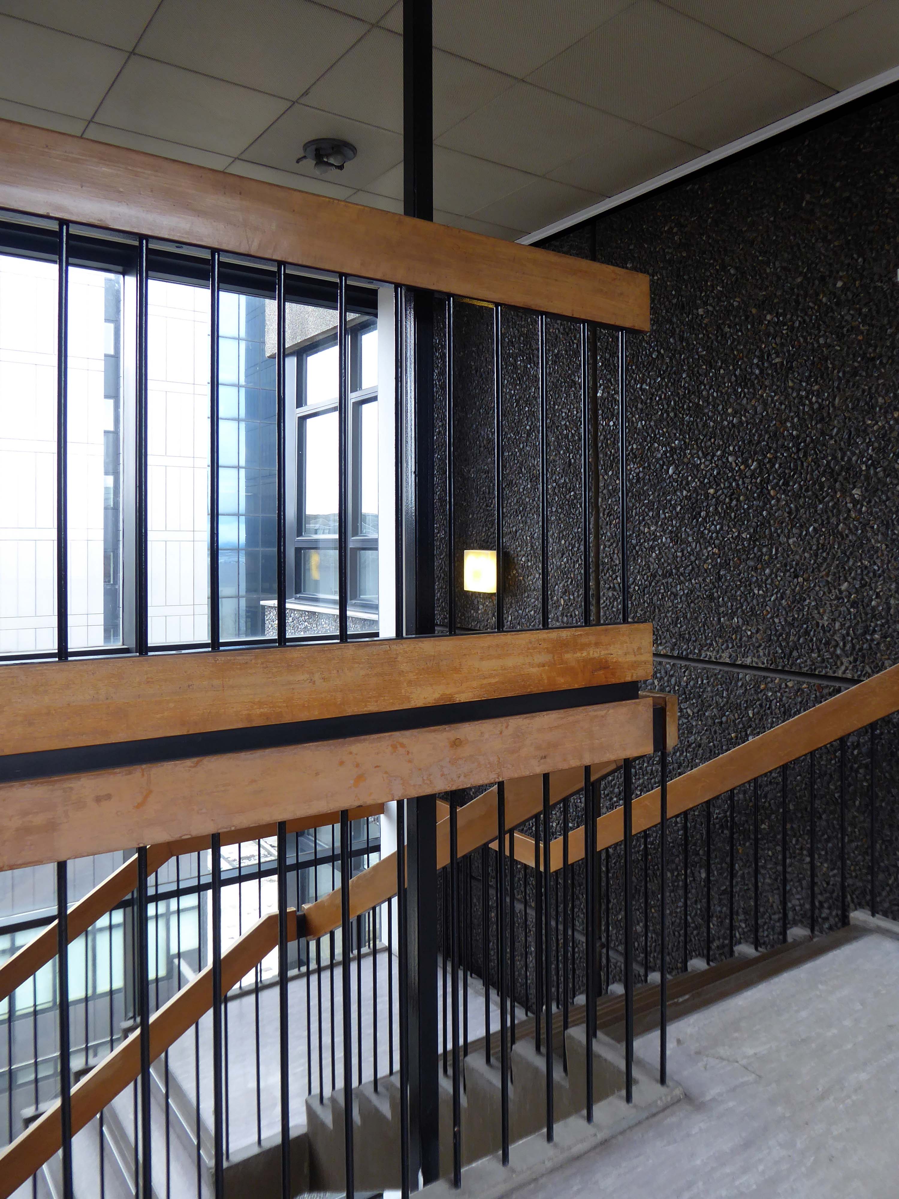
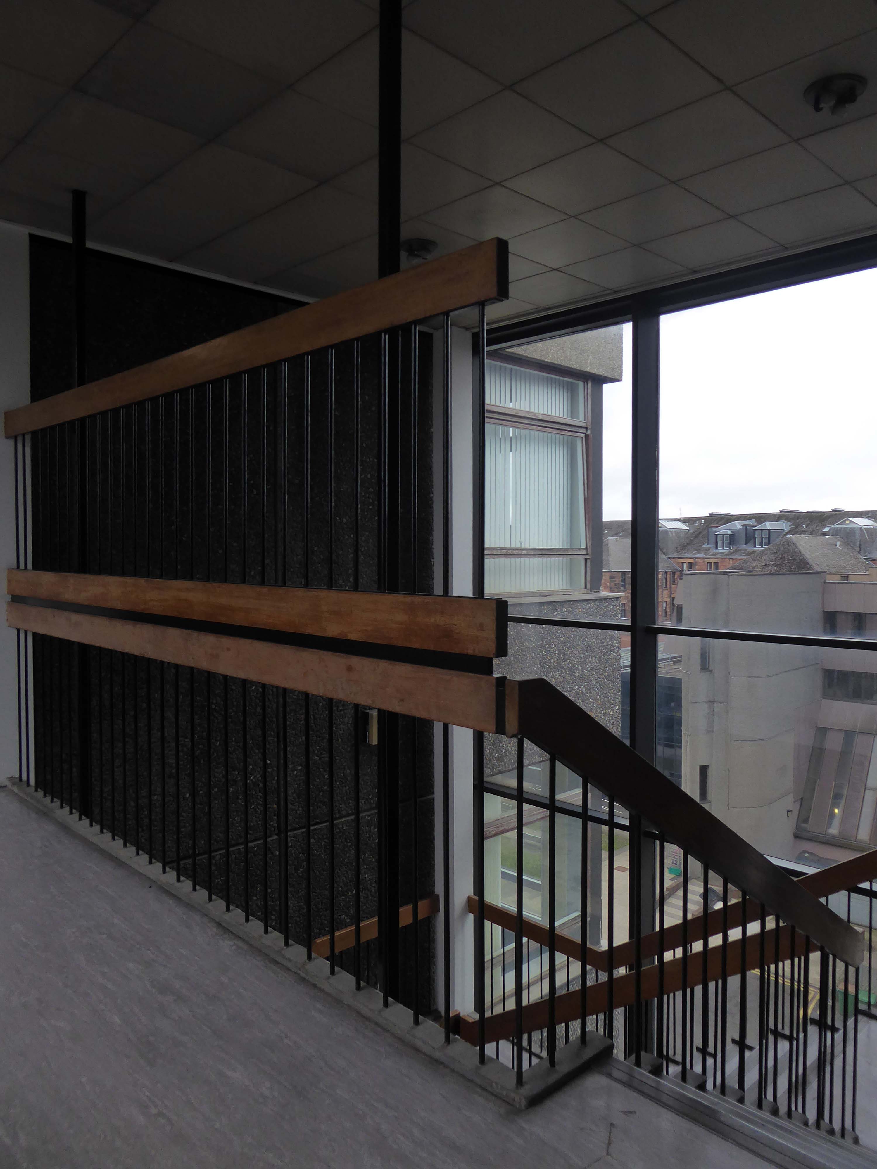
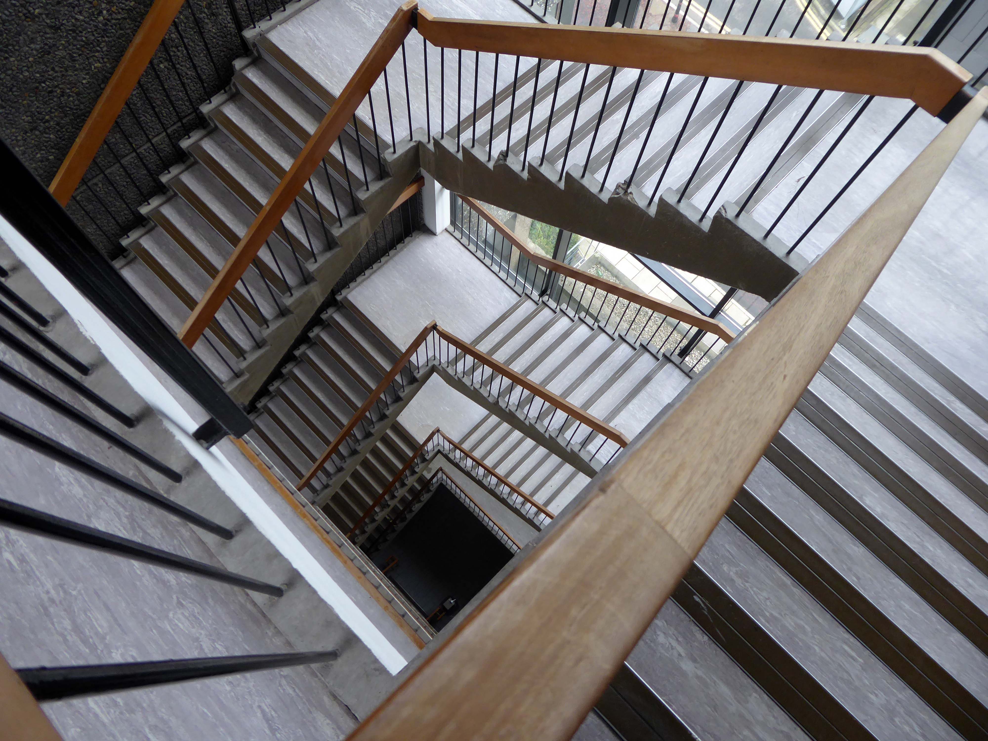
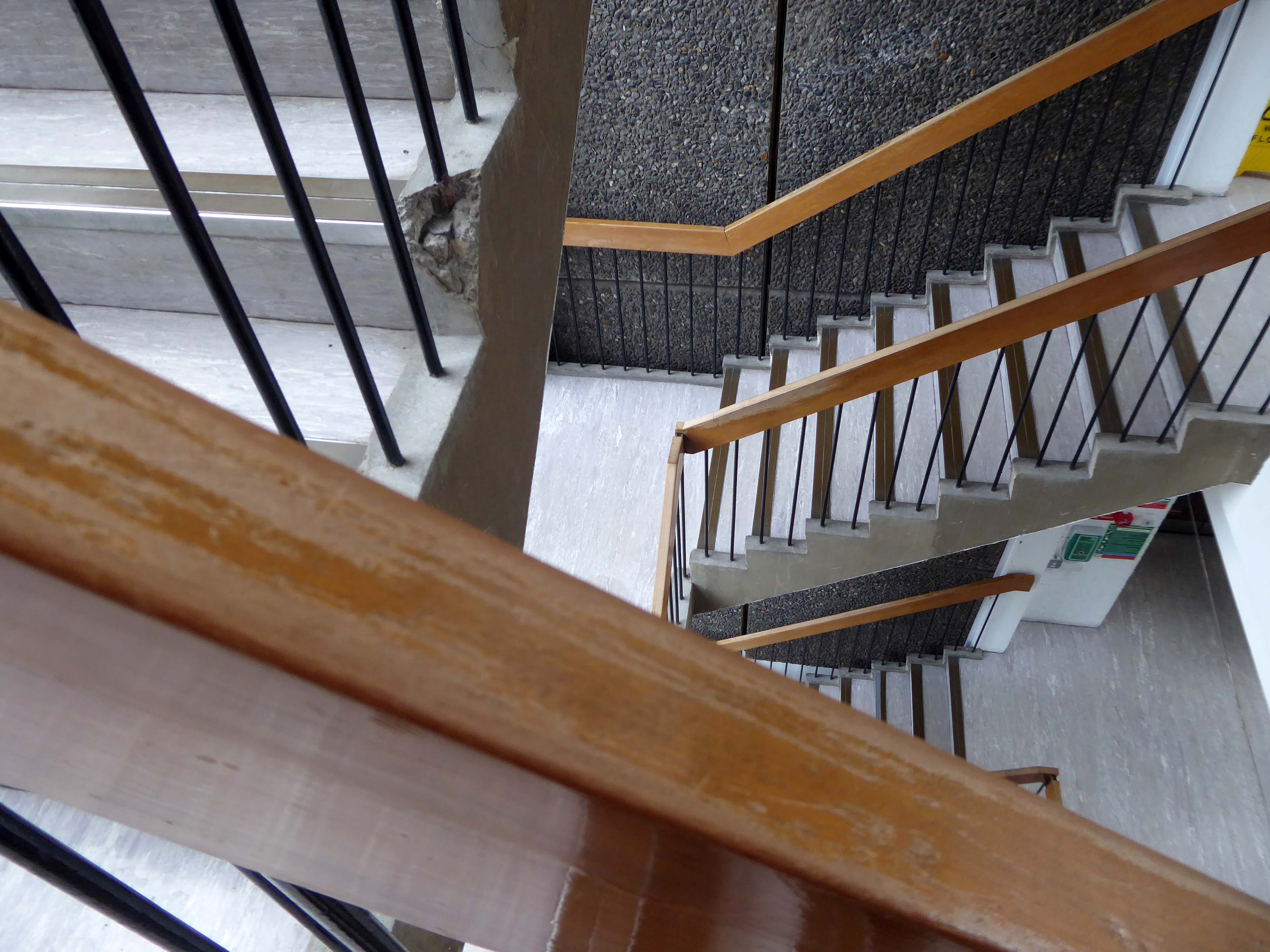
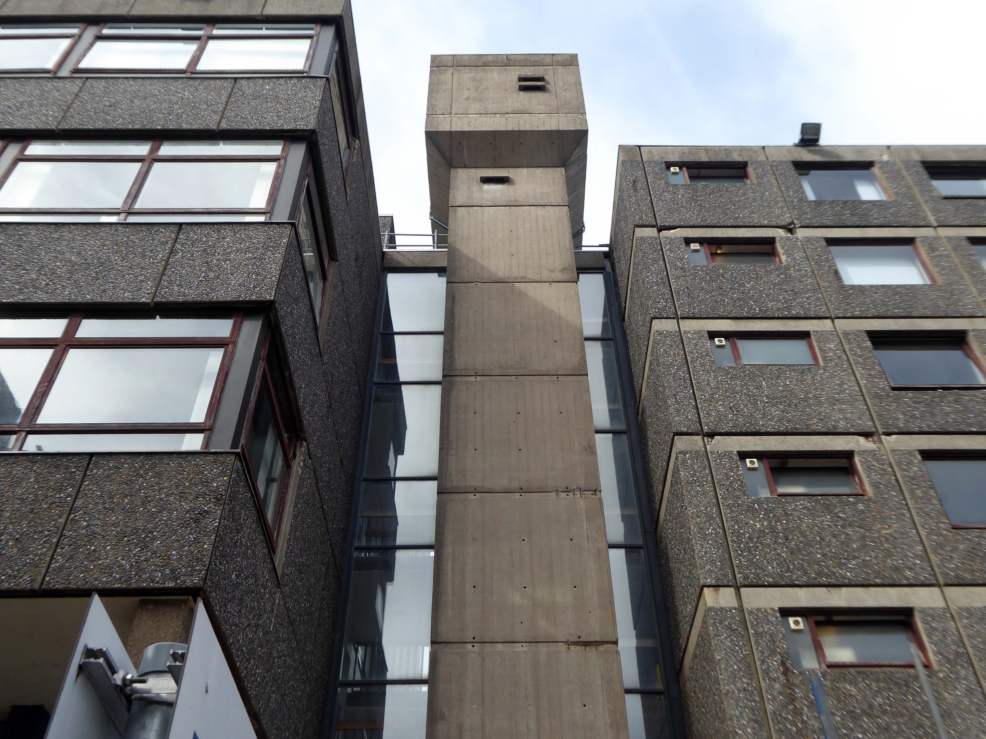
The Adam Smith Building, named in honour of the moral philosopher and political economist, Adam Smith, was formally opened on 2 November 1967 by Sydney George Checkland, Professor of Economic History from 1957 to 1982. The building was the first of the University’s multipurpose blocks housing a large number of departments, and a library for Political Economy, Social and Economic Research, Economic History, Political and Social Theory and Institutions, Management Studies, Psychology, Social Psychology, Accountancy, Citizenship, Anthropology, Criminology, Industrial Relations, and the School of Social Study. A records store was provided beneath the Library for the Economic History department to house their rapidly growing collection of business records from the vanishing Clyde shipyards and heavy engineering workshops, which now form part of the Scottish Business Archive held at University of Glasgow Archive Services.
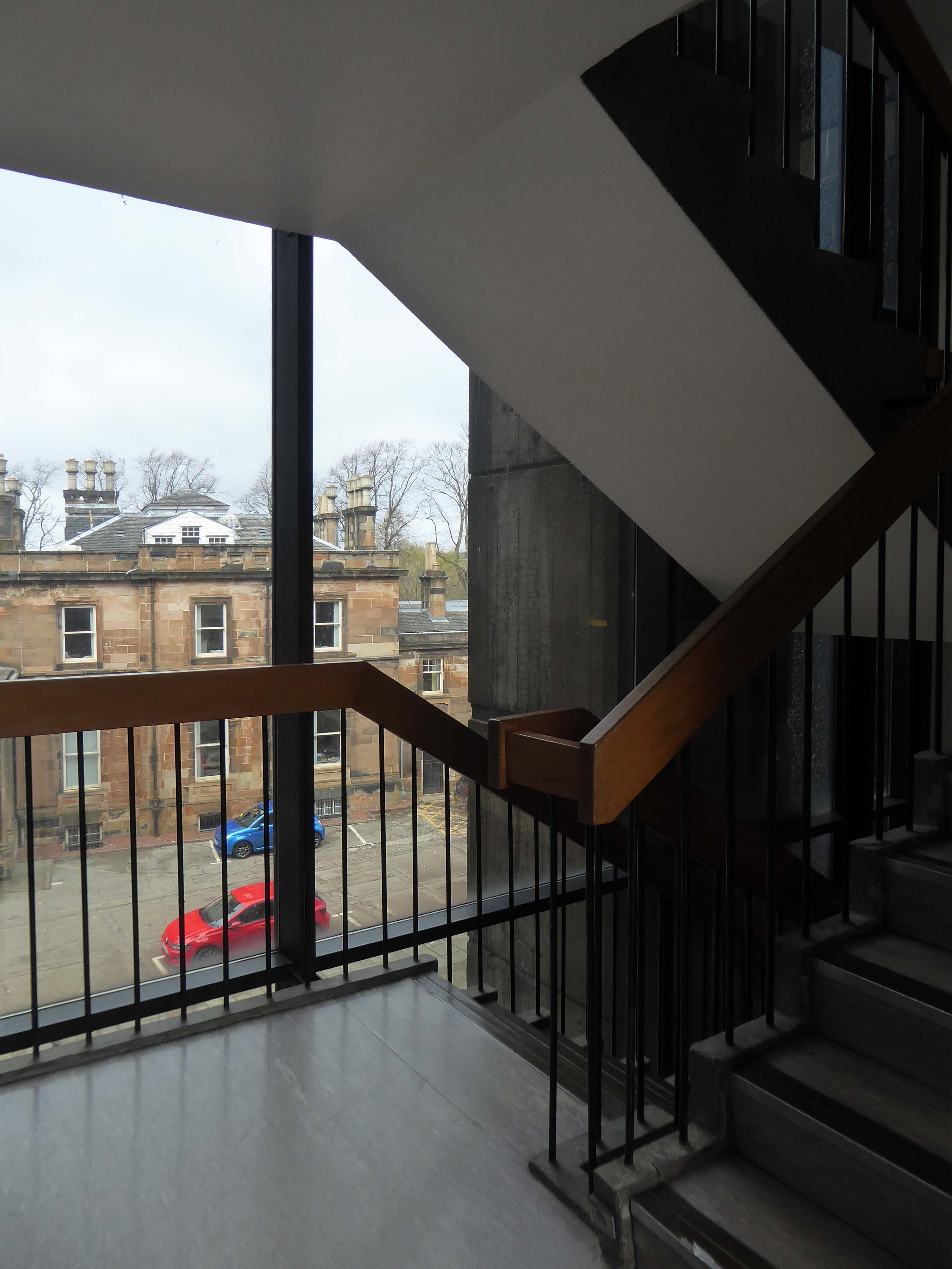
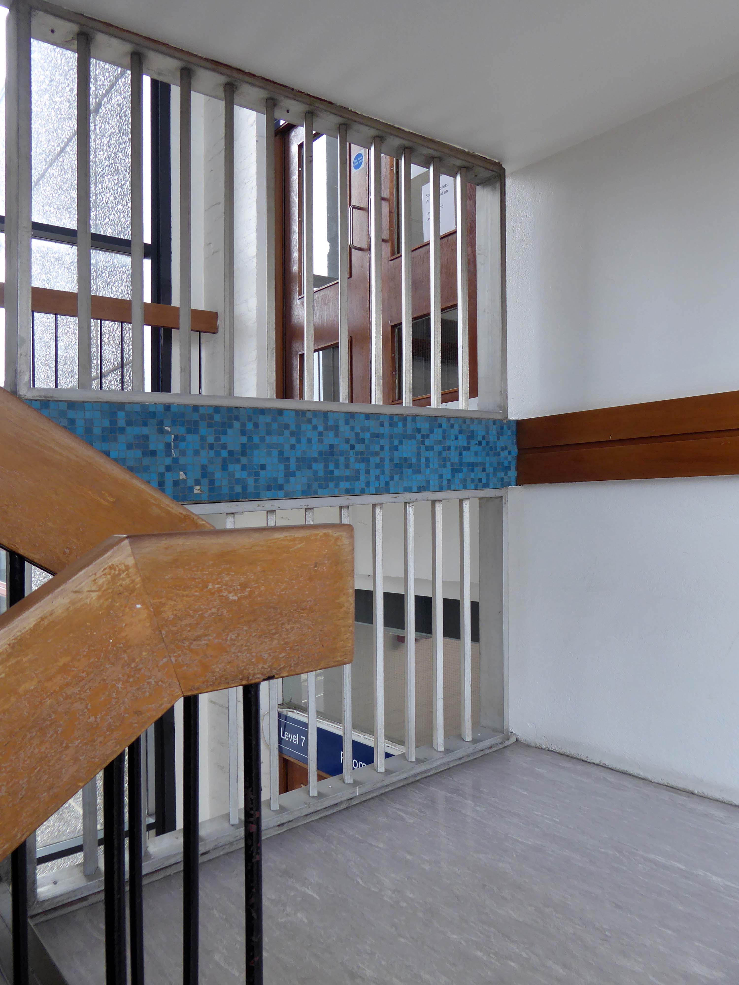
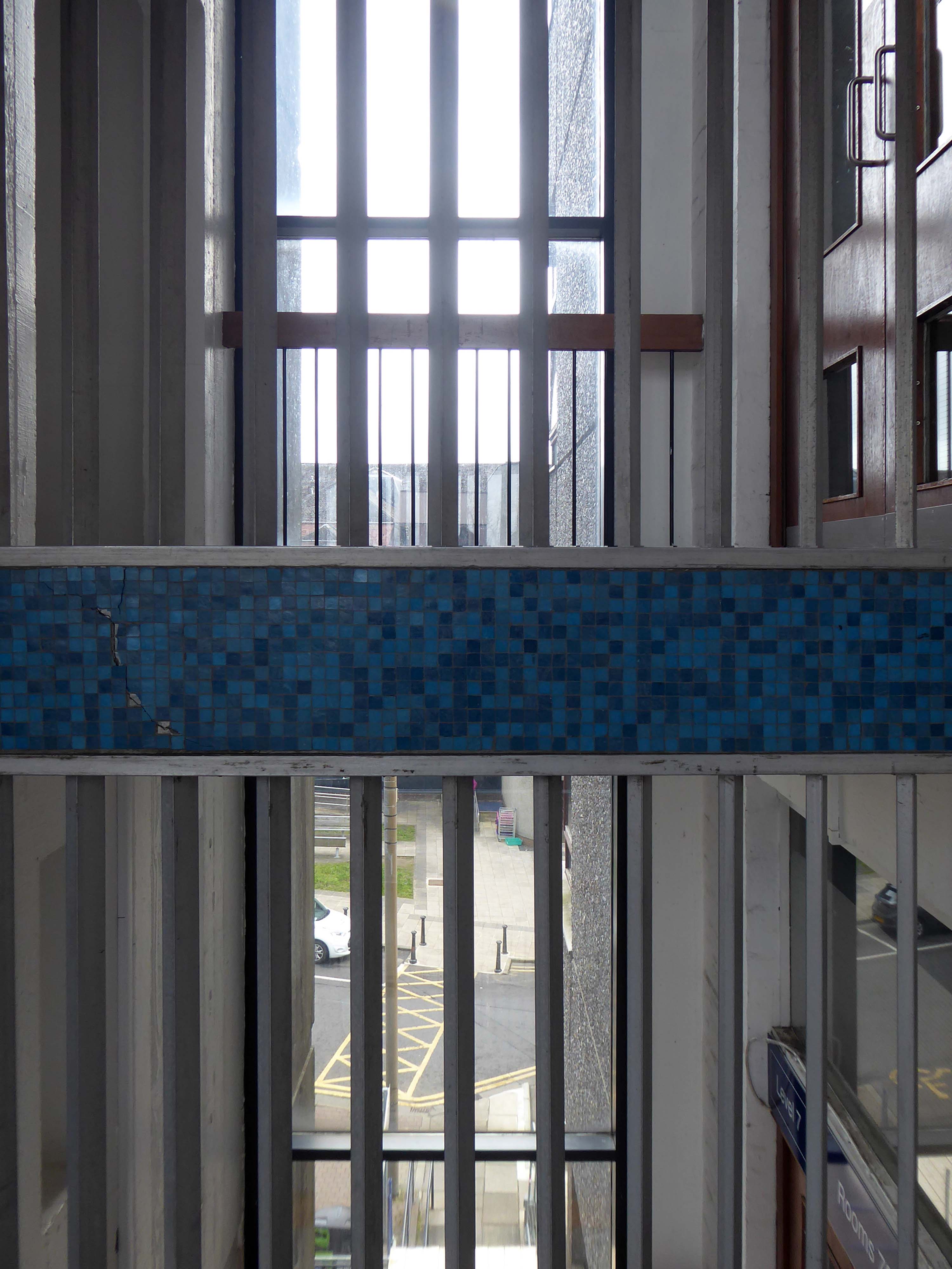
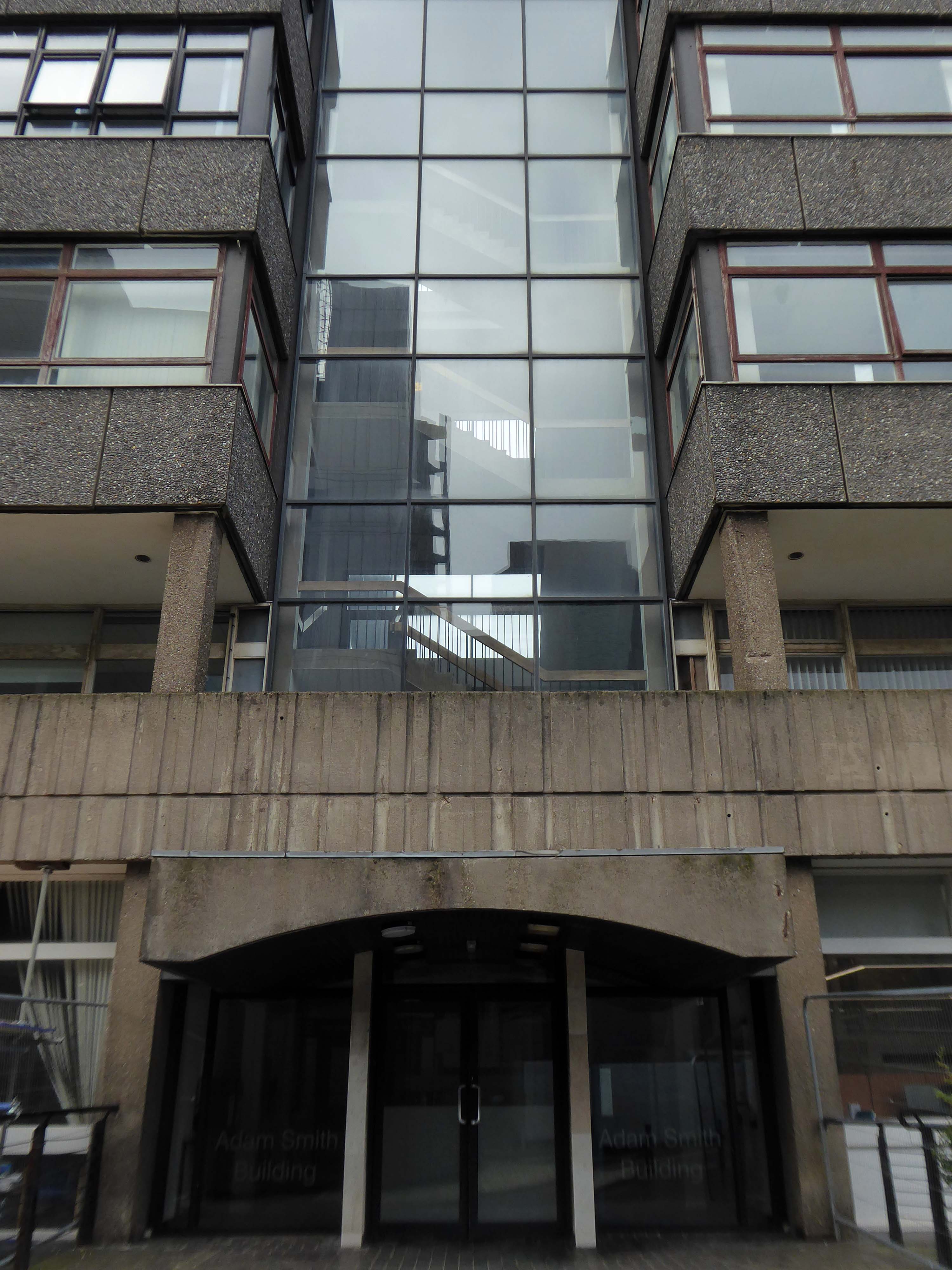
Wandering almost aimlessly around the campus, when the blue mosaic caught my eye.
The glass stairwell drew me in further.
Entering the building I explained myself to the passing janitor:
I’m intrigued by the stairways of 1960s civic buildings.
There are two – he helpfully replied.
Further intrigued I took a good look around – first up one.
Reaching the top and discovering the Lecture Theatre.
Then down the other.
The mosaic mural at the foot of the main staircase was the work of George Garson, the head of the Mural Design and Stained Glass department at the Glasgow School of Art.
A quick look around the outside and then on my way.
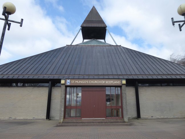
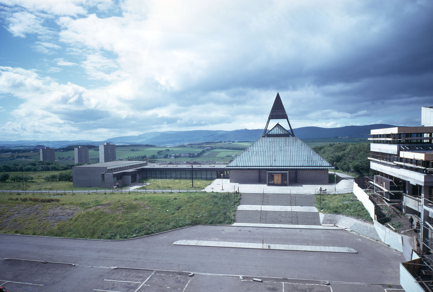
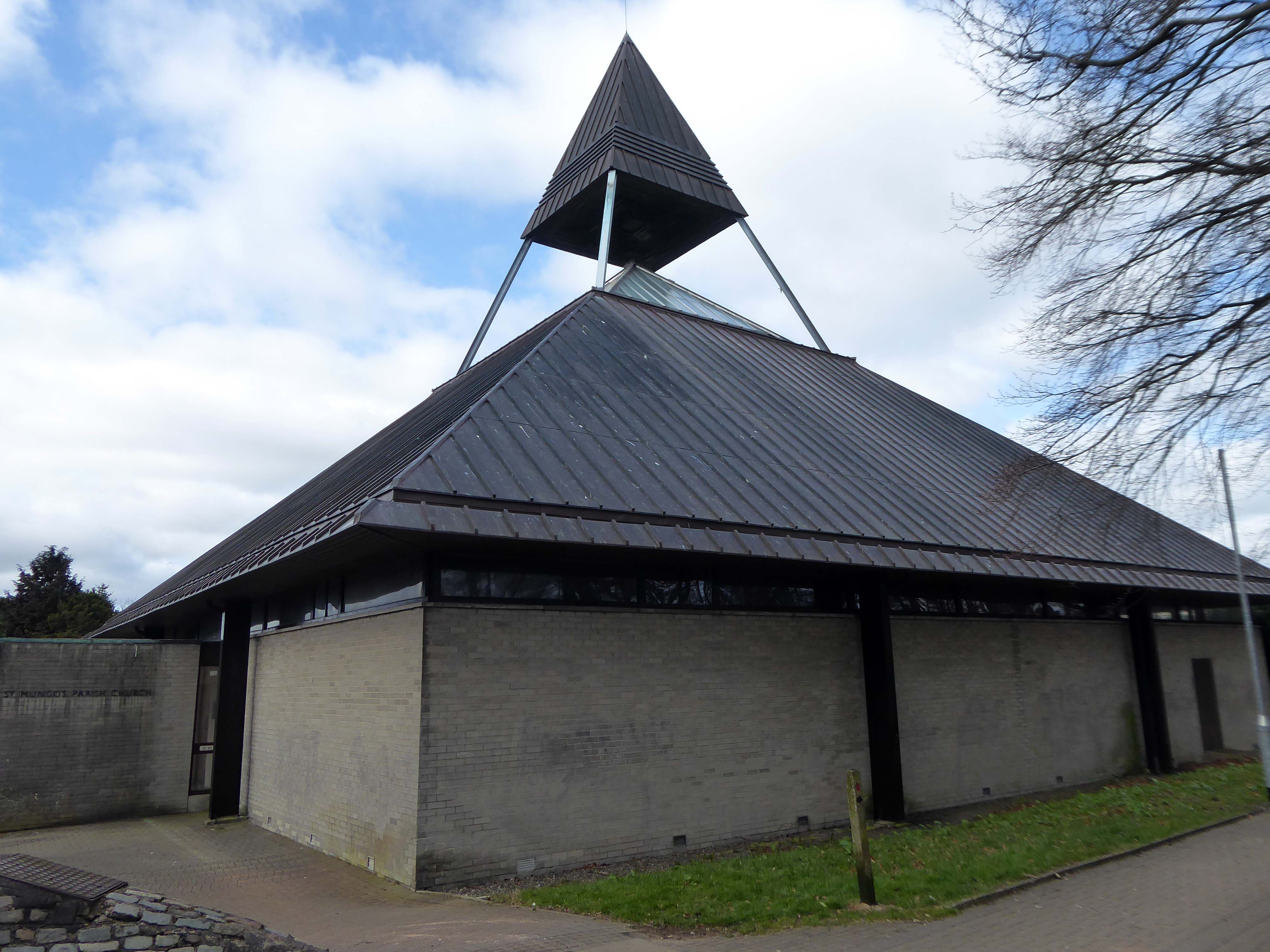
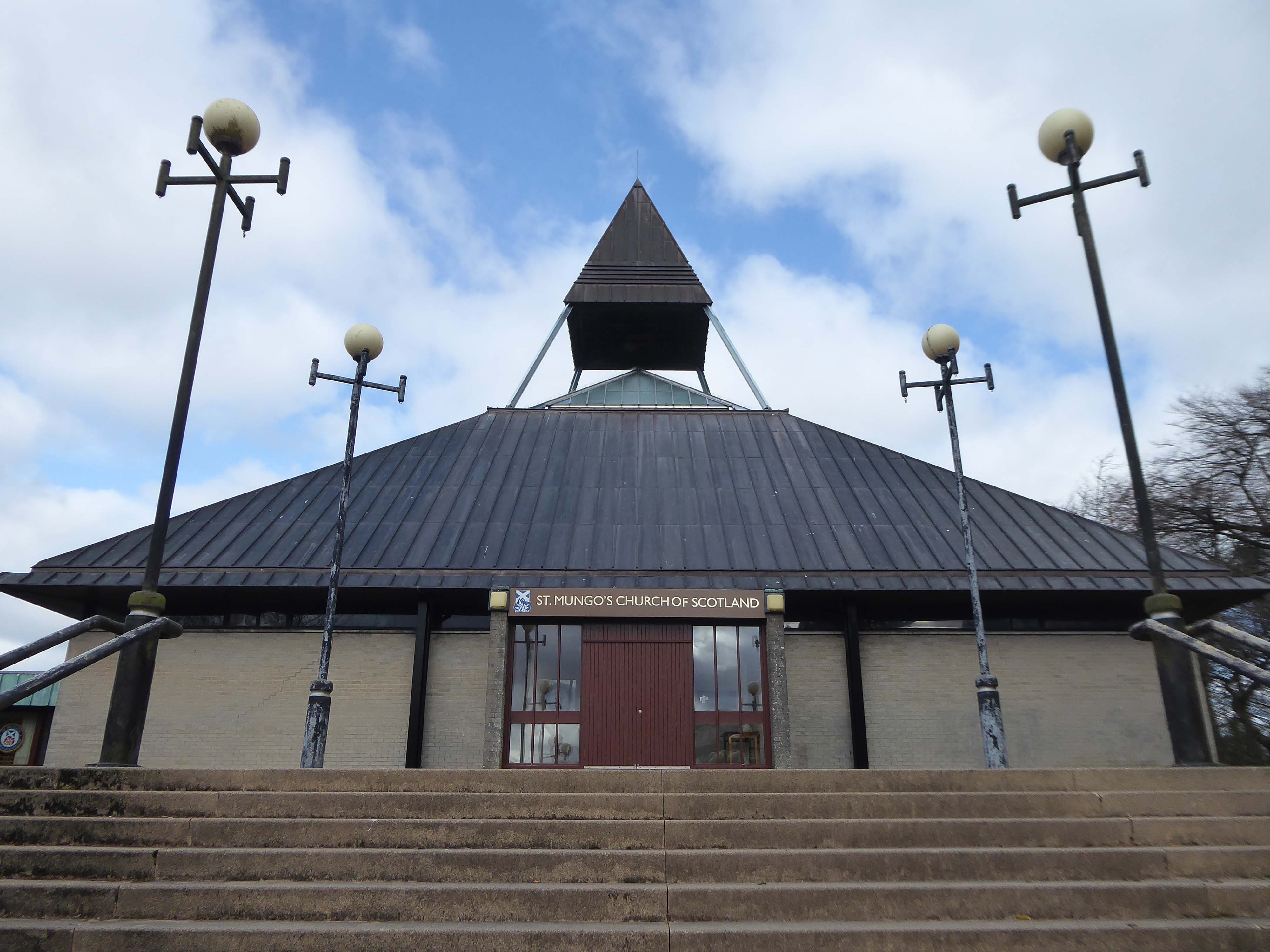
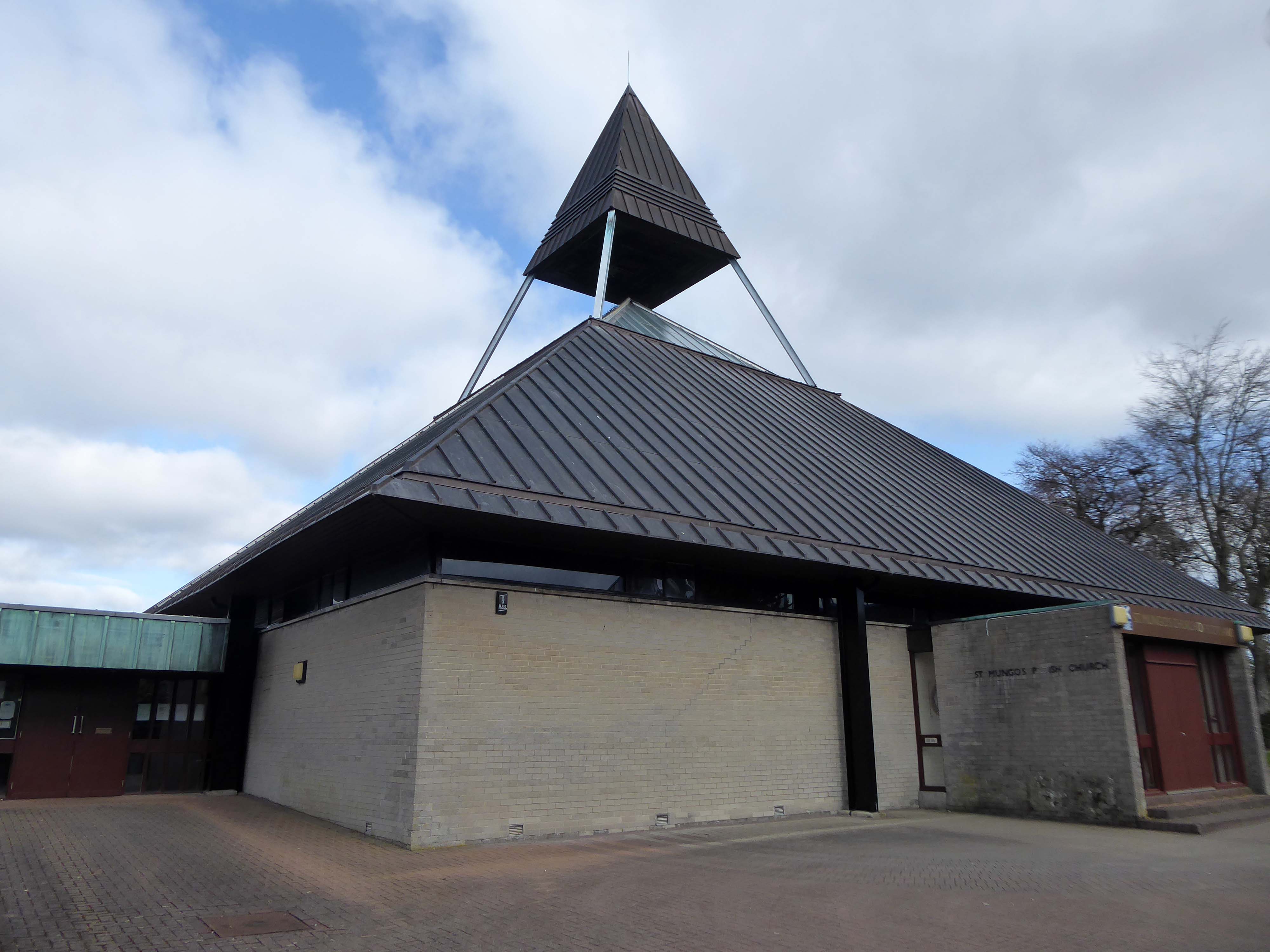
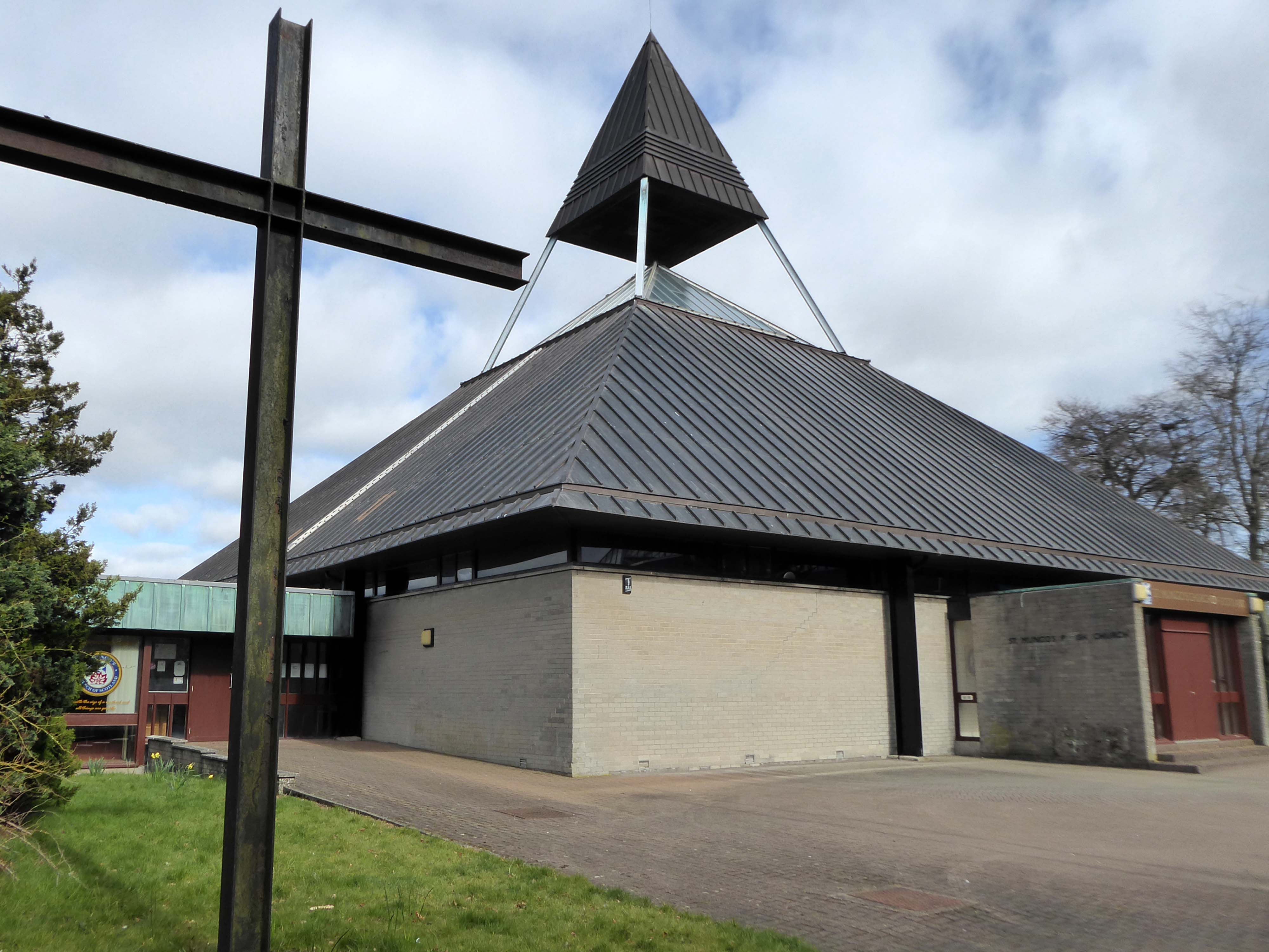
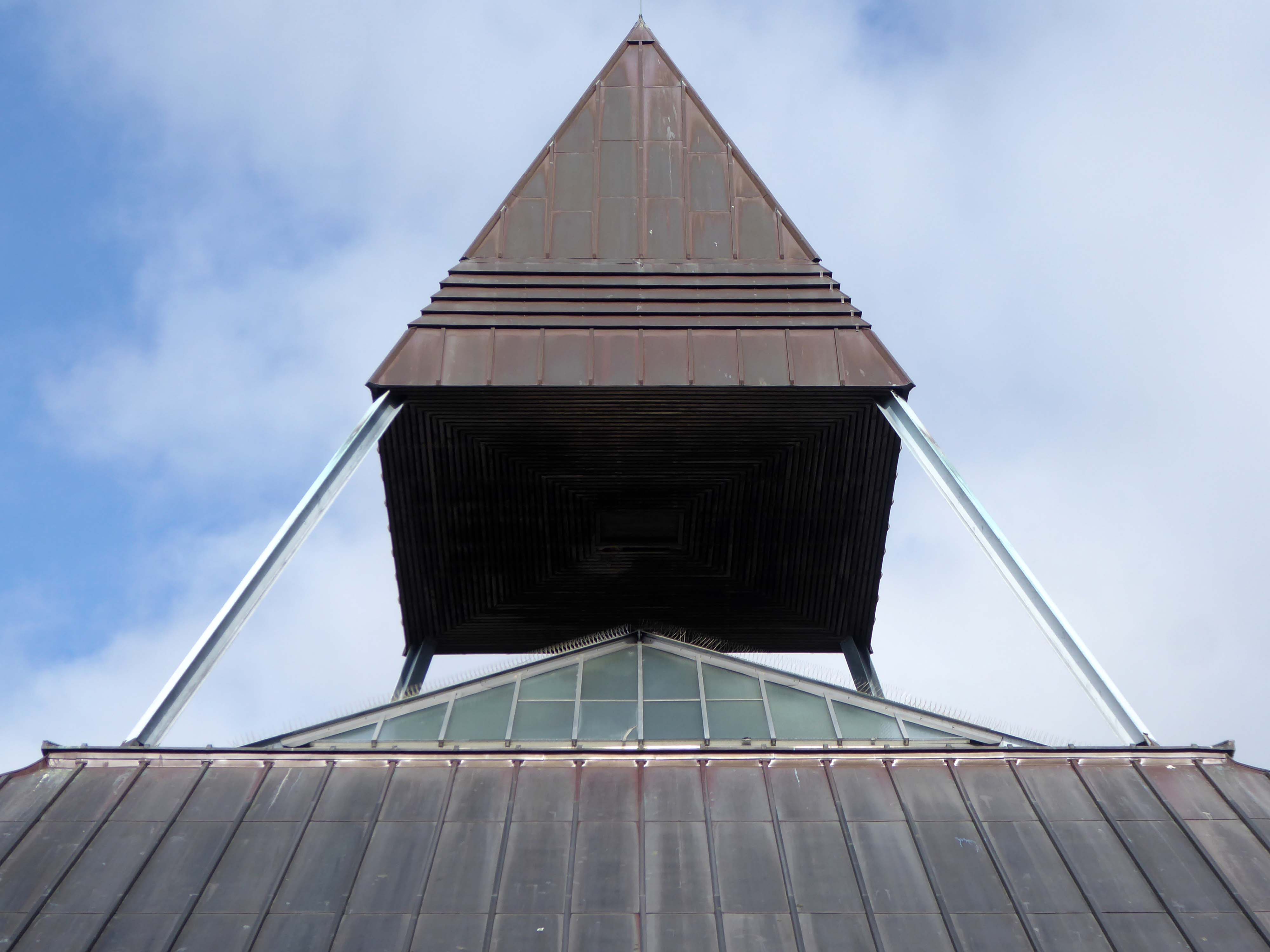
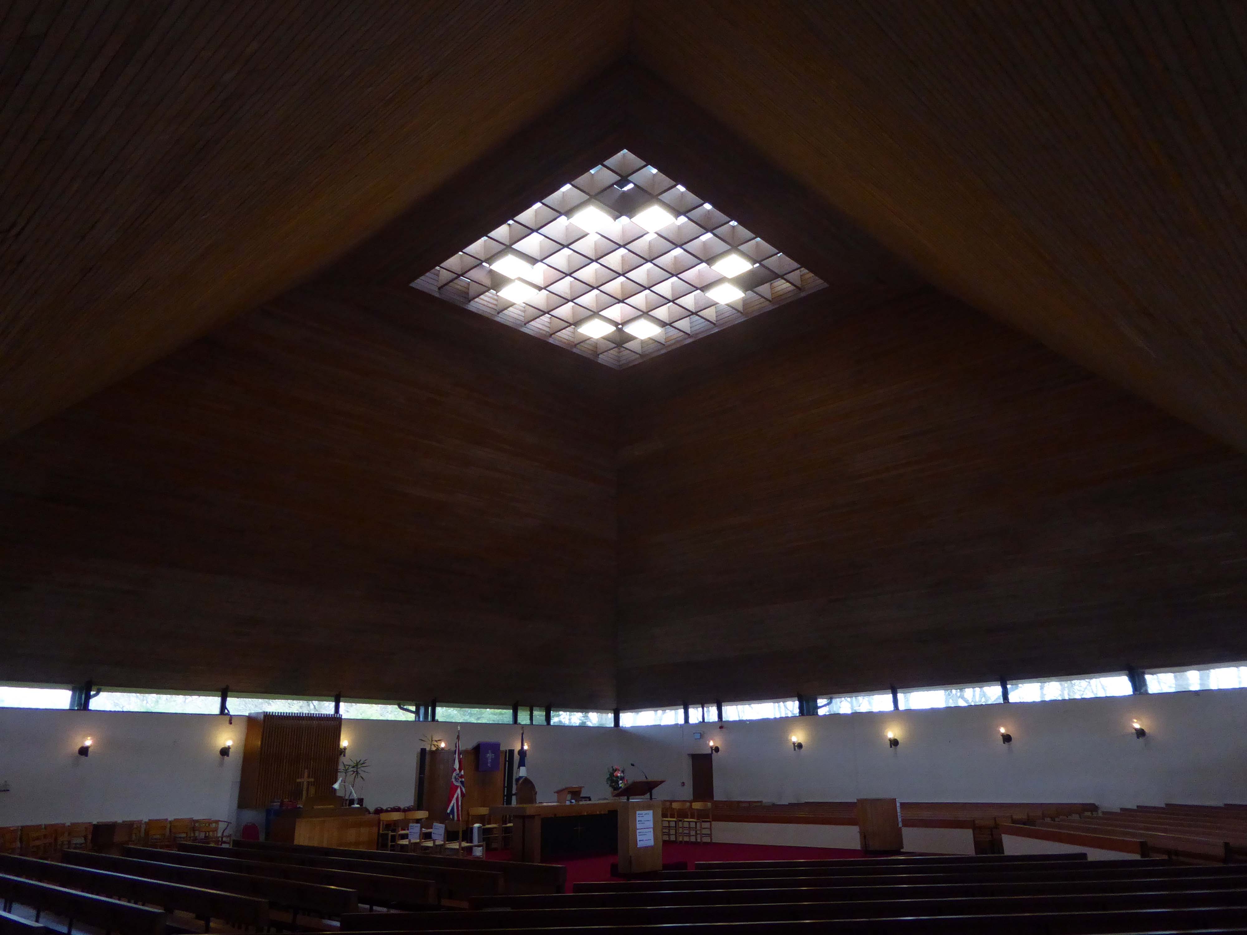
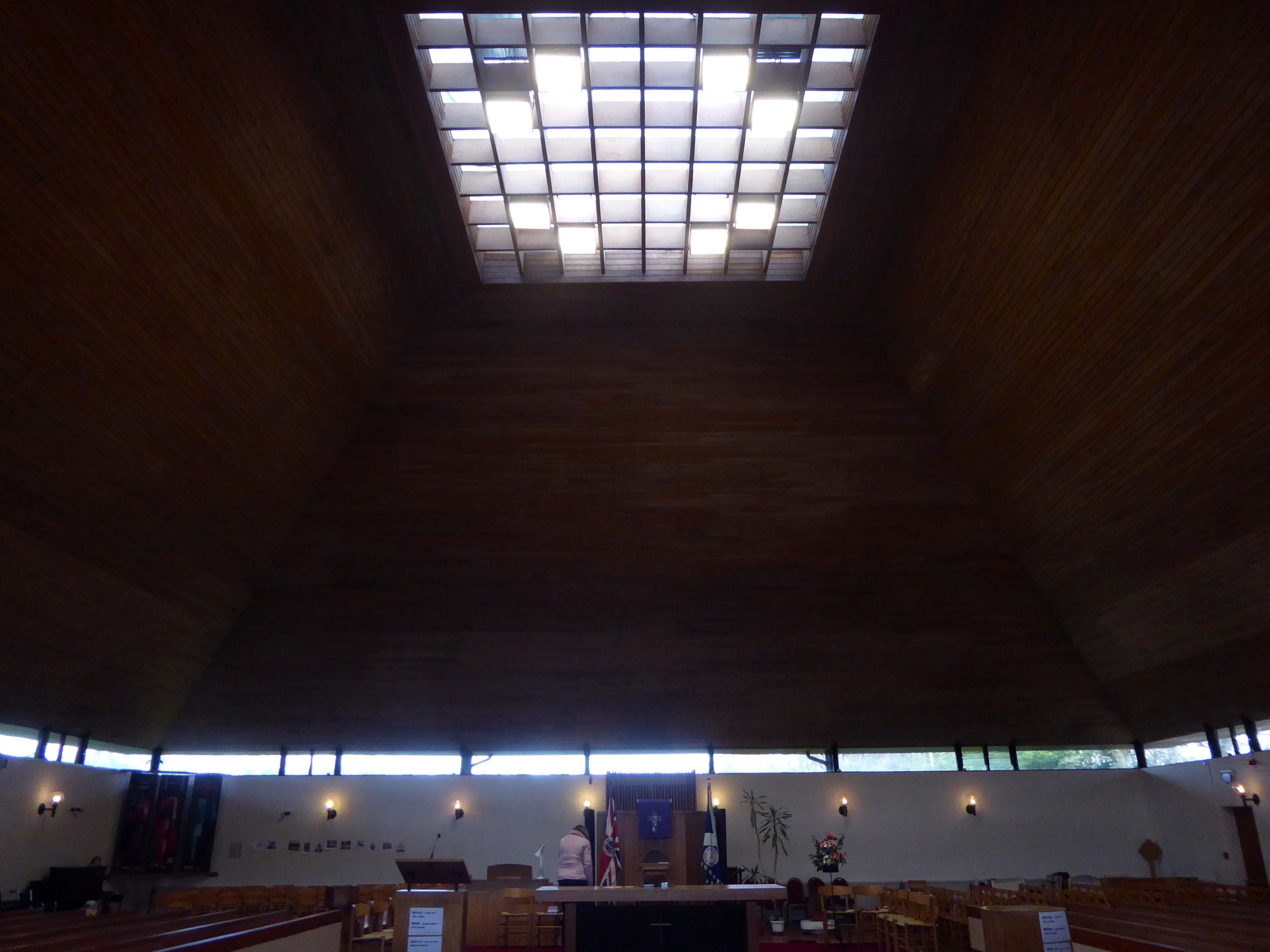
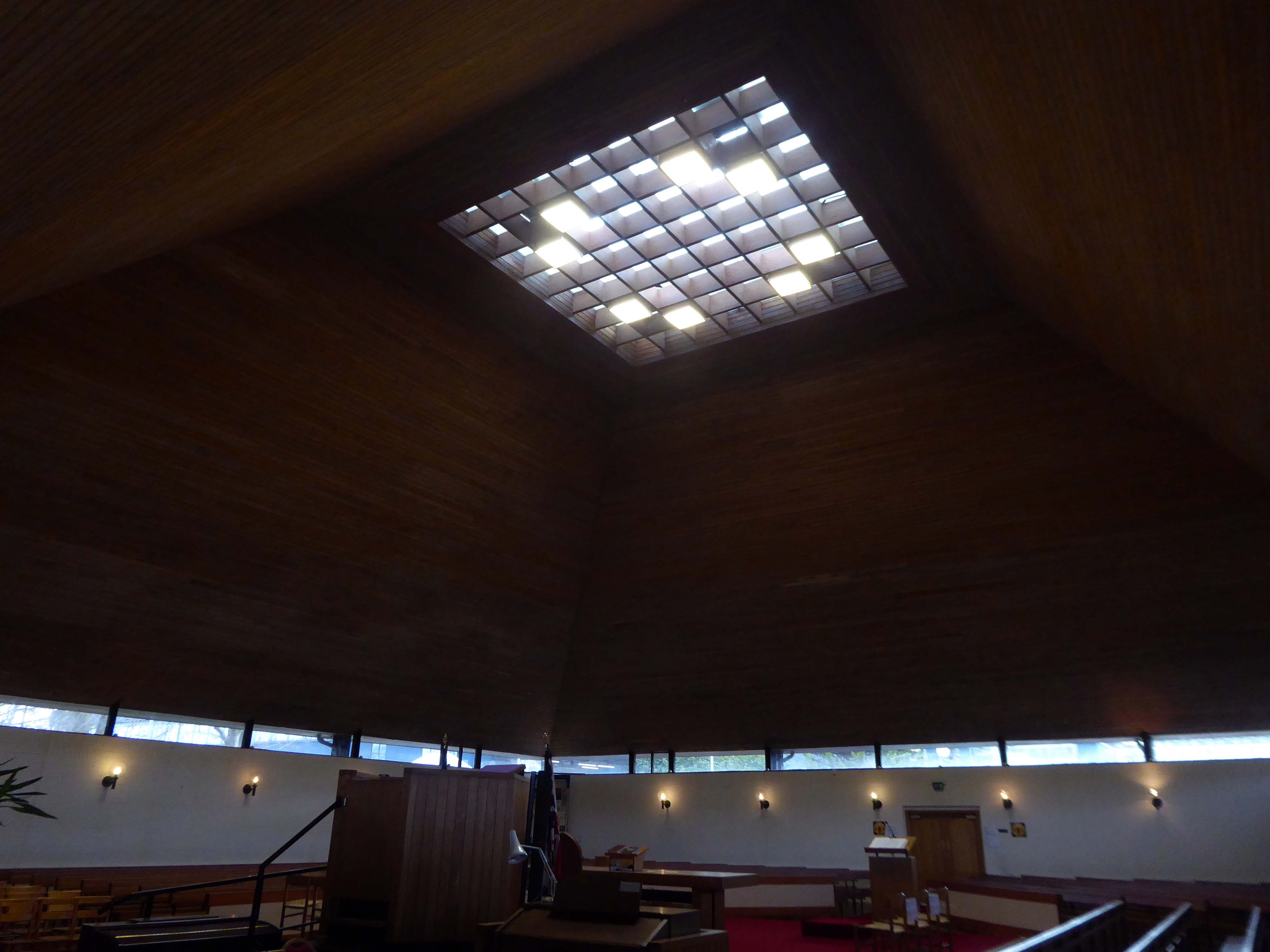
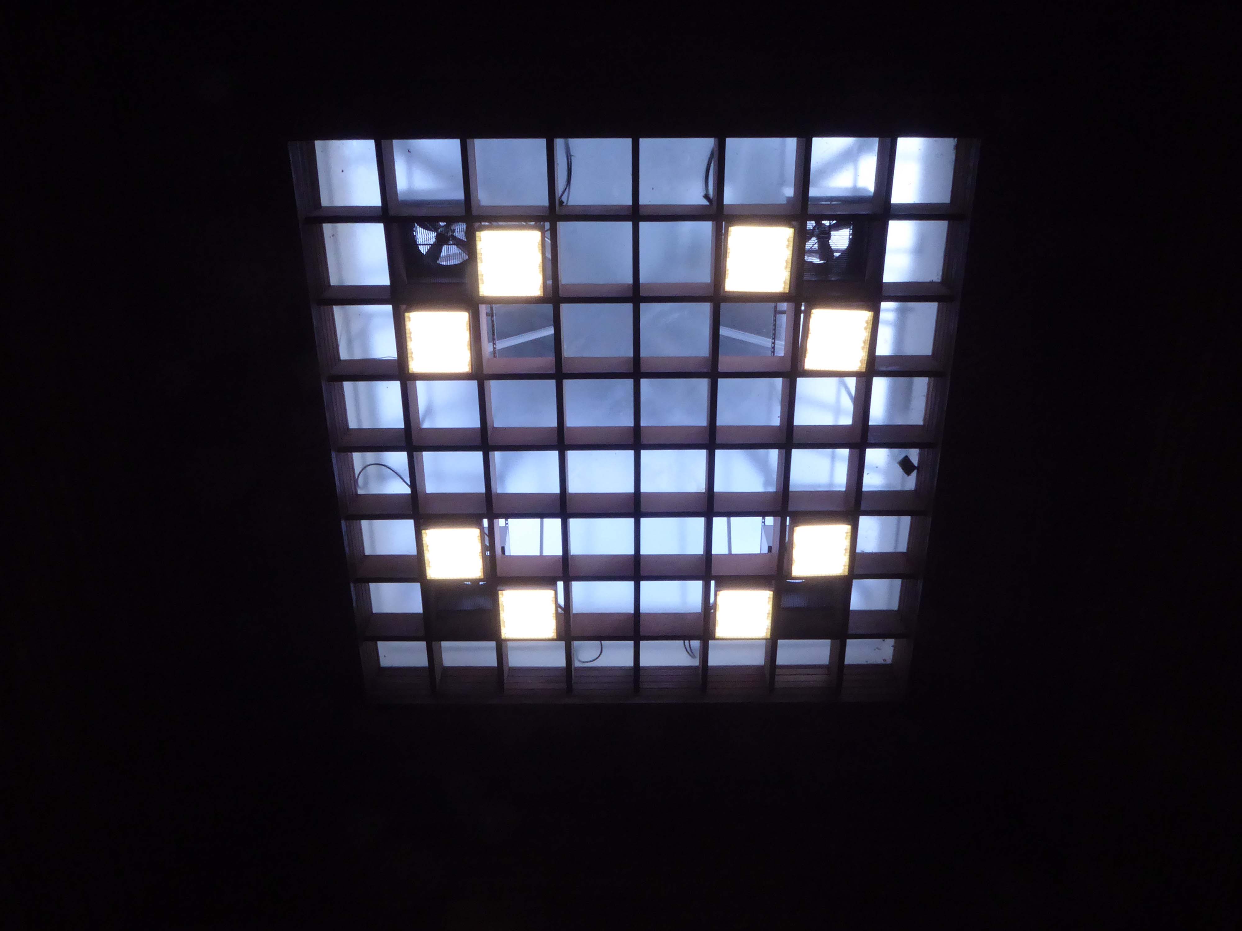
Single storey, square-plan pyramidal church with halls adjoining to SW.
Category B Listed
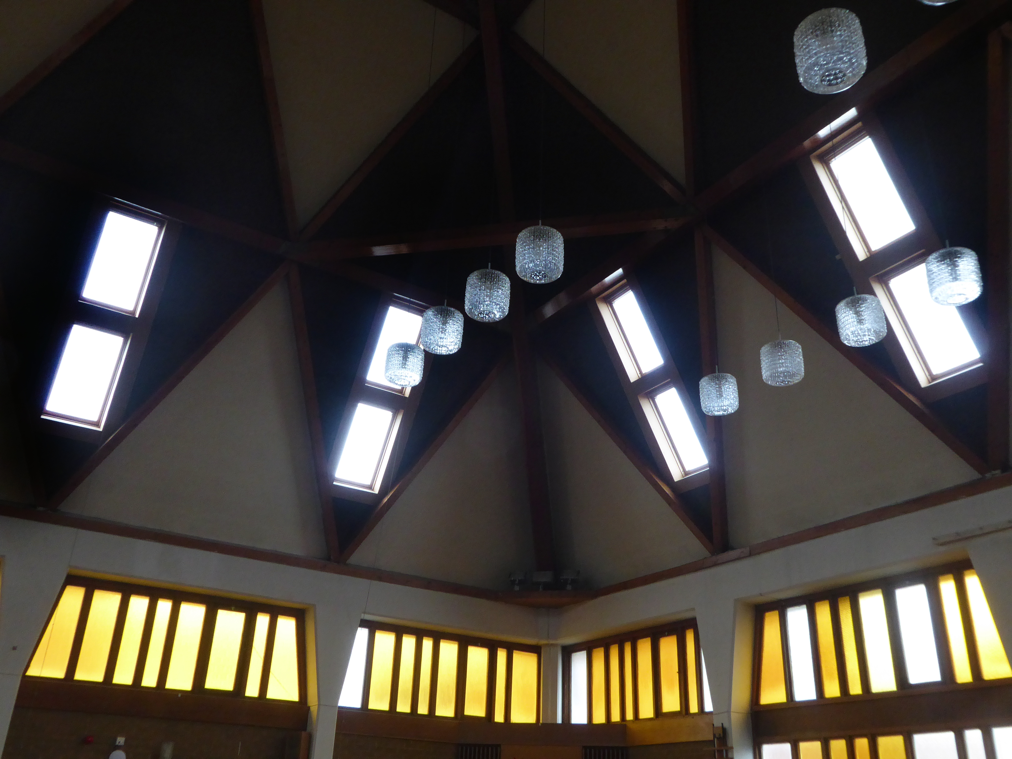
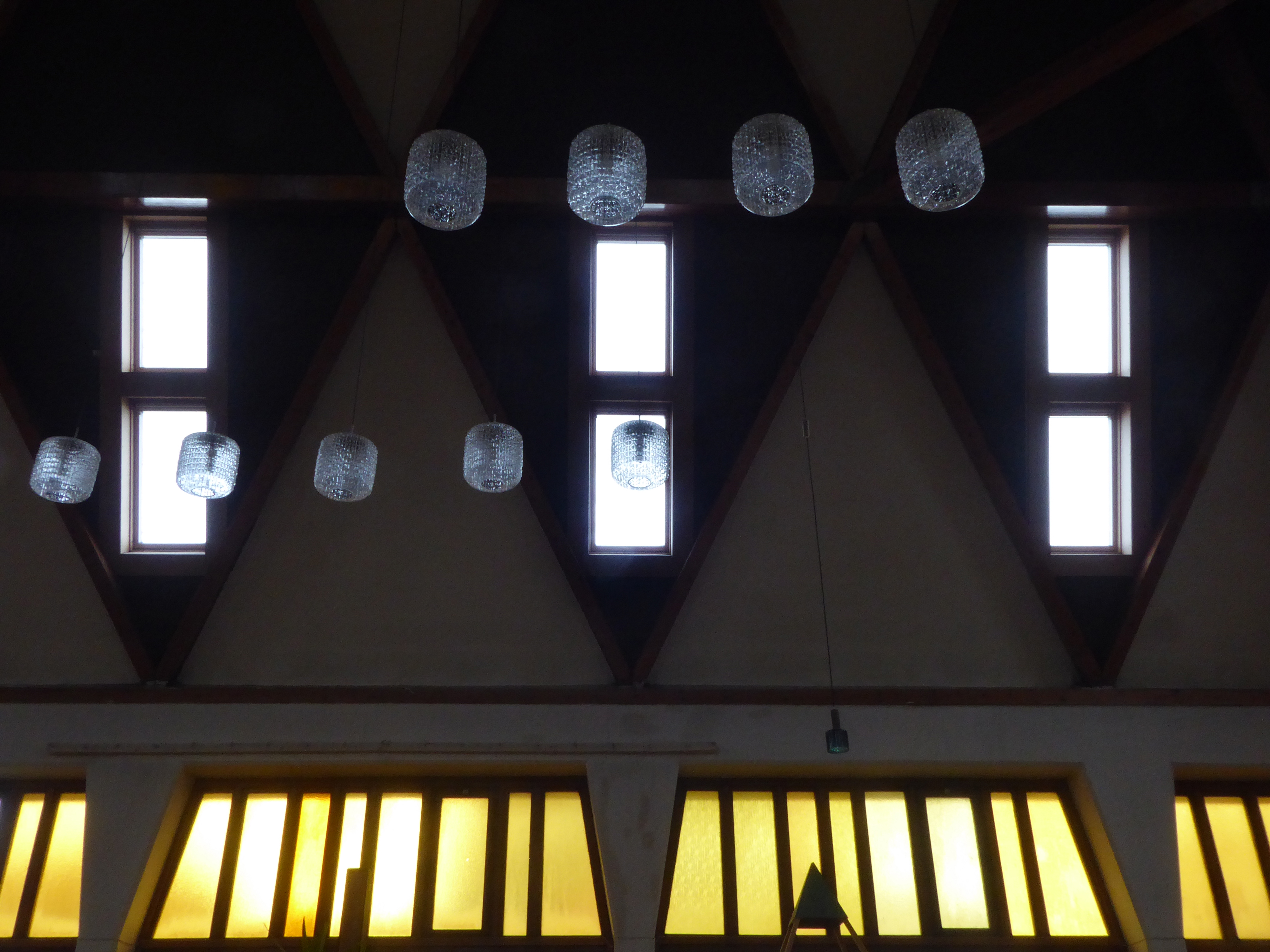
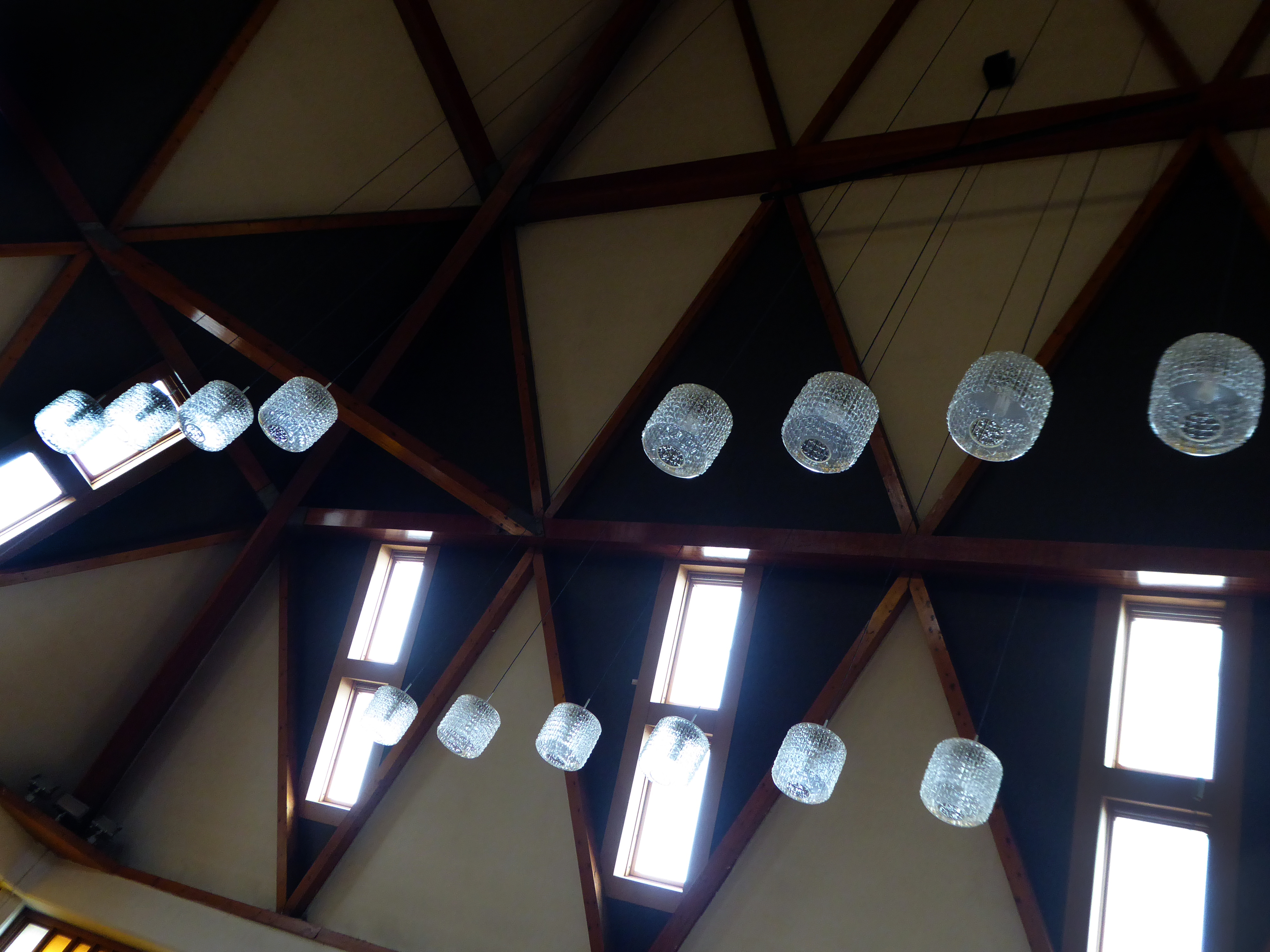
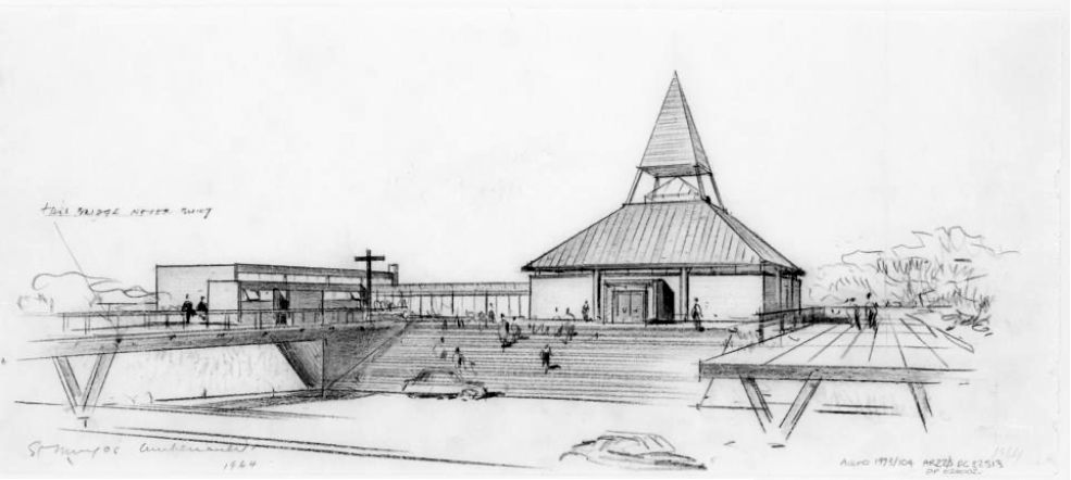
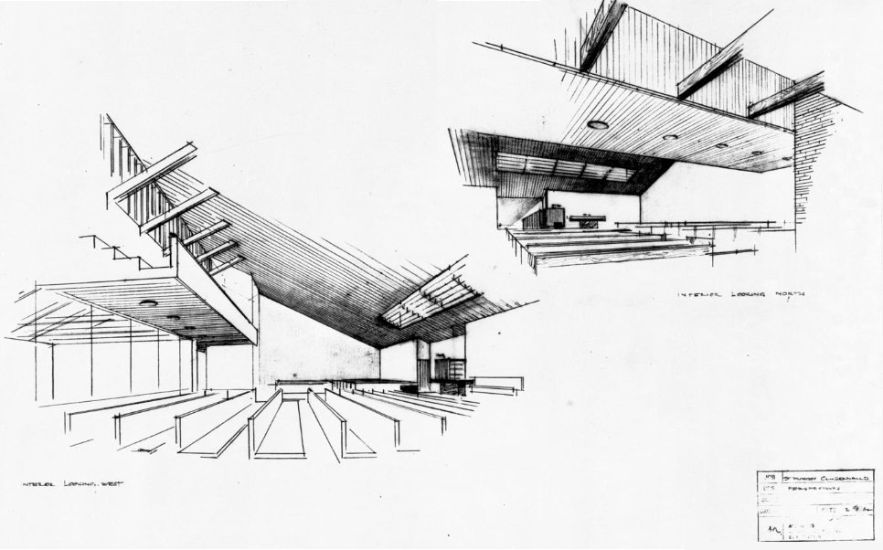
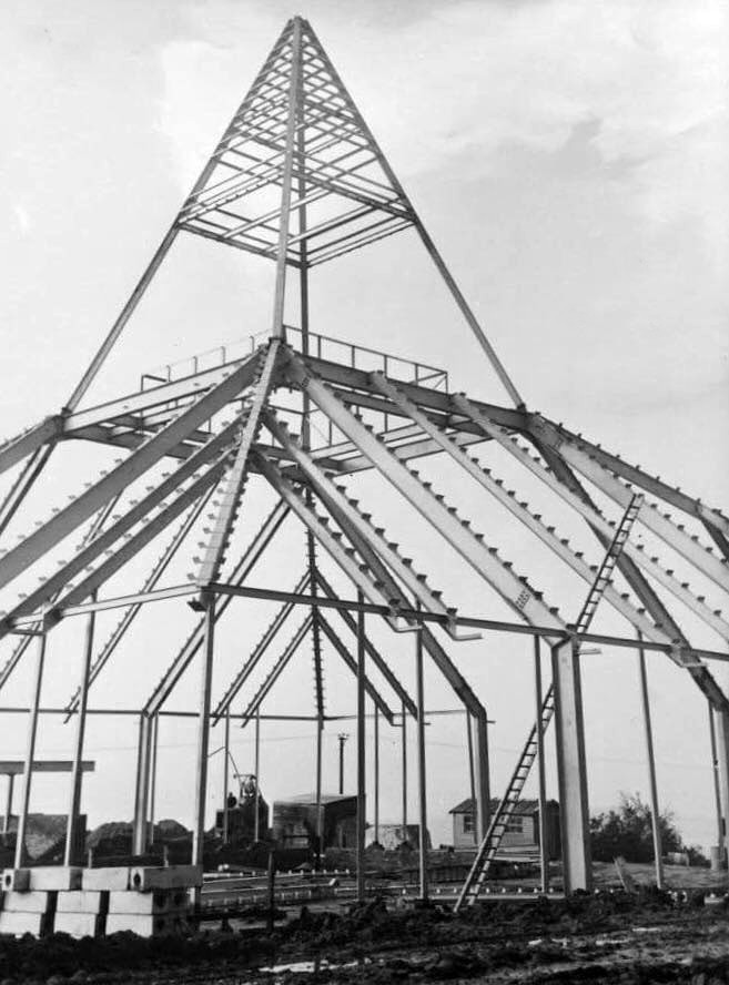
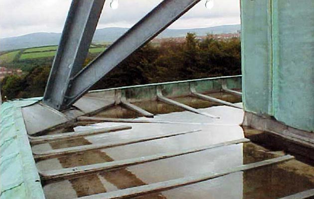
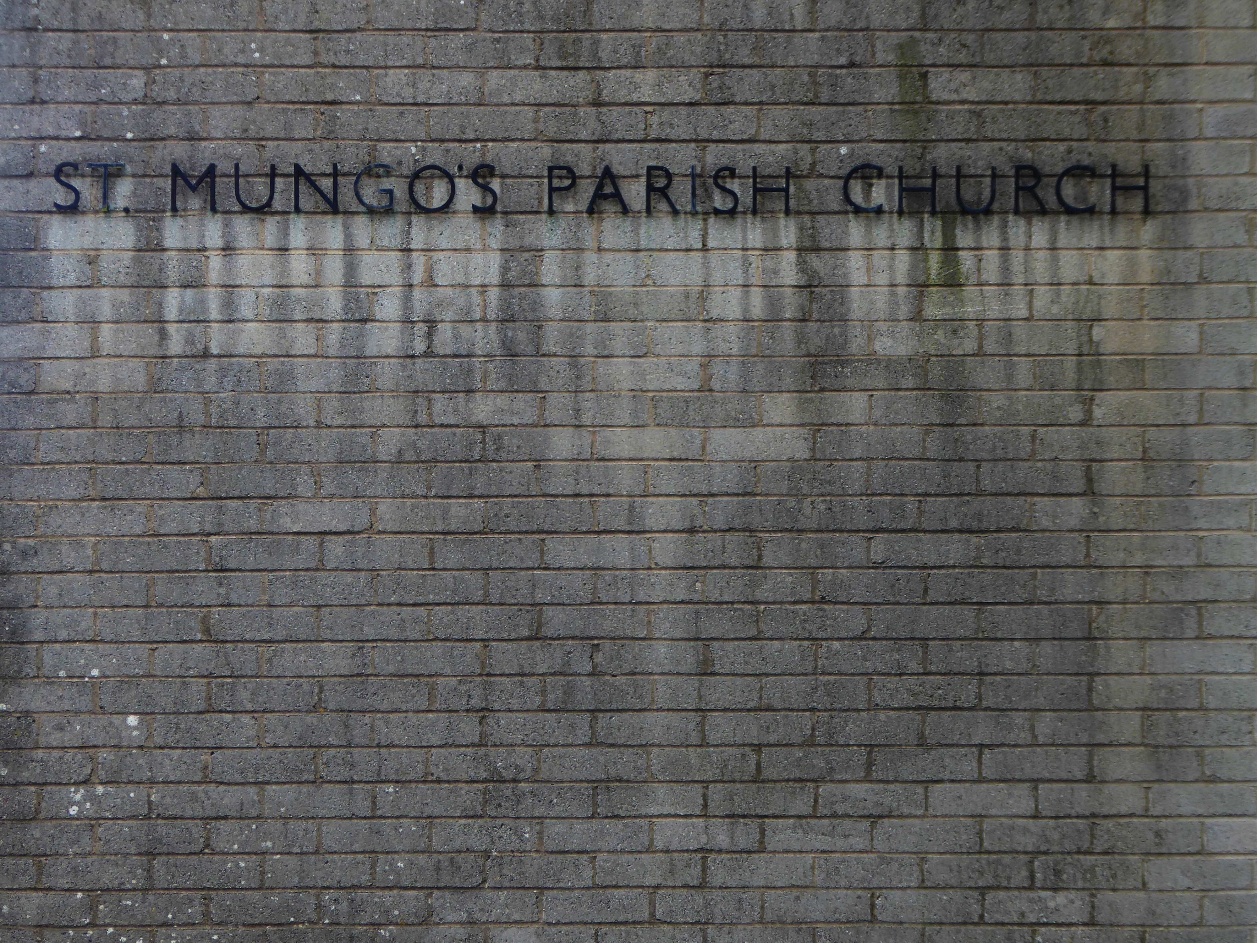
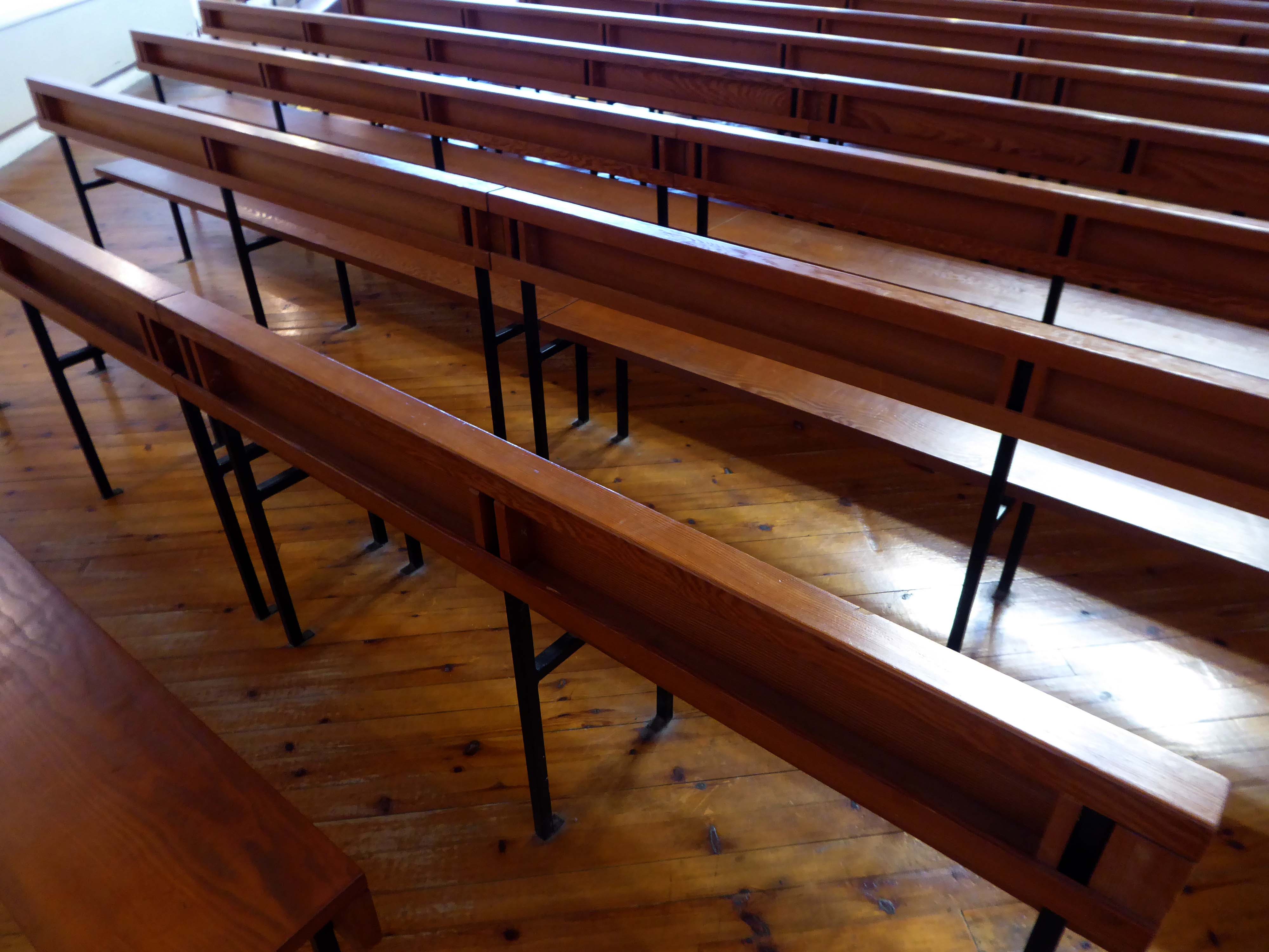
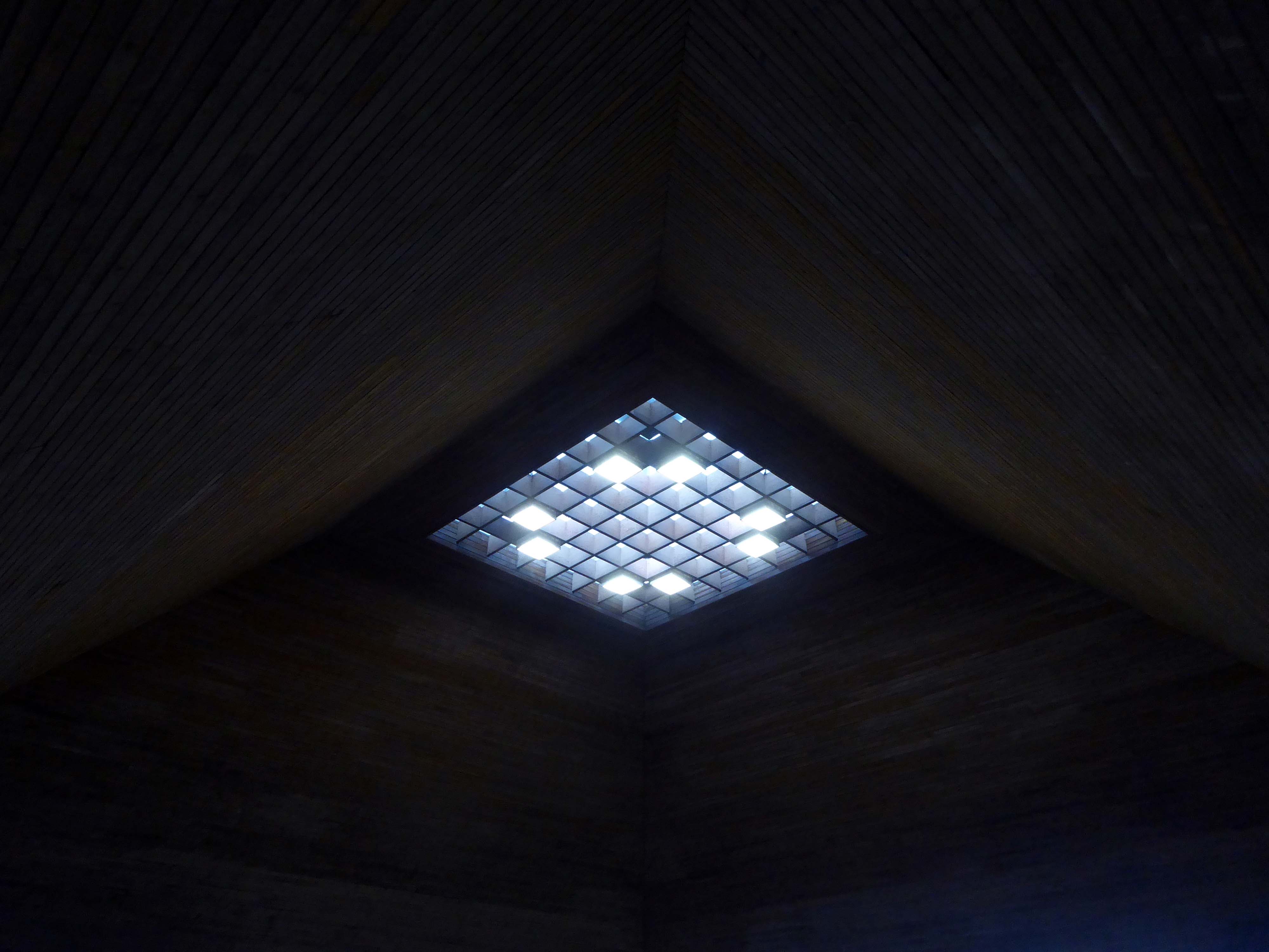
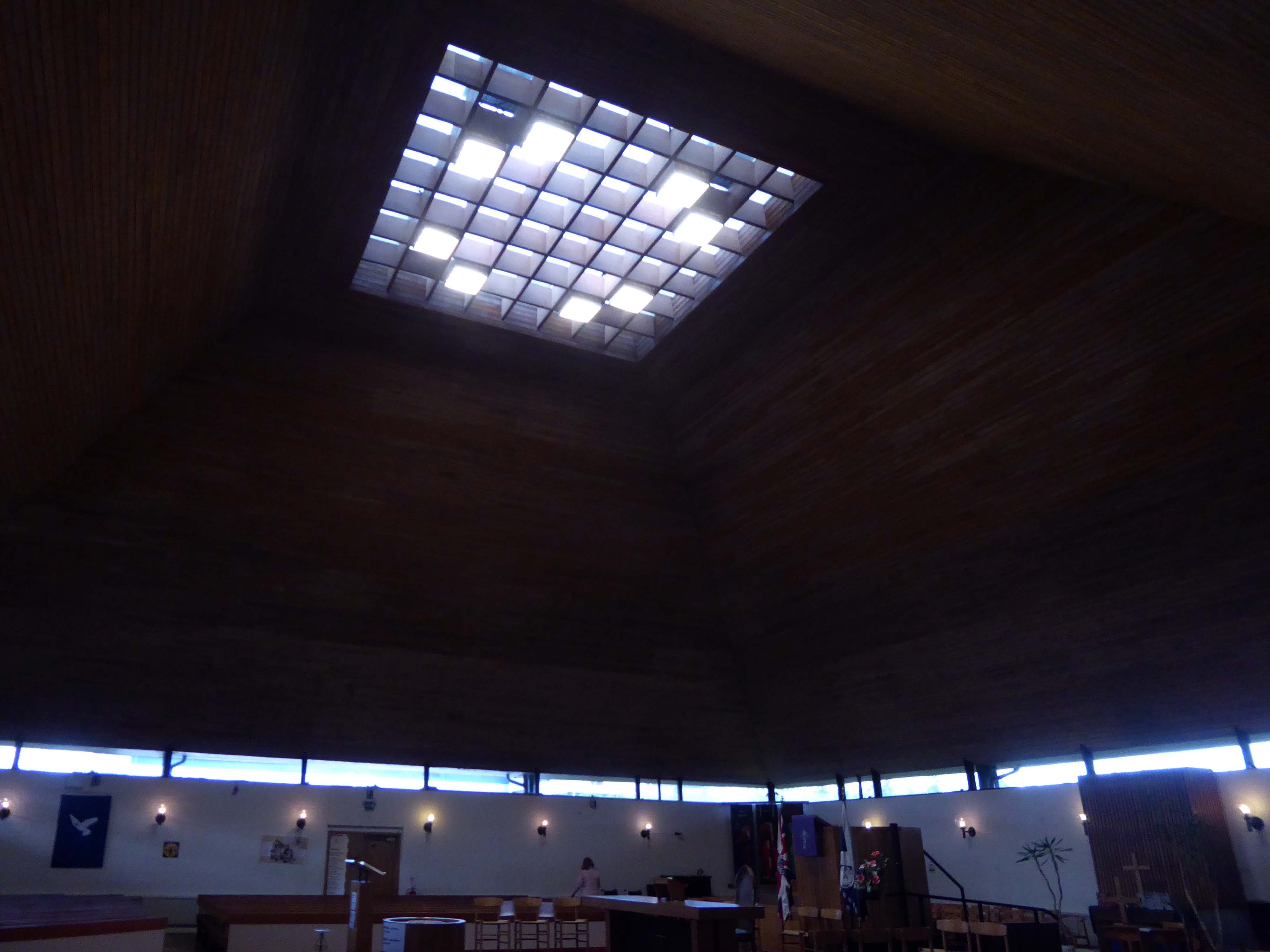
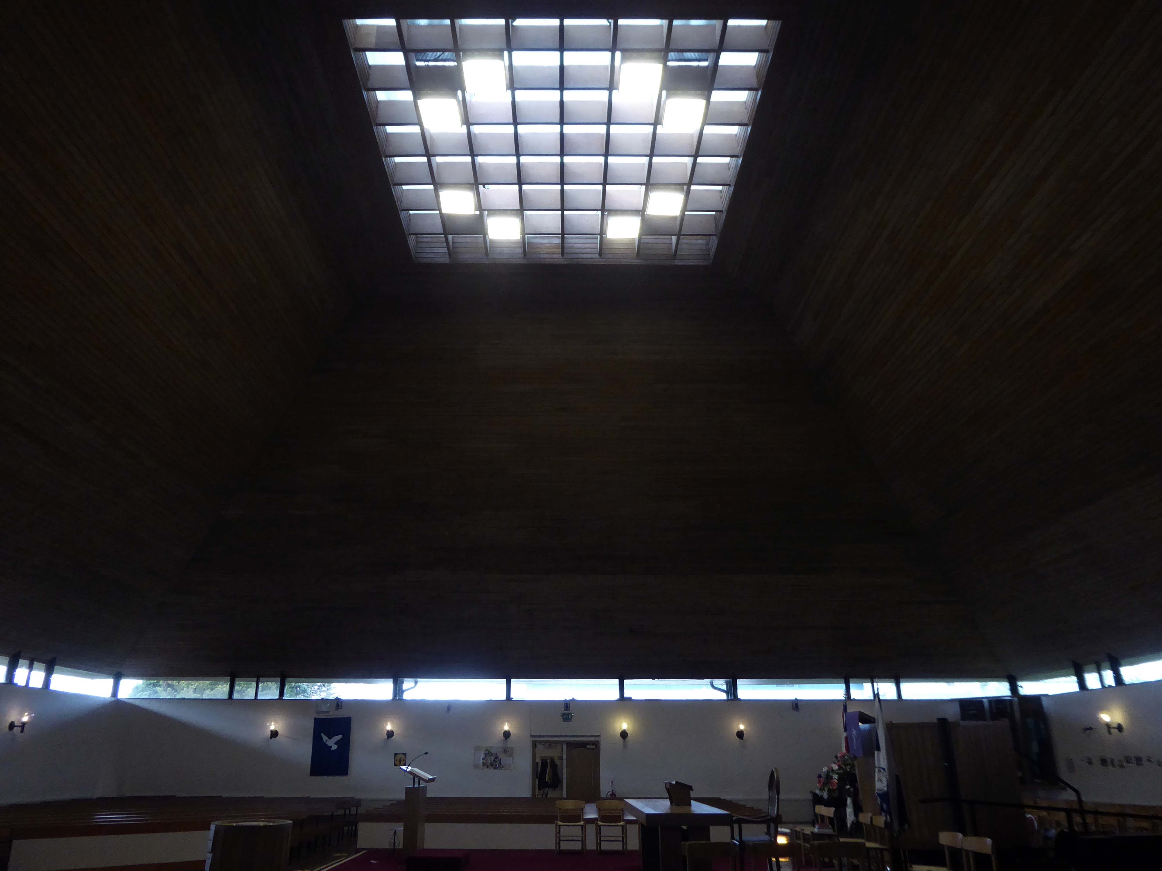
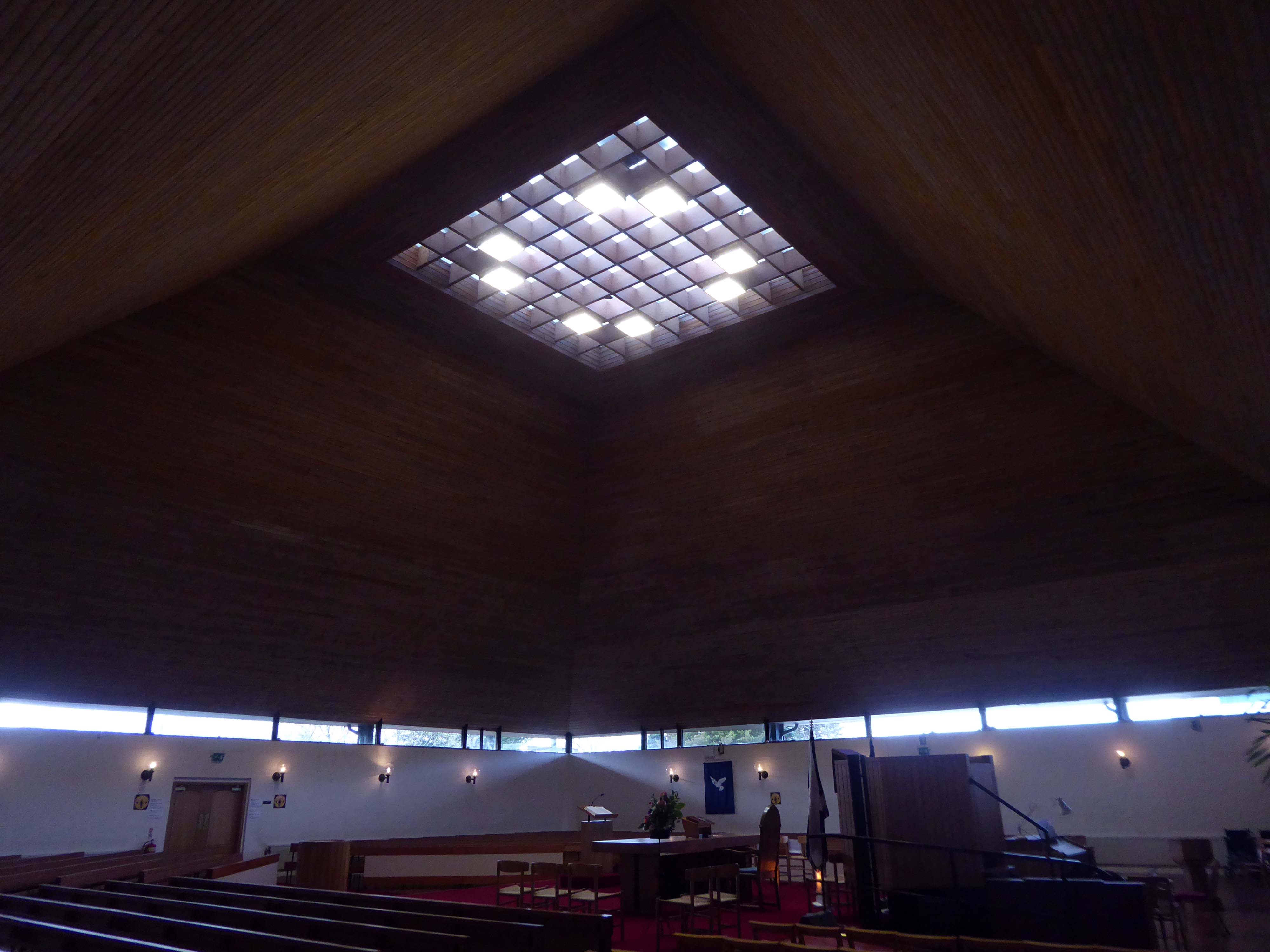
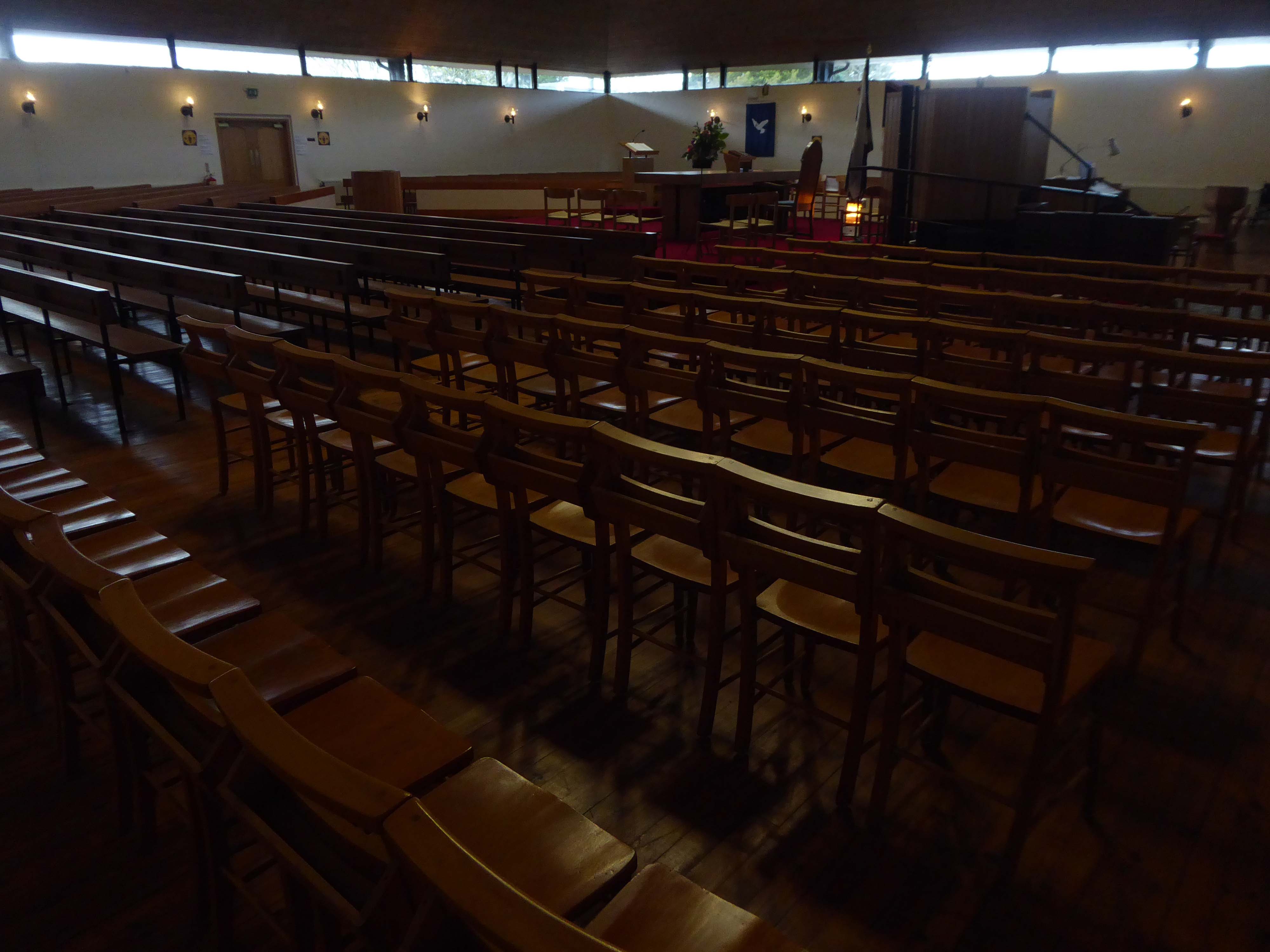
St Mungo’s Parish Church is a striking landmark in the centre of Cumbernauld. Prominently sited on the top of a small hill, the bold copper pyramidal roof is an important landmark. Alan Reiach designed two churches in Cumbernauld, both of which can accommodate 800, Kildrum Church – the earlier of the two. Alan Reiach 1910-1992, who was apprenticed to Sir Robert Lorimer 1864-1929, was primarily involved in the design of public buildings, including churches, schools, universities and hospitals. Noteworthy features of St Mungo’s Parish Church include the bold pyramidal roof, with apex of which forms a roof light lighting the nave of the church, and above this is a pyramidal belfry. The impressive Baltic redwood-lined interior gains natural light from the large central rooflight and clerestory windows.
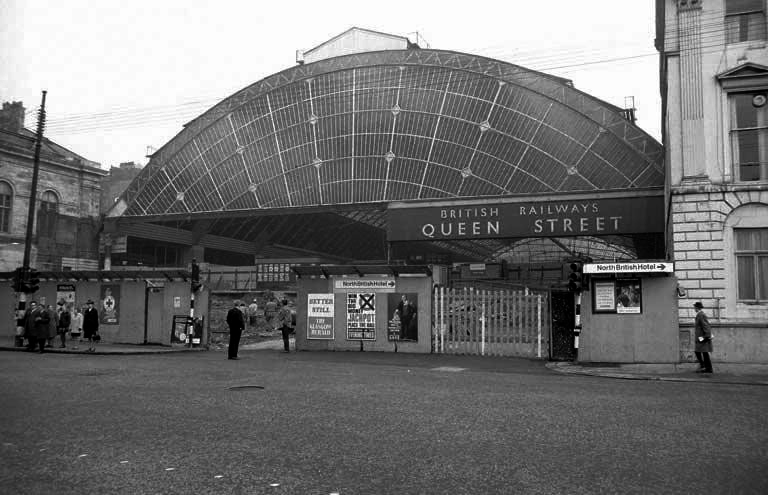
Sunday morning in Glasgow, I caught the first train out from Queen Street Station.
In October 2017, a £120 million project began on bringing the station up to modern standards, demolishing many of the 1960s buildings and replacing them with a new station concourse, which was completed in 2021.
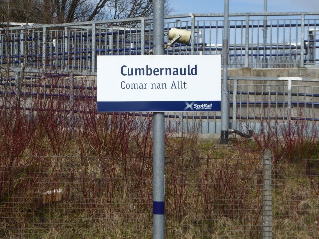
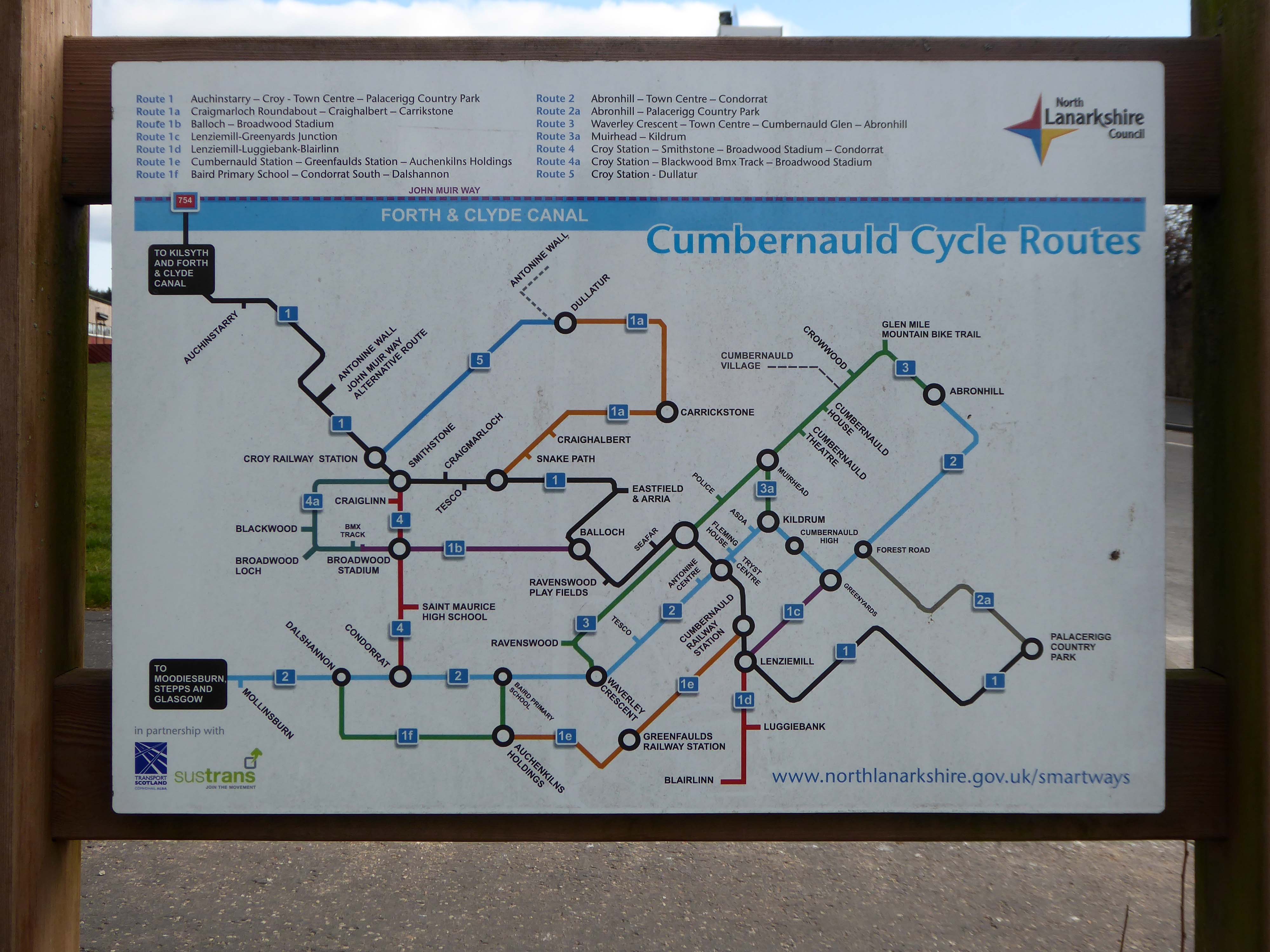
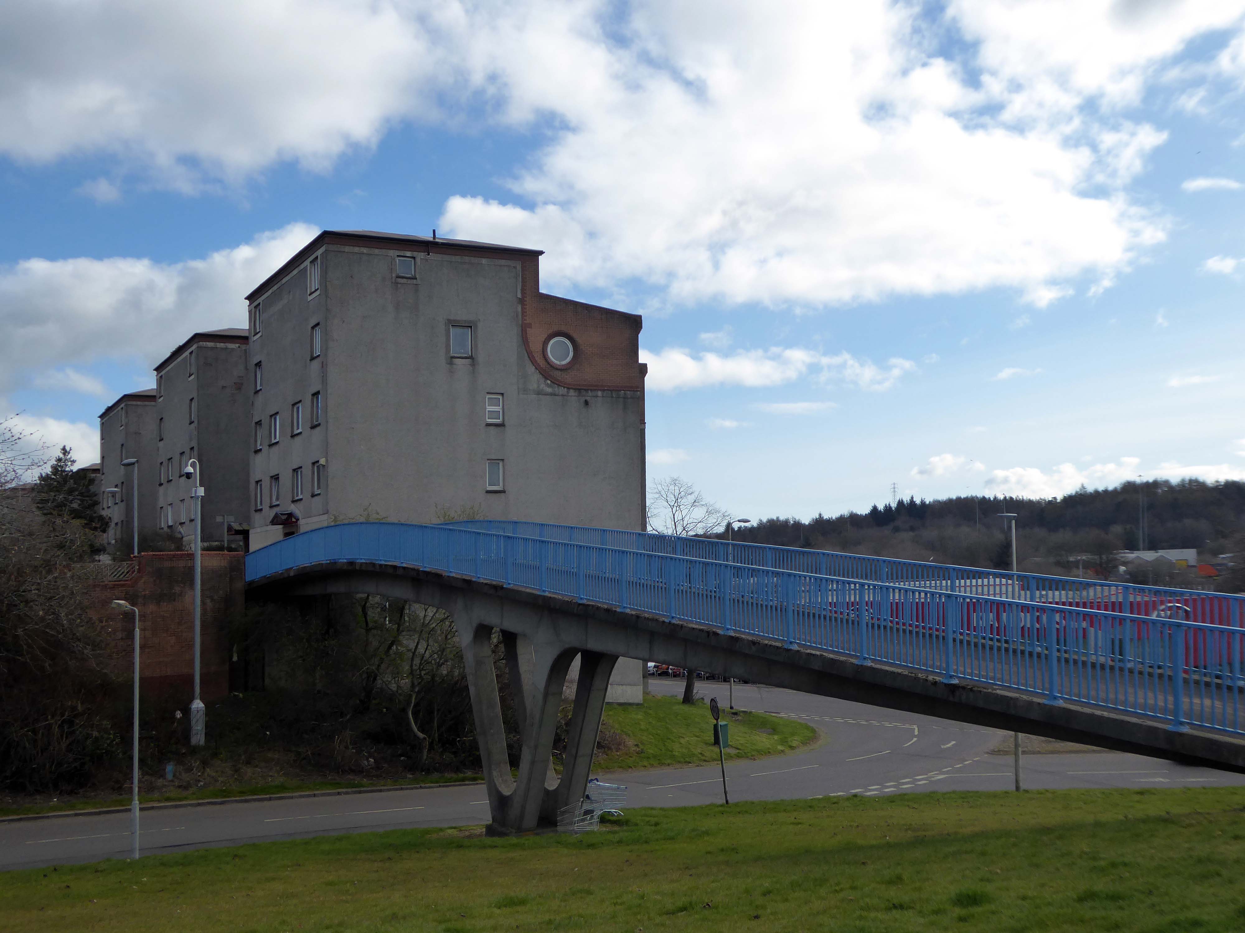
I arrived in Cumbernauld and walked toward the Central Way and back again.
Cumbernauld was designated as a new town in December 1955, part of a plan, under the New Towns Act 1946, to move 550,000 people out of Glasgow and into new towns to solve the city’s overcrowding. Construction of its town centre began under contractors Duncan Logan, chief architect Leslie Hugh Wilson and architect Geoffrey Copcutt – until 1962 and 1963, and later Dudley Roberts Leaker, Philip Aitken and Neil Dadge.
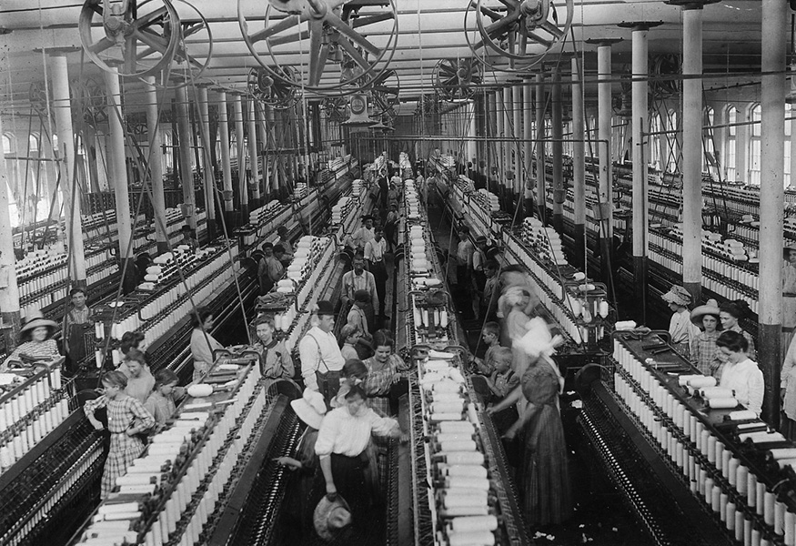
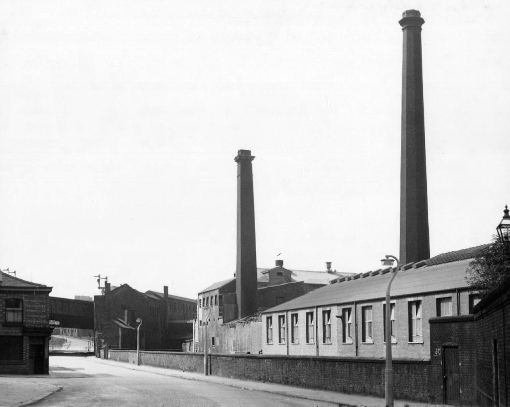
At its peak in the 1970s, the site occupied over 57 acres and employed over 2,000 people. However, due to the gradual demise of the British textile industry, most textile production shifted to countries such as China and India with the textile dye industry following.
In 2002, the company made 70 members of staff redundant and in 2004 the announcement was made that the site would be closing with the loss of over 300 jobs. A small number of staff were retained to assist in the decommissioning of the plant. The last workers left the site in 2007 and the remainder of the buildings were demolished shortly afterwards.
And a lonely bank.
And another former bank.
This was an area once teeming with workers, all requiring top-flight financial services on tap.
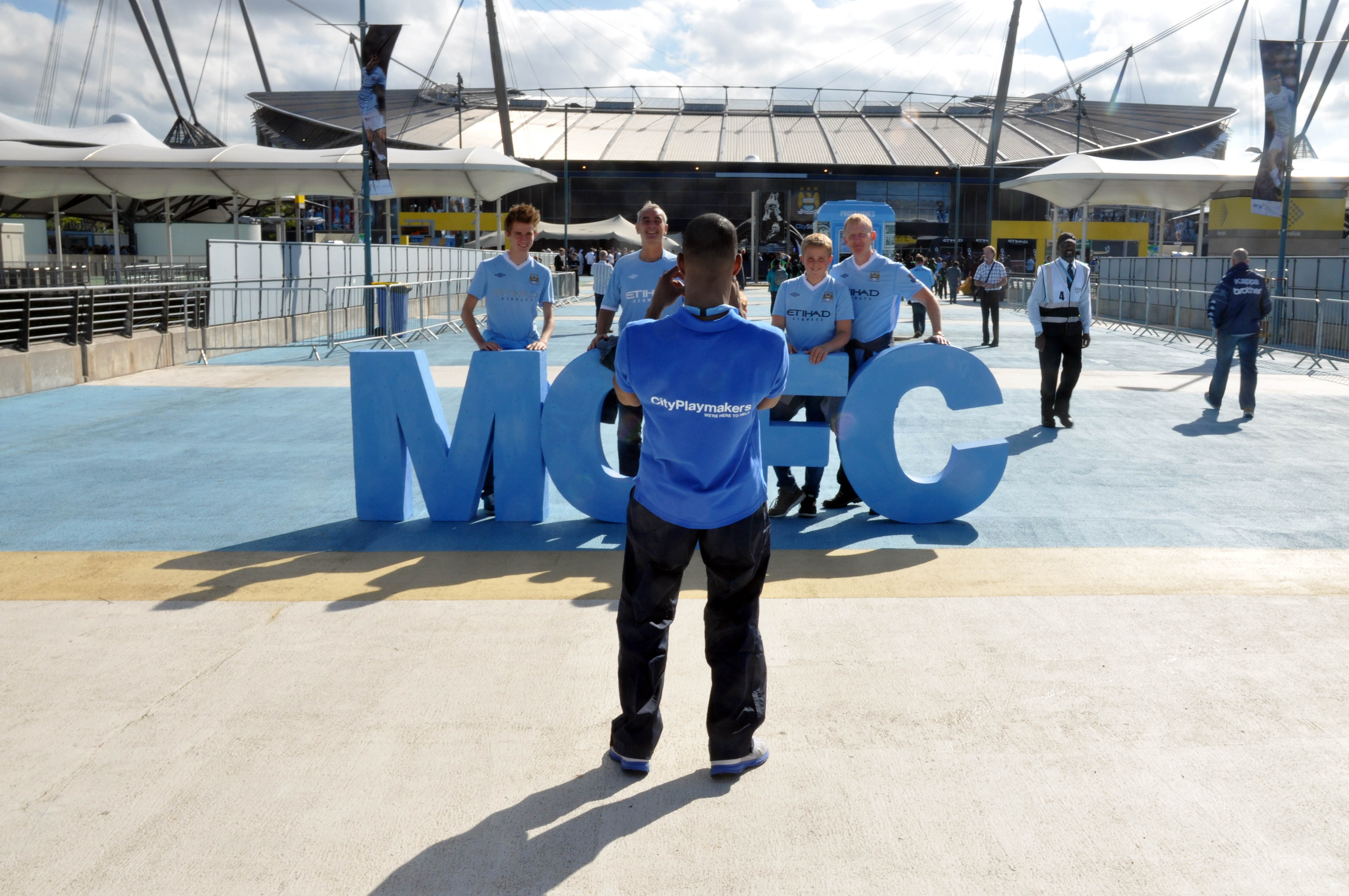
An intimate, even intimidating, gladiatorial arena embodying the atmosphere of a football club.
Nearby is the the Manchester Velodrome which opened in 1994, designed by Faulkner Browns Architects – cited as the major catalyst for Britain’s successes in track and road cycling and has been described by Cycling Weekly as the:
Beating heart of British Cycling’s ascension to the top of world cycling.
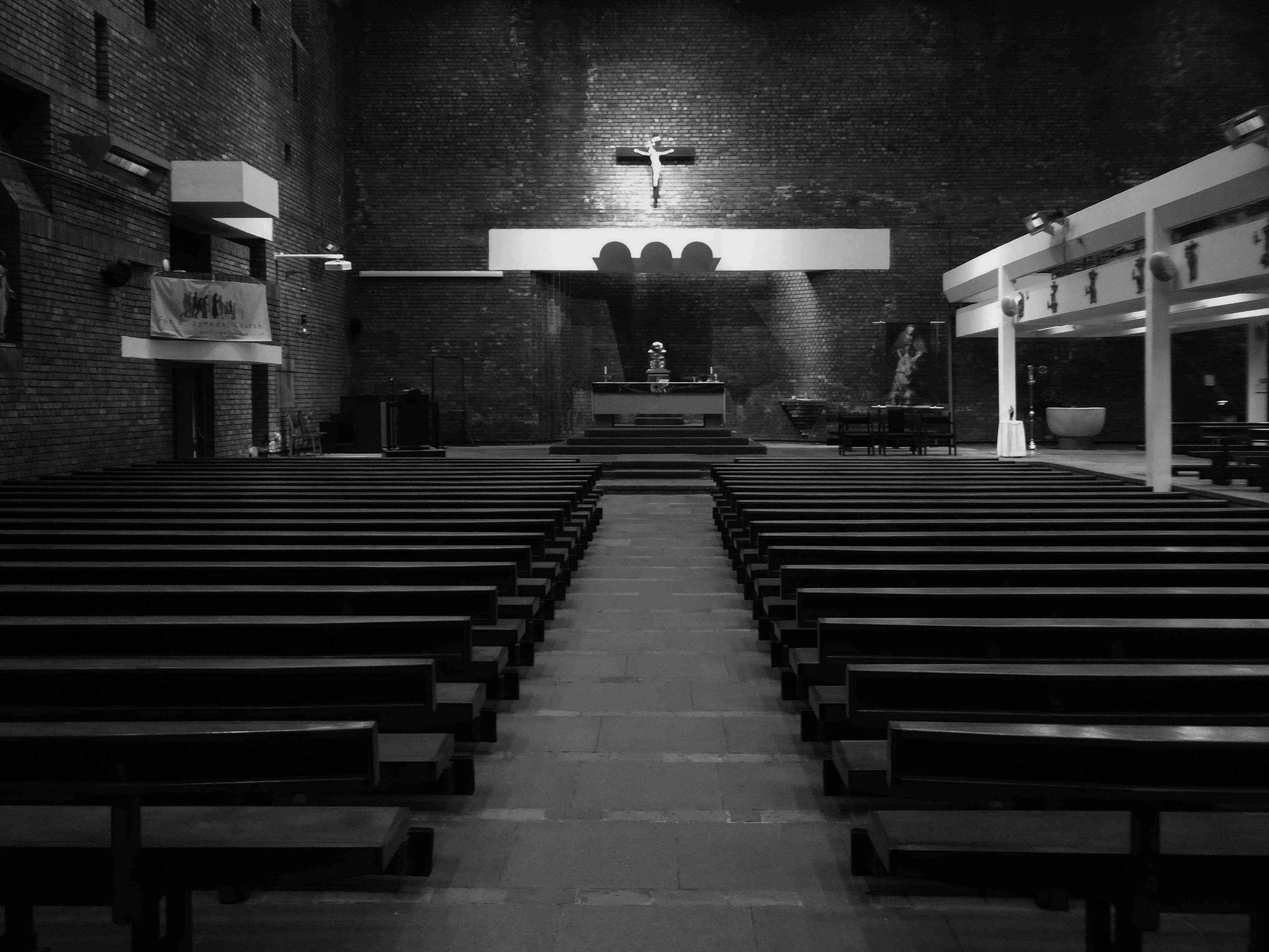
Onwards now walking along North Clayton Road to St Willibrord’s 1937-38 by Reynolds and Scott built in buff brick of a Modernist Byzantine style.
The church and attached presbytery were built from designs by Greenhalgh & Williams in 1958-9, the church being consecrated on 12 May 1960. A reordering took place, probably in the 1960s or 70s, when the altar rails were removed and the altar moved forward. Probably at the same time, the font was brought into the church from the baptistery.
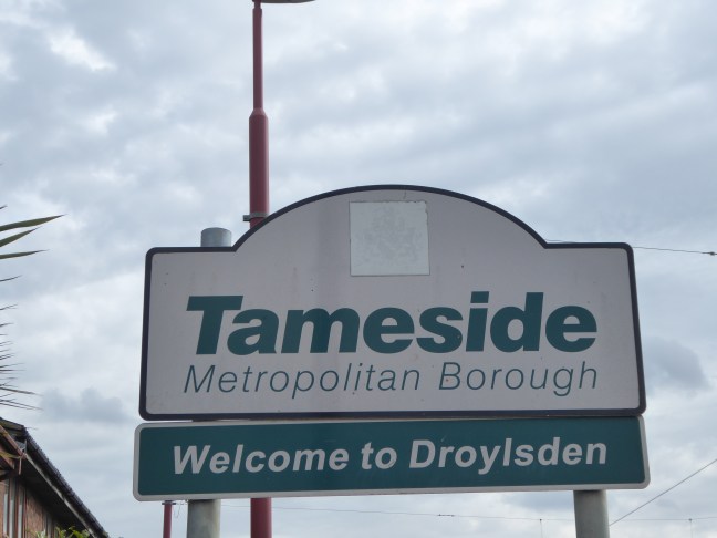
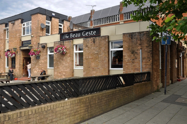
Back to the tram and onwards to Ashton-under-Lyne.
Where we discover that son of the desert Beau Geste.
Across the way the Ladysmith Car Park.
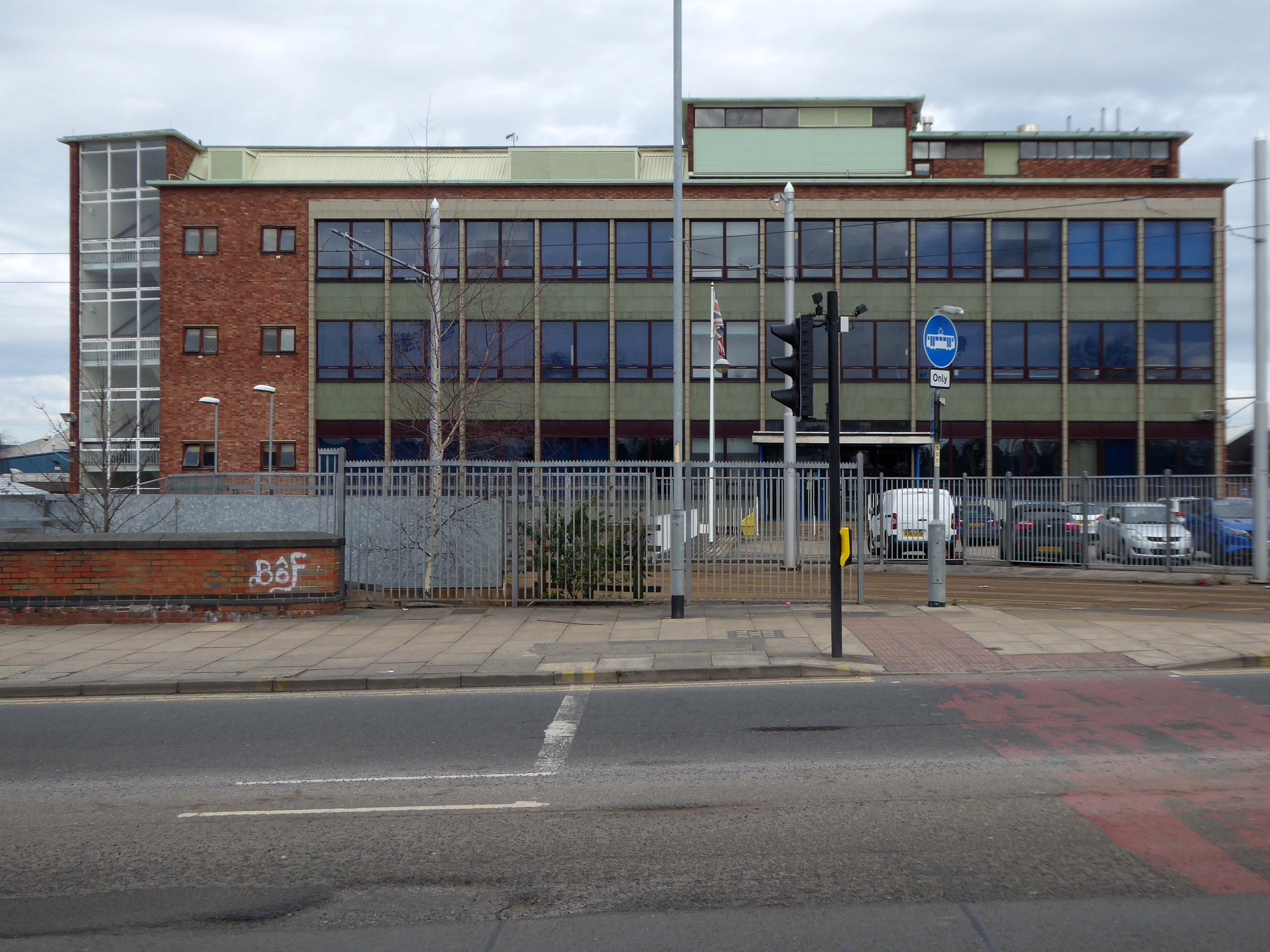
Off now to the seriously neglected Tameside Hippodrome.
Originally opened on 21st November 1904 as a music hall theatre for the Broadhead’s Theatres chain. Films were screened as part of the opening programme. The Empire-Hippodrome Theatre’s auditorium was completely gutted in 1933 and the present stalls, plus single balcony, Art Deco style interior was constructed. This replaced the previous two balconies plus box arrangement. The exterior was largely unchanged.
The architects responsible for the present auditorium are Drury and Gomersall, the exterior and original were by JJ Alley.
It reopened as the New Empire Cinema on November 4th, 1933 and was equipped with a Compton 3 manual, six ranks organ, which had an illuminated surround. It was taken over by Union Cinemas in 1937 and then by Associated British Cinemas – however it was not renamed ABC until 1963. In 1964 the council took over the building and the Compton organ was removed.
It closed on 5th April 1975 and reopened as a live theatre in May 1976 with a summer film season which lasted until 1986.
Around the corner to the former Pavilion cinema – known locally as the Bug Hut.
The Picture Pavilion opened on 21st December 1908.
The Pavilion Cinema was rebuilt in 1947 to the plans of architectural firm Drury & Gomersall who at the same time redesigned the adjacent Alexandra Billiard Hall. The Pavilion Cinema became the first cinema in the town to be equipped with CinemaScope, opening with Richard Burton in The Robe on 29th November 1954.
The independently operated Pavilion Cinema closed on 8th October 1966 with Donald Pleasance in Cul de Sac and Barry Sullivan in Intimacy. It became the Star Bingo Club, which in later years was operated by Coral Bingo and finally by Gala Bingo Clubs, until they moved into new premises in 2000.
Opened 22 April 1920 with The Forbidden City the Majestic Picture House was part of the Provincial Cinematograph Theatres circuit. With 1,233 seats in stalls and balcony and a splendid facade faced in white faience tiles on two sides of the building on its prominent town centre corner site of Old Street and Delamere Street, the cinema was a great success.
It had an oak panelled foyers which had beautiful coloured tapestry’s on the walls. The interior was in a Georgian style and it was equipped with a pipe organ and a seperate tea room and cafe which were located on the upper floor.
The Metro Cinema continued as a single screen operation until the middle of 2003, sometime after a multi-plex had opened in the town. In 2008 the building was unused except for the long foyer area, linking the front and back elevations of the Metro, which was a Slotworld Amusement Arcade. By 2011, the entire building had been stripped out and stood empty and unused.
Designed by Professors Andy MacMillan and Isi Metzstein.
Grade A listed 1994 RIBA Bronze Medal
Should you so wish – jump the train from Glasgow Central, unless you’re already here/there.
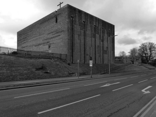
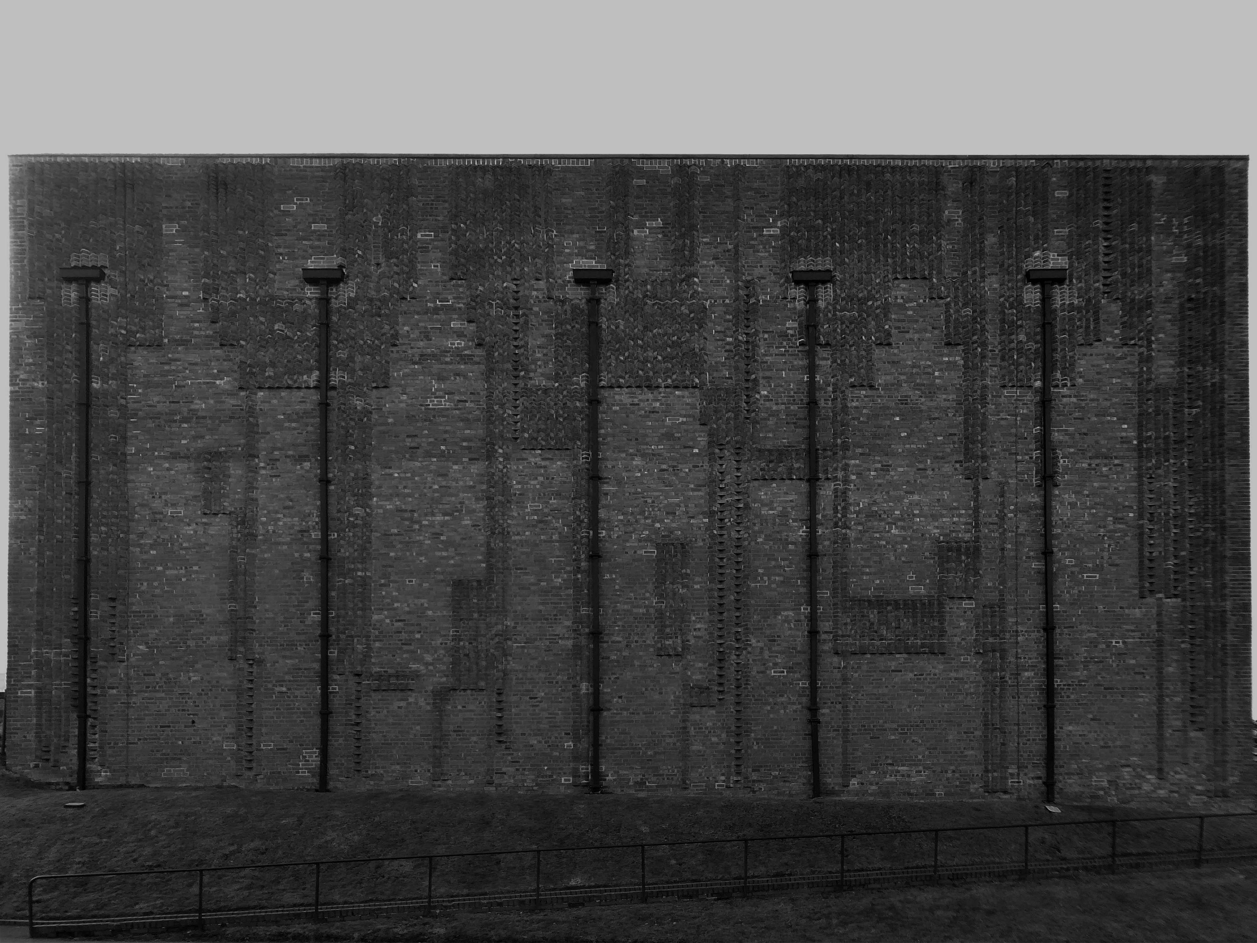
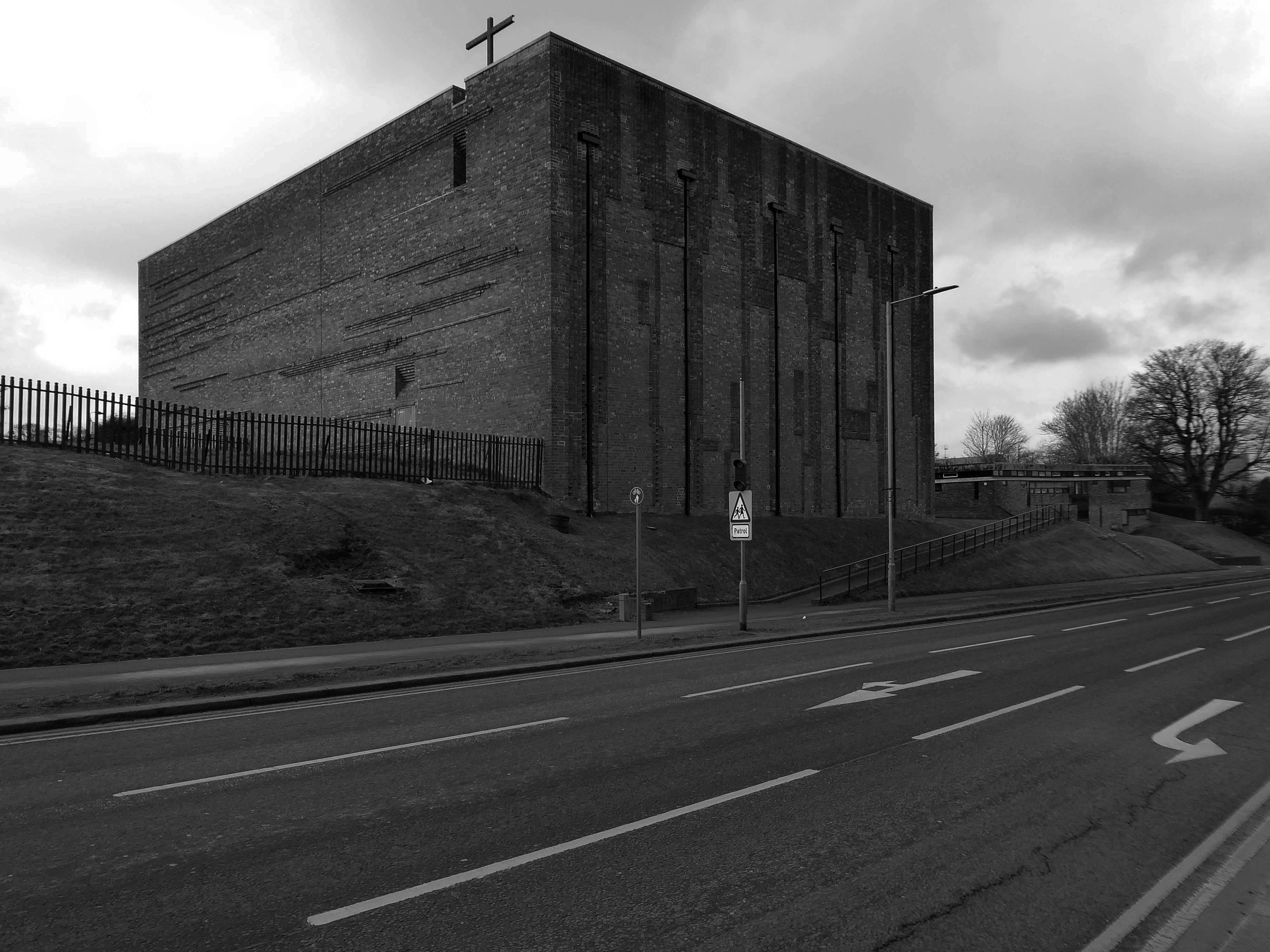
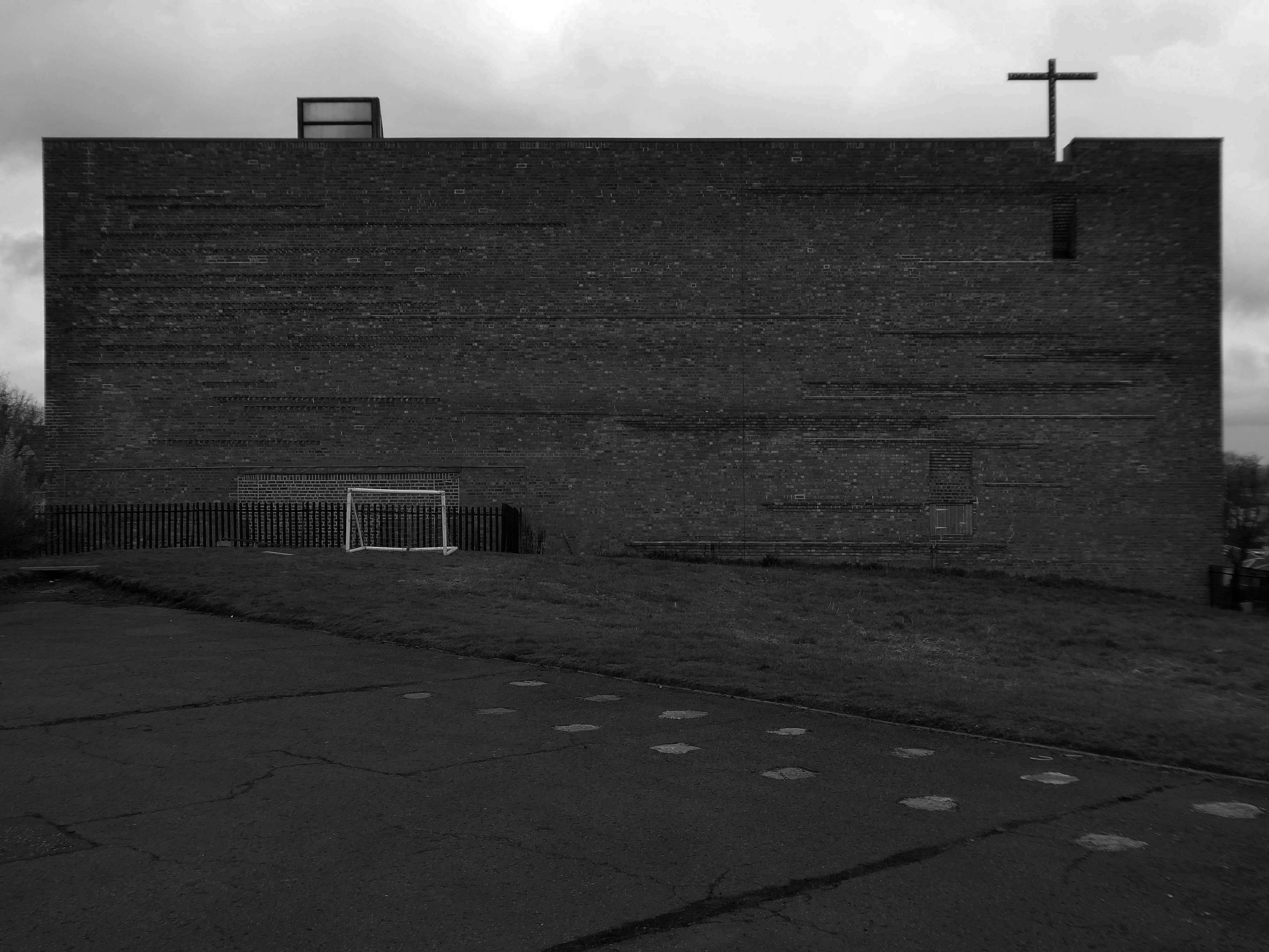
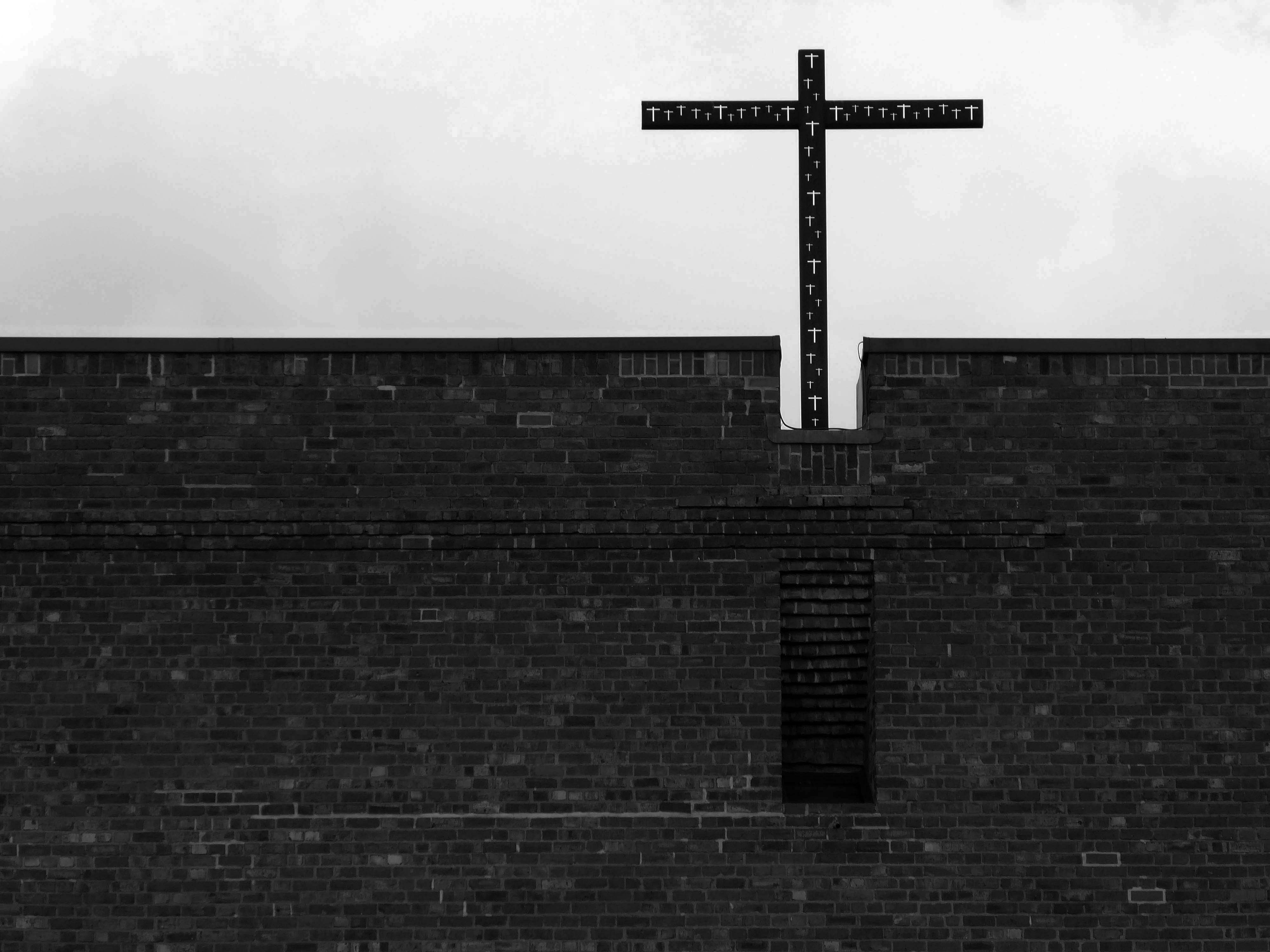
Walk up West Mains Road, alone on a hill standing perfectly still sits St Bride’s, you can’t miss it.
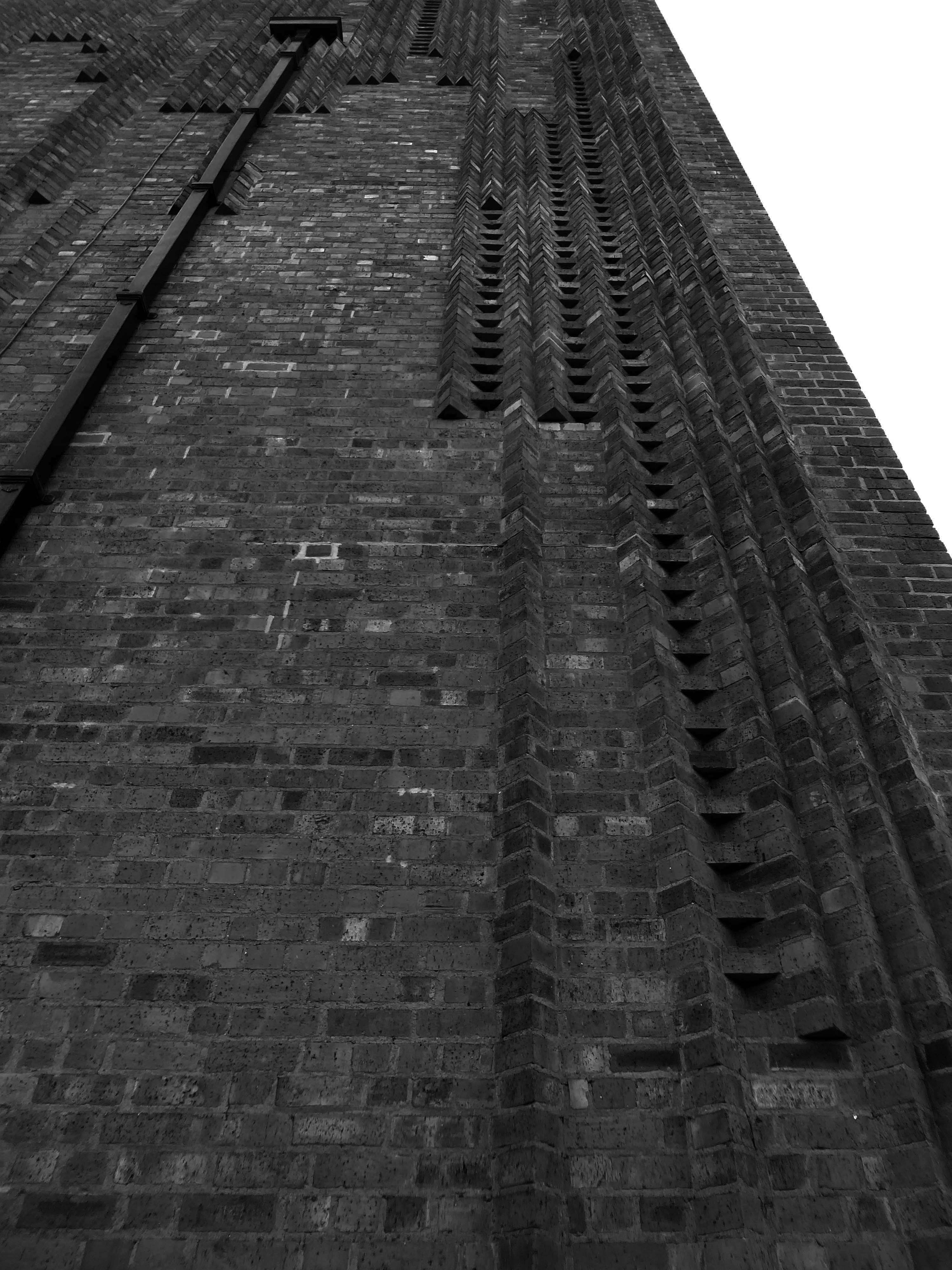
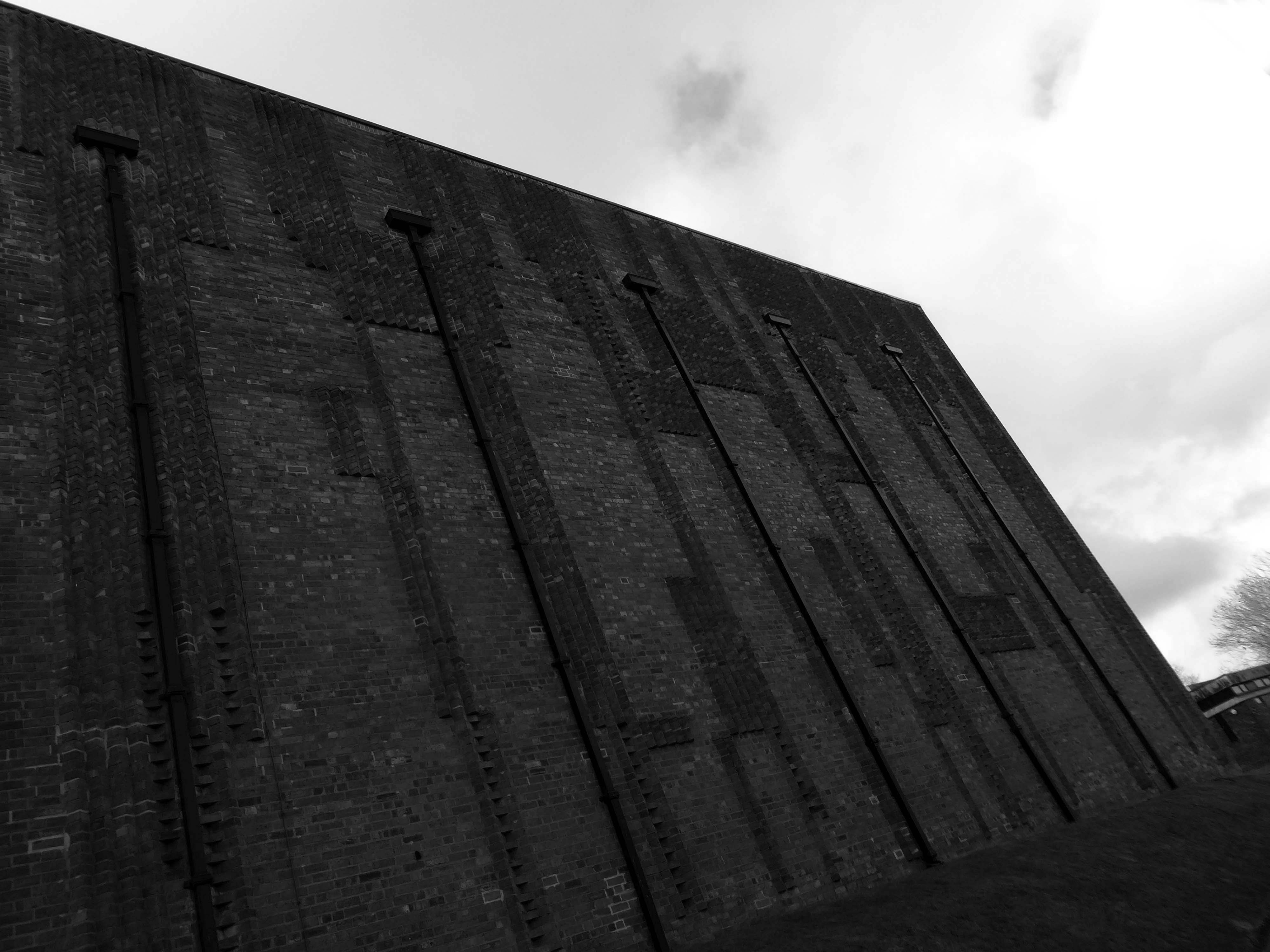
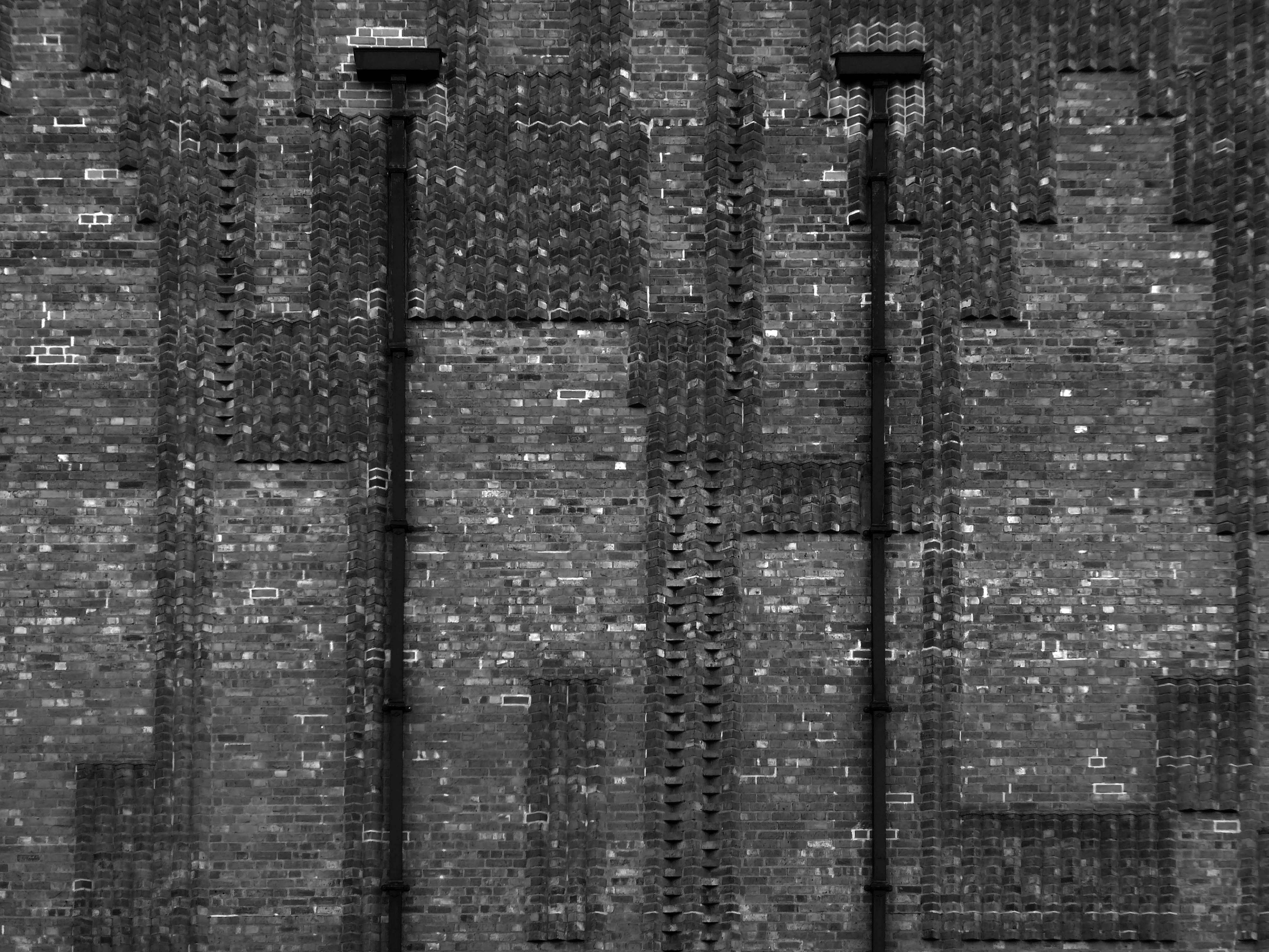
The biggest extant example of Bricktalism, the most Bricktalist building in the world, possibly.
Stallan-Brand design director Paul Stallan commented:
St Bride’s for me is the most important modernist buildings of the period. The church made from Victorian sewer bricks and concrete is both simple and complex. The architecture continues to be a key reference for students of architecture from across the world interested in modernism and the contemporary vernacular in context. Andy and Isi’s work is as important to Scotland as Alvar Aalto’s work is to the Finnish.
It’s a traditional Scottish stone detail I saw for myself as a boy growing up in the Highlands, on every castle and fortified house, and on the flanks of the tower at Muckrach, ancient seat of the Grants of Rothiemurchus, built in 1598. This was my local castle just a mile from home.
The entrance to St Bride’s, I like to imagine, comes from a friendship that included travel in the Scottish Highlands, admiring the Scottish vernacular close-up, of a fevered conversation about a simple concept – the massive blind box, and how the application of simple, semi-traditional material detailing can make it all the richer.
St Bride’s is simply one of the finest buildings in Scotland.
The M60 was developed by connecting and consolidating the existing motorway sections of the M63, M62, and an extended M66. It came into existence as the M60 in 2000, with the completion of the eastern side opening in October.
The original plan called for a completely new motorway, but policy change led to the plan which created the current motorway. As soon as it opened, the motorway got close to its projected maximum volume on significant sections.
This Palladian mansion was designed and built in 1736 by renowned architect, Giacomo Leoni, who had also been responsible for significant alterations to Lyme Hall during the same period.
Offering an infusion of historical significance coupled with an abundance of living space throughout, Alkrington Hall East, simply must be viewed to be appreciated in full.
During the early 1770’s, the Hall became the largest museum outside of London, when the Hall’s owner, Sir Ashton Lever, exhibited his private collection of natural objects, including live animals. Remaining as an imposing symbol of Leoni’s work, Alkrington Hall remains one of only a few surviving examples throughout England.
In modern times, the Hall has since been carefully and sympathetically separated into 4 sections, and we are pleased to be offering for sale the largest portion of the Hall, with a total floor area comprising of over 7500 SQFT, and living accommodation spread over 4 floors.
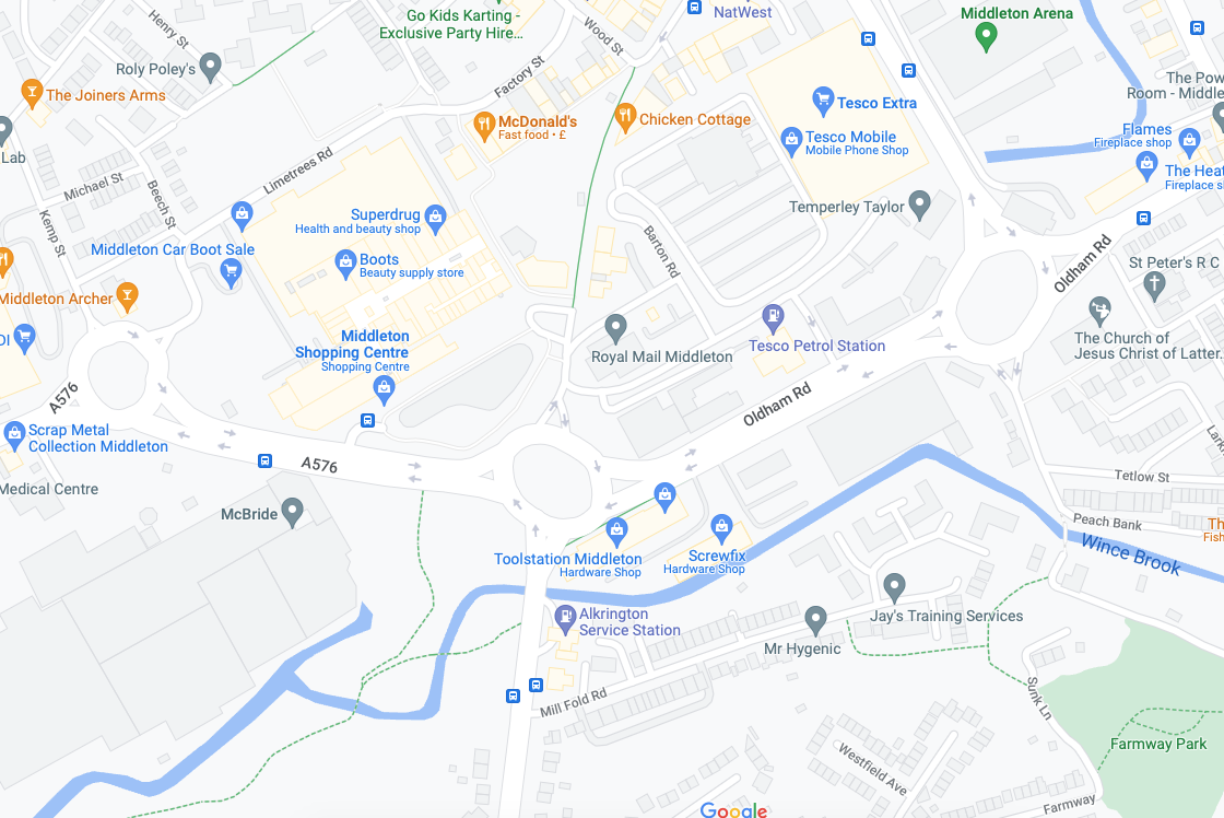
Next thing you know you find yourself in Middleton, where the Irk sort of disappears – you sort of get lost and sort of follow the wrong track, eventually ending up back where you should have been in the first place.
Don’t follow Wince Brook – it’s so far from right that it’s wrong – right?
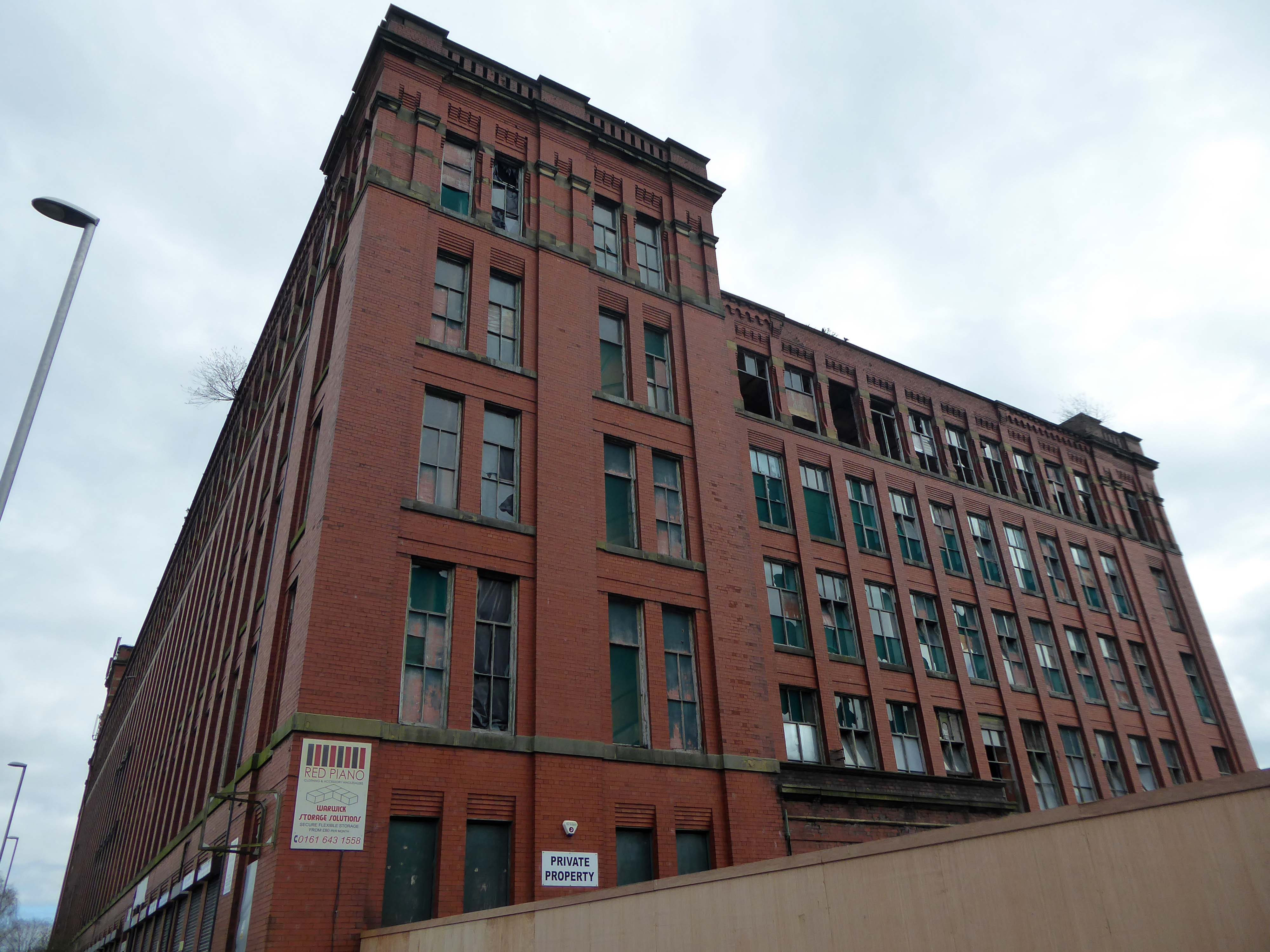
Take a walk up Oldham Road to see Warwick Mill instead.
1907 by G Stott of J Stott and Sons – Red brick with internal cast-iron frame.
There was and Oval Partnership planning for a retail development in 2014 which failed to materialise.
The converted building will provide a showcase for Chinese manufacturers of construction-related products looking to enter the UK and wider European markets. Products on display will include tiles, lighting, furniture, kitchenware, sanitary ware and curtains. A second phase will see the construction of a new building alongside effectively doubling the floor space. In addition the brief includes a range of restaurant, leisure, culture and entertainment facilities threaded through the building. The conversion will open up the existing building in a dramatic way, maximizing permeability and providing a strong visual connection back into the town, promoting public access through the building to the attractive south-facing waterside of the mill.
Permeability failed to be maximised, sadly.
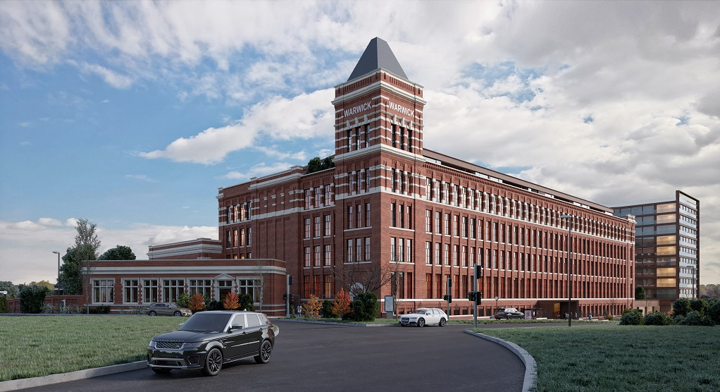
Ambitious plans to refurbish Grade II listed Warwick Mill to create new homes and breathe life into an important building and part of Middleton’s history have been drawn up.
Warwick Mill has recently changed ownership and the new owners, Kam Lei Fong (UK) Ltd, have been working with Rochdale Borough Council over the last nine months to develop proposals to redevelop the site.
A Middleton couple has saved the oldest surviving mill in the town after a two-year renovation project.
Located on Townley Street, Lodge Mill was built in the mid-1800s and was originally a silk weaving mill. It went on to cotton weaving and cloth dying, then to a home for many different small local businesses. Sadly, in the early 2000s, it fell into disrepair and became derelict.
Martin Cove and Paula Hickey bought Lodge Mill on 1 April 2019 and immediately set about replacing and repairing the roof. They also installed a 19.4kw solar PV system so the mill became its own little power station that summer.
In August 2019, the couple opened a small ice cream shop on the ground floor of the mill – named the Ice Cream Shop at Lodge – selling locally-made ice cream from Birch Farm, Heywood.
The ice cream is made using cream from Tetlow Farm’s dairy herd at Slattocks – Martin explained.
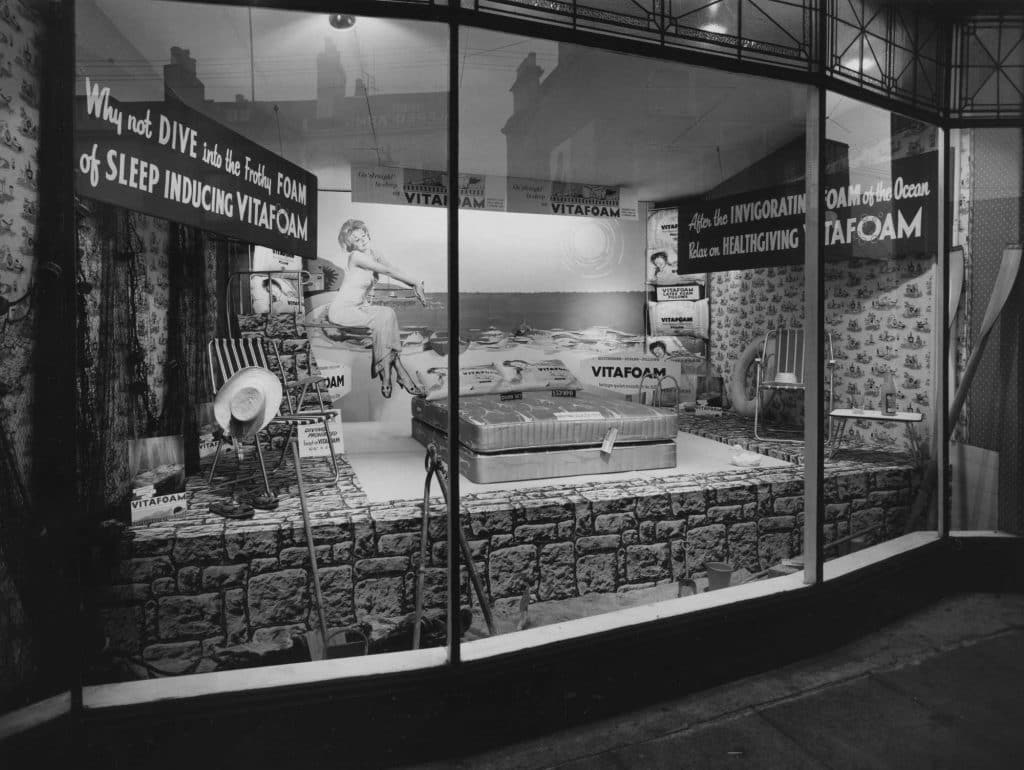
Founded in 1949 on £100 capital, Vitafoam started its original operation manufacturing latex foam products in Oldham, Greater Manchester.
After establishing the business, the company made a major move to its current site in Middleton, Manchester in 1955, acquiring two empty former cotton mills to cope with increased demand.
By 1963, Vitafoam had added the manufacture of polyurethane foam to its business and was providing product speciality for upholstery and bedding markets.
As Vitafoam entered the new millennium the company had made great strides in supplying external foam converters. These rely on Vitafoam to be their business partner and provide their foam needs. This trend continues to grow from strength to strength and is supplemented by our own group conversion companies.
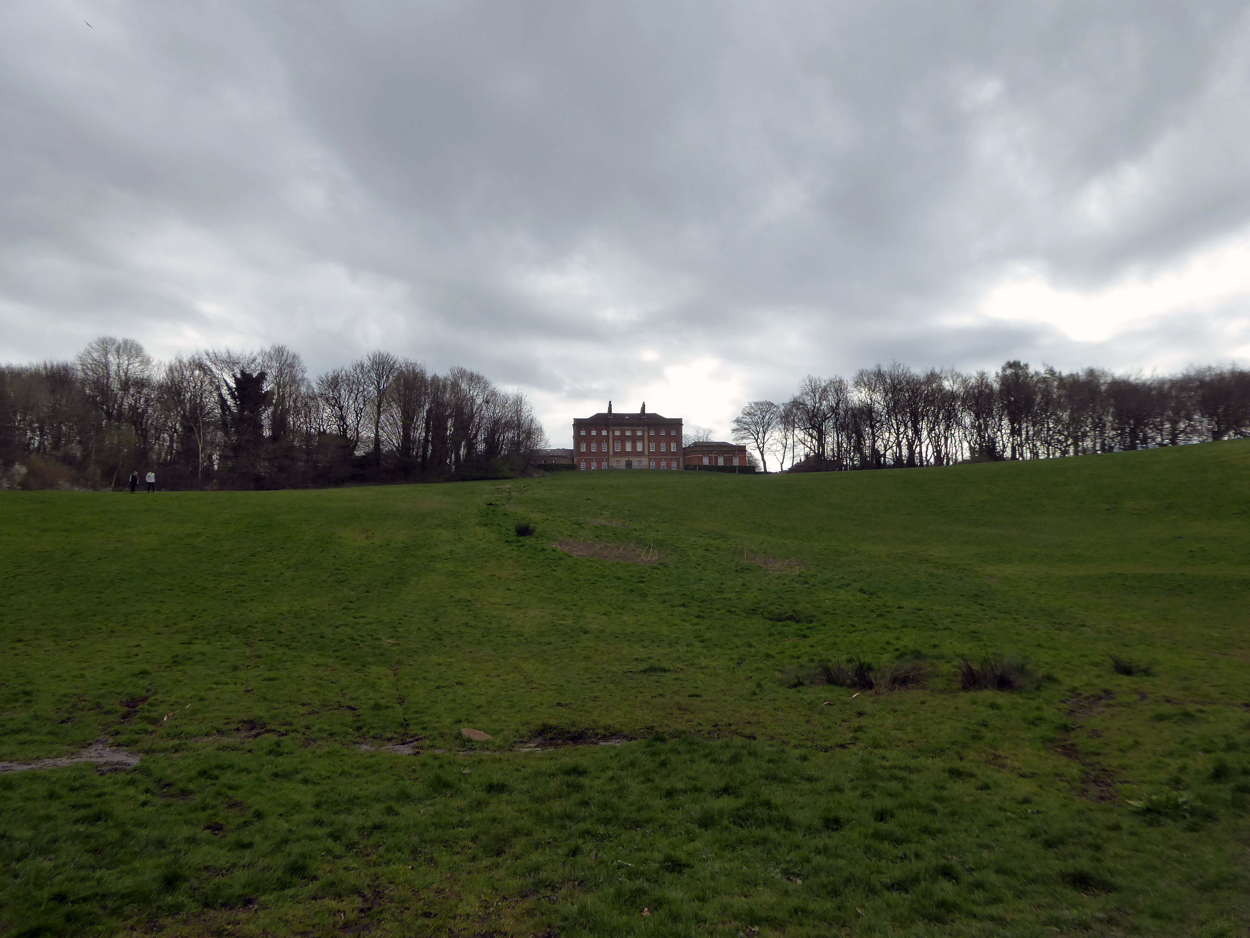
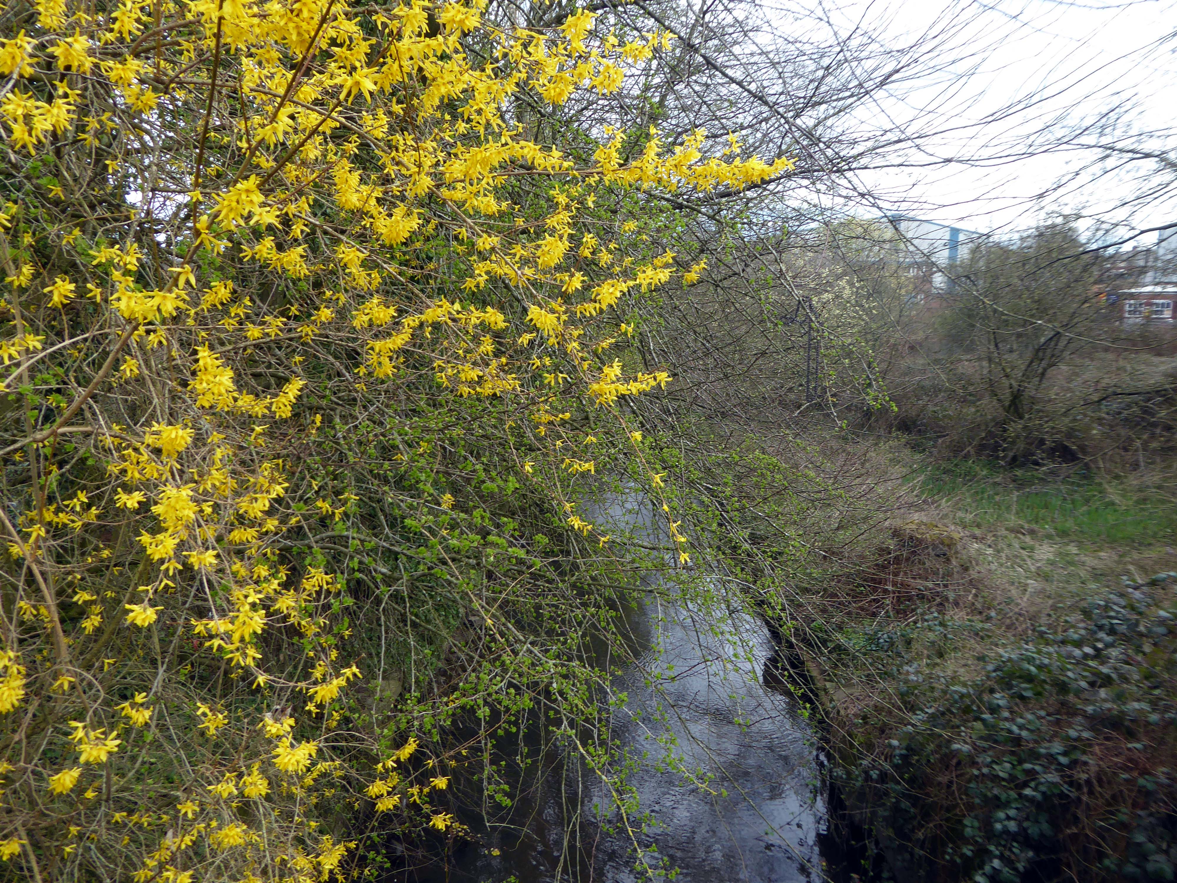
Regaining the river at Chadderton Hall Park.
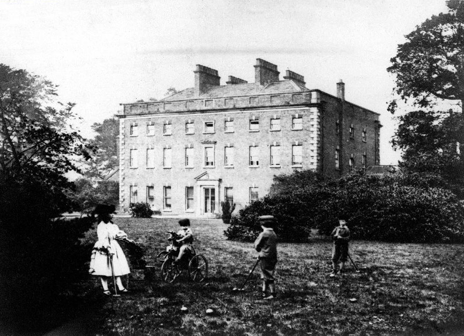
Its roots stretch back to the 13th century being the land on which Chadderton Hall once stood. It contains a large field area with a small football pitch, a playground area, several flower gardens and a small café situated next to the Park’s bowling green.
Chadderton Hall was first built in the 13th century by Geoffrey de Chadderton, this first hall was in Chadderton Fold slightly to the east of the current park. In 1629 a new hall was built at the site of the current park and was present there until the 20th century when it was demolished in 1939. It was at the end of the 19th Century that the area surrounding Chadderton Hall began to be used for public recreation. A boating lake and a menagerie, including a kangaroo and a lion, were established as part of a Pleasure Garden. These features have long since been demolished but evidence of the boating lake can be seen by the hollowed out area where the playing fields now stand.
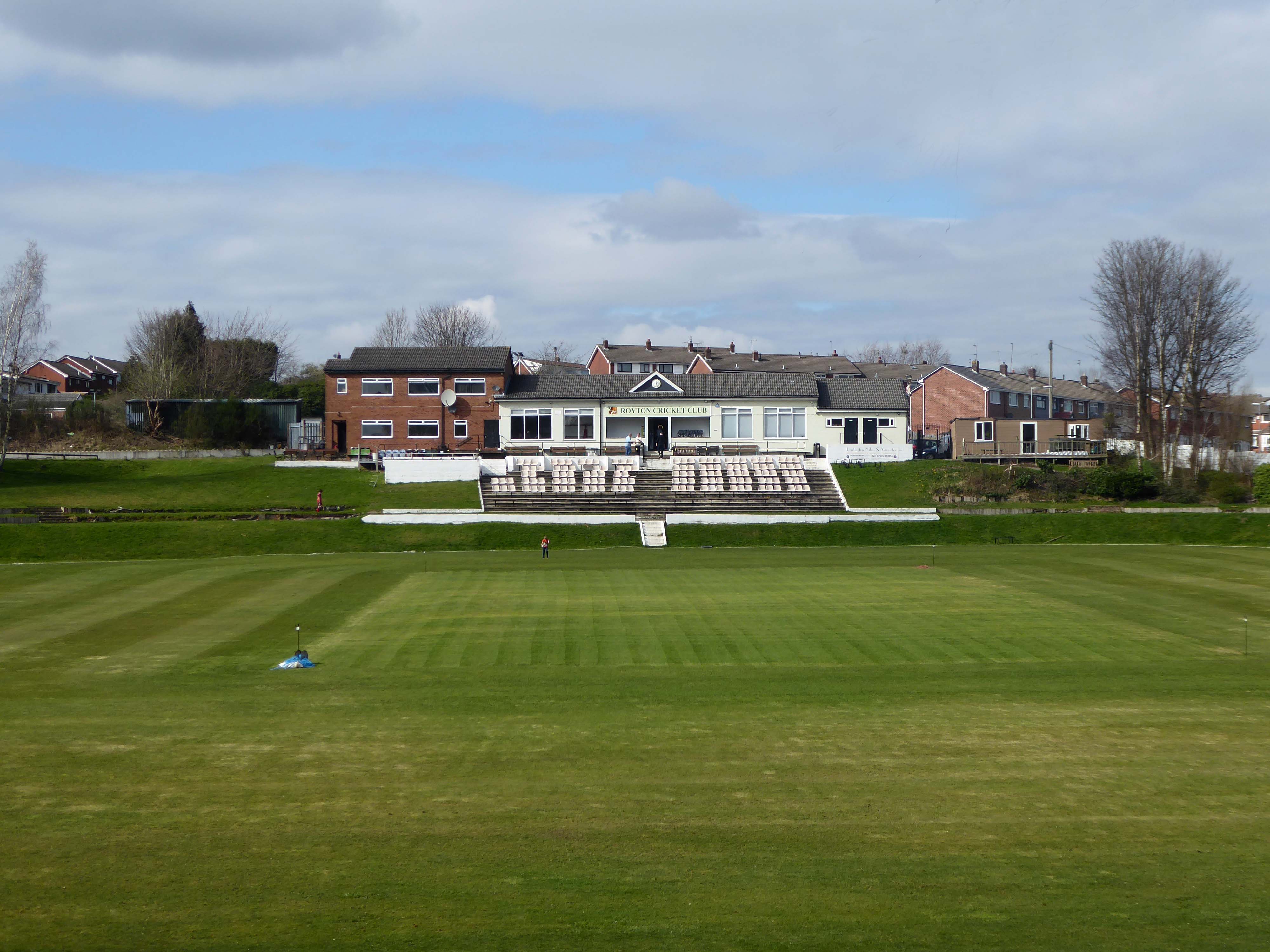
Based in the heart of Thorpe Estate – Royton Cricket, Bowling & Running Club offers a family friendly environment whilst hosting strong, competitive cricket throughout the summer. Bowling throughout the summer along with a Running section – Royton Road Runners, who operate all year round. Along with seasonal events such as our well known firework display along with St Georges Day celebrations – with plans in the pipeline for improvements on current events as well as new exciting projects – it’s a great time to be apart of the club & community!
I have very fond memories of visiting with my dad Eddie Marland as he followed Ashton in the Central Lancashire League – both watching cricket and seeing my dad crown green bowling here.
These now full memorial forests were originally donated to Life for a Life by Oldham Metropolitan Borough Council. Salmon Fields meadow sits adjacent to a lovely pond that is used regularly by fishing enthusiasts and is frequently used as a breeding site for Canadian Geese.
Life for a Life planting areas are natural environments where we encourage wildlife and plantlife to flourish, as such additional items should not be added to the tree or the space around it, especially as they can cause damage to the tree.
Please be aware that any prohibited items left on or around memorial trees will be removed.
Although these sites are now full to the planting of new memorial trees if you have an existing memorial tree dedicated you can still upgrade memorial plaques, add additional ashes to a memorial tree, order memorial keepsakes etc.
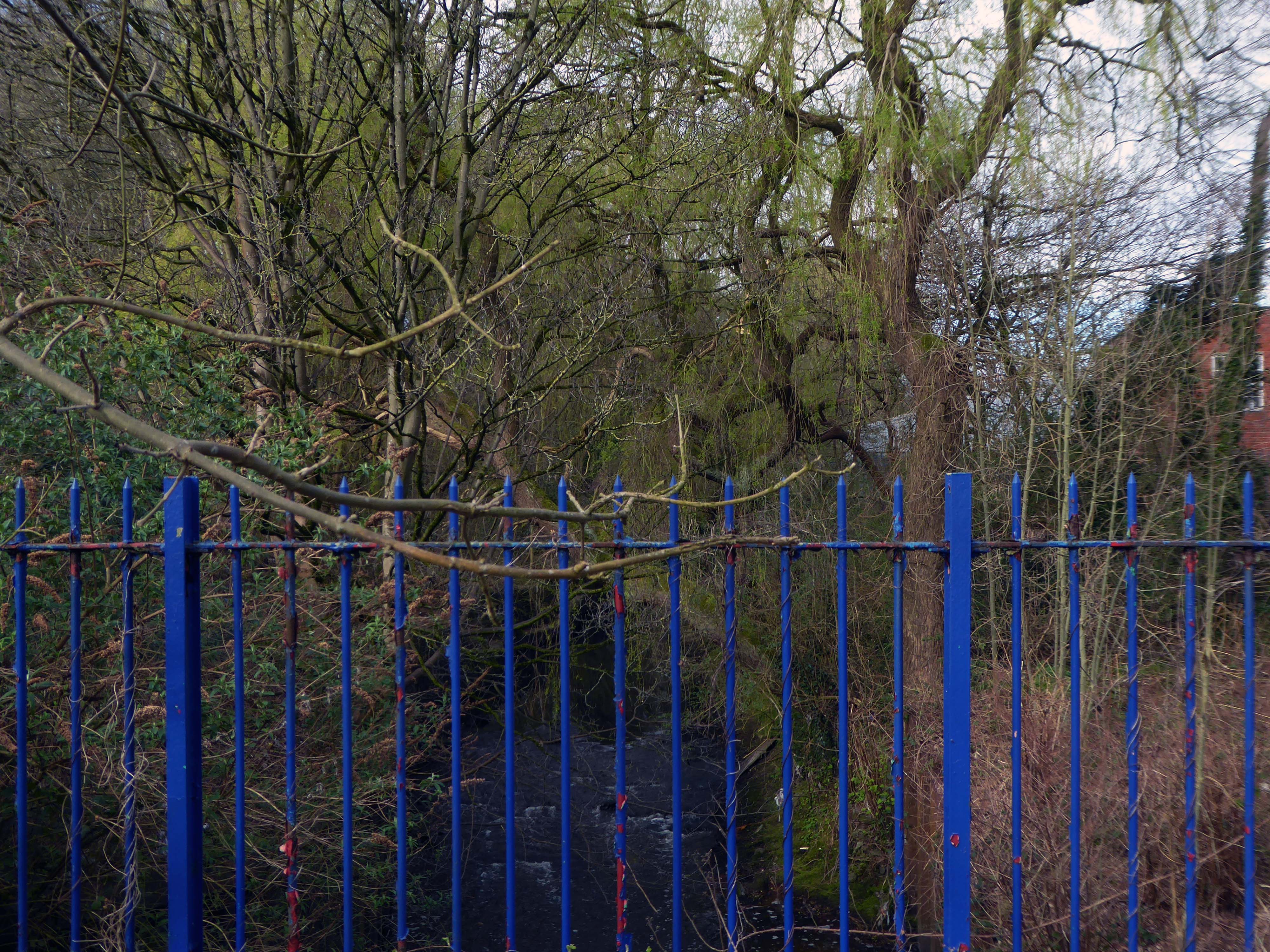
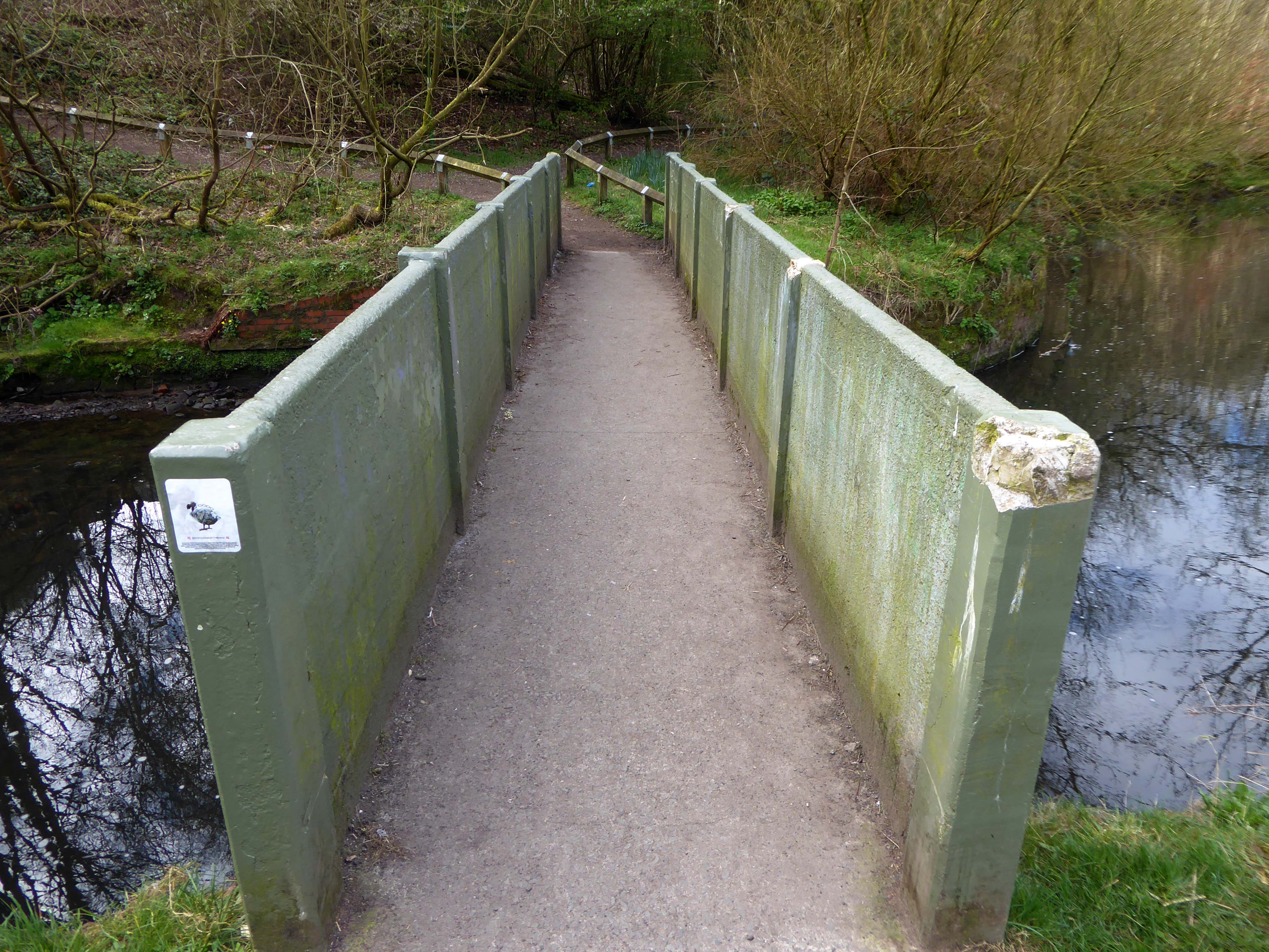
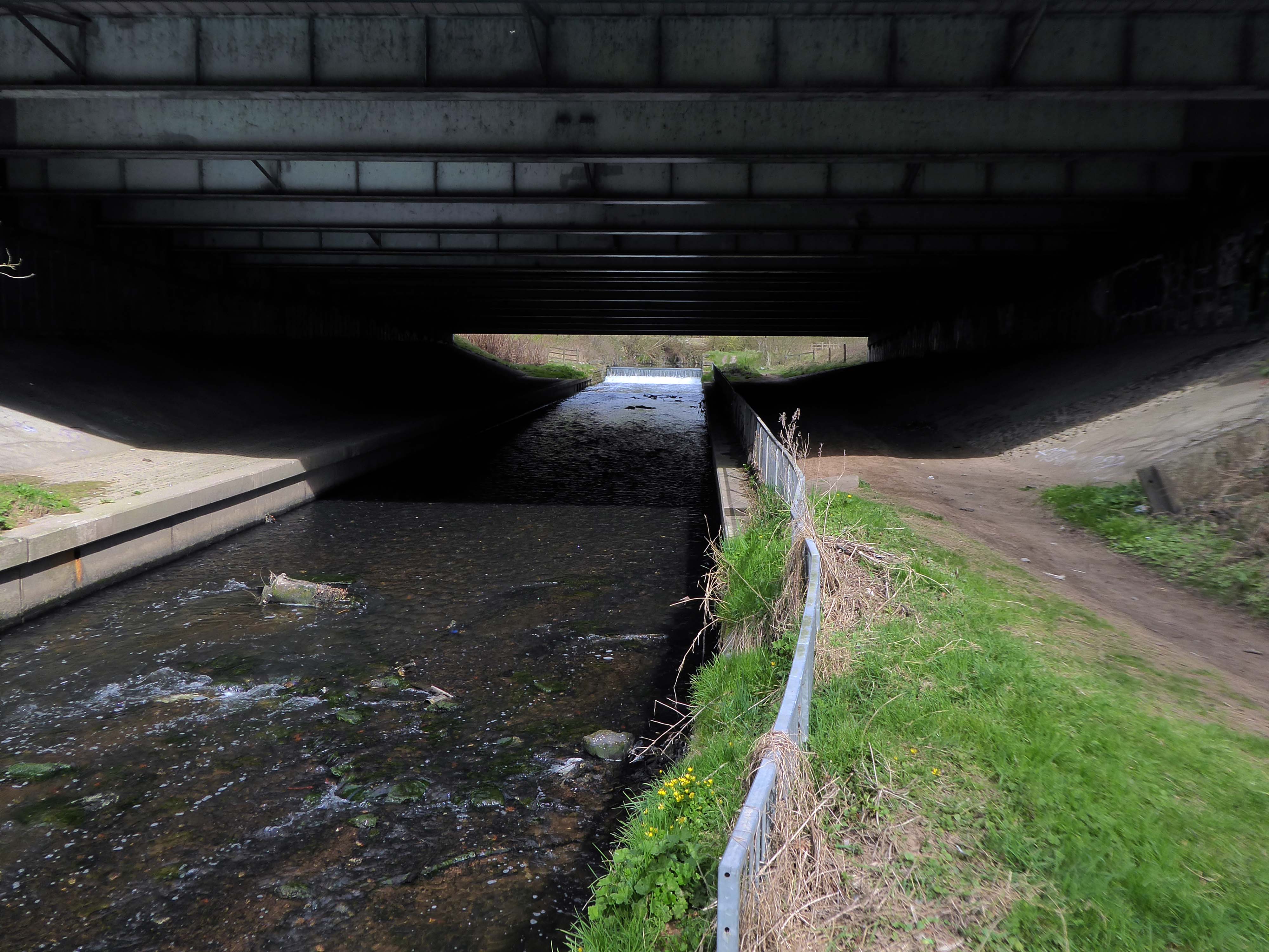
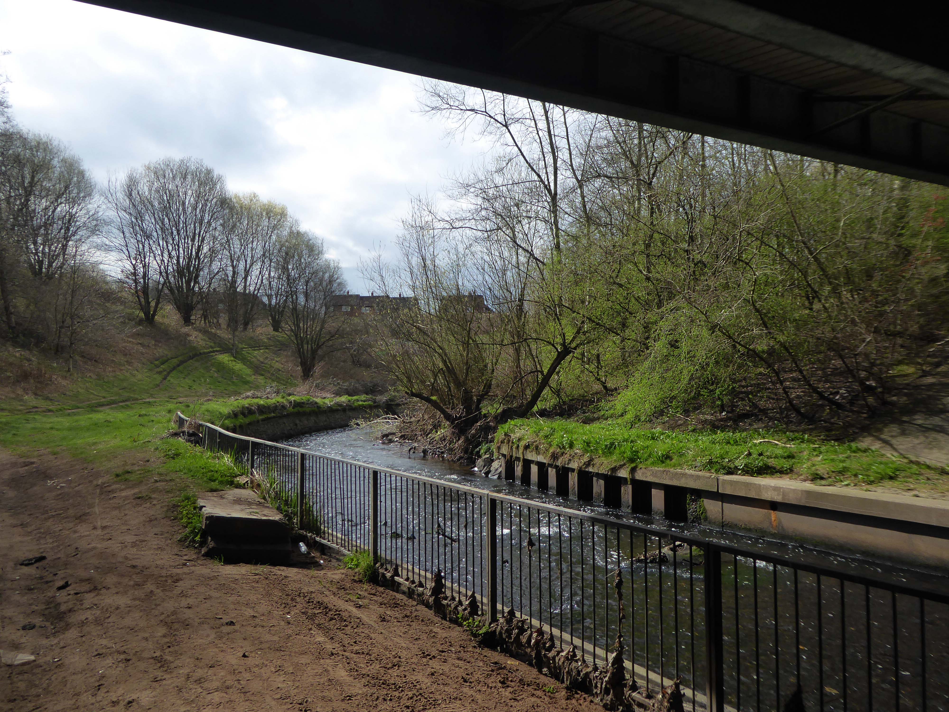
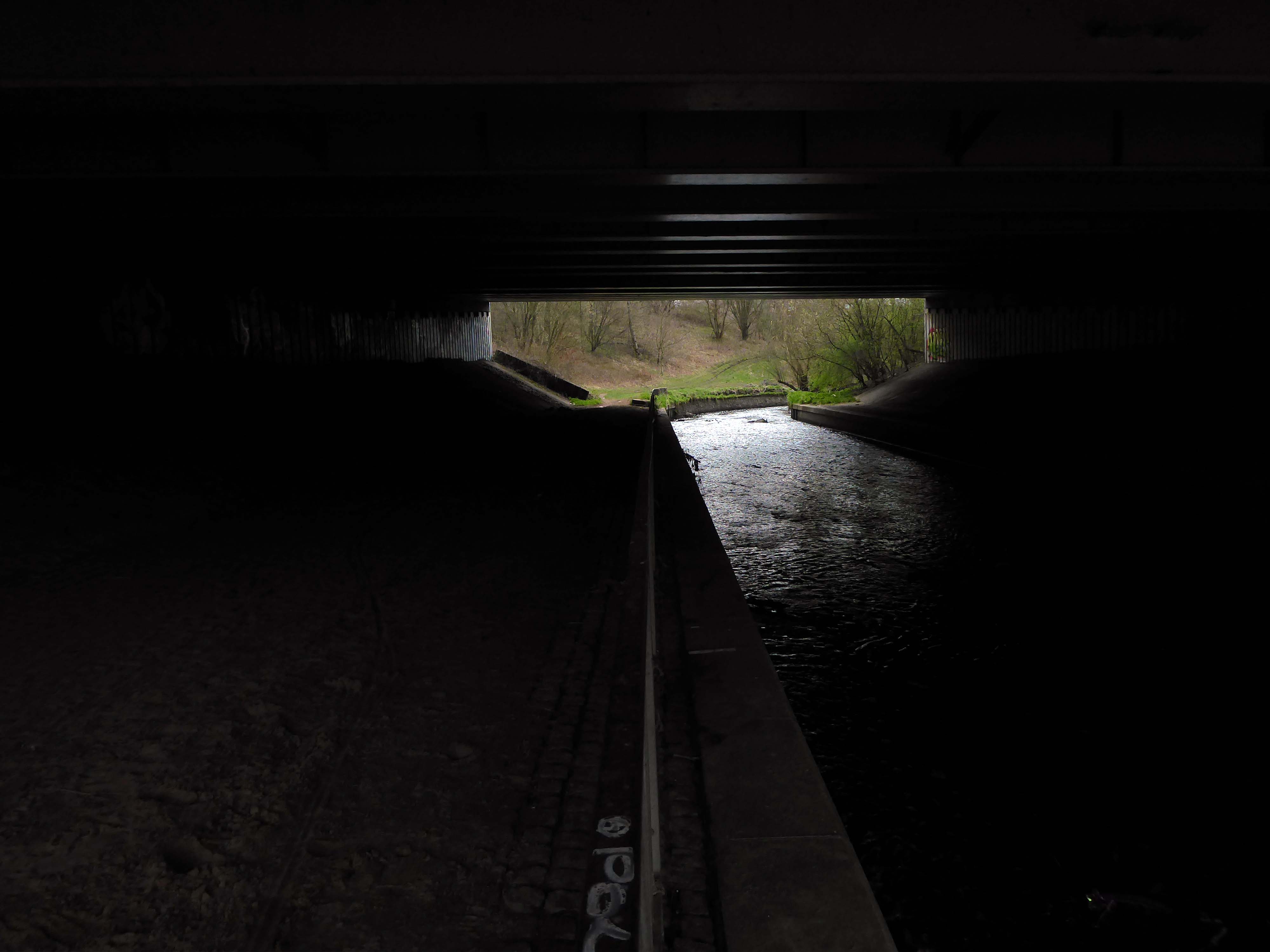
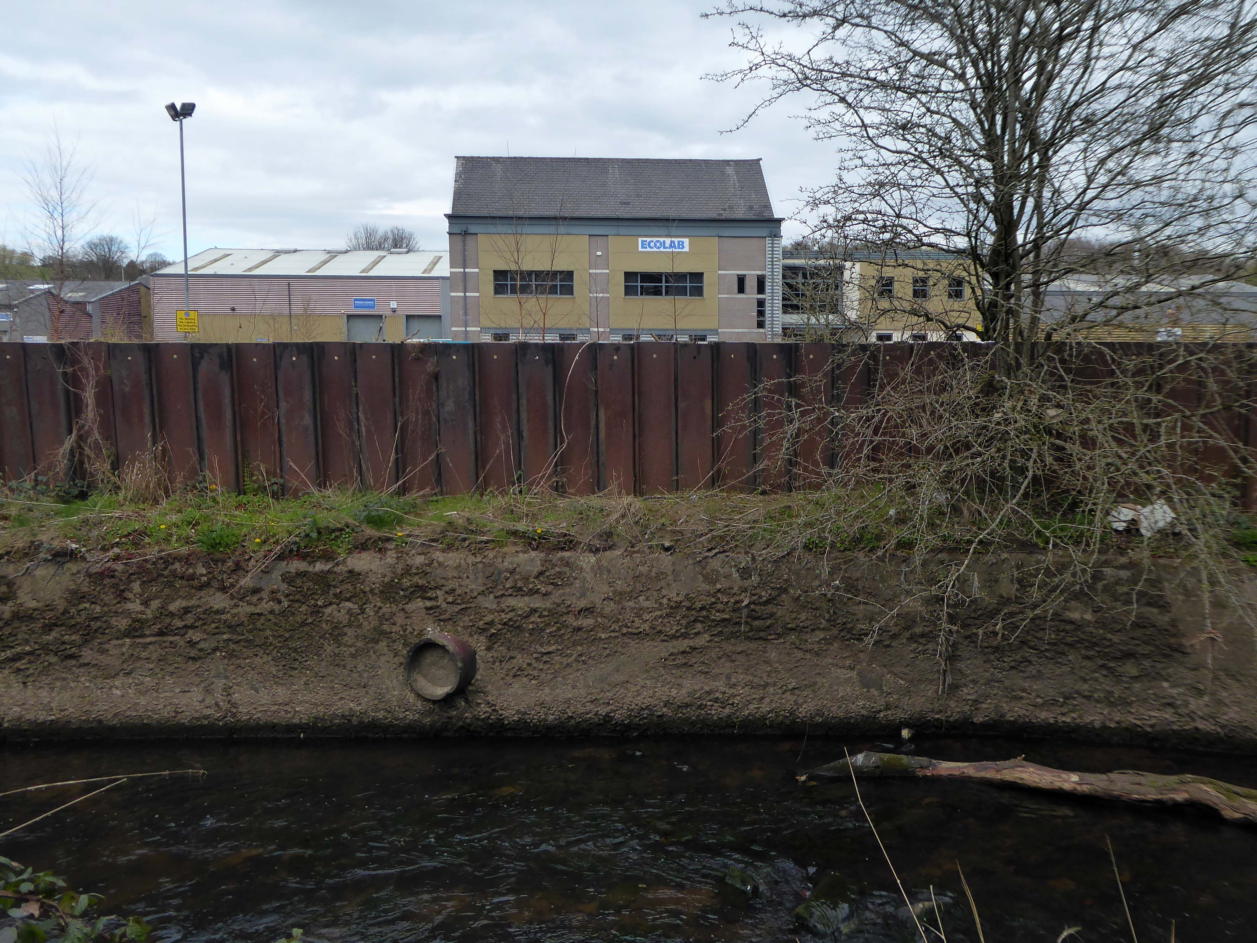
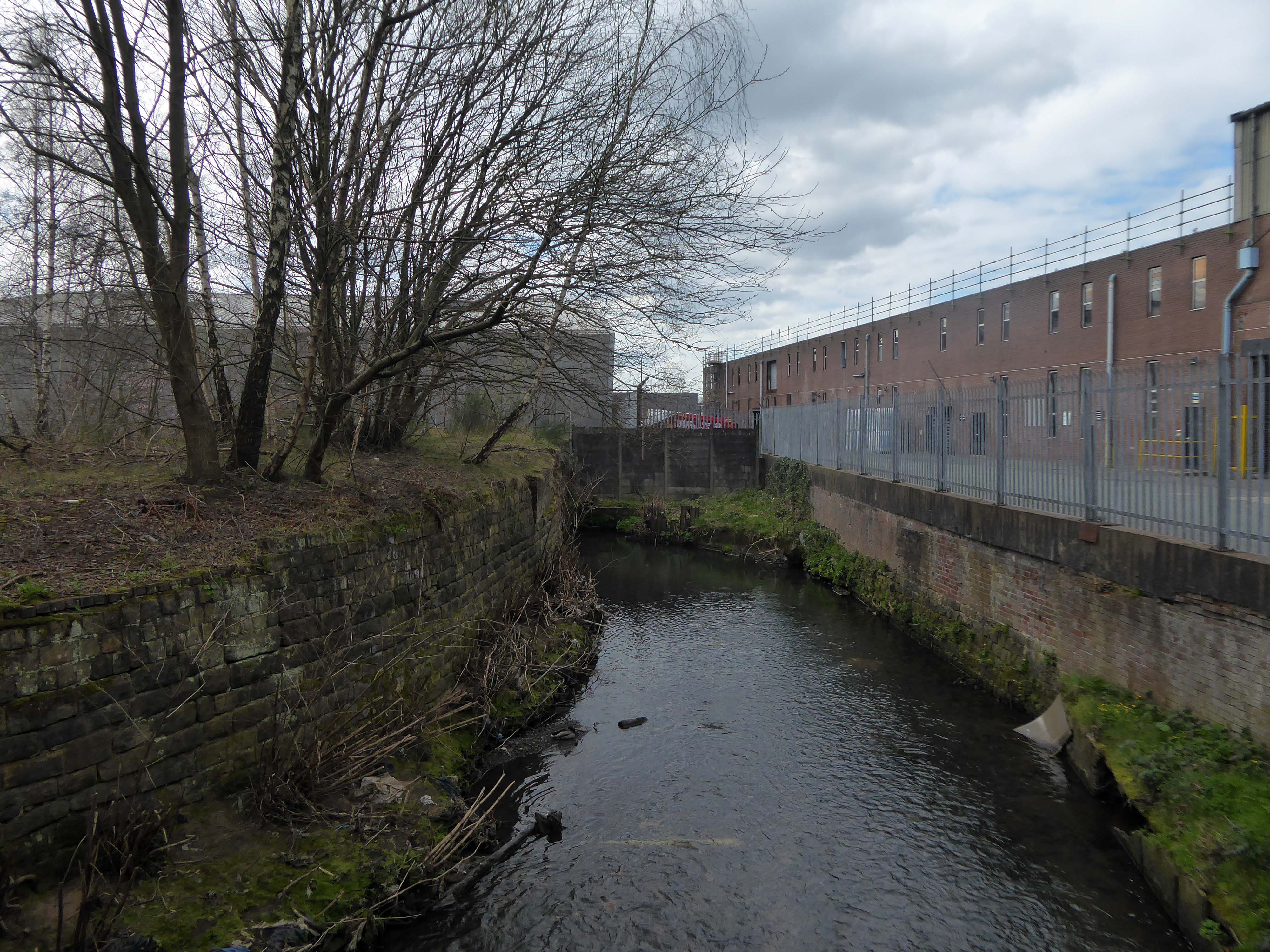
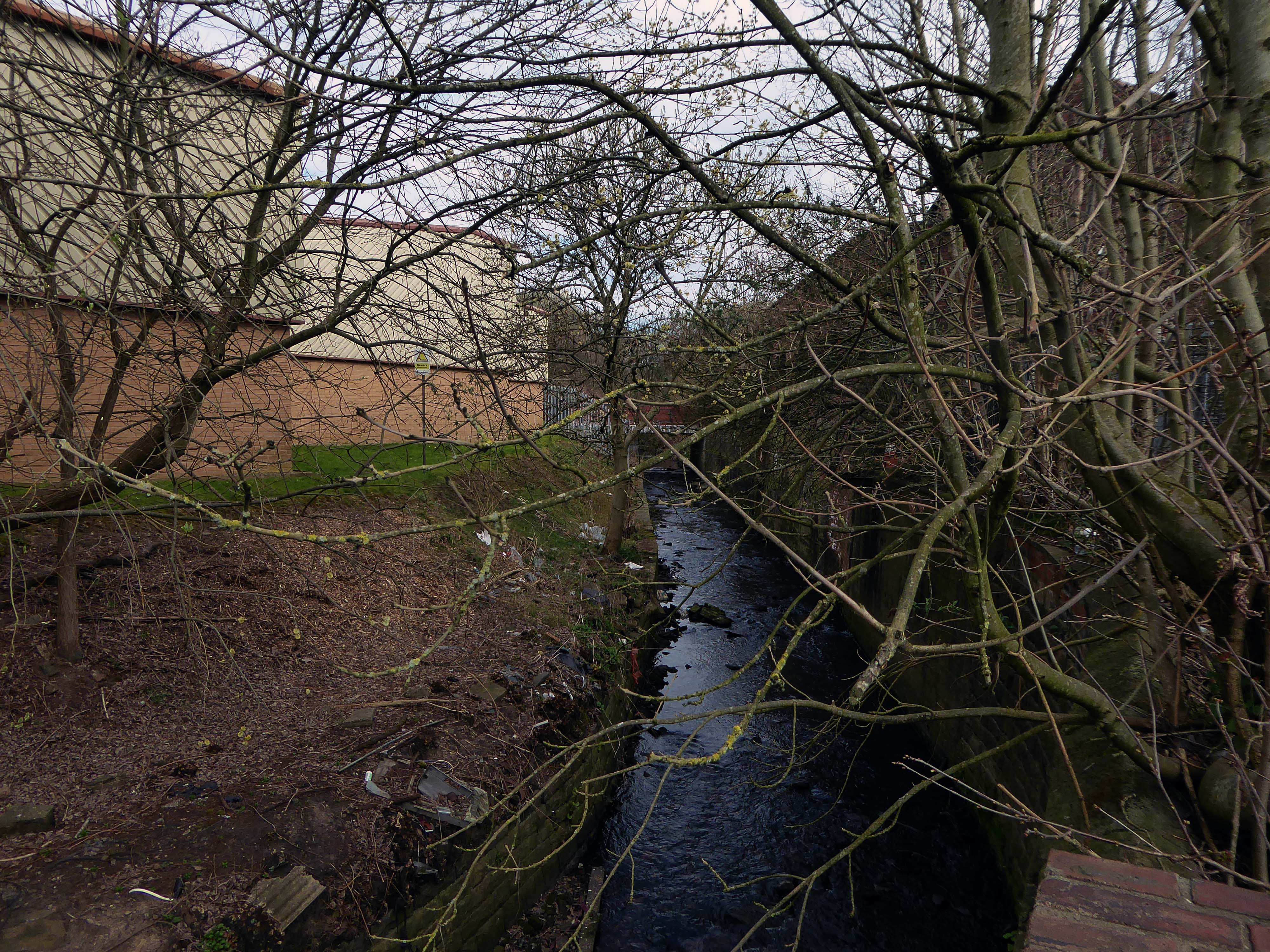
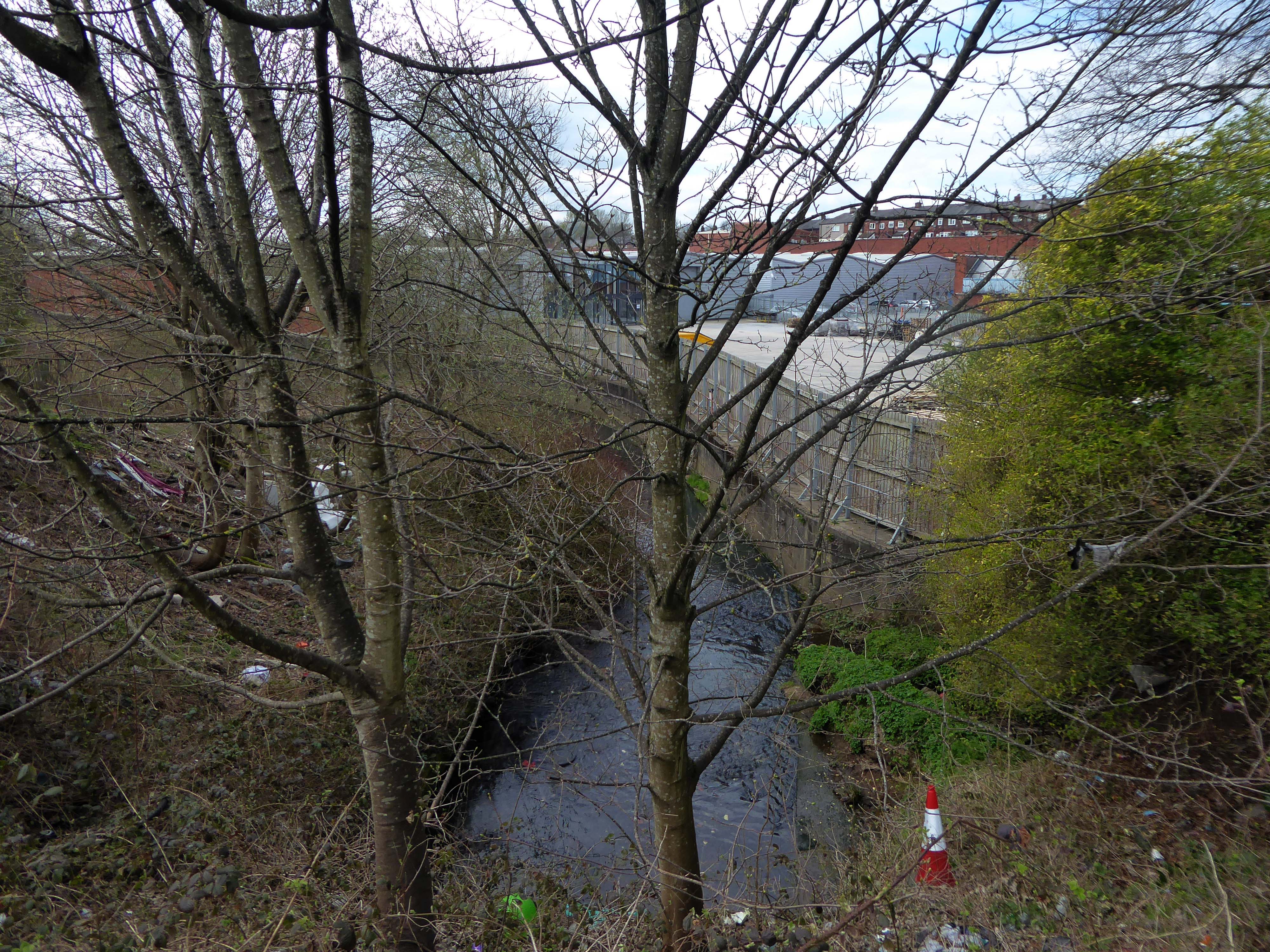
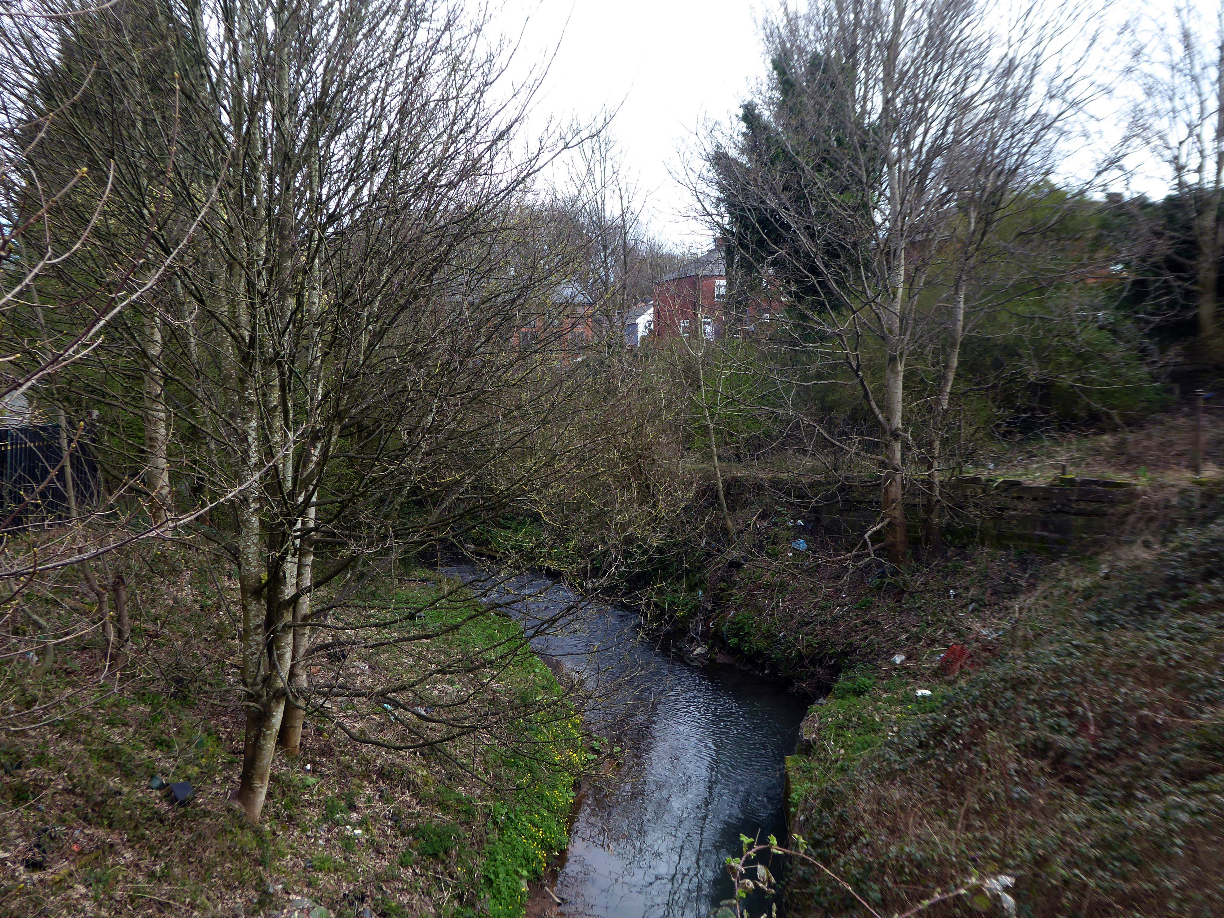
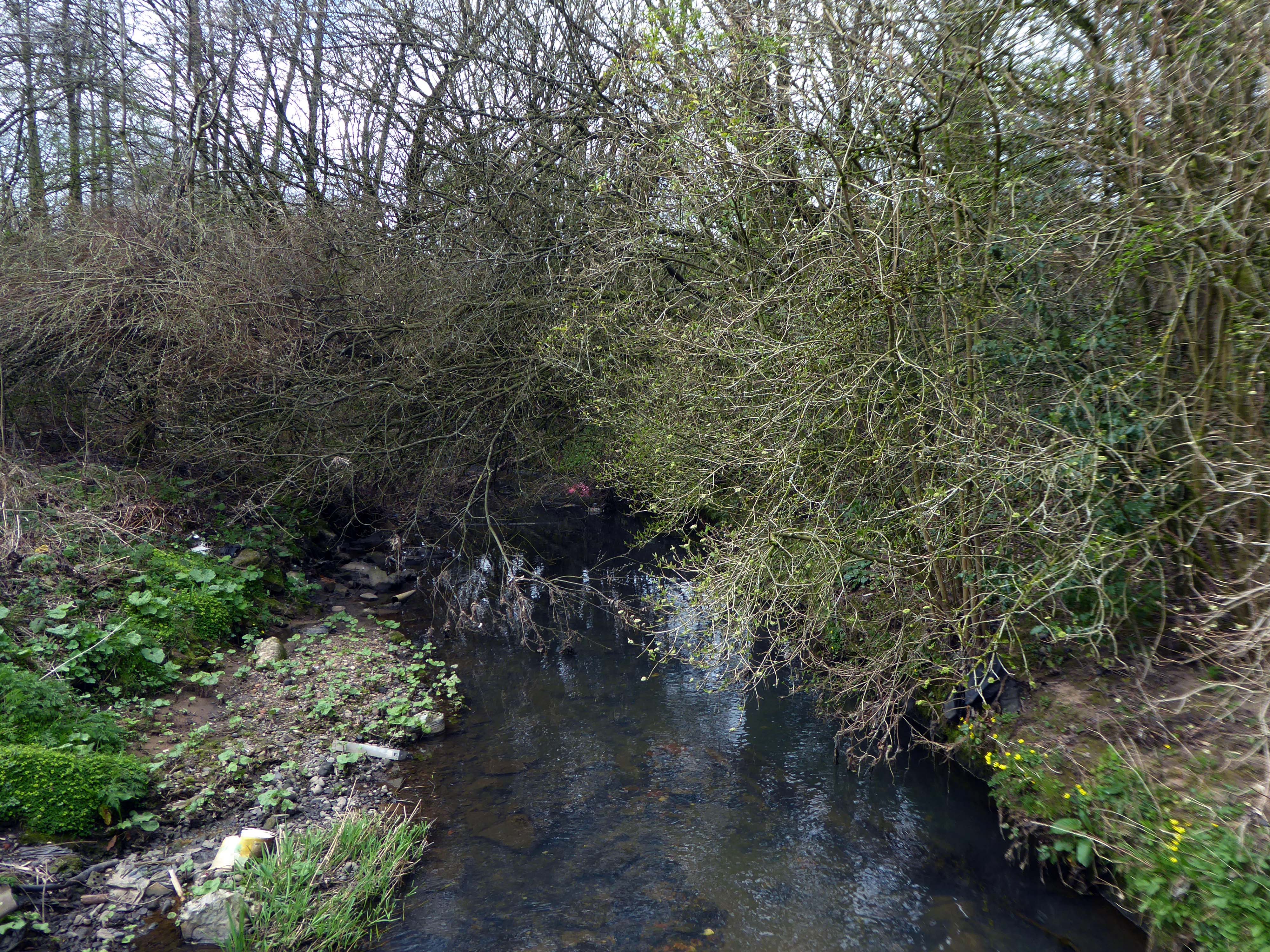
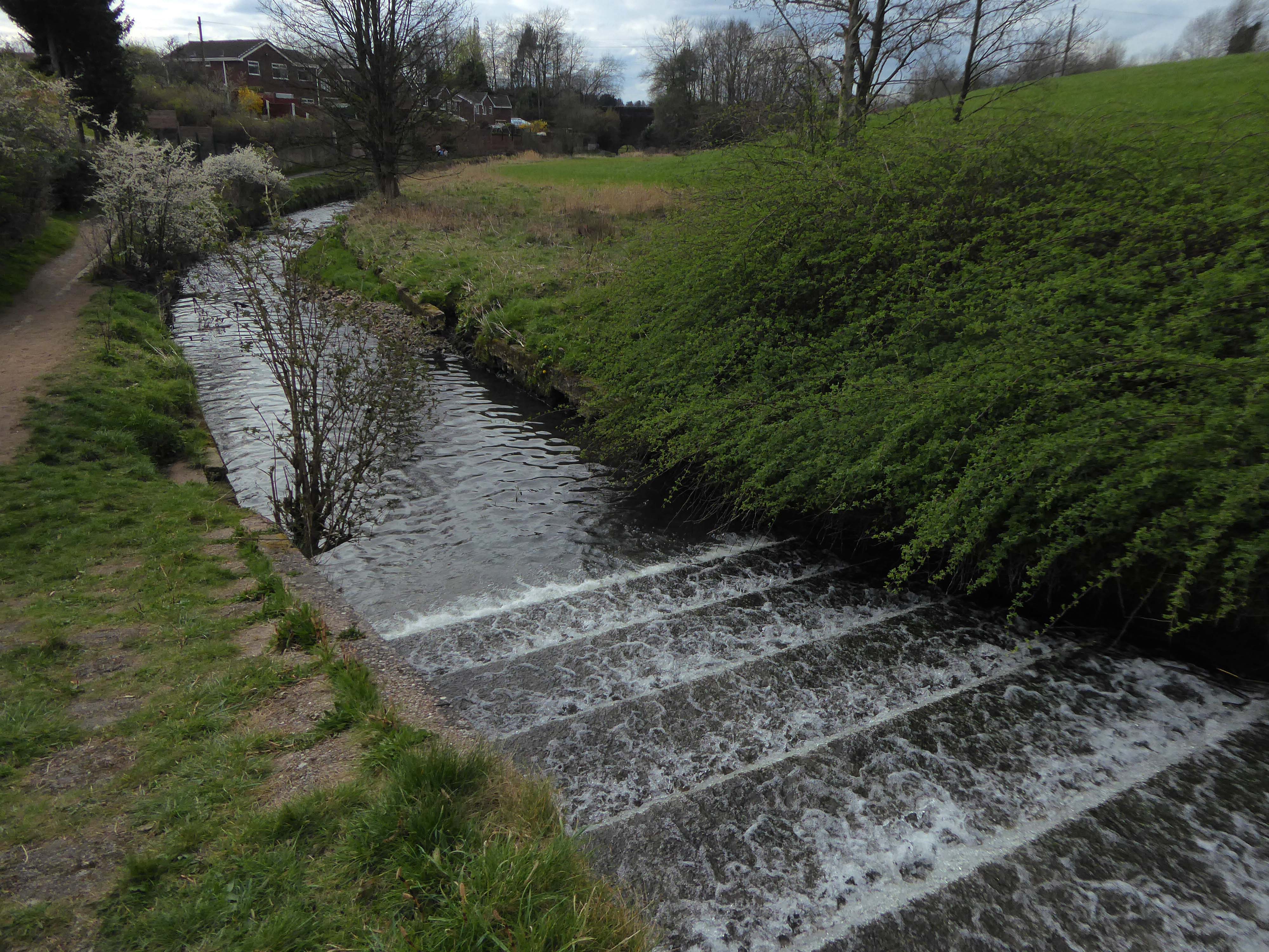
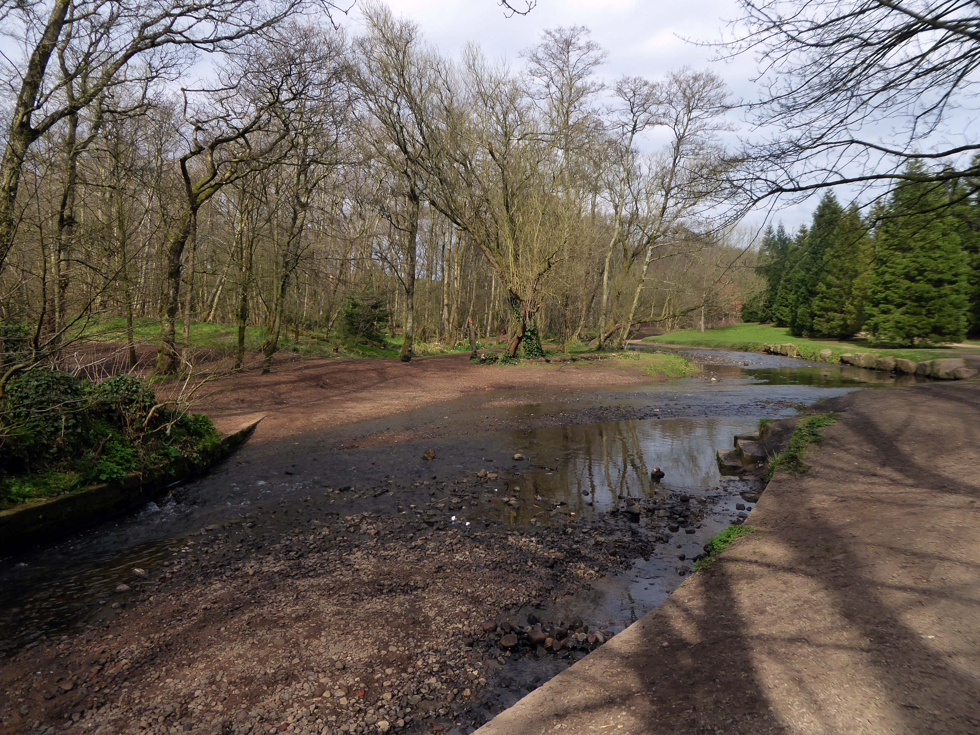
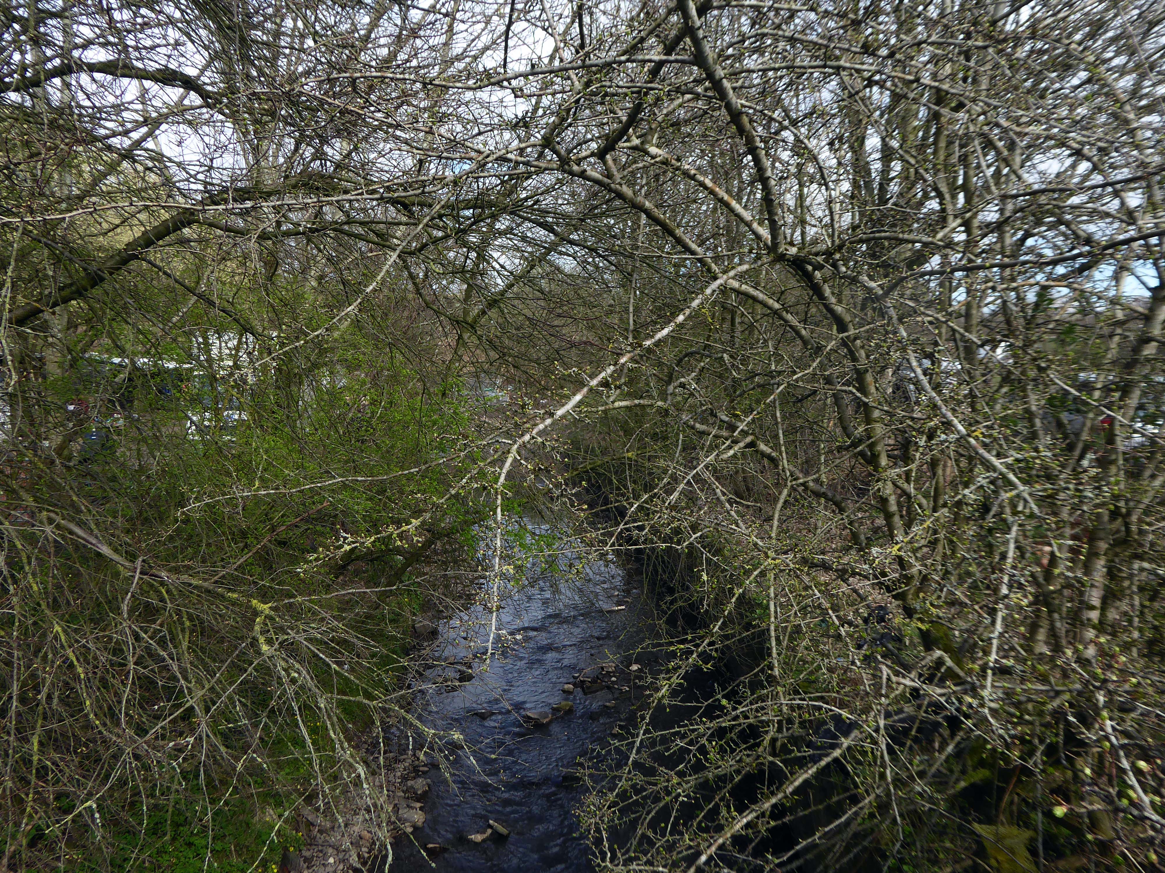
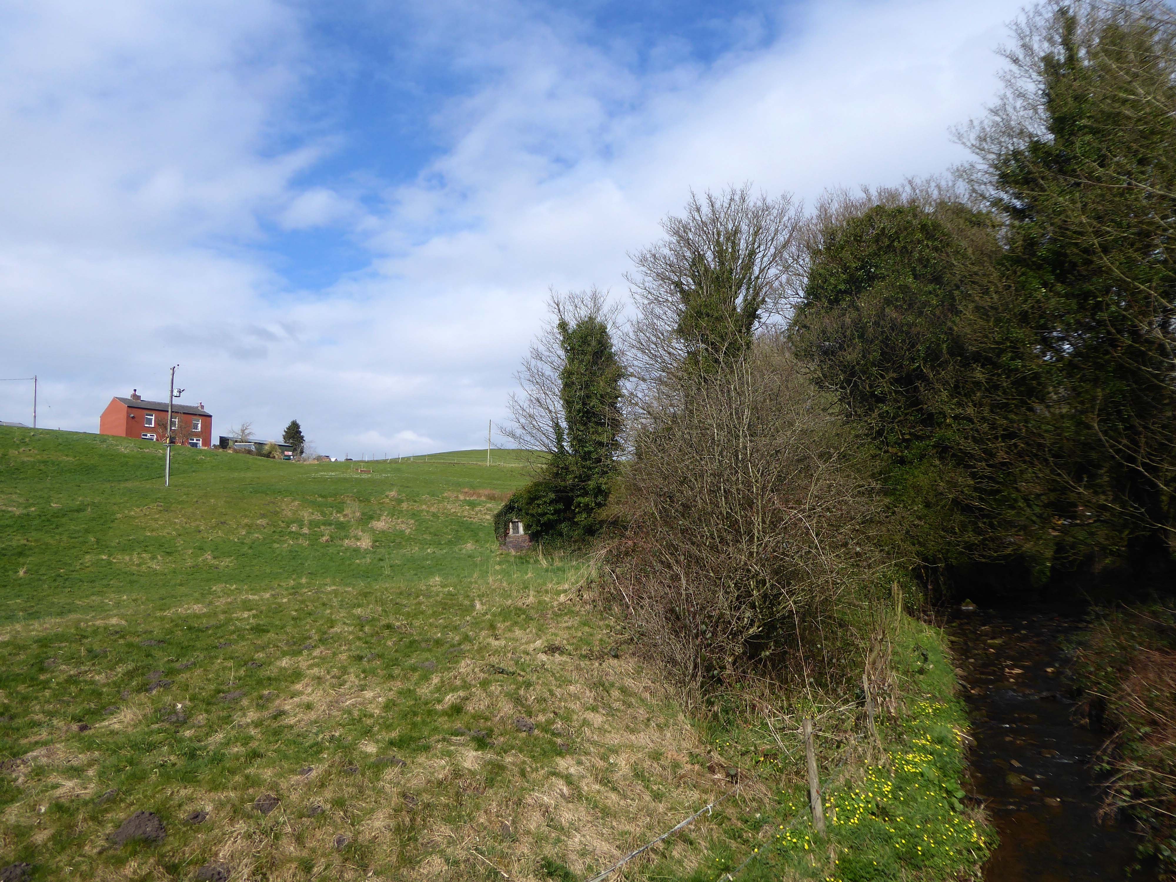
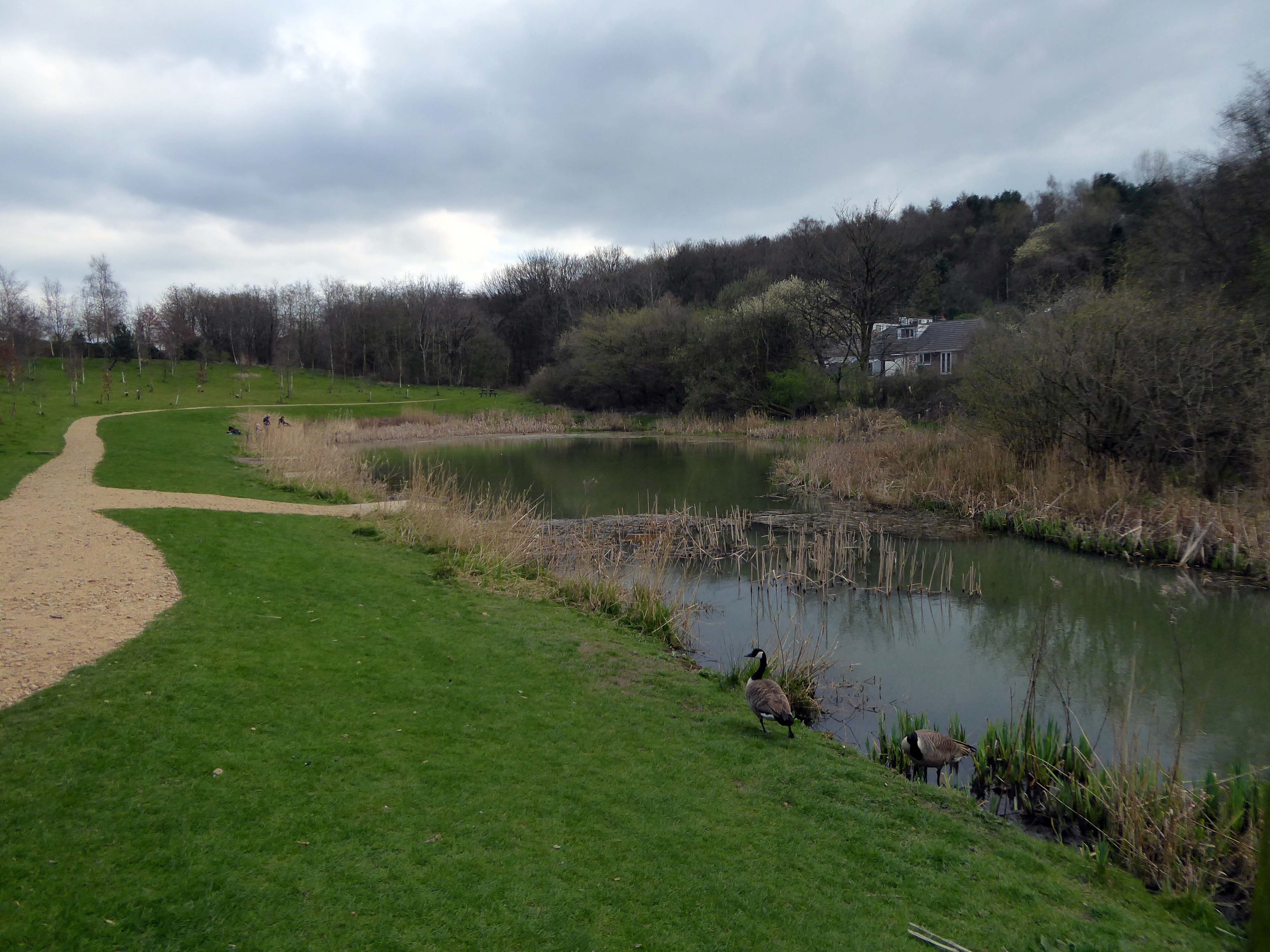
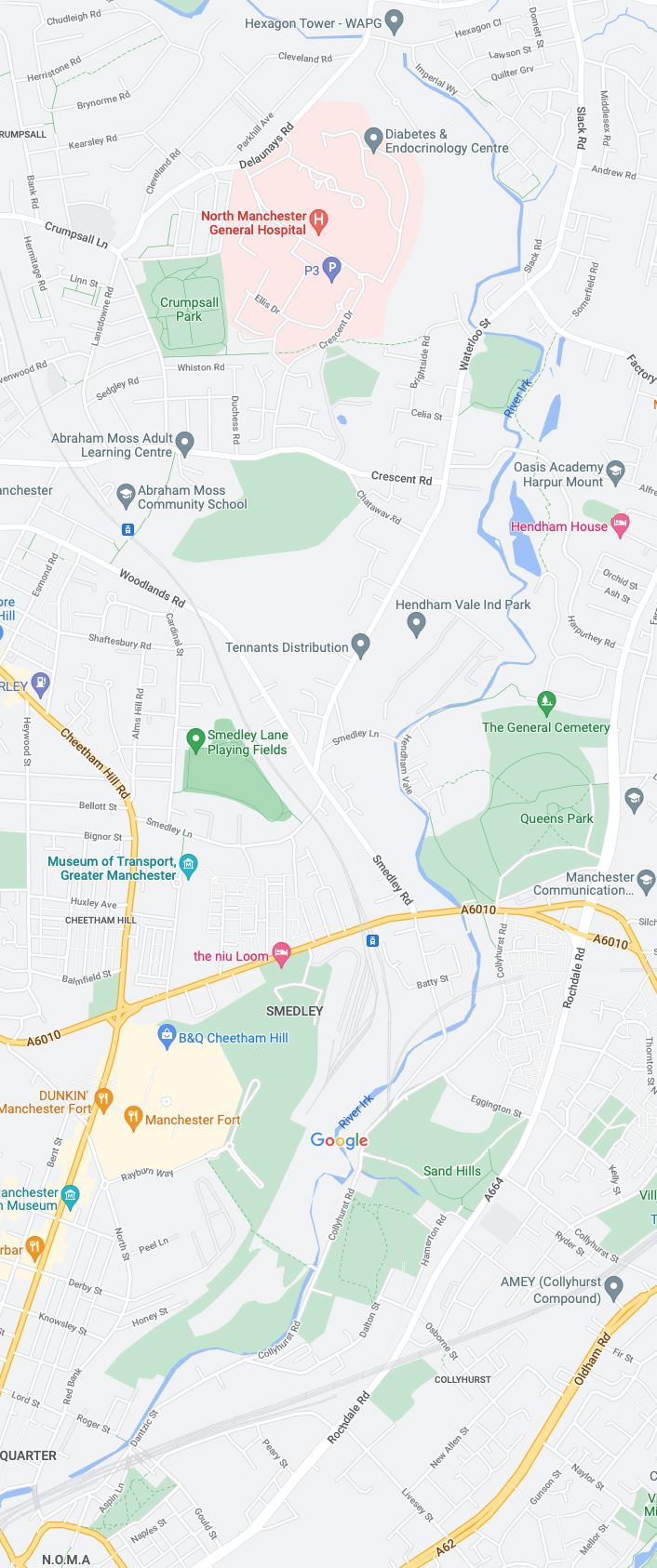
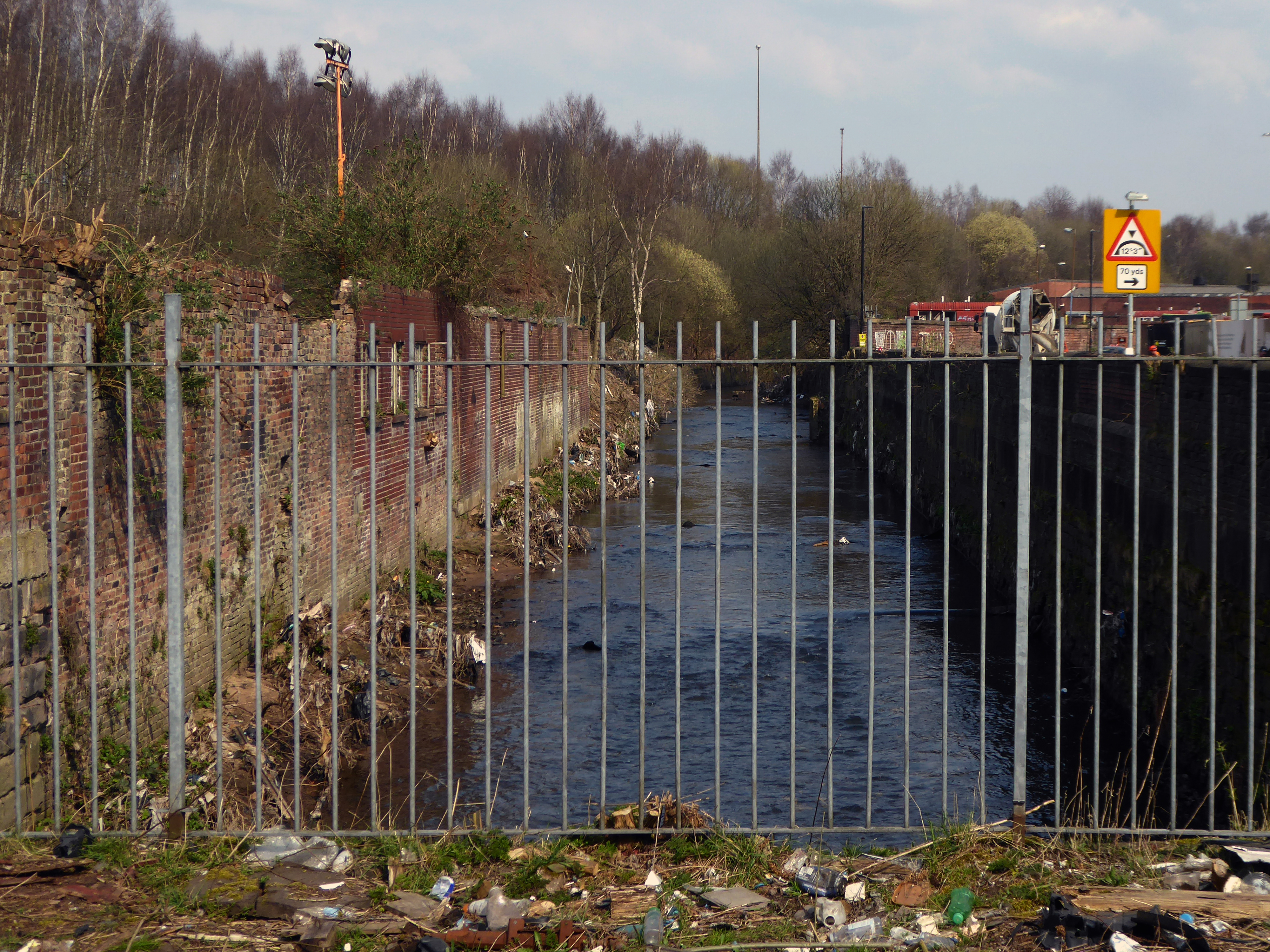
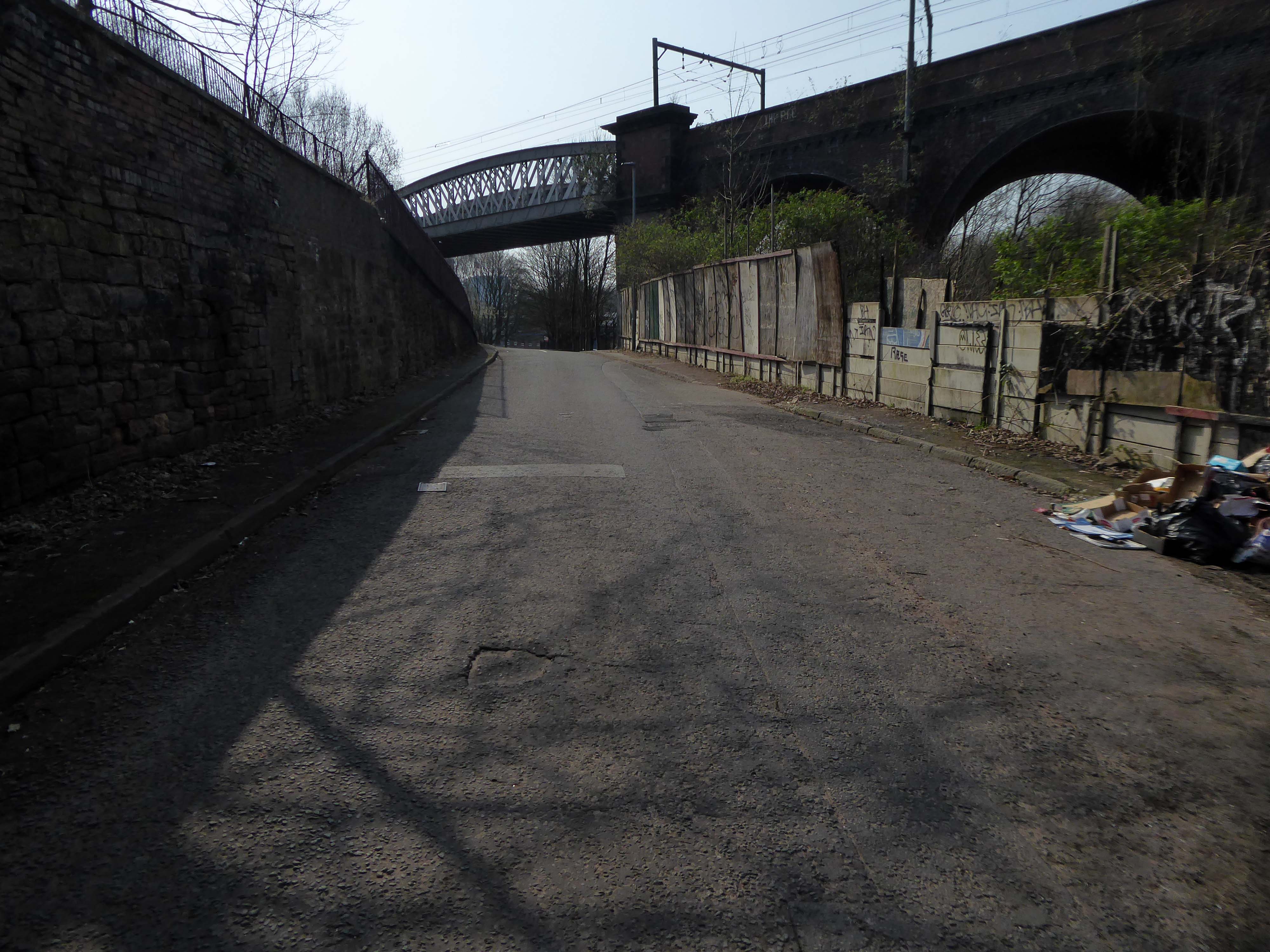
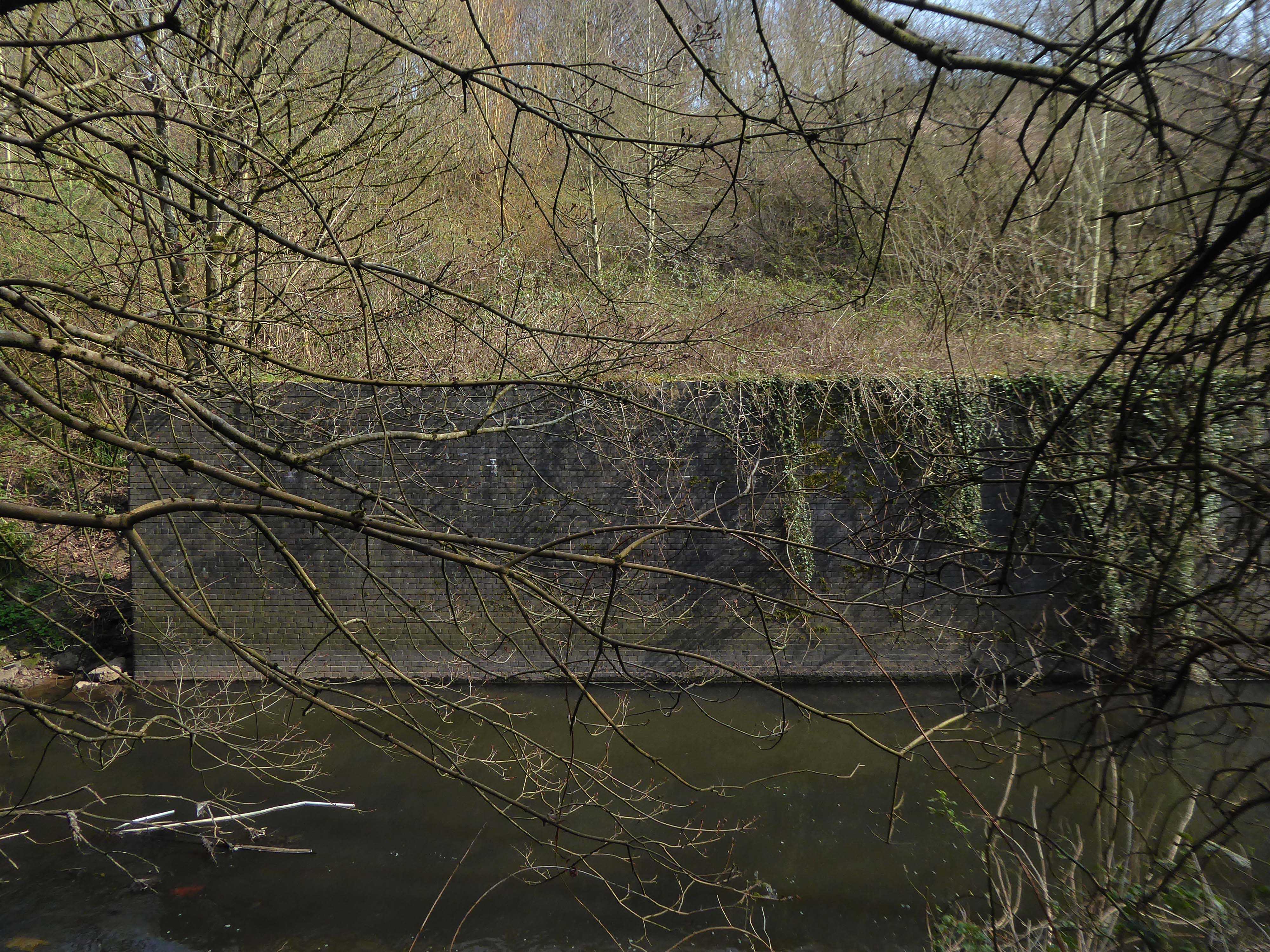
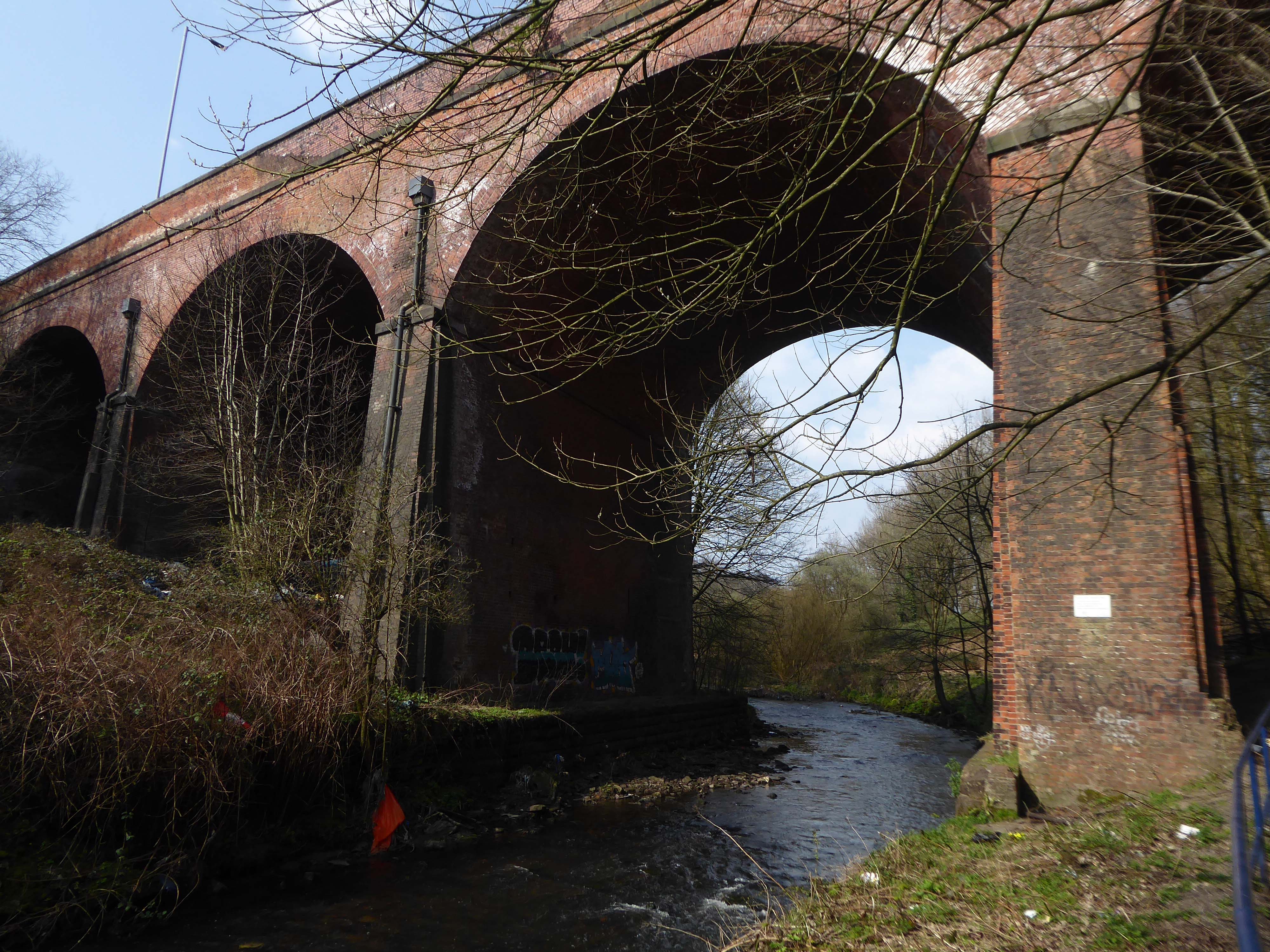
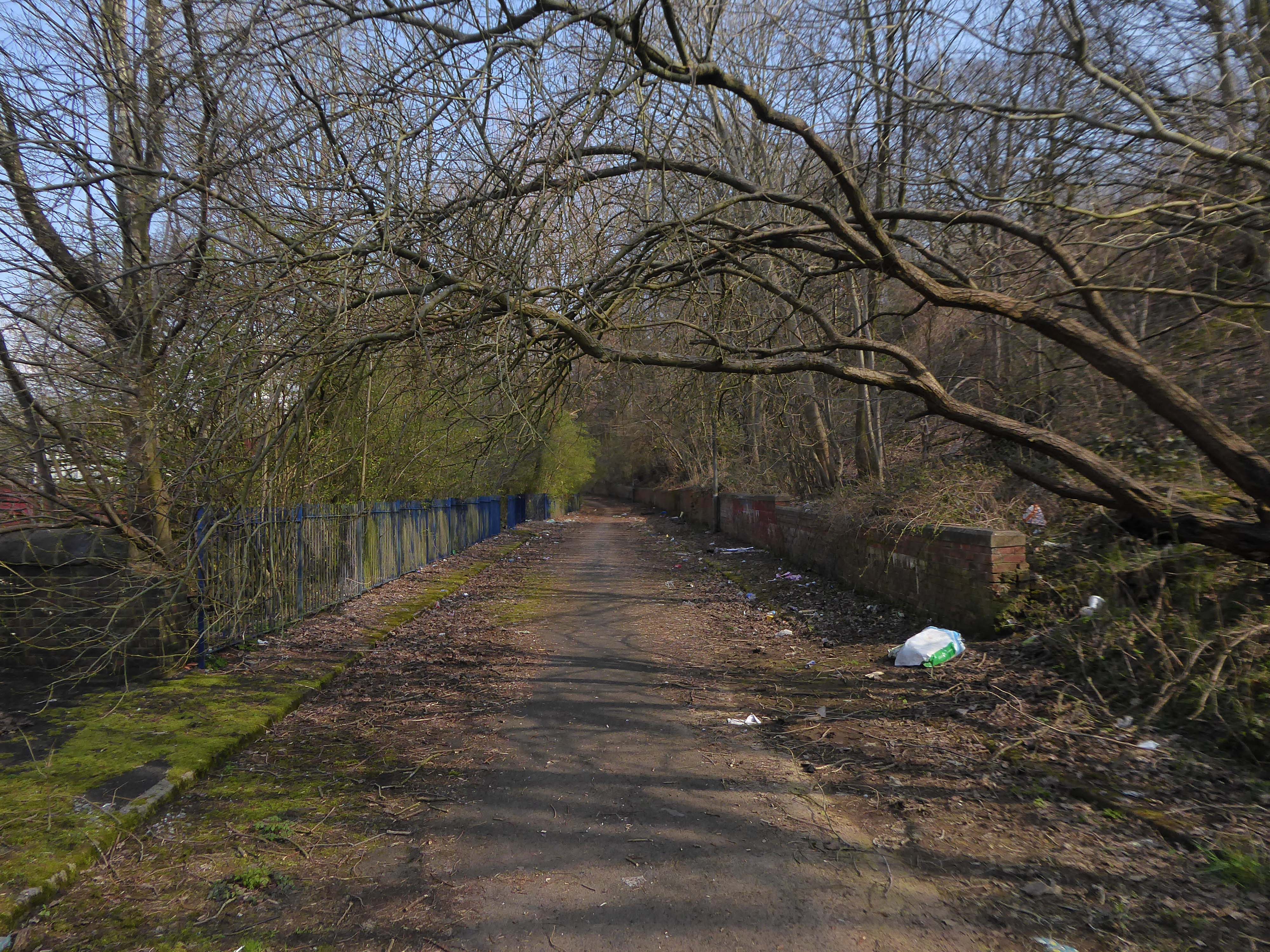
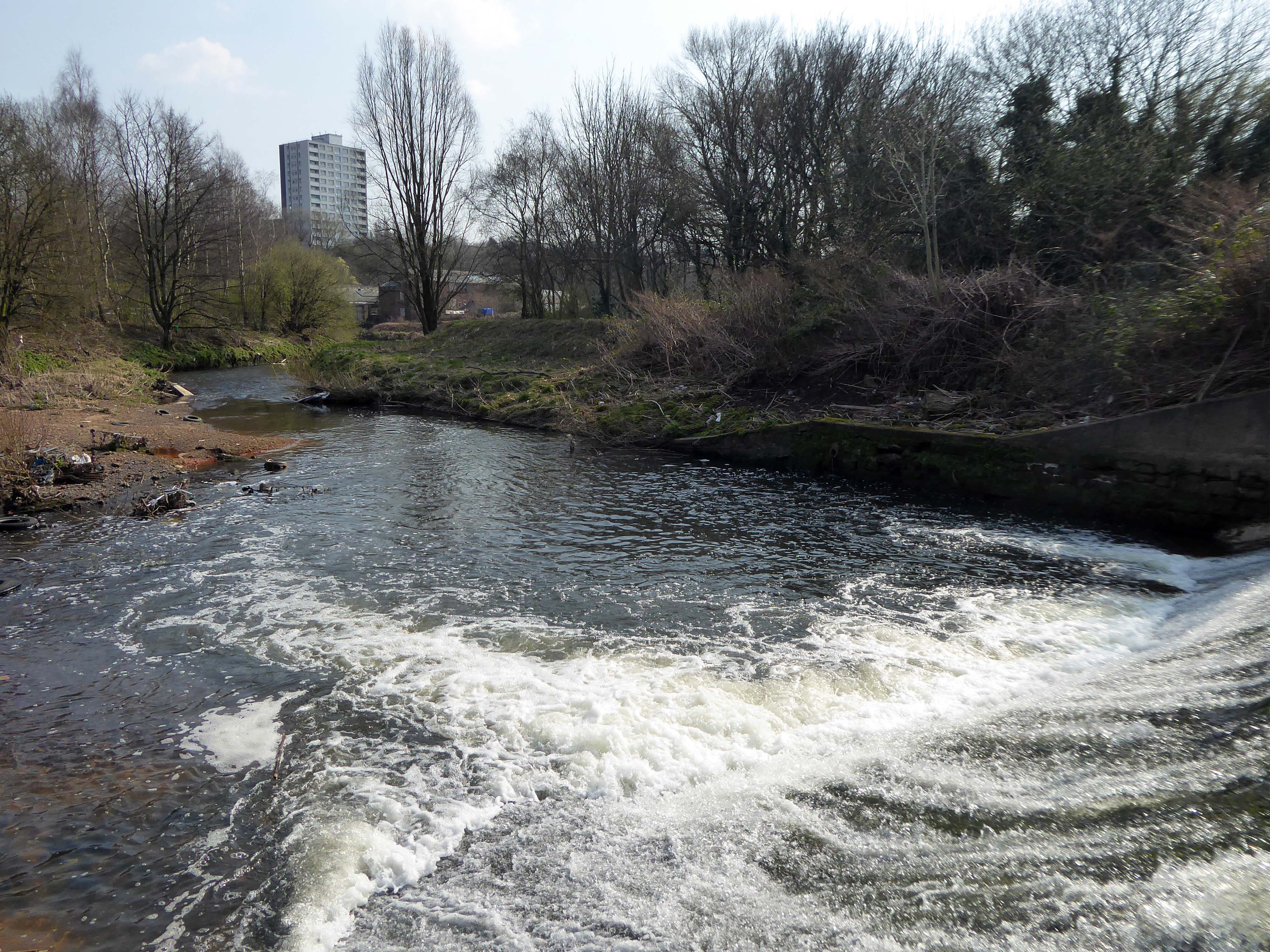
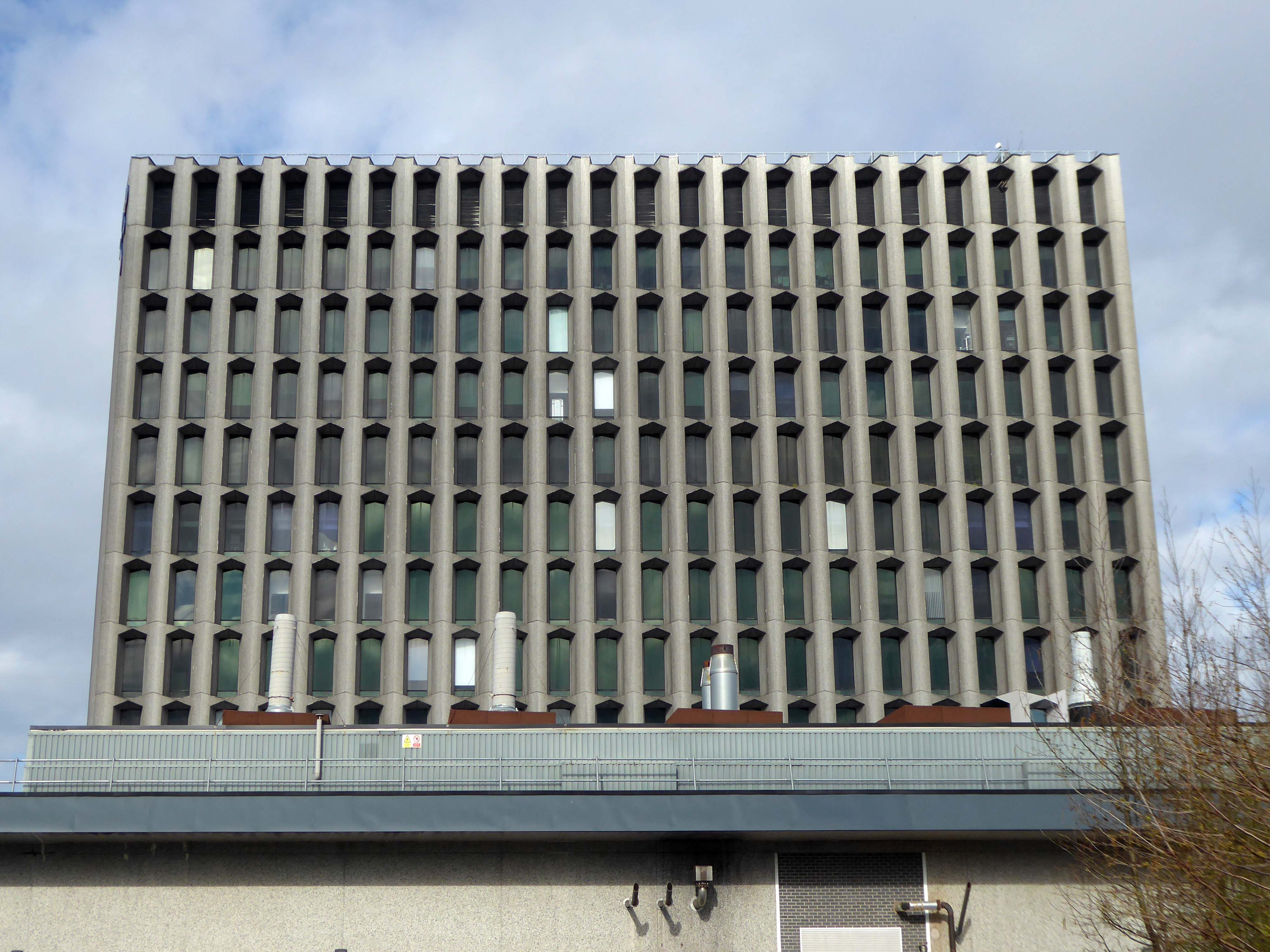
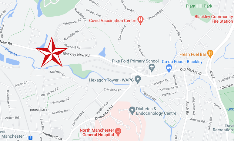
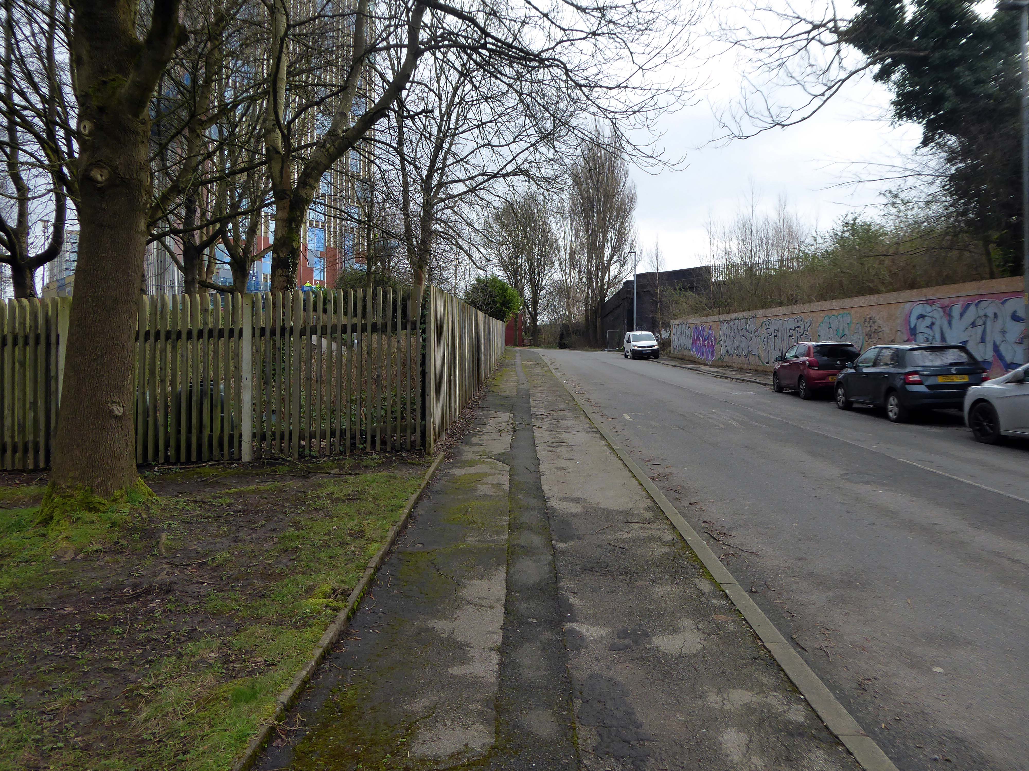
The first leg of a journey to the source of the River Irk beginning behind Victoria, finishing by the Hexagon Towerin Blackley.
The Irk’s name is of obscure etymology, but may be Brittonic in origin and related to the Welsh word iwrch, meaning roebuck
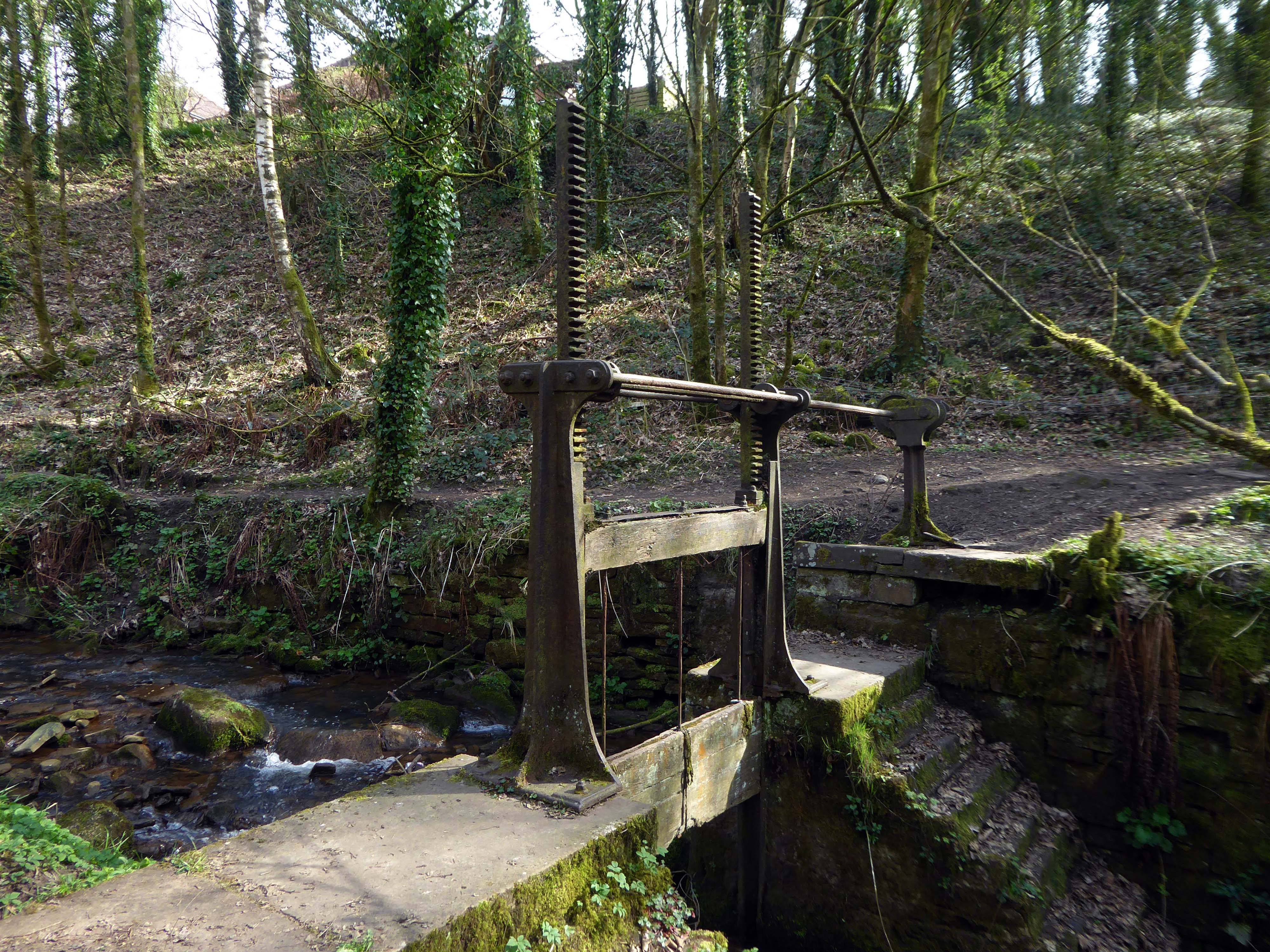
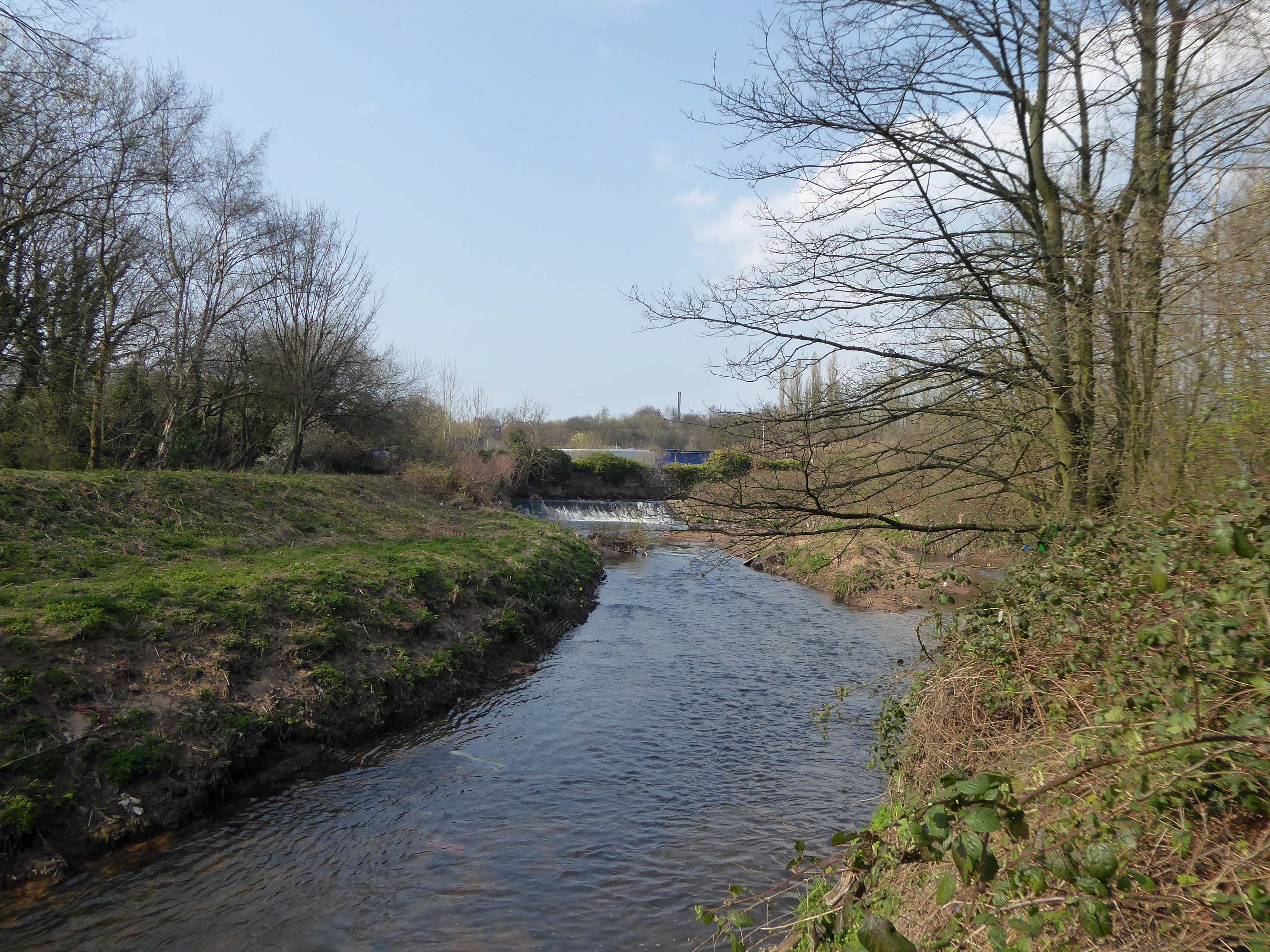
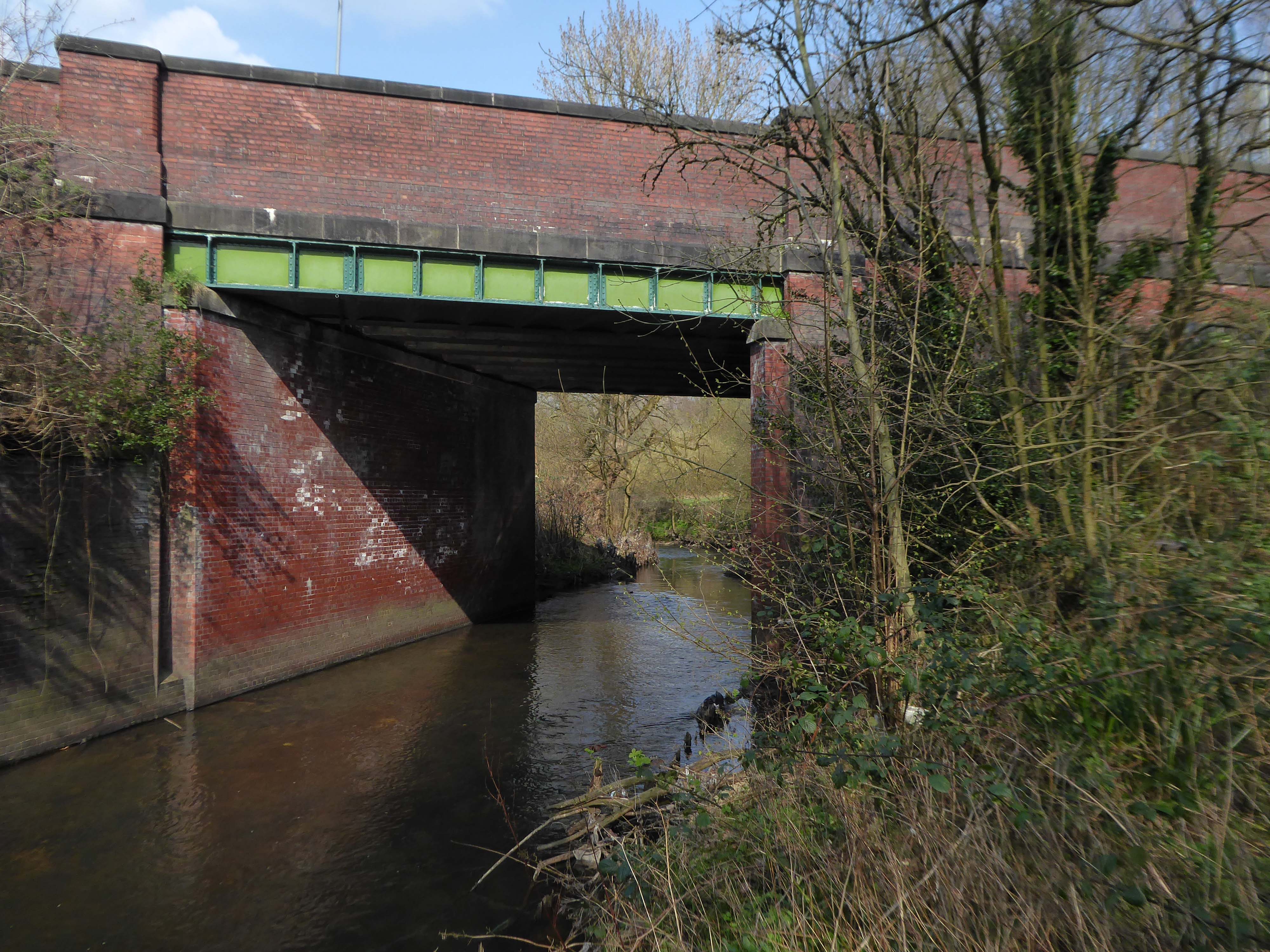
In medieval times, there was a mill by the Irk at which the tenants of the manor ground their corn and its fisheries were controlled by the lord of the manor. In the 16th century, throwing carrion and other offensive matter into the Irk was forbidden. Water for Manchester was drawn from the river before the Industrial Revolution. A bridge over the Irk was recorded in 1381. The river was noted for destructive floods. In 1480, the burgesses of Manchester described the highway between Manchester and Collyhurst which – the water of Irk had worn out. In 1816, of seven bridges over the Irk, six were liable to be flooded after heavy rain but the seventh, the Ducie Bridge completed in 1814 was above flood levels.
According to The New Gazetteer of Lancashire the Irk had – more mill seats upon it than any other stream of its length in the Kingdom and – the eels in this river were formerly remarkable for their fatness, which was attributed to the grease and oils expressed by the mills from the woollen cloths and mixed with the waters.
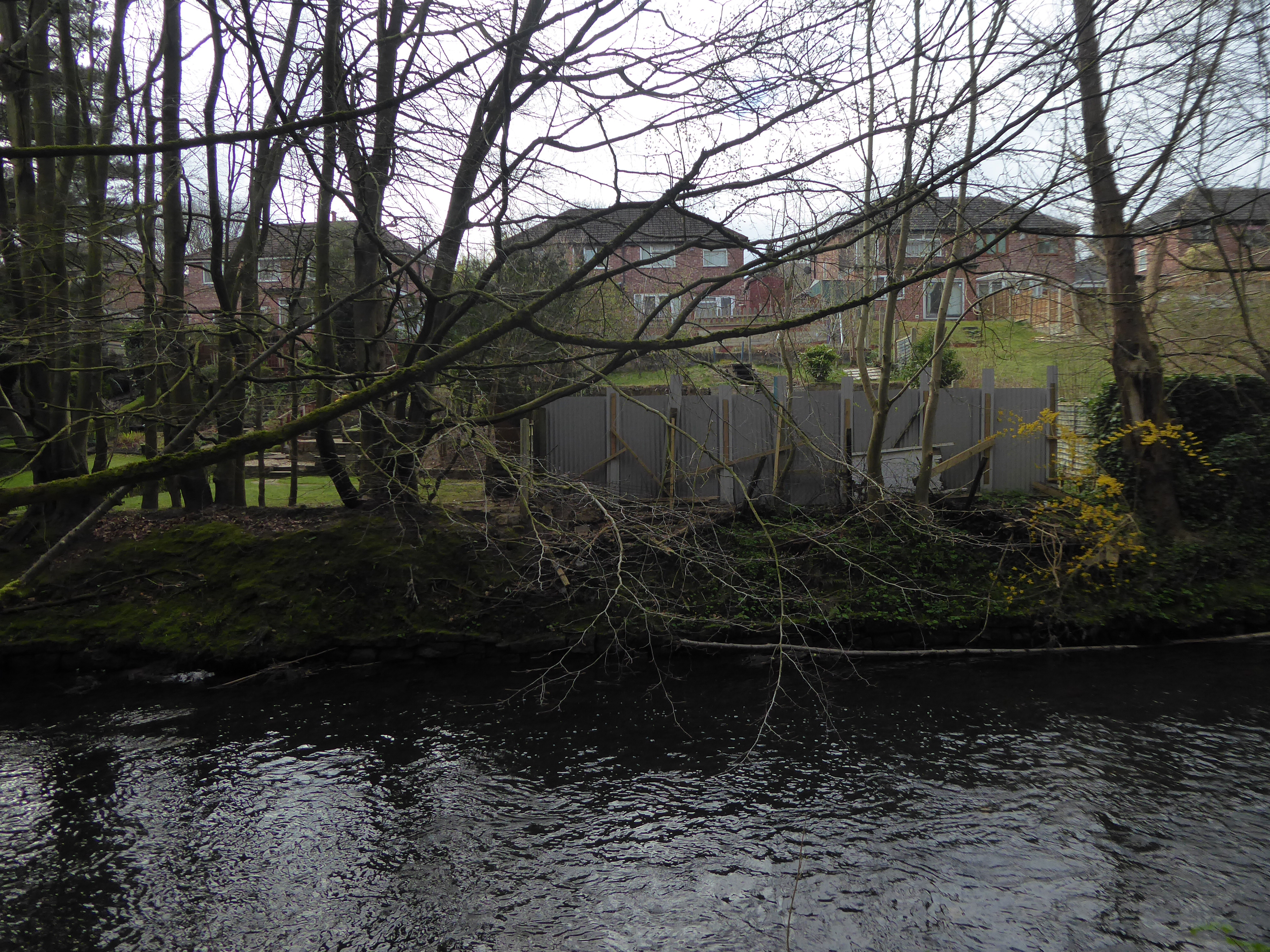
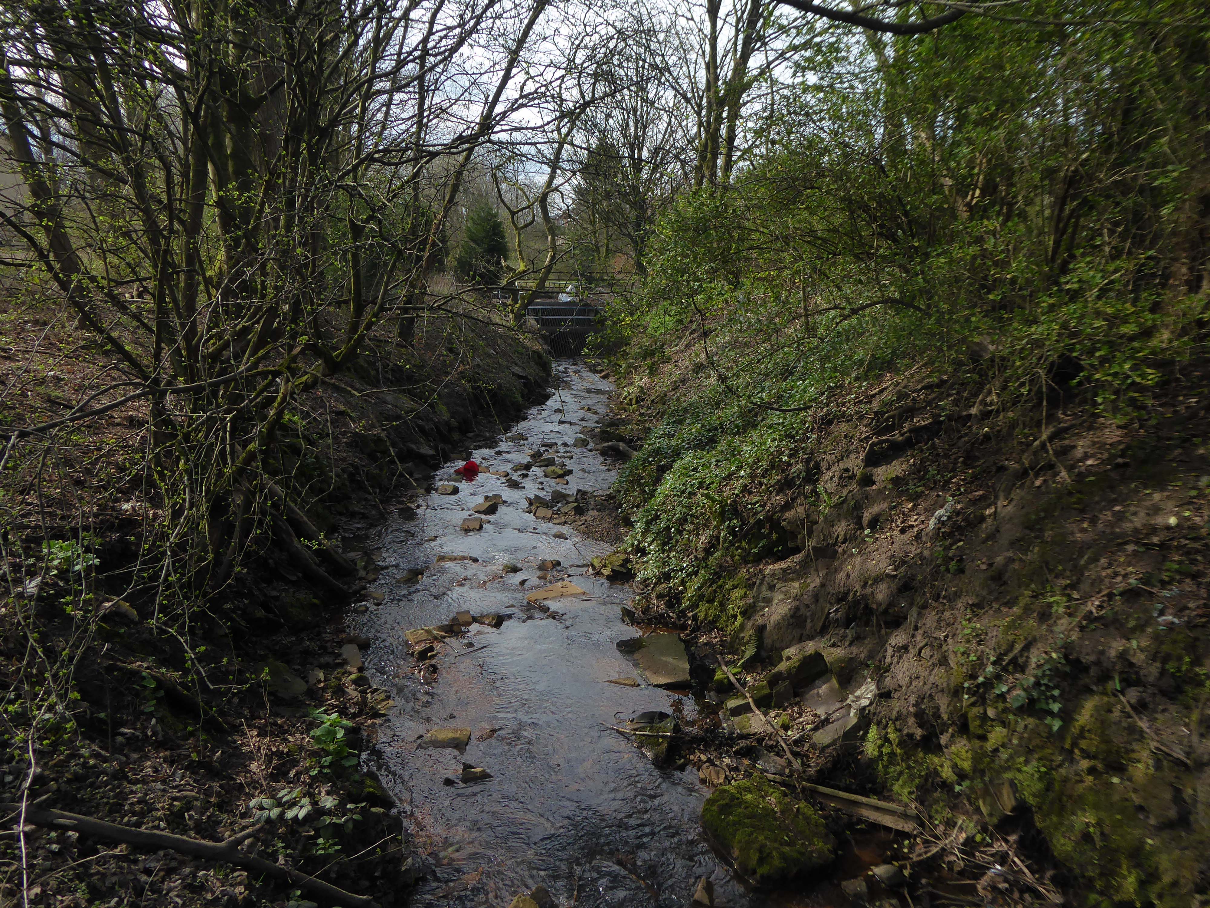
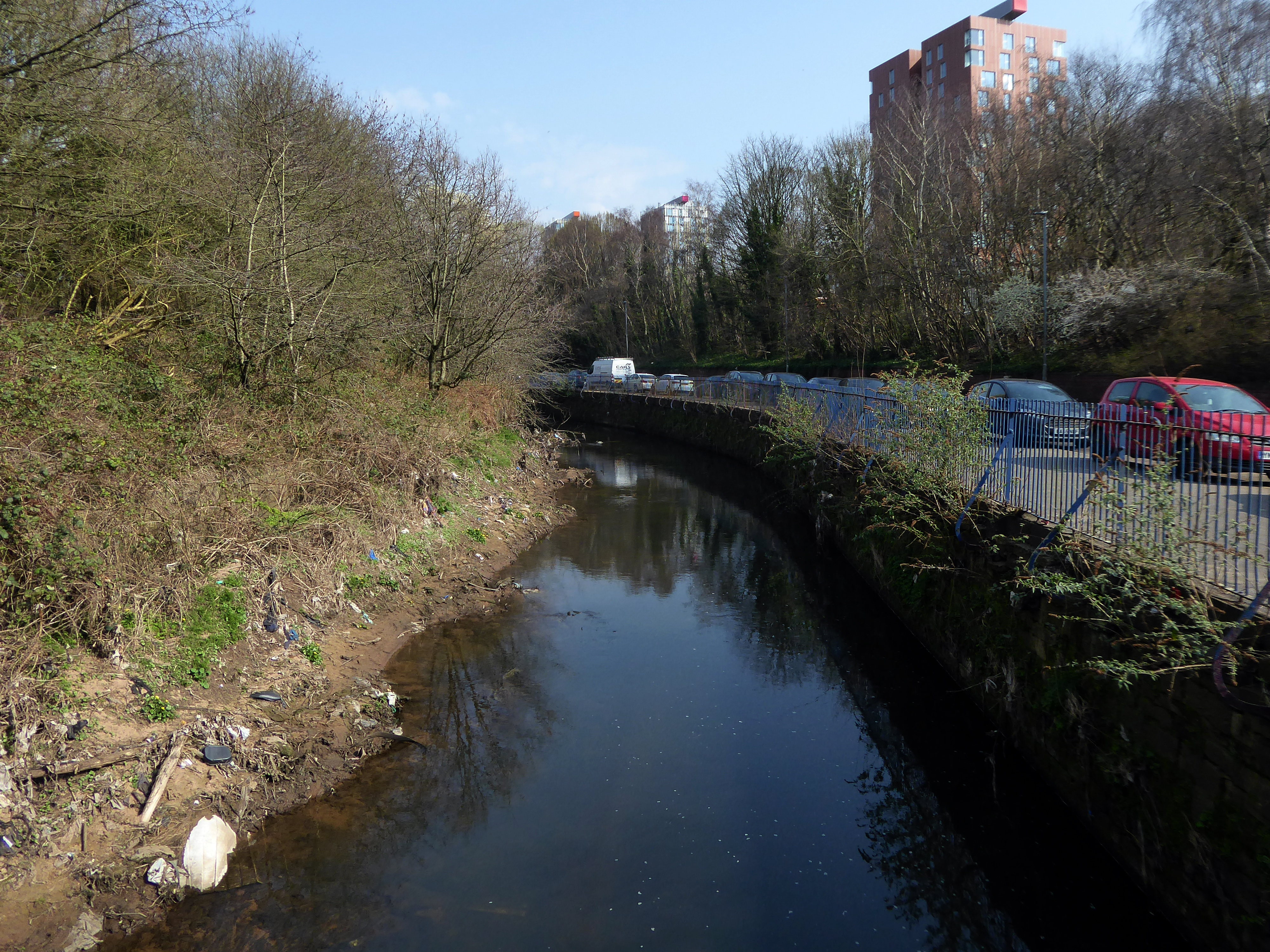
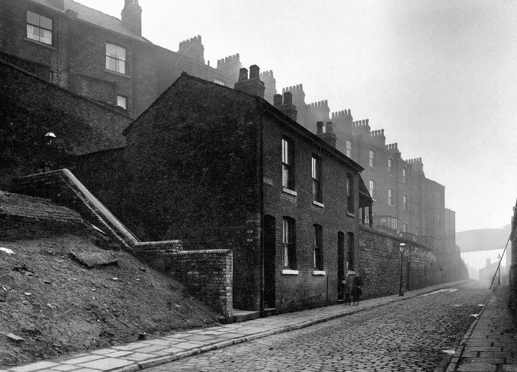
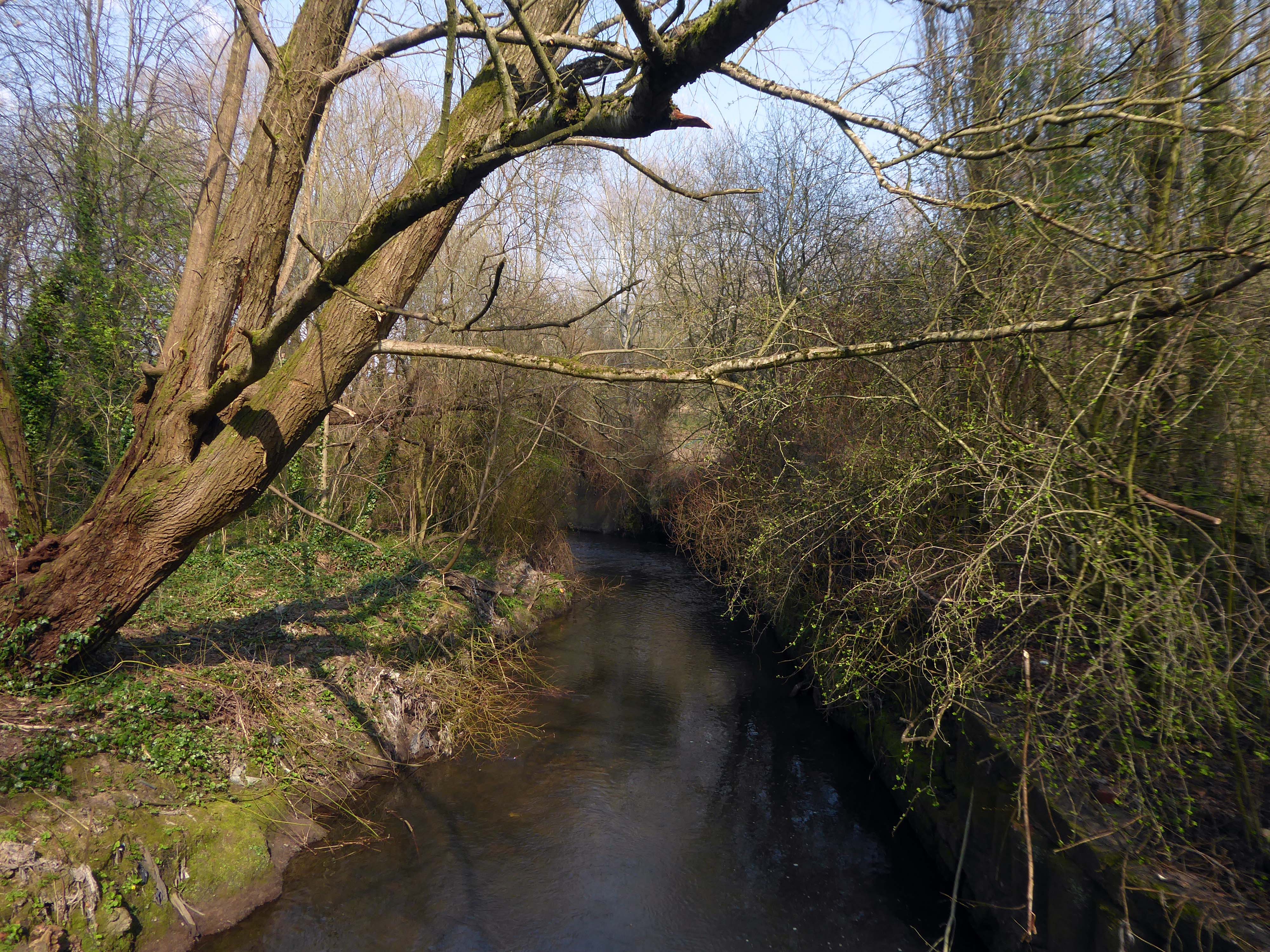
However, by the start of the 20th century the Irk Valley betweenCrumpsall and Blackley had been left a neglected river – not only the blackest but the most sluggish of all rivers.
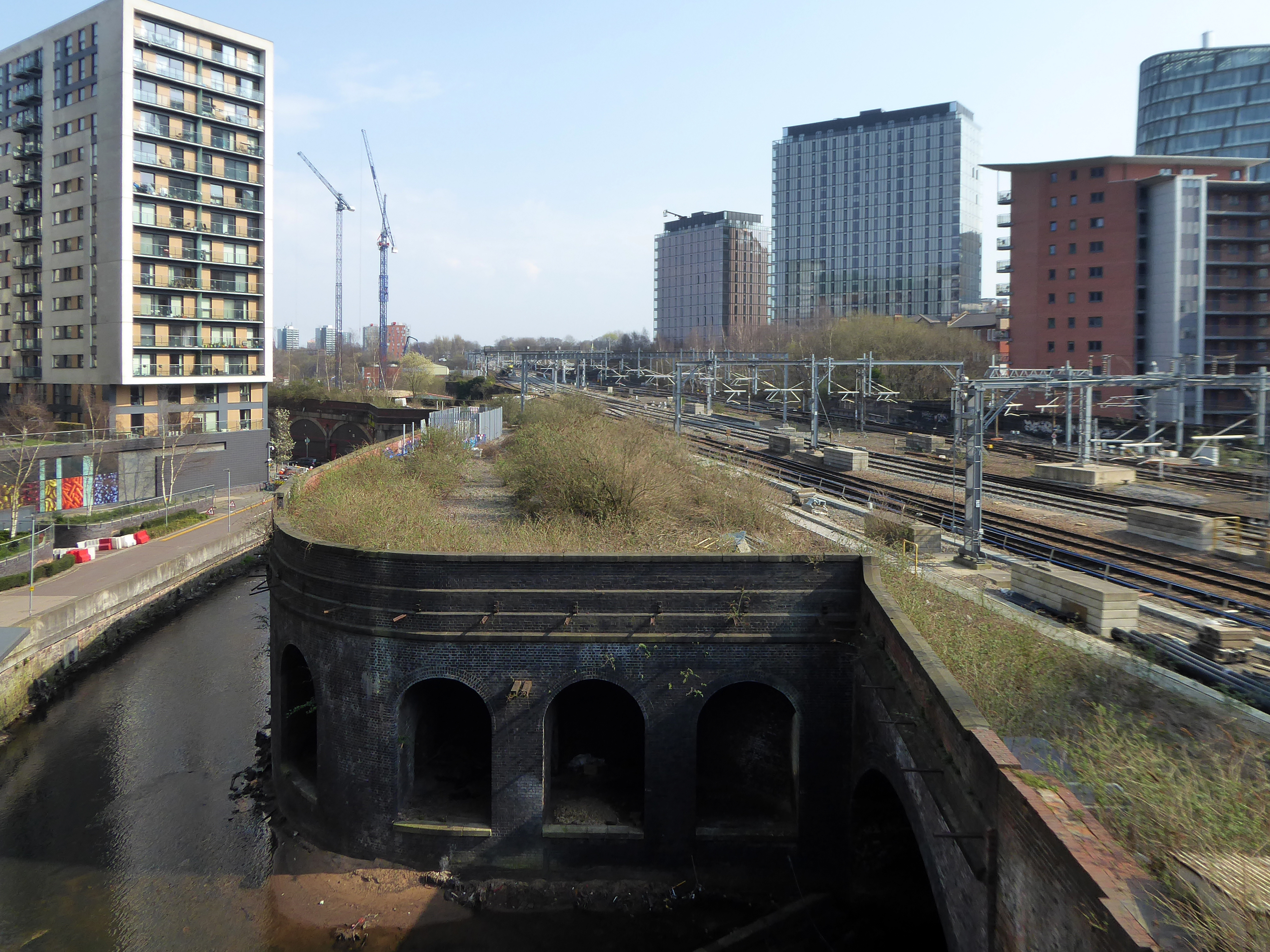
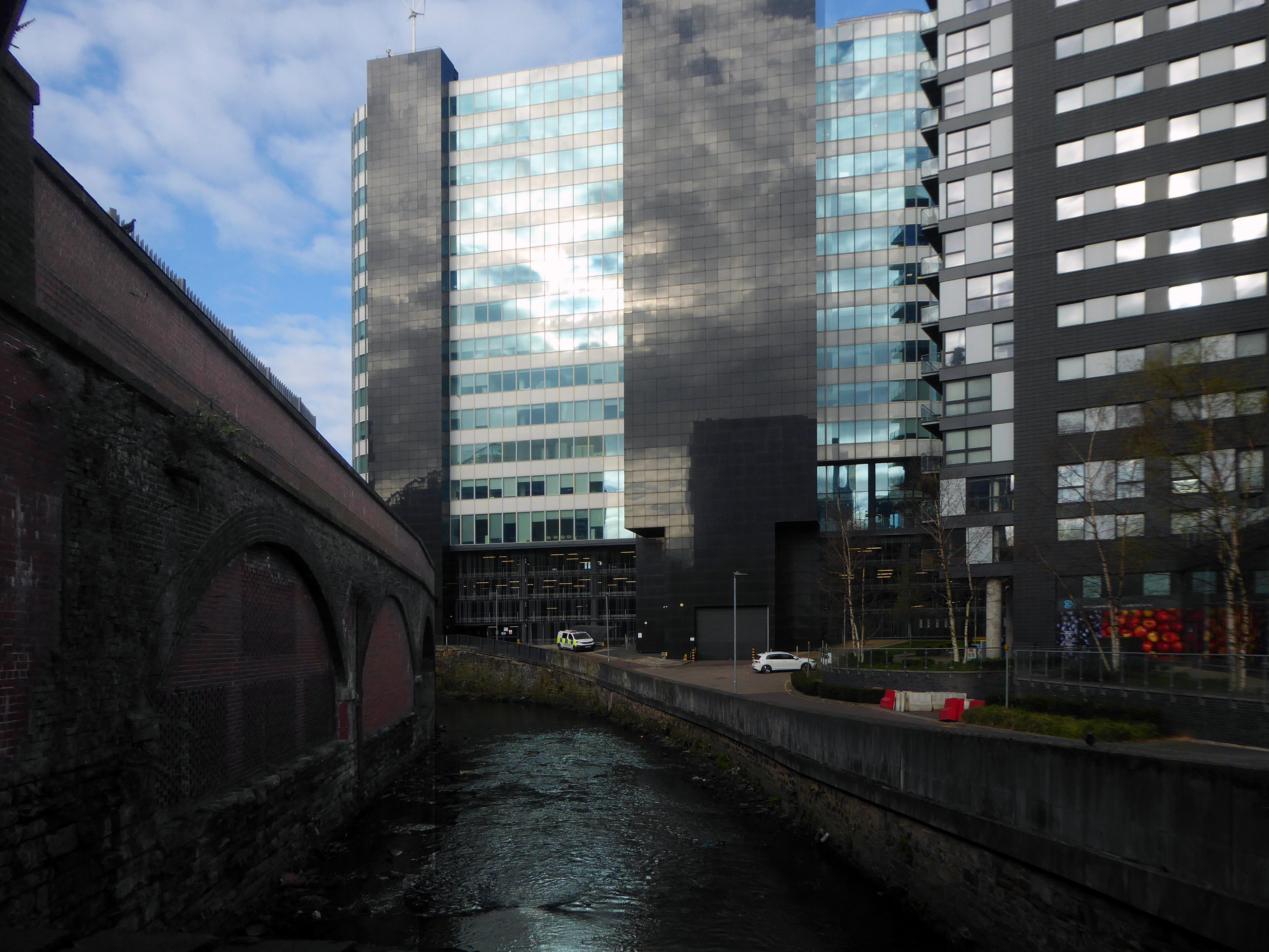
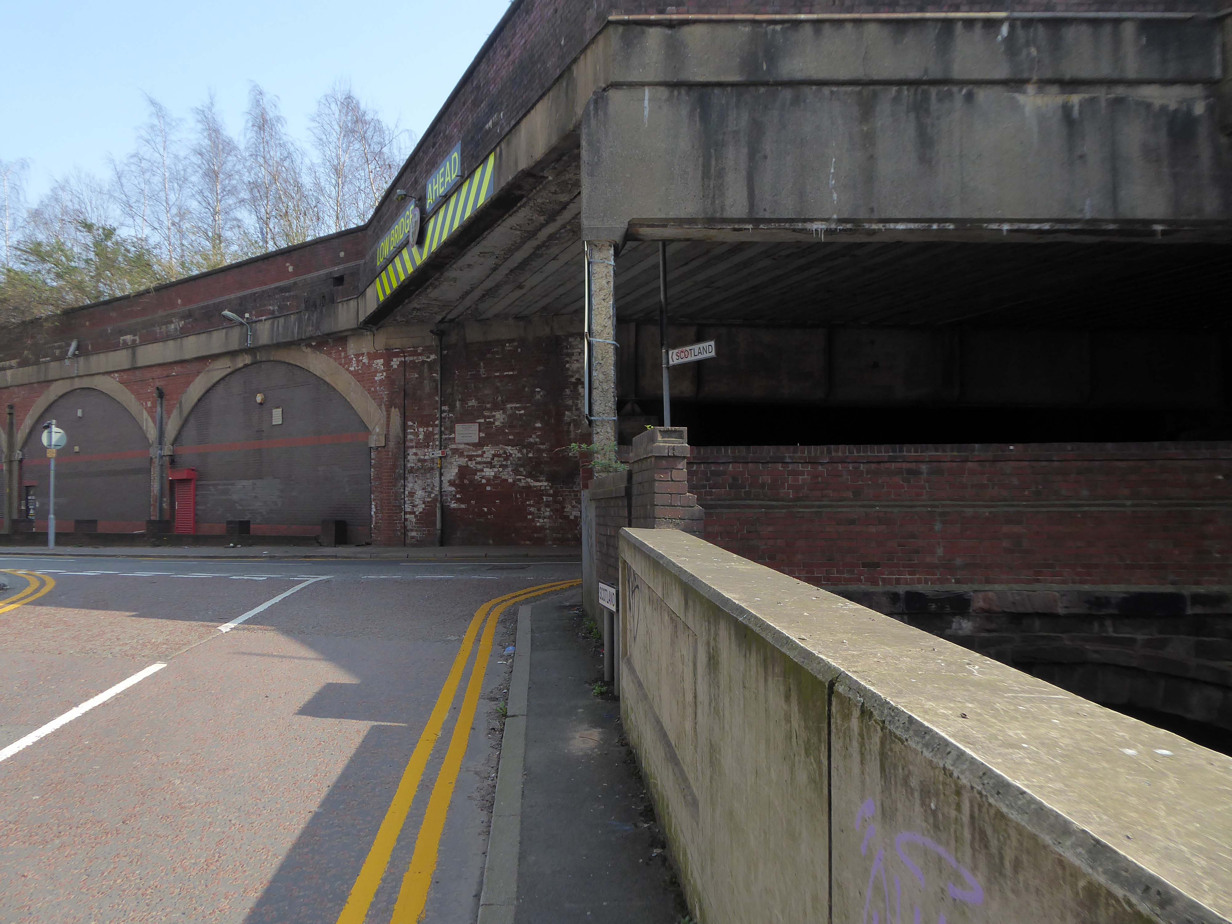
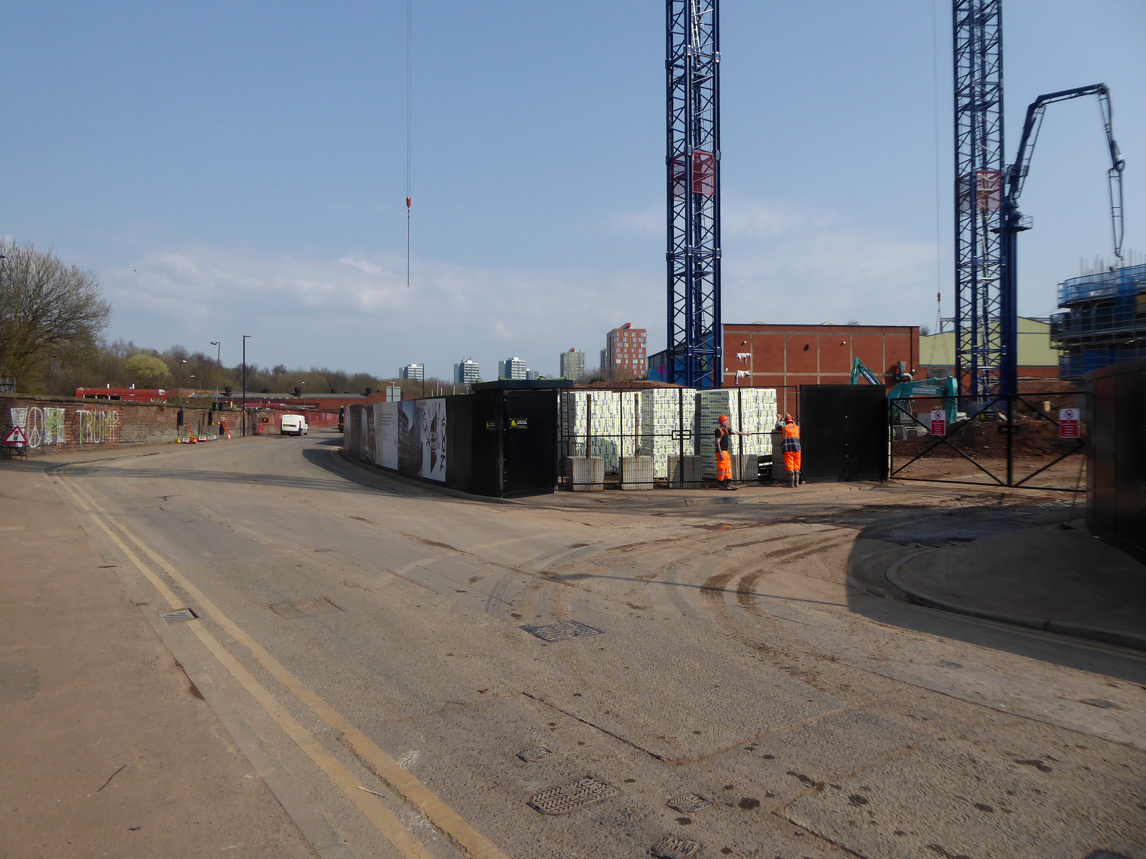
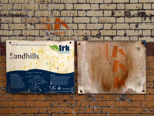
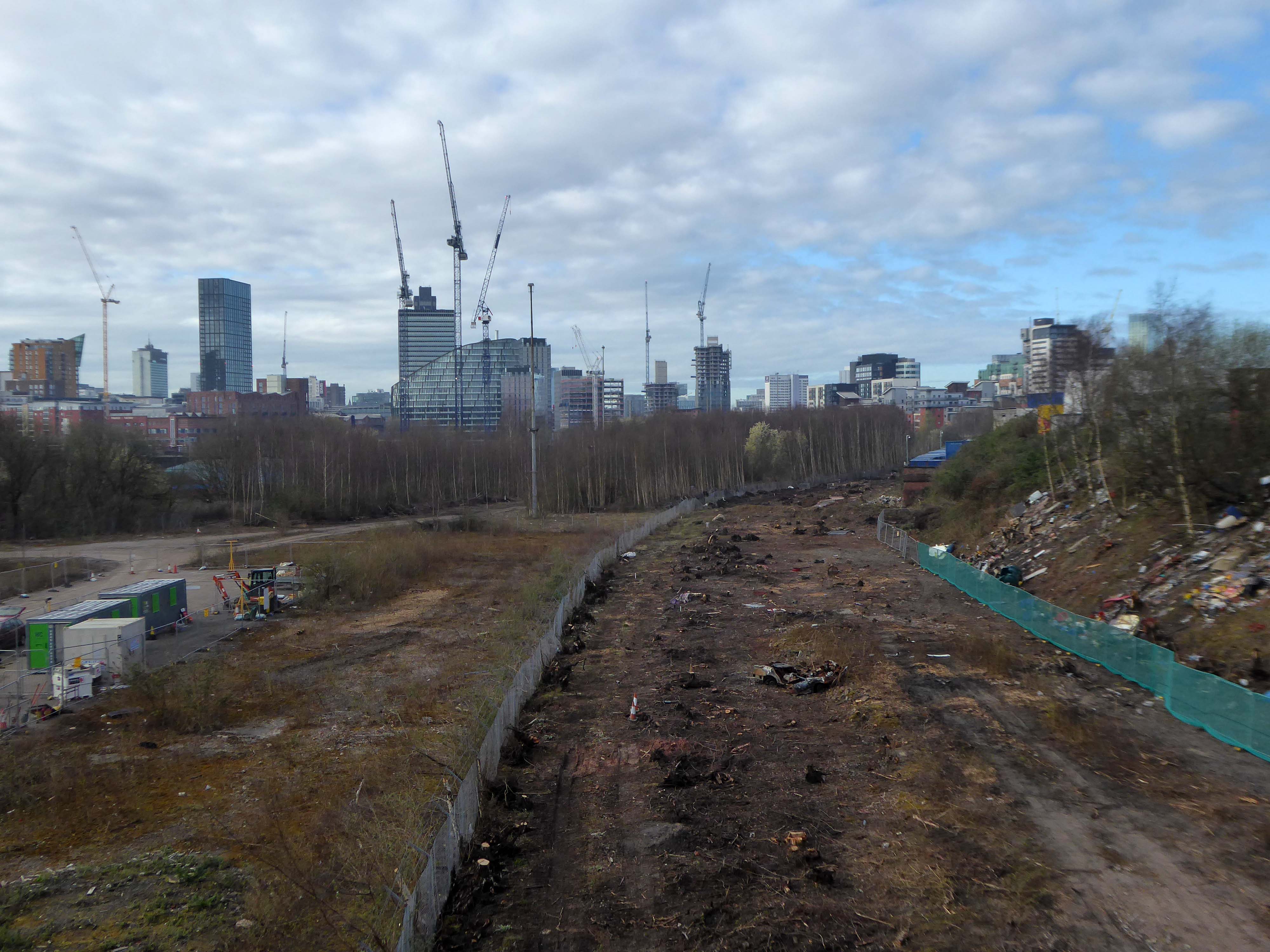
The river emerges from beneath the city into an area named Scotland – a remnant of Manchester’s links with the Jacobite Rebellion.
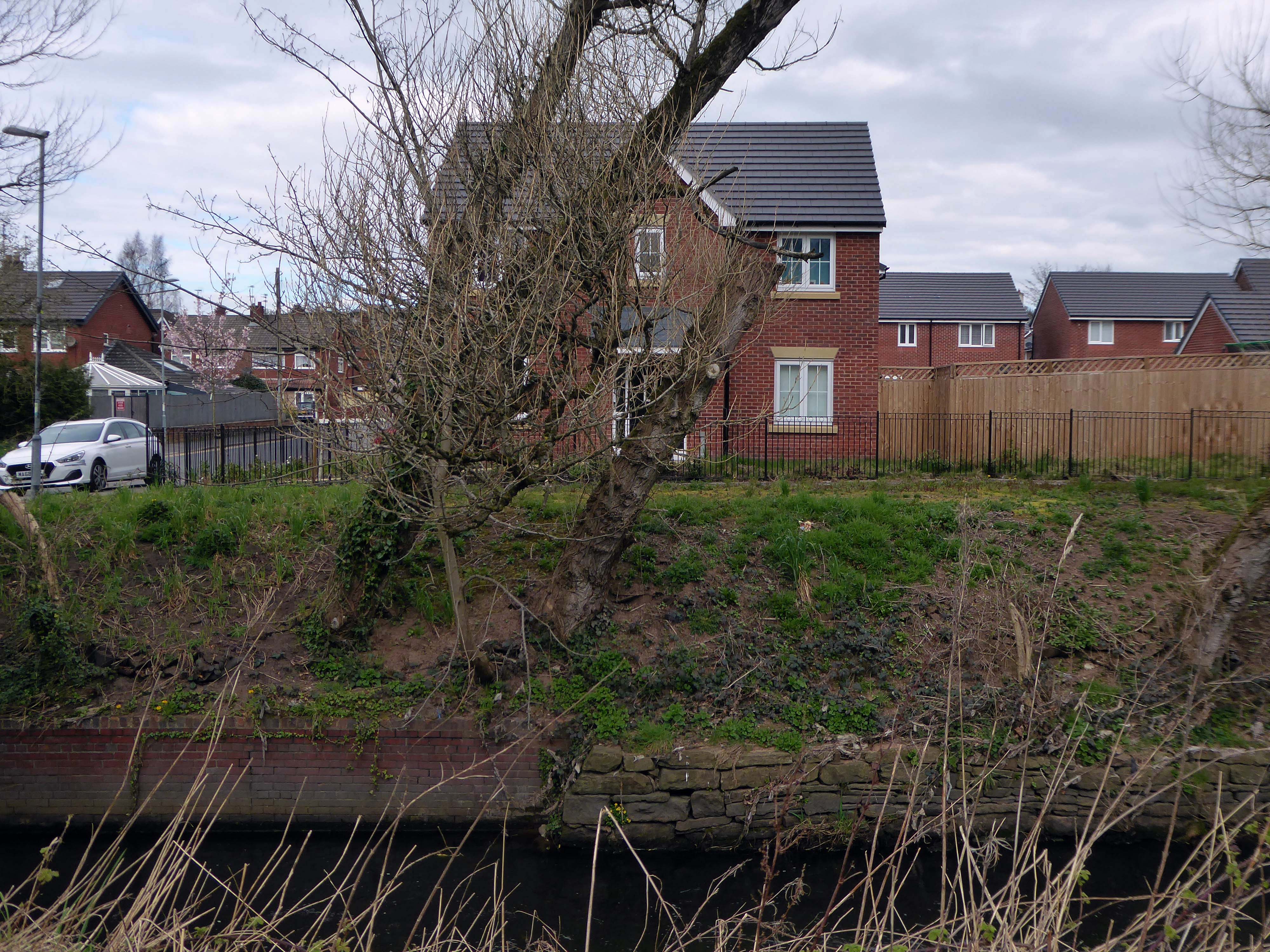
To the left were the squalid Victorian homes of Red Bank – currently presenting as the Green Quarter.
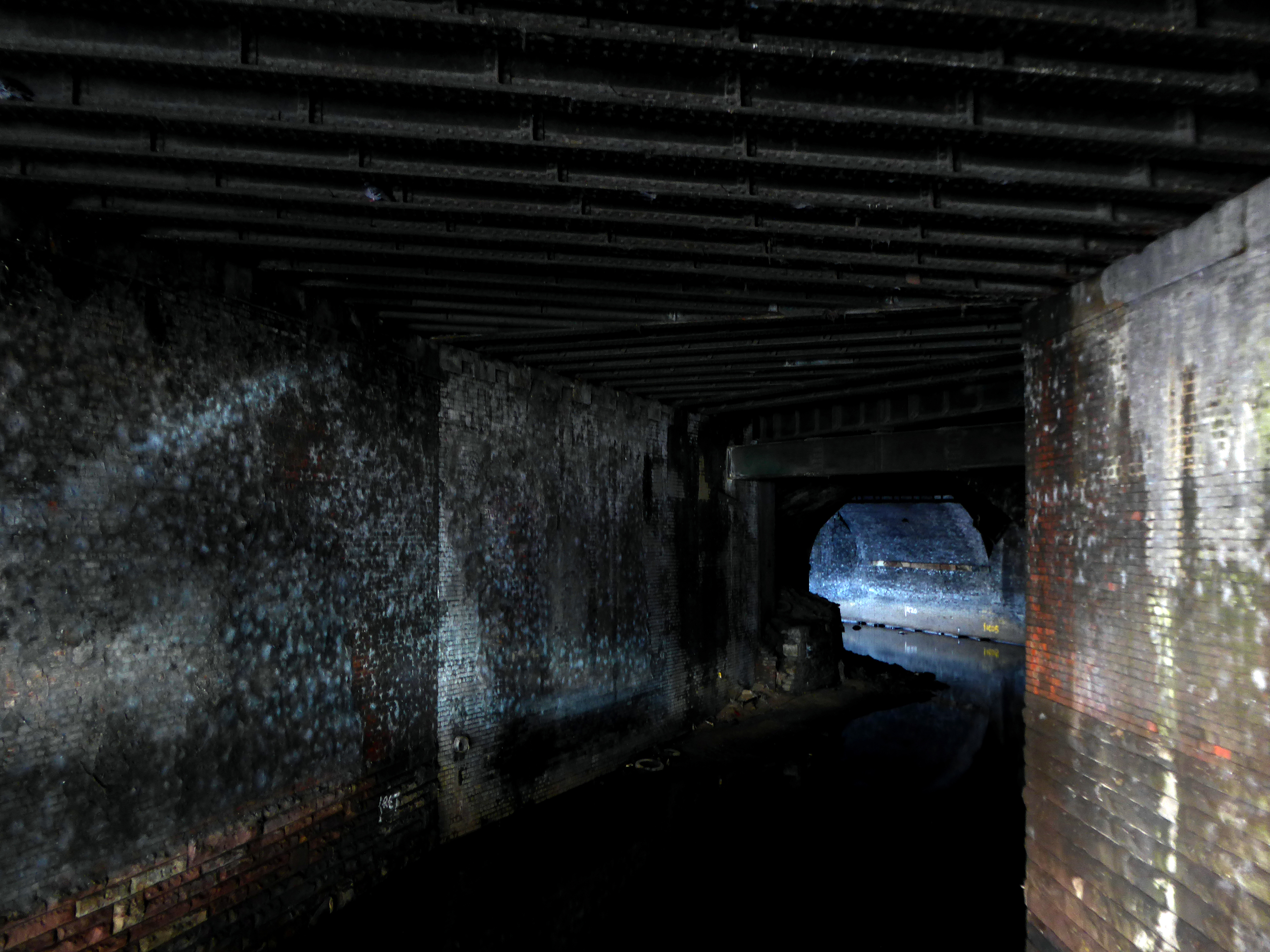
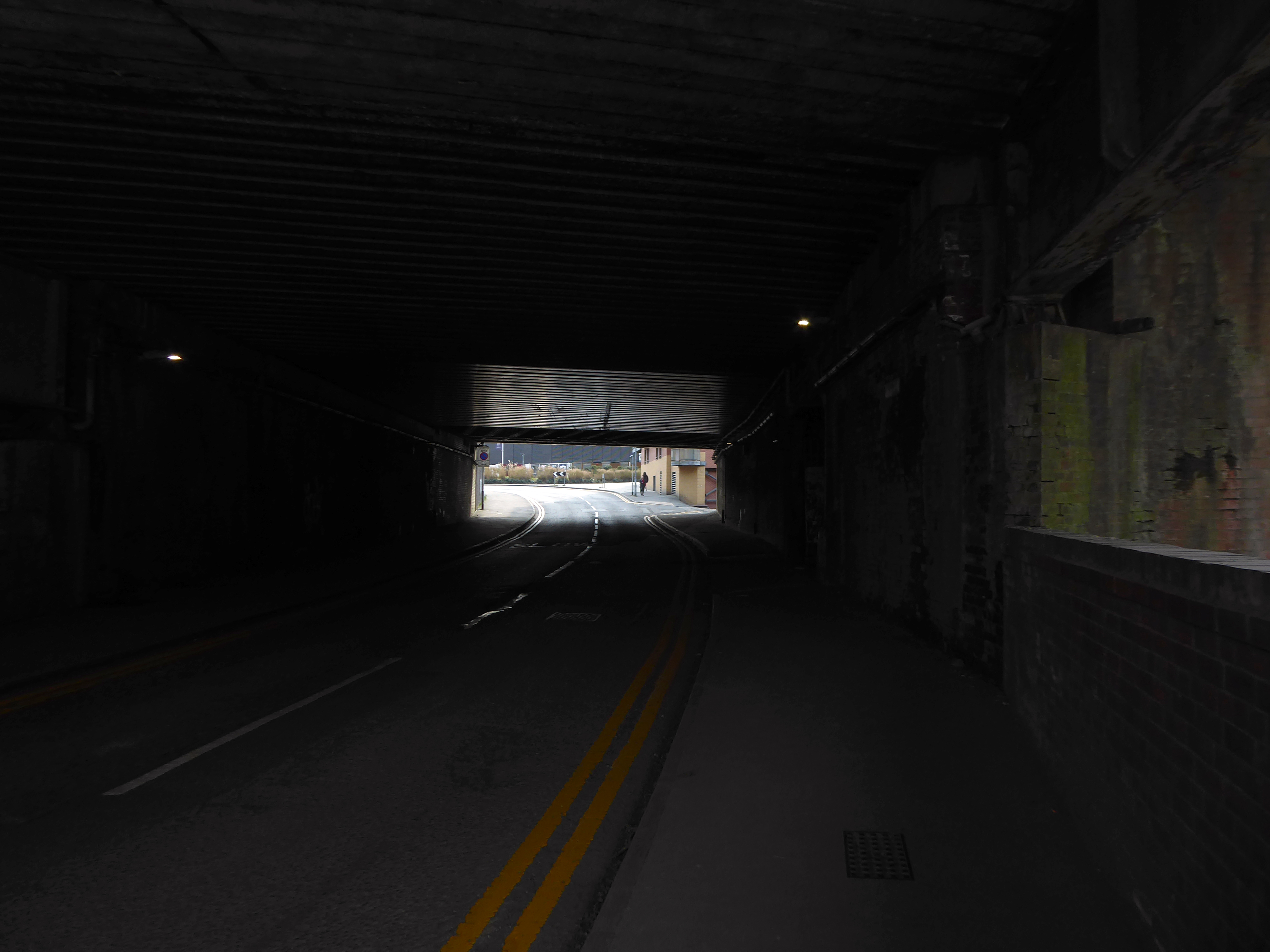
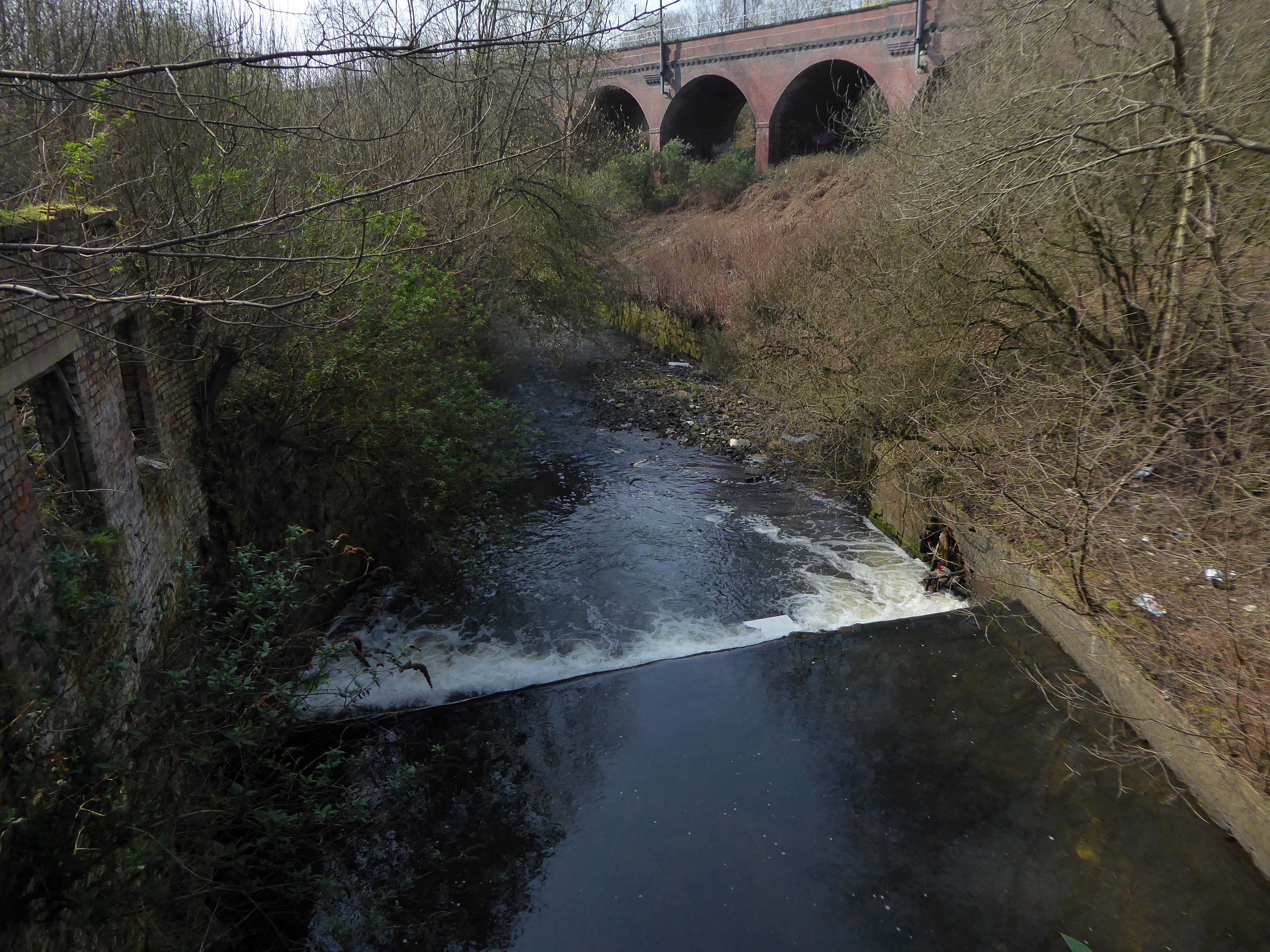
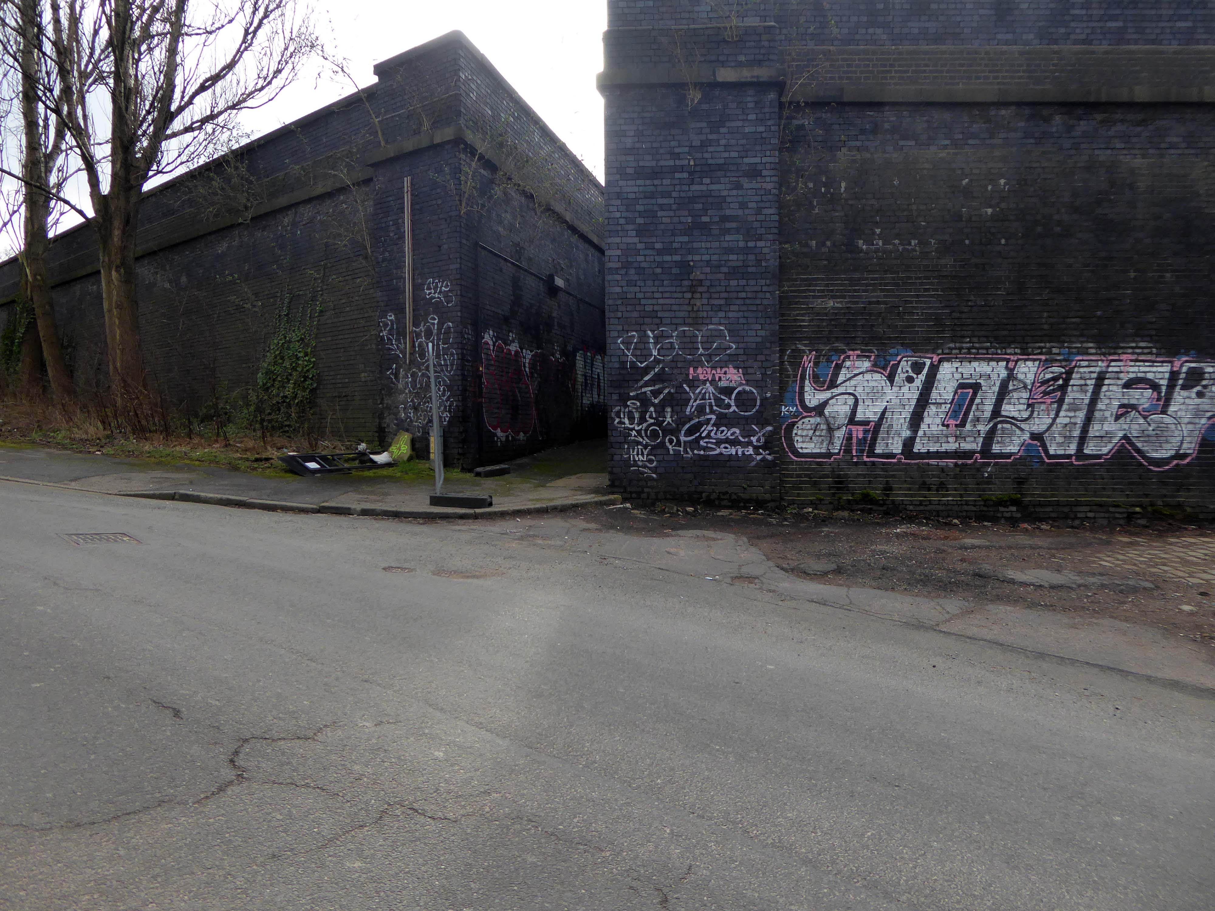
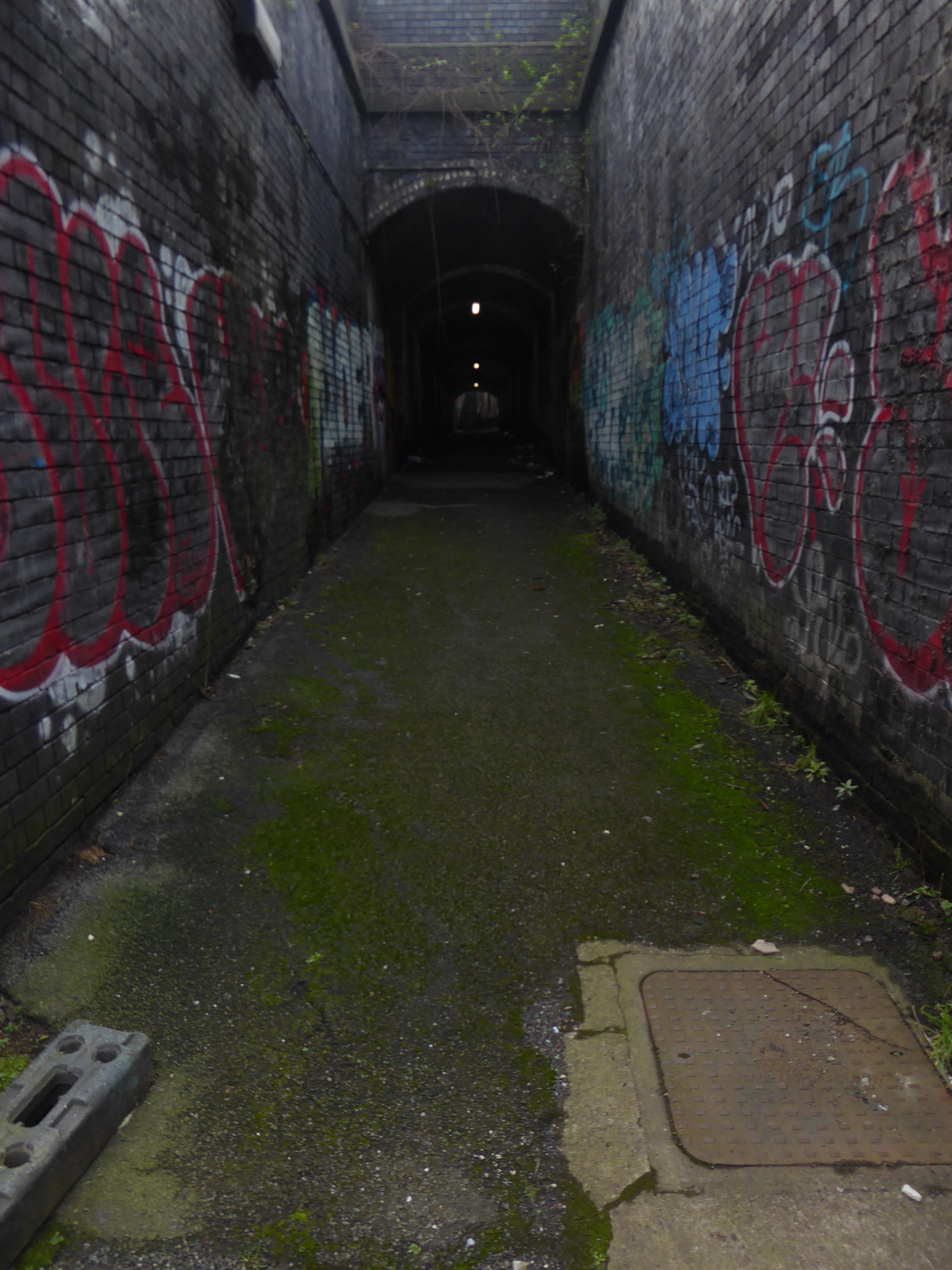
The river briefly becomes subterranean again.
This is a river with an ignominious history – famously damned by émigré Friedrich Engels.
At the bottom flows, or rather stagnates, the Irk, a narrow, coal-black, foul-smelling stream, full of debris and refuse, which it deposits on the shallower right bank.
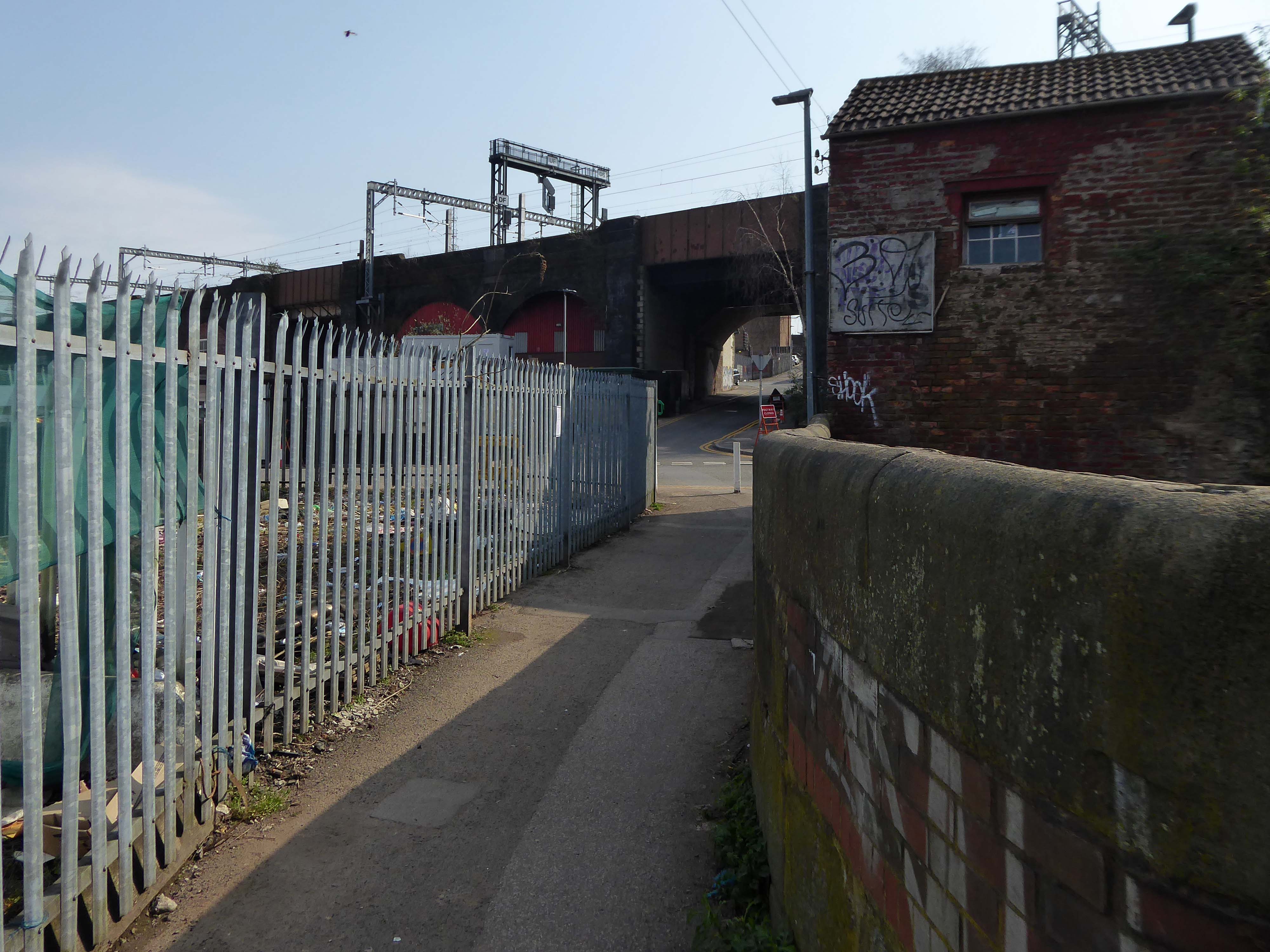
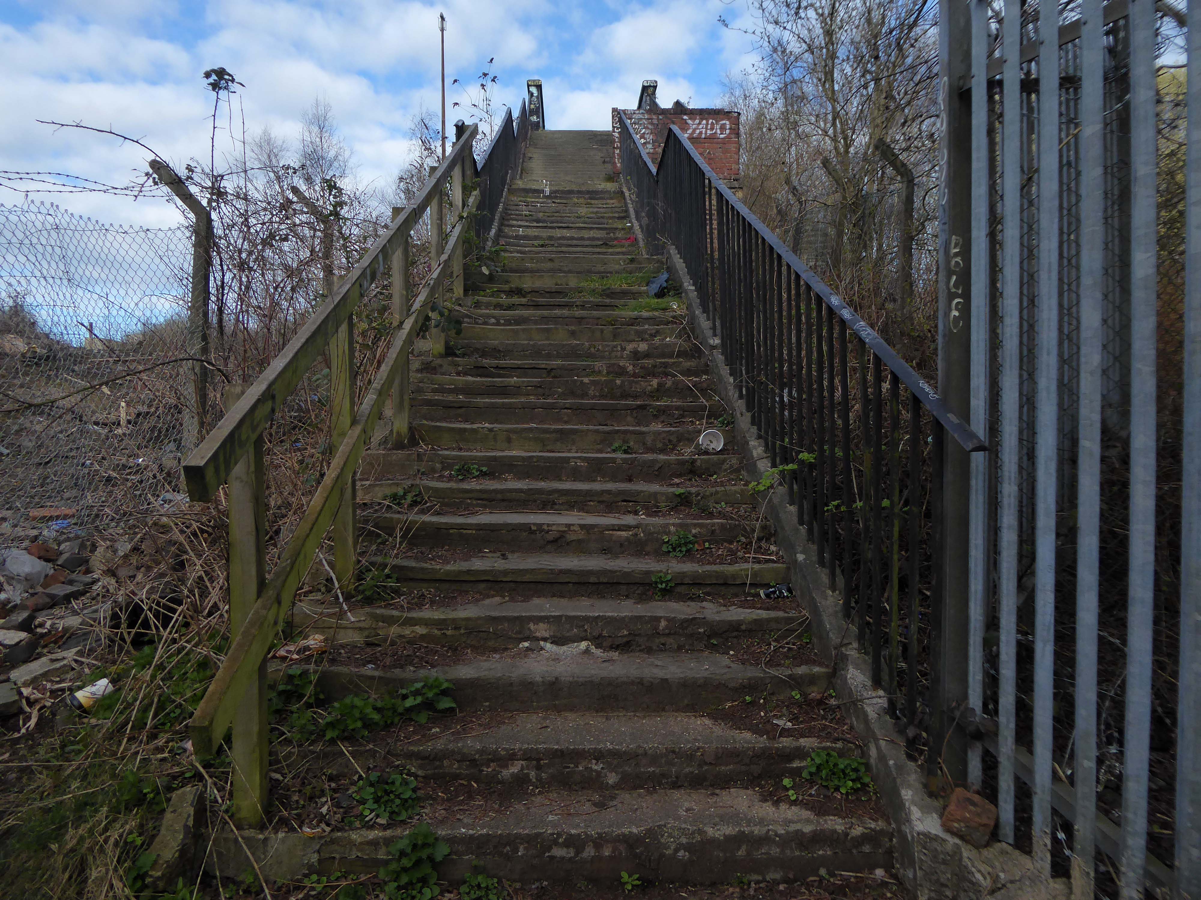
Spanning the defunct railway workings, affording a view of the brightly blooming city centre.
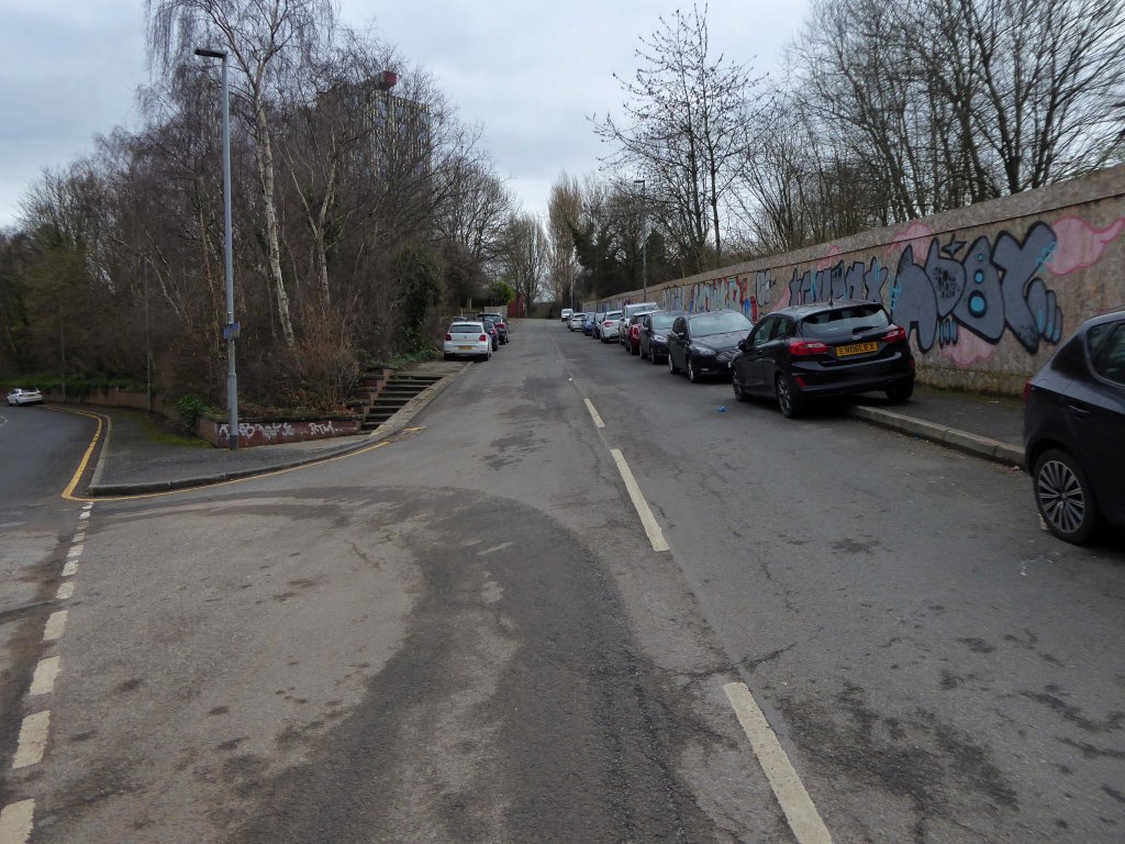
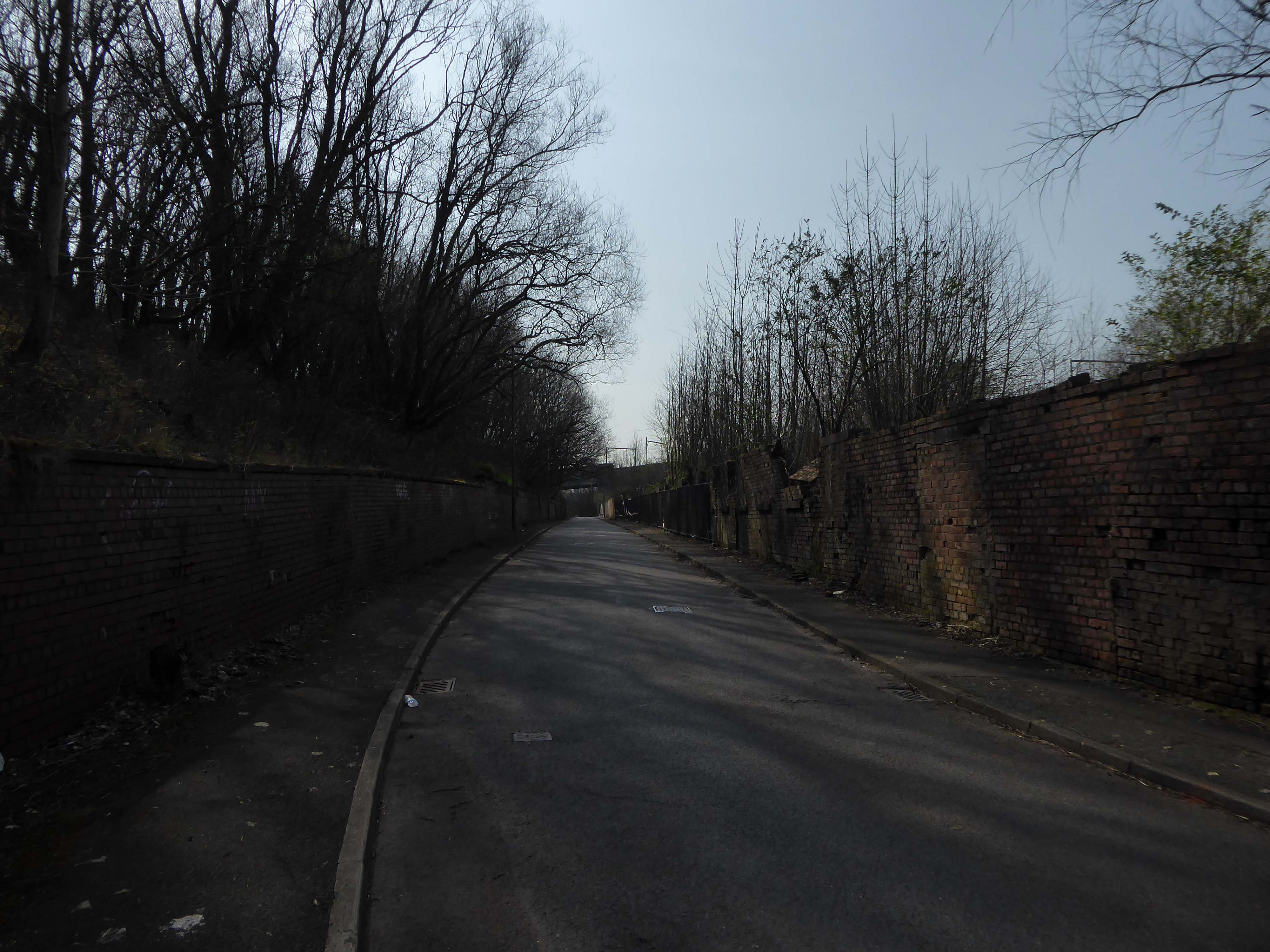
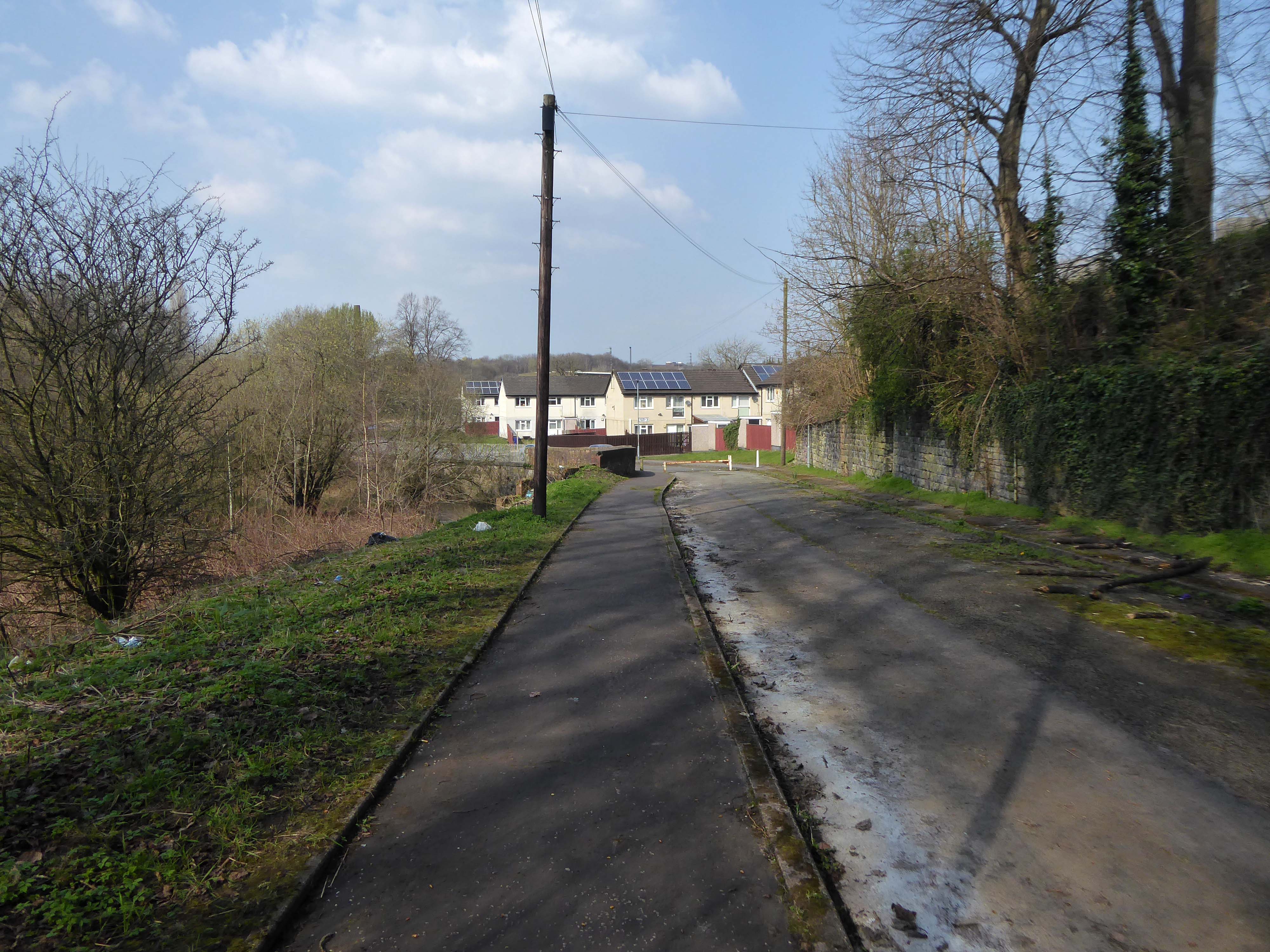
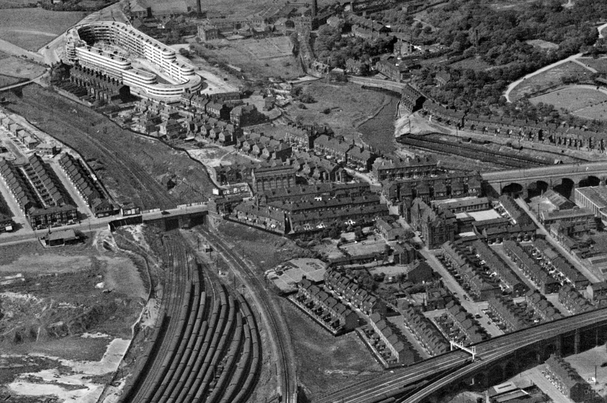
Leaving Collyhurst Road, we journey along Smedley Road.
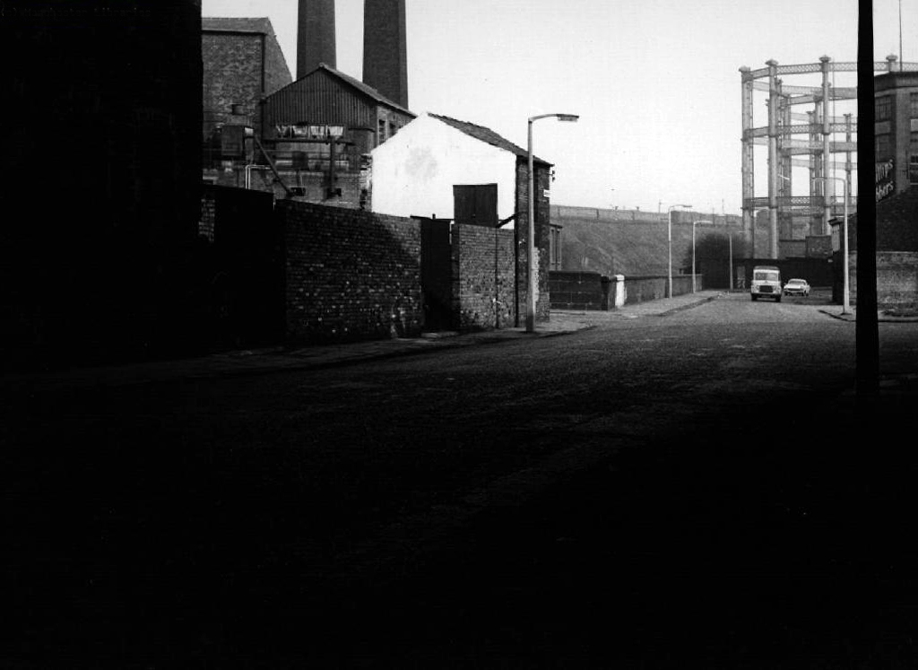
Seen here in 1934.
Passing beneath Queens Road – Queens Park to the right.
Queen’s Park was one of Britain’s first municipal parks created in 1846. The park was originally arranged around Hendham Hall, home of the Houghton family however this was demolished in 1884.
Dropping down to Hendham Vale.
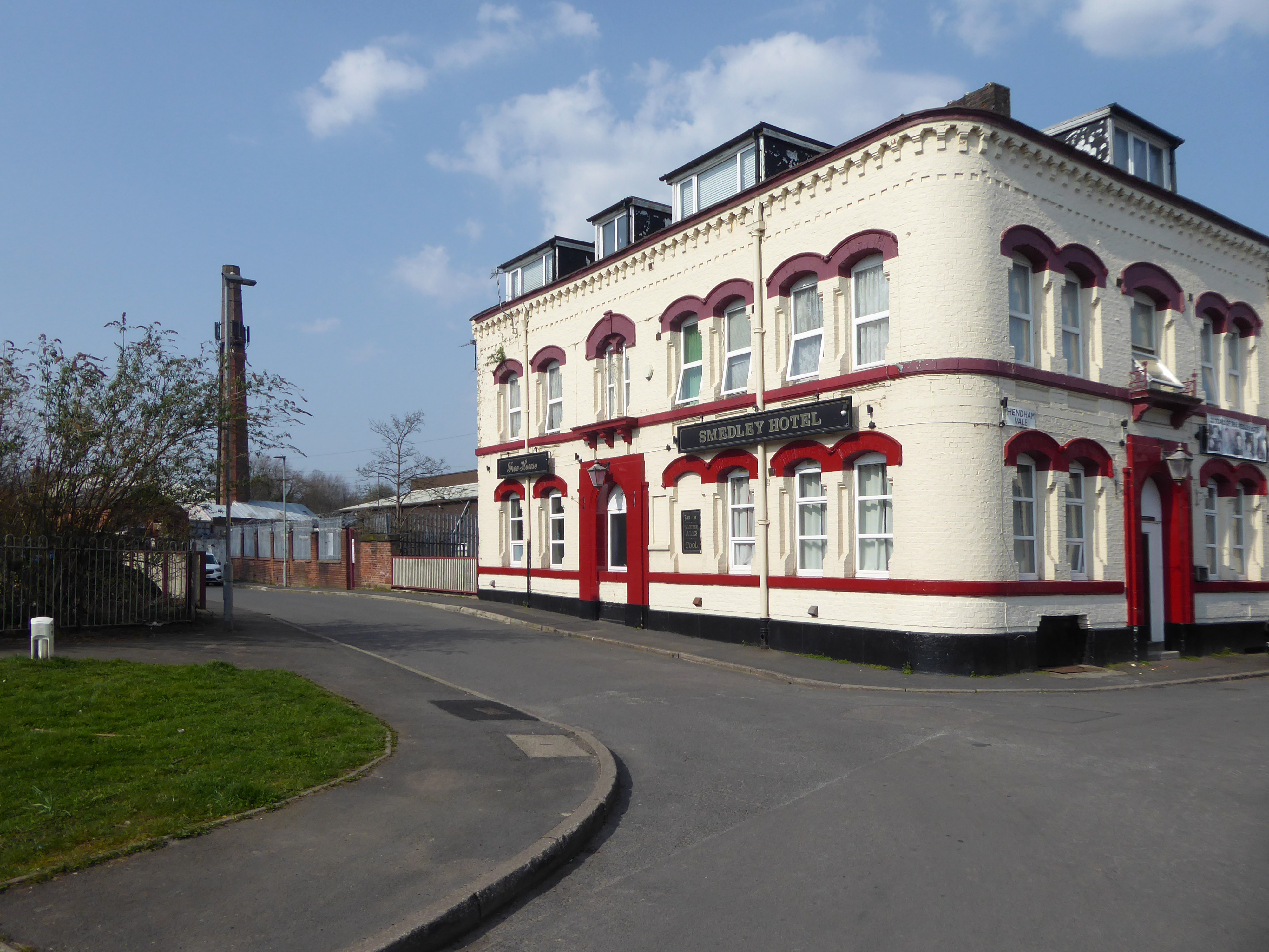
To the right is the Smedley Hotel.
The Smedley Hotel is a very large pub that is hidden away on a quiet back street.Once inside there were a few different rooms and I had a drink in the bar which was fairly large and seemed in need of some attention. The pub still had its old Chesters signs outside and there were three real ales on the bar. I had a drink of Chesters bitter and this was a very nice drink the other beers were Chesters mild and Boddington’s bitter.
I thought this pub would be long gone but it is still standing and I think open for business.
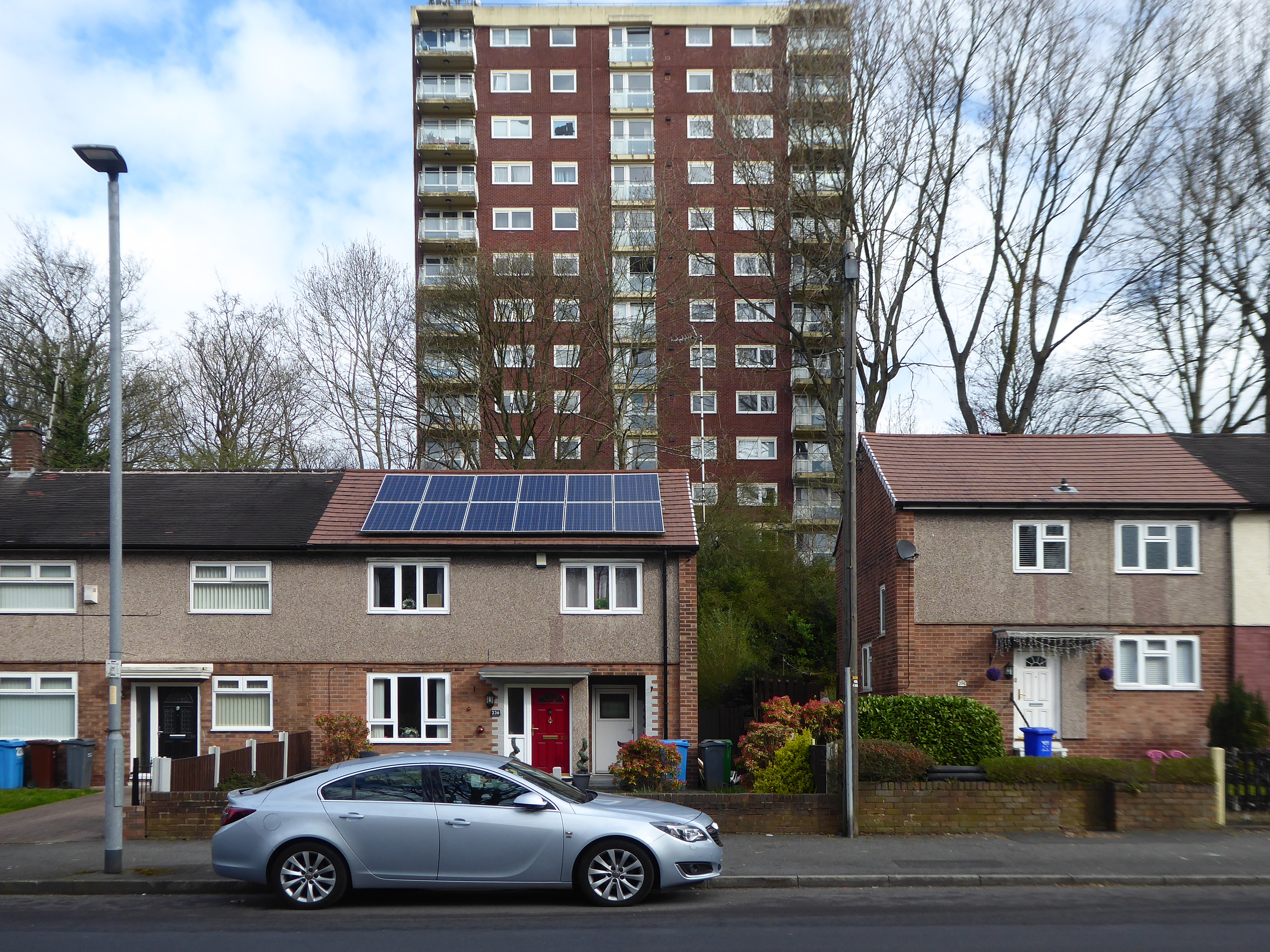
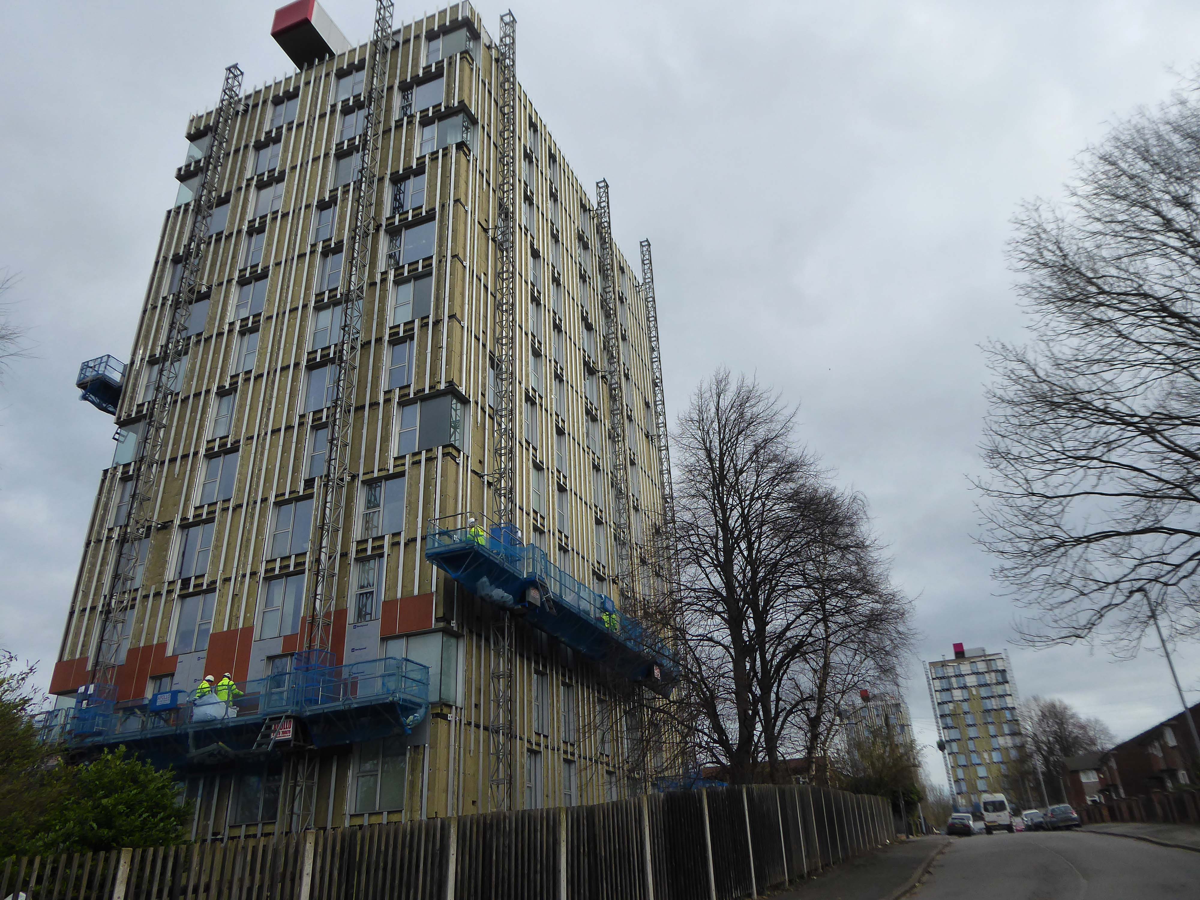
Lost to the world are the Manchester Moderne flats of Kennet House overlooking the Irk Valley on Smedley Lane.
Hendham Way becomes a pedestrianised lane.
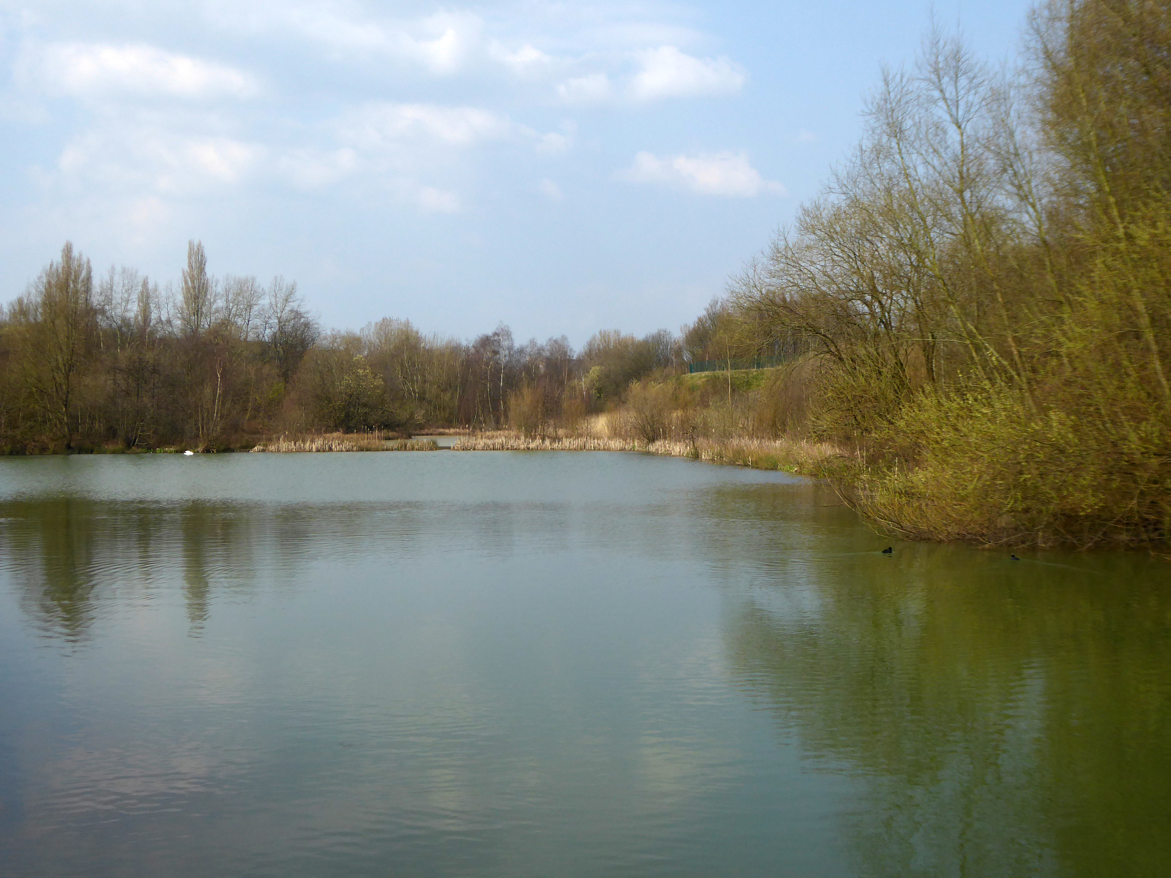
Taking the road up and then down, returning to the river, and following the wrong path – alongside the Hapurhey Reservoir and Ponds.
A remnant of the industrial era the reservoirs and ponds, once used by the factories as a source of water, have over the year become a thriving habitat which supports a substantial amount of wildlife.
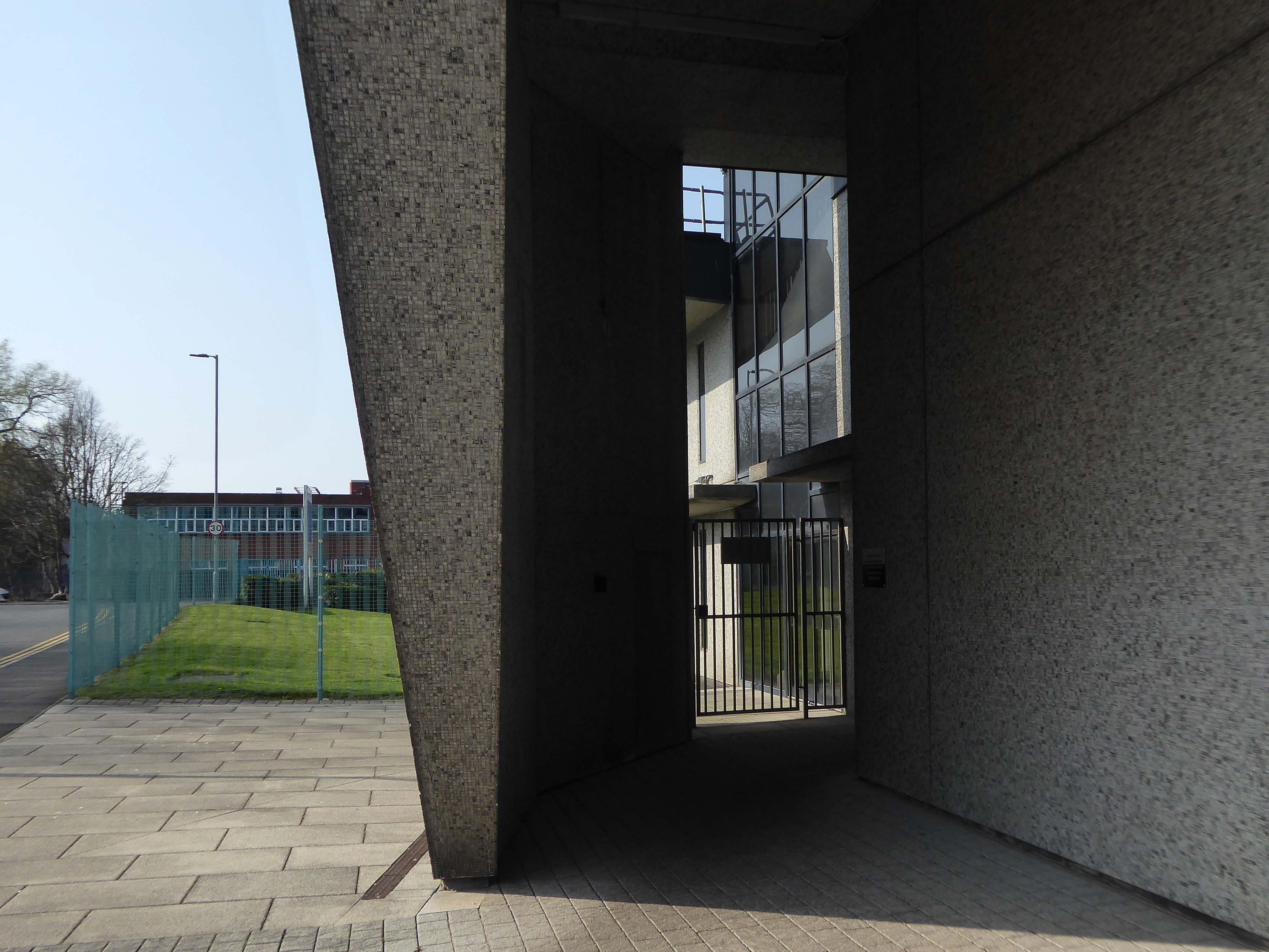
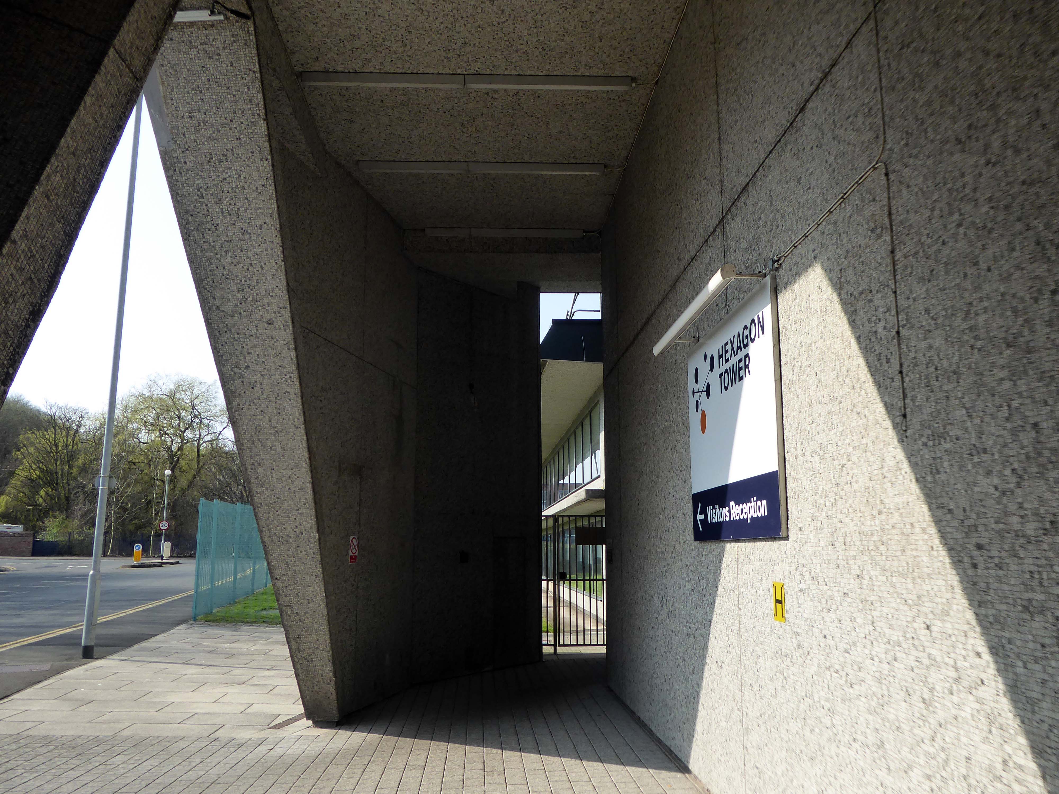
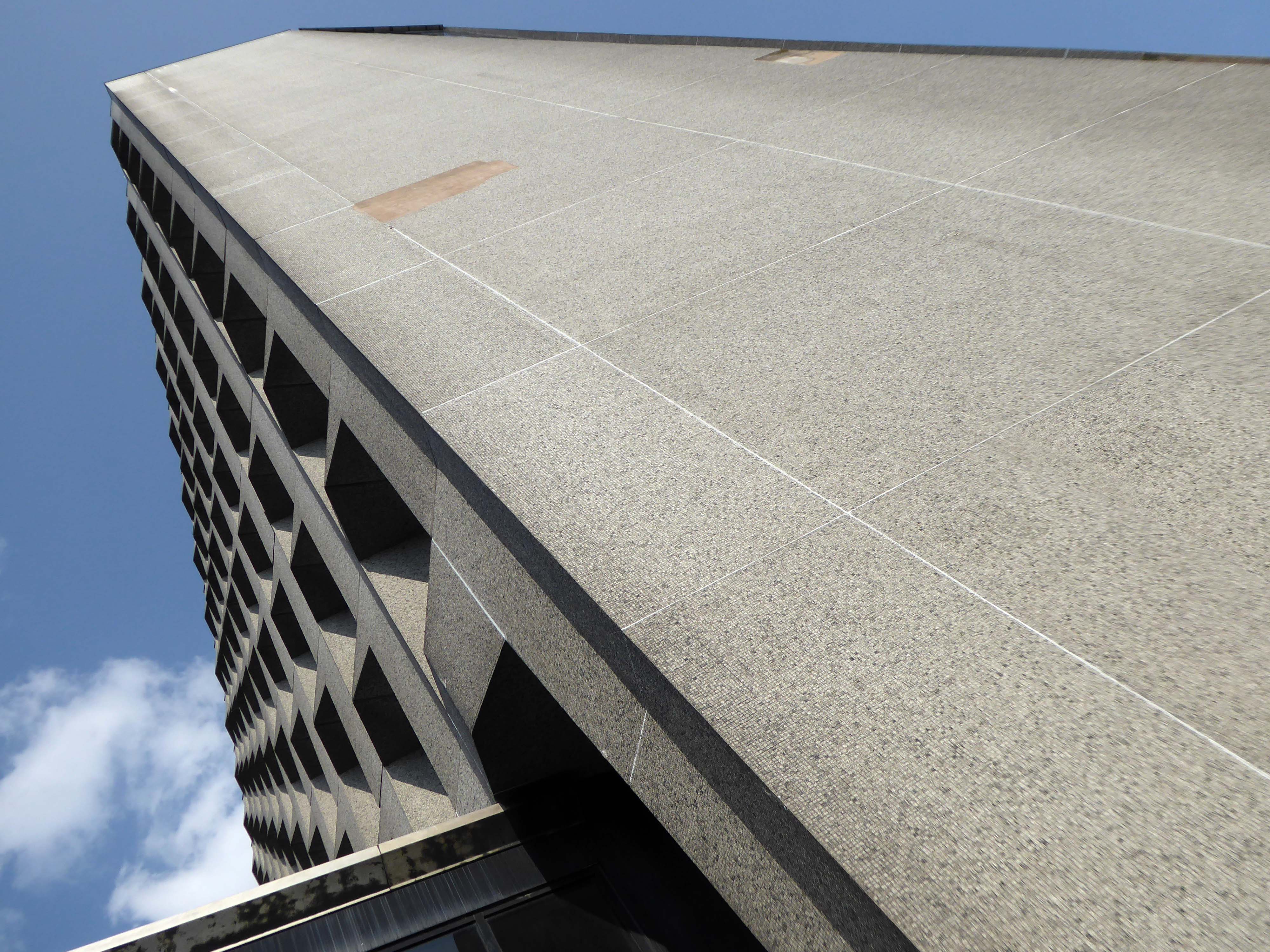
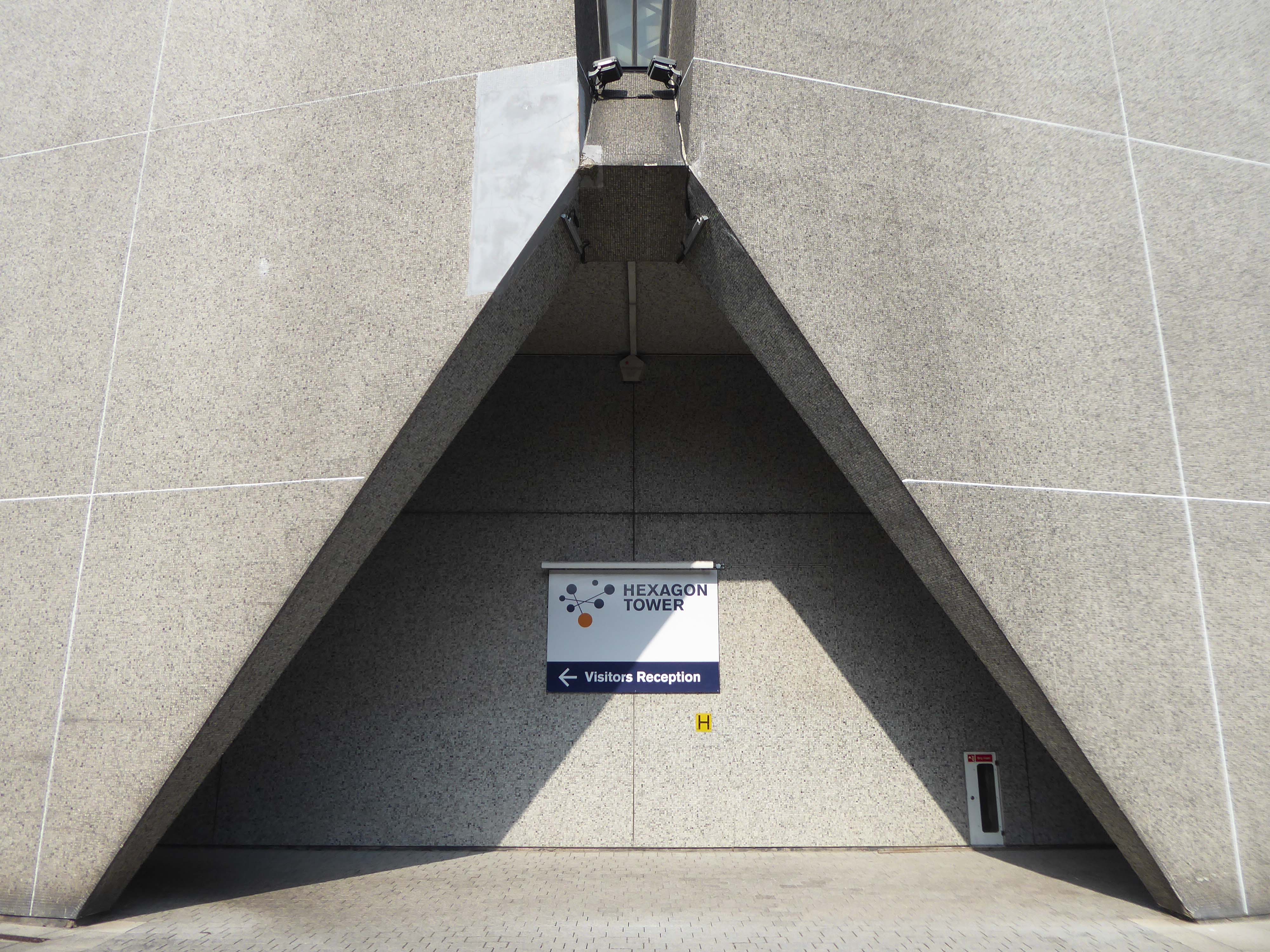
Then cutting back and regaining the correct path.Finally arriving at the Hexagon Tower.
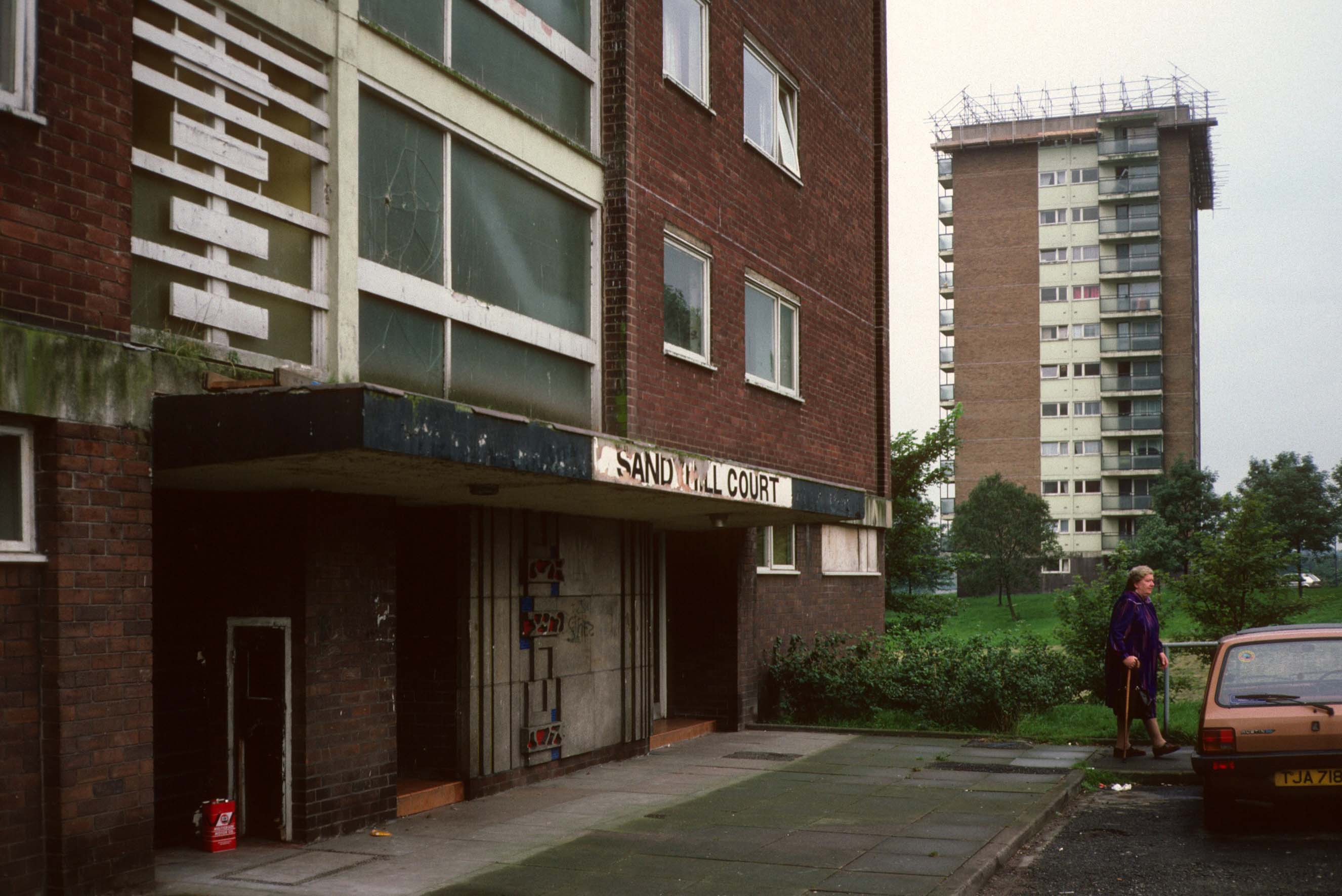
The flats had acquired a stereotypical bad reputation.
Blight flats will soon be high-rise des-res.
Residents on a blighted Blackley estate have been told of plans to deal with the mostly unoccupied high-rise flats that are seen as the cause of the problem.
I entered via the vehicular access – in order to view the four remaining reliefs.
The Lakeside Rise blocks now form part of a private gated community and are accessed from Blackley New Road.
The original blocks and their locations are as follows:
Ashenhurst Court Now Lakeside 1 Heaton Court Now Lakeside 2 Wilton Court Now Lakeside 3 Blackley Court Now Lakeside 4
Bracknell Court demolished – was on the corner of Riverdale Road and Bridgenorth Road adjacent to Heaton Court Riverdale Court demolished – was on Riverdale Road opposite Bantry Avenue.
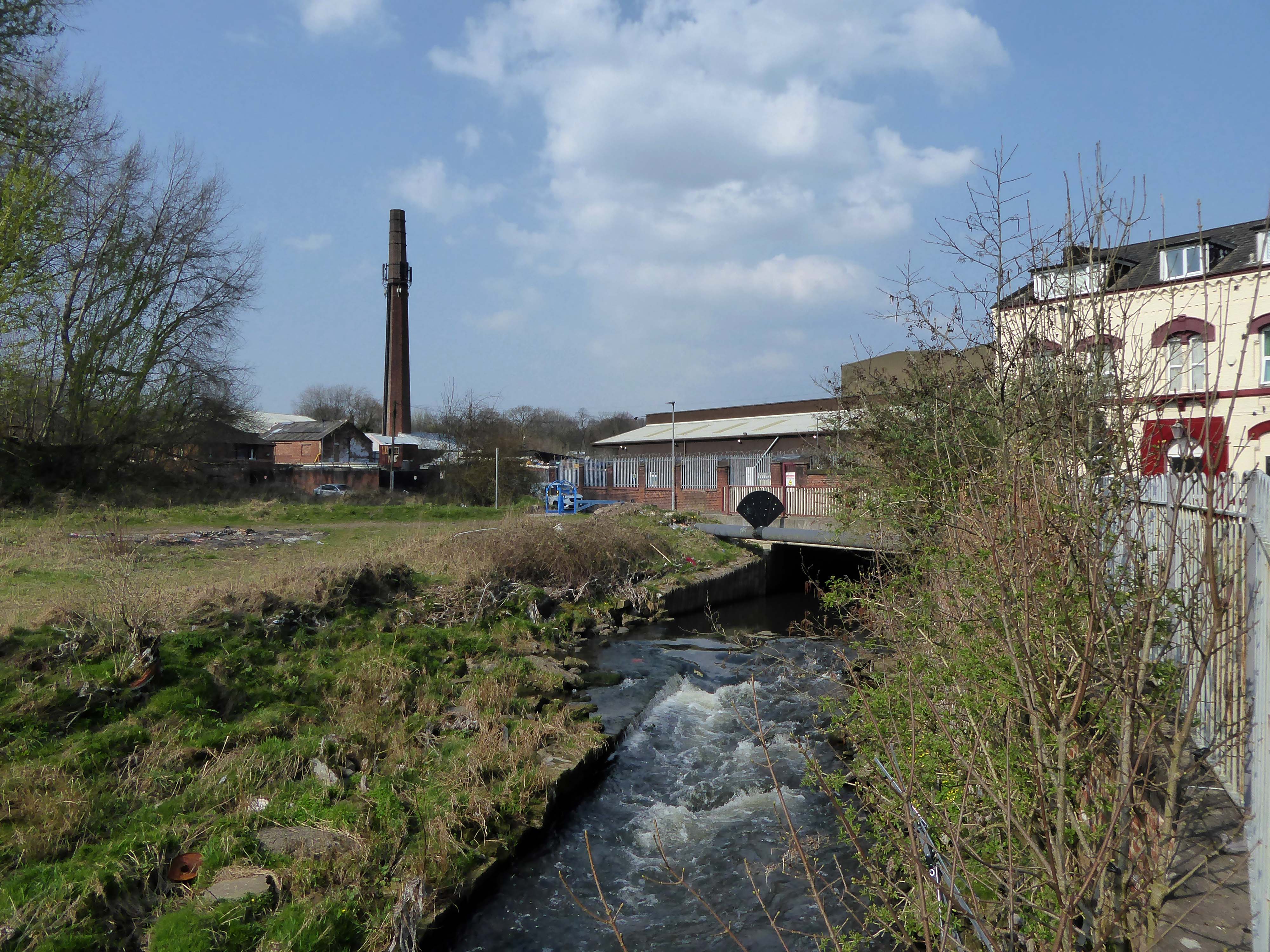
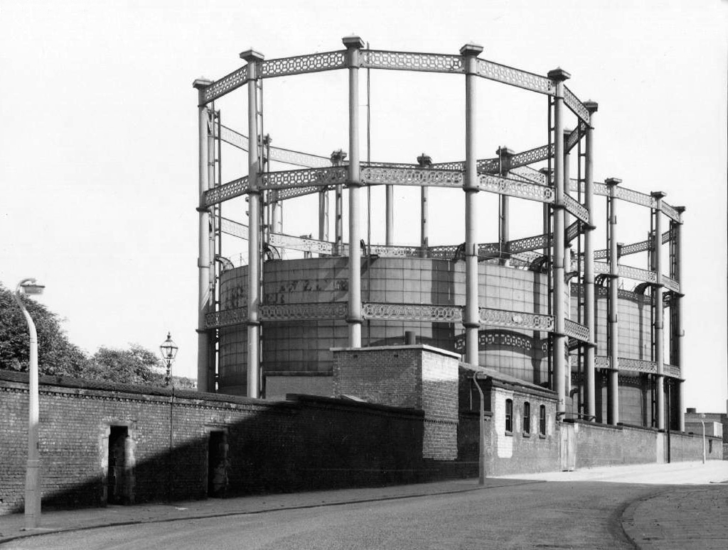
ICI’s Dyestuffs Division had its headquarters at Blackley in north Manchester, in a complex known as the Hexagon, which included its main R & D labs, and an experimental manufacturing plant.
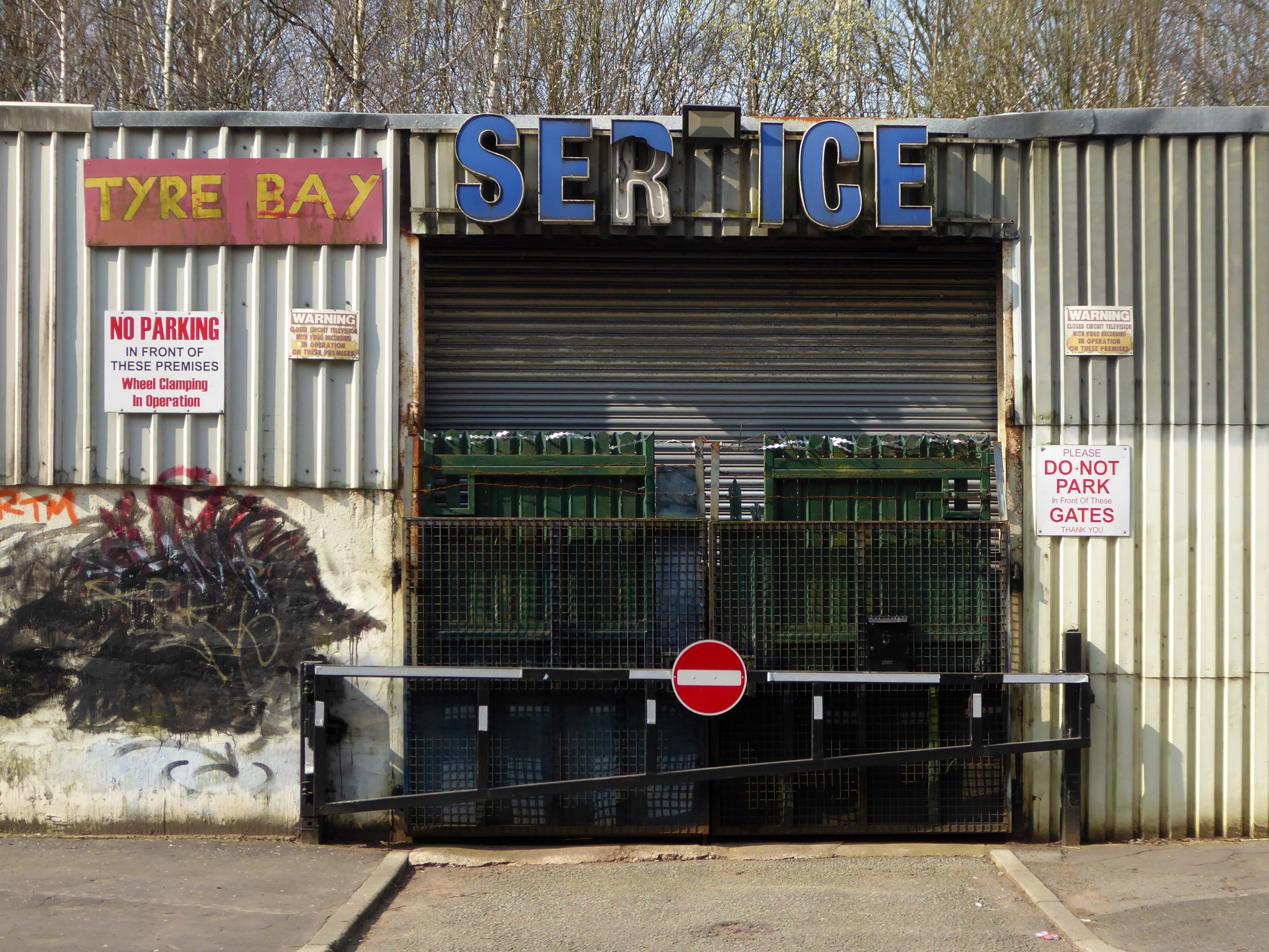
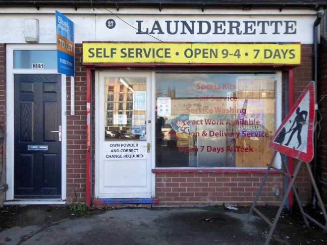
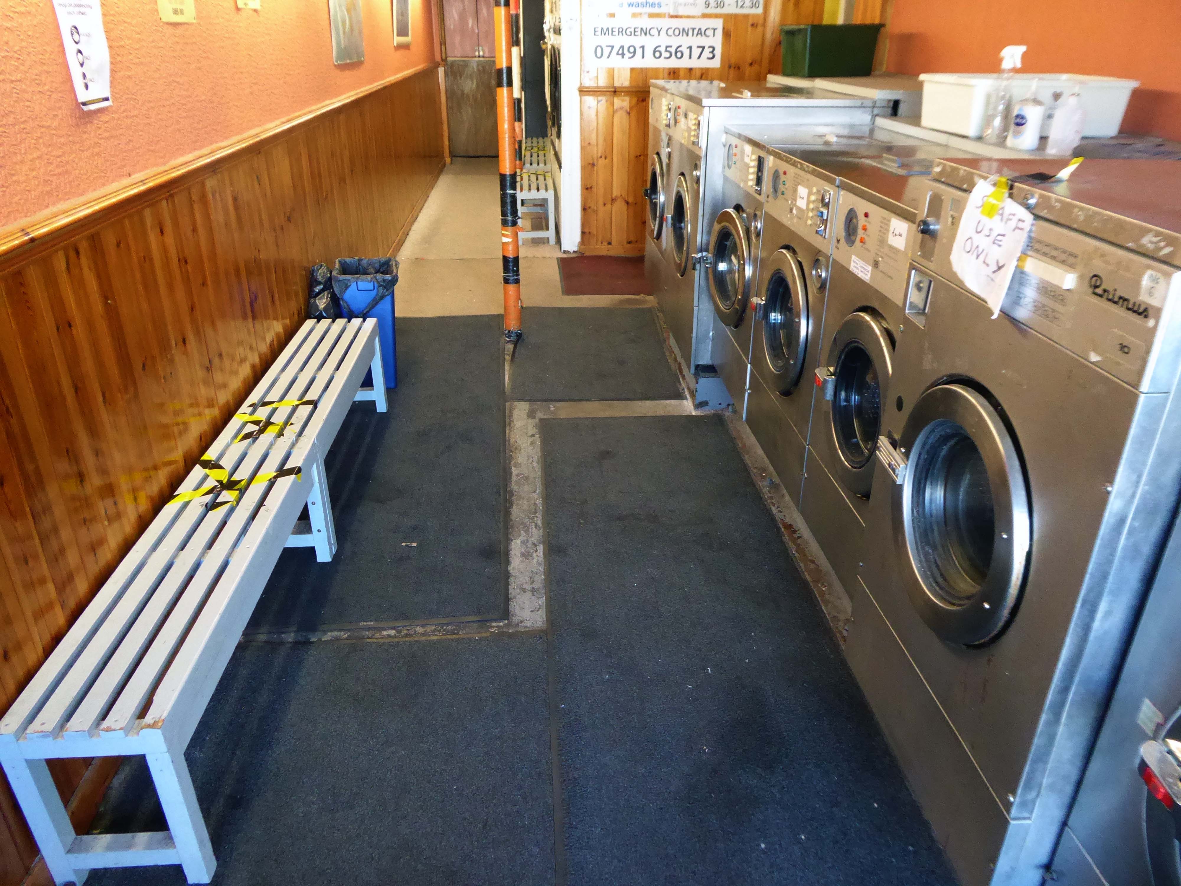
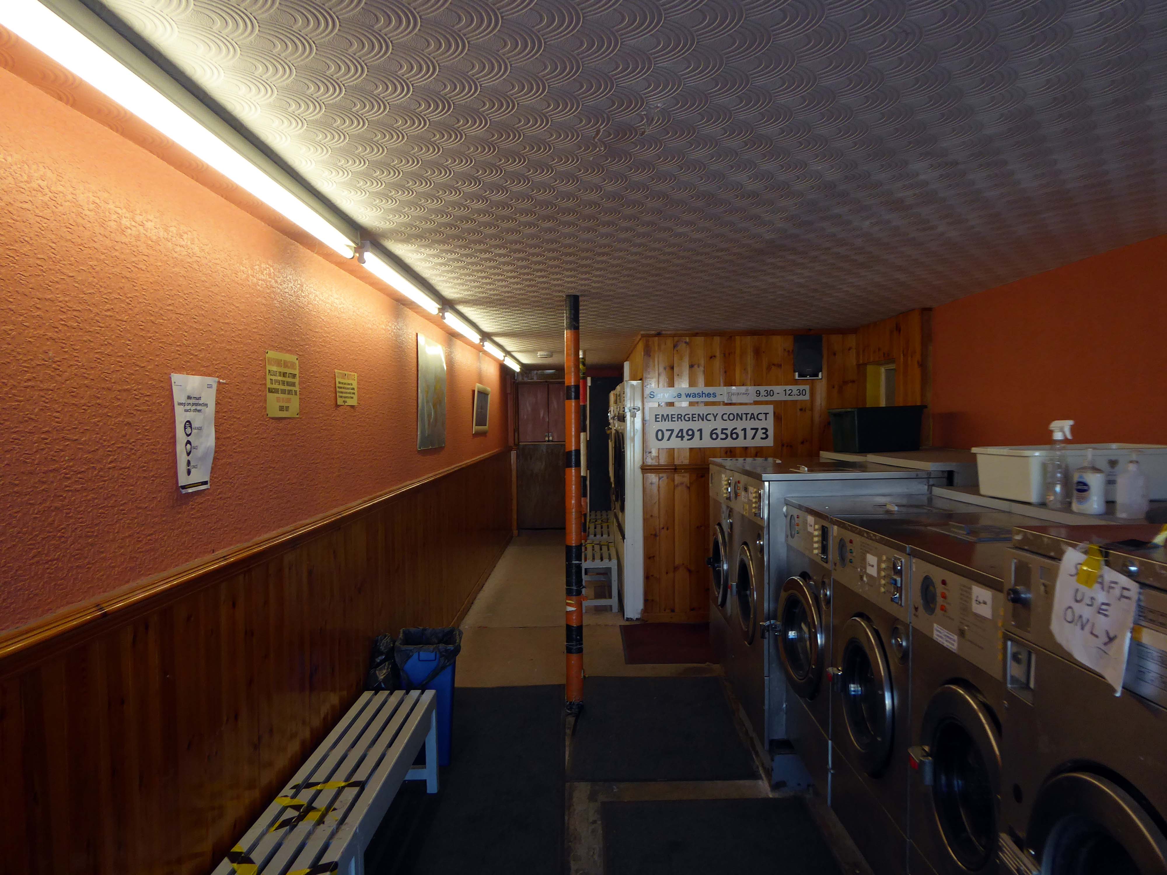
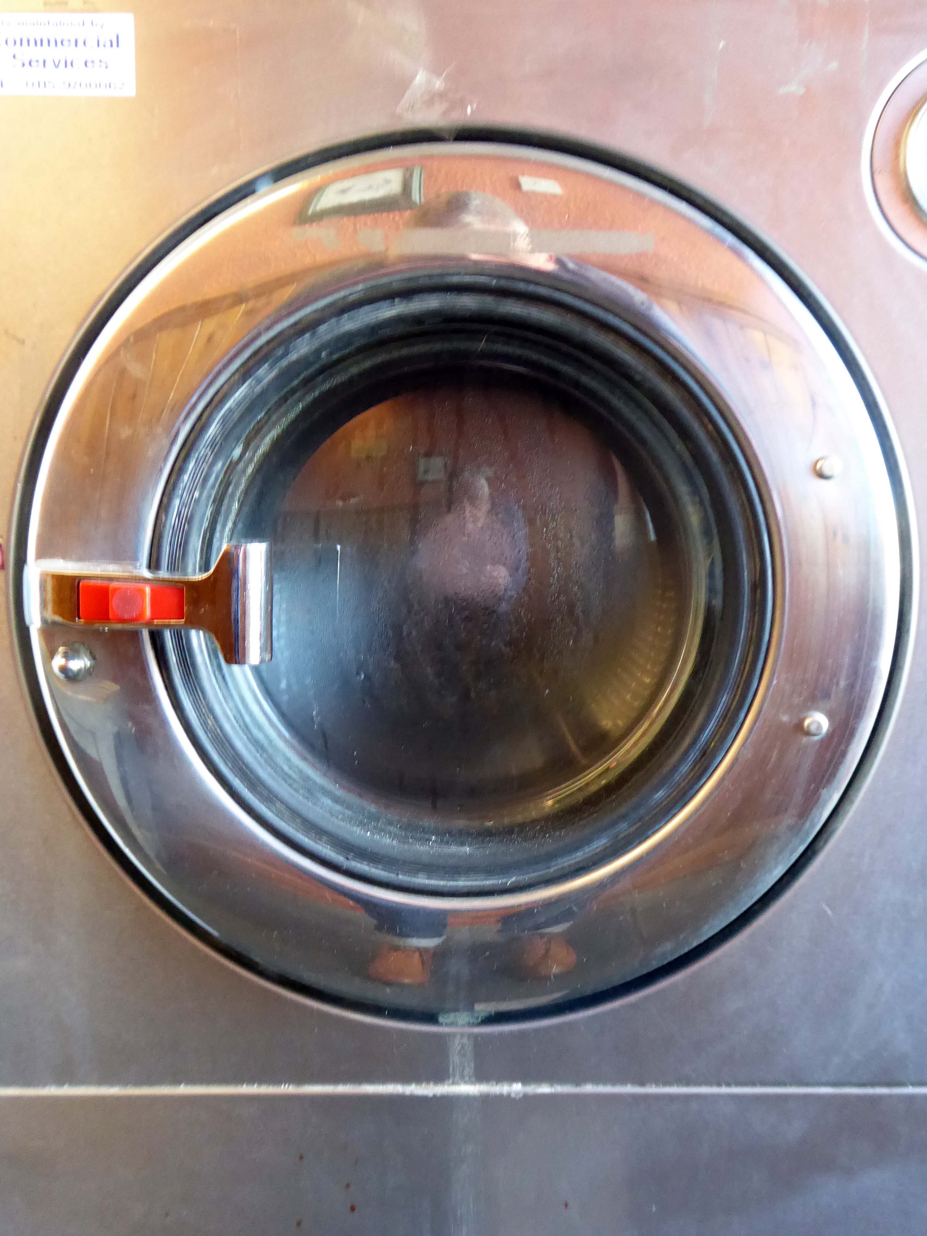
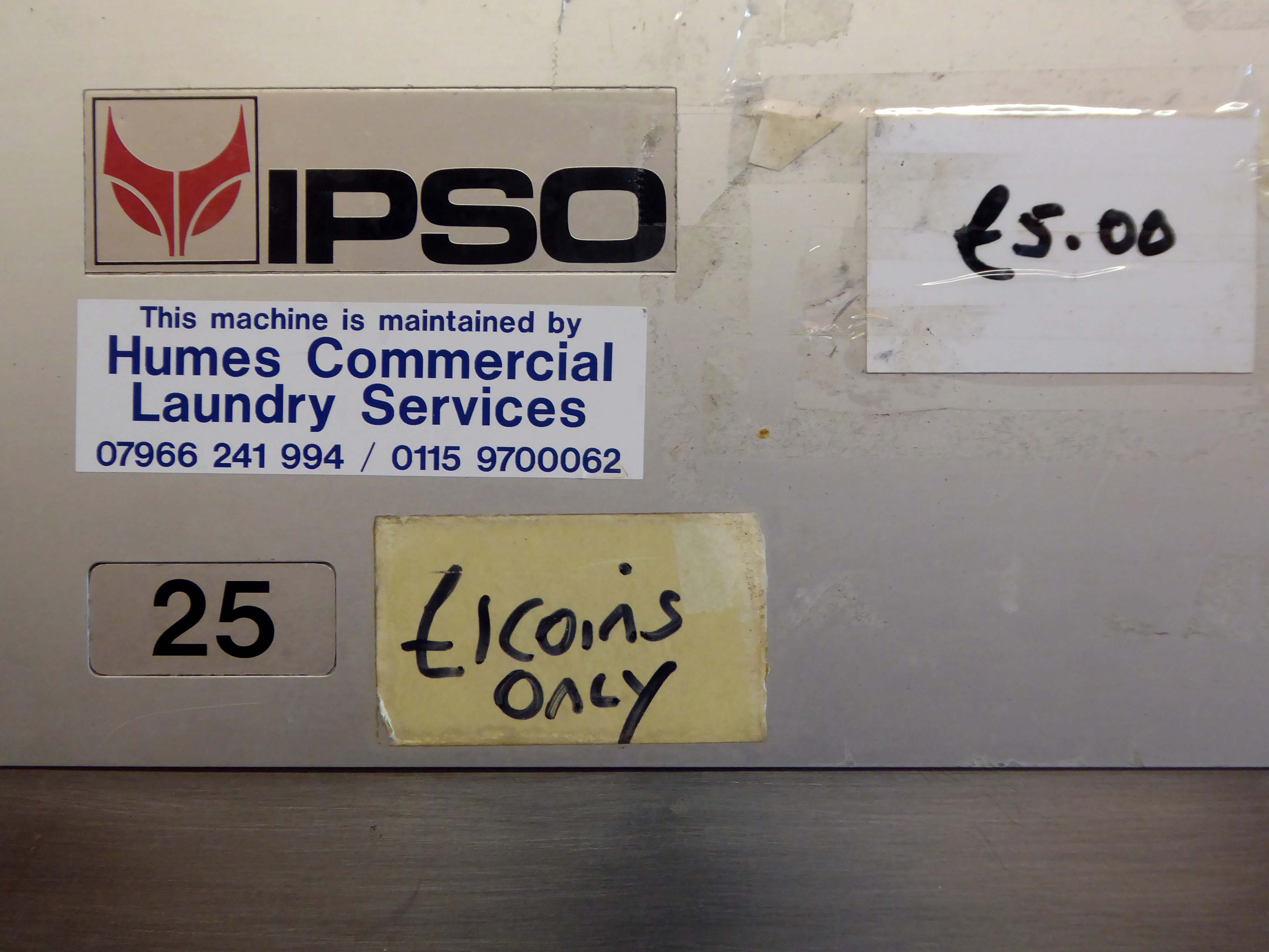
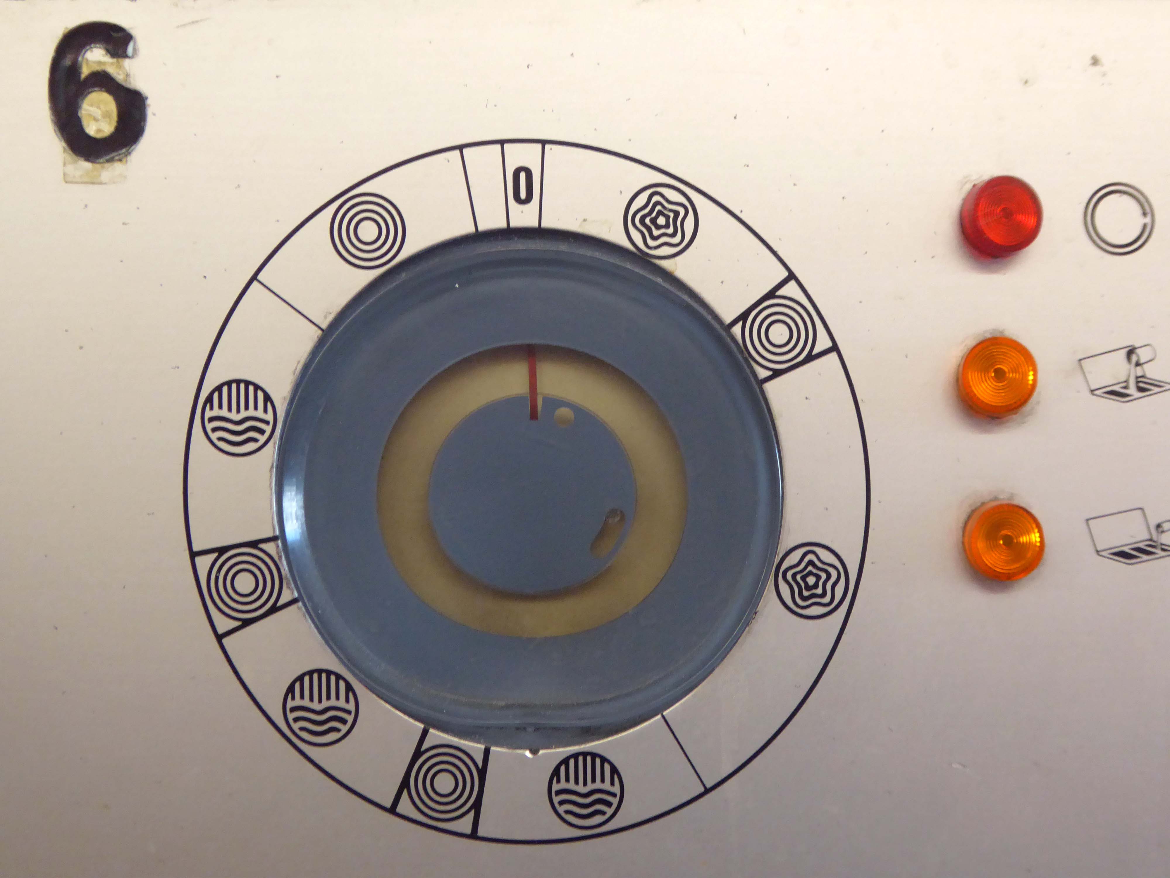
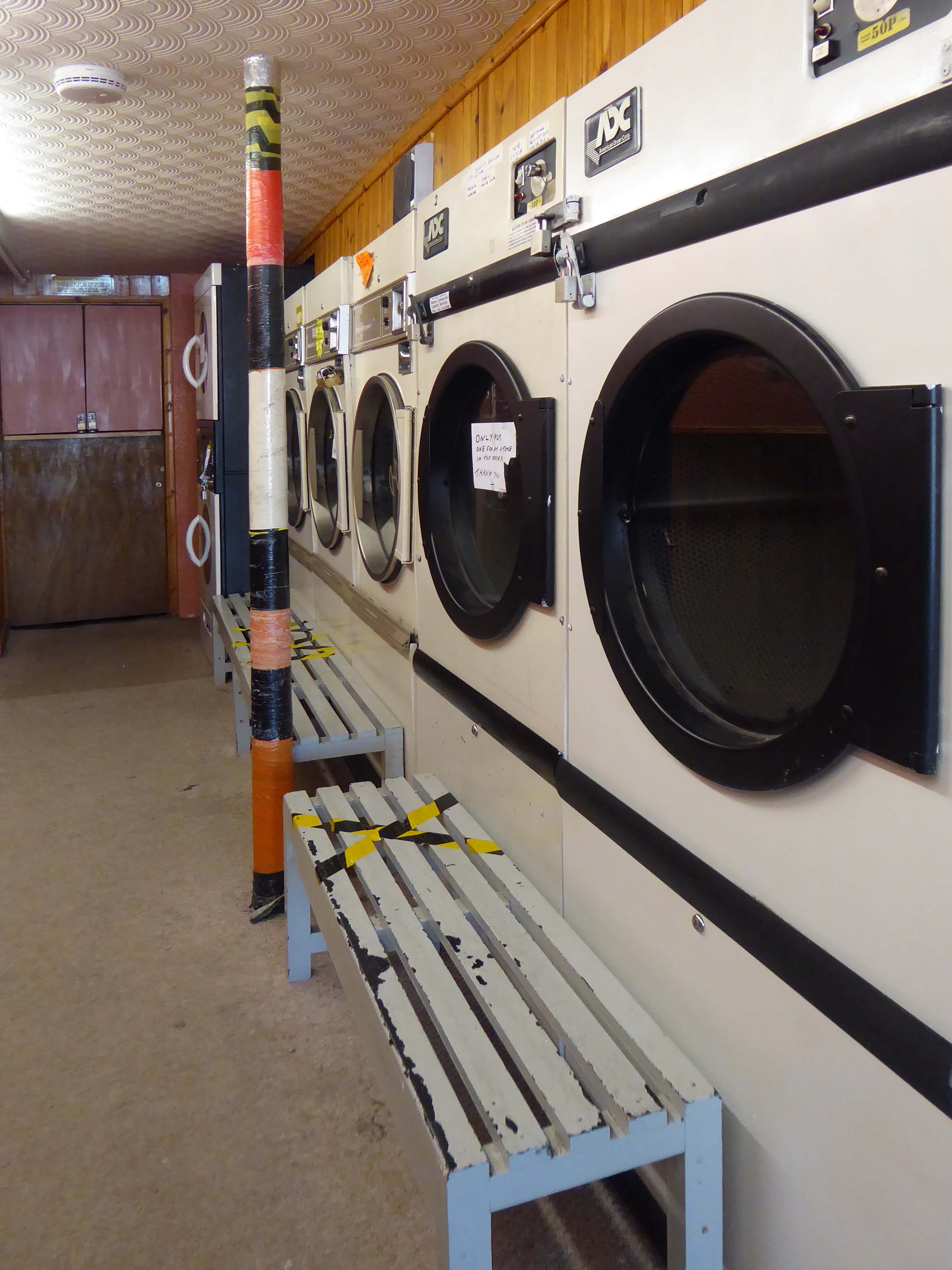
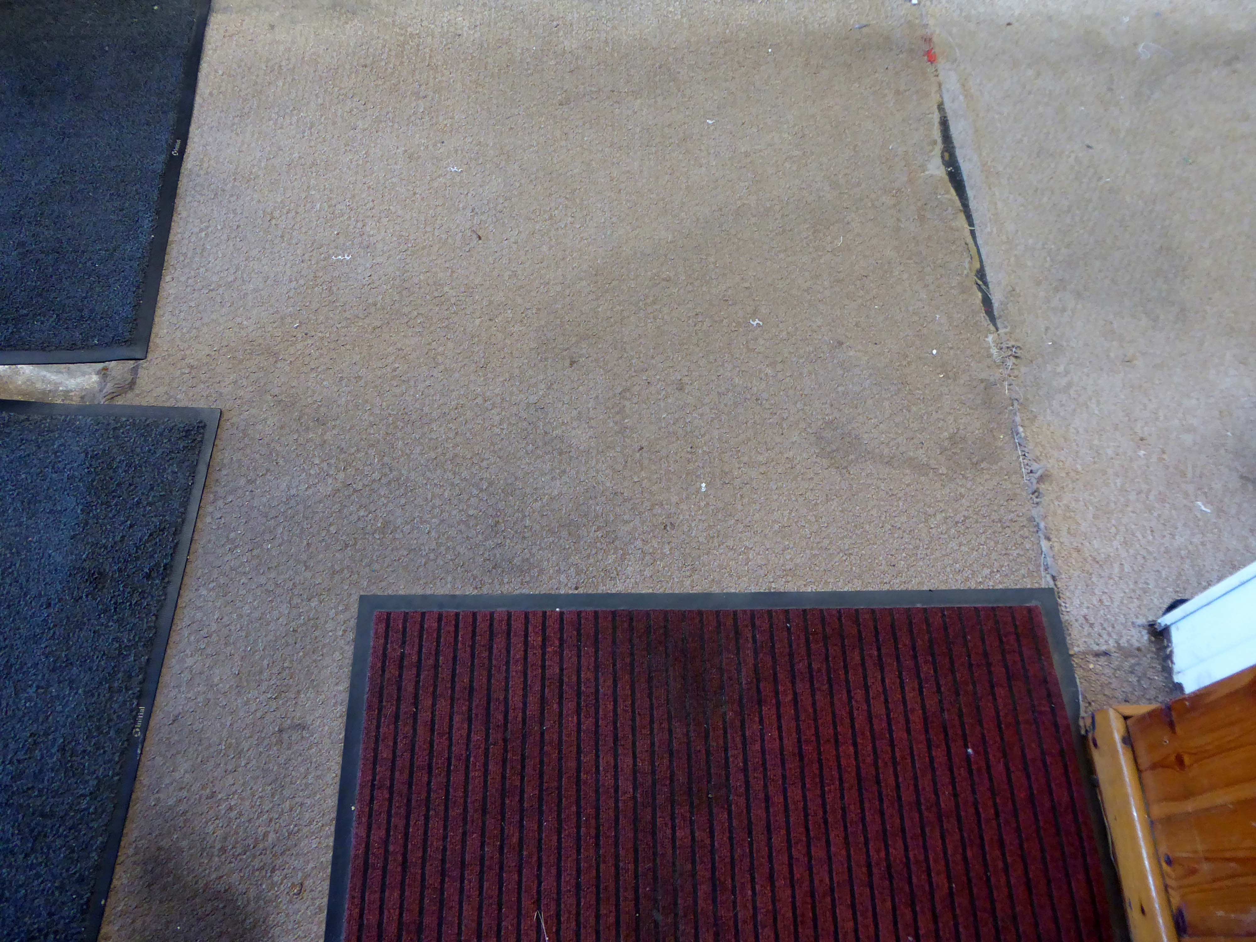
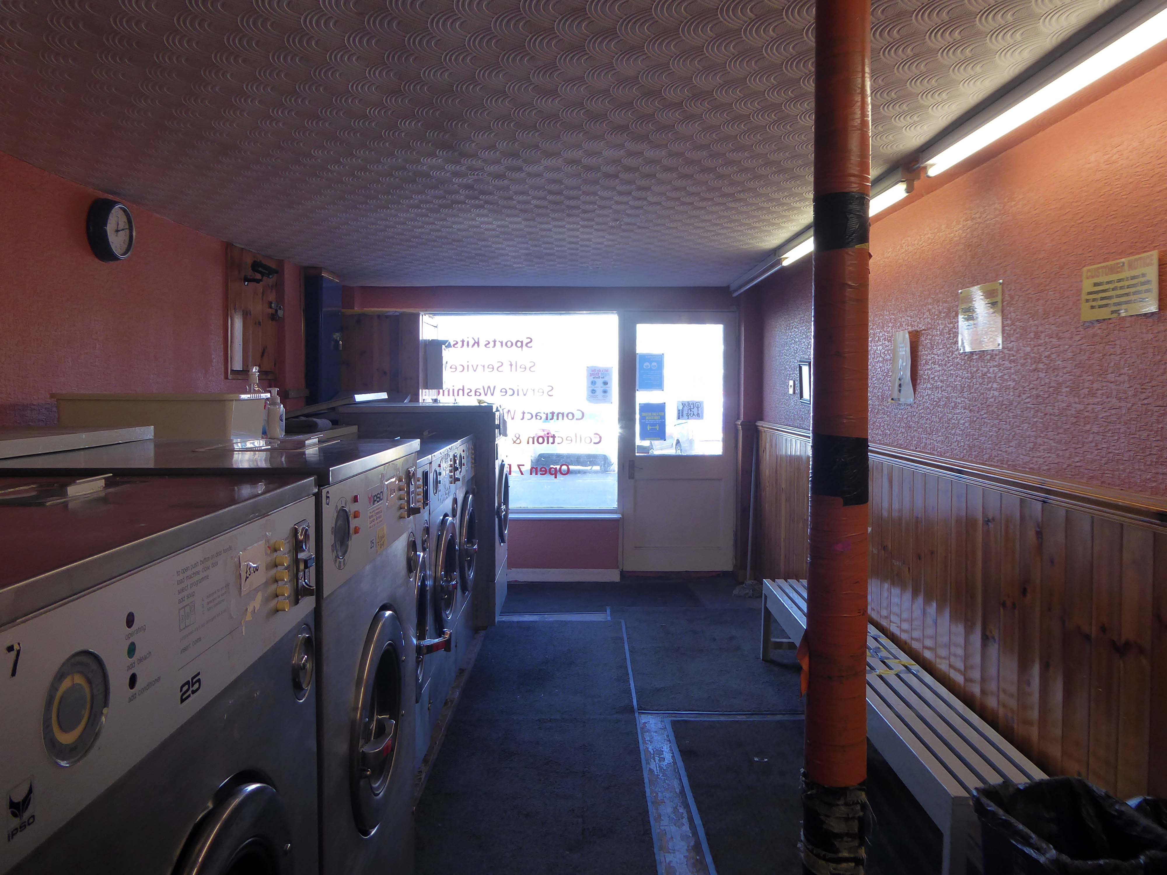
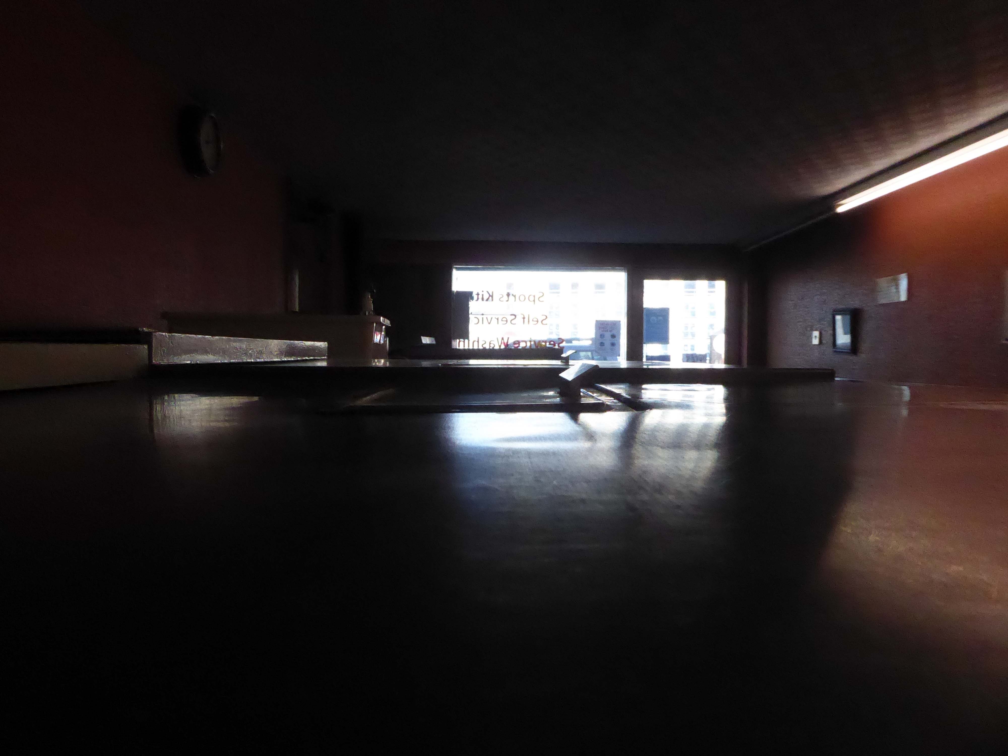
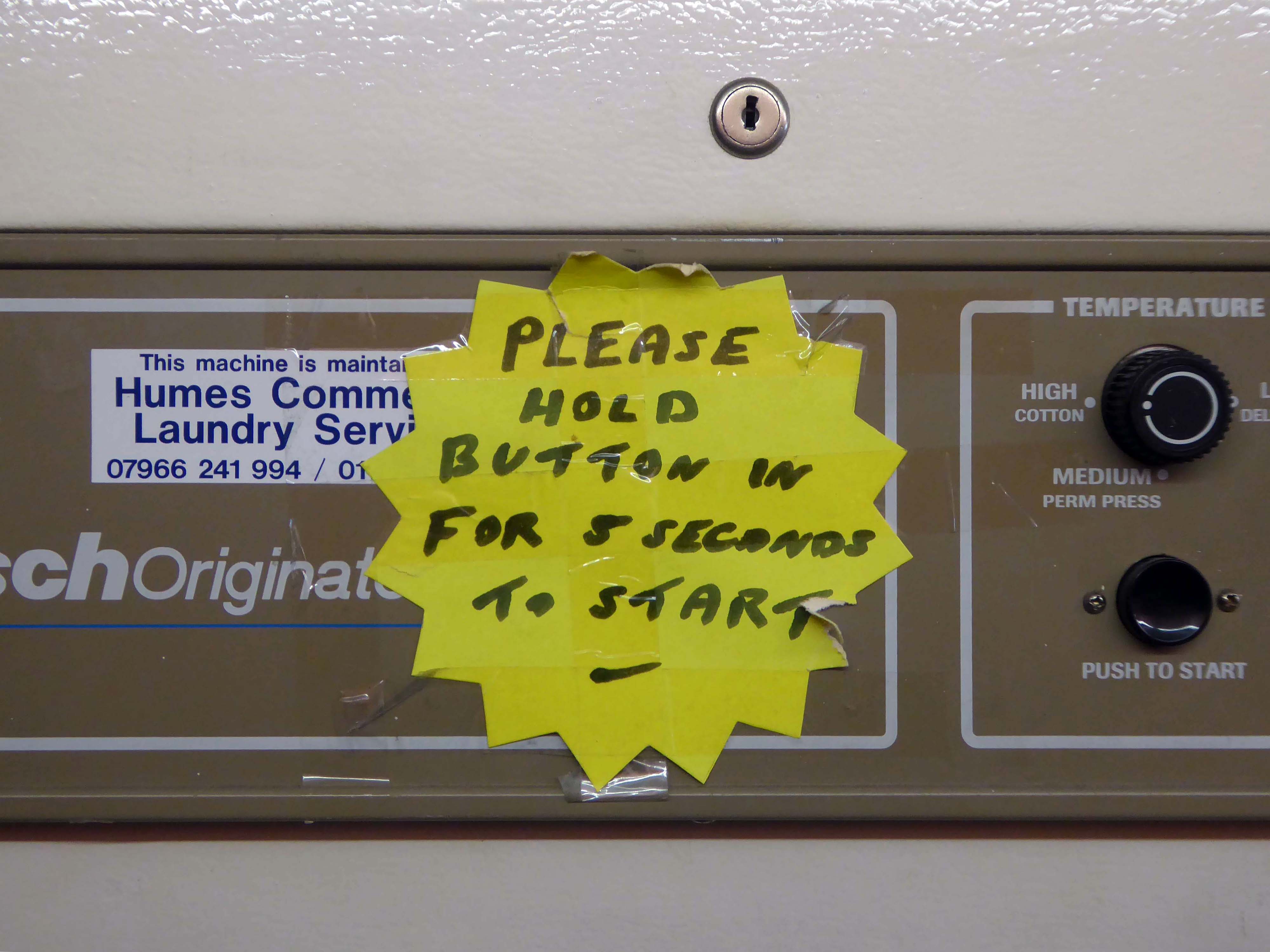
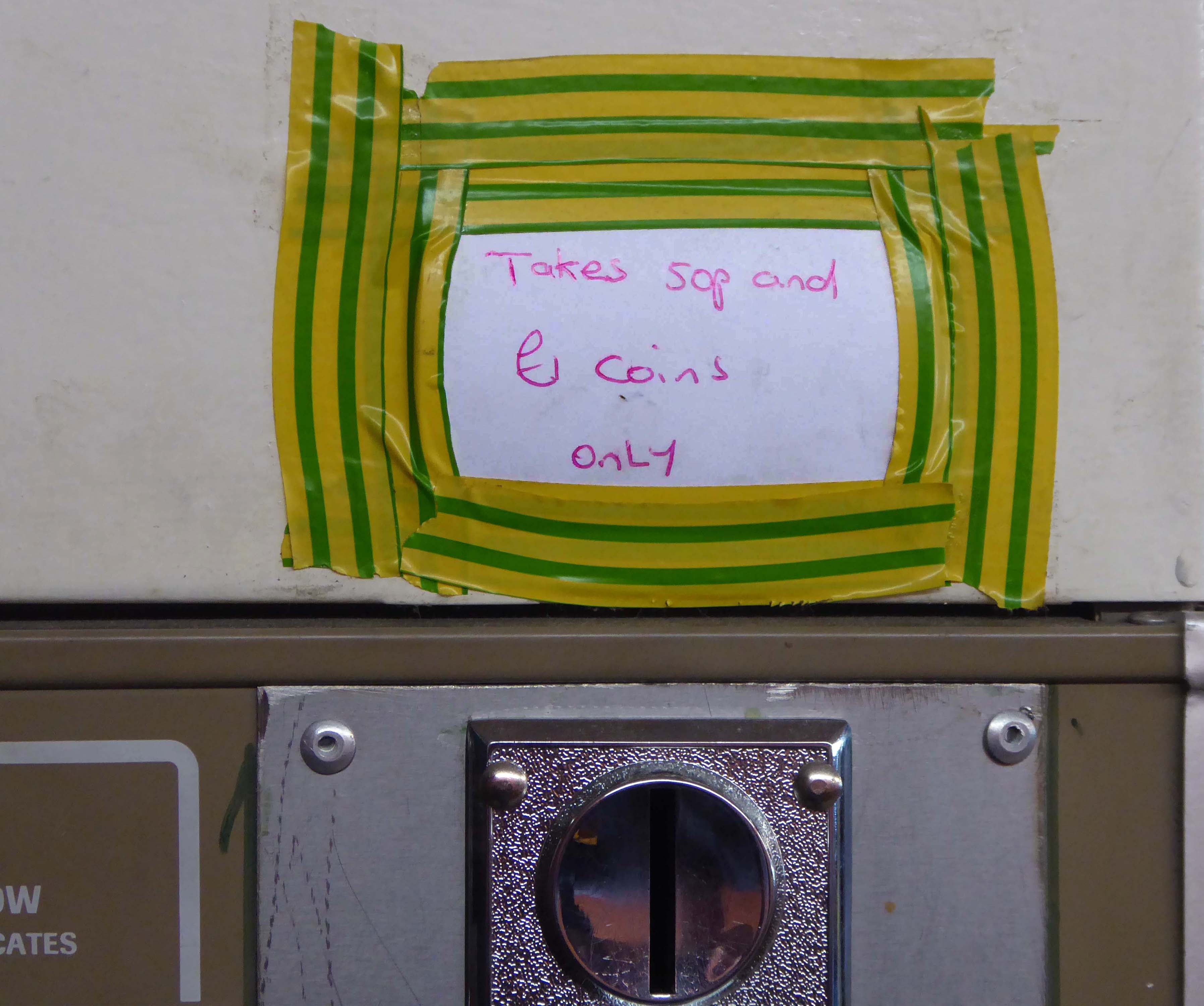
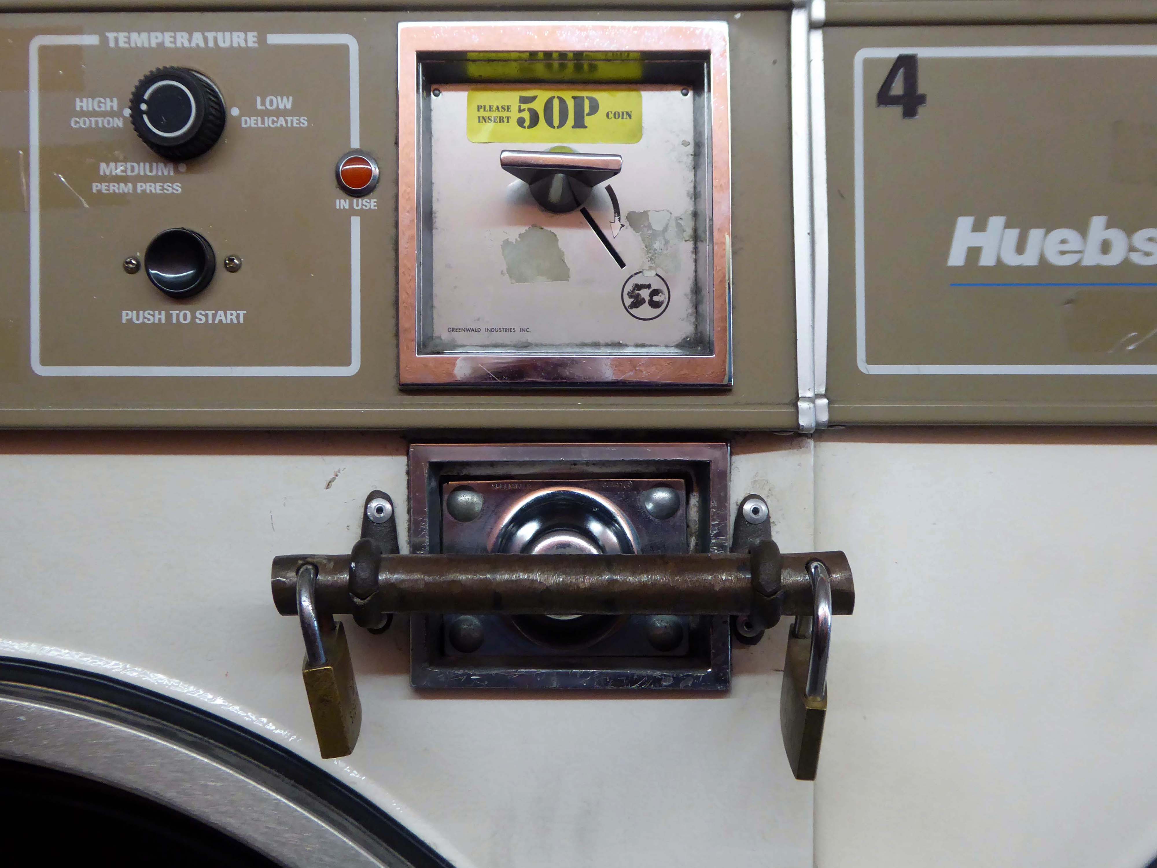
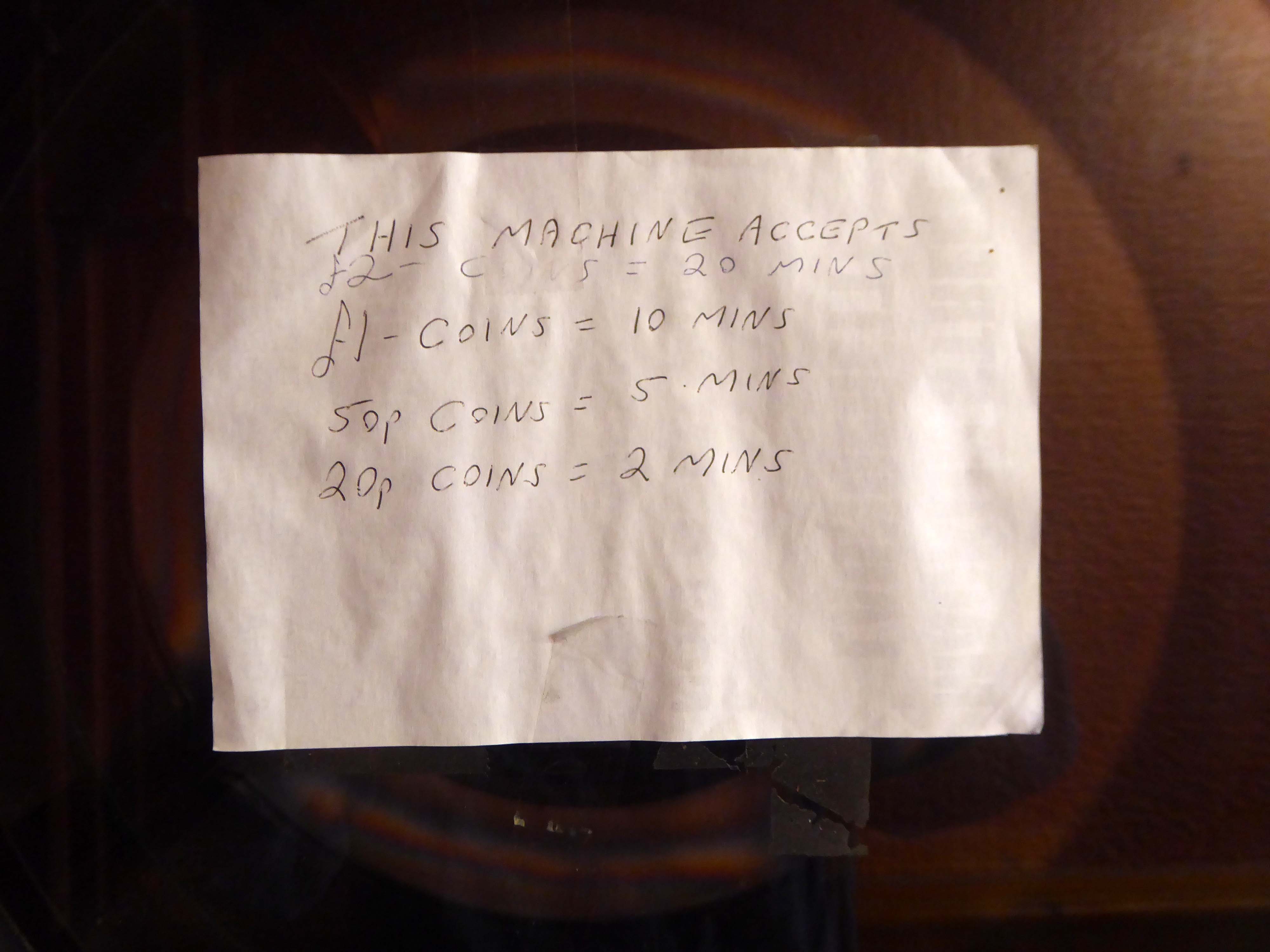
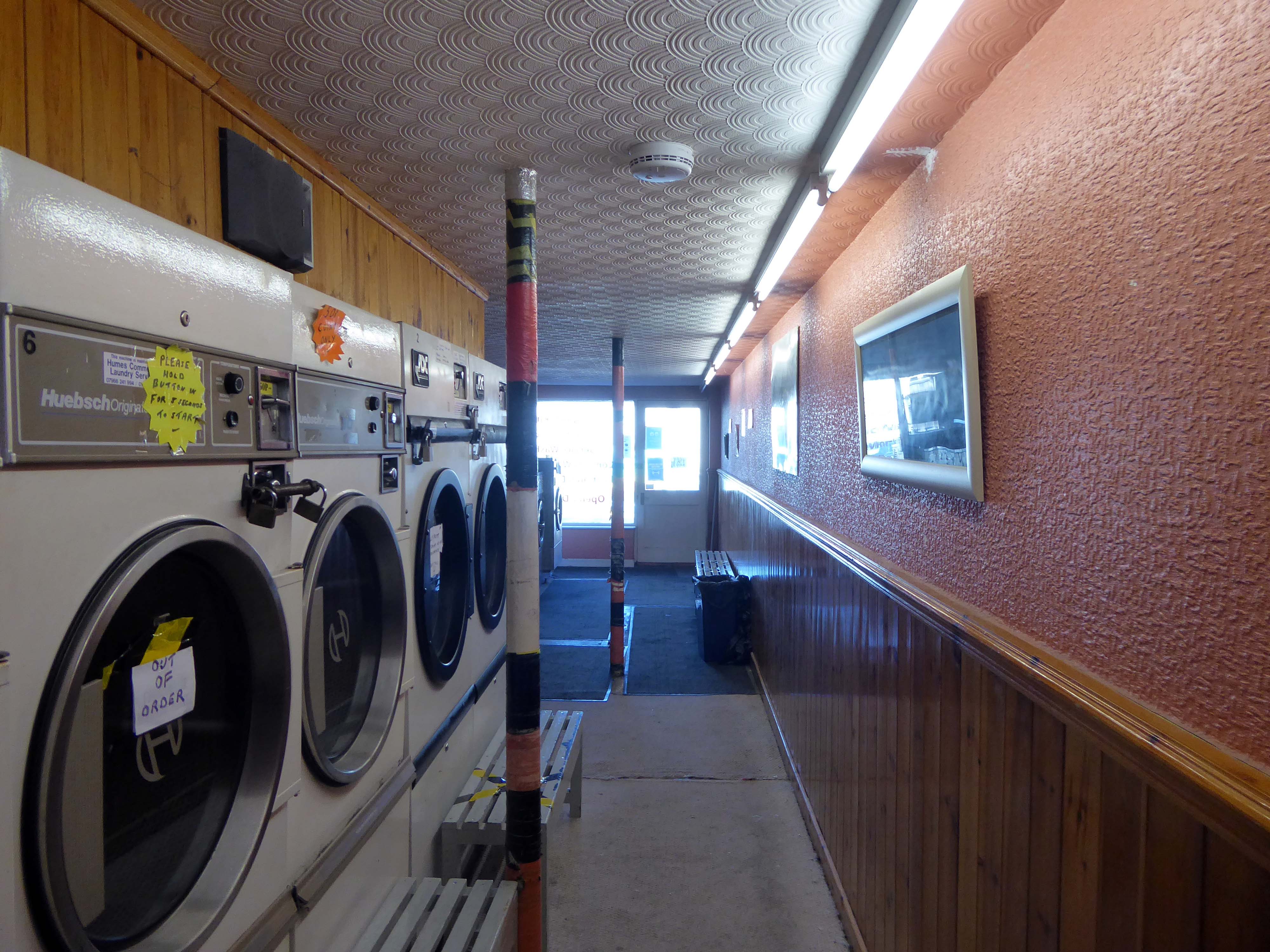
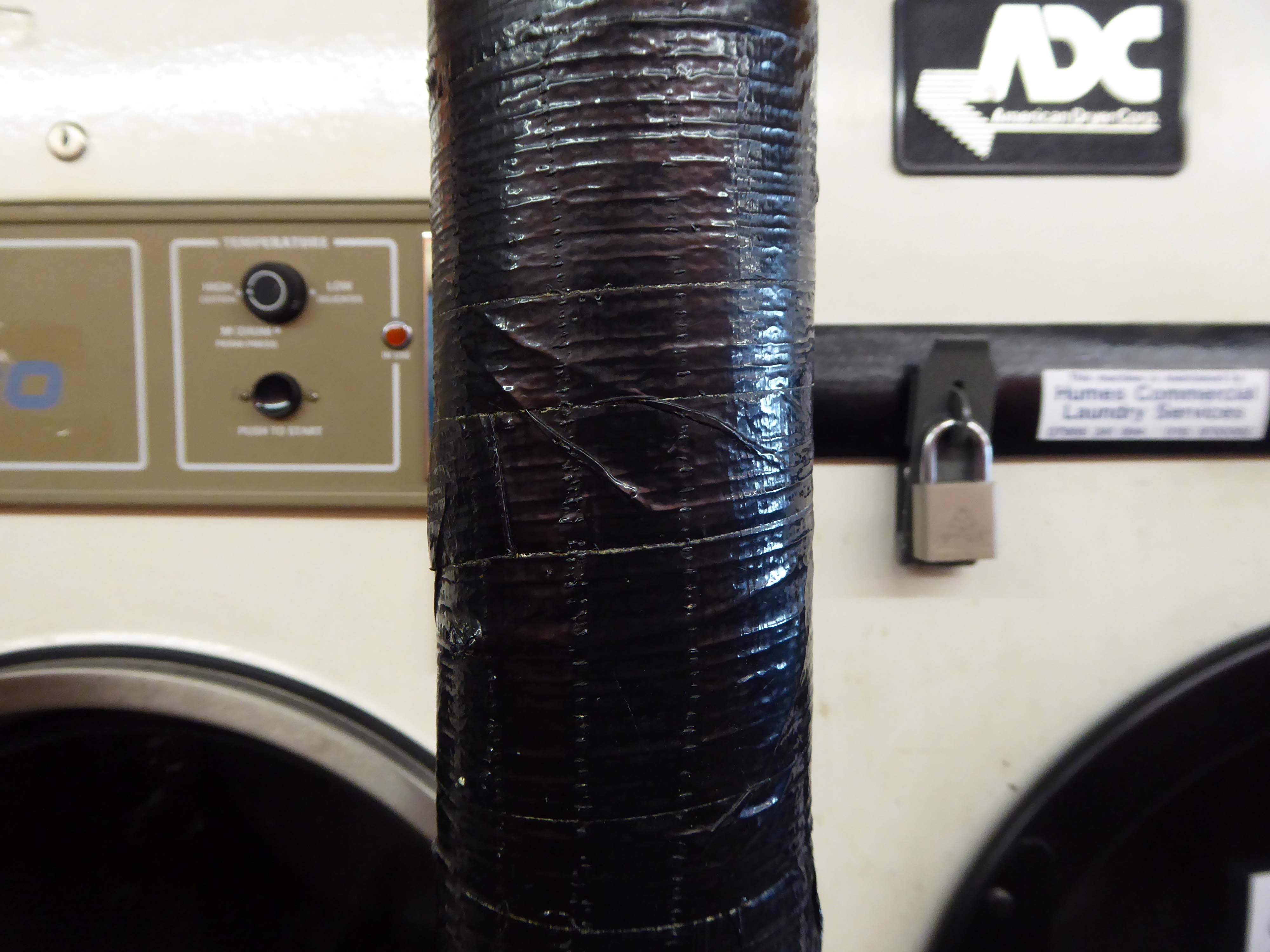
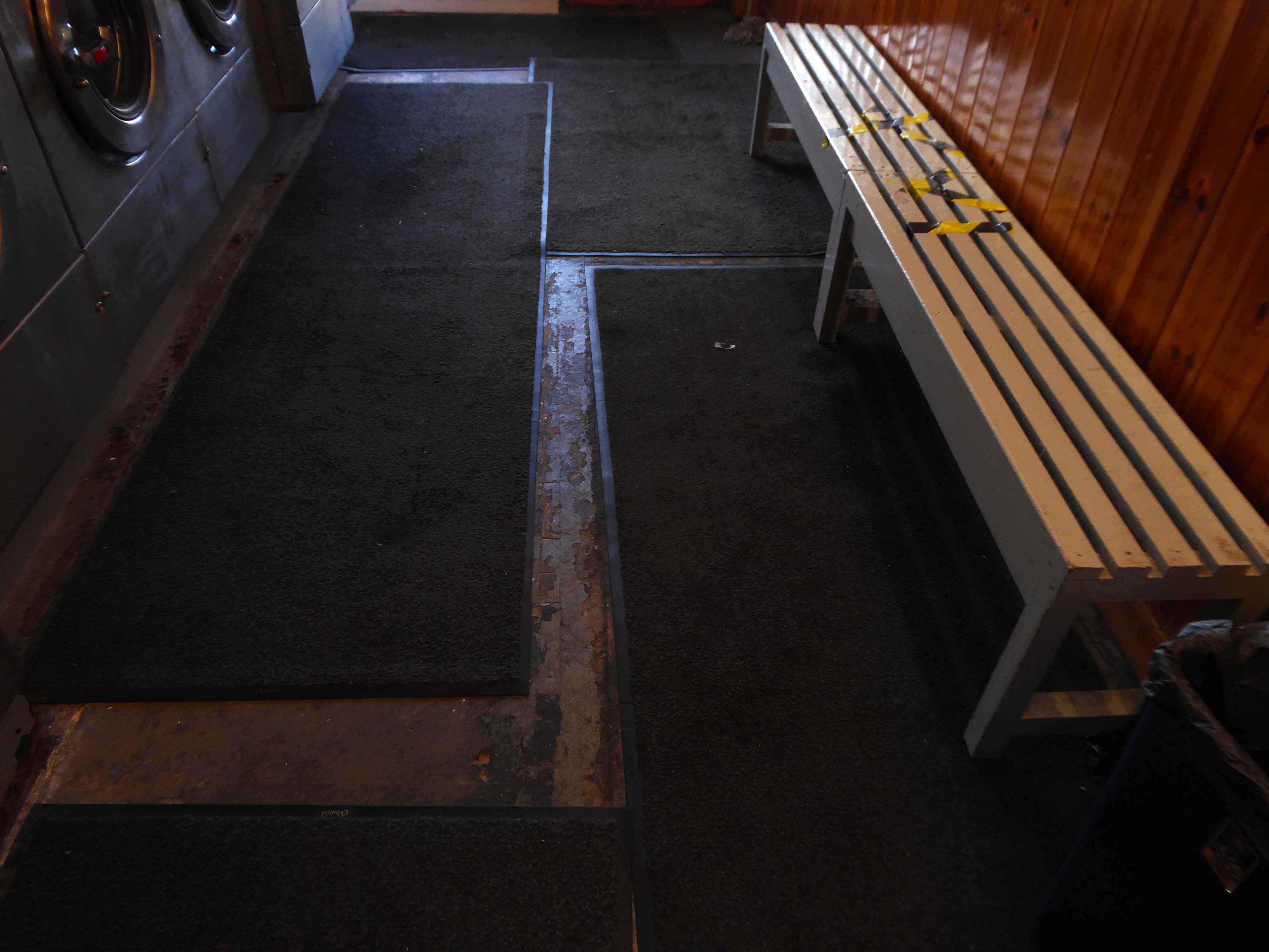
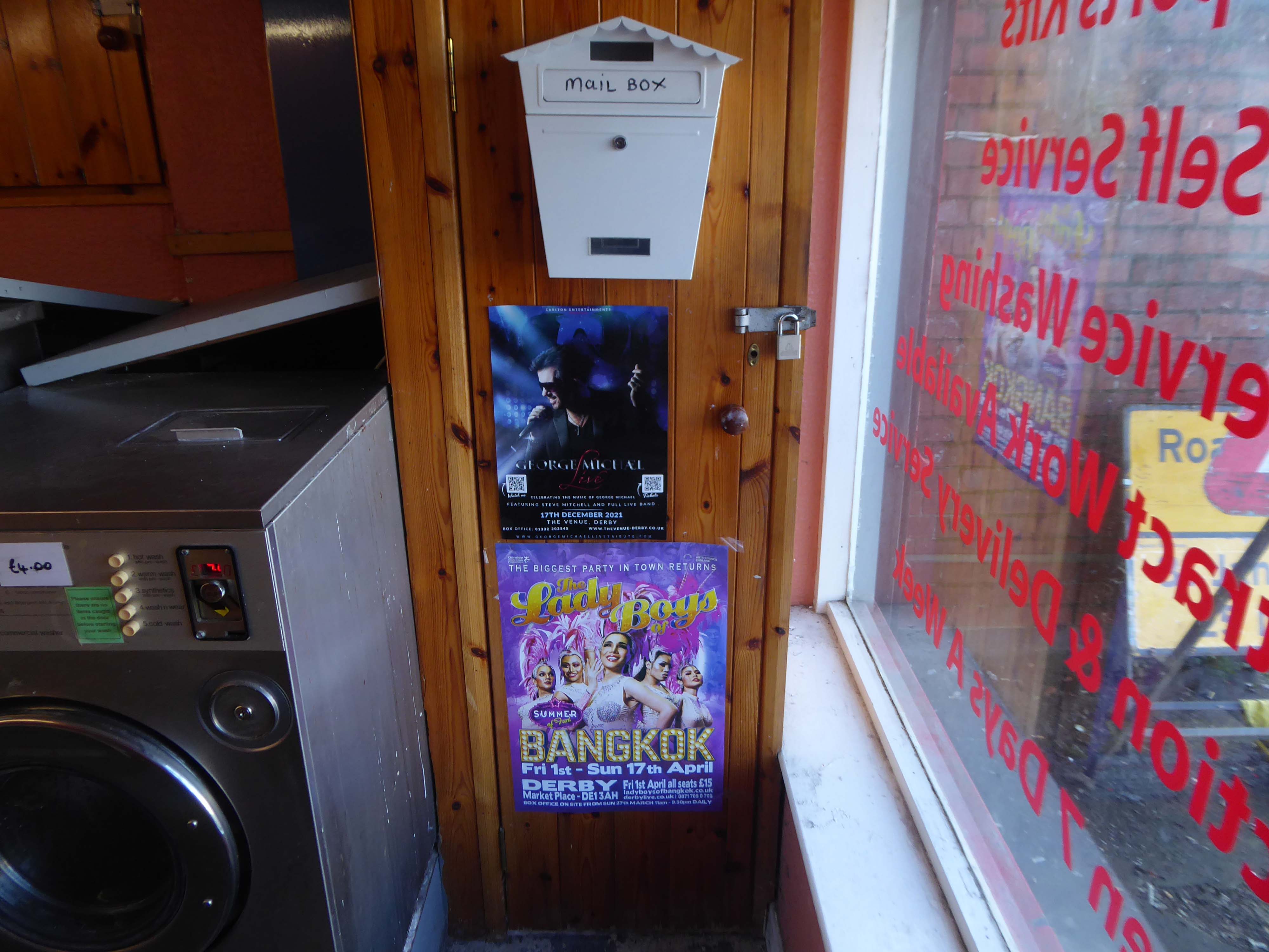
The launderette was empty and offered an oasis of oddity in an otherwise predictable day.
There is always a mild sense of trepidation, entering a space devoid of folk, slowly placing footsteps tentatively, over those of the lost souls, that have trodden the worn floor coverings in times past.
Just look over your shoulder – I’ll be there.
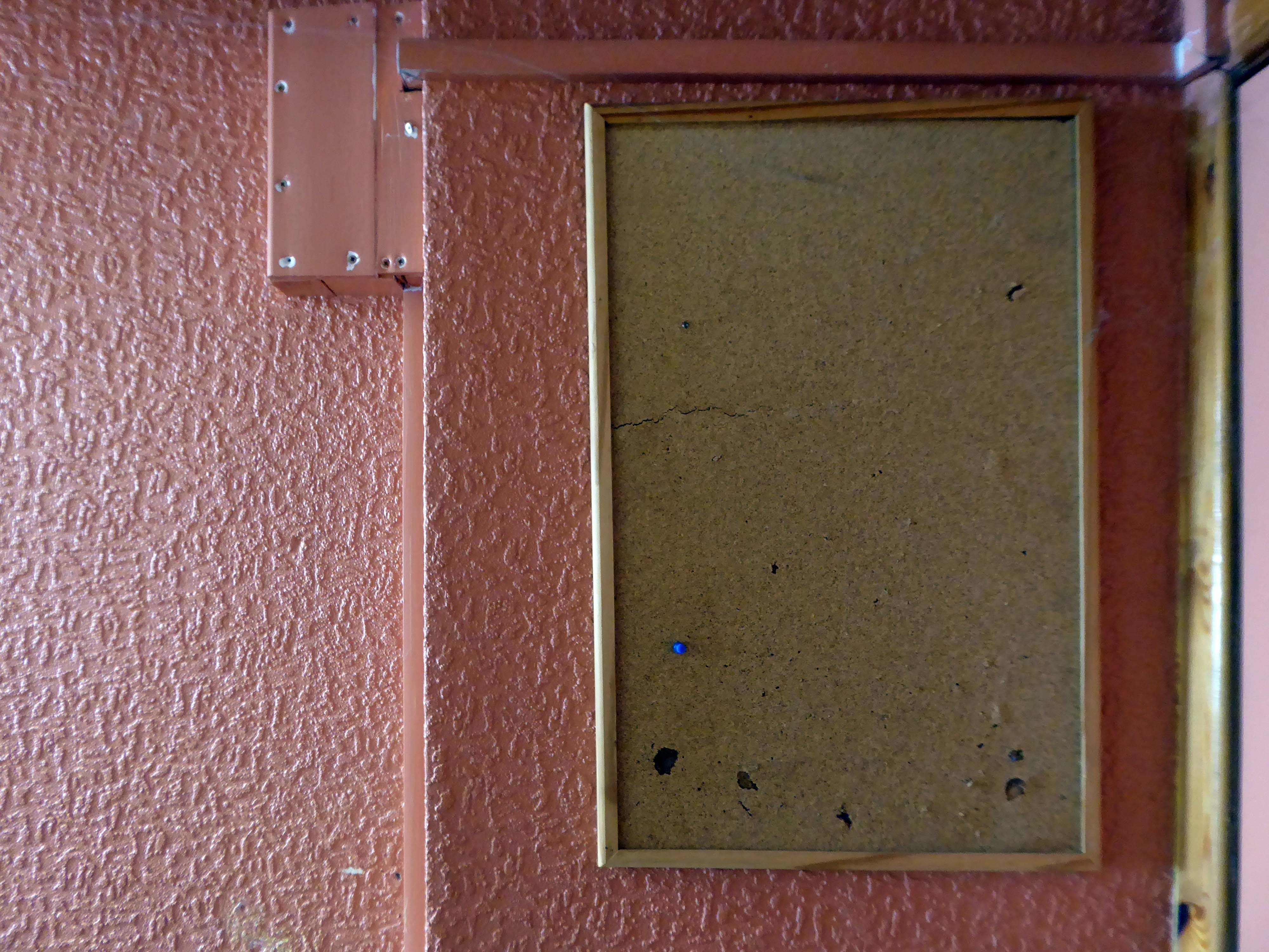
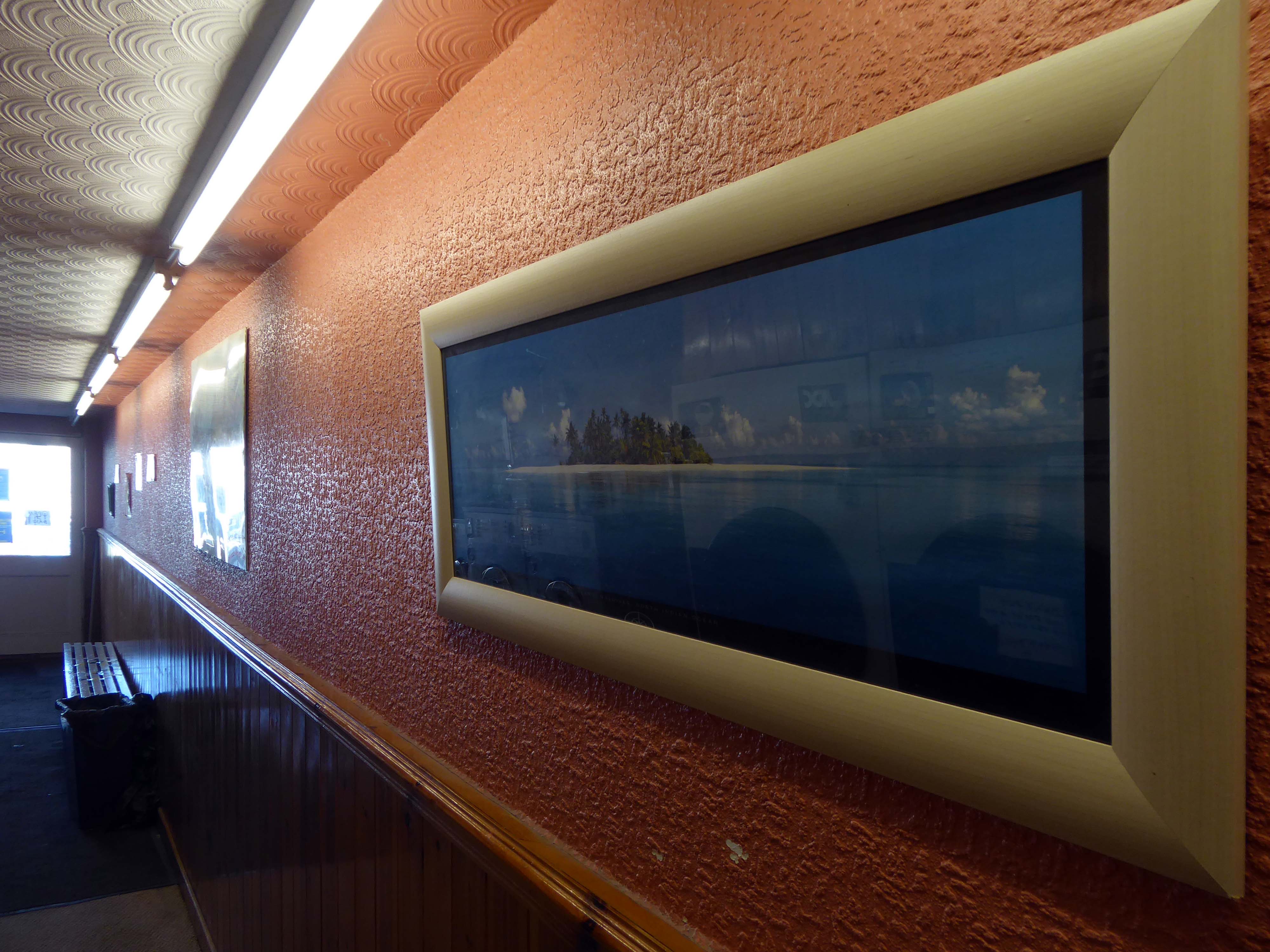
Once inside the daylight fades, replaced by tremulous fluorescent tubes, illuminating the discoloured coloured surfaces.
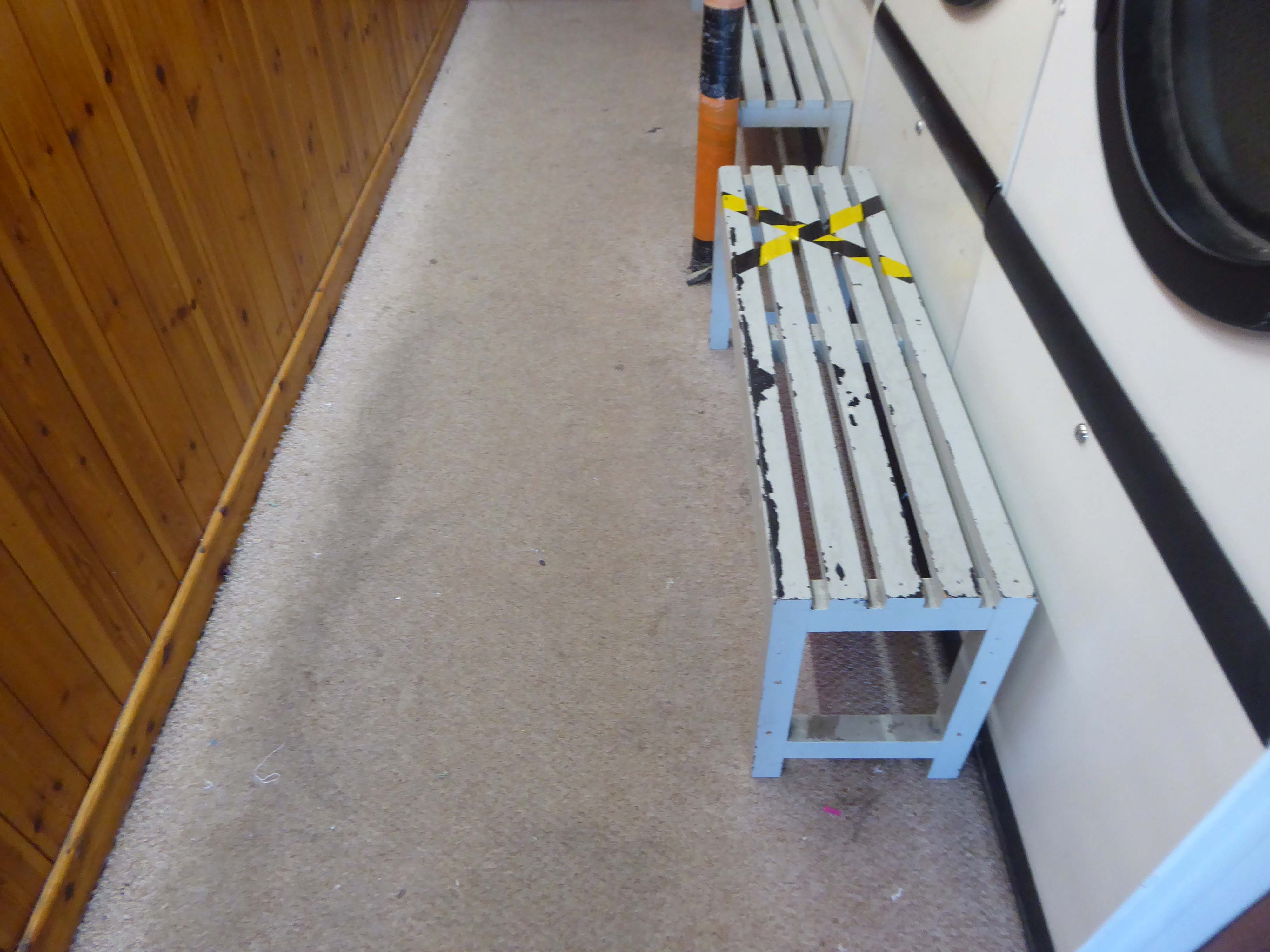
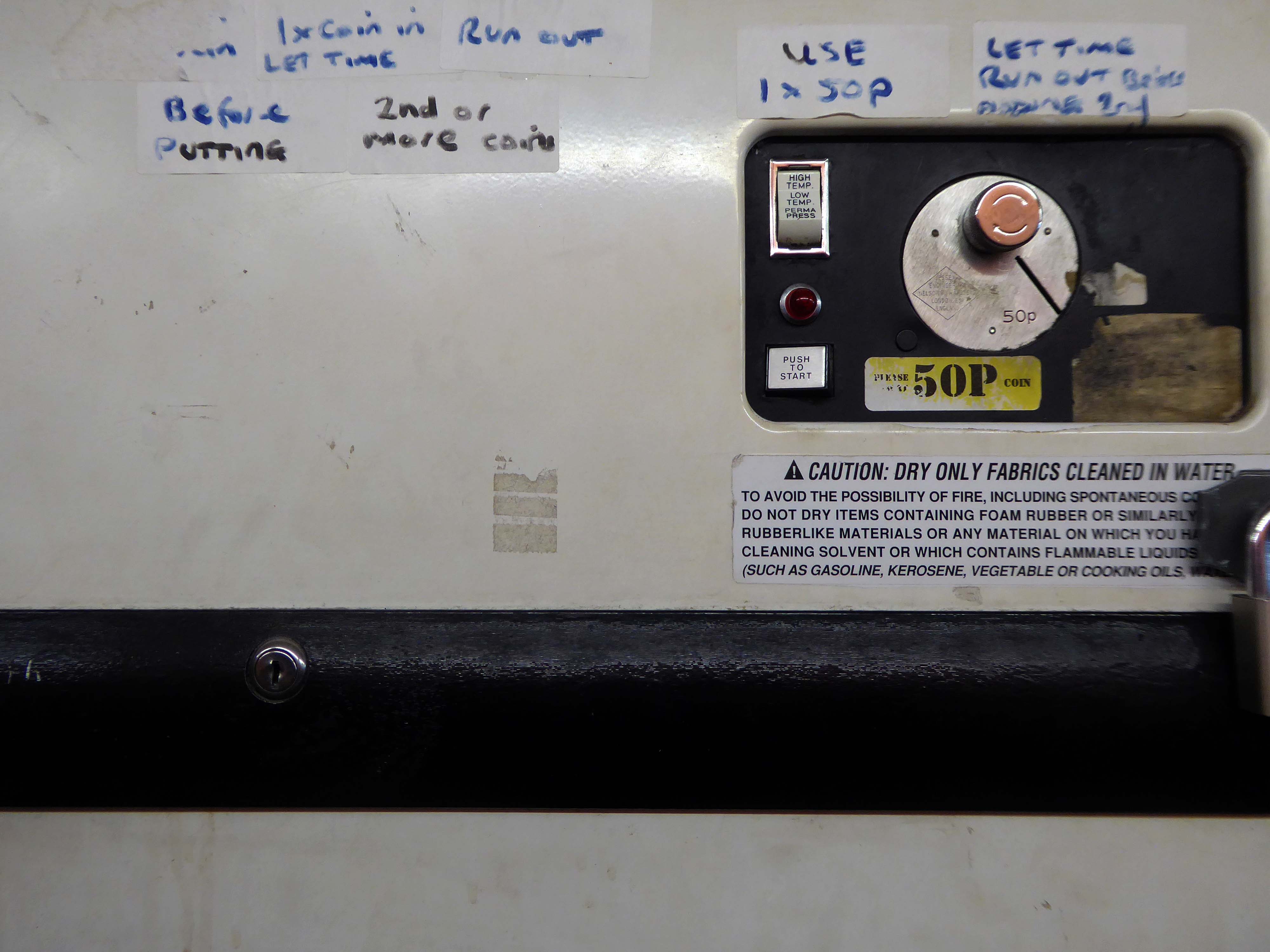
Blown vinyl, damp carpet, dulled stainless steel, tired laminate and pine panels.
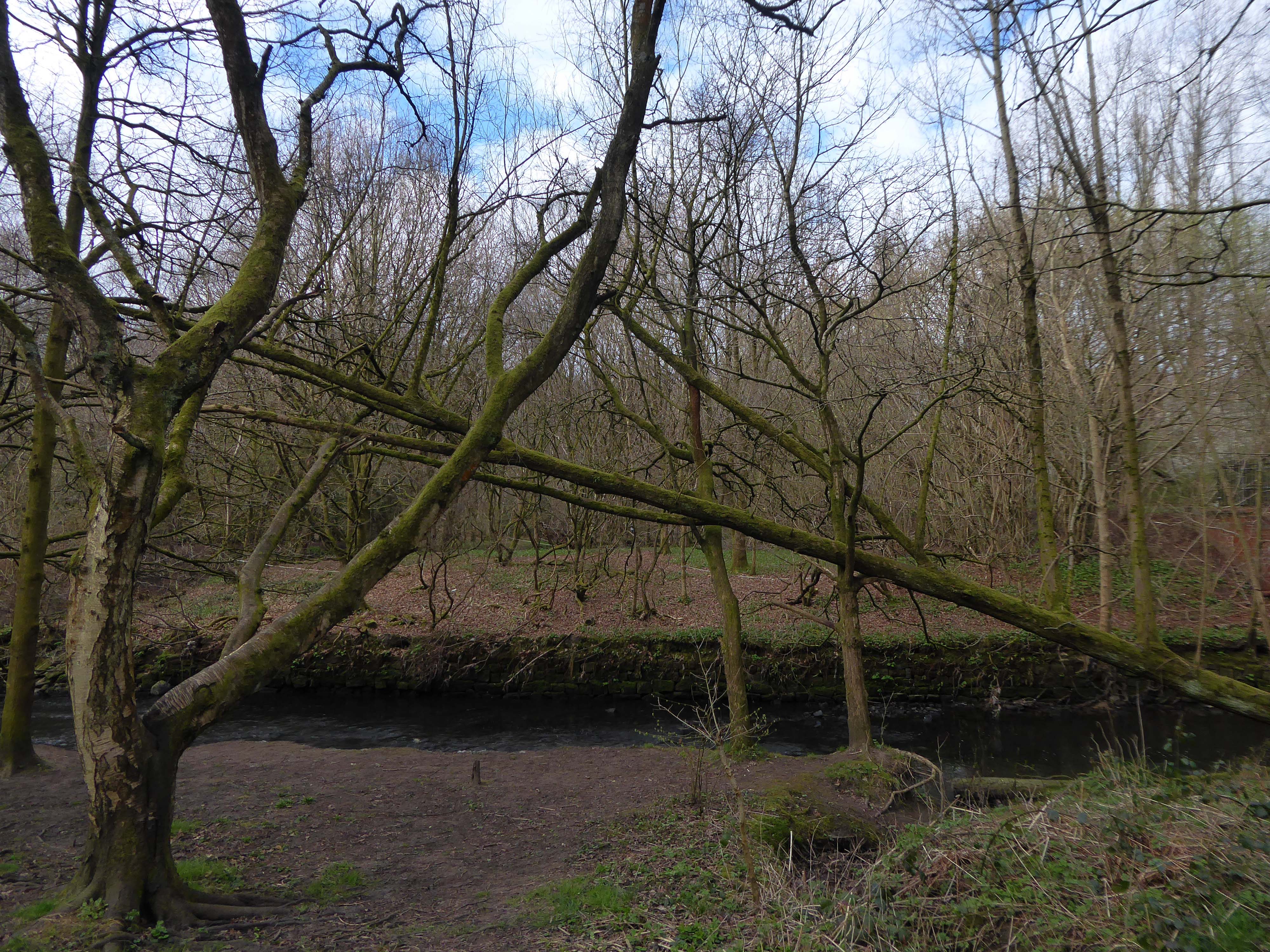
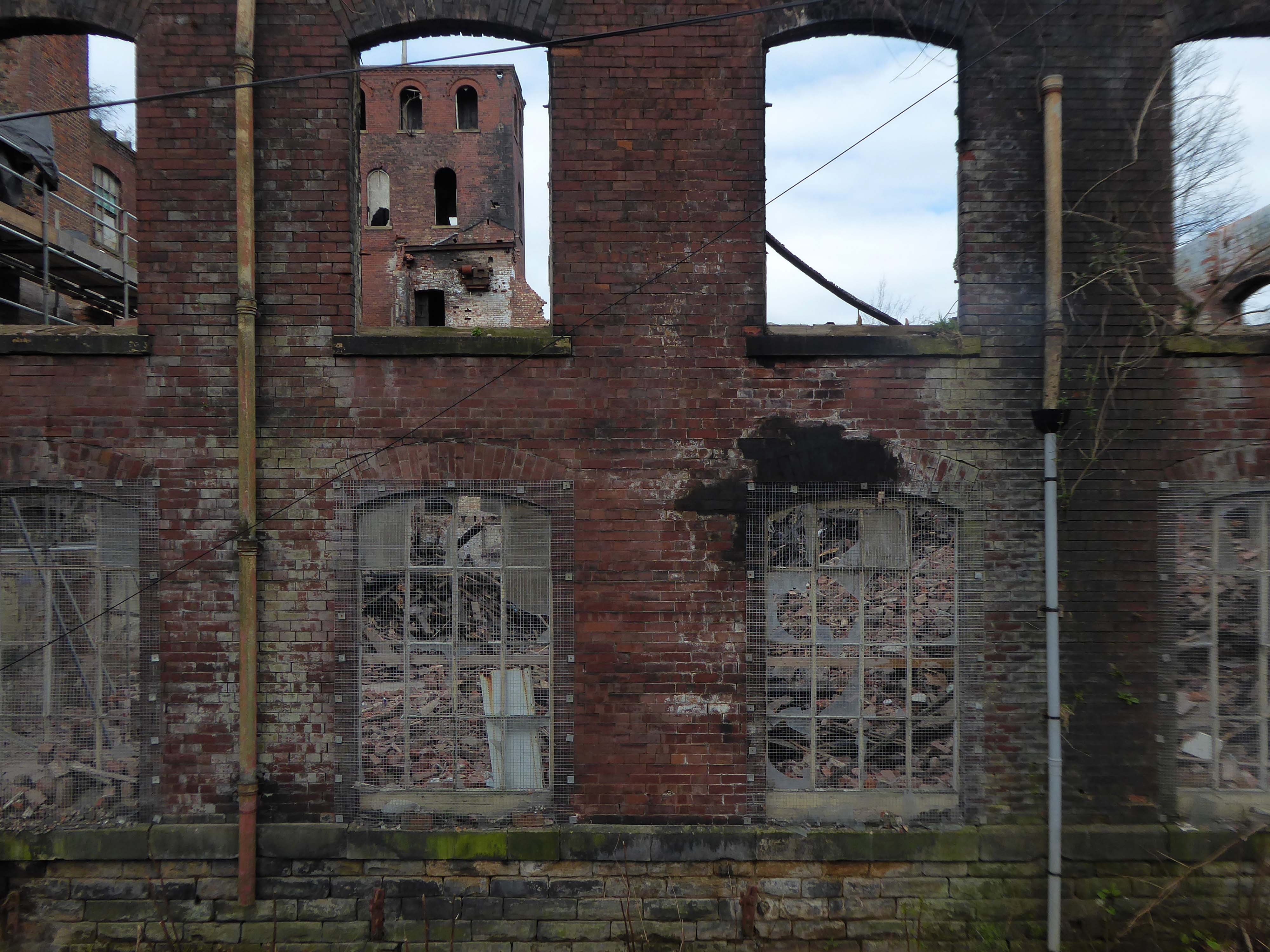
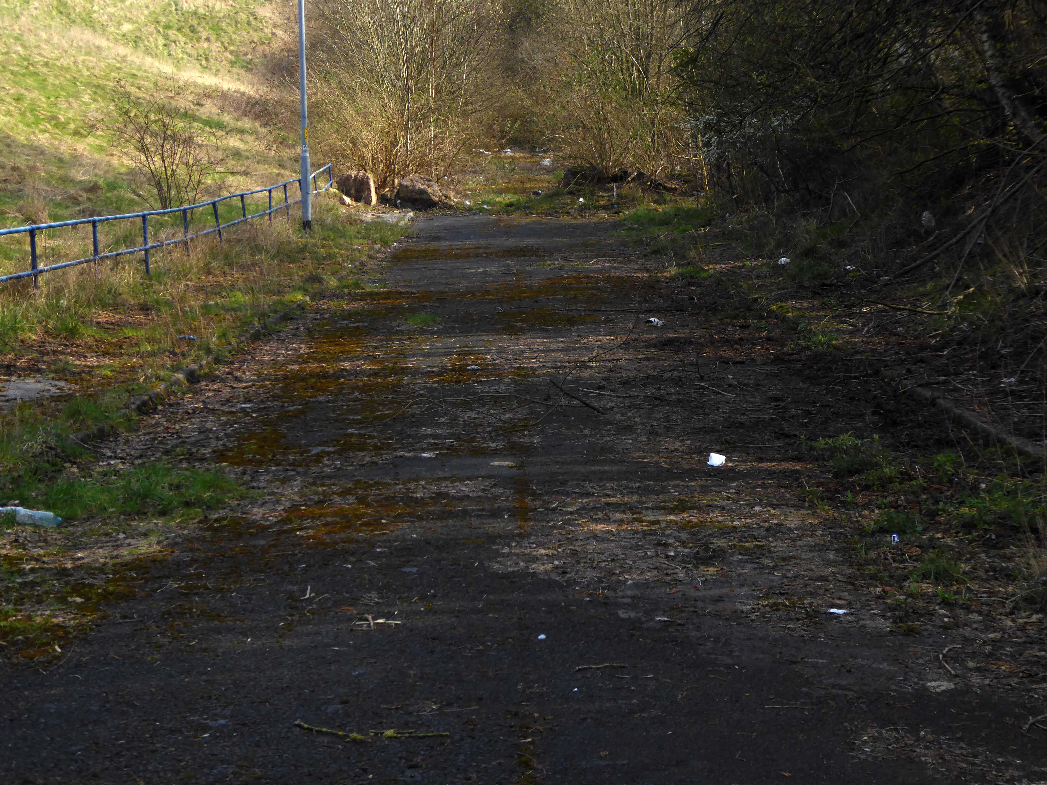
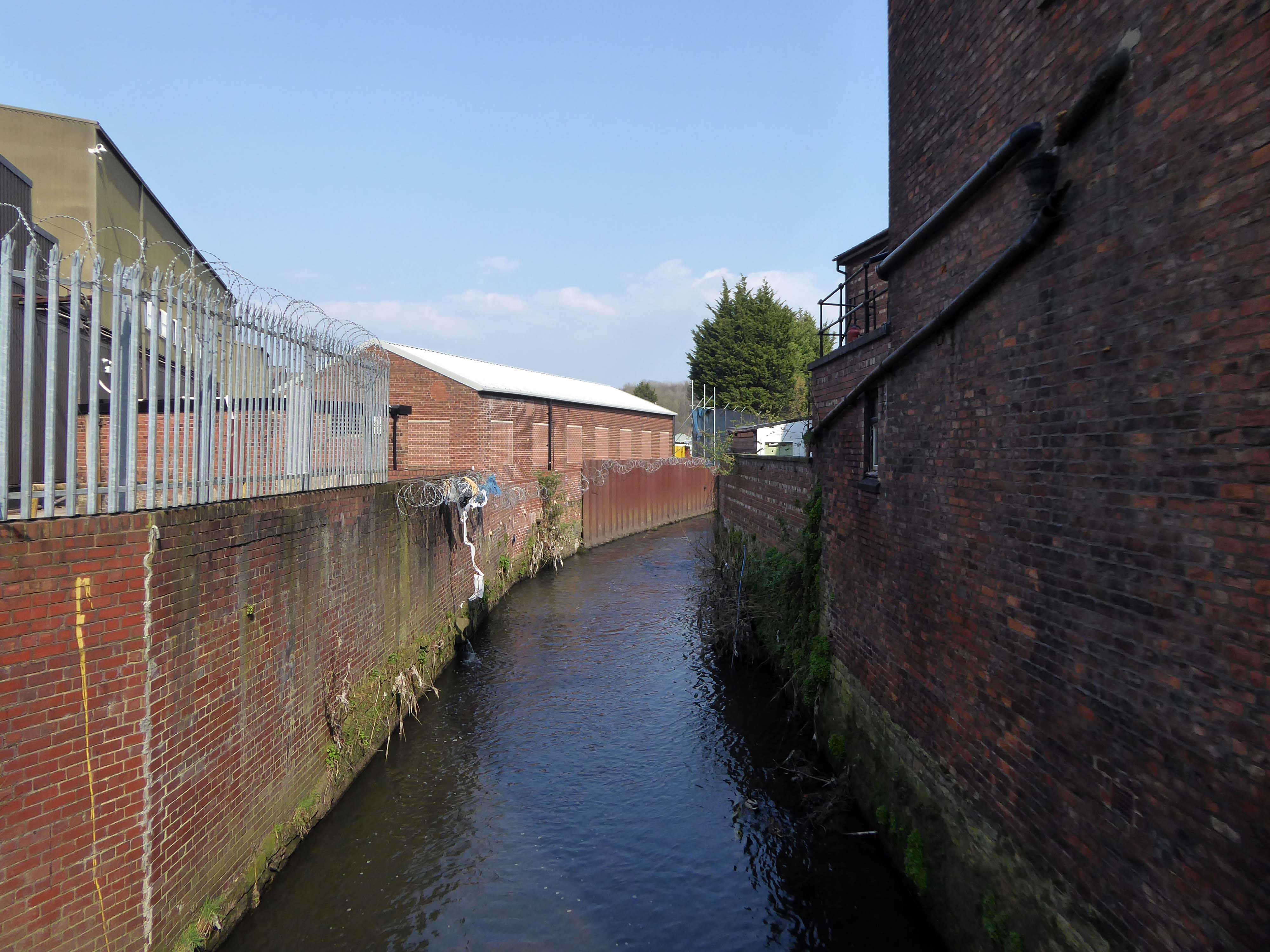
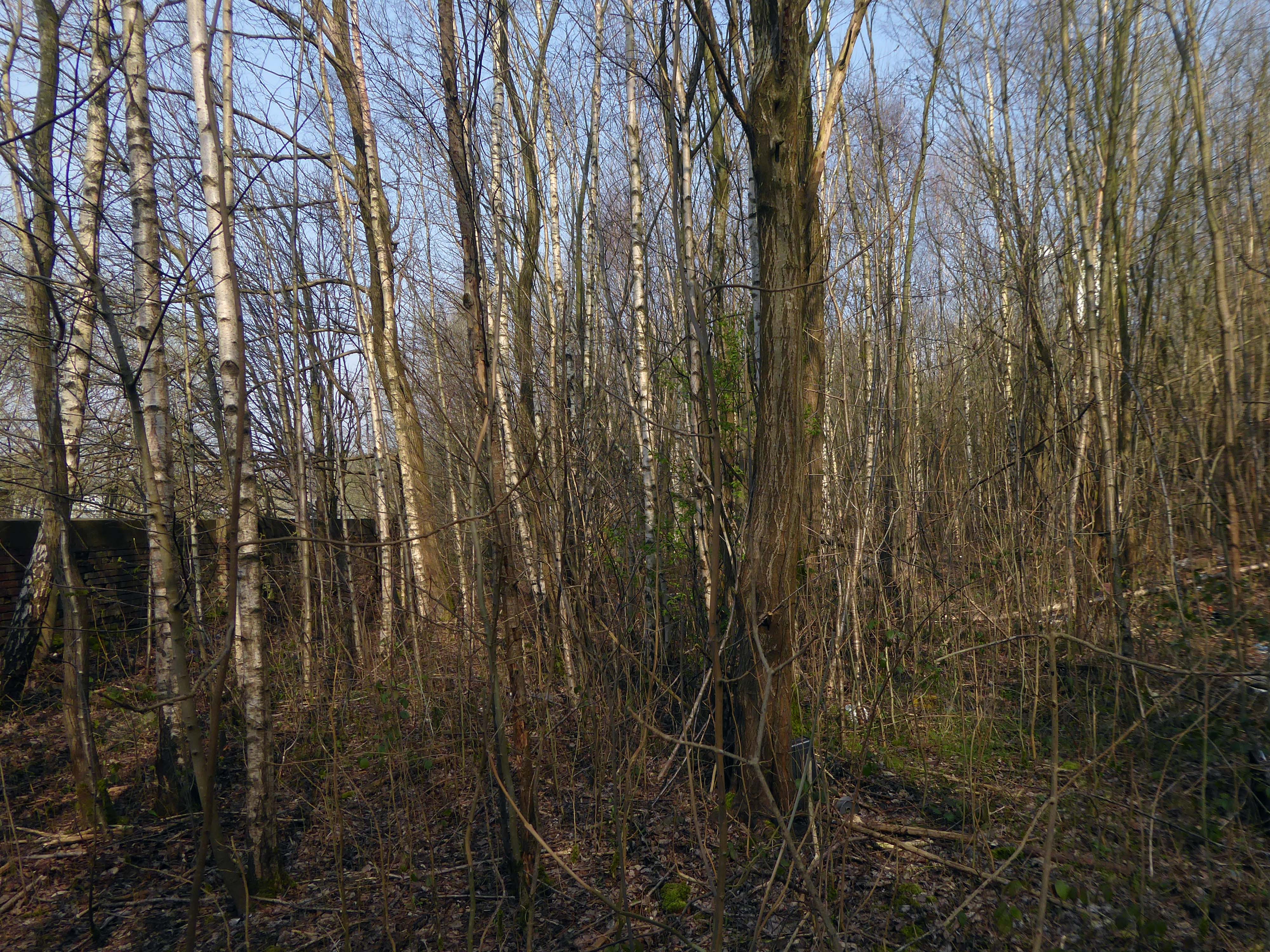
The Irk Valley – the damp, dark and dank Irk Valley.
The south bank of the Irk is here very steep and between fifteen and thirty feet high. On this declivitous hillside there are planted three rows of houses, of which the lowest rise directly out of the river, while the front walls of the highest stand on the crest of the hill in Long Millgate. Among them are mills on the river, in short, the method of construction is as crowded and disorderly here as in the lower part of Long Millgate. Right and left a multitude of covered passages lead from the main street into numerous courts, and he who turns in thither gets into a filth and disgusting grime, the equal of which is not to be found – especially in the courts which lead down to the Irk, and which contain unqualifiedly the most horrible dwellings which I have yet beheld. In one of these courts there stands directly at the entrance, at the end of the covered passage, a privy without a door, so dirty that the inhabitants can pass into and out of the court only by passing through foul pools of stagnant urine and excrement. This is the first court on the Irk above Ducie Bridge – in case any one should care to look into it. Below it on the river there are several tanneries which fill the whole neighbourhood with the stench of animal putrefaction.
Below Ducie Bridge the only entrance to most of the houses is by means of narrow, dirty stairs and over heaps of refuse and filth. The first court below Ducie Bridge, known as Allen’s Court, was in such a state at the time of the cholera that the sanitary police ordered it evacuated, swept and disinfected with chloride of lime. Dr. Kay gives a terrible description of the state of this court at that time. Since then, it seems to have been partially torn away and rebuilt; at least looking down from Ducie Bridge, the passer-by sees several ruined walls and heaps of debris with some newer houses. The view from this bridge, mercifully concealed from mortals of small stature by a parapet as high as a man, is characteristic for the whole district. At the bottom flows, or rather stagnates, the Irk, a narrow, coal-black, foul-smelling stream, full of debris and refuse, which it deposits on the shallower right bank.
The stylishly designed living areas and carefully considered external finishes within the new buildings, have been designed to compliment the rich industrial architectural style of the area.
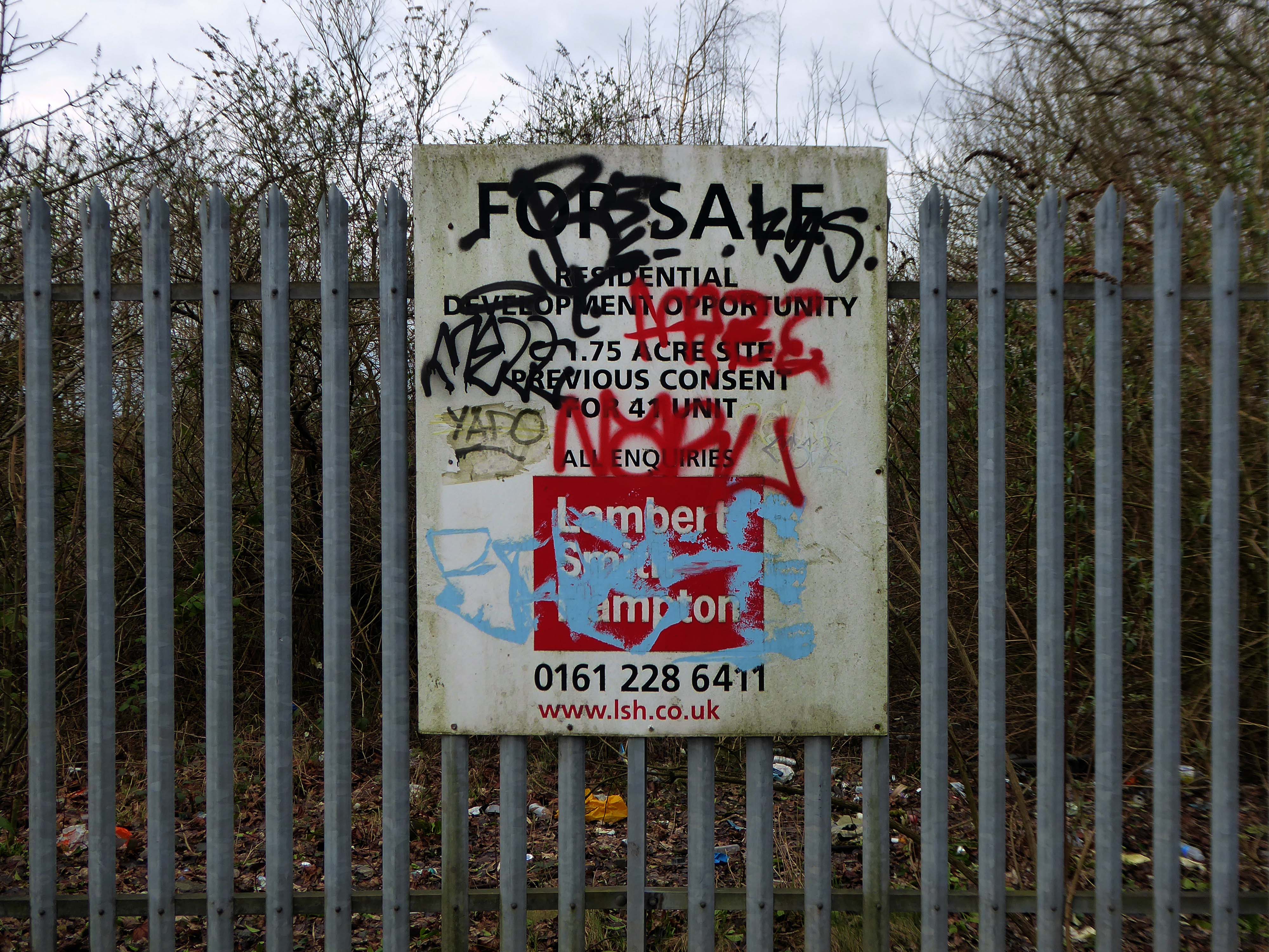
They were never built
Pinnacle Alliance plans to build 344 luxury apartments on a site near Dantzic Street, as part of the ‘Northern Gateway’. Dozens of investors have paid up to £350,000 for the off-plan apartments in the proposed scheme. But two years since many first paid out for their home, no work has actually begun on the £30m scheme.
The dispute has led to a demonstration in Hong Kong, where around 50 buyers took to the streets over Christmas urging local authorities to take up their concerns. And in an unusual twist, protestors even recorded their own campaign song – to the tune of Jingle Bells – criticising Pinnacle.
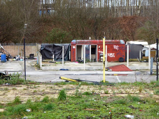
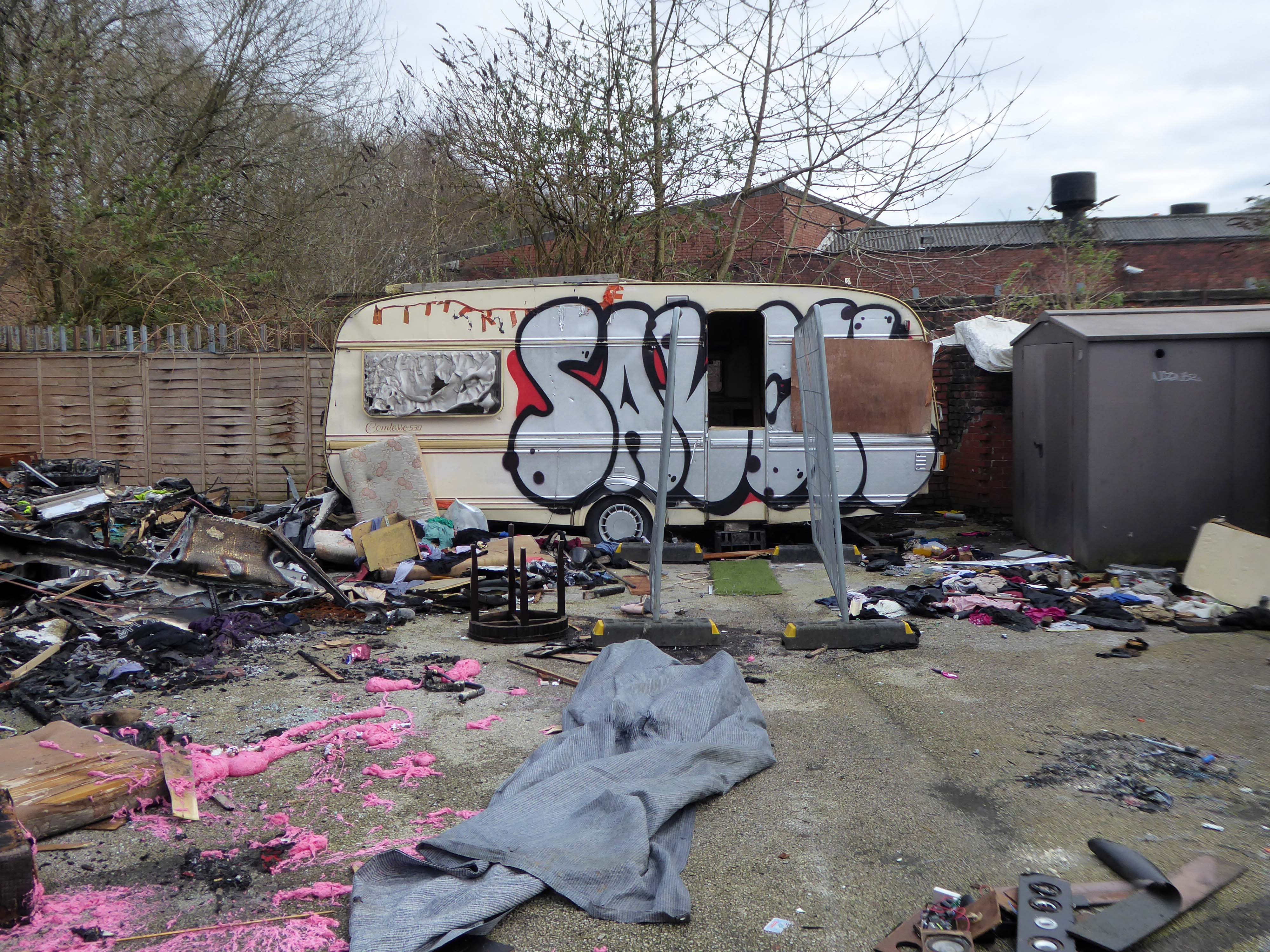
On the way out are the Travellers’ homes on the other side of the road, adjoining the Irk valley.
Thought to be in danger of flooding, they were condemned, yet there are plans to build on the site for less contentious or socially inclusive usage.
For centuries the commons of England provided lawful stopping places for people whose way of life was or had become nomadic. Enough common land survived the centuries of enclosure to make this way of life sustainable, but by section 23 of the Caravan Sites and Control of Development Act 1960 local authorities were given power to close the commons to Travellers. This they proceeded to do with great energy, but made no use of the concomitant power given to them by section 24 of the same Act to open caravan sites to compensate for the closure of the commons. By the Caravan Sites Act 1968, therefore, Parliament legislated to make the section 24 power a duty…for the next quarter of a century there followed a history of non-compliance with the duties imposed by the Act of 1968, marked by a series of decisions of this court holding local authorities to be in breach of their statutory duty; but to apparently little practical effect. The default powers vested in central government, to which the court was required to defer, were rarely if ever used.
The Home Secretary, Priti Patel, said yesterday, that the new laws will target trespassers – who intend to reside on any private or public land in vehicles without permission, and where they are causing significant disruption, distress or harm to local communities.
This new offence will enable the police to fine or arrest those residing without permission on private or public land in vehicles in order to stop significant disruption, distress or harm being caused to the law-abiding majority – she added.
The new law also gives the police the powers to seize and impound vehicles whose owners fail to comply with the new law and who refuse or can’t leave.
You are criminalising a problem that has been created by the failings of a political will to deliver appropriate accommodation.
So here we are – in the shadow of the ever expanding New Manchester – no homes for those who choose their own traditional way of life.
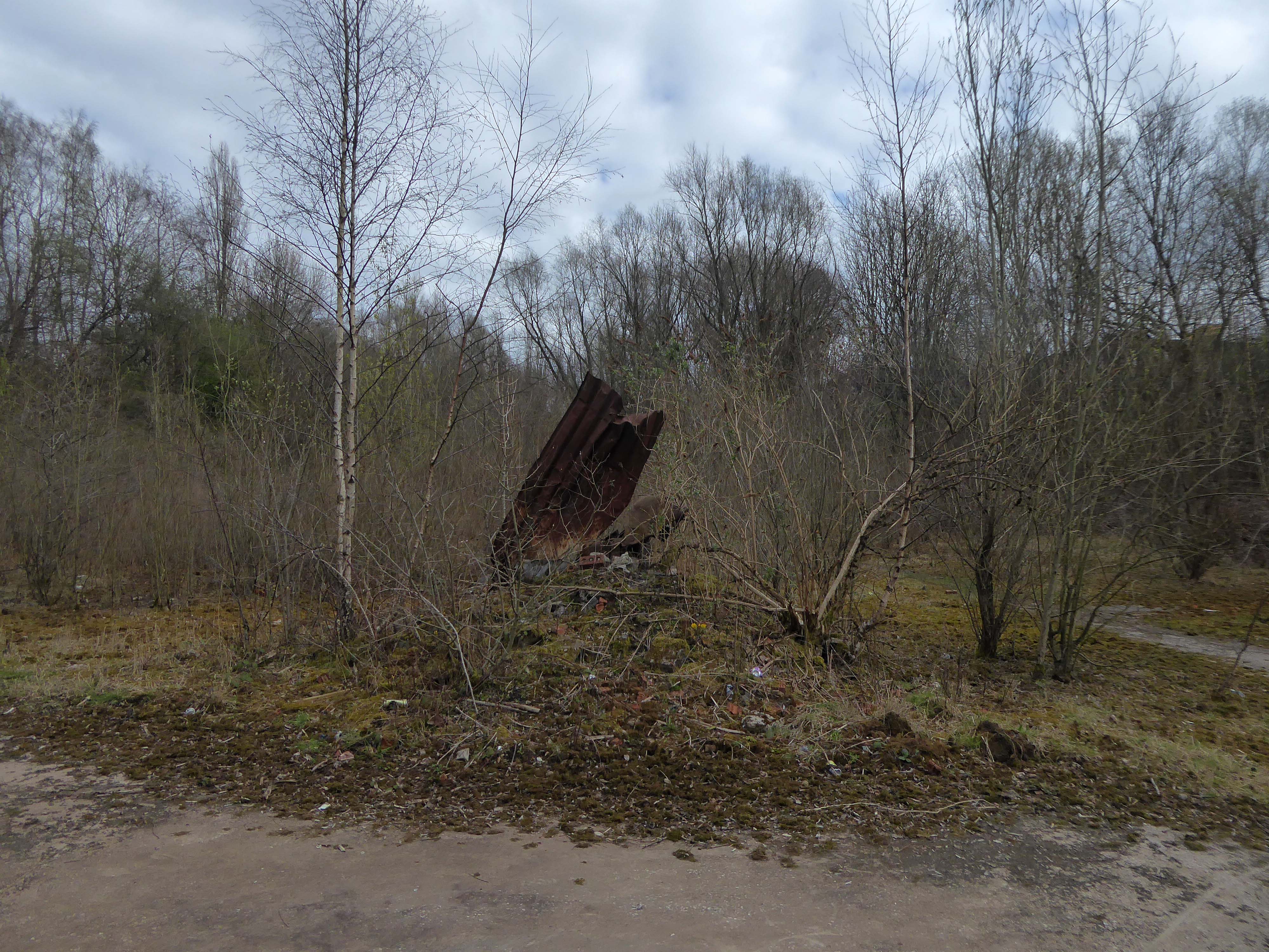
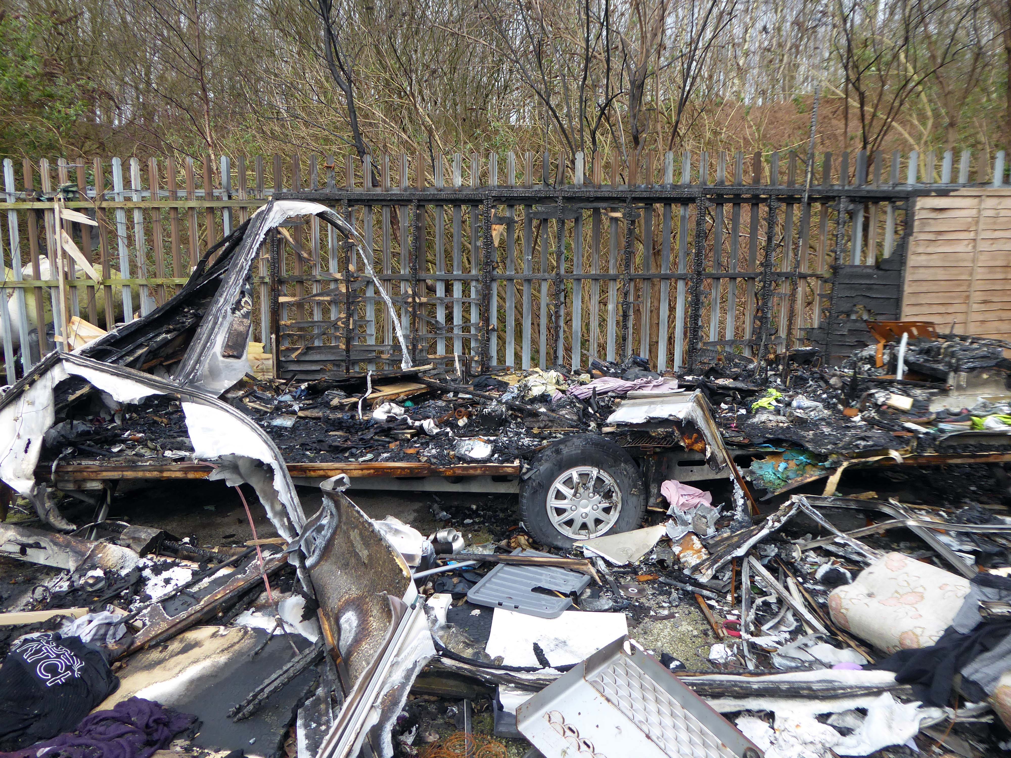
Burnt out shells, discarded toys and a population of ghosts.
Today, we live in a political economy that has been dominated by neoliberalism as a consolidation of the role that capital has in accumulation by dispossession. It has been written extensively elsewhere that contemporary neoliberal land policy affects seemingly disparate groups within the urban population. Less explored, however, is how this logic affects GRT communities in particular.
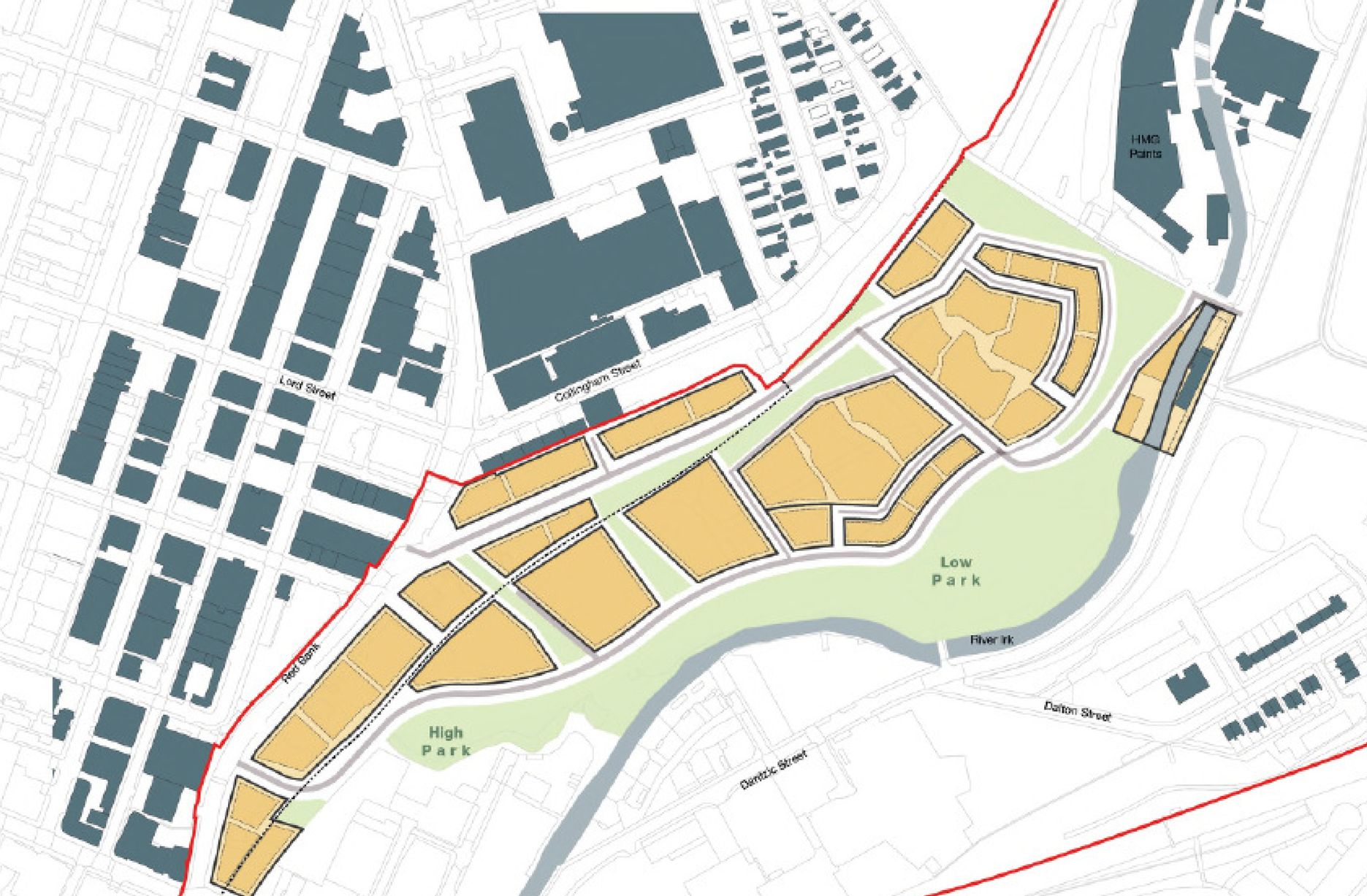
The traveller site on Dantzic Street lies within the forthcoming Red Bank neighbourhood, on the meander of the Irk, this particular neighbourhood will consist of:
Given its proximity to the Green Quarter and other luxury residences, we can expect the rent gap produced by speculative land values to be fully exploited on this patch of land. As for a new traveller site to replace the one on Dantzic Street, the future remains unclear. Having reached out to an Executive Member for Housing and Employment within MCC about ecological concerns alongside the worries concerning lack of land access to travellers, the first question was responded to with misplaced enthusiasm whilst the latter was yet to be briefed at all.
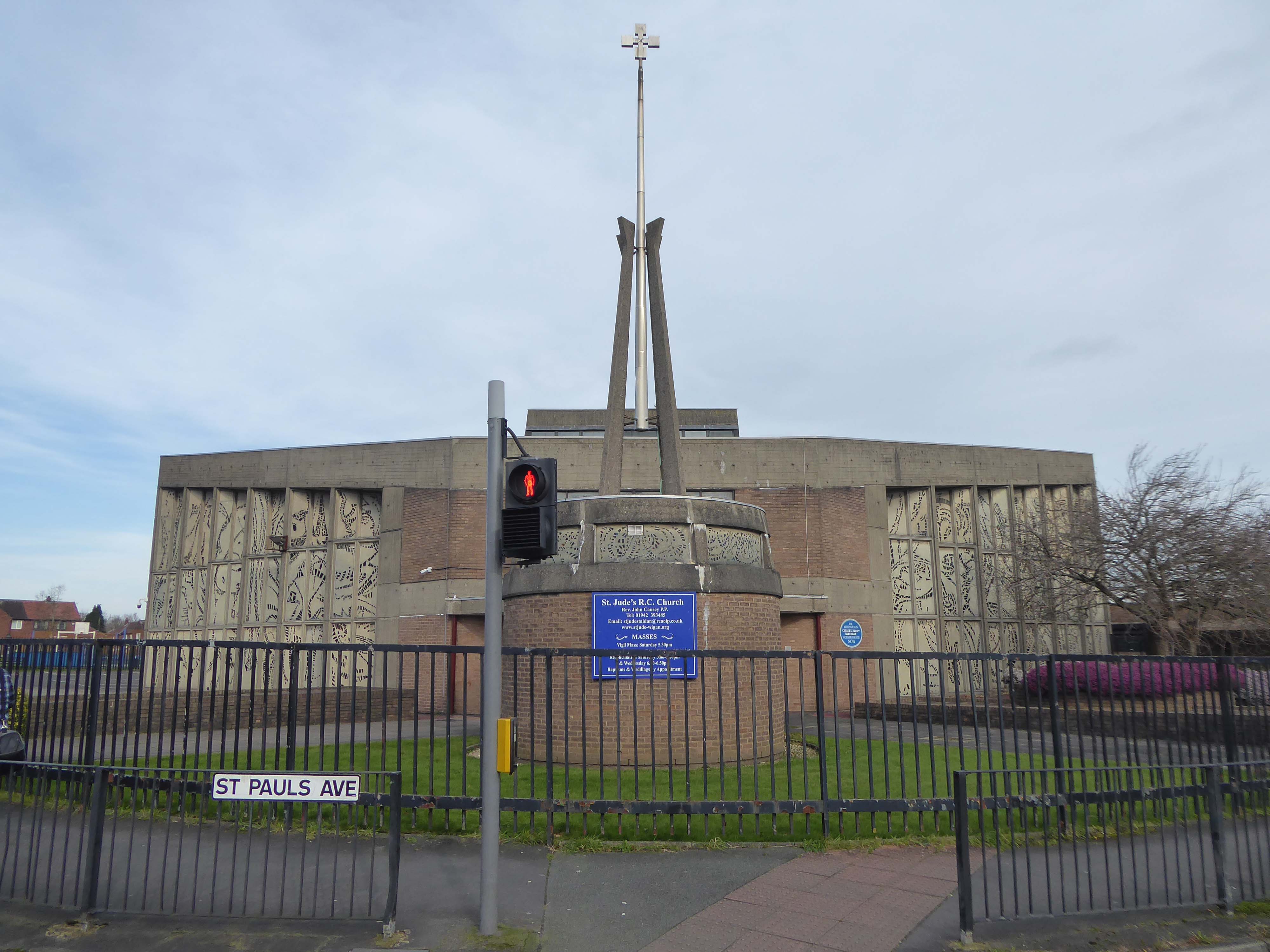
St. Jude’s Church Poolstock Lane/St Paul’s Avenue Wigan WN3 5JE
Following the demolition of many working class homes in central Wigan in the early-to-mid 20th century there was a migration to new council estates on the outskirts of the town including new developments in the Poolstock and Worsley Mesnes localities. In order to cater to the Catholic inhabitants of the new estates Father Richard Tobin of St Joseph’s parish in Wigan, established a chapel of ease – described as a wooden hut, on St Paul’s Avenue in 1959.
In 1962 Tobin wrote to the Archbishop of Liverpool George Andrew Beck with his proposals for a new, permanent church, suggesting that the church should be dedicated either to St Jude or Our Lady of the Assumption.
Beck replied on 15 March:
My dear Father Tobin, Many thanks for your letter. I like your suggestion of St. Jude as a patron of the new church. We already have a parish in honour of The Assumption but none, so far as I know, to St. Jude. I assume that you do not intend to suggest by this title that Wigan is a hopeless case!
The Liverpool architects L A G Prichard & Sons were engaged and work began in the summer of 1963. Subsidence caused by coal mining in the area necessitated reinforced foundations and the final cost was over £100,000. The foundation stone was laid by Archbishop Beck in December 1964 and the church was opened for worship in July 1965.
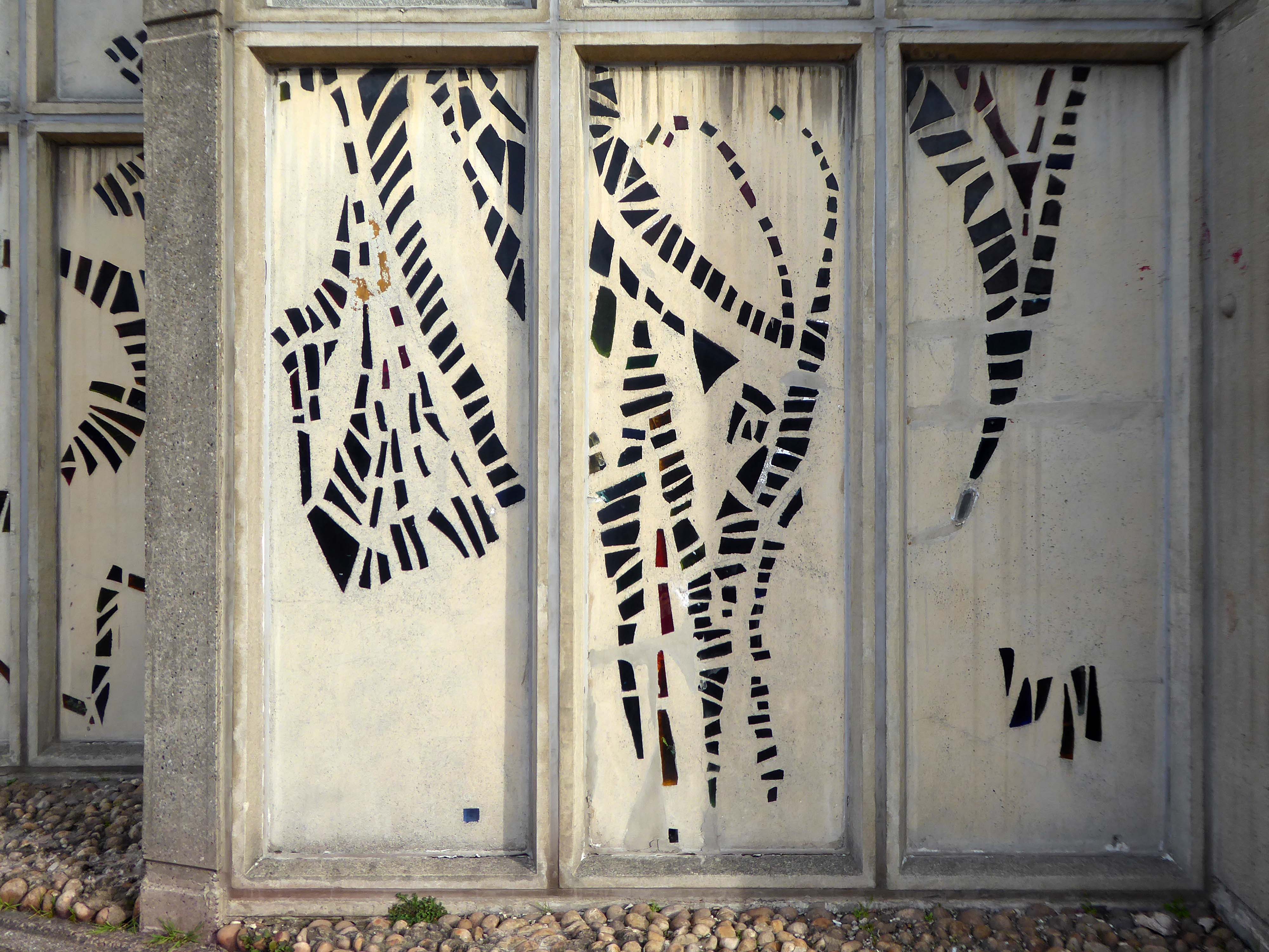
The most remarkable feature of the church is the dalle de verre stained glass on the walls of the nave, designed by Robin Riley, made by Verriers de St Jobain in France and fitted by glaziers J O’Neill and Sons.
Sadly Robin Riley died this year, aged 90, my thanks to his former student Keith Hamlett for the information.
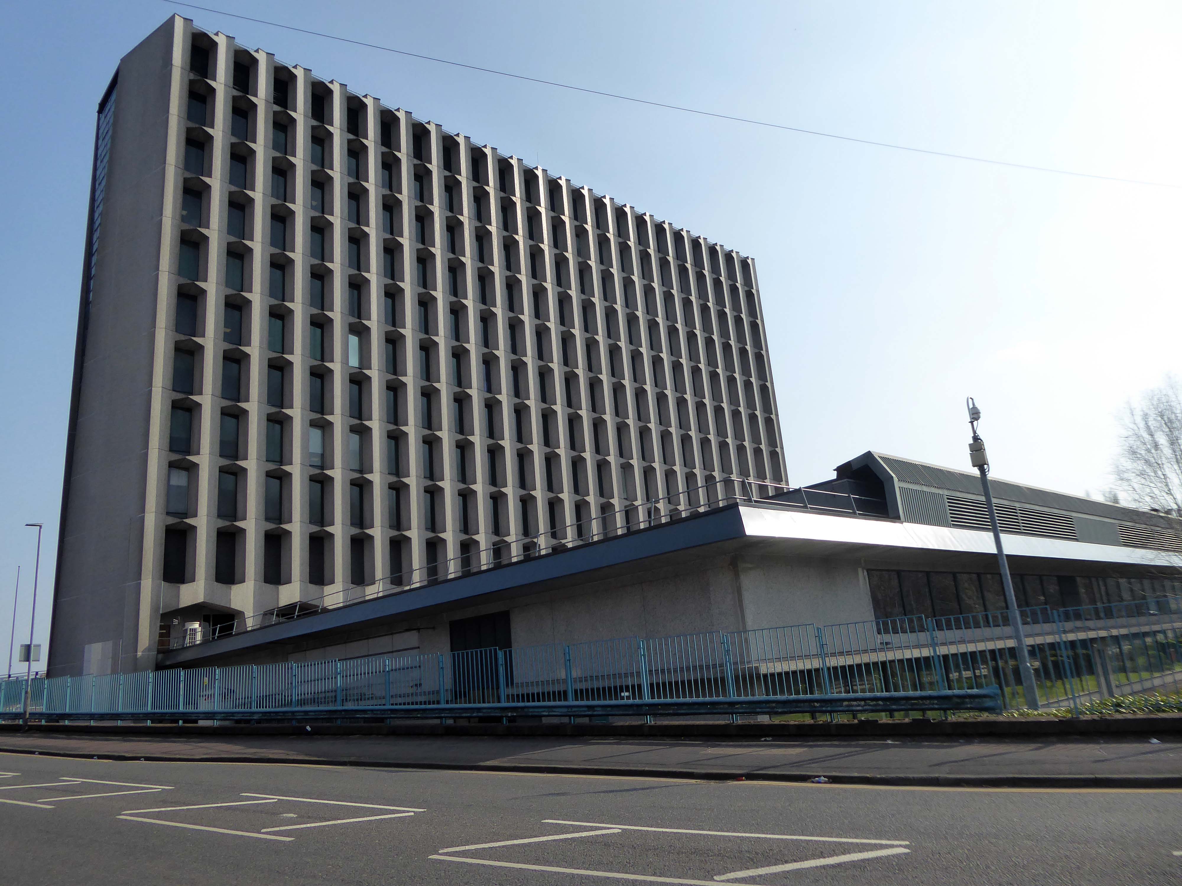
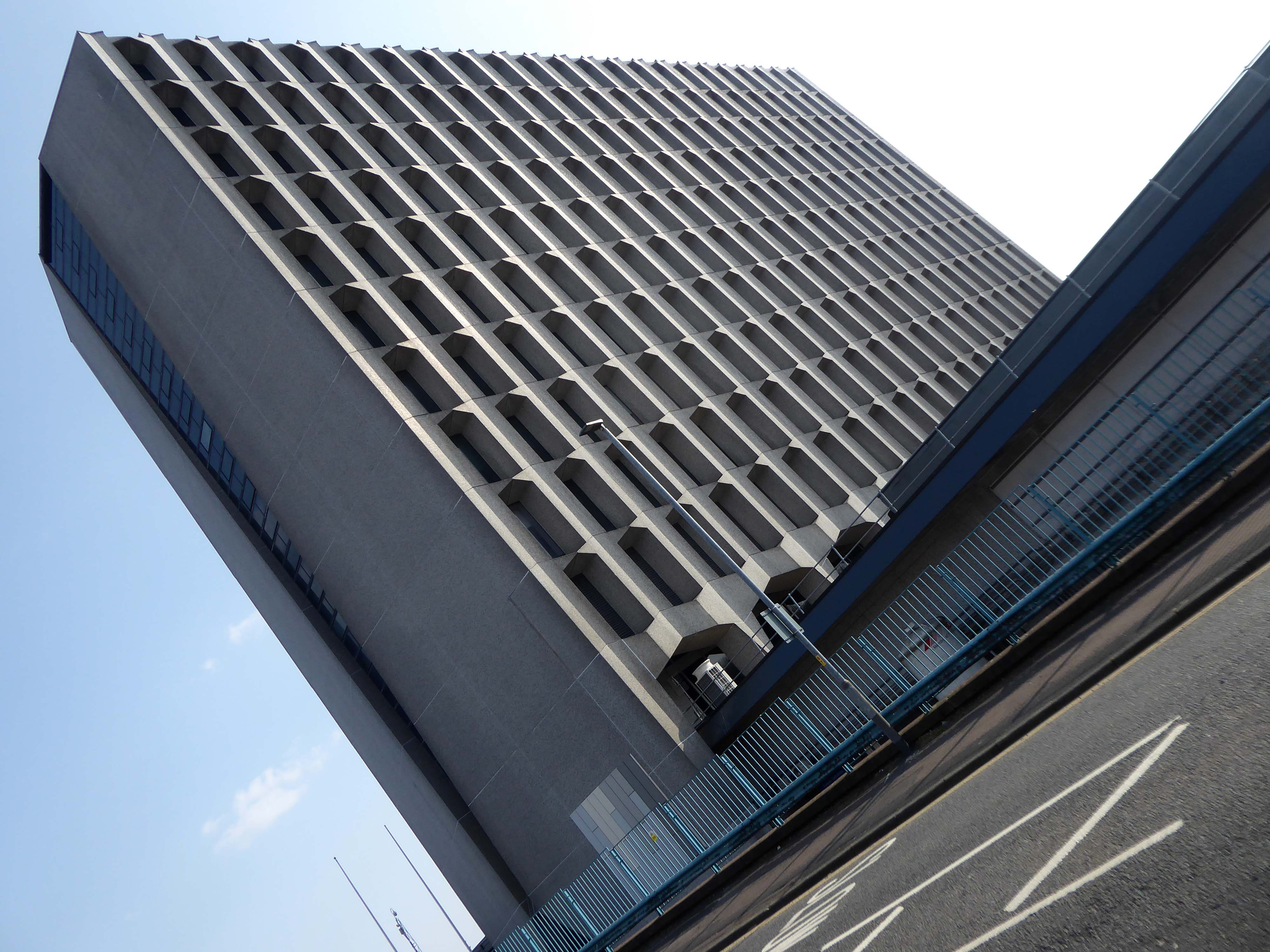
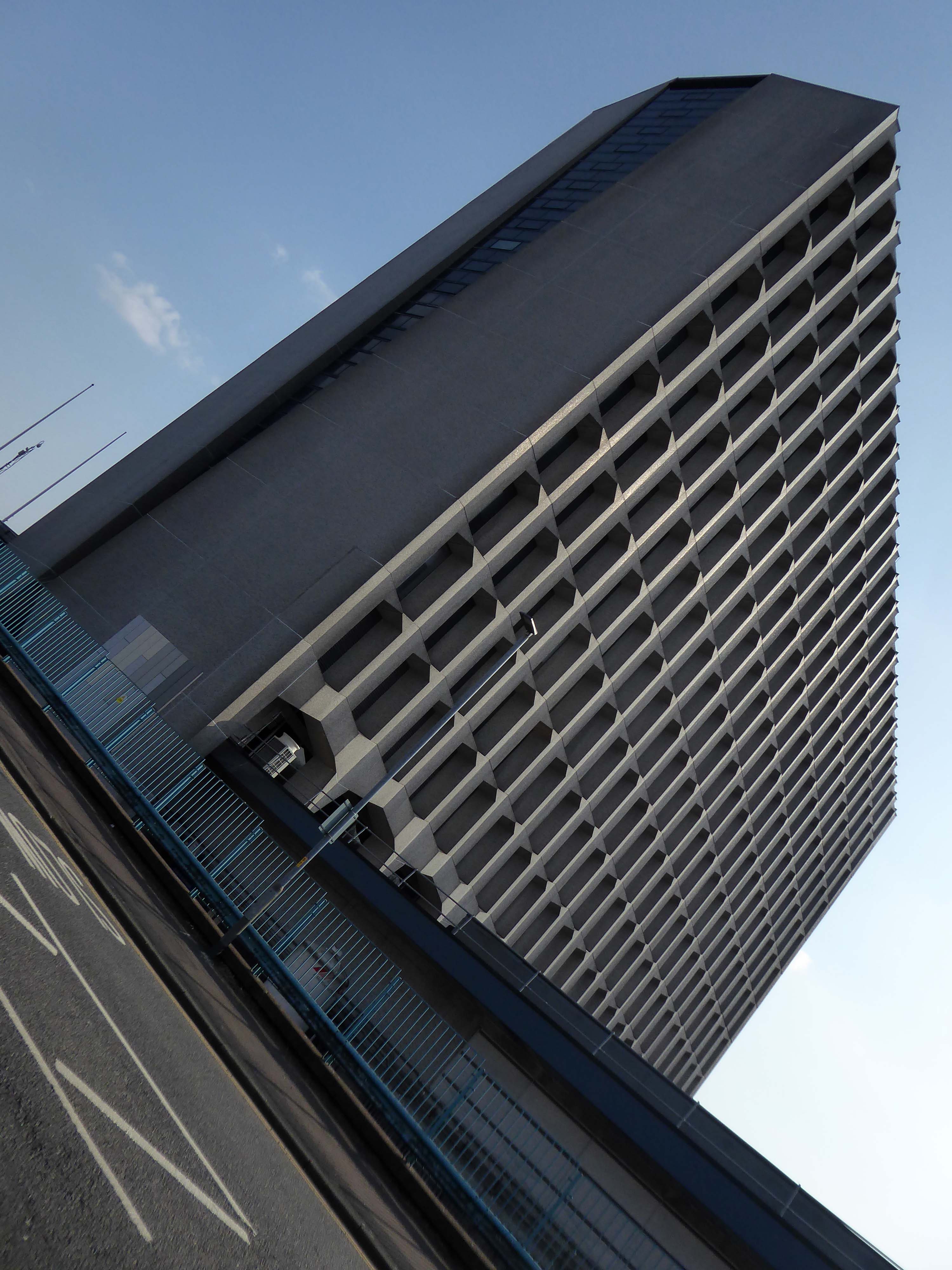
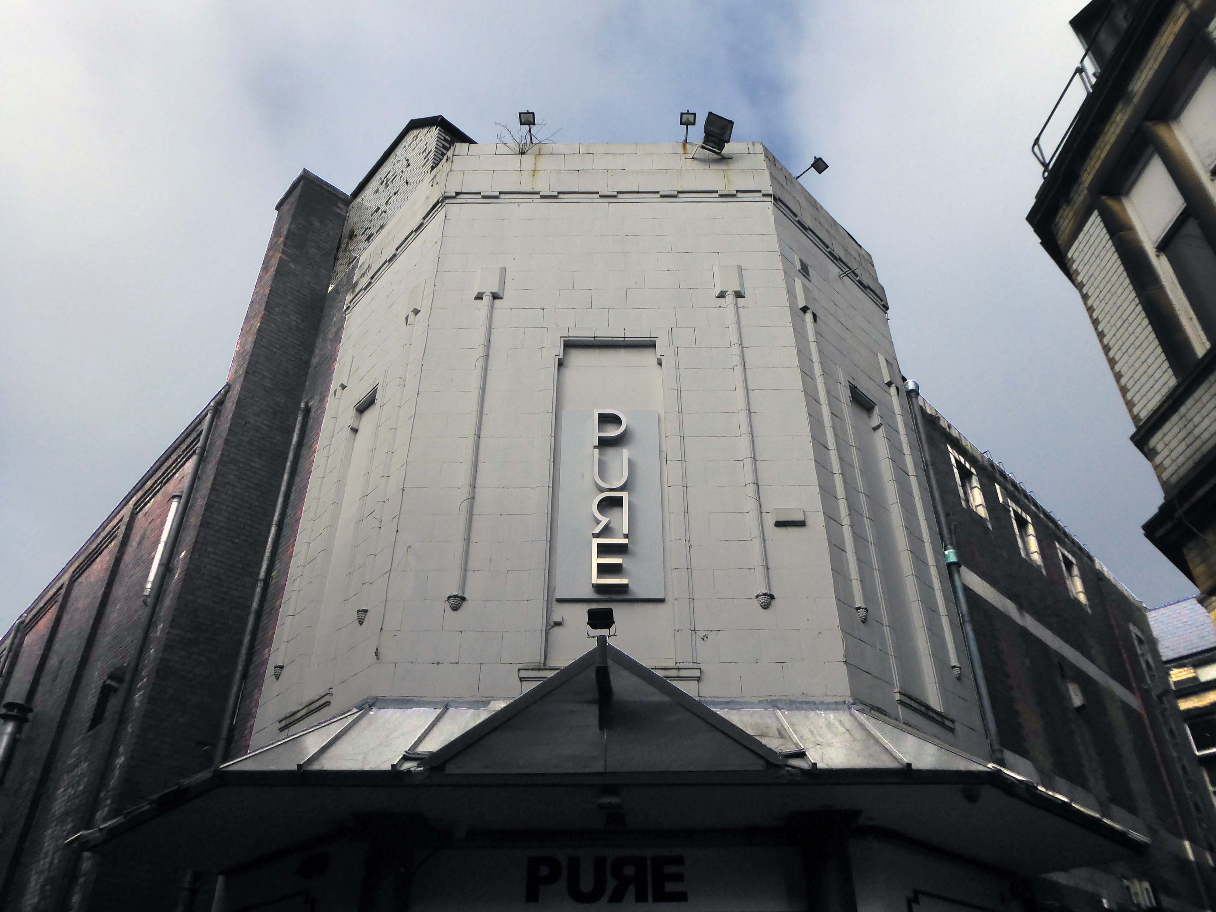
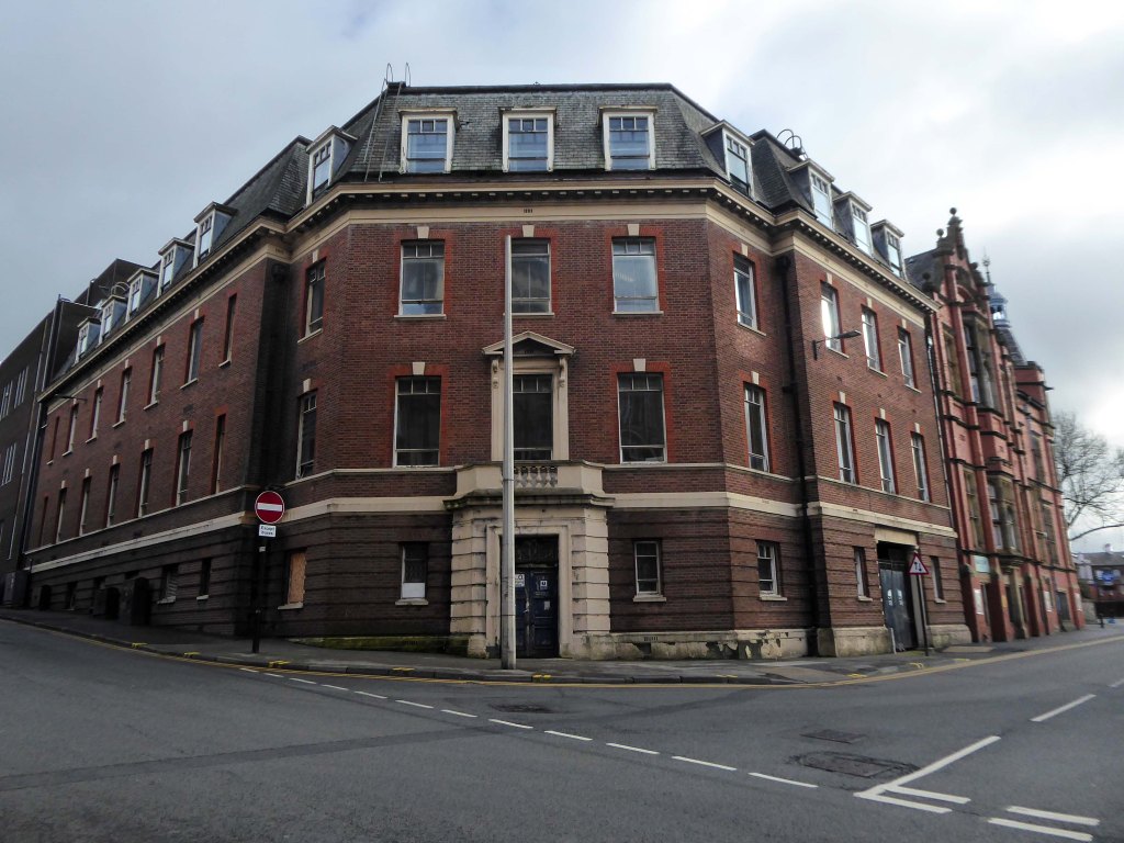
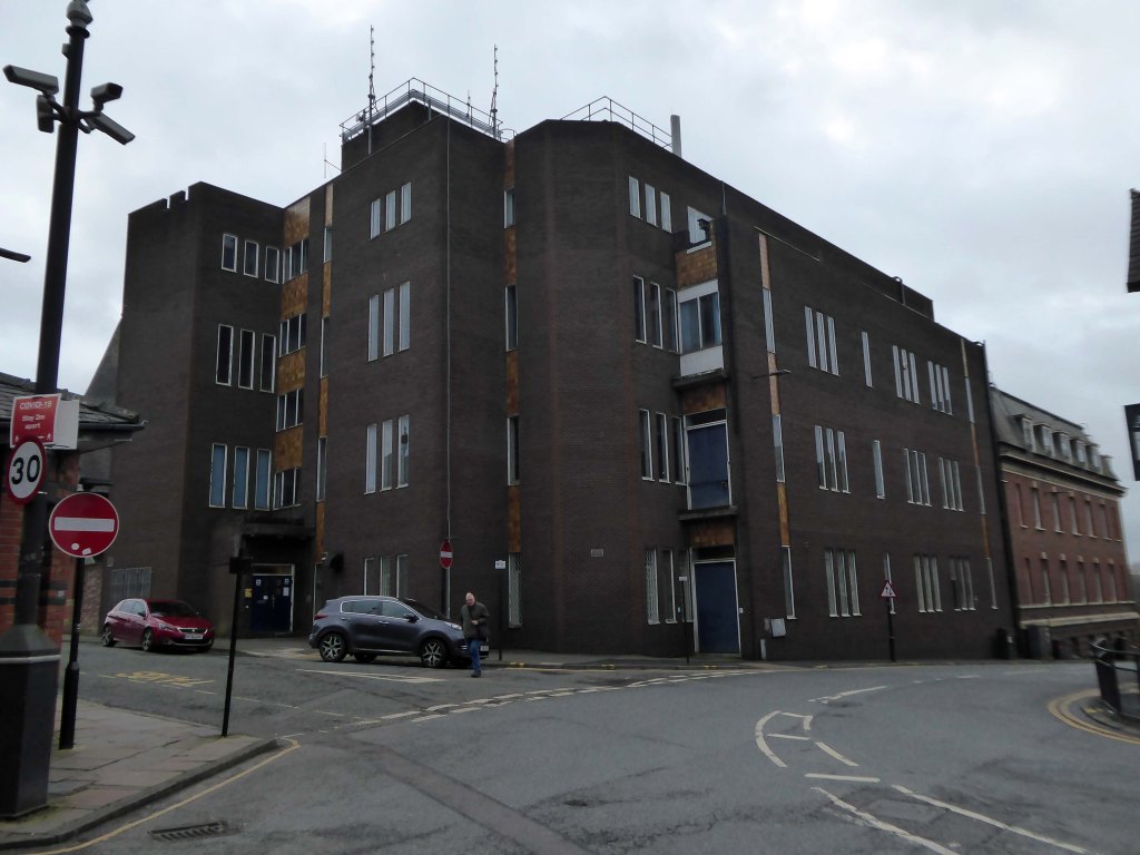
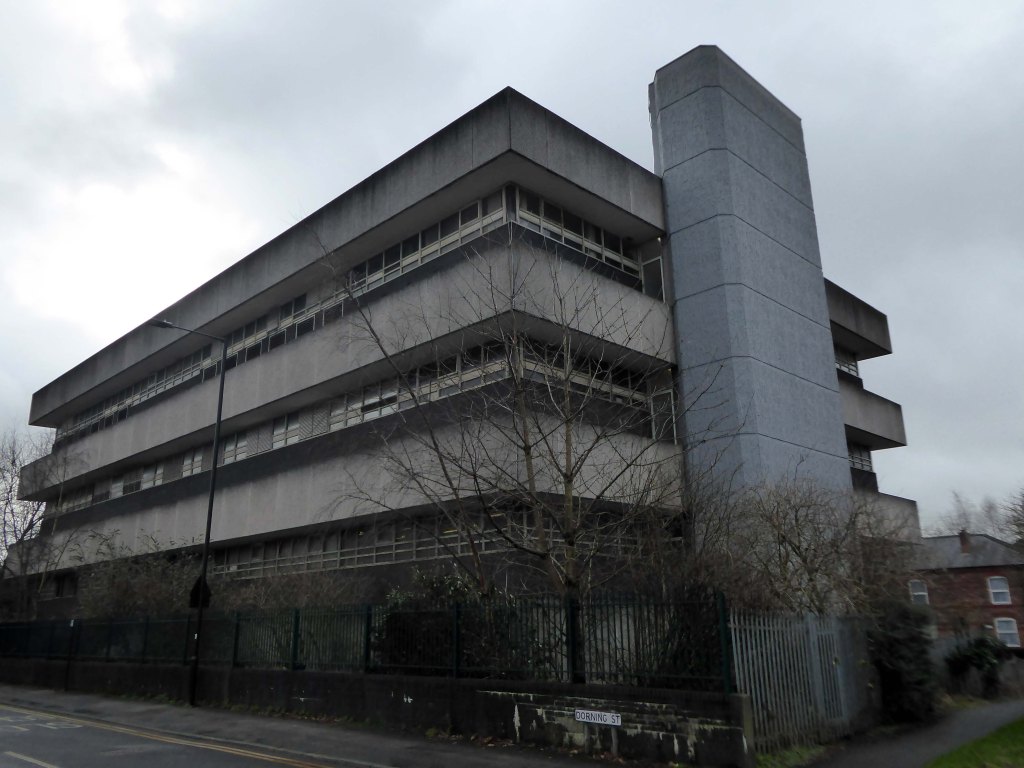
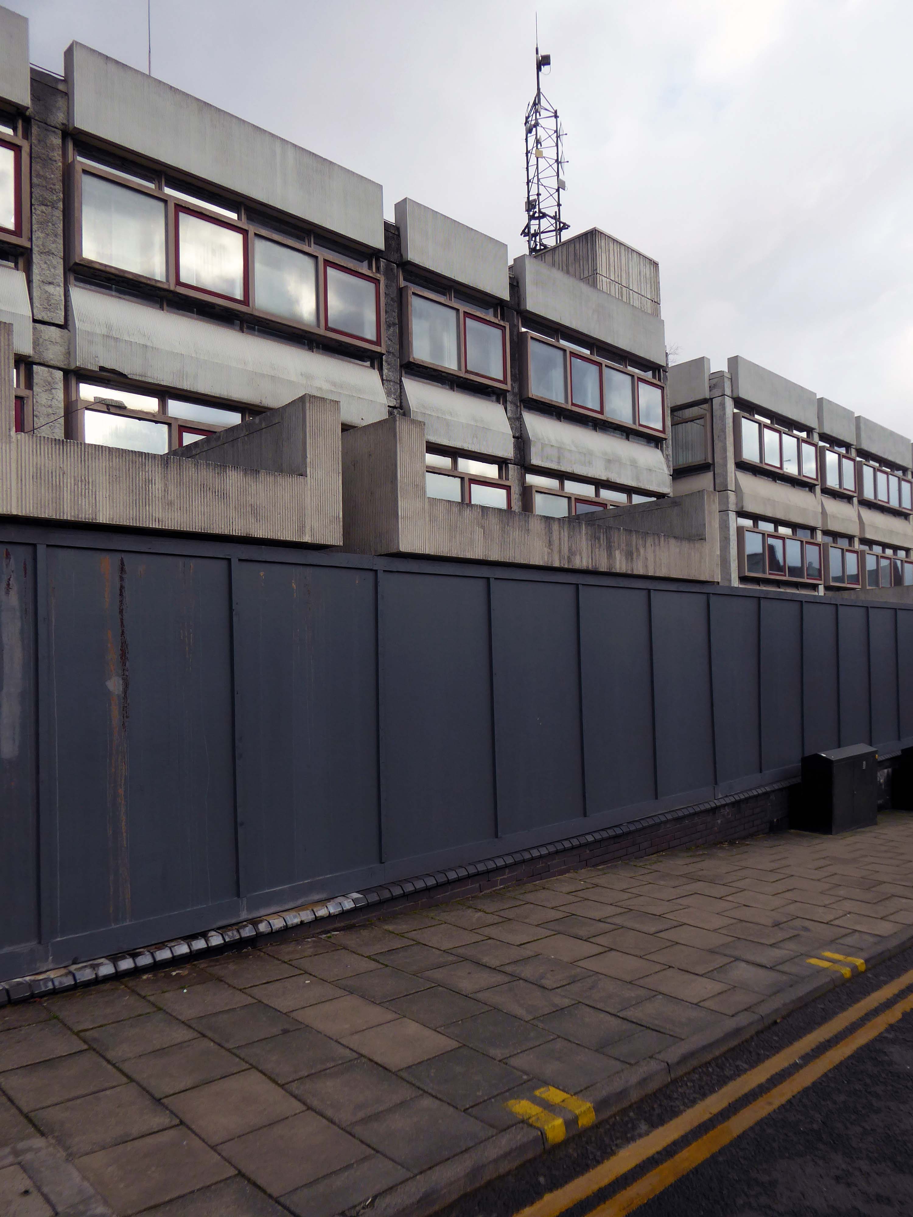
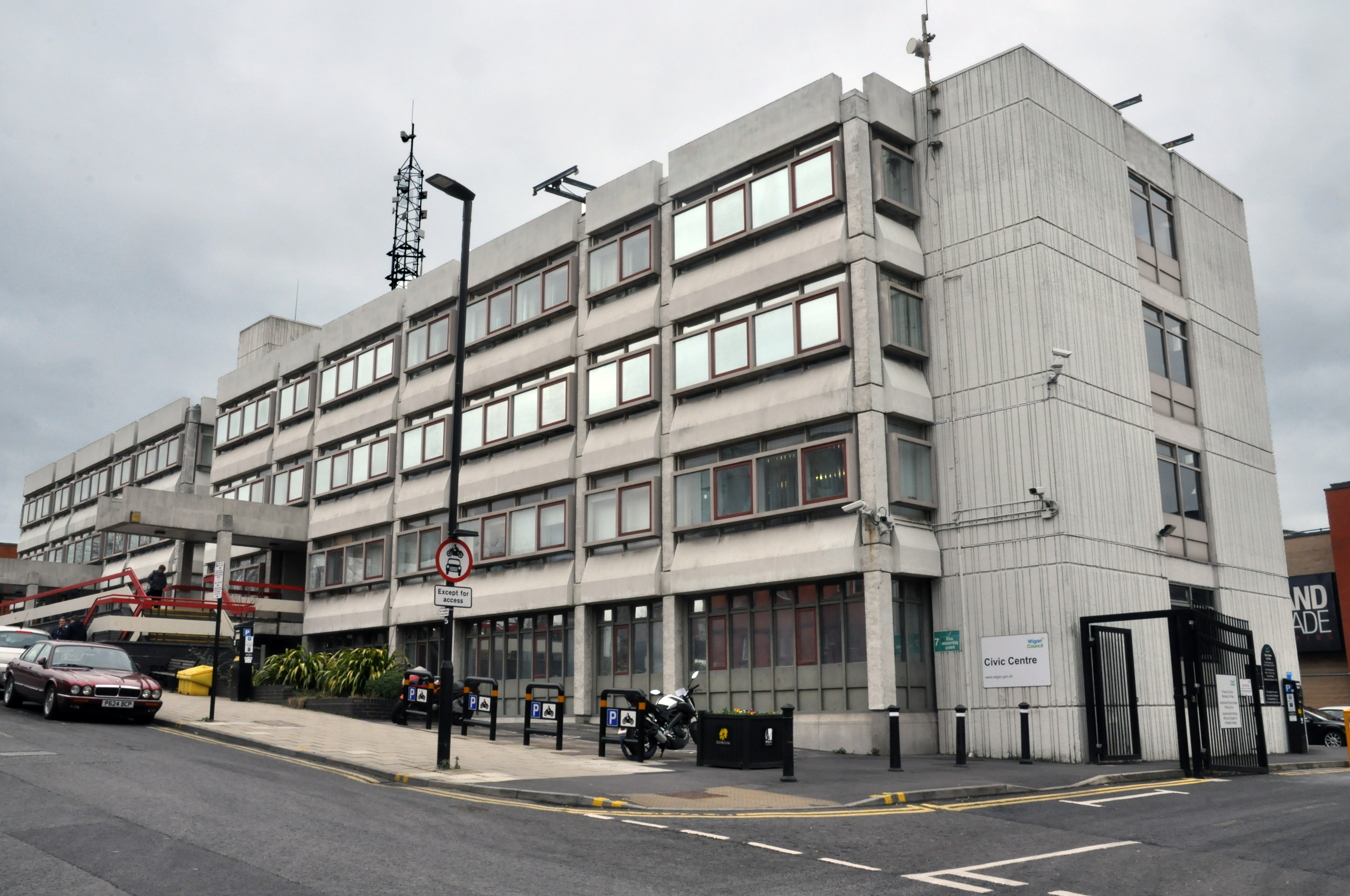
Back out onto Dorning Street in search of telephone exchanges, three telephone exchanges.
Inter-war
Sixties.
Seventies.
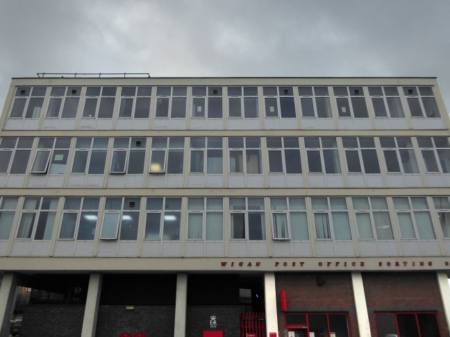
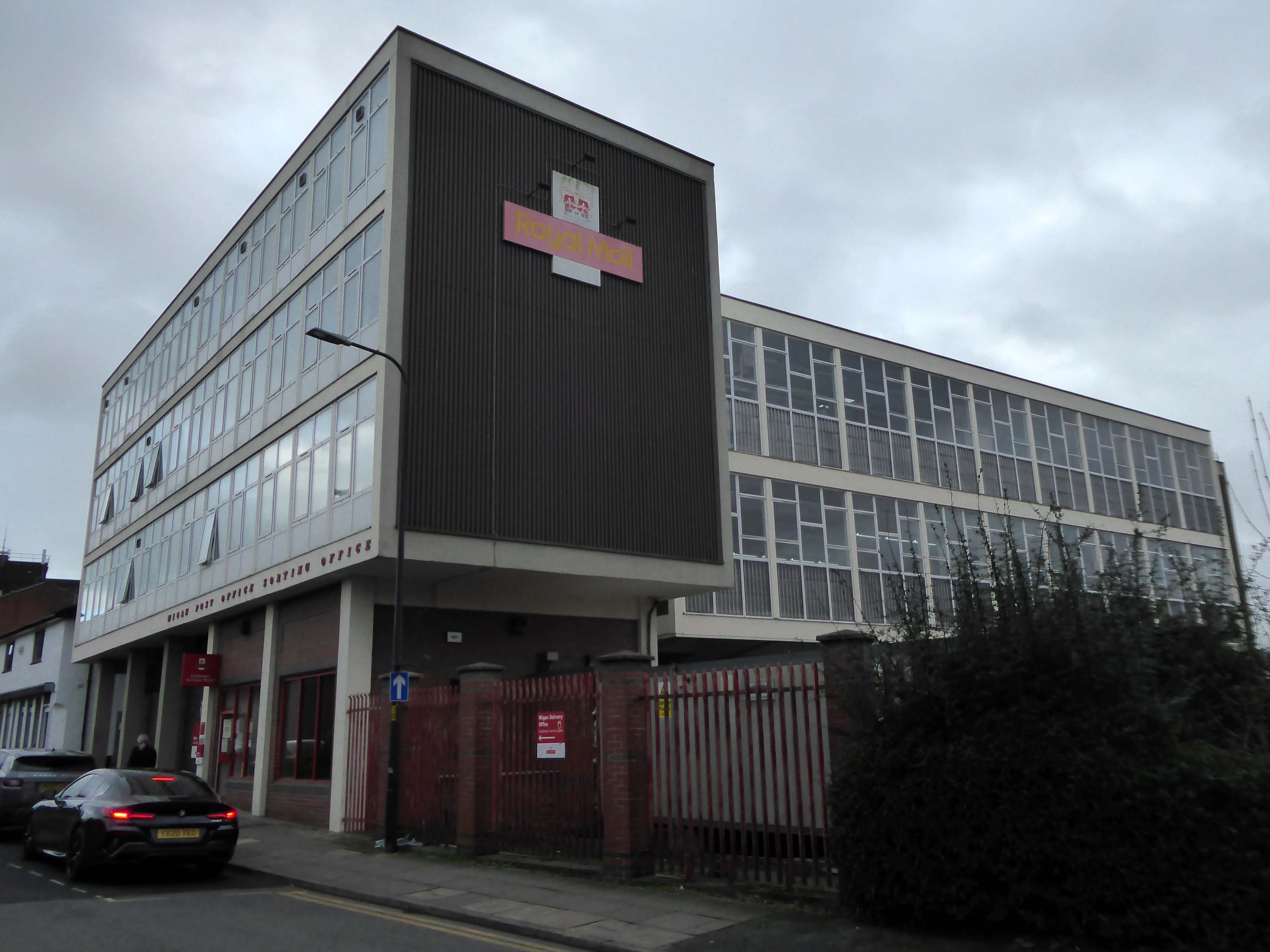
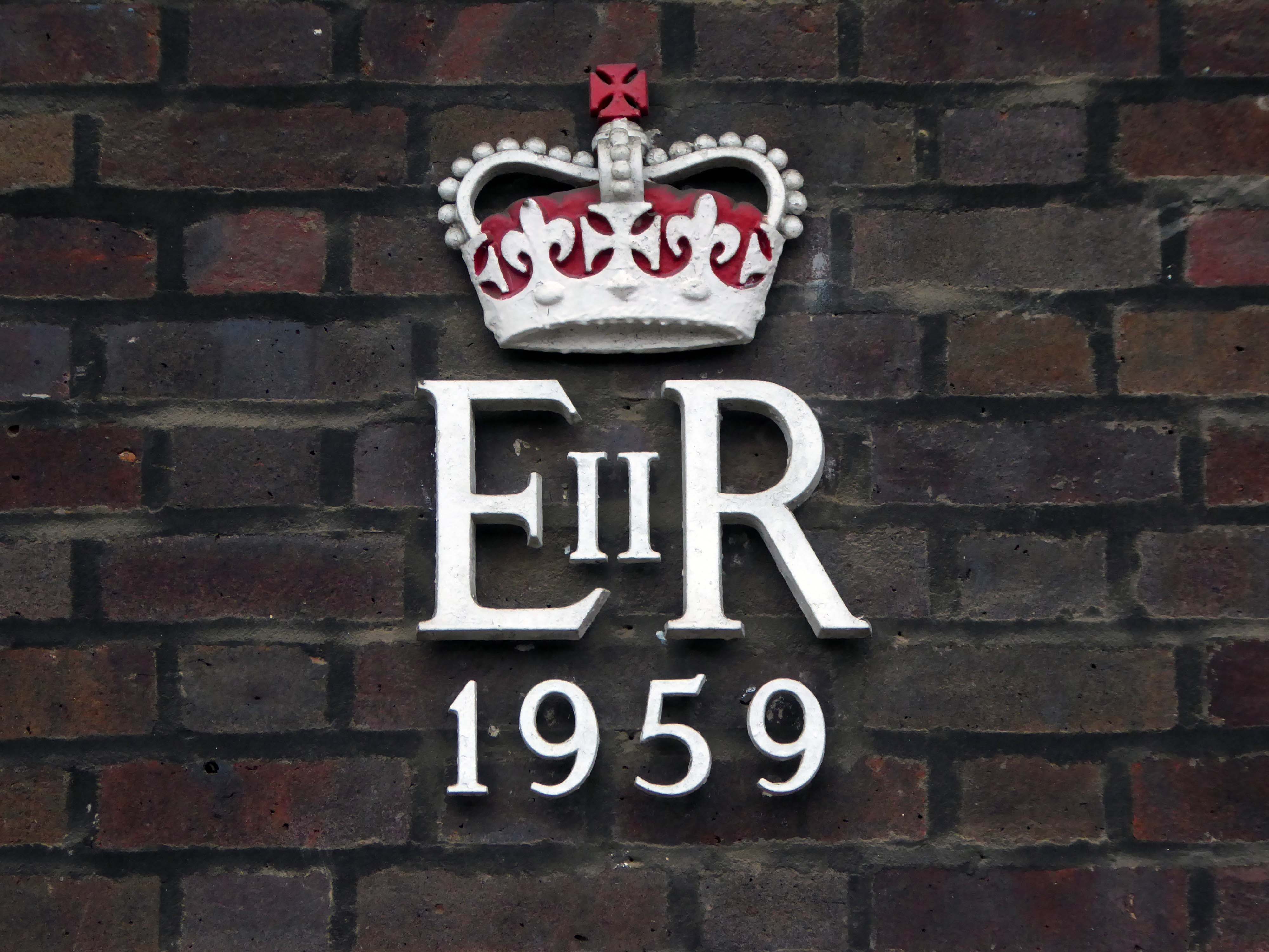
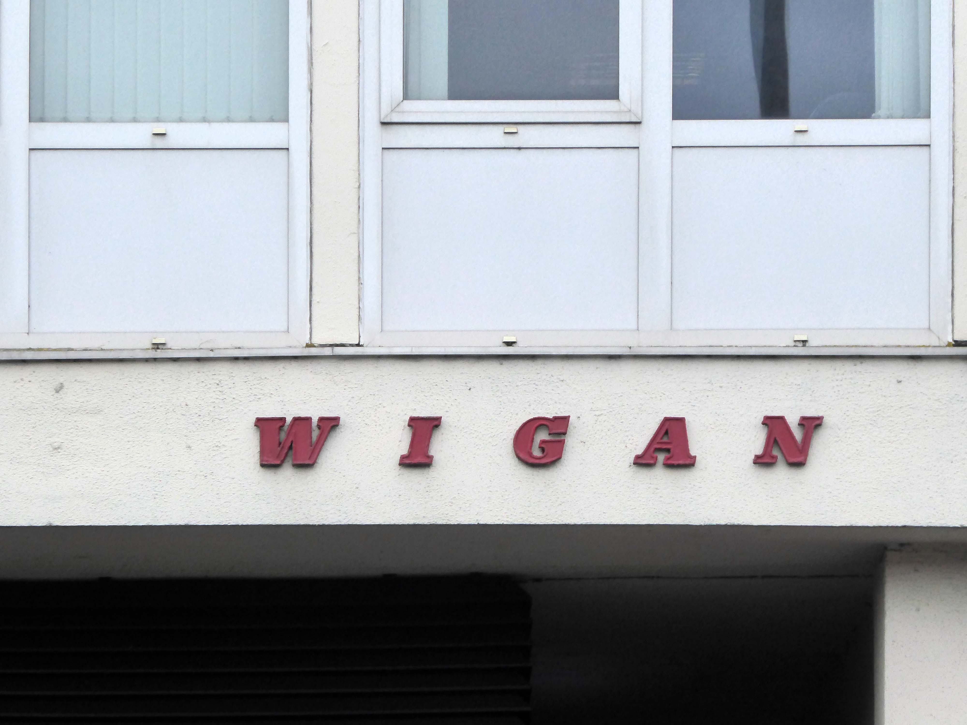
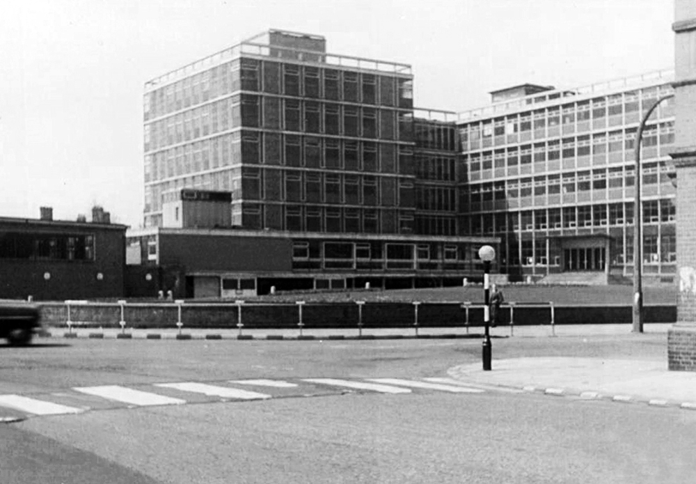
Just around the corner is an expansive GPO Sorting Office of 1959.
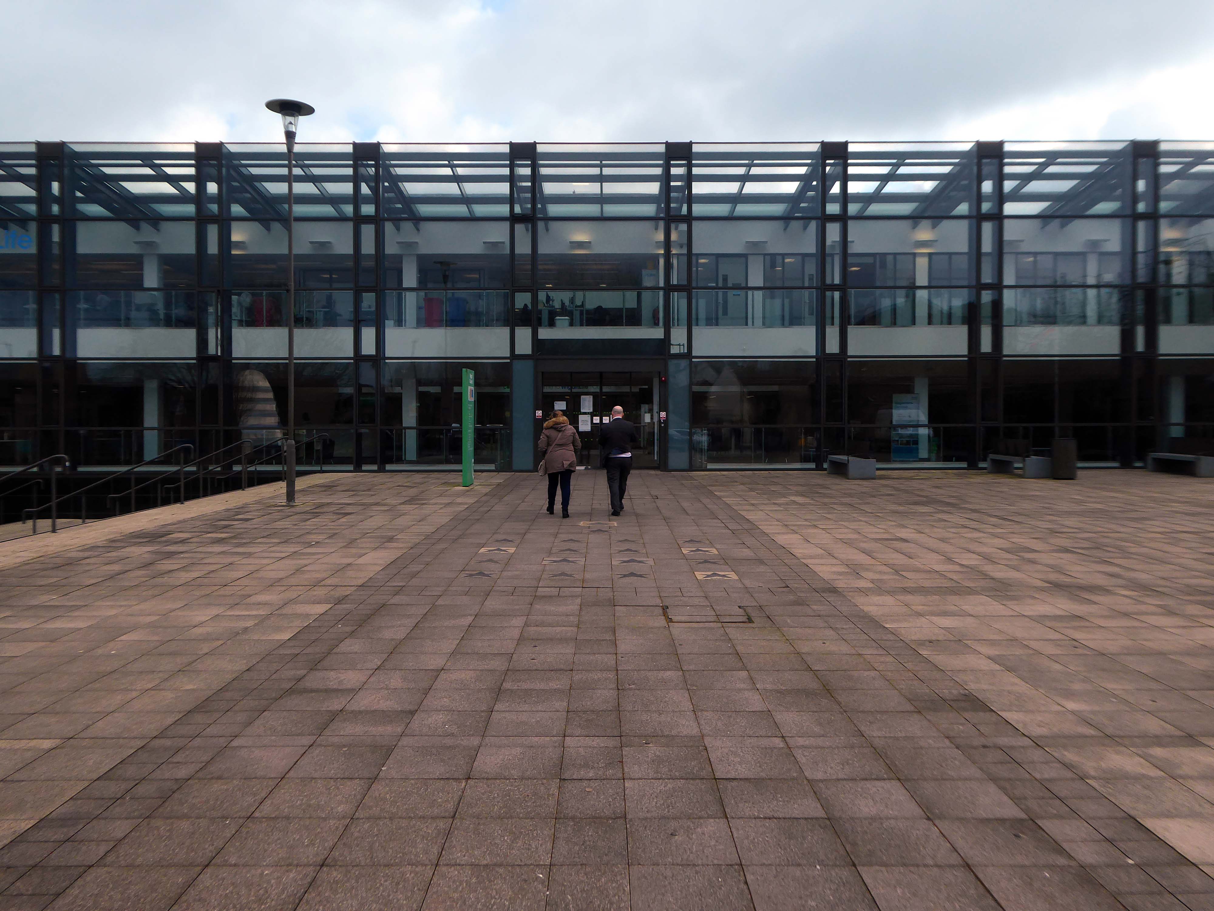
Across the way is the Technical College.
The foundations of Wigan & Leigh College date back to 1857, and the current institution was formed in April 1992 through the merger of Wigan College of Technology and Leigh College.
Partly formed from the Thomas Linacre Technical School.
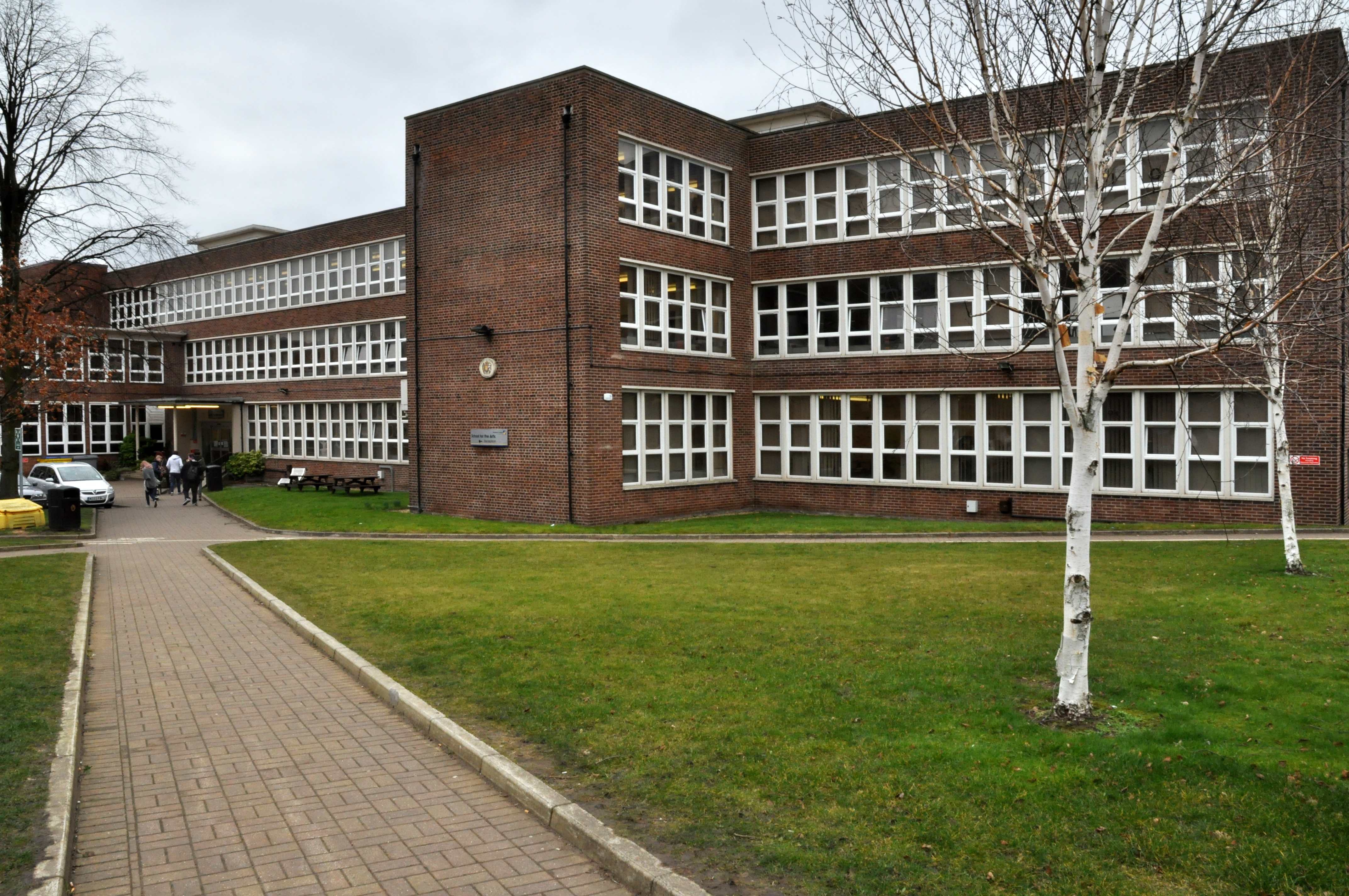
Architects: Howard V Lobb G Grenfell Bains & Hargreaves 1954
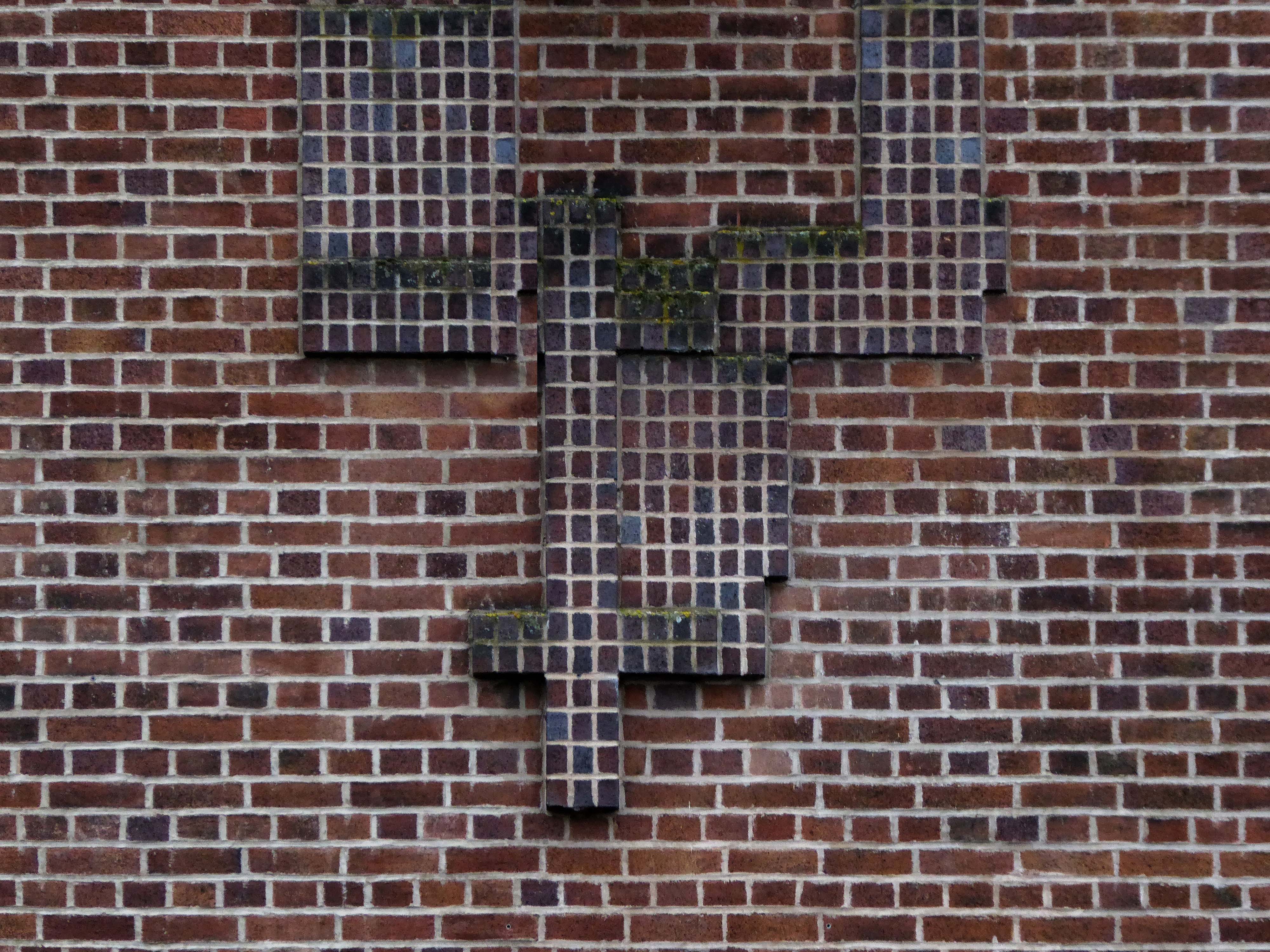
Curious decorative brick motif – a floor plan of the building.
My thanks to Mark Watson for his erudition and insight.
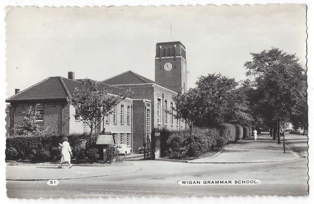
Across the road the former Grammar School now an NHS Centre.
Wigan Grammar School was founded in 1597 and closed in 1972 as part of the comprehensive education movement. it became Mesnes High School until 1989, and then the Mesnes Building of Wigan College.
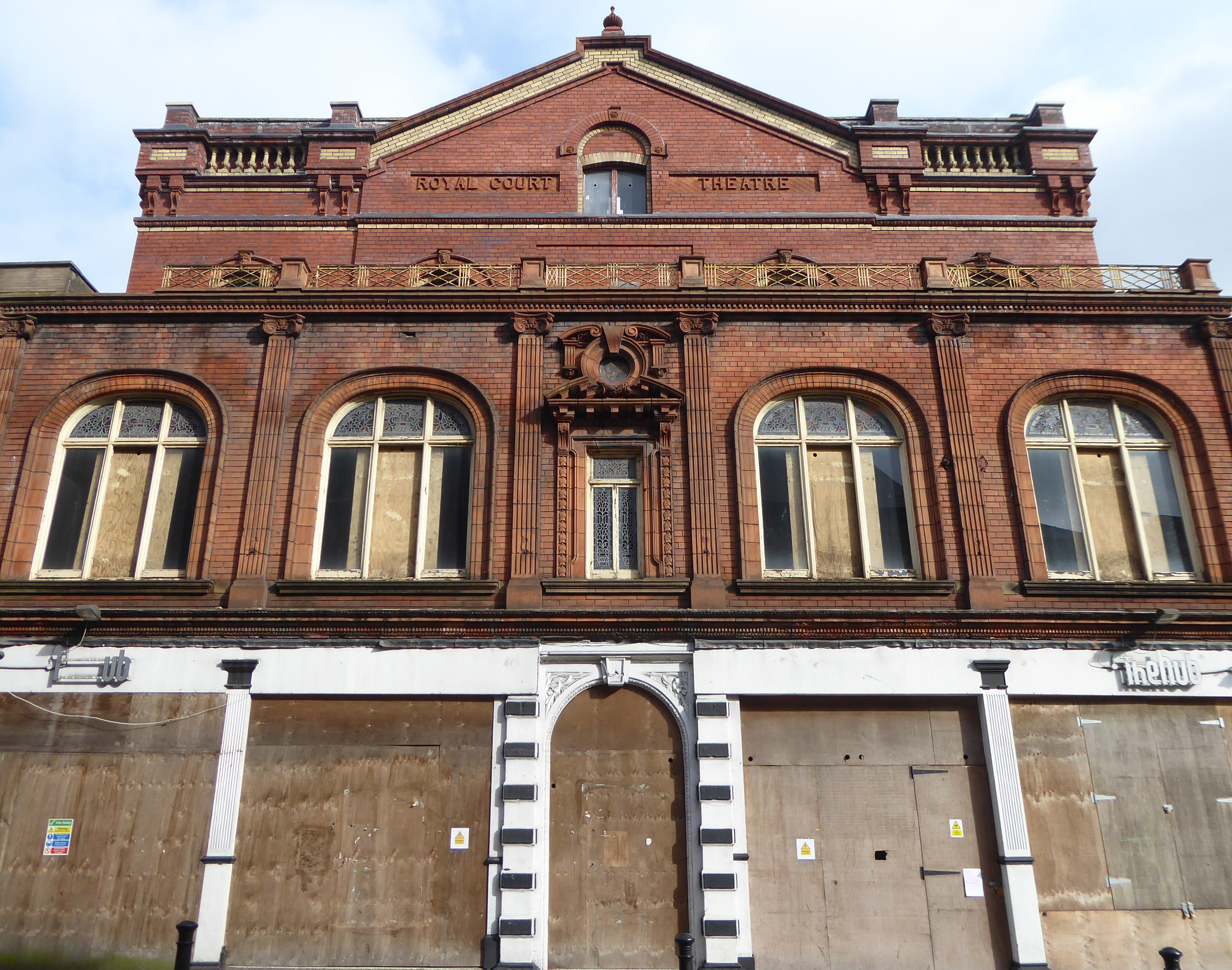
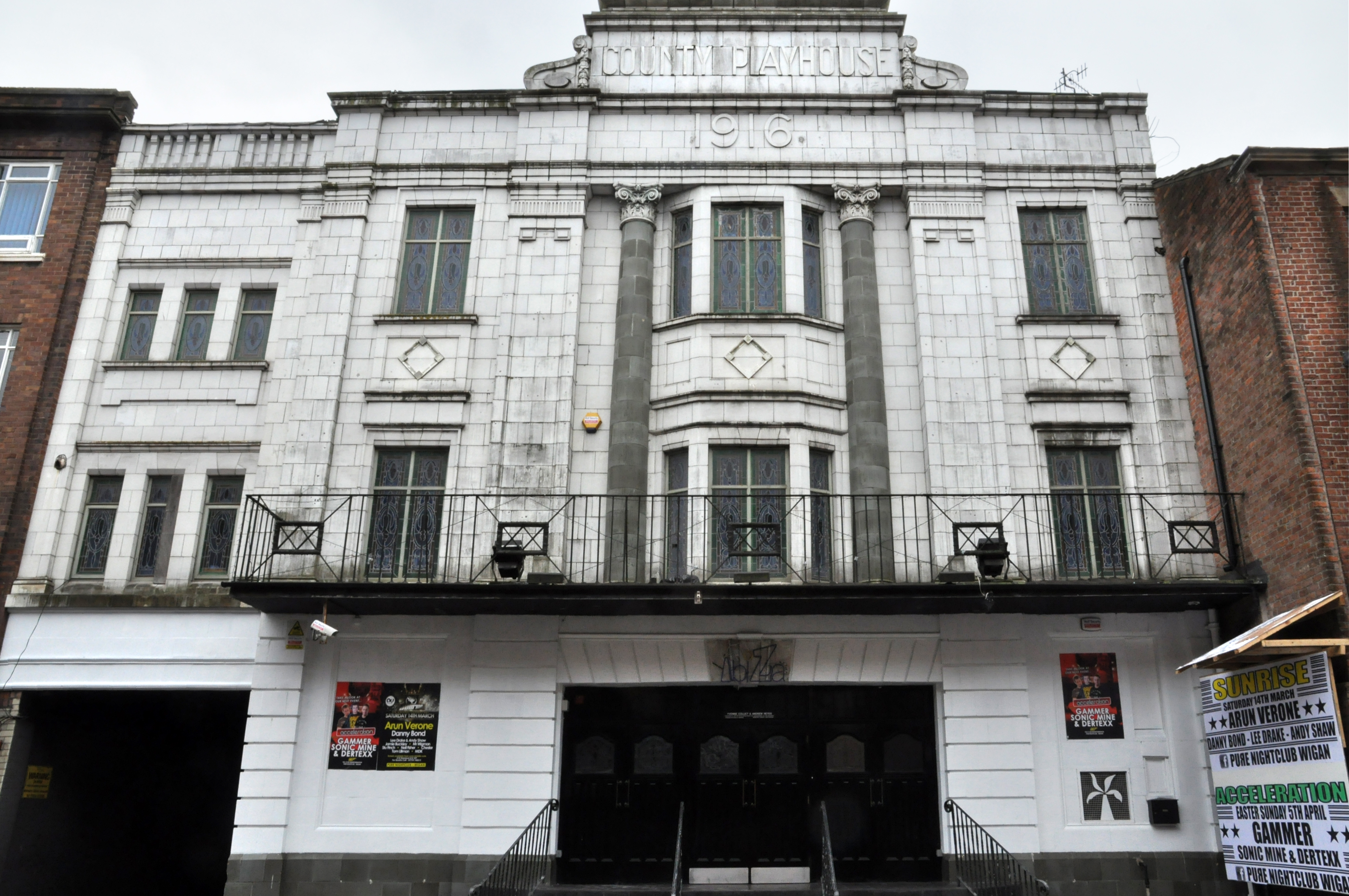
Construction began on the County Playhouse in 1916. However, due to a shortage of materials and labour during World War I, it was not completed until 1919.
Finally opened on 22nd December 1919 with The Peril Within – starring Dorothy Gish.
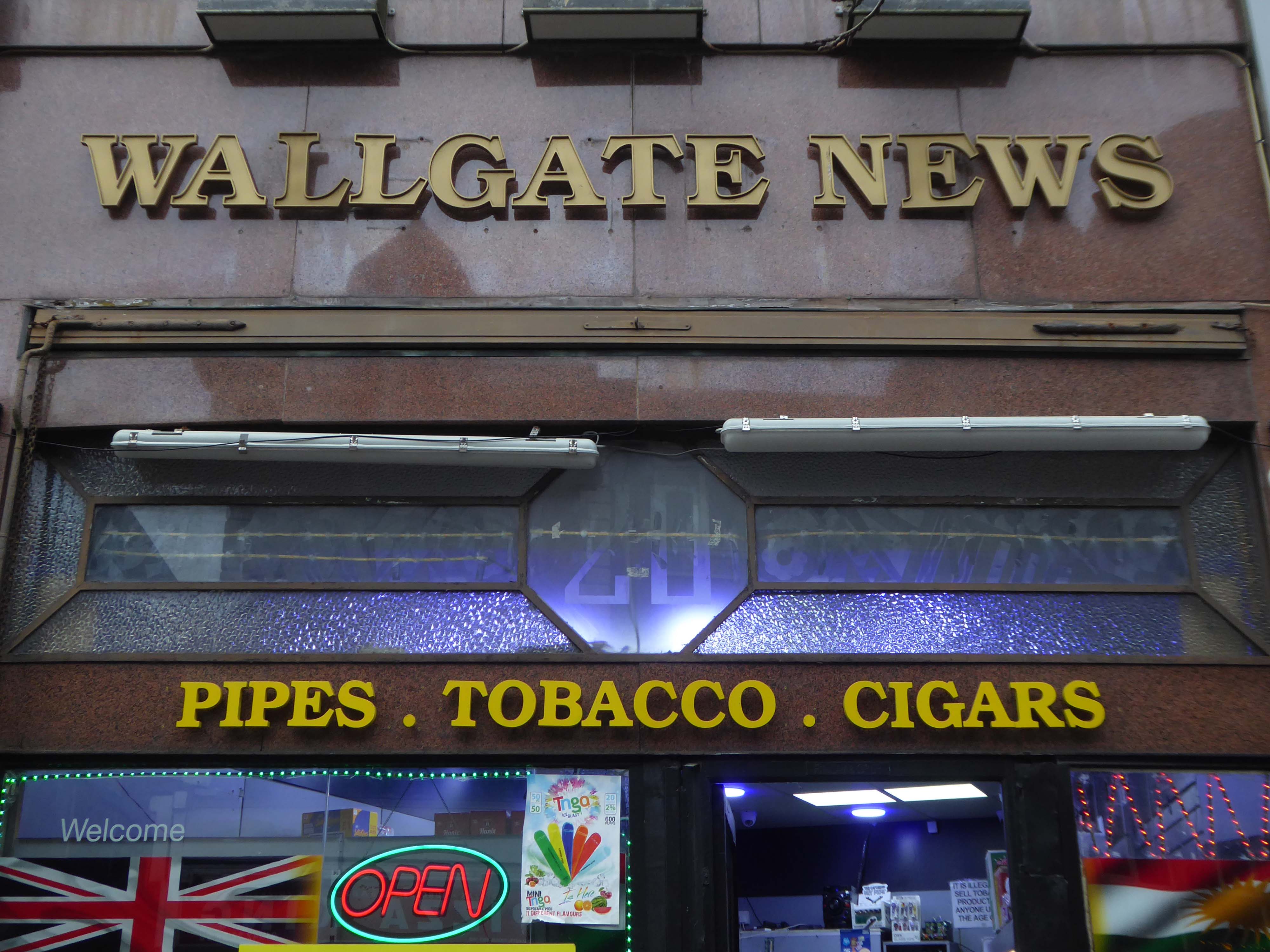
Onwards to the Wallgate News.
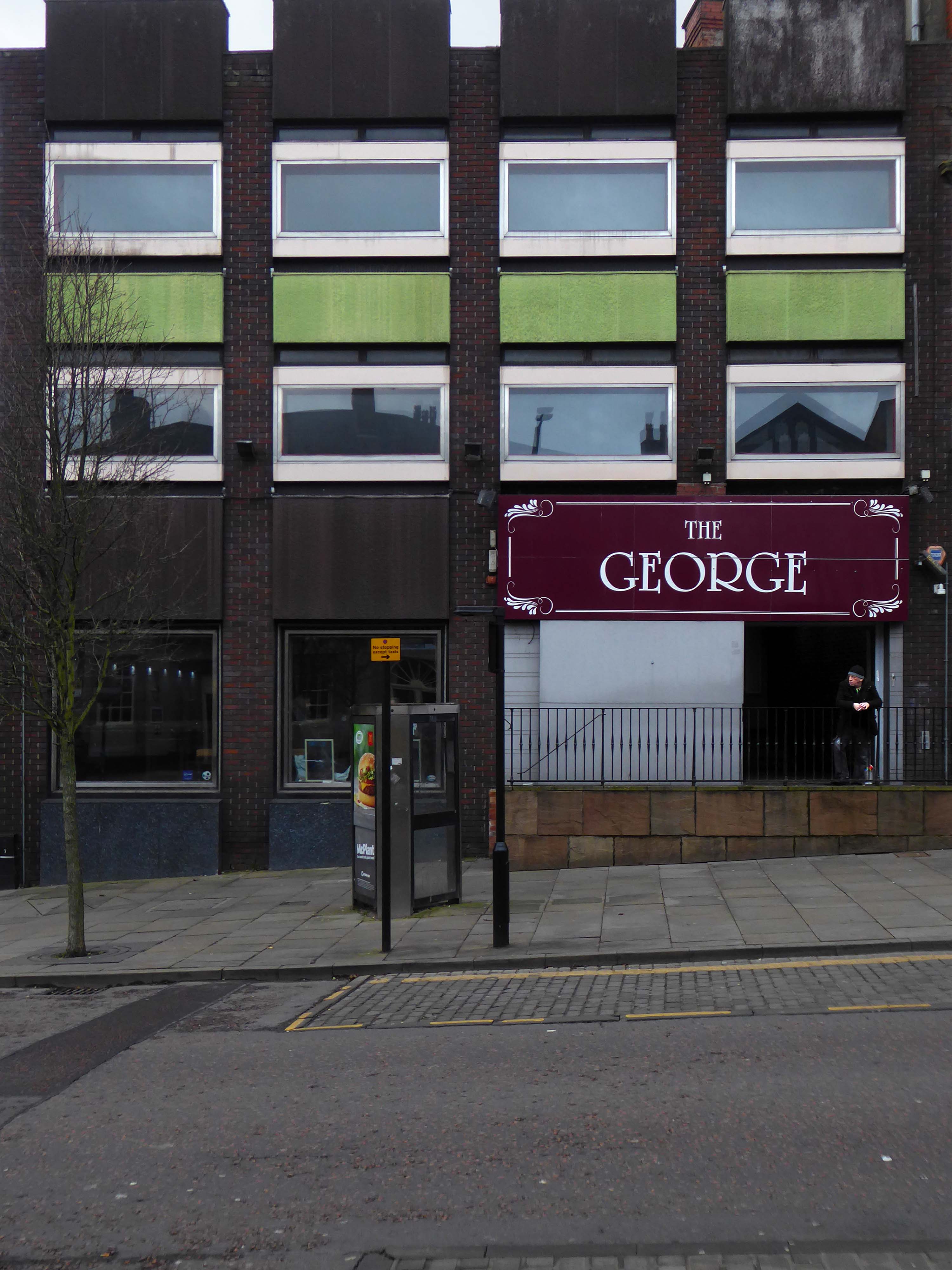
Finally to The George public house.
All ages, all different, all characters all like a bevvy.
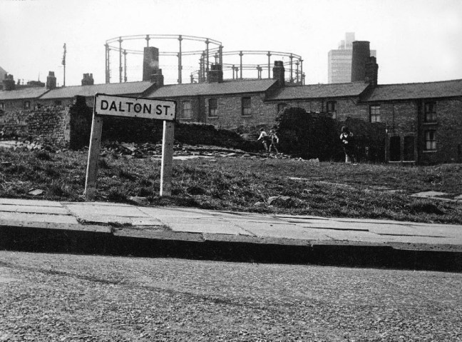
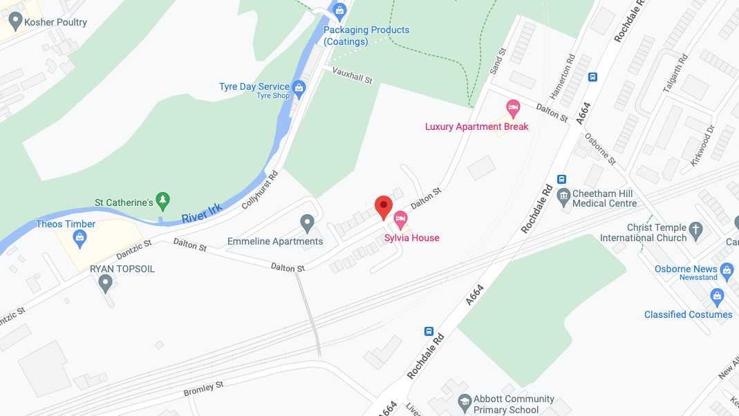
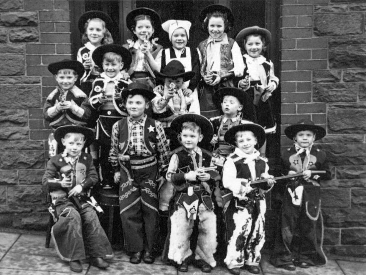
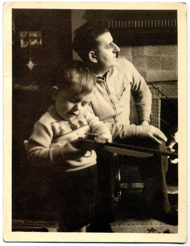
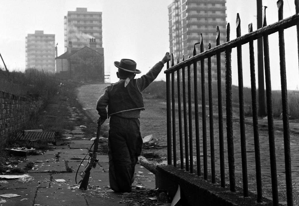
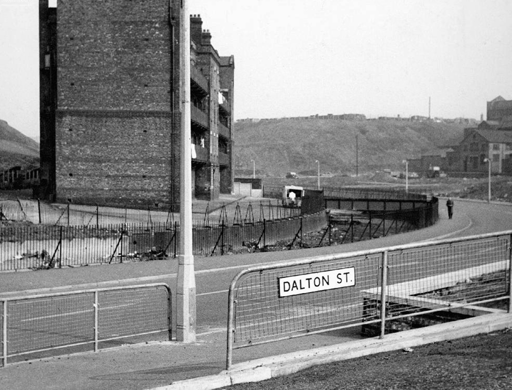
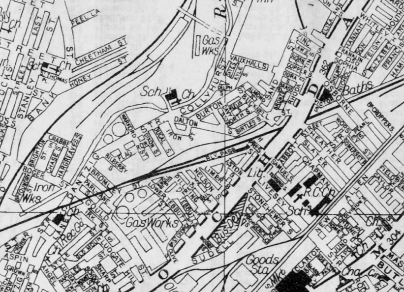
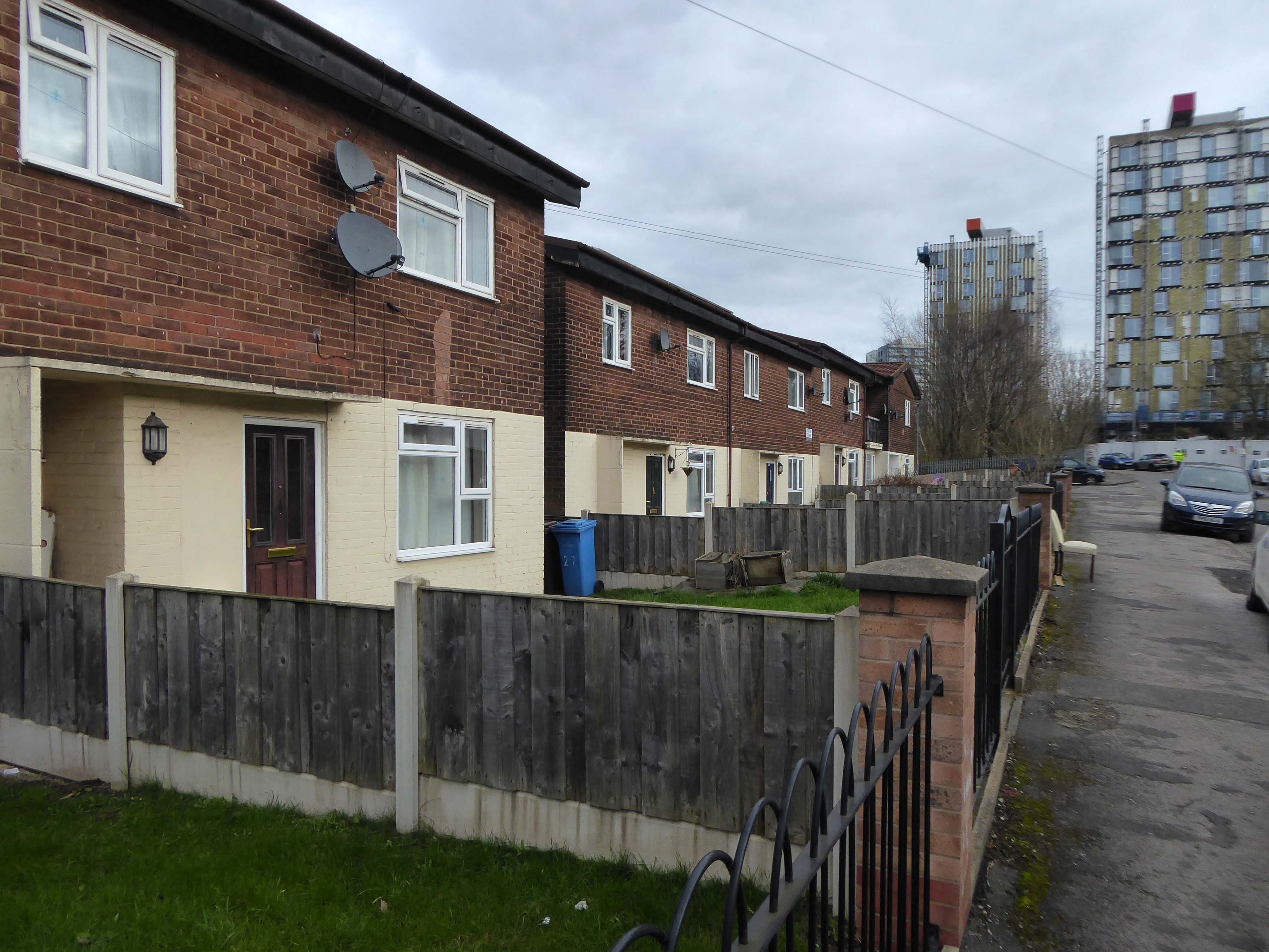
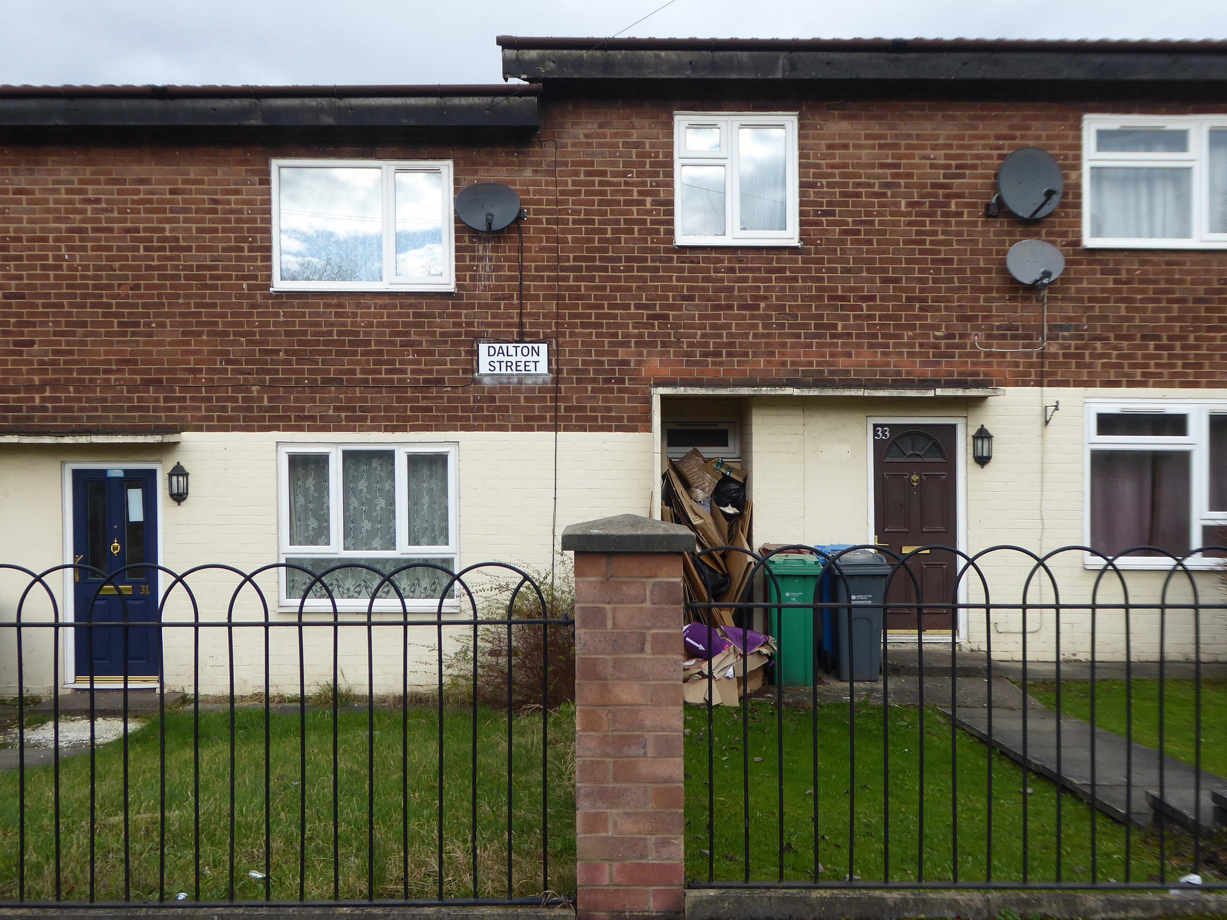
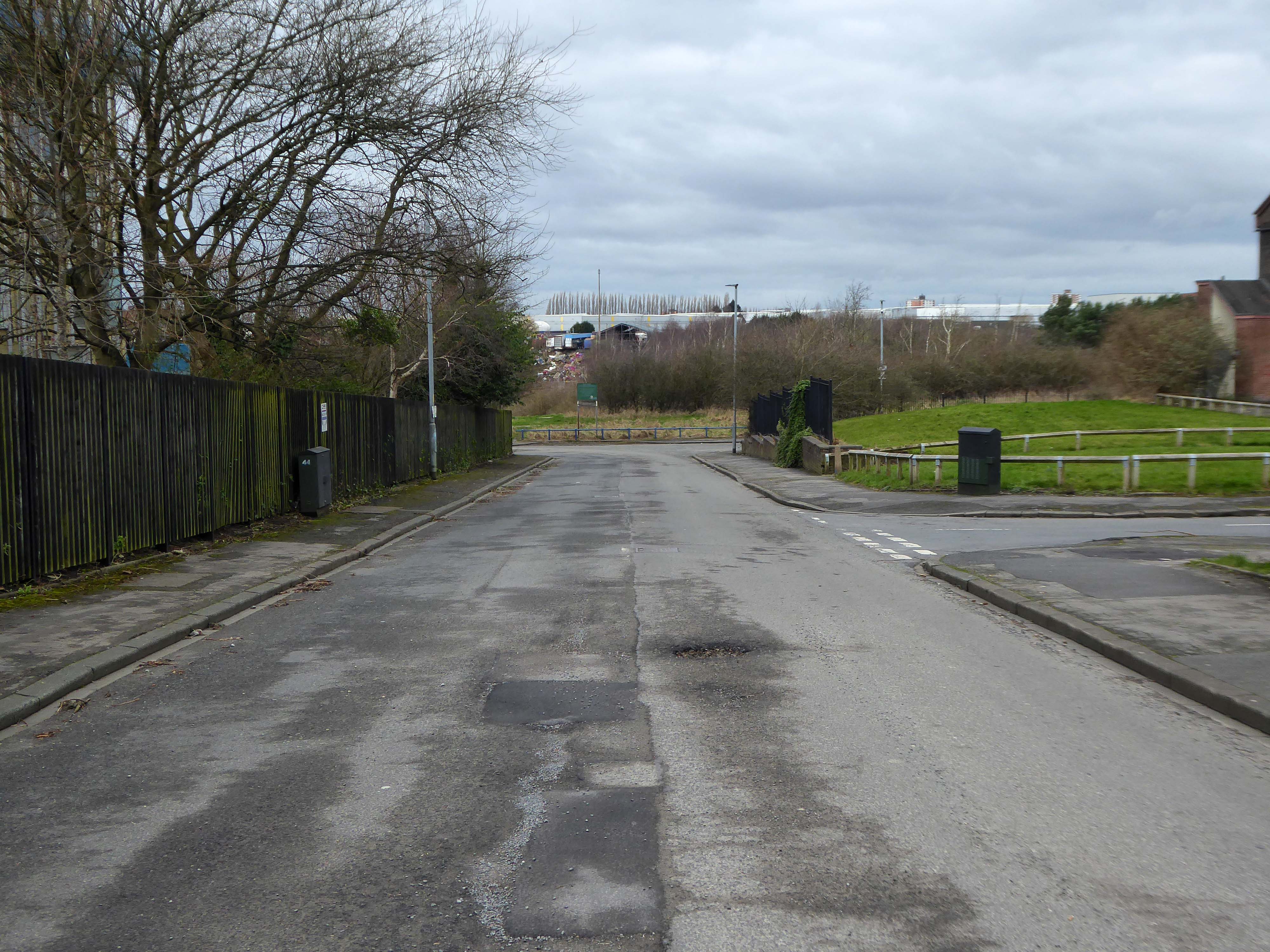
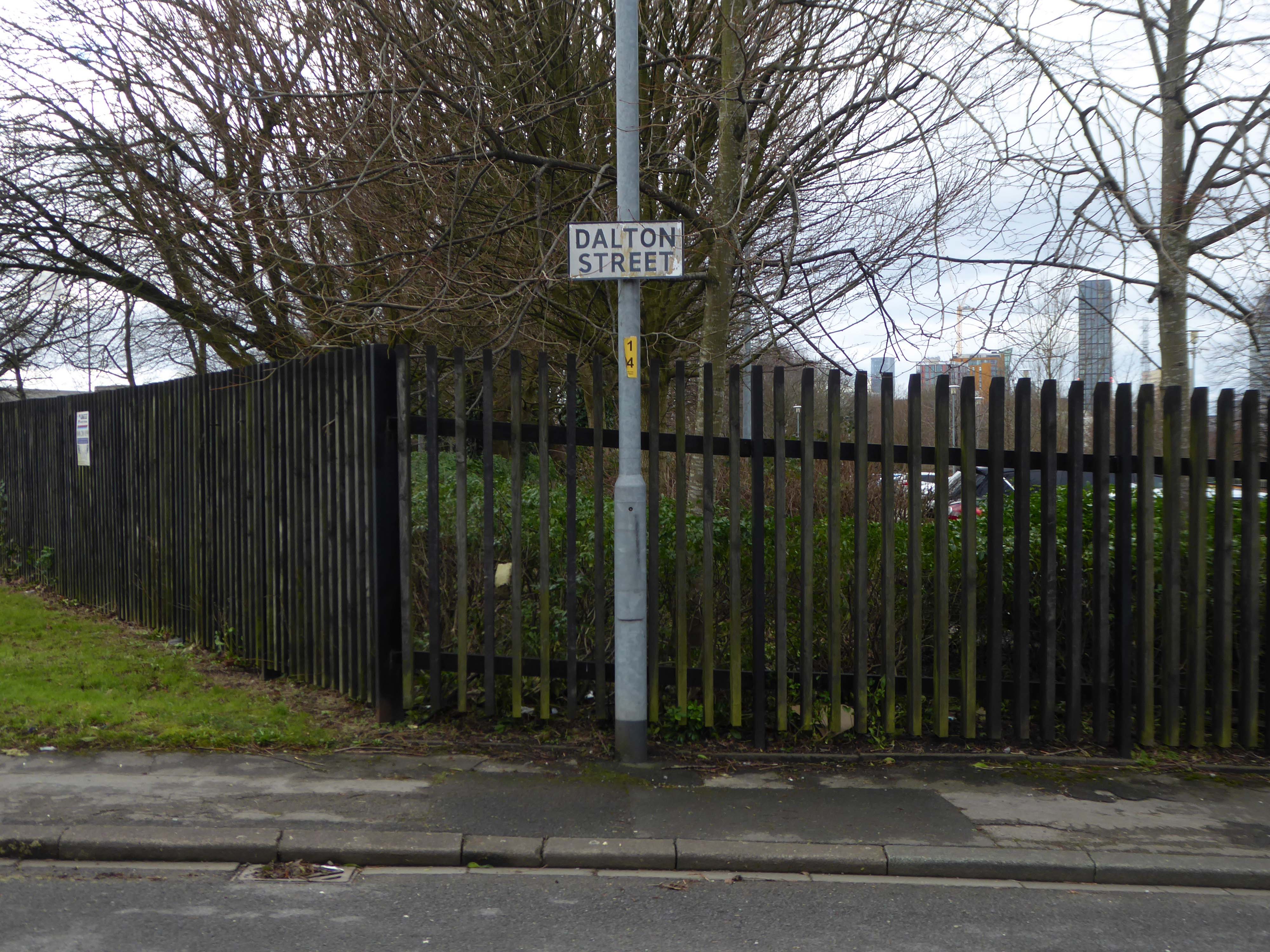
Now I’m going east to Dalton Street, home to the Collyhurst cowboy.
Photograph: Dennis Hussey
This is an illusion within an illusion, twice removed.
The Hollywood recreation, recreated on the rough ground of post war Britain.
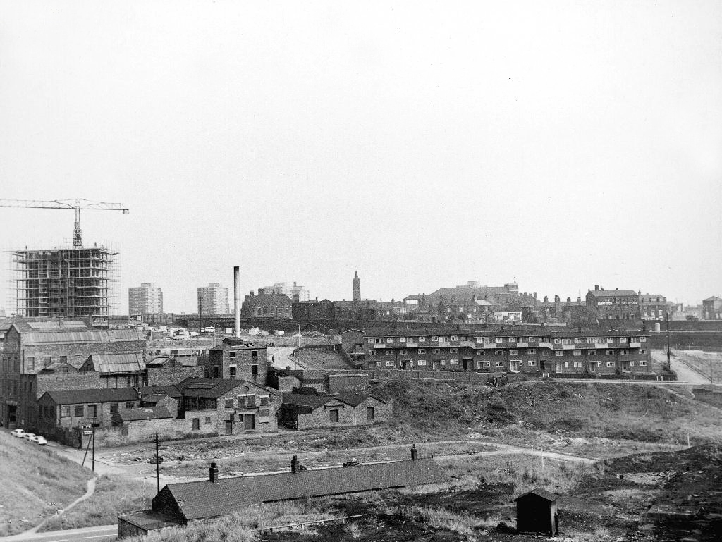
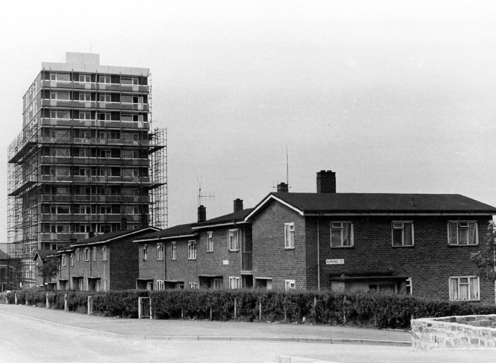
In 1960 the area was a dense network of streets, industry and homes – demolished during the period of slum clearance.
Escaping the dark, dank Irk Valley onwards and upwards to Rochdale Road.
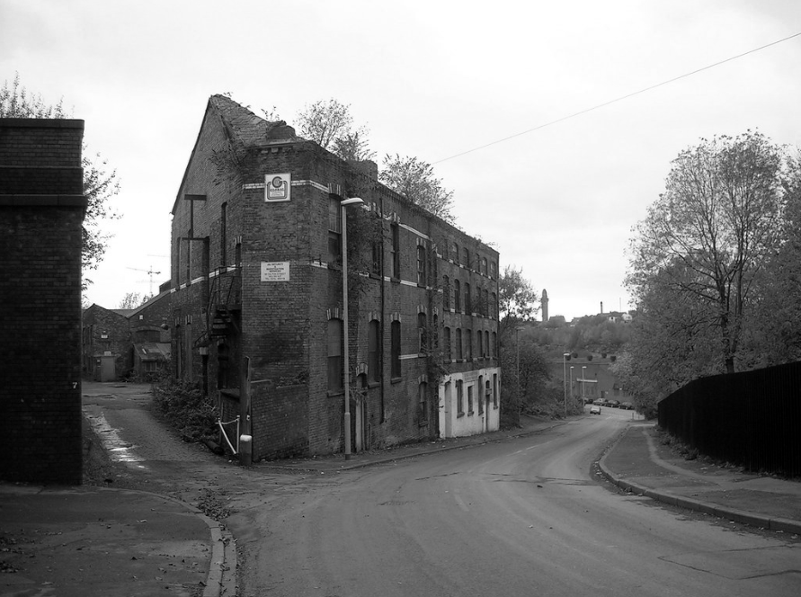
The Dalton Works Arnac factory survived until 2008
Photograph: Mikey
The tight maze of Burton Street and beyond, reduced to rubble.
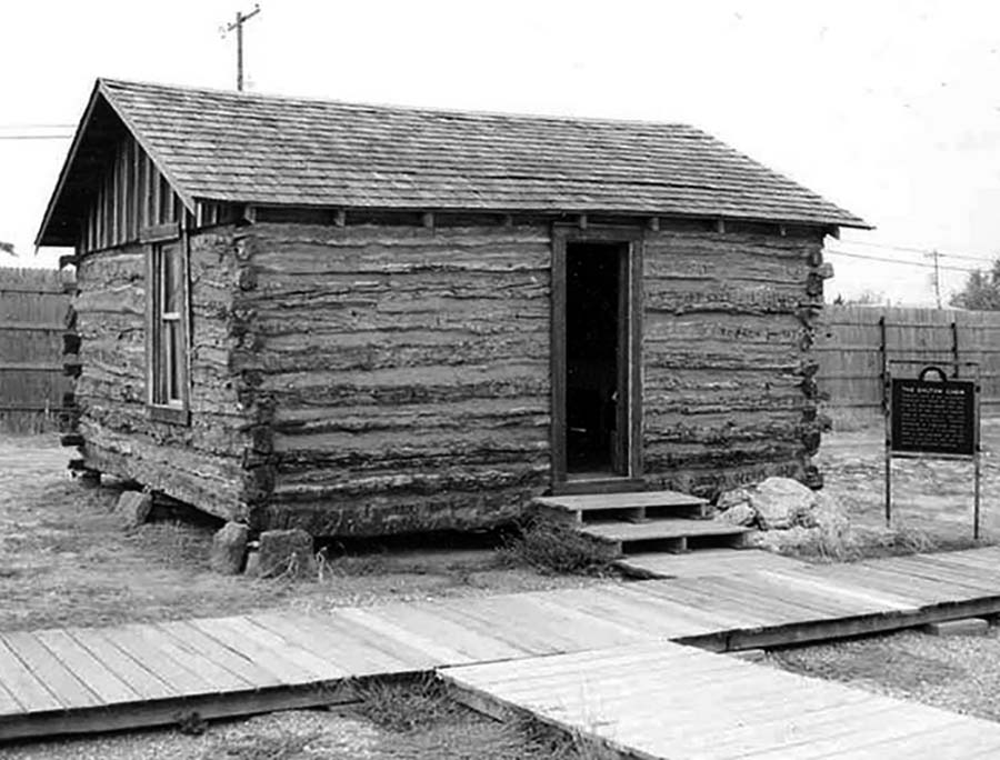
Dalton Street was not home to the Dalton Gang, they lived here in Oklahoma
It was home to imaginary gangs, committing imaginary crimes, in an imaginary Manchester, in ITV’s Prime Suspect Five.
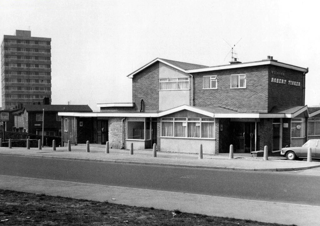
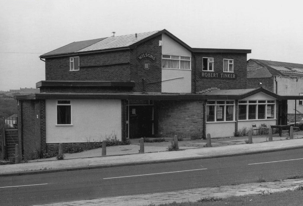
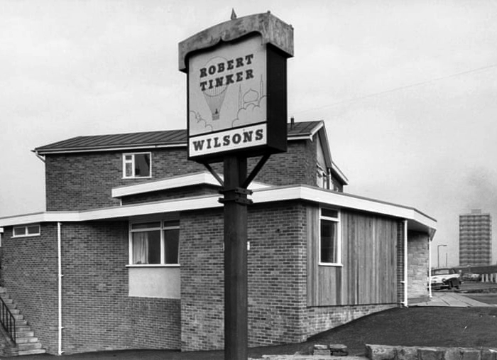
Kangol capped criminals doing business outside the Robert Tinker on the corner of the very real Dalton and Almond Streets.
The Robert Tinker was an estate pub in a run down area of Collyhurst. The pub looked pretty grim from the outside, but it was smarter than I expected inside, I had a drink in the lounge which was carpeted and comfortable. This was a Banks’s tied house and there were two real ales on the bar, I had a drink of Banks’s bitter and this was a decent drink, the other beer was Banks’s mild. This pub closed about two years after my visit and looked derelict, it has now been demolished.
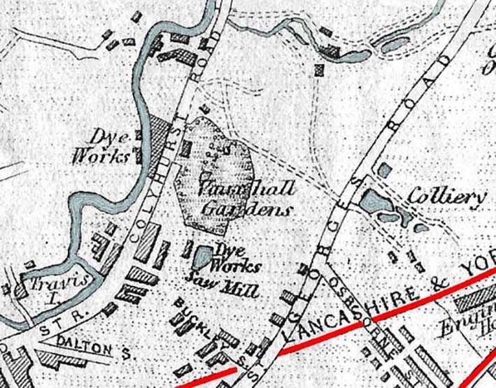
Robert Tinker was the owner of the Vauxhall Gardens, a Victorian pleasure venue.
At the openingthere was a special attraction, a giant cucumber which had been grown in the gardens reaching a length of seven feet and eight inches and a large and beautiful balloon was to be liberated at 9pm
Much of the red sandstone used for building in Manchester and the surrounding area, including stone for the Roman fort at Castlefield, St Ann’s Church in the city centre, Manchester Cathedral and the original buildings of Chetham’s Hospital, came from Collyhurst Quarry. Geologists use the term Collyhurst Sandstone for this type of soft red sandstone, which occurs in North West England
Tinker died in 1836 and gradually his gardens were whittled away, the subsoil was sold to iron moulders who cherished its certain properties and before long the trees were chopped down and houses were being built on the former site.
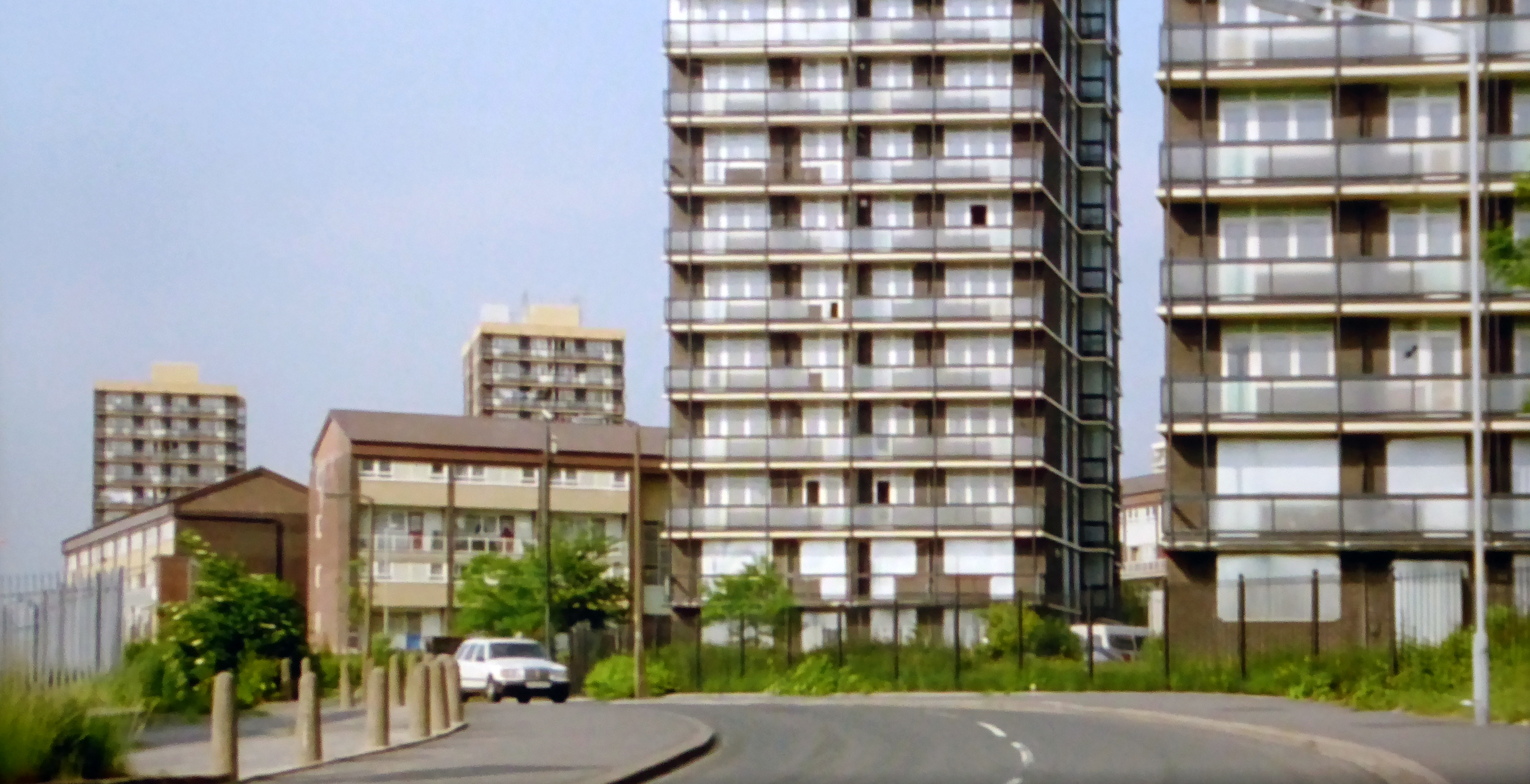
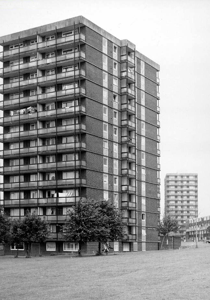
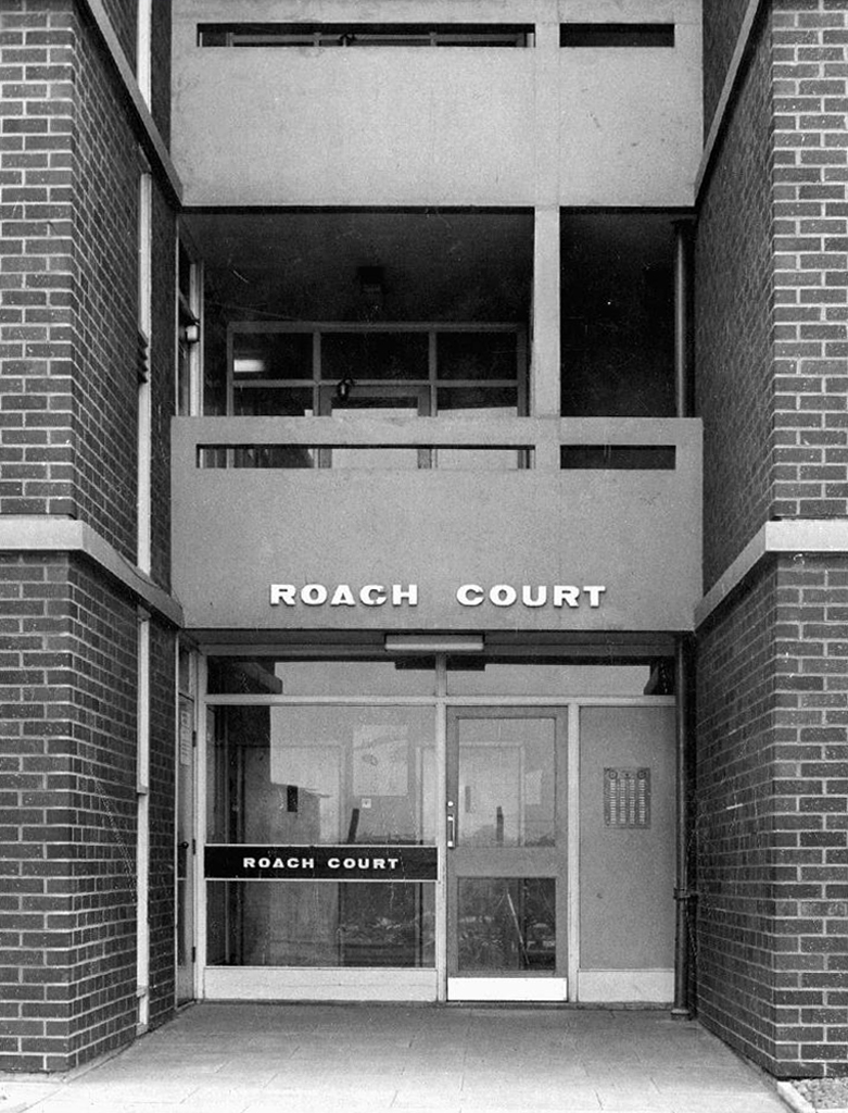
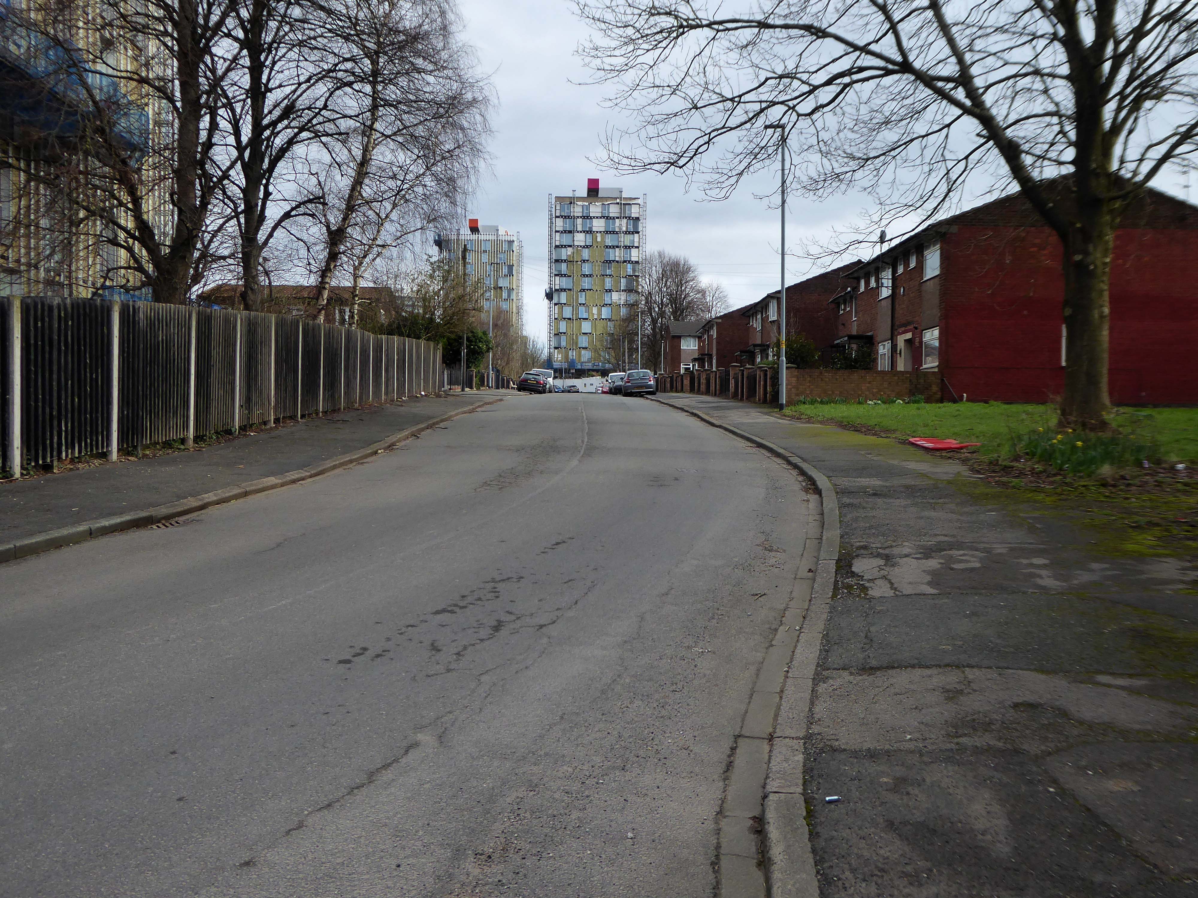
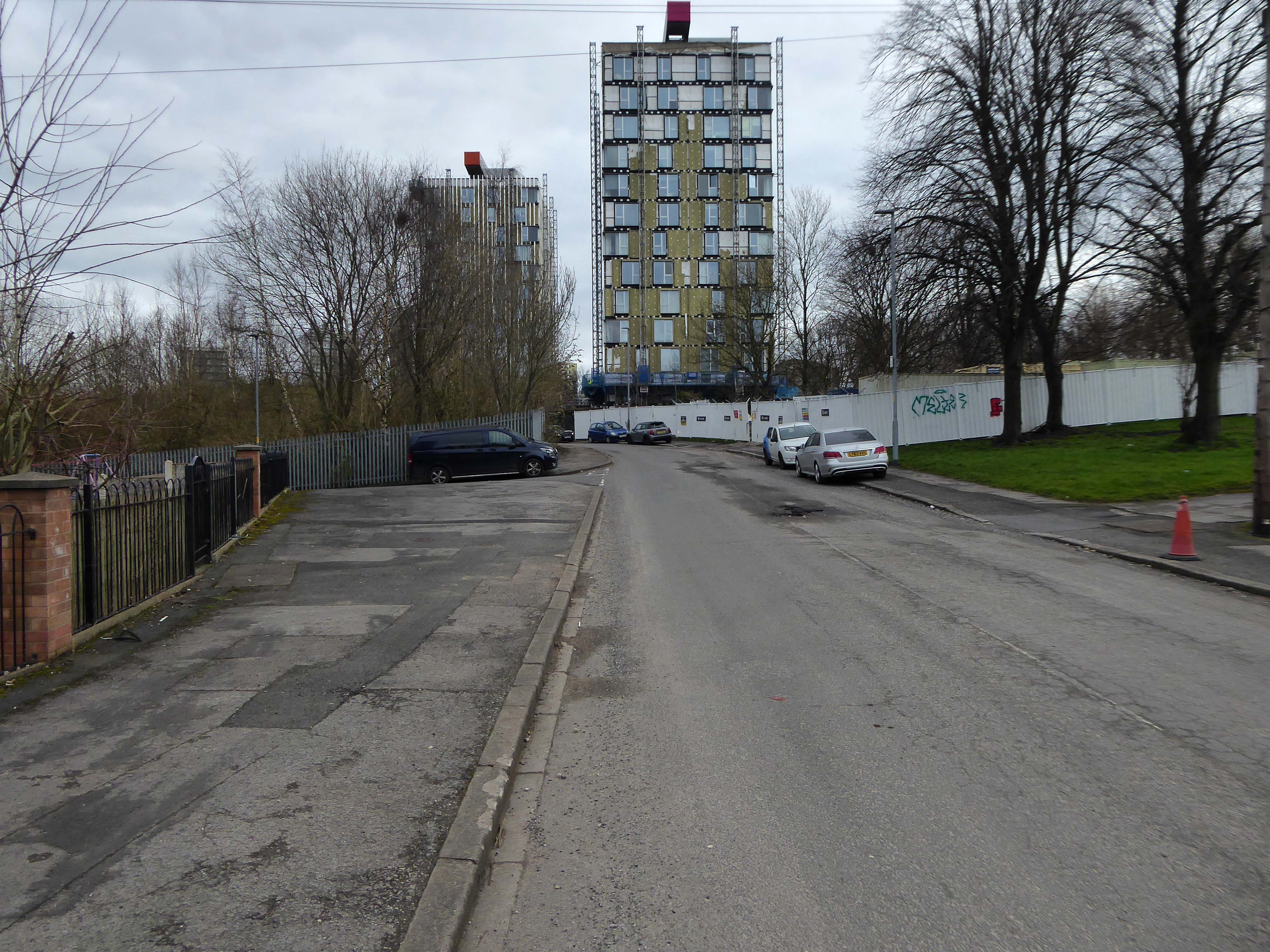
Those houses are in their turn whittled away, replaced in the 1960’s with fashionable tower blocks.
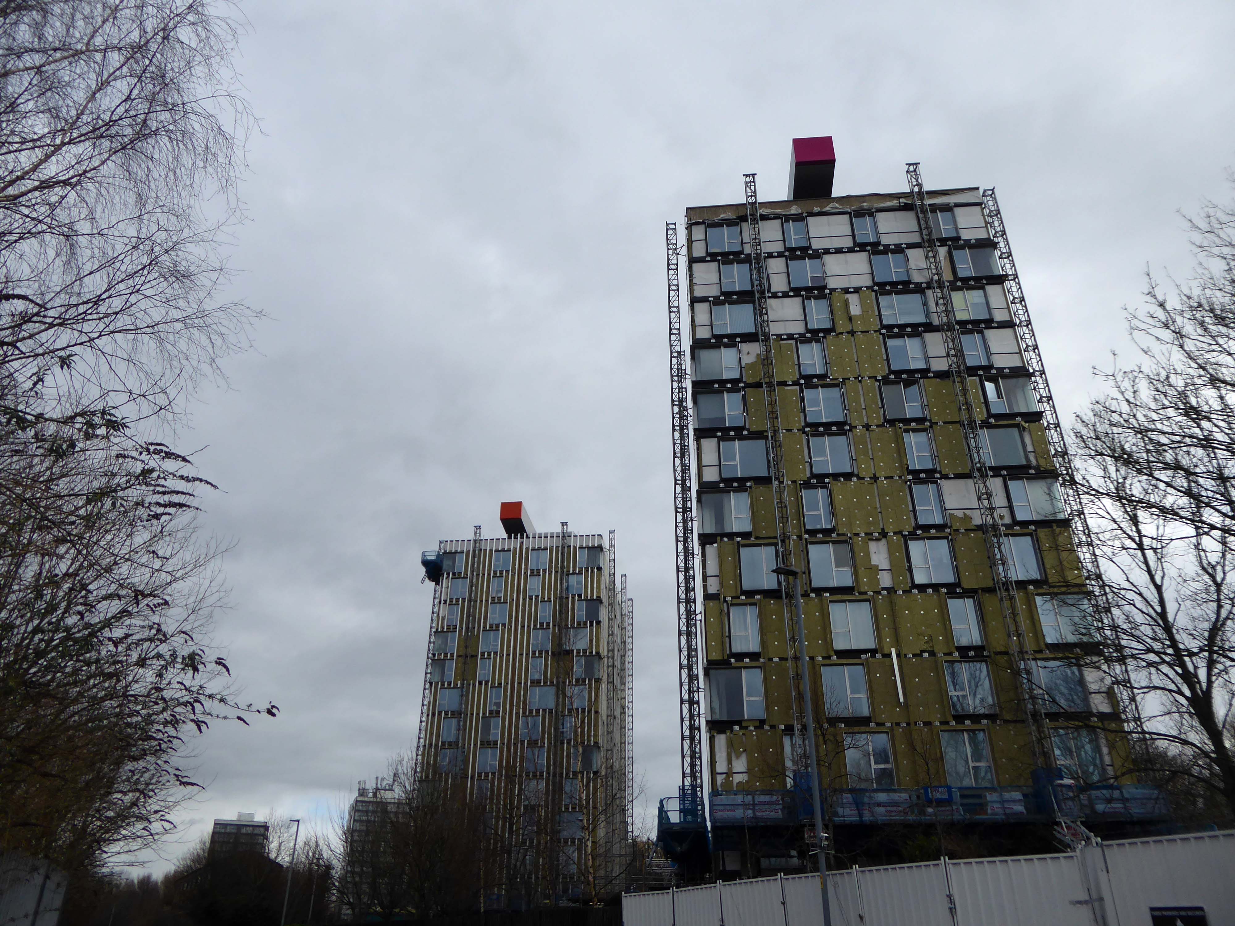
Architects: J Austen Bent 1965
In total five thirteen storey blocks – Humphries, Dalton, Roach, Vauxhall and Moss Brook Courts
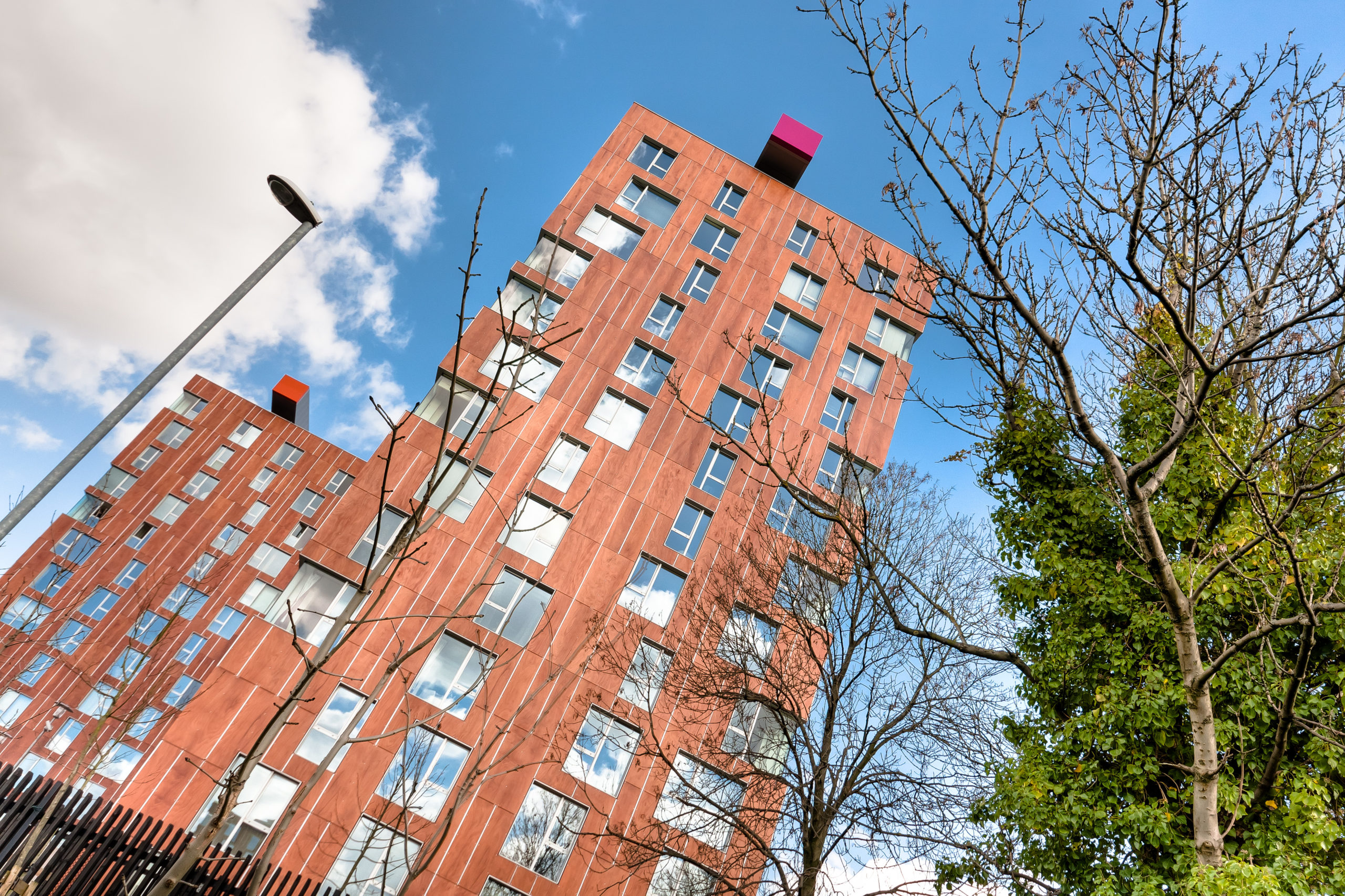
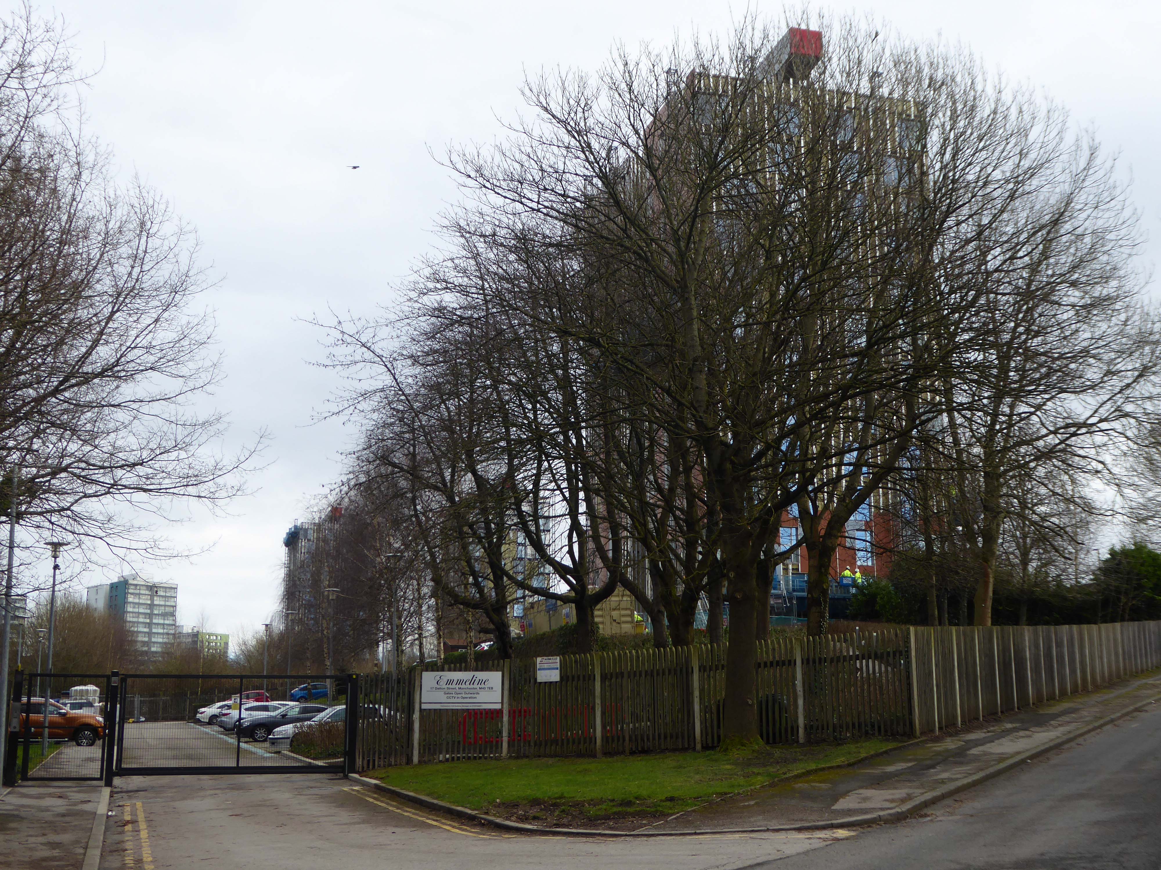
Subsequently purchased by Urban Splash and refurbished:
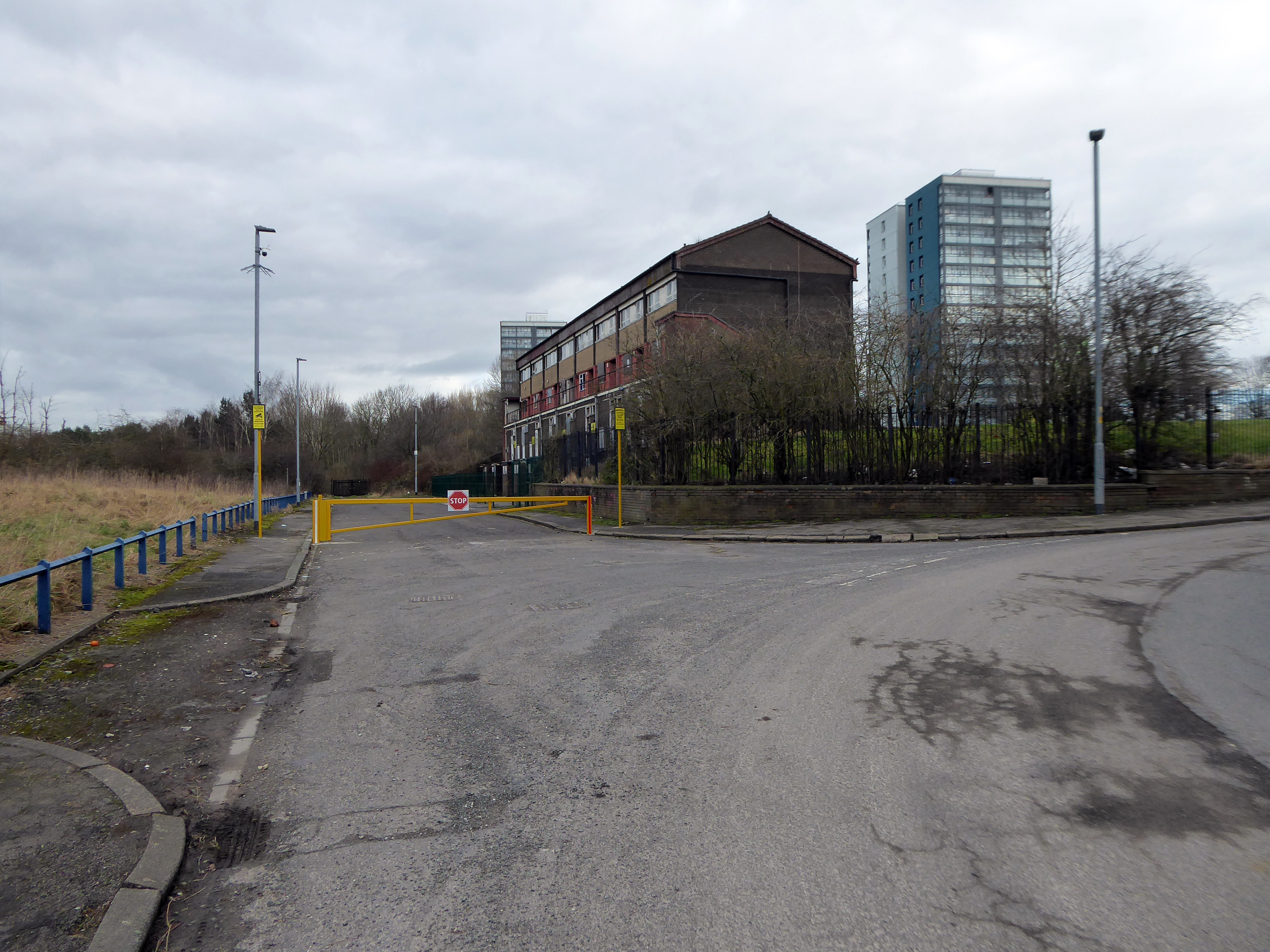
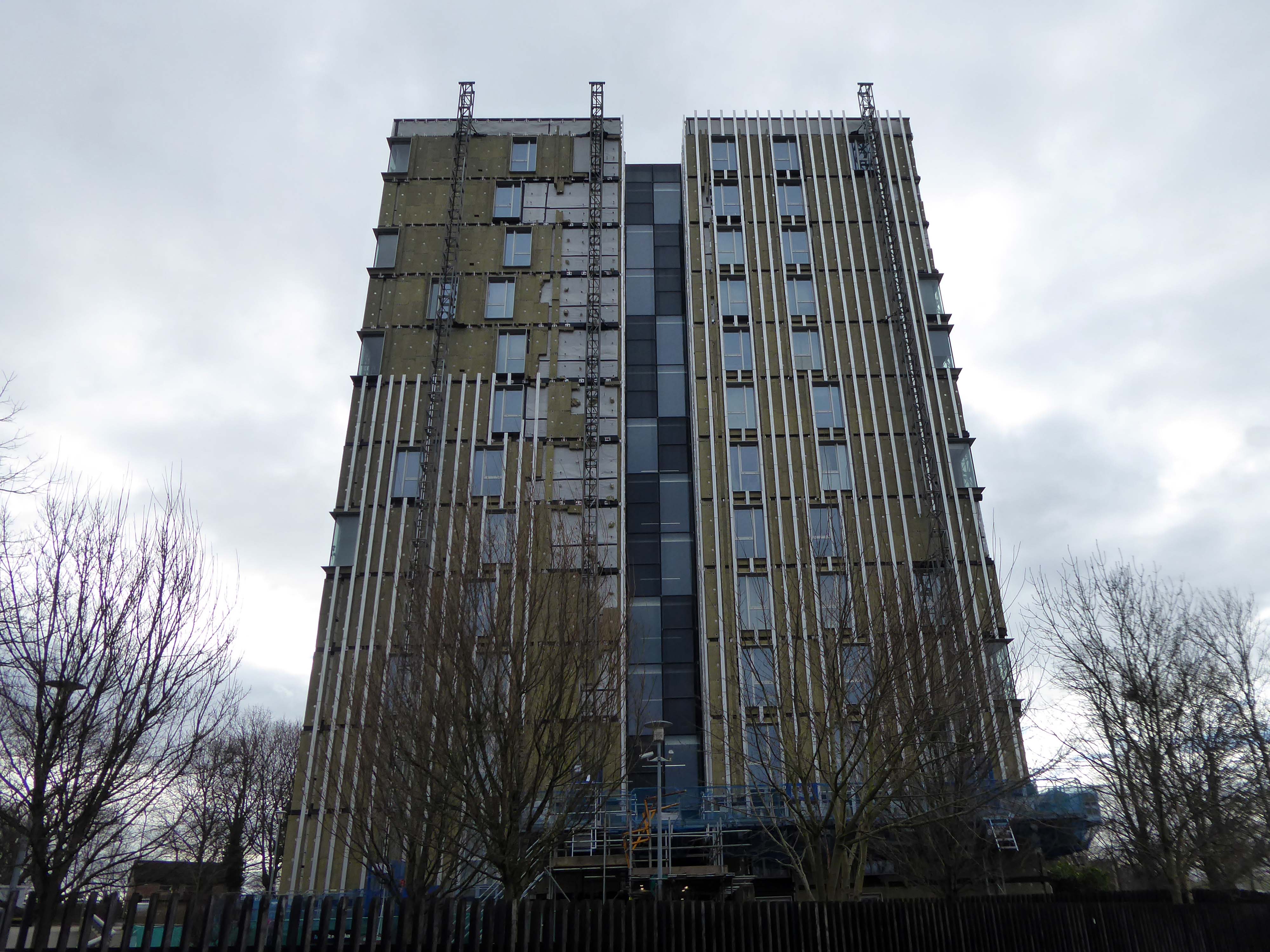
Designed by Union North Architects, the names for the Three Towers were decided in a public competition and the winning names were Emmeline, Christabel and Sylvia – naming the towers after the Pankhurst sisters and their mother.
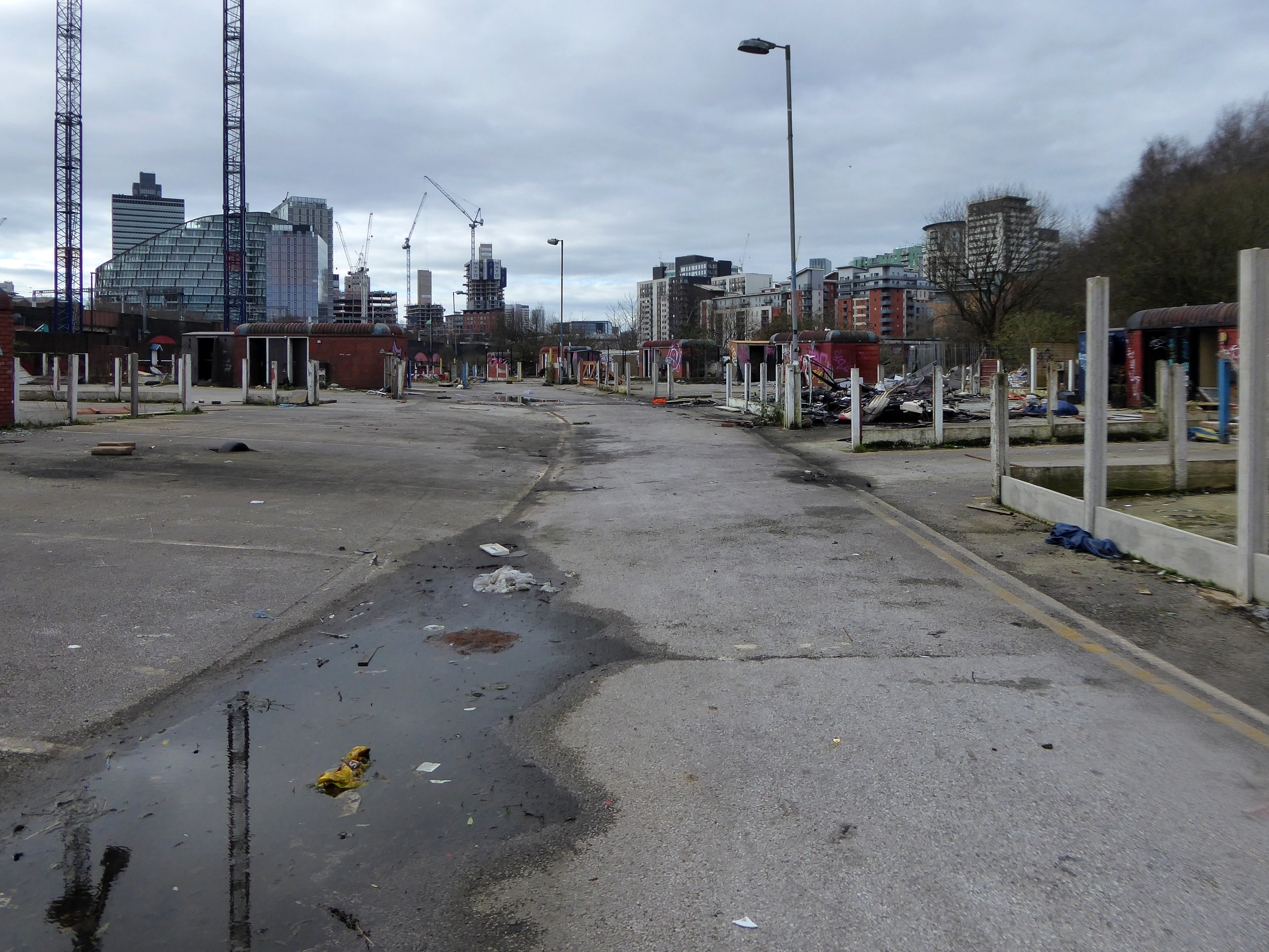
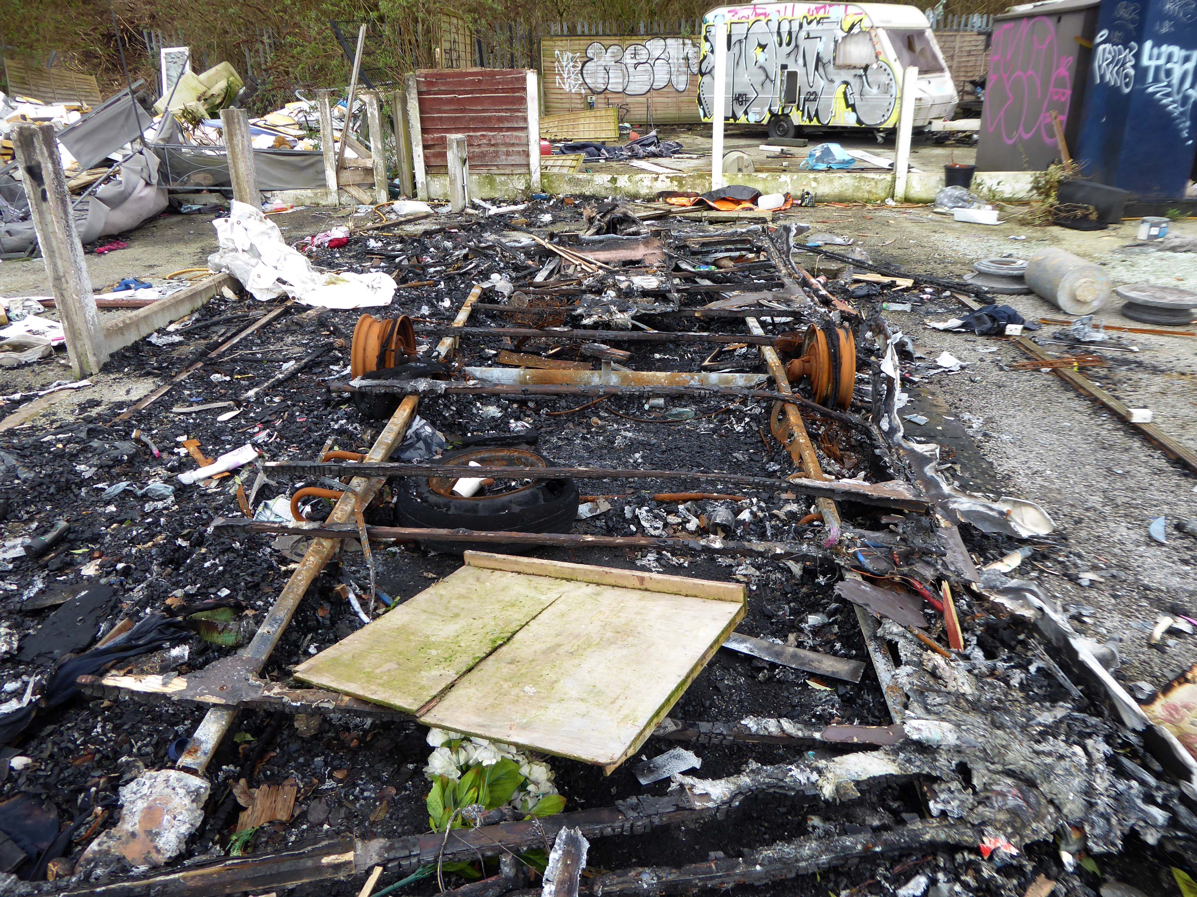
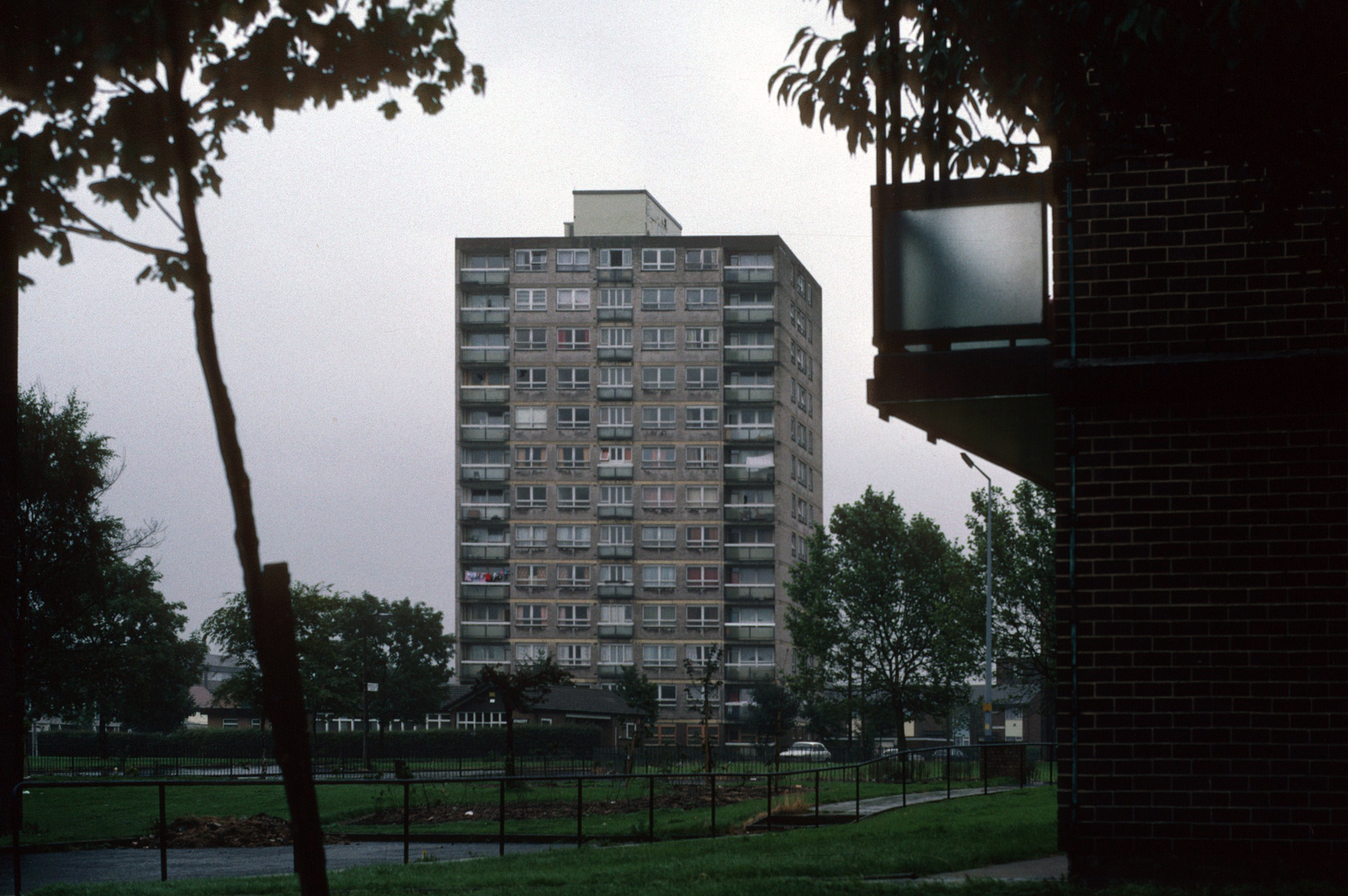
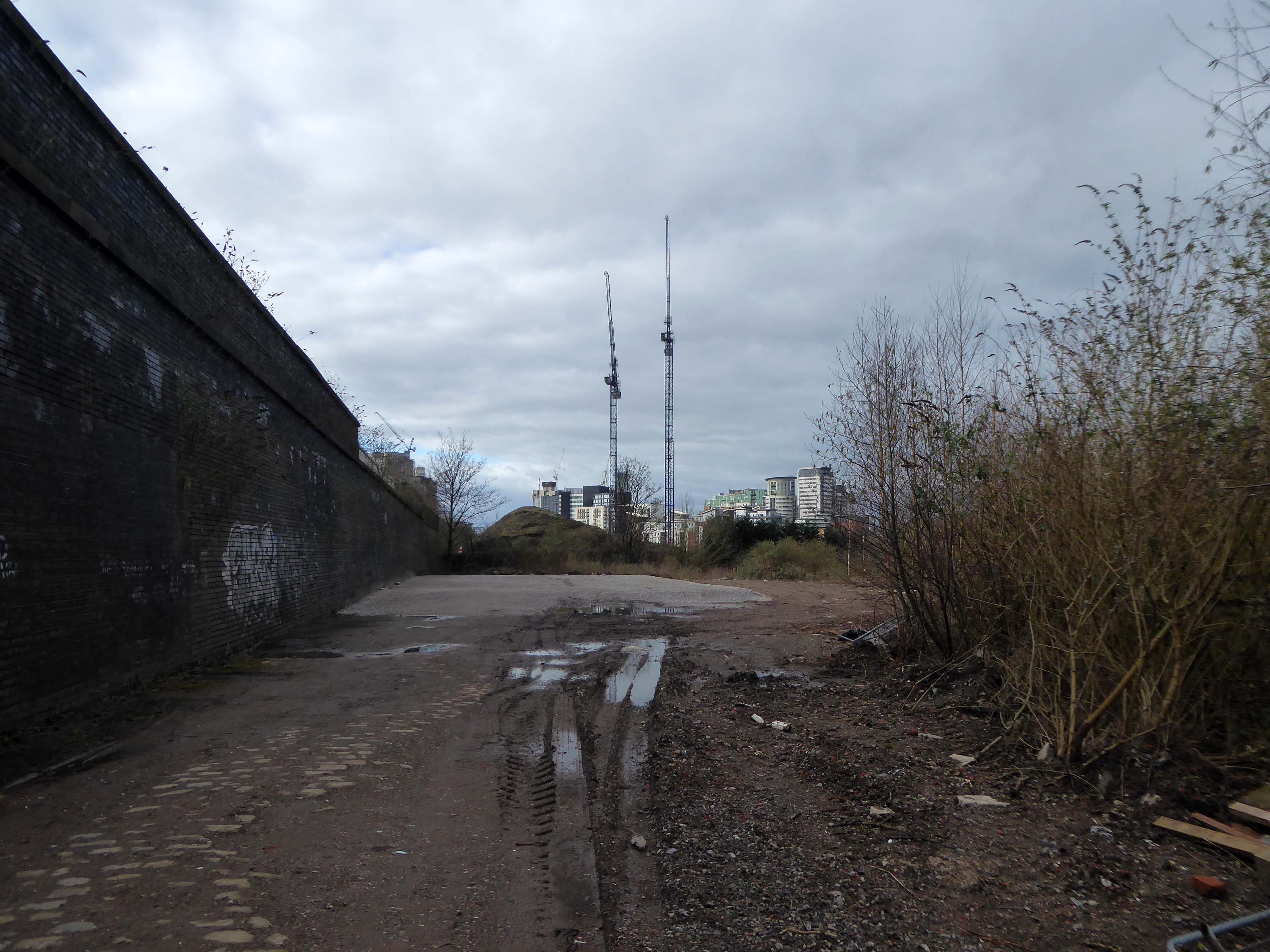
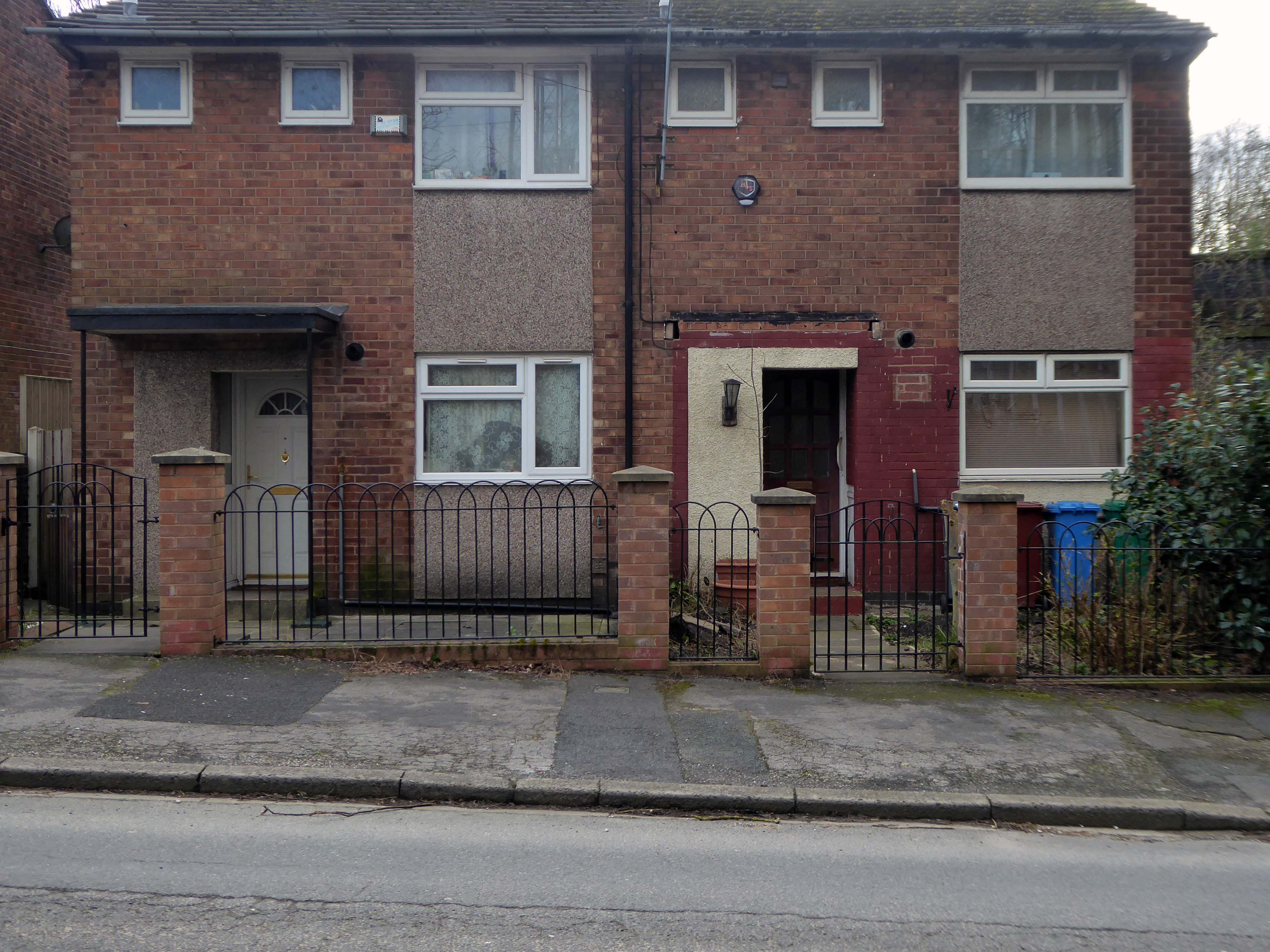
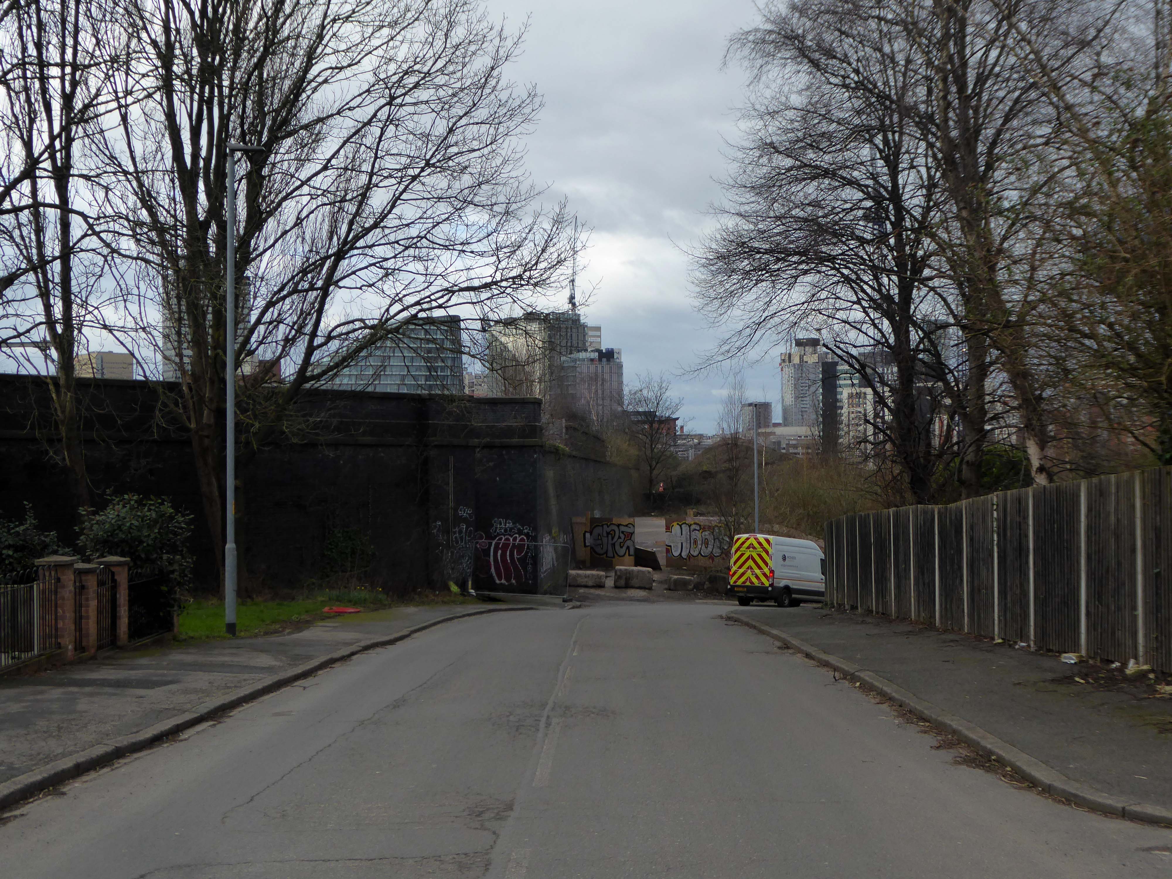
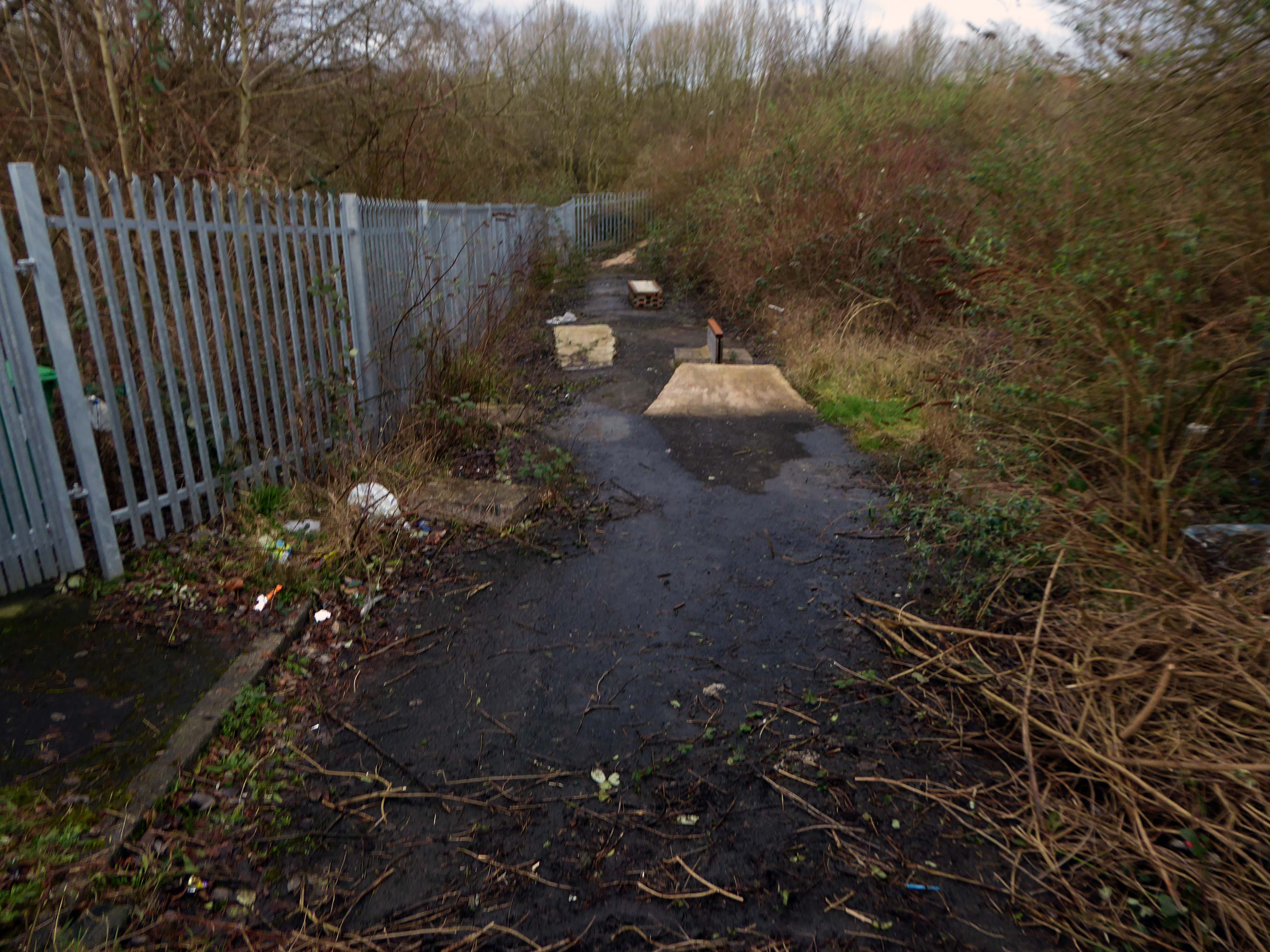
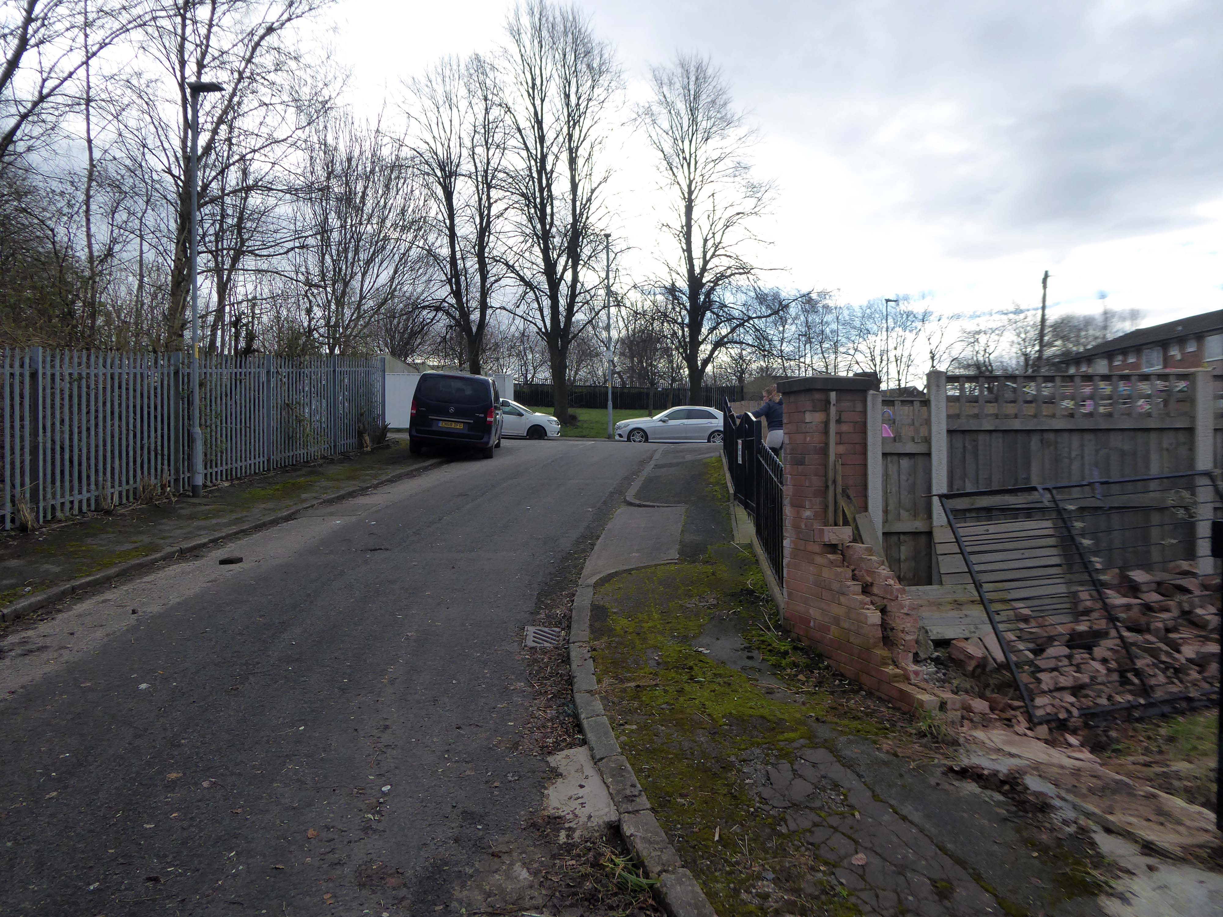
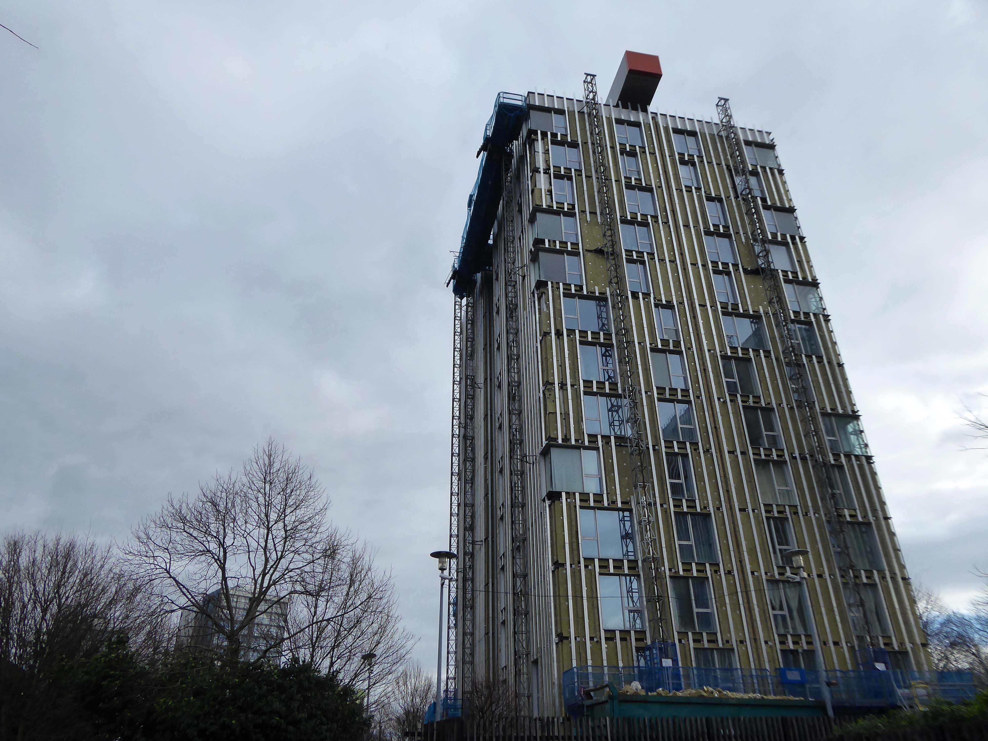
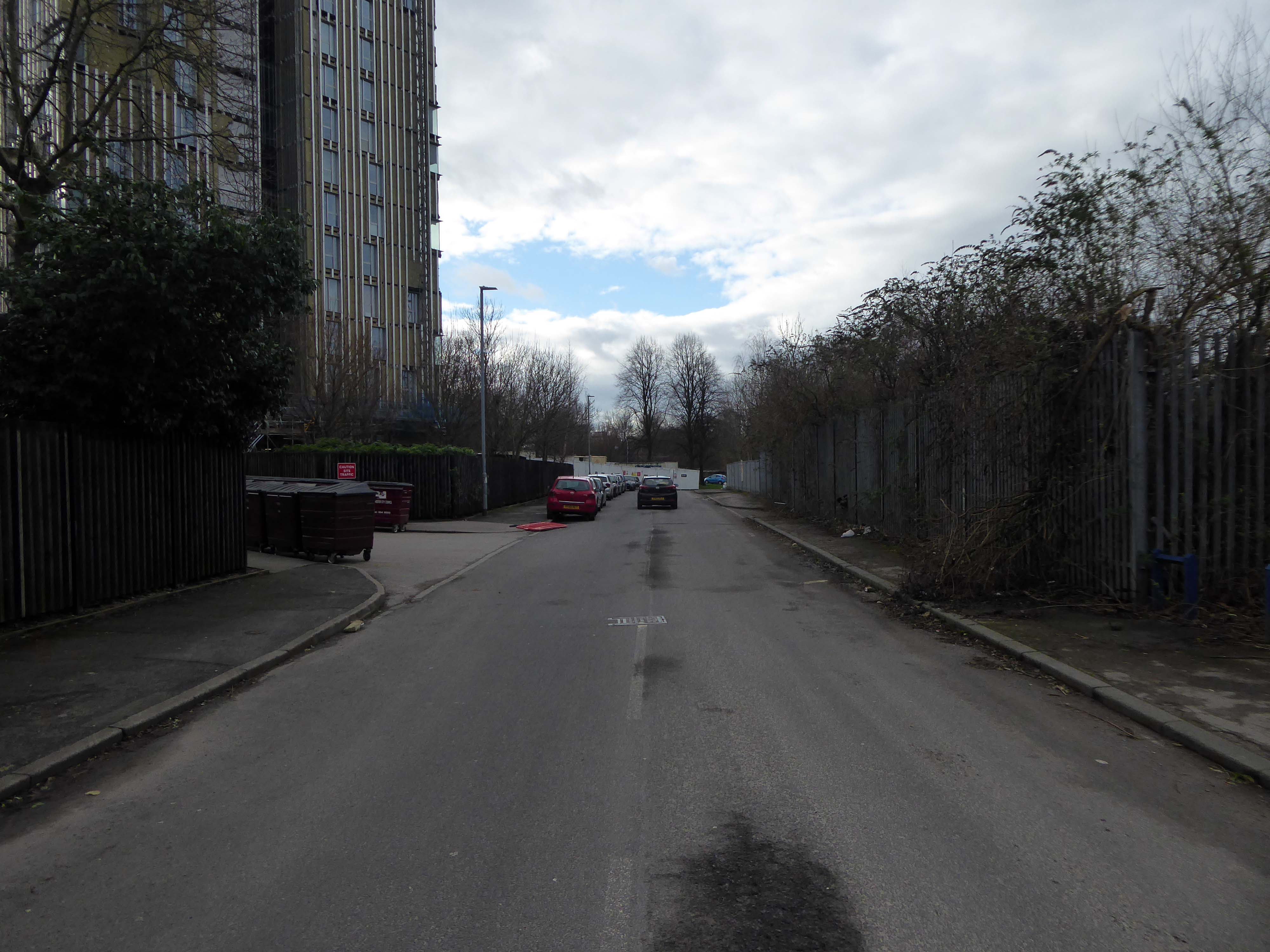
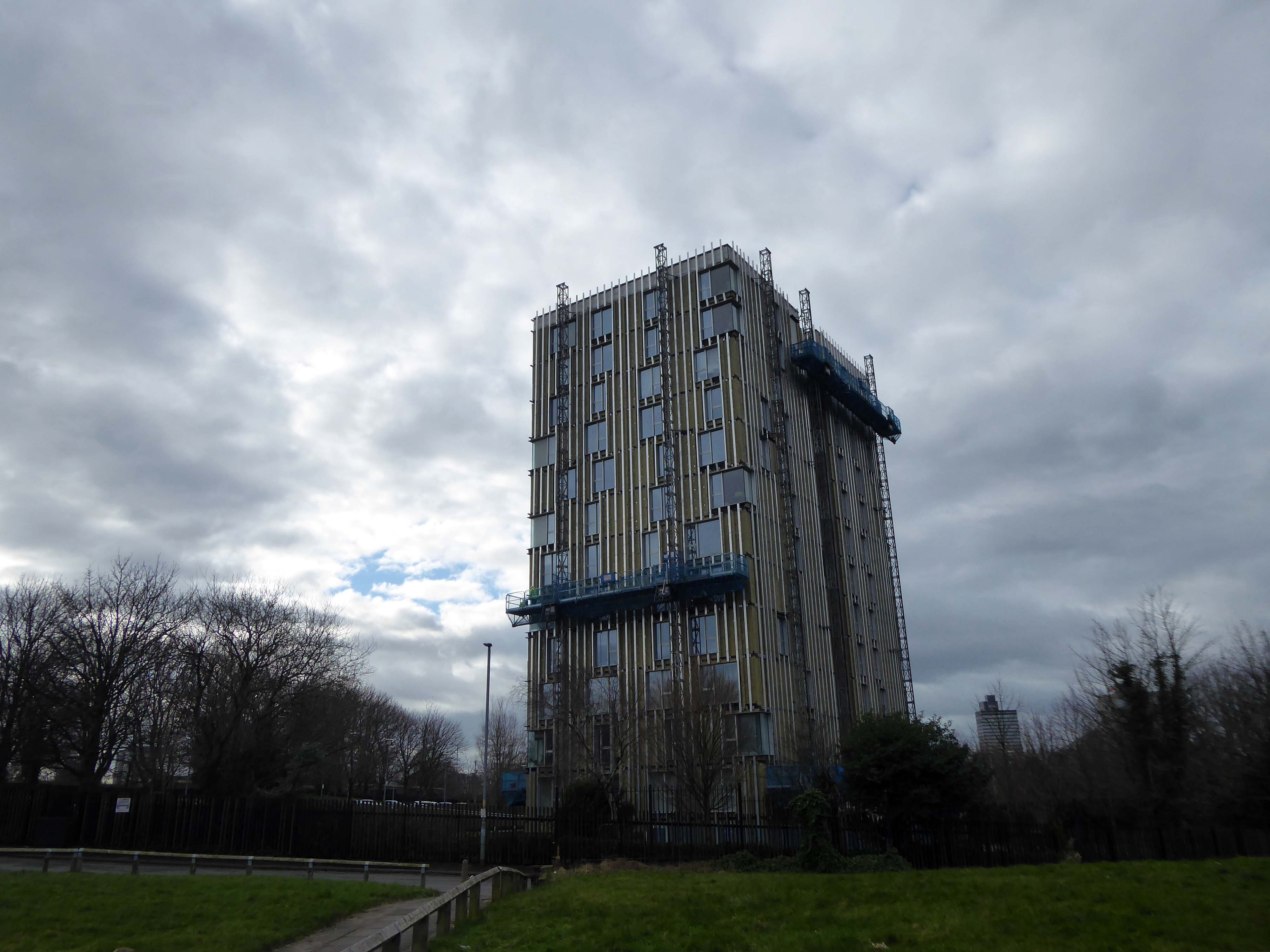
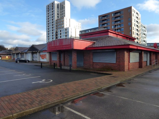
The remains of the remaining Eastford Square homes tinned up and secured awaiting who knows what.
So let’s take a short walk, see how things stand.
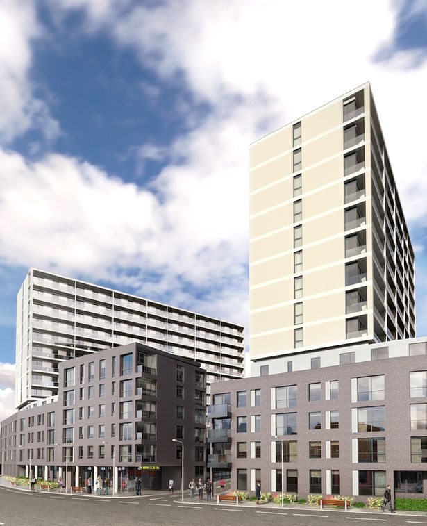
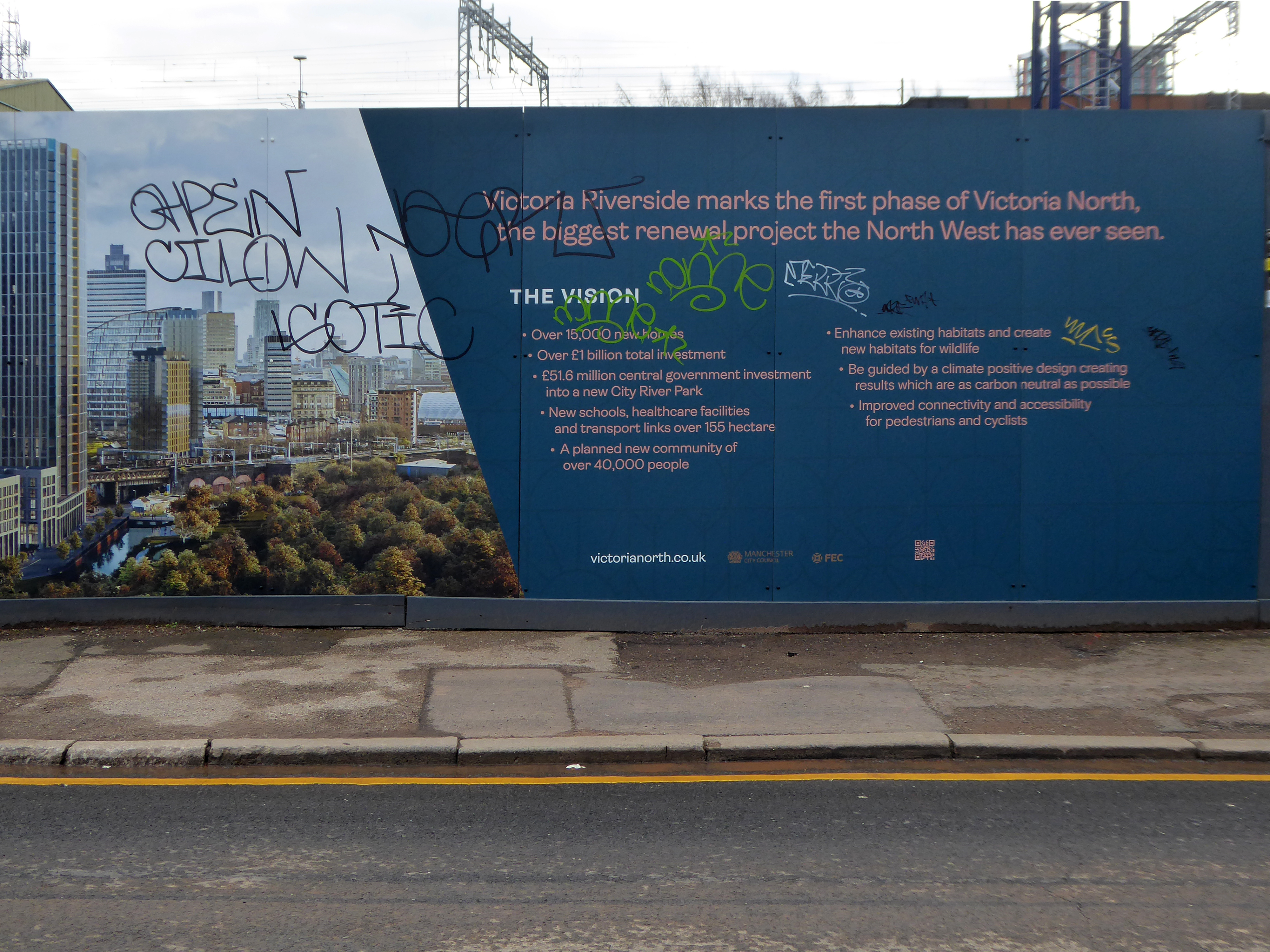
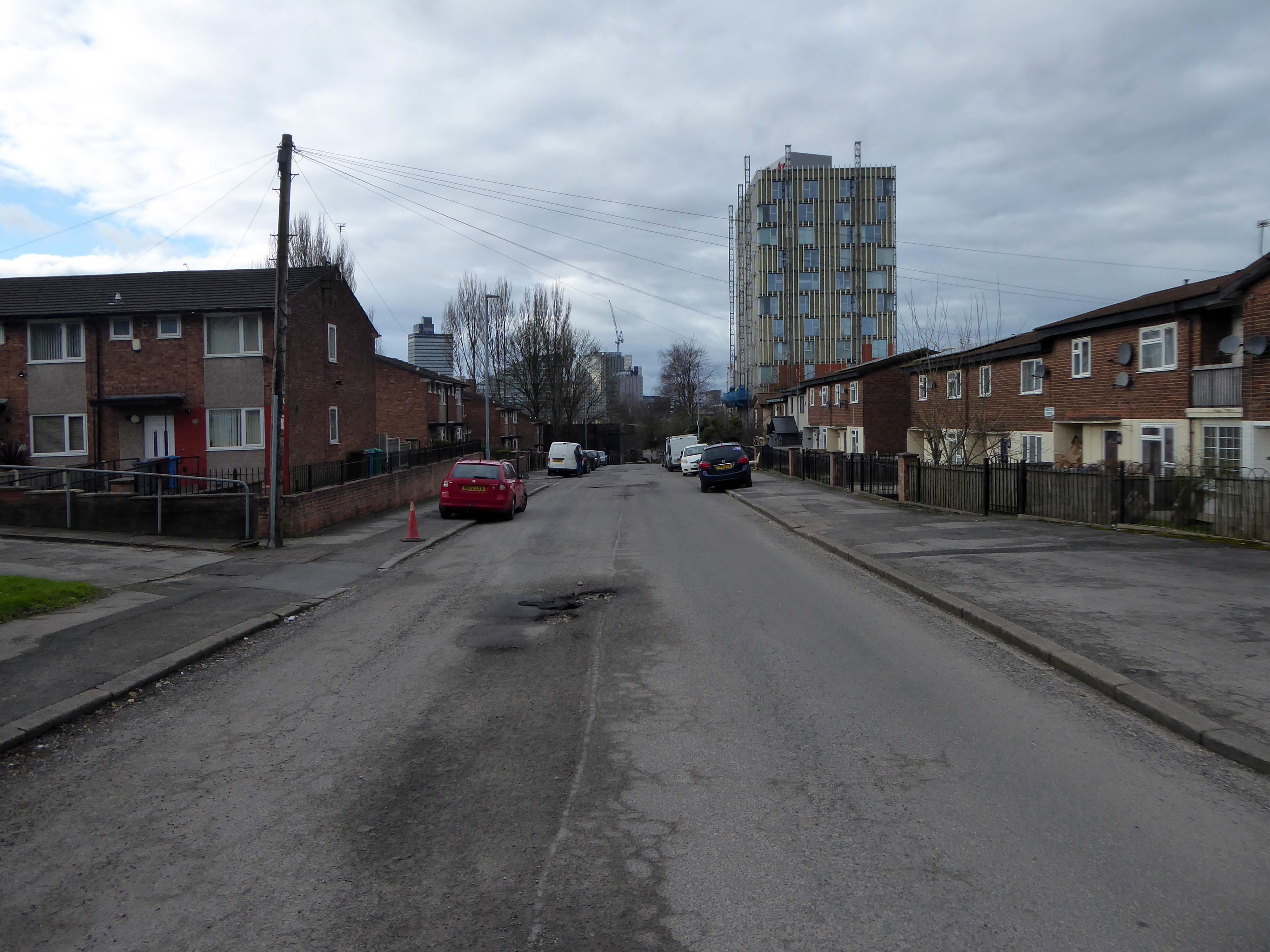
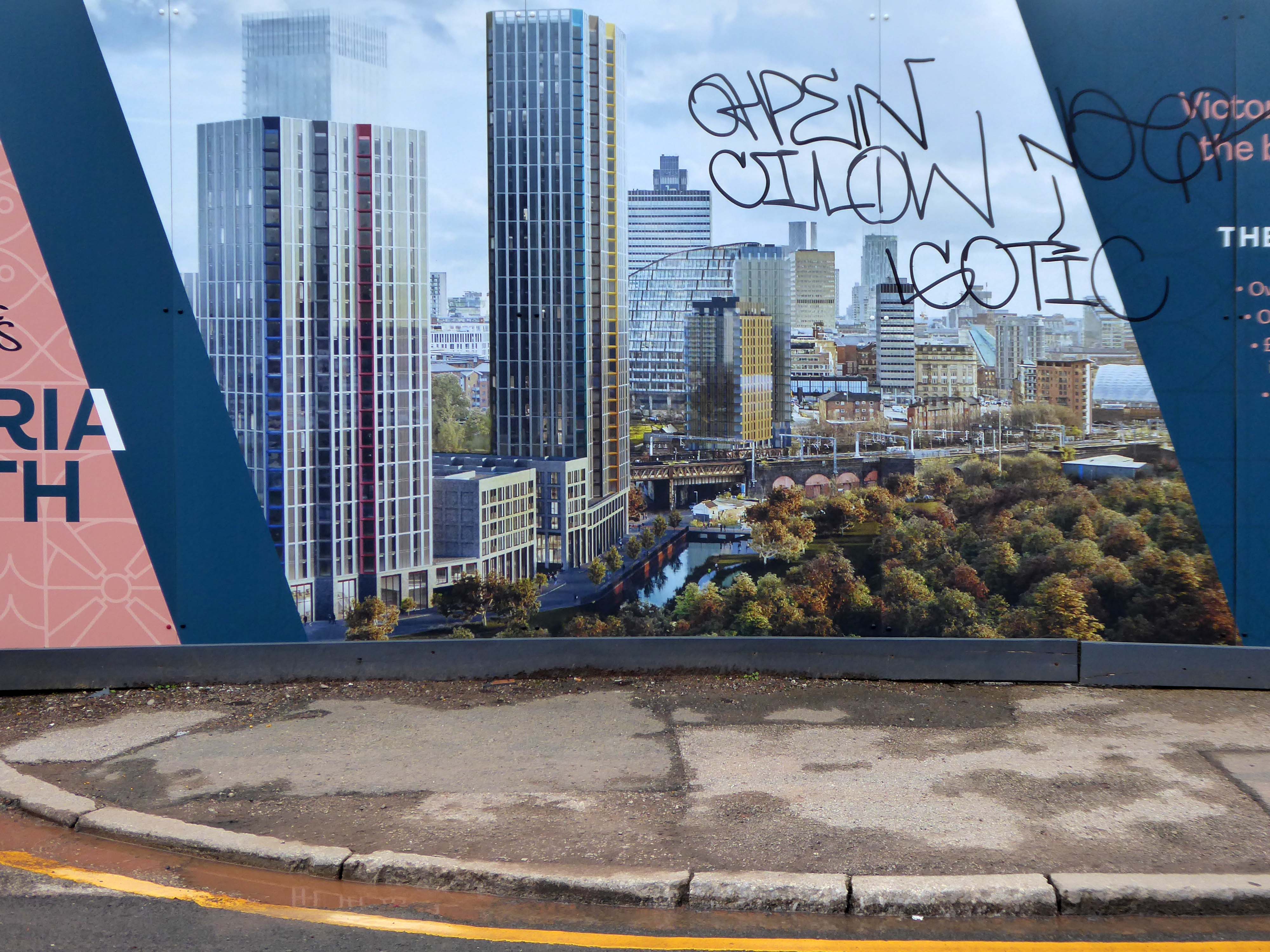
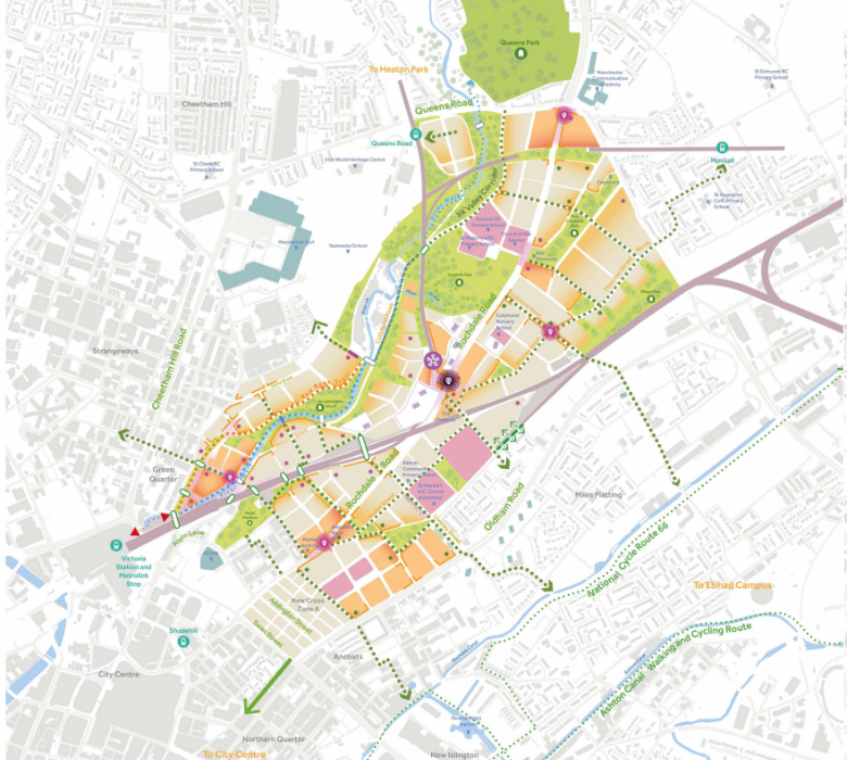
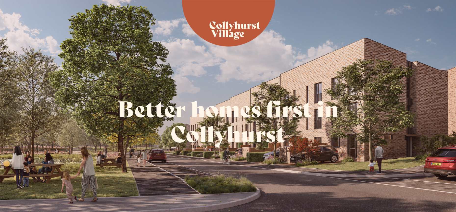
The area now forms the core of the latest municipal Masterplan – Victoria North.
Victoria North is a joint venture programme between Manchester City Council and developer Far East Consortium.
An internationally recognised developer, FEC specialises in residential led mixed-use developments and hotels, along with its casino and car park operations throughout mainland Europe.
The cowboys are now long gone – or are they?
When I was a cowboy out on the Western Plain Well, I made a half a million Working hard on the bridle reins
Come a cow-cow yicky come a cow-cow yicky, Harpurhey
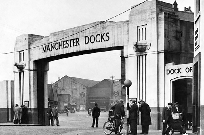
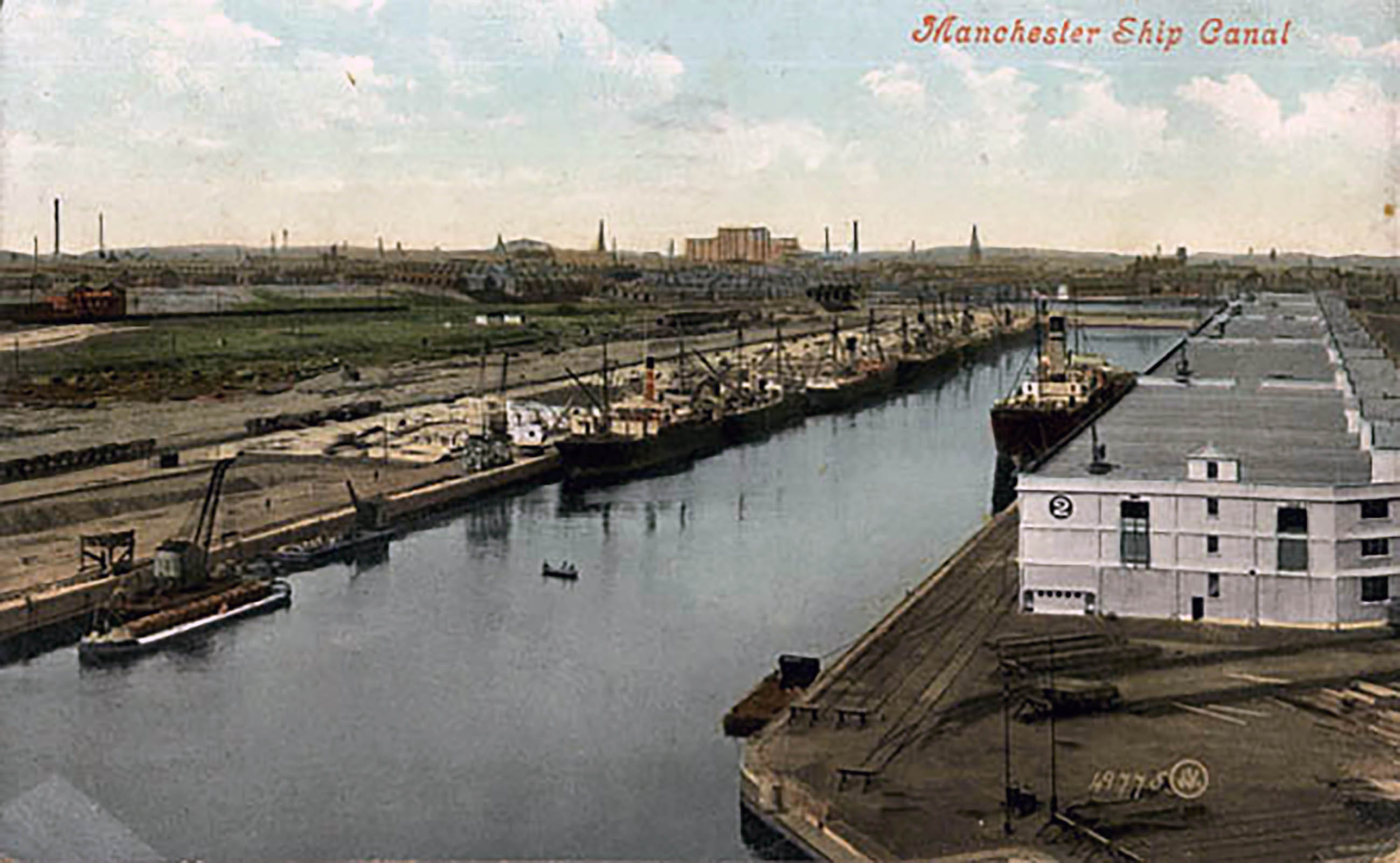
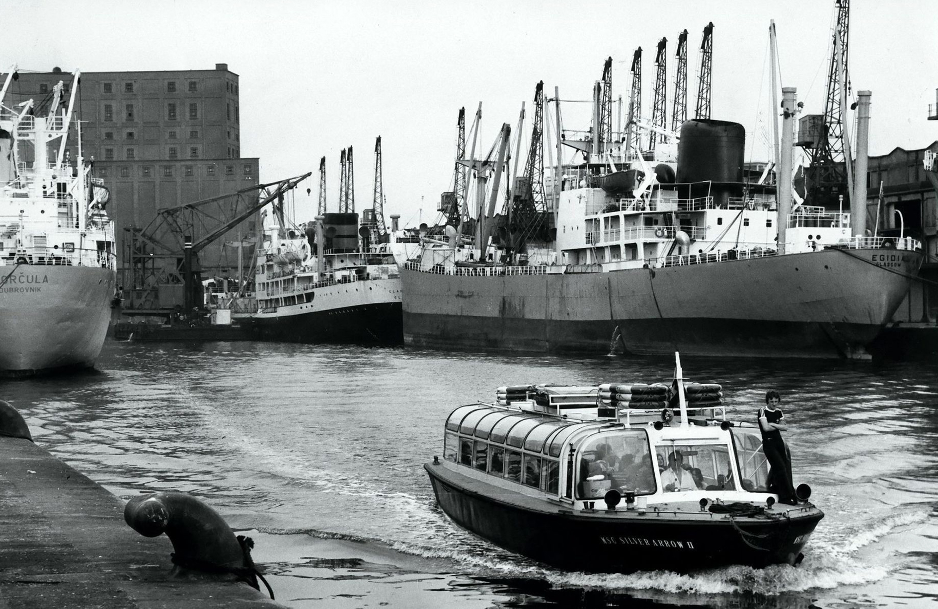
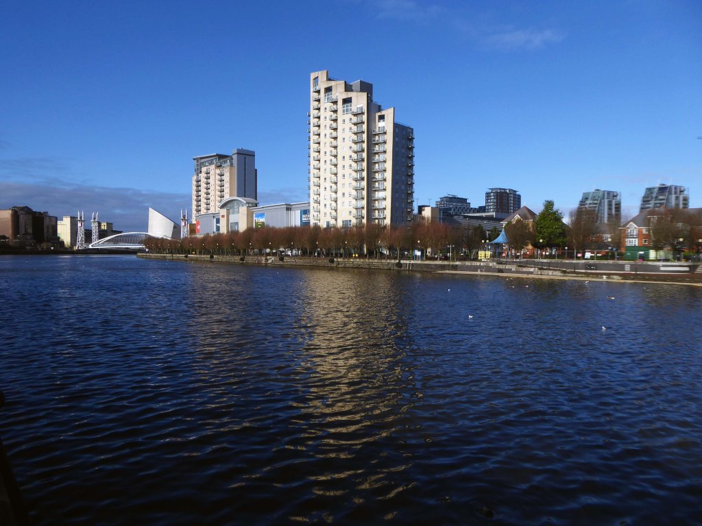
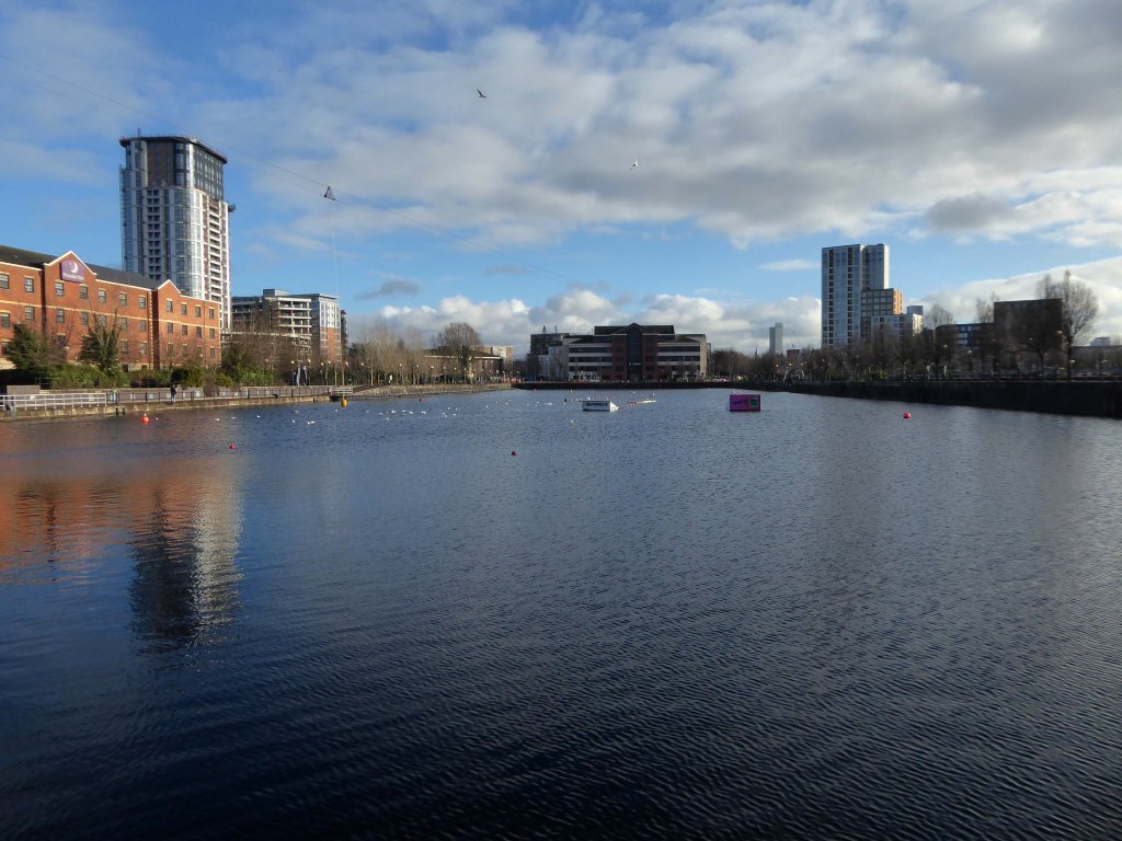
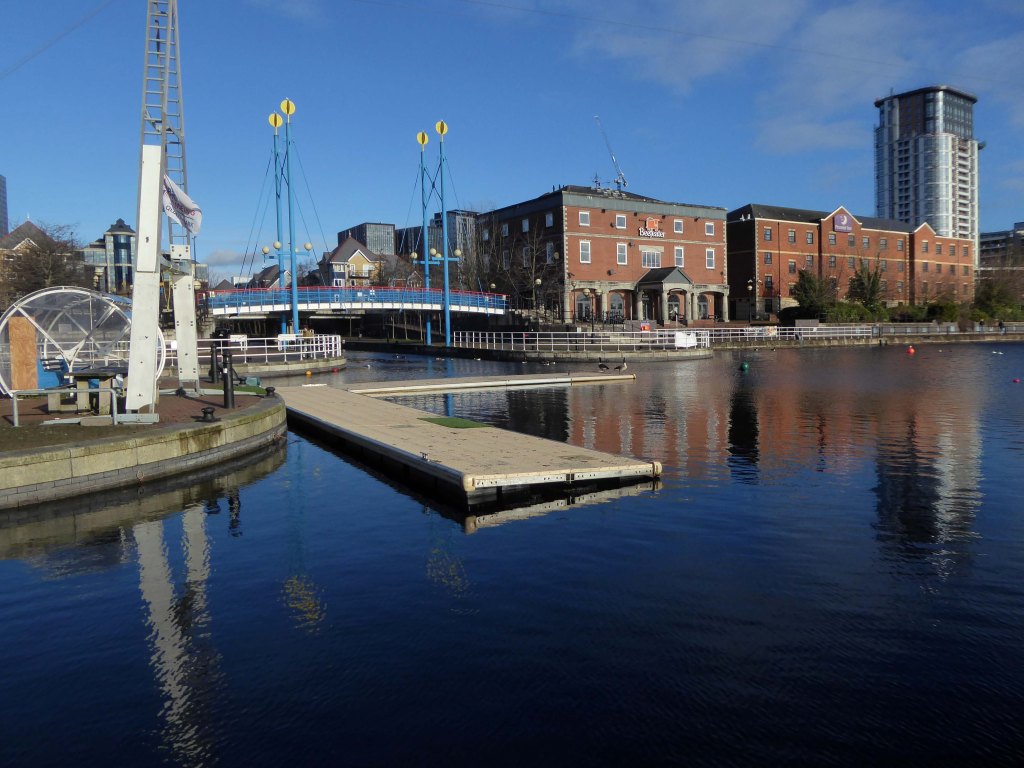
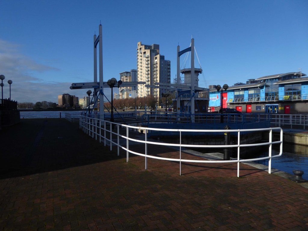
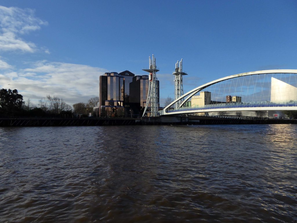
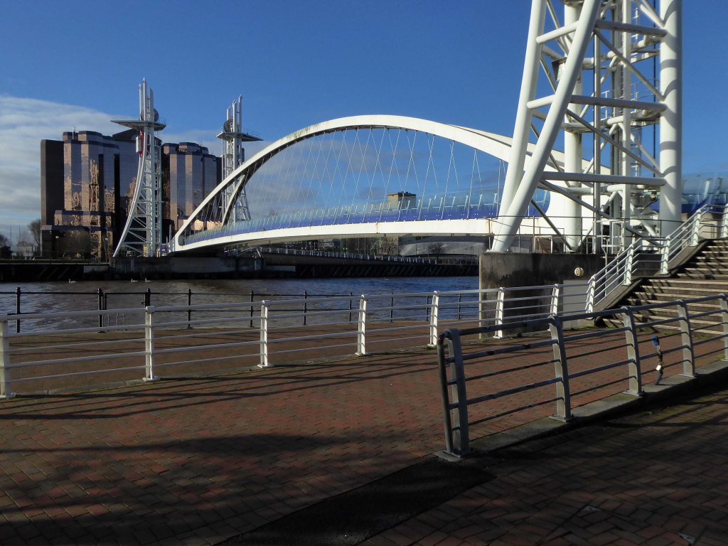
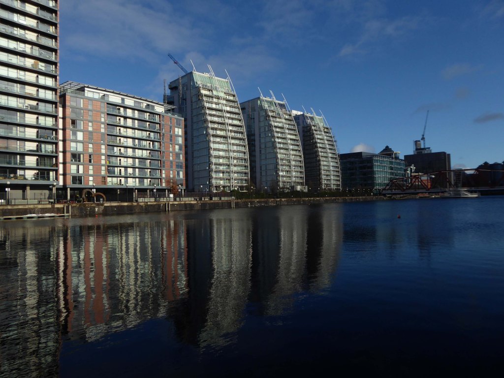
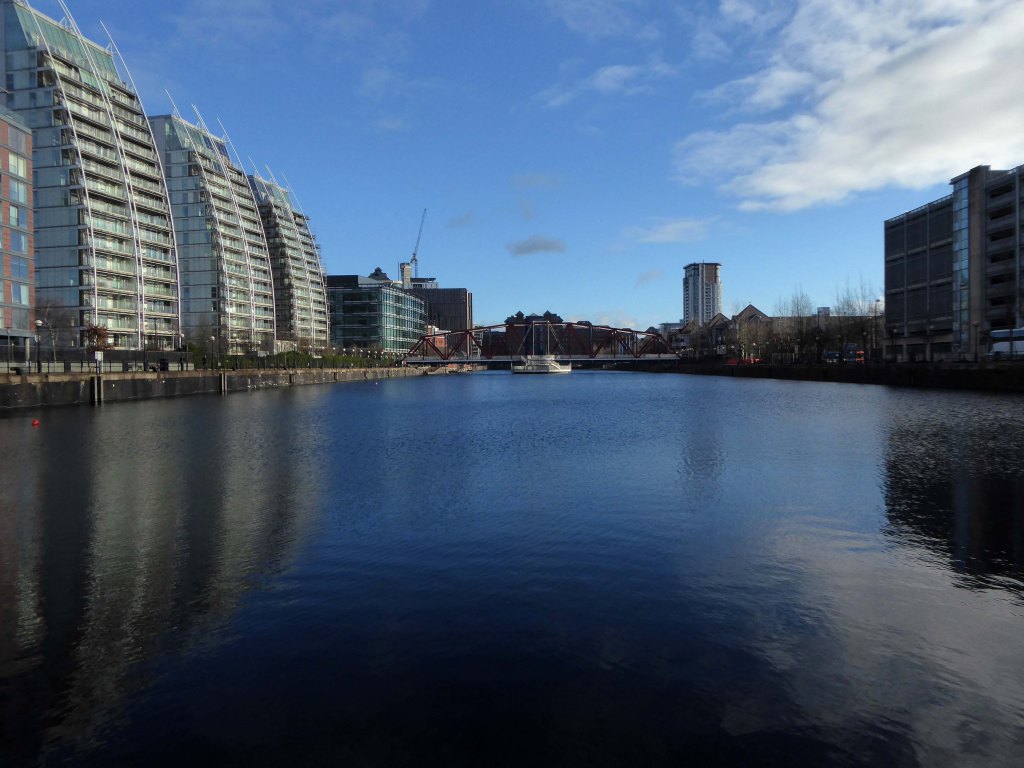
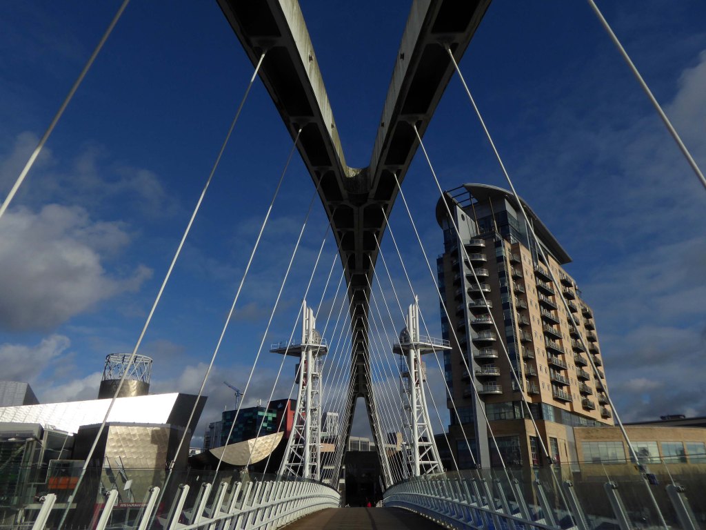
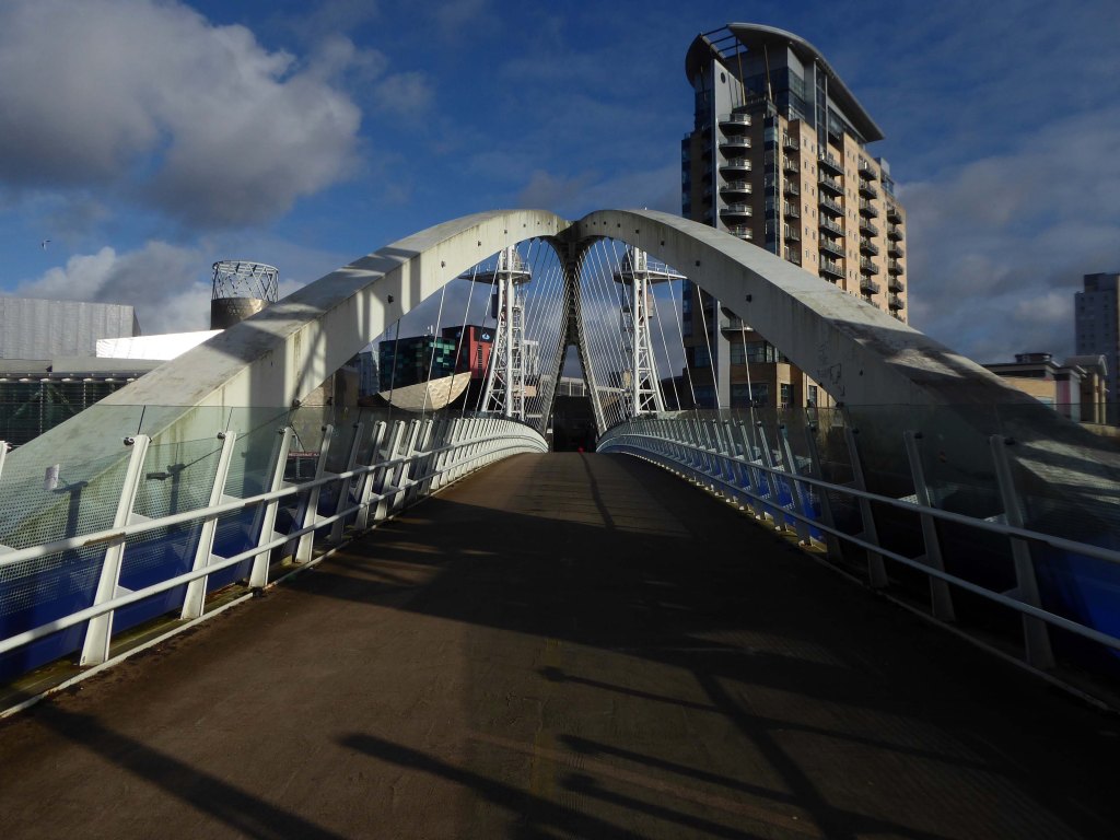
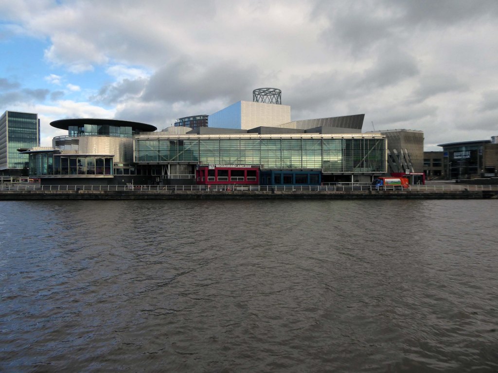
They were situatedin Salford, Stretford and Manchester at the east end of the Manchester Ship Canal. They formed part of the Port of Manchester from 1894 until their closure in 1982. The docks marked the upper reaches of the ship canal,and were a destination for both coastal and ocean-bound vessels carrying cargo and a limited number of passengers, often travelling to and from Canada.
Manchester Docks were divided into two sections; the larger Salford docks to the west of the Trafford Road swing bridge and Pomona docks to the east. Each section consisted of four docks in total, the largest being to the west; Dock 5 at Pomona was never fully completed. Of the eight working docks only one, Dock 1 at Pomona, was within Manchester itself. During much of 1948, Manchester Docks were Britain’s third busiest port owing to damage suffered by the Port of Hull during the Hull Blitz.
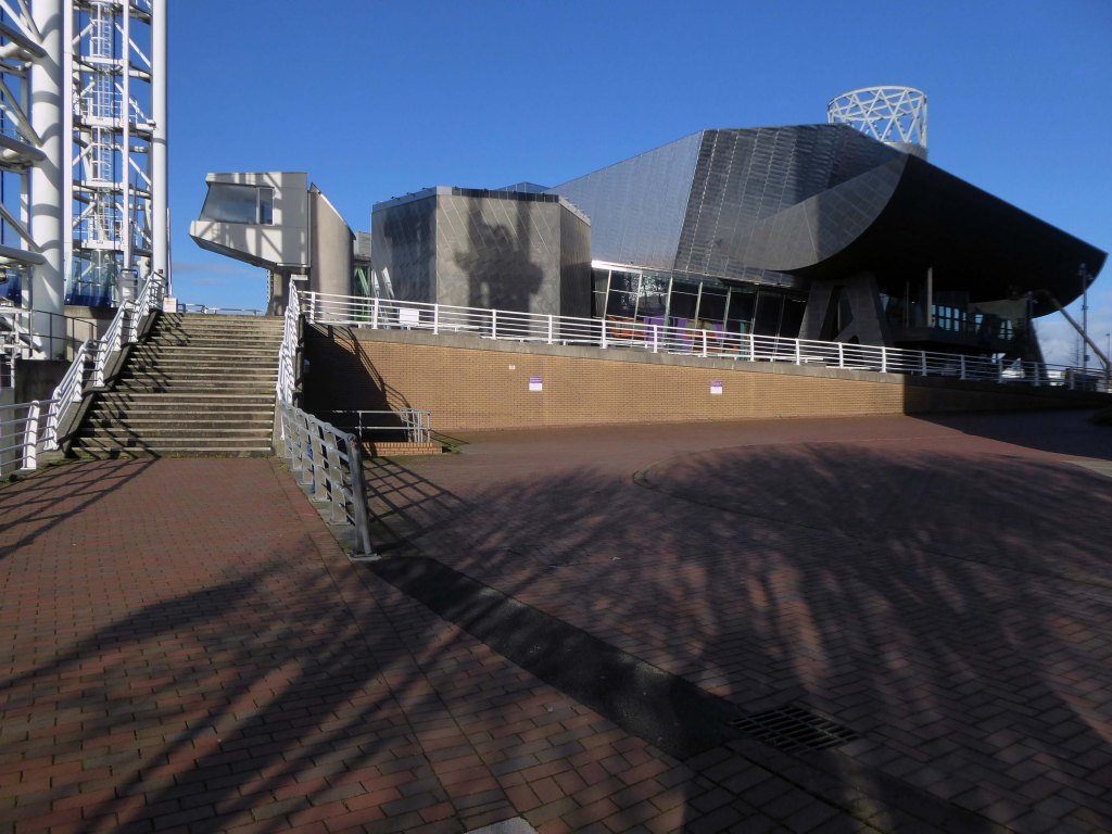
During the 1970s the docks began a rapid decline, largely due to containerisation. The increasing size of freight-carrying ships meant they could no longer navigate the ship canal and this, combined with increased trading with Europe and the east, saw use of Manchester Docks decrease. In 1982 the remaining docks closed and the area became derelict. Recognising the need to redevelop the area, Salford City Council purchased the docks in 1984 using a derelict land grant. The Salford Quays Development Plan was adopted in May 1985, proposing complete reclamation and development of the area for commercial, residential and leisure use.