Woodward Court Woodward Street – Ancoats Manchester

“What’s going on?”

As Marvin Gaye so succinctly asked.

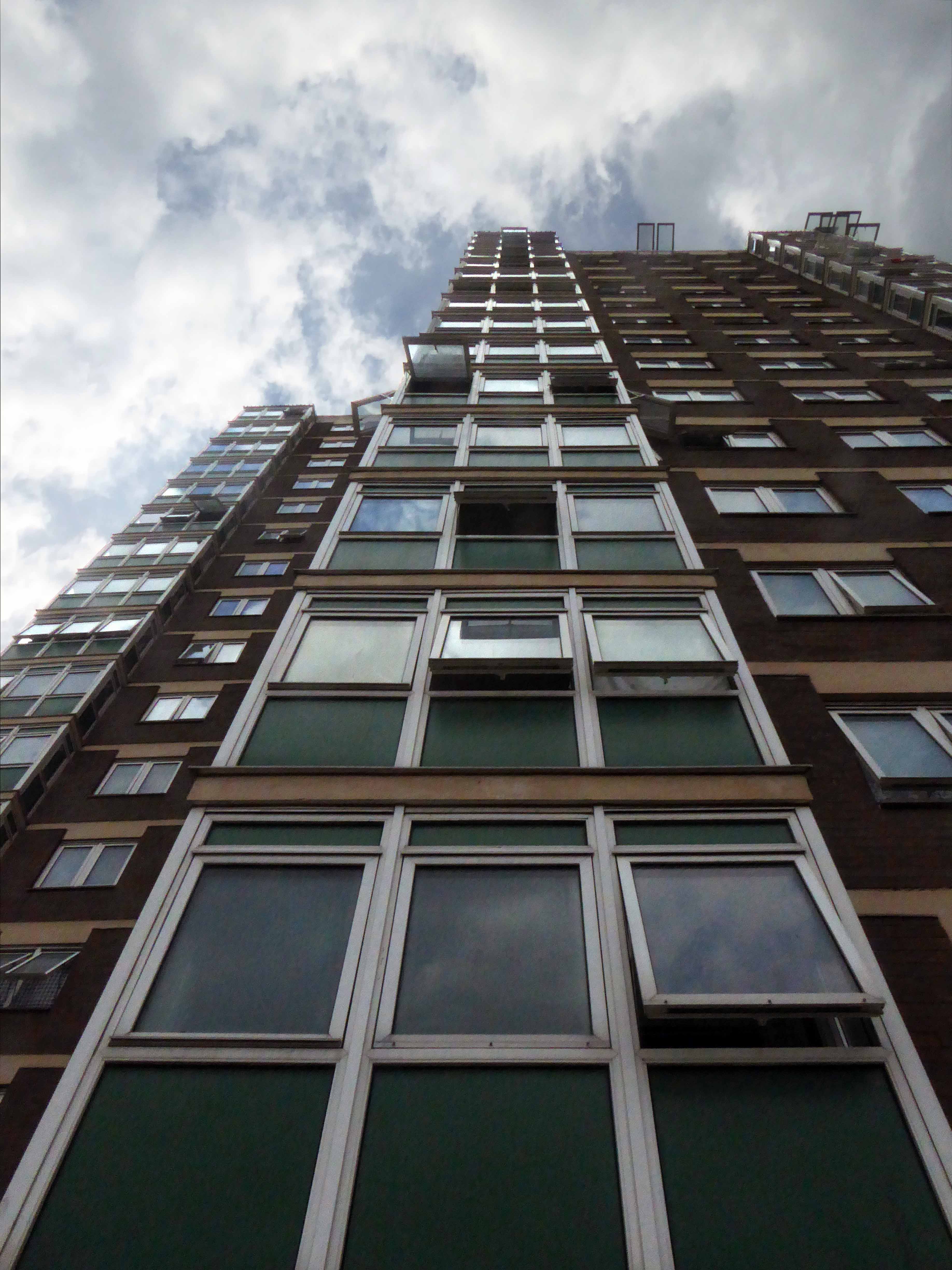
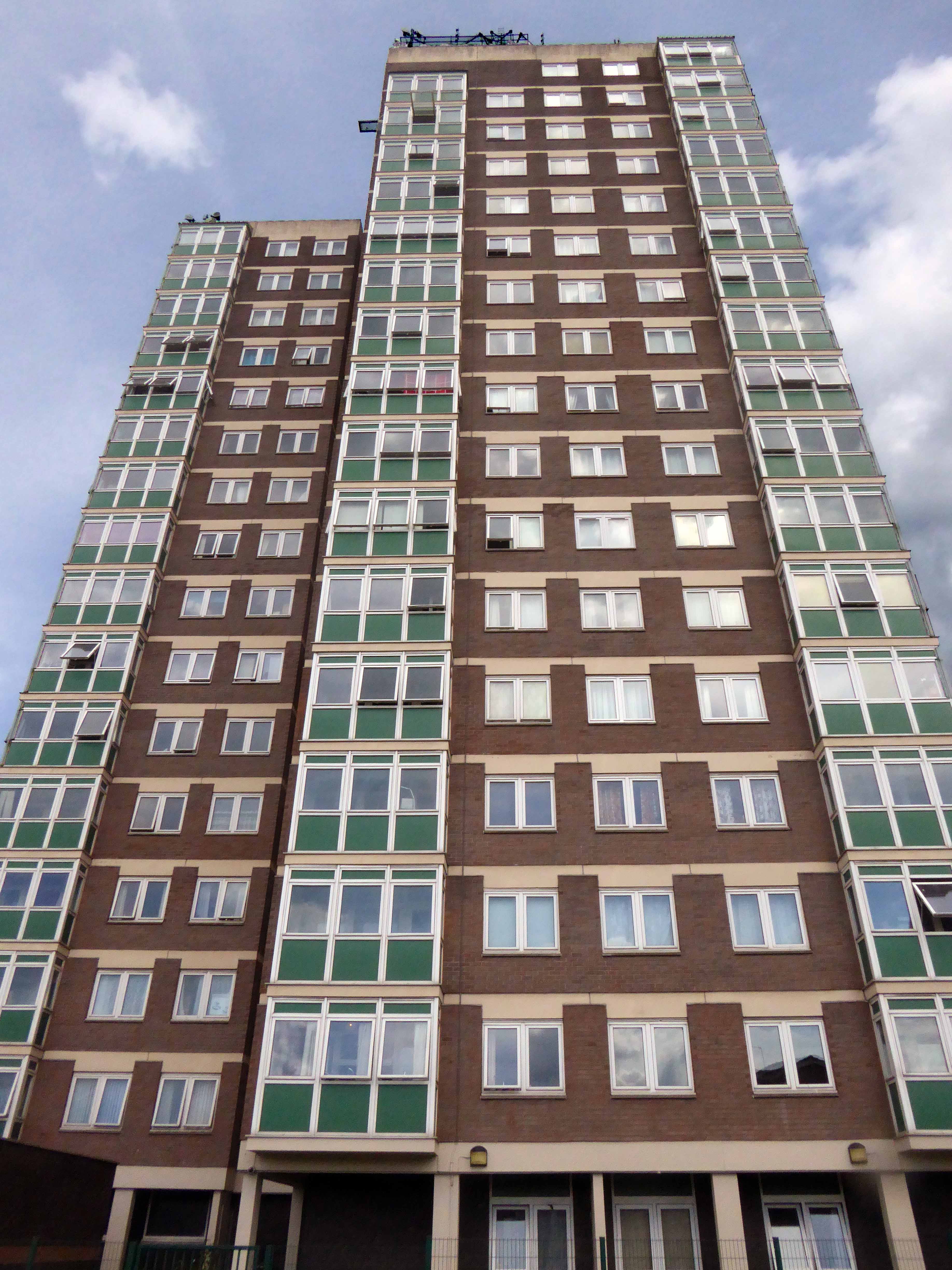
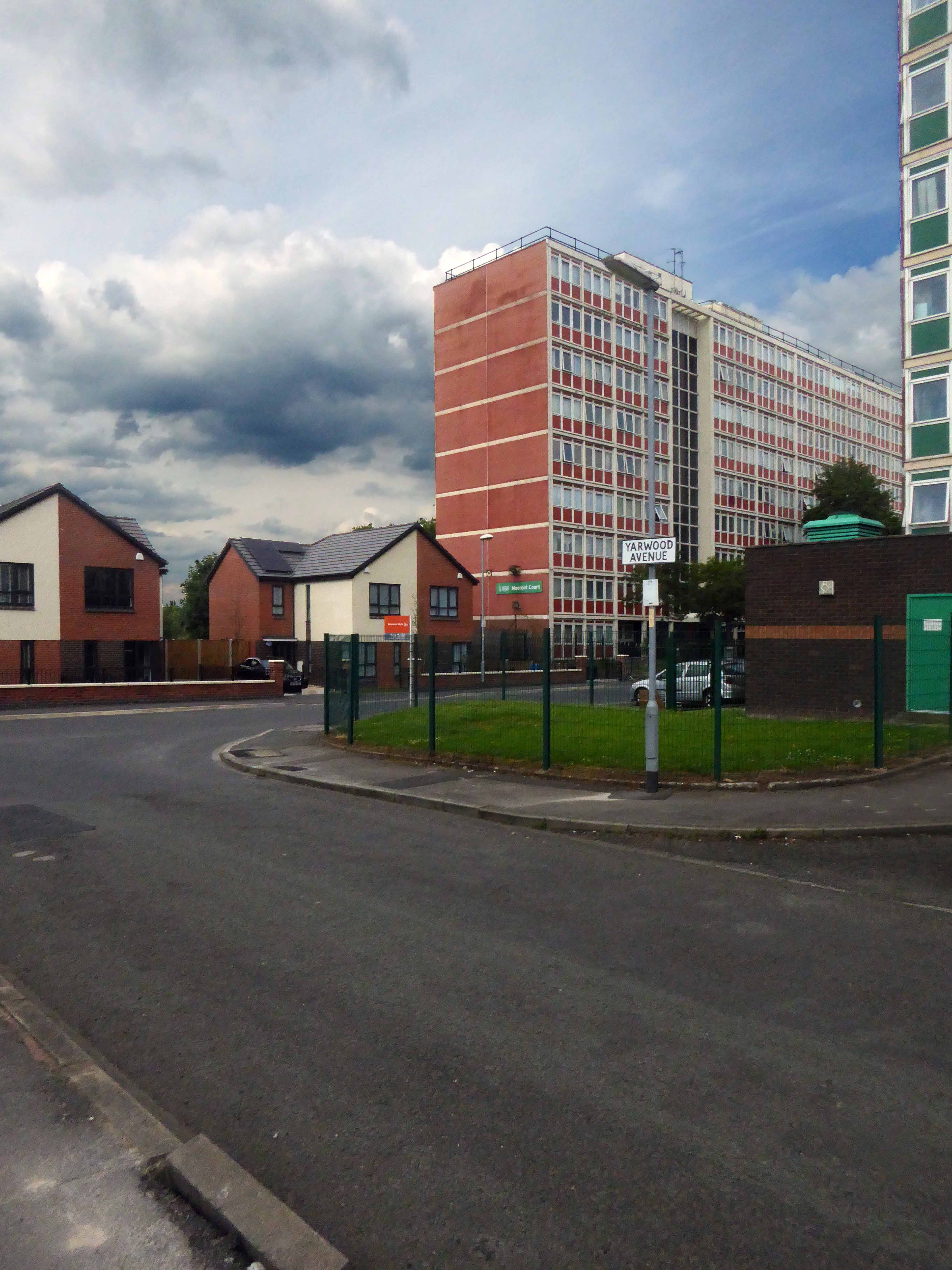
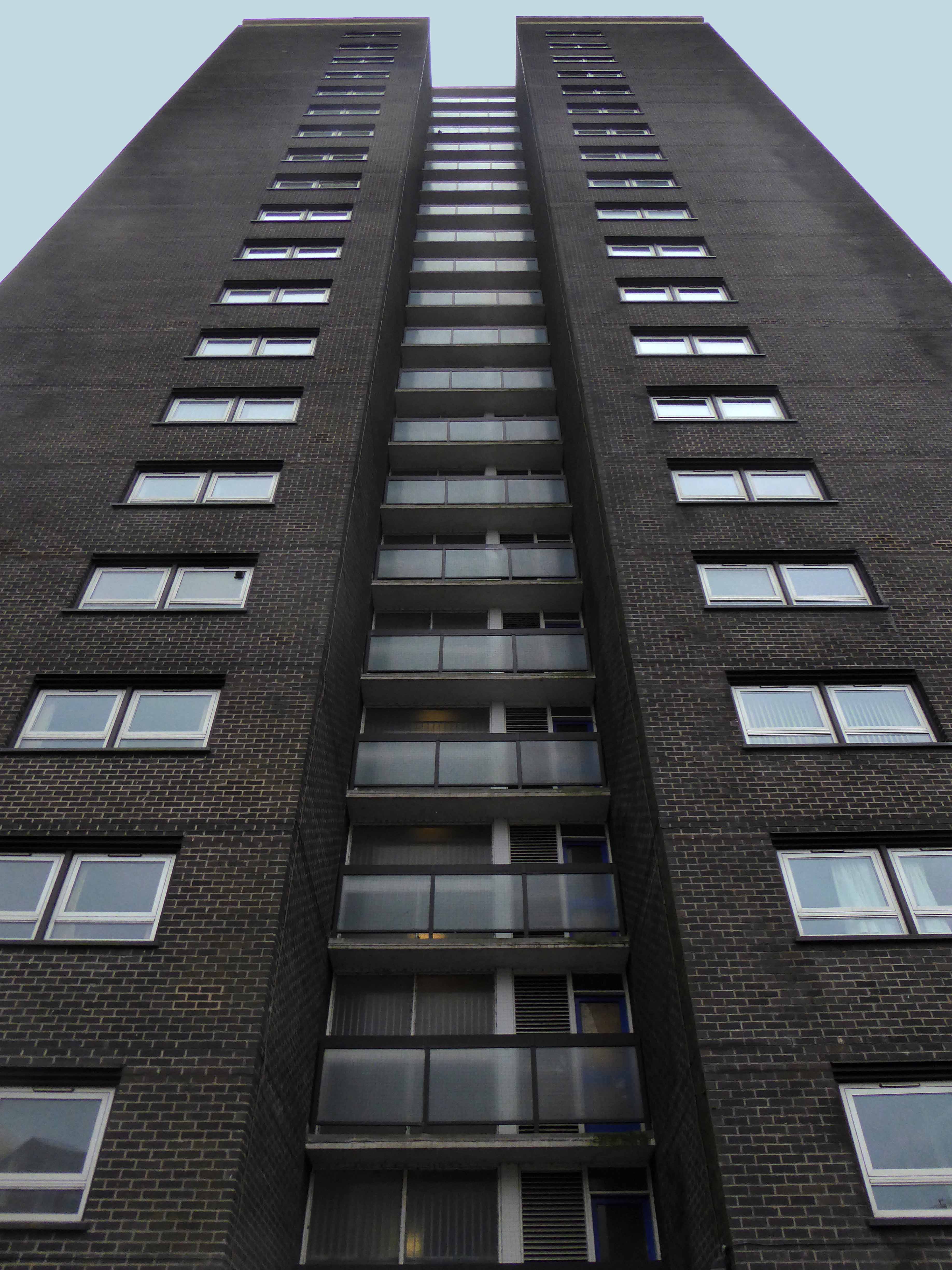
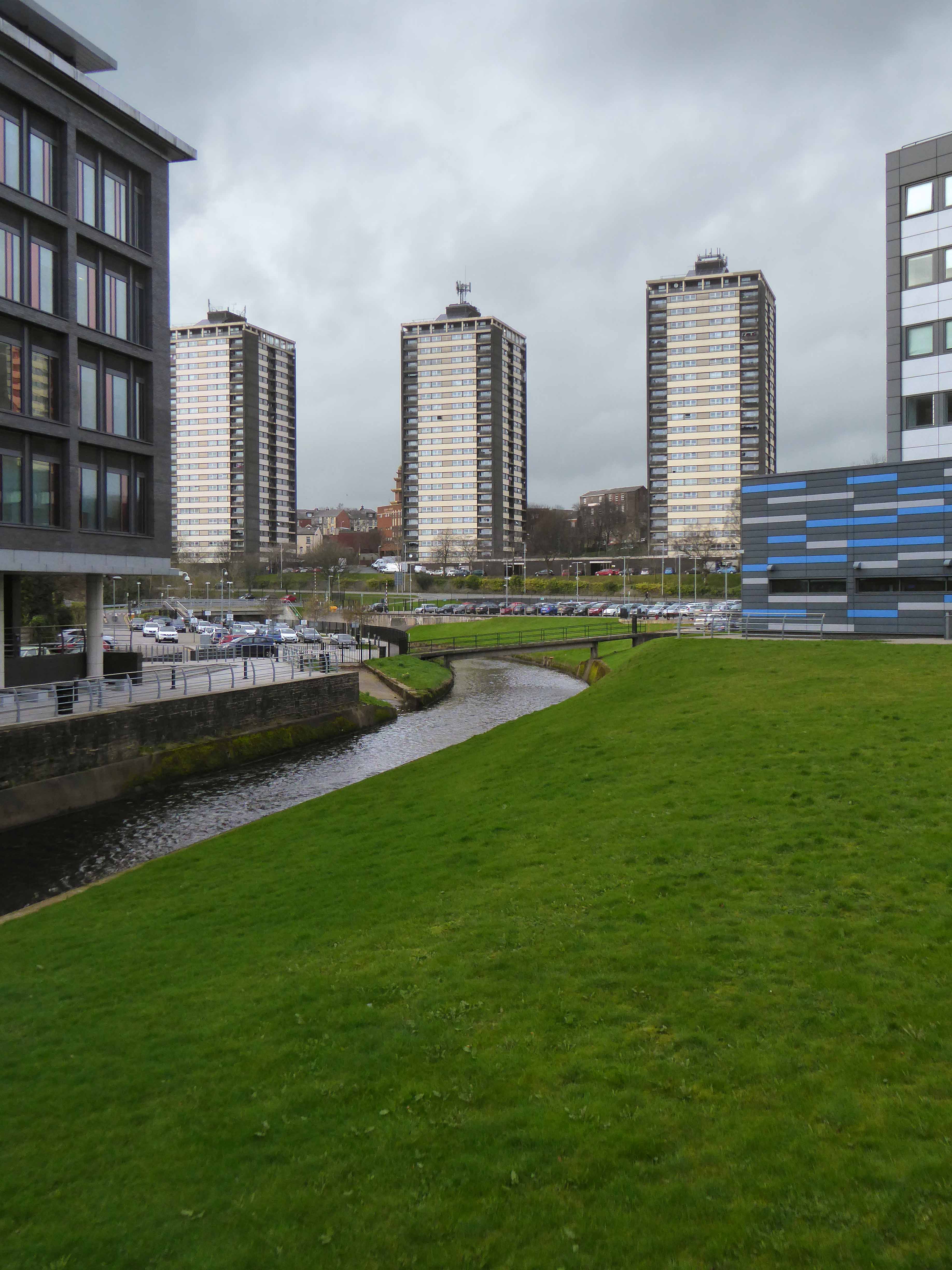
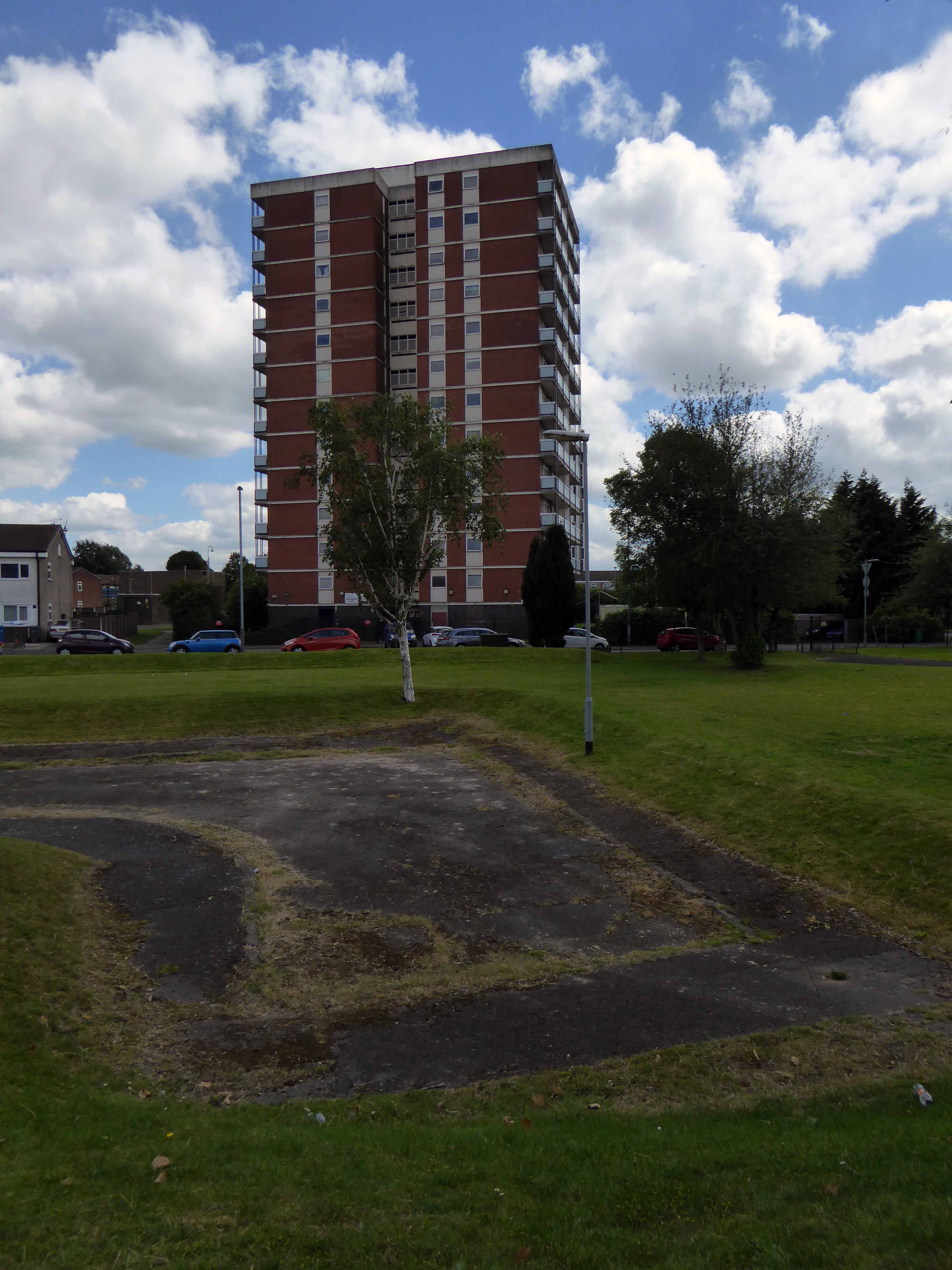
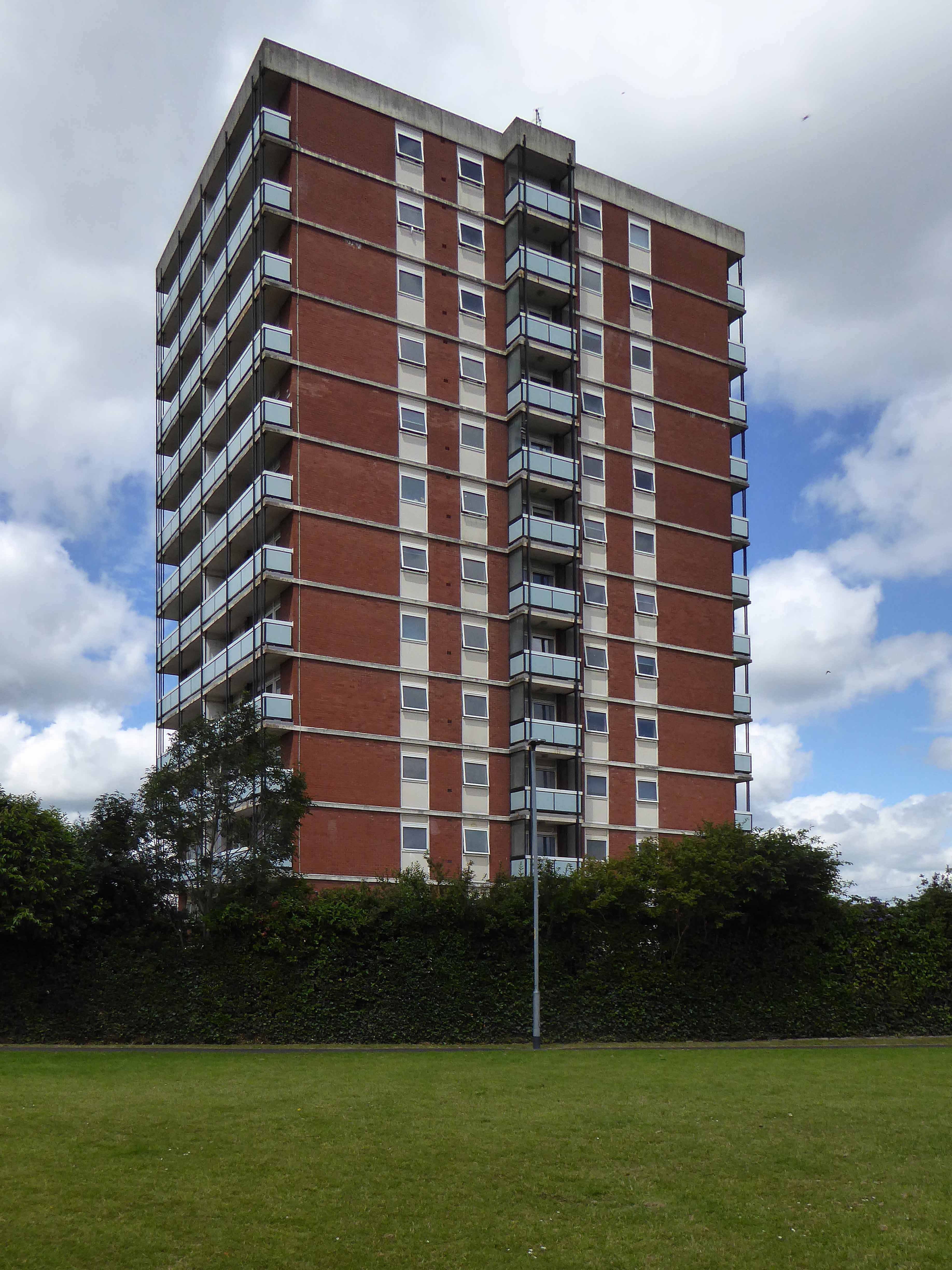
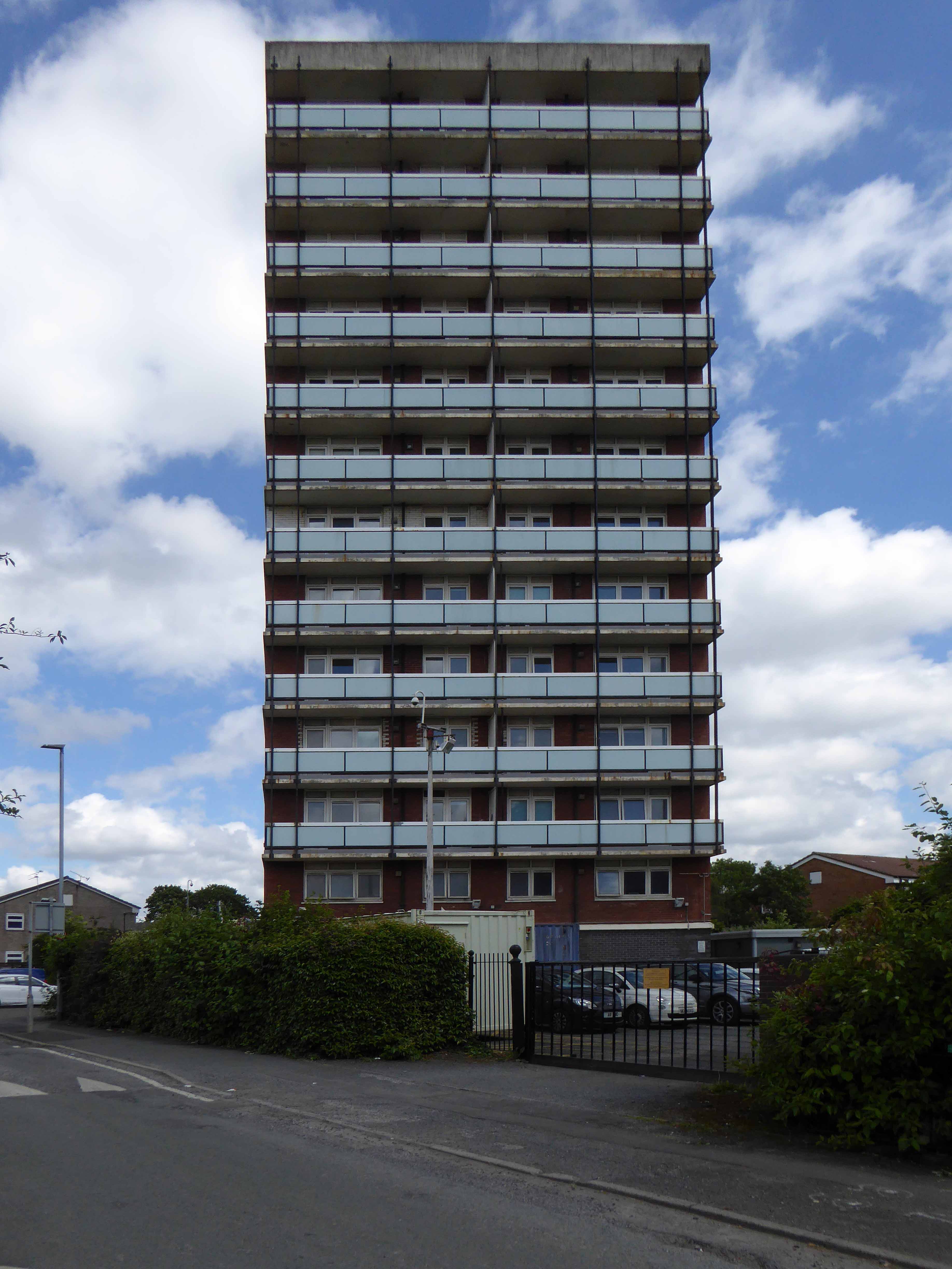
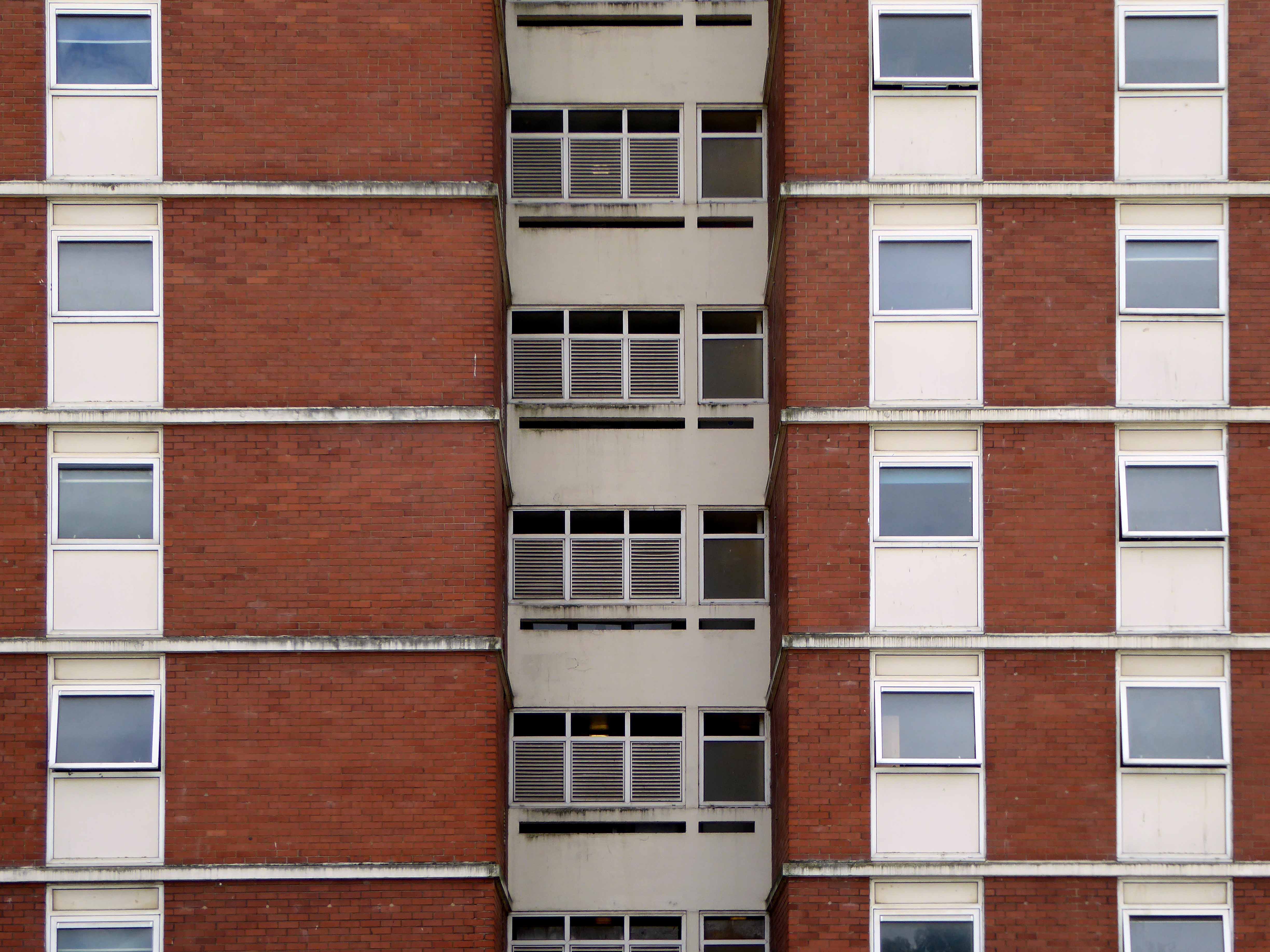
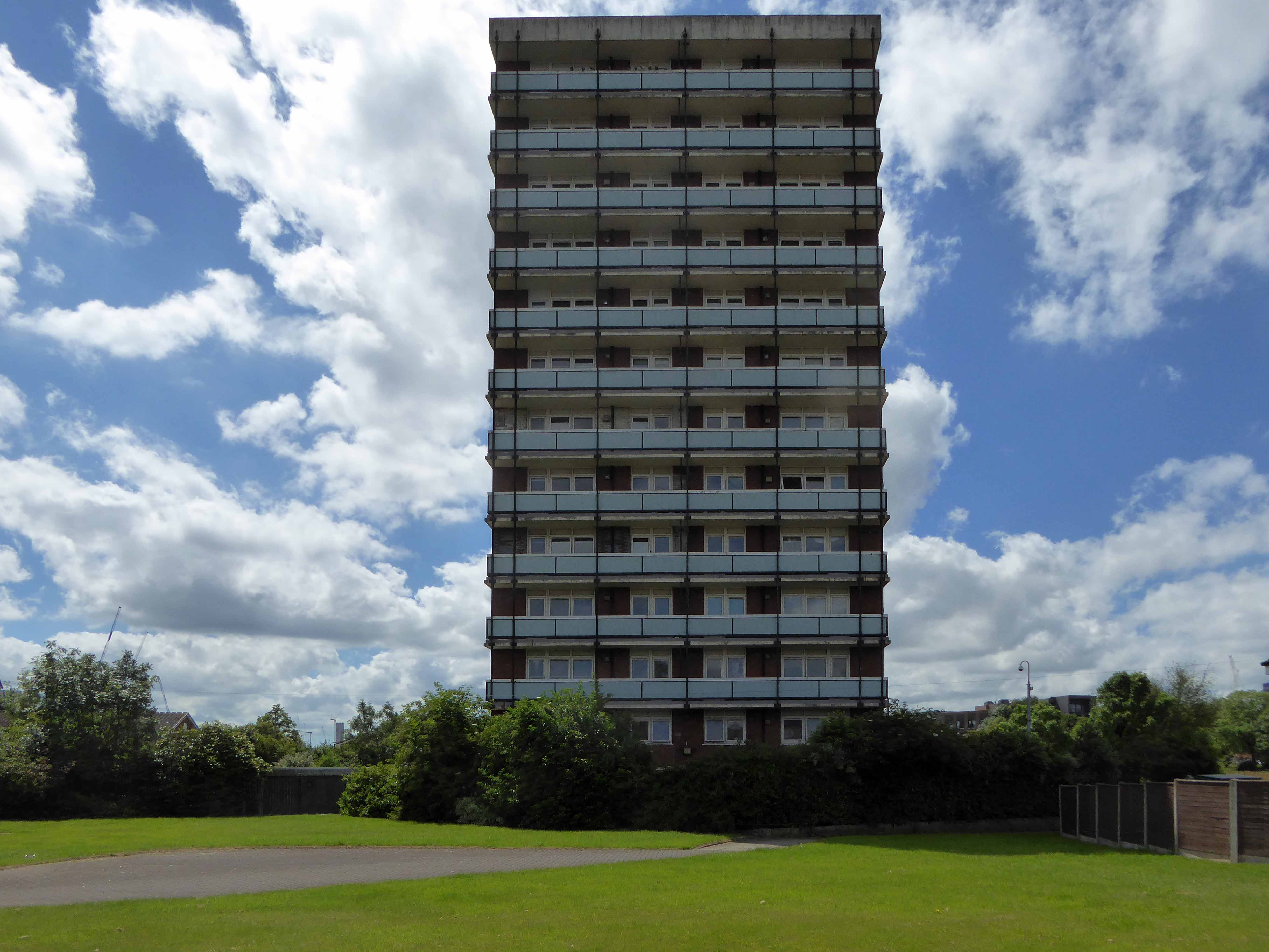
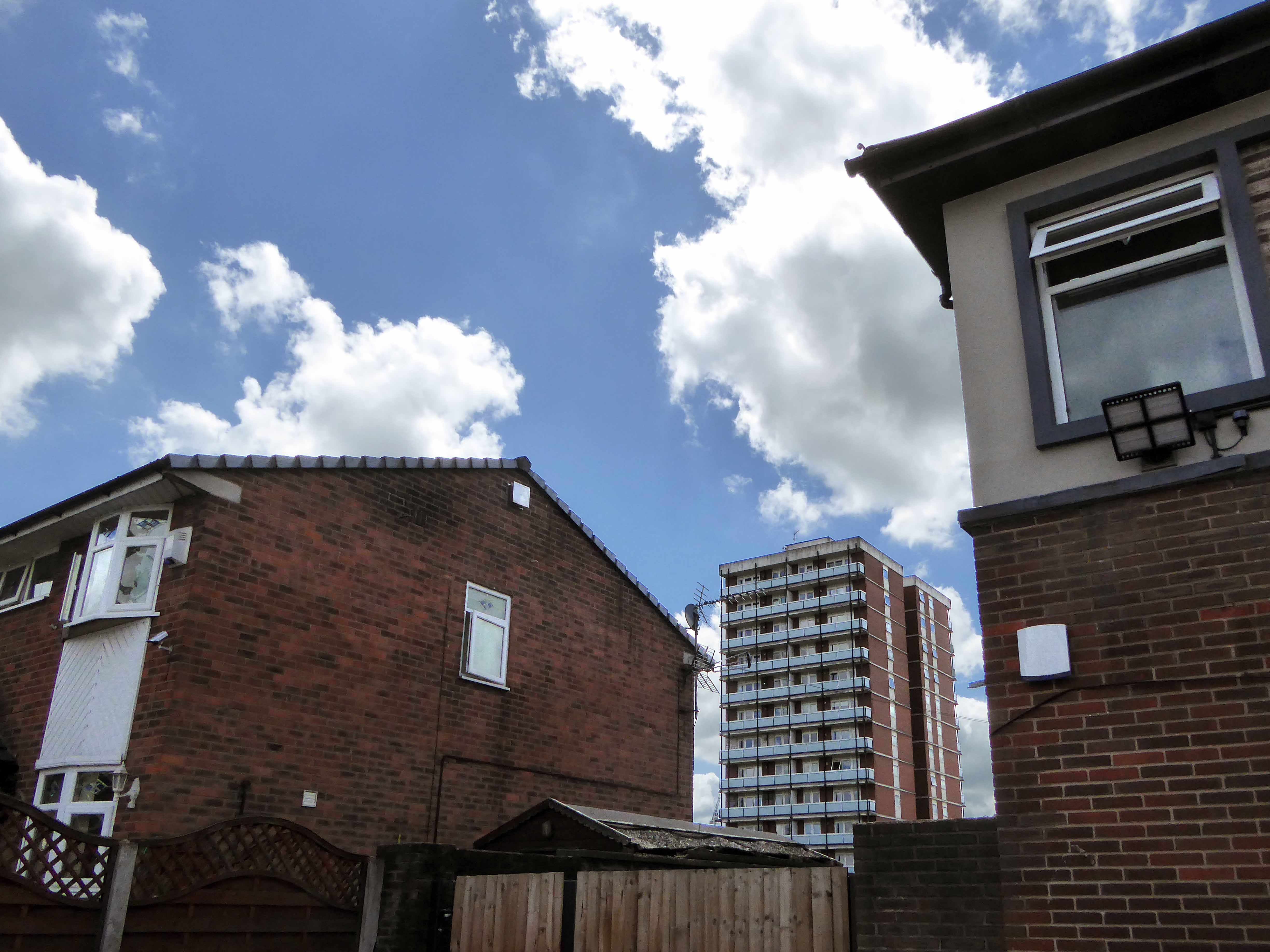
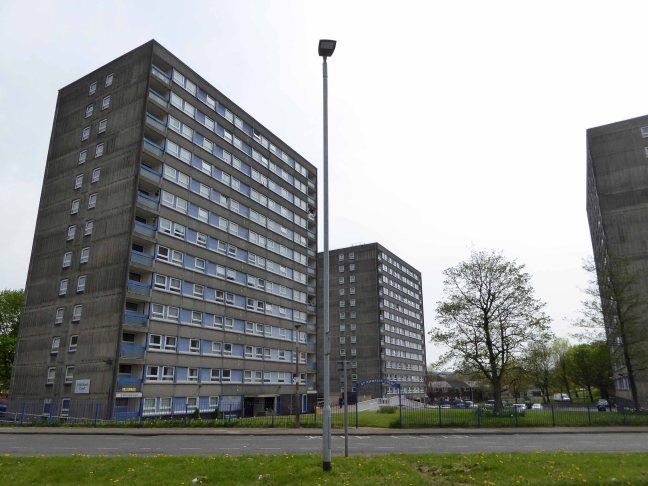
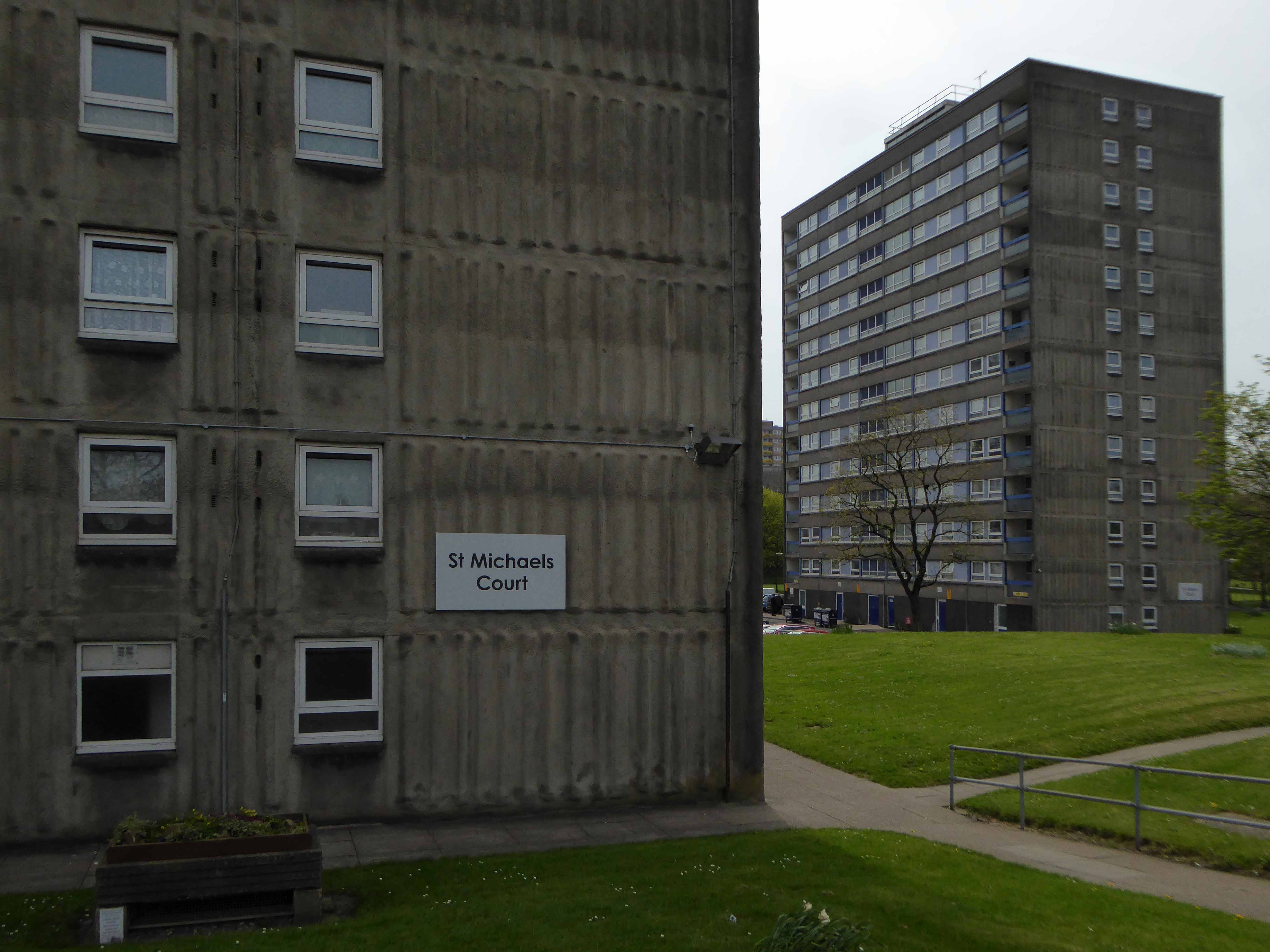
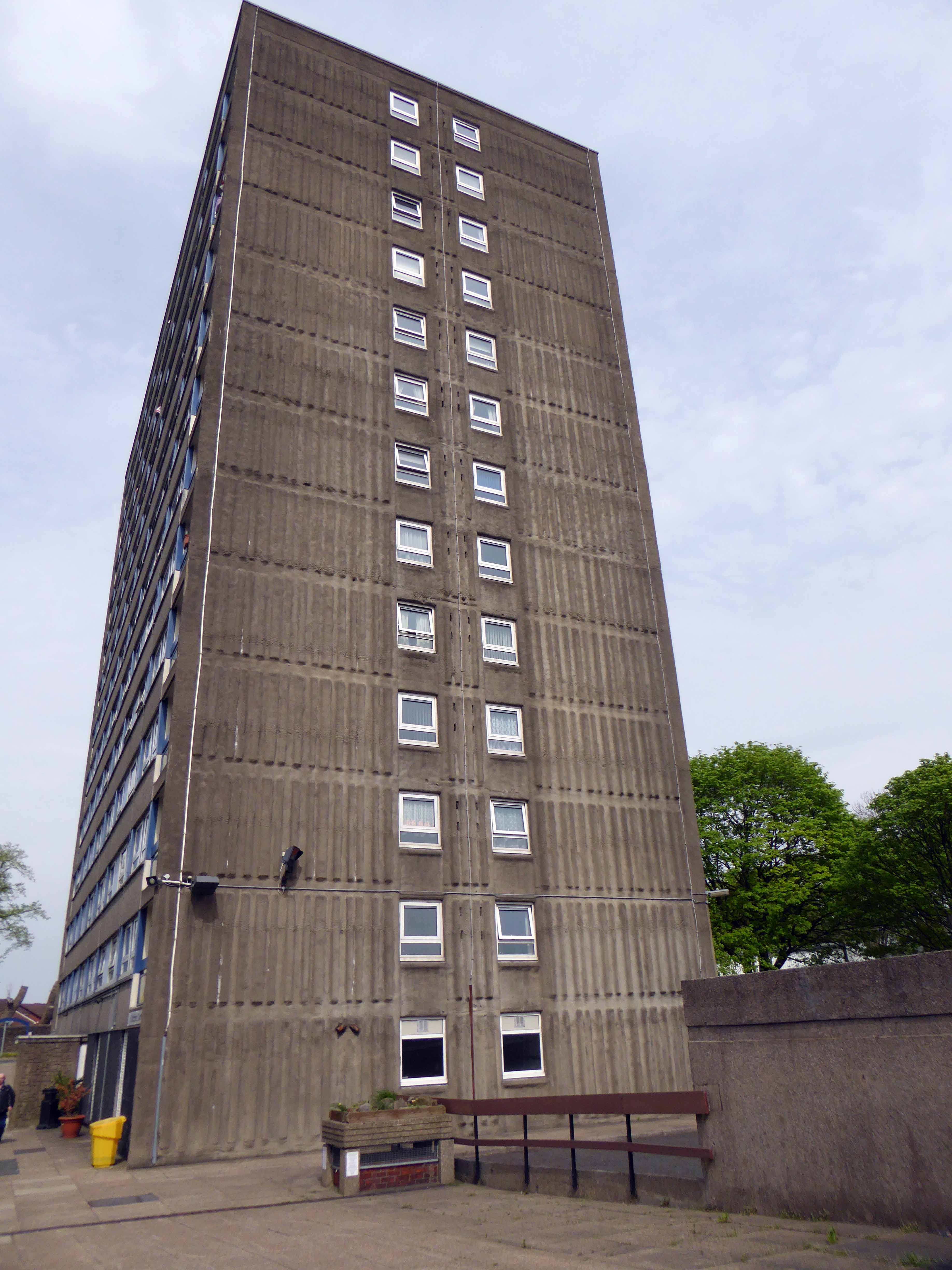
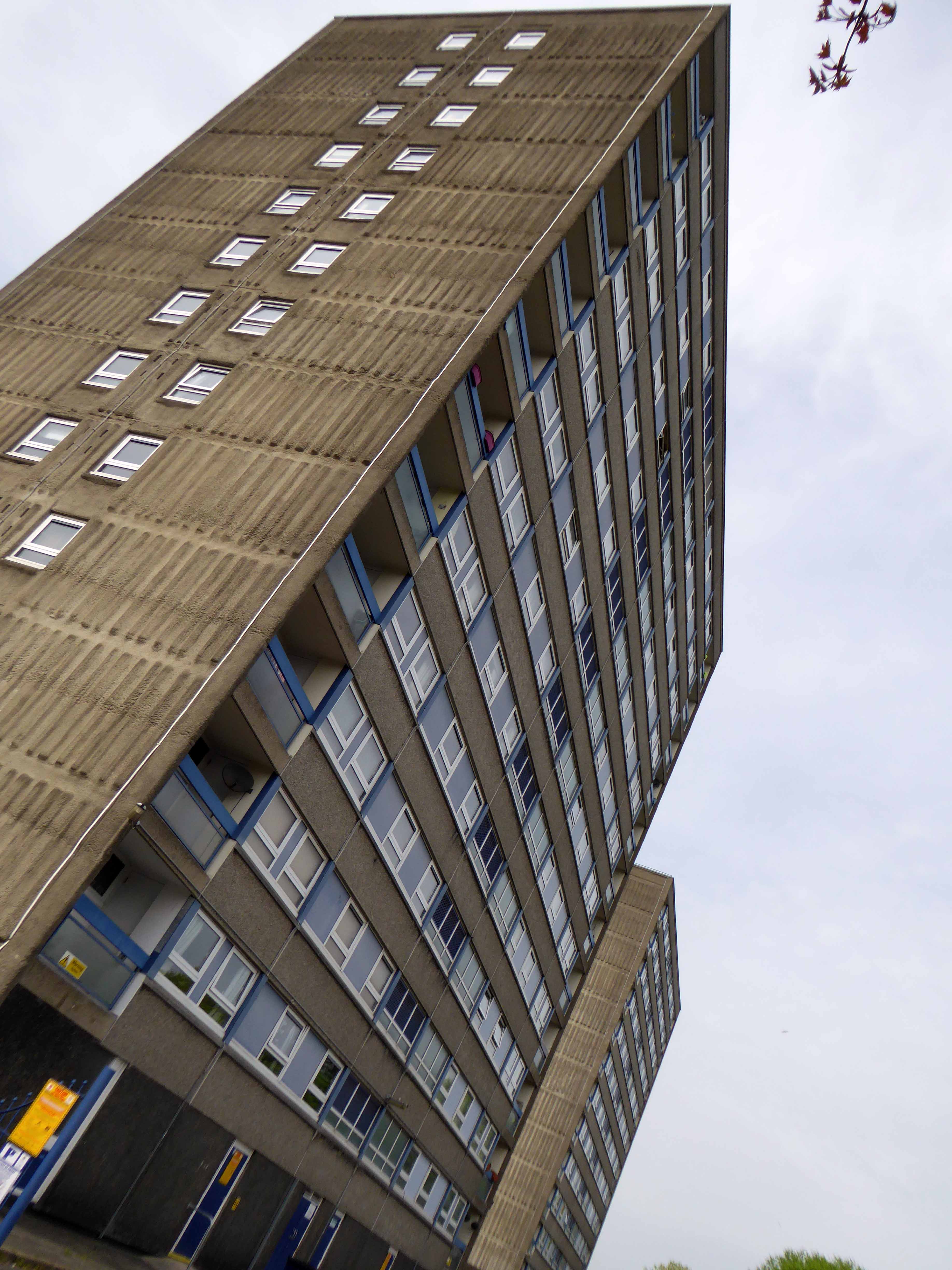
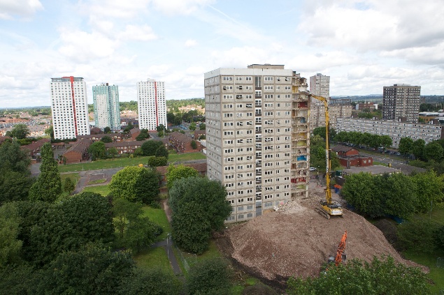
Why is there just one remaining tower block dancing unclad around Ancoats?

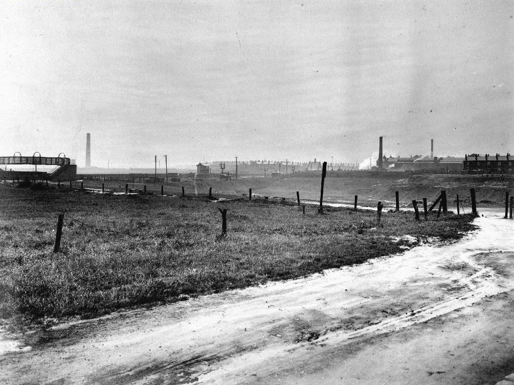
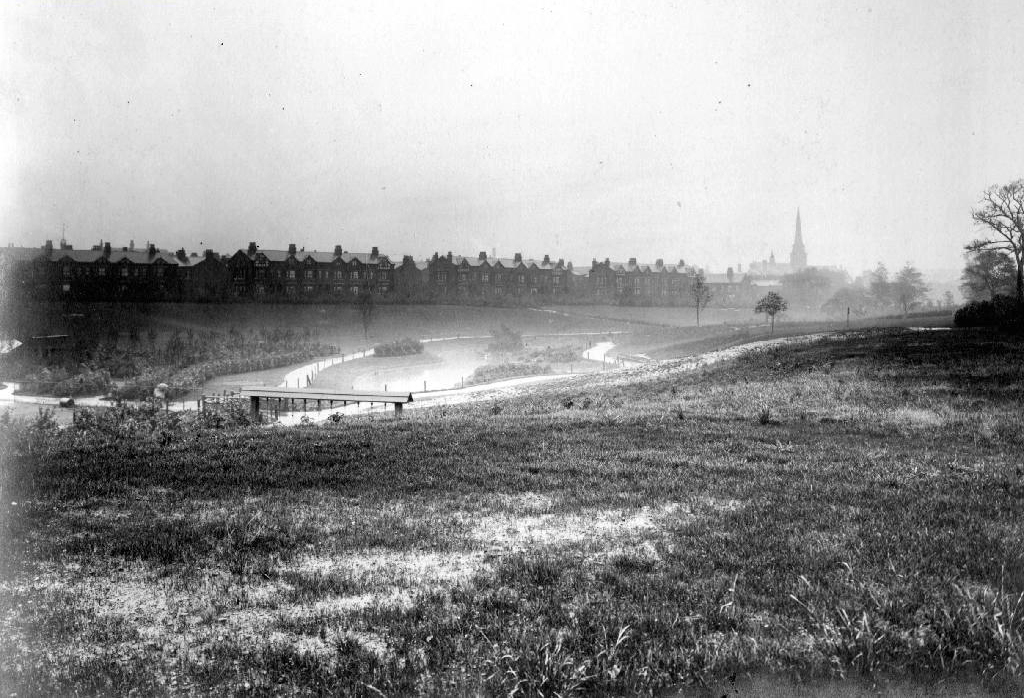
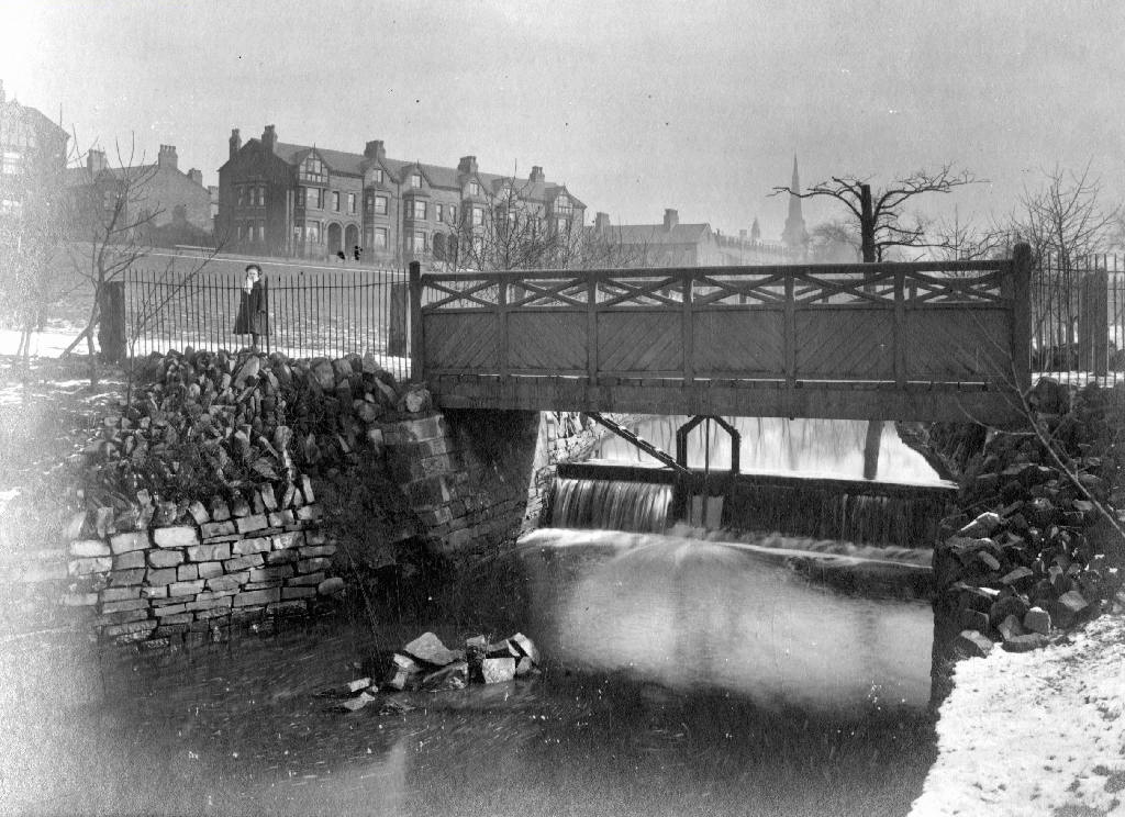
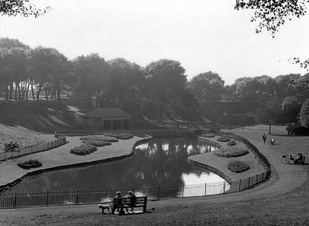
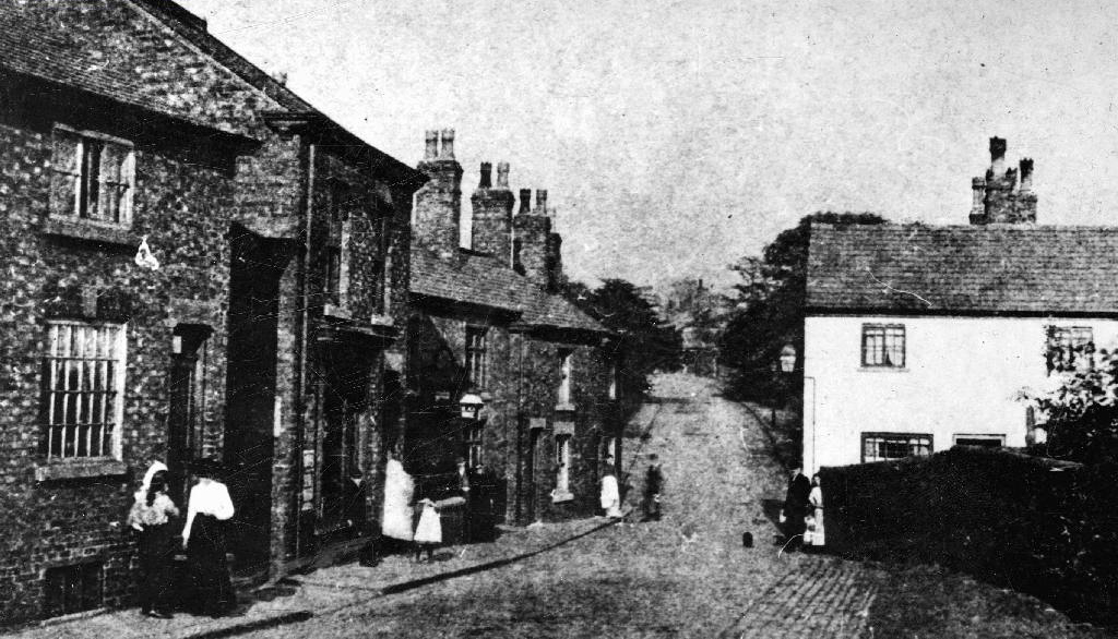
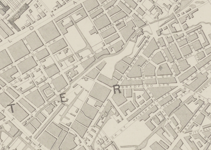
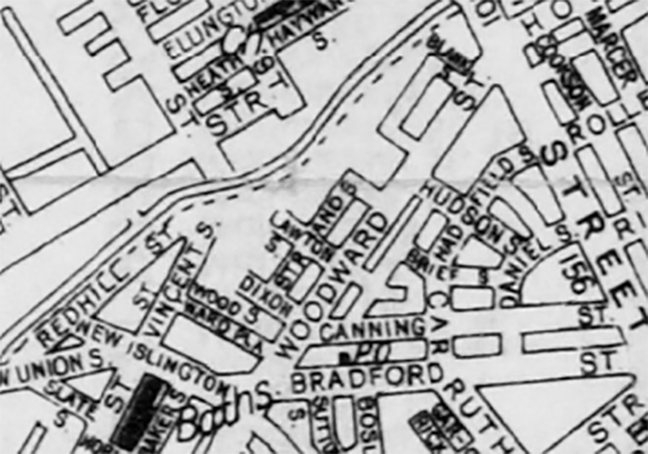
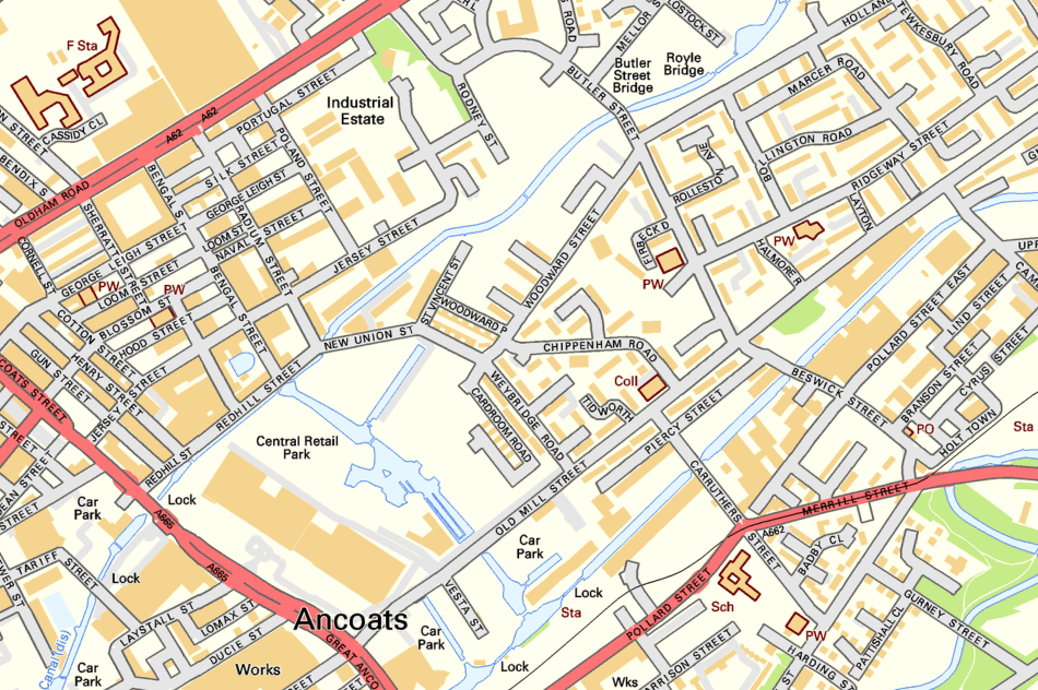
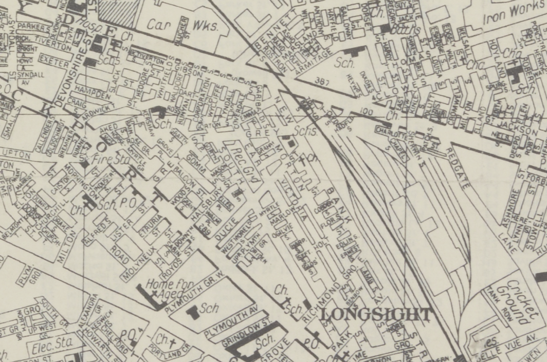
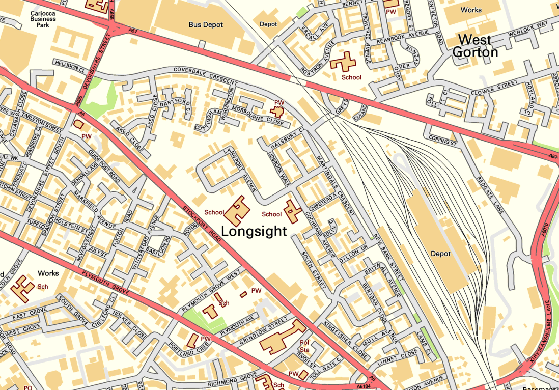
Let’s go back in time and see if we can find out – it seems that back in 1807 there wasn’t a Woodward Street to be found, the ever expanding industrial might of Manchester had not yet reached these particular green fields of Ancoats.

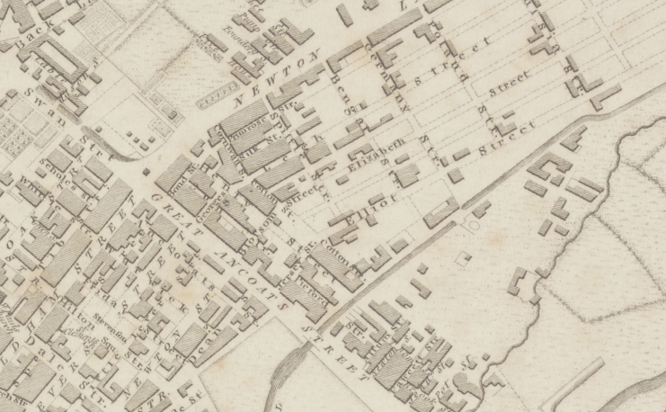
By 1824 it shows a fresh face to the world christened Woodworth Street, sparsely dotted with new development.

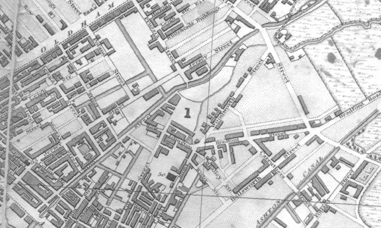
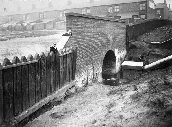
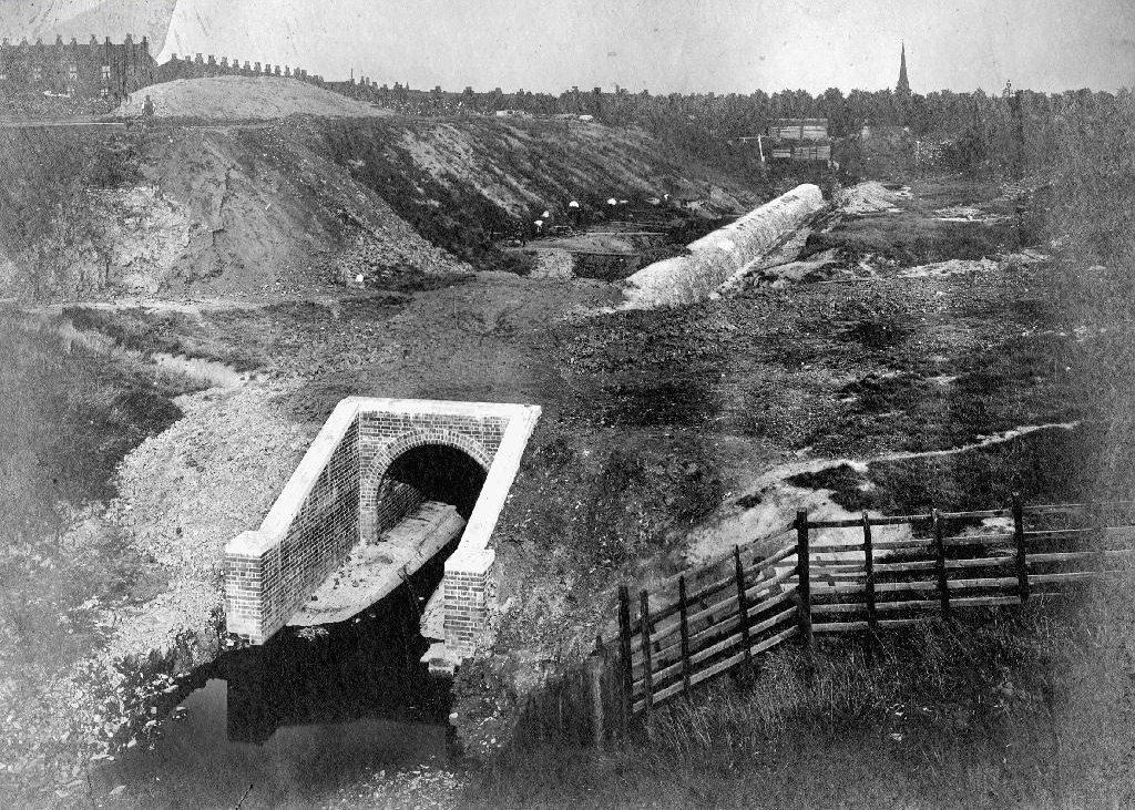
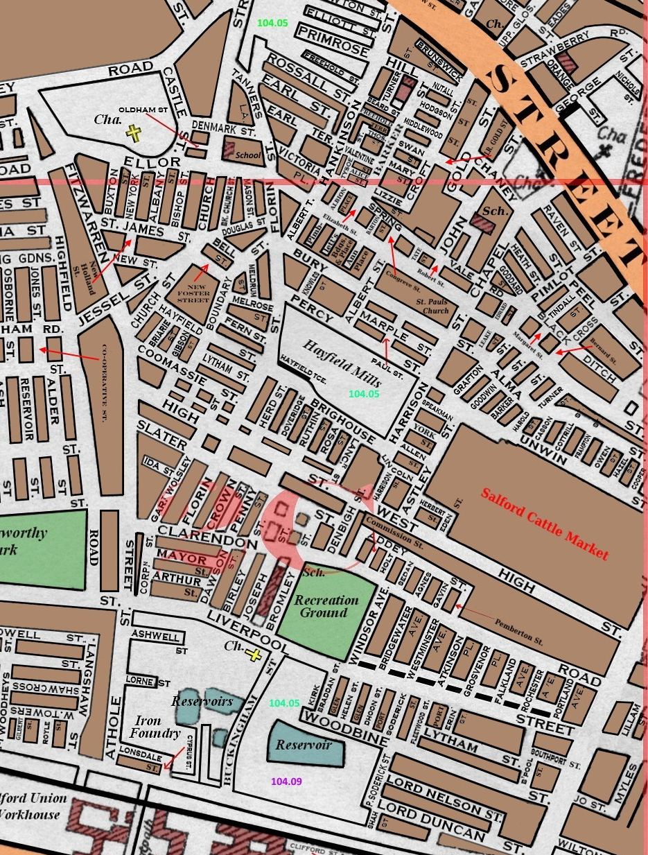
Almost fully formed in 1836 and renamed as Woodward Street, the area begins to accumulate the familiar domestic and industrial clutter of a burgeoning Victorian City.

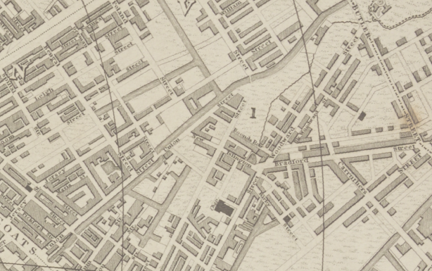
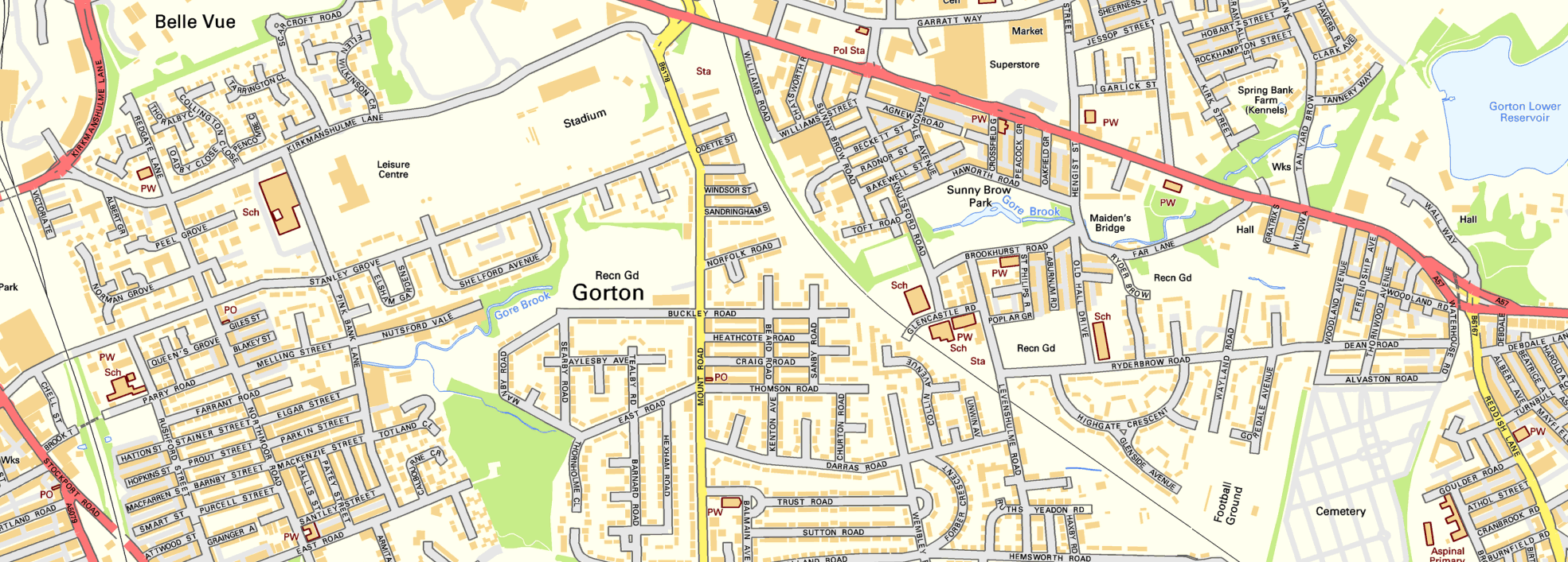
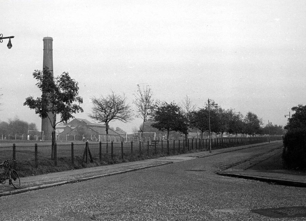
By 1860 the street is fully formed and open for business.

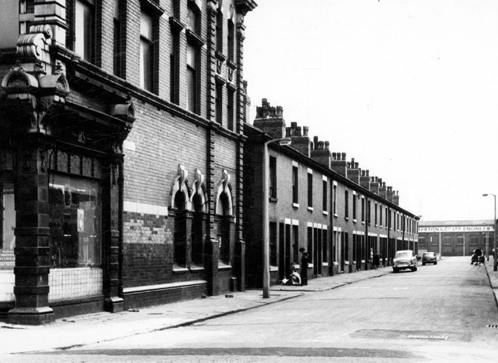
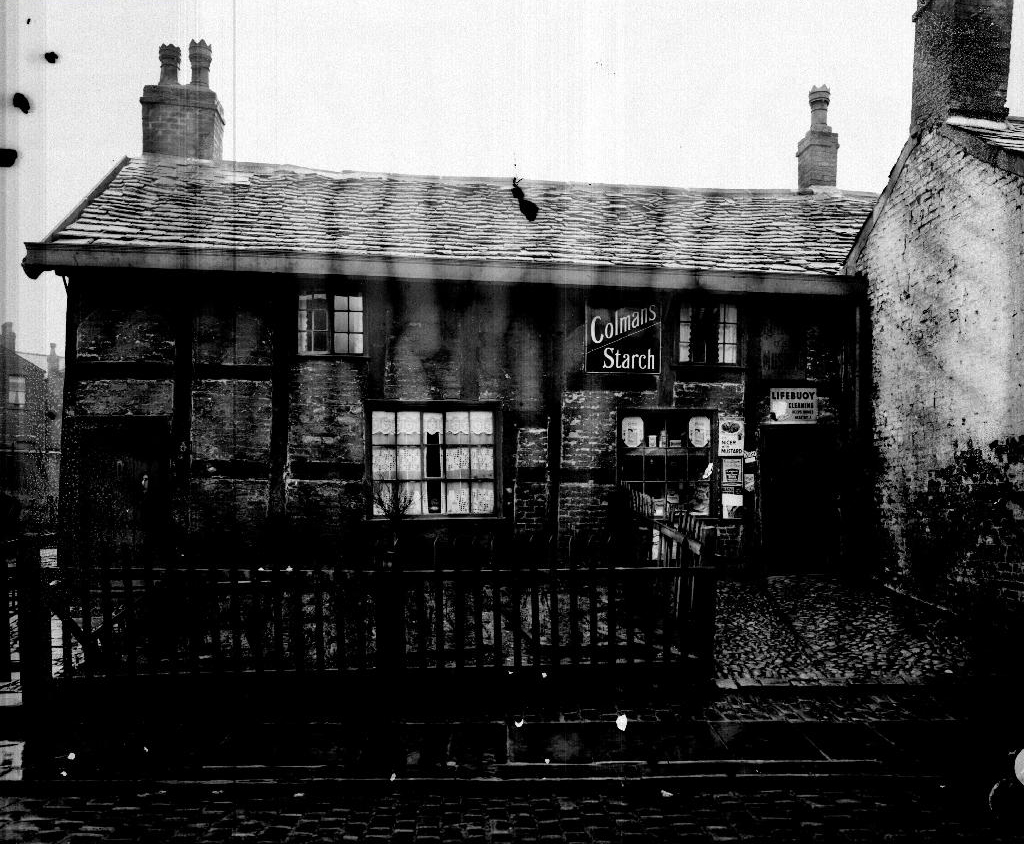
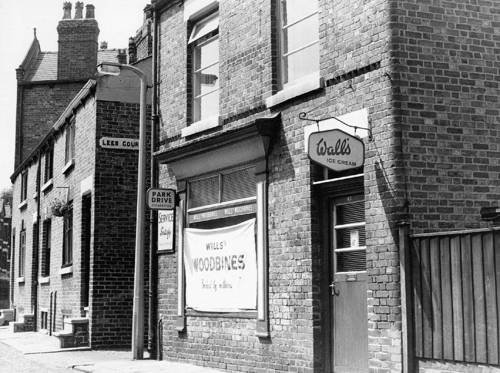
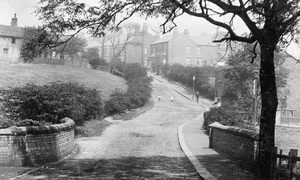
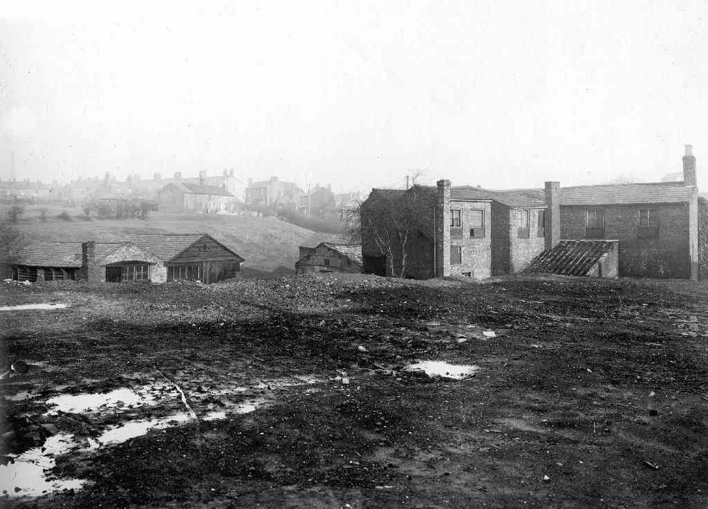
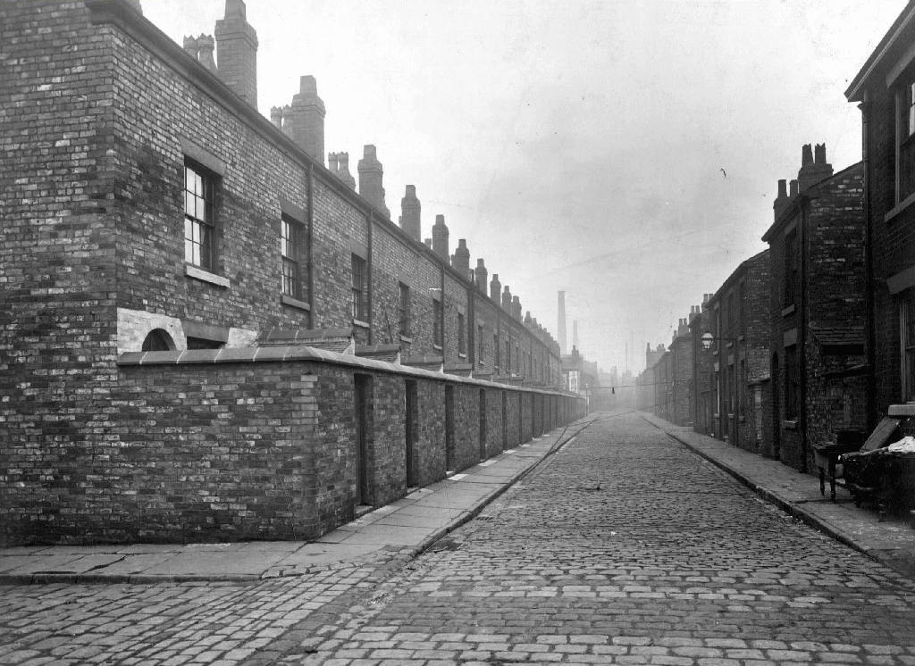
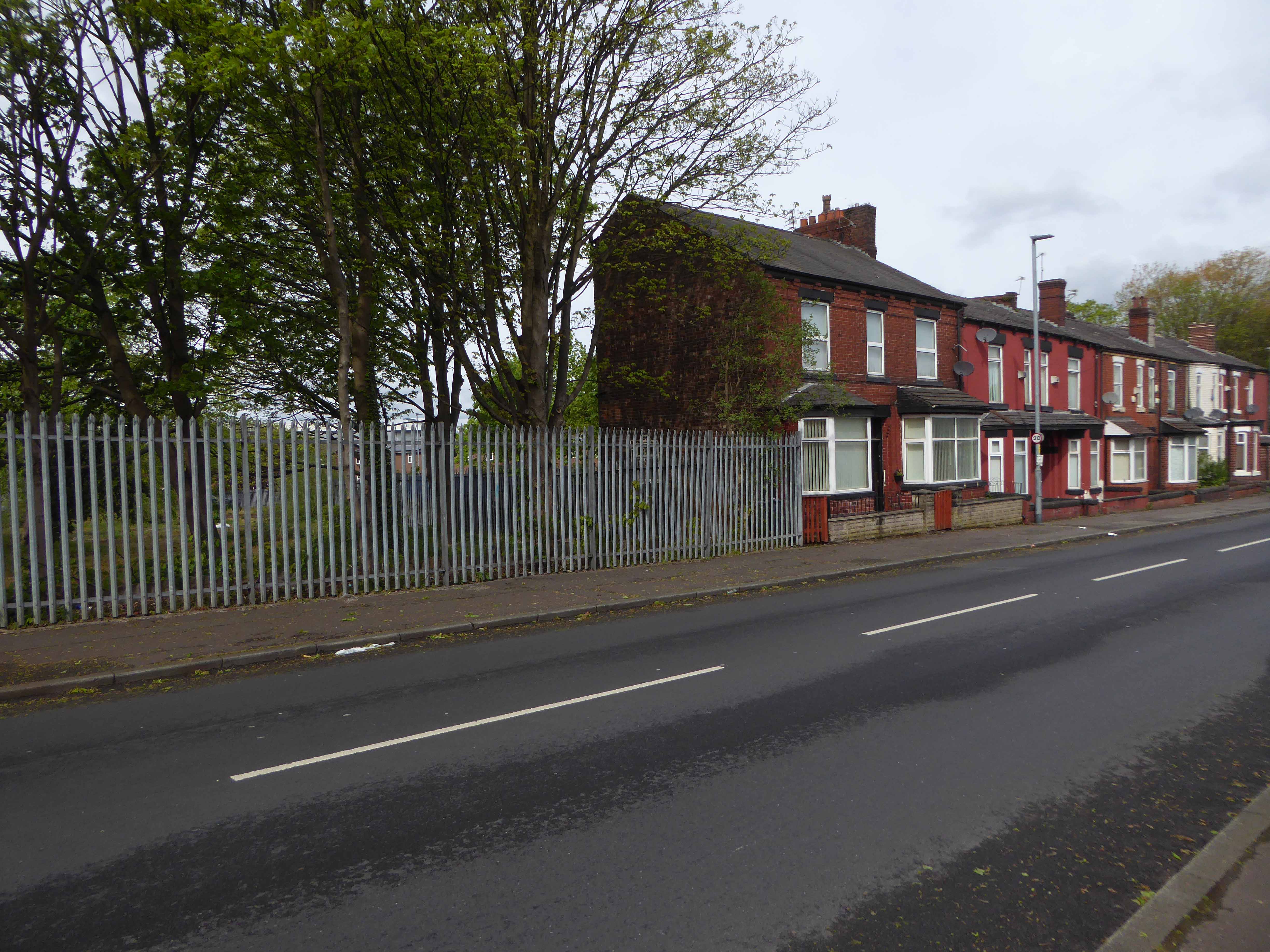
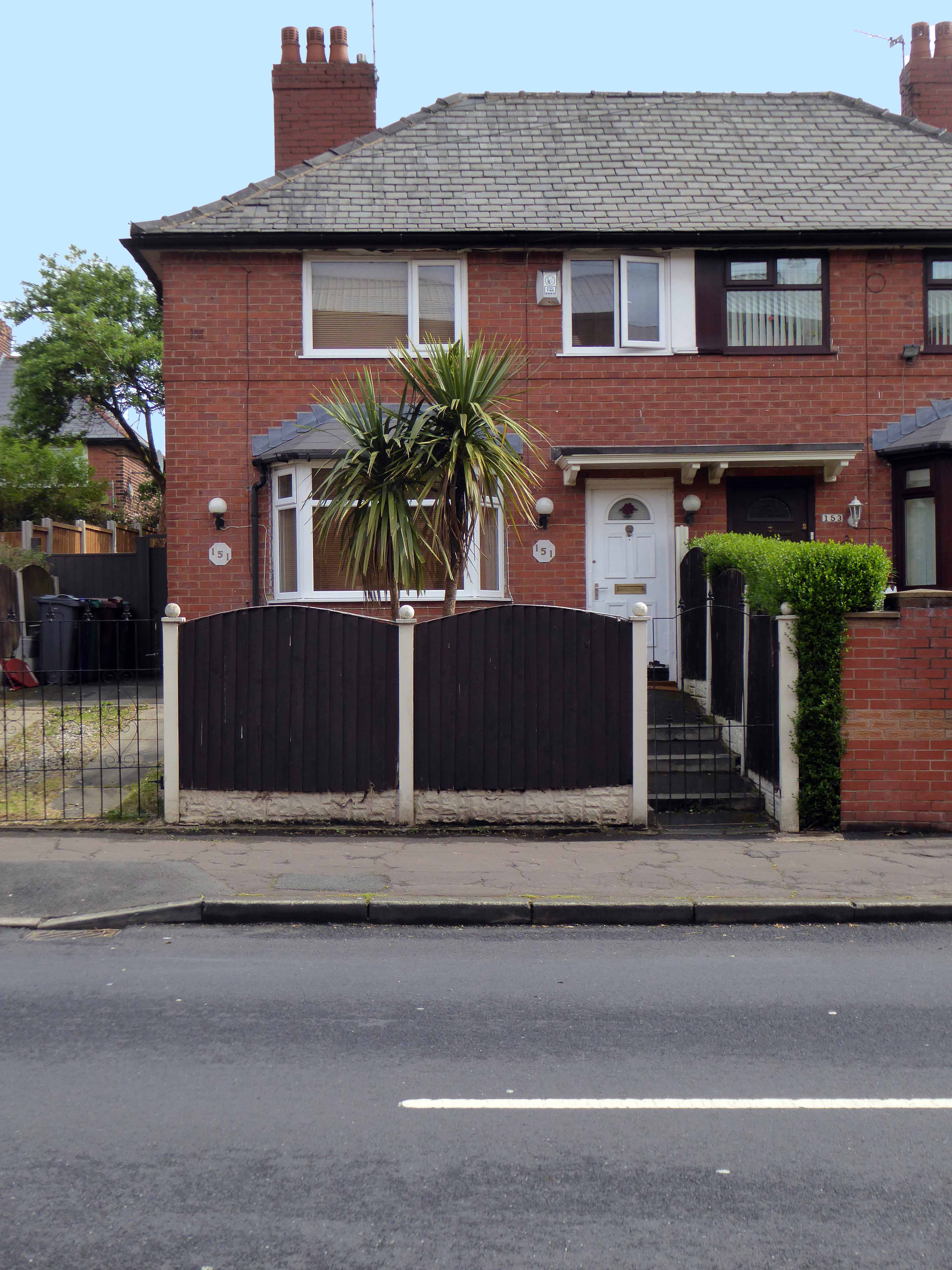
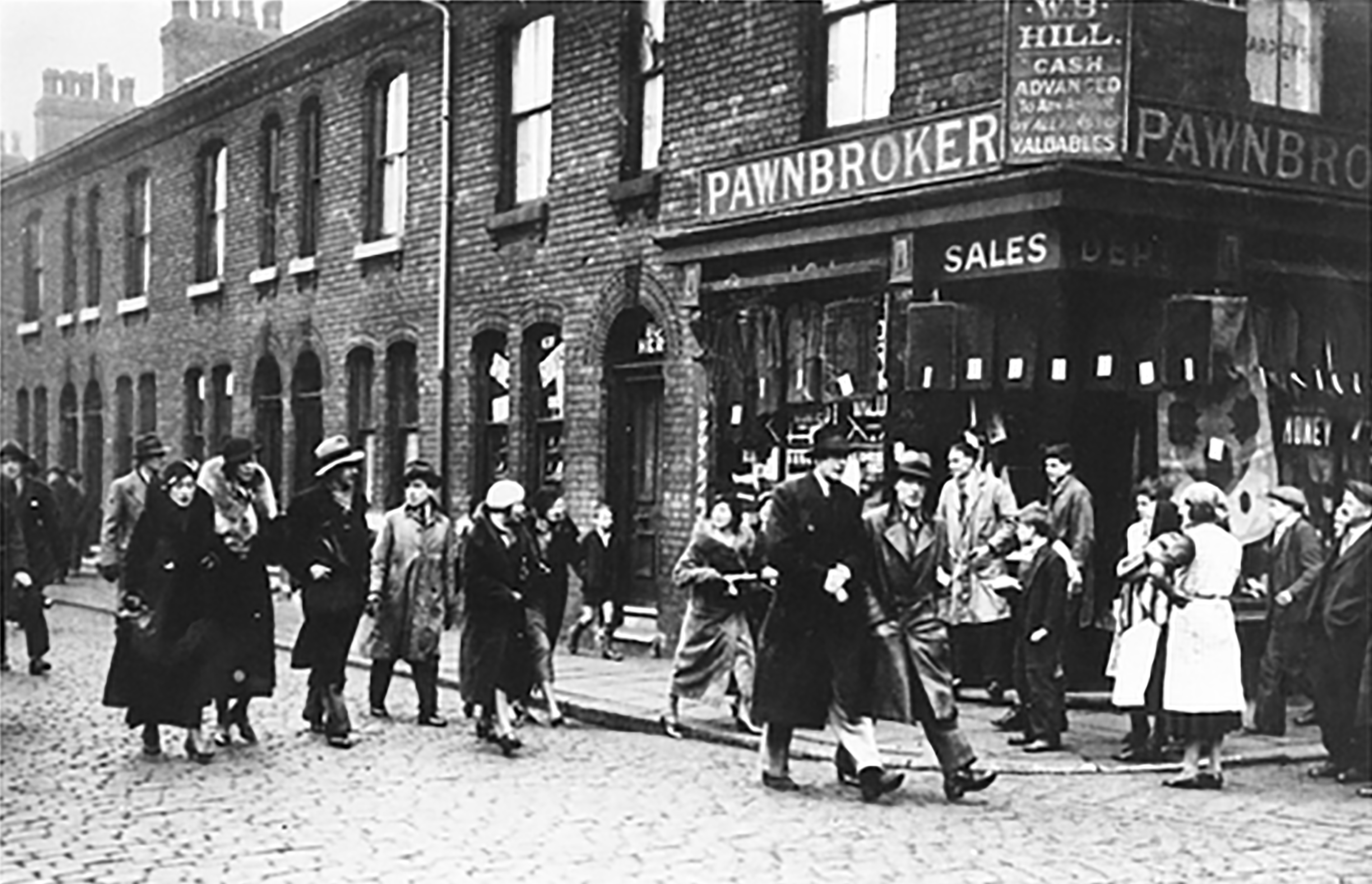
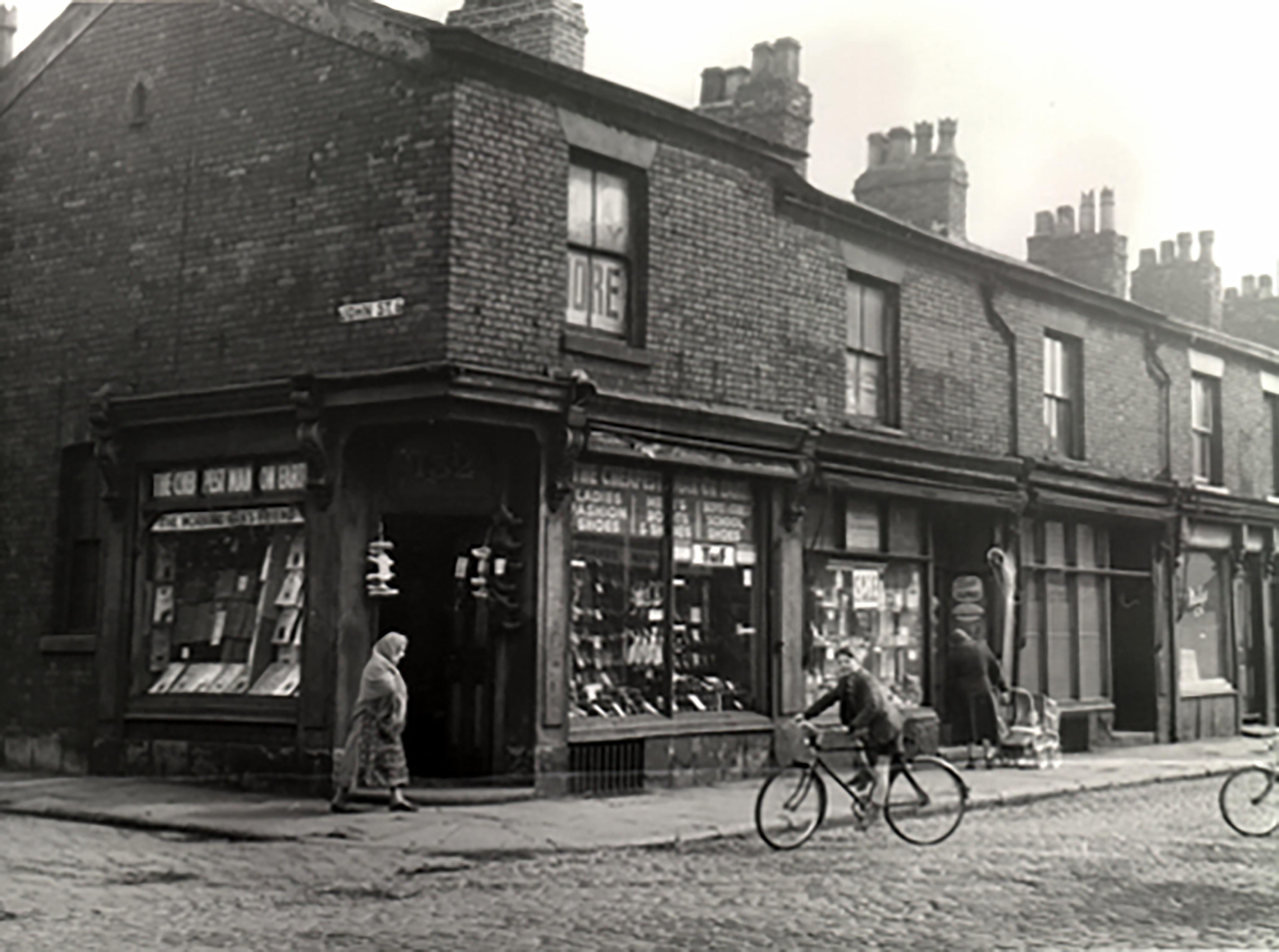
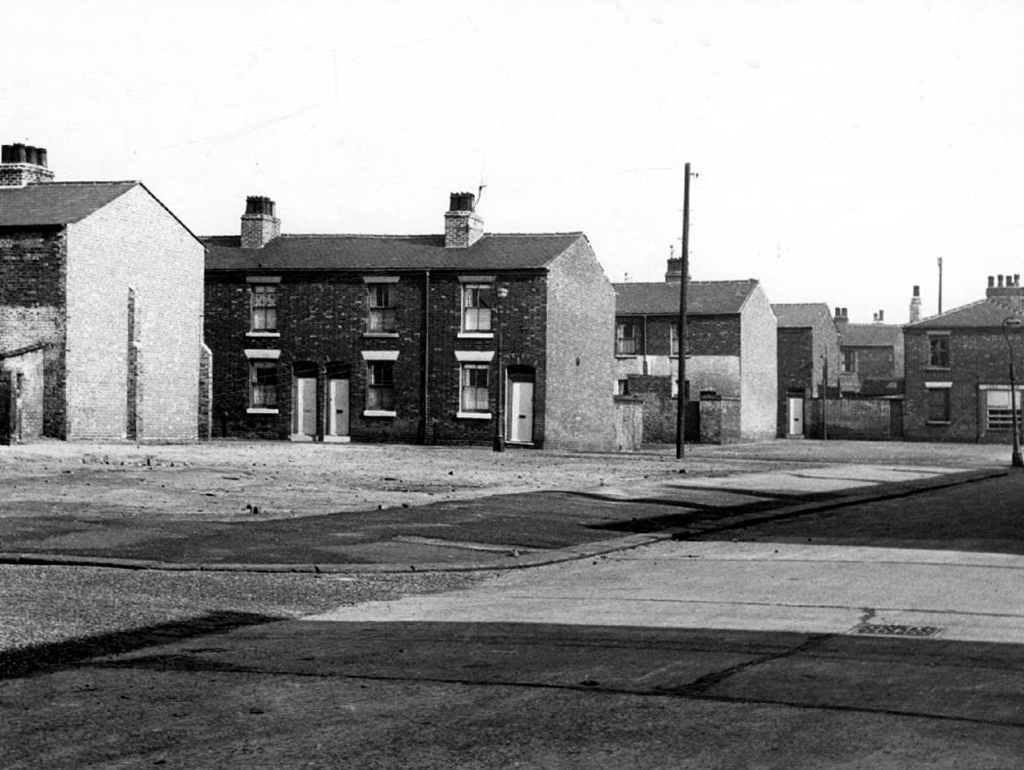
Workers finding homes in austere and functional brick back to backs, typical of the period’s housing.

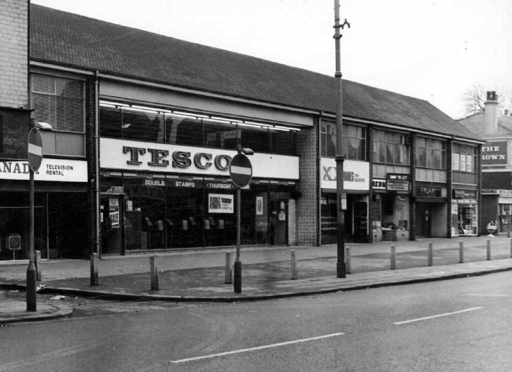
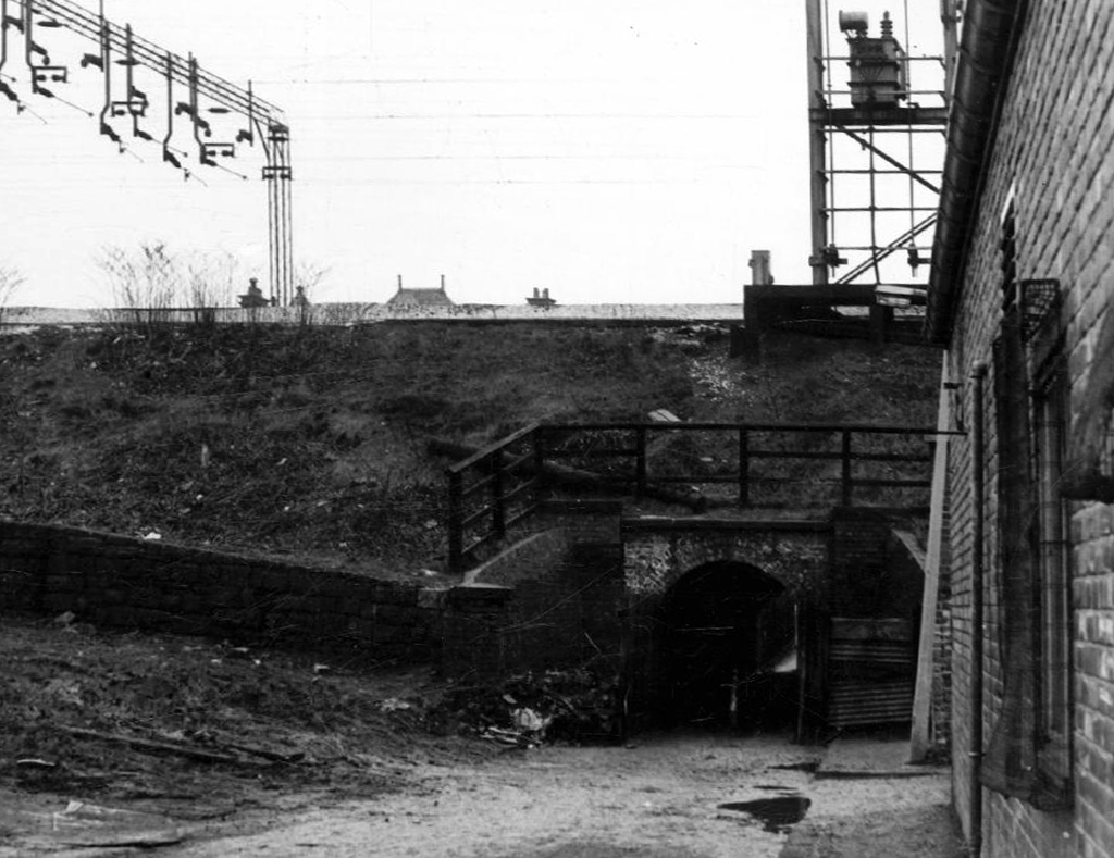
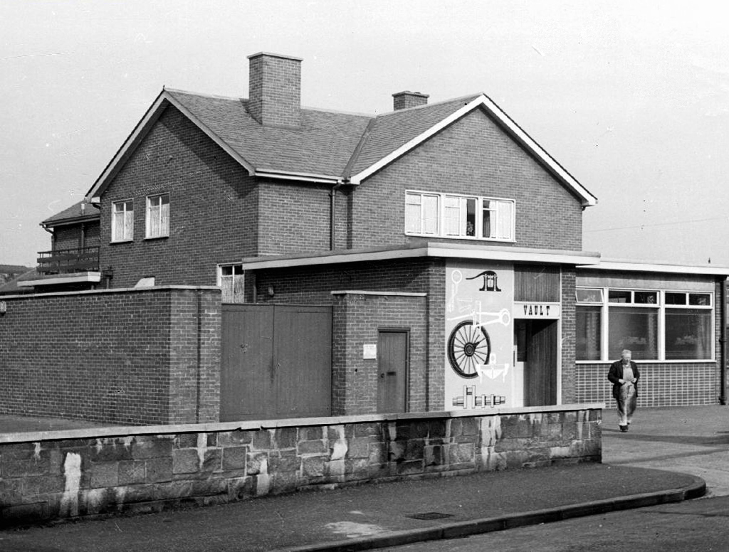
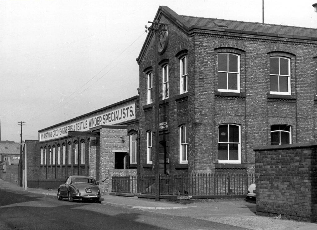
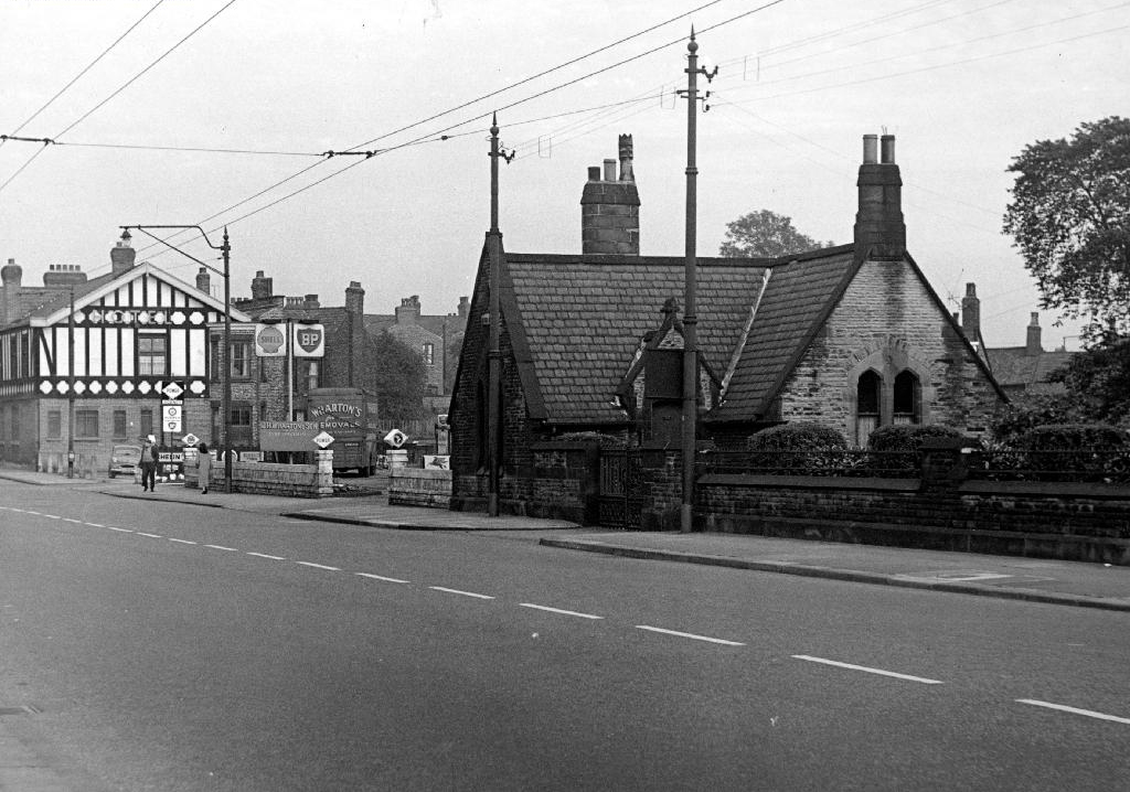
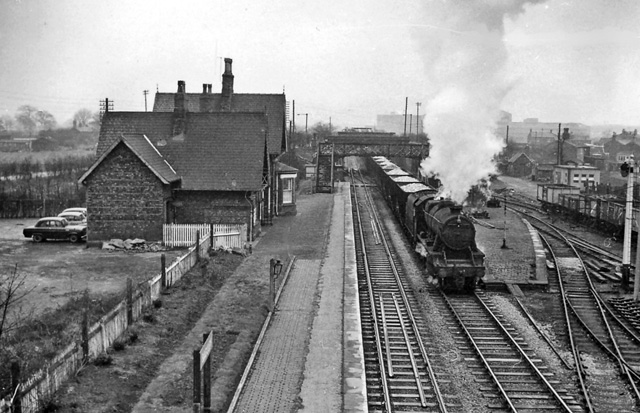
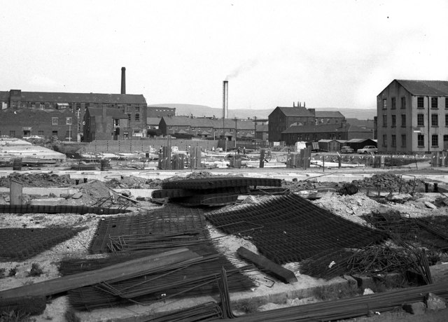
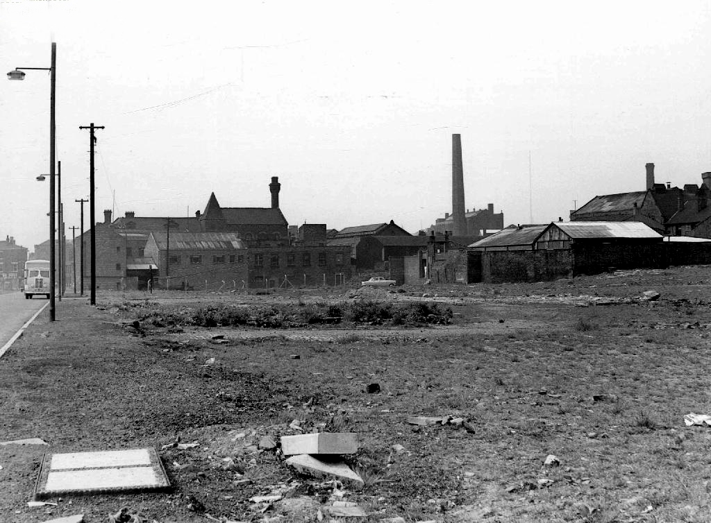
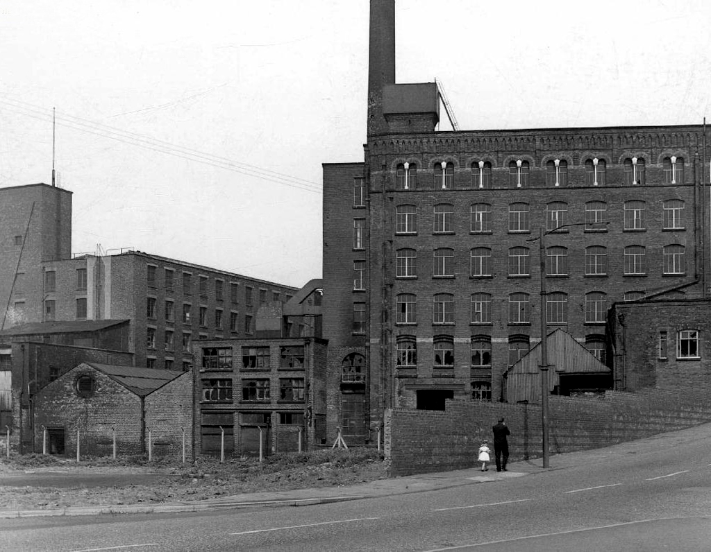
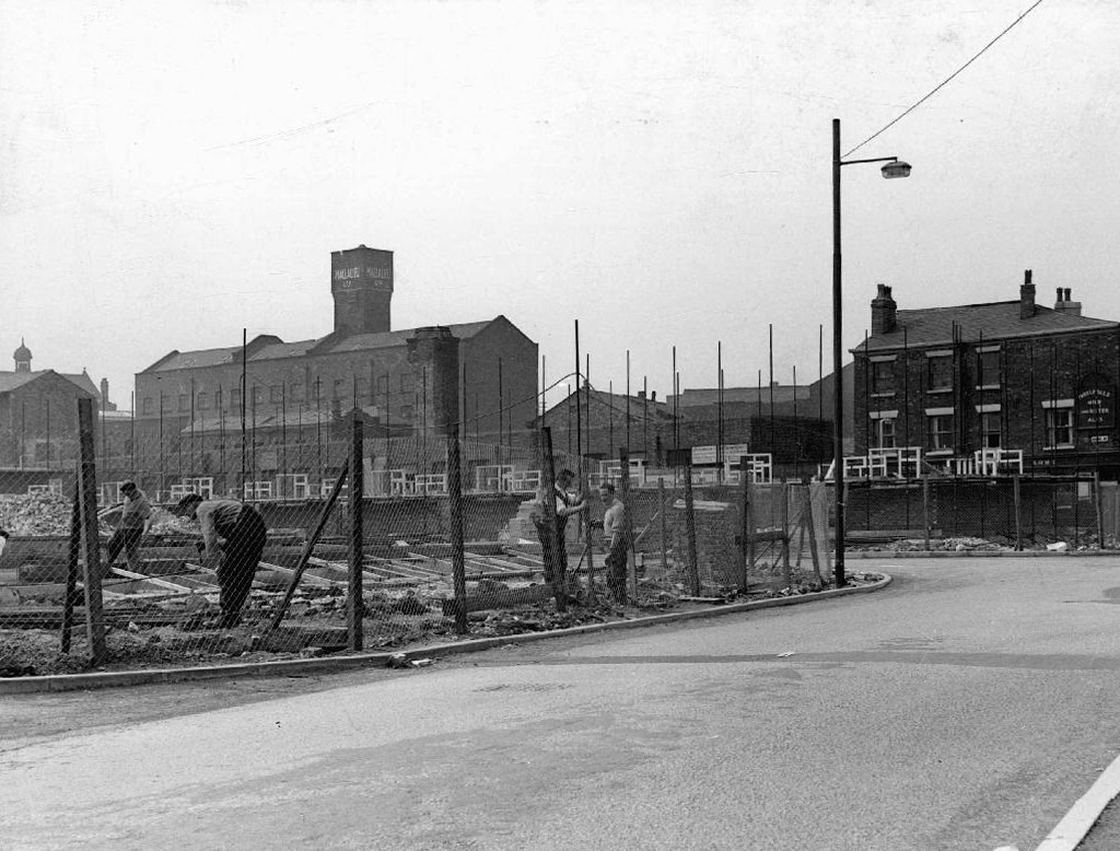
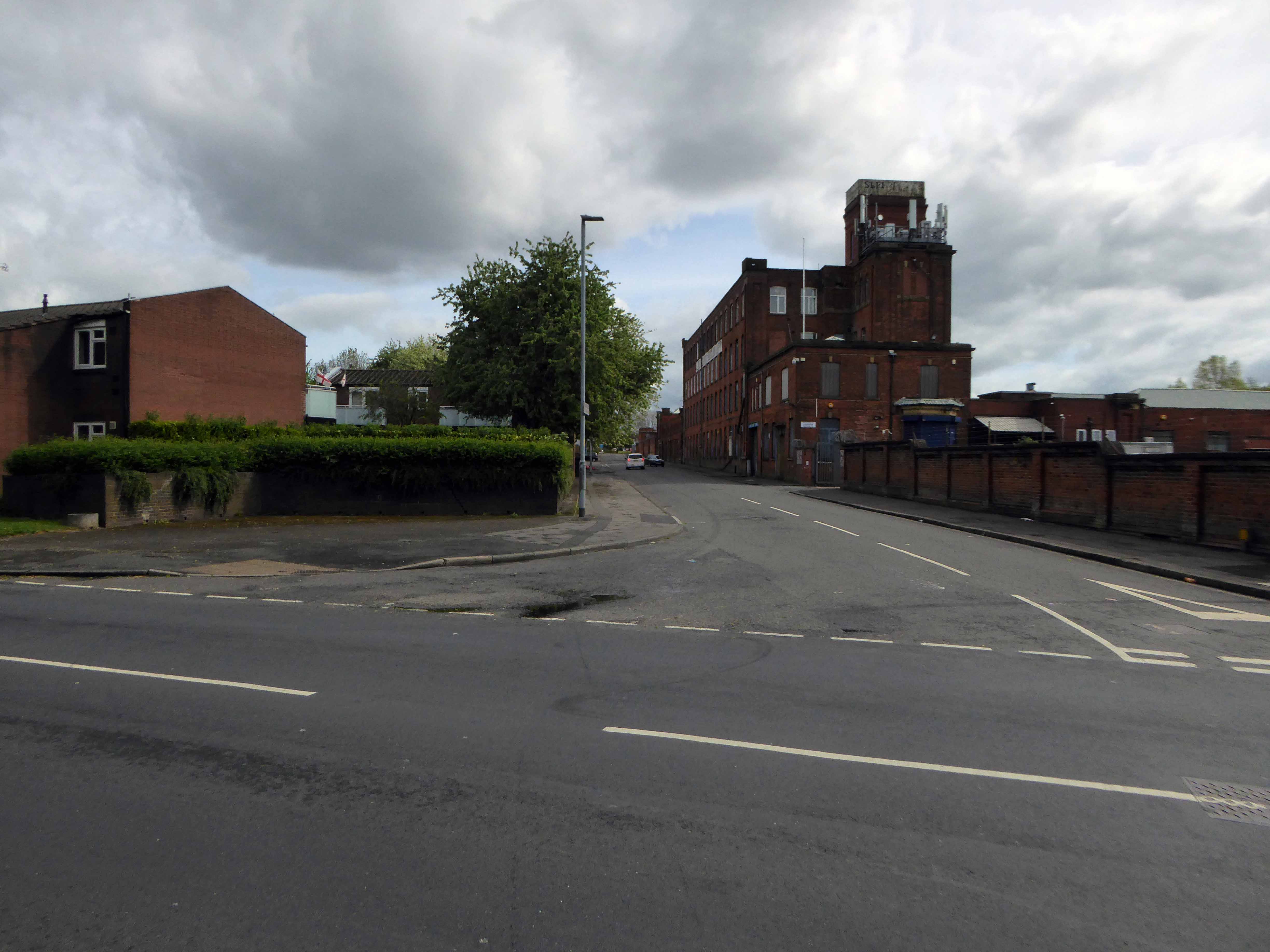
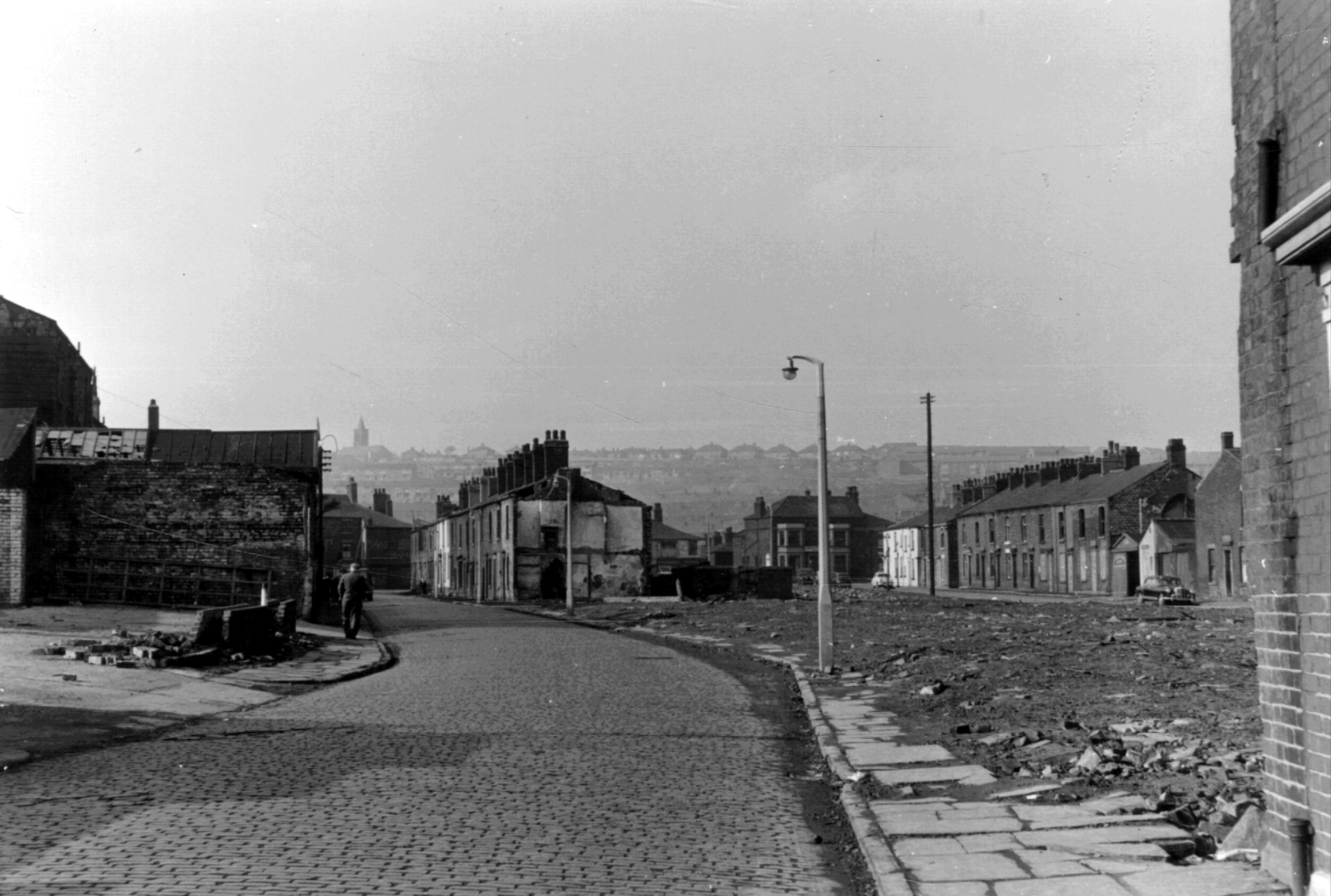
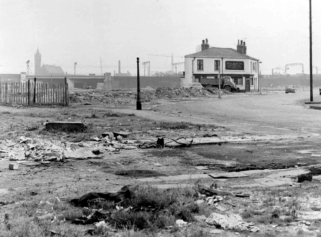
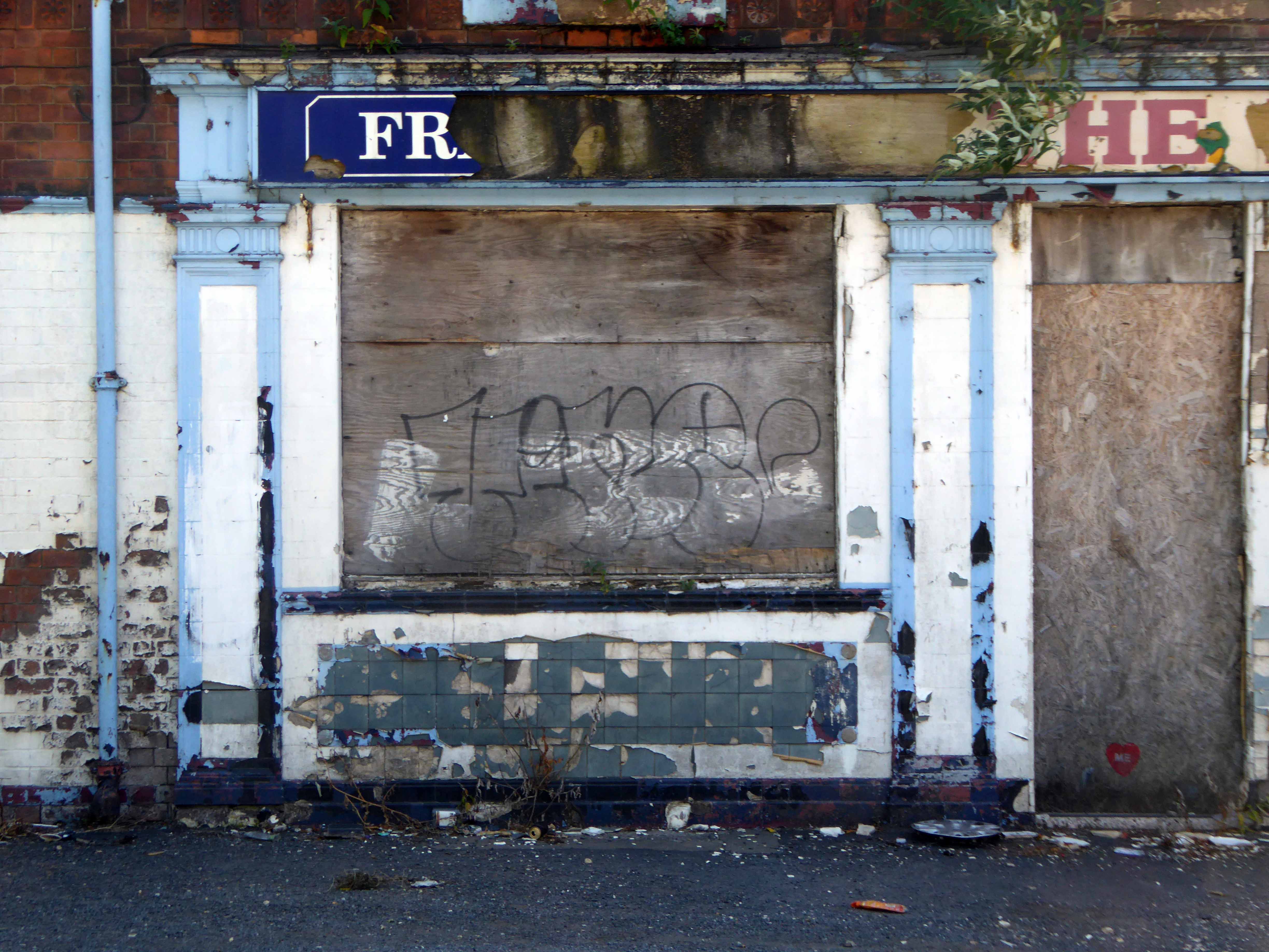
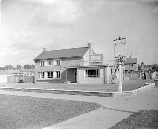
Fast forward to the early Sixties and the street is showing signs of age – the century old industries are already in decline, steady jobs, mills and factories gone west and east, well-worn housing looking terminally tired and in need of a little care and attention.

But wait what’s this coming around the bend?

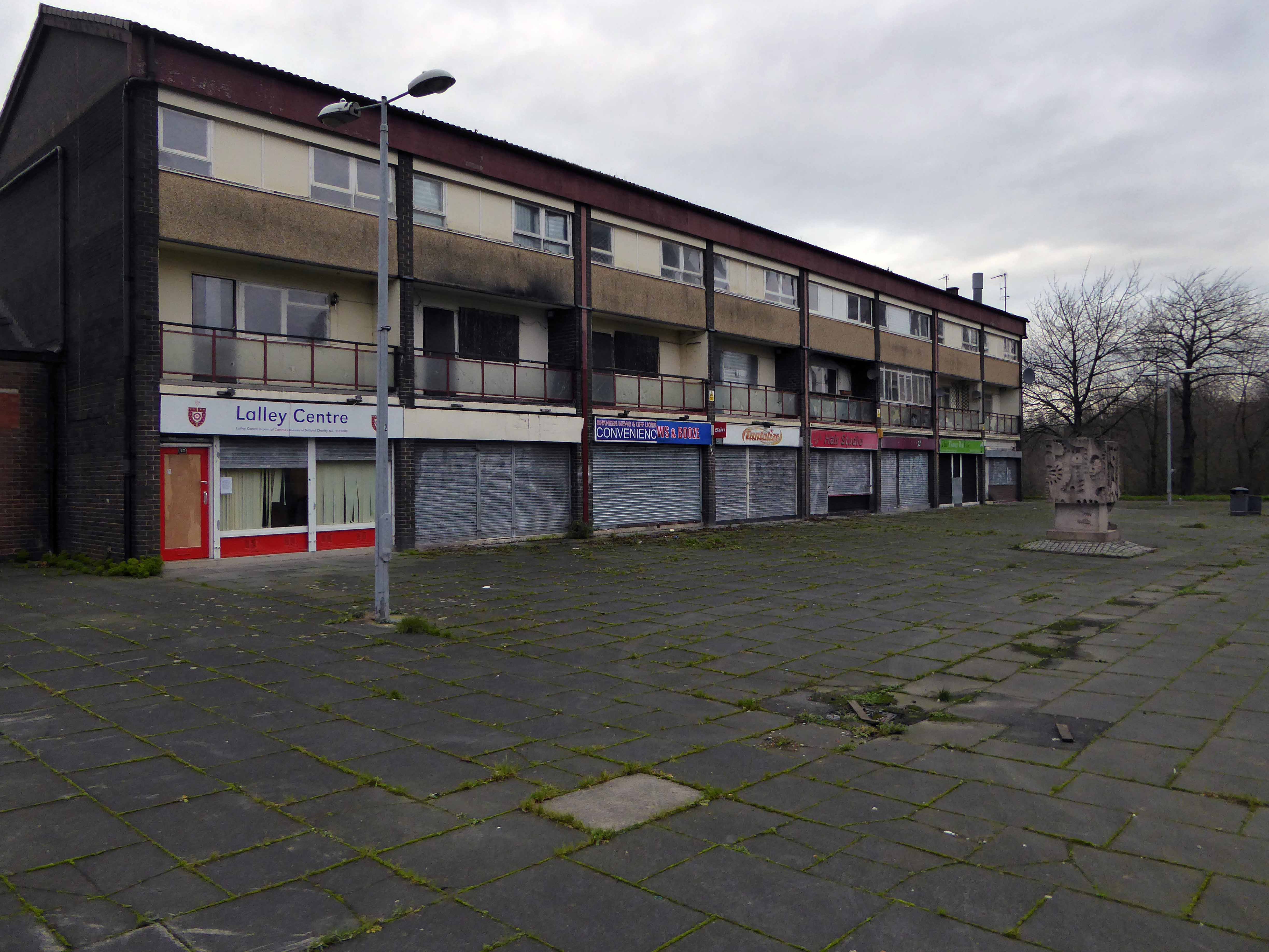
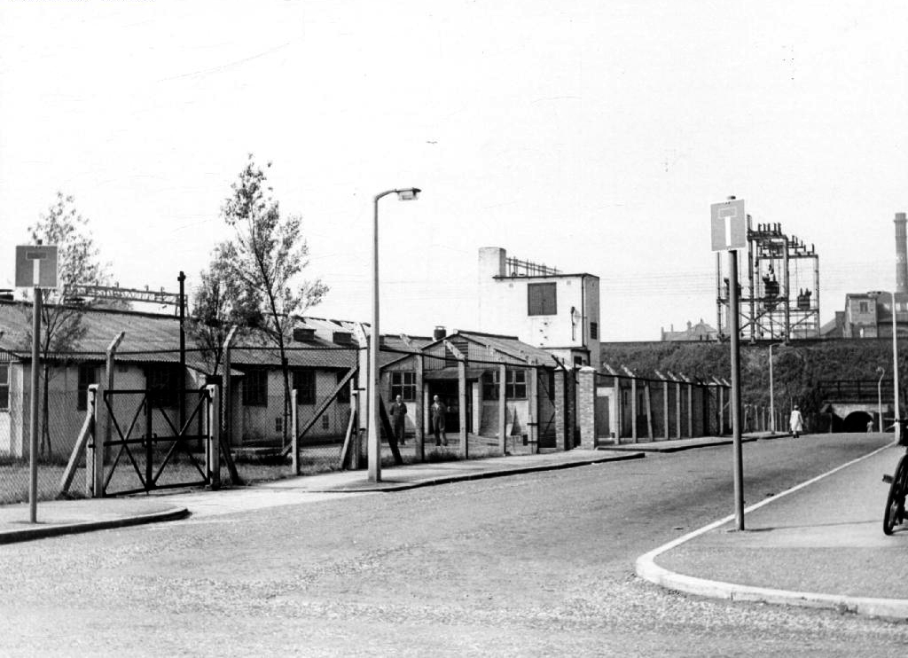
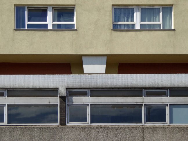
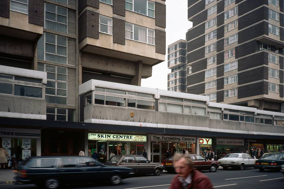
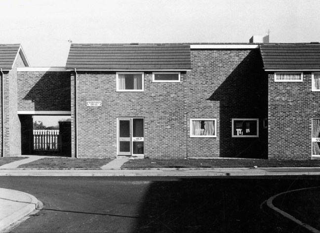
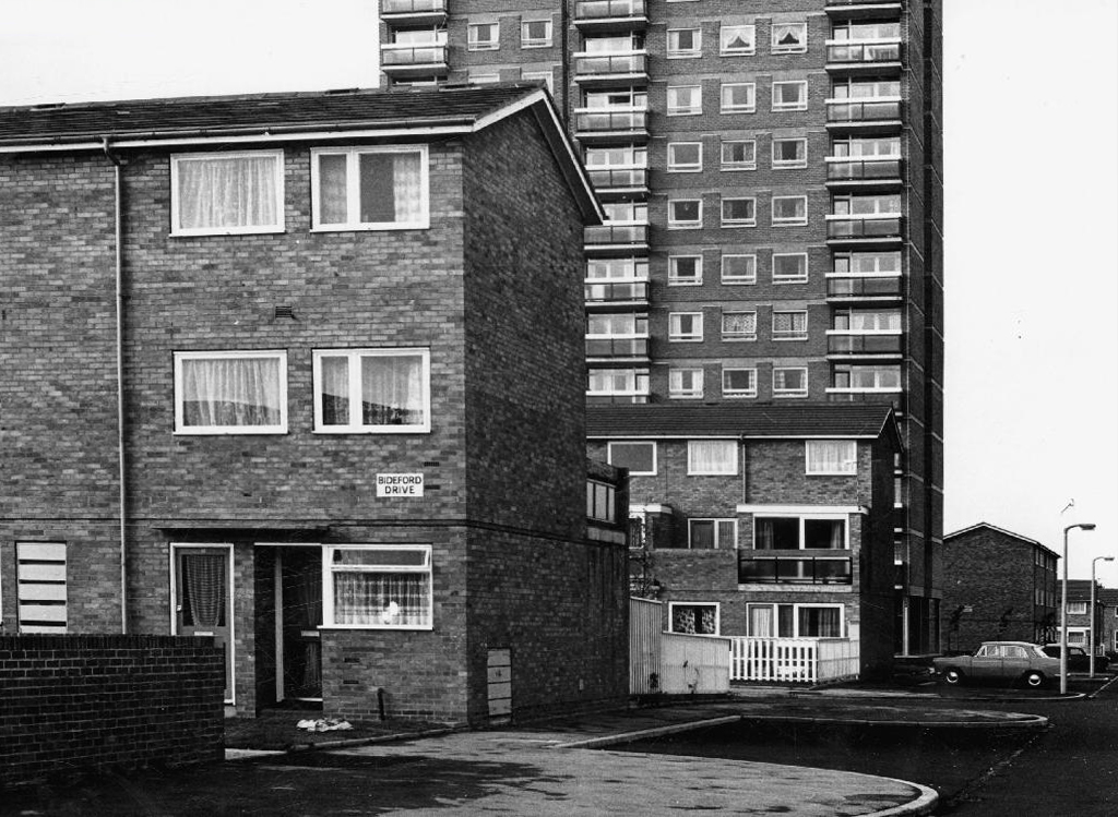
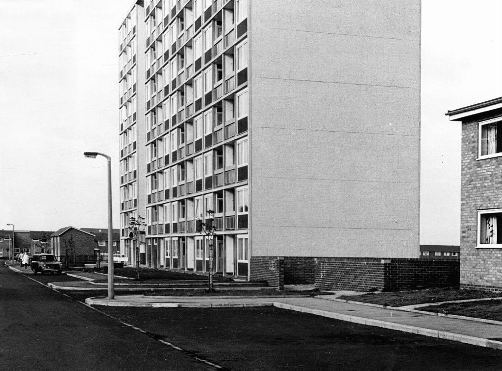
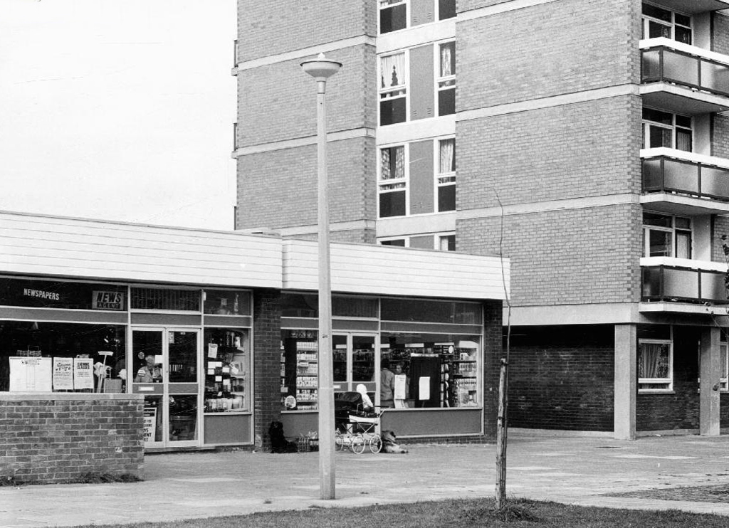
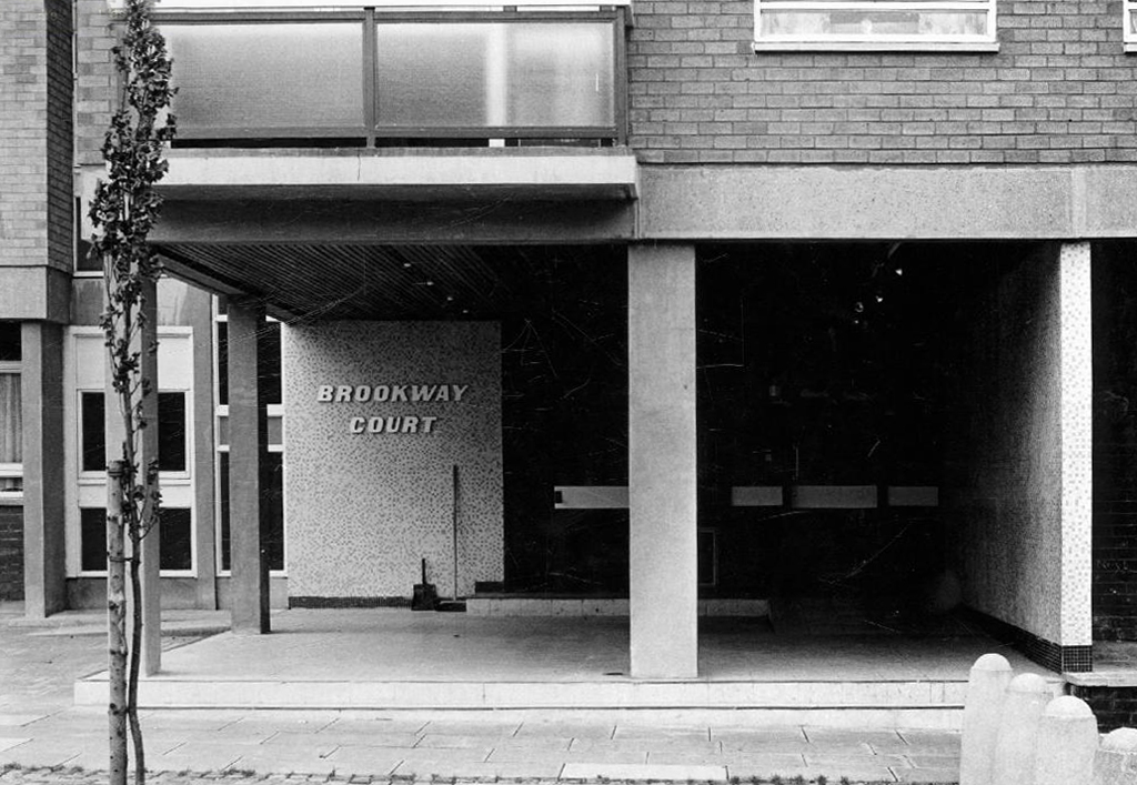
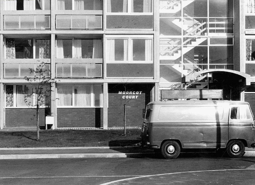
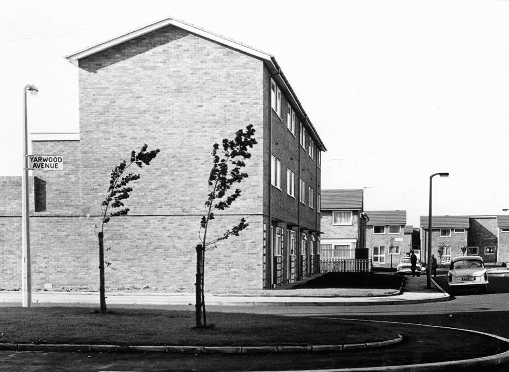
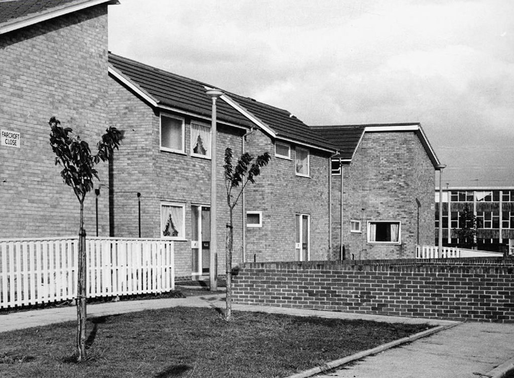
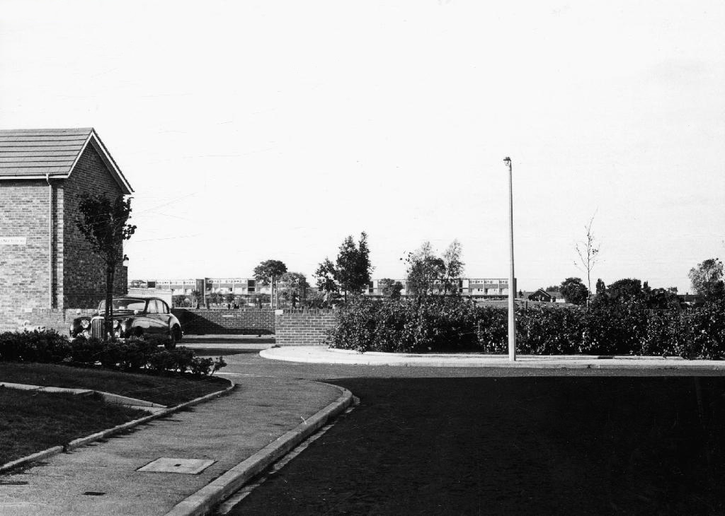
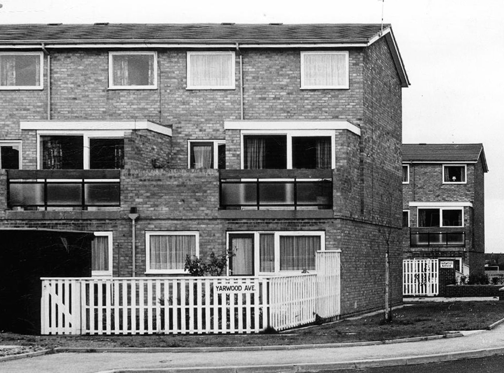
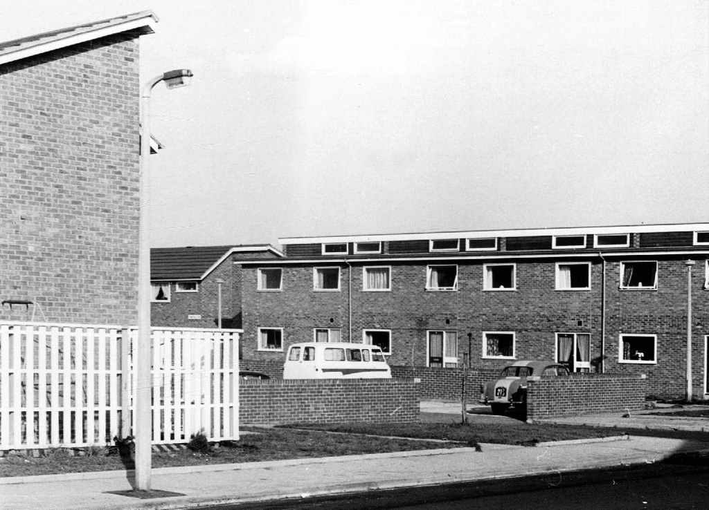
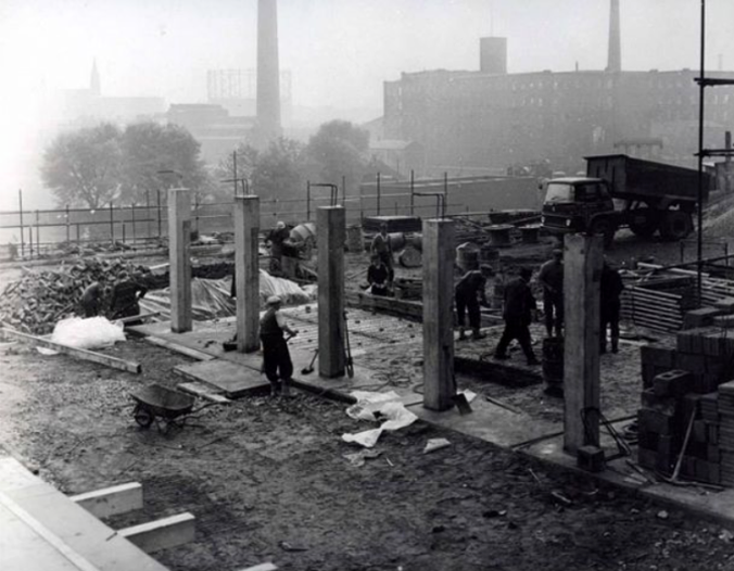
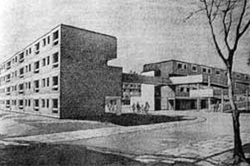
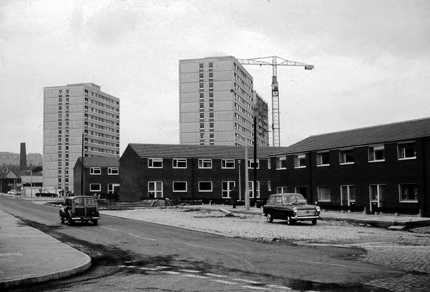
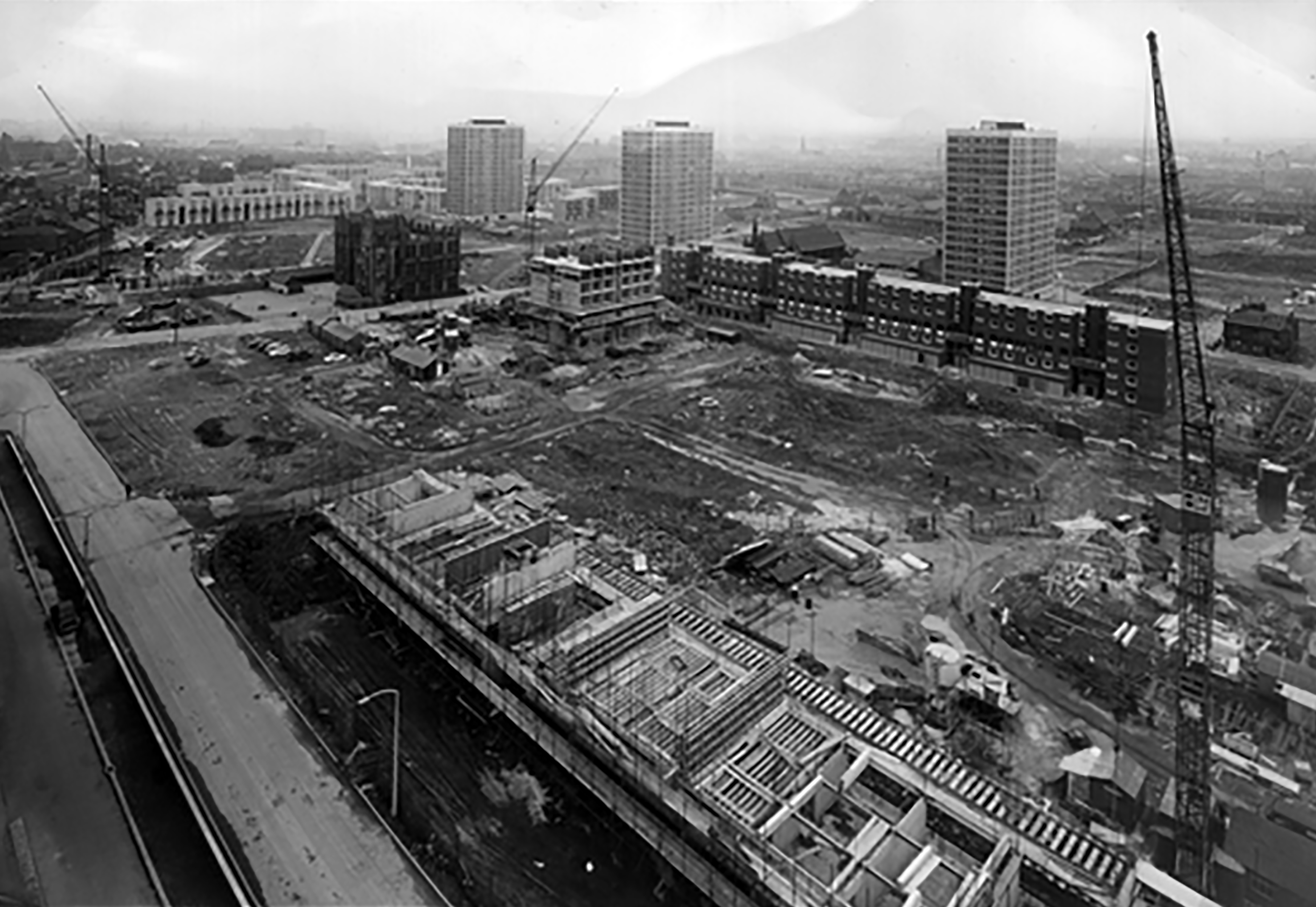
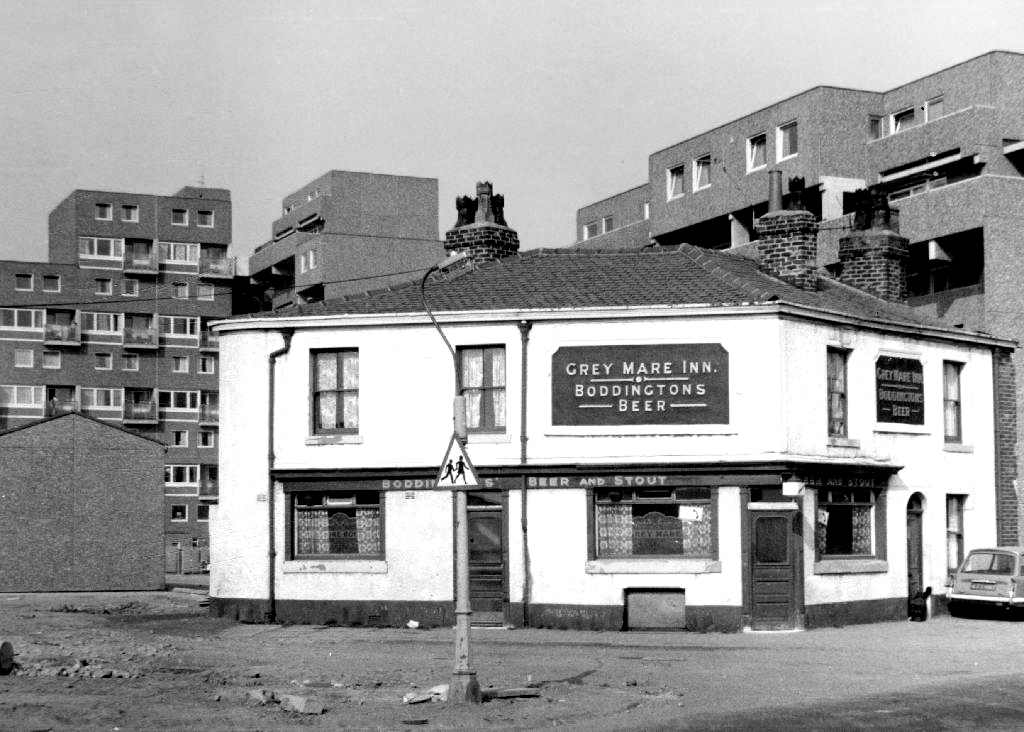
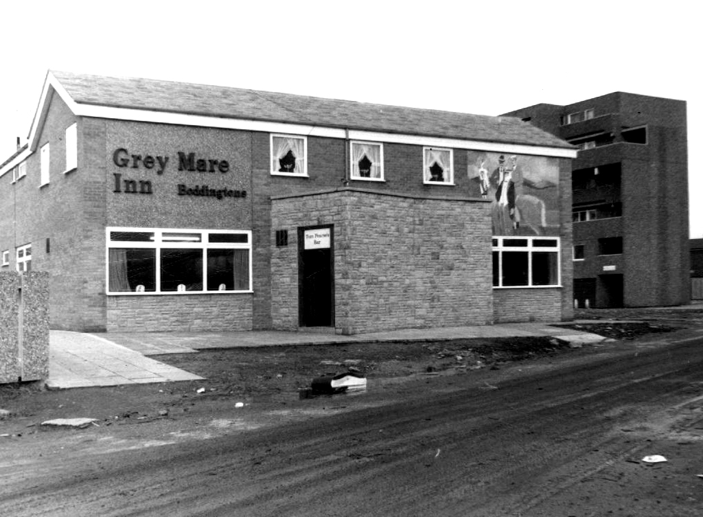
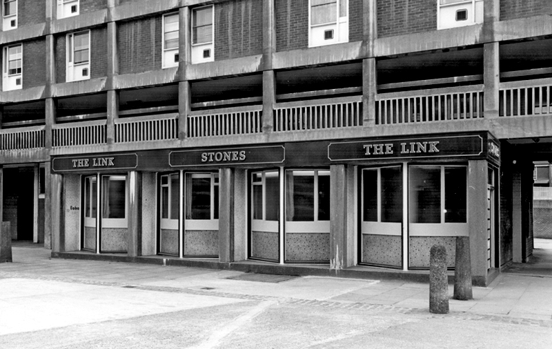
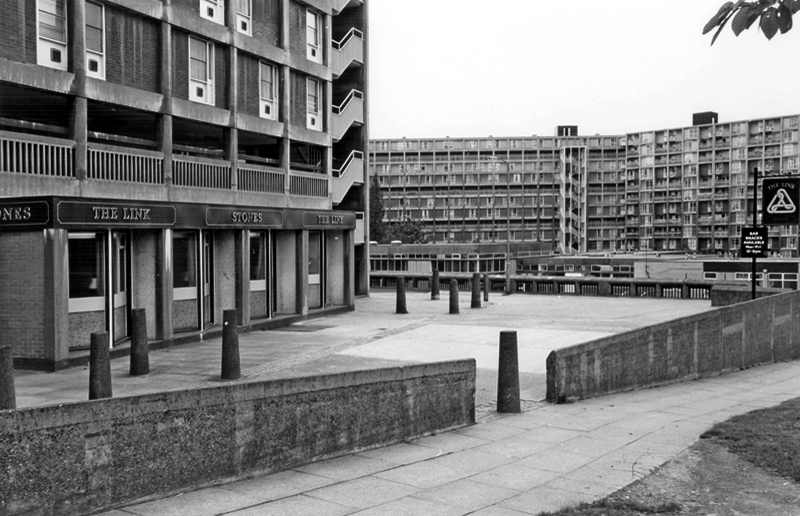
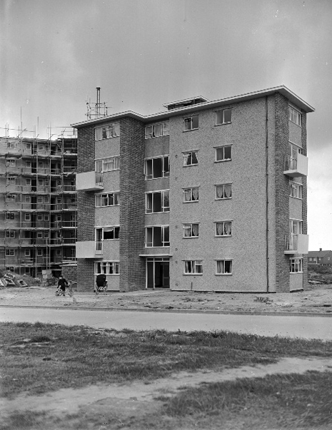
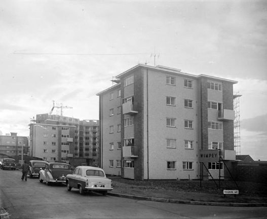
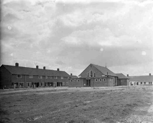
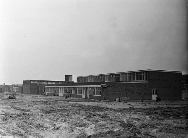
The first wave of urban regeneration, post war optimism incarnate, a bright new shiny future – out with the old and in with the new, as Municipal Modernism stamps its big broad architectural feet all over Woodward Street.

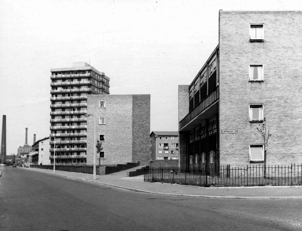
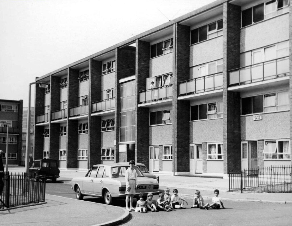
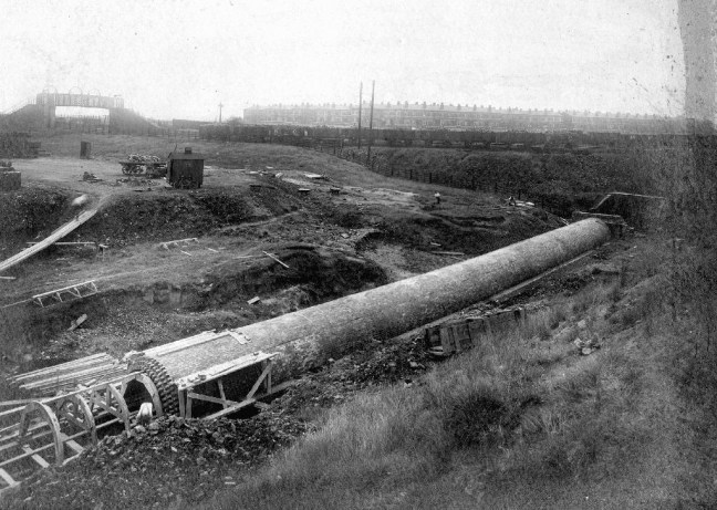
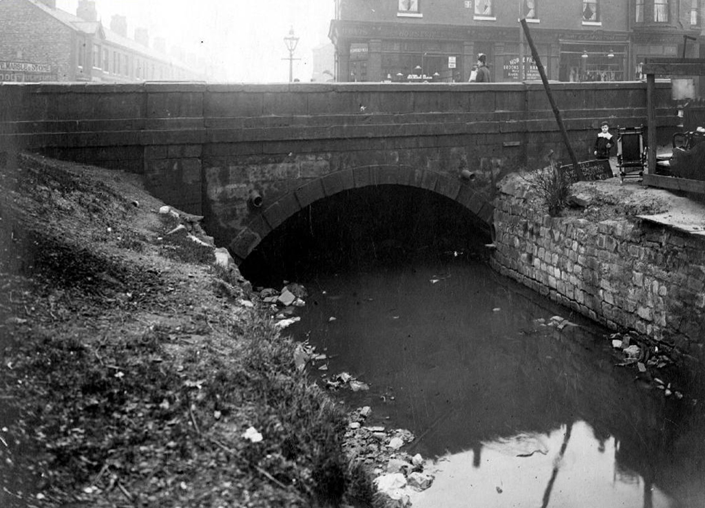
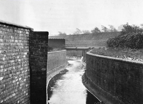
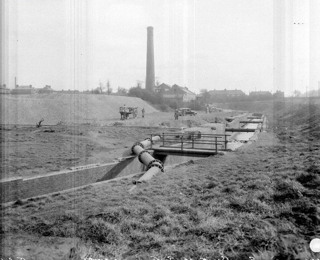
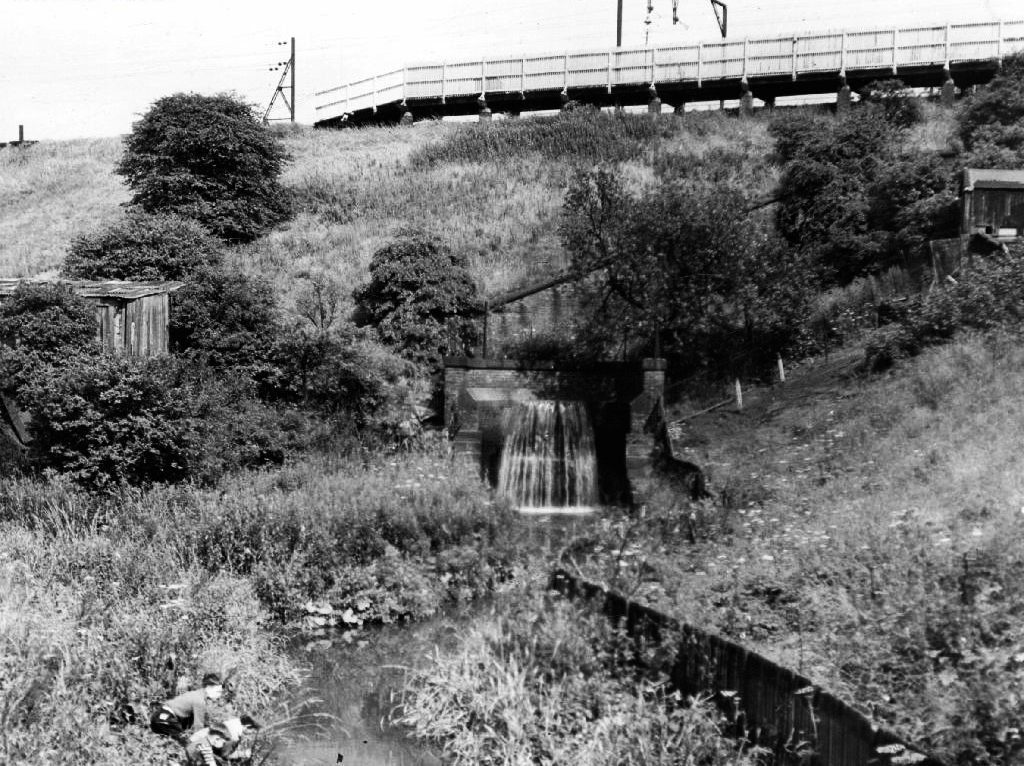
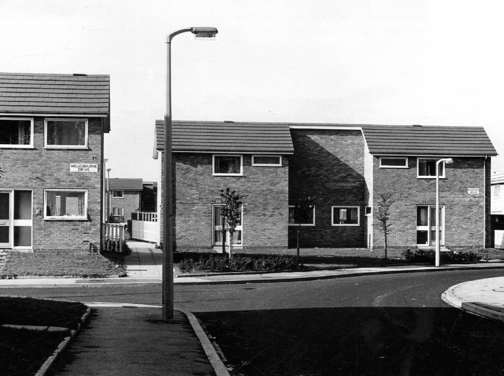
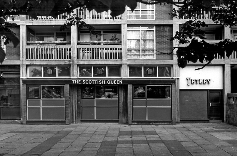
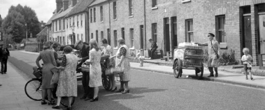
Archival photographs from Manchester Local Image Collection

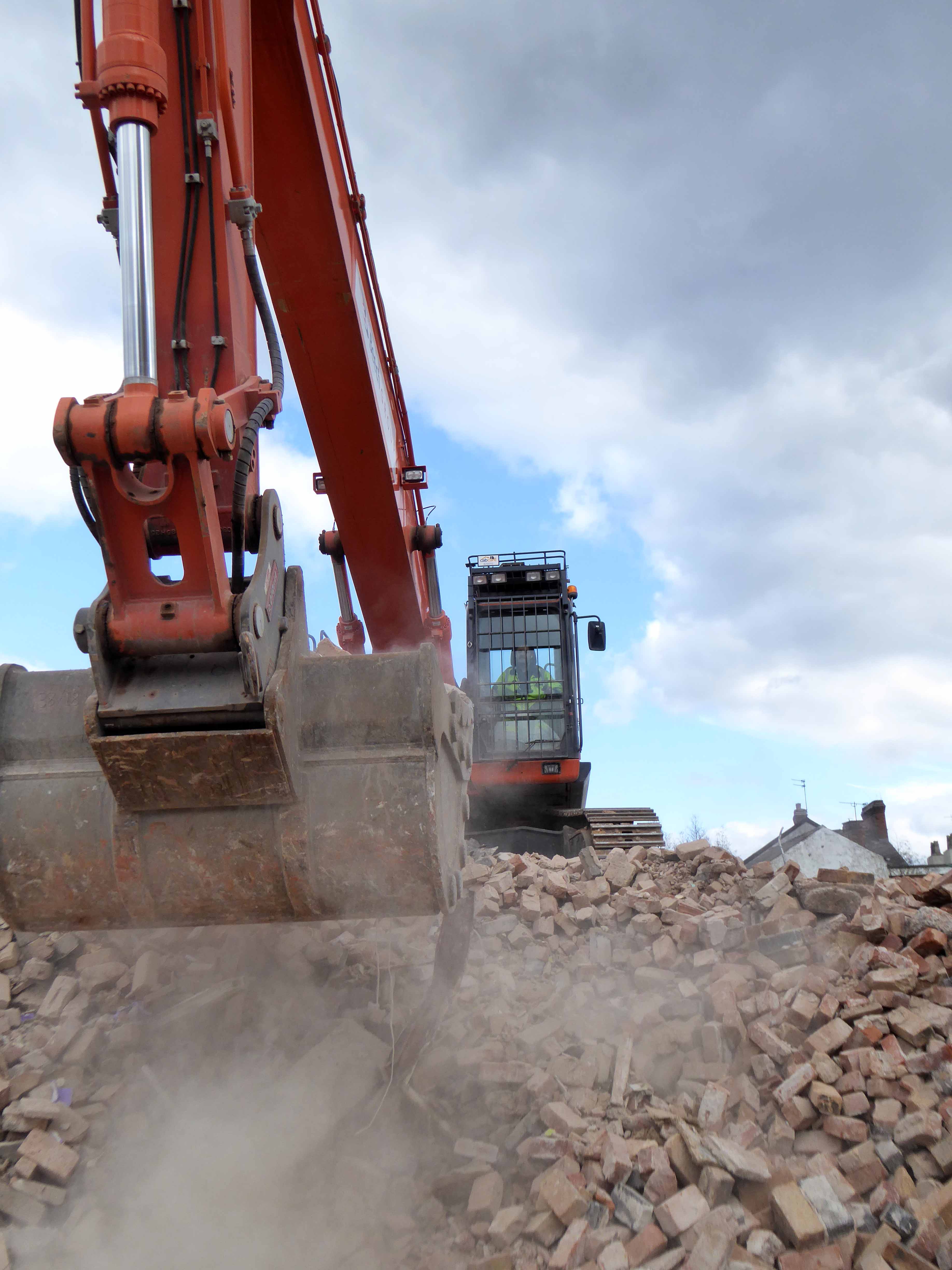
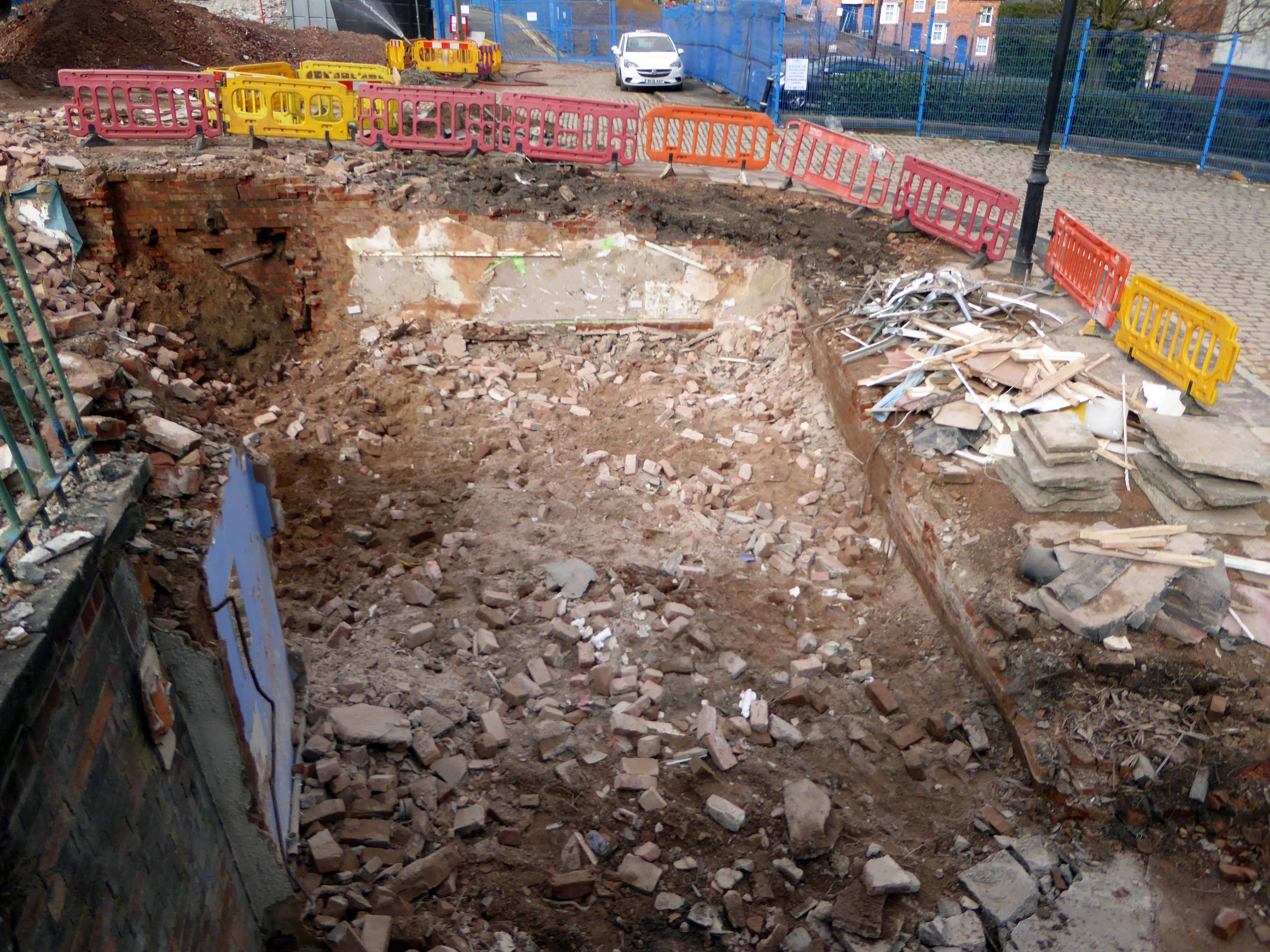
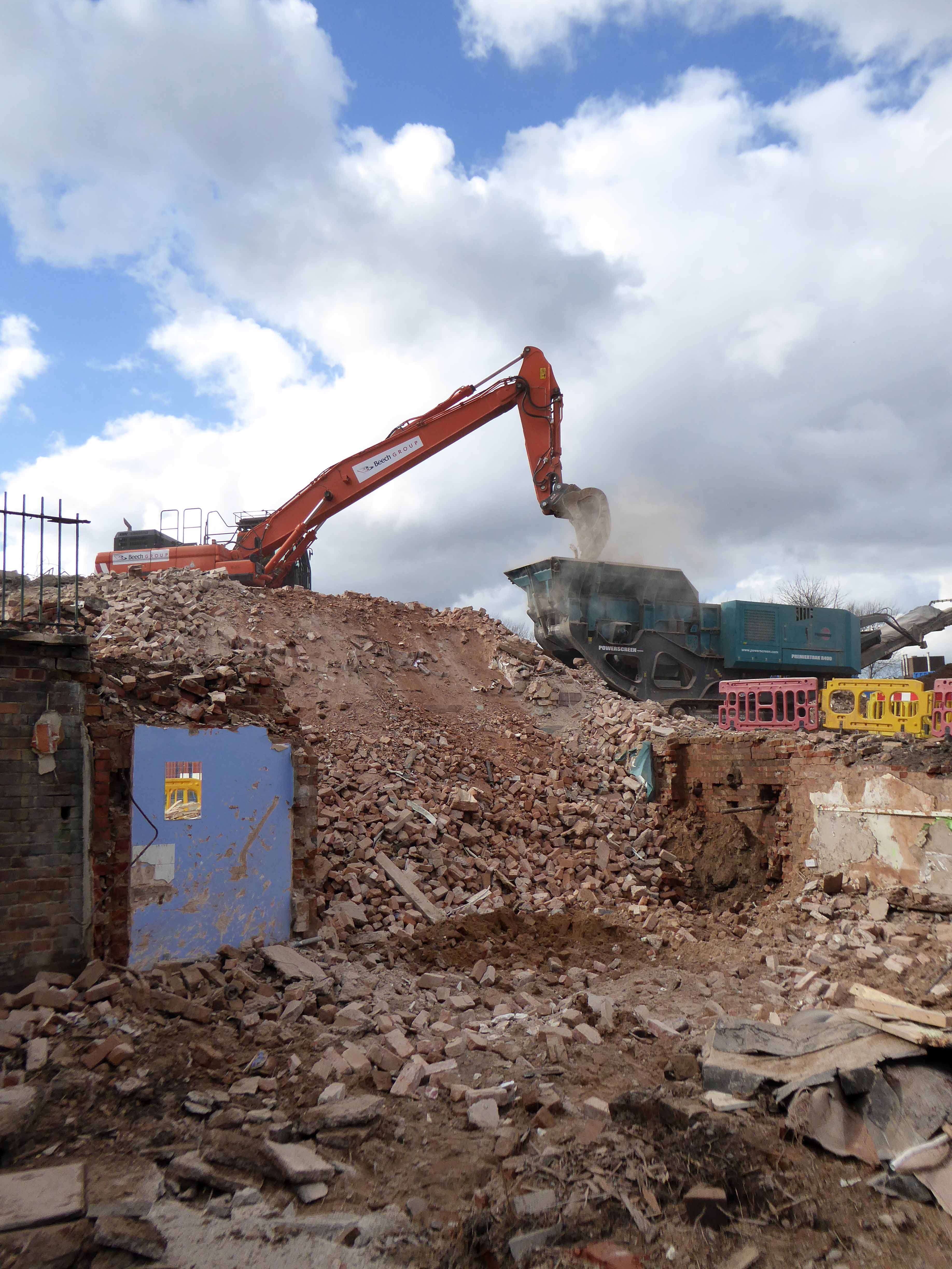
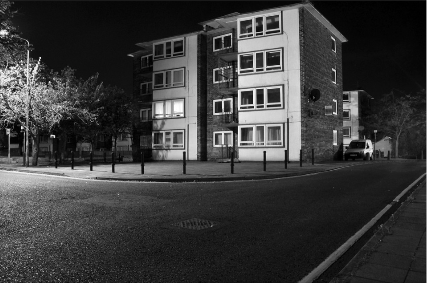
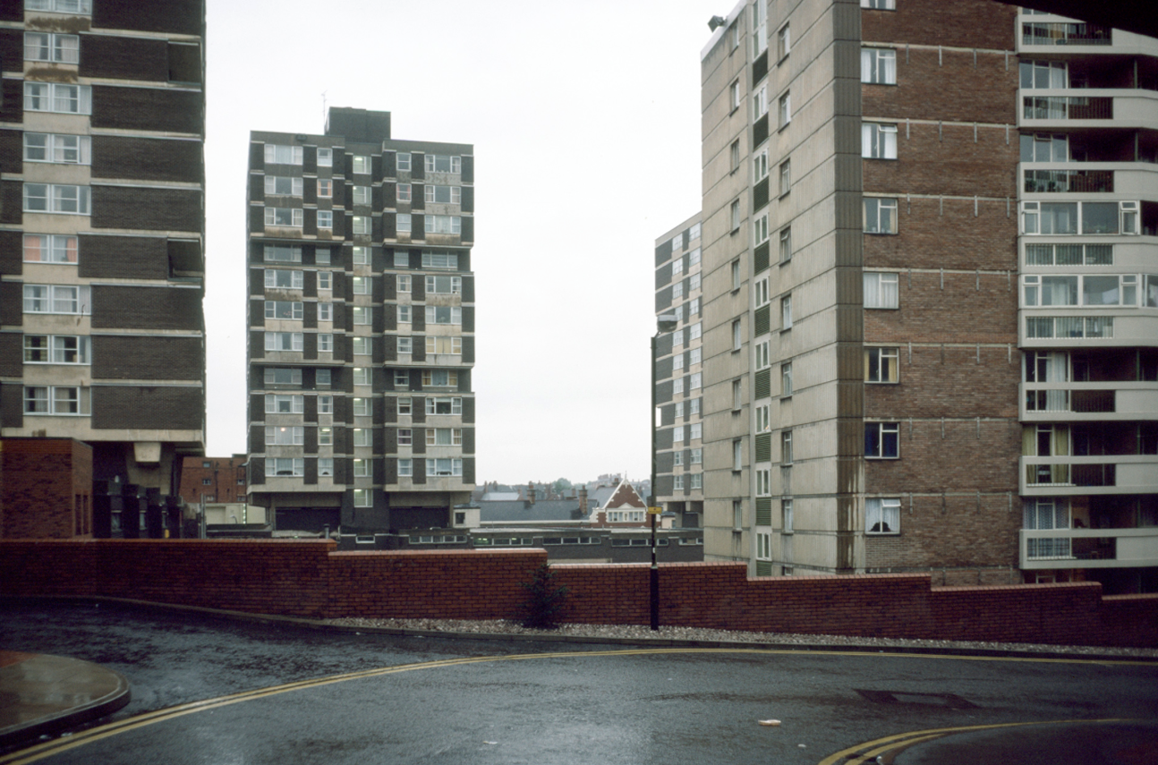
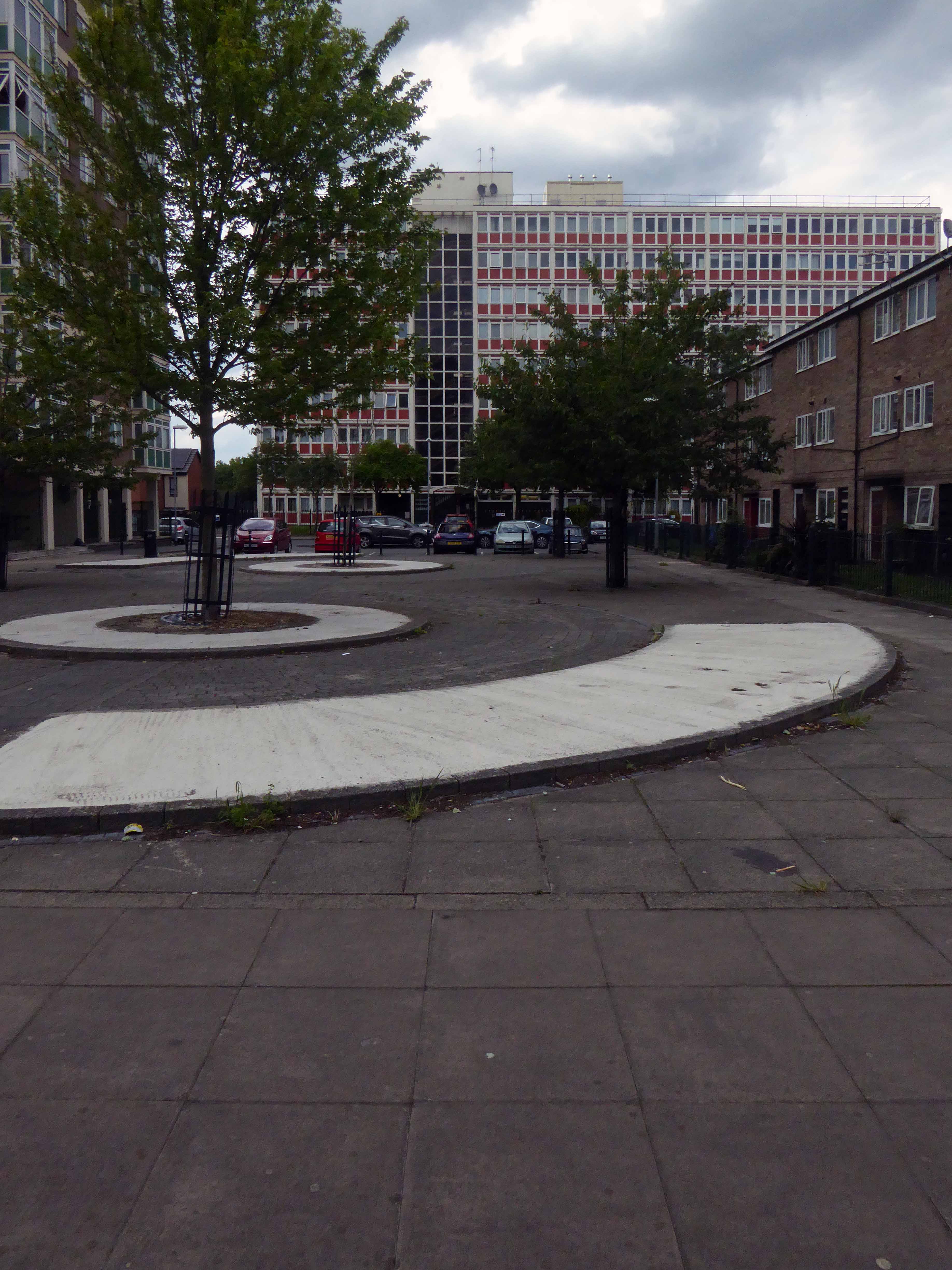
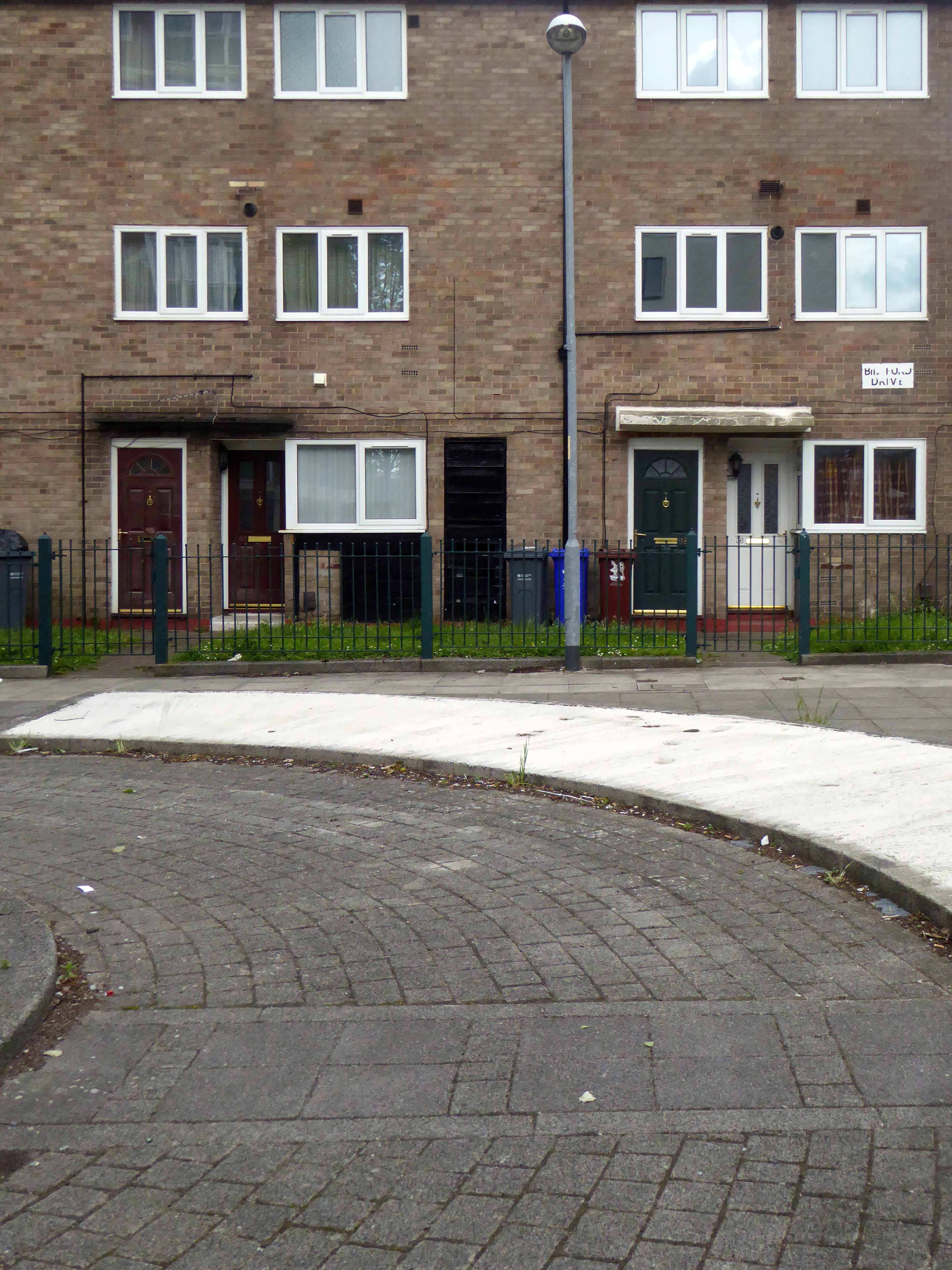
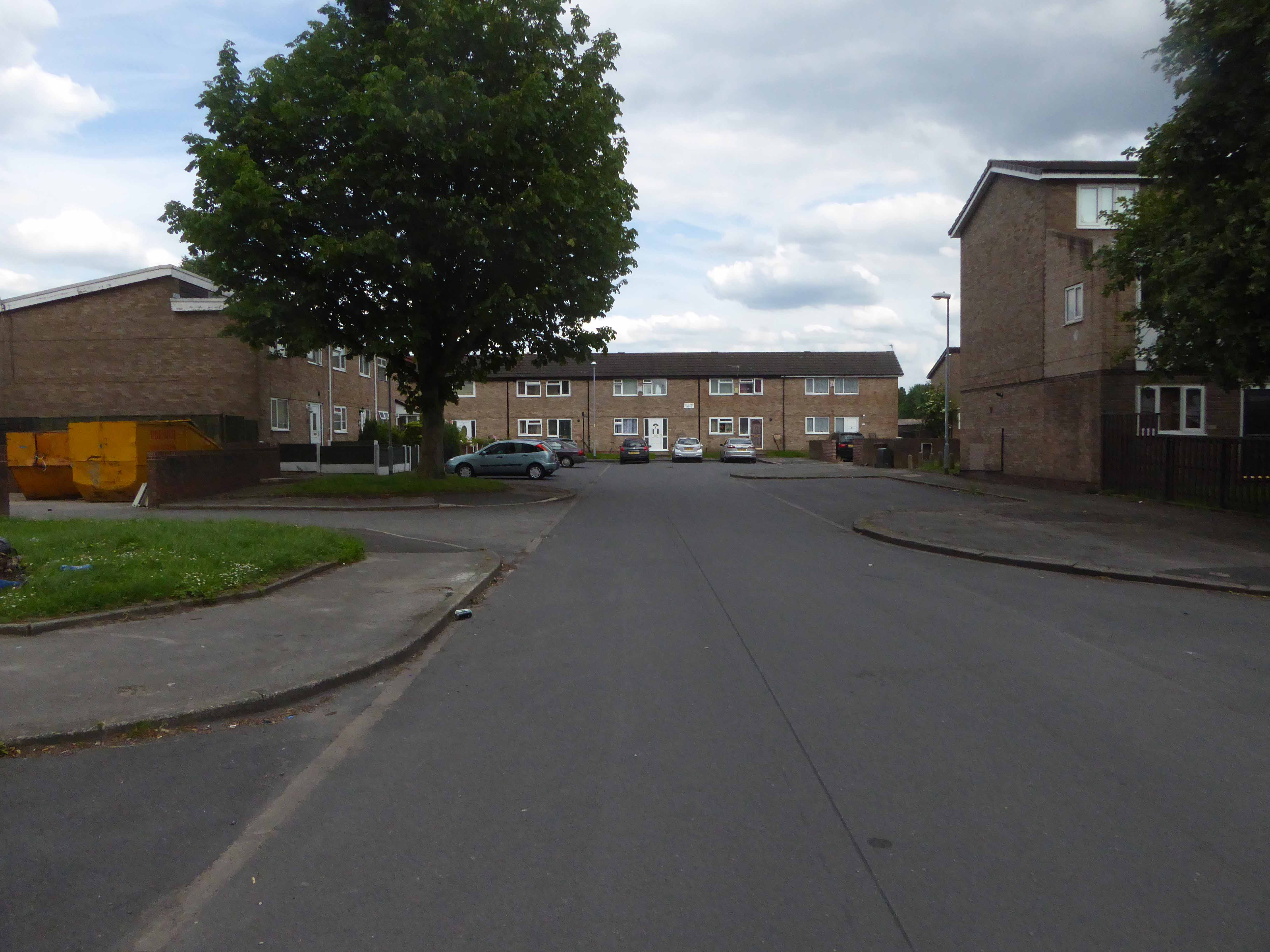
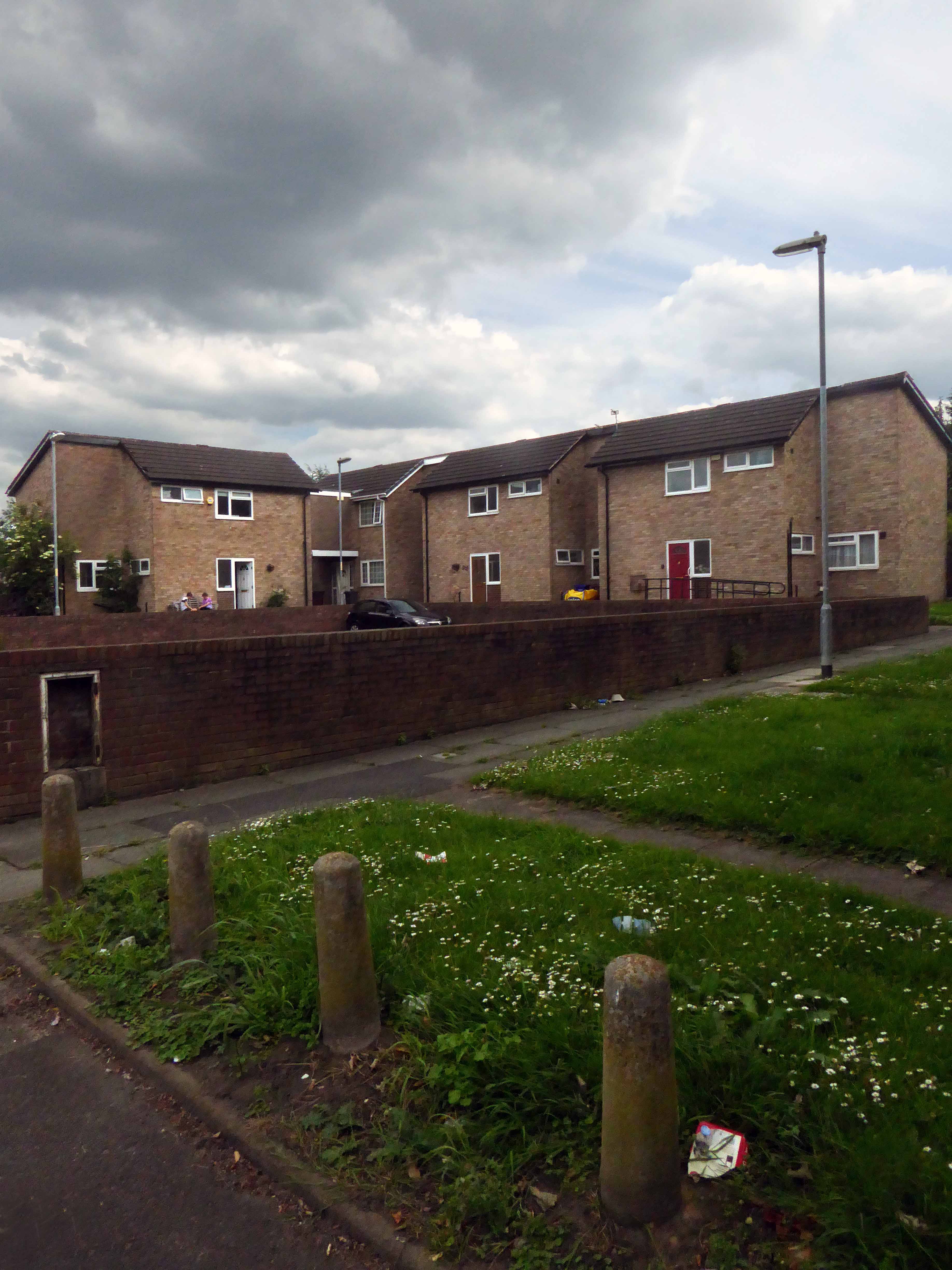
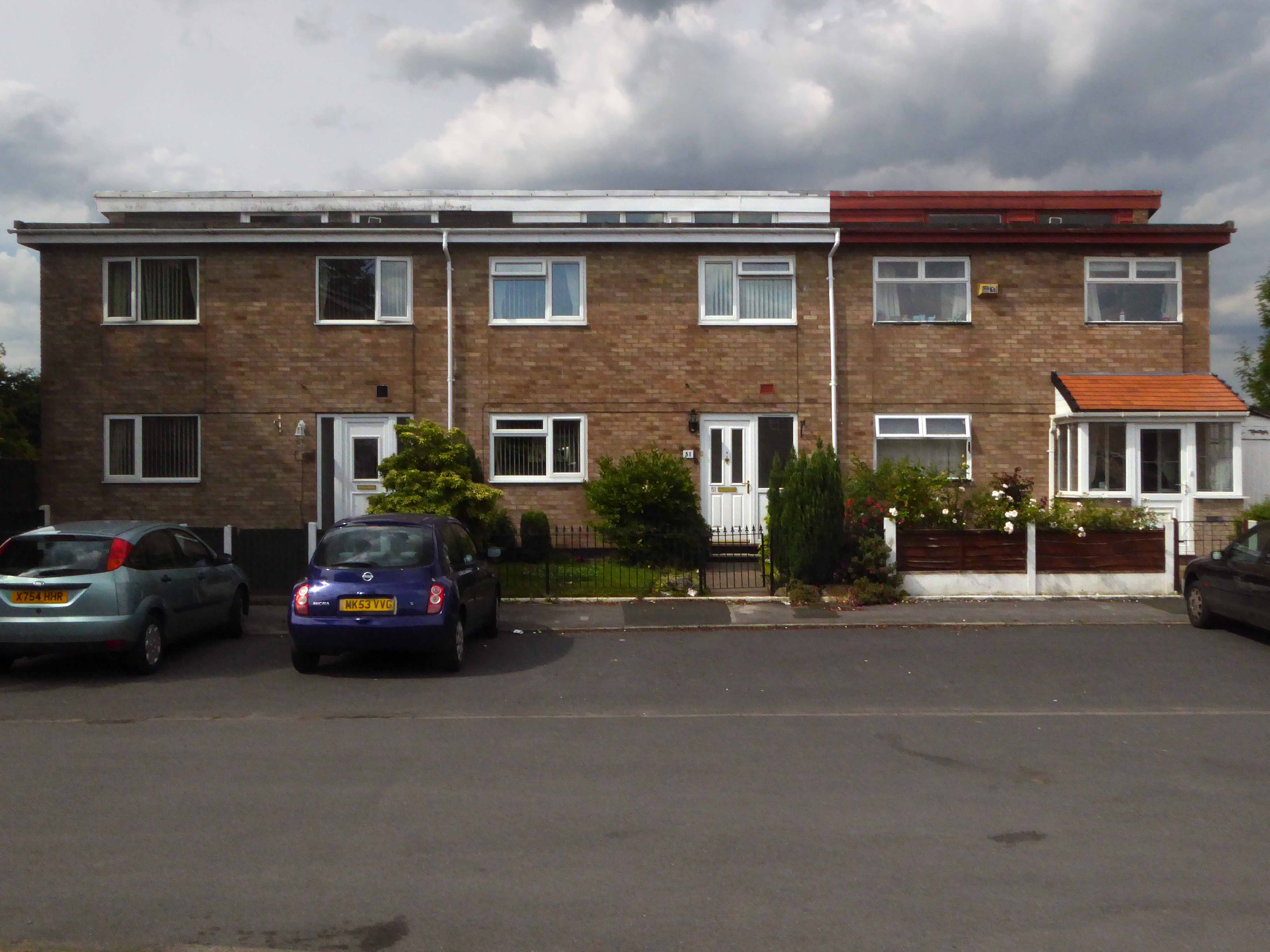
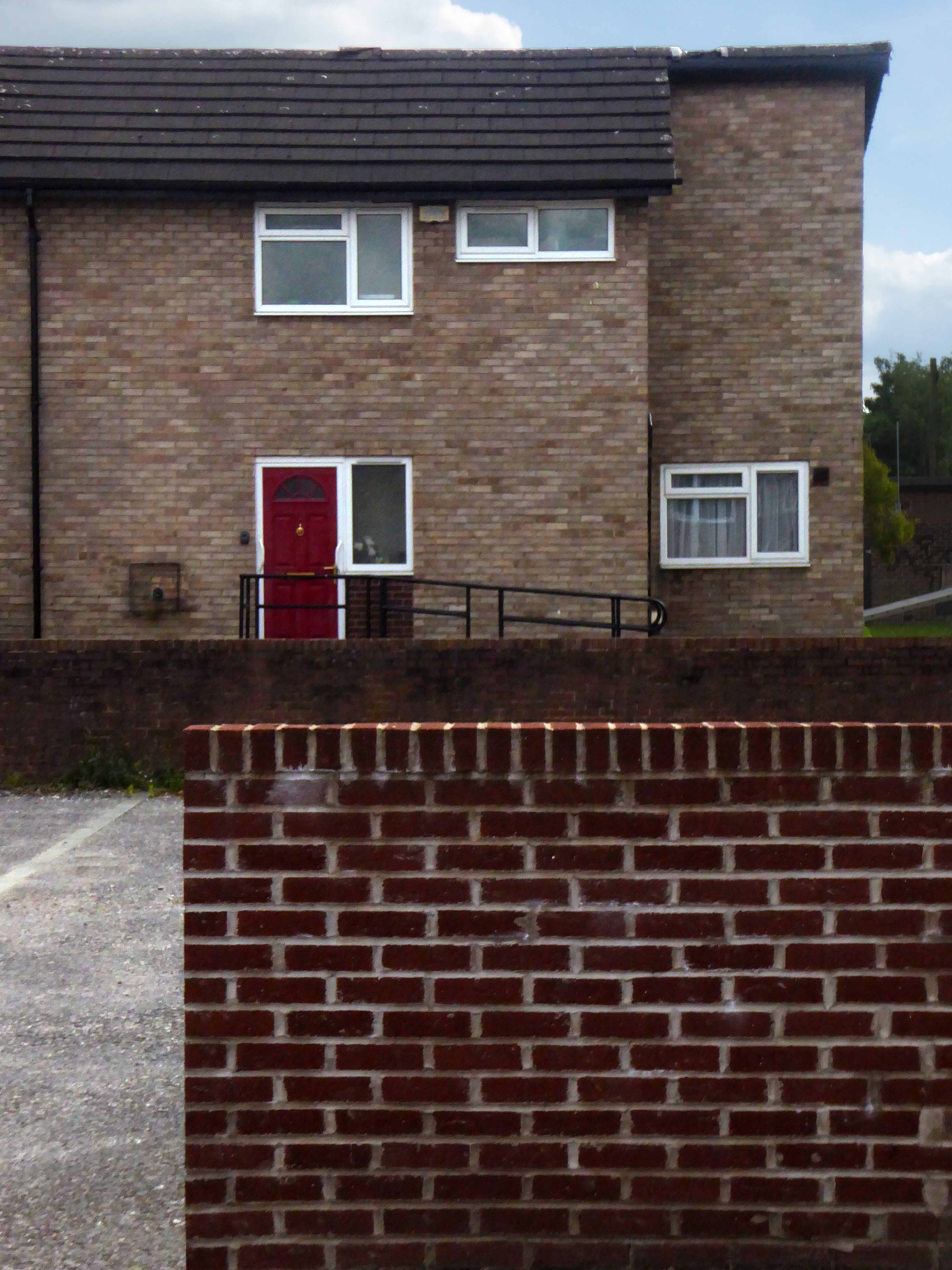
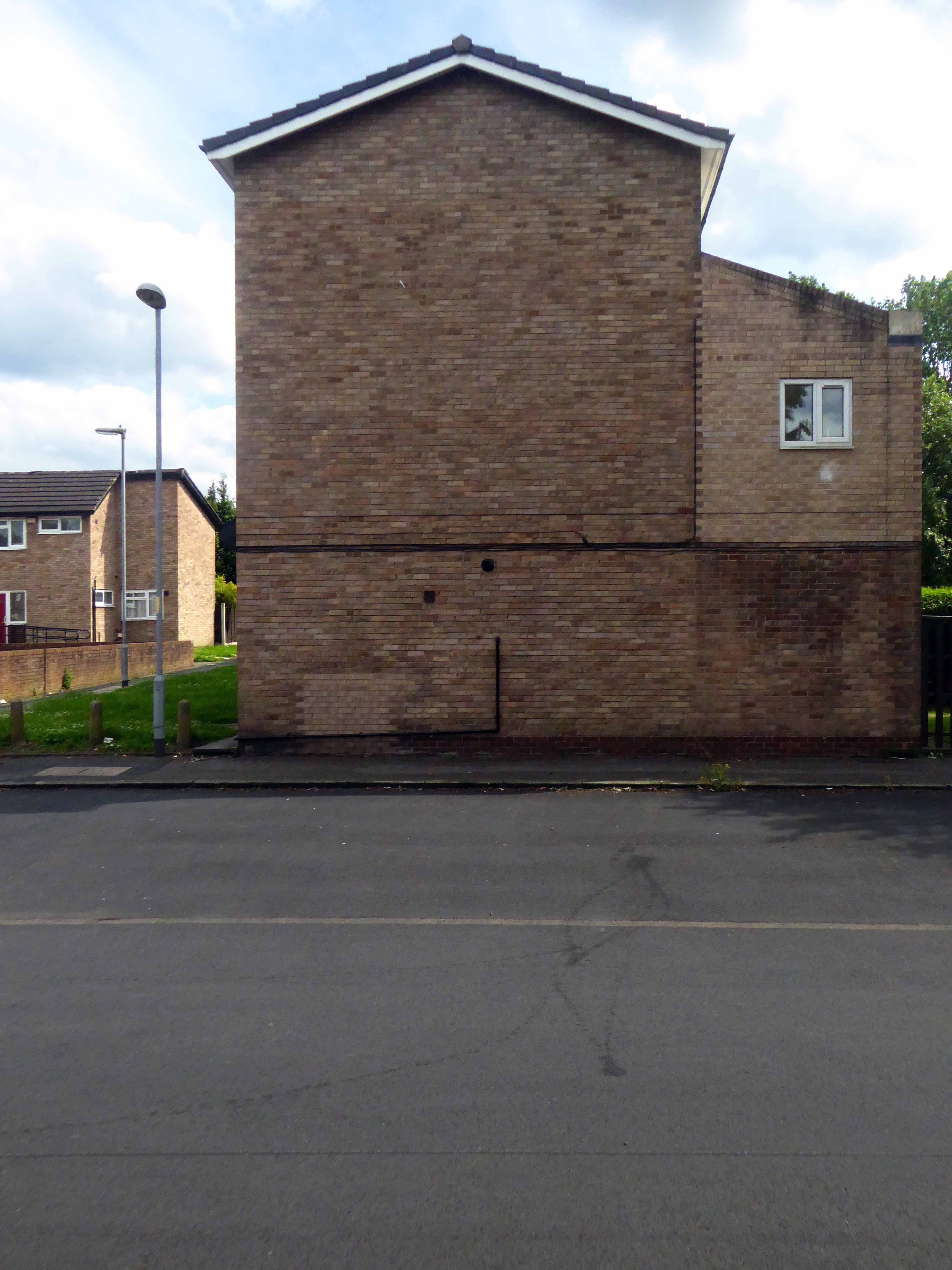
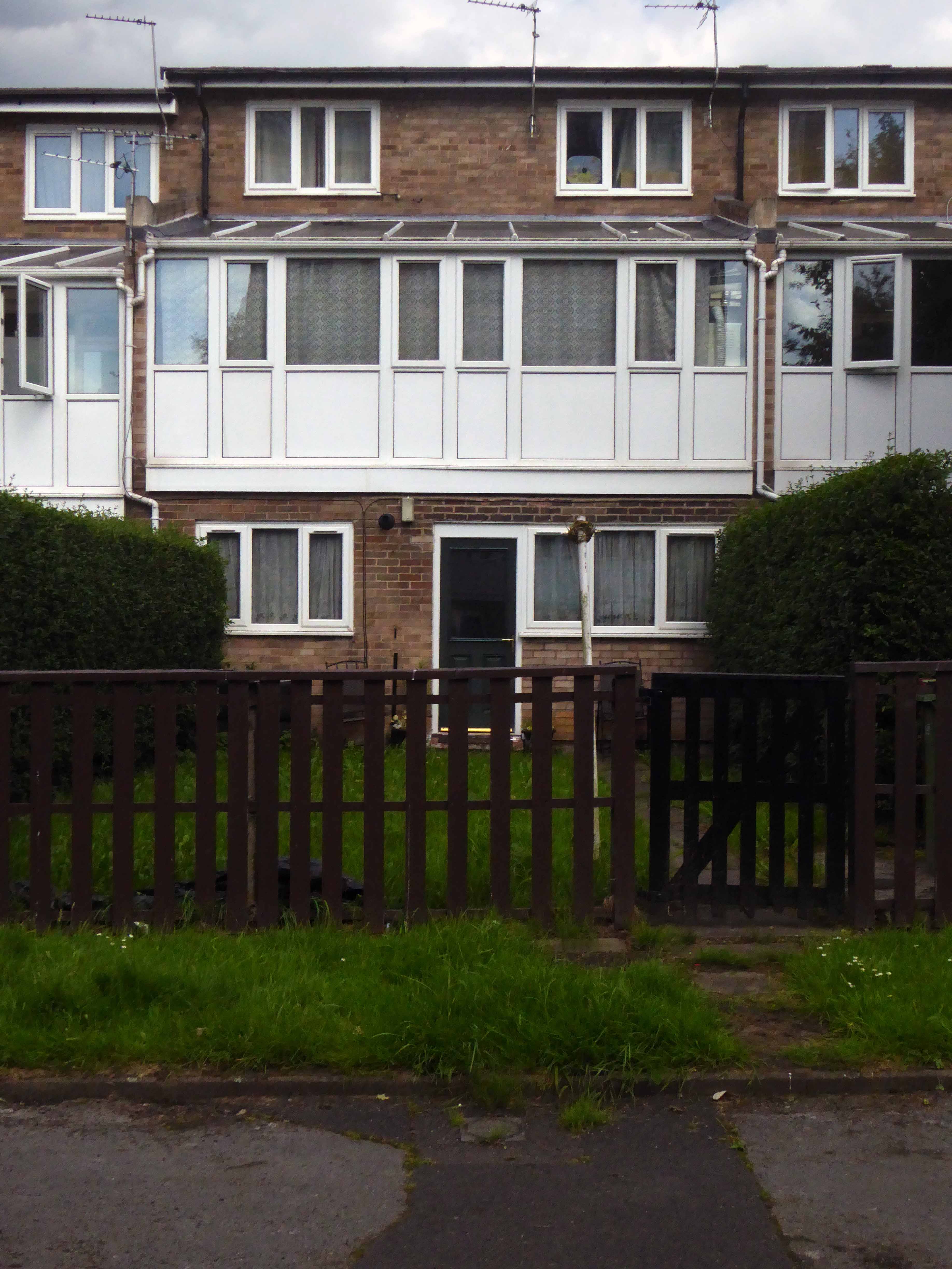
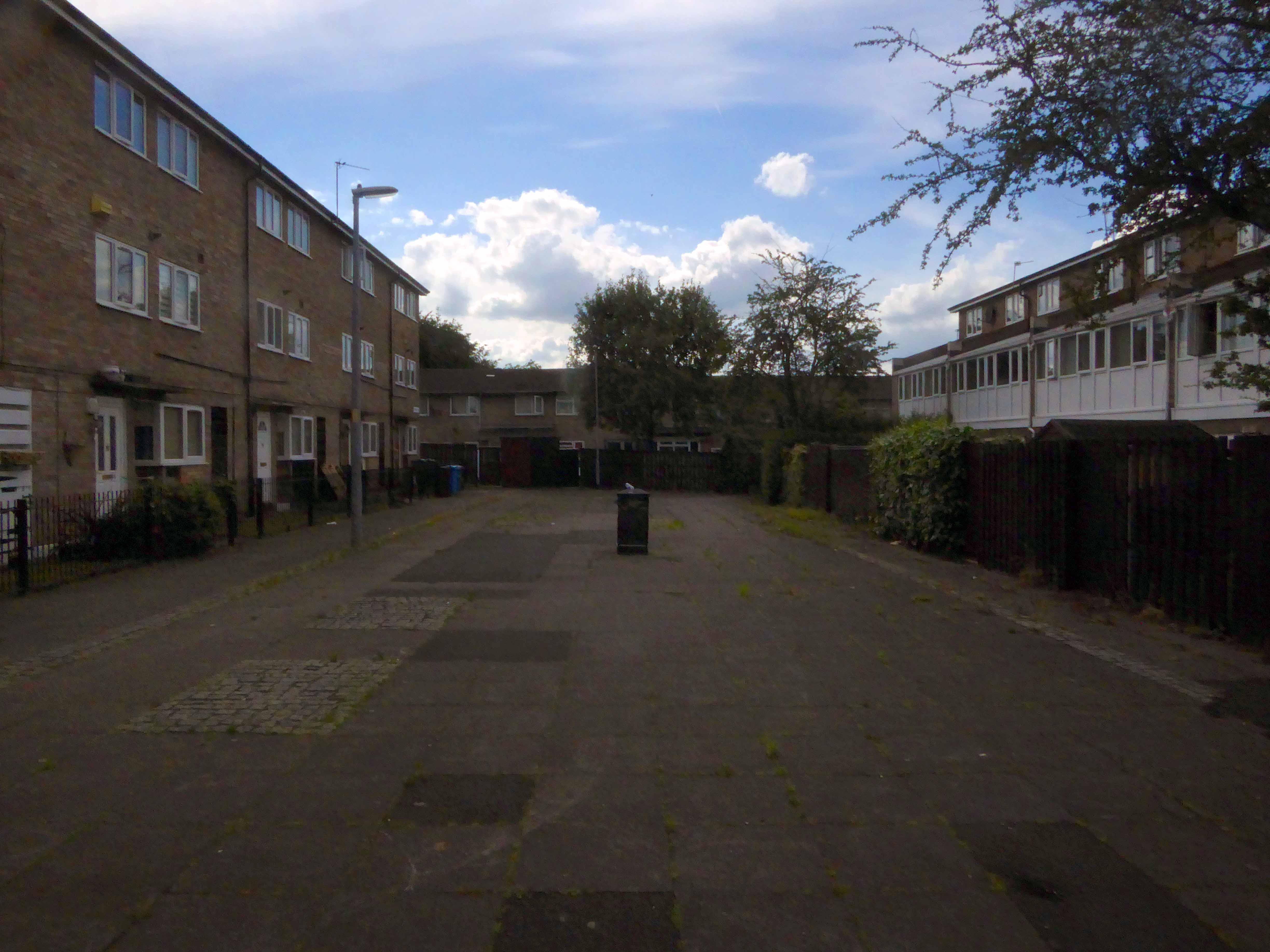
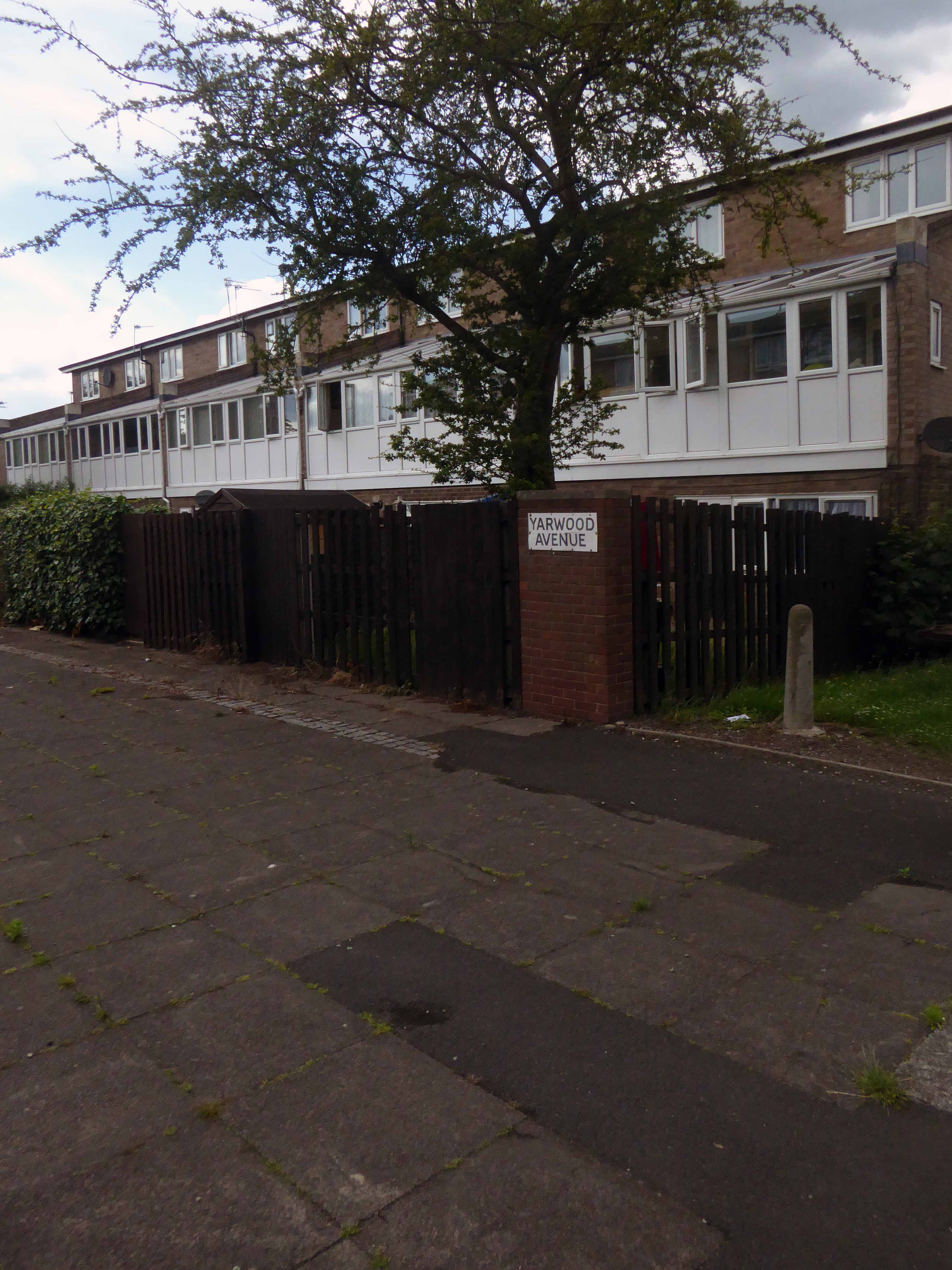
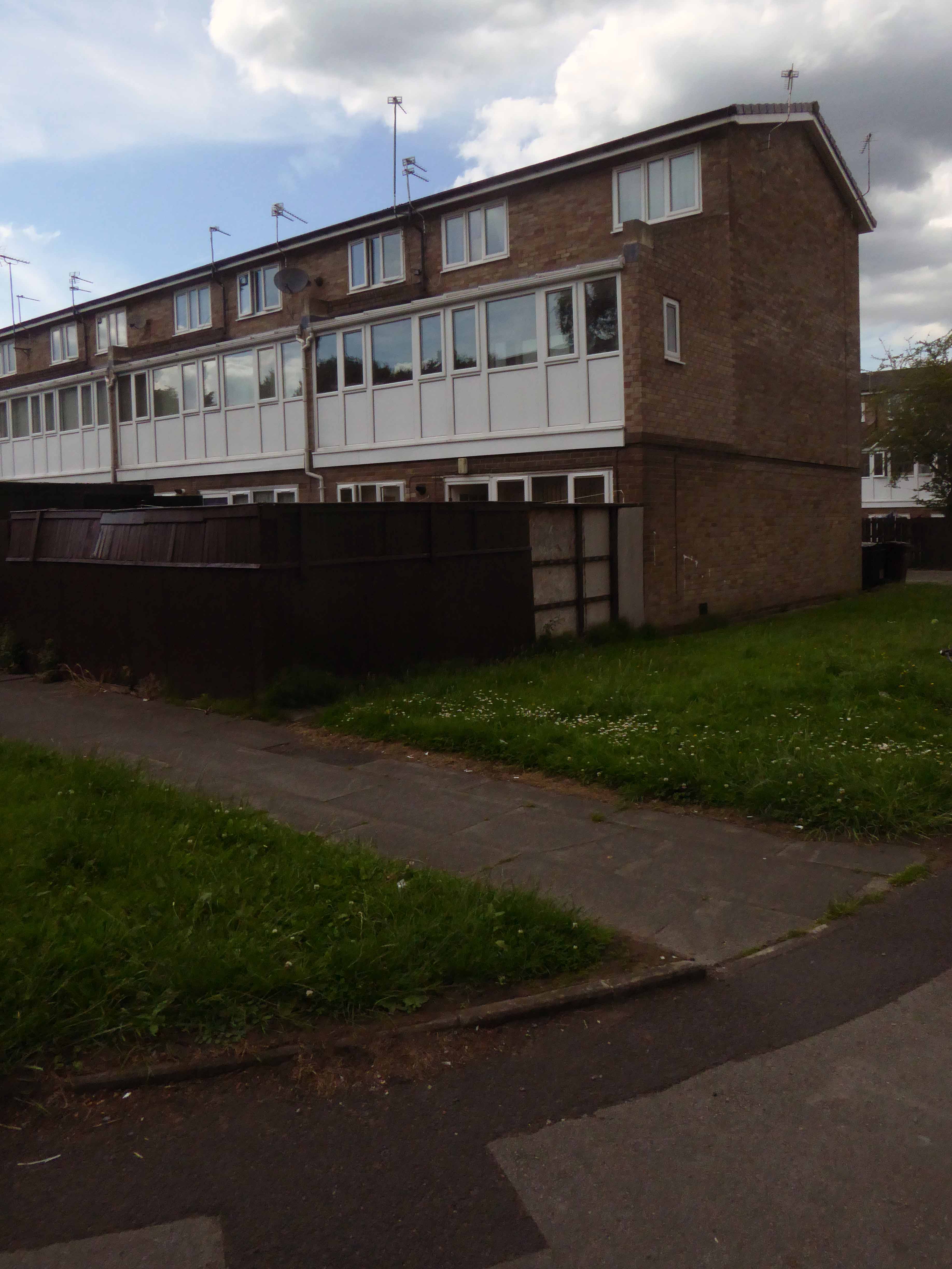
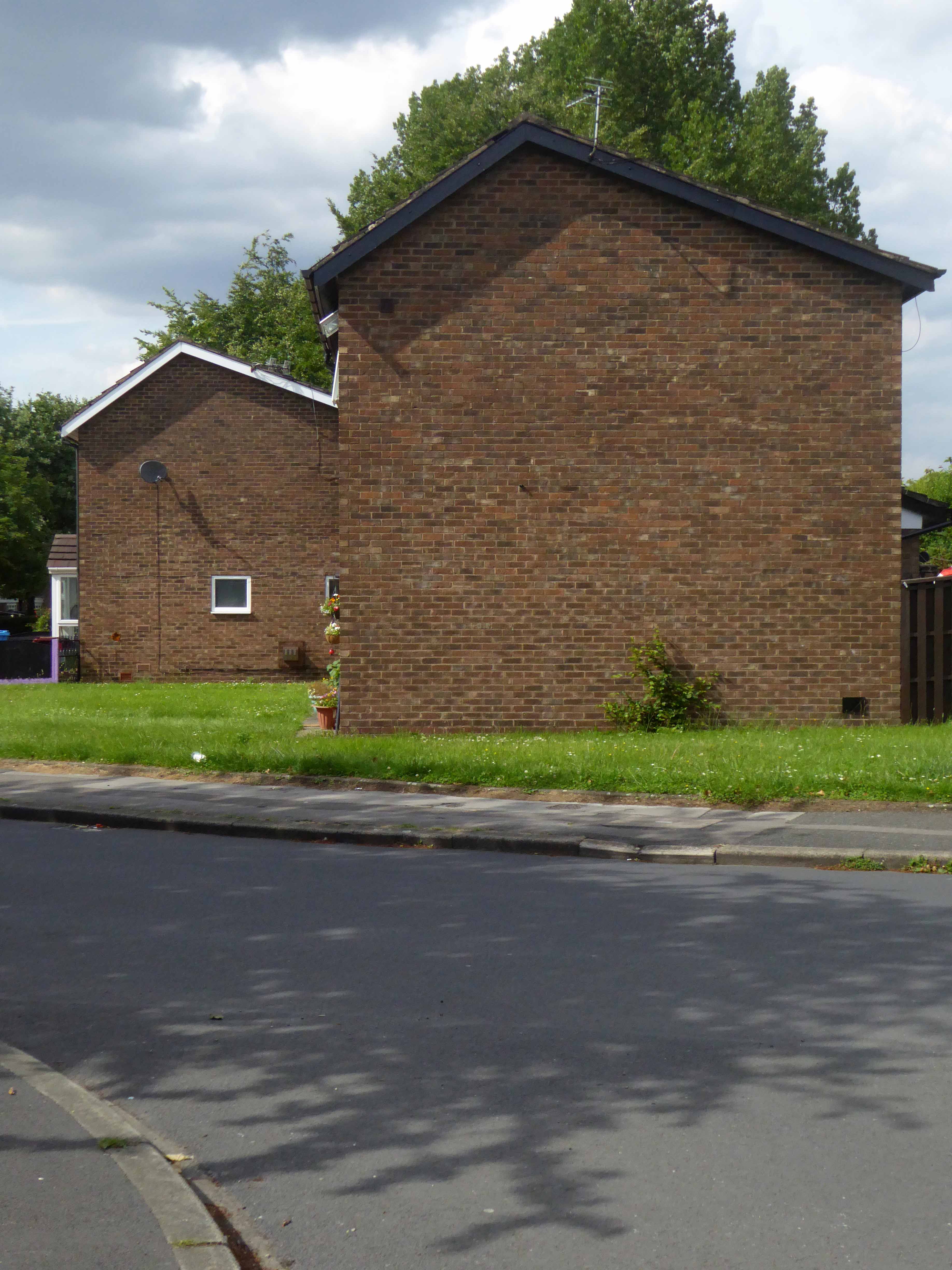
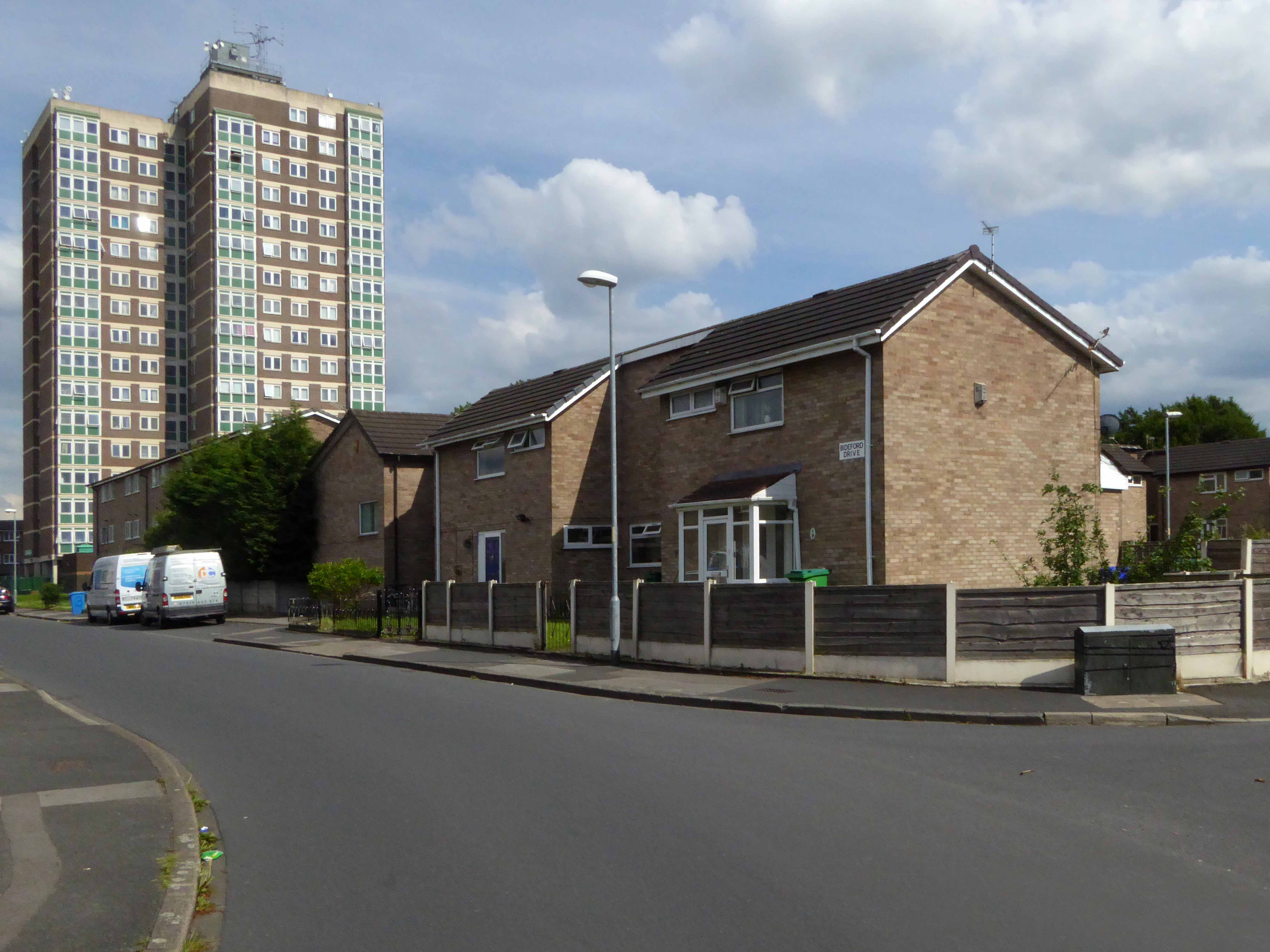
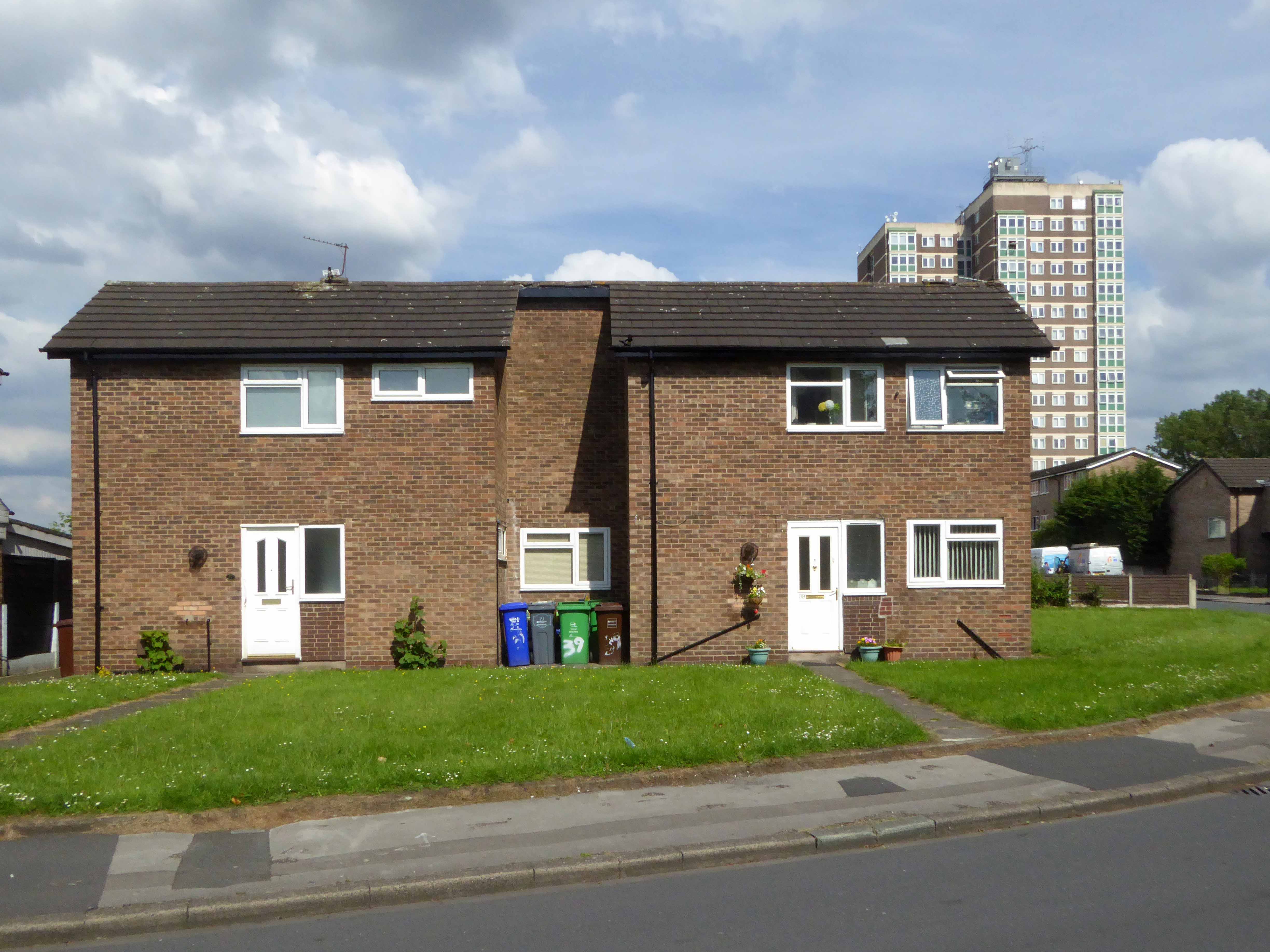
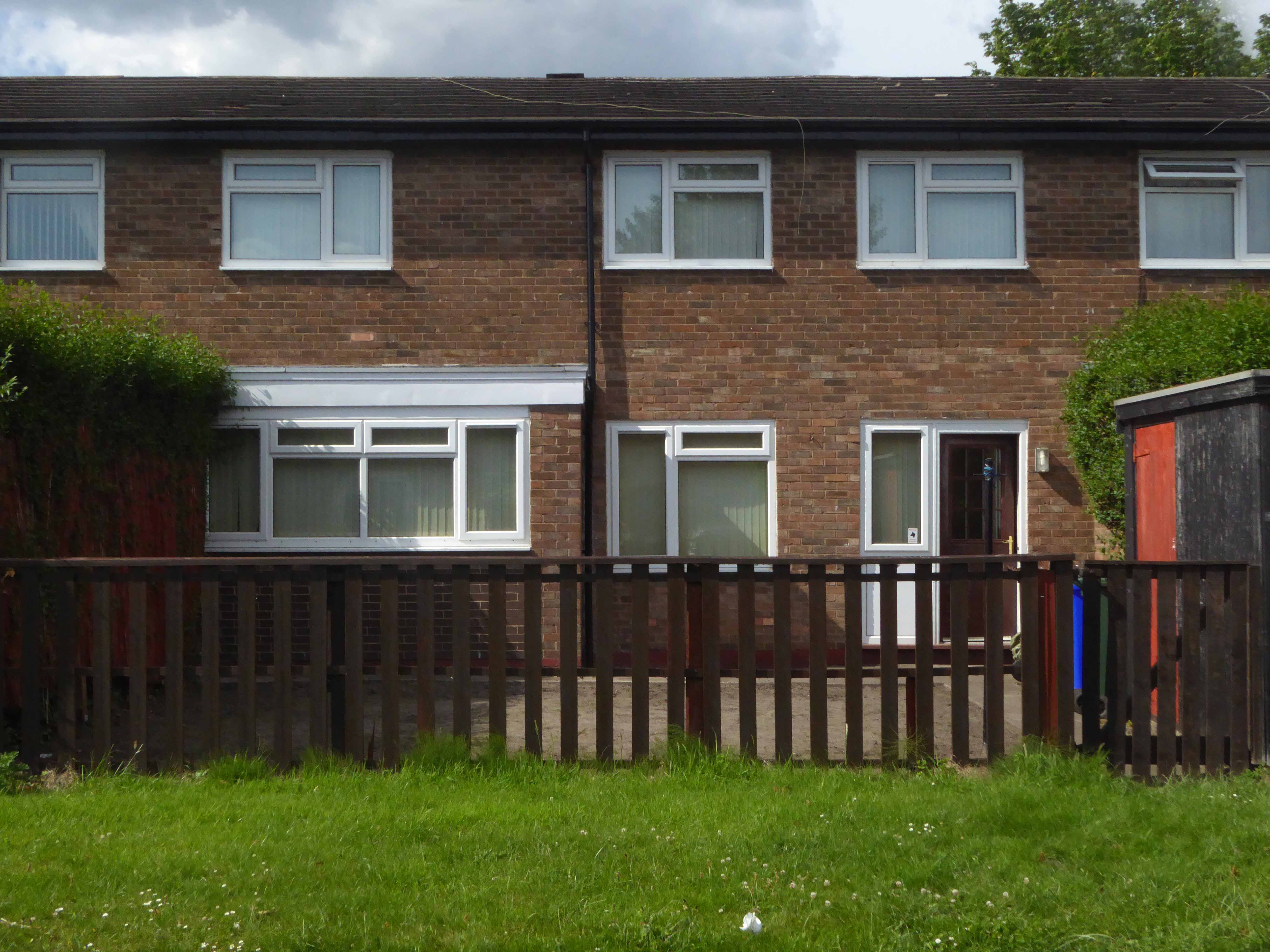
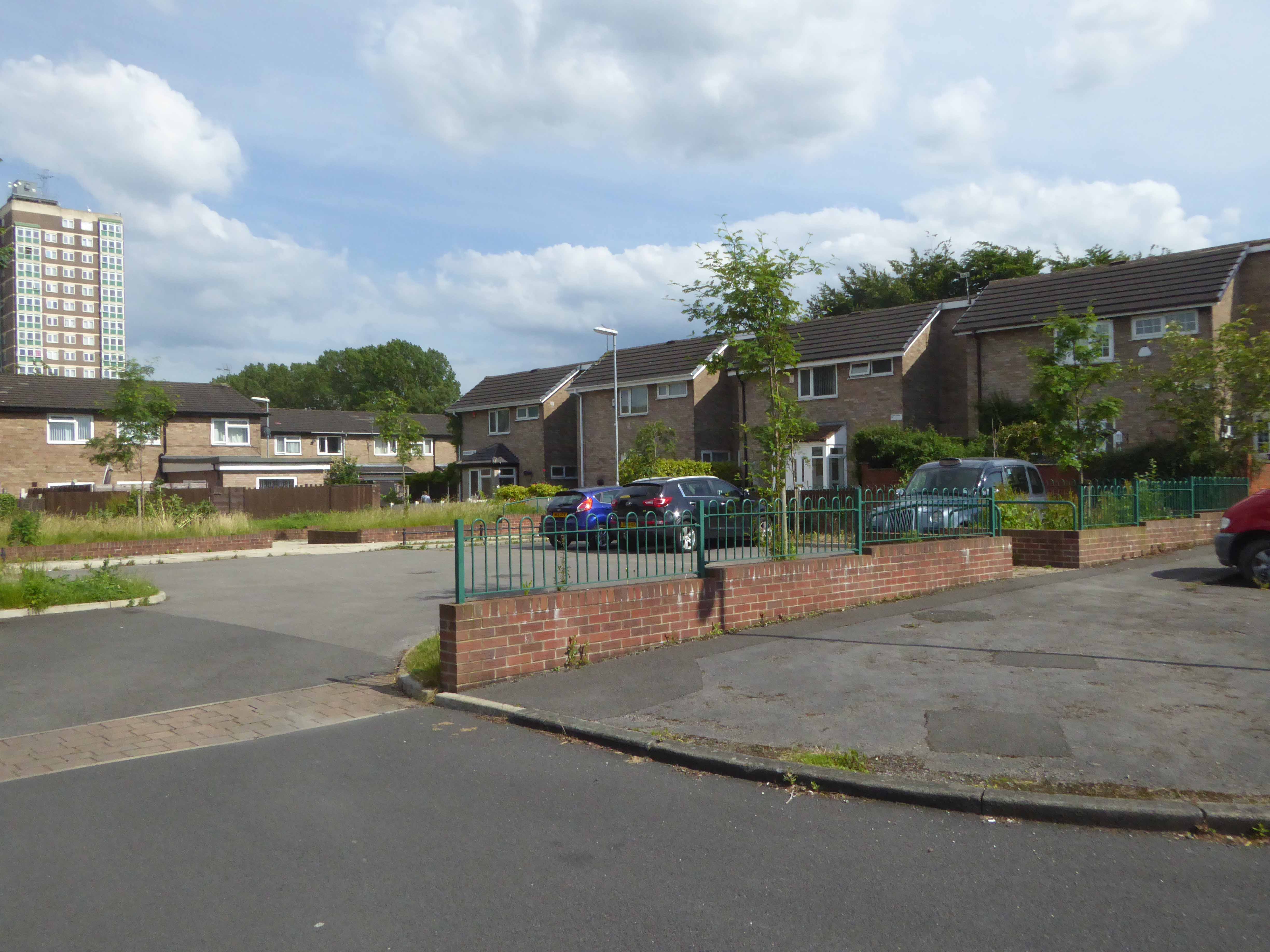
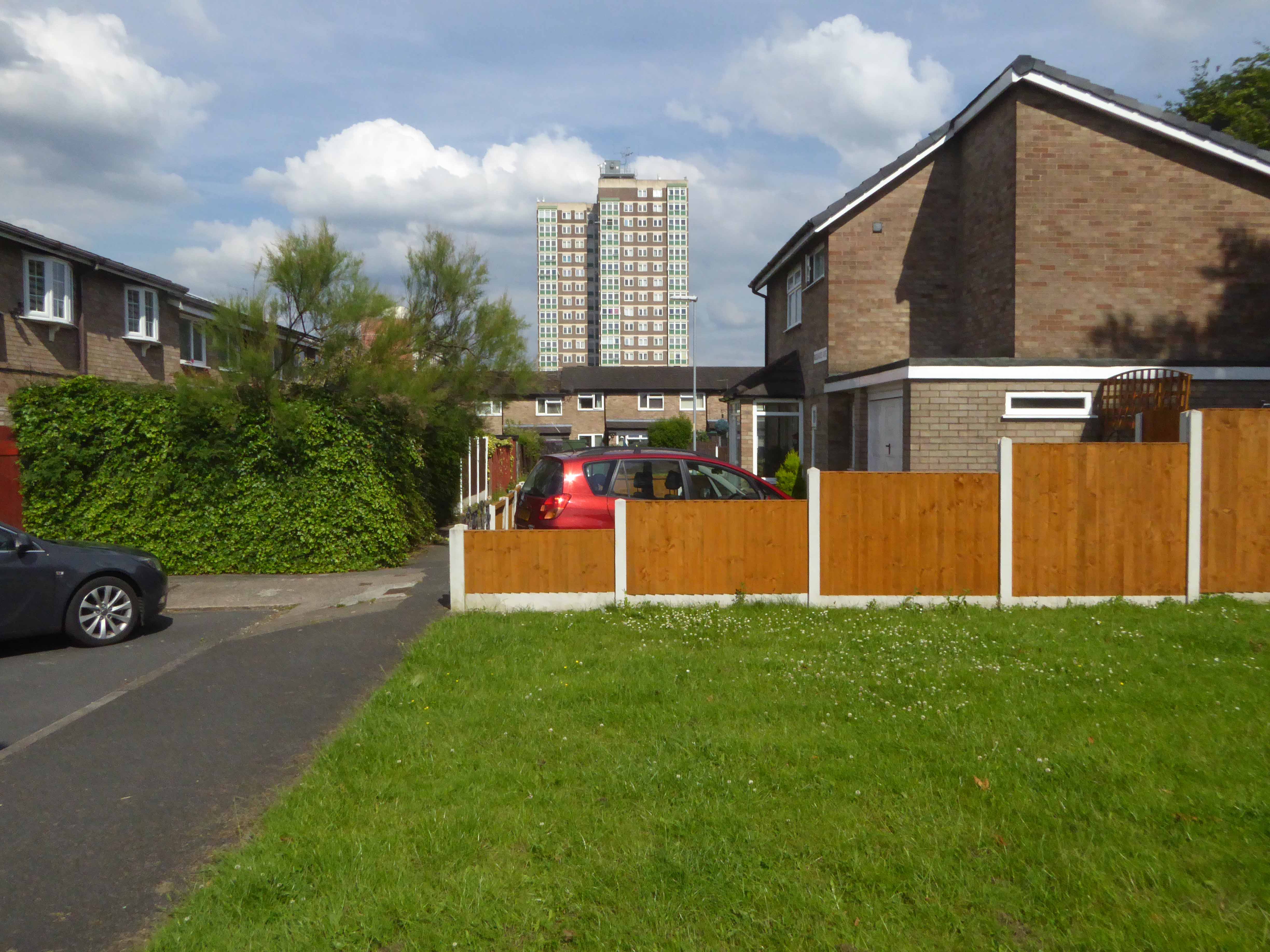
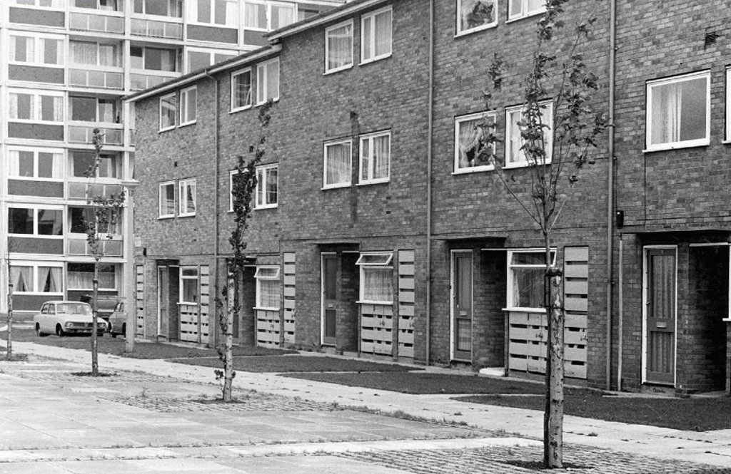
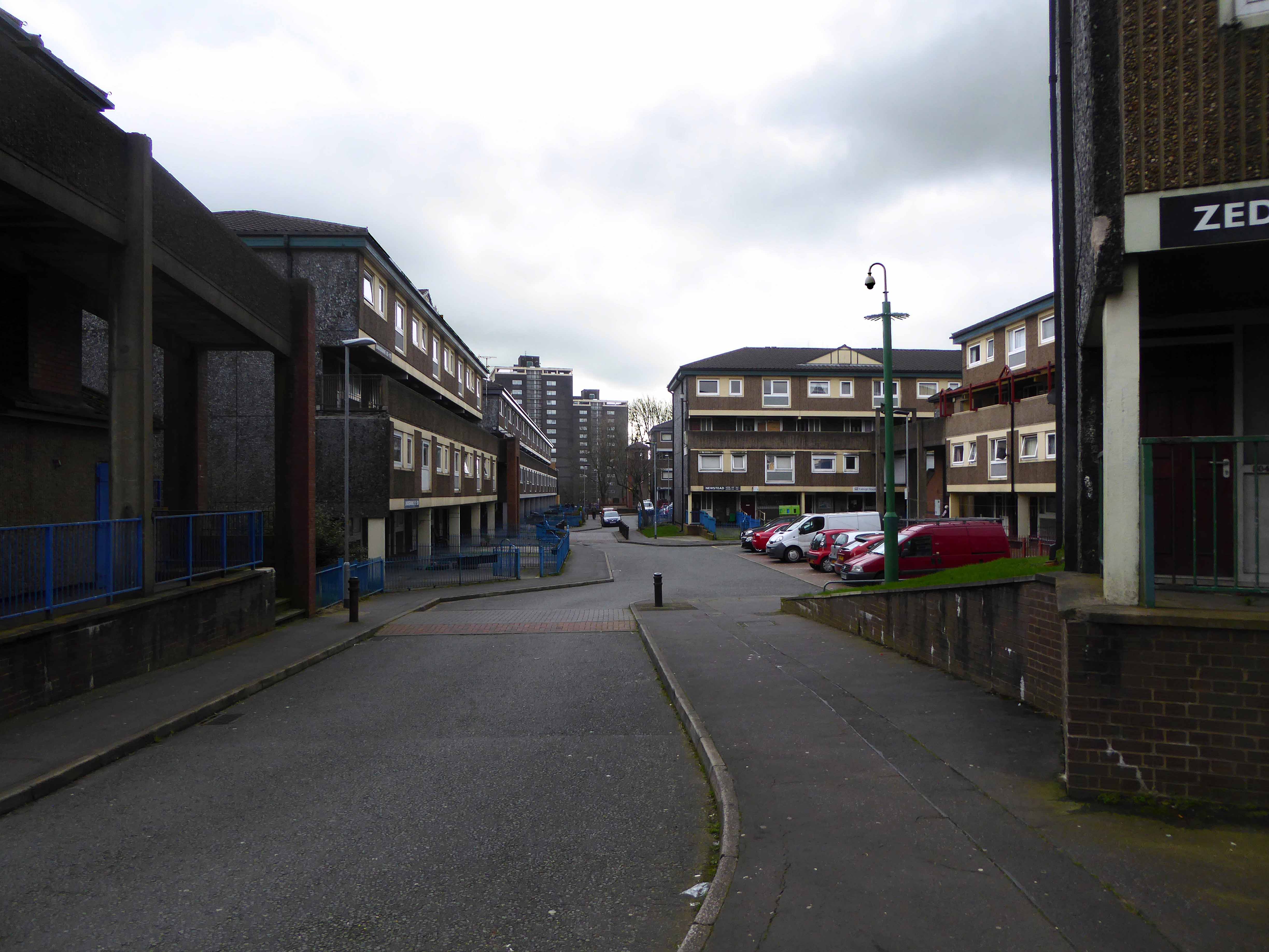
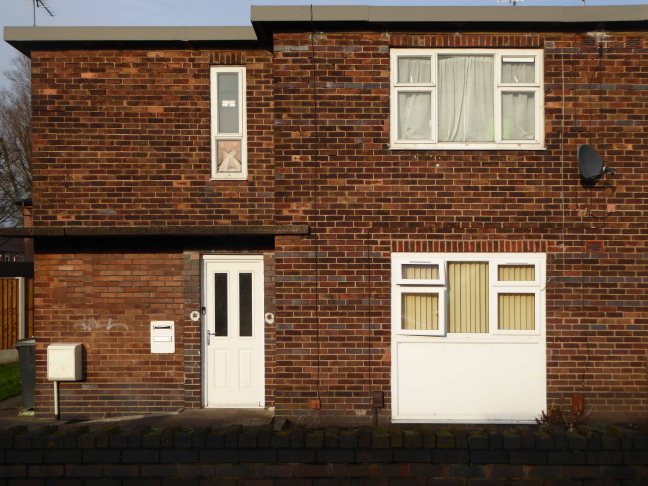
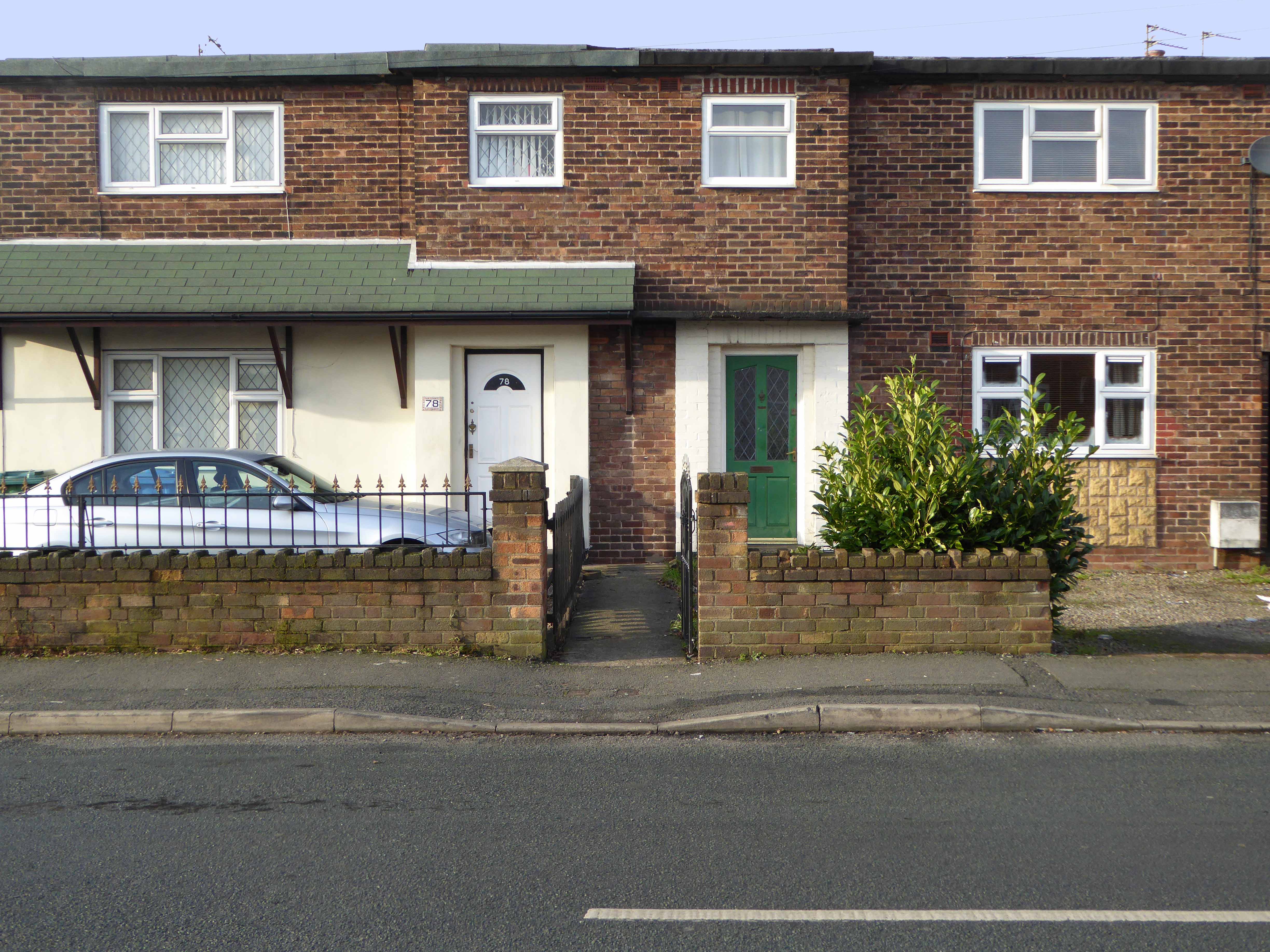
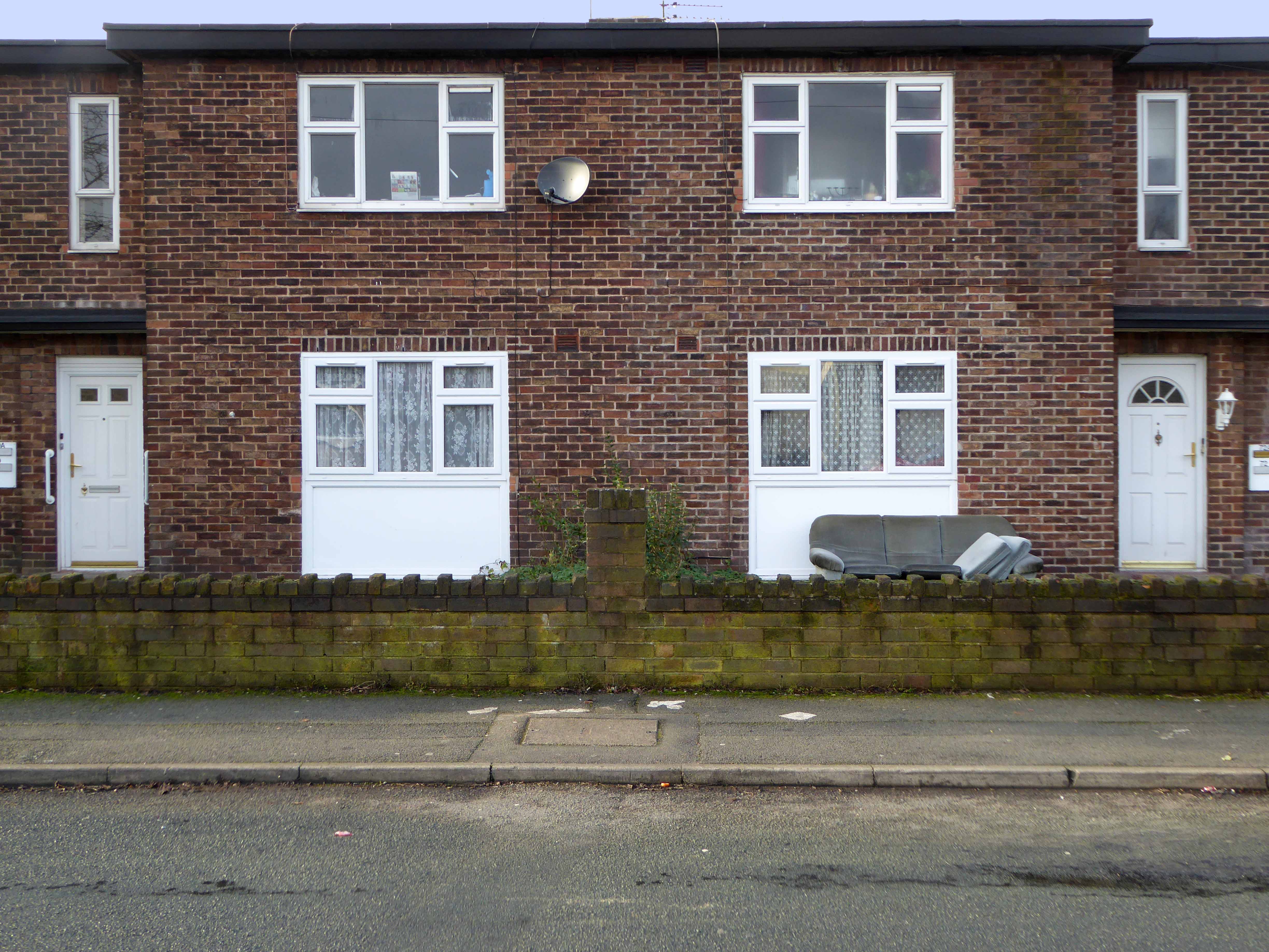
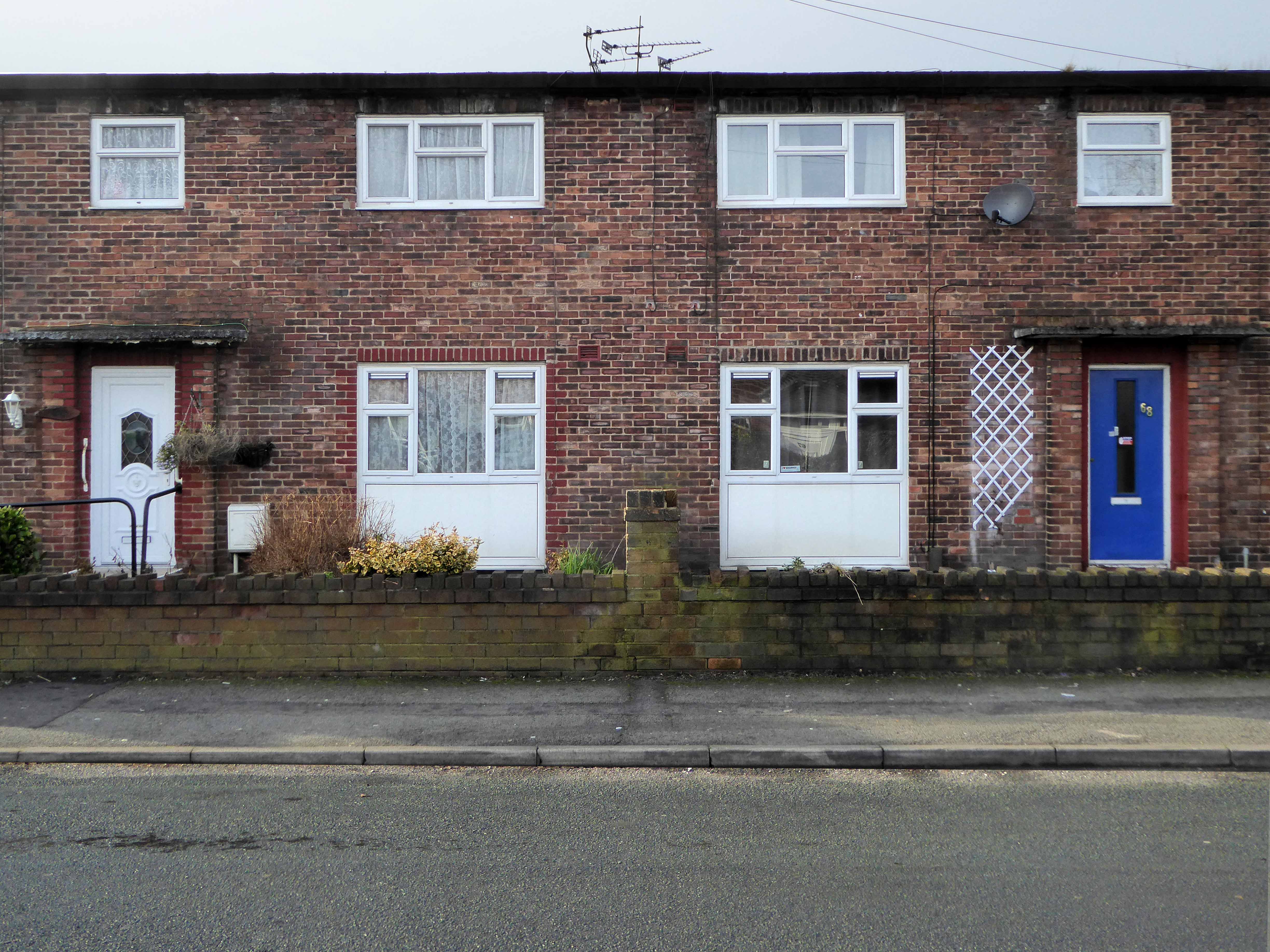
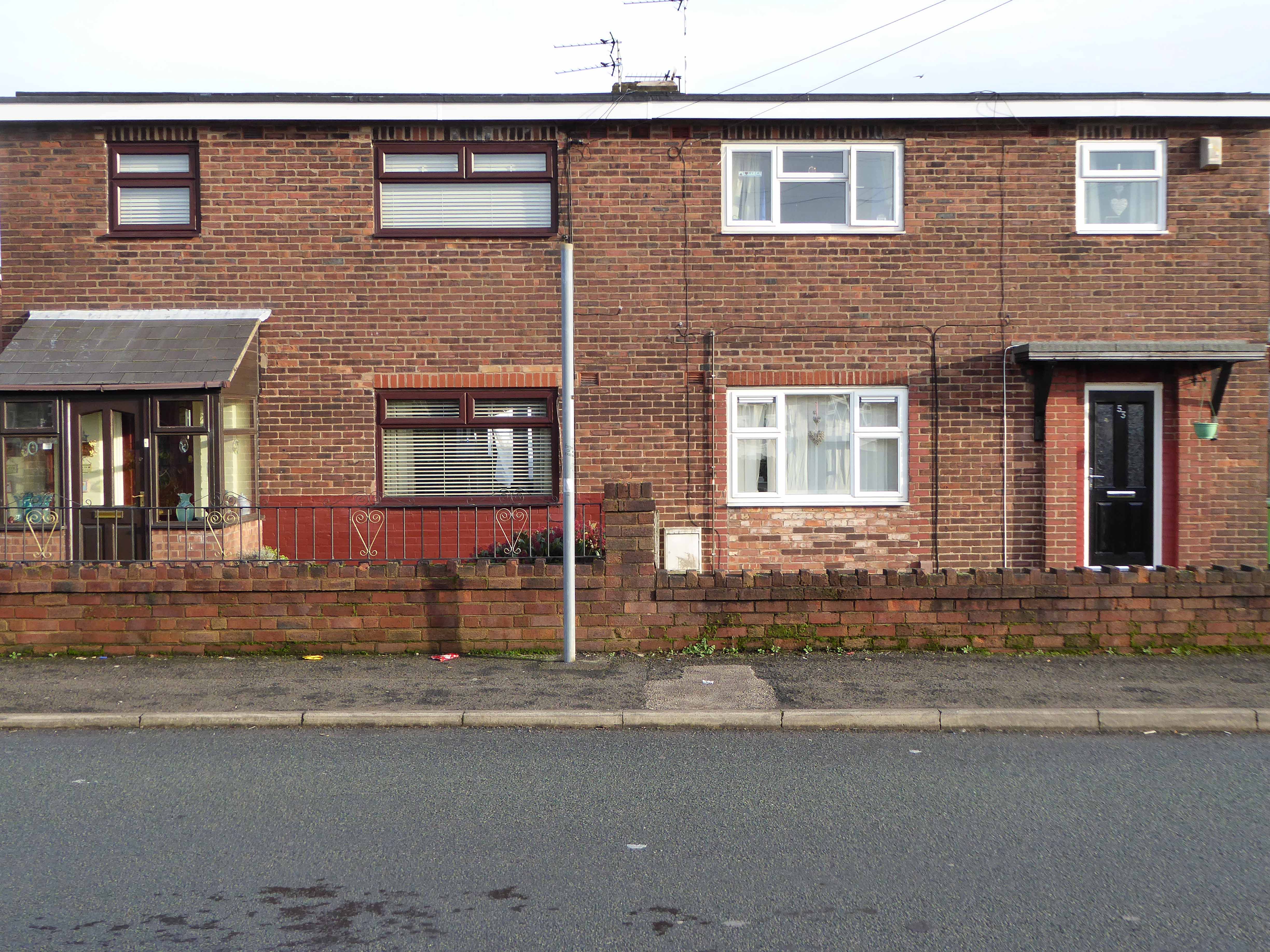
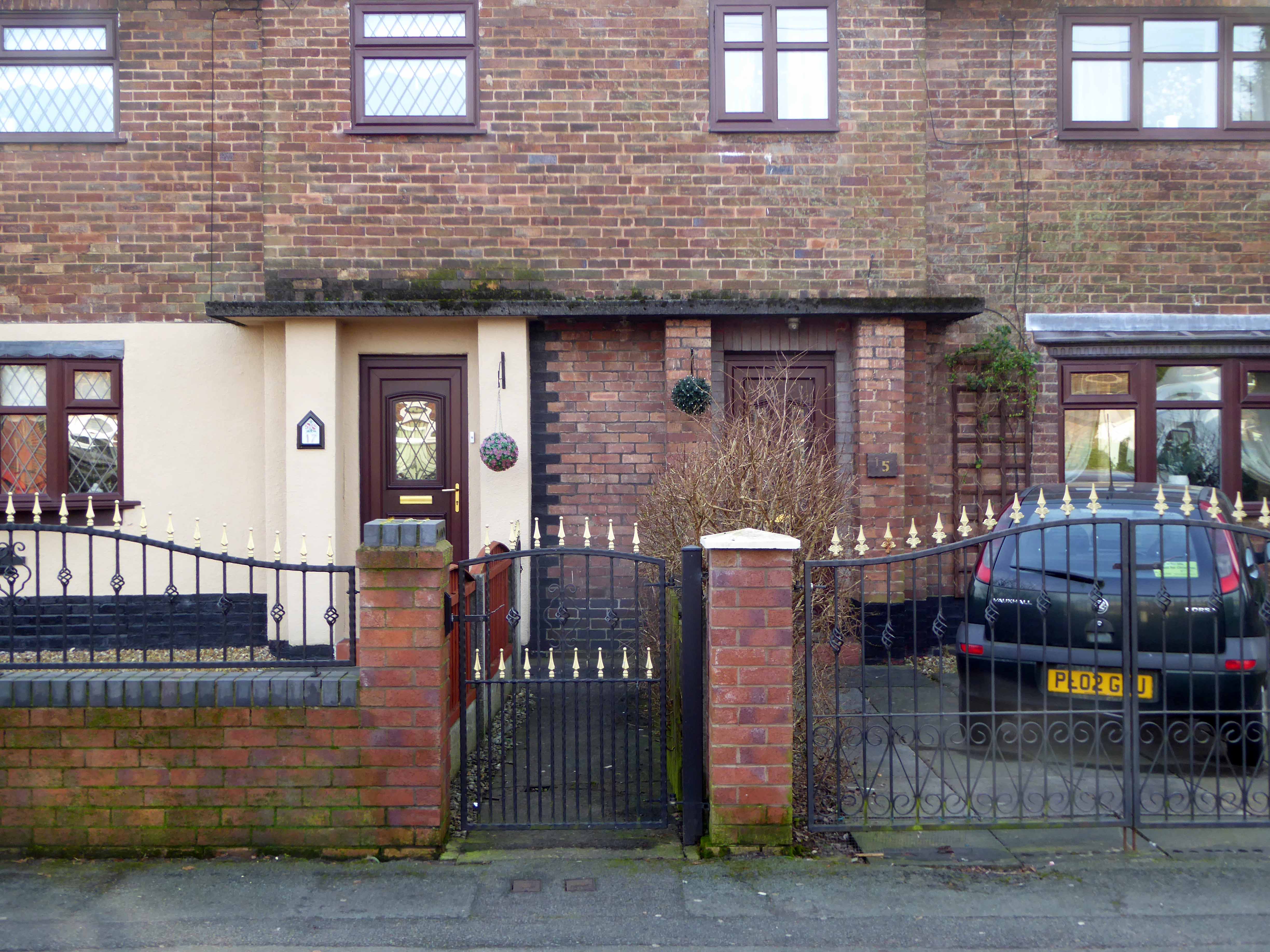
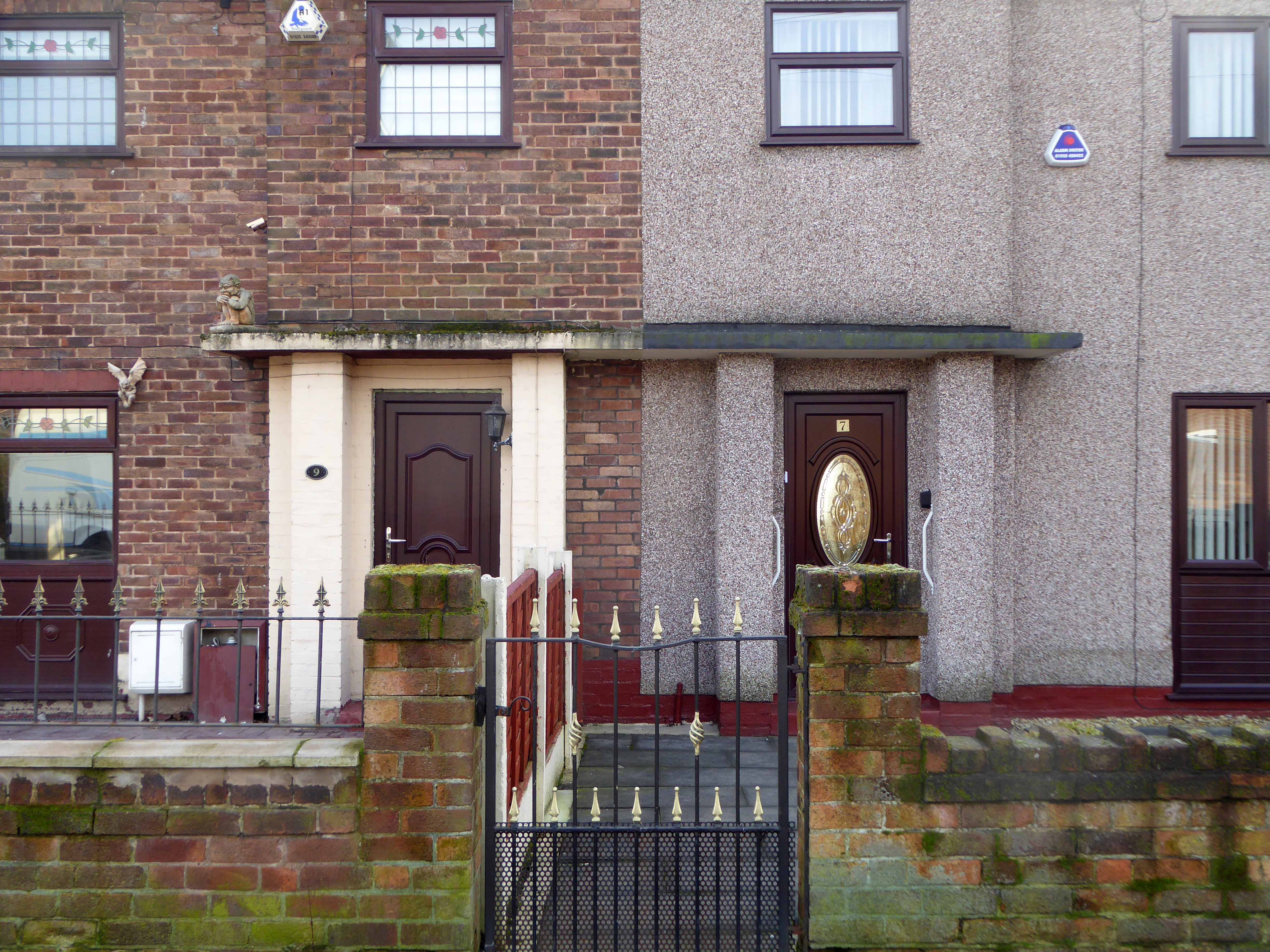
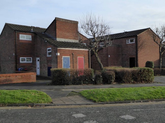
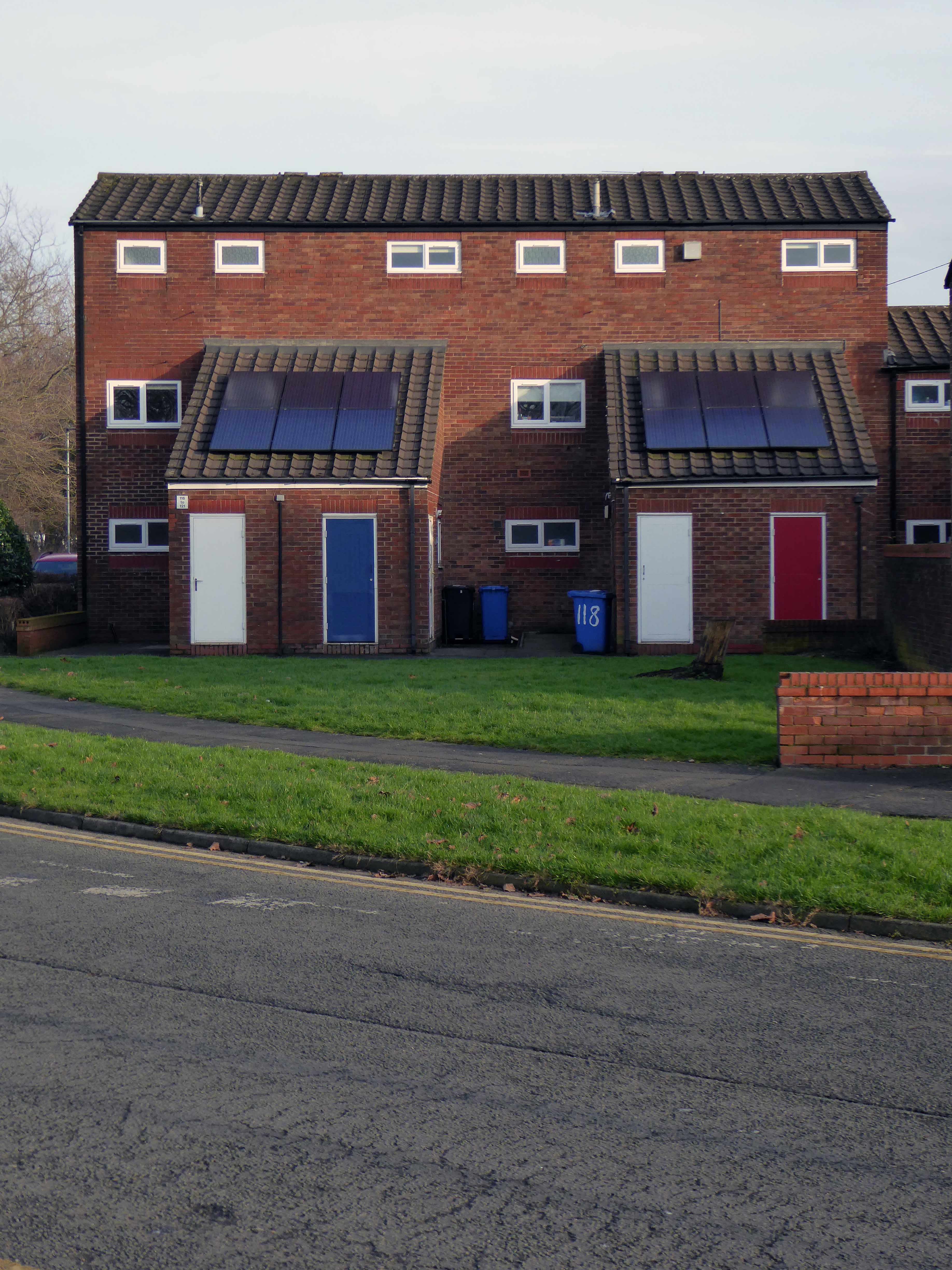
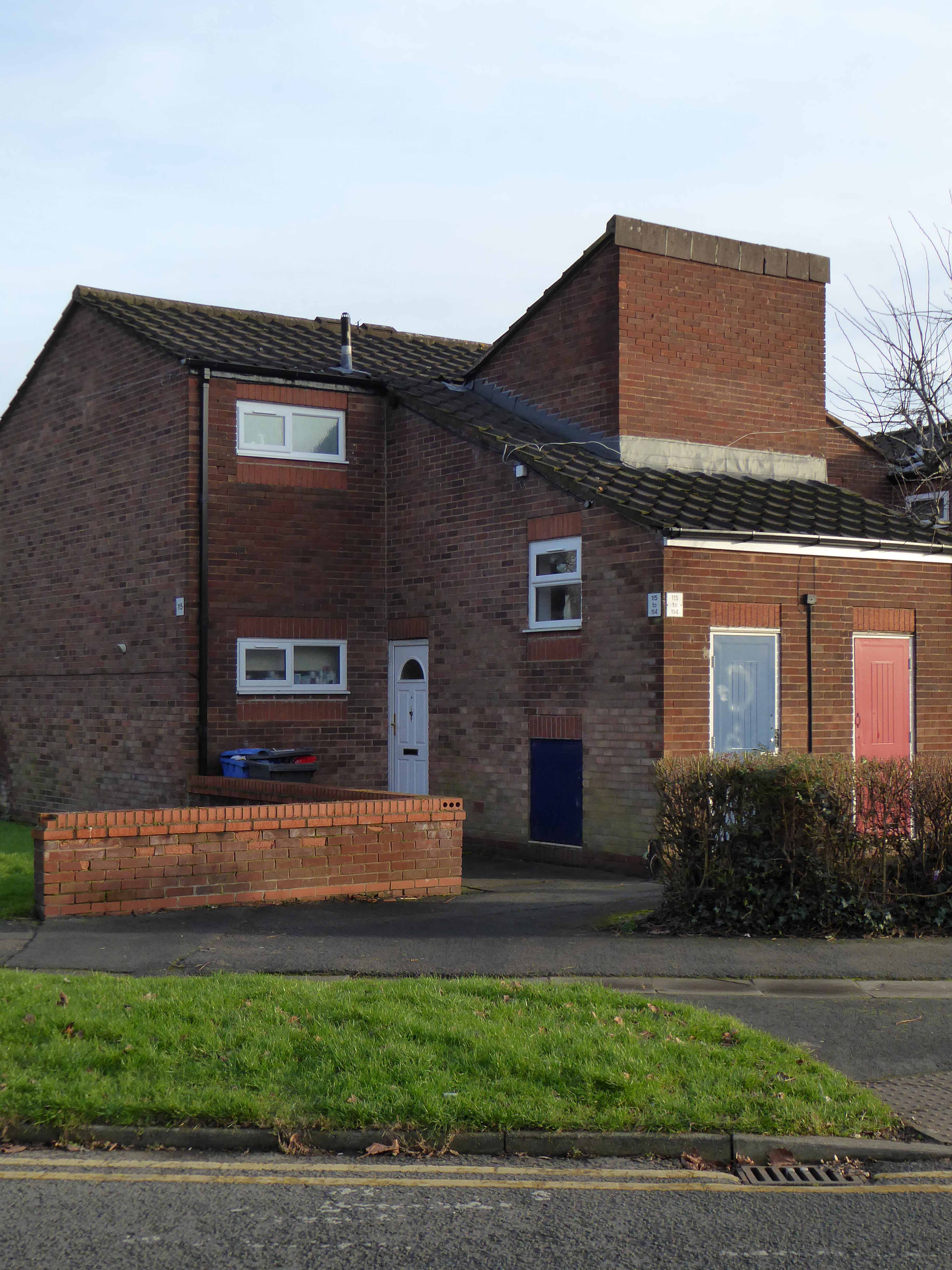
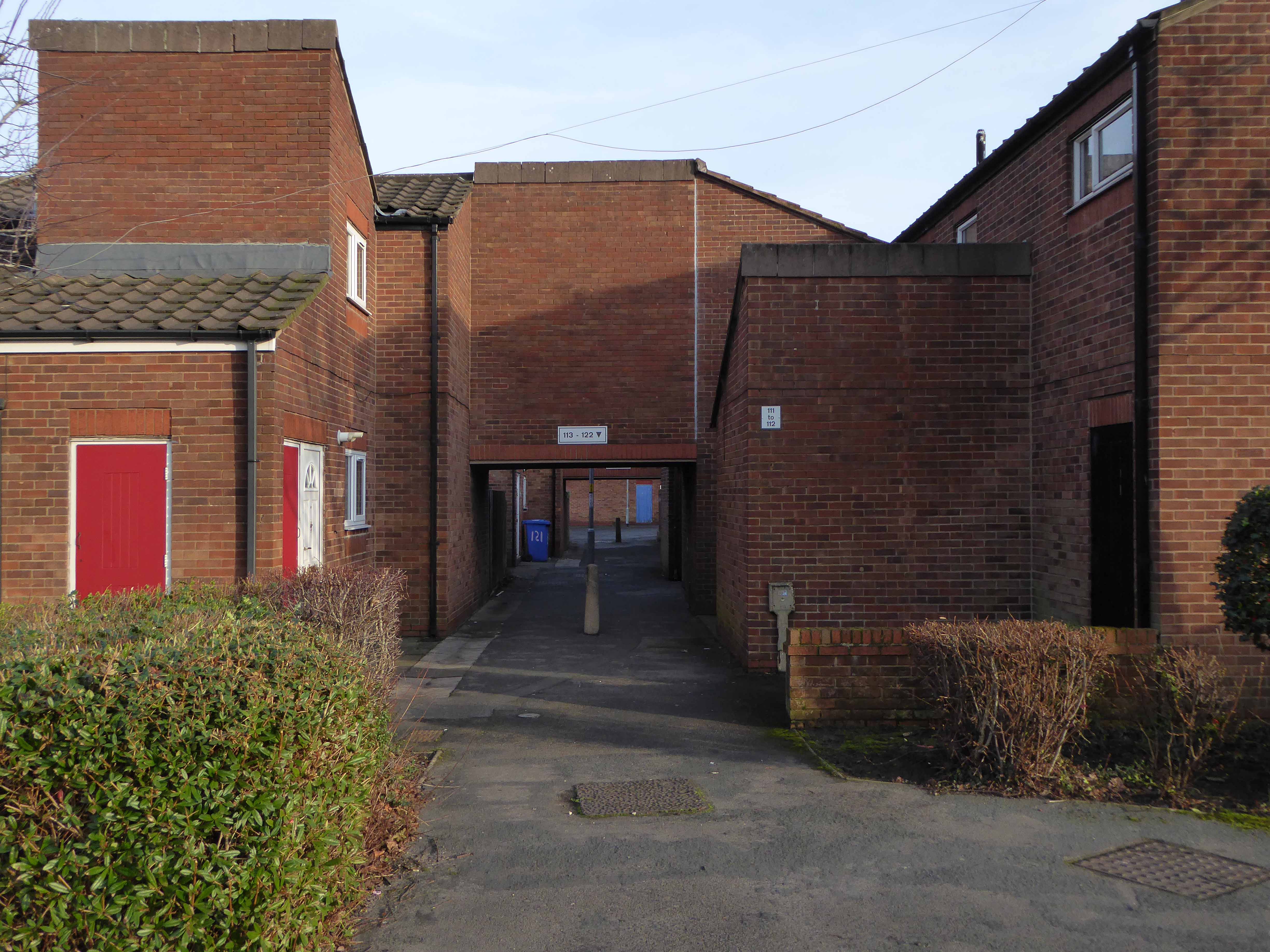
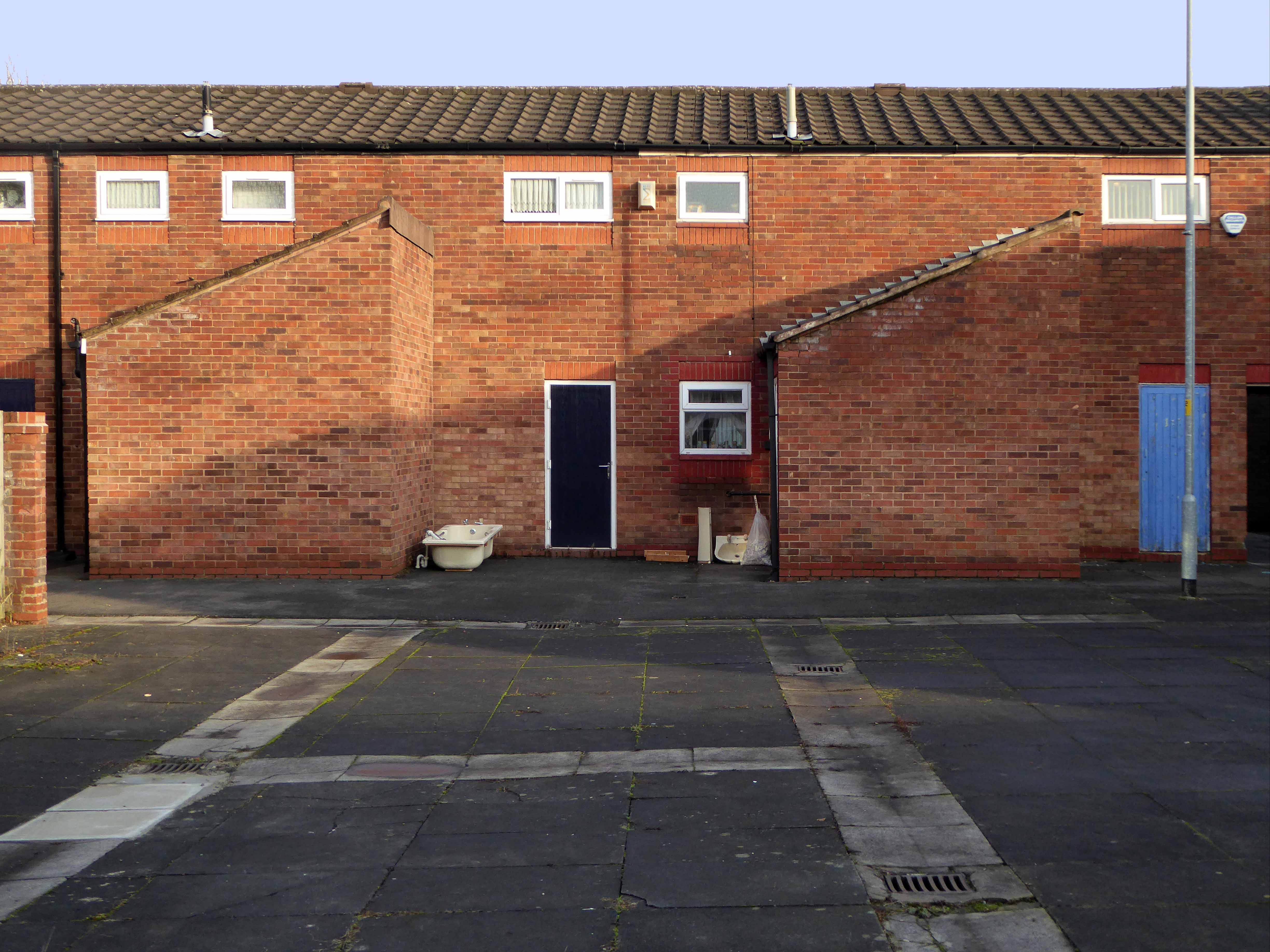
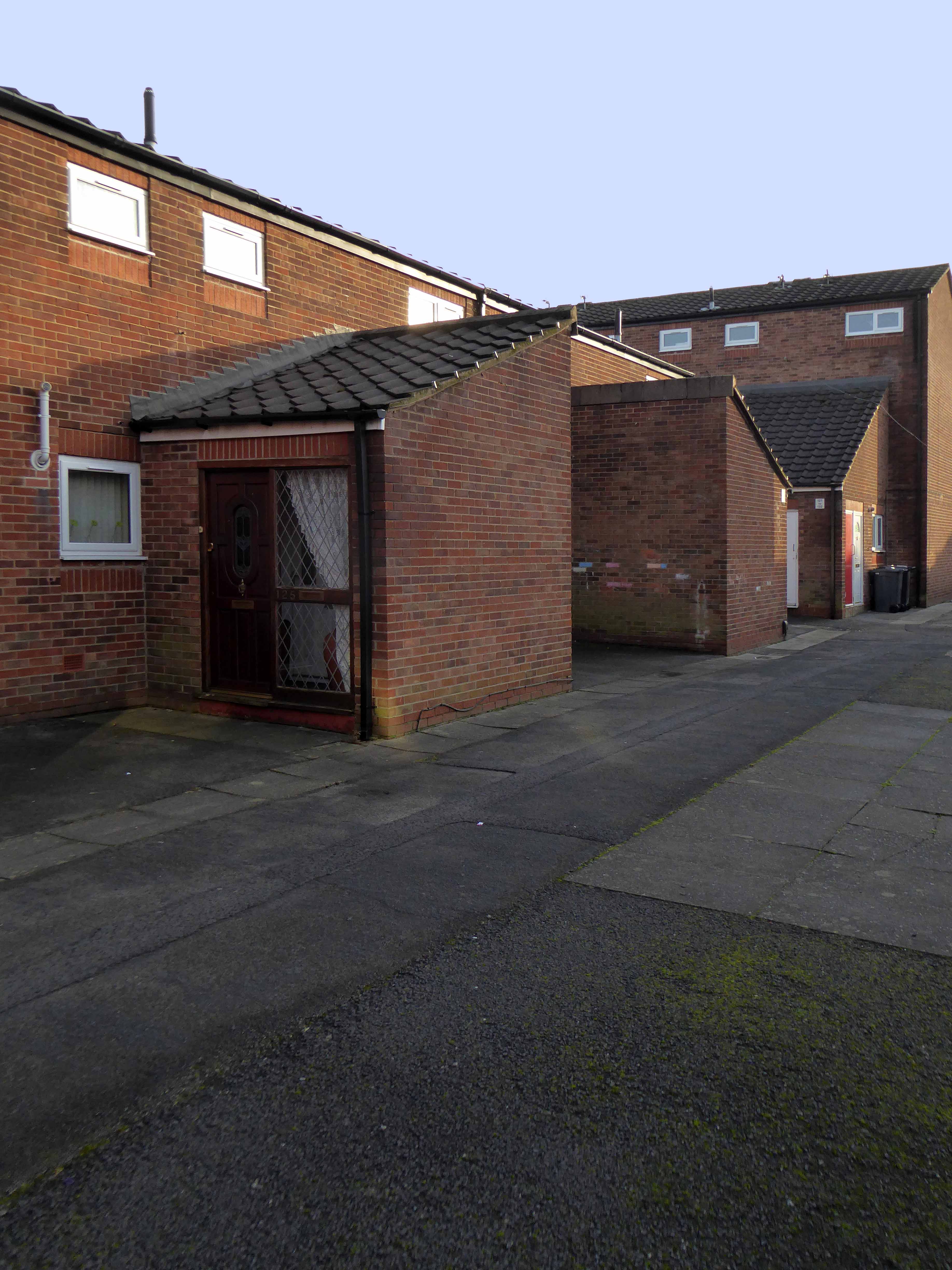
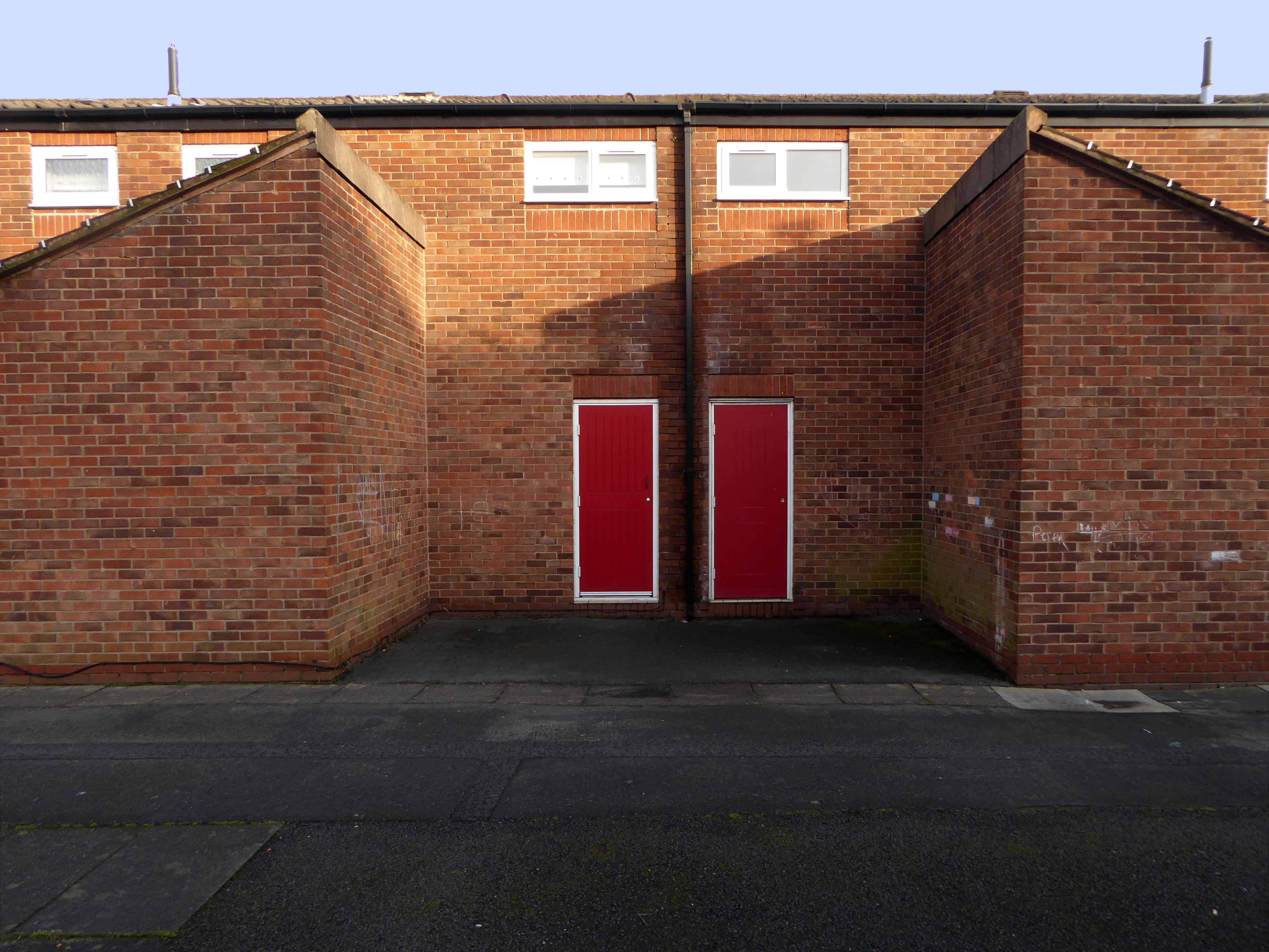
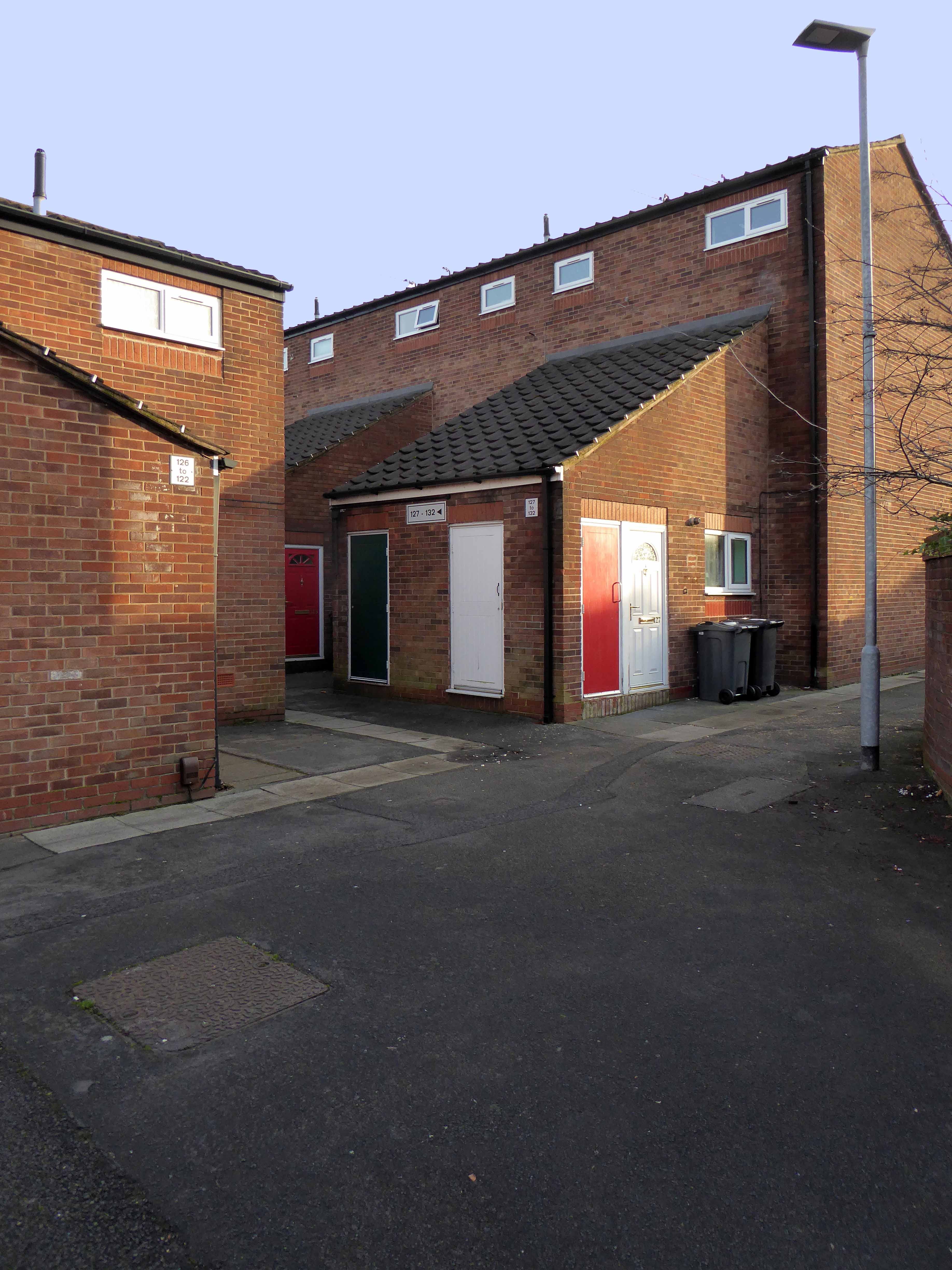
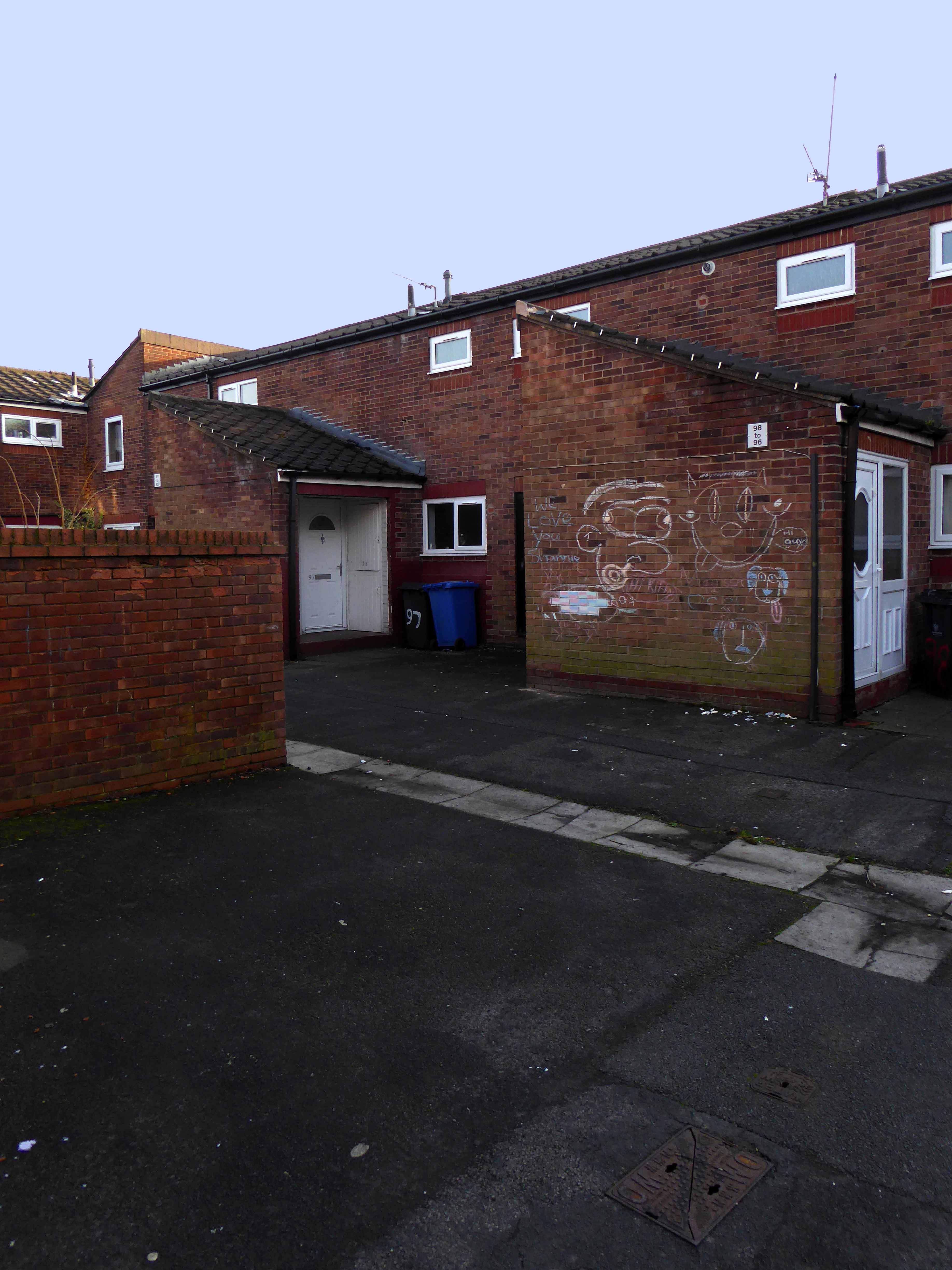
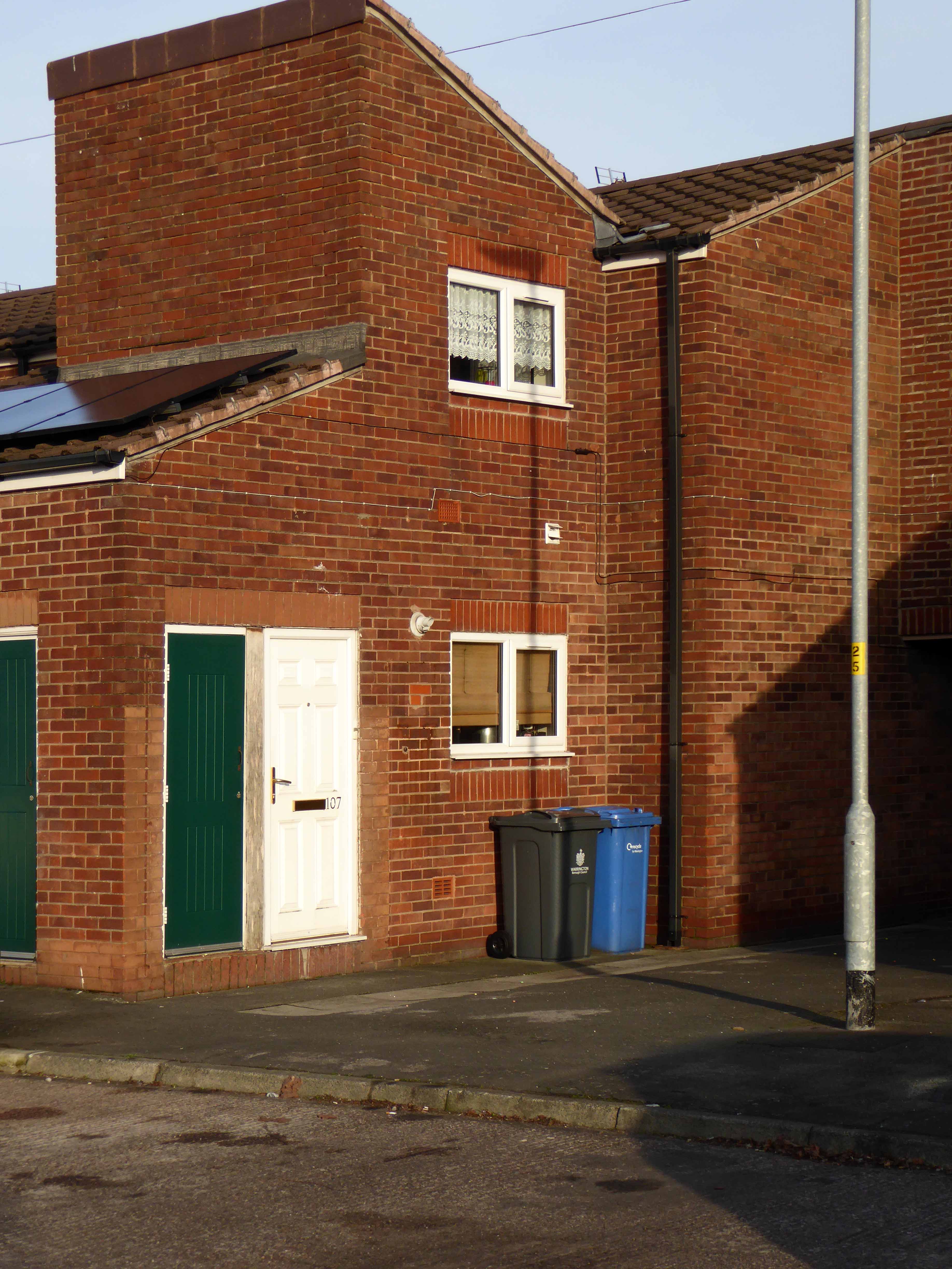
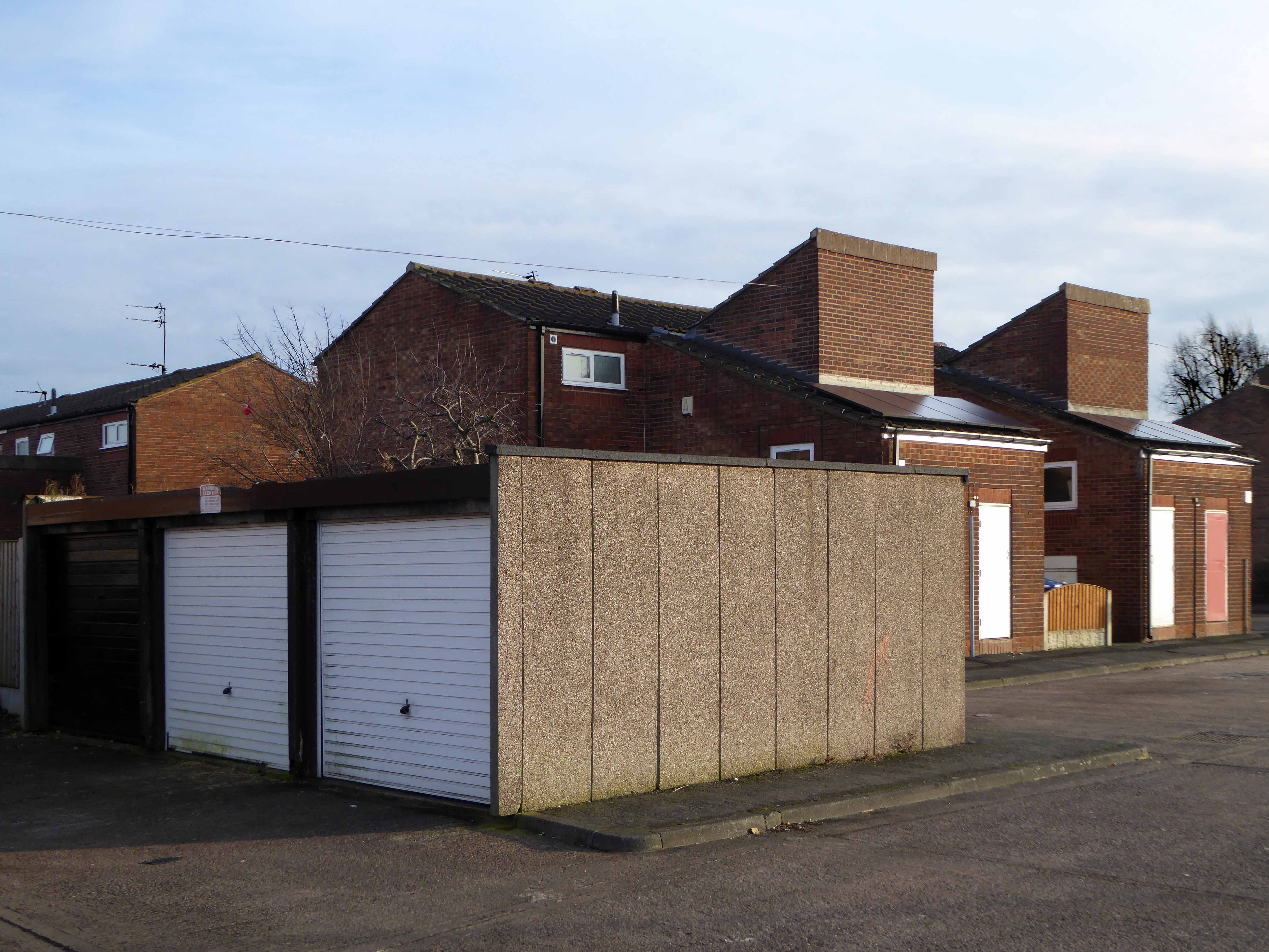
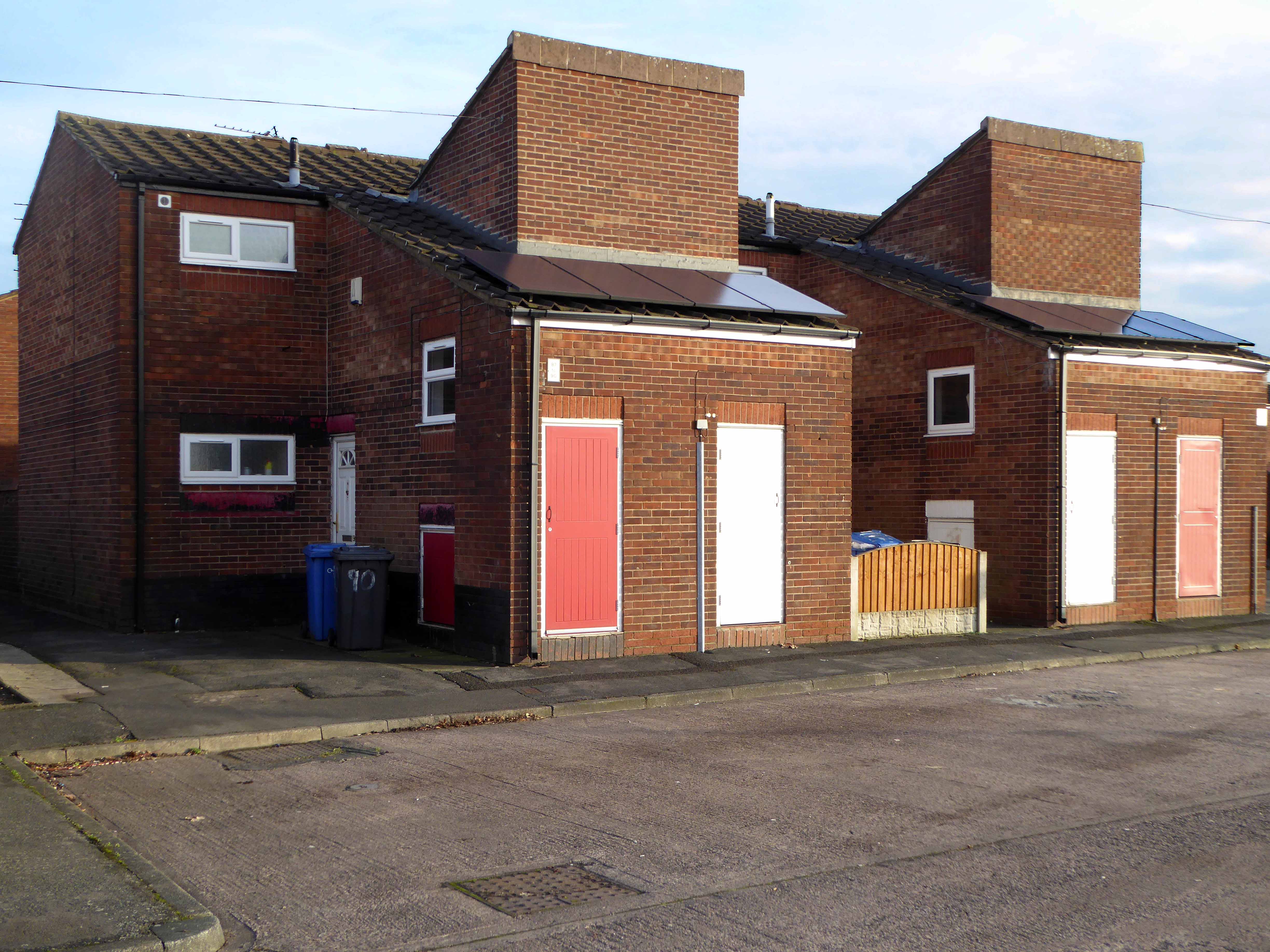
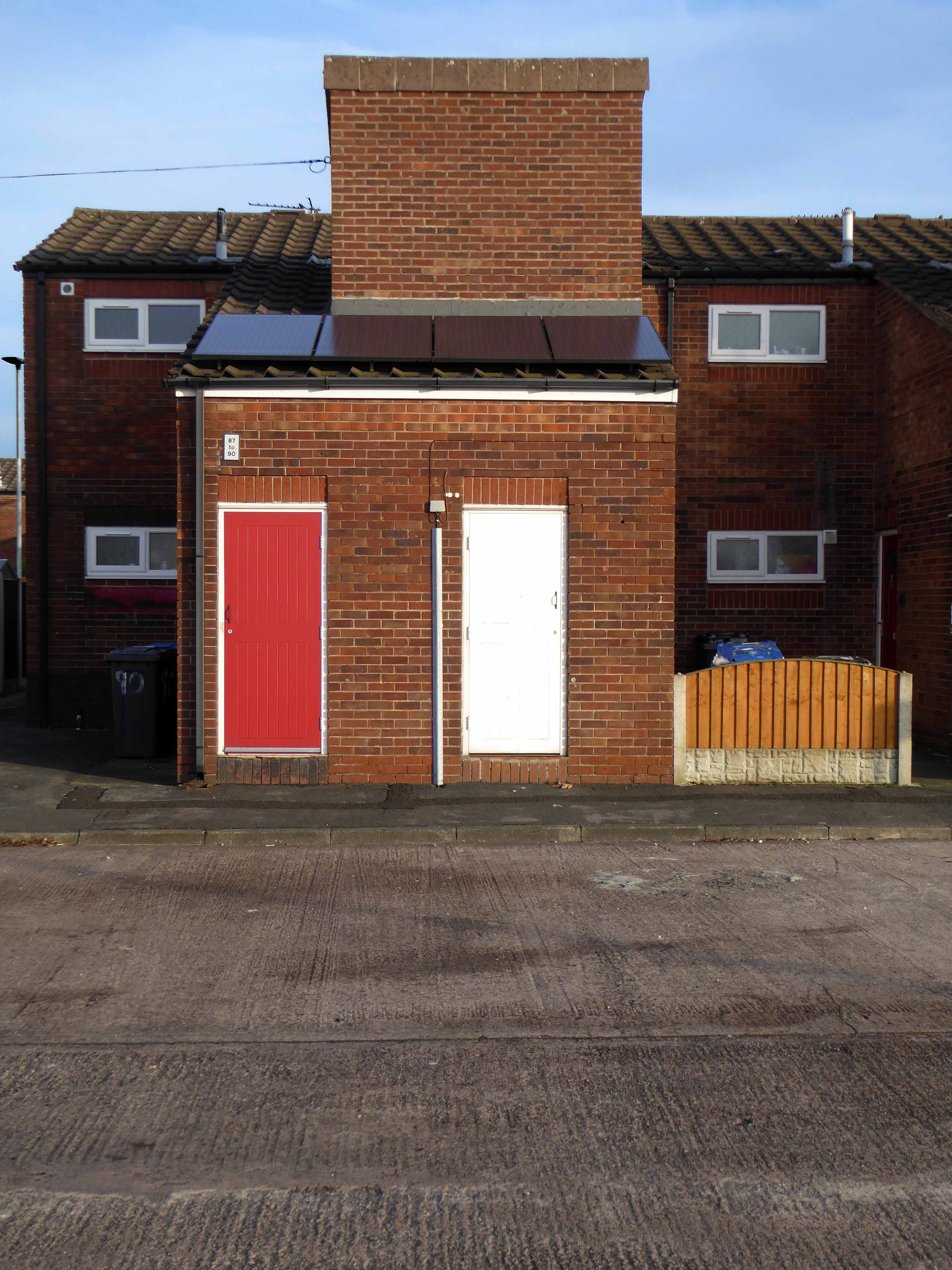
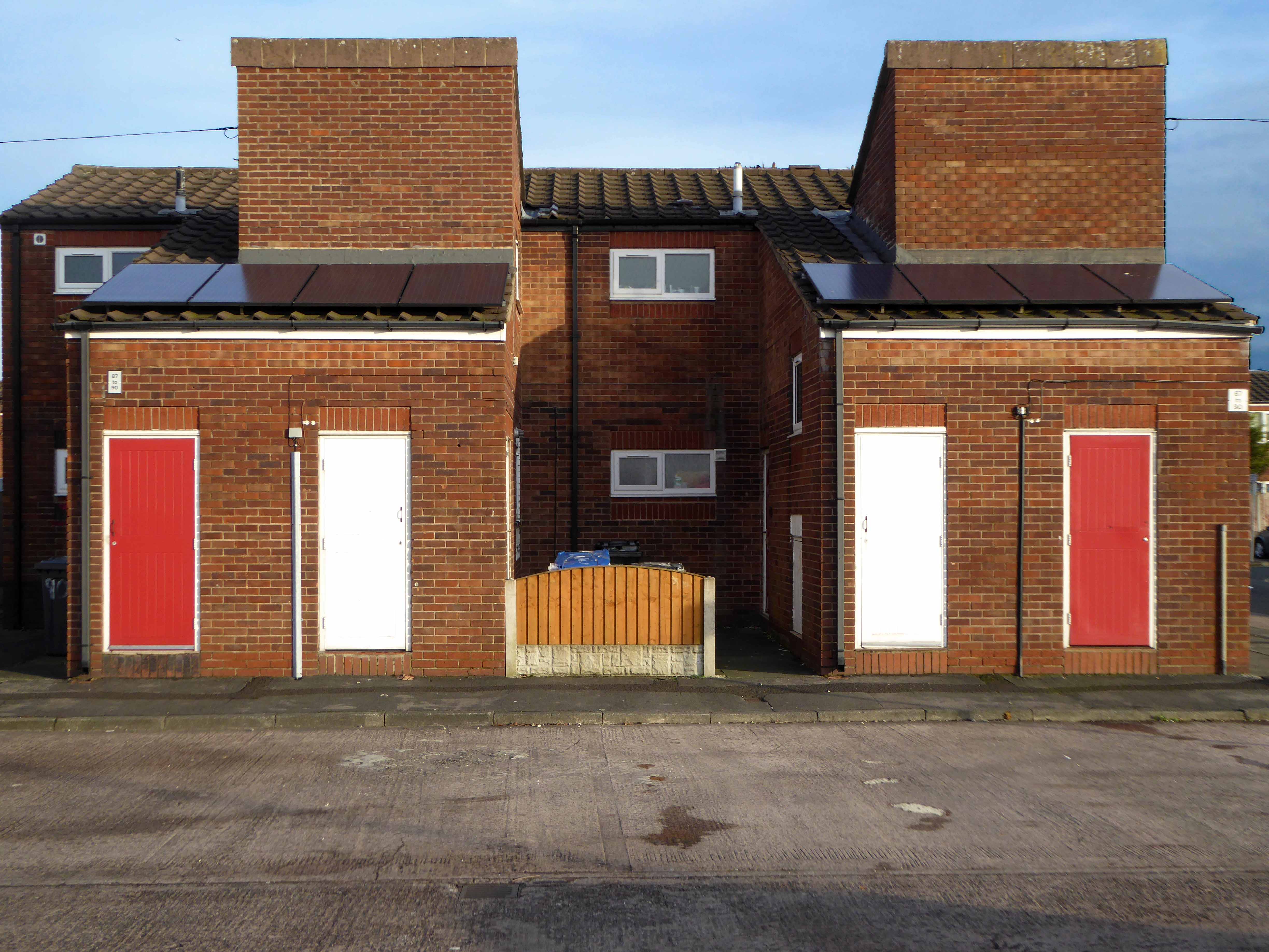
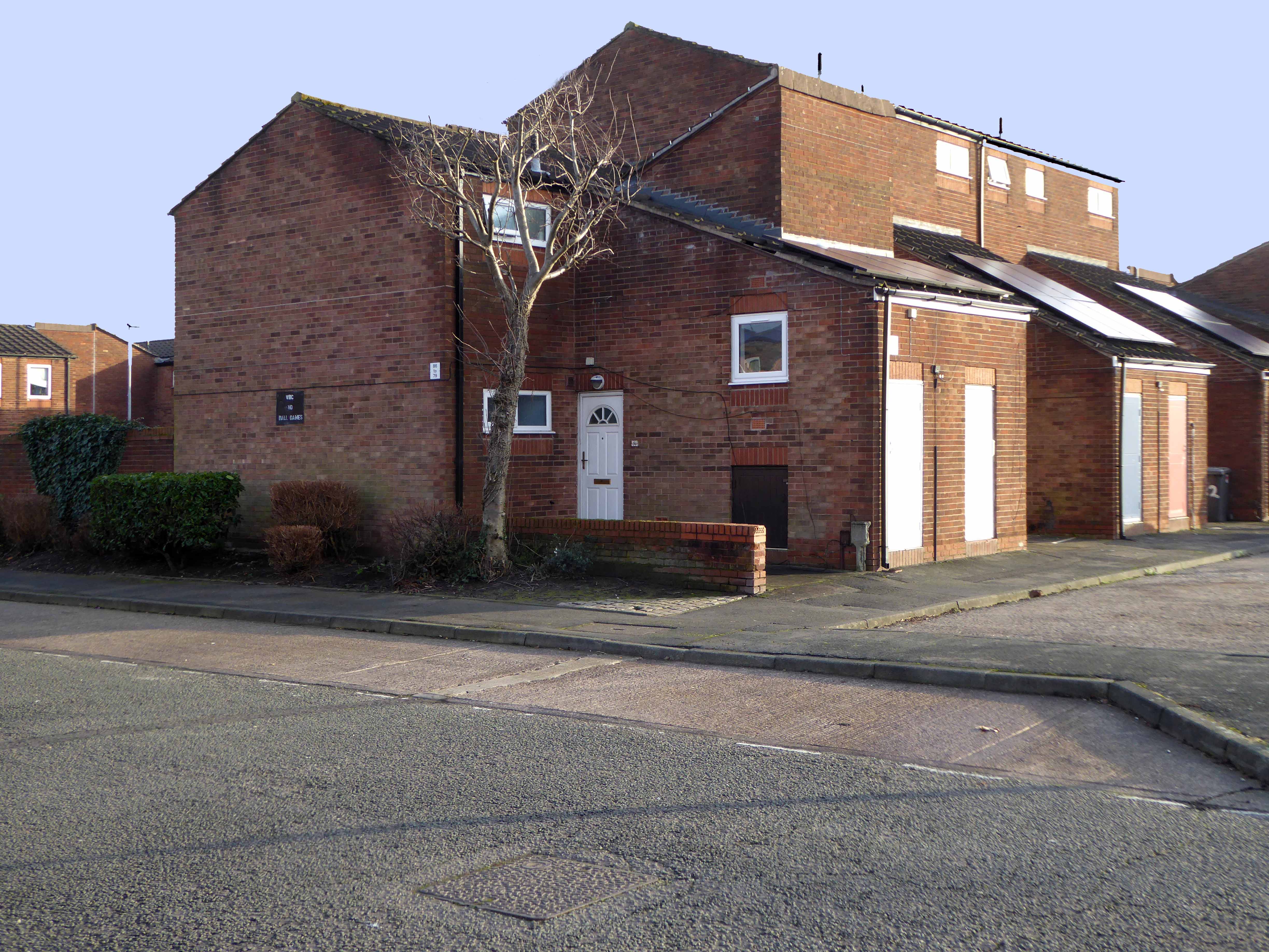
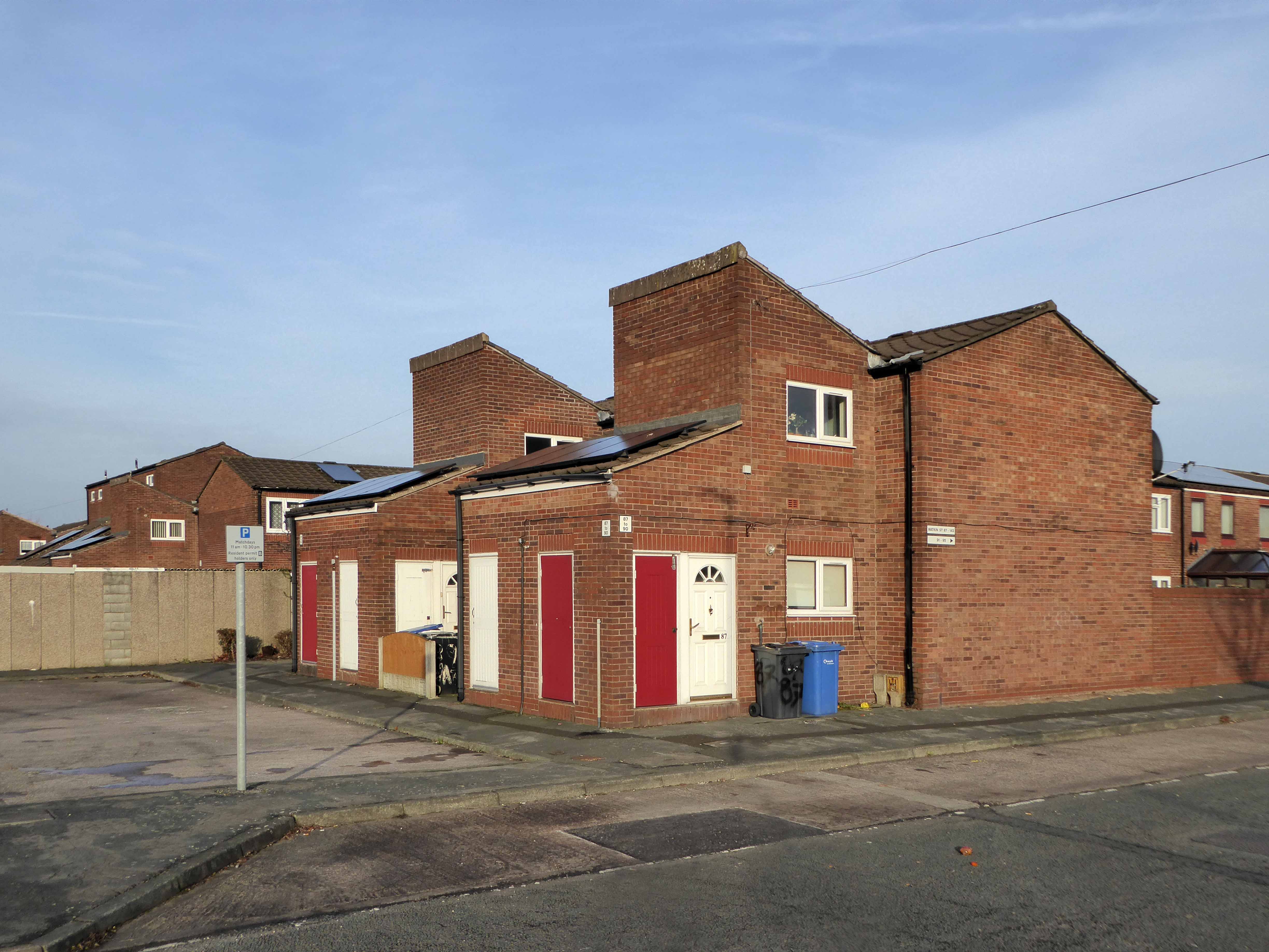
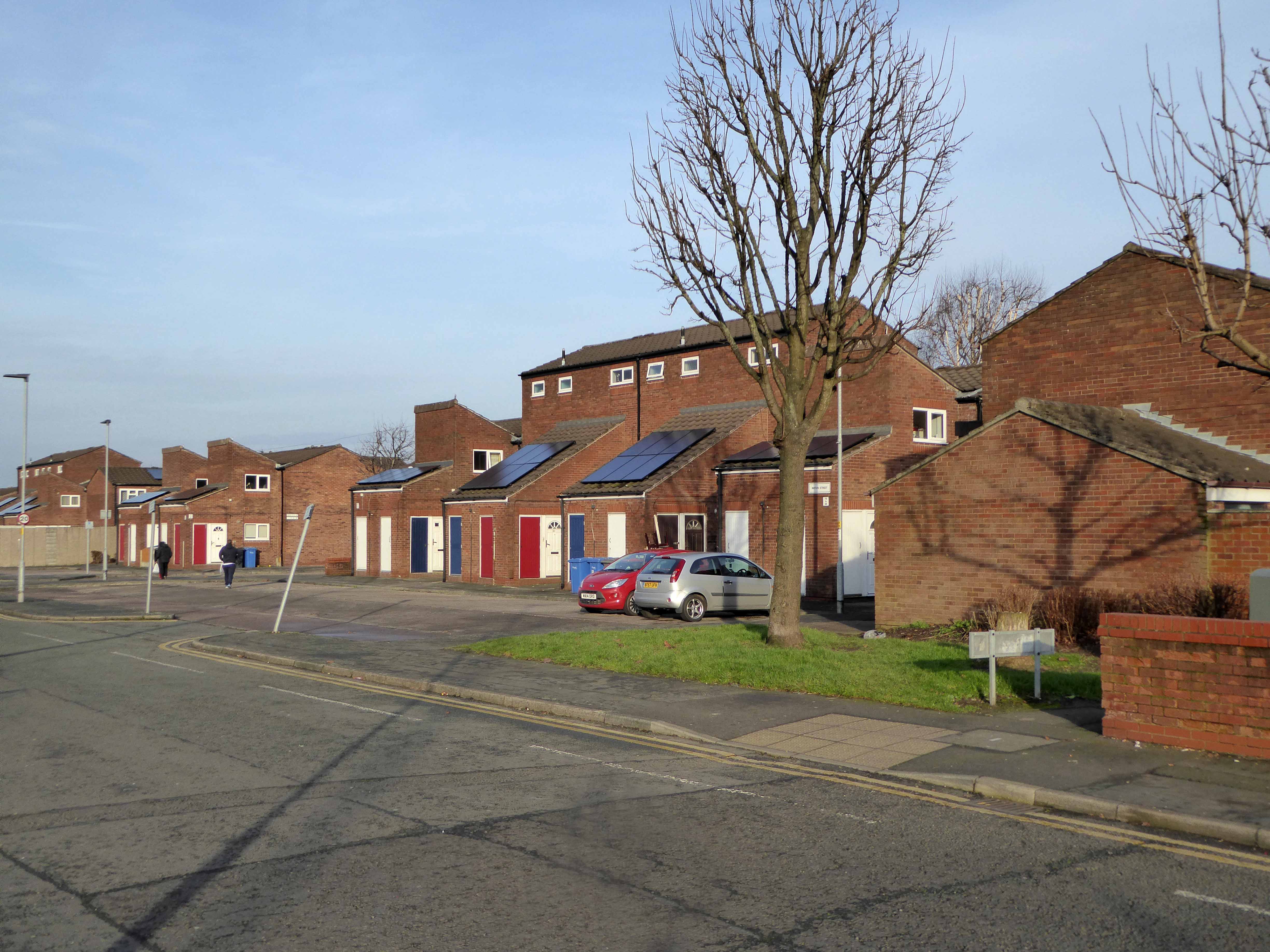
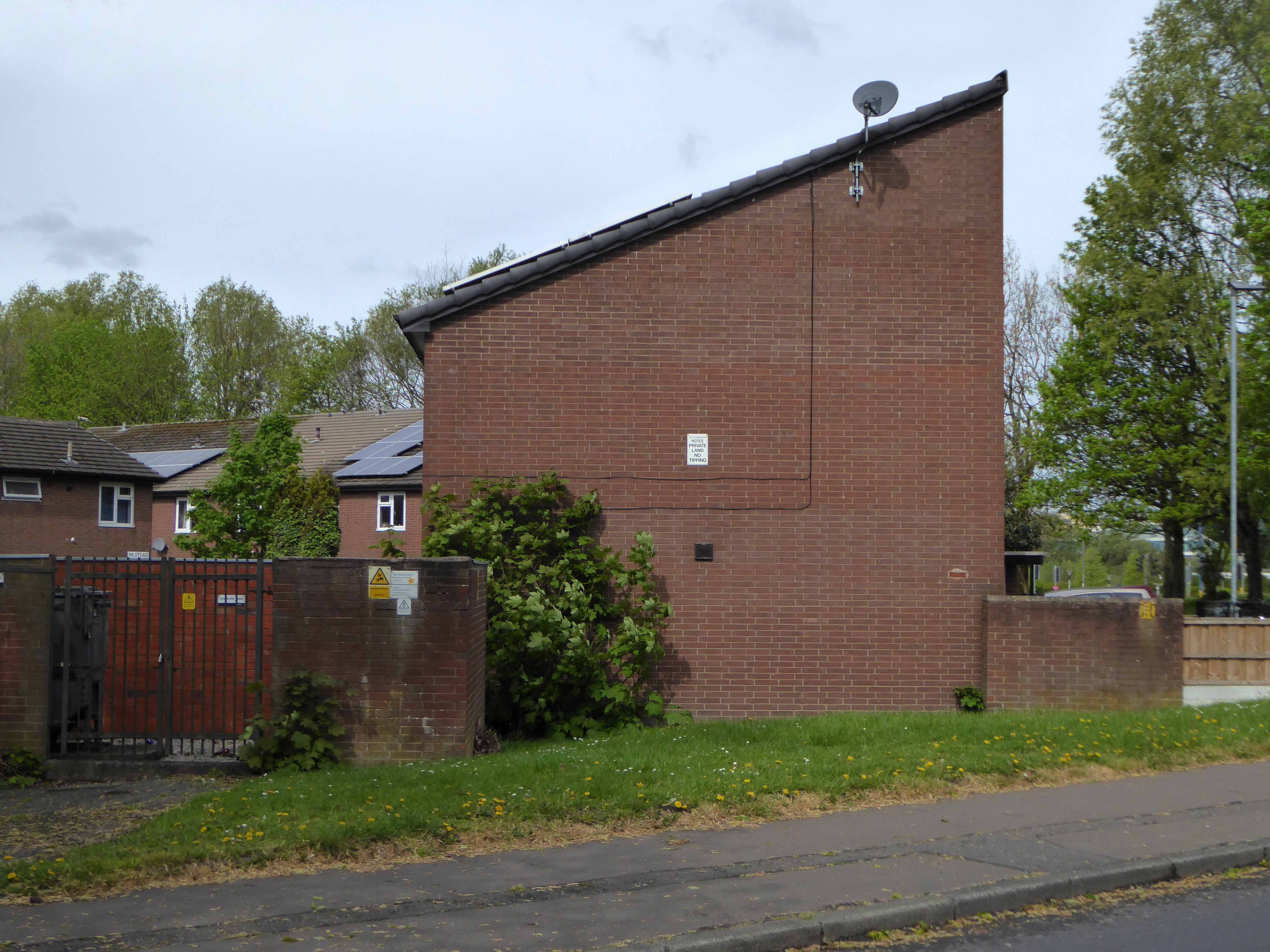
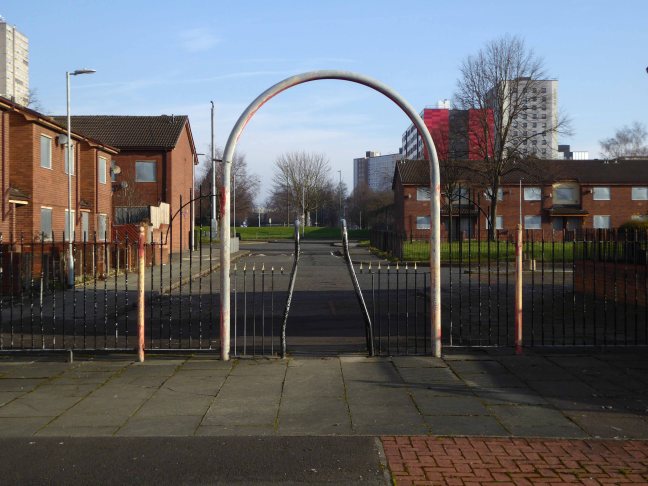
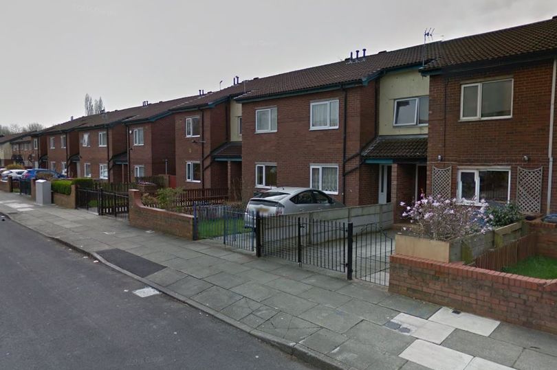
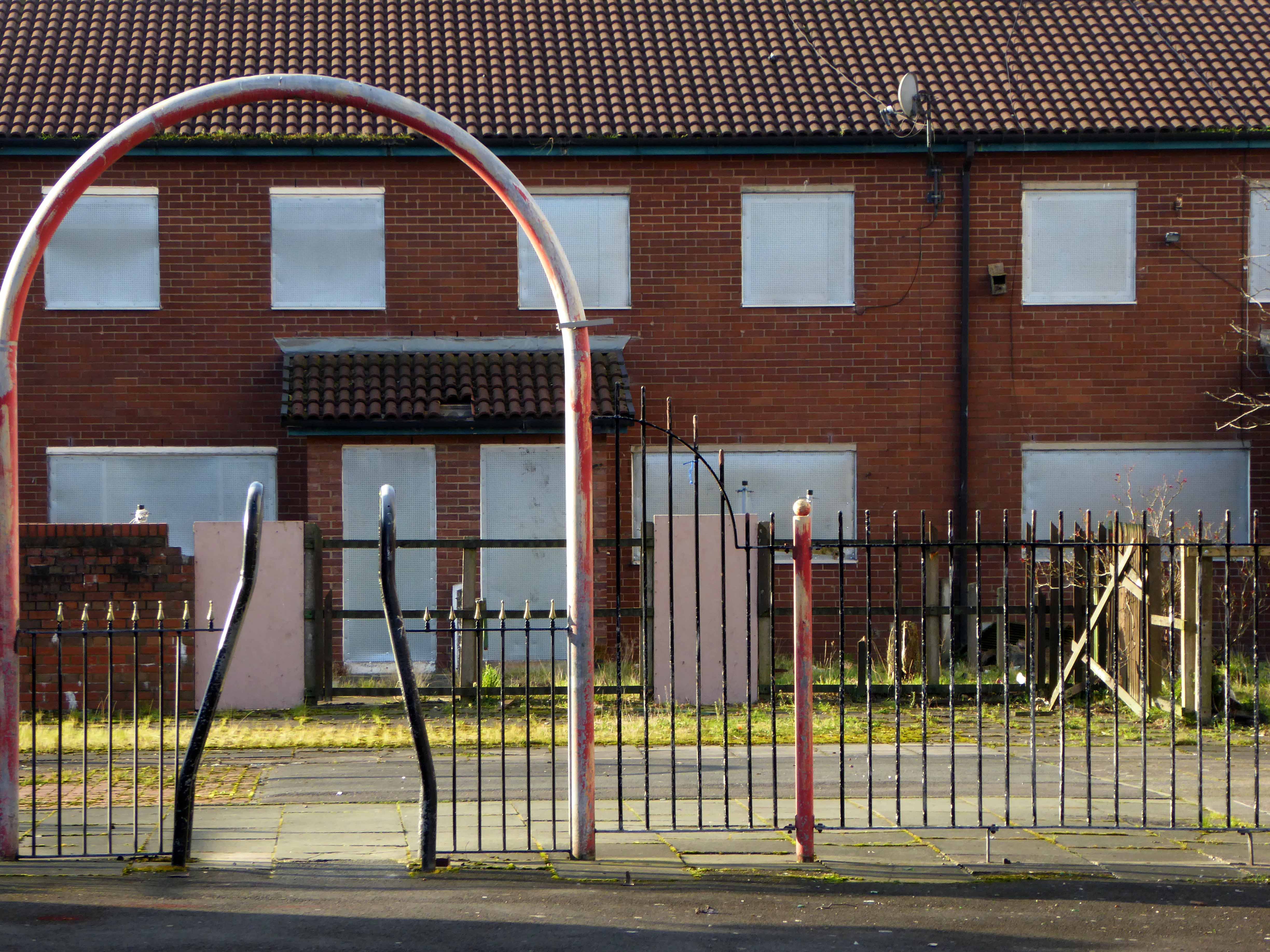
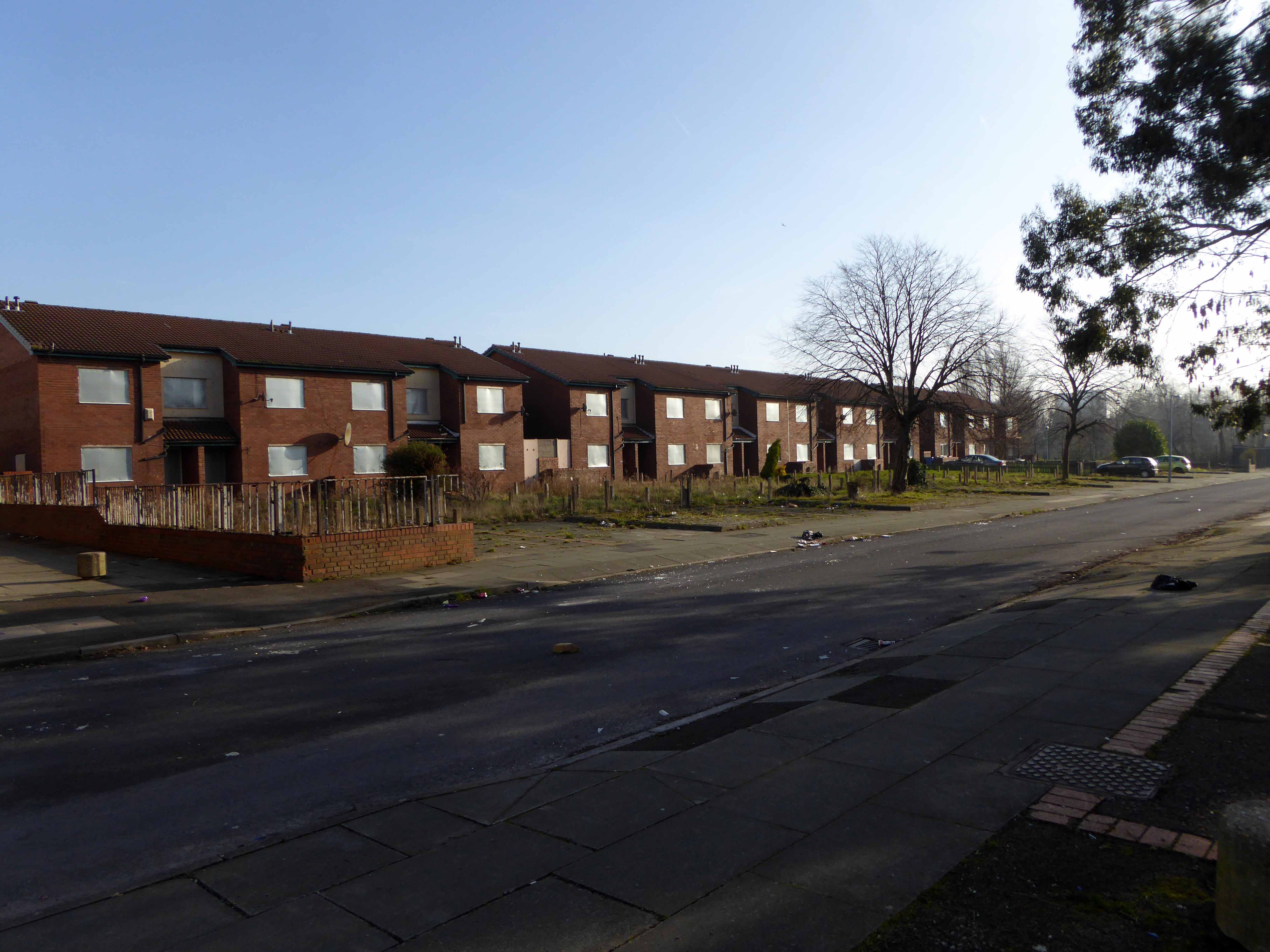
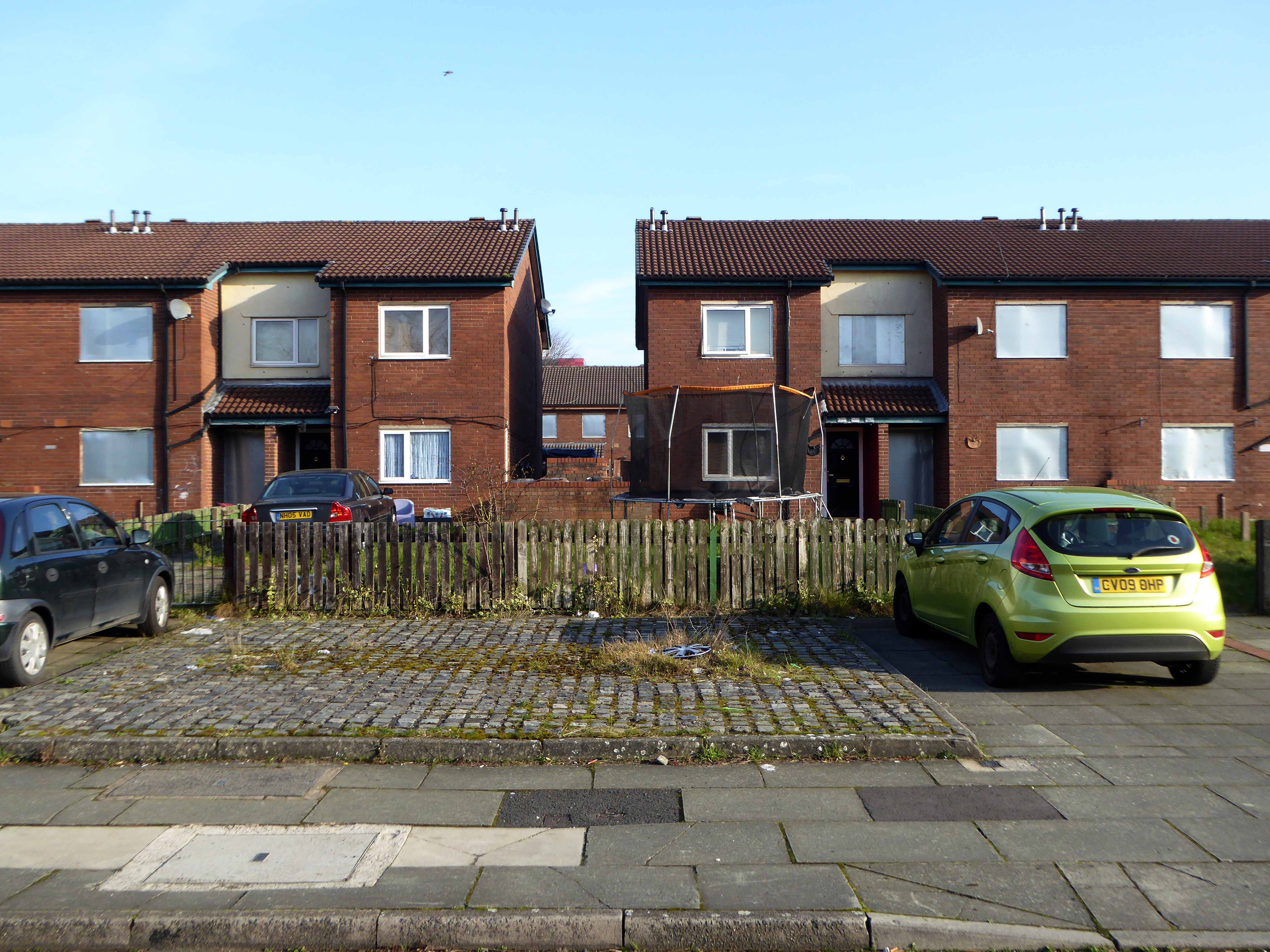
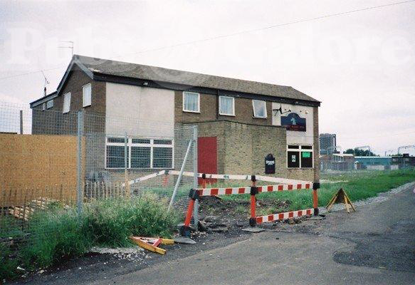
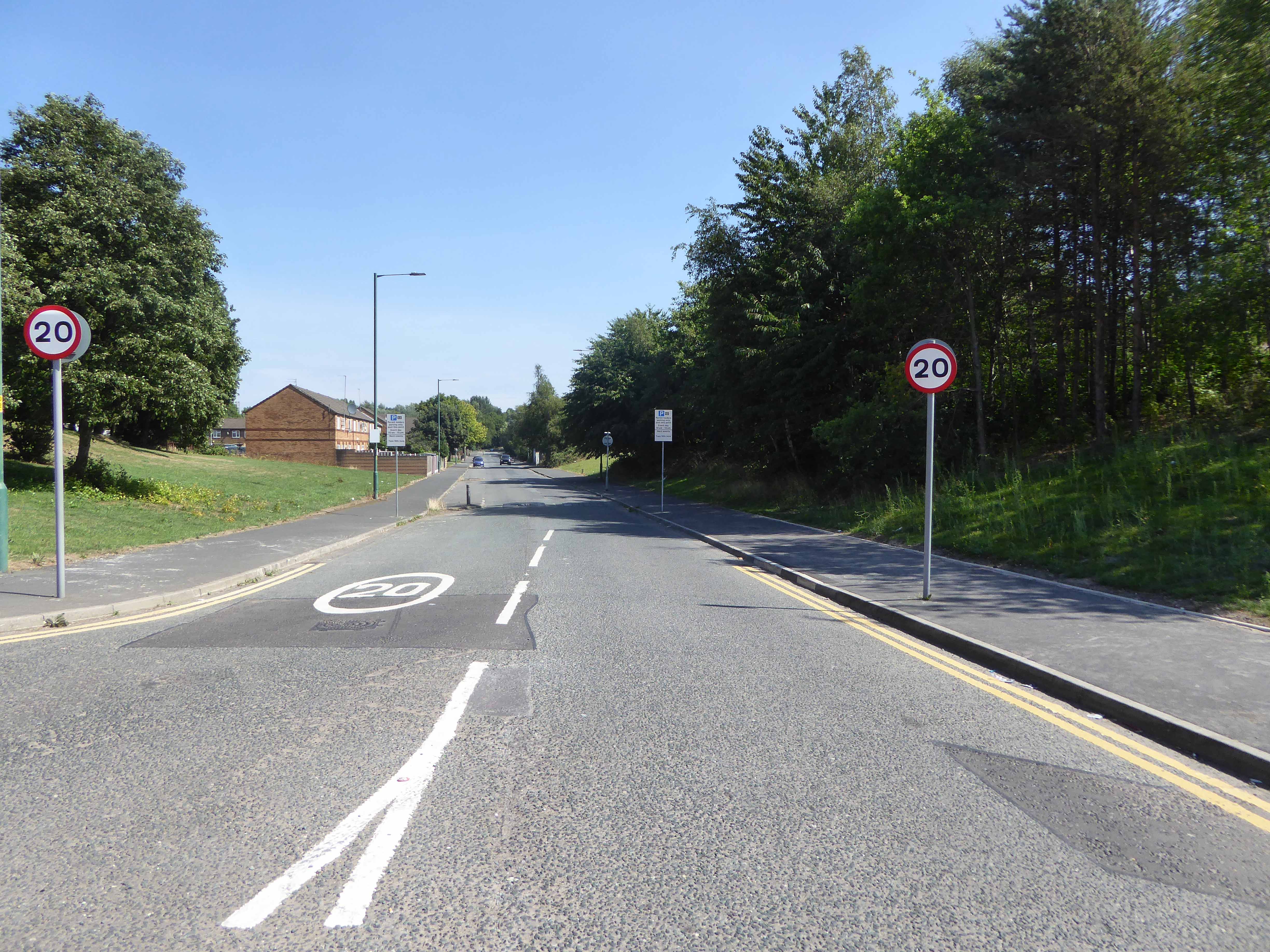
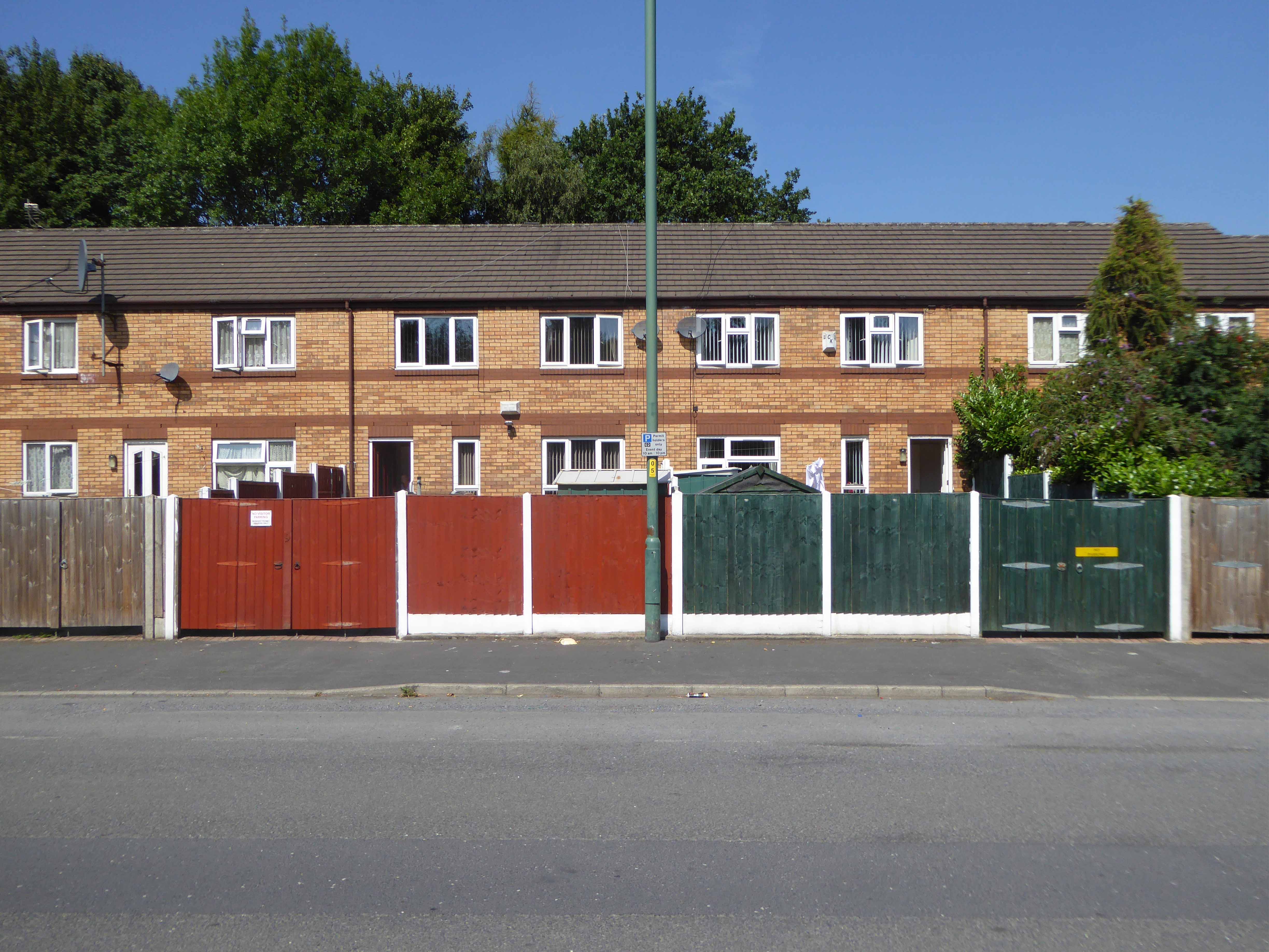
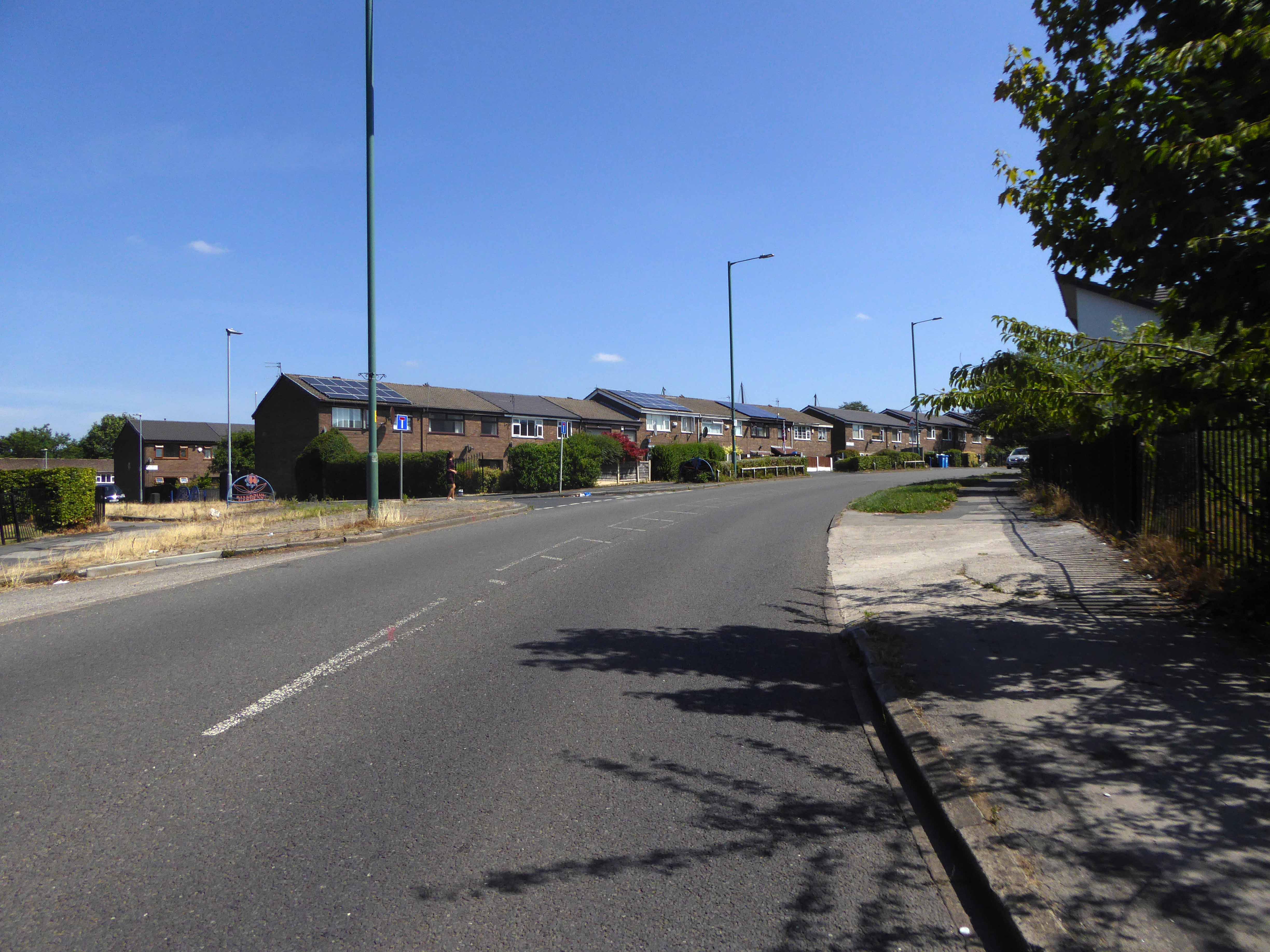
Our story is far from over, this optimism is short-lived the homes, houses and industry are swept away yet again, replaced with two story modern terraced housing and an all too obvious absence of regular employment – yet the tower blocks prevailed.

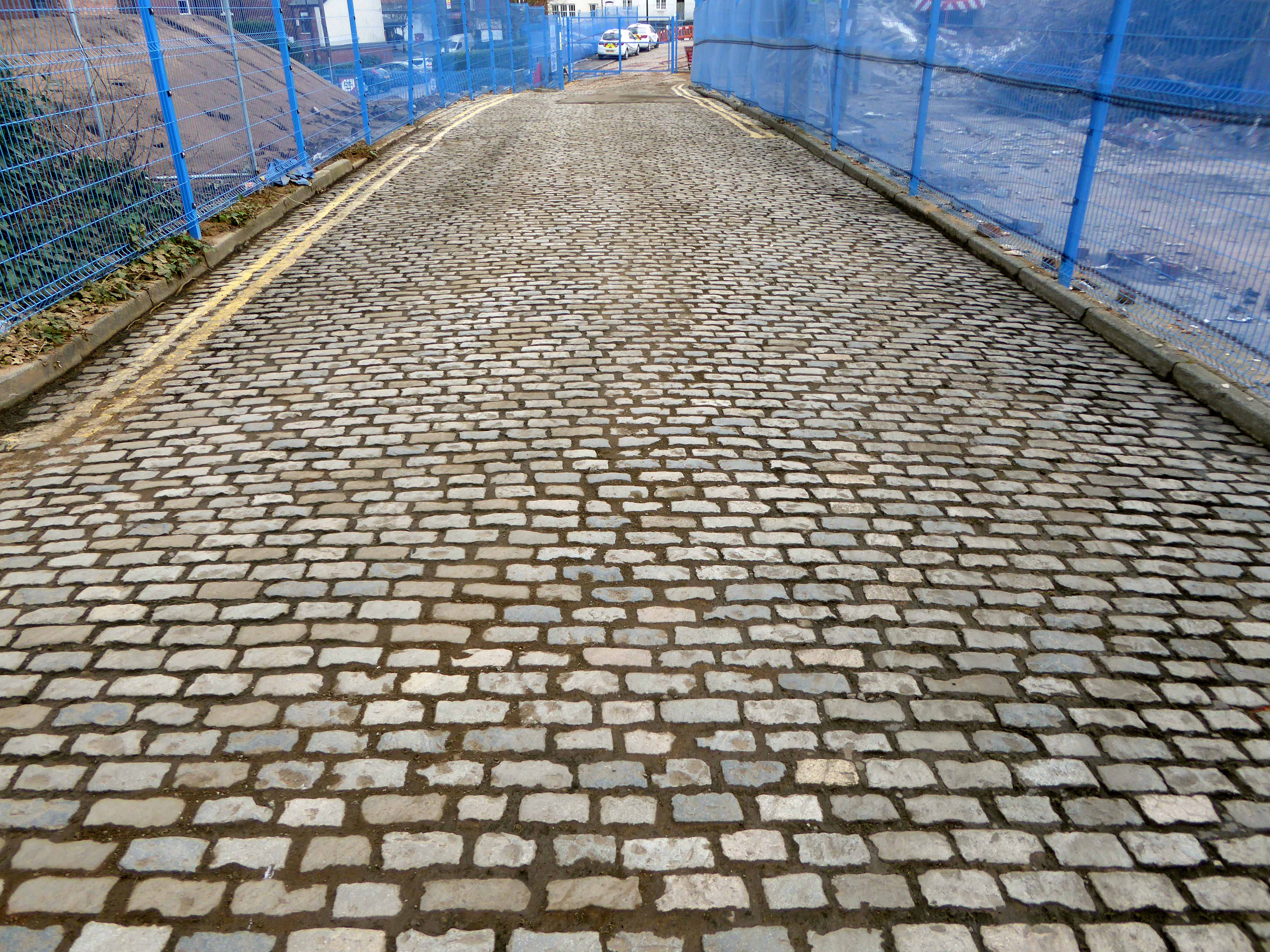
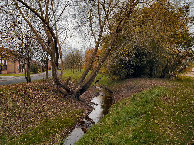
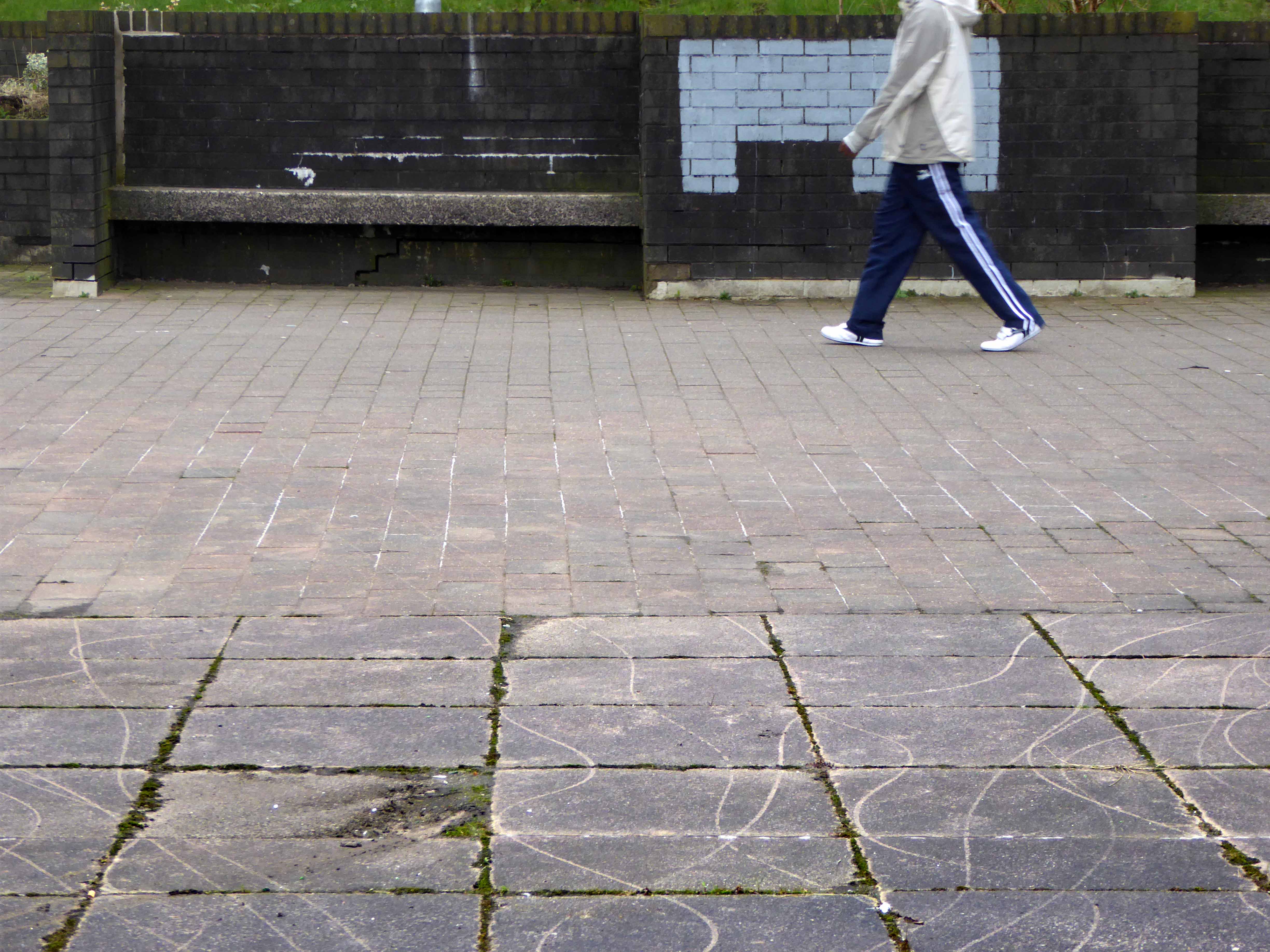
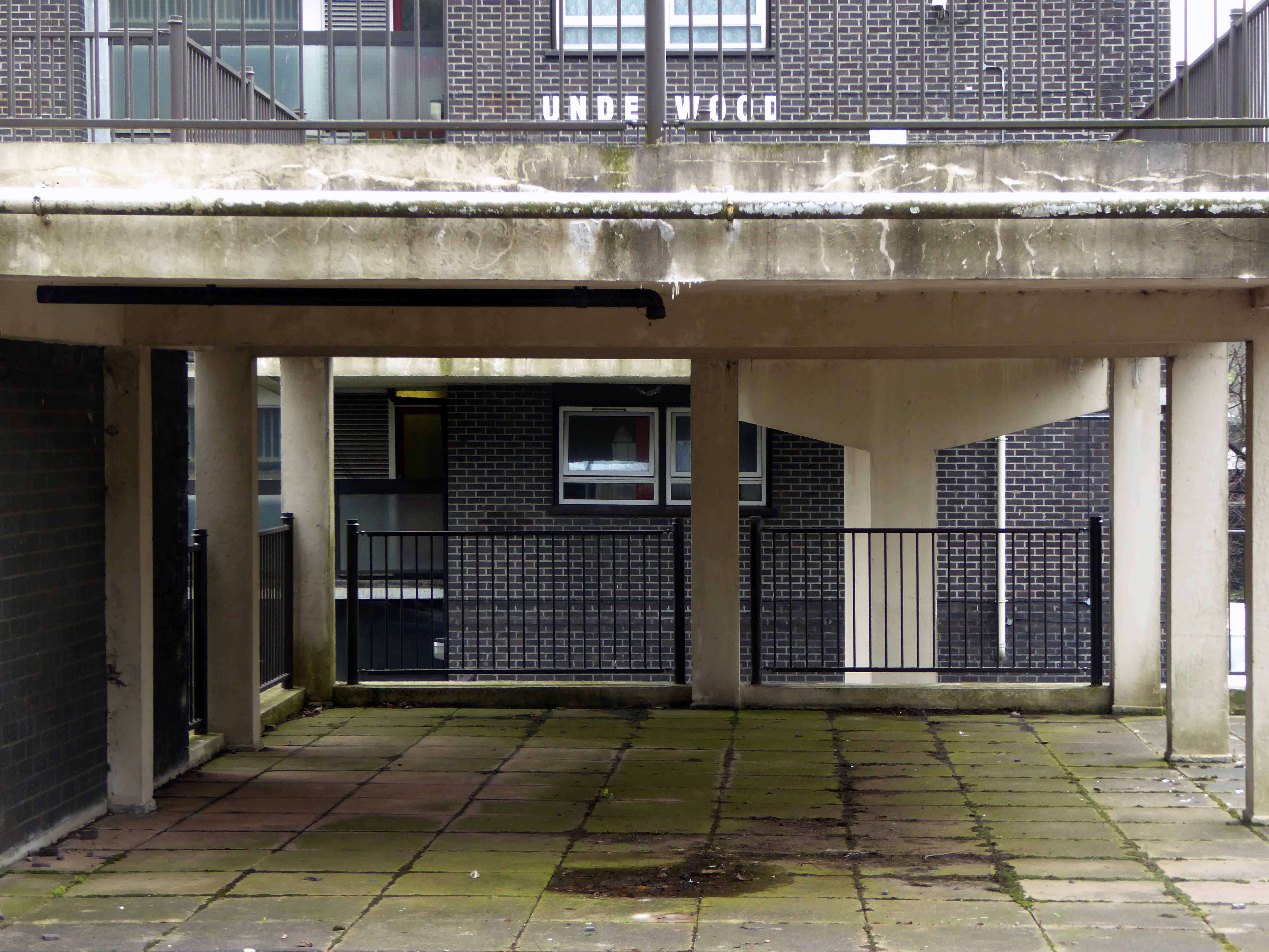
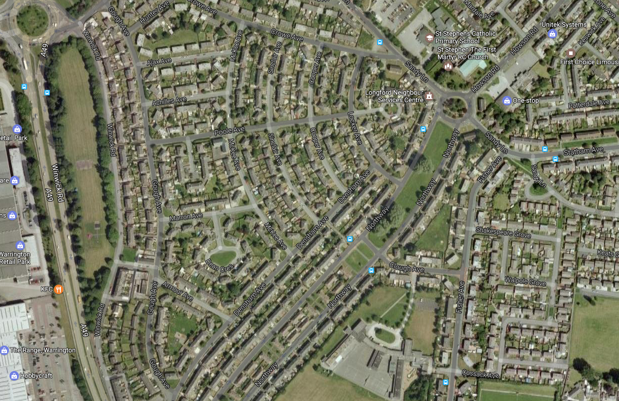
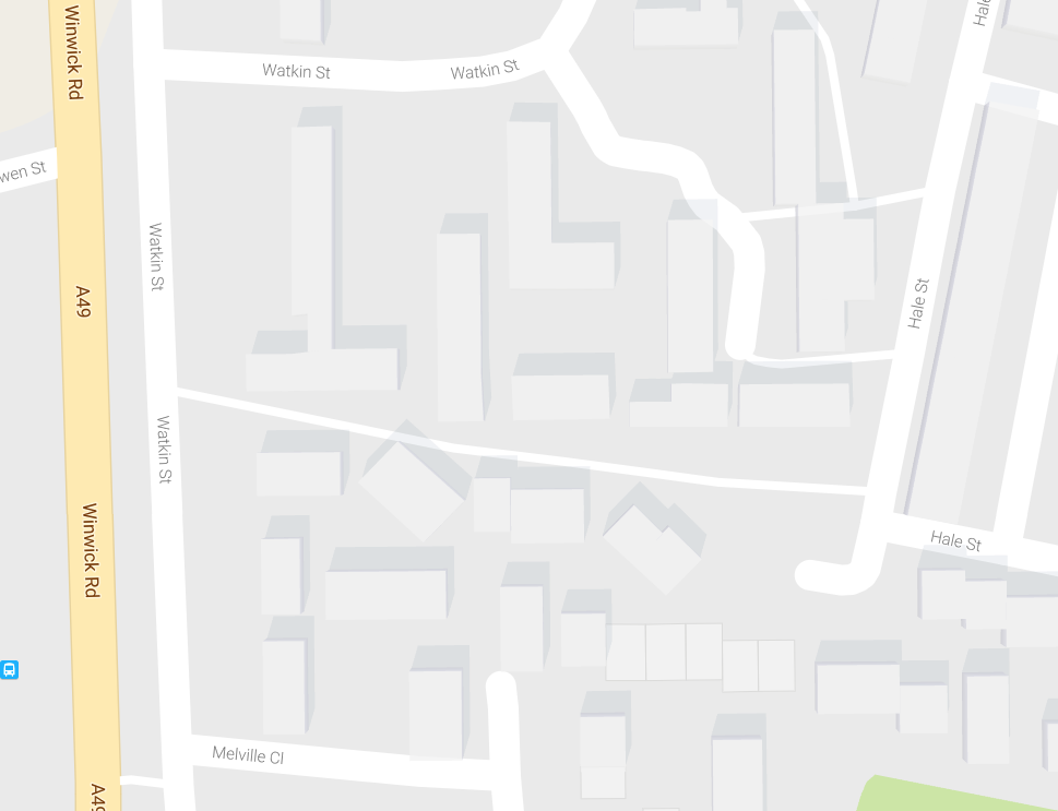
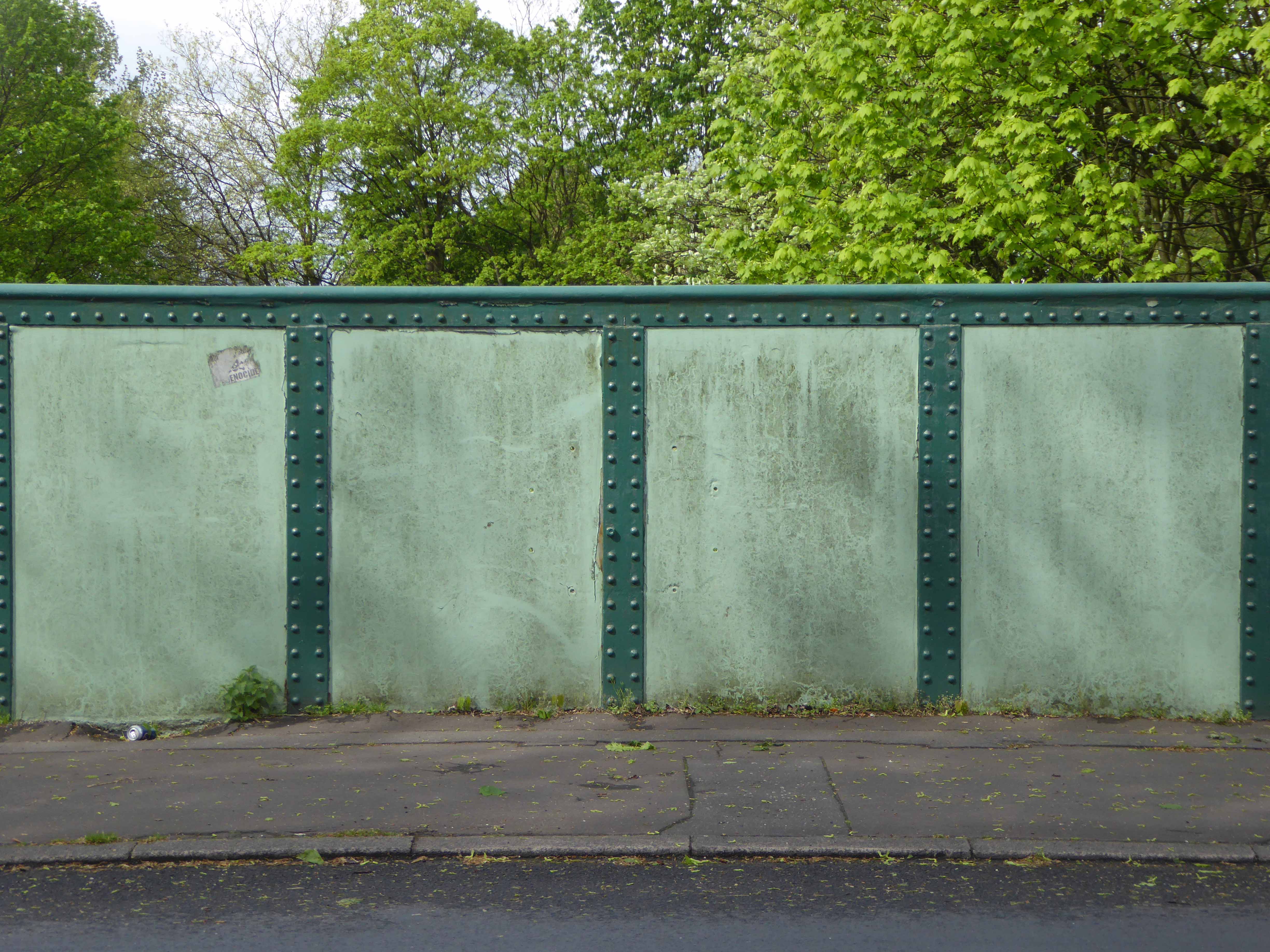
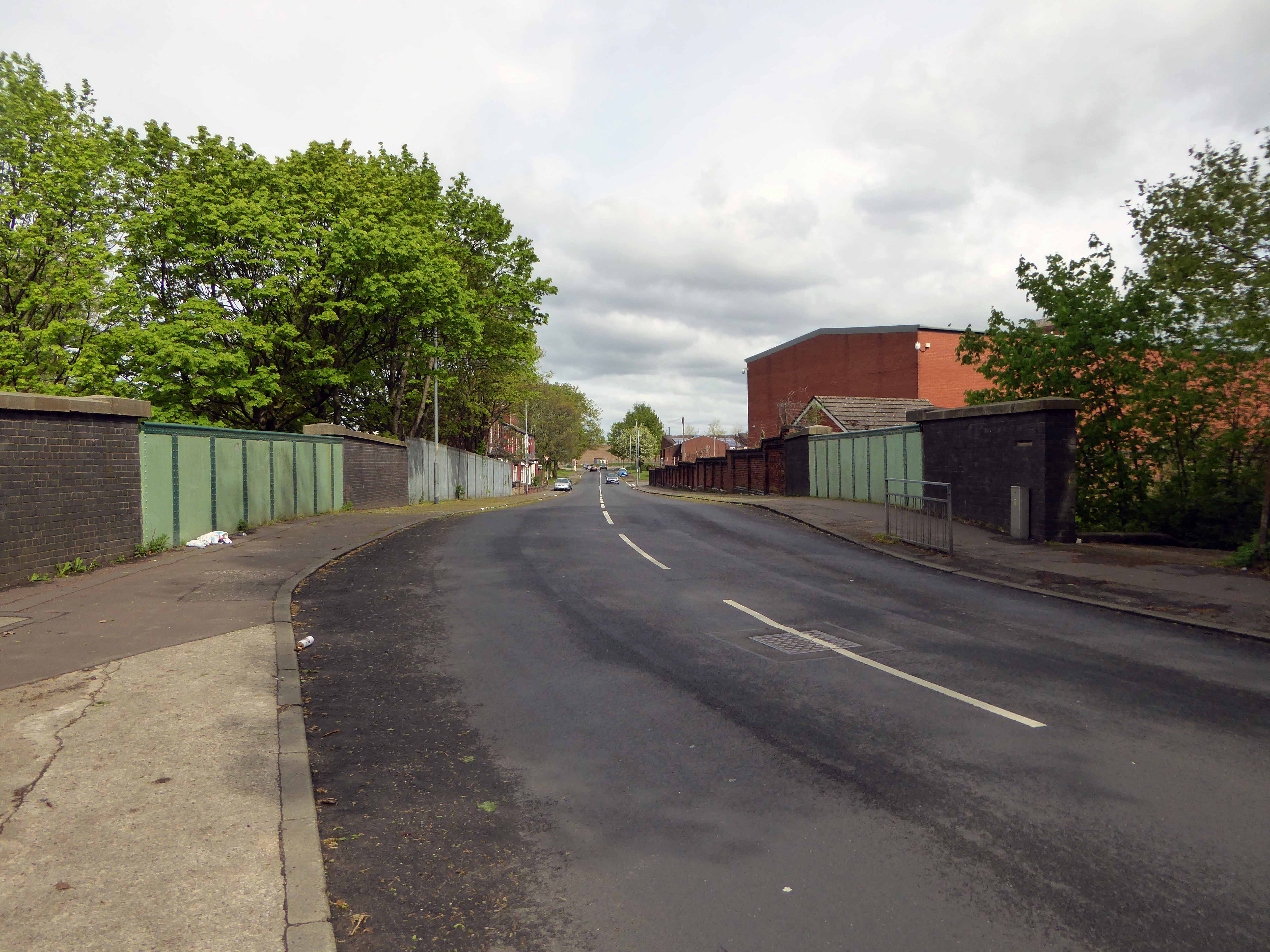
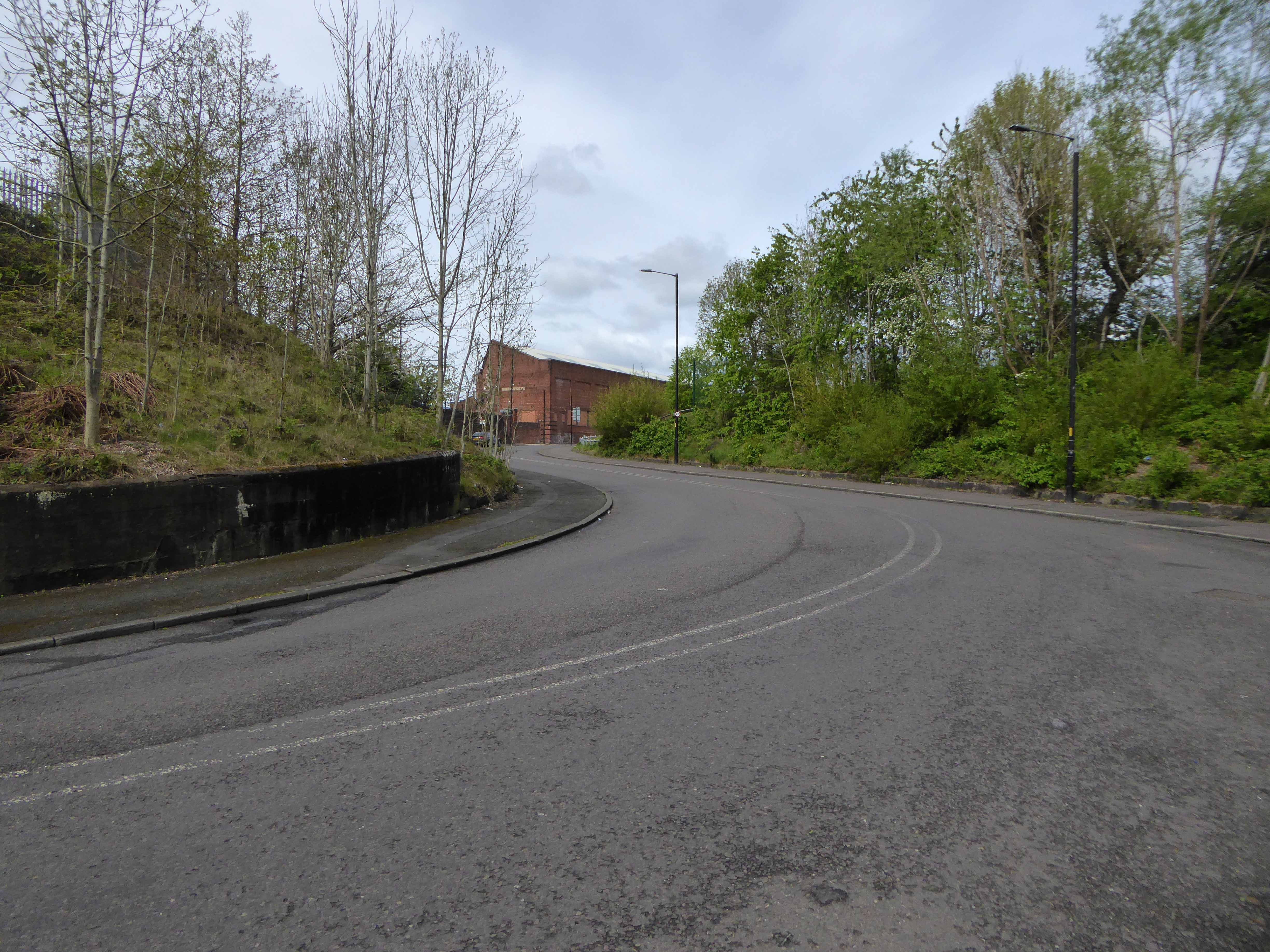
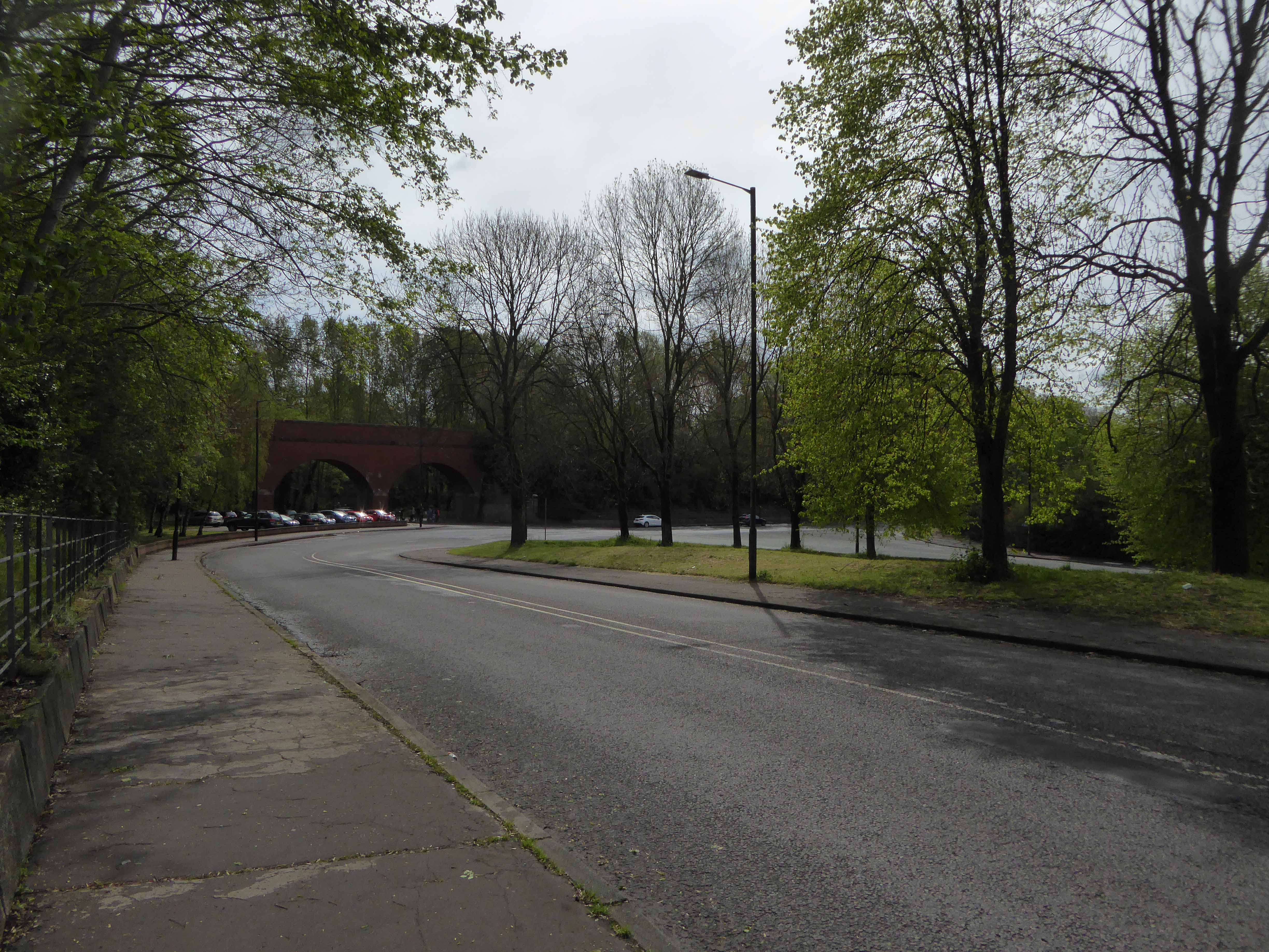
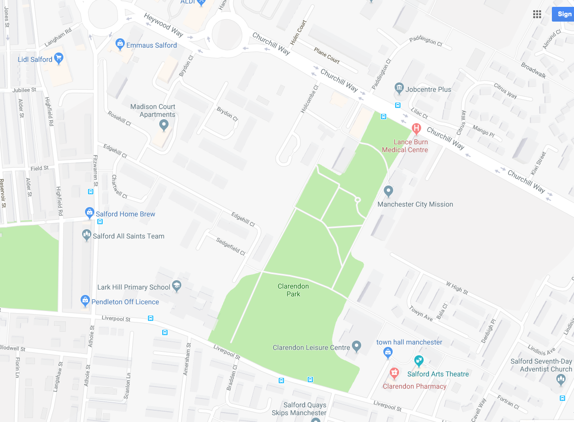
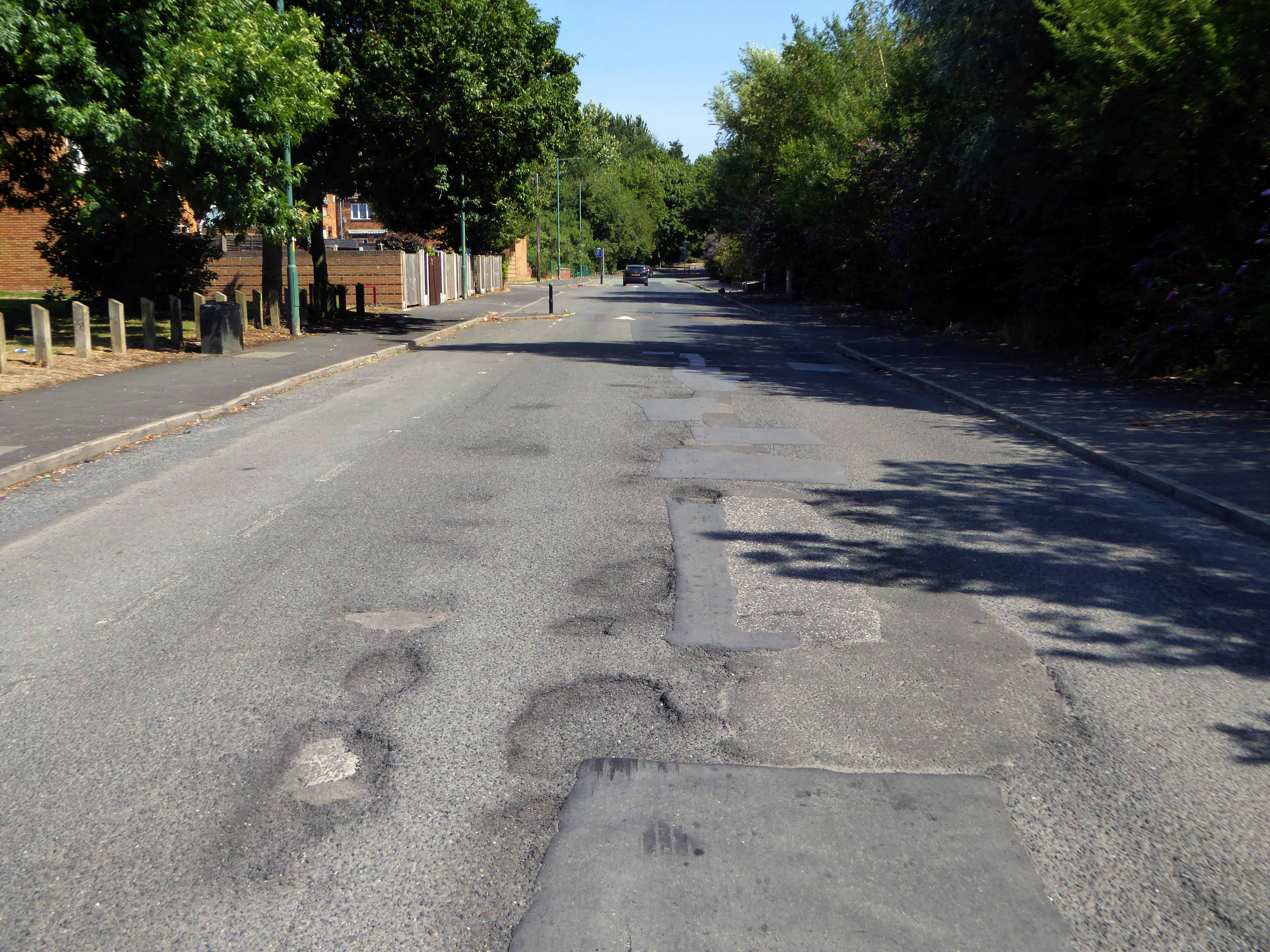
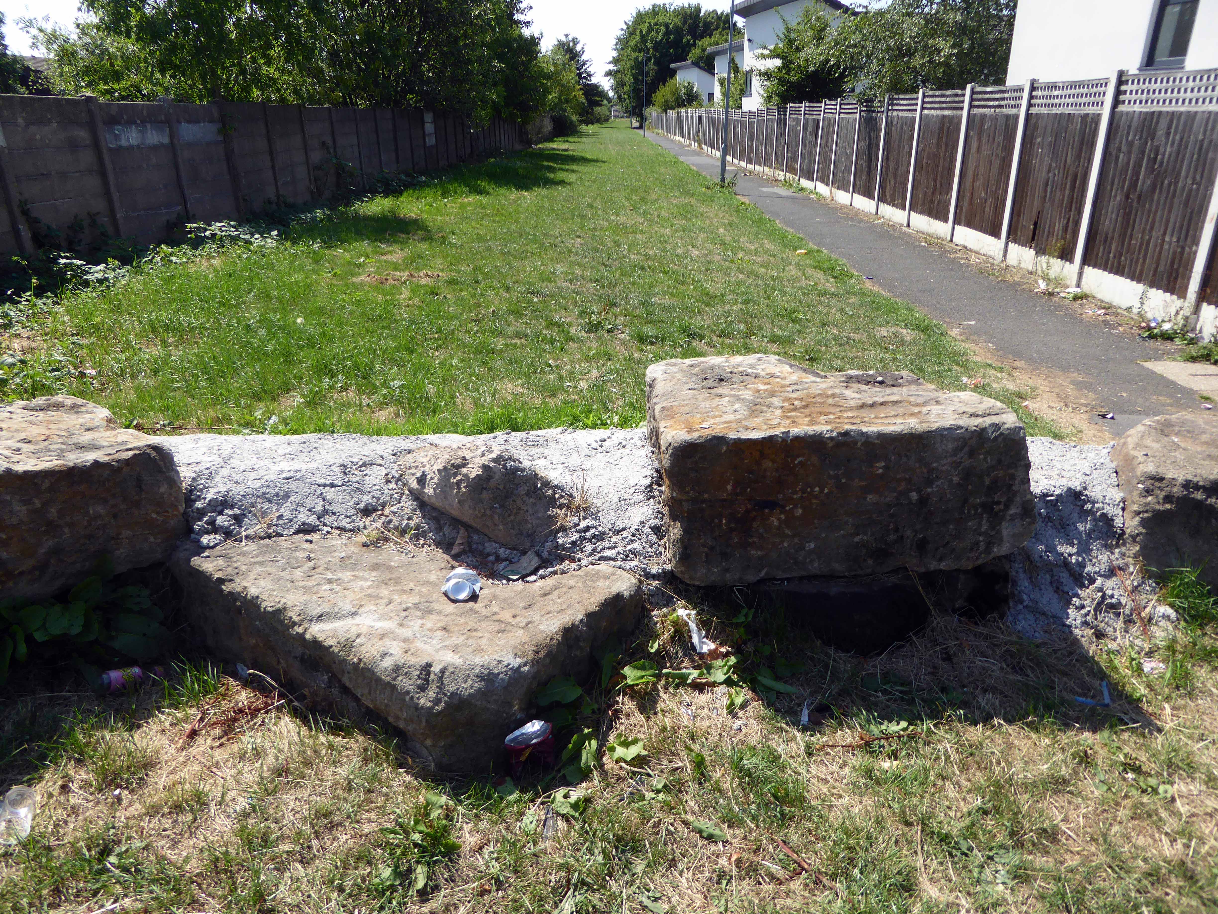
Former streets were over written and remain as poignant vestigial marks in the landscape.

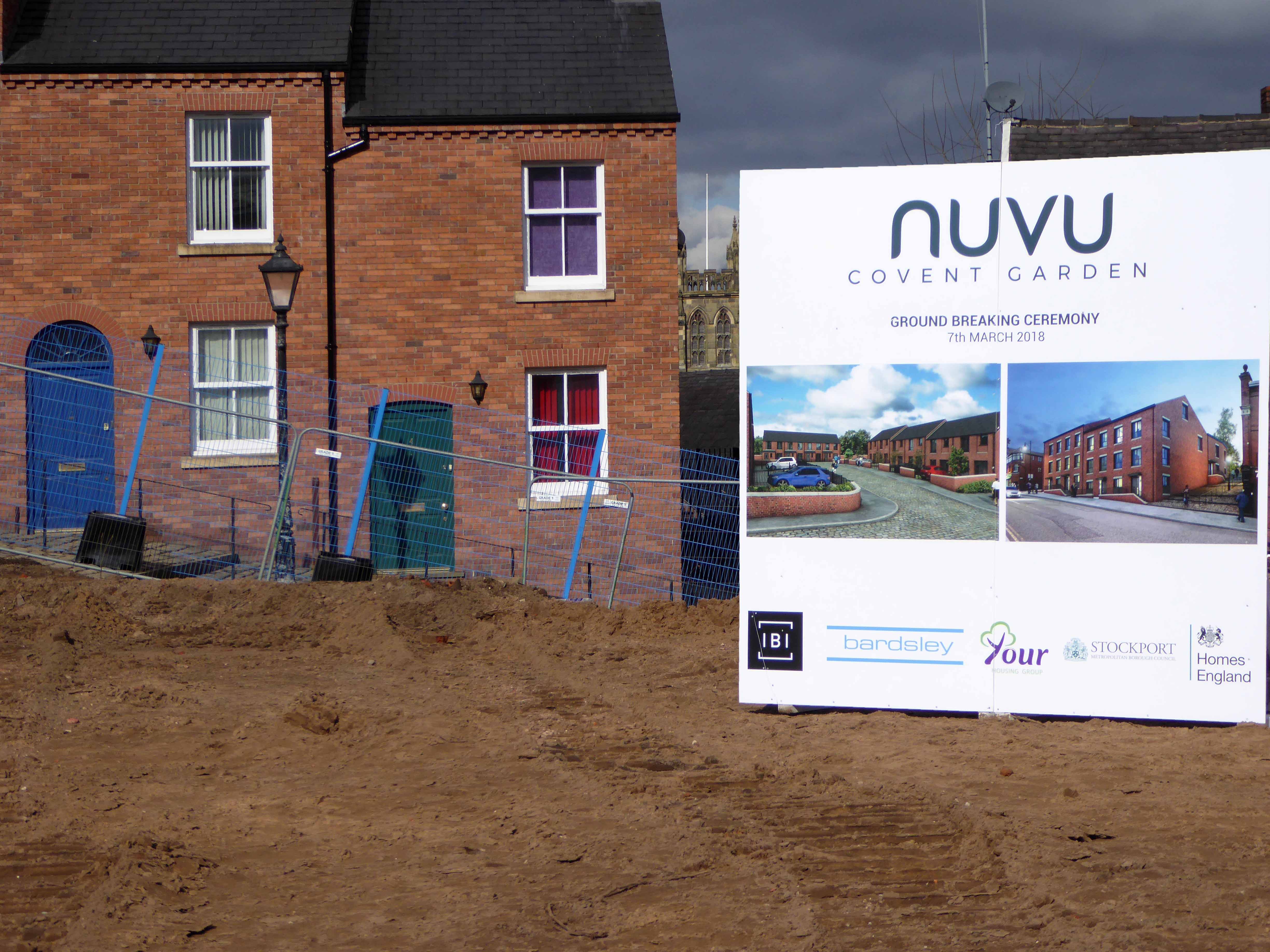
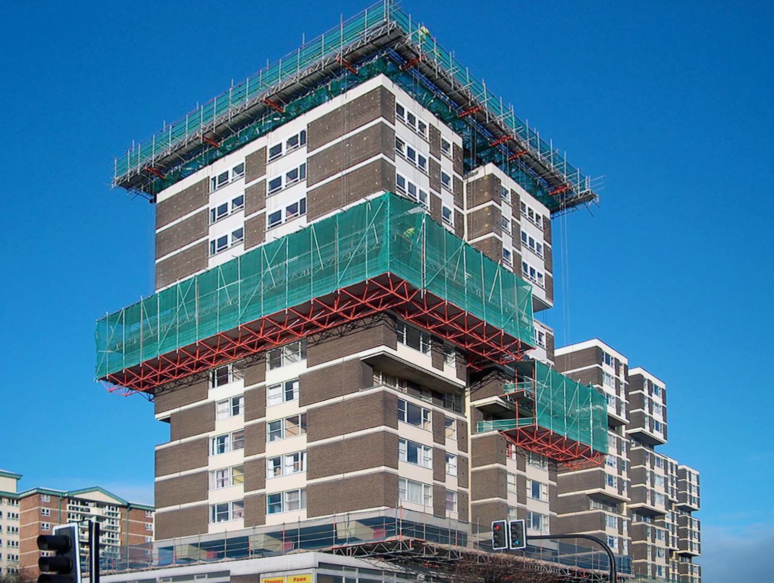
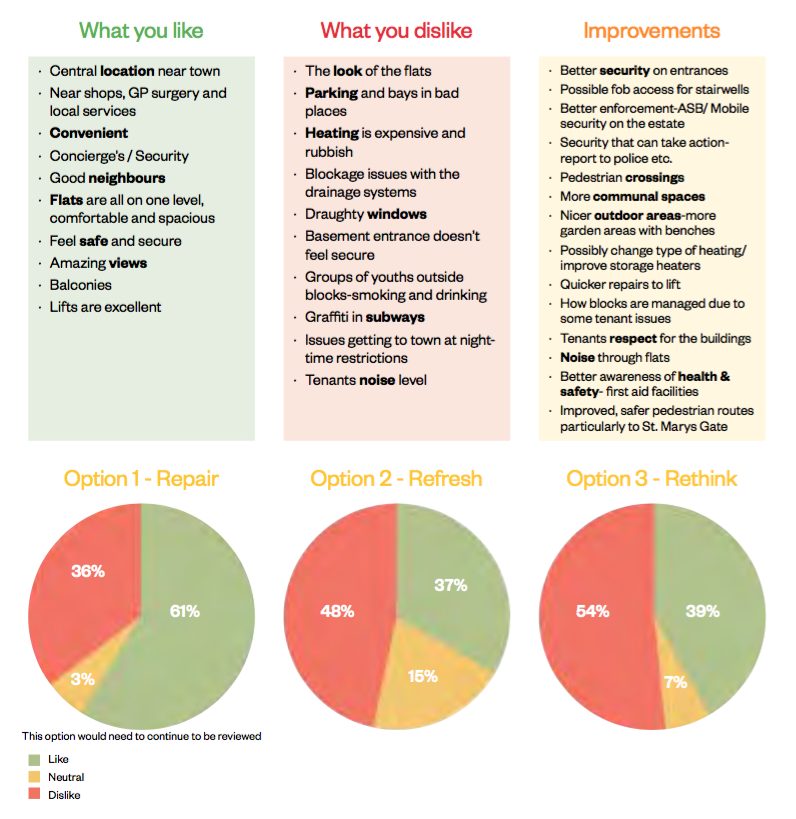
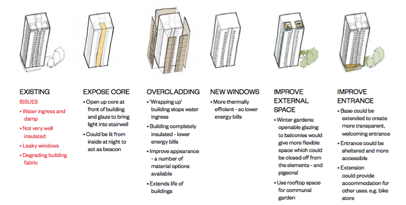
Grand plans are made for their revival.

Paul Daly

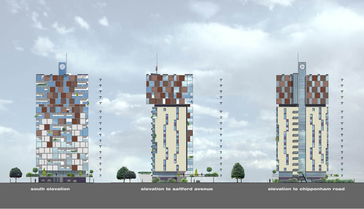
Though their future was built on more than somewhat shifting and uncertain sands.

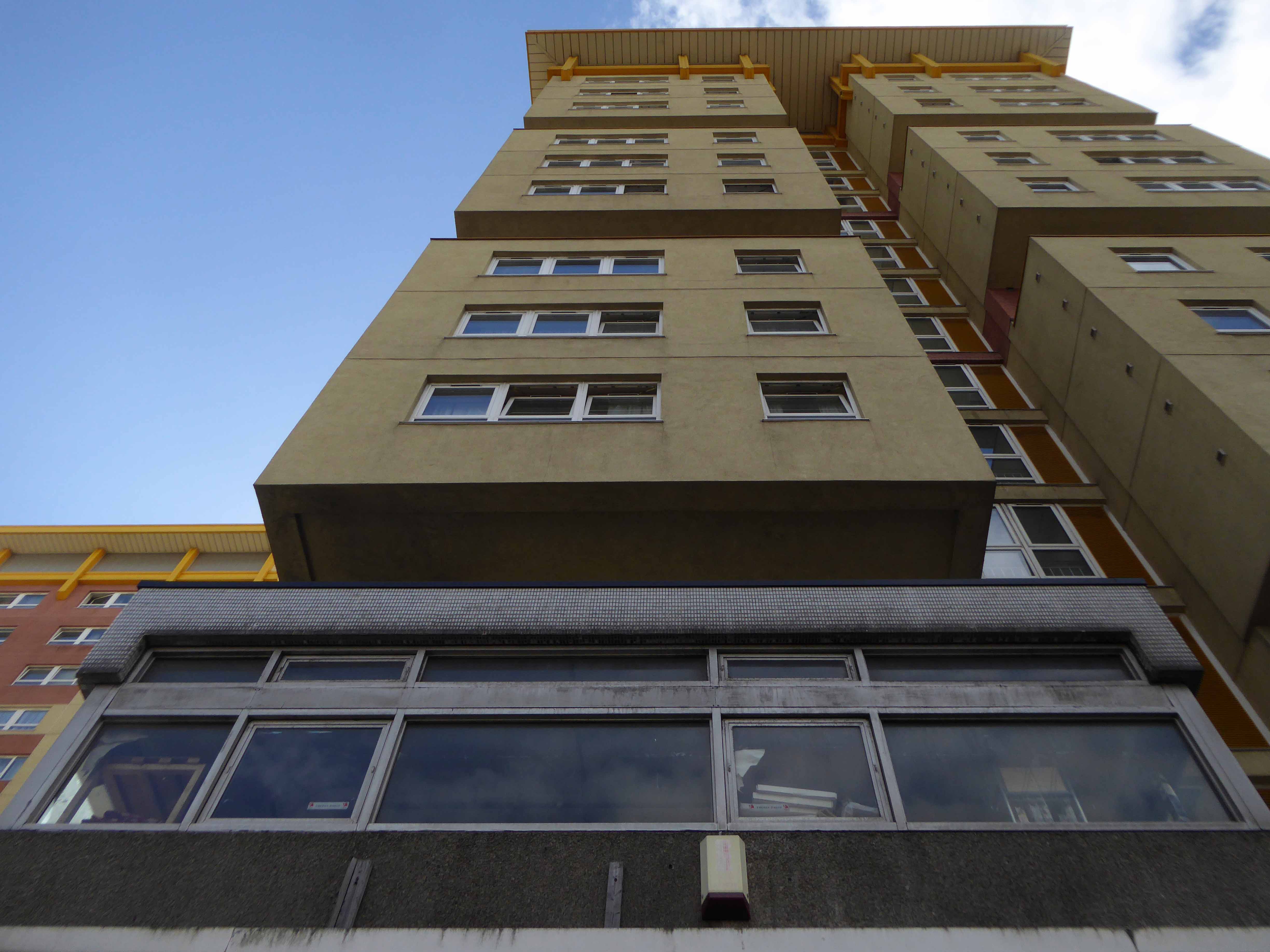
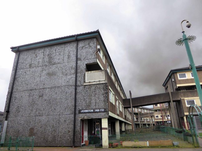
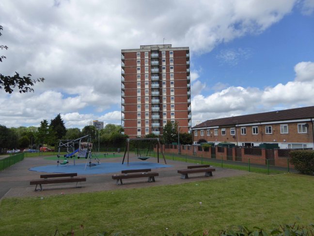
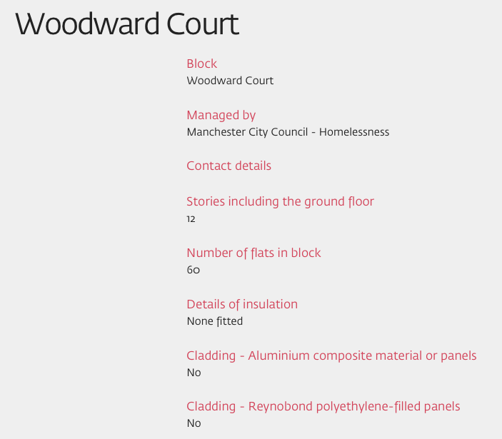
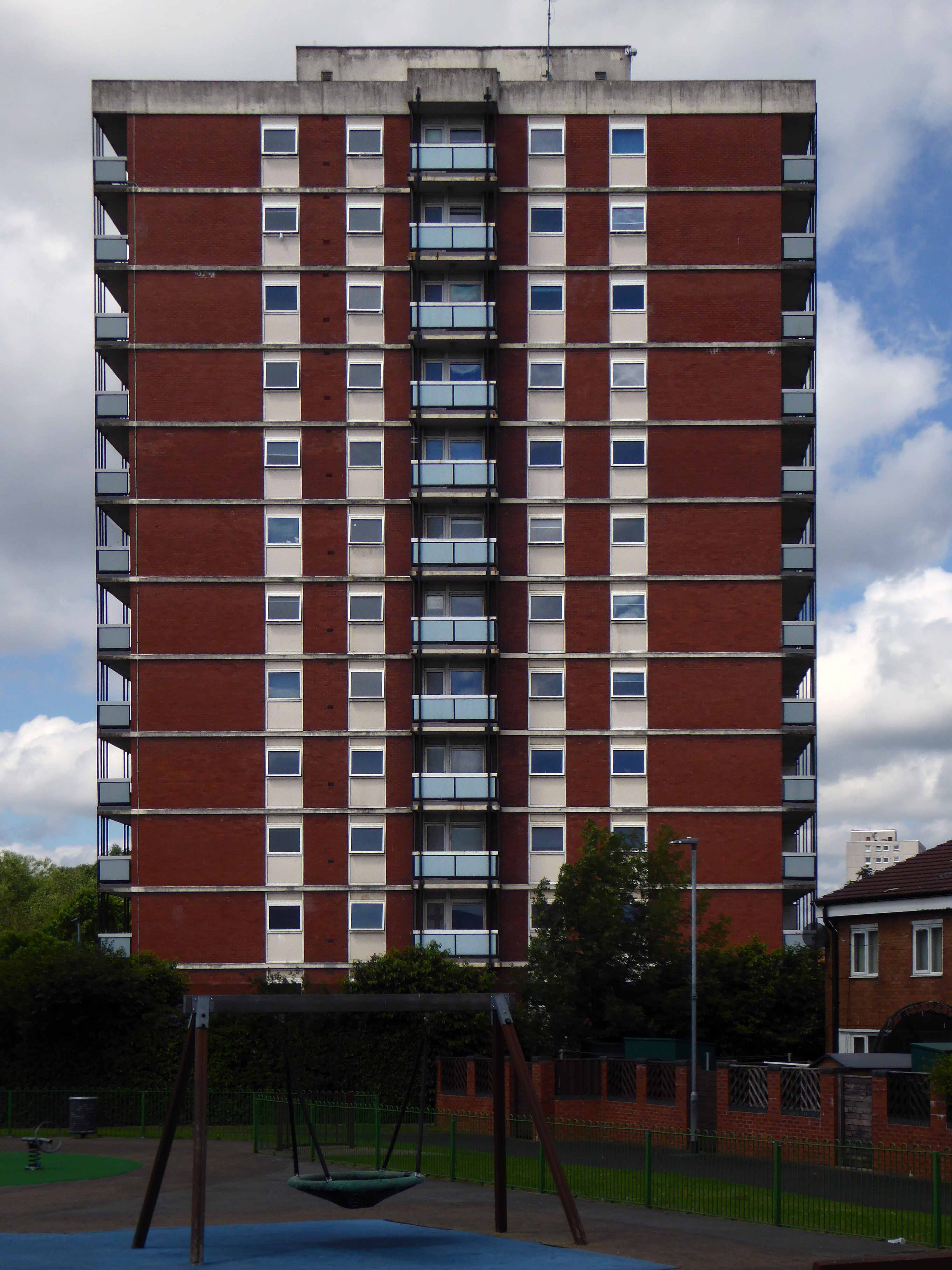
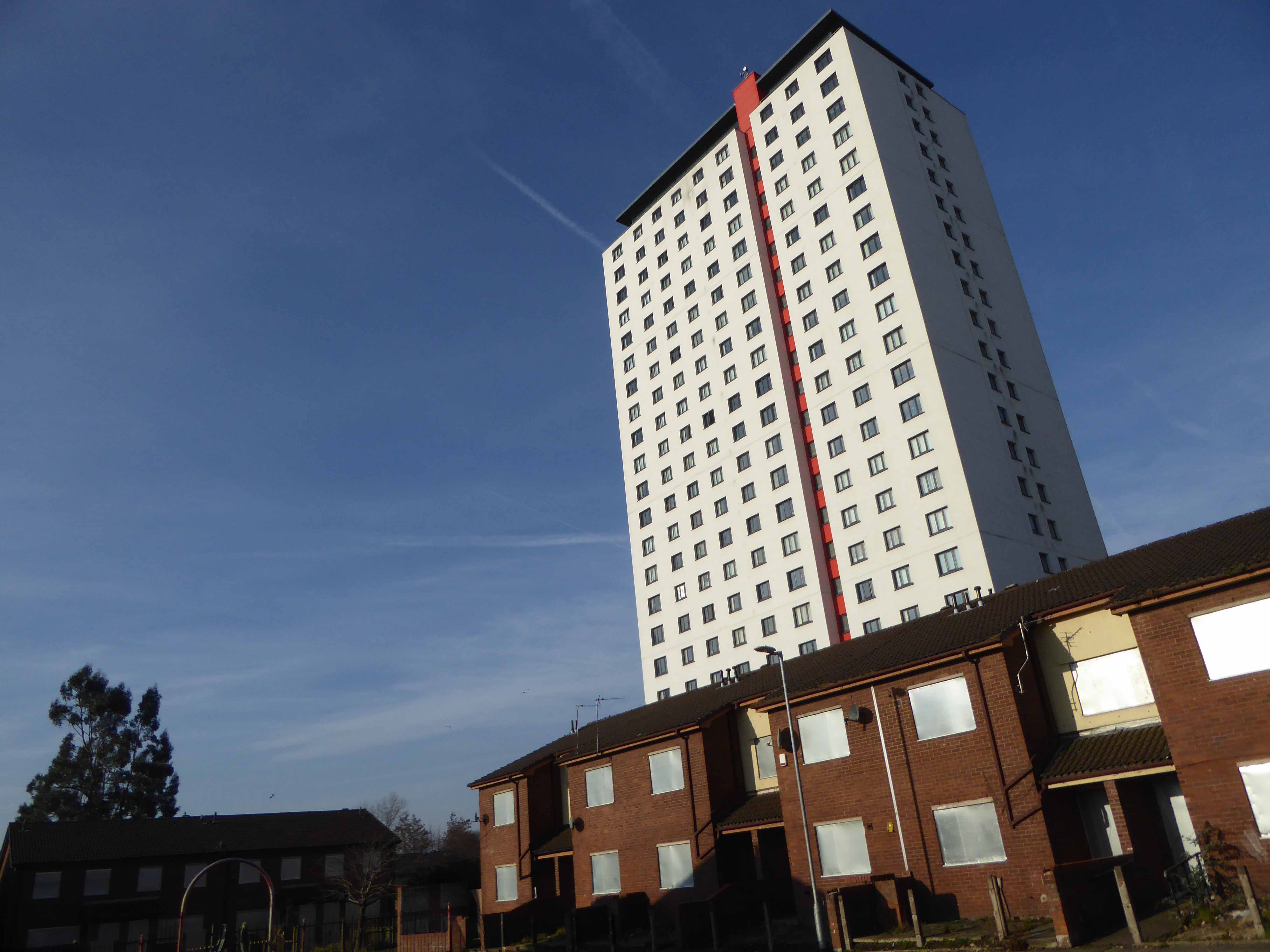
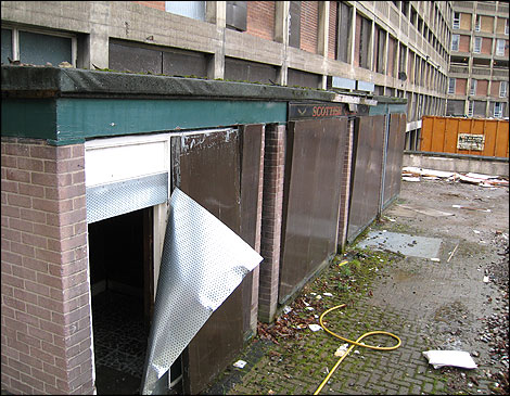
A tower block has been left lying empty for a whopping 18 years. The 13-storey building at Saltford Court in Ancoats has been unoccupied since Manchester council closed it in the 1990s. It was bought by top developers Urban Splash six years ago but residents have now hit out about it still being empty. Neighbours of Saltford Court say it has become an ‘eyesore’ and magnet for vermin since the firm bought it.

Manchester Evening News 2012

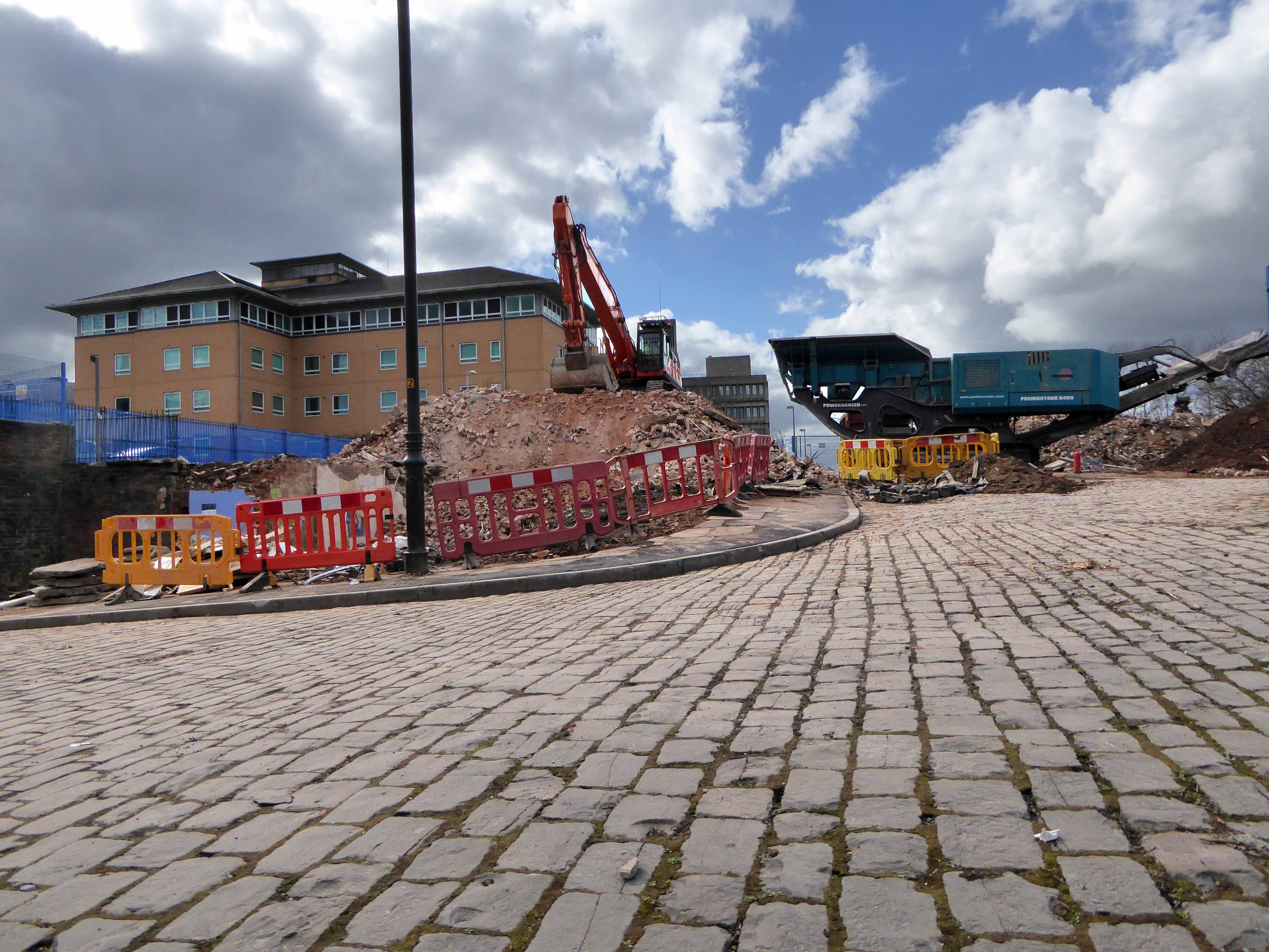
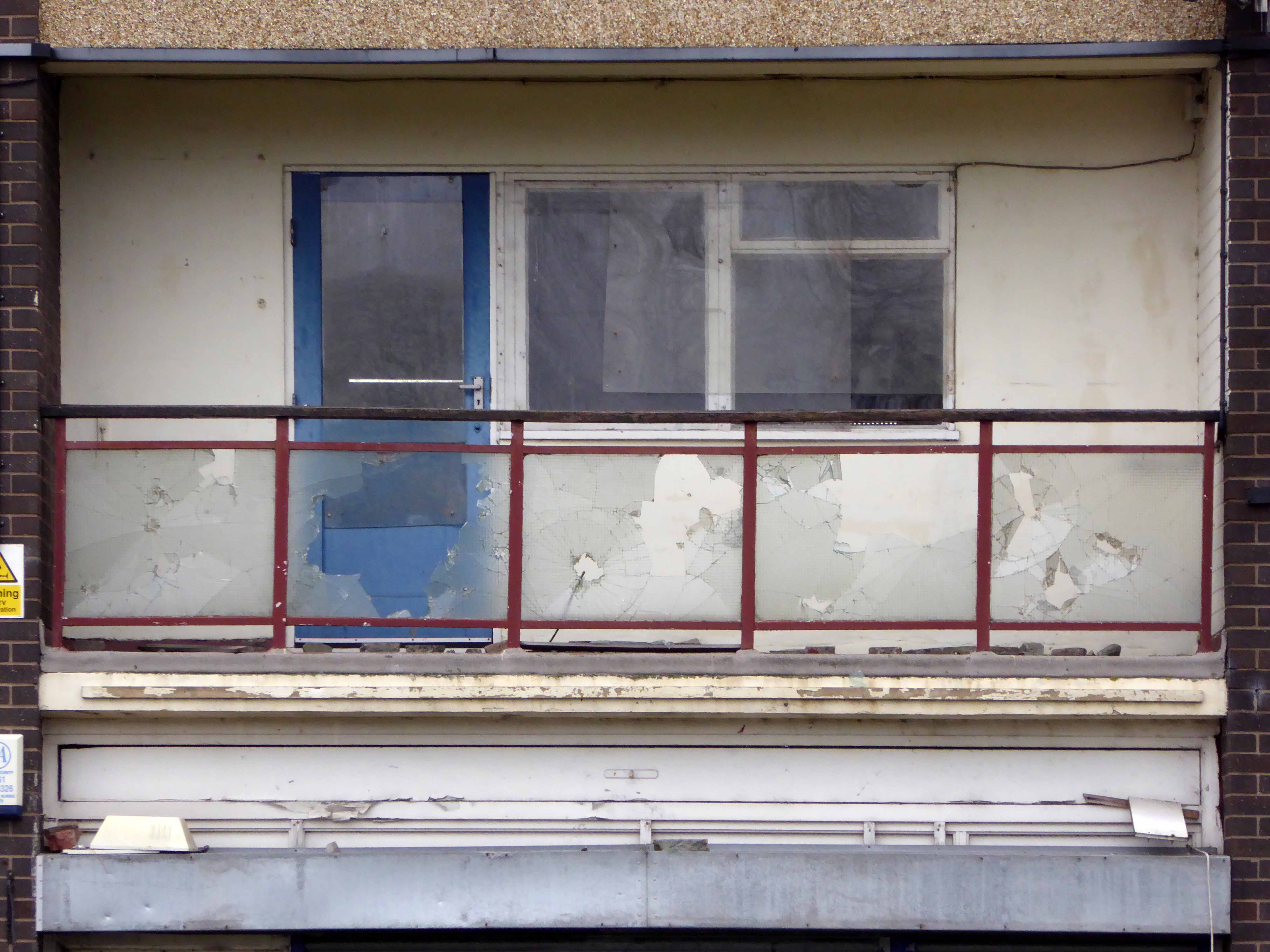
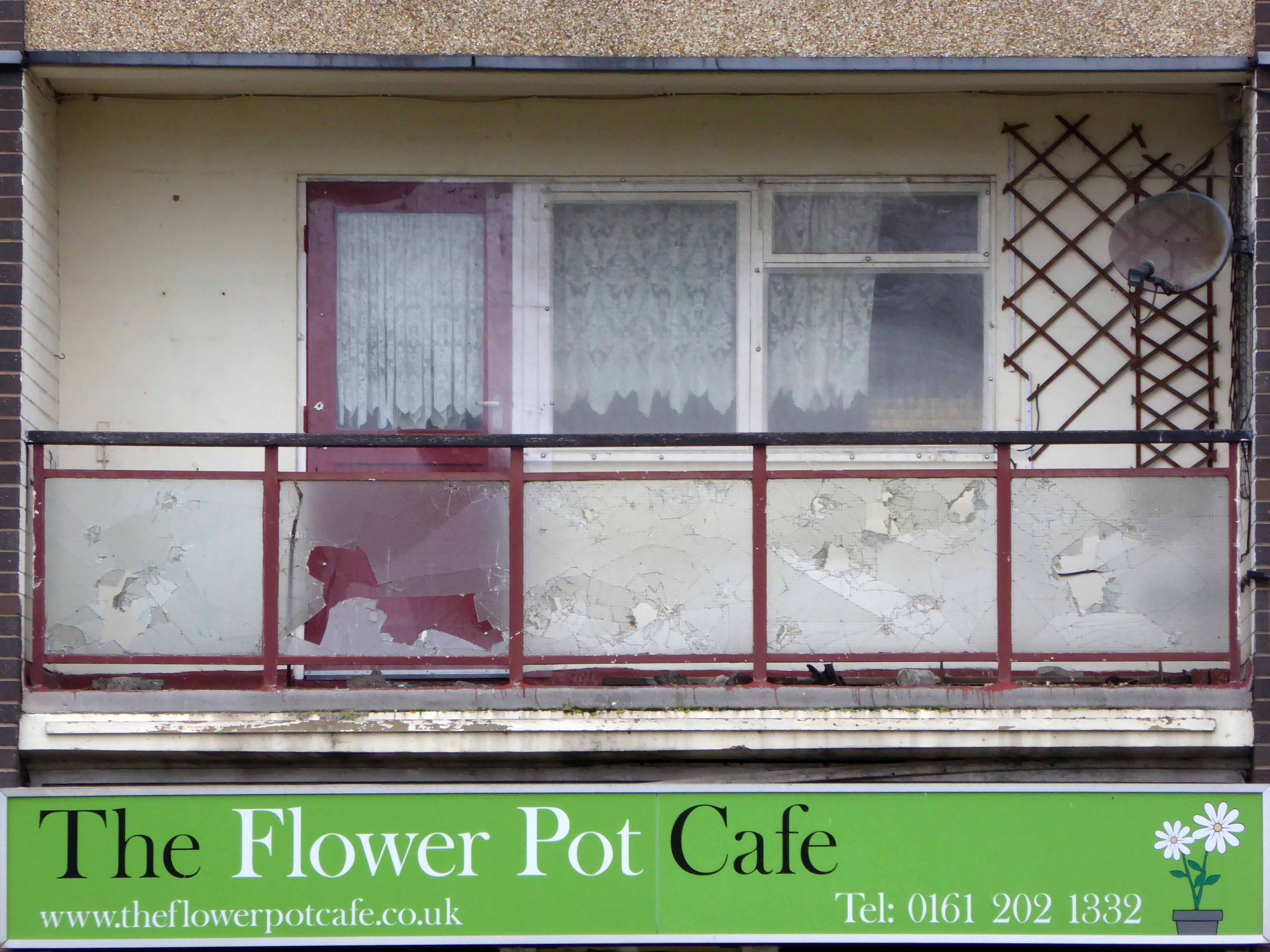
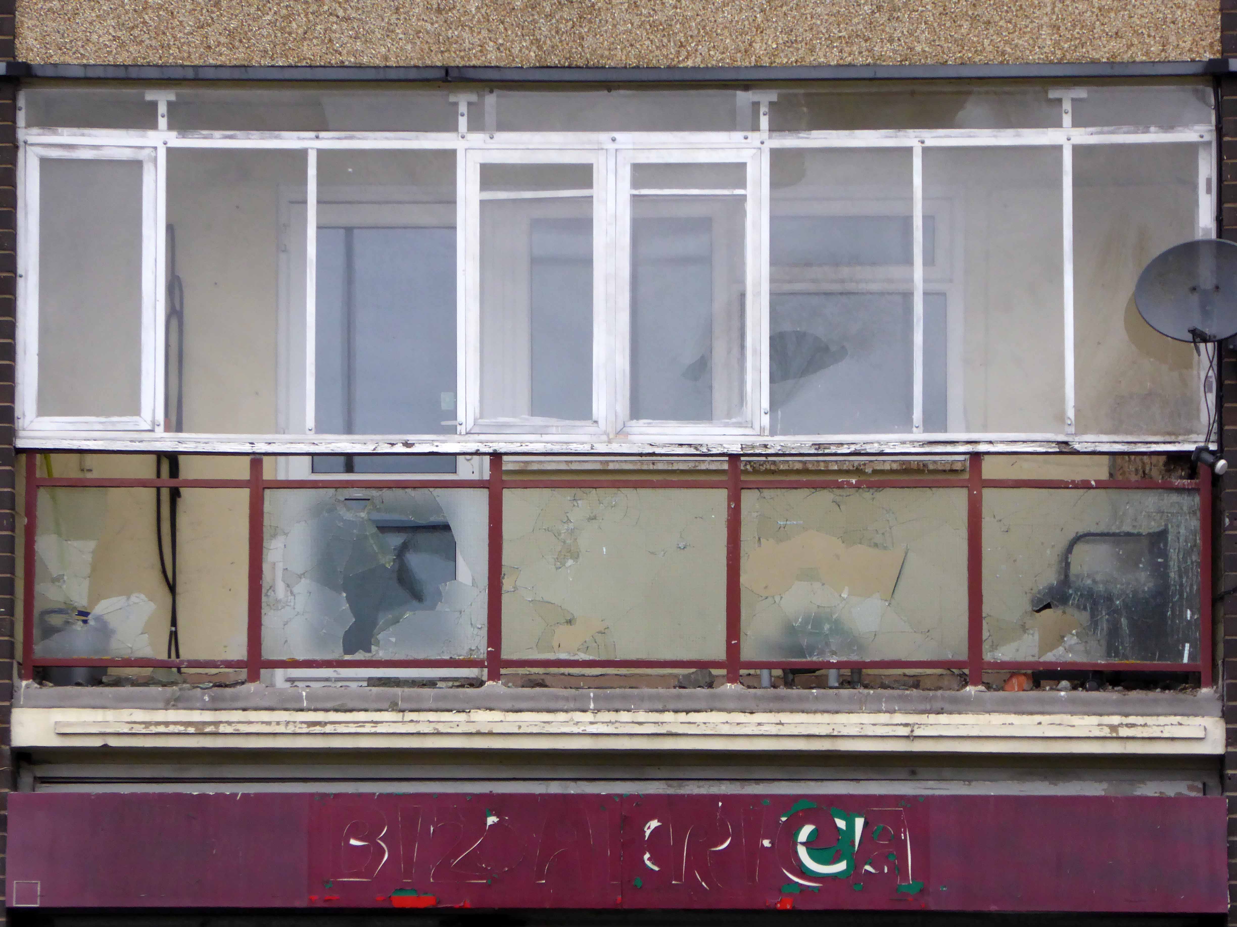
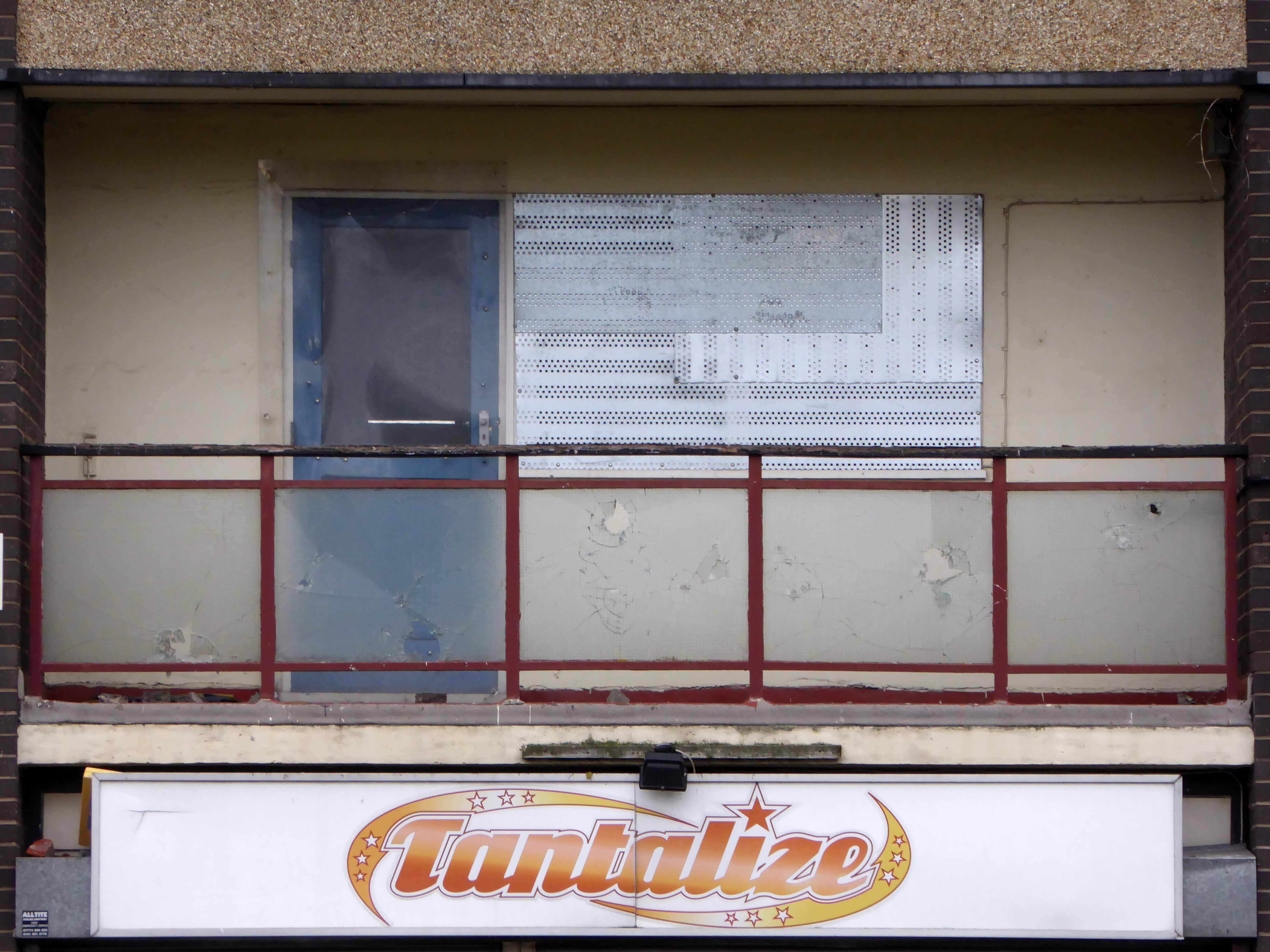
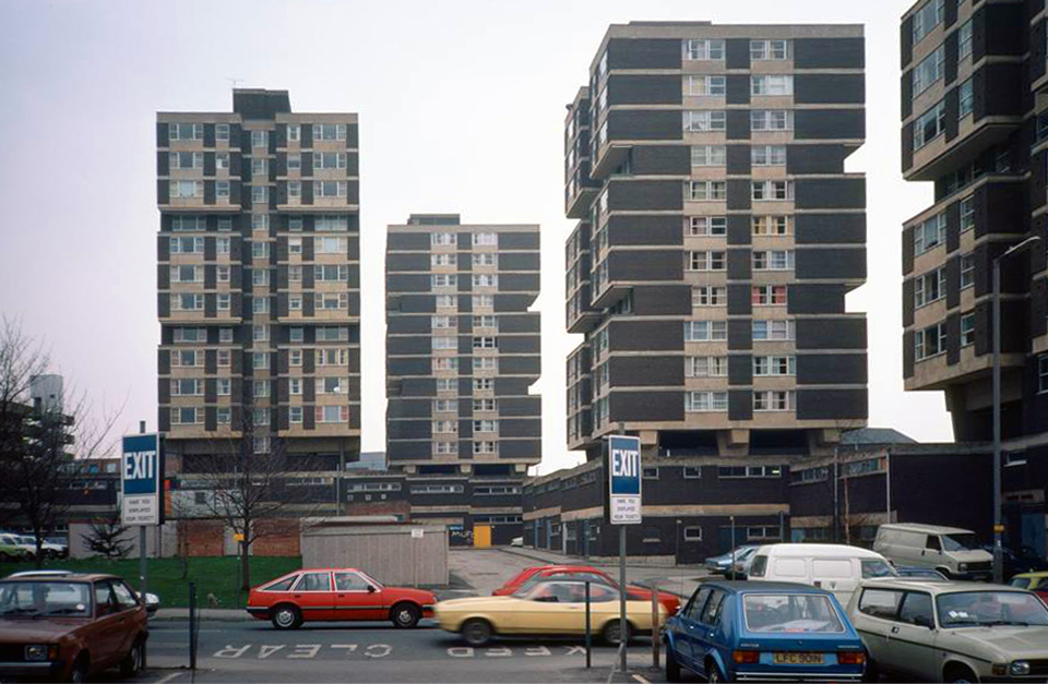
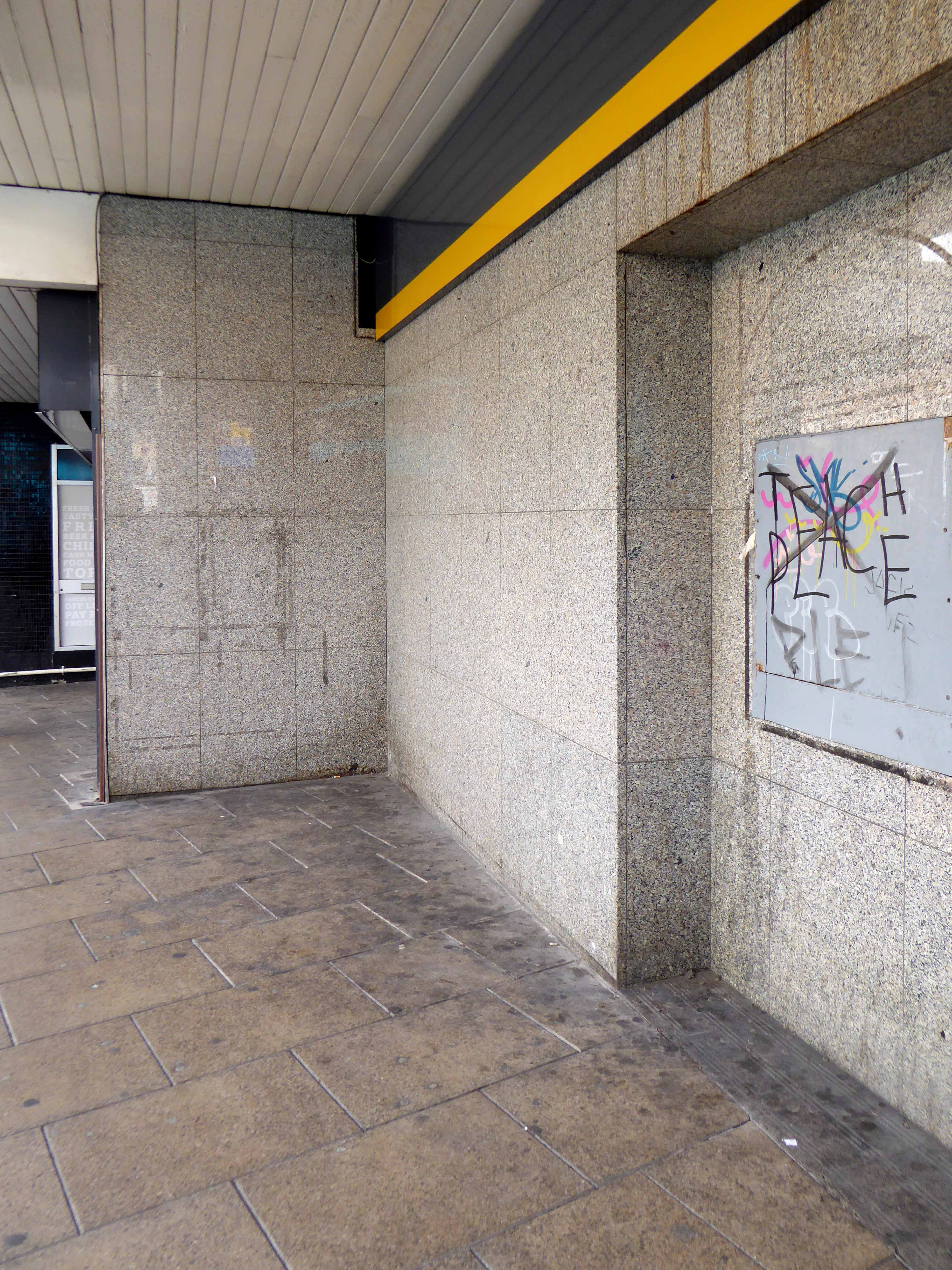
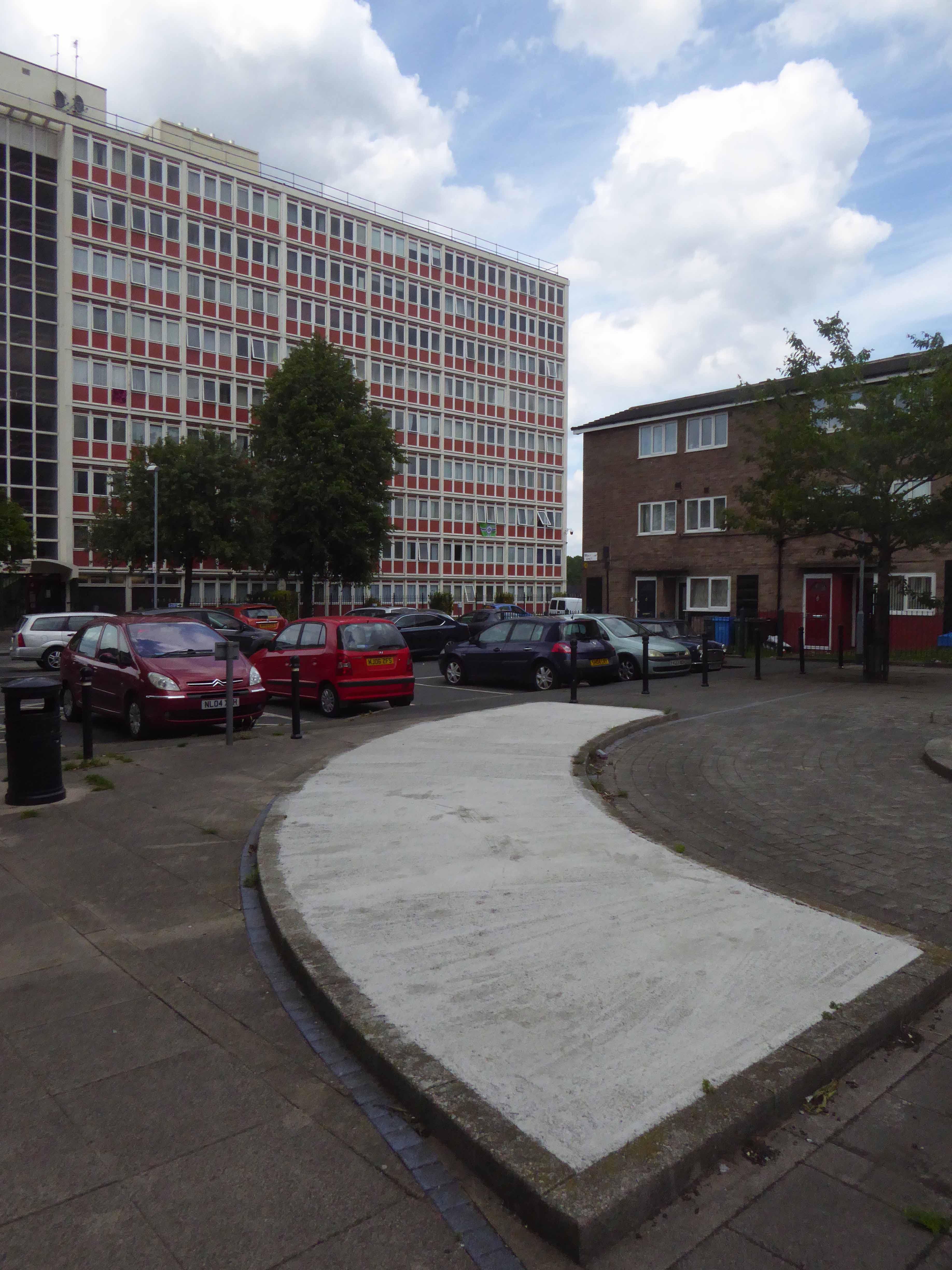
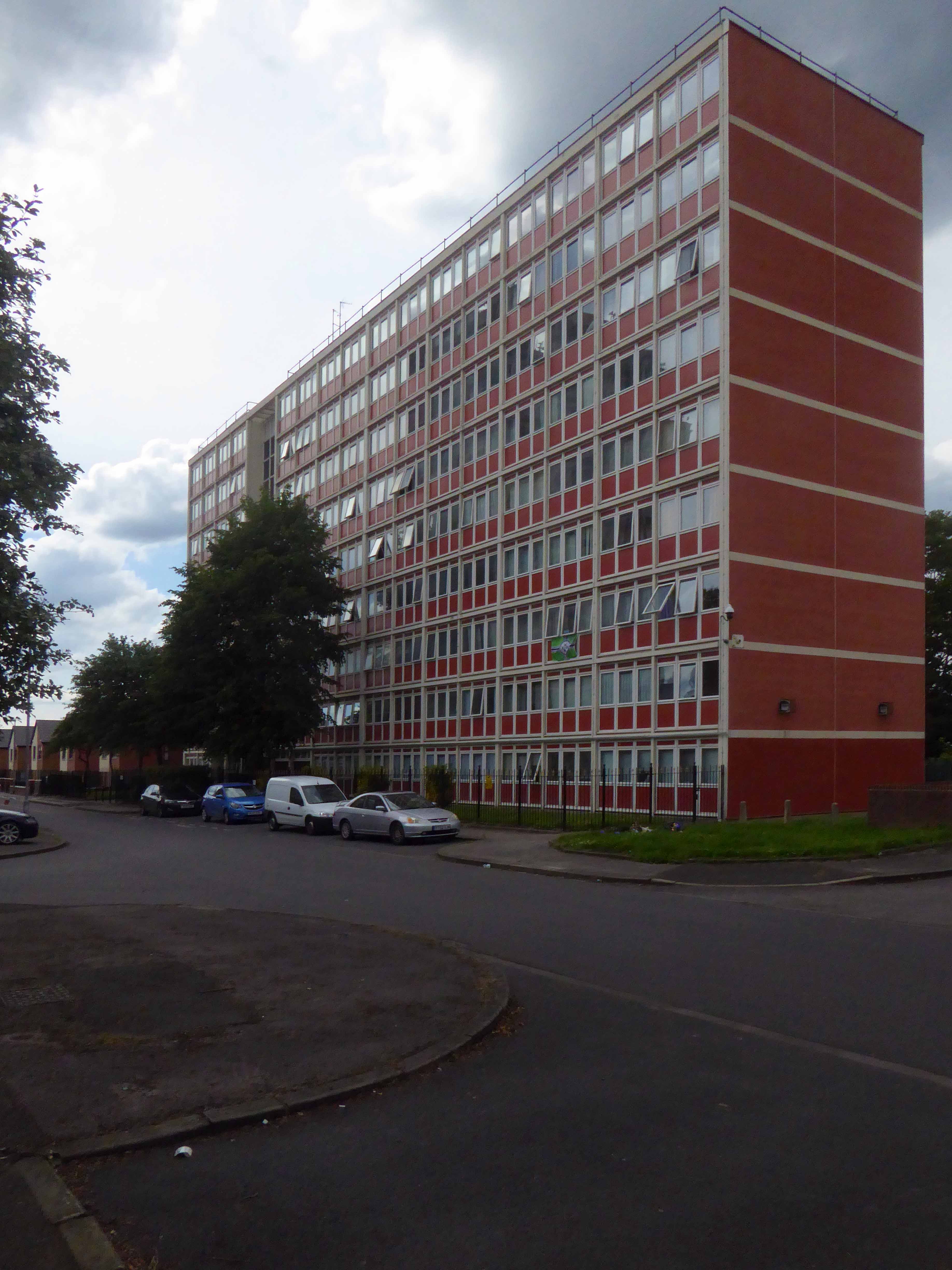
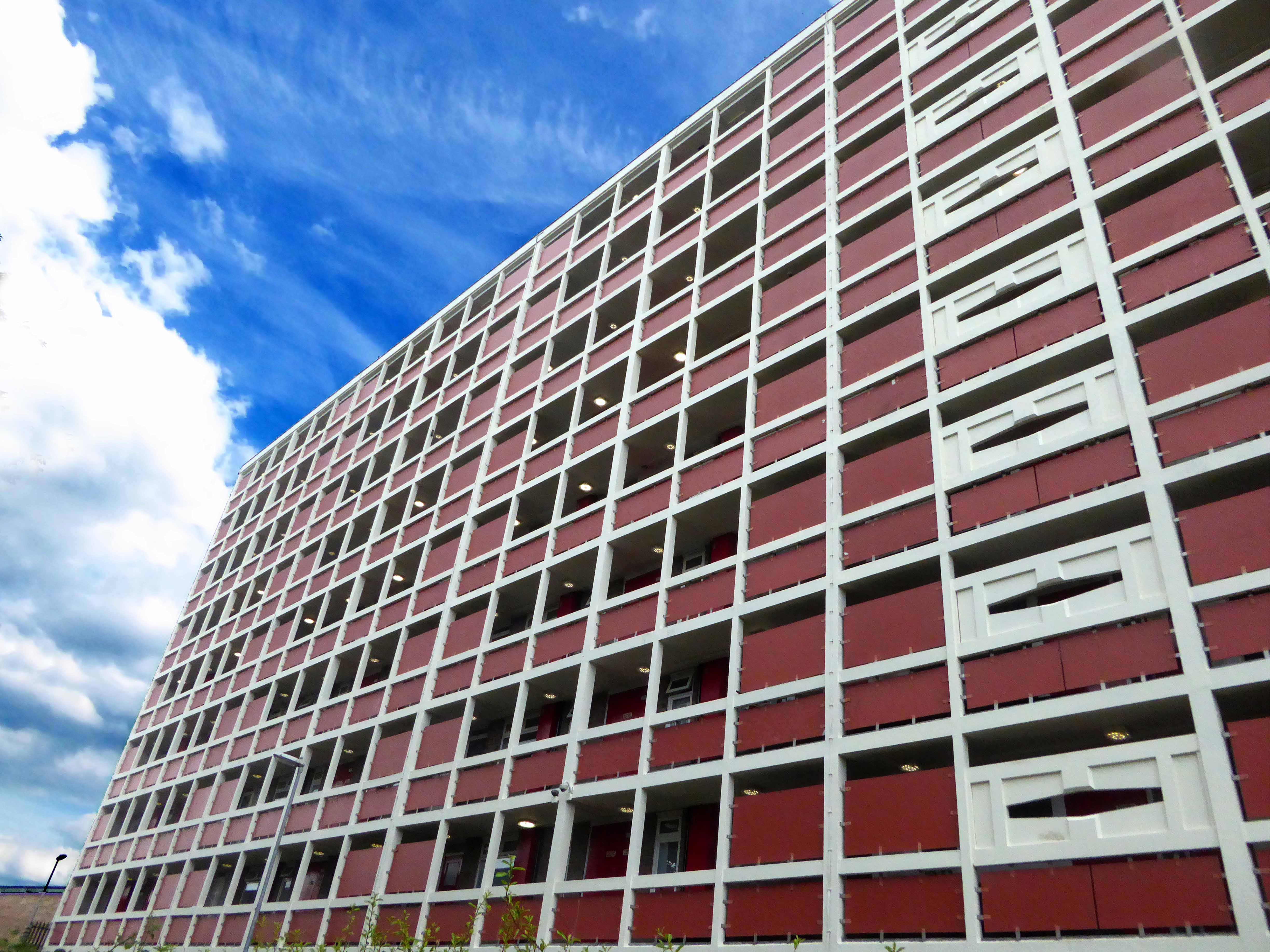
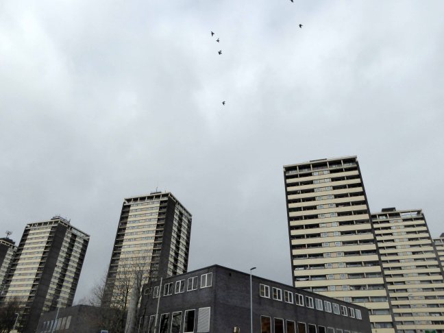
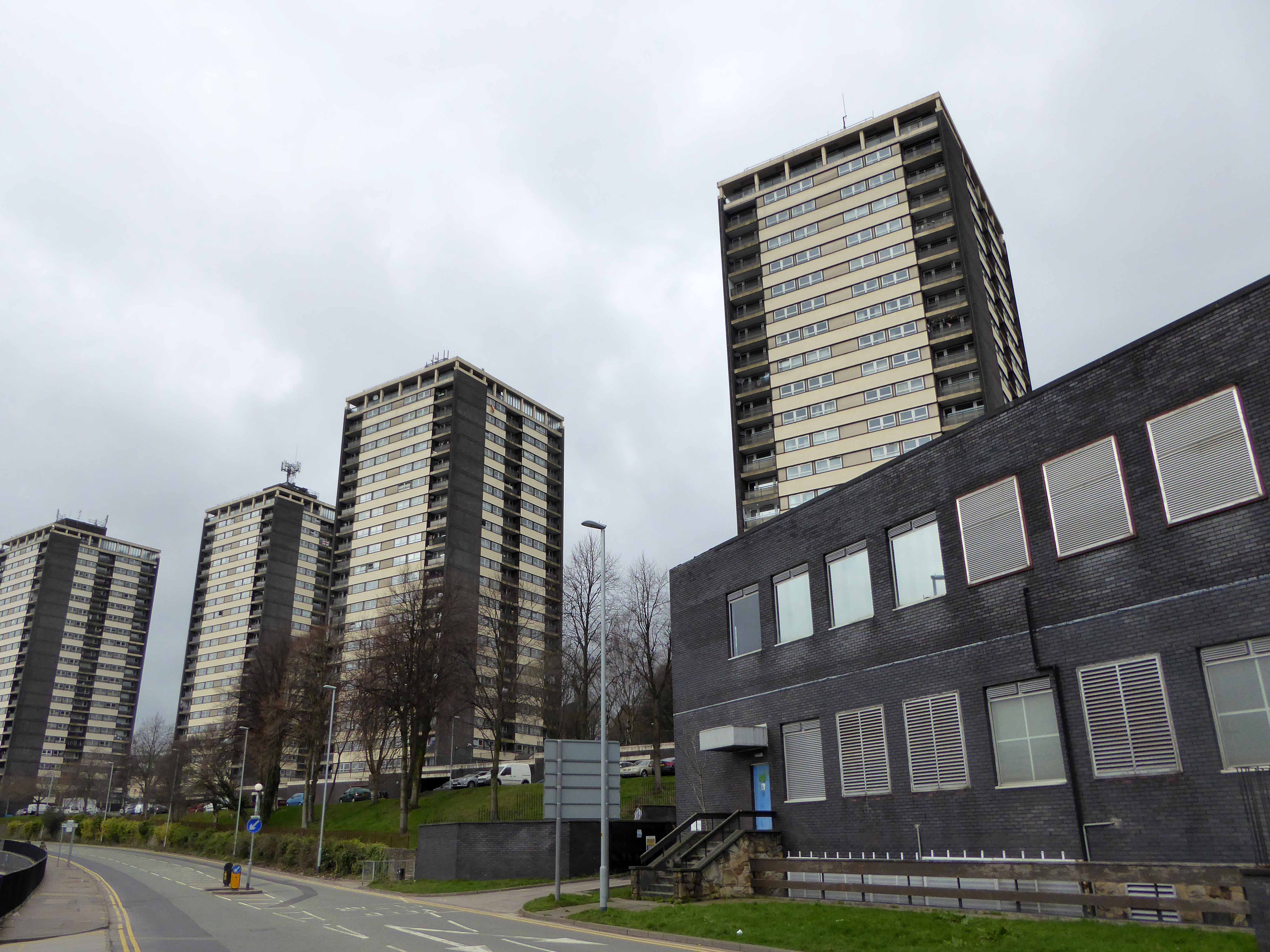
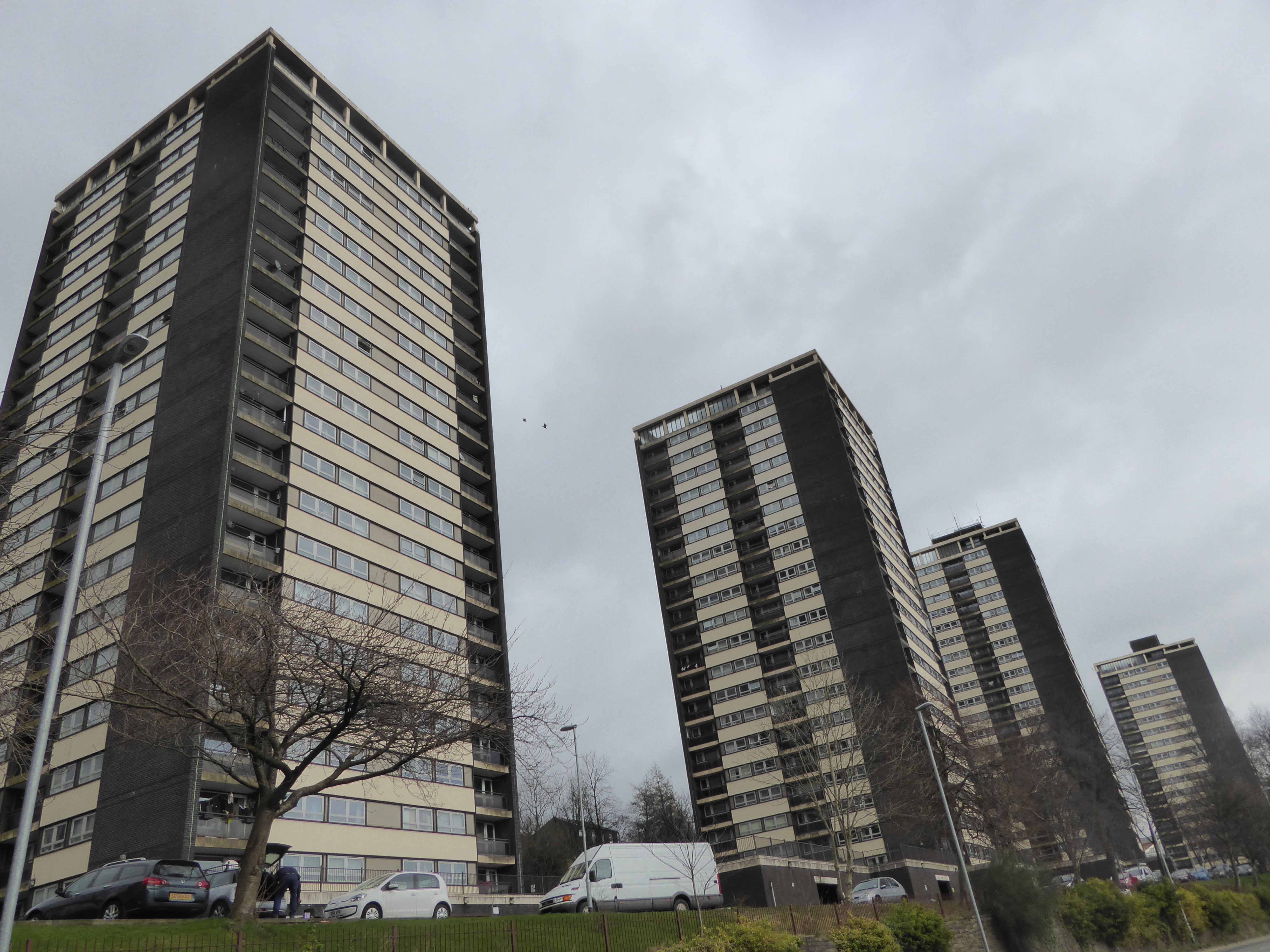
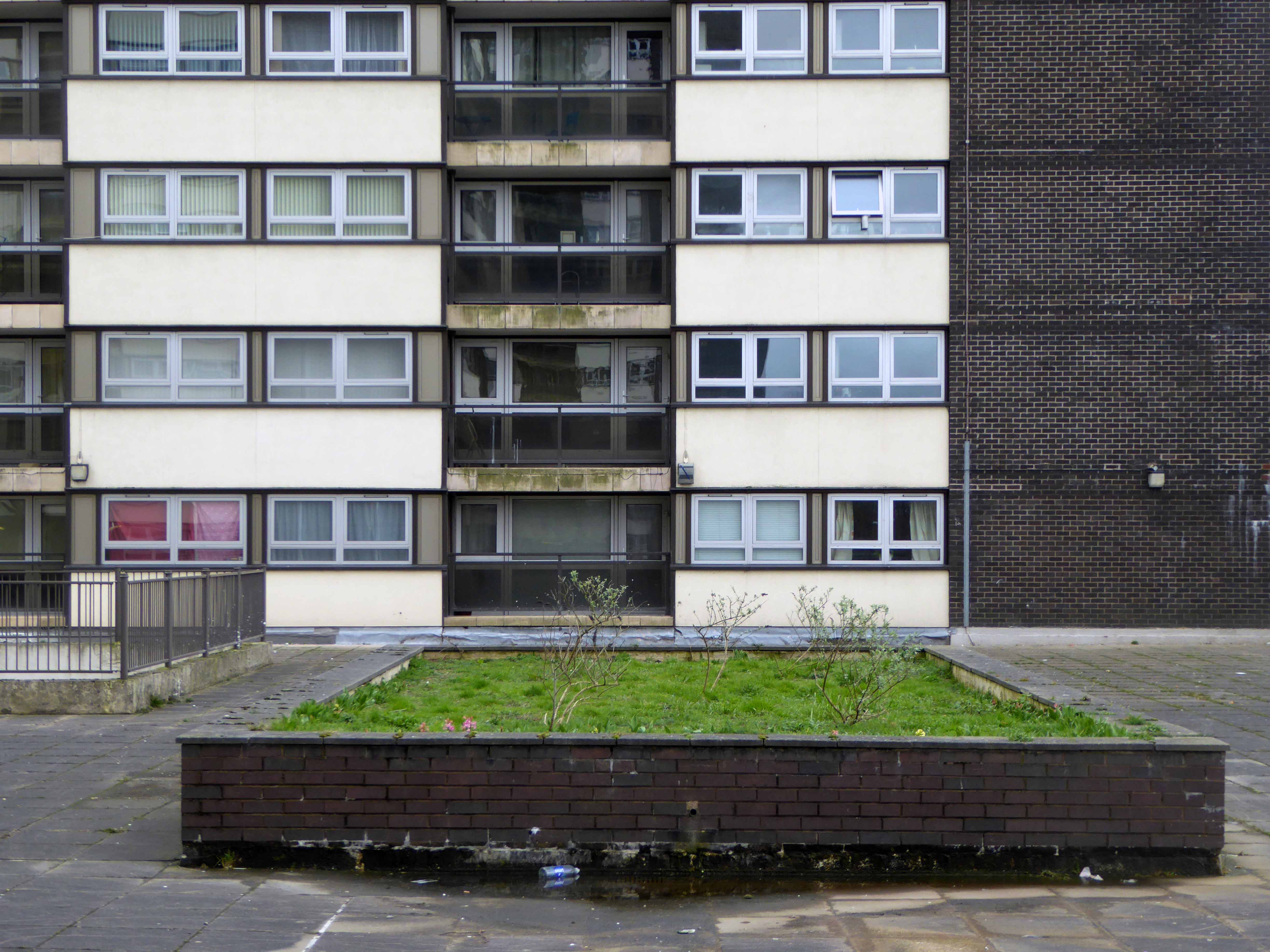
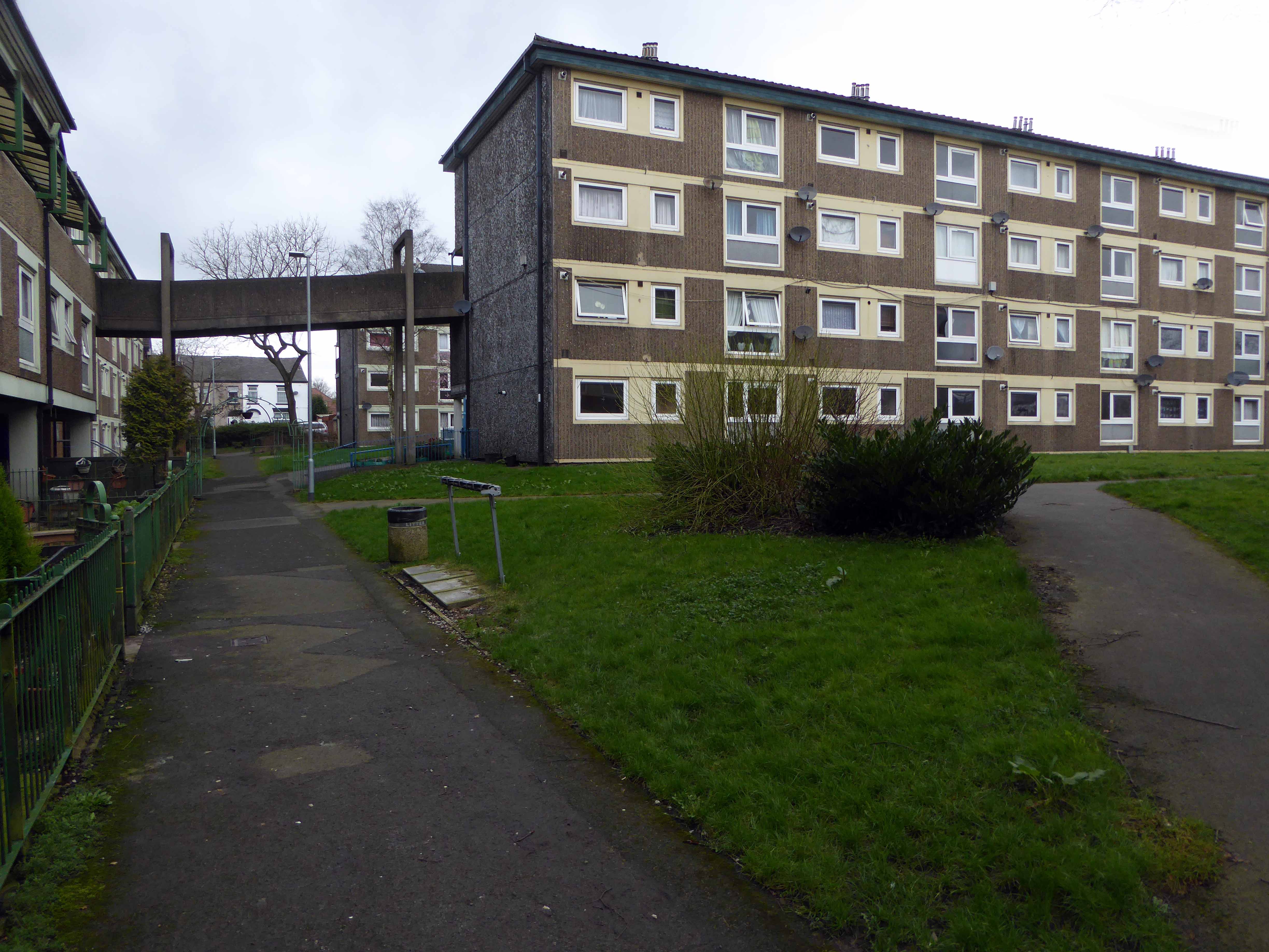
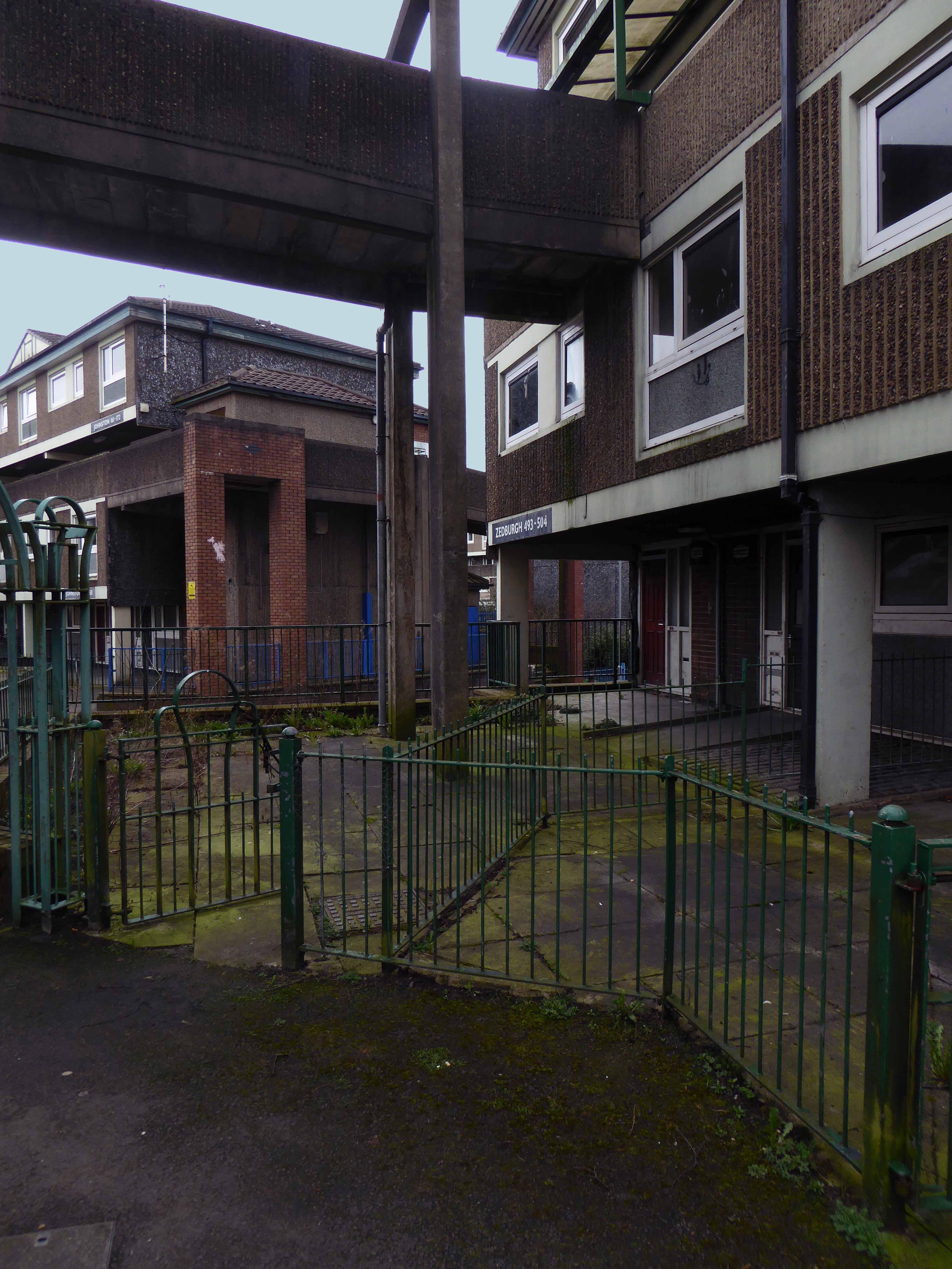
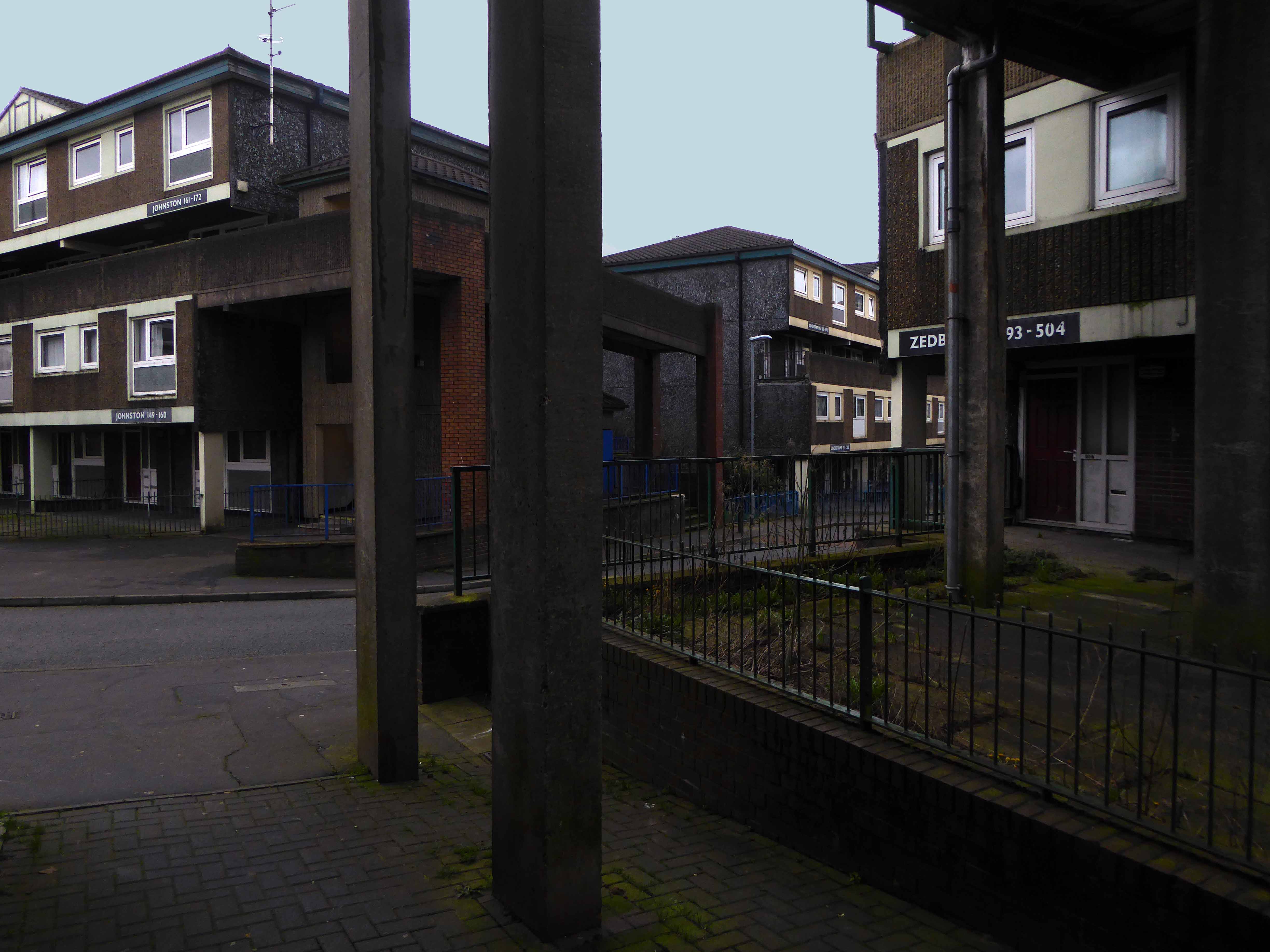
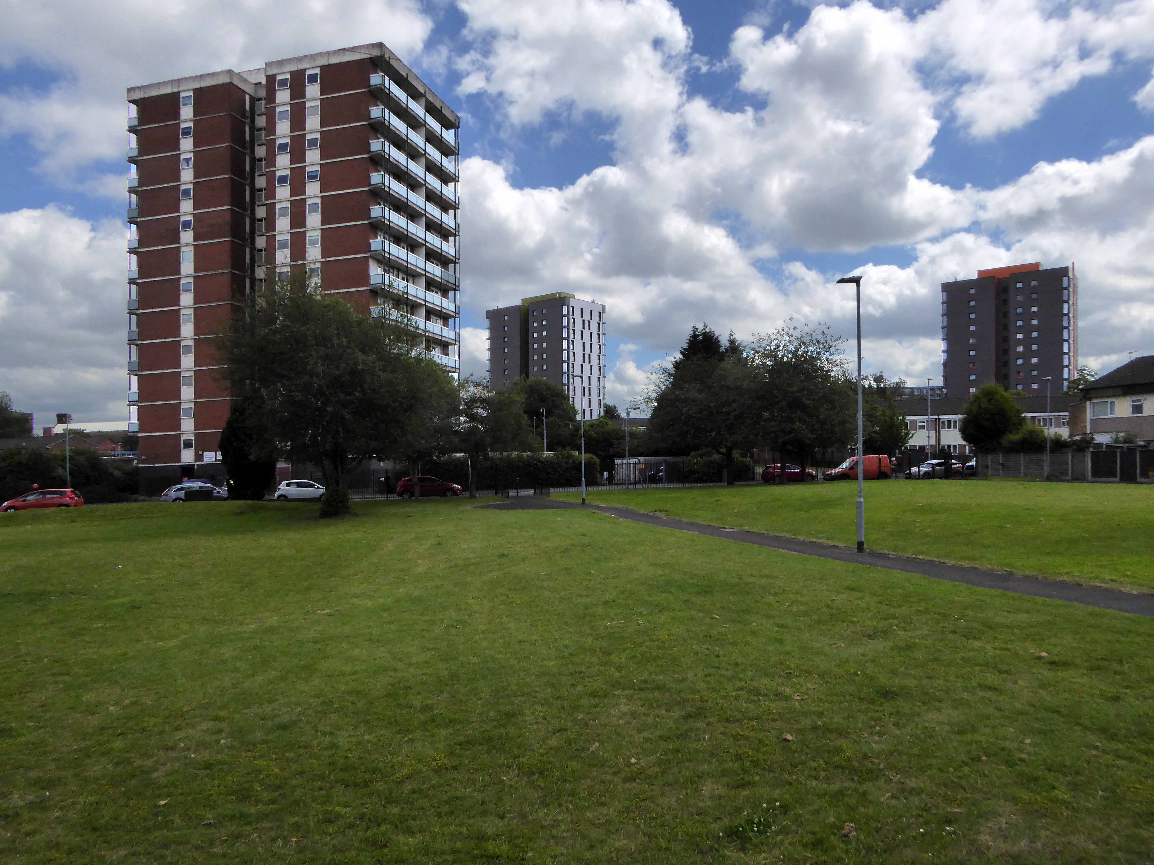
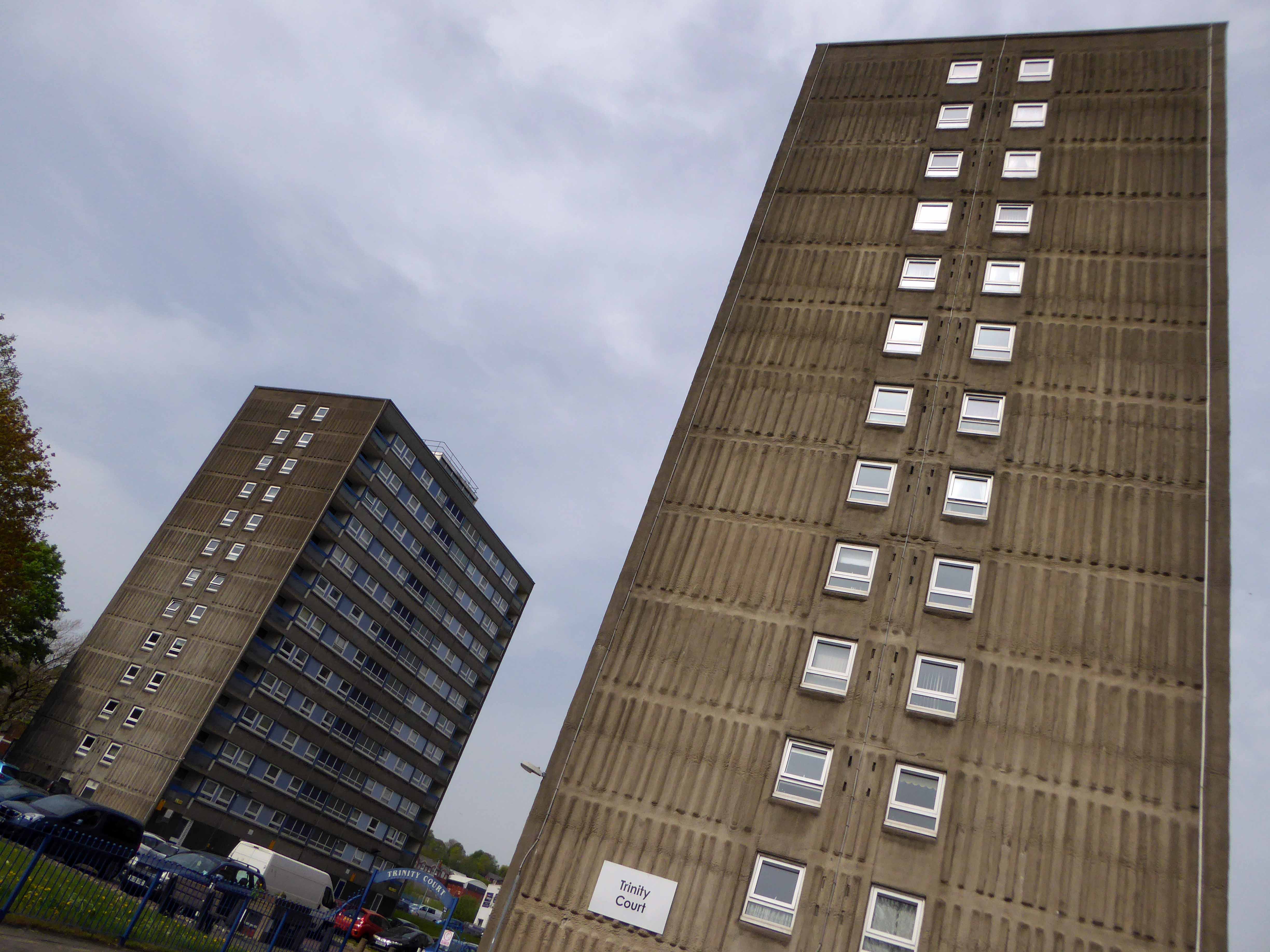
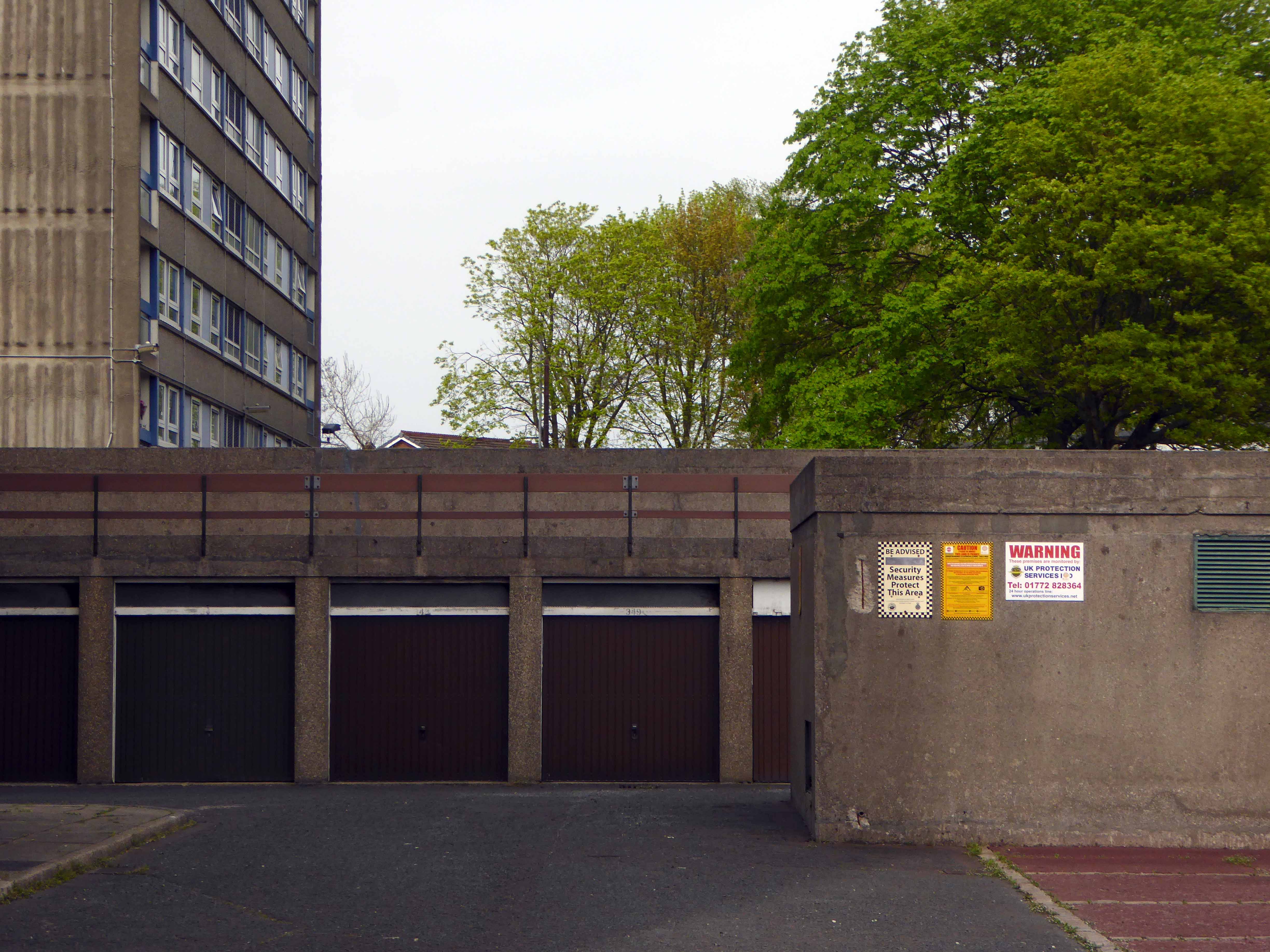
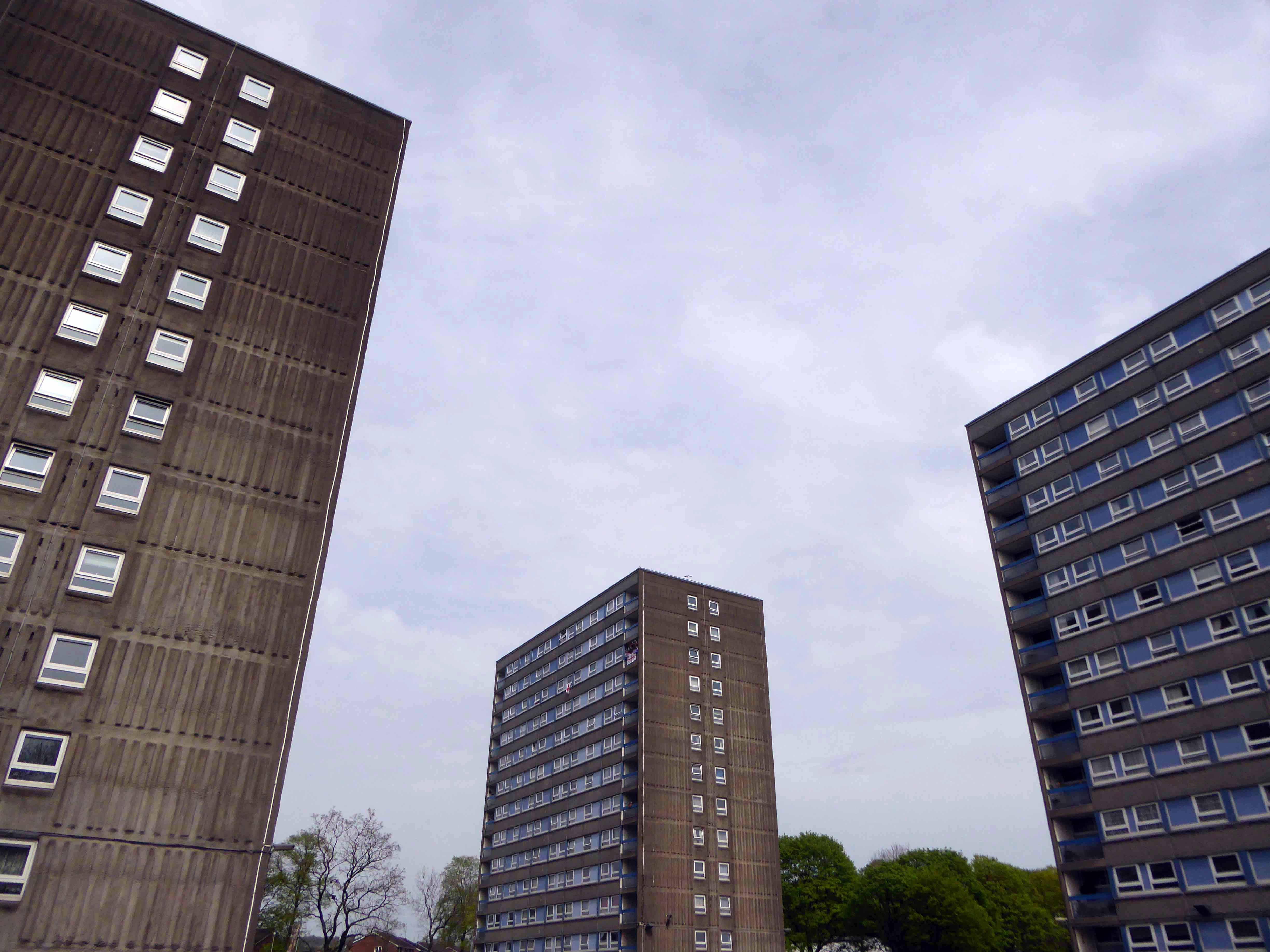
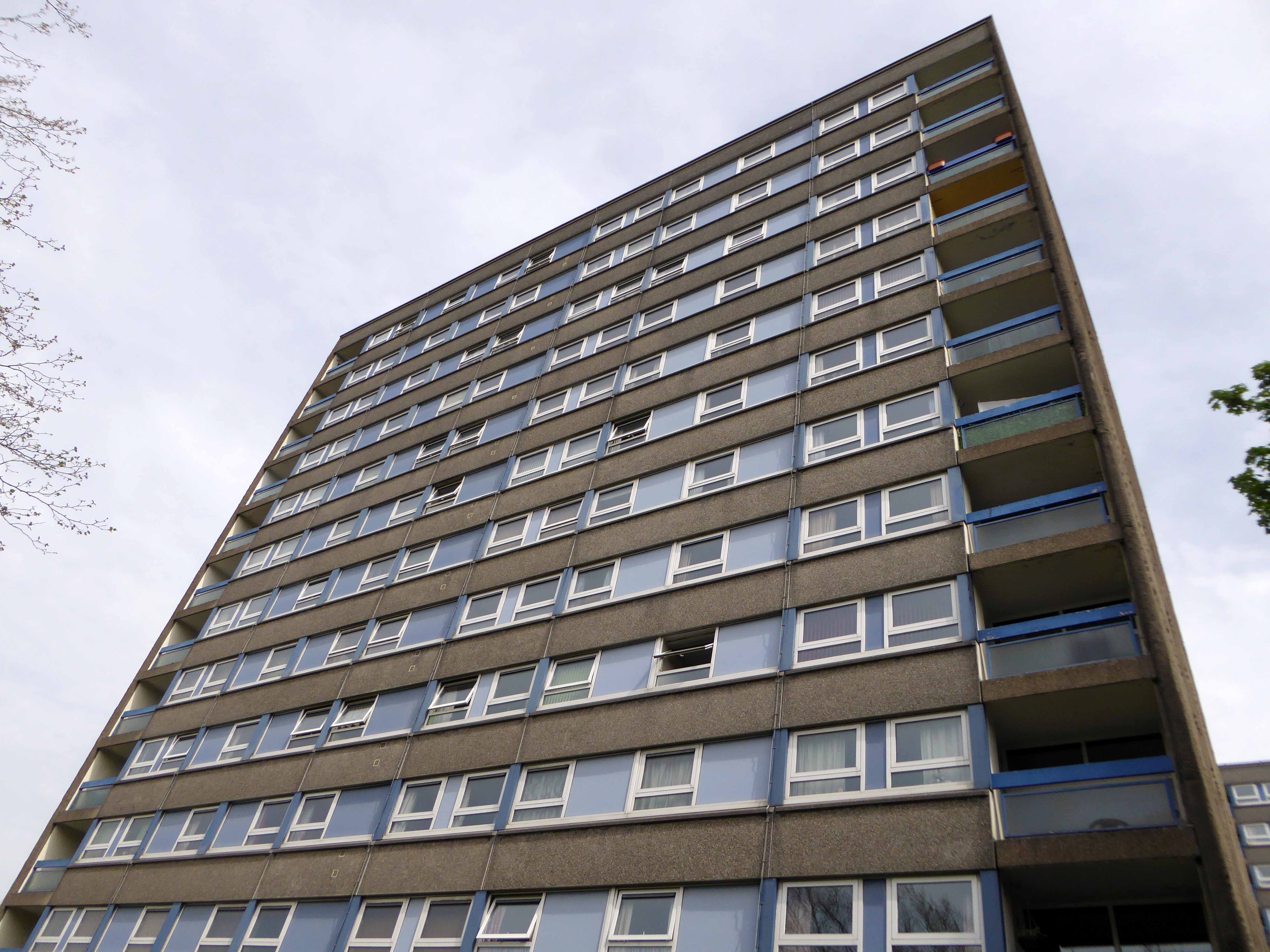
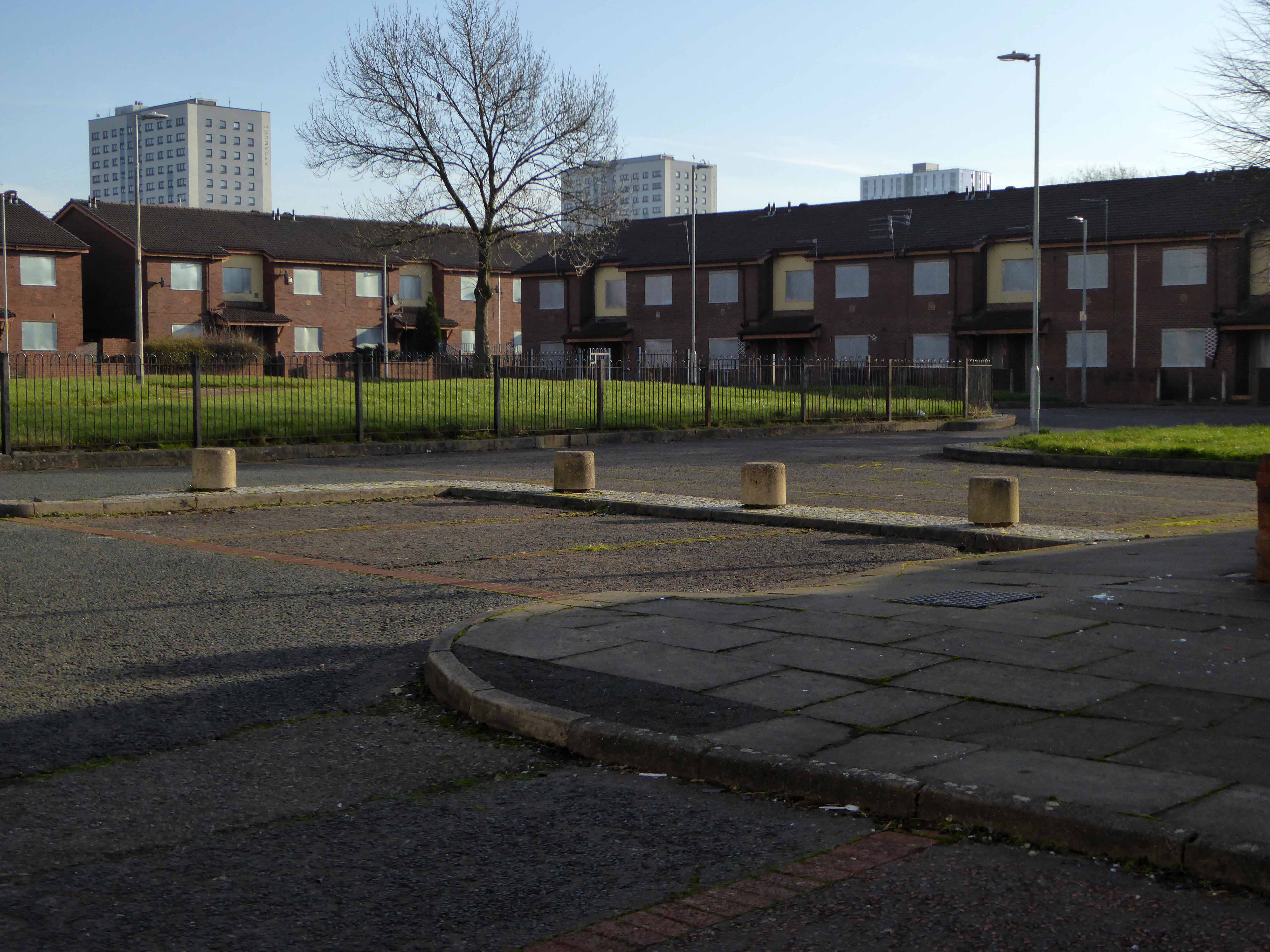
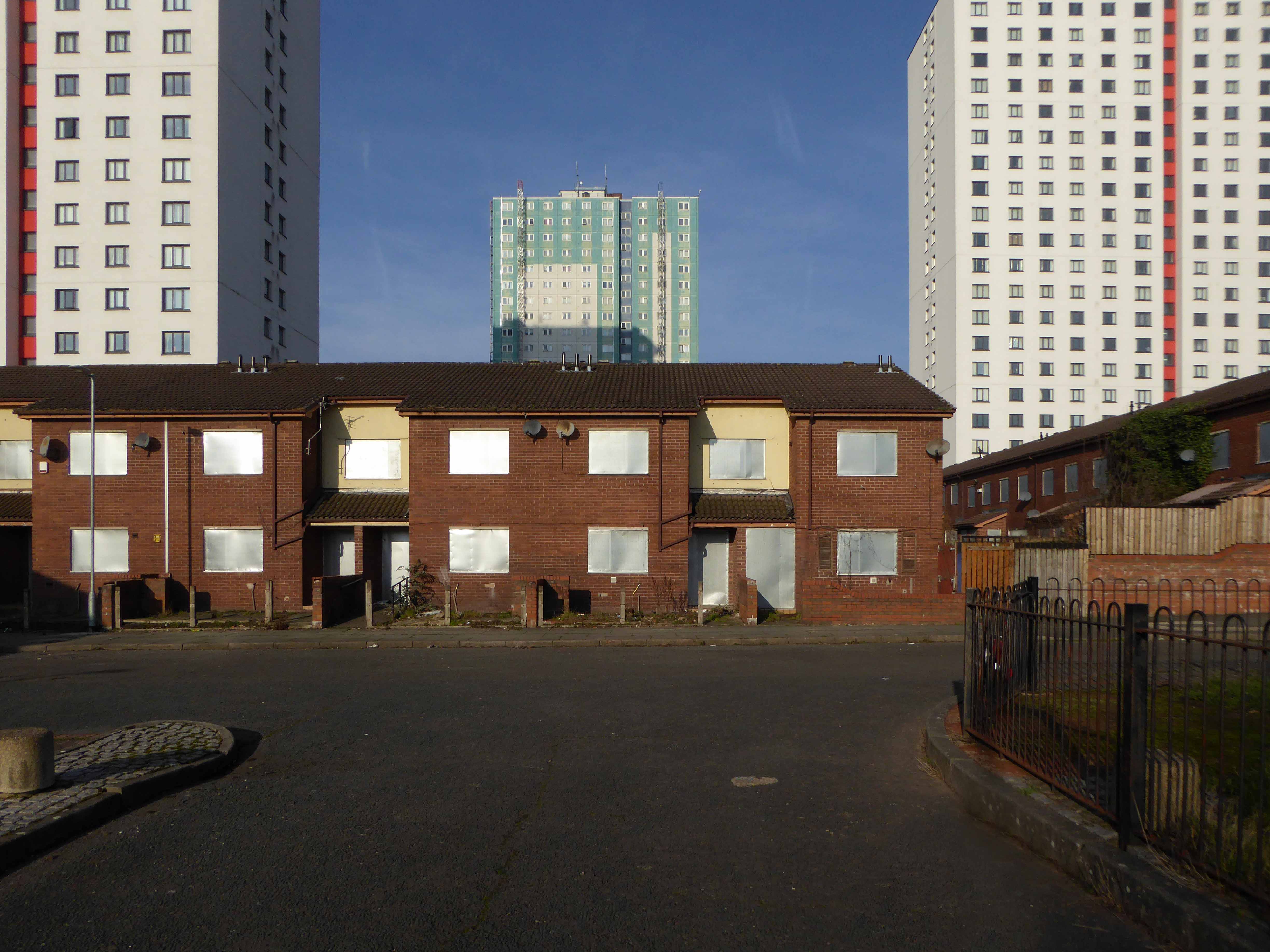
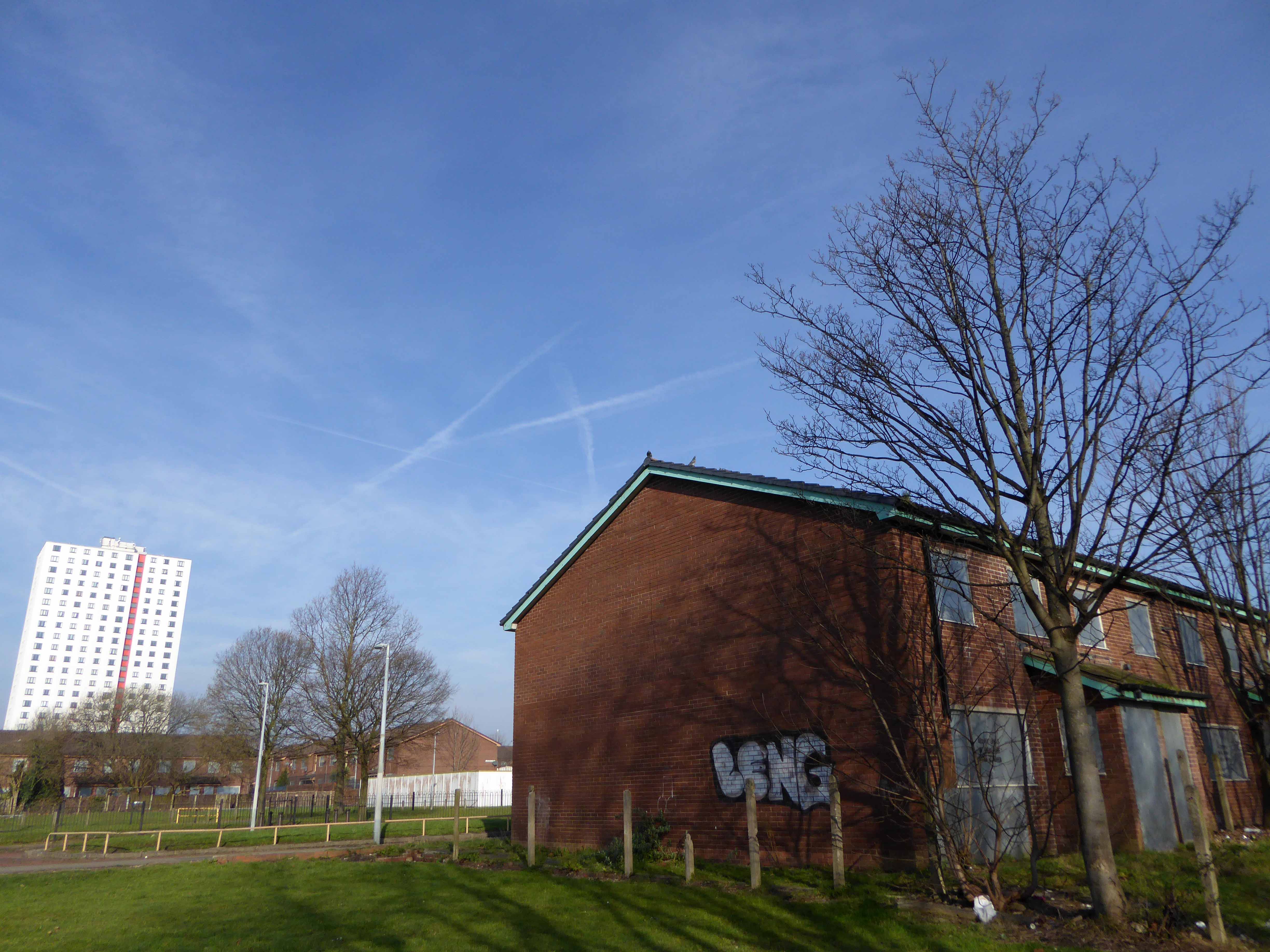
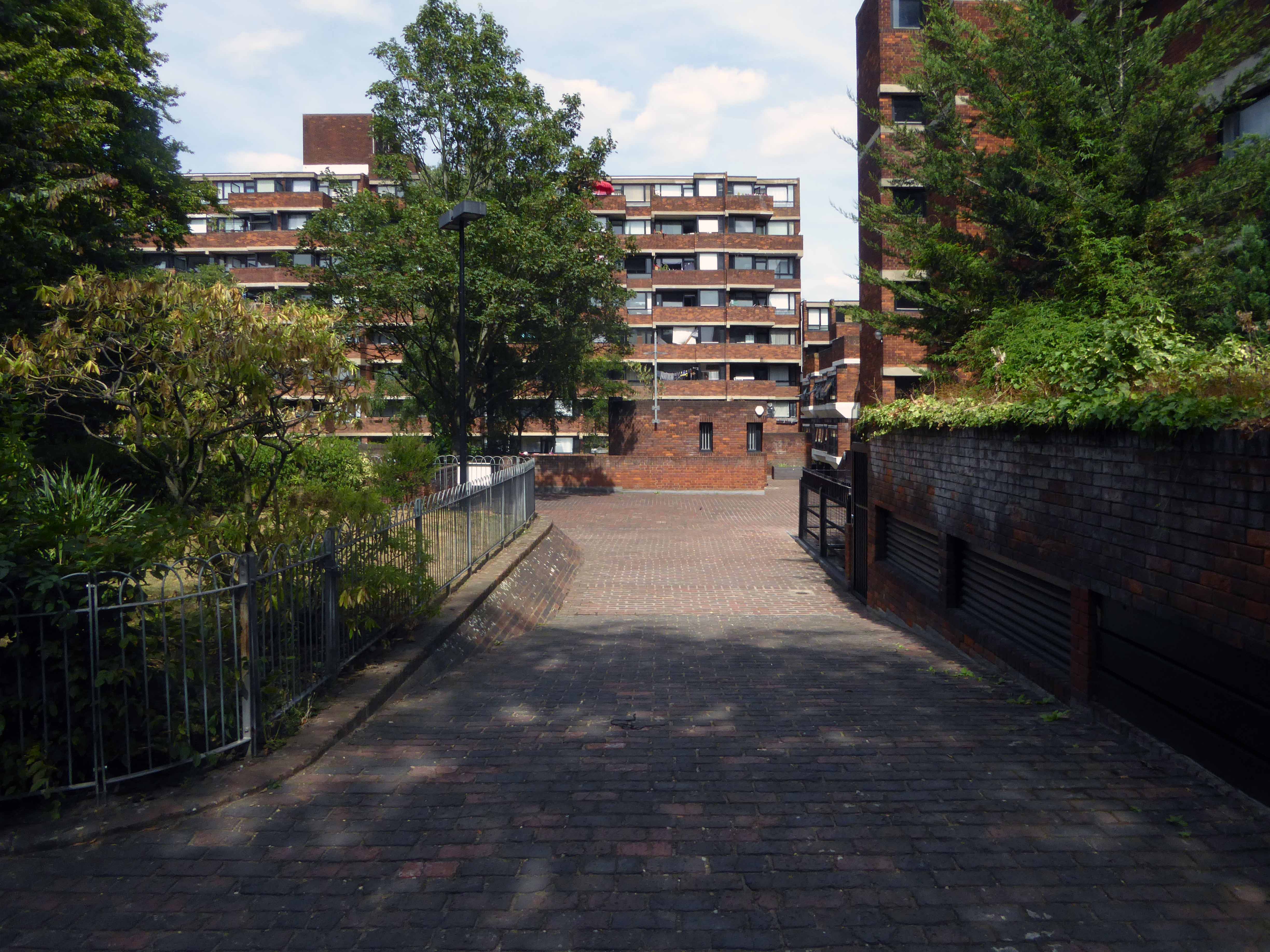
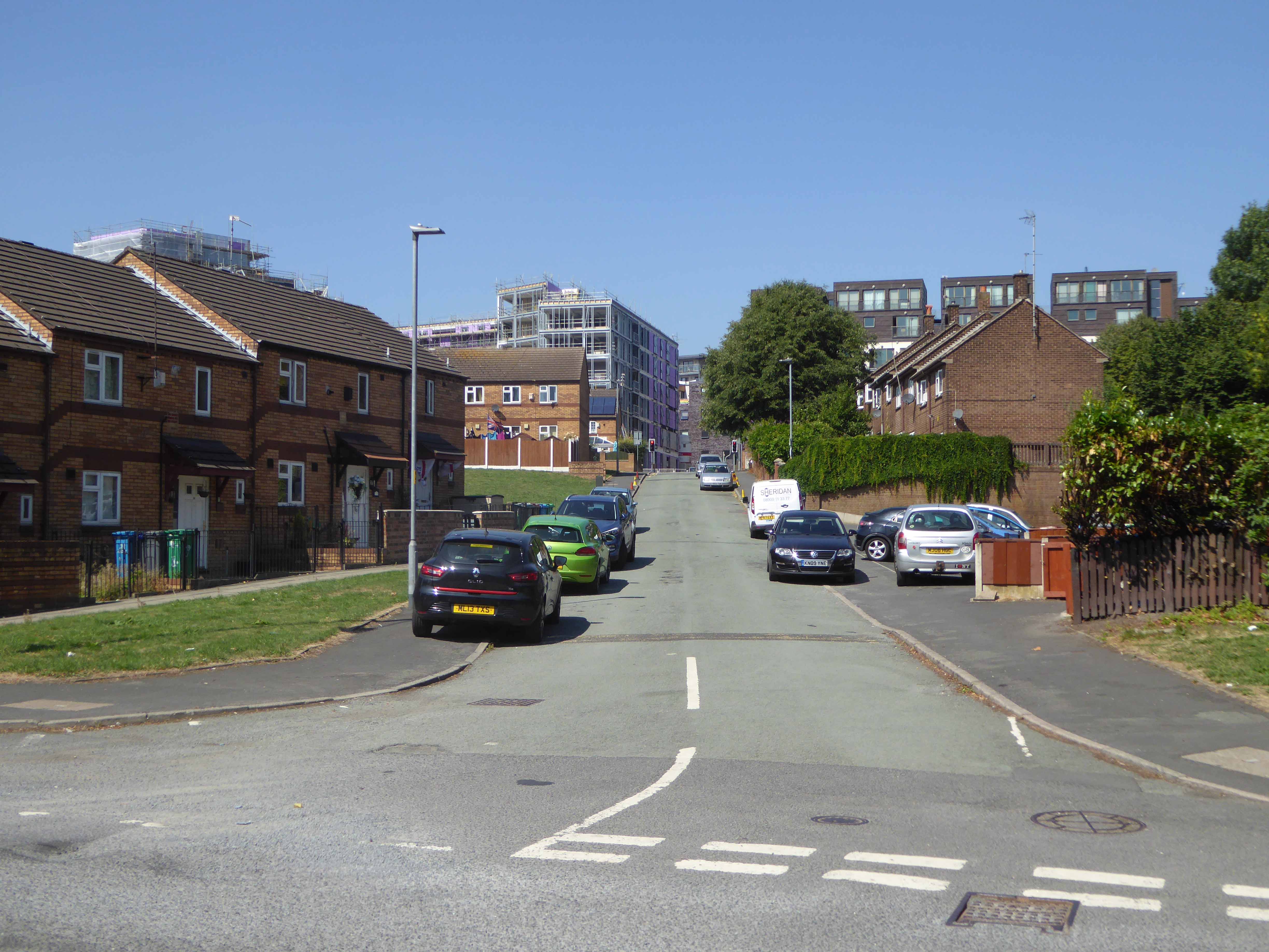
A large group of blocks stood tinned up and unloved, yet owned, for a number of years, victims one supposes of land-bankers, developers speculating on an even better return, as the warm waves of gentrification washed slowly over them, from nearby New Islington.

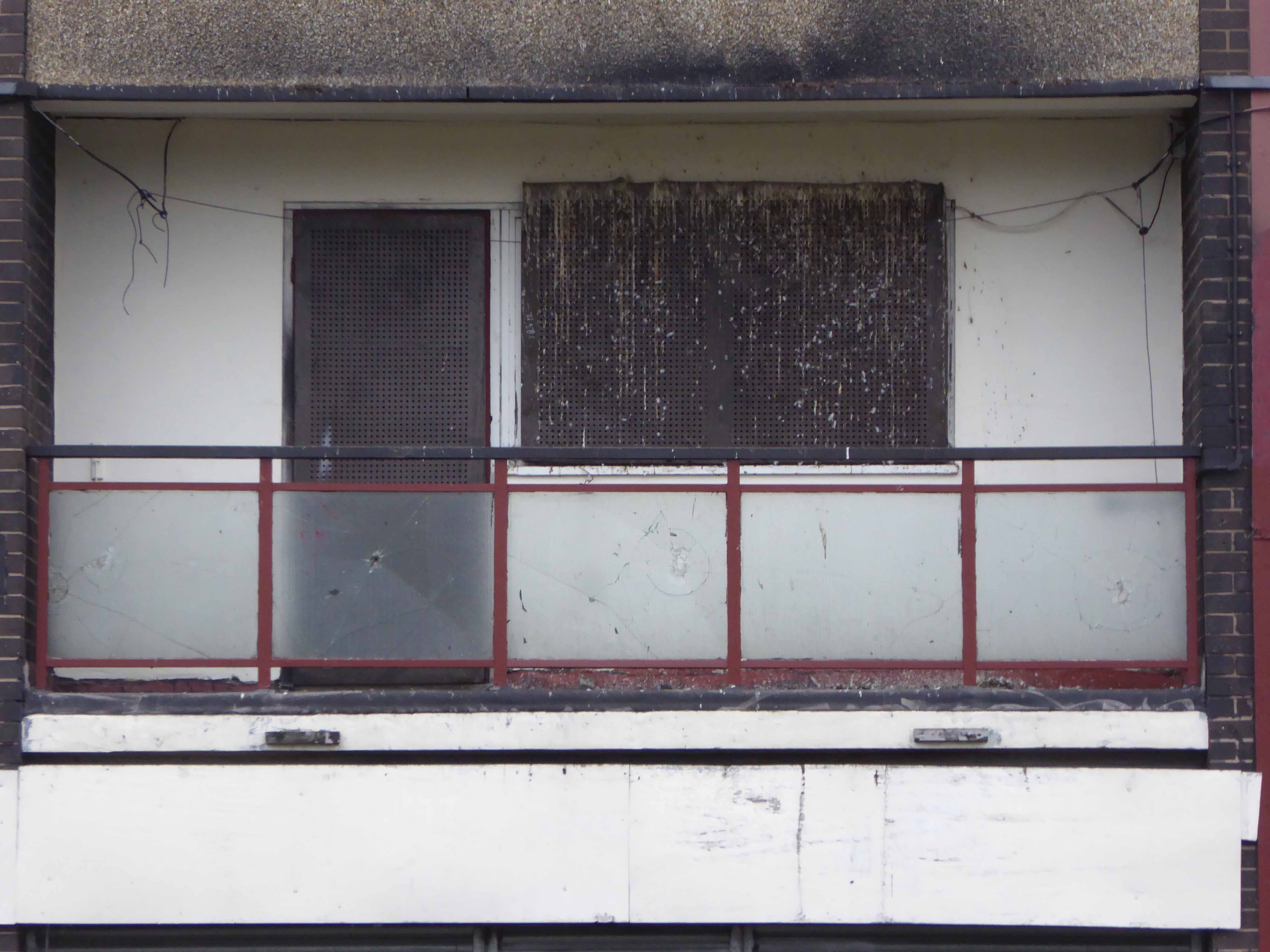
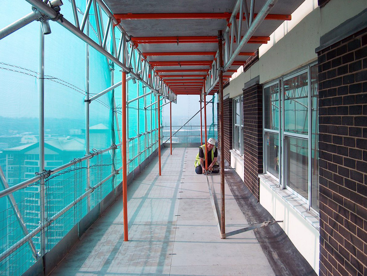
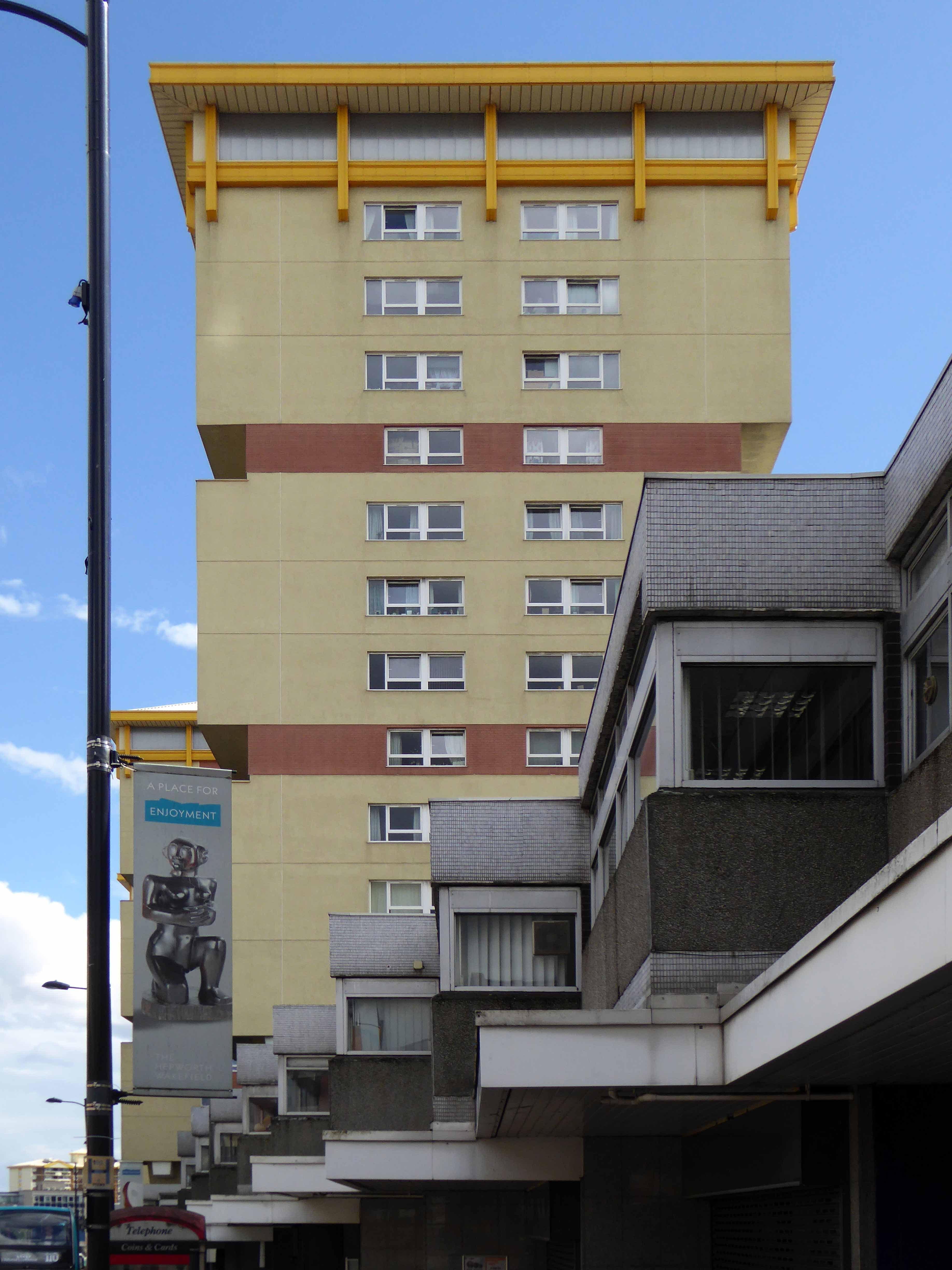
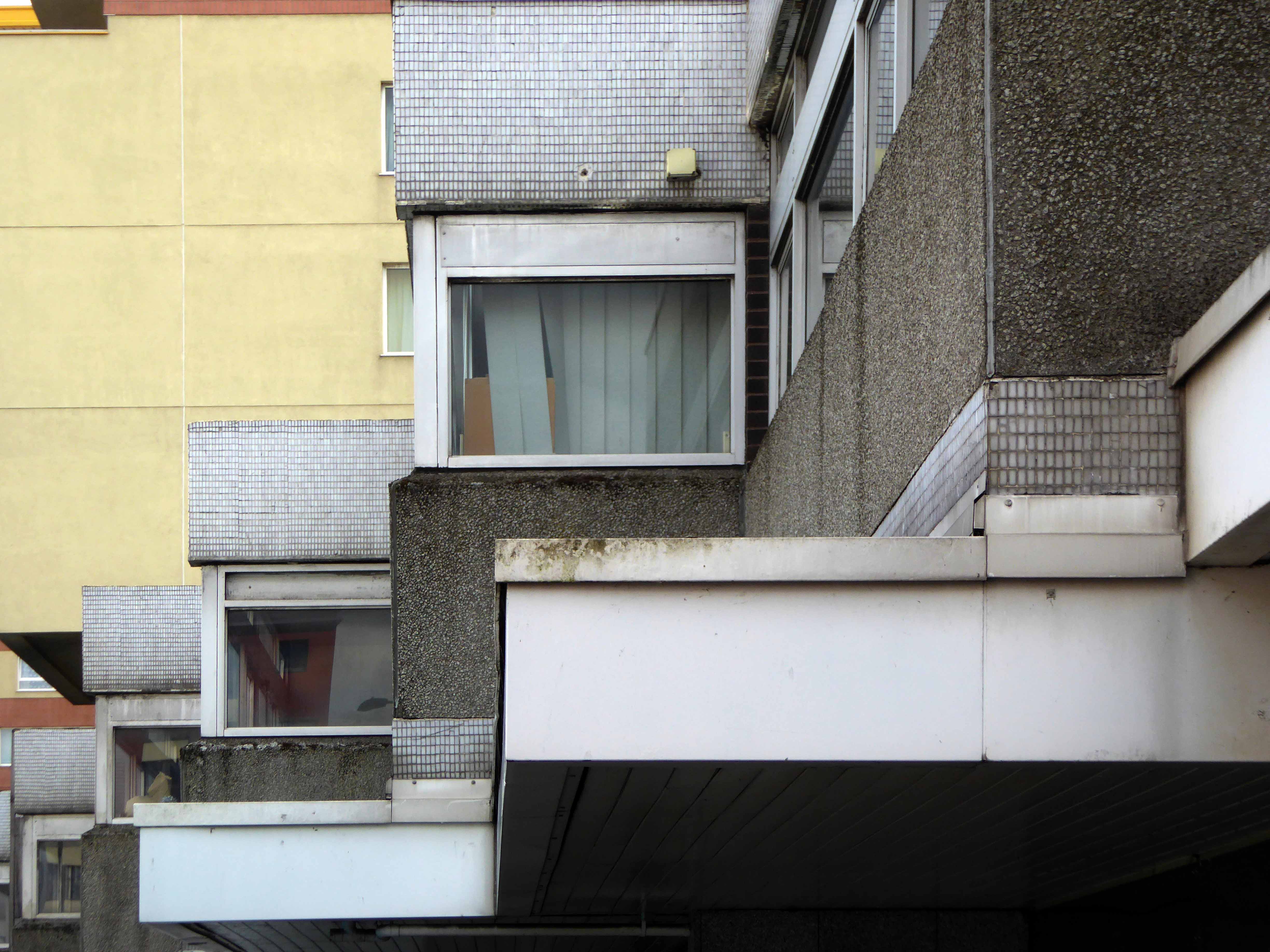
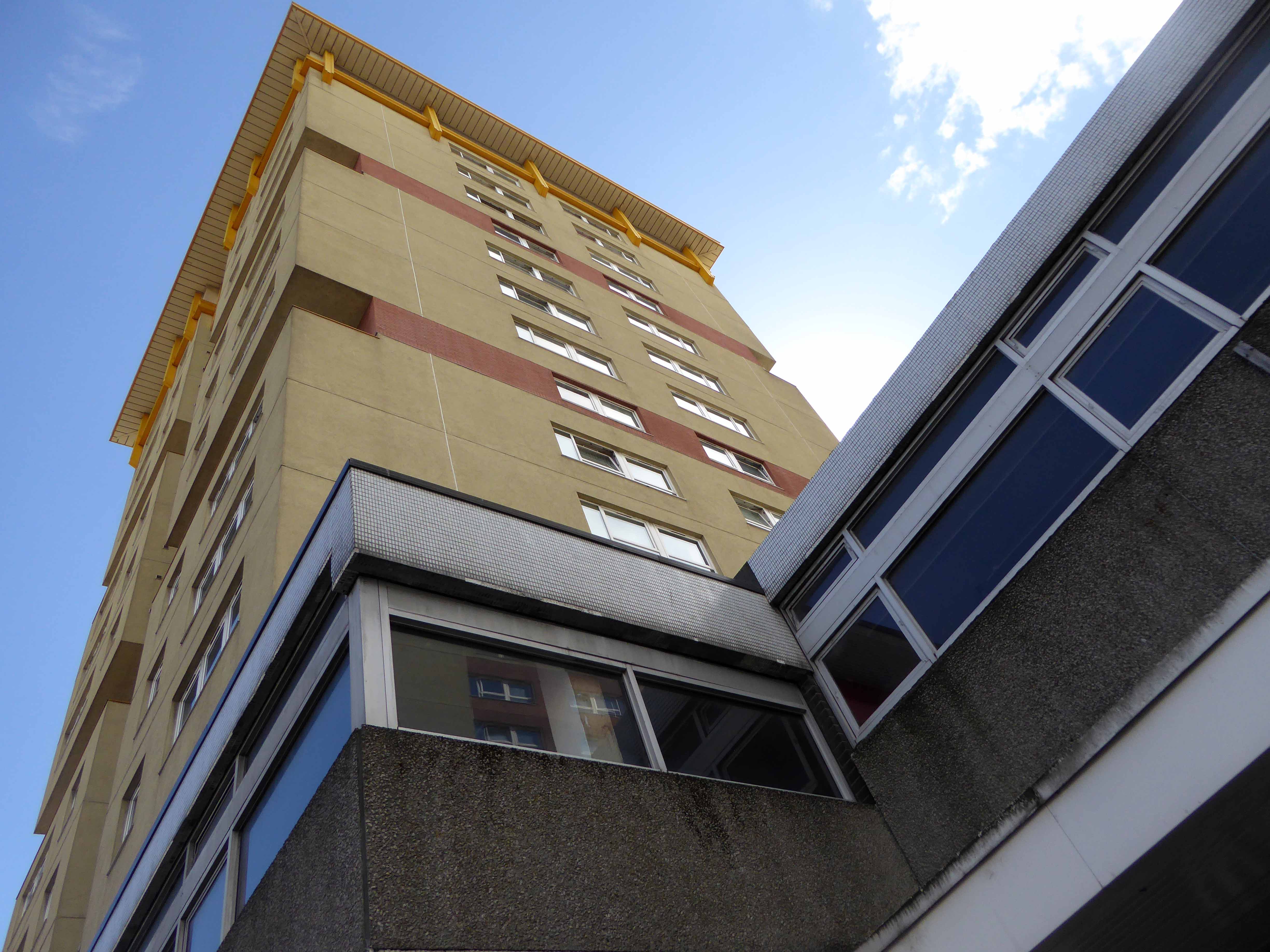
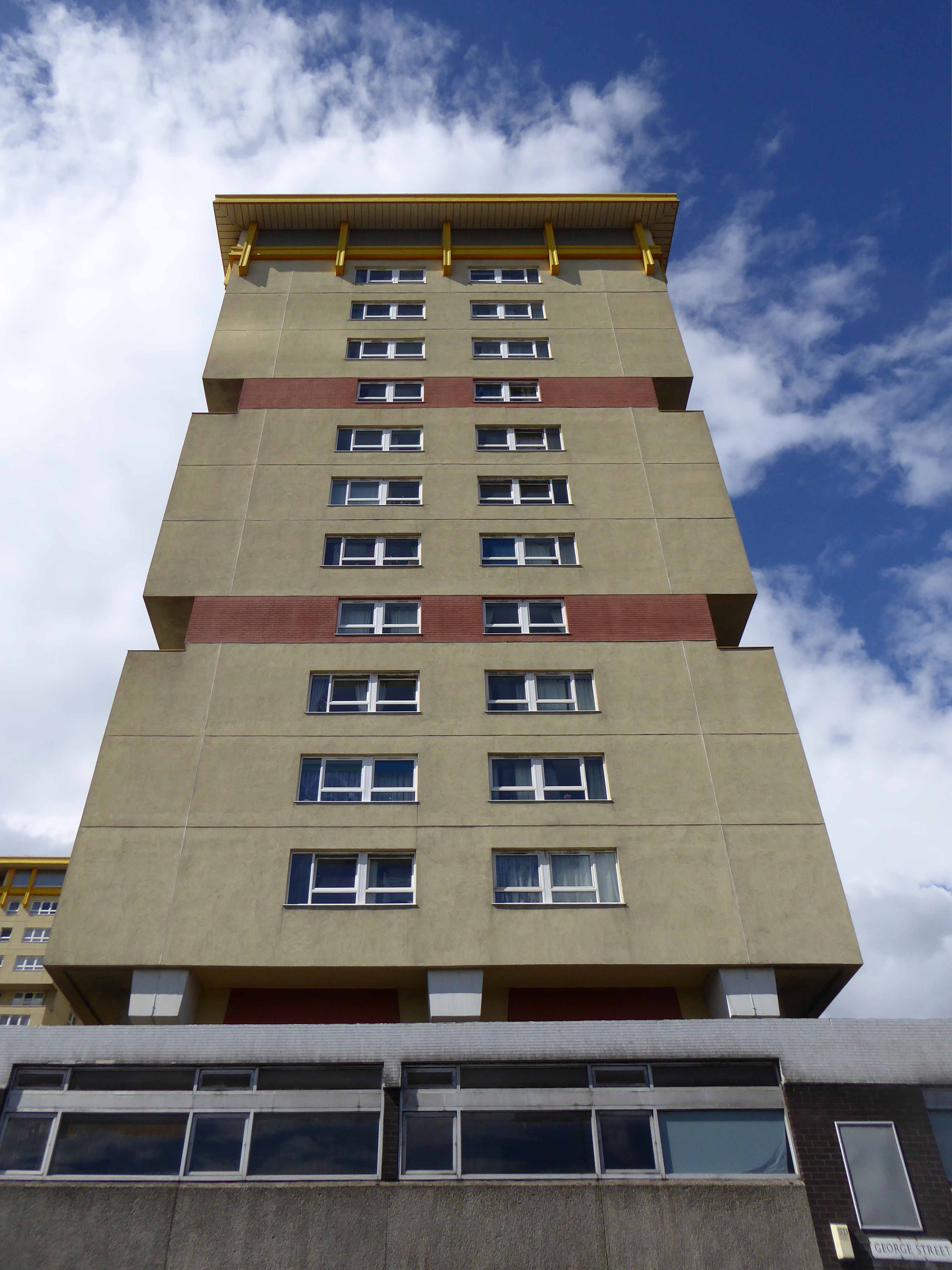
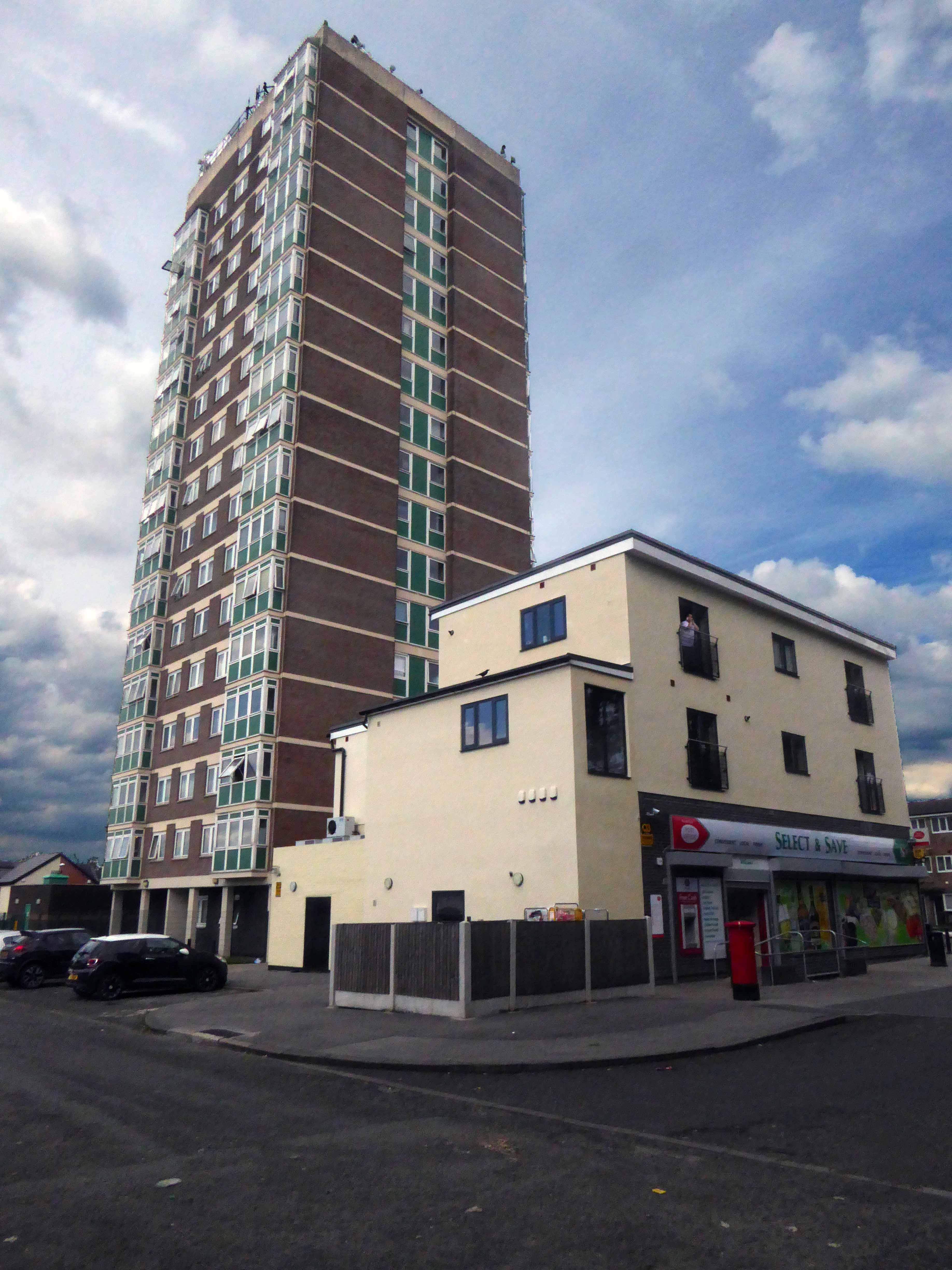
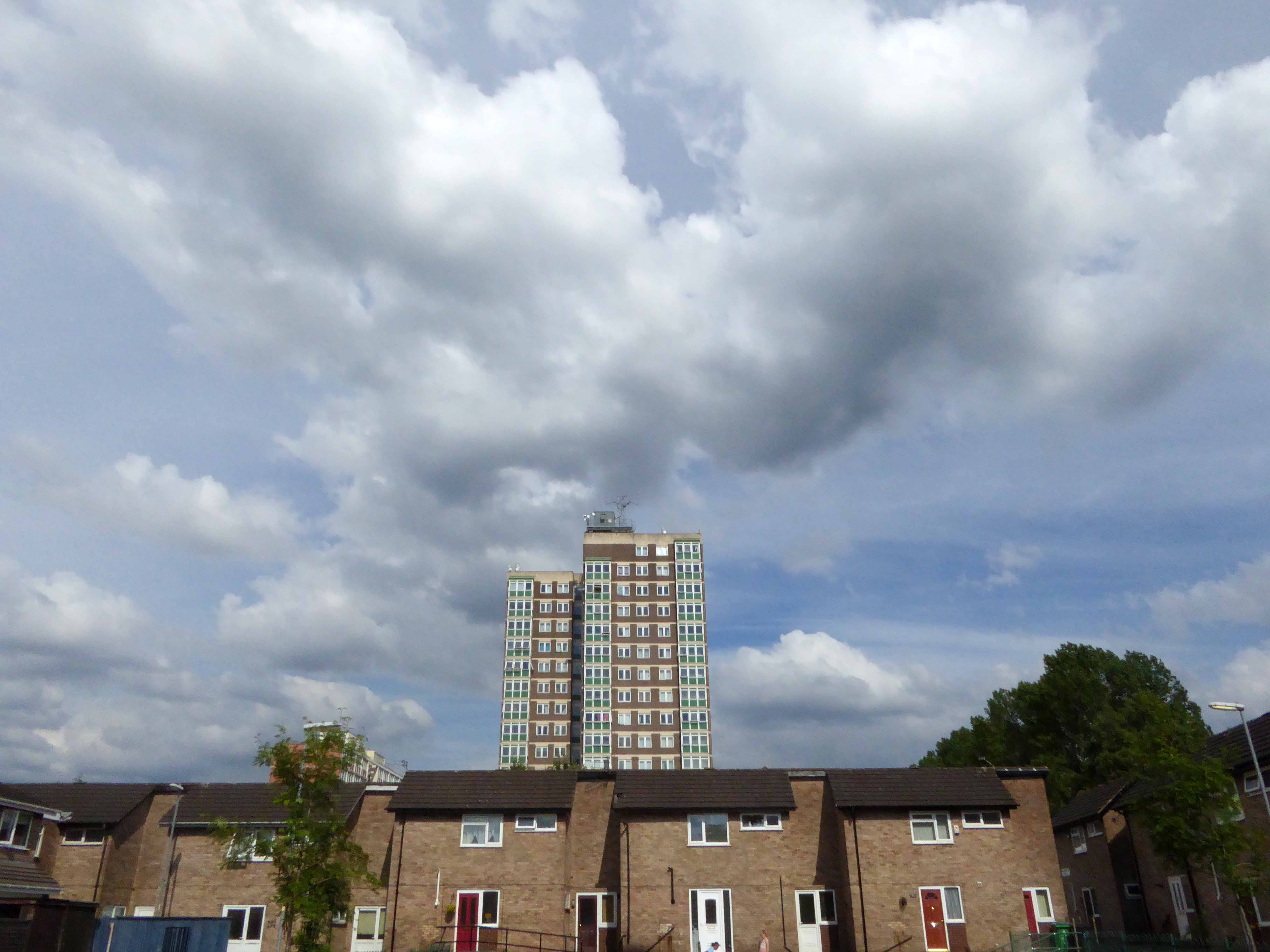
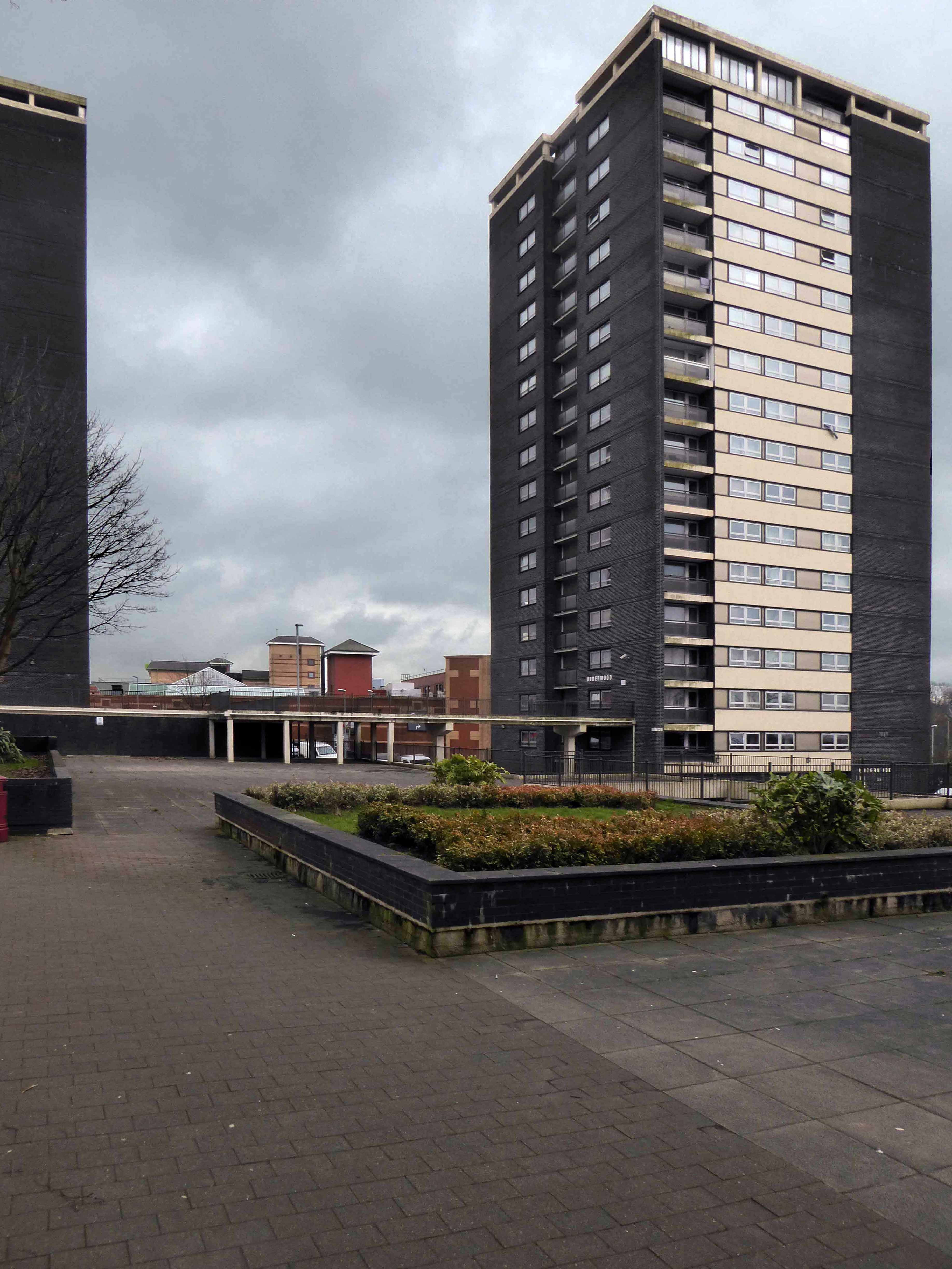
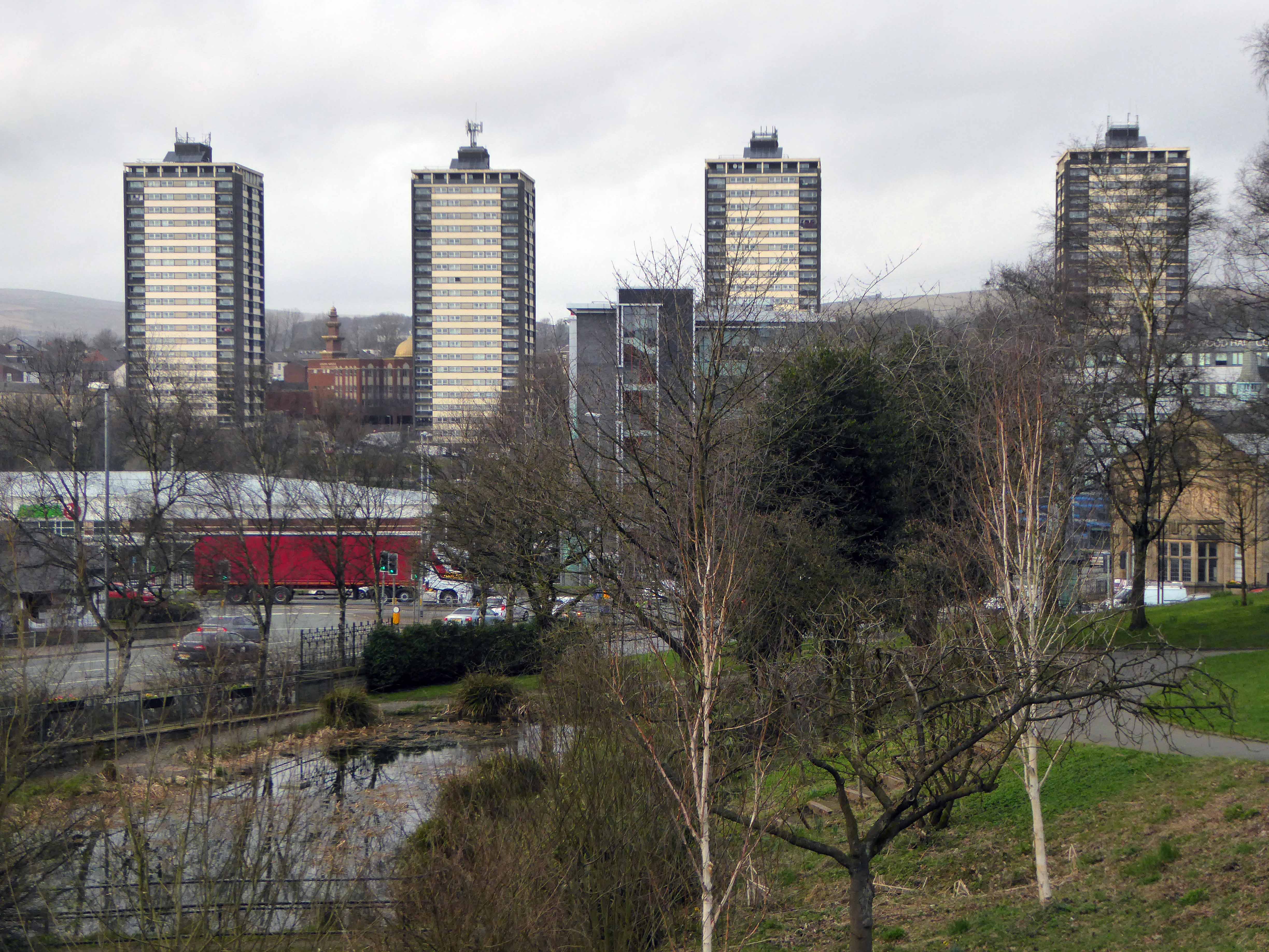
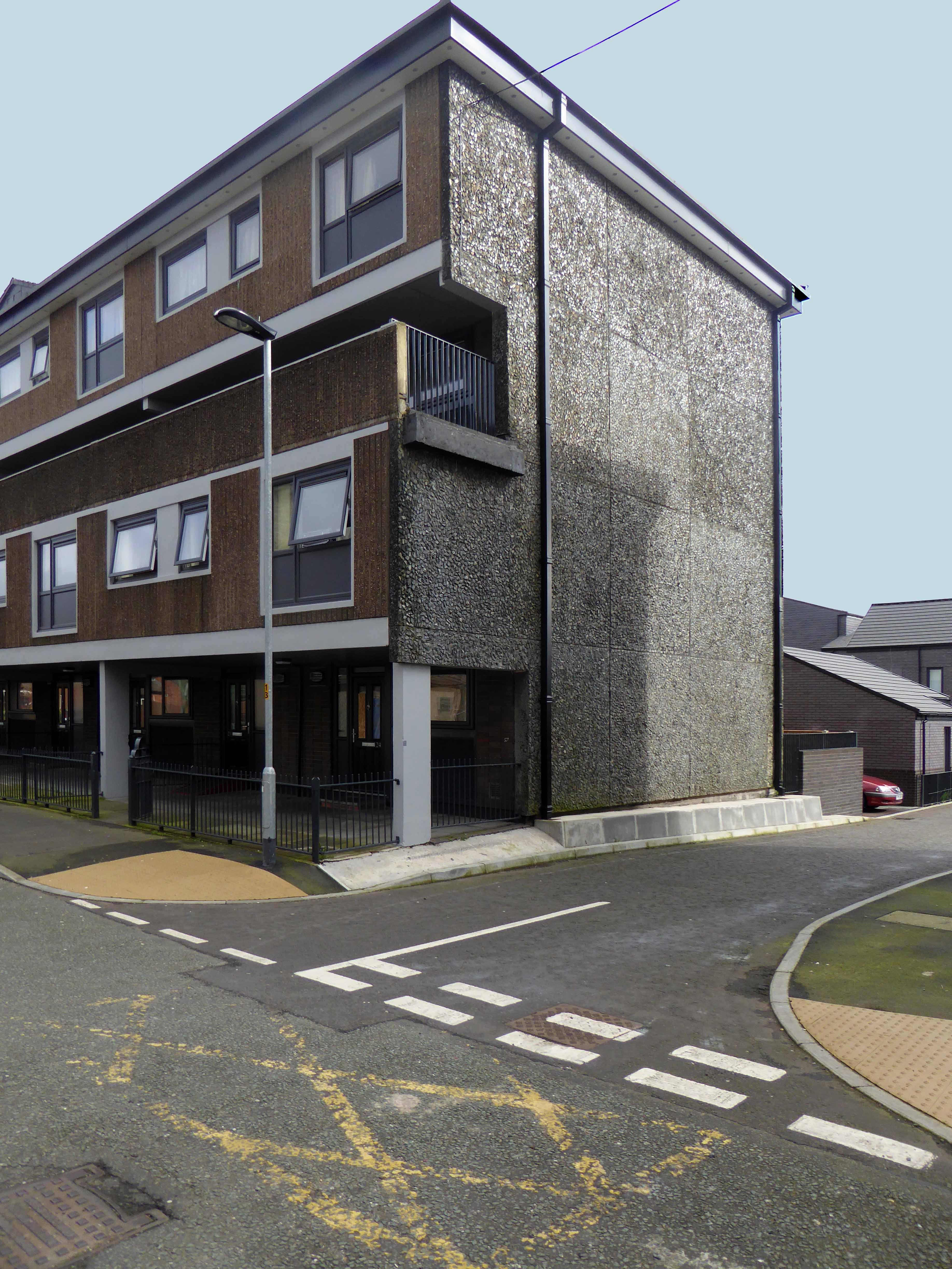
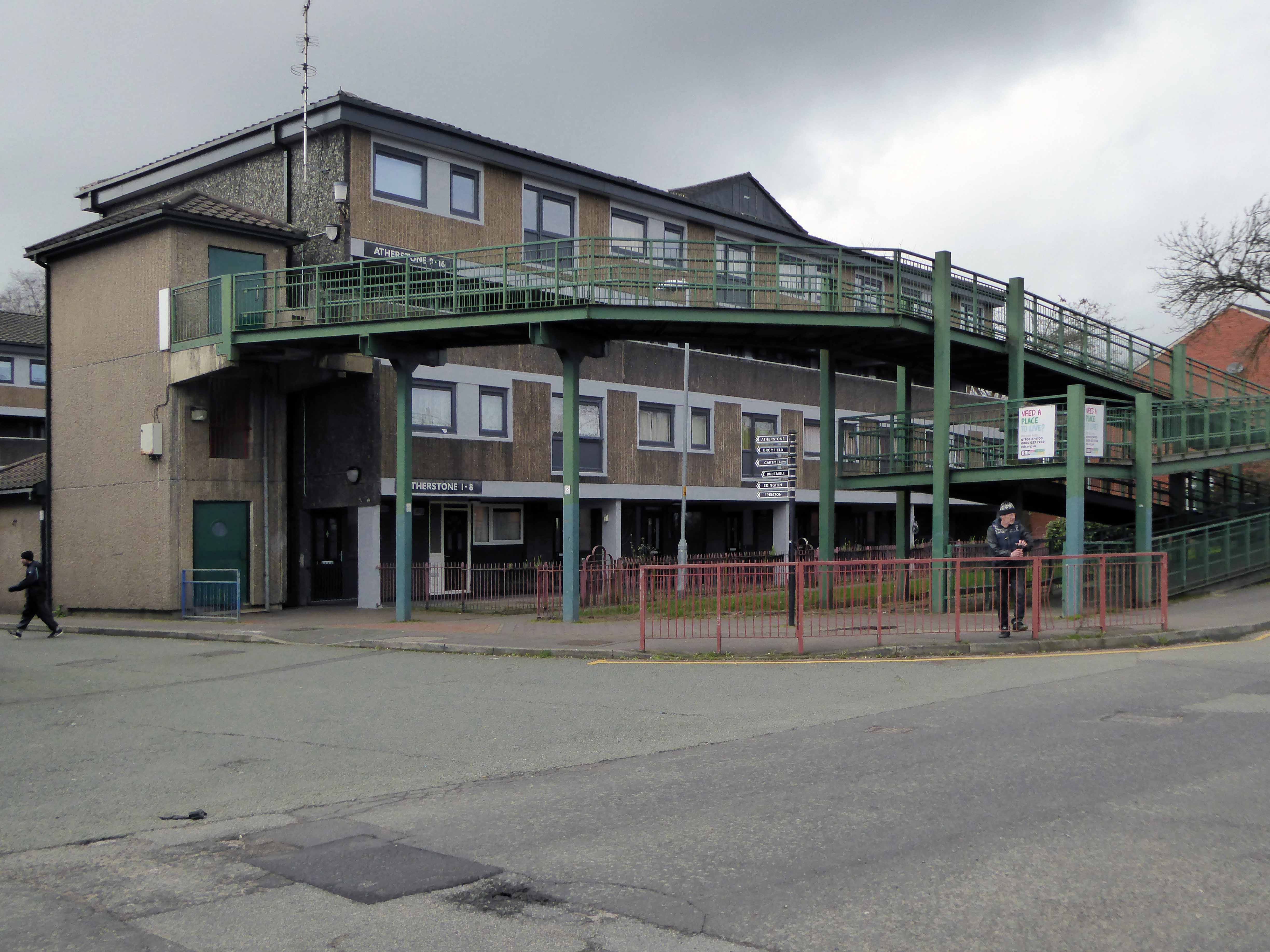
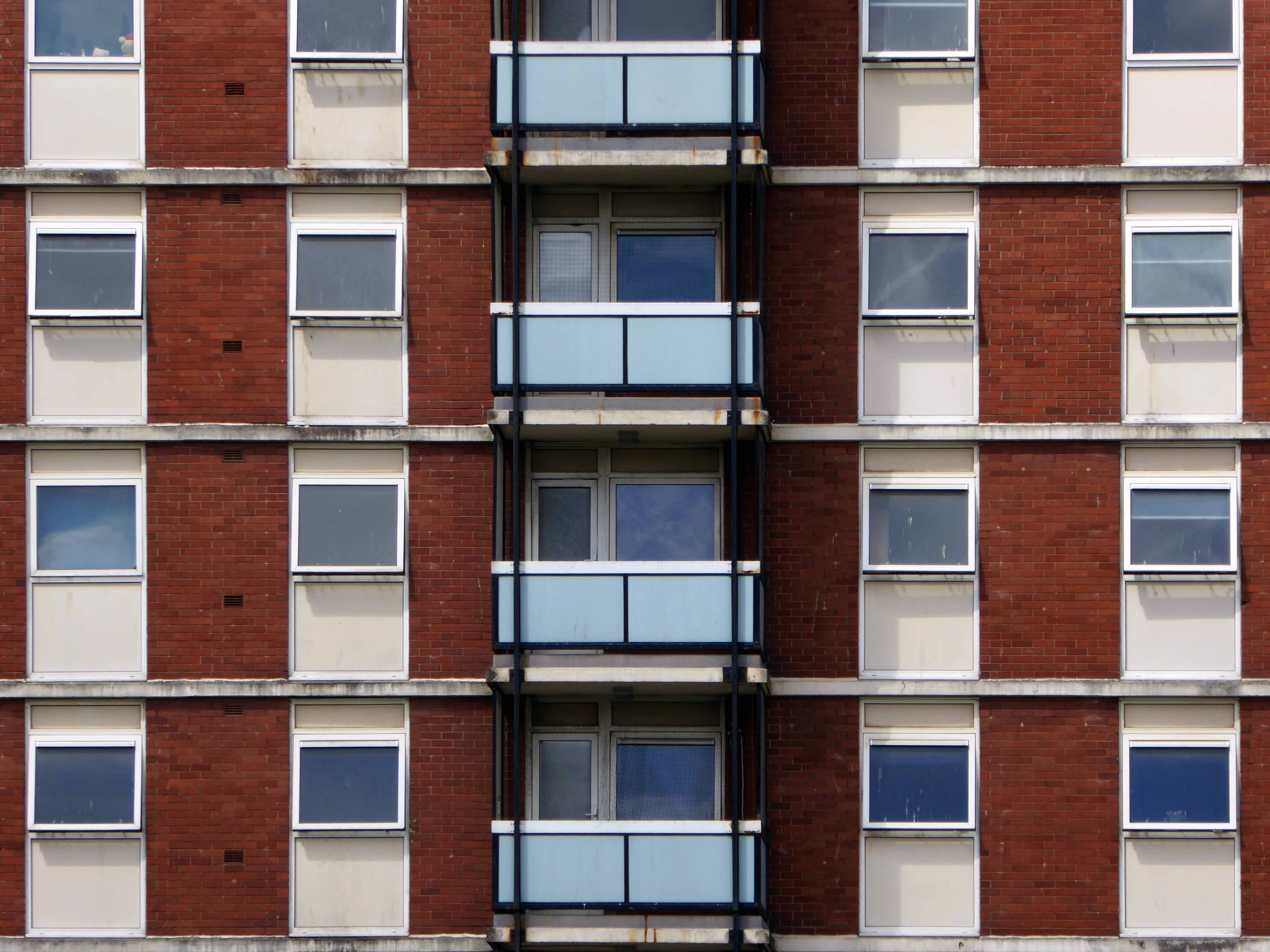
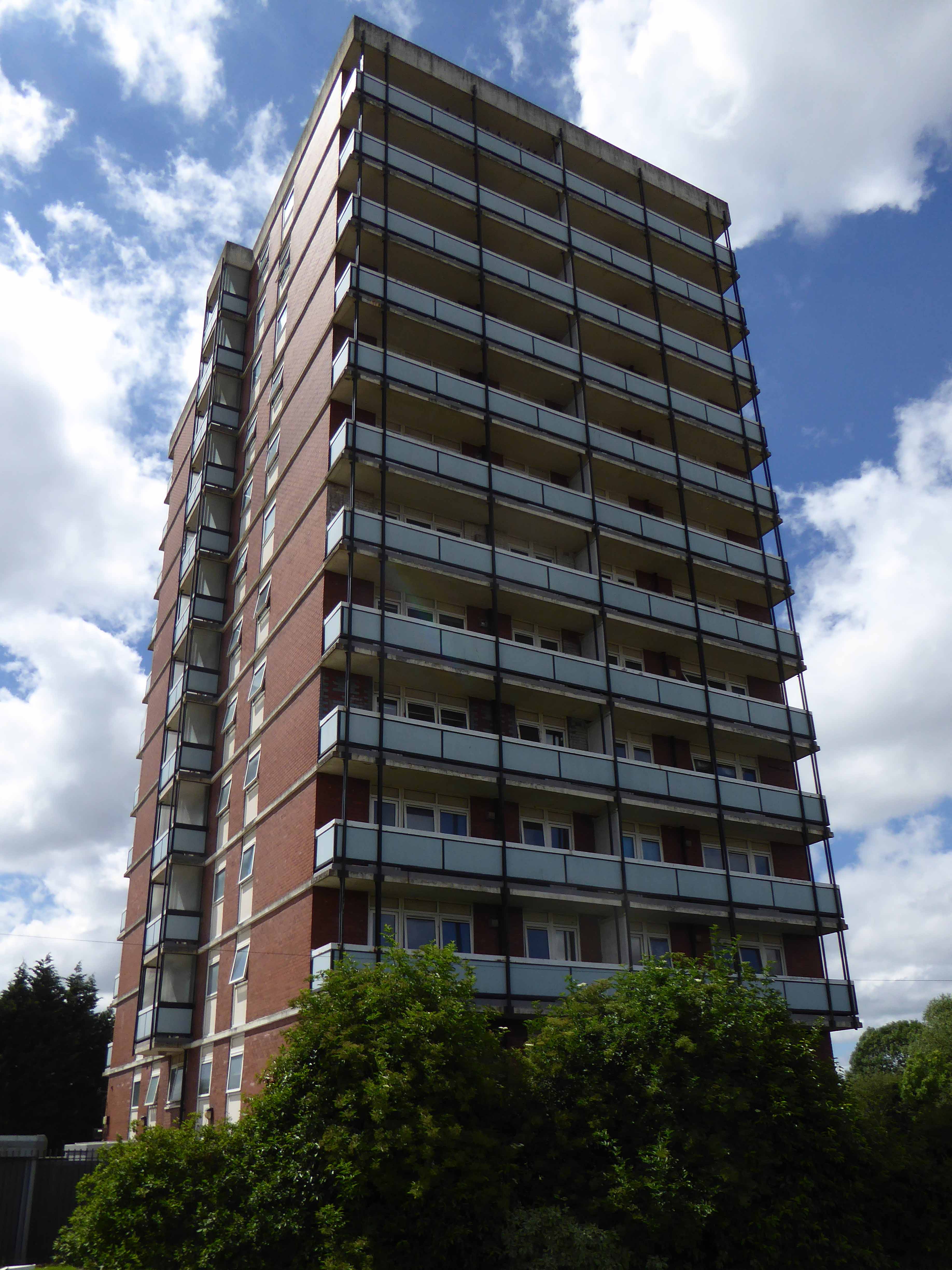
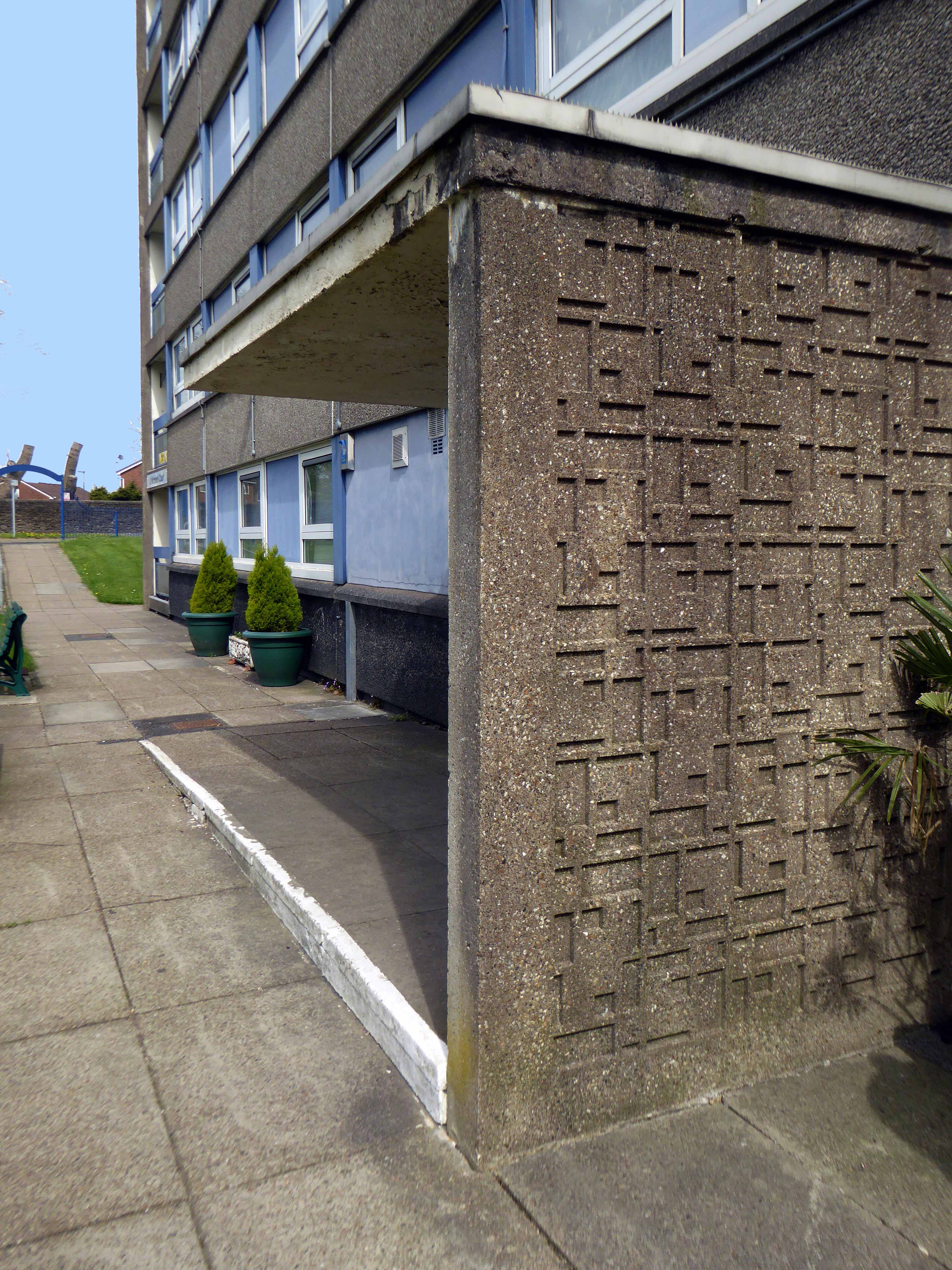
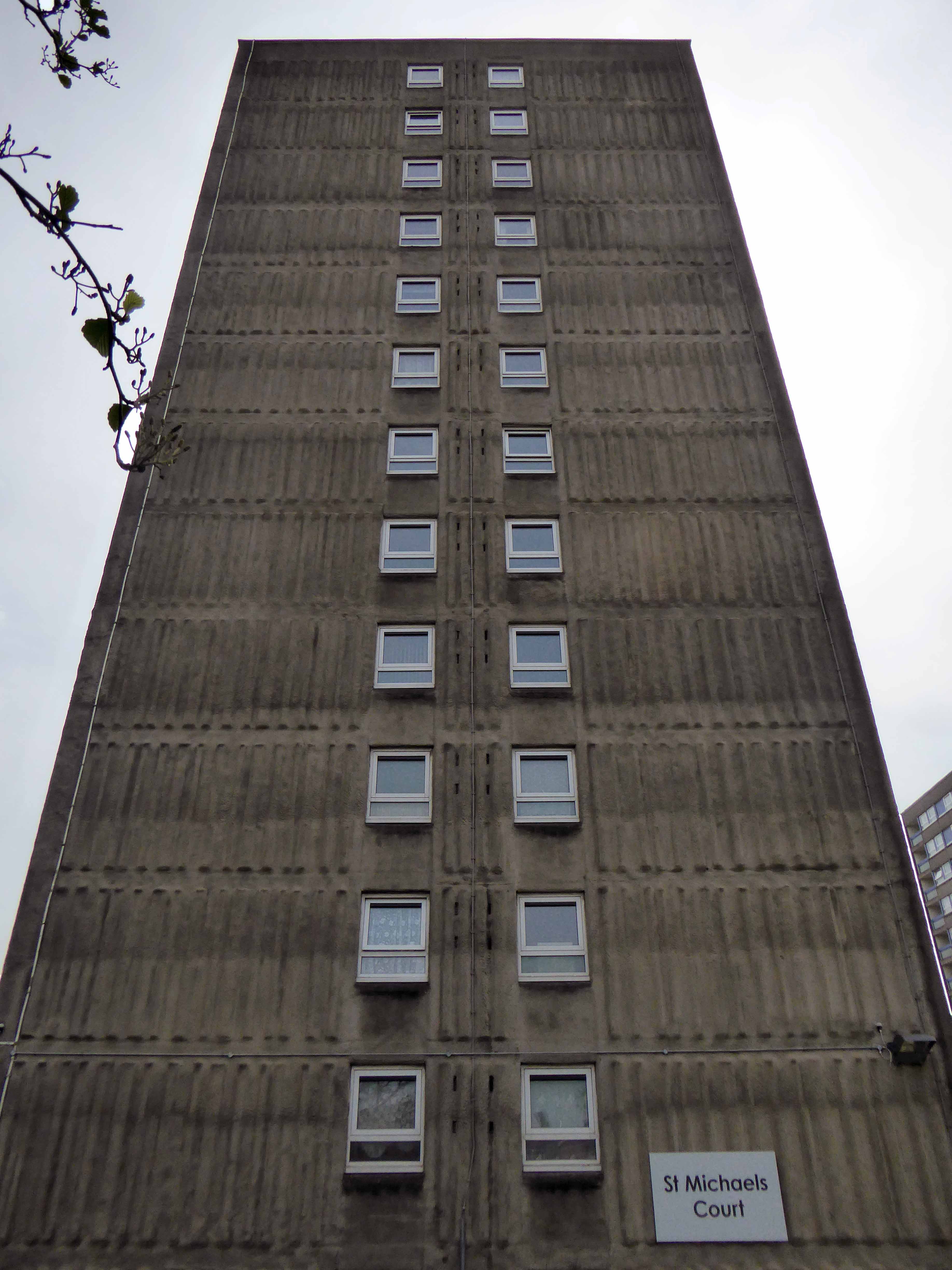
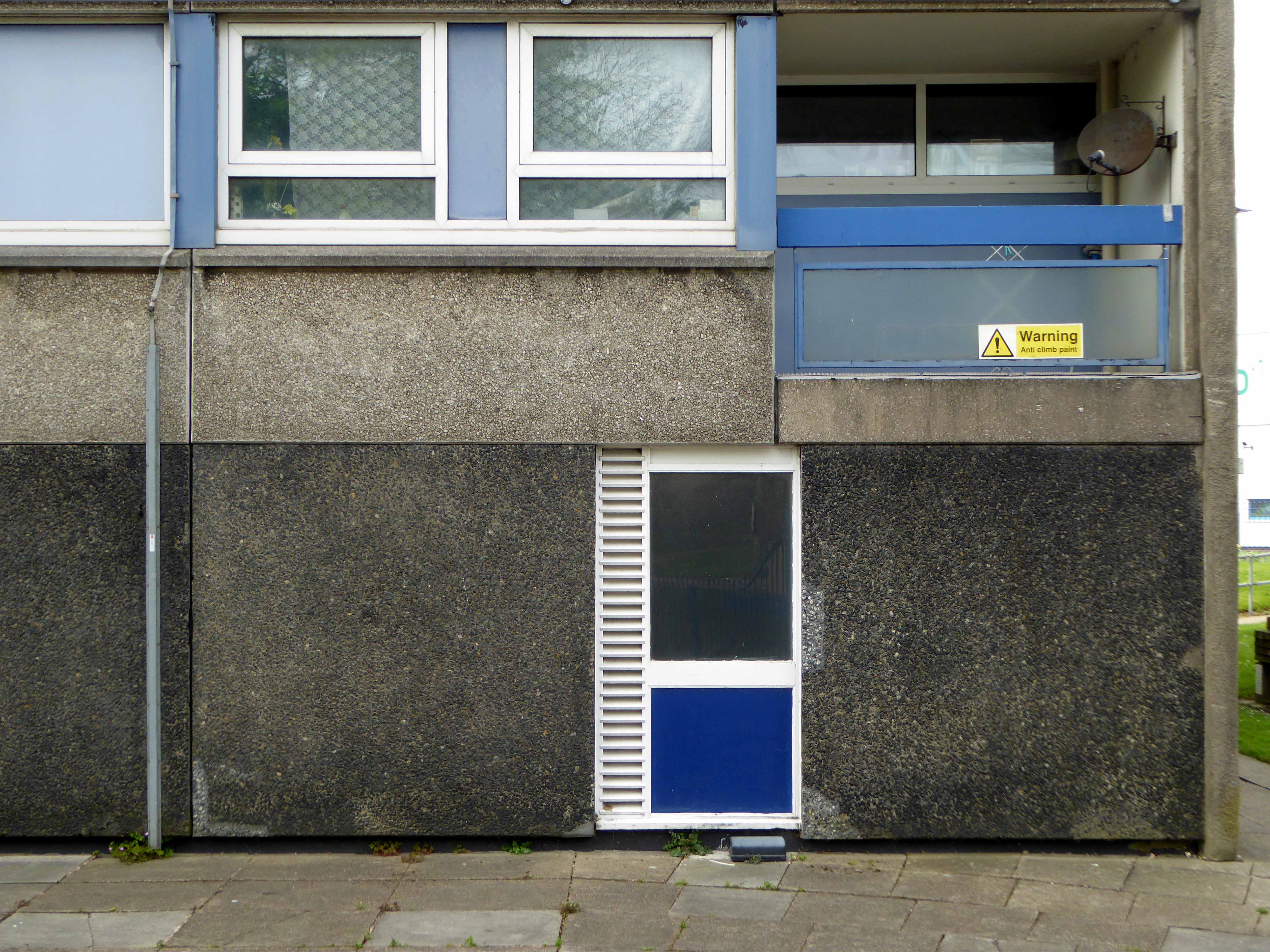
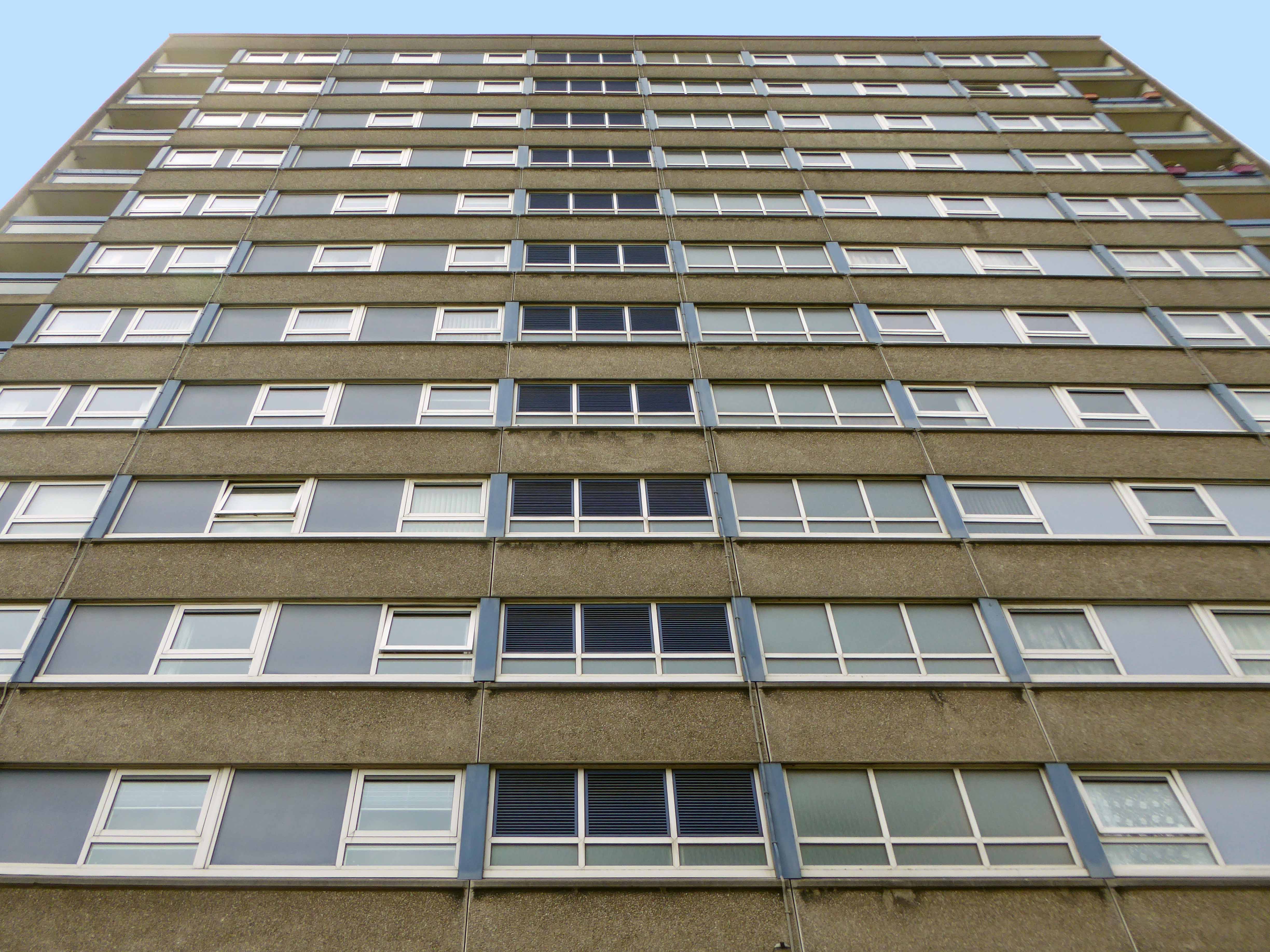
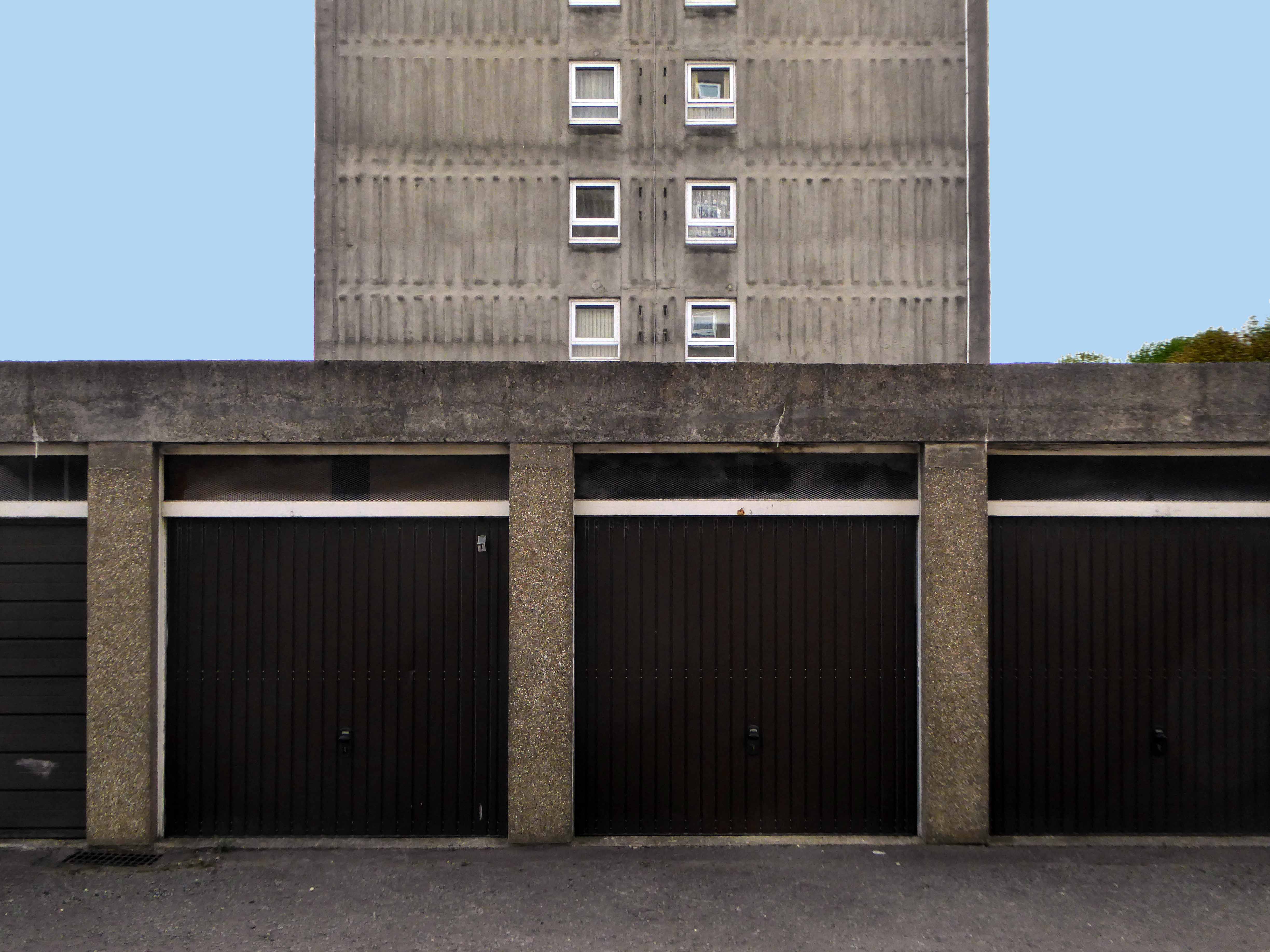
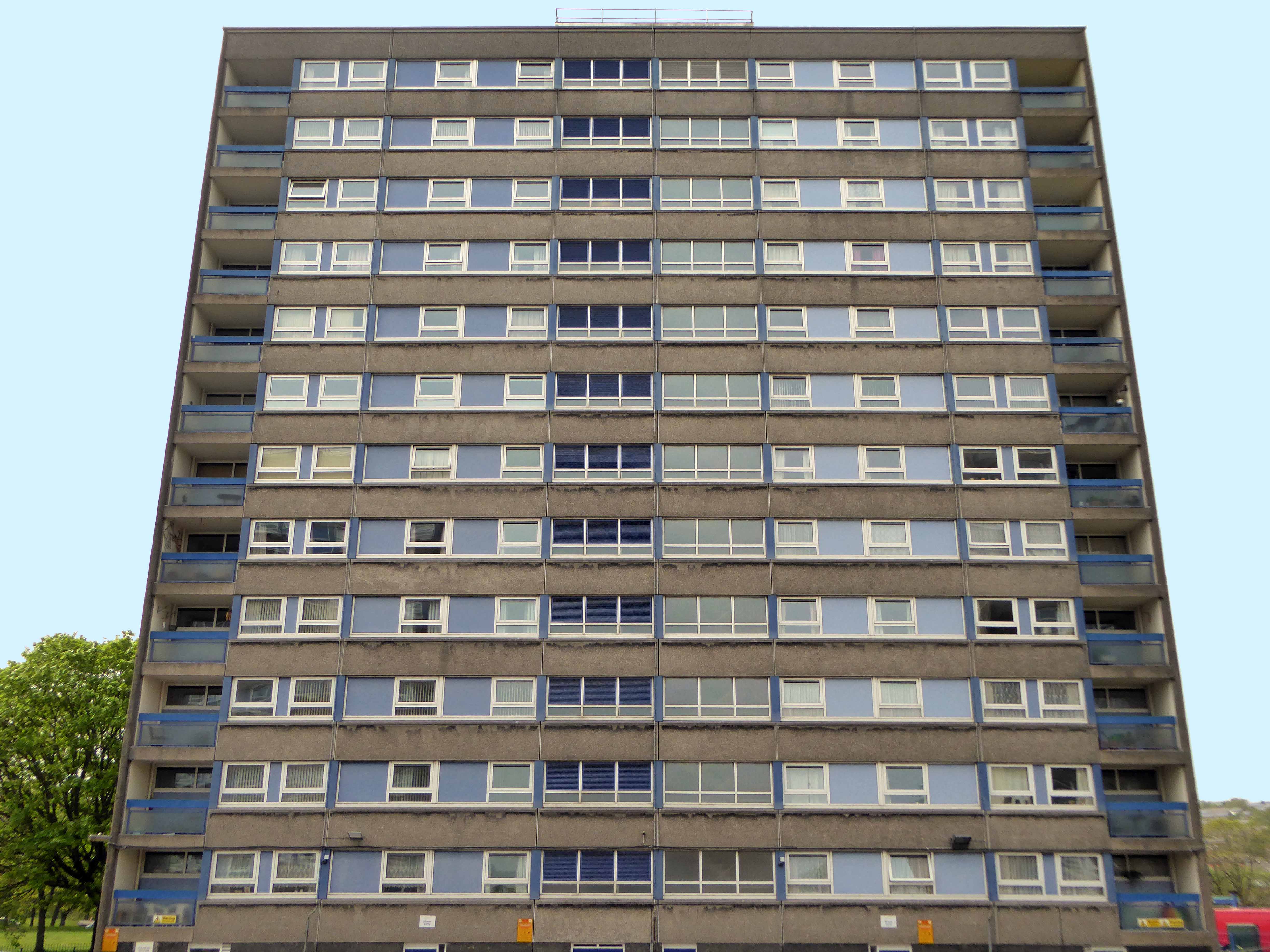
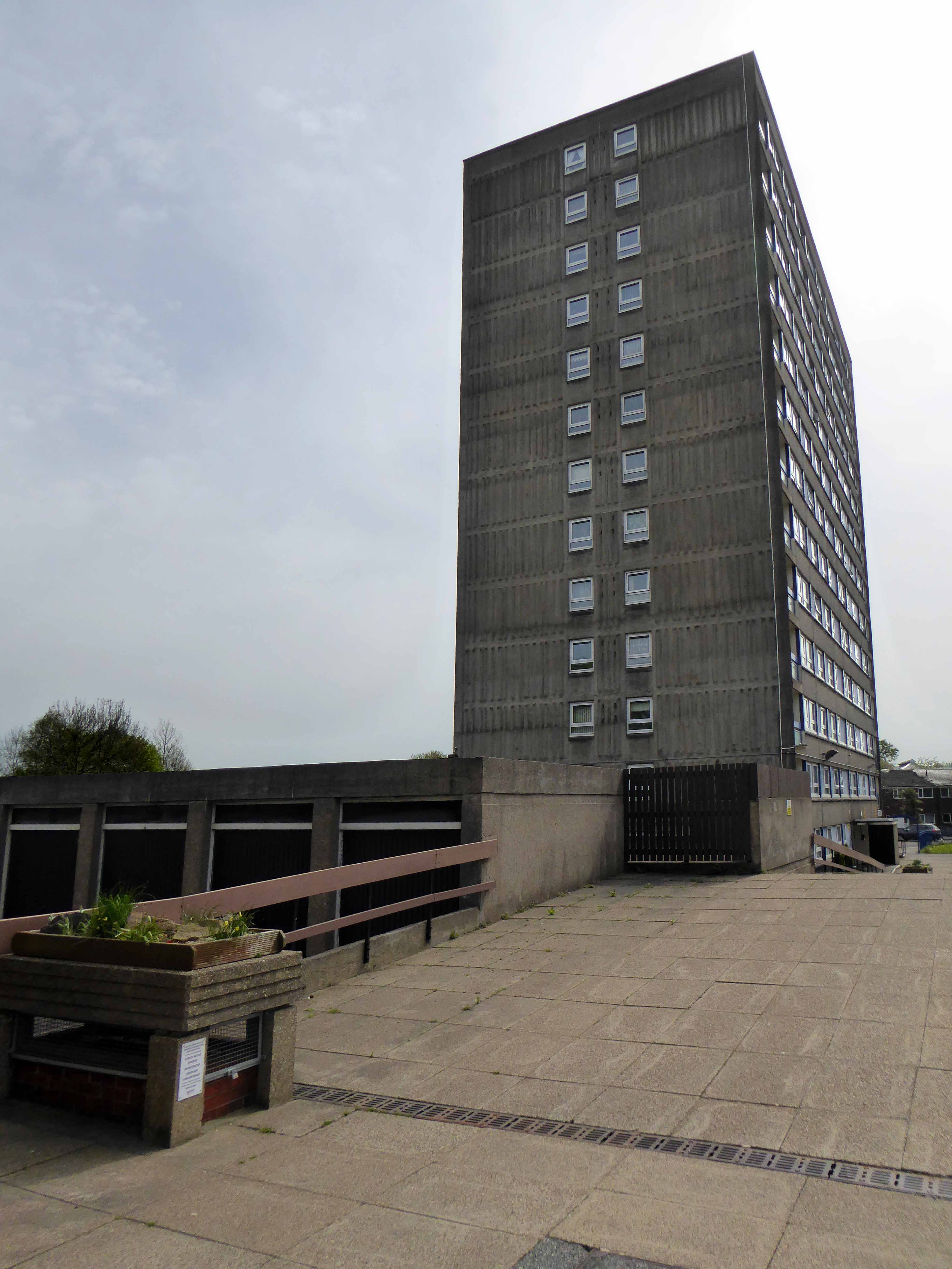
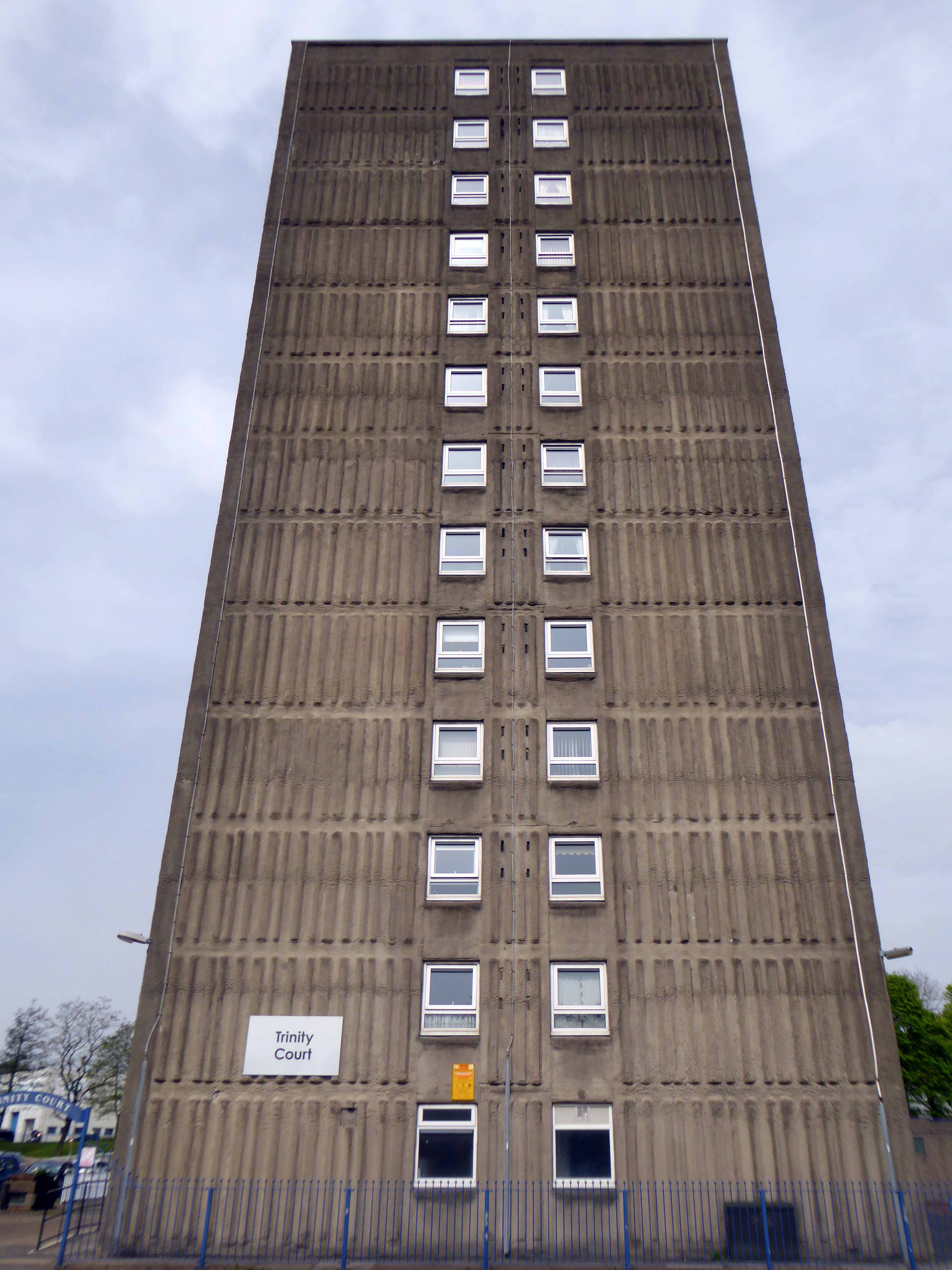
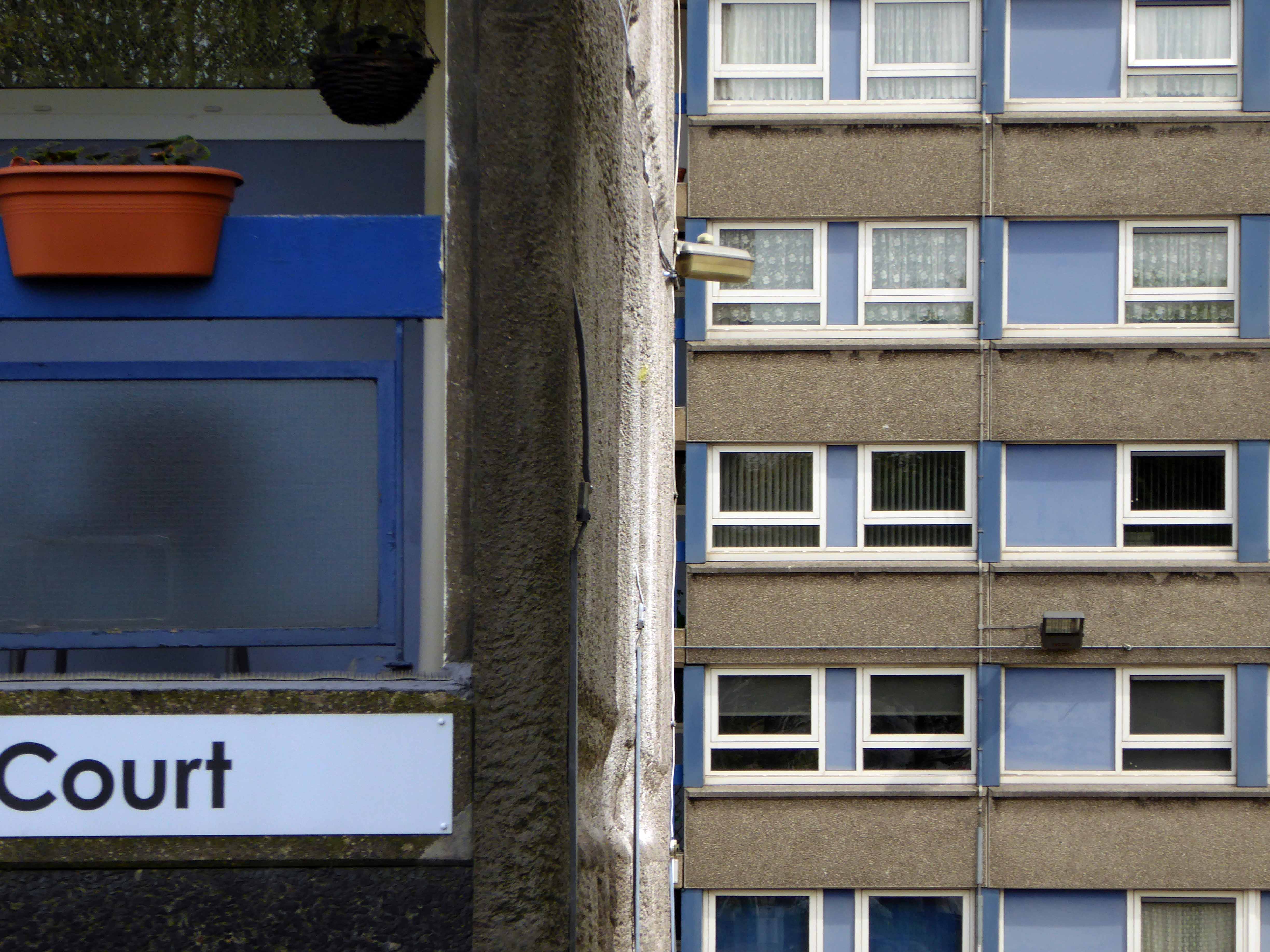
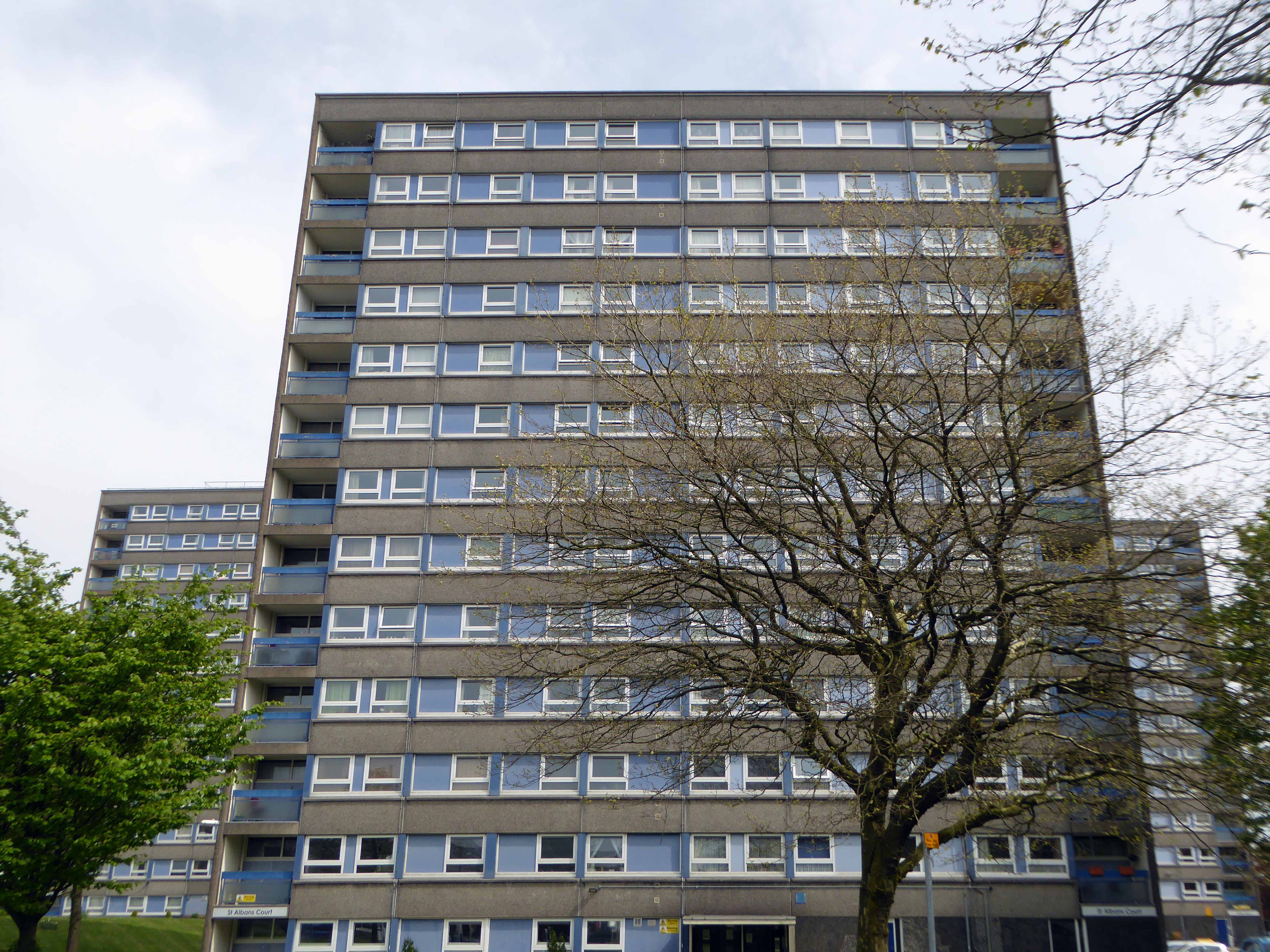
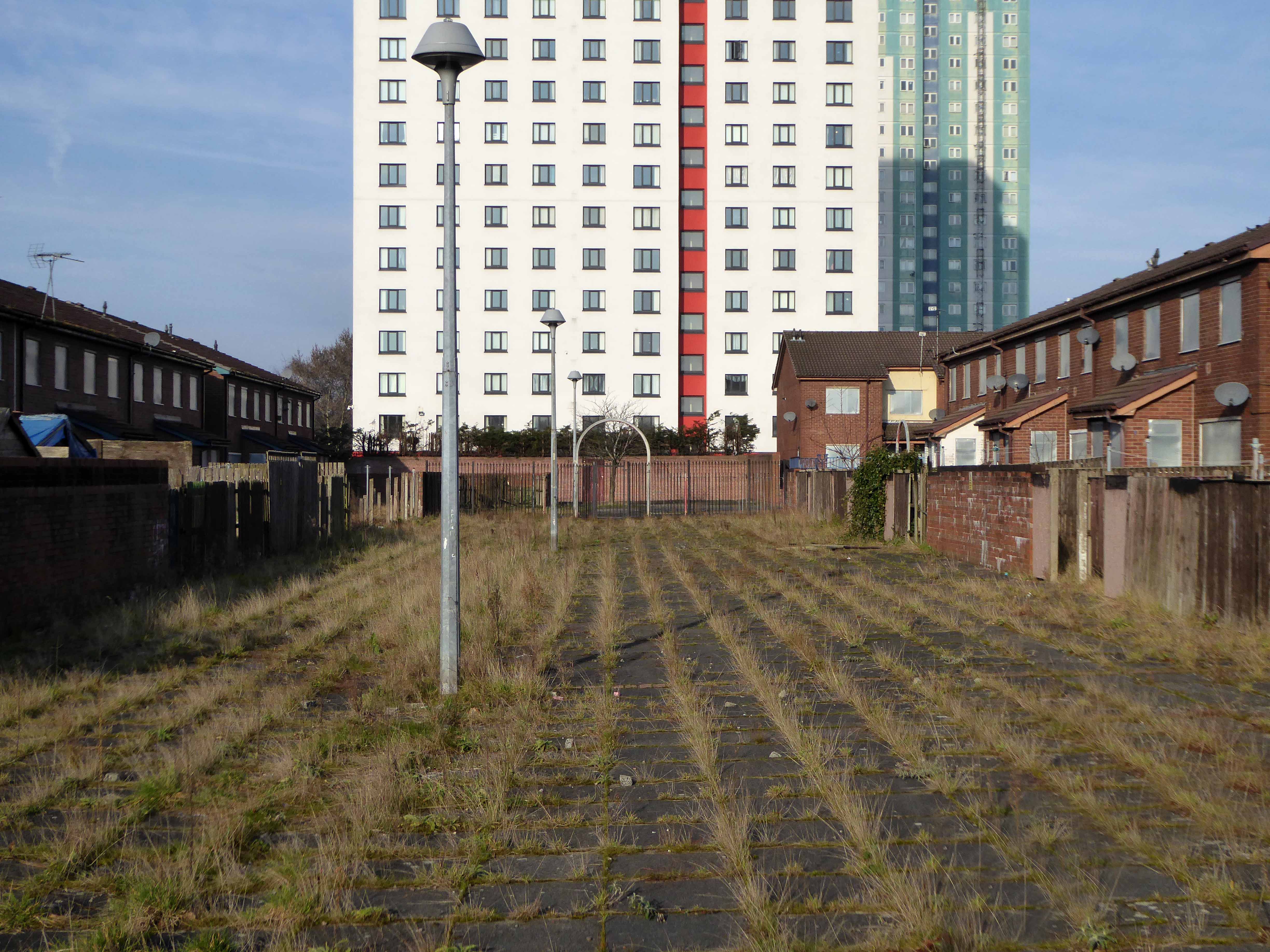
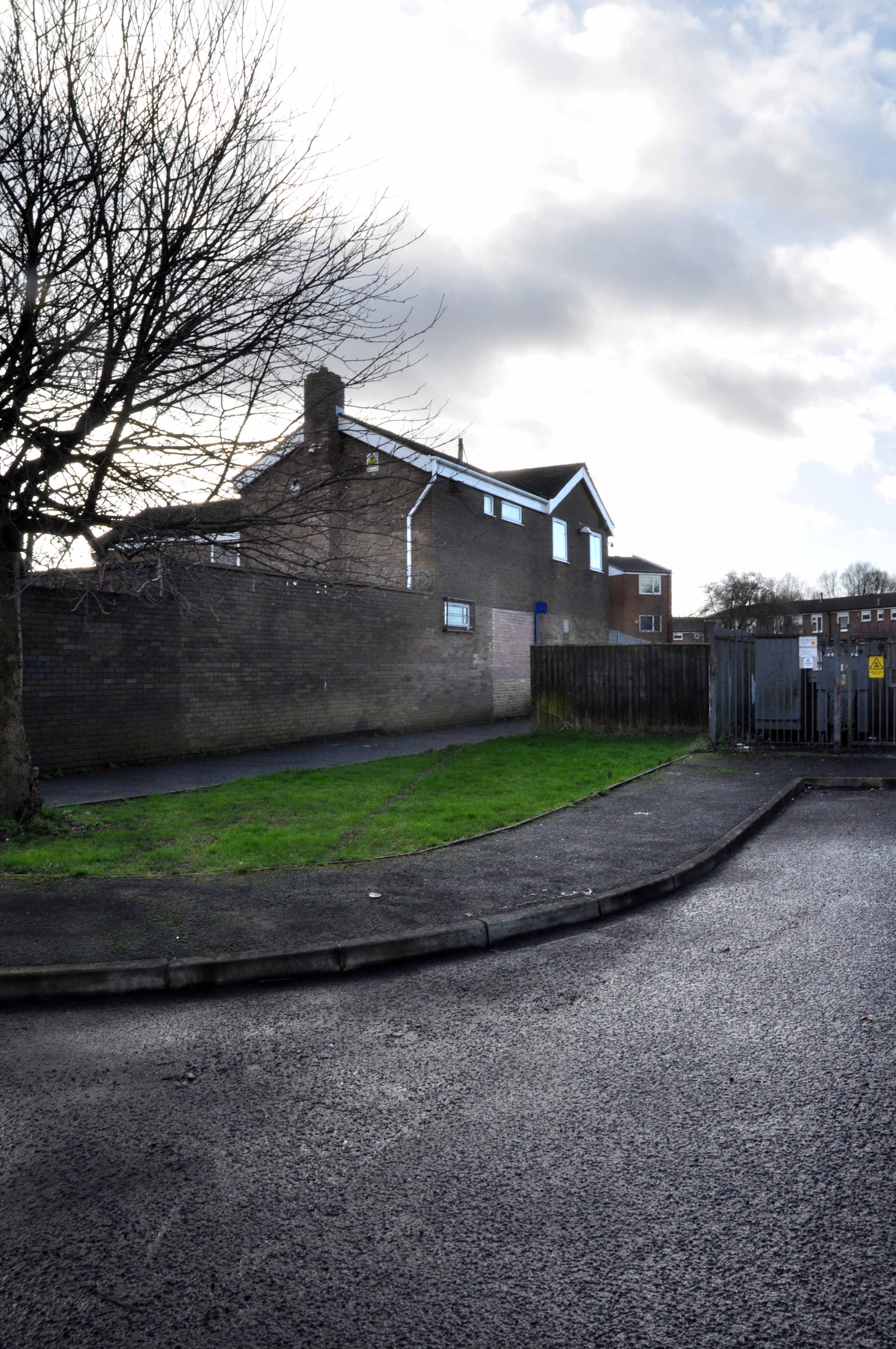
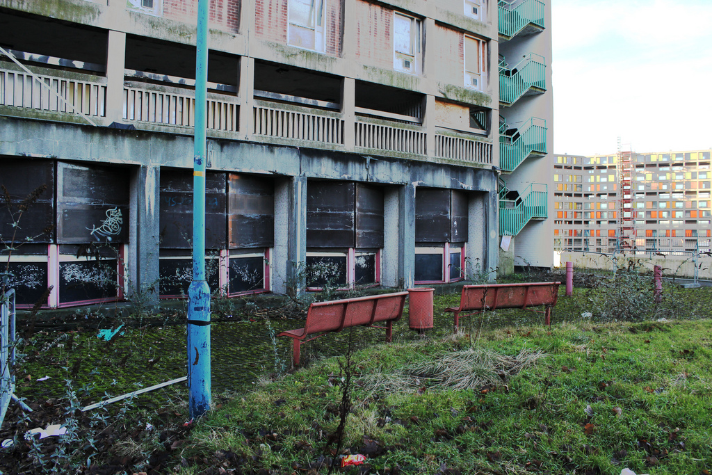
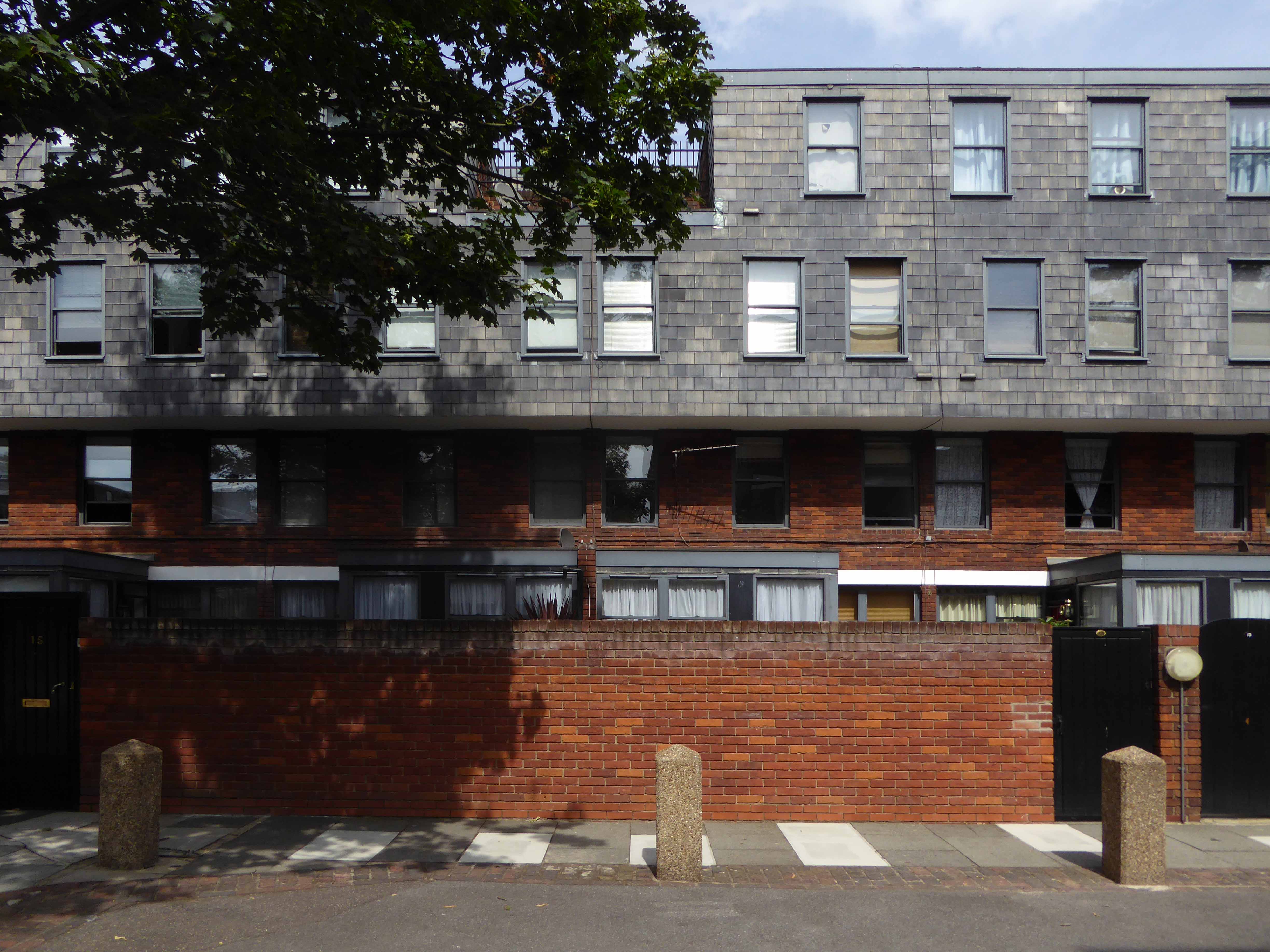
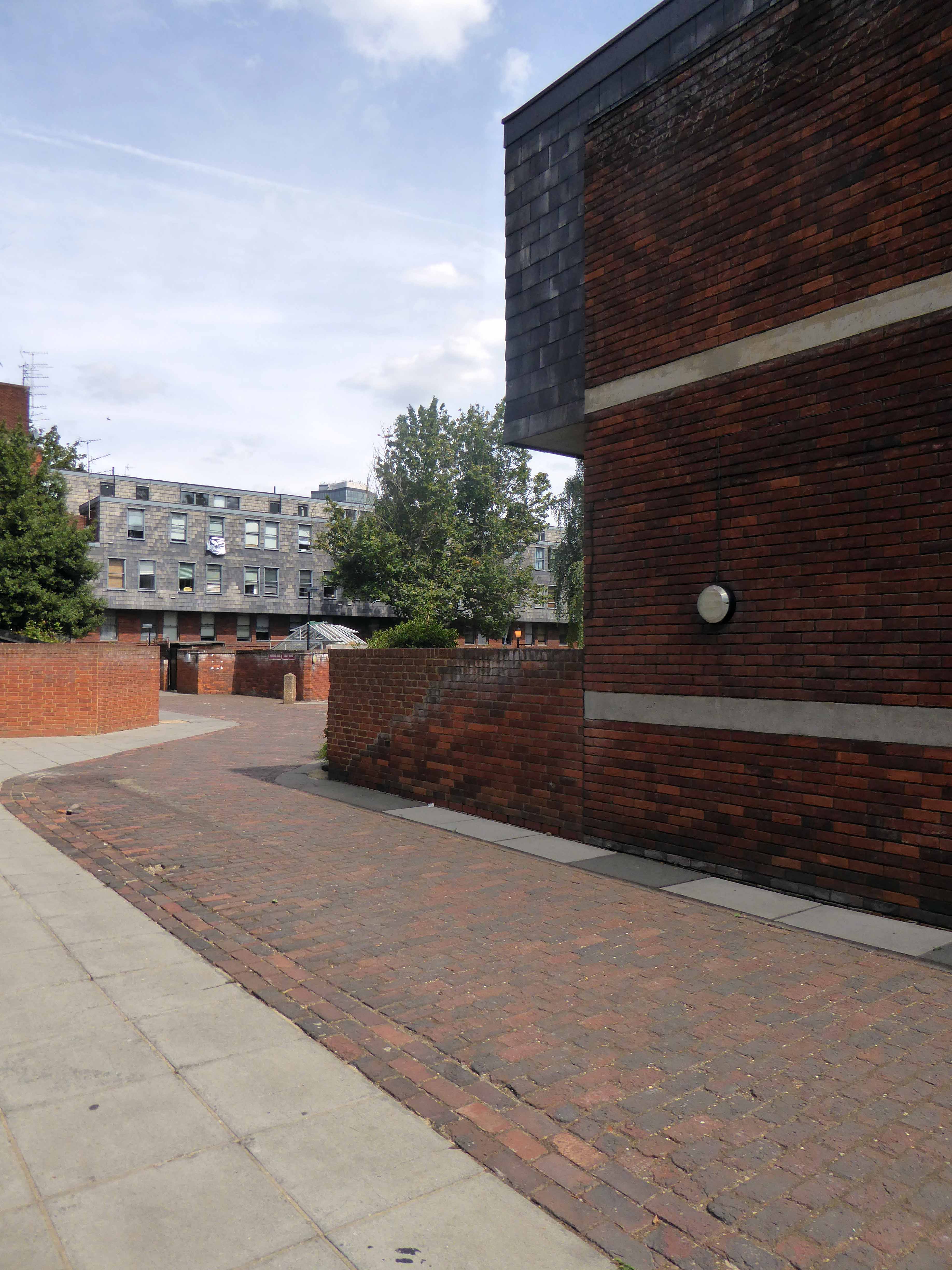
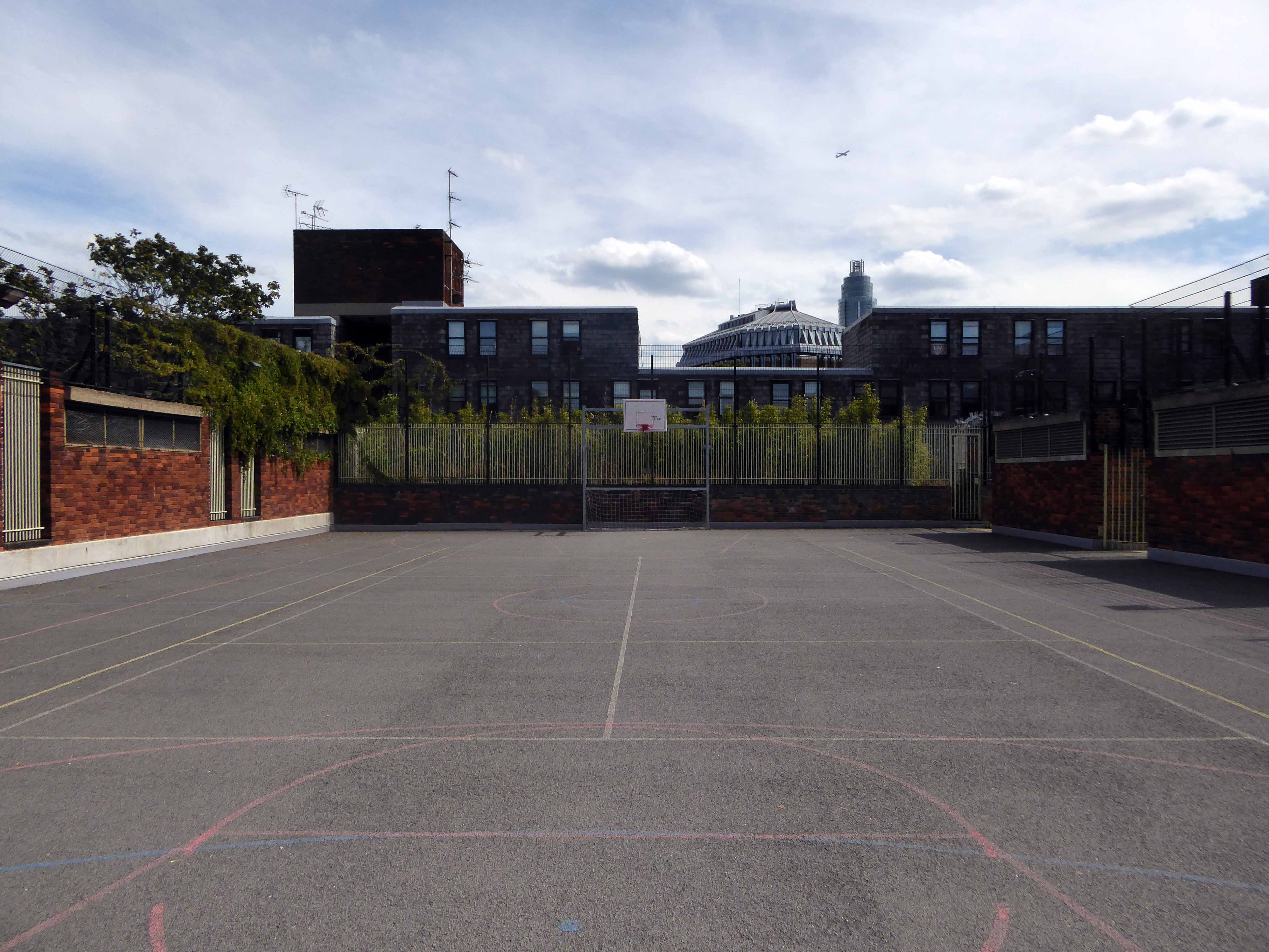
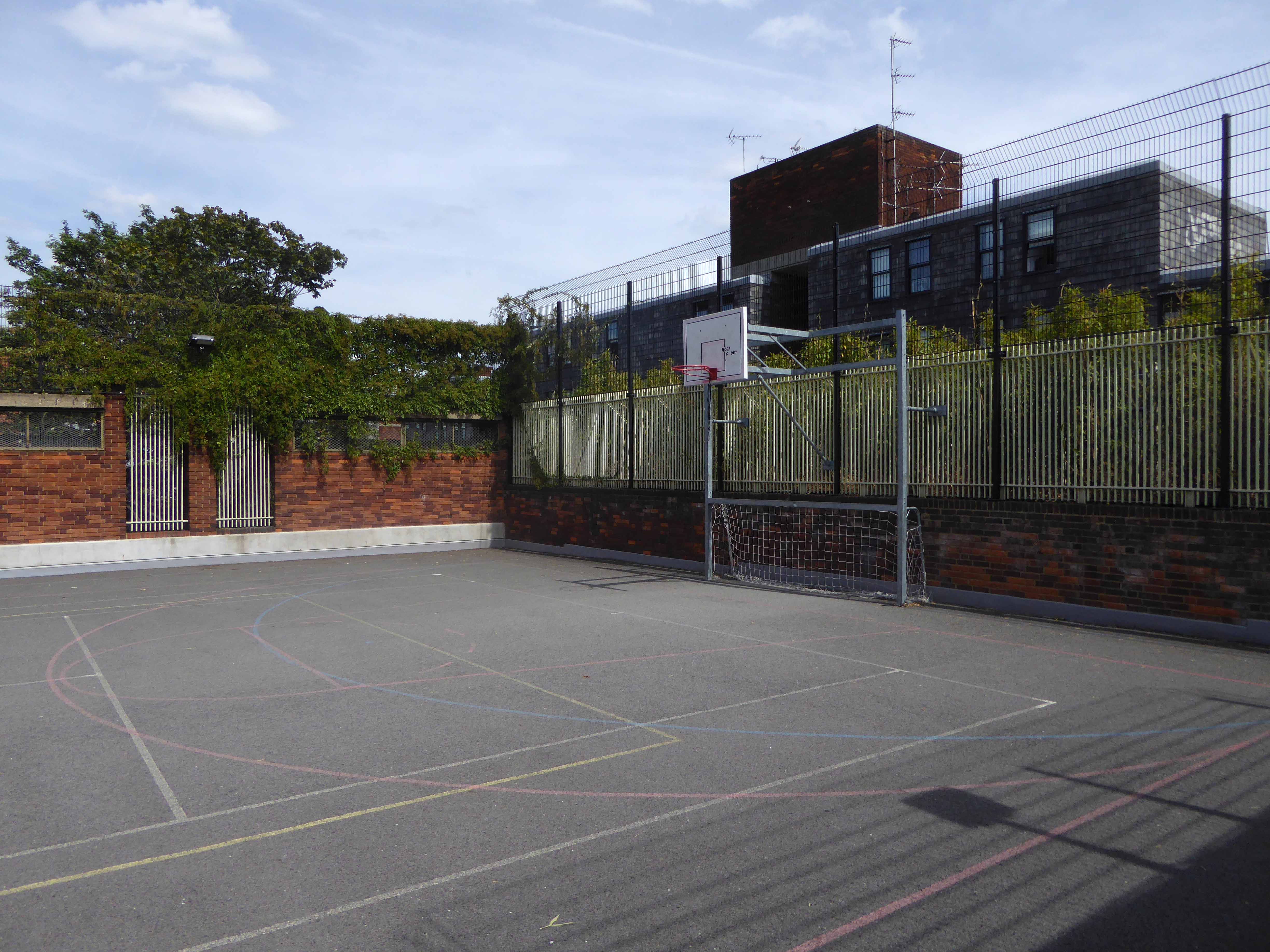
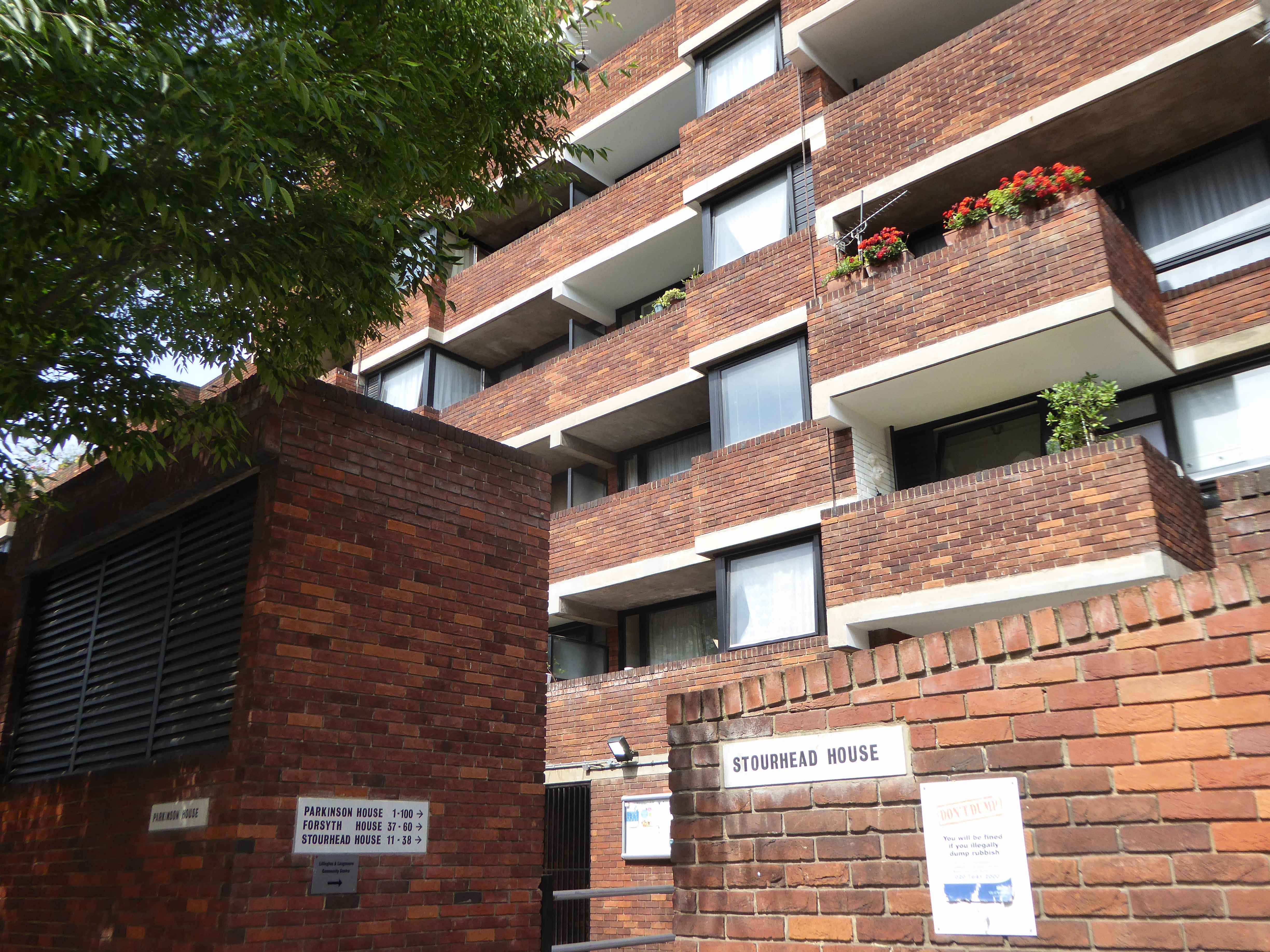
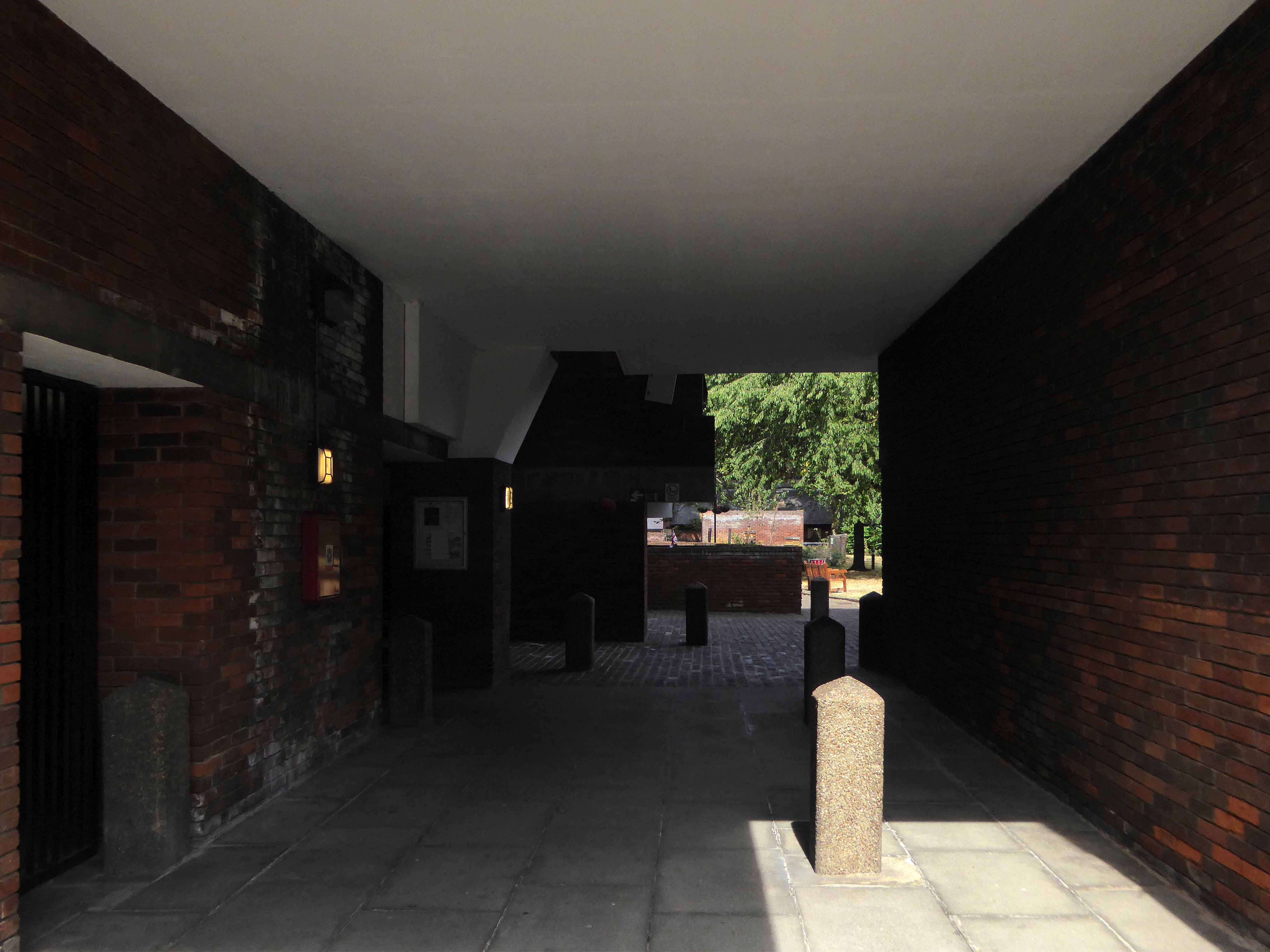
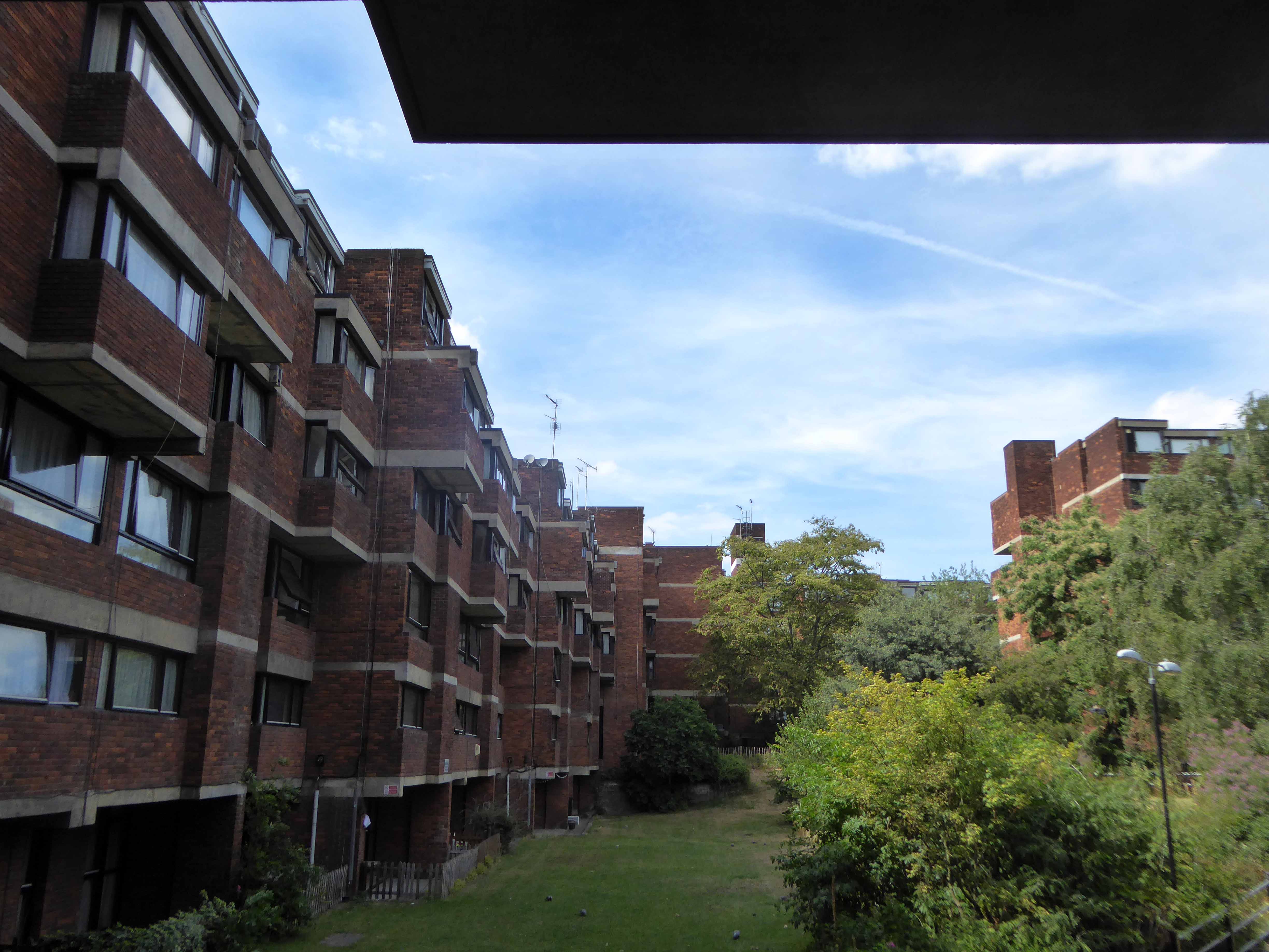
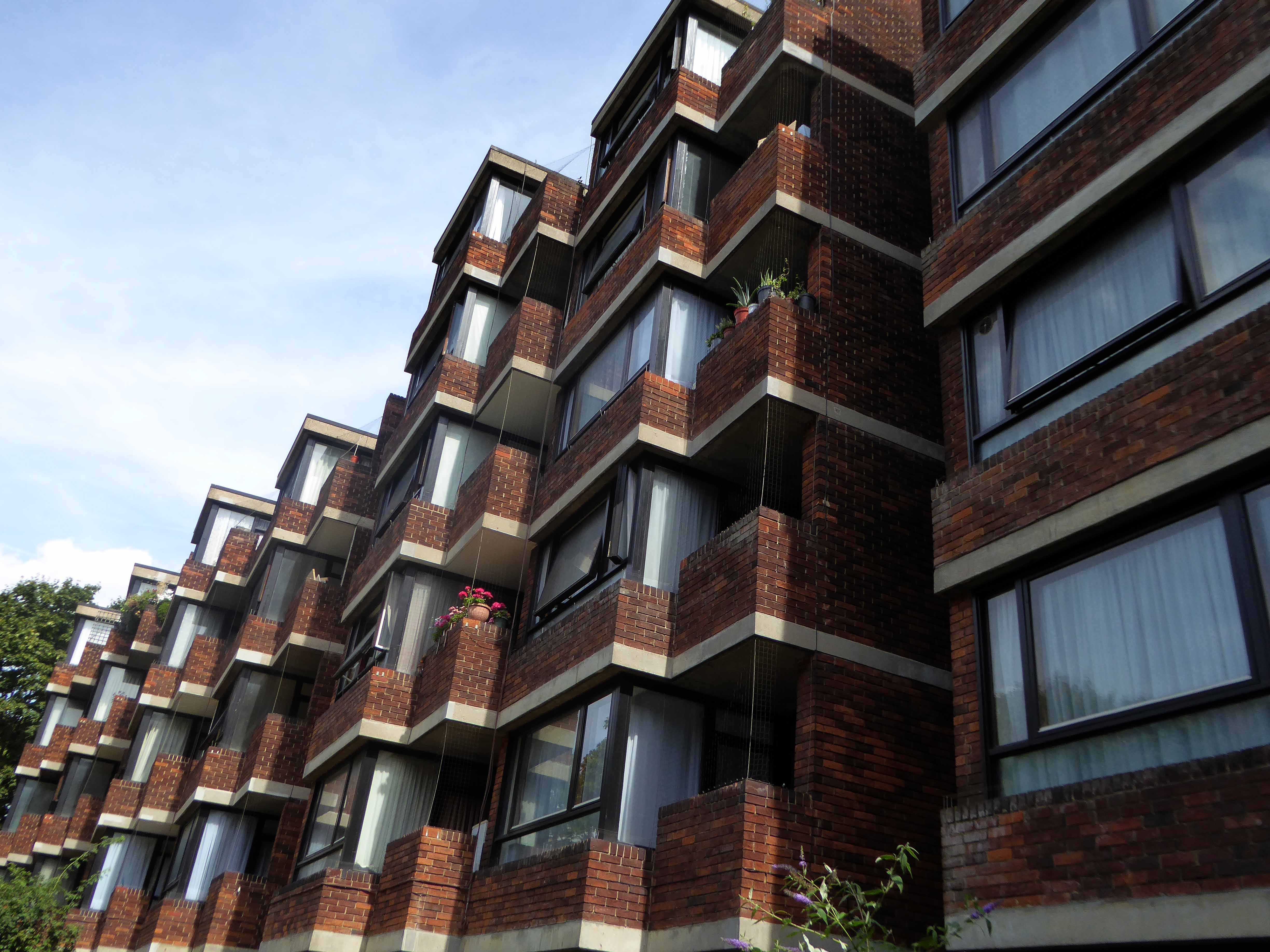
All but one was refurbished, clad and re-let.

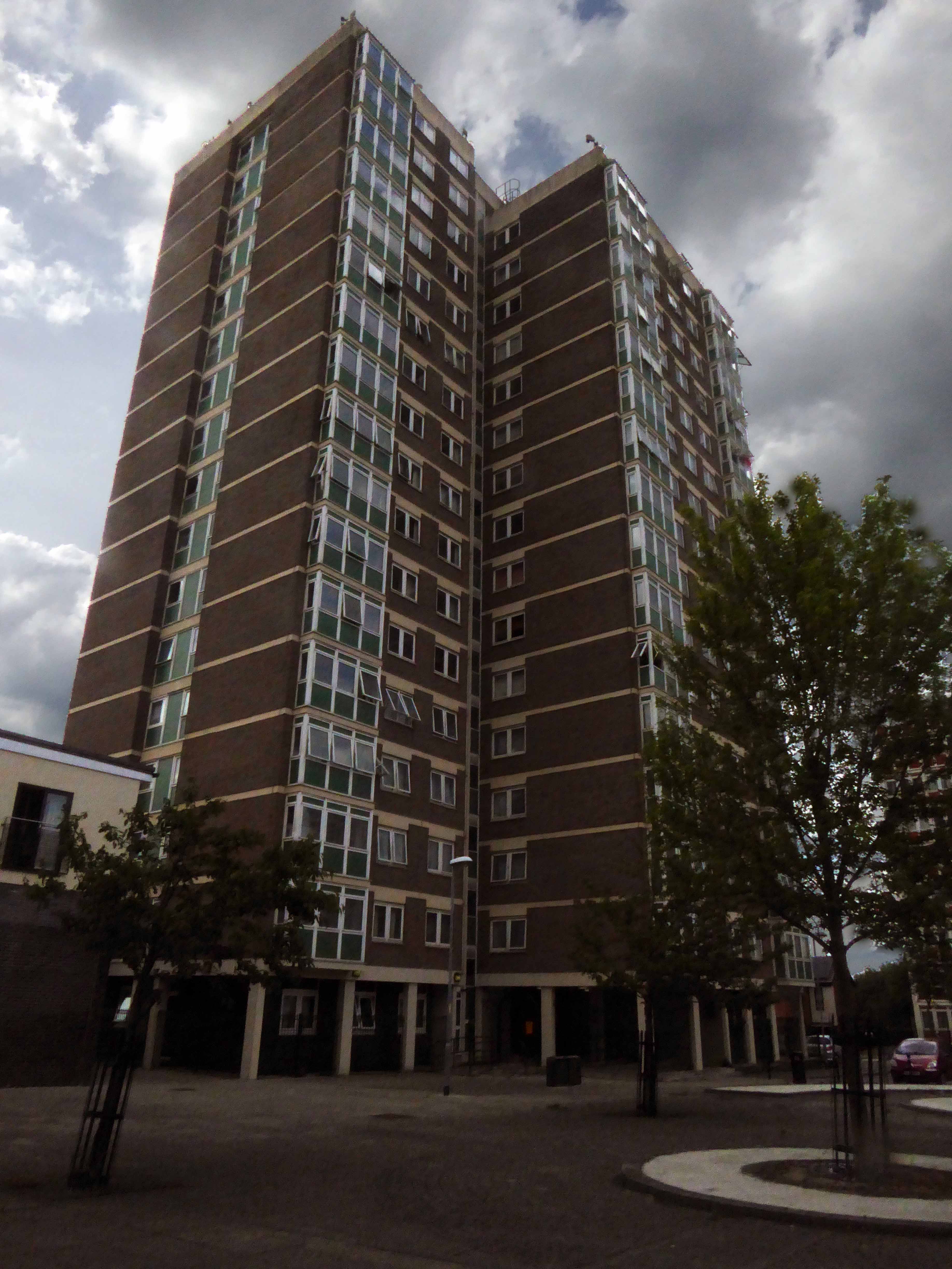
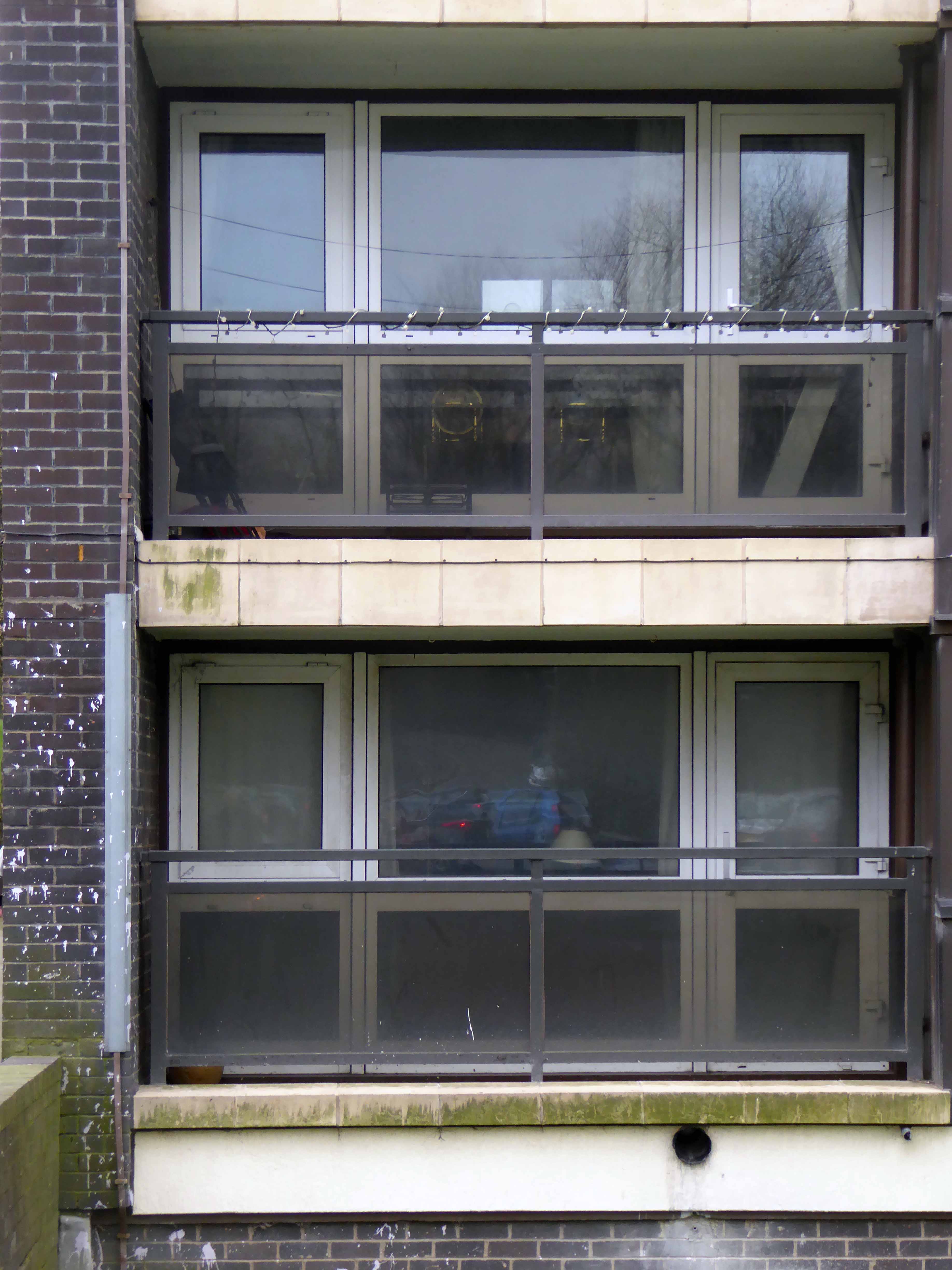
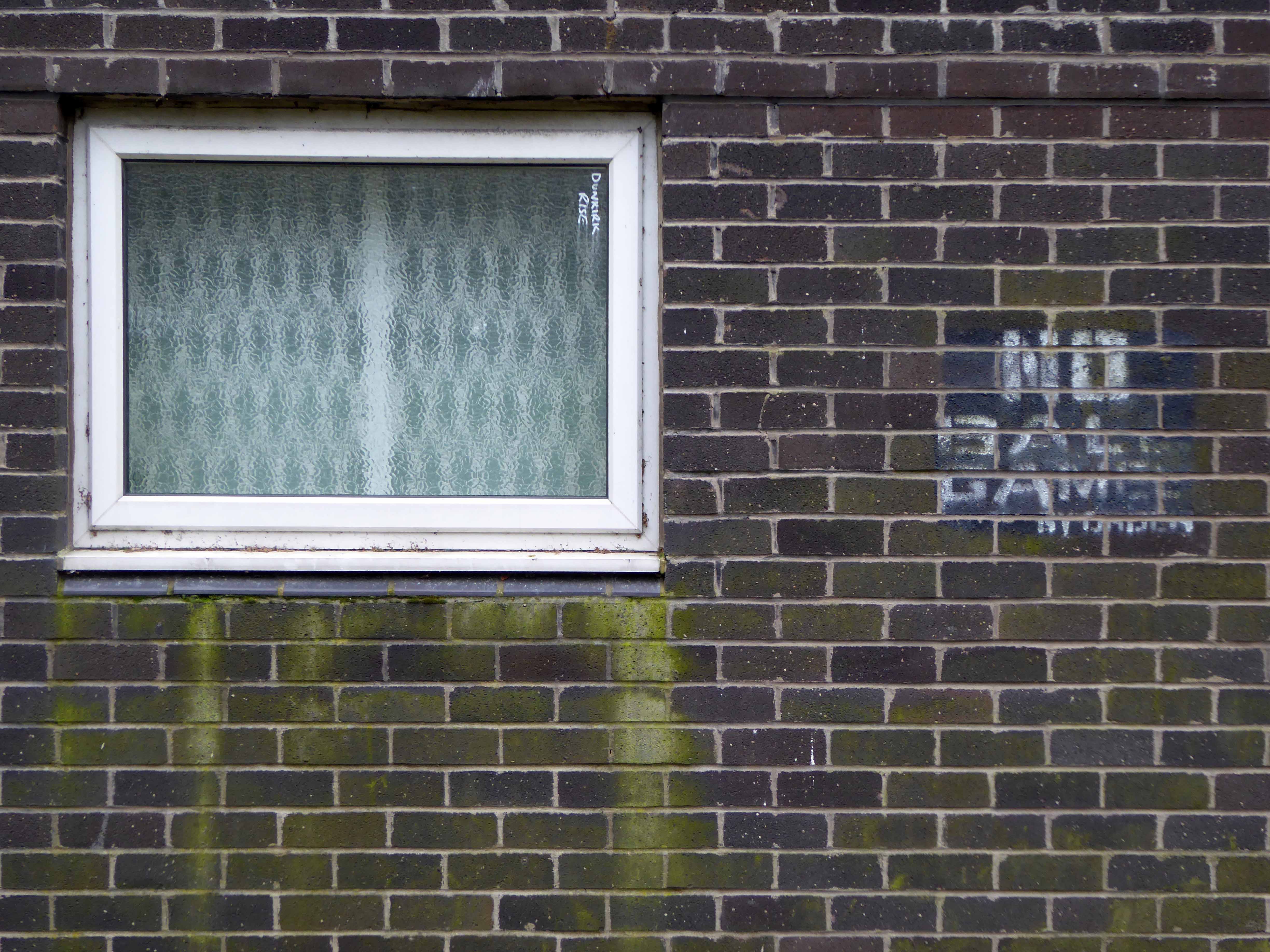
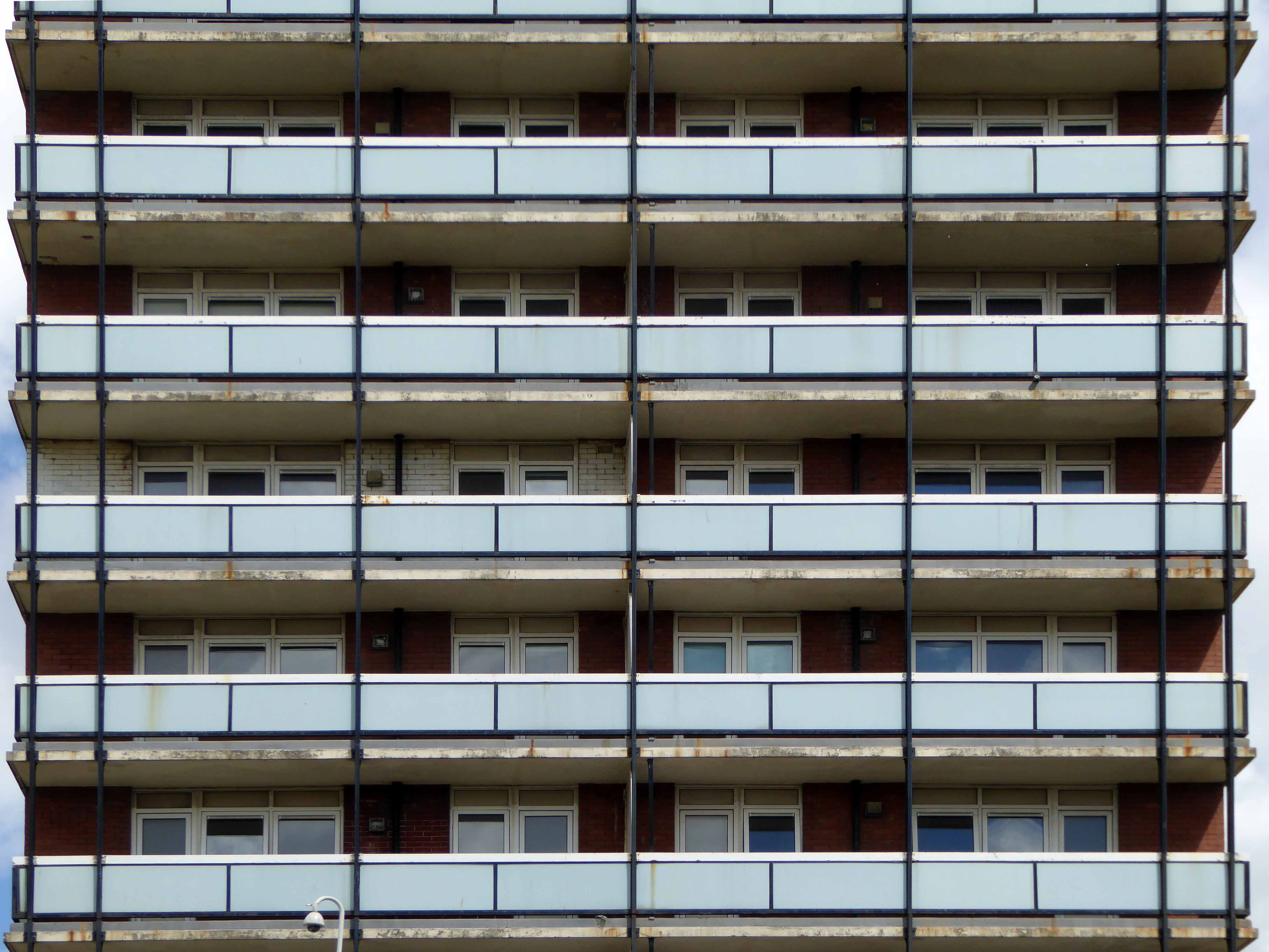
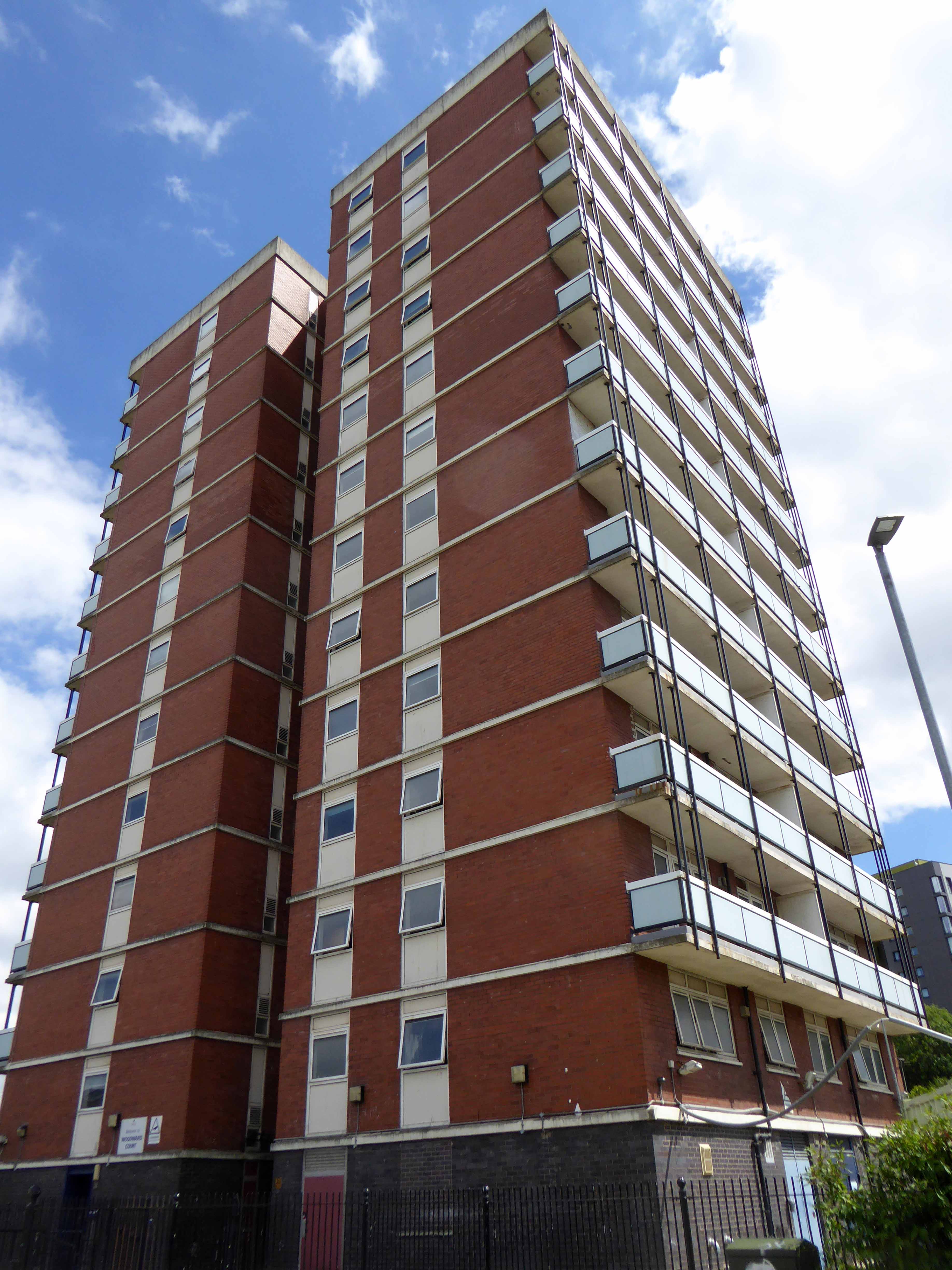
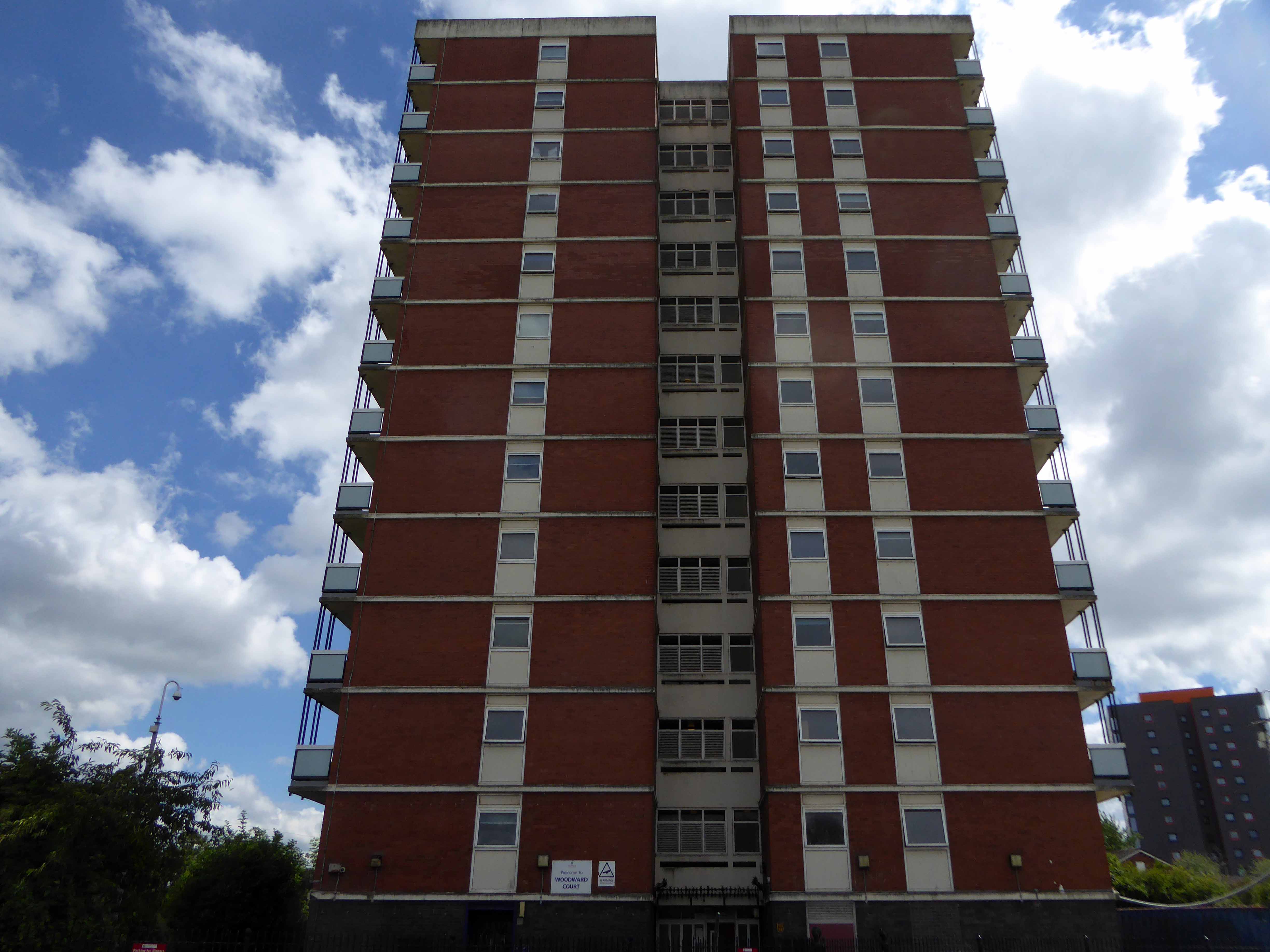
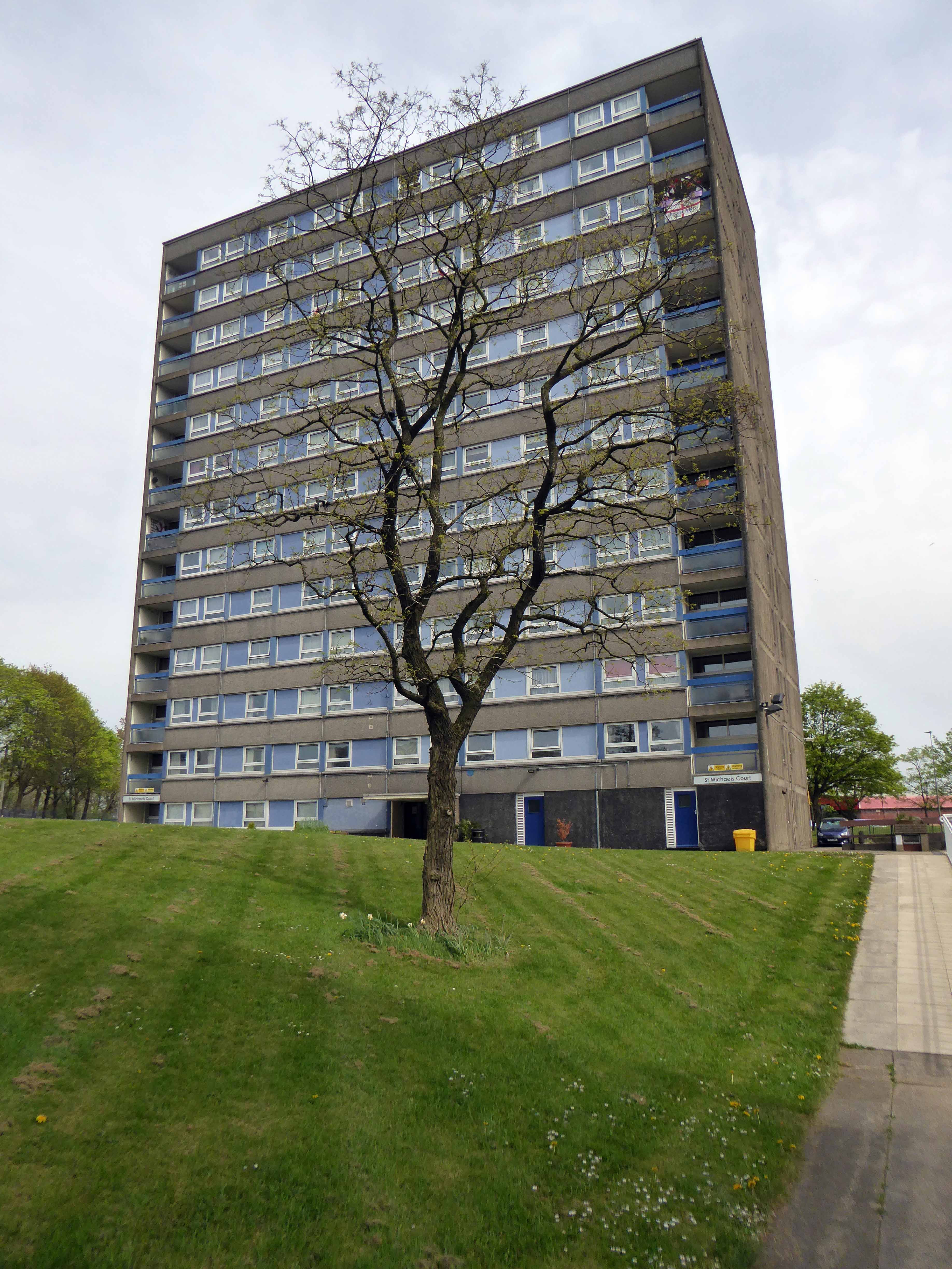
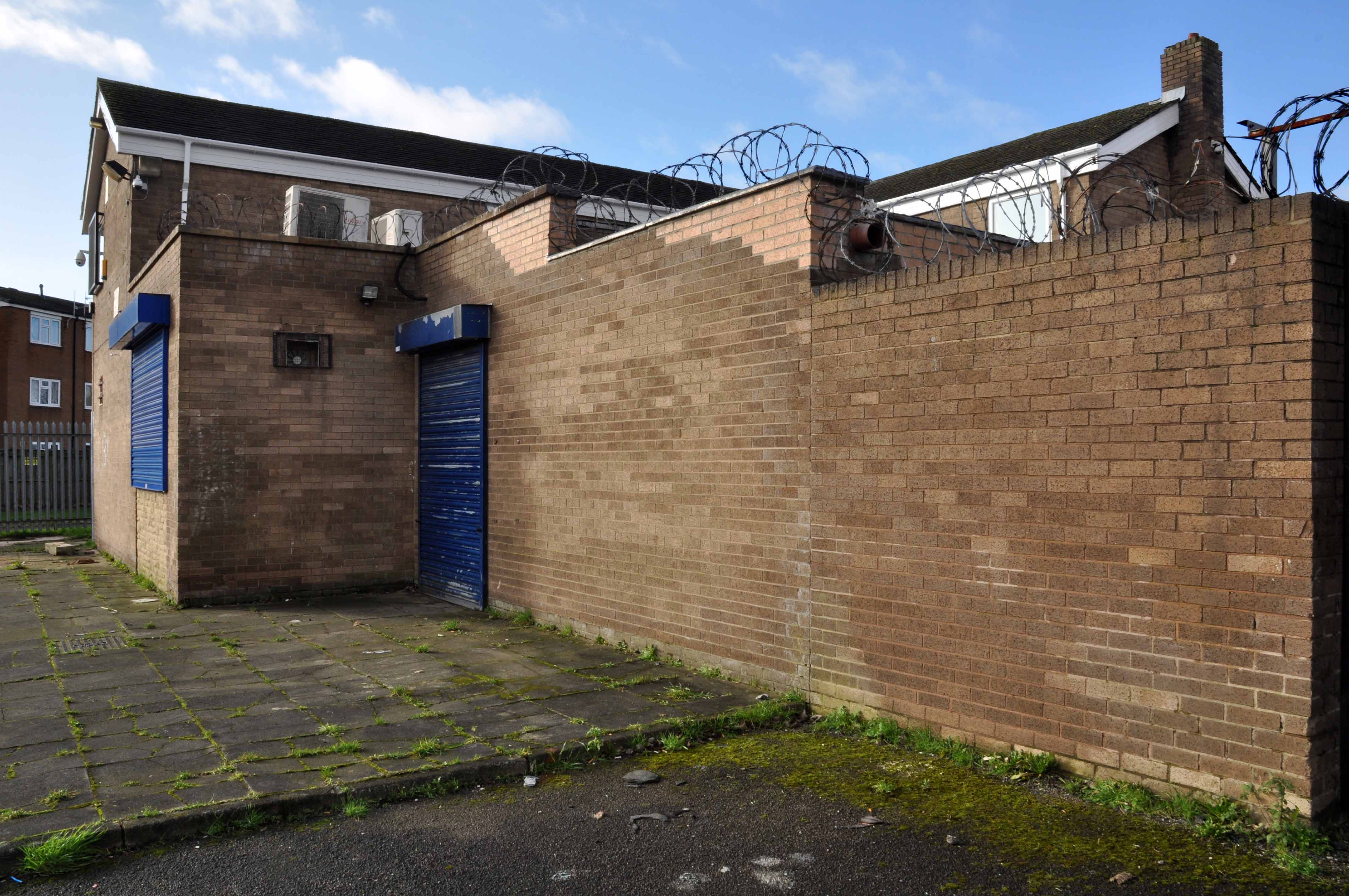
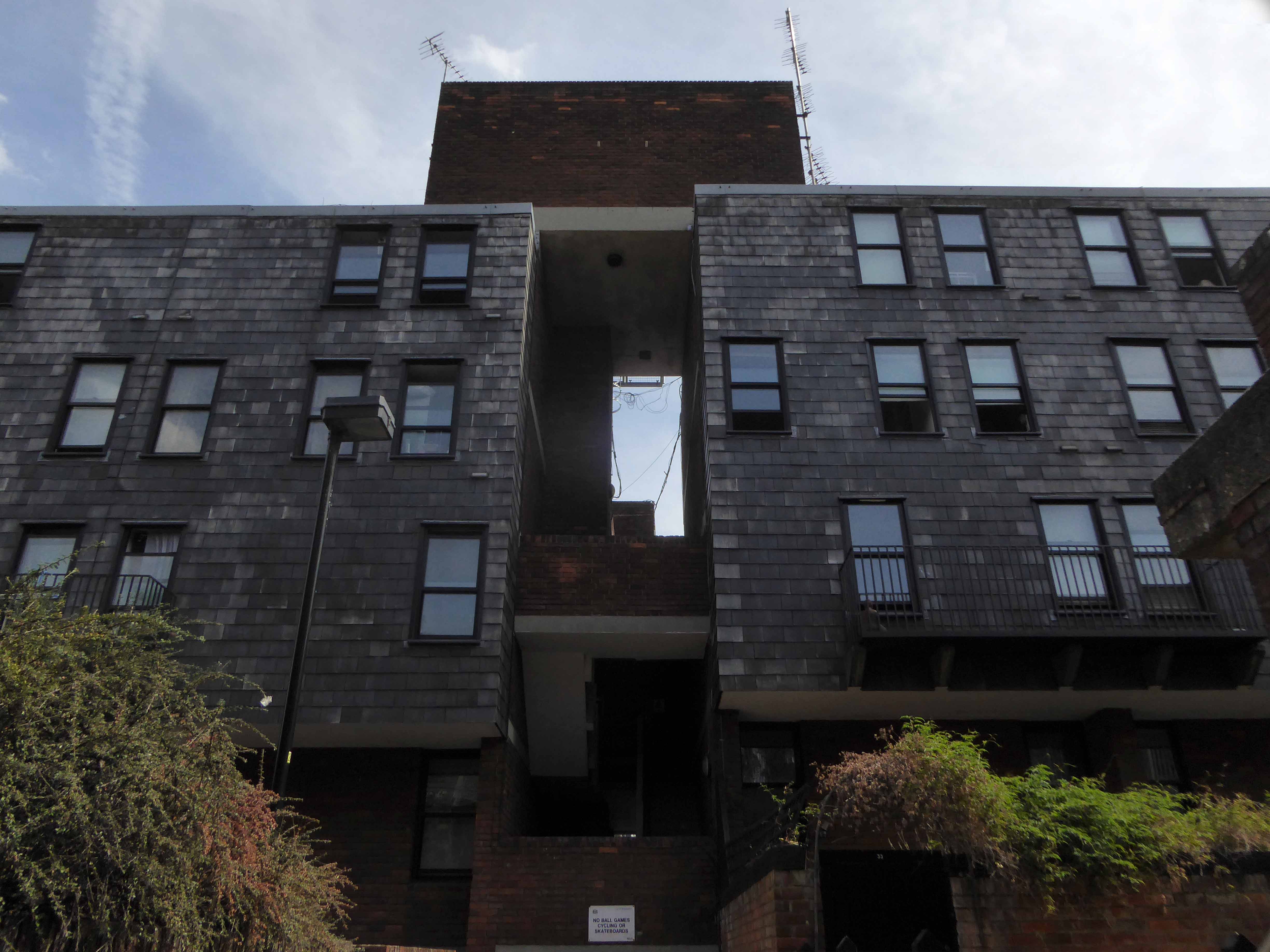
Woodward Court was spared – set aside for the homeless.

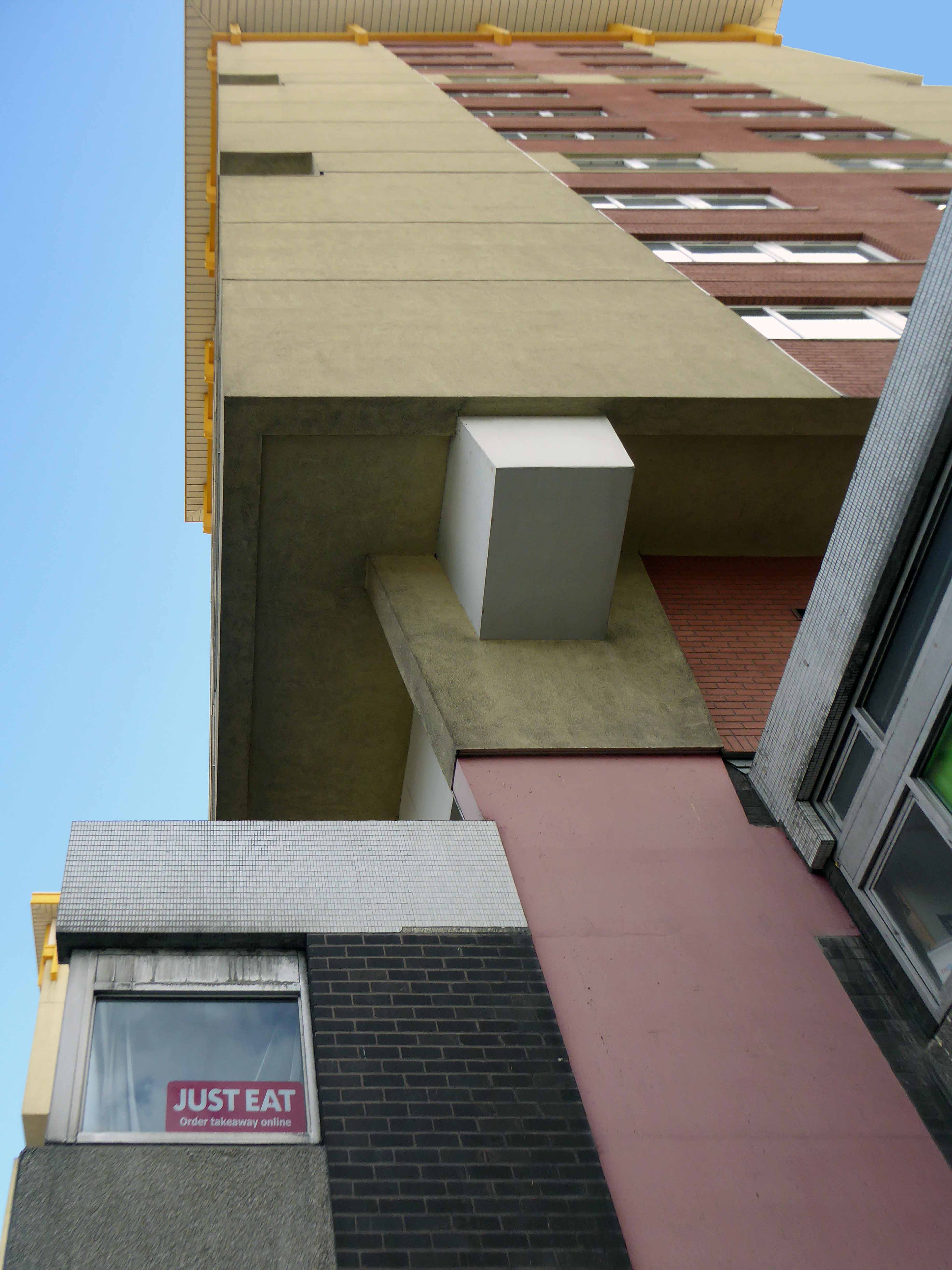
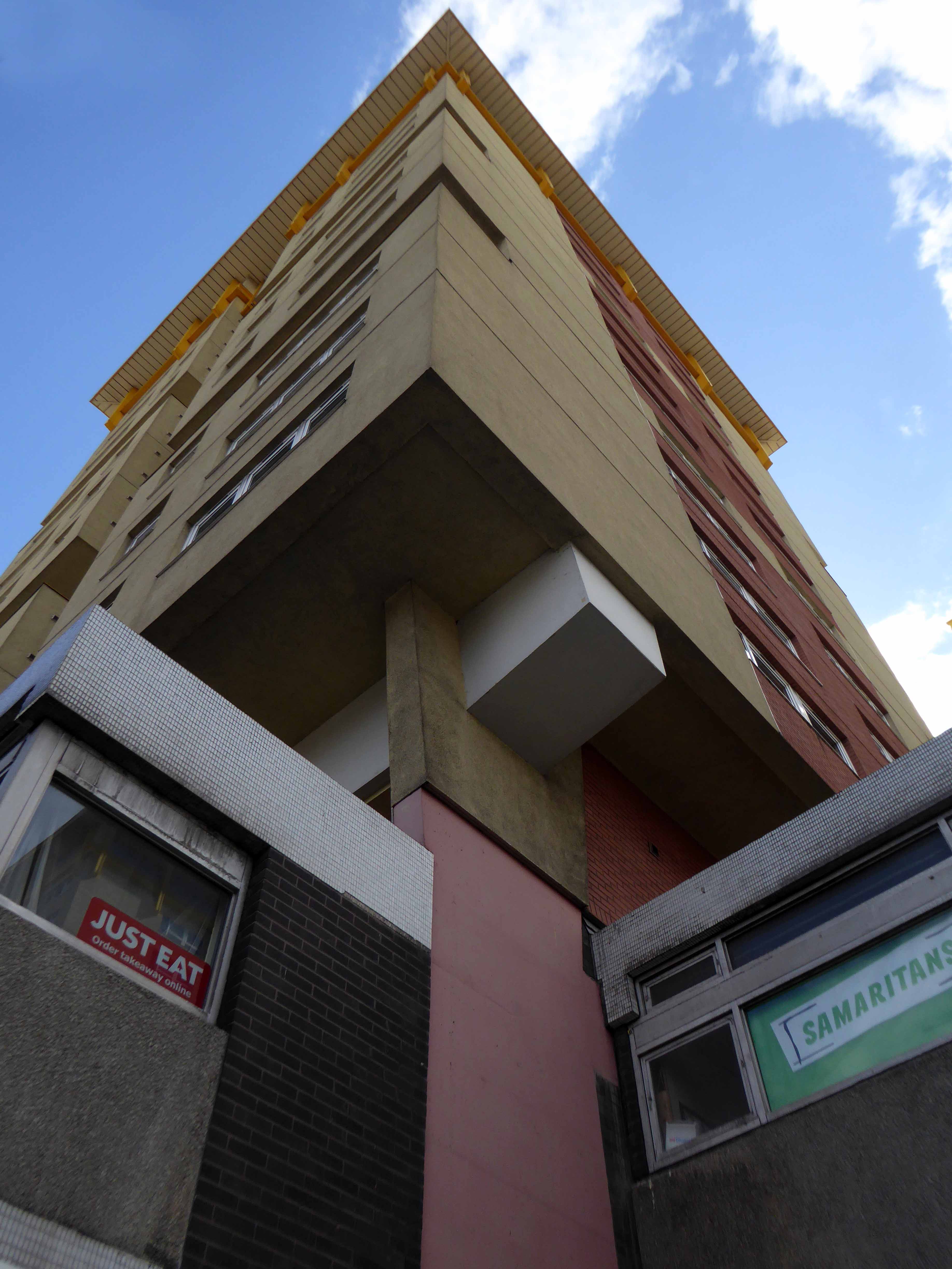
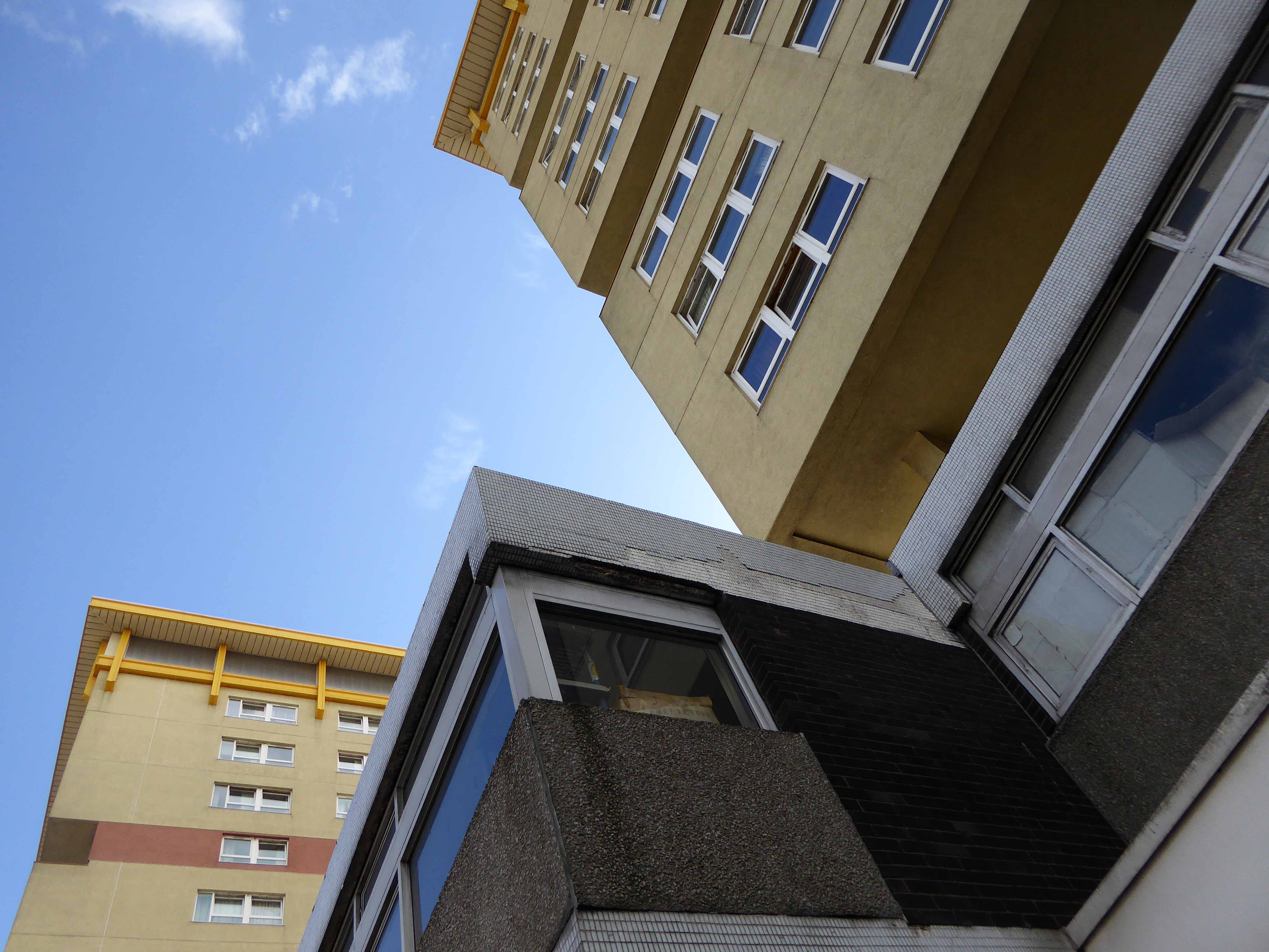
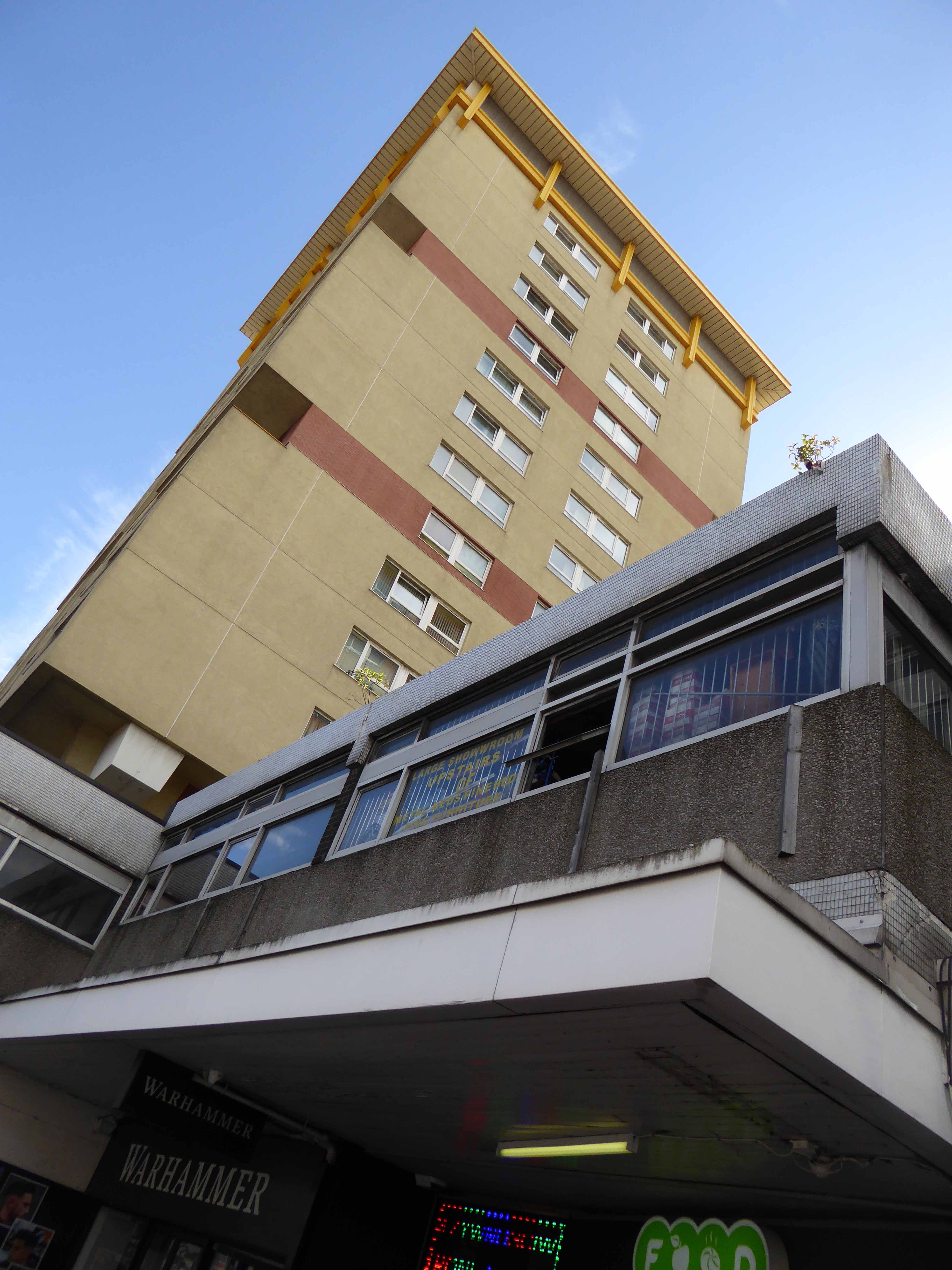
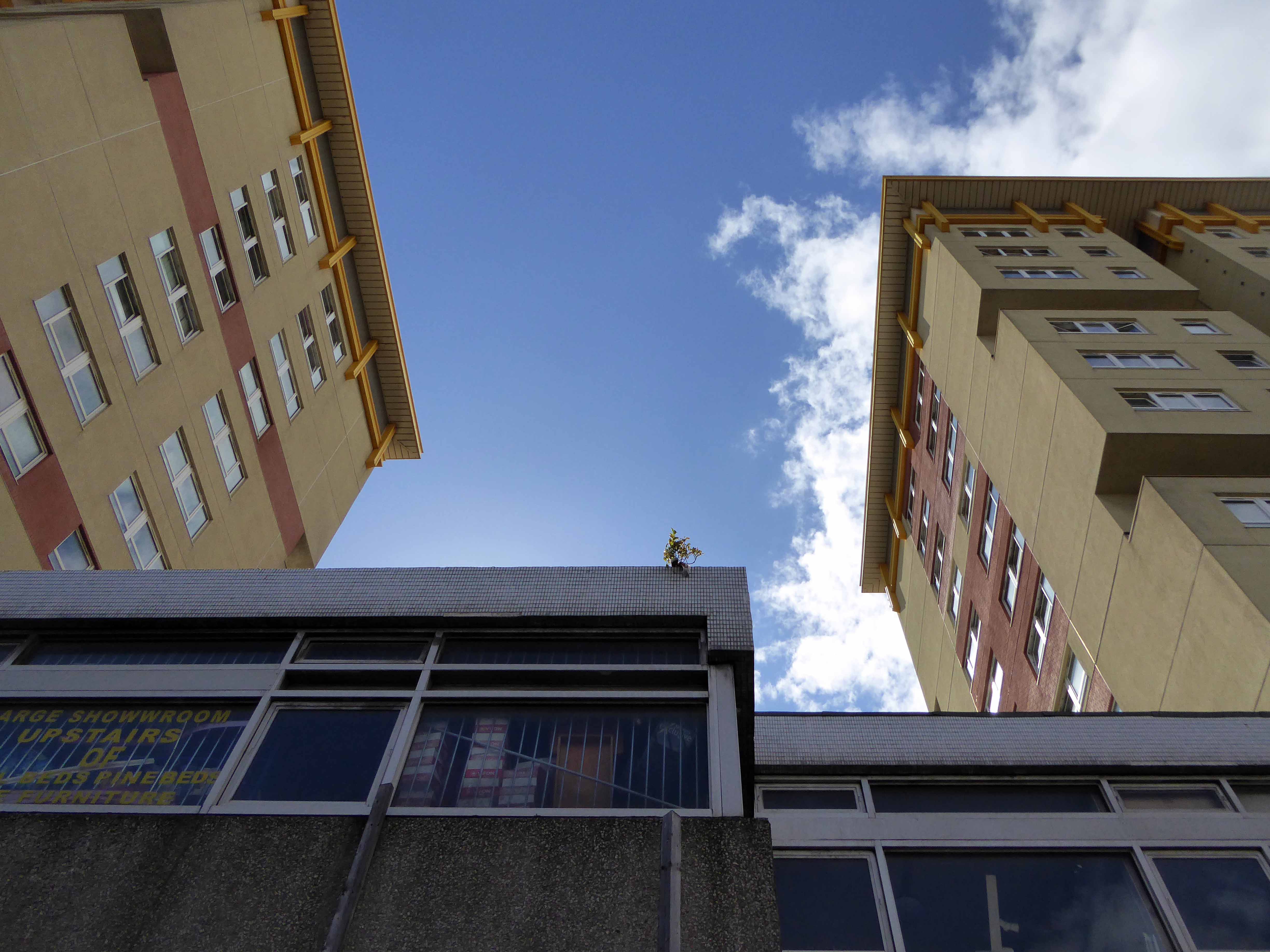
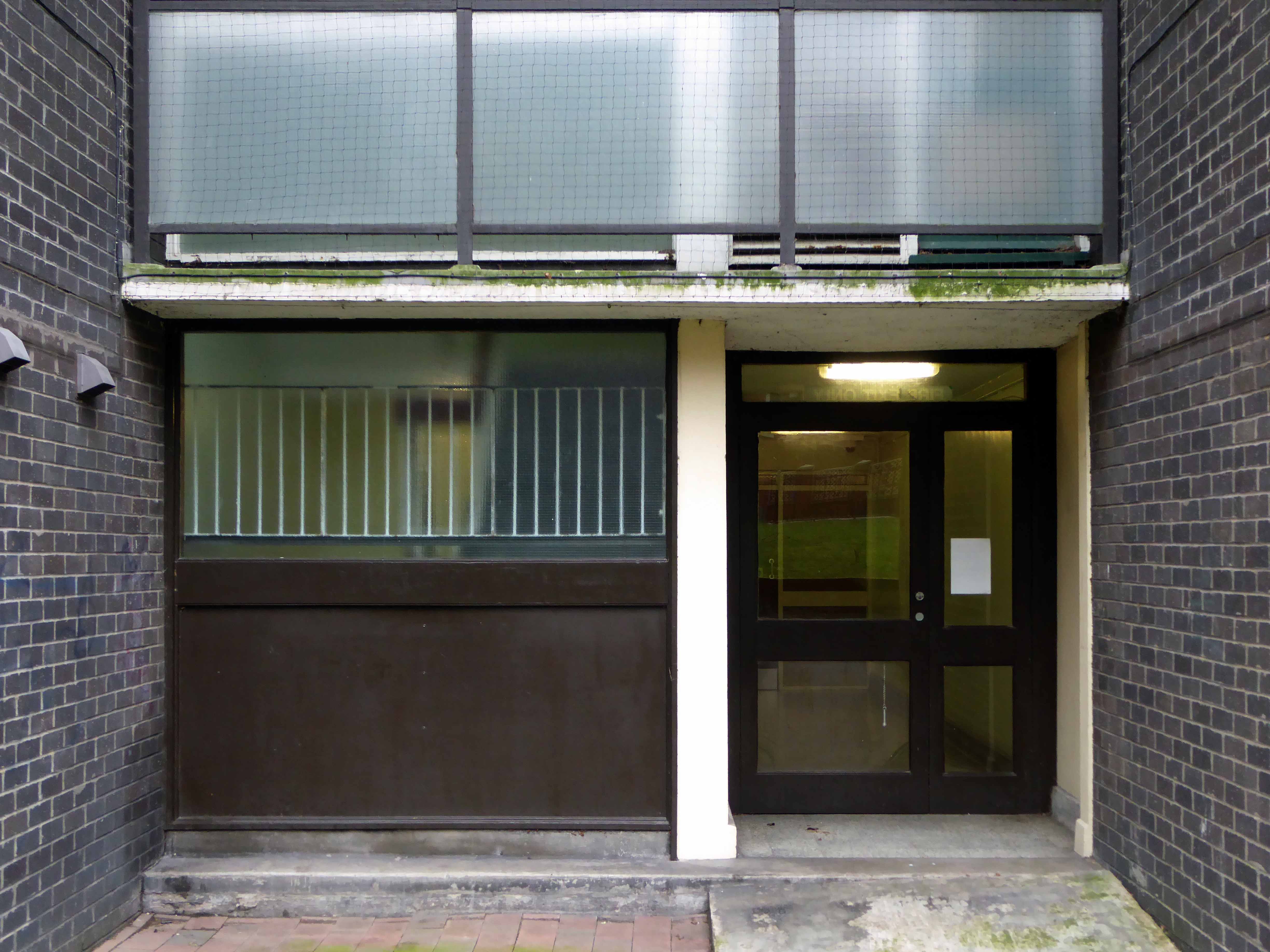
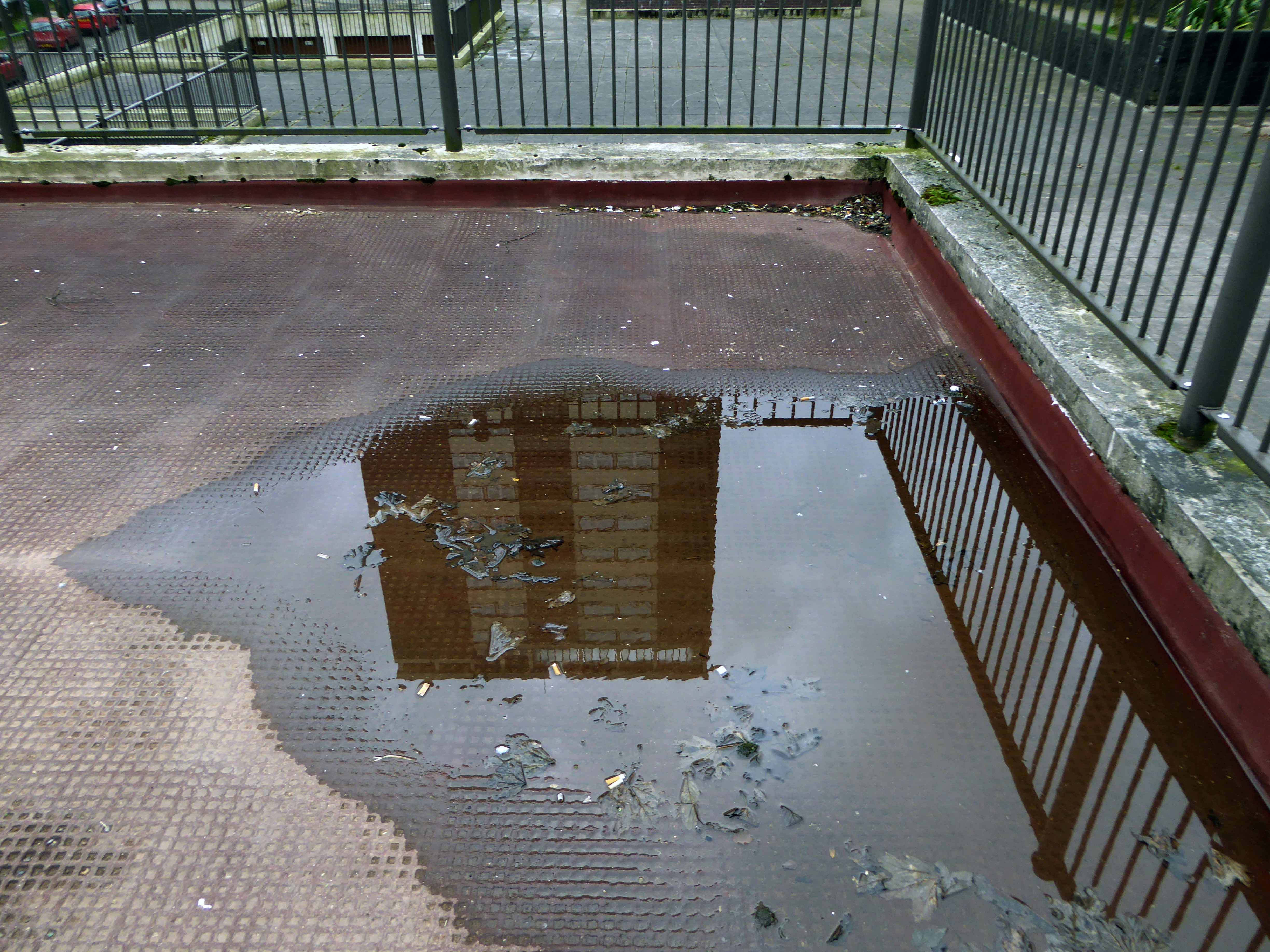
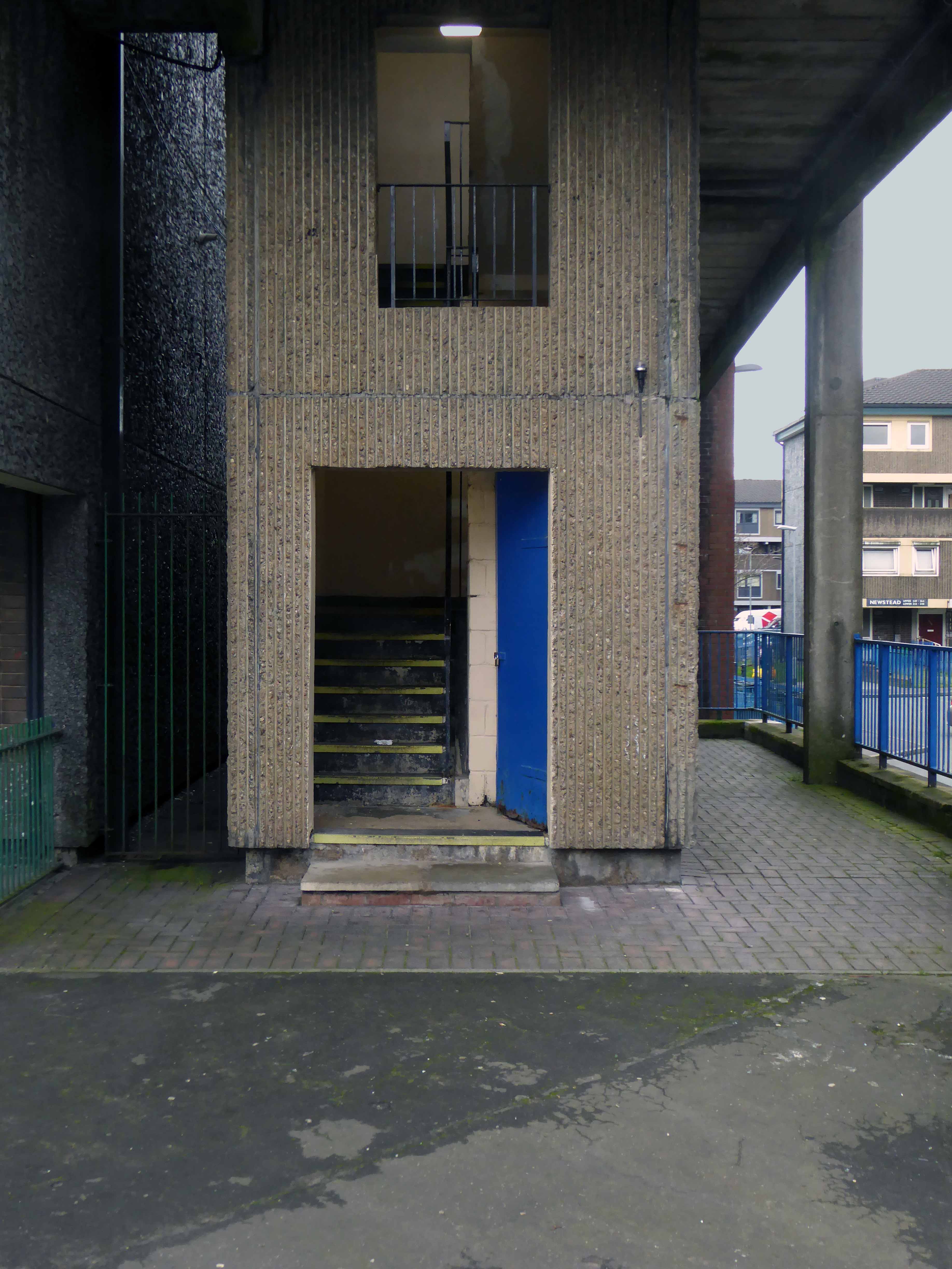
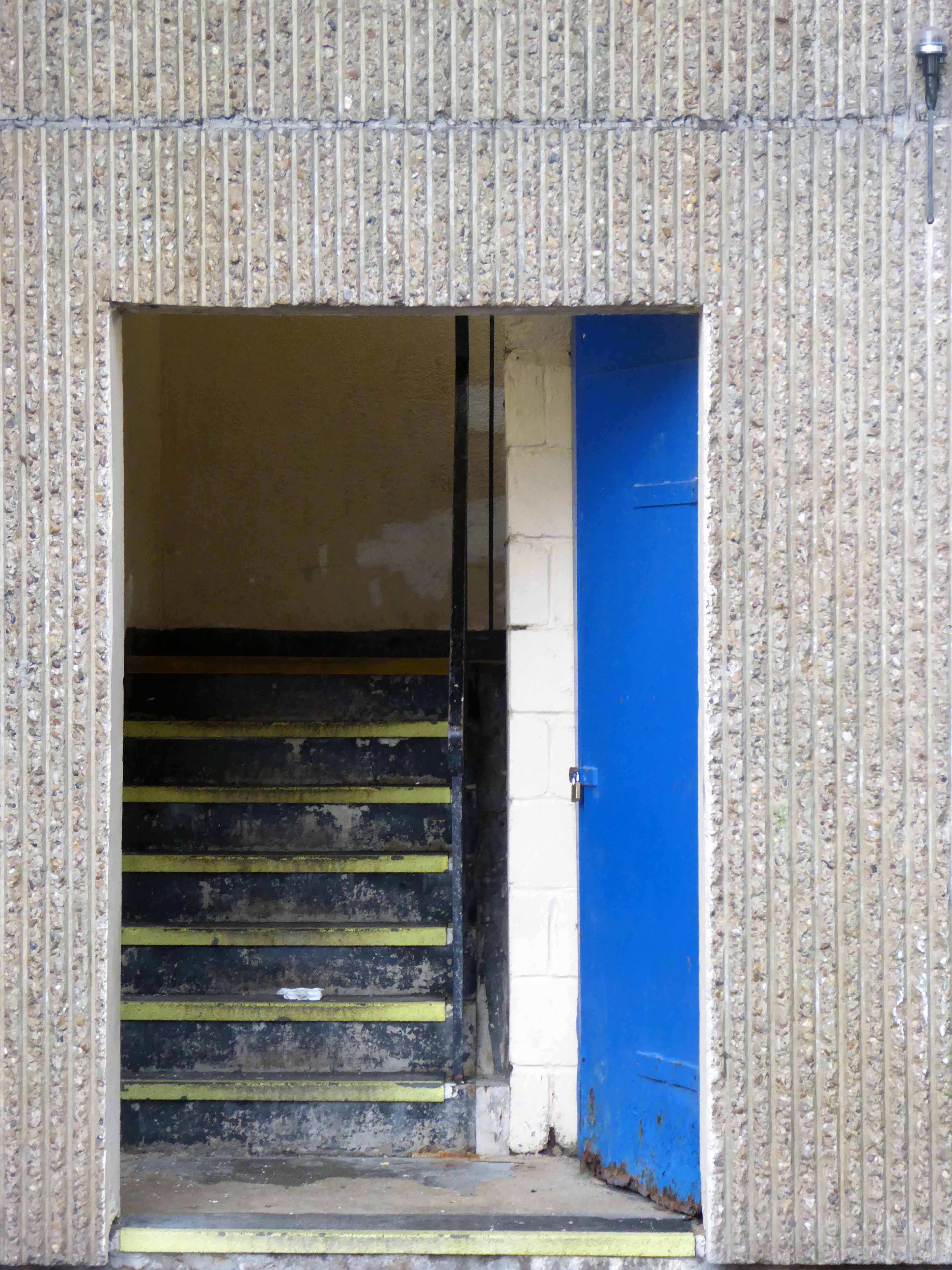
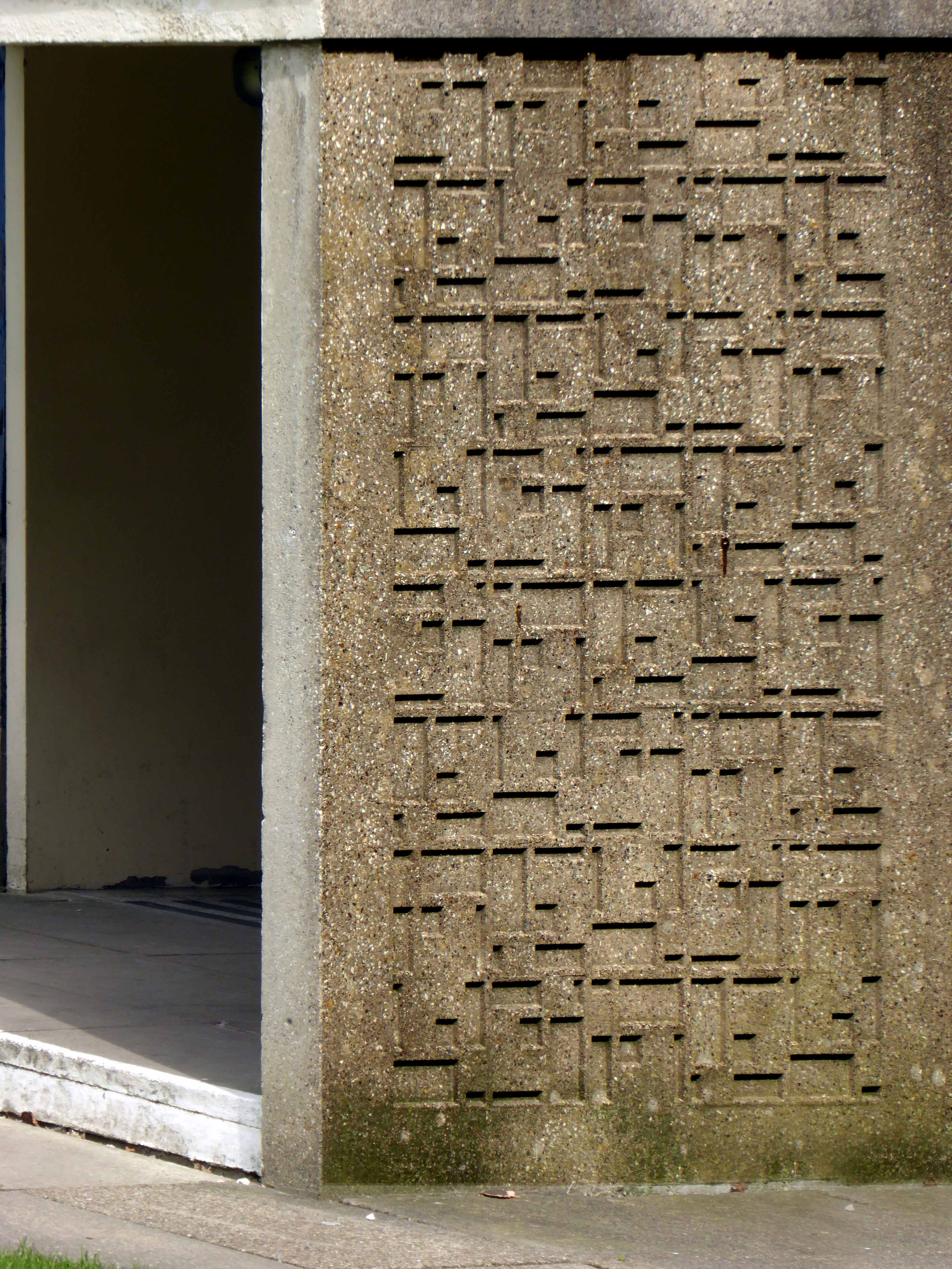
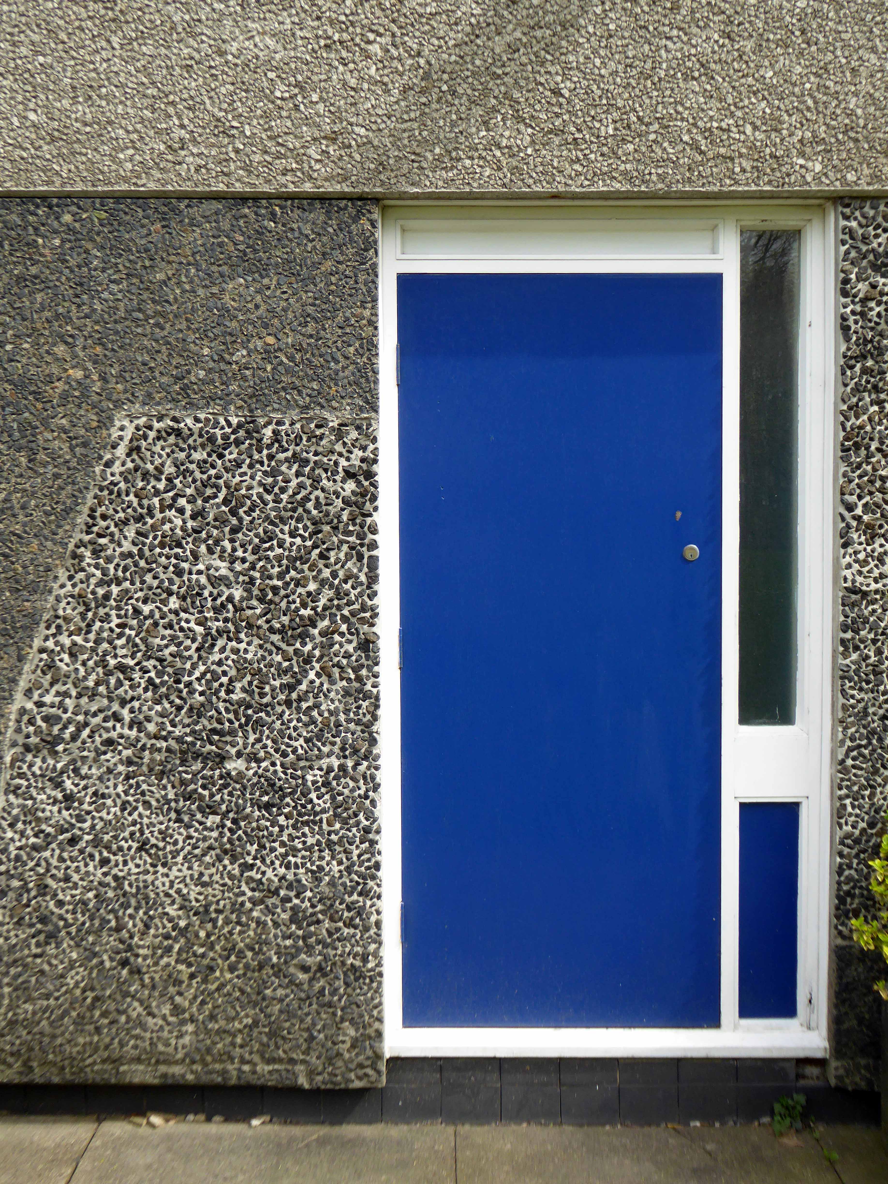
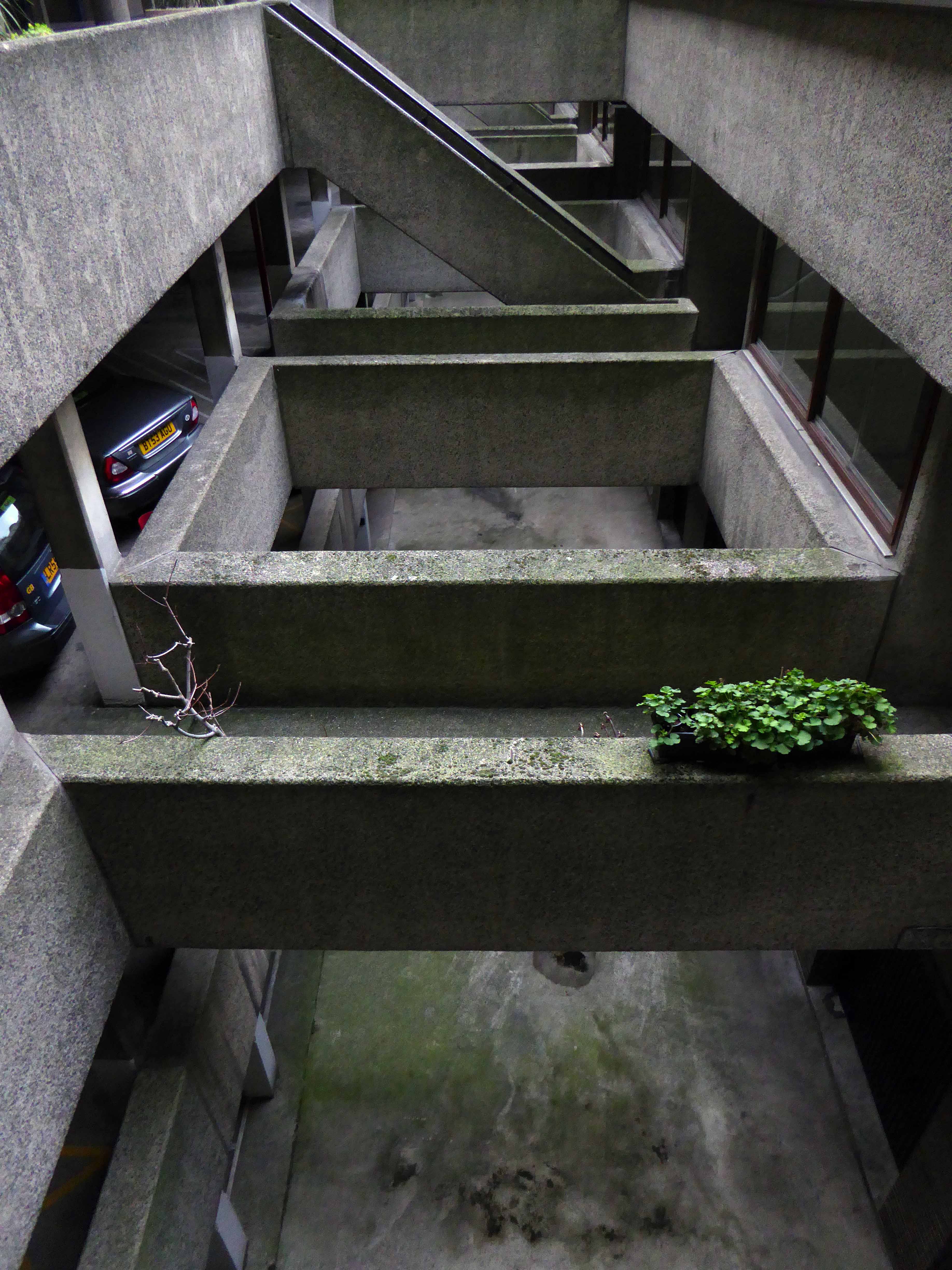
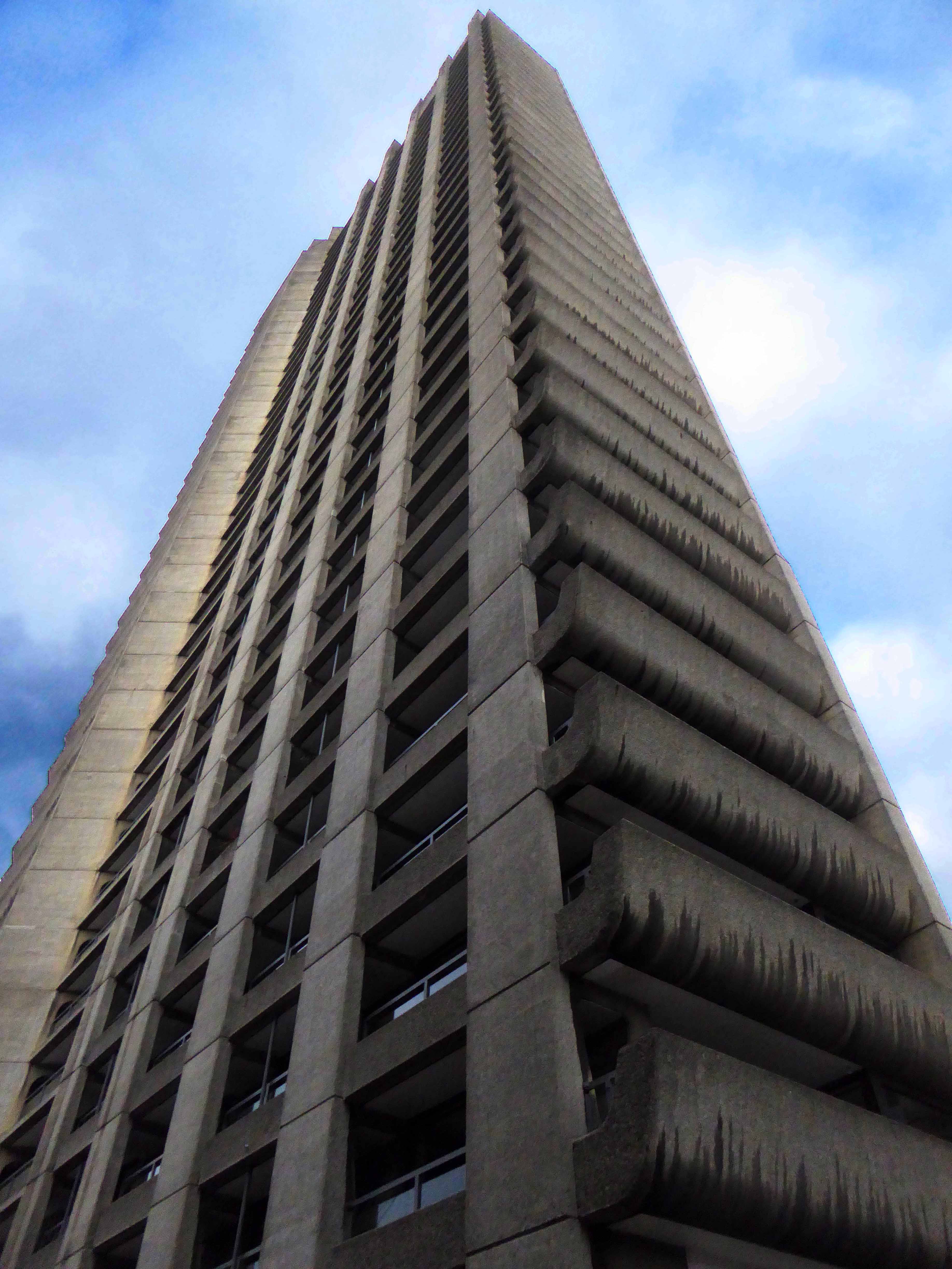
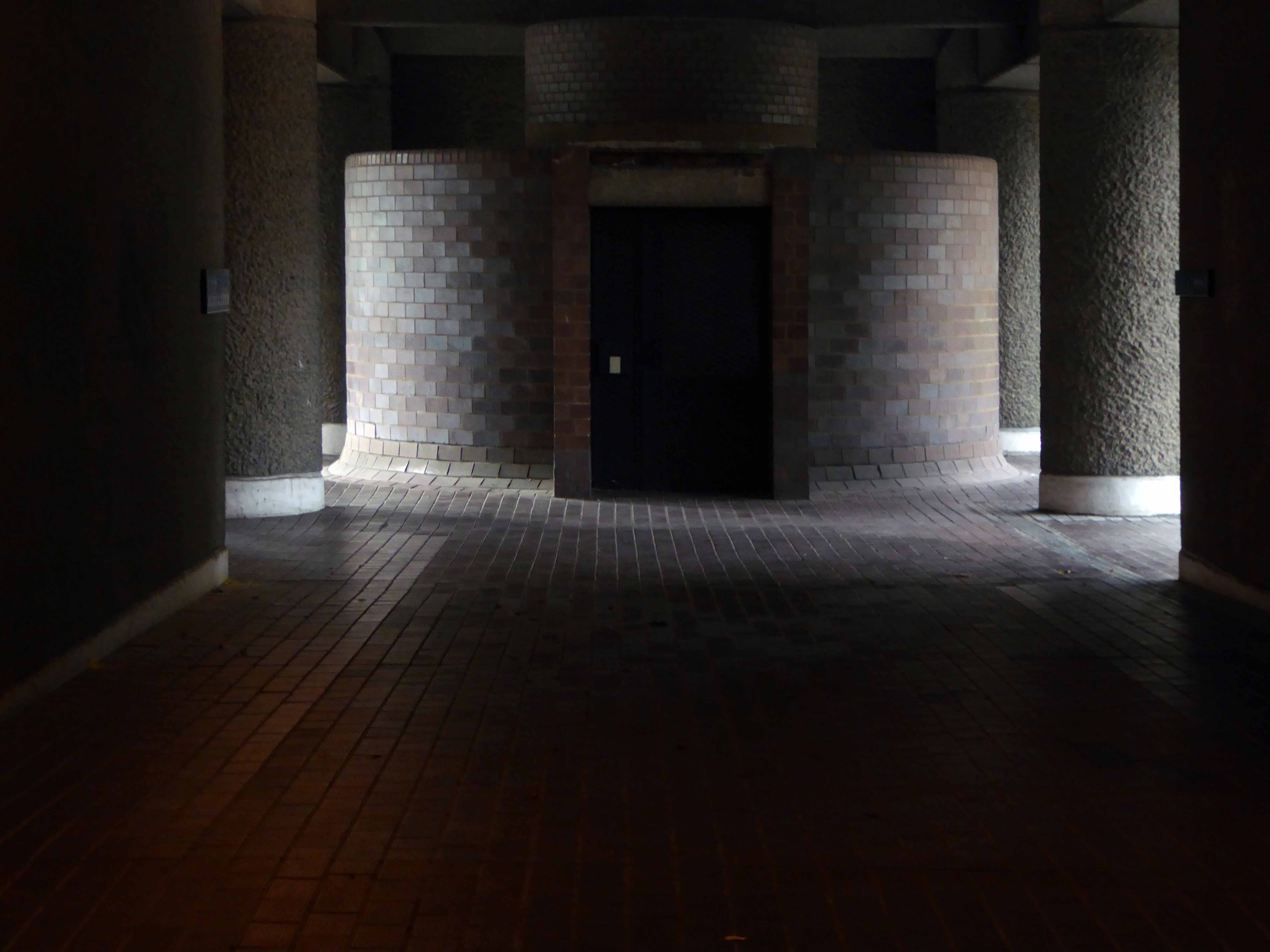
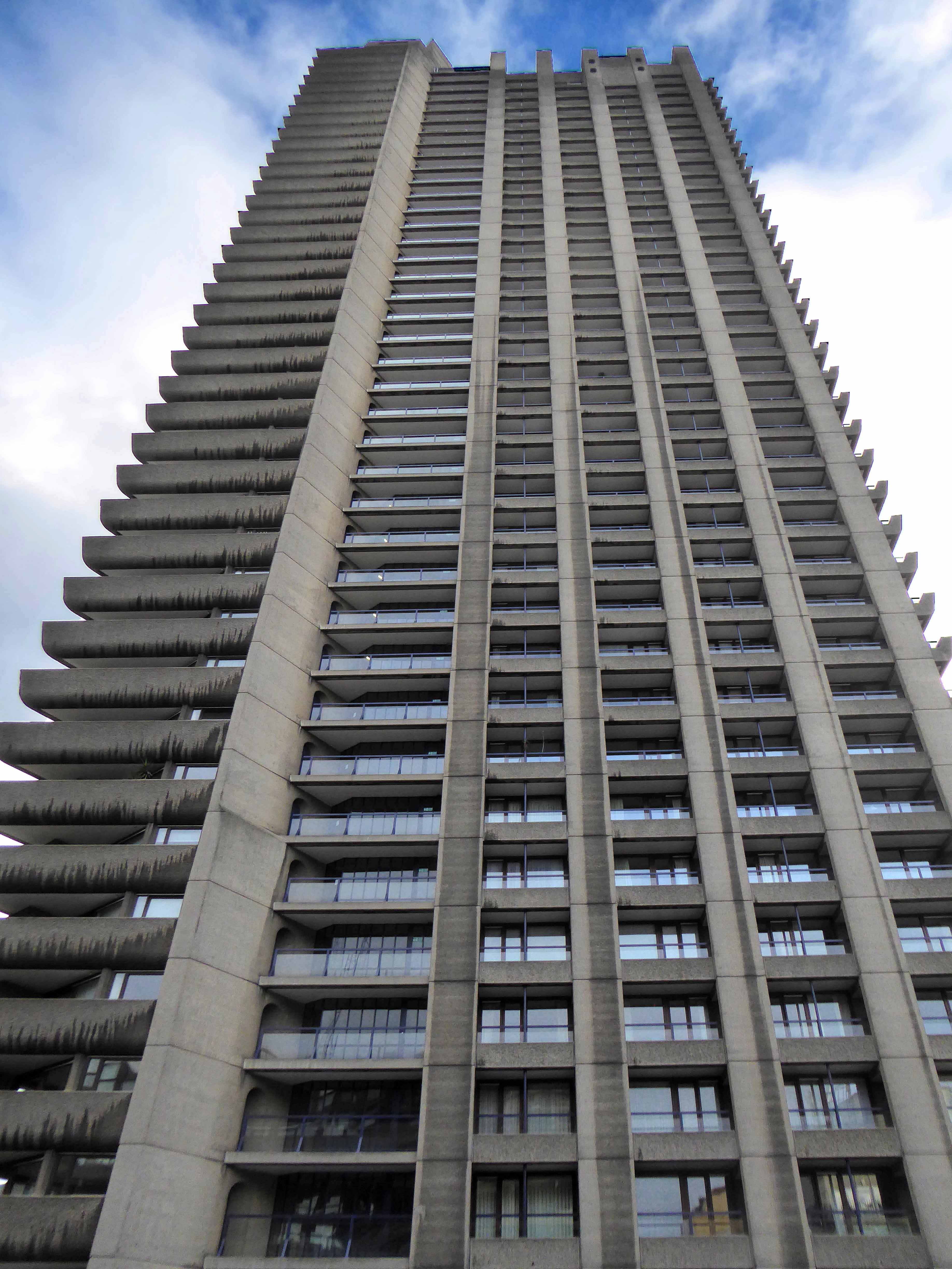
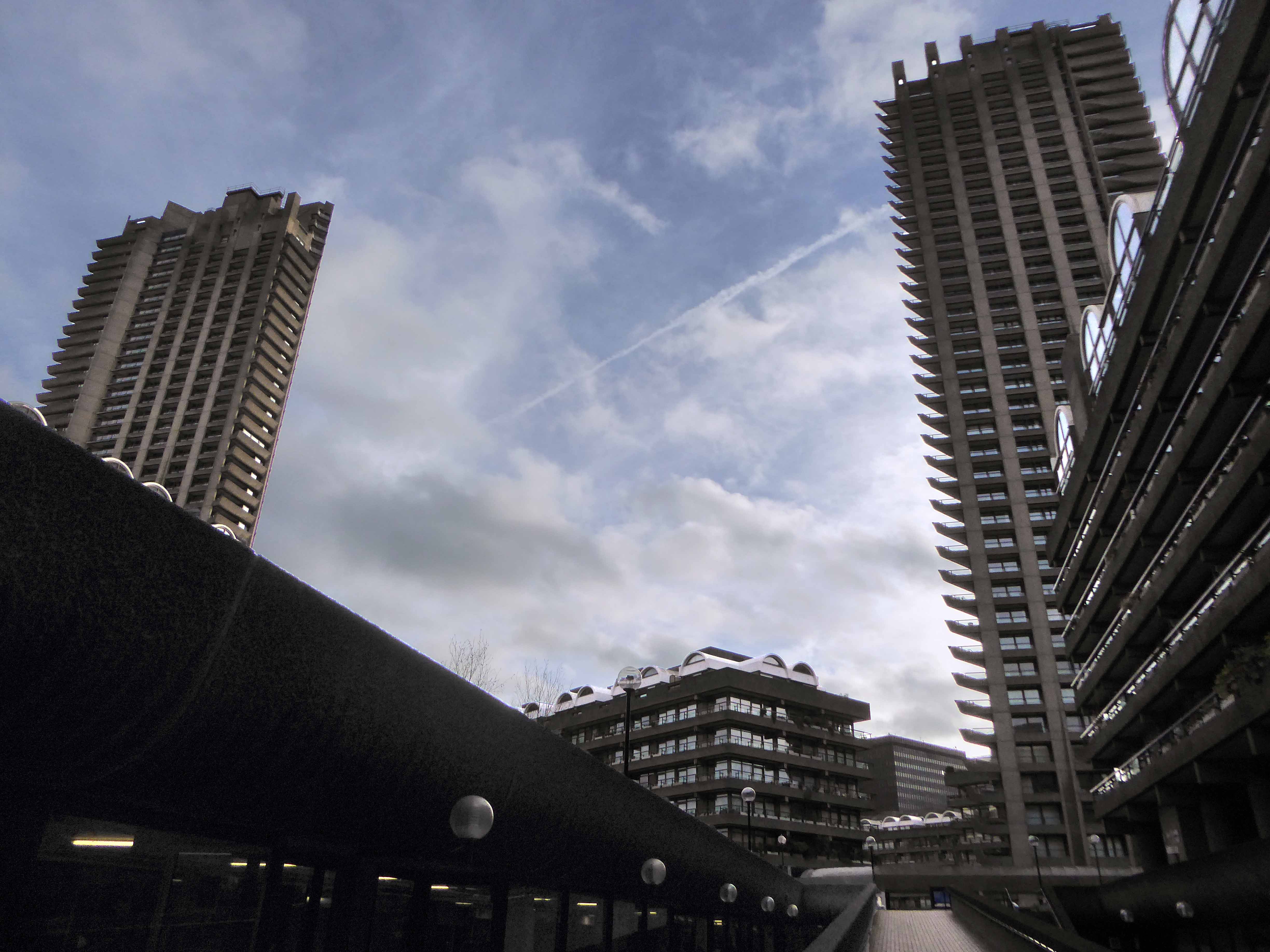
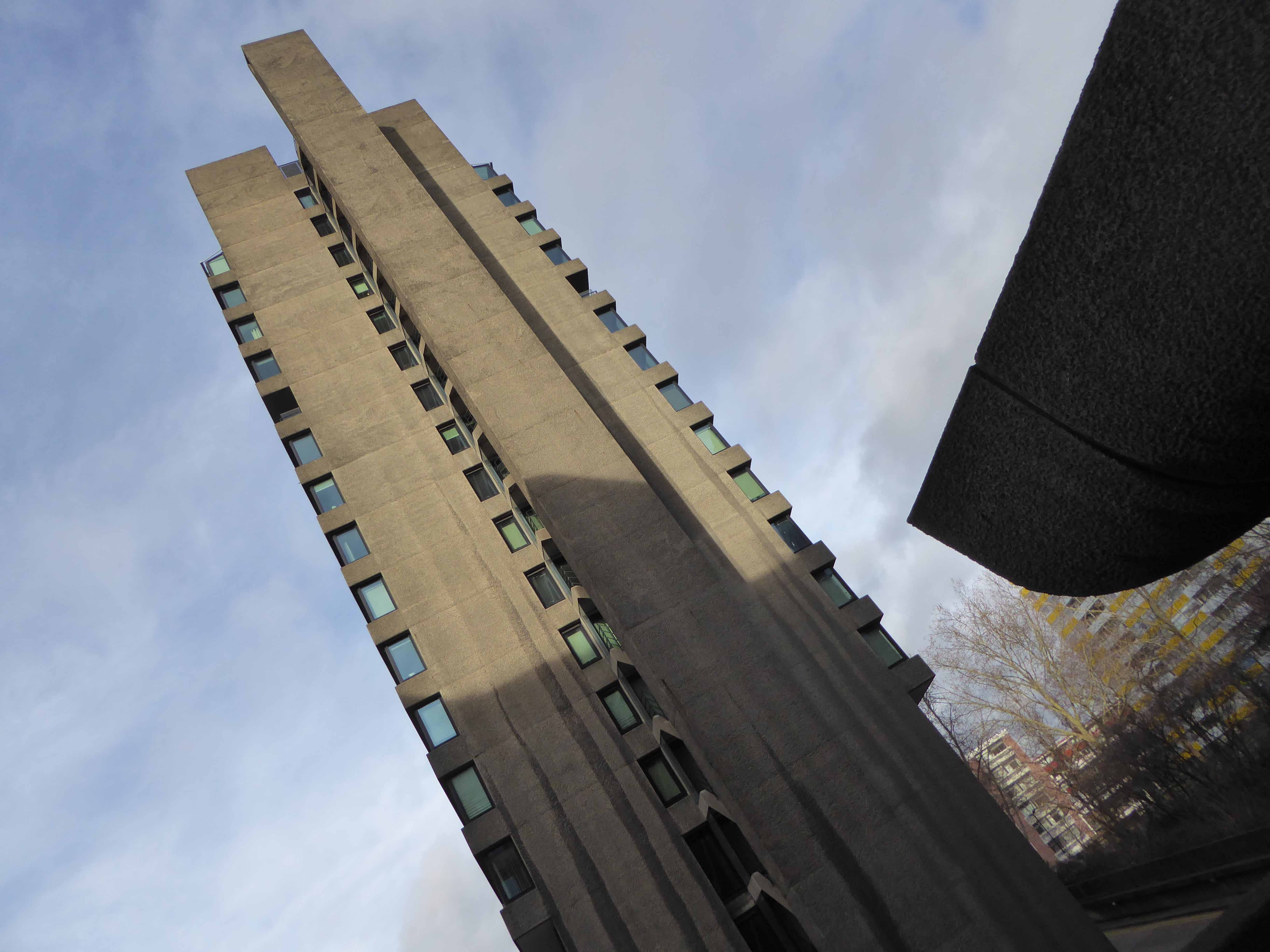
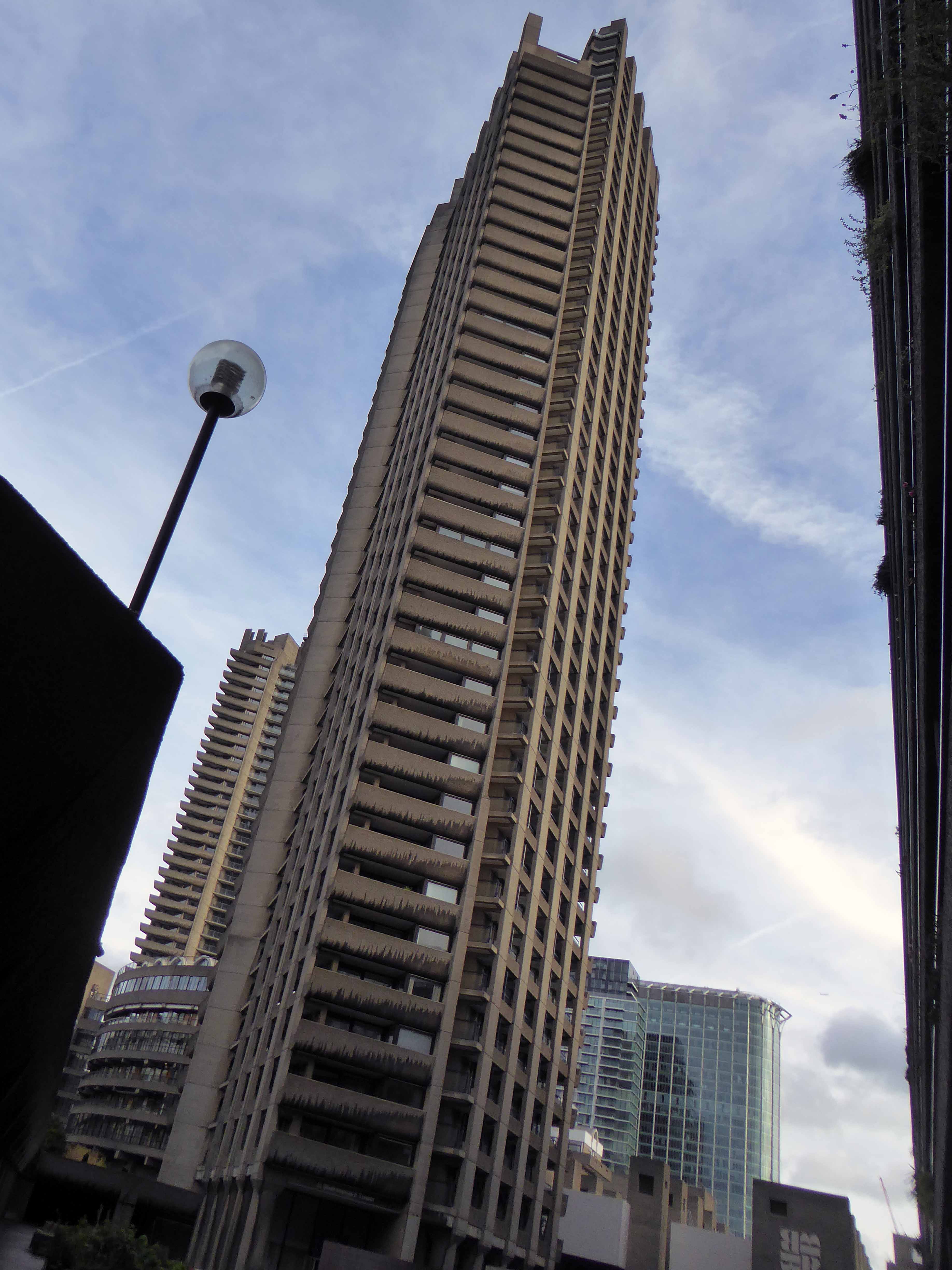
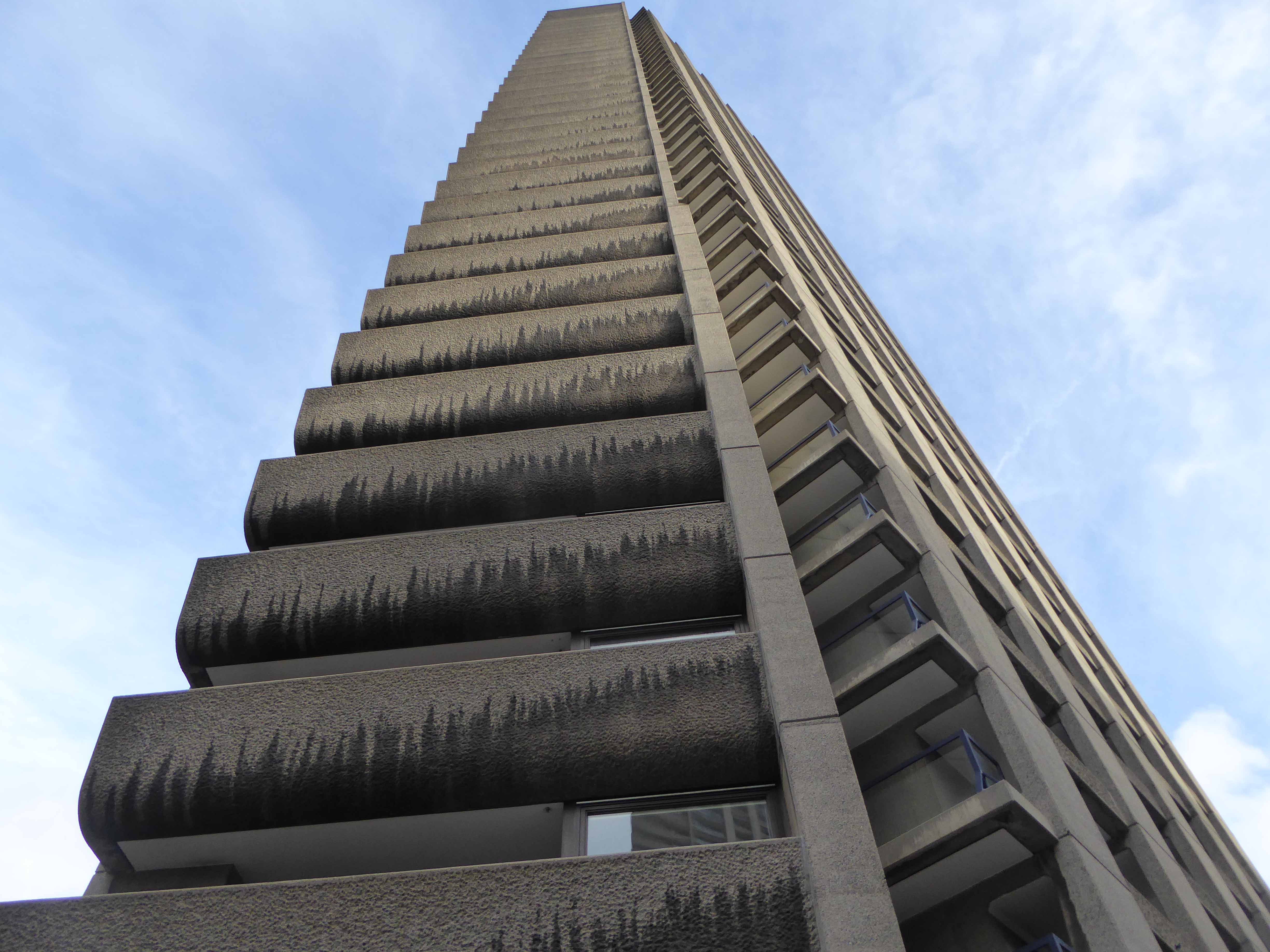
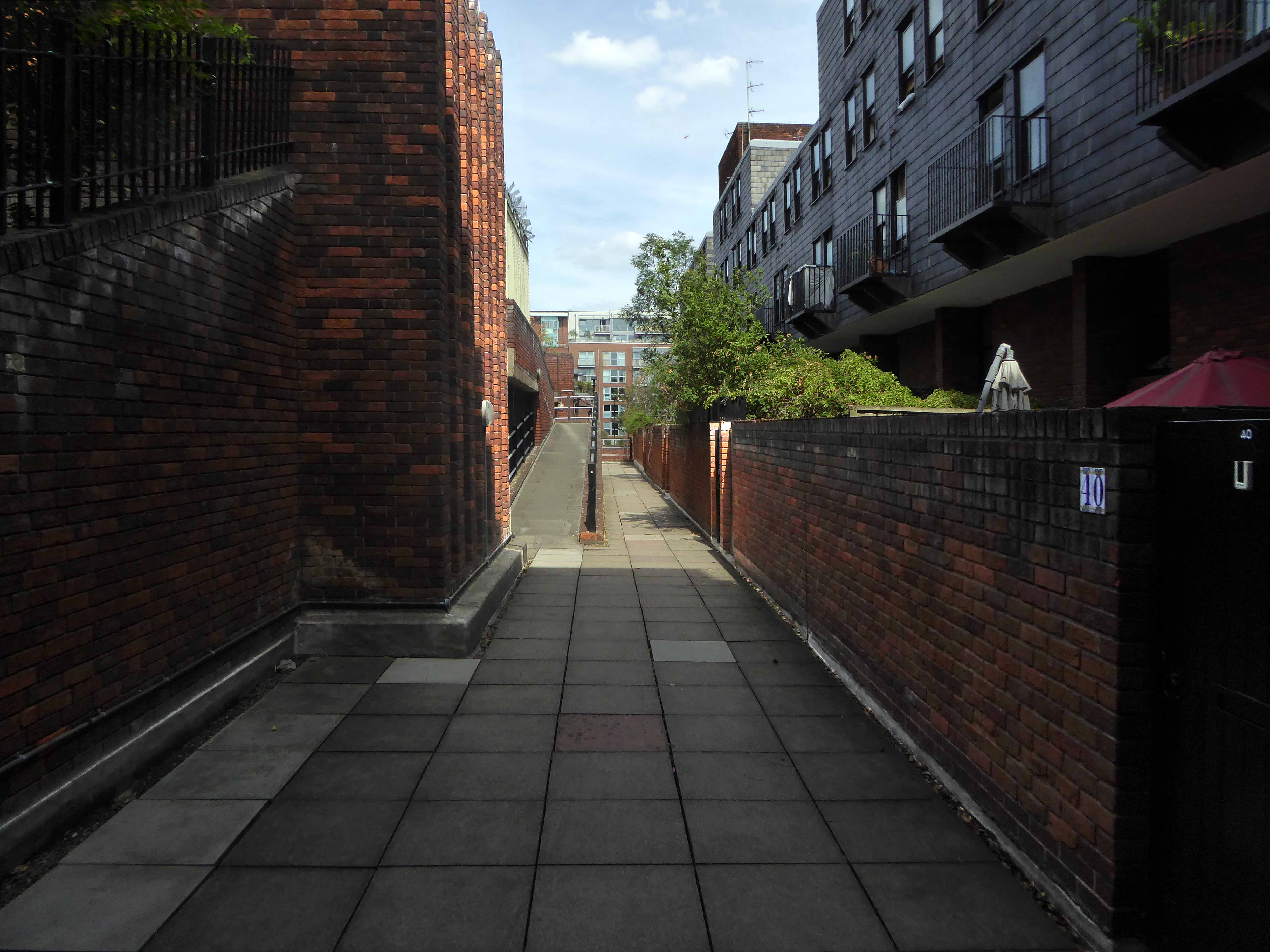
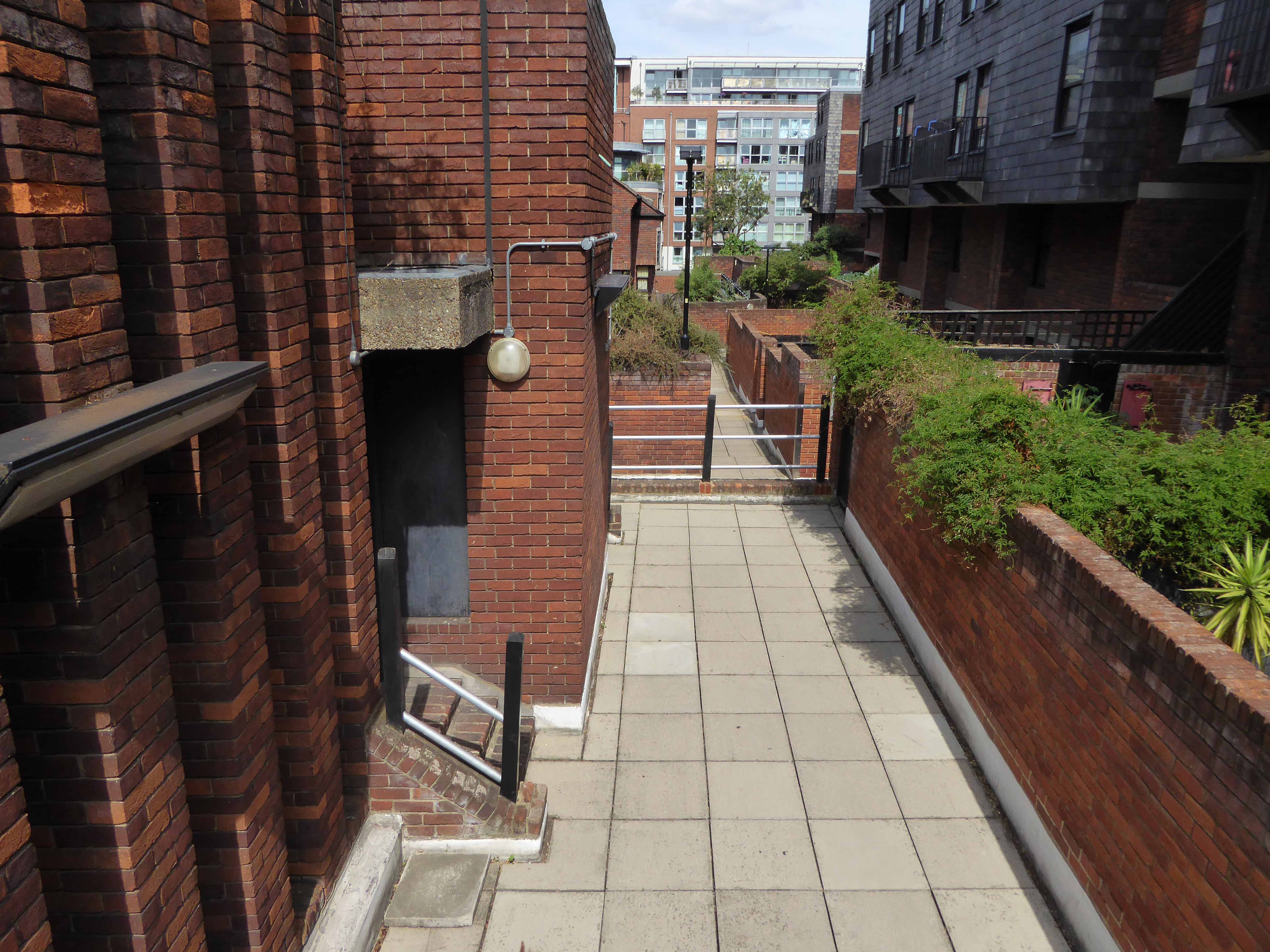
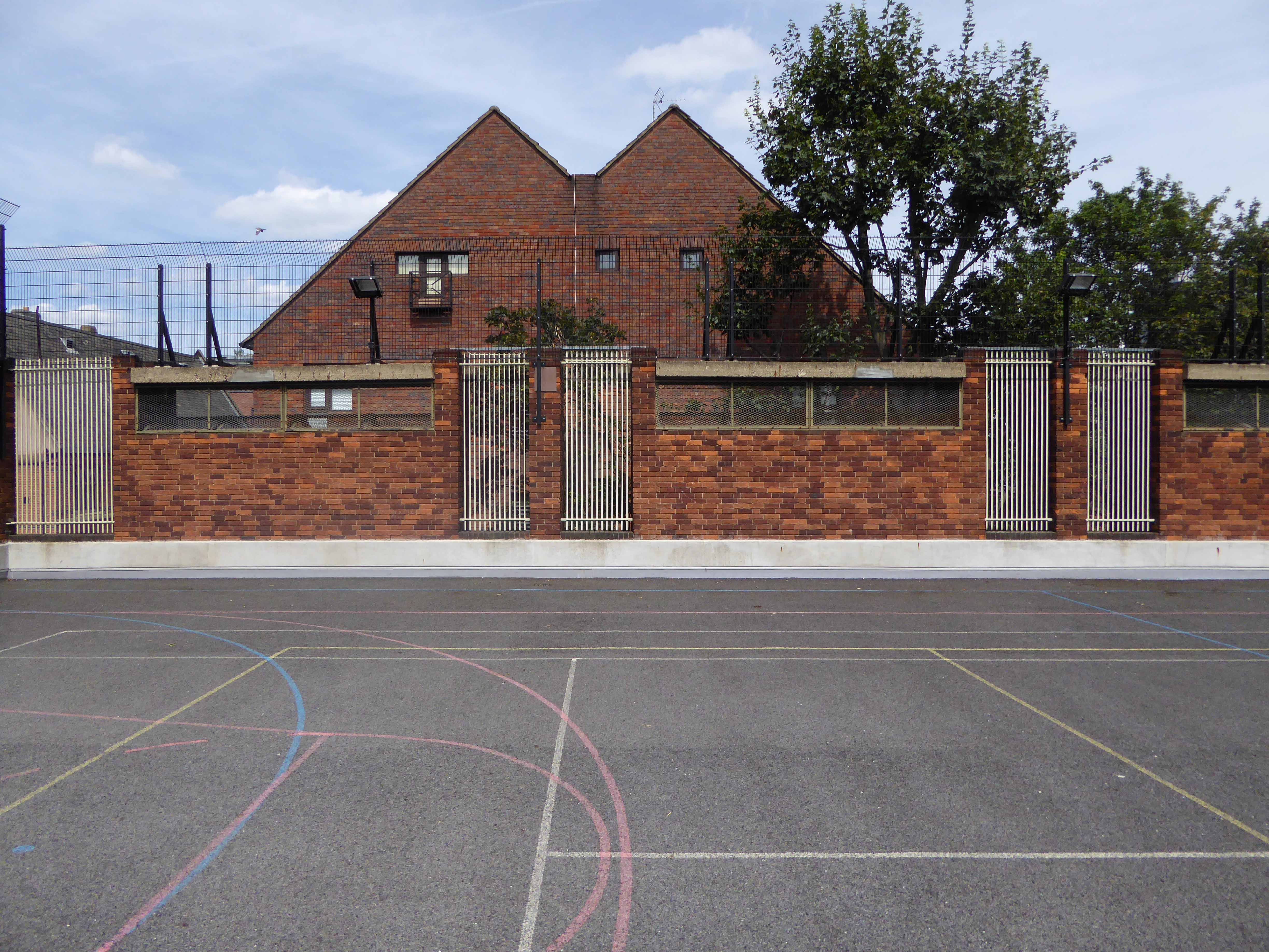
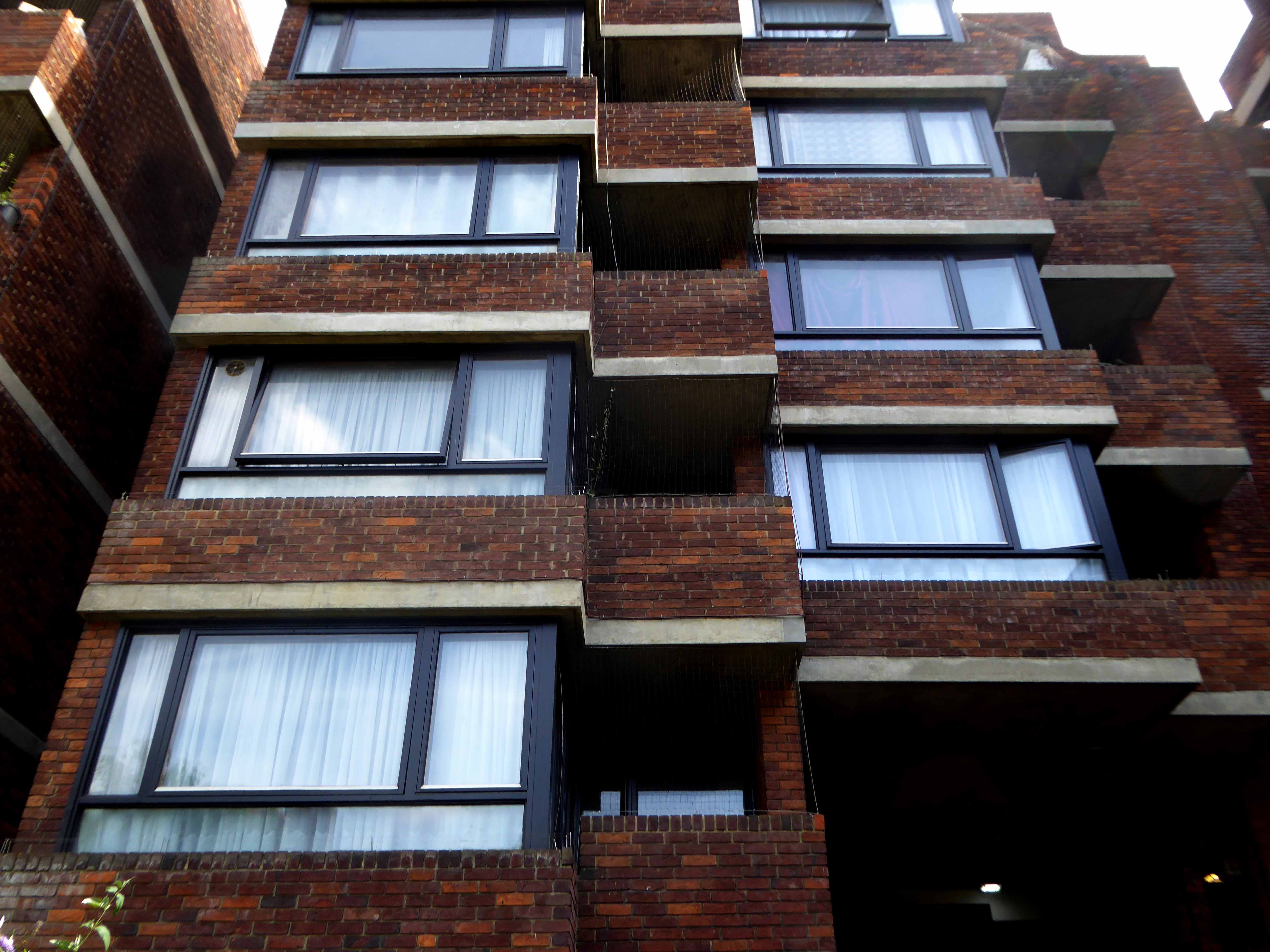
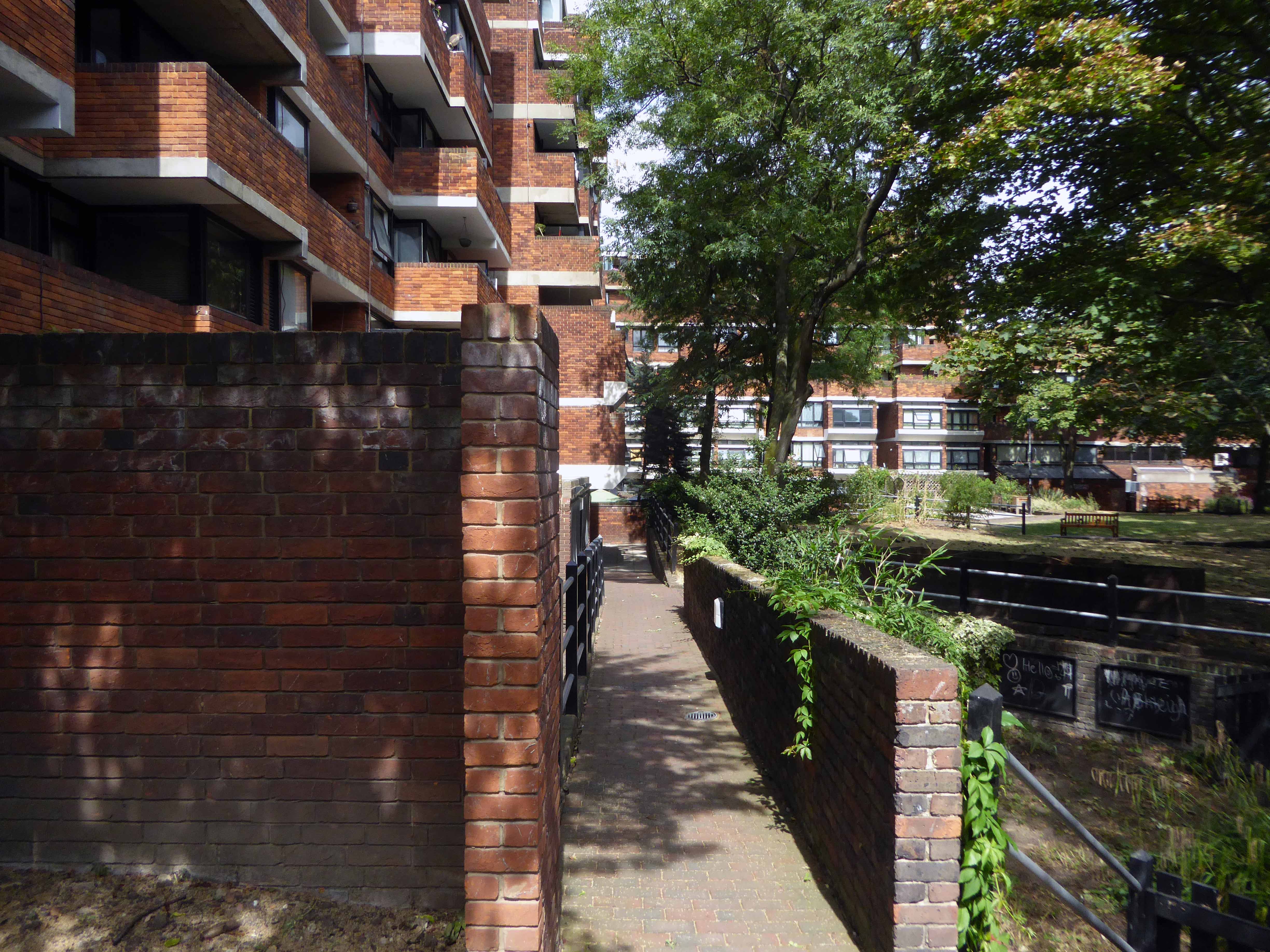
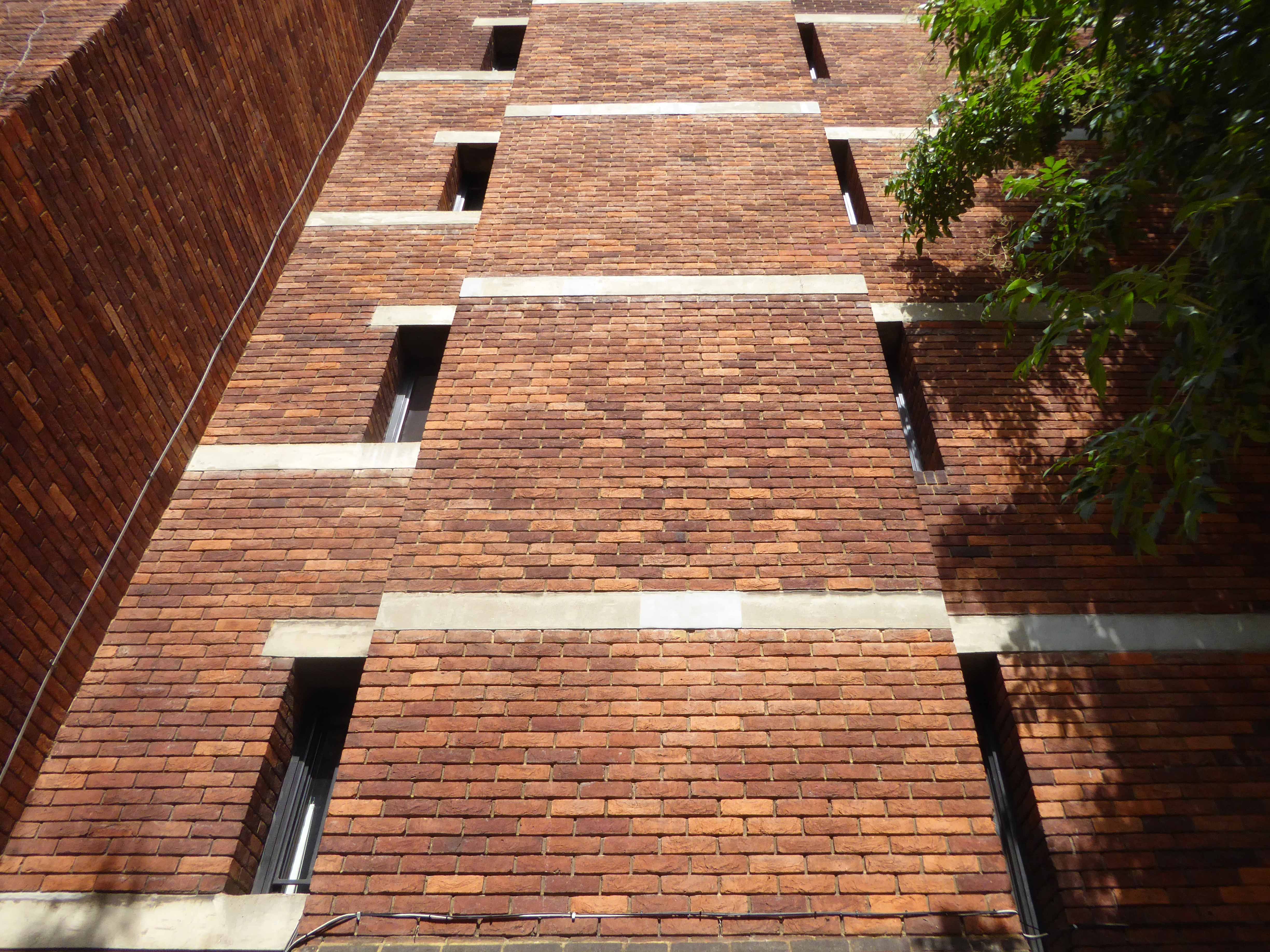
A period piece surrounded by Post Modern and Revivalist pretenders.

Why not go take a look.

Ten Acres Lane Again – Manchester

Having travelled back in time along Ten Acres Lane why not come along with me now and see just what’s left – right?

Each Manchester street tells its own tales of homes and people been, gone, rebuilt and buried – whole industries evaporating laid waste by seismic economic forces, land changing use again and again – shop door bells which are a now but a ghostly tintinnabulation on the wind.

Starting from the Oldham Road end the clearance of older terraced homes was followed by the construction of newer 70s social housing.

The former Tootal’s Mill is now owned by Sleepdown Textiles.

Some of the older terraces were spared the wrecker’s ball.

Industrial sites remain fenced and unused slowly returning to some form of urban natural habitat.

The cast-iron Rochdale Canal bridge is still in place – it was itself a replacement for an earlier masonry version.

Mather and Platt’s foundry sheds are just about hanging on – though I am uncertain of their current use and ownership.

The recreation ground is now an extensive community football facility and also home to the National Taekwondo Centre.

This large tract of land once Jackson’s Brickworks is under consideration for a modern private housing development

Much of the inter-war housing stock is still extant.

The sad shell of the Co-operative corner shop currently half storefront church half former tyre supplier is a sorry sight.

The still-standing CWS Works.

Finally passing under the railway bridge and descending into the Medlock Valley – our journey’s end.

Birley Street Tower Blocks – Blackburn

One fine day – whilst walking back to and/or from happiness, in the general direction of Blackburn town centre, I happened to chance upon three towers.

Whilst not in any sense Tolkienesque – for me they held a certain mystique, wandering unclad amongst swathes of trees and grass.

Trinity, St Alban and St Michaels Courts – three thirteen storey towers each containing sixty one dwellings.

Three thirteen-storey slab blocks built as public housing using the Sectra industrialised building system. The blocks contain 183 dwellings in total, consisting of 72 one-bedroom flats and 111 two-bedroom flats. The blocks are of storiform construction clad with precast concrete panels. The panels are faced with exposed white Cornish aggregate. Spandrel panels set with black Shap granite aggregate are used under the gable kitchen windows. The blocks were designed by the Borough architect in association with Sydney Greenwood. Construction was approved by committee in 1966.

Pastscape

Built on Birley Street following extensive 1960’s slum clearance.

Providing an excellent backdrop for the passing parade.

Each entrance porch with a delightful concrete relief on the outer face.

On the reverse a tiled relief – sadly painted over.

They are well proportioned slabs set in ample open landscape dotted with mature trees – maintained to a high standard.

High Street Estate – Pendleton

High Street Pendleton 1930s – the cast of Love on the Dole walk down High Street Pendleton, passing Hill’s Pawnbroker, author Walter Greenwood is ninth from the right.

This was a dense area of back to back terraces adjacent to pubs, schools, churches, mills, docks and cattle markets. Communities formed from shared patterns of employment, education, leisure and worship.

These communities survived into the 1960s and the coming of slum clearance, followed by an intense period of rebuilding in the modern manner.

Archival photographs Digital Salford

Patterns of employment, economic boom and bust, the exponential expansion in higher education, all contribute to the change in character of the area, along with slow and sudden demise in social housing.

2014 and the area begins to be reshaped yet again – this time by former resident Mr Peter Hook, who grew up in the area, the low slung former New Order bass meister described it in a book as – rotten and horrible, like a concrete wasteland

The Orchards tower block, the first of three, is removed piece by piece, each of the 14-storey blocks took around six weeks to be demolished.

The citizens of High Street Estate await the ‘dozers with apprehension and a sense of grim inevitability.

Clearance begins with the promise of new homes, tenants and homeowners are relocated, houses are tinned up or demolished wholesale. – a few remain in situ dissatisfied and afraid.

Altogether, 885 houses in Pendleton are being bulldozed and, to date, 584 have already been demolished, including houses on Athole Street and Amersham Street. Over the Pendleton Together project’s £650million thirty year life, only around one third of new houses being built will be affordable.

Meanwhile, after years of anguish and uncertainty, Fitzwarren Court and Rosehill Close, previously down for demolition, are being saved. Salix Homes will now bring flats in Fitzwarren Court and houses in its ownership on Rosehill Close up to the Decent Homes Standard

Salford Star

So welcome to Limboland – as financial arrangements shift, shimmy and evaporate – government policy, local authority pragmatists, private partnerships and funding perform a merry dance of expediency, around an ever diminishing circle of demolition, development, stasis and deceit.

The Barbican Estate – London

Bouncing betwixt and between Bonnard and Bill Viola from Tate Modern to the Royal Academy I took a detour to The Barbican – in search of the Dorothy Annan tiled mural.

Having failed conspicuously to find it, following an extensive and discursive wander, I did the wise thing and asked.

My thanks to the helpful resident and his young son.

Redirected and on course for our deferred engagement, Dorothy and I met at last on an underpass.

I also recently discovered a Barbican Manchester mash up – Gerrards of Swinton fulfilled their largest ever single order for the site – my thanks to David Roughley for the information and illustration.

Here are the snaps that I took along the way.

Grey Mare – Longsight

Exeter Close/Warmington Drive Manchester Longsight M12 4AT

Once there was this.

Once there was that.

Then there wasn’t.

That’s just the way of it.

Screenshot 2018-11-12 at 12.57.23.png

A dense web of streets awash with back to backs, jobs for all – in conditions perceived to be unfit for purpose.

Of a total of 201,627 present dwellings in Manchester, some 54,700, or 27.1 per cent., are estimated to be unfit. A comparison of slum clearance action taken by six major local authorities, Manchester, Leeds, Birmingham, Liverpool, Sheffield and Bristol, shows that for the five years ending 30th June, 1965, Manchester was top of the league, both in compulsory purchase orders confirmed and the number of houses demolished or closed.

Manchester’s figures -13,151 houses demolished or closed .

Alfred Morris MP Hansard
webmedia-6.php

Along came a wrecking ball and left the pub bereft

webmedia-3.php

The original Grey Mare on Grey Street

Whenever mass slum clearance was carried out, the pubs tended to remain, often for just a short time  because – the story goes – demolition workers refused to touch them, as they wanted somewhere to drink during and after their shift.

webmedia.php

Then along came the cavalry – the bold boys from Fort Ardwick – Coverdale Crescent Estate

webmedia-1.php

A new dawn – and a new pub.

This vision of municipal modernity was short lived, the estate was demolished in the 1980s and the new Coverdale Estate was constructed on the site in 1994.

Screenshot 2018-11-12 at 13.30.46

Image – Pubs Galore

Built in 1972 the pub outlived the system built blocks that surrounded it.

Screenshot 2018-11-12 at 12.57.53

Another new gold dream, another day.

DSC_0066

Despite the high hopes embodied by the low rise rebuilding of the new estate.

The Grey Mare shuts its doors – forever.

DSC_0039

DSC_0040


DSC_0042

DSC_0043

DSC_0044

DSC_0046

DSC_0047

DSC_0048

DSC_0049

DSC_0050

DSC_0051

DSC_0053

DSC_0054

DSC_0056

DSC_0057

DSC_0058

DSC_0059

DSC_0061

DSC_0062

DSC_0063


Park Hill Pubs – Sheffield

I’m a virtual visitor to the four pubs that served the population of Park Hill Estate.

I arrived late on the scene from not too distant Manchester, sadly much too late to stop and have a pint in The Parkway, Scottish Queen, Link or Earl George.

Built in the 1960s when municipal architecture spoke of optimism and innovation, the story of the estate is an oft told tale of decline and renovation.

Grade II* listed the building’s structure has prevailed, the original social structures, tenants and consequently their pubs have not.

DSC_0049 copy

Bewitched by the fragments which I photographed on my belated visits, I have searched the archives of Picture Sheffield, Postcard Cafe and Little Bits Of Sheffield.

Piecing together photographs and the distant reminiscences of those that lived, breathed and drank in their pubs beneath the streets in the sky.

The Link on Park Hill had some colourful characters.

If you want any info on the Link next time you are in town see the man selling fishing tackle outside Castle Market ,he is called Chris Hardy his dad ran the link in the 60’s they used to have the Sun Inn on South St before Park Hill was built, tell Chris that Alan Betty’s cousin told you about him.

I once did a job outside the Scottish Queen and had a lump of concrete thrown at me! it landed about 2m away, that made me jump!

Joe Fox used to be the landlord in the George in the 70s, didn’t stand for any messing about.

Sheffield Forum

Earl Francis! Of course! That was driving me mad; I was just going to ring my mum and ask her if she could remember what it was called. I think it closed in the early 90s, at the same time as the renovations of Hyde Park Walk and Terrace – 1990/1991, if I remember correctly.

The Earl Francis was still open in 1994 – the last time I went in there, but was dying on its feet.

Park Hill is empty, and due to be refurbished.

It’s amazing to think that each complex had all these pubs and people actually went in them! Drove past Park Hill a few months ago at night and it didn’t look like a soul lived in them.

Not surprised the Tavern has closed down. Don’t know whether people are happy or sad about it…They looked like an absolute dive, but I’ve always wanted to go and have a look around them to see what they’re like close up!

Why is it amazing to think that?

Sheffield Forum

The Parkway

s21979

Picture Sheffield 1965

Picture Sheffield © S Cole 2011

SONY DSC

sdscf0757e

sdscf0759e

The flats and in particular the Parkway Tavern were used in the 2014 film ’71 – which was set in Northern Ireland.  So this photograph showing the bar with a packet of crisps is actually slightly misleading because the crisp bag was only a printed film prop and what looks like broken glass on the bar is fake! – Mr C

sdscf0760e

sdscf0768e

sdscf0773e

sdscf0778e

sdscf0783e

sdscf0789e

© Little Bits of Sheffield

The Scottish Queen

s21985

s24491

s21984

5bf62d22a42f5e6e3bdebc9c073fdacc

a5a522862a866a1f06e484b2716c9ff5

A new pub could open on the site of what was once voted Britain’s second most dangerous watering hole. The Scottish Queen at Park Hill was notorious for violence, with only the most hardy drinkers brave enough to cross its threshold.

ec6d8981fcb209d3058c7f9228f61b919c181421

April 2015 saw the launch of a new exhibition space in Sheffield, housed within the former Scottish Queen pub at the Brutalist icon that is the Park Hill estate. The Scottish Queen hosted a temporary programme of exhibitions, events and residencies in partnership with a range of artists and organisations from across Sheffield supported by S1 Artspace.

Possibly the second toughest art space in Britain.

The Link

s21978

s21976

Picture Sheffield

matt surgeon

© Matt Surgeon

sheffield history

Sheffield History

s_1060819e1

s_1060824e

s_1060825e

s_1060856e

s_1060865e

P1020447.JPG

© Postcard Cafe

The Earl George

s21980

Picture Sheffield

In the 1960s 70s I used to go in the Link pub, I liked the Scottish Queen pub as well.

Do you think they’ll open all the pubs again when all the work is finished?


Lillington Gardens Estate – Pimlico

Formerly an area of high density terraced housing.

Screen Shot 2018-08-19 at 18.01.29

Lillington Gardens is an estate in the Pimlico area of the City of Westminster, London, constructed in phases between 1961 and 1980 to a plan by Darbourne & Darke. The estate is now owned and managed by City West Homes.

The estate was among the last of the high-density public housing schemes built in London during the postwar period, and is referred to as one of the most distinguished. Notably, seven years before the Ronan Point disaster ended the dominance of the tower block, Lillington Gardens looked ahead to a new standard that achieved high housing density within a medium rather than high-rise structure. It emphasised individuality in the grouping of dwellings, and provided for private gardens at ground and roof levels.

The estate’s high build quality, and particularly the planted gardens of its wide roof street, blend sympathetically with the surrounding Victorian terraces.

The estate’s high quality design was acknowledged by a Housing Design Award 1961, Ministry of Housing and Local Government Award for Good Design 1970, RIBA Award 1970 and RIBA Commendation 1973. Nikolaus Pevsner described it in 1973 as “the most interesting recent housing scheme in London”.

The site surrounds the Grade I listed Church of St James the Less, built in 1859–61. The entire estate, including the church, was designated a conservation area in 1990.

Screen Shot 2018-08-19 at 17.44.59

Lillington and Longmoore Gardens Conservation Area Audit

On the day of my visit, London in the grip of a July heatwave, the open areas, narrow alleys, byways, steps, stairs and roof gardens and play area were largely empty, citizens preferring the cooler interior environment of their homes.

The materials, warm brown brick and sheet-metal cladding, form complex interlocking shapes and volumes, creating a variety of heights and spaces. This makes exploration and navigation of the estate quite an adventure, disorienting at first, until one grasps an overall sense of the development’s structure.

Lillington Gardens provides homes, community, green space and an exciting range of vistas, a prime example of social housing on a human scale. Leafy glades, light and shade, grassy knolls abound.

Municipal Dreams for further reading.

P1270995

P1270997

P1270999

P1280002

P1280004

P1280007

P1280008

P1280009

P1280010

P1280011

P1280012

P1280013

P1280014

P1280016

P1280017

P1280018


P1280021

P1280022

P1280023

P1280024

P1280026

P1280027

P1280028

P1280030P1280031

P1280032

P1280033

P1280034

P1280035

P1280037

P1280038

P1280040

P1280041

P1280042

P1280043

Return To Palmerston Street – Beswick

Having traced a lengthy history of the shortish Palmerston Street – I returned to take a snapshot of the current state of affairs.

So much has gone an Art Museum, Lads Club, churches, homes, schools, industry and pubs – much of this now indistinct scrubland, fenced and walled, neither use nor ornament, save as an unofficial wildlife garden for feather, fowl and flower.

There  are small groups of more recent housing developments with the promise of more on the way, though this as ever is contentious – the story of conflicted interests betwixt and between developer, local authority and the would be affordable homes and their occupants.

The council says – Manchester’s Affordable Housing Programme will ensure more than 2,200 homes by March 2021 through a £250m programme funded through a variety of sources including Homes England grant funding, Council borrowing and land or property sales and Registered Providers. The Council is also backing the programme through the release of suitable council-owned land.

Which seems barely adequate to meet the needs of those on lower incomes.

The Guardian says – Of the 61 big residential developments granted planning permission by Manchester city council’s planning committee in 2016 and 2017, not one of the 14,667 planned flats or houses met the government’s definition of affordable, being neither for social rent nor offered at 80% of the market rate.

Manchester has changed, constantly changed – often overlooking the needs of its citizens to the north and east of the city. The areas crippled by recession, deindustrialisation and demolition have yet to see the benefits of the city’s recent regeneration.

What was once a community overflowing with rough and tumble, hustle and bustle, now seems to have become a contested area for match day parking and non-existent urban renewal.

Let’s take a look down Palmerston Street.

P1280052

P1280053

P1280060


P1280063

P1280064

P1280082

P1280093

P1280096

P1280097

P1280098


P1280103

P1280104

P1280106

P1280108

P1280110

P1280112

P1280114

P1280115

P1280118

P1280119

P1280121

P1280123

P1280127

The Happy Prospect – Reading

image014

The Happy Prospect, 50 Coronation Square, Reading RG30 3QN

I came here by chance researching Manchester’s Estate Pubs for my blog when up pops The Happy Prospect – what a pleasant surprise!

Having never really visited Reading, this is very much a virtual cut and paste journey through time and space – so apologies in advance for any unforeseen errors.

So let’s see how we got here:

The area was sparsely populated until after the Second World War, though excavations have revealed evidence of Paleolithic and Iron Age activity in Southcote, as well as Roman and Saxon habitation. By the time William the Conqueror undertook the Domesday Survey in 1086, Southcote was sufficiently established to warrant a Lord of the Manor, who at that time was William de Braose. From the 16th century onwards, Southcote Manor was owned by the Blagrave family, who sold the manor house in the 1920s. The area was subsequently developed into housing: much of the land changed from agricultural to residential.

s1309809

cropped-wolseley-street-war-time1

Bucolic scenes of small intimate streets and agrarian activity.

By the advent of World War II, Southcote had begun to experience urban sprawl from Reading and the land bordering the Great Western Railway had begun to be used for housing. Following the war, Denton’s Field on the Bath Road in Southcote was used for celebratory events; Battle of Britain commemorative fêtes were held in September 1949 and 1950, and featured a performance by three Alsatians – Rocky, Lindy and Irma to recognise their work in the war.

Dragged into the ferment of Mid-Century Modernism with the development of new housing, churches and schools.

In the 1950s, a huge building project centred around Coronation Square, named for the 1953 Coronation of Queen Elizabeth II – with hundreds of council houses built to satisfy post-war demand. The residents of many of these had moved from houses in central and East Reading that fell short of sanitation requirements of the Public Health Act 1875, these were compulsorily purchased and later demolished.

s1009857

s1309154

s13081034

s1108309

All that was missing was a pub – and so happily the local brewery Simonds built The Happy Prospect.

s1309225

Architecturally very much in the à la mode manner of the Modernist estate pub, plain well-lit brick, tile and concrete volumes, replete with a low perimeter wall and ample car parking space.

Thanks to Boak&Bailey for the background info.

s1009102

Opening in October 1958 – this photograph was taken for the Berkshire Chronicle but was not published.

Archival material from Reading Museums.

And so for many years the pub prospered – sadly along with so many others of its ilk, the pressures and constraints of social change and economic decline forced closure and demolition despite the protestations of the local community, who fought for its life.

Beverley Doyle, who lives in Southcote, said: “We don’t see the old people anymore because there’s nowhere for them to meet up.They used to be able to come here and play cribbage and cards.There was also Christmas parties and kids’ parties so people could get together and we need something like that again. It was a good pub and we want it back to how it was.”

Campaigner Bobbie Richardson said: “Once you get this place boarded up you wonder what’s going to be next in the community. It starts to look run down and we want to let the owners know Southcote is not a ghetto.”

Inevitably a once fine social asset is no more.

reading_happyprospect

Coronation_Square,_Southcote-1

photo[1]

Covent Garden – Stockport

Last time I was here it was there:

Covent Garden Flats Middle Hillgate in Stockport.

A small but important group of post-war council houses – very much in an inter-war European manner, homes to a settled community of cheerful, chatty residents.

screen-shot-2016-04-14-at-17-20-211

The local authority tinned them up some year ago, ahead of a series of redevelopment proposals – last week that redevelopment reached its logical conclusion.

Demolition.

Whilst accepting the necessity for change, I also recognise the need to preserve what is best of the past, rather than replacing it with the present day architecture of cautiously consensual pastiche.

p1030551-copy

P1230650

nuvu living for the nouveau be-tartaned riche:

Screen Shot 2018-03-21 at 13.37.36

So heavyhearted I circumnavigated the perimeter fence, recording forever that which was no longer there – their there replacing our there.

P1230601

P1230611

P1230613

P1230618

P1230624

P1230626

P1230630

P1230636

P1230639

P1230641

P1230633

P1230645

Screen Shot 2018-03-21 at 15.14.01


Eastford Square Collyhurst – Slight Return

I’ve been here before and after.

After now seems further away, forever awaiting redevelopment – waiting.

No more Flower Pot Café and a warm welcome from Lee and the lads.

P1220206 copy

Nearly nine years on – the shutters are down and nobody is home, save for the Lalley Centre – offering food, support and care to the community.

JS79308197

Though Sister Rita Lee has now move on to pastures new.

The homes and shops remain resolutely shut, un-lived in and unloved, though the City plans to re-site the resident sculpture, the residents remain absent without leaving.

P1220207 copy

P1220208 copy

P1220209 copy

P1220212 copy

P1220213 copy

P1220214 copy

P1220215 copyP1220216 copy

P1220217 copy

P1220218 copy

P1220219 copy

P1220220 copy

P1220221 copy

P1220222 copy

P1220223 copy


Gore Brook – A History

To begin at the beginning, well actually to begin in the middle and walk to the current beginning. The Gore Brook flows from the Lower Gorton Reservoir and from there onwards to meet the Chorlton Brook in the west, though I should imagine that prior to the construction of the waterworks, it was fed by more distant moorland waters.

gore map

Manchester being on the eastern edge of the Lancashire Plain and the western edge of the Pennines is riddled with rivers, rivers which now wriggle in an under and overground web, across heavily developed urban areas. Following the Industrial Revolution former meadow, common and farmland was overwritten by factories, housing and roads, the rural character of the rivers and brooks soon becoming darkened and polluted by the surrounding industries.

I was lead here by my search for a lost pub The Garratt on Pink Bank Lane, then drawn in further by this site The Red Path of Longsight.

The Red Path is a pedestrian link between Pink Bank Lane and the Gorton boundary at Buckley Road. It roughly follows the course of Gore Brook. The original footpath, running from Buckley Road to the bank of the brook, was made using black cinders. It was probably made in the 1940s to provide access to the allotments located on either side. In the early 1950s , a concrete bridge was laid across Gore Brook and the footpath extended to Pink Bank Lane. This section used red bricks in it’s construction, probably supplied by Jacksons brickworks . Crushed bricks were then used as a topping to make the path smoother and fill in any cracks. The thoroughfare soon became known as the Red Path.

So wide eyed and mapless I bowled up at Brook Terrace, just off Stockport Road Longsight, in search of The Gore and its source.

stockport rd 1911

stockport road

In the early 1900’s the river was still open and bridged, here at Stockport Road, later culverted and covered – anticipating the arrival of Tesco’s and Granada TV Rentals.

beneath

From there we pass under the railway along Brook Terrace and into Parry Road.

brook

The underpass is still there and very much in use, as is Stanley Grove School – the Manchester Central Schools’ Kitchens are long gone, along with the food filled, insulated aluminium cases, that fed the hungry mouths of many, with semolina, pink custard, meat pies and lumpy mash.

parry 64

kitchens 1965

Onwards to Elgar Street and still no sign of the river, hidden beneath our feet, the corner of Northmoor Road, can be seen on the corner, no longer distributing dividends, but now providing social housing.

elgar

We arrive at Pink Bank Lane, a rich mix of terraced homes, flats and factories – and the long lost Garratt, and the long lost Gore.

garratt

pink bank 64

Though the lazy, lazy river has been confined in a brick lined wind, to meet the ever pressing needs of the Gorton Sewage Works.

sewage 1910

sewage works 38

The river then hugs the edge of Annie Lea Playing fields on Buckley Road, until it disappears again as it meets Mount Road, the playing fields are still open ground – the Manchester Cleansing Department, seen on the left – is no more.

annie lea

Here on Knutsford Road we see the construction of the tunnels and culverts, the footbridge to the left spanning the railway, is still there.

knutsfrod 1907

1907

knutt 1911

1911

knut 1914

1914

Finally we see The Gore reemerging clear, clean, wide, proud and resplendent in Sunny Brow Park, where it is still maintained as a decorative, duck-filled lake.

sunny 1907

1907

sunny1910

1910

sunny 1964

1964

Briefly underground again and into the back of Far Lane, skirting the Brookfield Church graveyard.

far 1920

1920

far 1937

1937

fa 64

1964

Then tunnelling under Hyde Road at the back of the church lodge, appearing once again alongside Tan Yard Brow.

webmedia-1.php

ty 1904

1904

tan yard 1922

1922

tan yard brow 1964

1964

The manmade waterfall continues to cascade, the Fairfield to Old Trafford railway is now the Fallowfield Loop, Manchester Cycleway, young lads no longer mess about in wellies and torn Tek Sac jeans on the bank, the Tannery no longer tans.

Then we end our journey by the broad expanse of the Lower Gorton Reservoir, implausibly dotted with jolly yachts, and home to a now absent stepped outflow stream. Look up to the east, and there you’ll see the moors, you could go further.

deb 66

deb

All archive photographs from Manchester Local Image Collection.


Tudor House – Wakefield

You wouldn’t ever want a bad case of the cladding, the triumph of the expedient over the purist aesthetic. We all may wish to be warm, dry and free from unwanted ingress, whilst exercising a degree of discernment and restraint, regarding the manner in which we are clad.

In Wakefield and in local authorities throughout this fair land there seems to have been a distinct lack of discernment and restraint, regarding the manner in which modern tower blocks are clad.

Cloaking concrete in coloured surfaces better suited to Toytown than our town.

Four twelve-storey H-plan tower blocks built as public housing as part of the central area development of lower Kirkgate. The blocks rise out of other low-rise development. Each block contains 44 one and two-bedroom flats, providing 176 dwellings in total. The consulting architects for the development were Richard Seifert & Partners. Construction is of concrete frame with brick infill panels. The blocks were approved by committee in 1964.

Tudor House aka Lower Kirkgate Comprehensive Development area as was:

13669171_10154435787311600_6732873241408697456_n

13873008_10154435787336600_5185297045755258748_n

Screen Shot 2017-08-01 at 13.37.59

Photographs Tower Block

Ain’t it funny how time and integrity slips away?

wakefield_flats2l

wakefield_flats3l

Photographs Alan White Design

Gone the bold flat roofed, cuboid contrasting concrete and brick towers, whilst confusingly the ground floor retail development remains untouched.

P1180757

P1180759

P1180760

P1180761

P1180762

P1180763

P1180765

P1180766

P1180767

P1180768

P1180769

P1180770

Back to Bideford Drive – Baguley

Screen Shot 2017-06-16 at 11.05.28

Here we are again – having previously travelled back to the inception of the estate in the 1970s.

Structurally little has changed, politically and economically things have shifted.

Tectonically:

The Conservative Party had committed itself to introducing a Right to Buy before Margaret Thatcher became Party leader. After the election of May 1979 a new Conservative government drafted legislation to provide a Right to Buy but, because this would not become law until October 1980, also revised the general consent to enable sales with higher discounts matching those proposed in the new legislation. The numbers of sales completed under this general consent exceeded previous levels. Between 1952 and 1980 over 370,000 public sector dwellings were sold in England and Wales. Almost a third of these were in 1979 and 1980 and it is evident that higher discounts generated and would have continued to generate higher sales without the Right to Buy being in place. 200,000 council houses were sold to their tenants in 1982, and by 1987, more than 1,000,000 council houses in Britain had been sold to their tenants.

The Right to Buy: History and Prospect

The post war policy of building and renting local authority housing was swamped by the phrase property owning democracy, on which the popular conservatism of the 20th century rested, and with it a vision of the good society, was coined by the Scottish Unionist Noel Skelton in a quartet of articles for the Spectator entitled Constructive Conservatism, written in the spring of 1923. The appeal of Popular Capitalism proved compelling, however the periods of de-industrialisation, and the subsequent lull in the building of new affordable homes, has created a myriad of obstacles for those simply seeking somewhere to live and work.

The estate illustrates this historic shift, replete with homeowners decorative amendments and addenda, managing agents and trusts and an end to the architectural integrity of the development.

One could become all Ian Nairn about this, swathed in Outrage.

I myself feel that despite the cosmetic surgery, this remains a homely enclave, residents going about their business in a relatively orderly and happy manner.

Take a look:

P1170298

P1170299


P1170303


P1170306

P1170307

P1170309

P1170312

P1170313

P1170315

P1170318

P1170319


P1170325

P1170327

P1170329

P1170331

P1170335

P1170337

P1170338

P1170339

P1170343

P1170345

P1170348

P1170349

P1170351

P1170353

P1170354

P1170356

P1170358

P1170359


Bideford Drive – Baguley

Baguley is derived from the Old English words Bagca, badger, and Leah, wood.

Historically in Cheshire, Baguley is mentioned in the Domesday Book of 1086, it was incorporated into Manchester in 1931.

It has a Brook though babble heard I none, it had a Station now long gone.

3223992_1f0fdafd

EPSON scanner image

I idled by on my bike to snap the homes around Bideford Drive, which I dutifully did. My curiosity suitably aroused I perused the Manchester Local Image Archive, in search of clues. Planned in 1969 complete in 1971 main contractor Laing architects the City Office.

A rich mix of scale and typology, two differentiated blocks, tower and slab, short rows of compact terraces, open spaces, shops, car parking and limited planting. The interlocking geometries, paths and walkways make it an intriguing and entertaining estate, full of small surprises and ideas – these pictures are of 1971.

There is a sharply attenuated and clean feel in the air, optimism on a largely overcast day, a totality – planned integration – homes and architecture of distinction.


webmedia-2.php

webmedia-3.php

webmedia-4.php

webmedia-5.php

webmedia-6.php

webmedia-7.php

webmedia-8.php

webmedia-9.php

webmedia-10.php

webmedia-11.php

webmedia-12.php

webmedia-13.php

webmedia-14.php

webmedia-15.php

webmedia-16.php


webmedia.php


Seven Sisters – Return to Rochdale

I’ve passed this way before, they’re hard to miss, seven substantial tower blocks towering over the town on College Bank.

But what goes up, may come down.

Screen Shot 2017-03-23 at 13.53.11

Construction in 1963

Demolition in 2017 is one suggestion – following years of poor maintenance, problems of heating and ingress, plus a whole host of other reasons outlined here.

Screen Shot 2017-03-23 at 13.50.02

The housing trust in consultation with residents, have produced a tentative plan.

Screen Shot 2017-03-23 at 13.50.49

This may or may not include the demolition of one or more blocks. On the day of my visit, the tenants I spoke with understood that the blocks faced an uncertain future, and were rightly concerned by the rumours and conjecture. The majority would prefer to stay put, having lived there for several years, raising families and building  homes.

Whatever the outcome I hope that the wishes of the residents are not overwhelmed by political expedience, or the will of the developer.

Take a look for yourself.

P1140328 copy

P1140335 copy

P1140337 copy

P1140339 copy

P1140340 copy

P1140346 copy

P1140347 copy

P1140348 copy

P1140350 copy

P1140351 copy

P1140353 copy

P1140355 copy

P1140356 copy

P1140358 copy

P1140362 copy

P1140370 copy

P1140372 copy

P1140374 copy

P1140444 copy

P1140445 copy


Lower Falinge – Rochdale

Walking between College Bank flats and St Patrick’s church you and I will almost inevitably pass through Lower Falinge.

In April 1967 Rochdale Council’s Estates Committee considered a proposal to build 750 dwellings in four-storey deck access flats in the Falinge area. By November the £1,810,000 scheme for the area bounded by Spotland Road, Hudson Street and Toad Lane was given the thumbs up.

C_71_article_515340_body_articleblock_0_bodyimage

The four-storey development was to provide 527 dwellings with deck access, ramps and overheard walkways. It was planned so people could walk from any point in the area to another without having to return to ground level. Work began in early 1968 and was completed in three stages. More recently they have been up-graded and now have pitched roofs. Freehold Flats were built in the early 1970s. Eleven of the eventual 19 blocks were occupied by August 1971. 

Redevelopment_in_Falinge,_Rochdale,_Lancashire_-_geograph.org.uk_-_1395299

Built at a time when full employment was a tangible reality rather than a fondly recounted folk memory, the area was buoyant and relatively prosperous.

Time, the free market, and casualised labour has not been kind to Lower Falinge and many other post-industrial estates. The Thatcherite press conveniently badges the residents as scum, scroungers and frauds, a carefully conceived sleight of hand, transferring responsibility onto those careless enough to become the victims of an uncaring economic system.

scroungers_headlines_lg

Demonising and dividing working people regardless of ethnicity, ability, sexuality or ability – the equal opportunities abuser.

A few years ago there was even a national news story about a Falinge café serving fry-ups with a can of Stella for £2.50, this was untrue.

So Lower Falinge and its like become the convenient exemplar for the inconvenience of Broken Britain, a PR device to whitewash the very dirty hands that authored its very dirty demise. Those very dirty hands that have no viable solution to a very real problem, of resolving poor peoples’ uncertain futures.

Meanwhile the journalists form a disorderly queue to file the next in line, online assessment of an awful situation devoid of resolution, short of revolution.

2008826_152139

2016126_162425

Transferred from local authority control to charitable trust, forever shape shifting its hard lines to a softer, home made, fluffier image as limited resources, chase limited opportunities, all around the deck access landings.

Life goes on, we live in hope or Lower Falinge.

Limbo-5880

Mishka Henner

The estate is now post-post modern, acquiring another veneer of refurbishment over the now tarnished green of the cover all, all purpose un-repurposed steel railings.

P1140380

P1140381

P1140382

P1140383

P1140384

P1140385

P1140386

P1140387

P1140388

P1140397

P1140399

P1140401

P1140403

Semi Detached – Warrington

I was walking back from St Stephen’s Church recently, when I chanced upon a small group of two storey, flat roofed, semi detached social houses.

They were blessed with that post war functionalist brick and concrete chic.

Part of a larger development of homes in the Longford area of the town.

screen-shot-2017-01-31-at-15-33-18

An area which is one of the most socially deprived in the country, with more than its fair share of problems, crack and weed would once have been pressing matters for the Borough Highways Department – these days they are more likely to attract the attention of the boys and girls in blue.

screen-shot-2017-01-31-at-17-17-47

And to cap it all the area is prone to frequent flooding.

longford-flooding

There are signs of hope as the housing association and council embark on a multi million pound refurbishment of the estate including:

Replacing fencing around bungalows.

On the day of my visit the chill January streets seemed quiet and ordered, and I was enchanted by the mismatched pairs of semis that I encountered.

p1130204

p1130205

p1130206

p1130207

p1130208

p1130209

p1130210

p1130212

p1130213

p1130214

p1130215

p1130216

p1130218

p1130219

p1130220


Modern Housing – Warrington

As I walked out one morning, up and down the A49 out of Warrington town centre, on the way somewhere else entirely, the sun and I chanced to fall on a tight group of streets and courtyards, constraining and containing an intriguing collection of modern homes.

screen-shot-2017-01-26-at-13-27-22

Competitively priced, well below national averages – the area looks to be getting along.

screen-shot-2017-01-26-at-13-31-05

Incidence of crime is low to almost non existent.

screen-shot-2017-01-26-at-13-29-59

So an illuminated set of buildings with little by way of further illumination, I presume them to be corporation built, late Seventies? A visually exciting set of varied, interlocking geometric volumes – a formalist model that seems to function. On a chill day most residents were hopefully tucked up safe and warm somewhere or other, public spaces rested, bereft of life. The window spaces are pinched and mean, not only of the elevation facing the adjacent main road, but also on the inward faces. An economy of means and a resultant paucity of light.

p1130228

p1130230

p1130231

p1130233

p1130234

p1130235

p1130236

p1130237

p1130238

p1130239

p1130240

p1130241

p1130242

p1130243

p1130244

p1130245

p1130246

p1130248