The road now begins slightly further south than it used to. Instead of starting on Fairfield Street in Manchester city centre, it begins immediately as the Mancunian Way ends, which at this point is the unsigned A635(M). The motorway flows directly into our route. There’s a TOTSO right at a set of lights, and we pick up the old alignment, which now starts as the B6469.
We can see the new City of Manchester Stadium on the left, site of the 2002 Commonwealth Games and now home to Manchester City FC. The road switches between S2 and S4 as it passes through the rather run-down urban areas of Ardwick and Gorton. A short one-way system at a triangular-shaped junction with the A662 leads onto a wider stretch as we near the M60 junction. This area is set to see significant industrial growth, with whole swathes of land either side of the now D3 road cleared and ready for development.
Starting at traffic lights on the A665 the road heads northeastwards, initially with the Metrolink on the left and a factory building on the right. The road then bears right at traffic lights marking the first section of on-street running for the trams, which lasts until just before a bridge over the River Medlock, after which the road passes to the south of the Sportcity complex whilst the tram line runs through the middle.
The A6010 is crossed at traffic lights, after which we see the tram lines on the left once more. We go over the Ashton Canal, then the tram lines at grade before bearing to the right to pass Clayton Park before another section of on-street running for the Metrolink begins, which continues for some distance. Just after crossing the Manchester city limit there is a set of traffic lights, after which the road becomes D2 for a short distance to allow a tram stop – Edge Lane, to be located in the central reservation. The tram leaves the road to the right for the next stop – Cemetery Road, and the stop in Droylsden town centre is once again in the central reservation. In all three cases the street running recommences after the stop.
The A62, which runs from Manchester to Leeds, via Oldham and Huddersfield, was once the main route across the Pennines, connecting the largest city in Lancashire with Yorkshire’s largest city. However with the completion of the M62 towards Leeds in the early 1970s it lost much of its importance and traffic to the motorway, which runs a few miles to the north. These days, the A62 serves as a busy primary route between Manchester and Oldham, an extremely very quiet route over the Pennines, and then a fairly busy local road linking Huddersfield with Leeds.
Most maps show that the A62 starts its journey in the middle of Manchester by leaving the A6 Piccadilly and running along Lever Street – the original route was the parallel Oldham Street. However, owing to a bus gate Lever Street is not generally accessible from Piccadilly. We head out easterly on a busy street – non–primary, until we meet the Ring Road where we pick up primary status that we retain until Oldham. We turn left at this point and then immediately right to start the A62 proper.
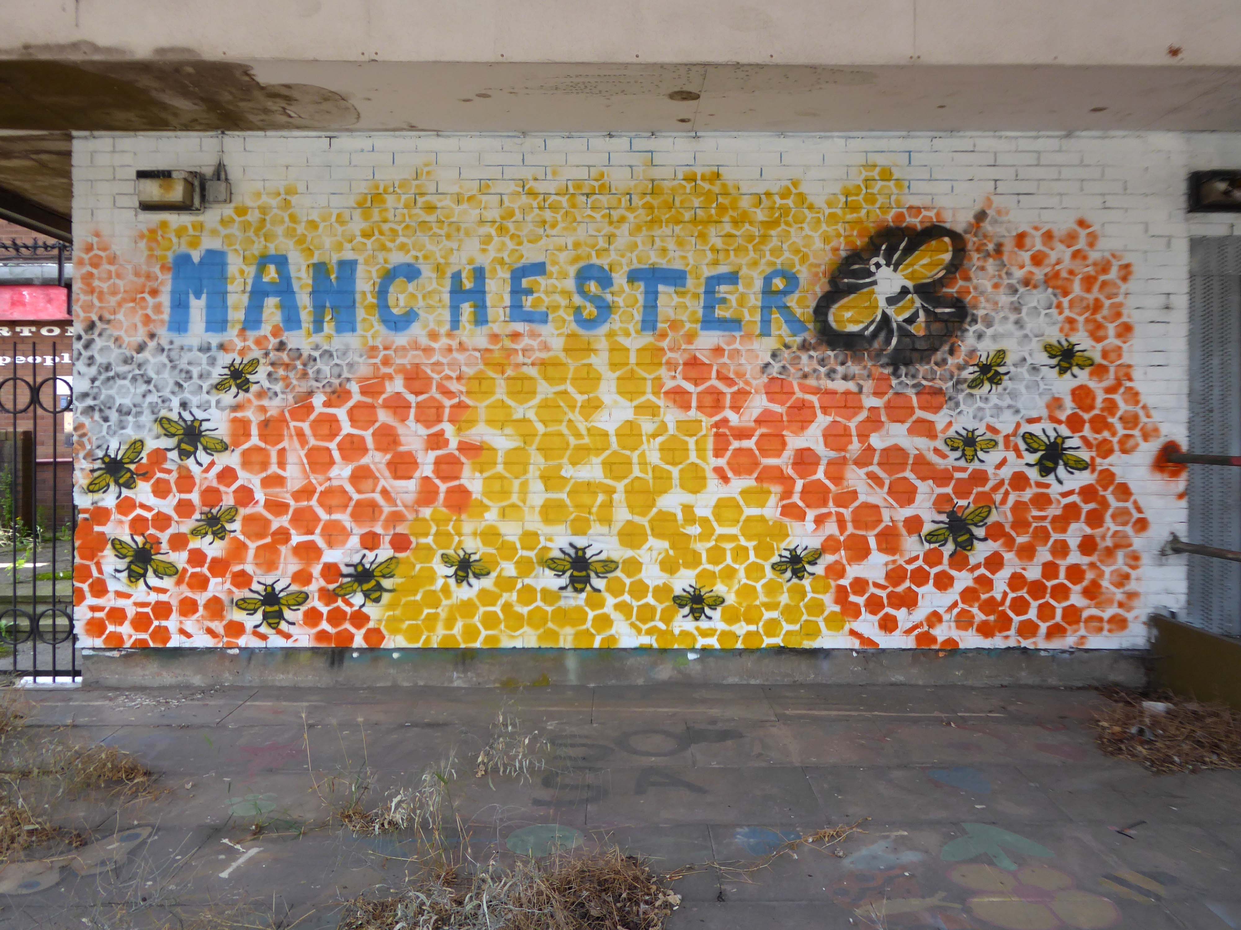
In 2014, having taken early retirement from teaching photography, I embarked on a series of walks along the arterial roads of Manchester.
This whole undertaking was prompted in part by Charlie Meecham’s 1980’s Oldham Road project.
The work questions whether a sense of local identity can be maintained in an area of constant redevelopment and community displacement.
This area was first developed in the 19th century for cotton manufacture, coal extraction and later electrical and heavy engineering. The road was lined with shops and there was a vibrant community.
When I first started working on the project, most of the early industry had ceased operating and the mills were either abandoned or being dismantled. However, some had been refurbished either for new industrial use or later, made into apartments. Some run down areas were cleared making way for new housing. Clearance also provided opportunity to build new schools, trading estates and create green space. Most of the older community centres such as theatres and cinemas along the road were also abandoned and later cleared.
The obvious place for the A664 to start is on the A665 Manchester & Salford Inner Relief Route, which at this point is actually two parallel one-way streets. However, many maps show the road continuing a short distance into the city centre to end at traffic lights by the Shudehill Interchange – this is presumably for historic reasons: the road originally continued along the High Street to its terminus on the A6 Market Street.
The road heads northeastwards through the suburbs, the street name Rochdale Road, already emphasising its destination. Initially dual, the road narrows just before crossing the bridge over the railway line east of Victoria station. It continues through Collyhurst and widens again just before crossing the A6010 Intermediate Ring Road, which here is made up of two parallel one-way streets, requiring two separate sets of traffic lights to cross.
Now non-primary – but still dual for a short distance more, the road runs in a more northerly direction through Blackley, where it becomes wooded for a short distance as it passes the Boggart Hole Clough park. Slightly further on the road has been straightened, after which it bears right to widen considerably and cross the A6104 at traffic lights just before M60 J20, which only has west-facing sliproads. The road narrows again on the far side of the motorway and leaves Manchester for Rochdale at the same point.
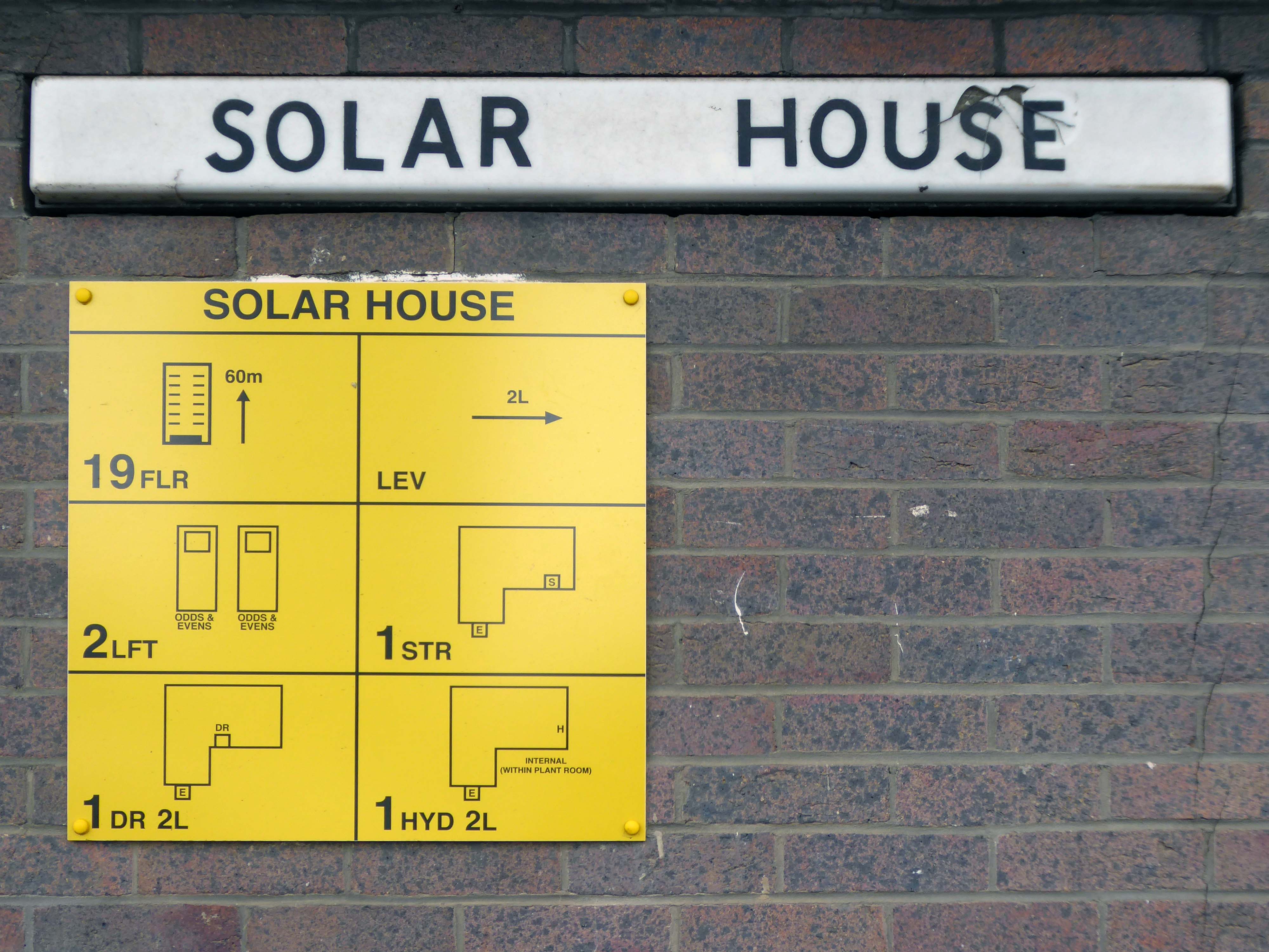
The earliest known multi-story car park in the UK was opened in May 1901 by City & Suburban Electric Carriage Company at 6 Denman Street, central London. The location had space for 100 vehicles over seven floors, totaling 19,000 square feet.
It is estimated that there are between 17,000 and 20,000 non- residential car parks in Great Britain, including those run by councils, commercial parking companies, shops, hospitals, businesses, railway stations and airports, providing between 3 and 4 million spaces.
The Manchester Airport multi-storey car park is one of the largest car parks ever built; in fact, it’s the second largest in Europe. This mega-park was designed to house a staggering 8,000 cars, split over a six-level facility that stretches out over 330 metres.
In the city centre NCP has over 13,000 car parking spaces across 43 sites
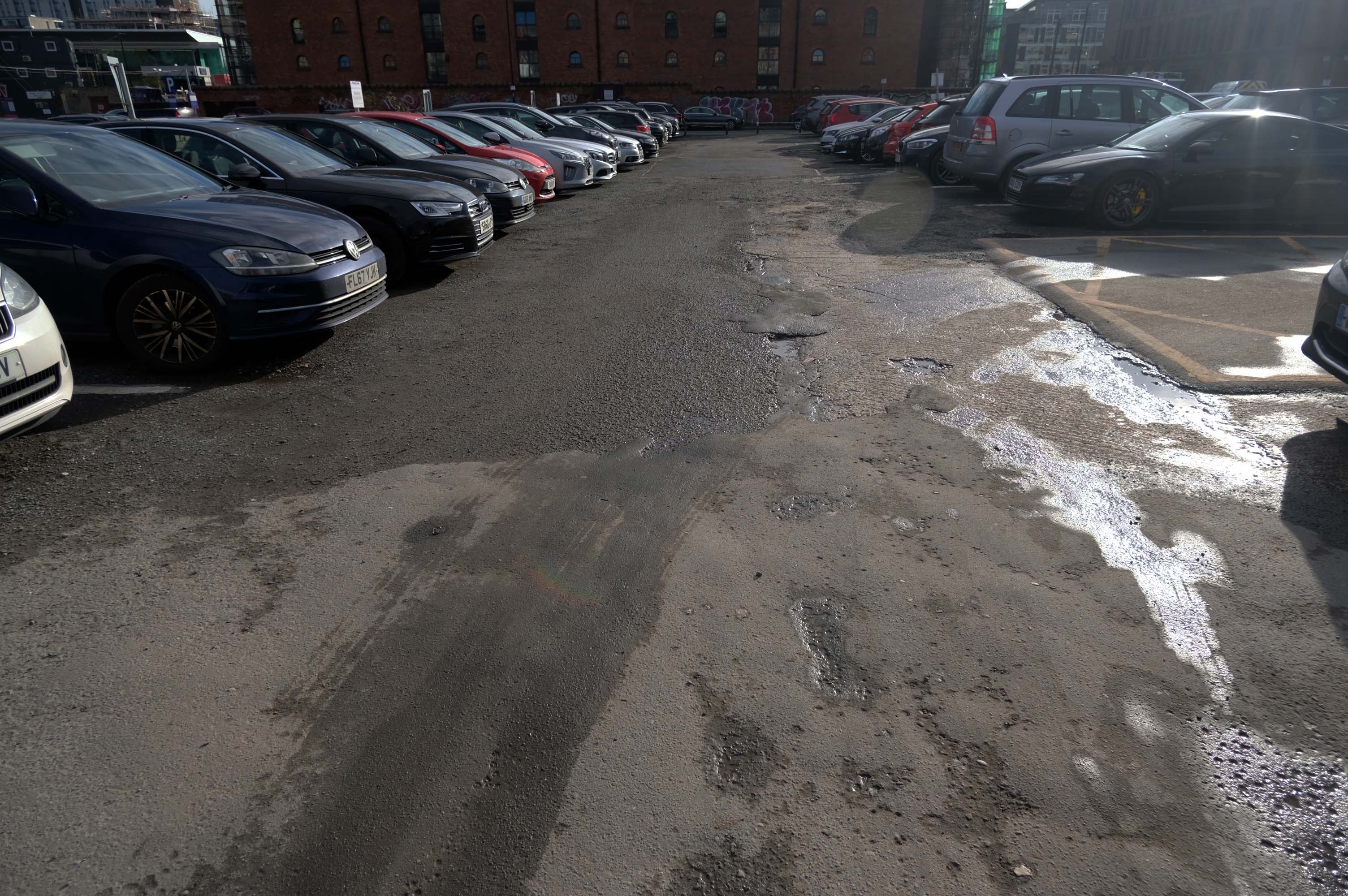
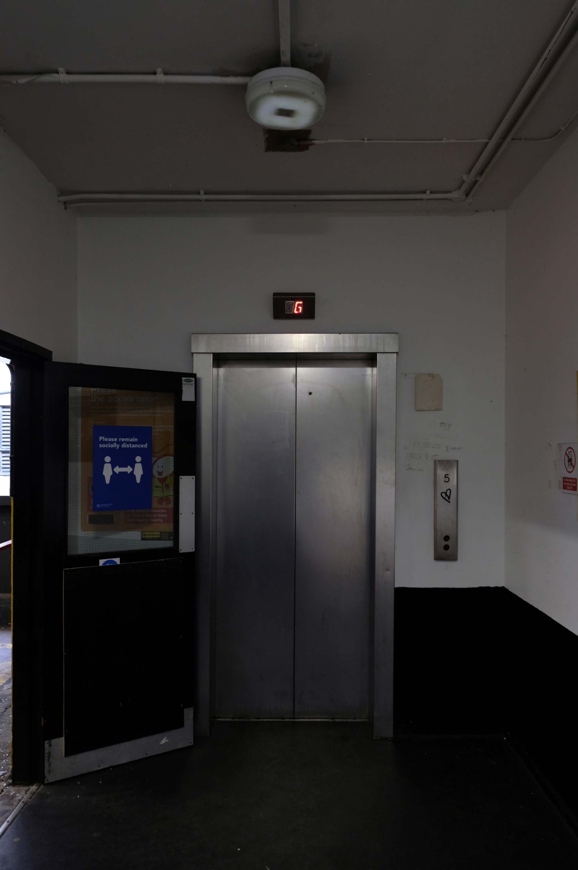
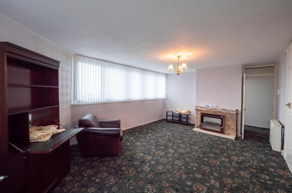
Good location but the access to the shopping centre is dirty. Lifts dirty – discarded soiled underwear, urine, spit and rubbish in the lifts. Car park also full of litter.
The most unnecessarily complicated ticketing system I have ever seen for a car park. Designed to fail so that the system can fine you. Beware. Better avoided for overseas visitors
Immerse yourself in the eclectic vibe of the Northern Quarter, the heartbeat of art, culture, and urban lifestyle. Whether you’re heading to its vintage shops, art studios, or chic cafes, finding the cheapest, best parking is paramount.
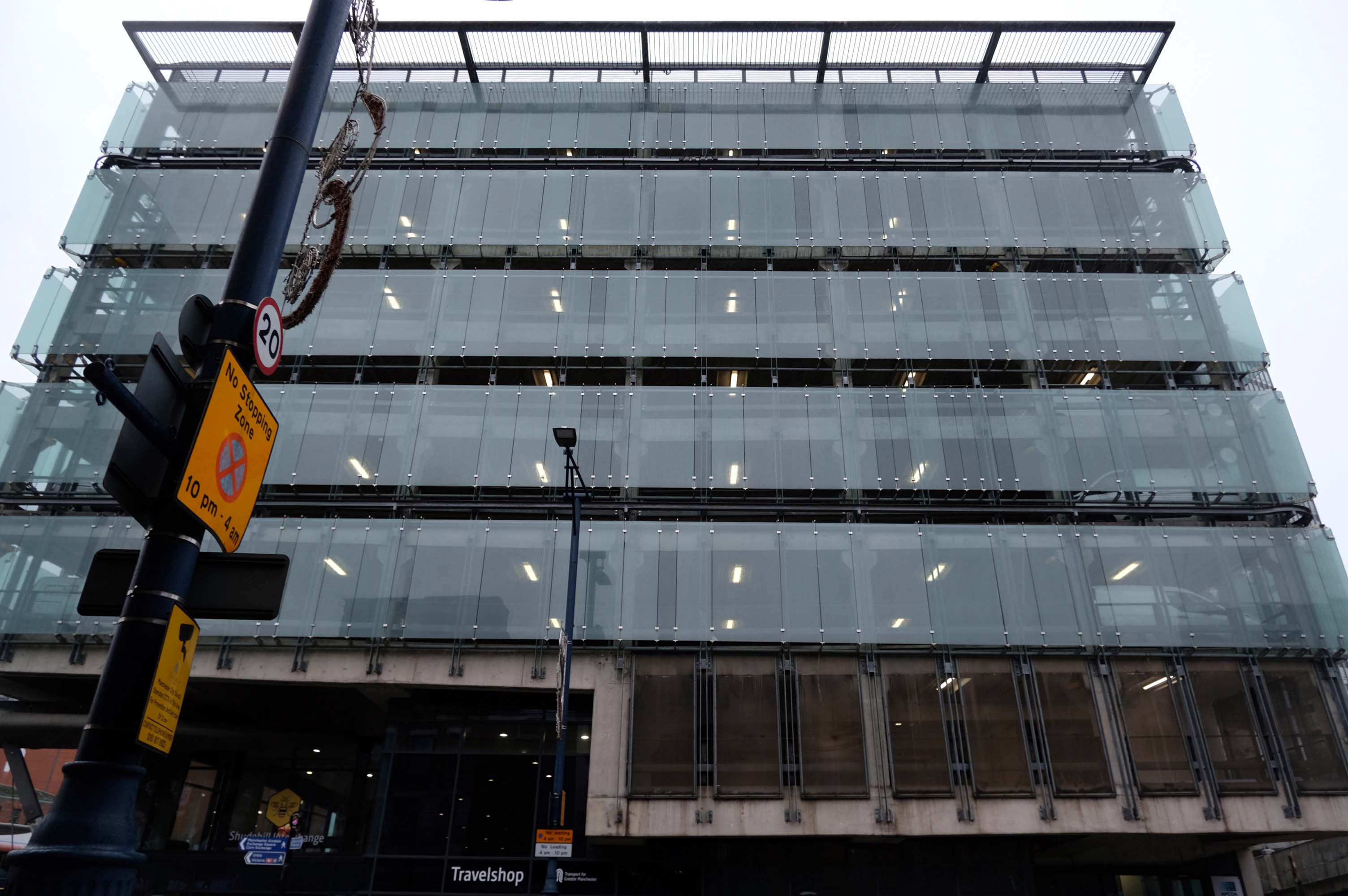
The Shudehill Interchange car park and bus station, designed by Jefferson Sheard Architects working with Ian Simpson, replaced the former Cannon Street bus station, under the Manchester Arndale; since the redevelopment of Manchester city centre, the latter has disappeared along with Cannon Street itself.
Great location but narrow roadway between floors. Pay in advance so you need to know how long you’re staying for.
£20.40 for 4 hours is expensive but you are minutes from Deansgate shops.
Only given one star because there wasn’t an option for zero. Not secure, car broken into theft of personal effects, pedestrian gate was un locked, no CCTV that I could see anywhere. Cost me over £25 to park for 6 hrs and lost over £200 of personal effects, complained to council, no response. Wouldn’t park here ever again.
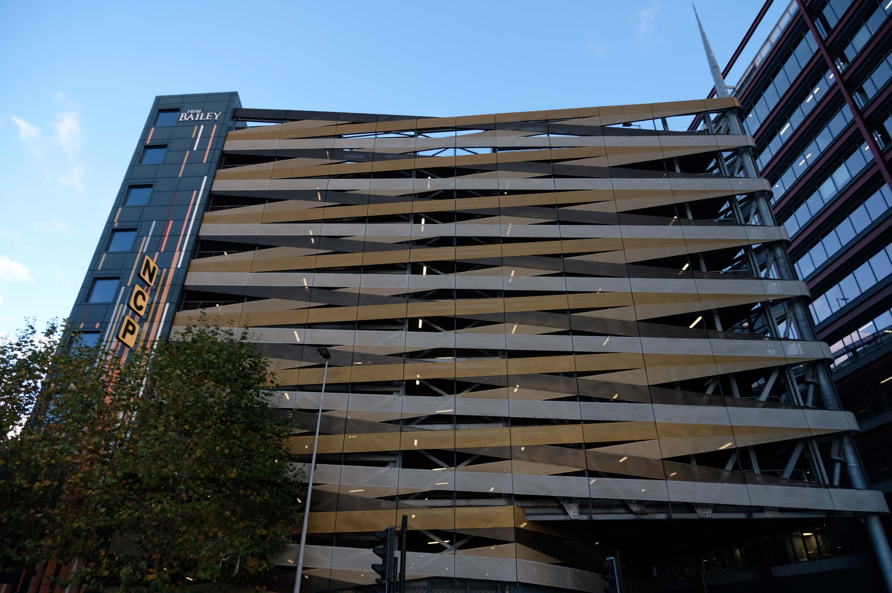
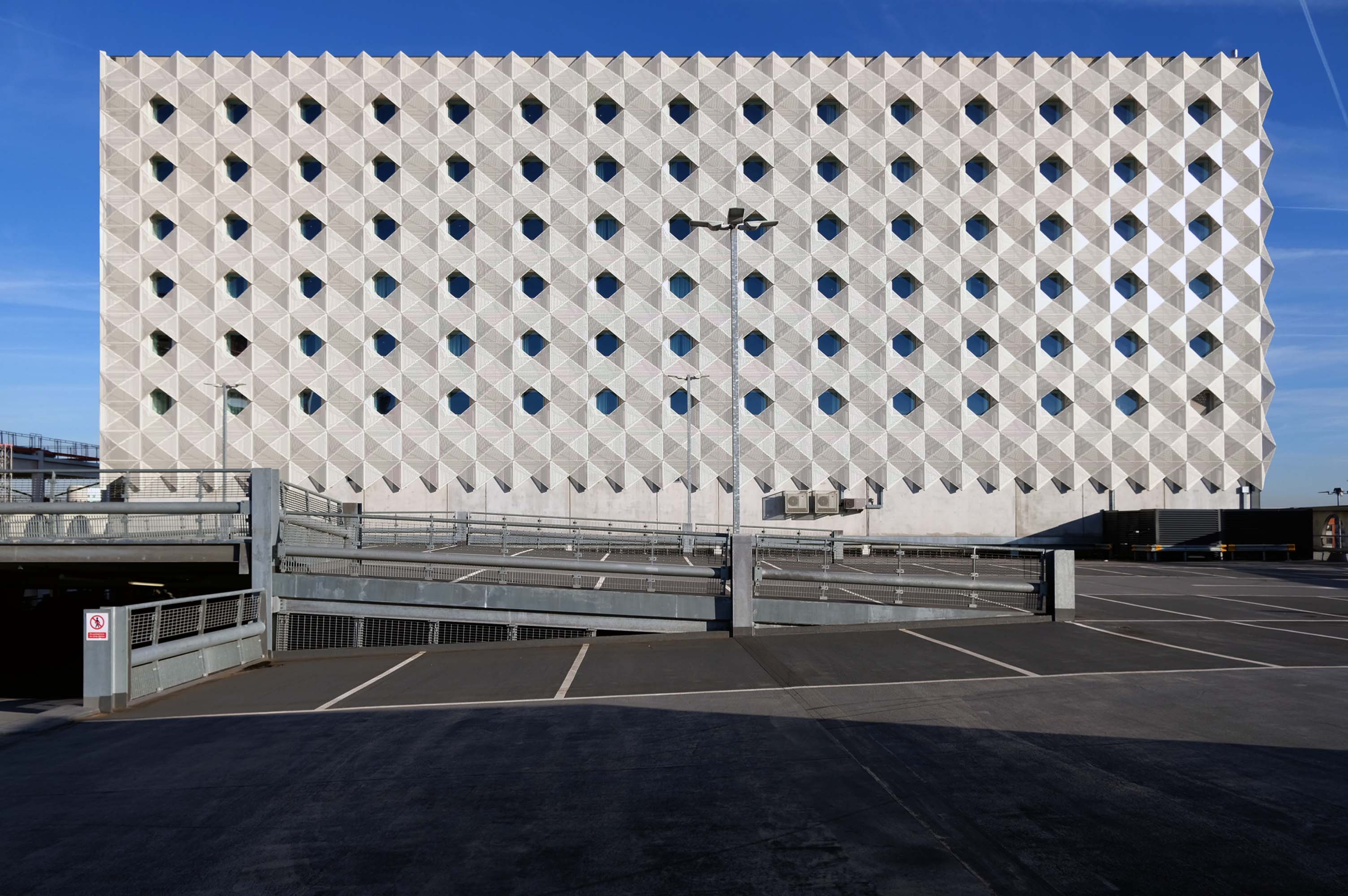
Maple gave architects Aedas RHWL the freedom to express themselves on a prominent multi-storey car park development in Salford. Their imaginative design created a great concept – the nine storey New Bailey car park appearing to be wrapped in ribbons that echo the lattice patterns and intersections in the ironwork of nearby Victorian bridges.
A good, clean and modern carpark. Easy to navigate and sensibly sized spaces. The only downsides are that it’s not cheap and getting into it from Trinity way is hard, as the traffic blocks the junction meaning it takes may cycles of the traffic lights to get across the junction.
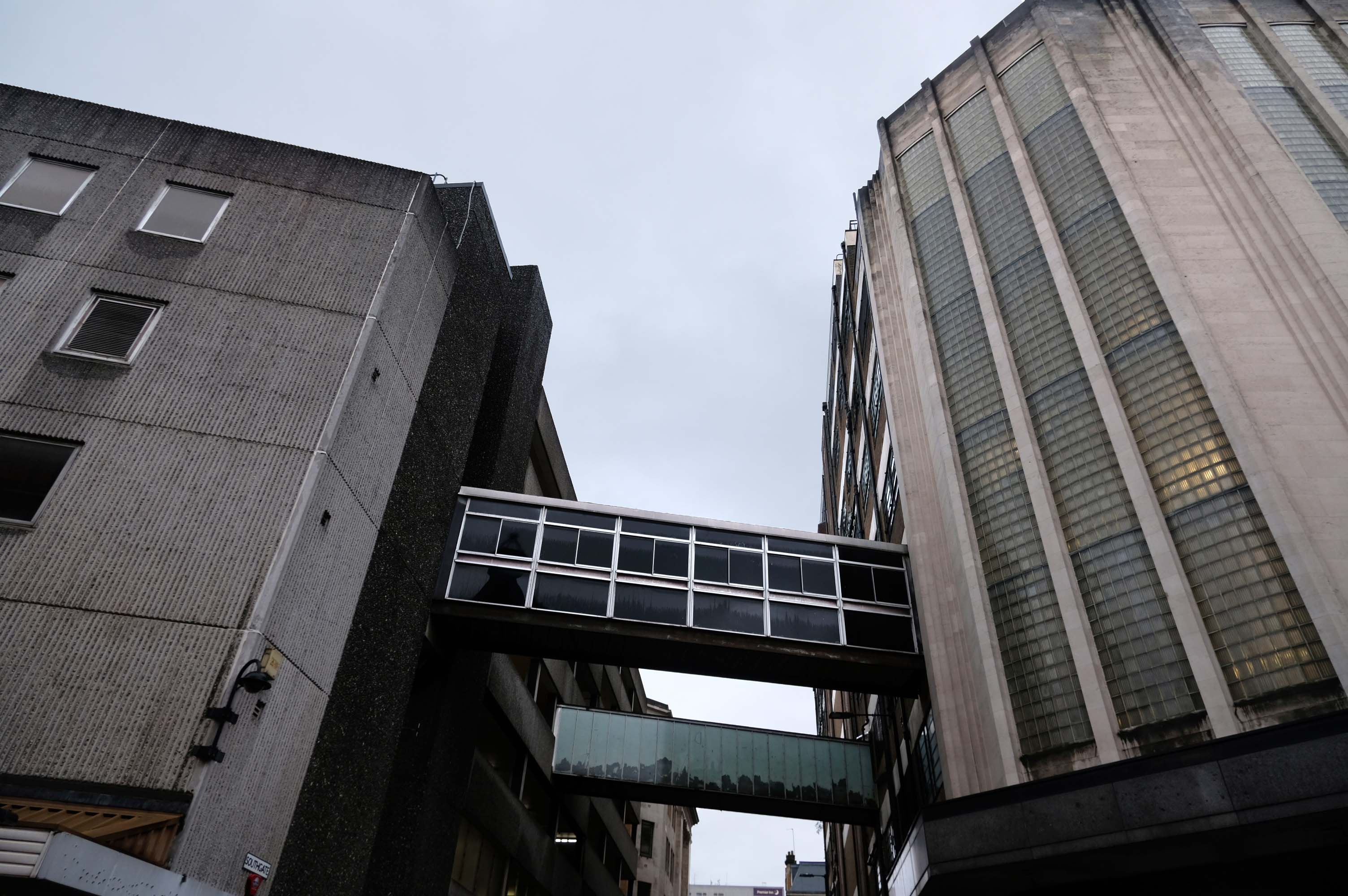
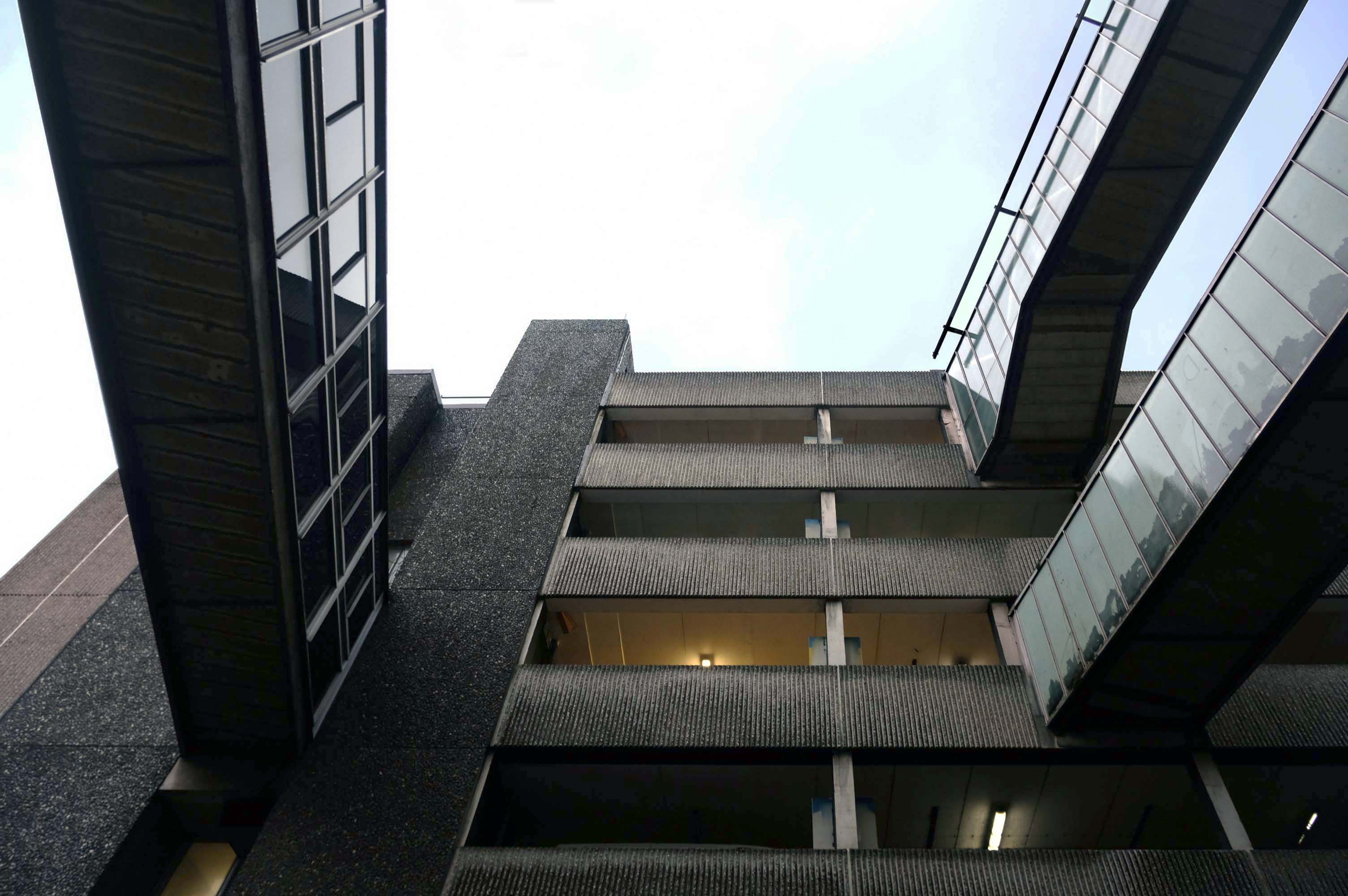
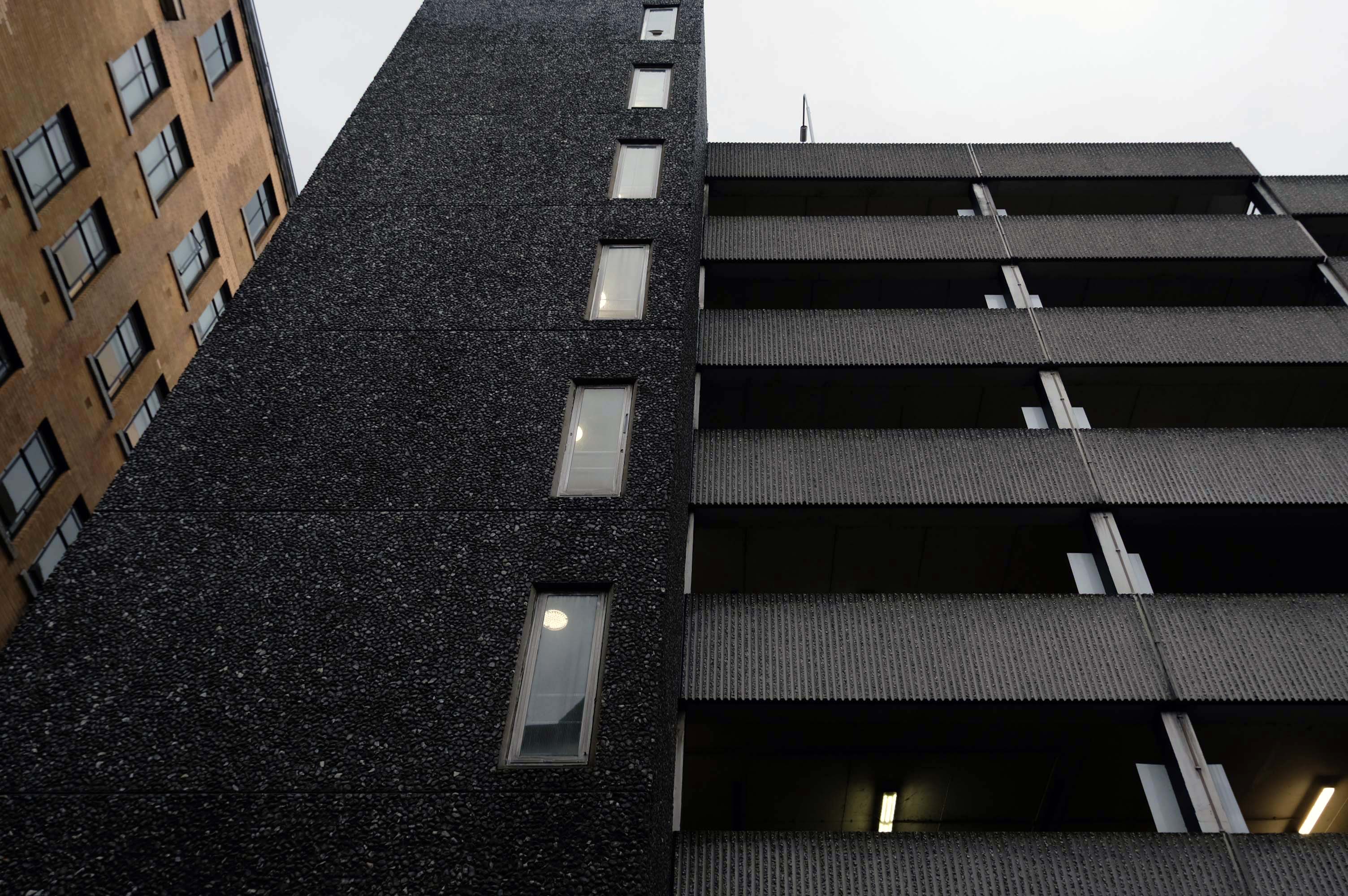
Part of the Piccadilly Plaza development of 1965 by Covell Matthews and Partners
Nice central location with a large entrance so you dont have to risk scratching your car as you pull in. Found there was a lack of signage to direct to nearest pay machine or walkway exit. Also had trouble when it was time to pay. I typed in my registration and yet it wasnt recognised and so I had to estimate my time of arrival. I ended up paying £10.50 for around 3 hours, which probably is the going rate for city centre parking.
Sadly after seeing several reviews that cars were broken in to, I would certainly reconsider parking here in future. I got lucky here, I had suitcases locked in the car, with several hundreds of pounds worth of travel money.
Worst place to park on earth, we had our car broken int0, everything stolen, it’s common knowledge that the drunks in the town hang around the car park to steal and then use your cards to buy their booze
Secure and easy to find while driving, struggled to get back in through side door, had to walk up the ramp.
Expensive.
Stairwell stinks like piss and I’ve seen homeless people sitting in there. Doesnt feel safe.
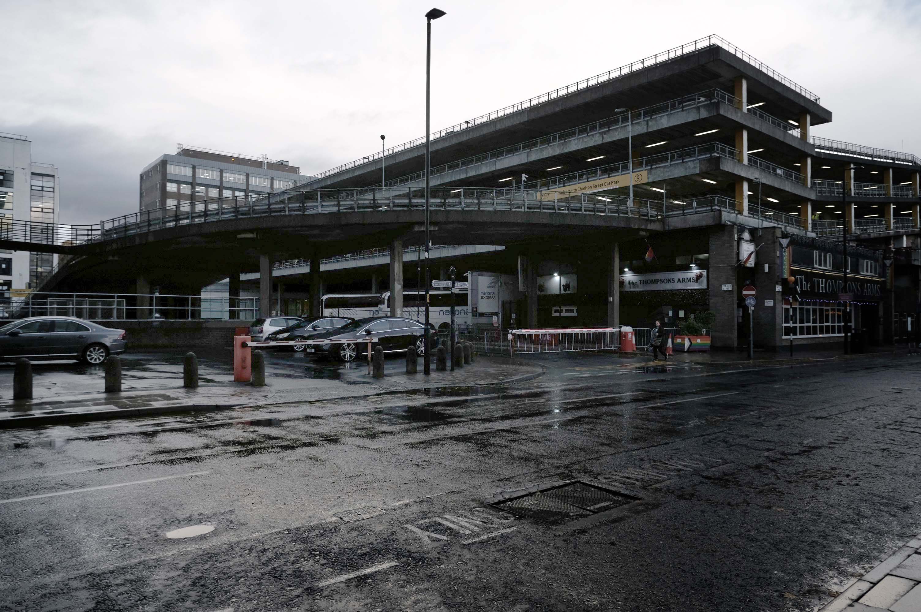
Great car park, security is great, right in the city centre above the bus station that goes Scotland to Cornwall, Wales to Norwich and many more, Manchester city centre literally with Piccadilly Gardens around the corner.
Great car park we use all the time in Manchester, easy to book online, no messing with cash machines. Takes your car reg by camera for easy access in and out. Plenty of spaces mainly upper floors, just tight around corners.
Fielden Clegg Bradley were concept architects while Leach Rhodes Walker were delivery architects.
A series of four × two-storey-deep lattice girders and a single one-storey girder, all measuring up to 27m-long, span over the zone where the underground pipes are located. In these parts, the car park has no first-floor level as the local water board needed a 5m ground-to-ceiling clearance in case they had to undertake any maintenance works. Consequently, the first floor is only a partial level and is set within the depth of the larger lattice girders, as is the second floor, while the third level is supported on top of these members.
Supporting a hotel would be challenging enough, however the design has also had to incorporate large bridging elements as there are two subterranean 600mm-diameter water pipes crossing the site. “It’s a very unusual design and one that was originally designed as a concrete-framed structure,” says James Killelea Senior Structural Engineer Charlie Twist. “However, the bridging parts would have proven to be too difficult to build and consequently a steel-framed solution was chosen for the car park, which in turn supports a precast concrete hotel.”
This car park is one of the cleanest and most well maintained in Manchester.
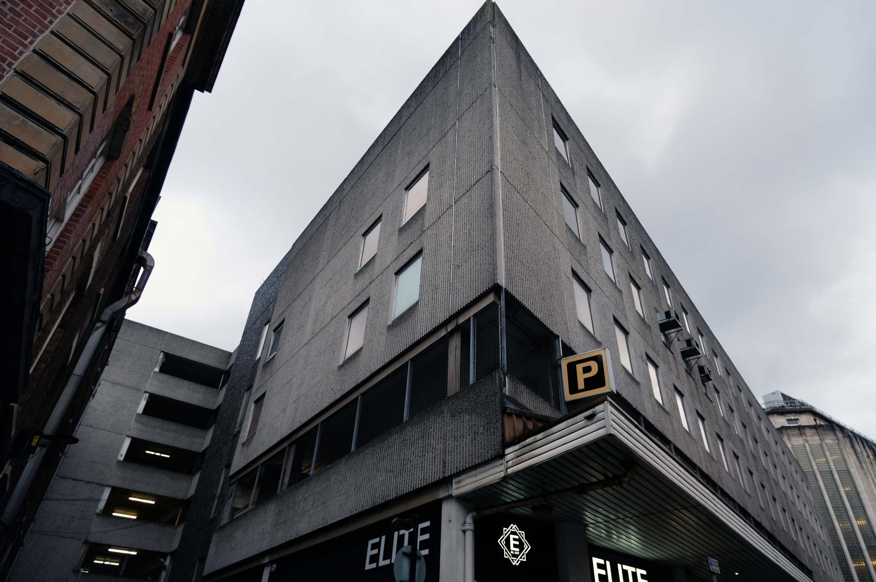
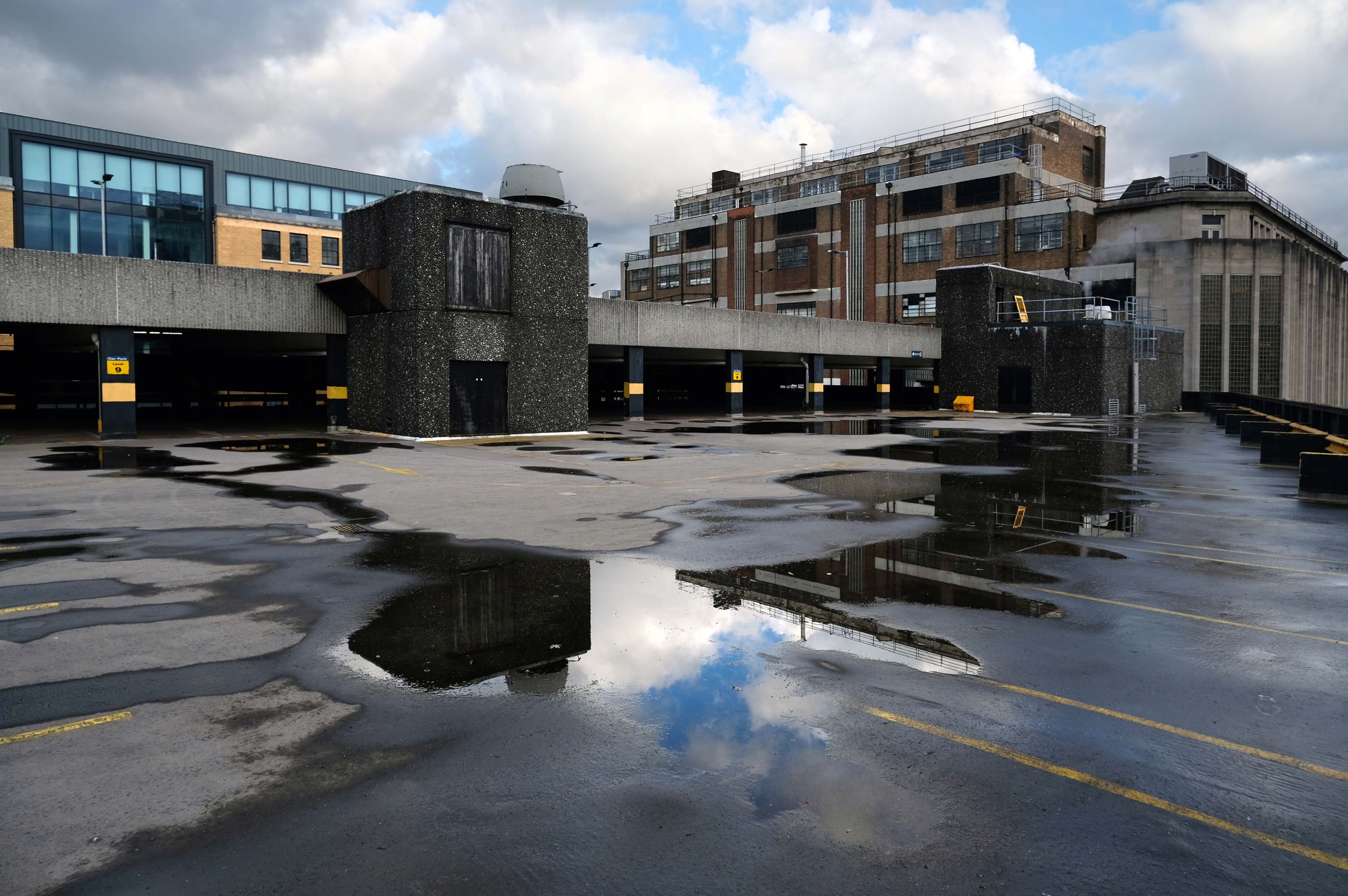
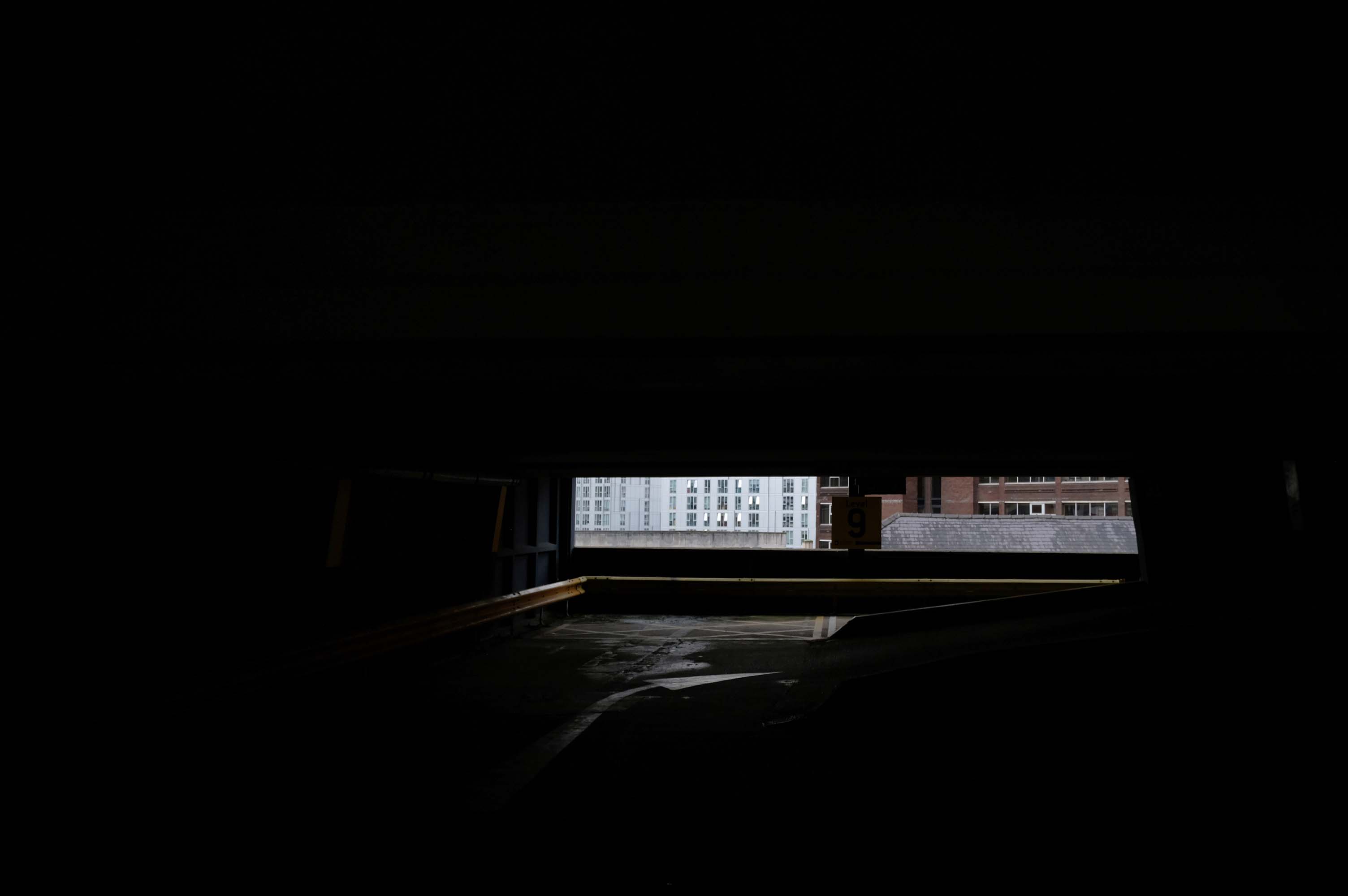
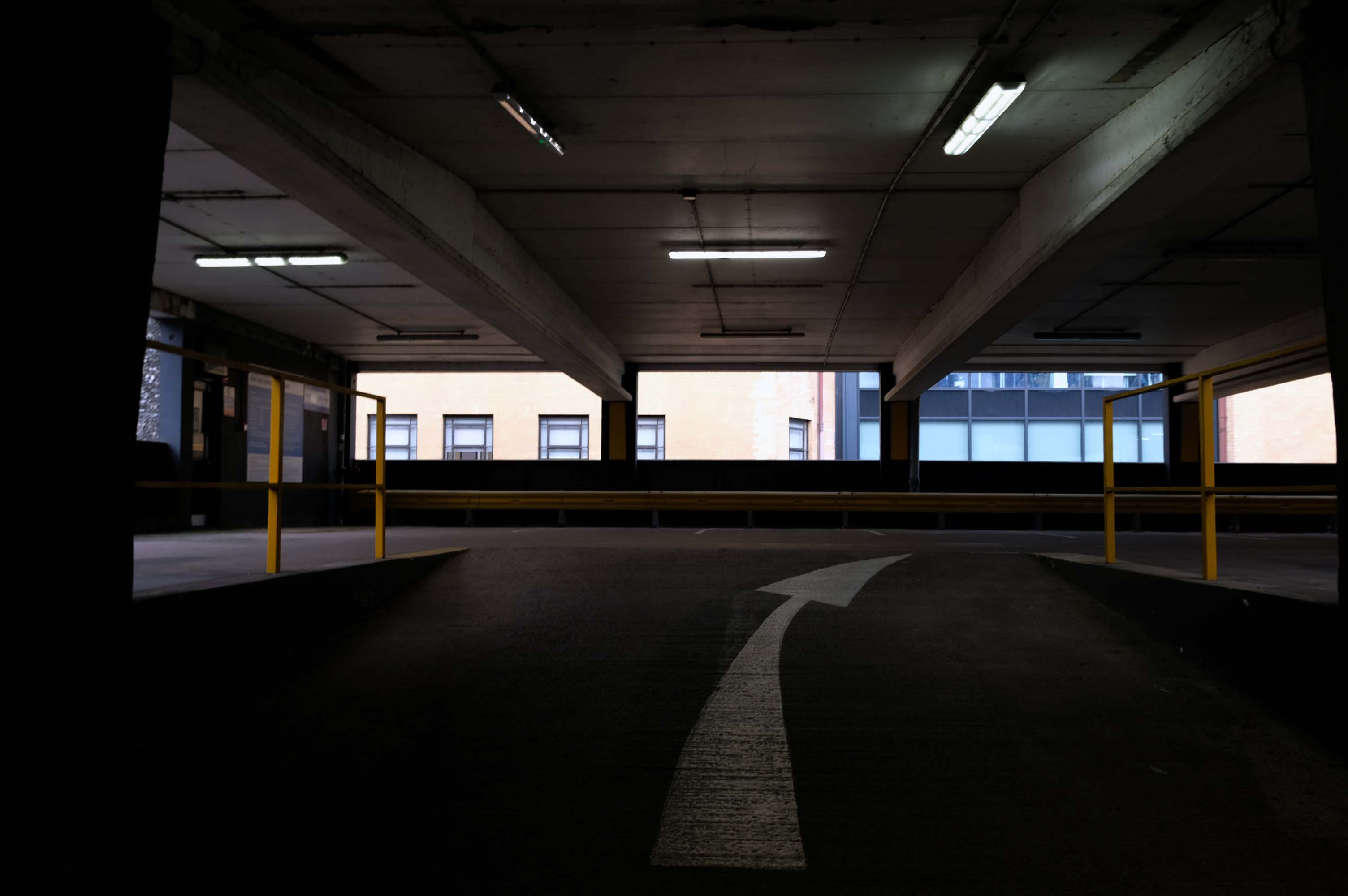
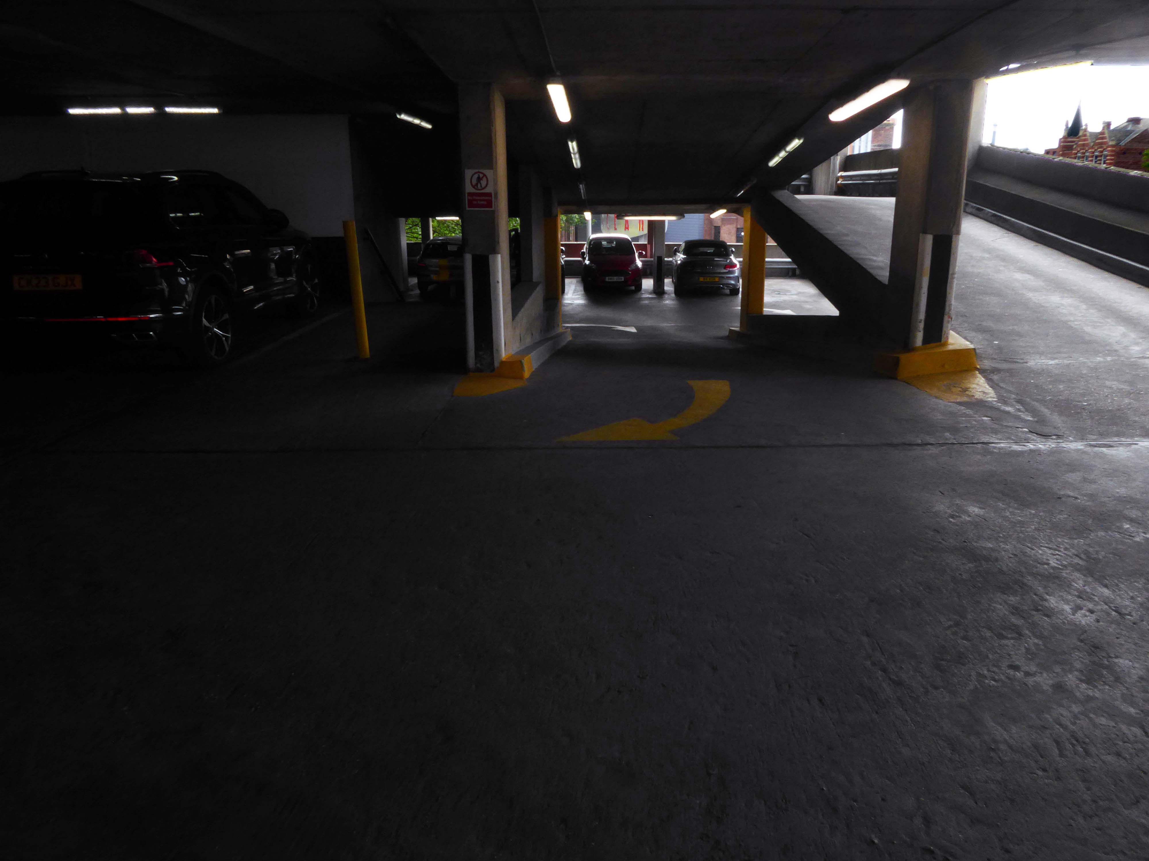
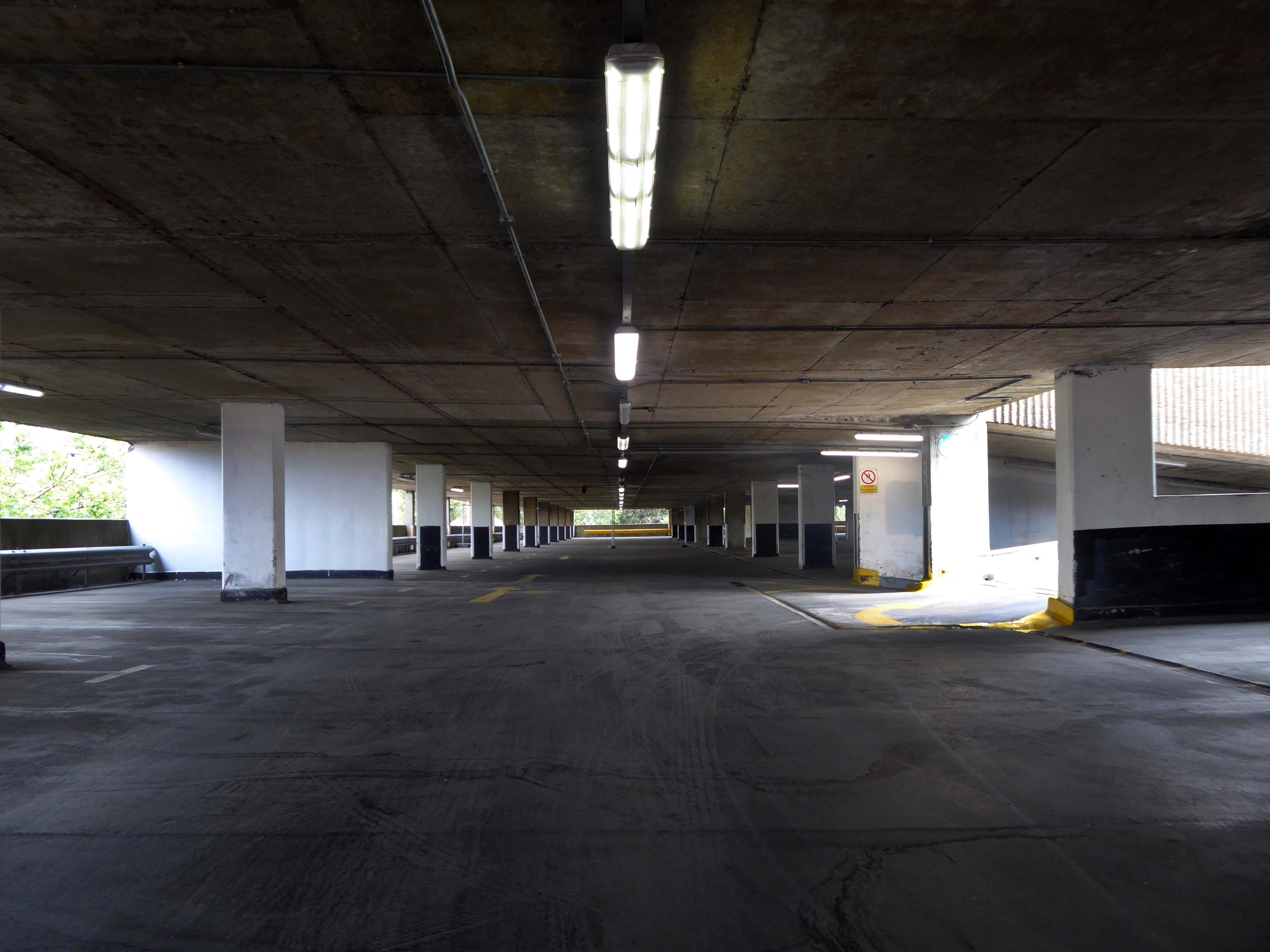
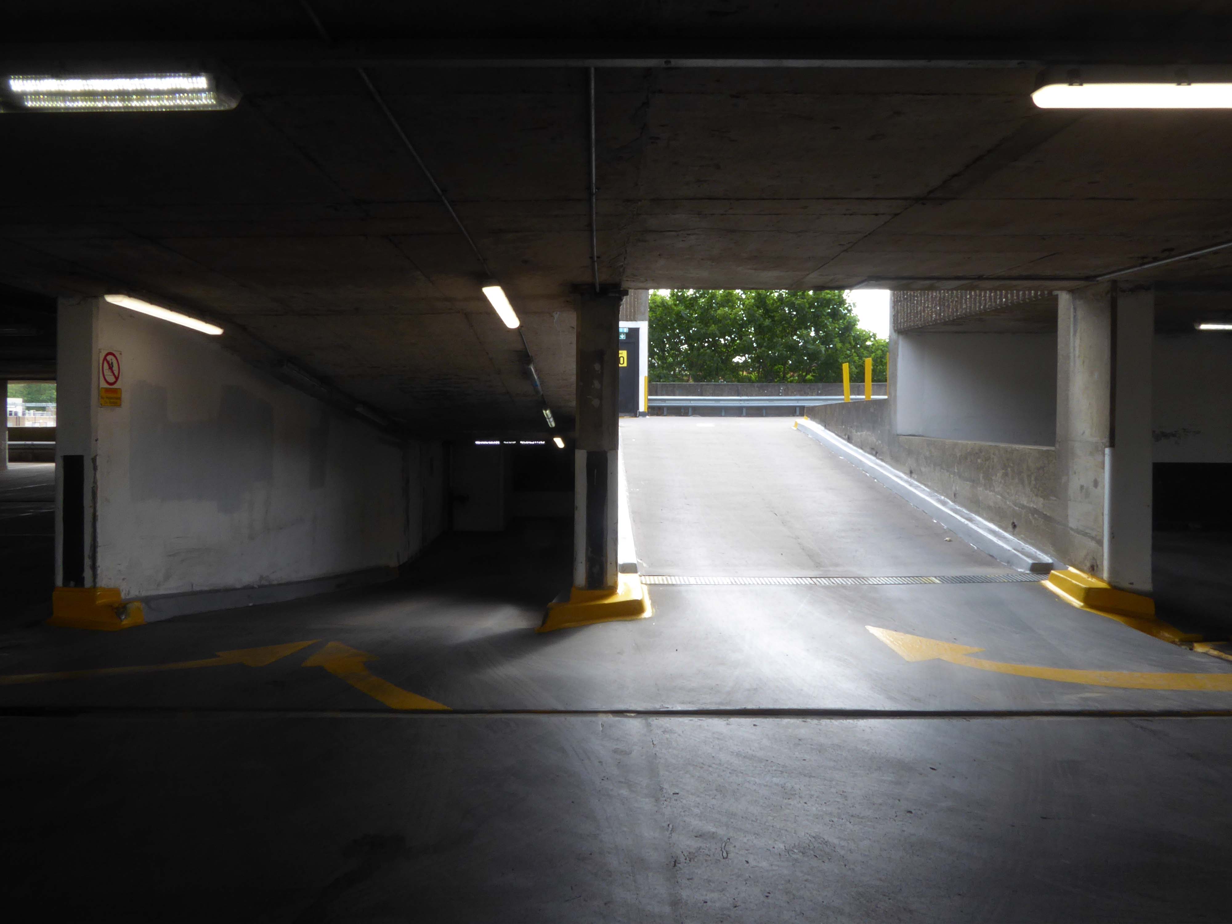
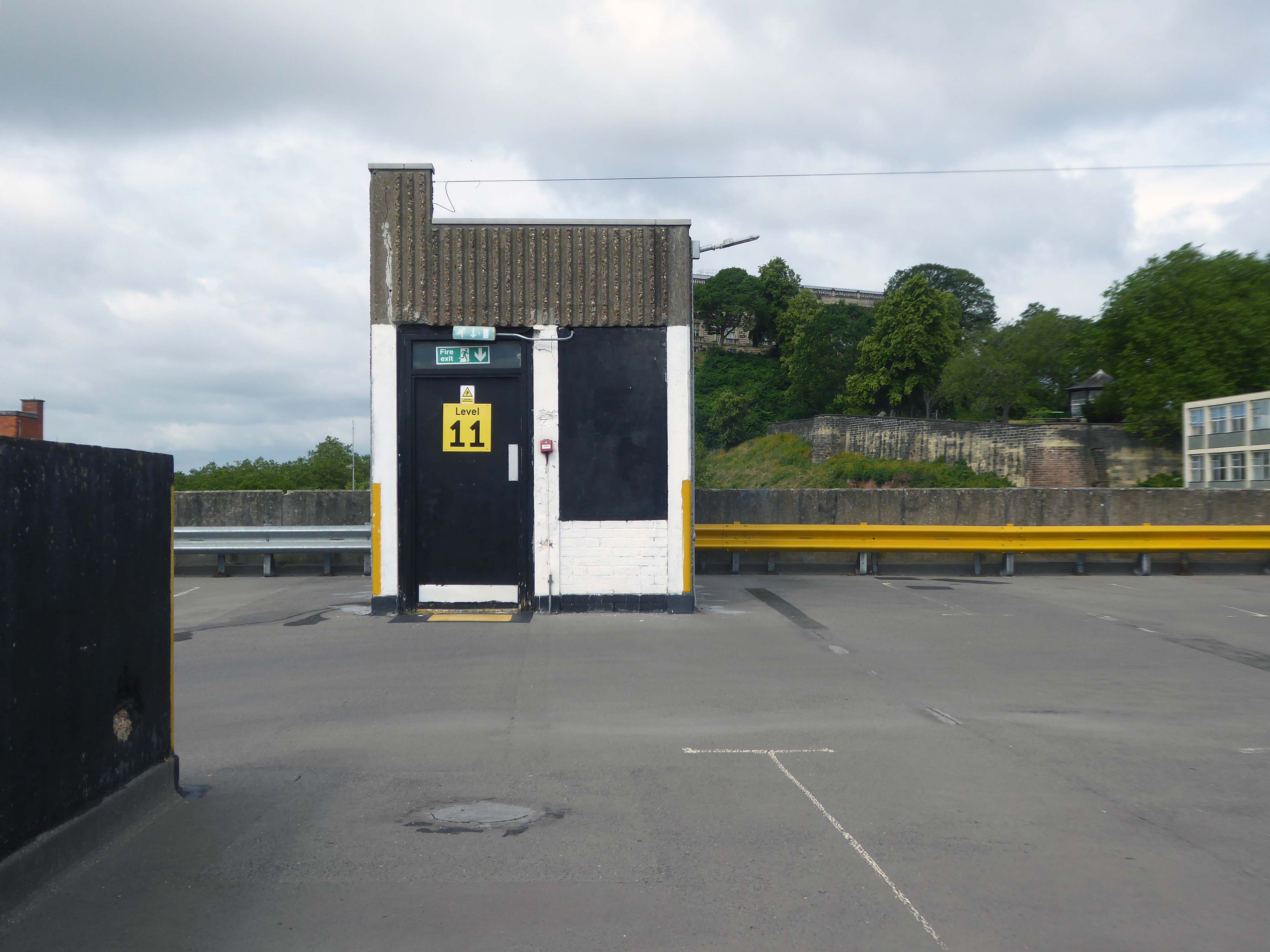
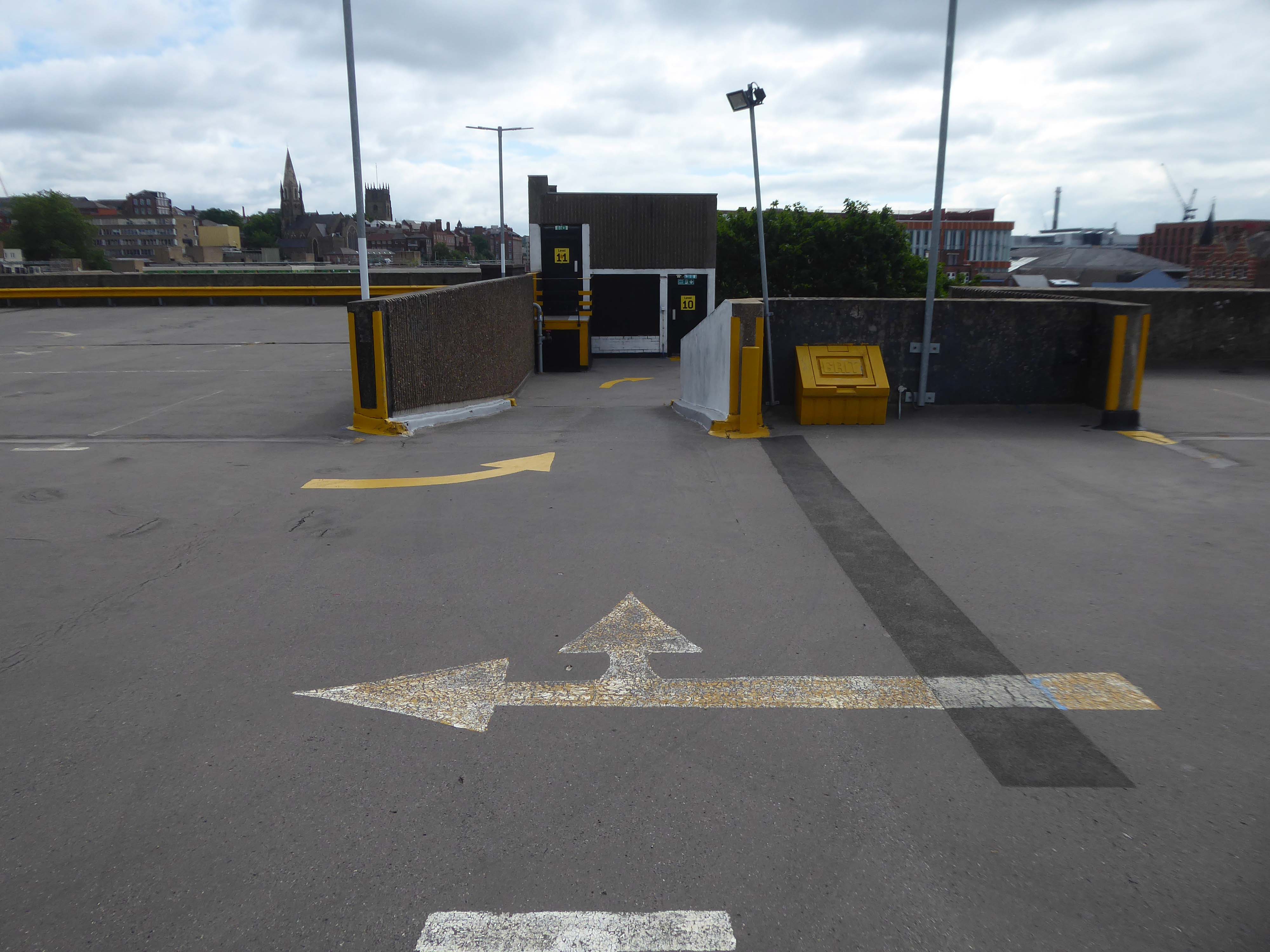
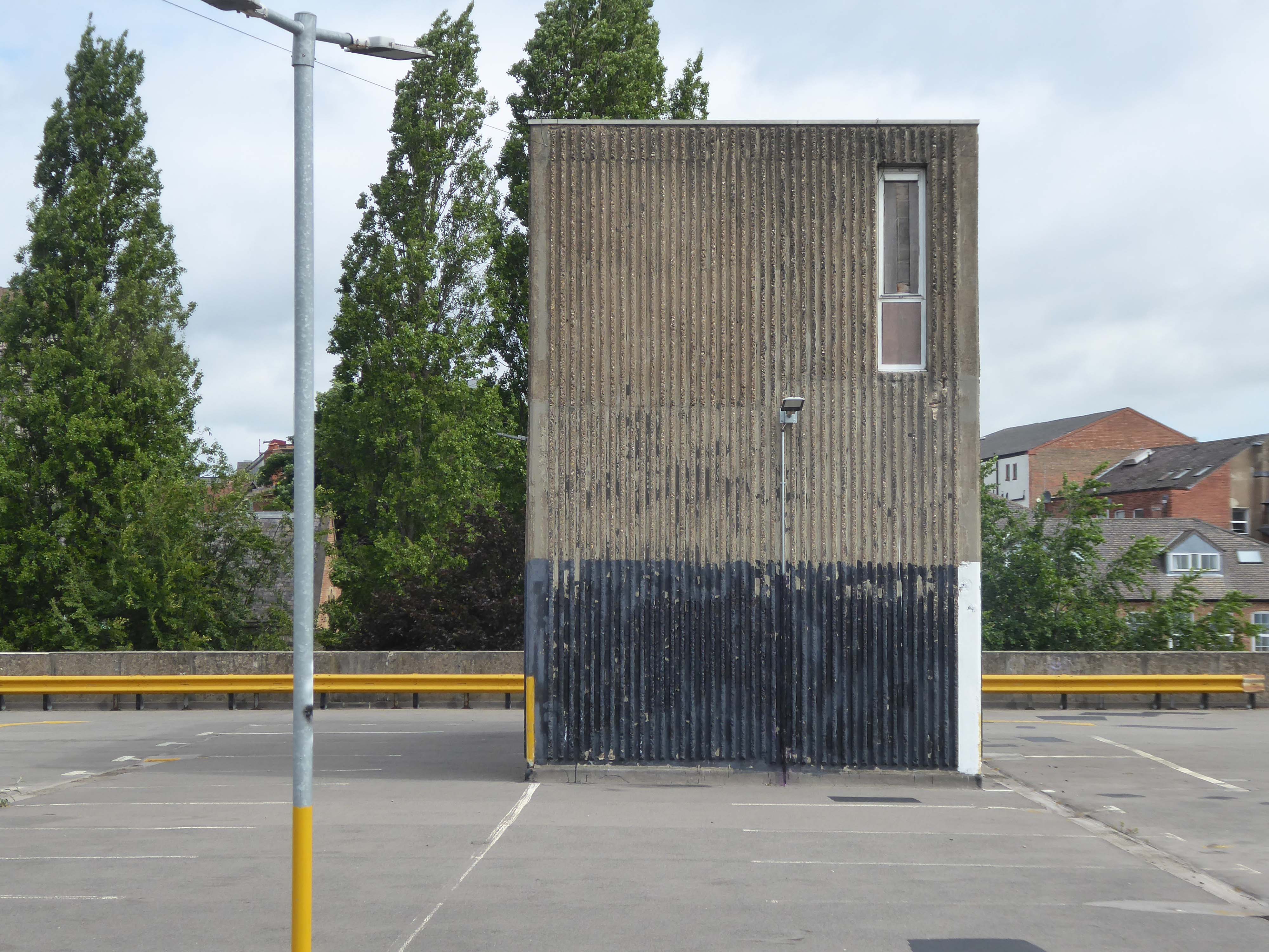
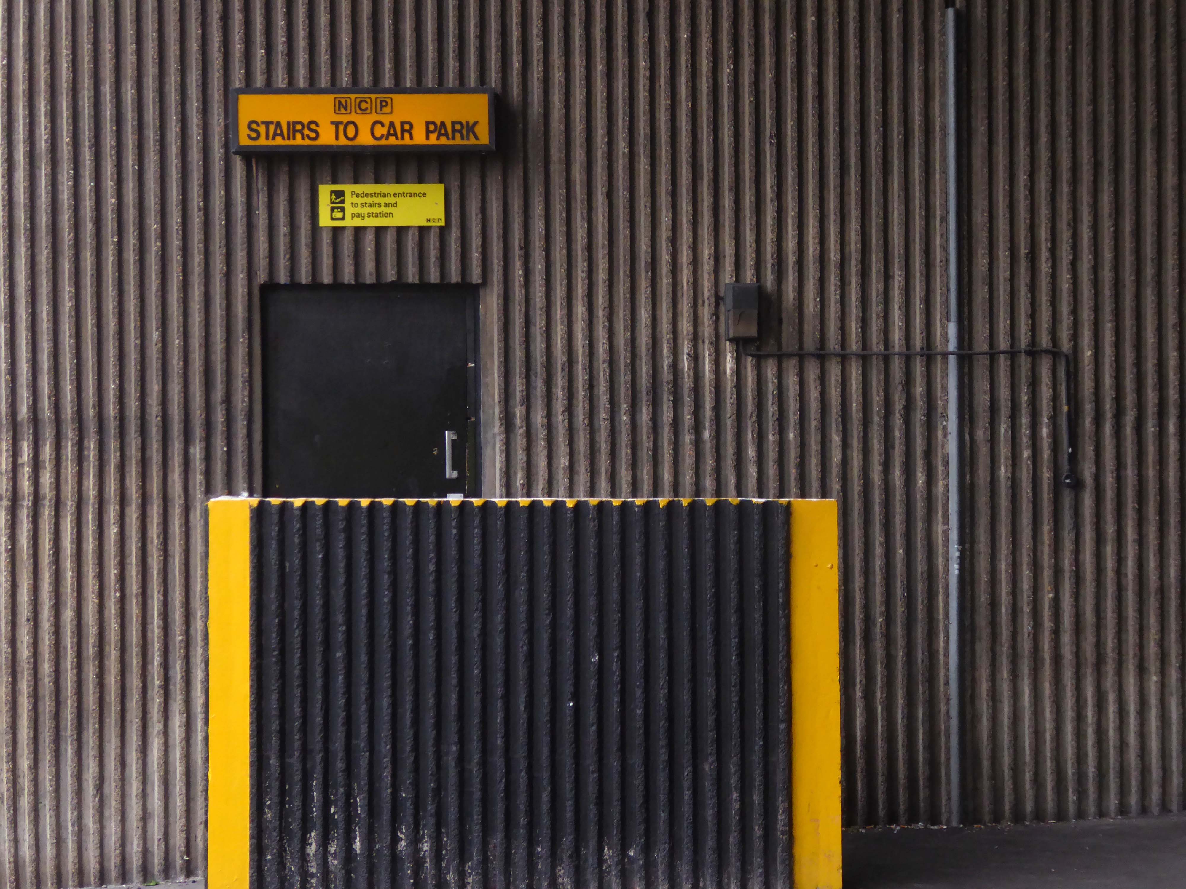
JHA Pulmannwere commissioned via network rail to deliver an extension to, and re-cladding of an existing 1970’s concrete frame carpark outside of Manchester Piccadilly station.
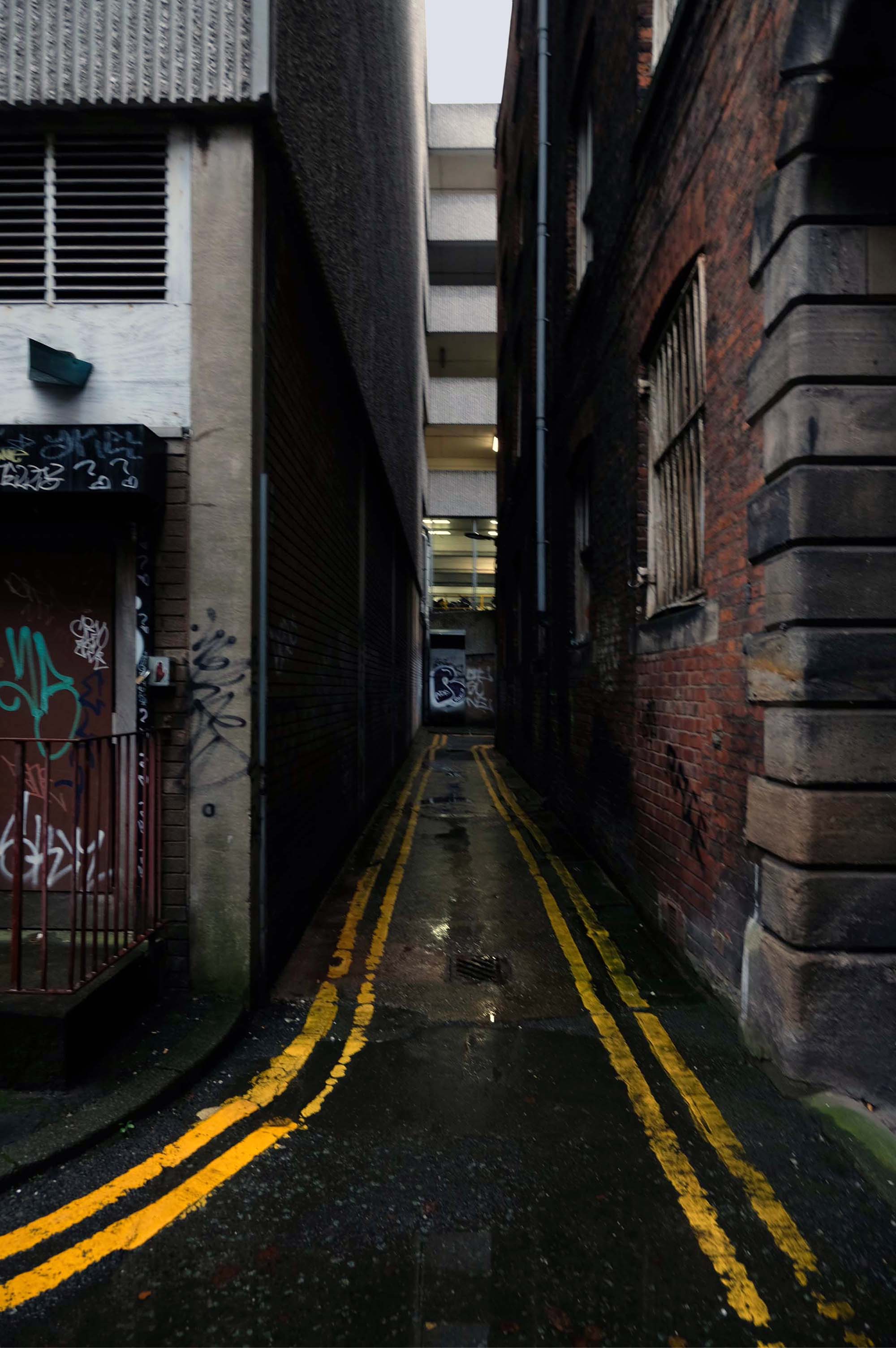
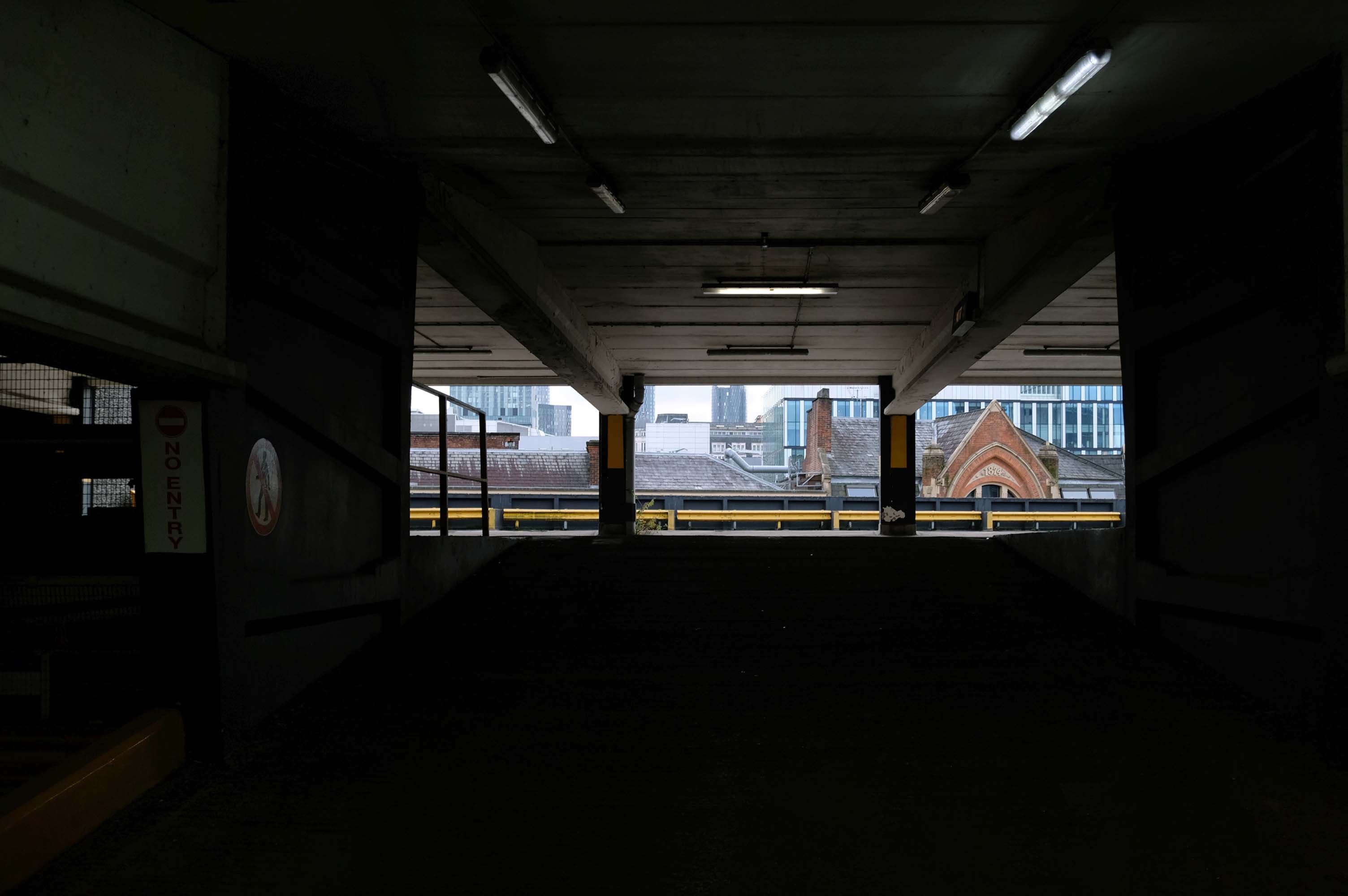
The carpark is fine but as a lone female arriving off the train in the early hours of the morning, I felt quite vulnerable getting back there. It’s in a very quiet dark place accessed by going through a tunnel going under a bridge.
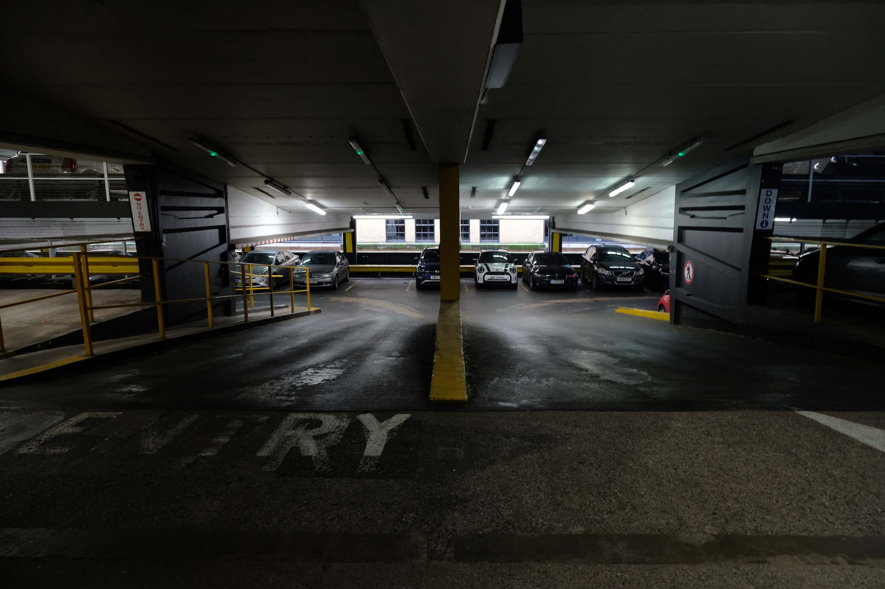
Easy to find, plenty of spaces and only a short walk to Piccadilly station – great!
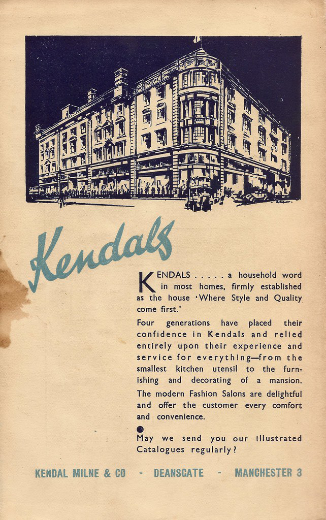
Kendals is of course long gone – absorbed by House of Fraser.
The store had previously been known during its operation as Kendal Milne, Kendal Milne & Co, Kendal Milne & Faulkner, Harrods or Watts.
The store was designed by Harrods’ in-house architect Louis David Blanc, with input from a local architect JohnS Beaumont, in 1938 and completed in 1939 – it is a Grade II listed building.
Great location but narrow roadway between floors. Pay in advance so you need to know how long you’re staying for.
£20.40 for four hours is expensive but you are minutes from Deansgate shops.
Only given one star because there wasn’t an option for zero.
Not secure, car broken into theft of personal effects, pedestrian gate was un locked, no CCTV that I could see anywhere. Cost me over £25 to park for six hrs and lost over £200 of personal effects, complained to council, no response. Wouldn’t park here ever again.
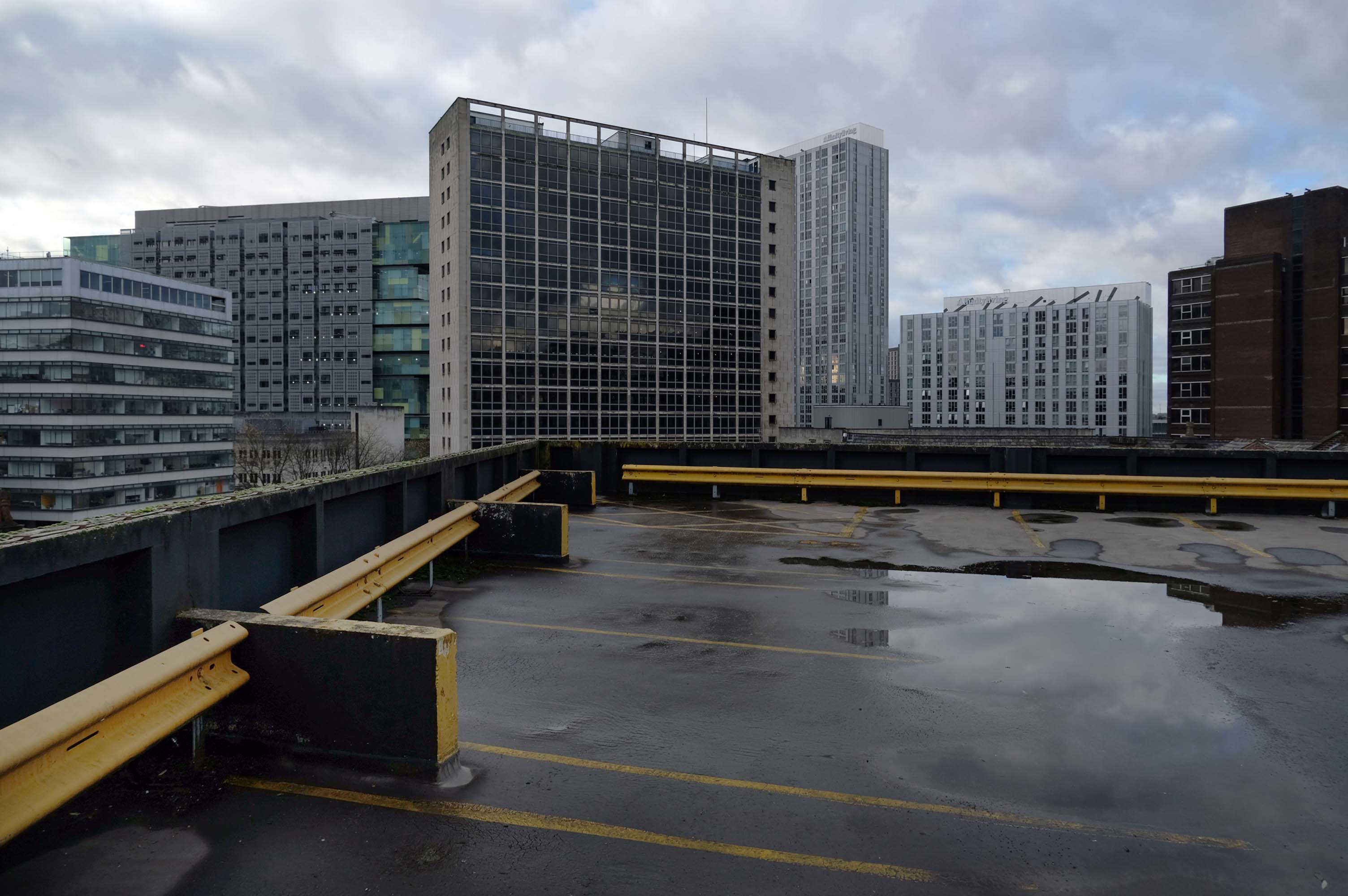
Get there whilst ye may.
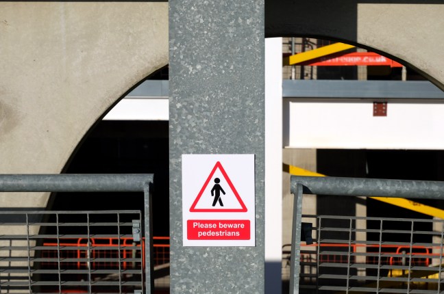
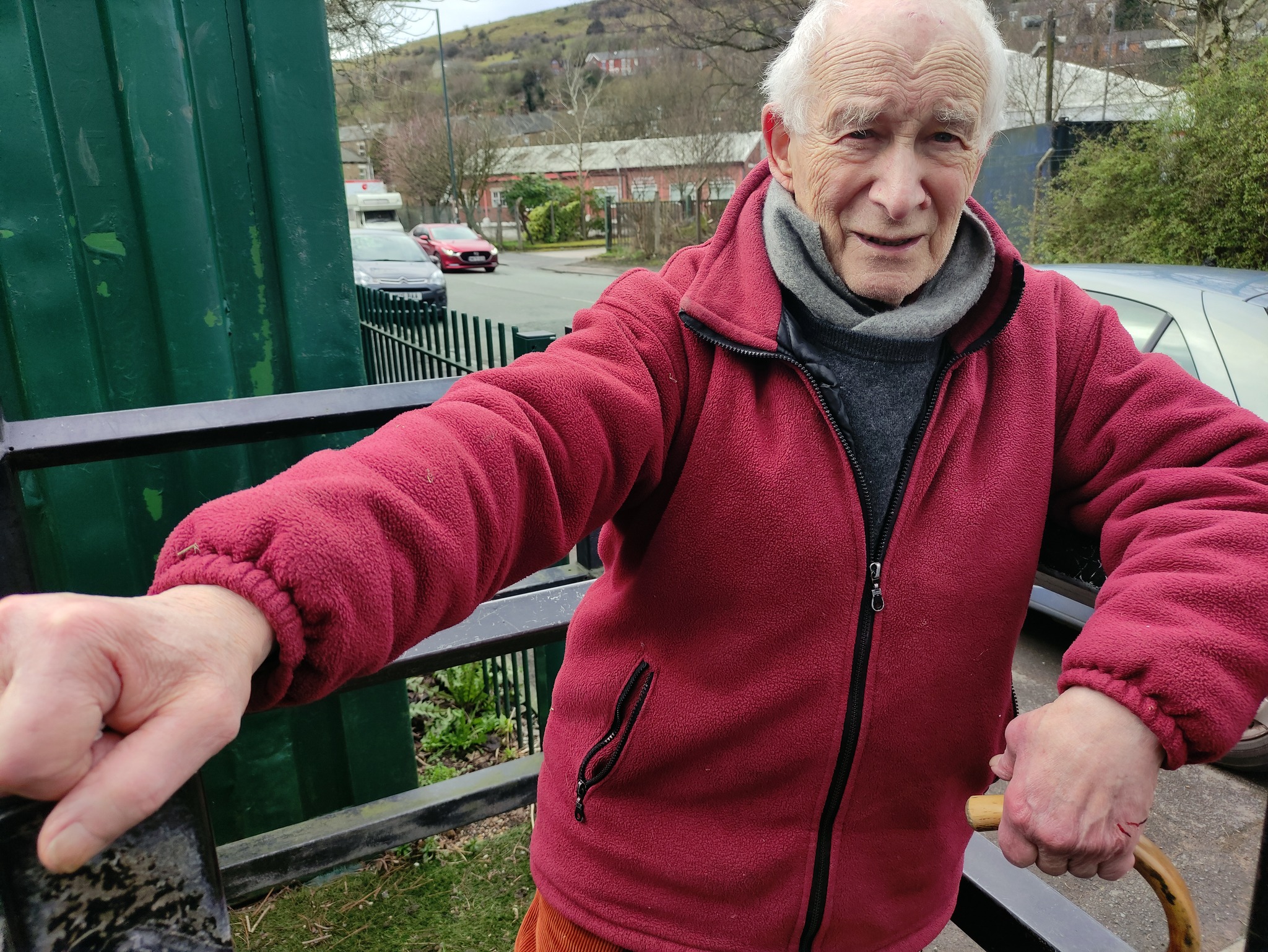
The pedestrian in a car park presses on!
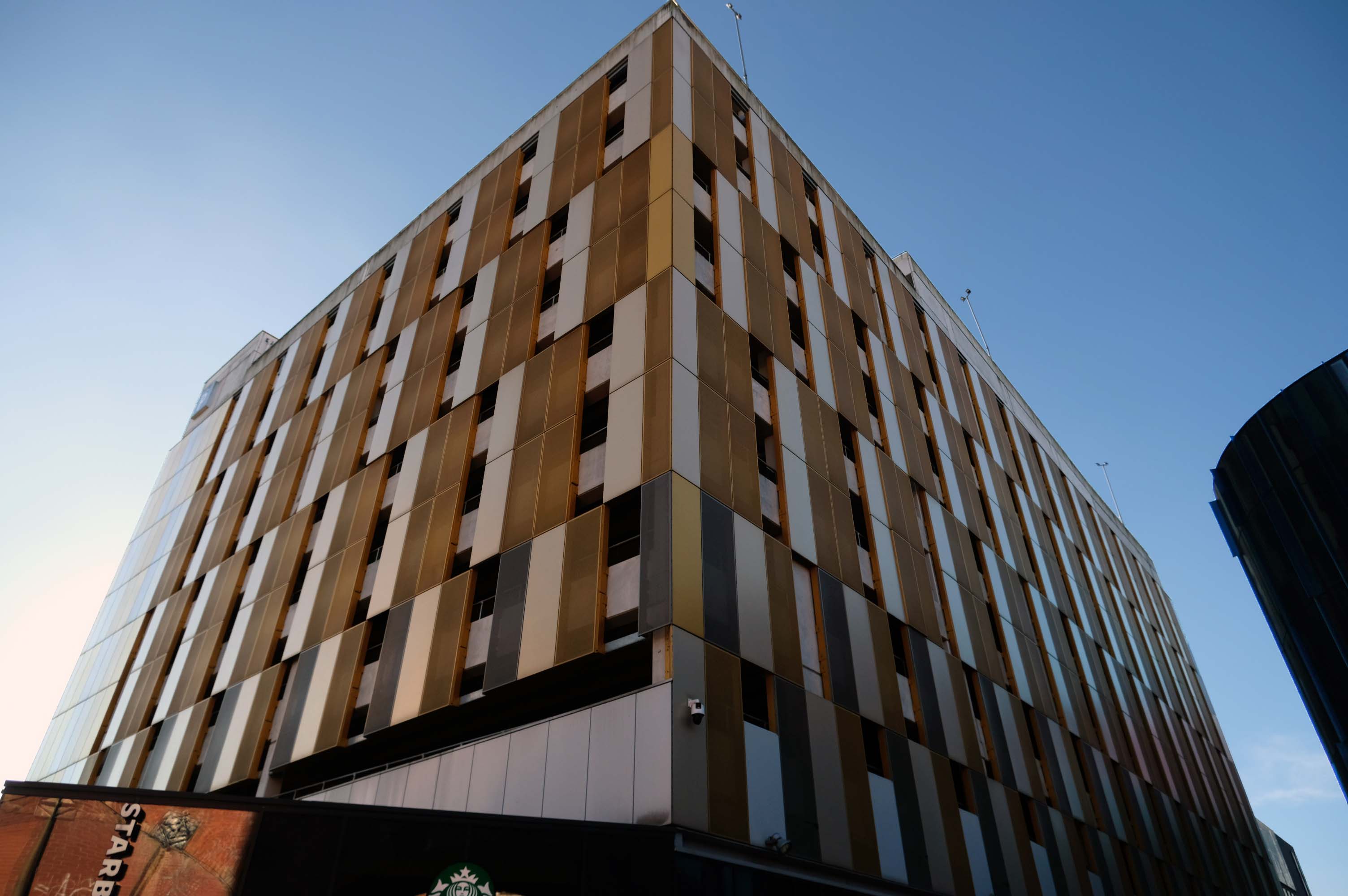
Manchester City Council is set to hand over a multi-storey car park and close a row of shops, including a Greggs and a barbers, in the hope of driving huge development in Deansgate. The multi-storey car park on King Street West, behind the iconic Kendals building, is set to be demolished if plans are passed by the council’s executive committee, with proposals to turn it into an office block.
The demolition of this car park and ground floor retailers would facilitate the redevelopment of the site, according to a report by the council’s strategic director, and will pave the way for the refurbishment of the adjacent grade II listed Kendals building, which currently has House of Fraser occupying it. Engagement with the retailers has been ongoing for some time, according to this report, with guidance being offered to them as to their next steps.
Plans were approved last year to transform the Kendals building into ‘high end’ offices with the car park to be turned into a 14-storey office block, along with improvements to the public realm. For this to go ahead the council will need to surrender the lease of the car park building, according to the report.
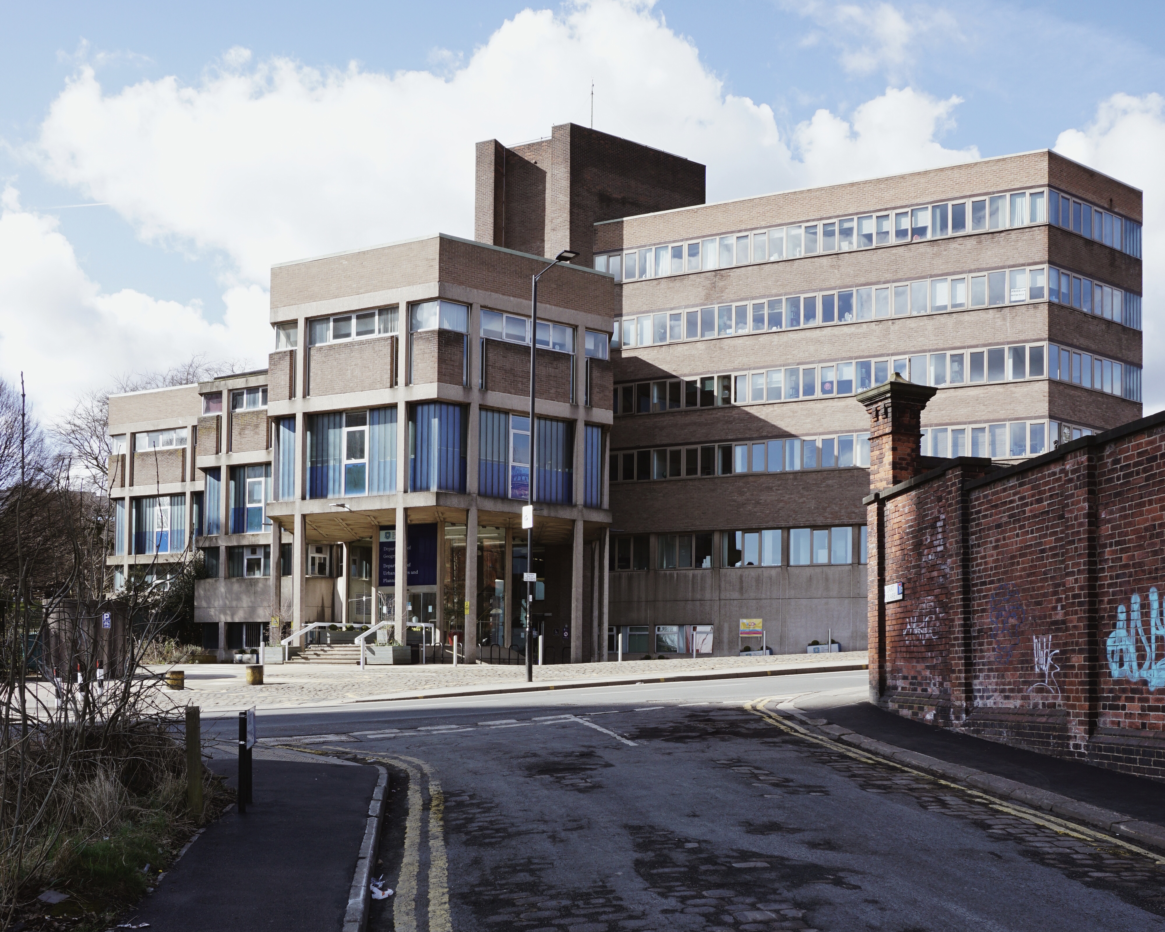
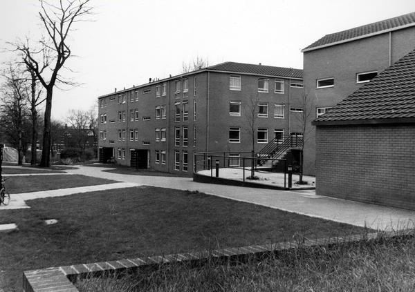
Illustrating a wide range of building types in and around Sheffield sheltering beneath the broad umbrella of Modernism.
By way of context the photographs are all Topographic in nature – in which a landscape subject is photographed, devoid of people, framed orthogonally and lacking artifice or effect.
Practiced most famously by the 1970s New Topographics photographers, including Robert Adams, Lewis Baltz, Nicholas Nixon, and Bernd and Hilla Becher.
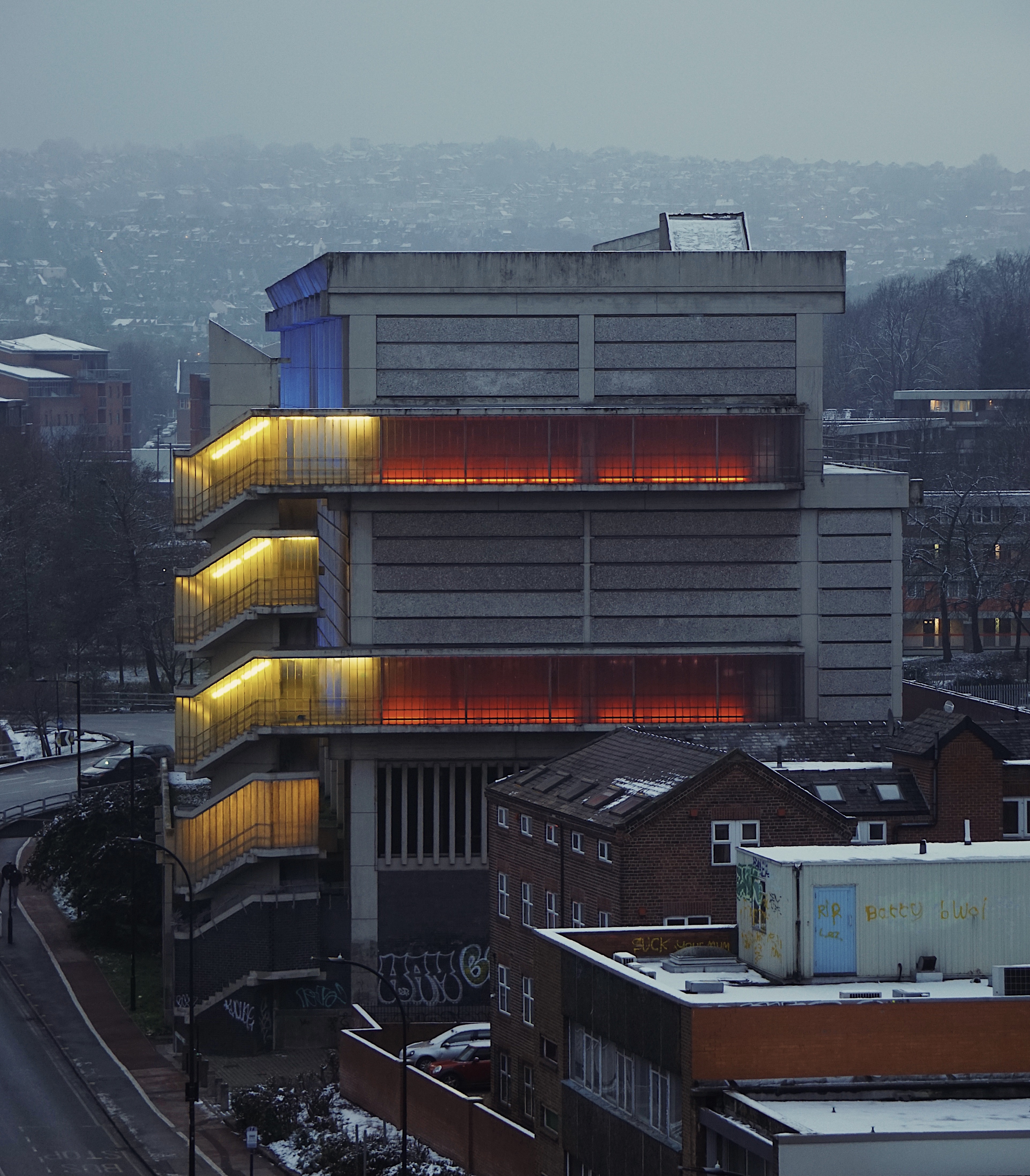
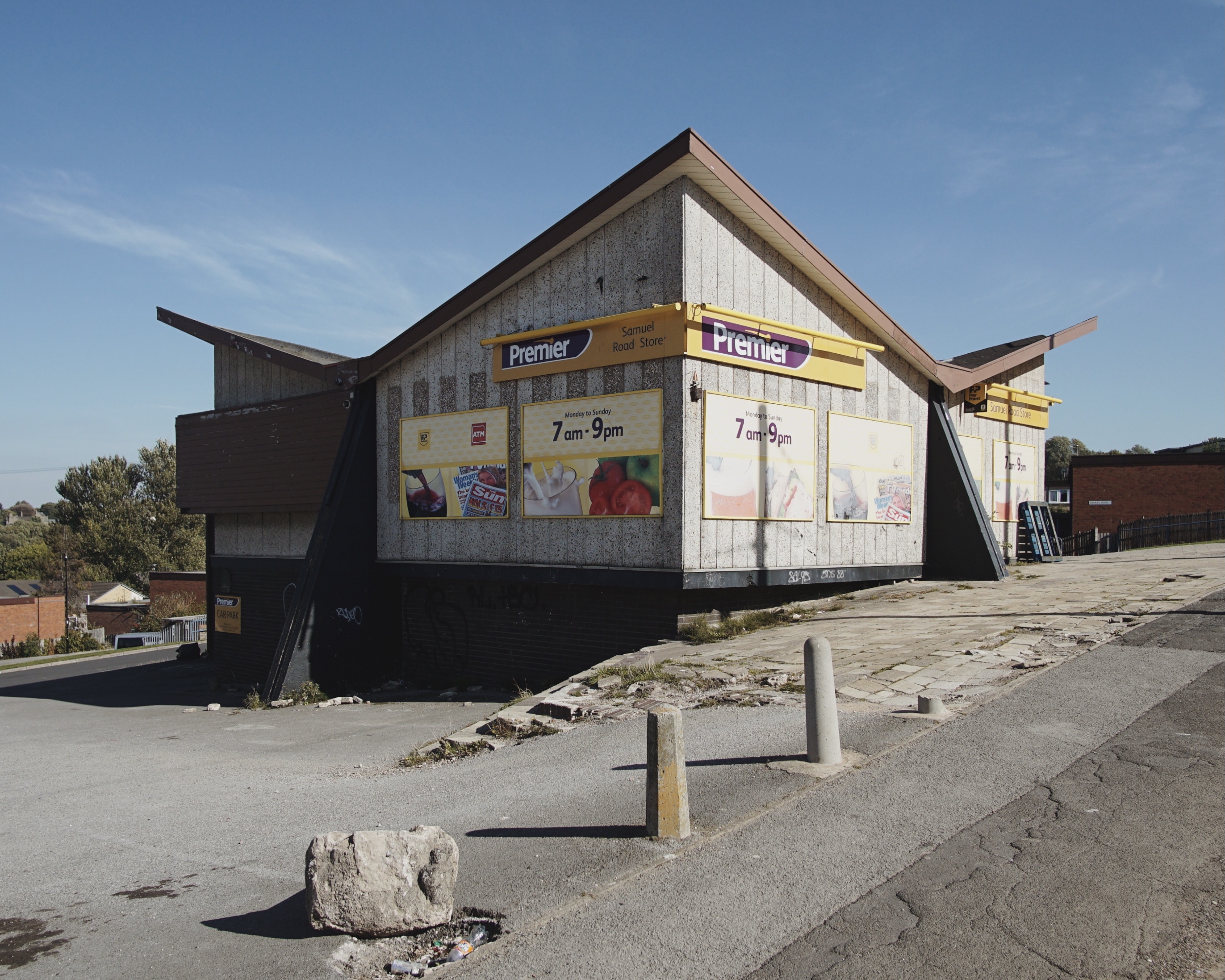
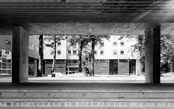
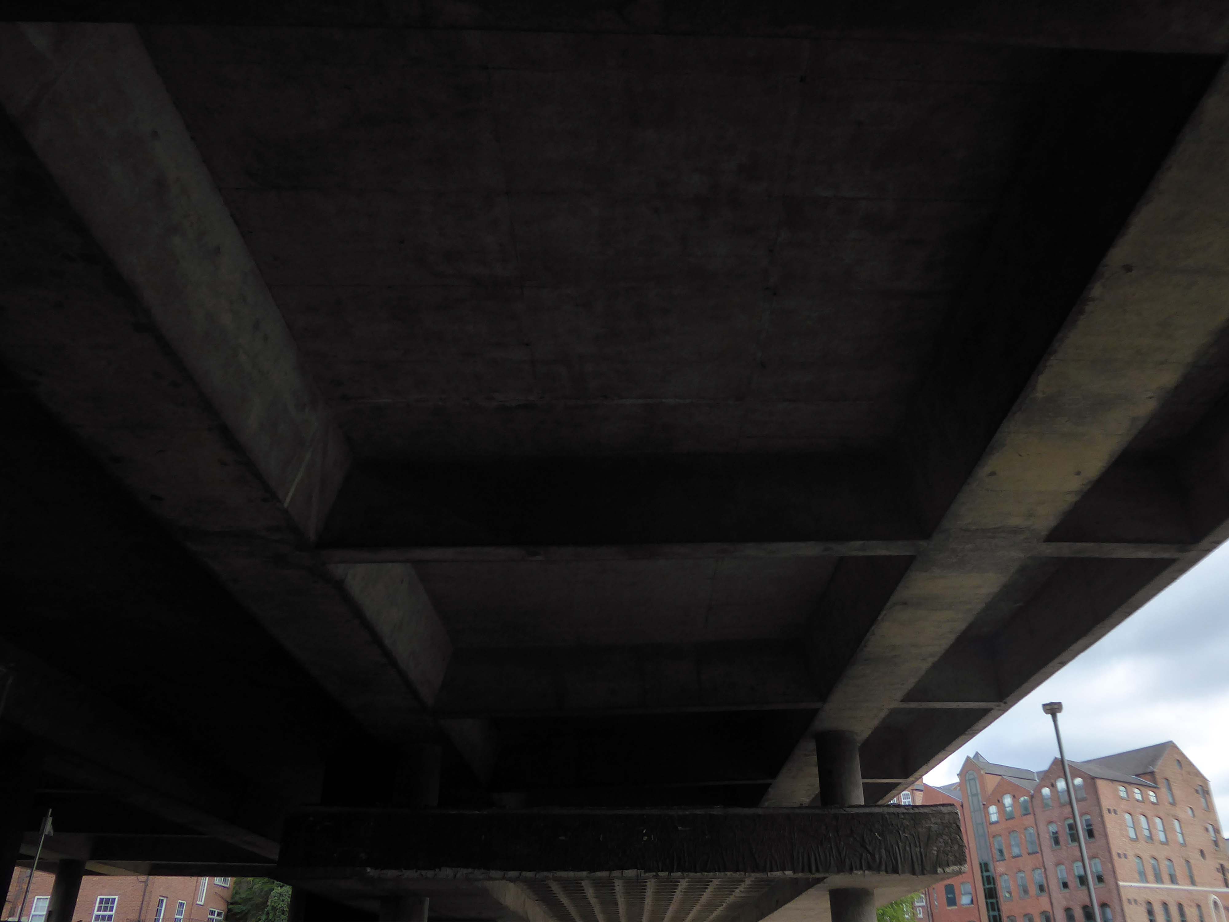
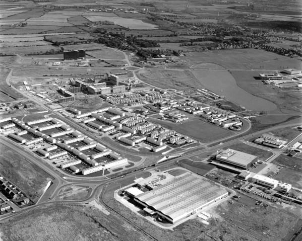
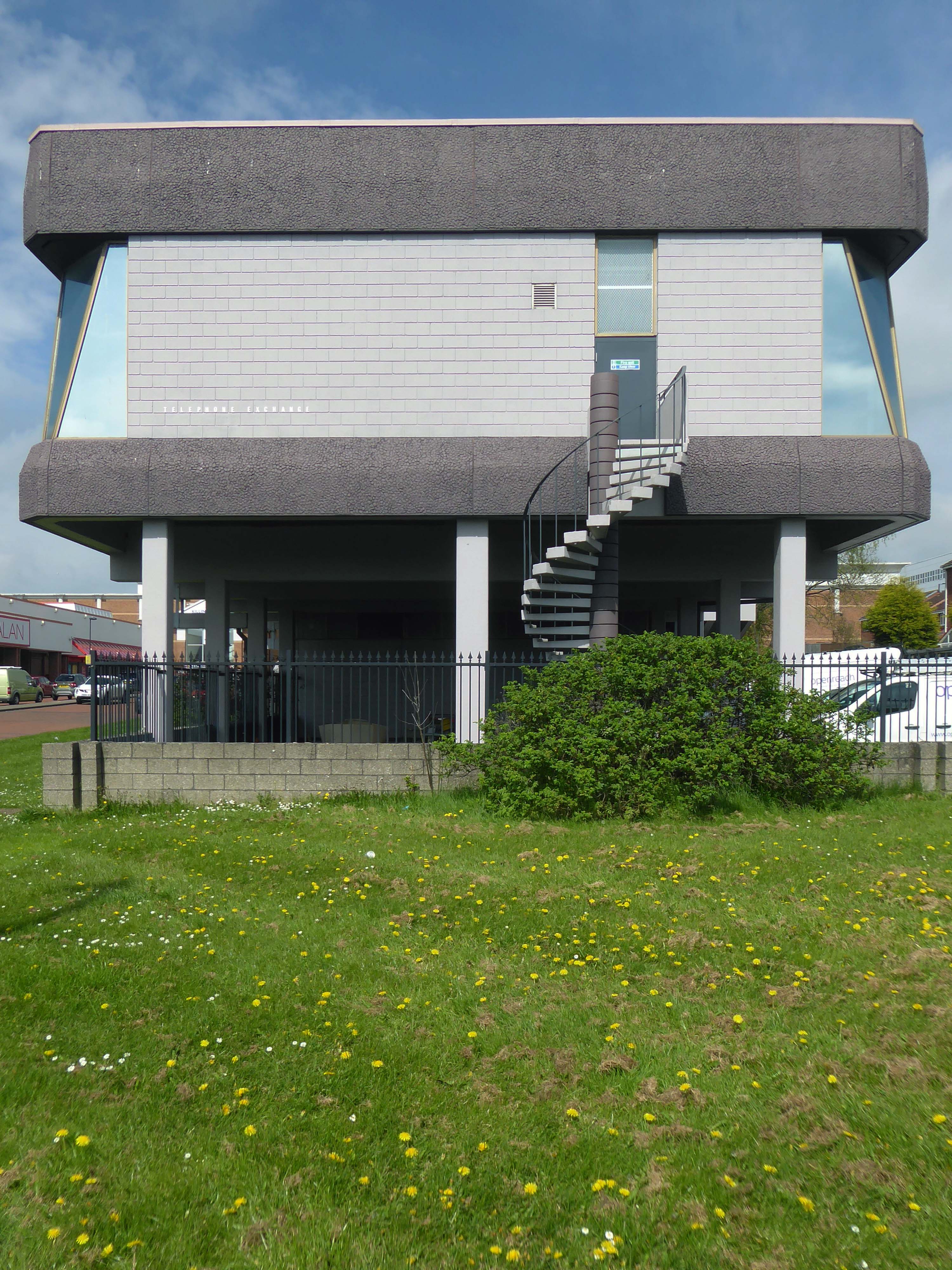
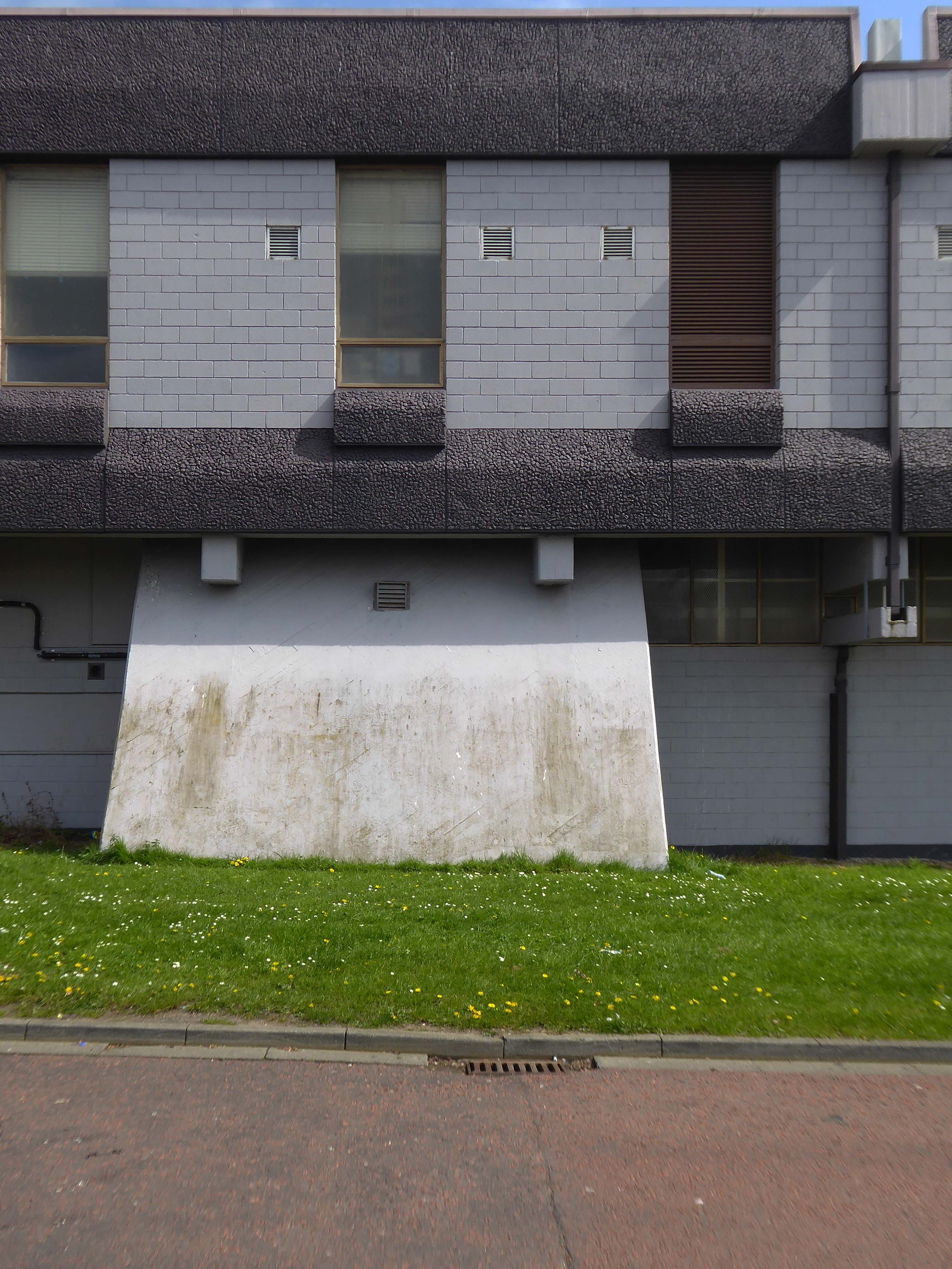
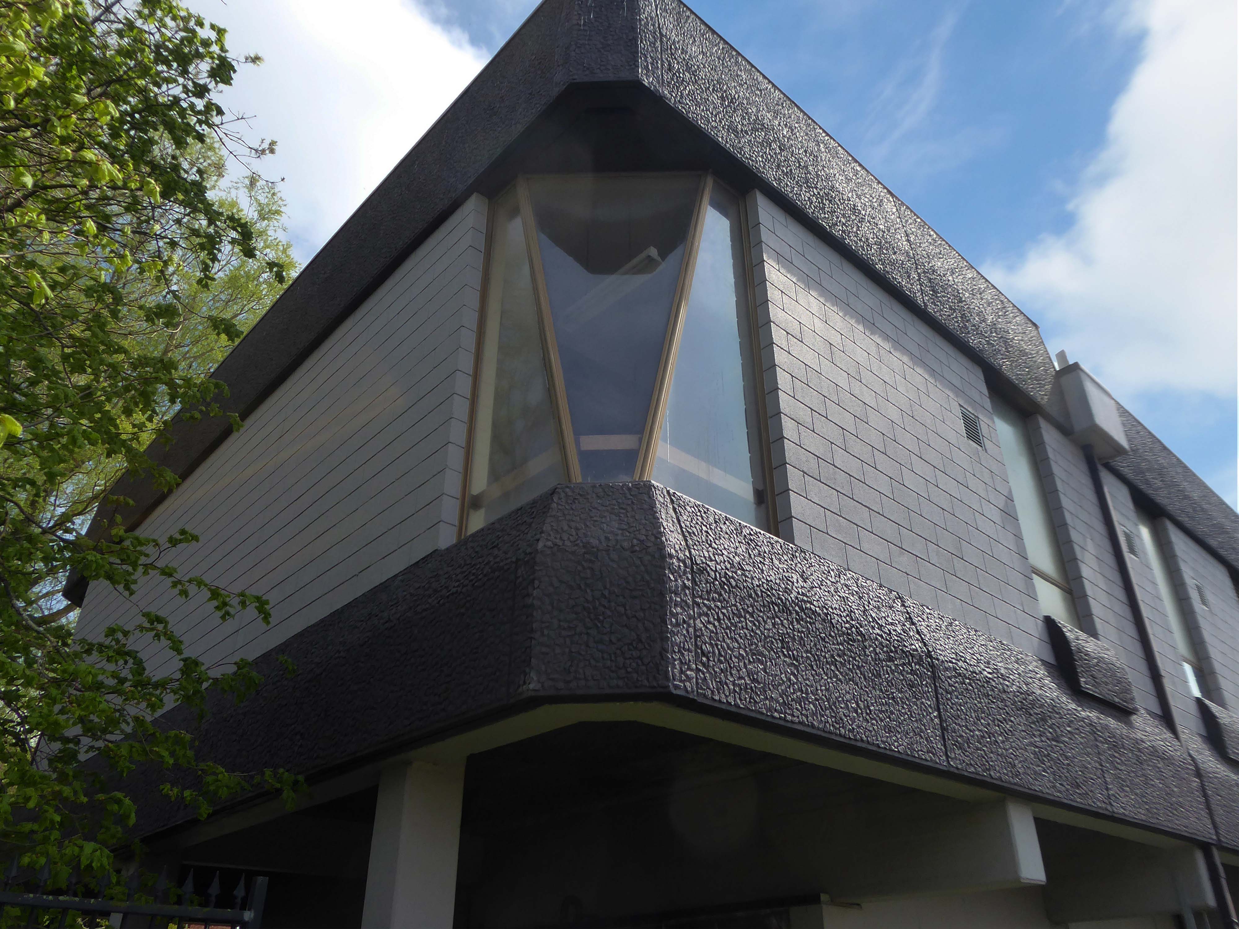
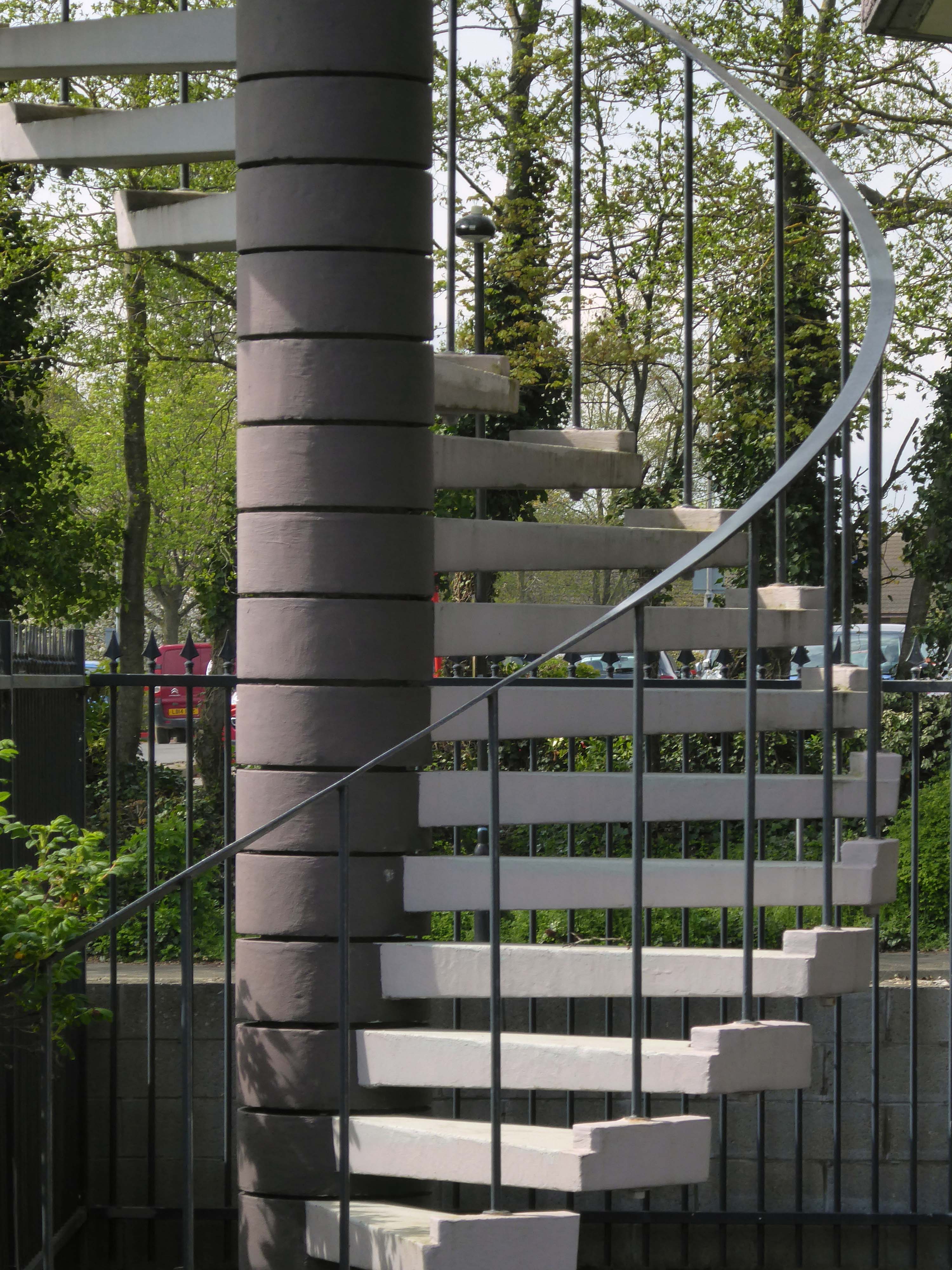
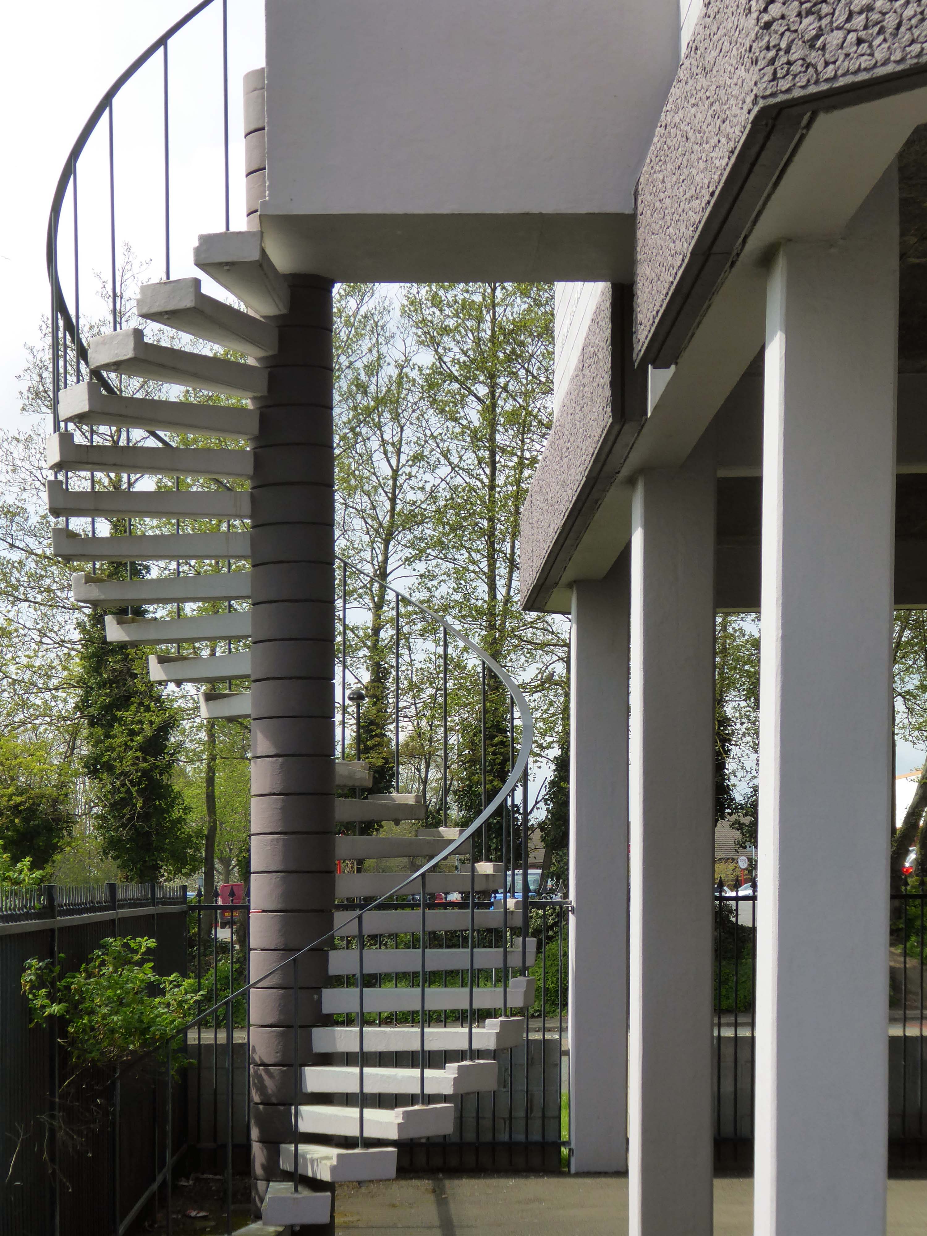
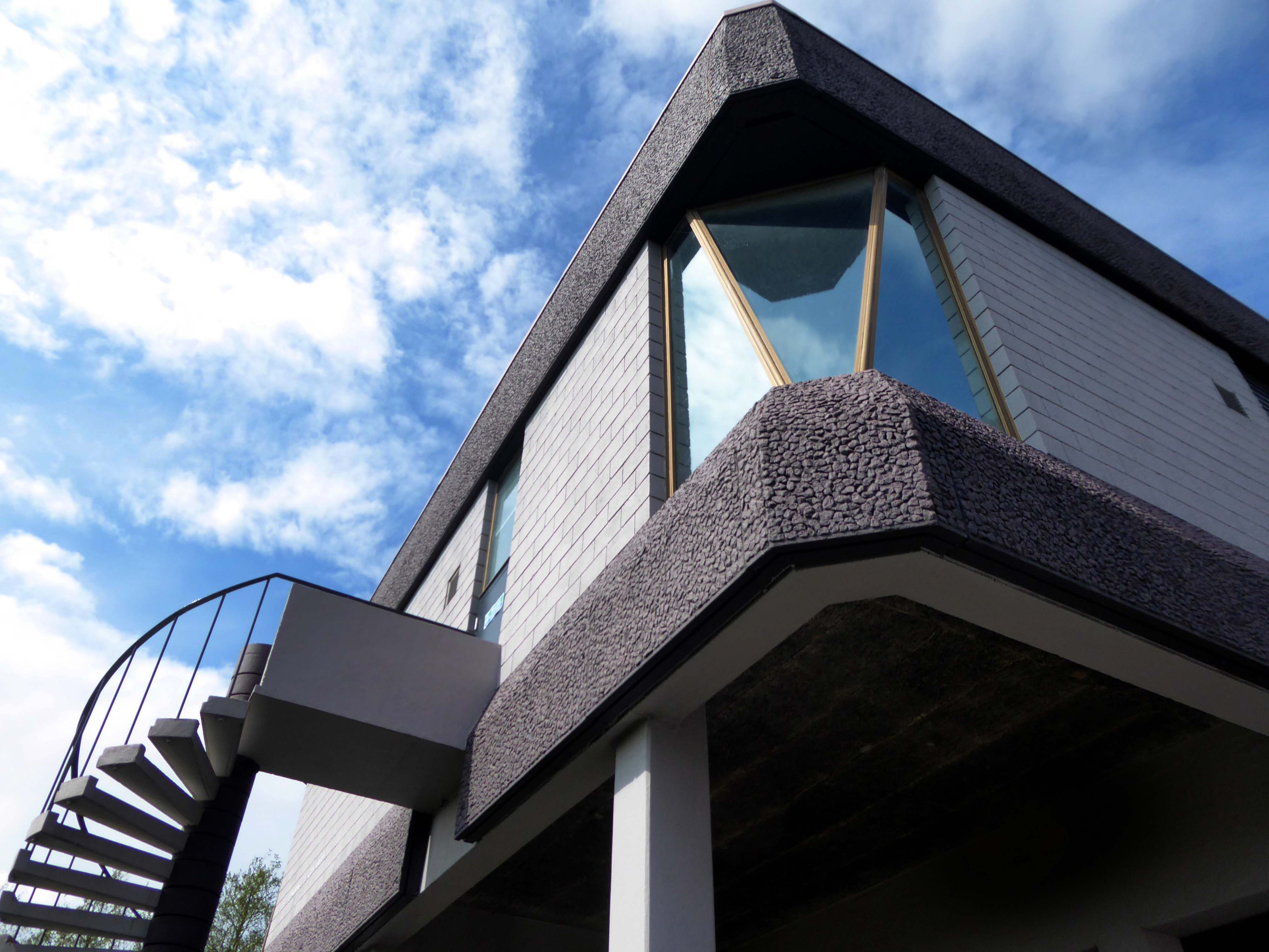
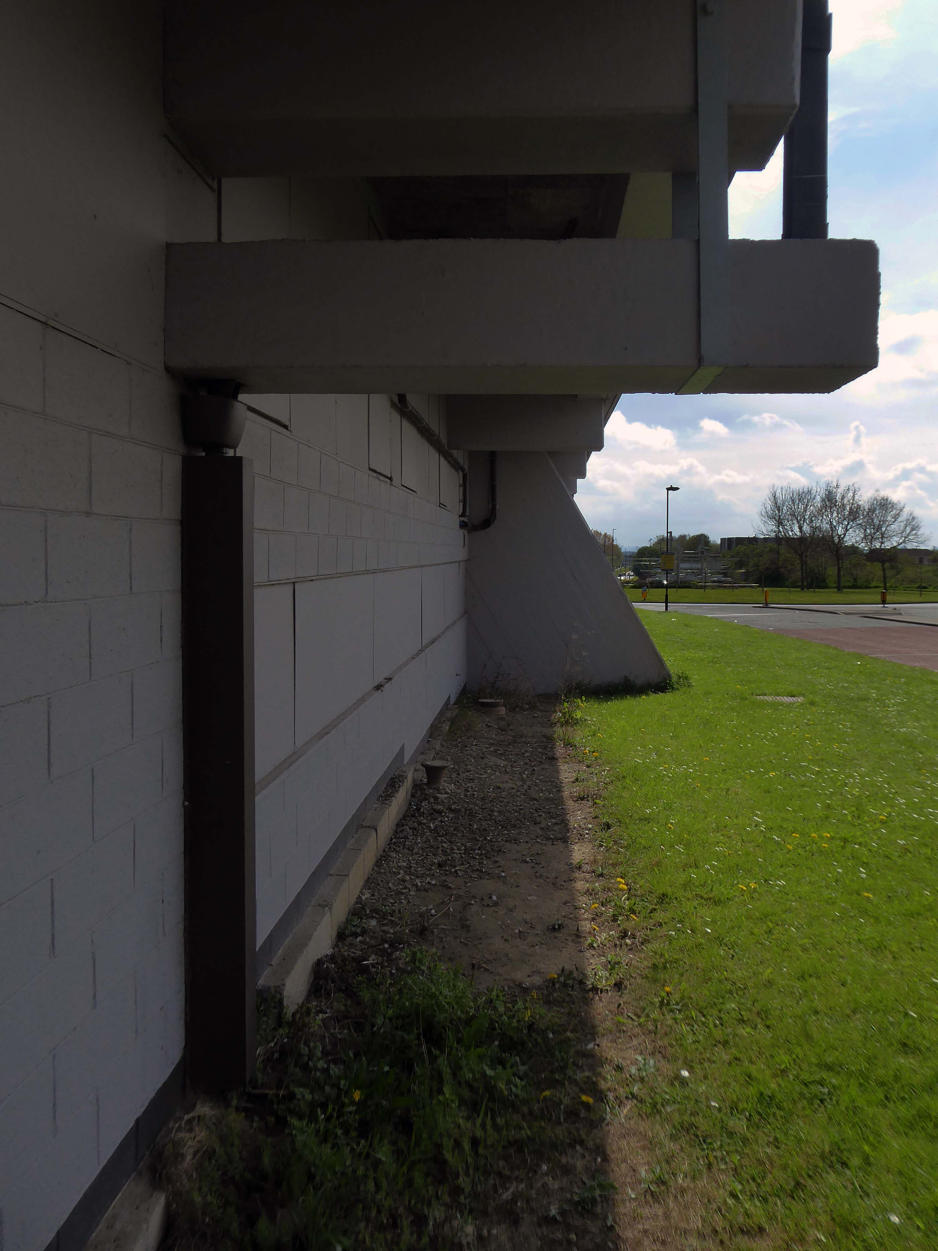
A shocking paroxysm of a building, an explosion in reinforced concrete, a bunker built with an aesthete’s attention to detail, a building which is genuinely Brutalist in both senses of the term.
With a hyper parabolic roof a doubly-curved surface that resembles the shape of a saddle, that is, it has a convex form along one axis, and a concave form on along the other.
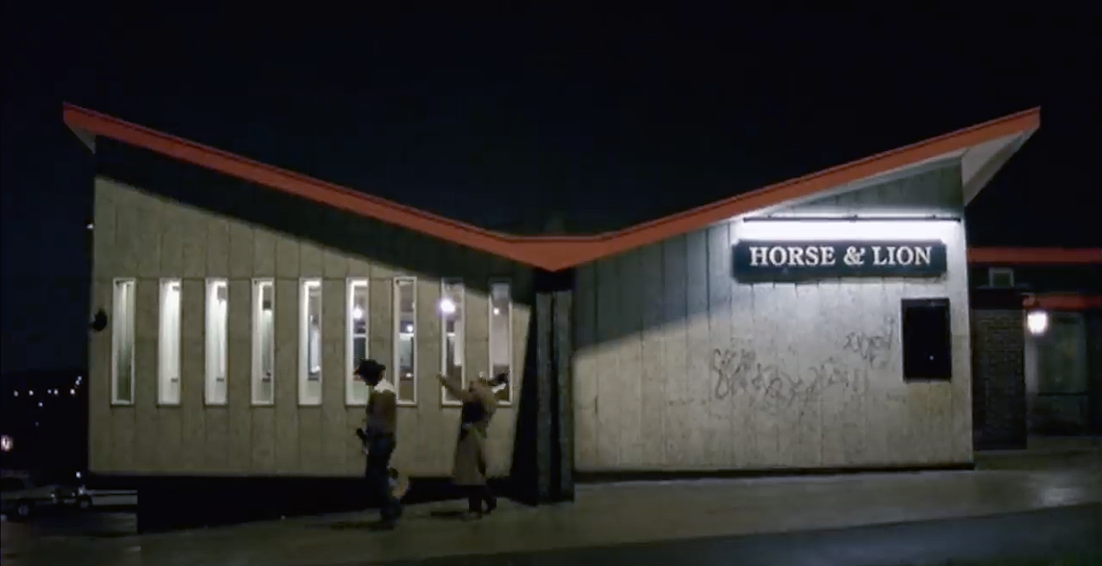
Featured in the video for the Arctic Monkeys’ 2006 number one hit – When the Sun Goes Down at 1.21.
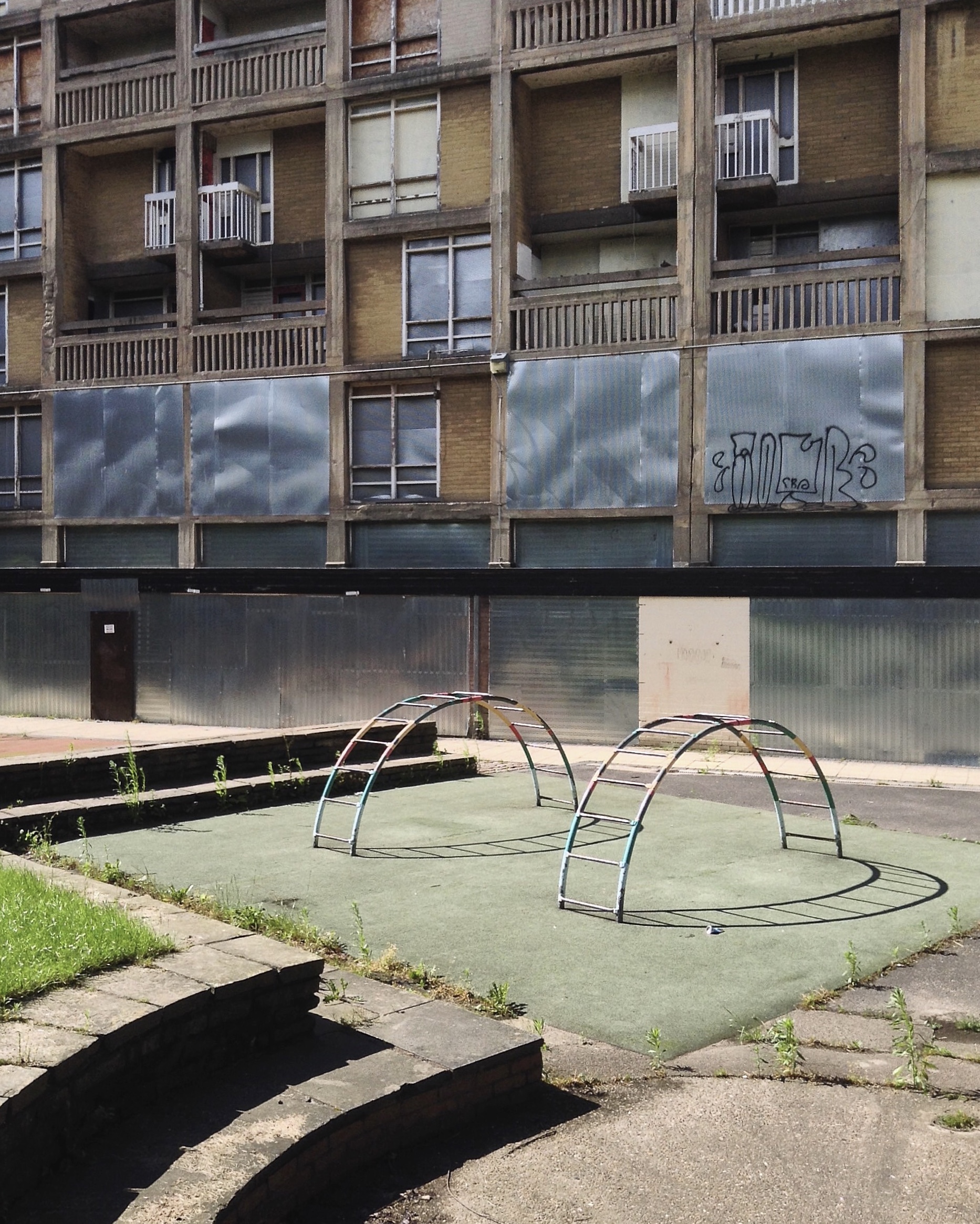
5 Park Hill – 1957 and 1961 Jack Lynn and Ivor Smith under the supervision of JL Womersley,
Grace Owen Nursery – with two Wicksteed climbing frames
The Play Ground should not be put in a corner behind railings, but in a conspicuous and beautiful part of a Park, free to all, where people can enjoy the play and charming scenery at the same time; where mothers can sit, while they are looking on and caring for their children.
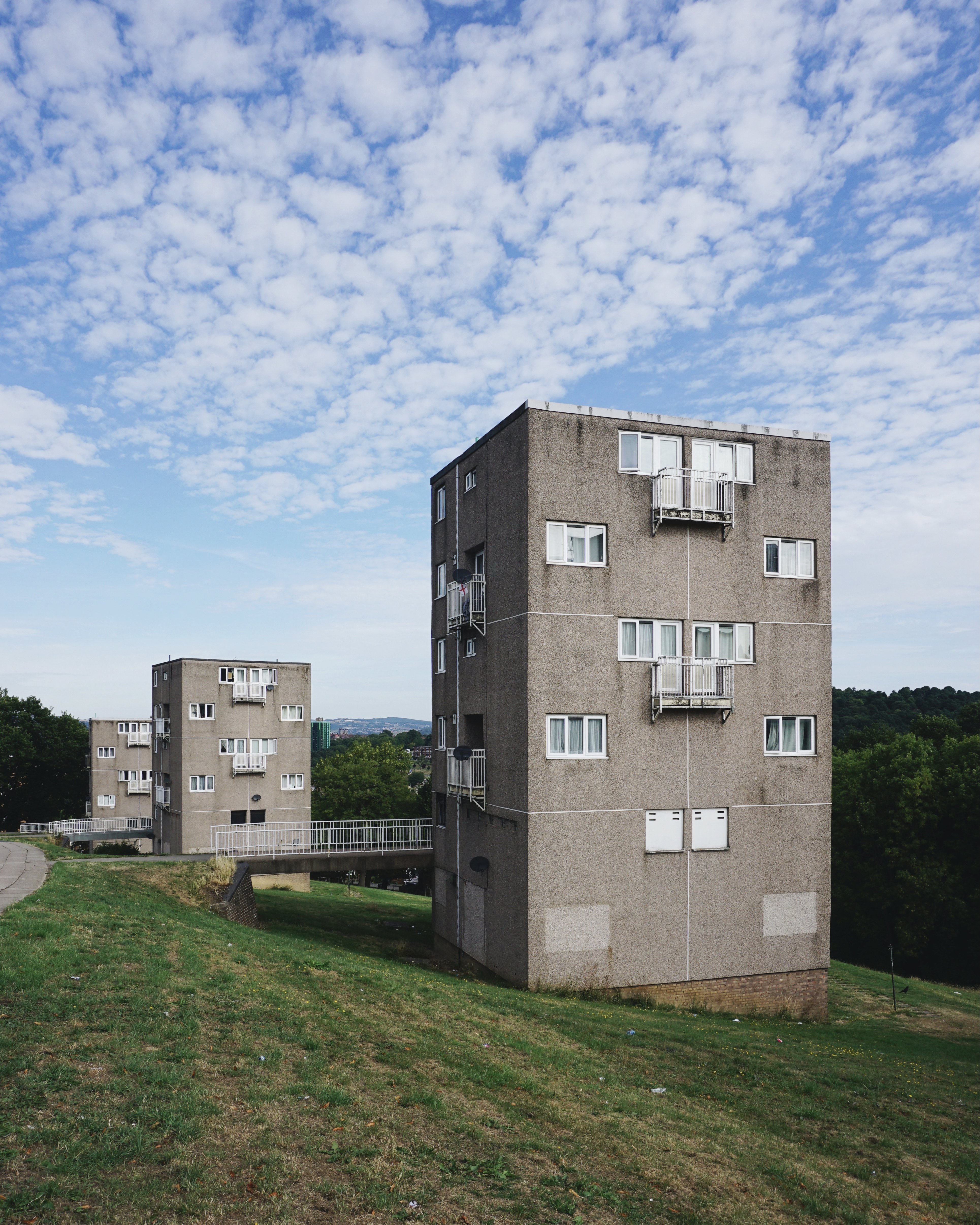
The Sheffield Blitz in December 1940 killed almost 700 and damaged some 82,000 homes, over half the city’s housing stock. As the city looked to rebuilding, its 1952 Development Plan estimated the need to replace 20,000 unfit homes and build a further 15,000 to cater for the natural increase of population.
Supreme, but often overlooked, achievement … is the Gleadless Valley Estate which combined urban housing types and the natural landscape so effectively that it still looks stunning, especially on a bright winter’s day.
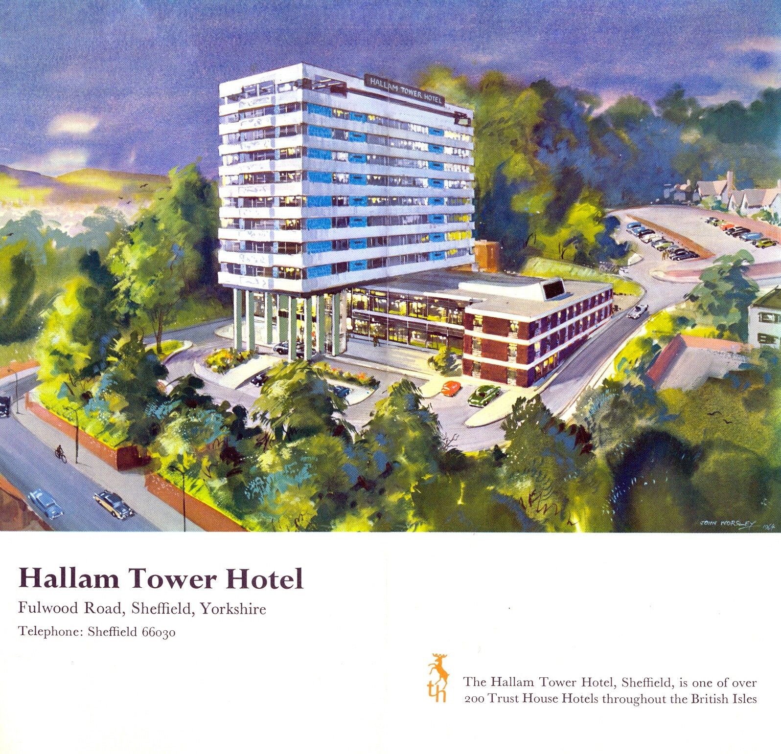
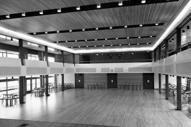
7 Hallam Tower Hotel 1965 Nelson Foley of Trust House Architectural Department
It opened officially on 24th March 1965 and was the first luxury hotel to be built in the north of England since the Second World War. The exterior was designed to complement Sheffield’s post-war modernist developments; the interior by Colefax and Fowler of Mayfair offered warm, gay colours to contrast with the black and grey tones of the city.
The plant started its first full year of production in 1929
The plant was located at Hope, because it is at the edge of where carboniferous limestone of the Monsal Dale Group, meets Edale Shale, the two main components of finished cement.
Since 1951, when the Peak District National Park was created, most of the outbound traffic from the plant has been exported by rail.
Colleagues in the team included Bill Varley, Ron Bridle, Sri Sriskandan and FA Joe Sims. The team was responsible for the introduction of a great deal of new computing technology into bridge design, as well as for some of the most imaginative bridge engineering going on anywhere in the country. Their design efforts were supported by close involvement in research and testing work, for example, on half-joints and concrete hinges. All the above named engineers went on to considerable seniority, some in the Department of Transport, and Sims and Bridle in particular have published various papers and contributed to books on the history of Britain’s motorway development.
Tyne Mill is one of a trio of mills designed by Oscar Faber for Spillers Ltd – the others are in Cardiff and Avonmouth and led to subsequent commissions from the company. Spillers began with a single mill in Bridgwater in around 1833, and during the 20th centruy had mills all over Britain.
Spillers operations were flour milling and manufacturing animal feeds, and they came to Newcastle in 1896. Grinding grain to flour produces both heat and fine dust a combination guaranteed to be a fire hazard. The fire retardant properties of reinforced concrete, and its relative cost effectiveness, made it a popular choice for mills and other industrial buildings.
Construction took place during the winter and a warming plant heated the concrete constituents before and after mixing, to control the setting time which governs how soon the slip-form shuttering can be moved to the next lift. The concrete was usually kept at 15.6 deg C, though this could be varied to speed or delay setting times.
The mill building has the actual mill above a warehouse area. Its footprint is 88.4m by 27.4m with 12 storeys and a maximum height of 51.2m. It has reinforced concrete columns and beams, but timber floors of 100mm thick Columbian pine with a 25mm thick maple strip finish. The walls are of 280mm thick brickwork with flashing on each floor to drain the cavity.
When completed, Spillers Tyne Mill was the largest flour mill in Europe and apparently the tallest milling building in the world. It could process 254,000 tonnes of grain annually, brought to the mill by ship via Spillers Quay or by rail on the track extension along Quayside.
A goods line down to the Newcastle quayside from Manors Station was agreed in 1845, but not authorized until 28th June 1863 and opened on 1st June 1870.
The Quayside Branch Line closed on 16 June 1969. The railway was in use for ninety-nine years and its eventual demise reflects the changes in the Quayside and Ouseburn themselves from shipping and industrial use to one now of housing and leisure facilities. The northern portal of tunnel 2 was removed when the Metro system was constructed in the late 1970s. The cutting above Lime Street was filled in in 1977 and the tunnel at the quayside bricked up and landscaped over in the 1990s. Only the Red Barns tunnel remains as a metro overrun facility.
24/7, completely free and always spaces! A hidden parking gem of Newcastle! 10 minute walk to Millennium Bridge. Security is almost non-existent but busy enough that trouble should be deterred.
A popular Newcastle car park will be staying locked up overnight in an effort to crack down on boy racers. Council bosses have confirmed plans to permanently close the Spillers car park in Ouseburn at 10pm each night after it was plagued with – significant anti-social behaviour.
The future of the car park is uncertain, with major redevelopment plans having emerged for the area.
While planning permission has expired for the controversial Whey Aye Wheel project, which would have seen Europe’s biggest observation wheel built at Spillers Wharf, there remain proposals to build housing on the riverside plot.
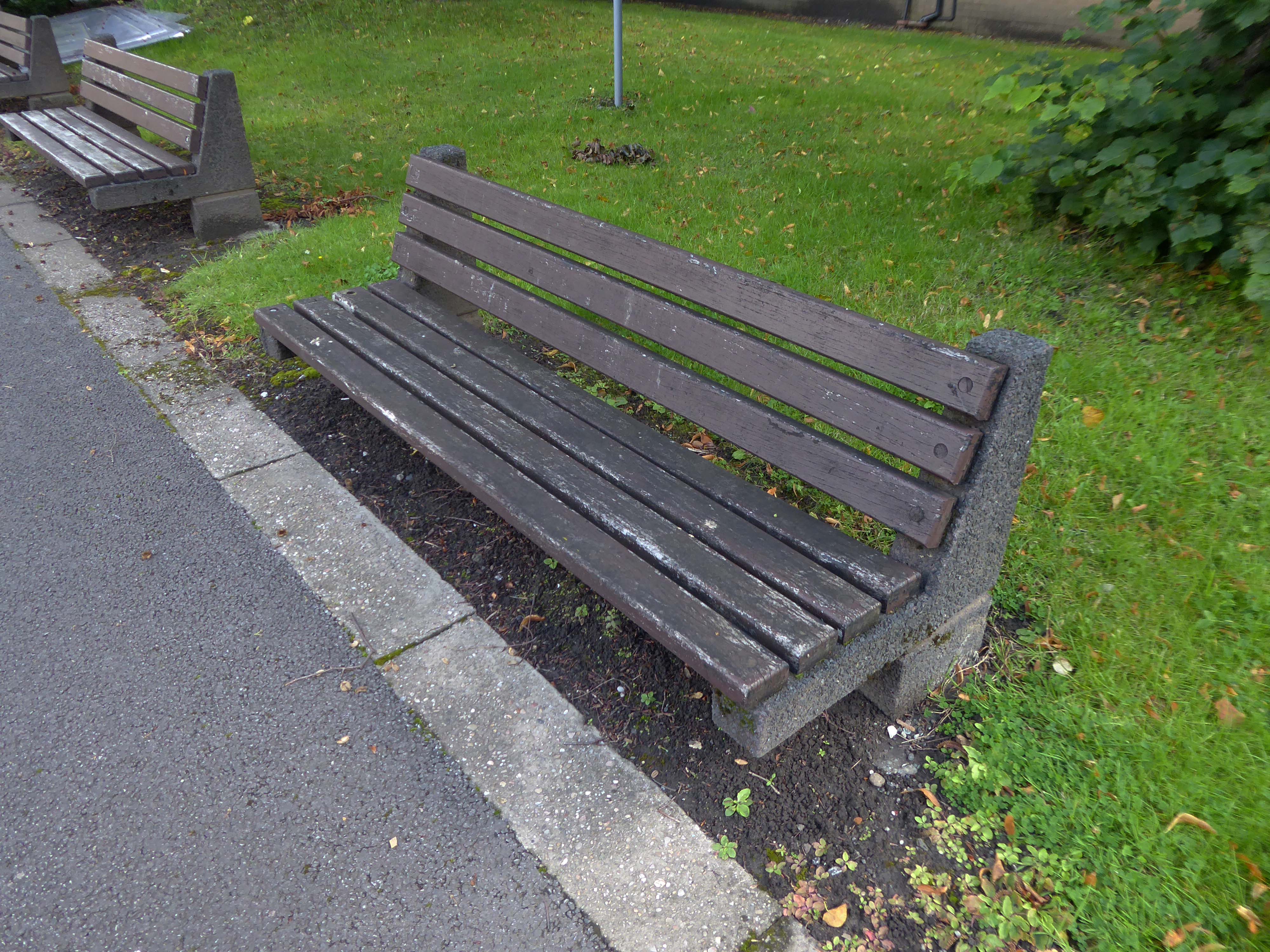
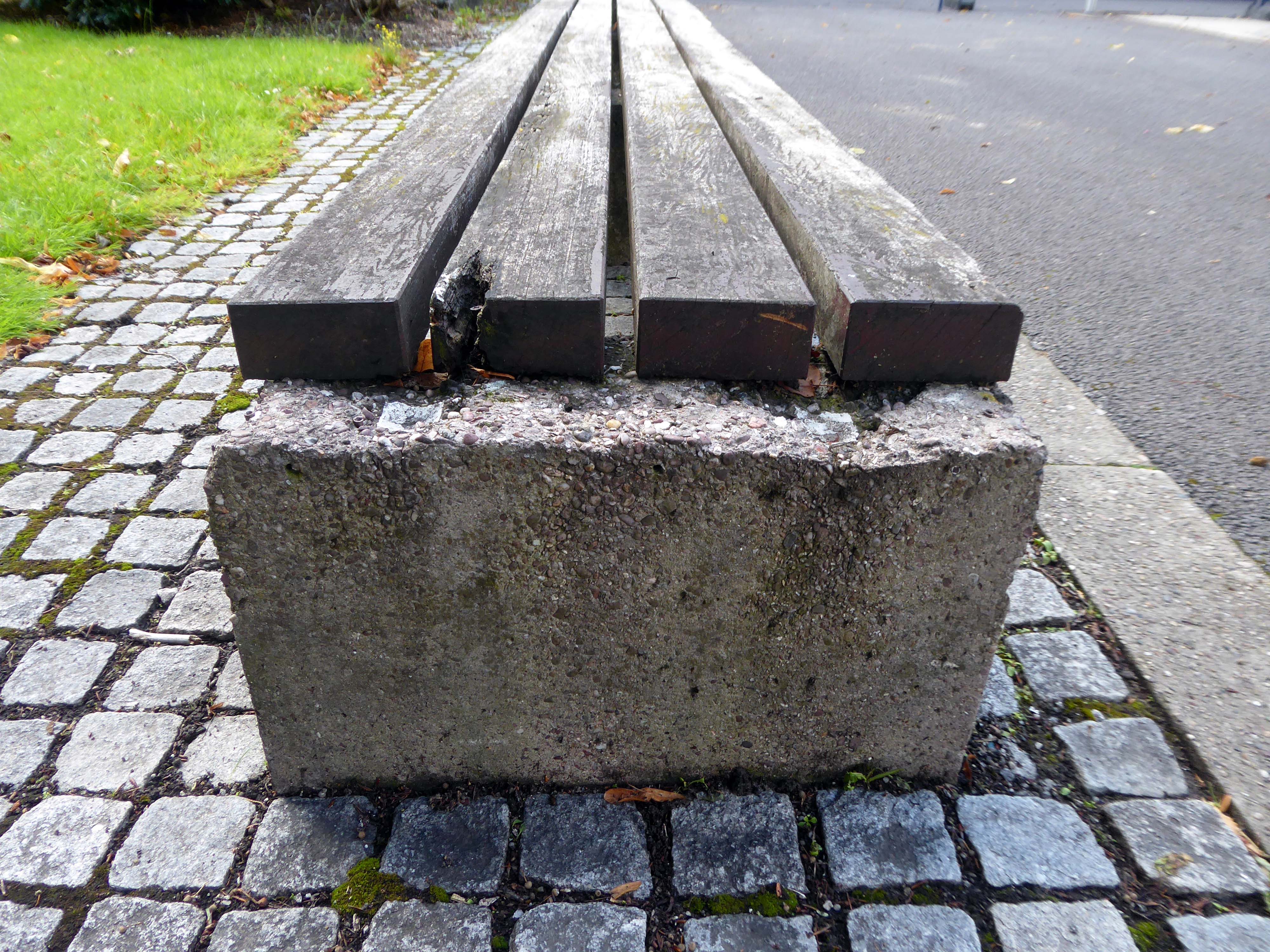
However as of September 2023 a car park is a car park – a car park with embedded remnants of the railway yard, interspersed with rapidly emergent plant life, and crumbling concrete obstacles.
The ingredients list of Wotsits Cheese reveals that cheese and dairy-derived components play a significant role in creating the mouthwatering flavor. The primary ingredients include corn and rapeseed oil, which form the base of the crunchy corn puffs. However, it is the cheese flavoring that truly brings the cheesy goodness to Wotsits cheese.
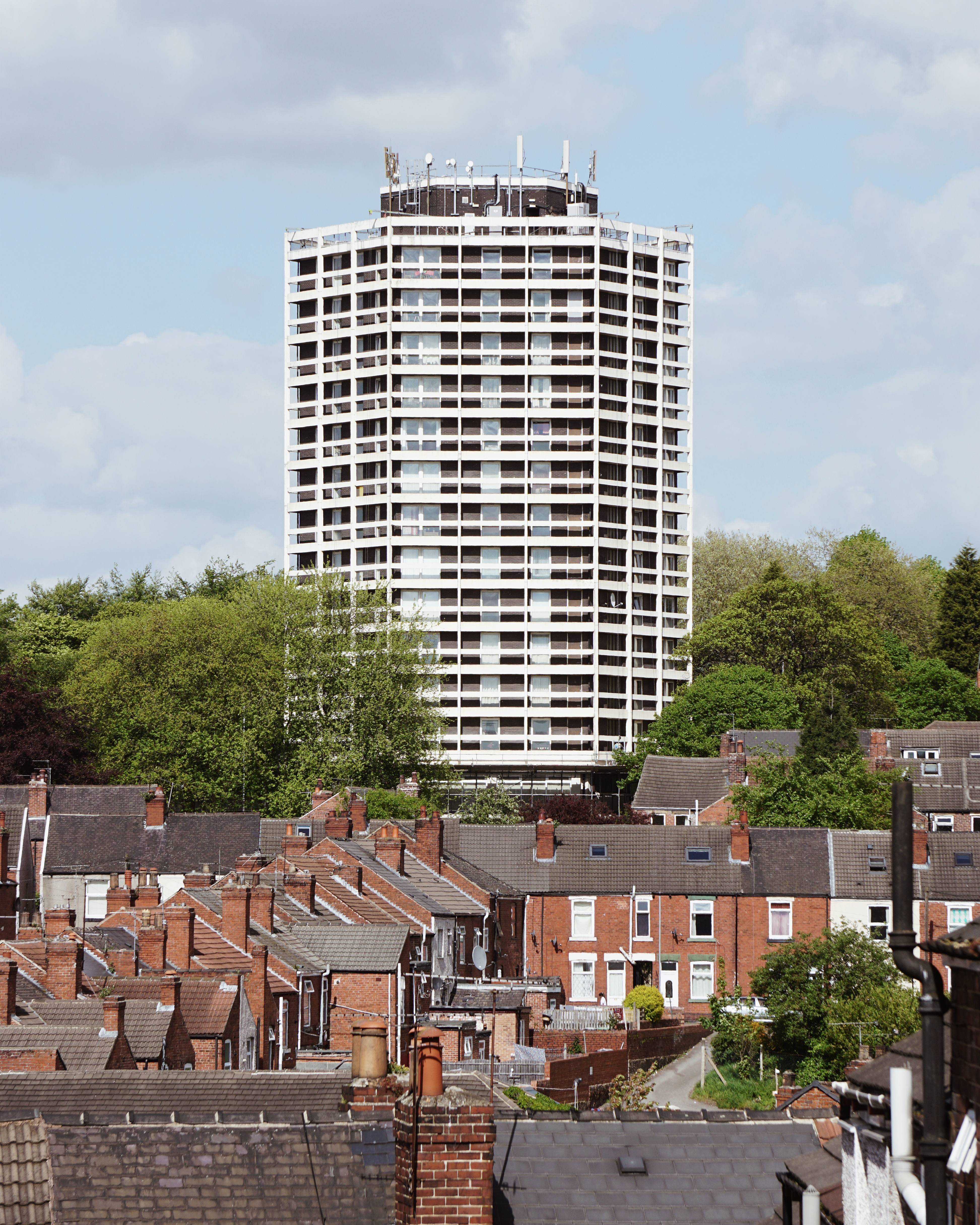
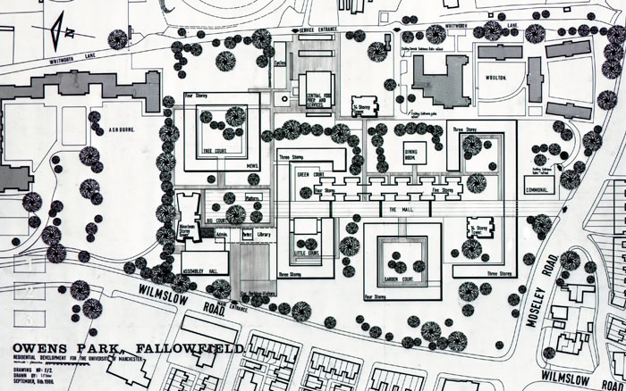
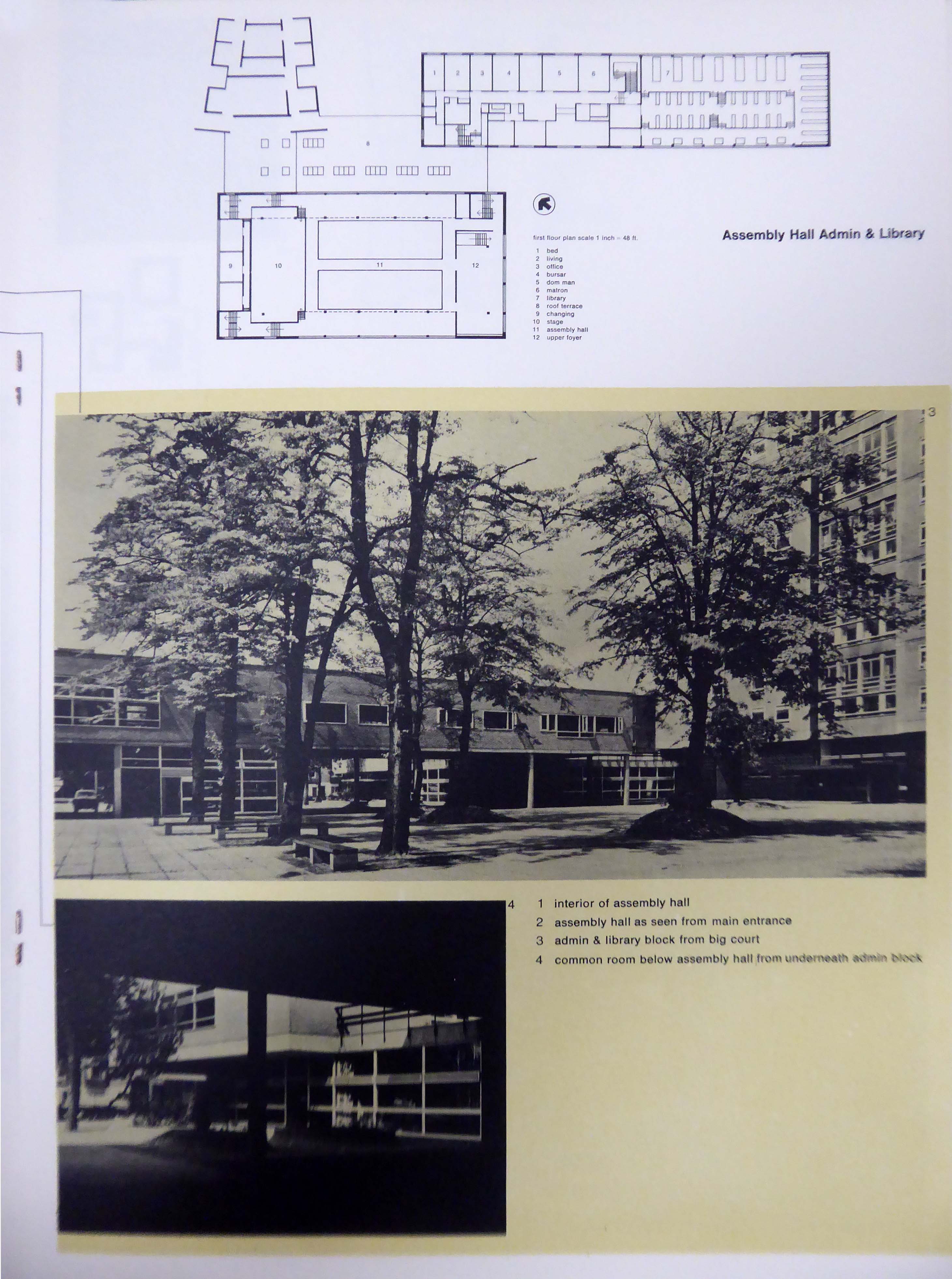
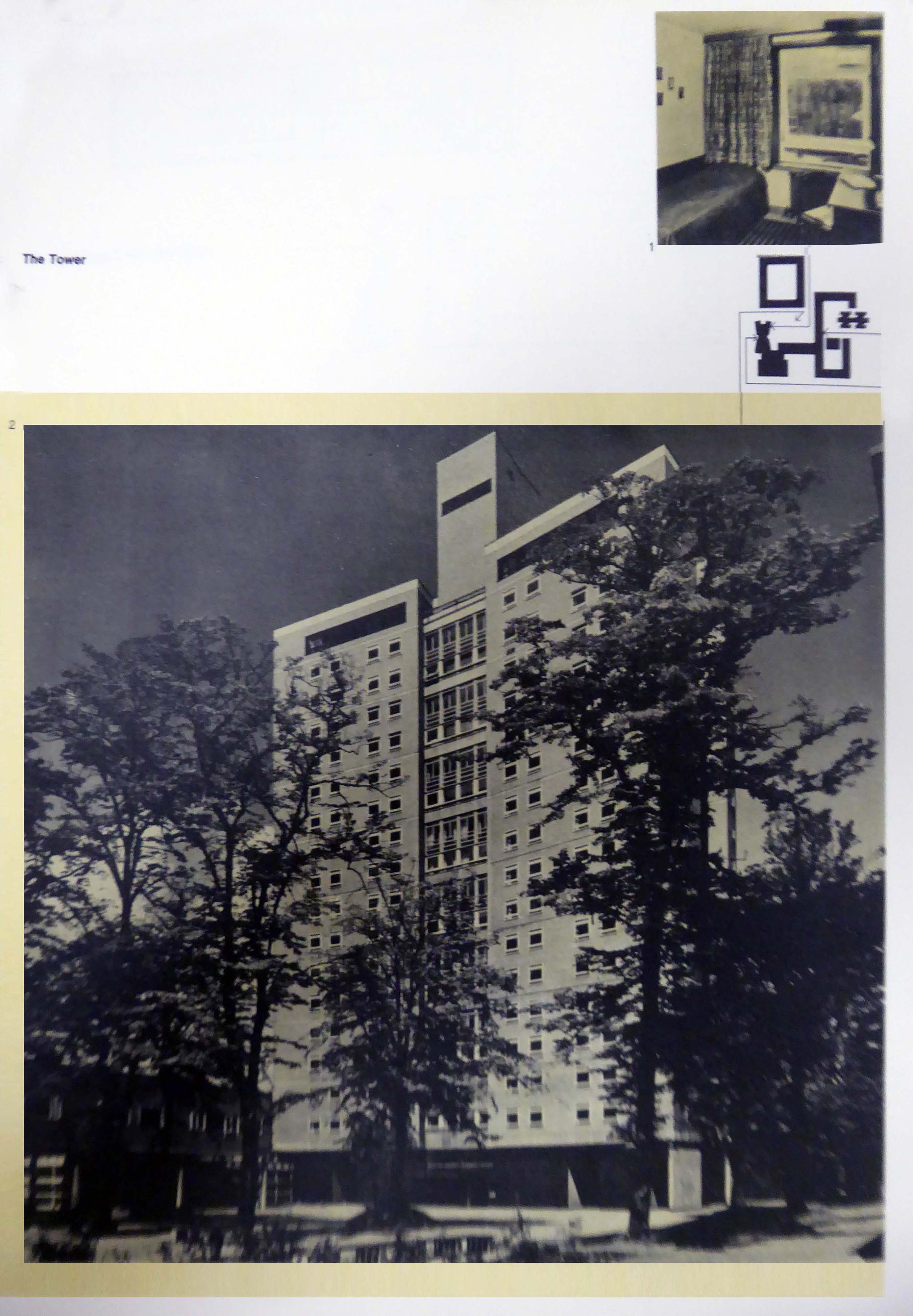
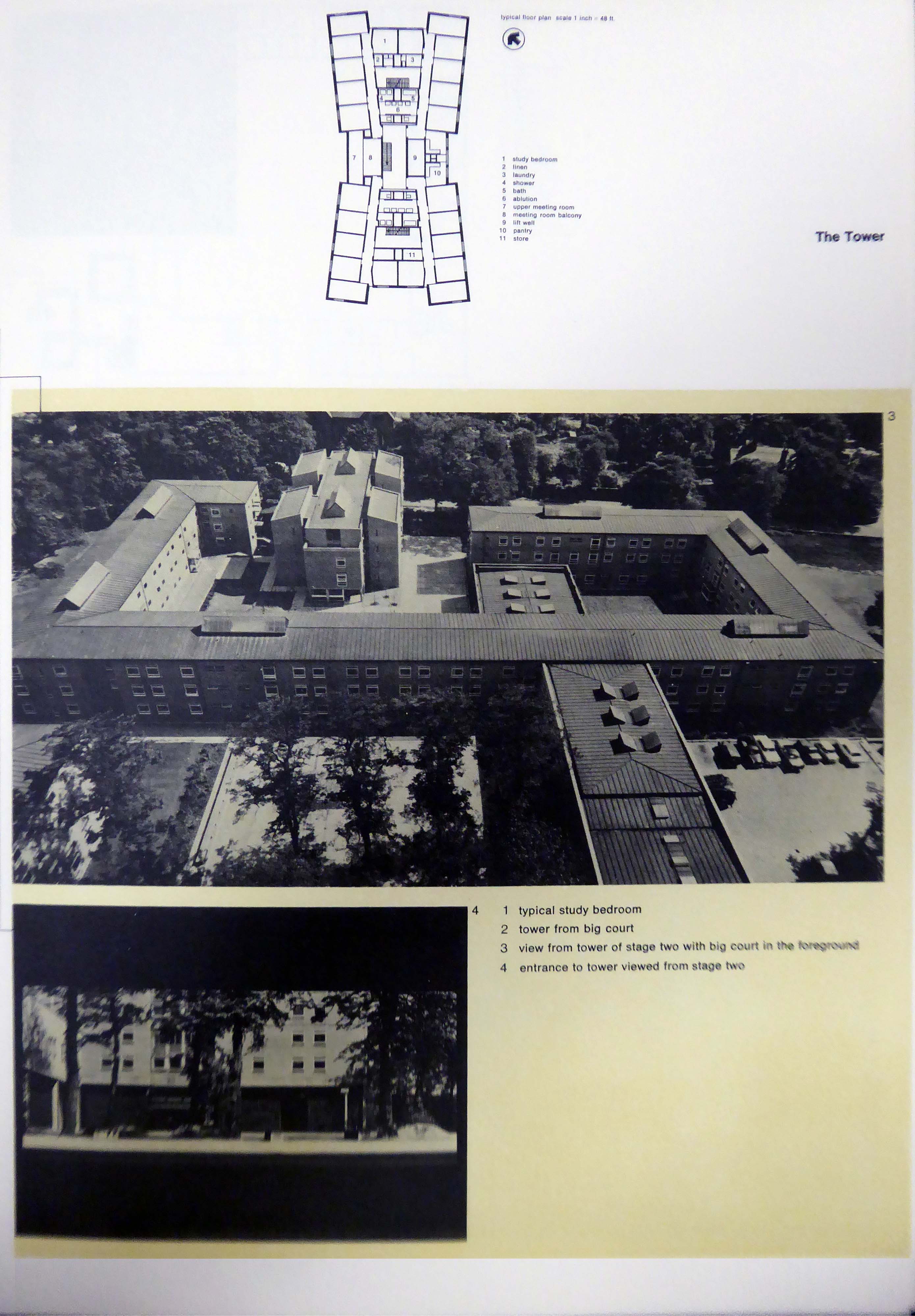
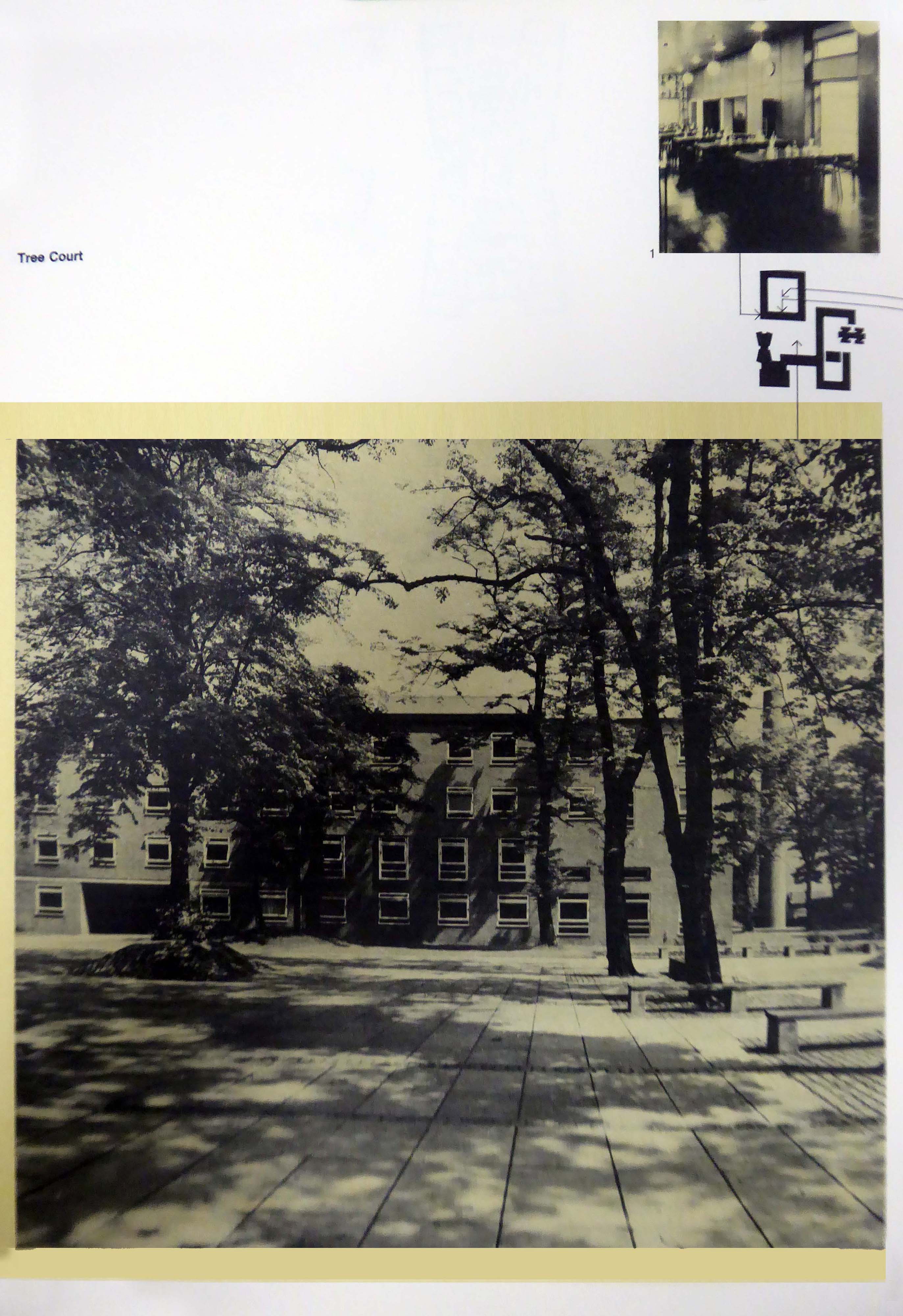
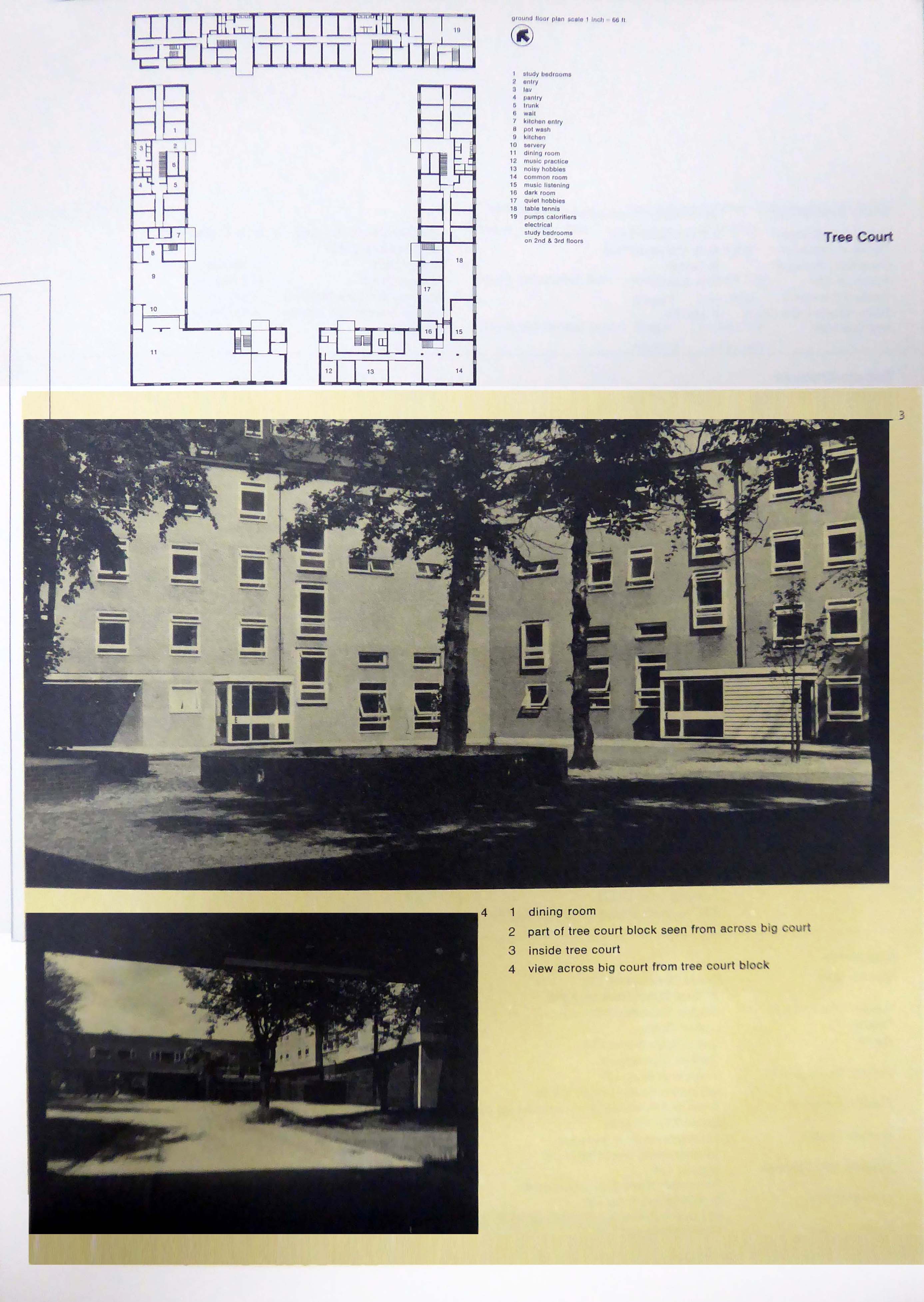
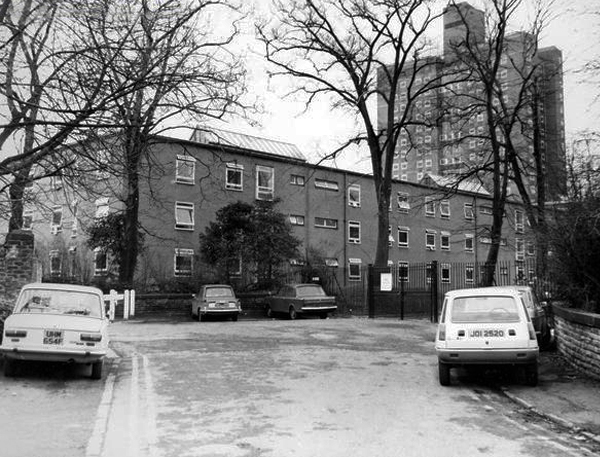
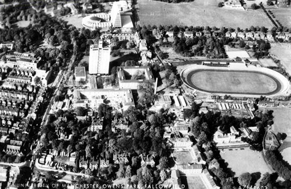
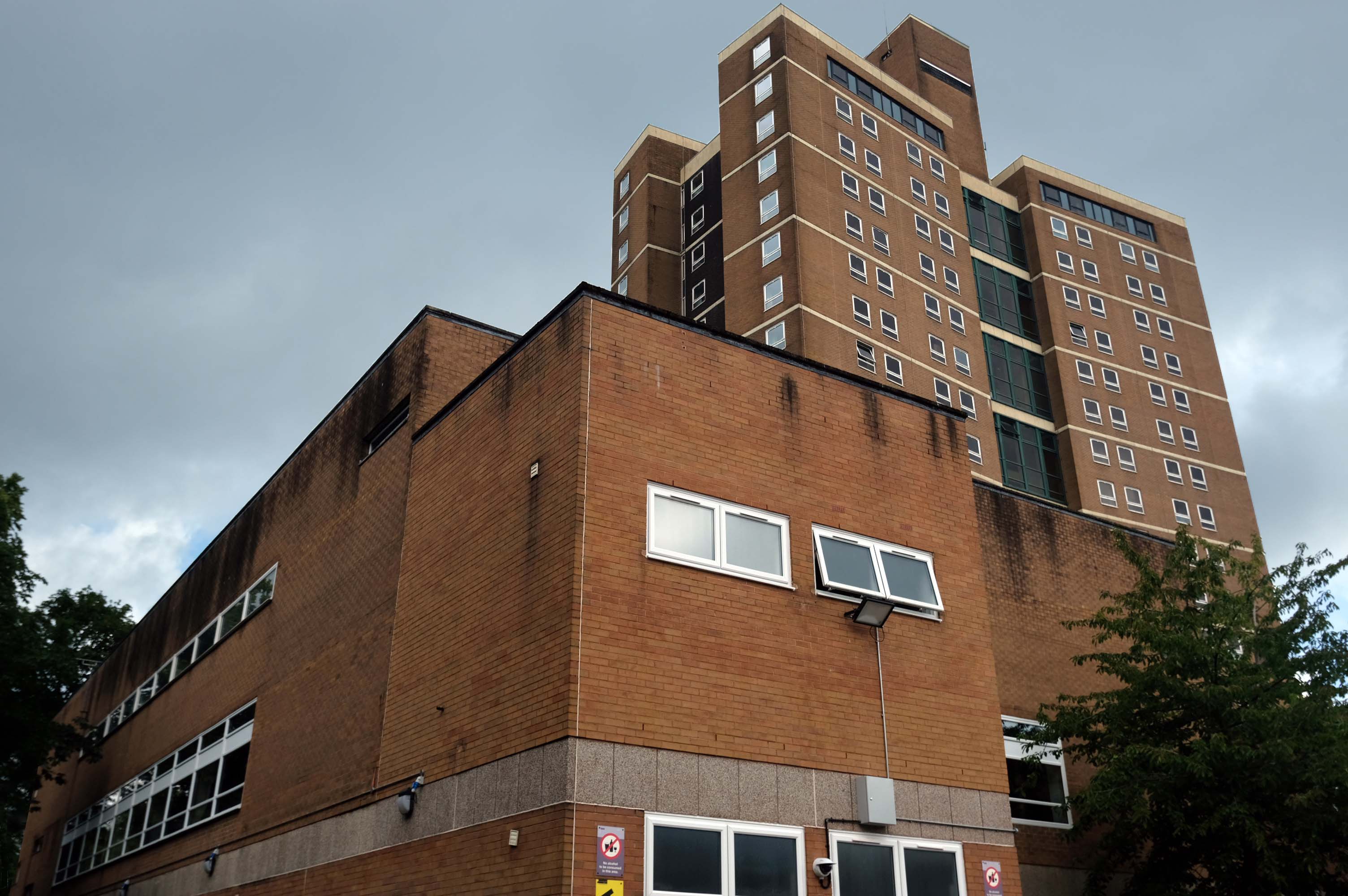
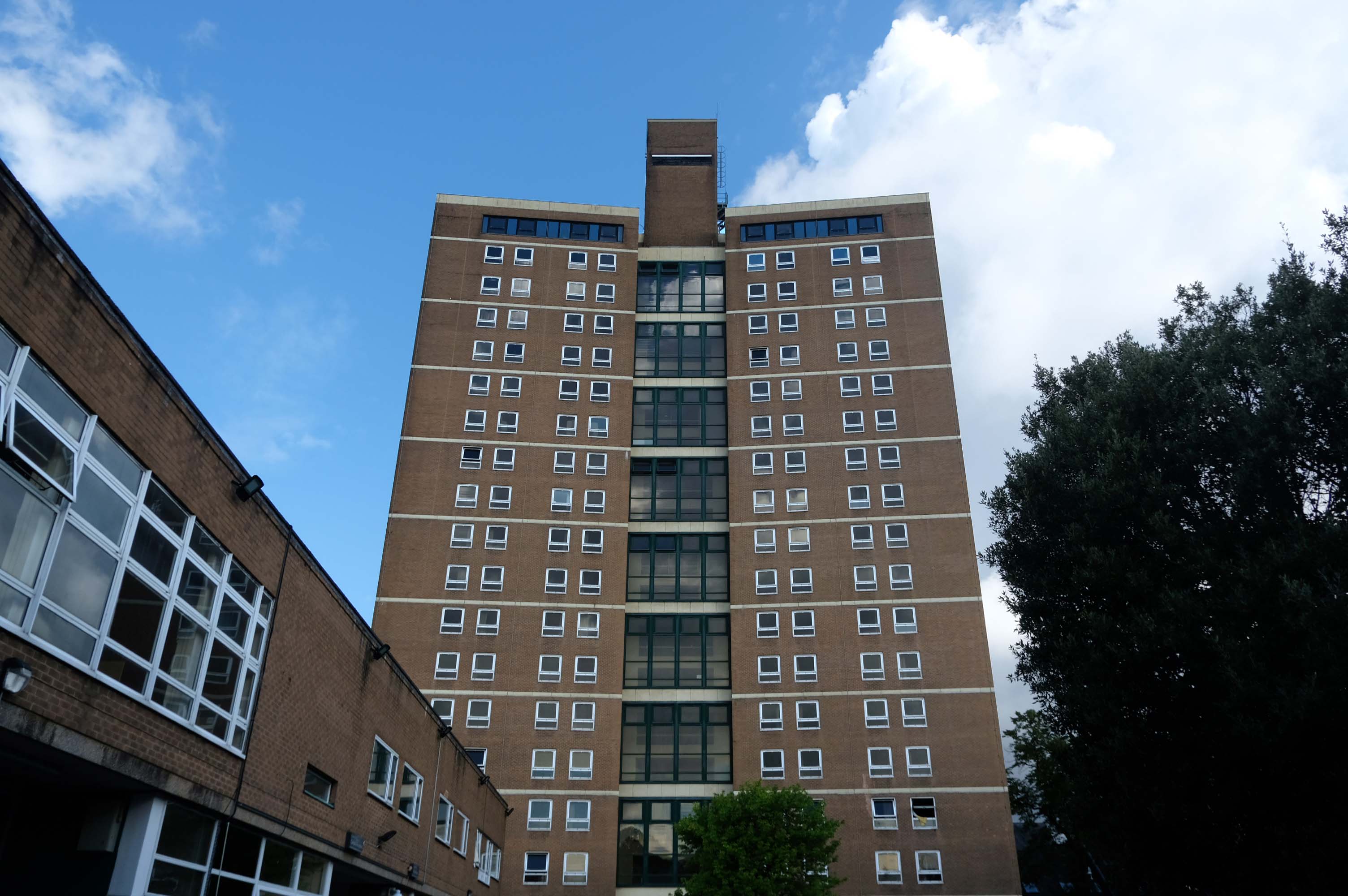
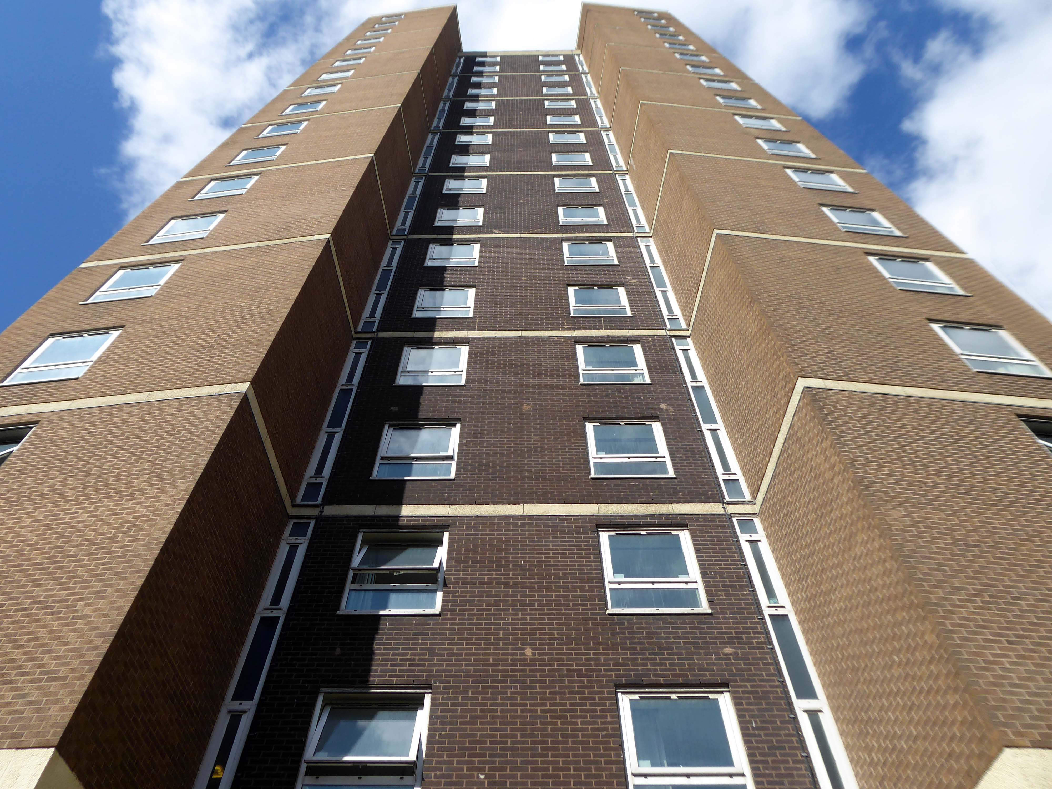
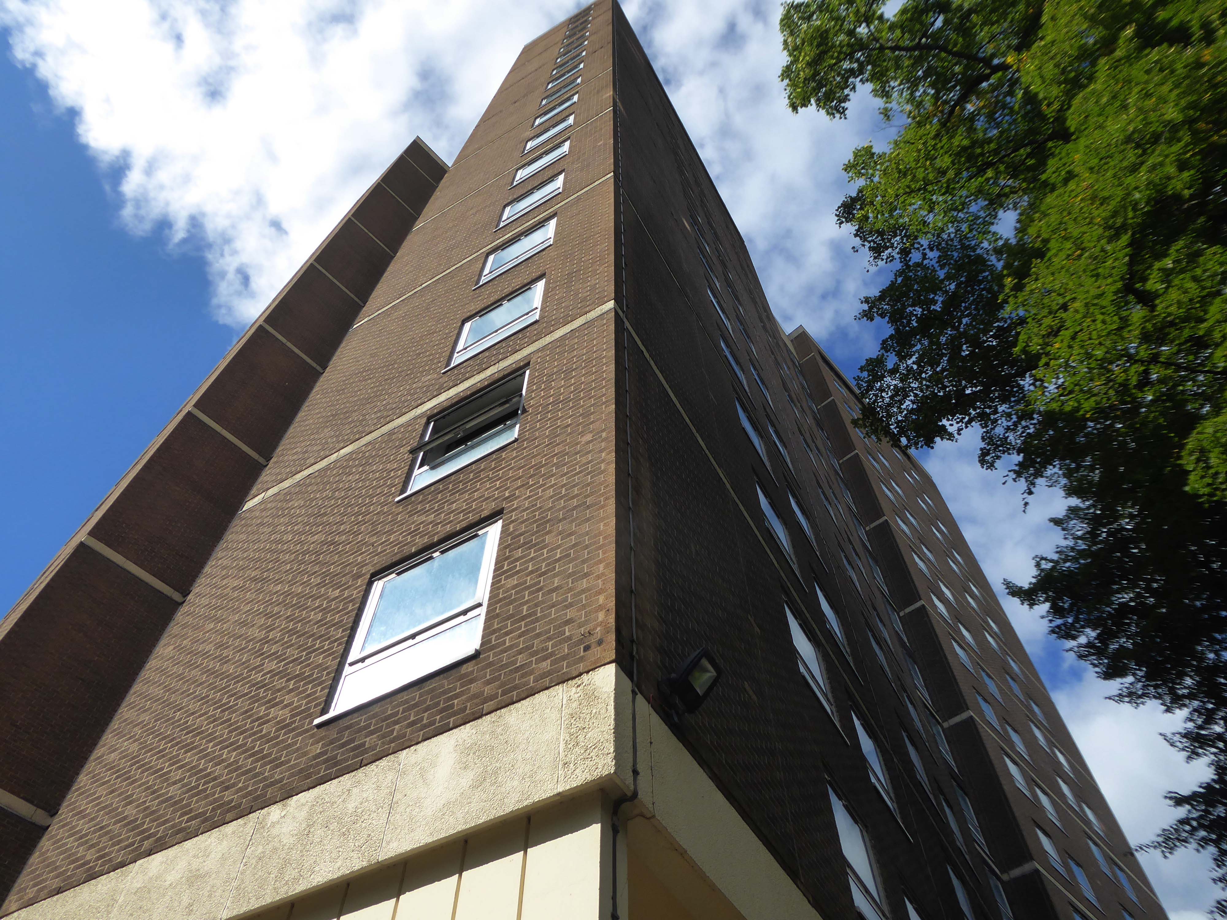
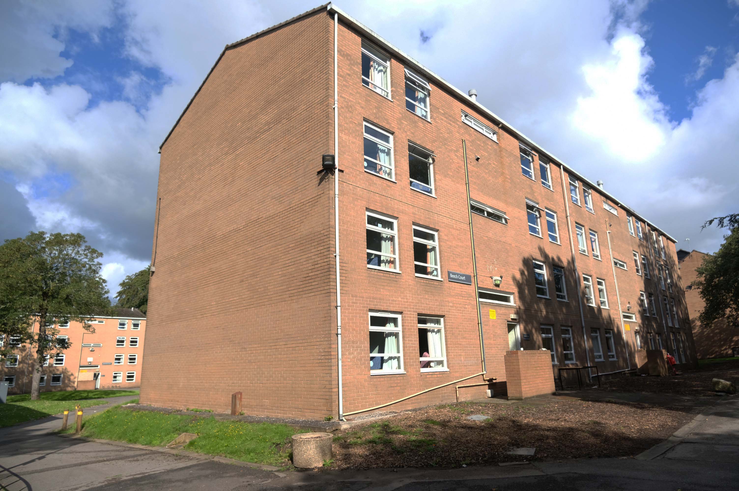
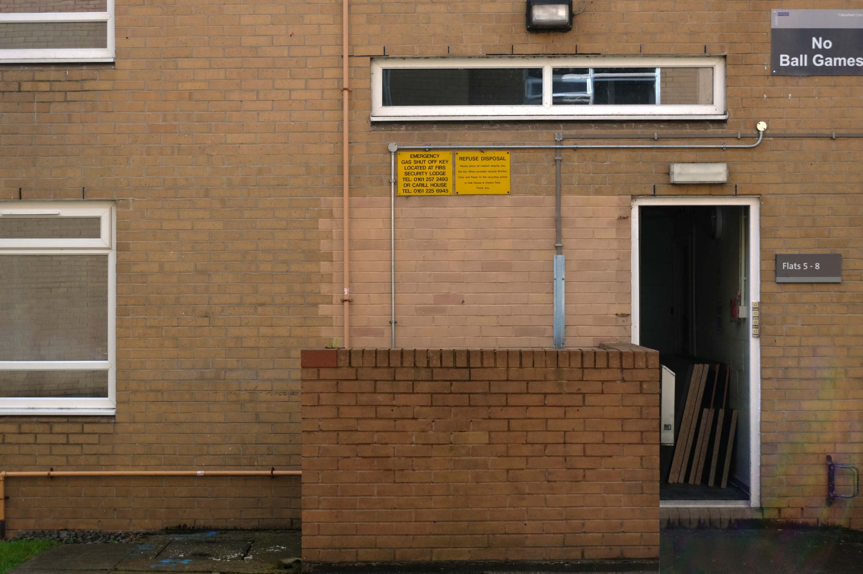
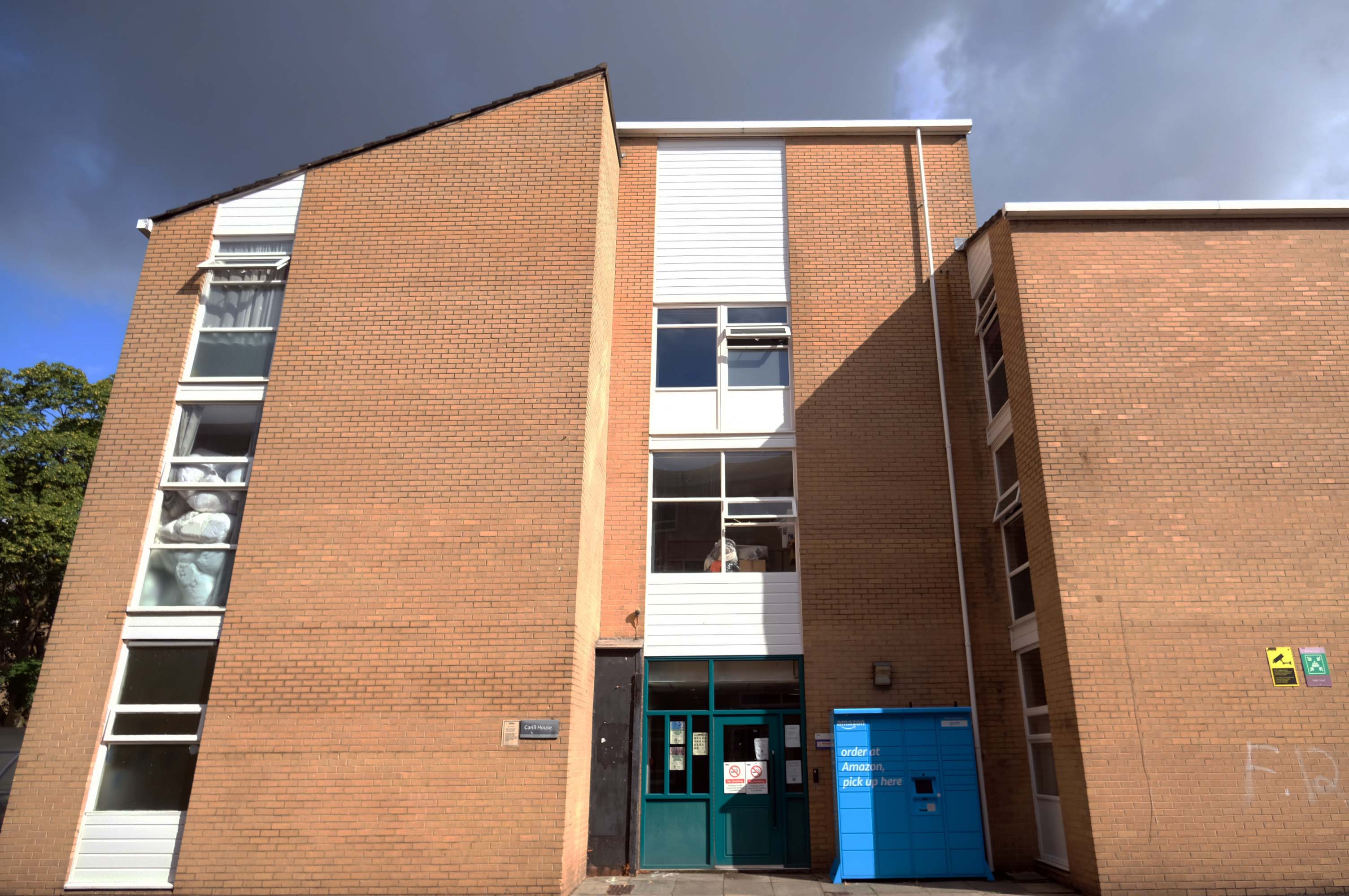
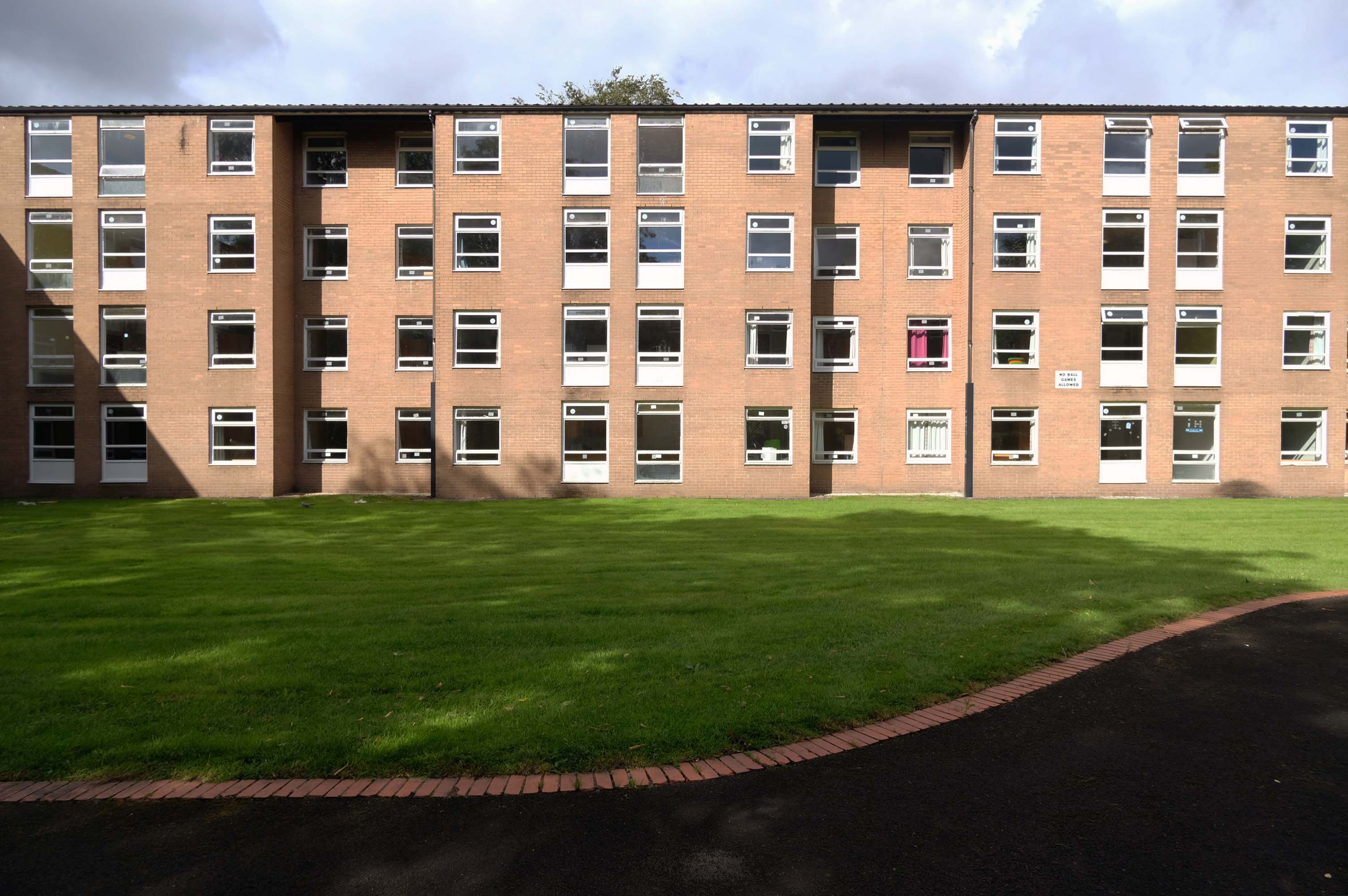
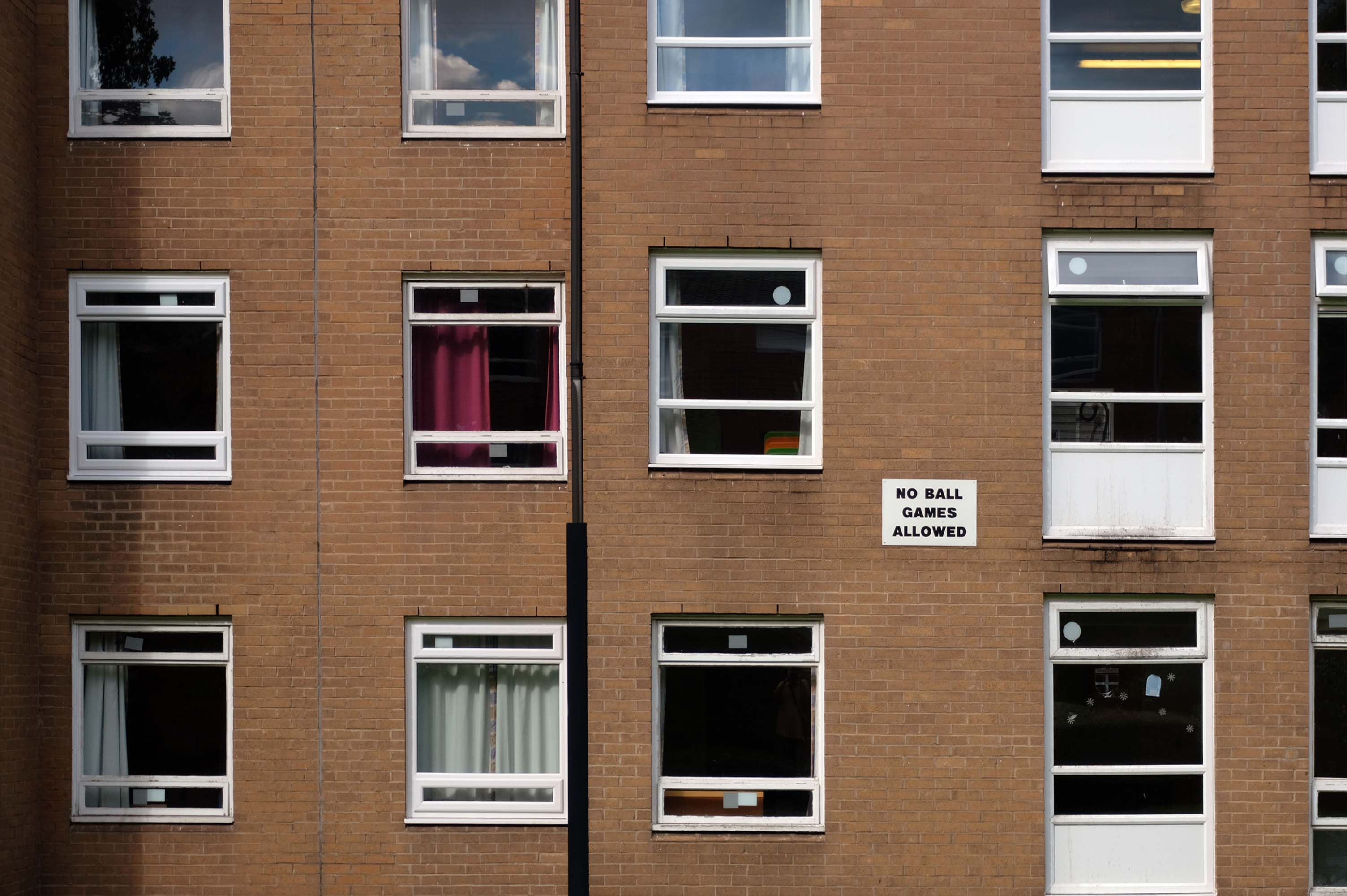
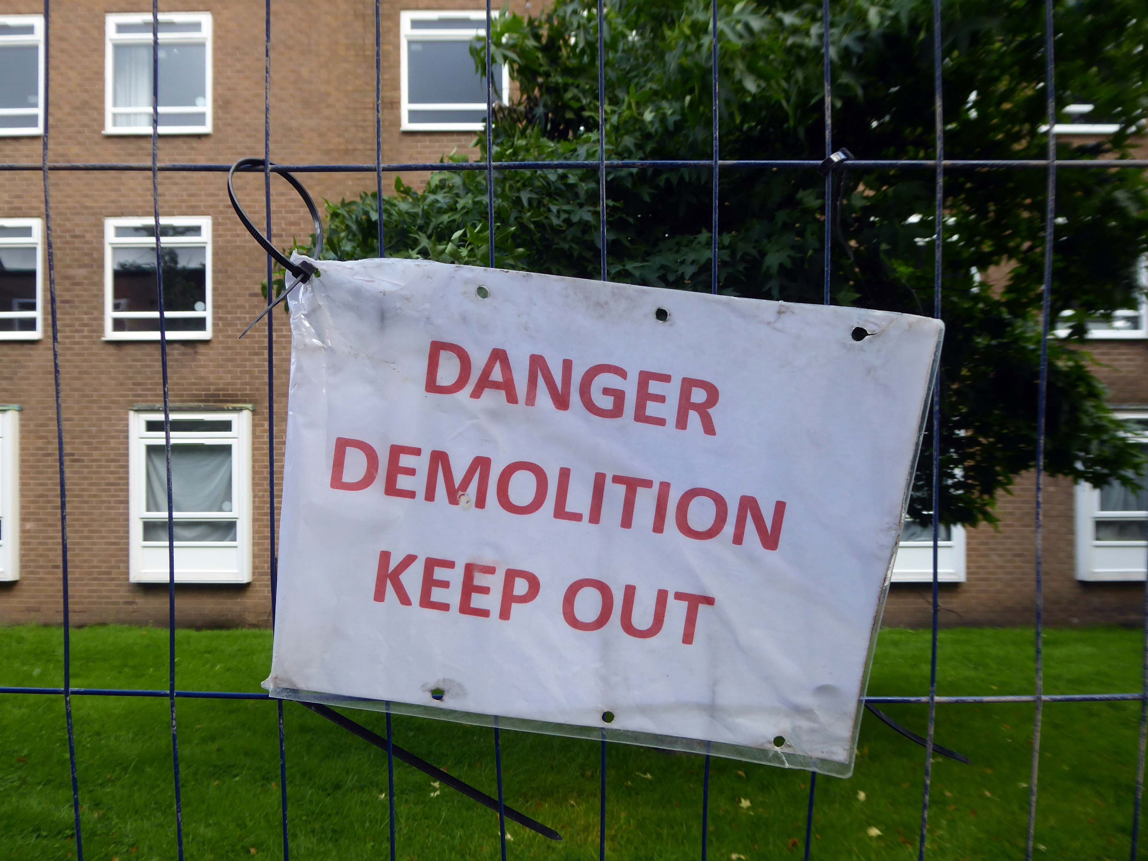
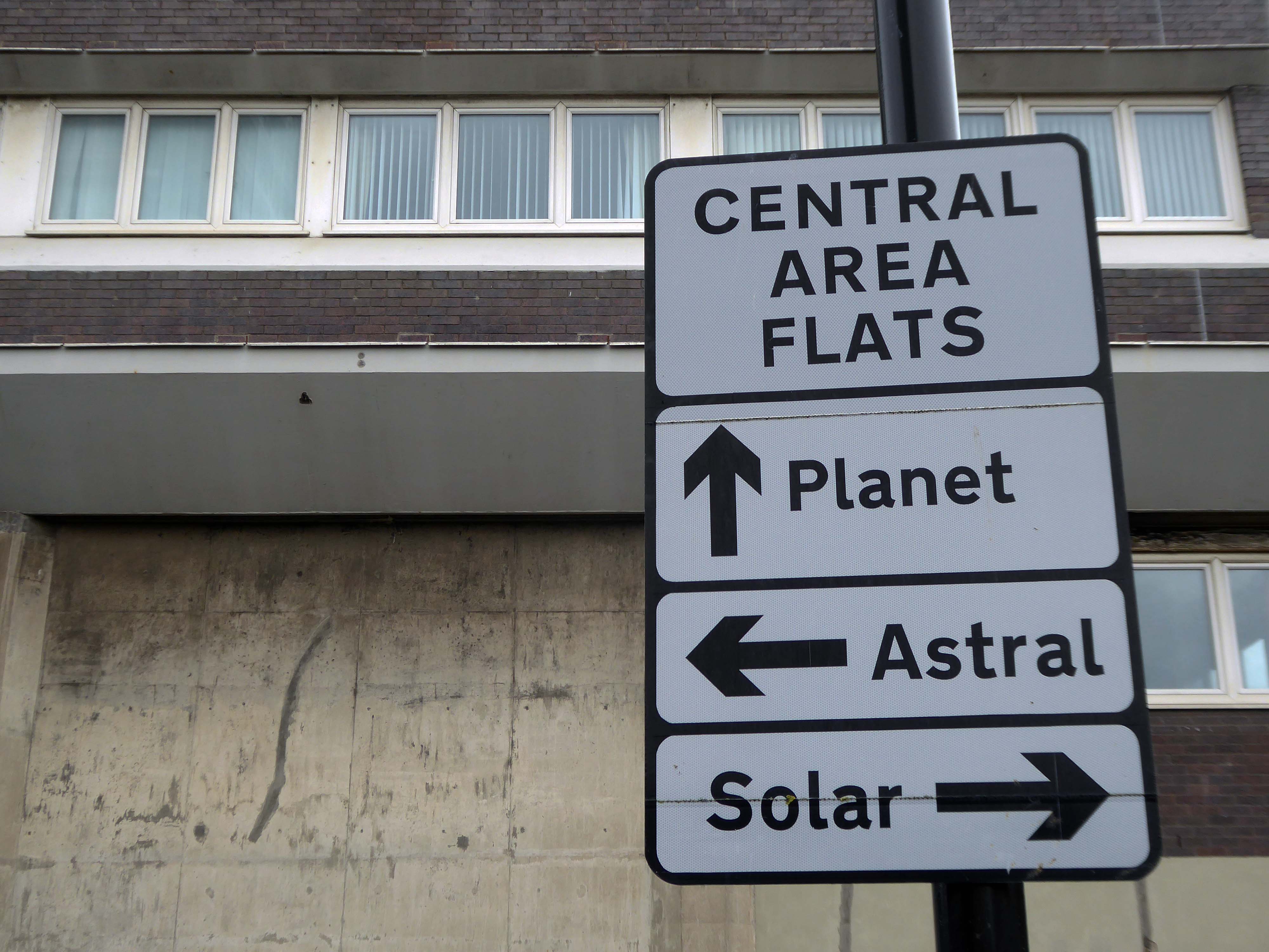
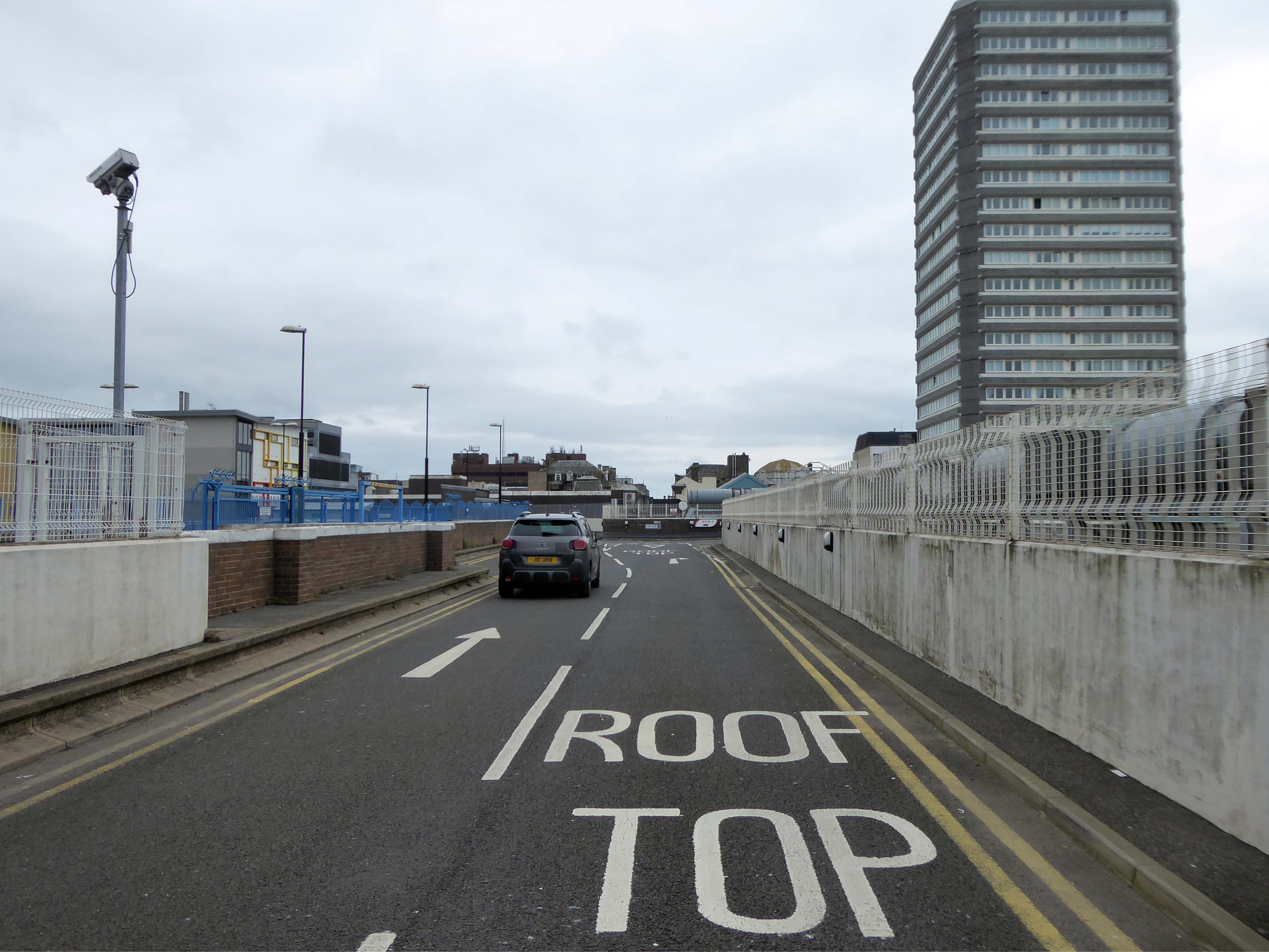
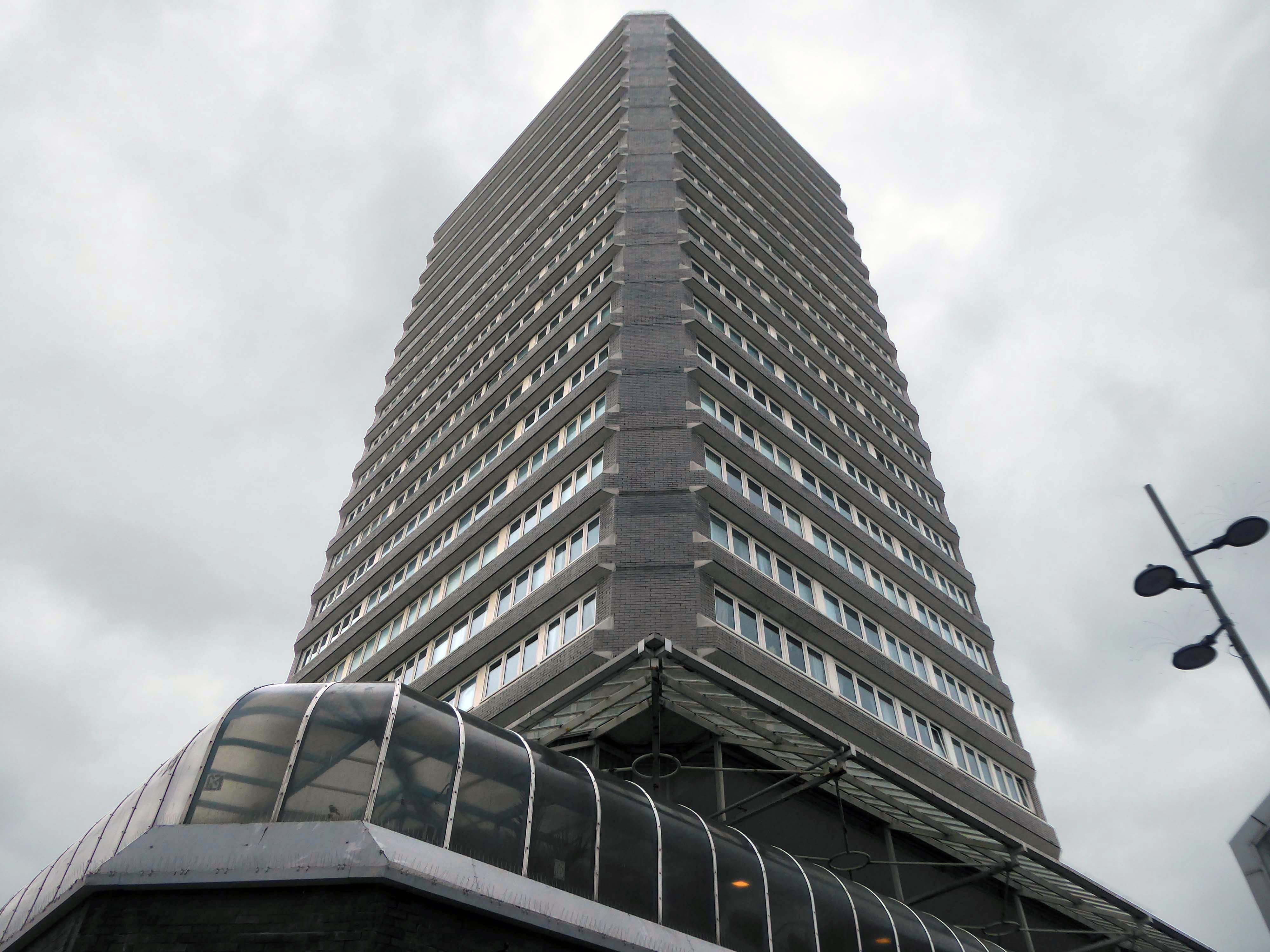
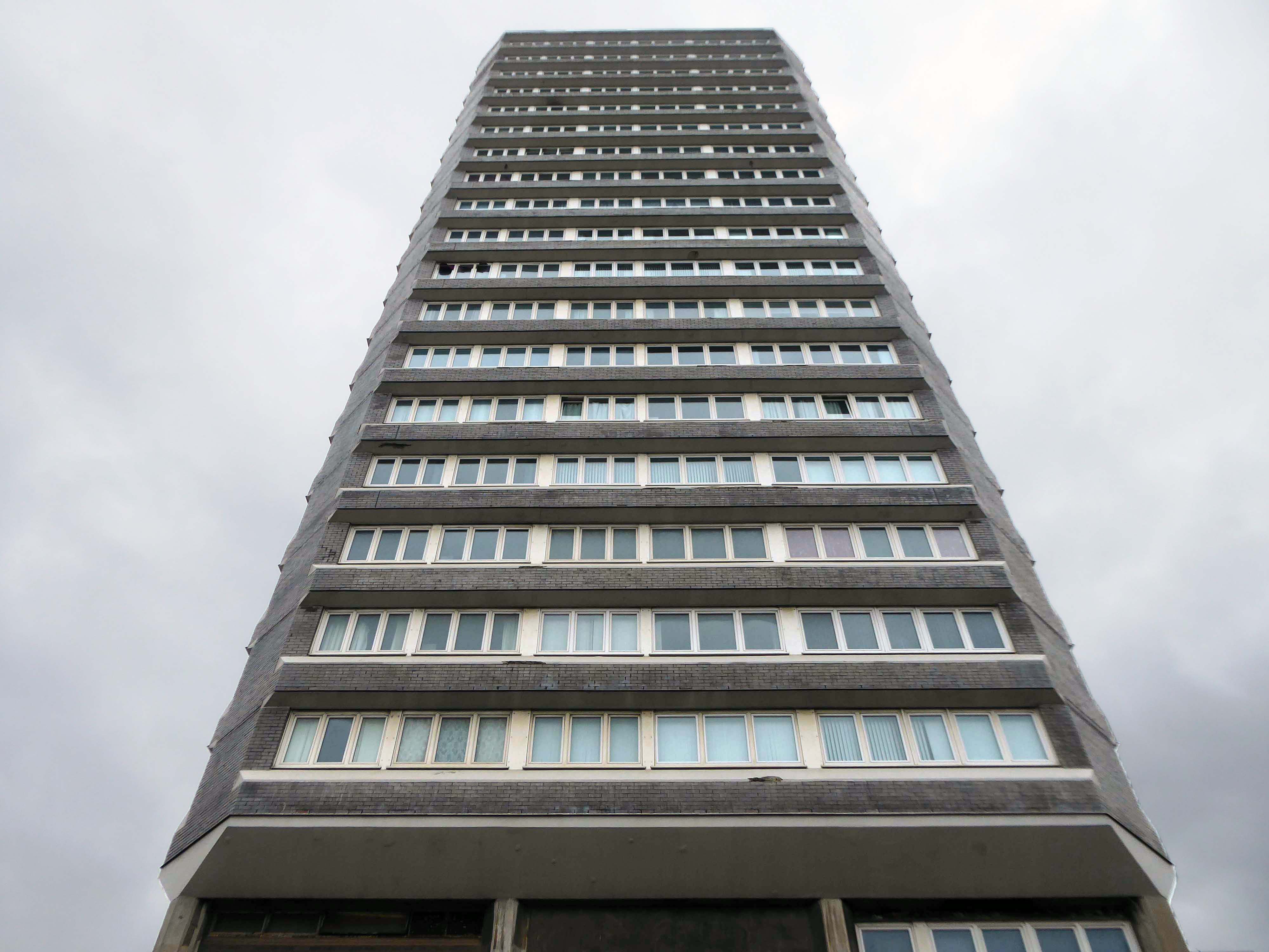
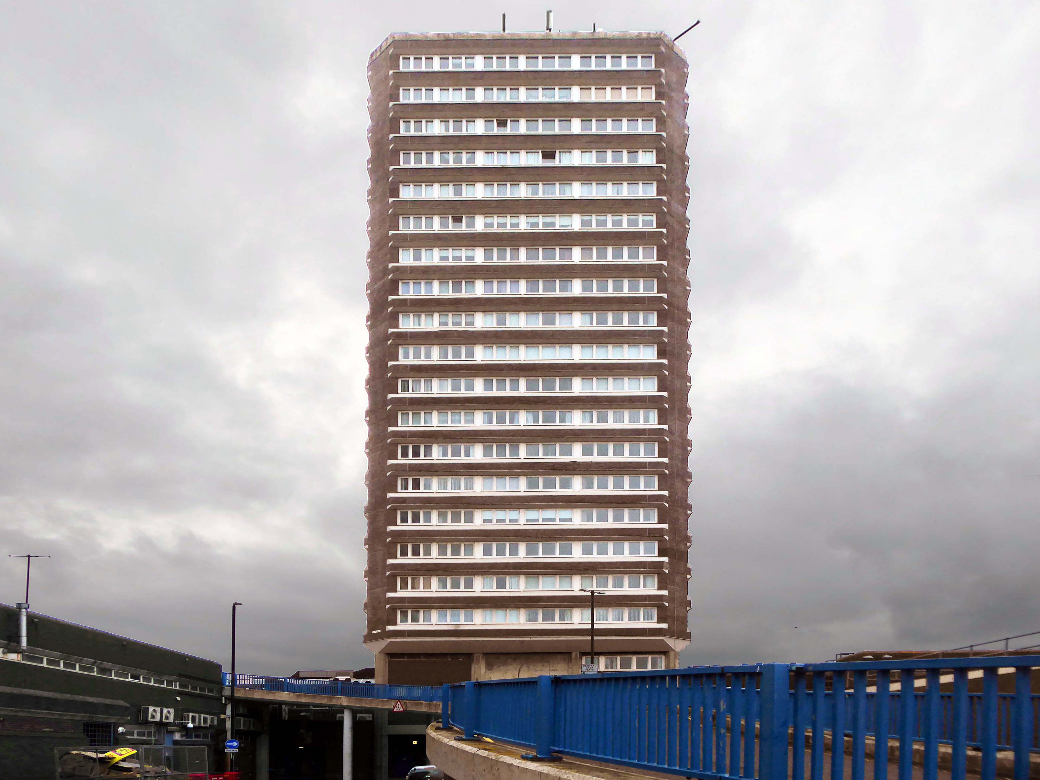
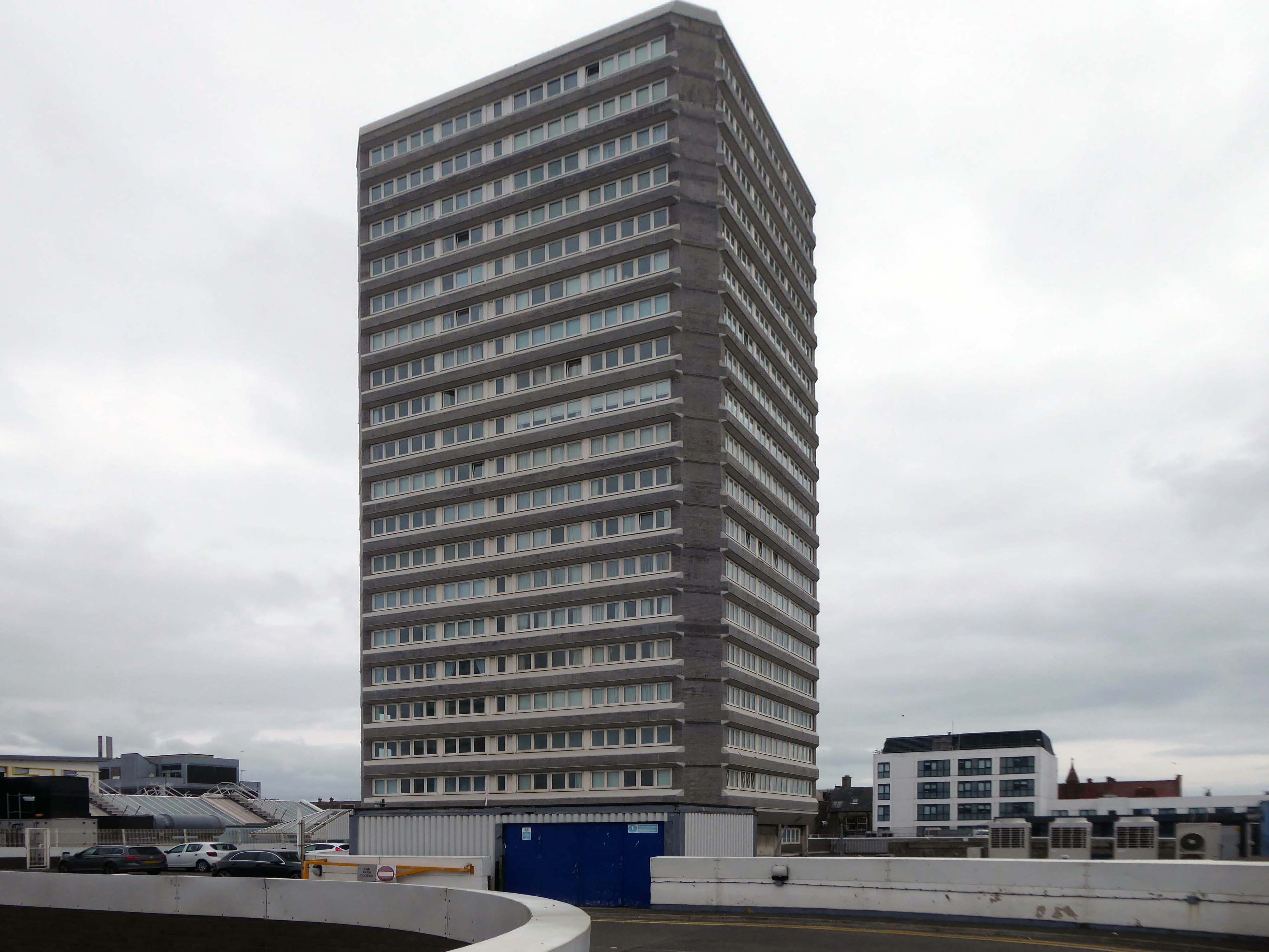
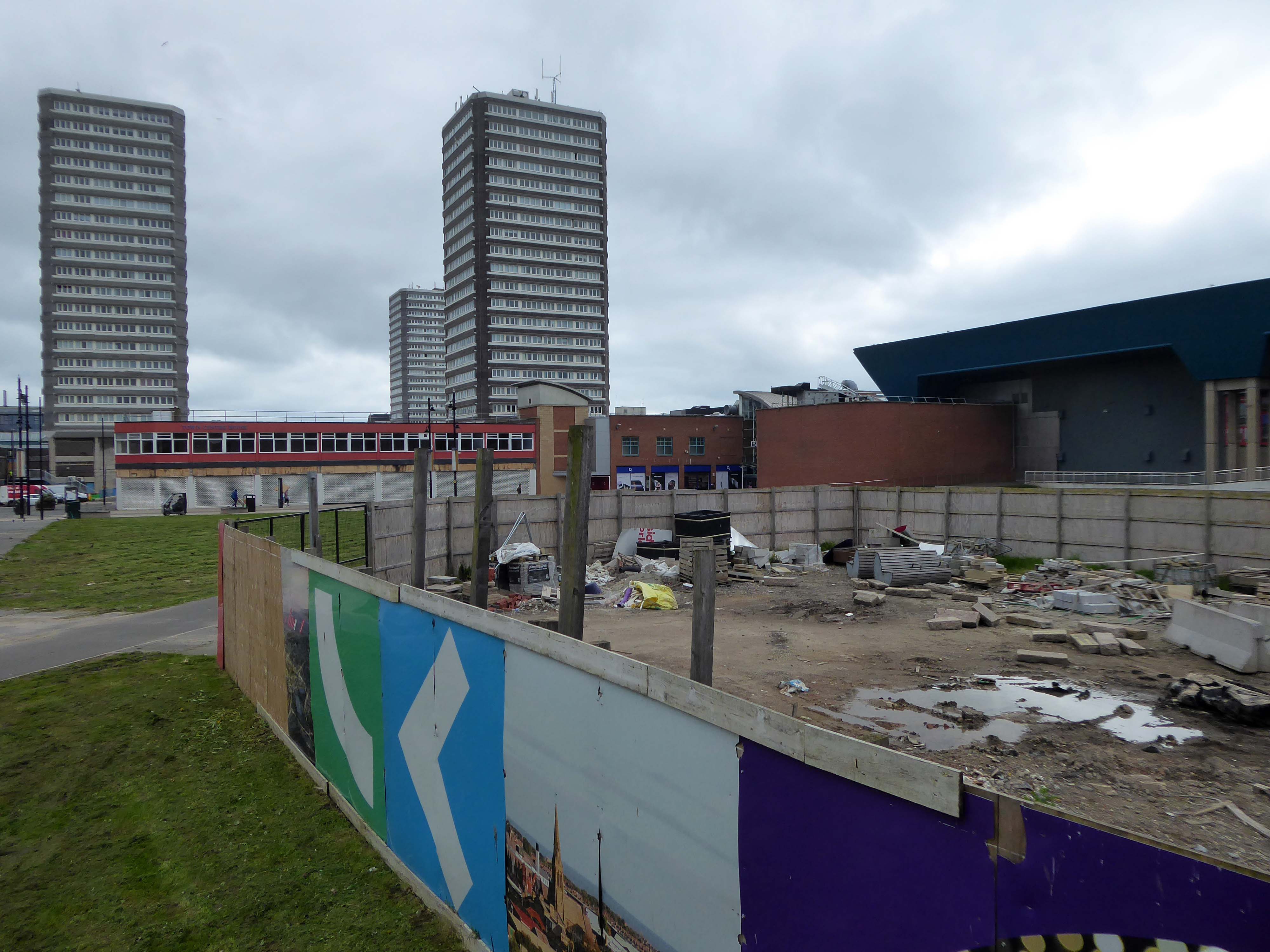
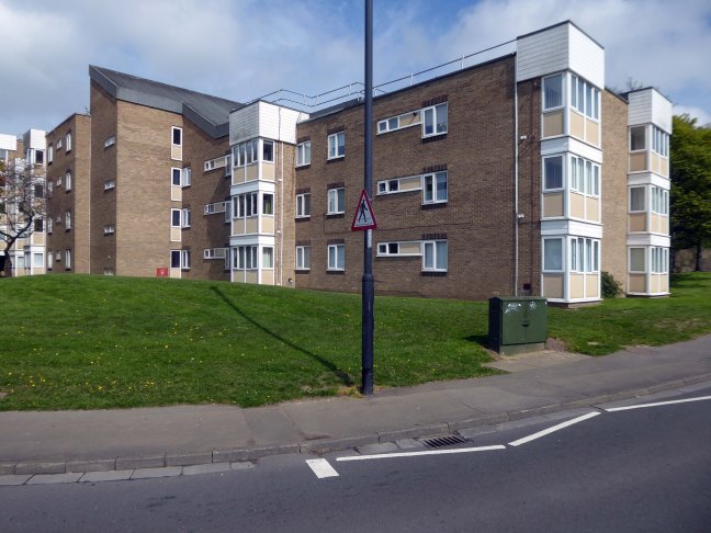
Plans are in place for redevelopment of the site and the demolition of the tower block and adjacent housing.
The scheme, designed by Sheppard Robson, would see 3,300 new bedspaces brought forward, taking the total number of units at the complex to 5,400, a net increase of 950. This is an increase of around 1,000 new units compared to the previous iteration of the project, approved in 2015.
The history of youth work goes back to the birth of the Industrial Revolution in the 18th century, which was the first time that young men left their own homes and cottage–industries to migrate to the big towns. The result of this migration was an emergent youth culture in urban areas, which was responded to by the efforts of local people.
Work with young women however was seen as less important, because young women’s needs at this time were seen as being centred on homemaking, which were already, supposedly, provided for in the home.
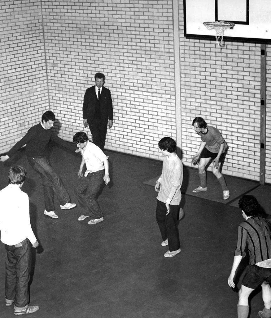
By 1959 widespread moral panic in the press about teenage delinquency led the British government to look into a national response to catering for the needs of young people. In 1960 a government report known as The Albemarle Report was released, which outlined the need for local government agencies to take on responsibility for providing extracurricular activities for young people. Out of this the statutory sector of the youth service was born. For the first time youth centres and fully paid full-time youth workers made an appearance across the whole of Britain.
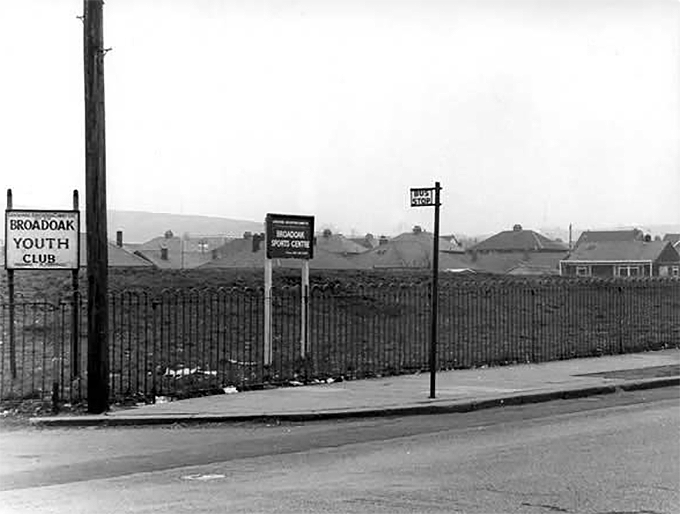
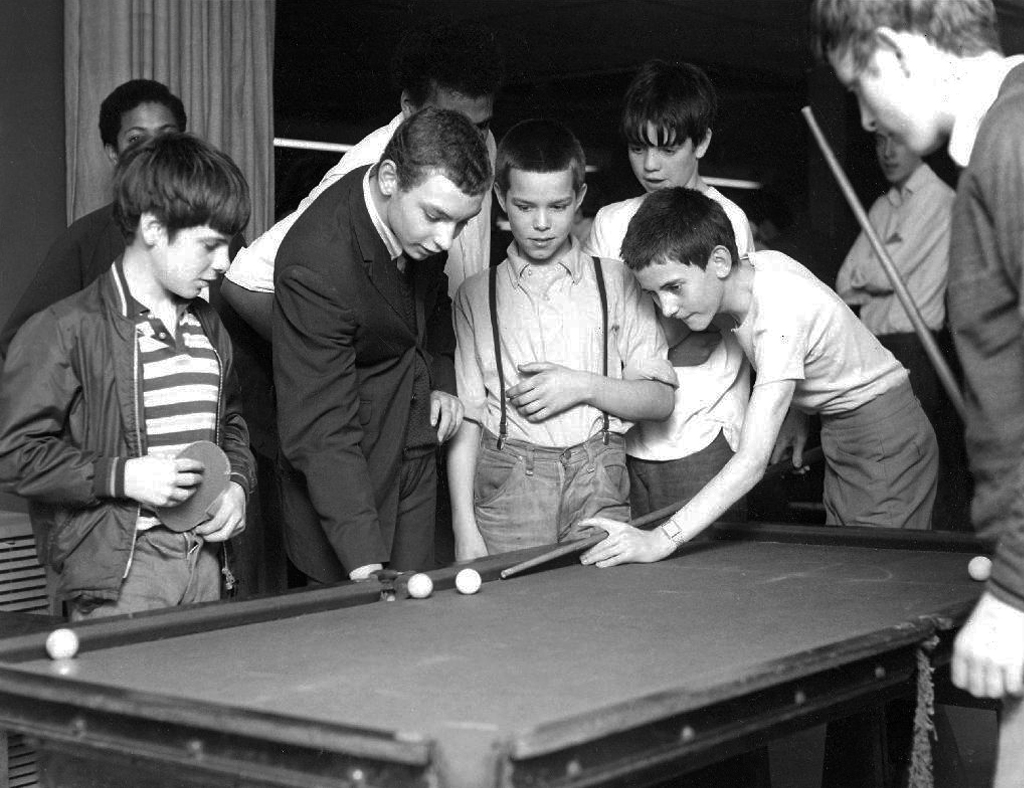
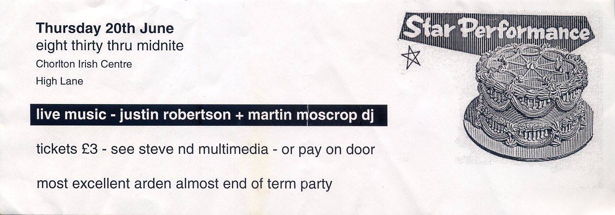
Which is where I enter this short history, attending the Broadoak Youth Club in Ashton, during the late 60s early 70s. These were days of ping pong, snooker, spinning 45s and drinking pop if you had the coppers.
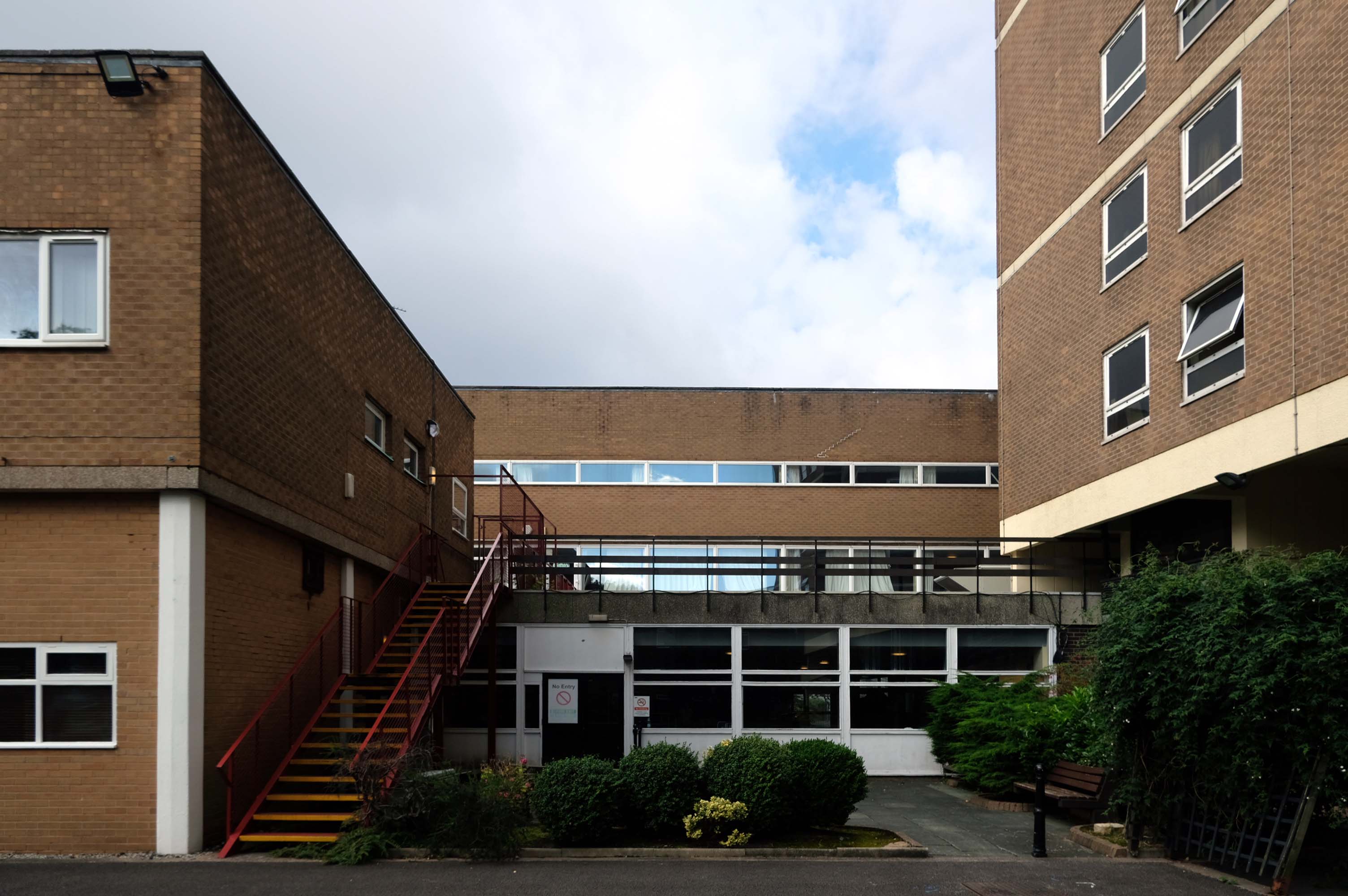
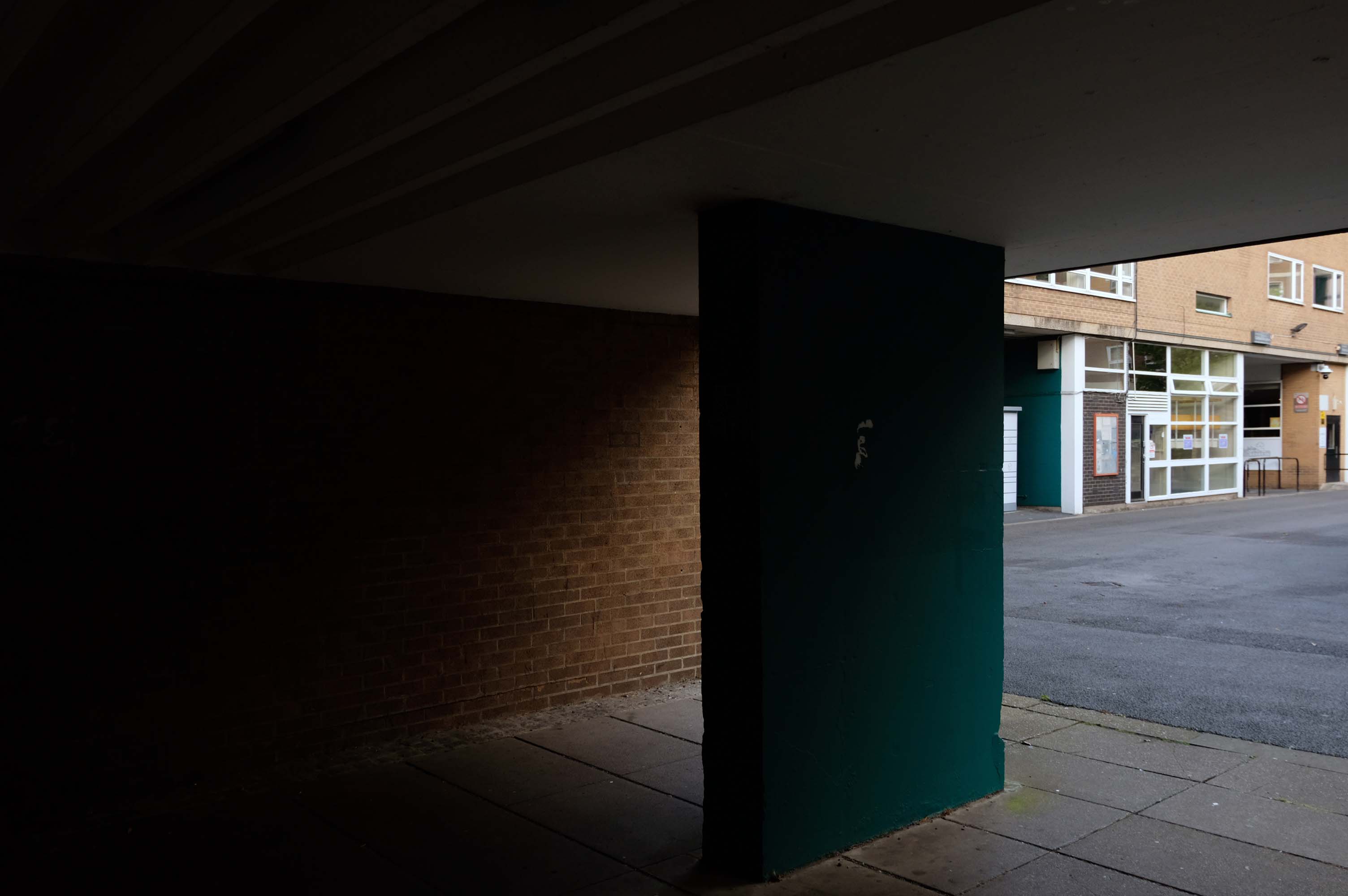
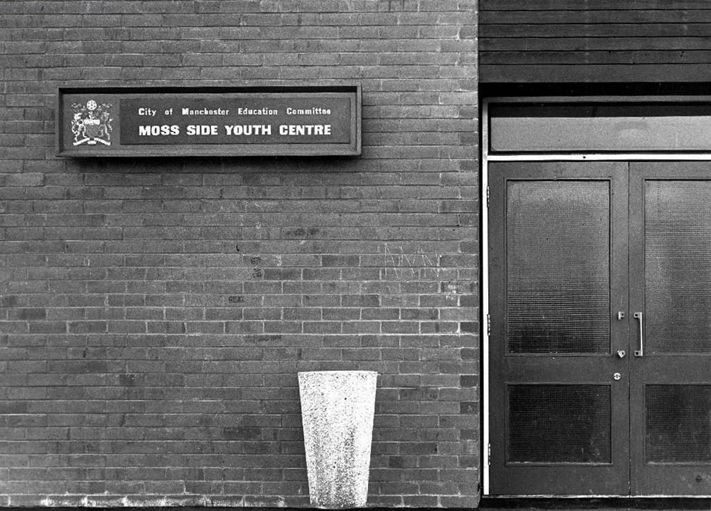
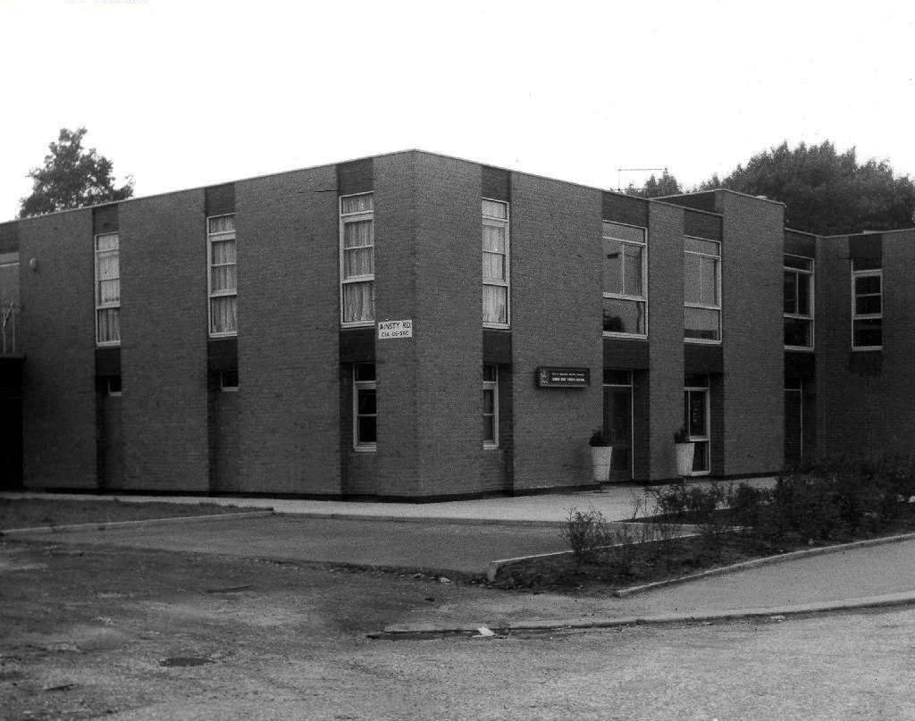
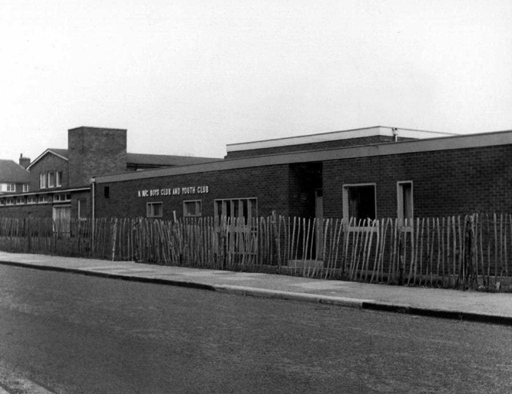
Council run, housed in an architectural style best described as bunker like.
I uncovered a little of Manchester’s youth club history during my travels.
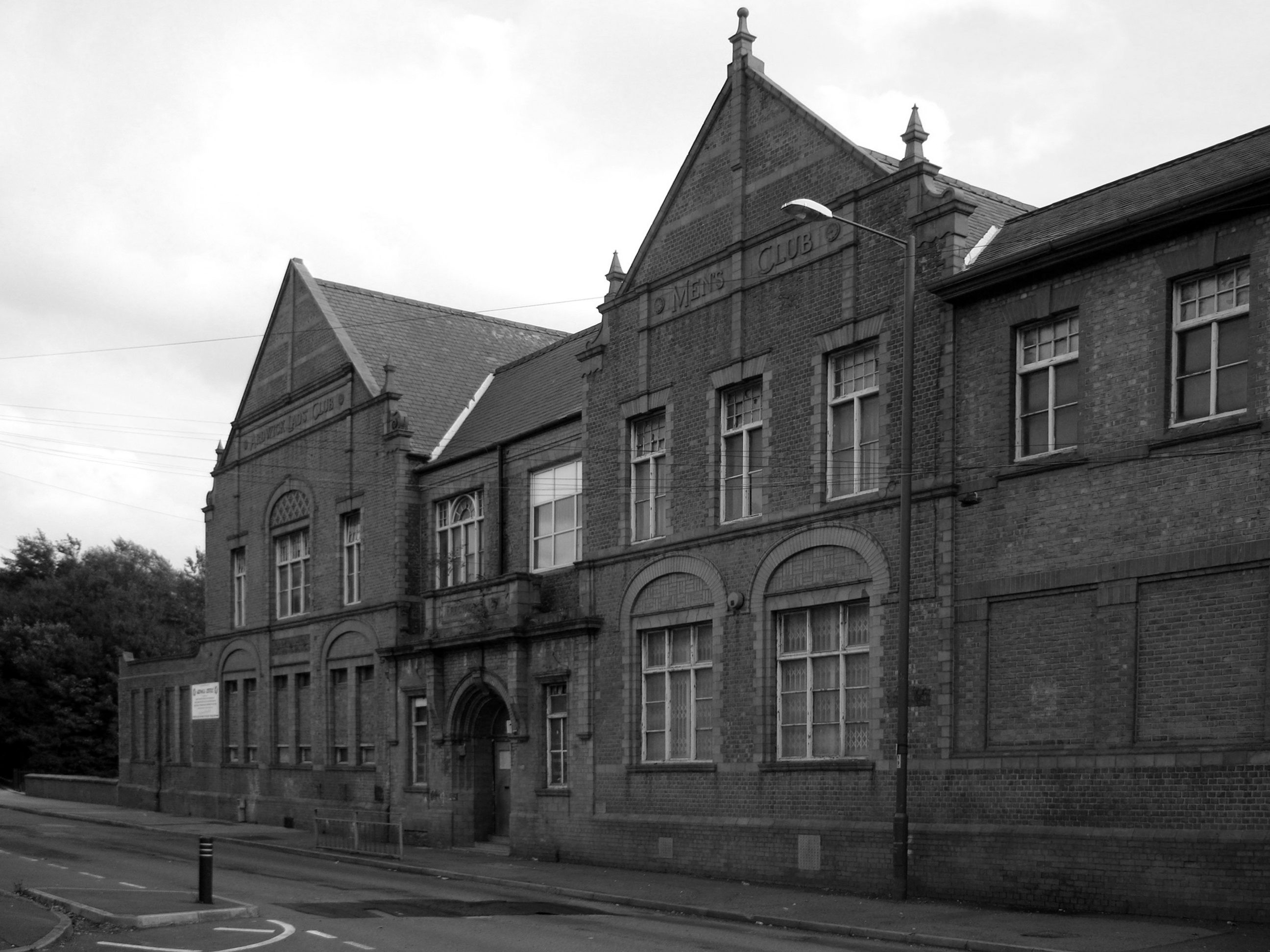
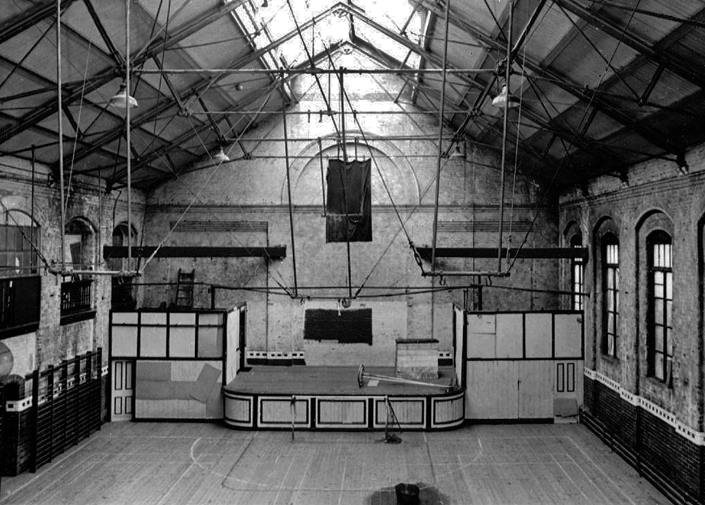
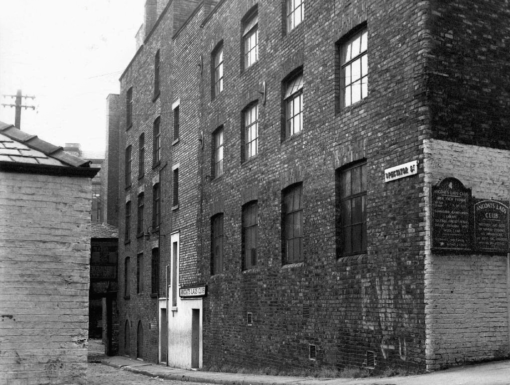
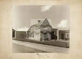
The Ardwick Lads’ and Mens’ Club on Palmerston Street, latterly the Ardwick Youth Centre, opened in 1897 and is believed to be Britain’s oldest purpose-built youth club still in use and was until earlier in 2012. Designed by architects W & G Higginbottom, the club, when opened, featured a large gymnasium with viewing gallery – where the 1933 All England Amateur Gymnastics Championships were held – three fives courts, a billiard room and two skittle alleys – later converted to shooting galleries. Boxing, cycling, cricket, swimming and badminton were also organised. At its peak between the two world wars, Ardwick was the Manchester area’s largest club, with 2,000 members.
On the 10th September 2012 an application for prior notification of proposed demolition was submitted on behalf of Manchester City Council to Manchester Planning, for the demolition of Ardwick Lads’ Club of 100 Palmerston Street , citing that there was “no use” for the building in respect to its historic place within the community as providing a refuge and sporting provision to the young of Ancoats.
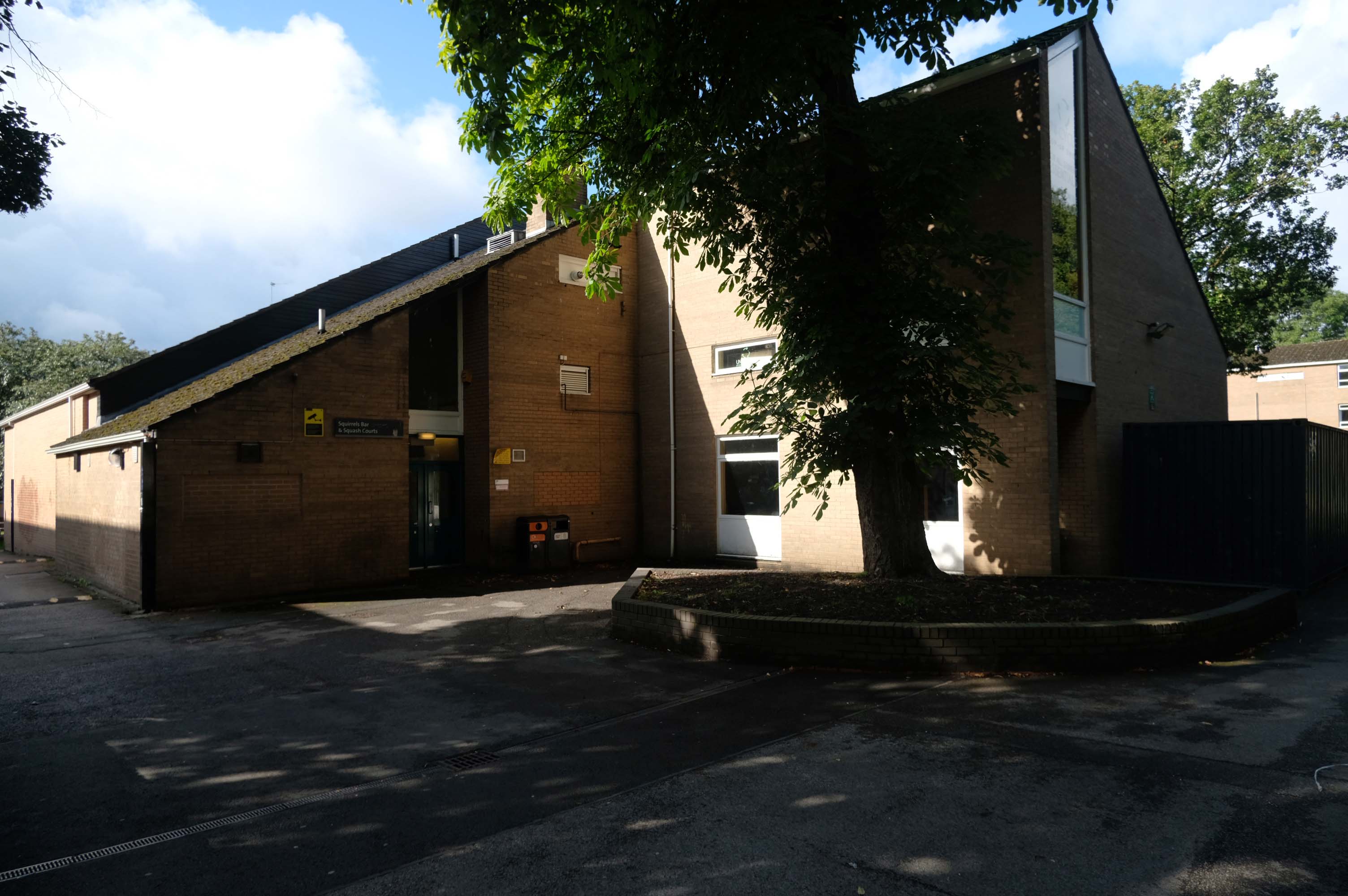
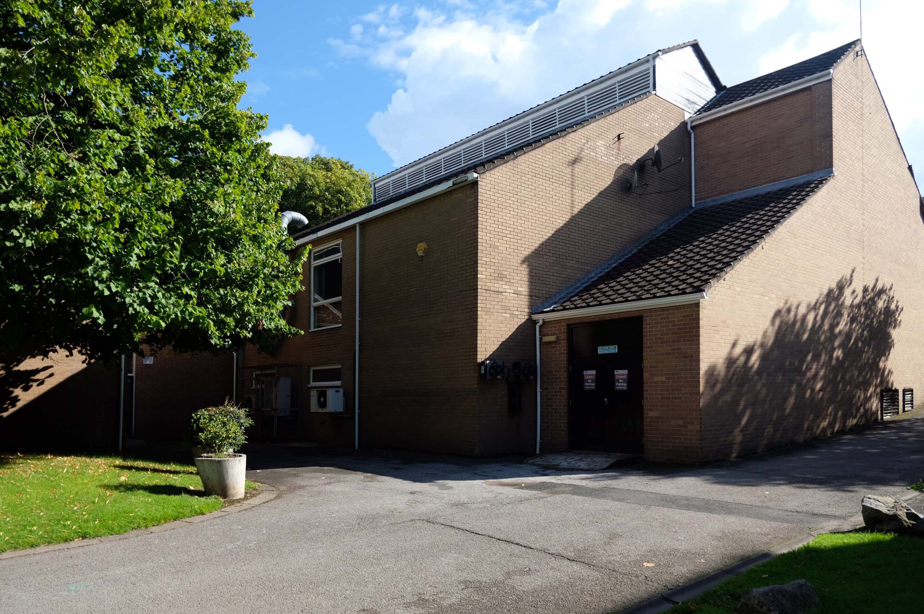
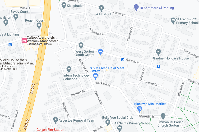
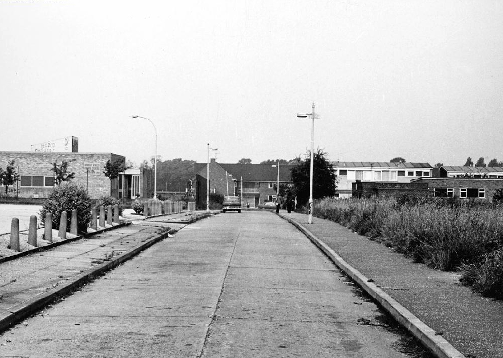
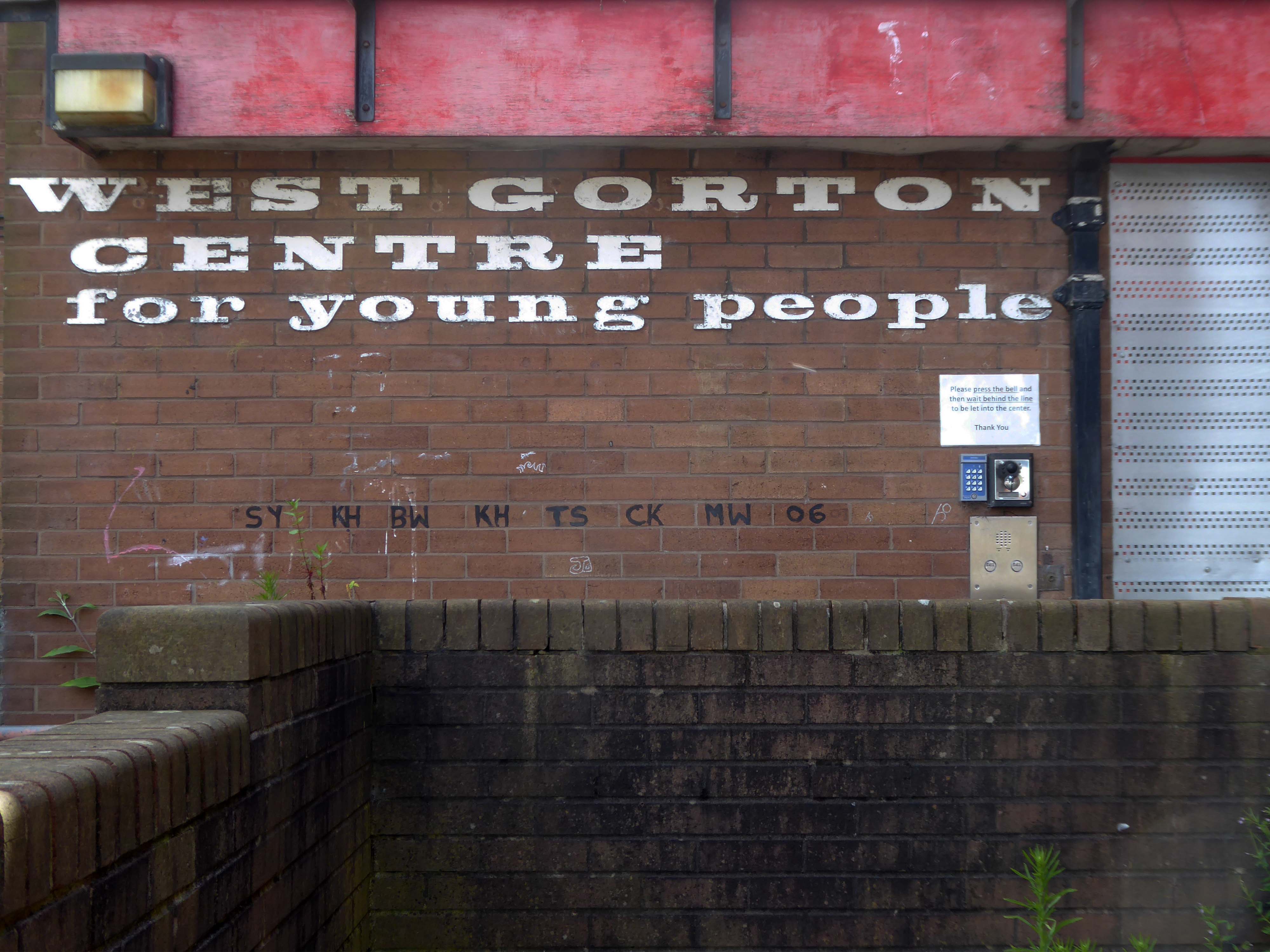
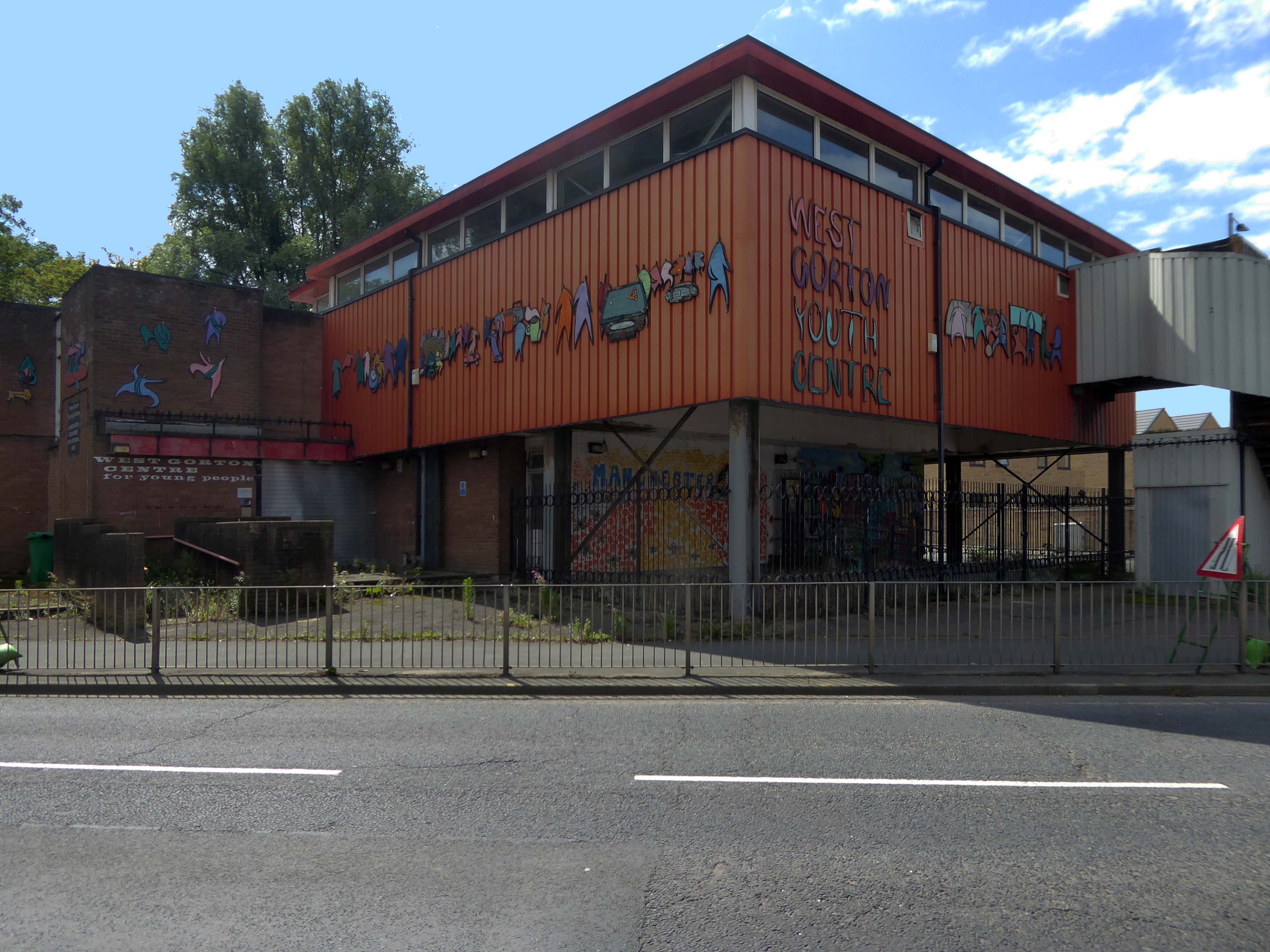
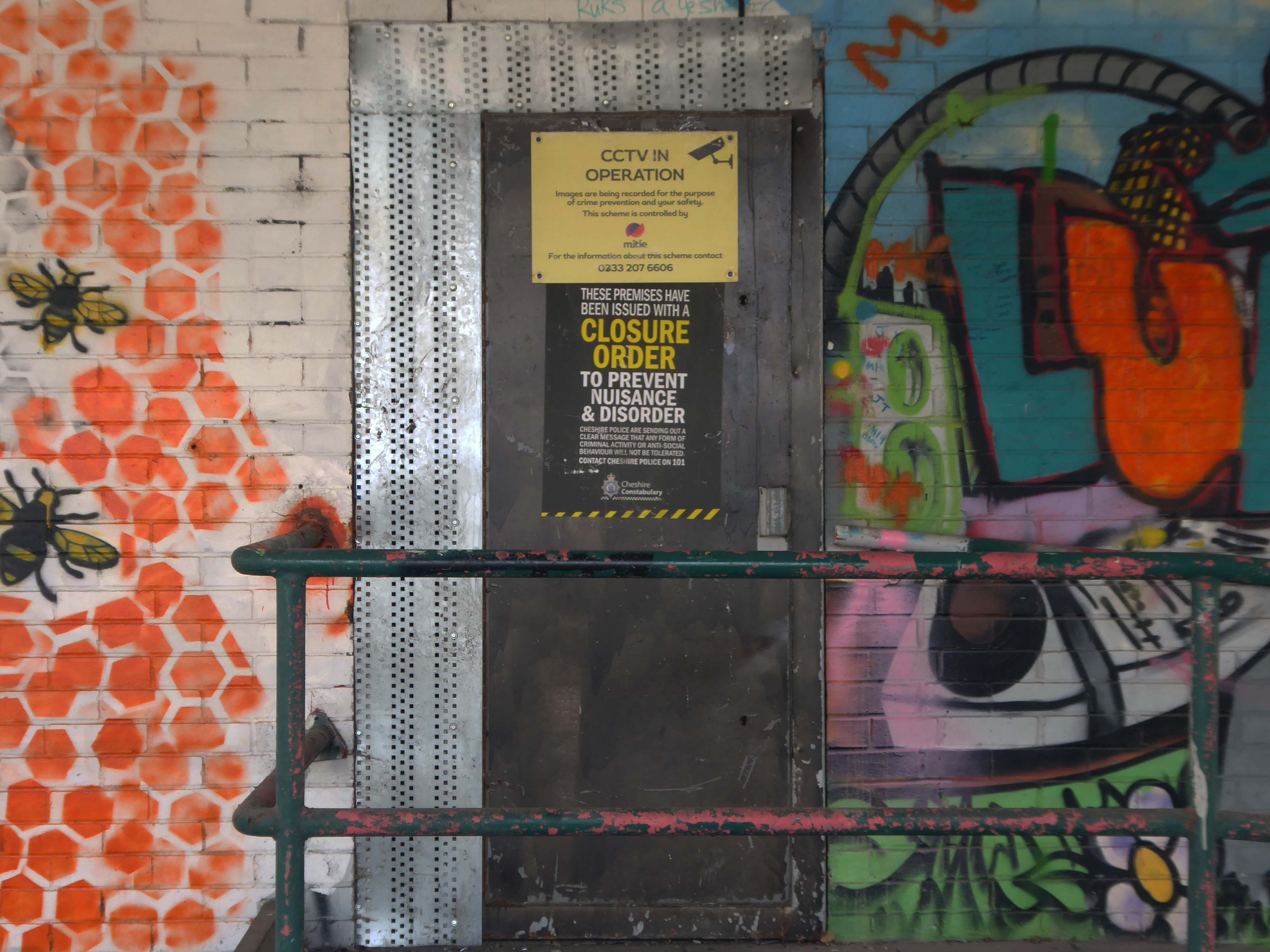
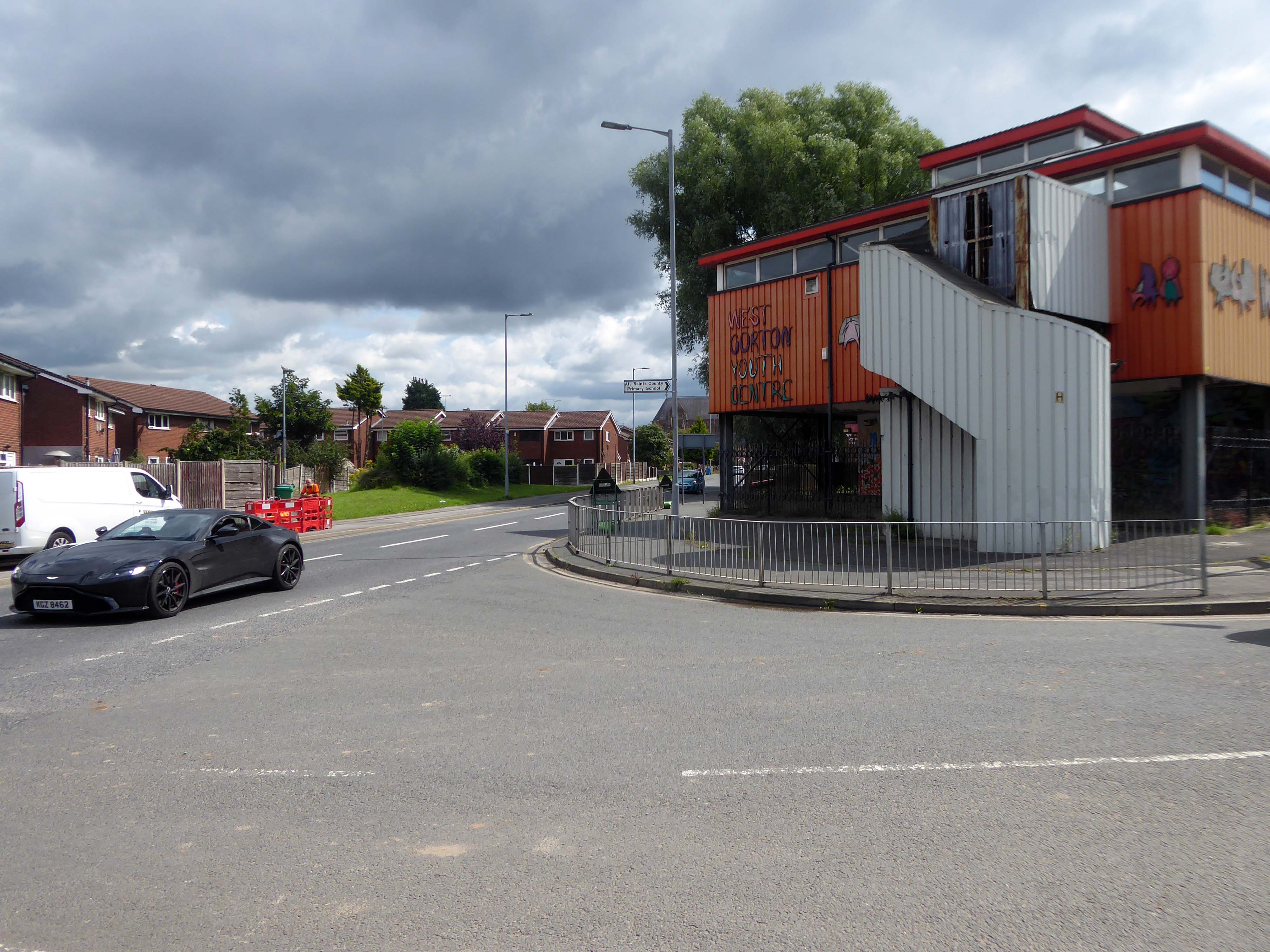
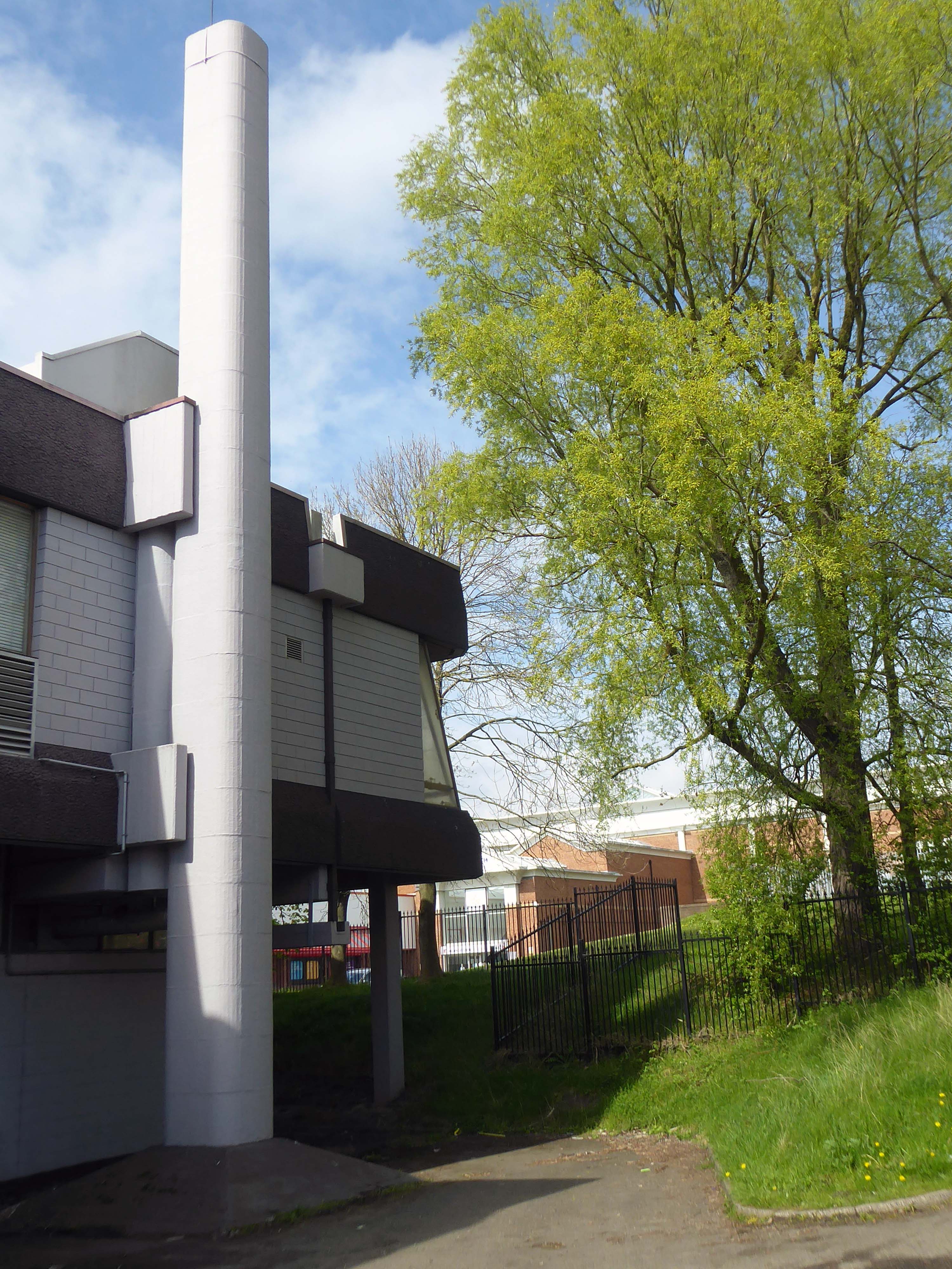
Whilst cycling through Gorton, I passed the now defunct West Gorton Youth Centre.
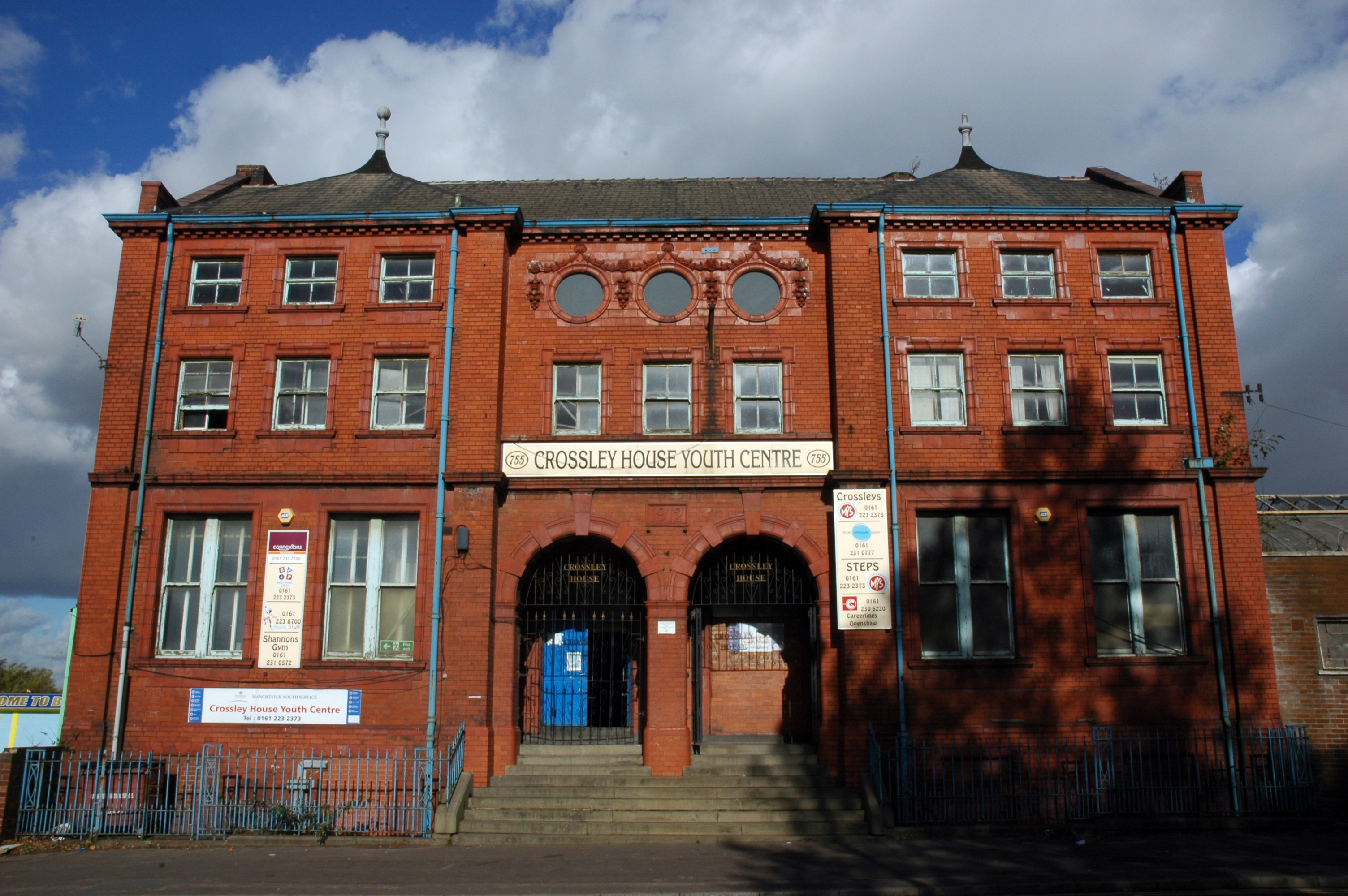
Intrigued I started to dig a little deeper, I remembered playing five-a-side at Crossley House in Openshaw.
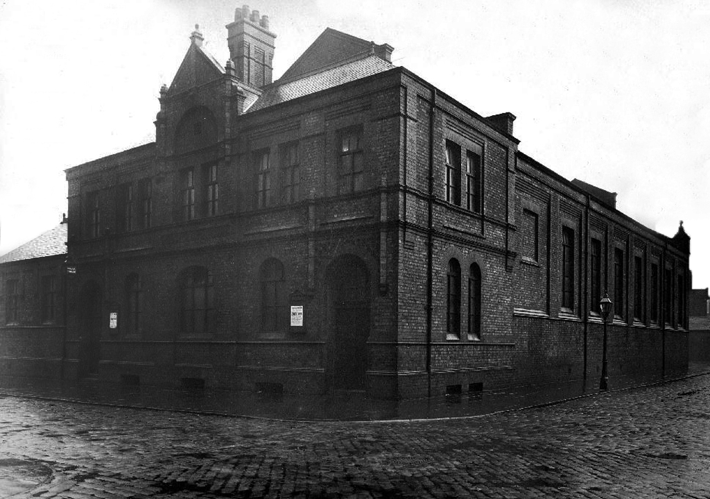
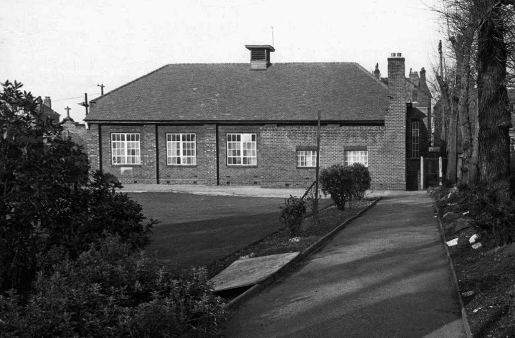
Openshaw Lad’s Club was founded in November 1888 by William John Crossley. It was previously known as the Gorton and Openshaw Working Lad’s Club and the Crossley Lad’s Club. The Crossley family financed the club up to 1941 and they built the club premises, Crossley House to commemorate Sir William Crossley after his death in 1911. The building was opened on 1 September 1913. In July 1941 the premises were handed over to the National Association of Boy’s Clubs and a management committee was formed to administer the club
Simon Inglis gives the architect as John Broadbent; Buildings of England names the architect as James Barritt Broadbent.
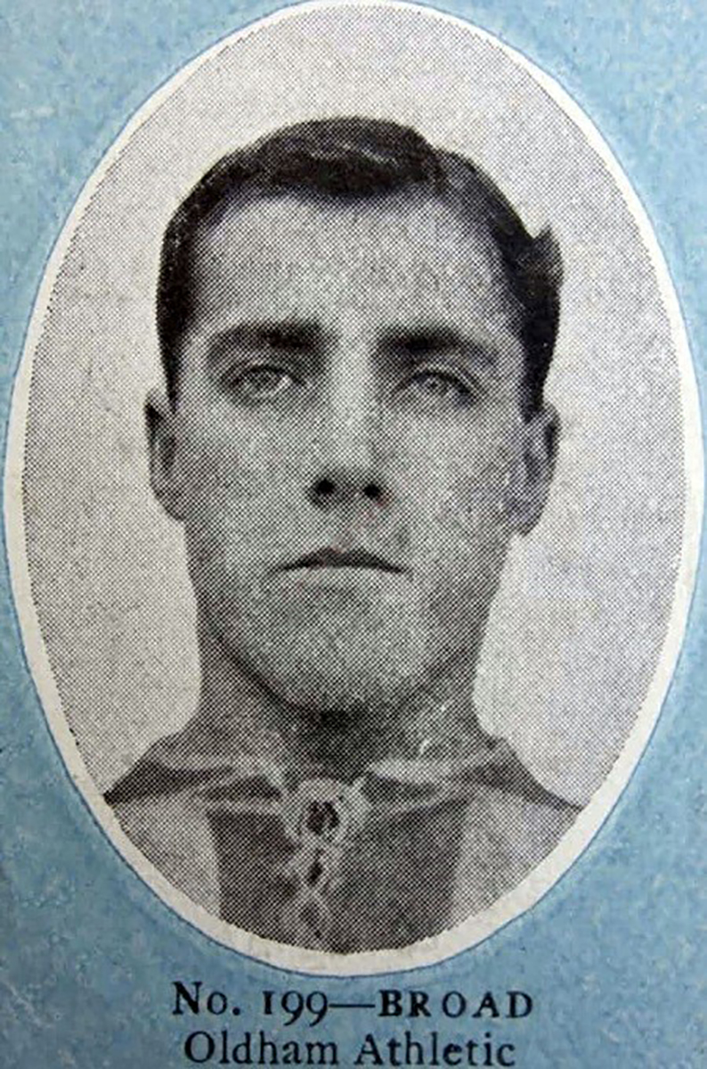
Stalybridge born outside right Tommy Broad started with Redgate Albion in 1902 spending time at Manchester City without making their first eleven before playing for Denton Wanderers in 1903 and Openshaw Lads Club in 1904 from where he joined Second Division West Bromwich Albion in September 1905 making his Football League debut at Wolverhampton Wanderers that September. After a single goal in 15 appearances he moved to Chesterfield Town in the February 1908 scoring 5 goals in 50 appearances for The Spireites over the next two seasons at Saltergate, where he was an ever present in 1908-09.
He moved to Second Division Oldham Athletic in May 1909 and they were promoted as Second Division runners-up in his first season when he missed only one game, scoring a career best 7 goals in the campaign, and in three seasons at Boundary Park he scored 9 goals in 104 appearances. He then played for Bristol City between the summer of 1912 and the suspension of peacetime football due to the onset of the First World War in 1915, where he missed only one match in his first two seasons, scoring 8 times in 111 appearances at Ashton Gate.
During the First World War he served in the Armed Forces and after its resolution he joined First Division Manchester City in the summer of 1919, making 44 appearances in two years at Hyde Road, and helping The Citizens to finish runners up in the League Championship in 1920-21, which he followed with a move to Stoke in the summer of 1921 where Broad along with his younger brother Jimmy helped The Potters to promotion in 1921-22, finishing as Second Division runners-up, although this was followed by relegation the following season.
After three years in The Potteries, where Broad scored 4 times in 89 first team appearances, he moved to the South Coast to join Southampton. Broad still holds the distinction of being the oldest player ever signed by The Saints, being just three weeks short of his 37th birthday. At The Dell, he was used as cover for Bill Henderson and only had a run of three games in October, followed by six more appearances in April. In September 1925, Broad moved to Weymouth of the Western League, before playing out his career with Rhyl.
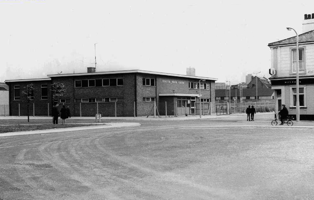
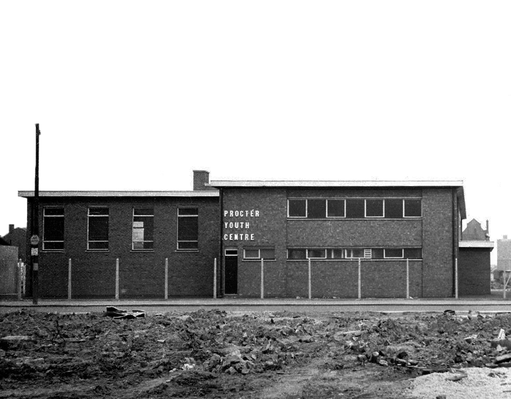
Procter Youth Centre a victim of city’s spending cuts
Procter Youth Centre 1966-2011. Despite being in singularly ugly building, it was very popular, providing a wide range of activities such as pool, football and martial arts, to name but a few. In 2009 the premises were refurbished with £668,000 being spent on a weights room, dance studio, recording studio. Then two years later Manchester City Council did the logical thing – closed it! Some of the eight staff offered to take a pay cut but to no avail. There were plans to use the building as a pupil referral unit. Today the building stands in the middle of wasteland that is the process of redevelopment.
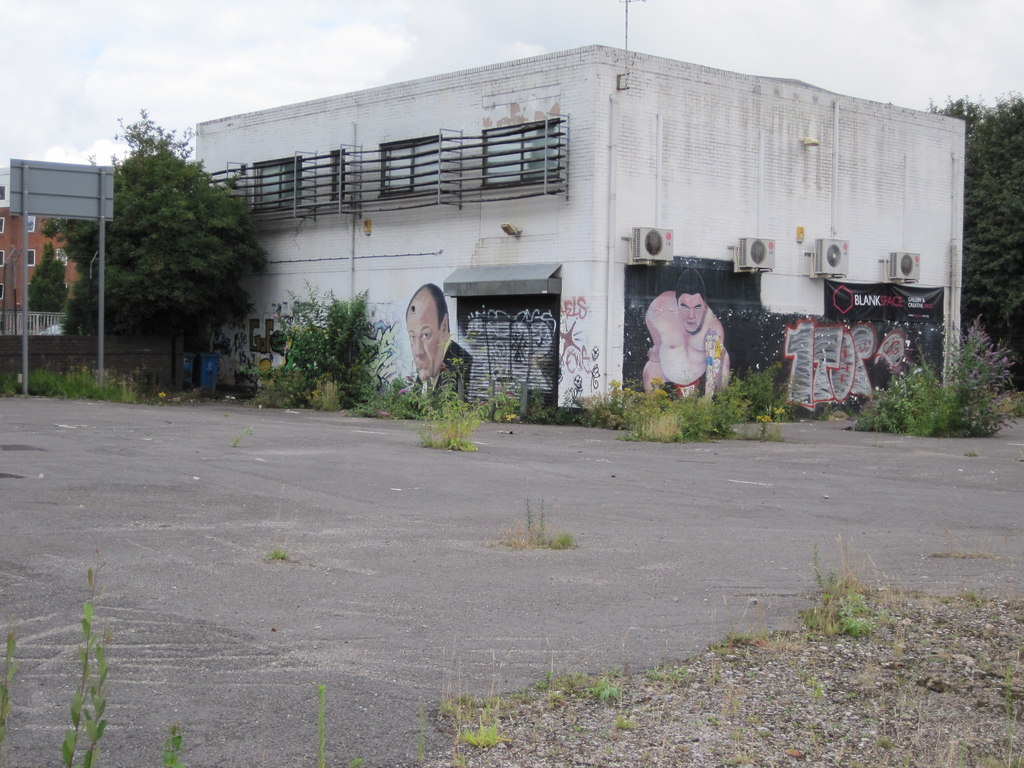
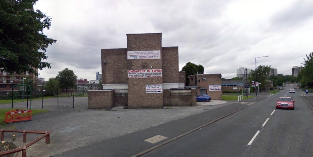
Ancoats Youth Club had sadly ceased being a place for the community to come together and use the facilities a number of years before it became a bed shop before it was finally demolished in 2011, with yet another community resource gone forever.
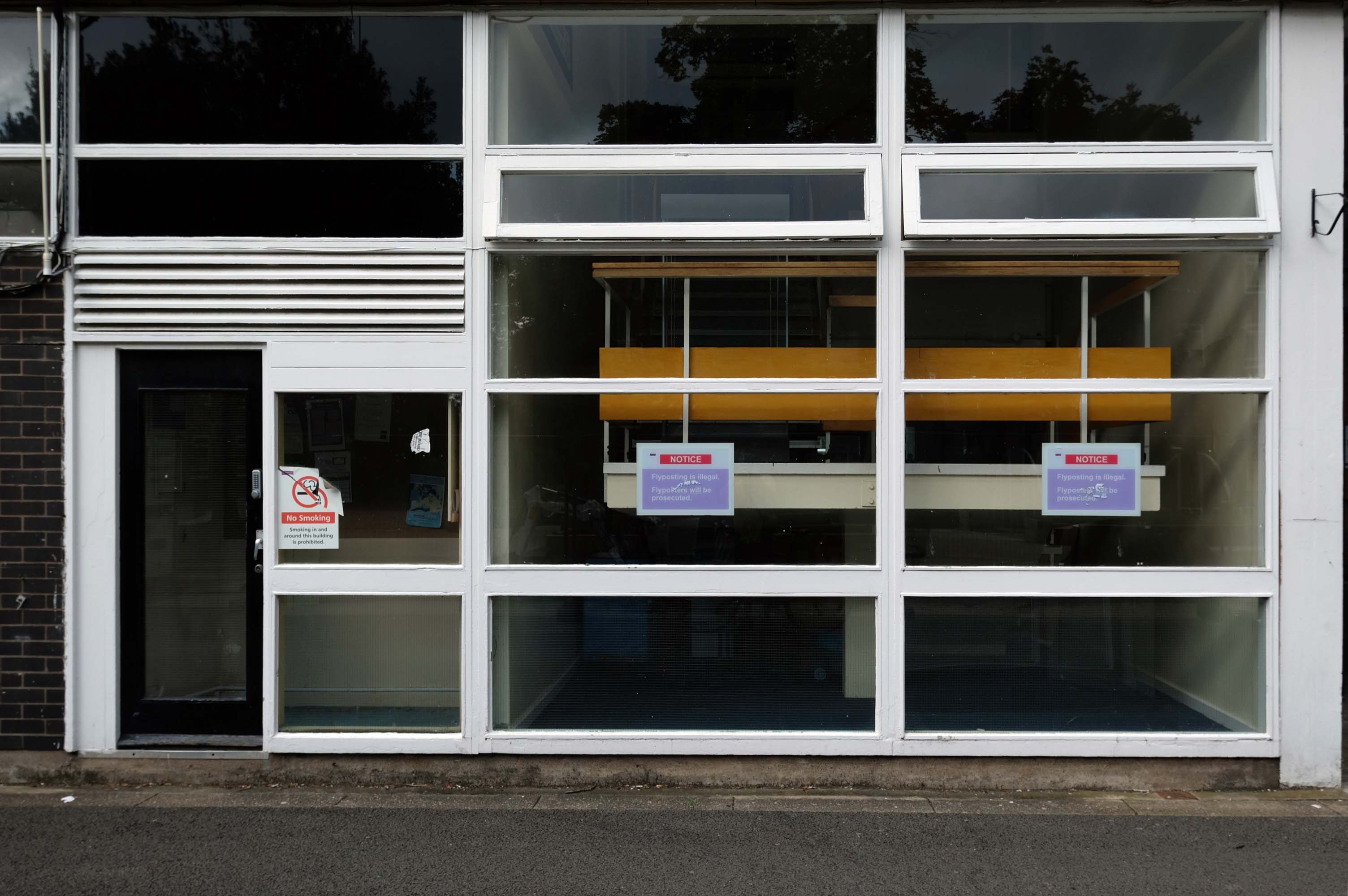
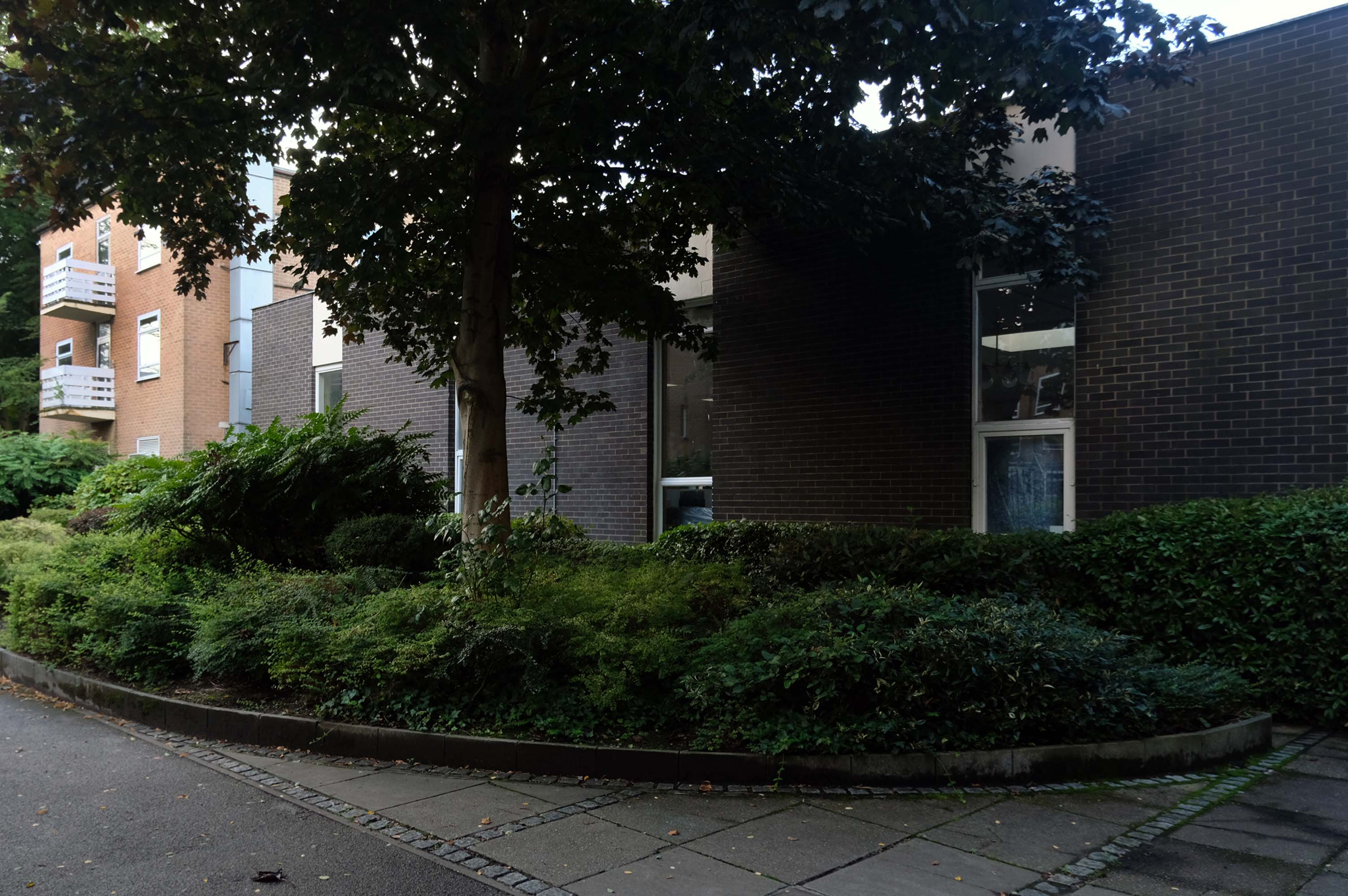
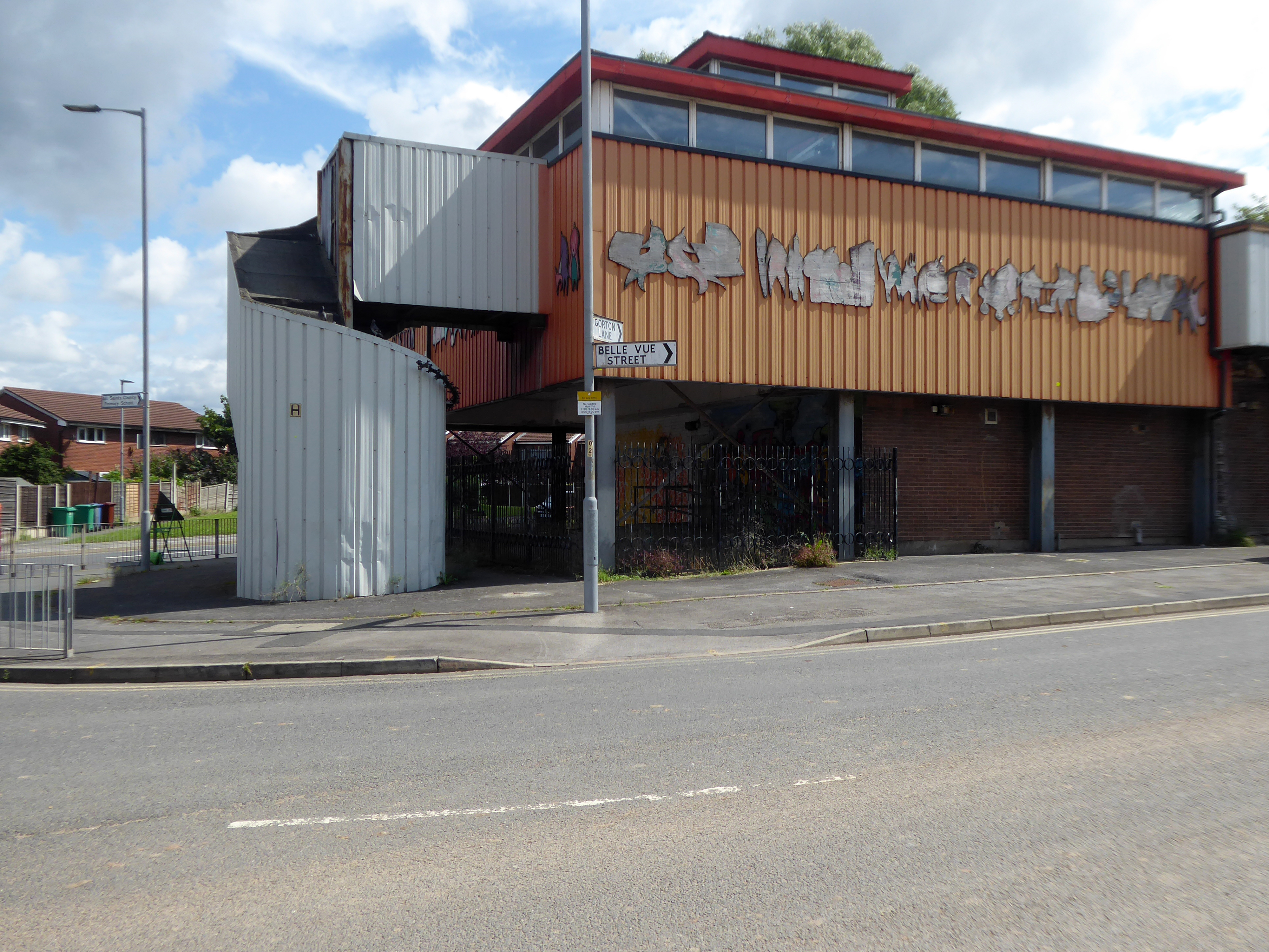
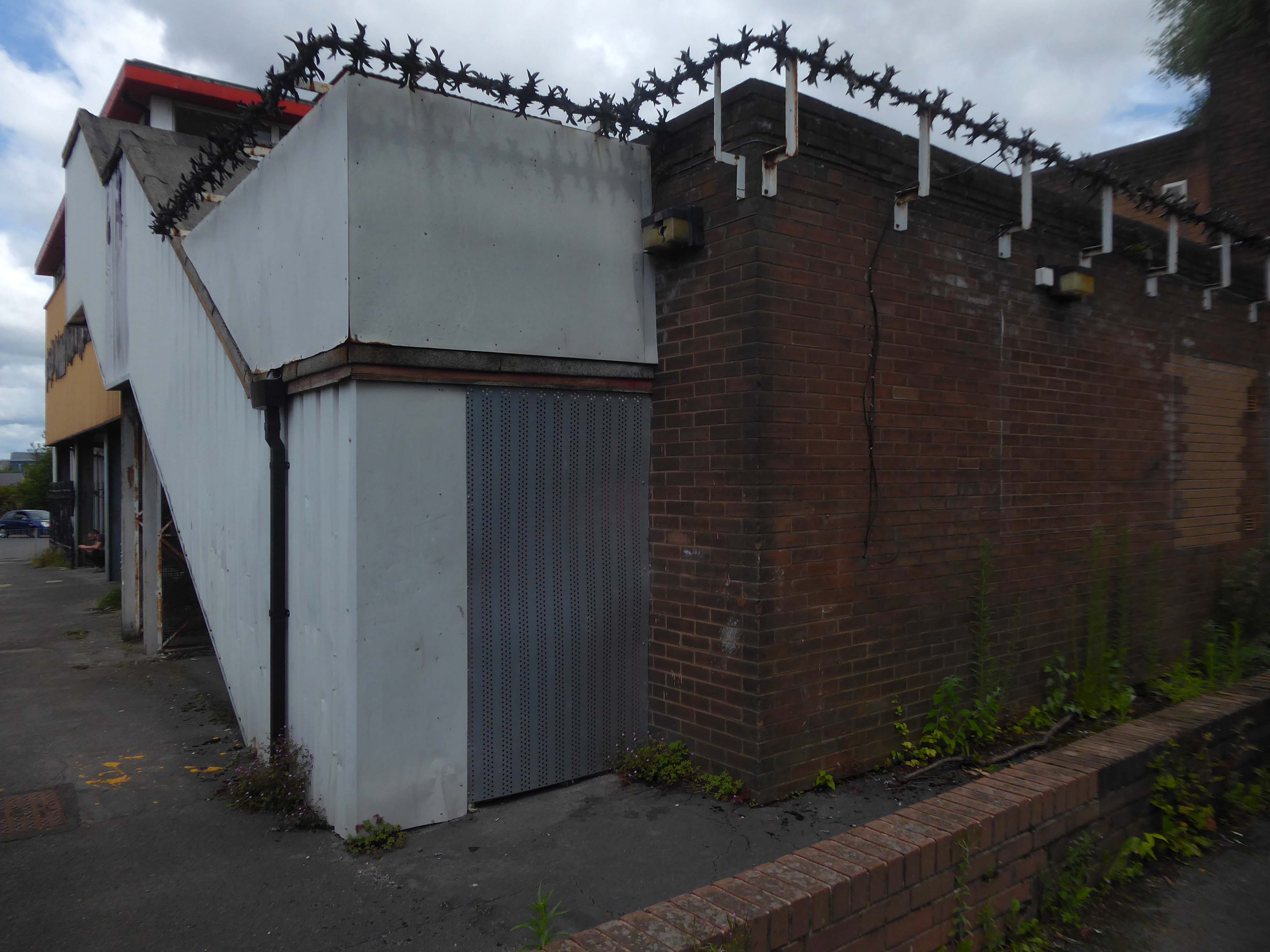
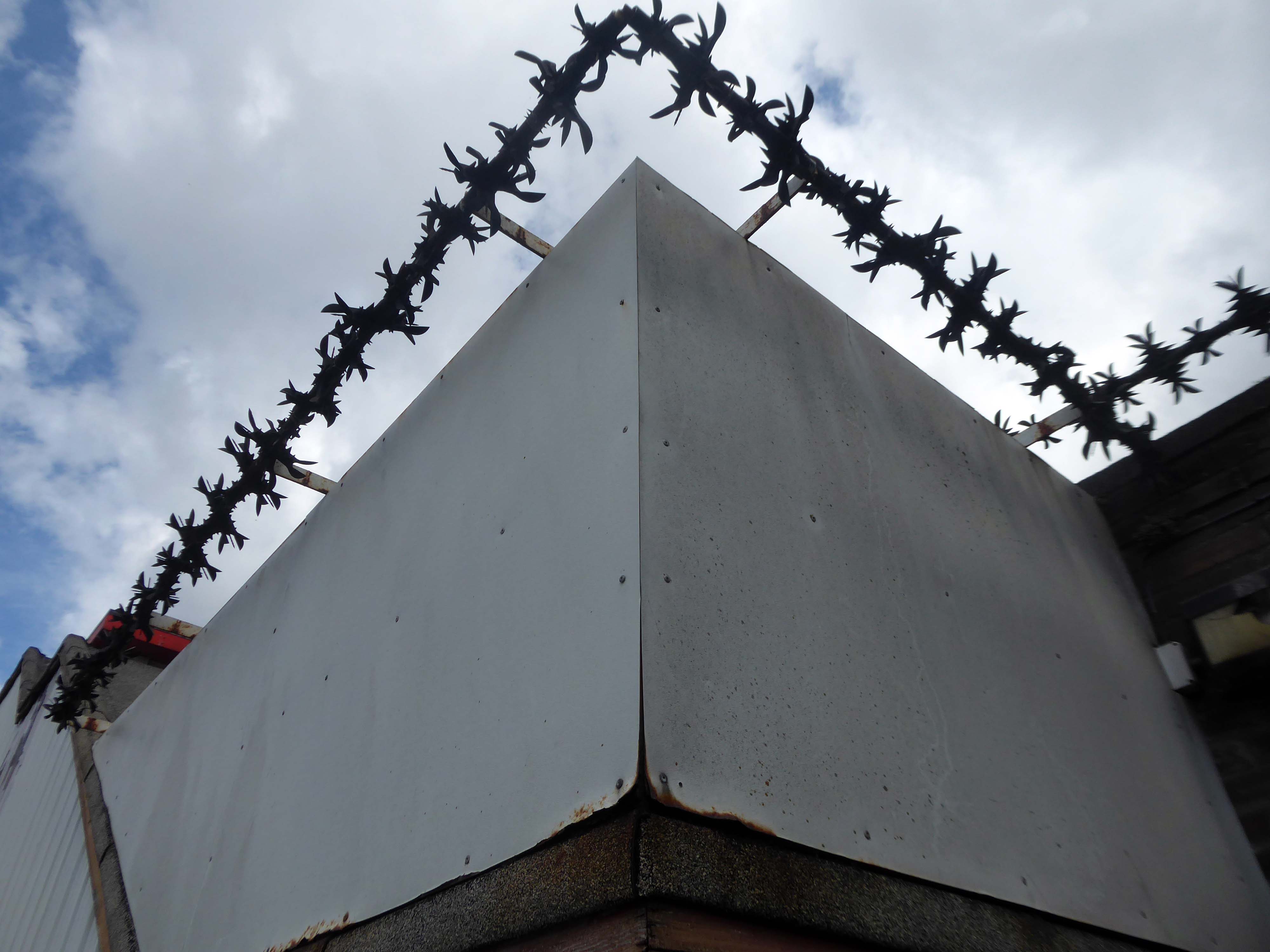
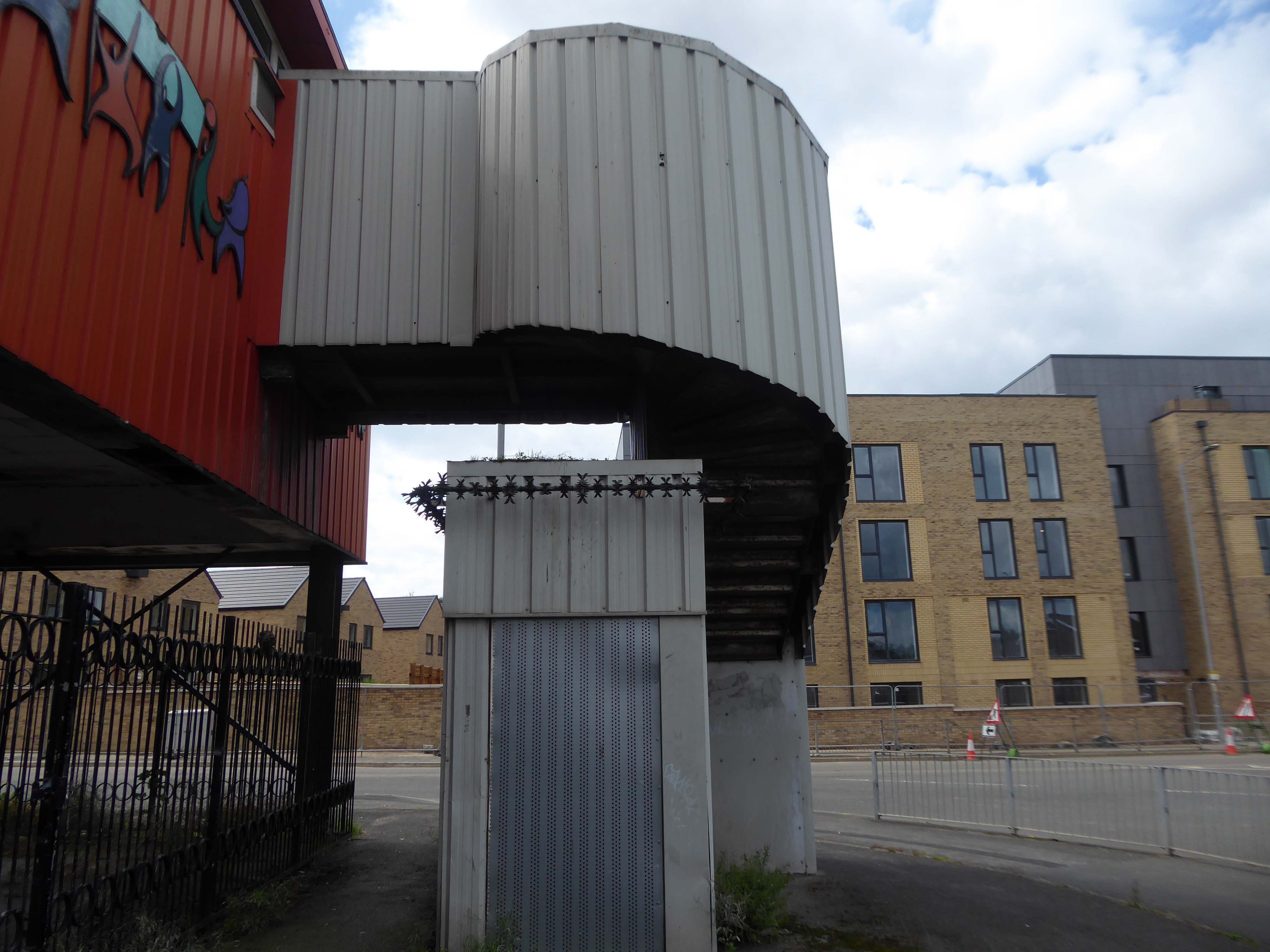
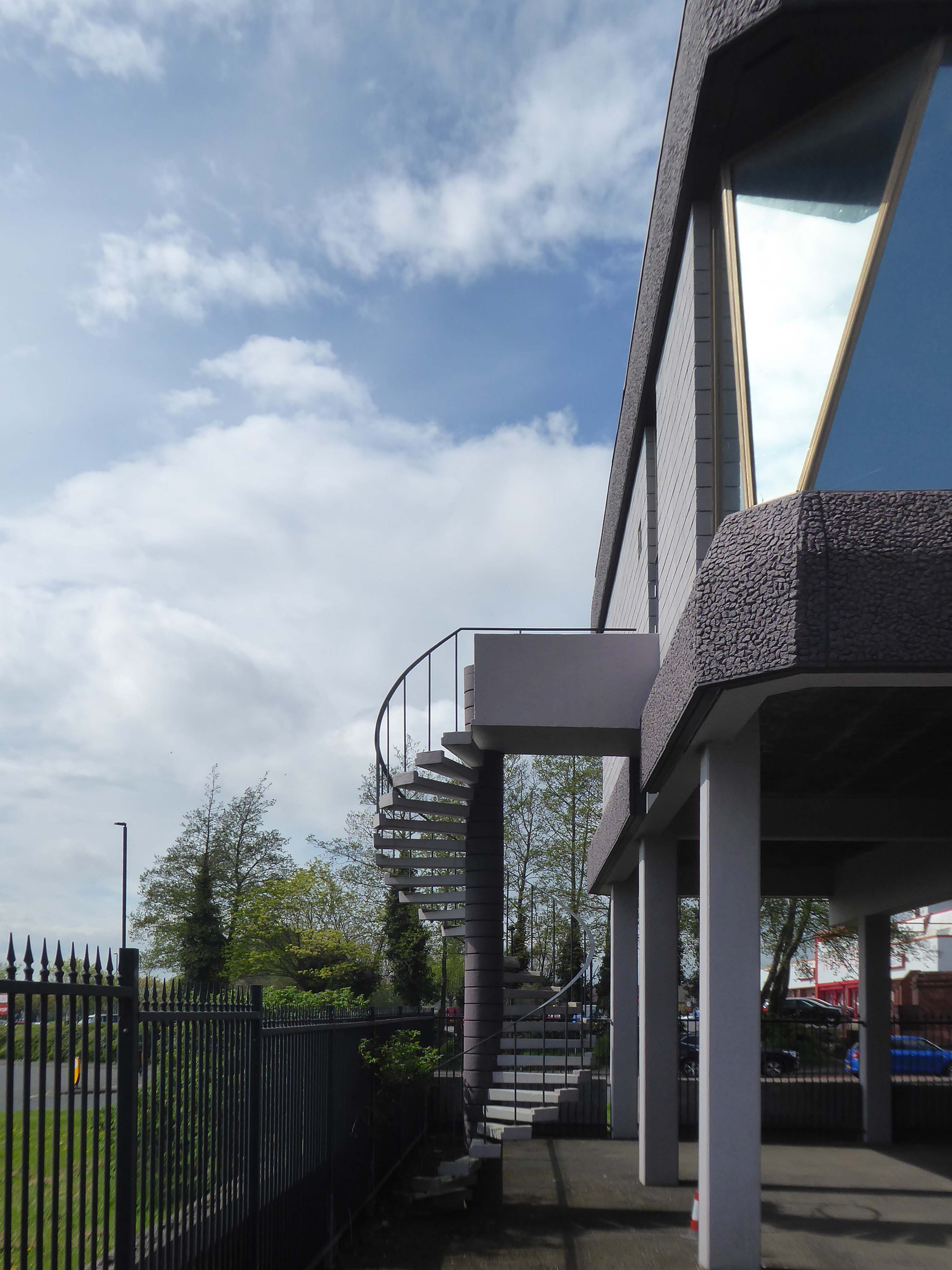
Bringing us back to Gorton – the unoccupied and demolition ready Youth Centre.
Surrounded by new-build and no stranger to a passing Bentley.
Where the state has created a vacuum the charitable sector steps in.
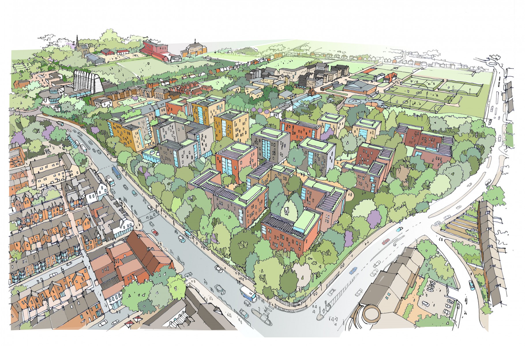
Designed by Seven Architecture, the Manchester Youth Zone East will be the second of its type in Greater Manchester, following the Factory Youth Zone in Harpurhey.
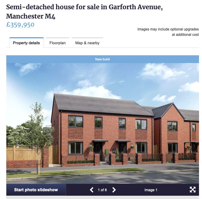
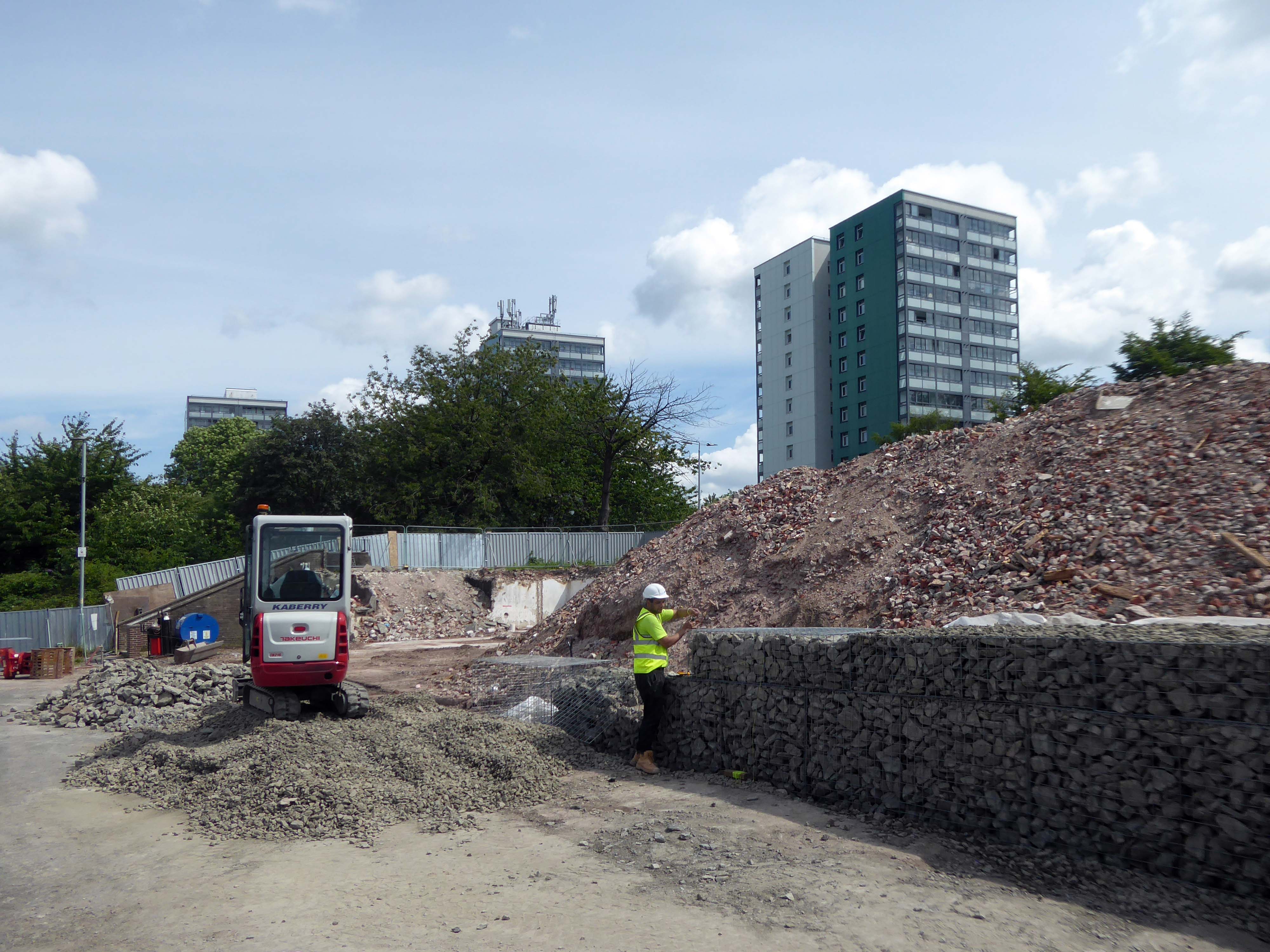
Following years of slow decline the area is on the up.
Linden Homes’ new build properties on Belle Vue Street, Gorton have now completely sold out, with the first of the 14 homes ready for homeowners to move into this month.
The properties are part of the £9m Grace Gardens development, which is situated in a prime location in an up-and-coming part of Greater Manchester.
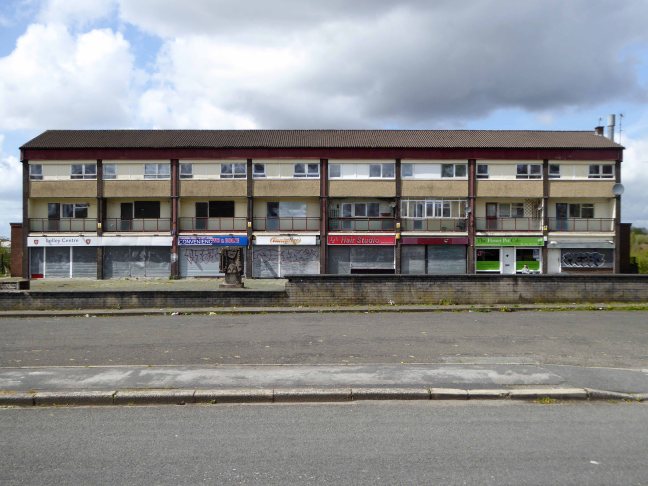
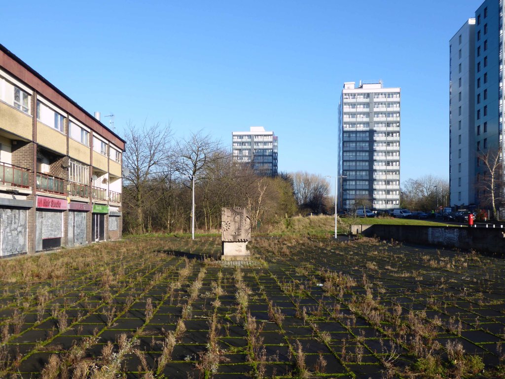
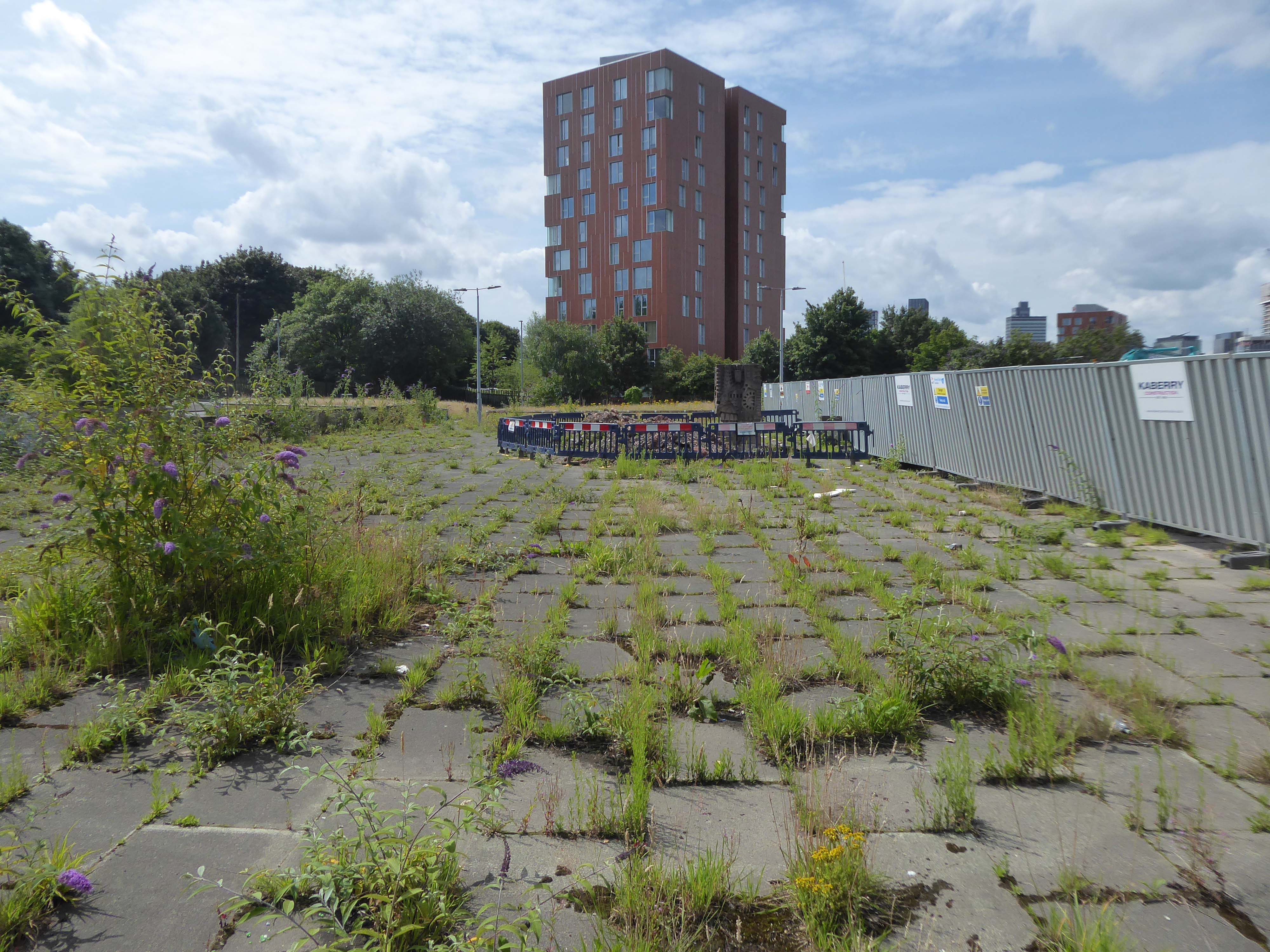
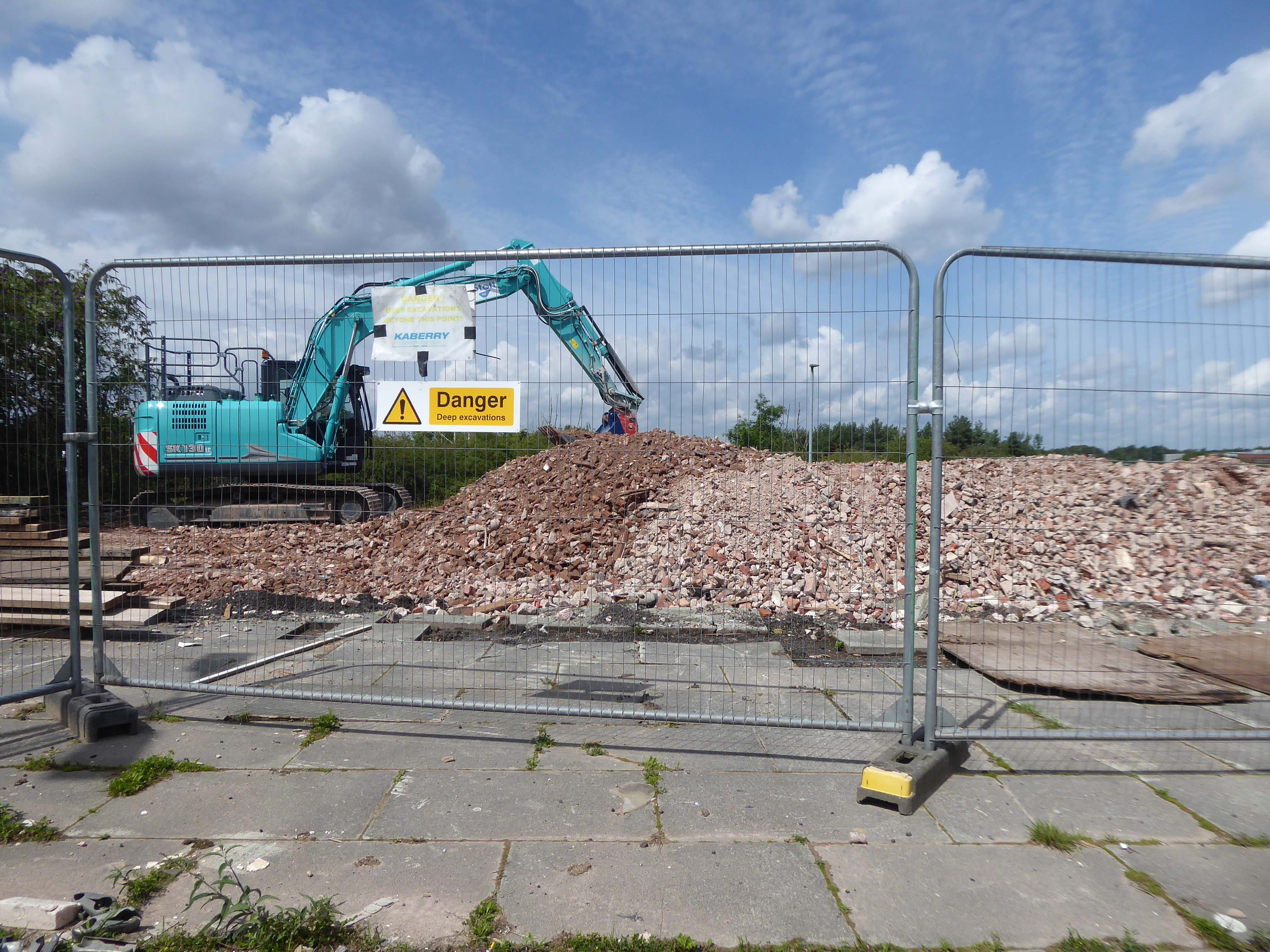
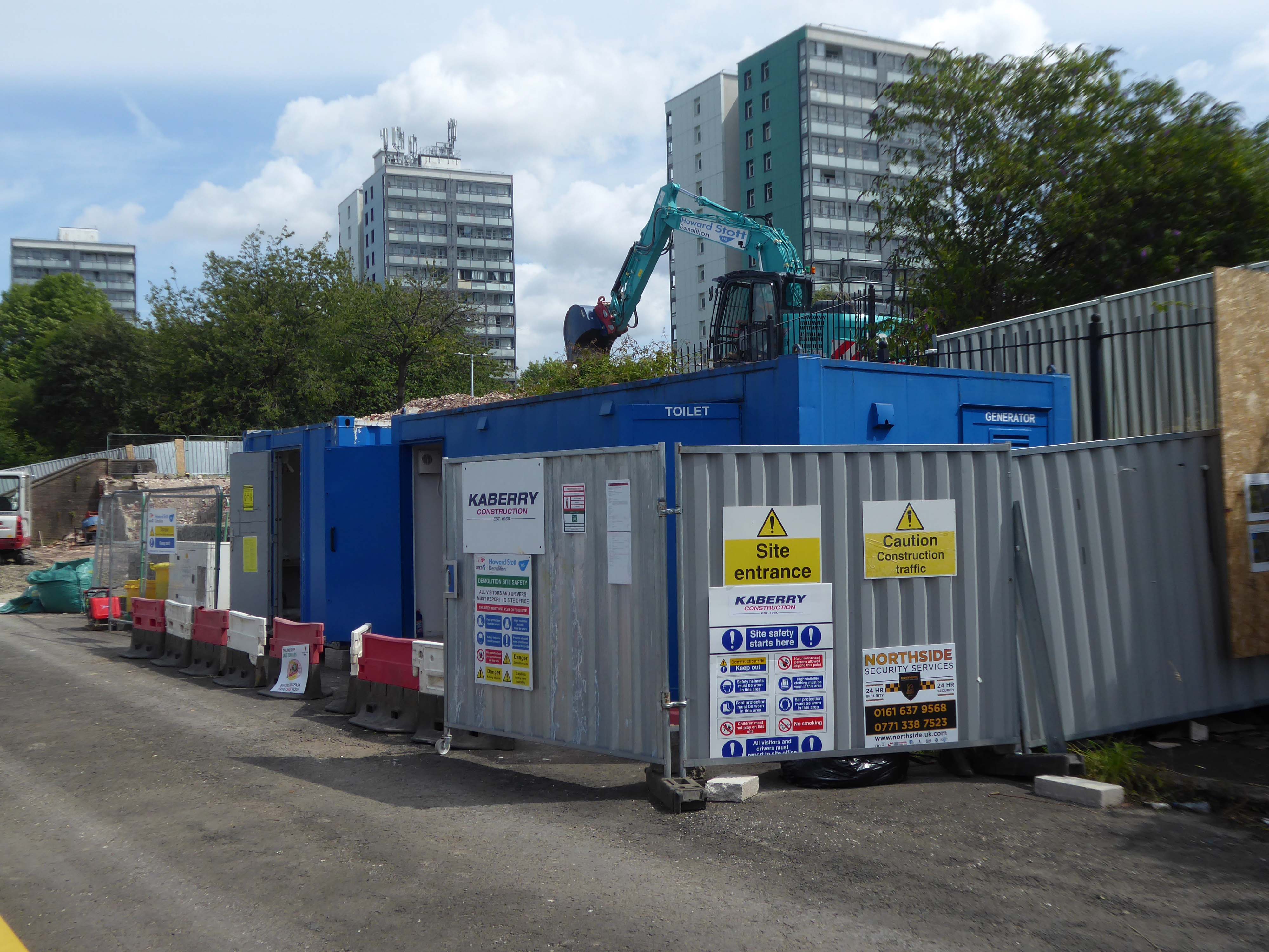
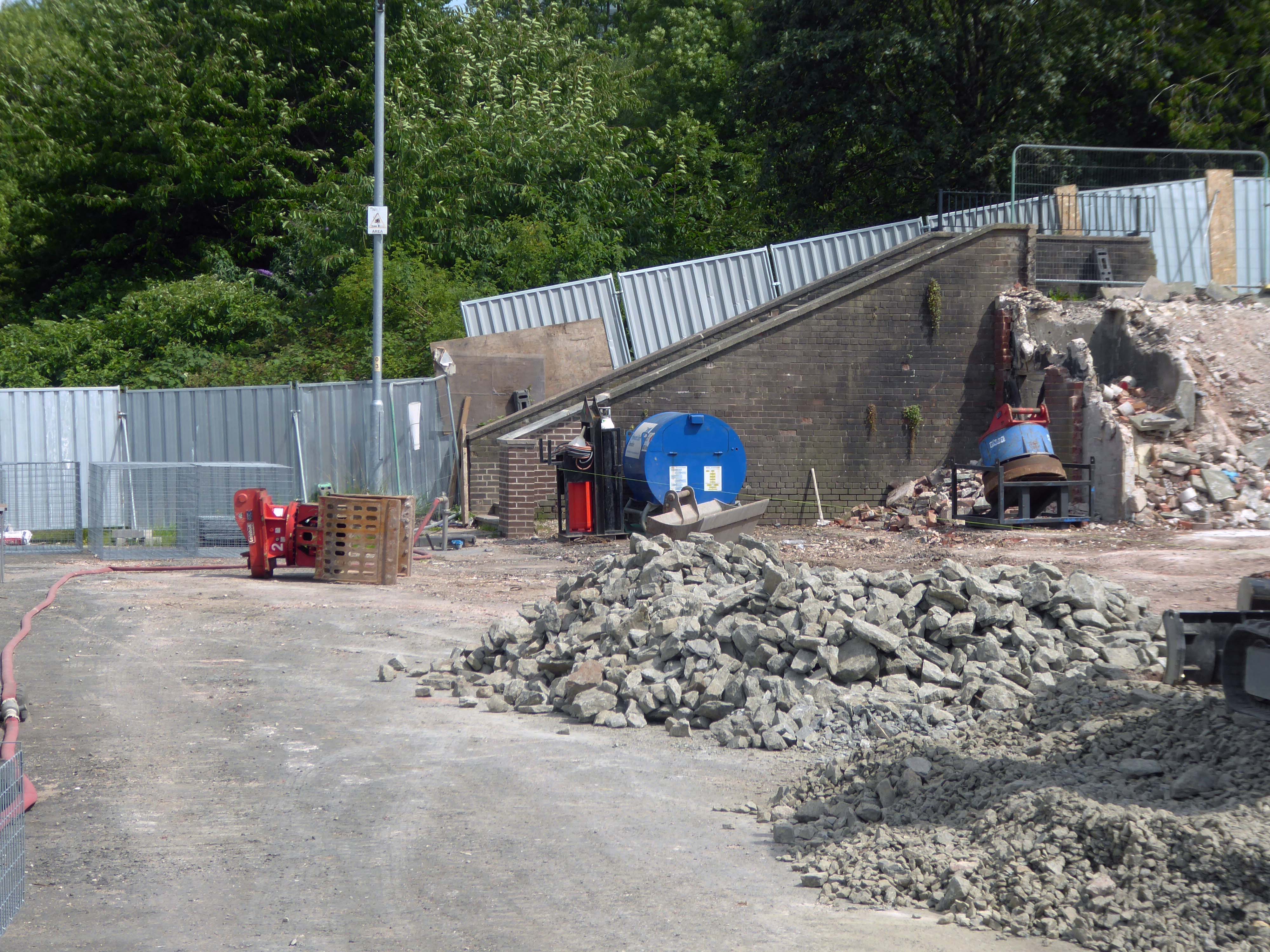
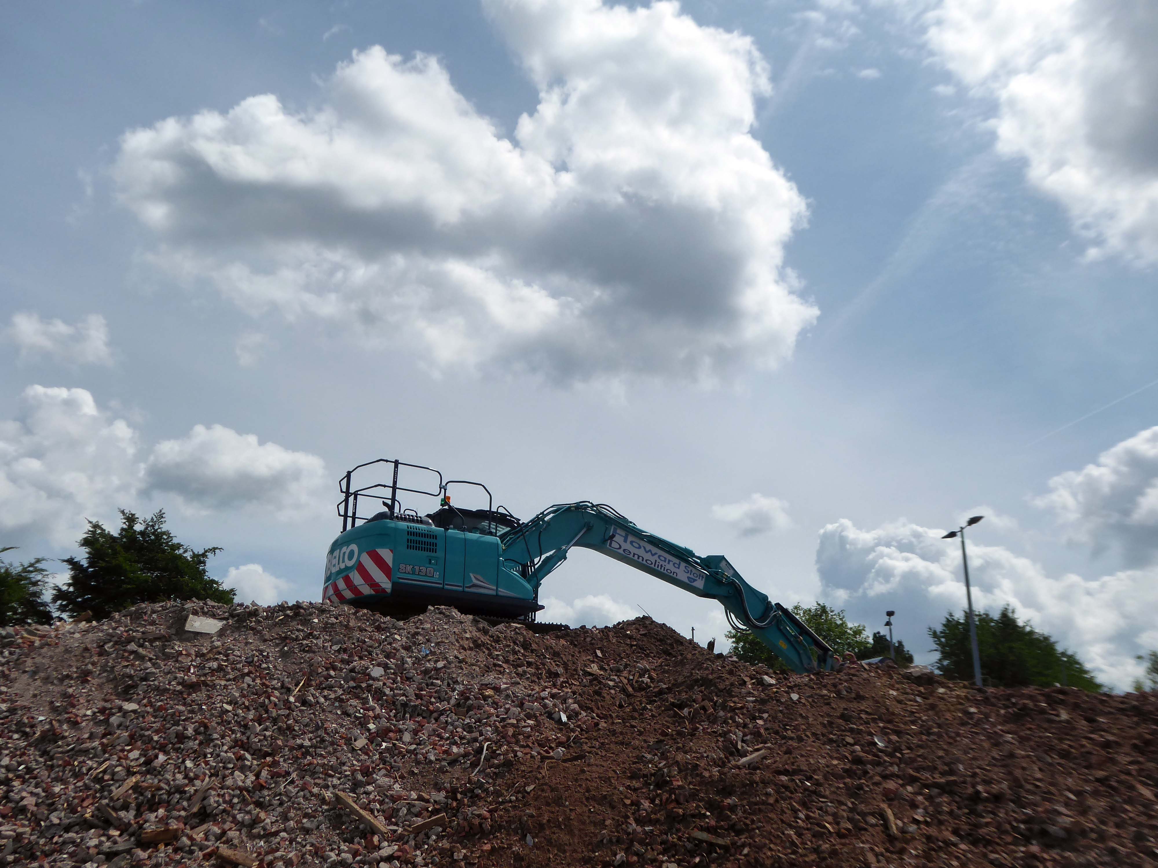
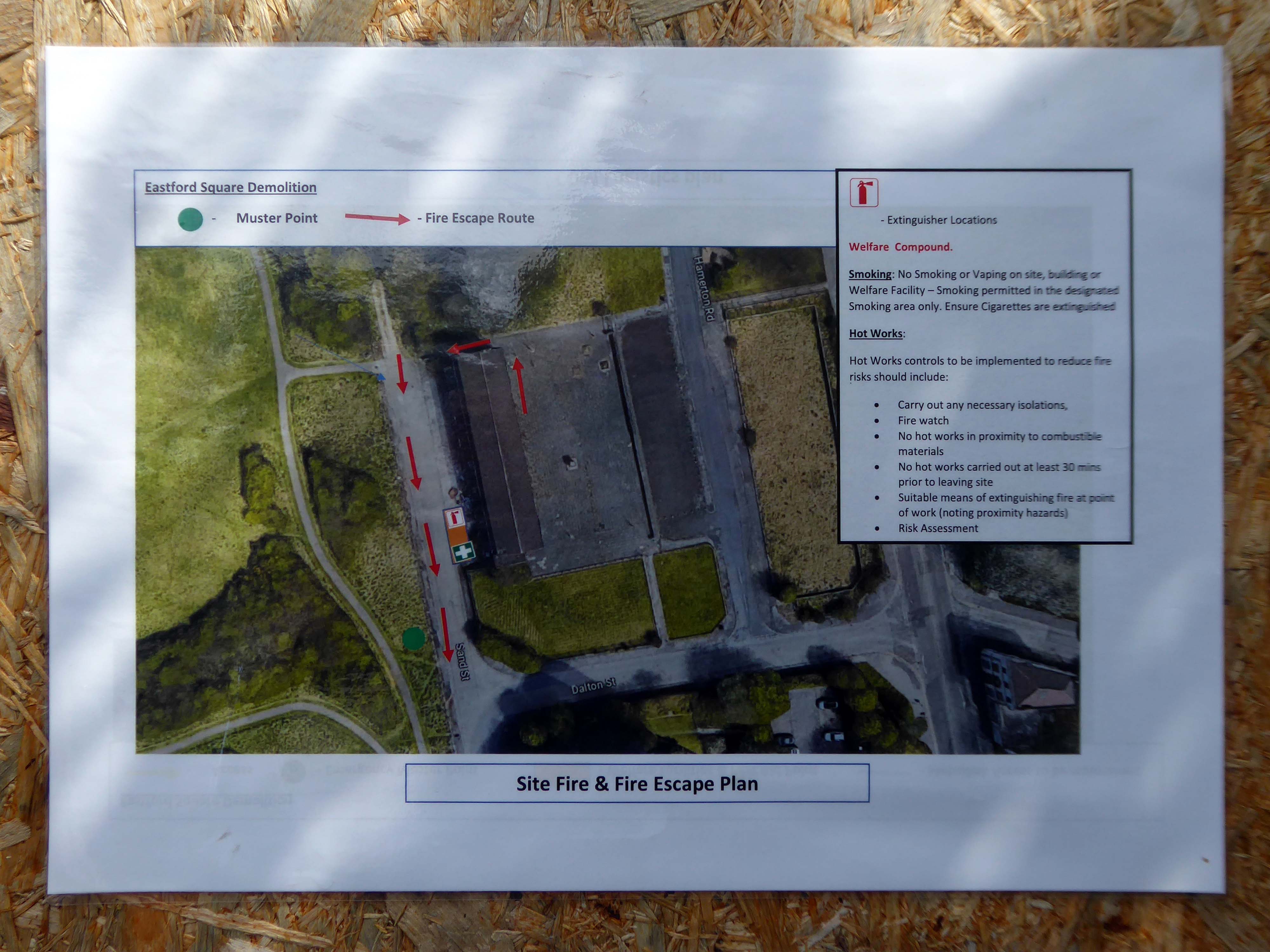
April 2023 and the shops and homes are being prepared for demolition.
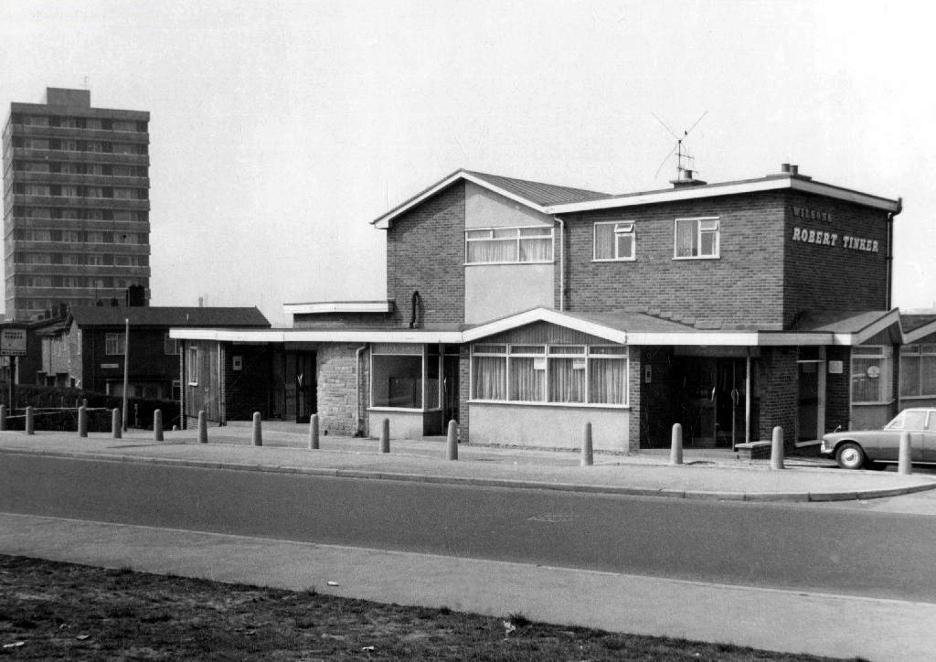
The company responsible for the demolition also dropped the Robert Tinker, on nearby Dalton Street.
While it is not yet clear exactly what will replace the shopping parade, work has already started nearby on other projects within the scheme. The first phase of development in Collyhurst will see 274 new homes built in the area.
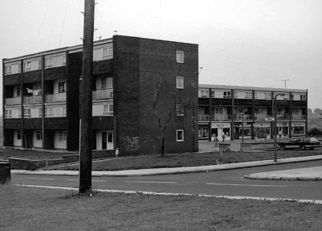
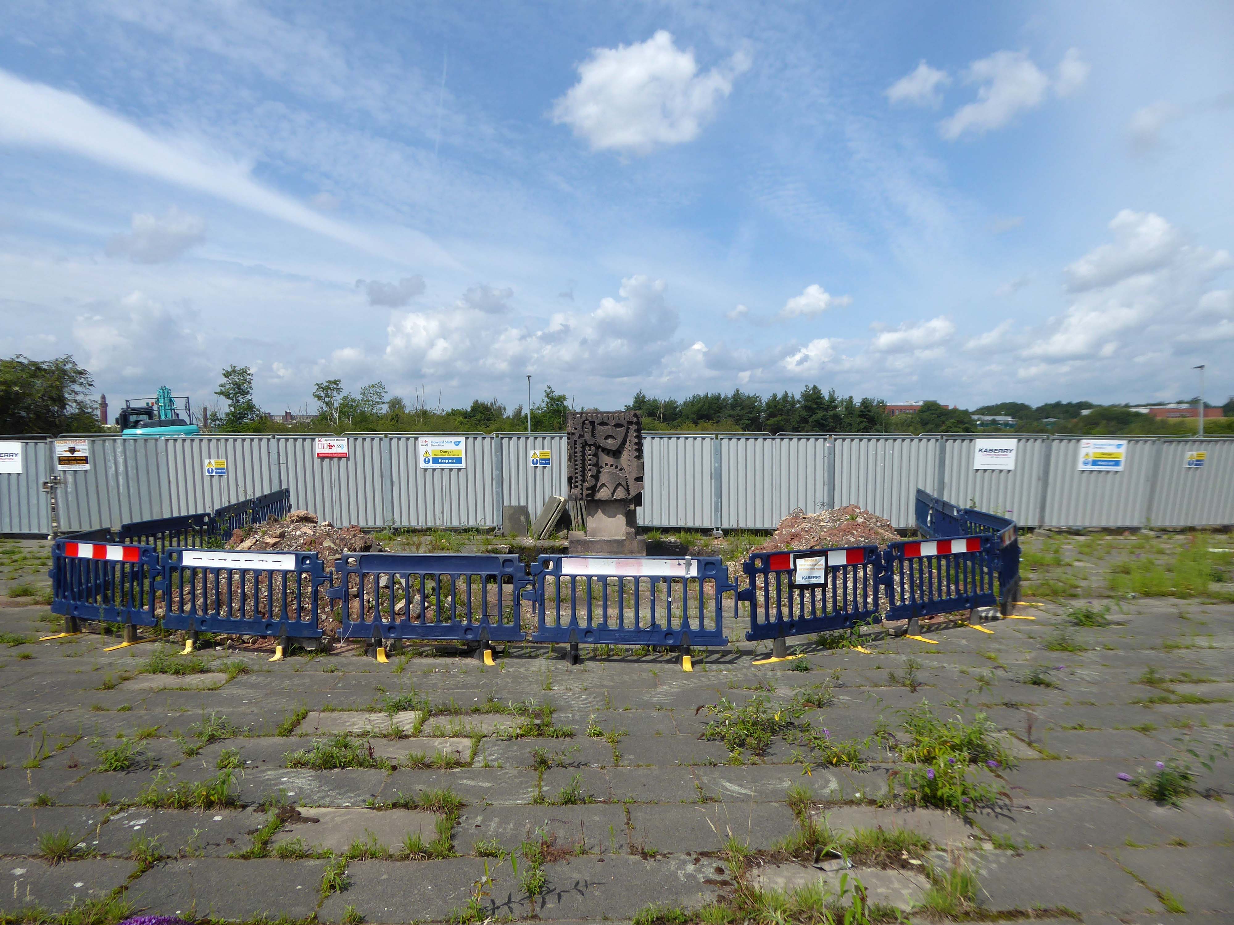
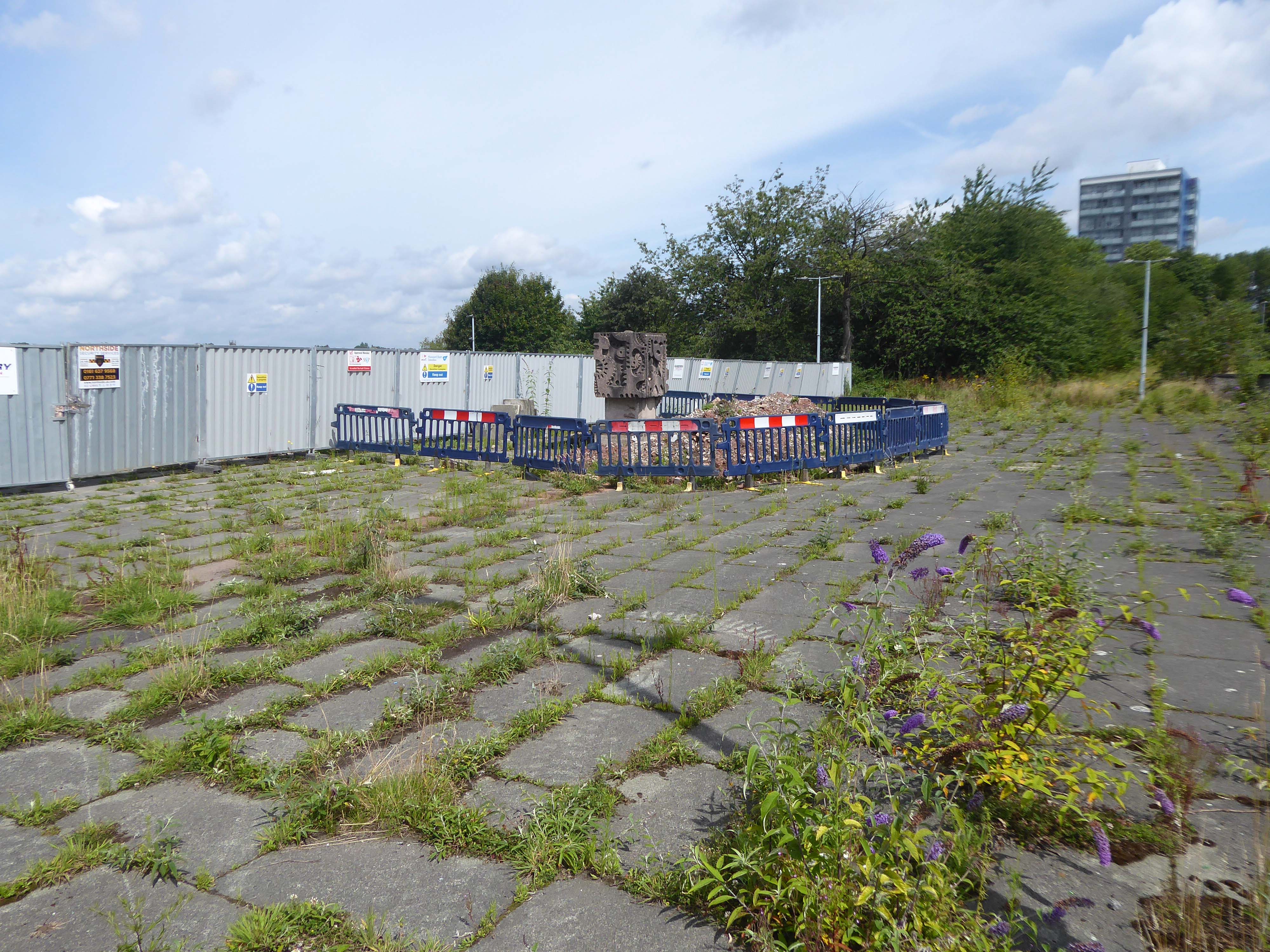
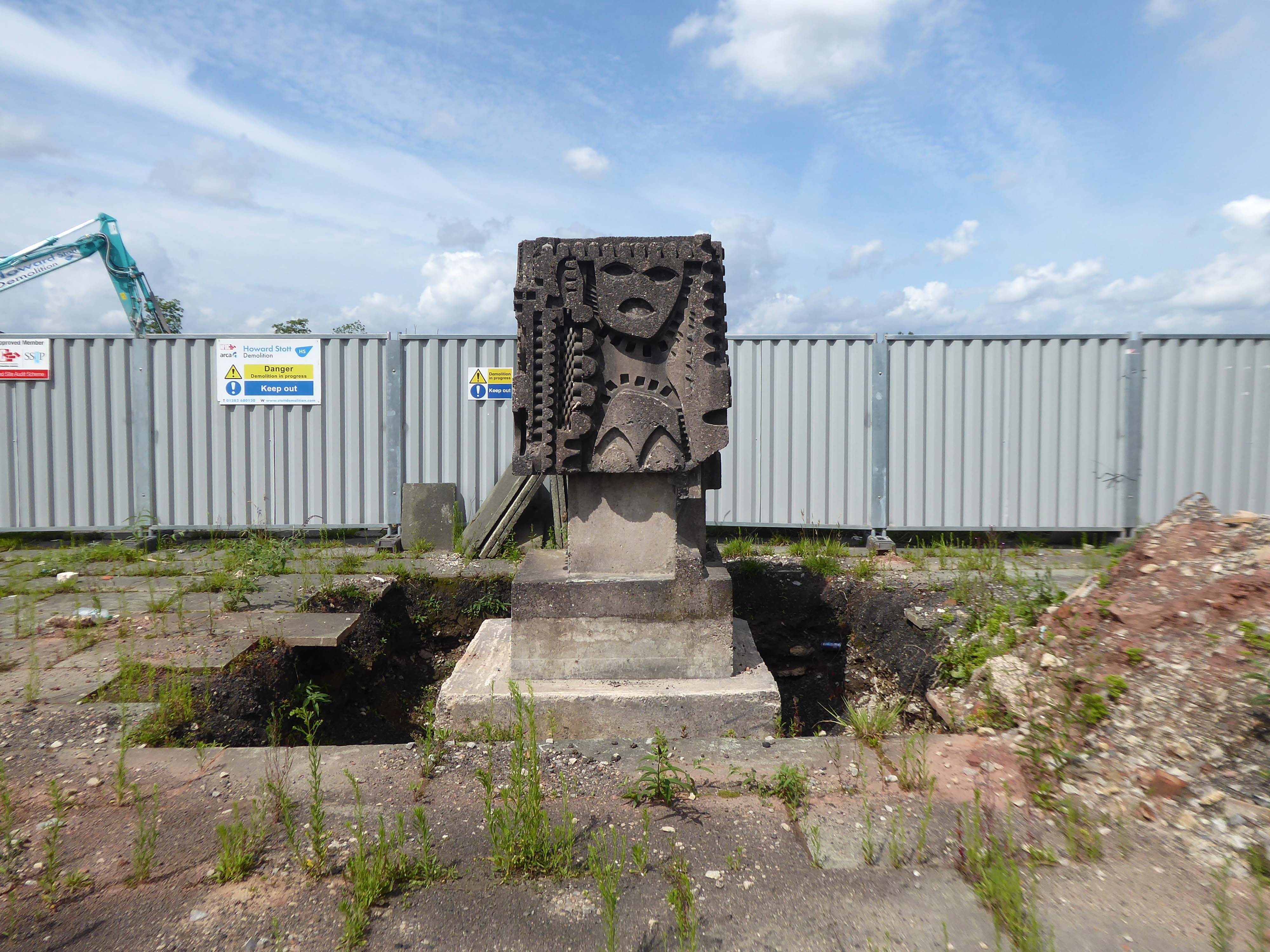
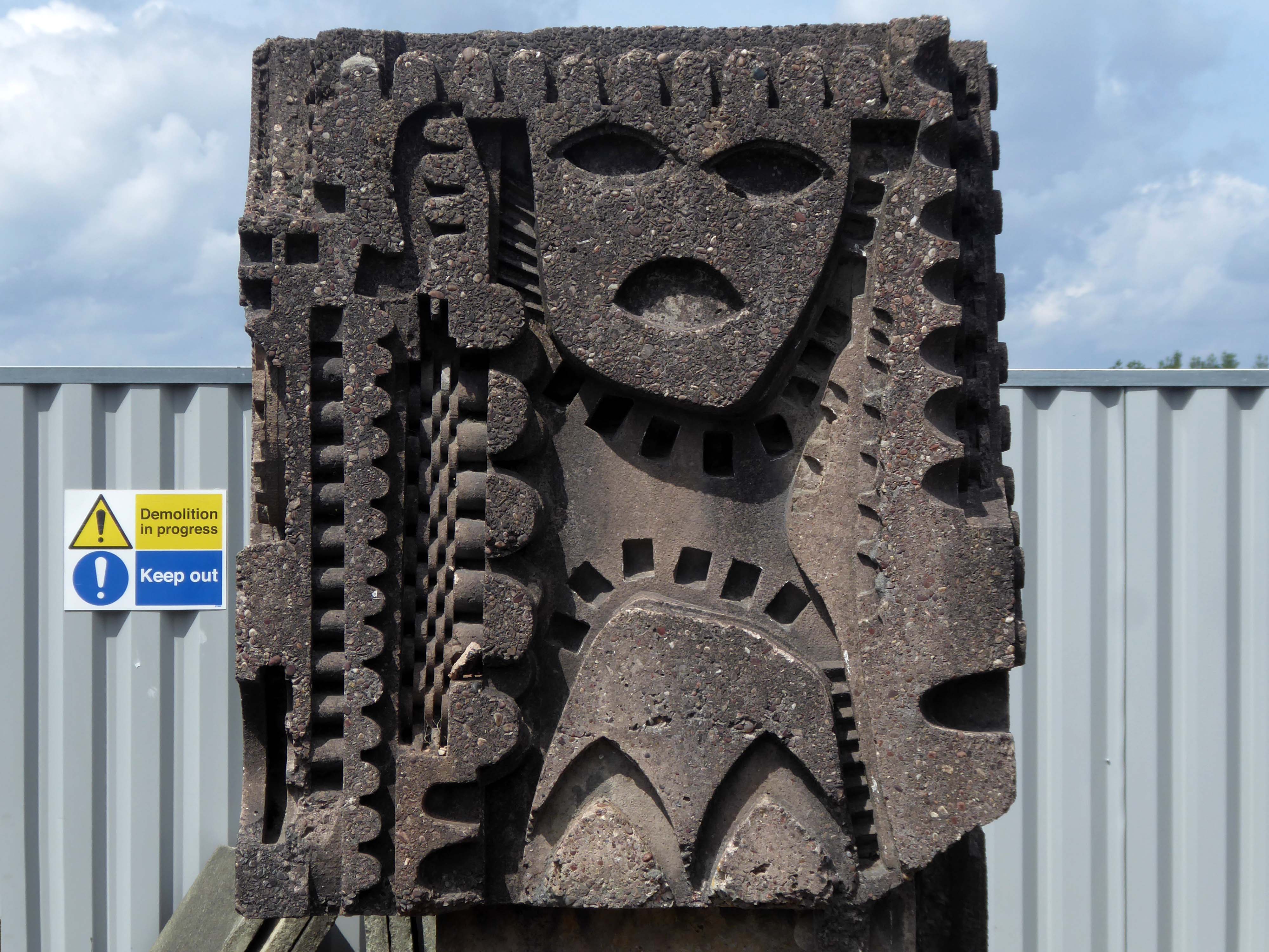
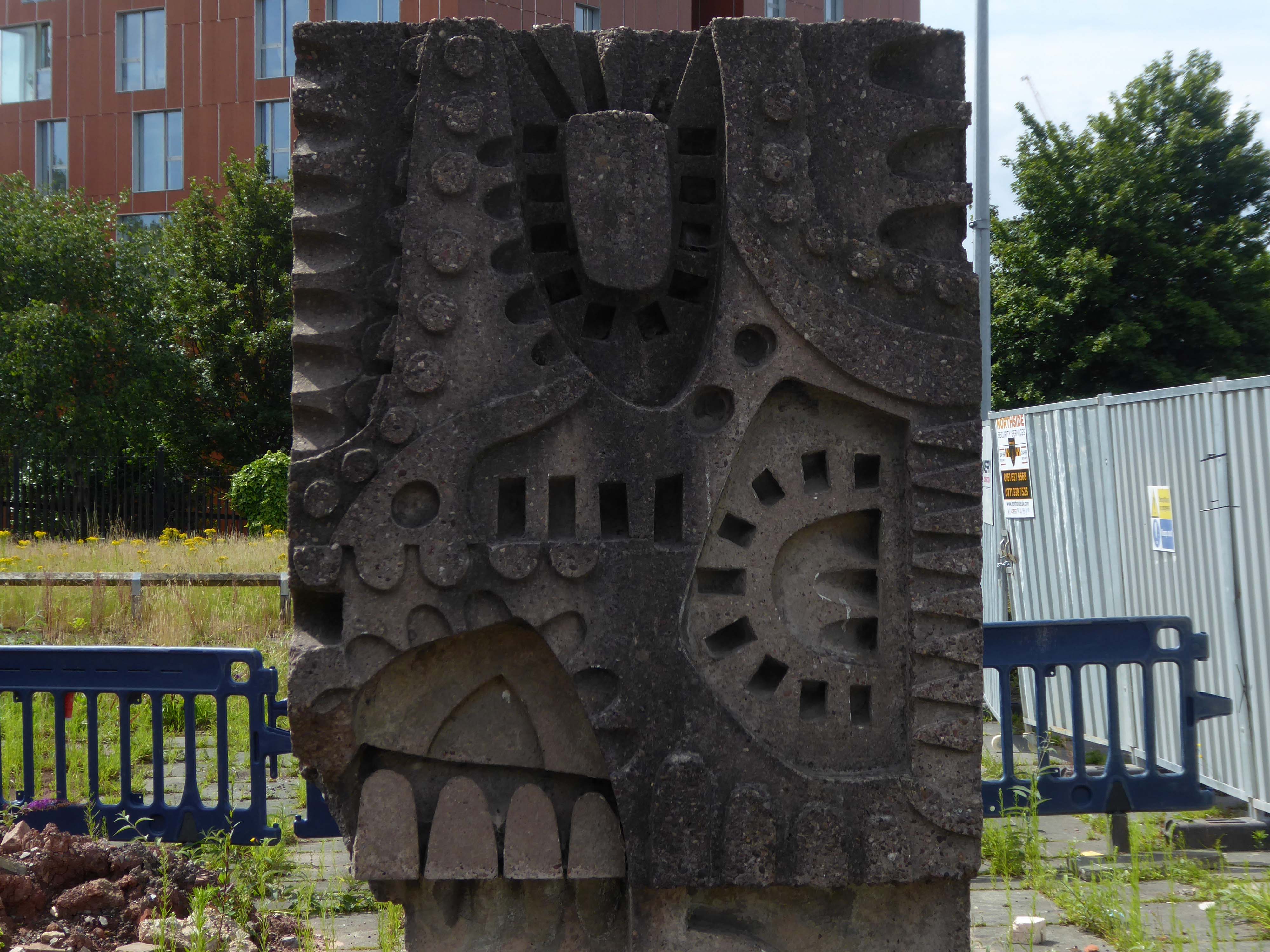
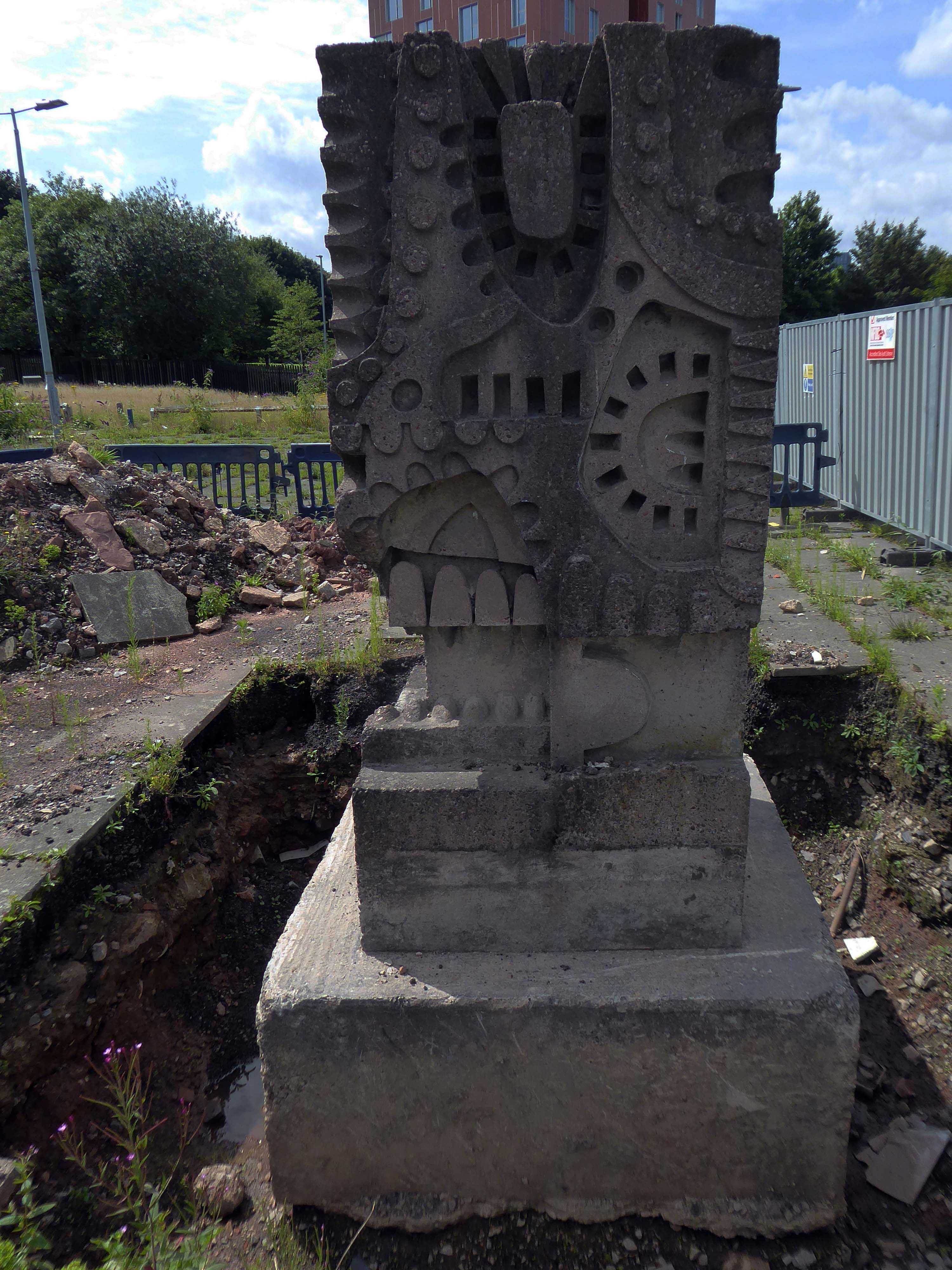
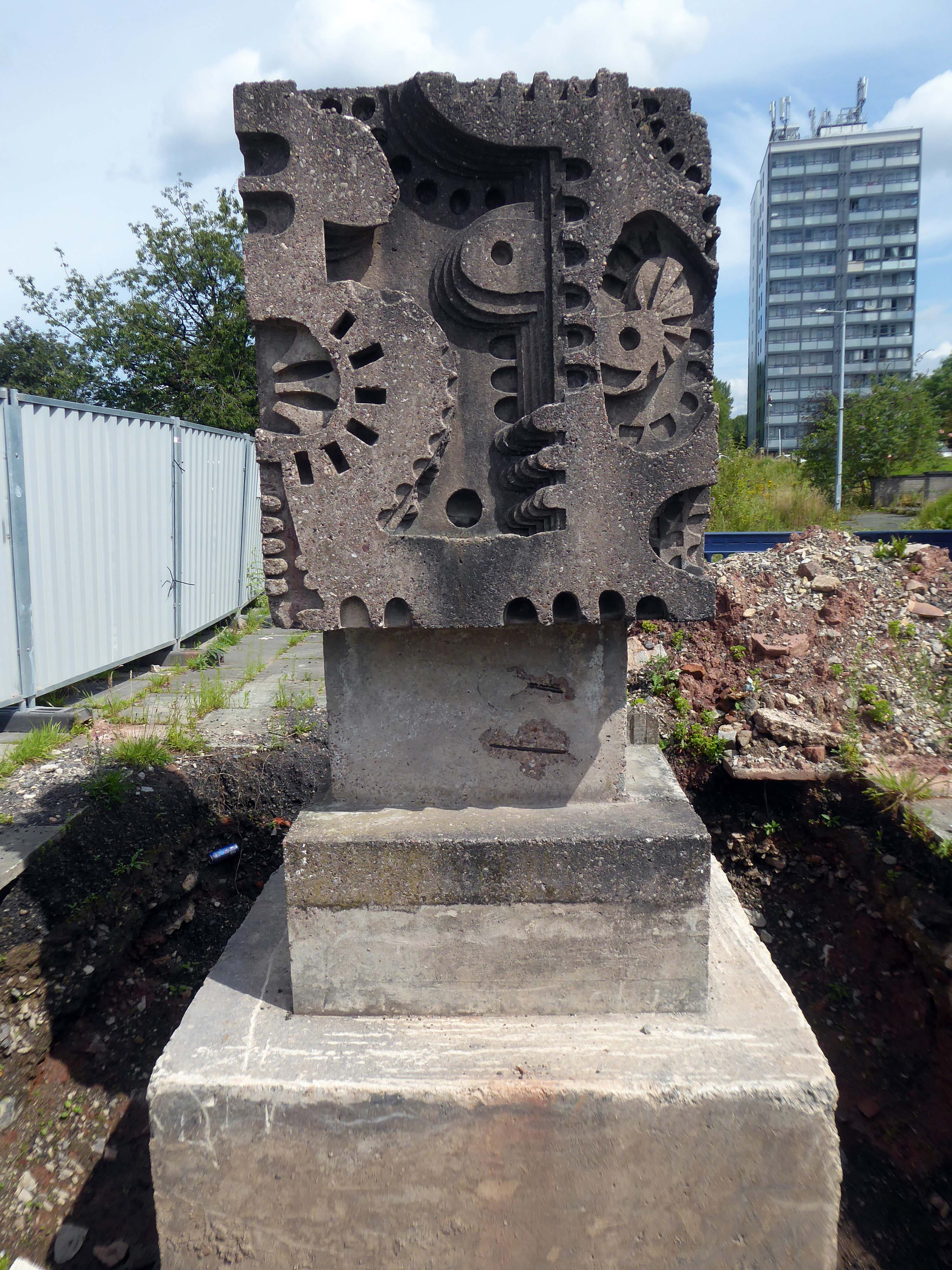
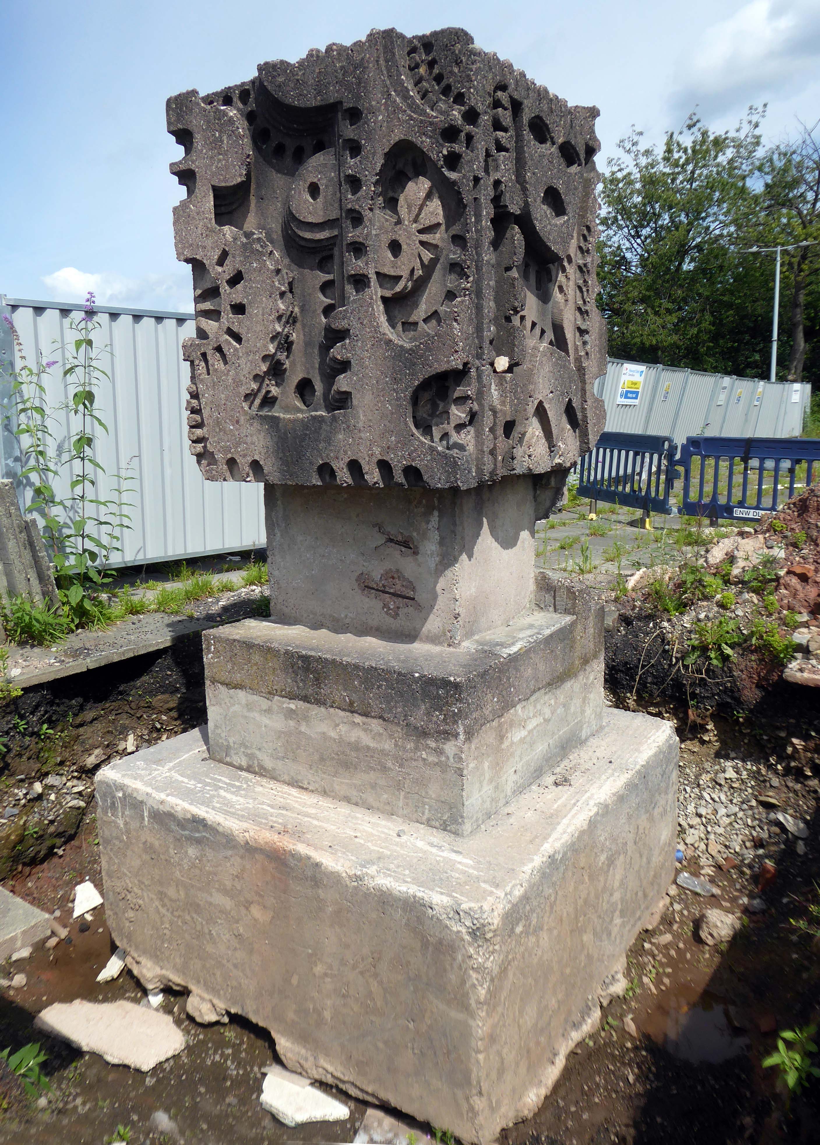
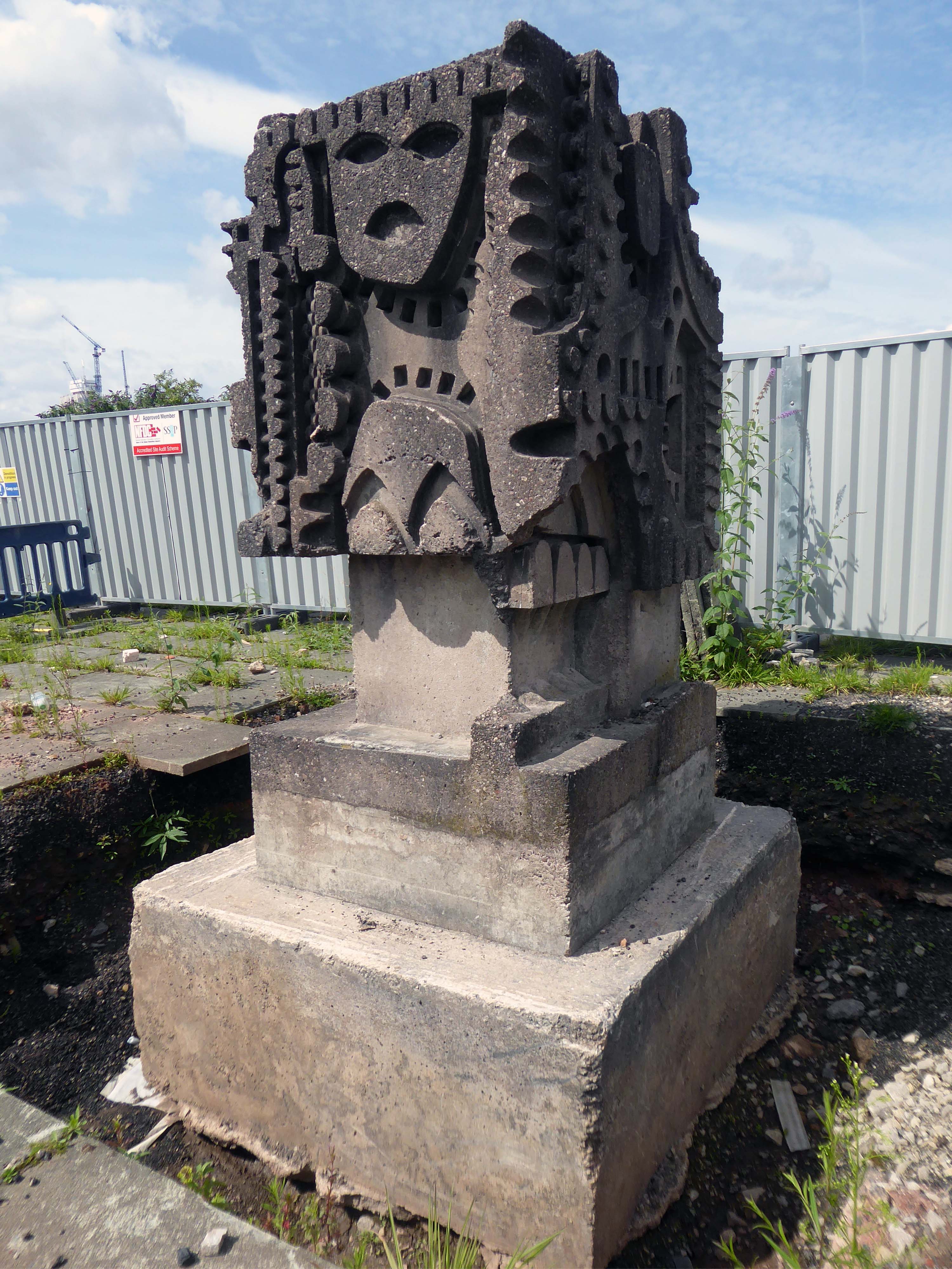
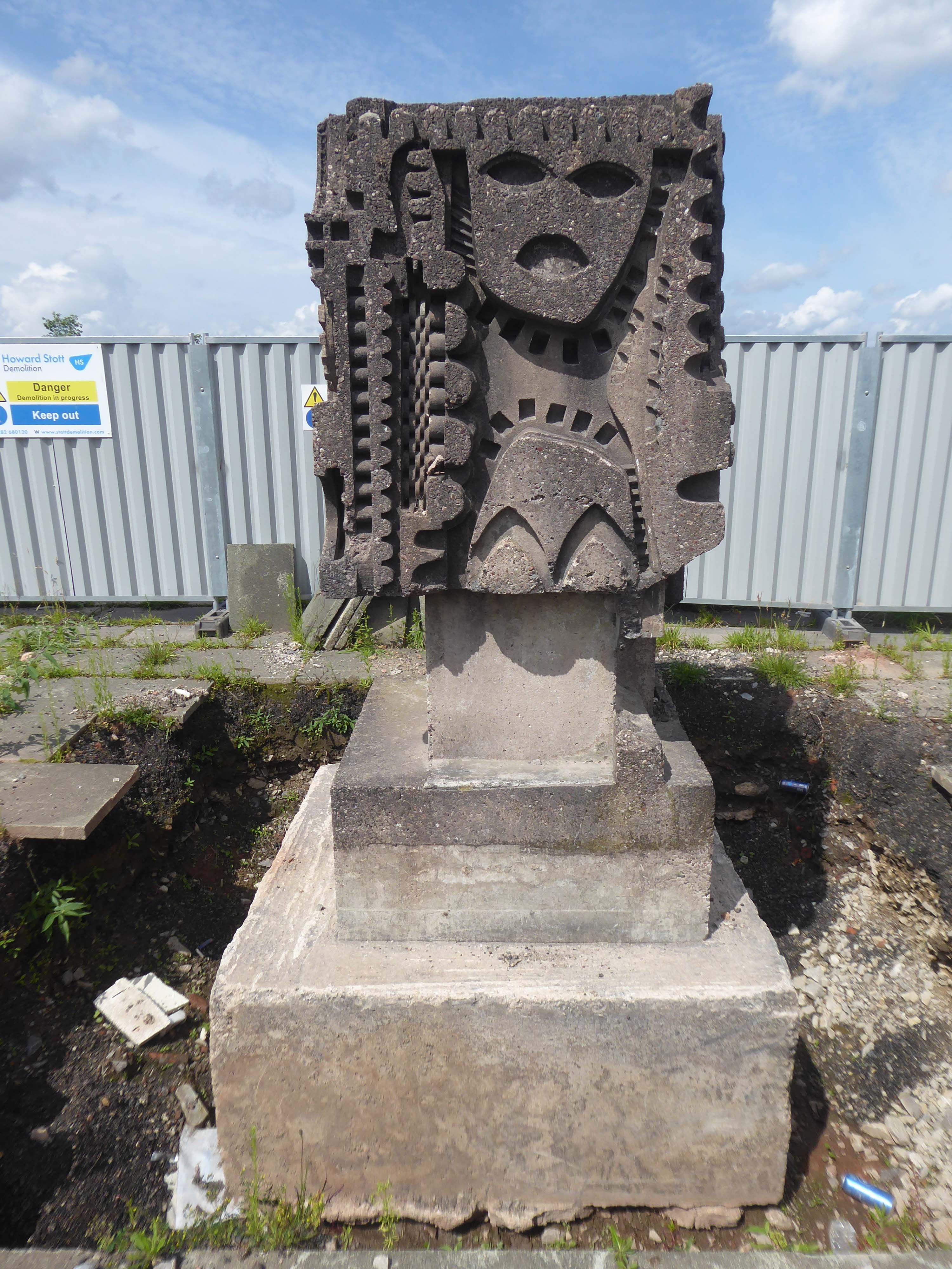
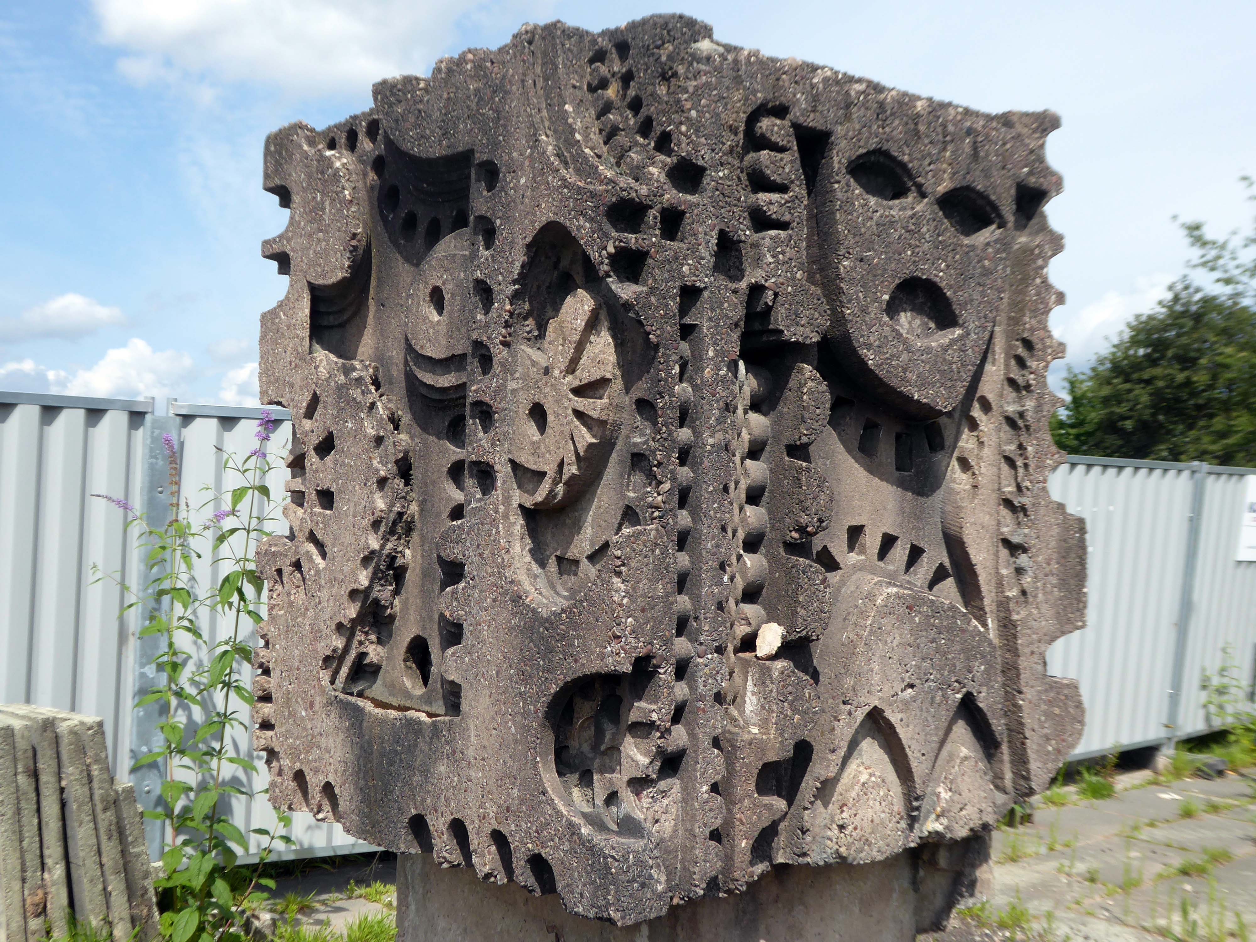
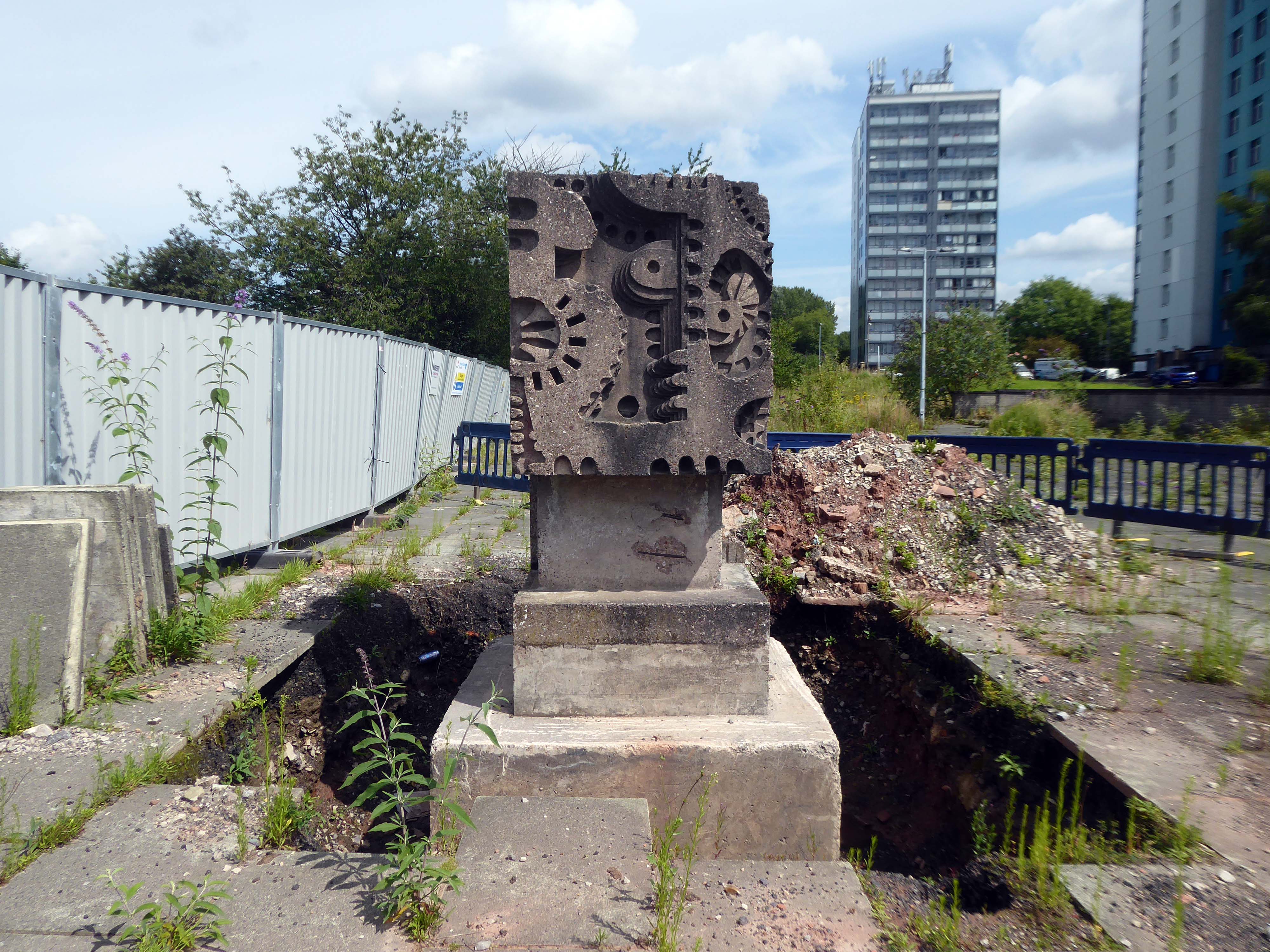
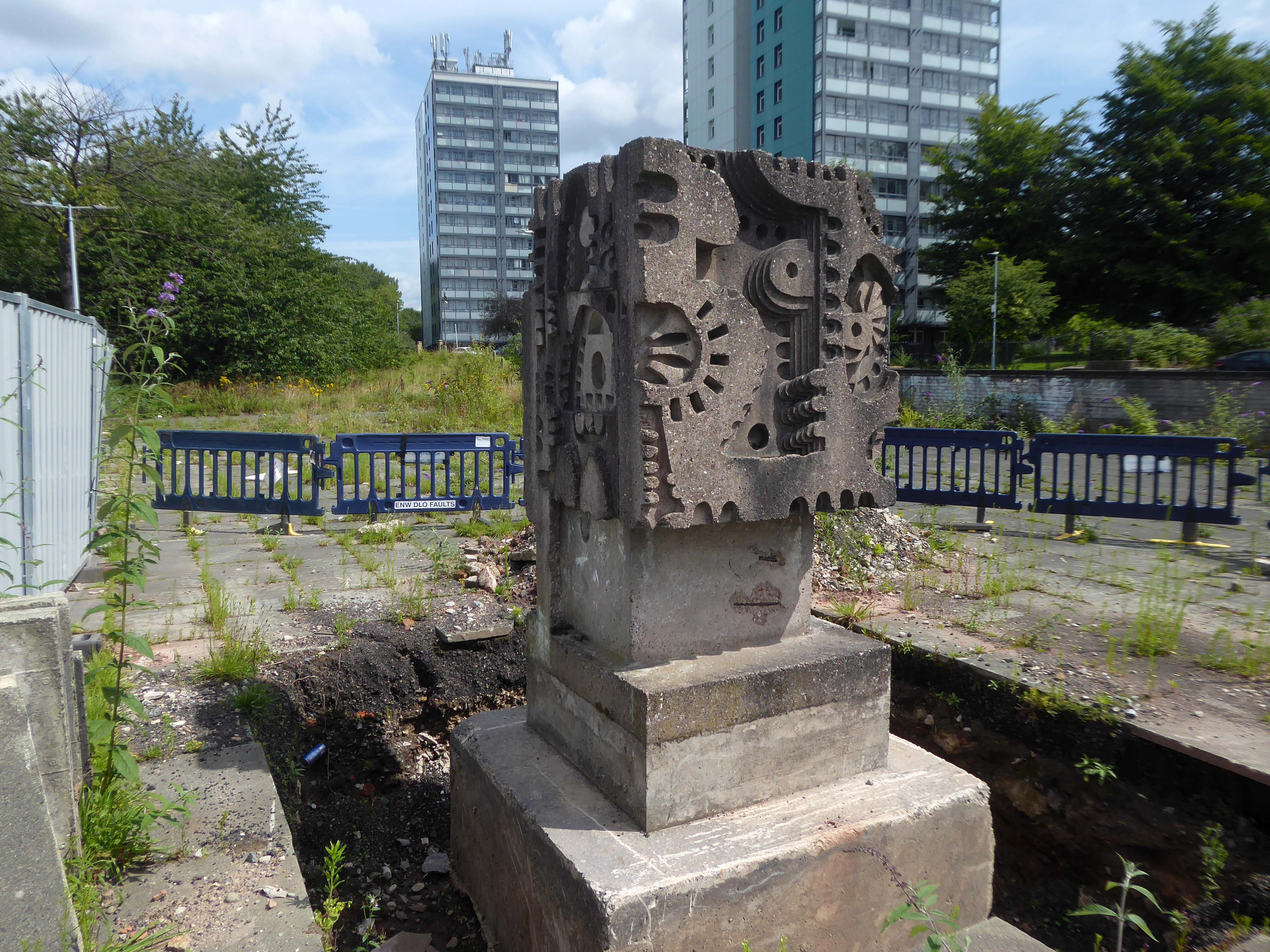
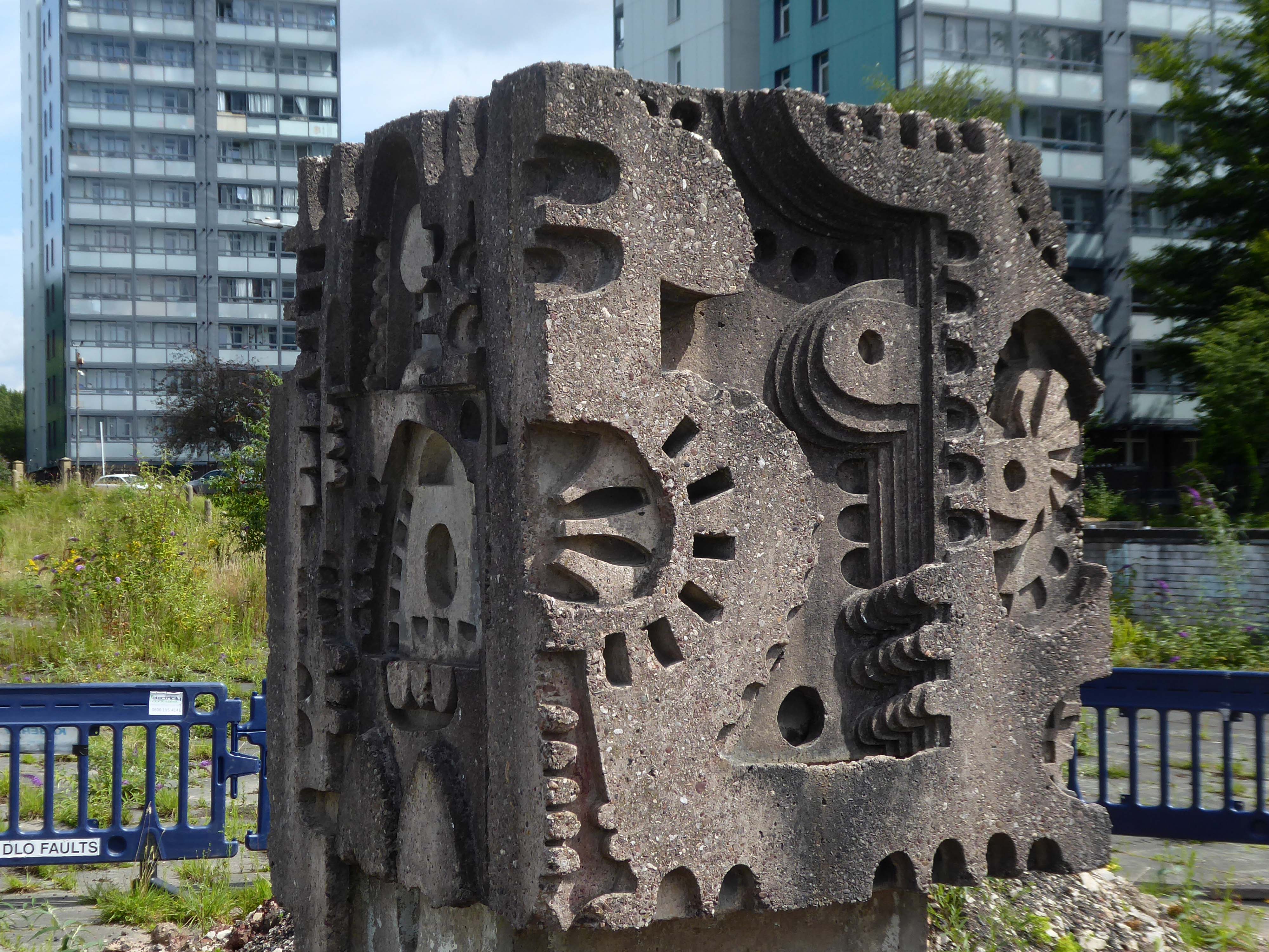
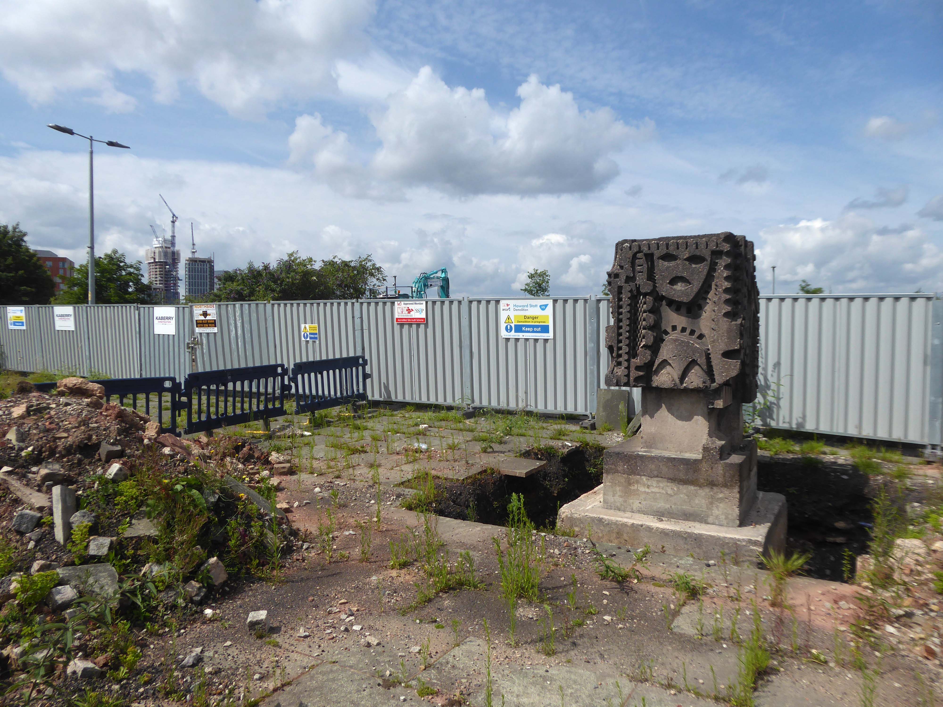
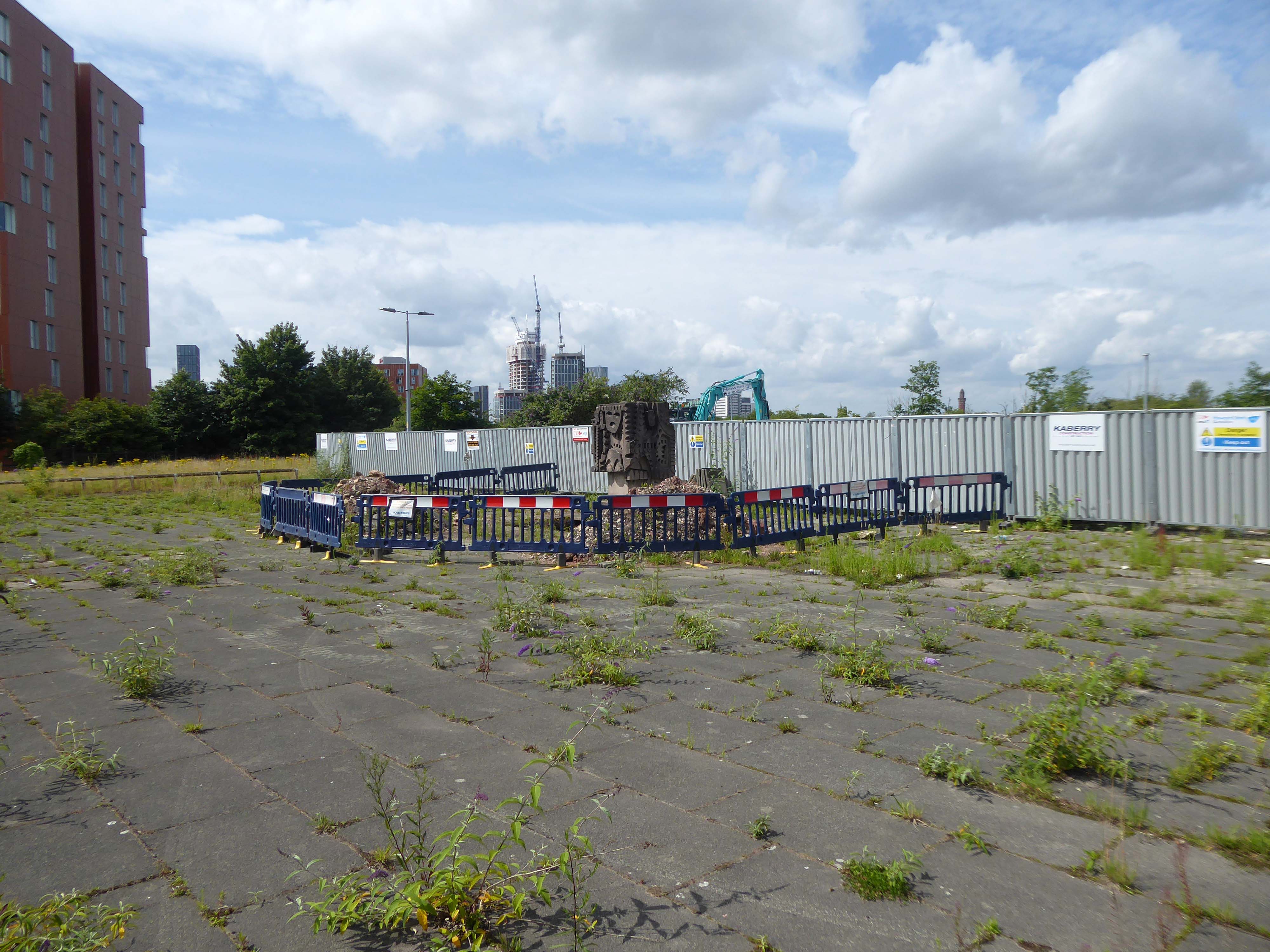
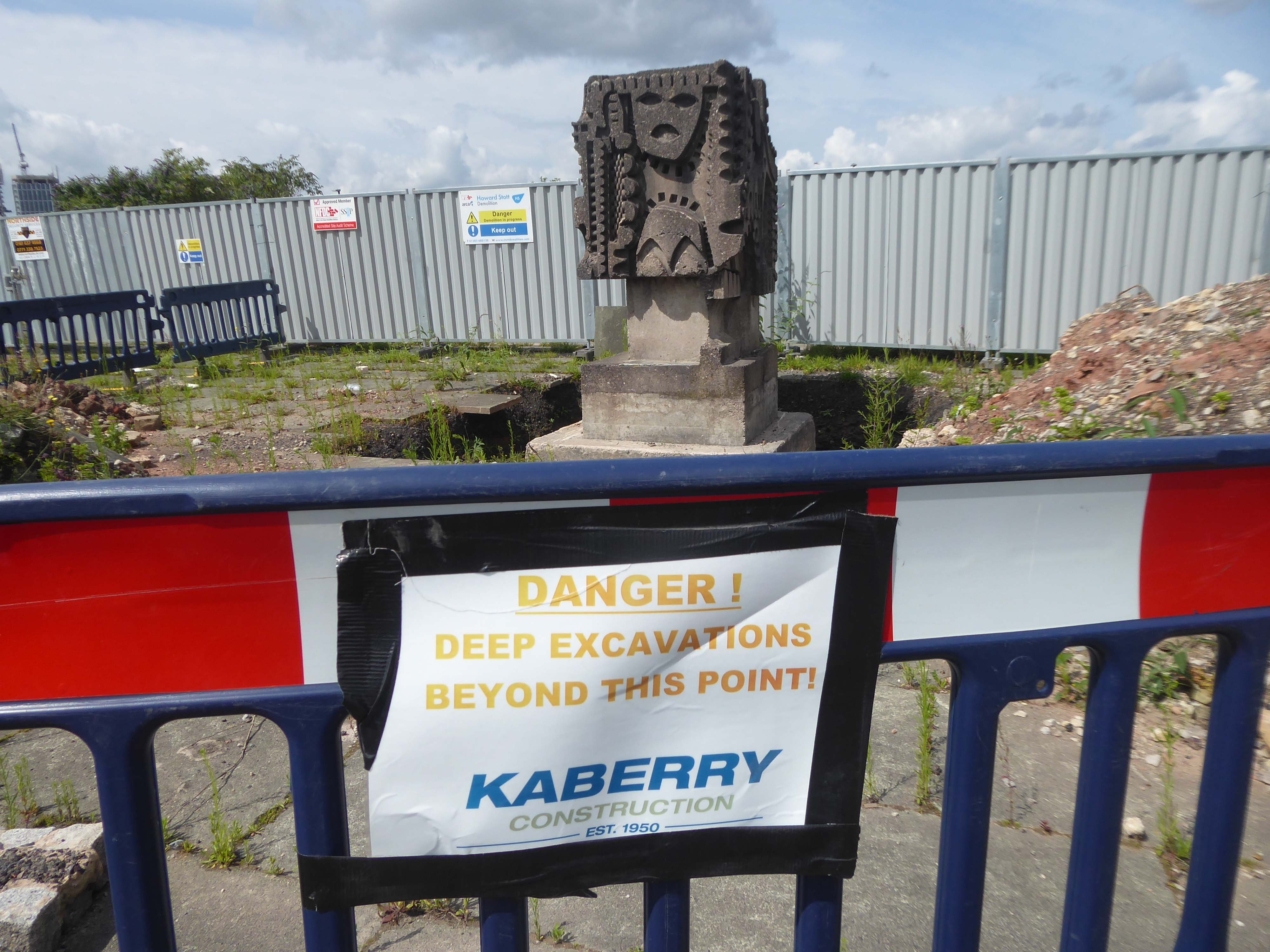
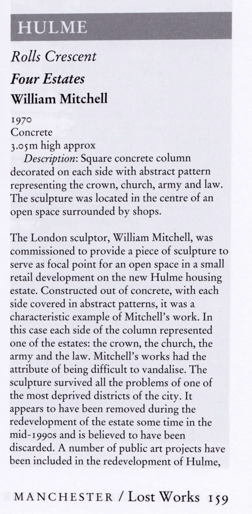
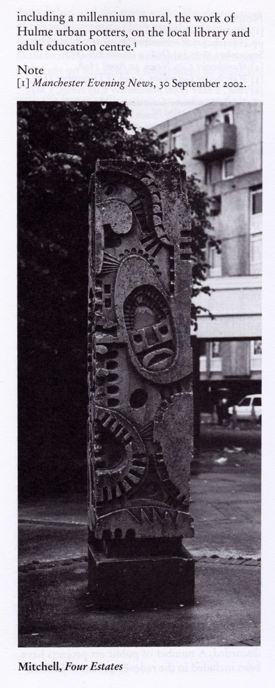
The council has pledged to reinstate the William Mitchell totem nearby.
However the weight of the concrete sculpture and its base have presented unforeseen challenges.
Siting a crane above the Victorian rail tunnel is an issue, as is the cost, a quote for £100,000 was deemed excessive. So stasis is the order the day – the immovable object awaits an unstoppable force.
The sculpture is one of four around Manchester – the Hulme exemplar is long gone.
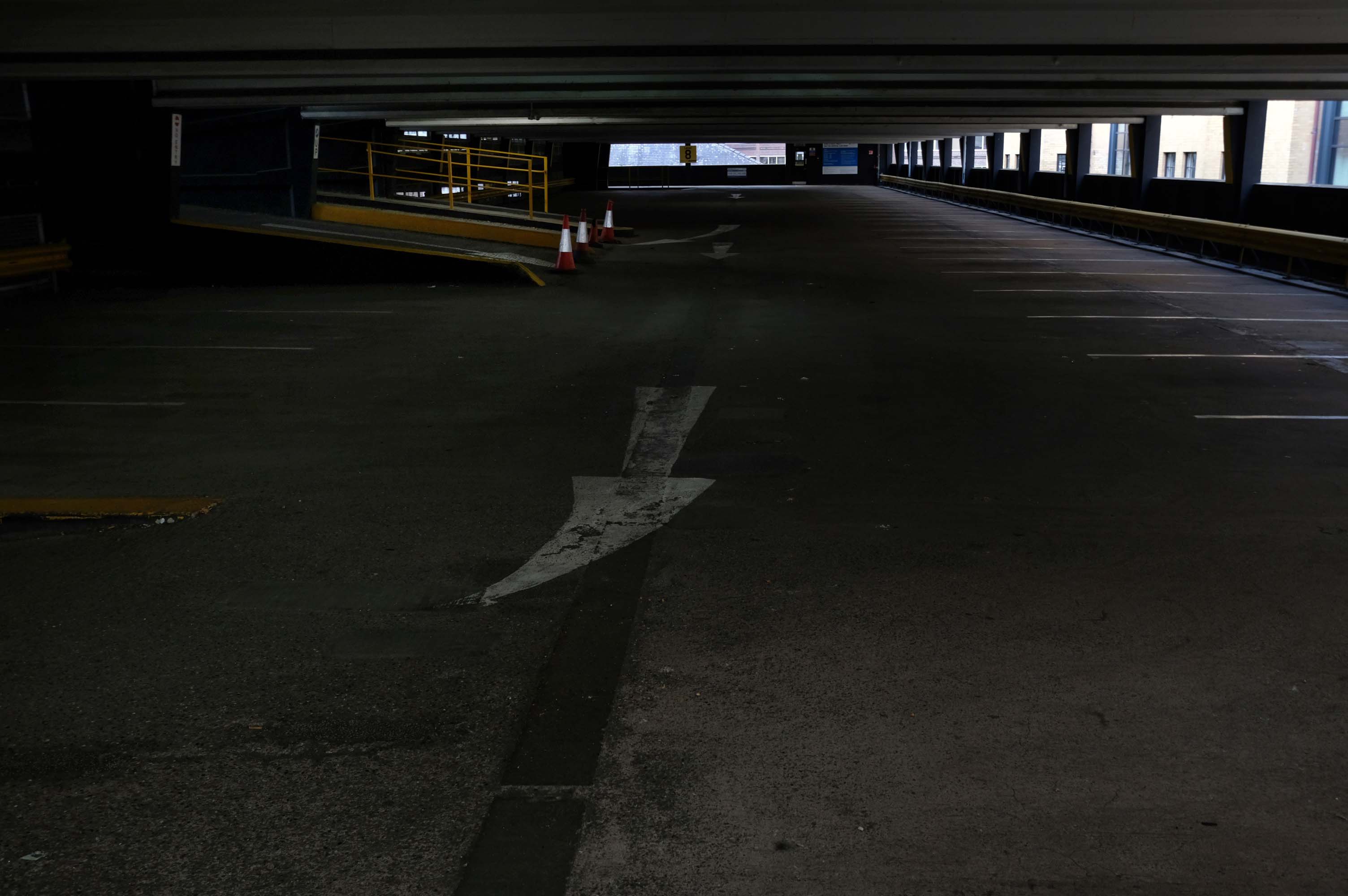
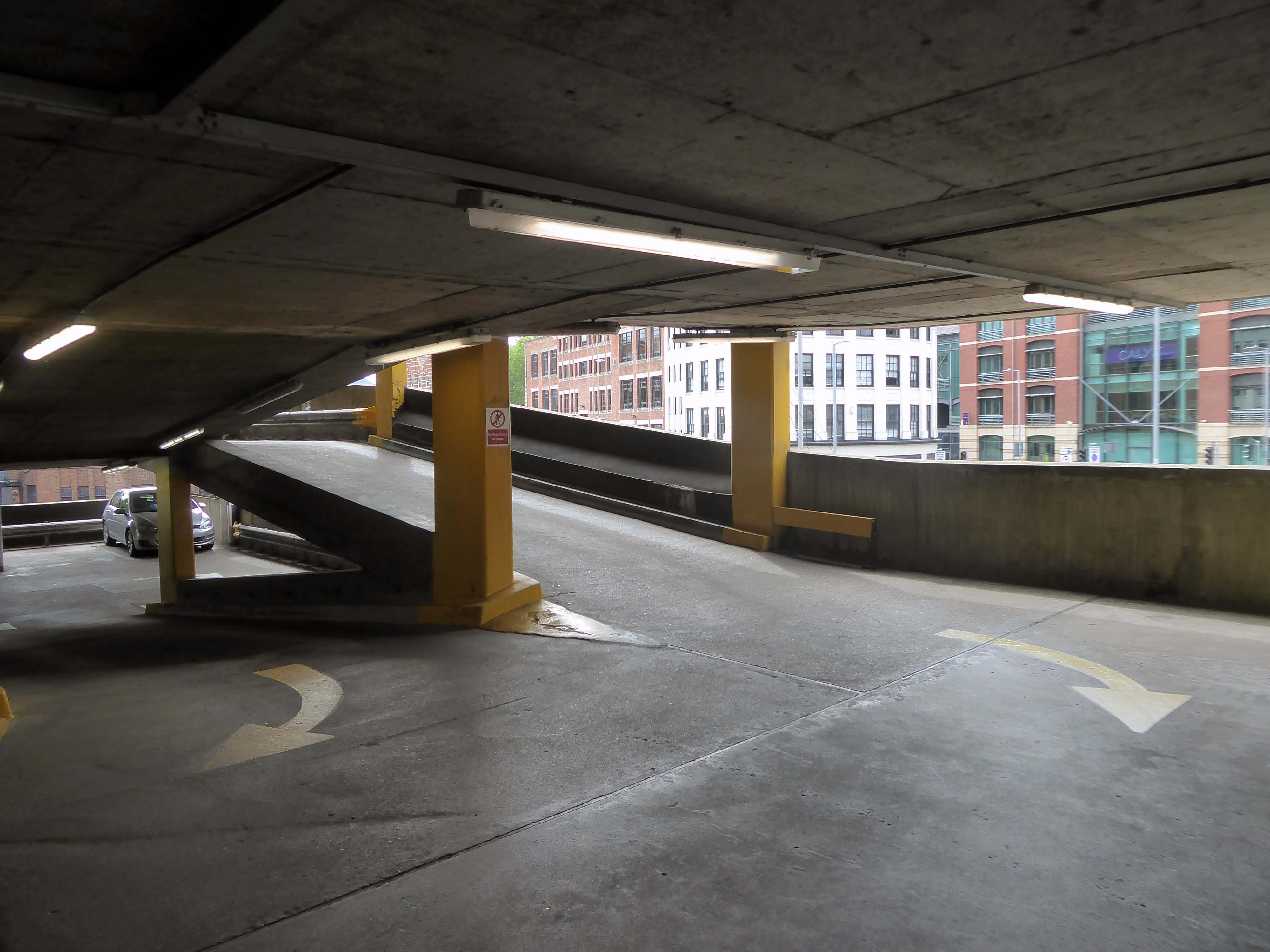
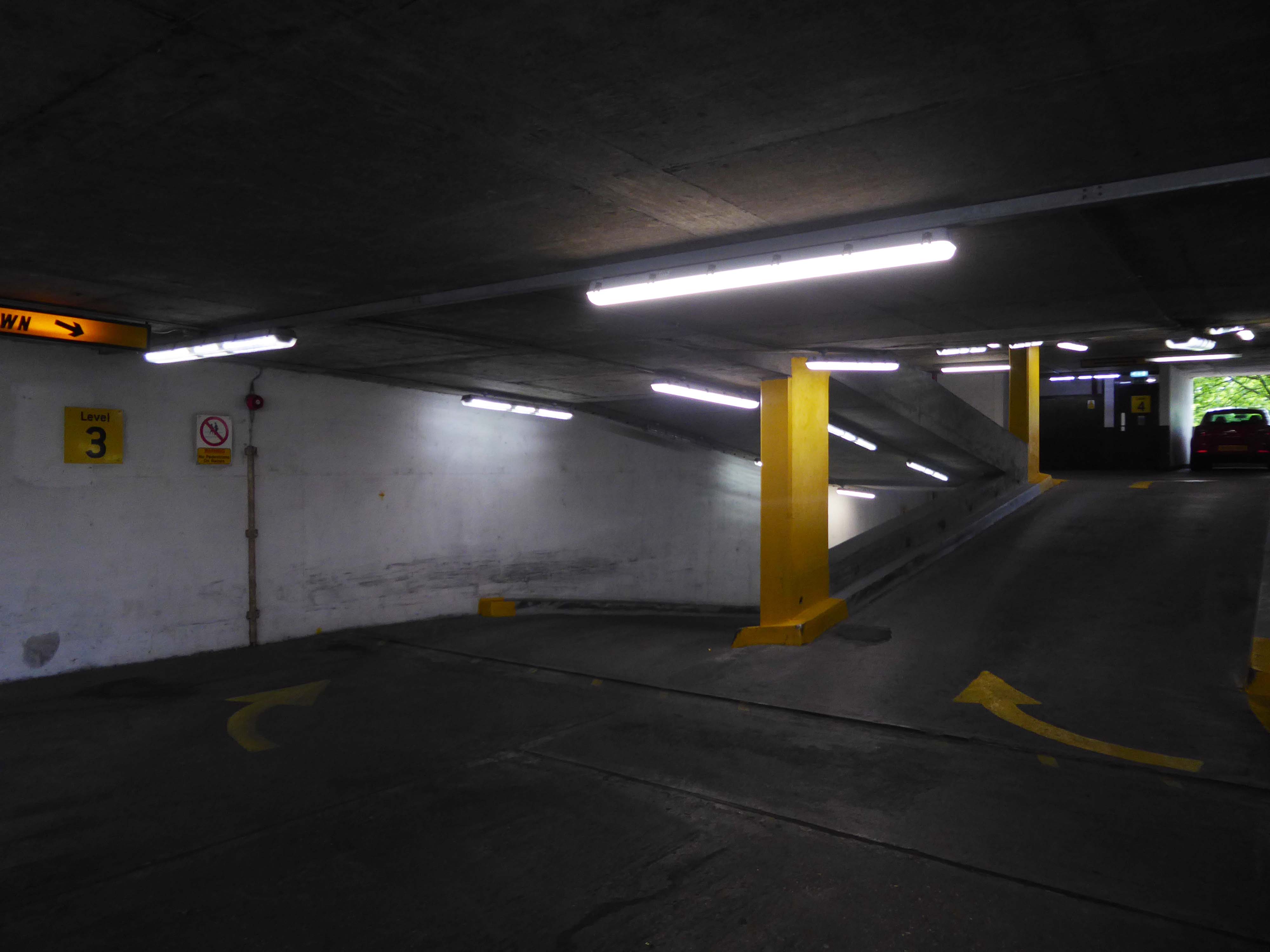
This has narrow ramps up and down, and narrow parking spots.
One ticket machine upon entry wouldn’t dispense – the other was covered with a bag but did work, very weird.
Becky T
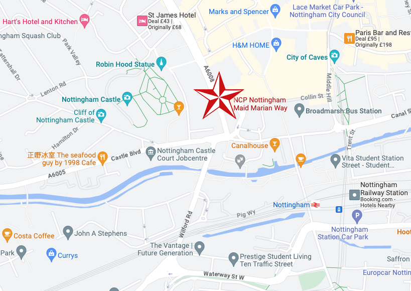
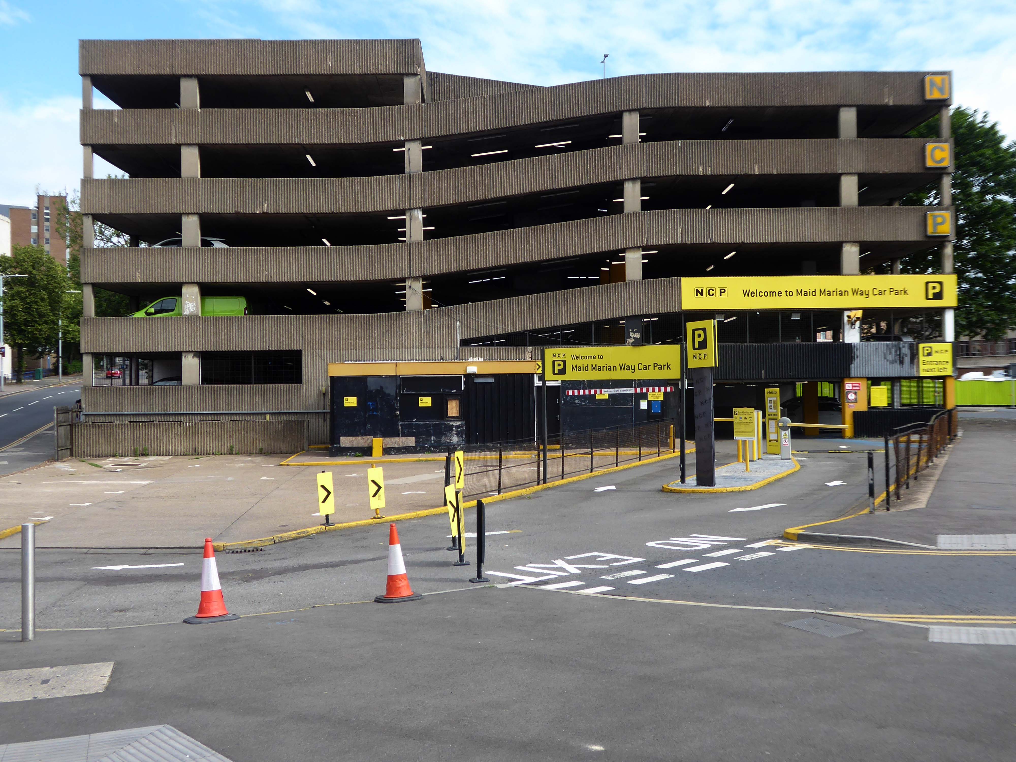
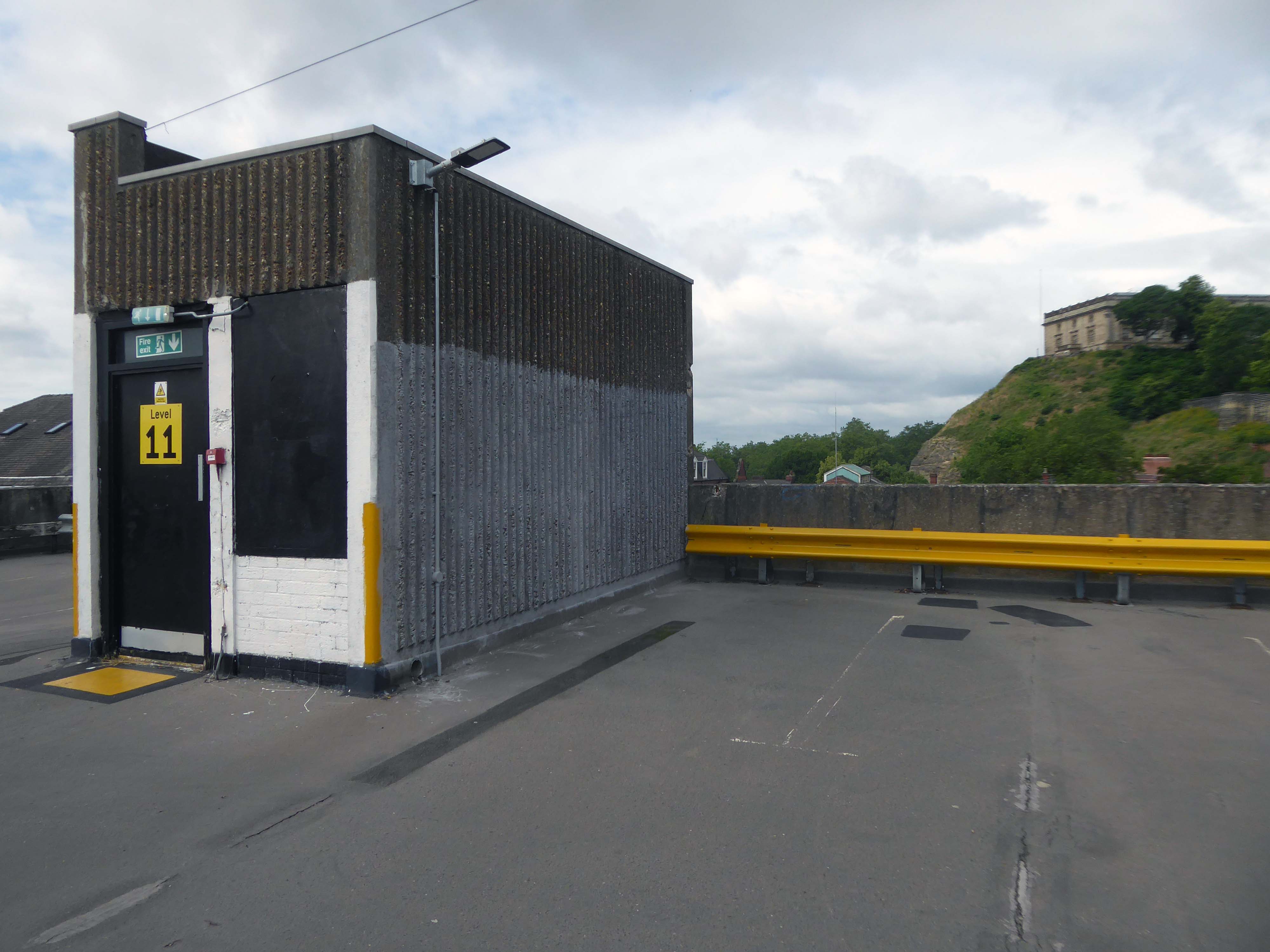
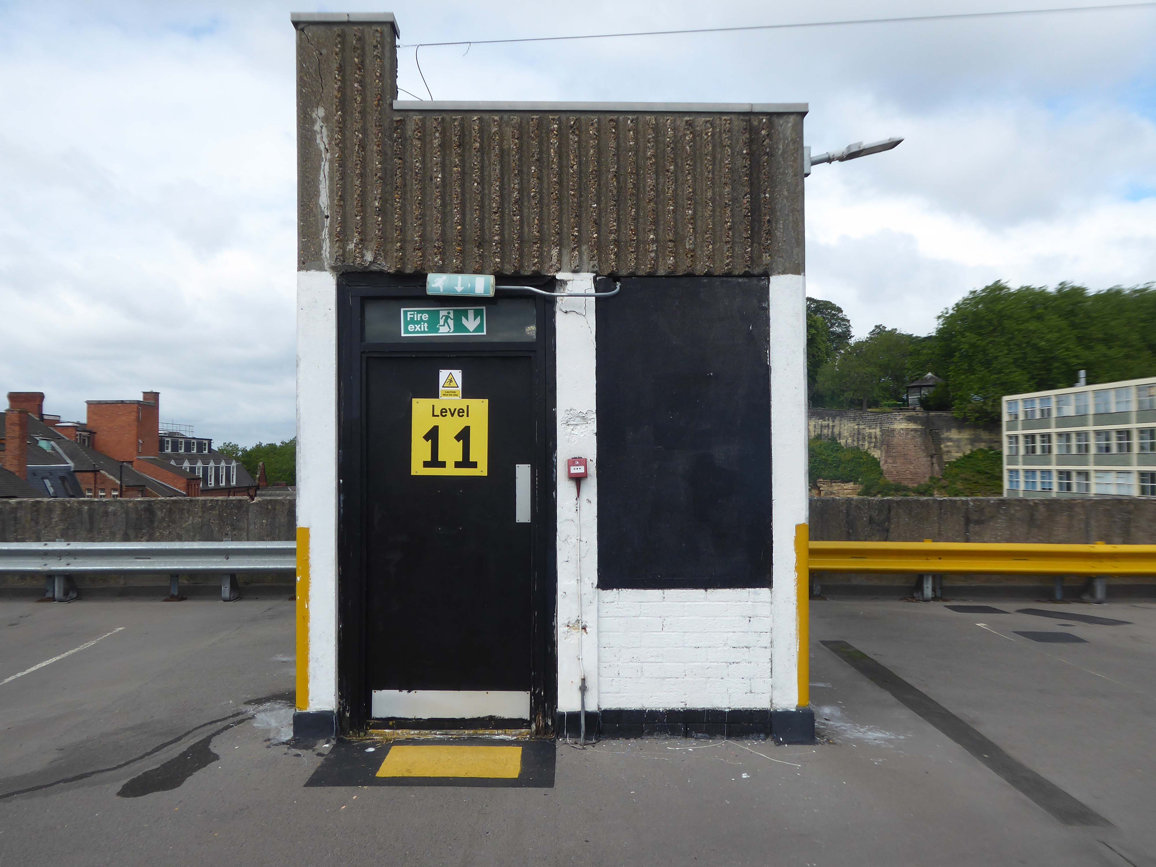
Anyway, a way must have a name, so why not Maid Marion?
Olivia De Havilland
Maid Marian is the heroine of the Robin Hood legend in English folklore, often taken to be his lover. She is not mentioned in the early, medieval versions of the legend, but was the subject of at least two plays by 1600. Her history and circumstances are obscure, but she commanded high respect in Robin’s circle for her courage and independence as well as her beauty and loyalty. For this reason, she is celebrated by feminist commentators as one of the early strong female characters in English literature.
Robin Hood and DH Lawrence apart it seems most apt – so Maid Marion Way it is then.
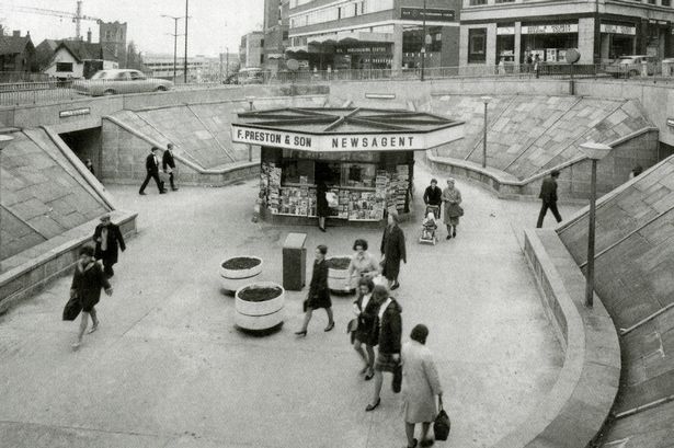
In November 1945, the city council decided to ask Parliament for the go ahead for a scheme likely to cost more than half a million pounds.
However, it would cut a swathe through medieval streets, wiping some from the map and spelling the end of a community life which had thrived for centuries.
The arguments, discussions and negotiations rumbled on for years. It would be 1963 before work finally got underway and the new road was built.
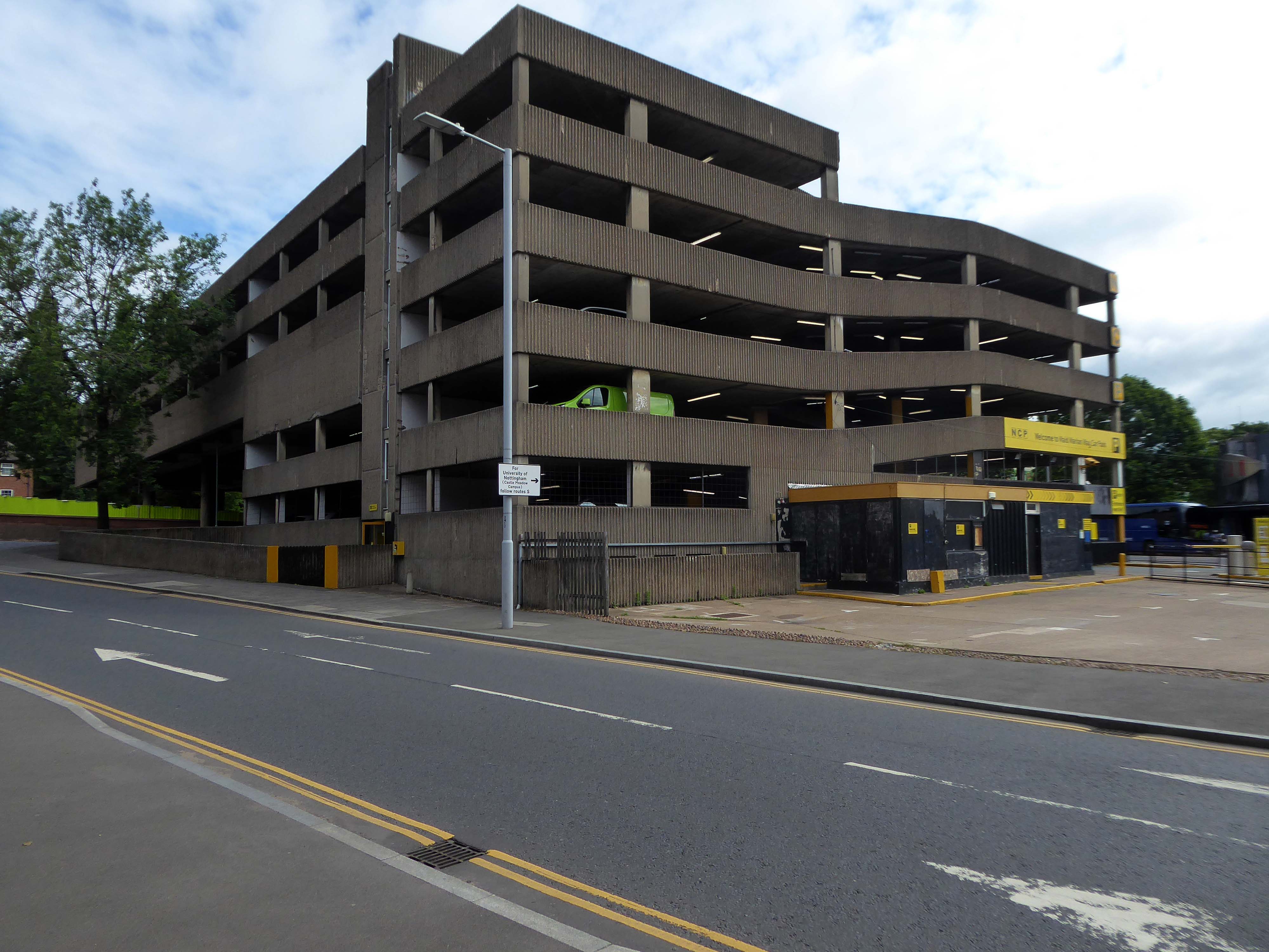
Less than two years after it was completed, it was given a label that has stuck over the past four decades — the ugliest street in Europe.
Dual carriageways mean cars, cars mean car parks and car parks mean business.
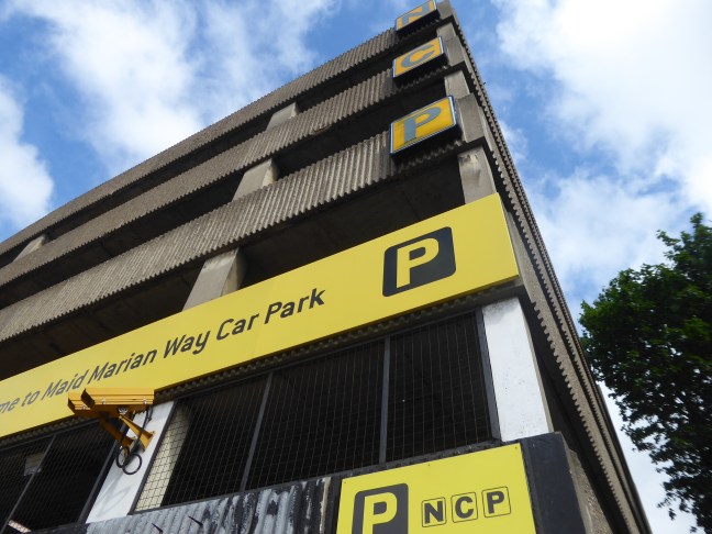
Whether you’re visiting a student or are one yourself, parking at our car park on Maid Marian Way gives you easy access to the University of Nottingham.
For those who want a bit of retail therapy, look no further than the Intu Victoria shopping centre. Located within easy walking distance of our Maid Marian car park and right in the heart of the city centre, you’ll have a choice of over fifty shops to browse.
If you’re a bit of a history buff then Nottingham Castle should definitely be on your ‘to do’ list. Park near the castle at Maid Marian Way, and you’re just minutes away from reliving tales of the past as you explore the original hidden caves equipped with a dungeon. Make sure you don’t leave without taking a picture with Nottingham’s most famous resident, Robin Hood, found just outside the castle.
Had a lovely conversation with a lady in the machine after my parking ticket was swallowed and learnt lots about the poor acoustic in car parks. They charged me twice to park my car which made me feel lots of negative emotions towards them. So all in all, a bit of rollercoaster. Highly recommend this experience for anyone looking for somewhere to park that enjoys conflict and has lots of money they don’t need.
There is evidence that the current town location has been occupied since prehistoric times. Prehistoric tools found in the caves of Graig Fawr, in the nearby village of Meliden, have revealed the existence of early human habitation in the area.
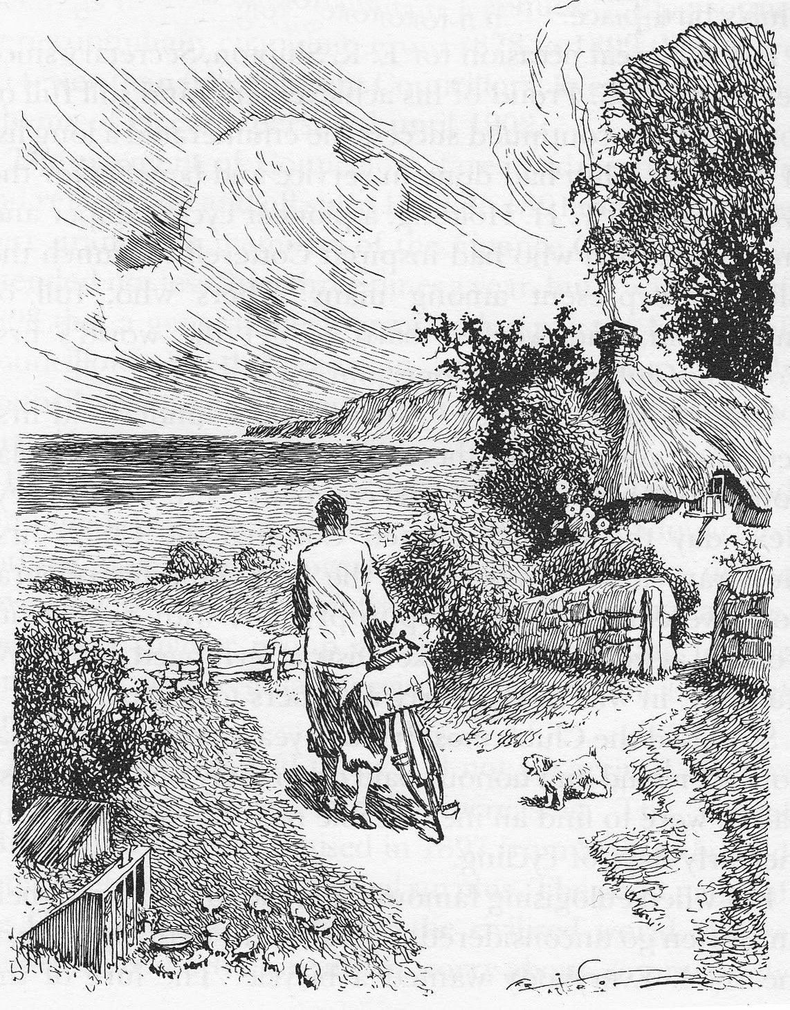
“Sunny Prestatyn” became famous for its beach, clean seas and promenade entertainers, and visiting for a bathe was considered very healthy by city-dwelling Victorians.
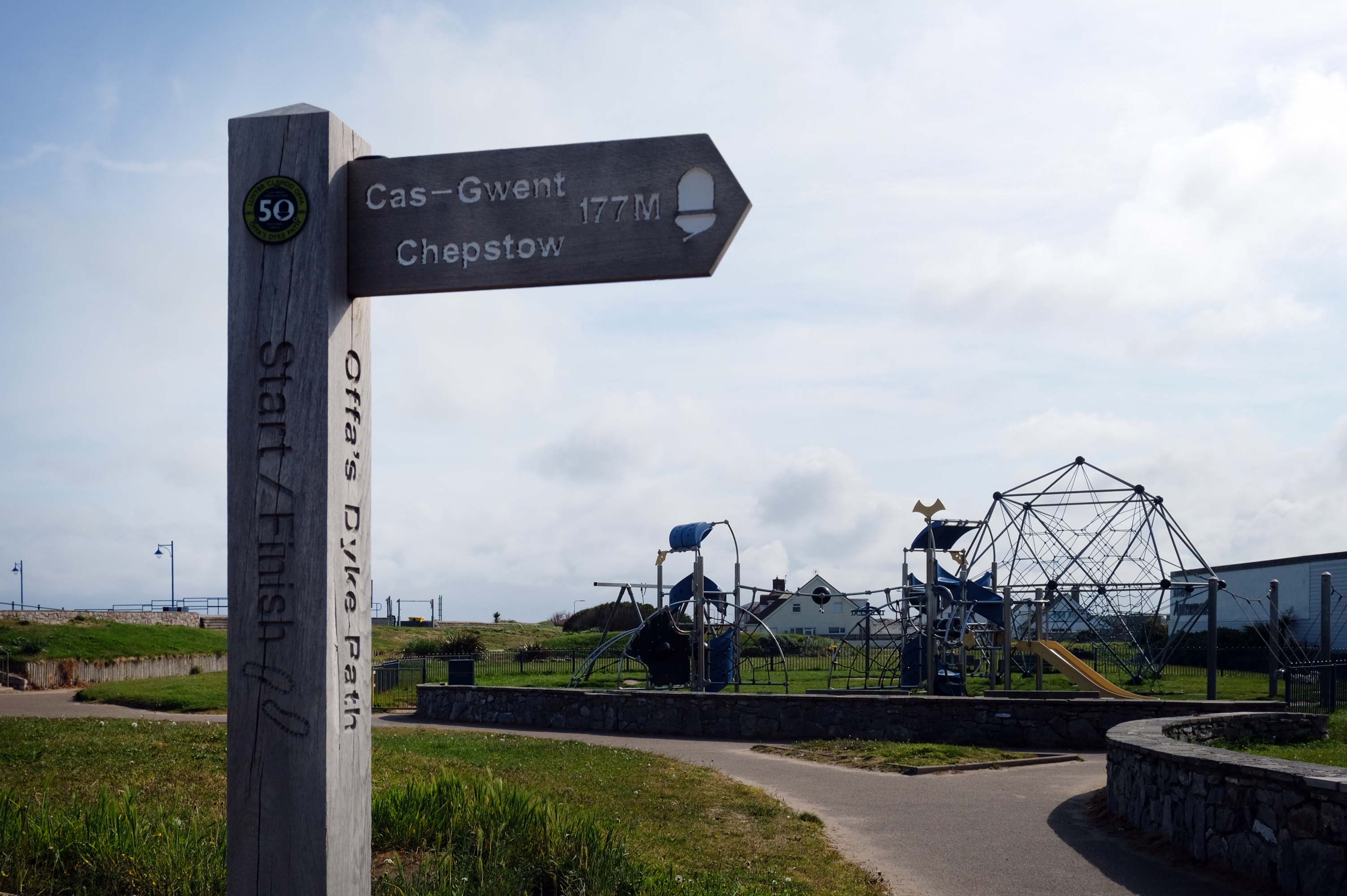
The town is at the northern end of the Offa’s Dyke Path, although not on Offa’s Dyke itself.
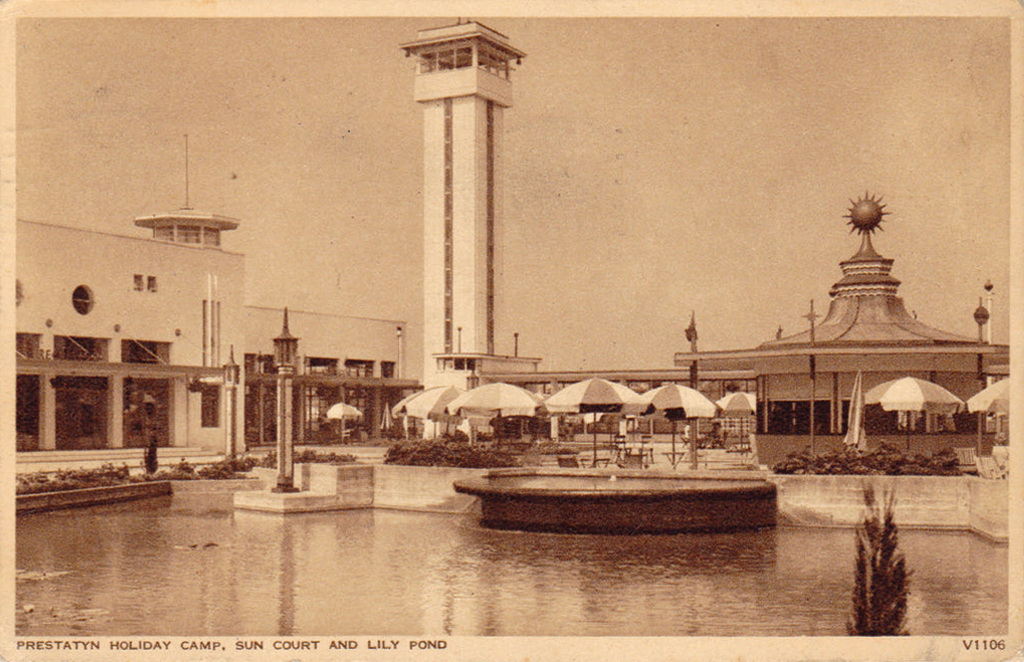
The holiday camp in Prestatyn was built by the London Midland and Scottish Railway Co. in 1939. The main buildings were in classic 1930s style, featuring rounded building ends, steel framed windows and porthole windows. Chalets showed an early form of sectionalised building method.
Requisitioned as a military camp until after the Second World War, it reopened as a holiday camp in the early 1950s. The site was demolished and cleared between February and March 2001.
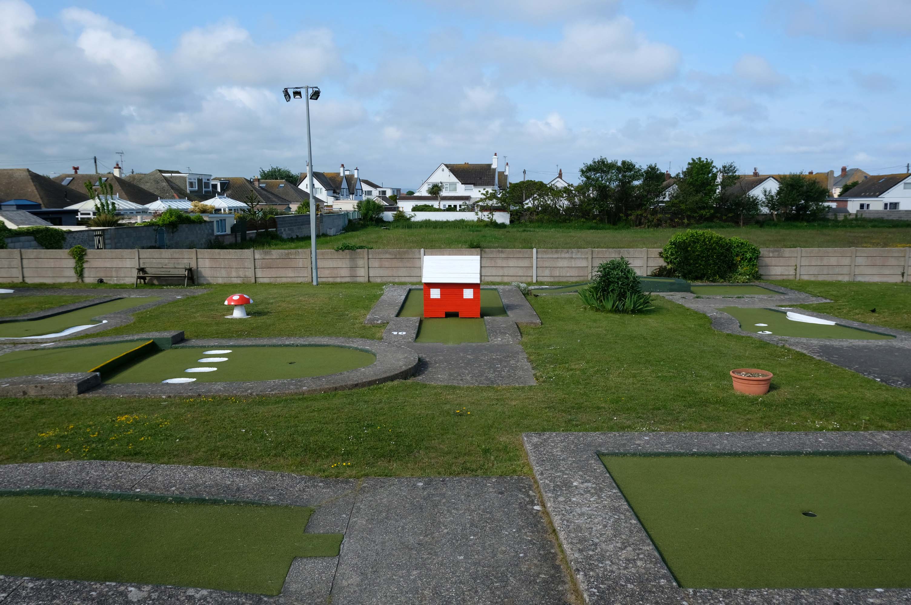
Prestatyn offers the opportunity to engage in an impromptu game of Crazy Golf – though the facility was closed on the morning of my visit.
The crazy golf was fantastic the kids didn’t want to leave plus the lady was so helpful plus the price were very reasonable – would highly recommended.
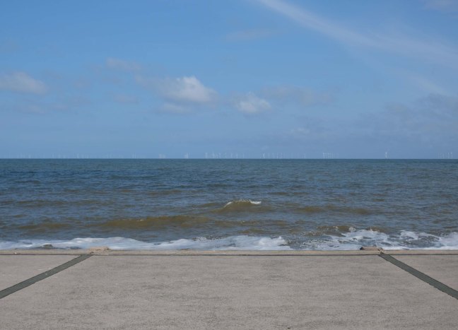
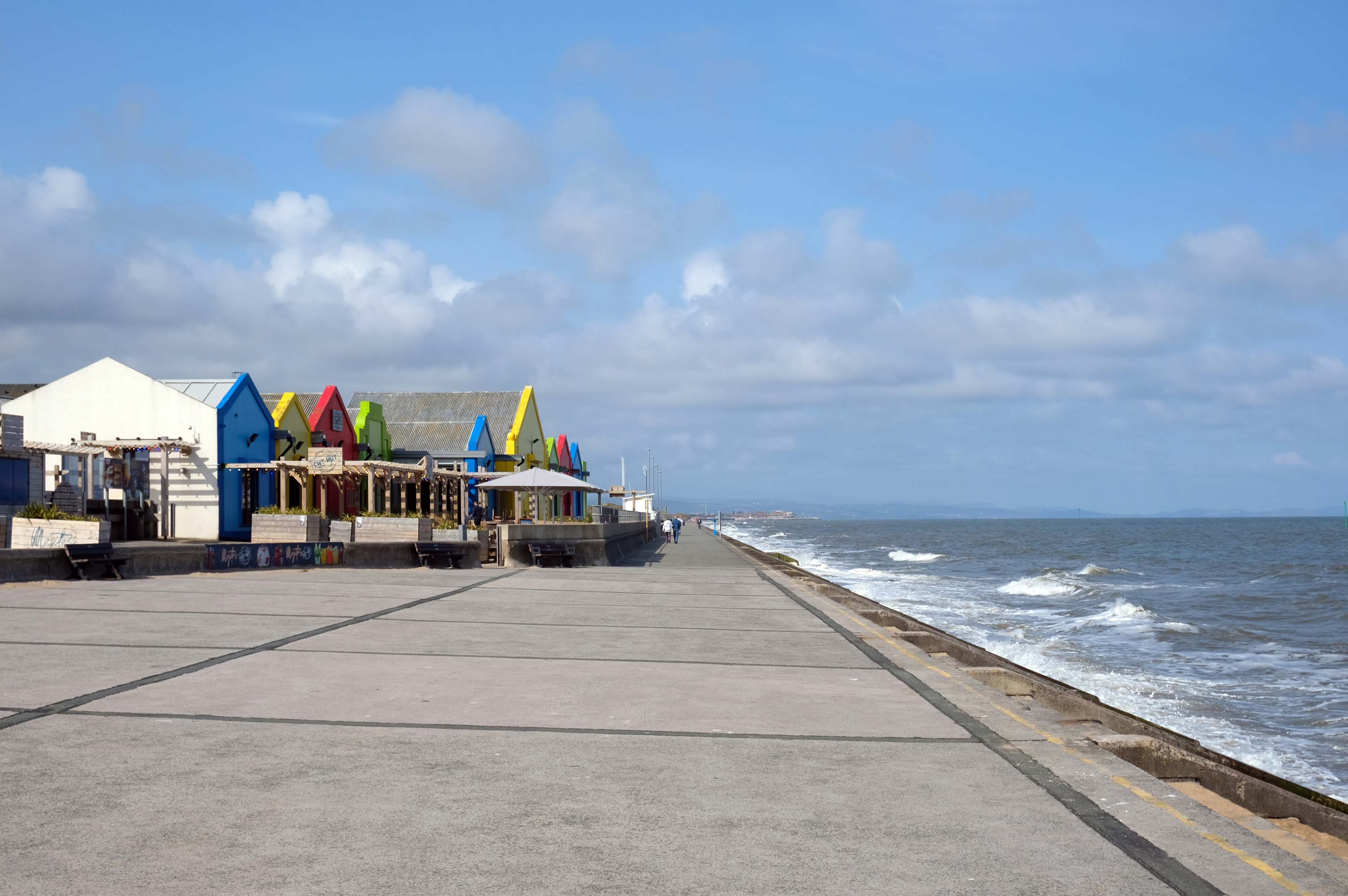
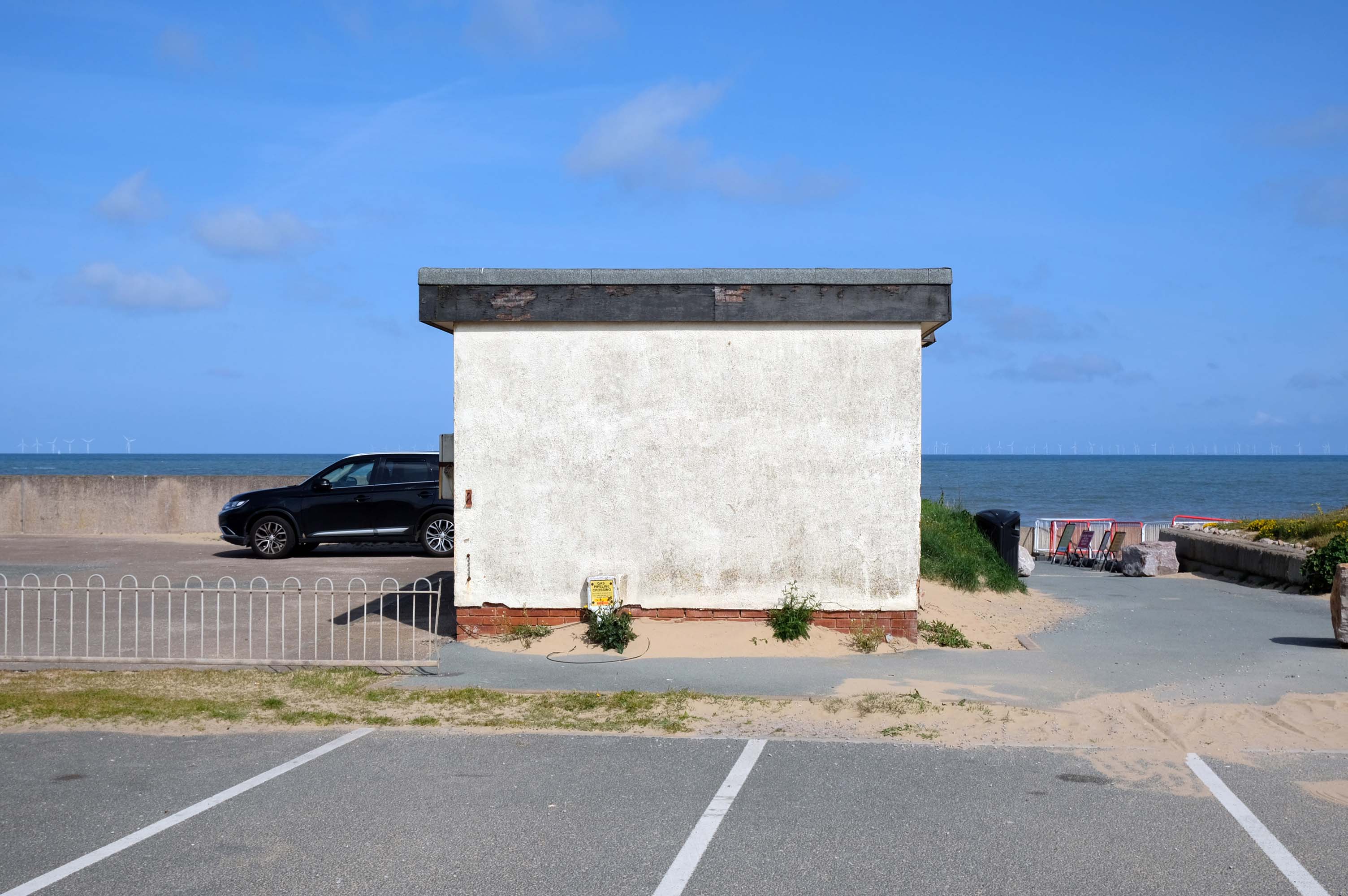
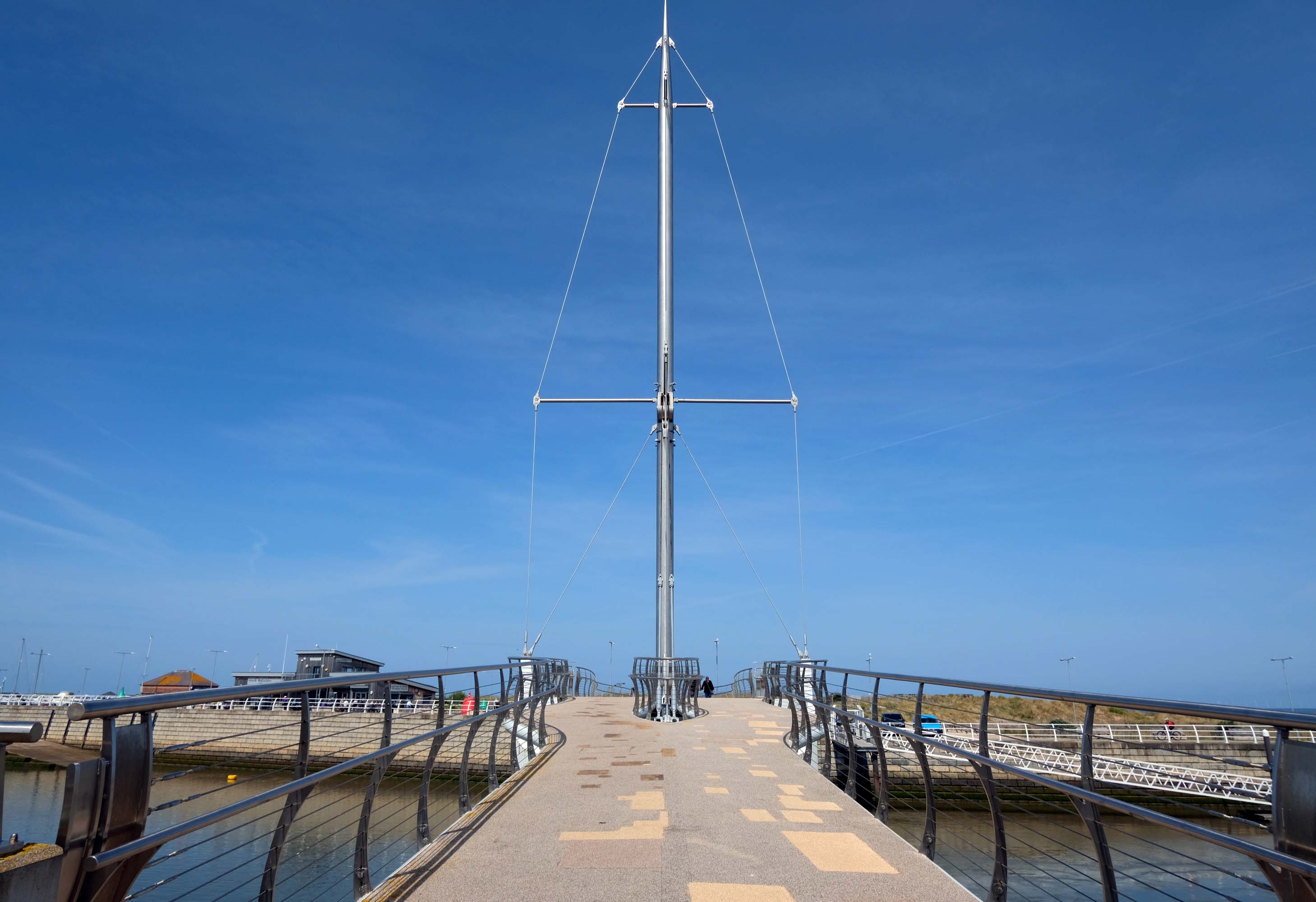
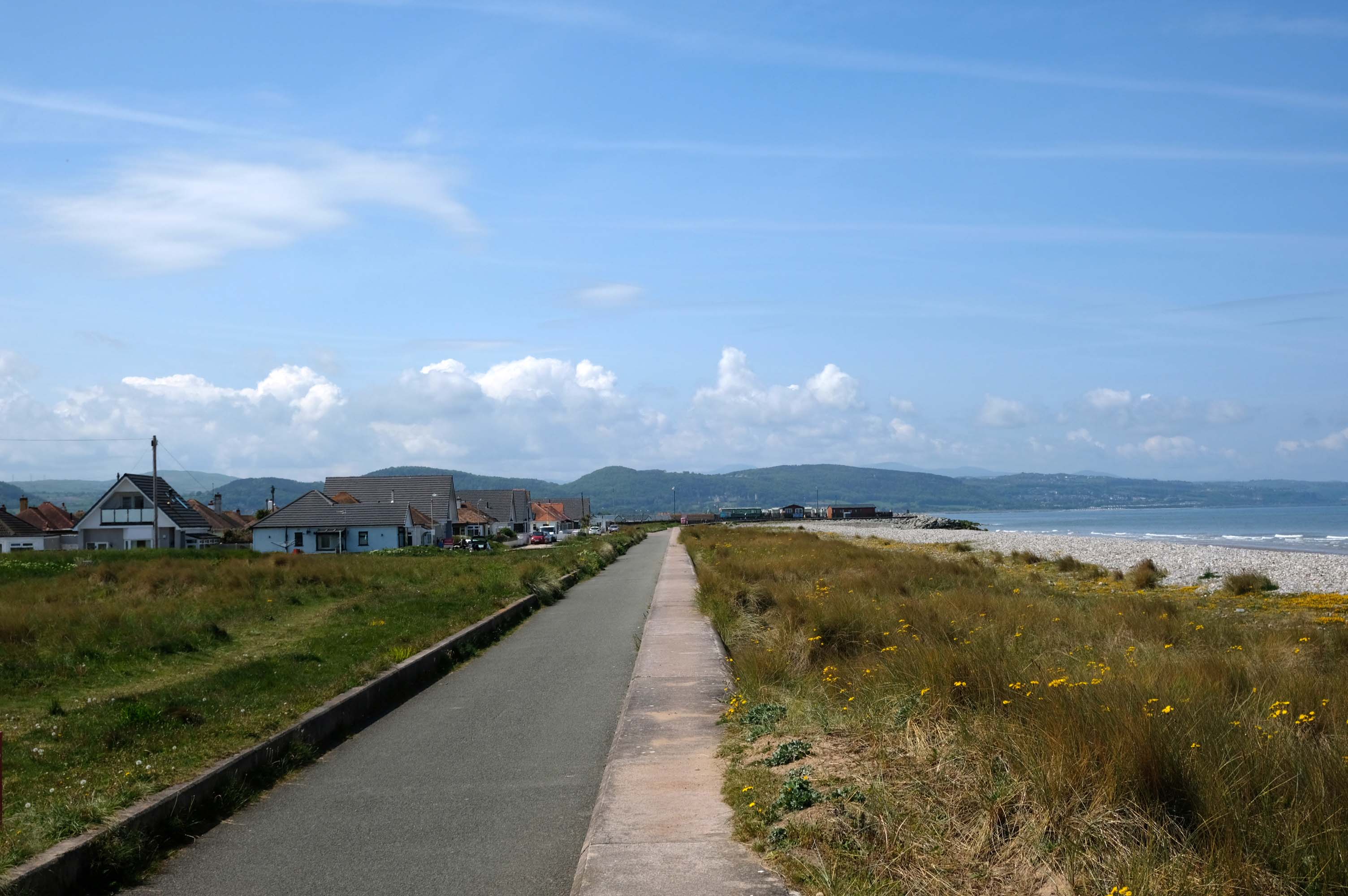
The promenade is dominated by a tight knit group of modern leisure facilities.
An expansive car park fronts directly onto the seafront.
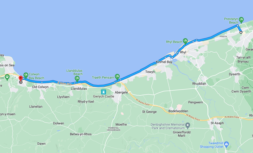
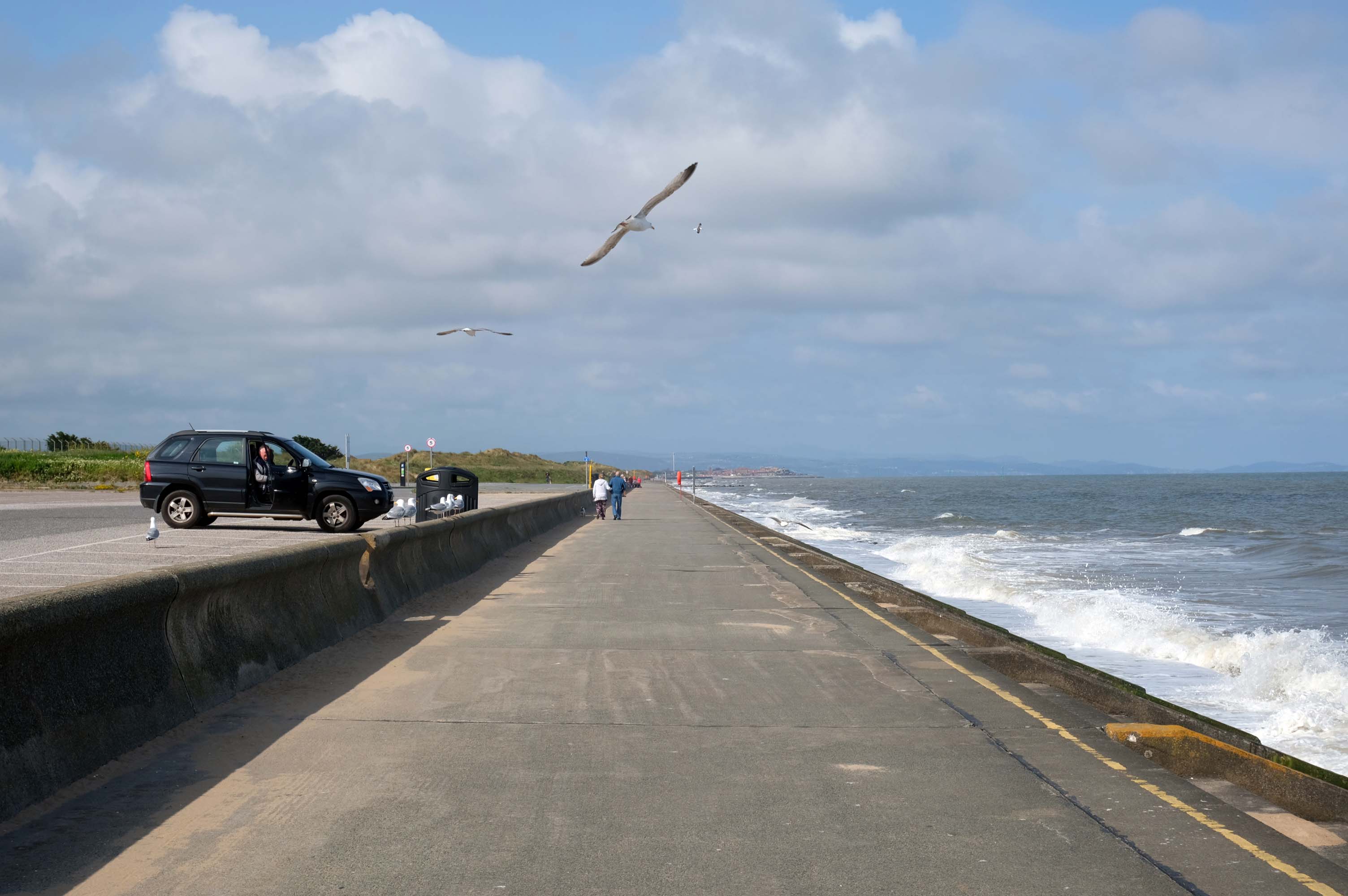
There have been serious reinforcements made to the seawalls – ensuring that the passing cyclist will not be washed away, by the crashing waves of the incoming tide.
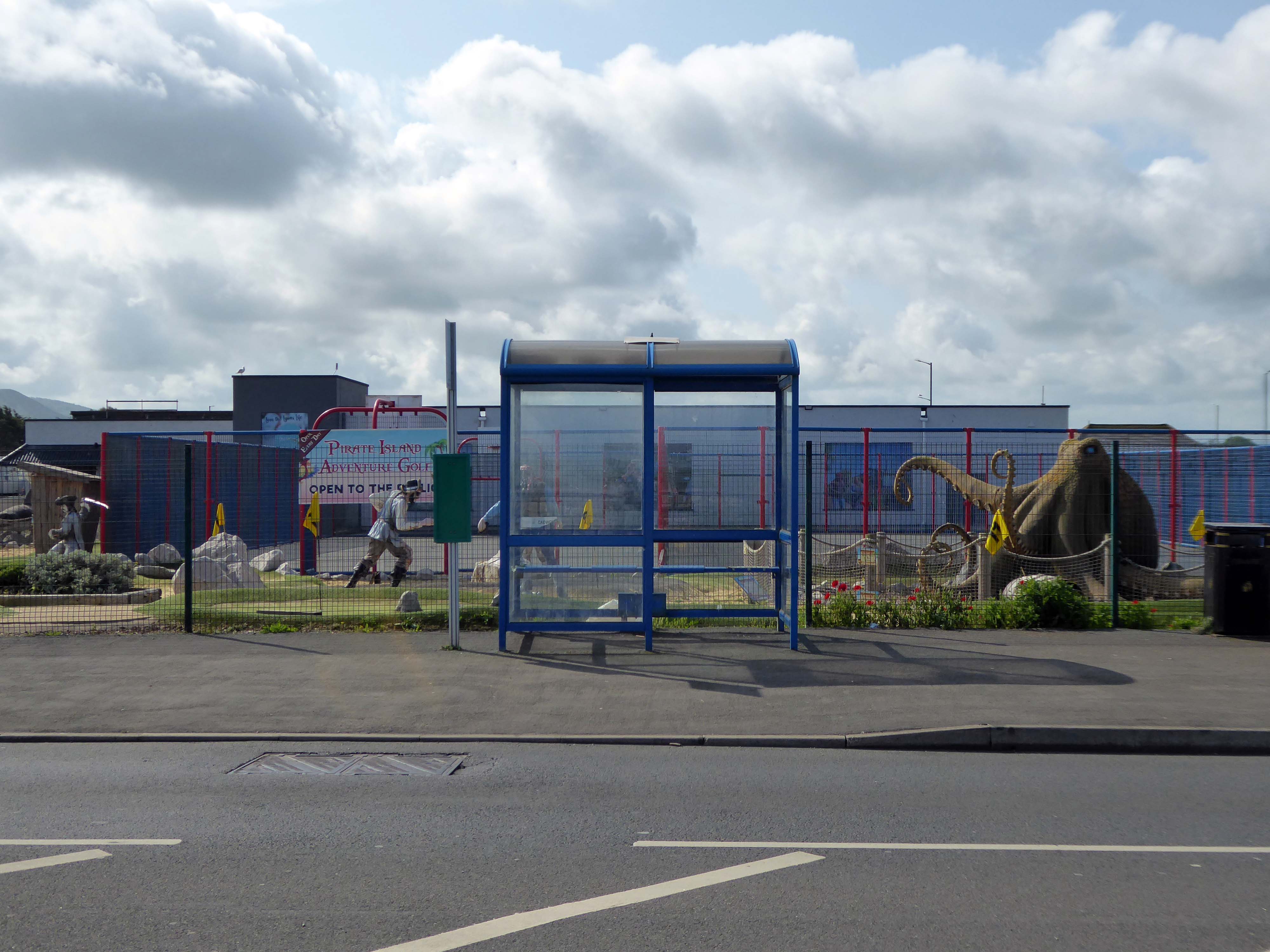
The reinforcement work demands that we temporarily detour onto the Rhyl Coast Road, where we encounter Pirate Island Adventure Golf.
Uncover hidden treasure on the North Welsh Coast at Pirate Island Adventure Golf at Lyons Robin Hood Holiday Park.
Make friends with the great white shark, octopus, and the resident pirates who guard the Island.
This 18-hole course is a fun and crazy challenge for all the family, with stunning views of Rhyl seafront to boot. Plus, it’s located just a stone’s throw away from Sherwoods Sports Bar where refreshments are served.
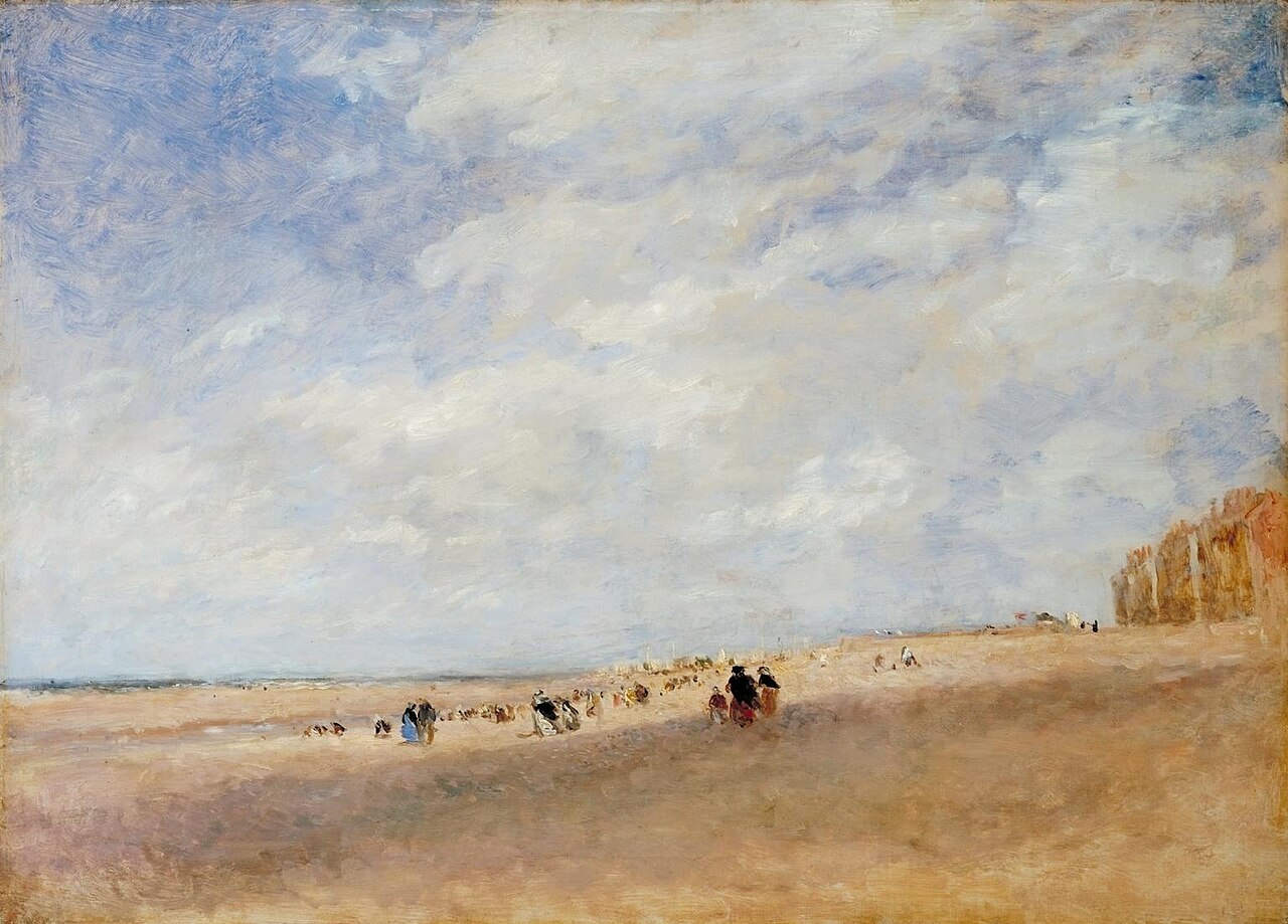
Rhyl
Rhyl Sands: David Cox 1854
The Welsh orthography has proved difficult for English writers to transliterate as Rhyl’s opening voiceless alveolar trill is uncommon in the English language.
I nipped into town for a tub from Sidoli’s – £1.83 well spent.
The promenade is home to a series of entertainments including the Rhyl Pavilion Theatre
The theatre, owned and operated by Denbighshire Council, has also been re-clad as part of the project, designed by architects Space & Place.
It forms part of a wider redevelopment of Rhyl’s seafront, which includes the demolition of the Sun Centre and the construction of a £15m water park.
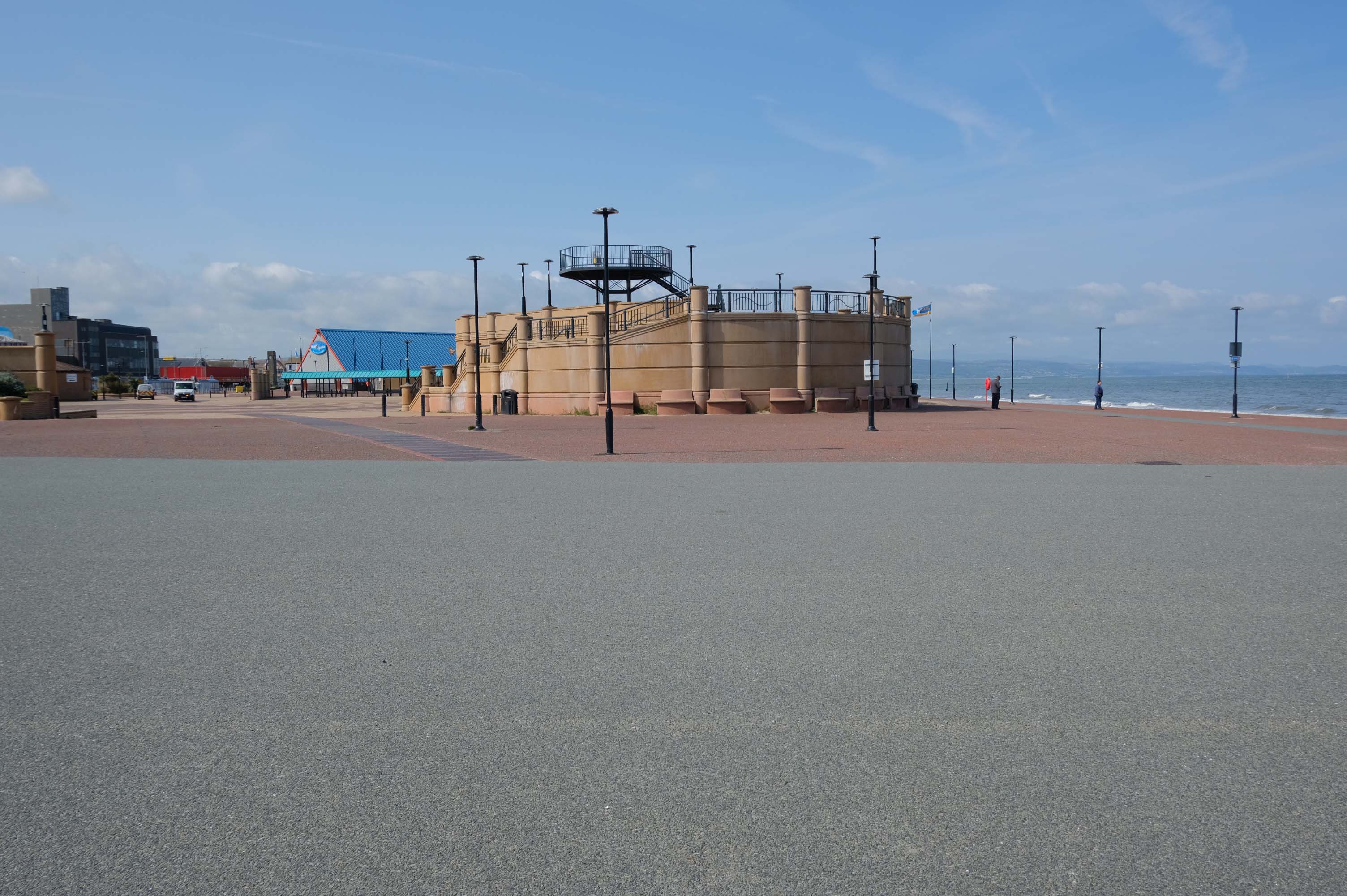
There is a also a becalmed Post Modernist Piazza – named Rhyl Events Arena.
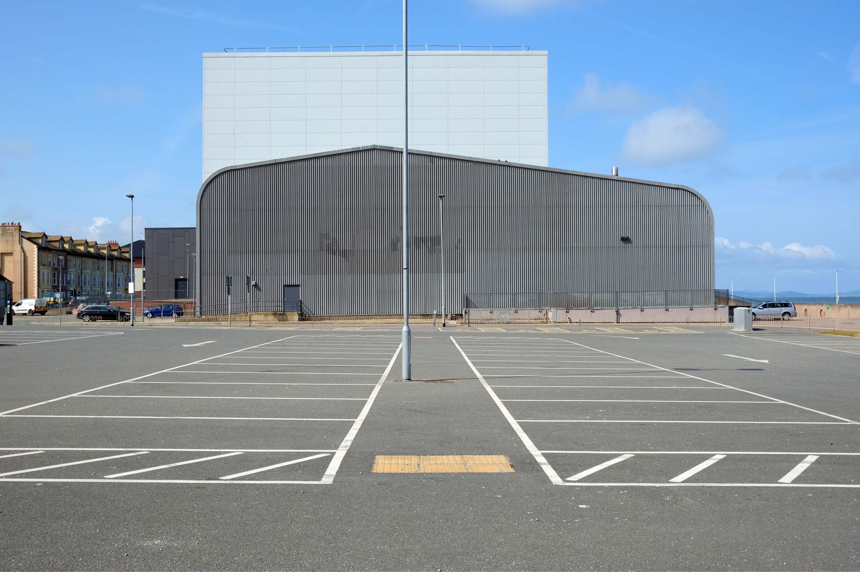
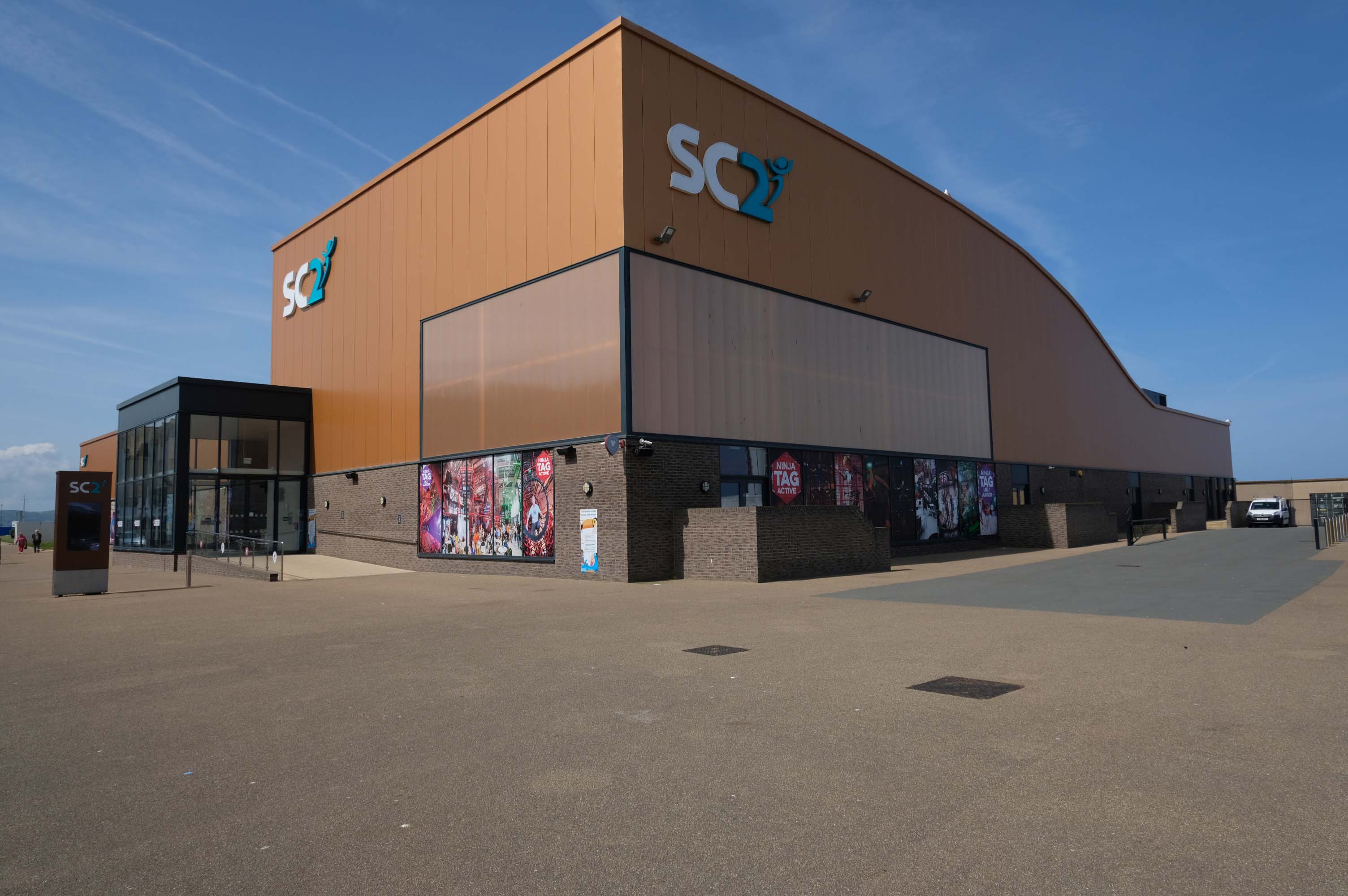
The playful nursery geometry of the SeaQuarium.
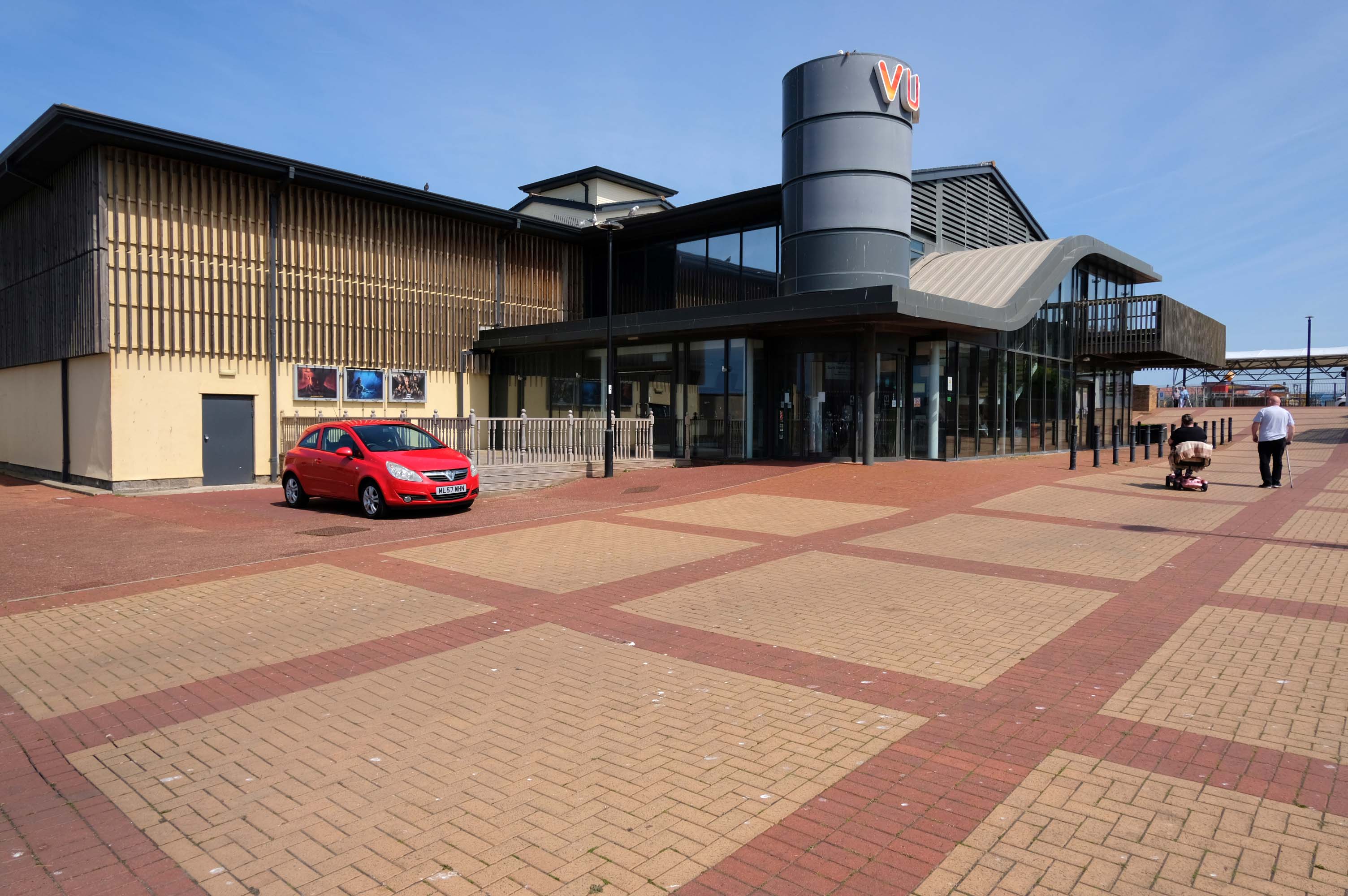
The functionalist Vue Cinema.
Tickets were £5.99 for a standard seat, the staff said not to bother upgrading as the premium seats were rubbish, sound was okay and picture quality was okay.
Food price was expensive so it maybe cheap to get in, but £16.99 for a large popcorn and drink ups the price, would go again if in the area.
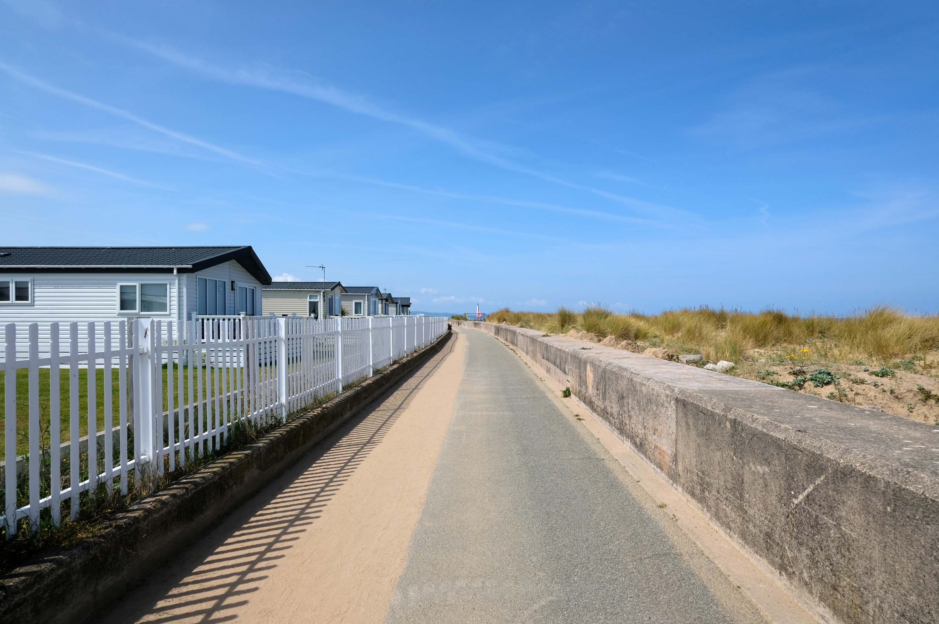
Much of the coast is fringed with chalets and static caravans.
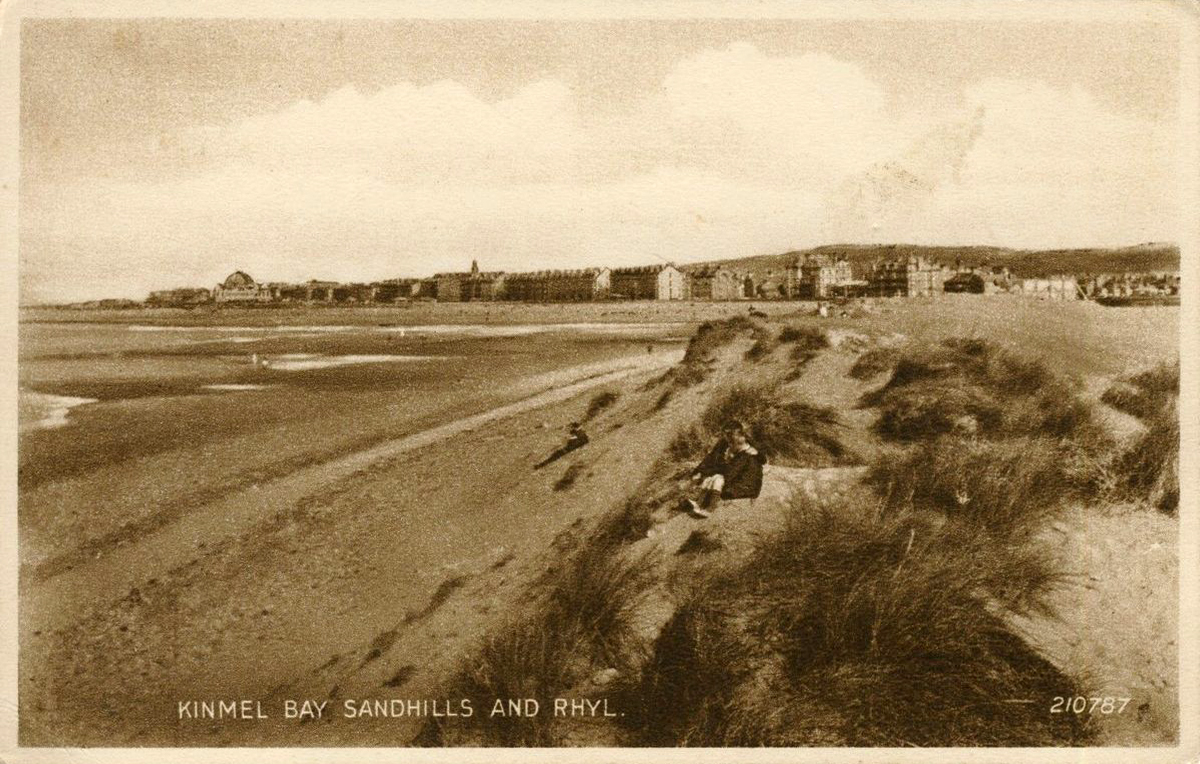
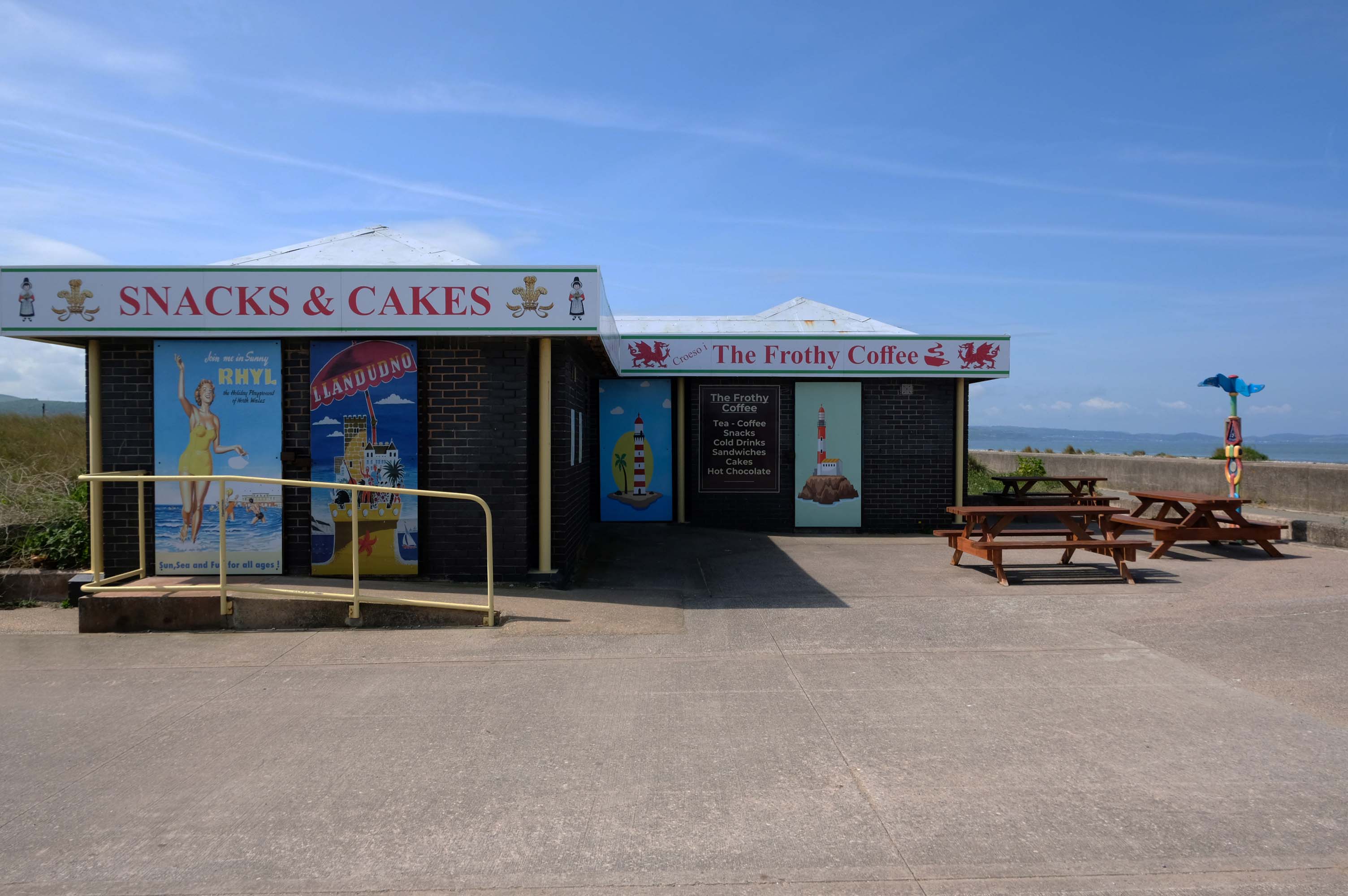
Kinmel Bay
Home to The Frothy Coffee.
There aren’t enough food, service, value or atmosphere ratings for The Frothy Coffee, yet – be one of the first to write a review!
Kinmel Bay beach is popular with tourists and the local population. In addition to various small shops and takeaway outlets, there is also an Asda superstore that opened in 1981, which includes a large petrol filling station.
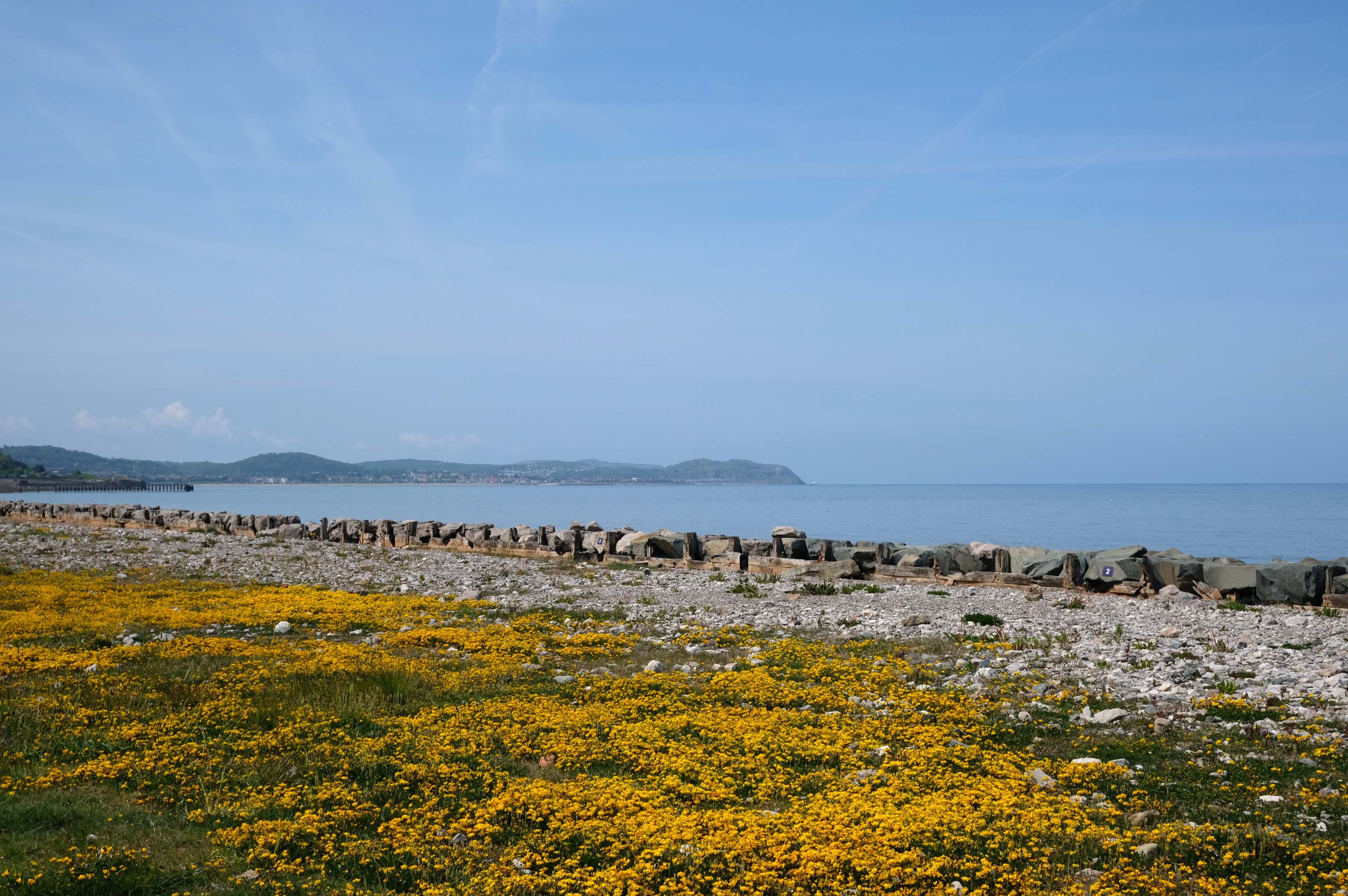
The concrete shore is softened by grasses and wild flowers – with views of the mountains beyond.
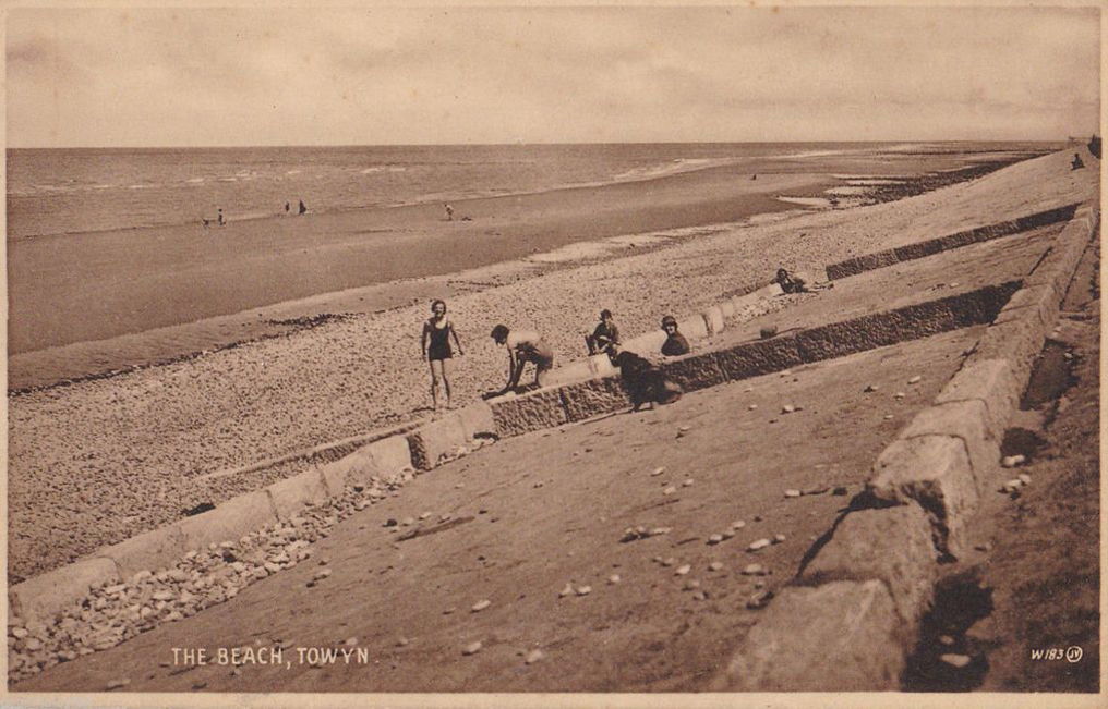
Here we are in Towyn
The town made national headlines in 1990 when a combination of gale-force winds, a high tide and rough seas caused Towyn’s flood defences to be breached at about 11.00am on 26 February. Four square miles of land was flooded, affecting 2,800 properties and causing areas of the resort to be evacuated. Further flooding occurred later the same week, on 1 March, shortly after the site of the disaster was visited by Prince Charles and Princess Diana.
Scientific experts also believe that the silt left behind from the flooding had left the town with a higher concentration of radioactivity, over ten times the governmental safety limits, most likely originating from the nuclear processing plant at Sellafield which had been dispersed into the Irish Sea over many years since its construction.
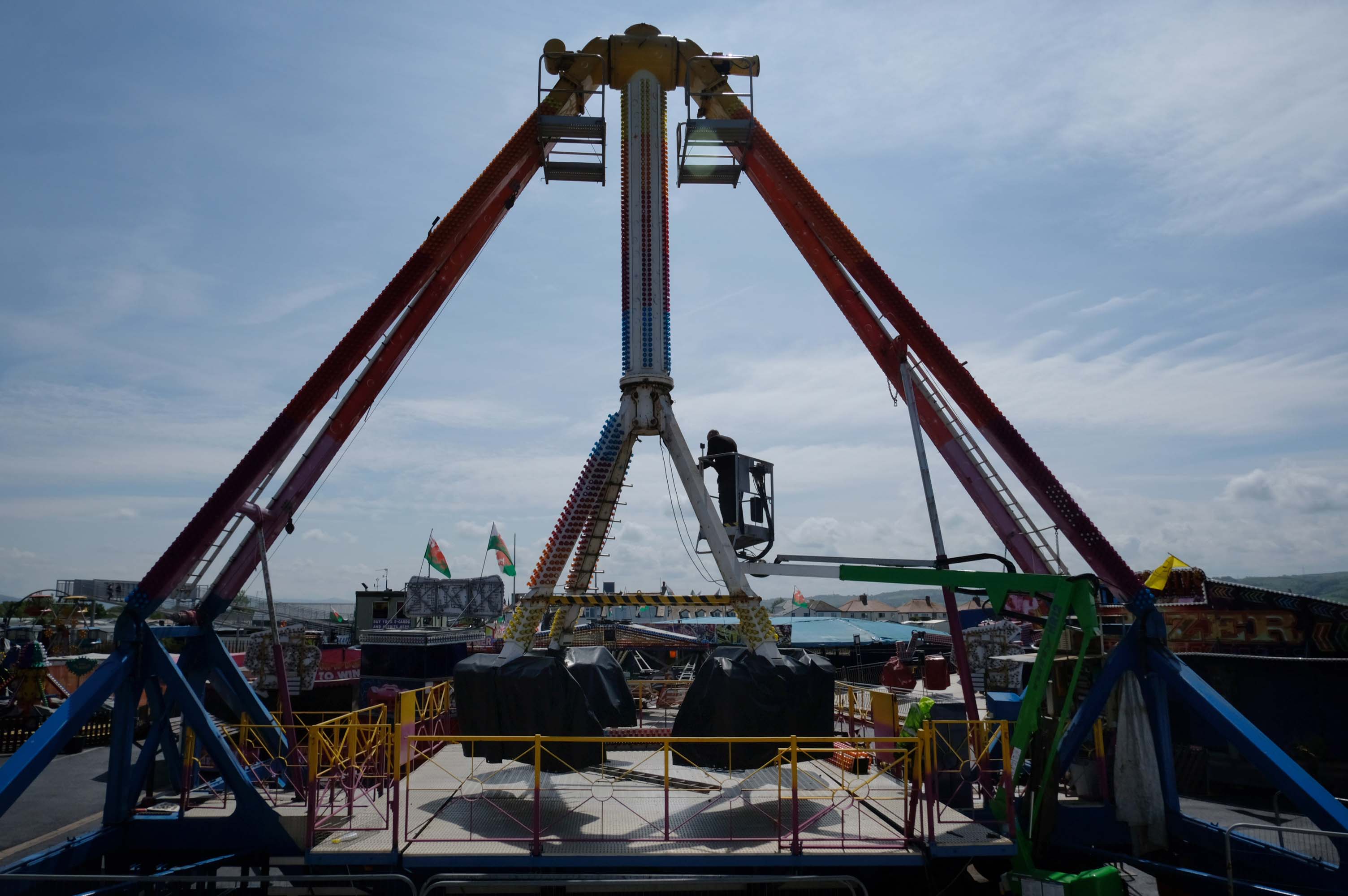
Excitements galore, await at the well maintained funfair.
Motor cars to the fore, as the intrepid sea-anglers prepare for a day of sea-angling.
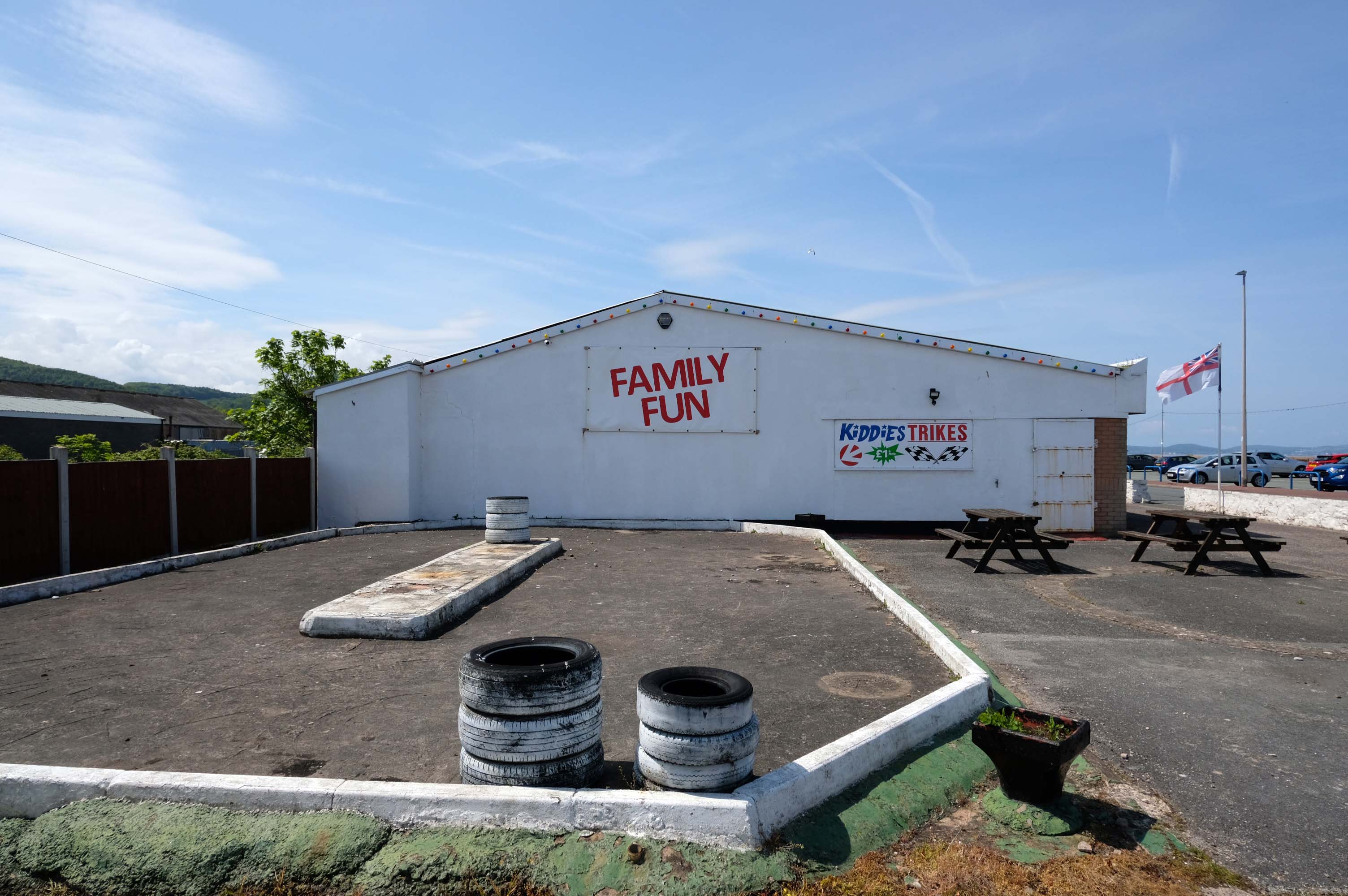
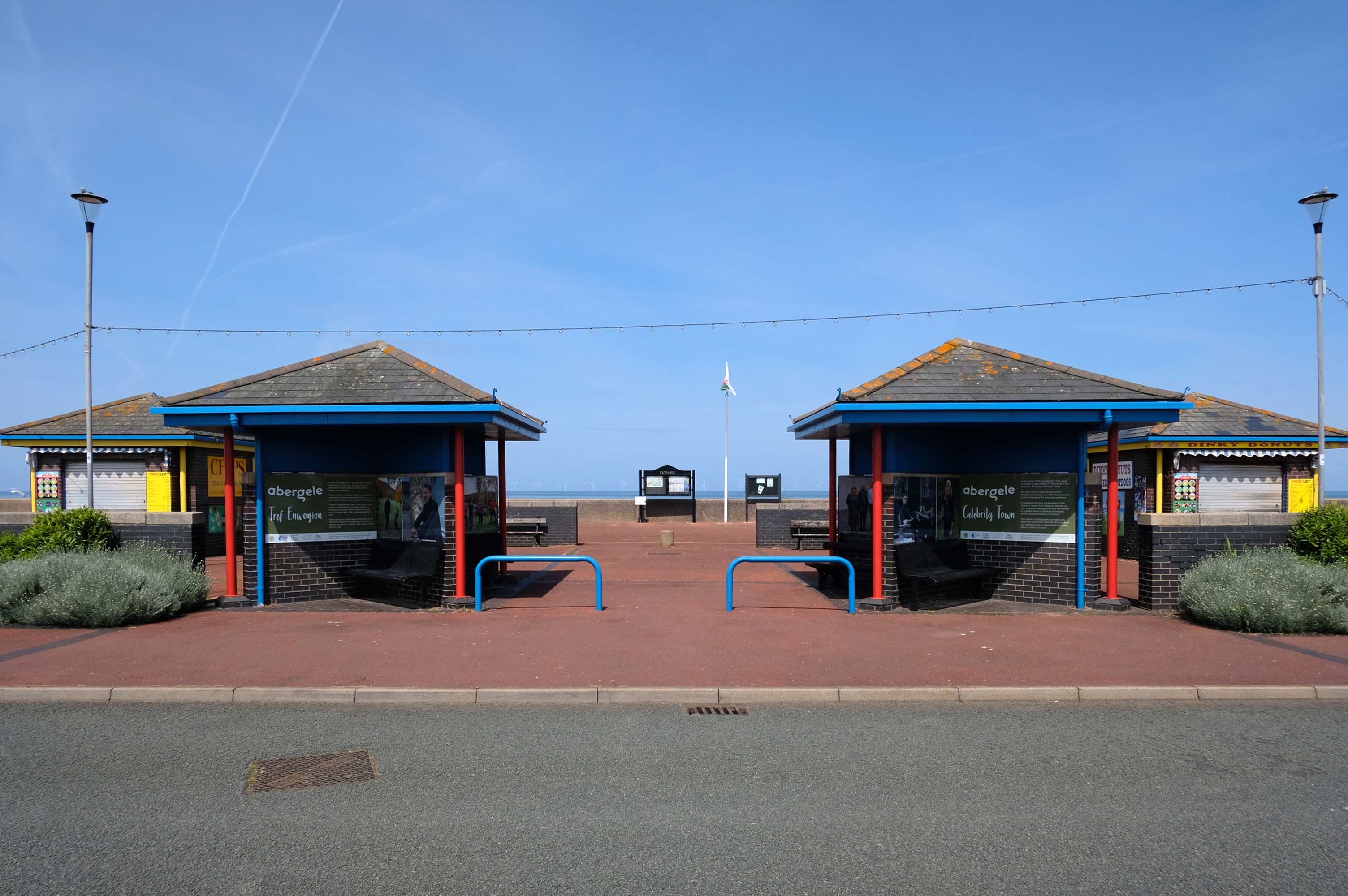
Abergele where Family Fun can be found in the form of Kiddies Karts.
In 2020/21 Abergele hosted the 20th and 21st editions of I’m a Celebrity Get Me Out of Here! at Gwrych Castle, due to the Covid pandemic restrictions in Australia.
I failed to avail myself with a chilly treat courtesy of Danny’s Whippy, having already had my 99 tub, from Sidoli’s in Rhyl.
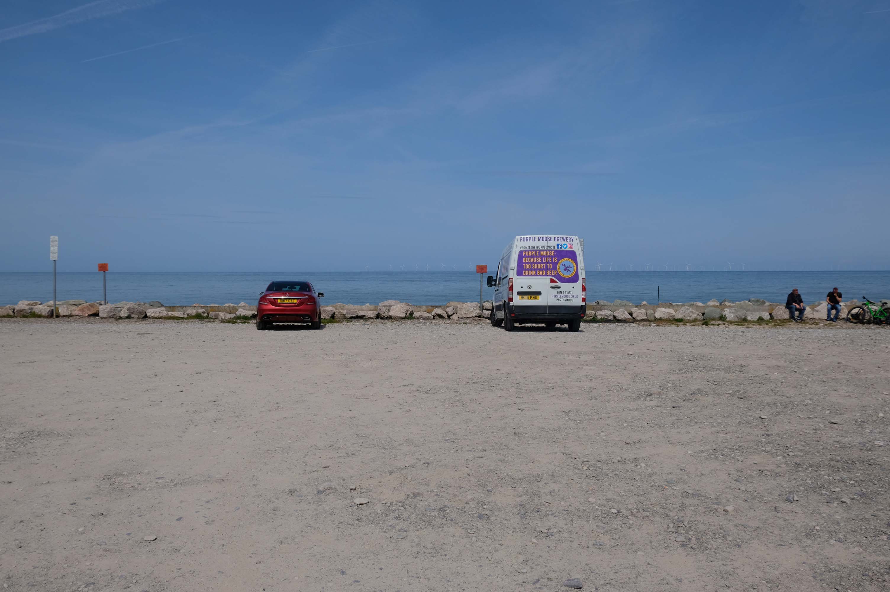
Local brewery Purple Moose’s delivery van driver takes a timely break, whilst fellow cyclists stop for a cig and a chat.
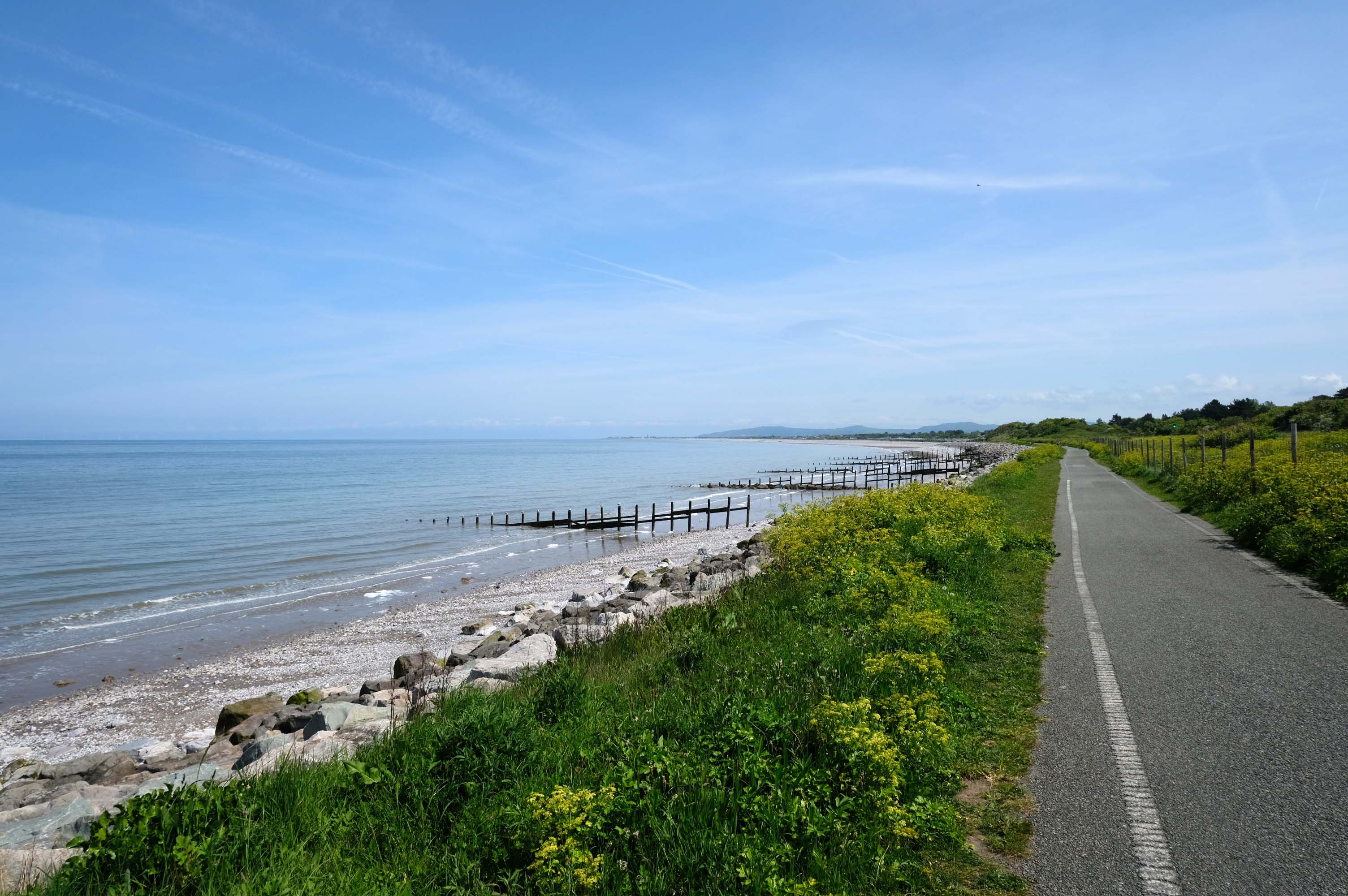
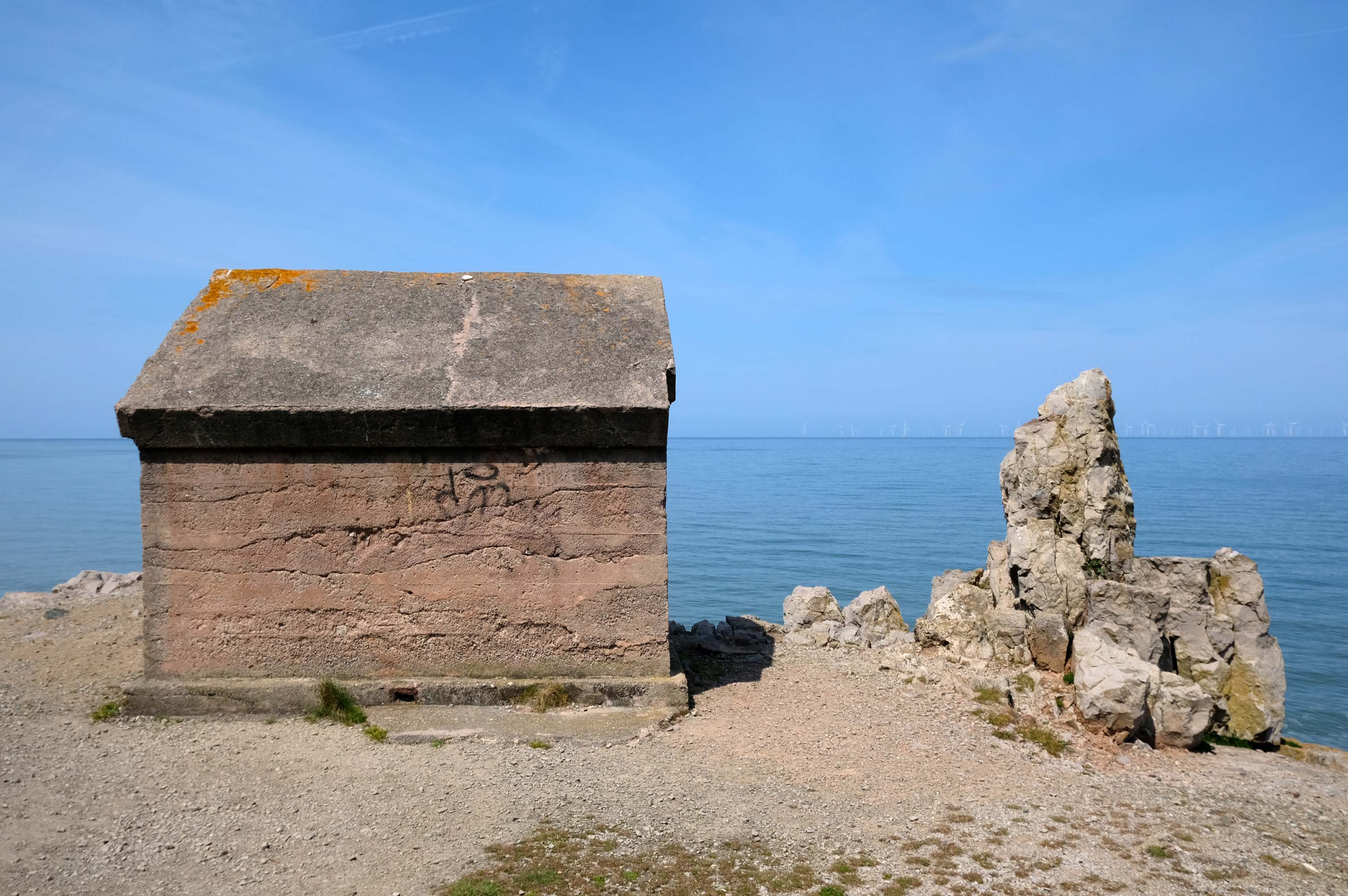
Rugged rocks, sadly lacking ragged rascals, as the Little Orme comes into view.
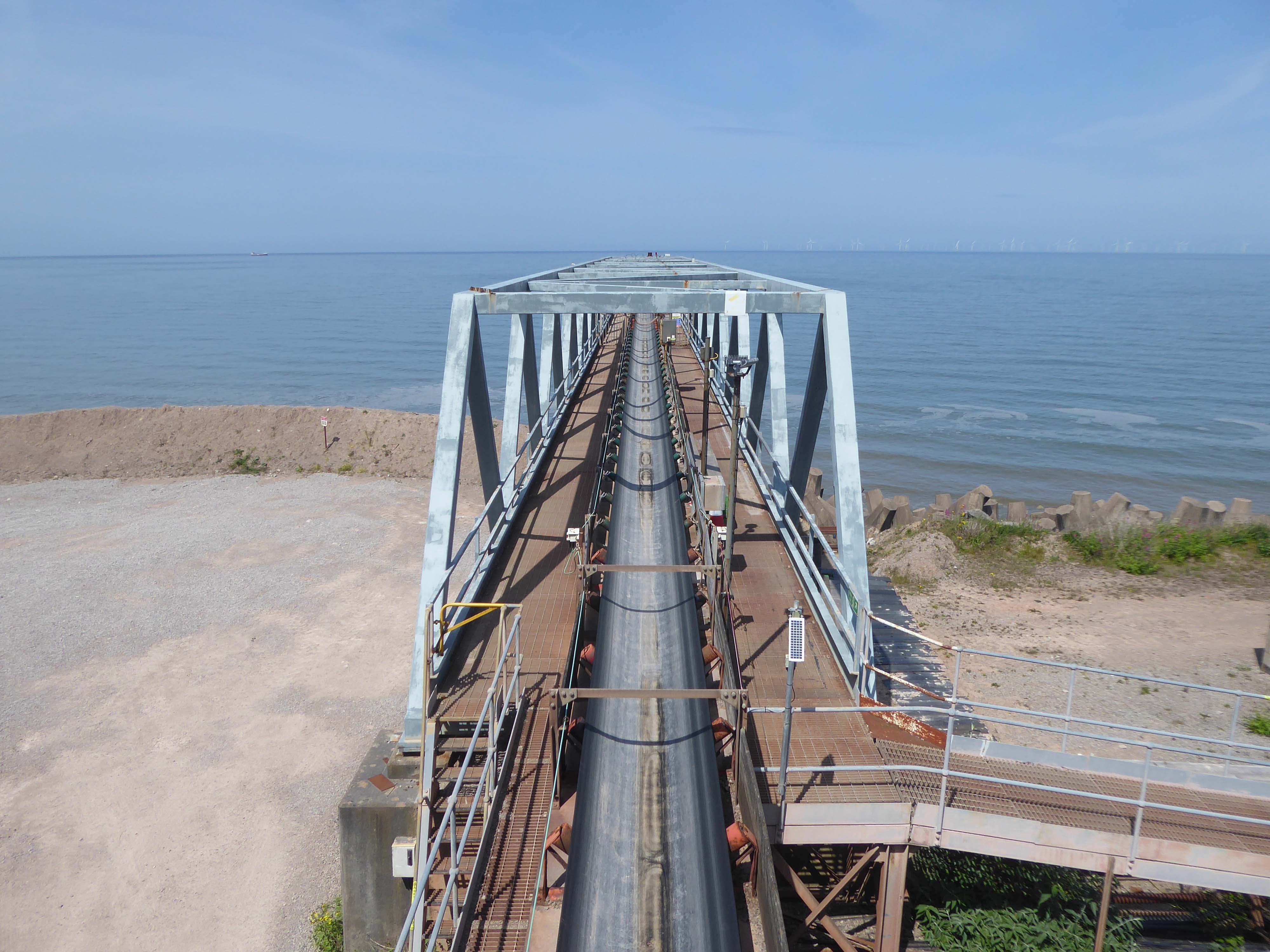
Cast concrete defences, and Raynes Quarry jetty at Llandulas.
The quarry was originally known as Llysfaen Limeworks, being close to Llysfaen railway station. James Trevelyan Raynes of Rock Ferry, Birkenhead, took over the quarry in the 1870s, adding large new limekilns. Lime from the quarry was shipped to various alkali works. Alkali was used for soap, textiles and many other goods.
Quarrying in this area has also produced porcelain-like limestone for high quality architectural uses. St Margaret’s Church – also known as the Marble Church in Bodelwyddan, was built with limestone from Llanddulas.
In November 2011 one of the freighters, MV Swanland, sank in stormy weather on the Irish Sea after collecting 3,000 tons of stone from Raynes jetty bound for the Isle of Wight.
Two crewmen were rescued but five, all Russian, were lost.
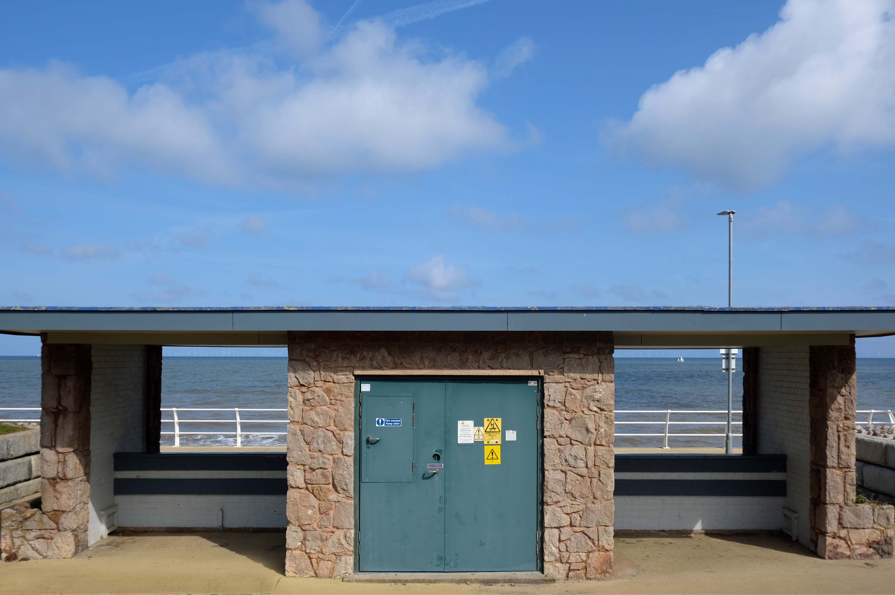
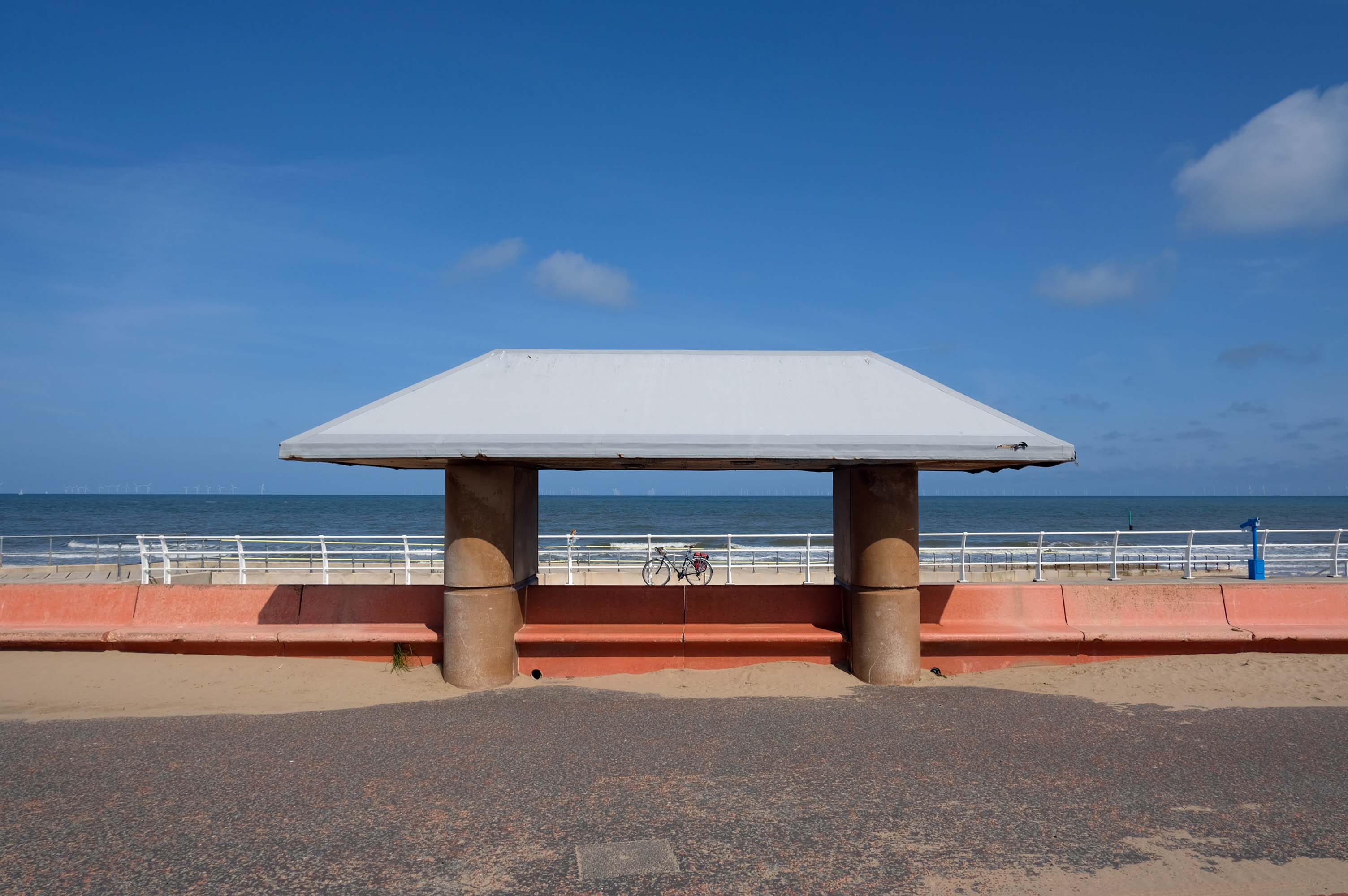
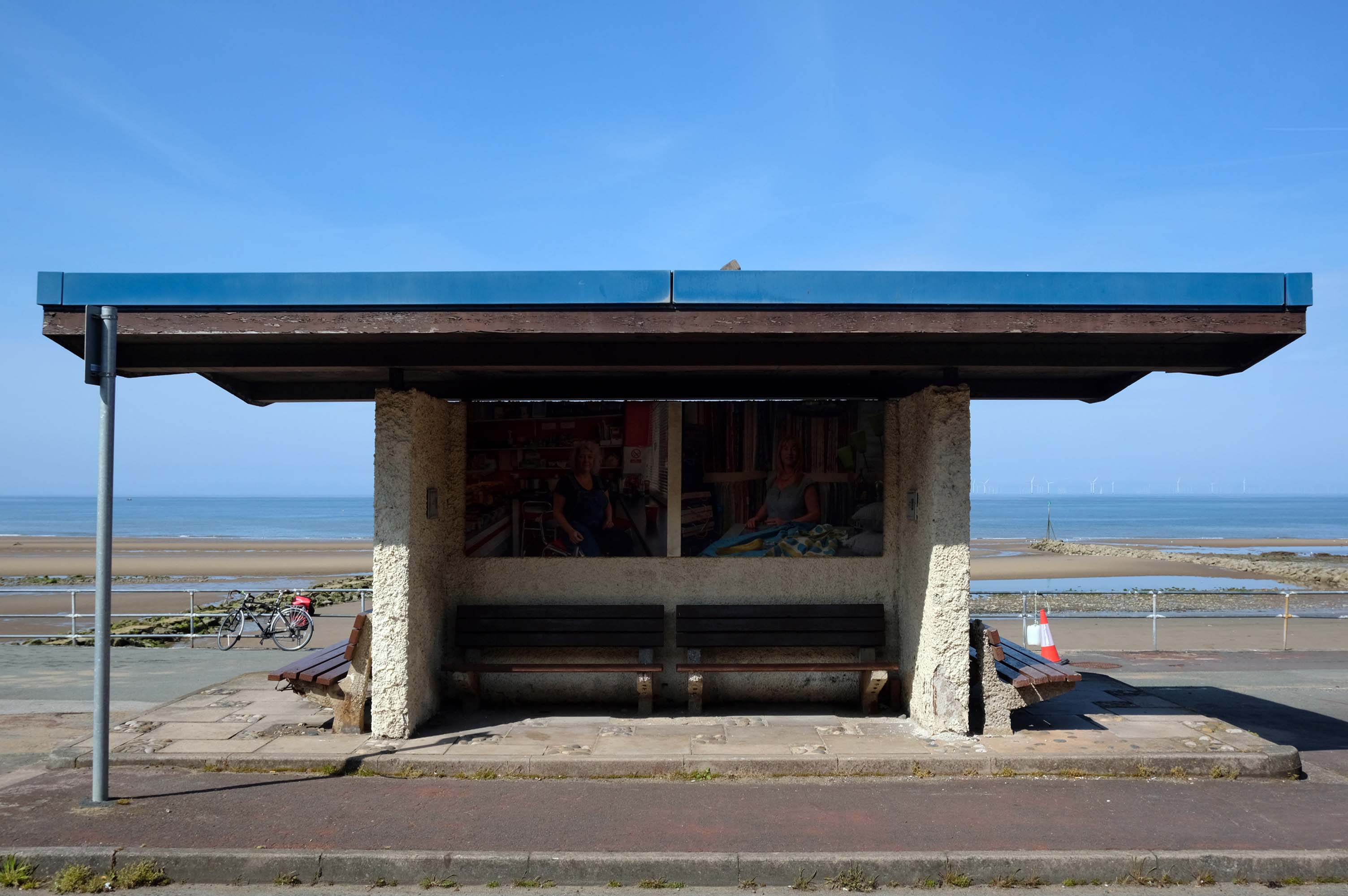
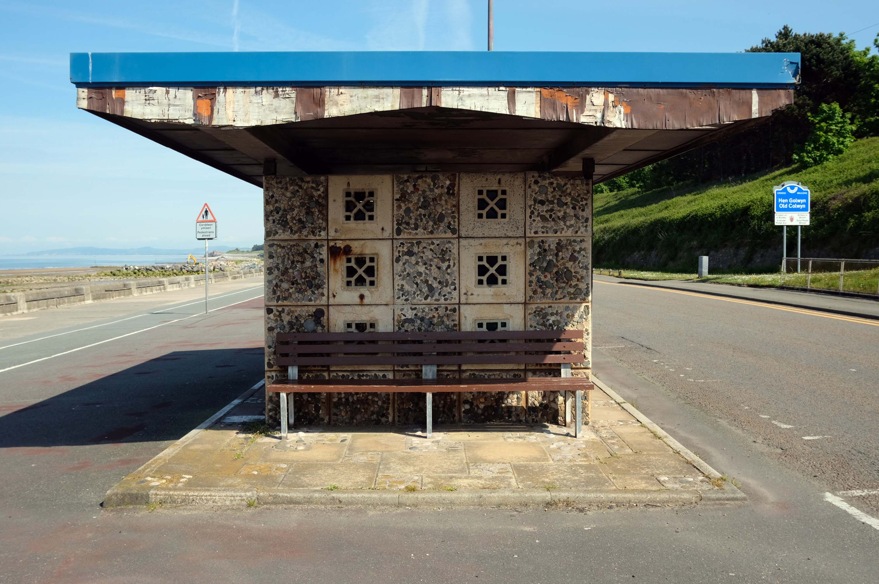
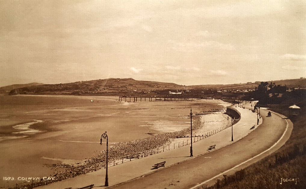
Almost the end of the line here in Old Colwyn – where there are the last of a series of shelters.
Formerly lining the prom all the way to Rhos on Sea
Cutting under the A55 Expressway to Colwyn Bay.
During World War II the Colwyn Bay Hotel, Marine Road – now demolished, was the headquarters of the Ministry of Food. This also housed the Cocoa & Chocolate division and was the communications hub for the ministry, they continued to use the hotel until 1953.
One man who saw the wisdom of building a road infrastructure to deal with high volumes of traffic passing through Halifax and to provide convenient links to the M62.
That man was prominent town councillor John Burdock.
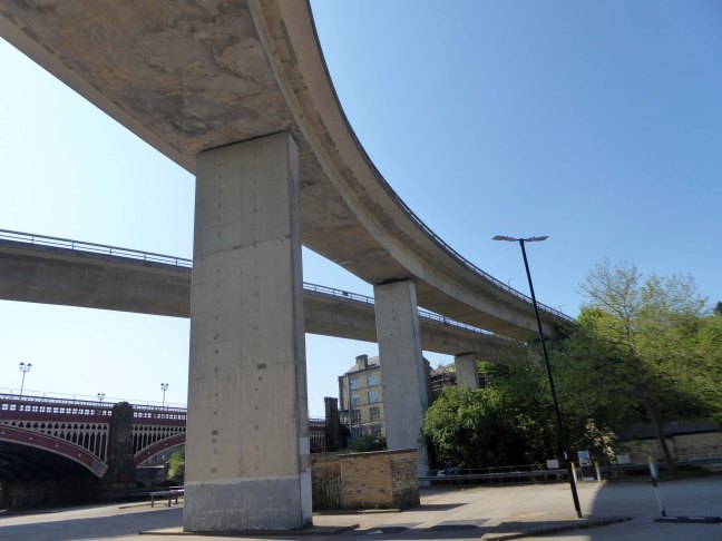
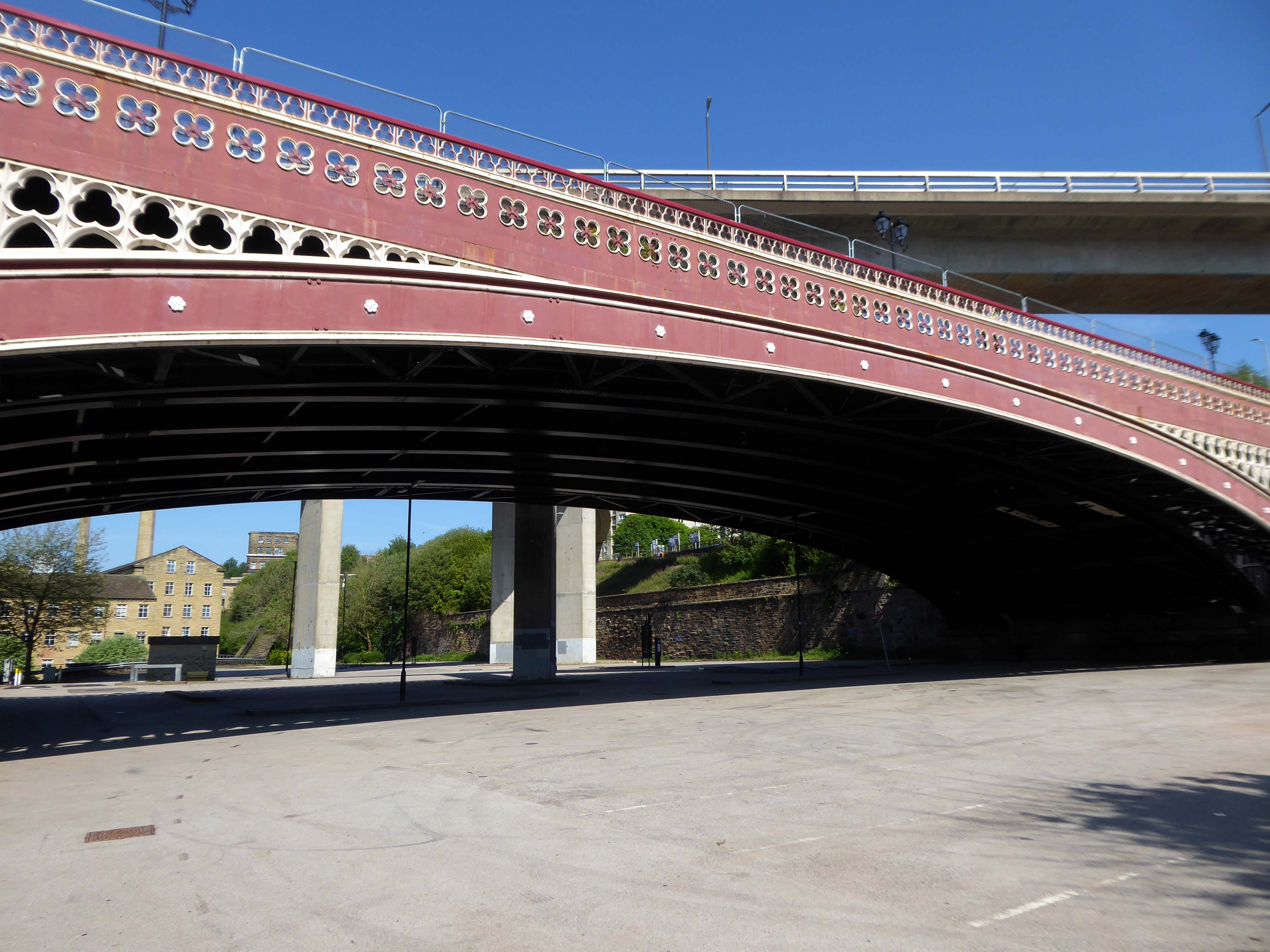
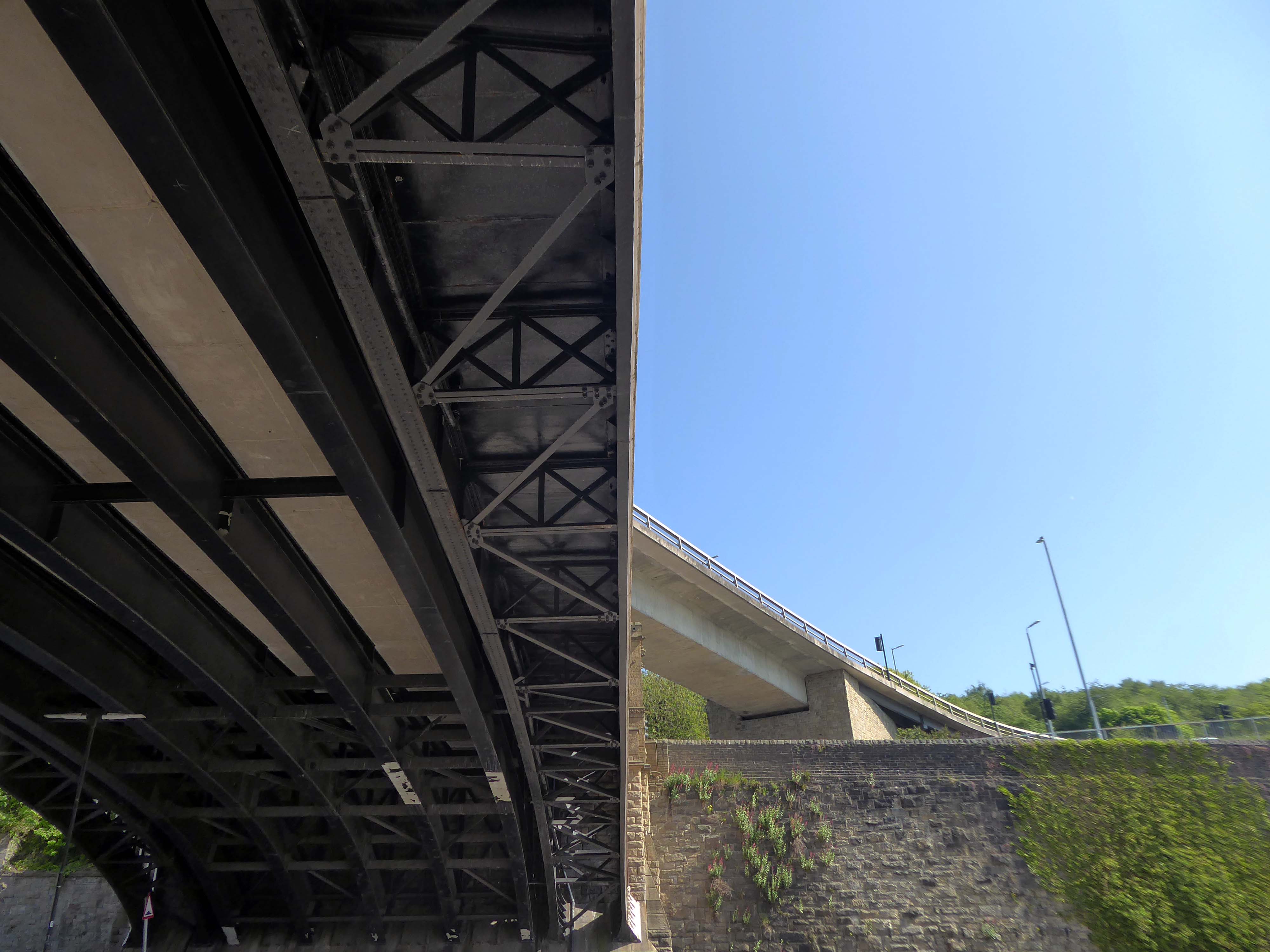
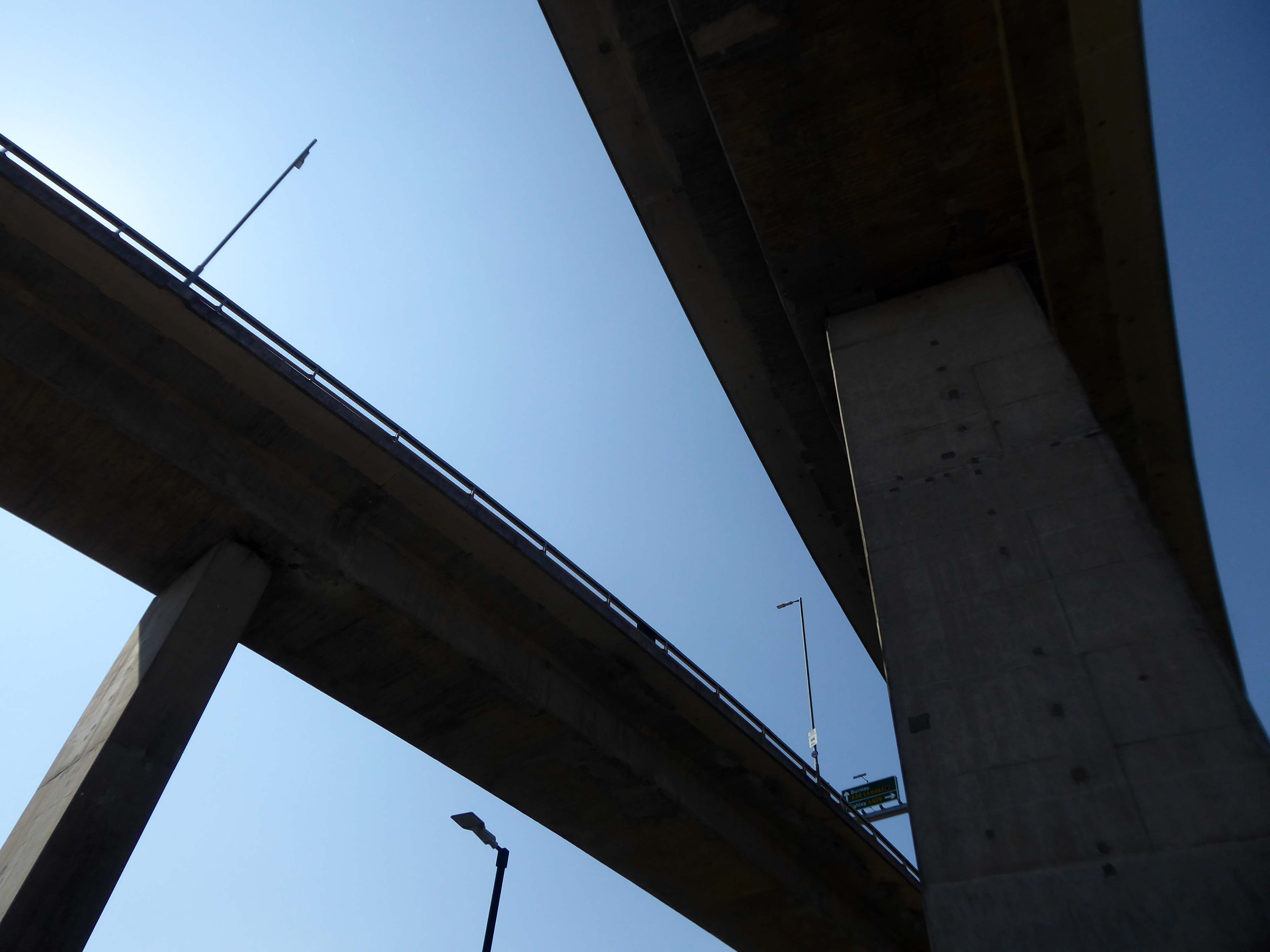
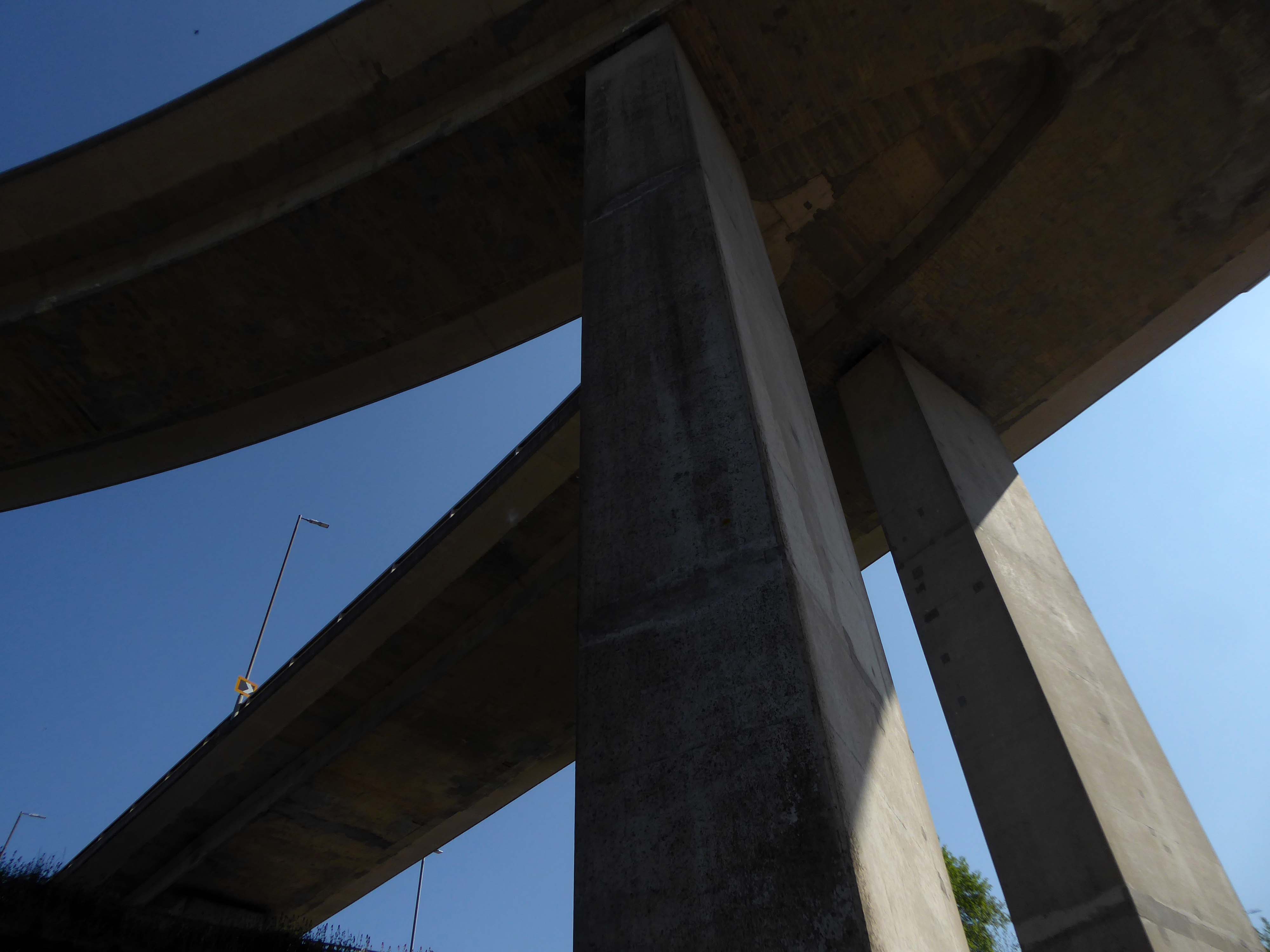
Burdock Way, the modern flyover system, was opened in 1973 to take the A58 and A629 traffic over the River Hebble.
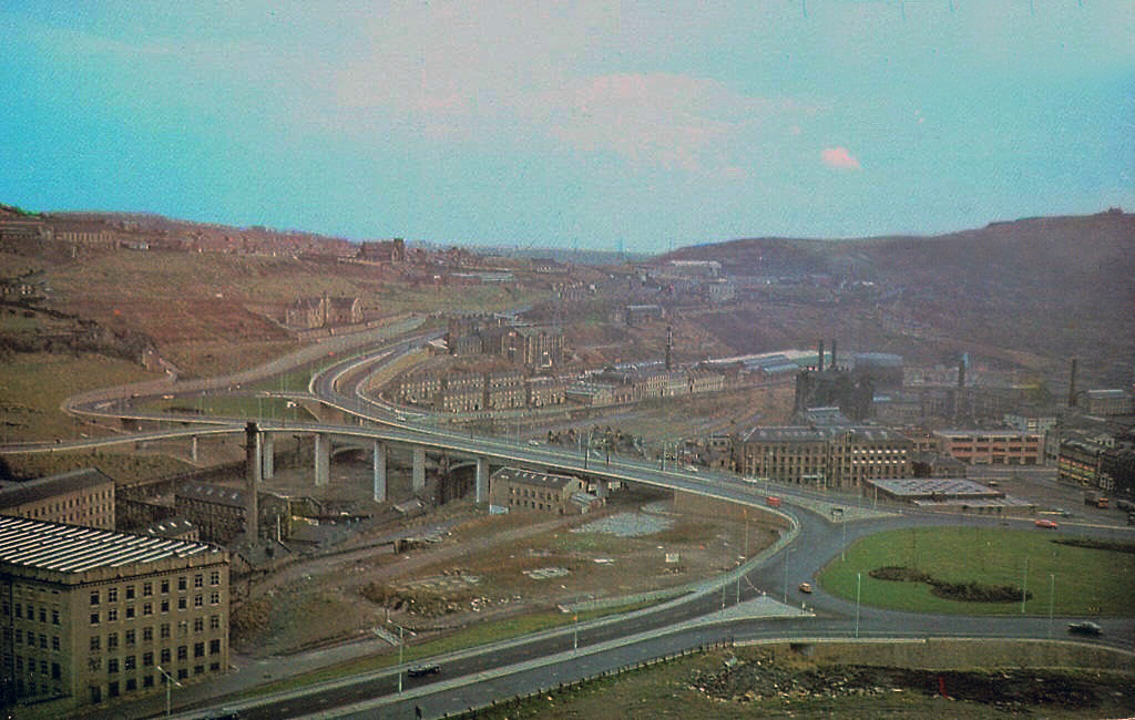
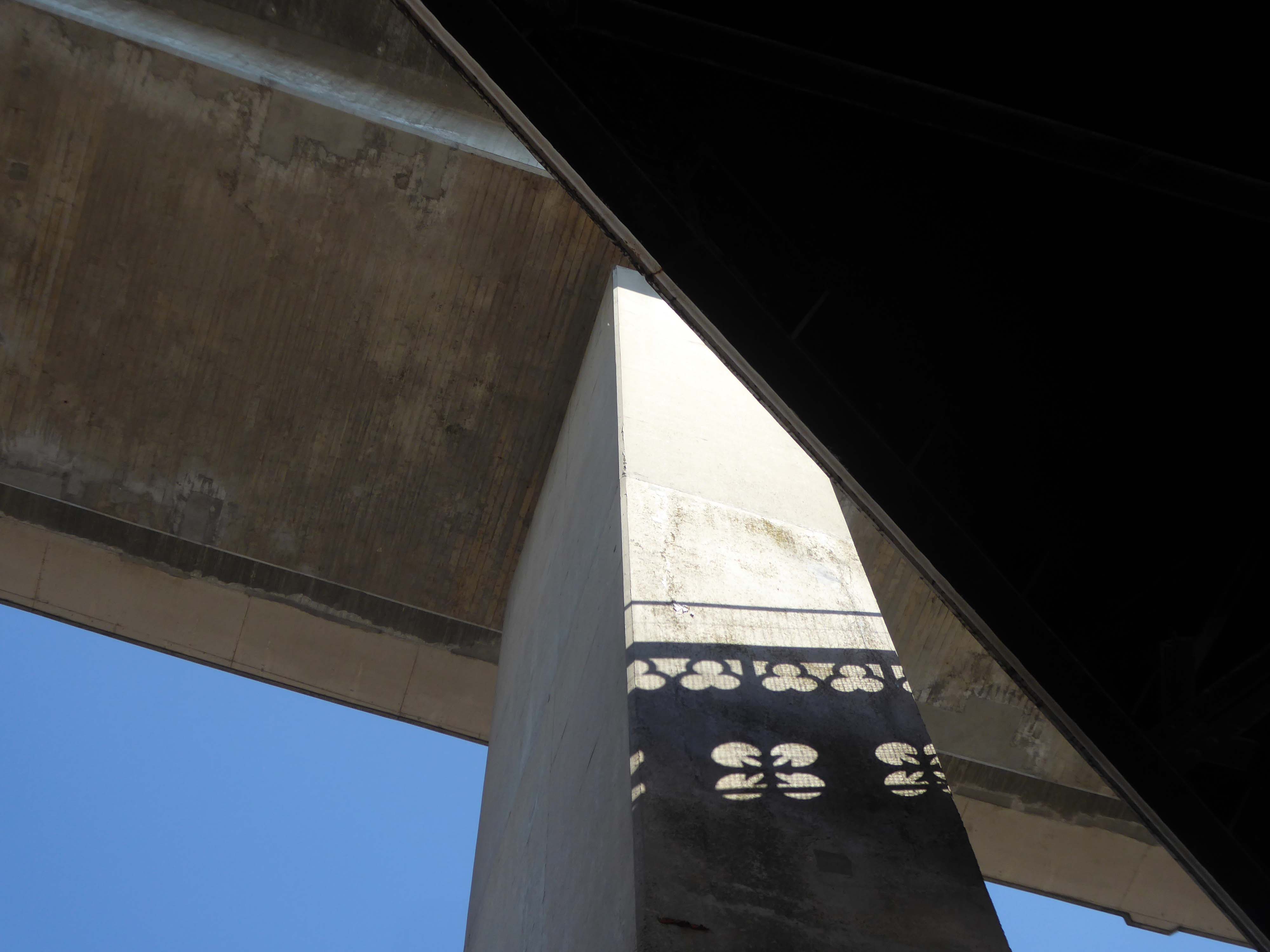
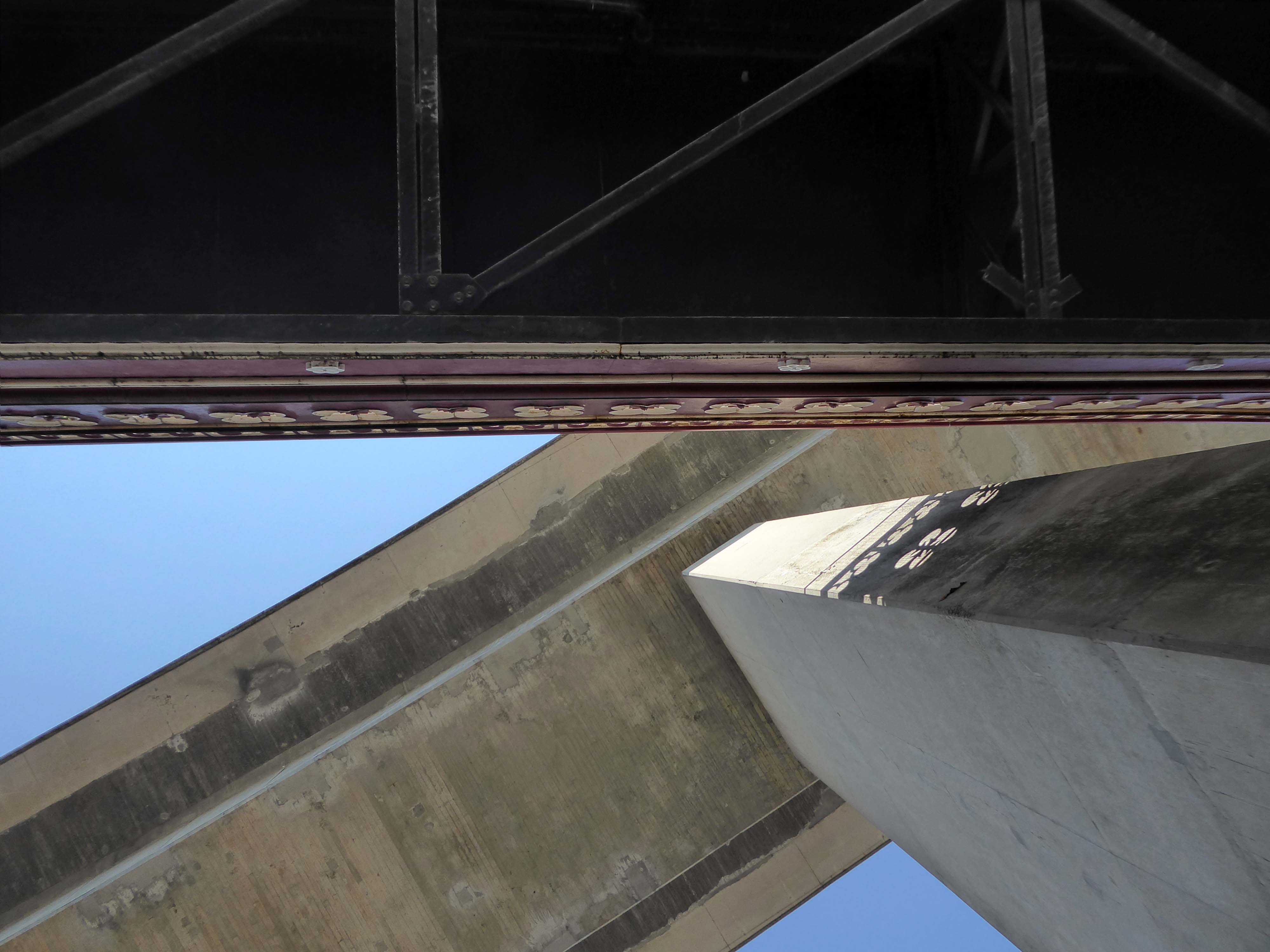
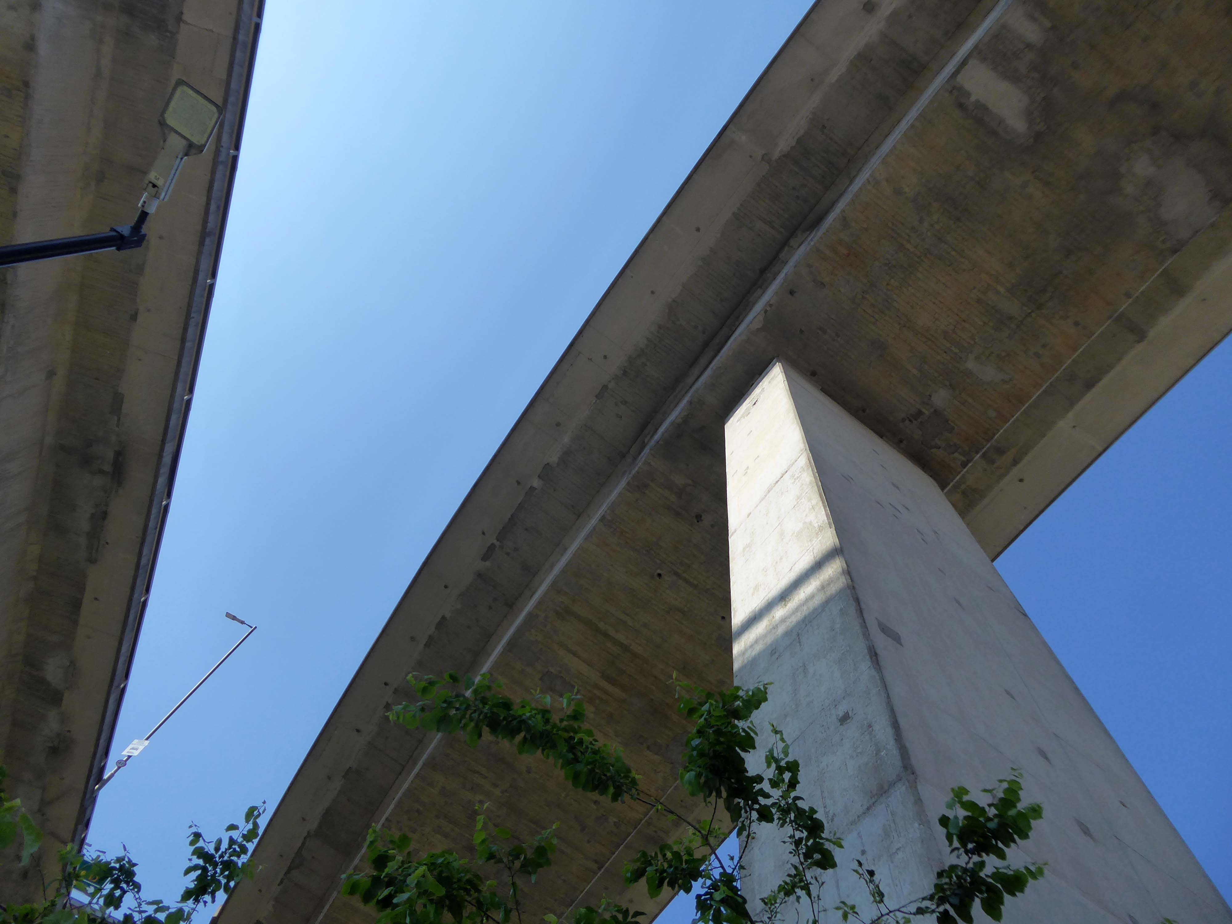
Faced with the problem of very high volumes of through traffic in its town centre, and with the impending construction of the M62 too far to the south to provide relief for the town, Halifax needed a bypass. The steep sided valley that the town centre inhabits prevented a conventional road from being built around the town, and so in the early 1970’s construction began on Burdock Way – one of the most adventurous relief road schemes built in Britain, certainly by a town the size of Halifax.
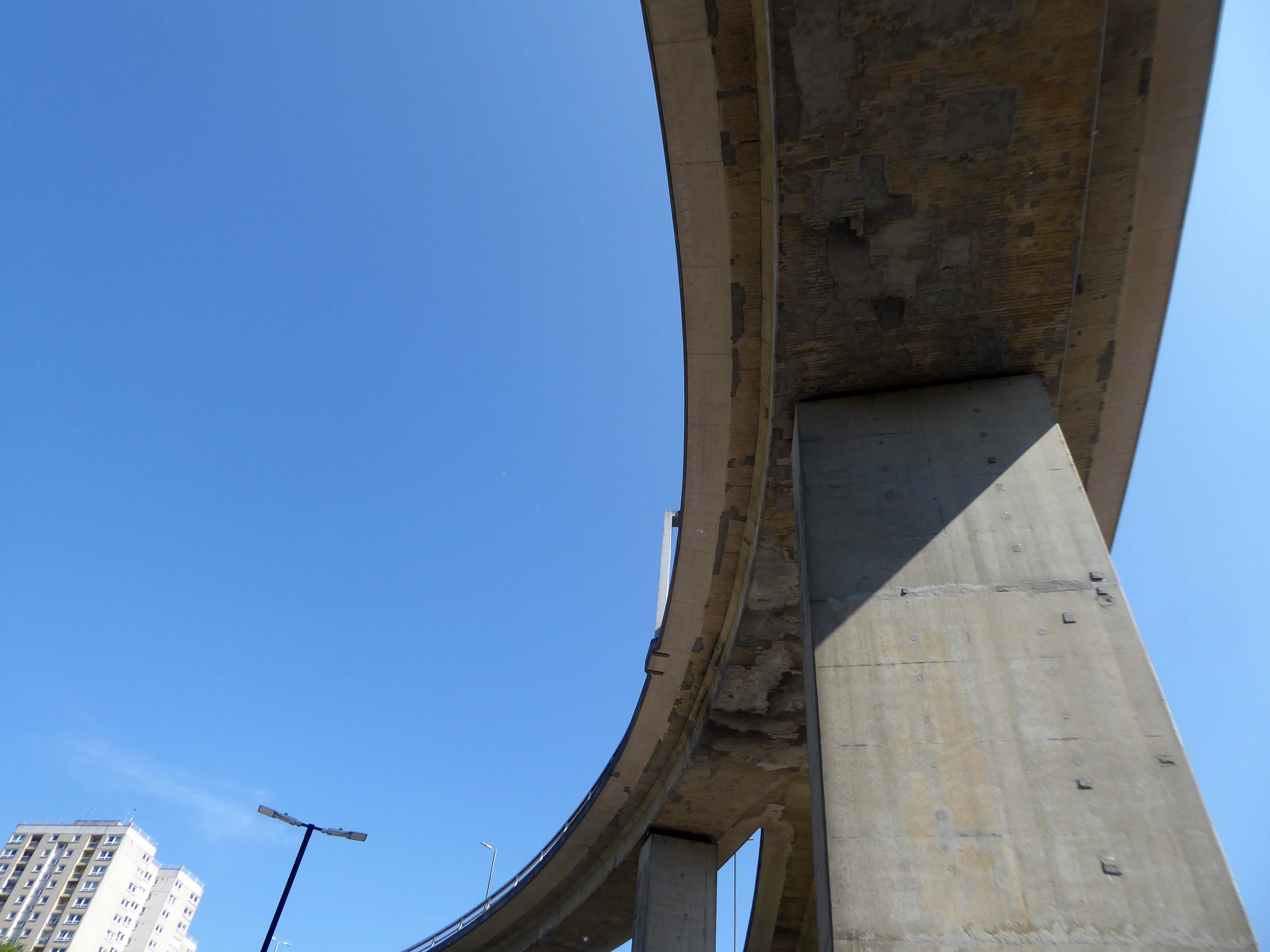
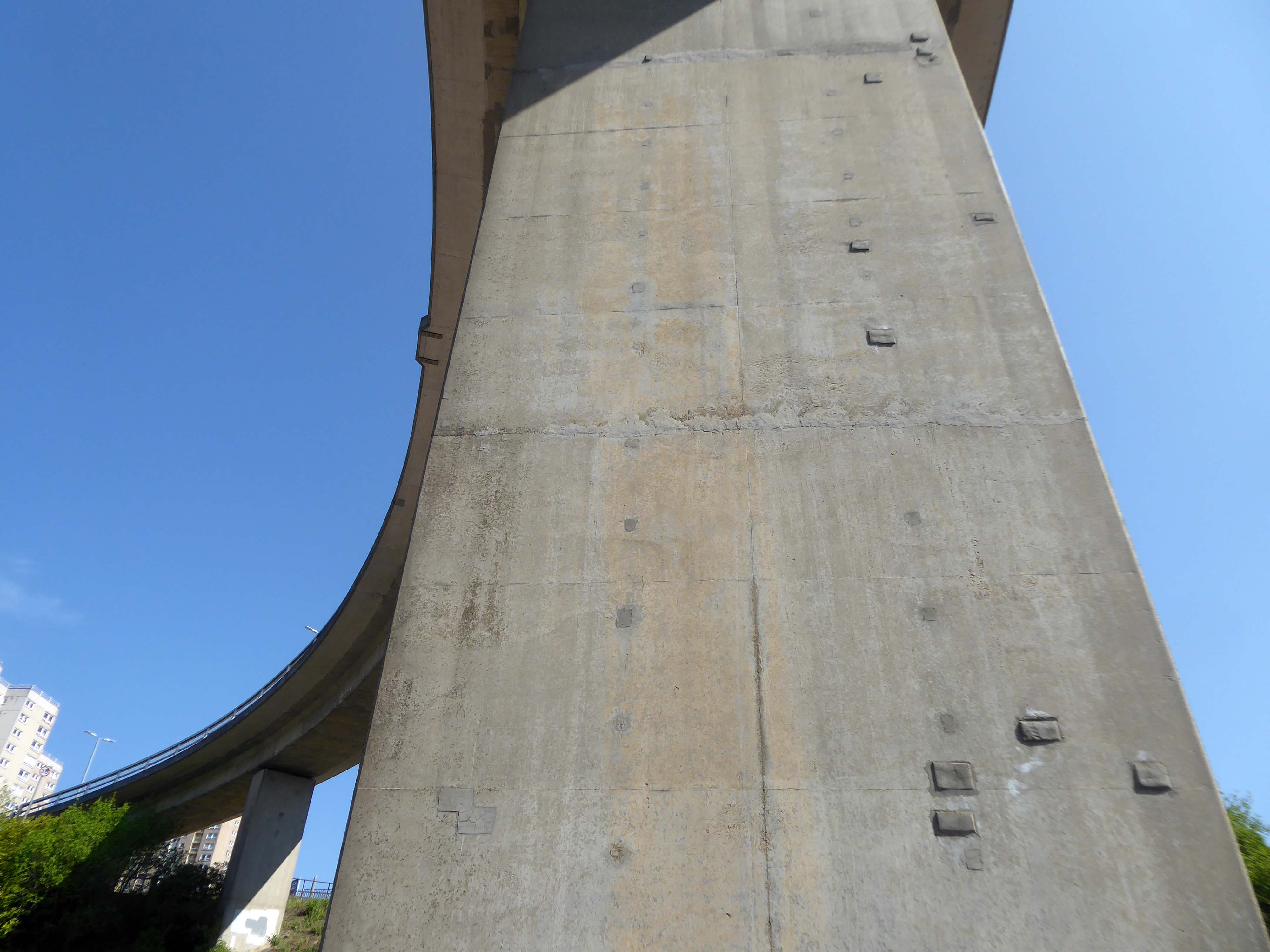
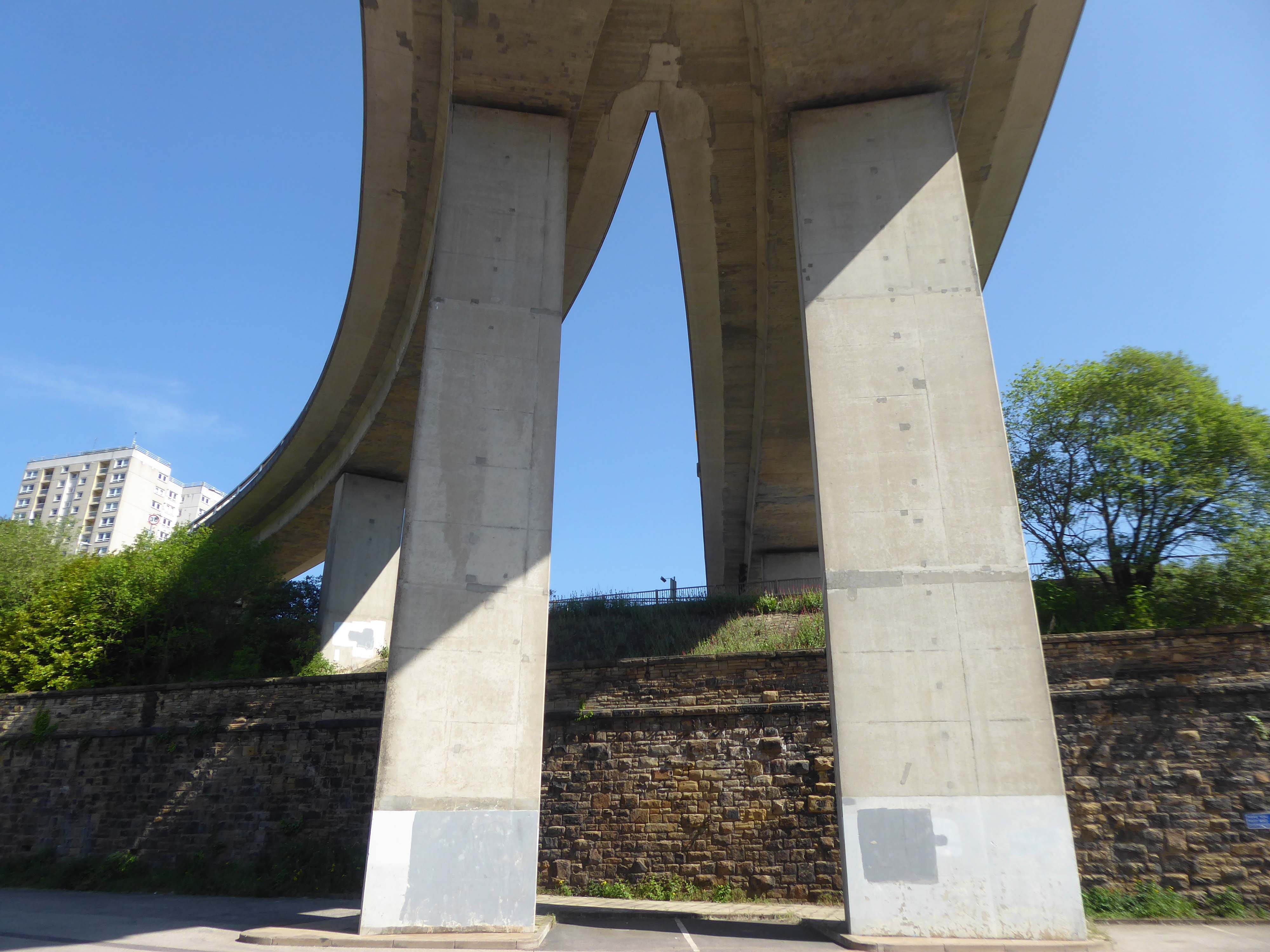
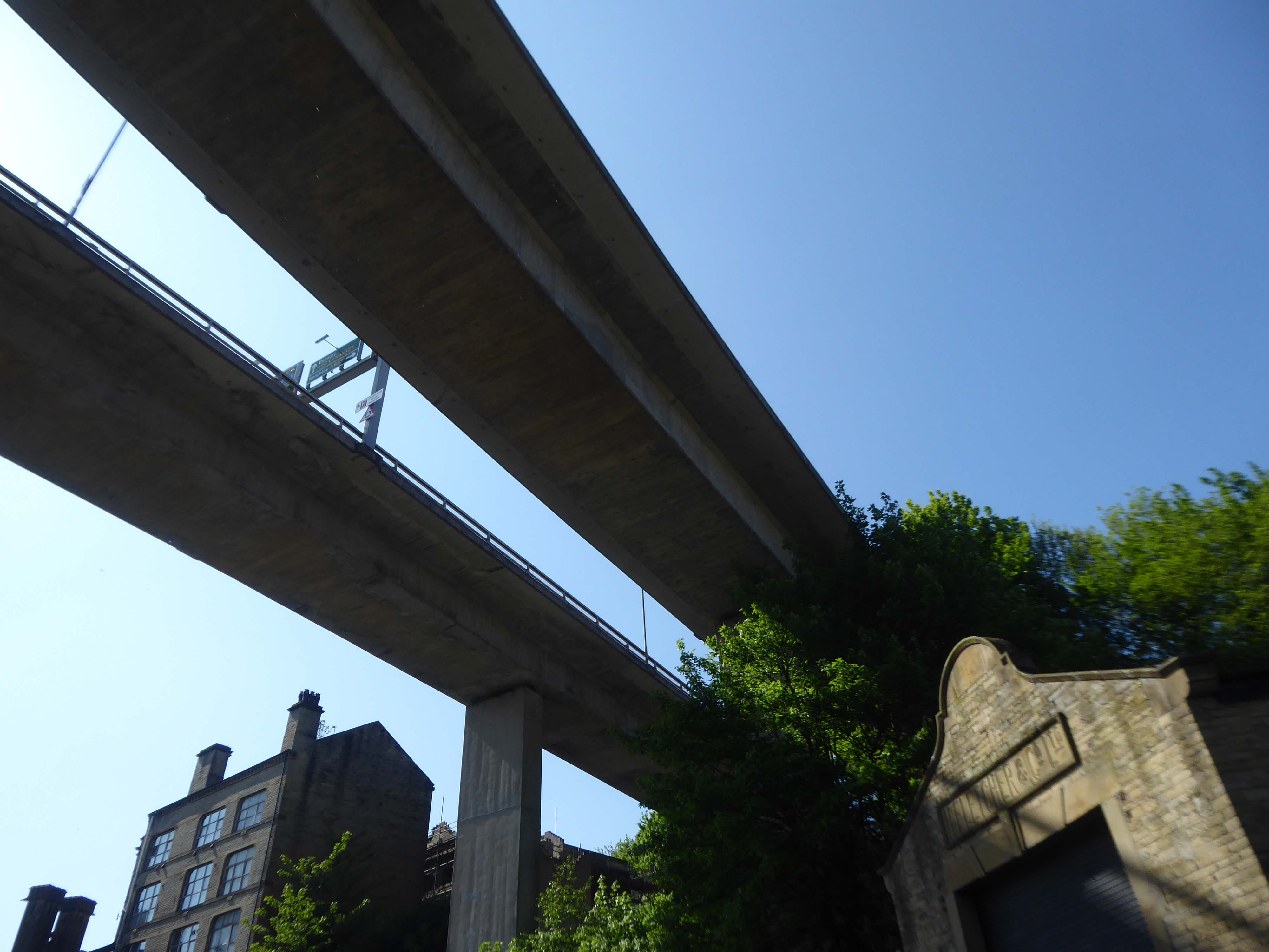
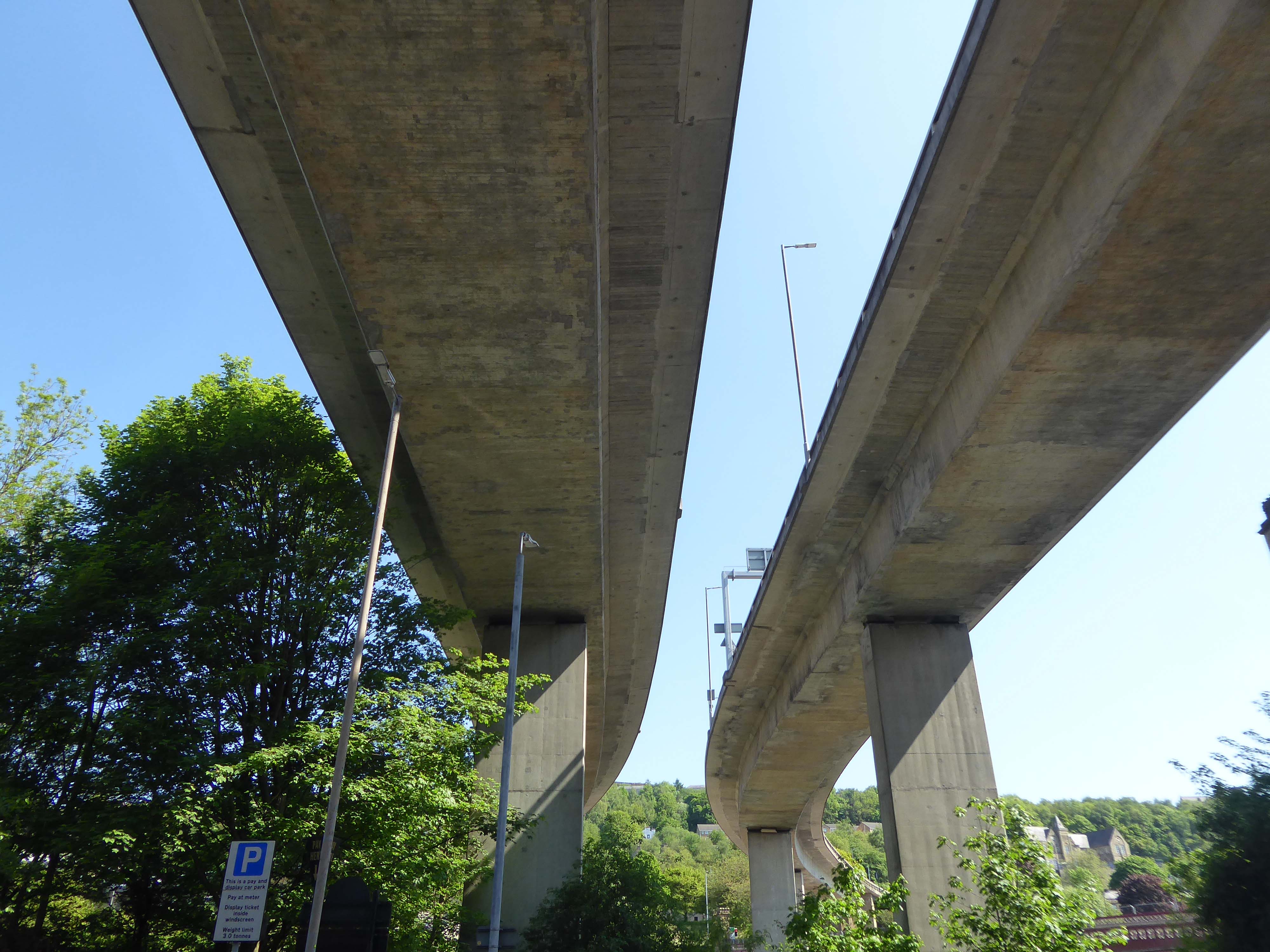
Only one phase of the futuristic road was ever built, but what exists is a partially grade-separated dual carriageway that runs through deep trenches and over tall viaducts close to the heart of the town. At its eastern end is a truly byzantine piece of traffic engineering that stretches the definition of a roundabout to its limit.
In October 1971 the official celebrations went anything but according to plan. It had been decided to give the people of Halifax a half day holiday so they could attend the opening, but there were not enough police on duty to control the sightseers. It was impossible to get complete silence for the speeches and arrangements to tell the artillery guns at Southowram Road when to fire broke down. They were fired prematurely while an archdeacon was offering prayers. The Mayor, HC McCrae, finally managed to announce that the bridge was officially open and he scurried back to the town hall where he hosted a banquet.
Burdock Way has never been fully completed as it is missing certain sections envisaged in the early 1960s plans. There are a number of reasons for this, but it is mainly owing to West Yorkshire County Council’s cost cutting in the 1970s.
Yorkshire Post
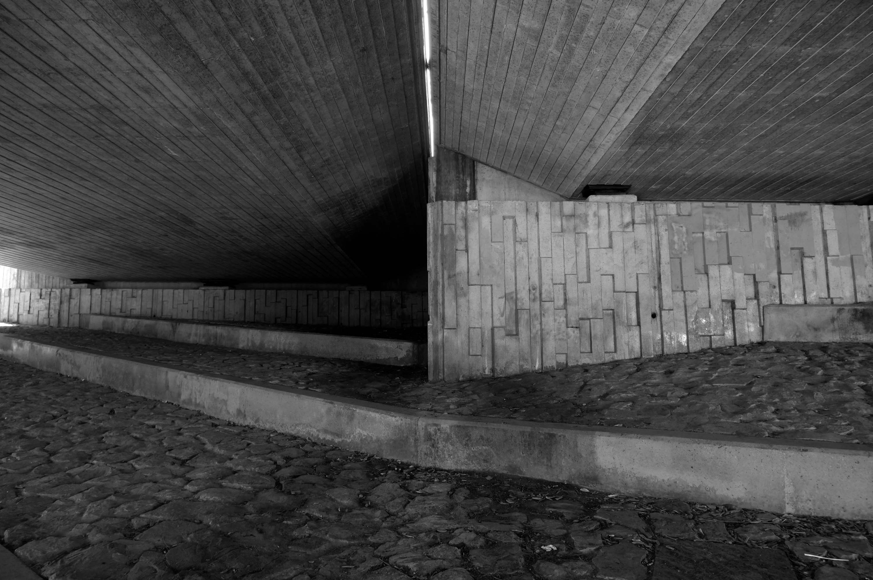
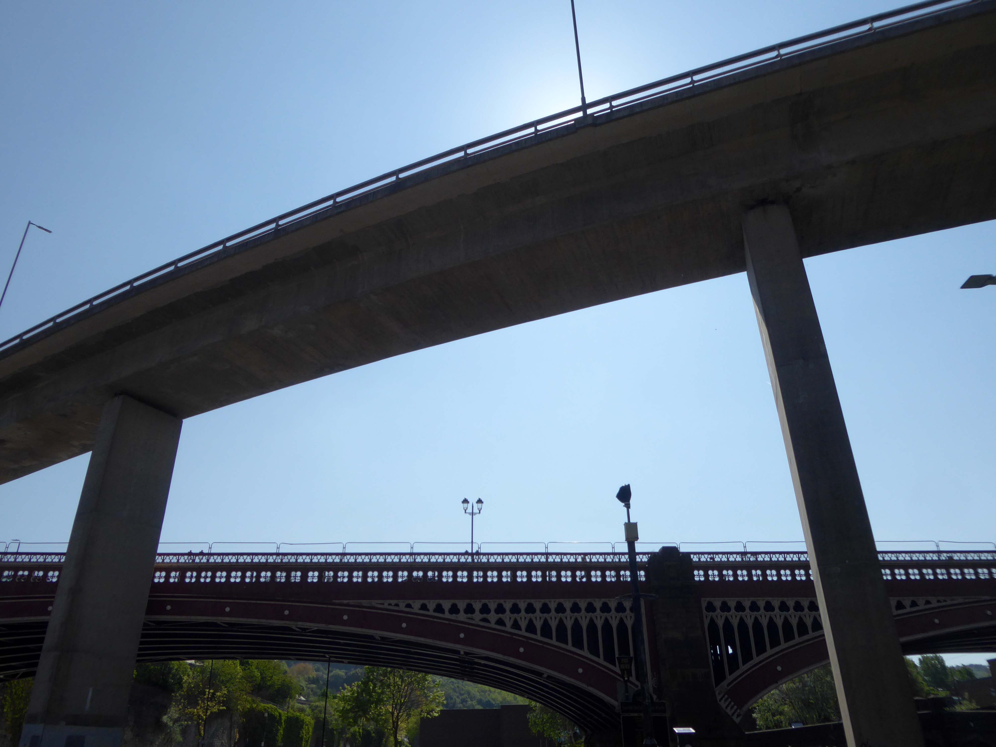
This is the Valley of the Gwangi in the West Riding – minus the dinosaurs.
An urban chasm, the gulf between everything and nothing.
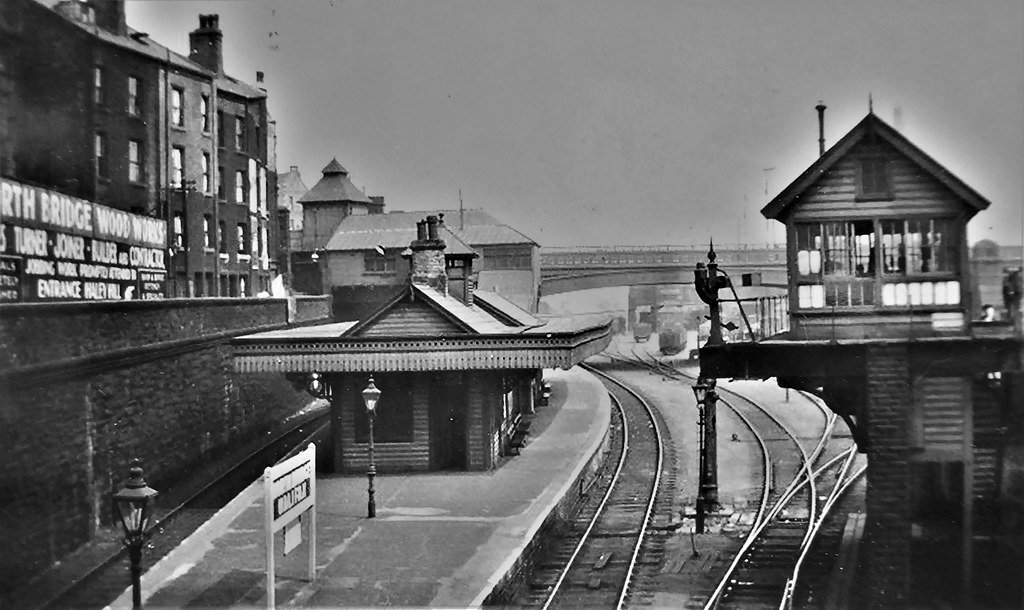
North Bridge is a Victorian iron and stone bridge crossing the valley of the River Hebble, connecting the town to roads to Bradford and Leeds. Replacing an earlier six arch stone bridge it was raised to allow the subsequent construction of the Halifax High Level Railway beneath it, along with an adjoining station.
Opened in 1871 amid chaotic crowd scenes it carried increasingly heavy traffic until it was by-passed by the Burdock Way in 1973.
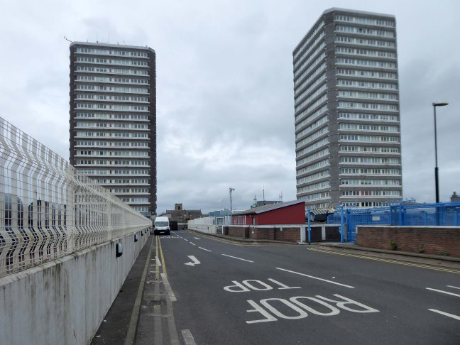
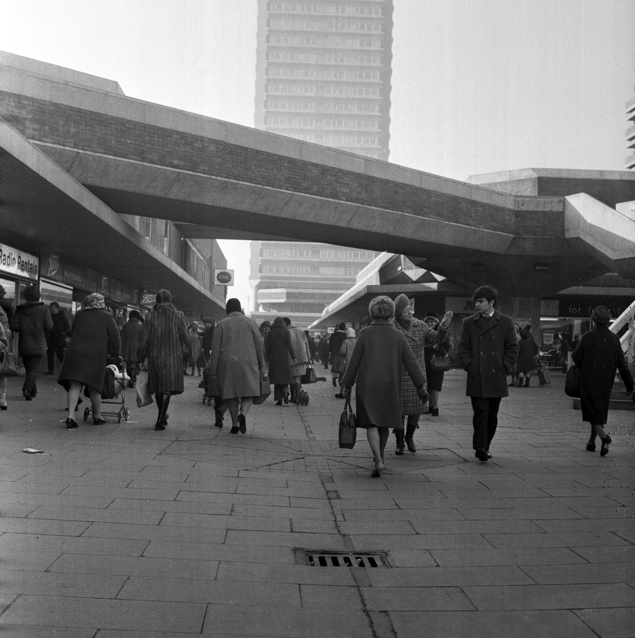
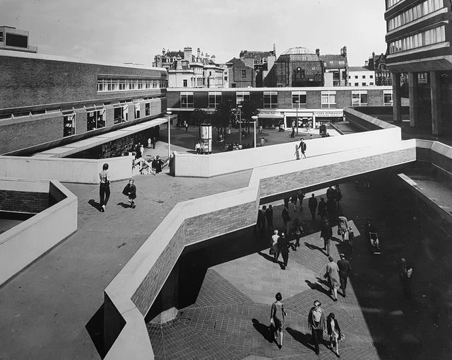
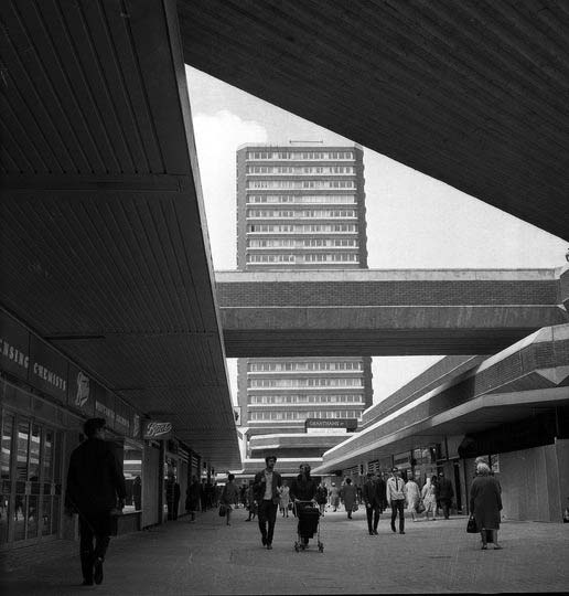
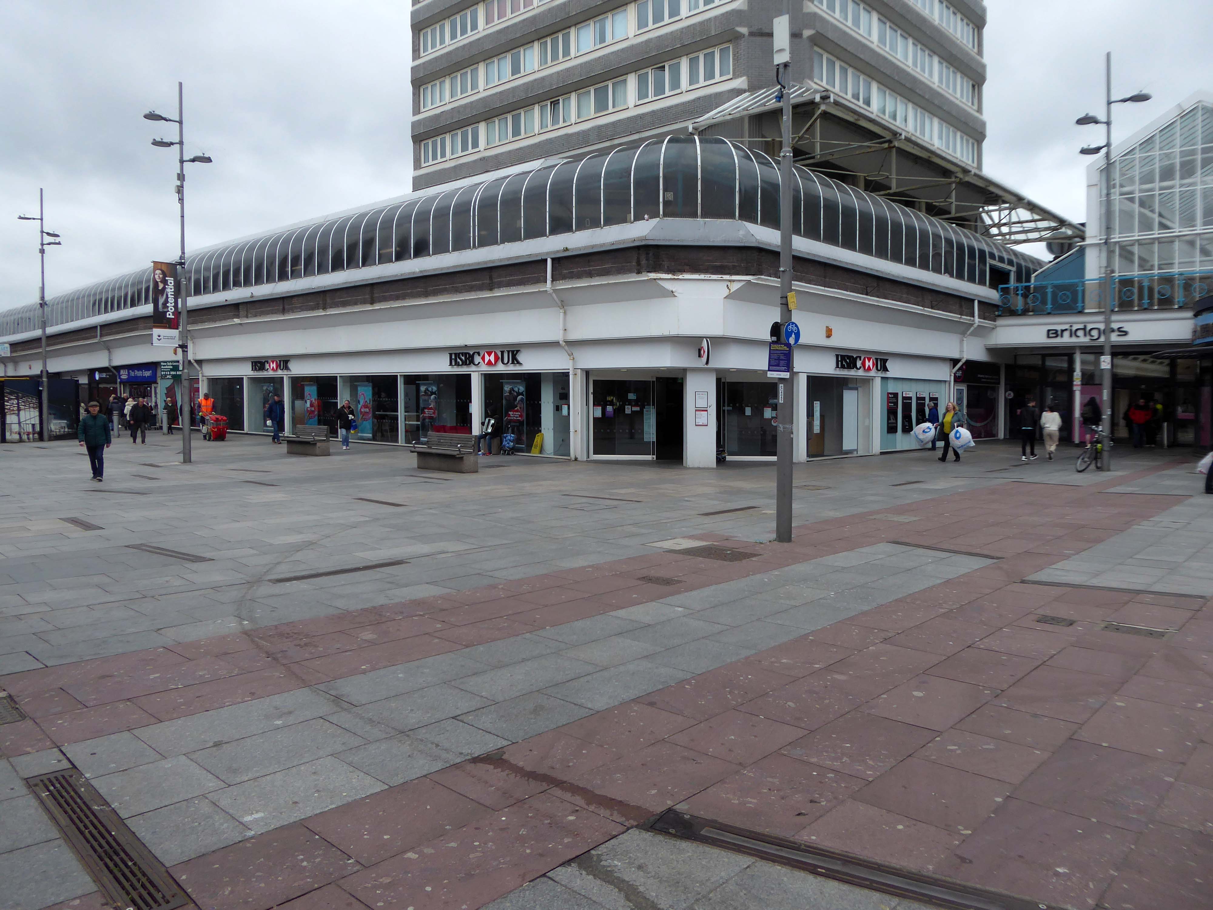
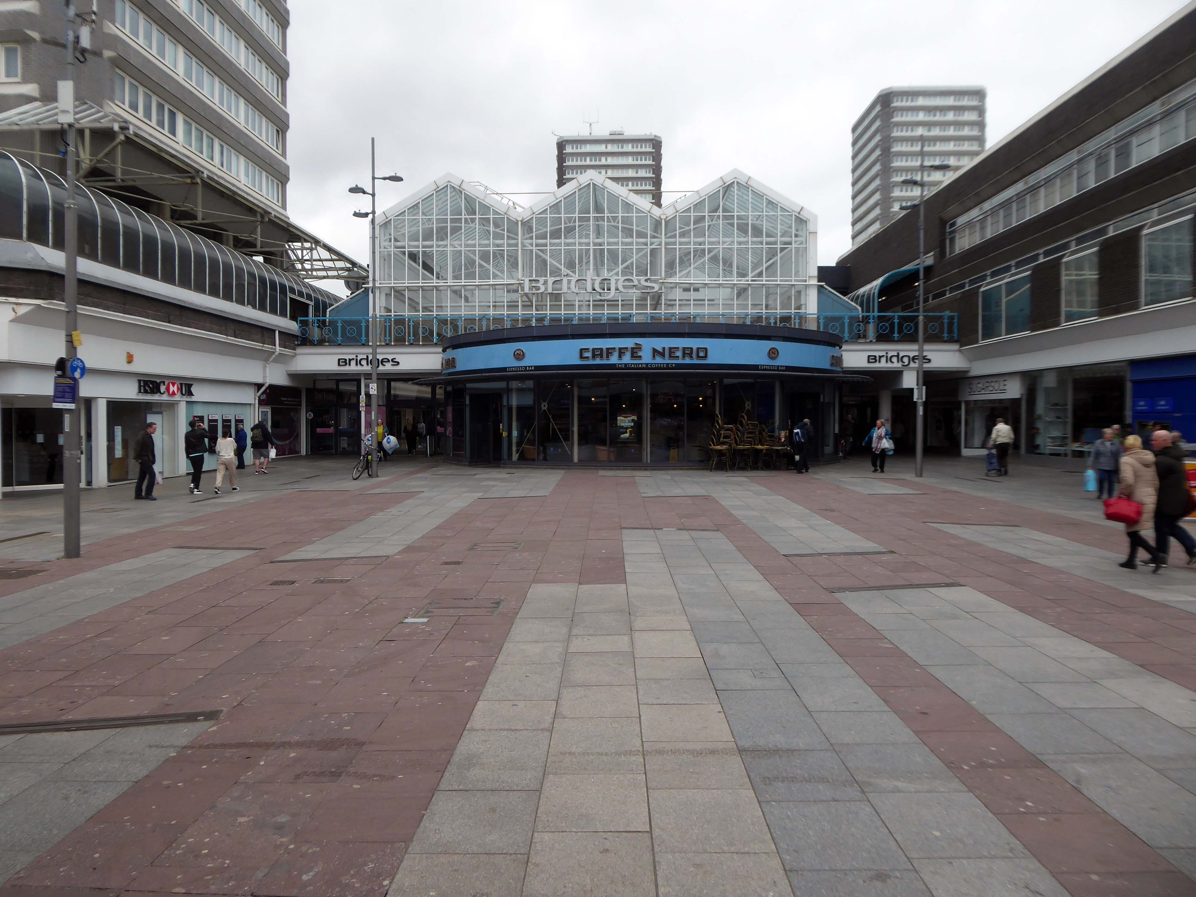
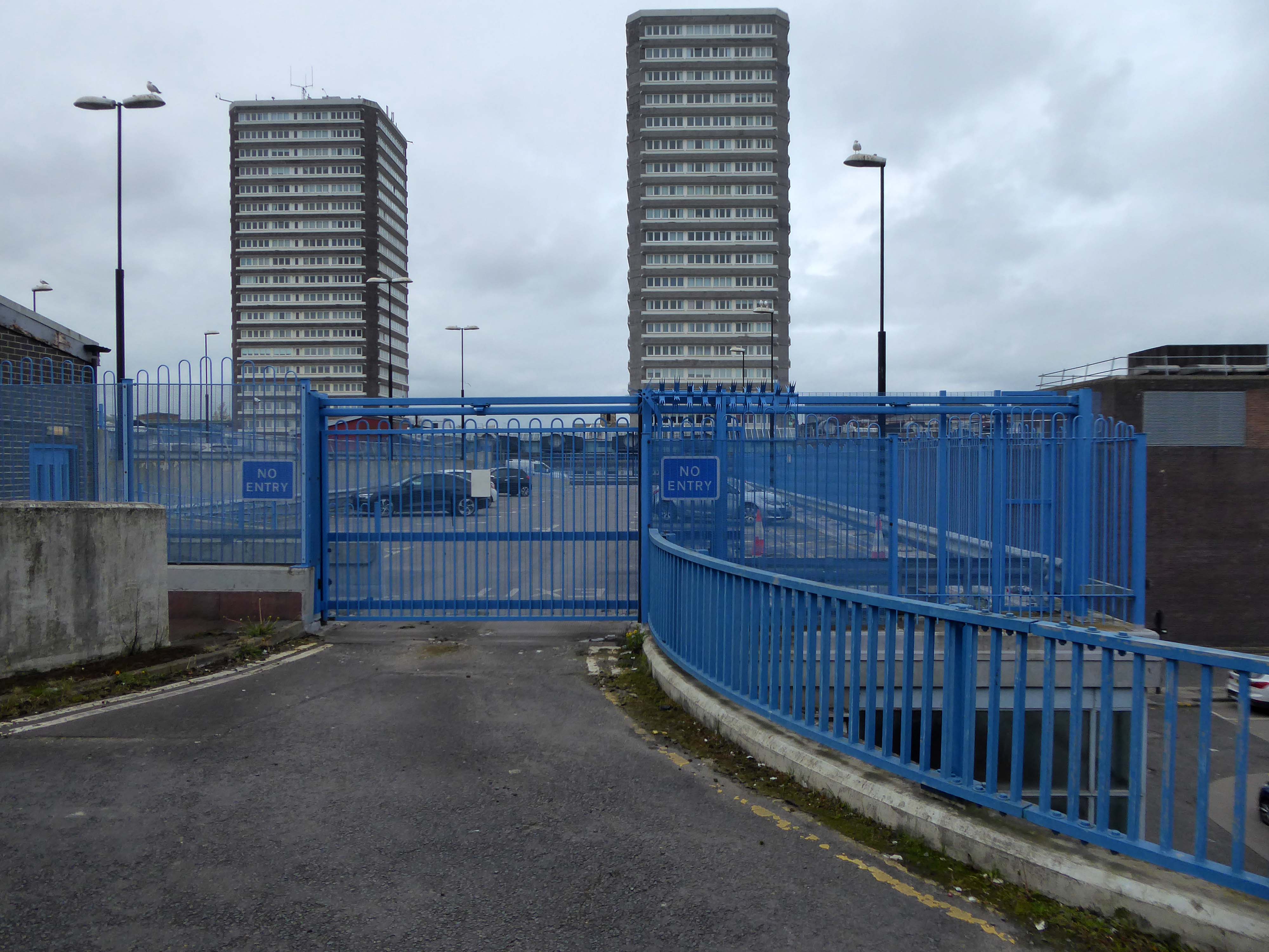
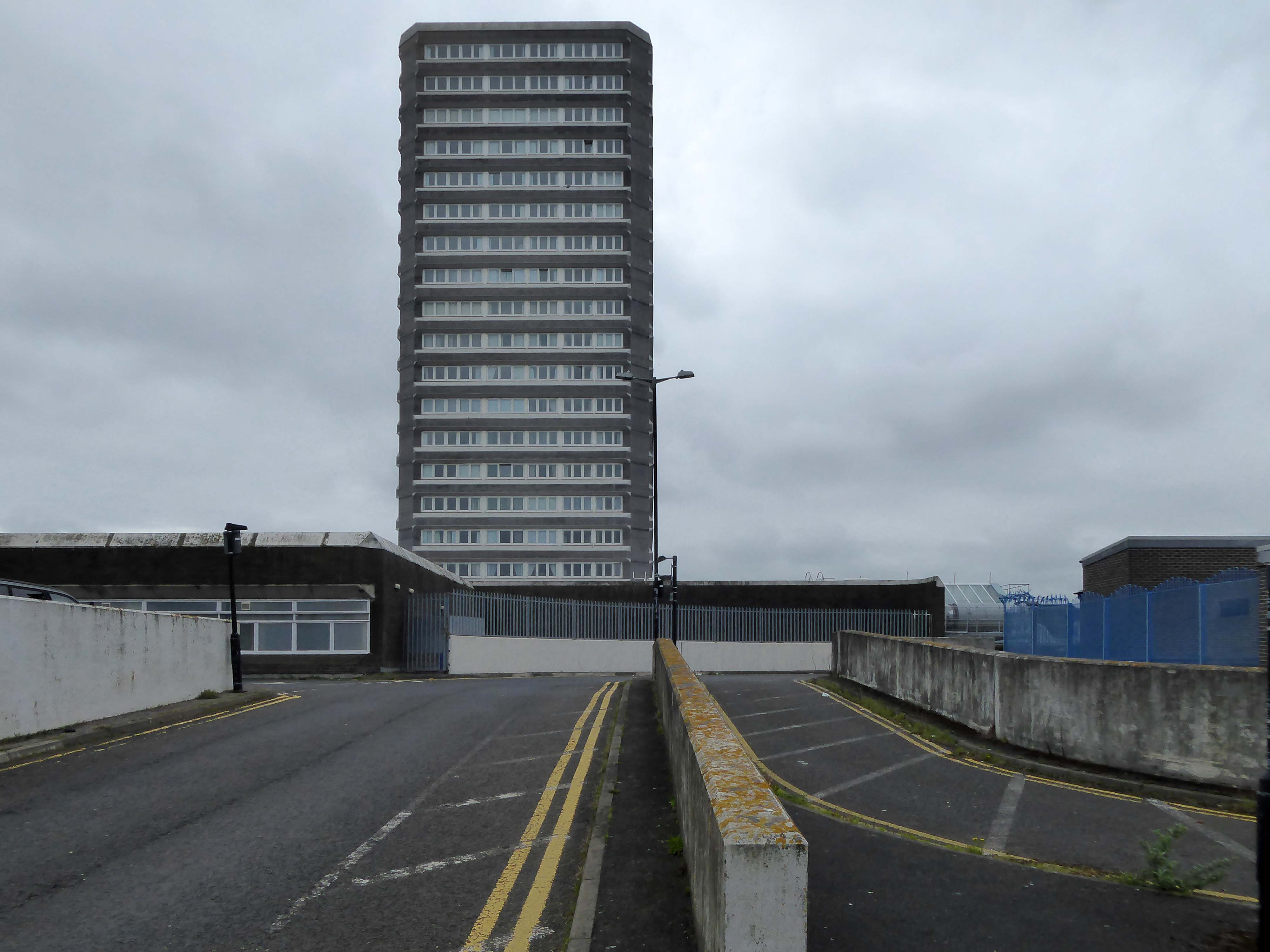
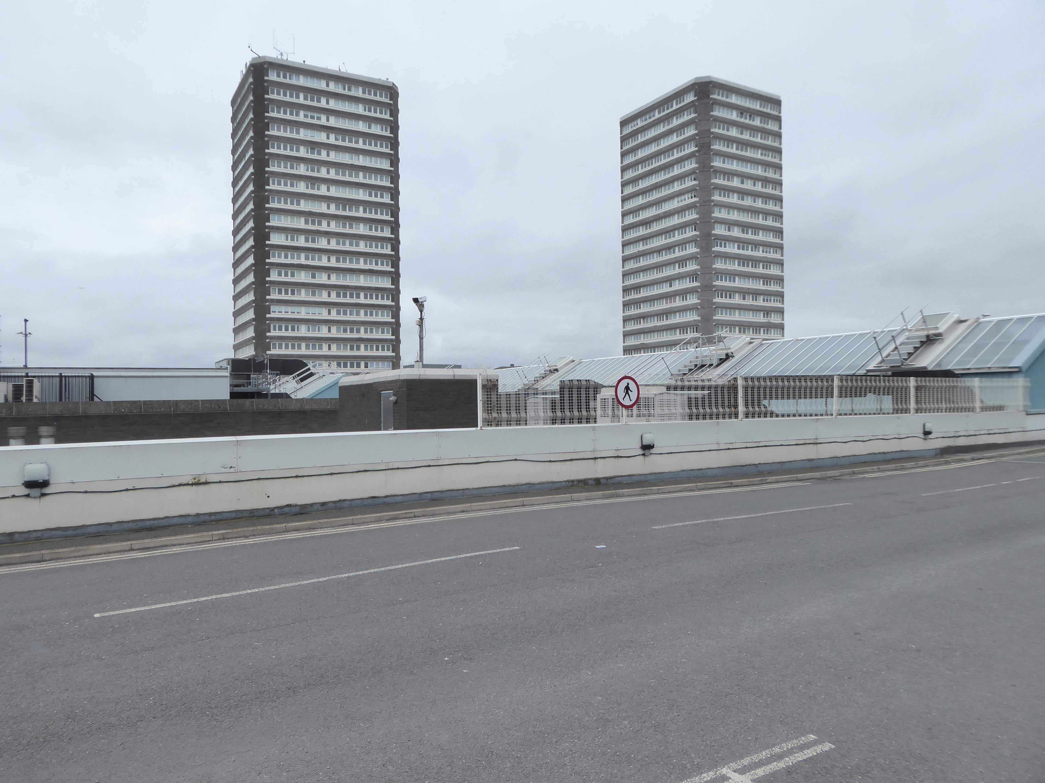
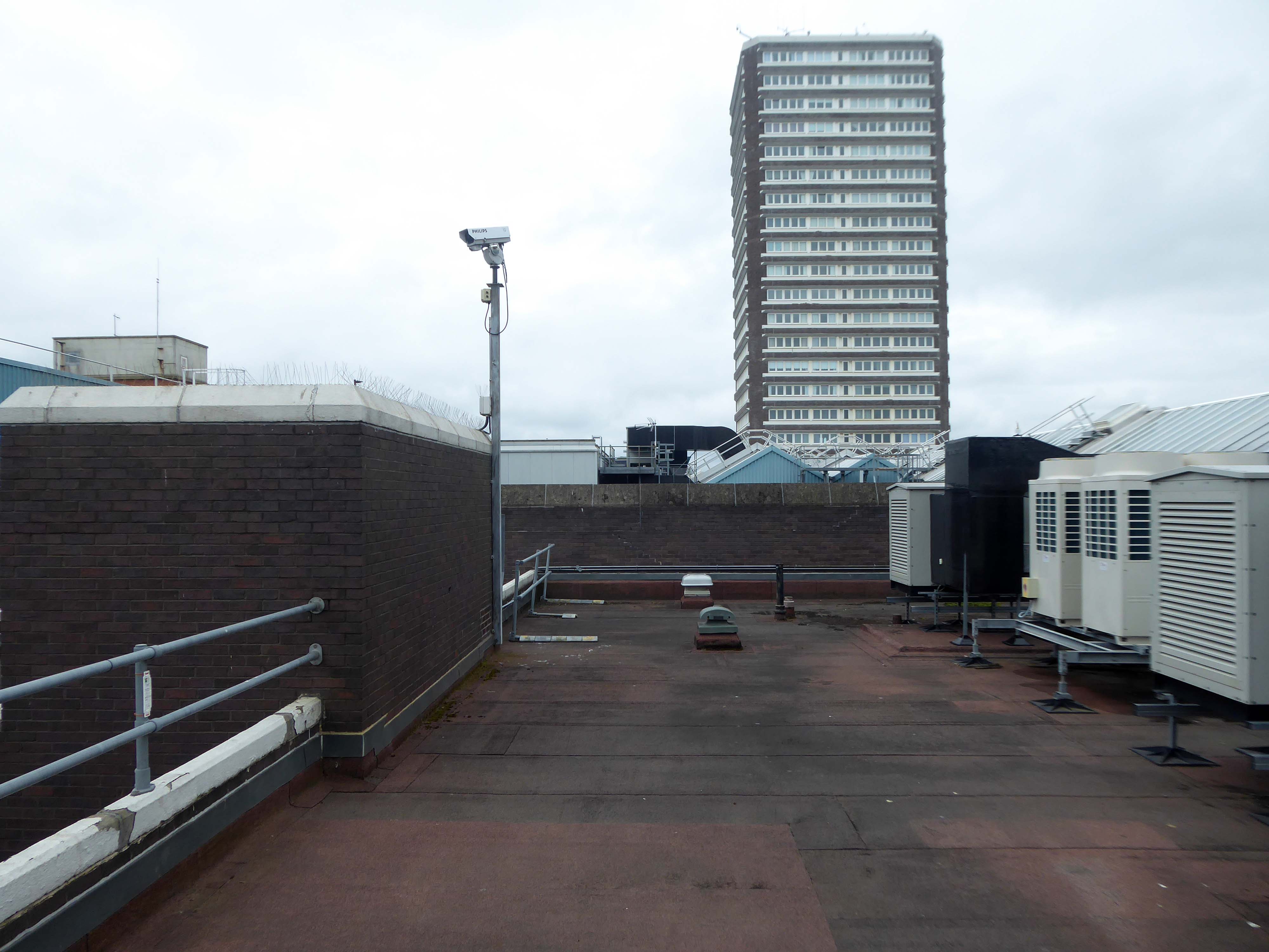
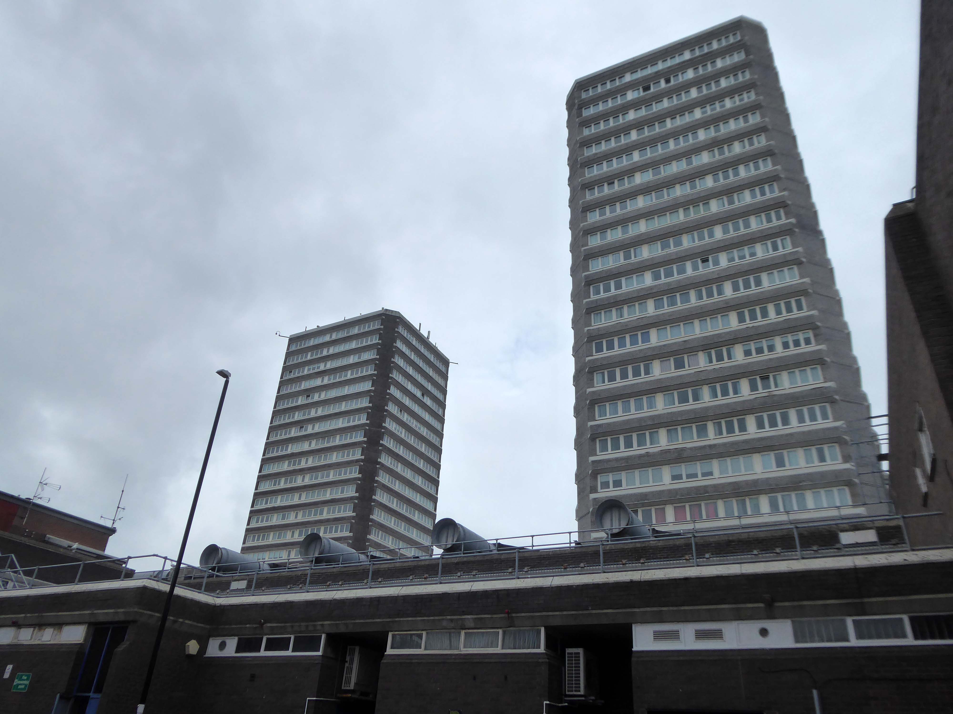
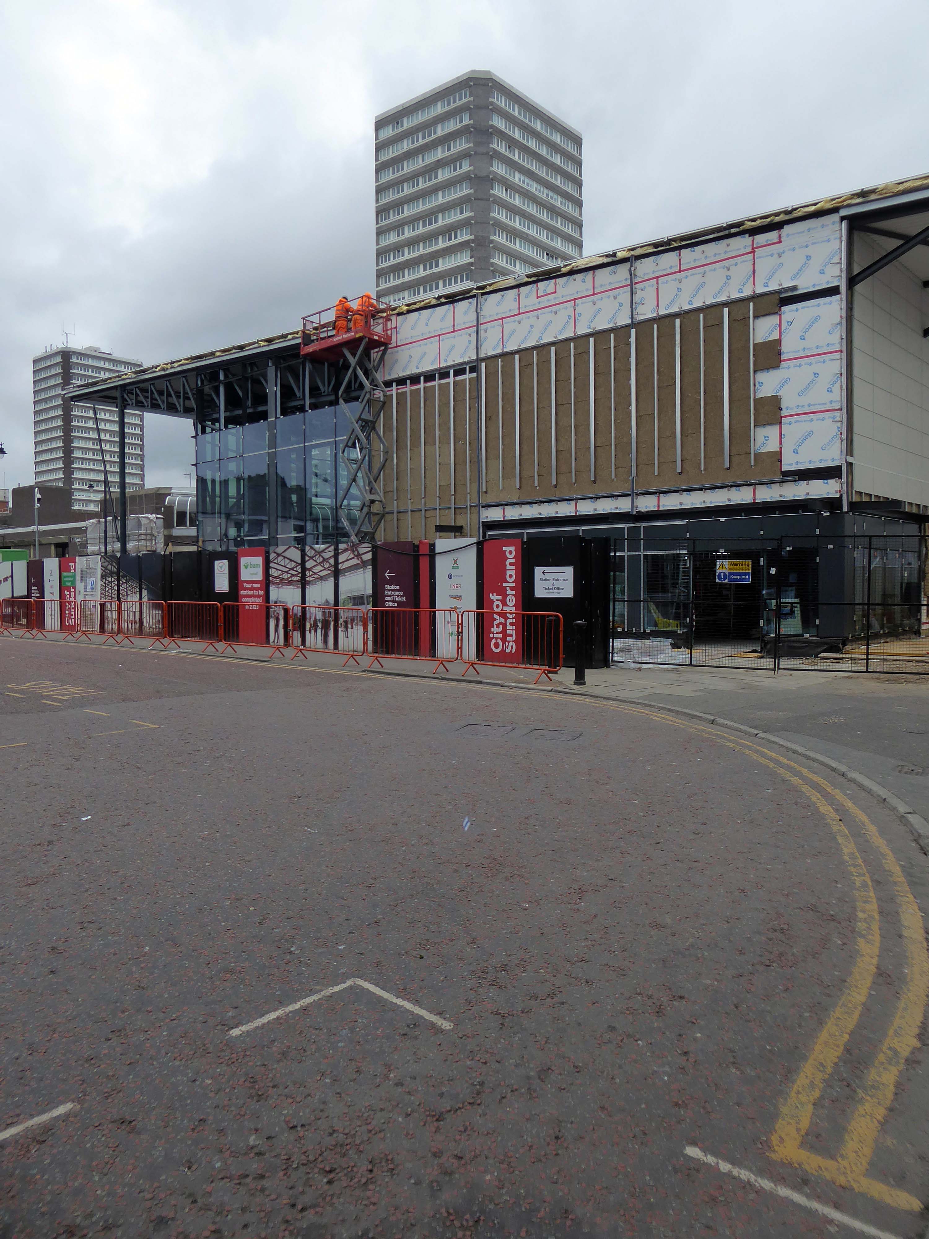
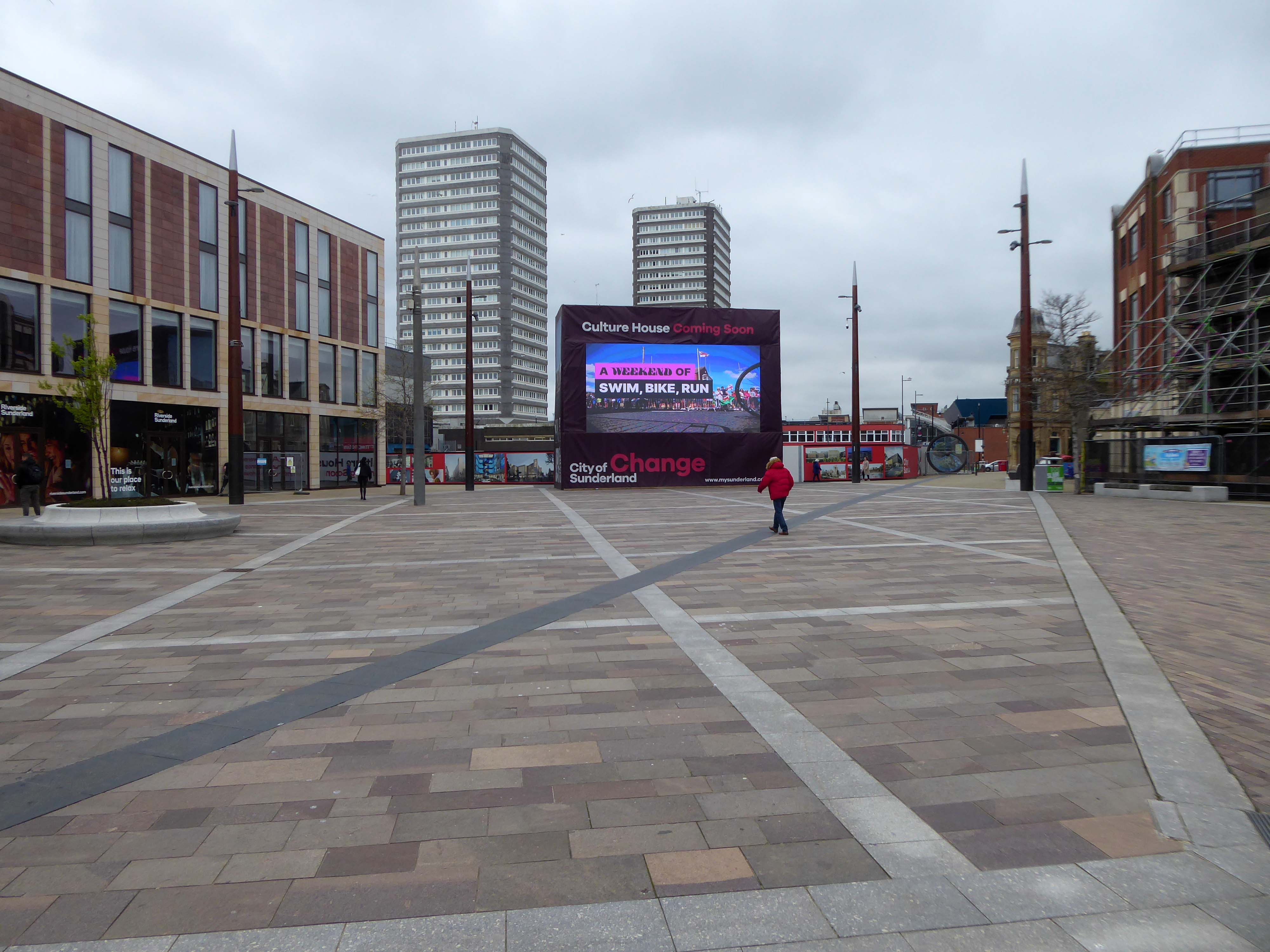
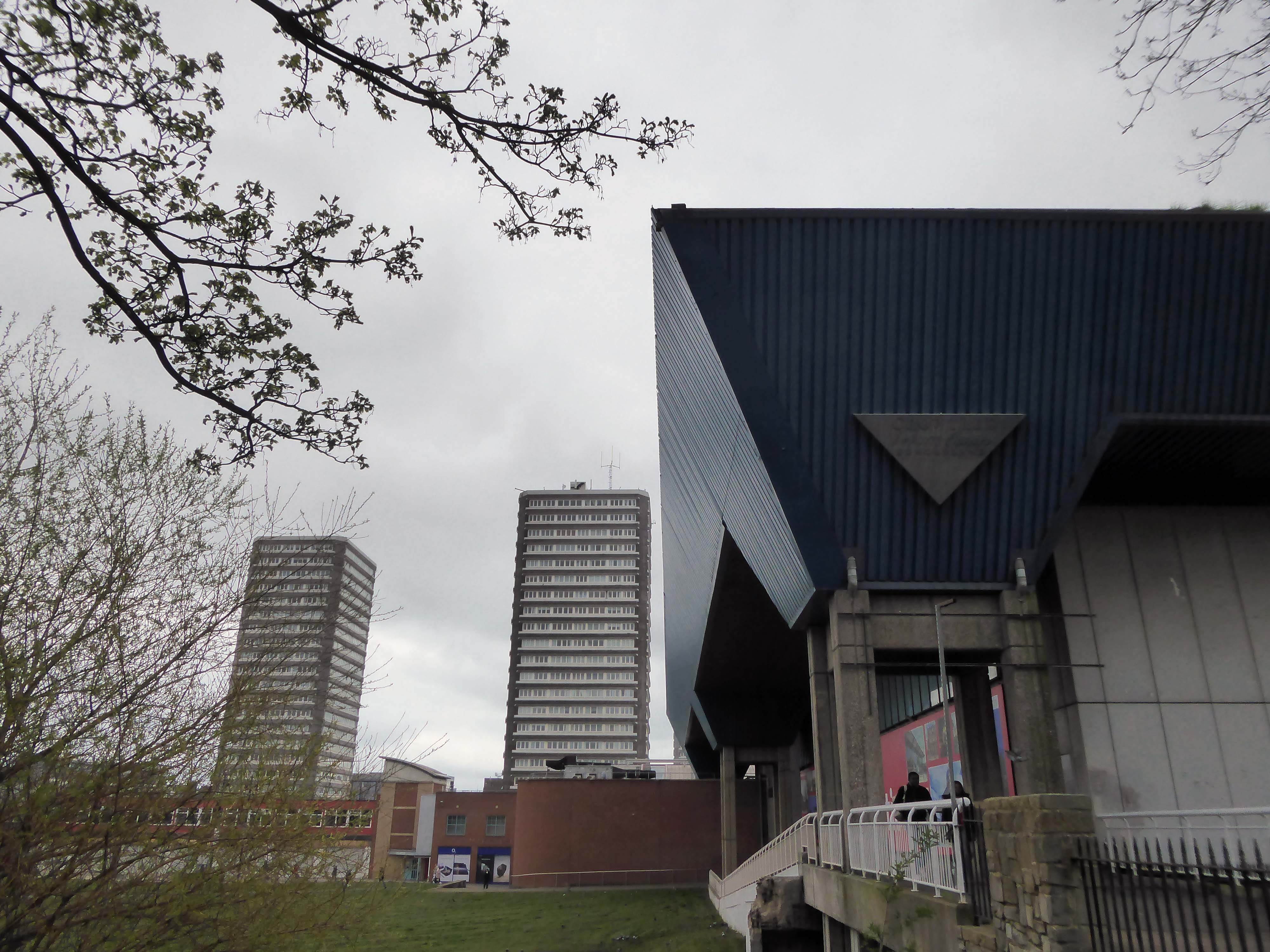
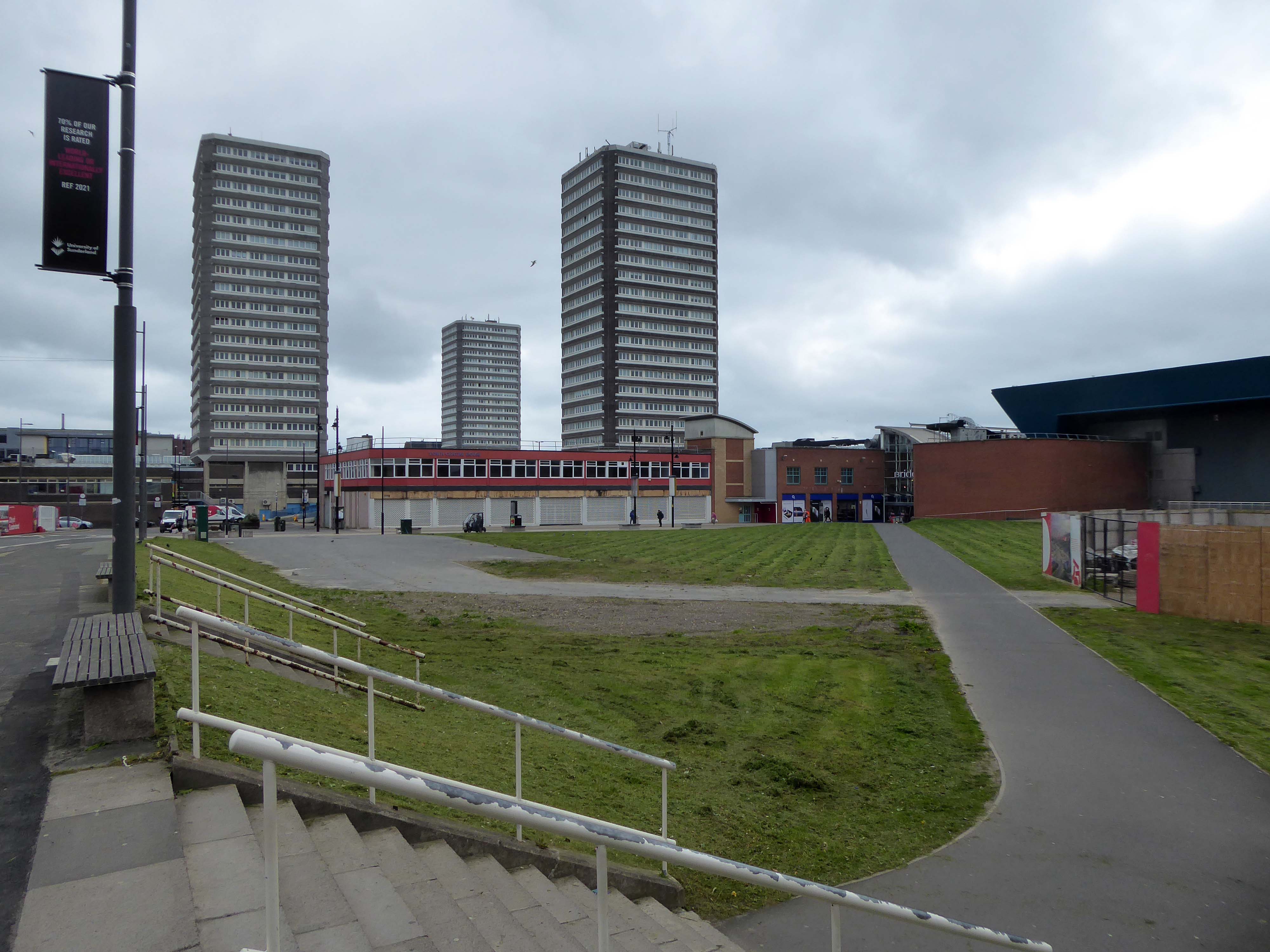
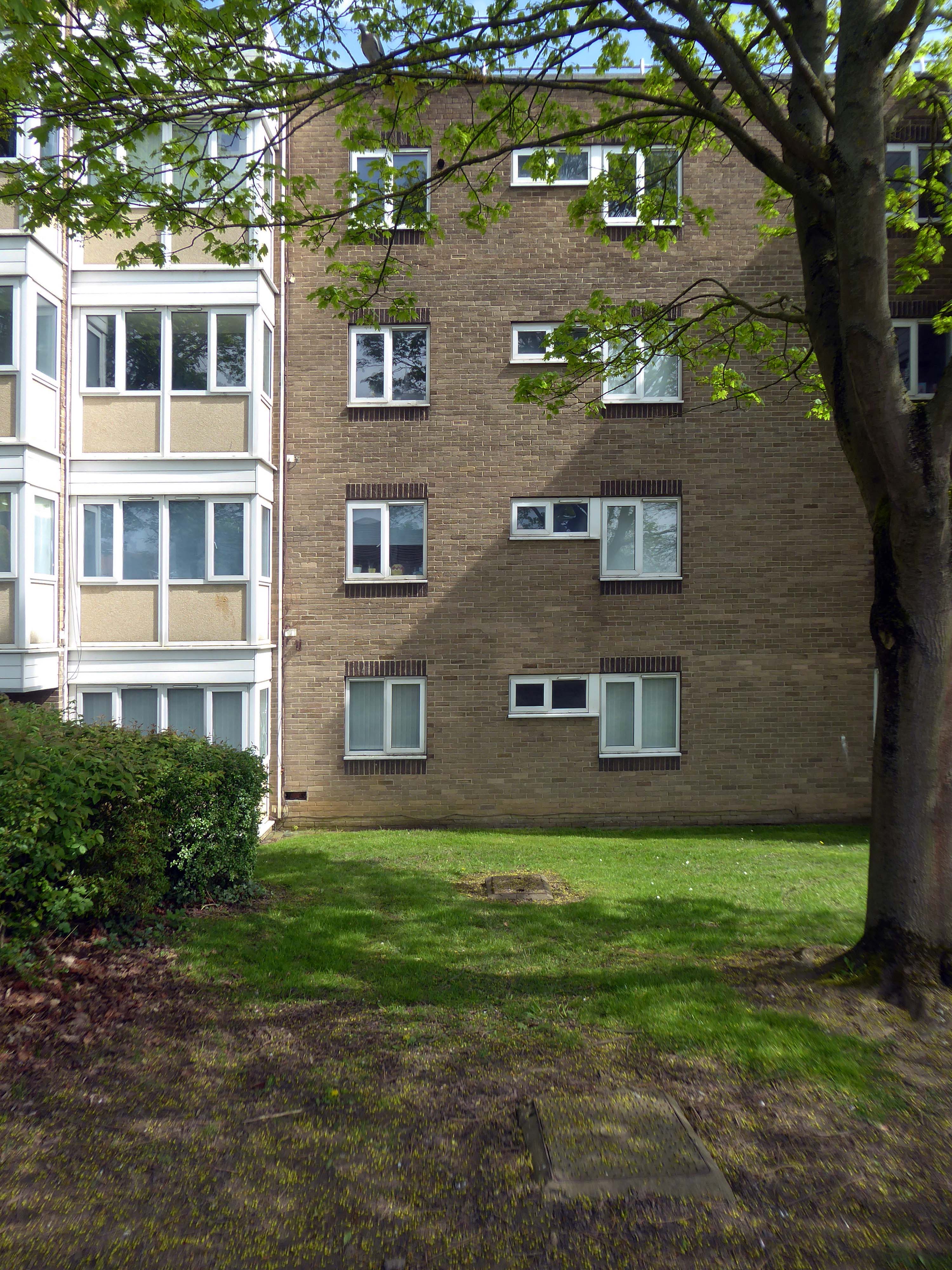
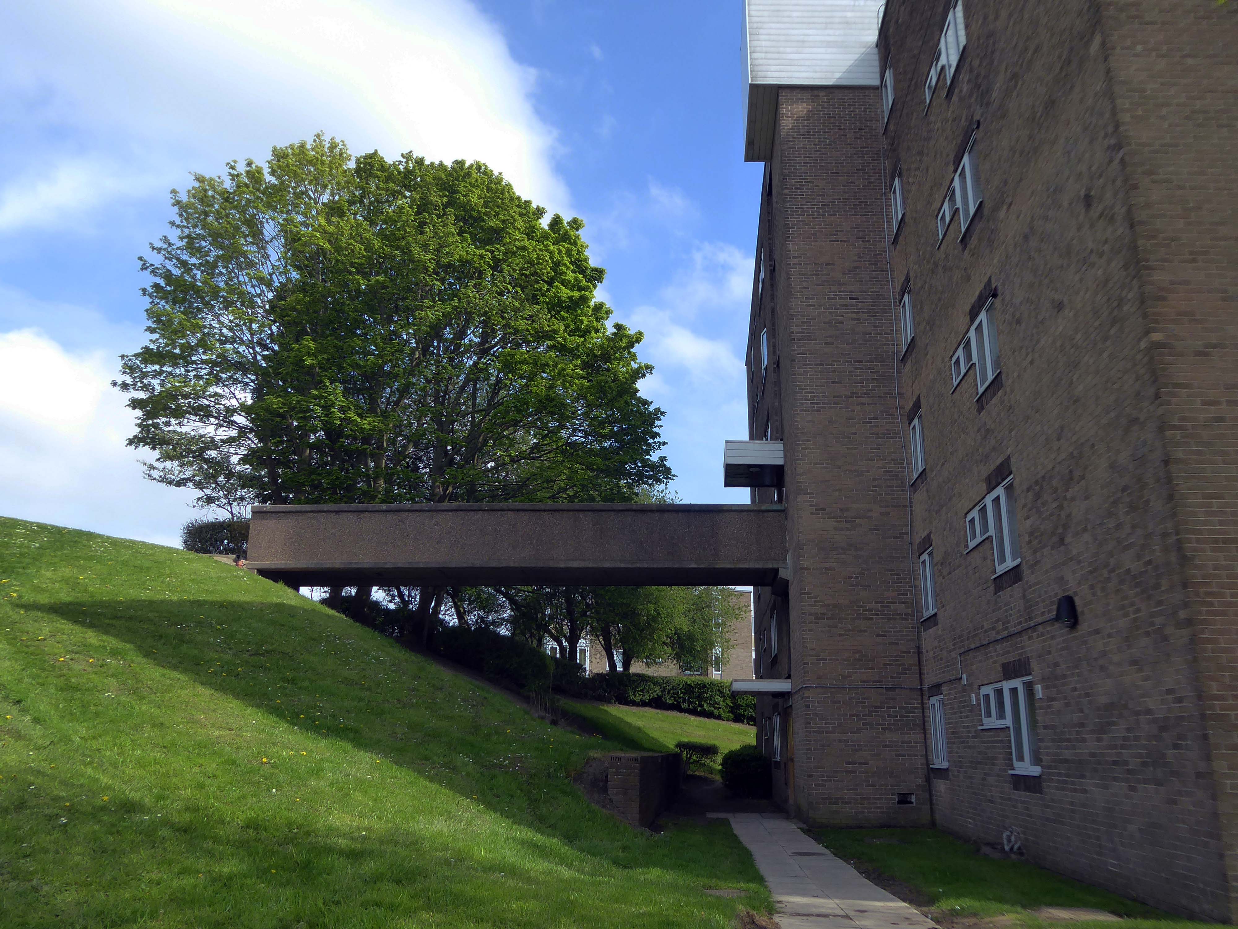
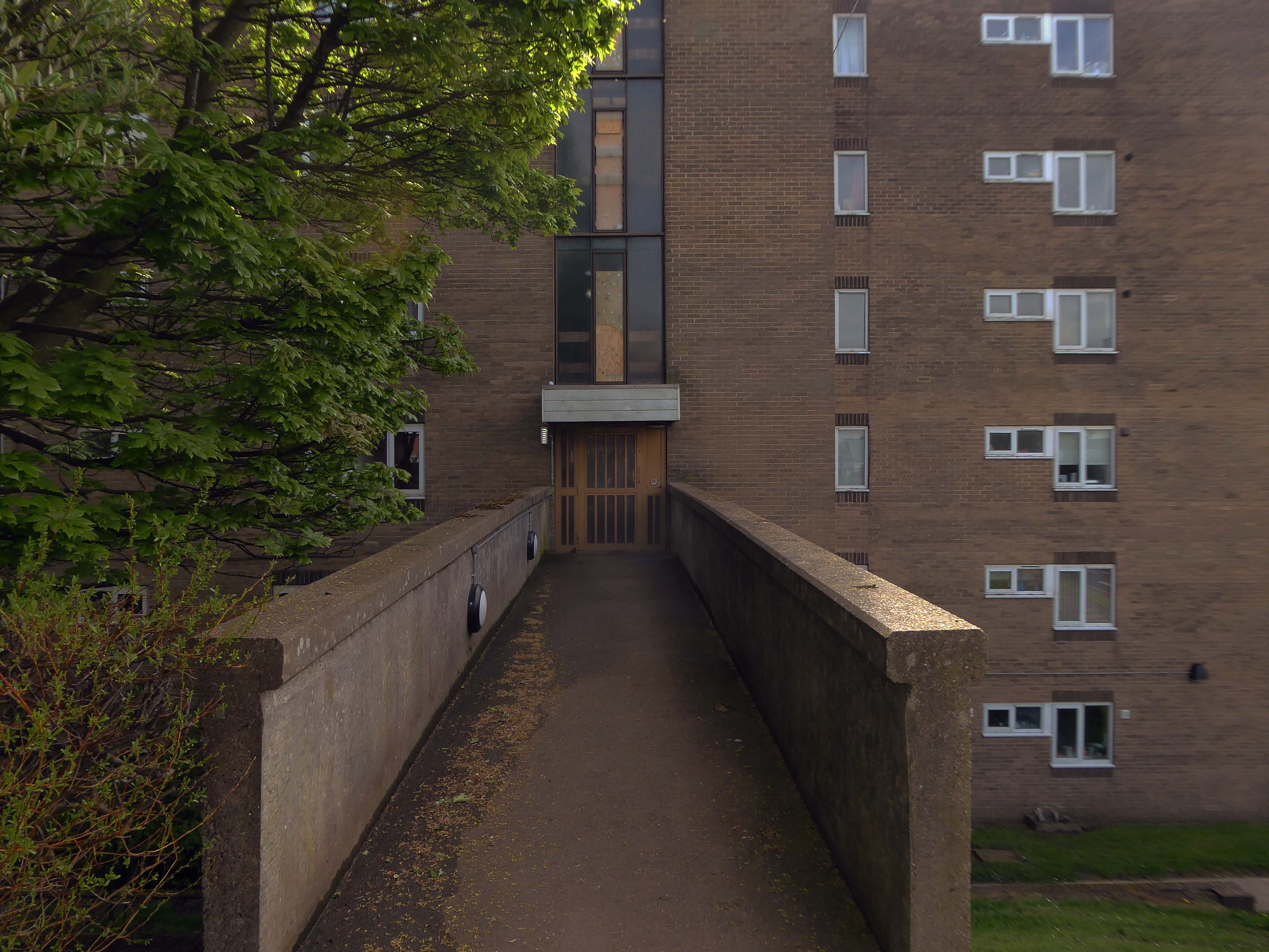
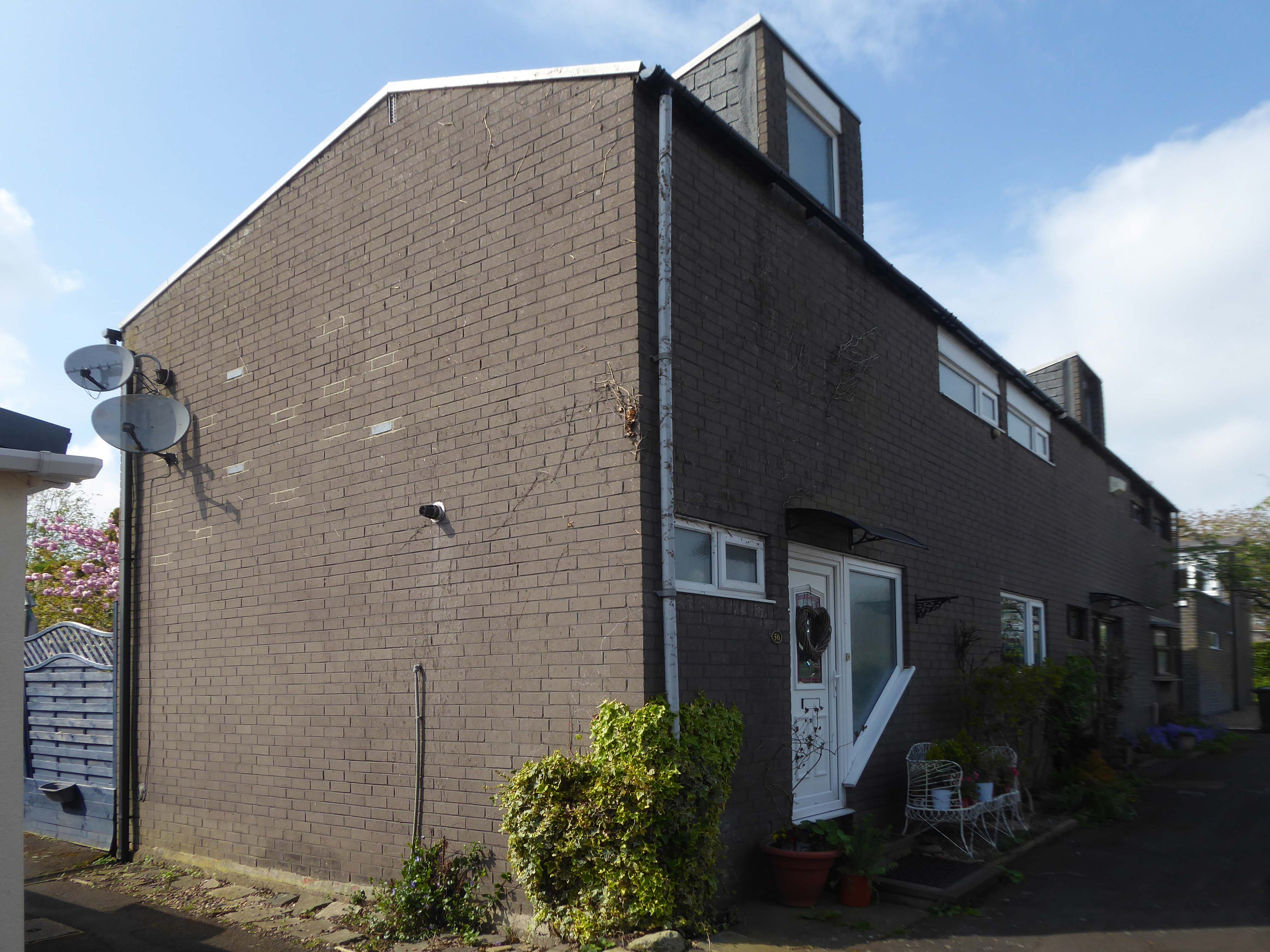
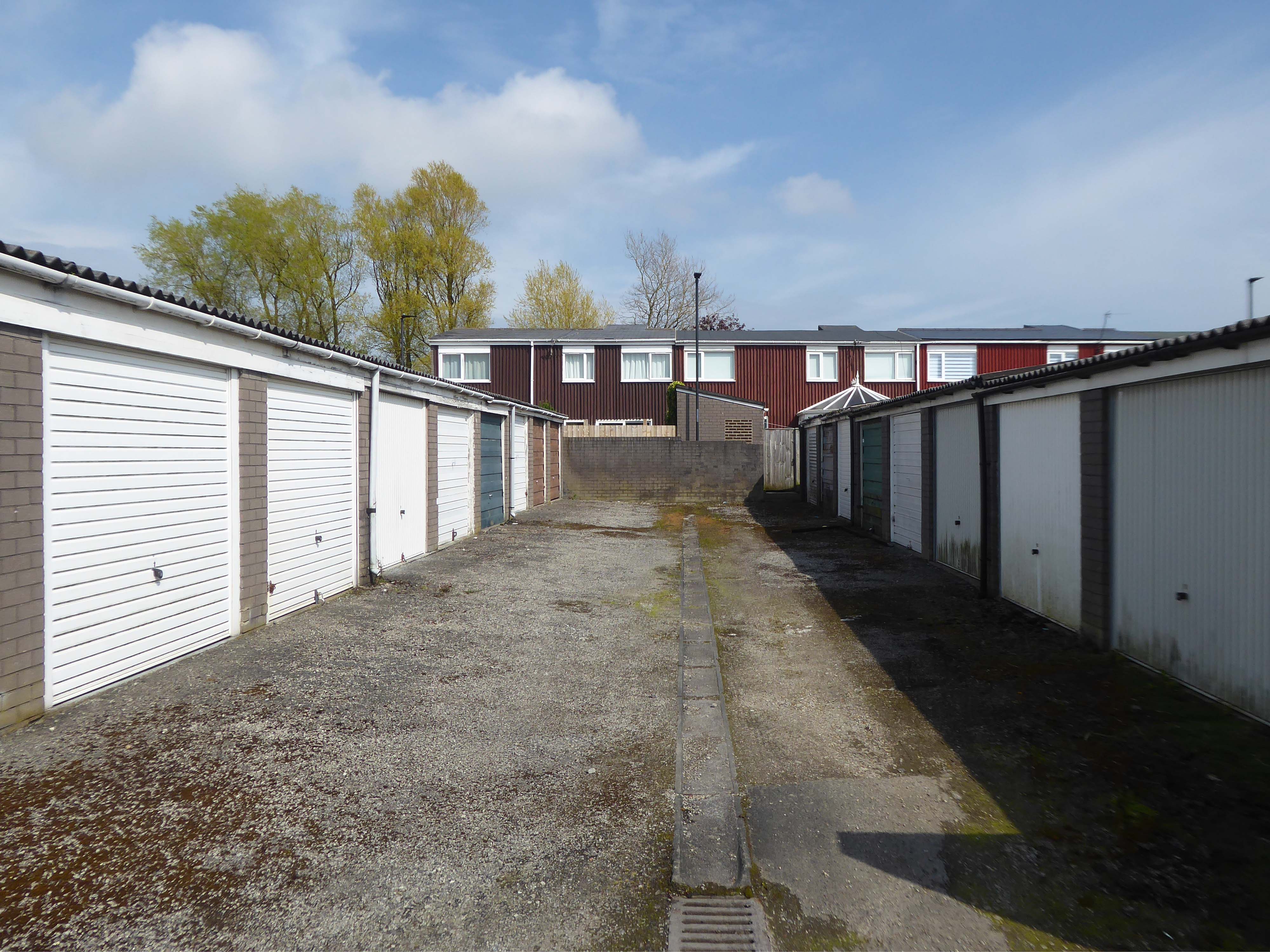
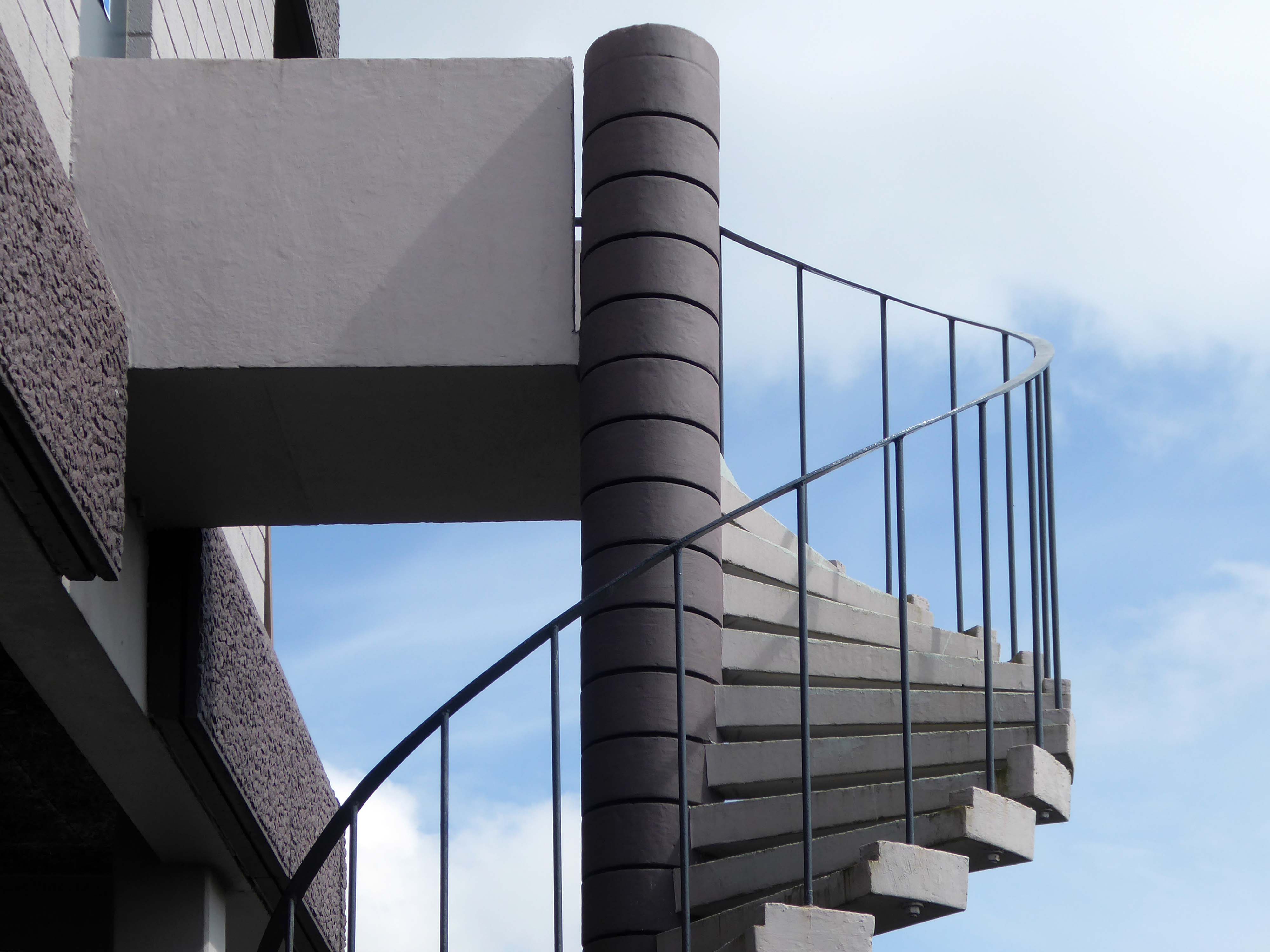
Three nineteen-storey point blocks built as public housing as part of the redevelopment of Sunderland town centre. The blocks contain 270 dwellings in total. Construction was approved by committee in 1967.
The blocks were constructed by Sunderland County Borough Council.
The developers of the Town Central Area were Town and City Properties Ltd. It is believed that they contributed £38,600 to the development of the blocks.
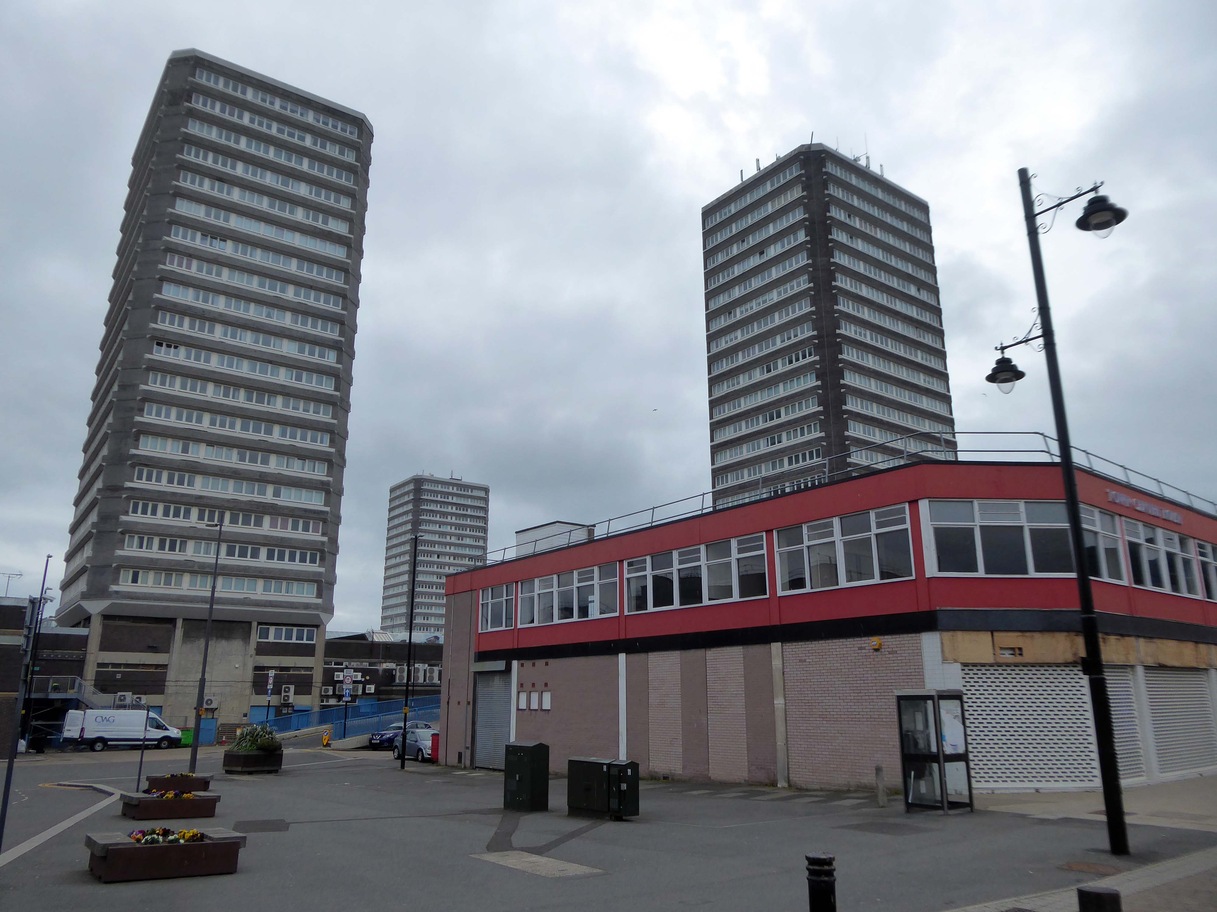
Ian Frazer and Associates were the architects for the sub-structural works only.
Llewelyn, Davies, Weeks and Partners were the structural and mechanical engineers in addition to being the architects for the tower blocks.
Gilbert-Ash Northern Ltd.’s tender for the contract was £959,258 – construction began in March 1967.
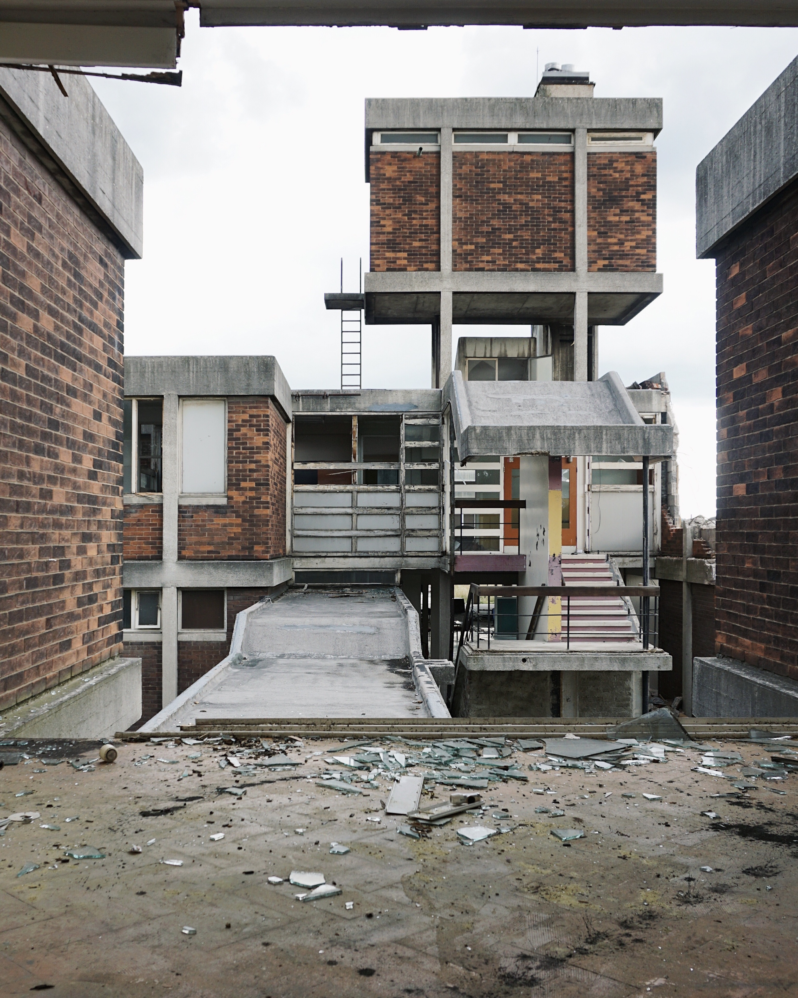
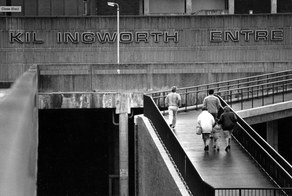
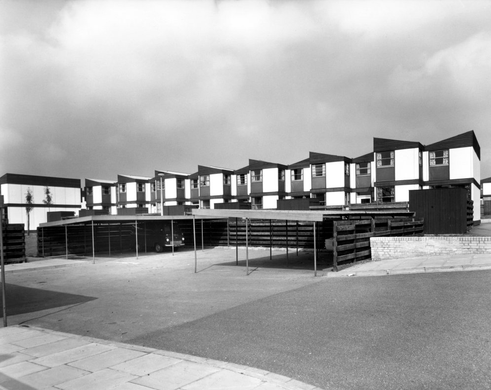
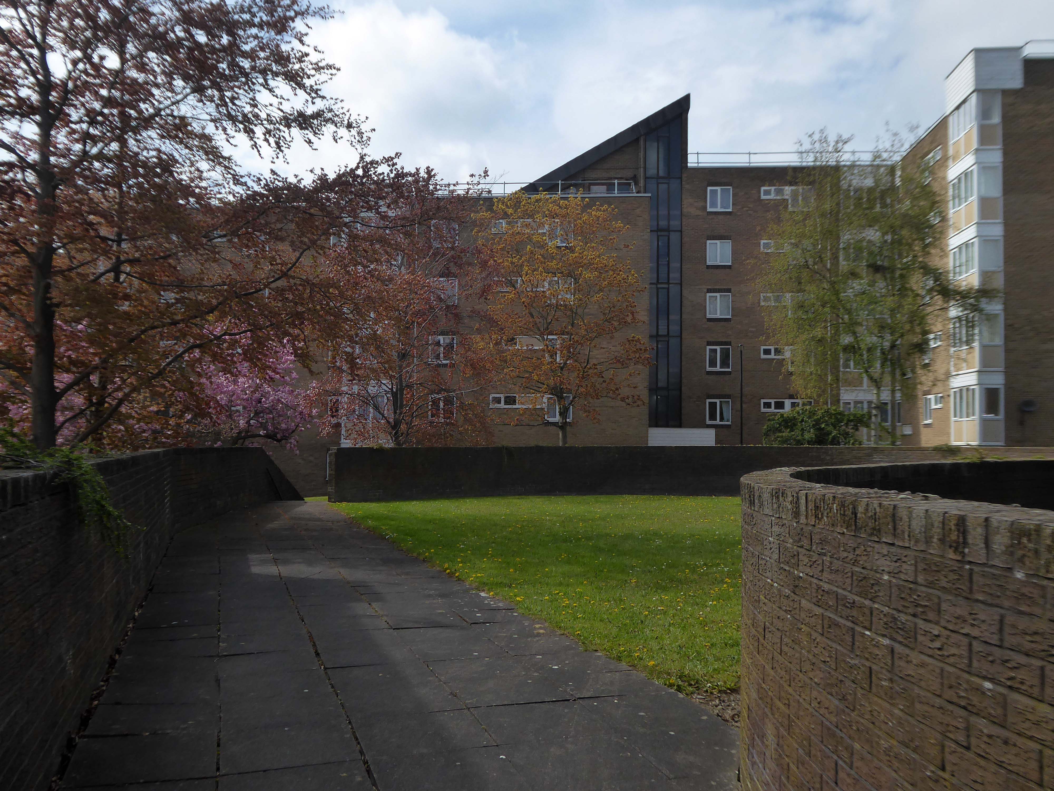
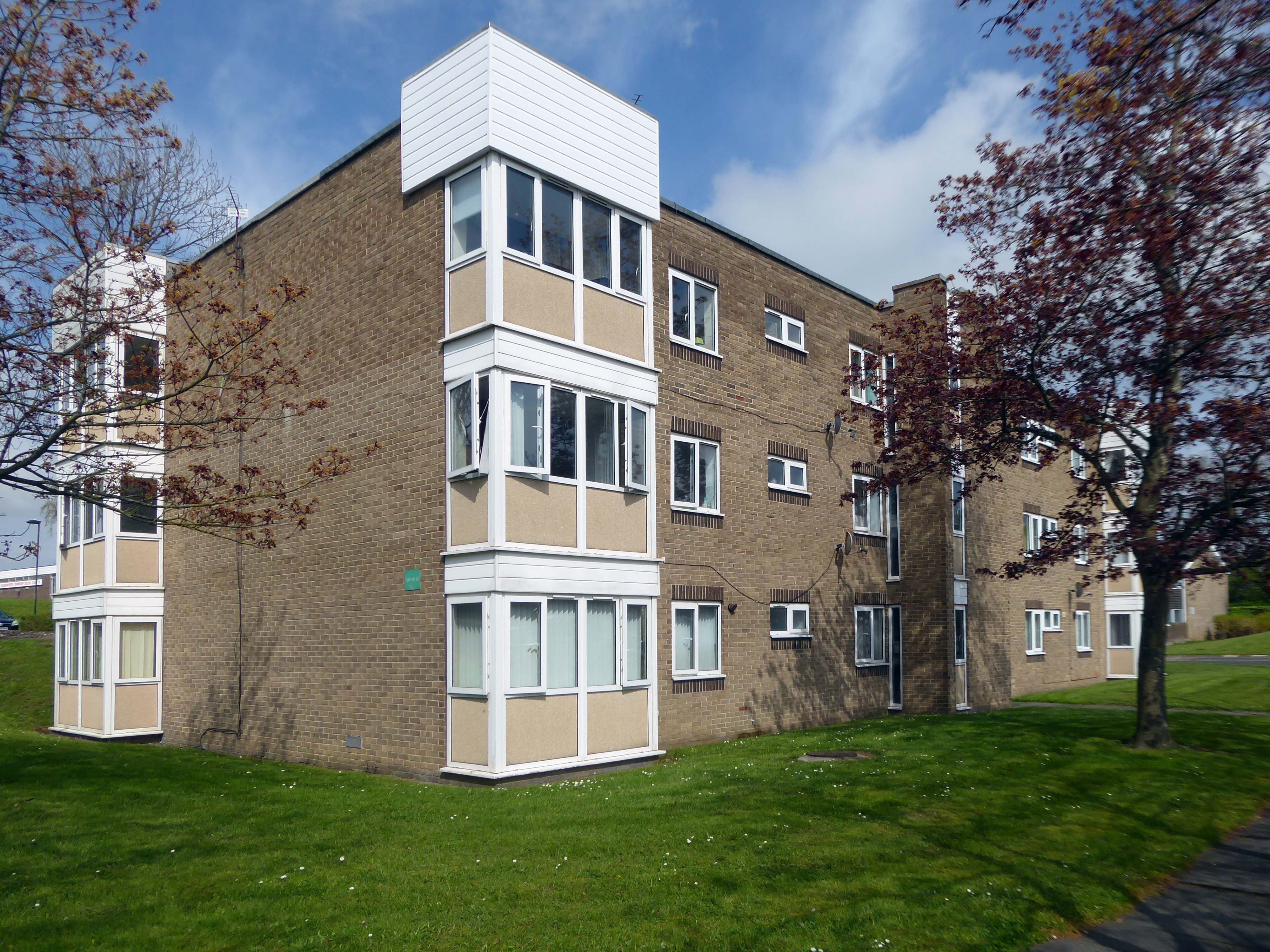
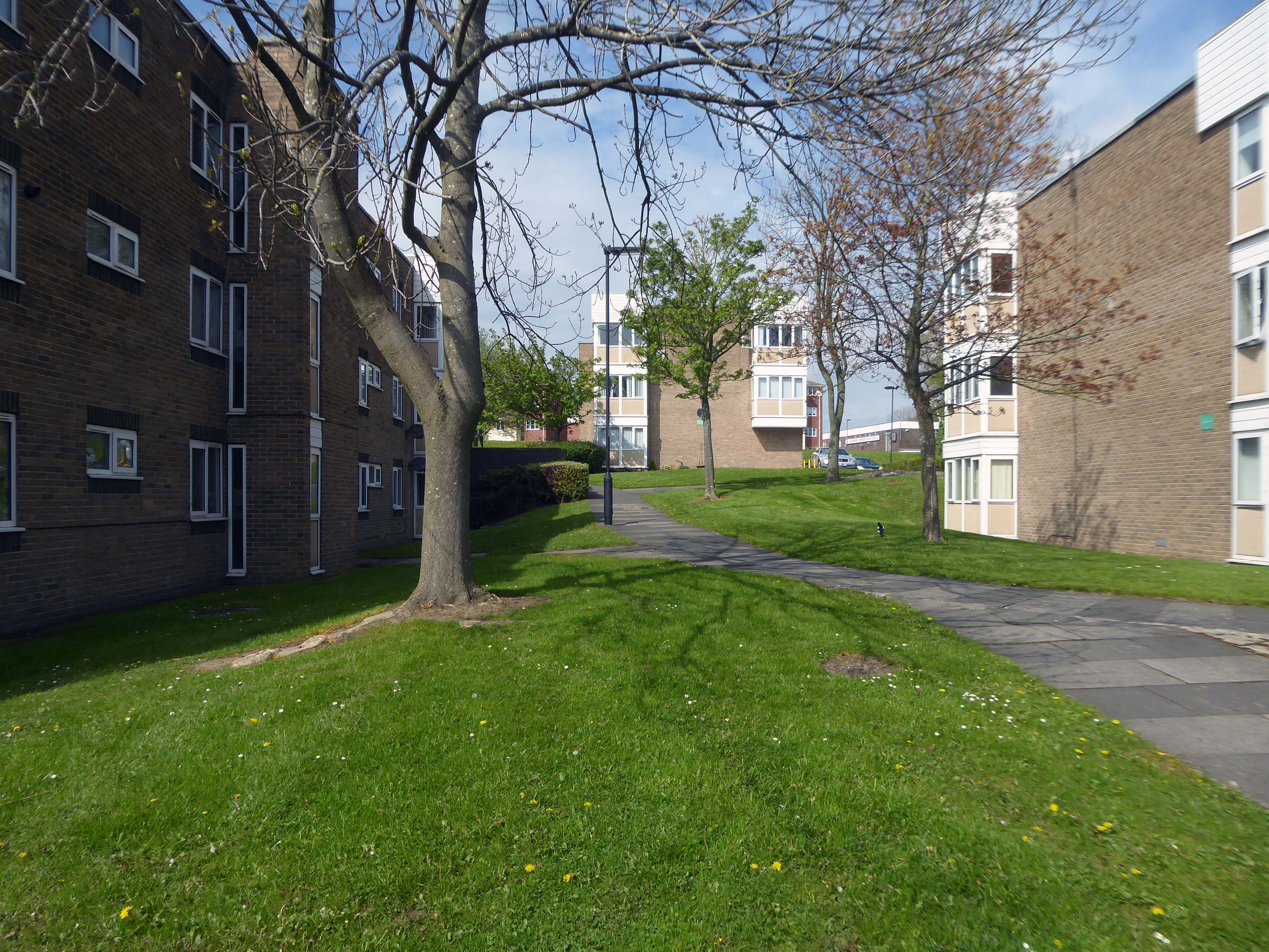
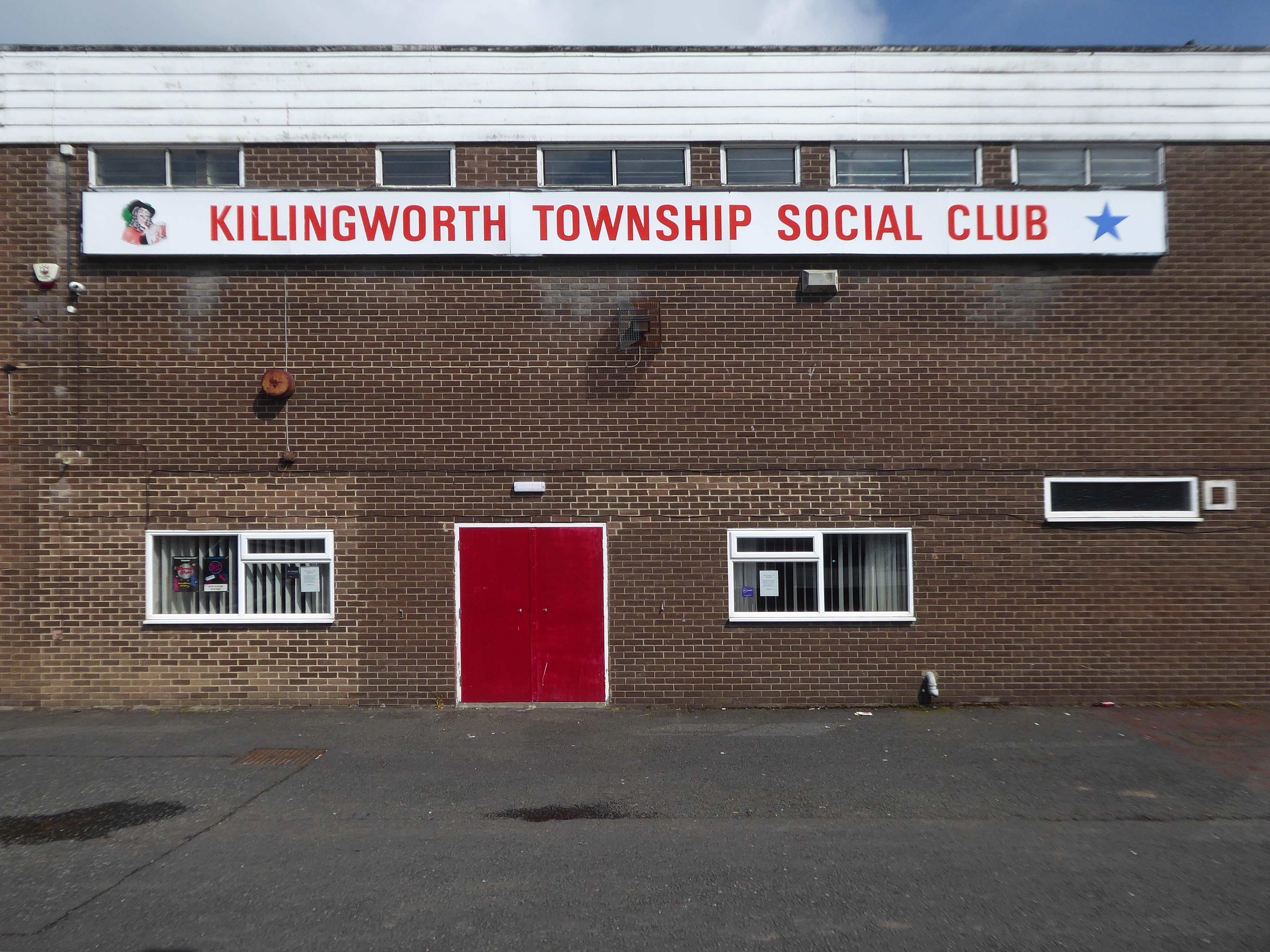
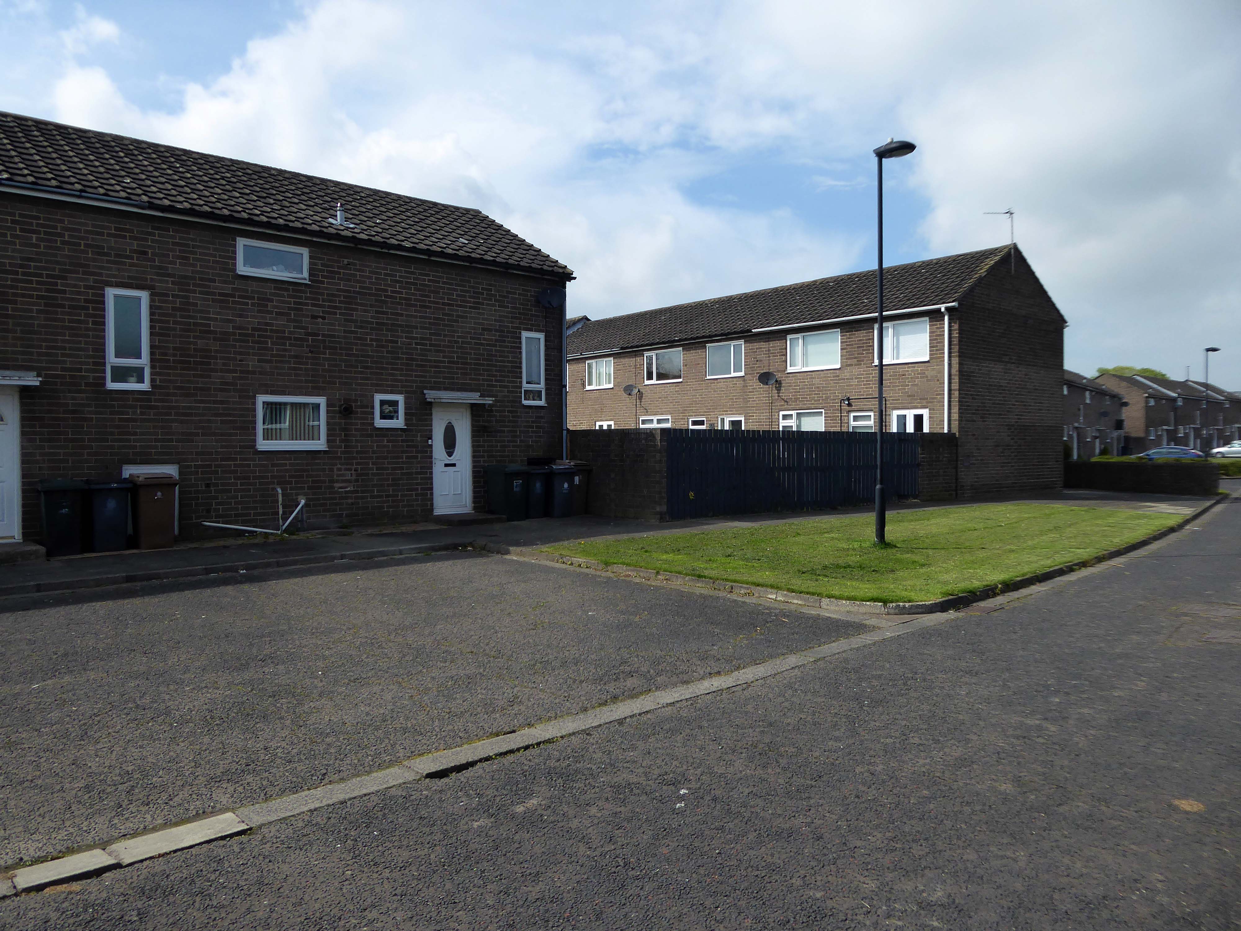
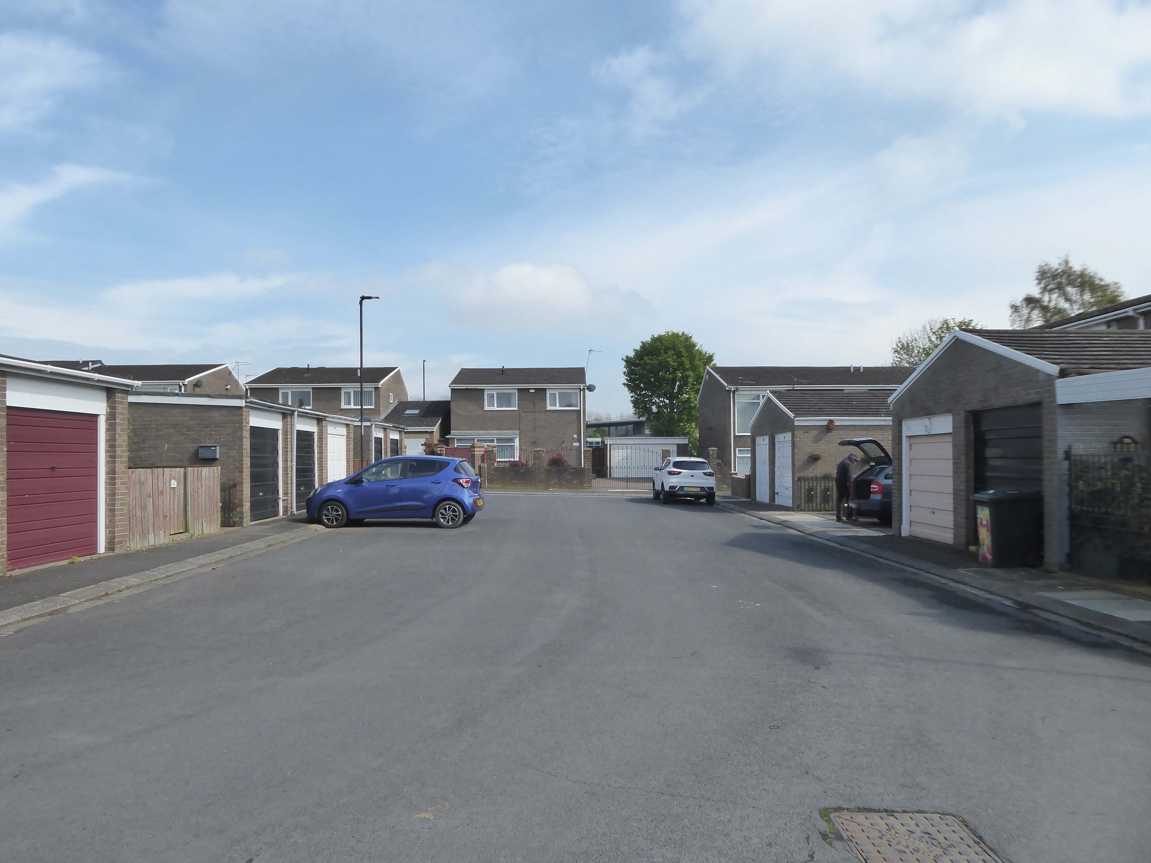
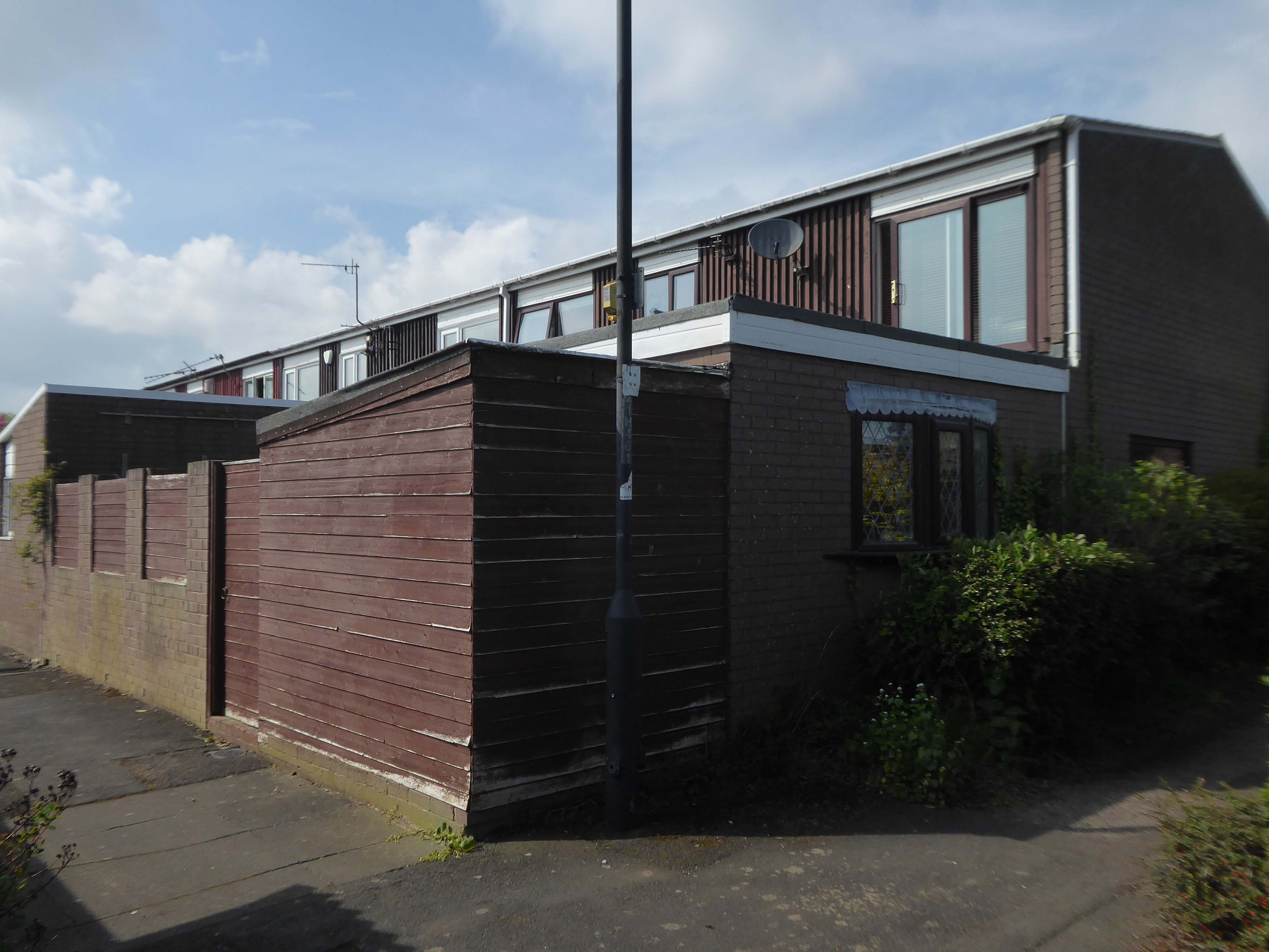
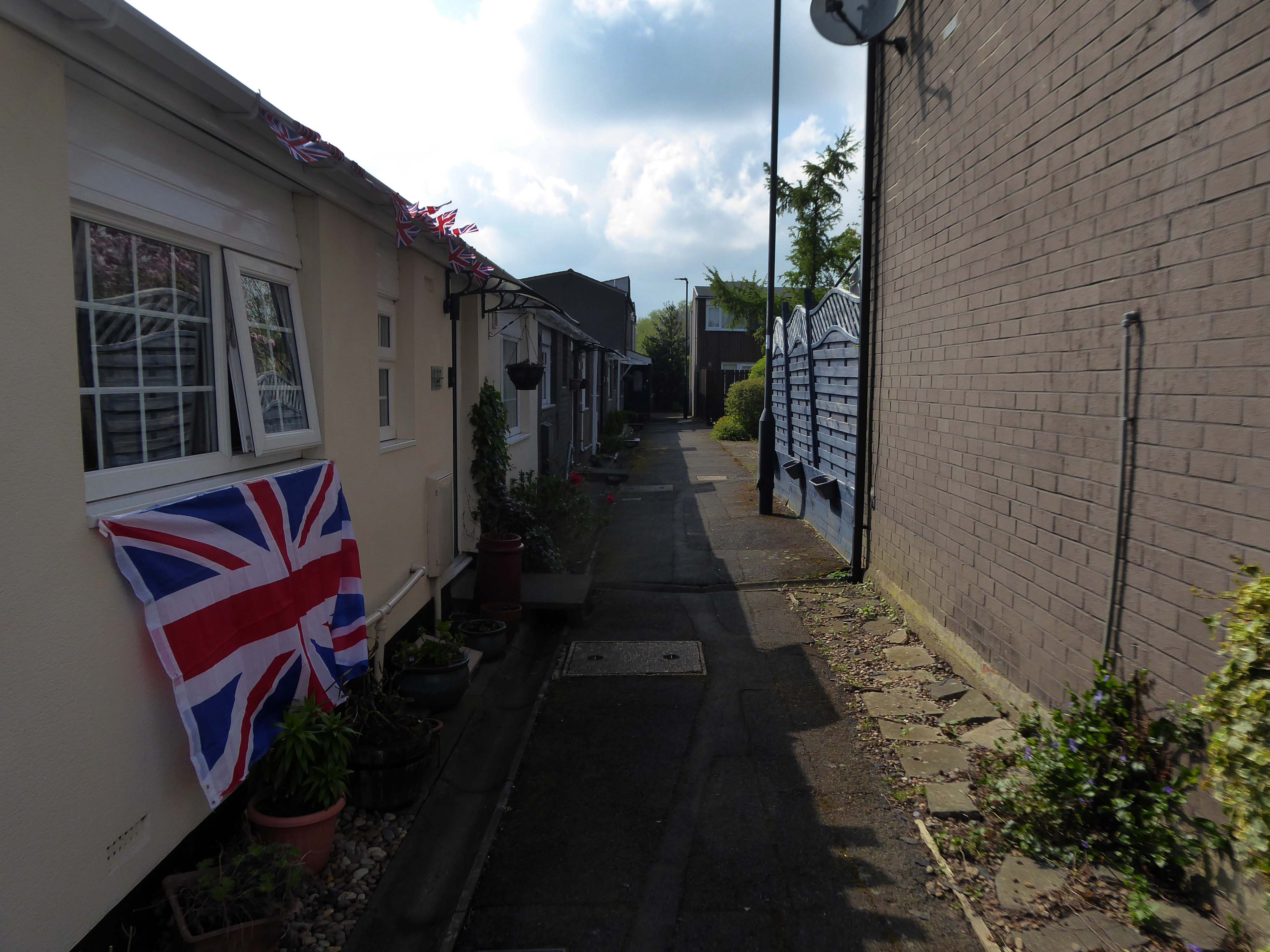
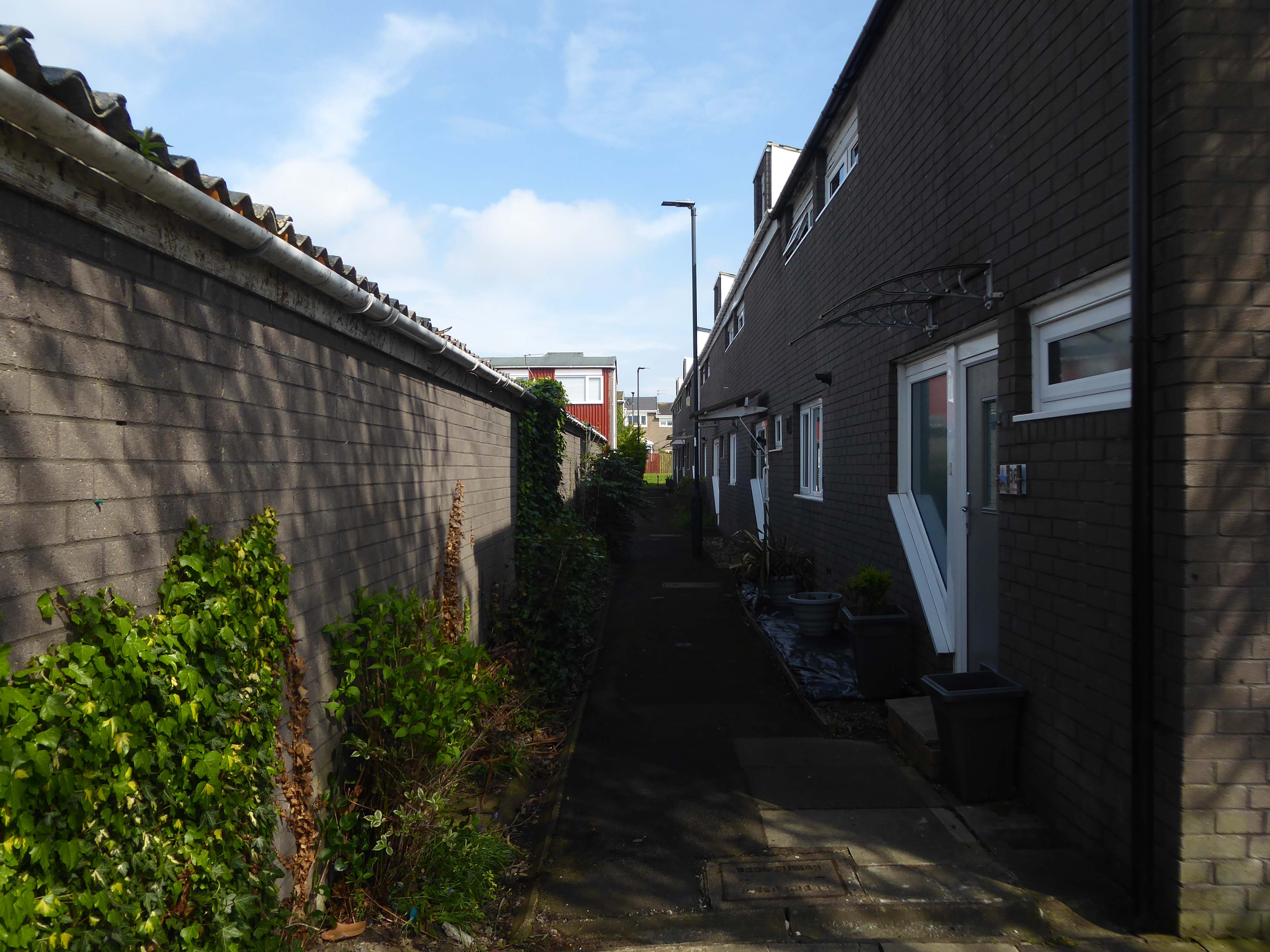
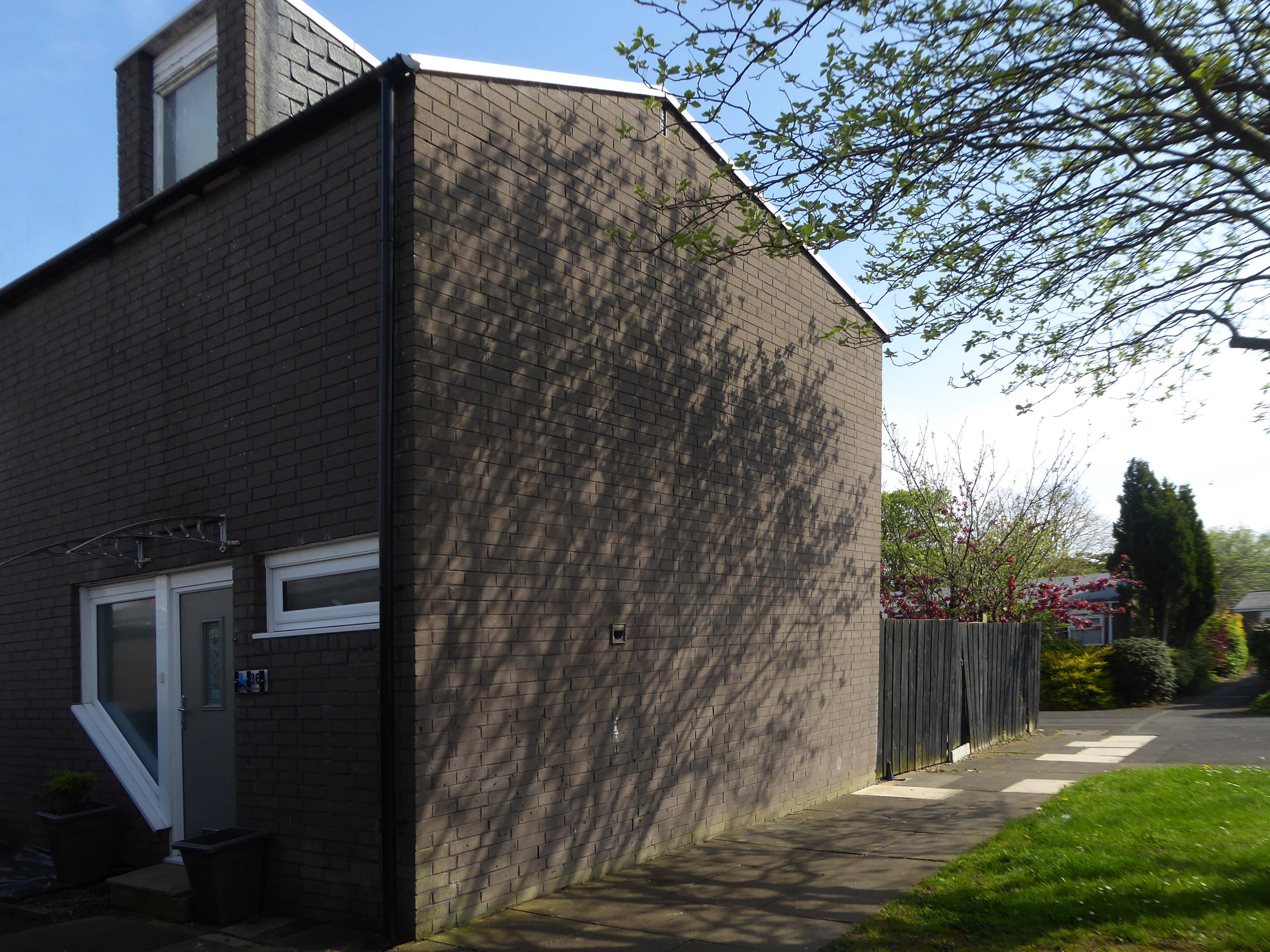
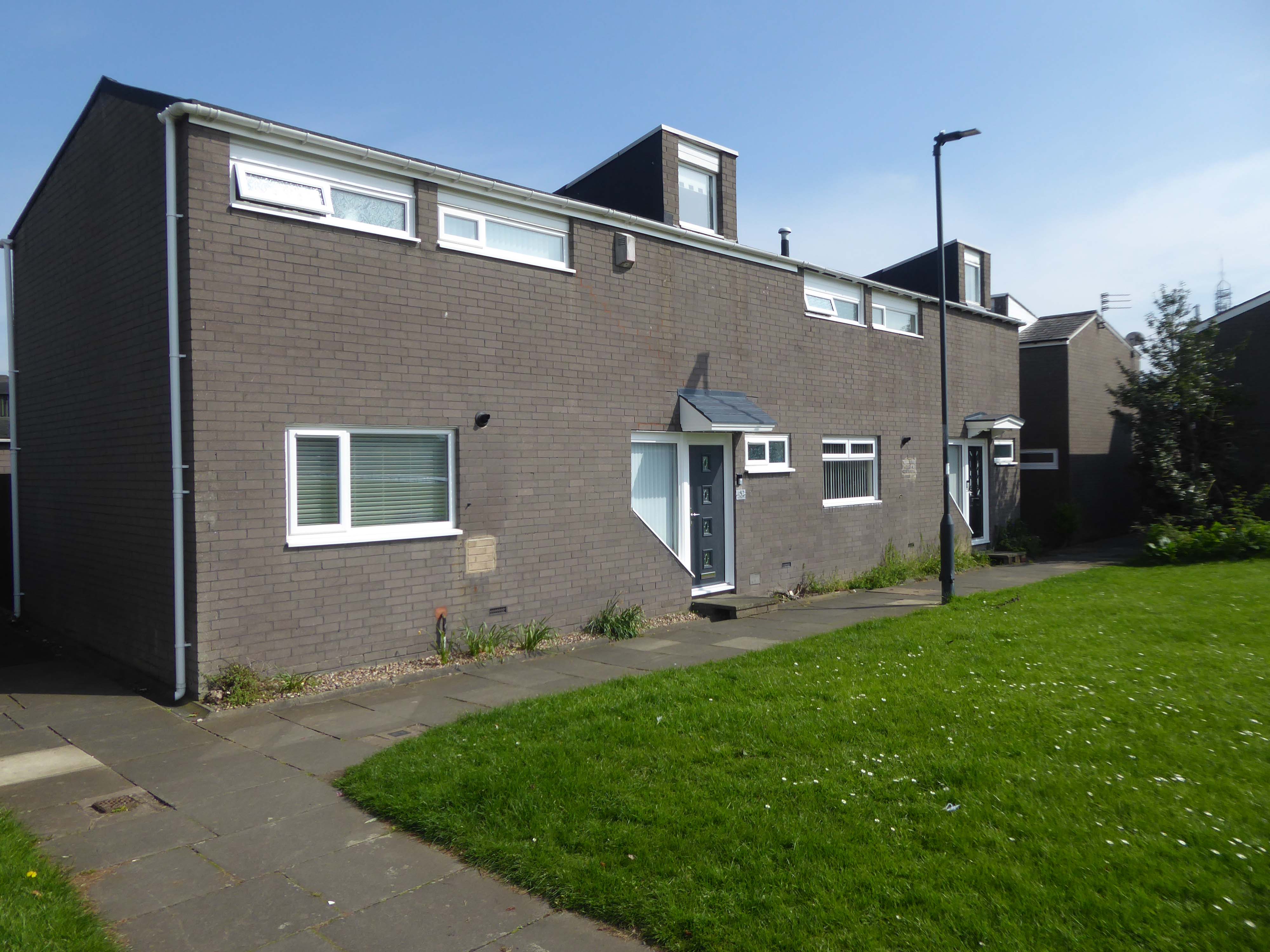
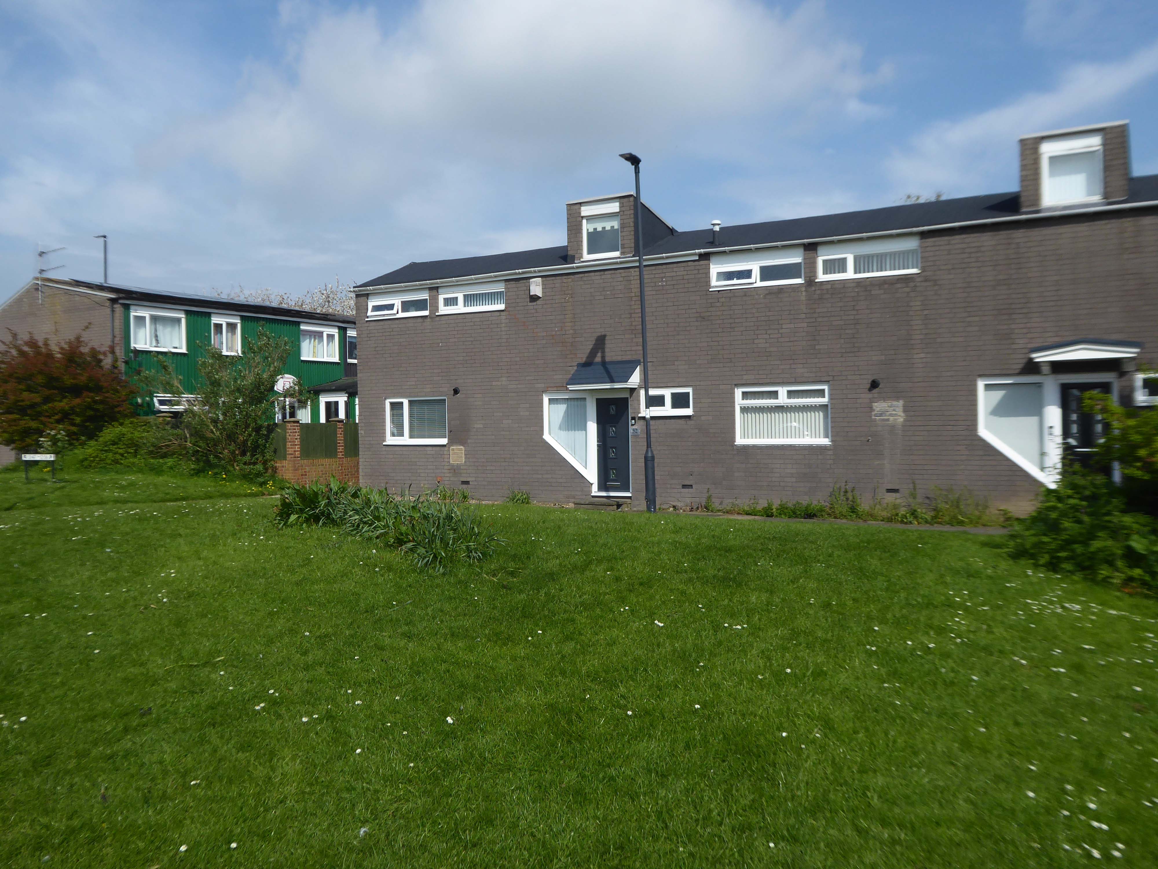
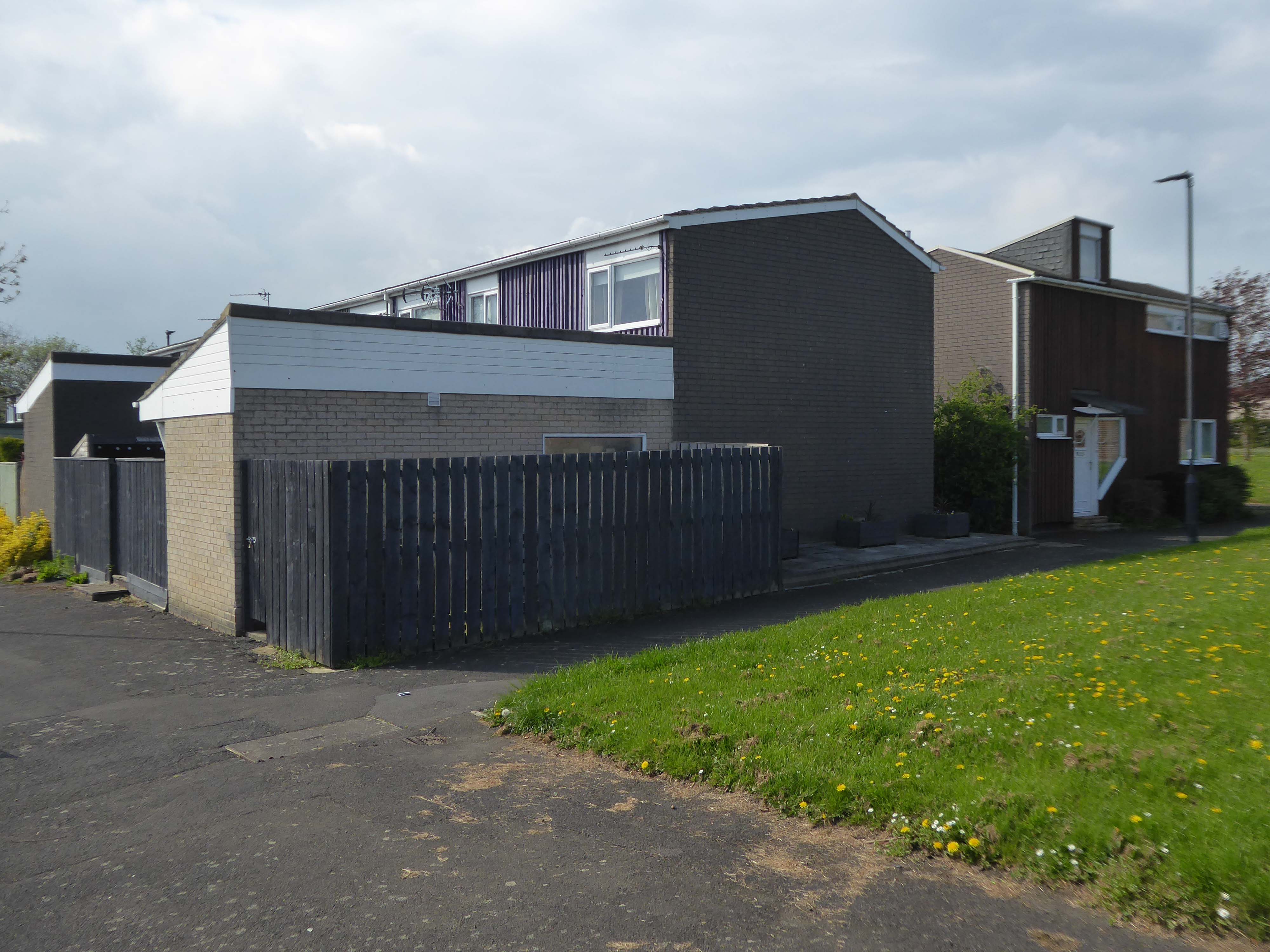
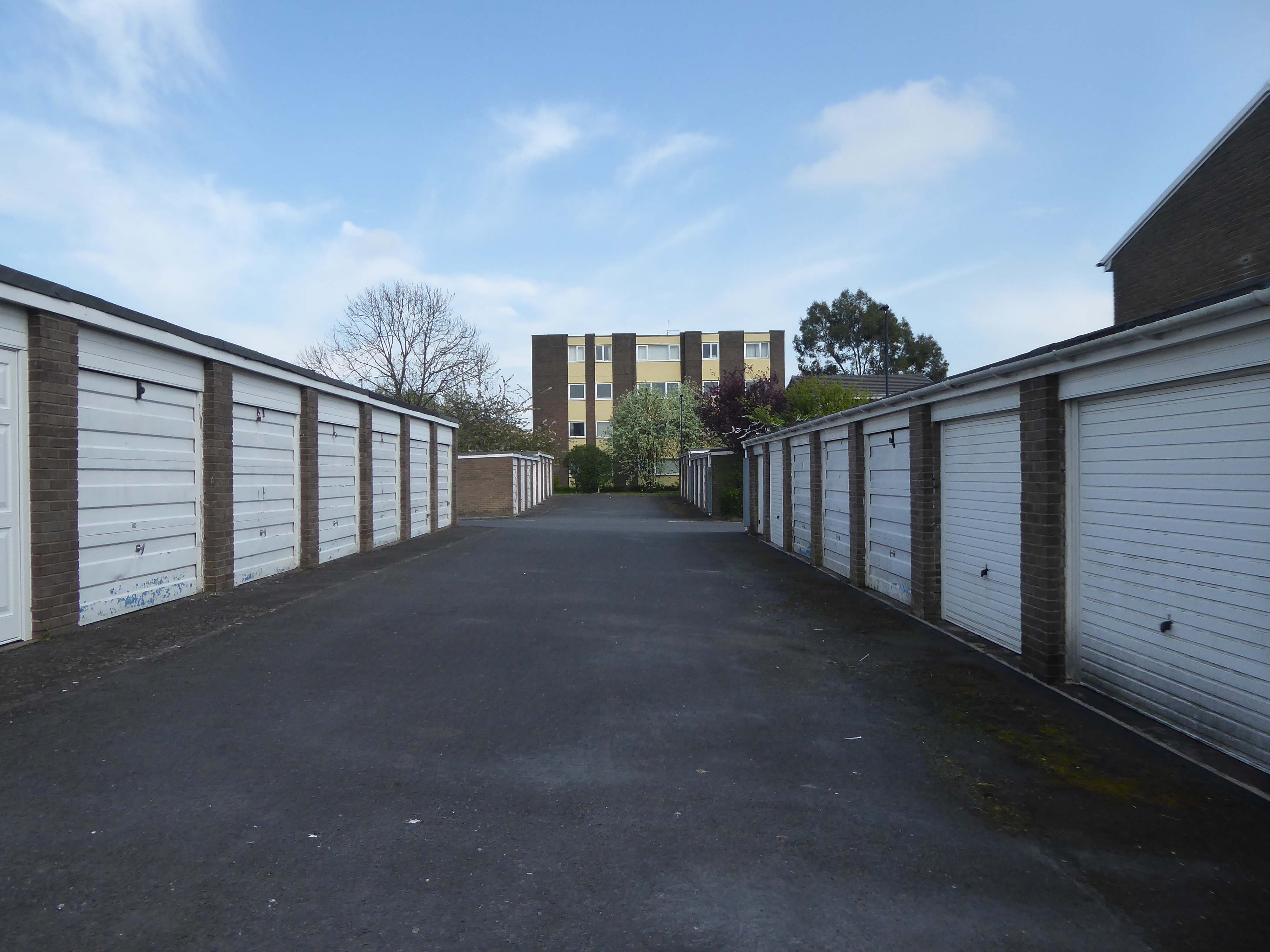
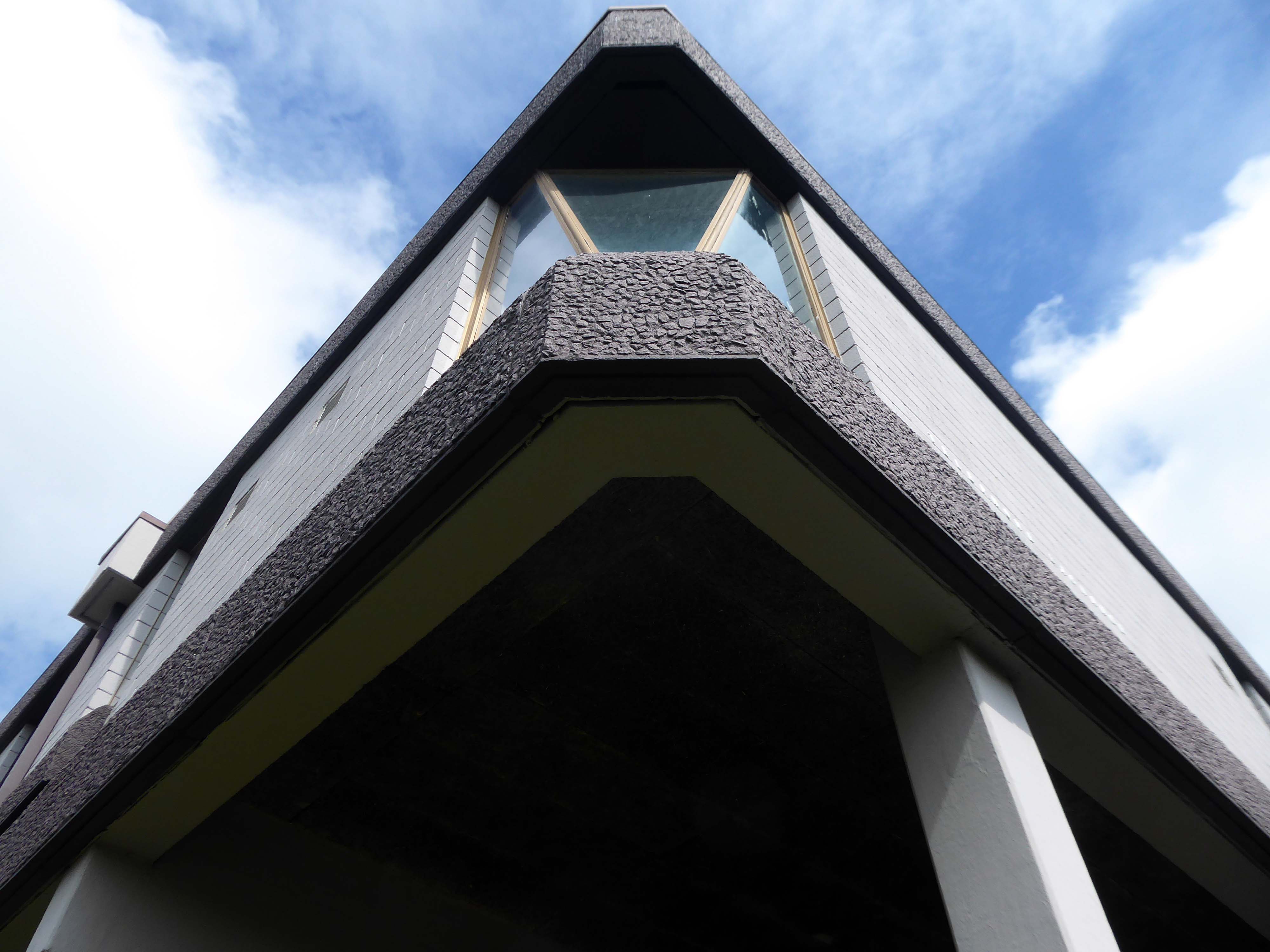
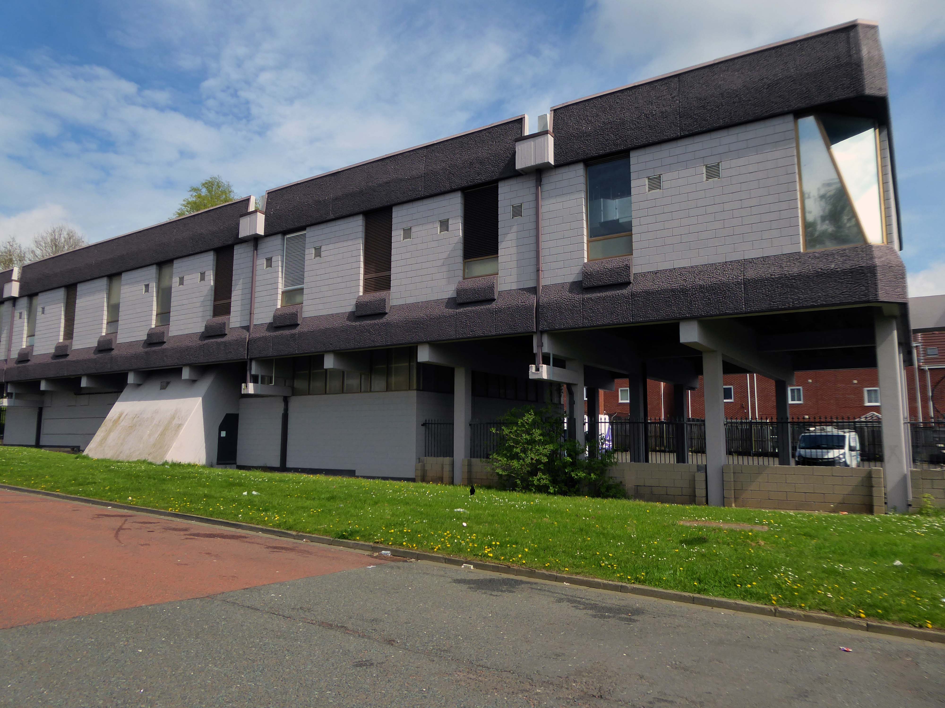
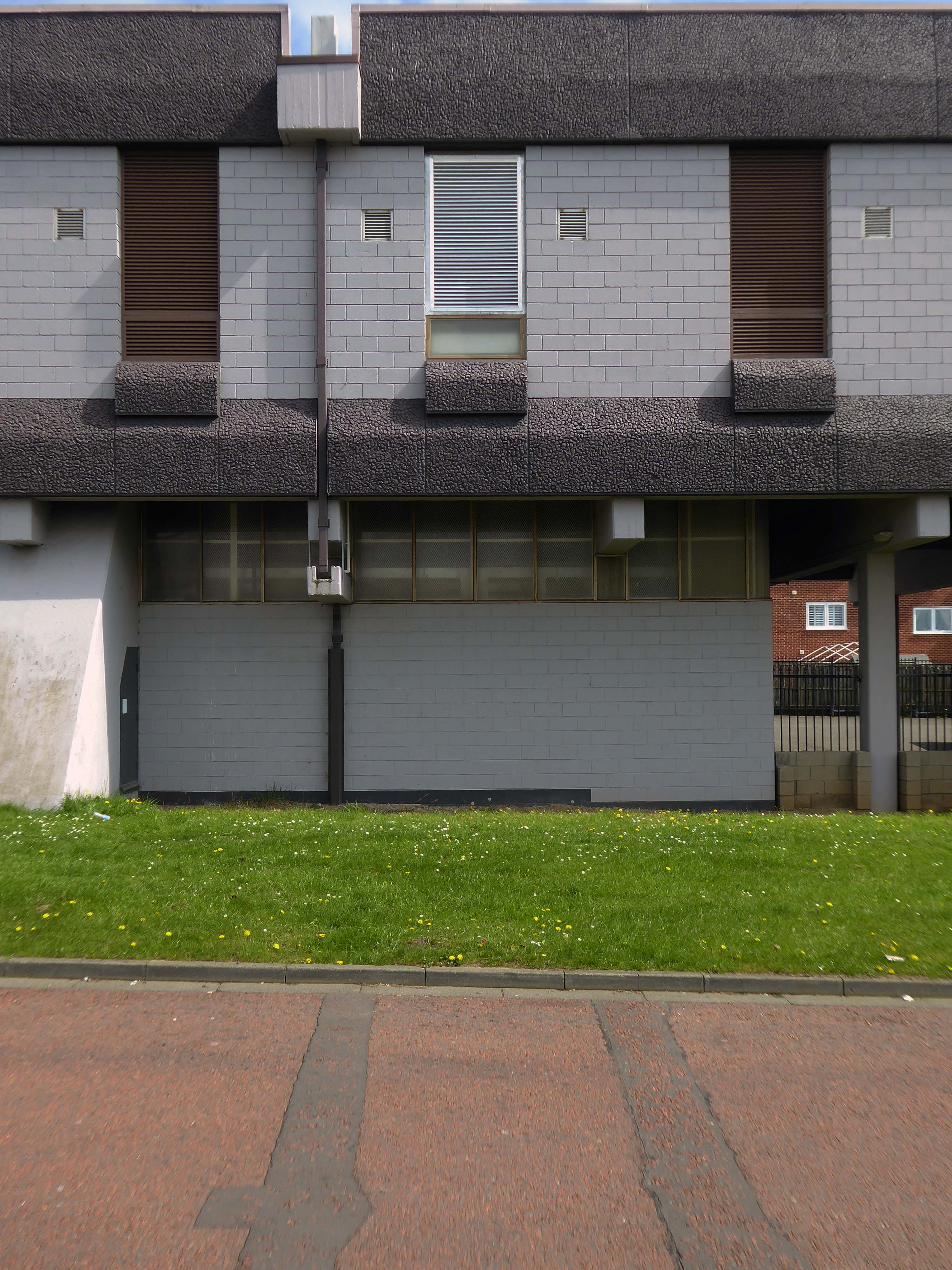
Construction of Killingworth, a new town, began in 1963. Intended for 20,000 people, it was a former mining community, formed on seven hundred and sixty acres of derelict colliery land near Killingworth Village. The building of Killingworth Township was undertaken by Northumberland County Council and was not formally a New Town sponsored by the Government.
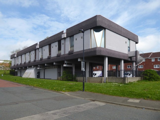
Unlike that town, Killingworth’s planners adopted a radical approach to town centre design, resulting in relatively high-rise buildings in an avant-garde and brutalist style that won awards for architecture, dynamic industry and attractive environment.
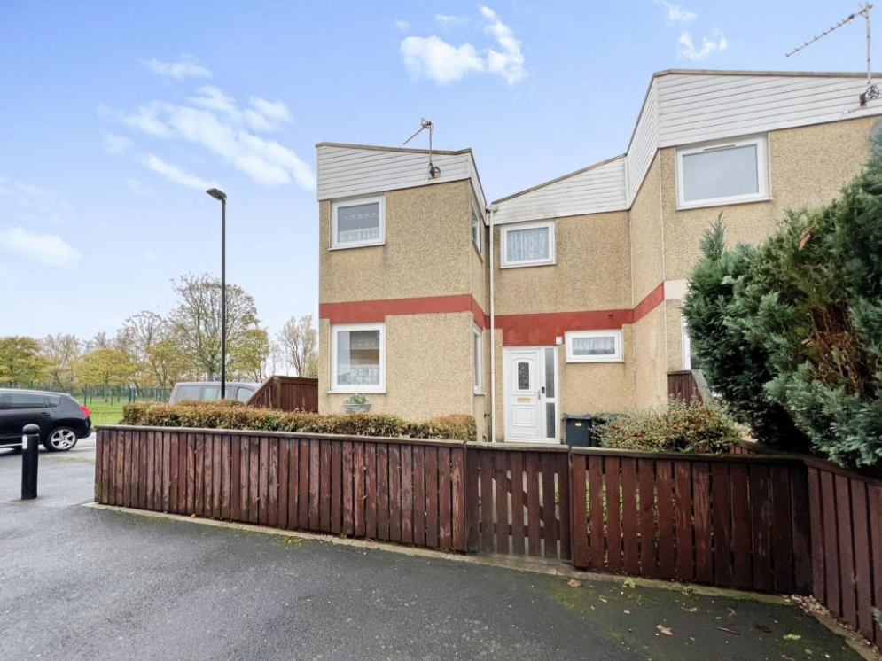
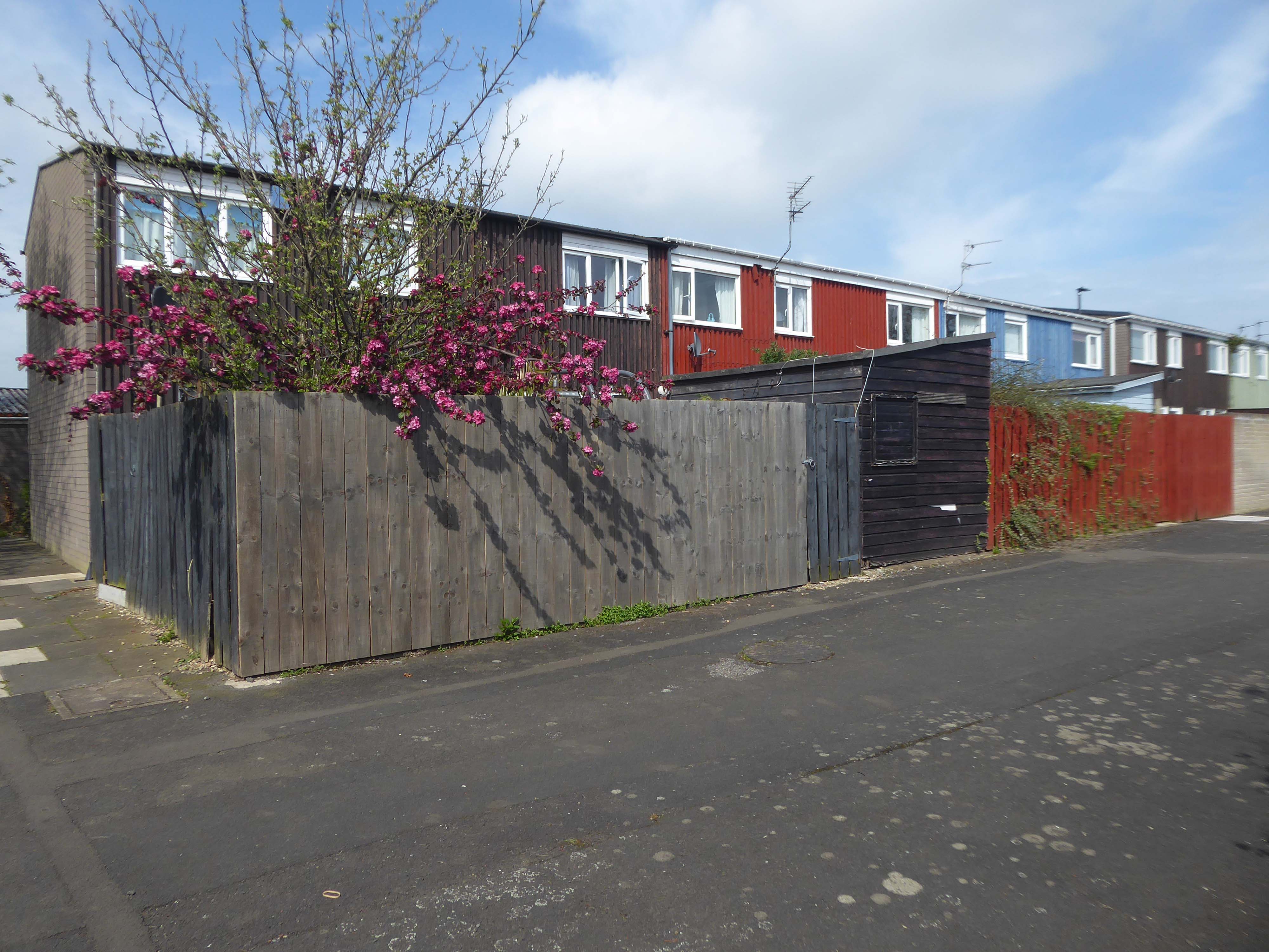
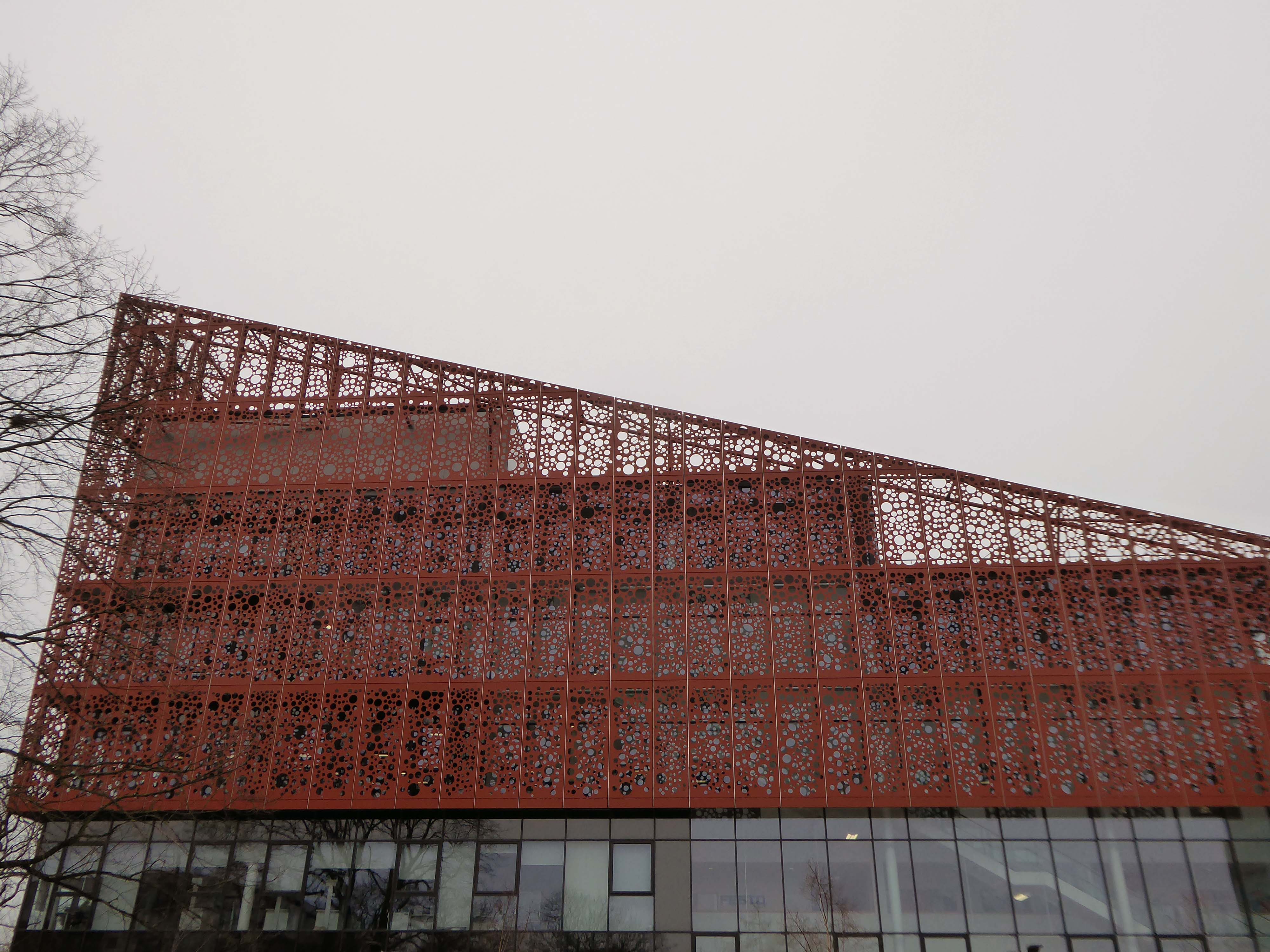
This new town centre consisted of pre-cast concrete houses, with millions of small crustacean shells unusually embedded into their external walls, five to ten storey flats, offices, industrial units and service buildings, which often consisted of artistic non-functional characteristics, shops and residential multi-storey car parks, interconnected by ramps and walkways. These made up a deck system of access to shopping and other facilities, employing the Swedish Skarne method of construction.
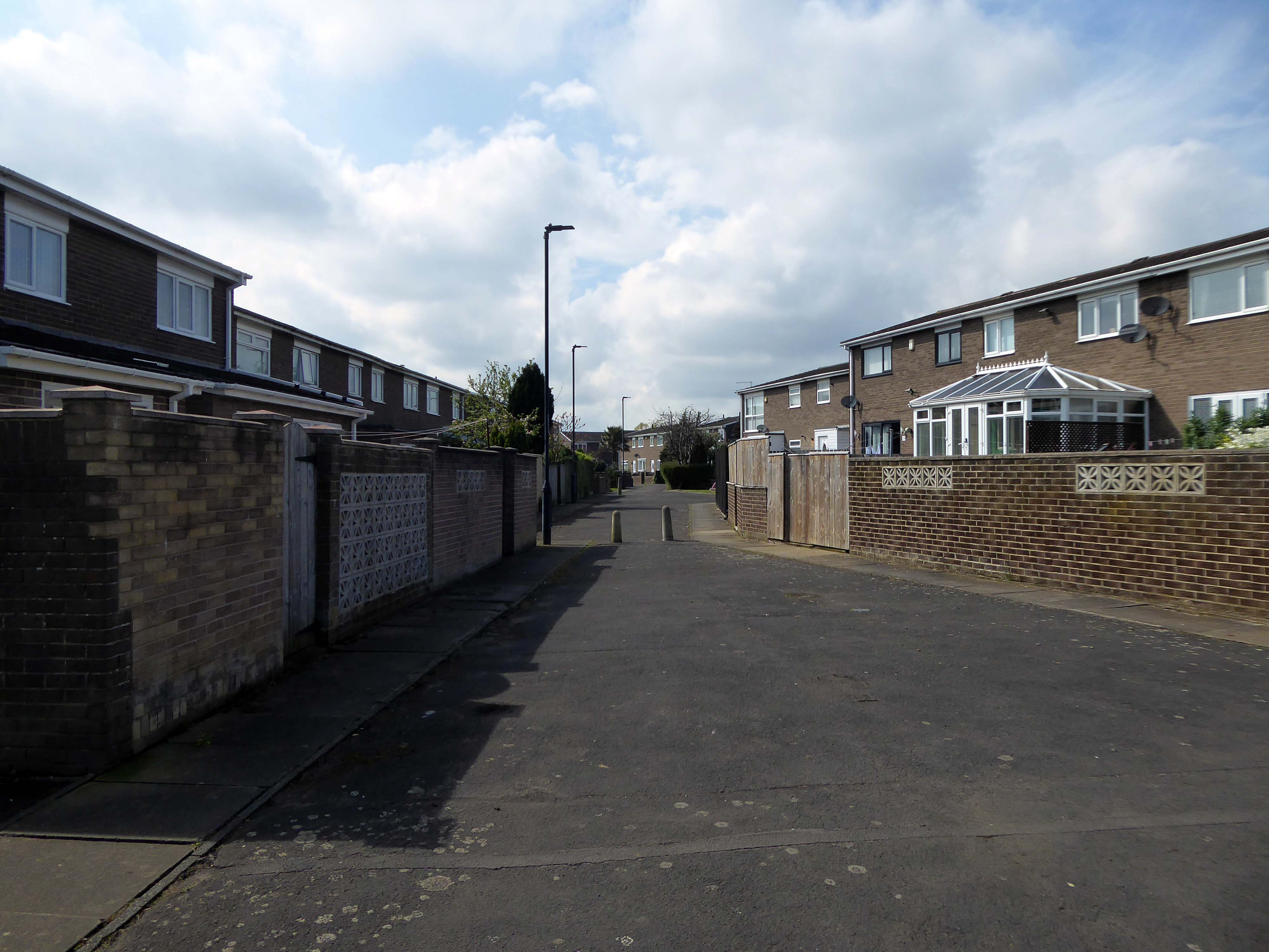
Originally named Killingworth Township, the latter part was quickly dropped through lack of colloquial use.
Killingworth is referred to as Killy by many residents of the town and surrounding areas.
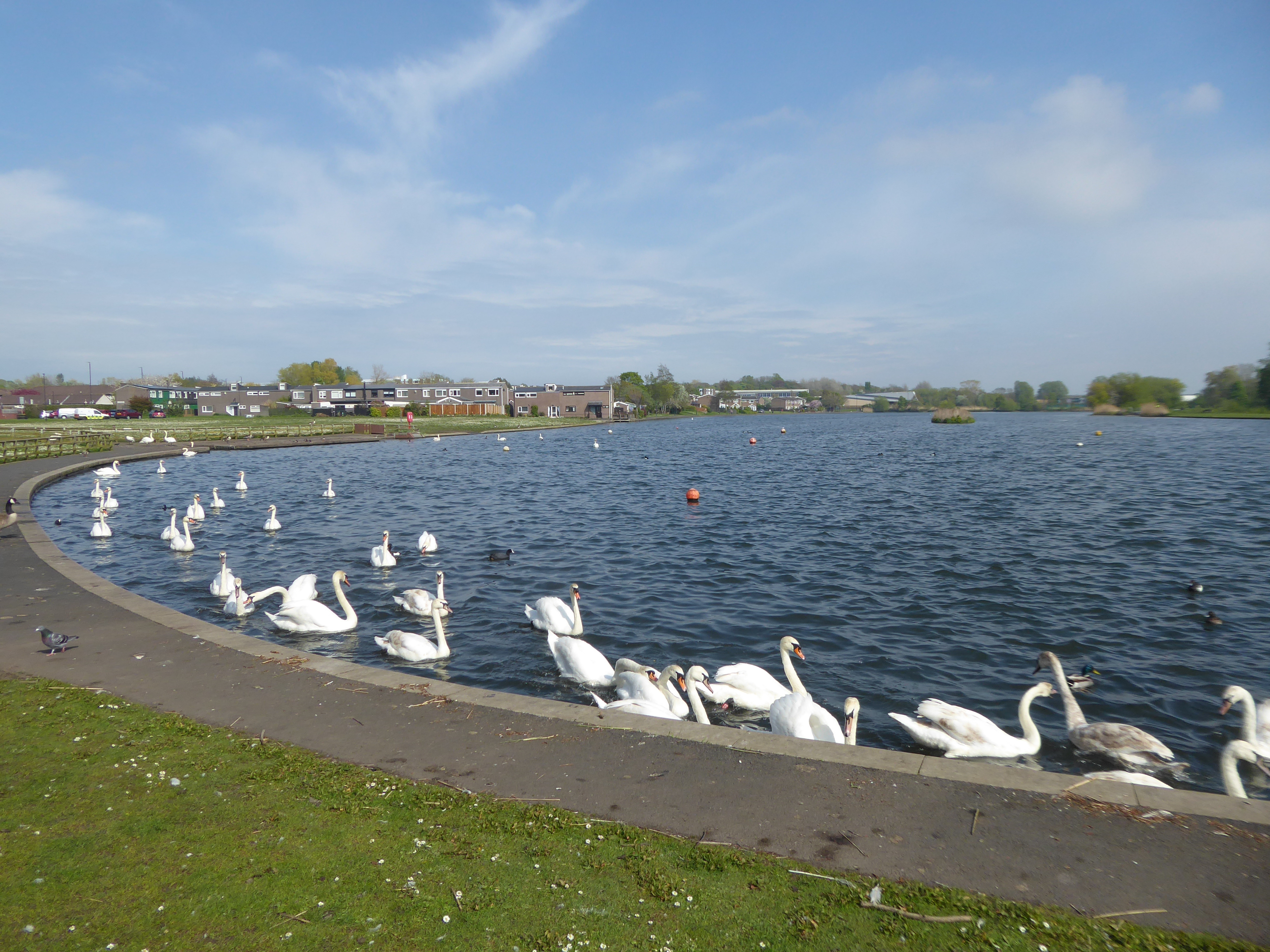
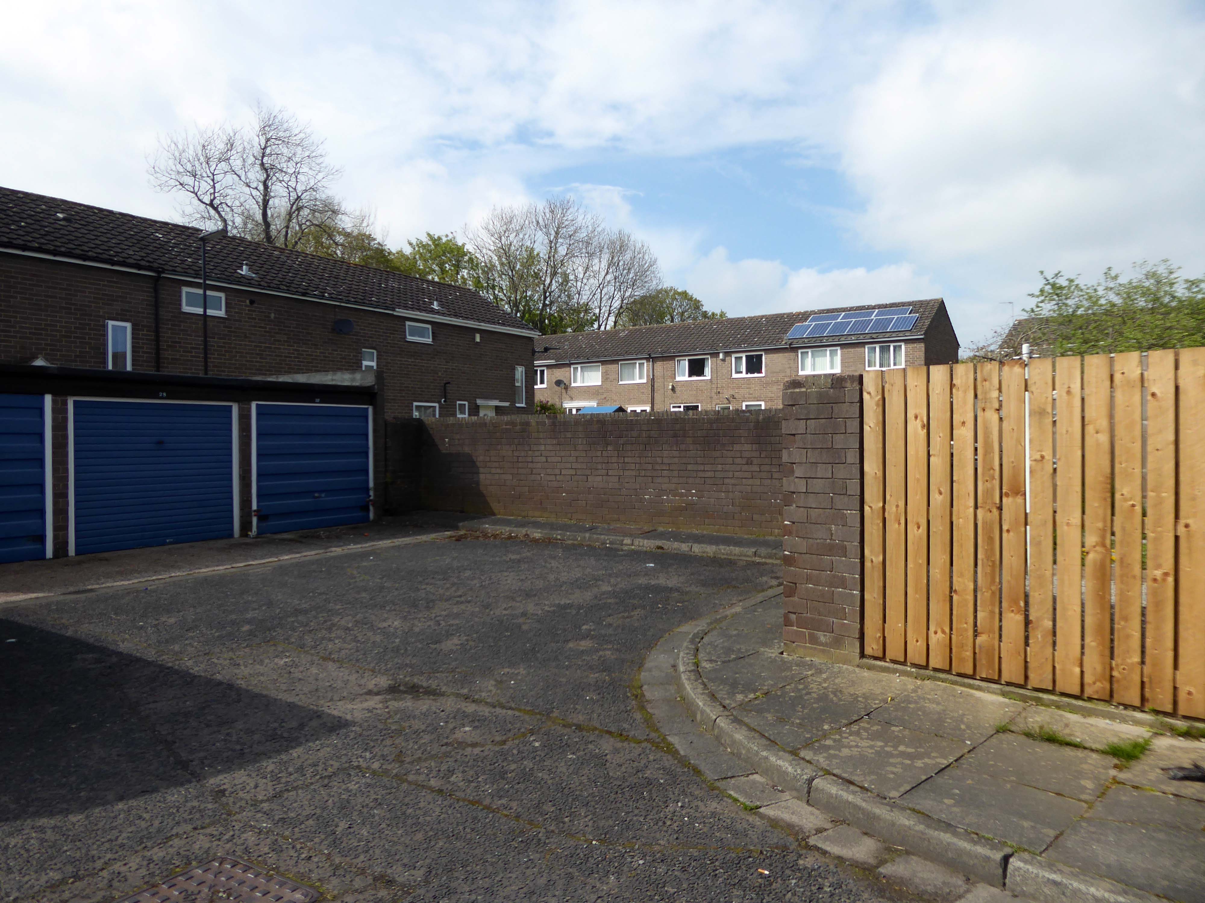
Around 1964, during the reclamation of the derelict pit sites, a fifteen acre lake south of the town centre was created; spoil heaps were levelled, seeded and planted with semi-mature trees.
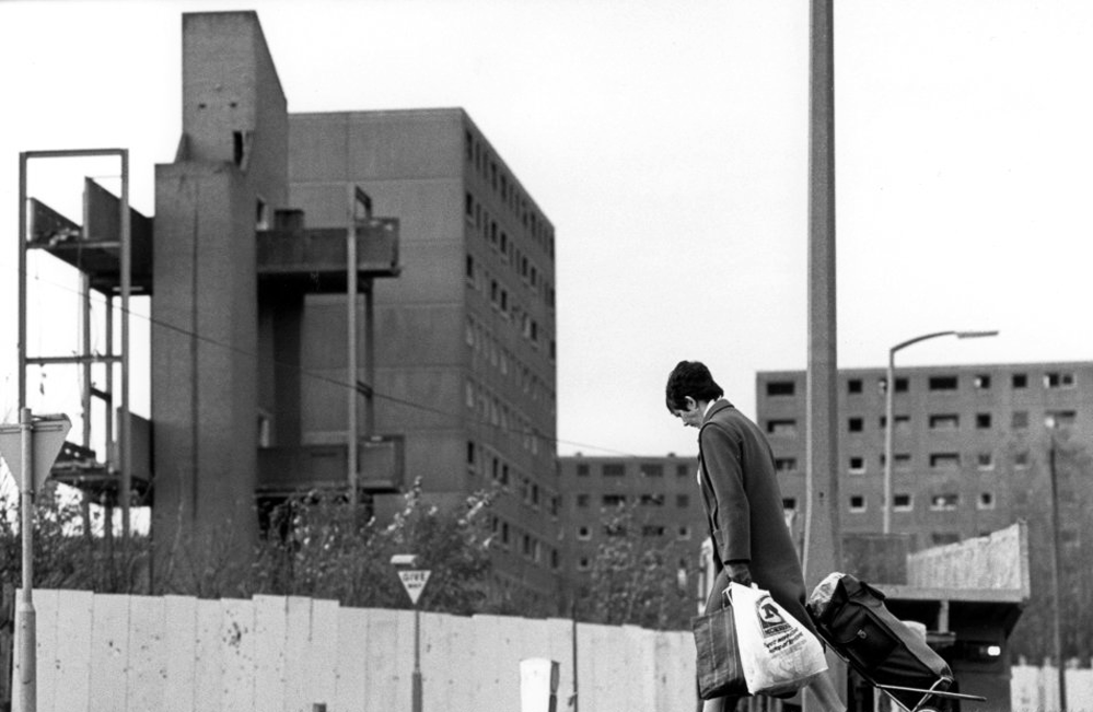
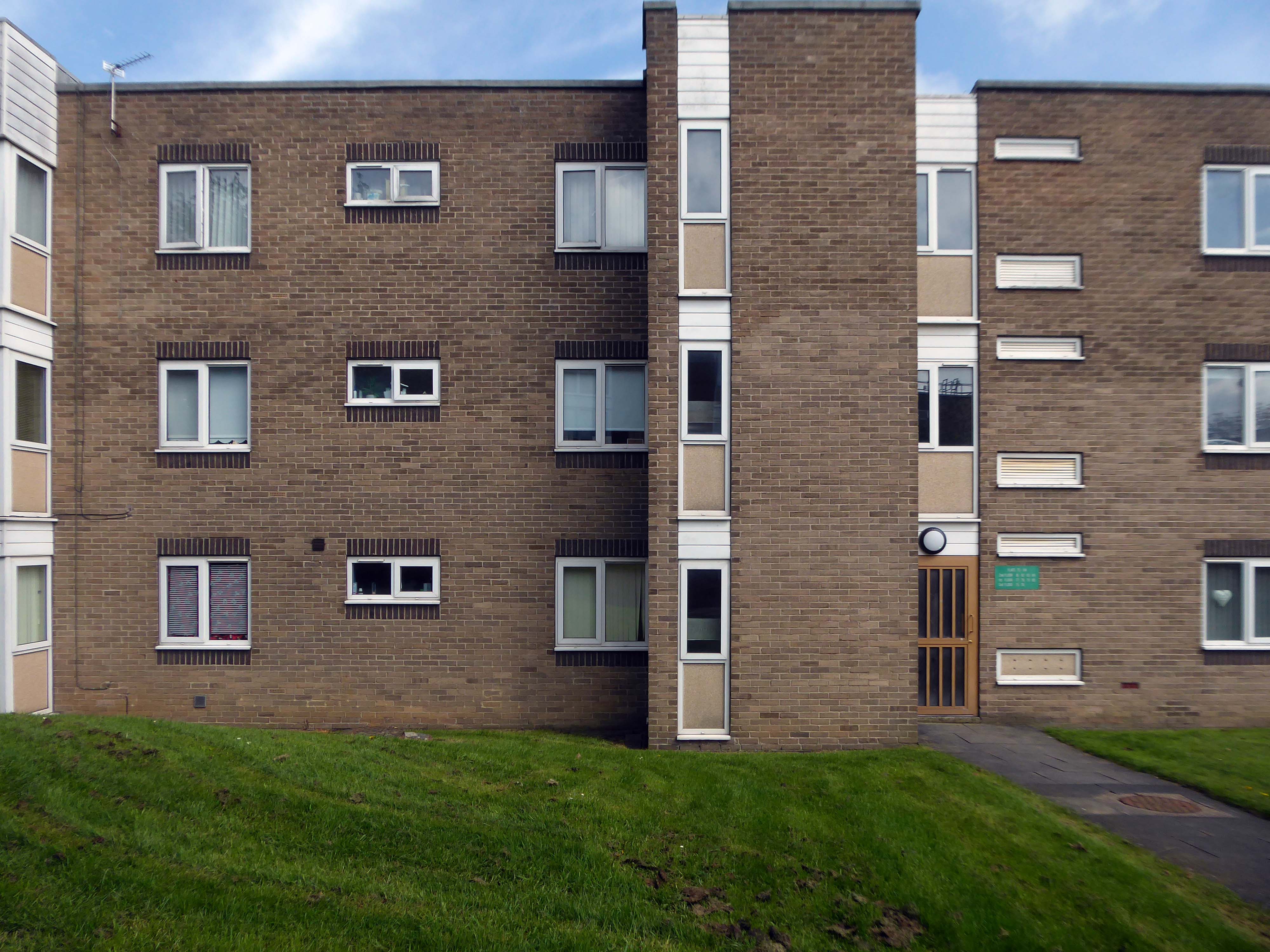
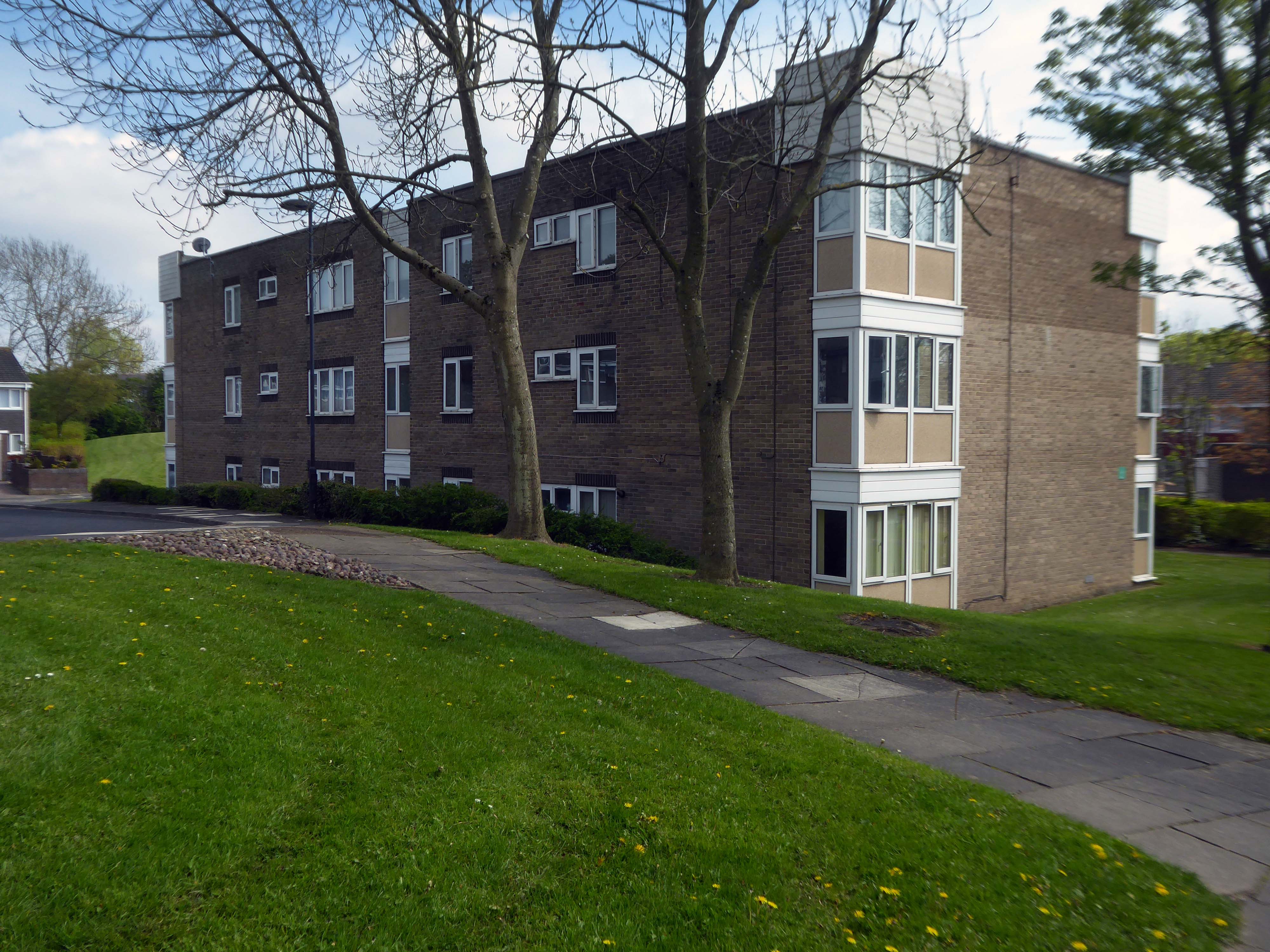
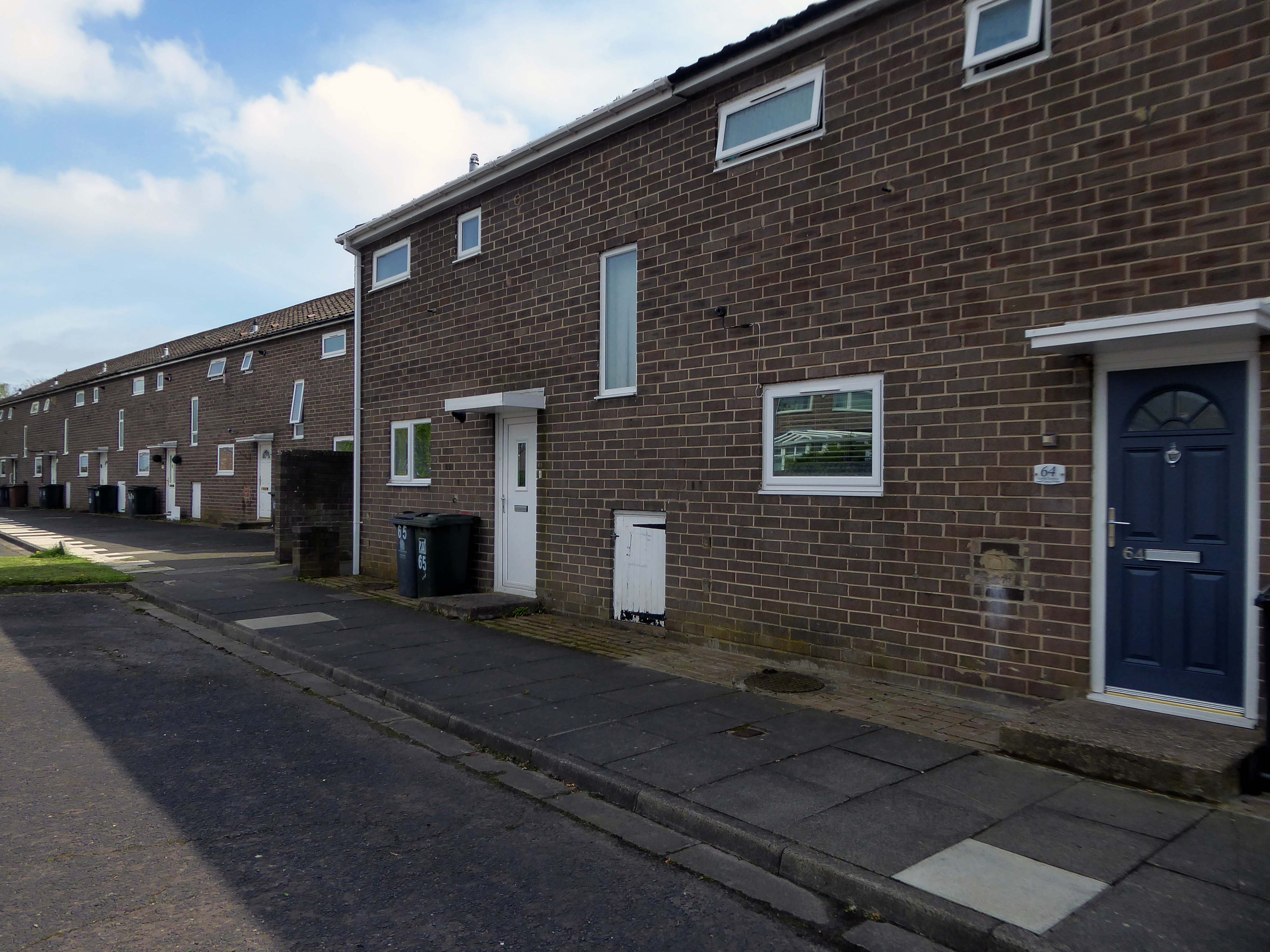
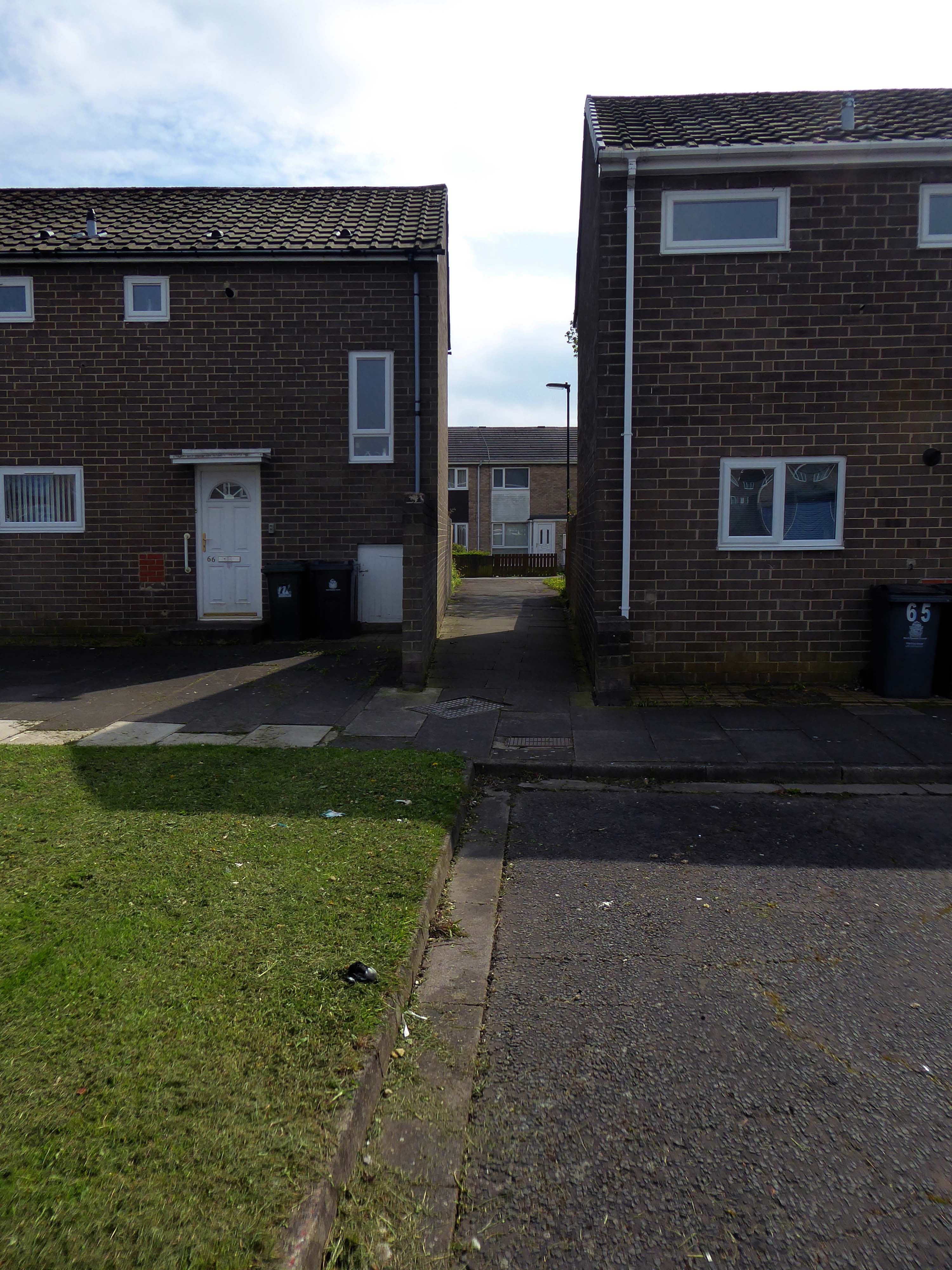
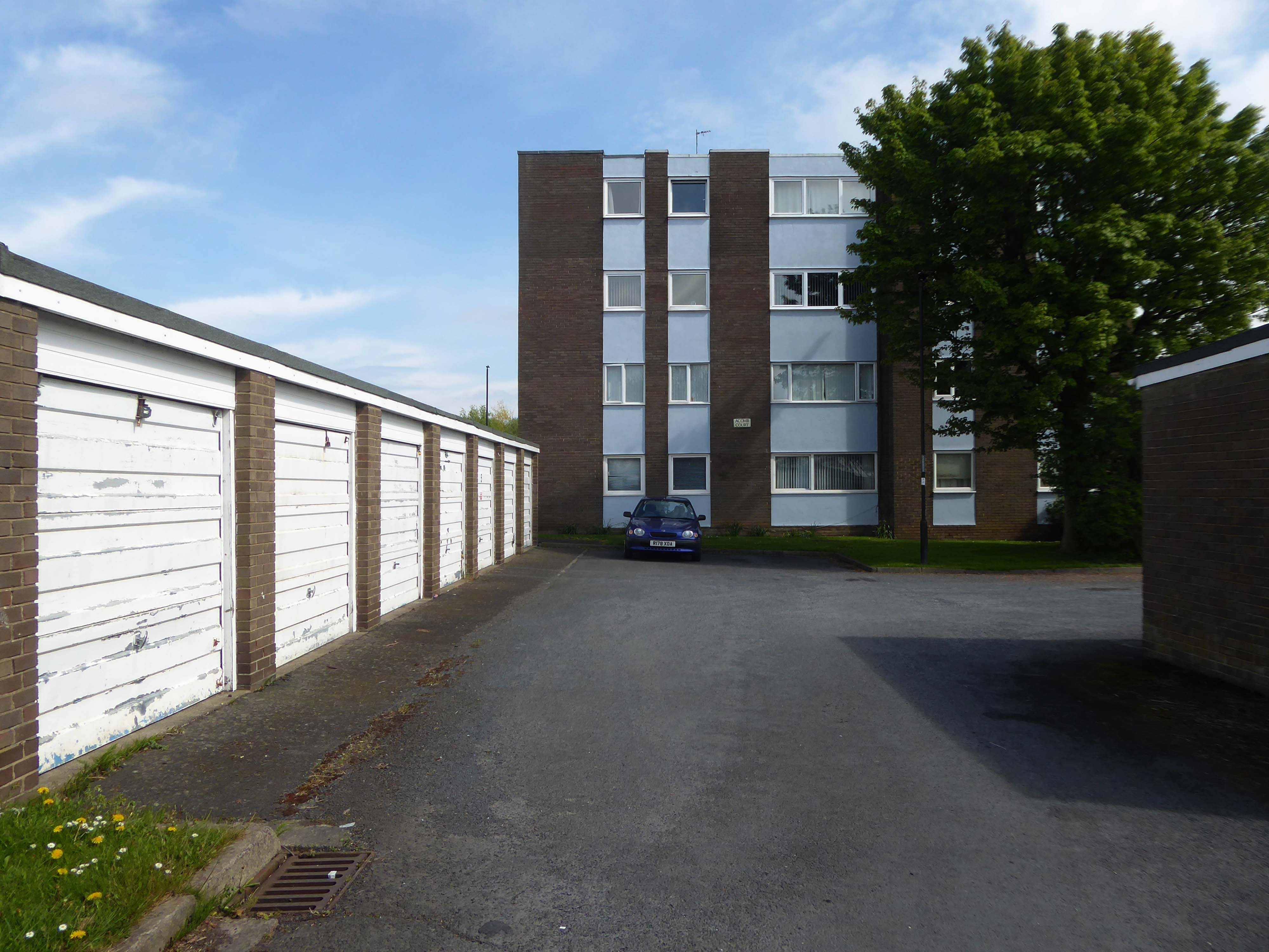
In 1987 the demolition of this three-tier housing estate of the township was undertaken by the Architects’ Department of the Metropolitan Borough of North Tyneside.
Photo: Philip Wolmuth
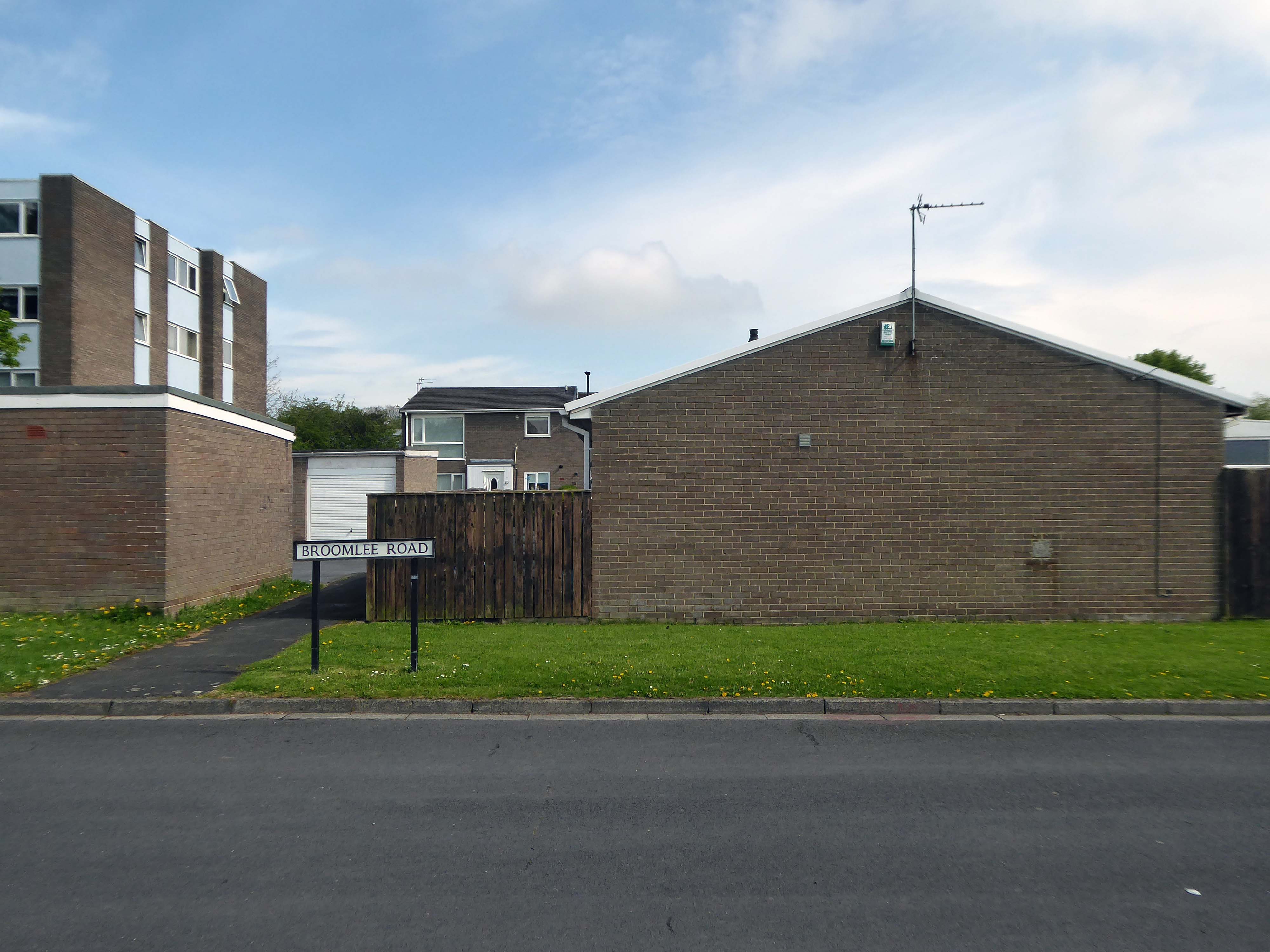
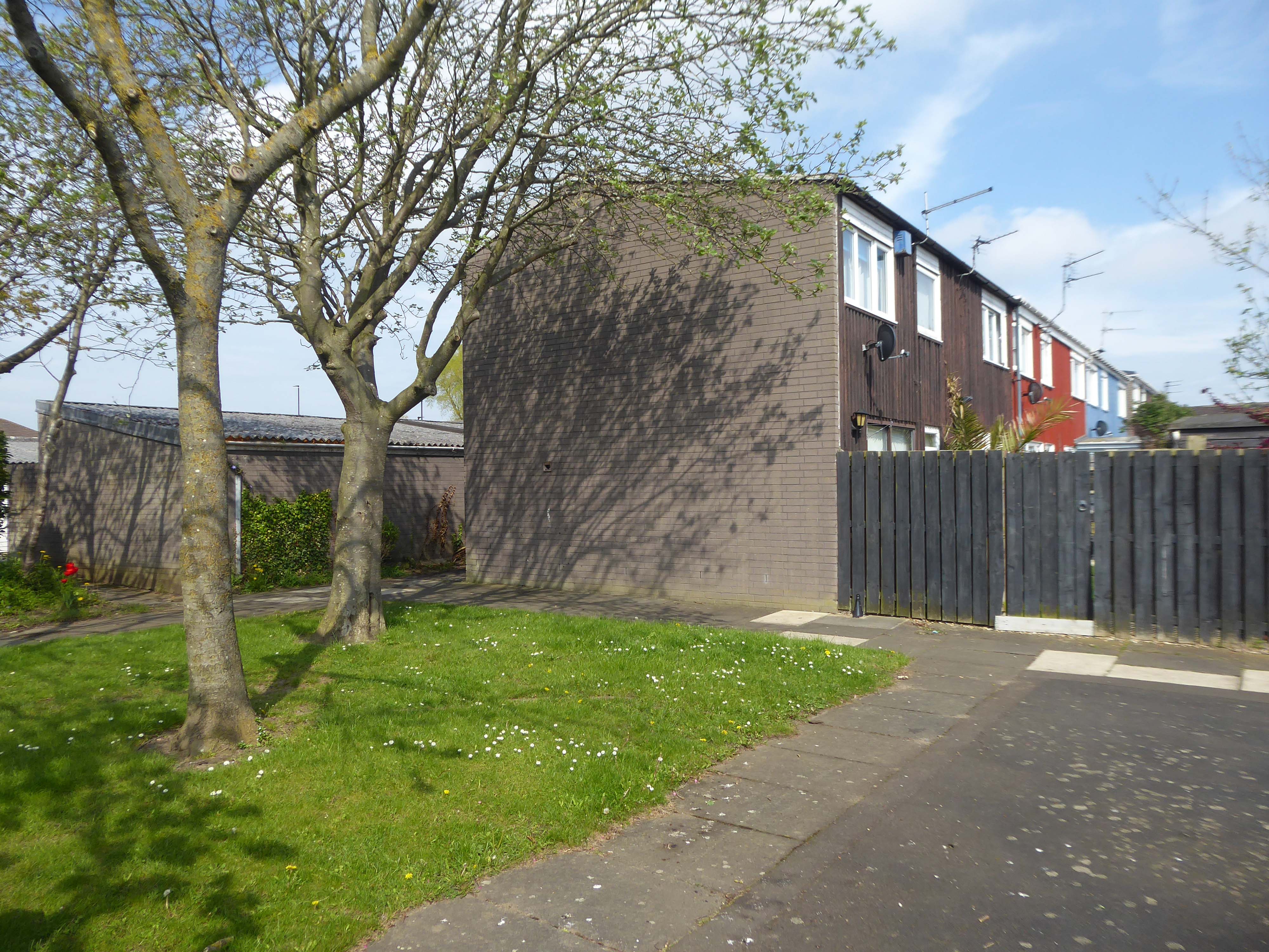
Once the wrecking ball arrives new town can begin to look like any old town.
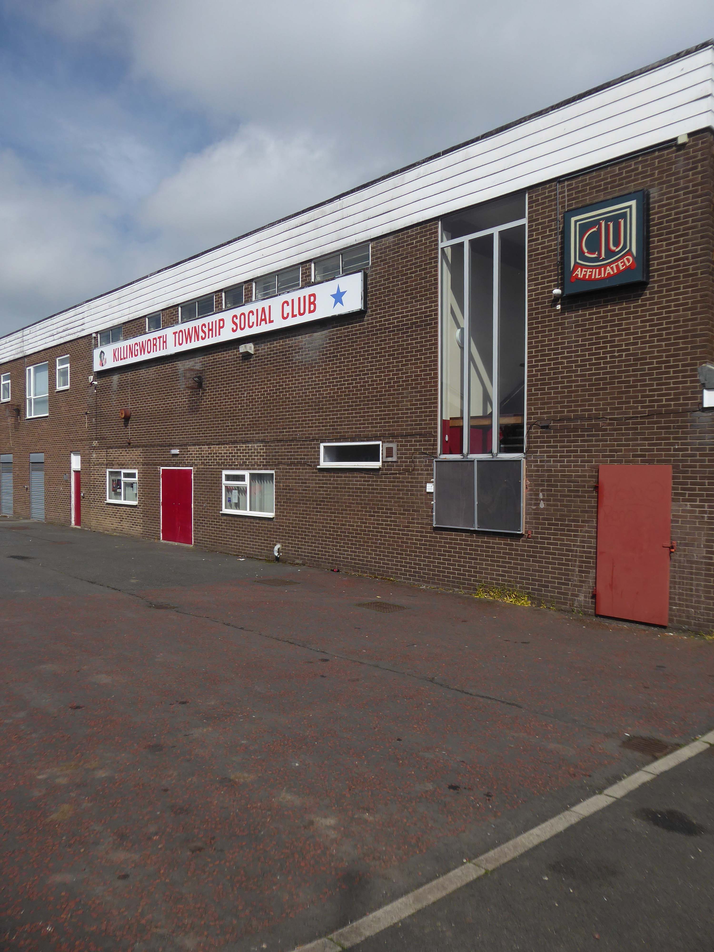
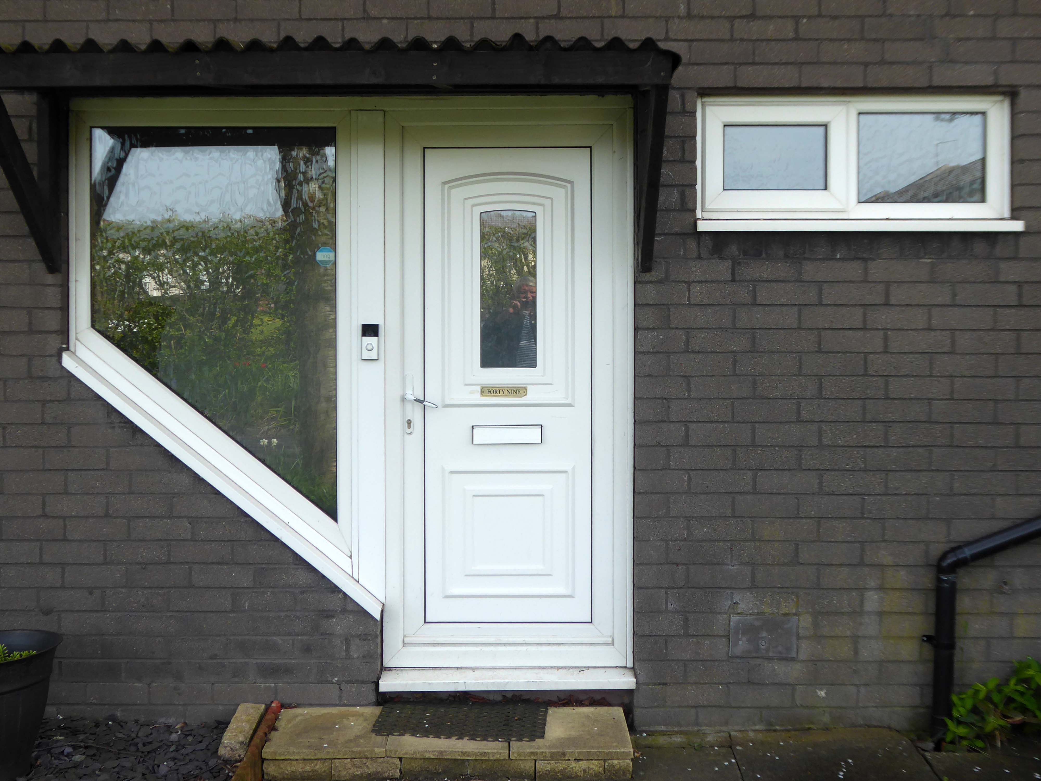
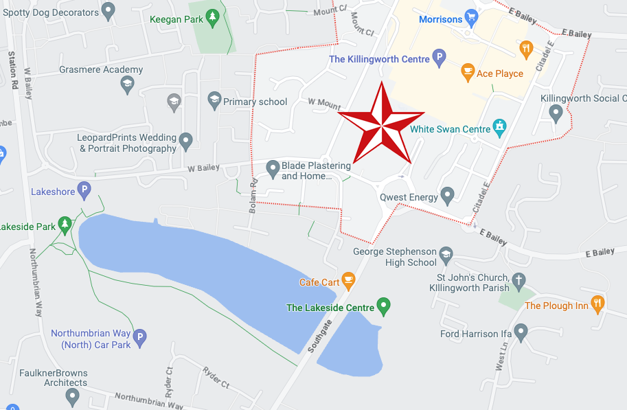
Following Euan Lynn’s suggestion – I went to take a look around.
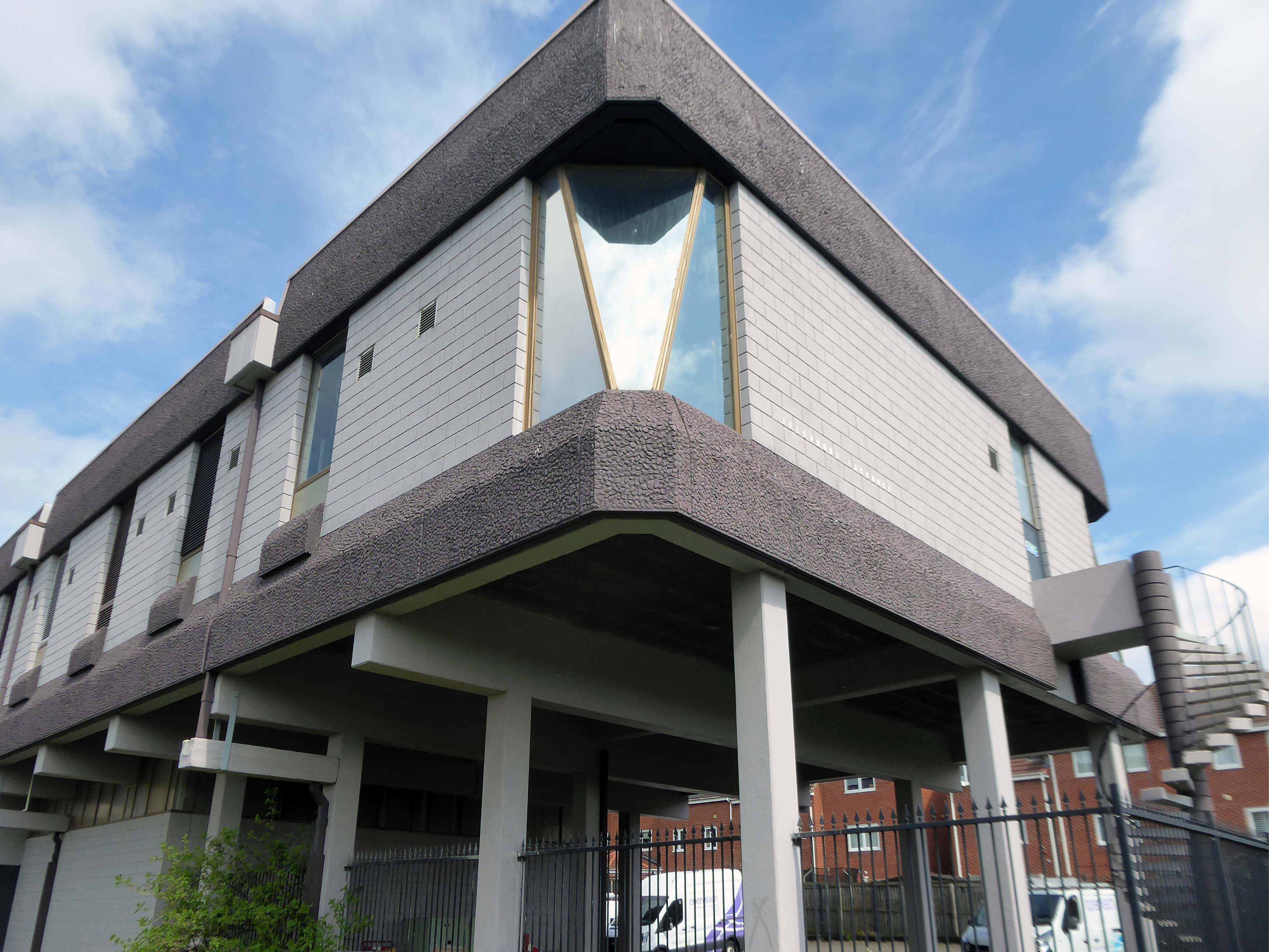
From the window of the 52 bus, I saw an enchanting Telephone Exchange.
The first school of design in the UK, the Government School of Design, was established in 1837 and went on to become the Royal College of Art. It marked the beginnings of the development of technical education in the UK, which expanded in the remaining decades of the 19th century, and was largely instigated by the Science and Art Department of the Board of Trade, formed in 1853. In 1856 the Science and Art Department transferred from the Board of Trade to the Education Department and administered grant-aid to art schools from 1856 and to schools of design and technical schools from 1868.
The Technical Instruction Act 1889 permitted local authorities to levy rates to aid technical or manual instruction. County and borough councils began to provide technical instruction by day and evening classes.
The Local Taxation Customs and Excise Act 1890 diverted ‘whisky money’ from publicans to local authorities for assisting technical education or relieving rates, boosting investment in technical instruction.
By the end of the 19th century continuing education was provided by a variety of bodies in a number of forms:
day continuation schools
evening schools and classes
mechanics institutes
schools of art
polytechnics
university extension lectures
tutorial classes
working men’s colleges and courses
Under the 1902 Education Act, changes to conditions attached to government grants encouraged the expansion of technical education. Local Education Authorities took over most of the evening continuation schools.
Major changes occurred after the Second World War. Junior technical schools , commercial schools and schools of art were fully integrated into the revised system of secondary education.
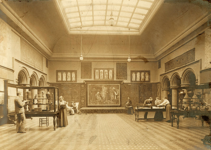
Manchester School of Art was established in 1838 as the Manchester School of Design. It is the second oldest art school in the United Kingdom after the Royal College of Art which was founded the year before.
The school opened in the basement of the Manchester Royal Institution on Mosley Street in 1838. It became the School of Art in 1853 and moved to Cavendish Street in 1880. It was subsequently named the Municipal School of Art. In 1880, the school admitted female students, at the time the only higher education available to women, although men and women were segregated. The school was extended in 1897.
The mill towns which encircled the city of Manchester each had their own independent colleges of Art and Design.
Textiles in particular required practitioners in surface pattern and garment design and construction, innovative and skilled students were in demand for print, engineering, architecture and general manufacturing – who also required the services of typographers, illustrators, commercial and graphic designers.
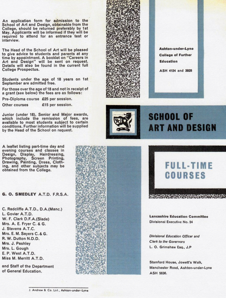
Having left school aged sixteen in 1971, all I ever wanted to do was go to Art School.
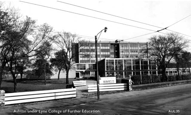
My local college was the then Ashton under Lyne College of Further Education – the full-time mode of study was then a two year Pre-Diploma Course.
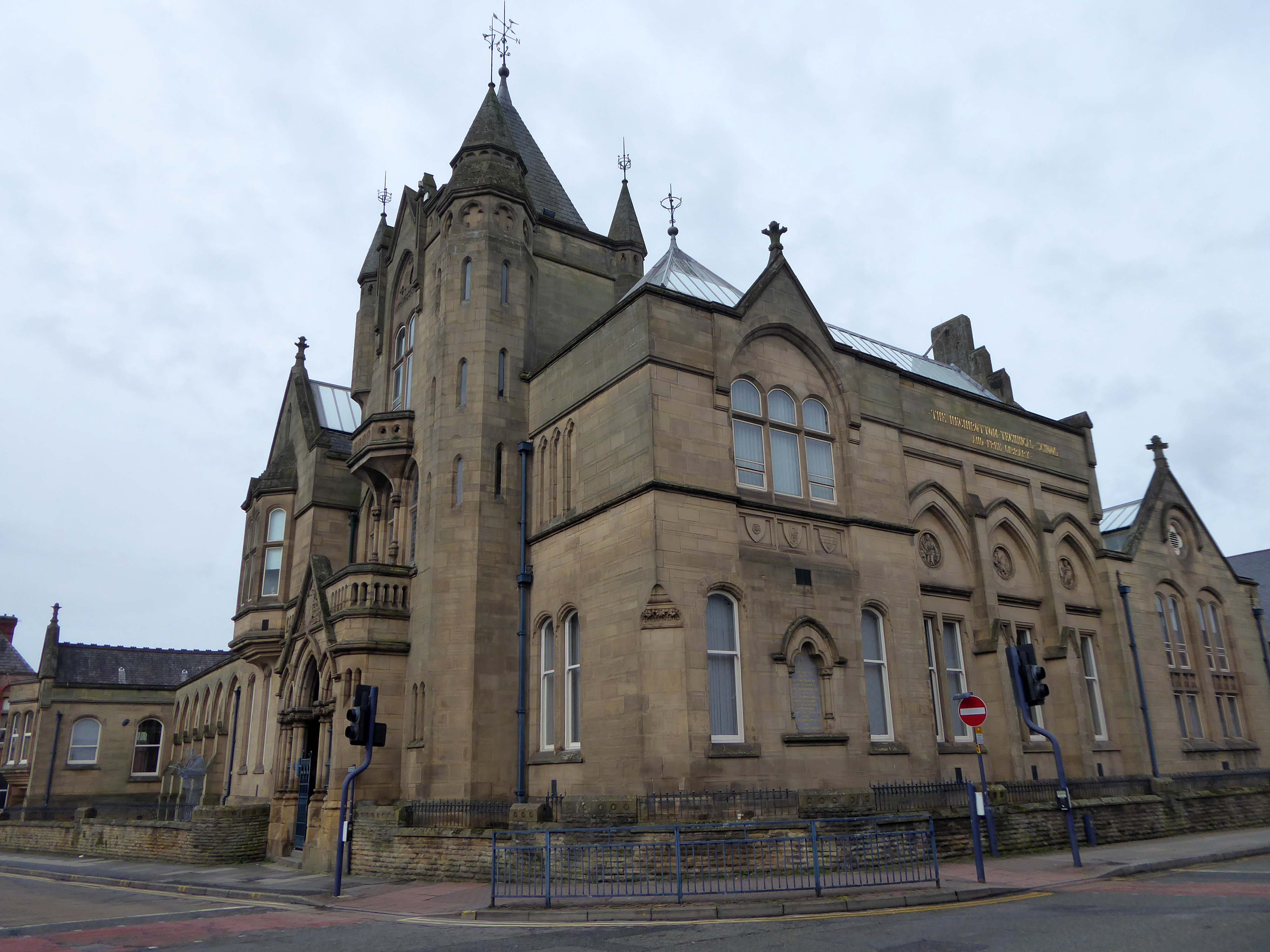
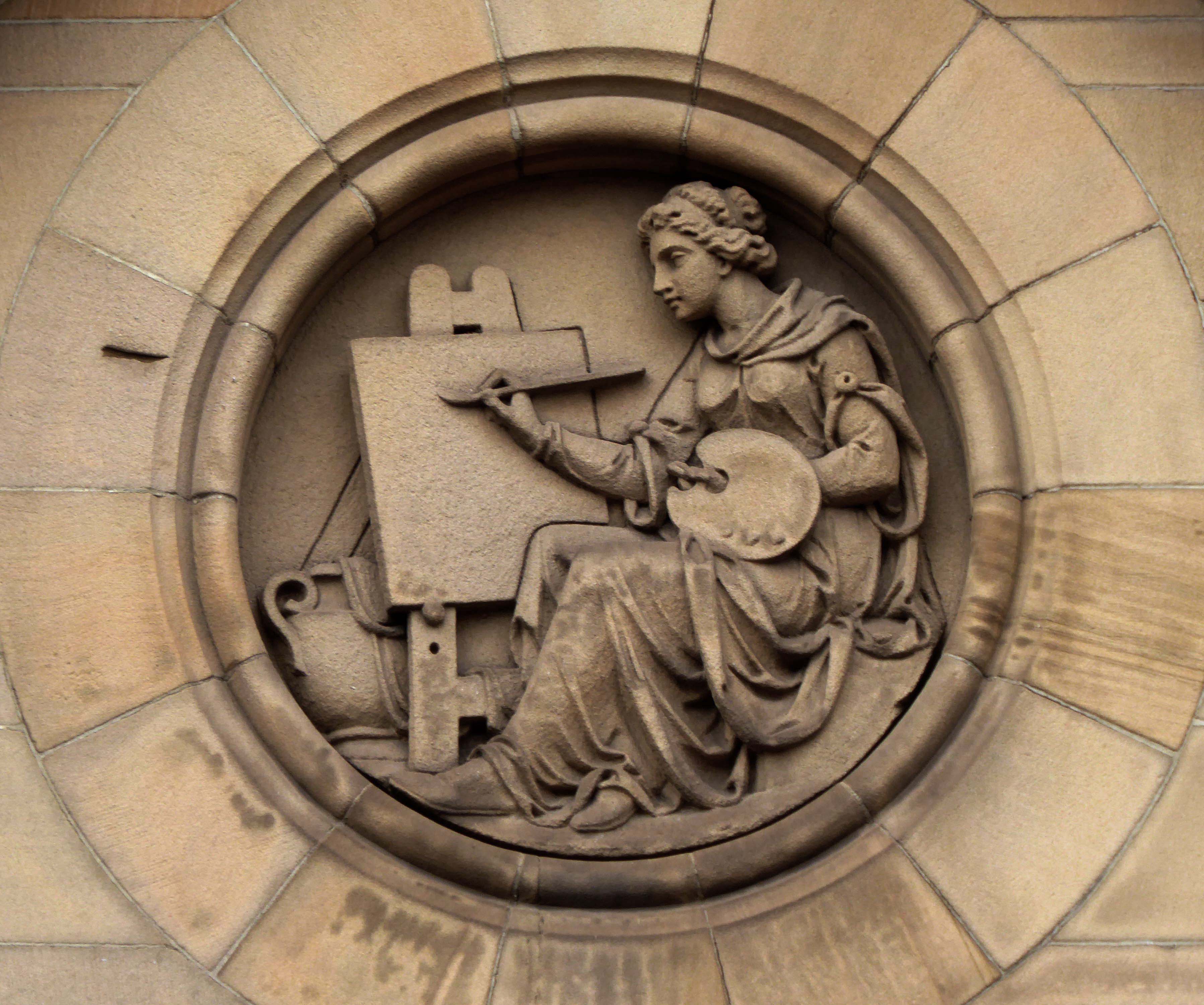
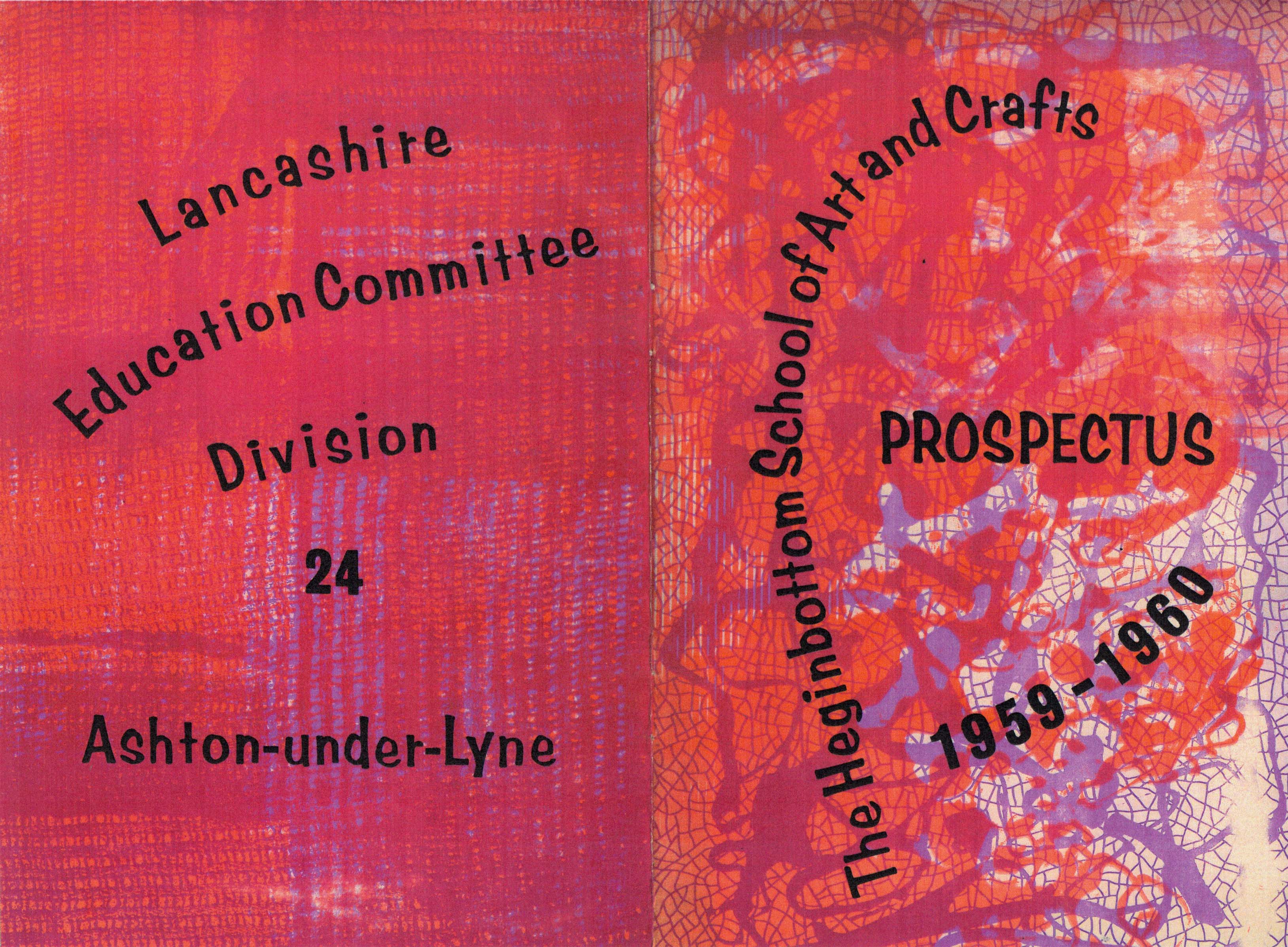
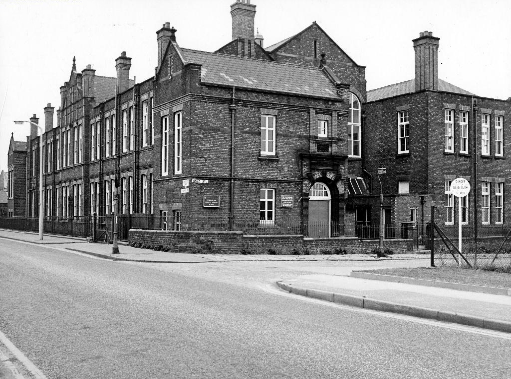
It had begun life as the Heginbottom School of Art based at – Heginbottom Technical Schools School of Art and Free Library Old Street Ashton-under-Lyne.
The new Technical Schools and Free Library, which has just been completed were opened for students without any formal ceremony. The building has been erected from designs prepared by Messrs John Eaton and Sons, architects, Ashton, at a cost, including fittings of £16,000.
The building is now Grade II listed and the library and college long gone.
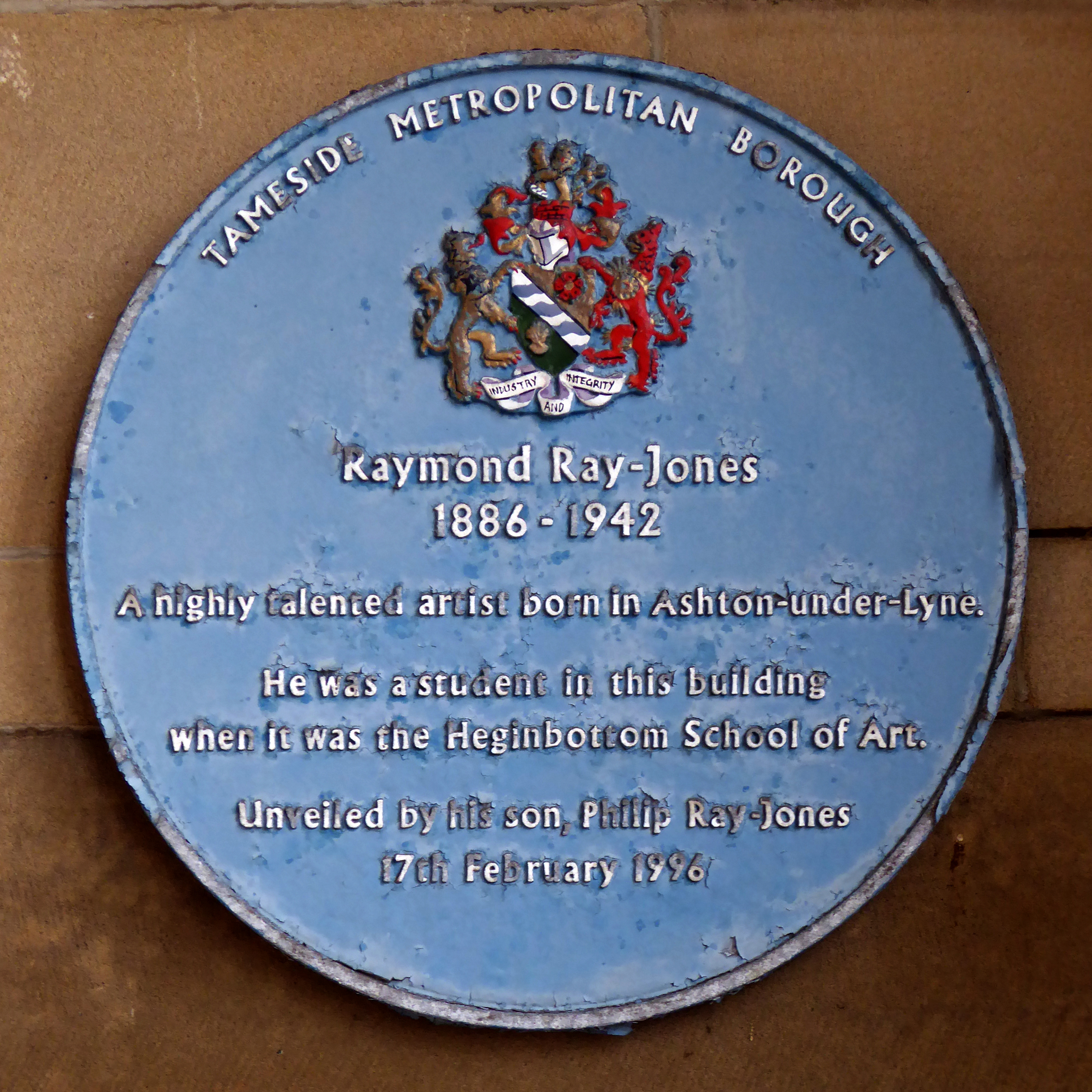
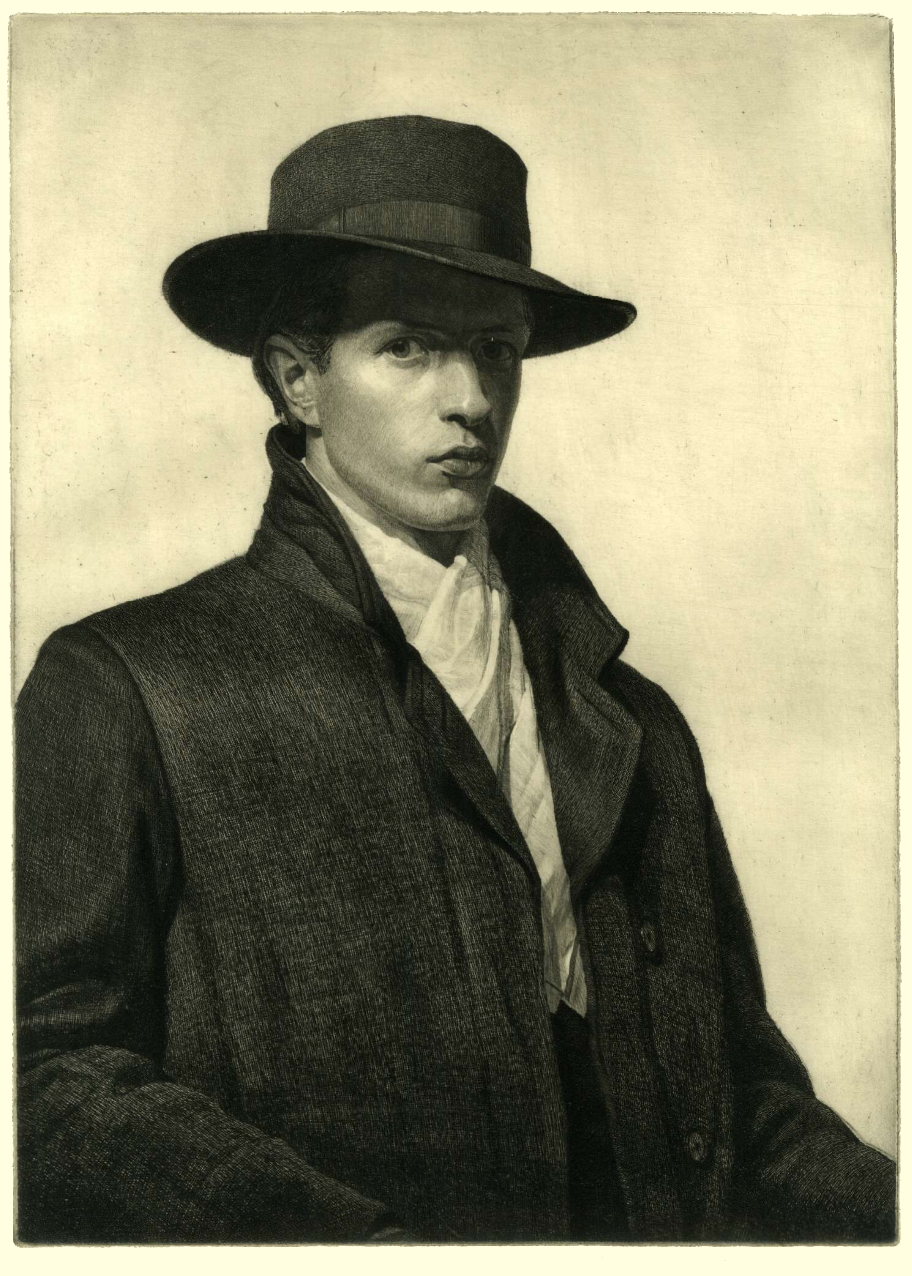
A blue plaque in the main entrance celebrates the former student Raymond Ray-Jones.
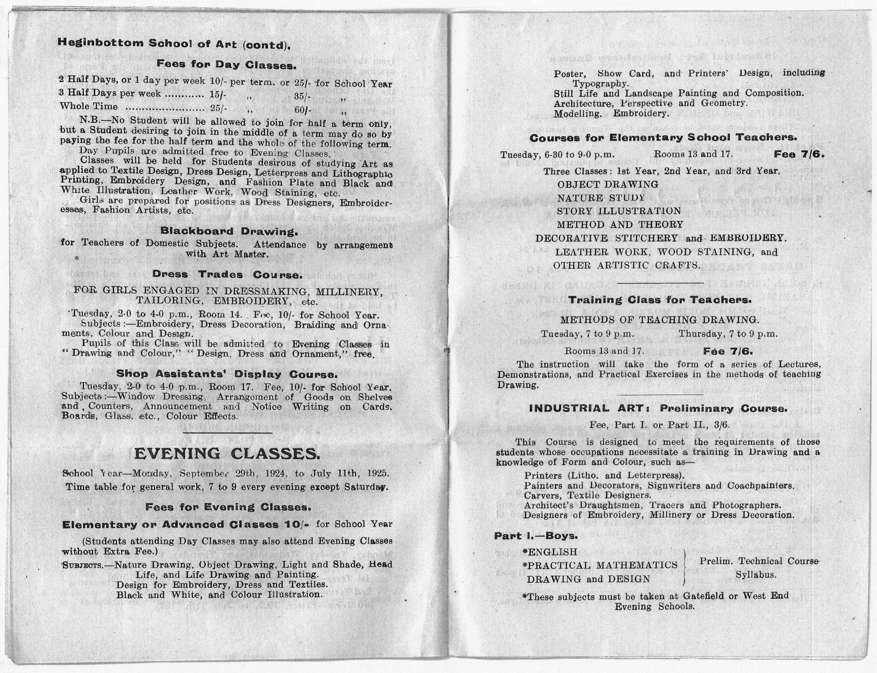
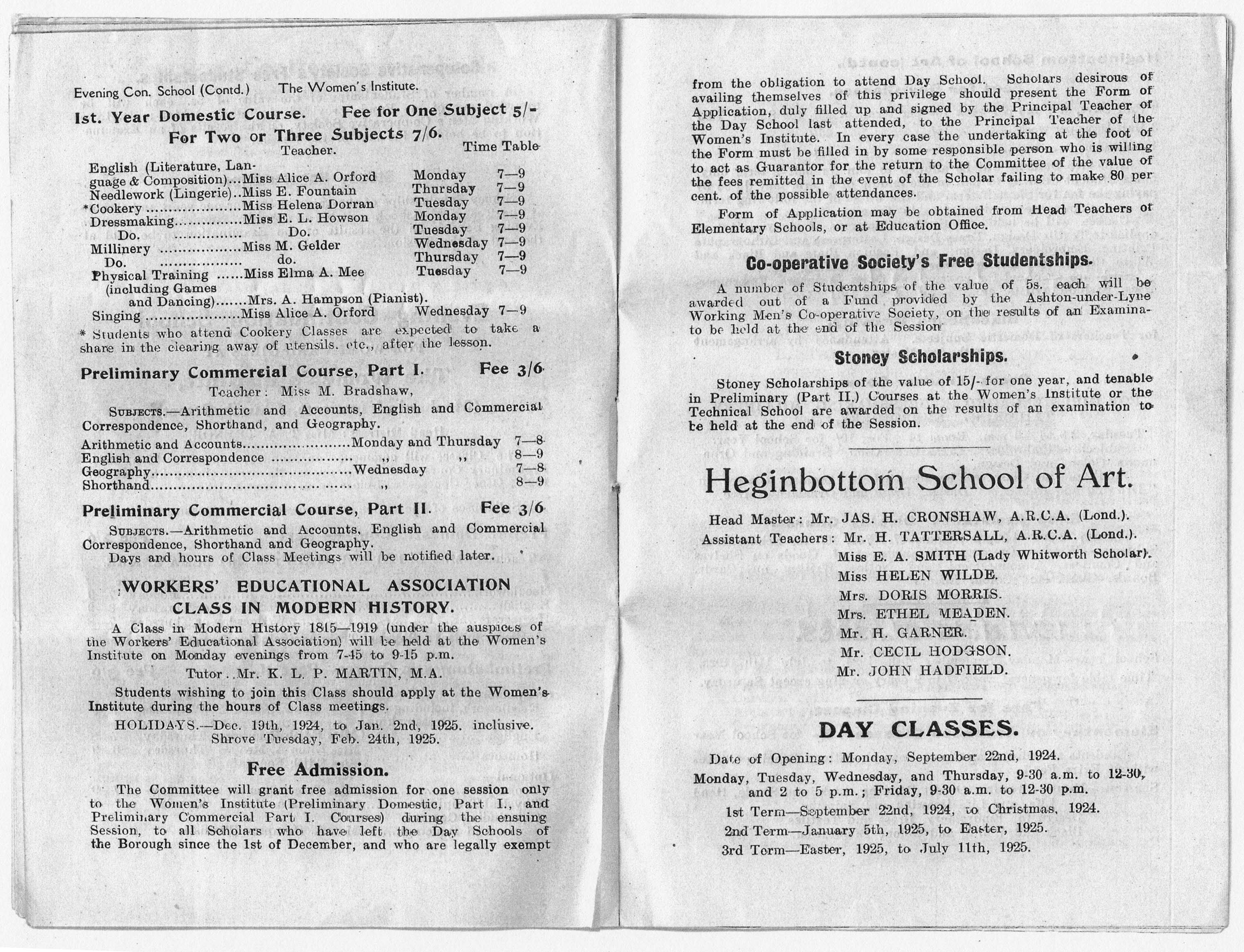
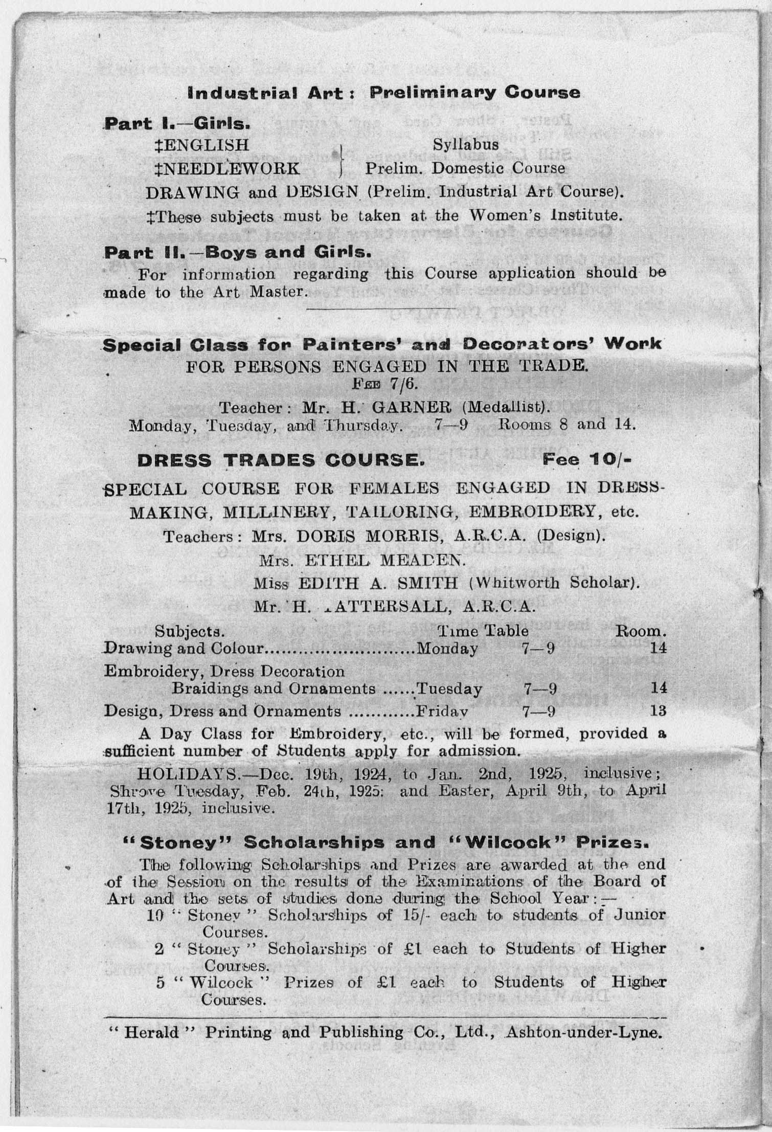
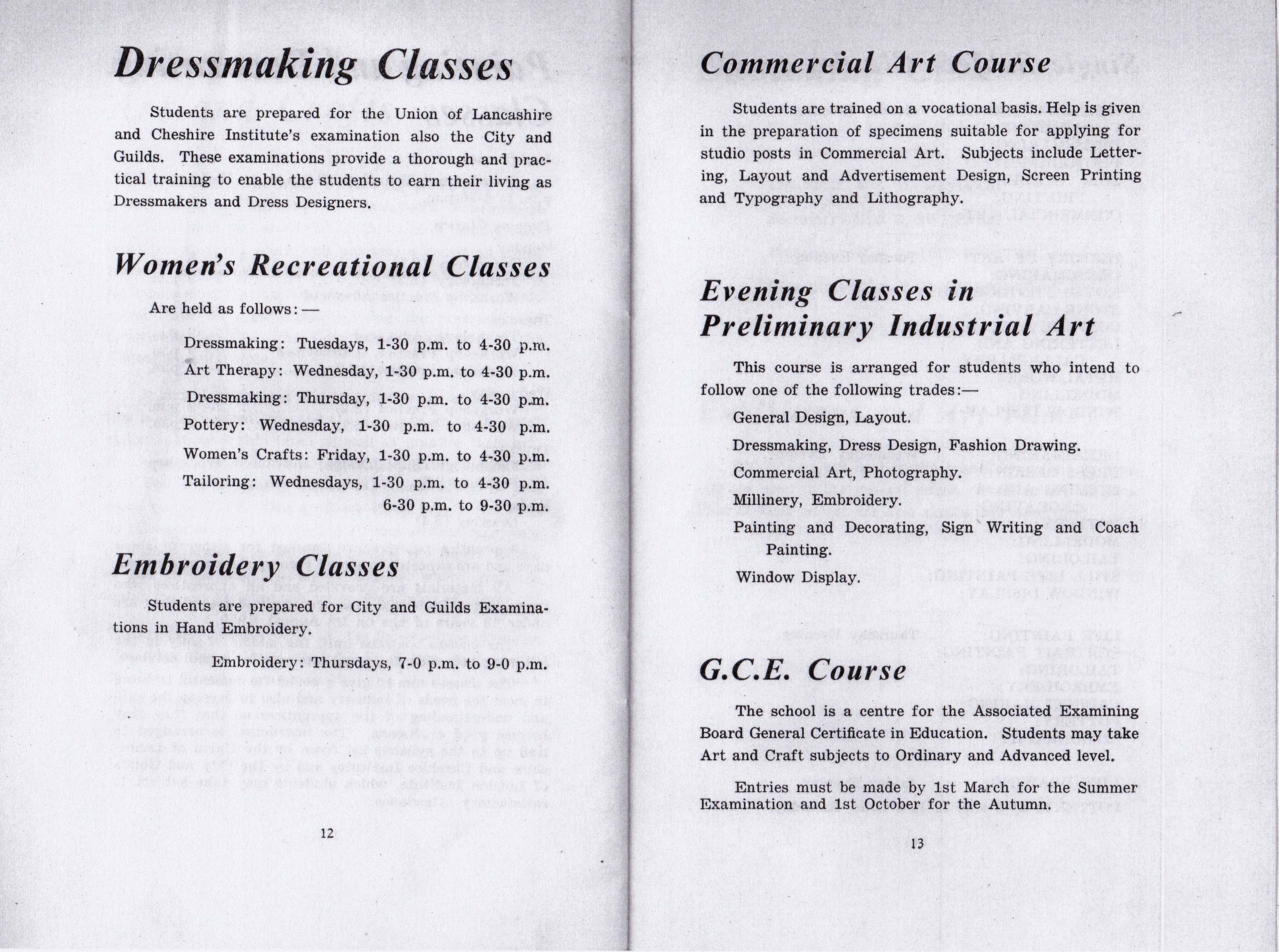
This is the syllabus of 1924-25 – courses take place in evening as students would have been working during the day.
Many of the classes were clearly defined by gender.
Drawing was a seen as a skill which underpinned he majority of disciplines.
Some of the provision was non-vocational.
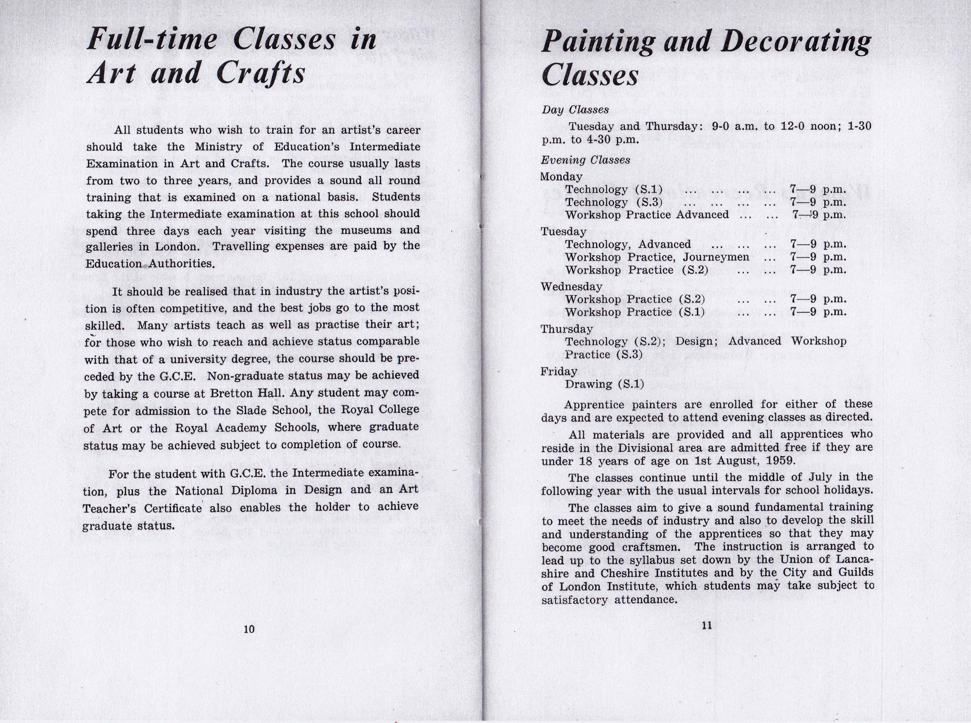
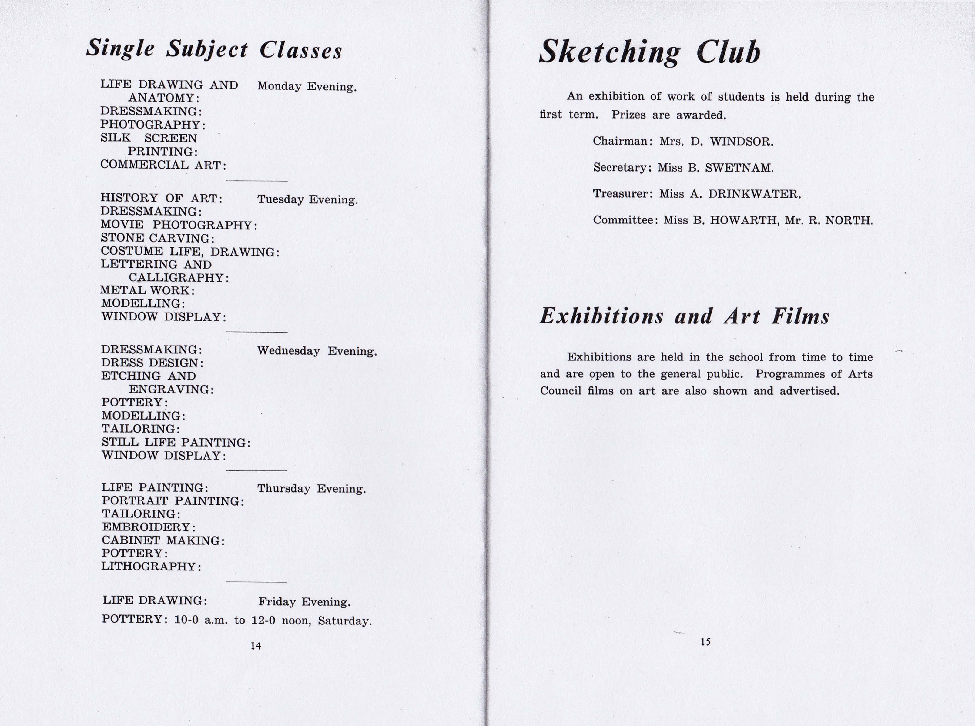
Forward now to 1959-60.
There are now full-time courses in Art and Design – though there were no degree courses until 1974, students would find employment, places on a teacher training course or possibly progress to one of the London colleges, which did have graduate status.
There were still clear distinctions in what were considered women’s skills, which also reflected the patterns of employment.
There was also an increasing distinction between specialisms, Fine and Applied Arts taking diverging paths.
An astounding range of skills were available on a part time evening basis, opening up vocational or non-vocational options.
These were always affordable and well attended.
Art and design education had undergone a major transformation in the early 1960s. The Coldstream report -1960/ 1962 had restructured art education: the existing National Diploma in Design had been replaced with a three year Diploma in Art and Design in 1963. The Dip.AD was conceived as providing ‘a liberal education in art’ and had four areas of specialisation: textiles/fashion, three dimensional design, graphic design, and fine art. Other subjects, such as electronic media, photography and film, were incorporated into fine art or graphic design courses.
The Dip.AD was intended to be the equivalent of a university degree. To achieve this academic entry requirements, at least five O’ levels, were introduced; although exceptions could be granted for “students with outstanding artistic promise”, very few were: only 36 were made in 1967 . The Dip. AD itself contained a compulsory academic element and enhanced art history component: taken together these accounted for 15 per cent of course time and 20 per cent of the final pass mark. One year Pre-diploma (latterly Foundation) courses termed Basic Design, were also introduced, these a product of the Bauhaus approach to art education, pioneered in the UK by and Richard Hamilton, Tom Hudson, Harr Thubron, Maurice de Sausmarez, and Victor Pasmore. Basic Design was a form of creative education involving basic analytic experiment and a clearing of the slate.
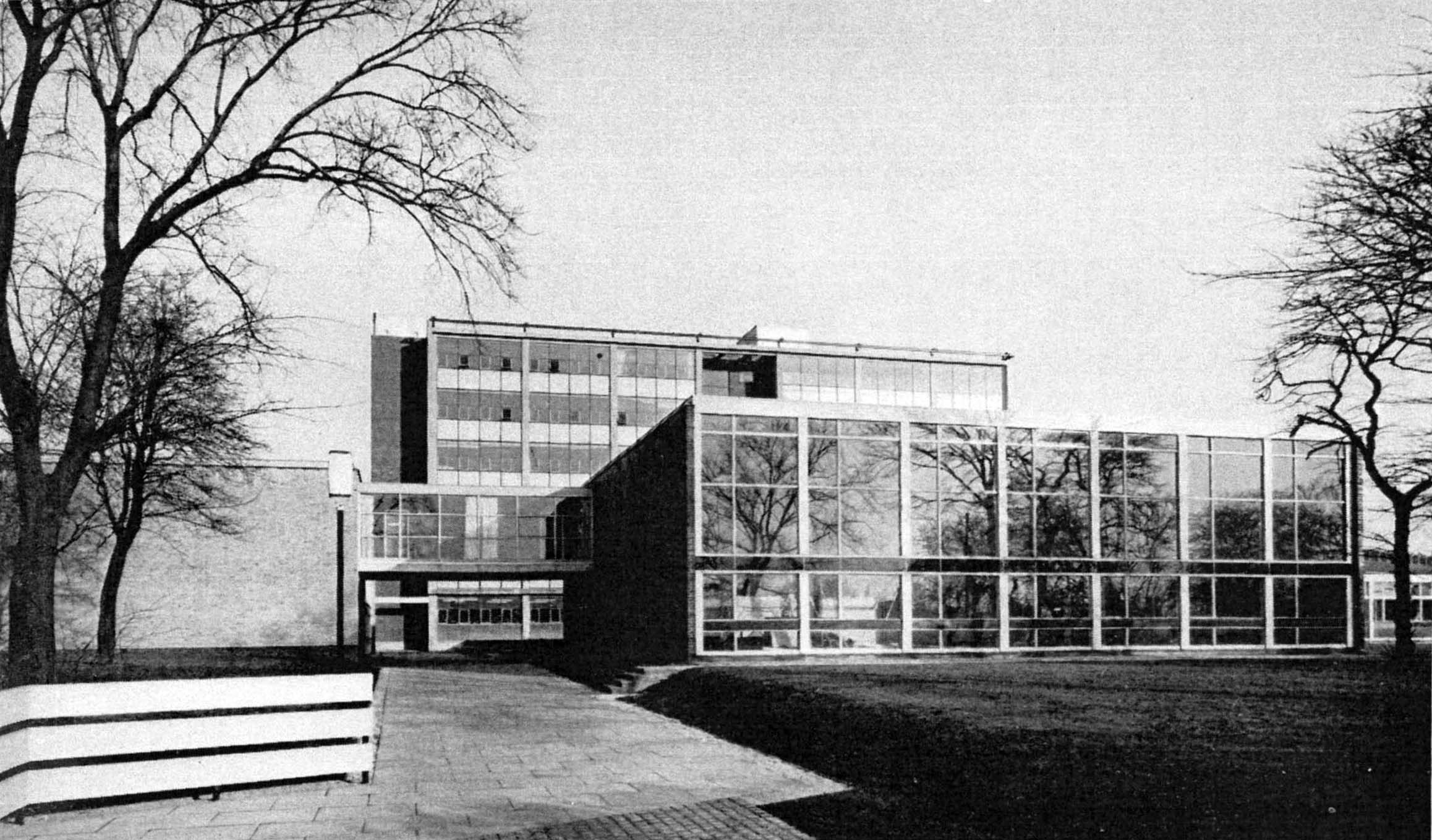
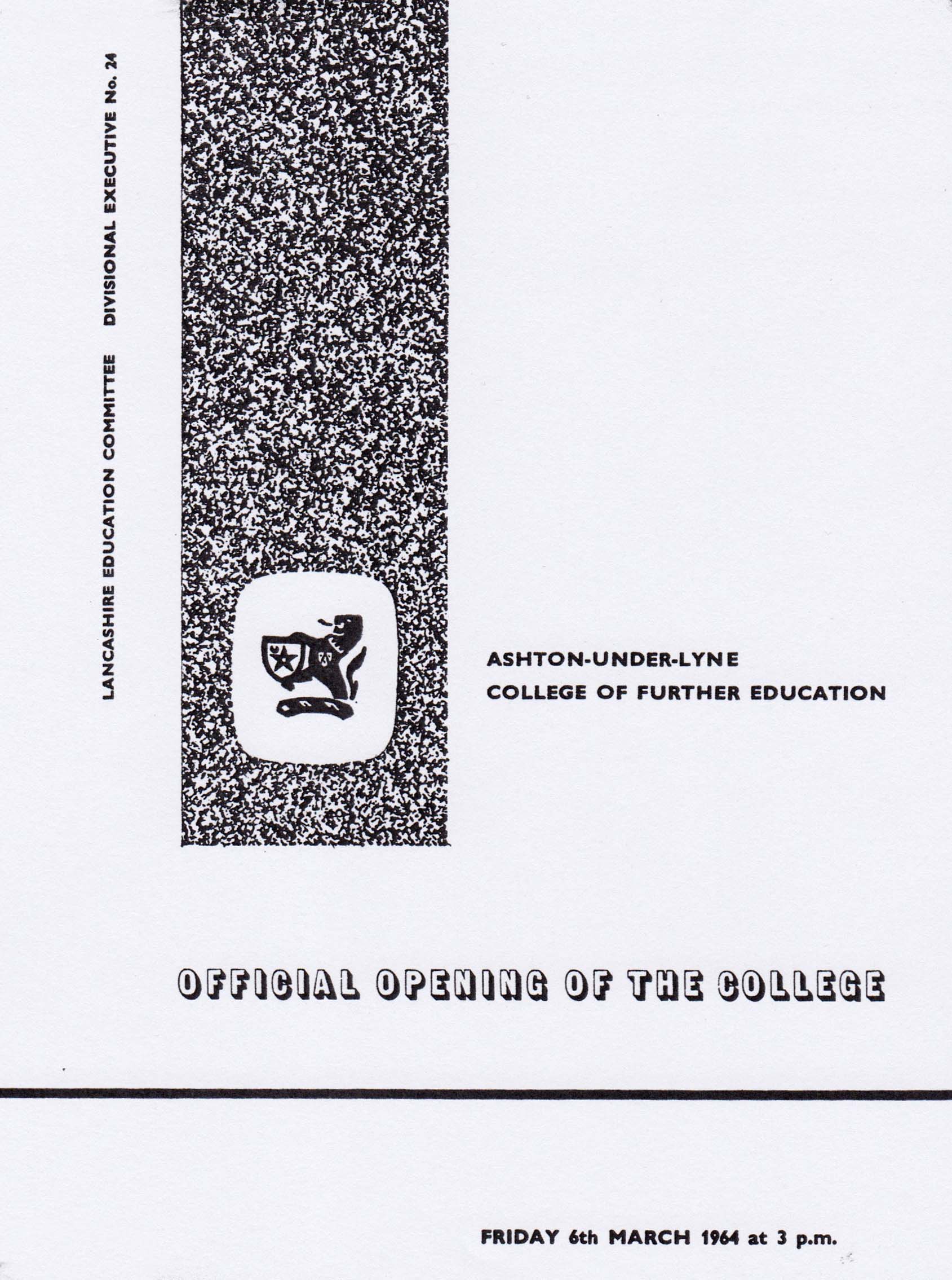
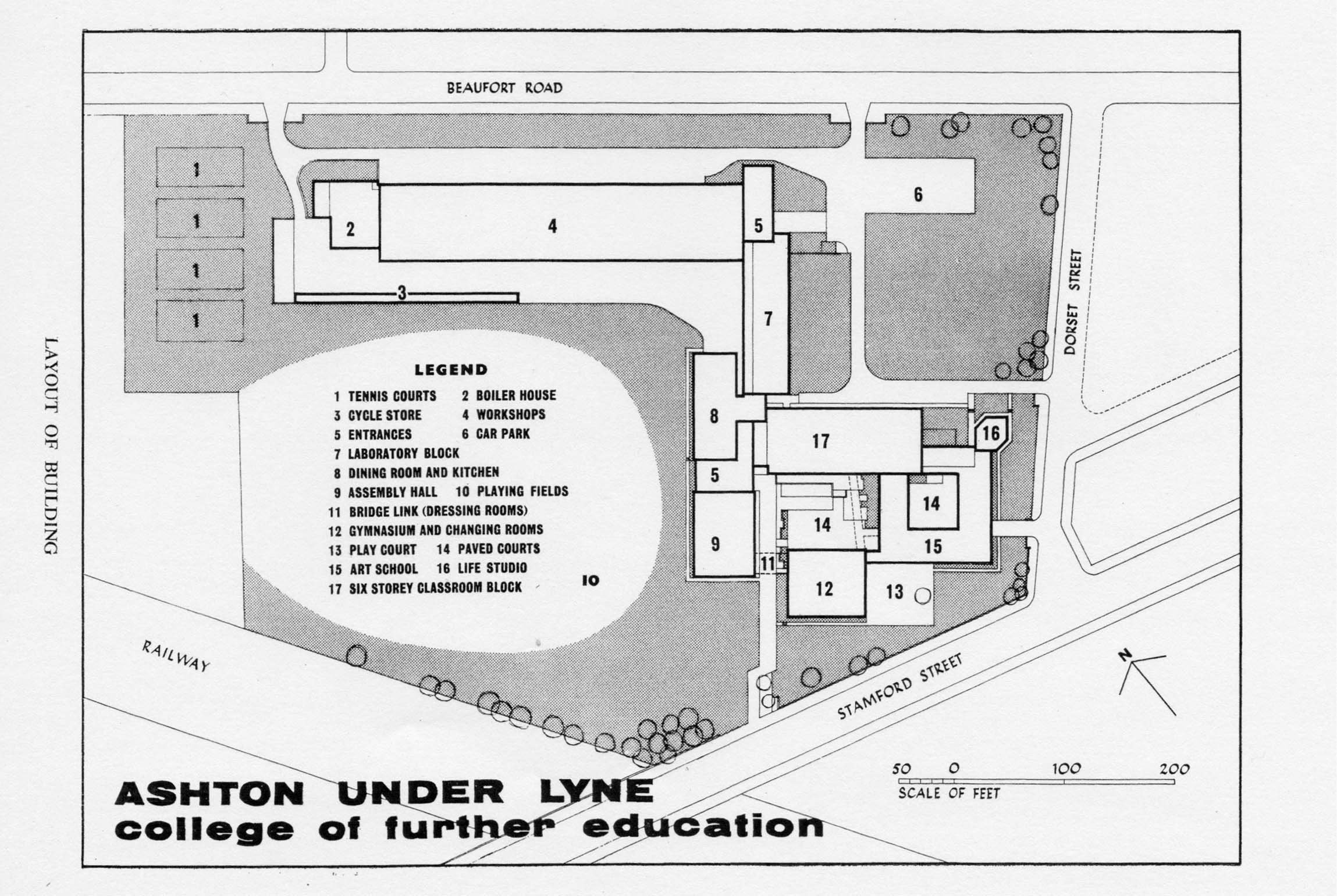
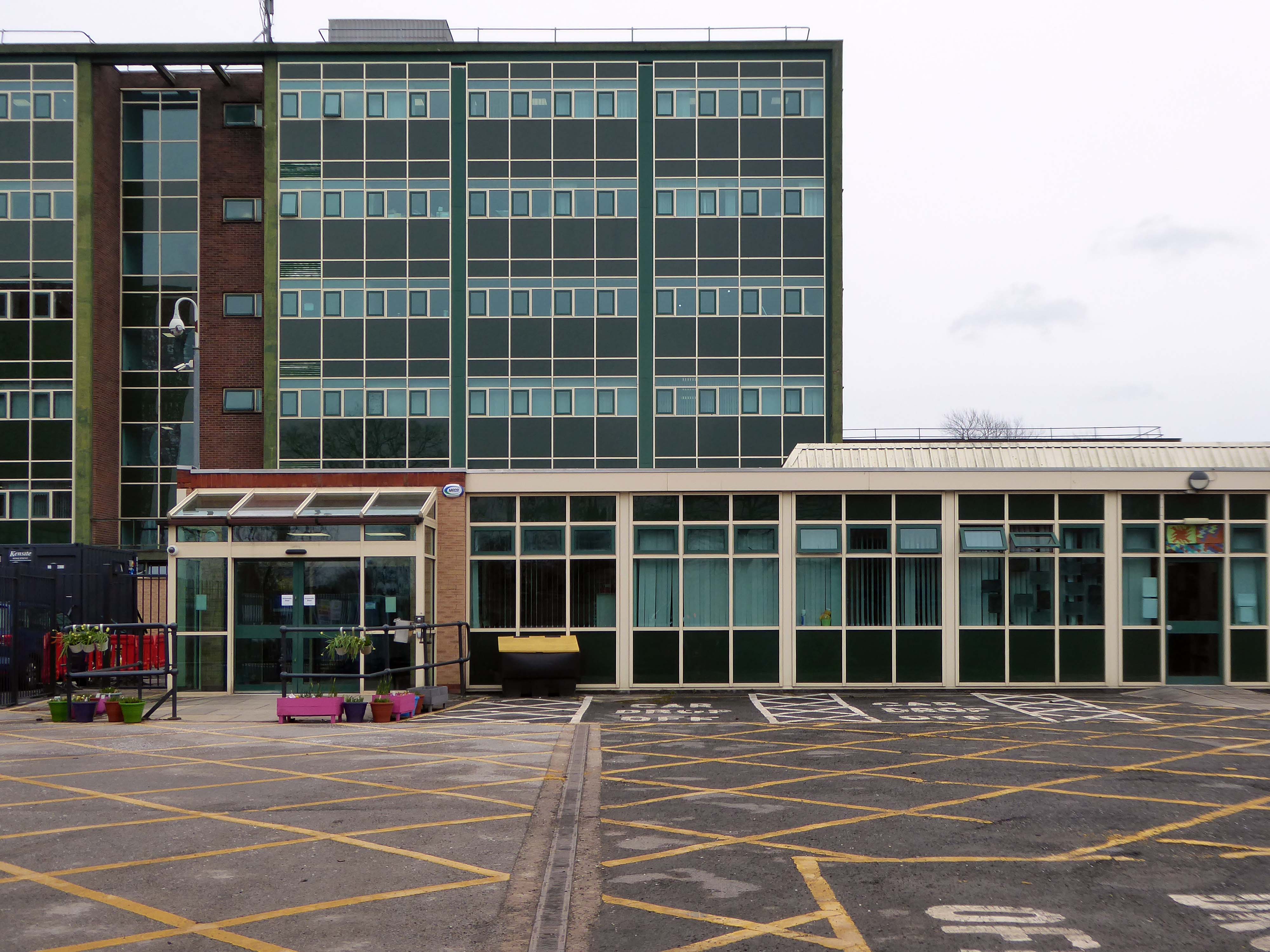
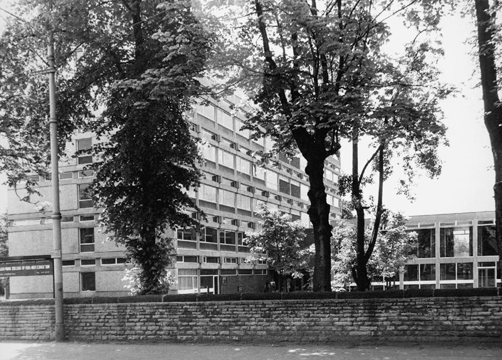
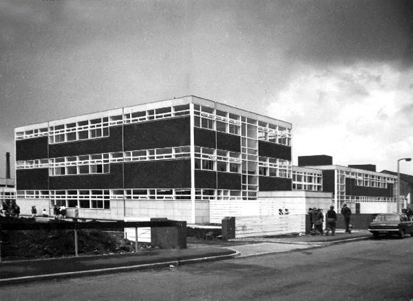
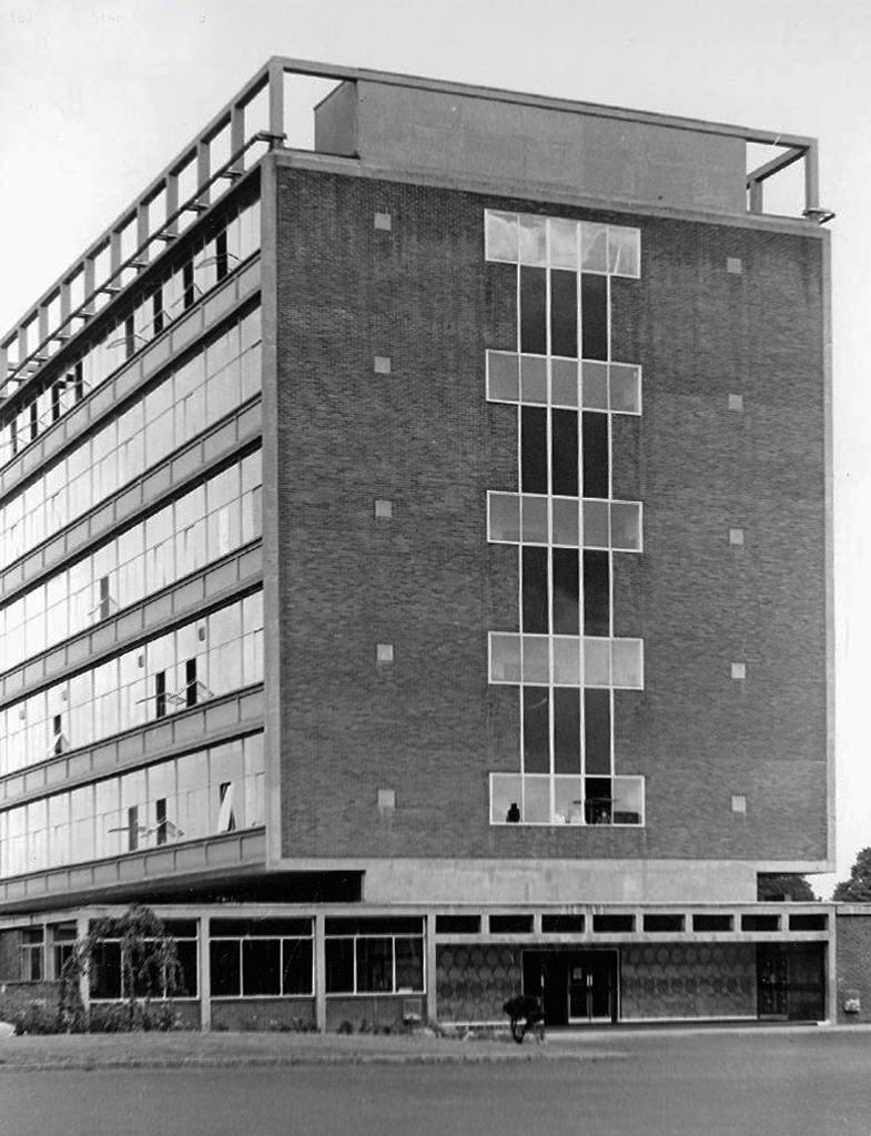
The college which I attended was opened on March 3rd 1964.
Gone were the autocratic Victorian stylings of the Heginbottom School – The College of Further Education represented a more open democratic age.
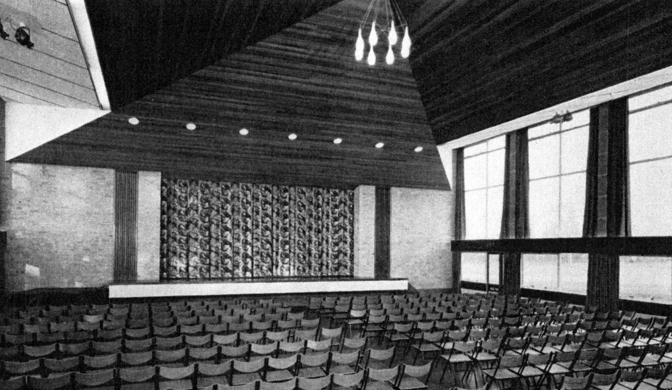
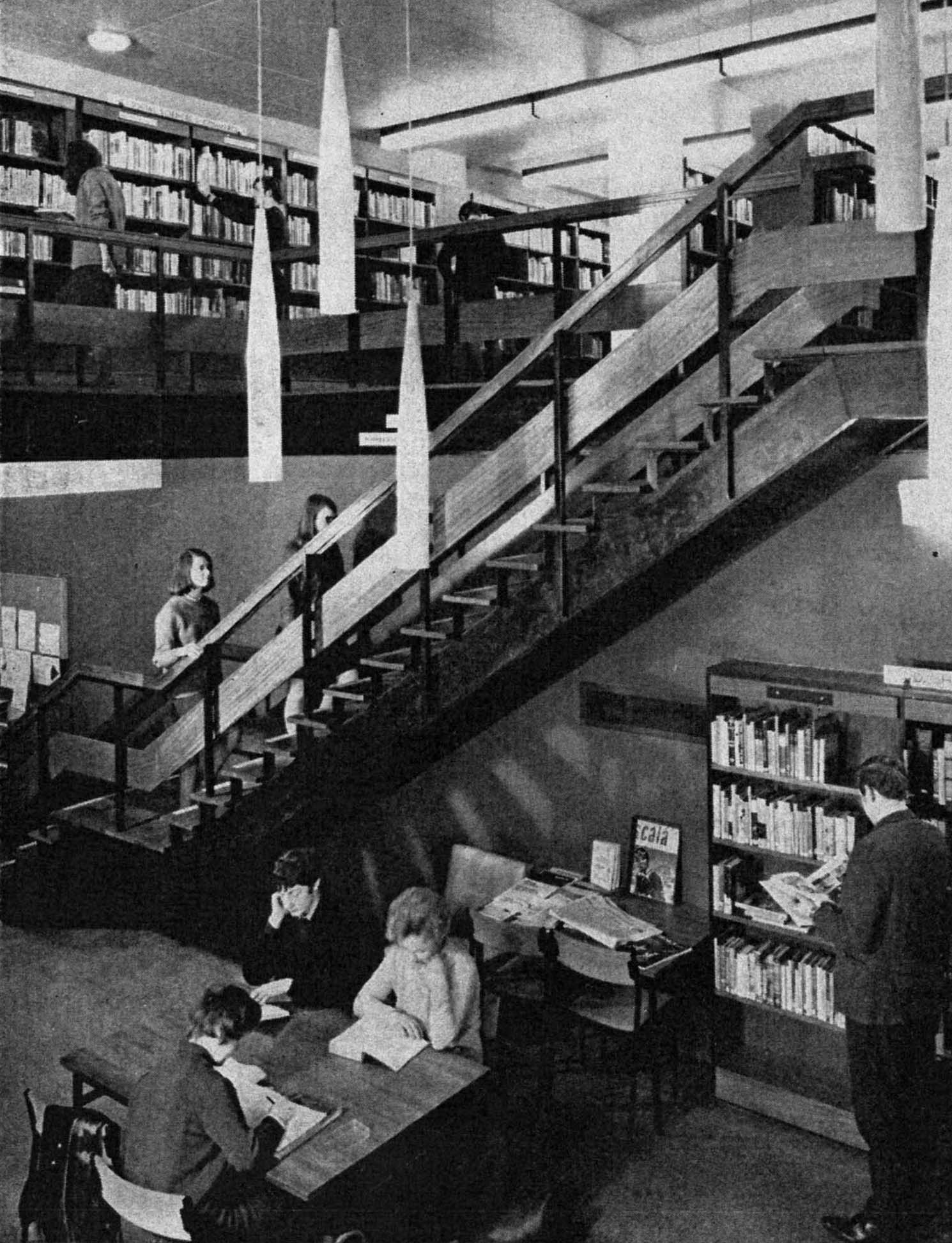
The communal areas were light and airy, with full-length windows, wooden floors, contemporary furniture and fittings.
The teaching rooms and workshops well equipped and staffed, with ample support from technicians and lecturers.
This was a no expense spared build – we were made to feel valued, in an institution purpose built for our education and future lives.
The full-time course was five full days a week, with one late evening for photography and art history.
I attended ever single day for two years, we were eager to learn and following an introductory merry go round of design disciplines, students were able to choose their own route.
I was privileged to have been taught by Bill Clarke as a student of Fine Art – of whom fellow Ashton student Chris Ofili said:
After six months on the foundation course I chose to specialise in painting and drawing. The teacher there, Bill Clarke, introduced me to painting in a way that didn’t make me feel restricted or limited. Not only was it something completely new, but it was something that allowed me to investigate further into who I am. He taught us that it wasn’t so much about painting a scene and making sure you got the shading right, but trying to get to a point where the thing that works is absolutely critical and essential to you as a living, breathing person. I was obviously aware of famous artists, but I suppose I never really thought that was what you could do with your life. He opened the door enough to make me think that it was worth going into the room.
A huge emphasis was placed on observational drawing in the life-room, in addition to more exploratory work in a variety of media.
I also spent a great deal of time in the Print Room working in both etching and lithography with lecturer Colin Radcliffe.
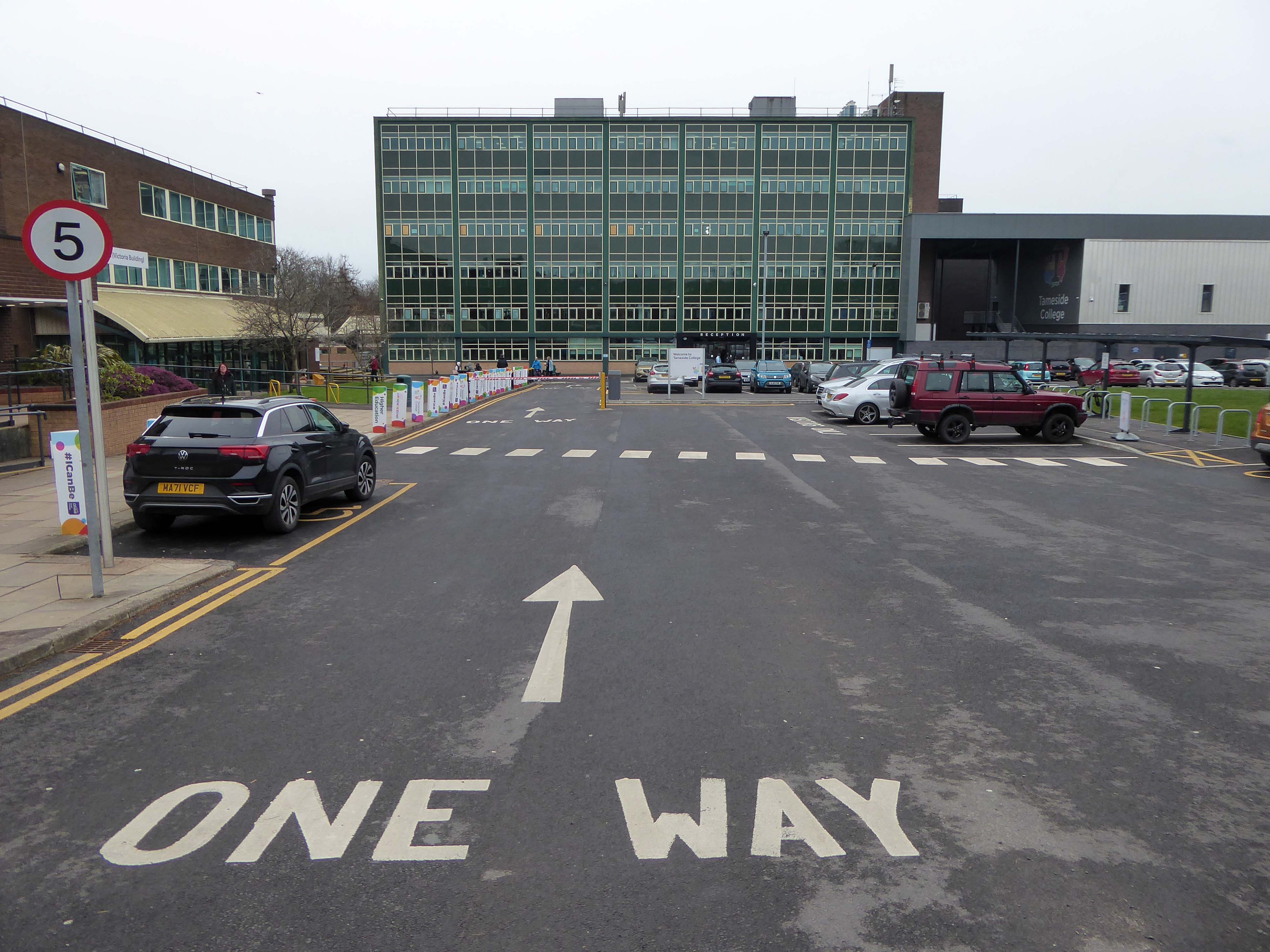
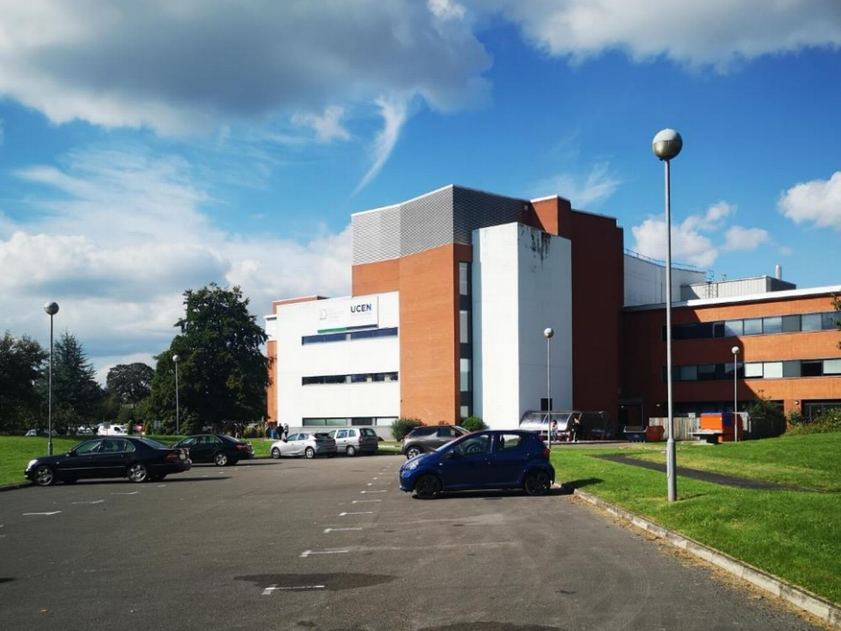
Returning to the college four years ago, I found that the life room was now in use by the Animal Management course.
The site had been undergoing refurbishment and new development.
Built by Kier and designed by IBI Taylor and Young the Advanced Technologies Centre has been constructed following a £10.5 million investment.
Levolux designed, supplied and installed a customised architectural facade solution as part of the £10.5 million development of the Advanced Technologies Centre.
ITP supplied our VCL 250 vapour control layer as a protective solution underneath a stunning façade design. With a mono-filament reinforcement scrim for tensile strength, its polyethylene-based membrane ensures that the building envelope is properly sealed to control ventilation, prevent heat loss and protect insulates from interstitial condensation.
The single storey building was previously home to the Ceramics and Textiles rooms.
The Construction Skills Centre has been designed by Manchester-based architects 10 Architect.
Heckford Signs work with Willmott Dixon approached on a new coloured acrylic sign for the new Construction Skills Building at Tameside College. The aim for this new sign was to create a showcase of the college logo at an eye-catching size, to include 3D elements which would be housed on the East elevation of the impressive new building on campus.
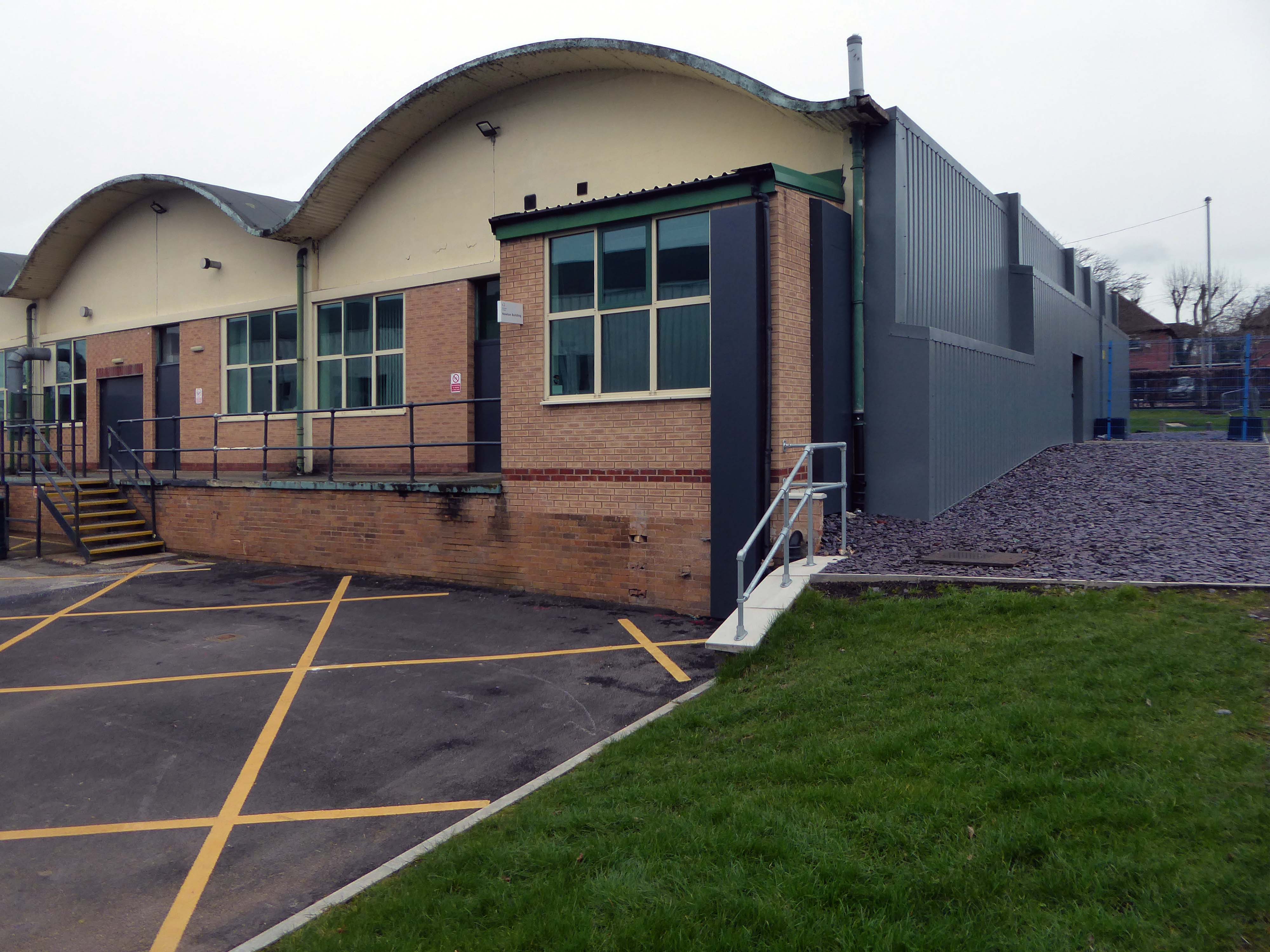
The rolling curves of the original workshops have been retained and updated.
Since leaving the college in 1973, I graduated from Portsmouth Polytechnic with a BA(Hons) Printmaking, subsequently spending thirty years of my working life teaching in a variety of Further Educational sites across Manchester.
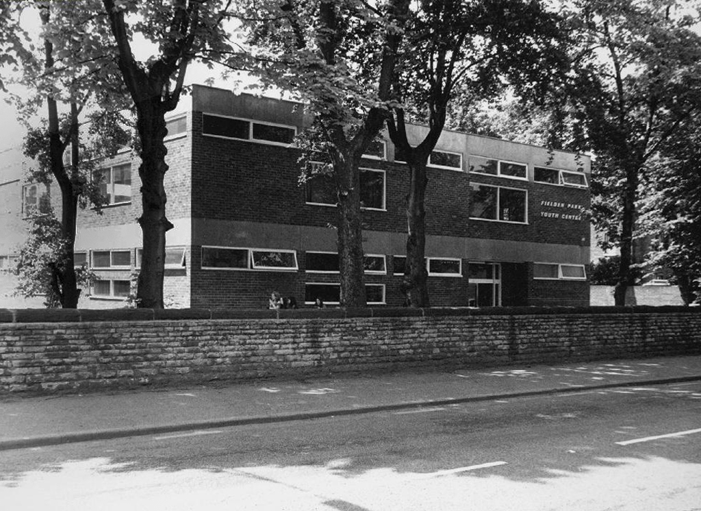
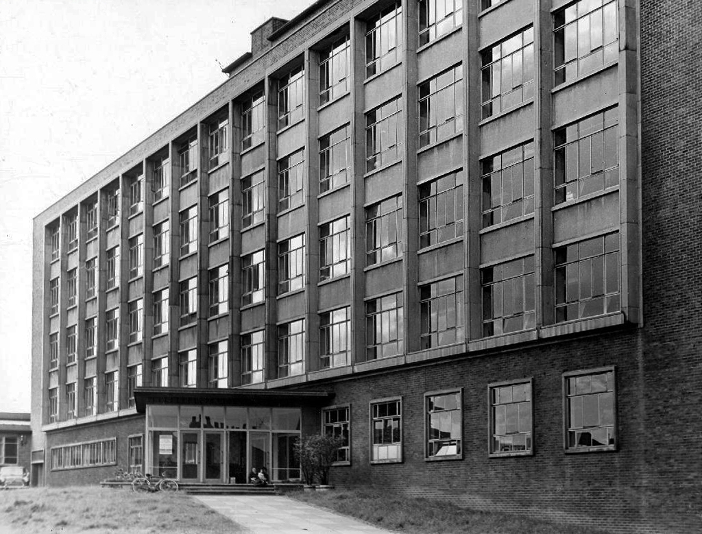
Fielden Park College seen here in 1973 – where I taught design to the printing apprentices.
Originally designed by the City Architect SG Besant Roberts in 1965, refurbished by Walker Simpson Architects.
Closed.
Wenlock Way – an annex of Openshaw Technical College, a former primary school which housed courses in Sign Writing, Jewellery, Horology and Retail Display.
Demolished.
Openshaw College – since demolished and rebuilt, becoming Central Manchester College in the 90s.
We were relocated to Taylor Street in the former Bishop Greer School – renamed the East Manchester Centre.
Since demolished to make way for an old people’s home.
Following the reorganisation of Manchester’s FE provision we were moved again to the former Yew Tree High School, Arden Sixth Form College – renamed City College Manchester.
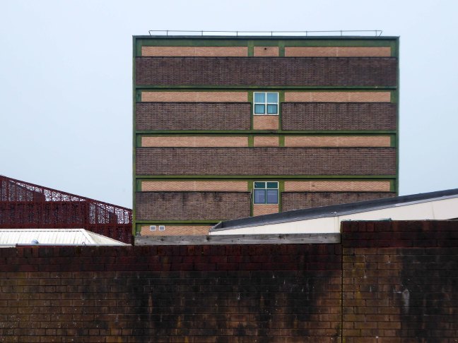
This block was eventually demolished to make way for the new Northenden Centre – which closed last year, which has in its turn been demolished.
Everyone was relocated to the brand new building on the former Boddington’s Brewery site.
Everyone but me, as I left in 2014 to become a modern moocher.
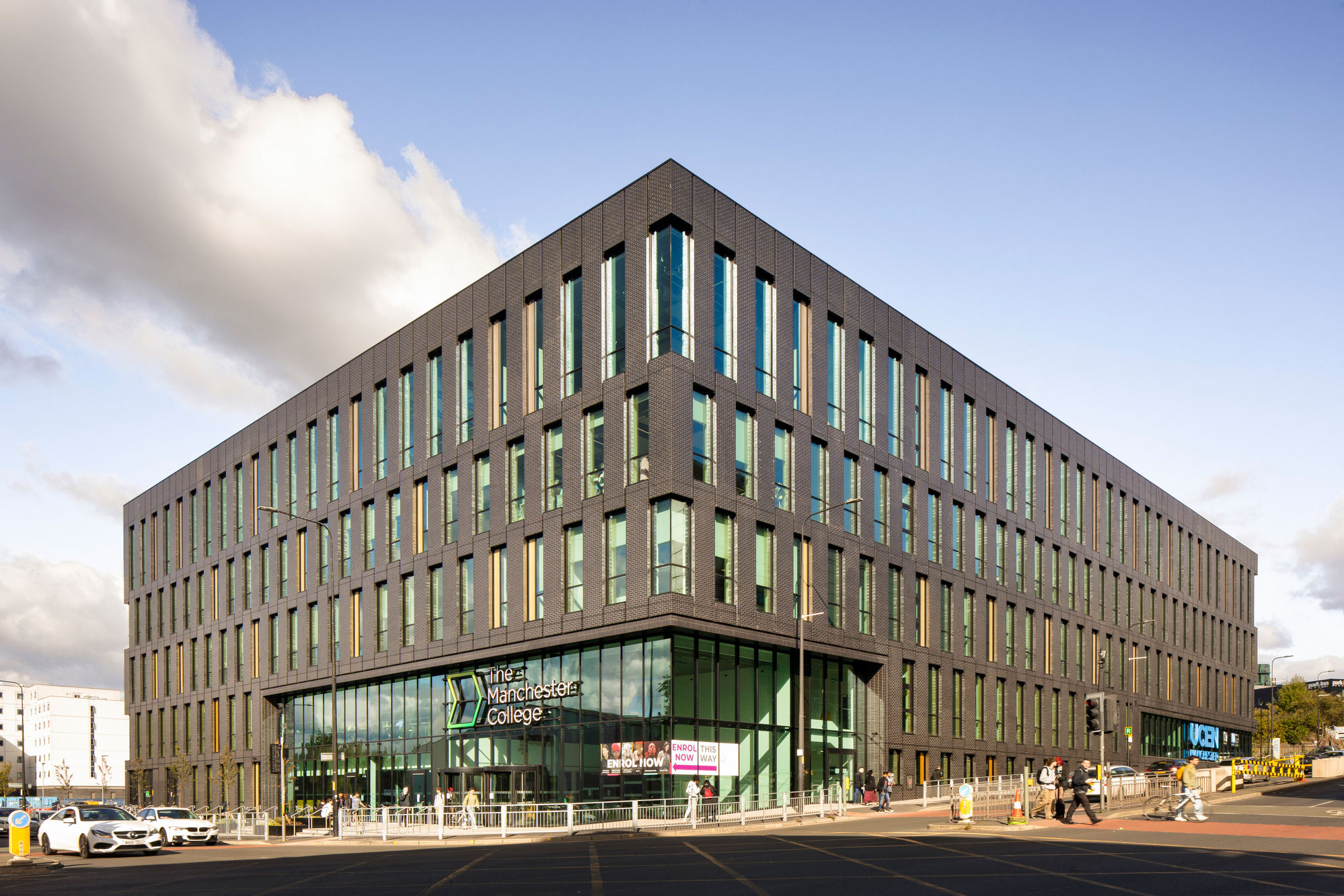
Manchester College City Campus
Following build completion in July, the long awaited 27,000 square metre, four-storey campus, designed by Bond Bryan and Simpson Haugh, offers a range of facilities, creating an exceptional student experience. It becomes the home of the College’s Industry Excellence Academies for Hospitality and Catering, Creative and Digital Media, Music, Computing and Digital as well as its Centres of Excellence for Visual Arts and Performing Arts.
It accommodates a range of Higher Education courses such as the UCEN Manchester’s School of Computing and Cyber-Security, The Manchester Film School and The Arden School of Theatre and the School of Art, Media and Make-up.
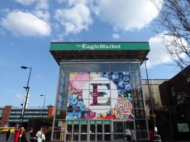
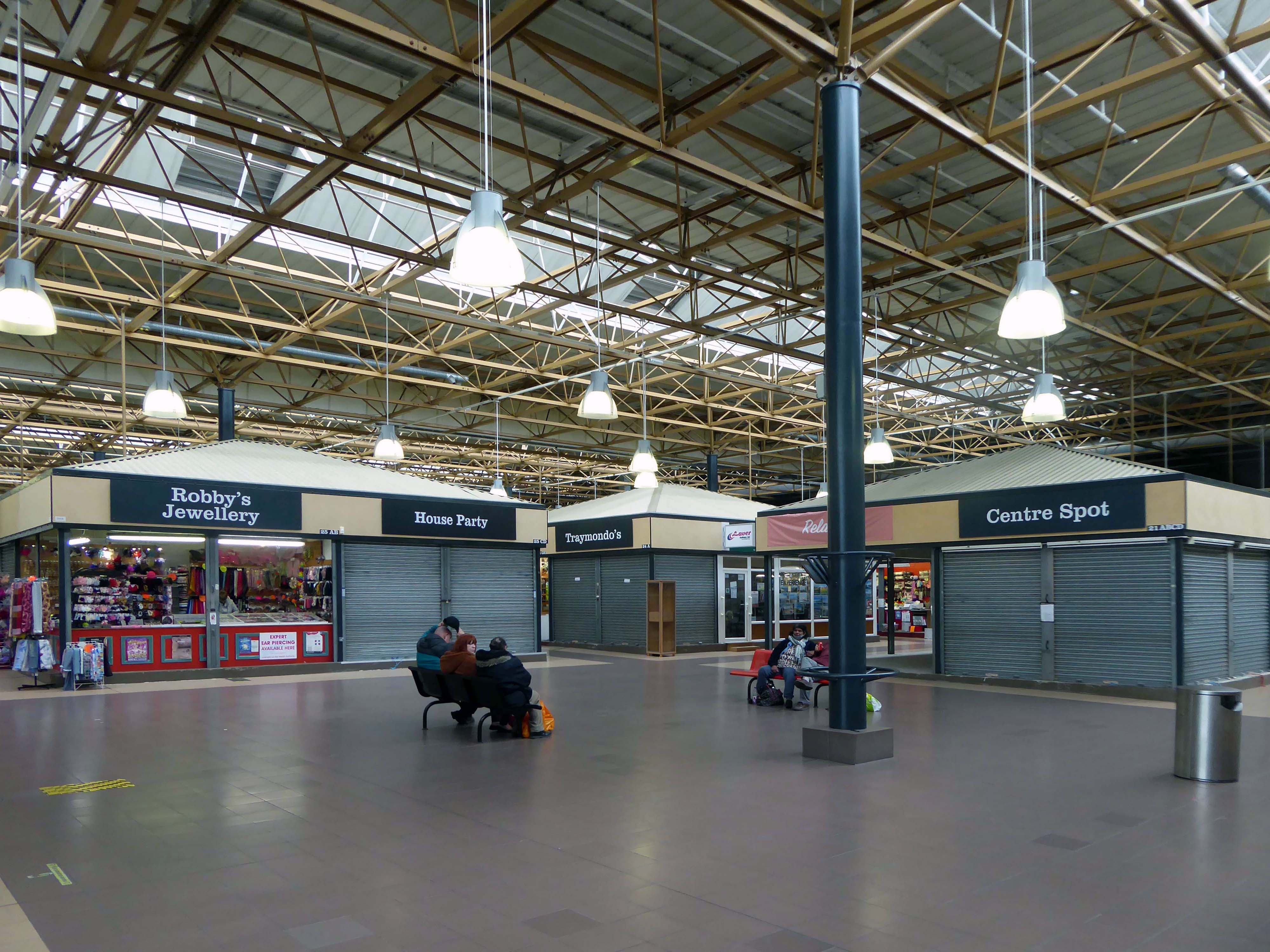
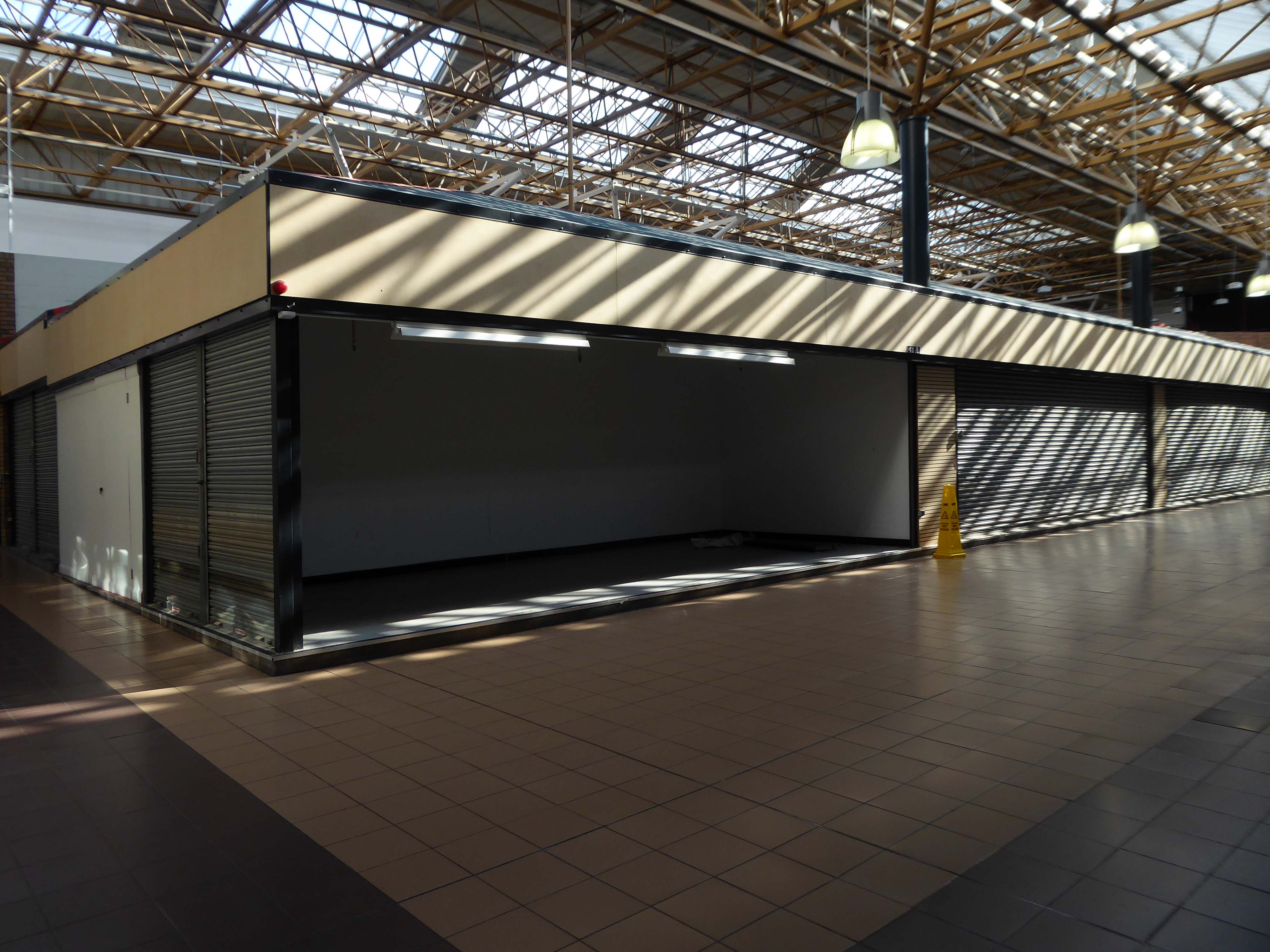
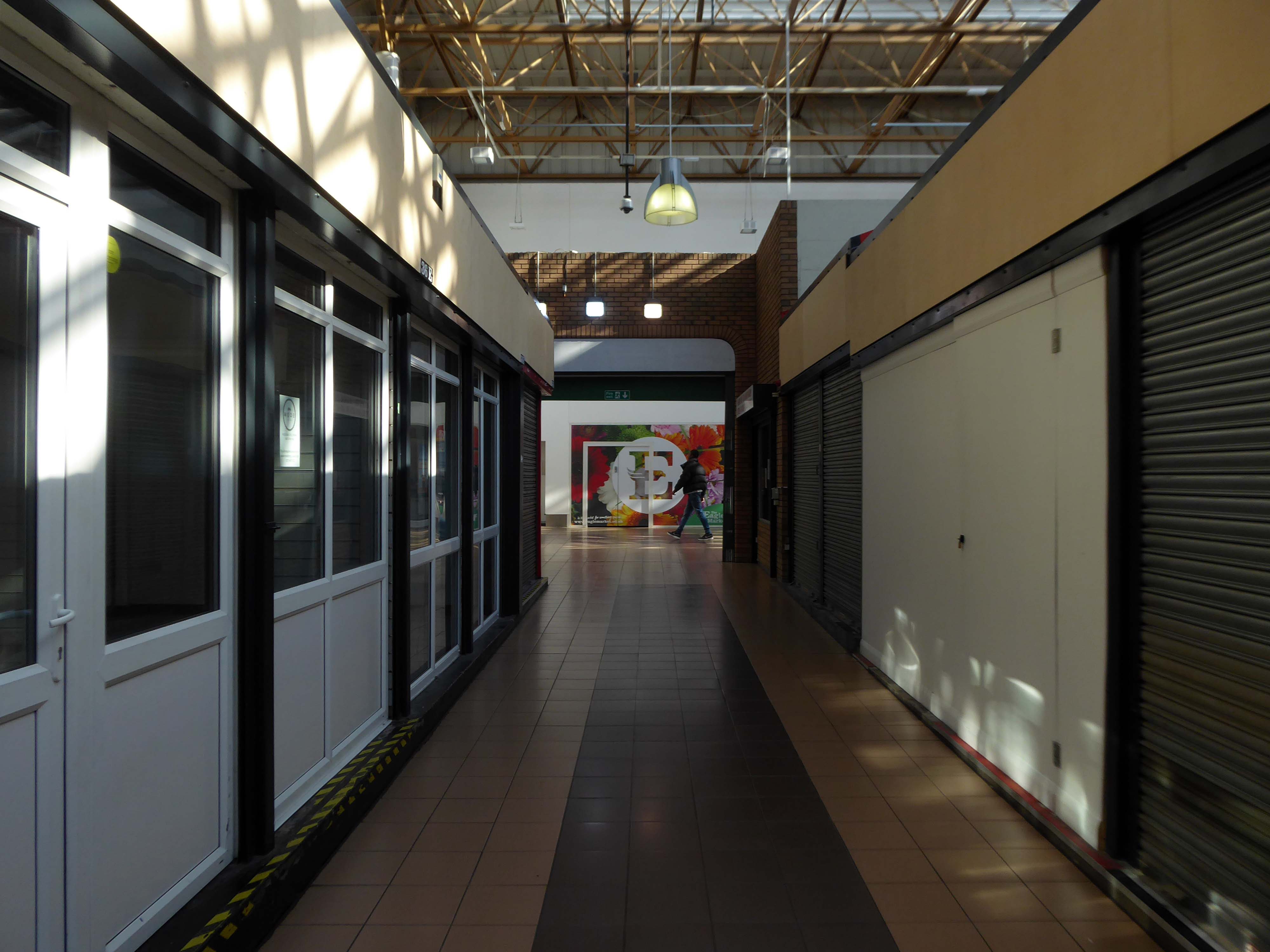
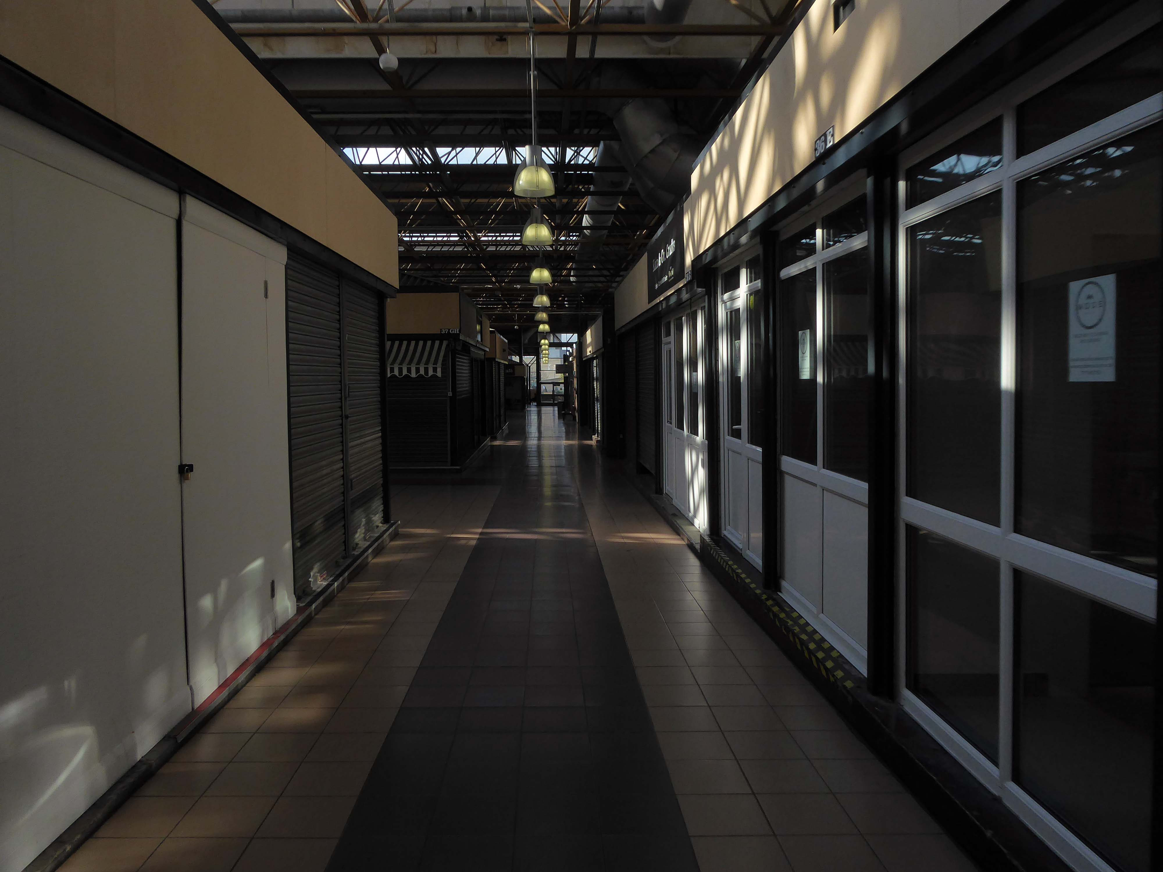
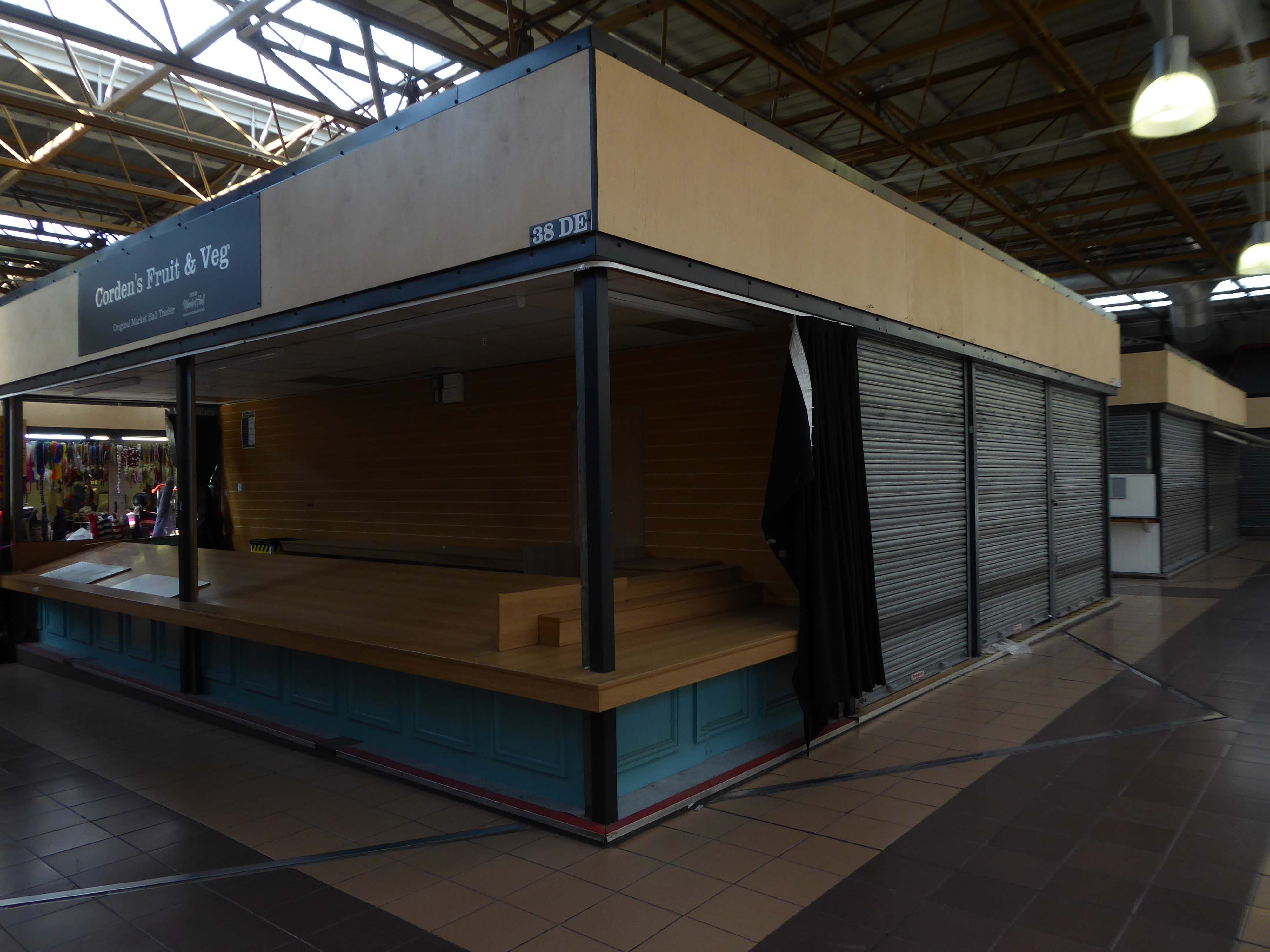
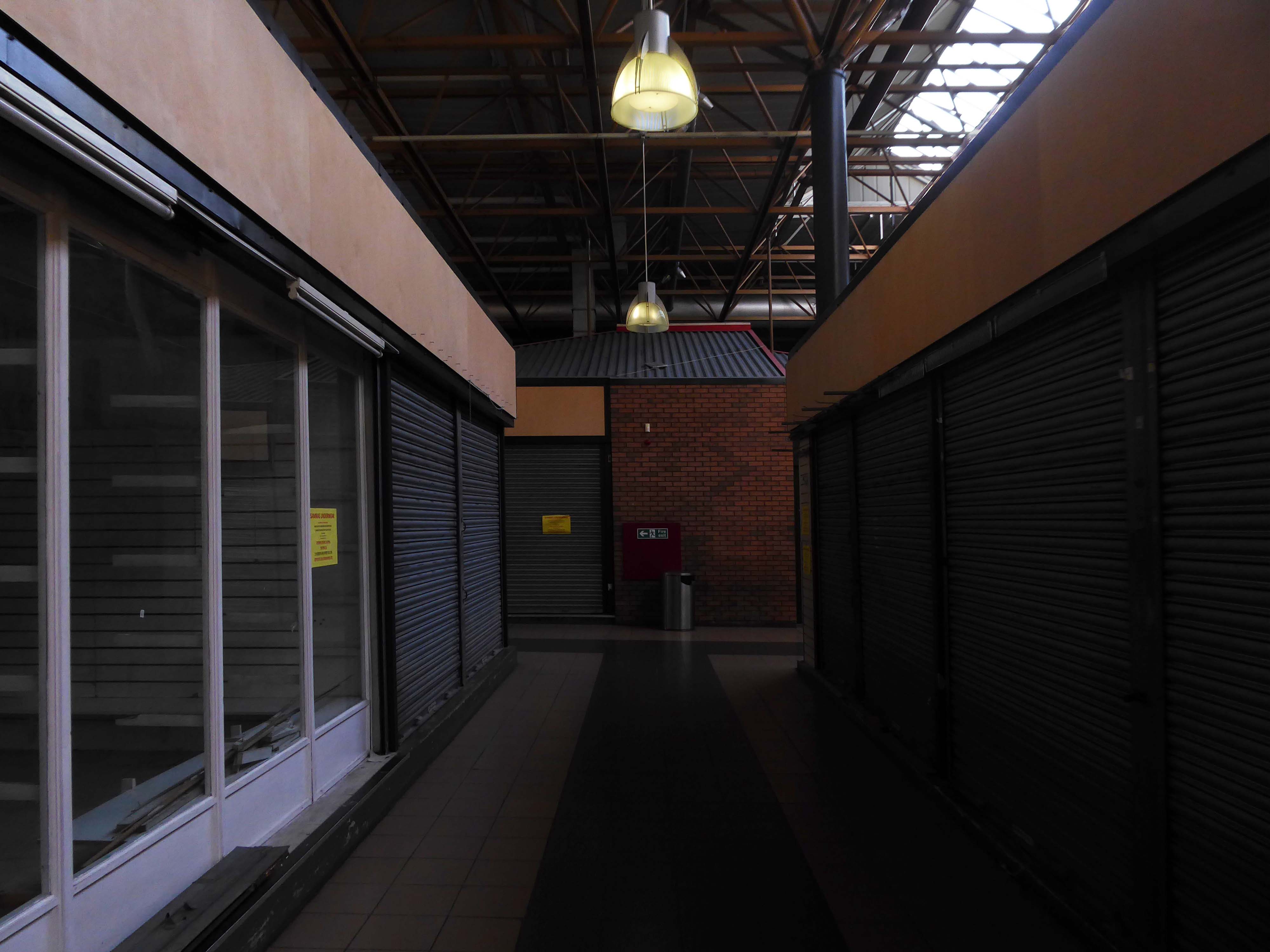
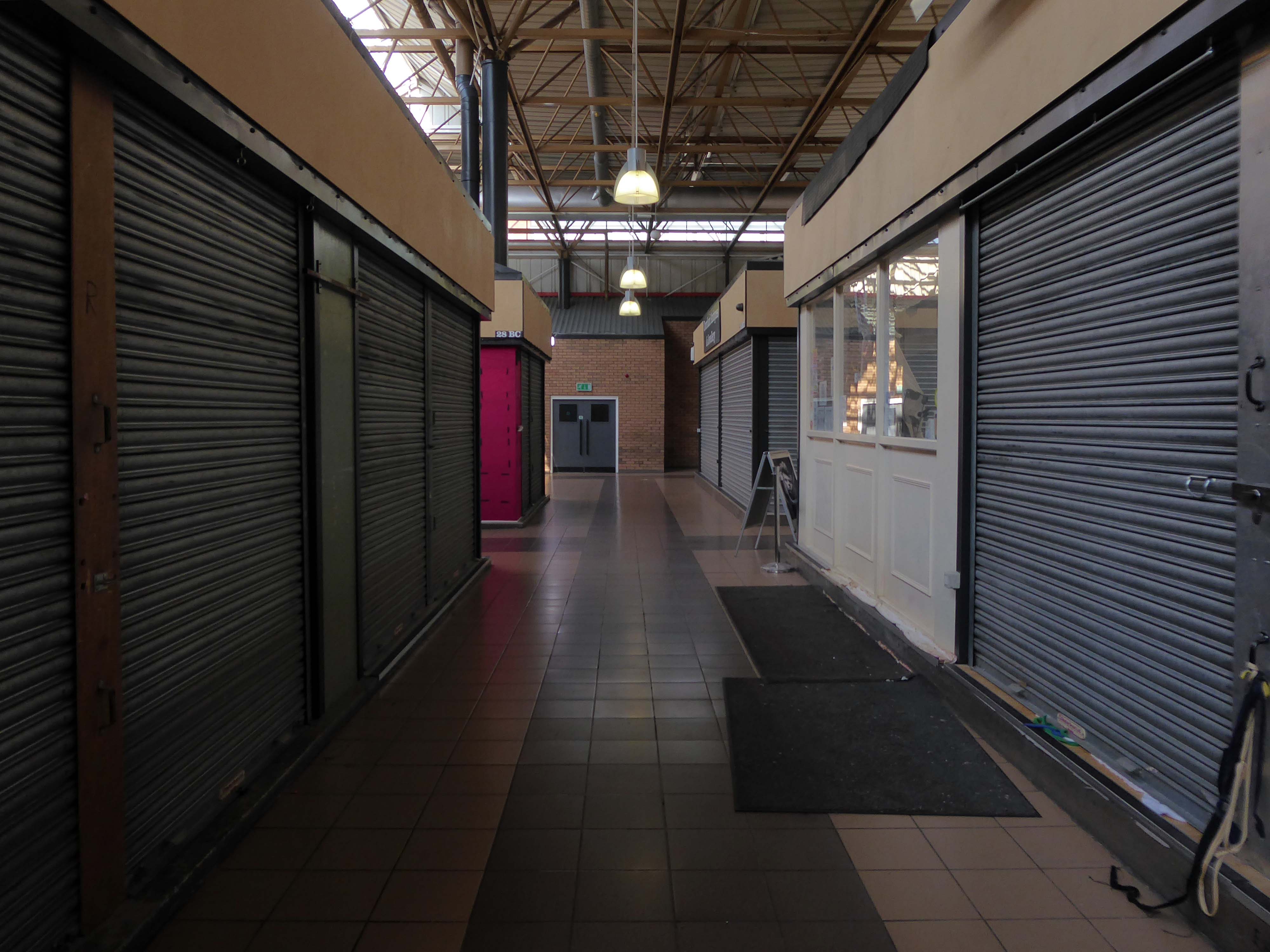
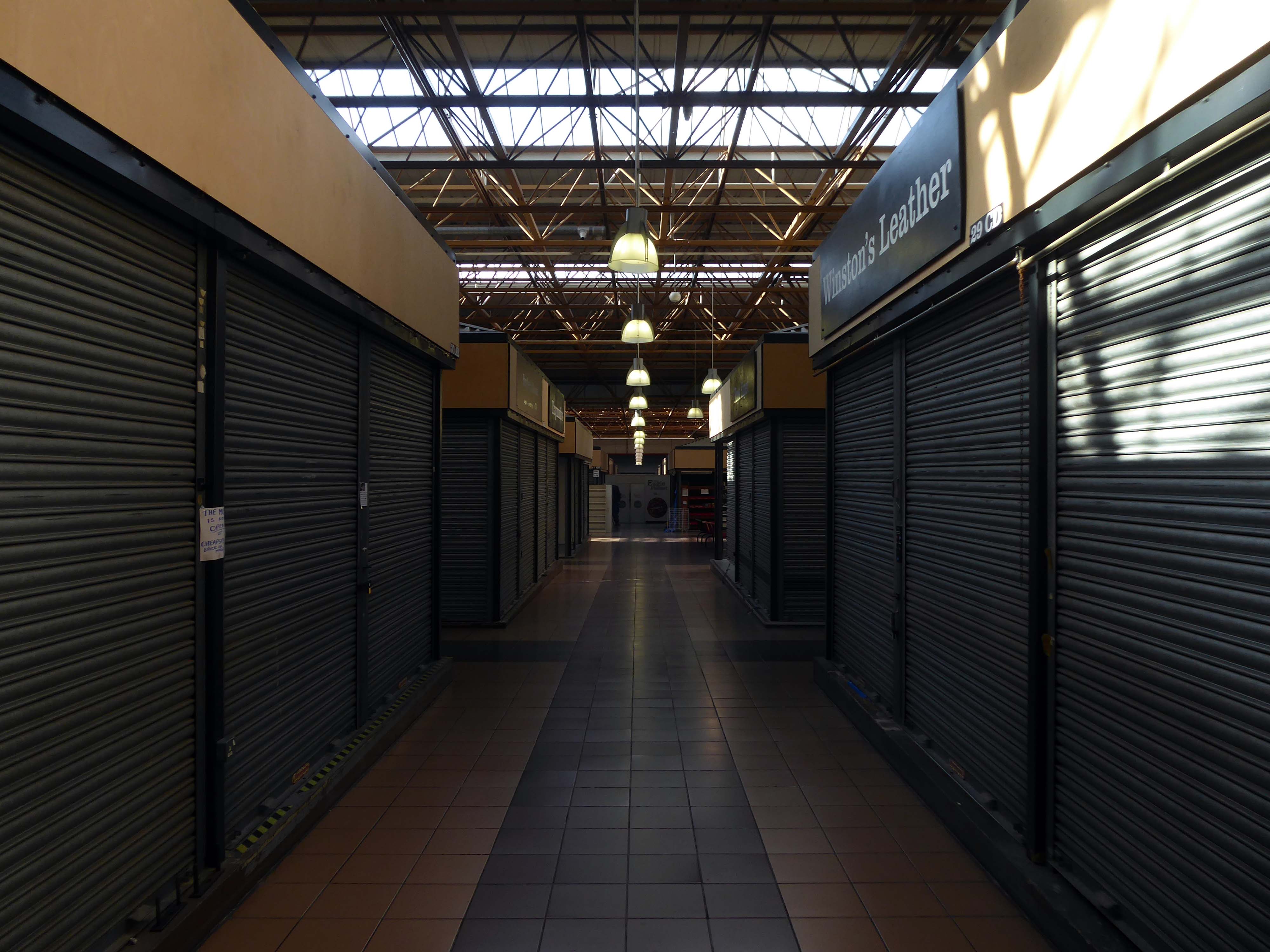
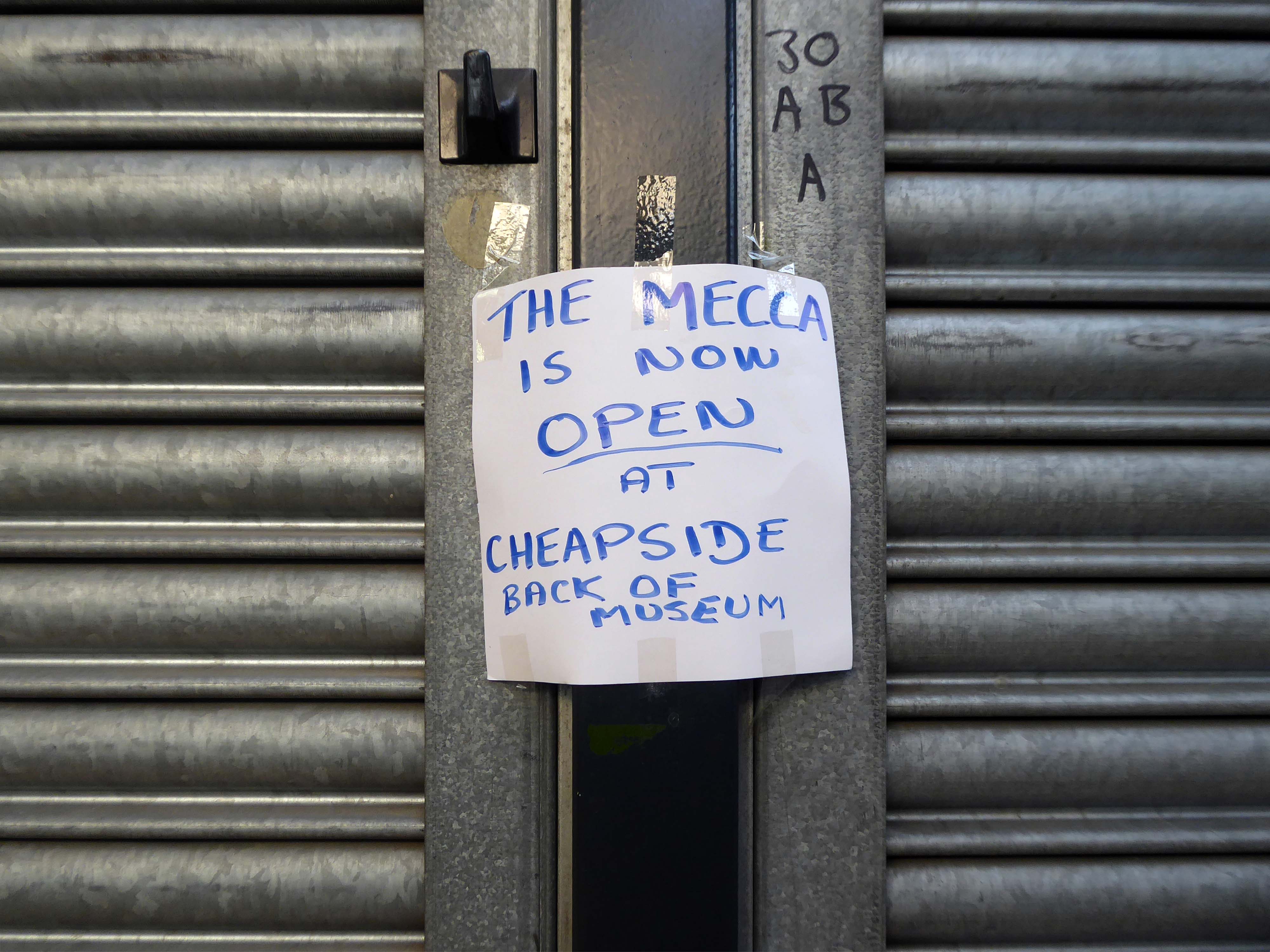
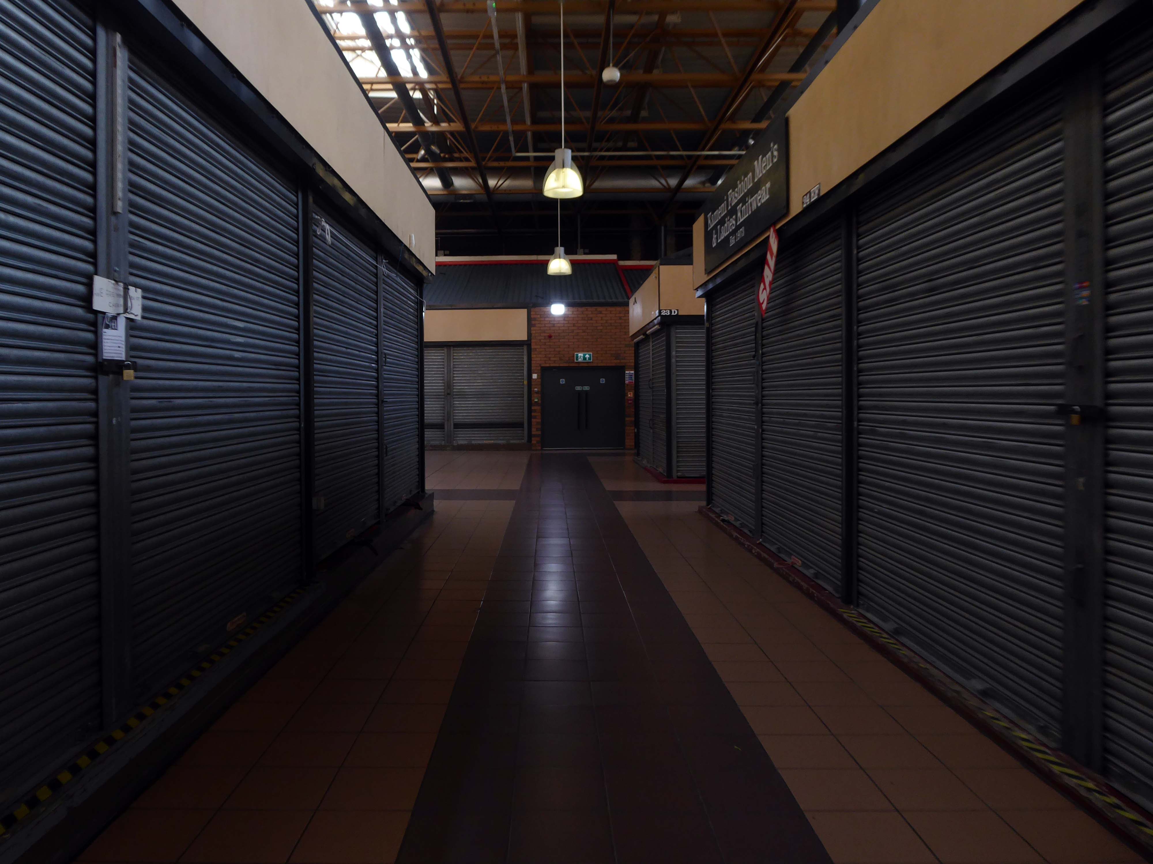
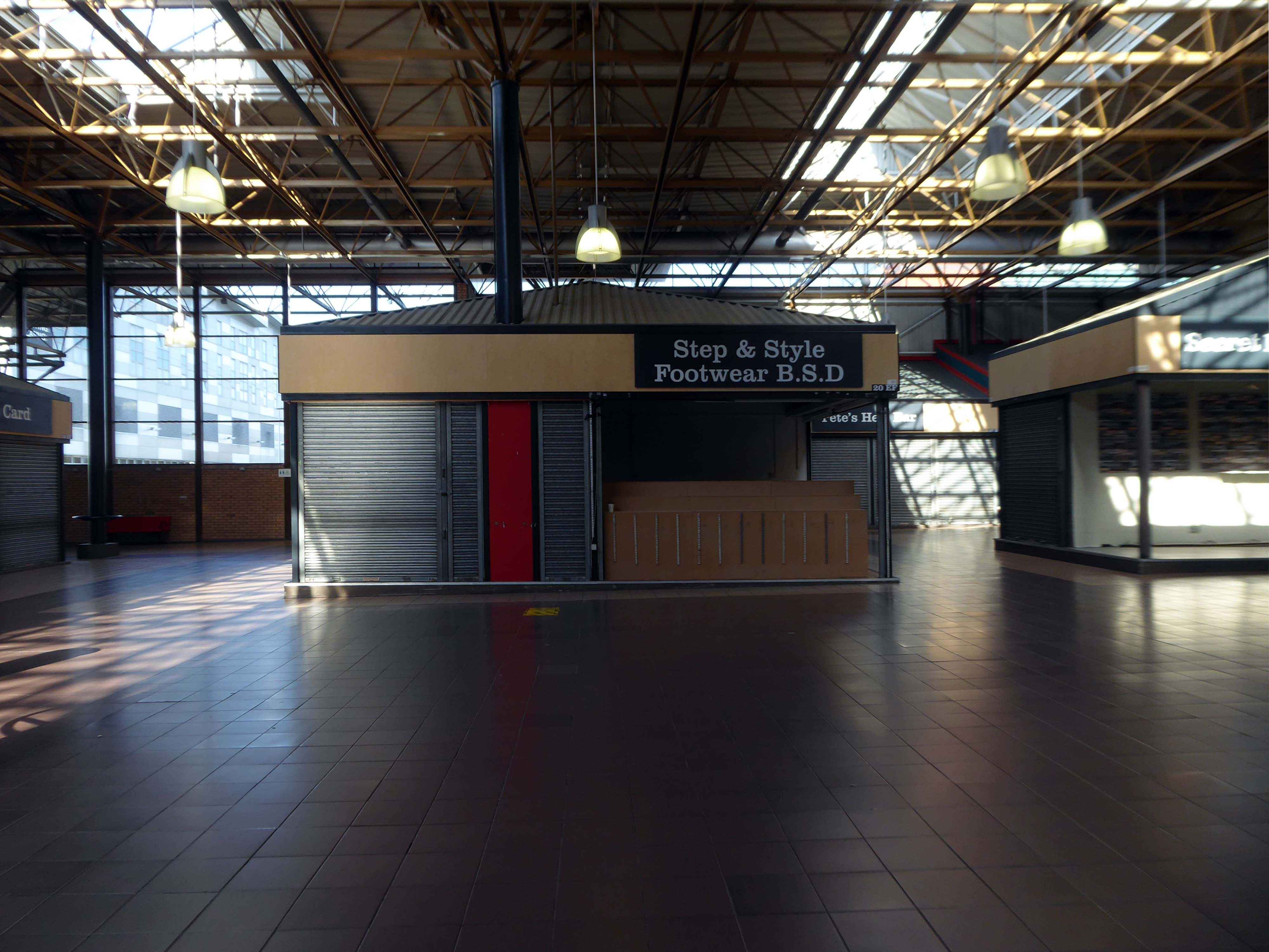
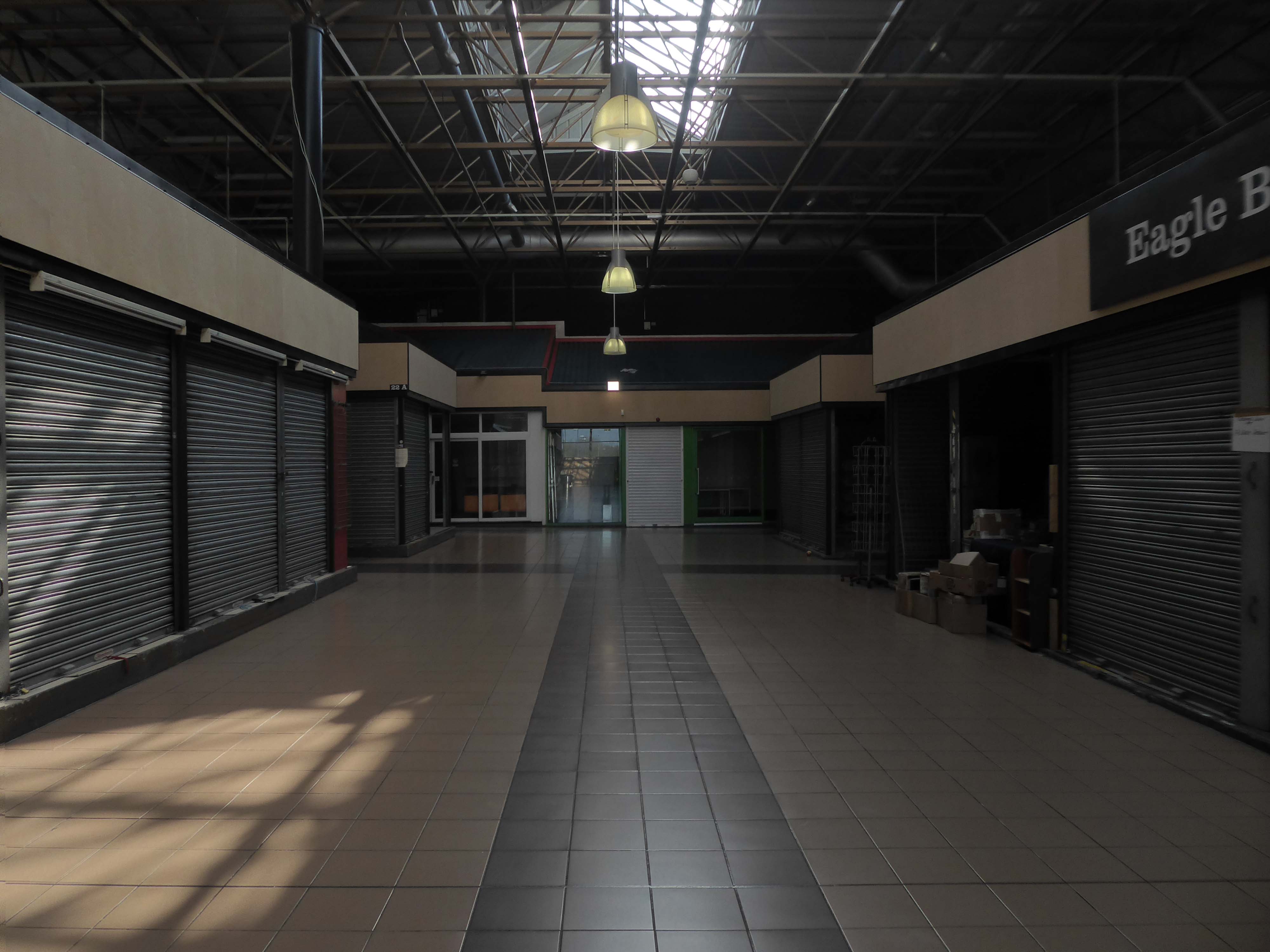
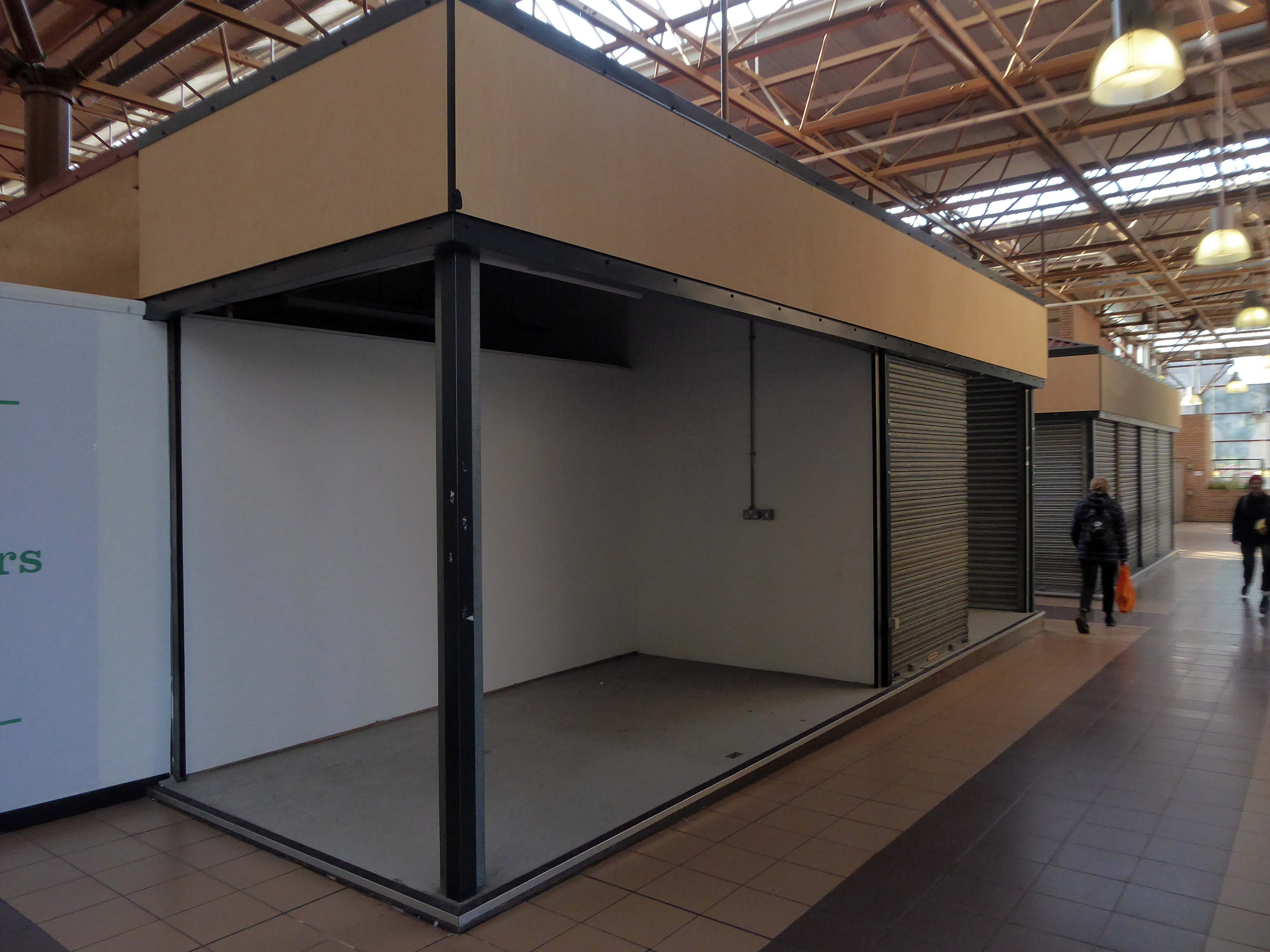
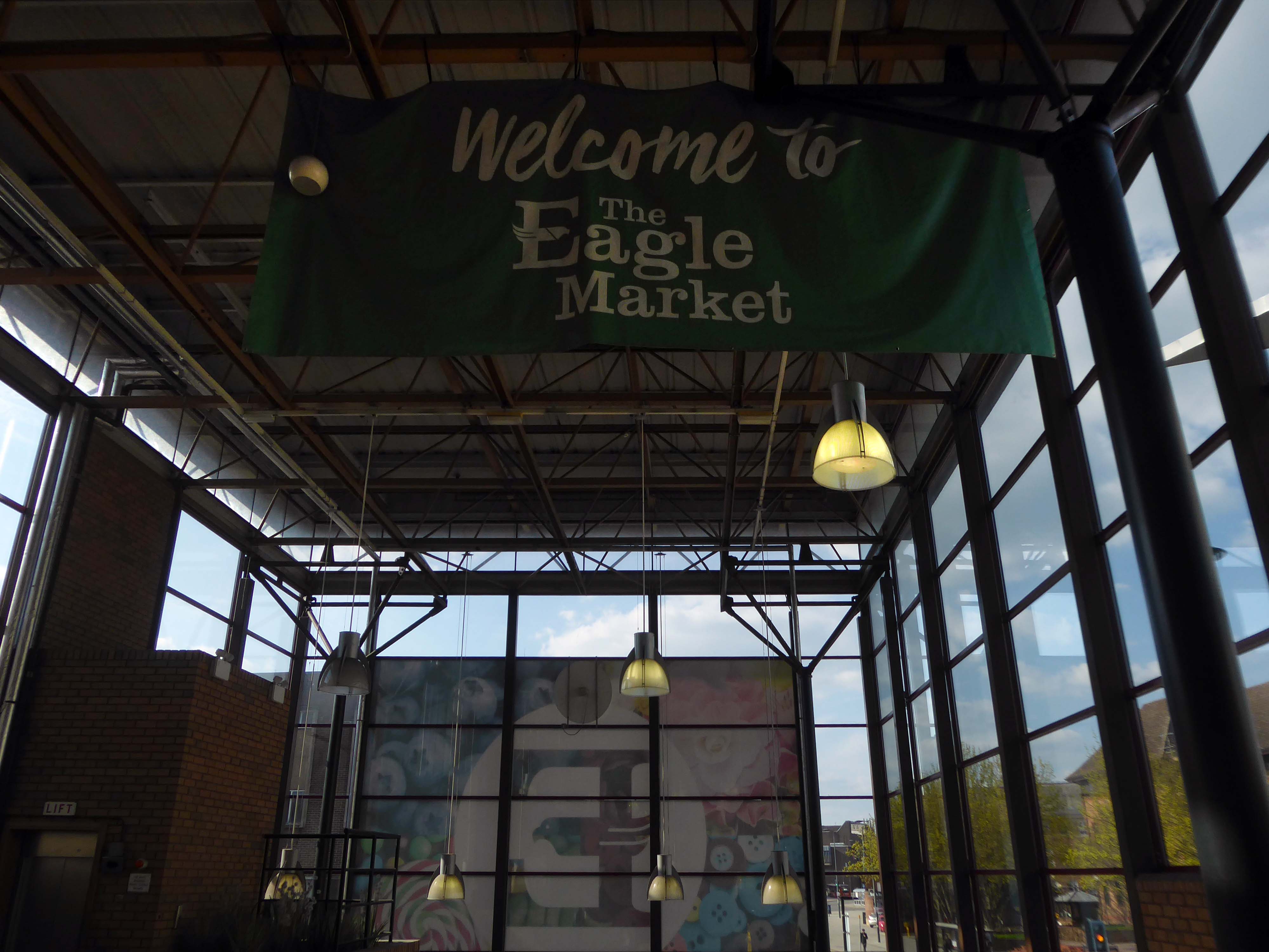
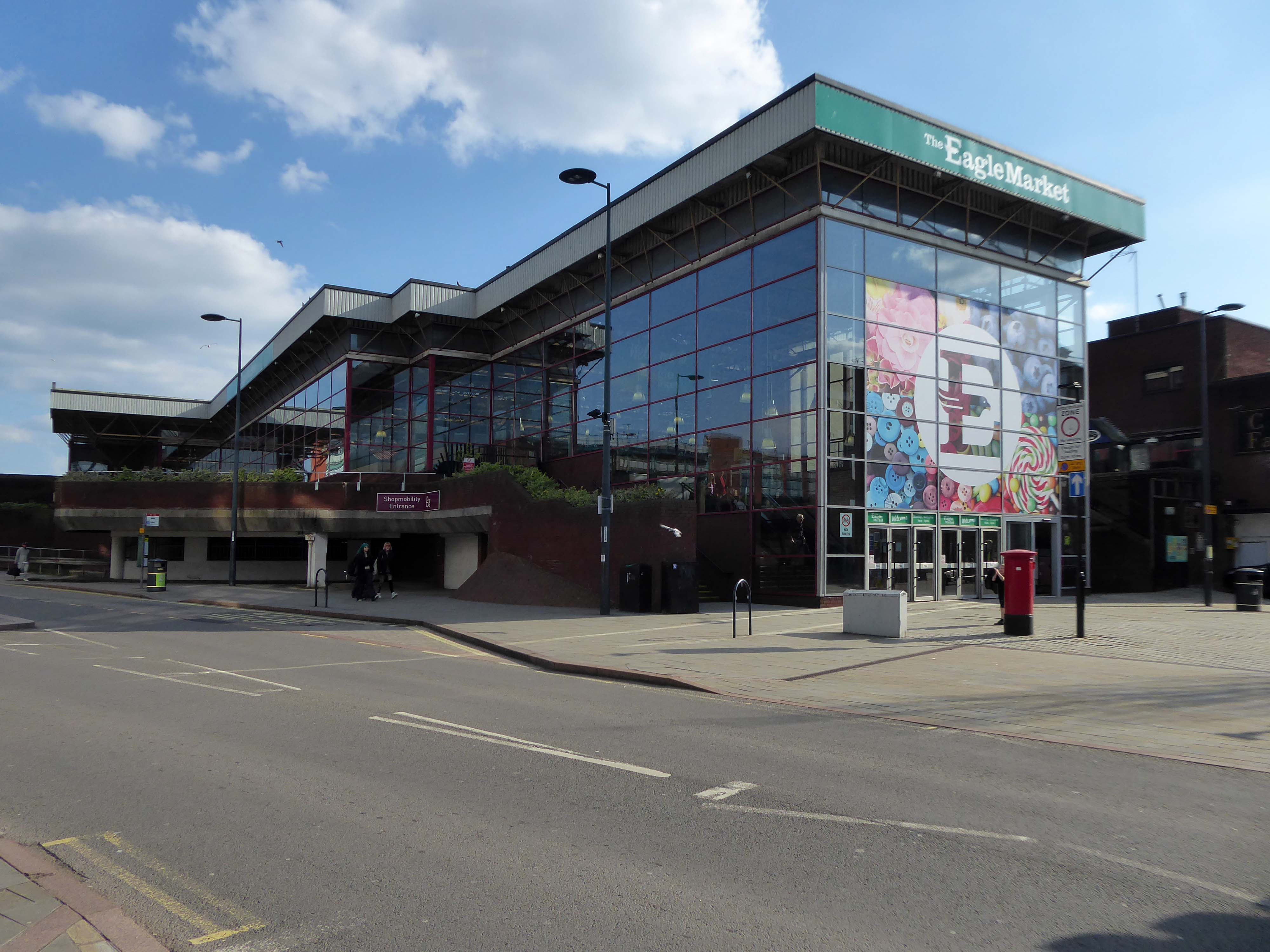
Derby’s Eagle Market, which has been open for nearly 50 years, is set to close for good in around six months from now. The indoor market is expected to shut down in March, traders were told in a memo late last month.
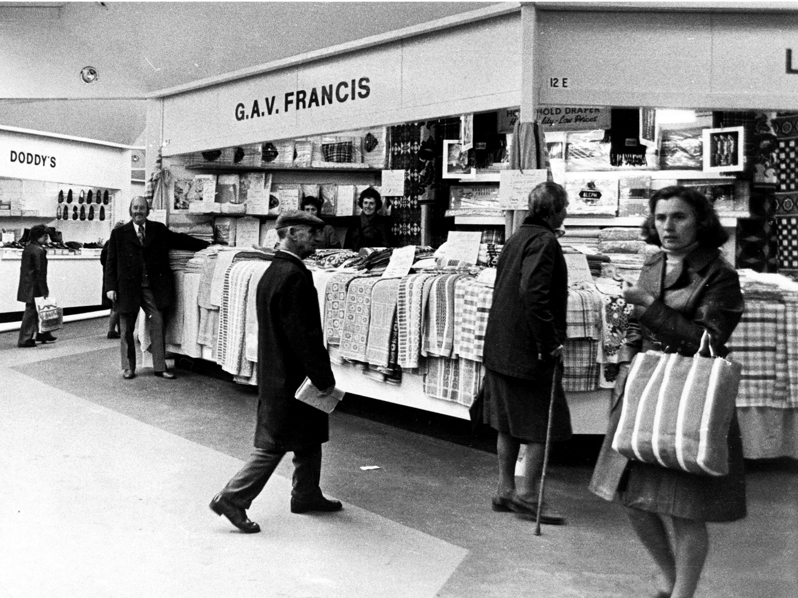
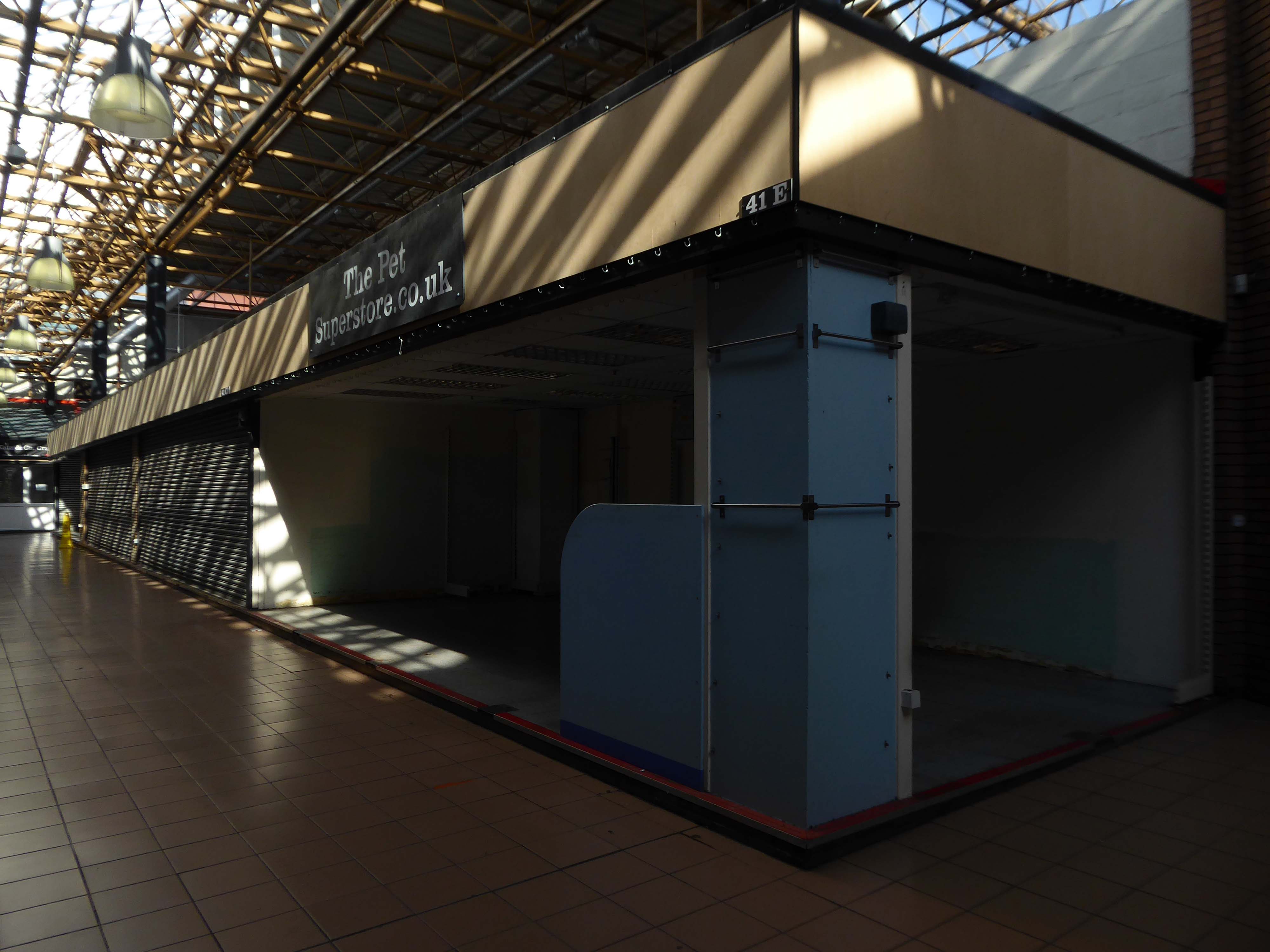
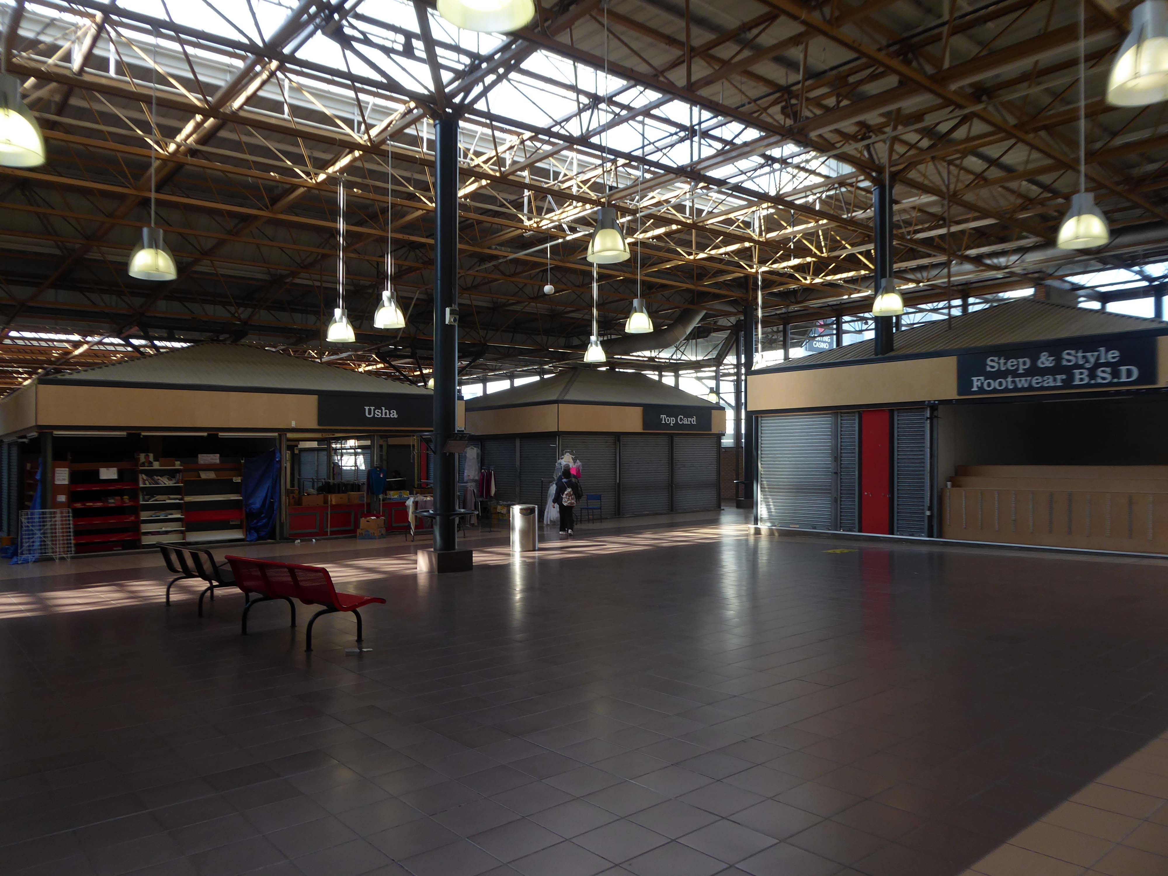
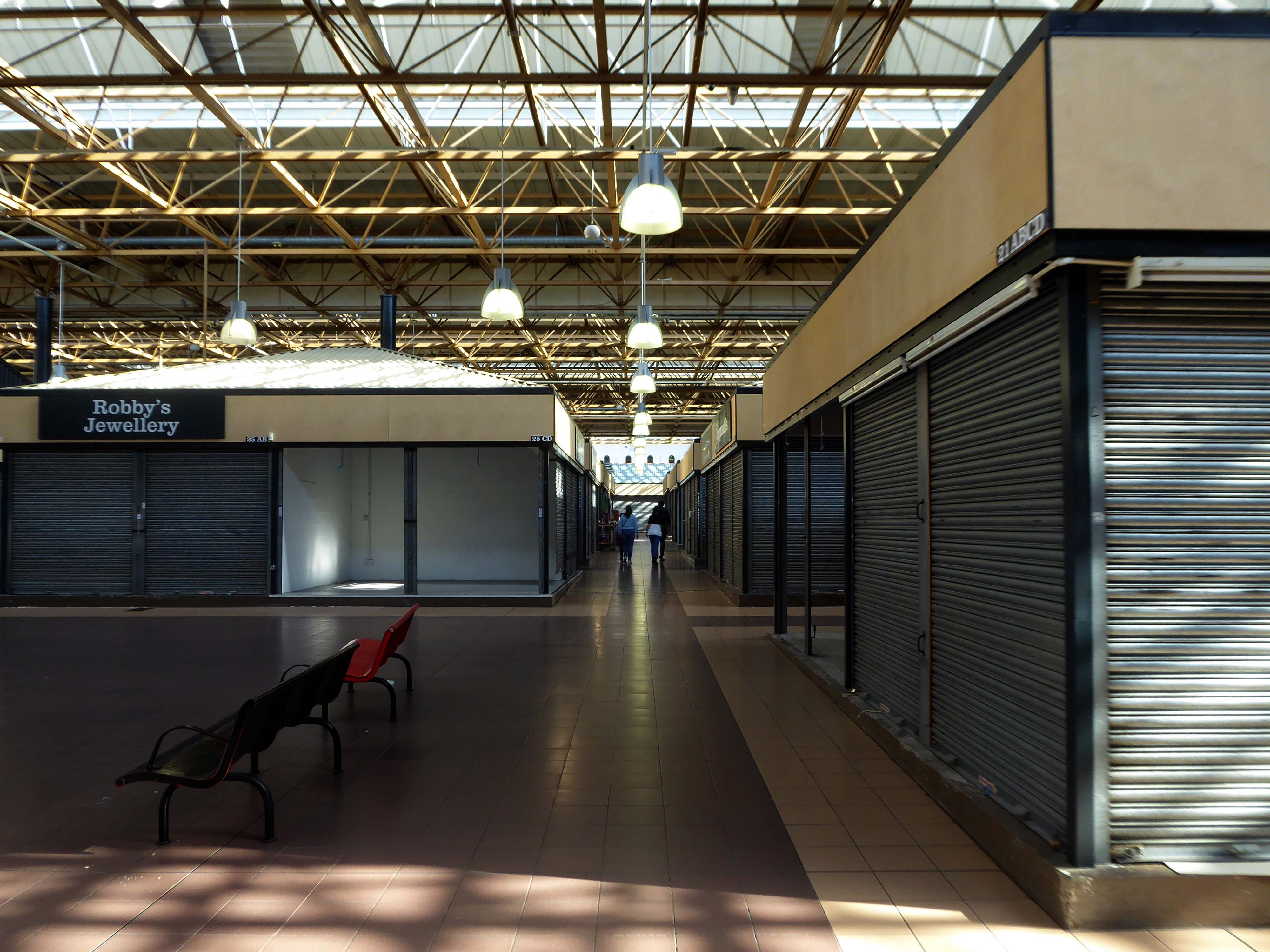
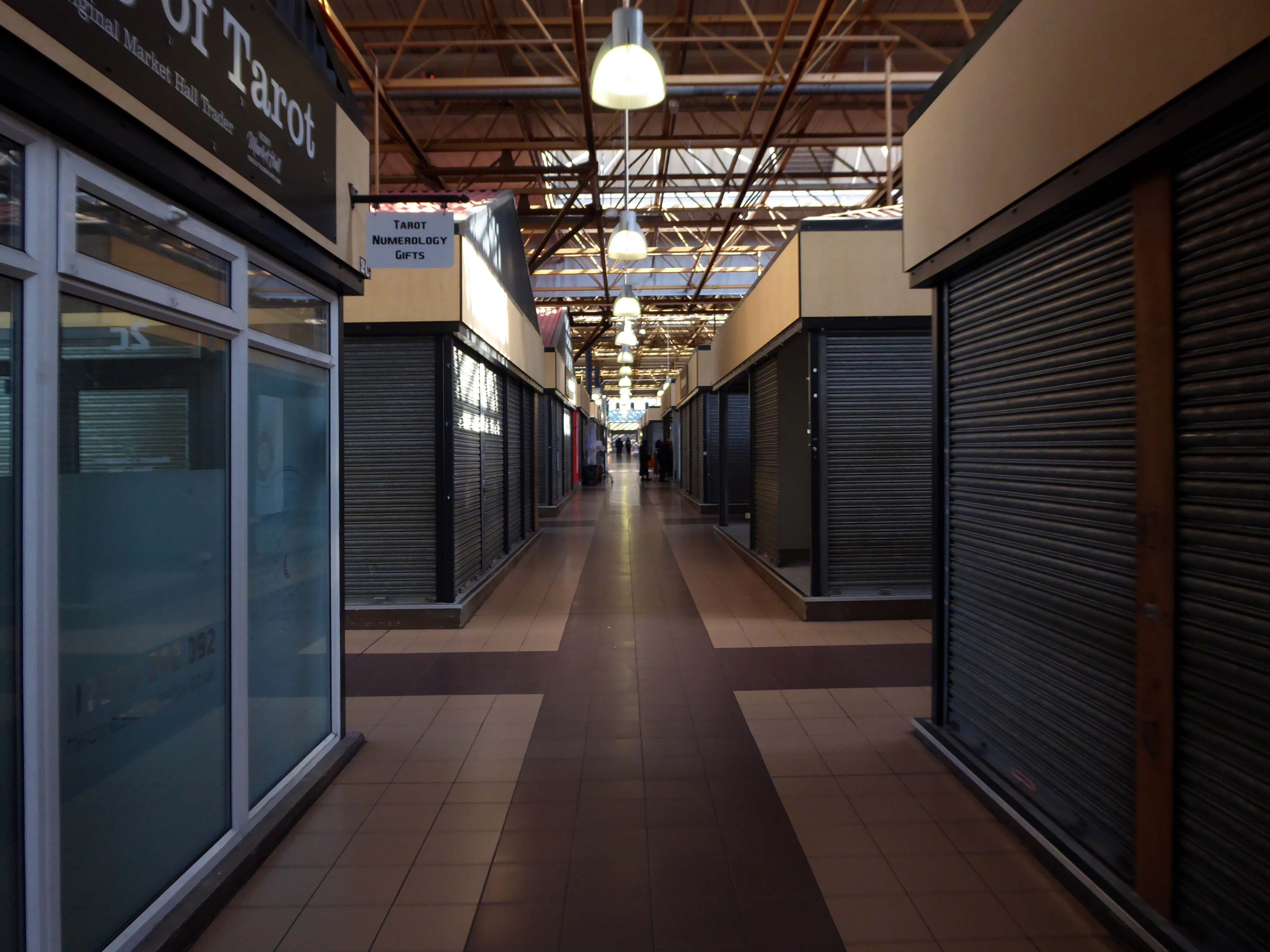
The long-standing city centre market has undergone major changes since opening in 1975. Over the past 46 years, dozens of traders have come and gone, from fruit and veg sellers to fine clothes retailers, pottery makers.
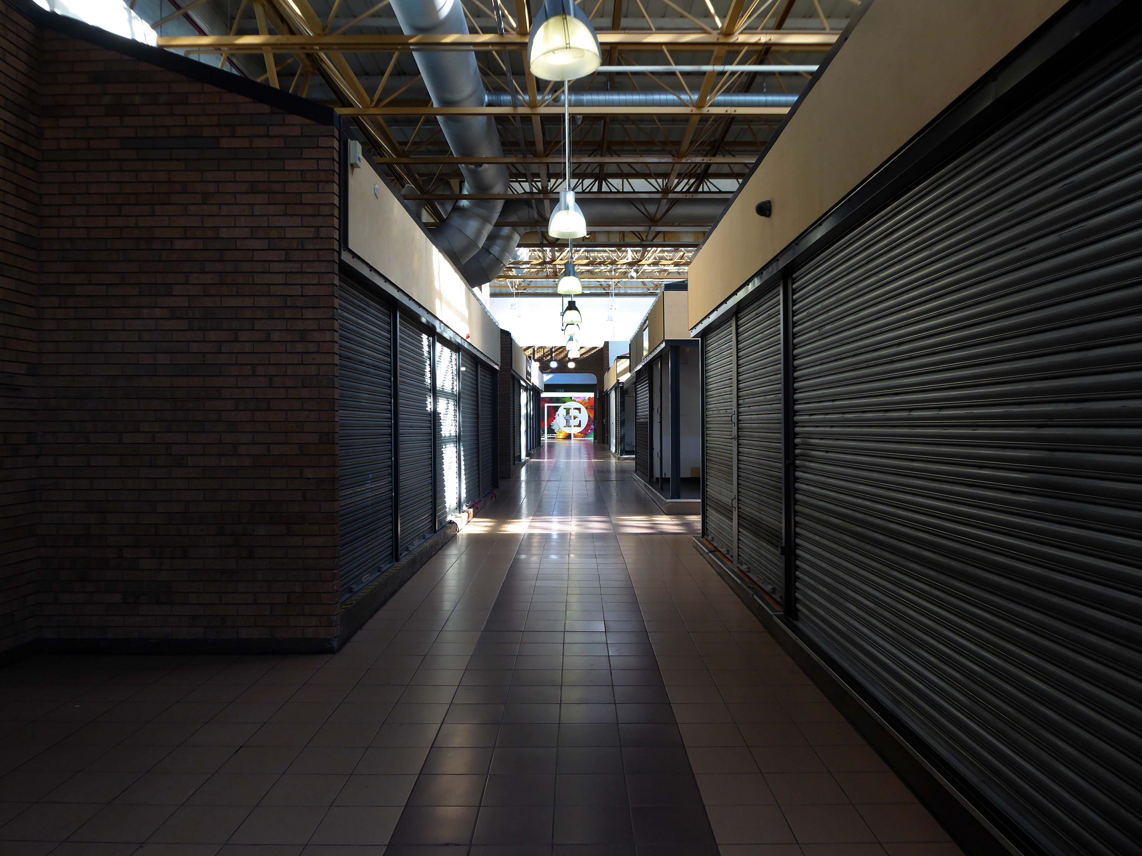
The nut stall that is greatly missed by nut fans.
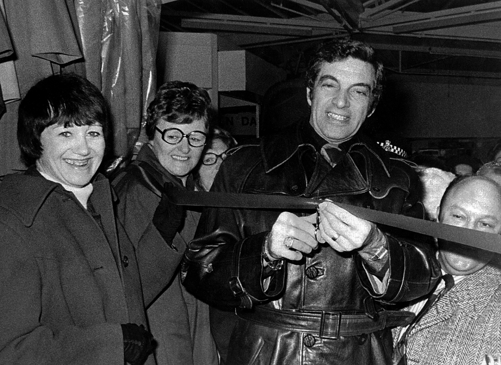
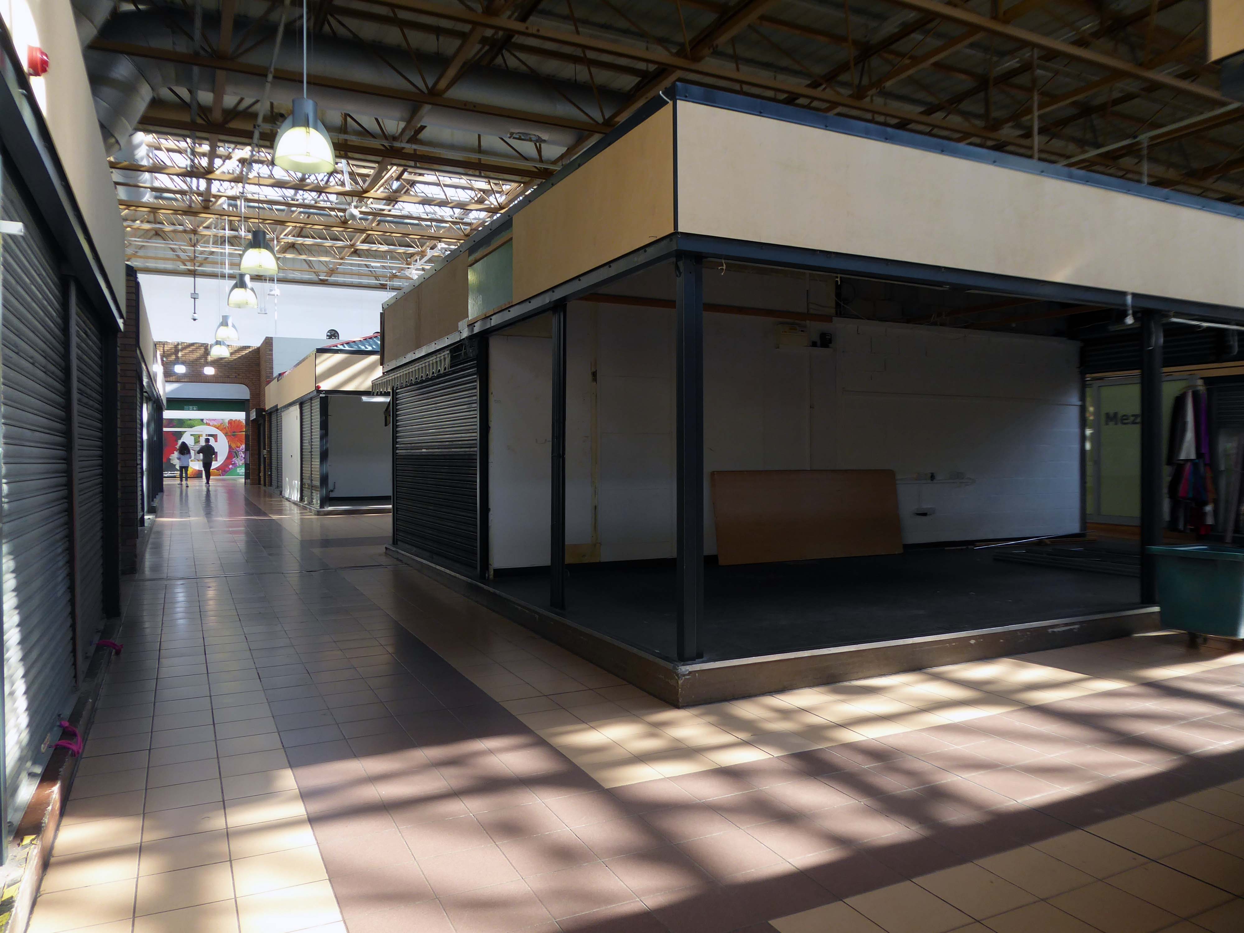
Singer Frankie Vaughan opens Jack’s Rainwear at the market in 1976.
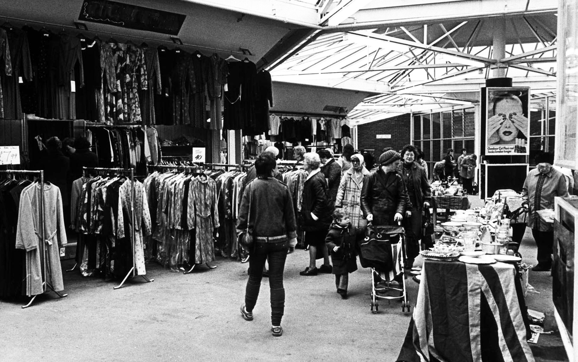
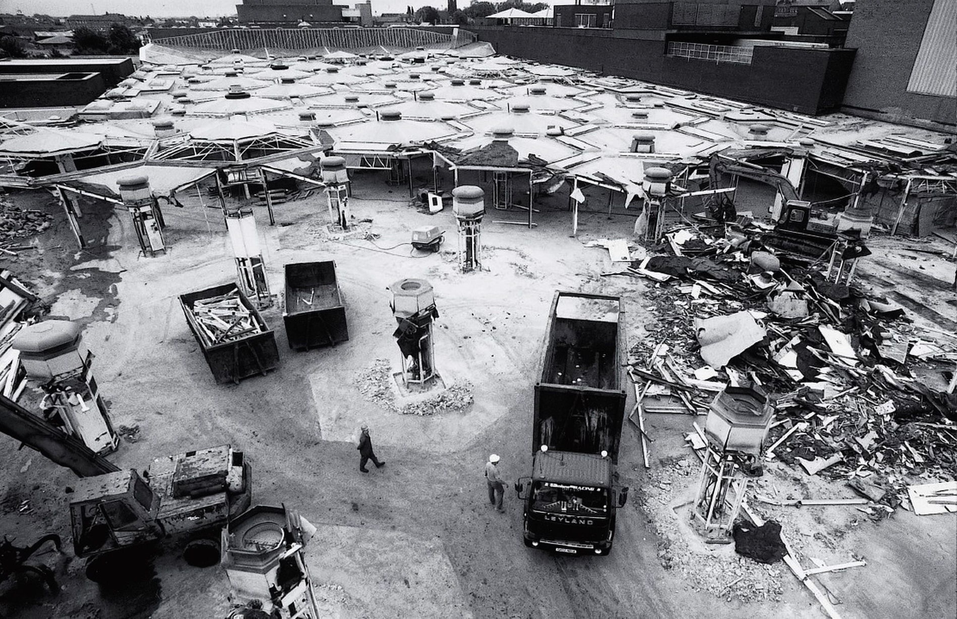
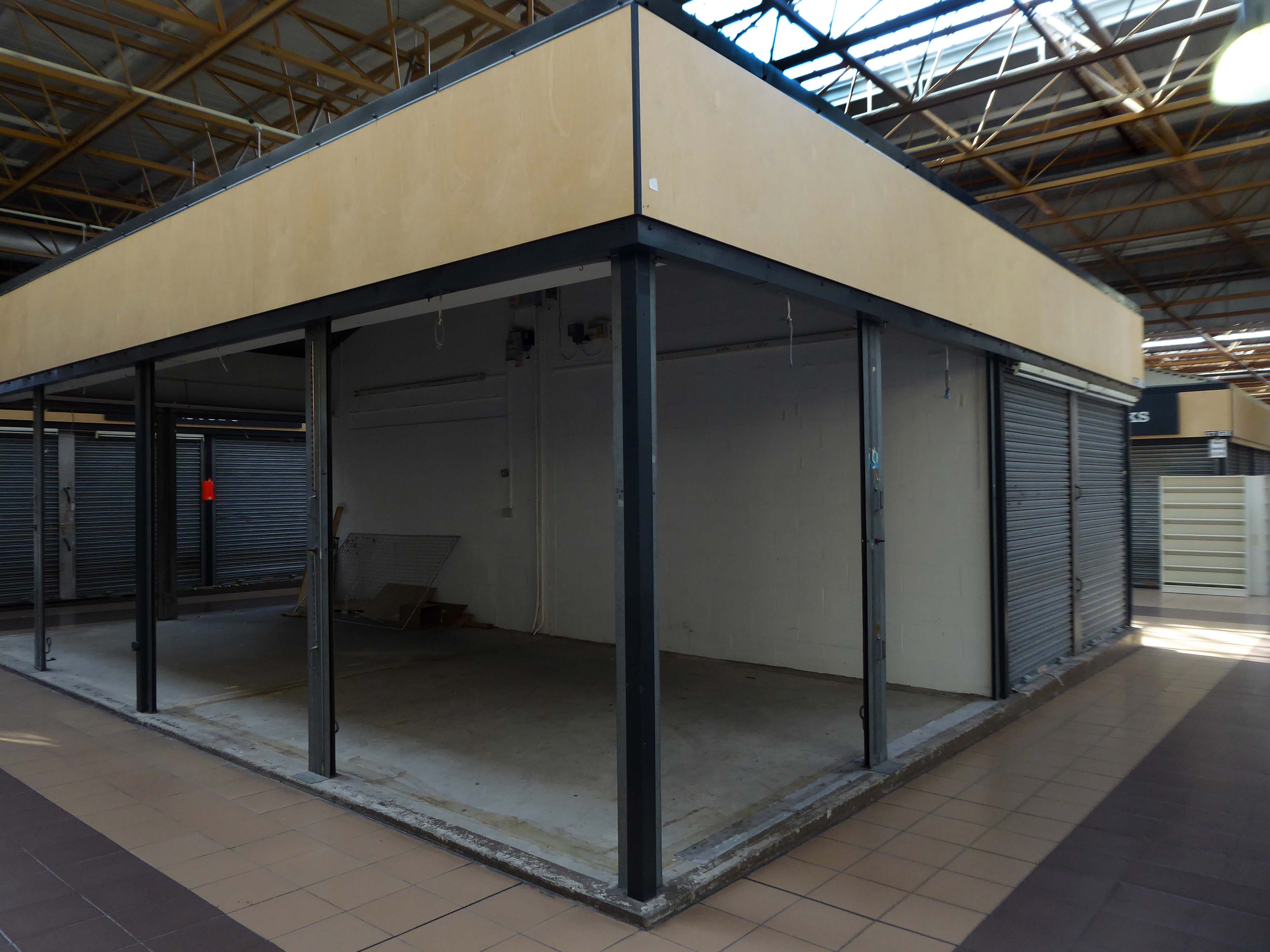
When it first opened, the venue was a maze of hexagonal stalls, which gave it a futuristic look, but it was a confusing layout and it was difficult to navigate and find the stall you wanted. The hexagons came down in 1990 in favour of a more traditional, open layout which made the market easier to escape in the event of a fire.
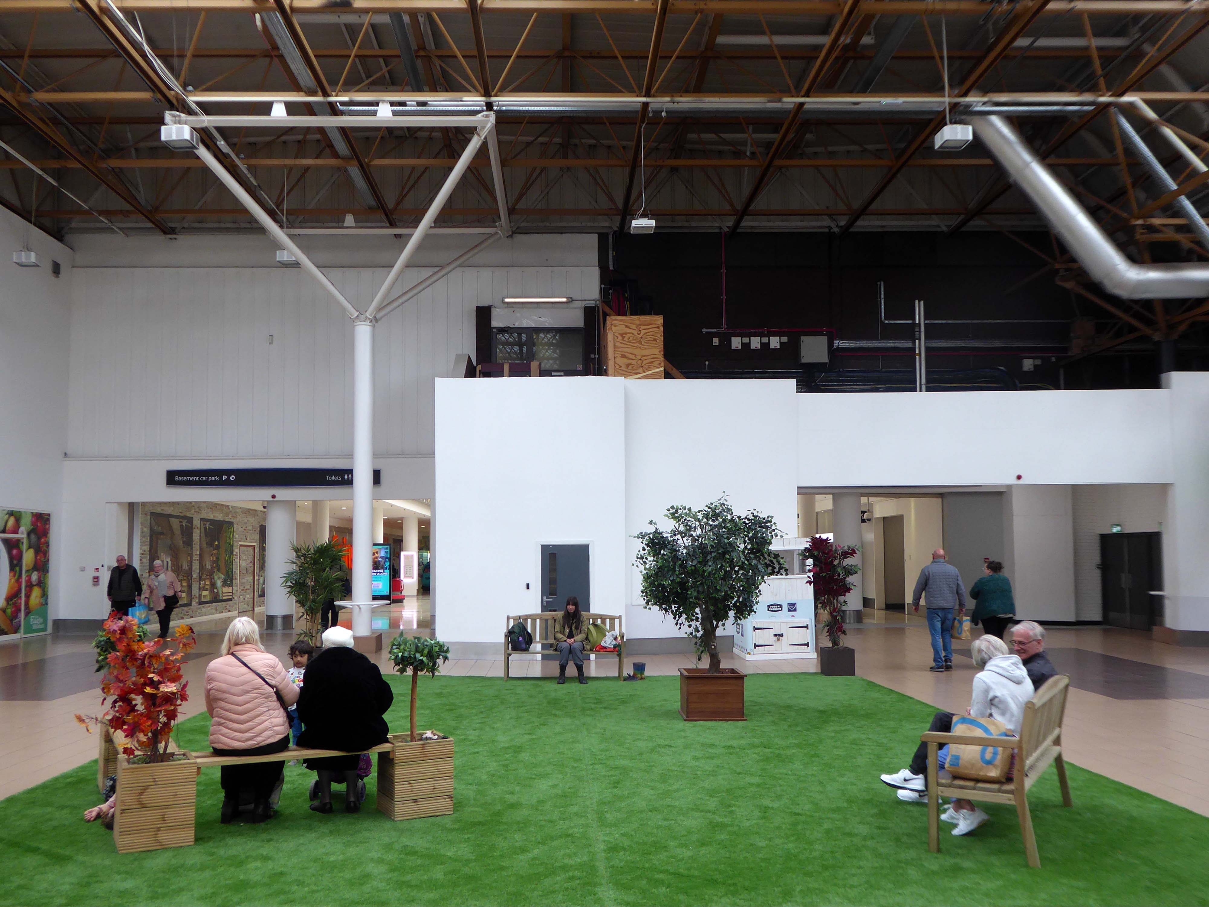
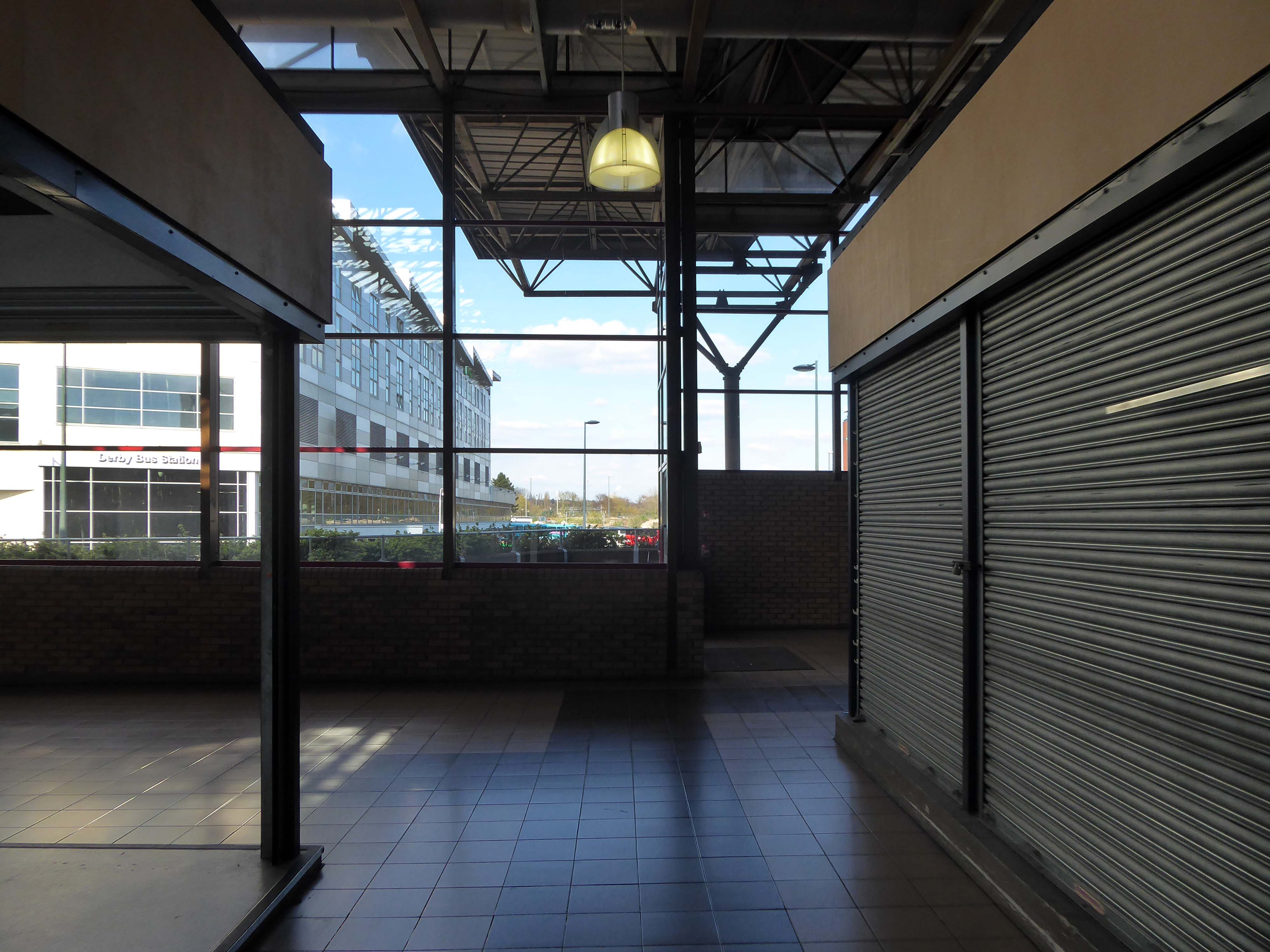
The Modernist modular structure replaced by a higher High-Tech roofing solution.
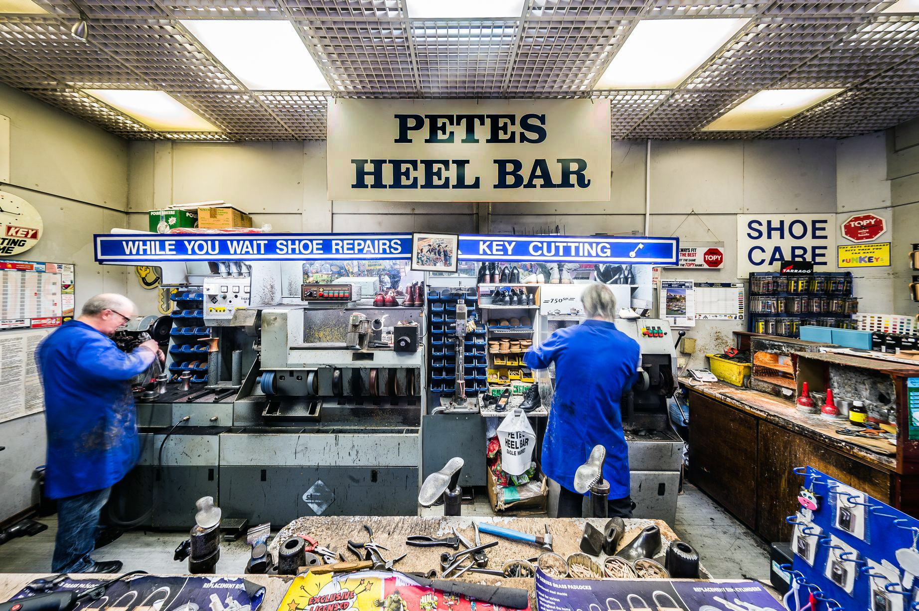
Petes Heel bar will be missed, along with his missing apostrophe.
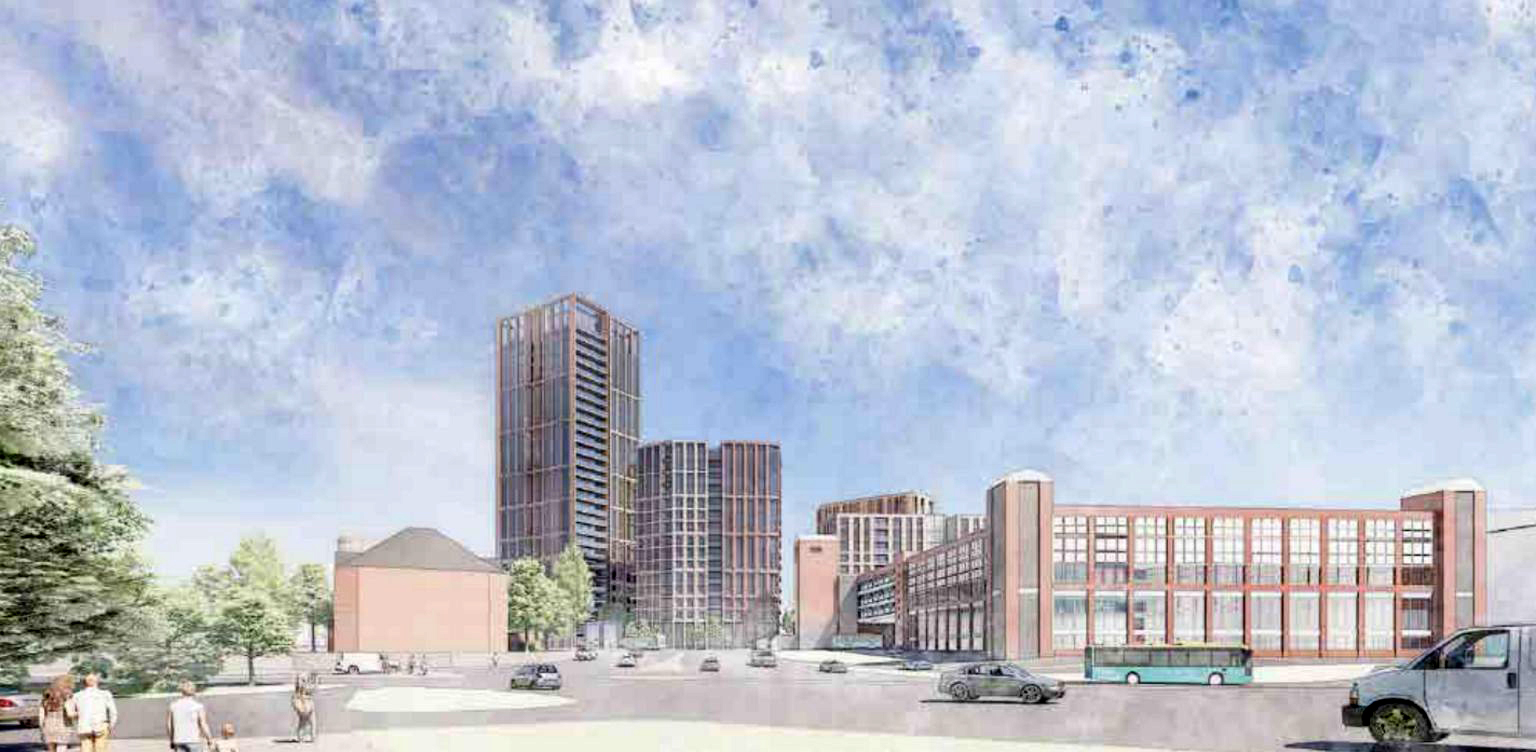
The redevelopment masterplan includes new homes and commercial uses with new public spaces and walkable streets that will integrate the site with the rest of the City Centre and improve new connections to the river. There is scope to introduce some tall buildings to make better use of the site with new food and beverage, leisure and other activity at ground floor level. The proposals will contribute towards the Council’s vision in a way that responds positively to the site context including surrounding character areas.
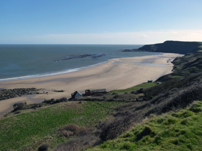
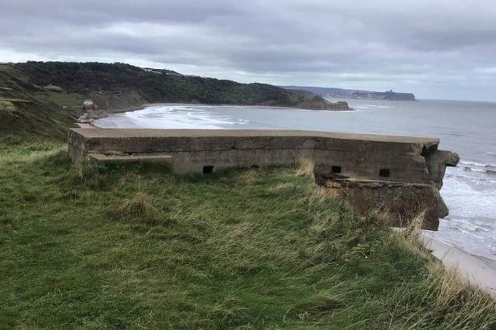
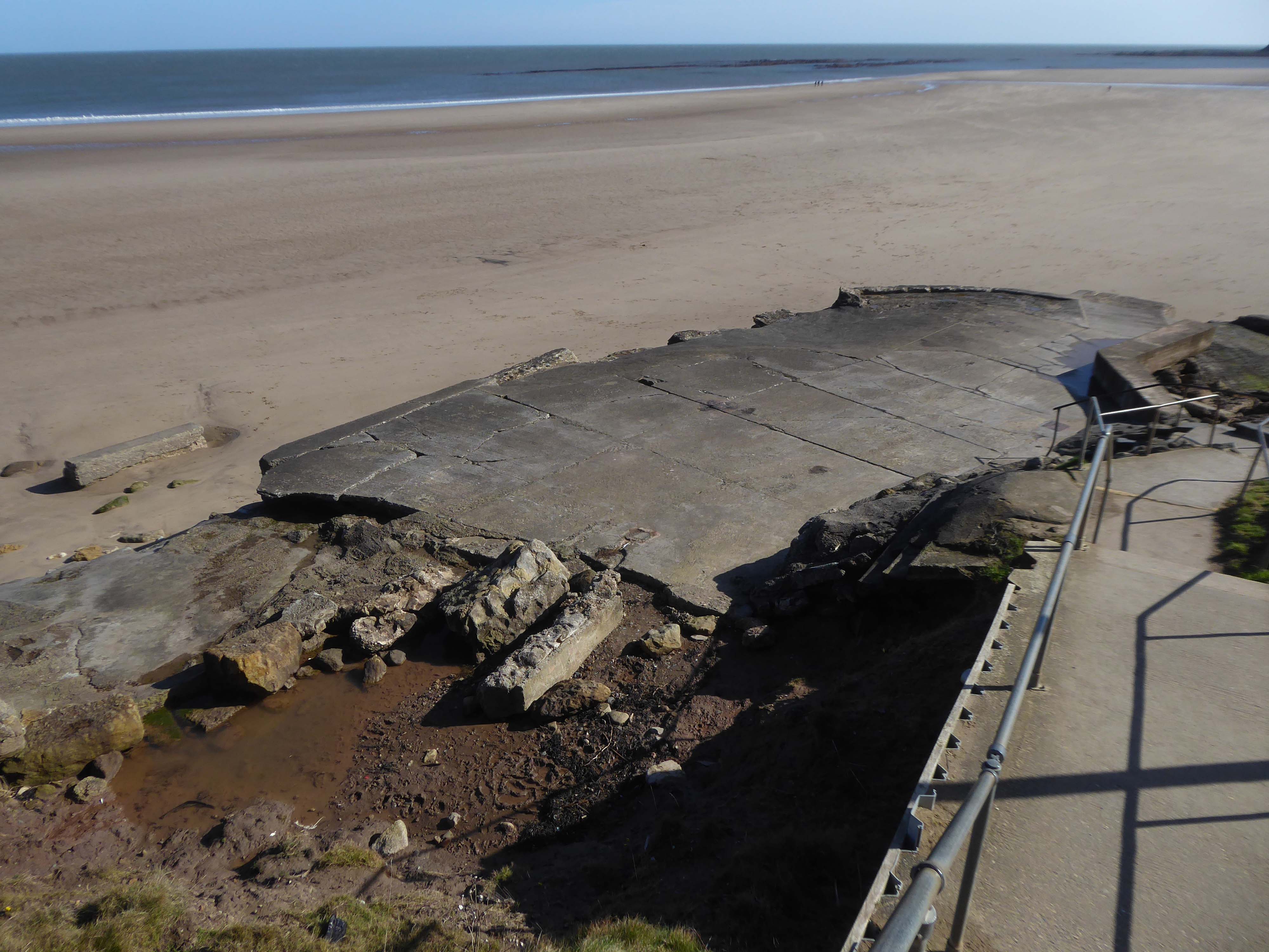
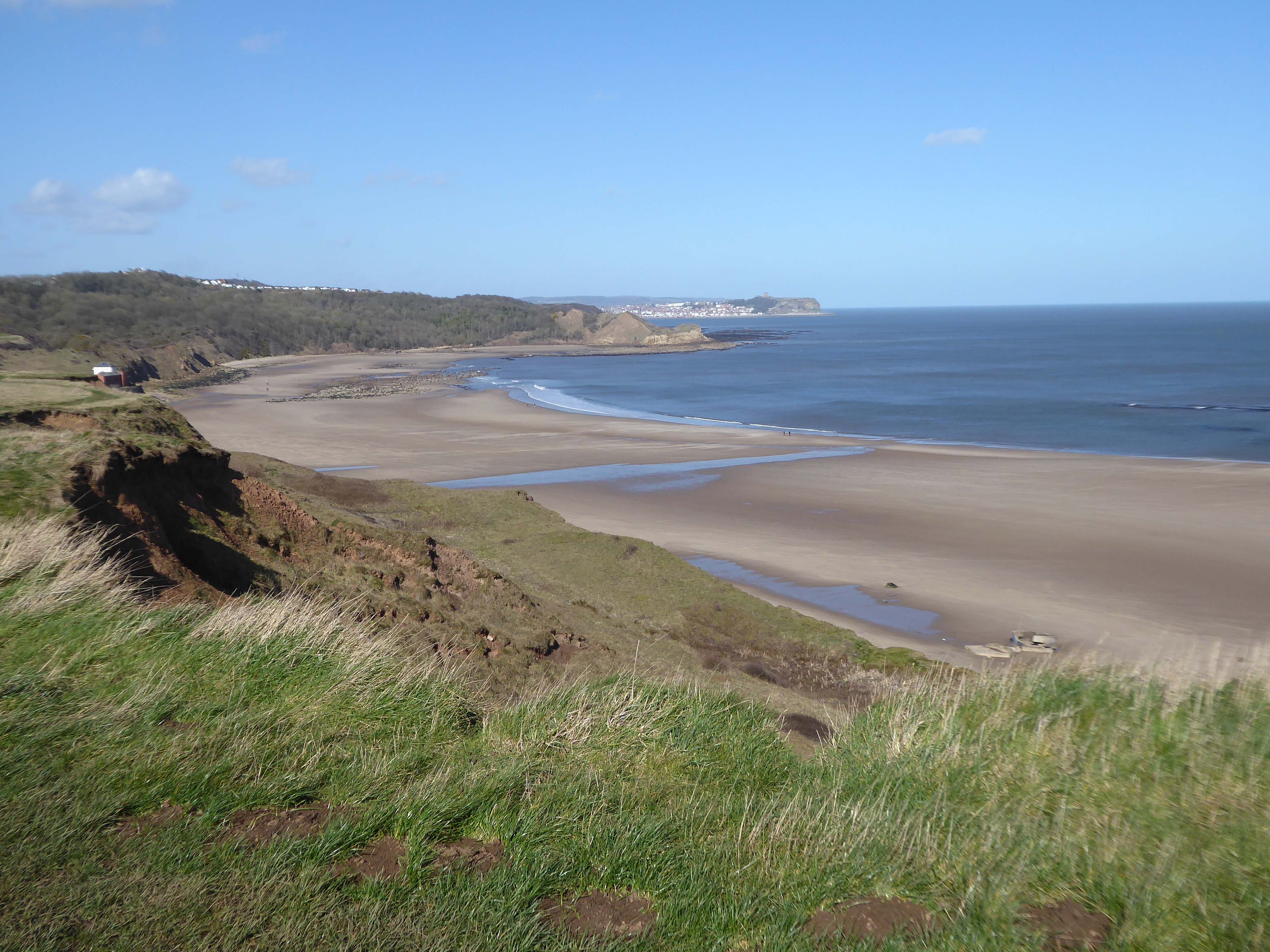
The soft clays of the cliffs are subject to constant erosion.
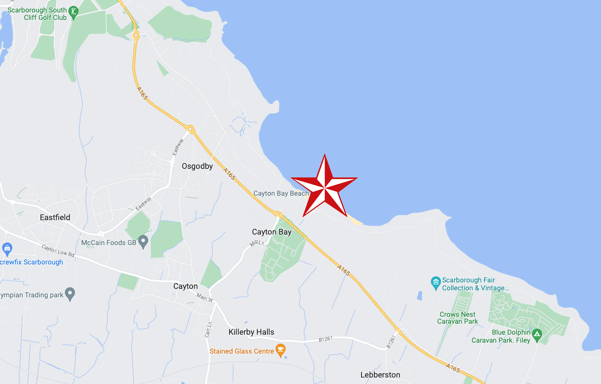
In 2008 fresh landslips have occurred around Cayton Bay. The bungalows built on the old holiday camp at Osgodby Point have started to suffer serious erosion. The cliffs around the Cornelian and Cayton areas are just made of soil. So erosion is to be expected. It may taken time. But there is not much which can be done to prevent the seas moving in.
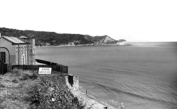
The Pumping Station was partially demolished in 1956.
Several well worn layers of geological time have been hanging around for a while now.
Whilst the long-gone critters are but fossilised versions of their former selves.
The rocks found at Cayton Bay are Jurassic aged from the Callovian stage. At the north end of Cayton Bay, the Cornbrash Formation can be seen, comprised of red-brown, sandy, nodular, bioturbated limestone with oysters and other bivalves.The Cornbrash lies beneath the start of the Cayton Clay Formation. Walking south towards Tenant’s Cliffs, Lower Calcareous Grit is brought to beach level, followed by a calcareous limestone. At the waterworks, low tides reveals a section in the Middle and Upper Jurassic rocks.
On scouring tides, argillaceous limestone and calcareous sandstone can be seen layered along the Upper Leaf of the Hambleton Oolite, which is seen excellently in the low cliff on the southern side of the Brigg. The tough, impure limestone contains well-preserved bivalves and ammonites. The sequence is shown in the diagram but faulting has caused unconformities.
During scouring, Oxford Clay can be seen along the foreshore south of the argillaceous limestone. Walking further south, Red Cliff is reached, where rocks of the Osgodby Formation slope above the Oxford Clay.
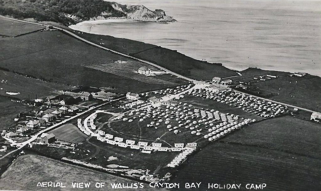
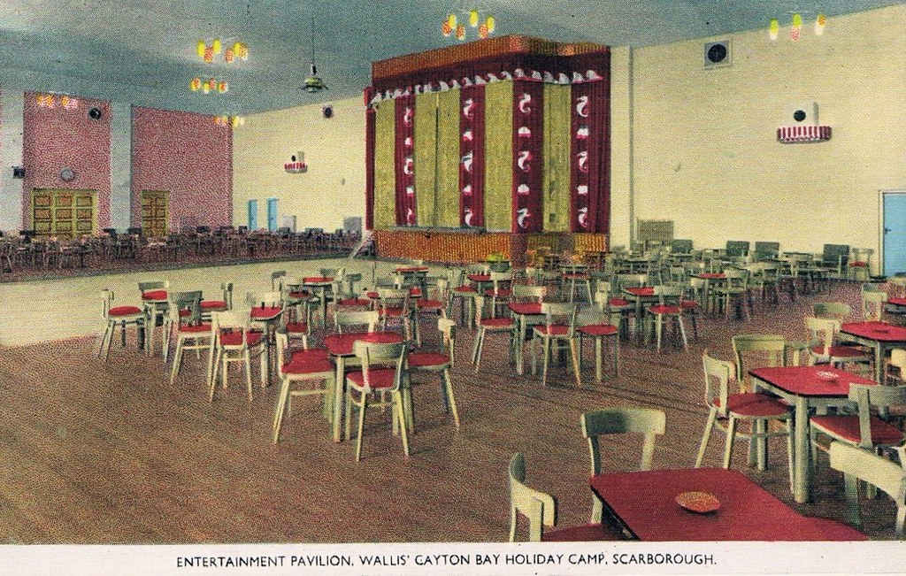
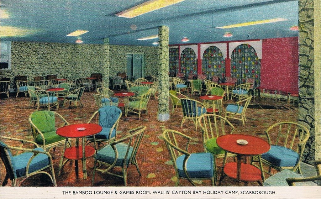
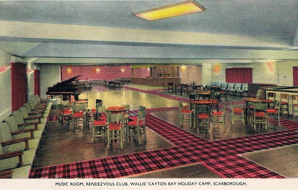
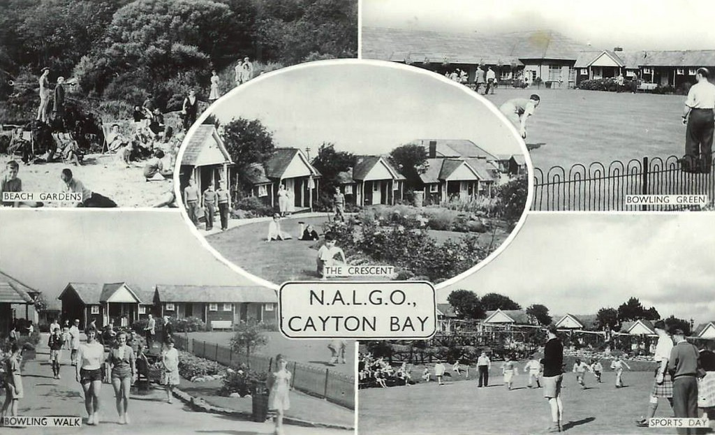
Originally the first Trade Union holiday camp in the North of England, owned by NALGO it opened its doors in 1933. It had 124 wooden bungalows, accommodating 252 visitors. A dining hall with waiter service, a rest room along with recreation rooms for playing cards, billiards, a theatre for indoor shows and dancing was also provided. The new centre also provided Tennis courts, Bowling greens along with a children’s play area. The visitors could walk to the beach where there was a sun terrace and beach house which also had a small shop.
Click here to see photos of the NALGO camp from the 1930s.
One of the earliest visitors were the family of poet Philip Larkin and during the Second World War it became a home for evacuated children from Middlesbrough.
The NALGO camp closed in 1974 and was later sold.
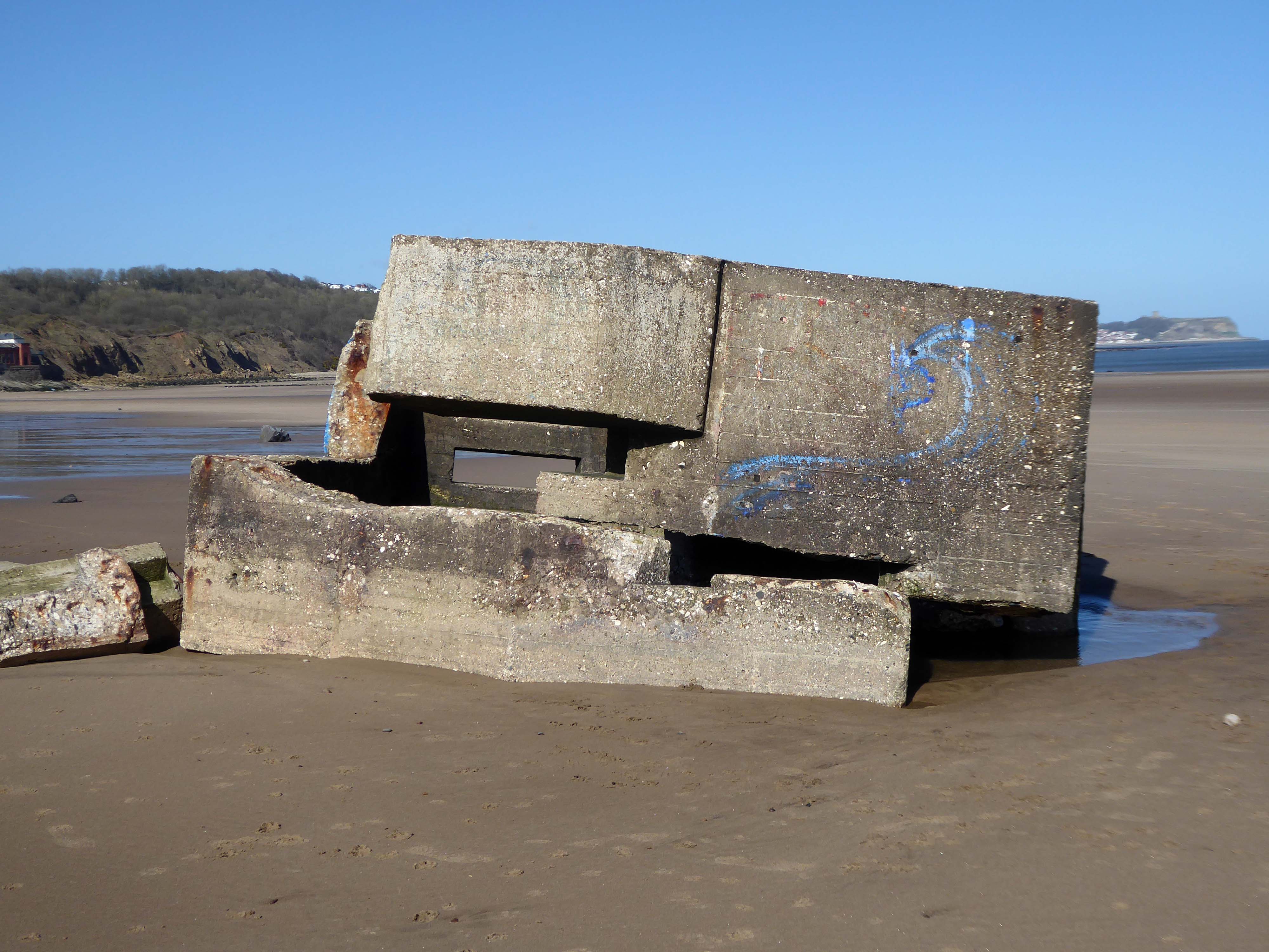
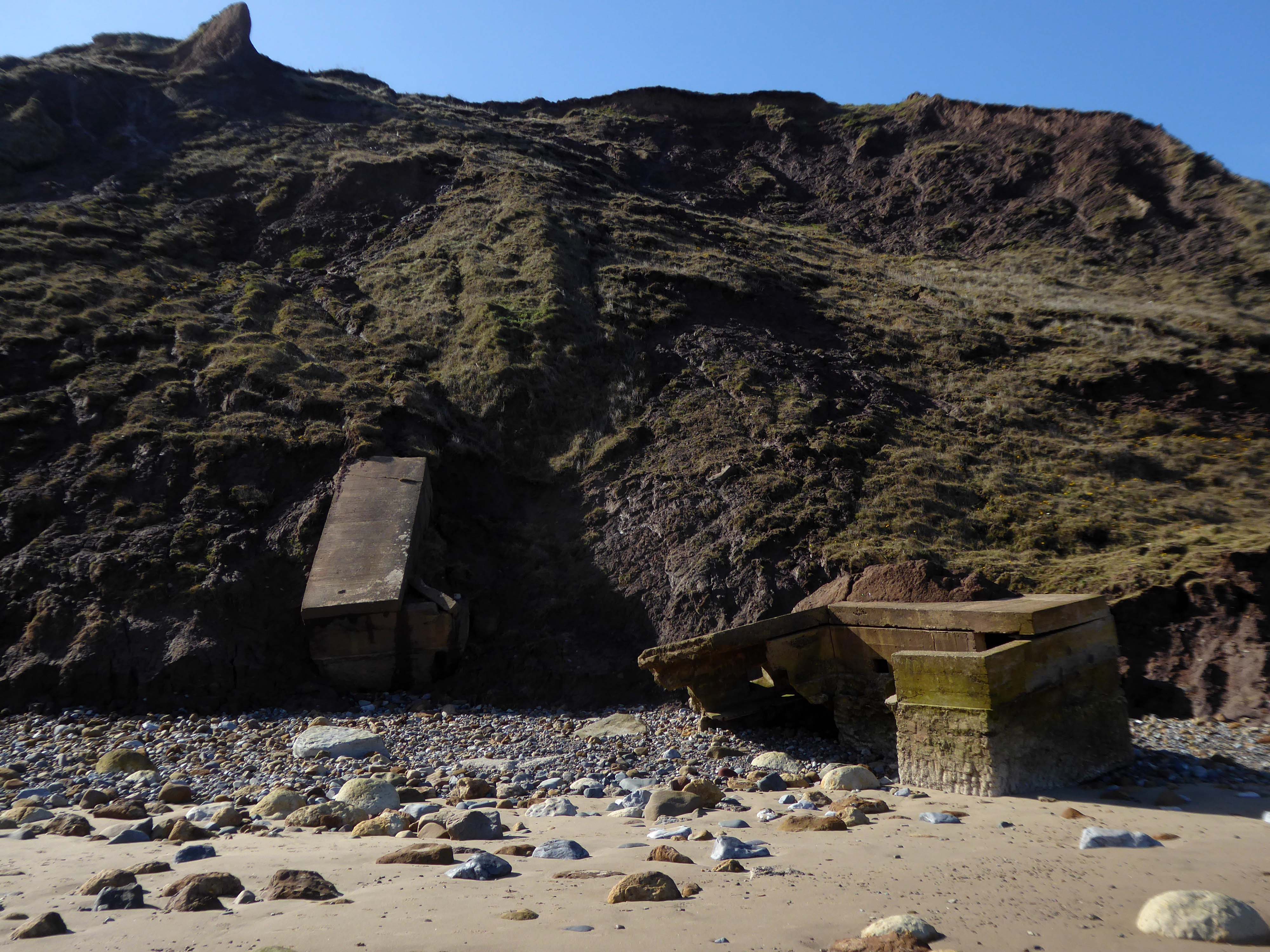
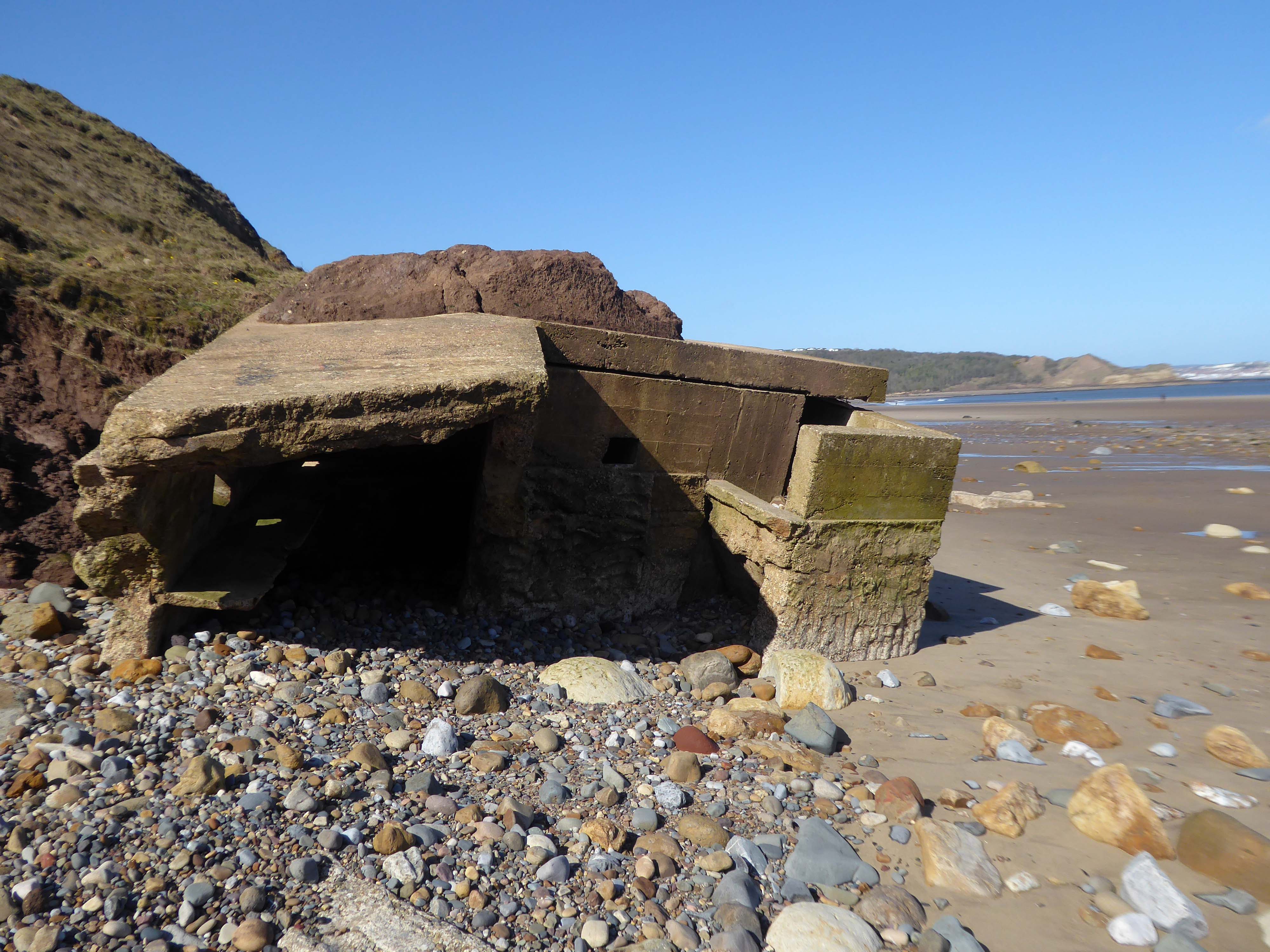
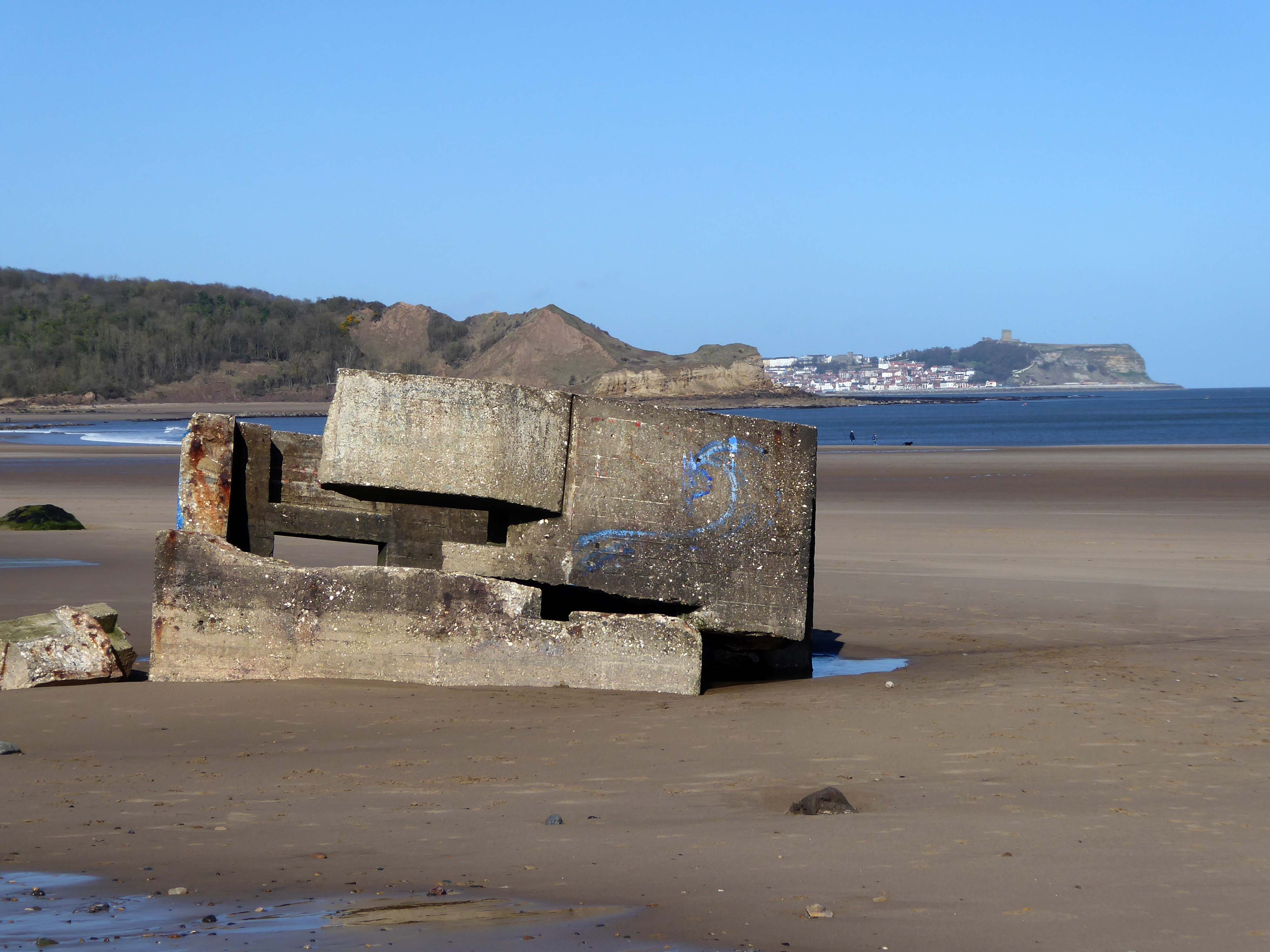
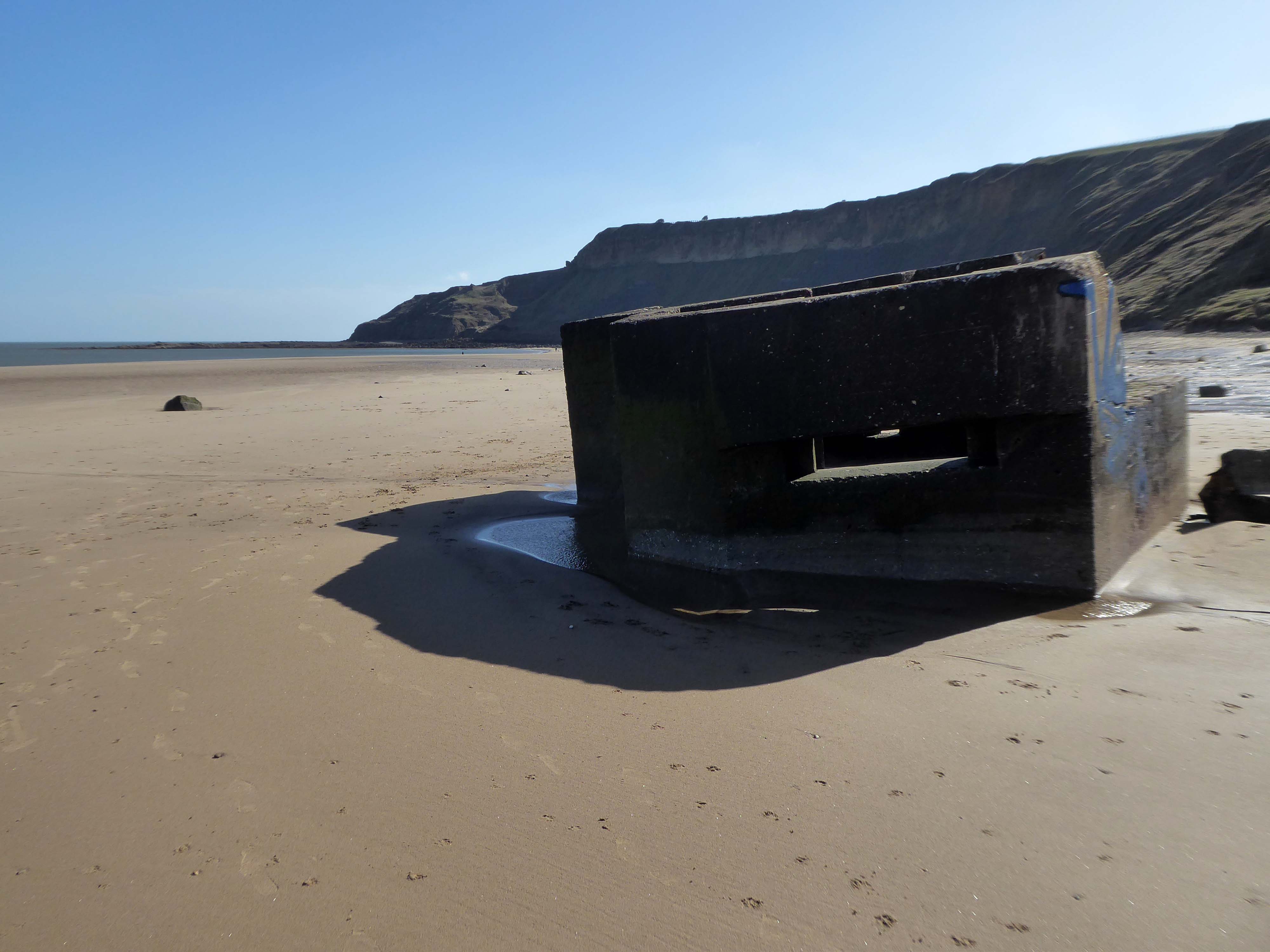
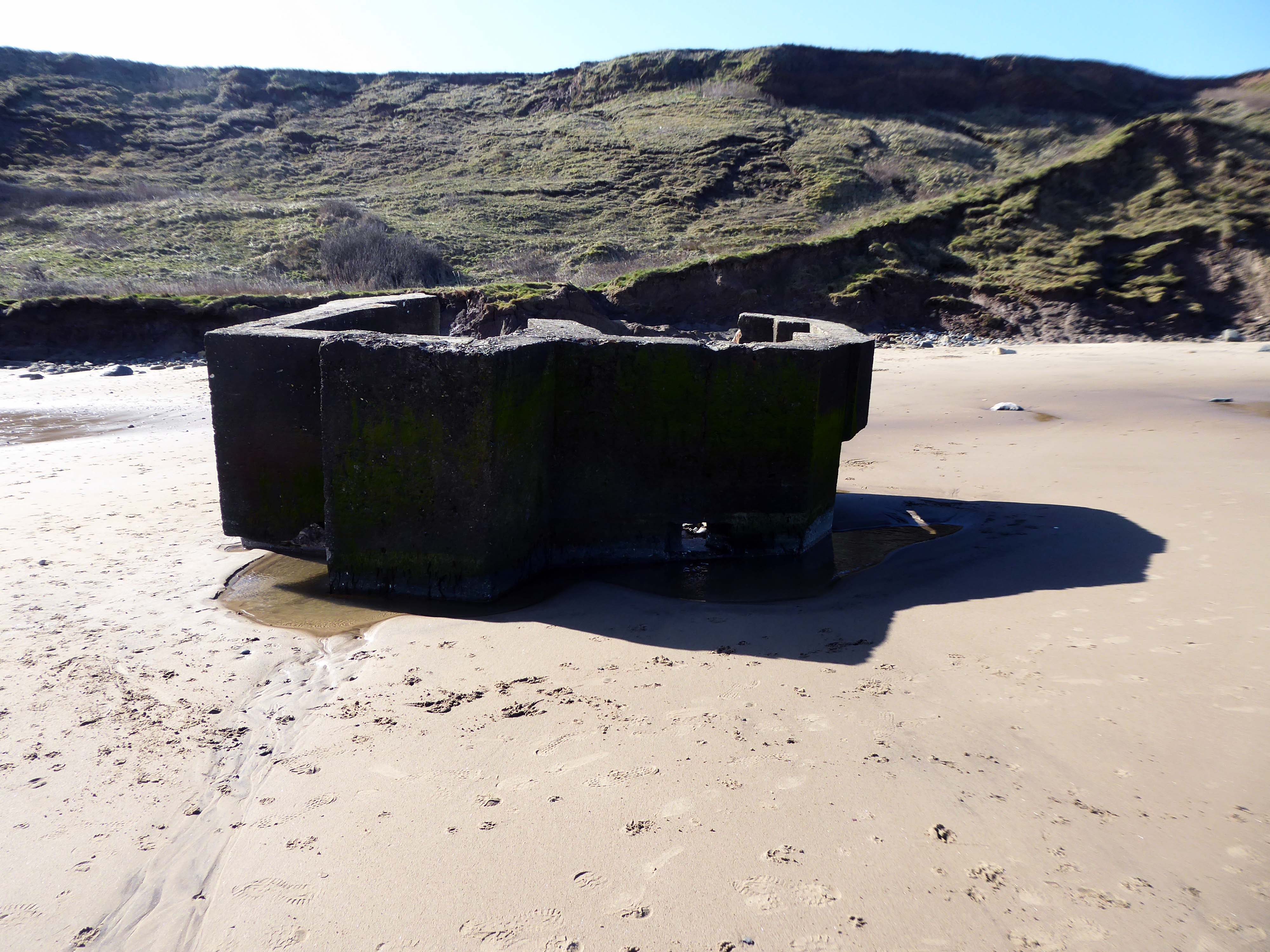
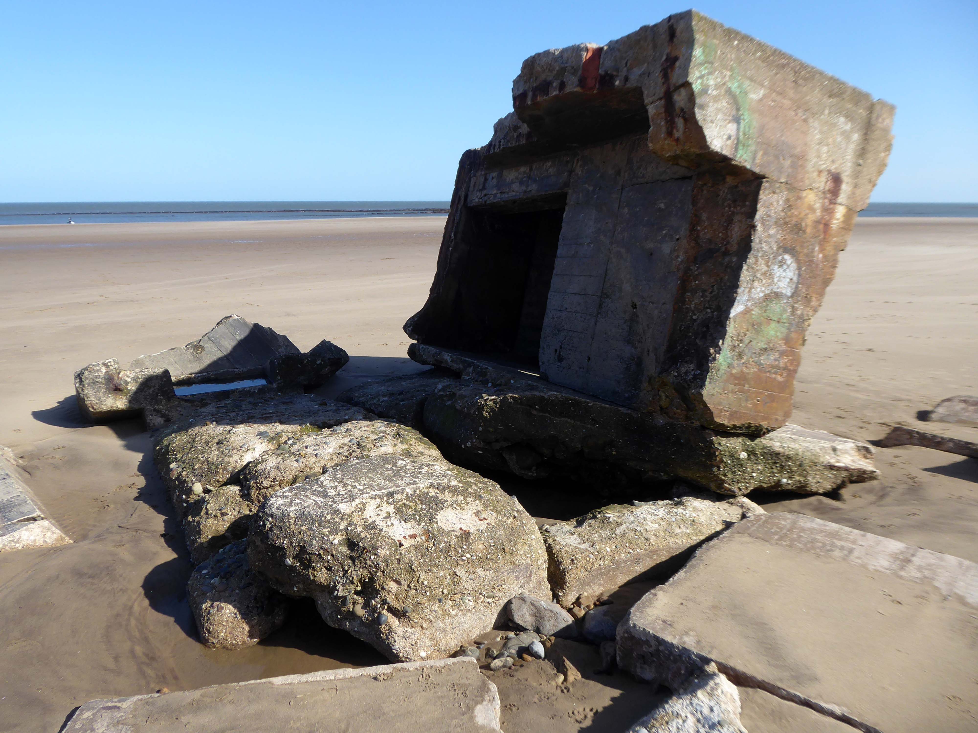
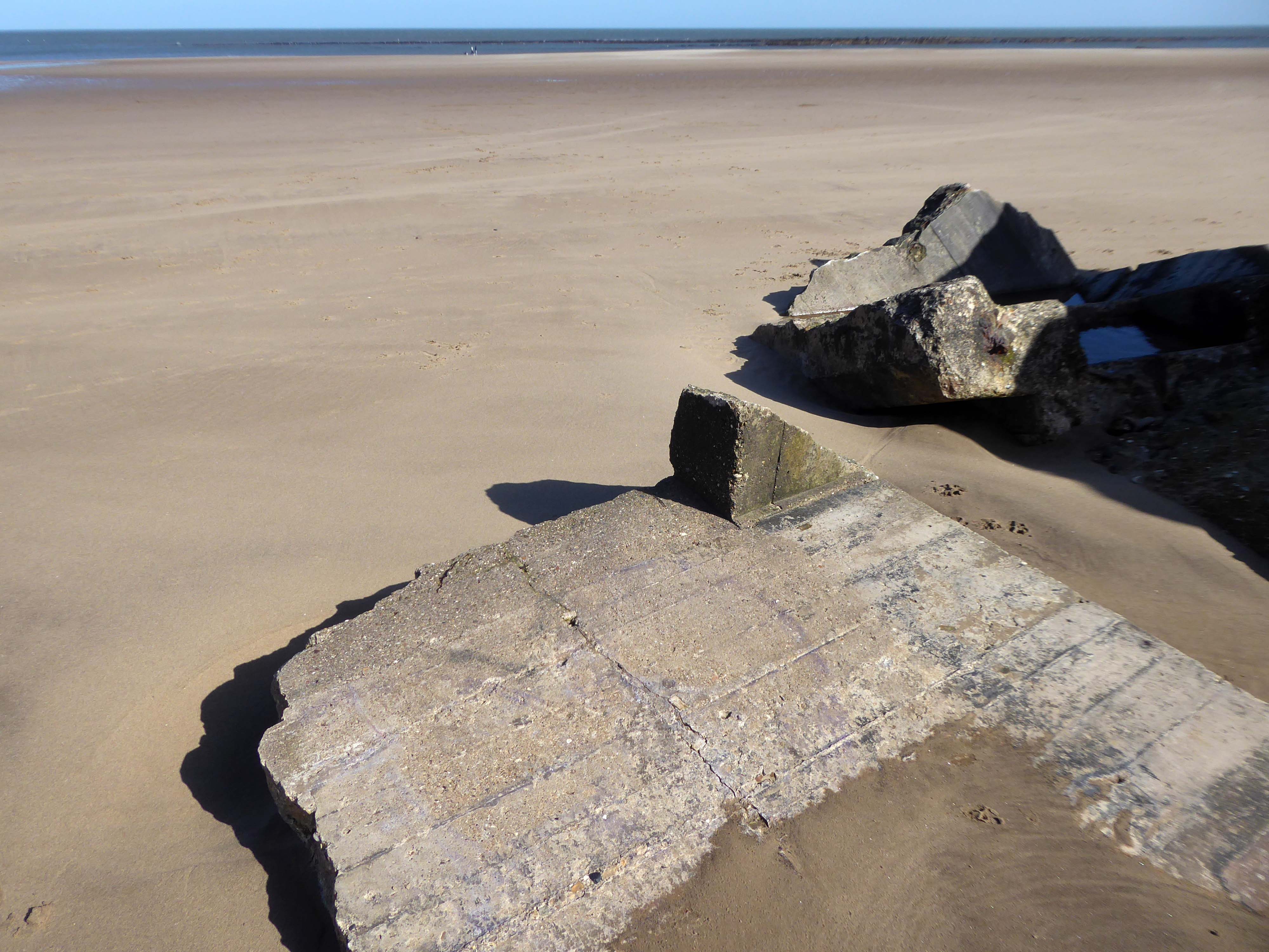
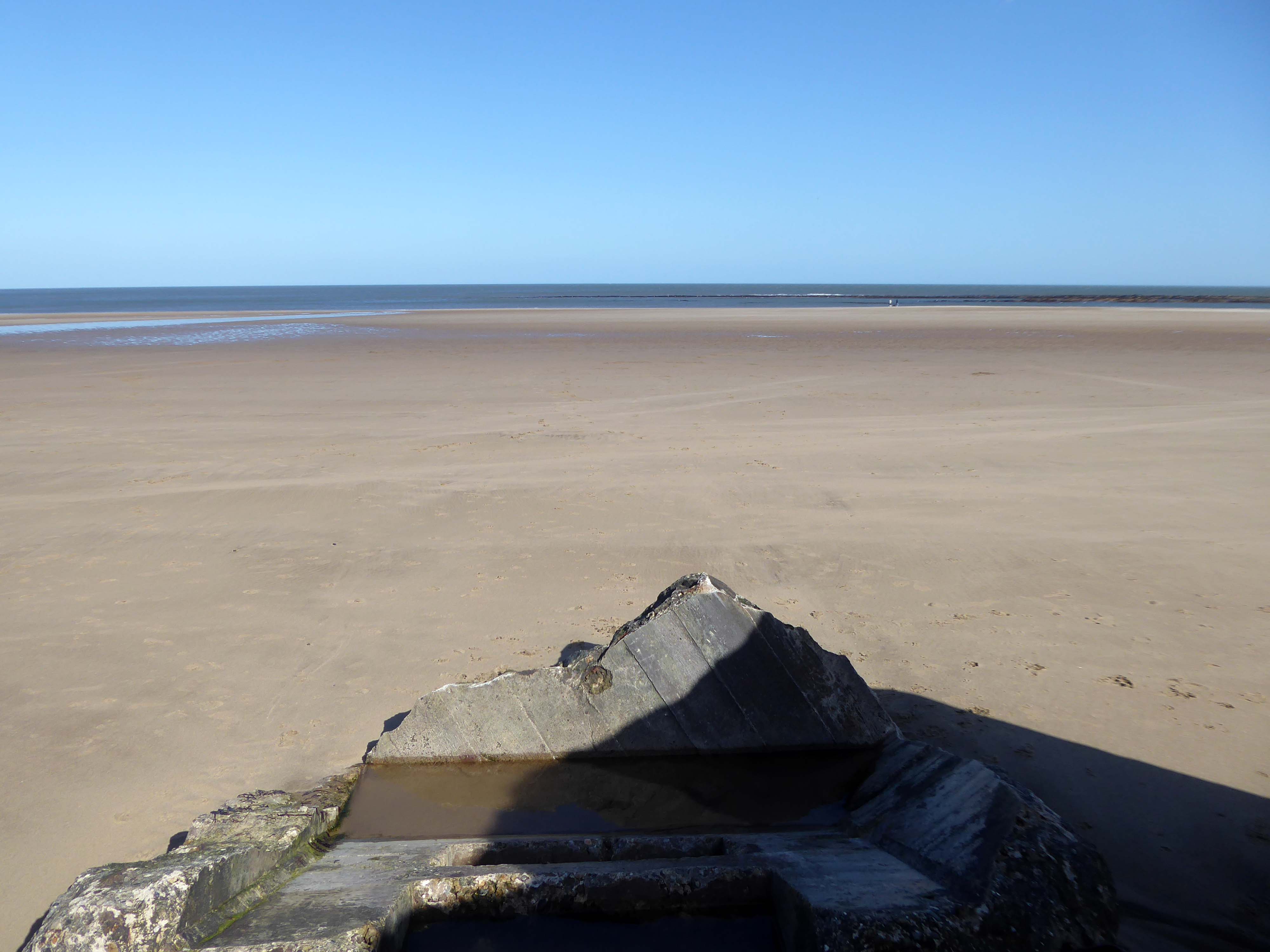
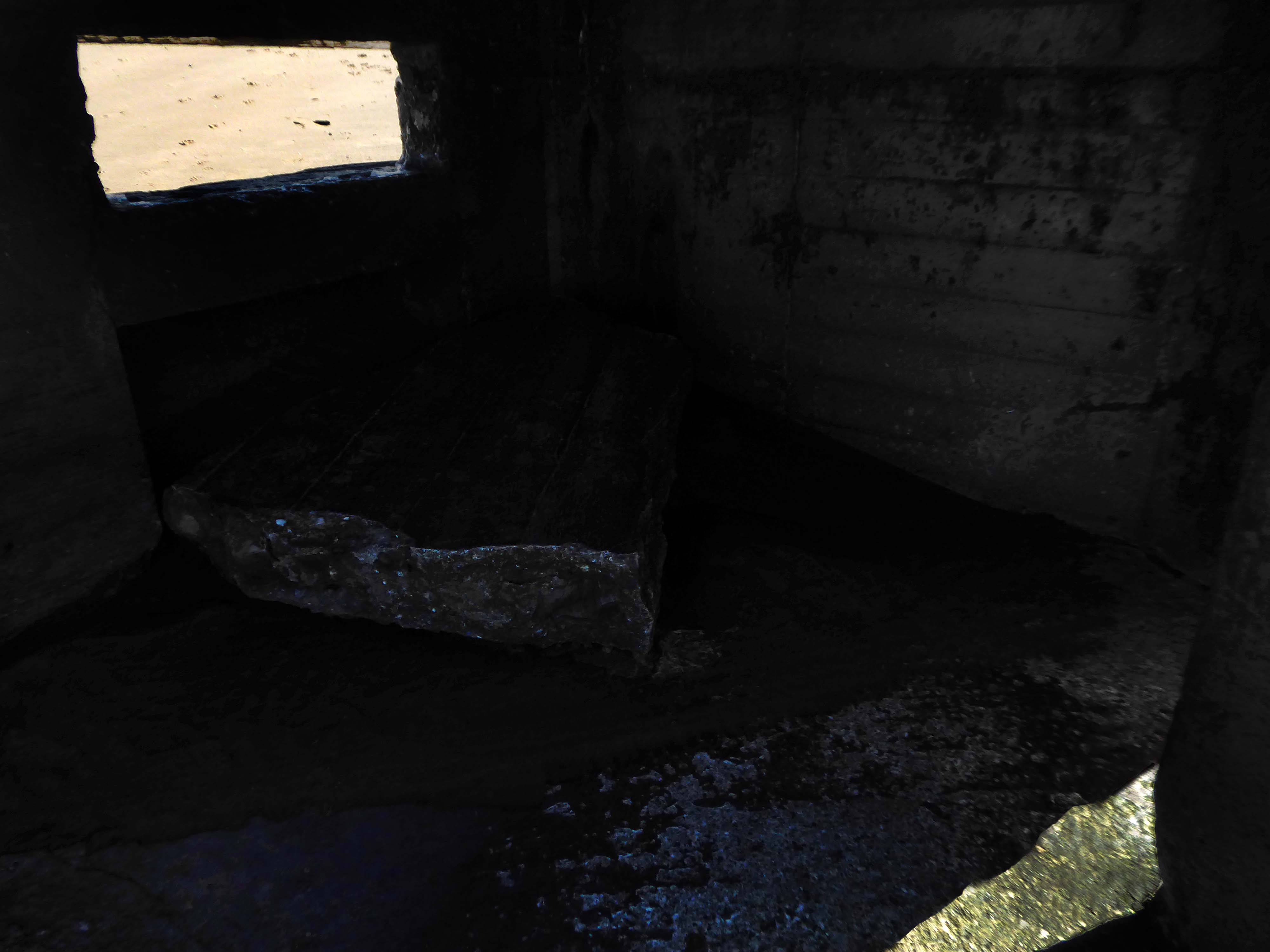
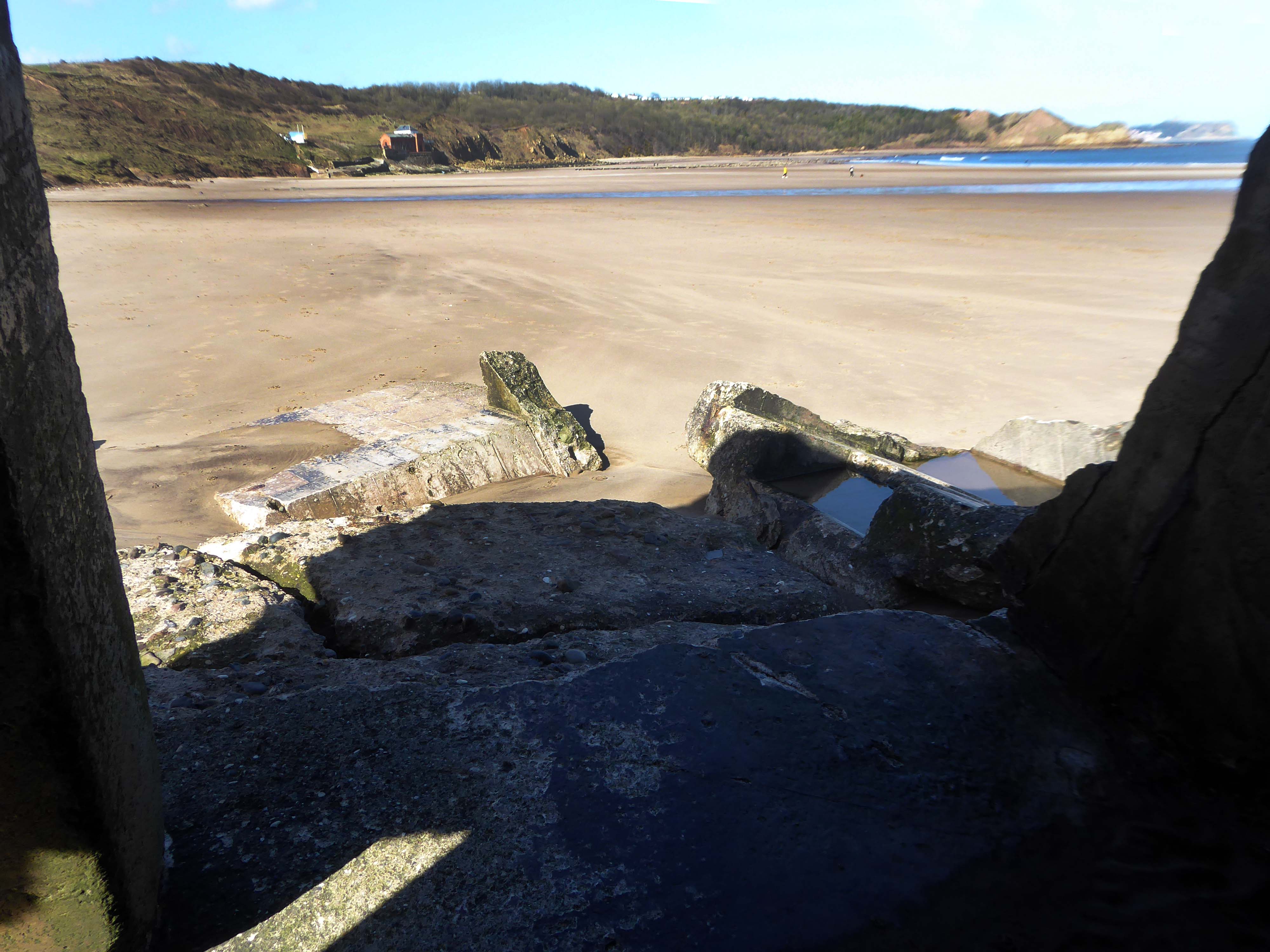
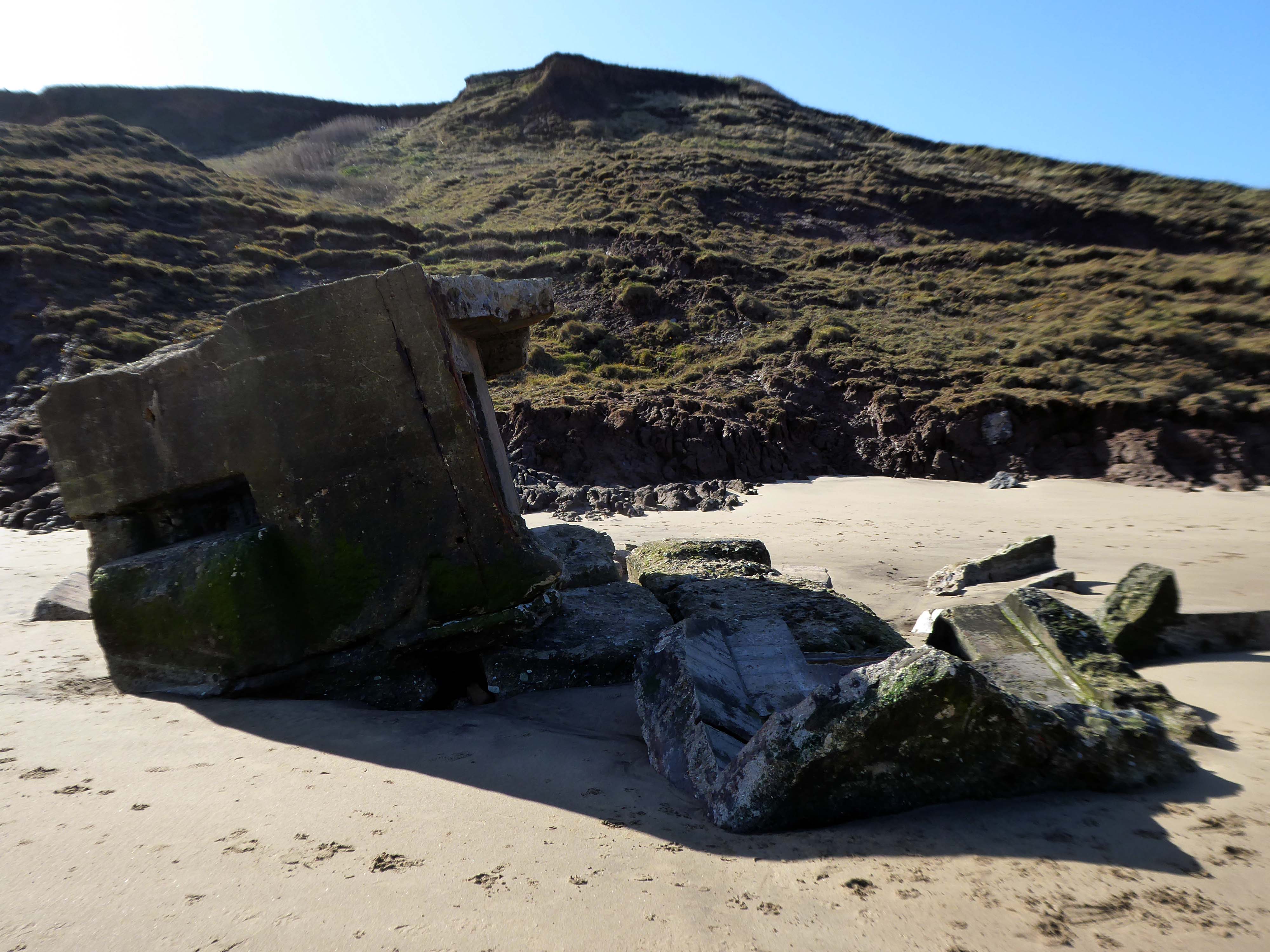
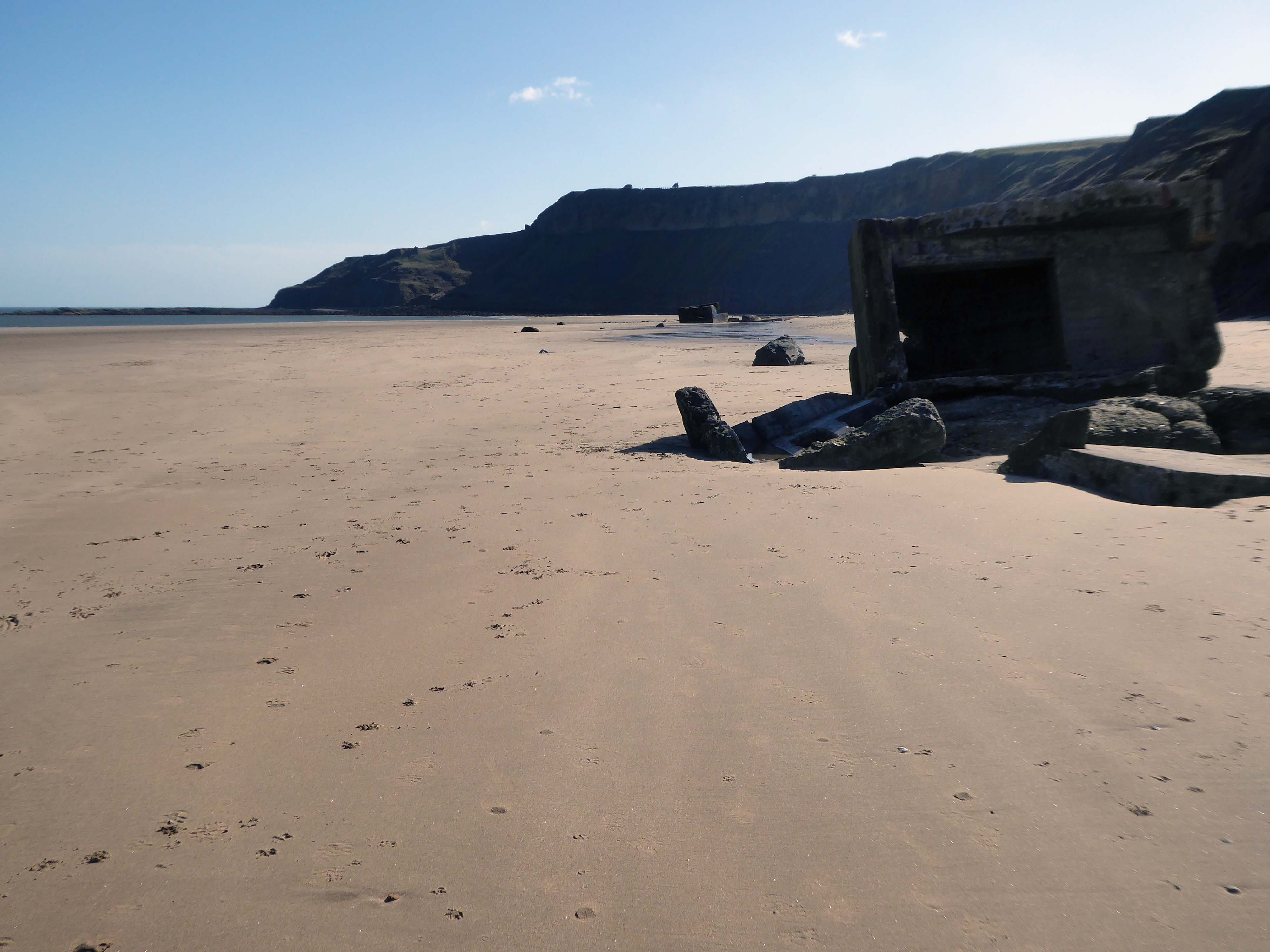
The wide sandy bay was an ideal location for WW2 pillboxes and gun emplacements – anticipating a possible North Sea invasion.
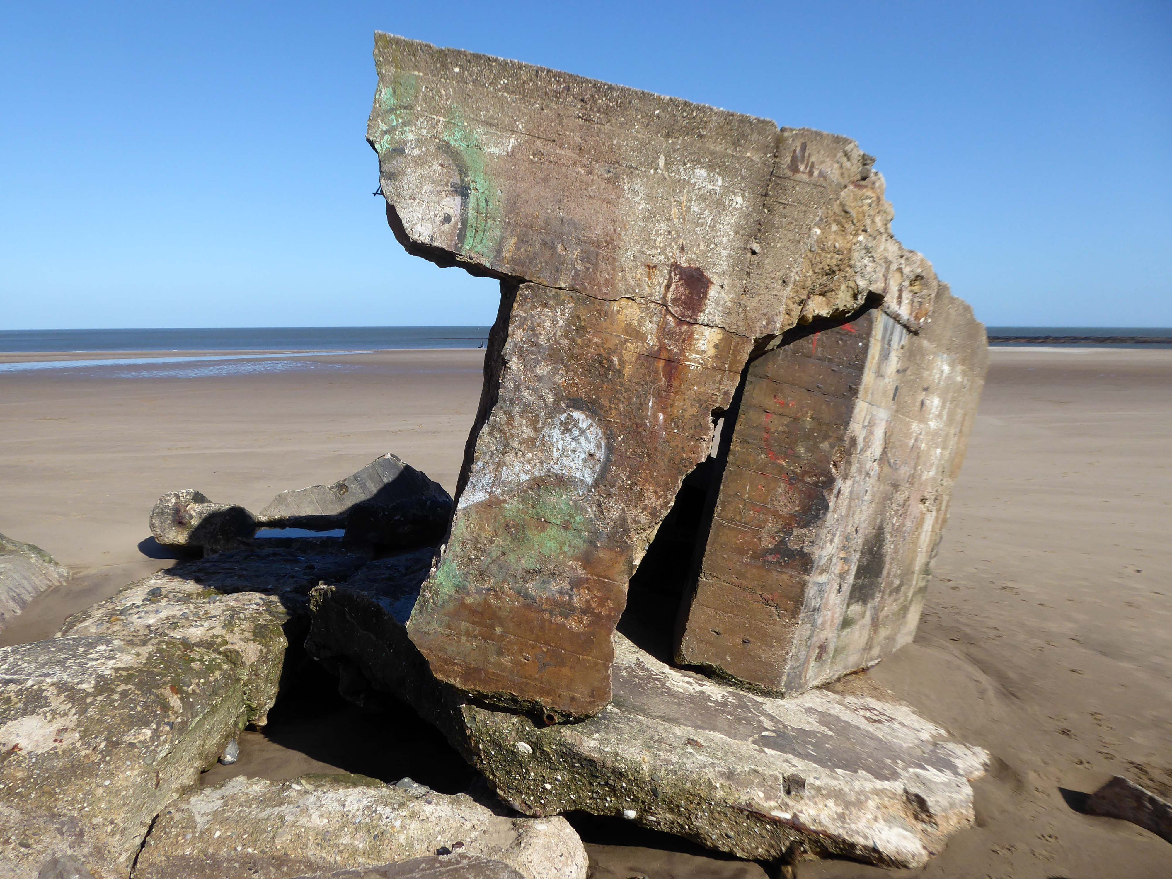
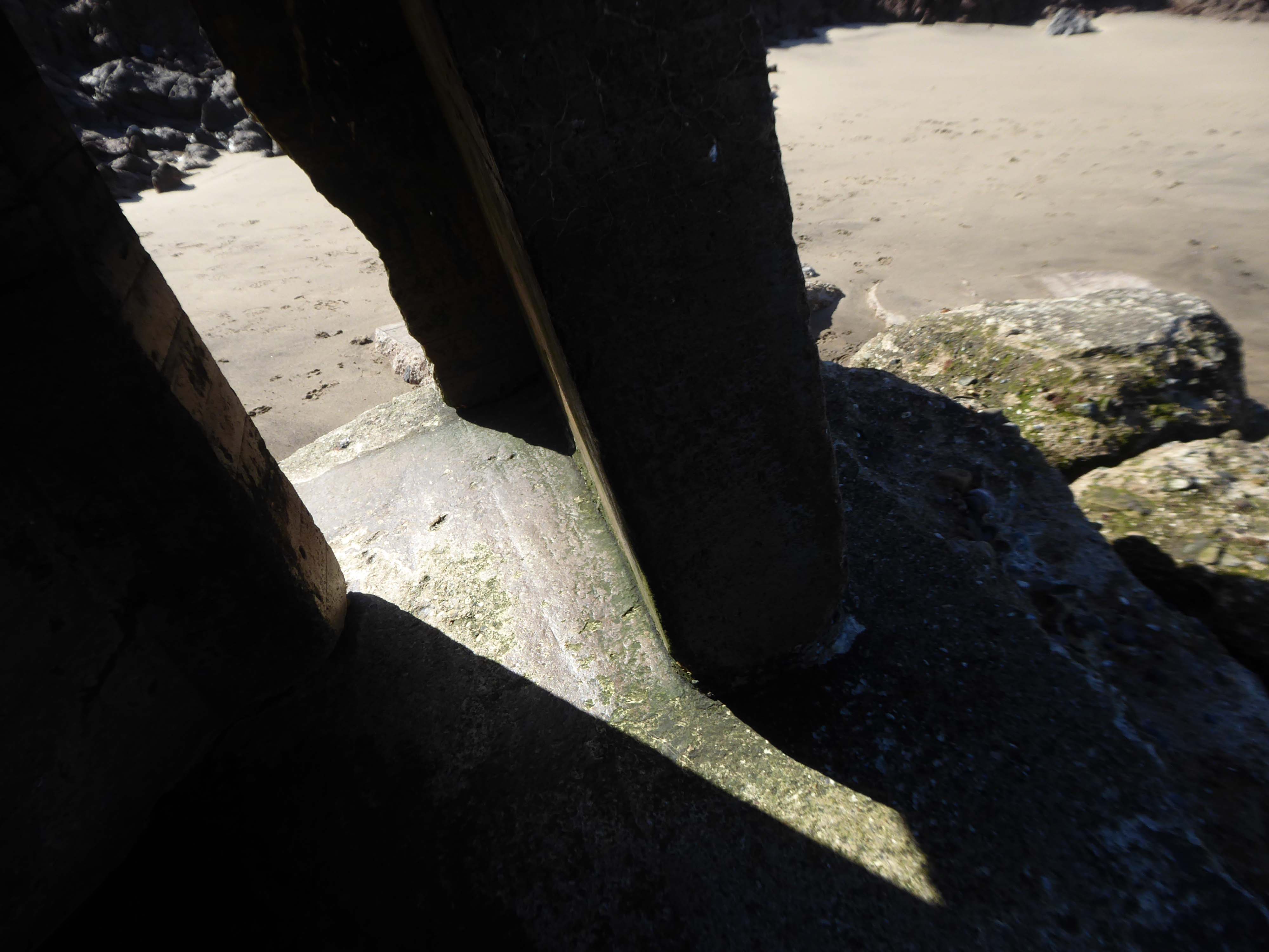
They too are built quite literally on shifting sands.
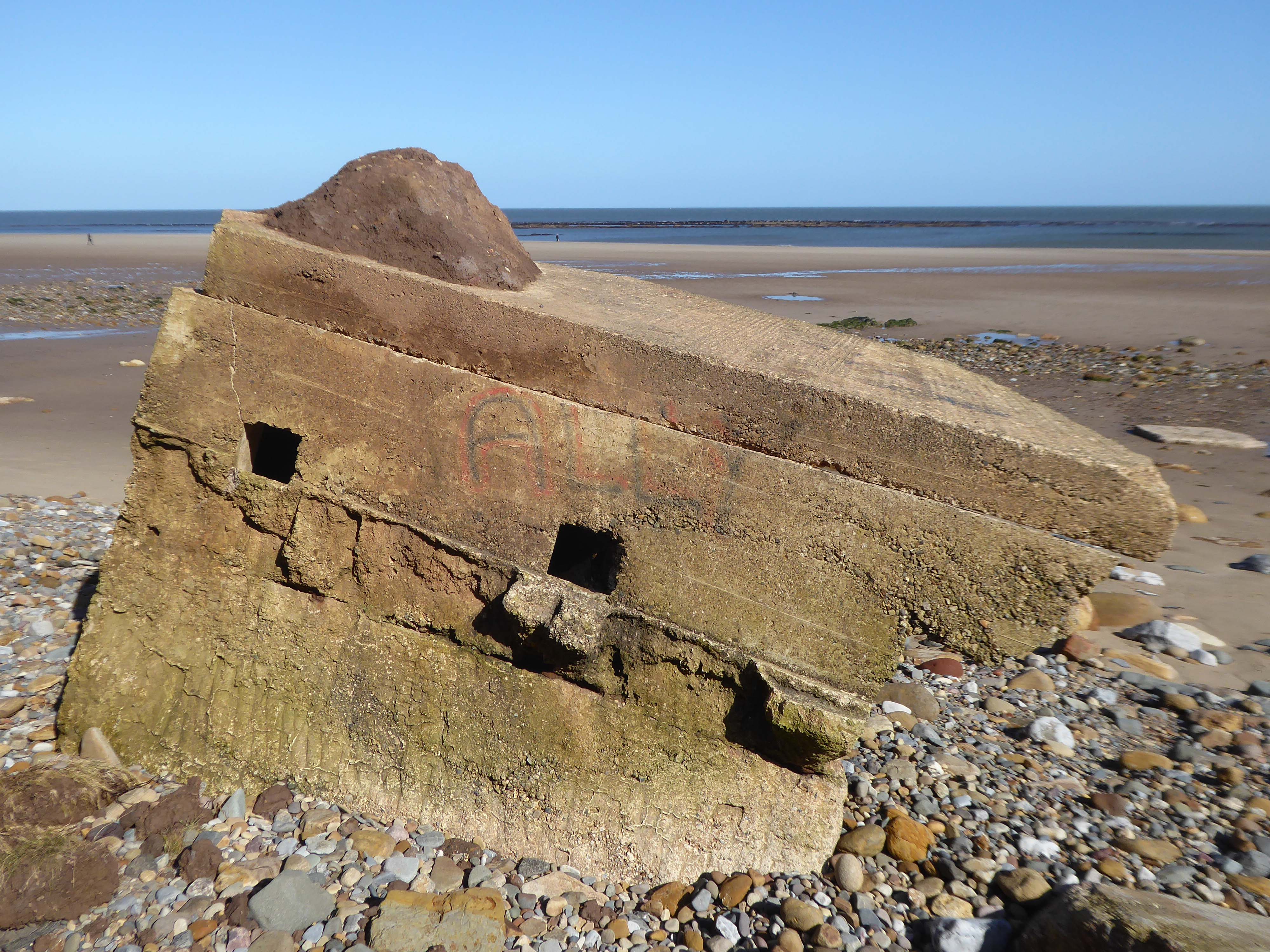
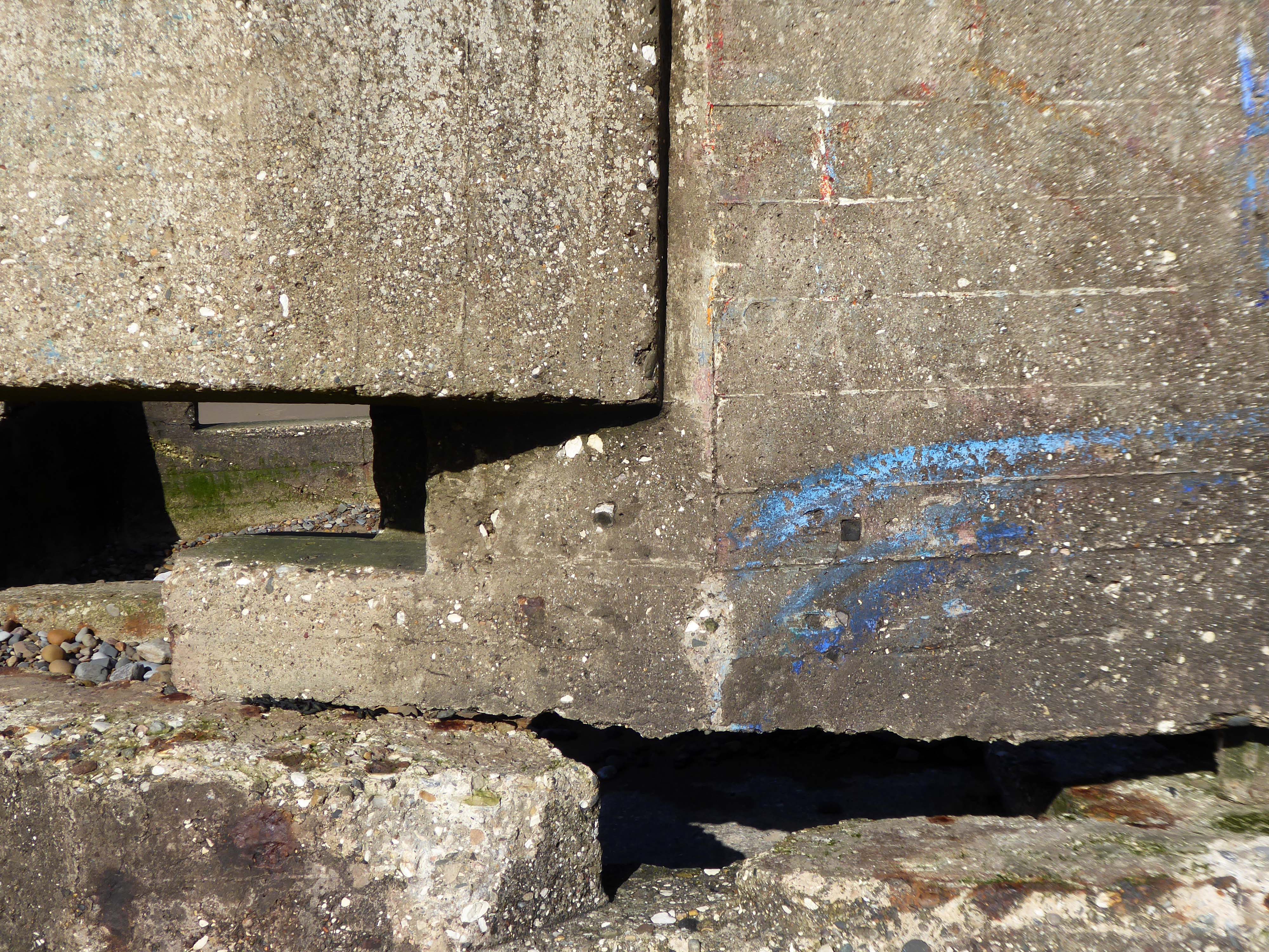
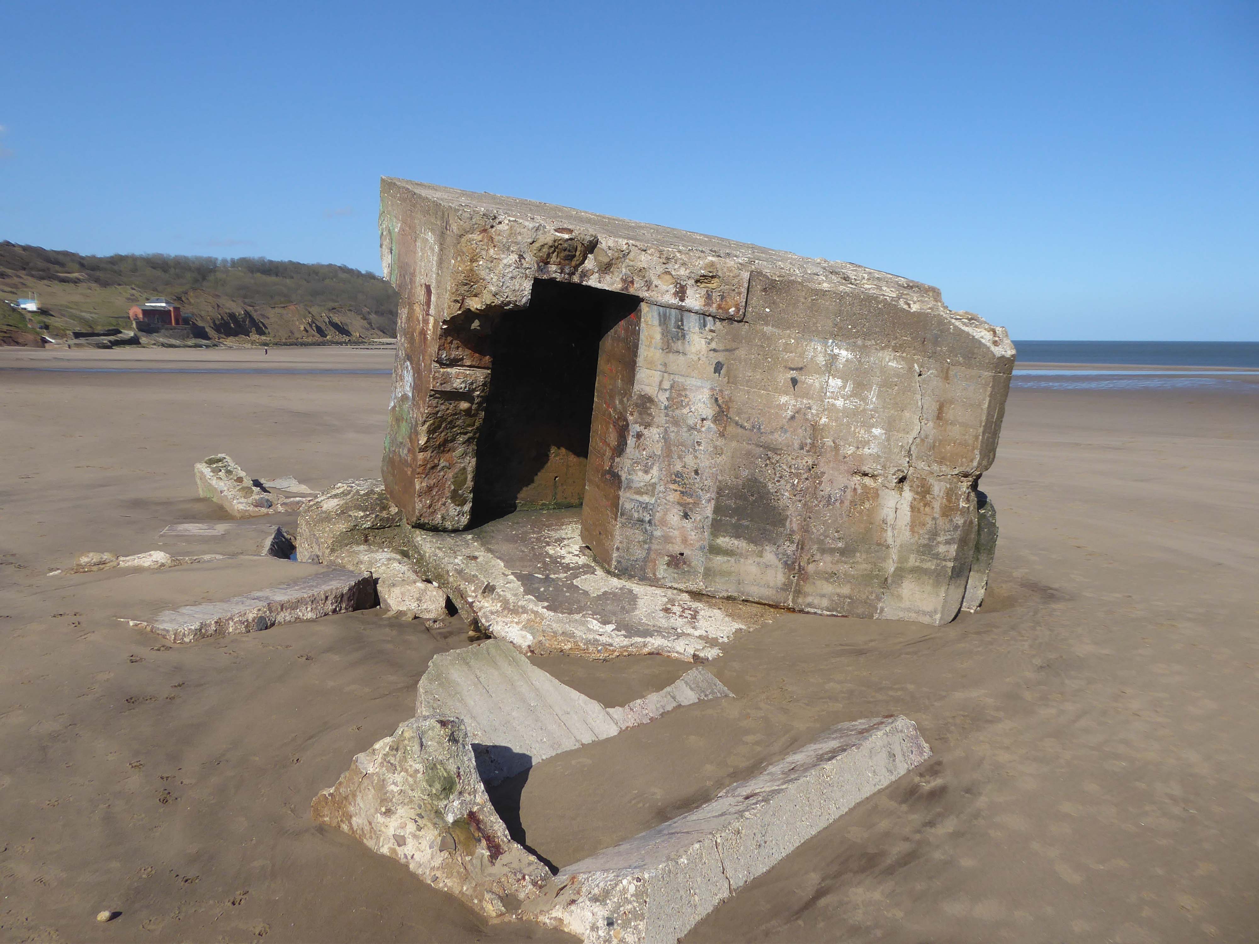
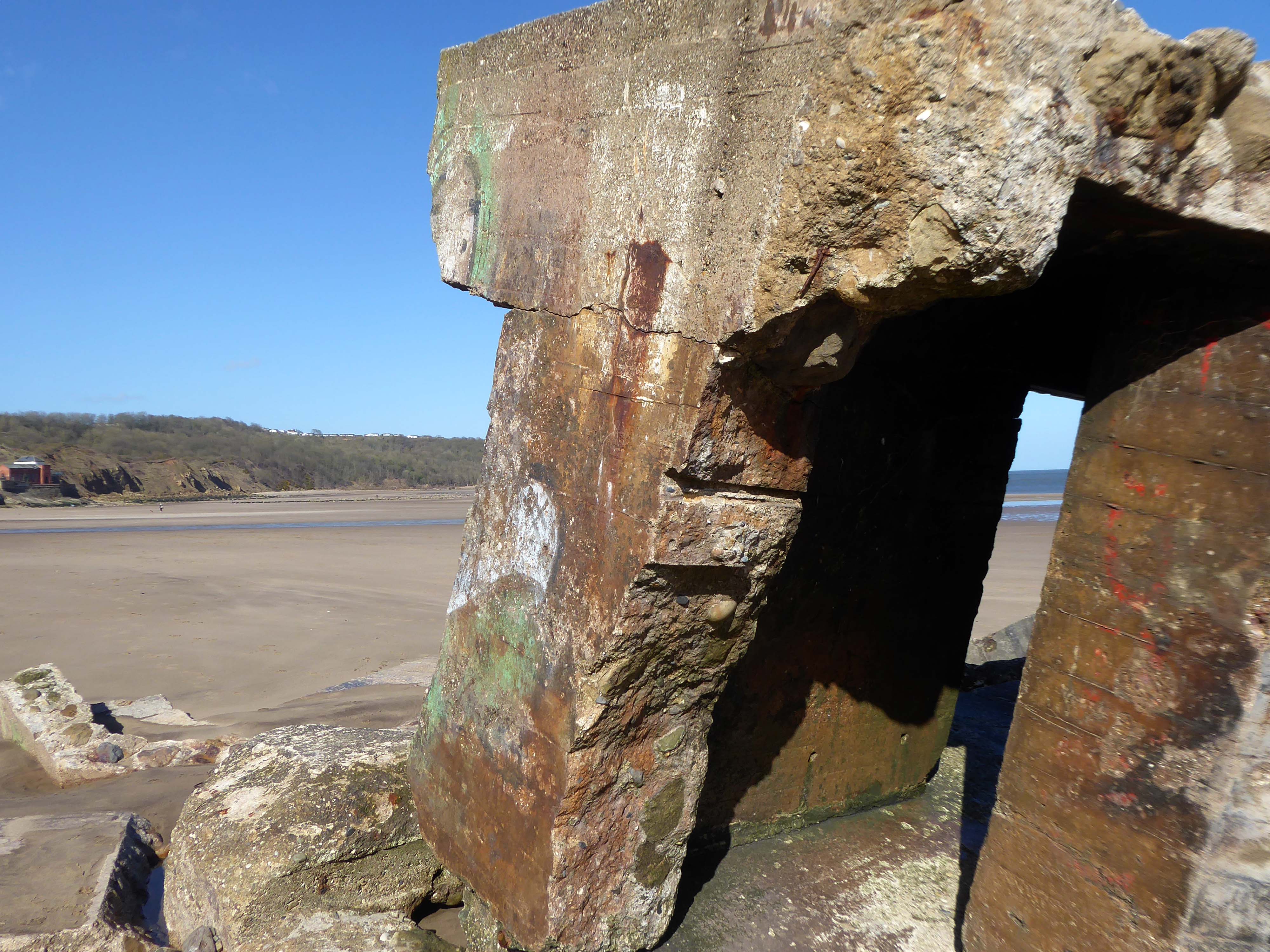
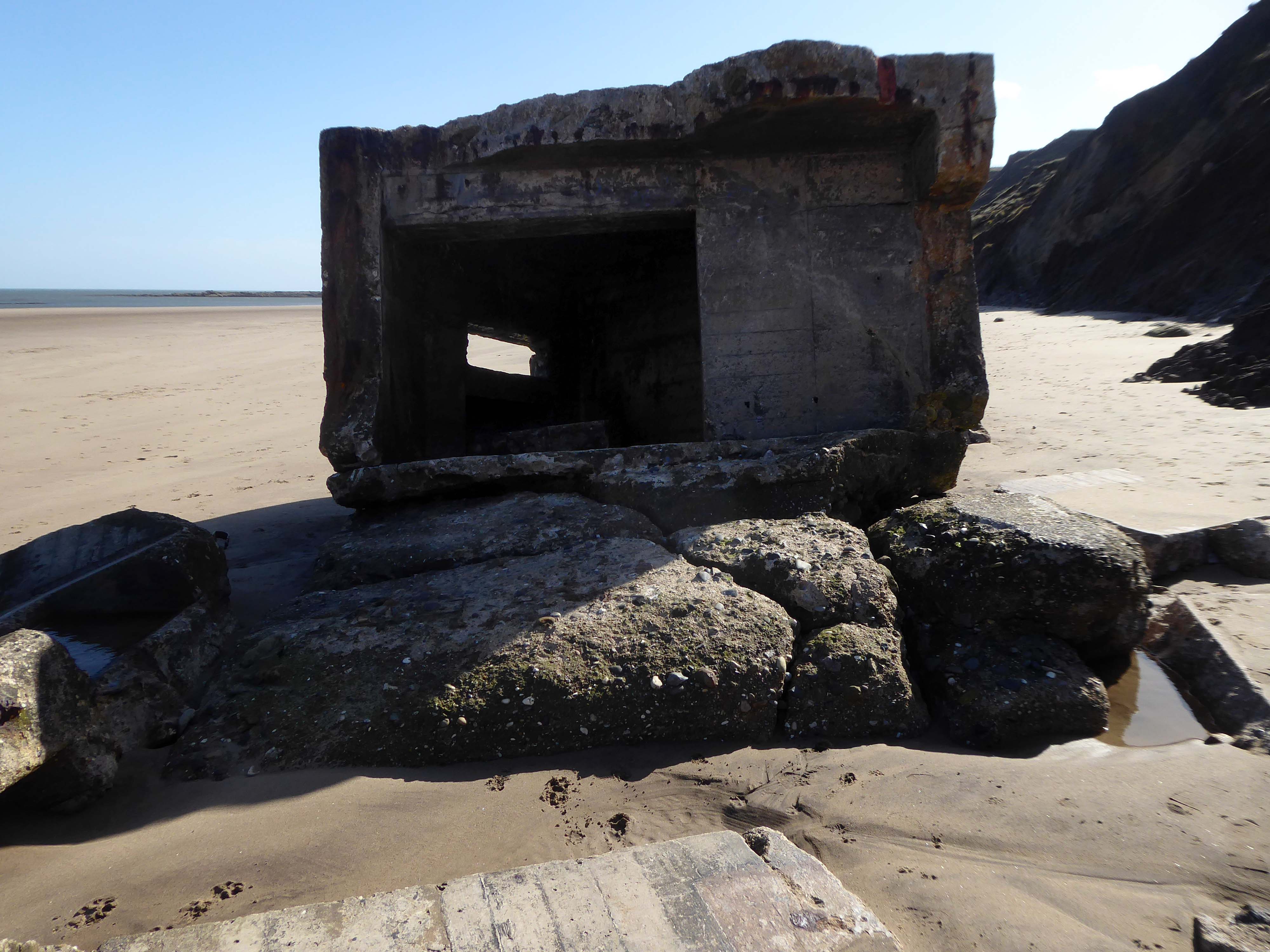
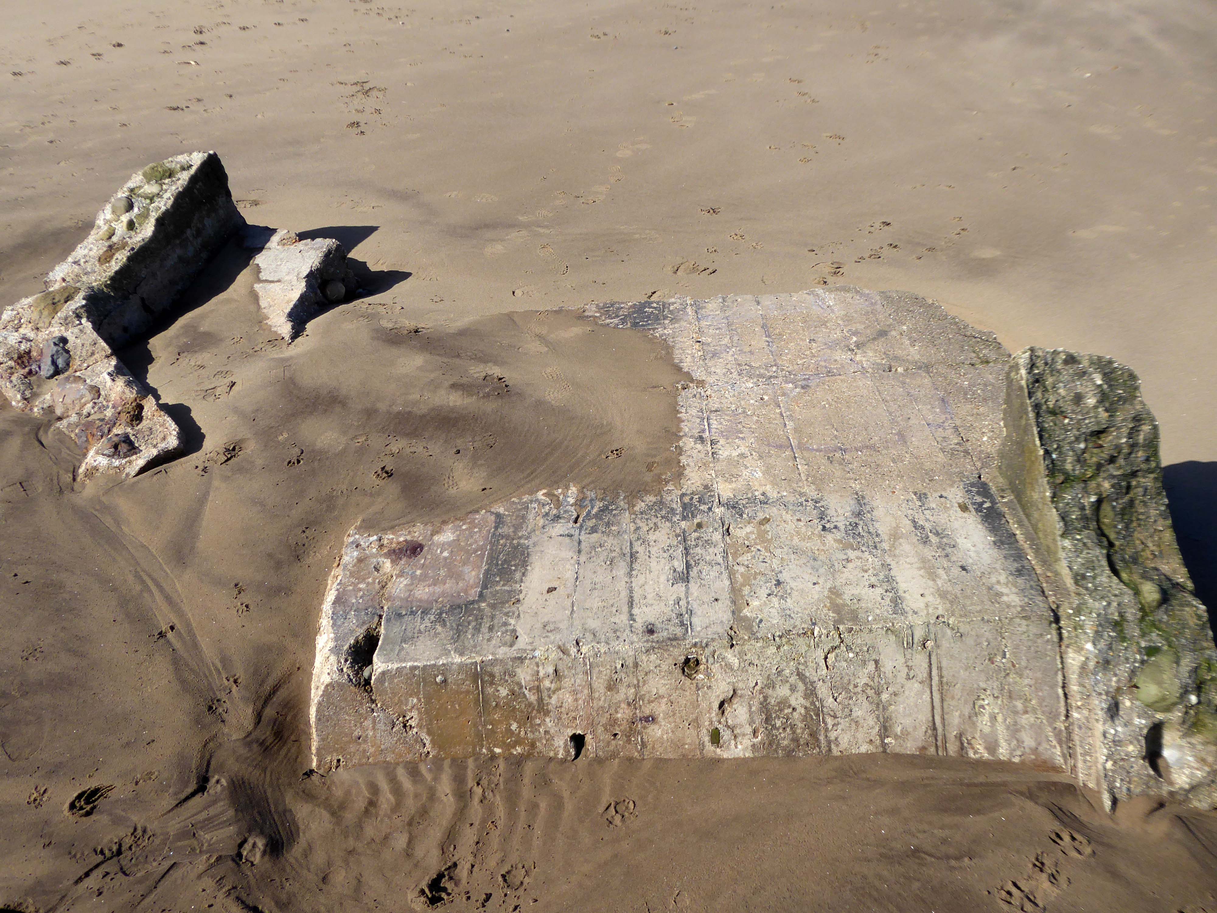
The pillbox – one of many built along the coast to defend against an invasion during World War II – had started to break down, leaving one large piece of stone in a precarious position.
Rob Shaw, of Ganton, noticed the large slab was propped up dangerously against another piece of stone last September.
He said he reported his concerns to Scarborough Borough Council then, but that nothing was done until last month.
The dad-of-two said before the work:
I used to work in construction and I would have been fired if I had left a lump of concrete like that, it could weigh four or five tonnes.
It just needs lying flat on the sand so it can’t fall on anyone.
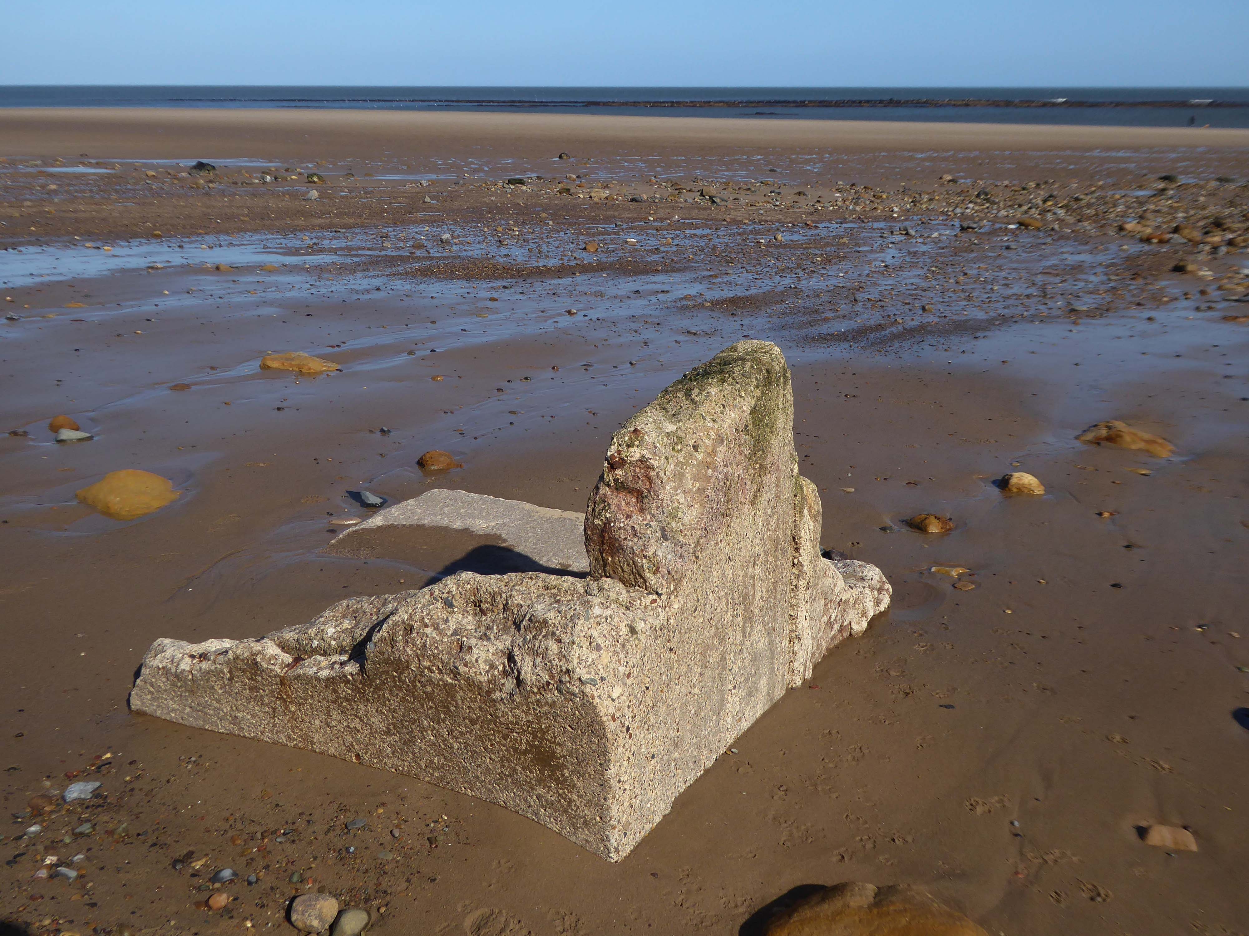
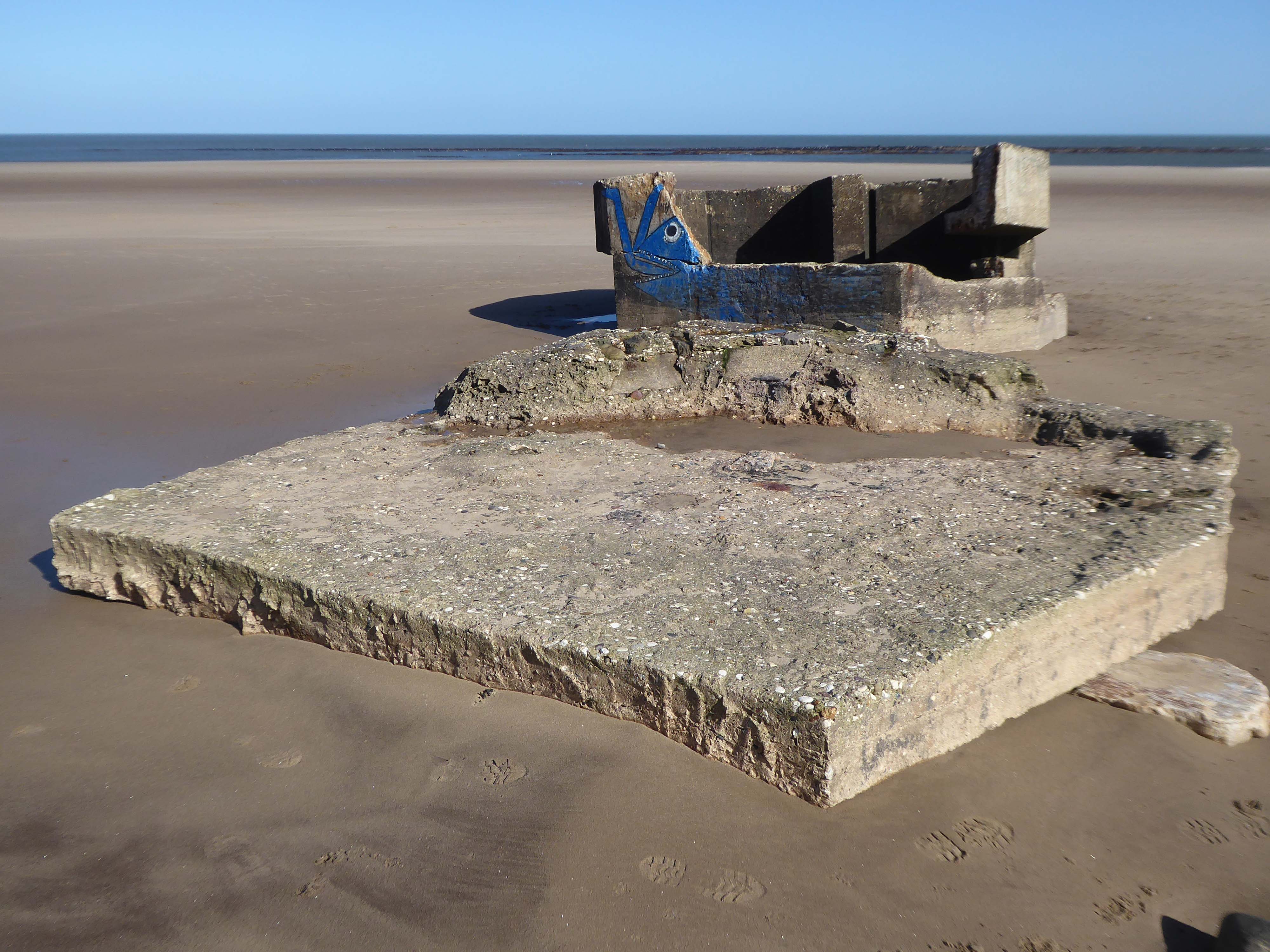
A spokesperson for Scarborough Borough Council said the council had assessed the pillbox and arrangements had been made for the problem section to be removed.
The Scarborough News
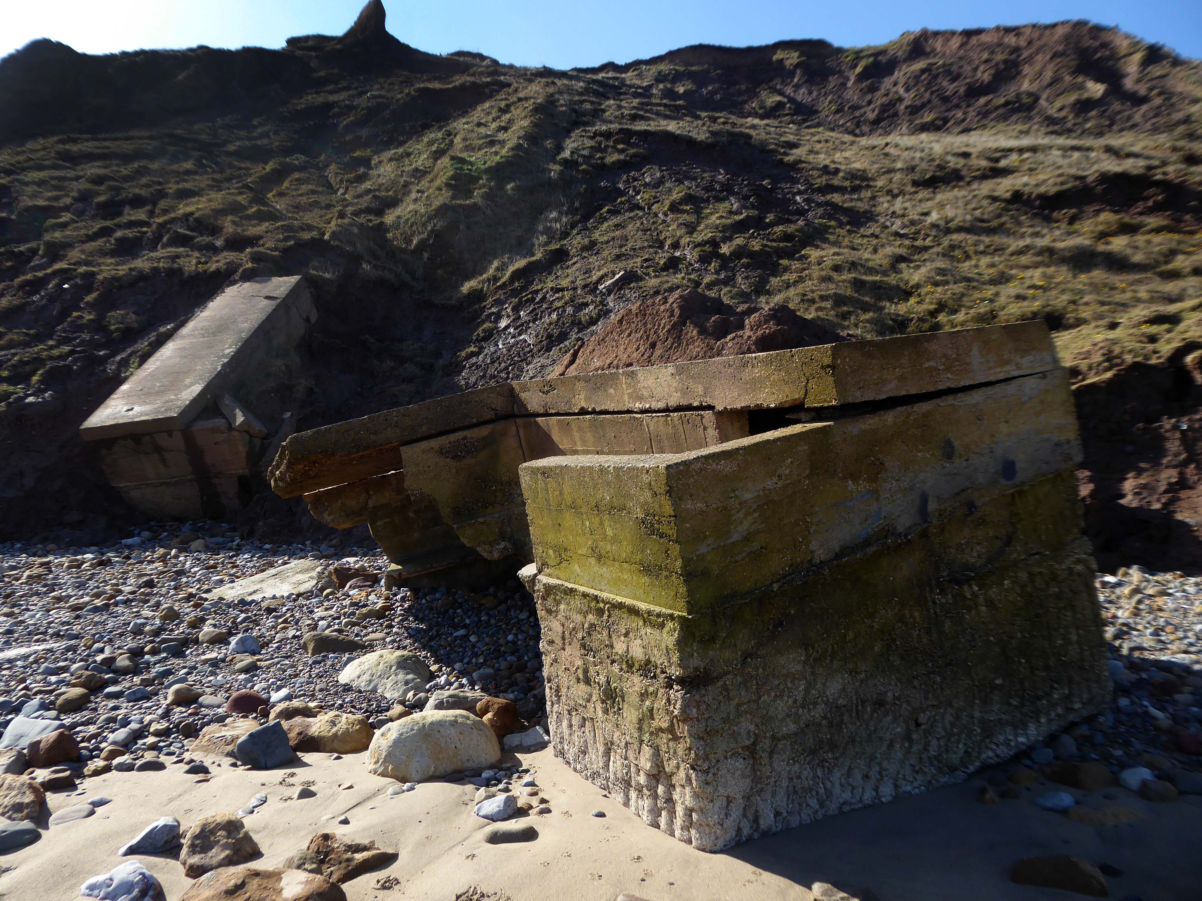
This unstable cliff-top structure was allegedly hastened bay-wards by the Council.
Claims that we pushed the pillbox off the cliff are untrue – our colleagues have many amazing talents but pushing huge concrete structures is not one of them. The structure people can see at the base of the cliff is the other section of the pillbox that has been on the beach for many years.


