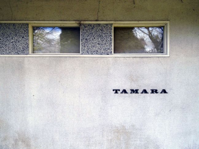
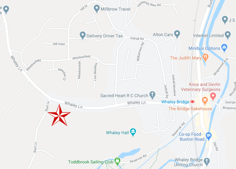
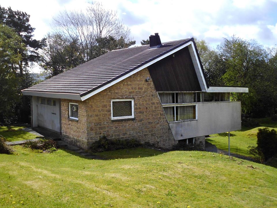
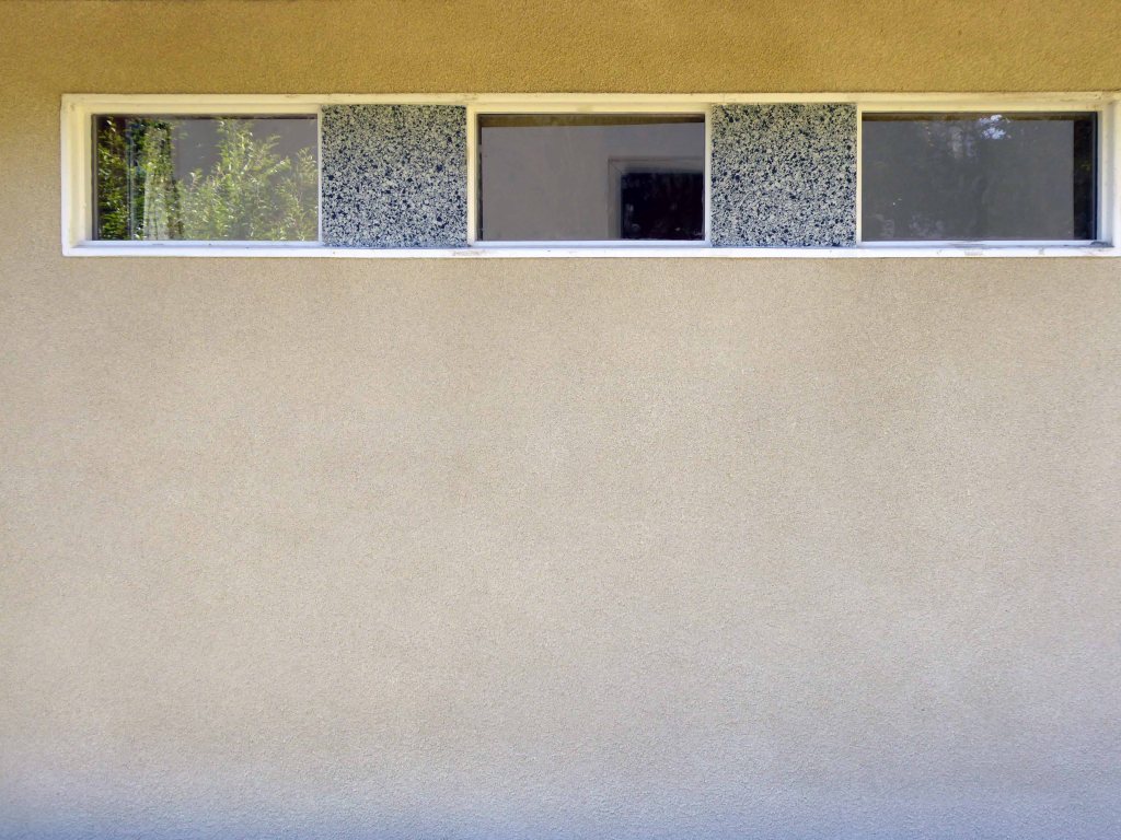
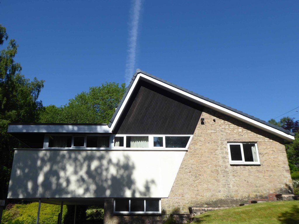
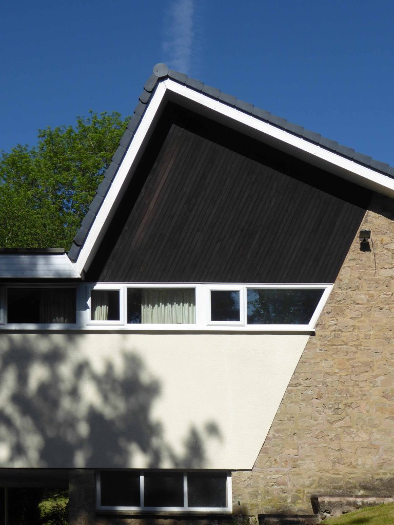
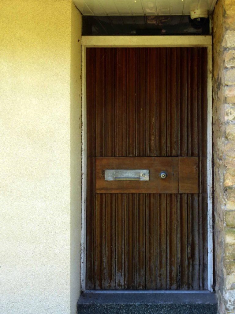
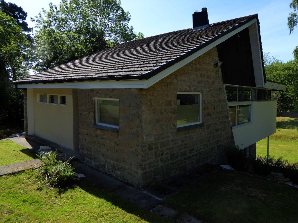
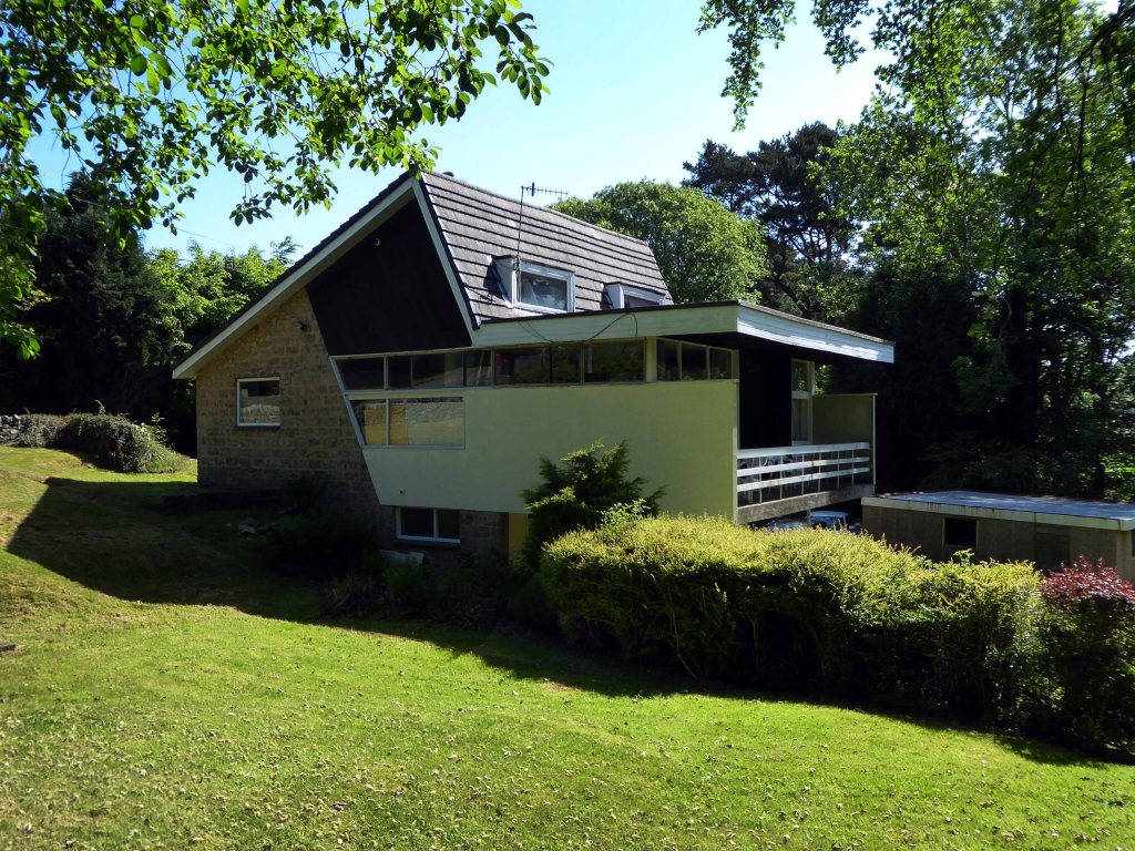
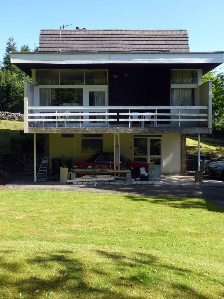
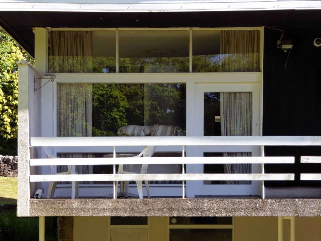
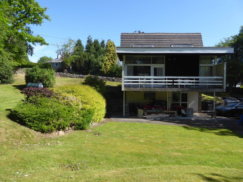
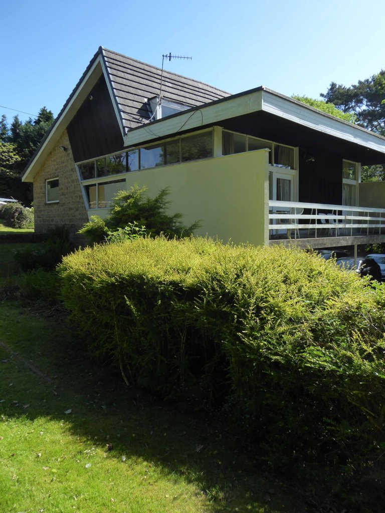
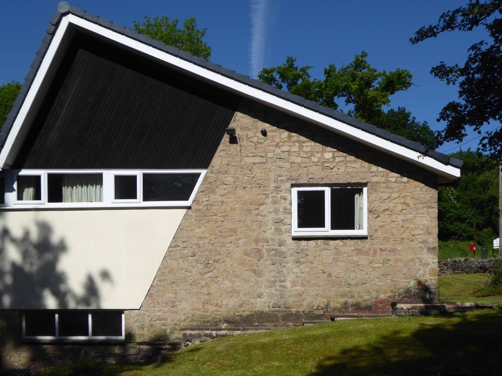
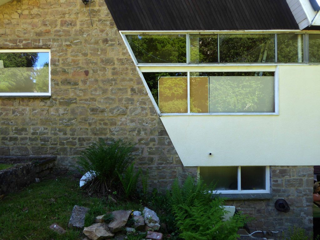
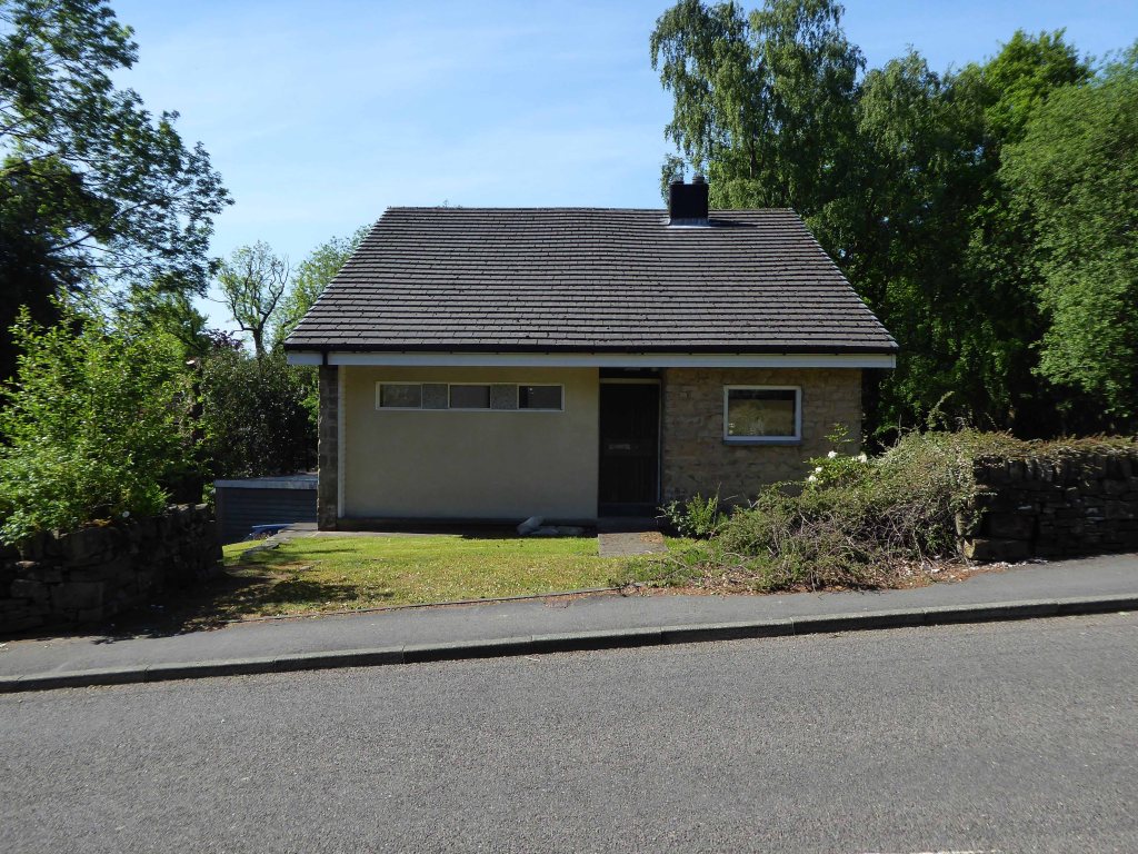
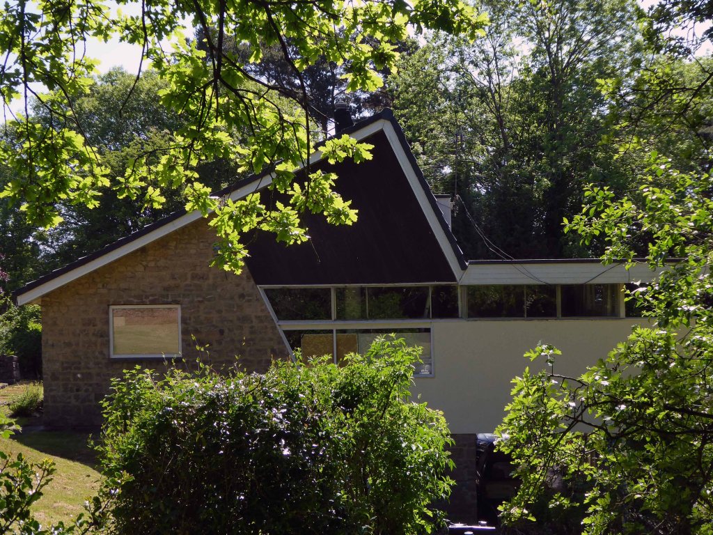
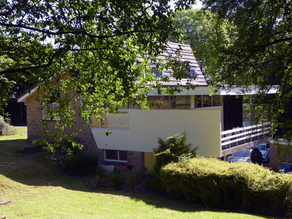
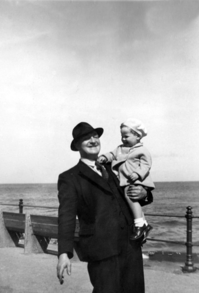
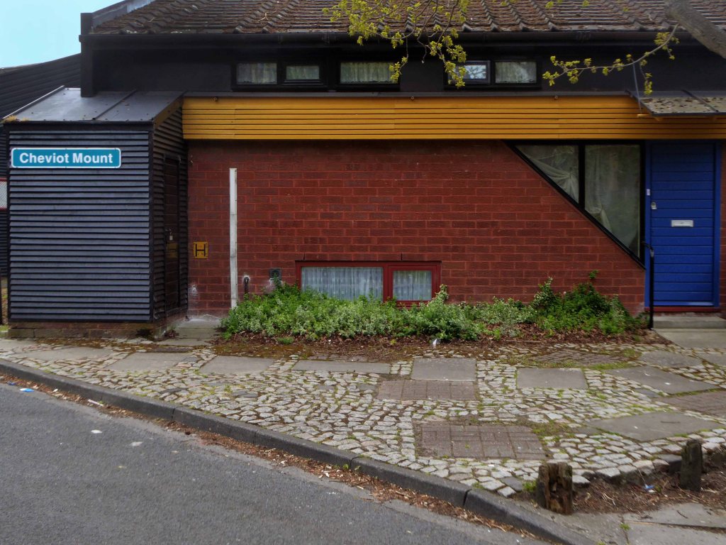
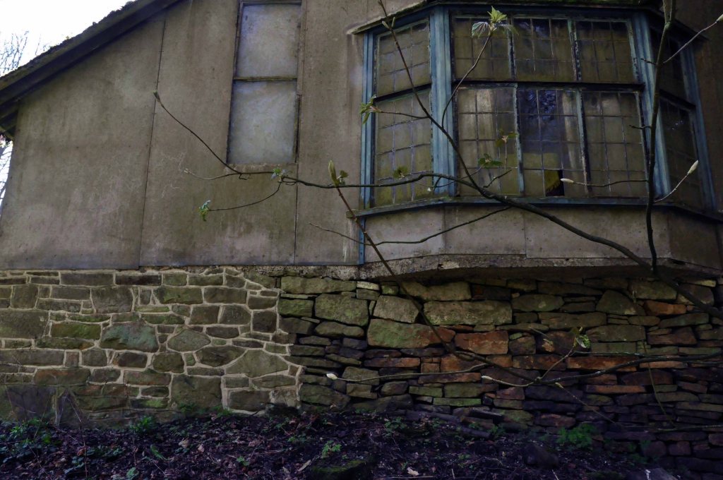
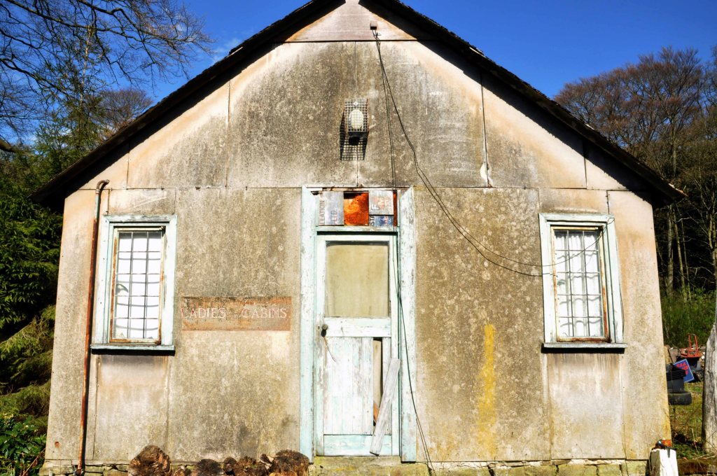
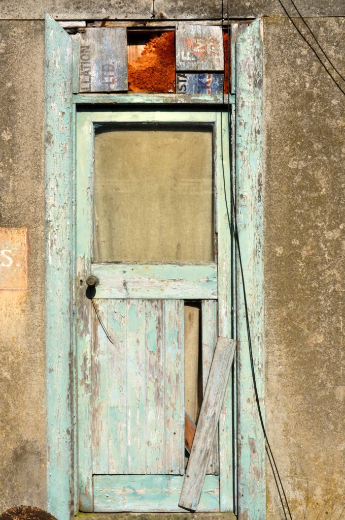
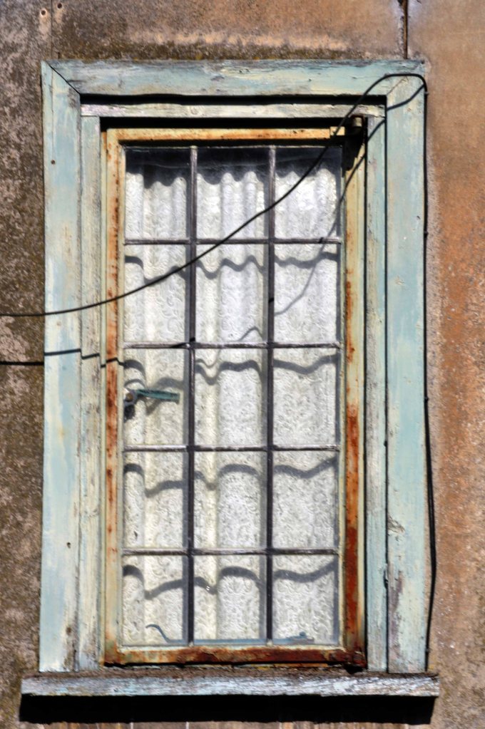
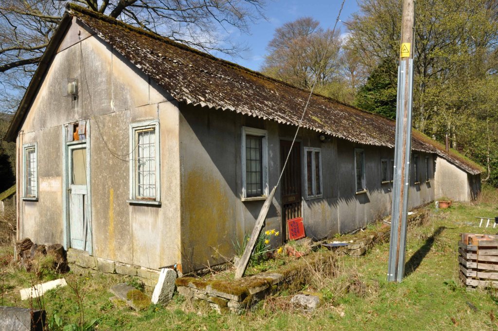
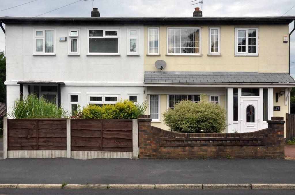
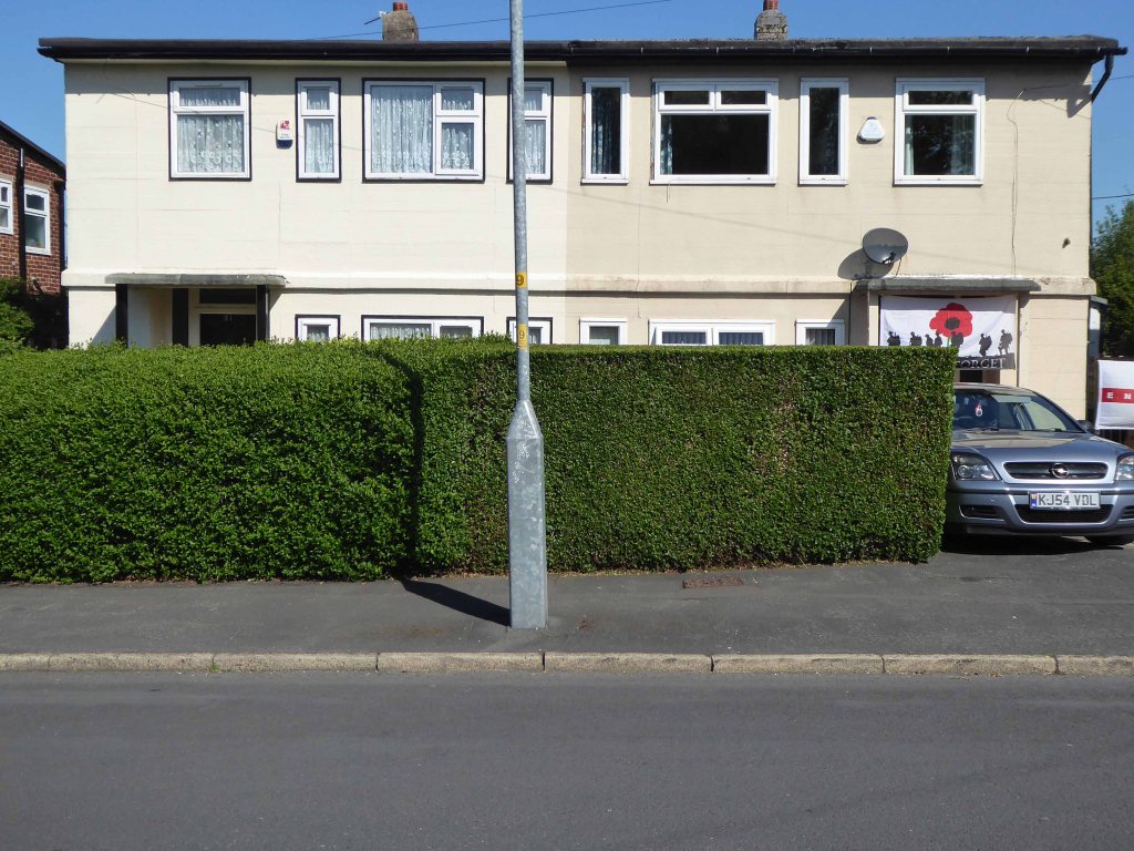
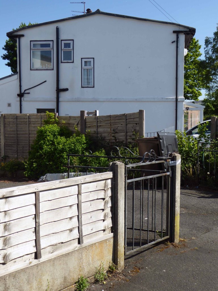
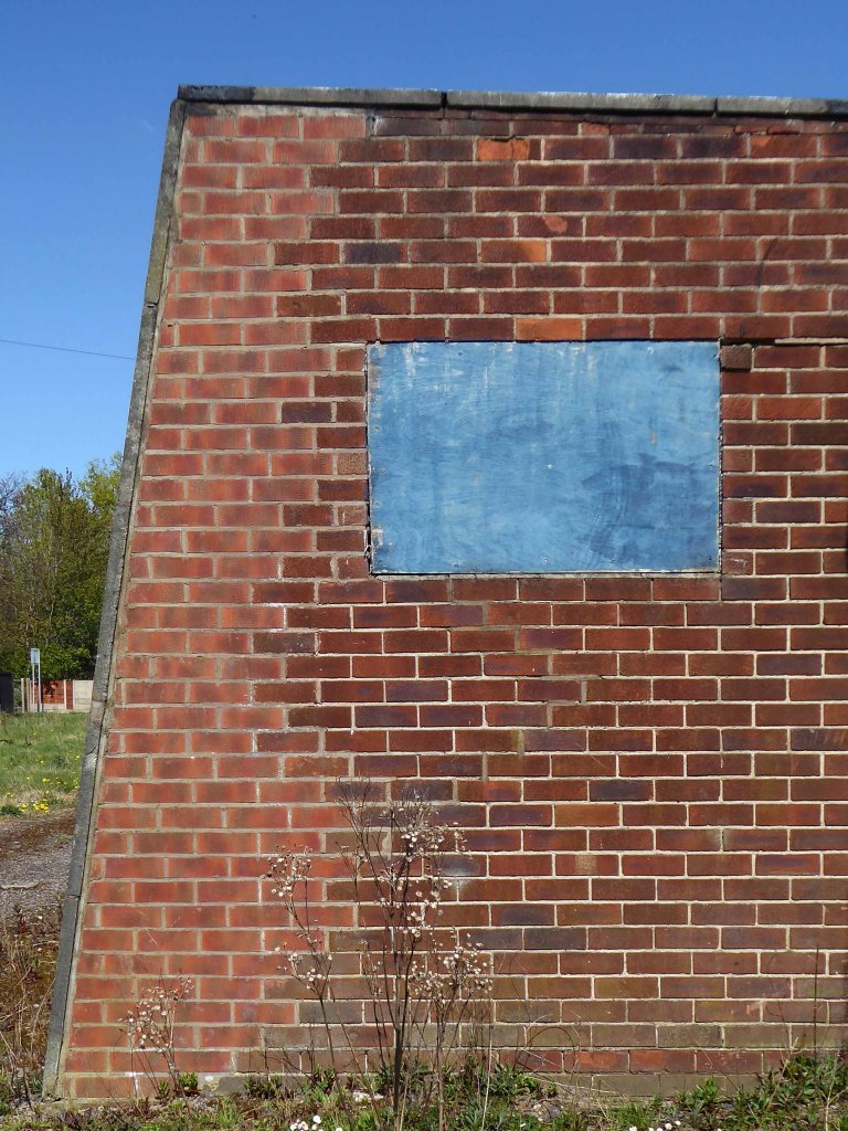
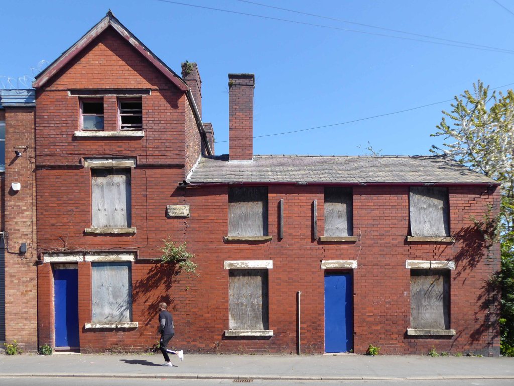
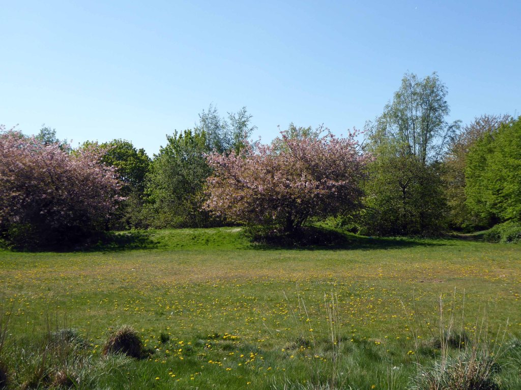
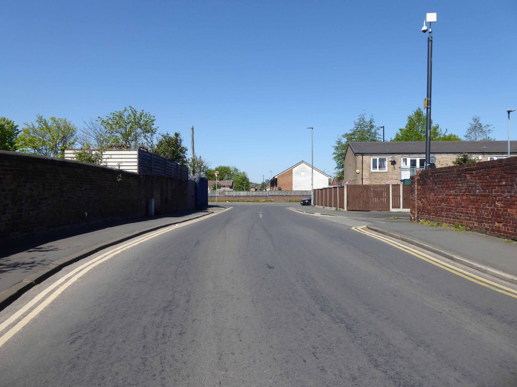
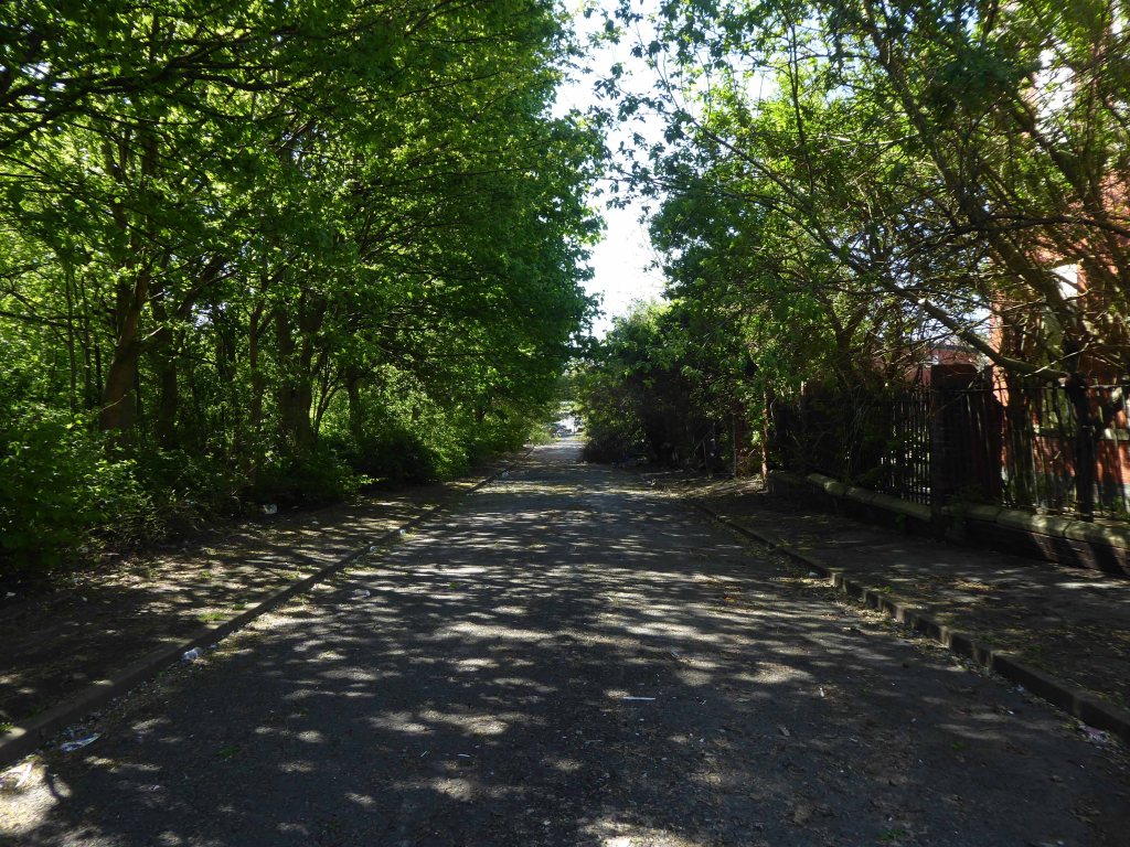
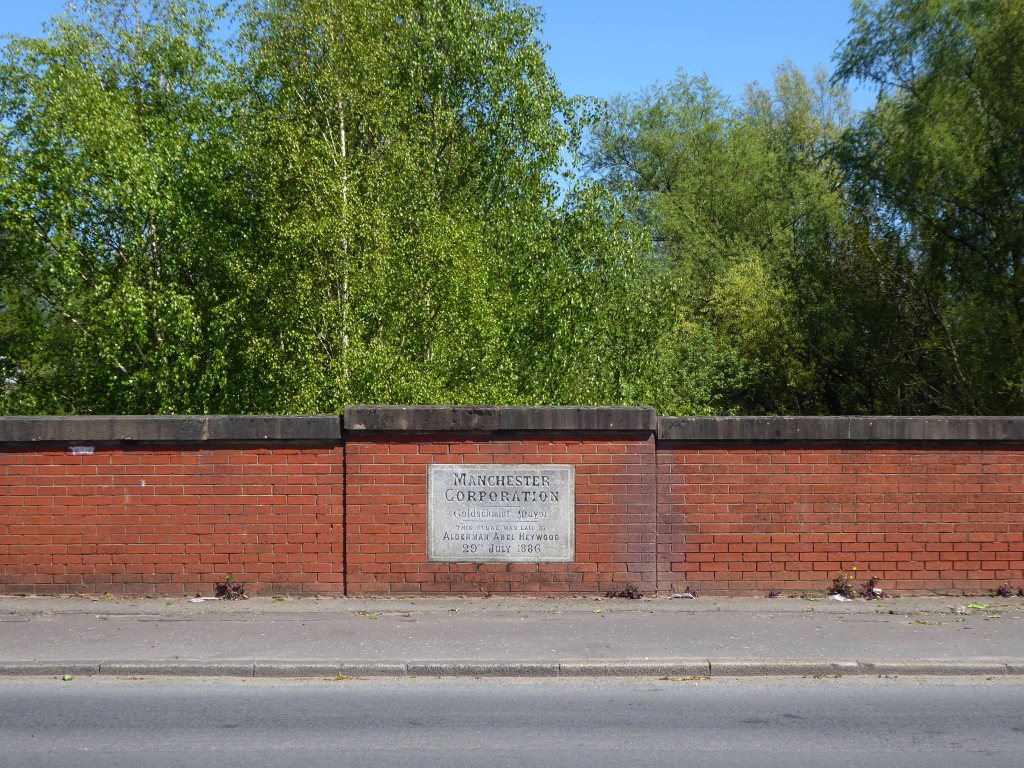
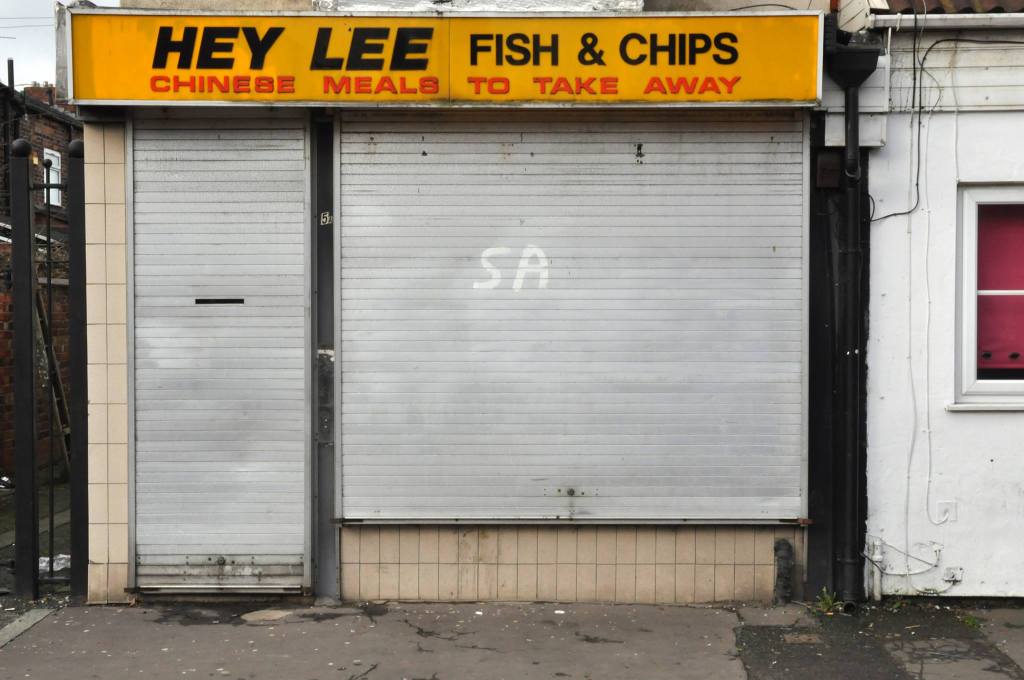
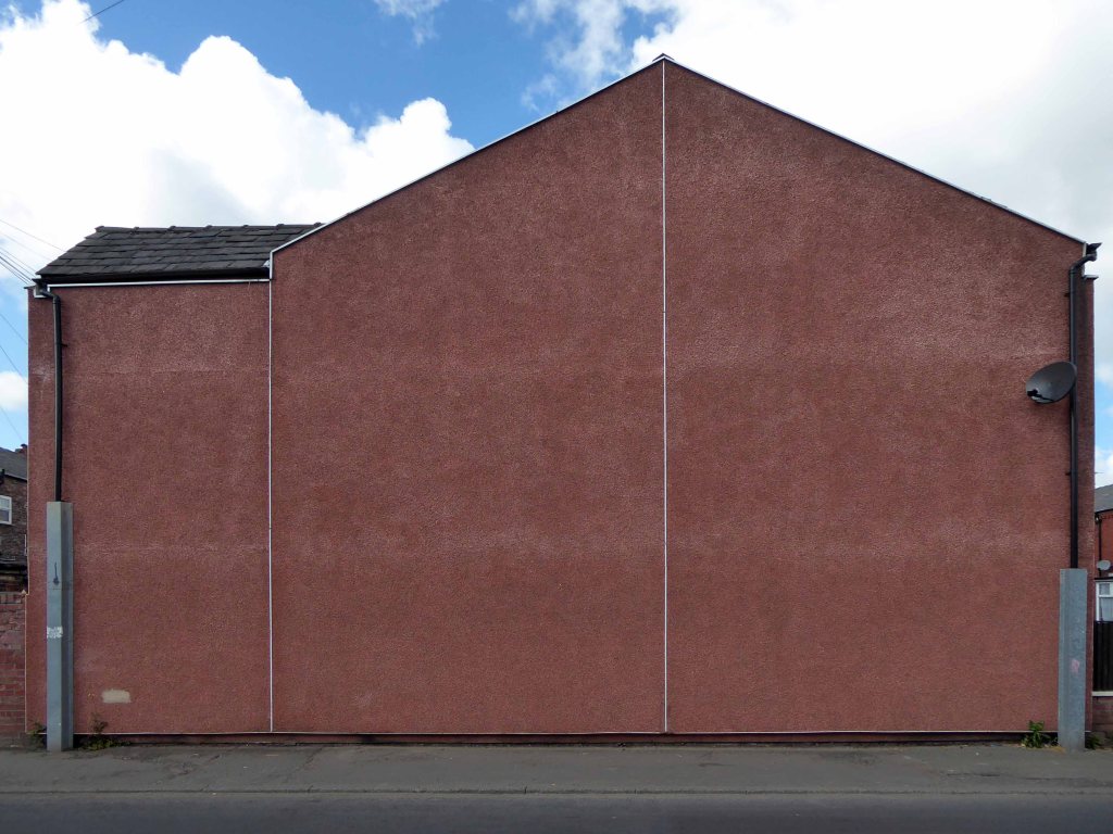
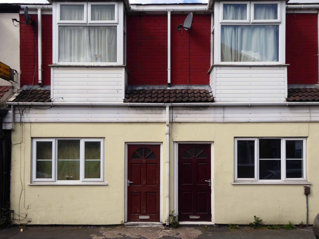
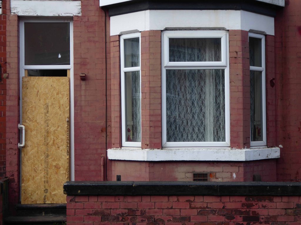
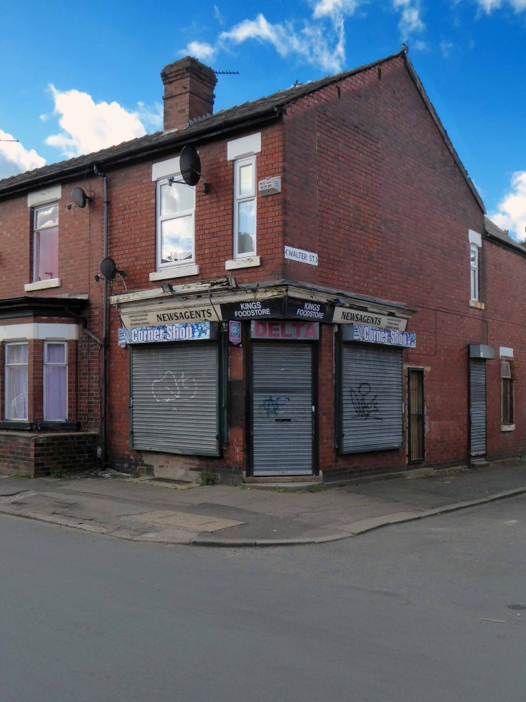
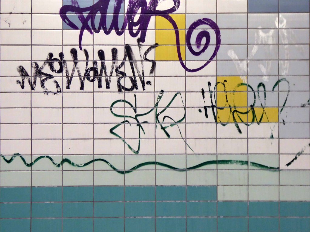
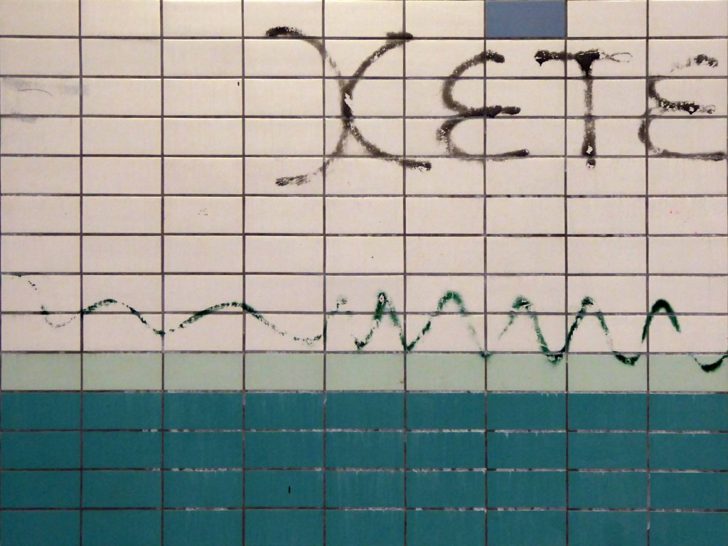
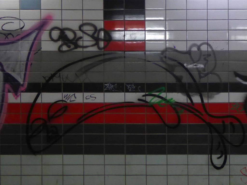
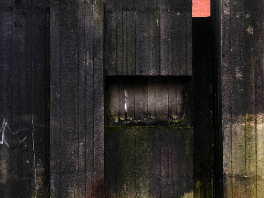
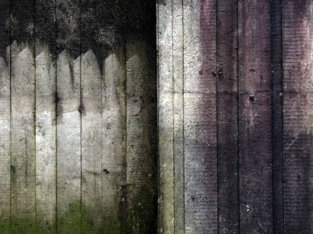
I’ve often cycled by here, on occasion taking time to take a snap or two.
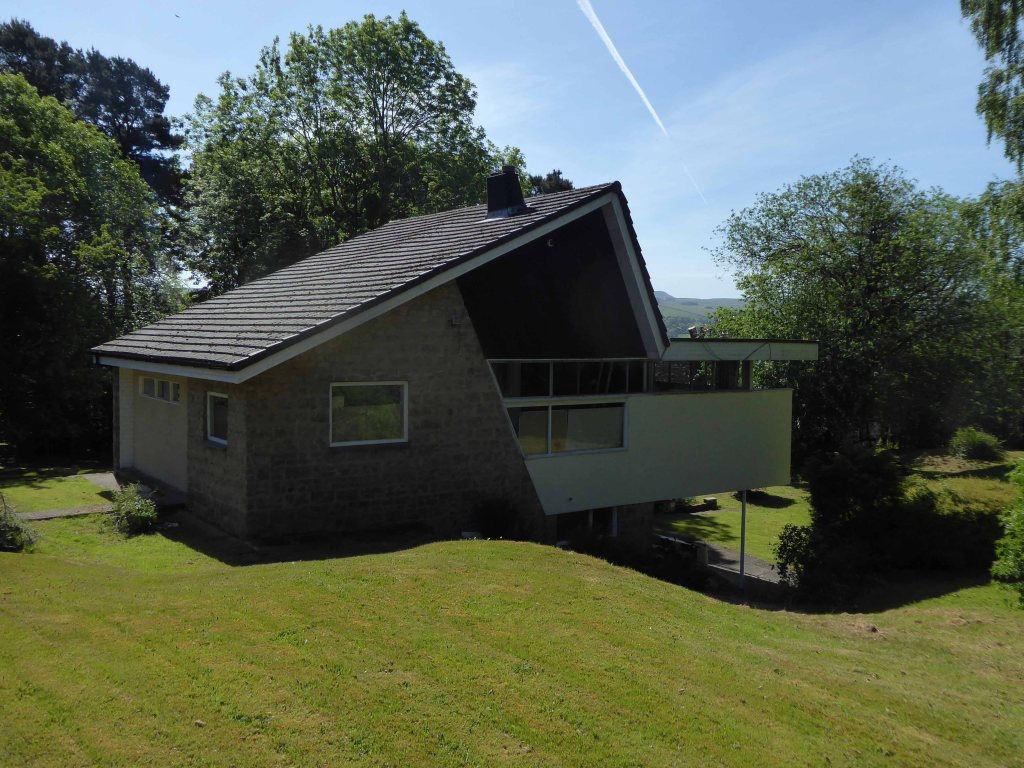
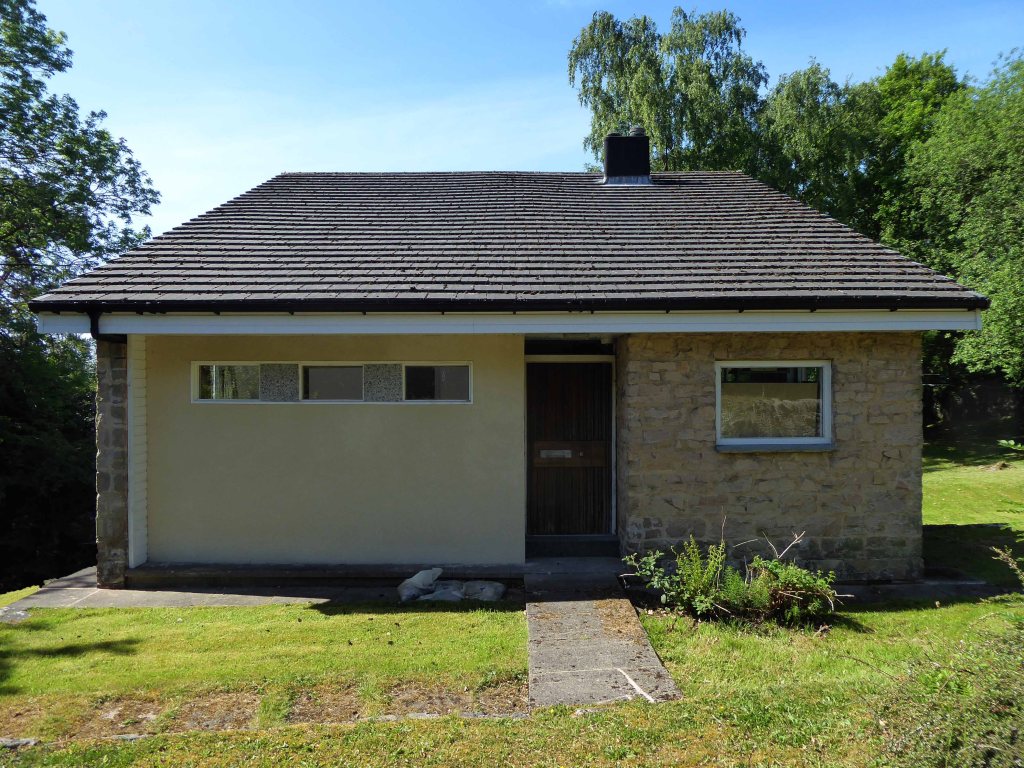
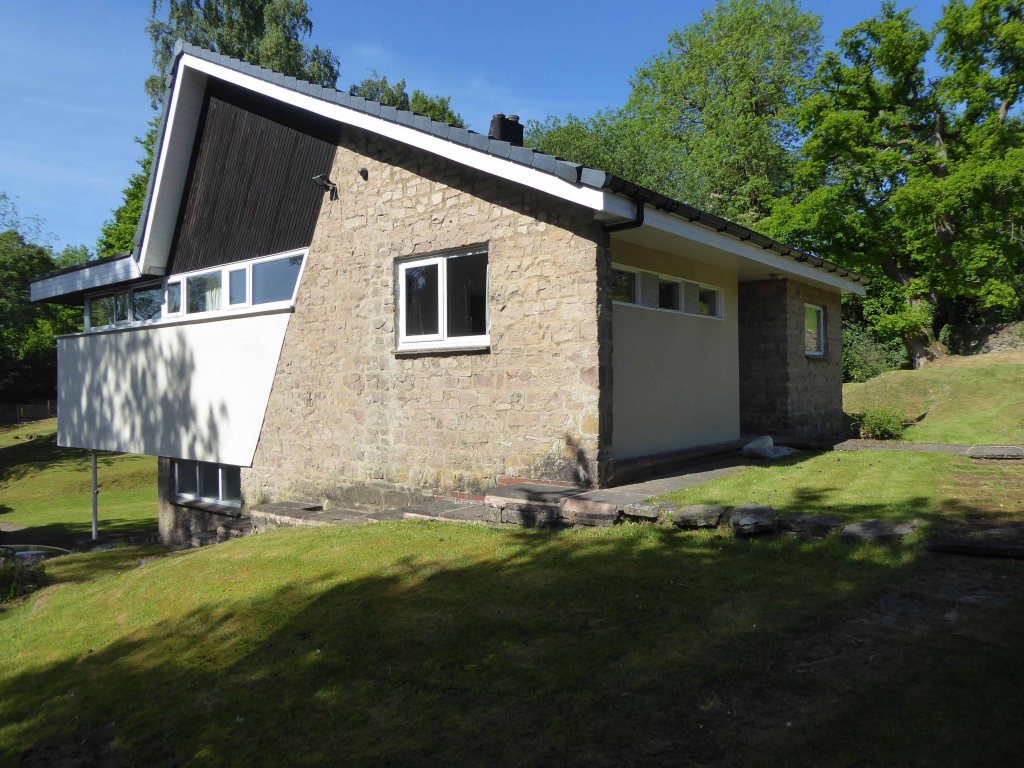
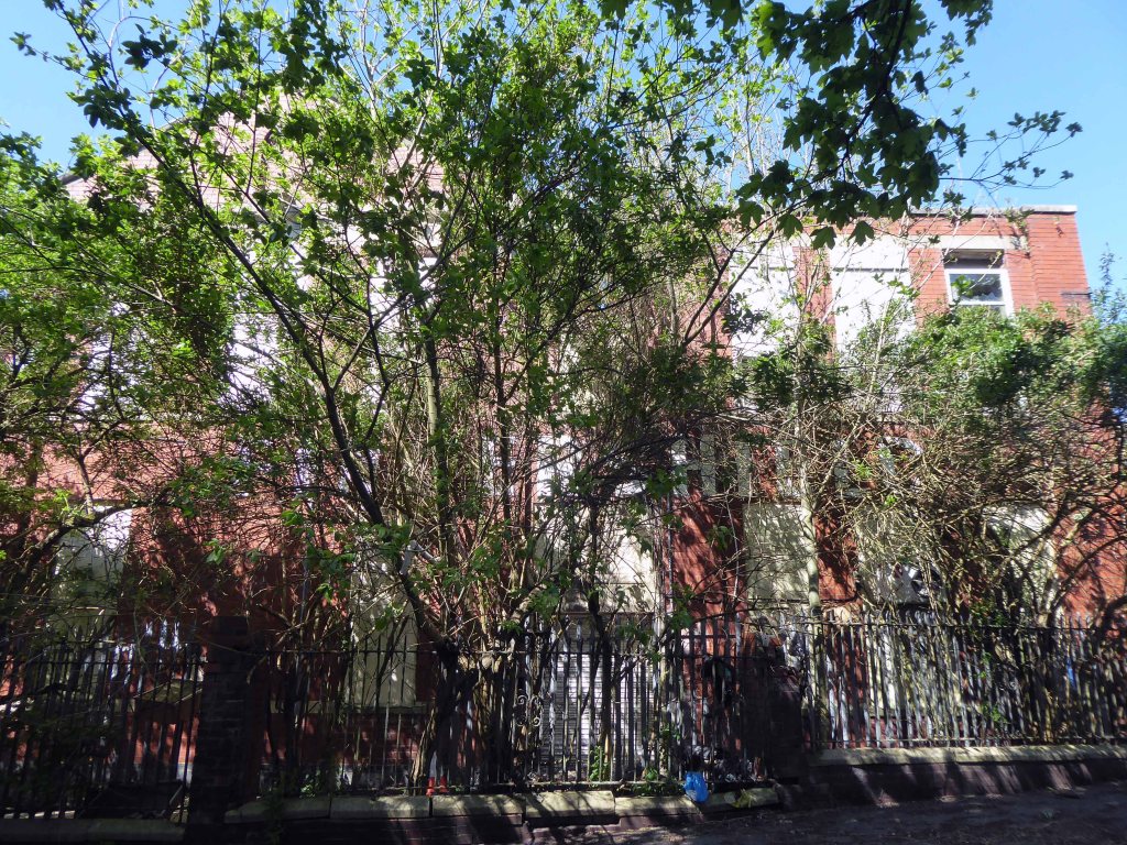
You seemed to be in decline, in need of care and attention. Stood amongst Peak vernacular and sub-Lutyens villas something of anomaly.
A diminutive Modernist house – a rose amongst the herbaceous borders.
Someone seems to have taken you in hand and work is underway, I just hope that they put your name back in place.
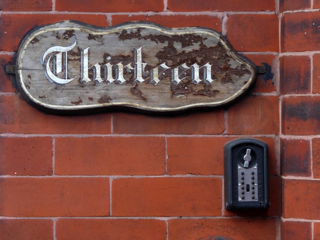
Tamara
Tamara is a female given name most commonly derived from the Biblical name Tamar, meaning date – the fruit, date palm or palm tree. In eastern European countries like Armenia, Croatia, Czech Republic, Georgia, Hungary, North Macedonia, Poland, Russia, Serbia, Slovenia and Ukraine it has been a common name for centuries. In Australia it was very popular from the 1960s to 1990s.
In the United States, the name was fairly common from the late 1950s to mid 1990s, bolstered by the popularity of the film Tammy and the Bachelor – Tammy is commonly a nickname for Tamara. In the US the most girls named Tamara were born in 1970 and the number of Tamaras born per year was greater than 1,000 as late as 1996.
The name is now fairly uncommon in the US: in 2010, the name fell off the Top 1000 SSA Baby Names list, with fewer than 250 baby girls named Tamara that year.
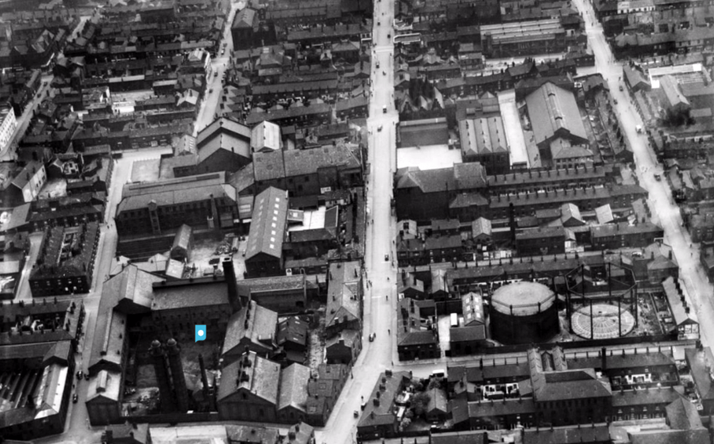
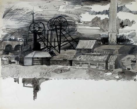
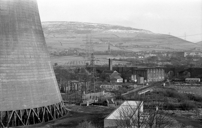
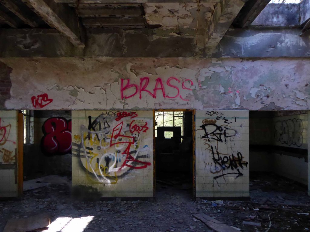
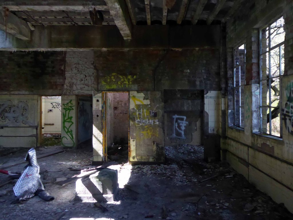
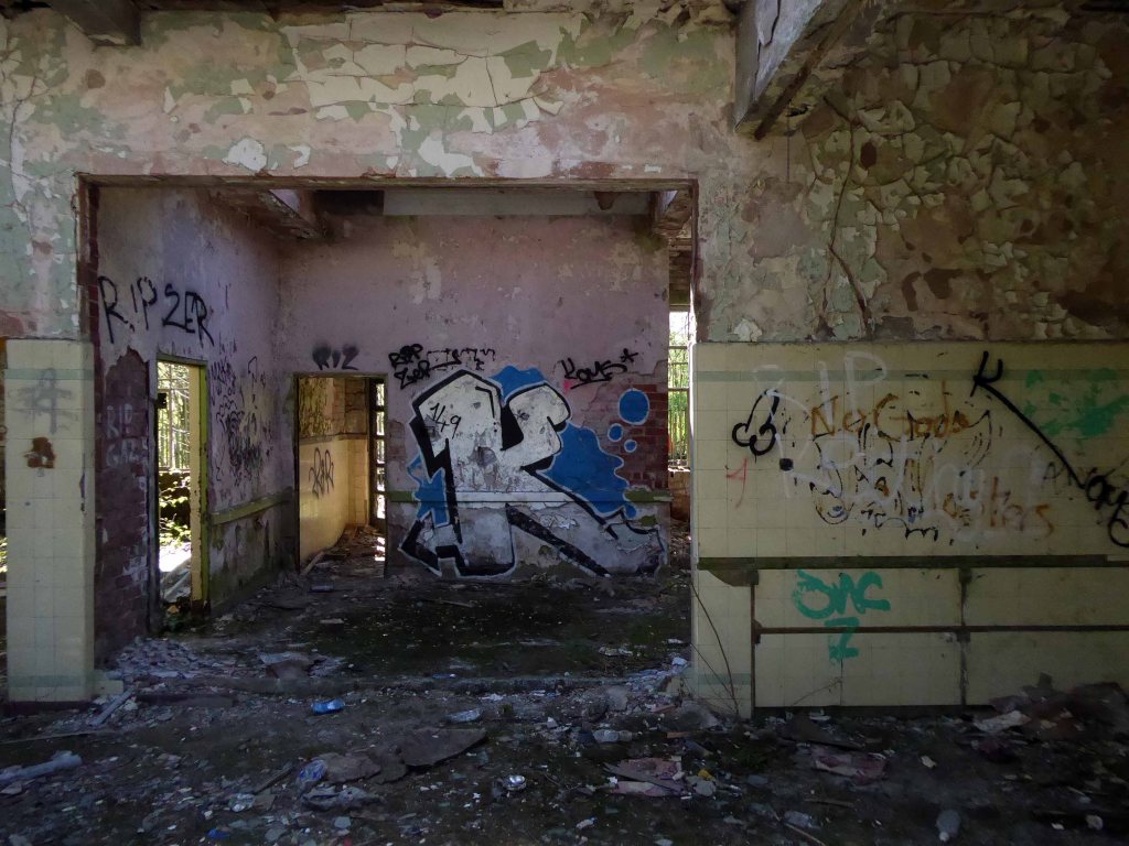
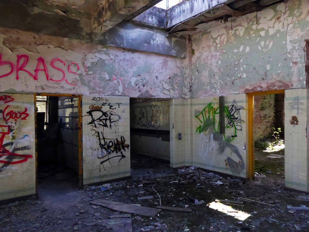
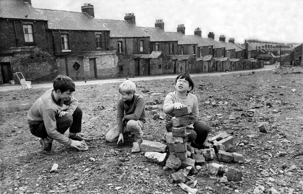
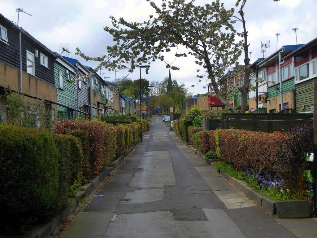
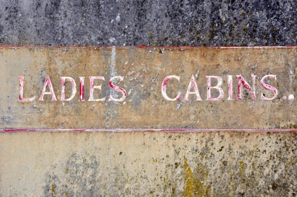
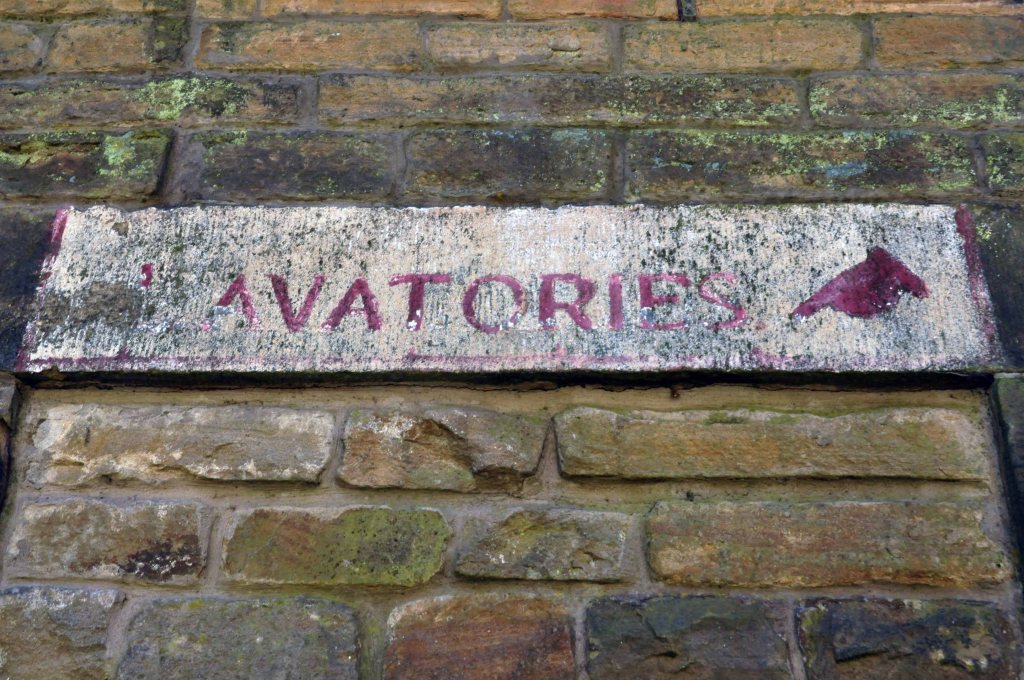
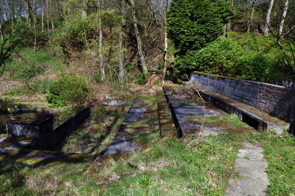
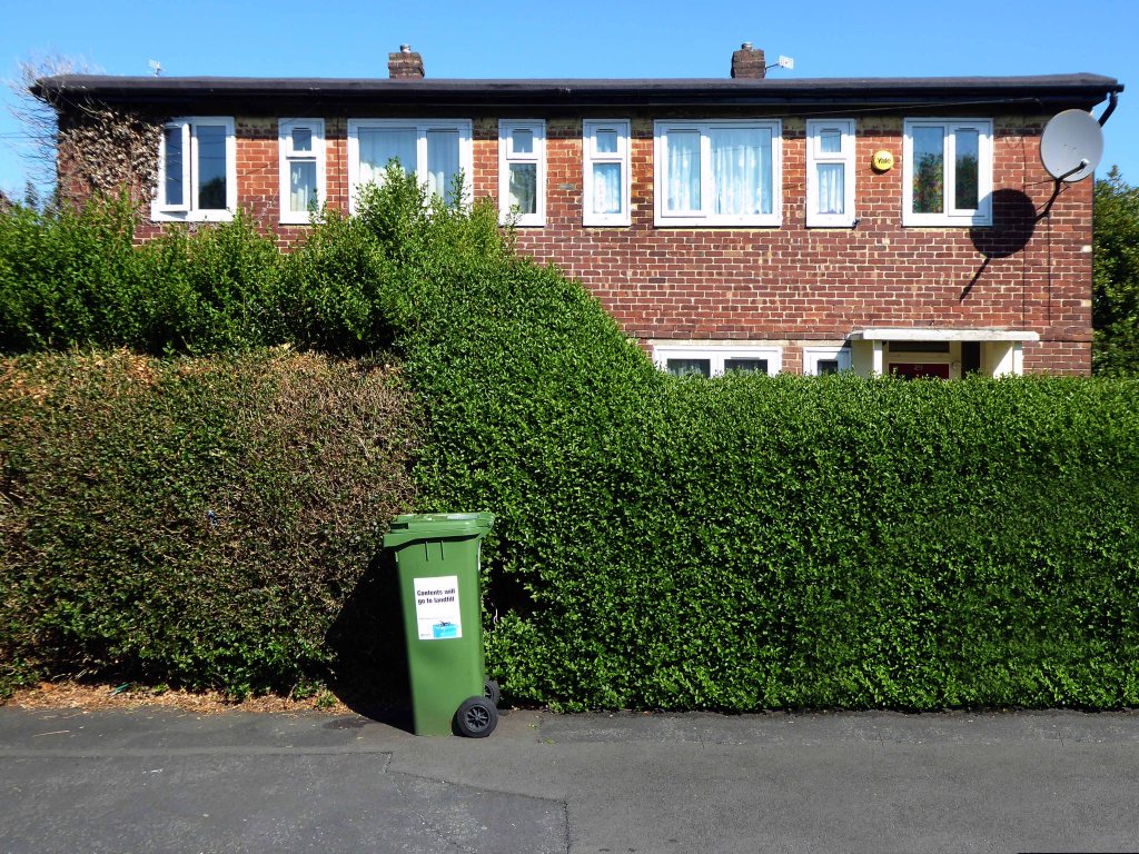
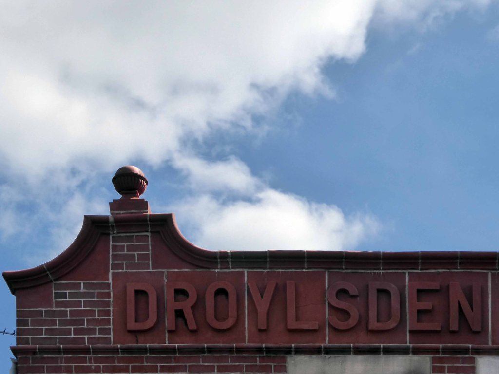
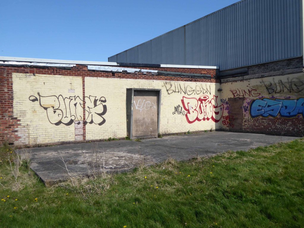
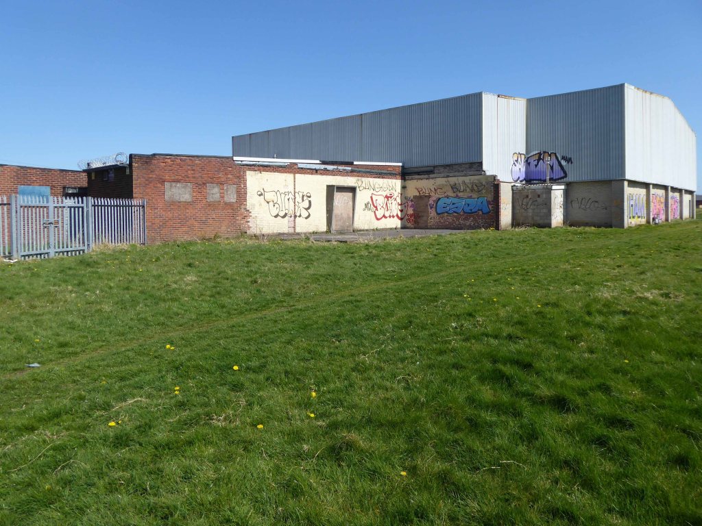
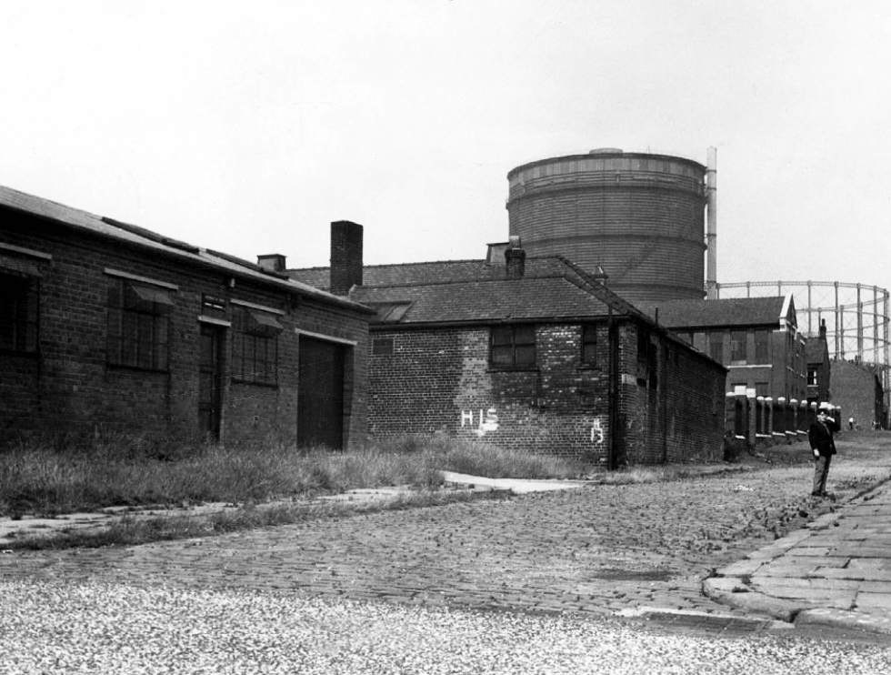
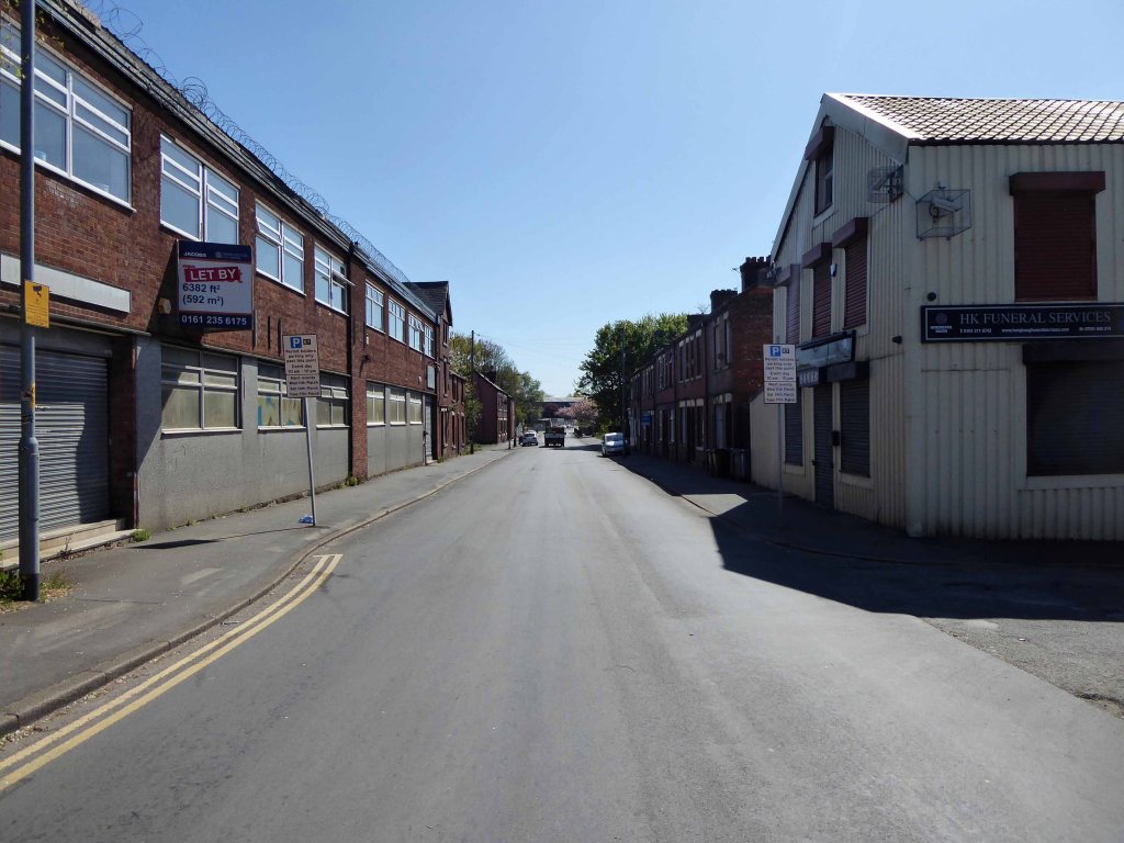
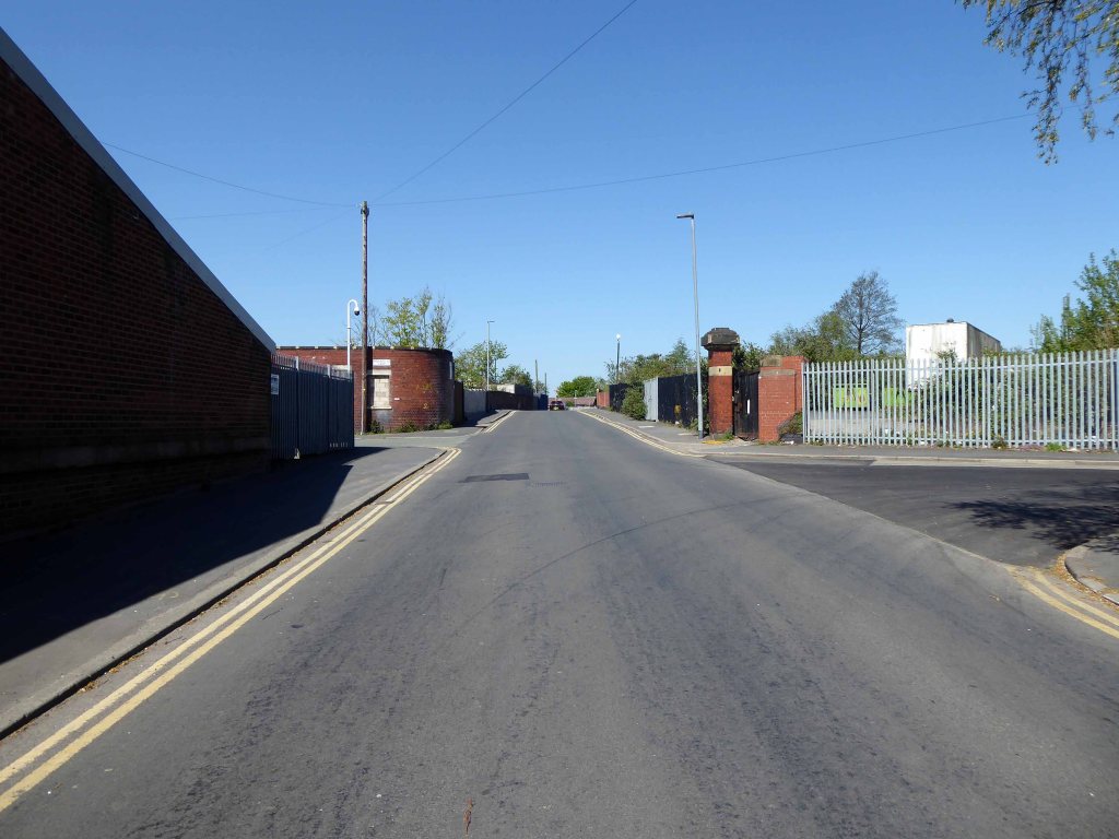
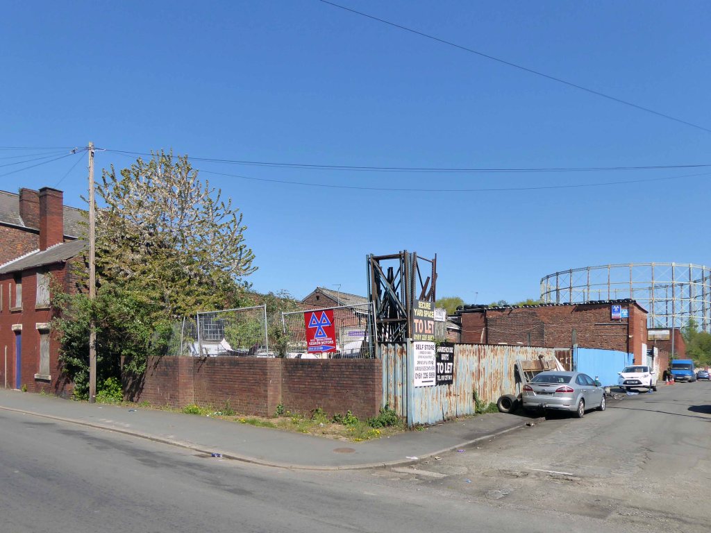
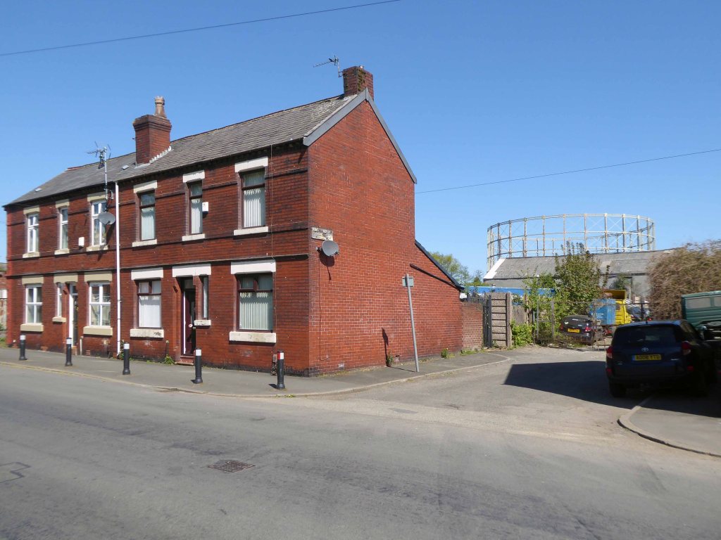
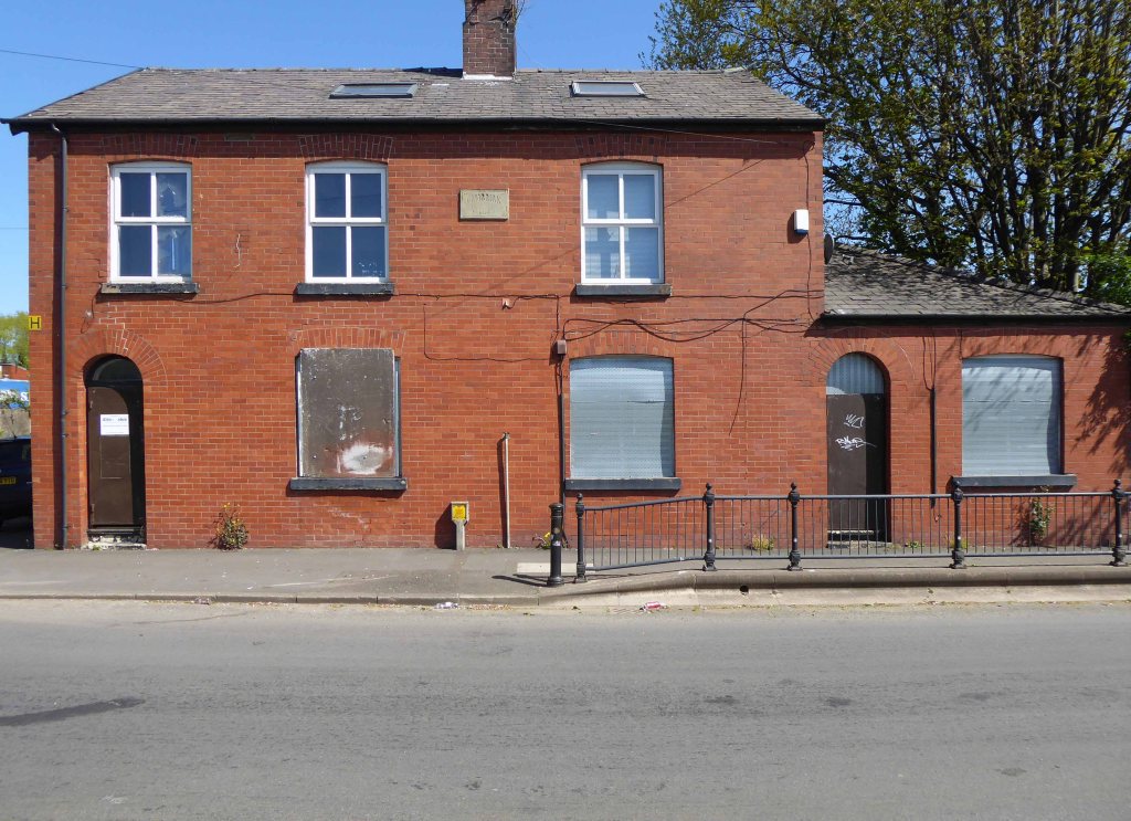
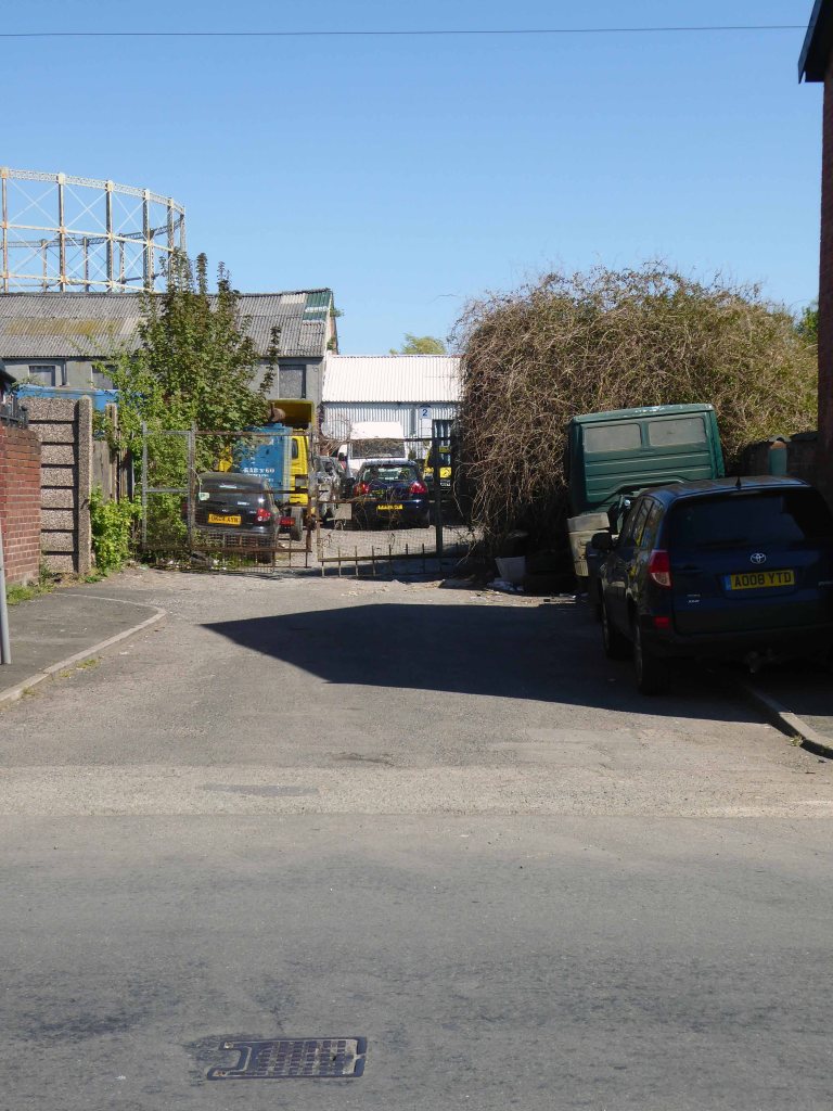
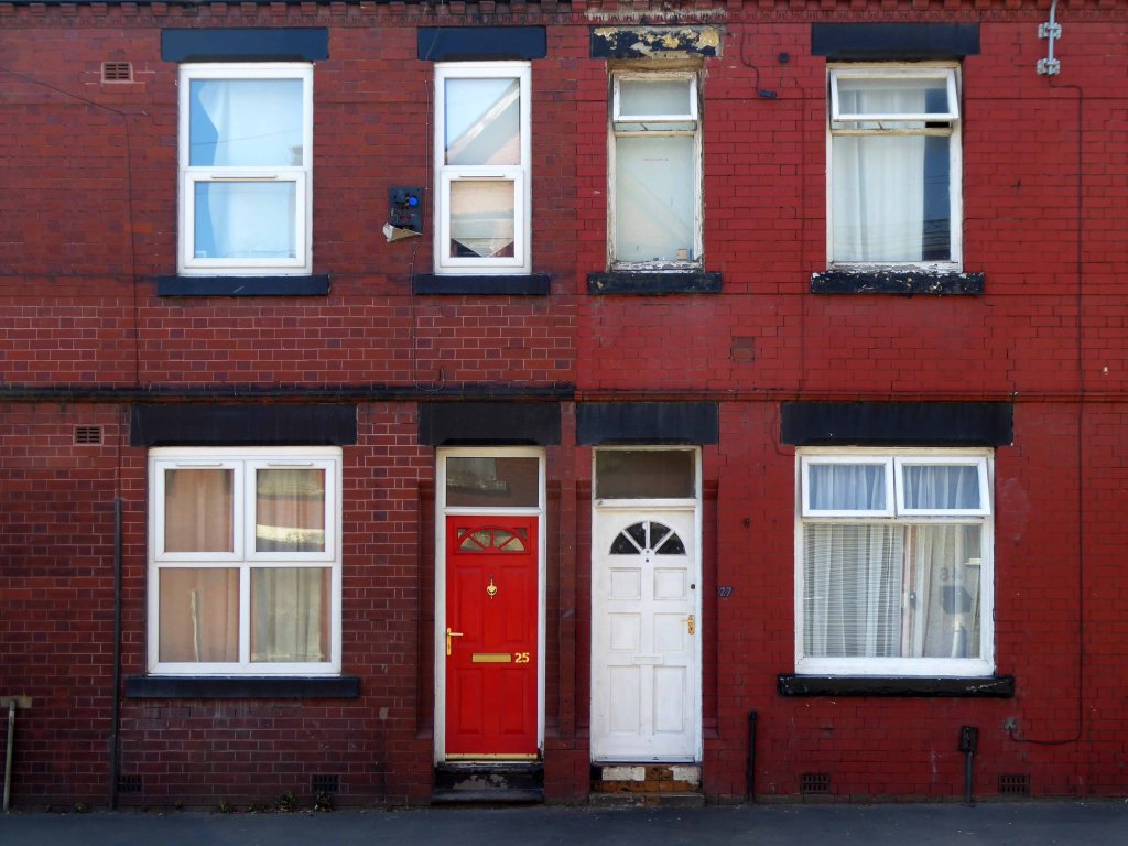
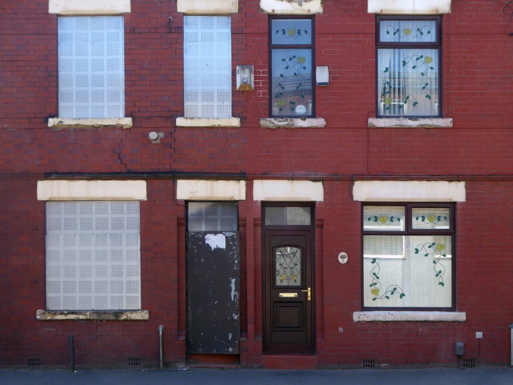
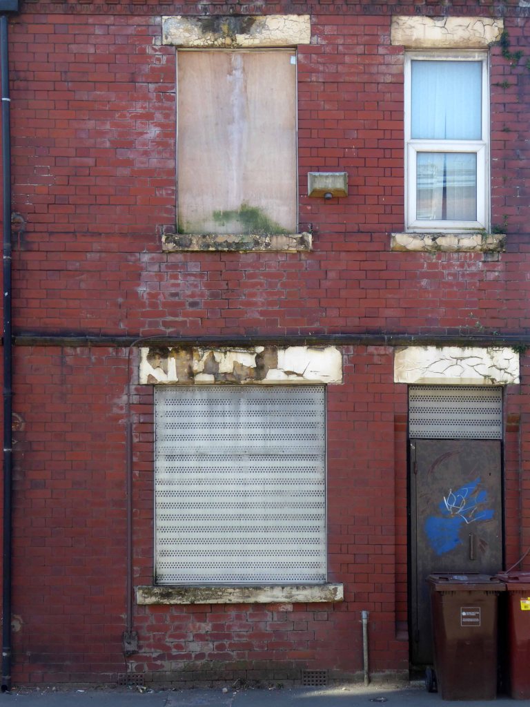
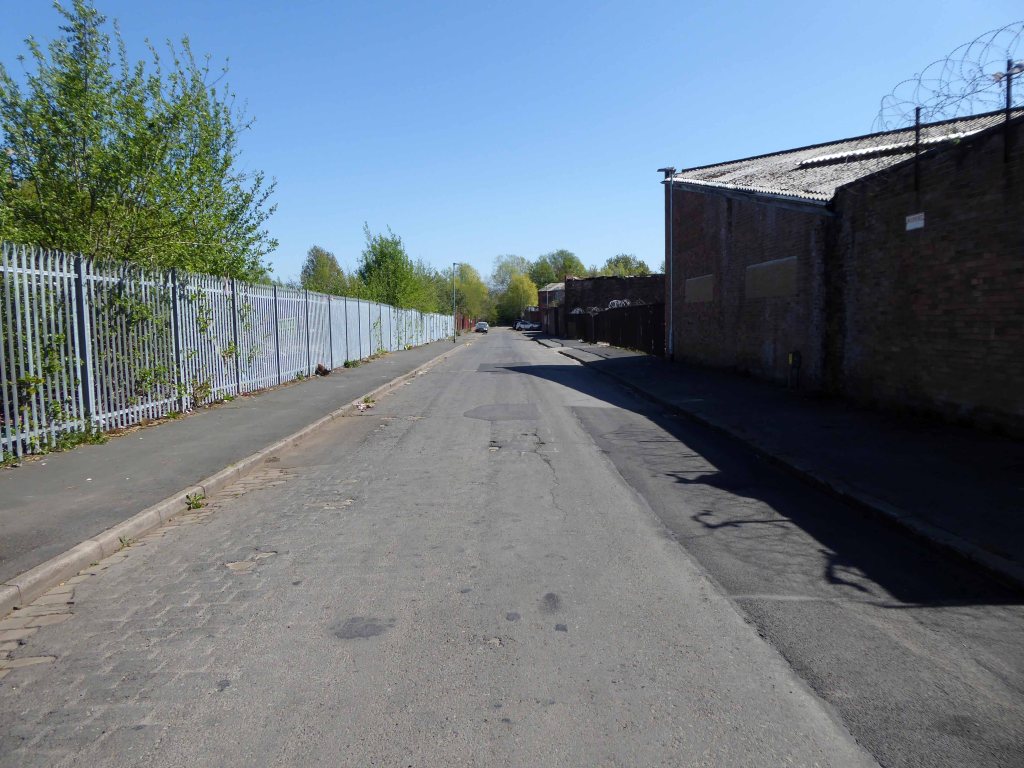
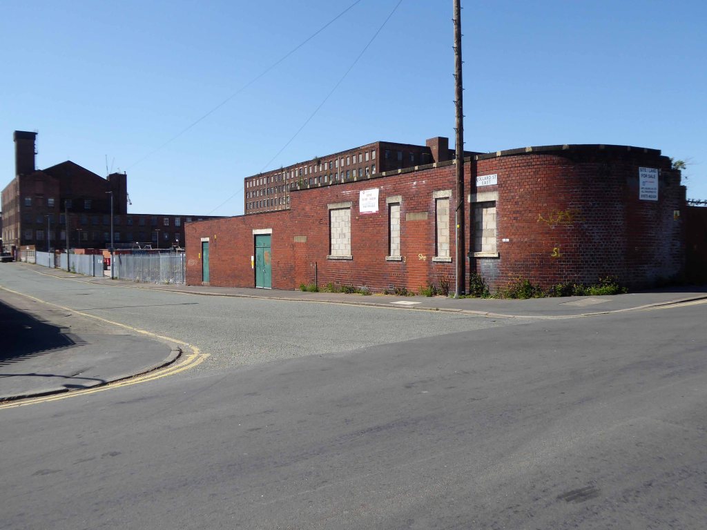
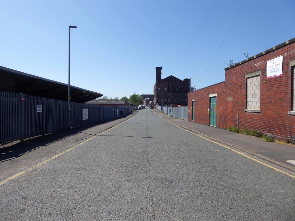
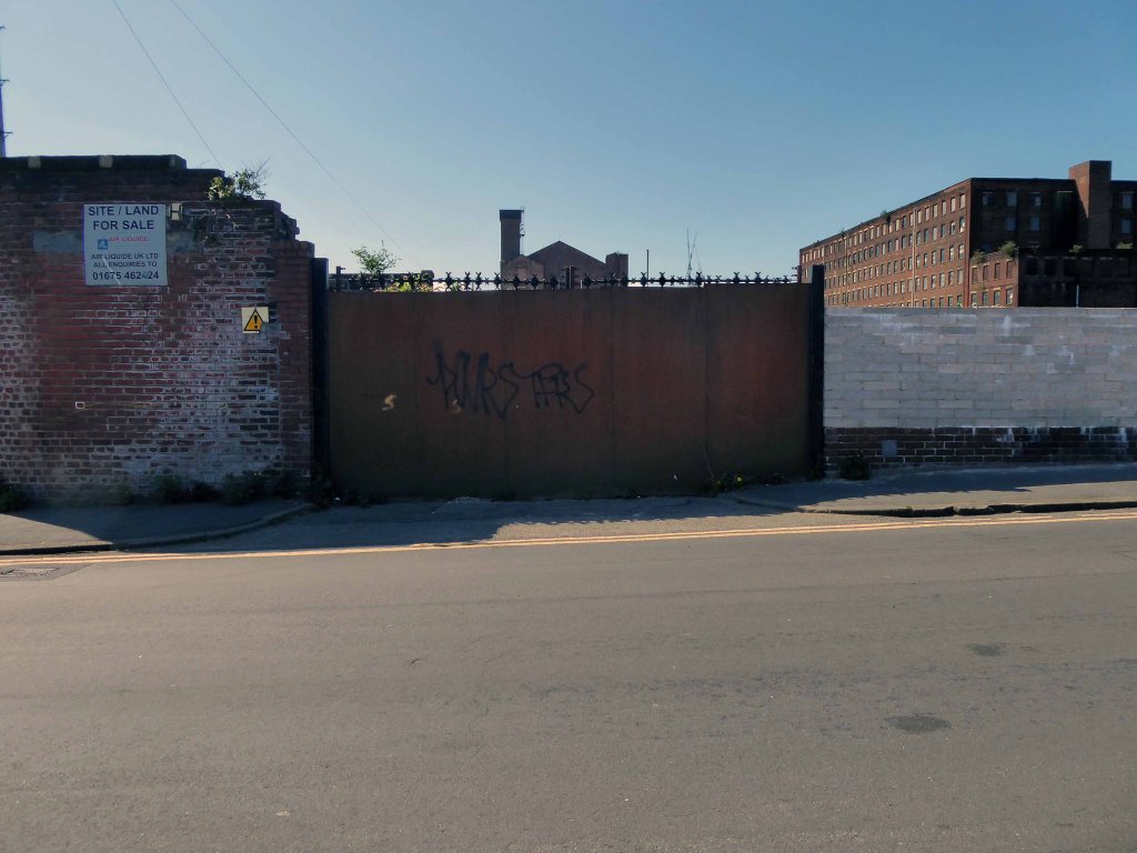
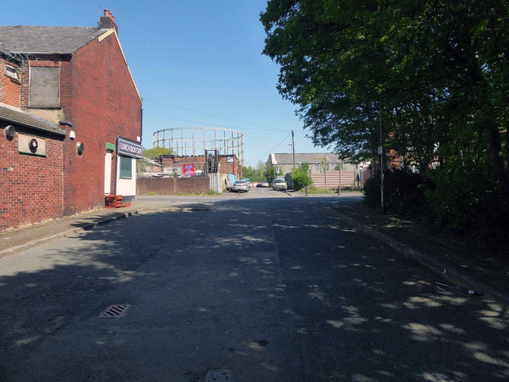
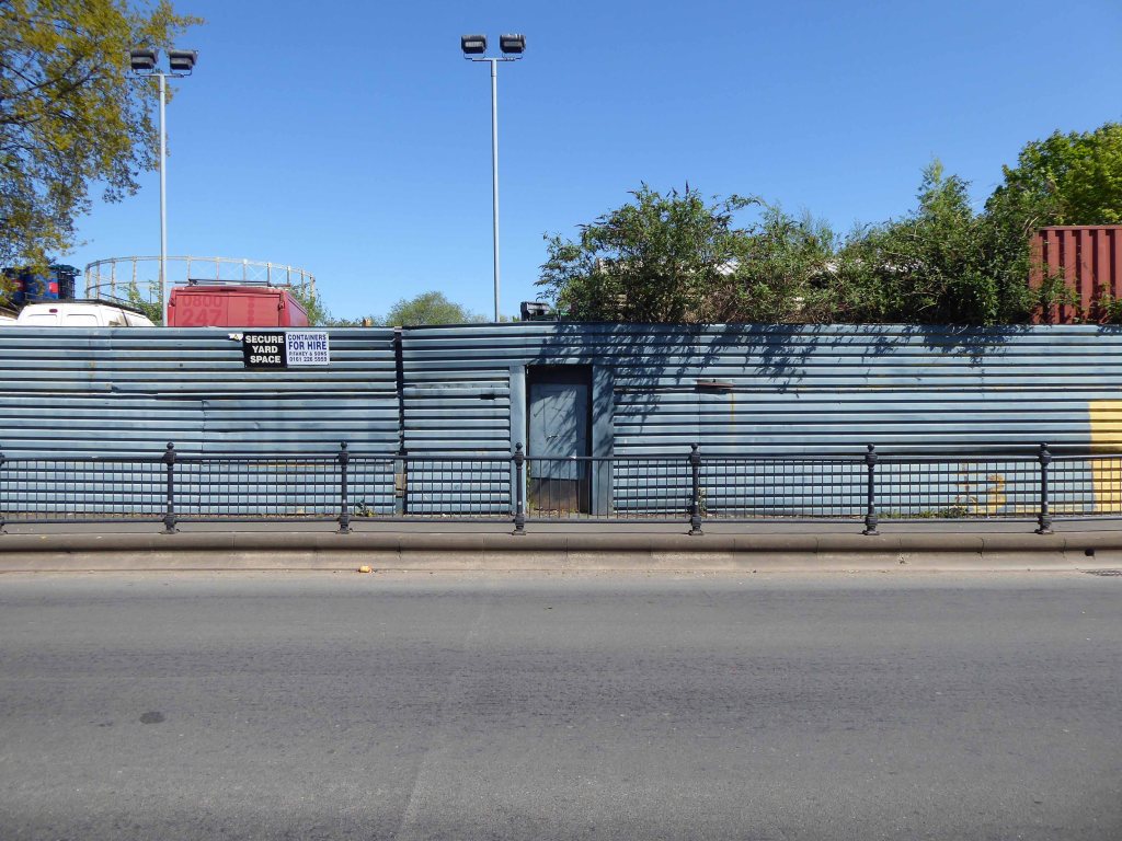
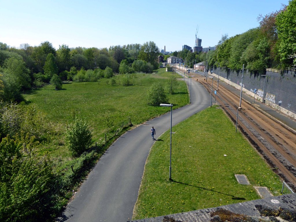
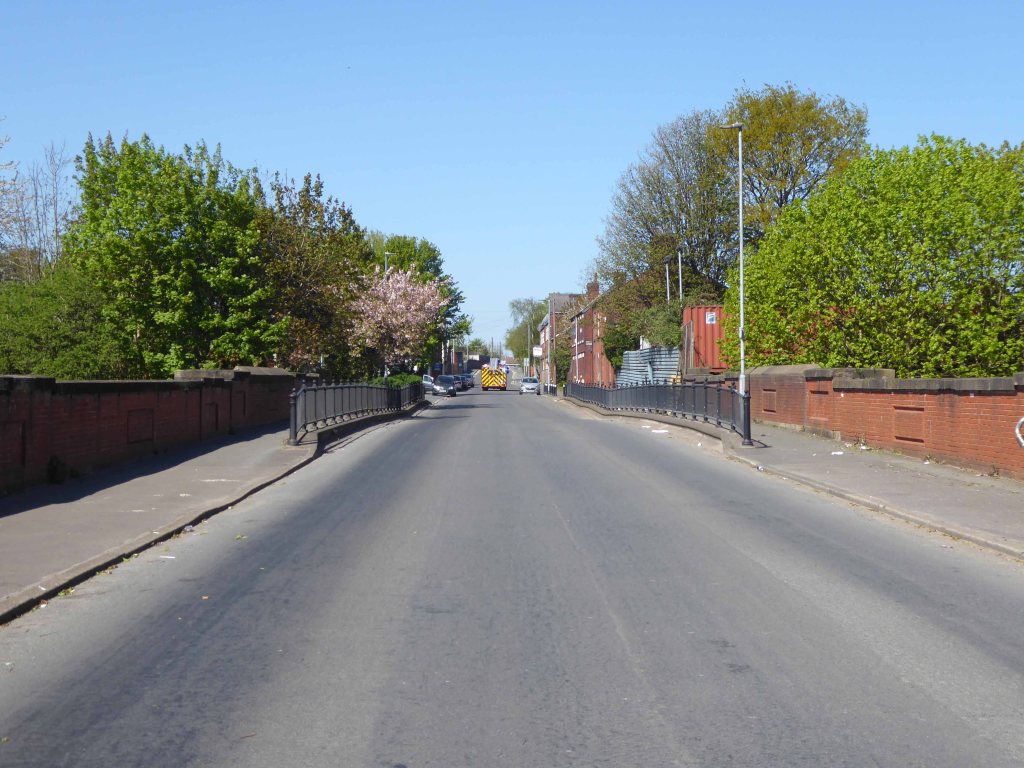
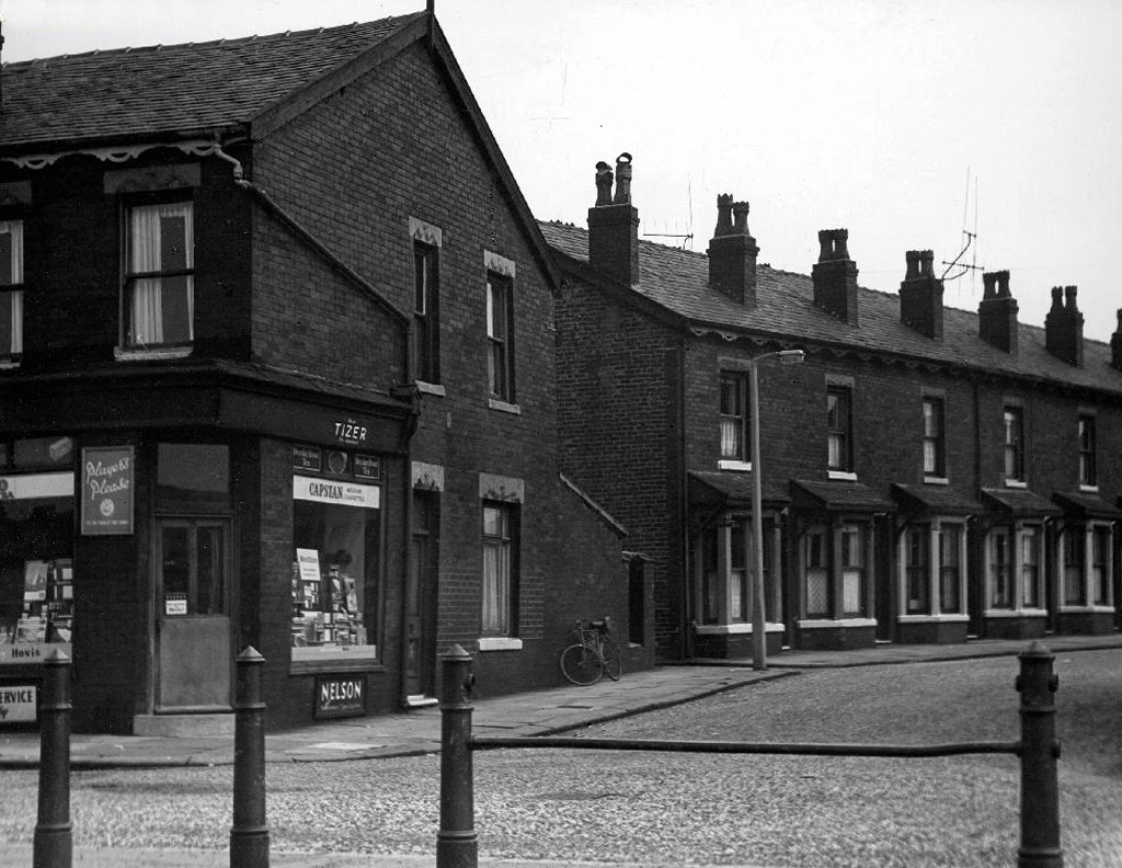
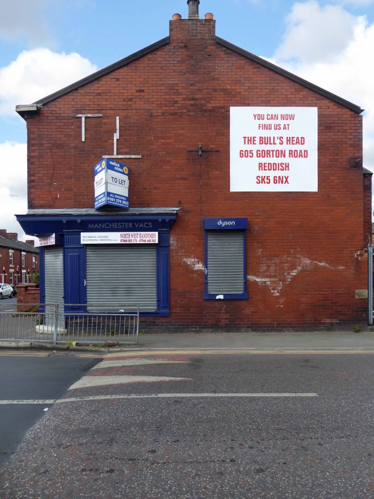
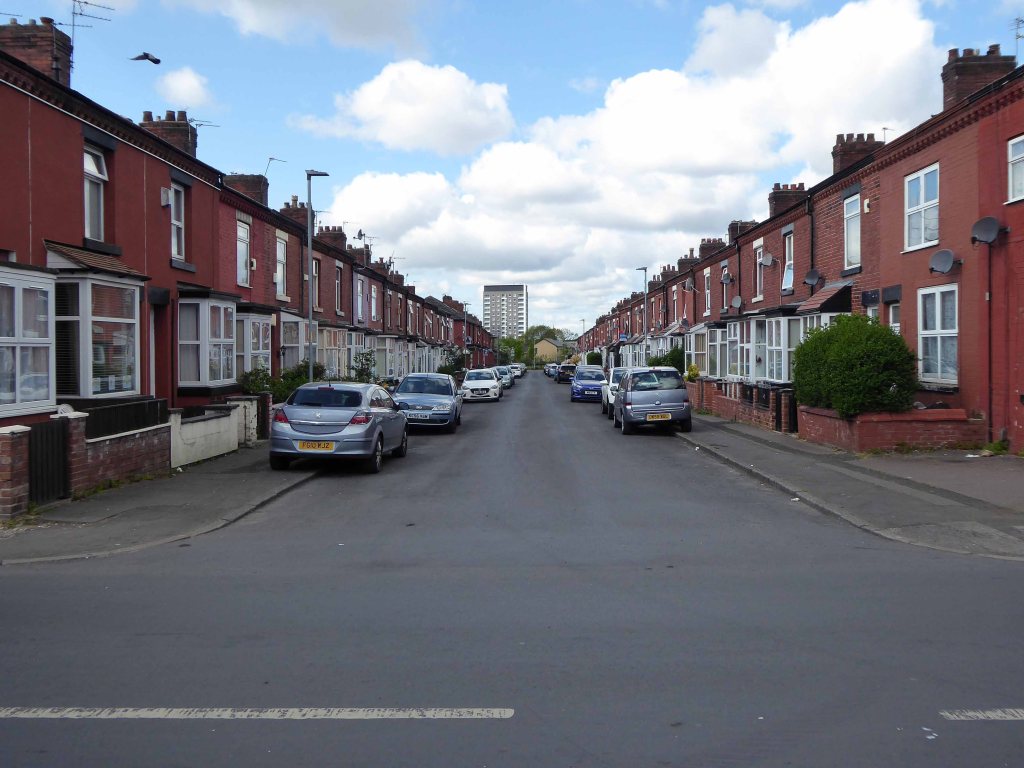
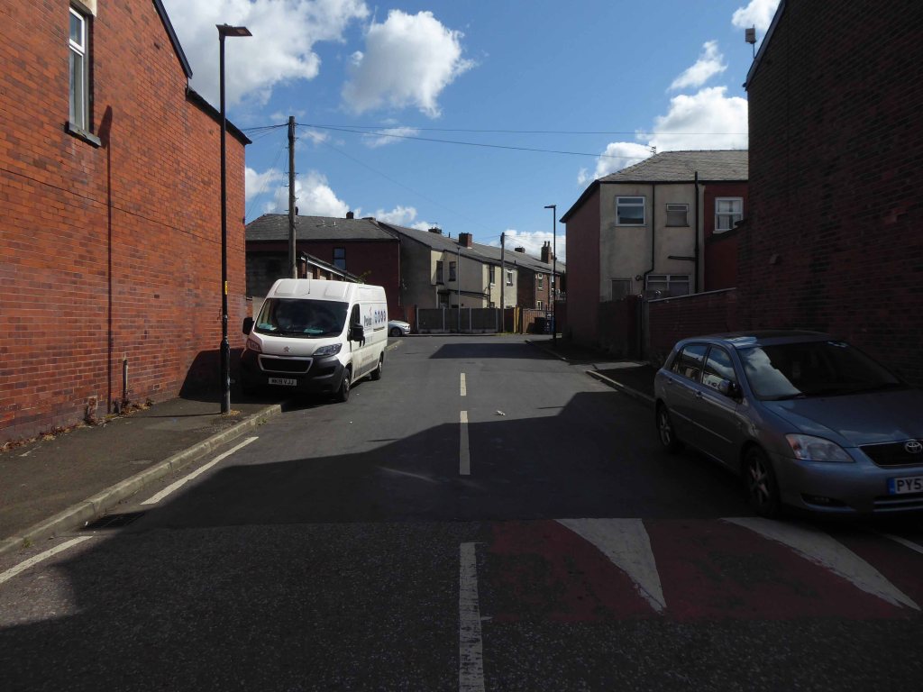
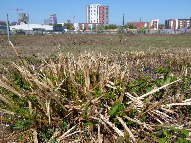
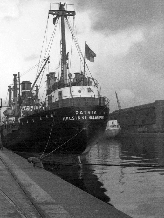
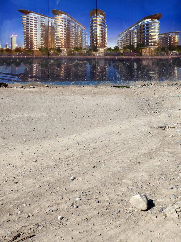
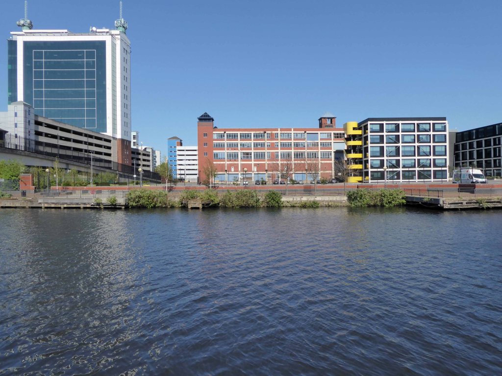
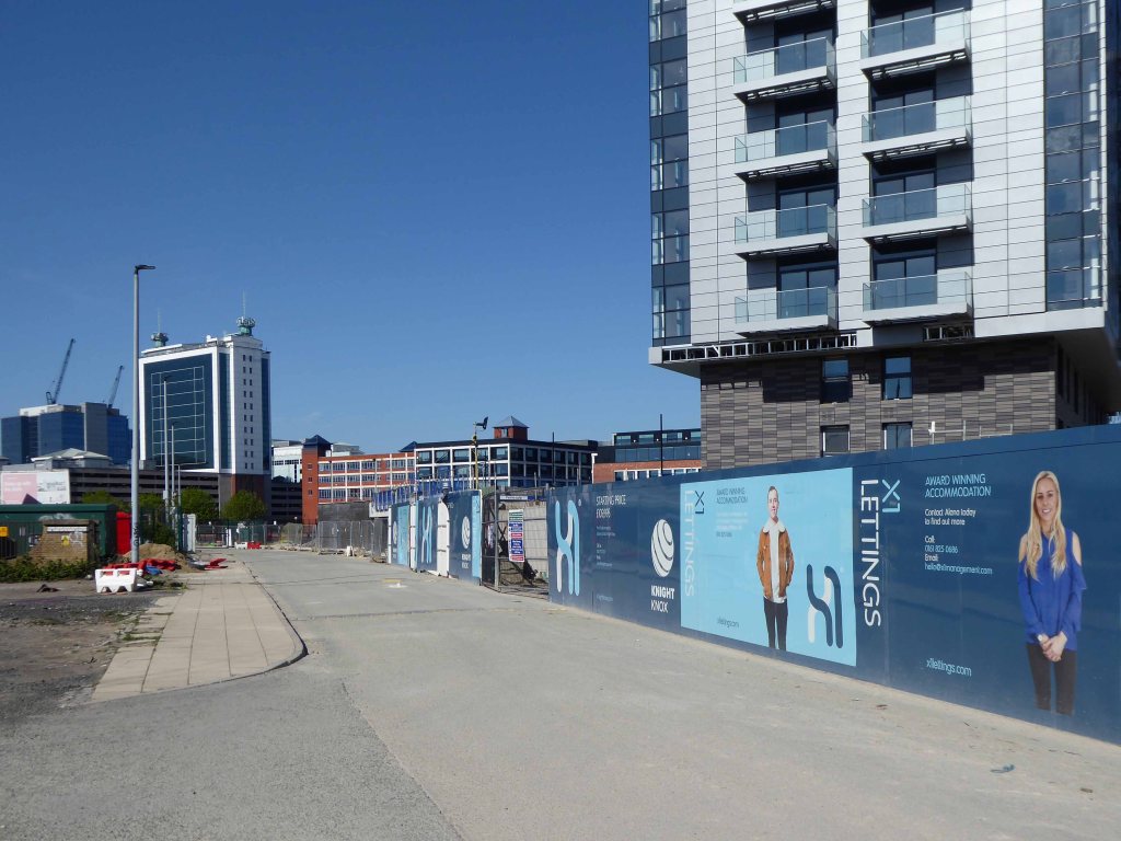
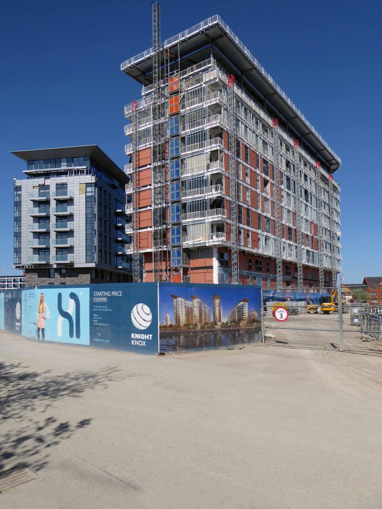
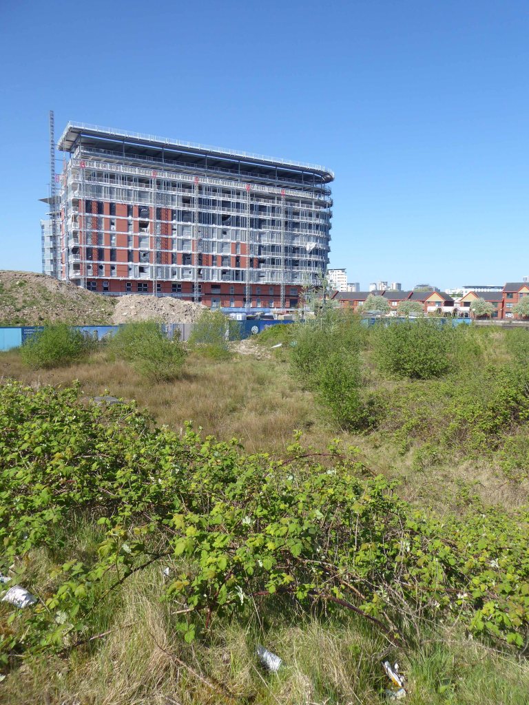
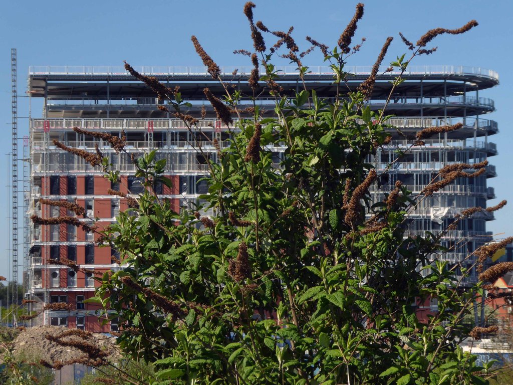
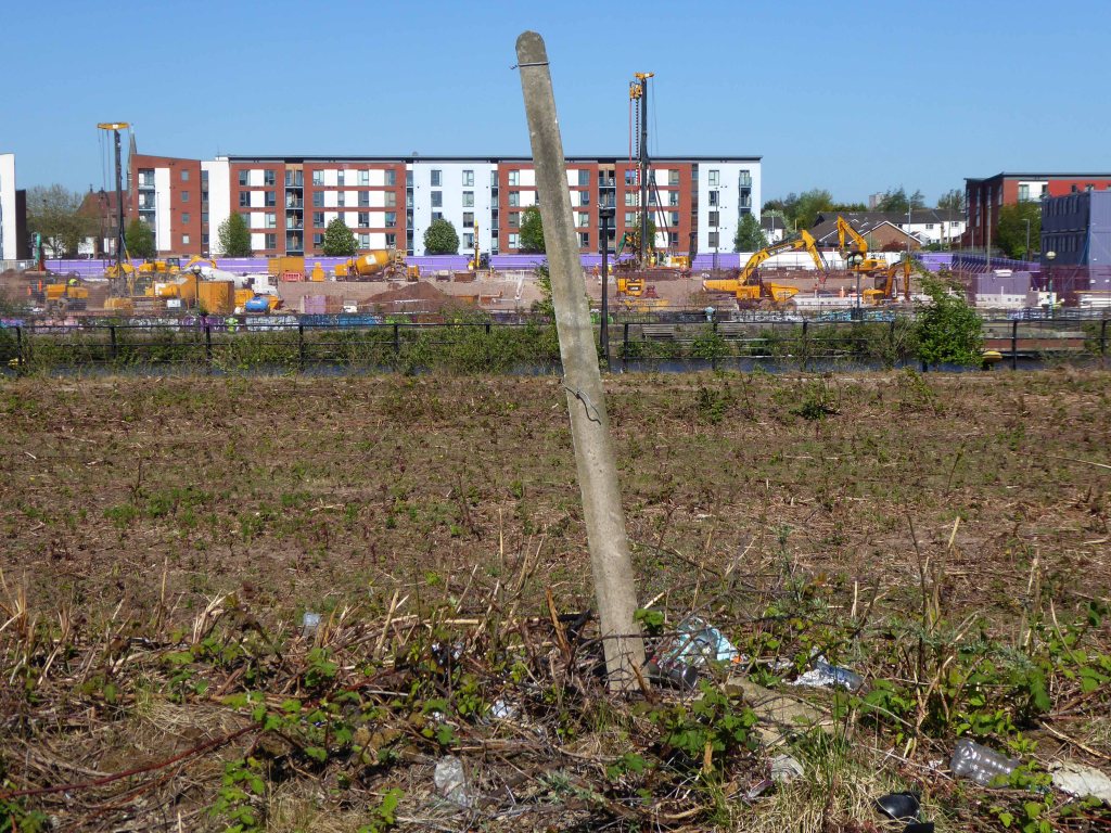
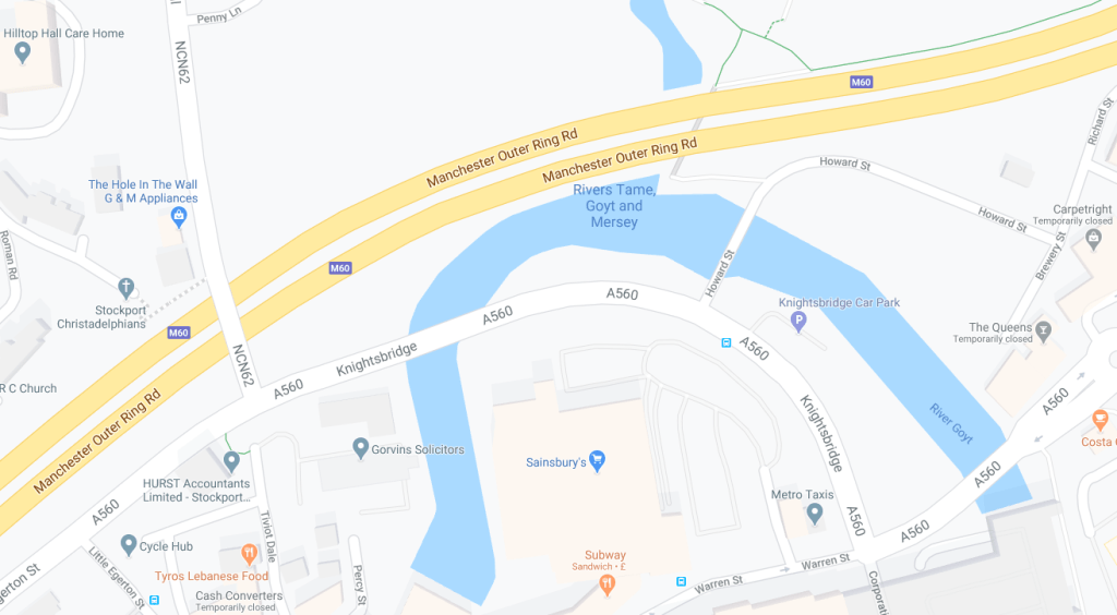
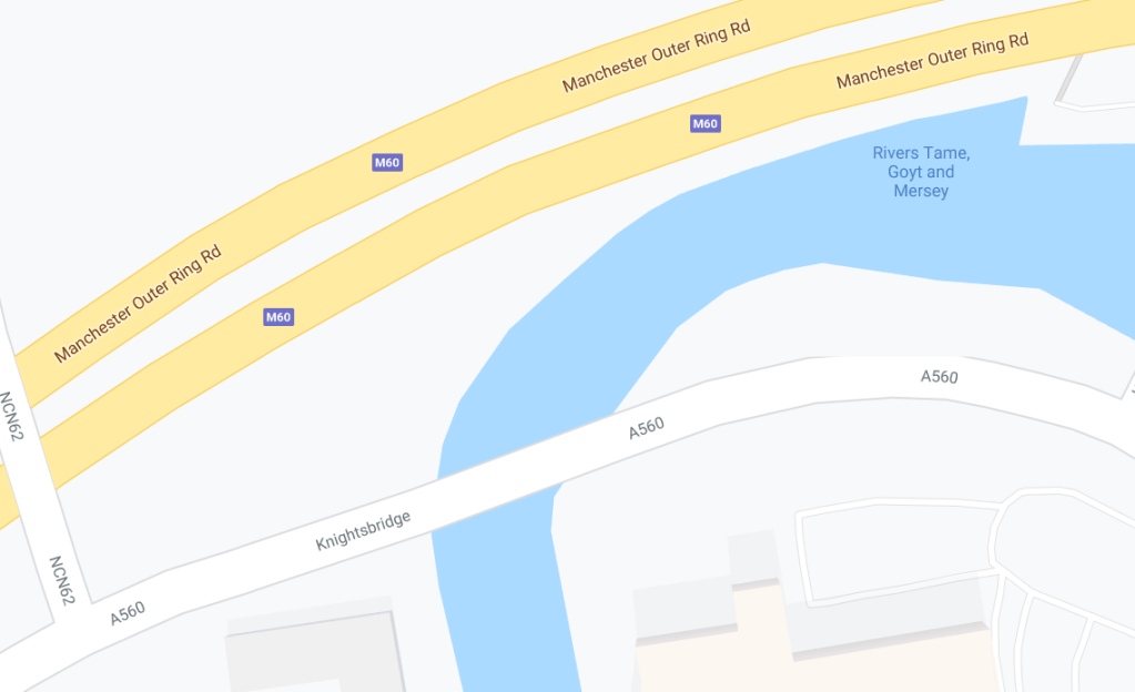
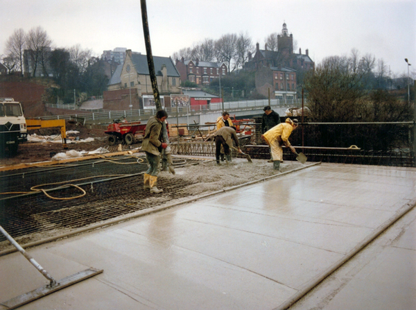
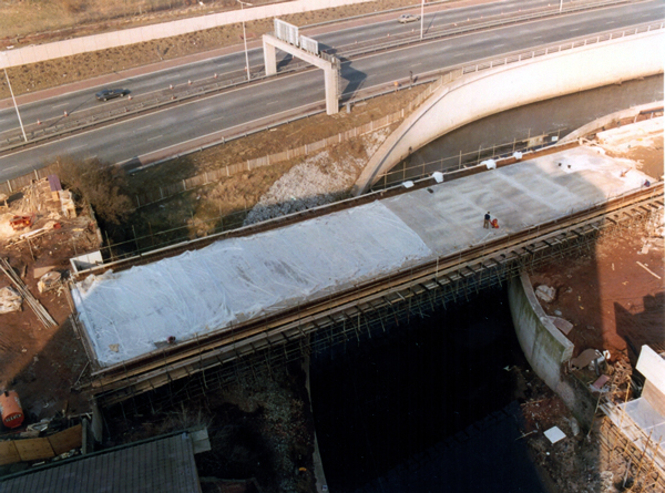
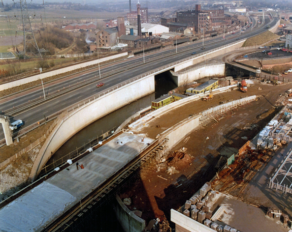
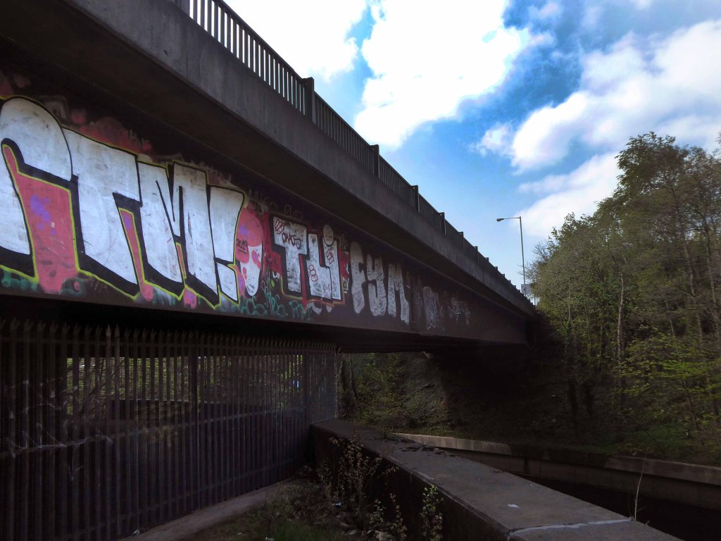
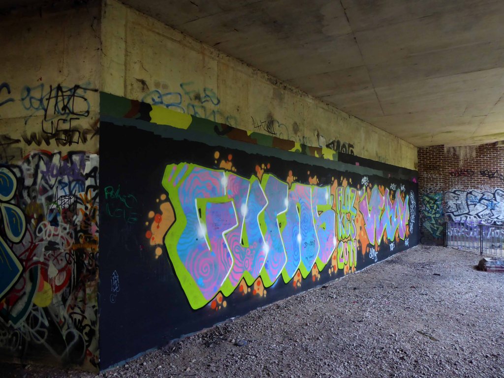
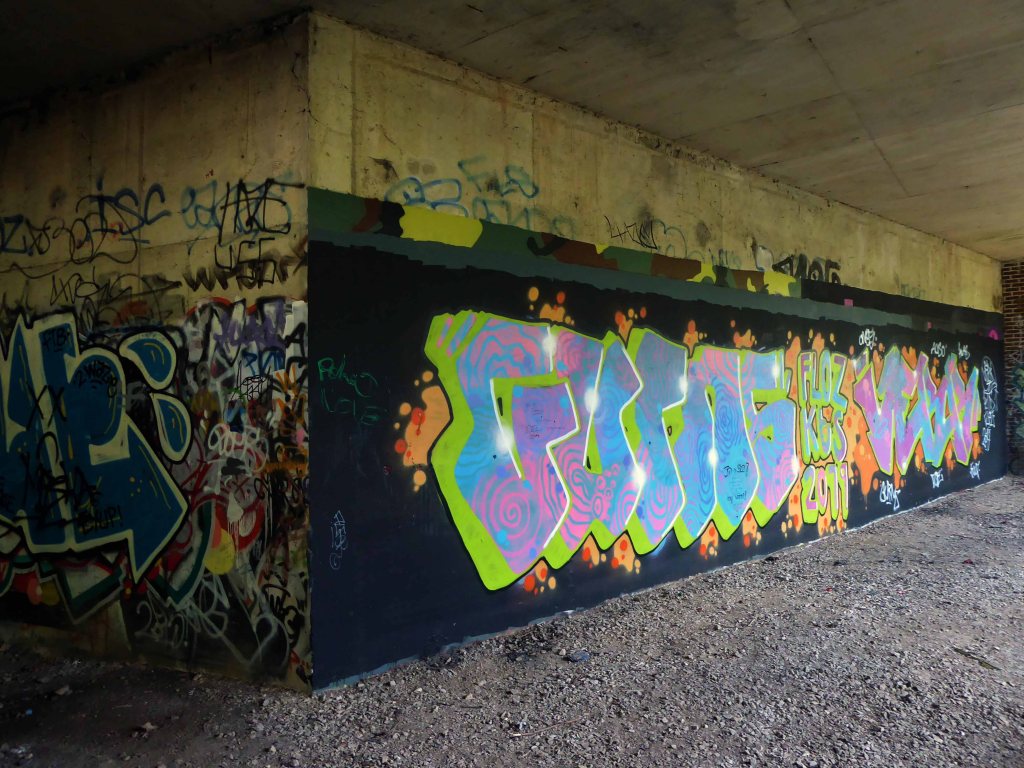
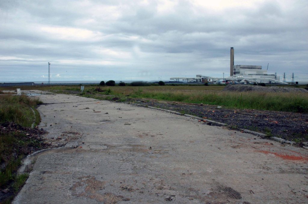
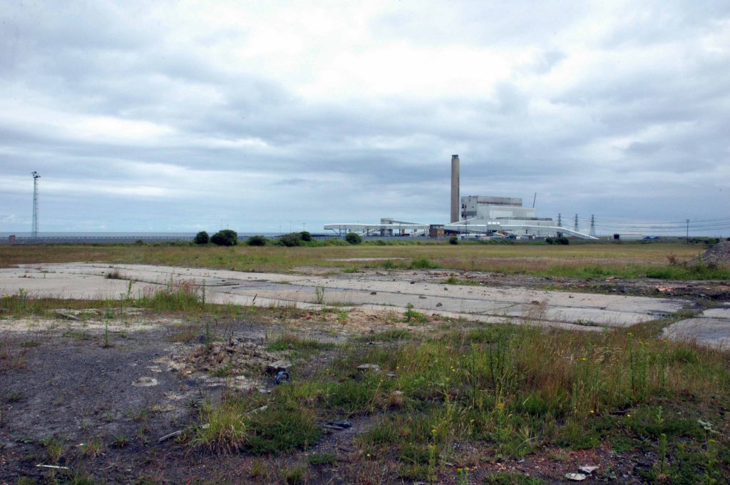
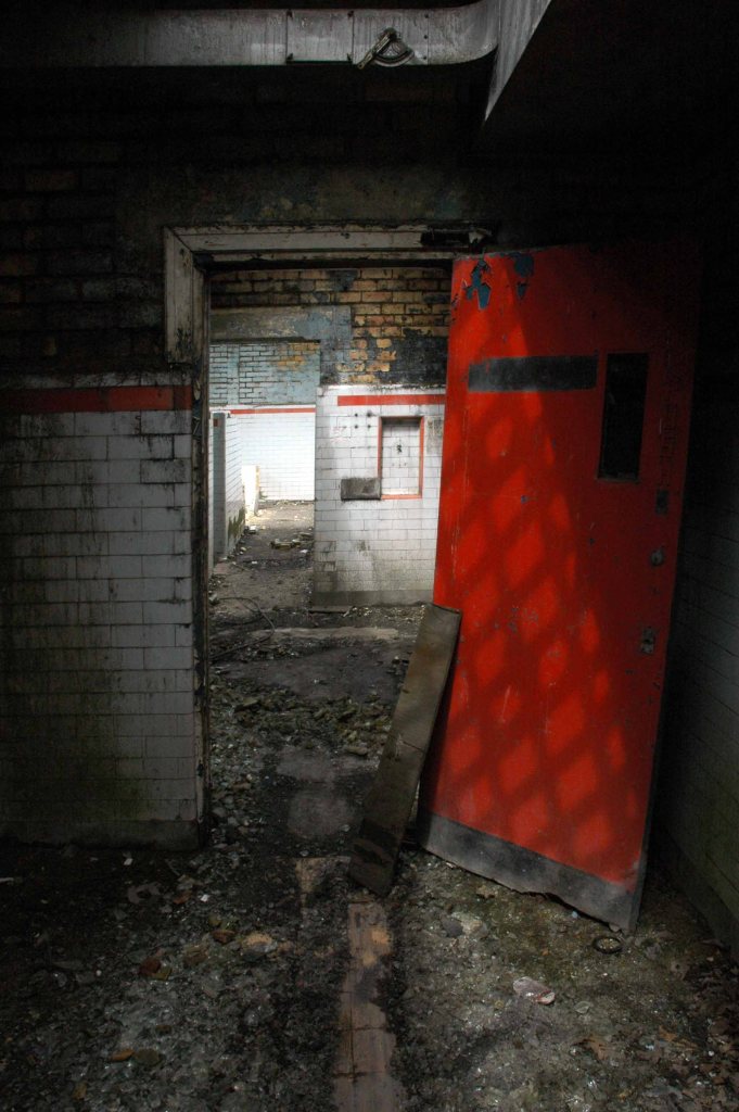
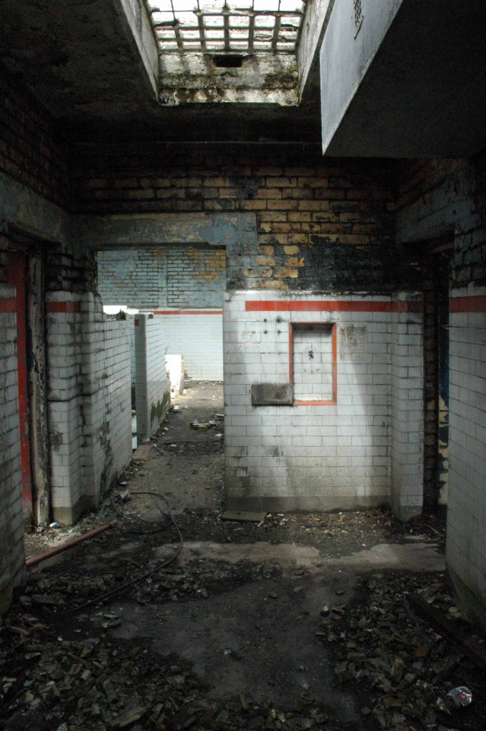
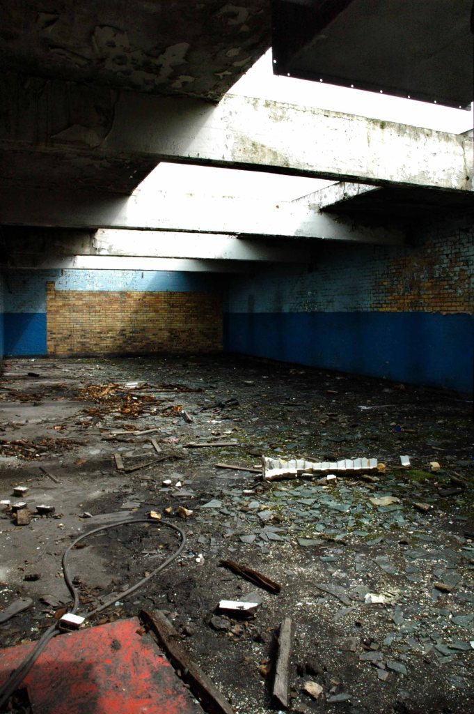
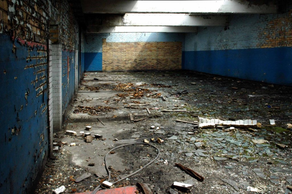
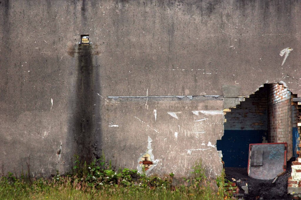
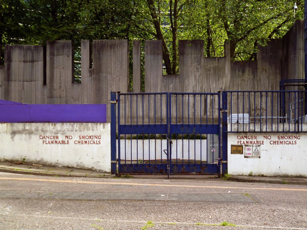
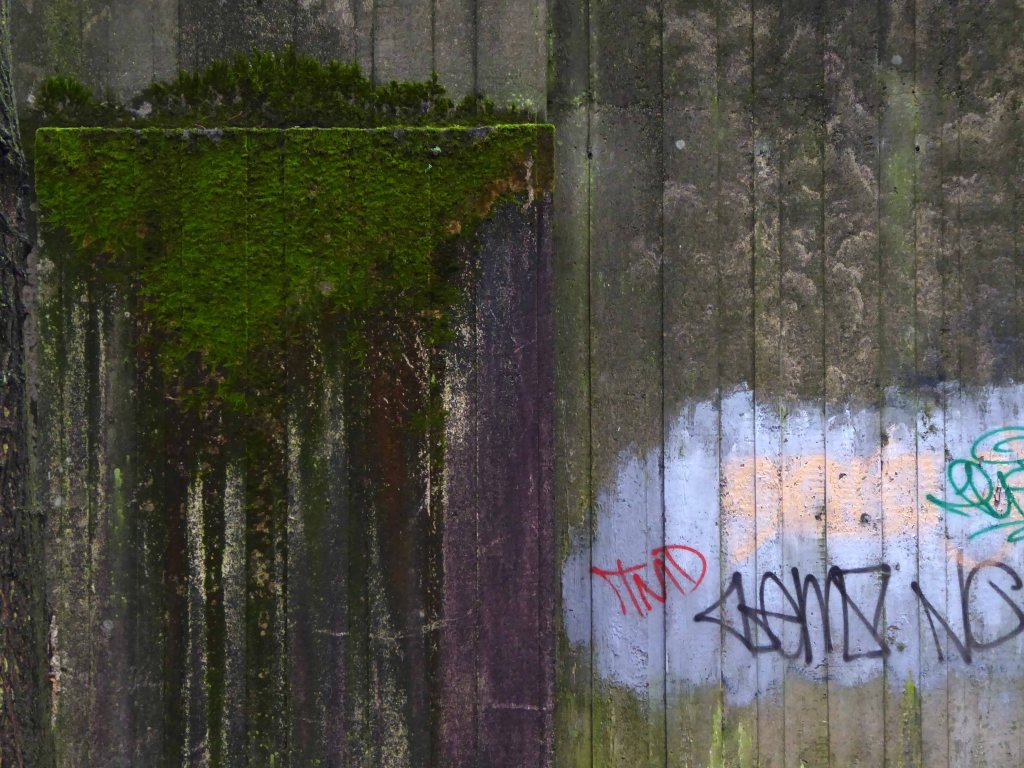
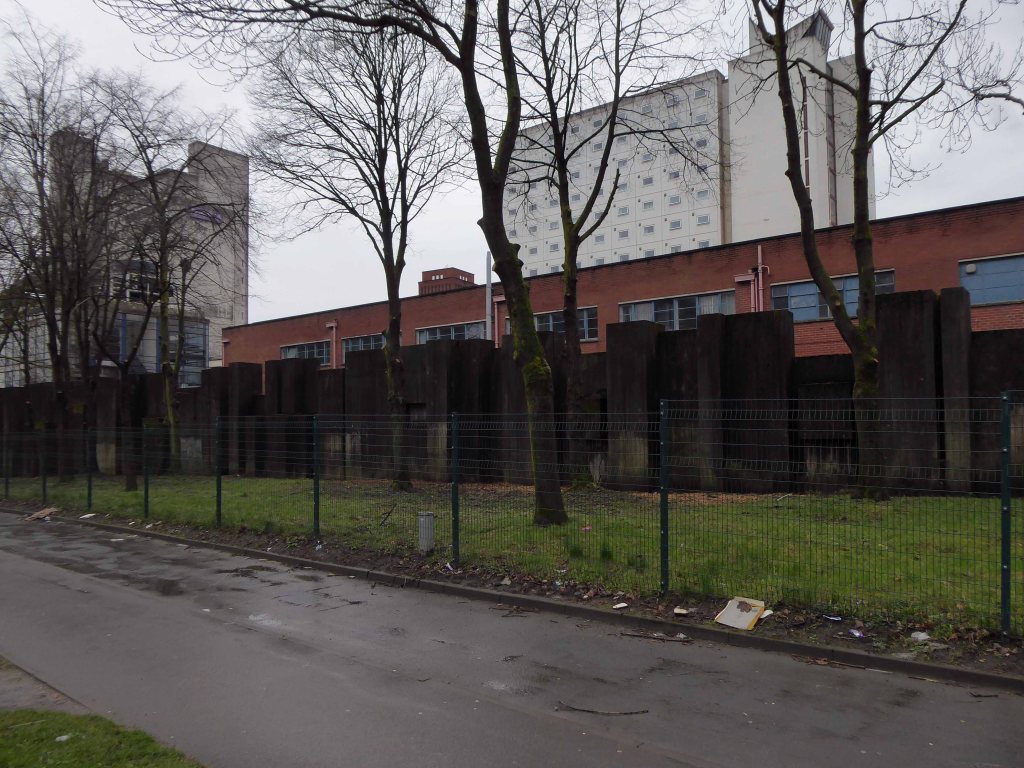
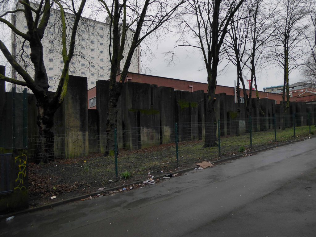
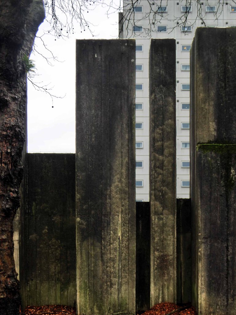
The area was formerly a dense web of housing and industry.
With the gas works at its heart .
High speed gas once the fuel of the future is almost a thing of the past. Coal Gas produced in coke retorts long gone, North Sea Gas hissed off.
Low carbon heating will replace domestic boilers from 2025, the need for gas storage holders is minimal.
Goodnight Mr Therm.
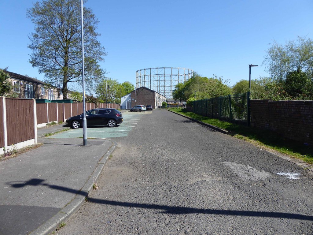
There are currently 53 listed holders on the Historic England site.
Some have been repurposed – WilkinsonEyre has completed work on Gasholders London; a development of 145 apartments within a triplet of listed gasholder guide frames.
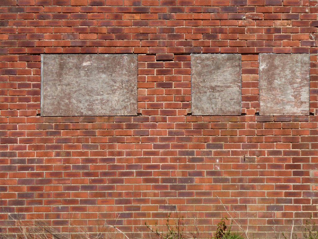
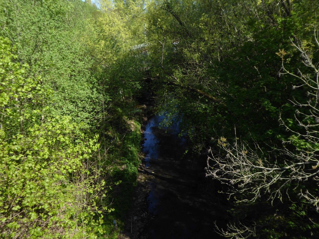
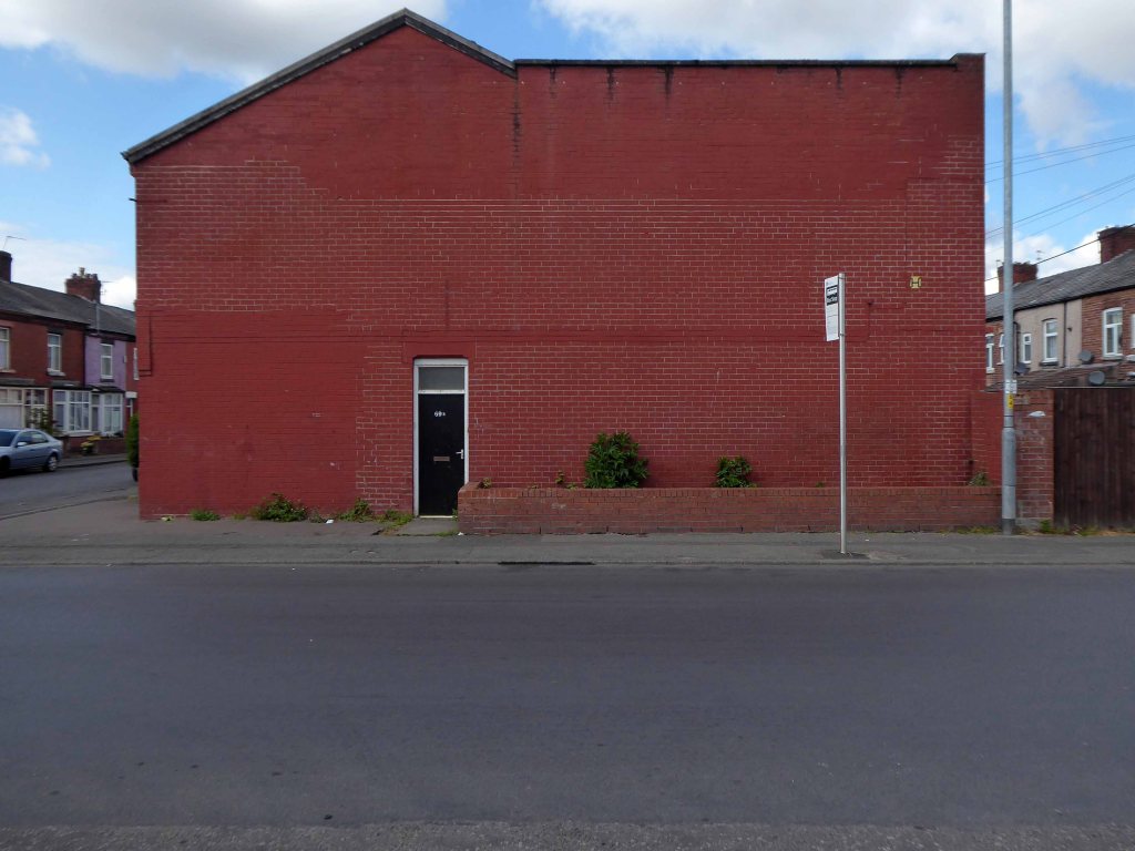
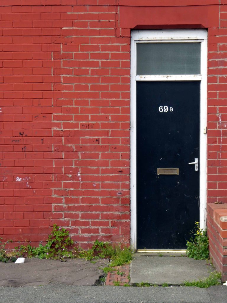
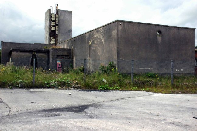
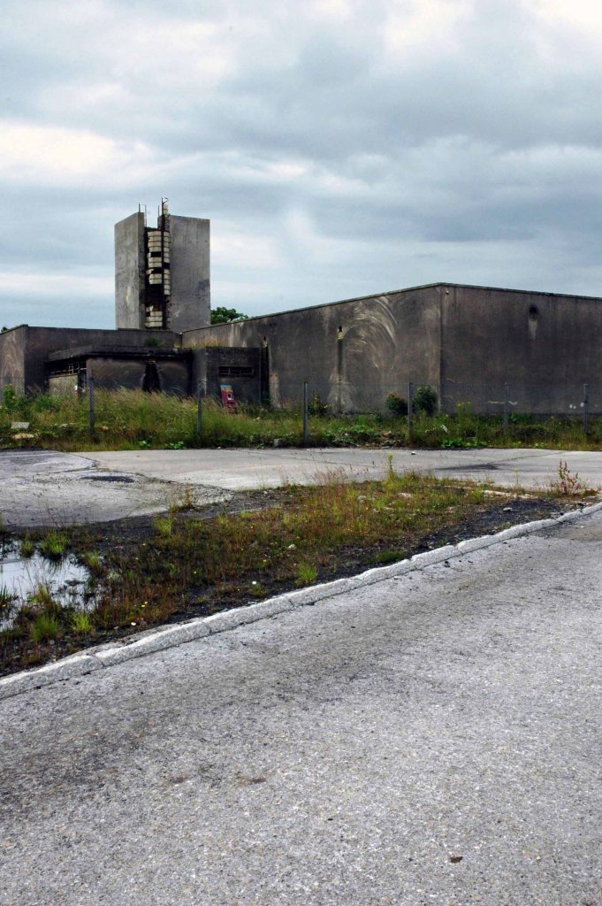
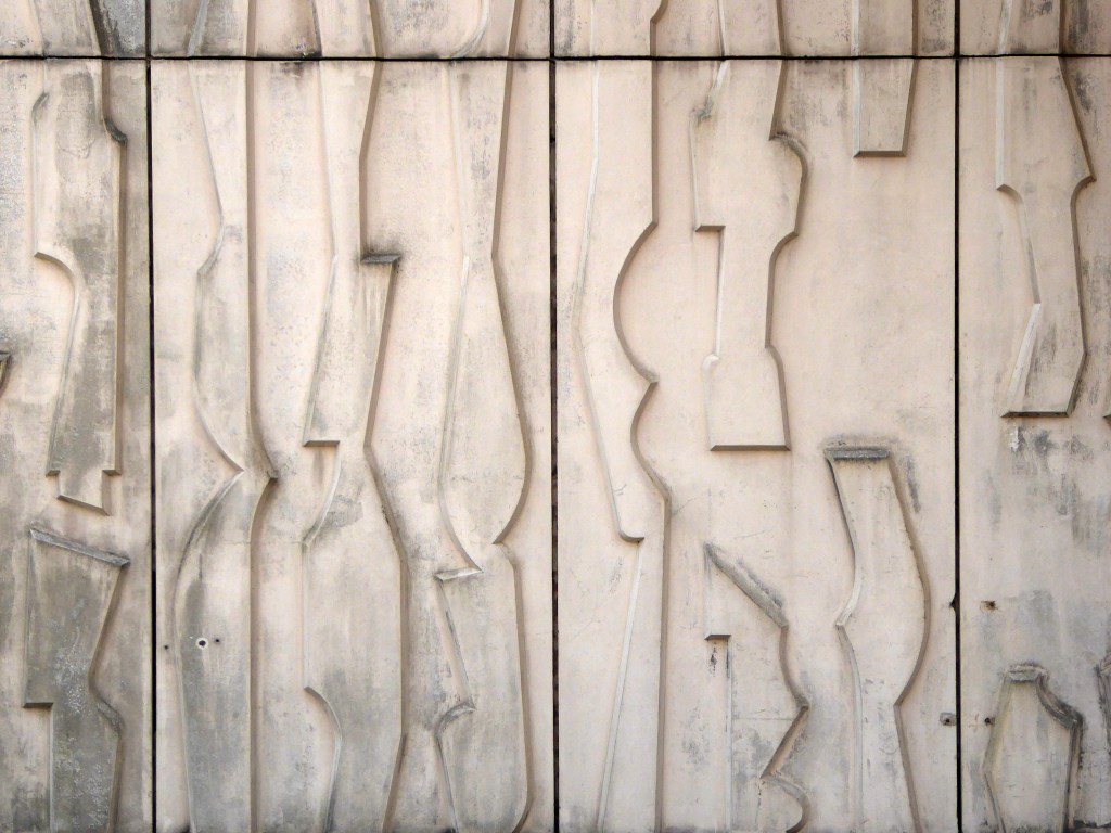
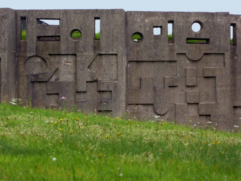
Little now remains of the Portwood Gas Works.
These are the rearranged remnants re-sited by Dunelm Mill – it’s curtains for our industrial heritage.
Your business is unique, so we don’t offer a one-size-fits-all.
Instead, we layer six Protective Services for your complete security.
Unlock six Protective Services
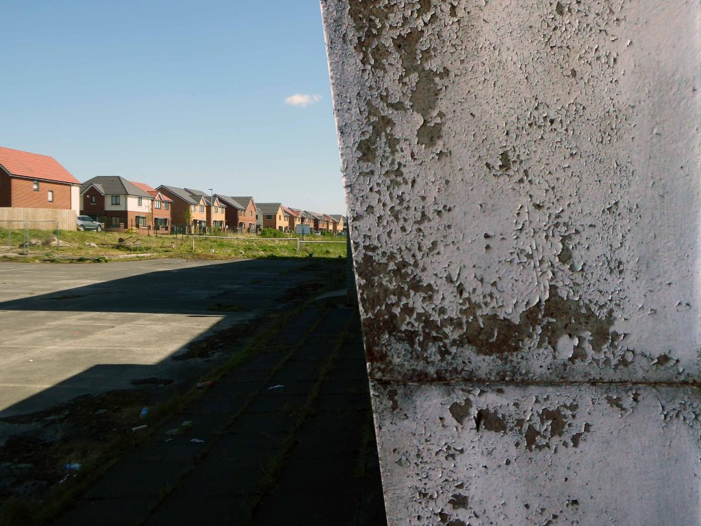
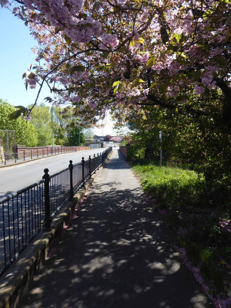
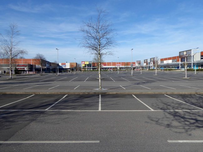
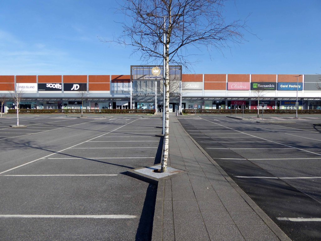
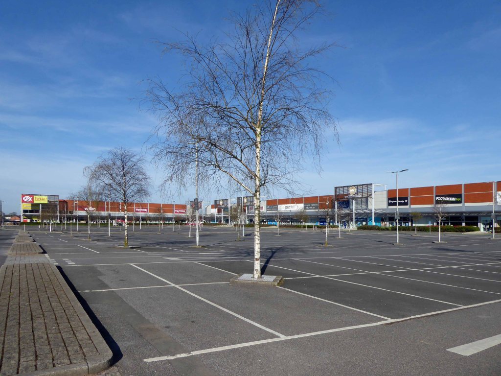
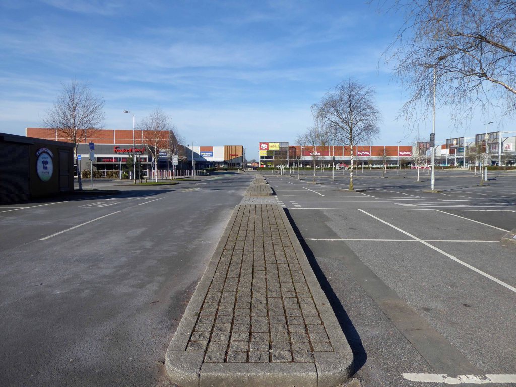
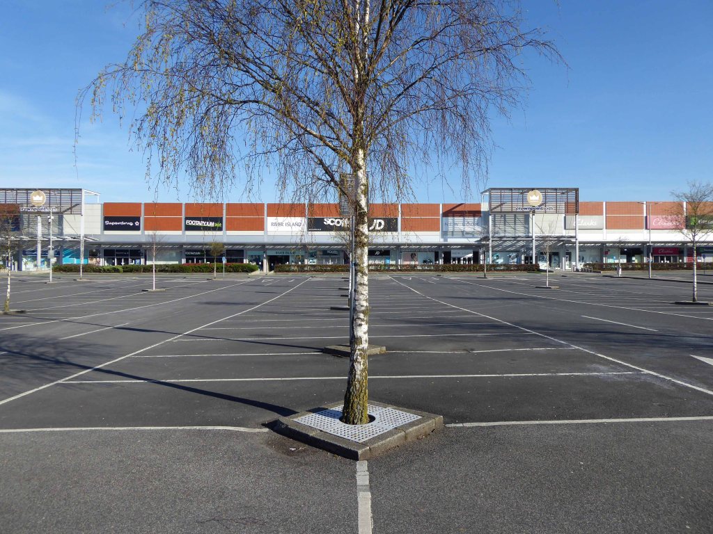
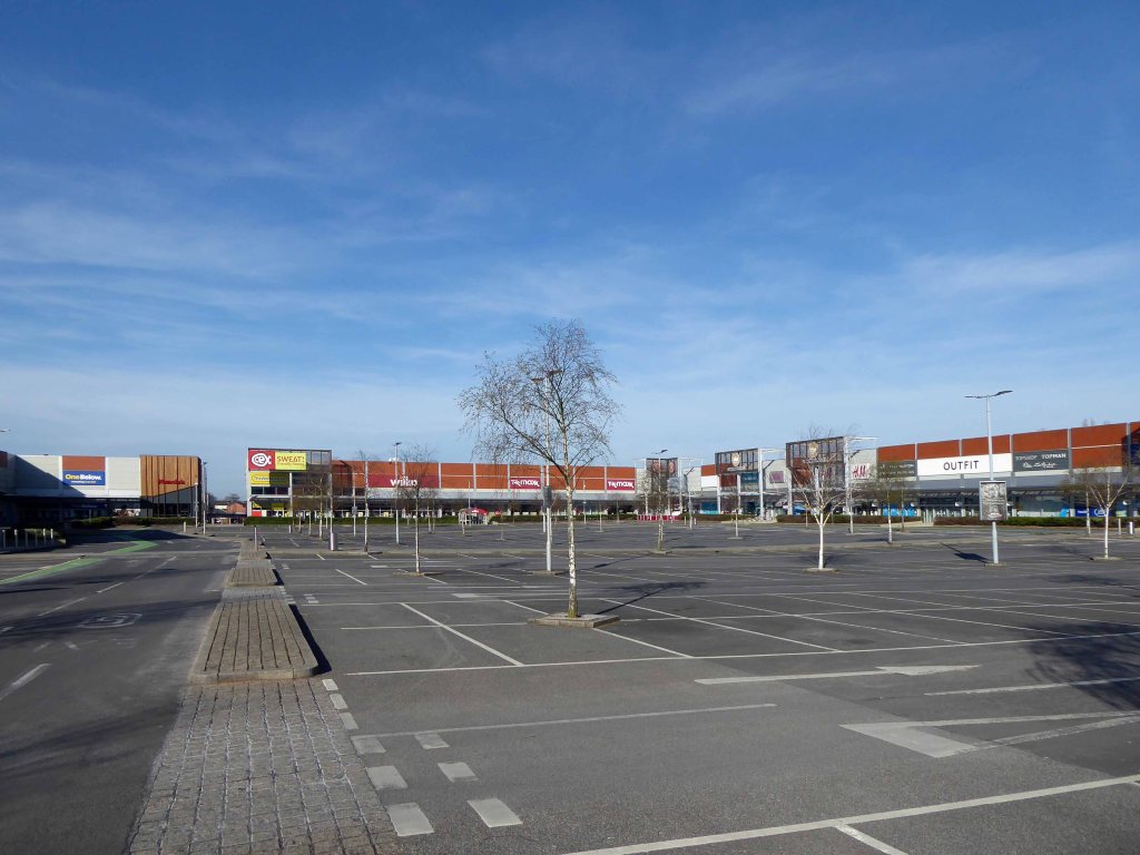
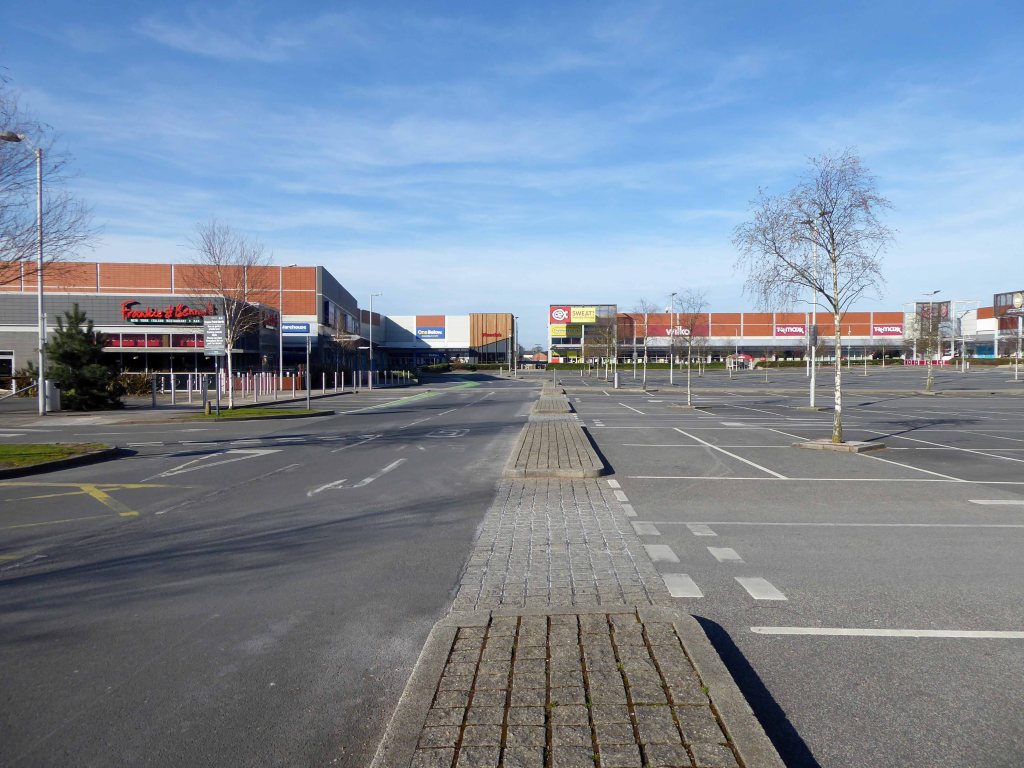
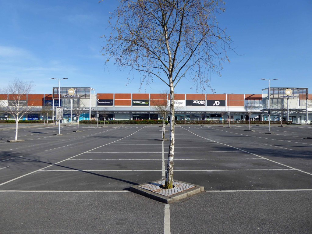
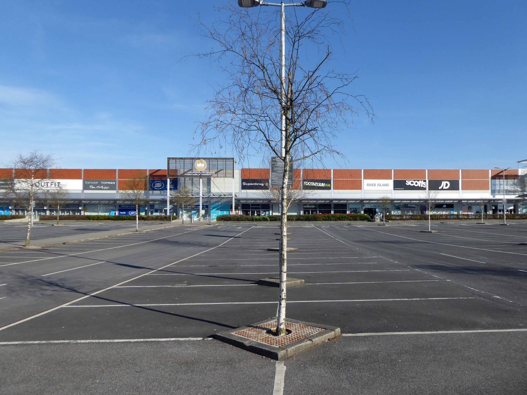
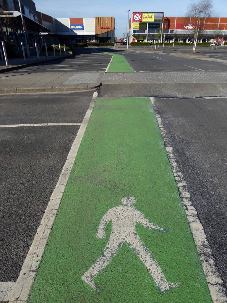
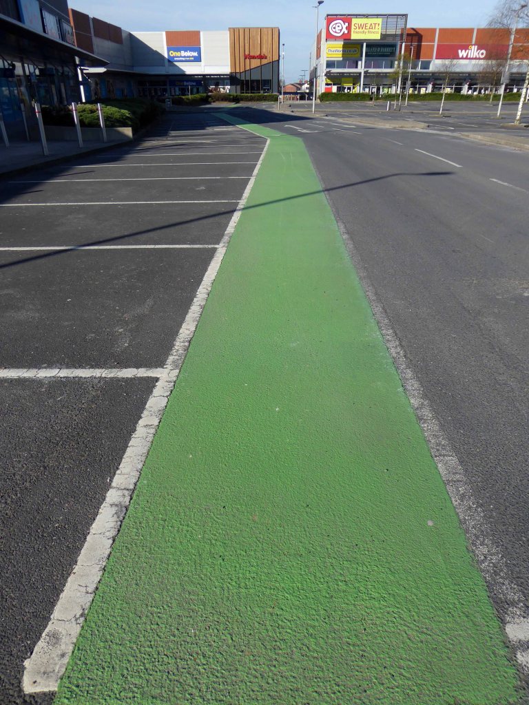
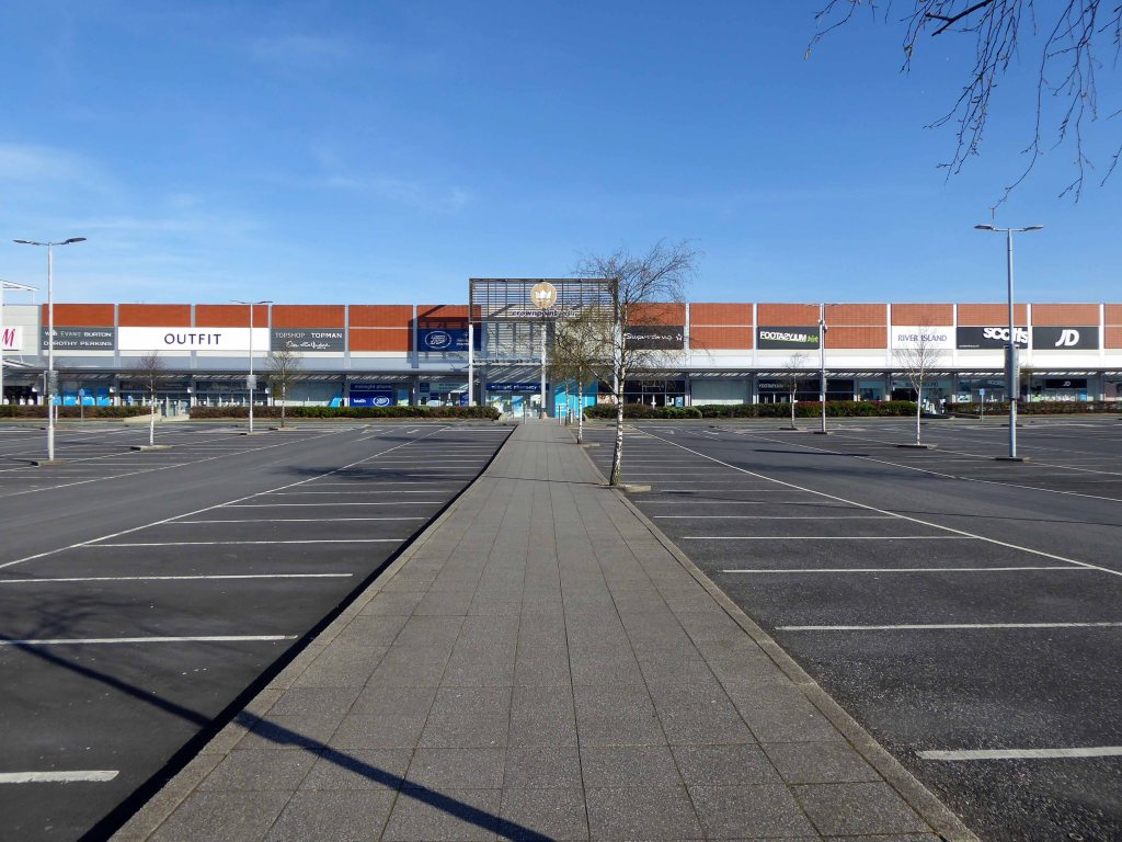
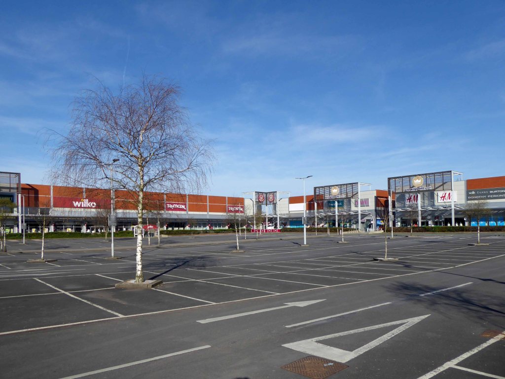
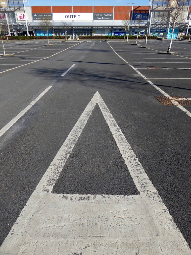
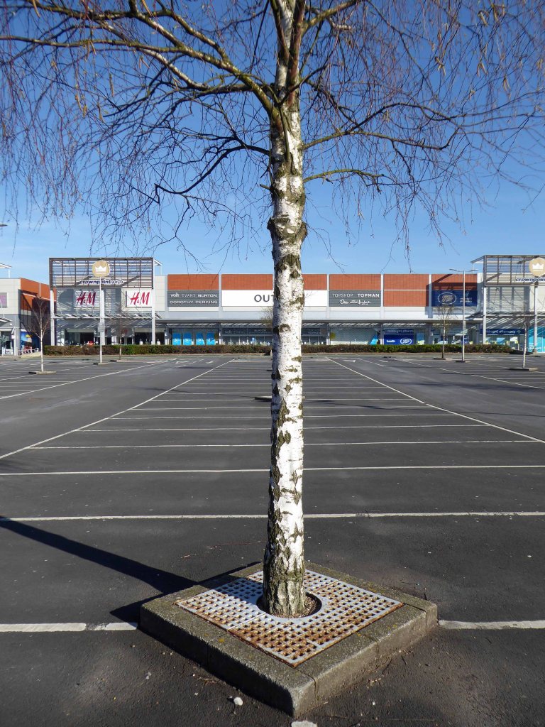
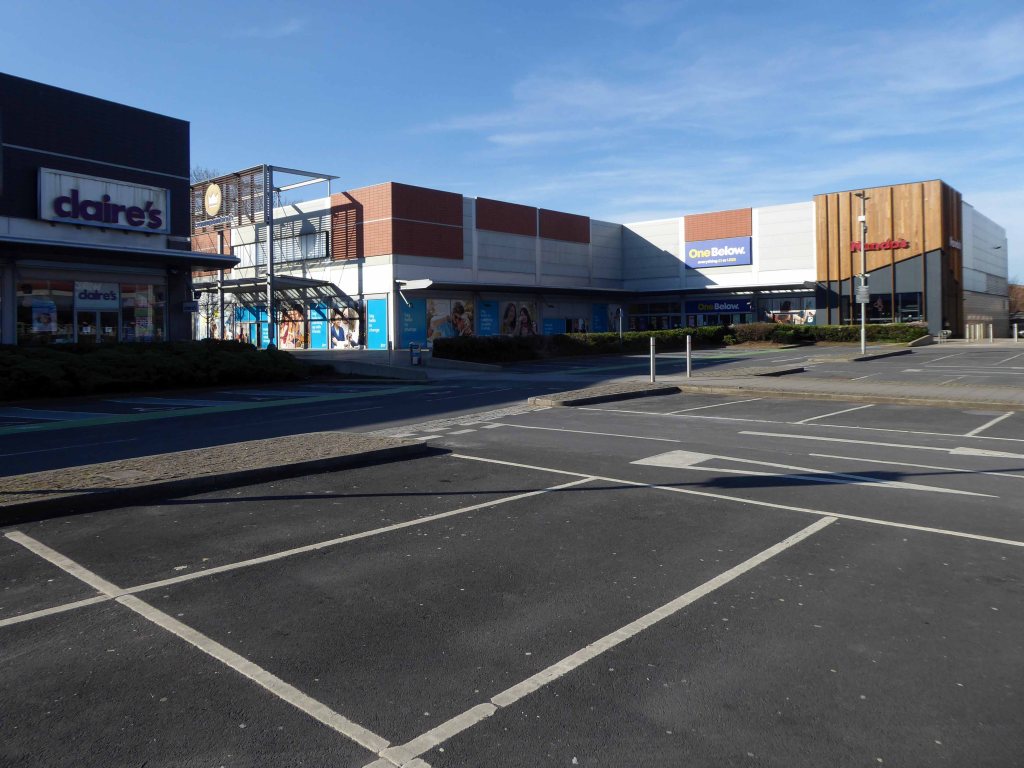
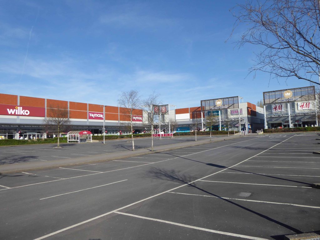
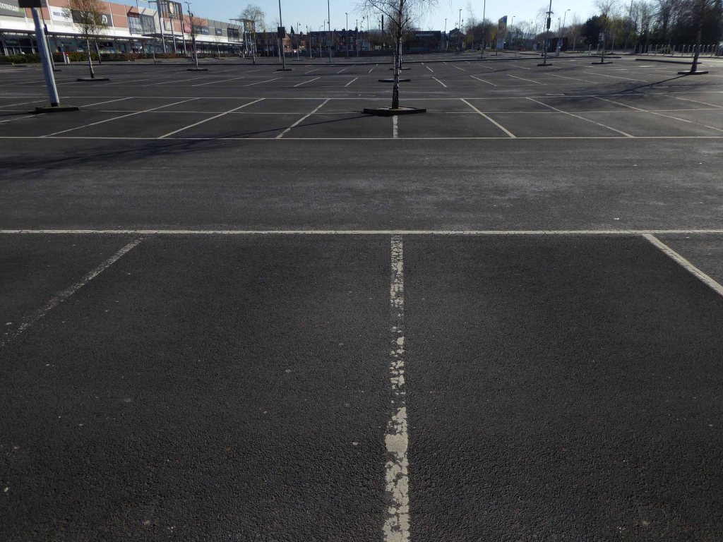
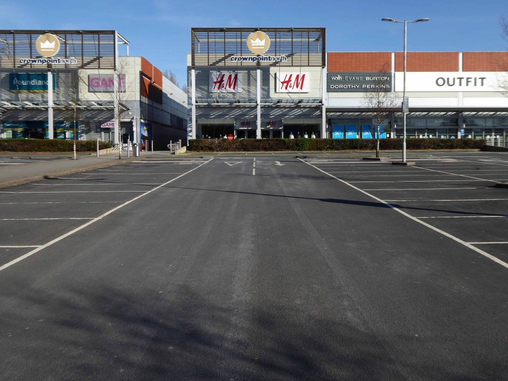
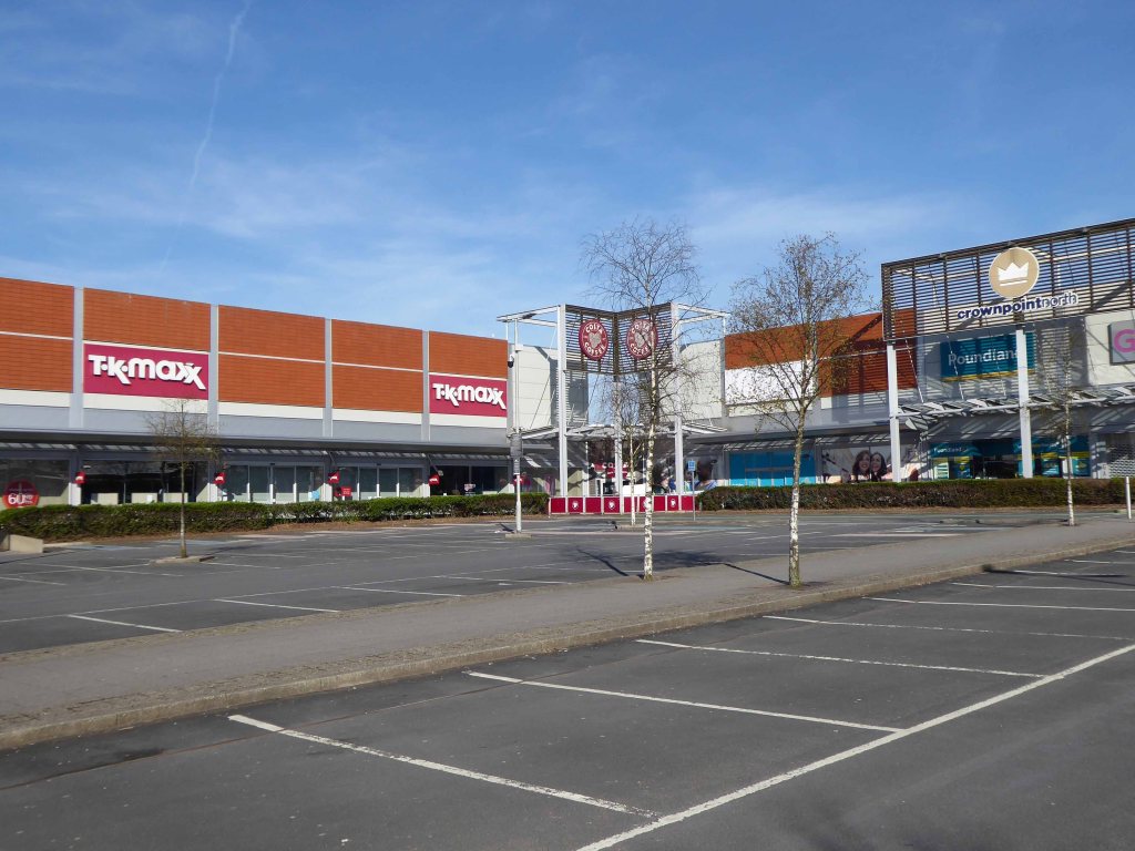
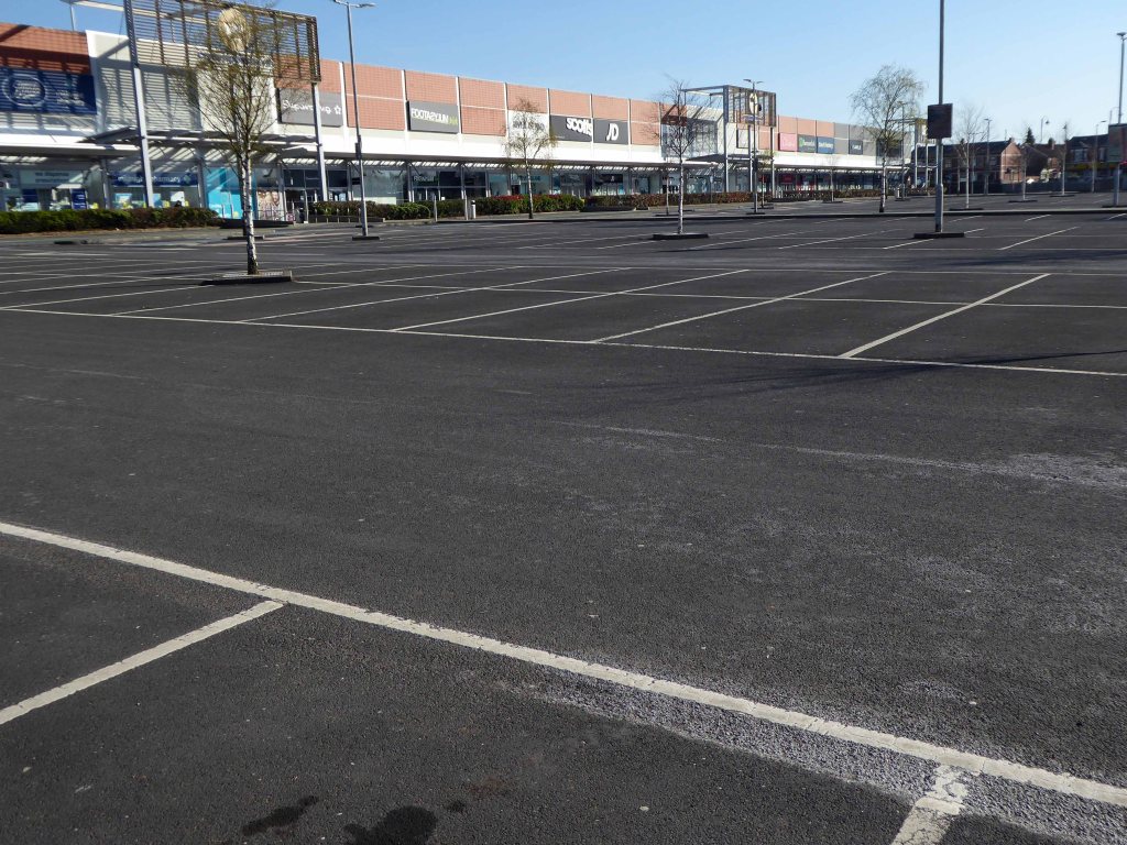
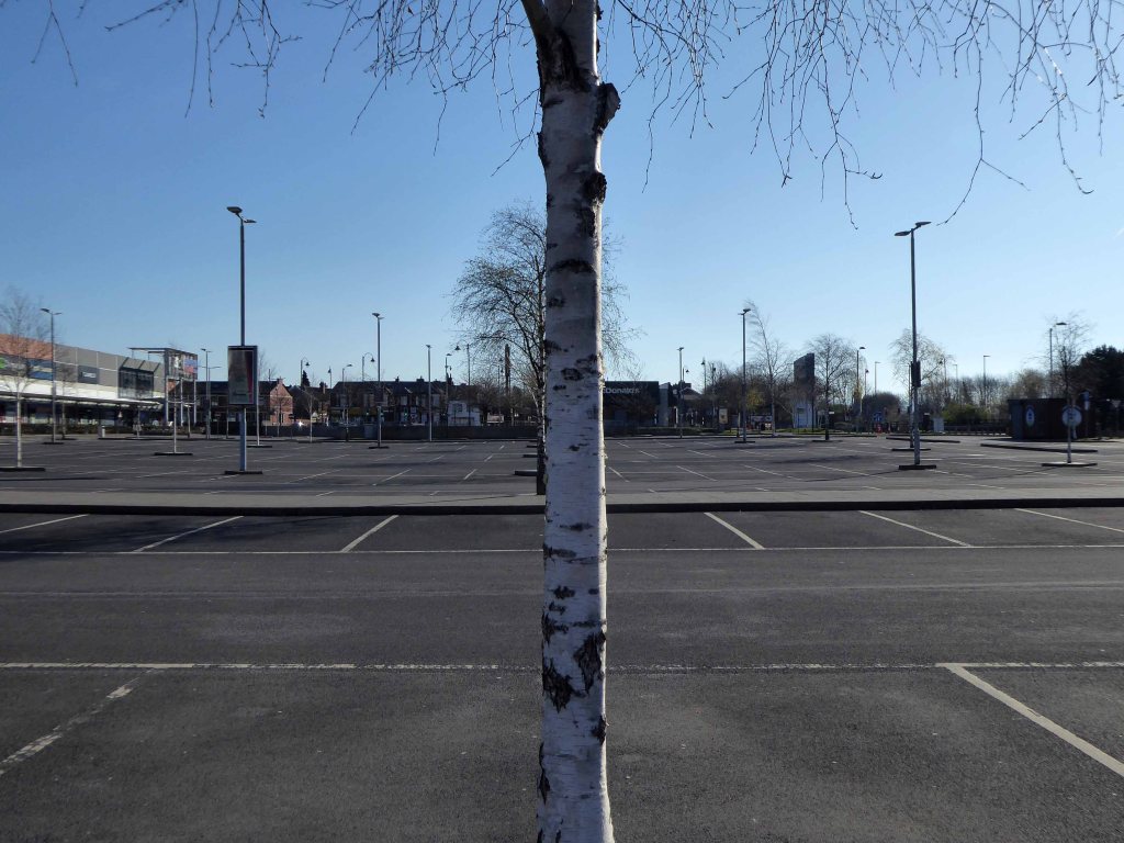
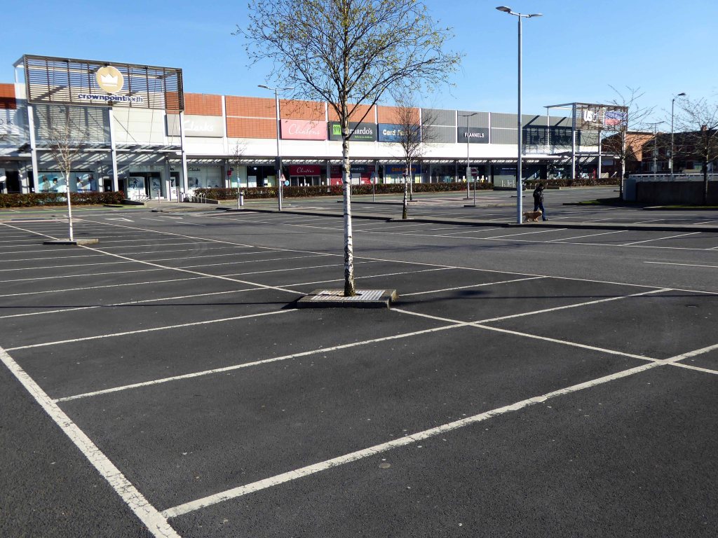
One of the UK’s largest retail parks, Stockport Retail Park benefits from a strategic location on the M60 Manchester orbital motorway making it one of the city’s most accessible parks. The park forms a natural extension to the town centre, offering a wide range of uses from value convenience to fashion and home as well as a number of cafés and restaurants.
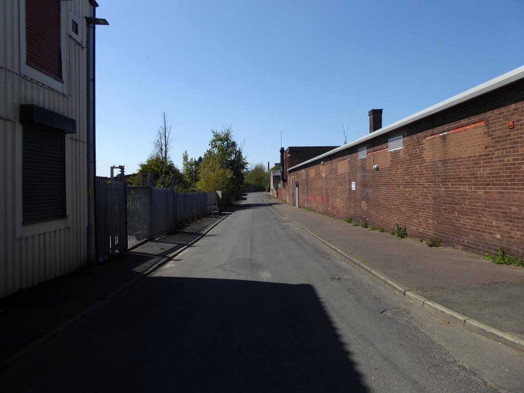
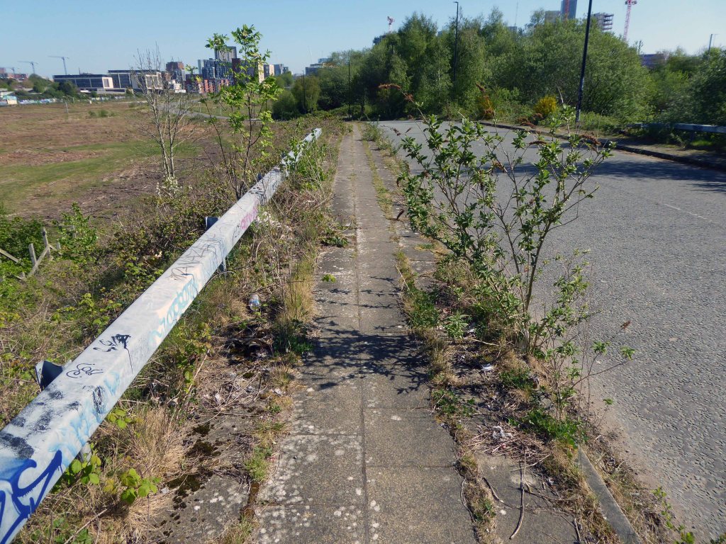
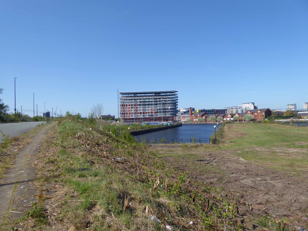
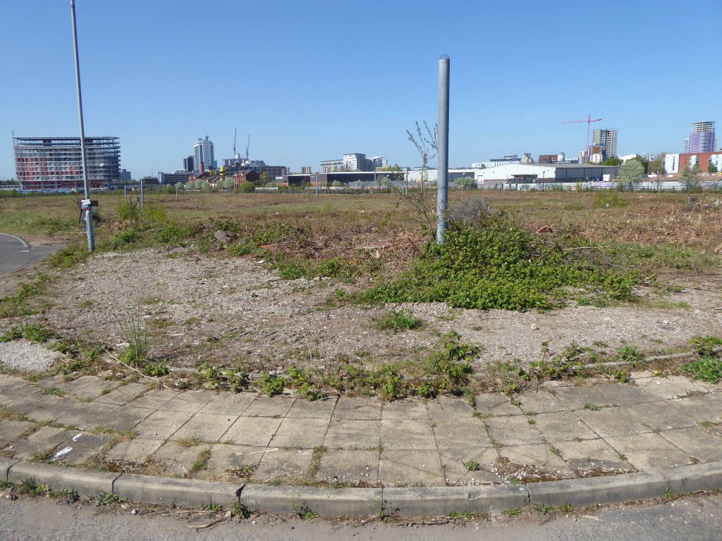
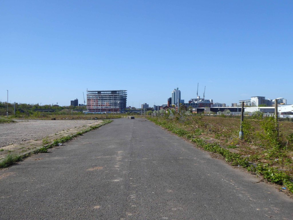
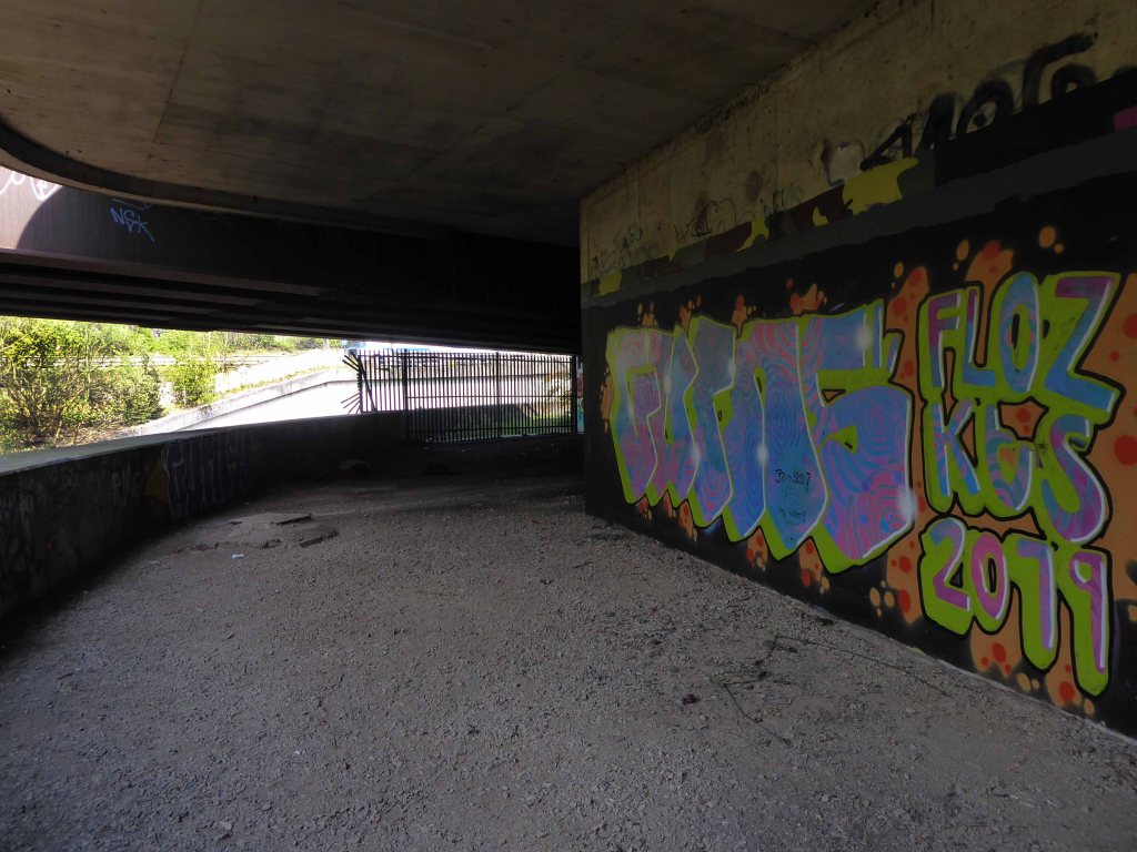
This is the post industrial landscape of consumption and its infrastructure that faces the defunct and mothballed site, whatever next?
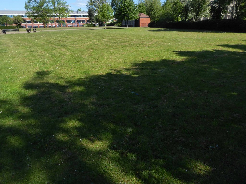
This is a short history of a park, a short history of my family and me.
The movement of earth and people, a tale until now untold now told.
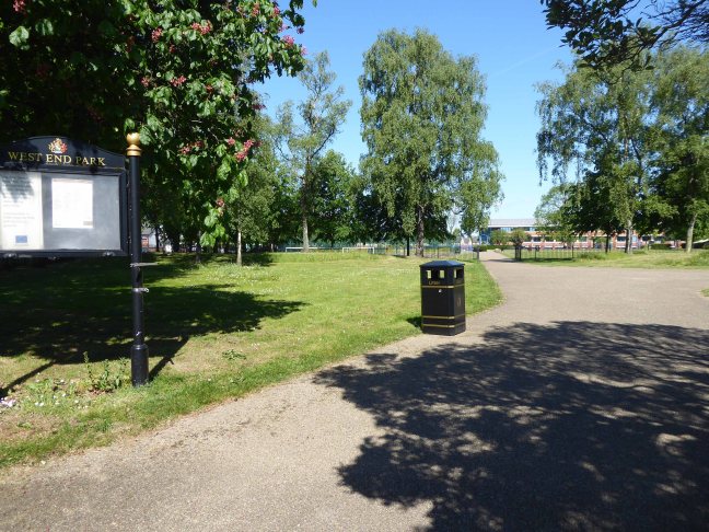
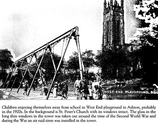
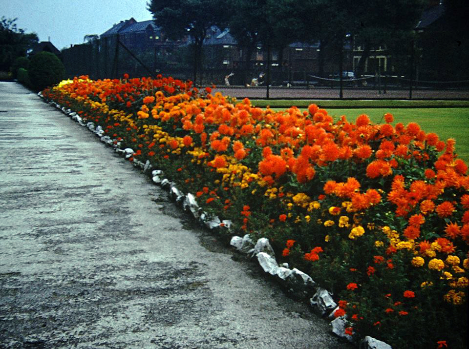
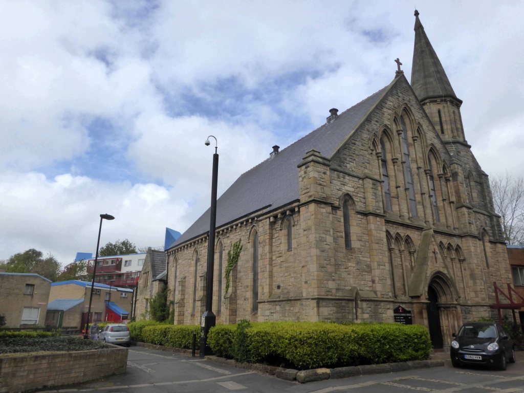
West End Park is a public park, opened in 1893. The site is bounded by Stockport Road, Manchester Road and William Lane. It was developed on land associated with St Peter’s Church.
St Peter’s was built between 1821 and 1824, and was designed by Francis Goodwin. A grant of £13,191 was given towards its construction by the Church Building Commission. The land for the church was given by the patronage of George 6th Earl of Stamford and Warrington, whose cousin, Revd Sir George Booth, had been Rector of Ashton from 1758 until 1797
The benevolent Victorian landowners thought it politic to provide parks for the working folk, fresh air, exercise and perambulation being preferable to the demon drink.
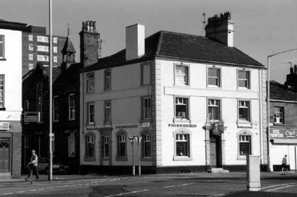
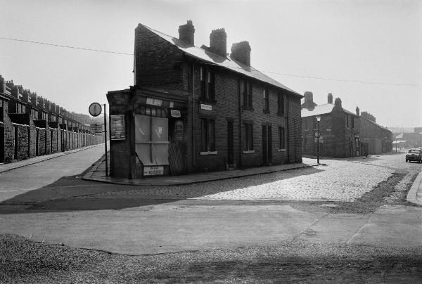
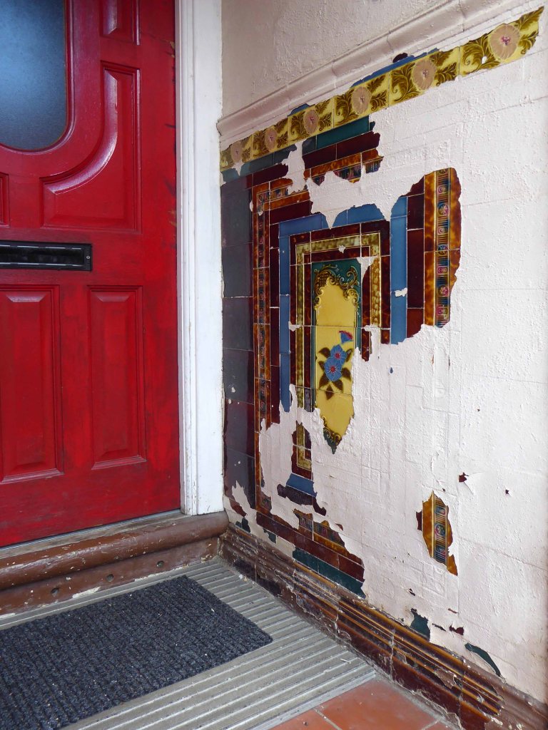
Friendship Old Street – now a solicitor’s office
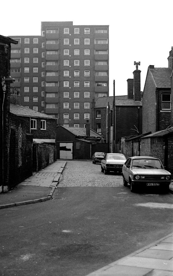
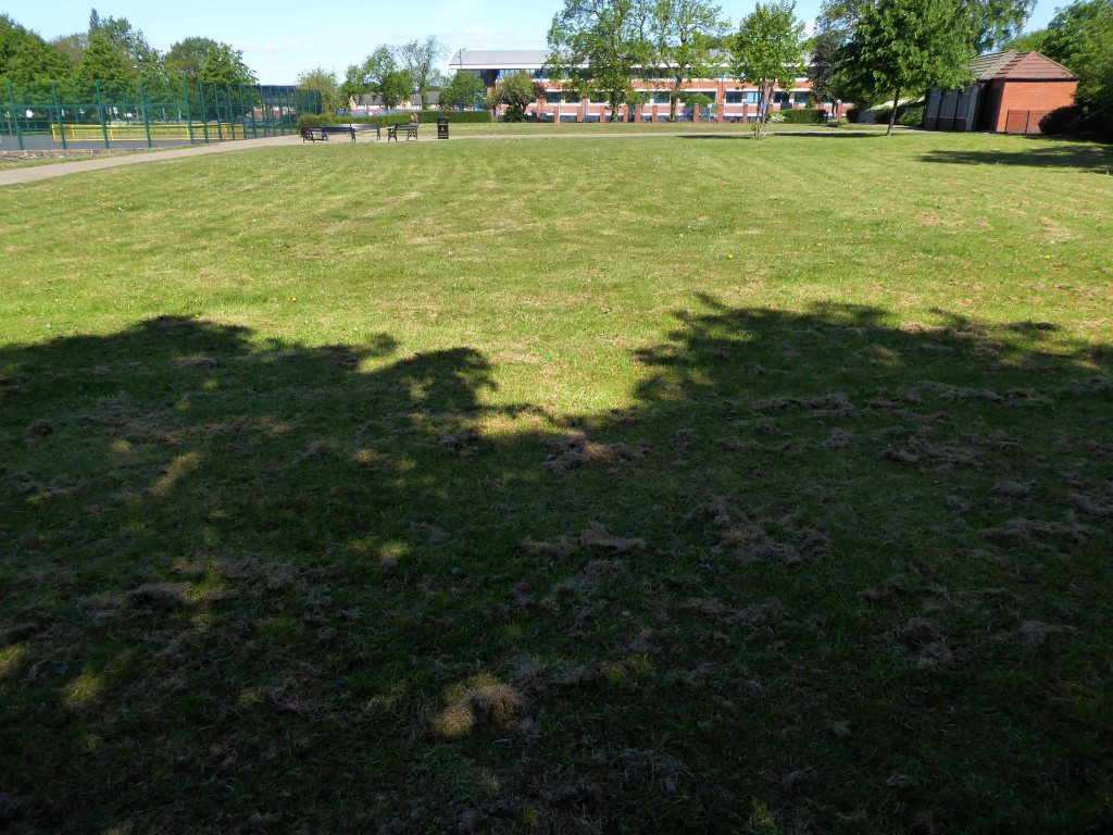
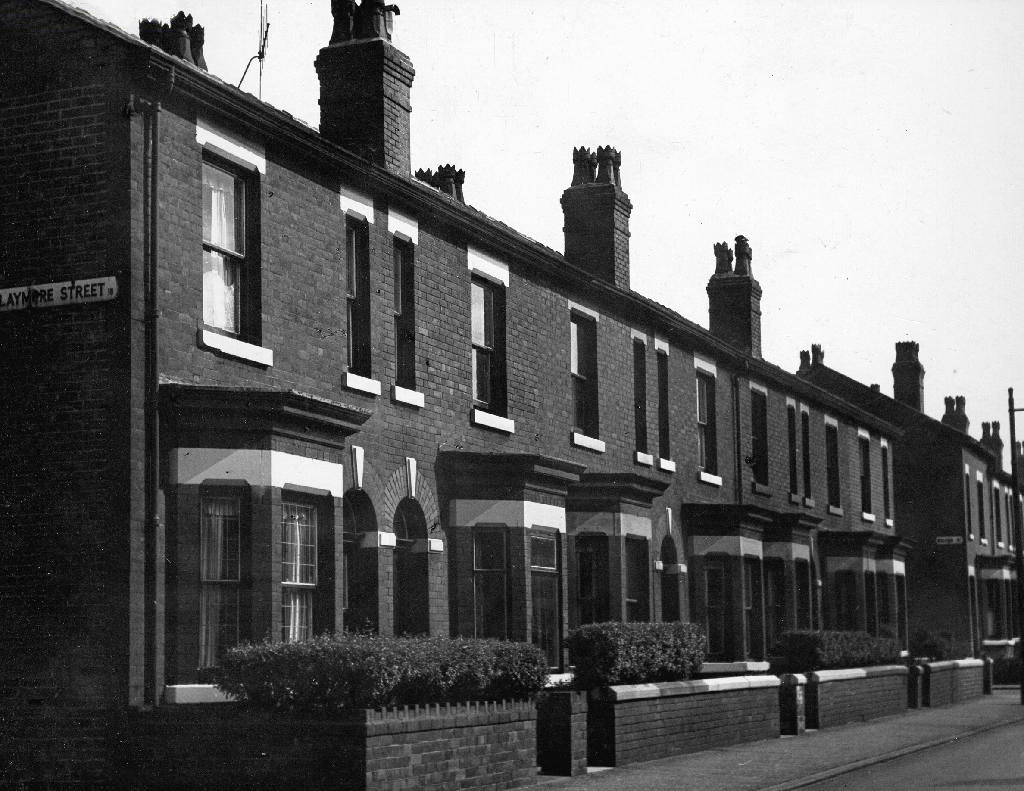
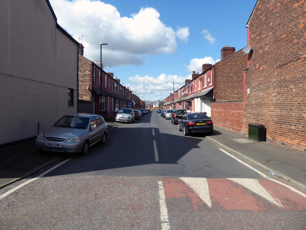
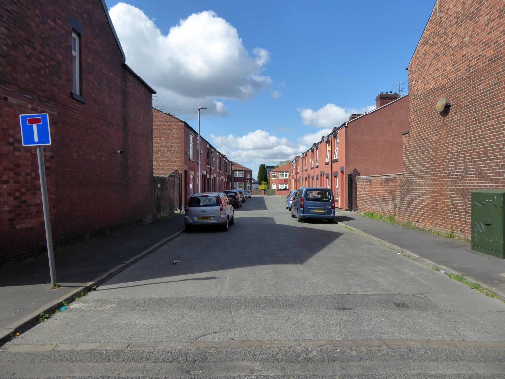
The area around the park was a dense warren of housing and industry.
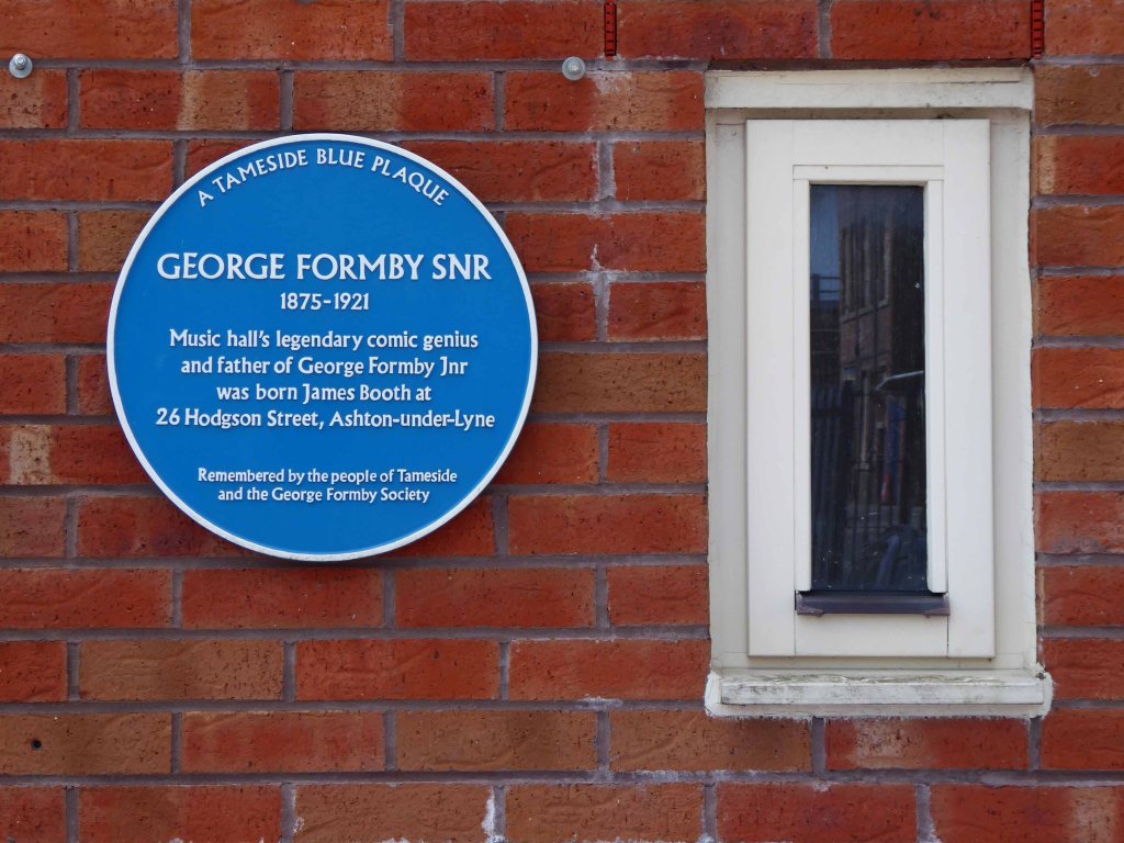
There’s a plaque for George – there isn’t one for Sam.
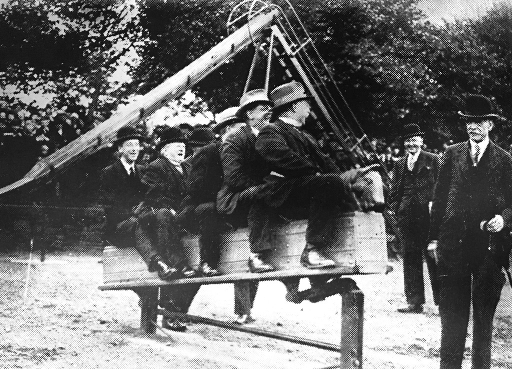
During the Great Depression men were required to work for the Dole – Sam was required to dig out a sunken garden in the park – he was a collier by trade, a good man with a shovel, built for back breaking work on Ashton Moss.
Thirty yards wide, forty yards long and three yards deep, shifted by hand.
Three thousand six hundred cubic yards of earth.
One cubic yard of topsoil weighs about two thousand pounds on average.
Seven million two hundred thousand pounds of earth.
I worked there in the 1970s along with Alec and Danny bedding out the sunken garden, maintaining the bowling green, tennis courts and playground.
Keith Ingham
There were two permanent gardeners in the park, and a keeper in the summer – plus Danny Byrne and me brought in to help at busy times.
Throughout the 70s and onwards, economic decline hit the area hard, the closure of the cotton mills and little hope for the future. Rising unemployment and severe cuts to public spending did little to assure a rosy future for West End Park, or anything or anyone else for that matter.
Help was at hand – one of many public projects funded by our old friends the EU. Changes in the way that parks were used and further spending cuts sounded the death knell for the flowers and bowling. Large open grassed areas were cheaper and easier to maintain.
And so the sunken garden was filled in, this time by mechanical means – all in a days work for a bloke with a JCB.
So I sit and reflect on the labour and conditions that created this and many of our public parks, our legacy is a much impoverished version of the original vision.
I think of my grandad Sam and his comrades, the sweat of their collective brows buried forever.
Our legacy the small state, a bring and buy your own world economy.
All that is solid melts into air as Marx and Marshall Berman told us.
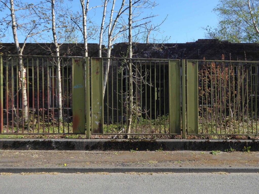
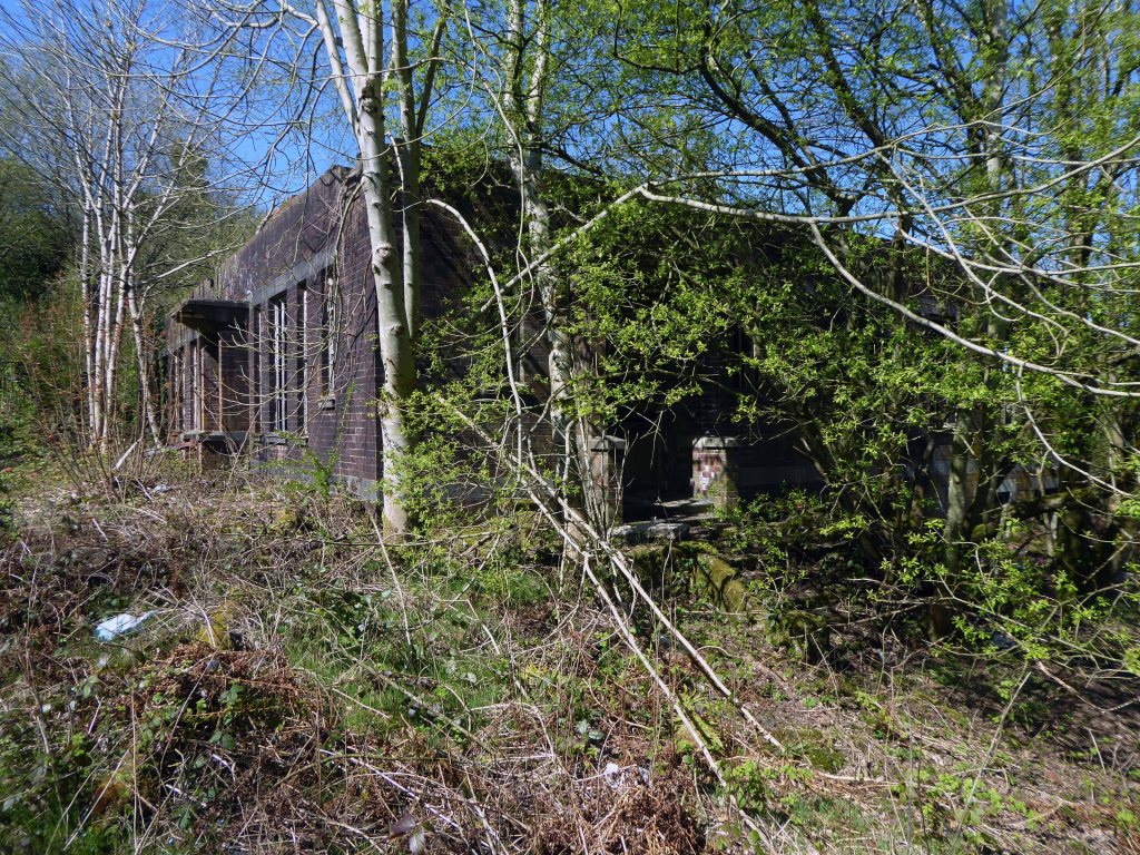
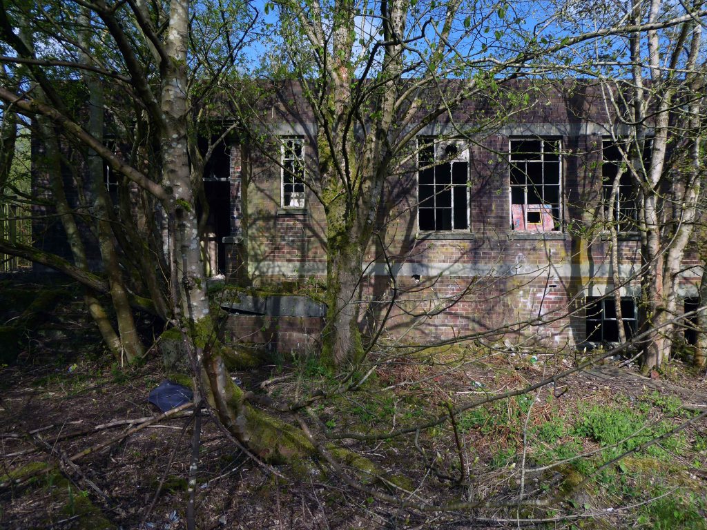
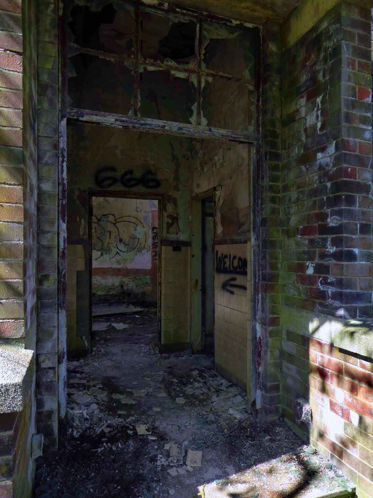
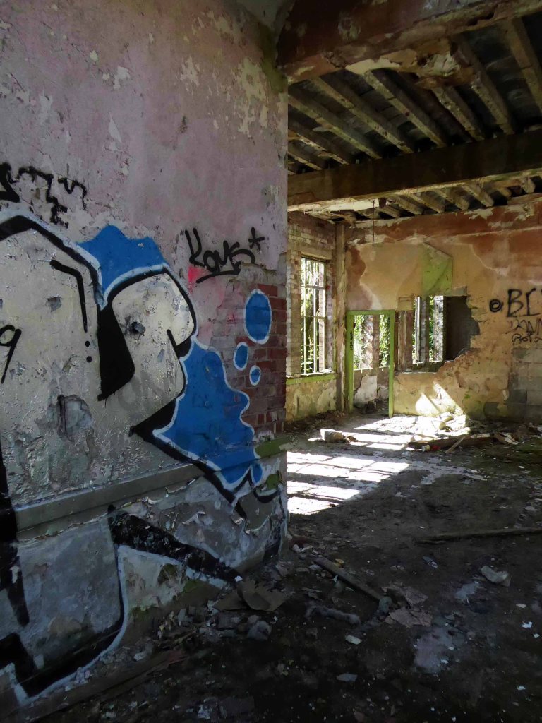
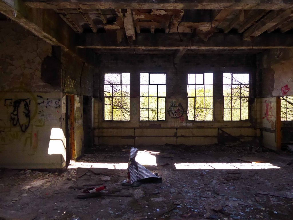
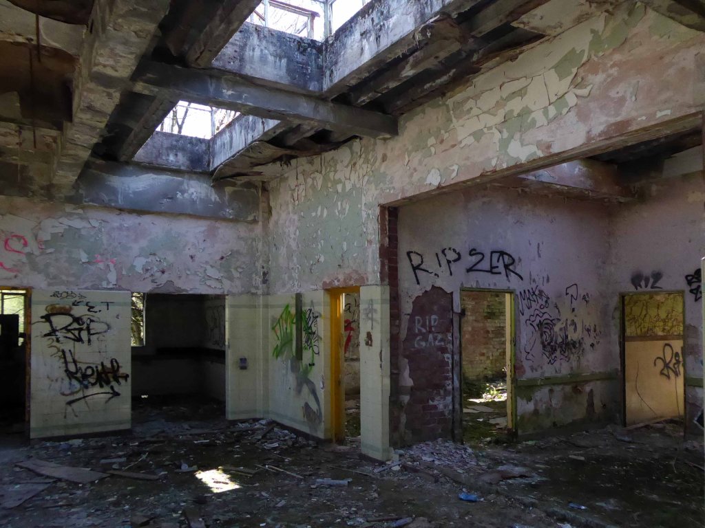
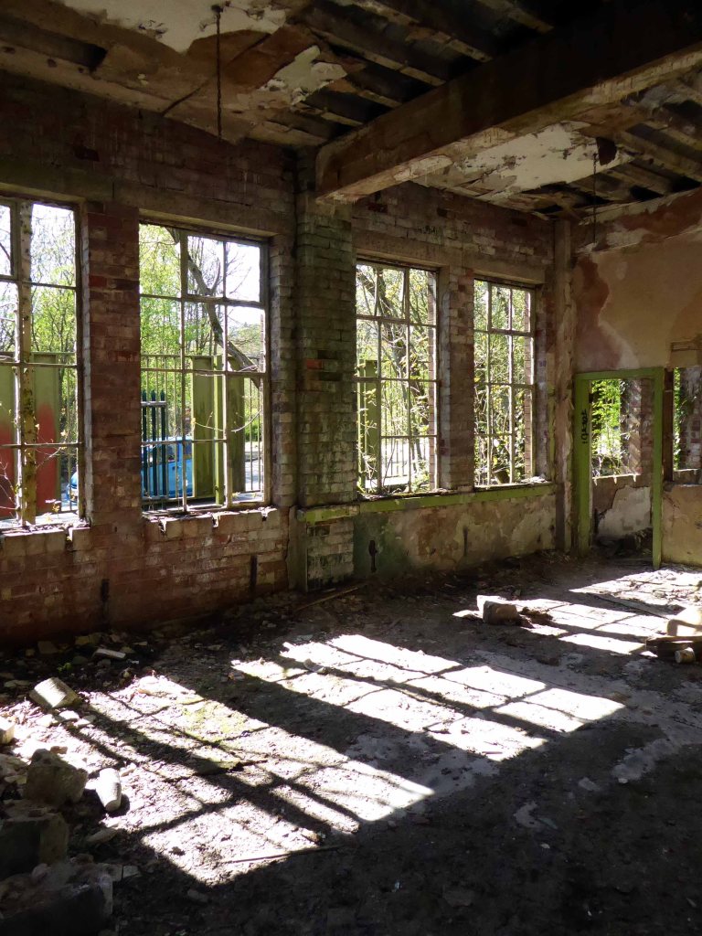
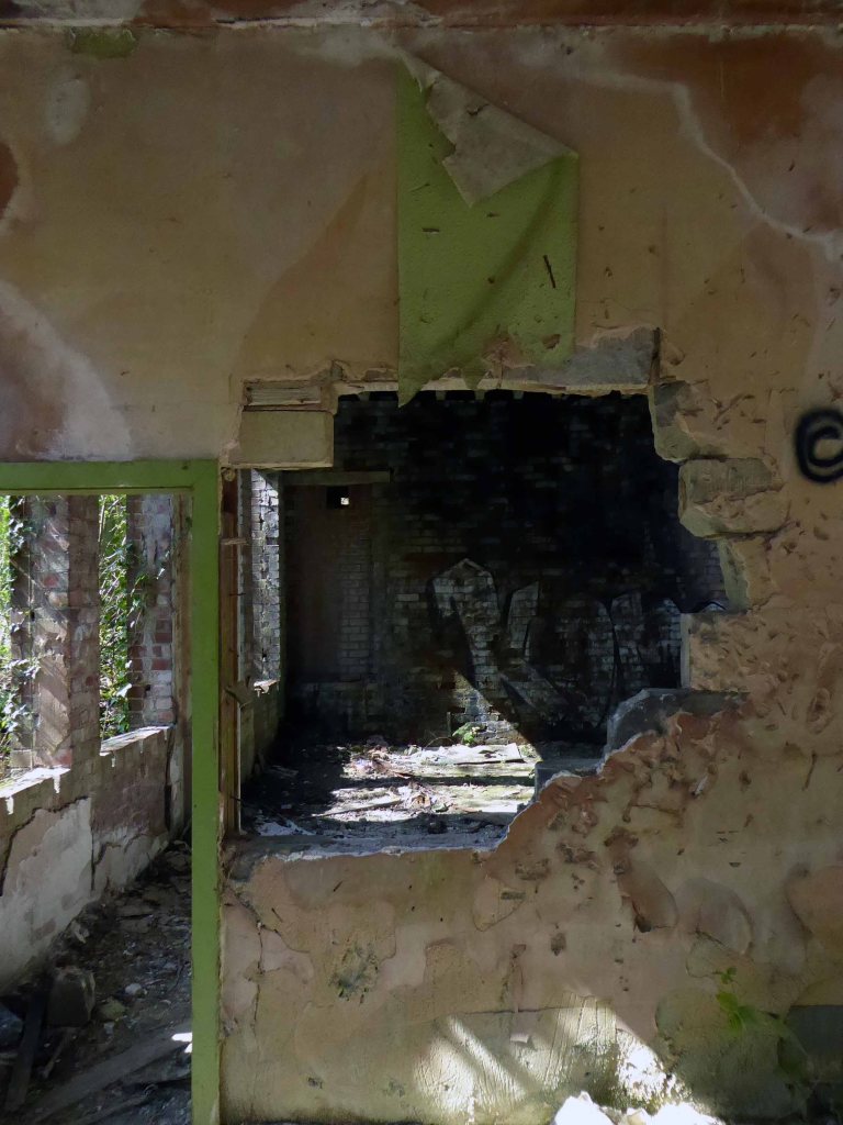
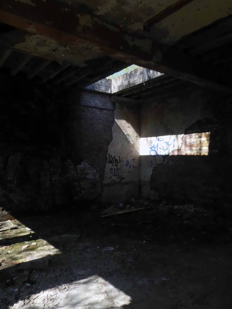
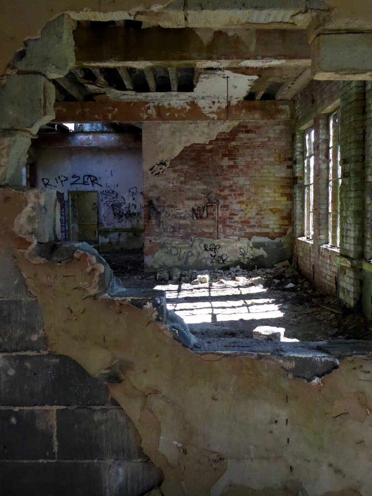
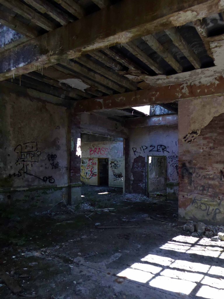
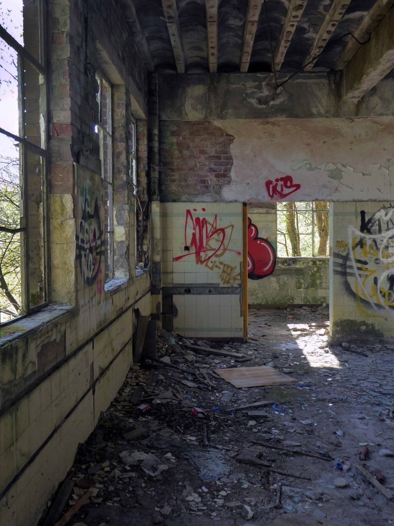
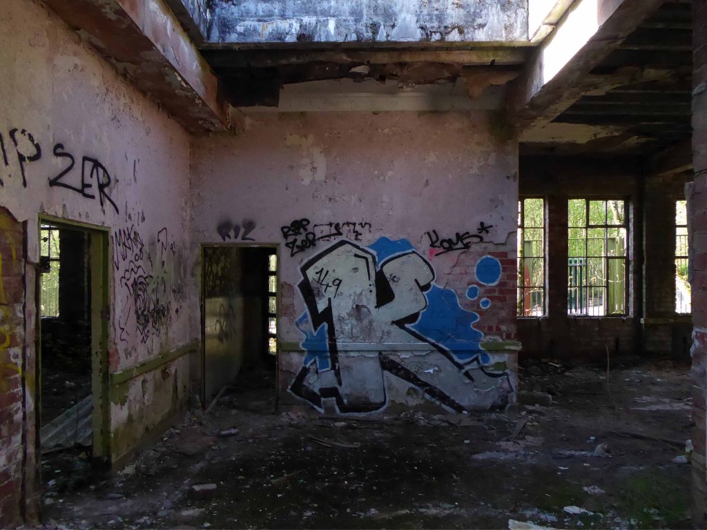
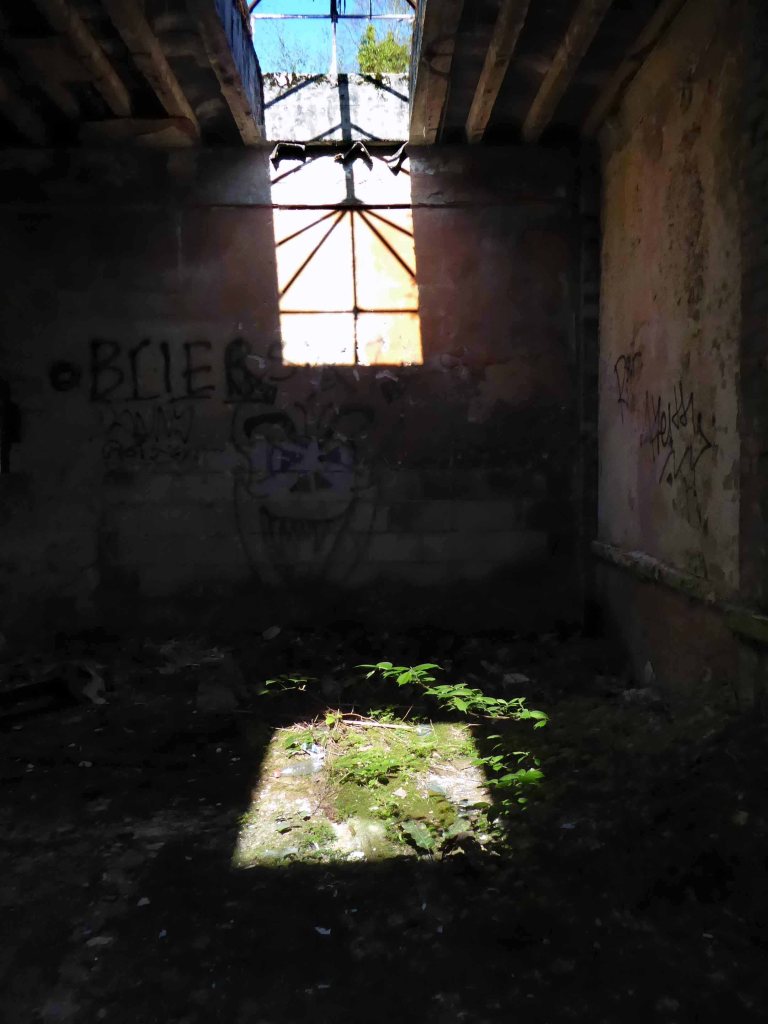
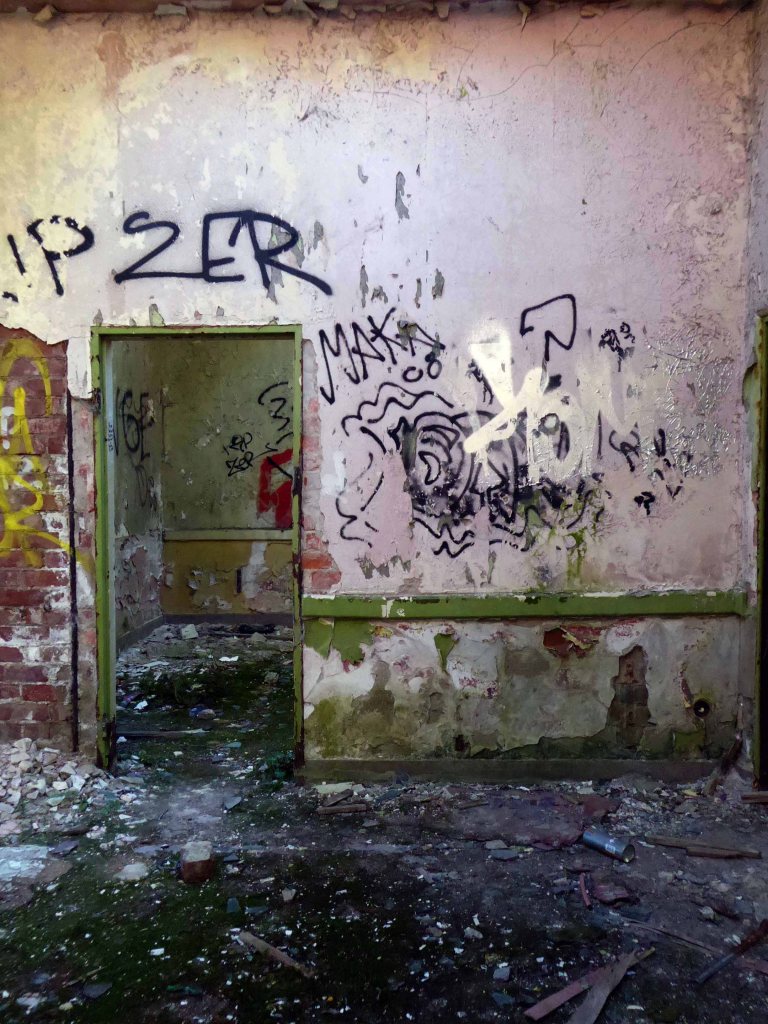
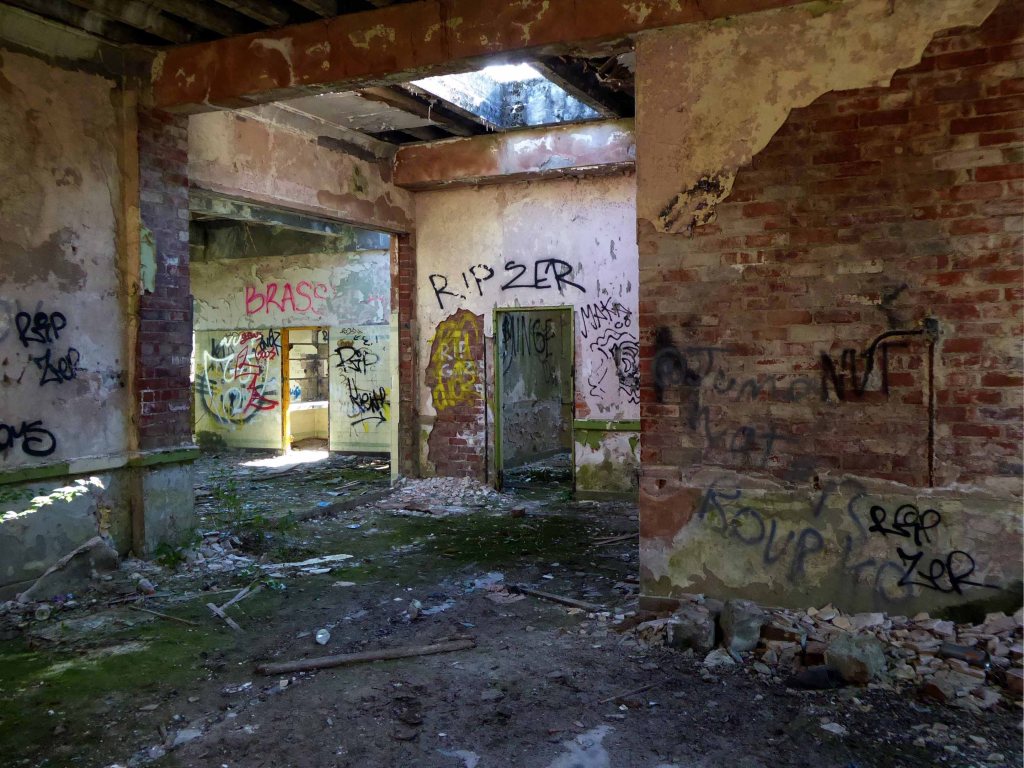
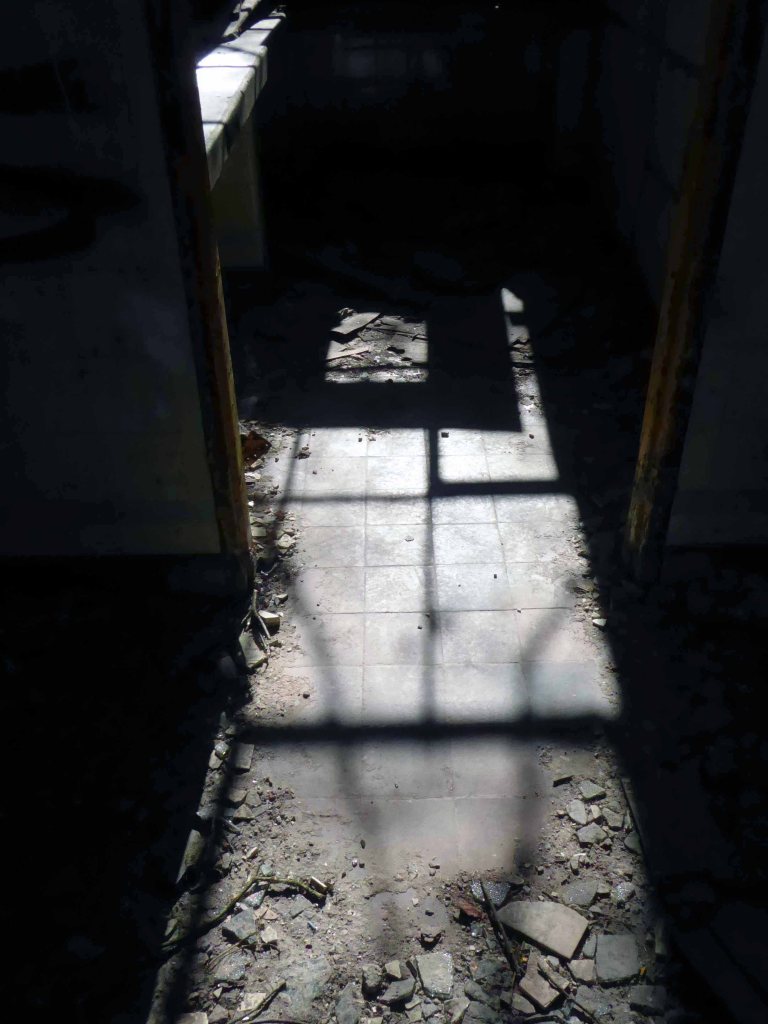
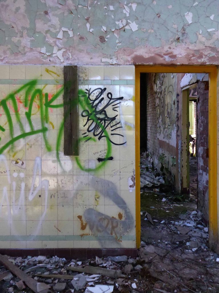
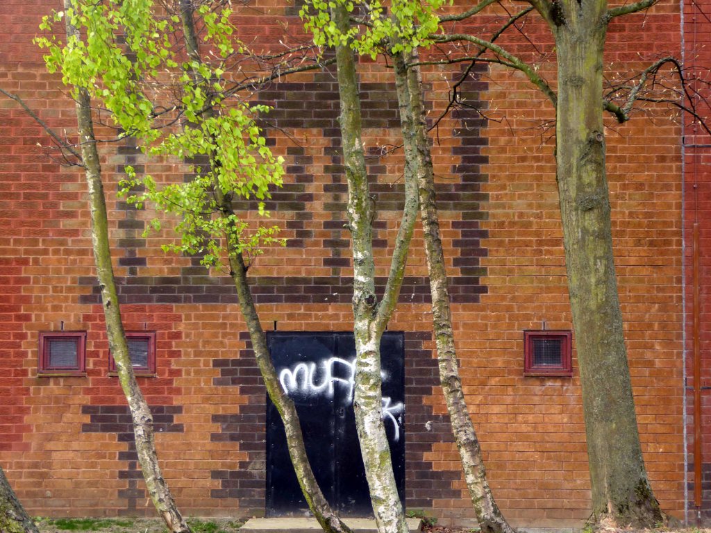
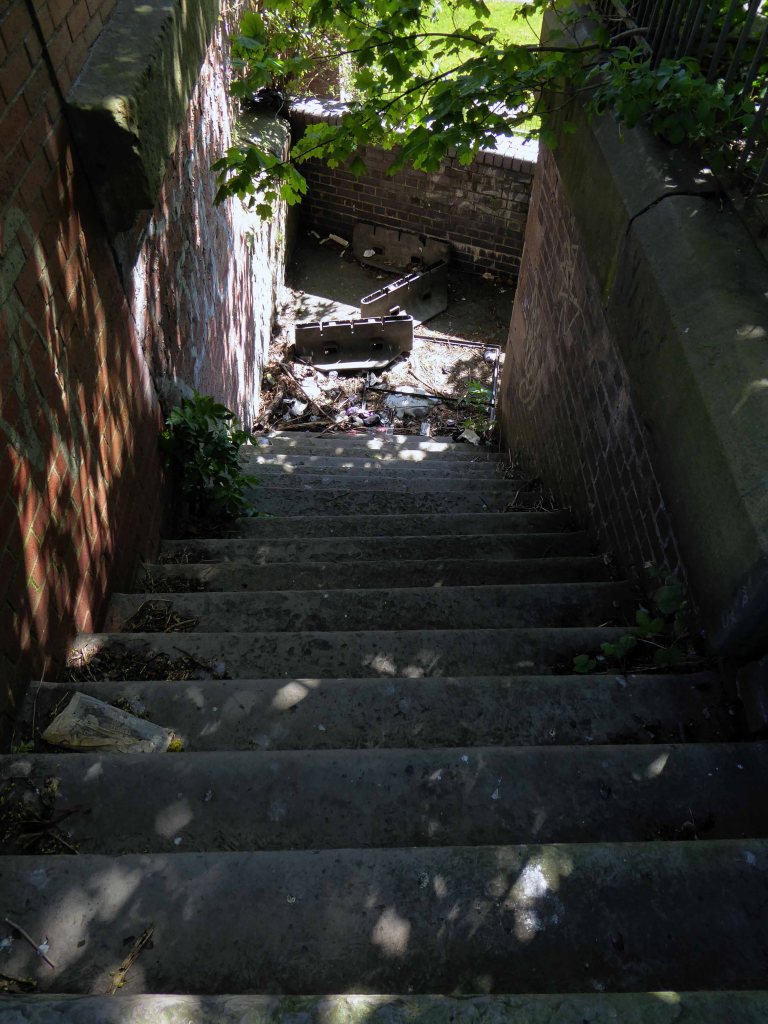
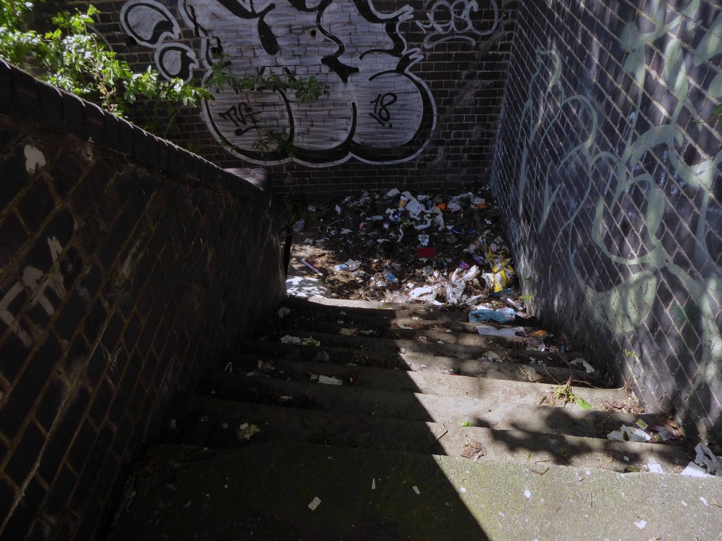
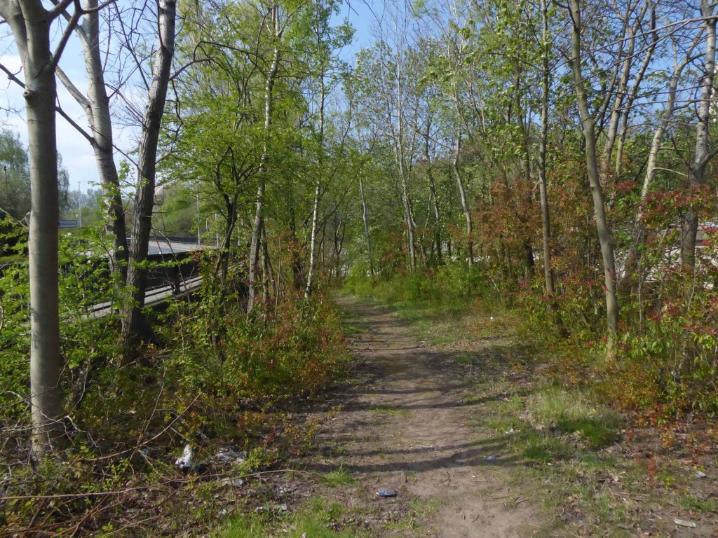
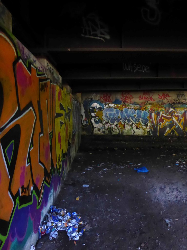
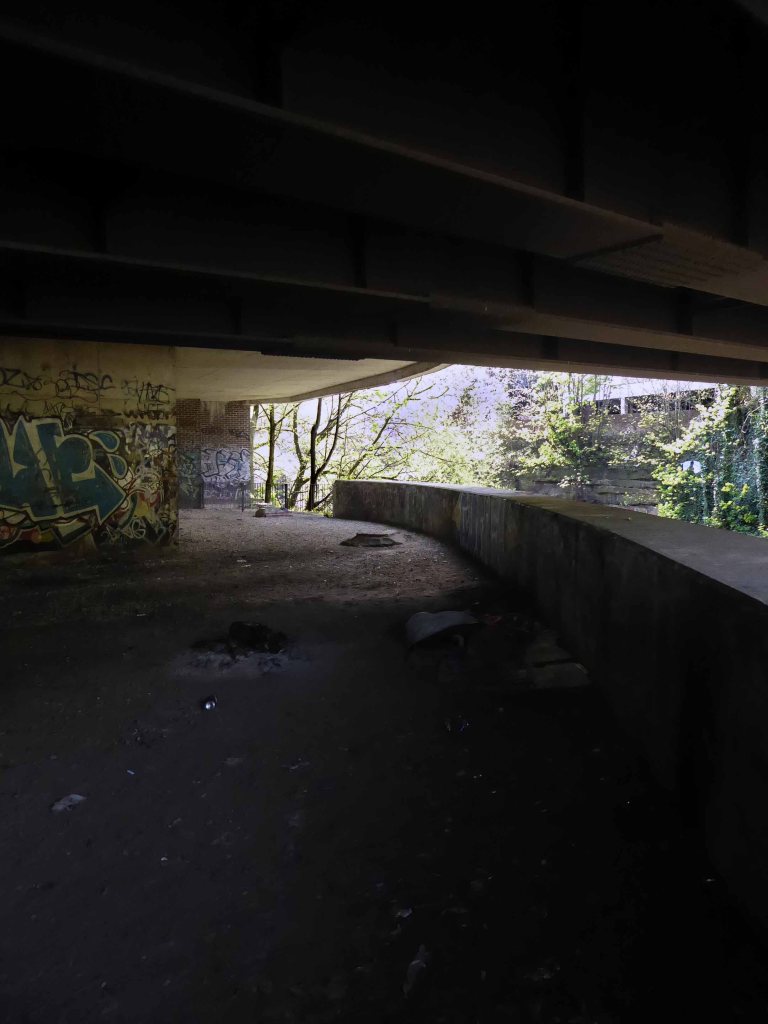
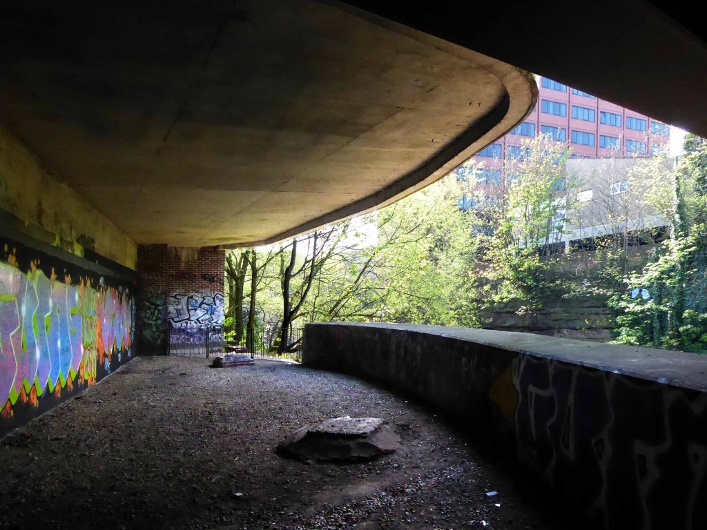
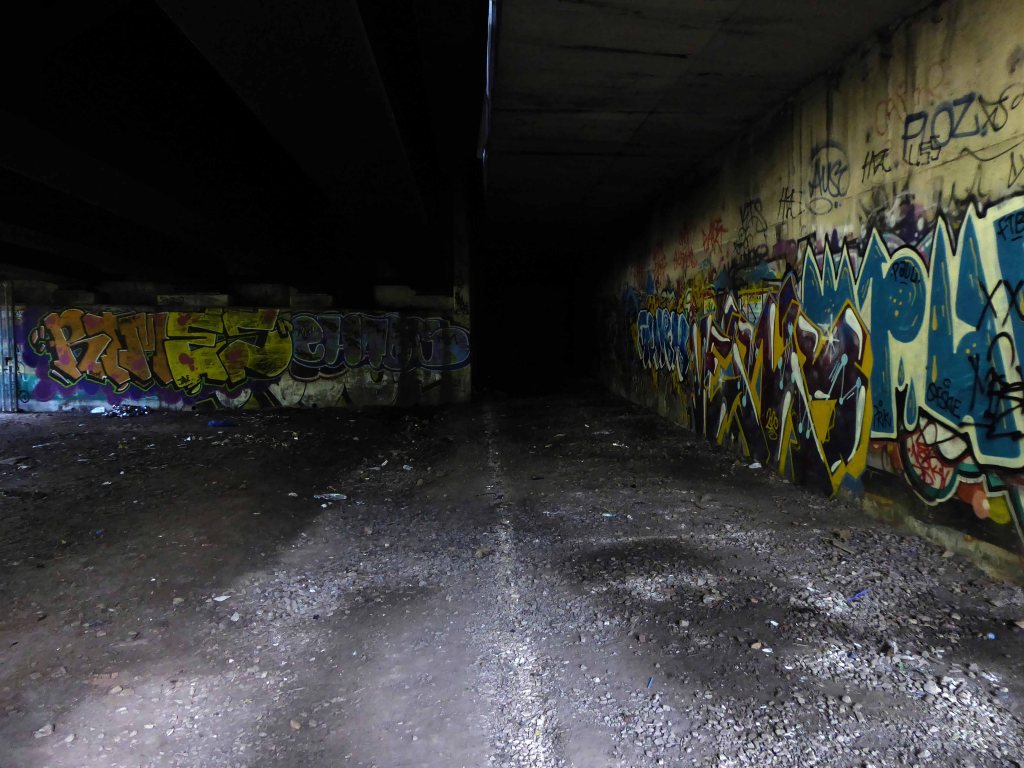
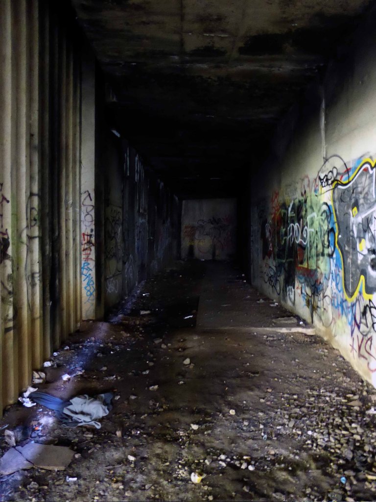
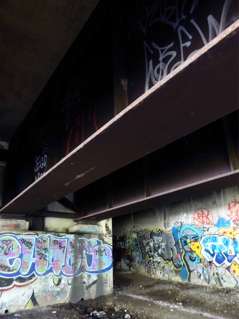
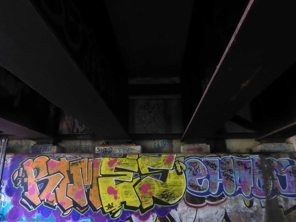
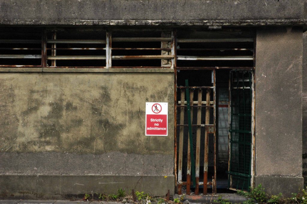
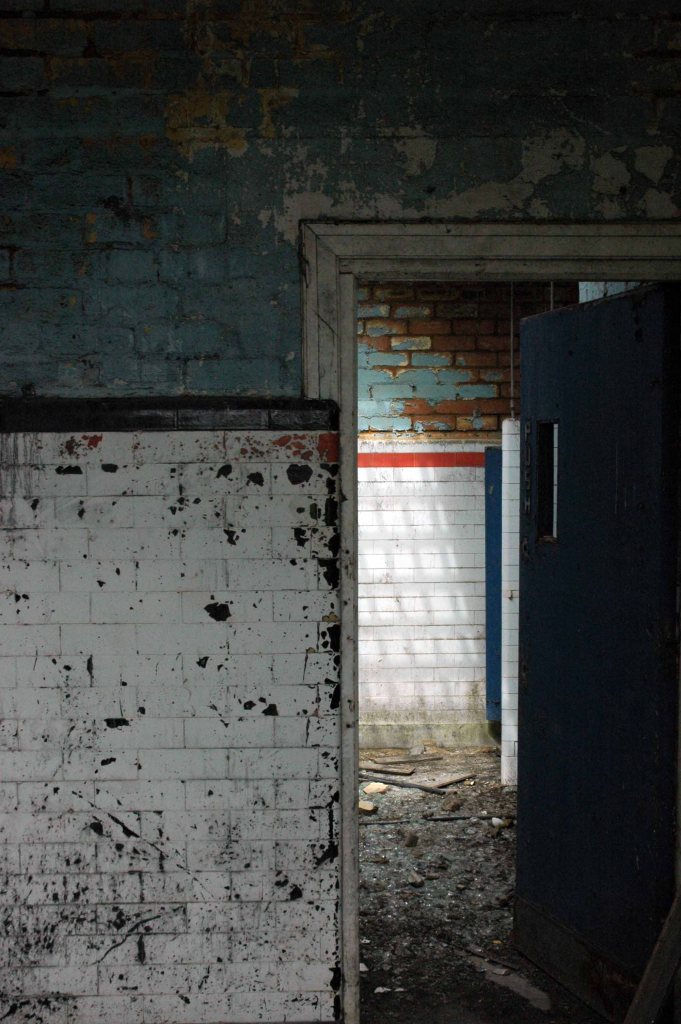
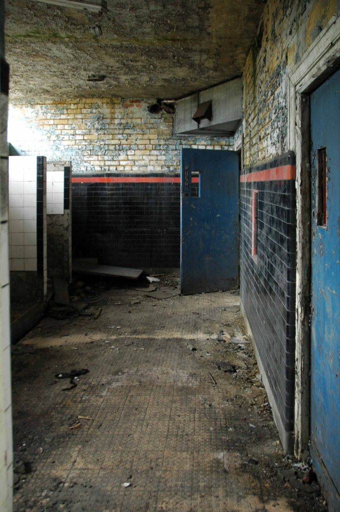
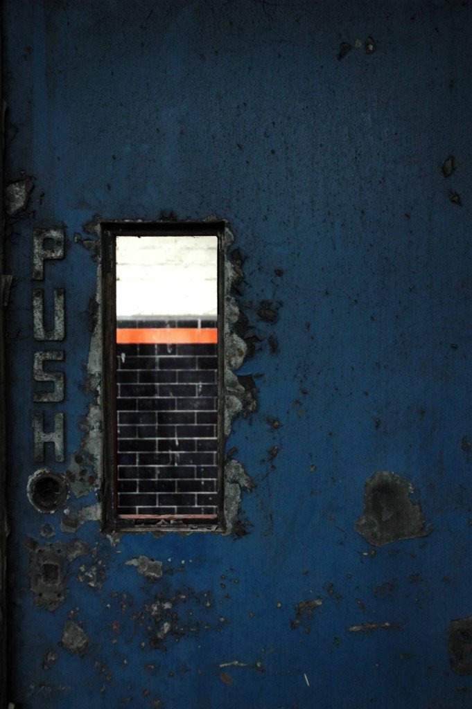
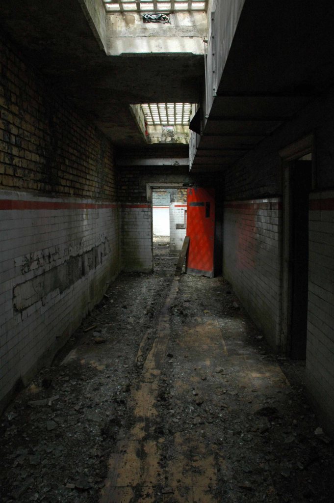
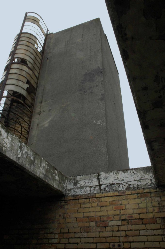
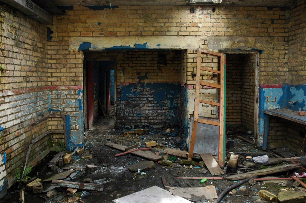
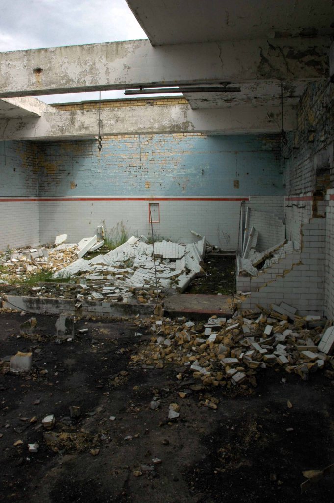
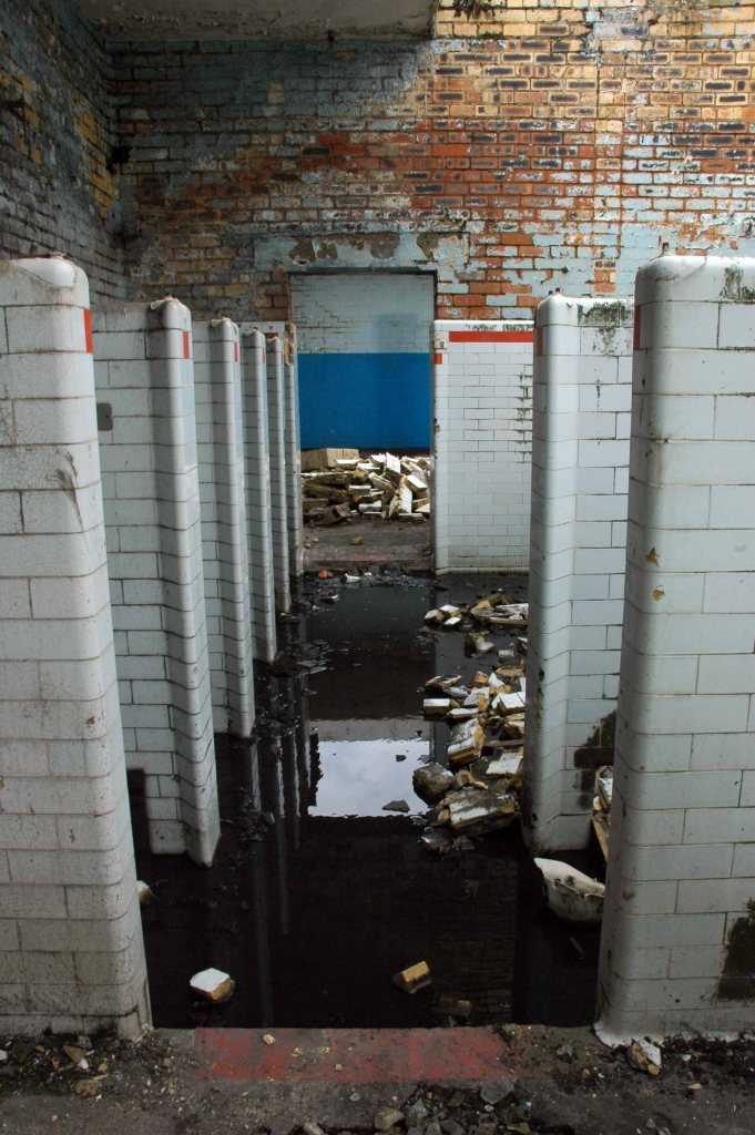
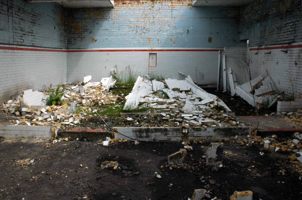
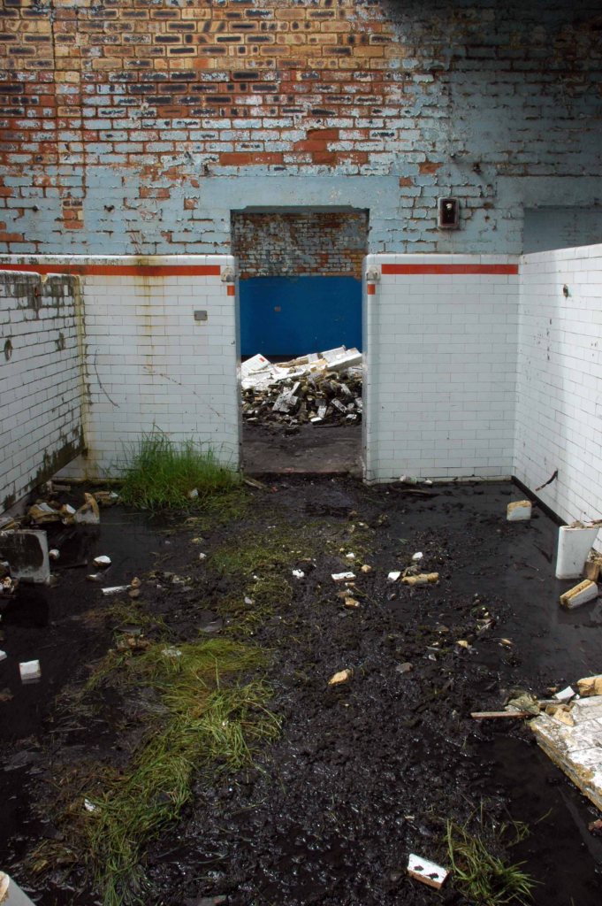
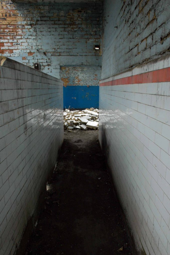
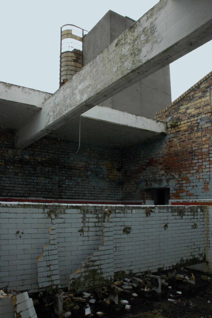
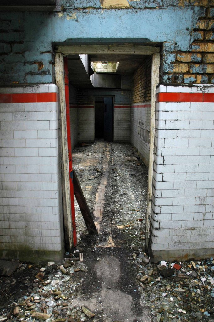
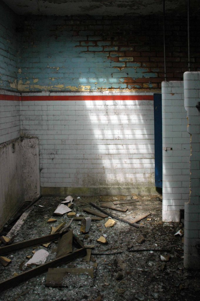
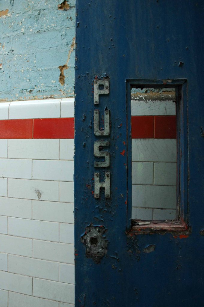
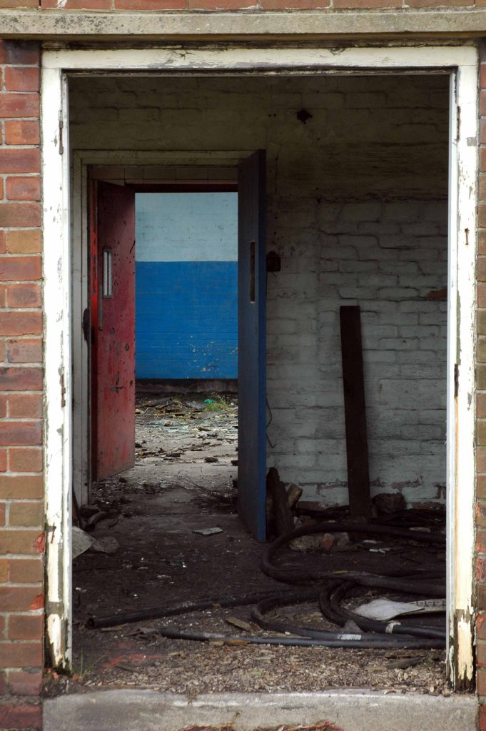
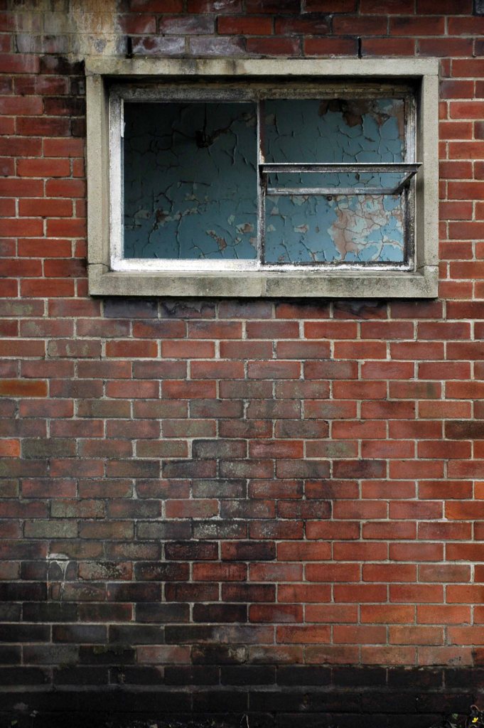
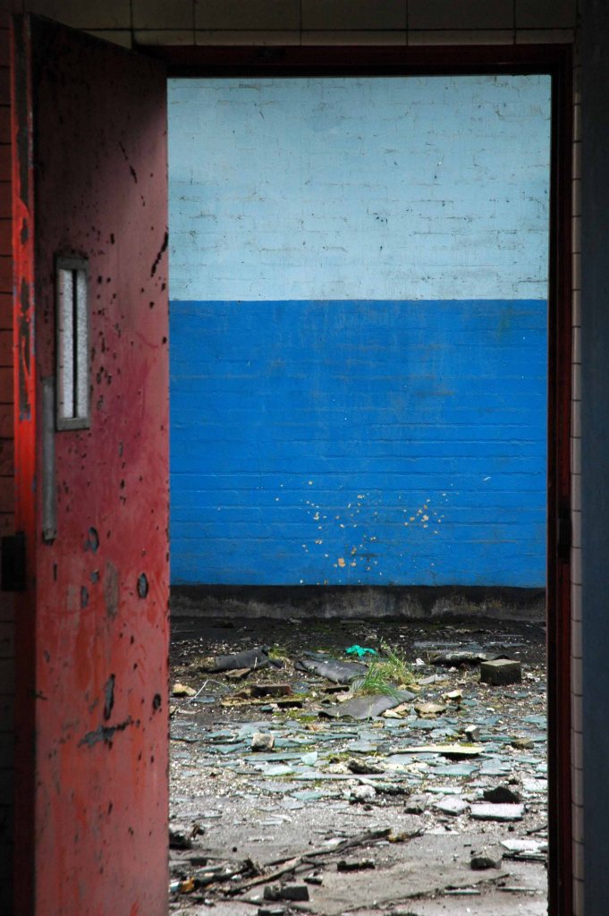
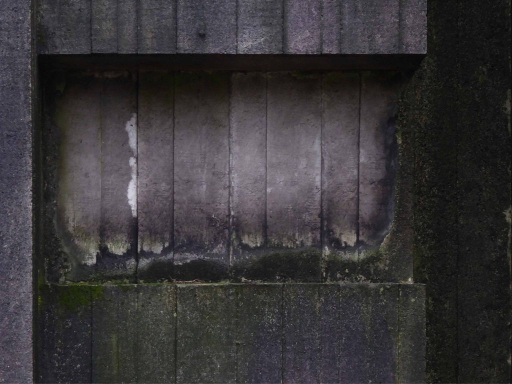
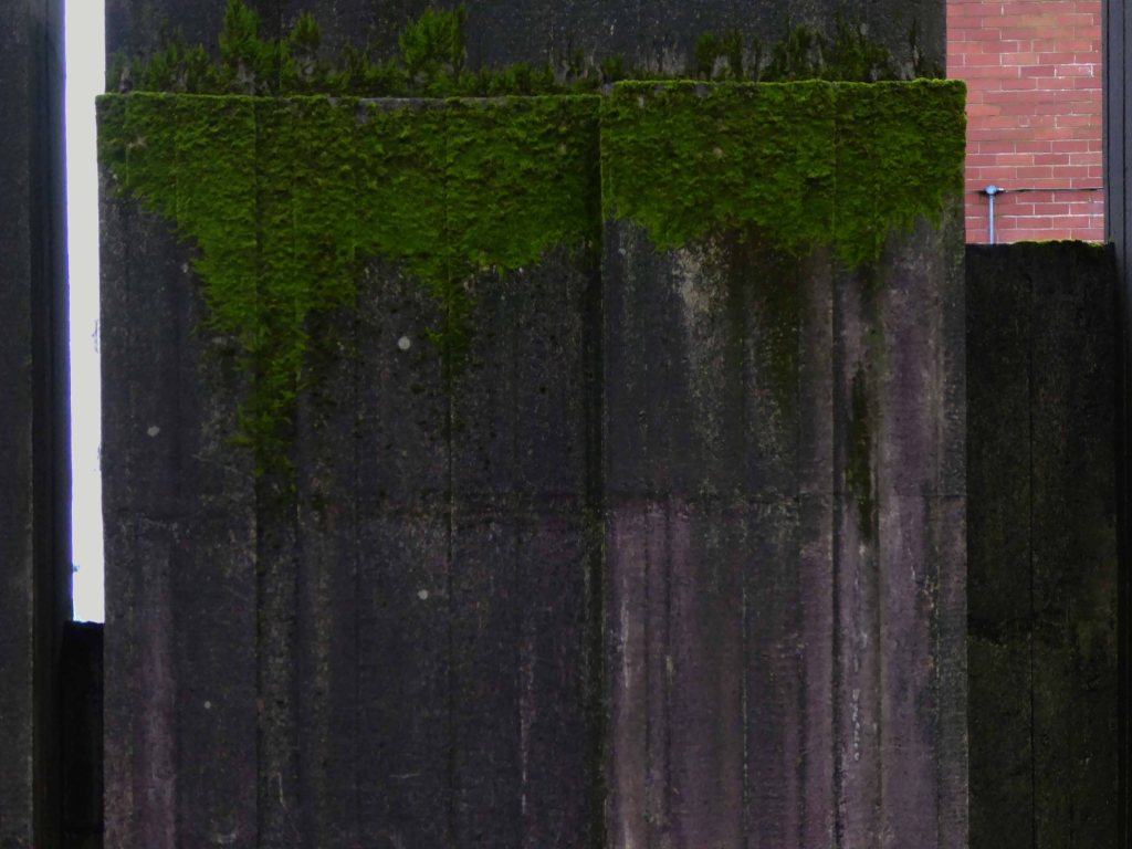
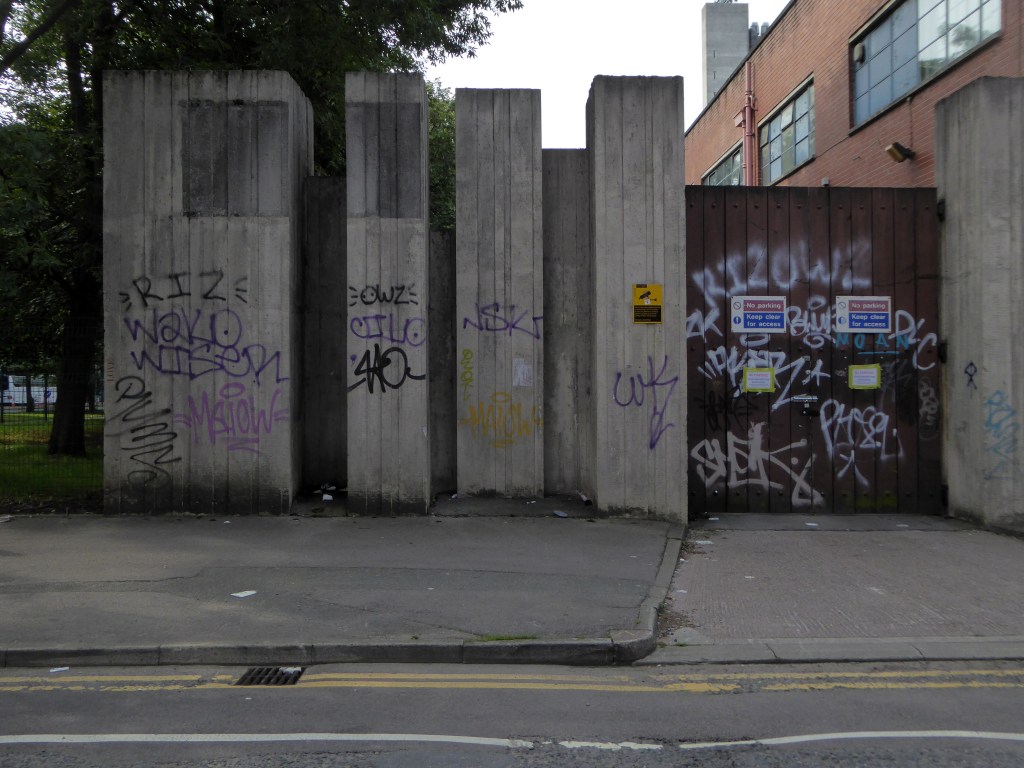
Though remnants remain – this is a short journey through a hole in fence, down into the warren of power station offices past.
They have been stripped of their former use and meaning, transformed into a transitory art performance space, paint and plaster now peeling, appealing to the passing painter, partially reclaimed by nature.
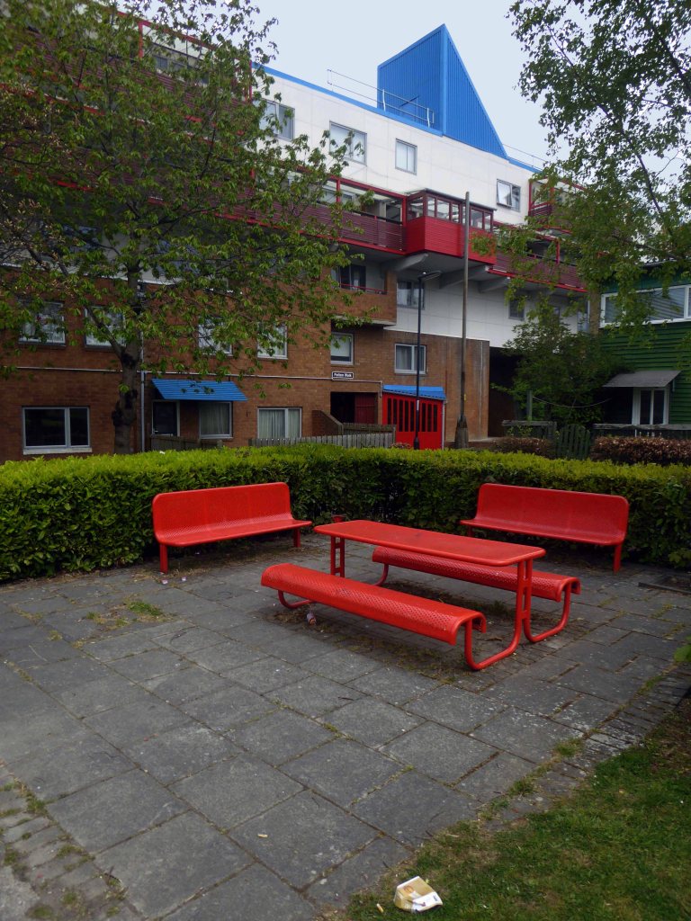
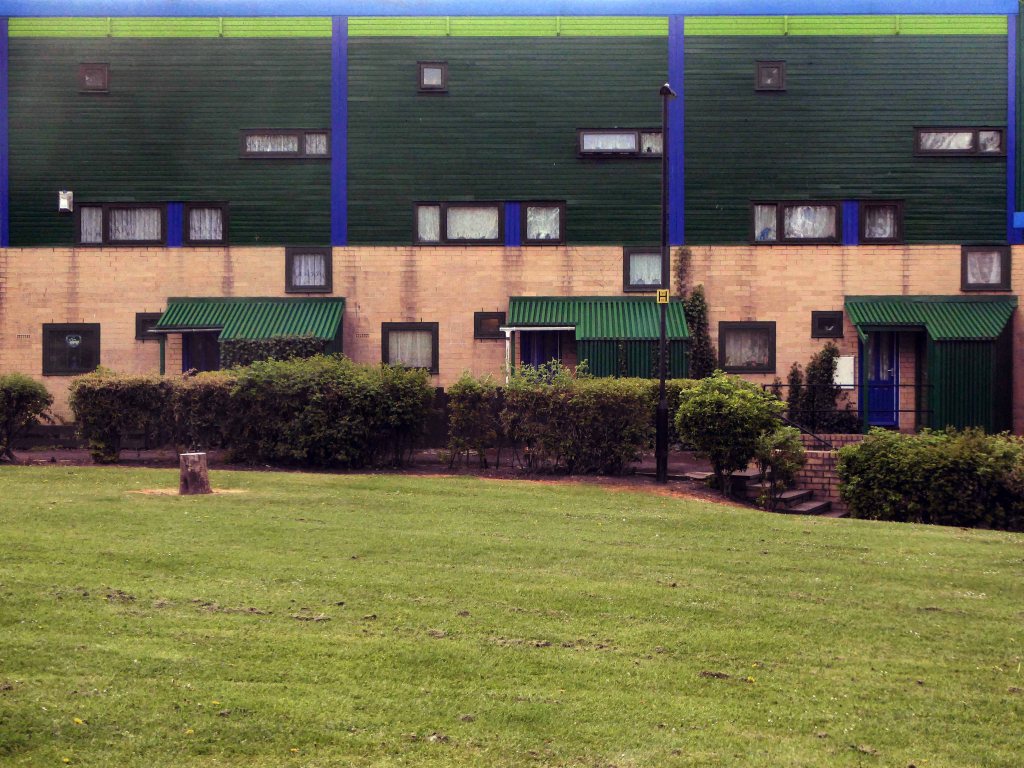
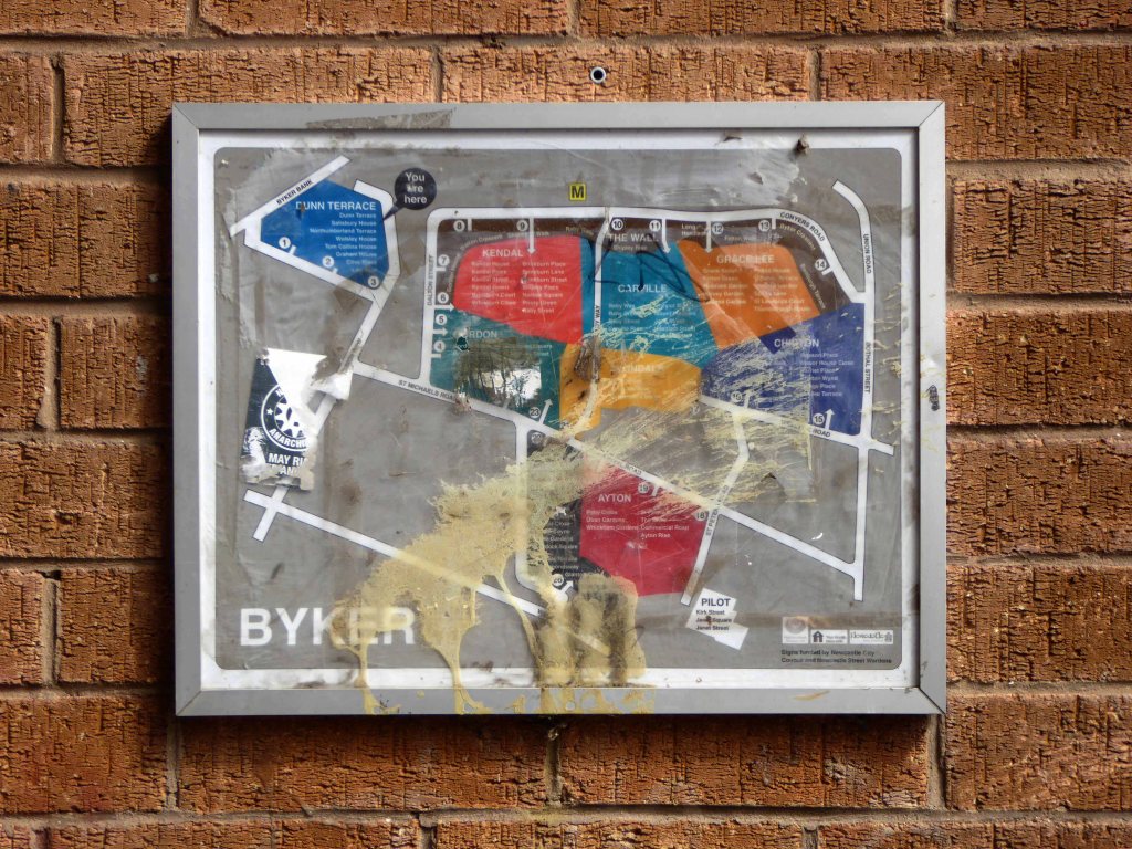
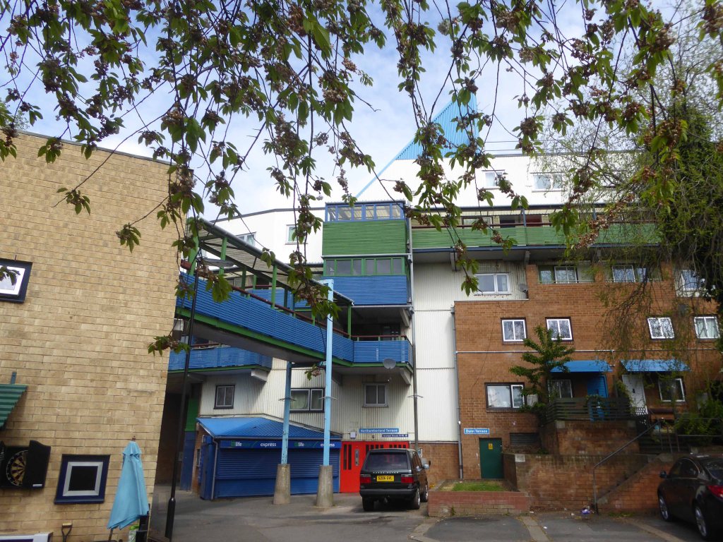
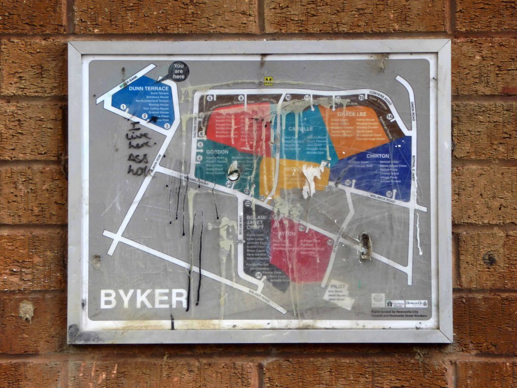
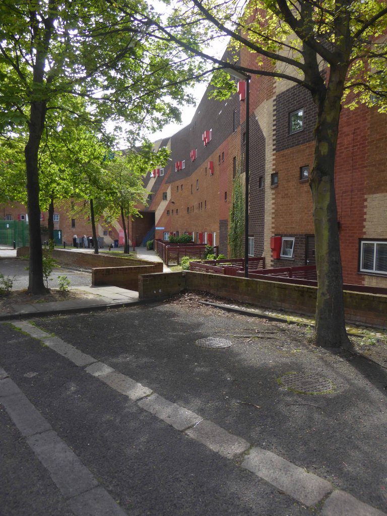
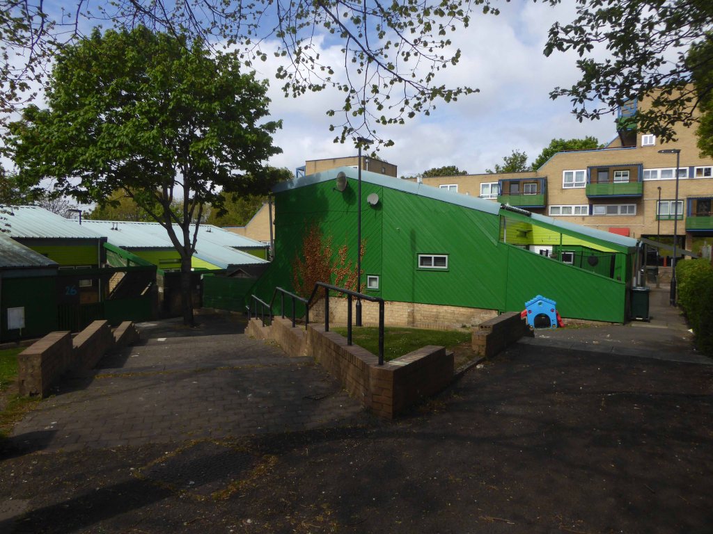
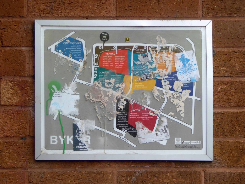
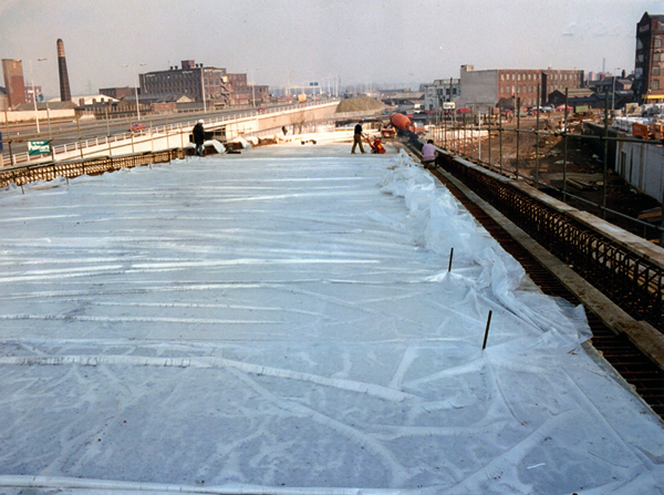
The Wall, along with the low rise dwellings built to its south, replaced Victorian slum terraced housing. There were nearly 1200 houses on the site at Byker. They had been condemned as unfit for human habitation in 1953, and demolition began in 1966.
The new housing block was designed by Ralph Erskine assisted by Vernon Gracie. Design began in 1968 and construction took place between 1969 and 1982. The architects opened an office on site to develop communication and trust between the existing residents. Existing buildings were to be demolished as the new accommodation was built.
The new high-rise block was designed to shield the site from an intended motorway, which eventually was never built. Construction materials for Byker Wall were relatively cheap, concrete, brick and timber. Surfaces were treated with bright colours, while brick bandings were used on the ‘Wall’ to indicate floor levels.
Its Functionalist Romantic styling with textured, complex facades, colourful brick, wood and plastic panels, attention to context, and relatively low-rise construction represented a major break with the Brutalist high-rise architectural orthodoxy of the time.
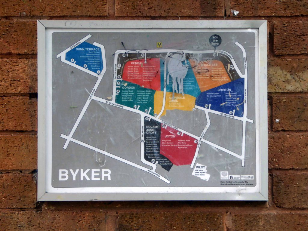
There area has been well documented over time, notably by photographer Sirkka-Liisa Konttinen.
It’s reputation has had its ups and downs but most recently:
It’s been named the UK and Ireland’s best neighbourhood – it’s got top schools, friendly neighbours and community art classes – alongside high levels of poverty.
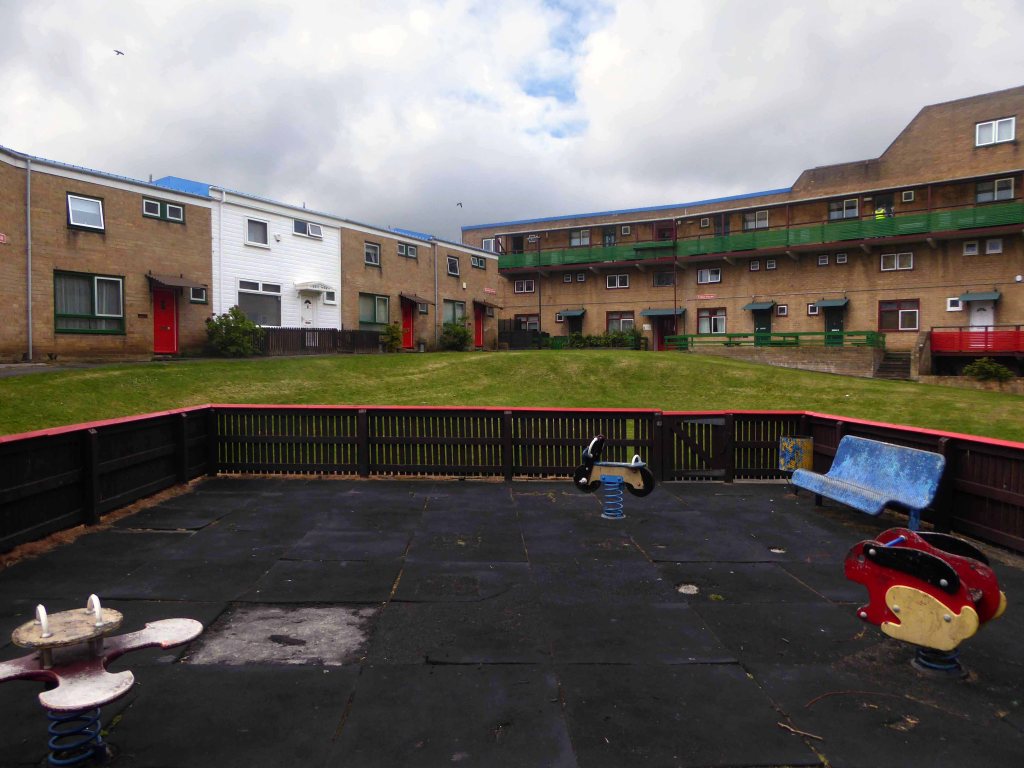
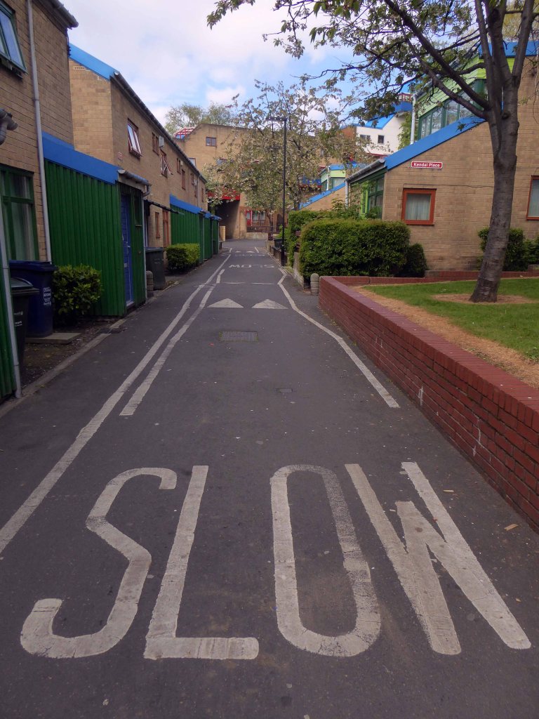
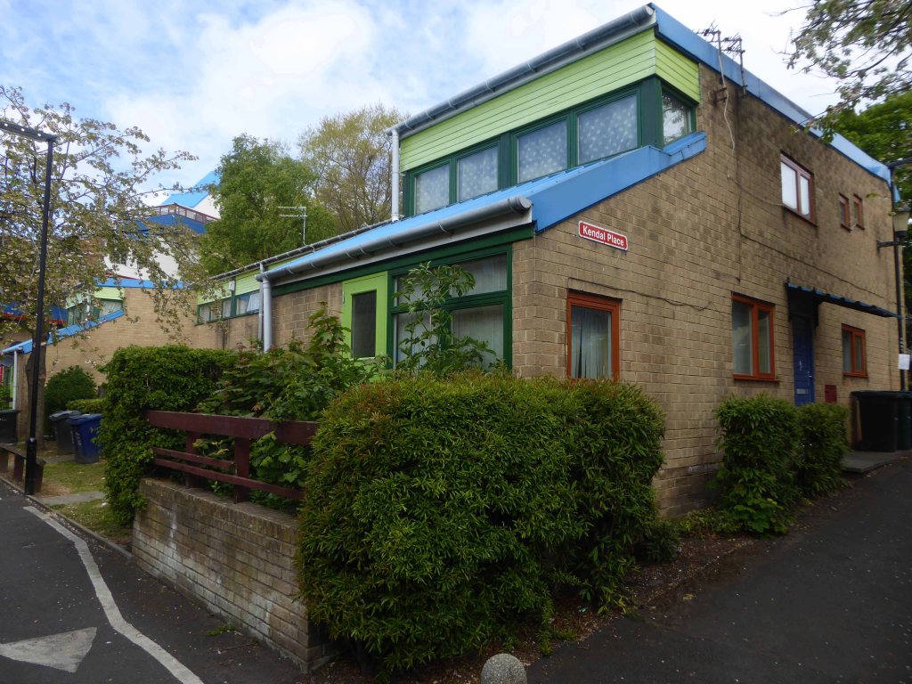
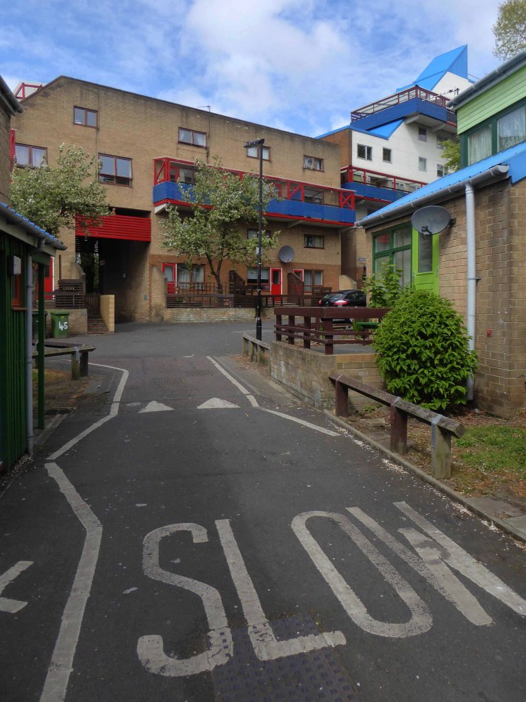
When Historic England awarded Byker its Grade II* listing in 2007, they praised both its ‘groundbreaking design, influential across Europe and pioneering model of public participation’. The estate’s main element, the Byker Wall, is – like it or loathe it – an outstanding piece of modern architecture. The conception and design of the estate as a whole was shaped by unprecedented community consultation.
I went for a walk around one morning in May 2017, the photographs are in sequence as I explored the estate. It’s hard to do justice to the richness and variety of architecture in such a short time, but I only had a short time.
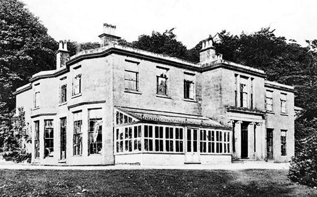
A Grade II listed country house, now divided into two dwellings. c1812. Ashlar gritstone. Hipped slate roof with leaded ridges. Various ashlar triple stacks with moulded tops. Moulded cornice and low parapet. Two storeys, central block with recessed long wing to east, orangery to west.
This Grade II listed manor house is set within 14 acres of natural grounds, together with the occupied adjoining servants’ wing, and has been sympathetically converted, retaining many original features to provide comfortable accommodation for families wishing to meet up for that special family occasion, and wi-fi is available in the living room.
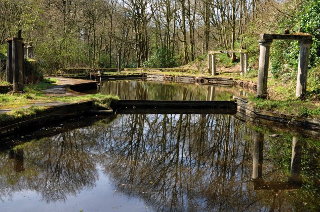
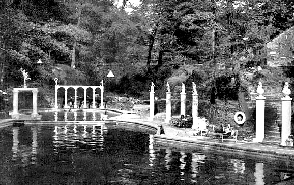
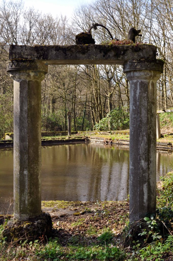
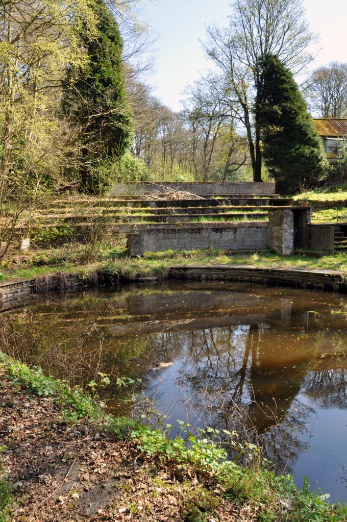
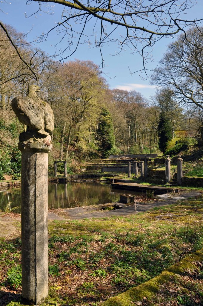
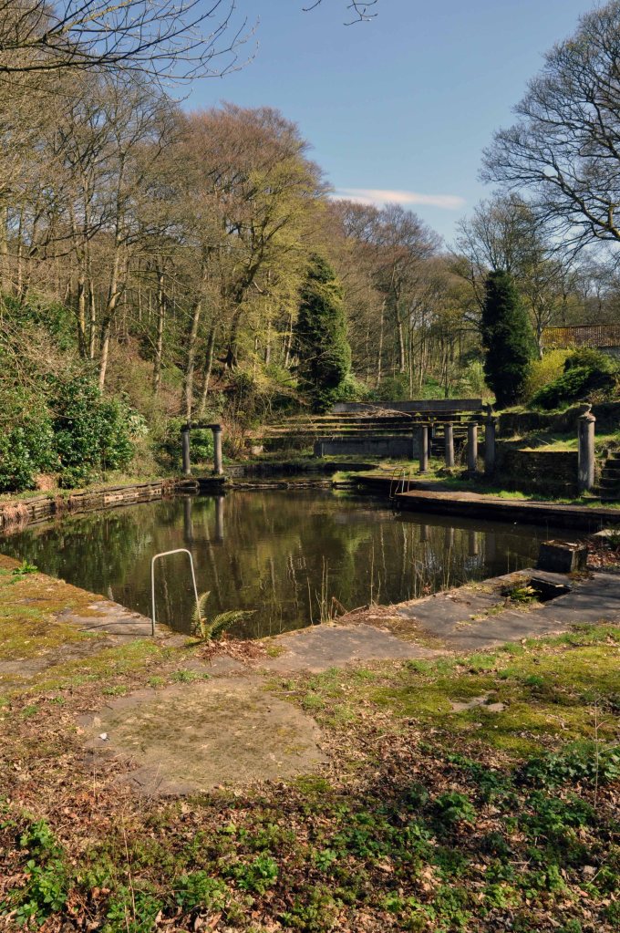
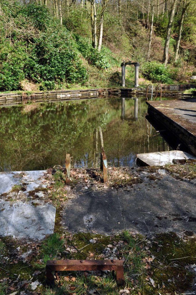
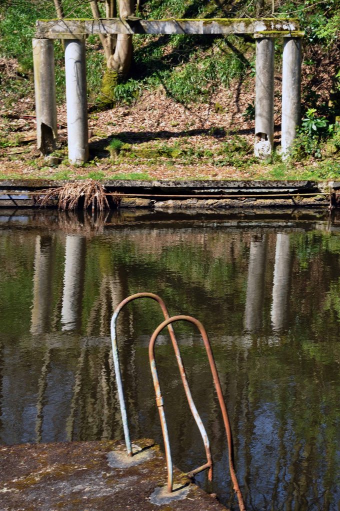
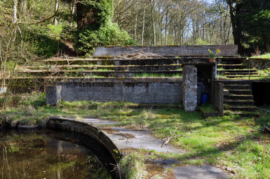
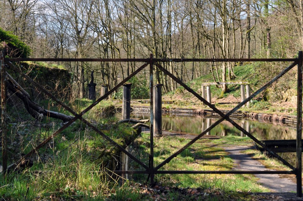
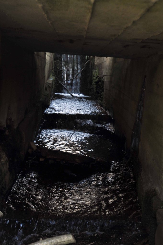
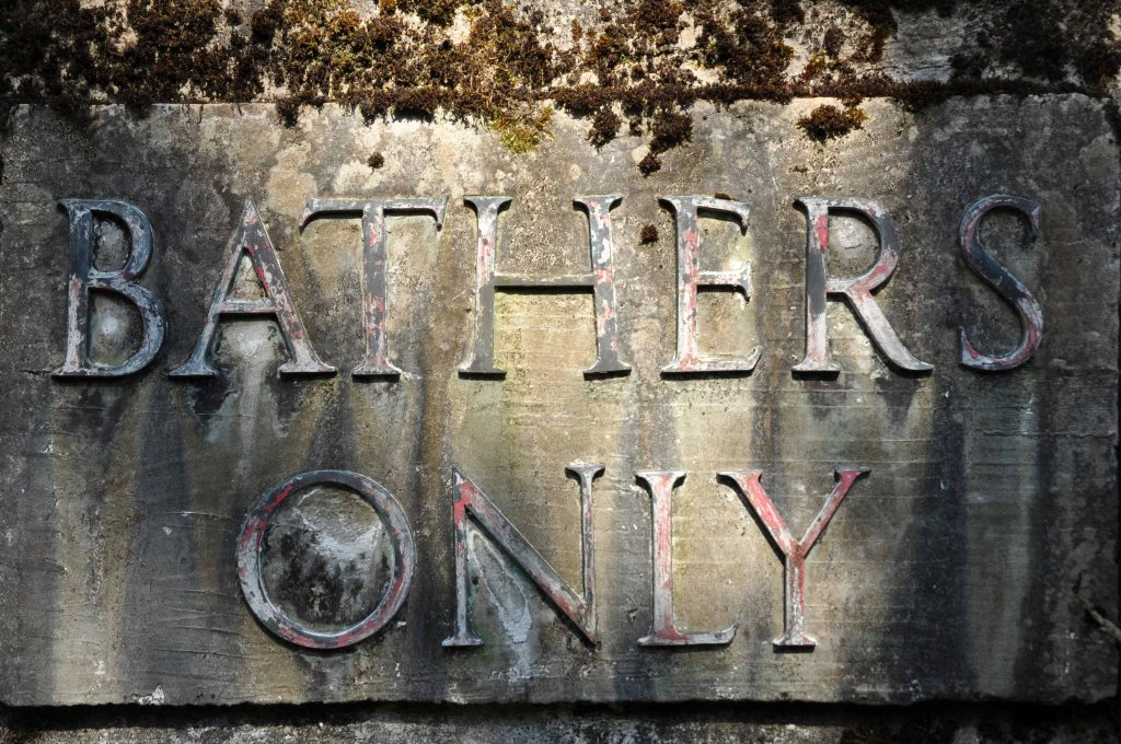
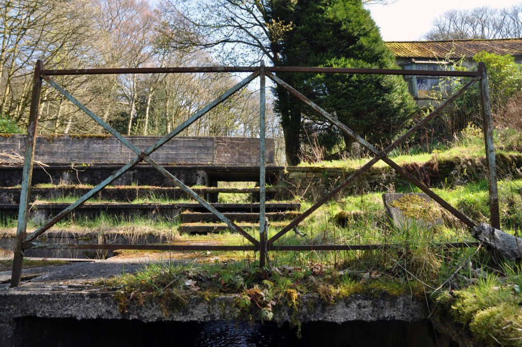
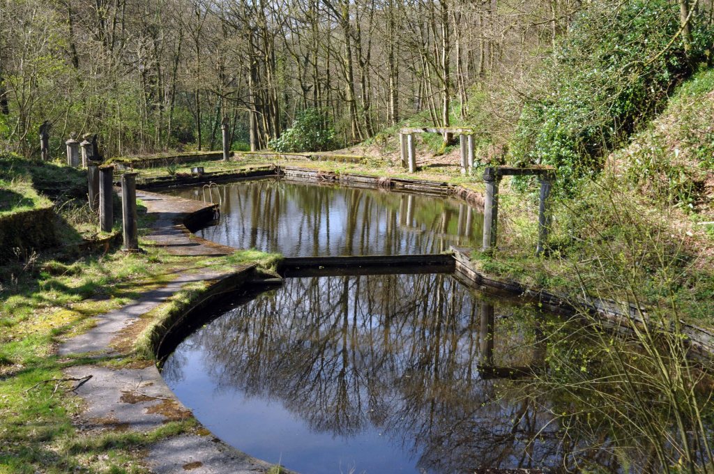
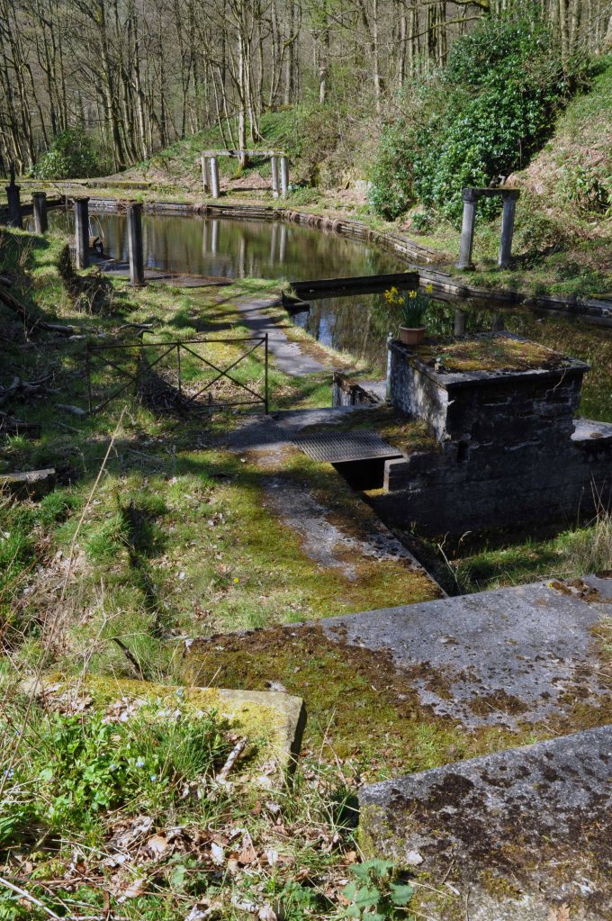
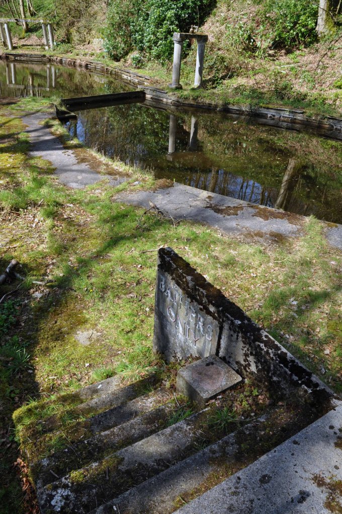
Then came a pool:
Previously a private pool belonging to a country club in the 1930’s it later opened to members around 1938 who paid a small fee for its use. The pool is fed by a mountain stream and the water is reported to remain cool throughout the year. In the 1940’s/50’s locals recall the pool being open to the public where it cost a ‘shilling for children and half a crown for adults’ entry. During storms in 1947 the pool was badly damaged and reportedly ‘never the same again’ but postcards in circulation in the 1960’s provide evidence that the pool remained open at least until then.
Now it sits abandoned and hidden in the woods.
I went there in my early teens late 60’s the pool was still intact, well used and well cold. I remember chilly changing rooms with duckboards on concrete floors, a small café with pop and crisp if you had the pennies.
Most of all the simple joy of emersion in clear moorland water, on long hot summer days long gone.
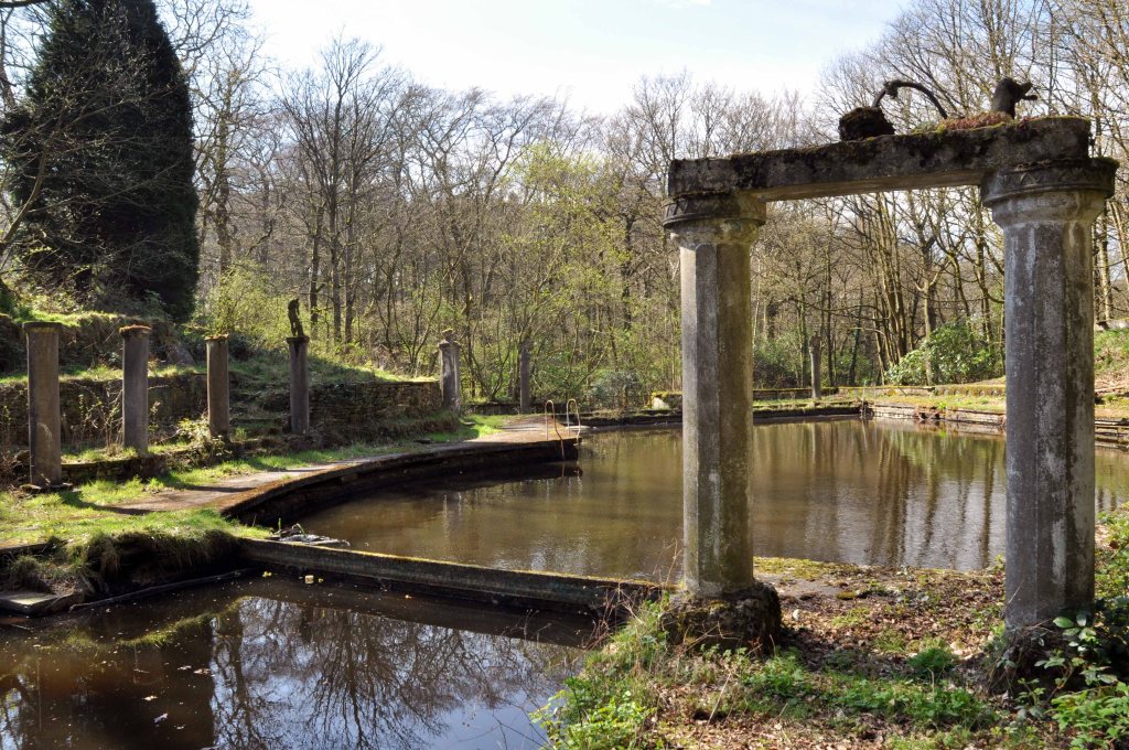
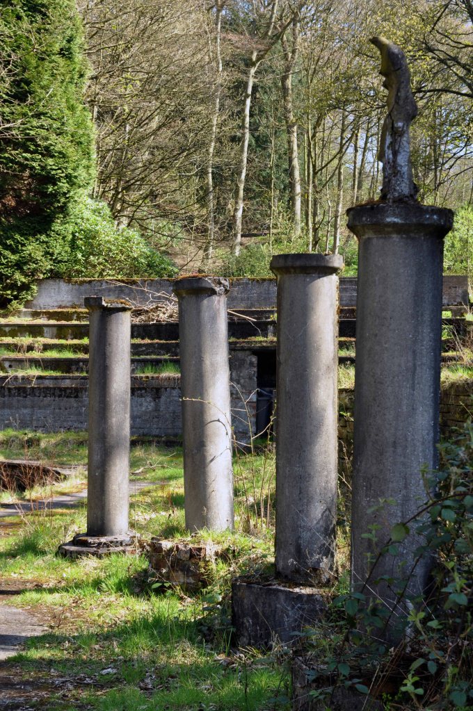
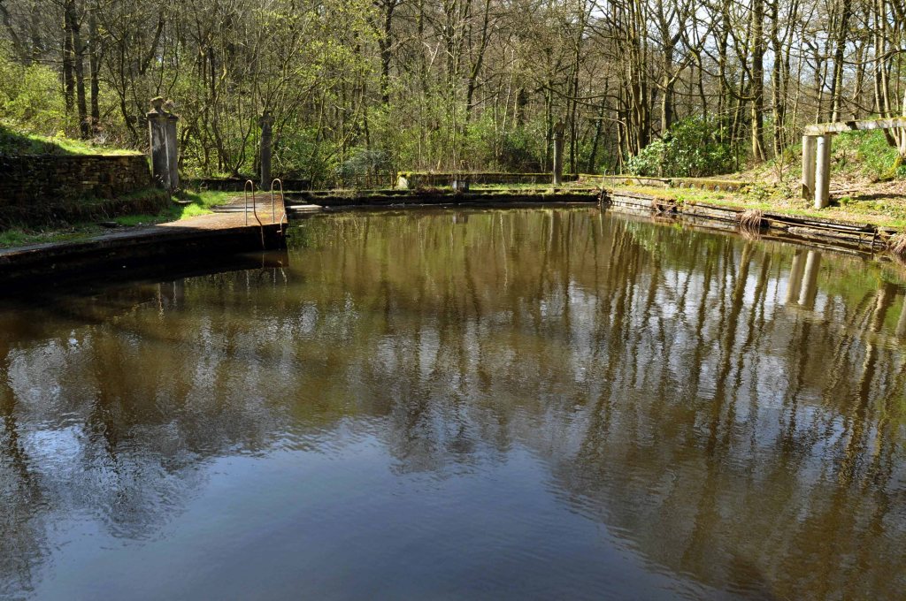
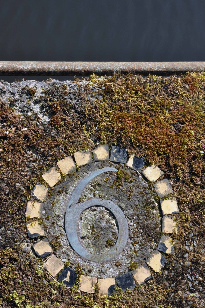
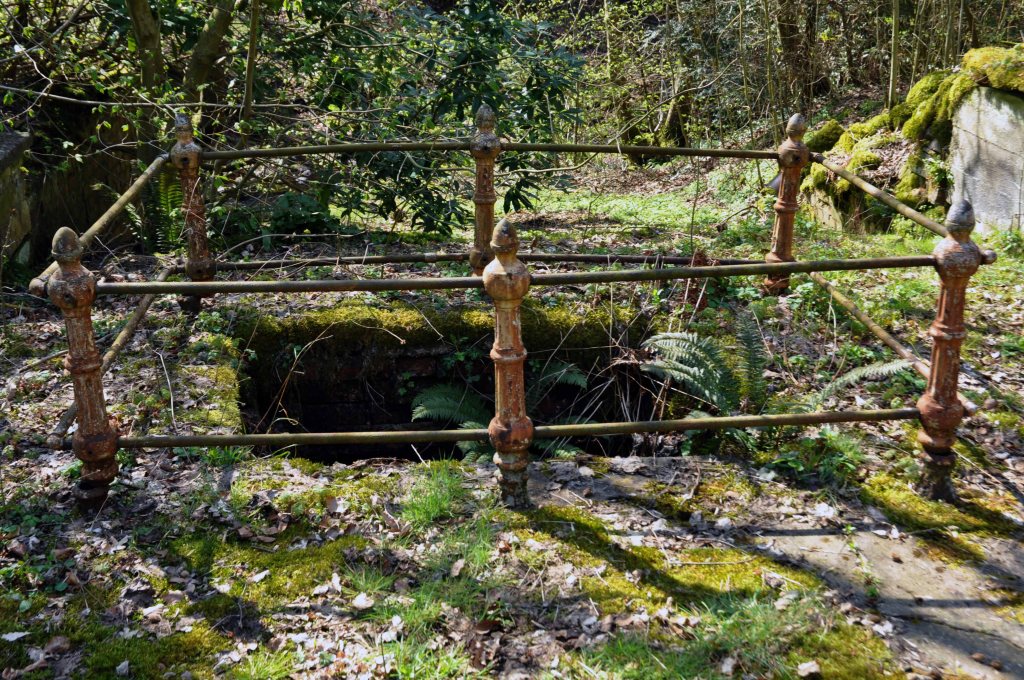
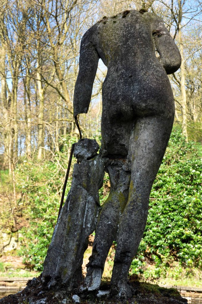
Revisiting in April 2014, following a misguided scramble through brambles, it was a poignant reunion. The concrete shells of the pillars and statuary crumbling and moss covered, the waters still and occluded.
It sure it has subsequently been the scene of impromptu fashion shoots and pop promo videos, possibly a little guerrilla swimming. Though sadly it largely sits unused and unloved – let’s take a look around:
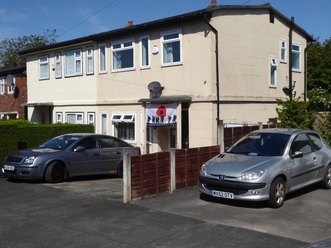
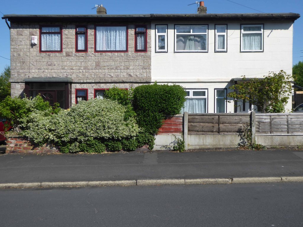
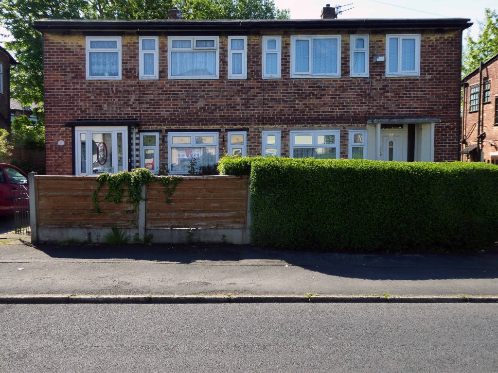
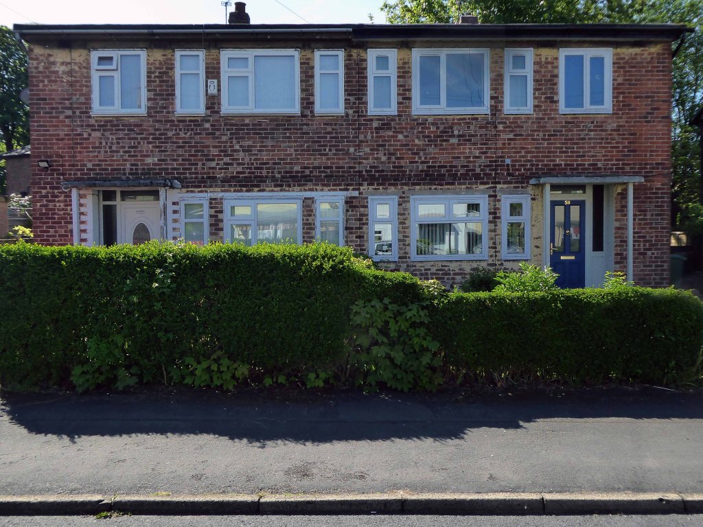
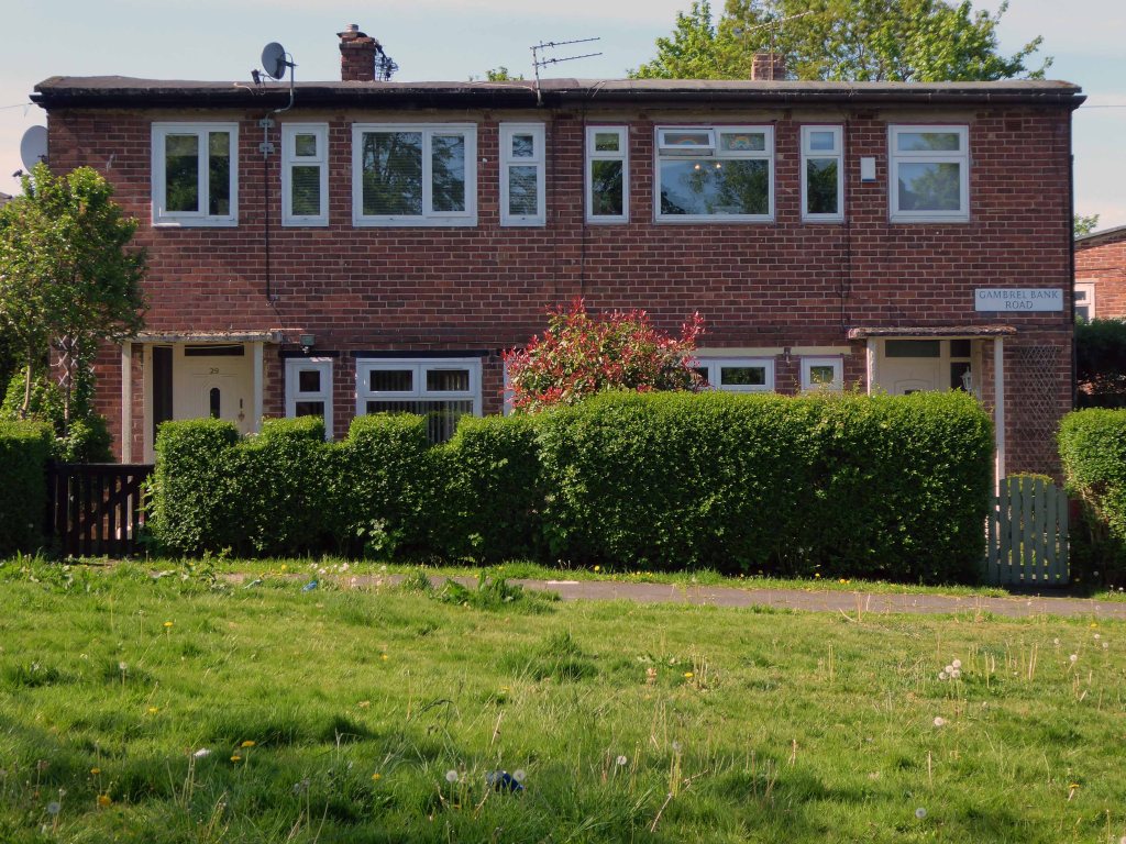
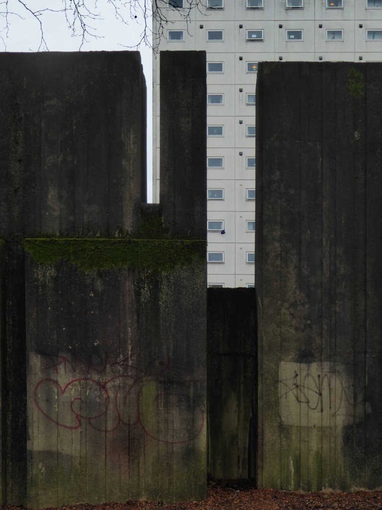
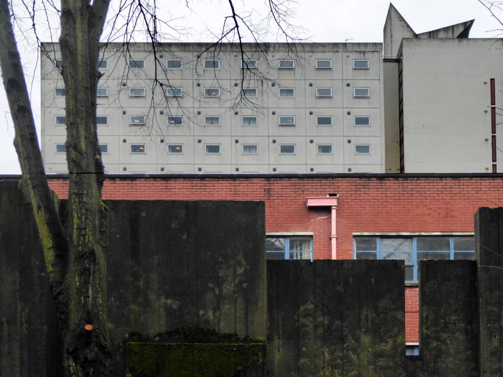
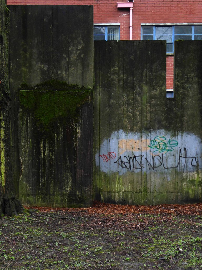
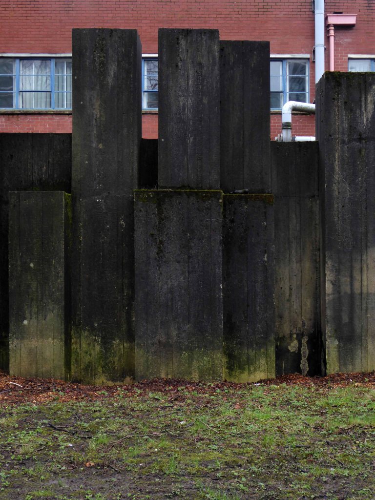
I have been here before in 2015 en passant, snapped the homes chatted to a resident and off, she had informed me that they had been post-war experimental concrete homes.
I thought no more about it – but subsequently I did, returning to the road to take another look.
Here’s one I didn’t make earlier.
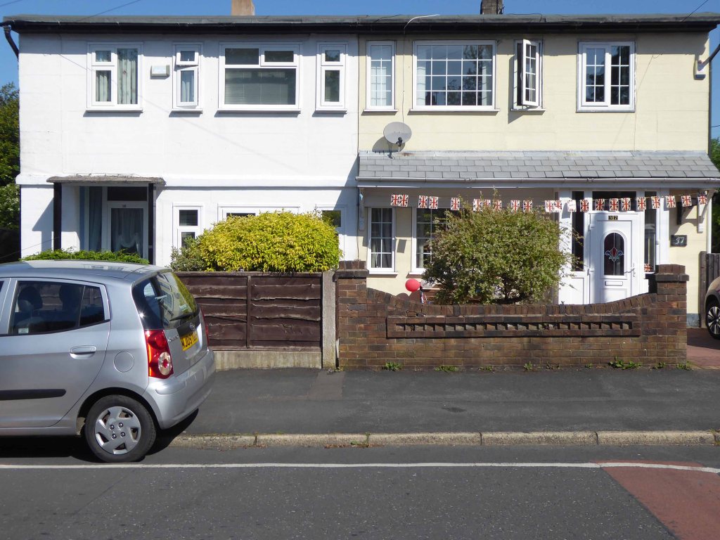
There are four semi detached homes constructed from concrete, rendered painted and clad over the years, windows replaced, additions and amendments made.
Though the basic design characteristics have been retained.
There are no local archival images or histories, I assume that they were post-war, an addition to the inter-war Smallshaw council estate.
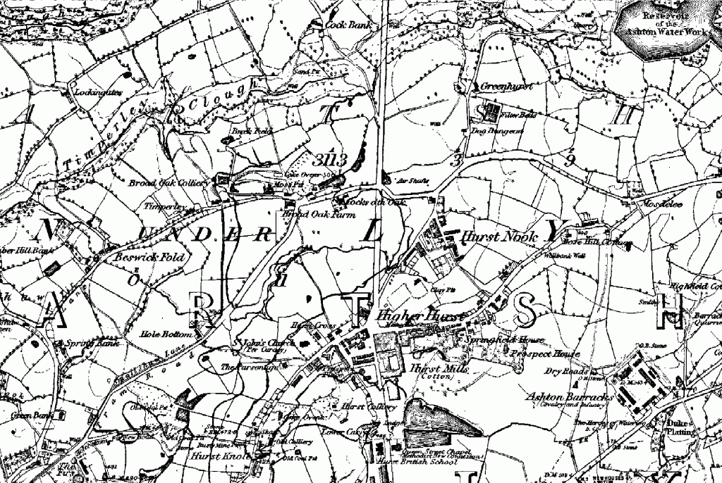
In an area which in 1848 was given over to mining and agriculture.
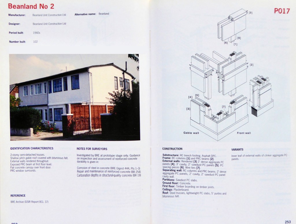
I have subsequently learnt from an online contact Mr Sid Cat, that the homes are Beanland No 2.
They are listed on the BISF site – 102 were built.
More than this I cannot say – further searches for Beanland proving largely fruitless.
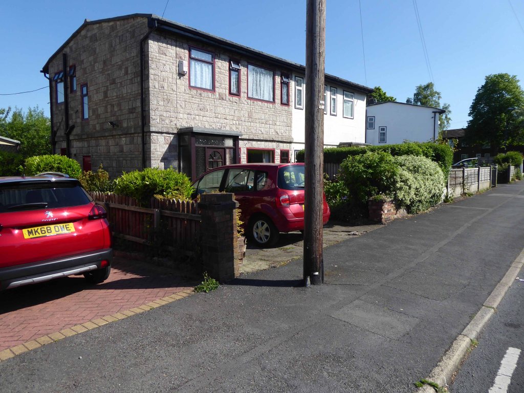
In addition there are also several semi detached houses of identical shape and proportion faced in brick – why?
Suffice to say here we are now and here they all are.
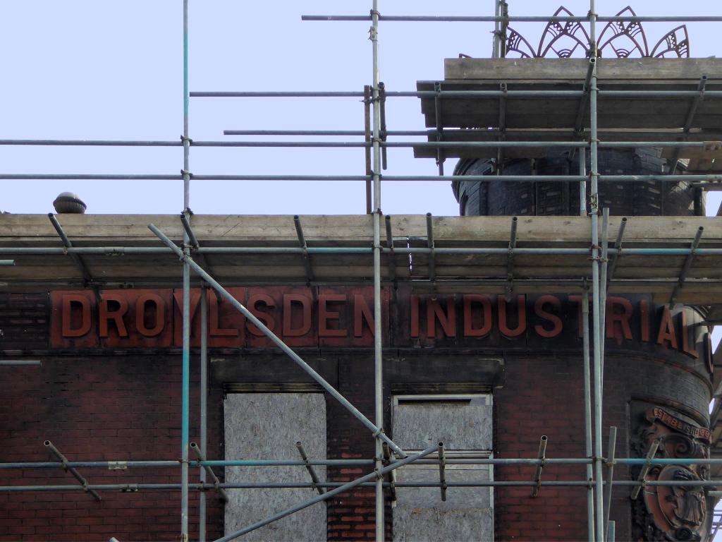
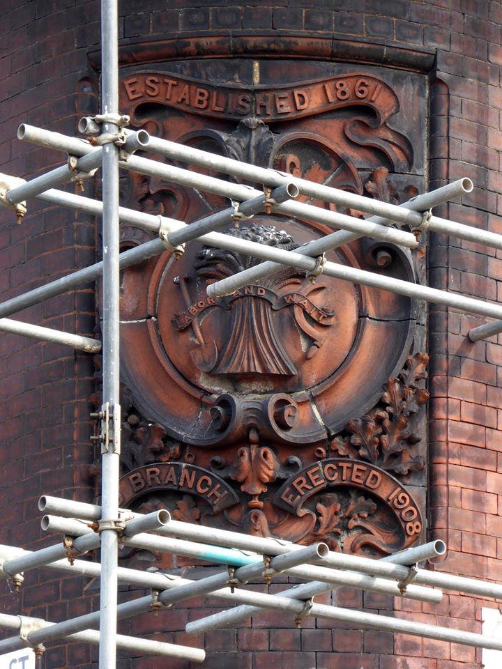
Charles Dreyfus was a French emigrant chemist and entrepreneur, who founded the Clayton Aniline Company on 29 May 1876. The company obtained a lease on a parcel of land in Clayton, Manchester, sandwiched between the Manchester and Ashton Canal and Chatham Street – later known as Clipstone Street.
1904
At its peak in the 1970s, the site occupied over 57 acres and employed over 2,000 people. However, due to the gradual demise of the British textile industry, most textile production shifted to countries such as China and India with the textile dye industry following.
1960
In 2002, the company made 70 members of staff redundant and in 2004 the announcement was made that the site would be closing with the loss of over 300 jobs. A small number of staff were retained to assist in the decommissioning of the plant. The last workers left the site in 2007 and the remainder of the buildings were demolished shortly afterwards.
Like much of the industry of east Manchester its tenure was relatively short – money was made and the owners departed, without wiping their dirty feet.
The site remained derelict until demolition, followed by extensive site cleansing – to remove the dangerous detritus of 200 years of hazardous chemical production.
Vincent Kompany had just completed his £6million move from Hamburg when he realised that Mark Hughes’ sales pitch about the direction the club was going was not entirely accurate.
They took me for a look around the training ground at Carrington – it wasn’t fit for purpose, it was a dump.
I remember there was a punch bag in the gym – and only one boxing glove. And even that had a big split in it!
Then in 2008 the corrupt boss Thai PM Thaksin Shinawatra is bought out by Sheik Mansour – the rest is history/mystery.
Mr Peter Swales makes no comment.
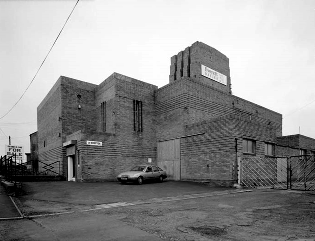
My interest lies in the company’s Ashton New Road offices – seen here in 1960.
Demolished and replaced by a distinctly Modernist block by 1964.
A flank was added on Bank Street along with a bank.
The office complex is still standing, now home to Manchester Police, I risked arrest and incarceration, in order to record the distinctive tile work, rectilinear grid and concrete facades.
Attracting several suspicious stares from the open glazed stairwells.
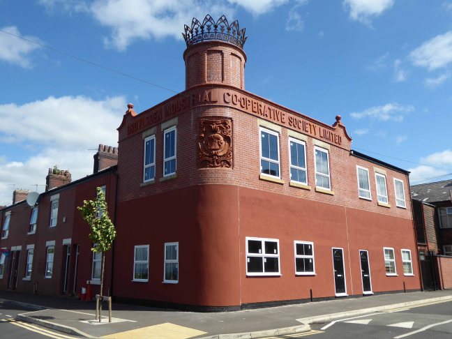
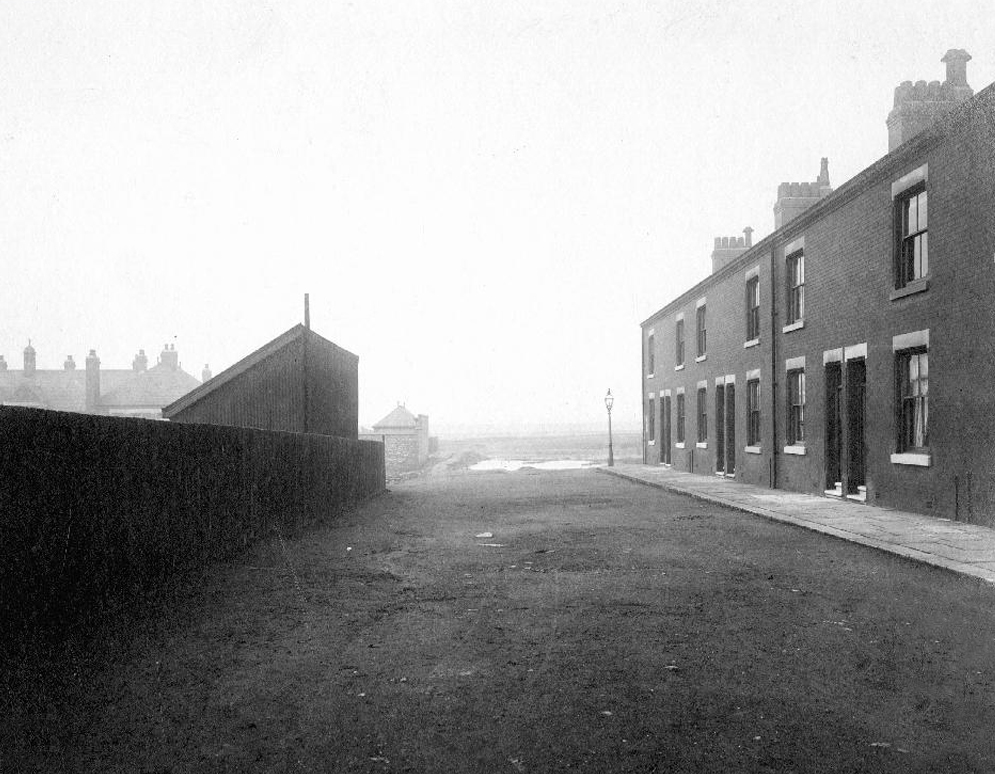
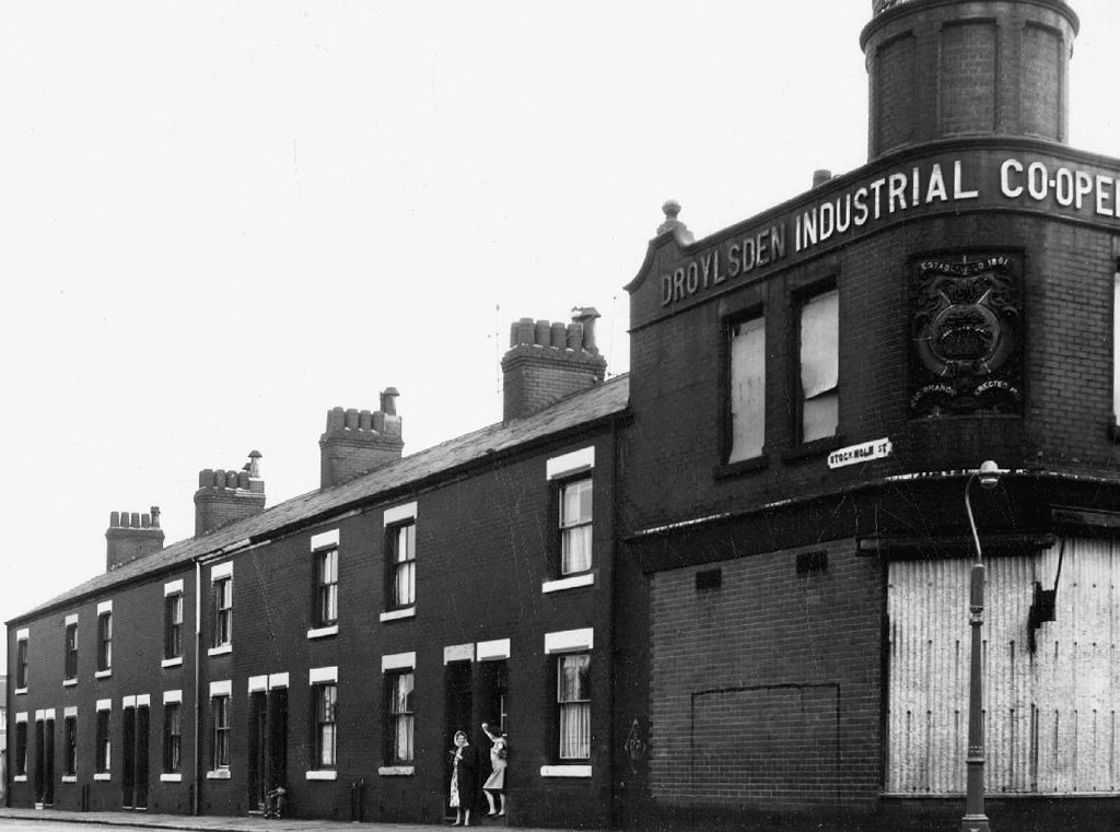
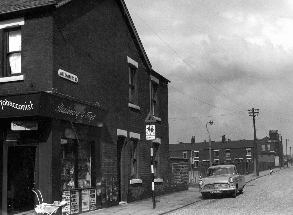
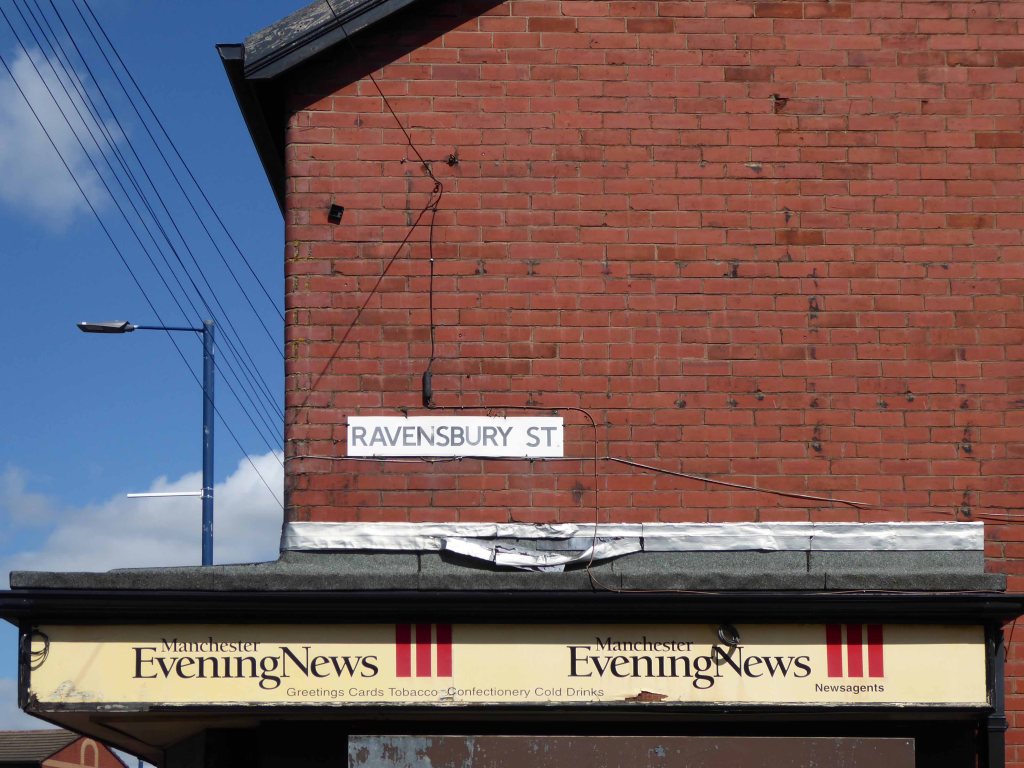
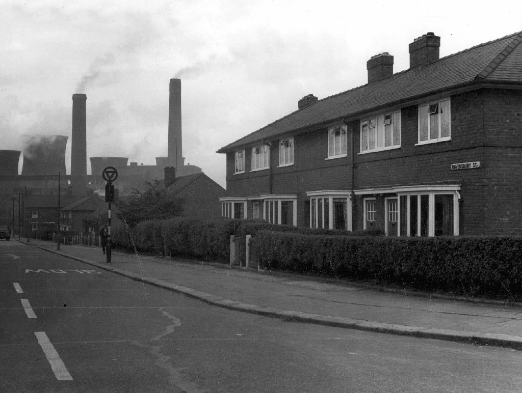
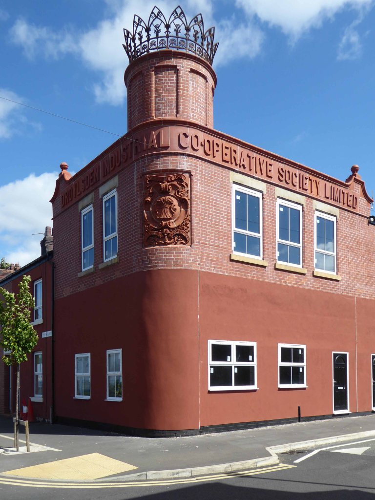
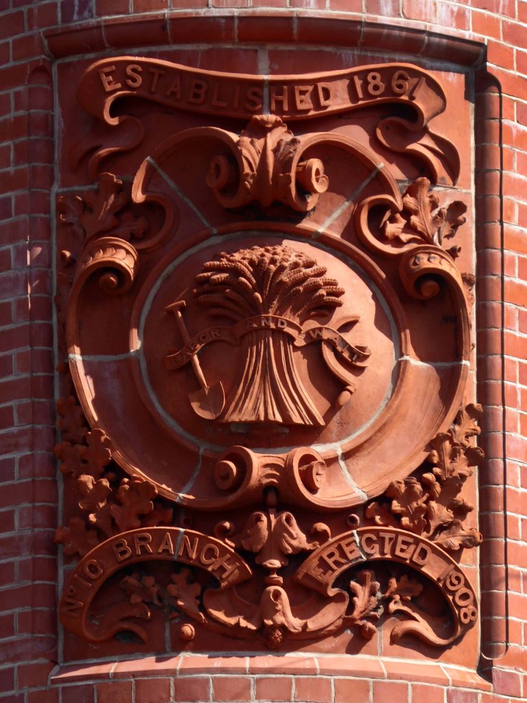
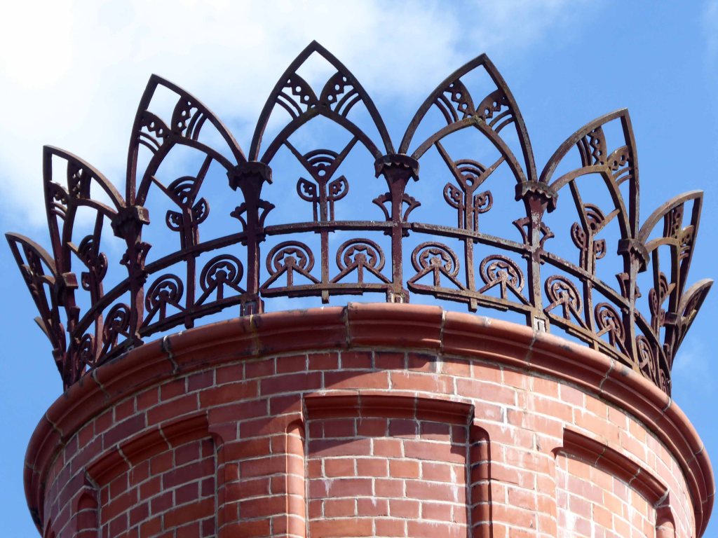
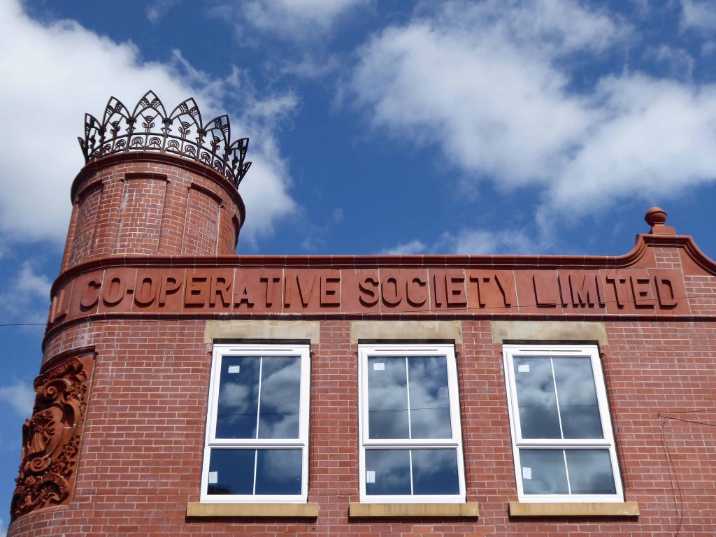
On the corner of Ravensbury and Stockholm Street Clayton Manchester there stands a Cooperative Shop of 1908.
We have previously visited another fine example on Northmoor Road.
In 1902 the area is still set to open ground.
This Manchester Local Image Collection photograph of 1912 shows new terraced homes emerging to meet the housing needs of the world’s first industrial city.
Changing patterns in shoppers habits sealed the fate of many local and corner shops, as larger supermarkets opened, increased mobility and car ownership became more common.
When I first visited the building was undergoing renovation work.
The beautiful terracotta tile work and corona obscured by scaffolding .
I returned last week to find the job almost done – converted to flats, in an area which has seen a great deal of improvement to the general housing stock, paving and street furniture.
A joy to see a fine building almost returned to its former glory, with a much needed social purpose, reviving the city’s western edge.
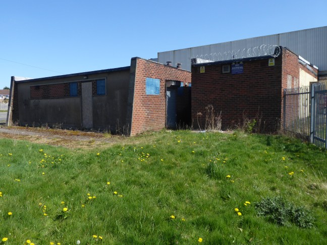
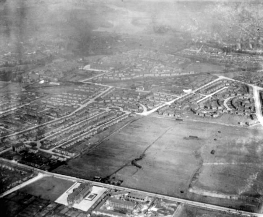
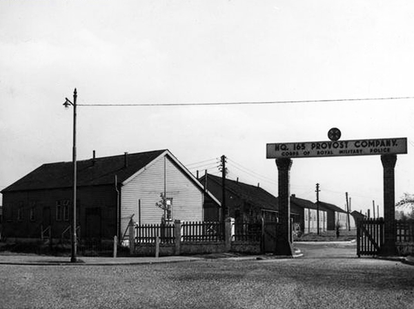
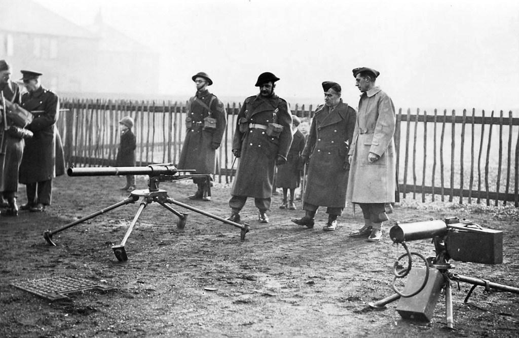
As a Military Police and POW CampThe 48th Battalion Manchester Home Guard used the facilities
Photograph Brian Wood
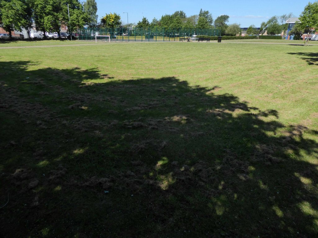
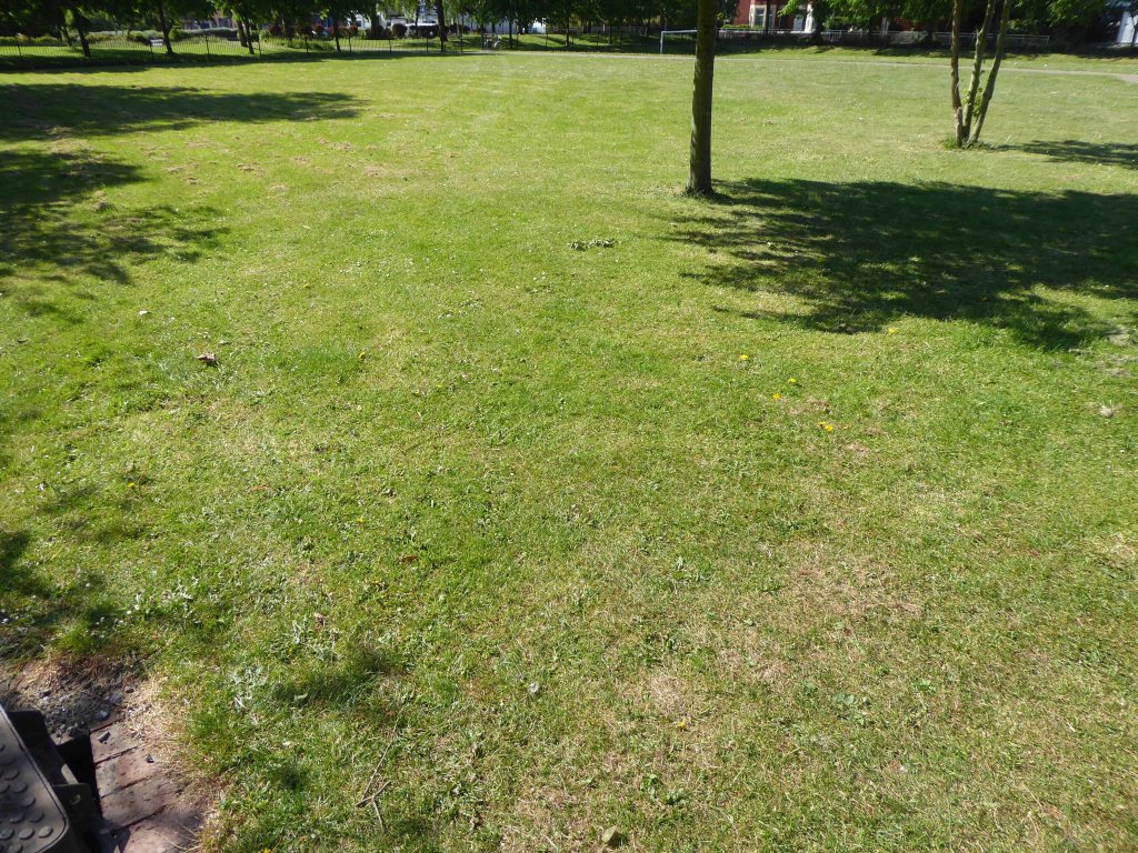
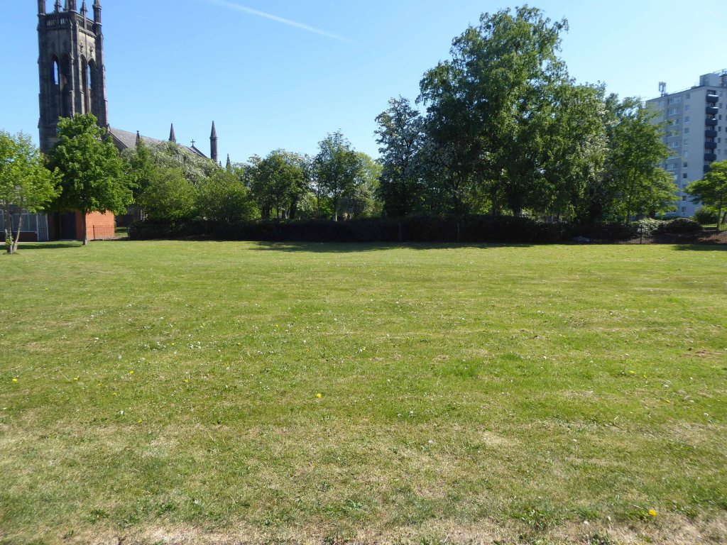
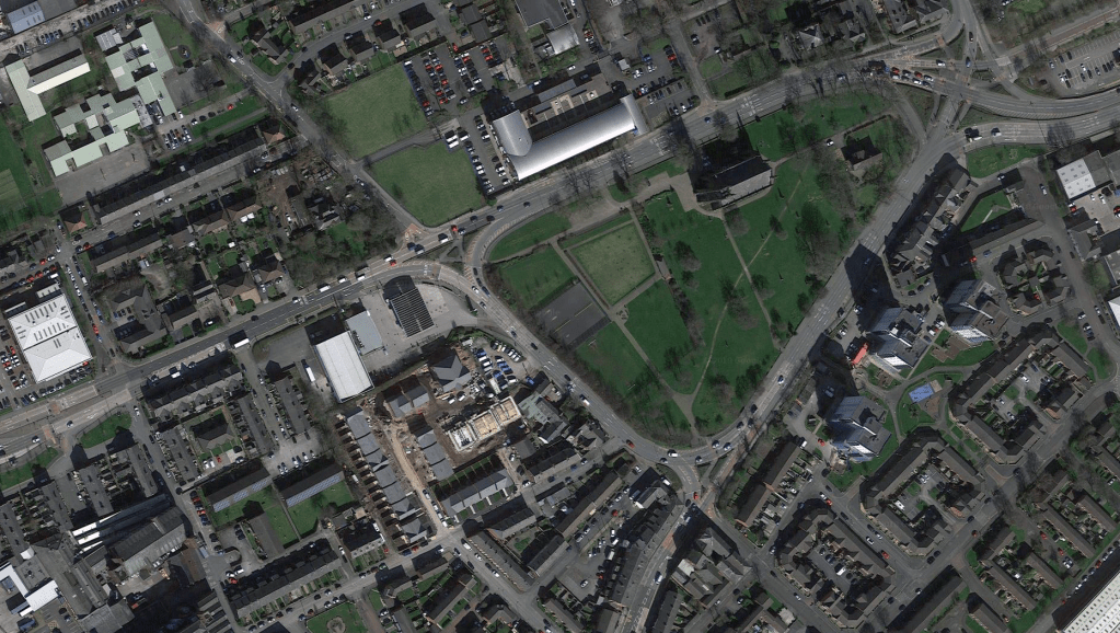
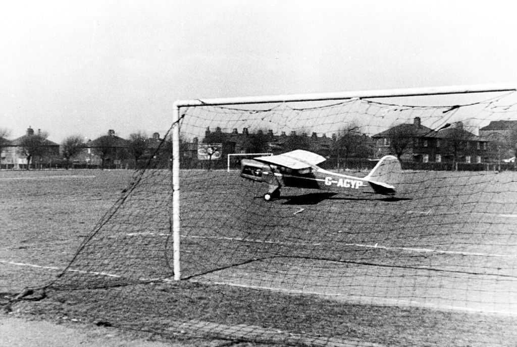
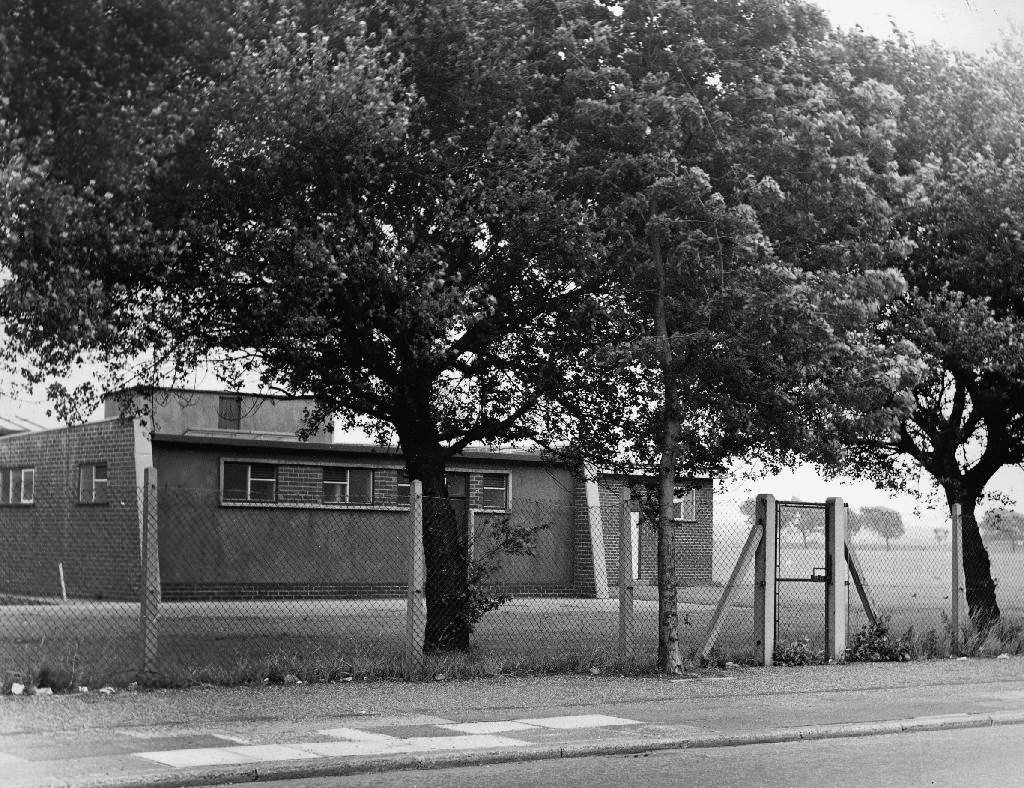
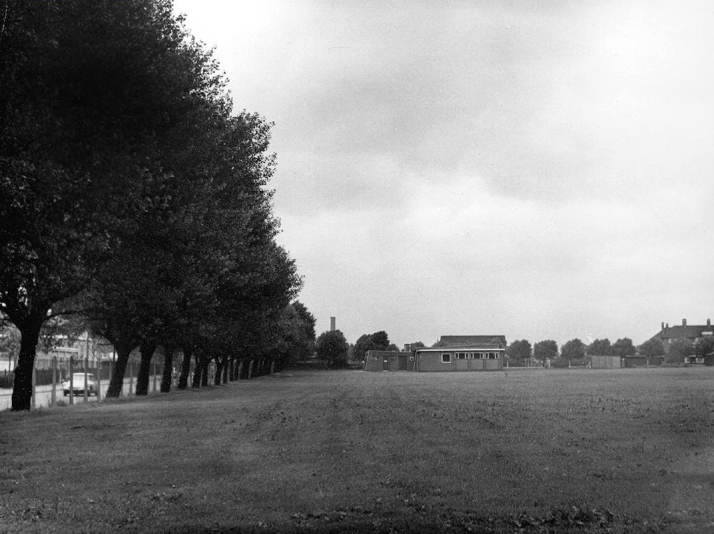
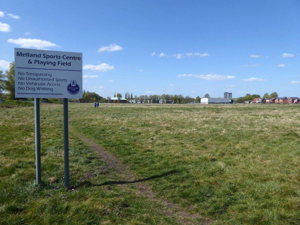
I remember from the 60’s onwards the fields in use for amateur football – pubs, clubs, schools and works all supplying teams to the plethora of leagues across the city.
Auster Aircraft of Airliners forced to land at Melland Playing Fields whilst towing banner 19611963
Gorton has received significant regeneration and investment over recent years as have nearby areas including Levenshulme. This is an aspirational, exciting new development and Arkwright Place has something for everyone – from first time buyers to growing families and downsizers – with a huge range of beautiful homes on offer.
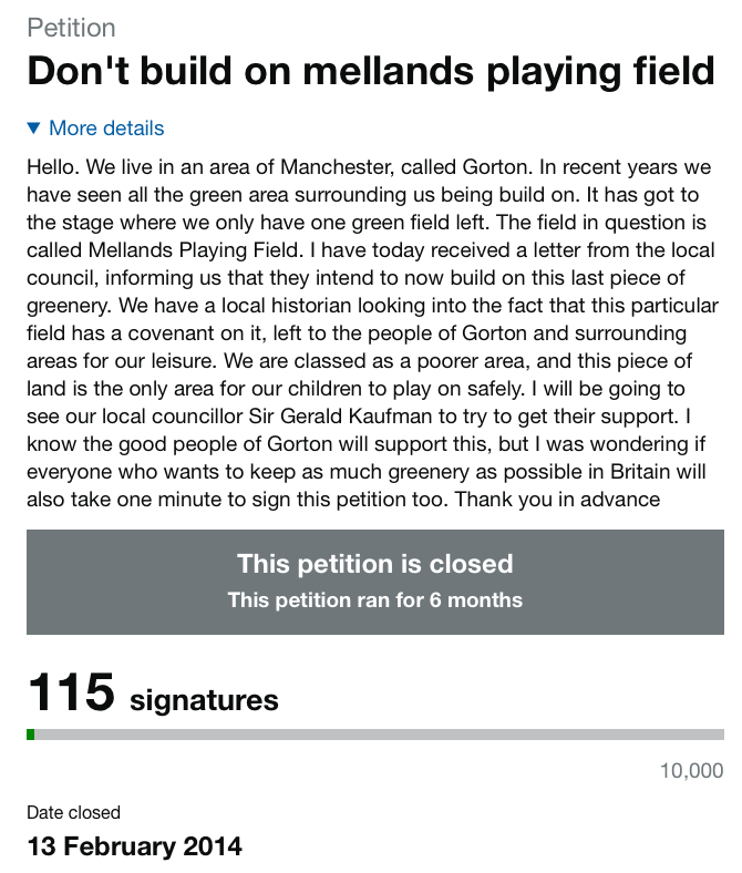
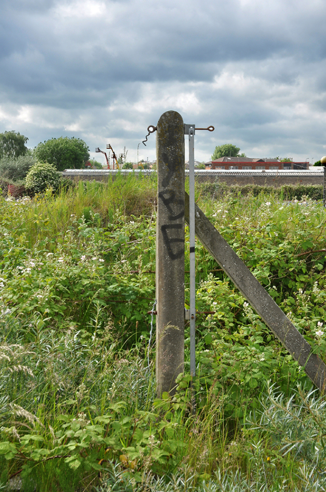
A local campaign was organised to preserve the open space:
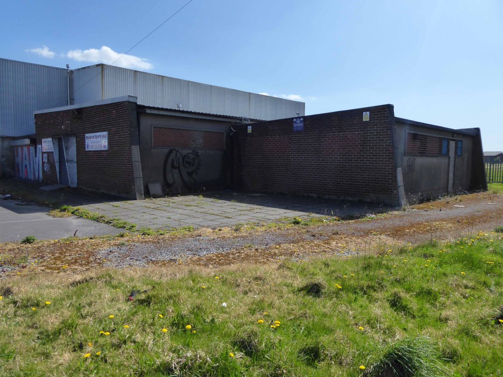
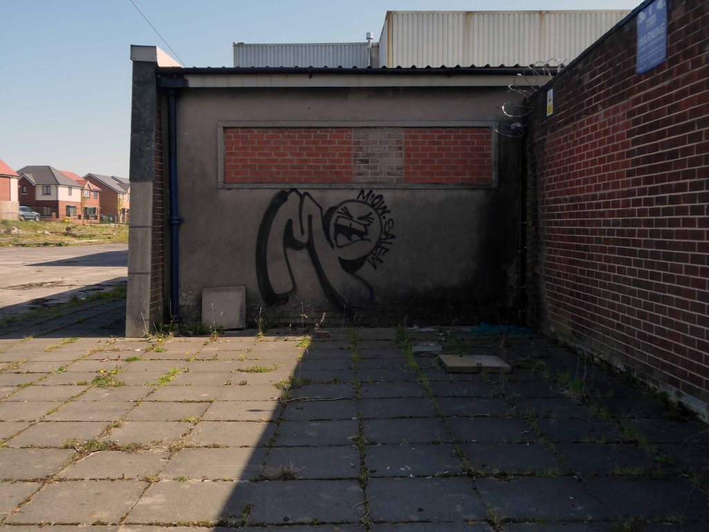
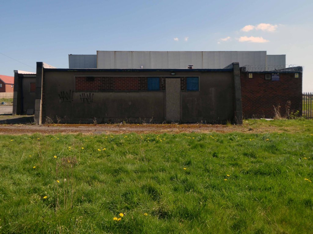
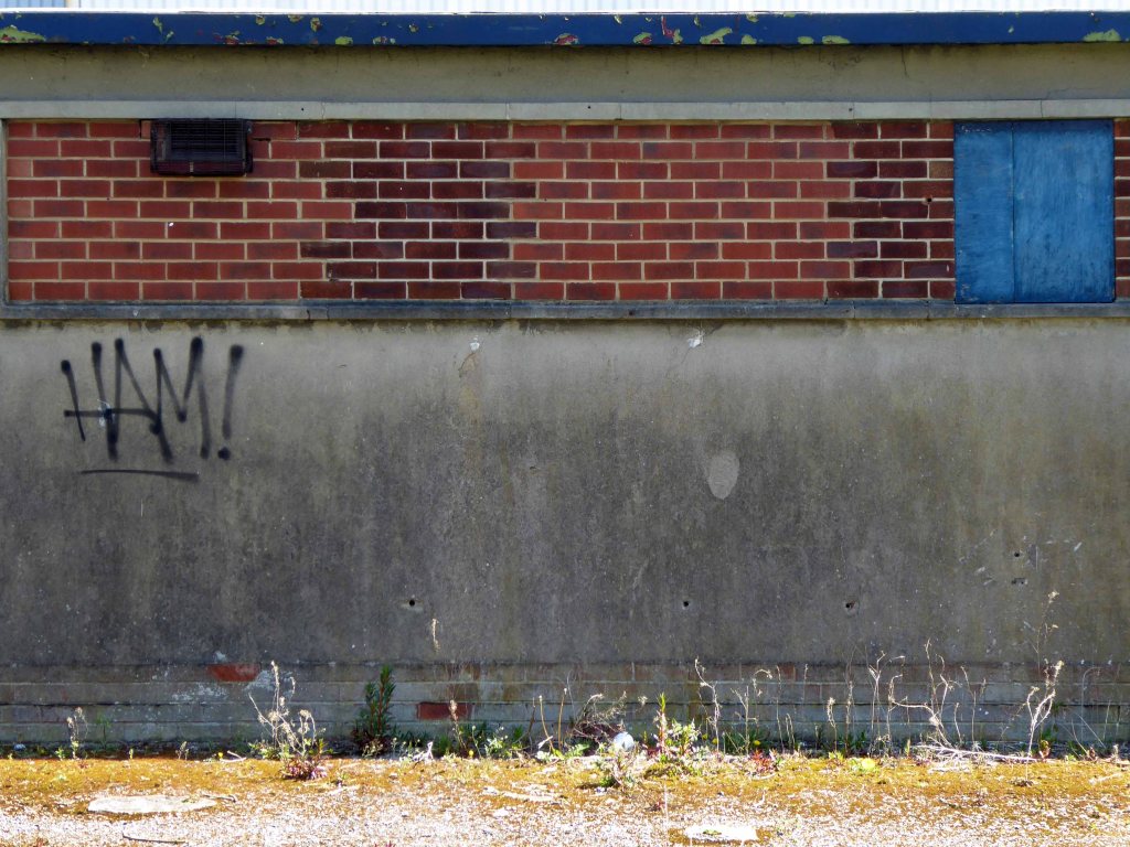
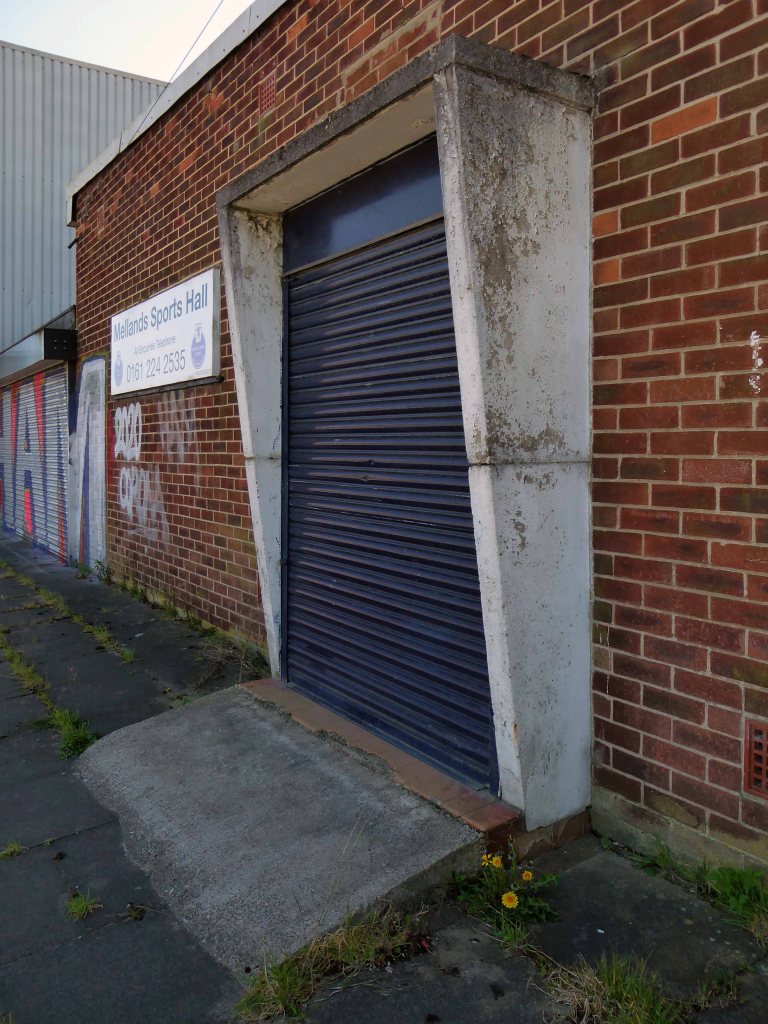
At present the fields are fenced and secured – though gaps have been made to allow access for strollers.
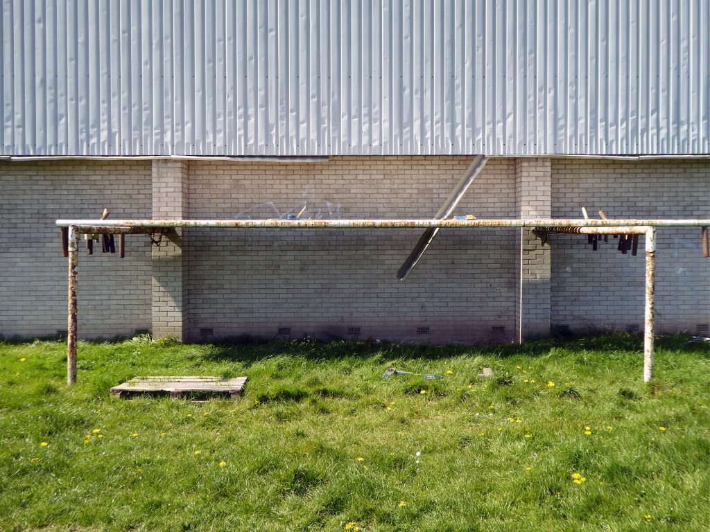
The goalposts still stand though currently without crossbars.
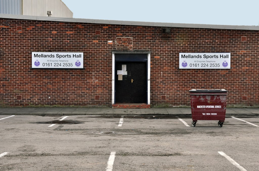
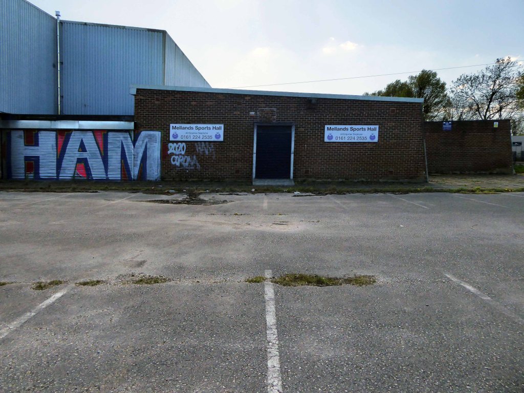
Which are stored by the Sports Hall.
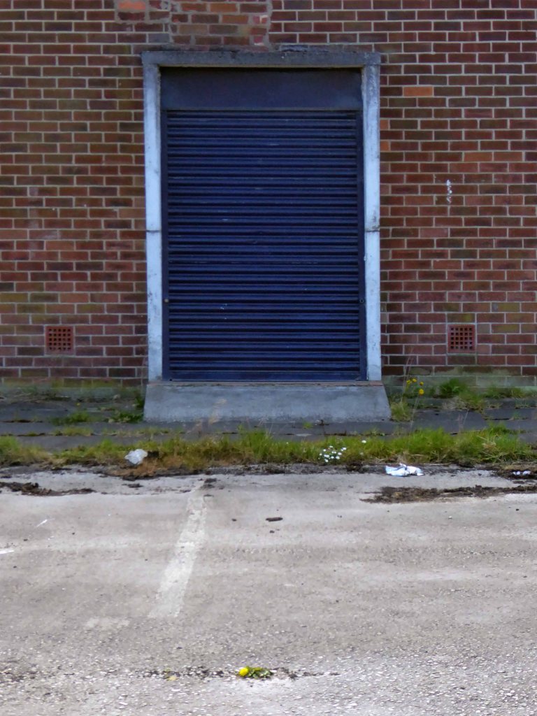
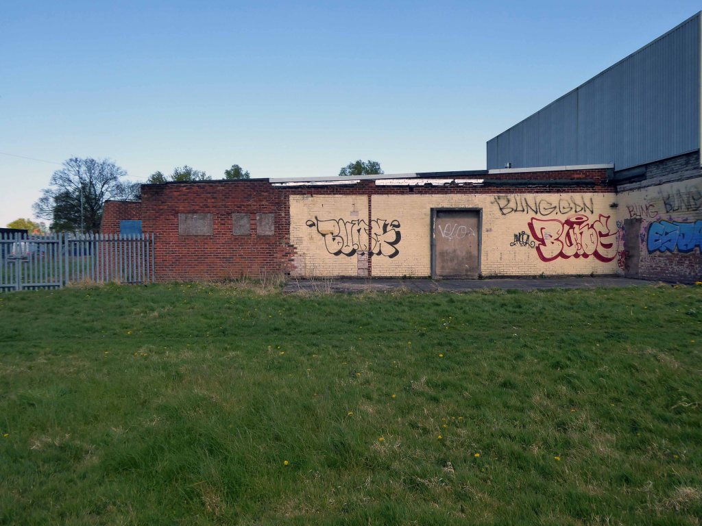
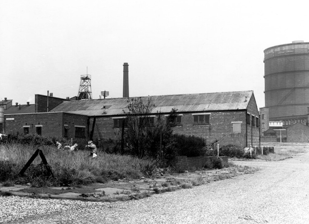
The buildings are mothballed – awaiting what?
For me the concrete and brick functionalist changing rooms are a thing of beauty and seem to have been a part of my life for quite some time, as I cycled back and to – on my way to work.
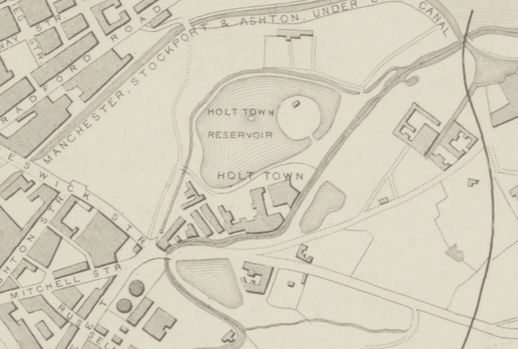
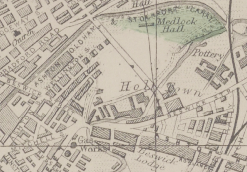
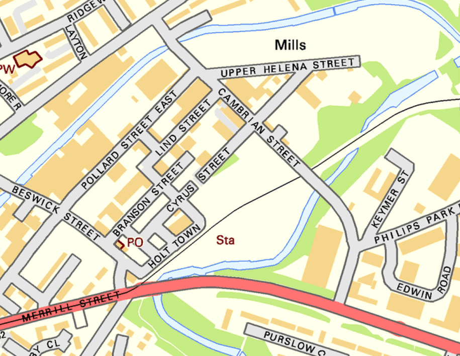
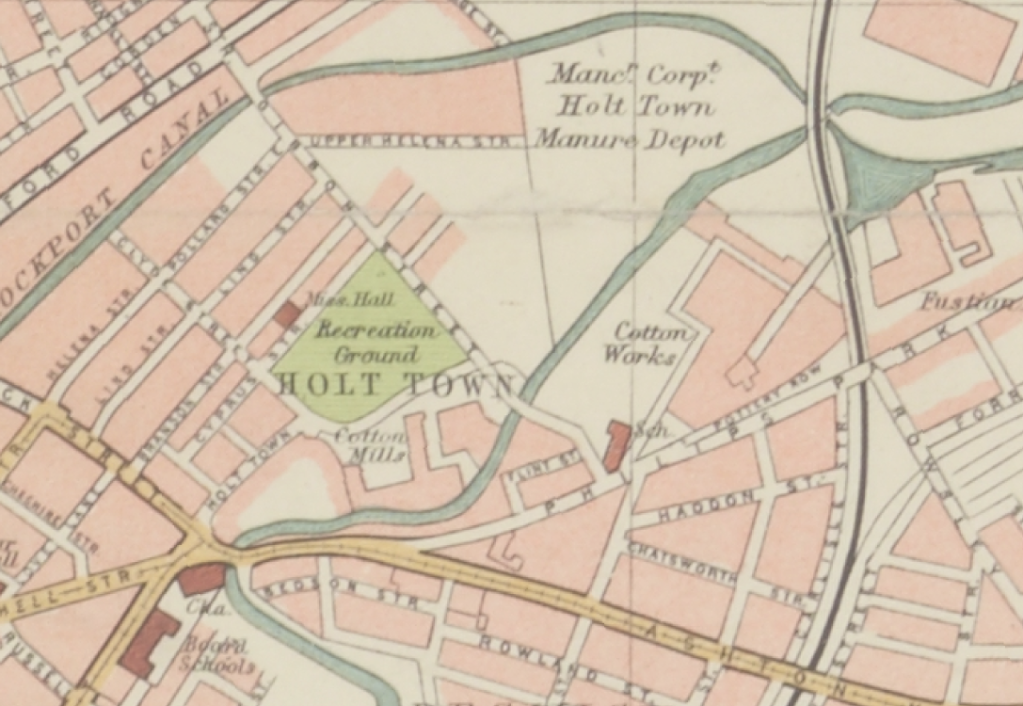
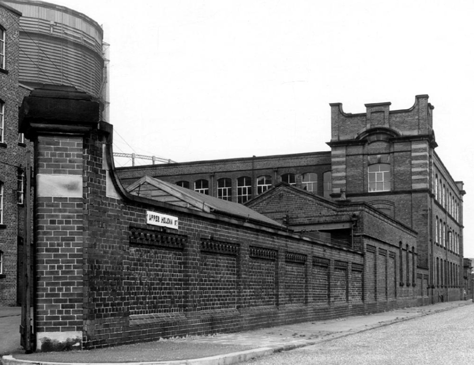
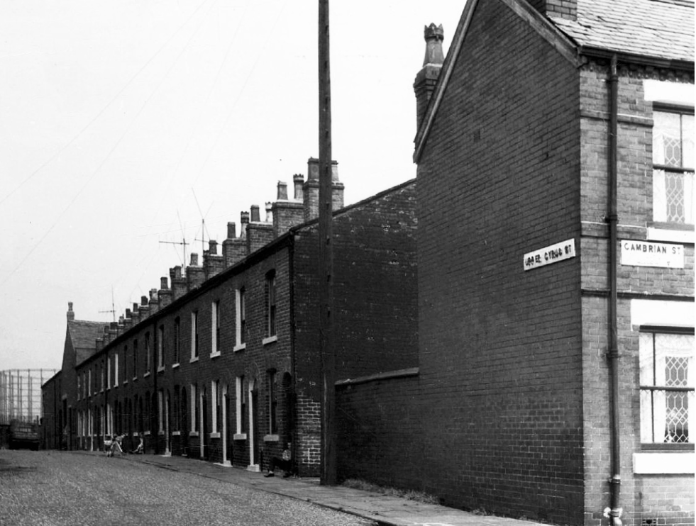
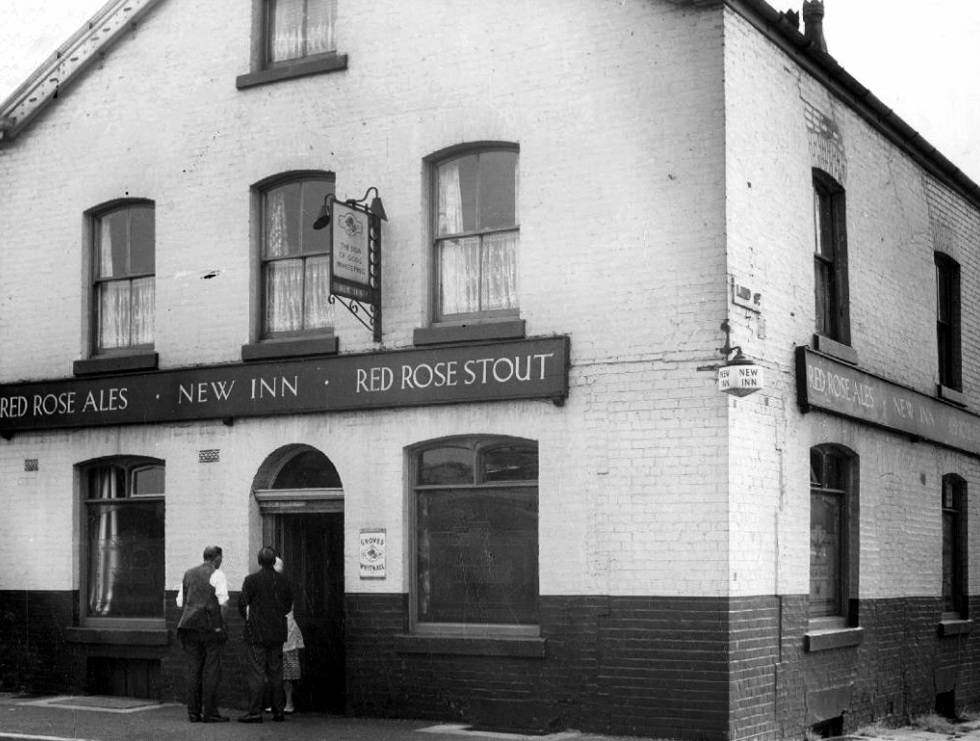
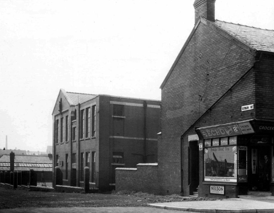
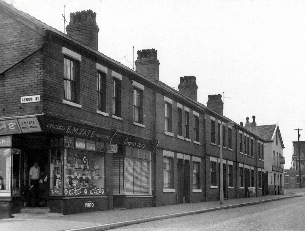
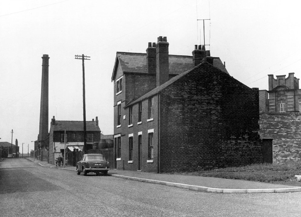
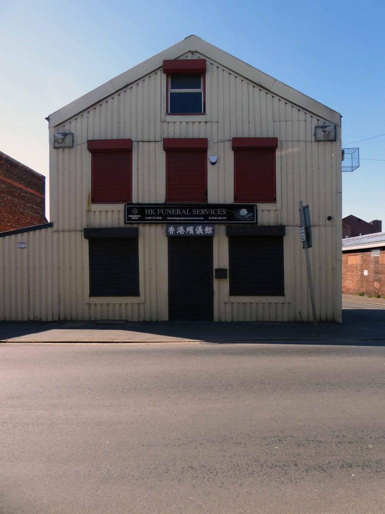
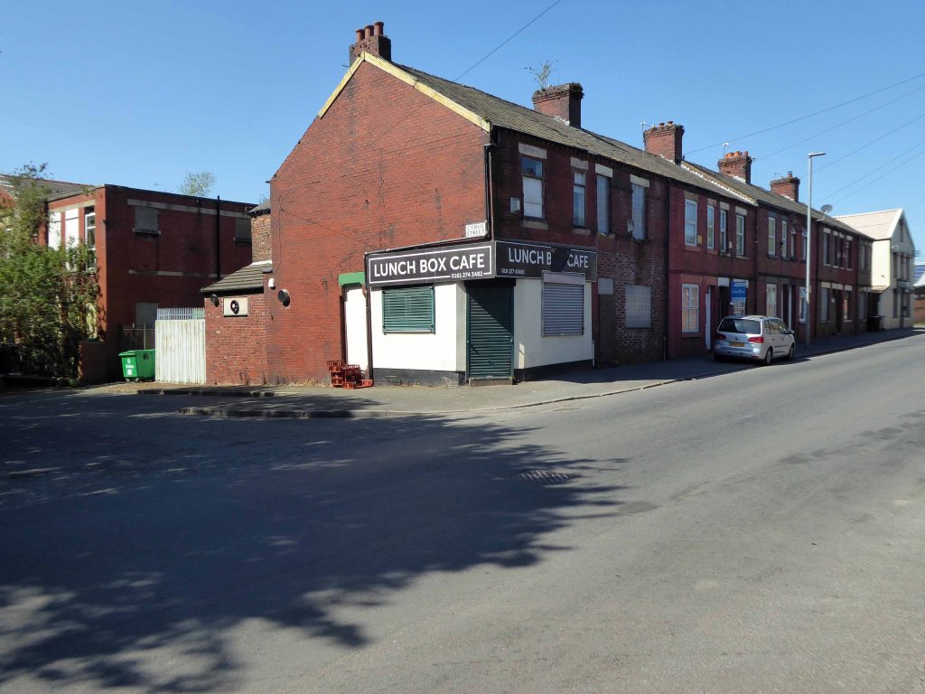
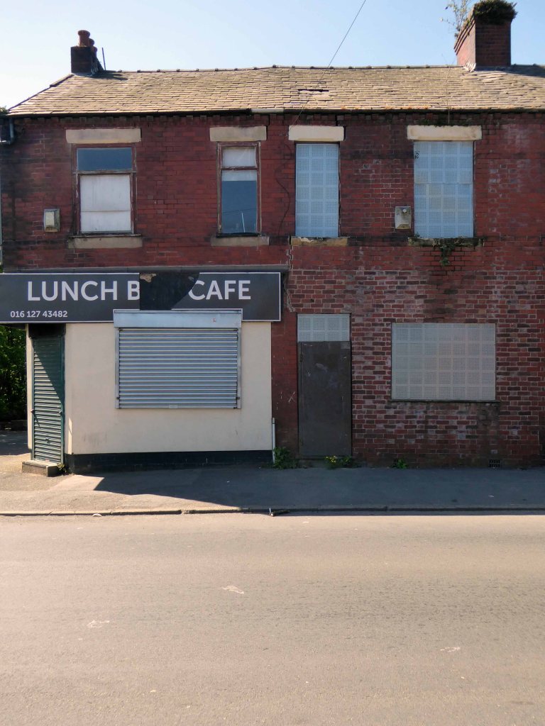
Nothing now remains of this mill complex on Upper Helena StreetThe homes on Upper Cyrus Street are long goneCyrus Street now over grown and Big Bertha demolishedThe New Inn now the Hong Kong Funeral HomeSt Annes School and the shop now closedIt had become the Luchbox Café now also closedStill standing
The area was my playground. Holt Town was always a but scary, there were old factories along the opposite side with wartime helmets in. A scrap yard under the arch. I remember sucking up mercury off the floor with a straw obviously from a spillage, no thoughts of danger, I’m alright now. The Seven Wonders, as we knew it, River, canal, railway, road, waterfall all crossing each other, not sure why? A fantastic industrial area to grow up in. The Don Cinema at the top corner at Mitchell Street and Ashton New Road.
I could go on.
Philip Gregson
Time’s up for the tiny urban cowboys.
Let’s see what’s going on.
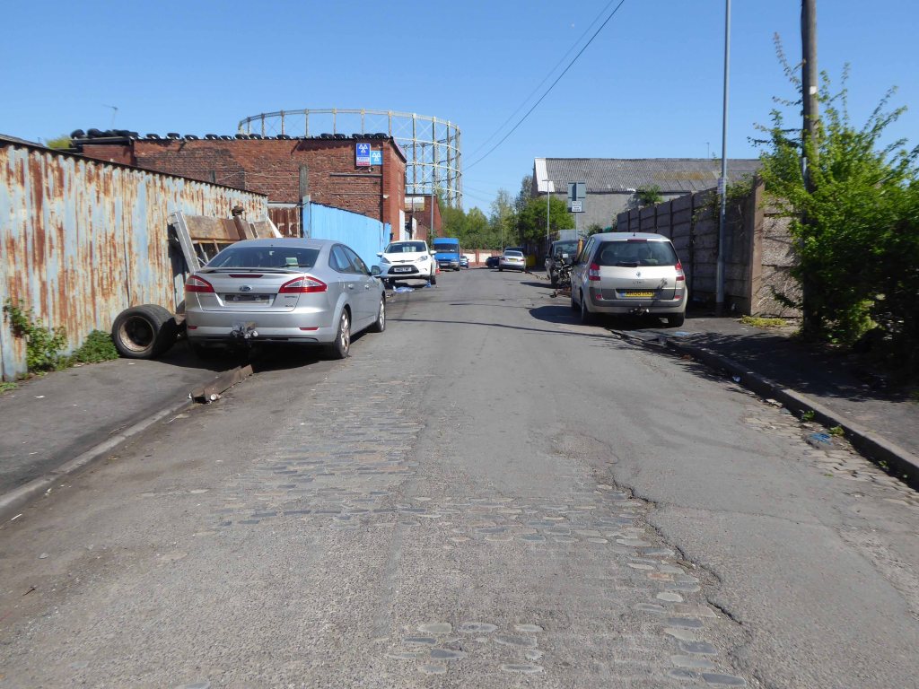
Former football fieldUpper Cyrus StreetLind StreetUpper Helena StreetPollard StreetLanstead DriveCyrus StreetSt Annes SchoolCyrus StreetDevil’s StepsRiver Medlock
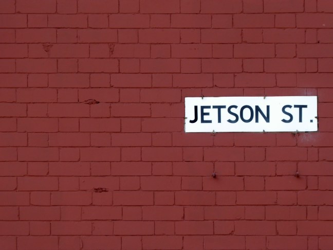
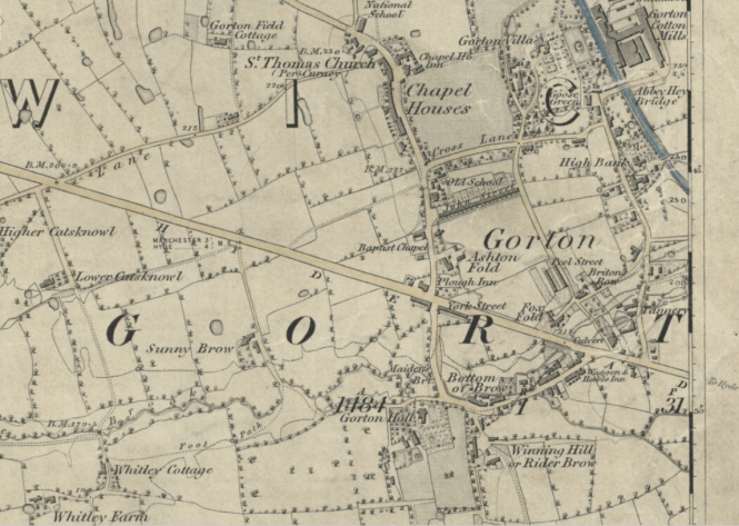
We are travelling backwards and forwards in time – firstly back to 1845 when the street was yet to be built, before the Industrial Revolution created the need for workers’ homes, to house the workers from the newly built workplaces, which also did not yet exist.
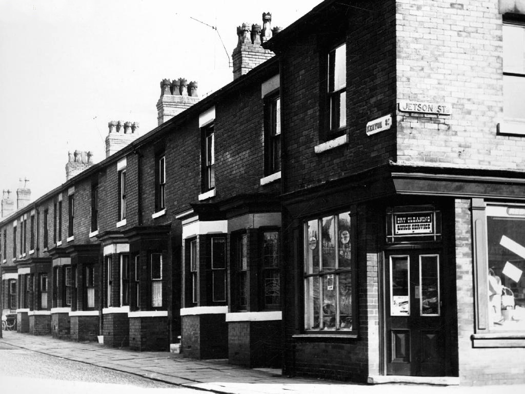
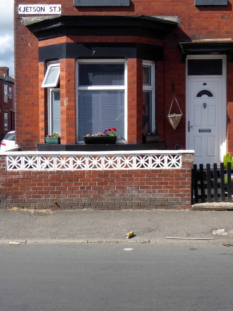
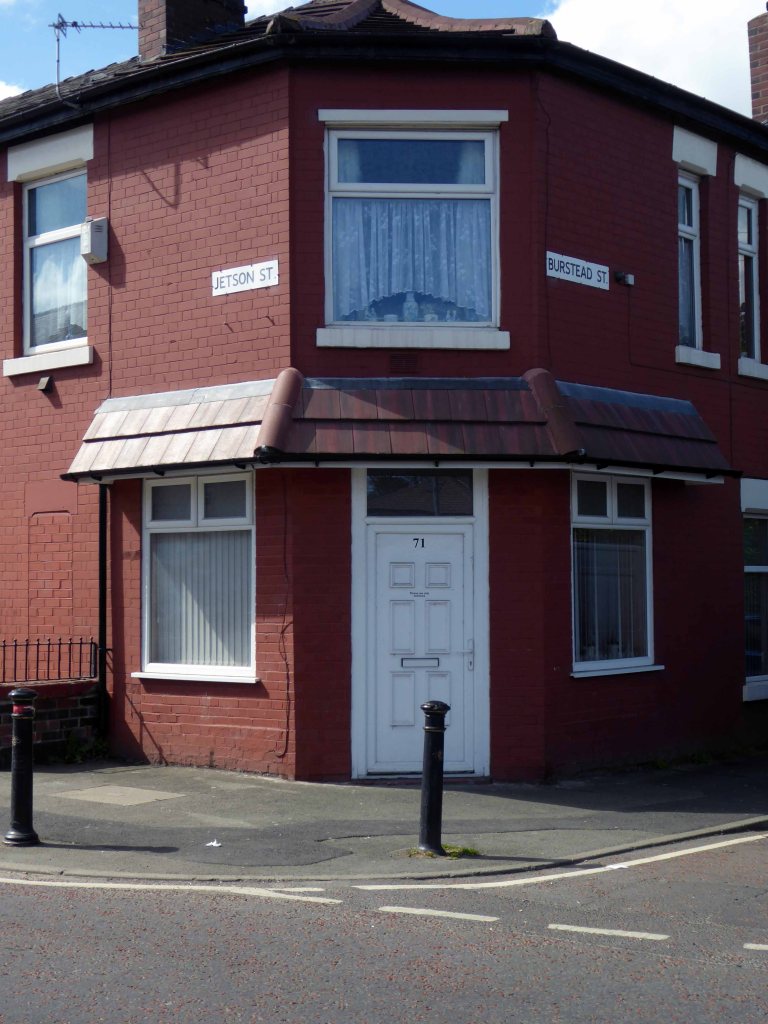
A little further forward to 1896 when Jetson Street has emerged fully formed from the fields, along with rail, road, amusement and industry.
1896
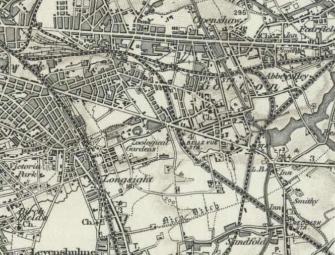
Fast forward to today and it’s all almost still there – though most of the work and the majority of the amusement has evaporated into a cloud of post-industrial, Neo-Liberal economic stagflation.
So why am I here – fast forward to the fictional future!
As a kid I watched as the Jet Age emerged before my very square eyes, giving the street a certain cosmic charm – I was curious.
I have searched online – this seems to be the one and only Jetson Street in the whole wide world – I searched online for its origins.
The name Jetson means Son Of Jet and is of American origin.
Which quite frankly seems unreasonably glib.
The name Jetson is from the ancient Anglo-Saxon culture of the Britain and comes from the names Judd and Jutt, which are pet forms of the personal name Jordan. These names are derived from Jurd, a common abbreviation of Jordan, and feature the common interchange of voiced and voiceless final consonants.
The surname Jetson was first found in Hertfordshire where they held a family seat from very ancient times, some say well before the Norman Conquest and the arrival of Duke William at Hastings in 1066 A.D.
Which quite frankly seems unreasonably obscure.
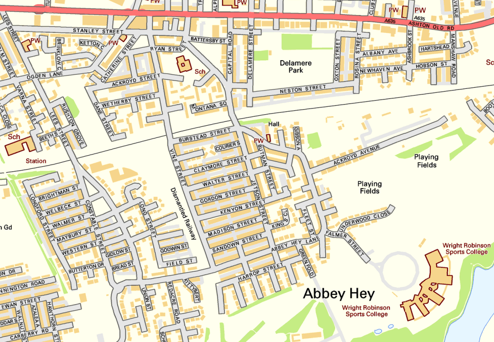
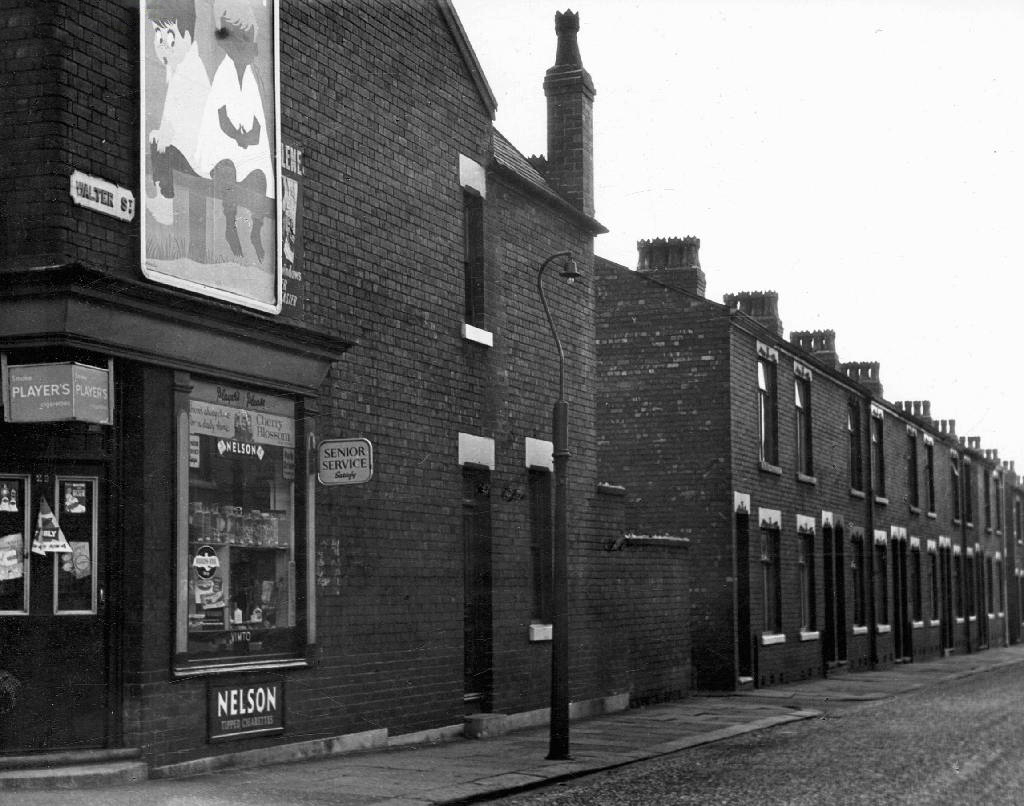
Let’s jet back to 1964.
T Brooks wandered these streets taking thousands of photographs for the Manchester Corporation, possibly the housing or highways departments – they all still exist here on the Local Image Collection.
This was a world of corner shops on ever corner, settled communities full-employment, neatly ordered rows of sturdy brick-built homes.
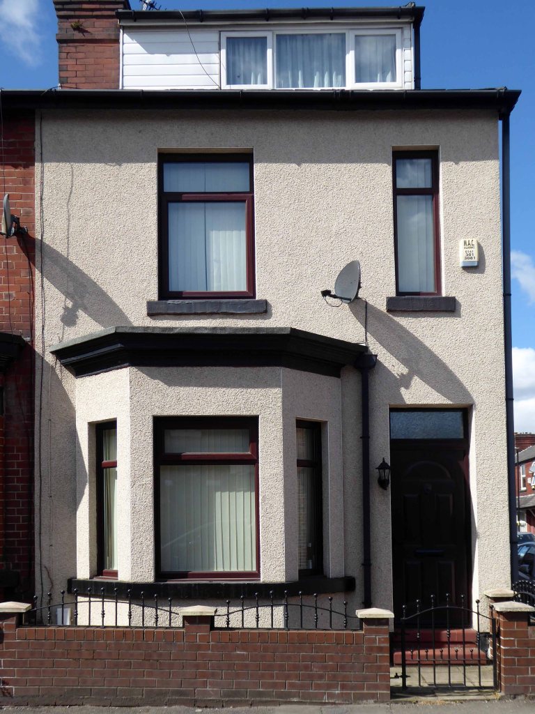
I follow in his hallowed footsteps, what if anything remains of this world – fast forward to 2015 my first fleeting visit.
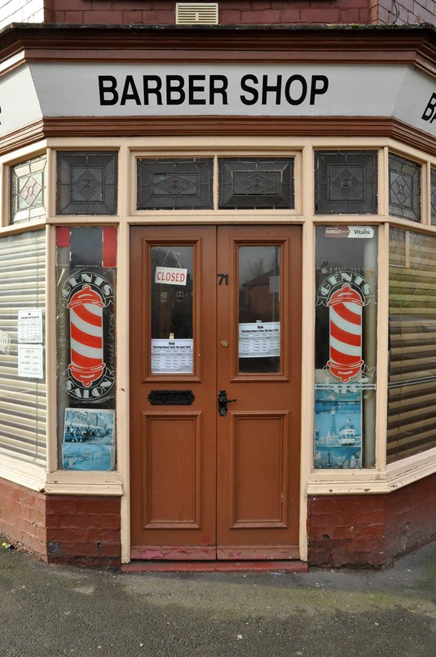
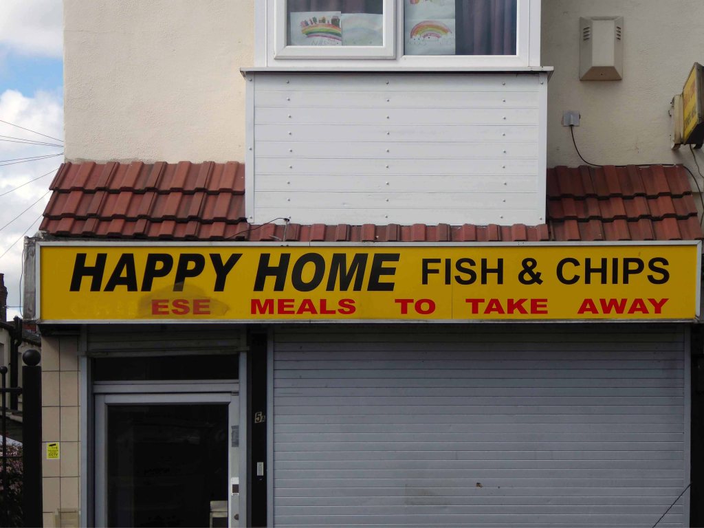
Now trading as Happy HomeA barber shop no more
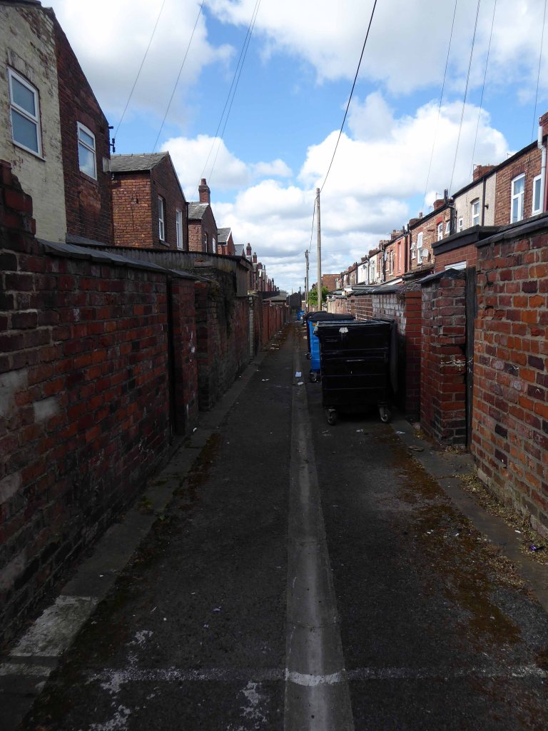
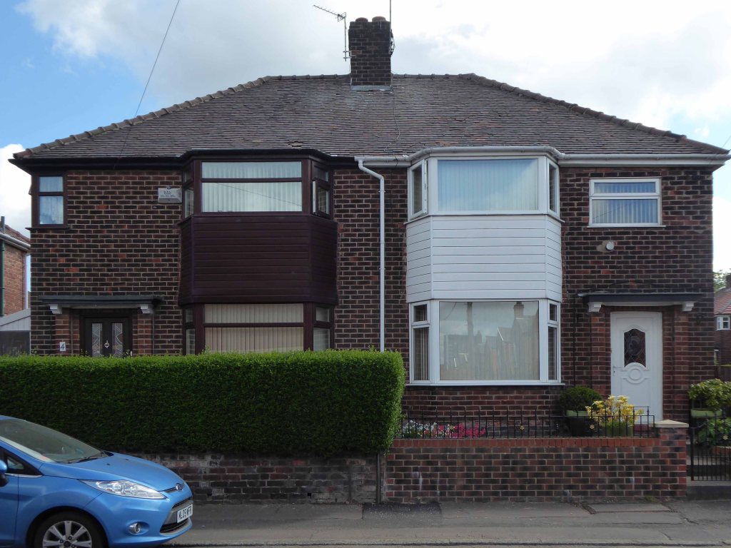
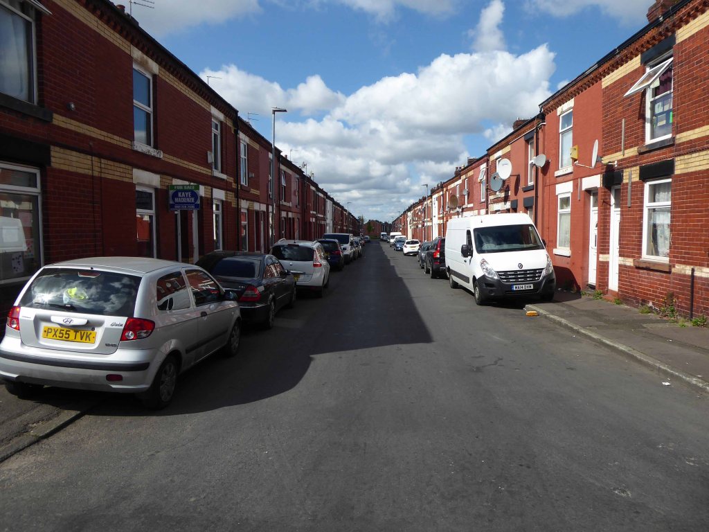
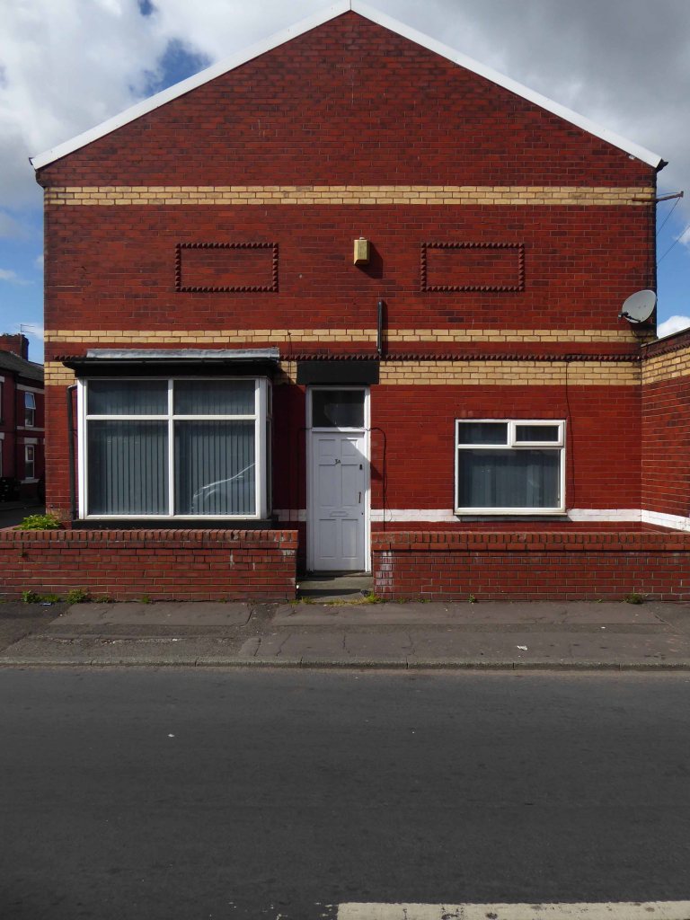
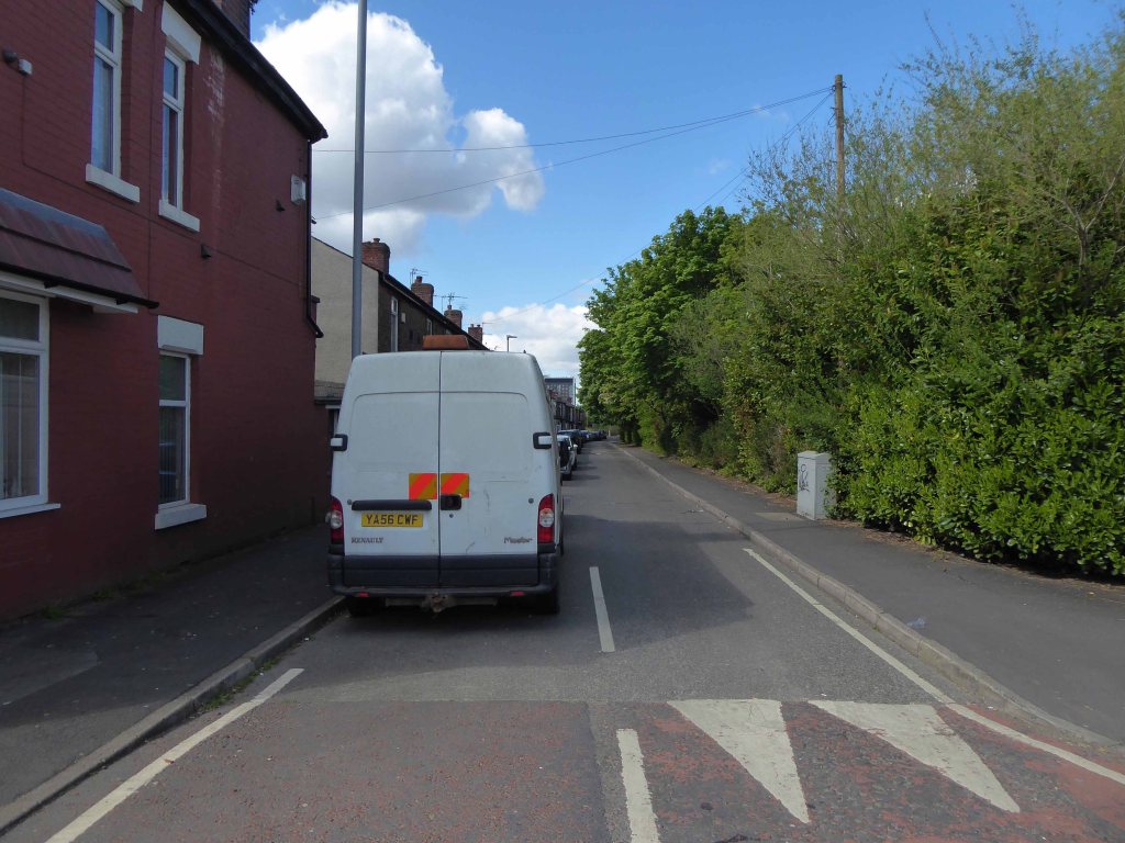
The area now has a richer racial mix – having recently become home to many African and Eastern European families. The architectural consistency of the houses has been swamped by render, window frame replacement, addition and extension, and the arrival of a plethora of motor cars. The majority of shops now long gone, as the once pedestrian community spread their retail wings and wheels elsewhere.
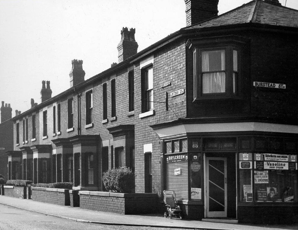
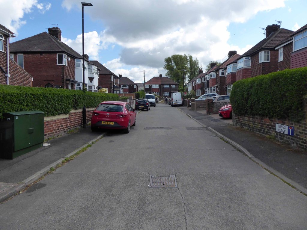
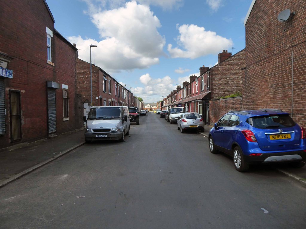
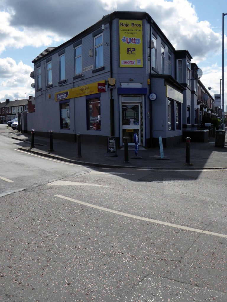
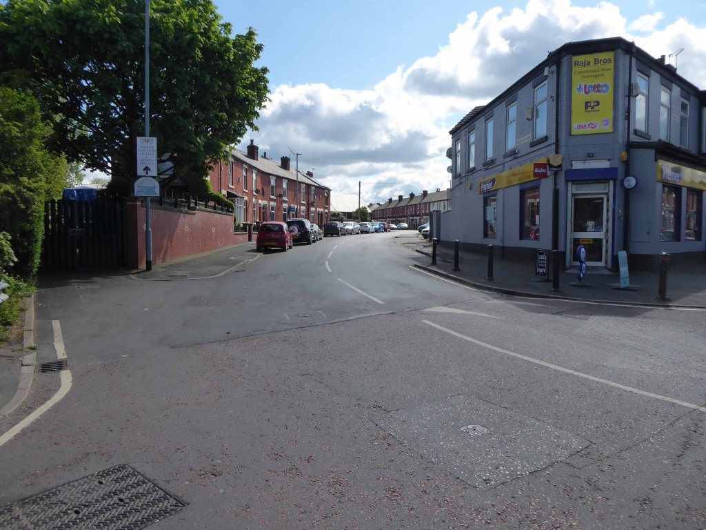
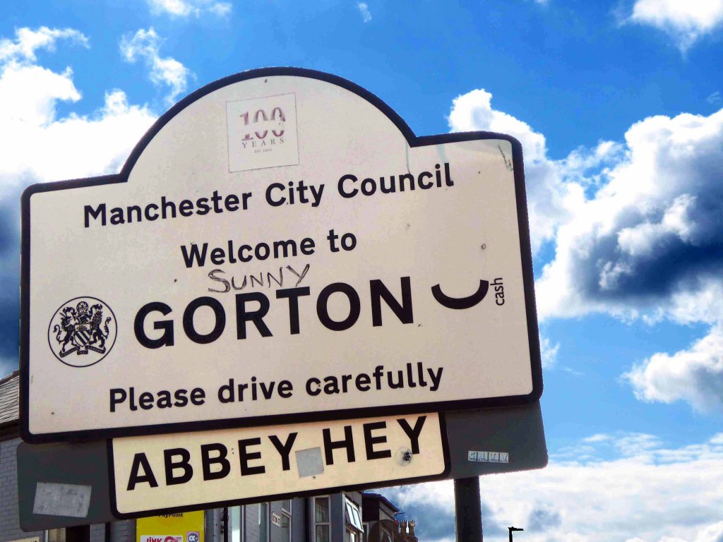
Jetson Street – NorthSandown StreetKings CloseMadison StreetKenyon StreetKenyon StreetSign of the timesGordon StreetJetson Street – NorthJetson Street – SouthWalter StreetWalter StreetClaymore StreetClaymore StreetCourier StreetThe only remaining front doors and tiled porch every other having been given over to the allure of uPVC and the enclosed doorwayMy on street correspondent congratulated the Raja Brothers on the sound service they had provided during these difficult times.Where the barbers wasBurstead StreetAbbey Hey Lane
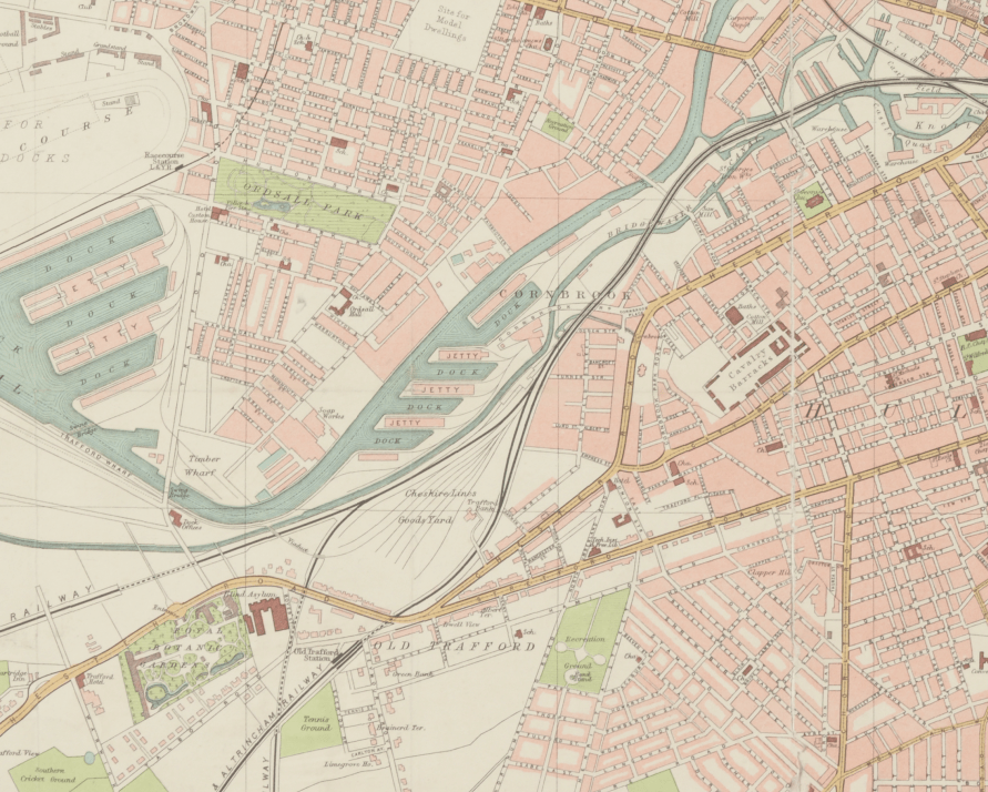
The River Irwell bisects Salford and Manchester, joining the rivers Irk and Medlock, and then turns west toward Irlam, as part of the Manchester Ship Canal. Its course ends just east of Irlam, where it empties into the Mersey.
Urban development is ever so often dependent upon rivers – for sustenance, commerce and amusement. The Irwell and latterly the developments of the canal system has provided all of these in superabundance.
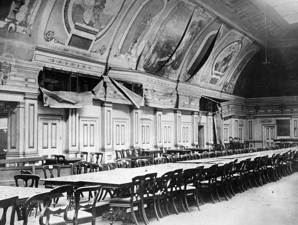
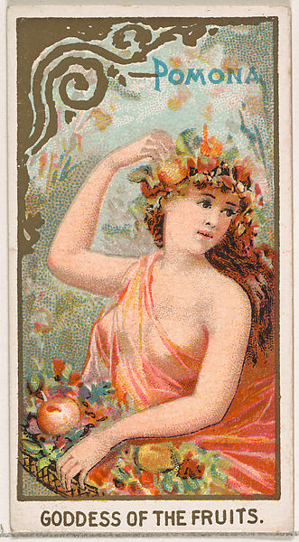
By 1870 the Pomona Gardens is thriving , boasting a concert hall and banqueting suite – further details here from Skyliner.
In the summer of 1887, a nearby chemicals factory exploded, damaging the palace – the area was under threat and destined to rot away to obscurity: the following year the gardens closed forever.
By 1900 the Ship Canal, docks and railways had arrived – Manchester and Salford are at the centre of an unprecedented growth in manufacture and trade.
189119231950
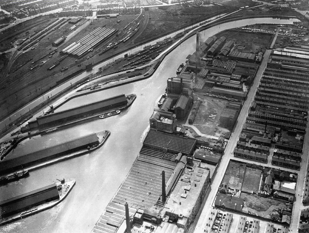
During the 1970’s the docks began a rapid decline, largely due to containerisation. The increasing size of freight-carrying ships meant they could no longer navigate the ship canal and this, combined with increased trading with Europe and the east, saw use of Manchester Docks decrease. In 1982 the remaining docks closed and the area became derelict. Recognising the need to redevelop the area, Salford City Council purchased the docks in 1984 using a derelict land grant. The Salford Quays Development Plan was adopted in May 1985, proposing complete reclamation and development of the area for commercial, residential and leisure use.
Manchester and Salford begin the long haul from post industrial decline to service centred cities – there were even seeds sewn for the development of a luxury marina. When I first visited Pomona the area was seriously overgrown and the underground wiring stripped out.
201020102020
Remnant of the initial scheme – pedestrian access, balustrade and lighting.
What would poor old Pomona make of all this?
There was a failed attempt to prevent further development and return the area to nature. Peel Holdings prevailed and pressed on relentlessly with their programme of urbanisation.
So it’s April 2020 – I’m on my way from somewhere else to somewhere else, I’ll cut across Pomona Island – the building site is in lockdown – ain’t nobody home.
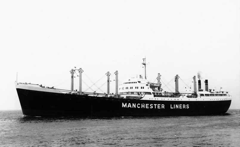
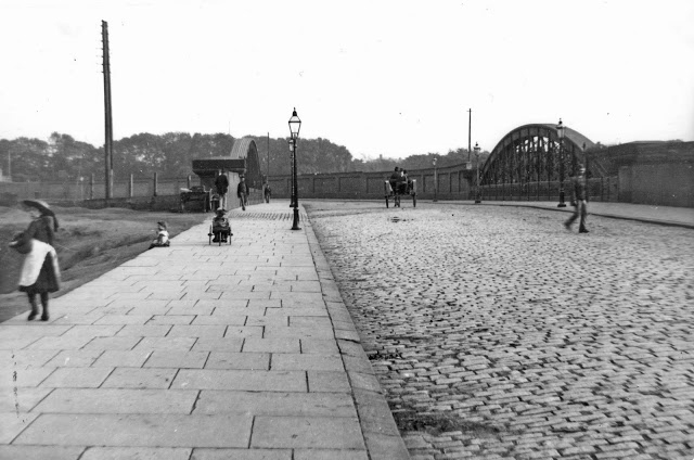
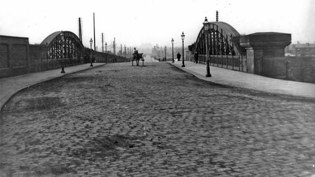
In 1898 Manchester Liners Ltd was launched, four second hand ships were purchased and the company naming policy of applying the prefix Manchester was established.
The company began to operate services to Canada and the USA. Manchester Liners started WW1 with 15 ships in its fleet. During the war 10 ships were lost to enemy action, but because of the purchase of replacements the fleet was at 12 in 1918.At the outbreak of WW2, Manchester Liners had 10 ships in service. War losses were 7 ships, but the delivery of war-standard ships maintained the fleet at 8, which was sufficient to resume a weekly service to Canada.
The Manchester dockworkers strike record became so bad, that in 1973 the company decided to move half of its container services to Felixstowe. Furthermore, to obtain lower costs per unit, container ships were becoming bigger than the Canal limits.
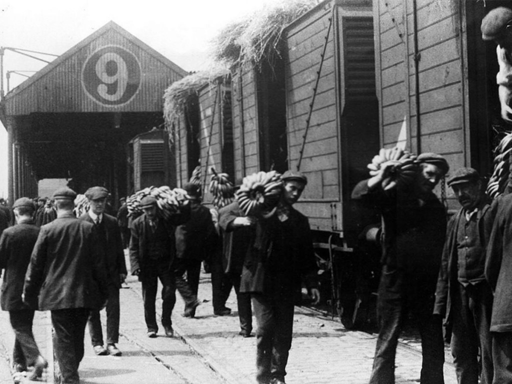
This was a history of economic growth and prosperity, for some. Tangible commerce, the wealth of a nation built on making things, moving things. Cranes, ships, stevedores and sailors, the world and his wife converging at the base of the Manchester Ship Canal.
All this is long gone, containerisation, recession and state engineered shifts in global manufacture and trade.
They took away the cranes.
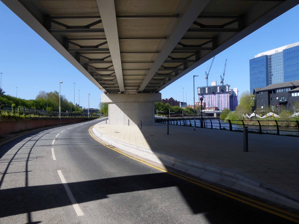
The area is now awash with intangible activity – what goes on behind the smoked and mirrored glass?
Just who is moving what around, how, where and why?
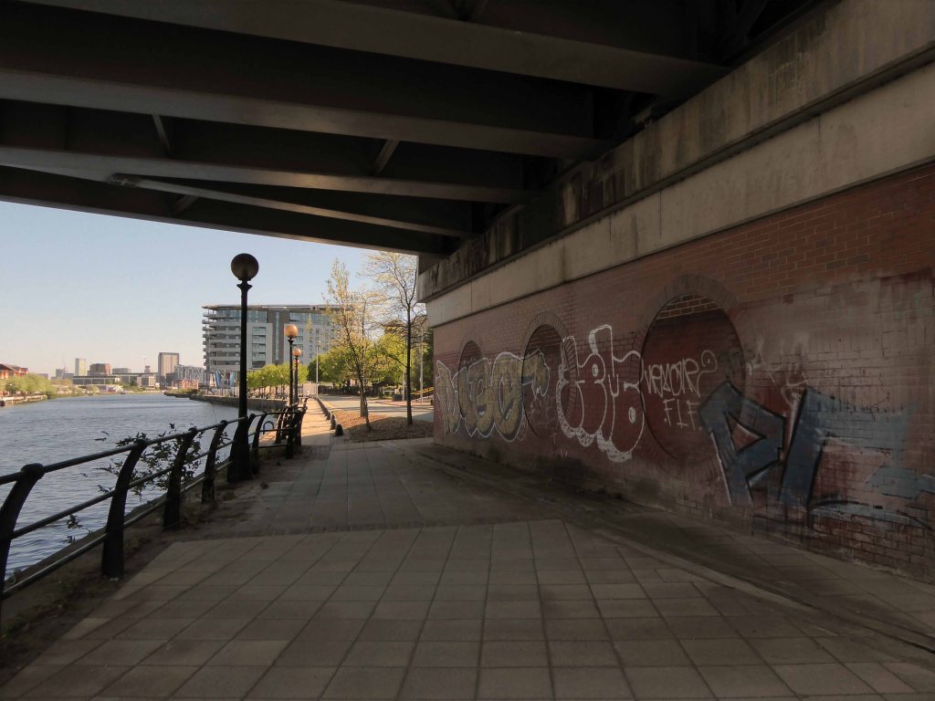
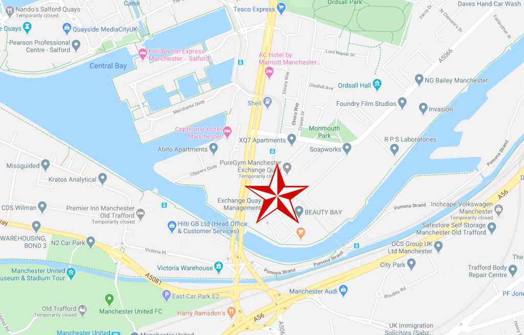
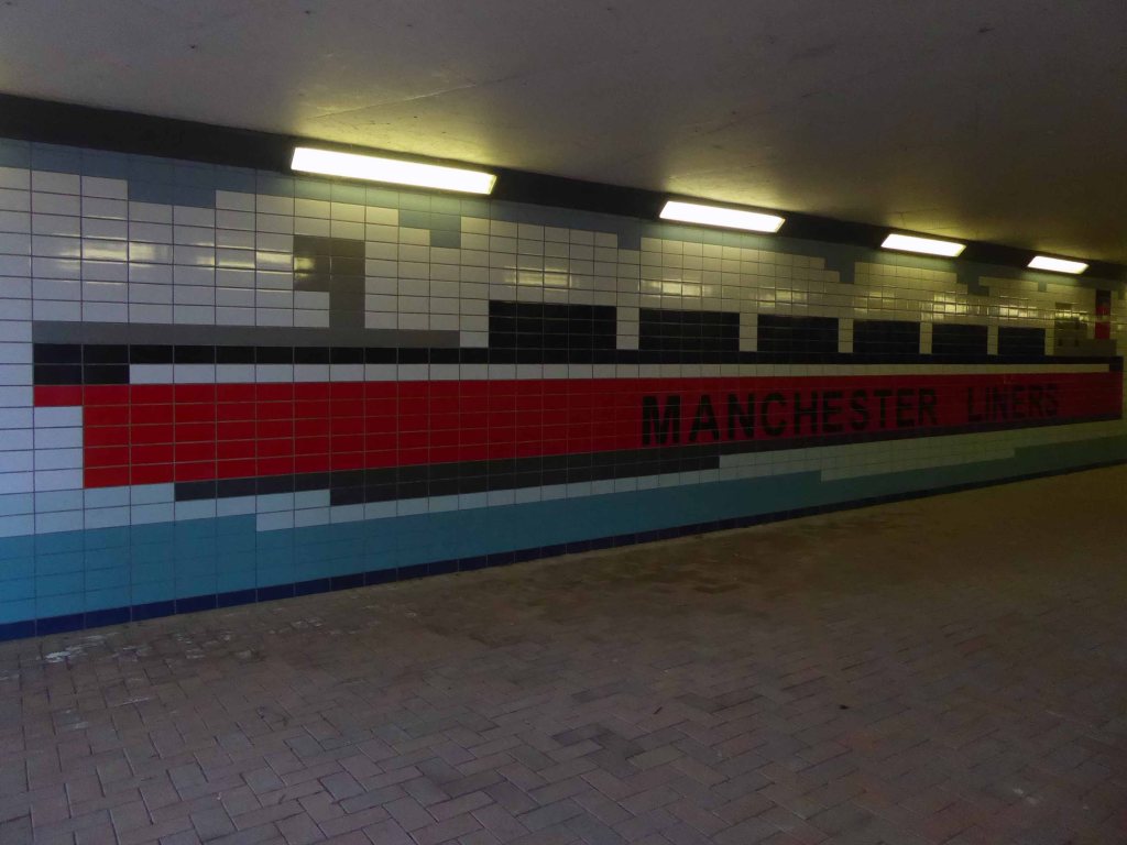
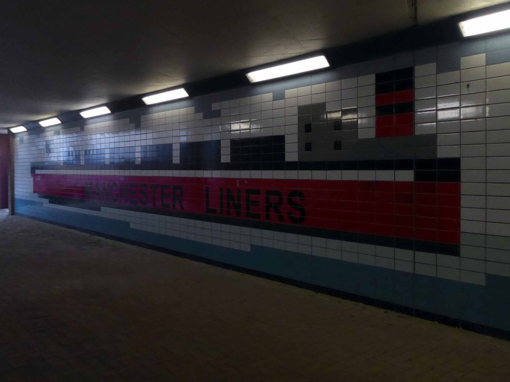
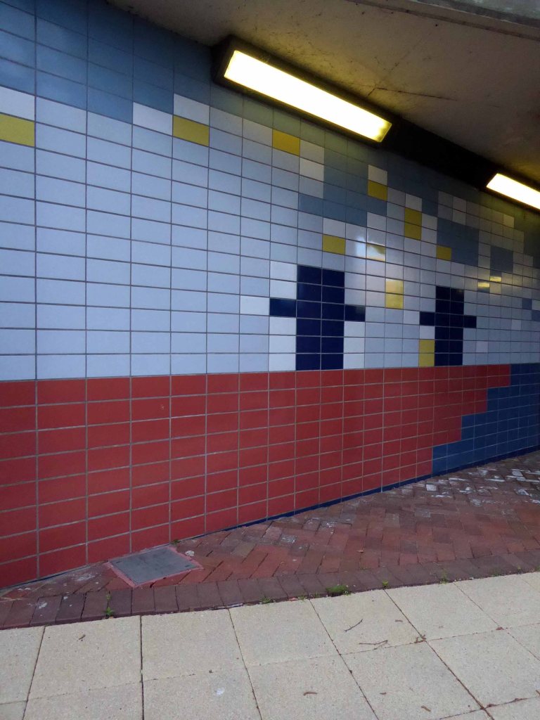
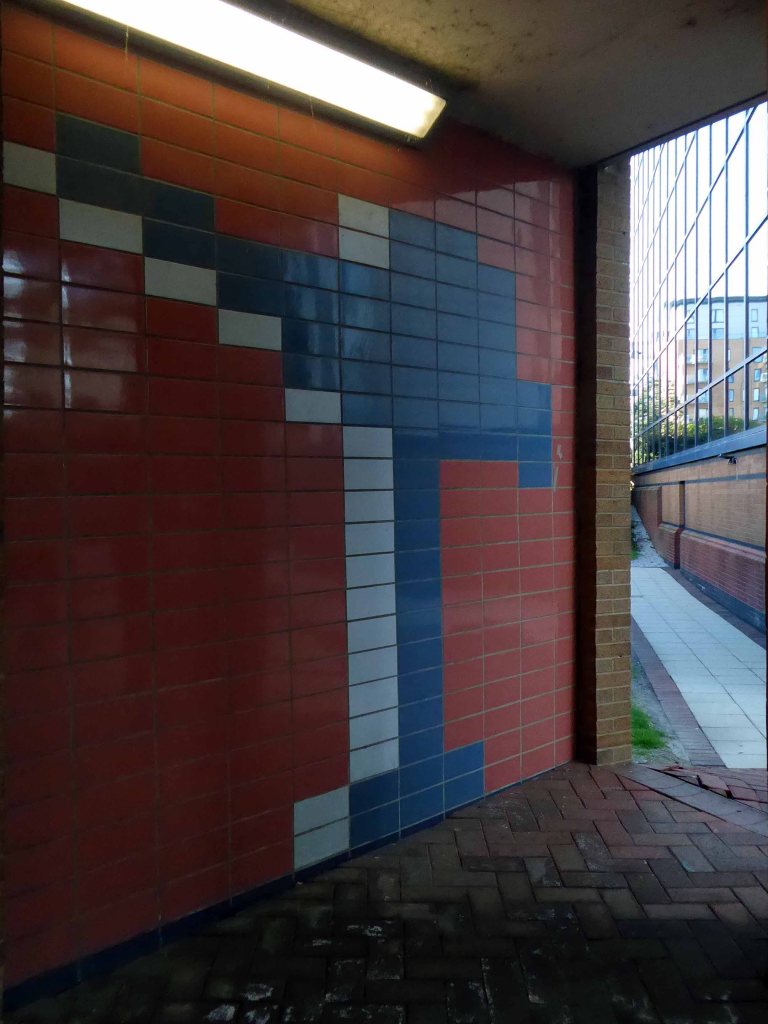
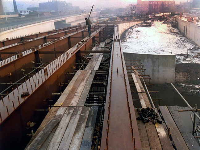
But hidden away between here and there is a tiled underpass.
A permissive path.
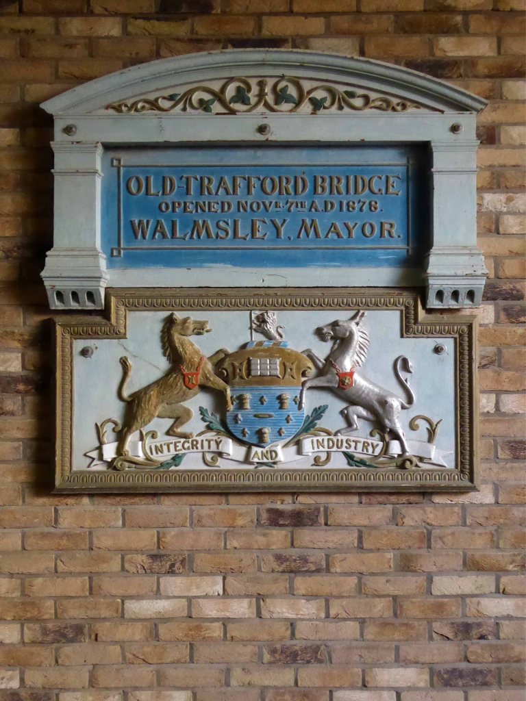
Where once there was a bridge – before the Manchester Ship Canal was built, the course of the River Irwell was approx. 50-100 yards further north of where the Ship Canal now passes under Trafford Road. This plaque is next to a pedestrian tunnel under Trafford Road, roughly on the line of the old navigation.
So here it is a hidden, harshly lit, slightly disabused tribute to the brave souls who sailed the seven seas, stayed ashore, weighed, loaded and shifted stuff.
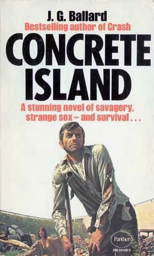
He reached the foot of the embankment, and waved with one arm, shouting at the few cars moving along the westbound carriageway. None of the drivers could see him, let alone hear his dry-throated croak, and Maitland stopped, conserving his strength. He tried to climb the embankment, but within a few steps collapsed in a heap on the muddy slope.
Deliberately, he turned his back to the motorway and for the first time began to inspect the island.
Maitland, poor man, you’re marooned here like Crusoe – If you don’t look out you’ll be beached here for ever. He had spoken no more than the truth. This patch of abandoned ground left over at the junction of three motorway routes was literally a deserted island.
JG Ballard Concrete Island
I’m in a different place – the same but different, whilst out walking I went through an open gate, following a well worn path, for the very first time.
Leading who knows where.
The confluence of three rivers, the meeting of motorway and main road.
I ventured further – where if anywhere are we going?
This tight tree lined and paint daubed triangle offers no answers.
Tamed thirty years or so ago, with concrete and steel.
Further and further.
Into an underground world.
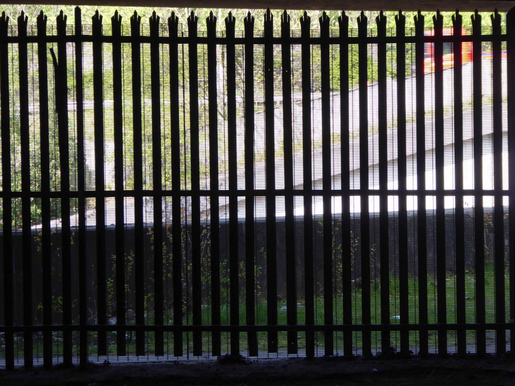
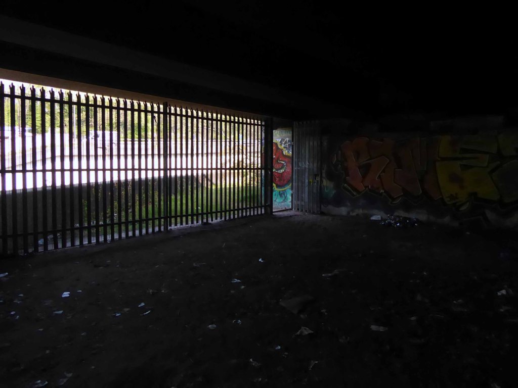
Through the railings and into a void – a void that had become home to the otherwise engaged, seeking solace somewhere, finding shelter from the storm. A storm of Twenty First Century austerity, man made – moving money around until those without are out, out in the open, nowhere else to go but here.
How often have I lain beneath rain on a strange roof, thinking of home.
Pebbledashed over white brick. Roofs part concrete slab, part glazed behind parapet. Irregular plan, Modern Movement style. Group of blocks of varying height round tall central tower with rounded, glazed stair turret. Walls mainly sheer, with plinth and slight roof projection.
Long block on east of tower has central south projection with glazed, banded steel double door under high strip of windows beneath eaves overhang. Taller storeroom to west has similar doors in 2 recessed banded glazed bays; and abuts on south-east corner of tower. Similar double doors in base of tower. Large lower south-western canteen wing abuts on west side of tower and has banded glazing around two sides above a projecting sill. Slightly-projecting 3-bay office section to north has steel cross casements; on its return another casement and a door with hollow-chamfered jambs and flat hood. Taller bath block behind. Wave pattern on rainwater heads.
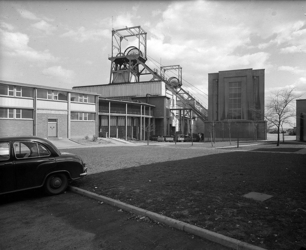
This is the youngest colliery in the neighbourhood, having commenced operations for the Ashington Coal Co Lt. in 1934. The shafts, which are situated comparatively near to the coast, are two in number, and both were sunk to the High Main seam level, which is 486 ft from the surface. The downcast No. 1 is 18 ft in diameter and is used for coal-raising on two shifts per day, and the upcast, which has a diameter of 15 ft, is used for ventilation and emergency man riding only.
The seams being worked are the High Main, the Diamond, the Main, and the Yard. Each of these seams shows practically the same nature of roof and floor as throughout the two neighbouring collieries and the distance between the seams is also comparable. They are, of course, found at slightly greater depths at Lynemouth, the Yard seam, for example, being 660 ft. below the surface near to the shafts, as compared with some 300 ft. at Ellington.
It was one of Britain’s largest collieries until it was closed in 1994.
I was cycling the coast in July 2012 and happened by, seeing the tower of the baths from an adjacent path, passing by the faded signage.
Into the raw expanse of a now empty post-industrial landscape.
And on towards the bath house.
I am not by nature an urbex urban explorer, simply an explorer.
Entering the open site, I was well aware of the significance of the building and its history – working lives that had constructed the baths, entered and left through those very same doors.
The court heard the accused had agreed to detonate a bomb at Crown Point North as a diversion before driving to their school, murdering teachers and pupils and then killing themselves.
We live in strange and troubled times, the urban landscapes we have created are often far from convivial.
Deserts possess a particular magic, since they have exhausted their own futures, and are thus free of time. Anything erected there, a city, a pyramid, a motel, stands outside time. It’s no coincidence that religious leaders emerge from the desert. Modern shopping malls have much the same function. A future Rimbaud, Van Gogh or Adolf Hitler will emerge from their timeless wastes.
I have even ventured as far afield as Huyton in search of other exemplars.
This is work of the highest order and importance.
It sits by a busy London Road, behind an intrusive green steel fence, slowly acquiring a green patina – as moss and lichen attach themselves to the well weathered concrete.
Receiving occasional visits from the errant urban tagger.
It deserves much better – a lush grassed apron, discrete public seating, regular tree maintenance – respect.
We do not suffer from a surfeit of significant mid-century public art – its guardians should straighten up and fly right.
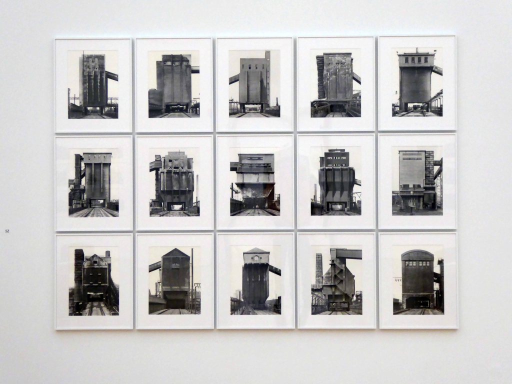
I have admired the work of Bernhard and Hilla Becher ever since seeing their photographs in the one and only Tate at the time, in old London town.
An early example, possibly twelve small black and white prints of pit head winding gear, assembled in a three by four grid.
I became intrigued by the notion of serial art and typology, later in the seventies working as a Systems printmaker.
Very much in the tradition of Max Bill and Richard Paul Lohse.
In more recent years I have worked as a documentary photographer, at time paying homage to Bernhard and Hilla.
By placing several cooling towers side by side something happened, something like tonal music; you don’t see what makes the objects different until you bring them together, so subtle are their differences.
So on hearing of their exhibition at the National Museum of Wales in Cardiff, I excitedly booked my train ticket from Manchester.
Saturday 29th February 2020 – an auspicious Leap Year – knowingly taking a leap into the known unknown.
Braving the imminent threat of Storm Jorge.
I was given the warmest of welcomes by the gallery staff, spending a good while chatting to James, a fellow enthusiast.
My first surprise was the Bechers’ drawings, painting and notebooks.
A revelation.
Then onwards into two large, light spaces, with the work – actual Becher archive prints, displayed with the reverence that they deserve.
Given space to breath, in a calm contemplative area.
With a quiet attentive audience.
So here that are in situ – worth the wait, worth the train ticket, worth the two way seven hour rail trip. Seeing the prints close up reading the exposure, the thrill of the dodge and burn, a lifetime’s ambition realised.
The Humber Ferry was a ferry service on the Humber between Kingston upon Hull and New Holland in Lincolnshire which operated until 1984, after the completion of the Humber Bridge in 1981.
I walked from Hull to Hessle – but you were always on my mind.
Glimpsed once or twice from a train, I’d never been up close and personal.
The Humber Bridge was opened by Her Majesty Queen Elizabeth II in 1981.
It is one of the marvels of modern engineering and was, until 1998, the longest single span suspension bridge in the world but there are now five other longer bridges of this type. However it is still the longest that can be used by pedestrians.
The bridge is 2,220 metres long and the towers, which are farther apart at the top than the bottom to compensate for the curvature of the earth, are 155 metres high. It was built at the narrowest point of the estuary known as the ‘Hessle Whelps’ and when completed it was admired for its design and elegance, but reviled by others as a bridge from nowhere to nowhere, the crossing comprises a dual carriageway with walkways for pedestrians and cyclists on both sides.
Although approval to build the bridge was granted in 1959 work did not begin until 1972 due to difficulties in financing the project. In 1966 Harold Wilson, the Prime Minister of the day, allowed Barbara Castle, the Minister for Transport, to give permission for the bridge to be built, hoping that the announcement would be a vote winner in the forthcoming Hull North by-election.
Construction Team
The consulting engineers for the project were Freeman Fox & Partners . Sir Ralph Freeman had produced the first ideas in 1927 and in the early 1930s the cost of the project was estimated at £1.725 million and that the bridge would be unlikely to recoup the construction or maintenance costs. In 1935 he had an idea for a 4,500-foot suspension bridge for the Humber Tunnel Executive Committee. Sir Gilbert Roberts produced more ideas in 1955 for a bridge with a 4,500-foot central span, costing £15 million, to be paid for by East Riding County Council and Lindsey County Council. Once it was likely that a bridge would be constructed, Bernard Wex produced the design in 1964 that was actually built. The bridge was built to last 120 years.
The architect was R. E. Slater ARIBA. The administration building for the tolls, was designed by Parker & Rosner. The landscaping was designed by Prof Arnold Weddle. Wind tunnel testing took place at the National Maritime Institute at Teddington and the road deck is designed for wind speeds up to 105 miles per hour (170 km/h).
Even on the calmest of days the power and sway, push and pull of wind and tide is an uplifting, hair-raising and visceral experience.
The elegantly engineered giant towers above as you gaze from the shore.
An elegy to human endeavour in concrete and steel.
The bridge is of necessity firmly anchored to the ground.
The walkway wide and high astride the estuary.
The tall towers towering above.
The whole structure tied down, anchored and suspended securely.
The mid brown waters of the Humber flowing gently below.
I walked back and to in the company of a handful of fellow travellers, on foot and bike, one of life’s best ever free rides, and reluctantly bade farewell as I headed home to Hull.
But just like just like General MacArthur I came through andI shall return.