Following the rapid growth of the town of Barrow-in-Furness, the construction of the Furness Railway following the discovery of deposits of iron ore in the Furness peninsular, and the development of industries using iron as a raw material resulted in many commissions for the practice – the population of Barrow doubled between 1851 and 1861, and doubled again in the next decade.
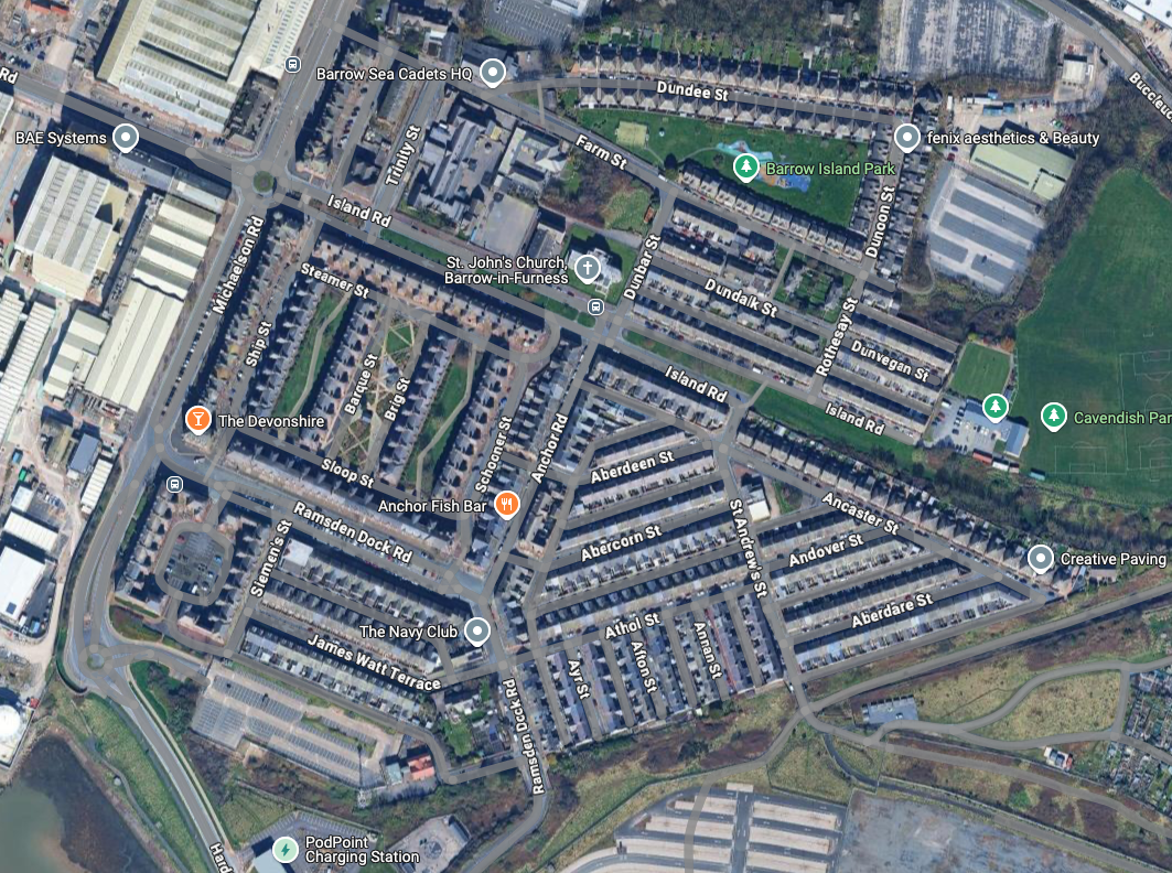
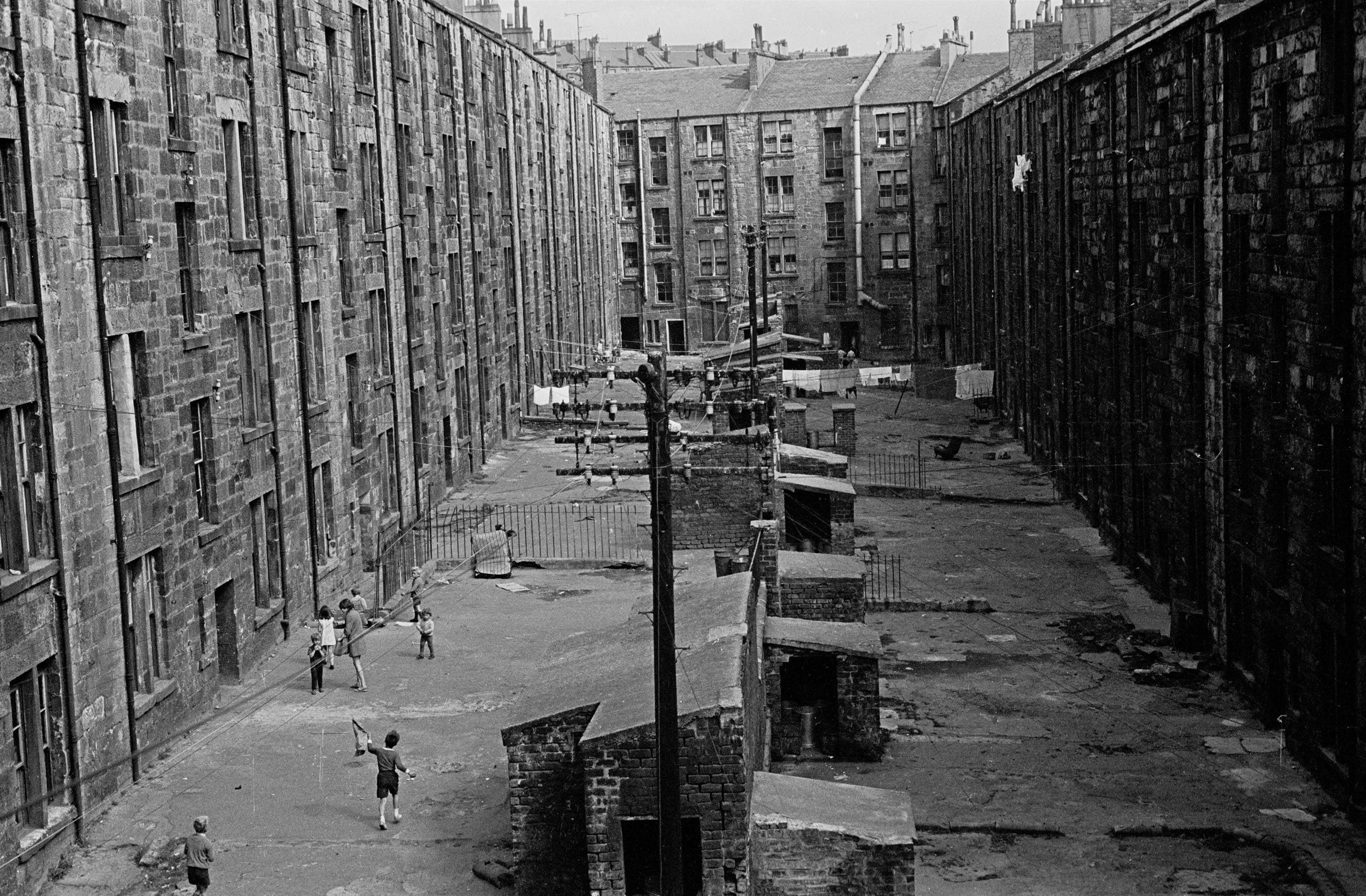
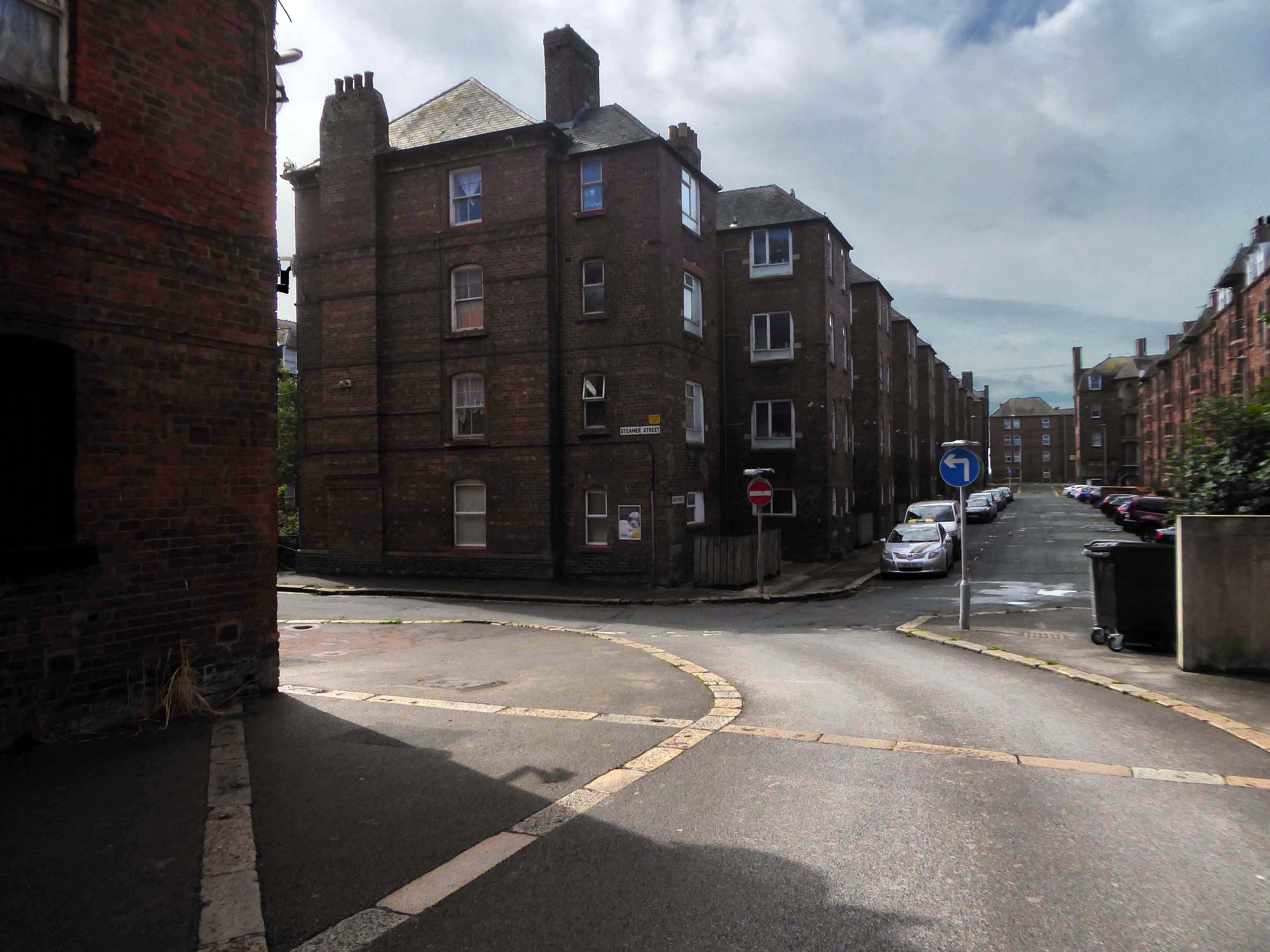
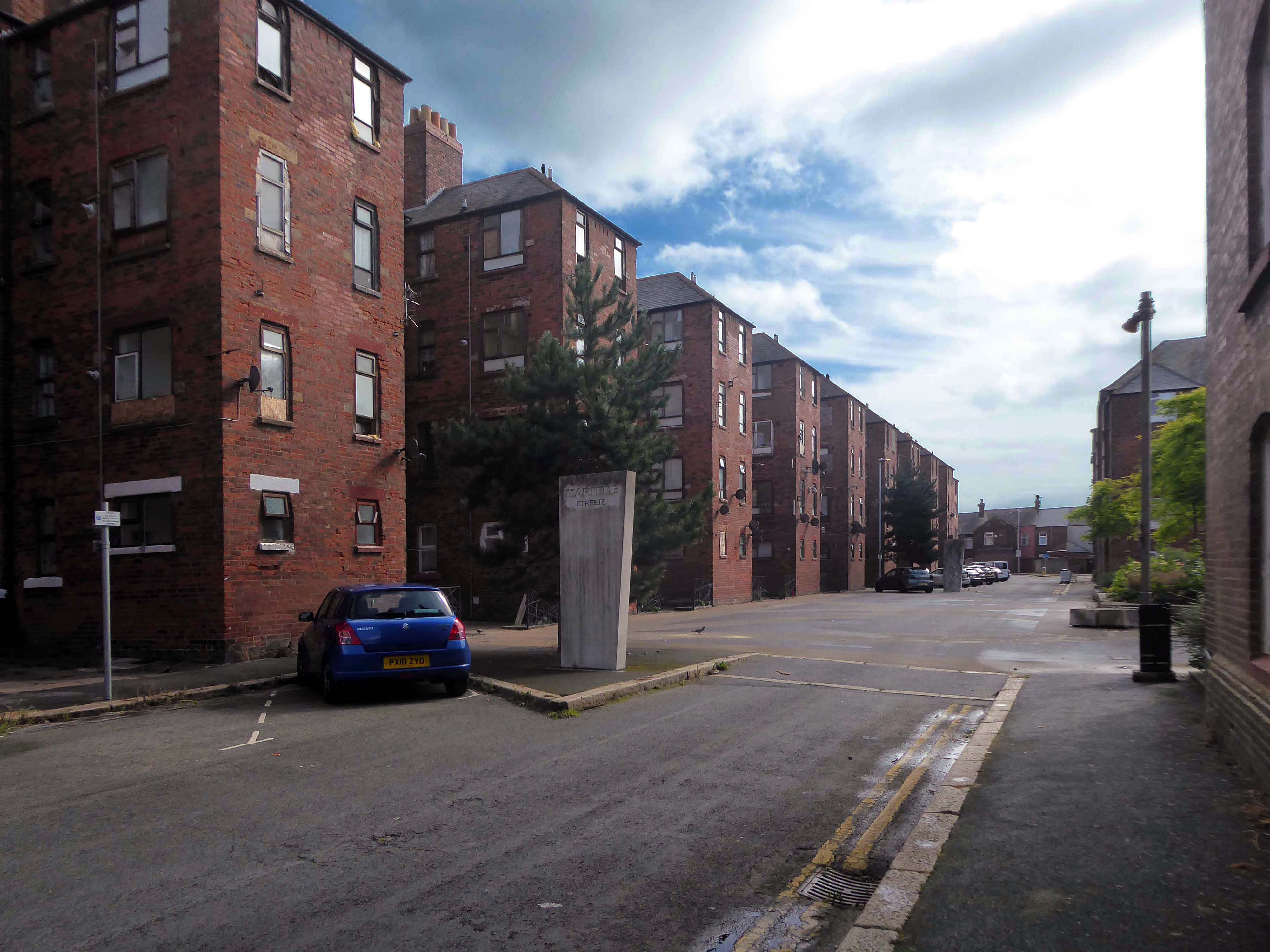
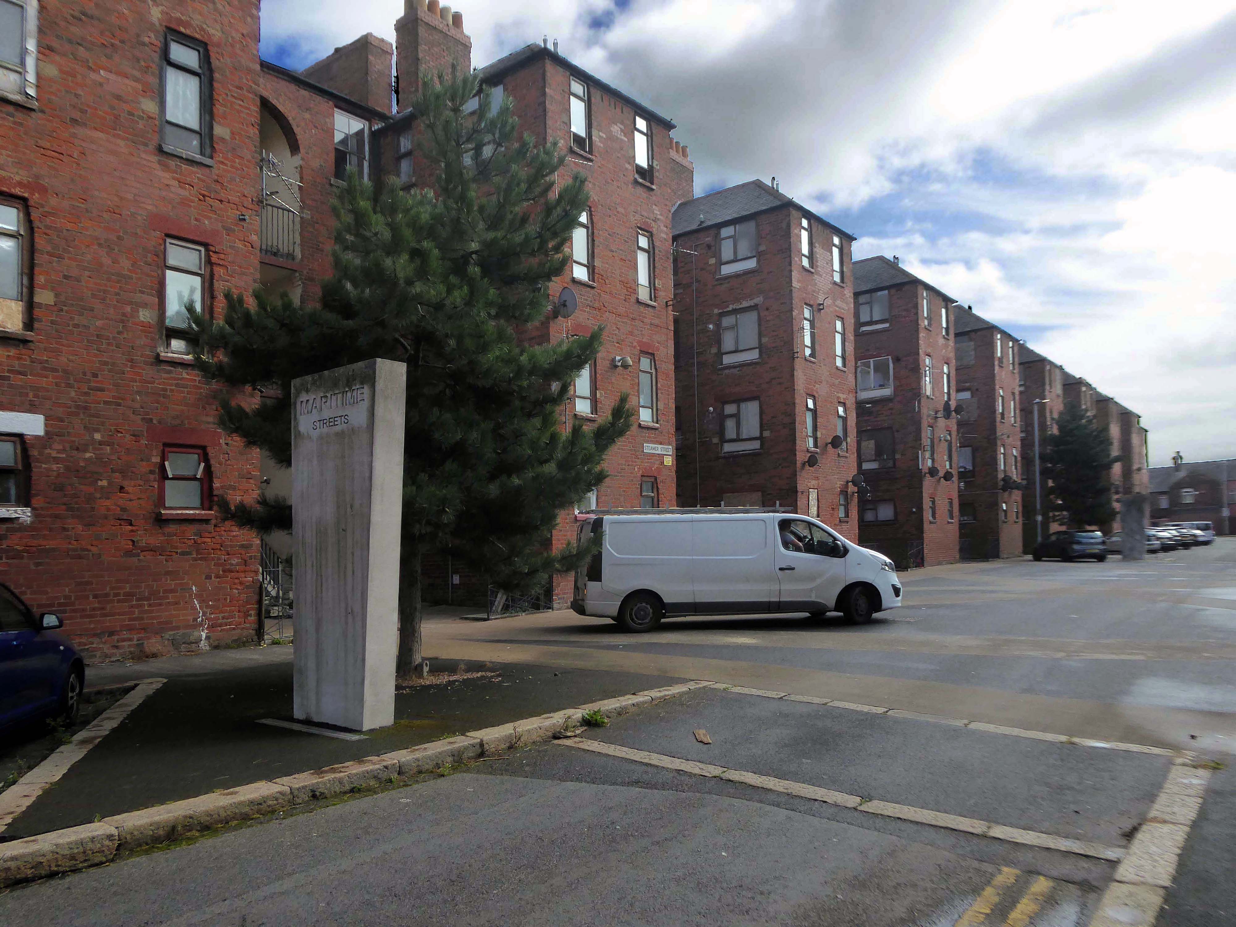
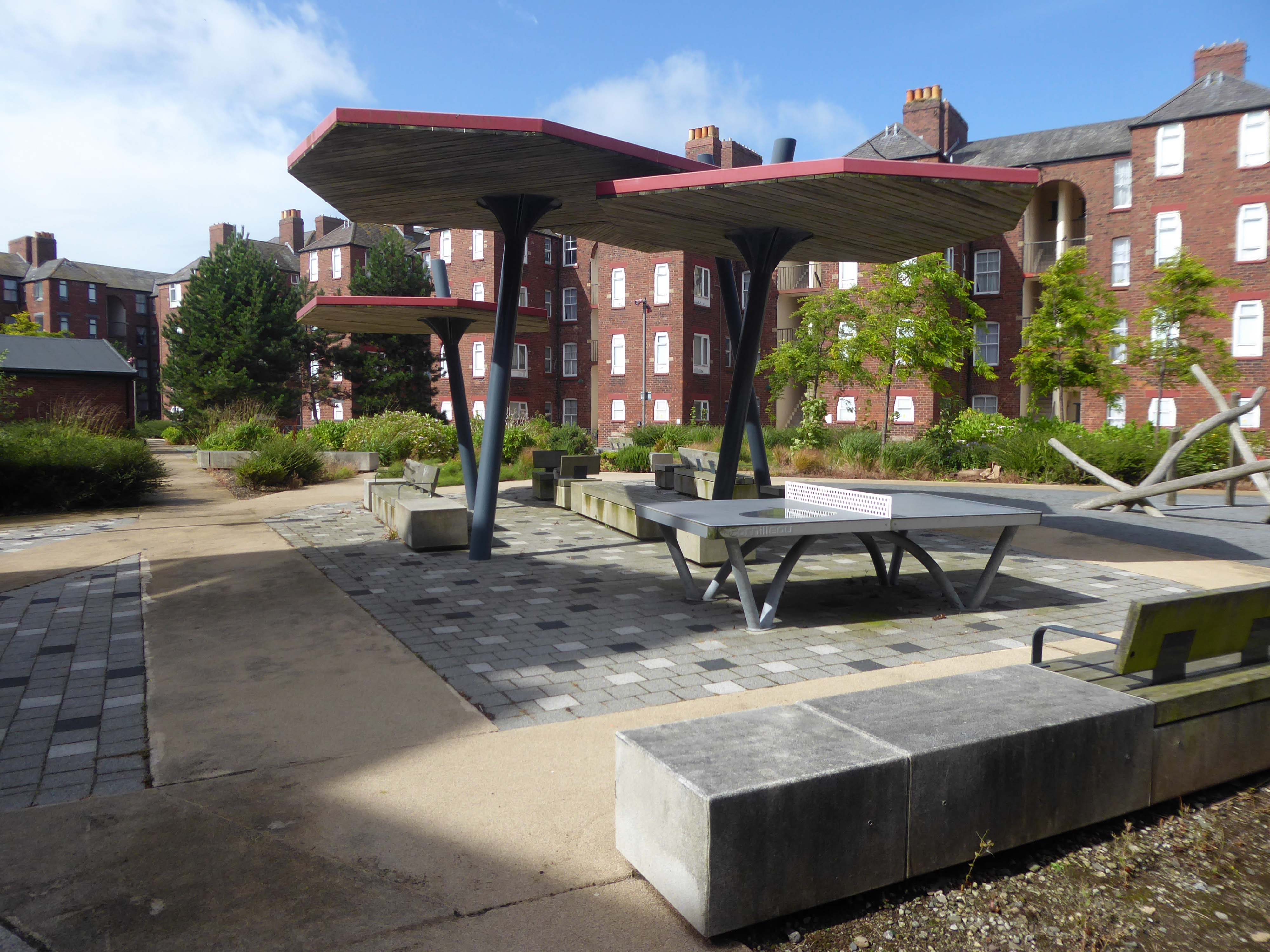
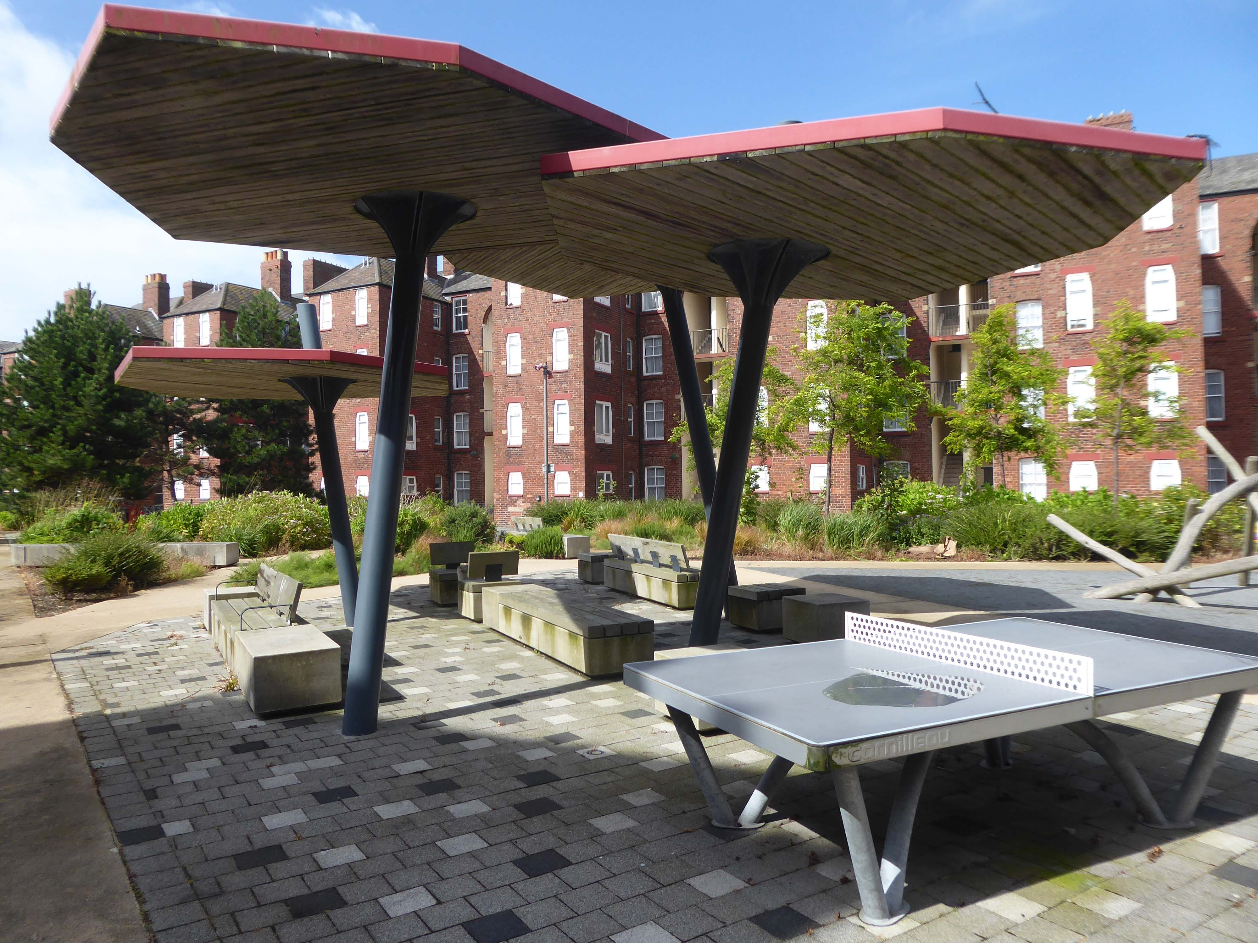
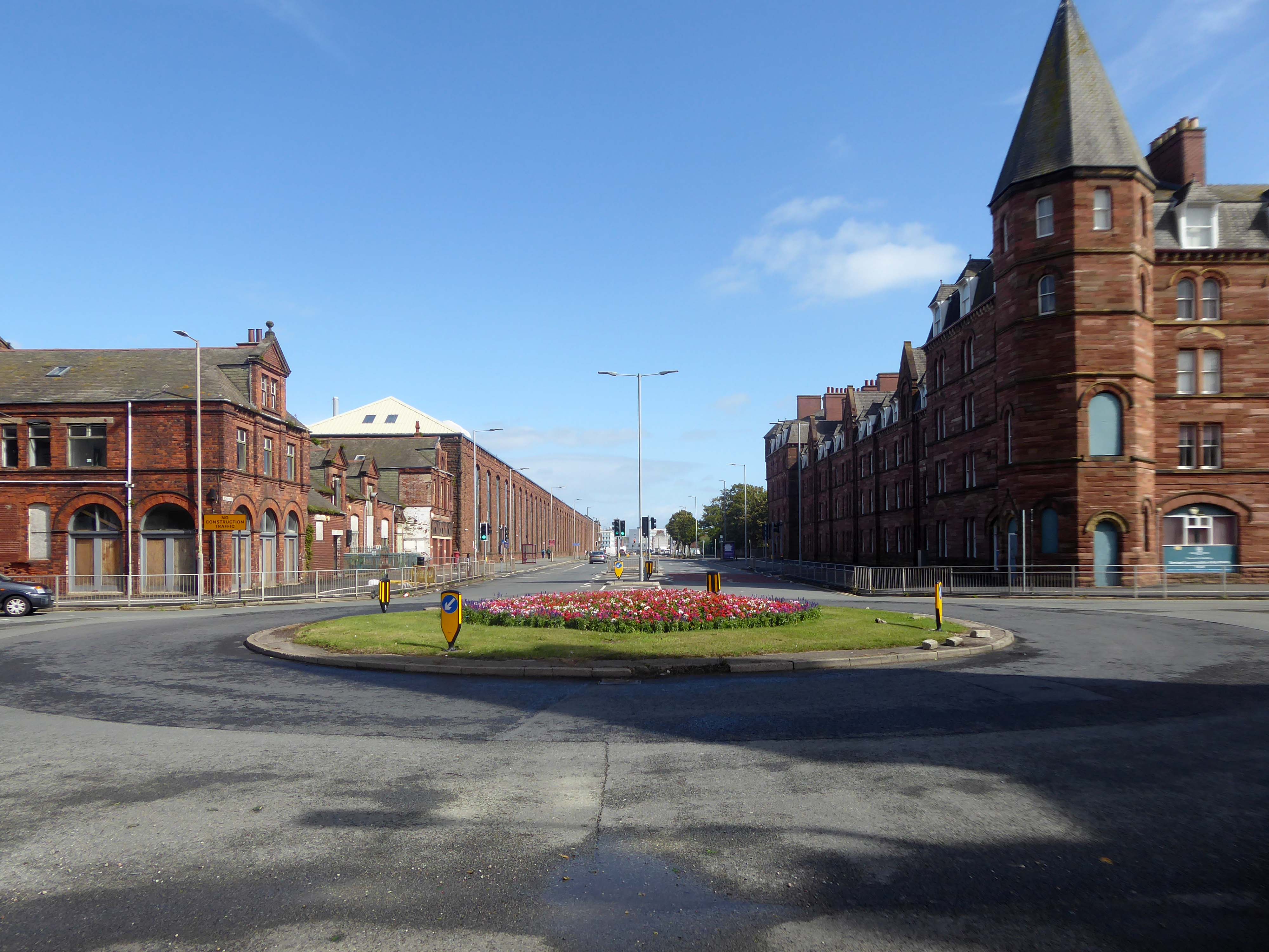
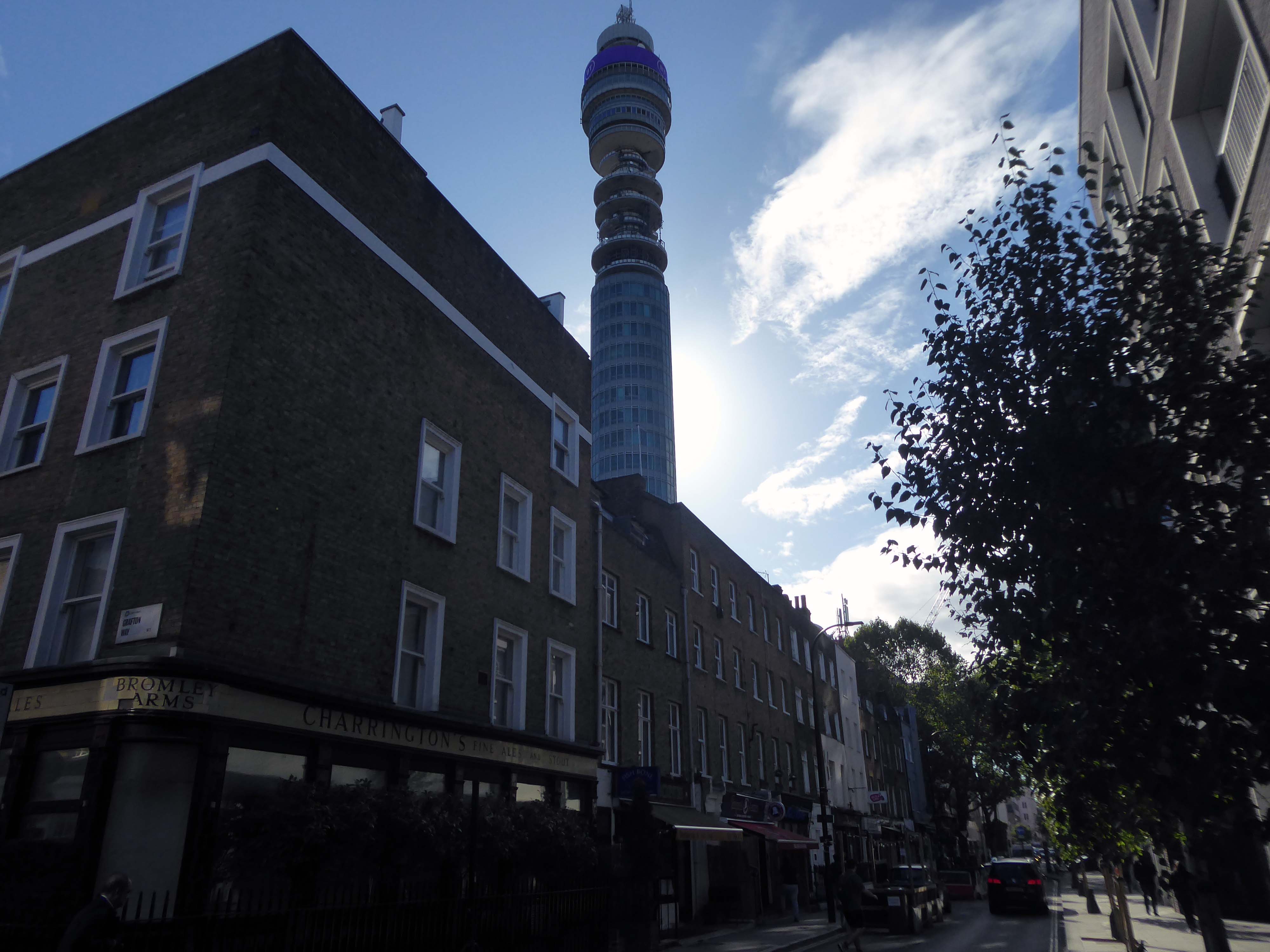
There’s a tight knit group of roads, where the housing is redolent of Scottish tenements.
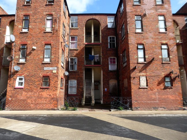
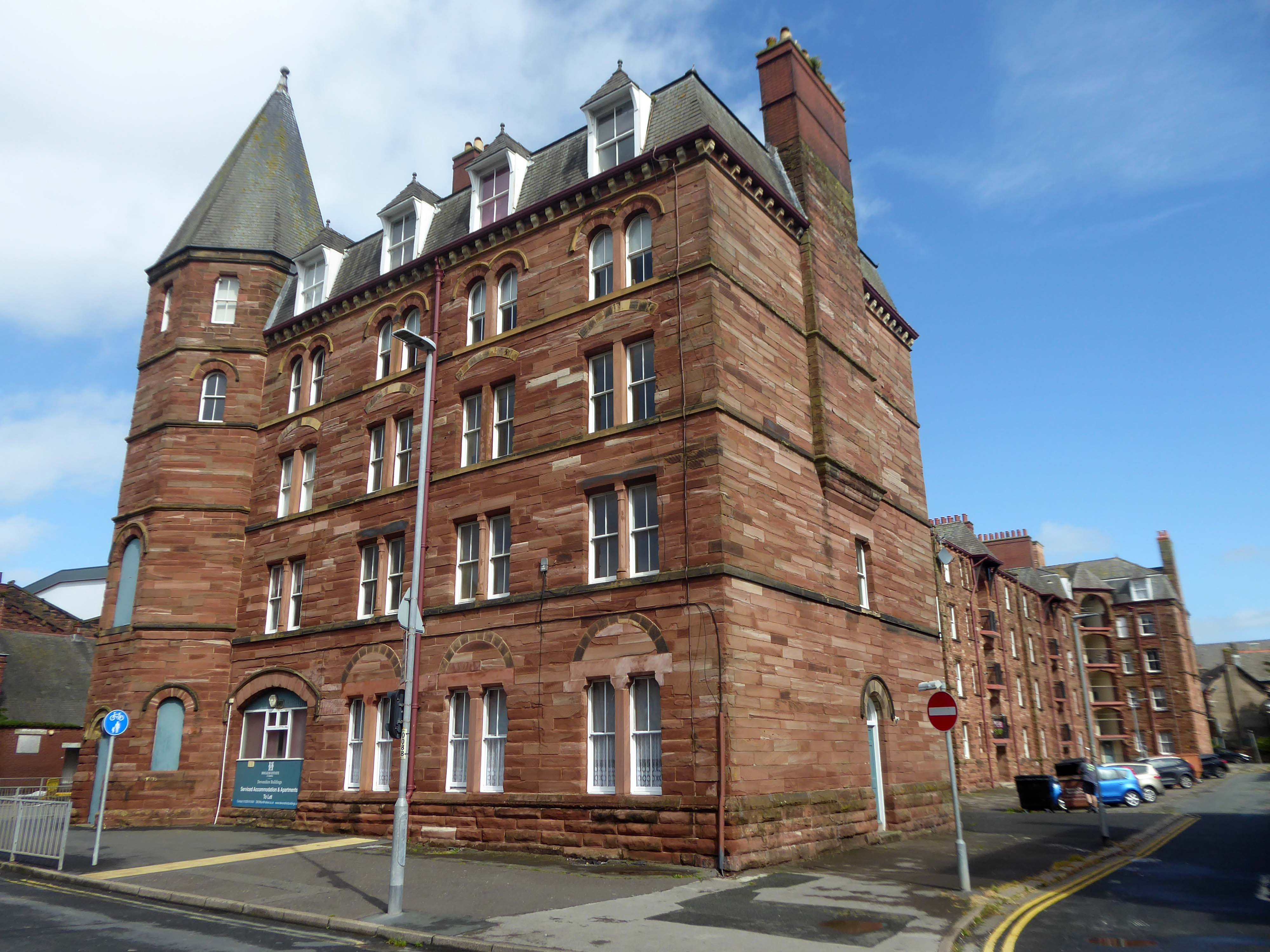
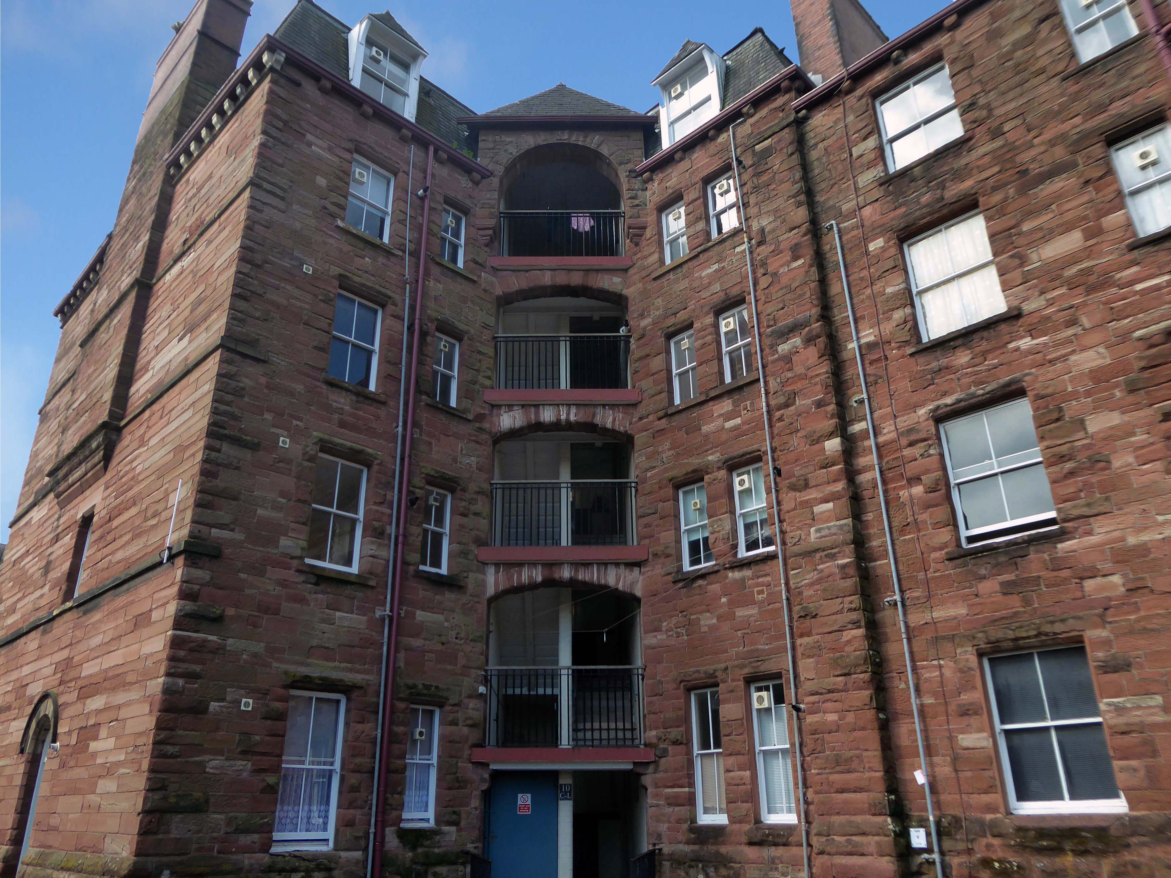
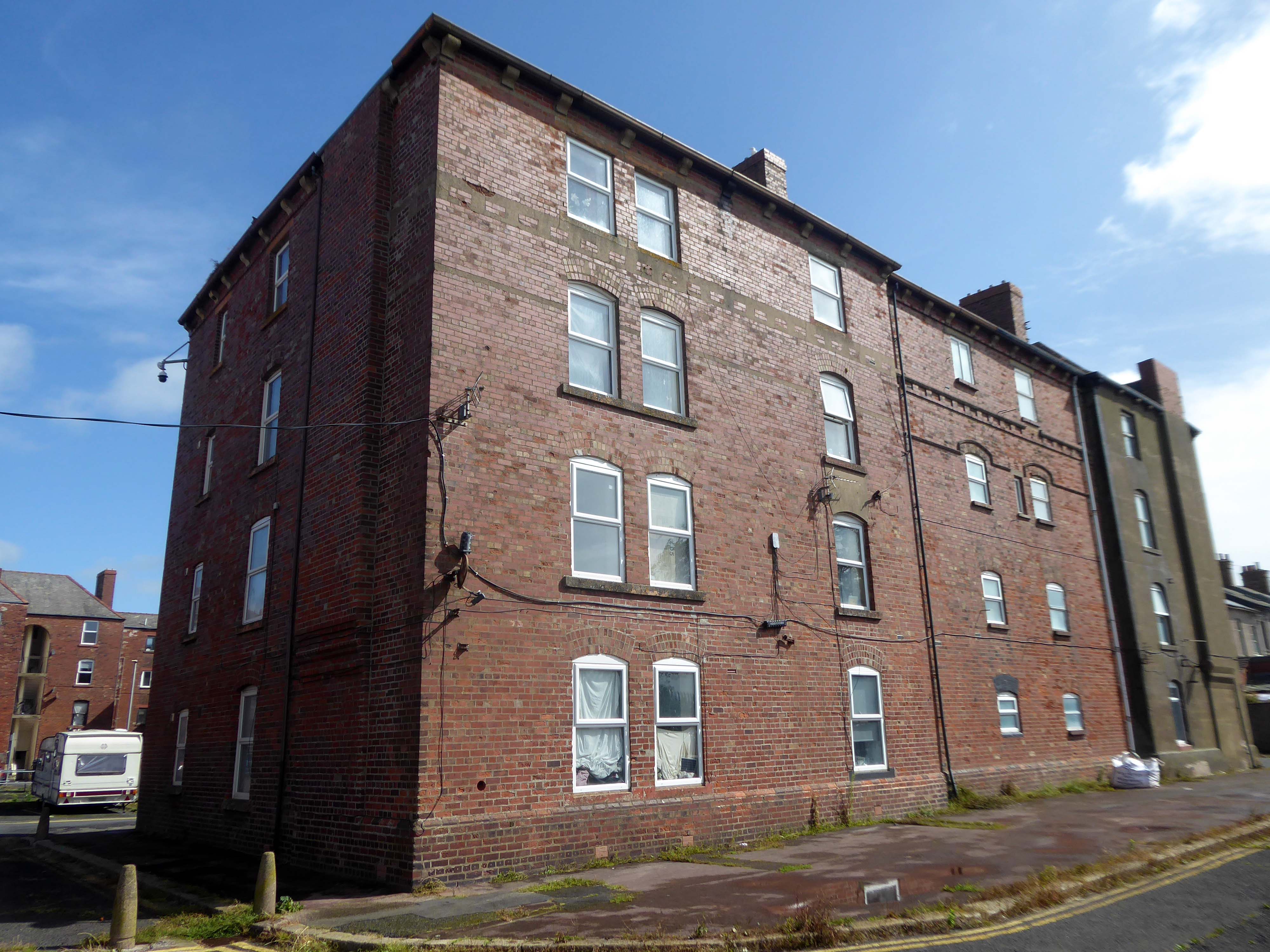
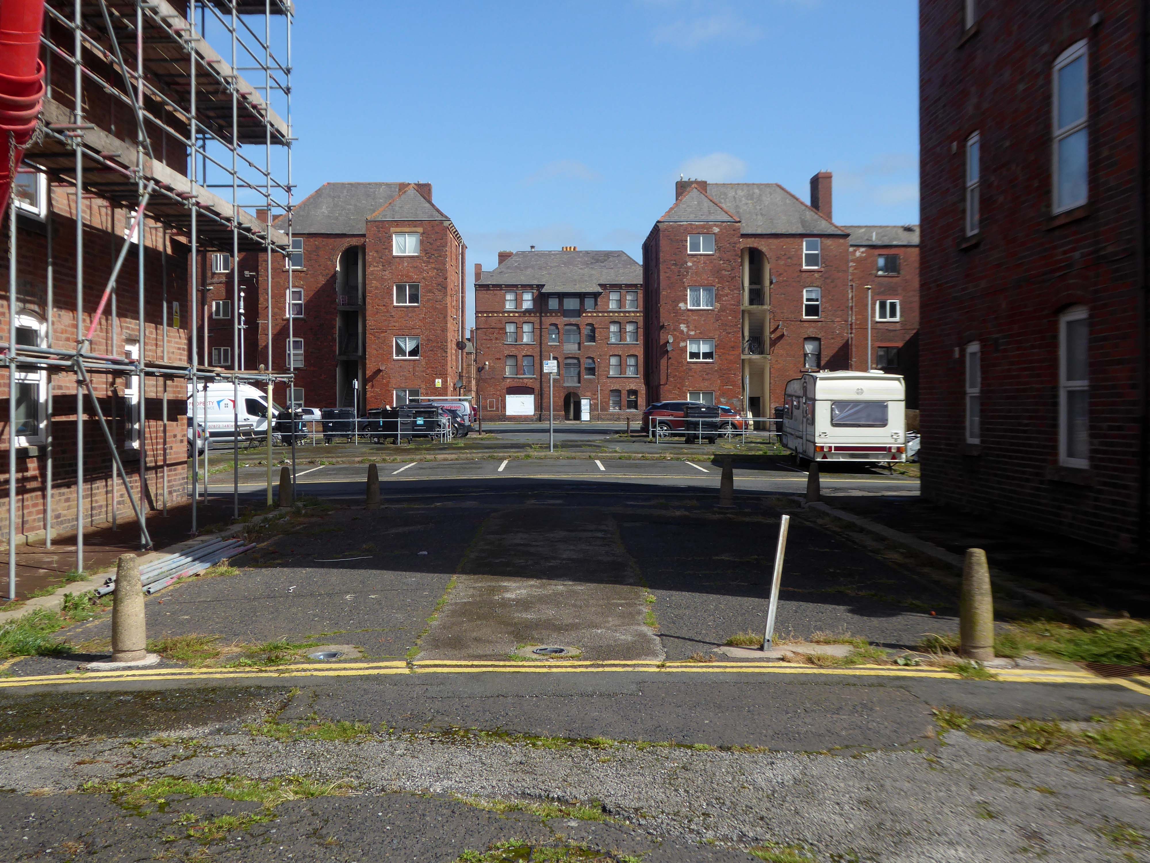
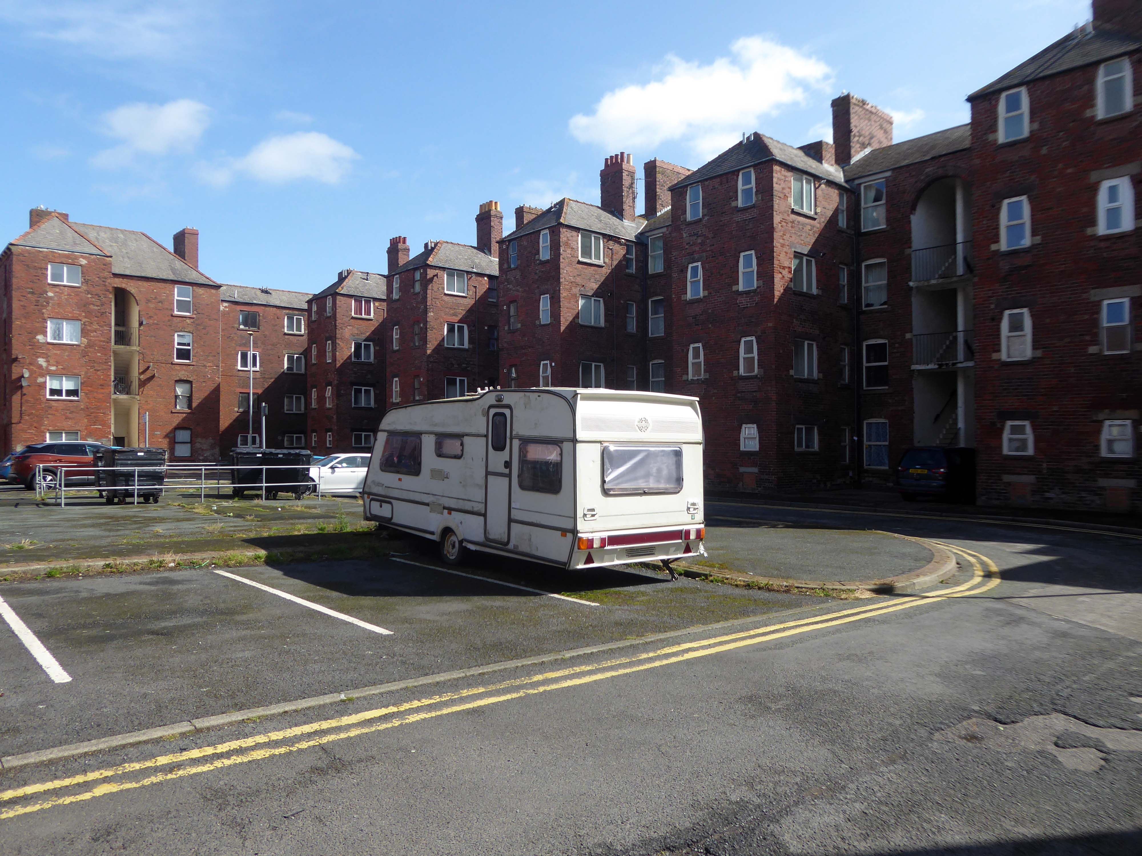
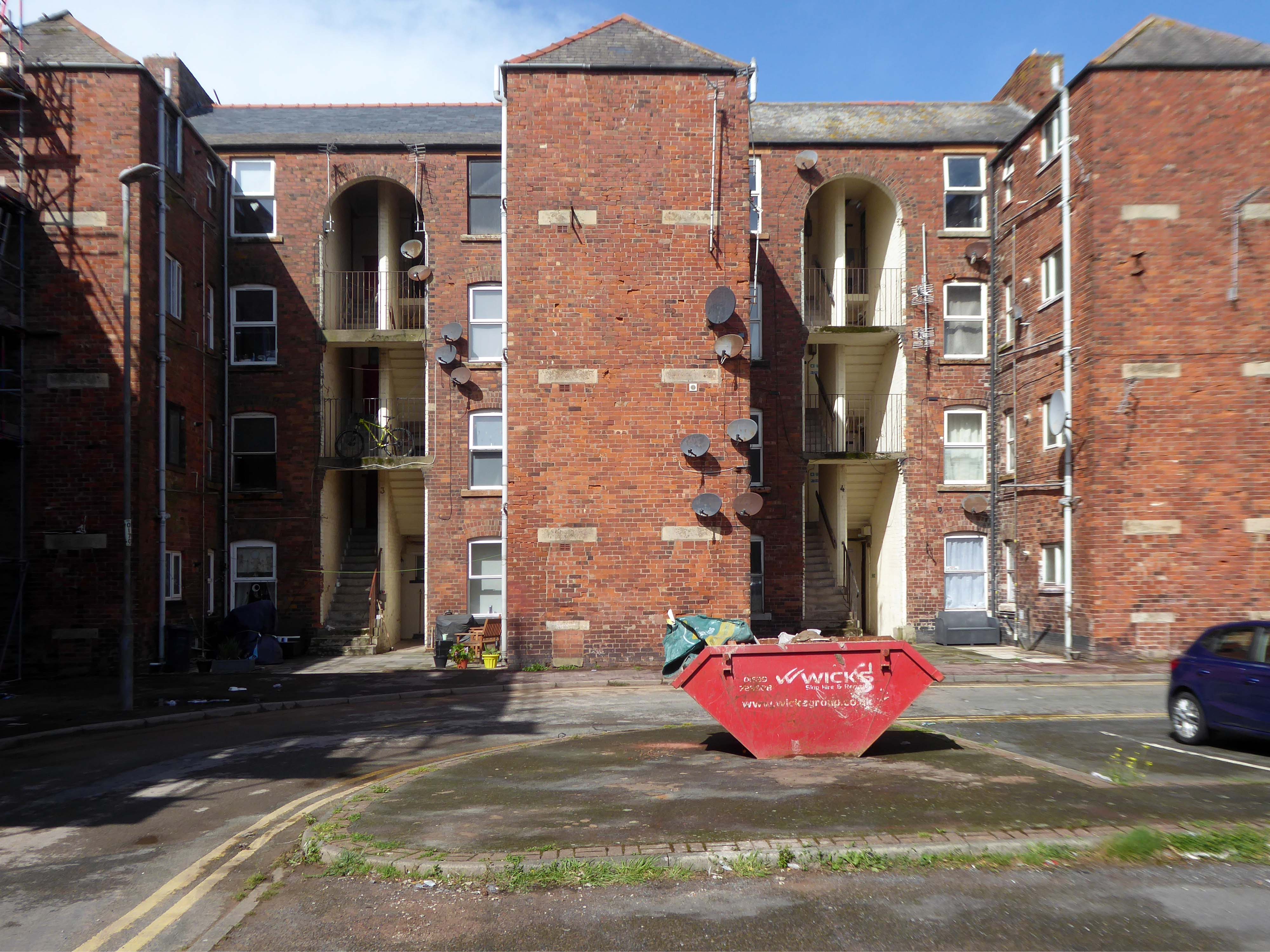
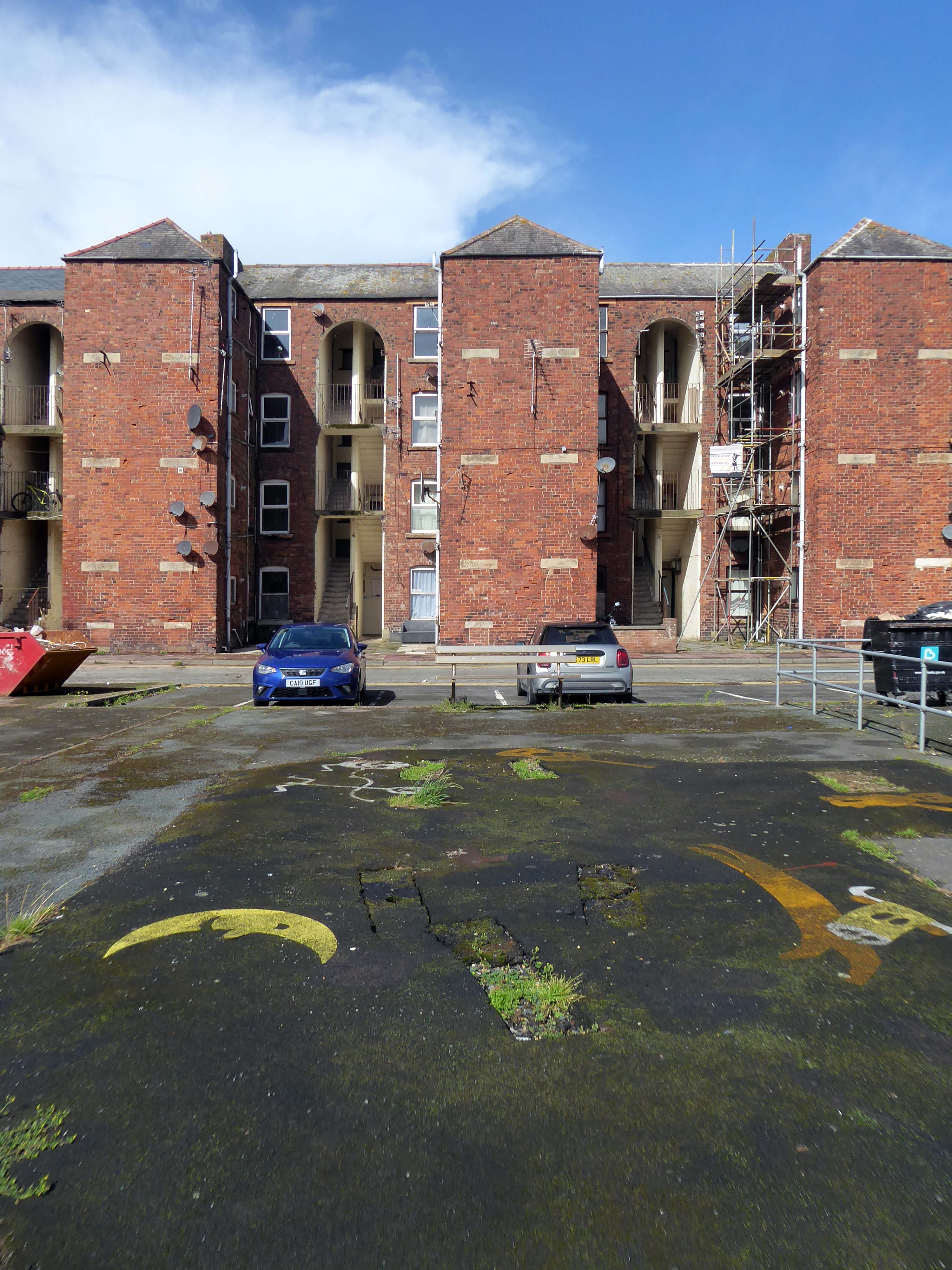
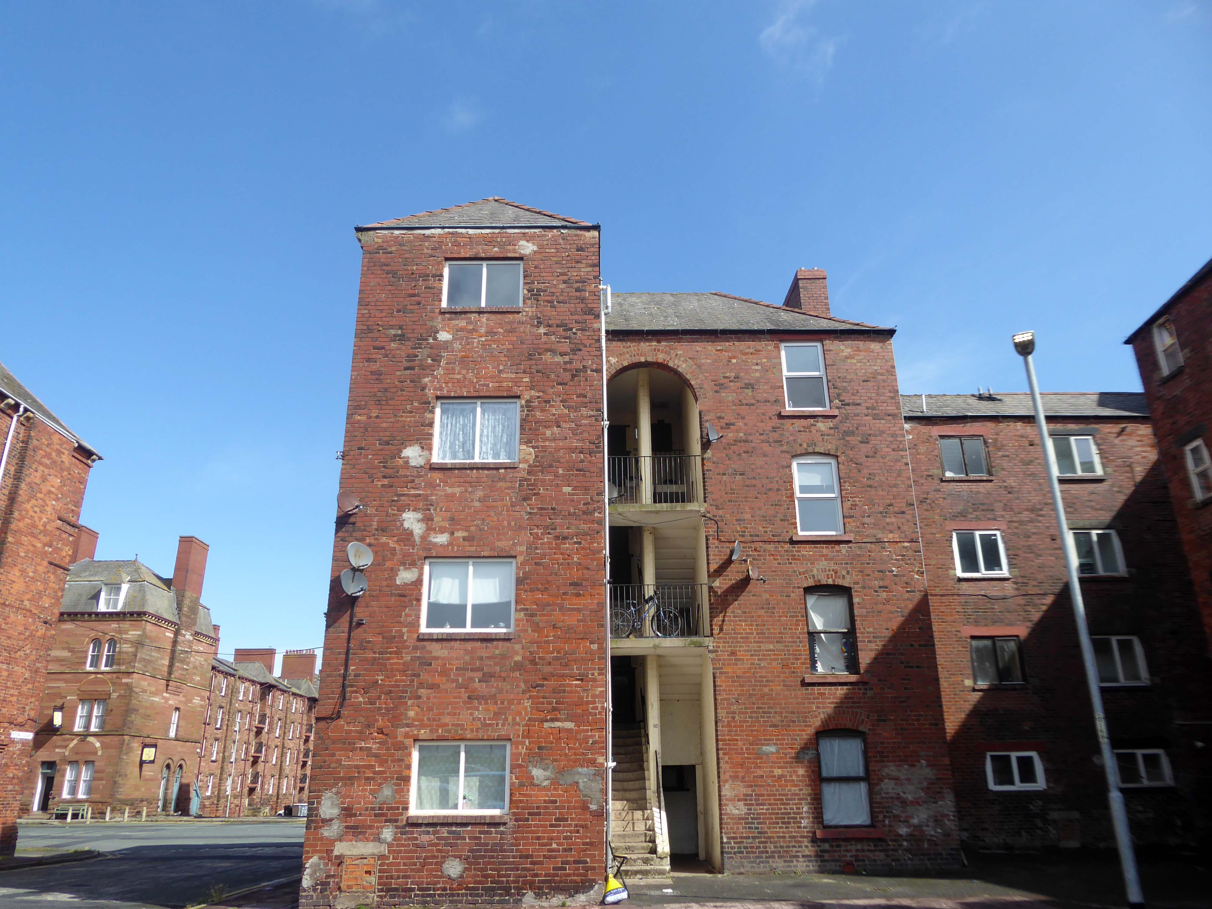
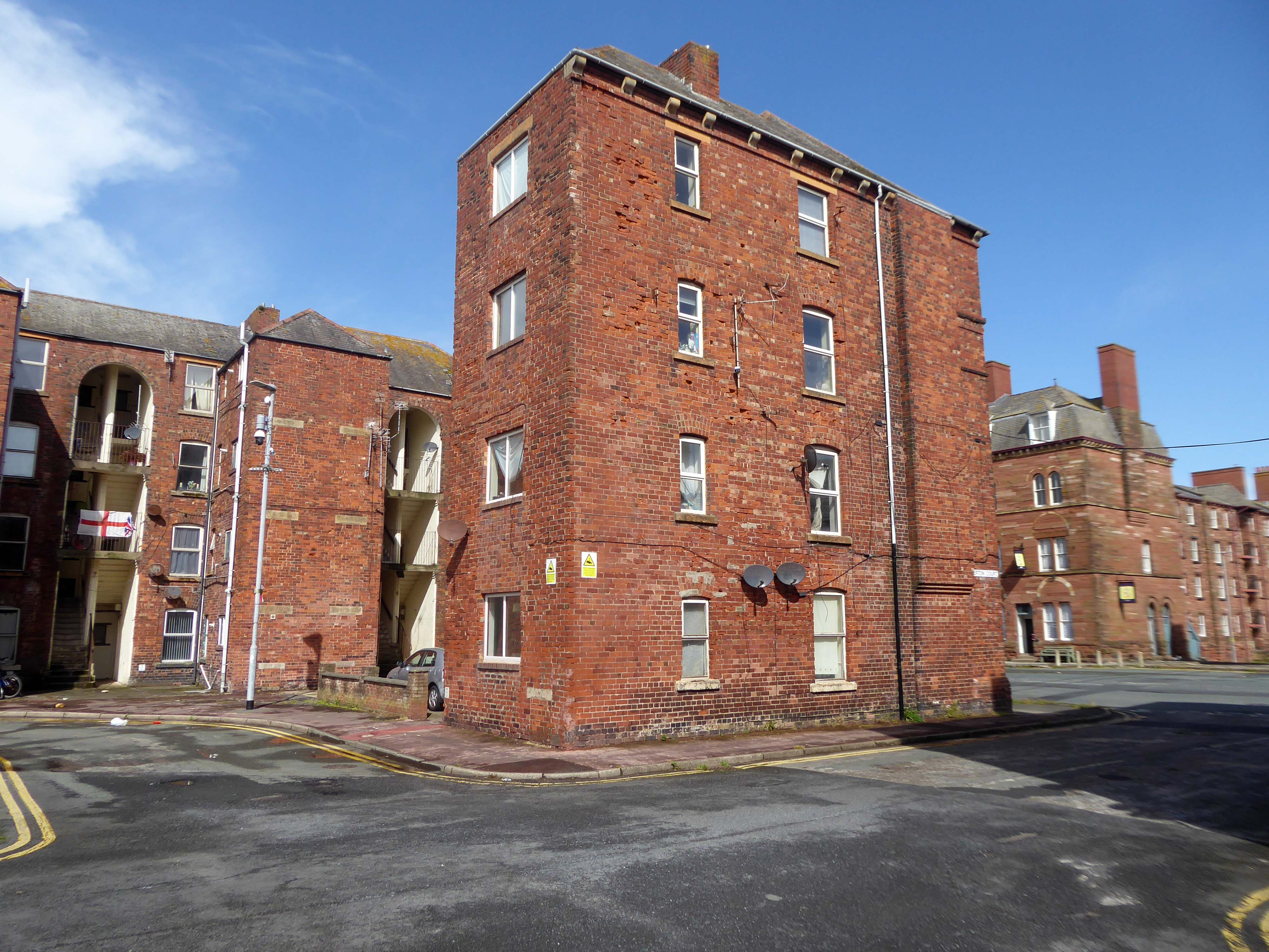
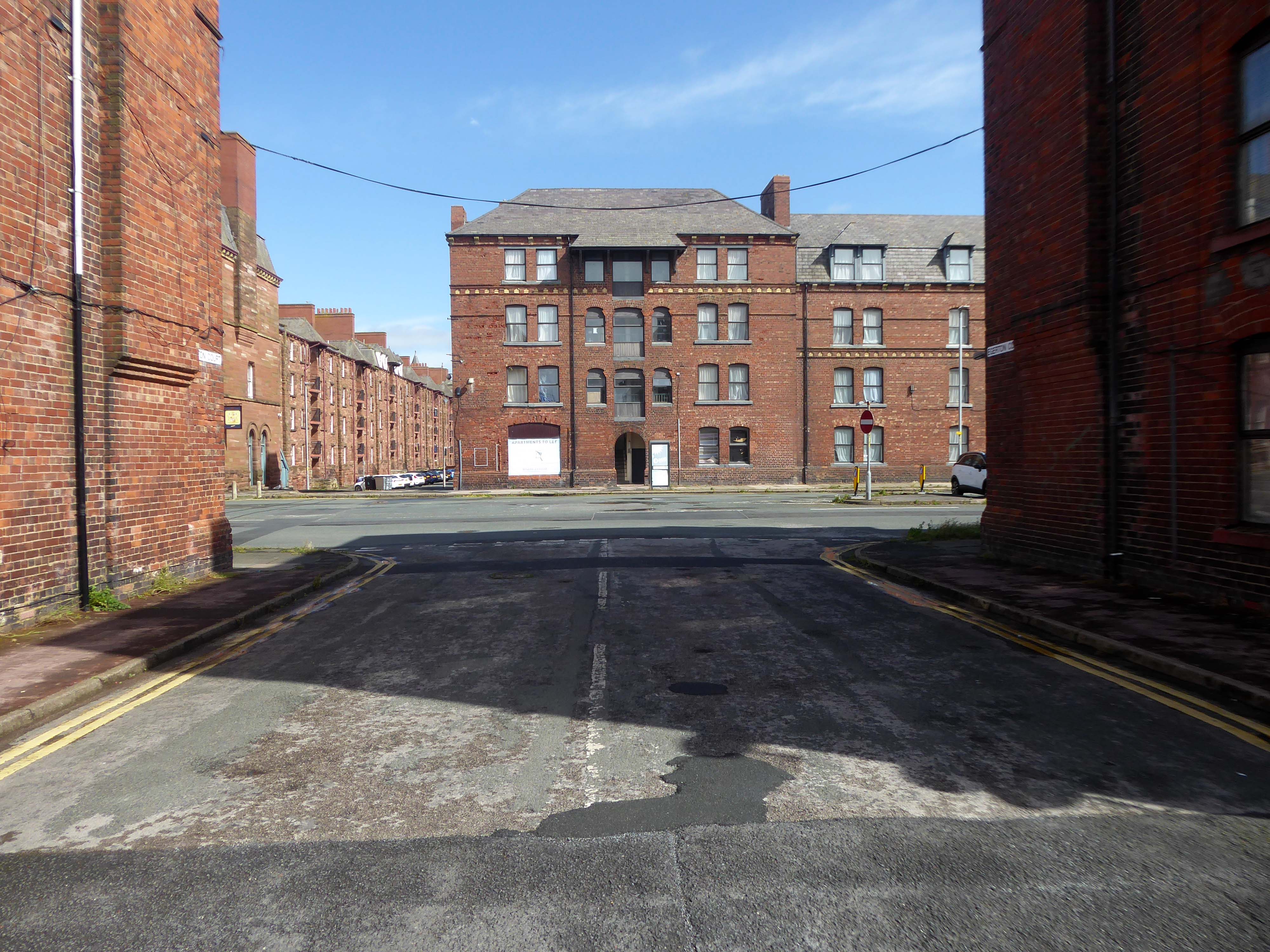
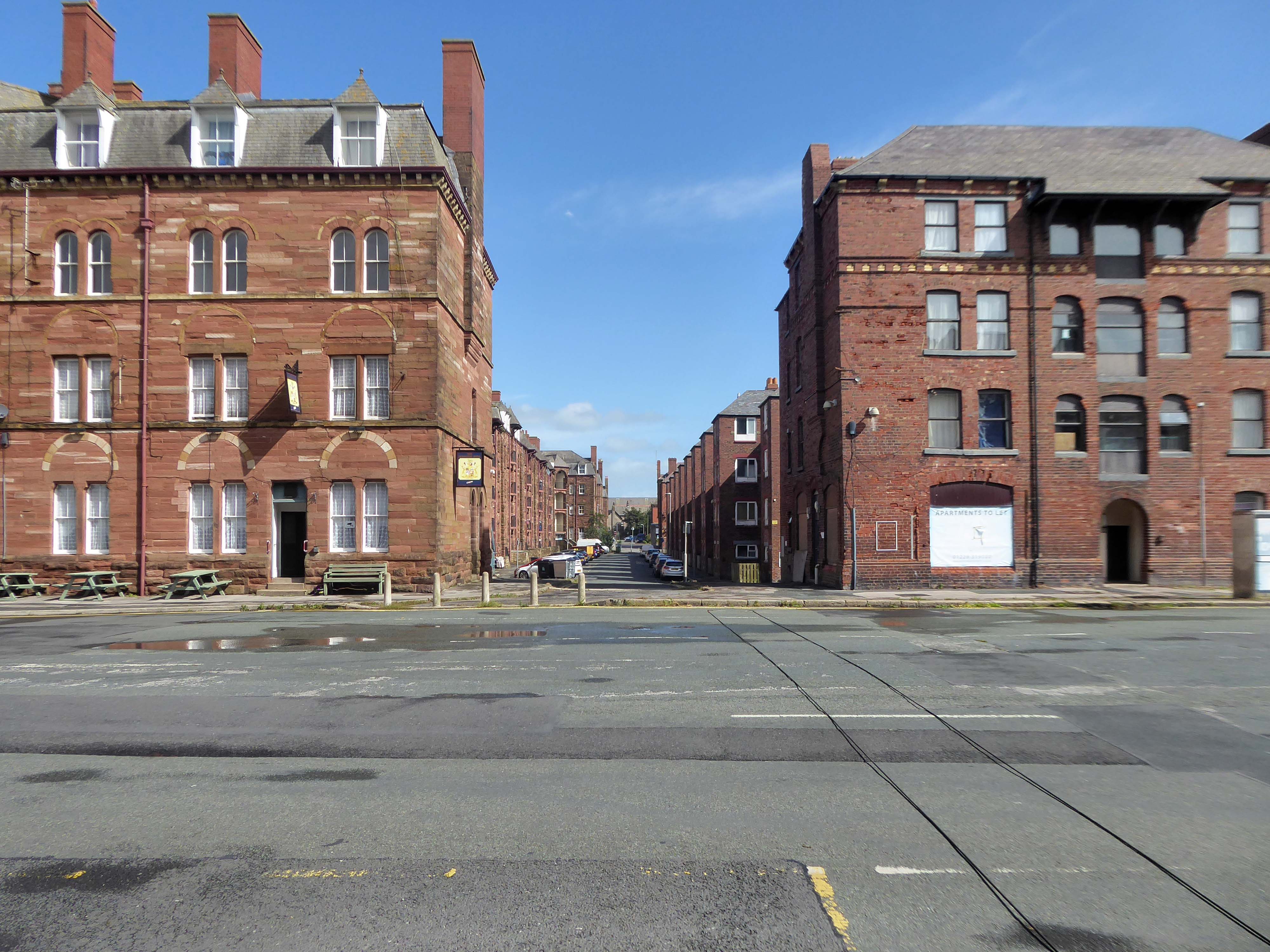
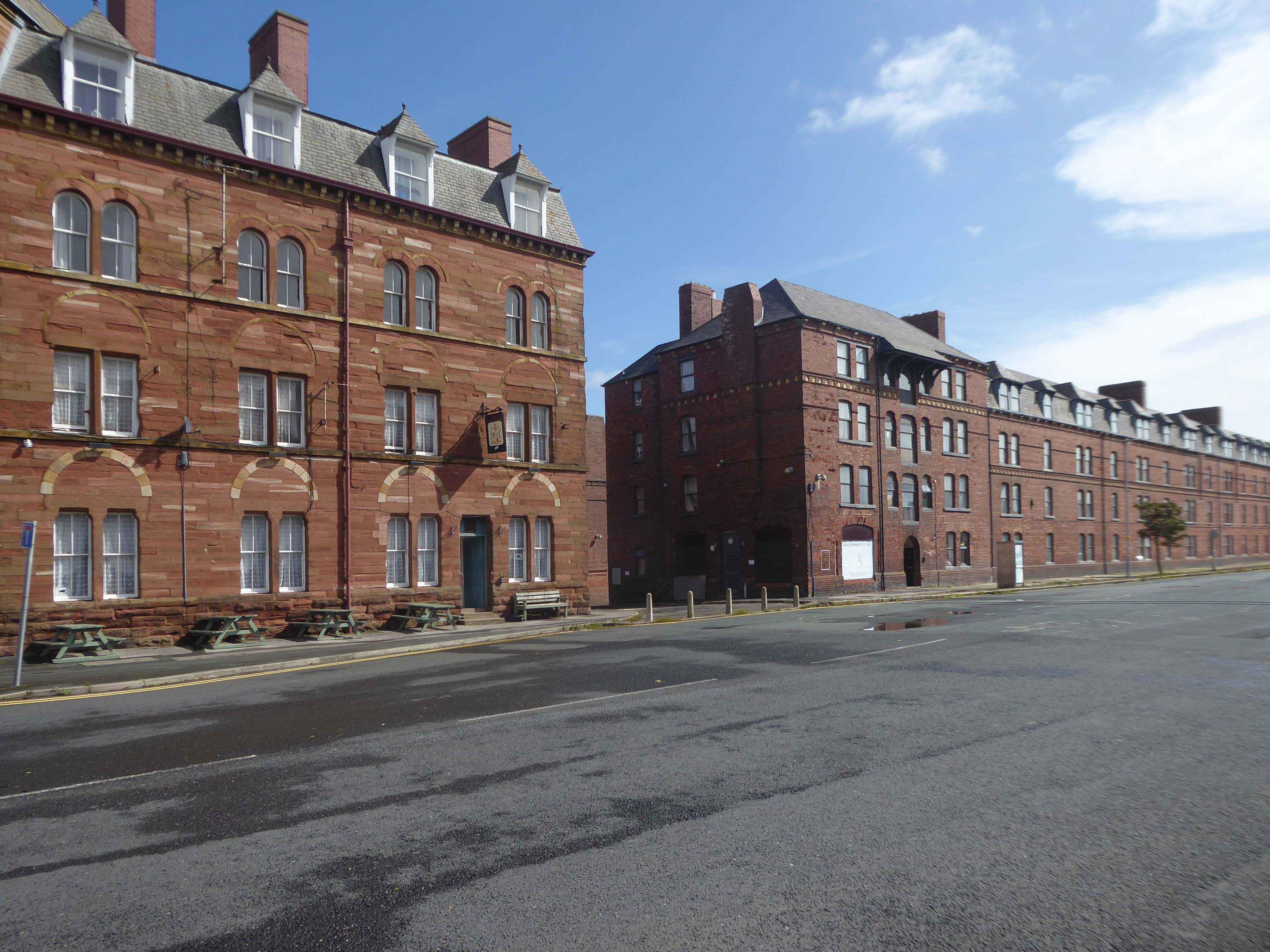
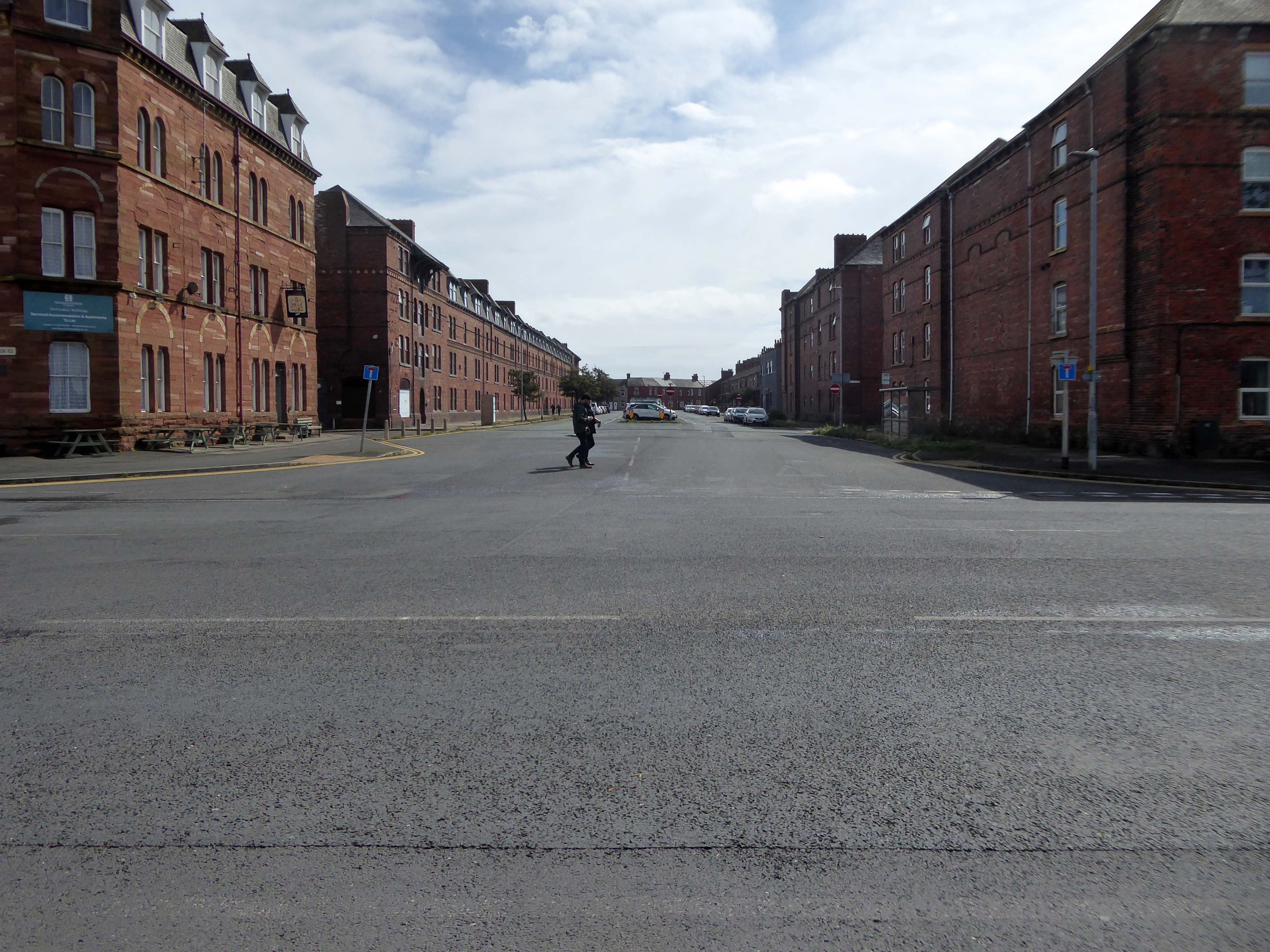
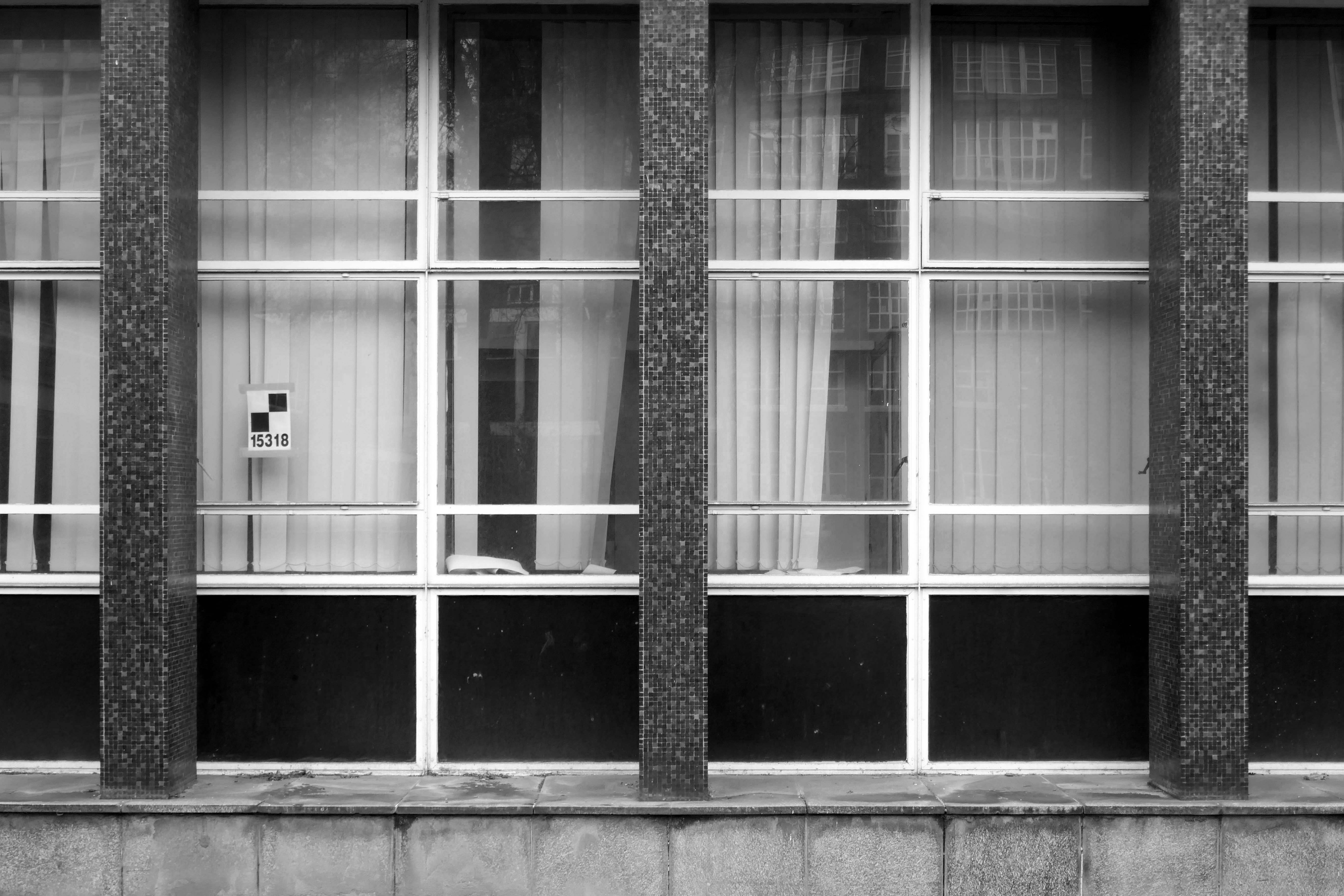
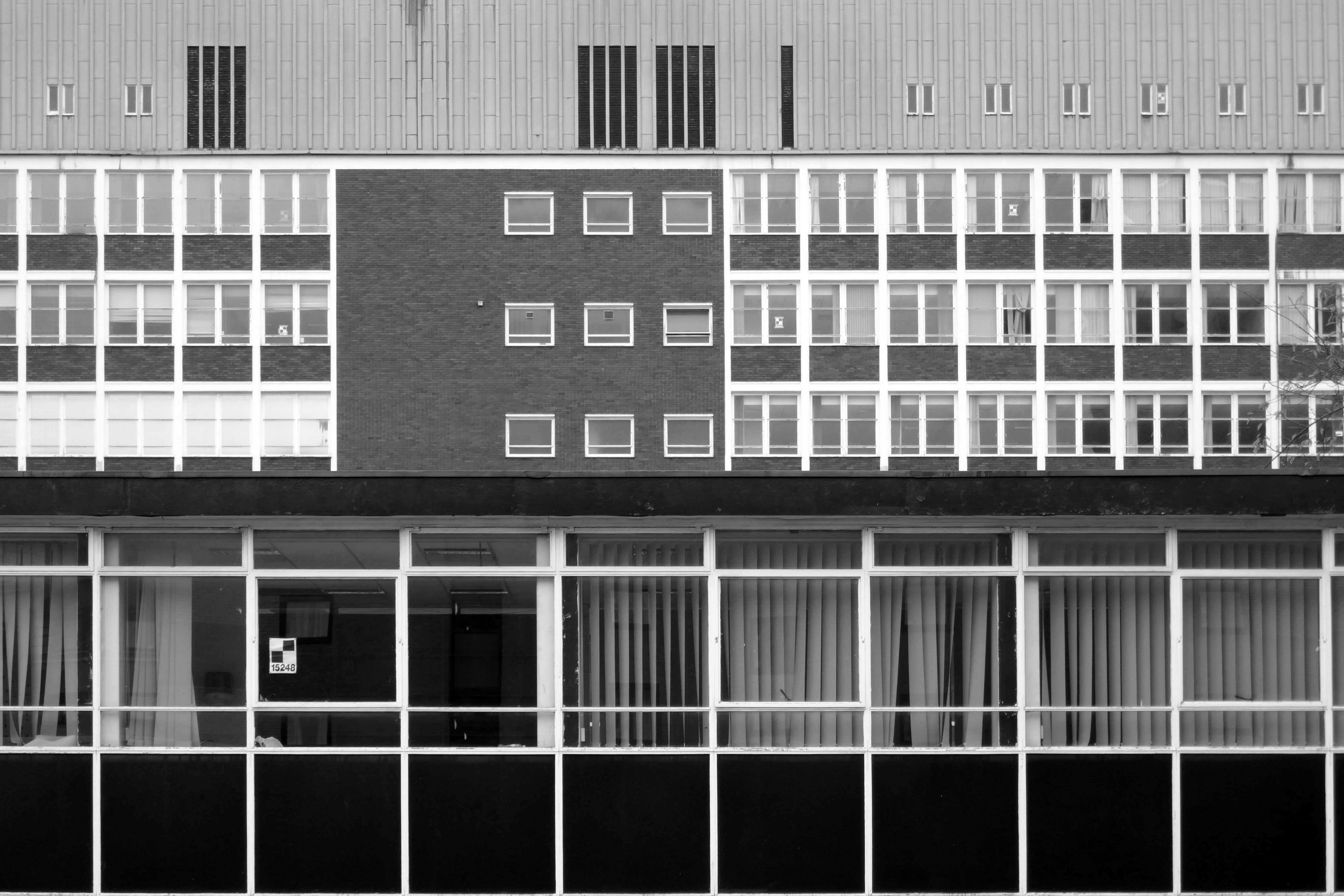
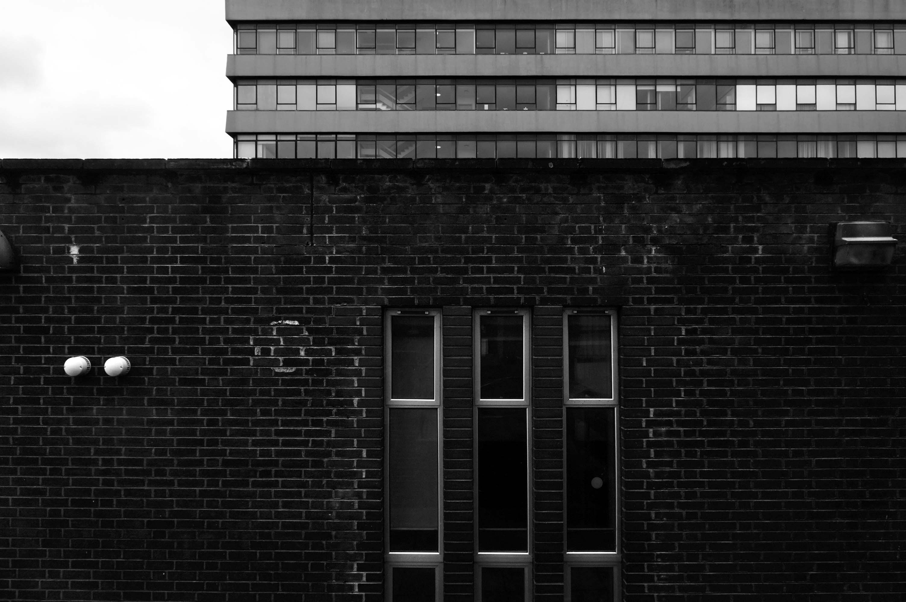
These are the Ship Street Tenements brick built in 1881-84, for the Furness Railway Company, they are Grade II Listed.
Architects Paley and Austin of Lancaster, the main contractors Smith and Caird of Dundee.
They provided accommodation for the families of employees in the Furness Railway Company’s nearby shipbuilding works, they consist of two identical four-storey blocks of nine tenements, making eighteen tenements in total.
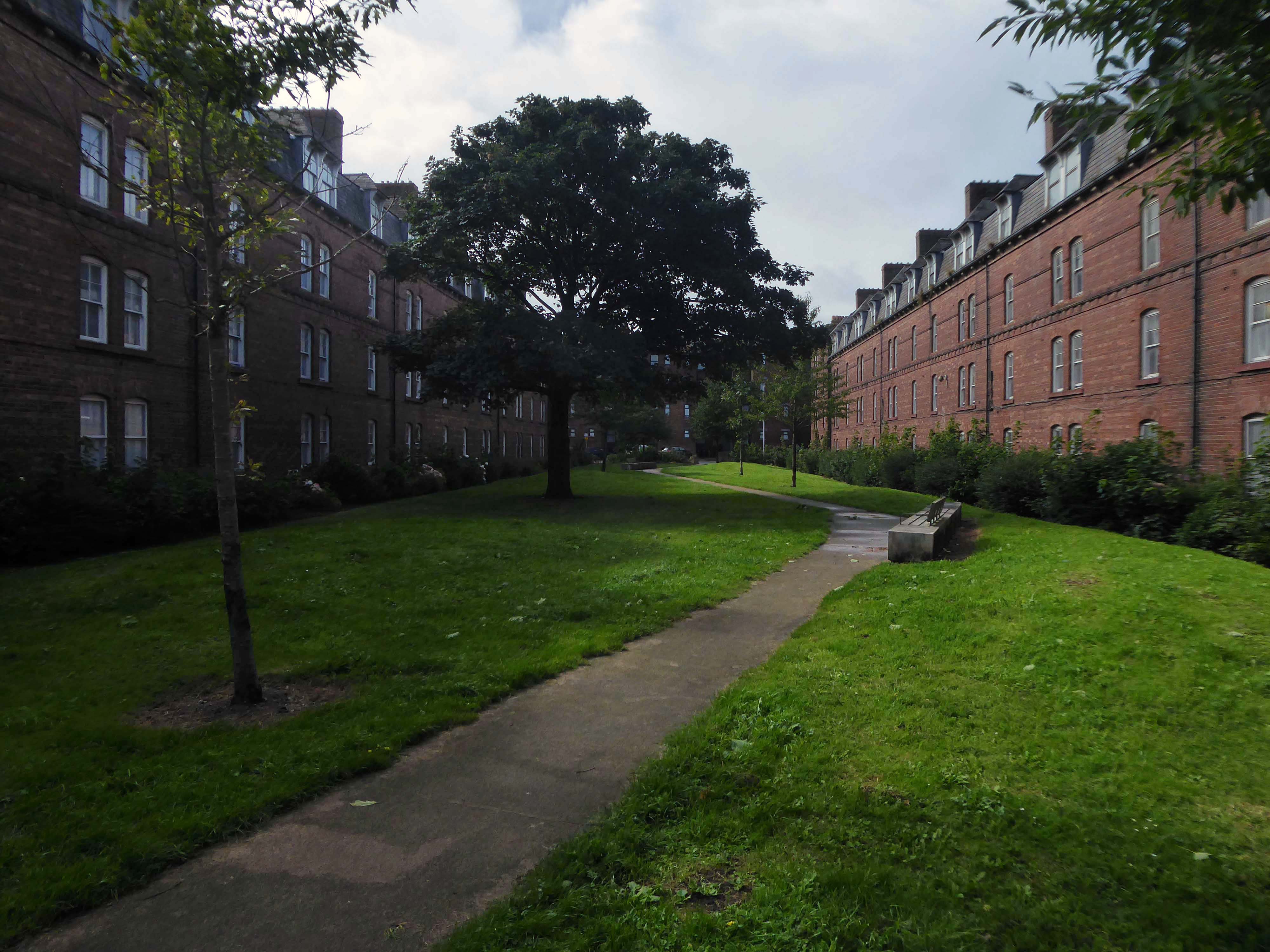
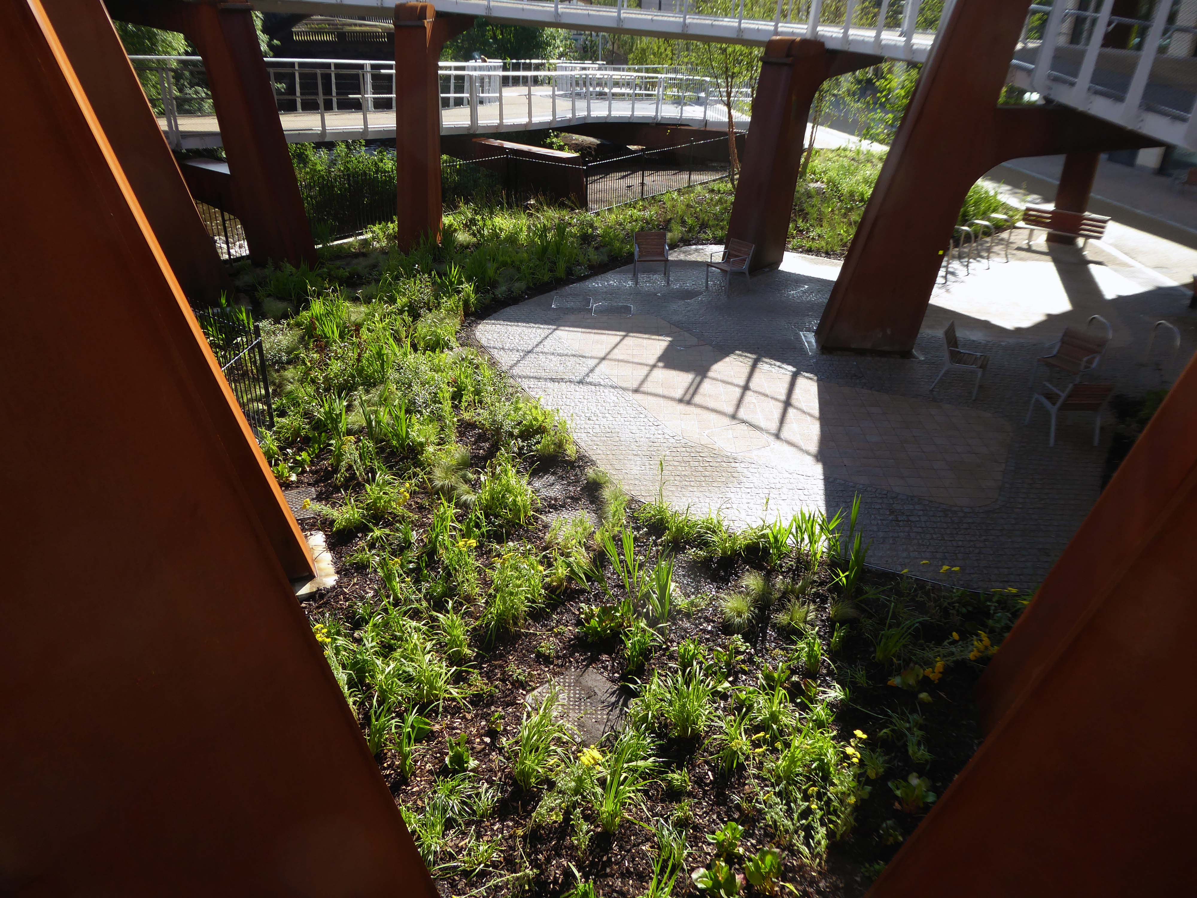
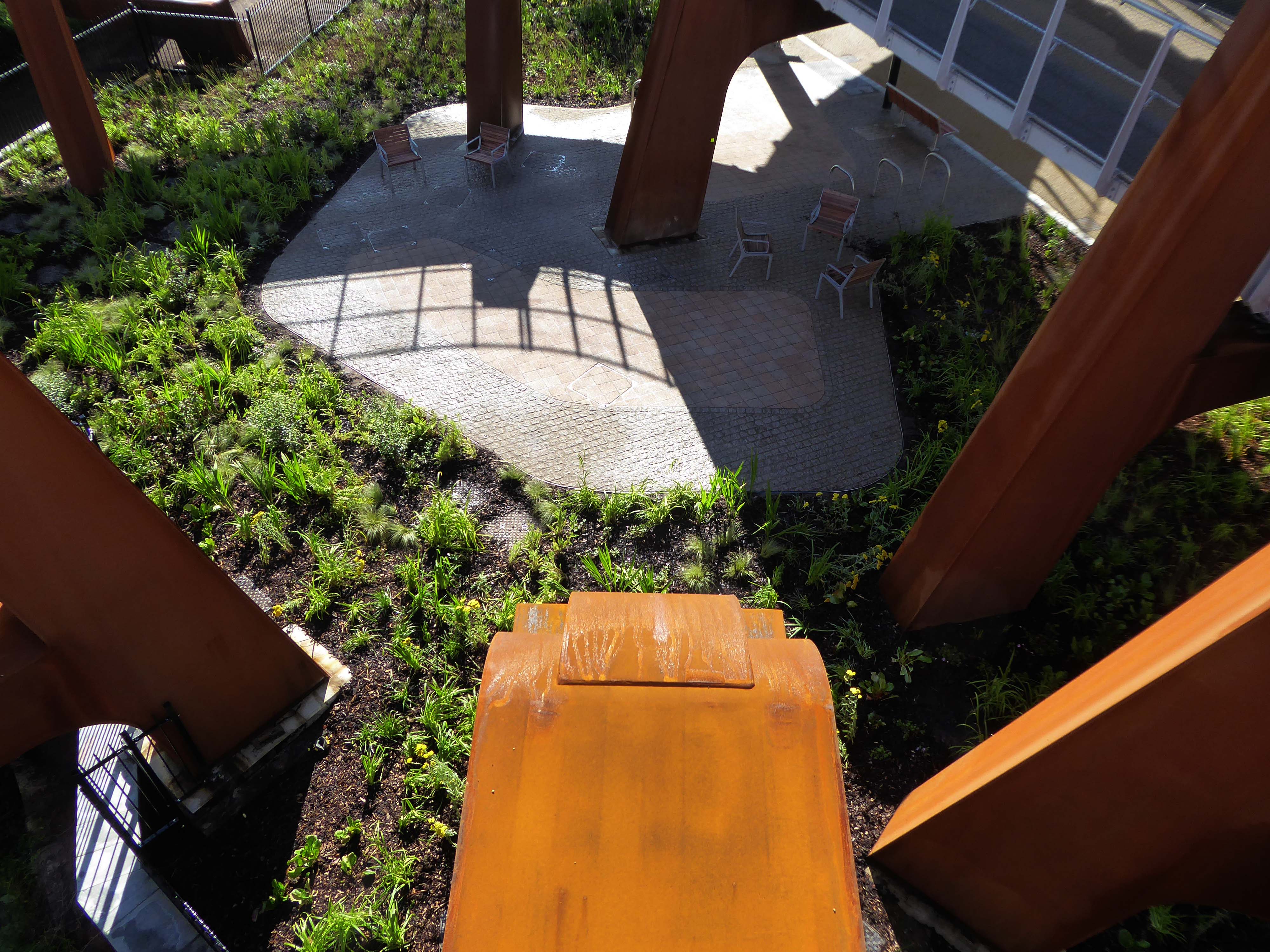
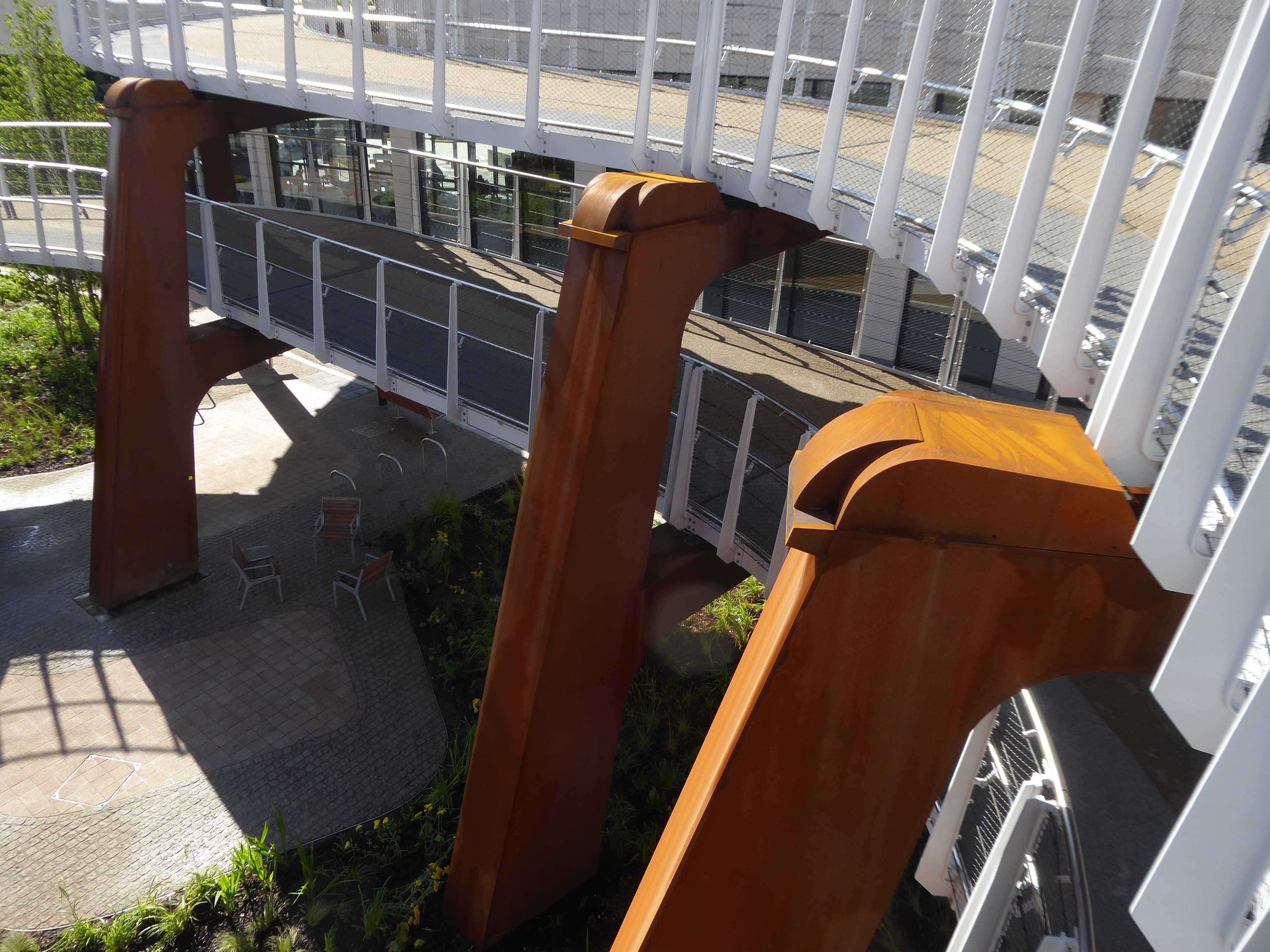
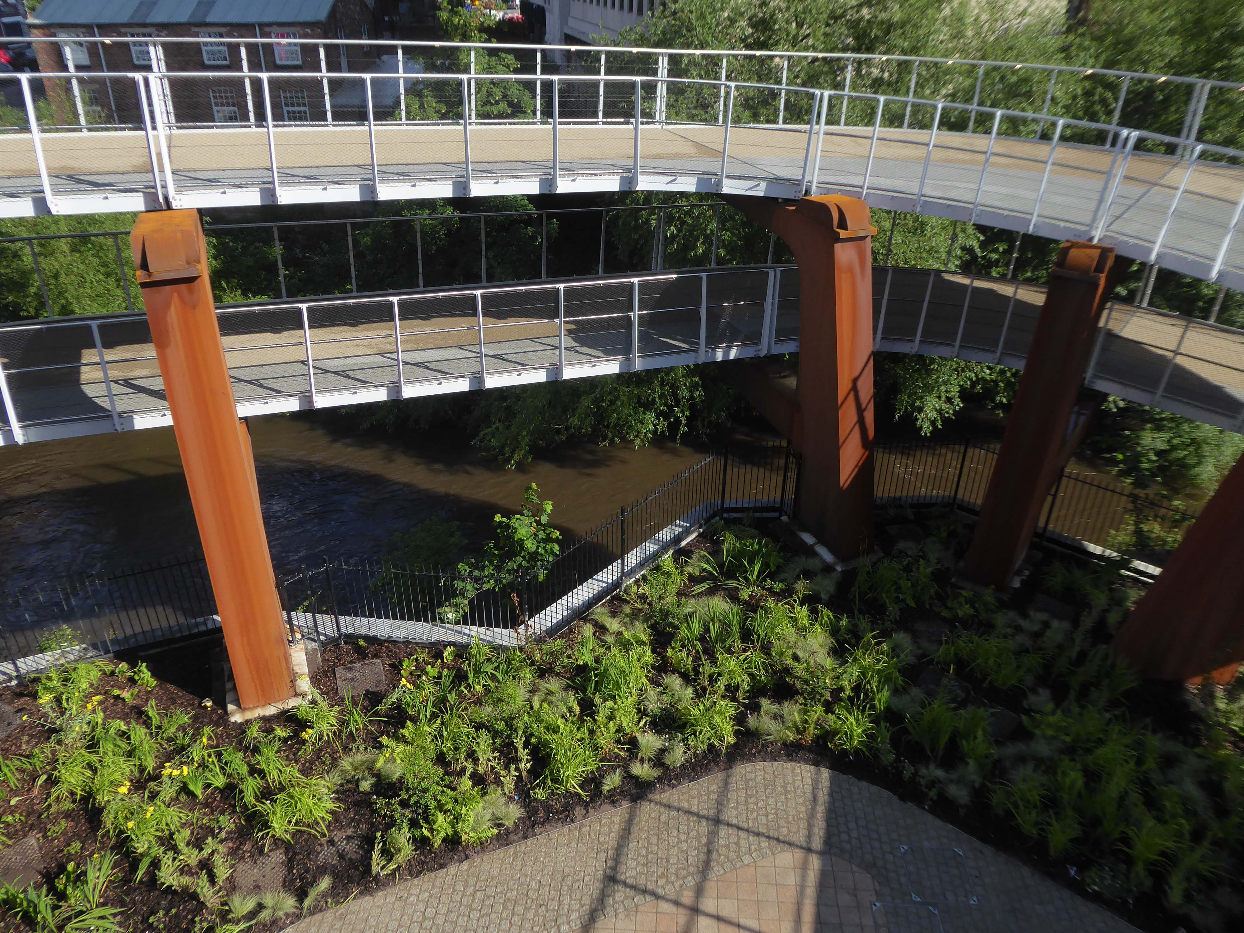
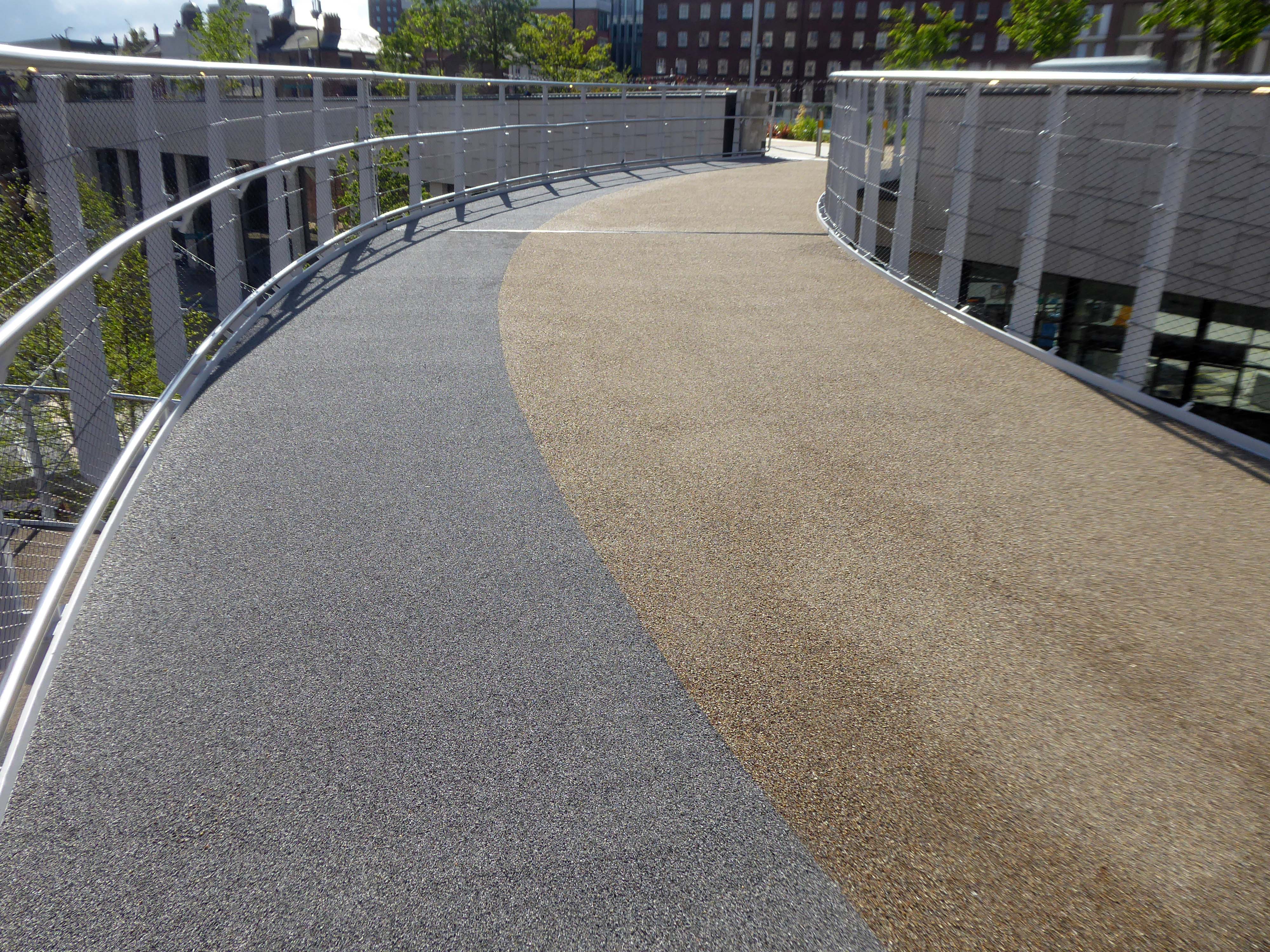
The area has been revitalised and improved in recent years and rebranded.
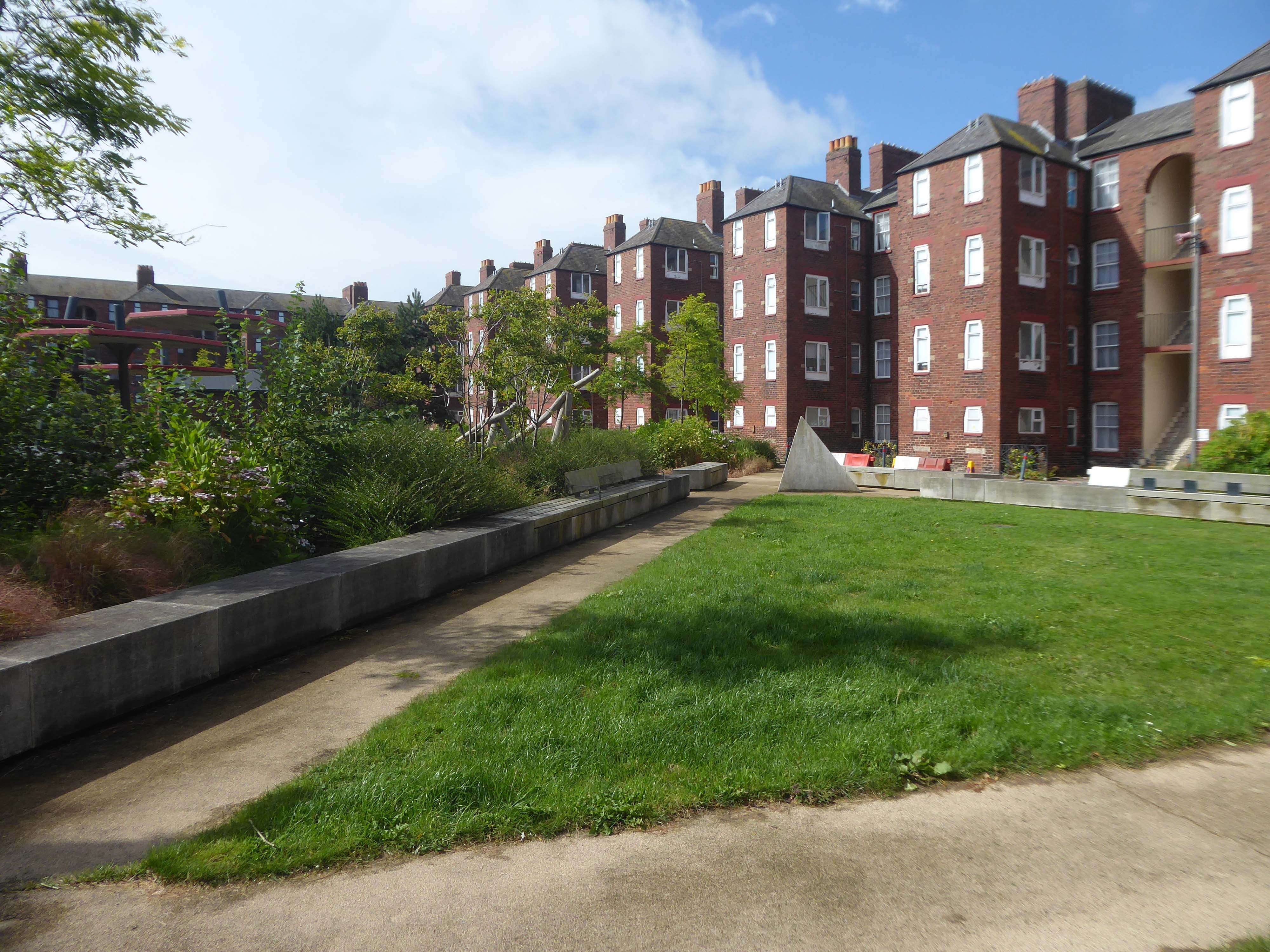
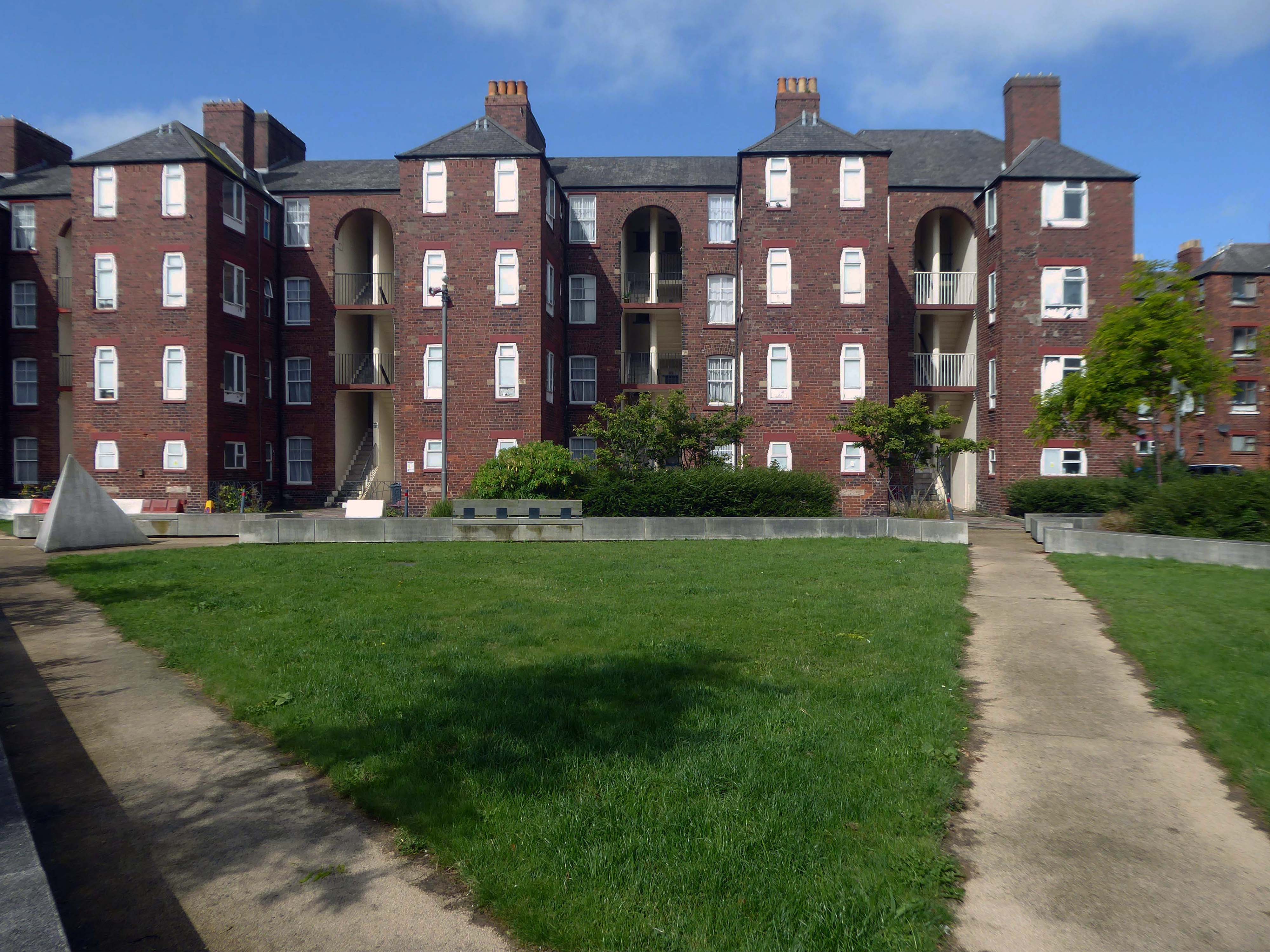
This beautiful and inviting public realm has acted as a catalyst for renewal of this neighbourhood in Barrow-in-Furness. The inspirational scheme won the award for Best Commercial Landscape Design at the Northern Design Awards in 2017 as well as winning the Adding Value Through Landscape award at the Landscape Institute Awards 2018 and it’s easy to see why.
The newly named Maritime Apartments are now advertised for short stays, demonstrating the increased desirability of the neighbourhood. Lisa Hart Pearce, Manager of Maritime Apartments has said: “The new landscape has transformed Maritime Streets, not only visually but holistically. People now have a happy, modern, green space to enjoy; full of colour and beauty. There is no doubt in my mind that the wellbeing of the local community has been positively encouraged by the regeneration of the area and I hope it will continue through generations.”
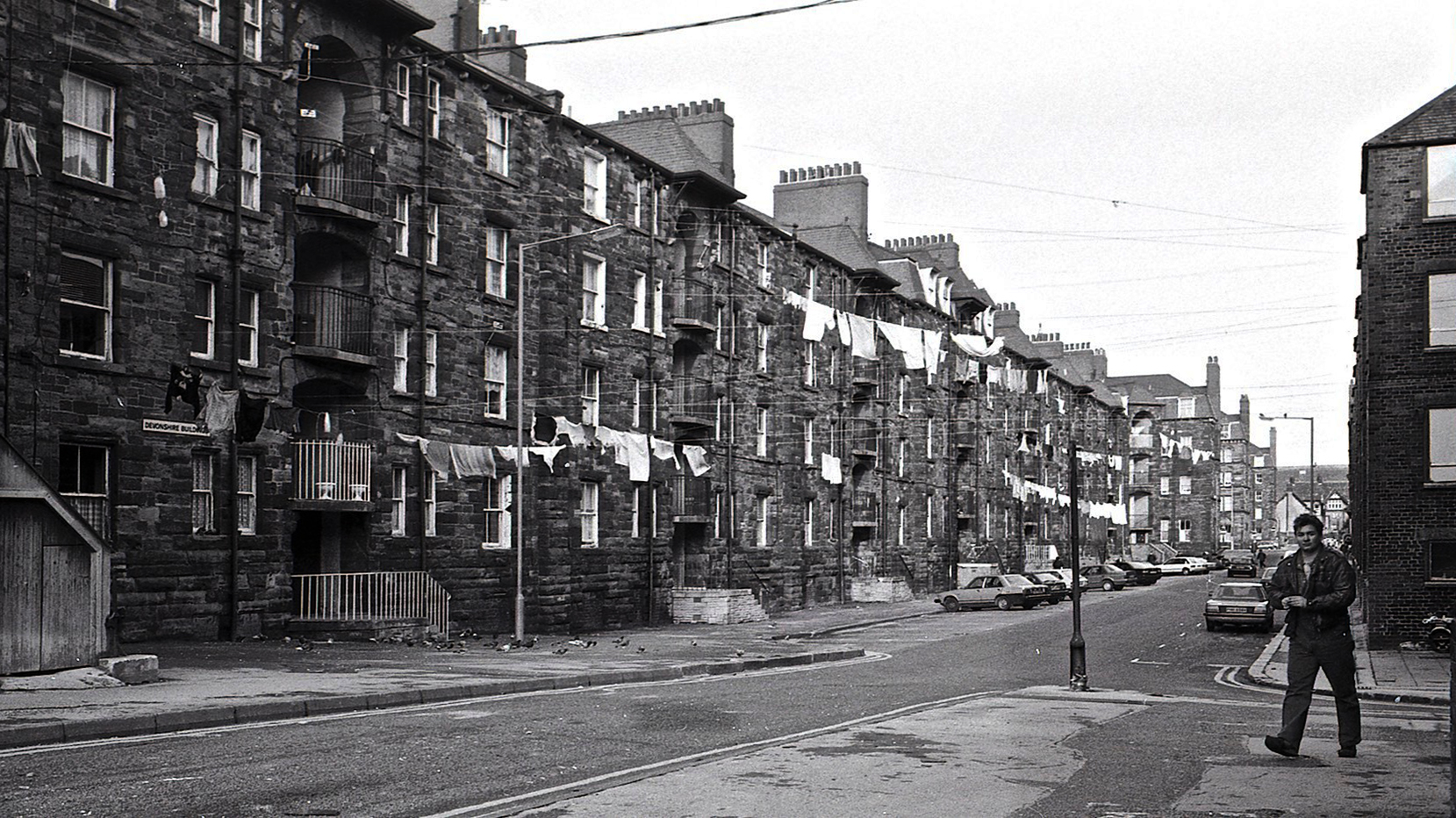
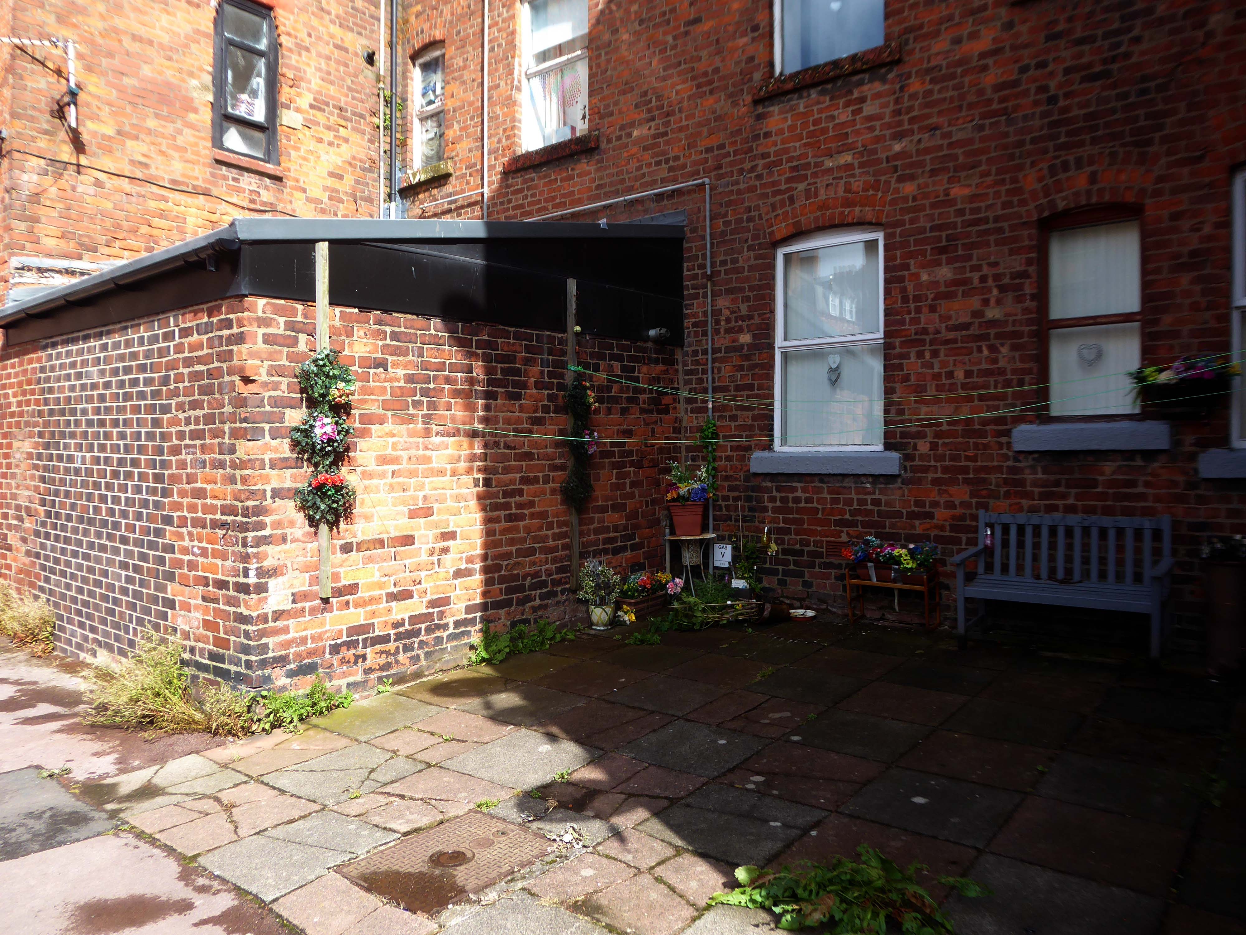
Next door are the adjacent sandstone Devonshire Buildings of old, constructed in the 1870s for the Barrow Iron Ship Building Company, by the Duke of Devonshire at a cost of £50,000, to house local shipyard workers, and recently refurbished by Holker Estate.
The buildings are currently for sale for offers in the region of £4,950,000.
Having once provided homes for the traditional shipbuilders, they now offer lets to the employers of BAE Systems.
Home to our pioneering Submarines Academy for Skills and Knowledge, Barrow-in-Furness is a hub for learning and innovation. We’re not just building the next generation of nuclear submarines here. We’re developing the next generation of engineering talent.
We’re always looking for talented individuals to join our team in Barrow-in-Furness. Whether you’re looking to start your career, or you’re an experienced professional looking for a new challenge, we might have a job for you.
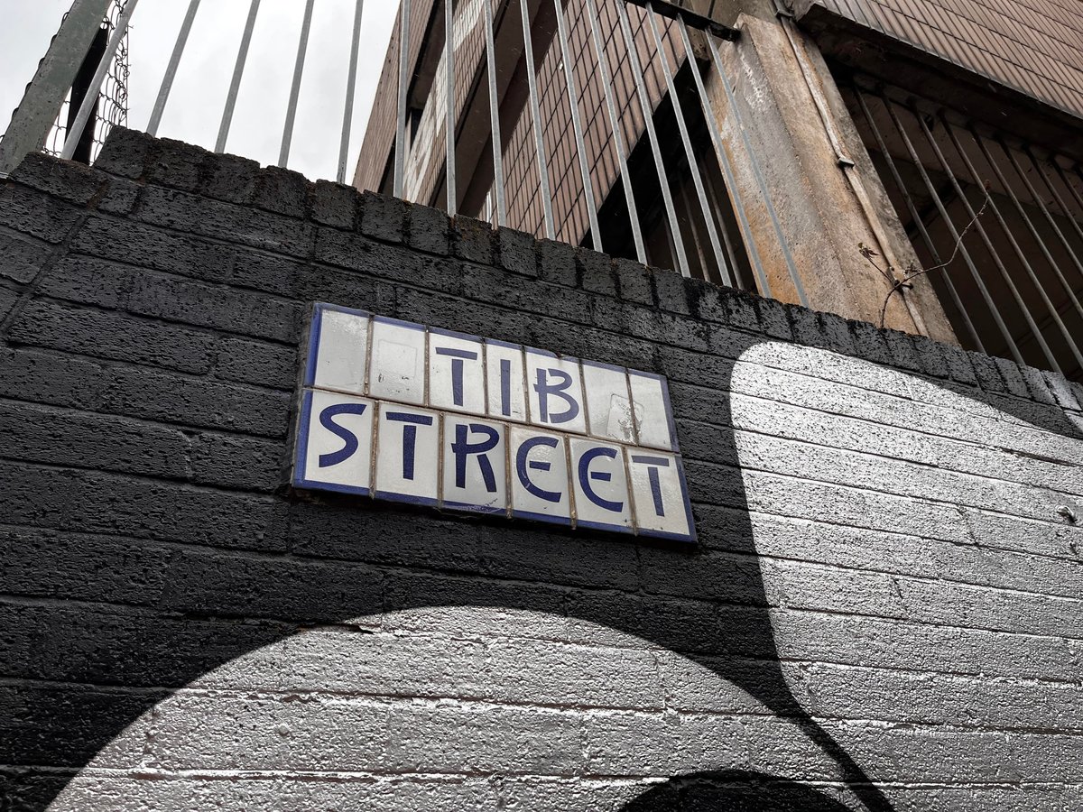
Thanks to L Kaye and the Manchester Local Image Collection there is a photographic record of Tib Street through the years.
Shot on 35mm black and white film, cautiously clad in gaberdine and trilby. The legwork aside the processing and printing of a whole heap of exposures was a gargantuan task.
The river’s source is a spring in Miles Platting , from where it flows underneath Oldham Road and the eponymous Tib Street to reach the city centre. After flowing underneath West Mosley Street, the Tib crosses Princess Street to flow underneath the Manchester Town Hall Extension, the Central Library and the Midland Hotel’s dining room, before joining the Medlock at Gaythorn (now First Street, close to Deansgate railway station.
The distinctive street signs the work of my old pal Tim Rushton.
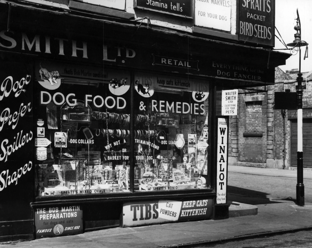
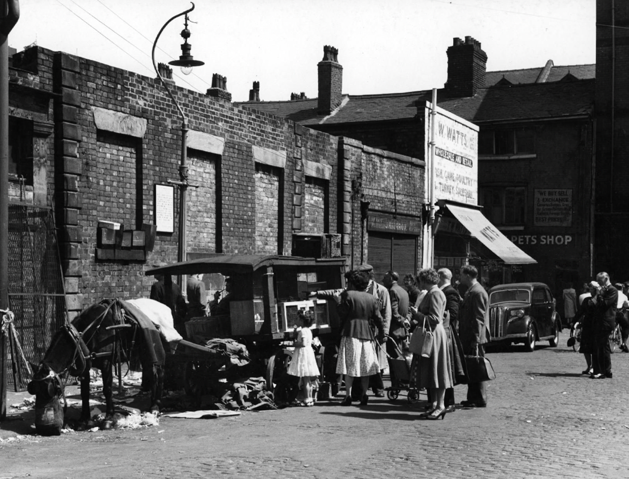
There are those who will remember Tib Street, as a street of pet shops.
Whilst on Sundays the area was transformed into an al fresco menagerie – a land of caged birds and cuddly coneys.
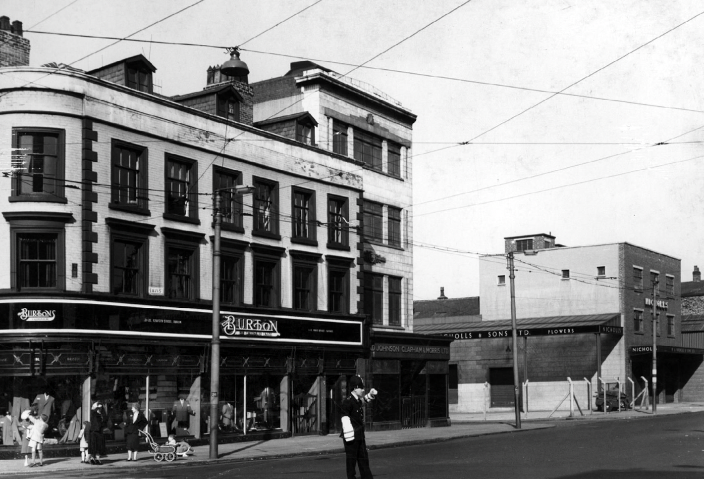
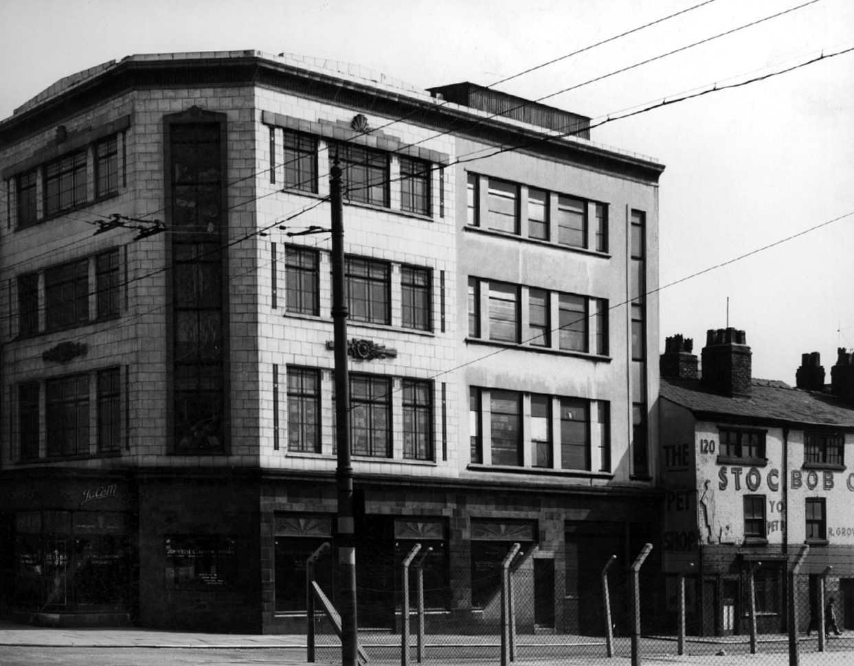
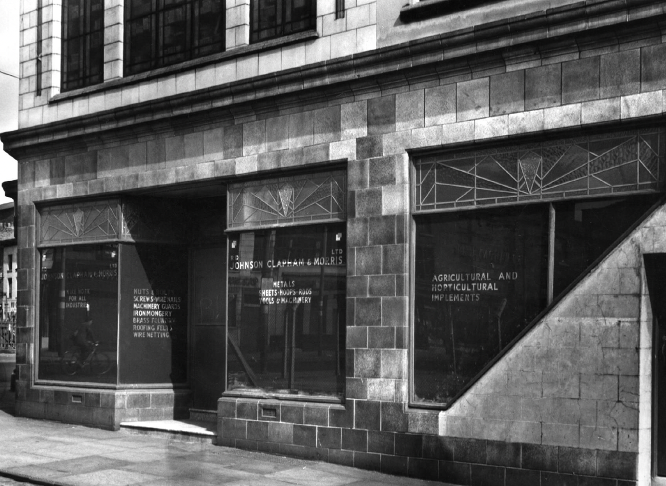
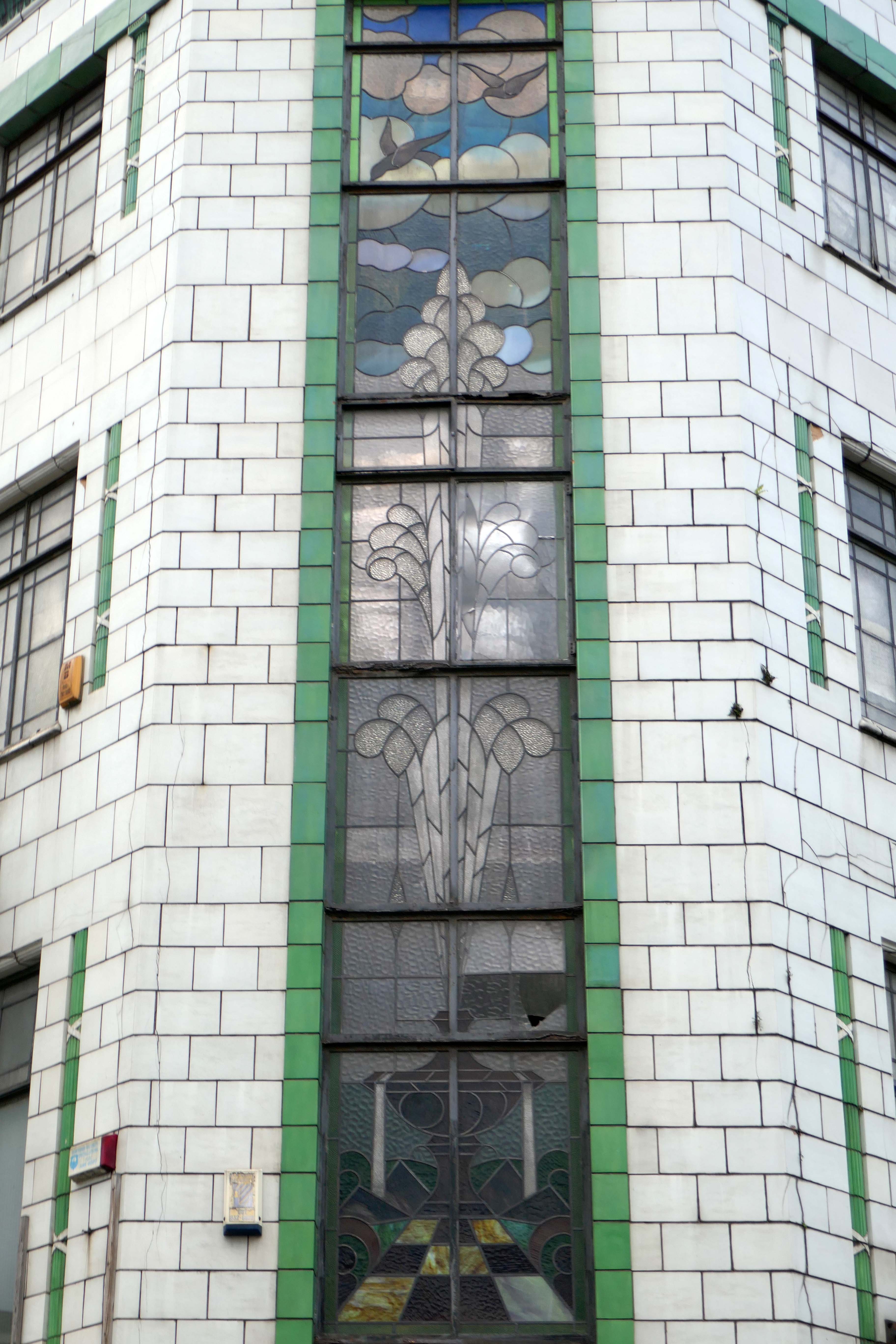
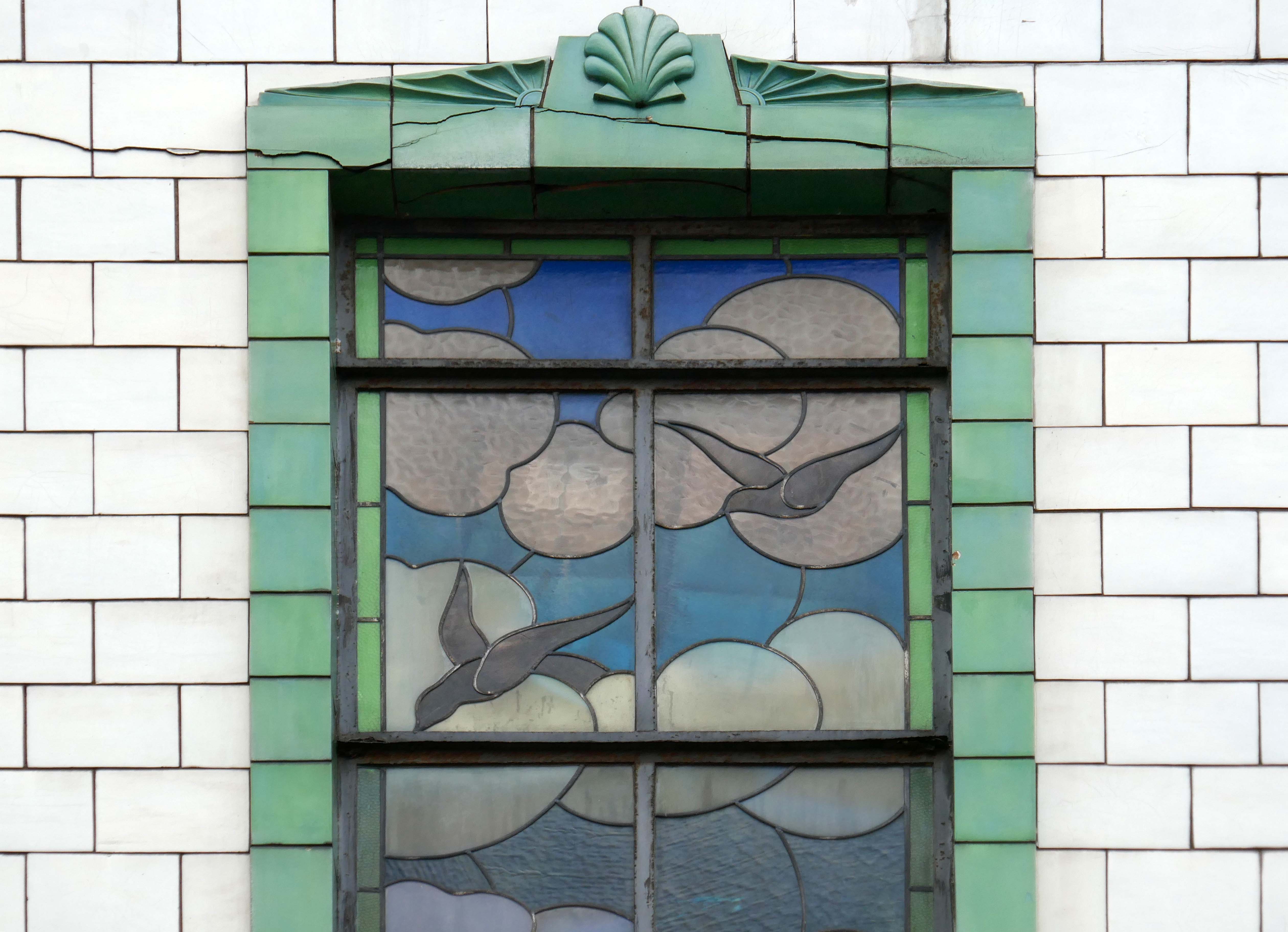
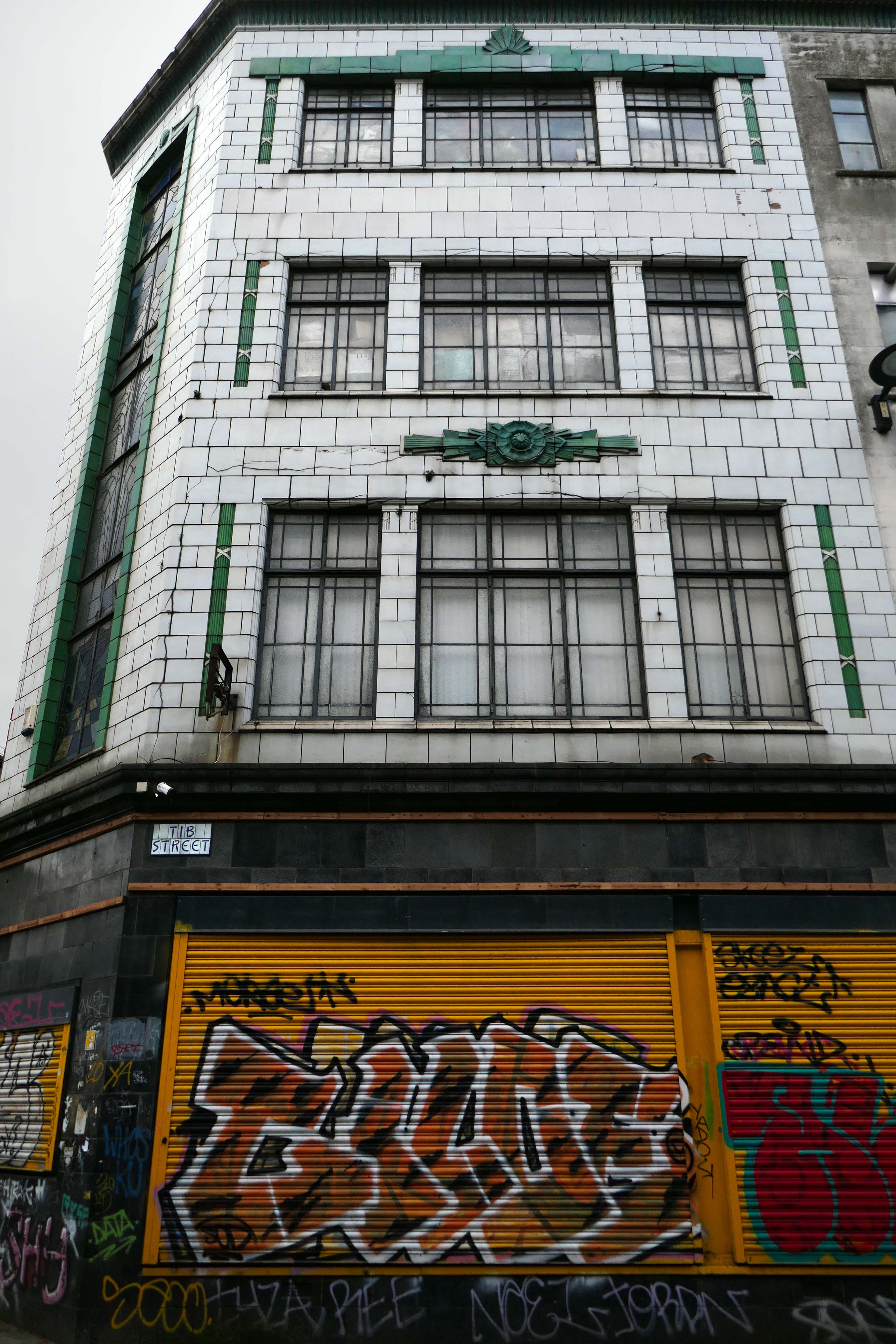
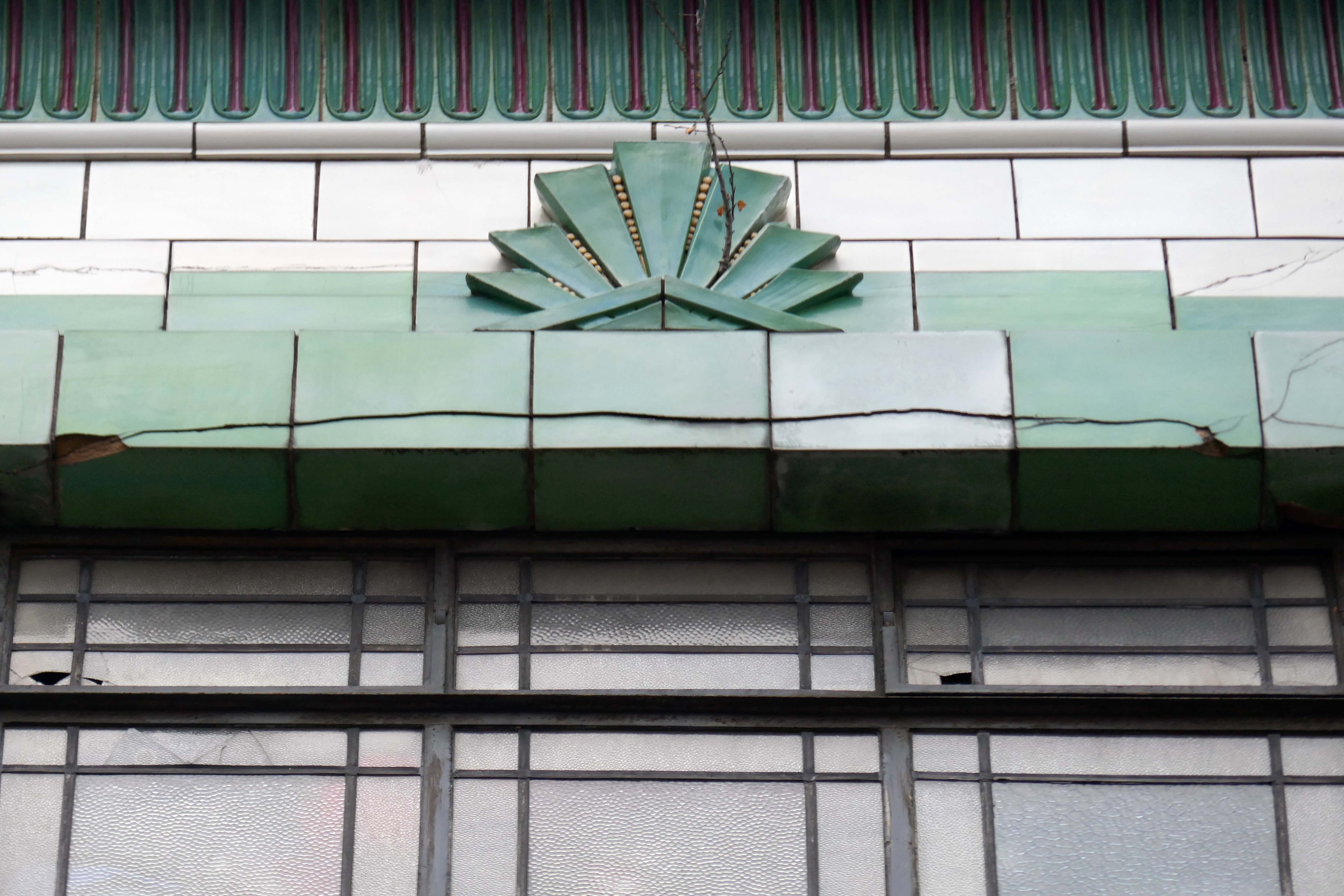
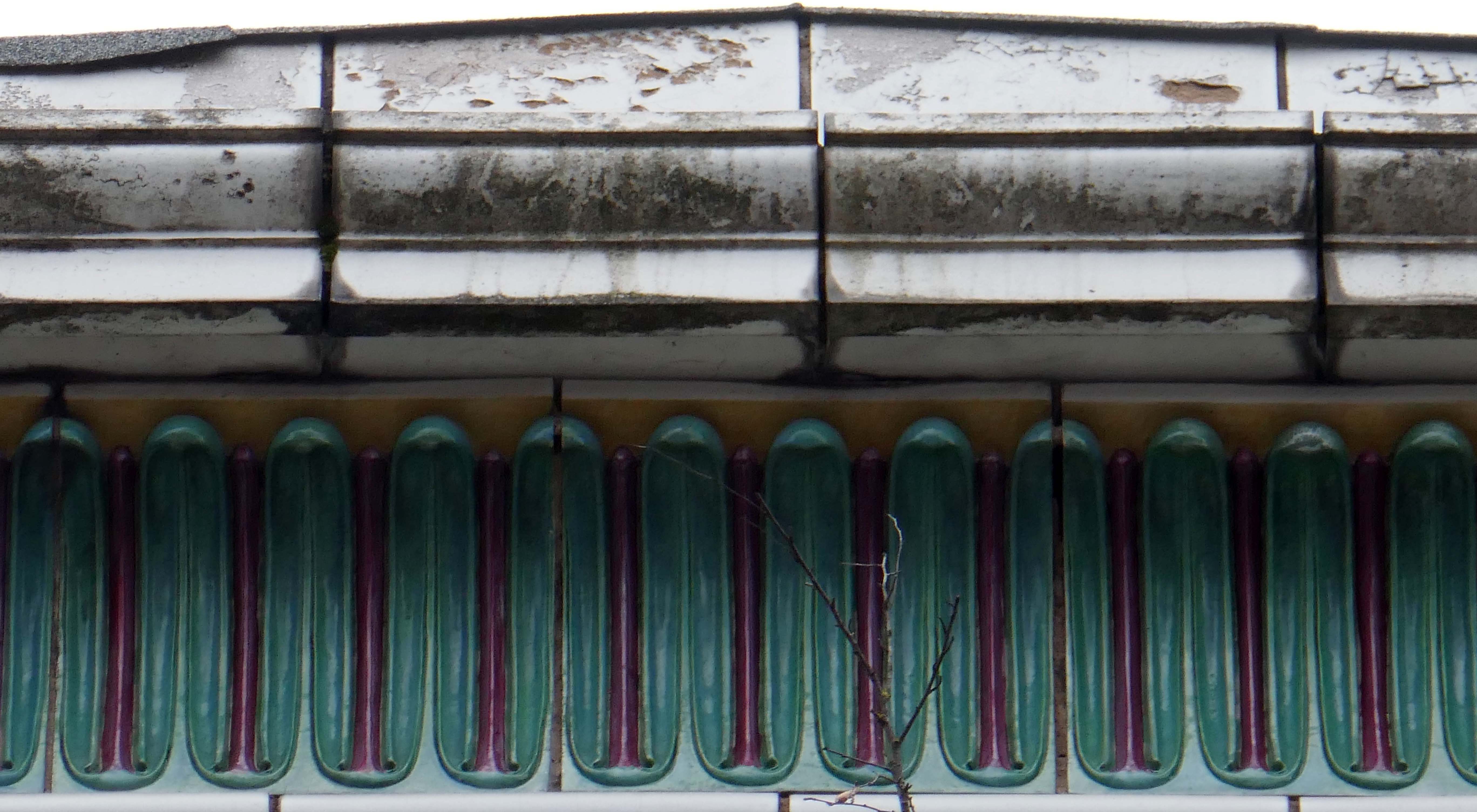
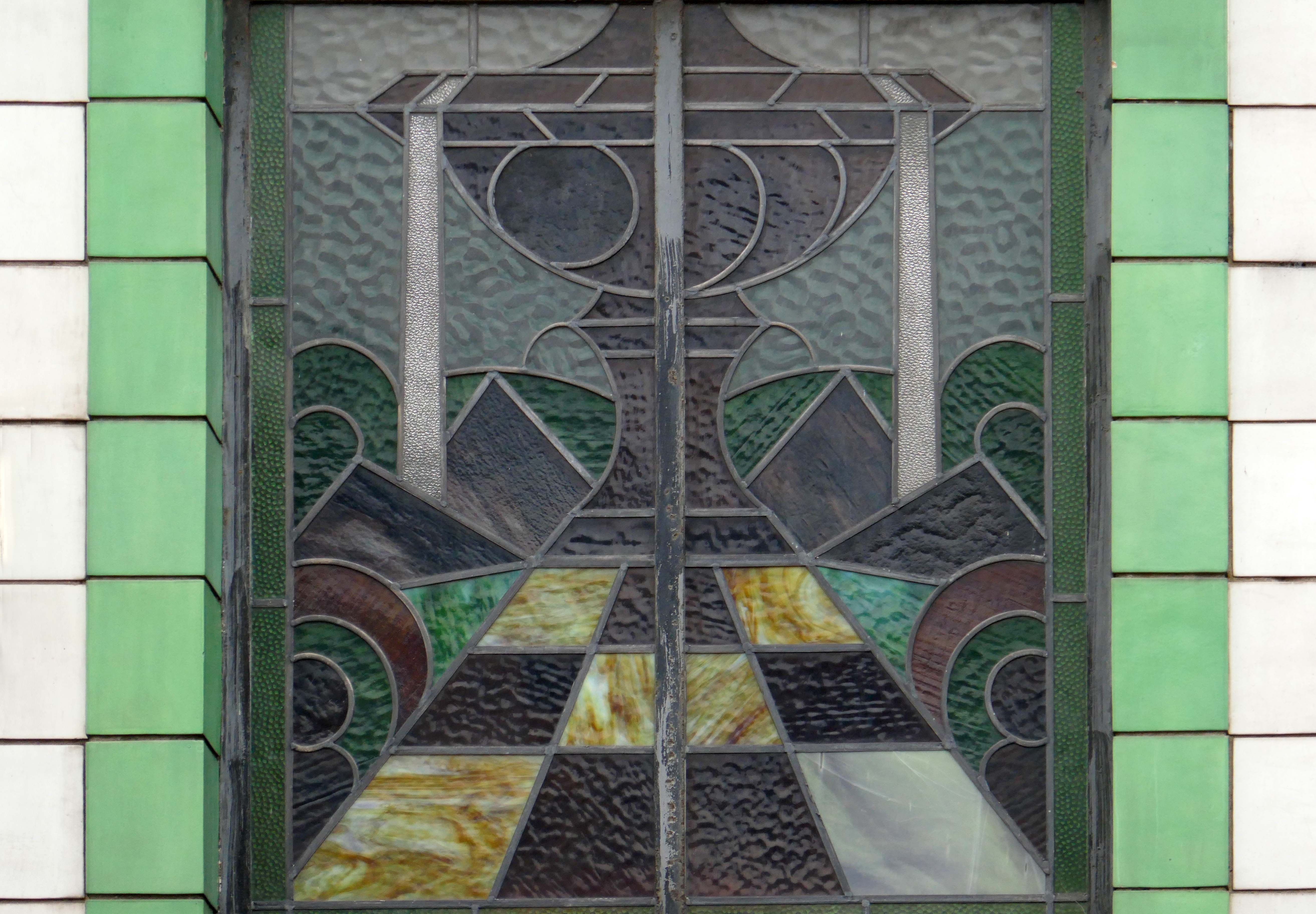
I have long been curious about the faience fronted shop on the corner of Tib and Swan Streets, it featured on my modernist mooch around the north of the city centre.
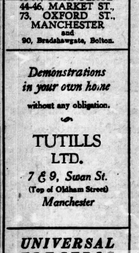
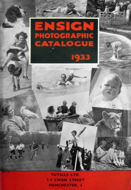
I have been informed by Lee Hutchings that it had originally been home to Tuttils Ltd.
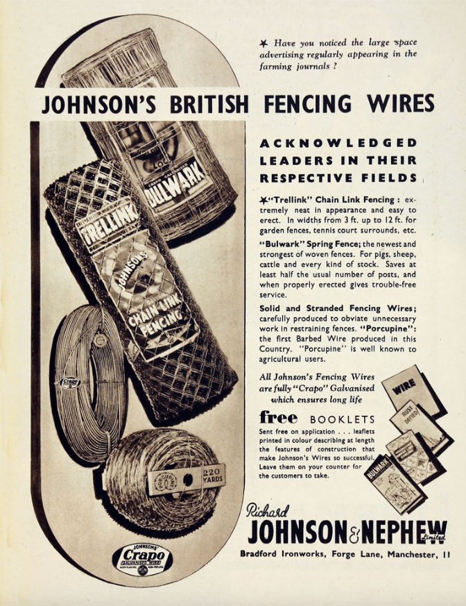
It was also, formerly the showrooms for local manufacturers Johnson & Nephew.
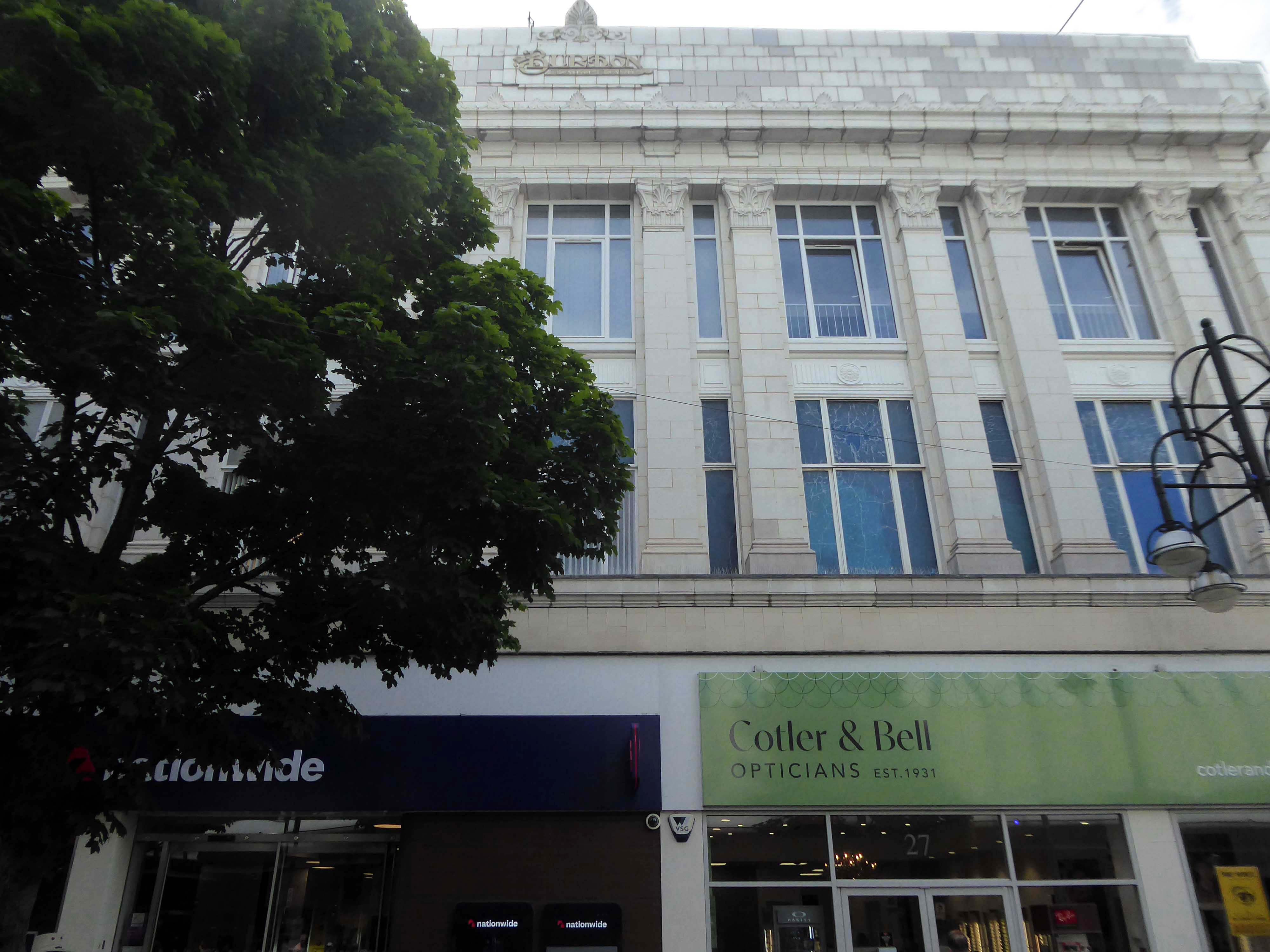
Here it is in 1959 – with a Burton’s for a neighbour.
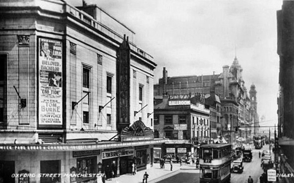
Pragmatic Manchester is far from awash with Art Deco – the lost Paramount/Odeon of Oxford Street comes to mind, demolished in 2017.
The Paramount Theatre was built in 1930 to the designs of architects Frank T. Verity & Samuel Beverley for the U.K. arm of the American Paramount Theatres Ltd. chain. The Manchester Paramount Theatre was a sumptuous American import.
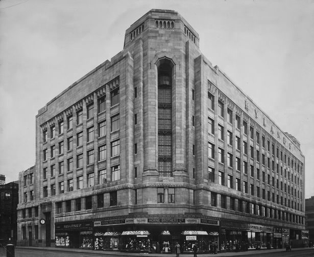
Along with the Rylands Building on High Street – currently receiving a facelift following the demise of Debenhams.
The building was originally built as a warehouse by J. Gerrard & Sons of Swinton for the Rylands textile company, which was founded by the entrepreneur John Rylands. That firm had occupied warehouses in High Street ever since 1822; its west-facing side is on High Street. The building was designed by the eminent Manchester architects, Fairhursts – Harry S. & P. G. Fairhurst, in an Art Deco style. It is clad in Portland stone and features a decorative corner tower and eclectic ‘zig zag’ window lintels. The work was completed in 1932.
Rylands will be sensitively restored to its elegant past. The building will comprise workspace, retail and leisure, creating an exciting new destination in Central Manchester.
I began walking when quite young, then like Felix, I kept on walking, walking still.
The photograph was taking during the Whit Walks in 1958 – aged three, I was engaged in religious pilgrimage, as we know there are many reasons for walking, this is but one.
I was fortunate to grow up at a time when youngsters were permitted to roam freely, less traffic, less anxiety, gave me access to a wider axis of exploration.
The photograph would have been taken I assume, by my mam, on the Brownie 127. When aged nine I wandered alone through the local woods and exposed twelve frames of 44mm 127 film, the prints are long gone, yet I remember each of the photographs and locations clearly.
I went to school, then I didn’t, then I went to Art School, eventually becoming a teenage Constructivist, tutored by Jeffrey Steele, a leading light in the British Systems movement.
The rigidity of the grid, symmetry and orthogonal framing have stayed with me.
Then I went to work for a very long time indeed, then all of a sudden I didn’t. Taking early retirement aged 59 some ten years ago, subsequently taking to the roads, streets and hills of Britain in search of nothing in particular.
In recent years there has been a rapid development in the culture of walking, theories, films, guides, songs and literature. I am fully cognisant of such, yet believe at heart that walking can be free of such baggage, we can stride unhindered, atavistic and carefree/less.
Walk tall, walk straight and look the world right in the eye.
Getting lost is about the unfamiliar appearing.
In my own small way, I have become part of that baggage, having been asked to lead a walk around Stockport by the the modernist neé Manchester Modernist Society.
The photograph depicts Alan Boyson’s concrete screen wall, attached to the former Cooperative super store designed by Philip Andrew. The two worked to gather on the Hull Cooperative store, which is adorned by Alan’s huge Three Ships mosaic.
Philip was a childhood friend of Alan Boyson and it was Alan’s father, manager of the Marple Co-operative Society, that recommended Philip for an apprenticeship job in 1951 to the chief architect at the CWS in Manchester HQ.
In preparation for the tour, I visited the town’s Local Heritage Library and read extensively from serendipitous charity shop finds.
The two hour route was designed around an economy of distance and elevation, allowing time for others to take in, what may be for them unfamiliar surroundings. A group of around twenty or so folk became sociable and engaged, with a suitably concise and apposite contribution from myself. There are those who busied themselves taking snaps along the way, chatting amiably or simply gazing in amazement.
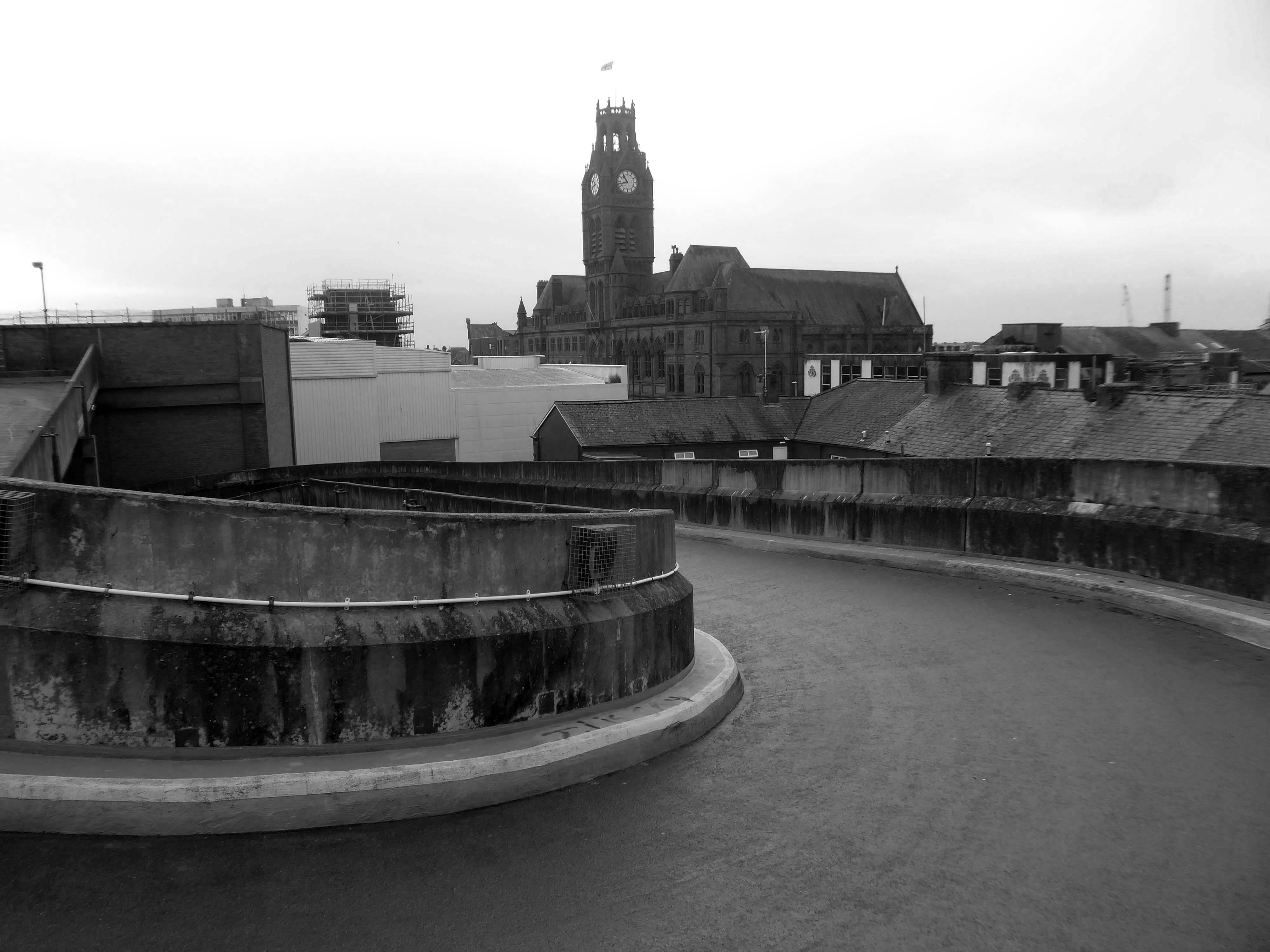
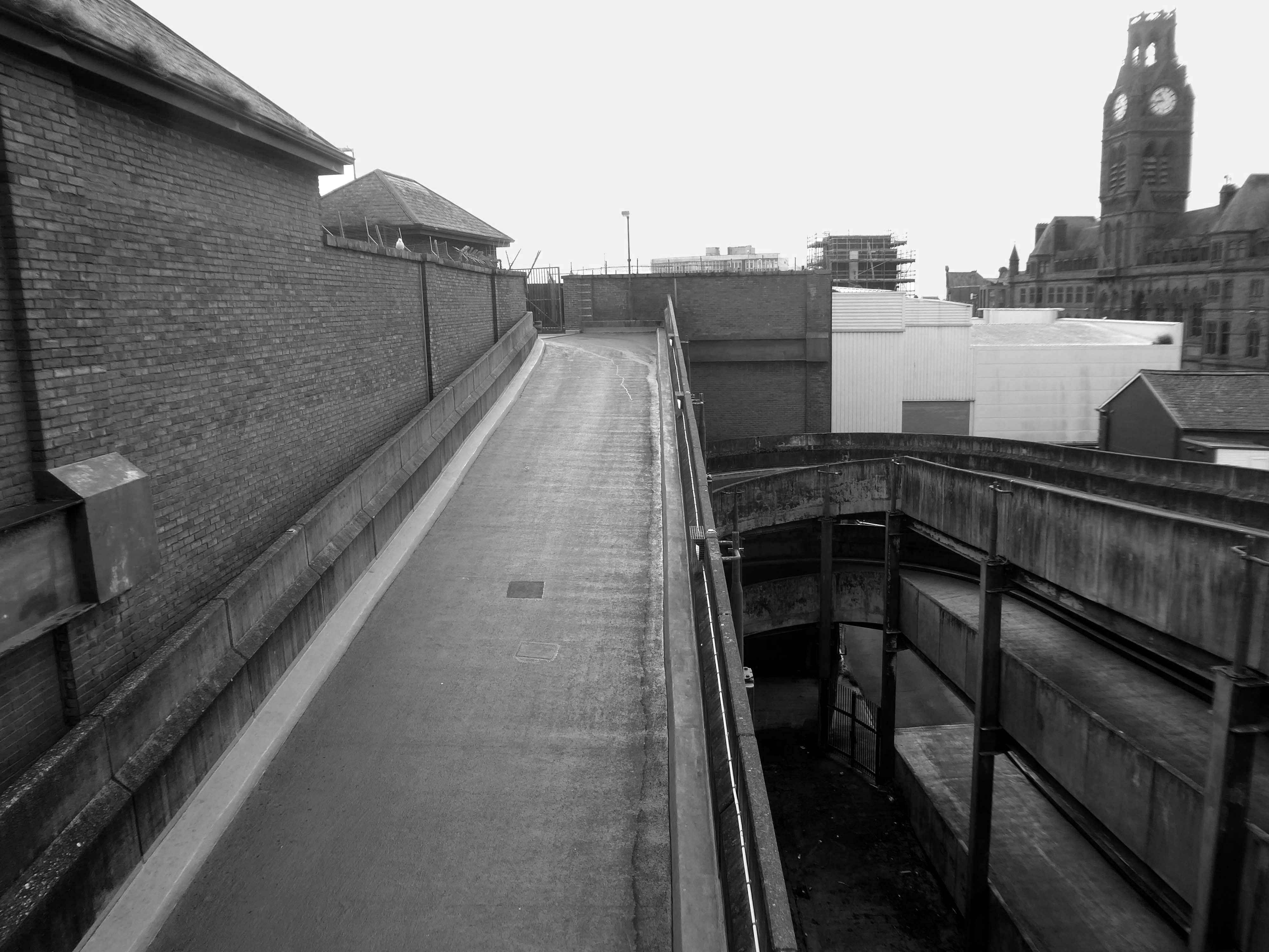
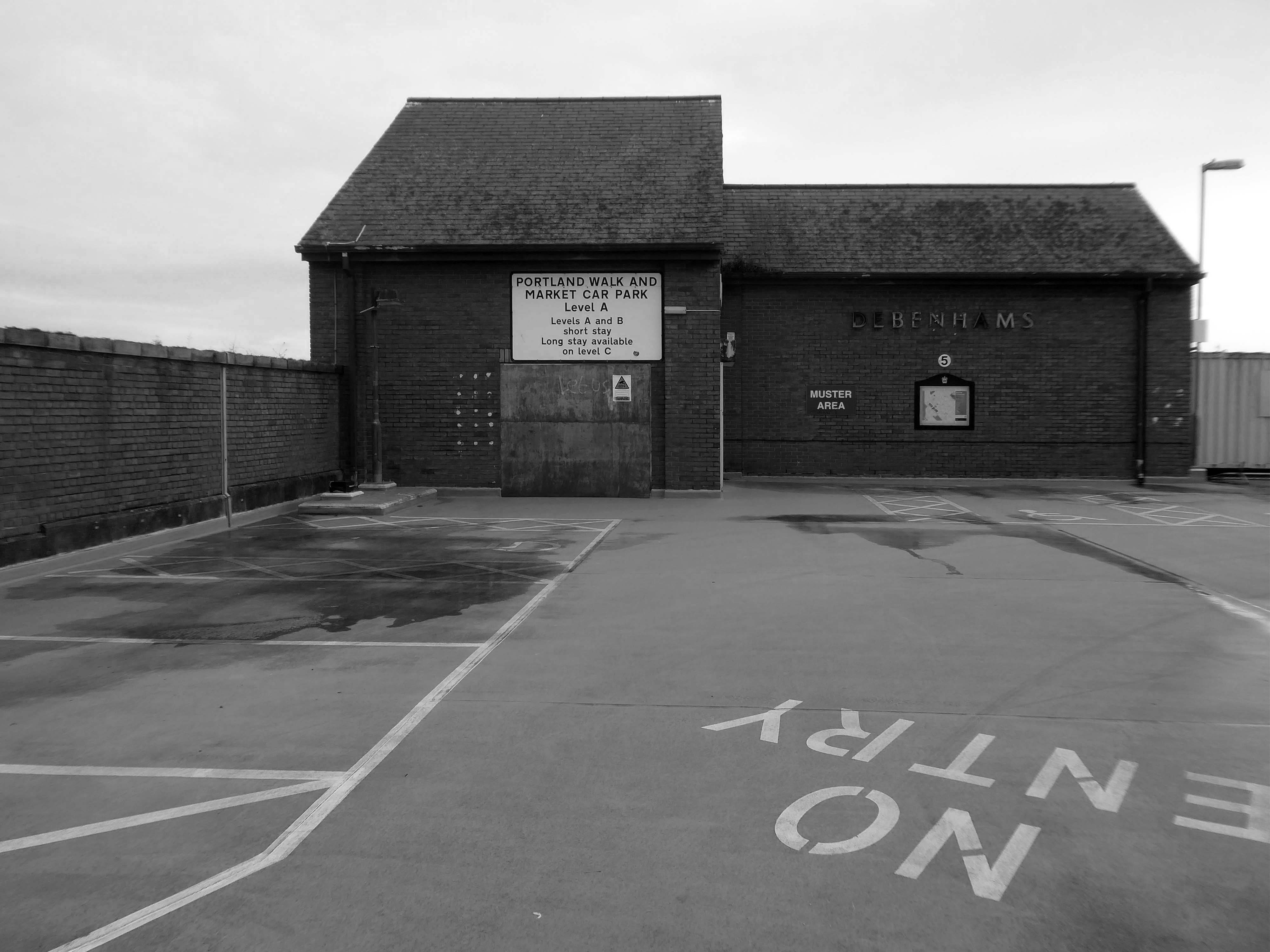
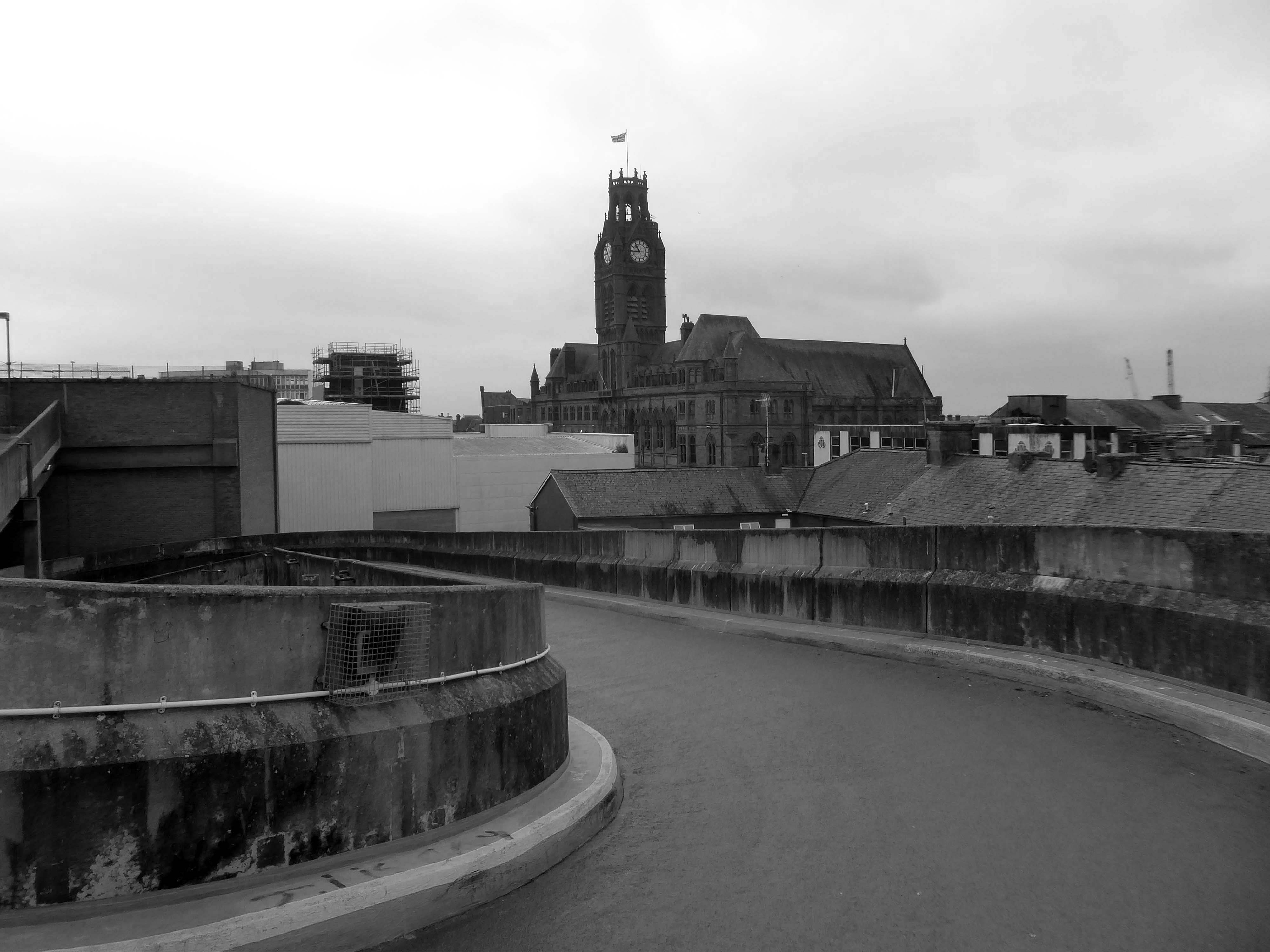
The service building above the former Debenham’s store.
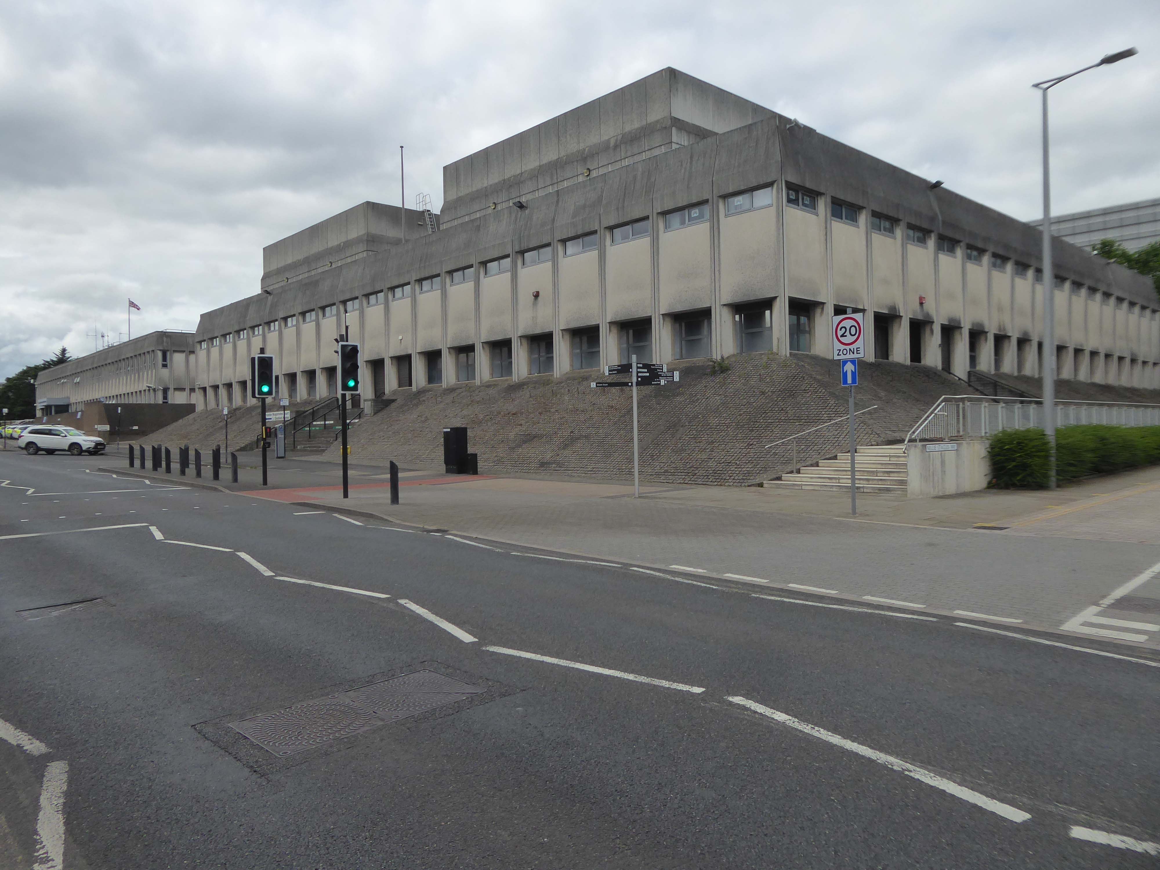
Famed as an imaginary TV police station, this civic building is a civic building I simply can’t resist. I return on a regular basis to wander and snap. This is an open public space that seems little loved and has few visitors.
From then onwards I have been taking folks on Modernist Mooches on a regular basis, two or so a month, during the less inclement times of year.
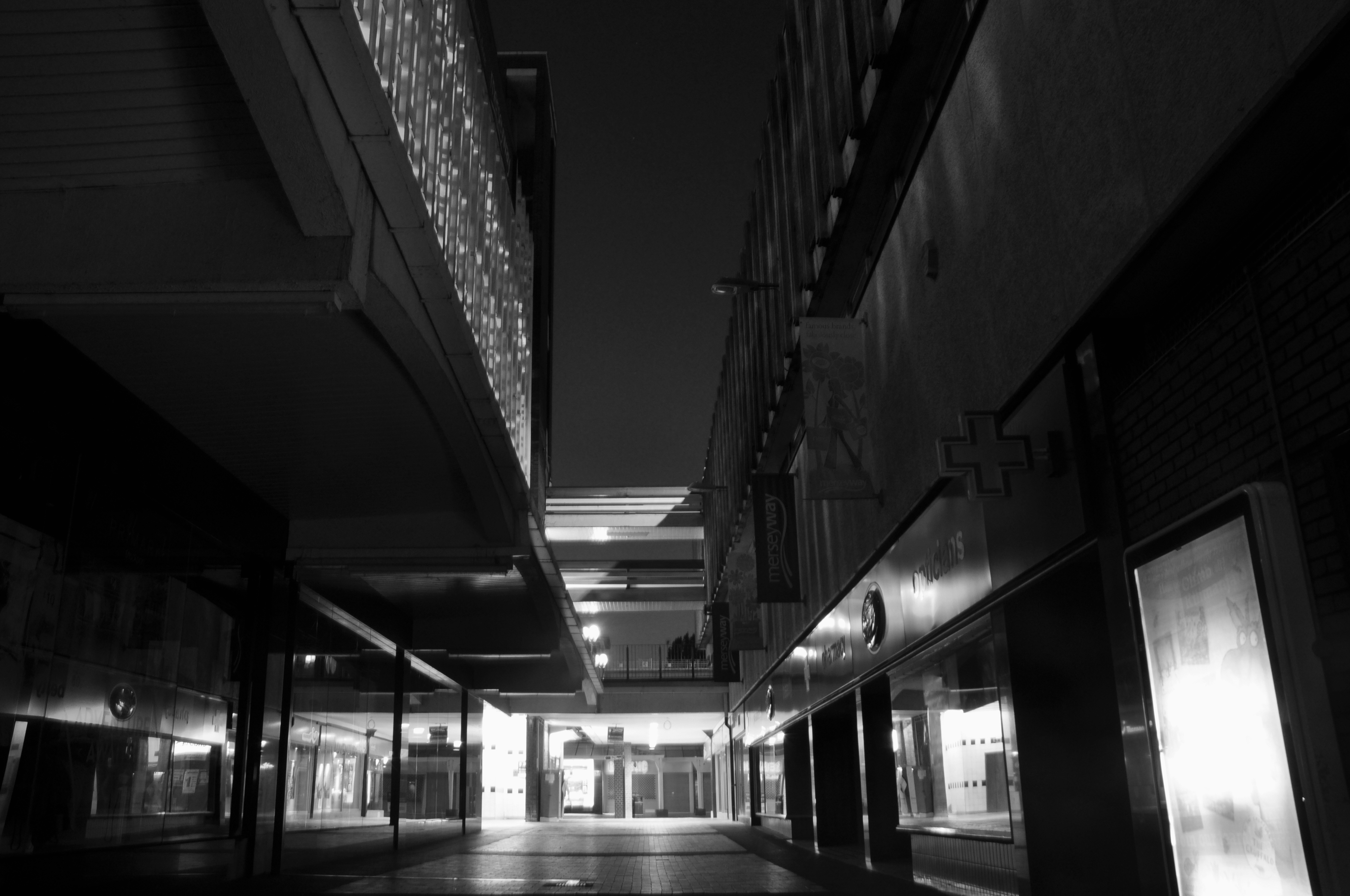
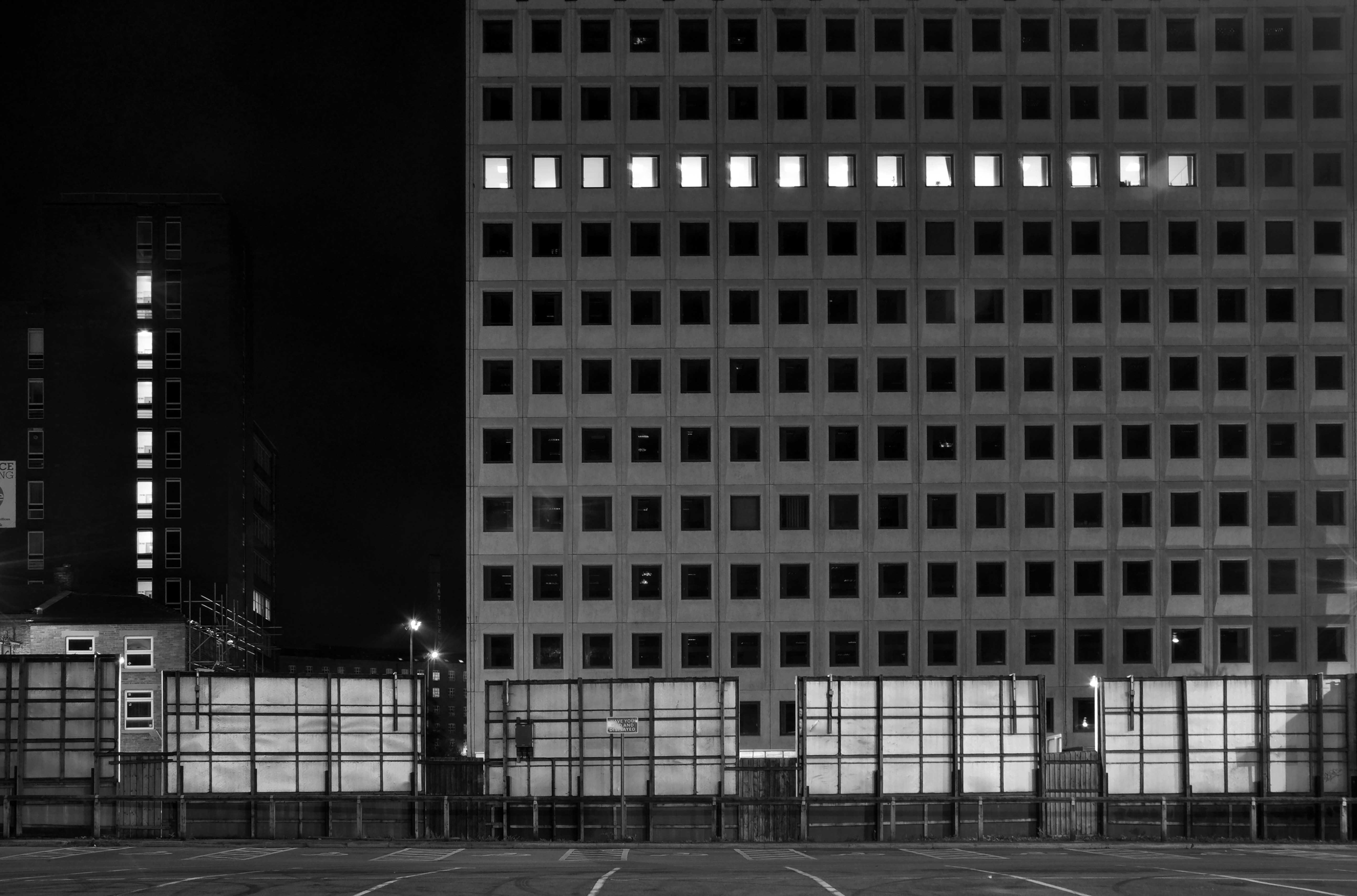
At about the same time I was asked to exhibit my photographs in Stockport, I chose to mooch about at night. Walking around an almost deserted town, avoiding the glare of streetlights, there is a mild frisson to be about when nobody else is about. The air feels different, exposures are longer, the almost waking world feels arrested, by the low available light.
My local shopping centre and as such part of my weekly walking and shopping life.
NCP Car Park located on Stockport Station approach.
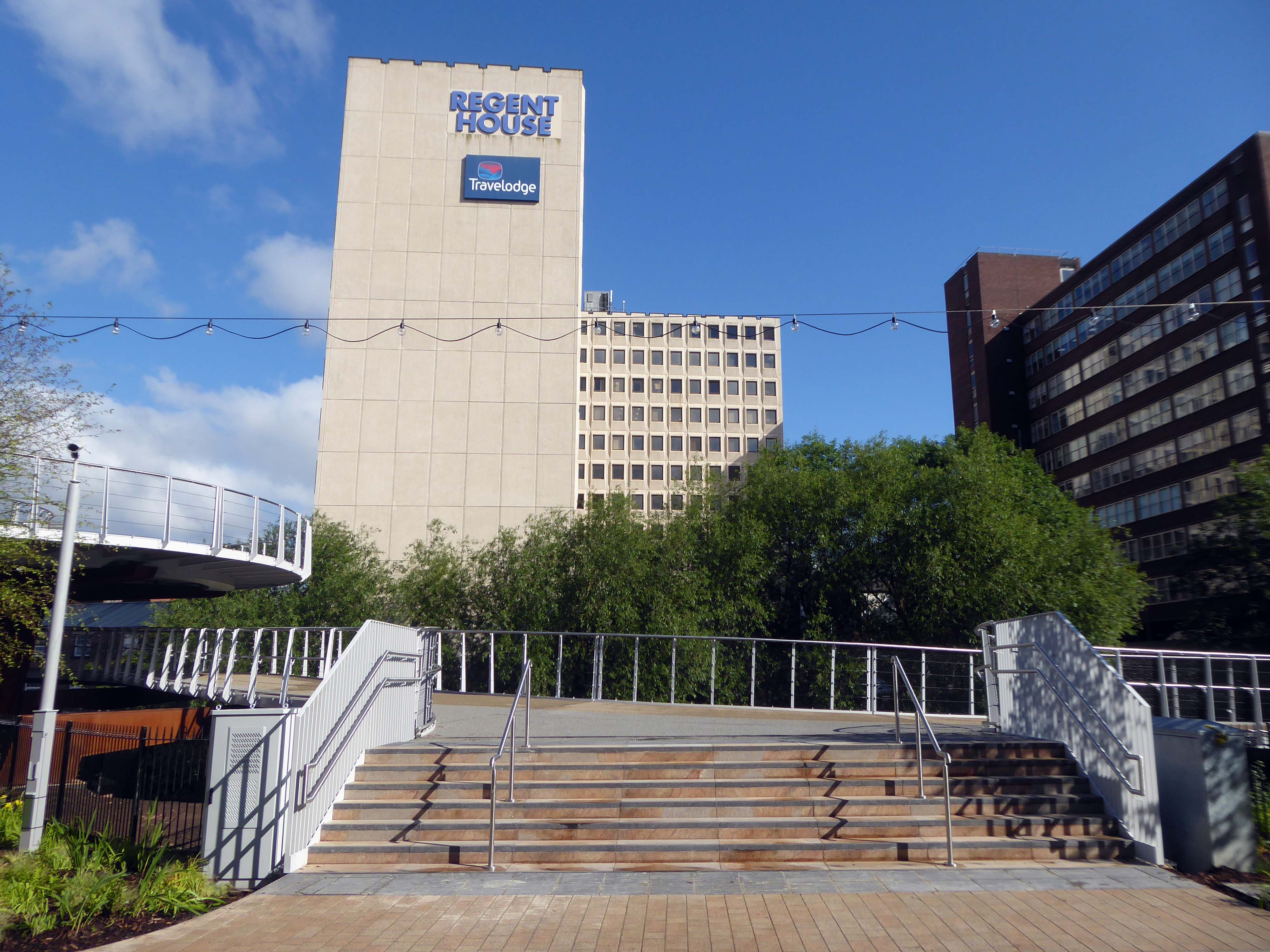
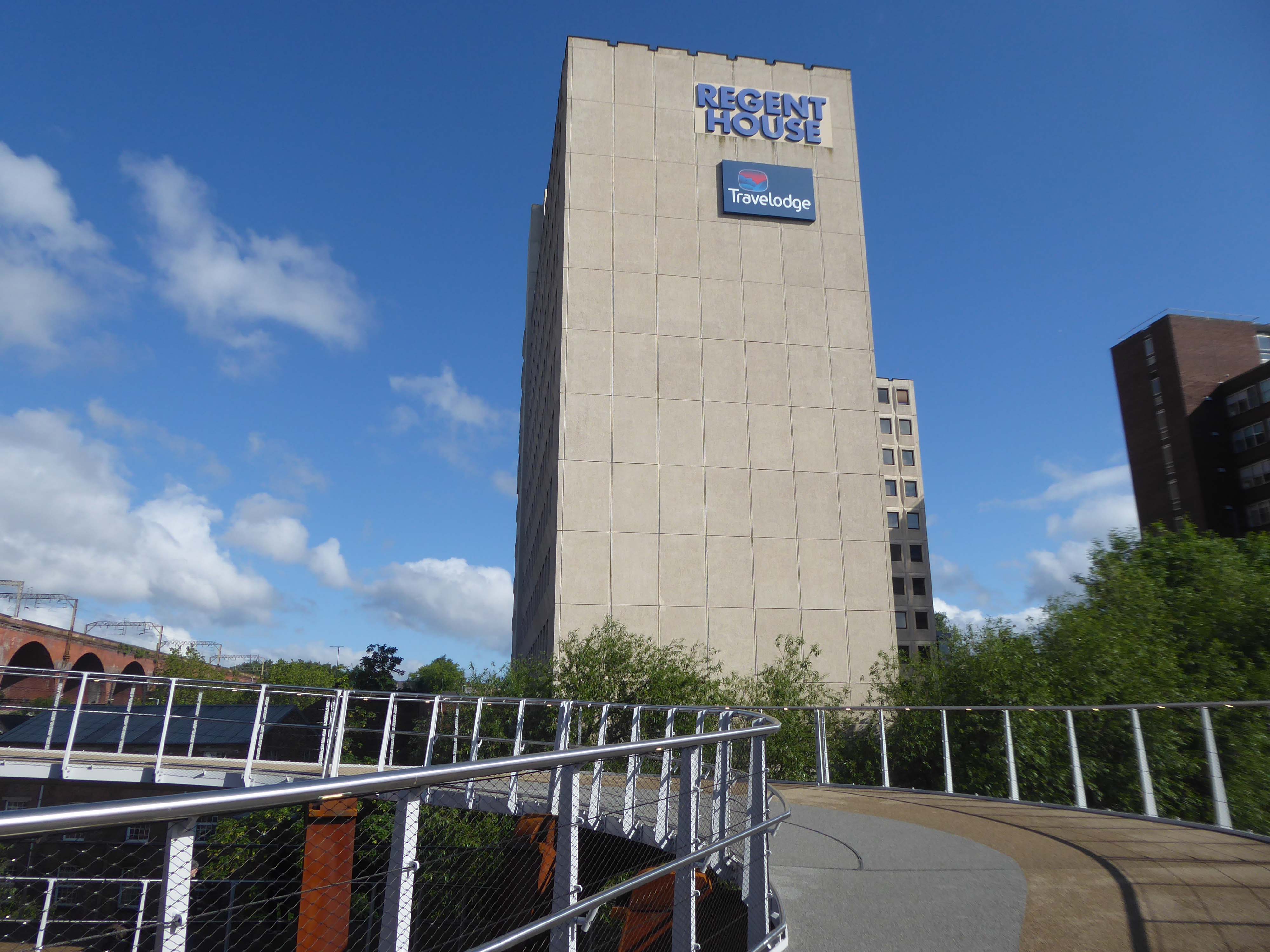
Regent House
Asda superstore
I found a copy of Charlie Meecham’s book Oldham Road in a charity shop.
Inspiring me in 2014, to walk in mostly straight lines, though often as not zig zagging along the main arterial roads of Manchester.
Taking pictures on Sunday mornings, in order to avoid traffic, mildly amused to be ignoring the primary function of the routes.
This is one of the more familiar roads, having walked up and down several times over several years. It was to have been an extension of the Mancunian Way, forming a trans-pennine motorway. Much of the property lining the route was cleared in preparation, it was never built, and for years a strange semi-deserted ambience hung over the A57.
Bus Depot
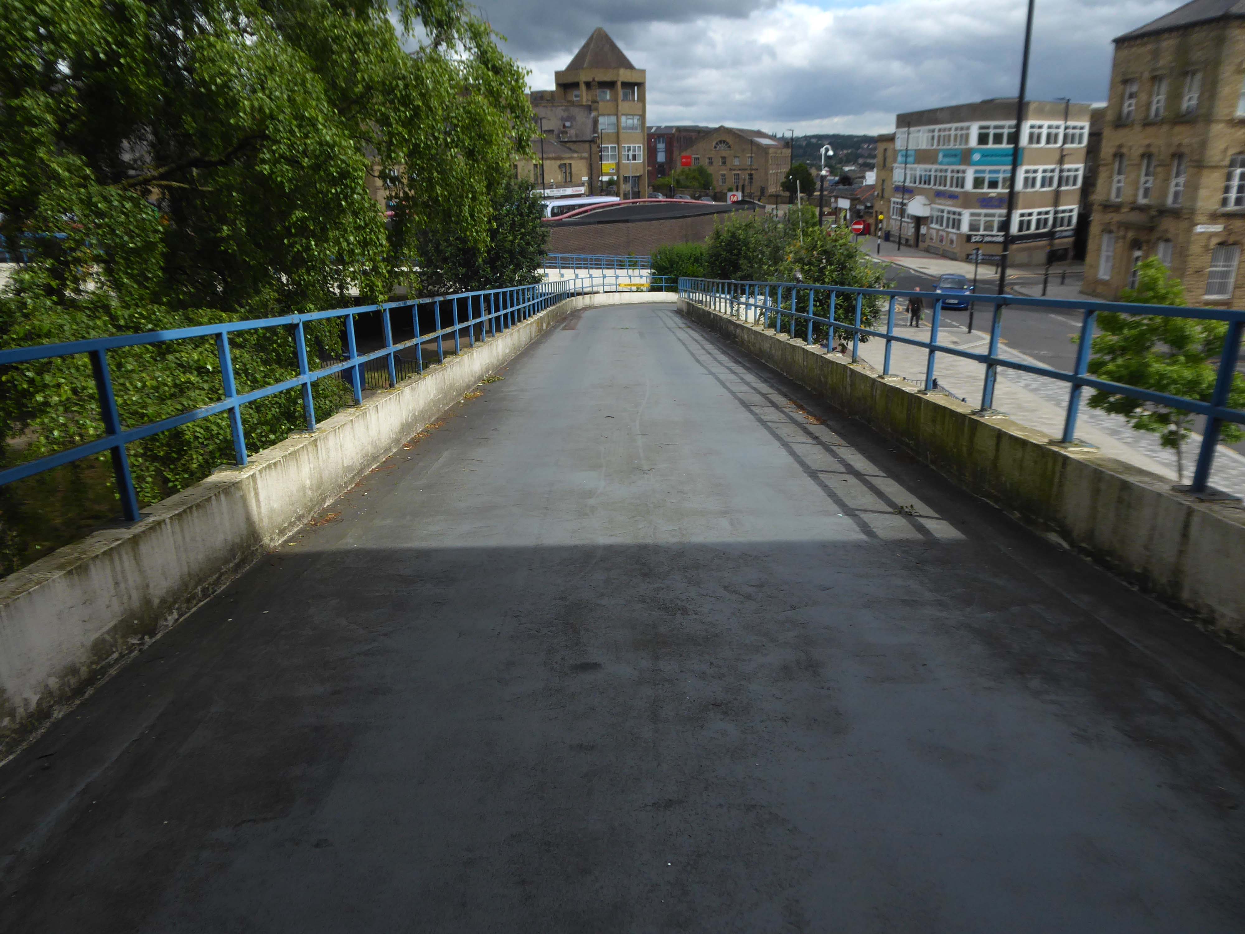
Railway Bridge
The car showrooms which later became an African Evangalist church.
Having cleared away both Victorian and Sixties housing, new architectural forms arose in West Gorton.
Now, everywhere I go, I see launderettes – so arriving in Hanley with time on my hands, wandering around I found this exemplary example.
Having a blog entitled Manchester Estate Pubs, the national media became interested in my photographs. I had spent quite some time, wandering around in search of this endangered architectural typology.
This was Billy Greens in Collyhurst, named for a local boxer, now demolished.
Which in turn became the second modernist calendar.
Followed the following year by fish and chip shops.
So building a vocabulary for my mooching, discovering yet another chippy, laundry, pub, Burton’s, telephone exchange, glazed stairway or underpass.
These things find you, yearning for some small amount of attention and affection.
The Trawl – my favourite peg board menu, my favourite Bridlington chippy.
We are now coming to the end of the car park year – seen here on the wall of my command centre.
Home to William Mitchell’s Totem, the homes long gone and the Council pledged to move the totem too.
The state of play this week, the detritus removed and the base filled in, repaved and safe for a while.
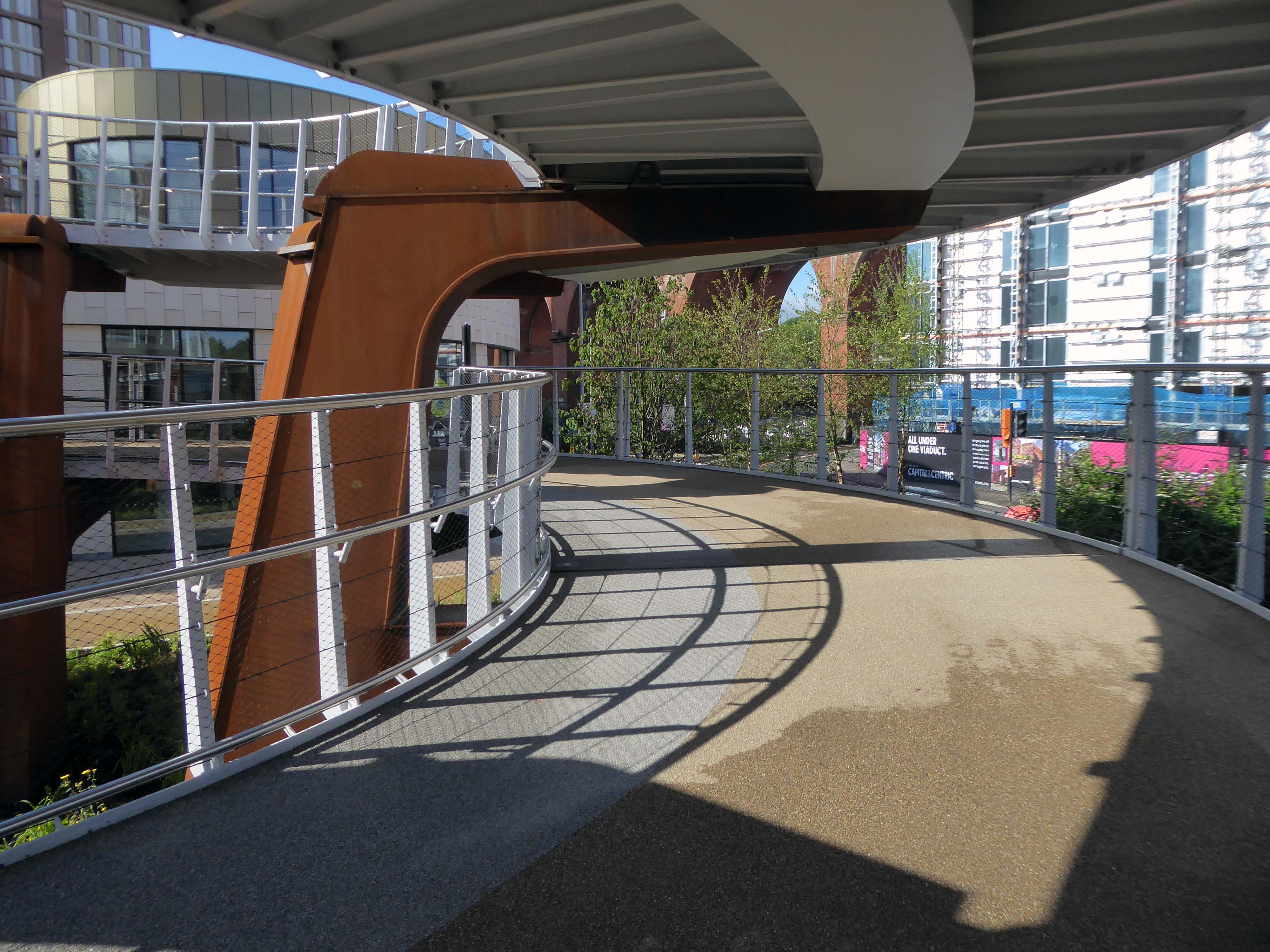
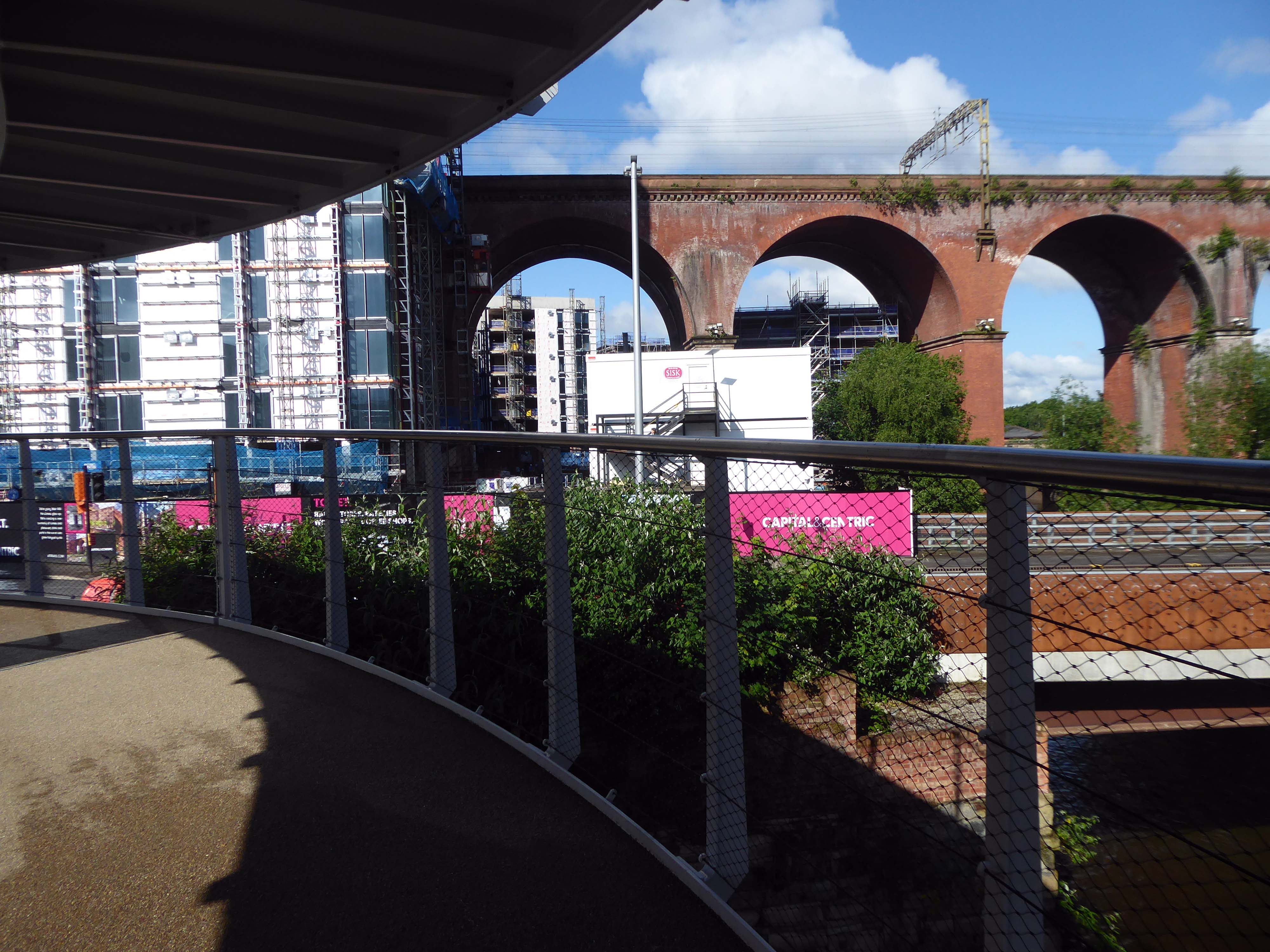
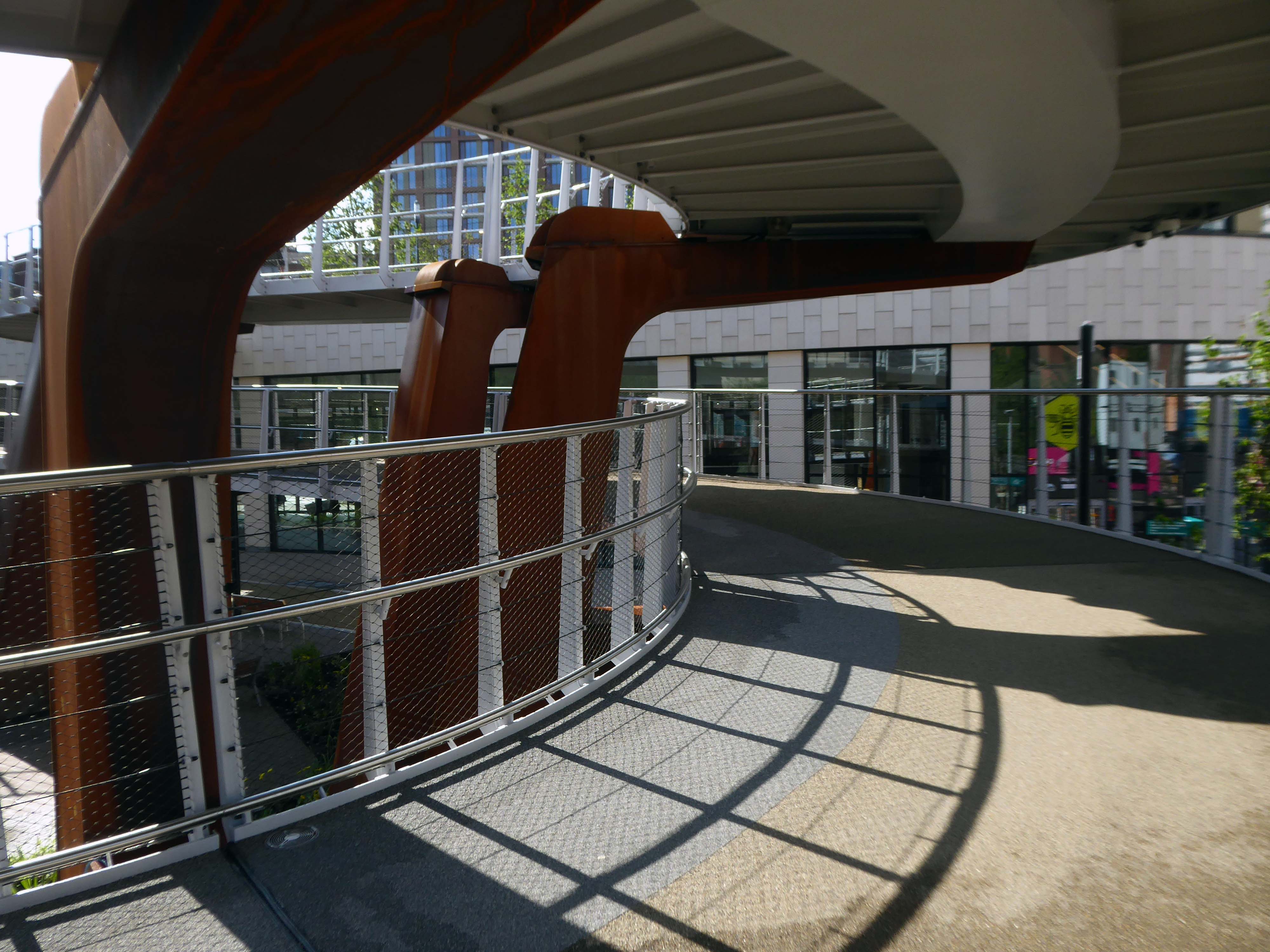
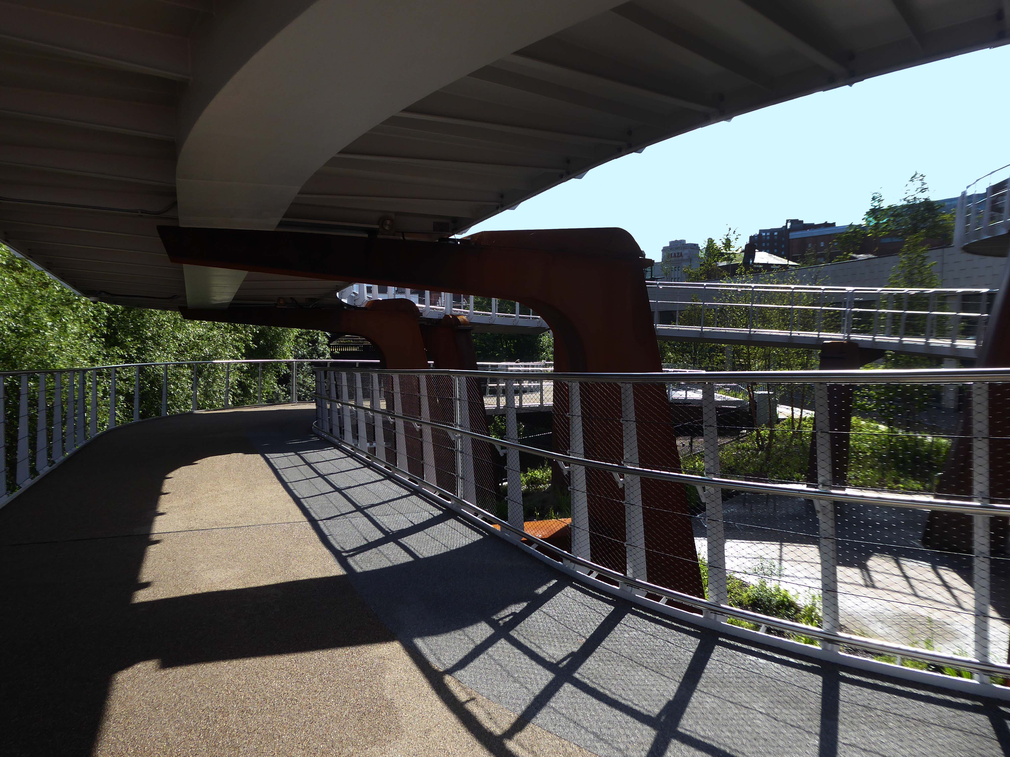
Off now to the Weaver Valley another day another river, passing under Weaver Viaduct
The looking toward KouraGlobal – leader in the development, manufacture, and supply of fluoro products and technologies, opened a new HFA 152a production facility at their Runcorn site in the UK.
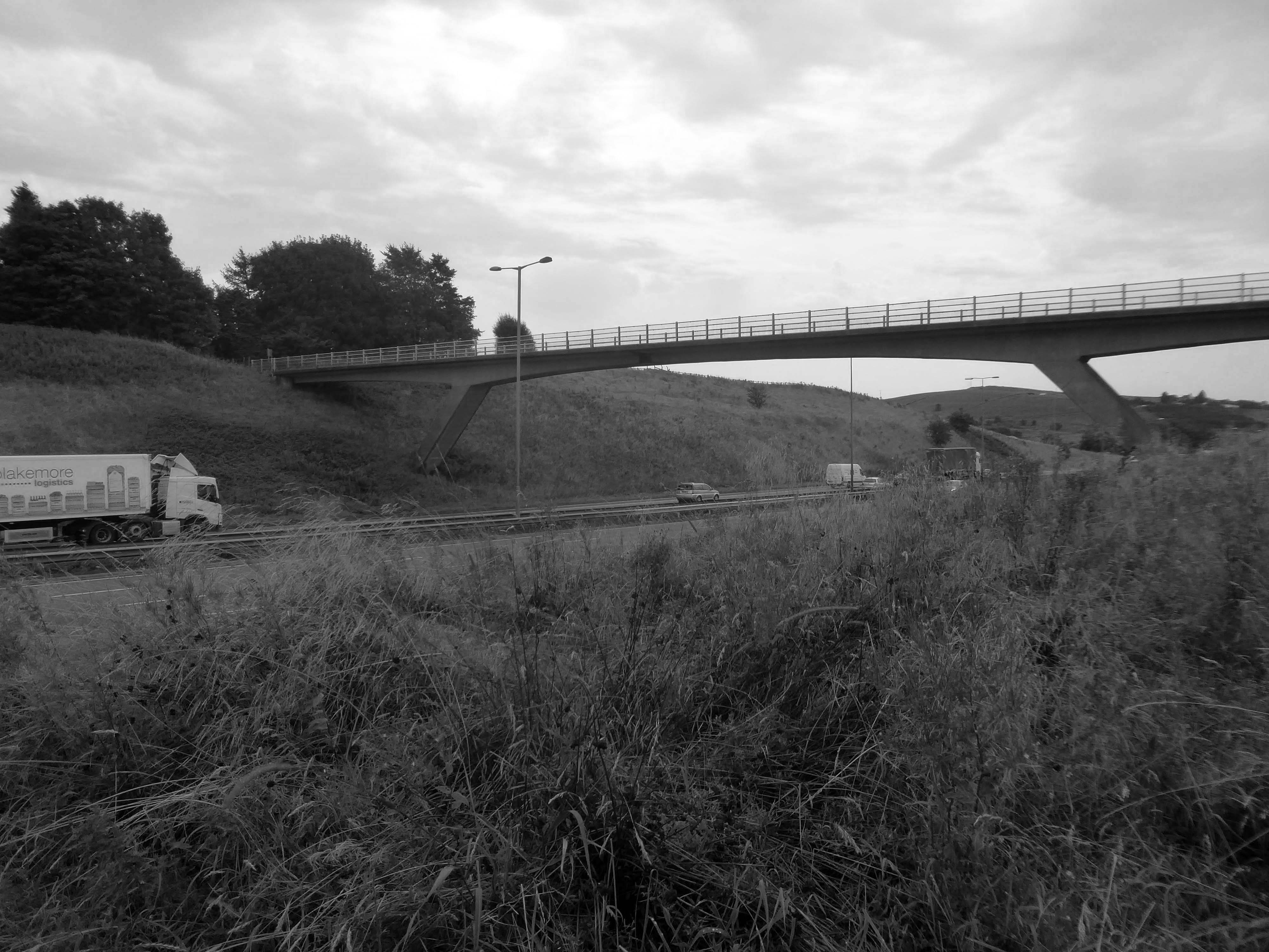
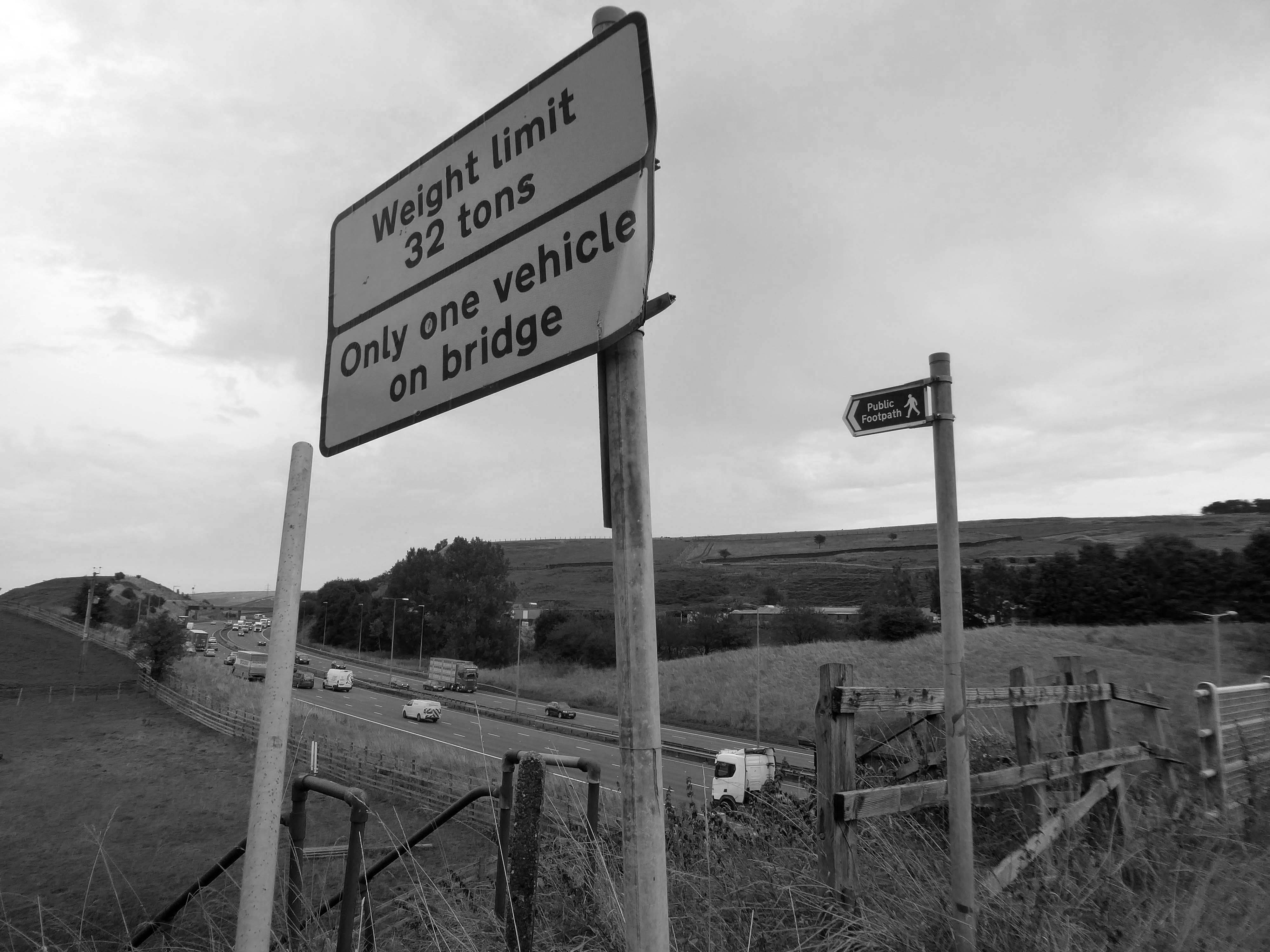
Further rural Modernism as we pass under and traverse the M62, whilst walking around the Piethorn Valley
The newest of the Modernist Mooches was to Burnley where we visited the Keirby Hotel.
The former GUS Offices with a mural by Diane and William Morris.
Plus the Charles Anderson concrete relief at the Crow Wood Hotel.
Finally a little light relief – a visit to the Boots factory in Nottingham.
Having innocently board a bus outside the station with a Boots head code , I alighted within the factory gates. Then innocently walking around taking snaps, unheeded until the men in the van stopped me in my tracks.
Who are you, what are you doing?
I am the Modern Moocher going about my business – well it turns out this was not permitted and I was red carded by the earnest security guards and asked to leave forthwith. Suitably rebuked, I politely bade them farewell and headed for the gates.
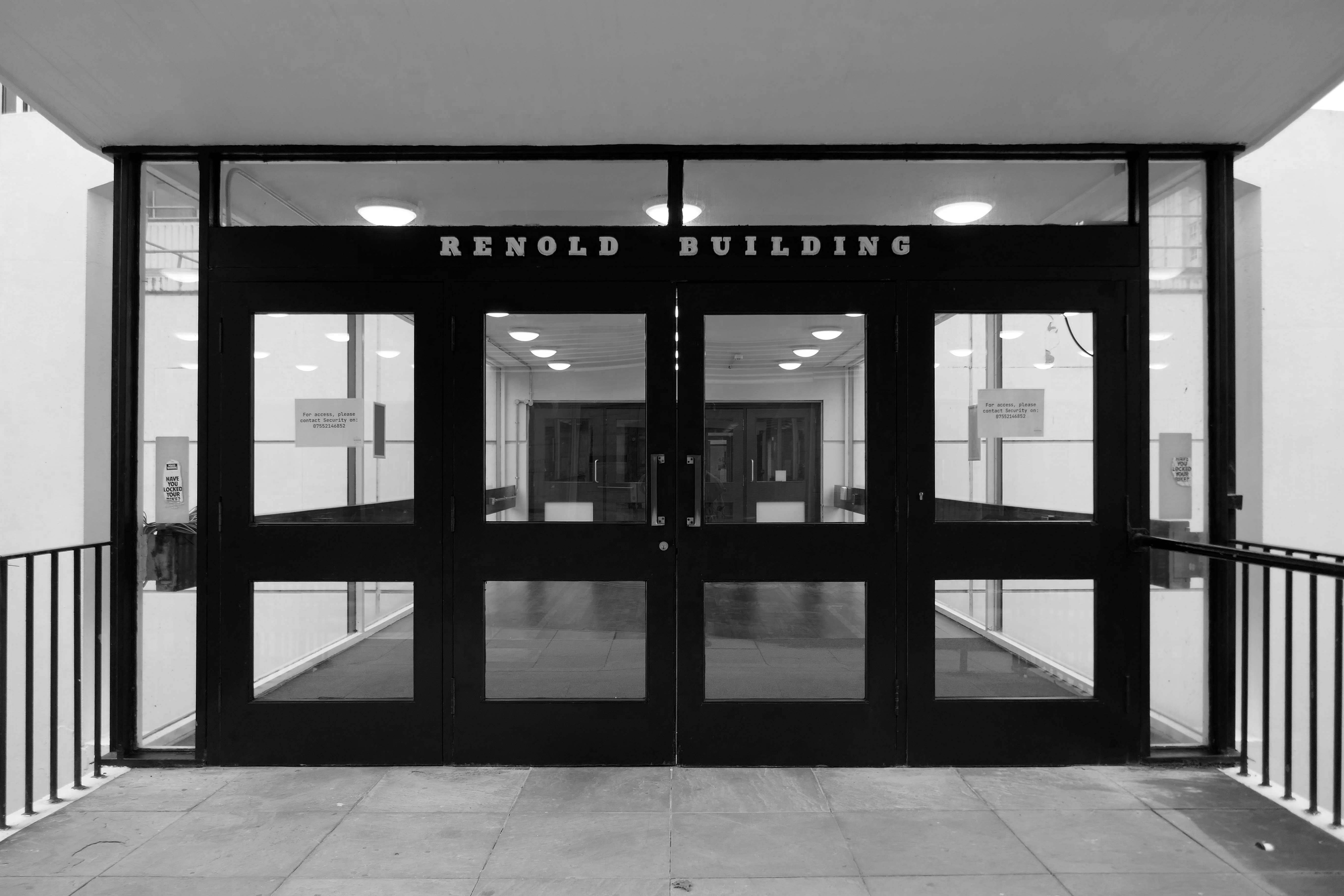
Along with the Renold Building– which is already home to start up tech businesses.
The city council has approved Bruntwood SciTech’s change of use bid to transform the 110,000 sq ft Renold building into a tech and science hub.
In a joint venture with the University of Manchester, Bruntwood will create 42,000 sq ft coworking and business incubator spaces for businesses in the sector at the Altrincham Street building.
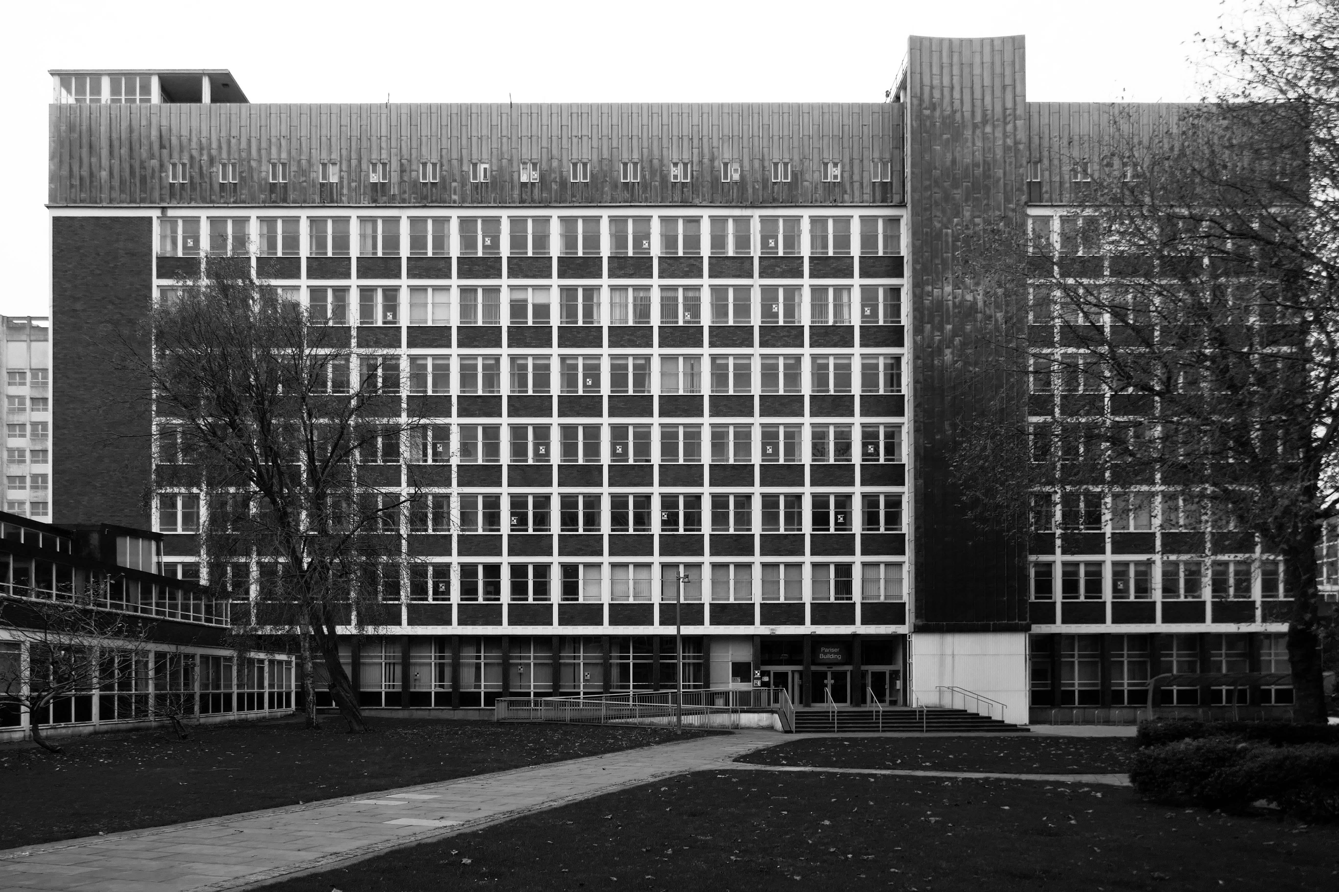
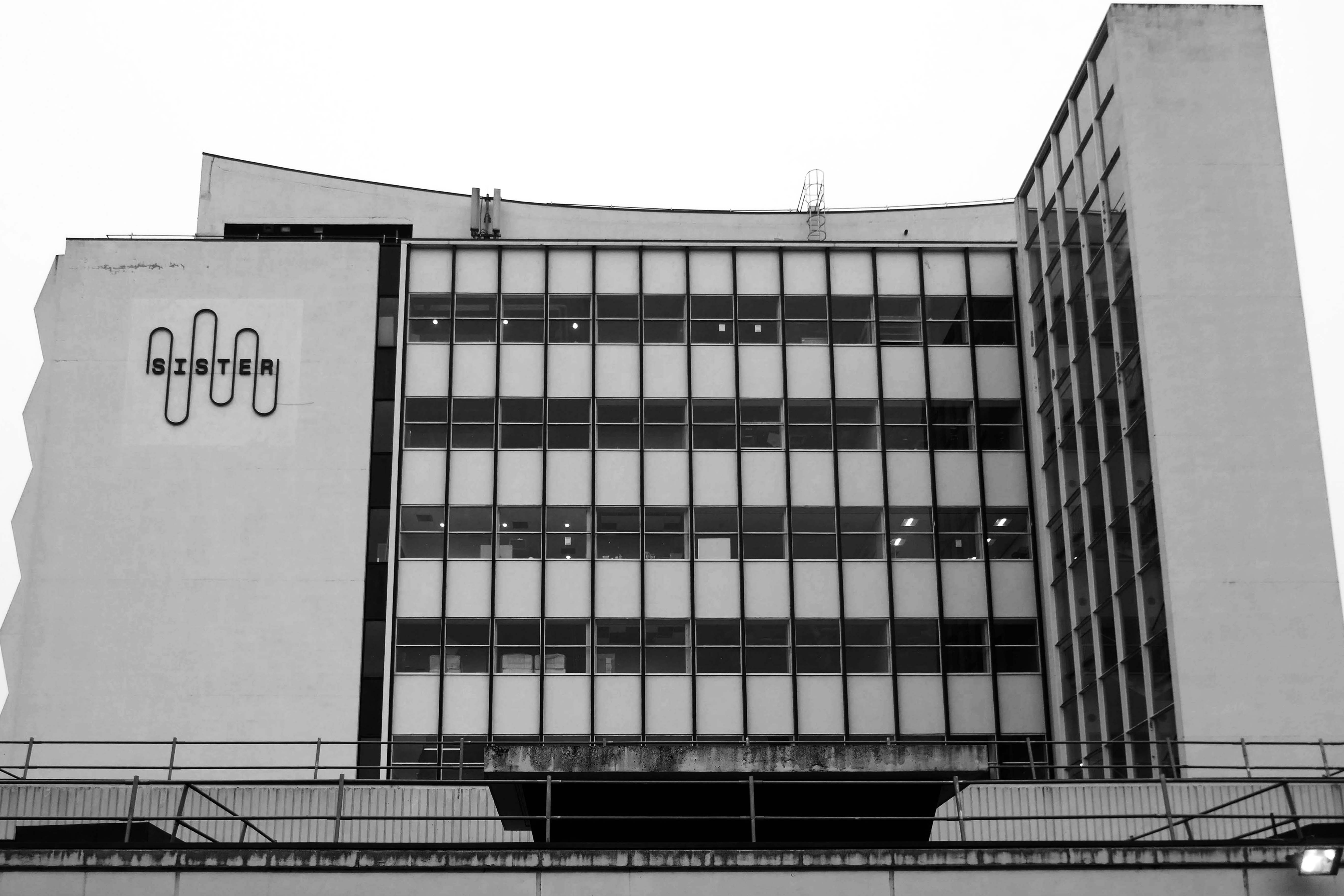
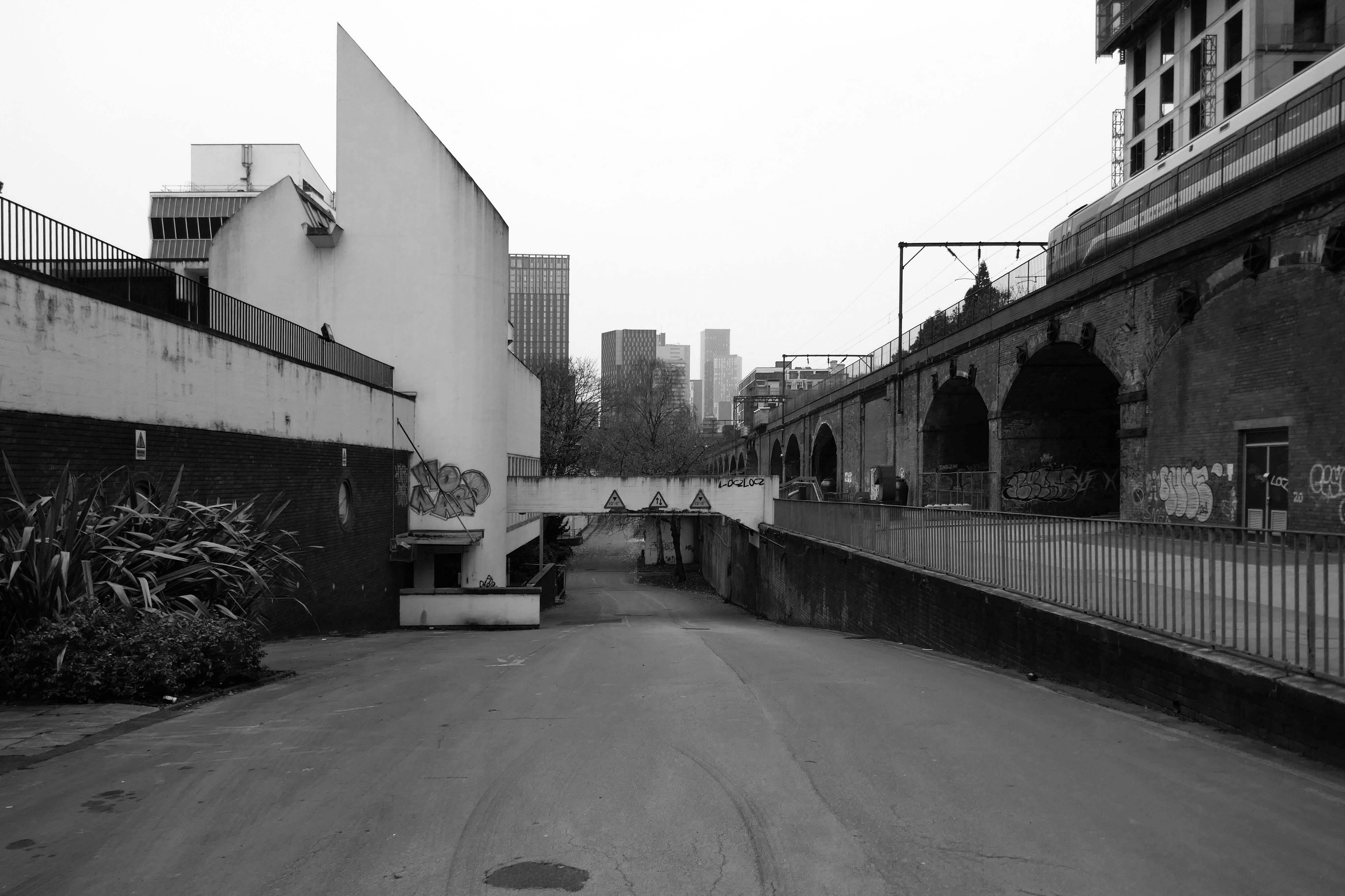
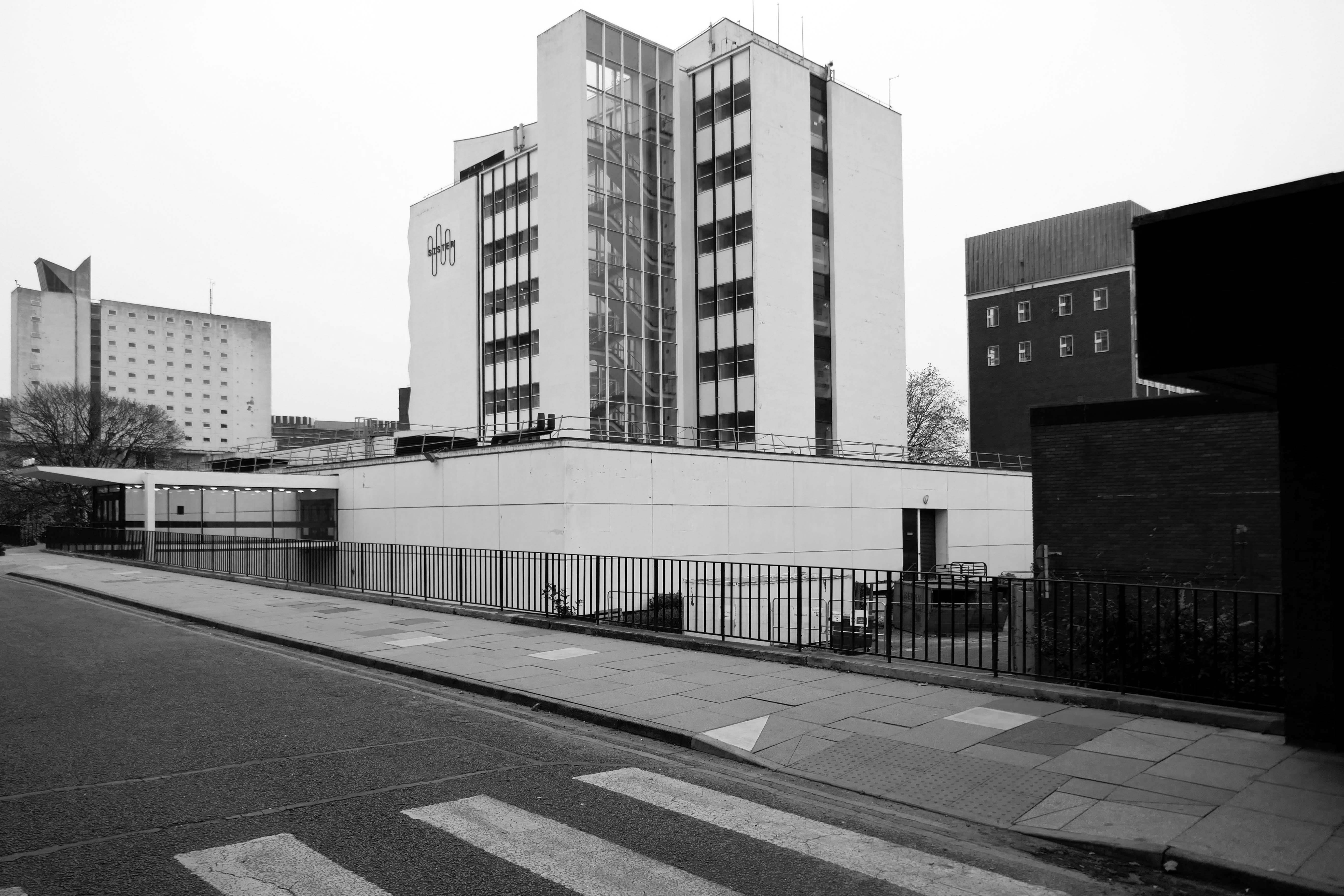
Sister is Manchester’s new innovation district. A £1.7bn investment into the city, its setting – the former University of Manchester North Campus and UMIST site – is steeped in science and engineering history. Home to the UK’s most exciting new ideas and disruptive technologies, Sister is a worldclass innovation platform in the heart of one of the most exciting global cities. It stands as the city’s symbol of a new era of discovery that promises progress against humanity’s greatest challenges.
So it is with a bitter sweet feeling that I took a group of Modernist Moochers around the site this Saturday – a number of whom had been students there.
As a former UMIST student 1990-1997, I had a wander round the old site recently, sad to see it so empty and run-down.
So let’s take a look at the current state of affairs.
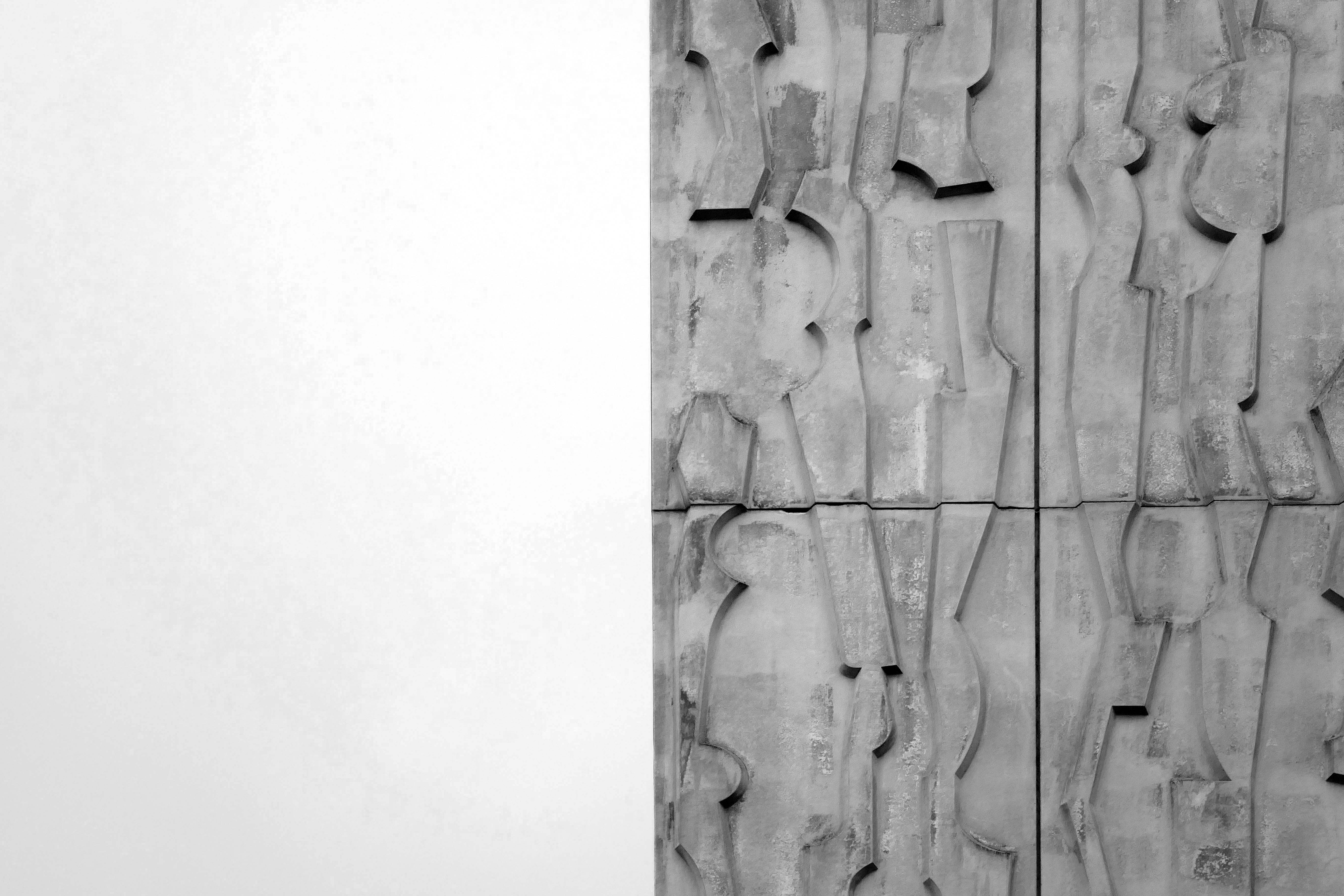
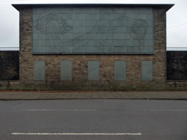
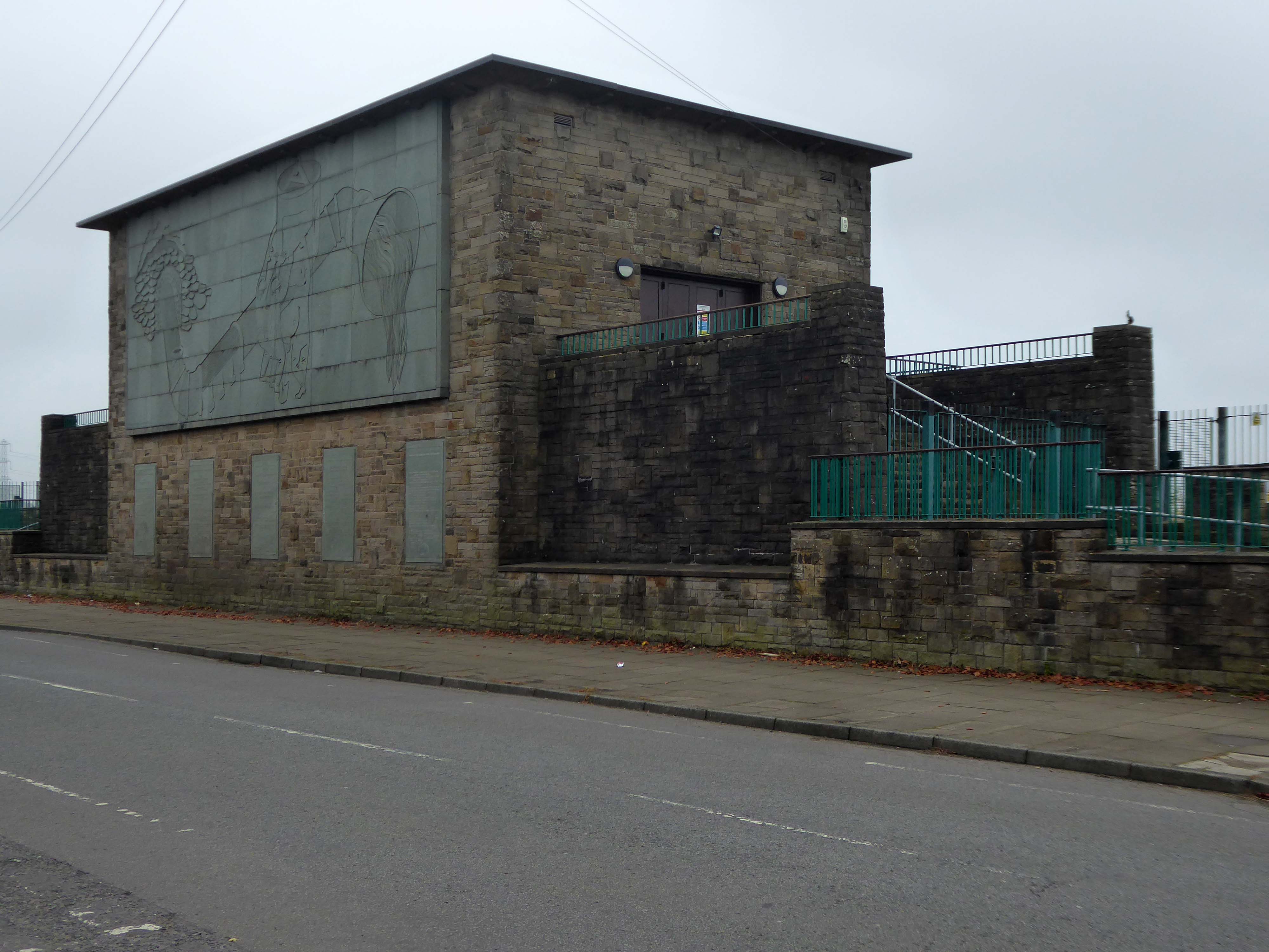
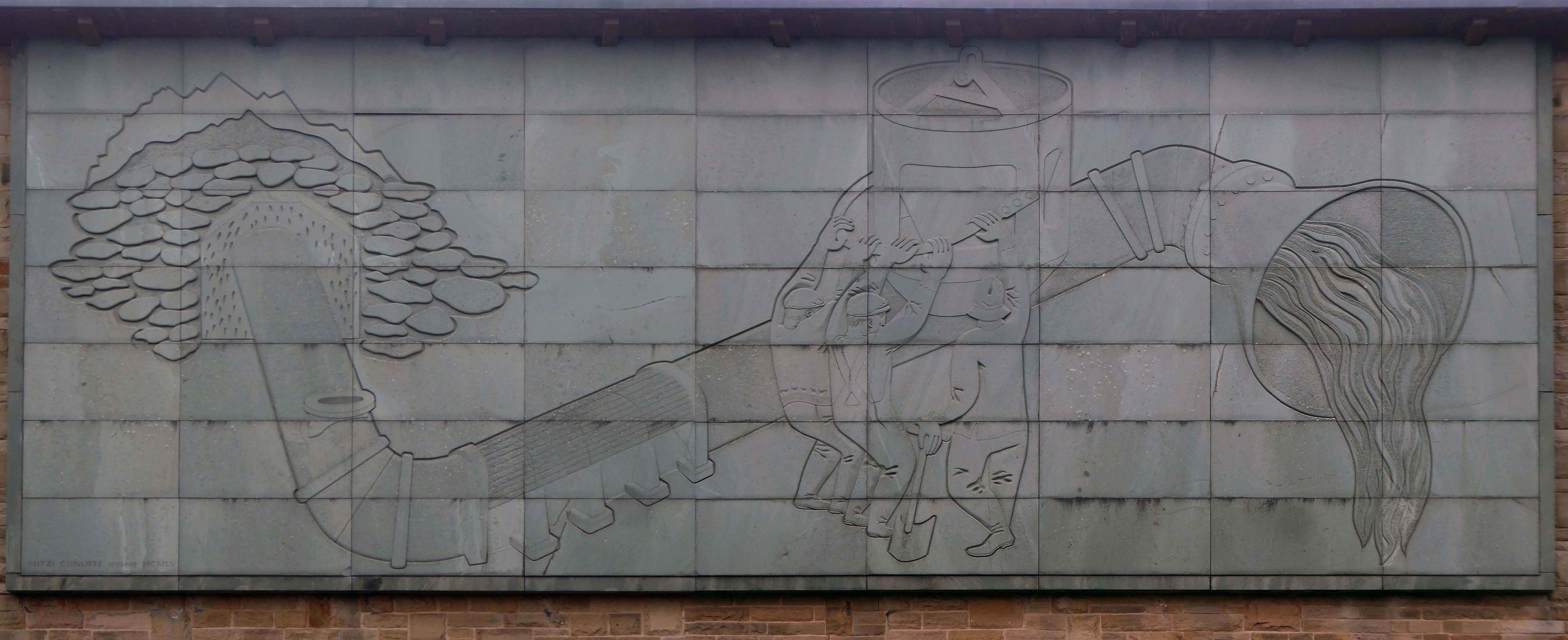
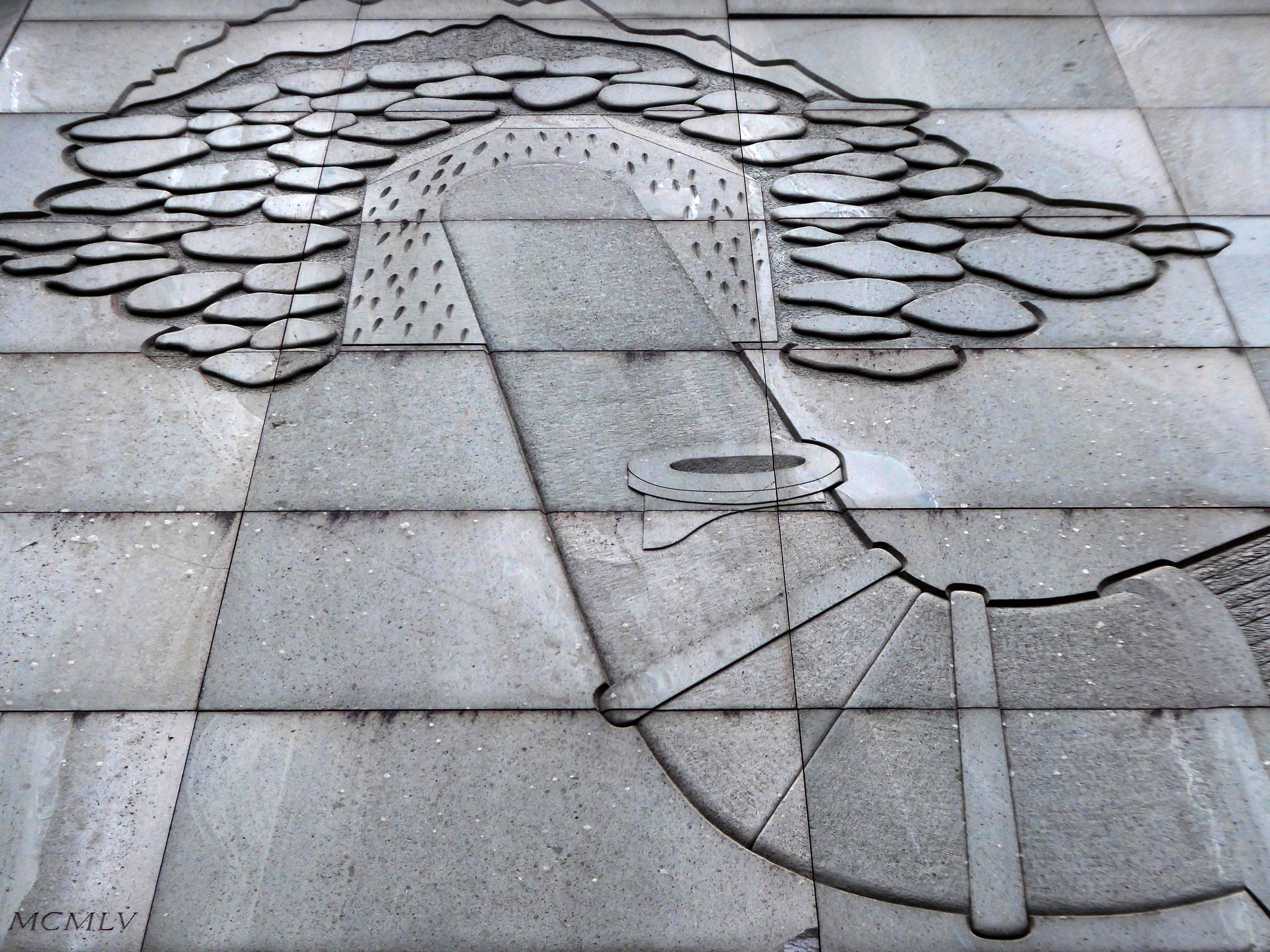
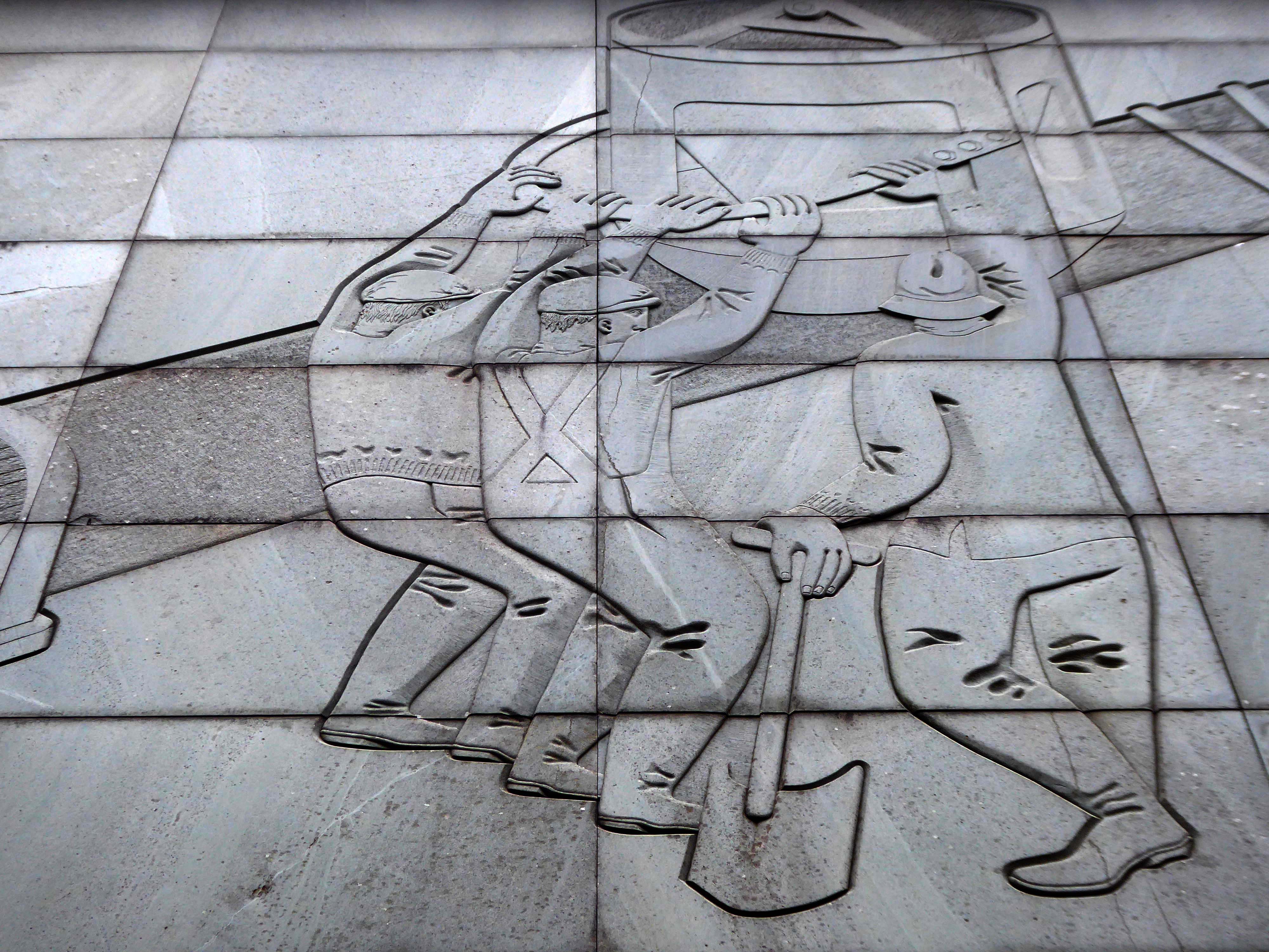
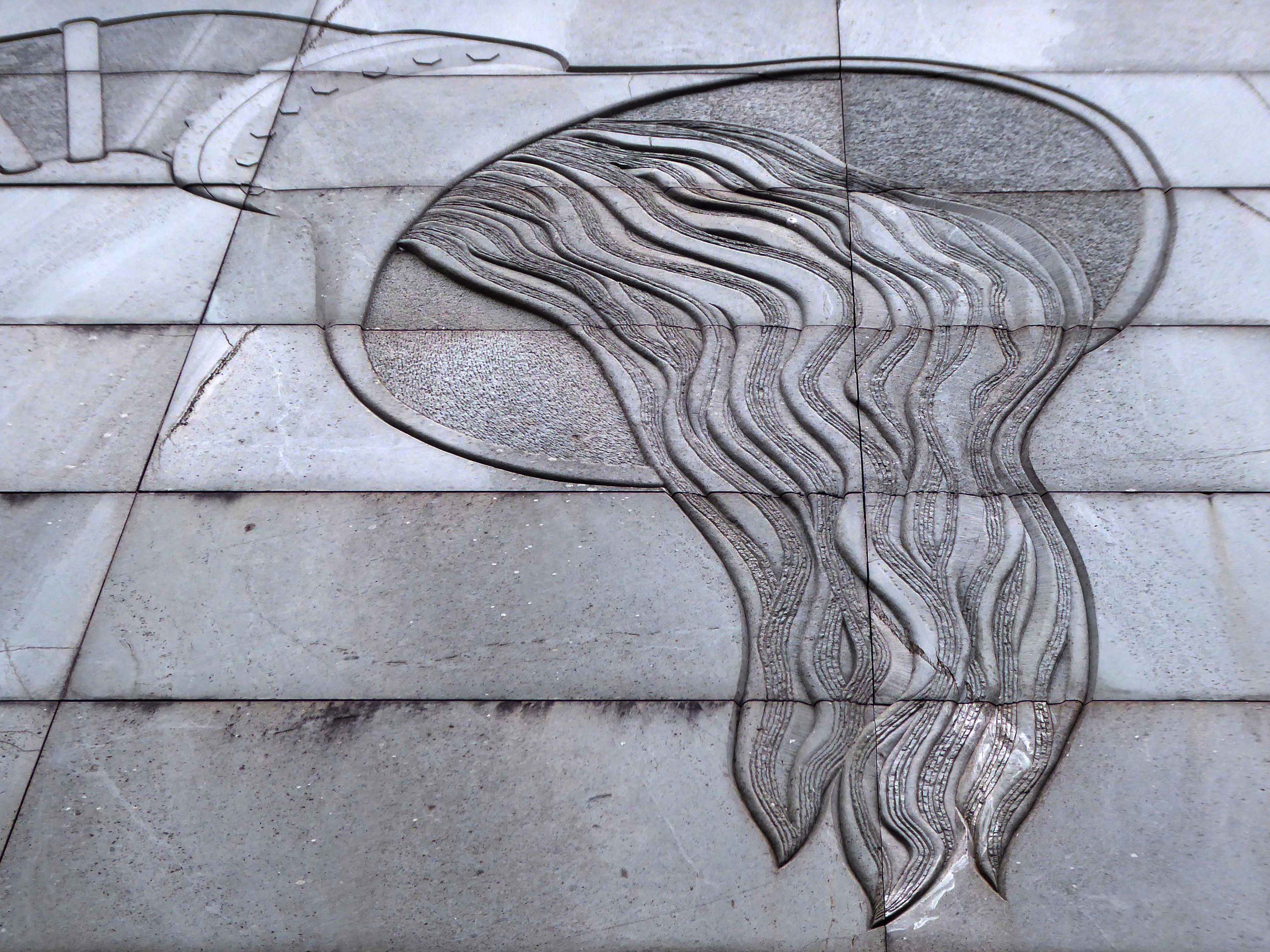
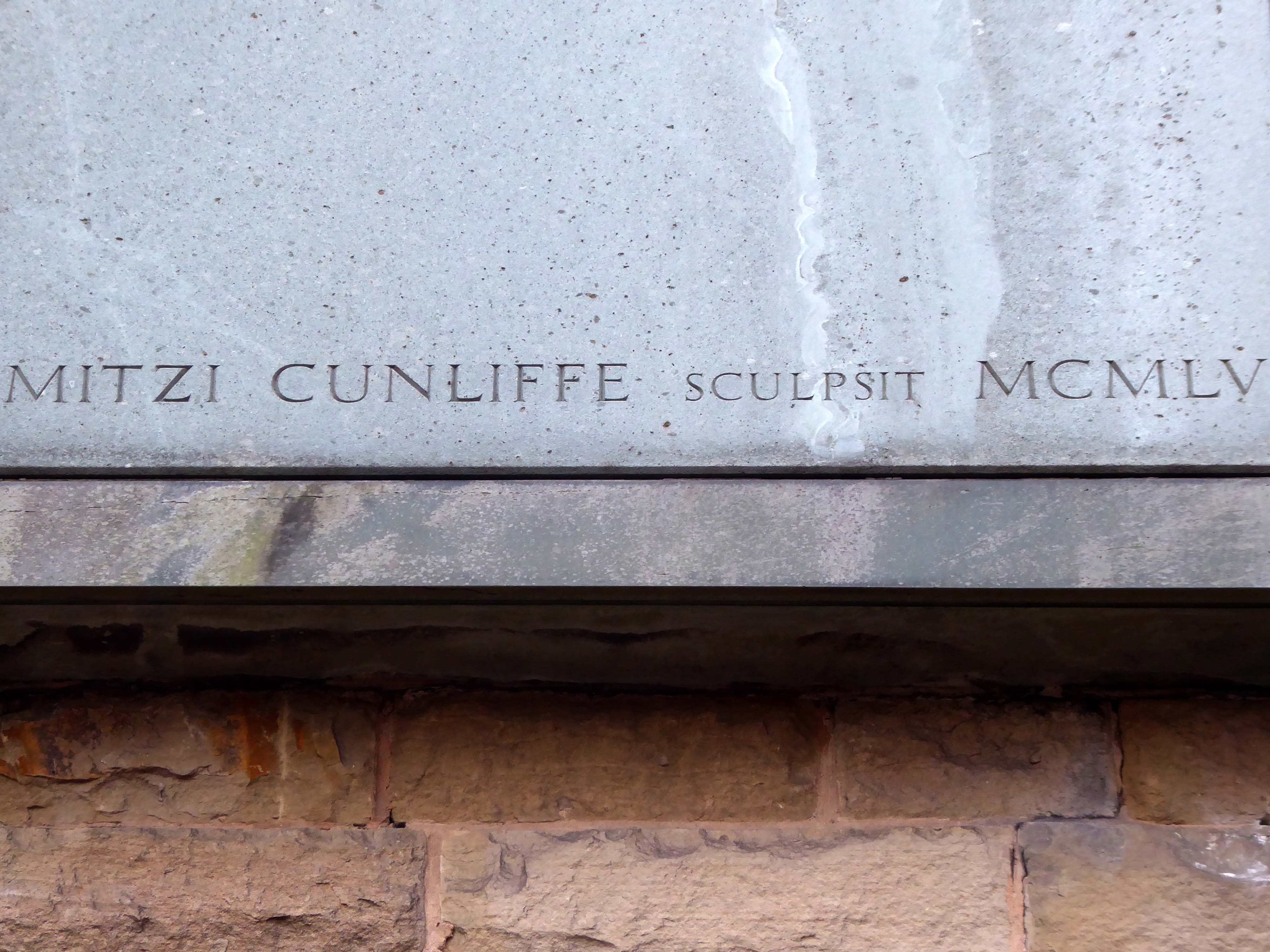
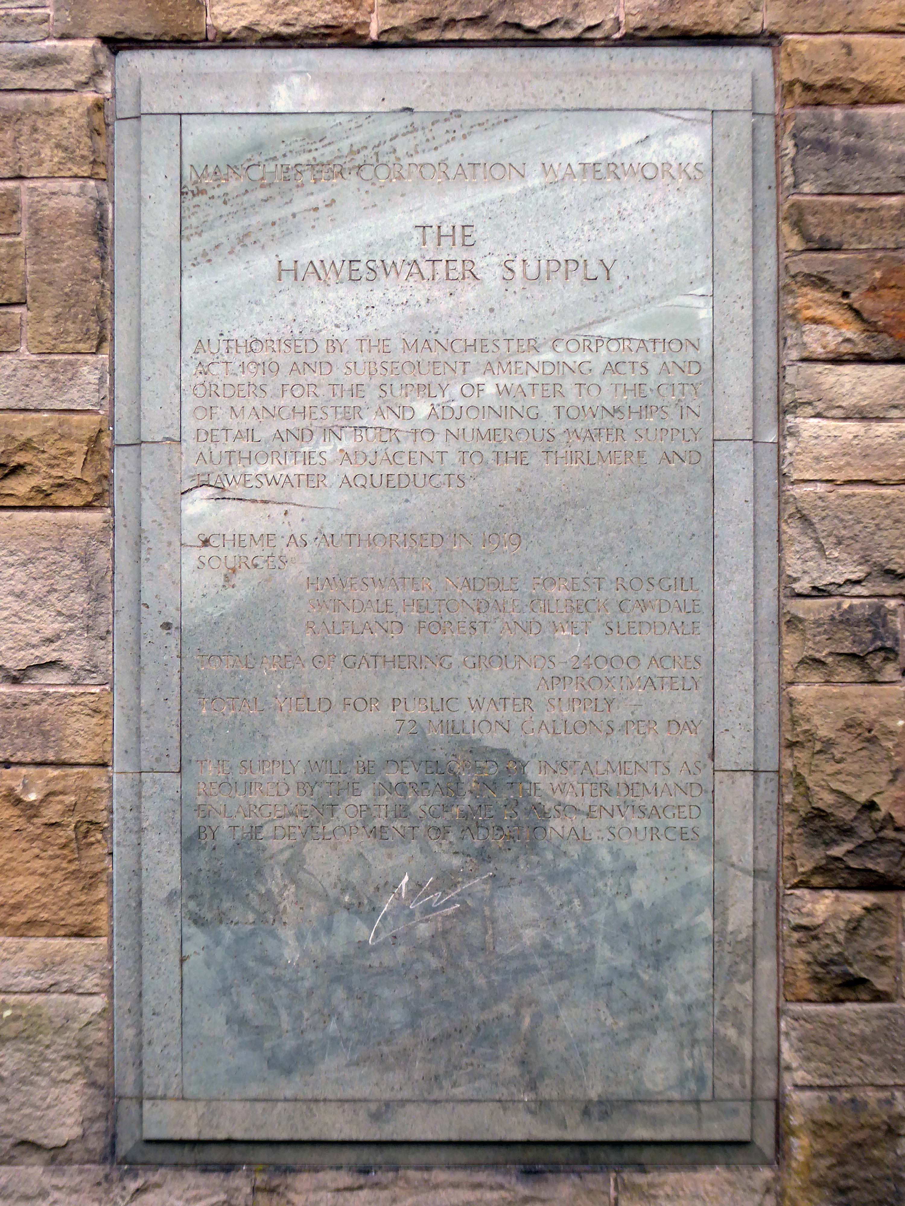
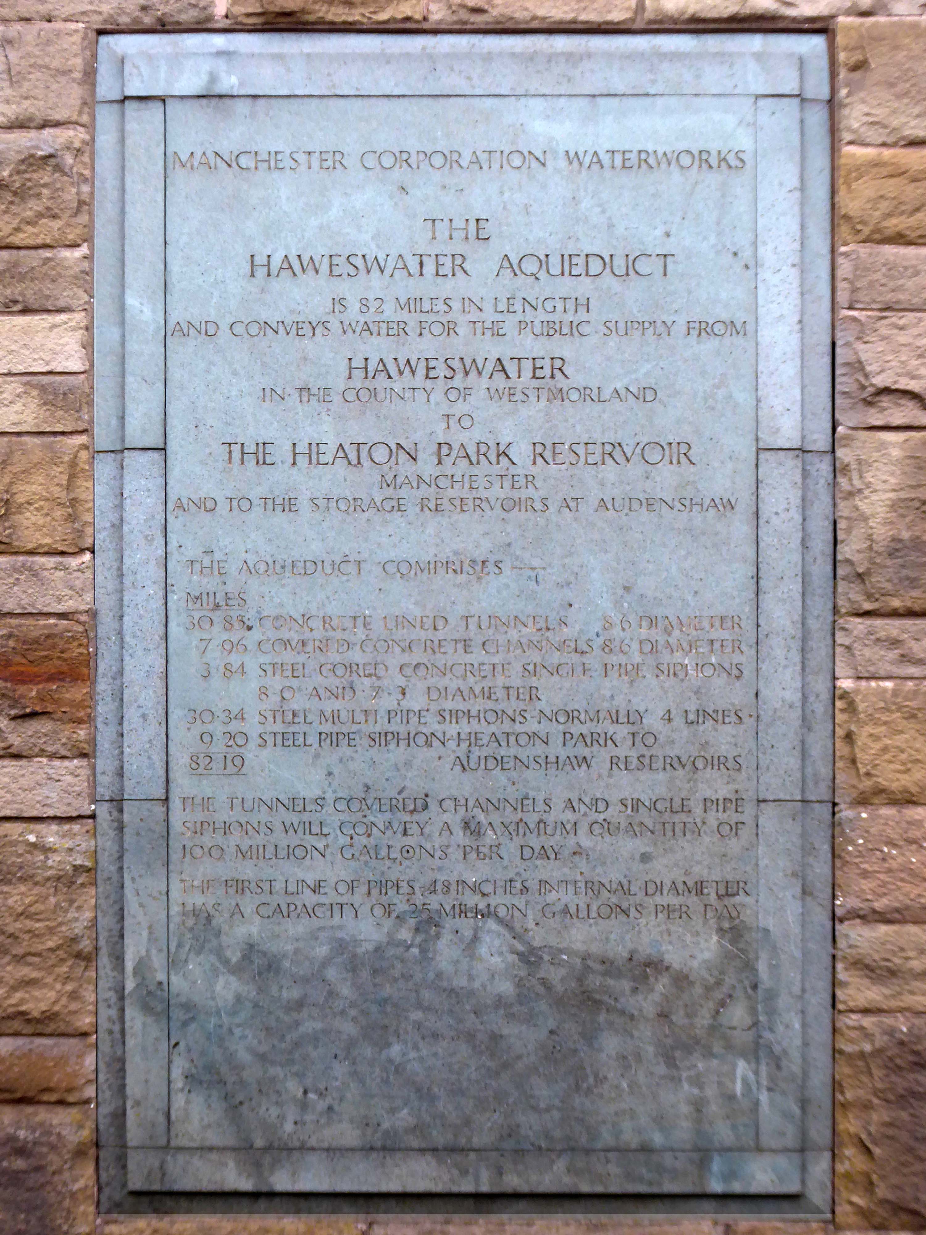
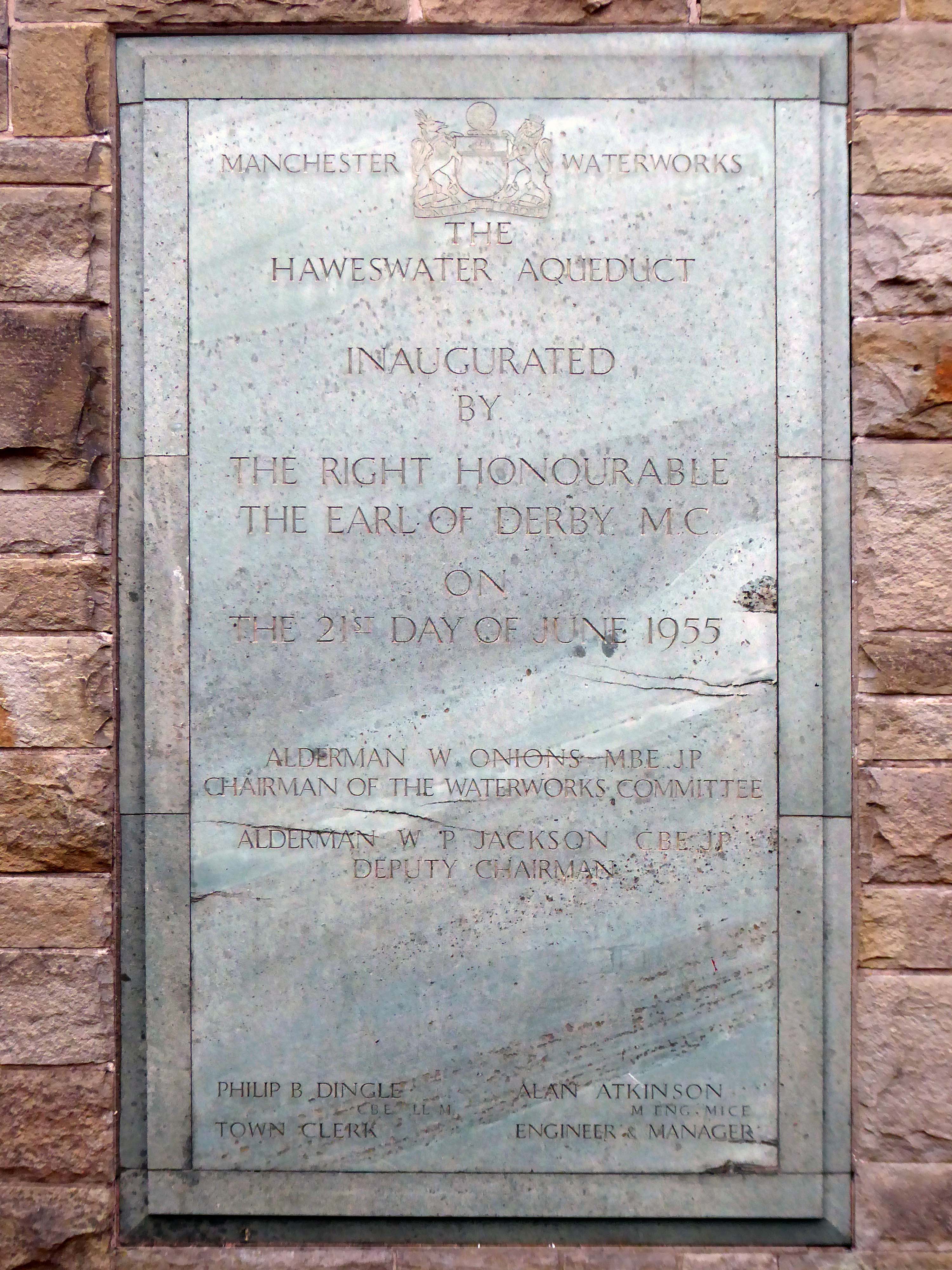
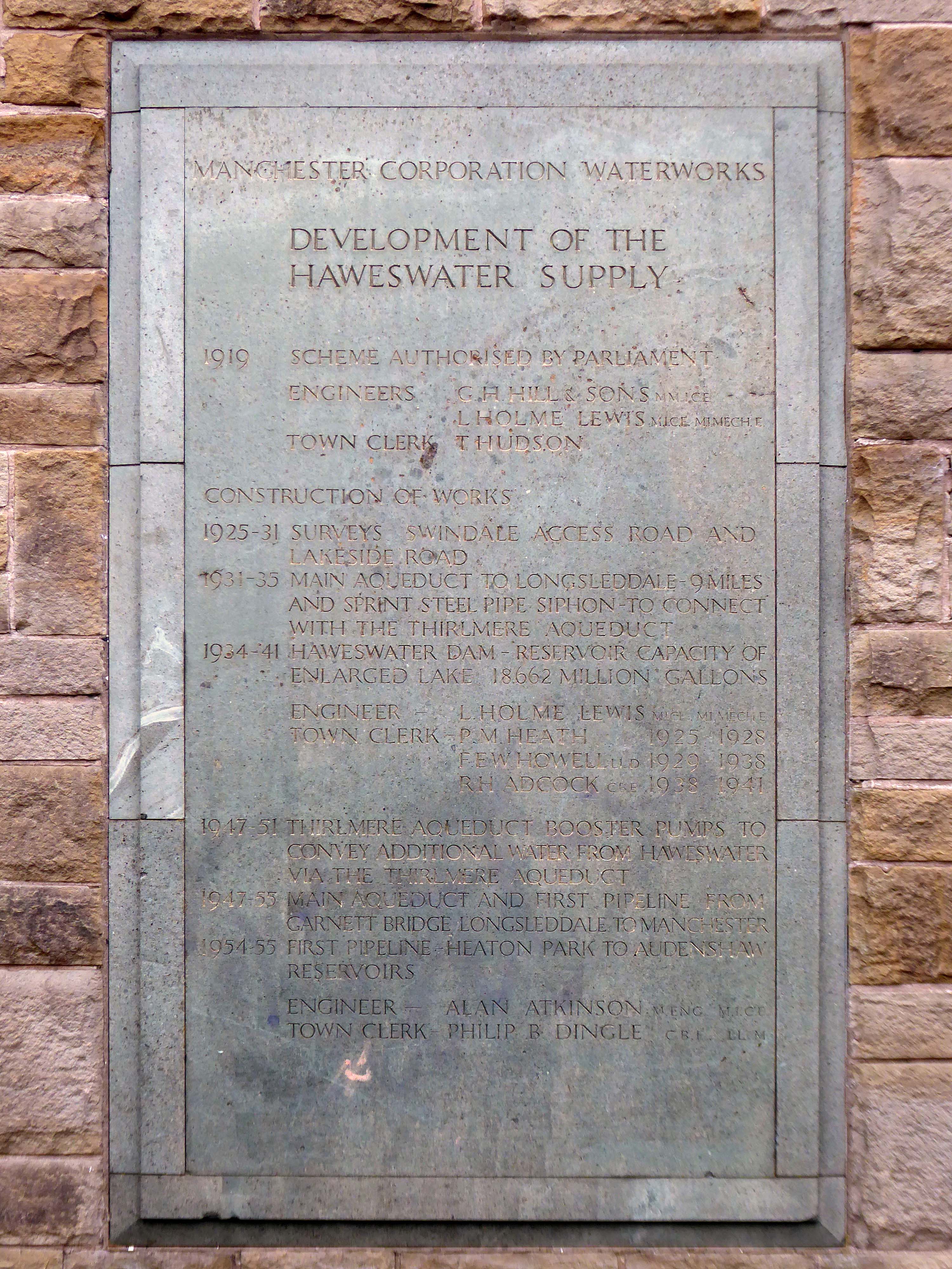
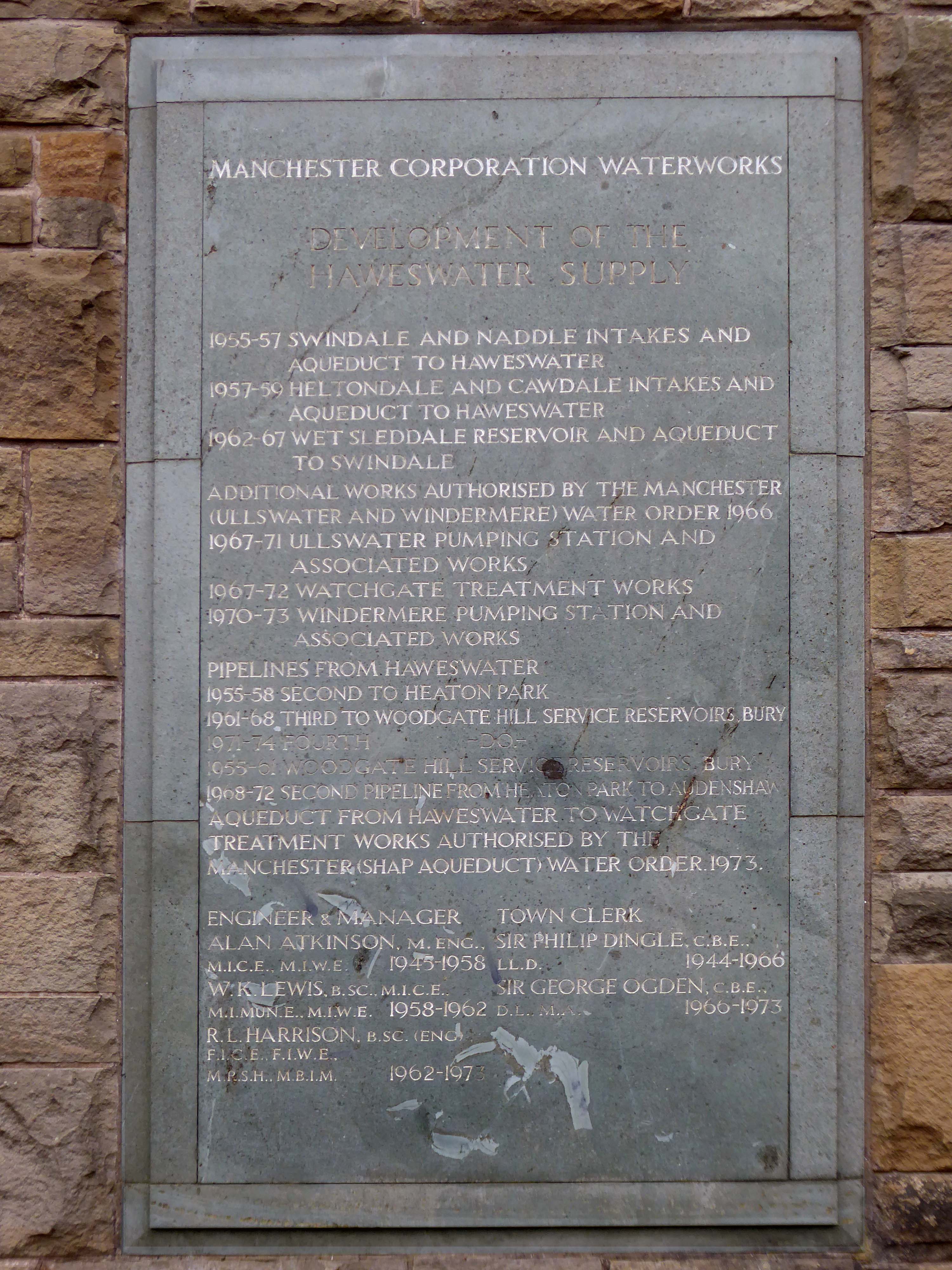
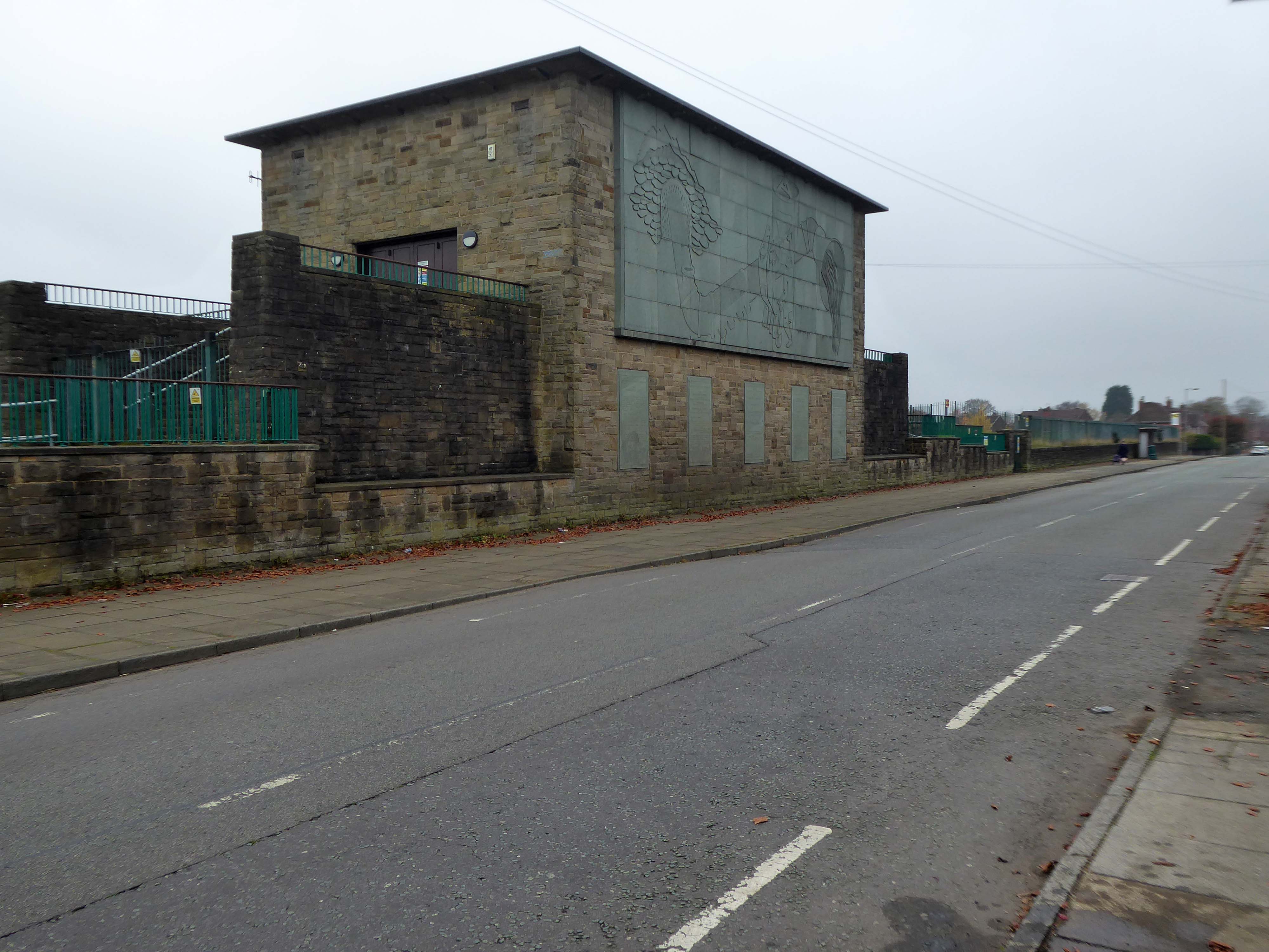
Built between1954-5 by the Manchester City Architect’s Department, Chief Architect Leonard C Howitt, for the Manchester Corporation Waterworks. Alan Atkinson, engineer. Incorporates large relief by Mitzi Cunliffe, signed and dated 1955. Yorkshire sandstone, with Westmorland greenstone from Broughton Moor used as relief. Roof not seen above dentiled overhang.
Carved relief is a highly stylised depiction of the bringing of water from Haweswater to Manchester with contemporary figures supporting the pipeline and a curious flat relief designed to be seen from below. It was designed to commemorate those who constructed it as well as the origin and course of the aqueduct. Beneath it five plaques tell the history of the Haweswater supply.
Completely preserved interior fully lined in beige marble, with contrasting green marble skirting continued as door surround. Behind the Cunliffe mural is a wood relief section in sycamore depicting the 82 mile route of the pipe.
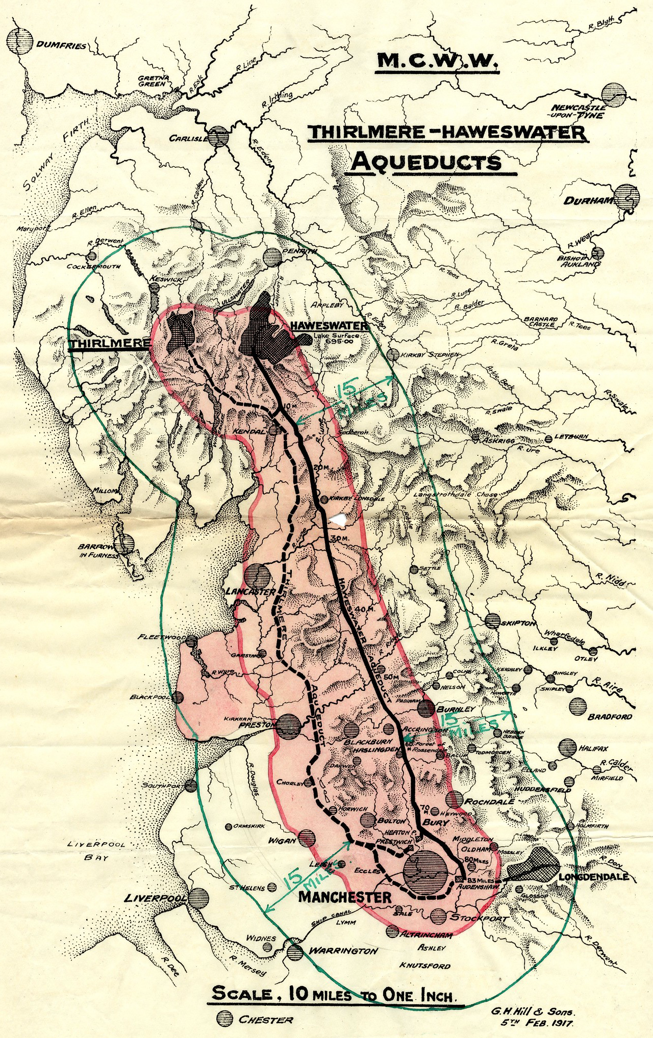
The bringing of water to Manchester from a new reservoir at Haweswater was a major undertaking which cost £14,000,000. The sectional relief plan and the mural were conceived as part of the original brief to give a ‘monumental’ character to the city’s remarkable achievement. Included as a remarkable synthesis of architectural design and fine sculpture, with the dominance of the latter in this tiny building. The building materials and the reliefs are all symbolic of the achievement in bringing of water from the Lake District to Manchester.
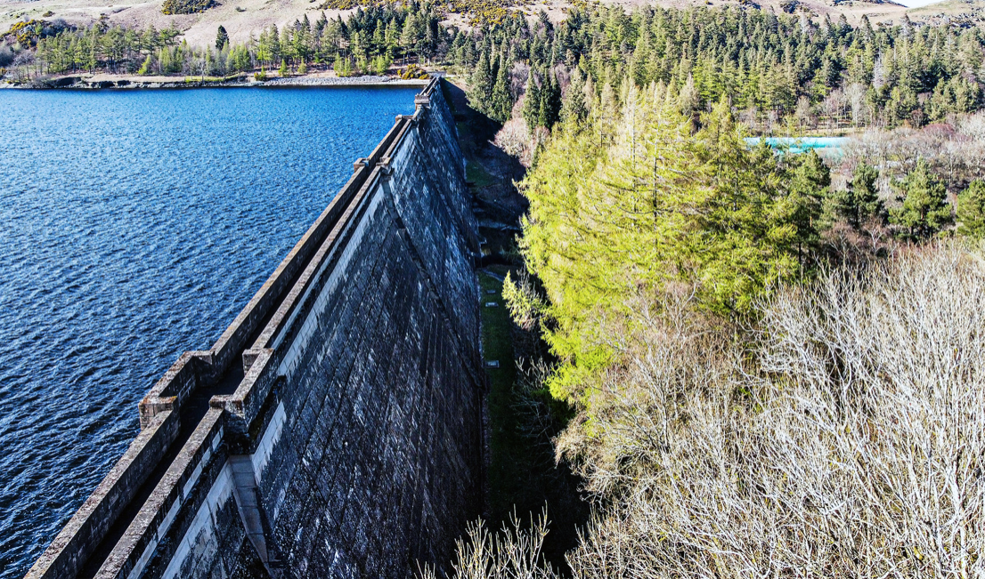
In 1929 work started to build the dam wall across the valley floor. At the time of construction, its design was considered to be at the forefront of civil engineering technology because it was the world’s first hollow buttress dam.
Before the valley was flooded in 1935, all the farms and dwellings of the villages of Mardale Green and Measand were demolished, as well as the centuries-old Dun Bull Inn at Mardale Green. The village church was dismantled and the stone used in constructing the dam; all the bodies in the churchyard were exhumed and re-buried at Shap.
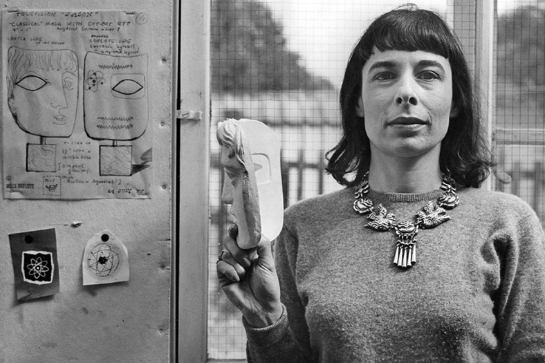
I have previously led Mitzi Cunliffe walks in south Manchester – taking in her works at Owens Park and Manchester High School for Girls.
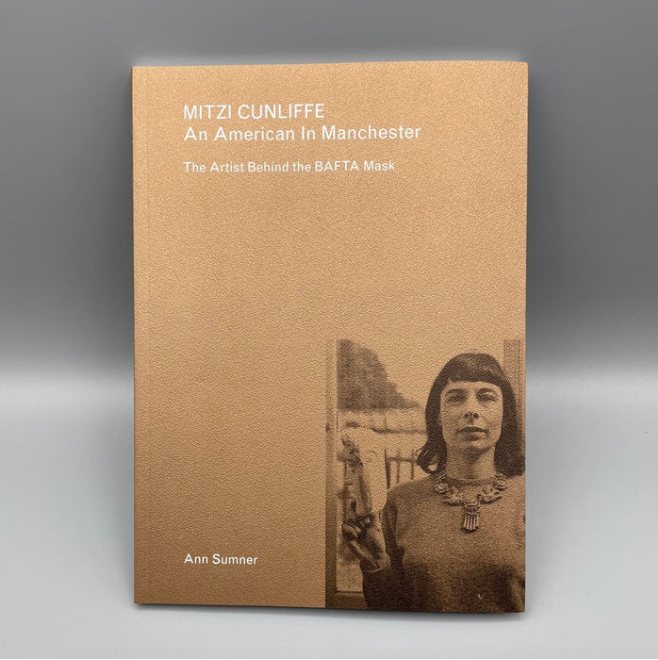
Mitzi Cunliffe is primarily known as the designer of the BAFTA Award, but her work encompasses both ceramics and textiles, in addition to her extensive public art works – as illustrated here.
Mitzi Cunliffe – An American in Manchester is available from the Modernist Shop.
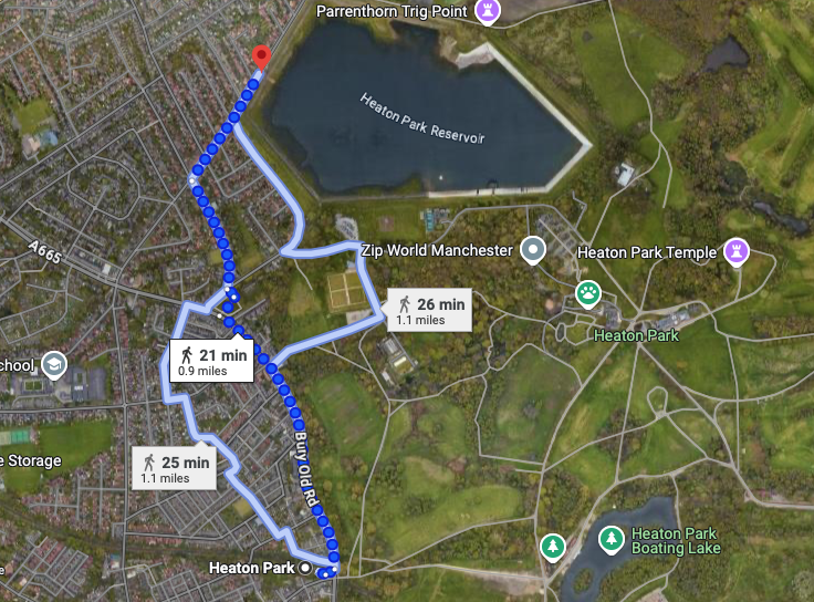
I took the tram to Heaton Park Station and walked the rest of the way.
The imposing structure, clad in the dramatic relief dominates this domesticated street of well behaved semis. As I stood admiring the work, a passerby joined me in a mutual appreciation of its beauty and significance.
Do yourself a favour – take a trip, take a look for yourself.
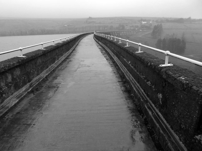
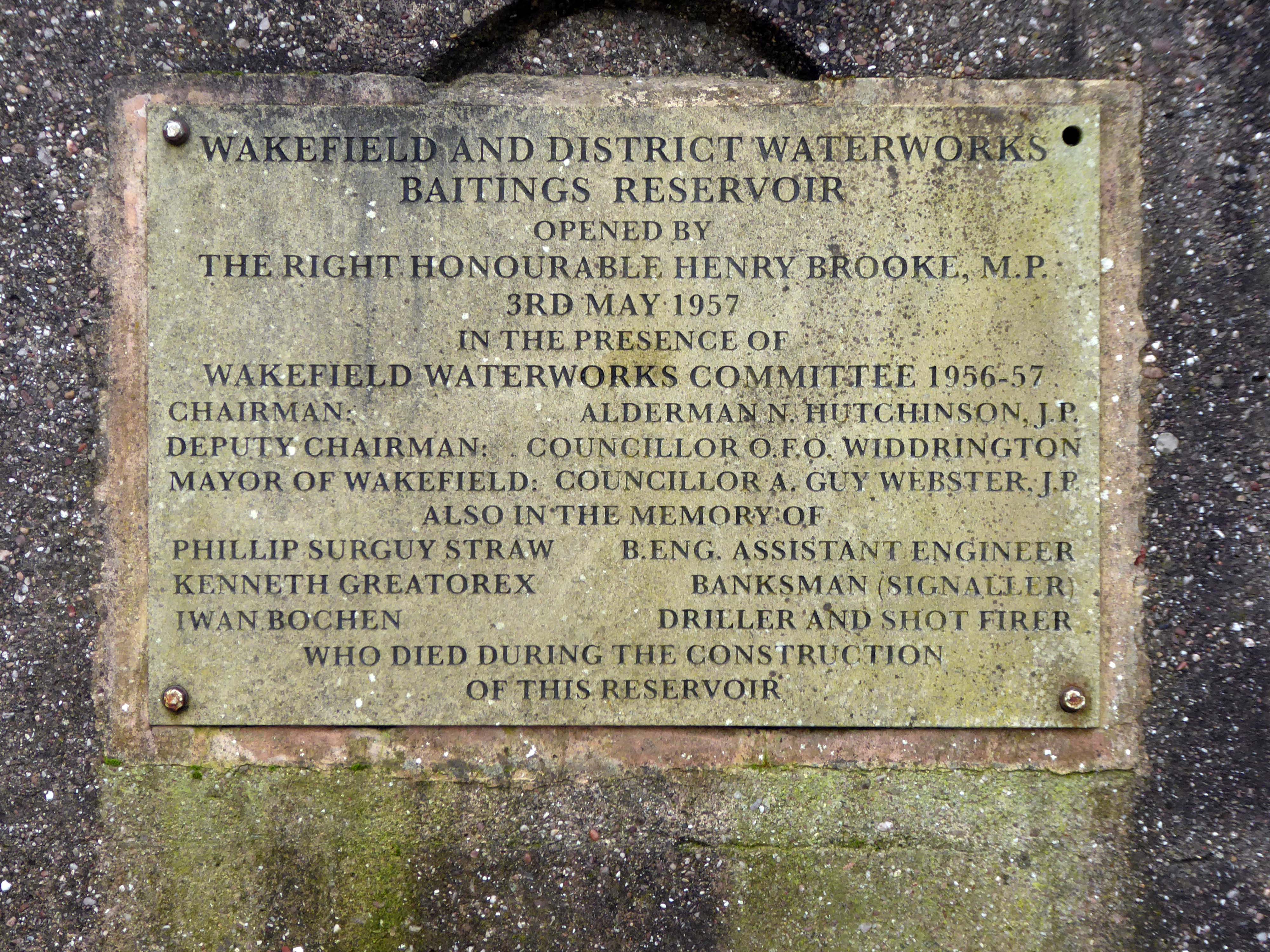
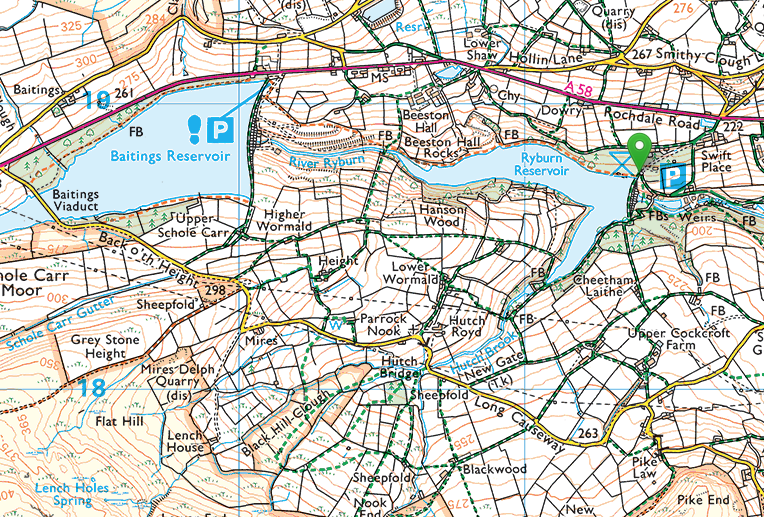
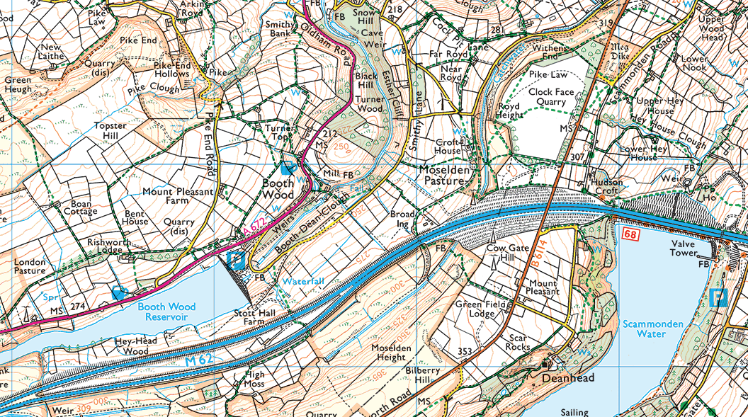
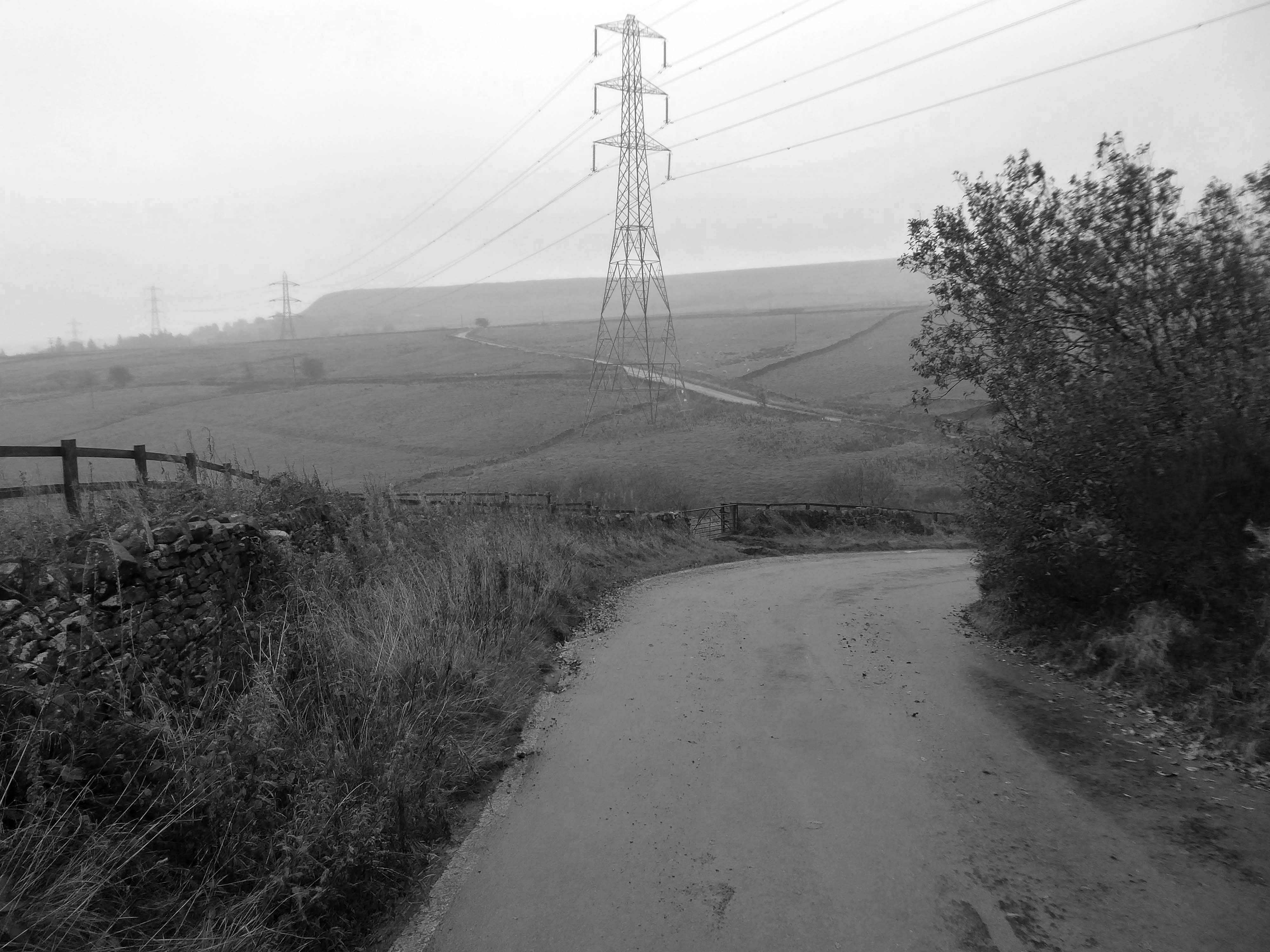
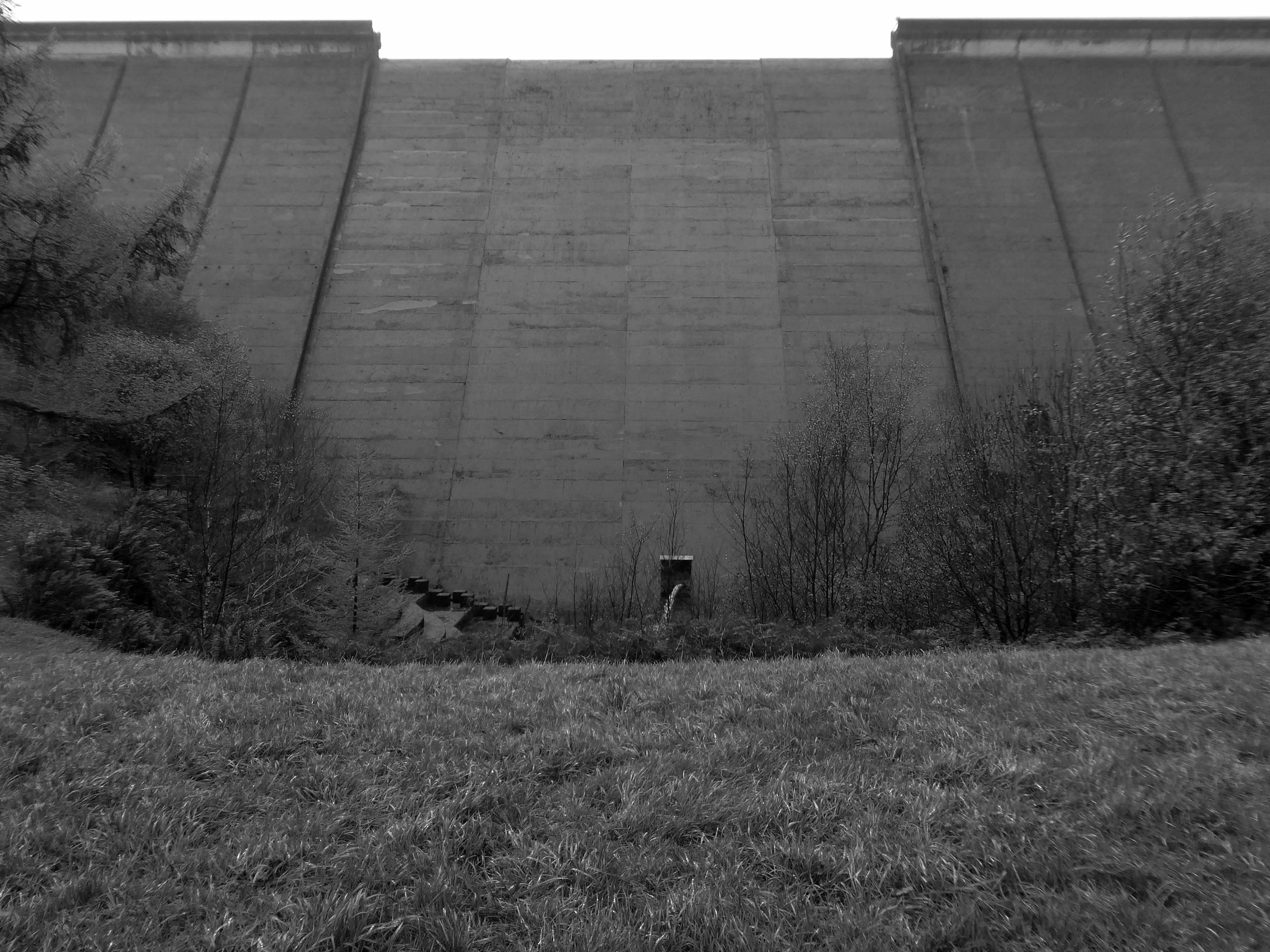
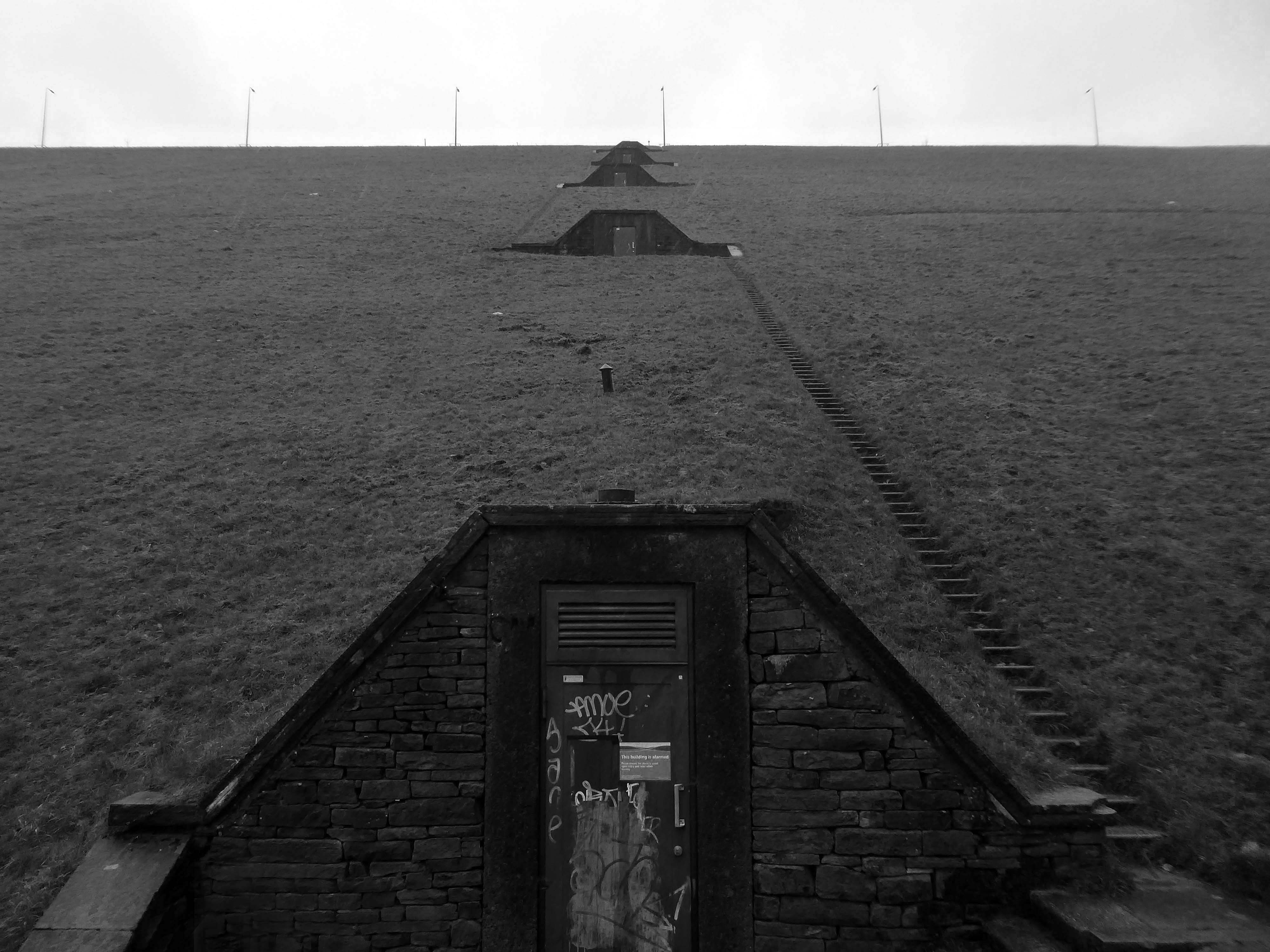
To begin at the beginning, to begin at Baitings Reservoir.
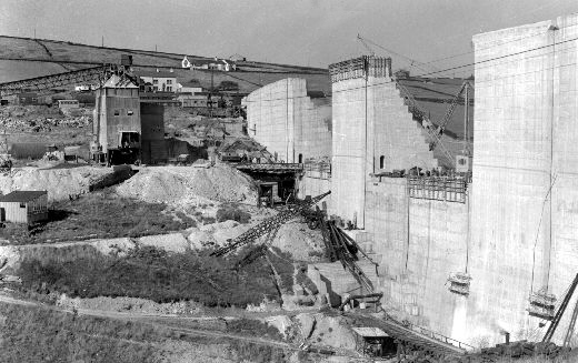
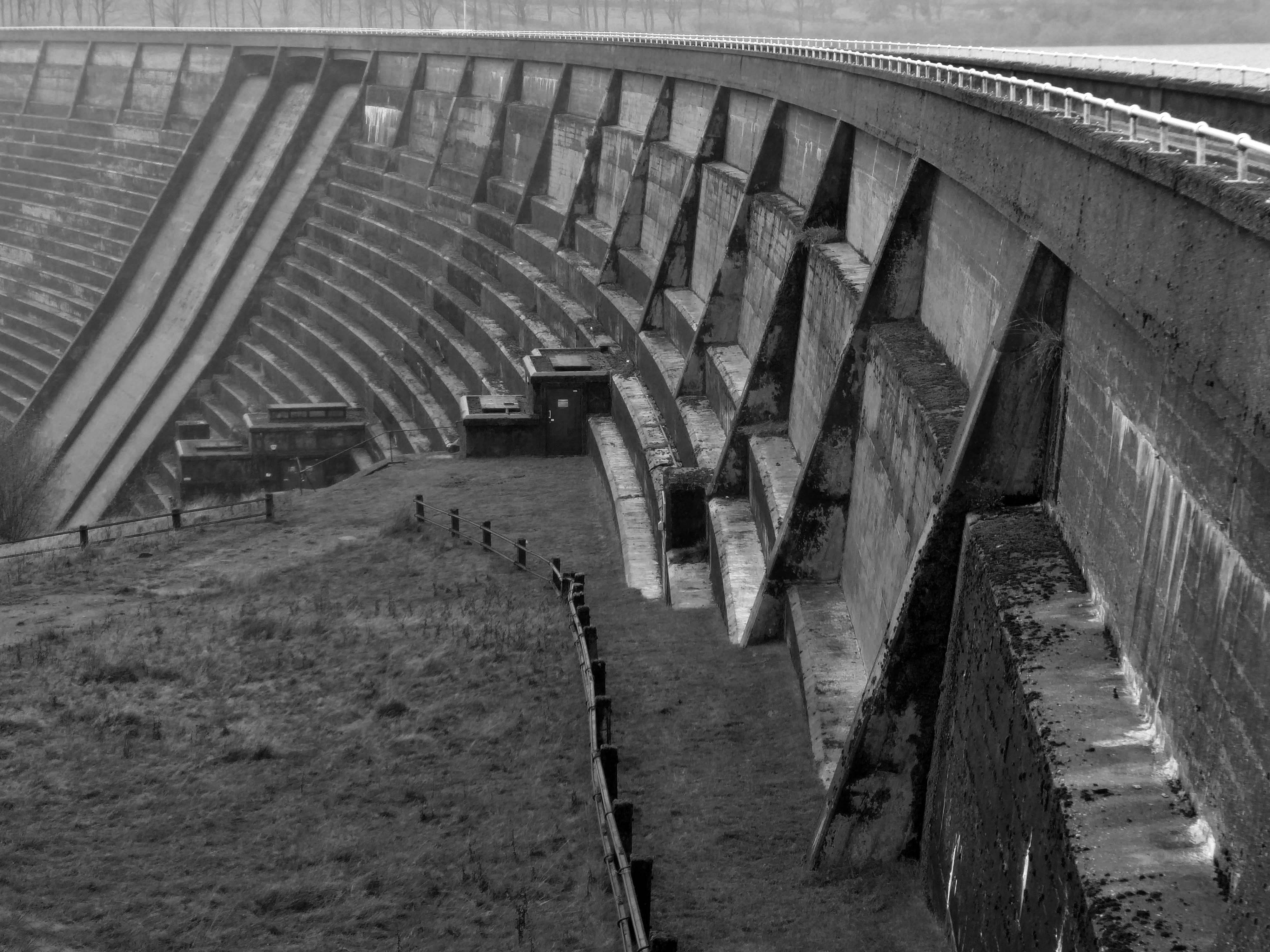
Wakefield Corporation Waterworks started impounding the valley of the River Ryburn in the 1930s, with Ryburn Reservoir being completed in 1933. Construction on Baitings took place 20 years later with completion in 1956. Baitings Bridge, on an old road linking Yorkshire and Lancashire, was to be flooded under the reservoir so a concrete viaduct was built. During spells of very hot weather and drought conditions, the old packhorse bridge is revealed.
Wakefield Express: 31st August 1955
The dam head is a curved structure that is 1,540 feet long and over 160 feet high. The reservoir covers 59 acres and has a catchment of 1,830 acres , and when it is full, it holds over 113,000,000 cubic feet of water. The dam took eight years to complete at a cost of £1.4 million, and is located at 840 feet above sea level. A tunnel connects reservoirs in valleys to the north with Baitings to allow for the transfer of water. Manshead Tunnel is 8,000 feet long and was opened in 1962.
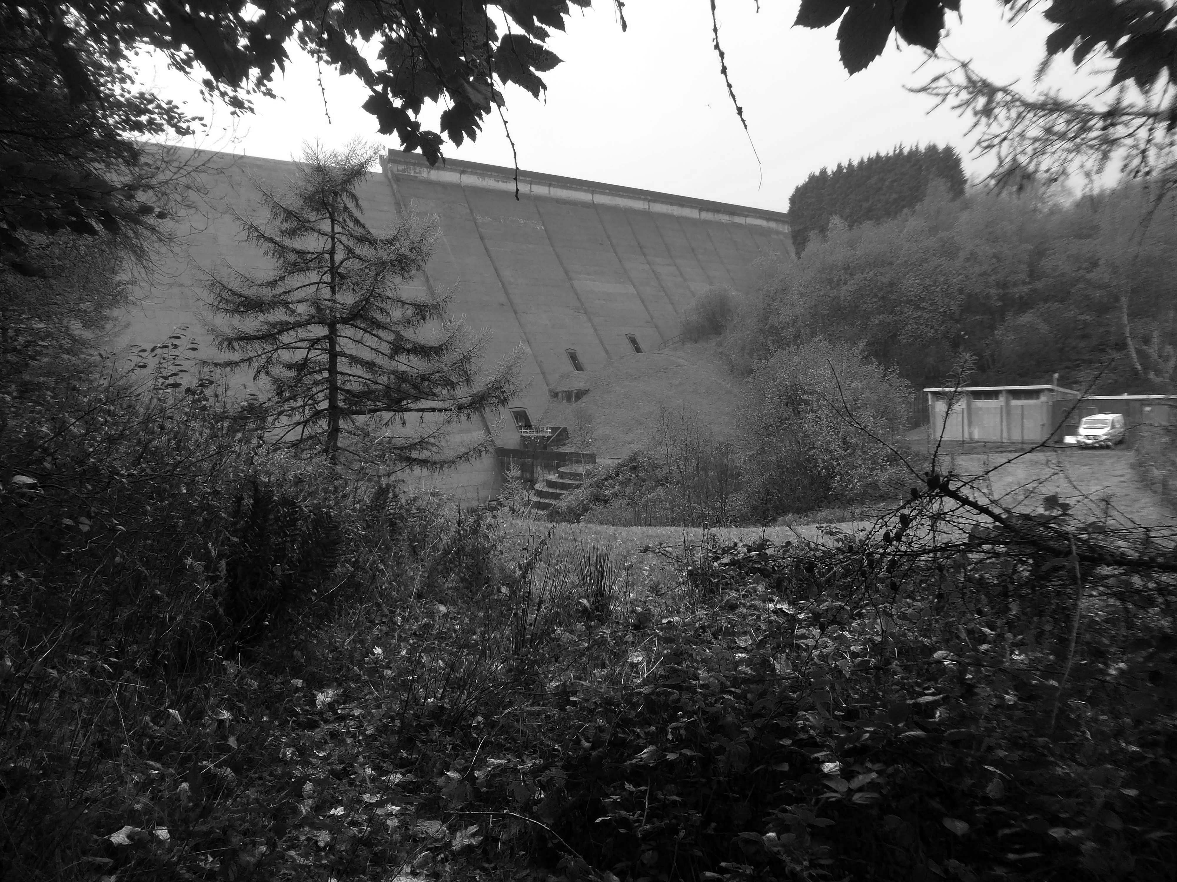
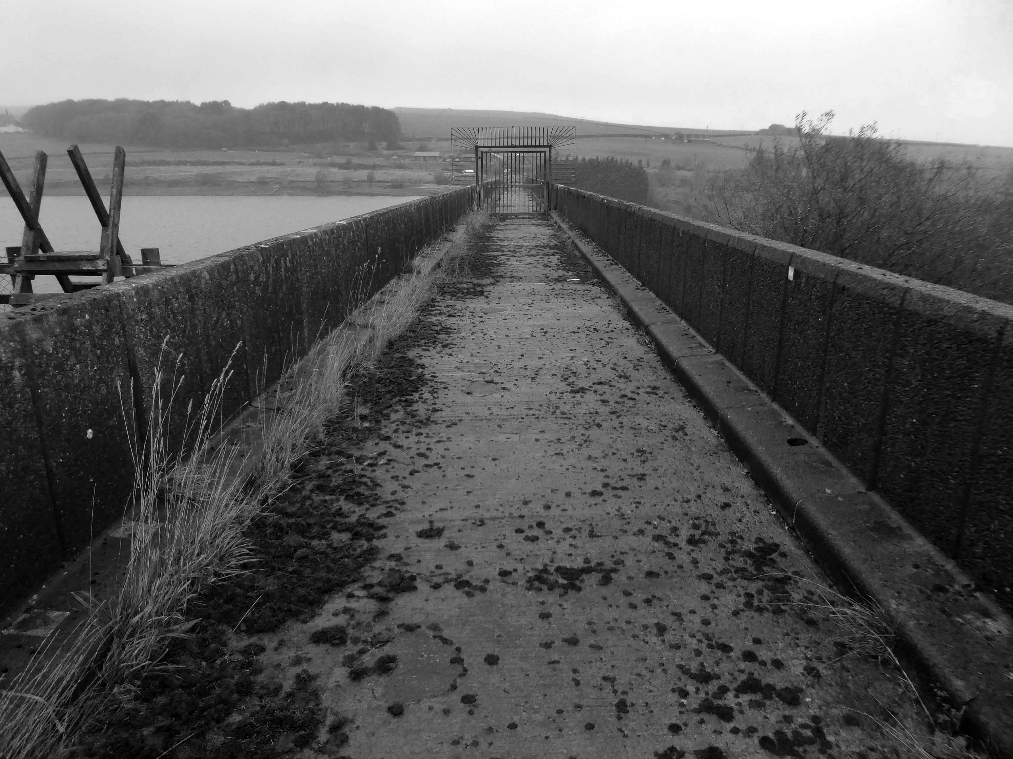
Inconveniently, the footpath to the lower Ryburn Reservoir was closed – we were diverted over the dam.
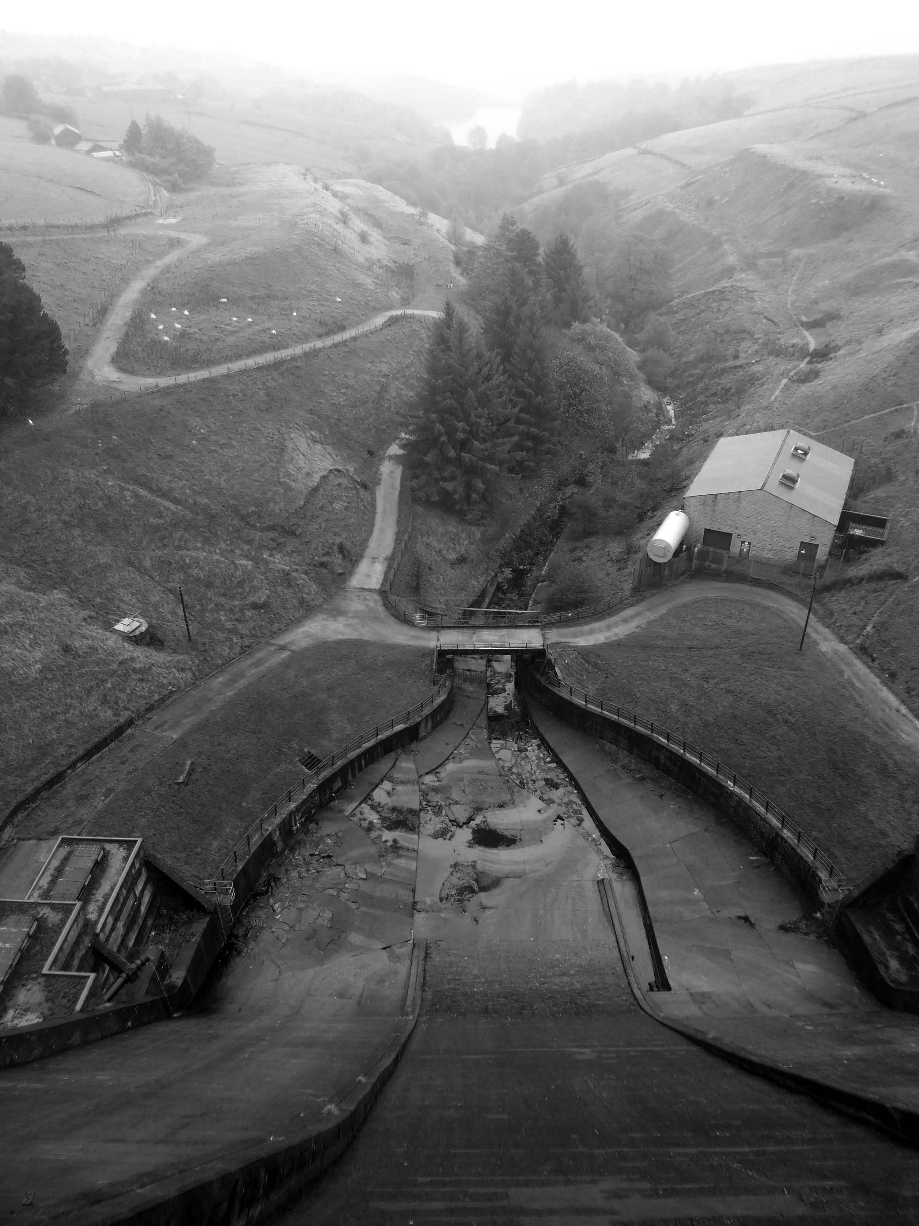
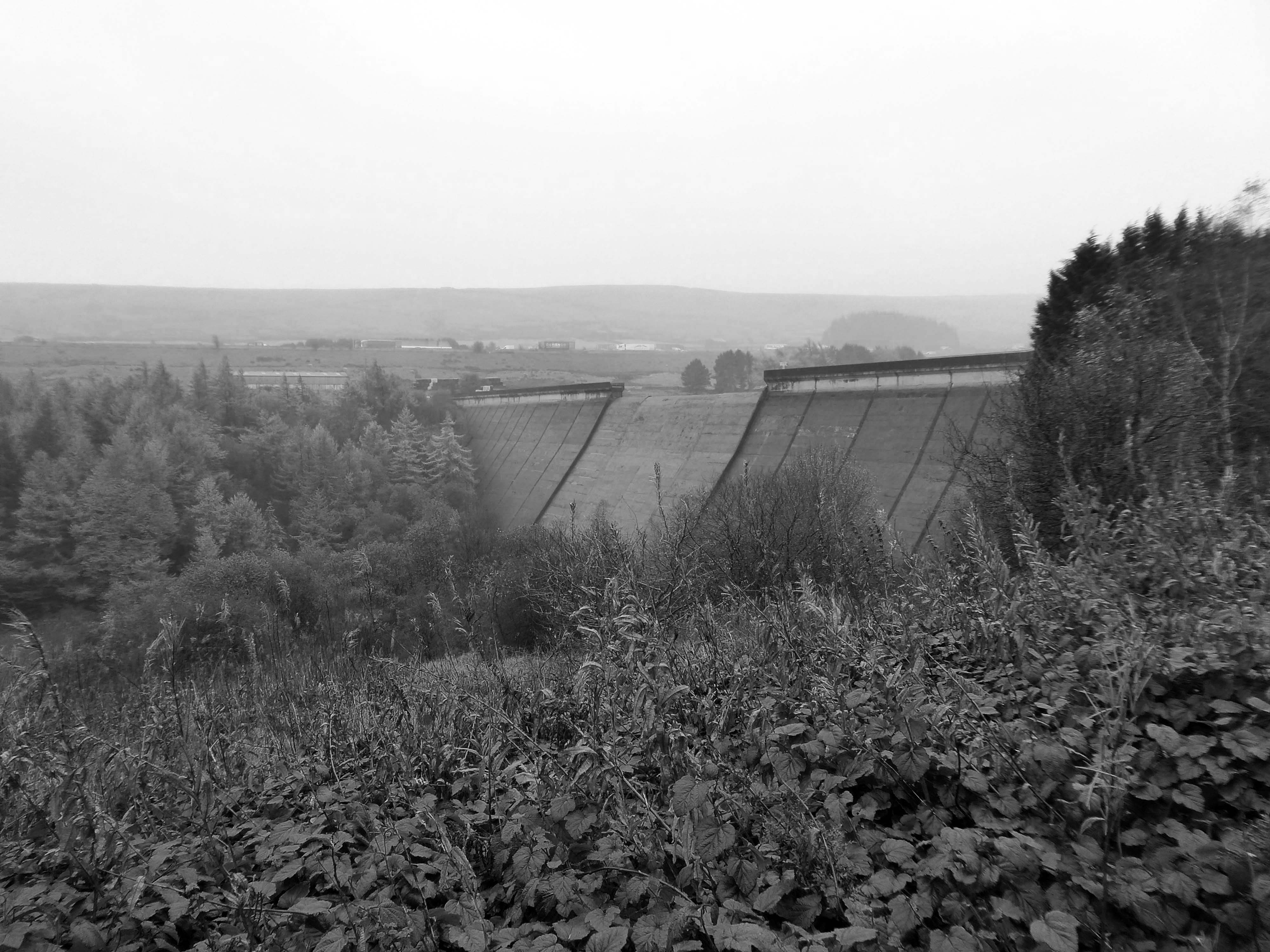
We took the pathway to Booth Wood Reservoir – over Pike End and beyond.
We dropped down beneath the Booth WoodDam.
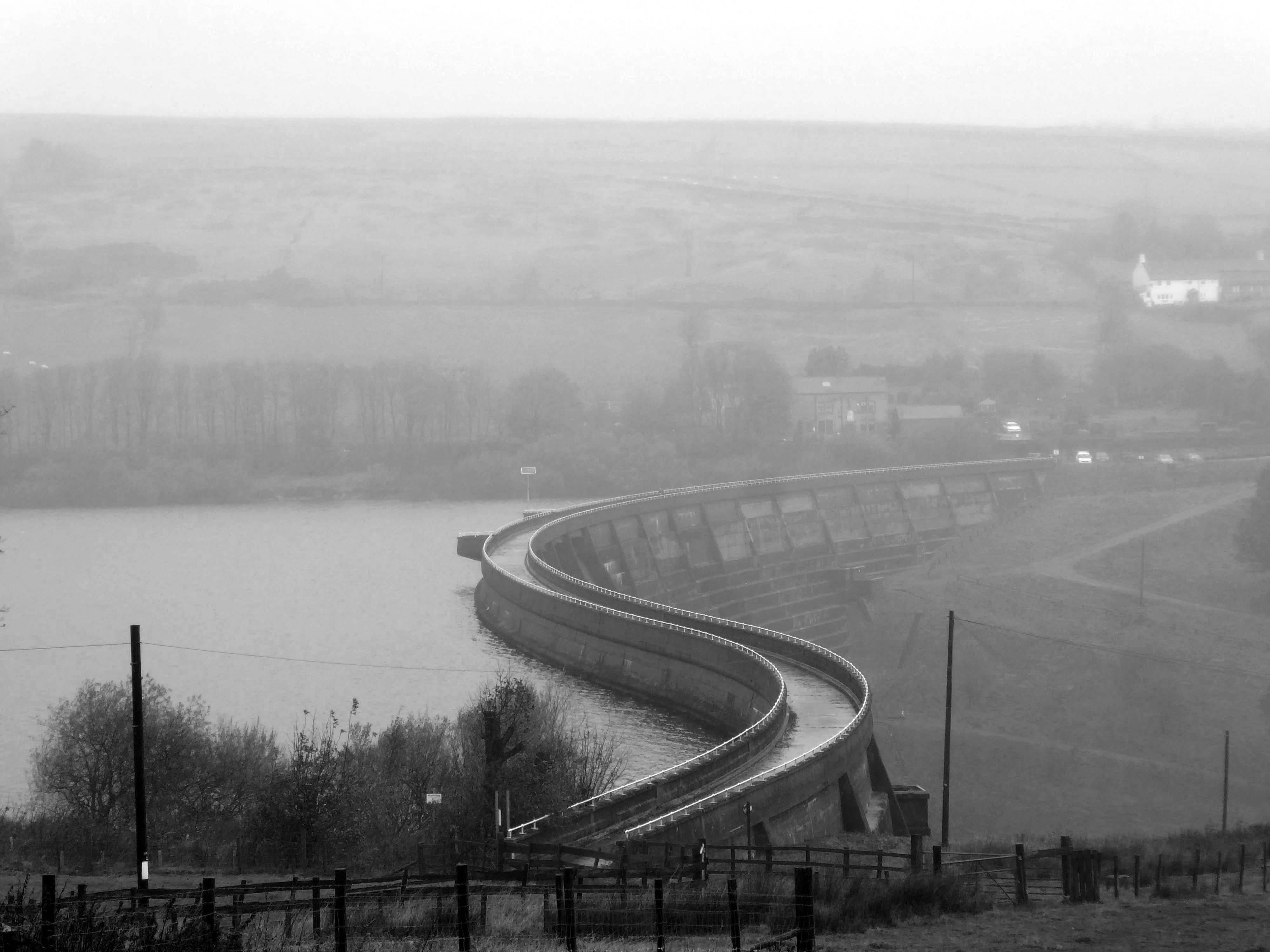
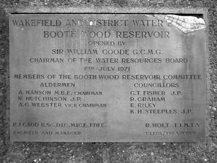
Booth Wood Reservoir is a man-made upland reservoir that lies north of the M62 motorway and south of the A672 road near to Rishworth and Ripponden in Calderdale, West Yorkshire. The reservoir was approved for construction in 1966 and completed in 1971.
It supplies water to Wakefield.
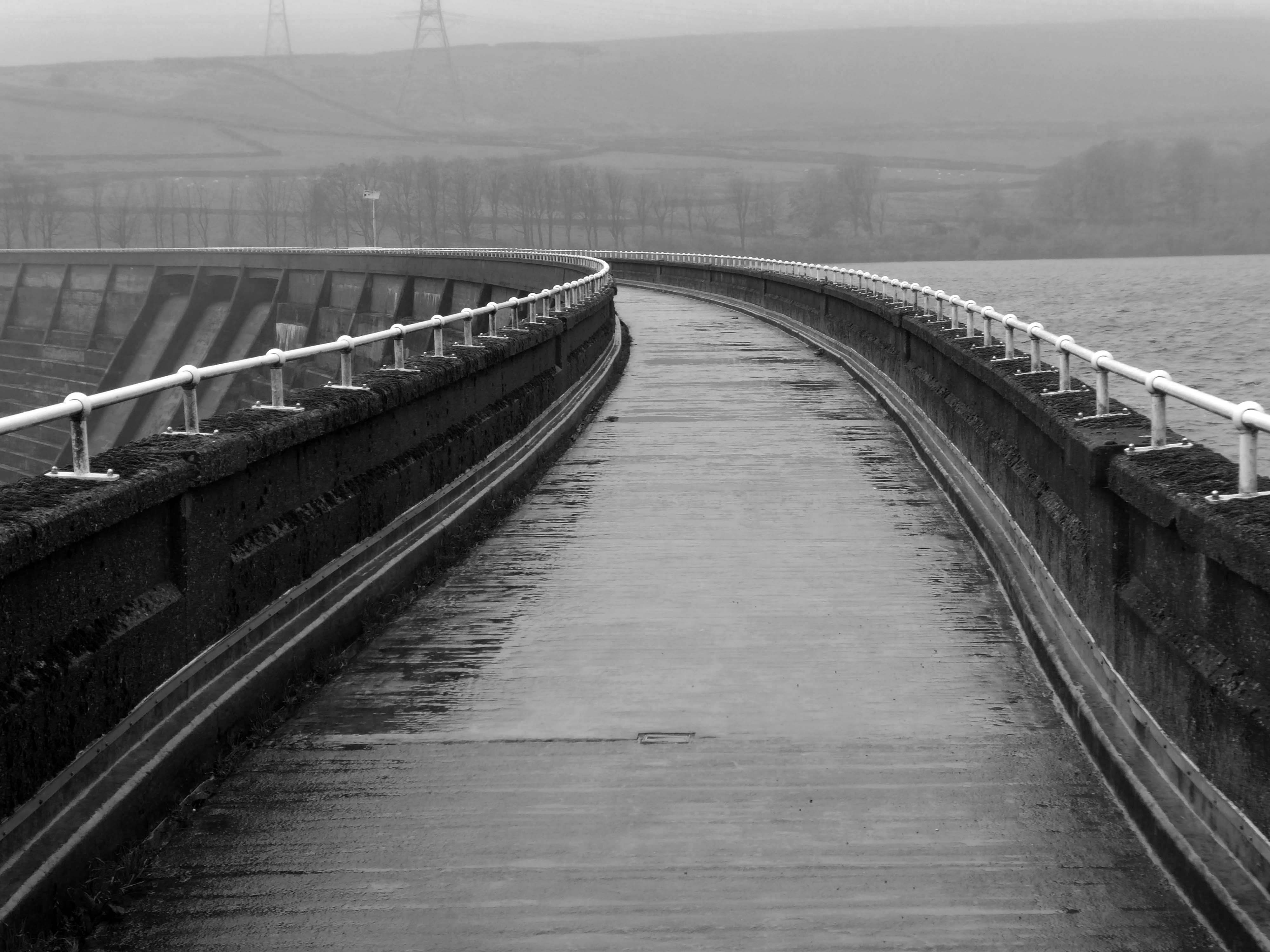
The reservoir dams the Booth Dean Clough watercourse and takes water directly from the surrounding moorland. It has a plain concrete crest on the dam head which is straight and extends to a length of 1,150 feet and a height of 157 feet.
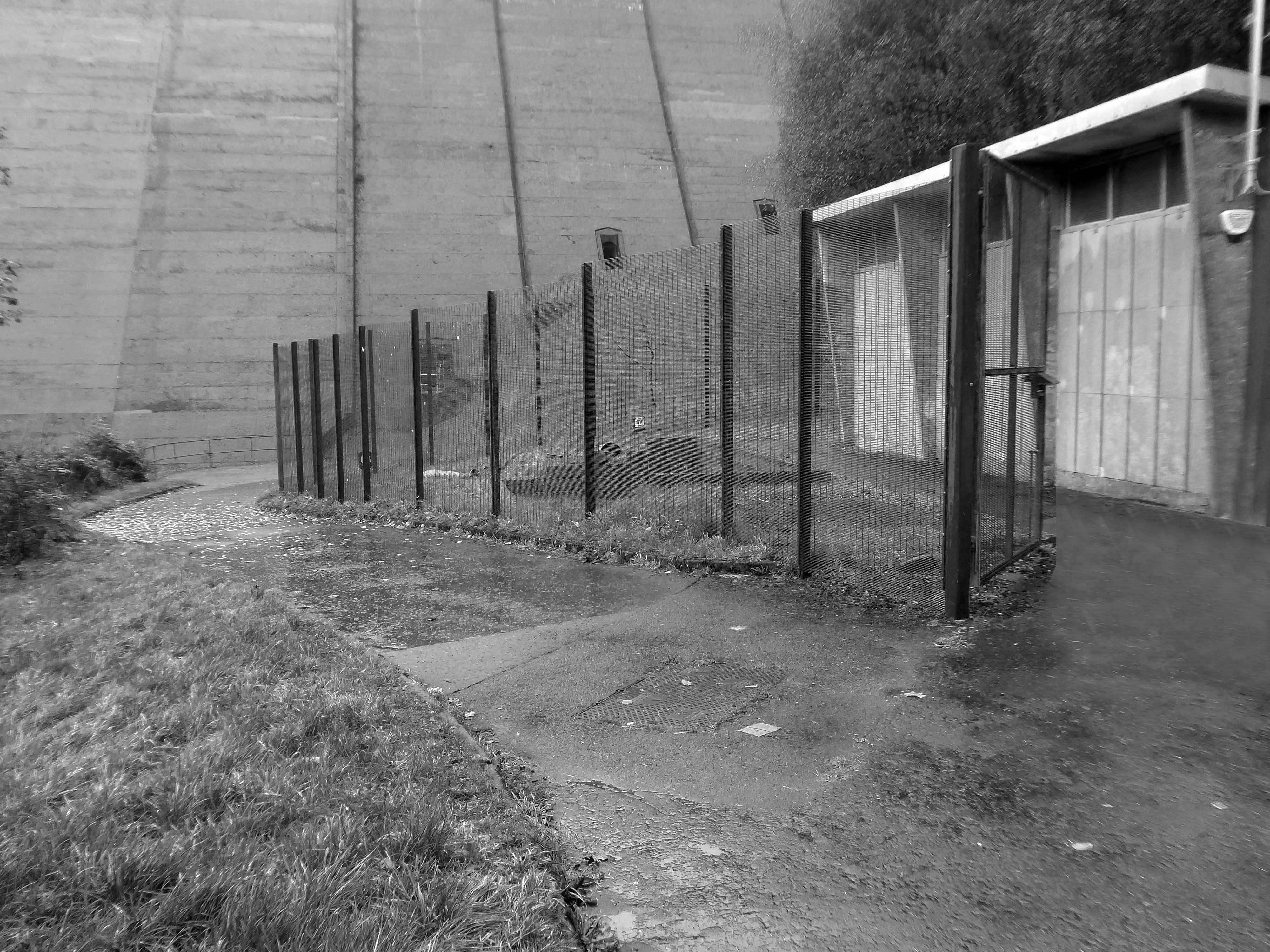
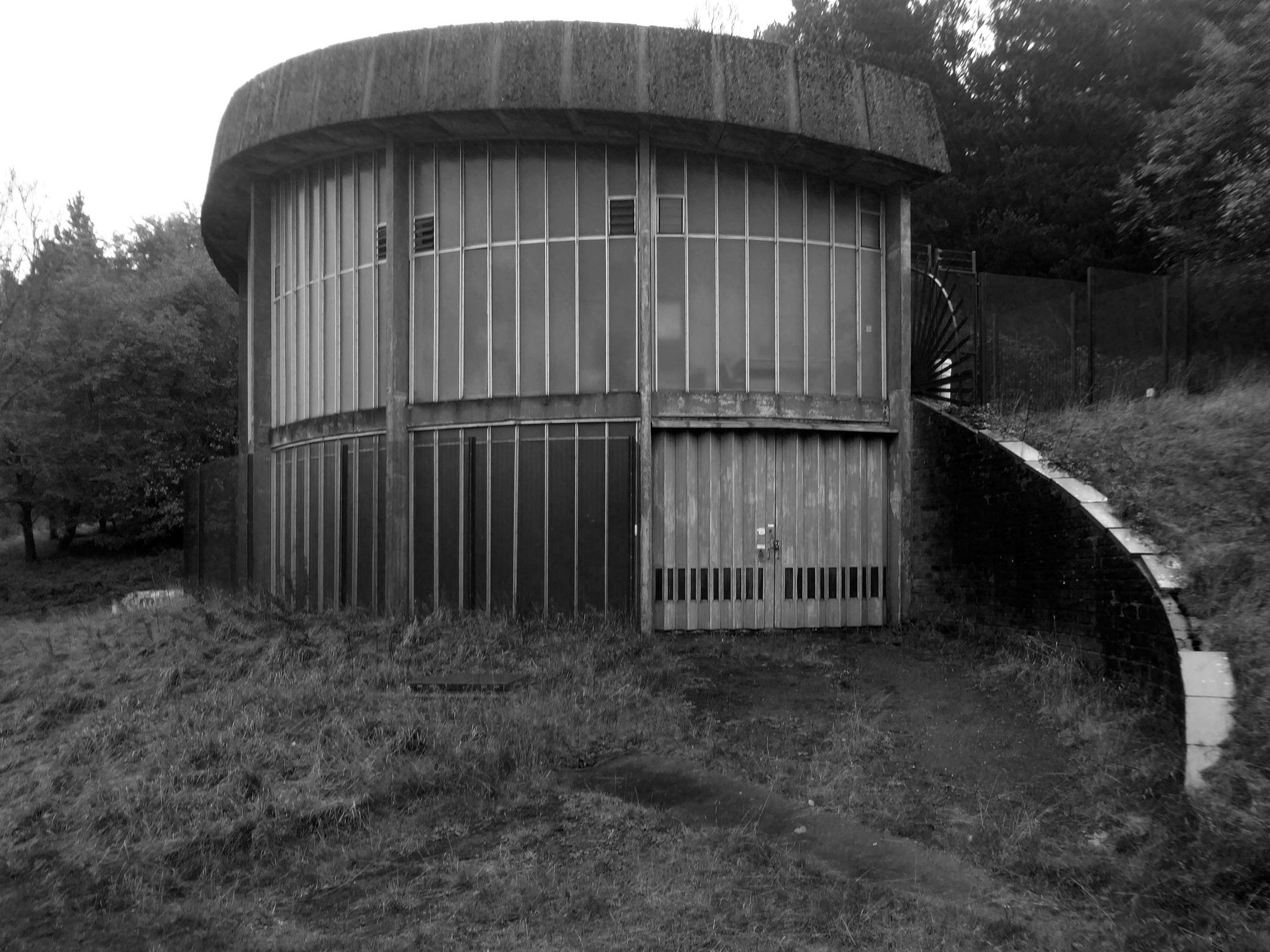
Below is a dinky pumping station, tucked beneath the dam.
We took a precipitous path through the wood – up to the level of the reservoir.
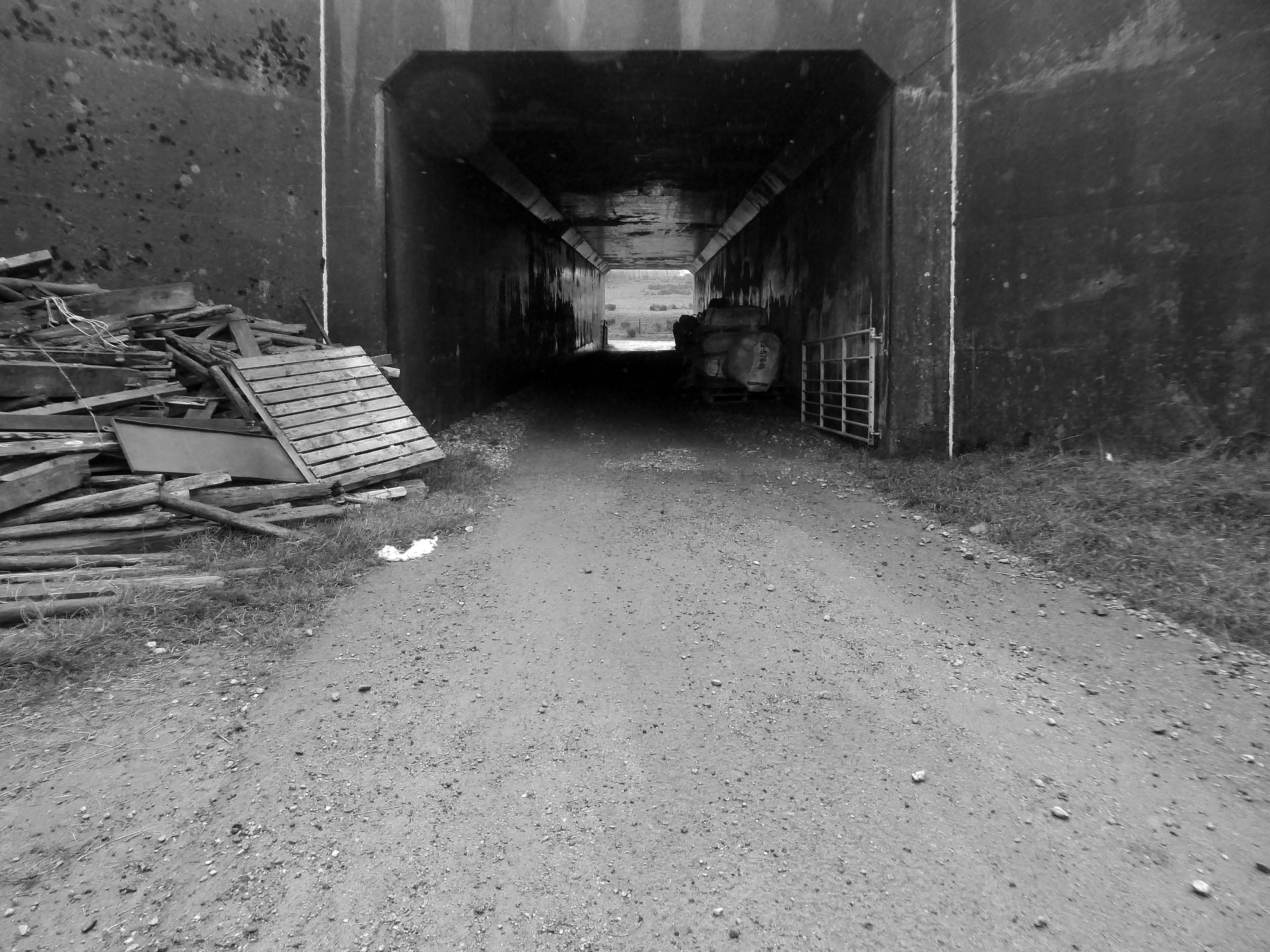
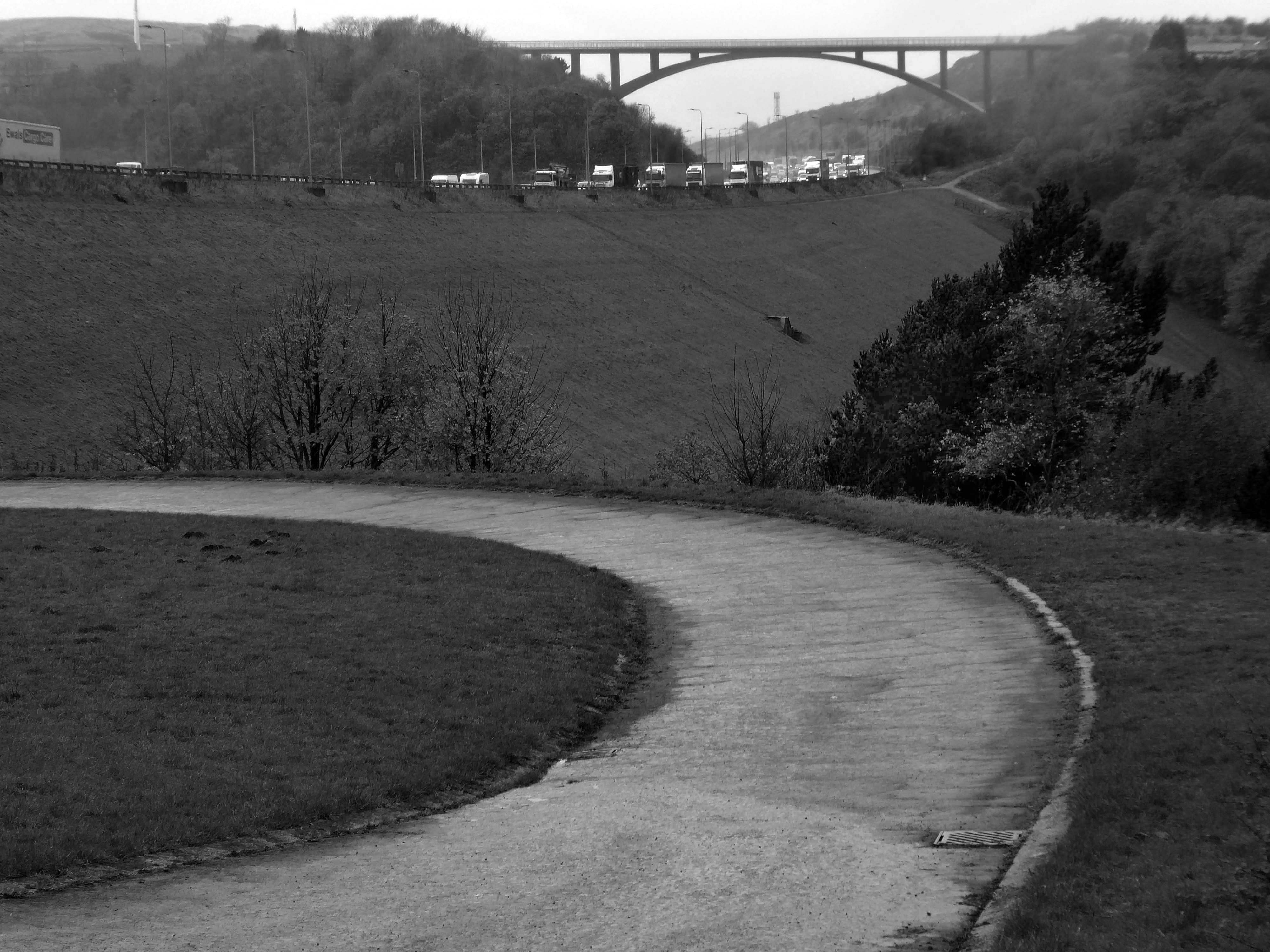
Under the the M62 and past the infamous Stott Hall Farm.
Stott Hall Farm is a farm located between the eastbound and westbound carriageways of the M62 motorway in Calderdale. It is the only farm in the UK situated in the middle of a motorway and was built in the 18th century on Moss Moor. It lies south of Booth Wood Reservoir where the carriageways are separated between junctions 22 and 23. The road divides for much of its length between the Windy Hill and Deanhead cuttings because of the surrounding geography; but a myth persists that it was split because Ken and Beth Wild refused to sell. However, the farm was actually owned by Yorkshire Water at the time the M62 was built.
We walked over the upland moors to meet with the Catchwater, which formerly fed the Ringstone Edge Reservoir, prior to the construction of the motorway cutting.
Climbing again over Cow Gate Hill to meet the Saddleworth Road.
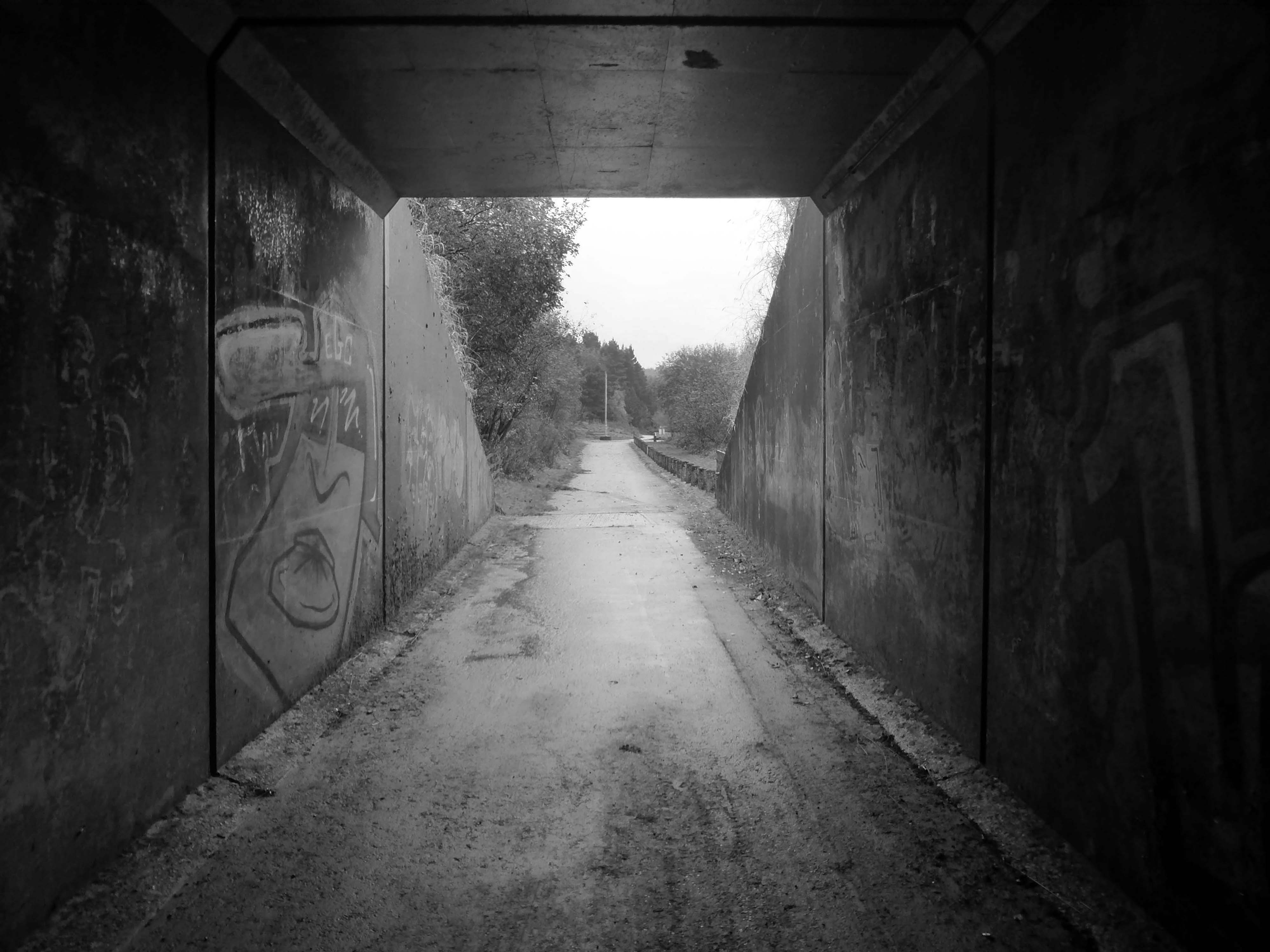
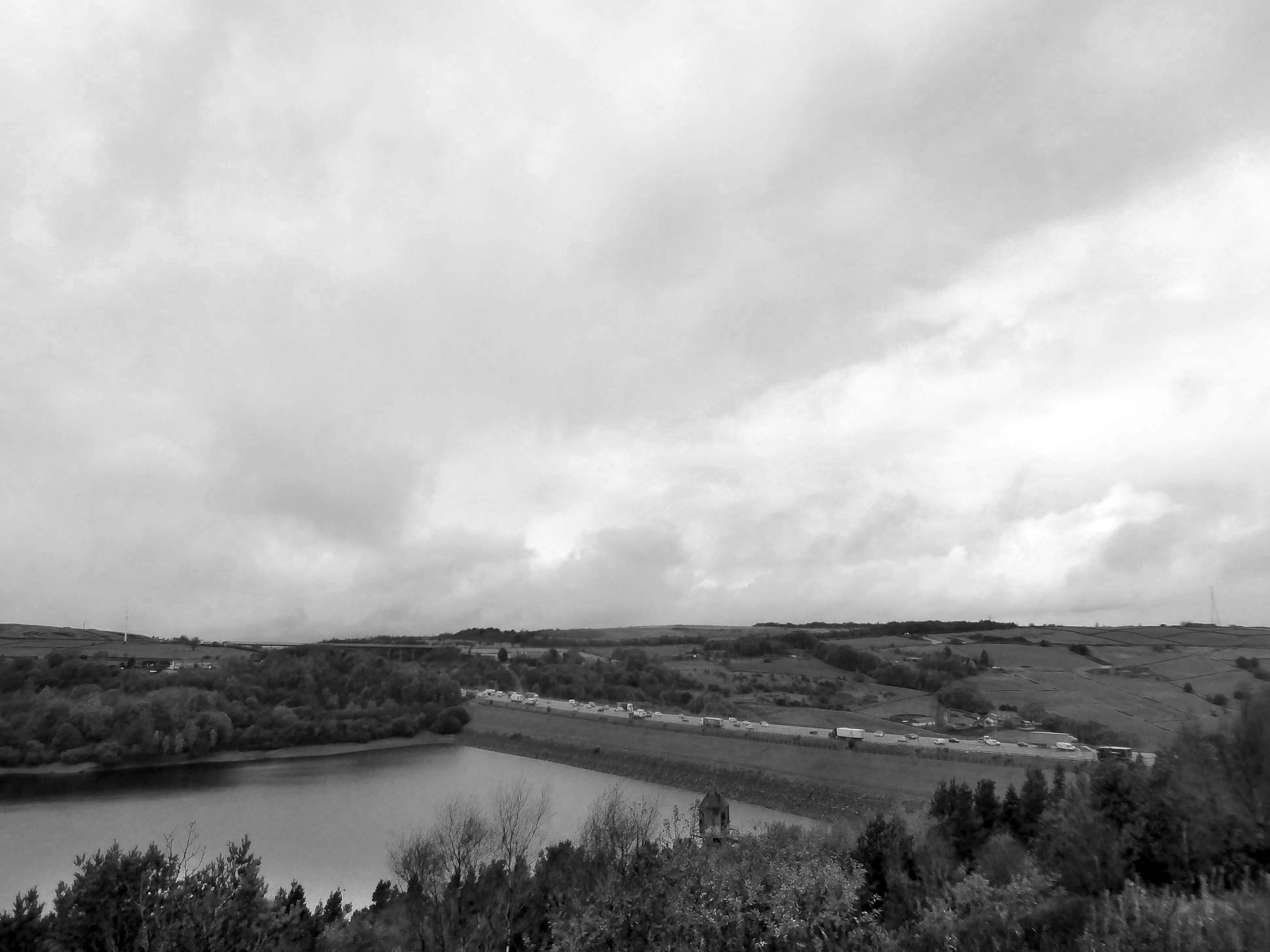
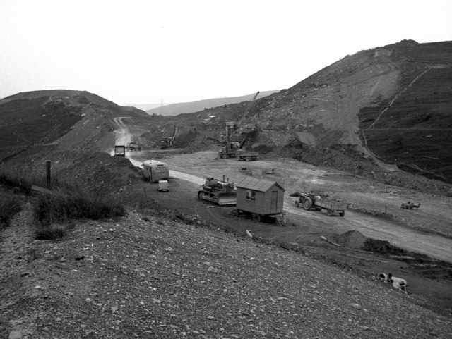
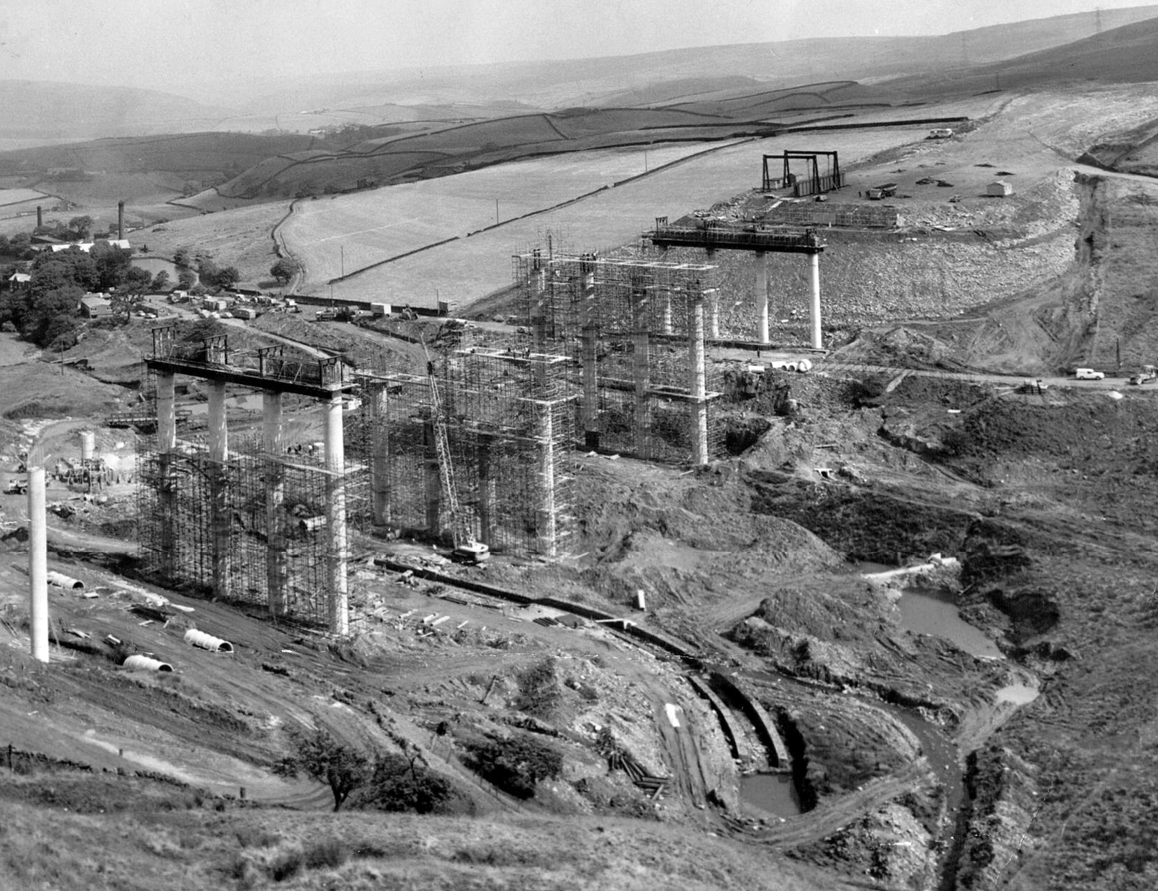
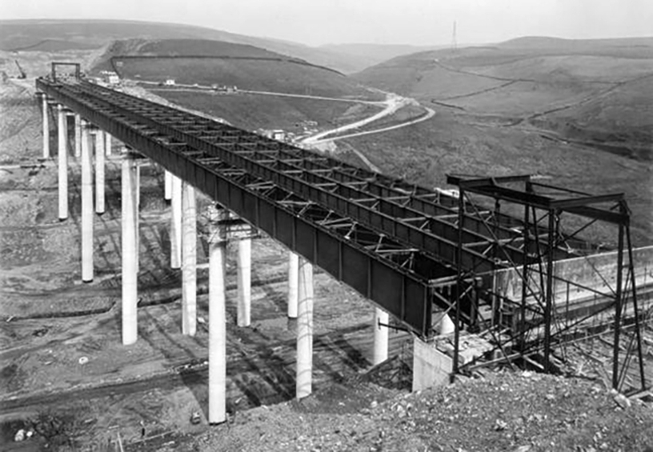
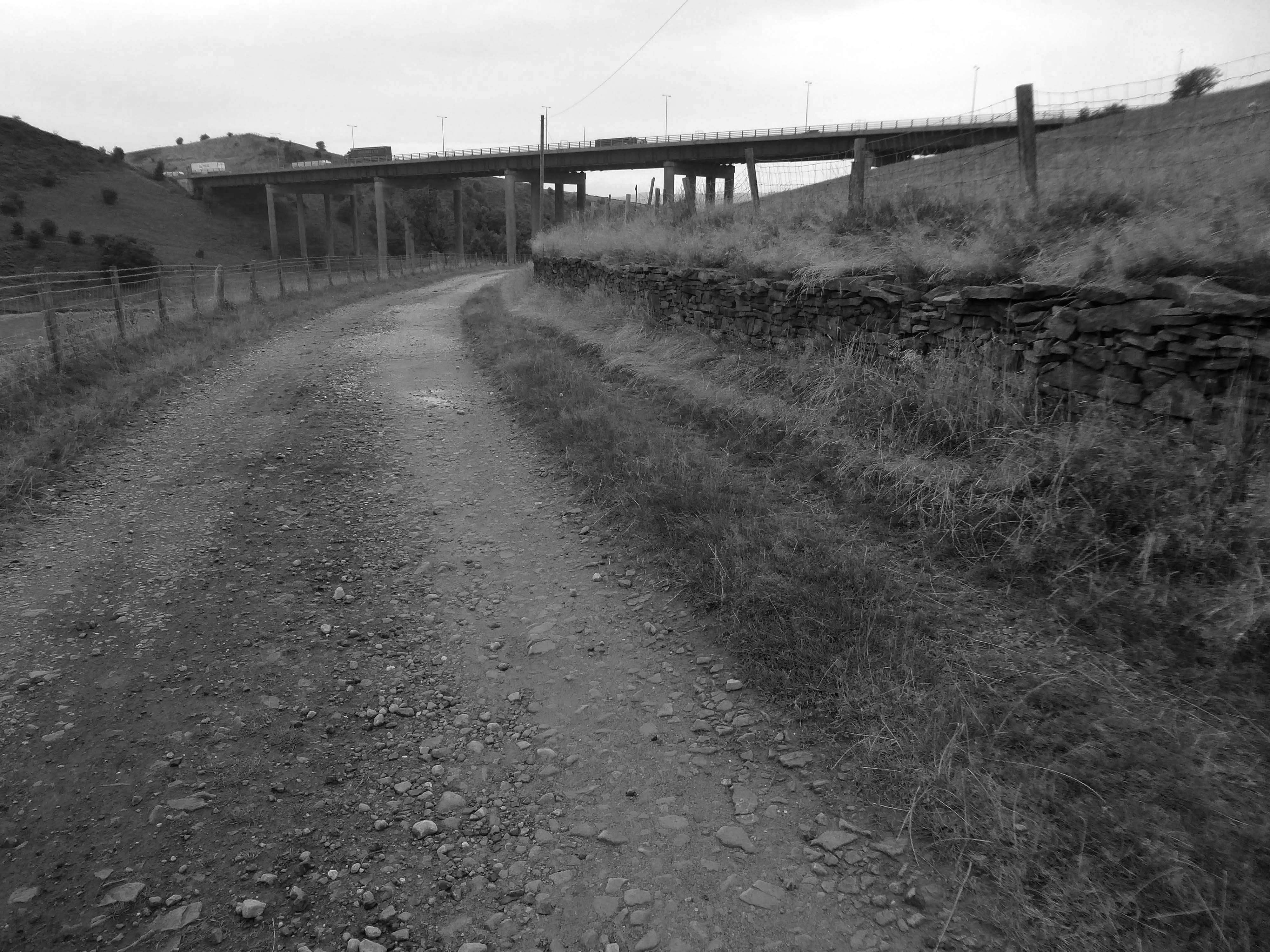
Crossing the motorway and dropping down to meet the Scammonden Dam.
Scammonden Dam is part of the M62 motorway between junctions 22 and 23, the only such structure in Britain. Its construction by the Ministry of Transport and Huddersfield Corporation Waterworks required the passing of the Huddersfield Corporation Act 1965. The motorway dam spans the Deanhead Valley in the Pennines between Huddersfield and Rochdale and the main contractor for the project was Sir Alfred McAlpine & Sons.
It was designed by Rofe, Kennard and Lapworth
Surveying began in November 1961 and the route of the carriageway was determined in mid 1963. Excavation in the Deanhead Valley commenced the following year and for the dam in 1966. This required the removal of 25,200,000 cu ft of peat bog to reach the solid rock base nearly 43 ft below ground level. Material excavated elsewhere on the line of the motorway, clay from cuttings between Lofthouse and Gildersome, and 3.4 million cubic metres from the Deanhead excavations was used to build the dam’s embankment which is 2,051 ft in length and 207 ft above the original valley floor. The embankment is 1,427 ft wide at its base and 180 ft at road level.
Scammonden steps comprises five flights of steps up the hillside from the valley below. Totaling 458 steps, the cumulative step count when ascending each of the five flights is 95, 200, 287, 363 then 458.
At the base of the dam is this delightful Pumping House.
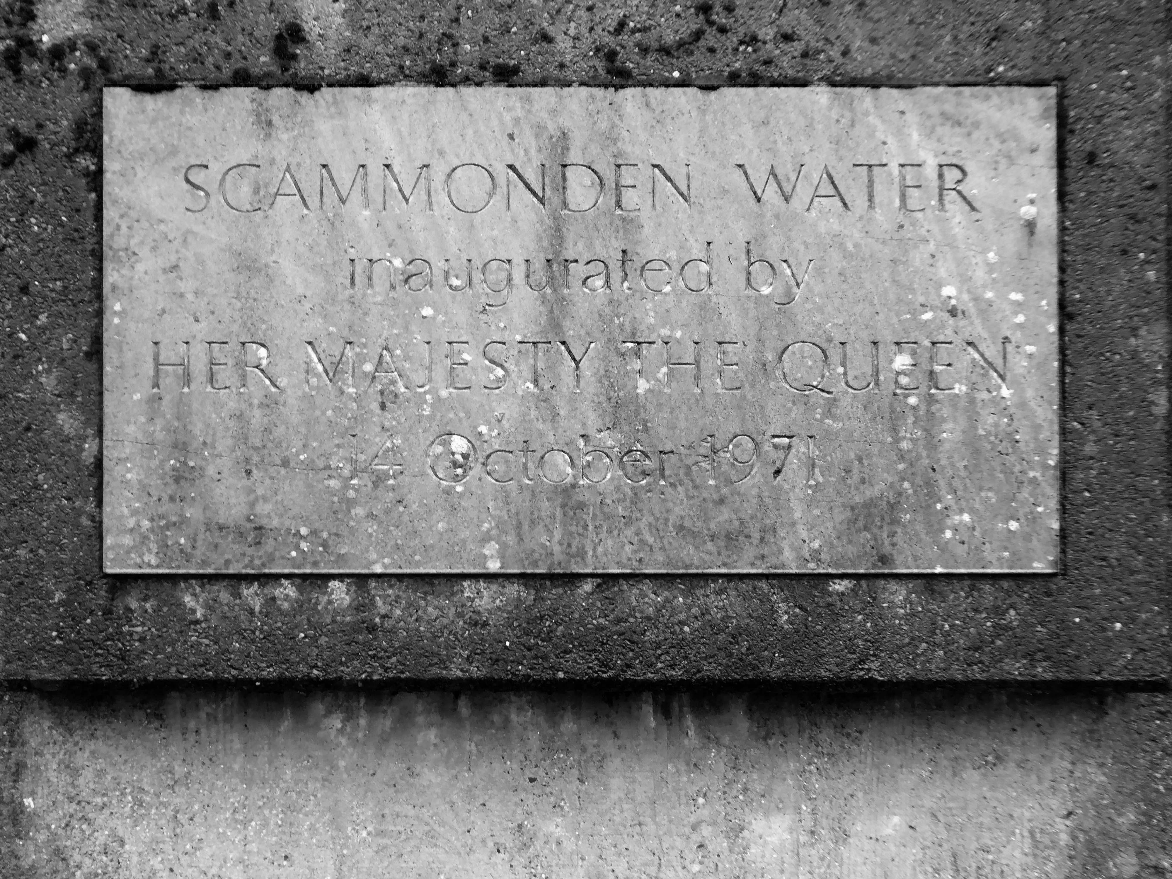
The motorway, which was dependent on the completion of the dam, was opened to traffic on 20th December 1970 and officially opened by Queen Elizabeth II who unveiled a plaque near the valve tower of Scammonden Water on 14 October 1971.
Ascending and looking back toward Scammonden Bridge also known locally as the Brown Cow Bridge – after the nearby Brown Cow Inn, now closed, spans the Deanhead cutting carrying the B6114.
The bridge was built for the West Riding County Council to the designs of the county surveyor, Colonel S Maynard Lovell.
It opened to traffic on Monday 18 May 1970 by Major Bruce Eccles – Huddersfield Transport ran buses to see the bridge.
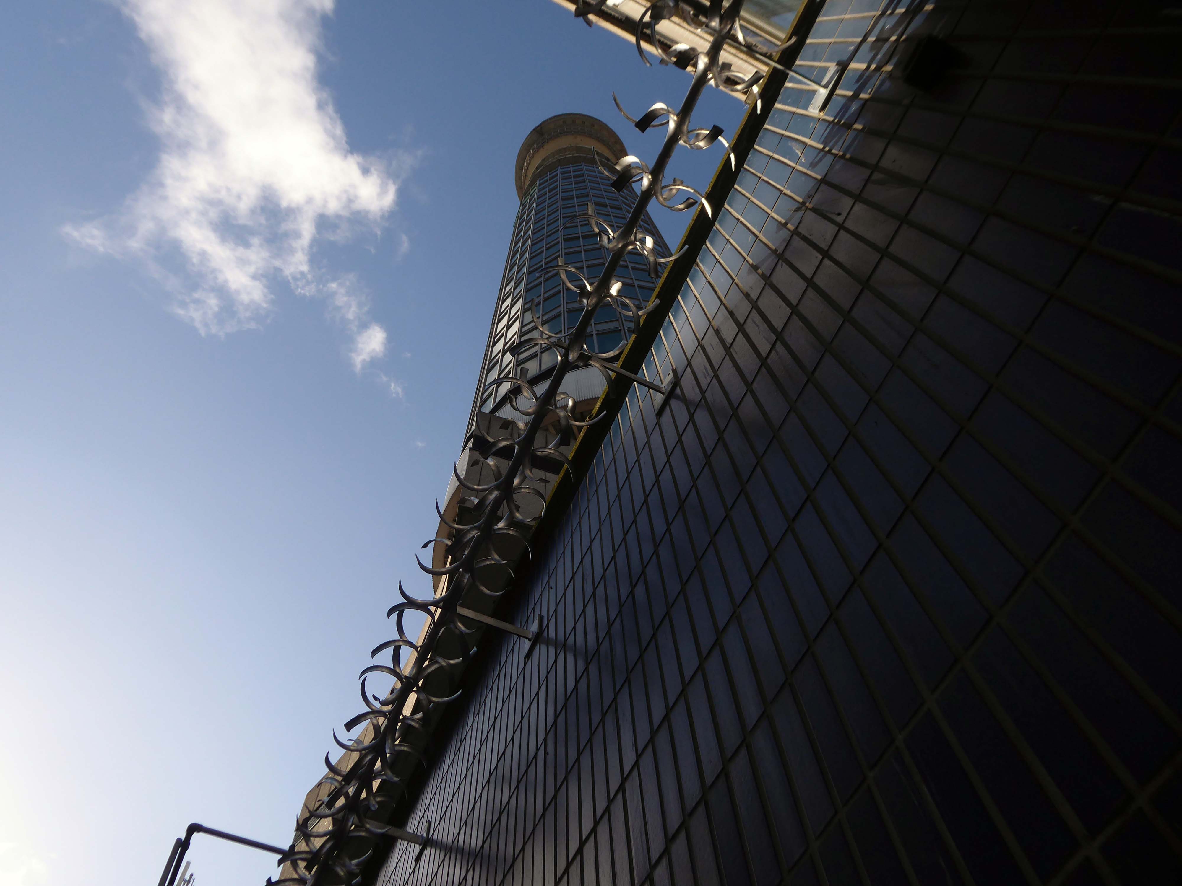
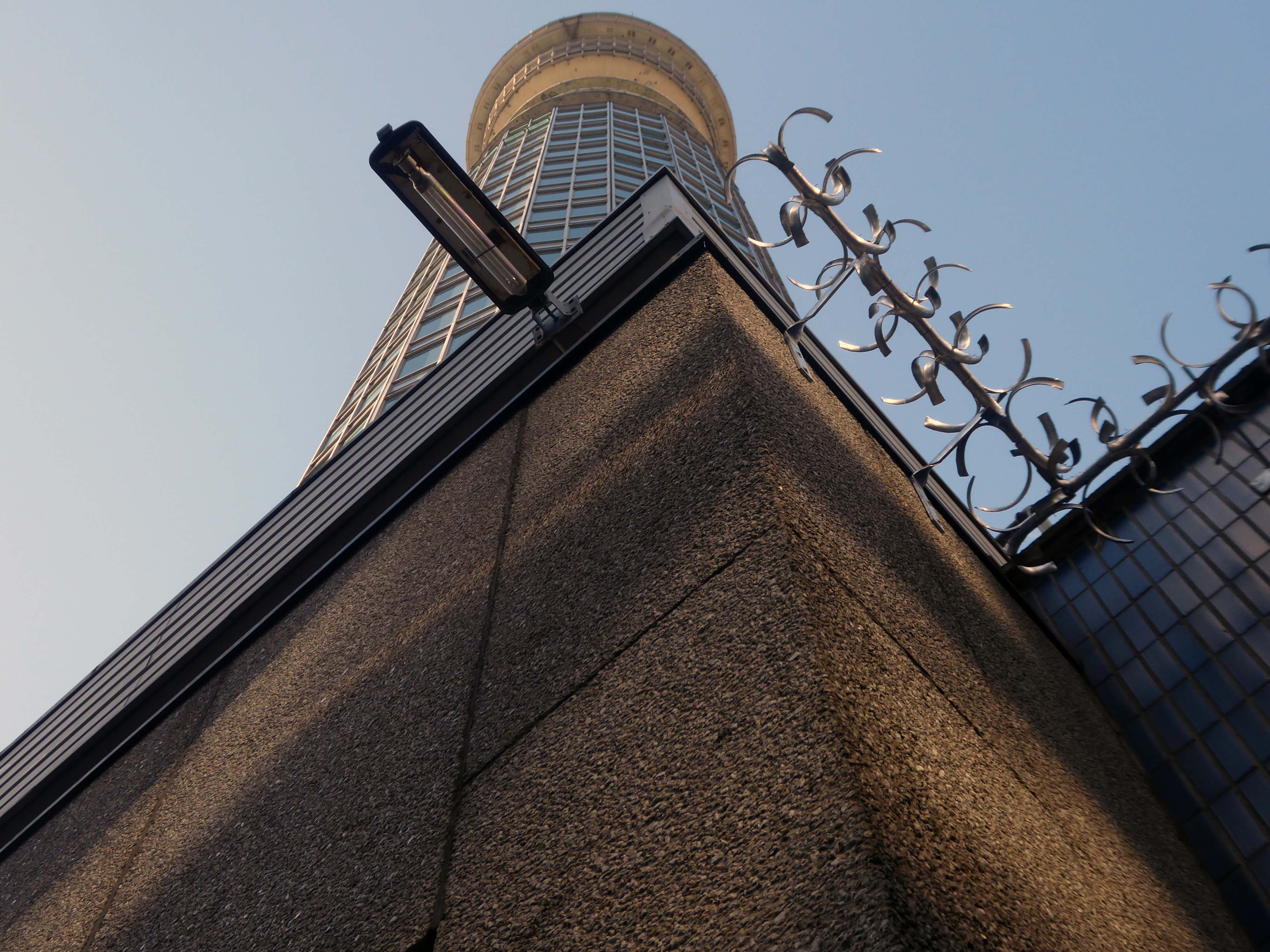
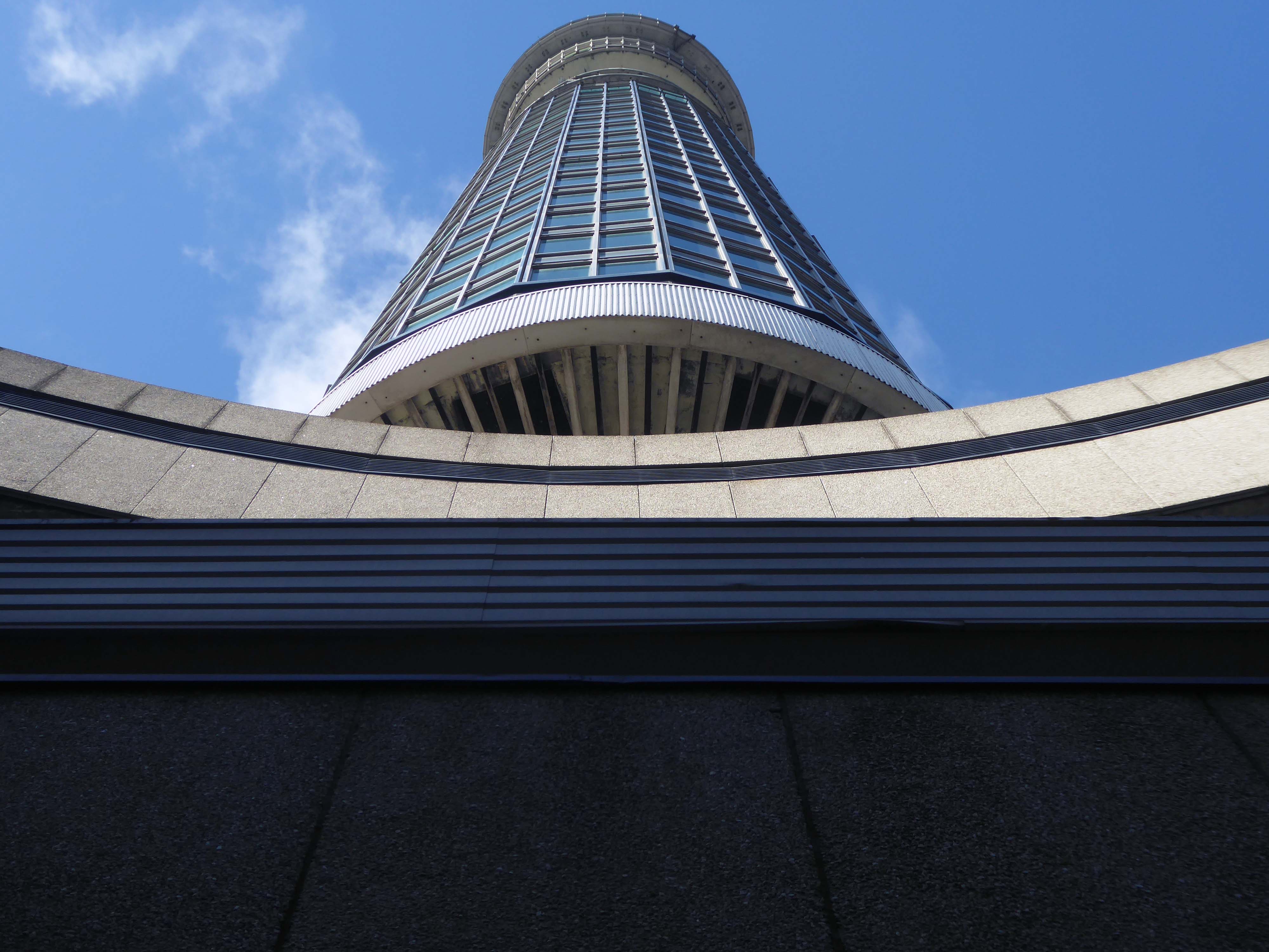
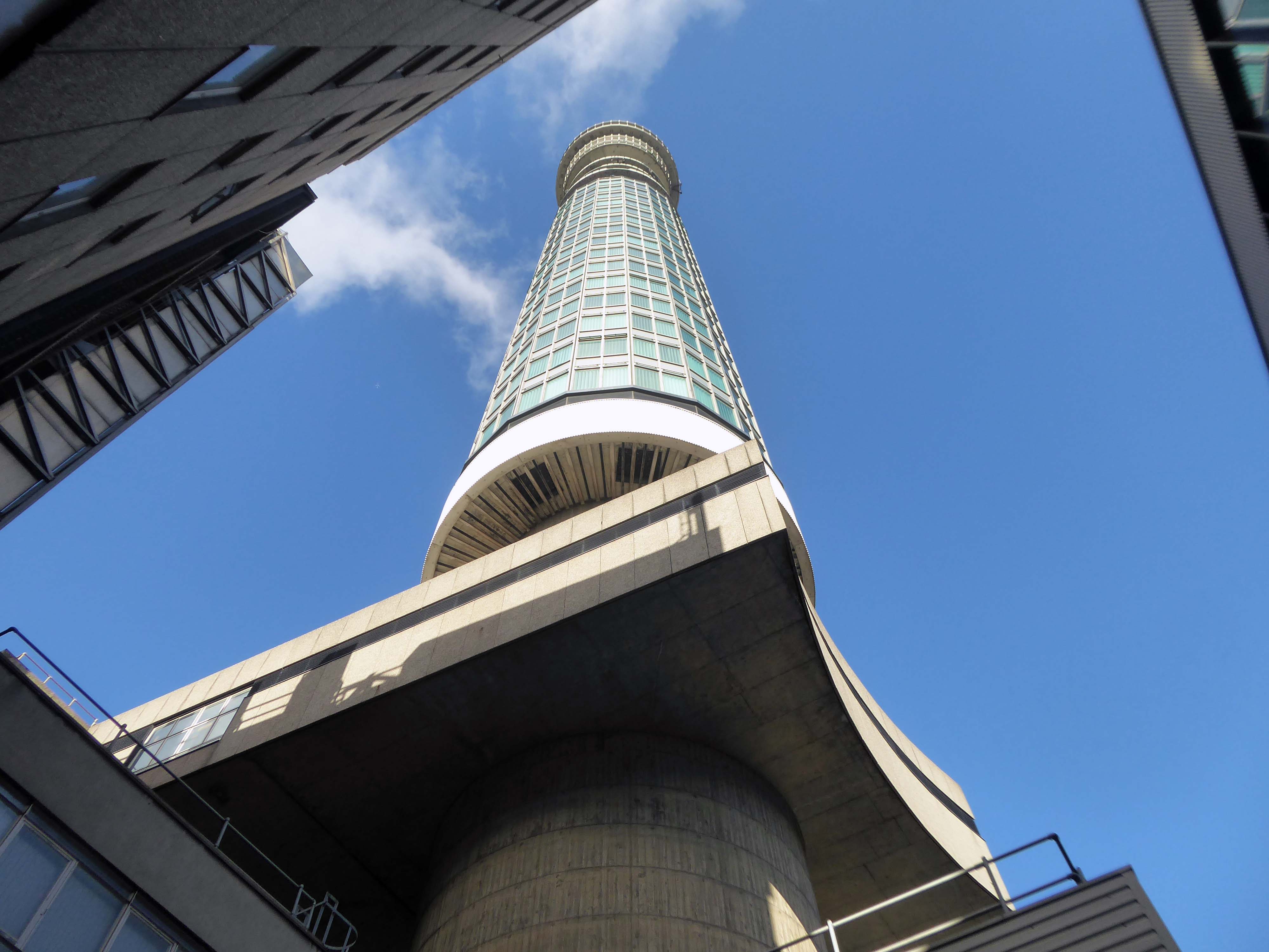
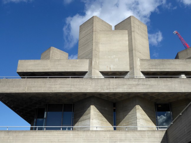
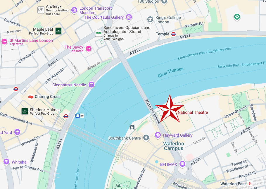
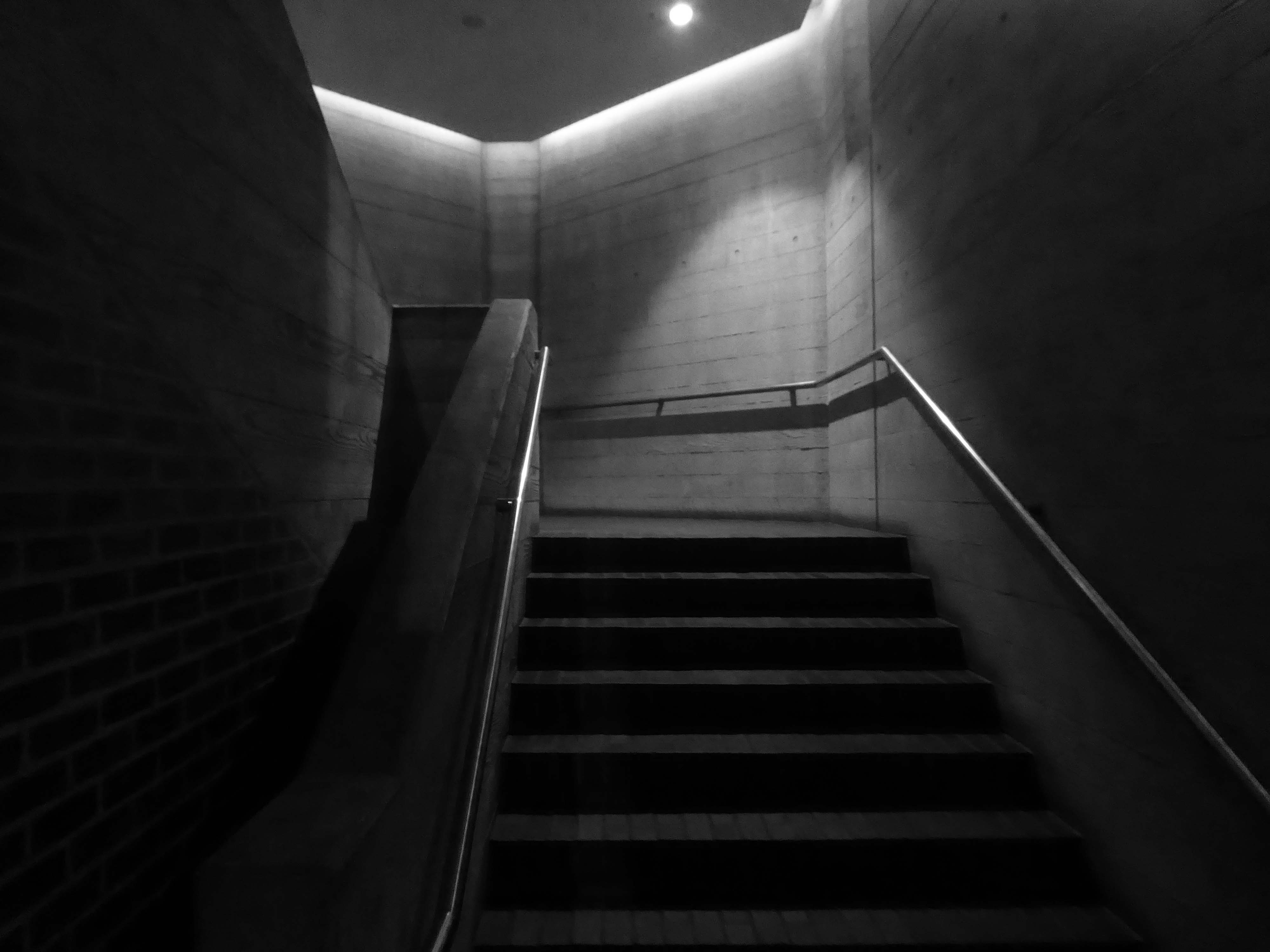
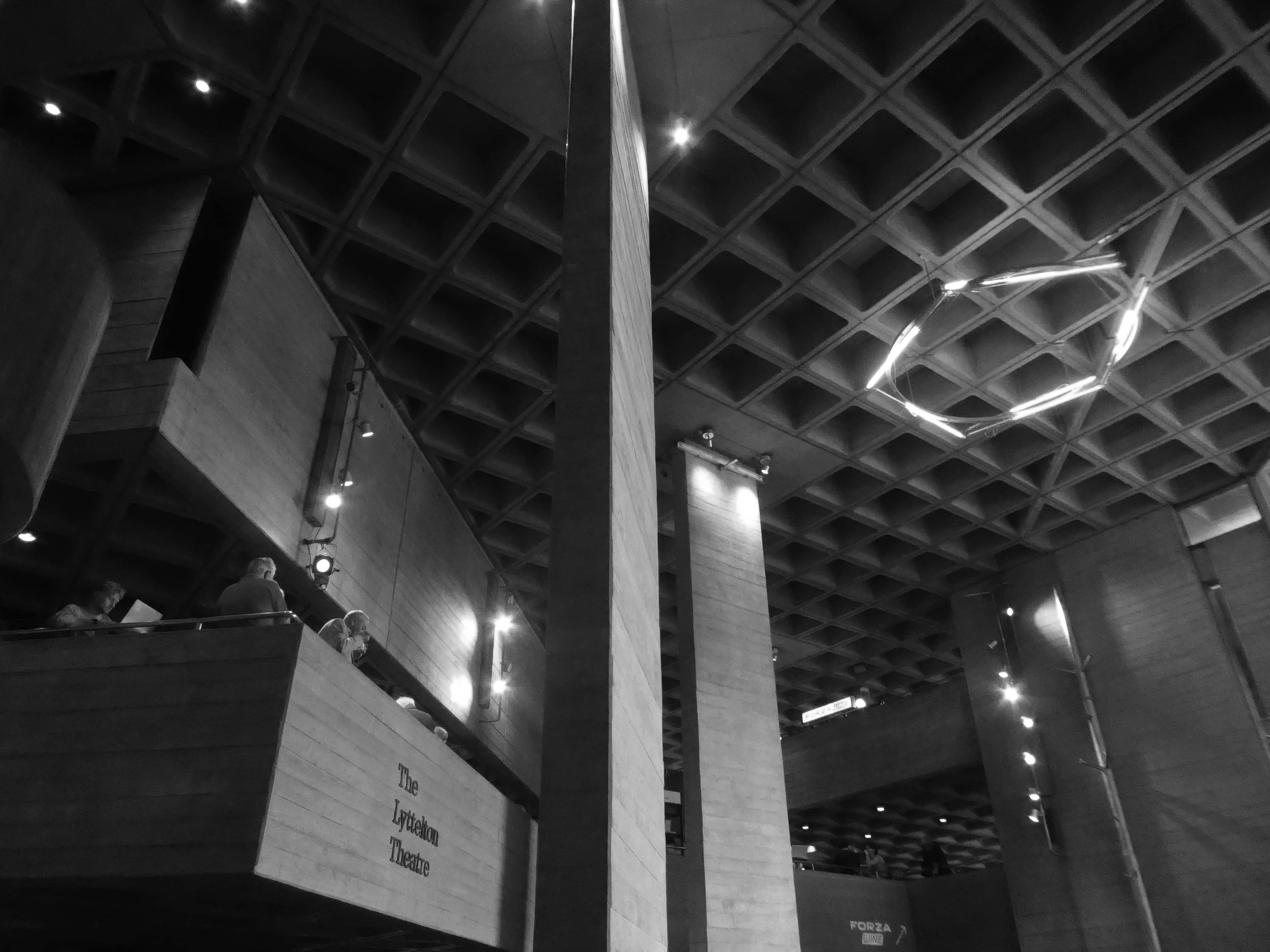
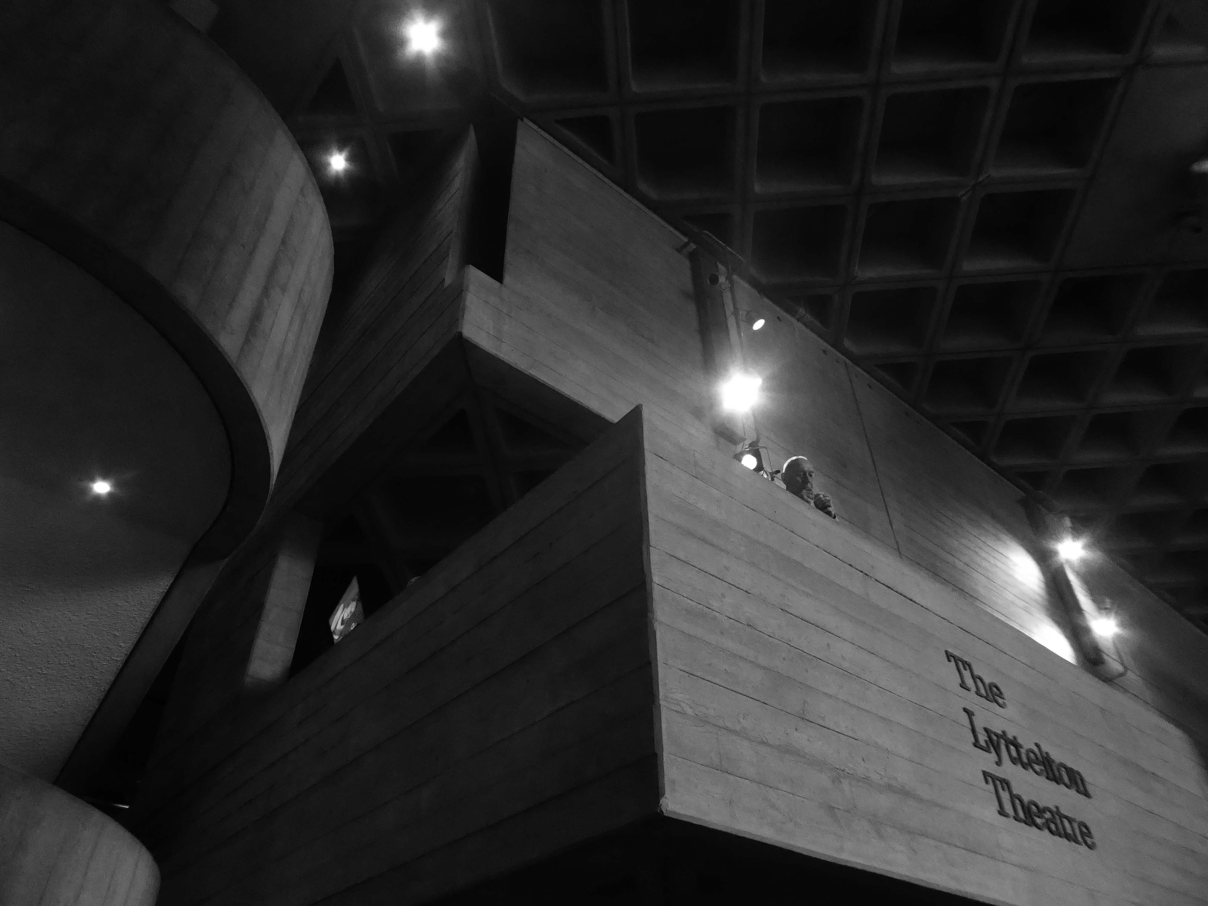
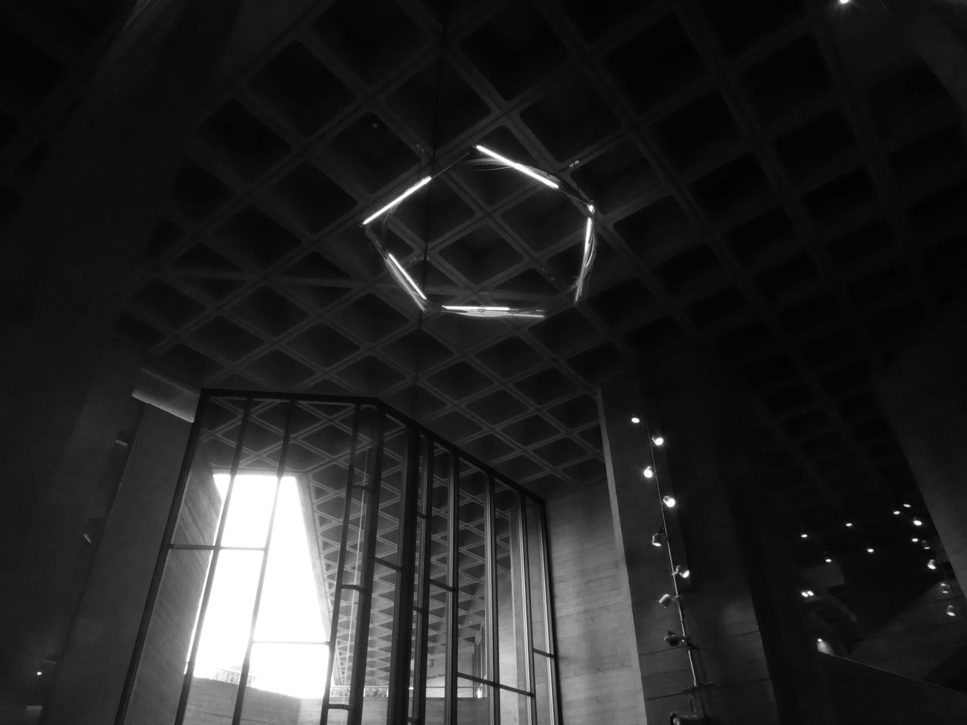
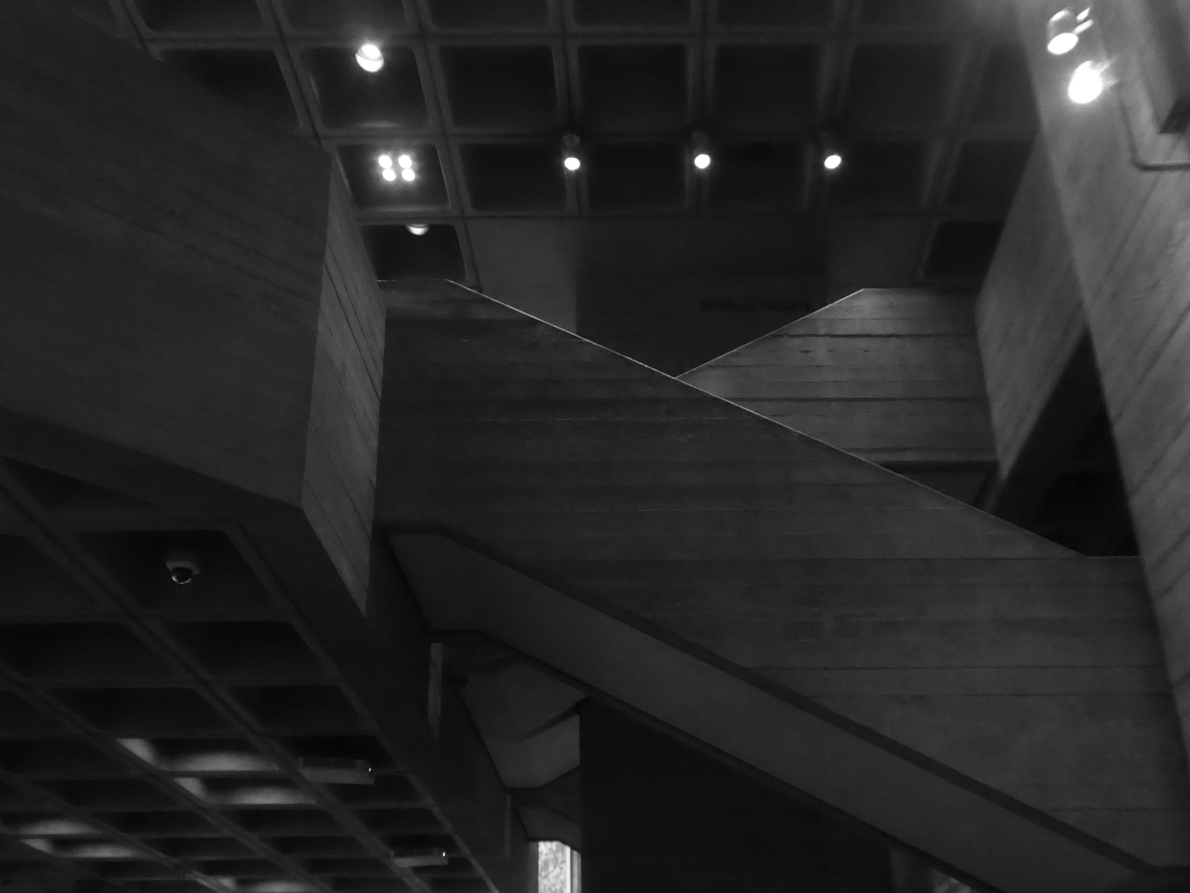
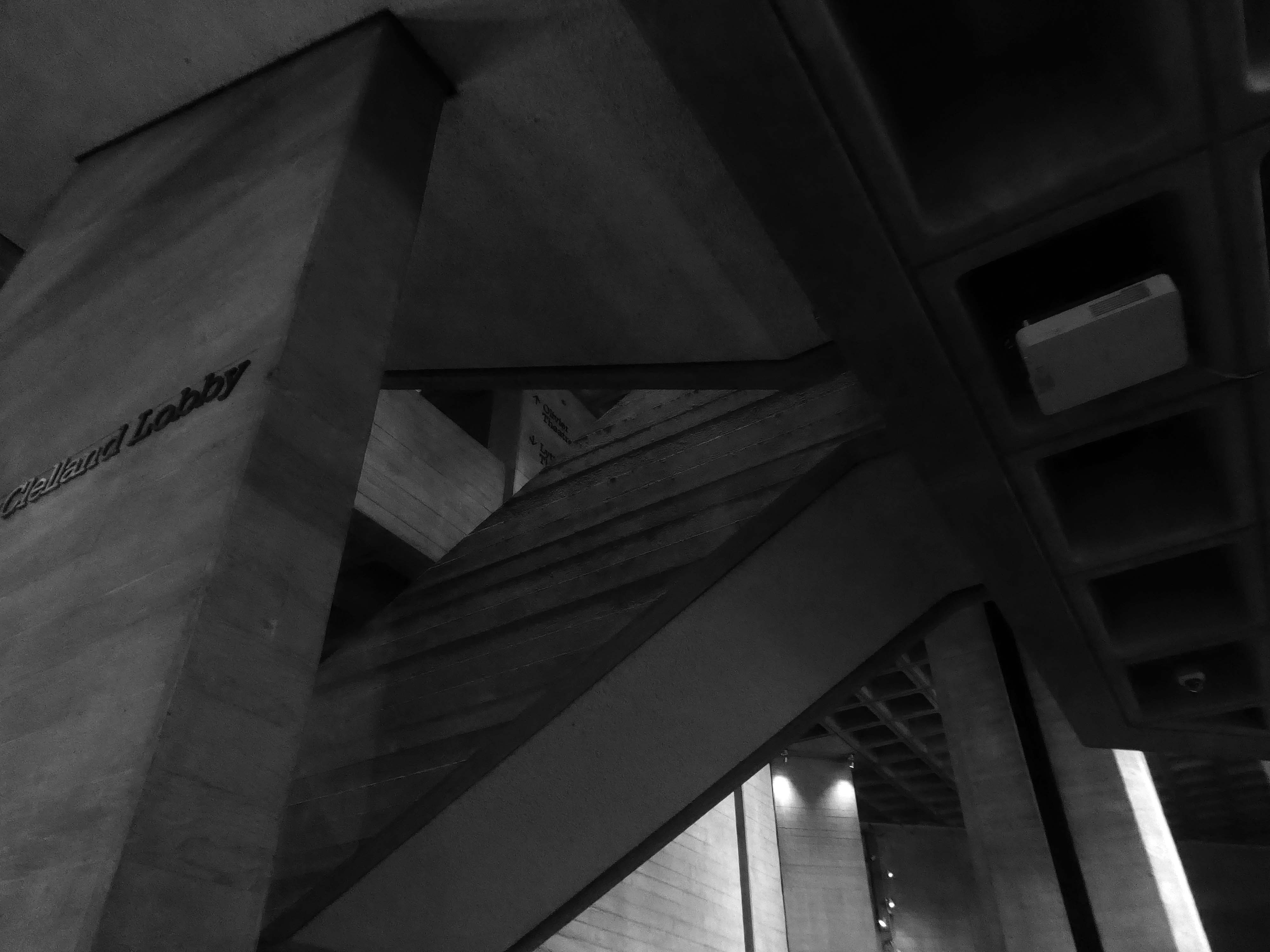
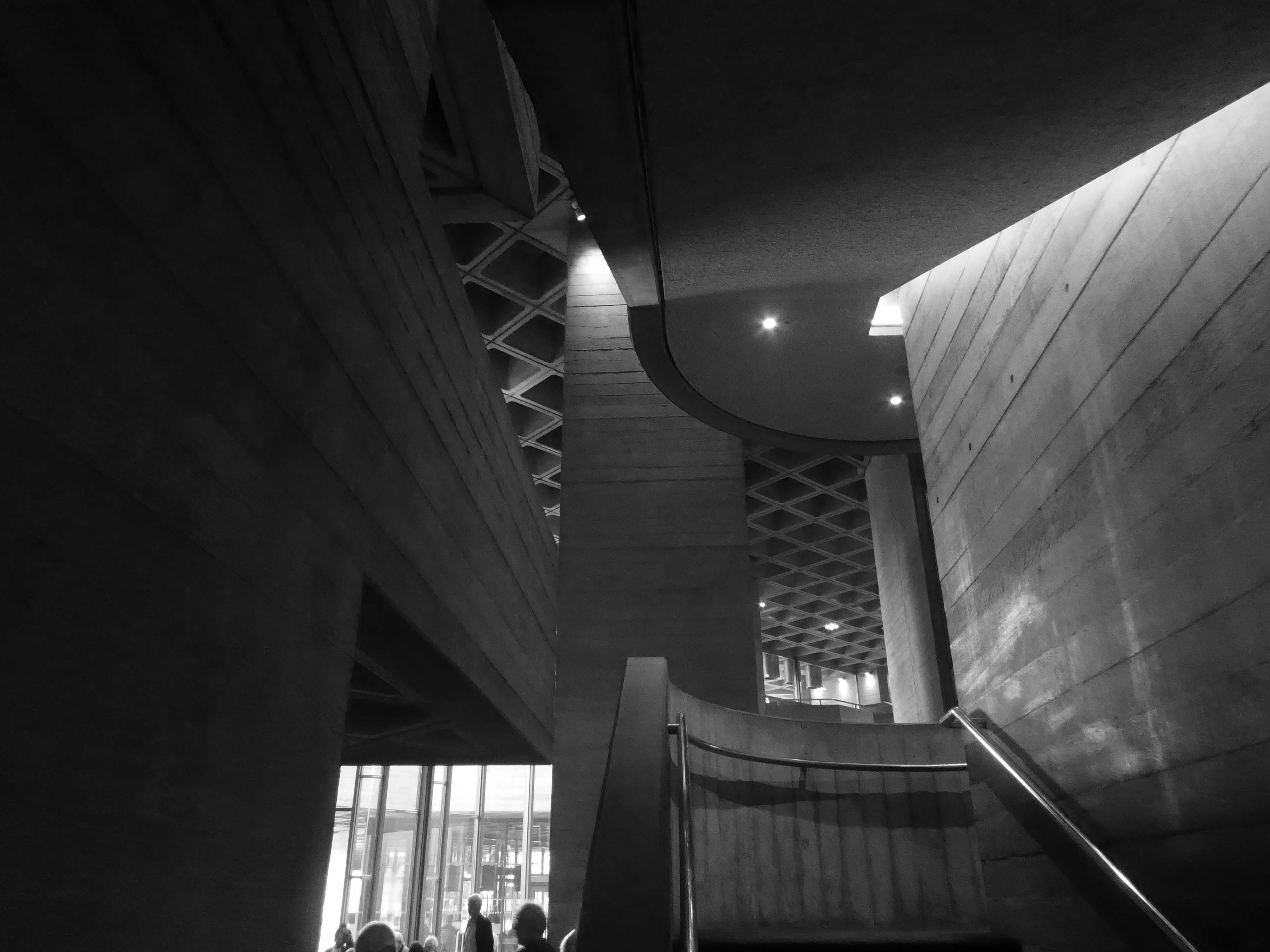
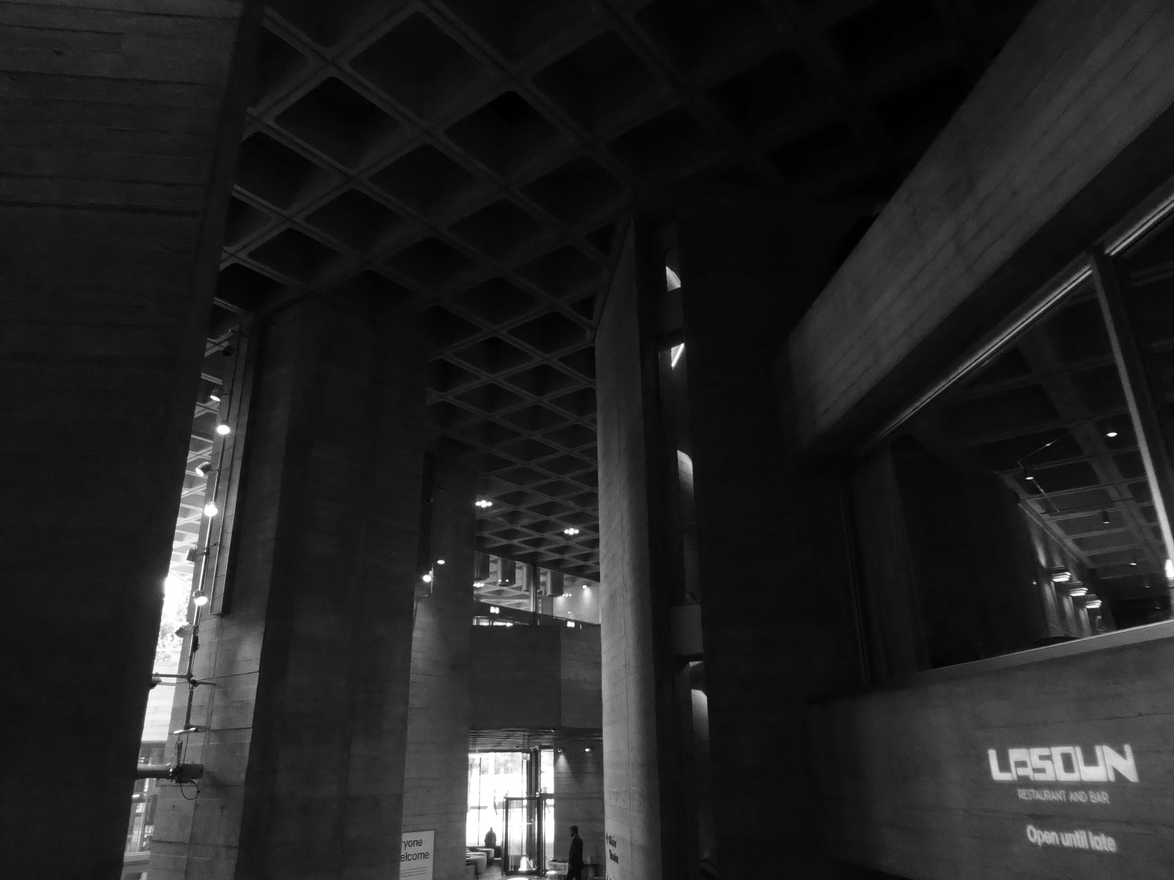
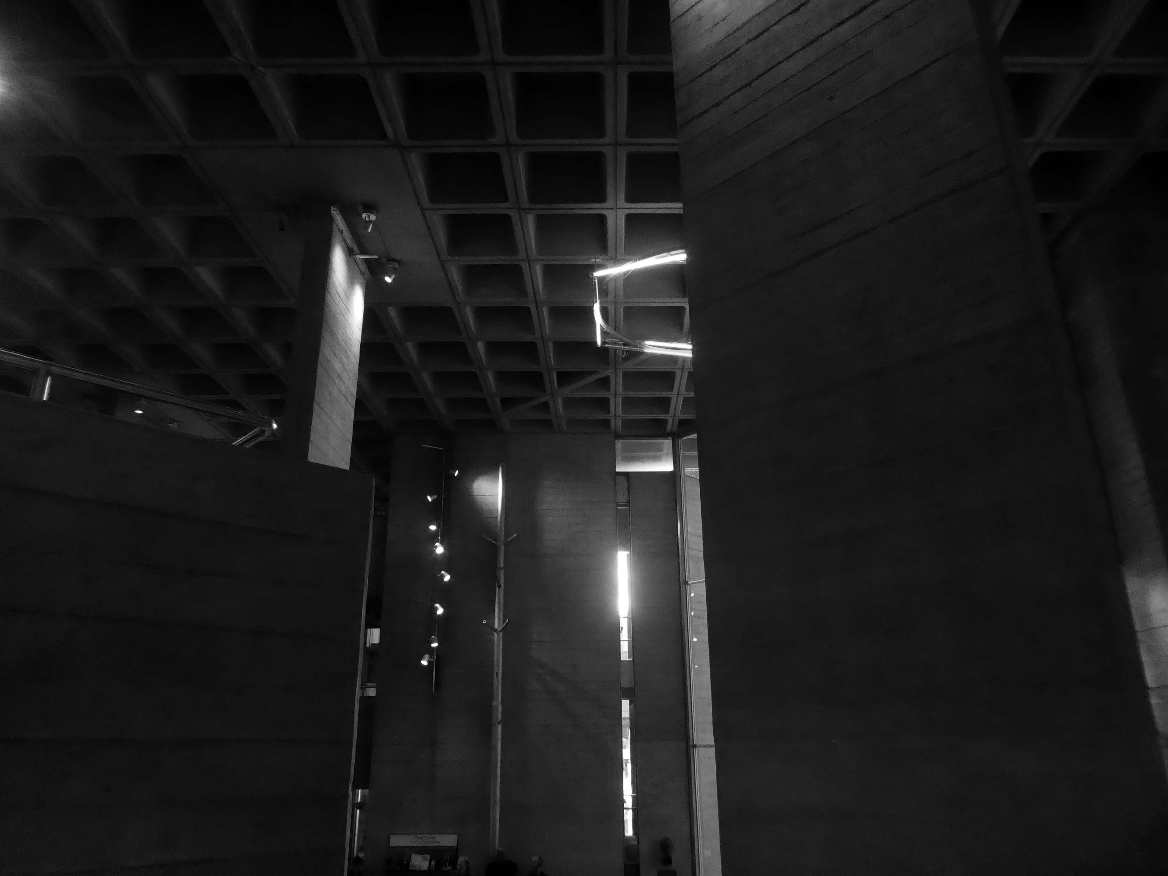
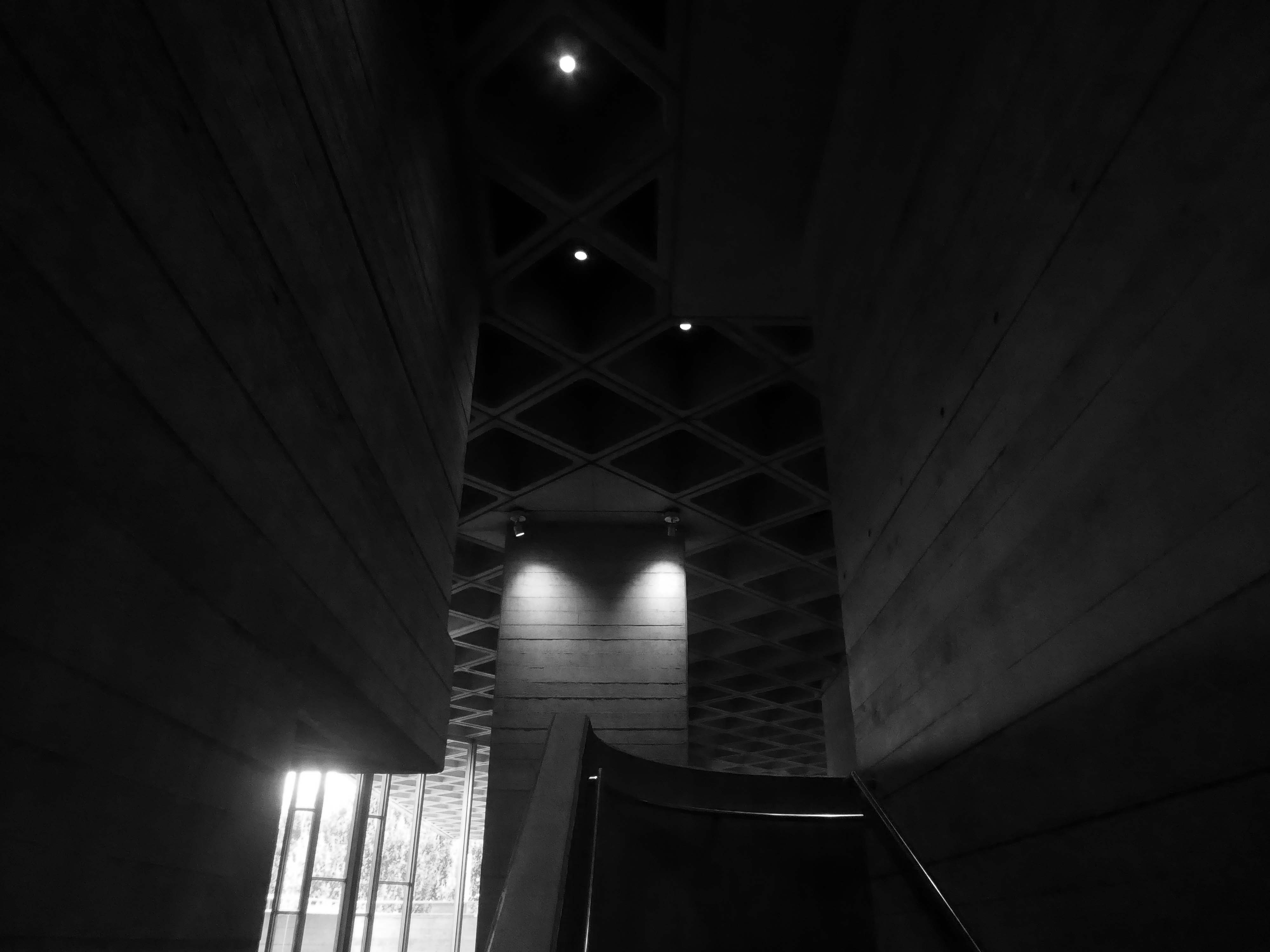
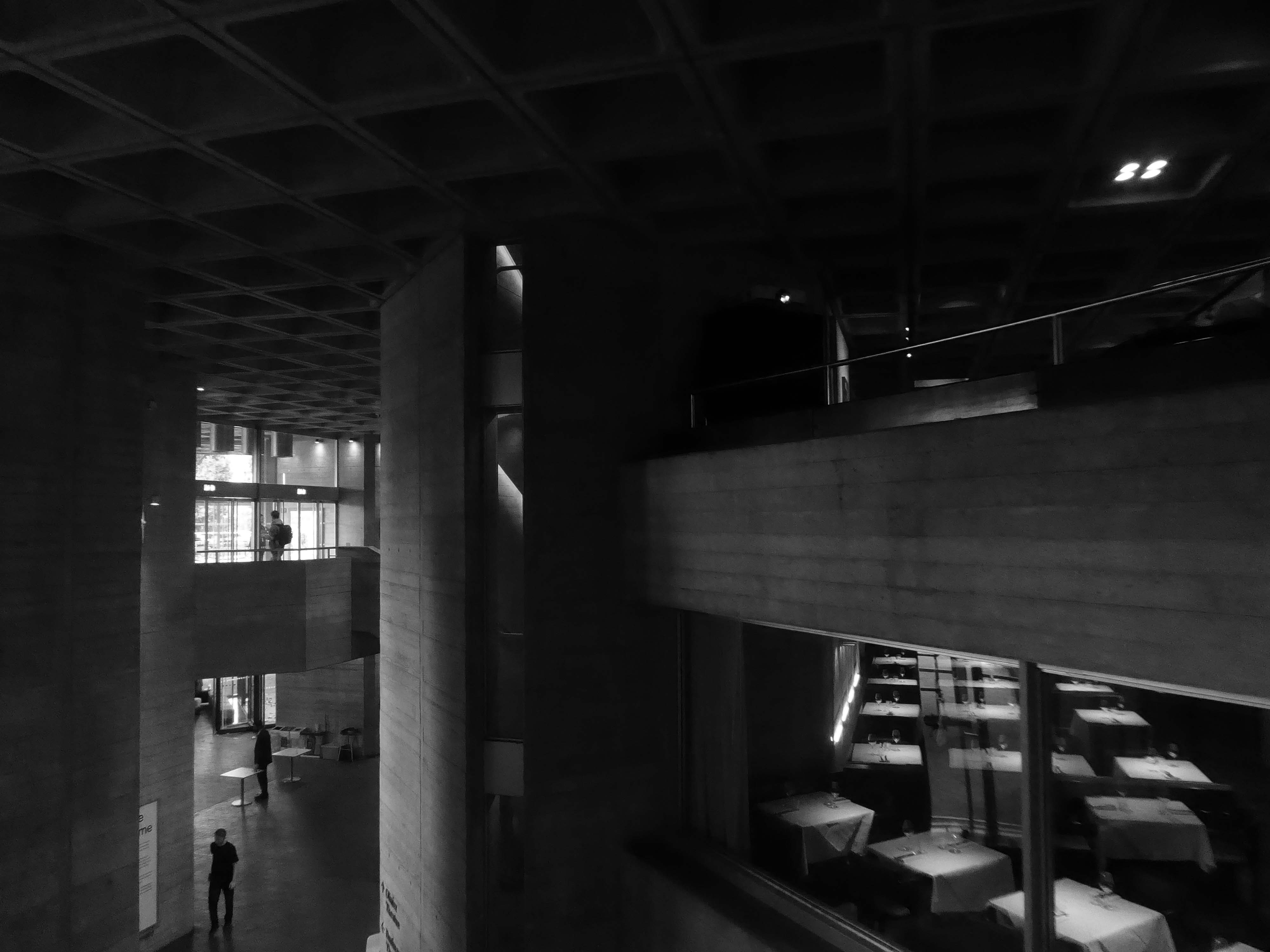
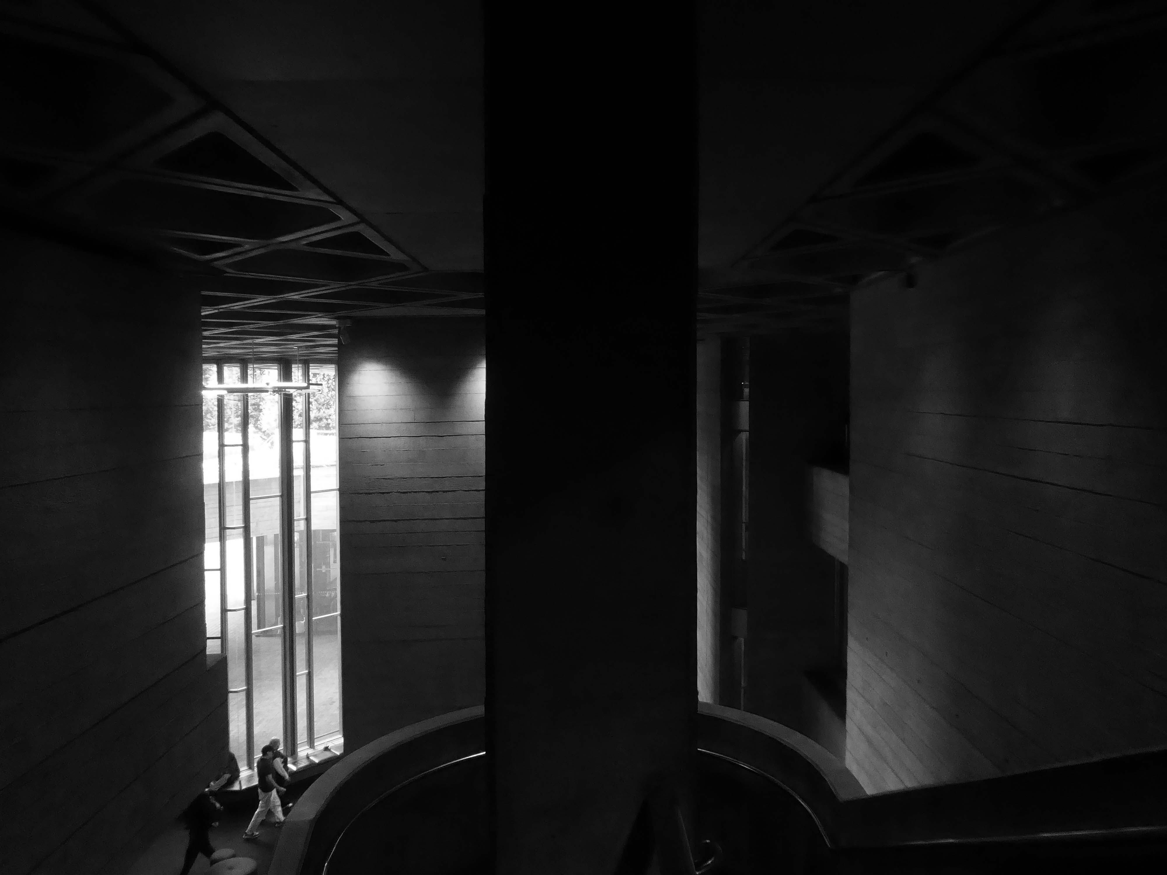
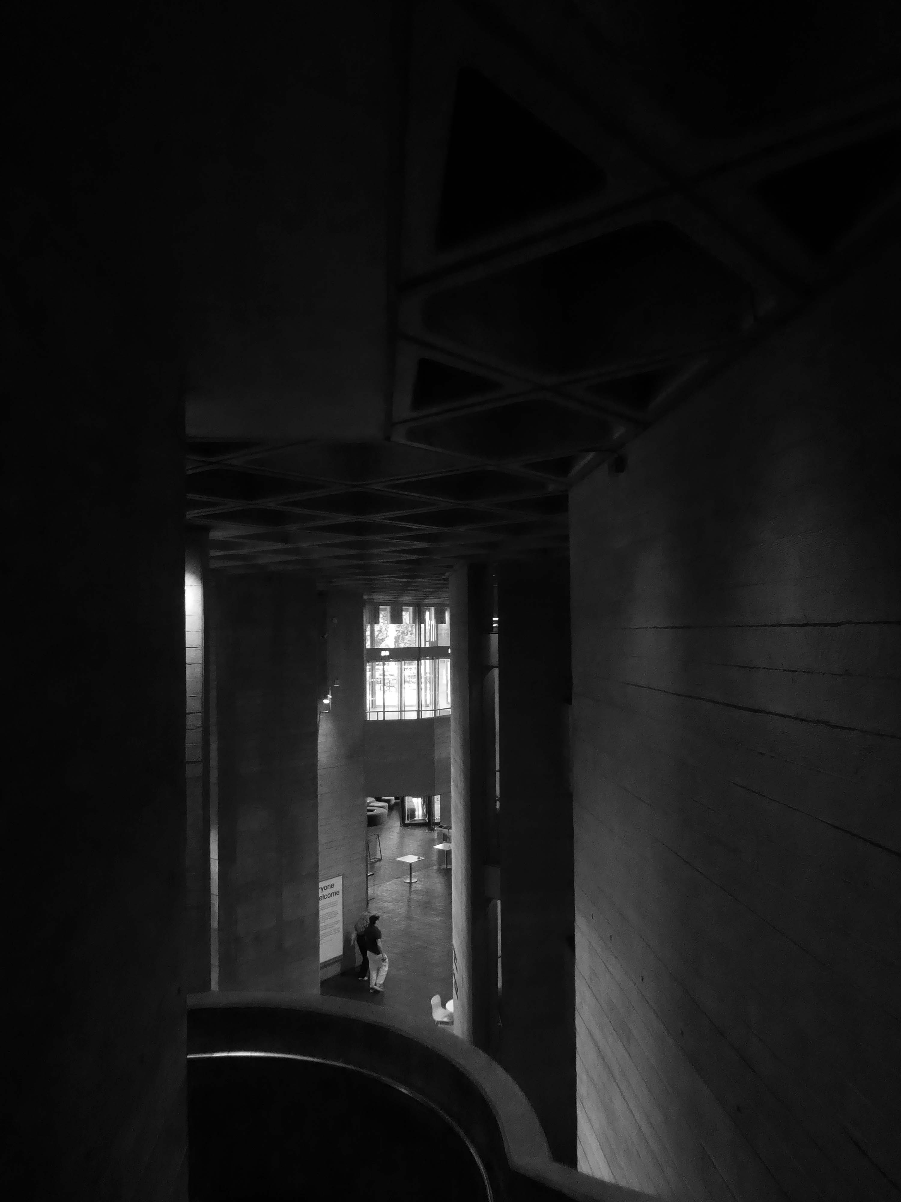
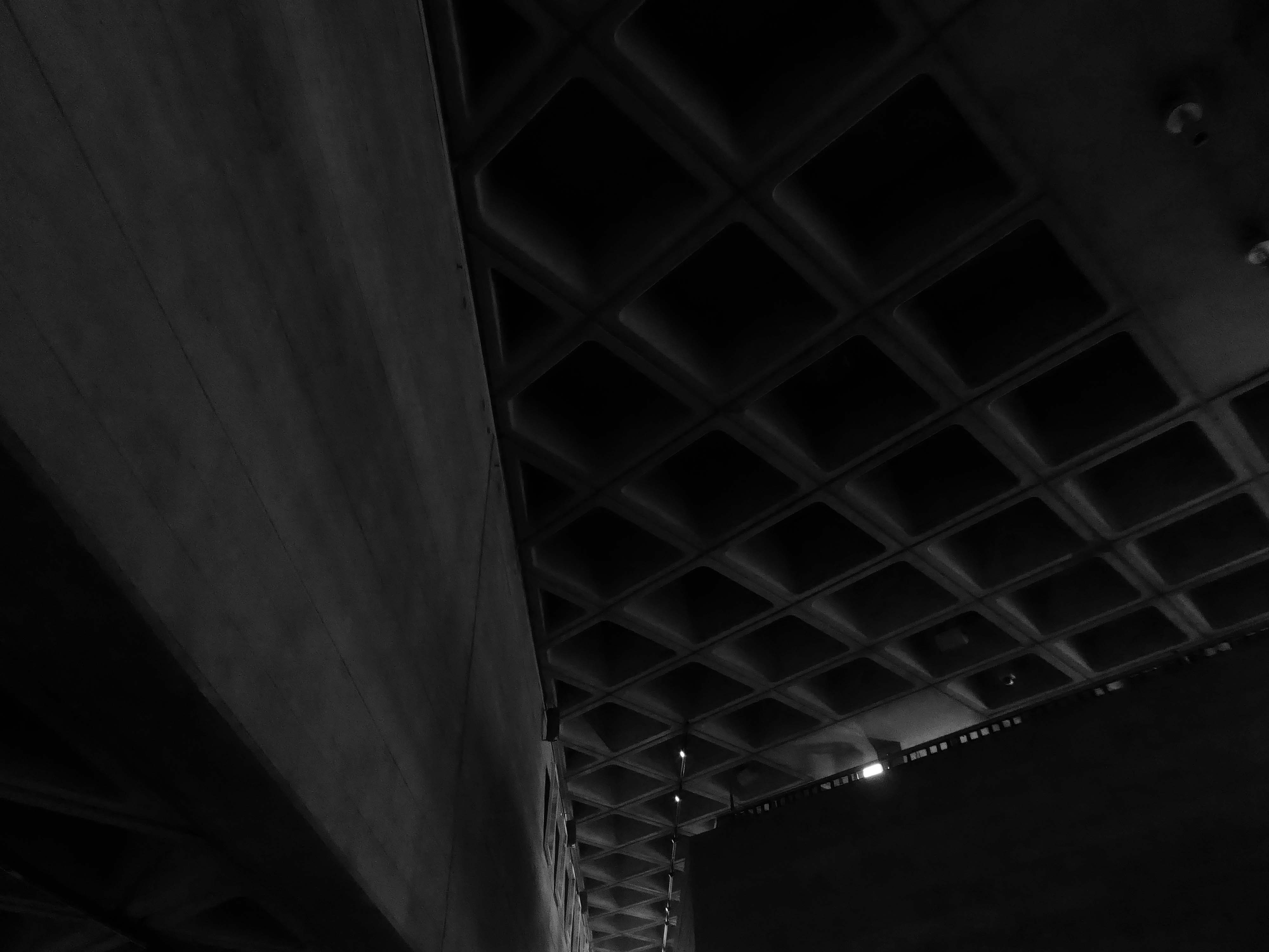
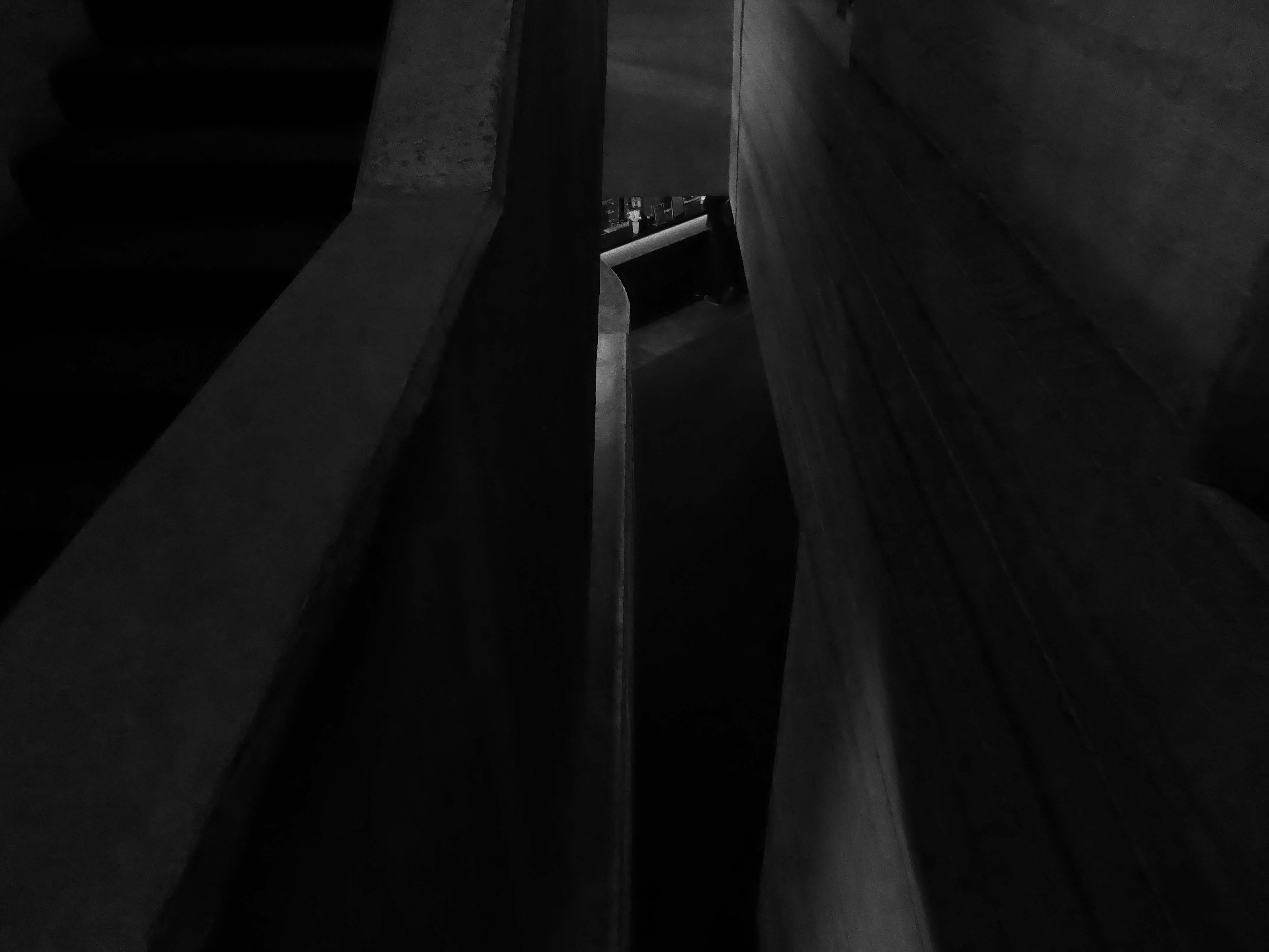
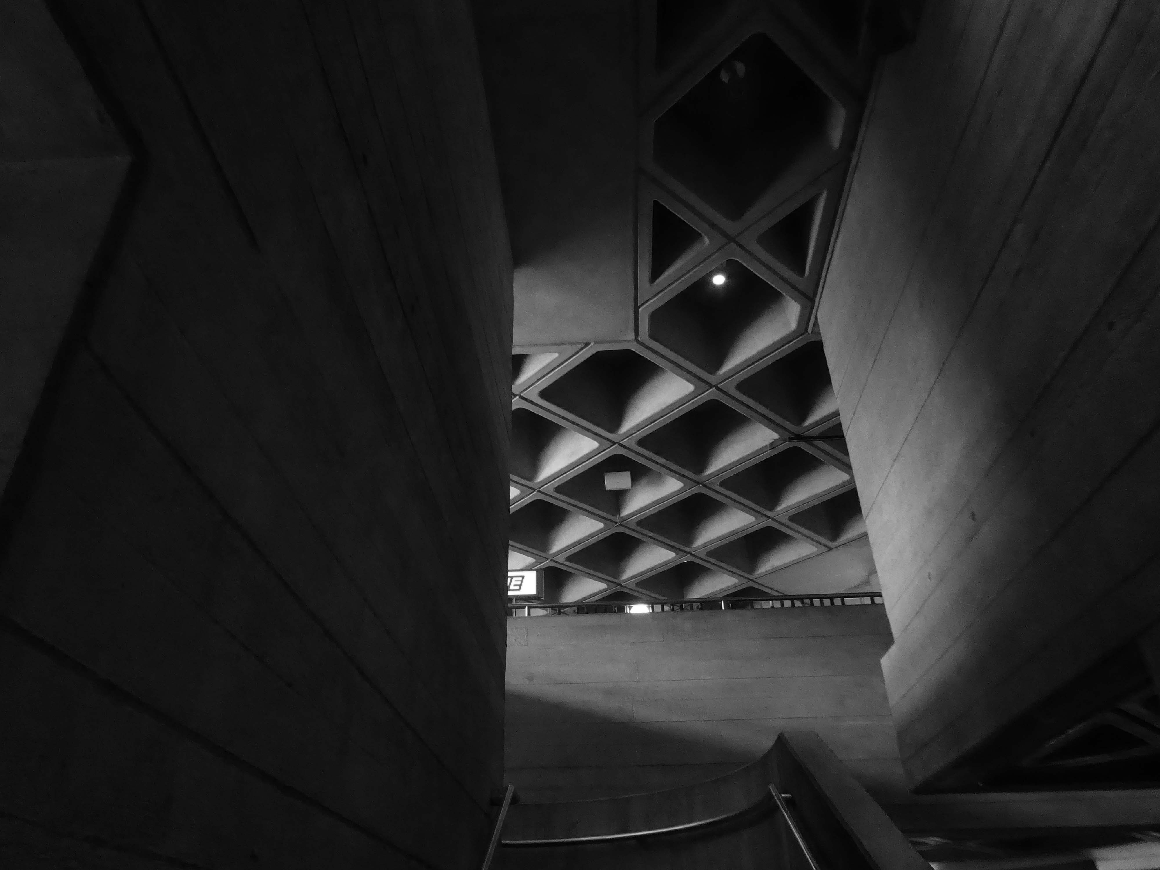
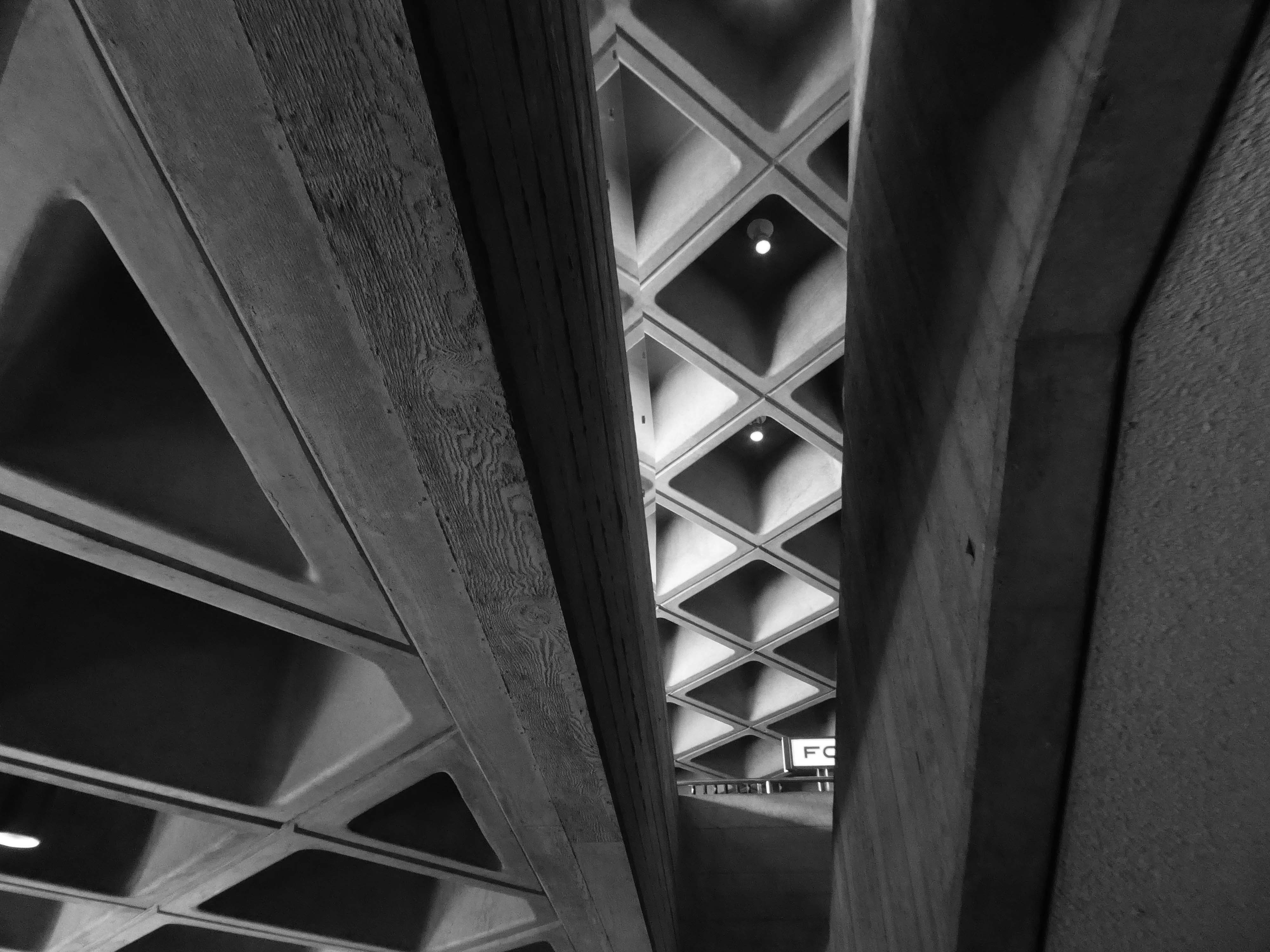
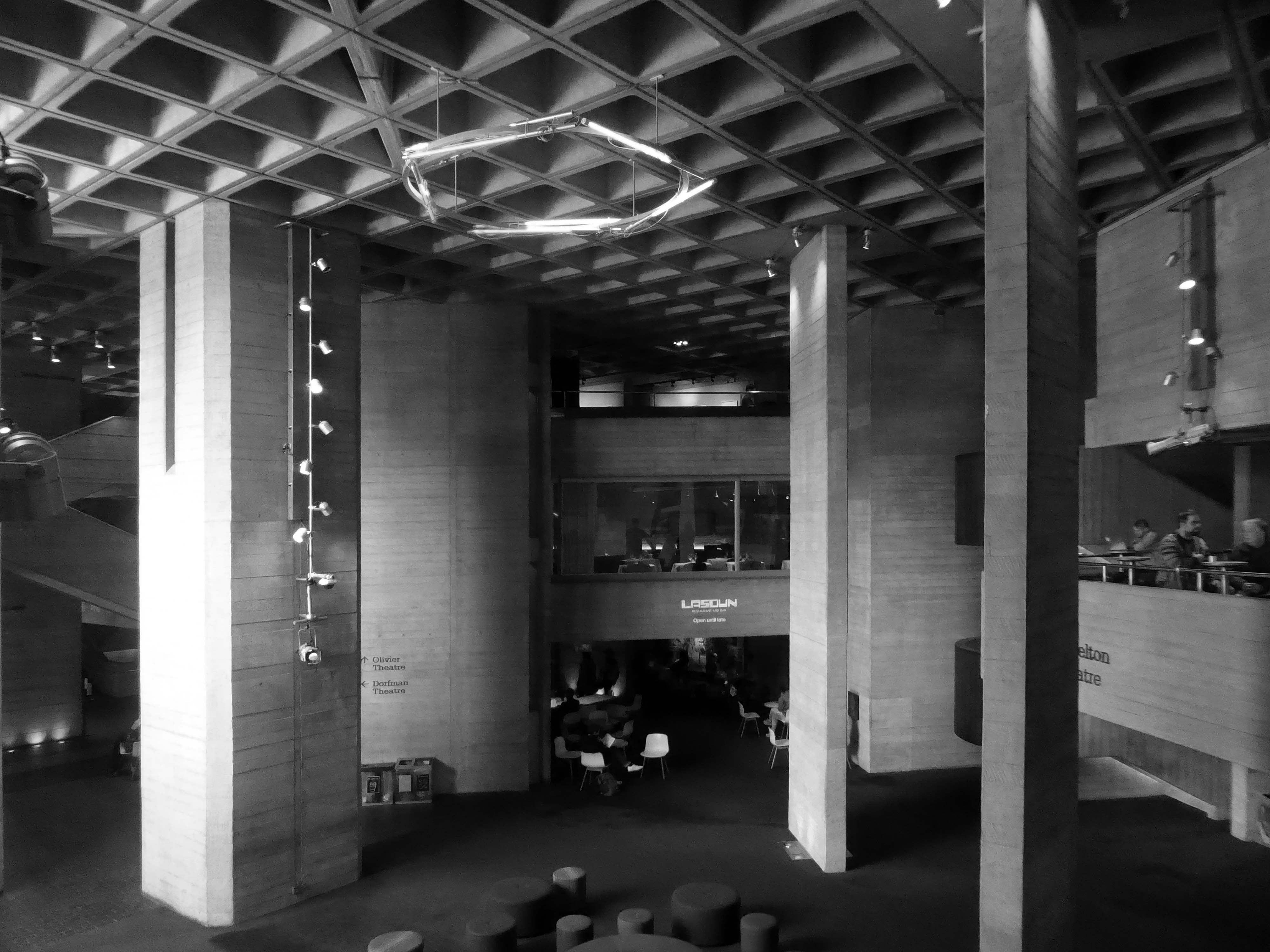
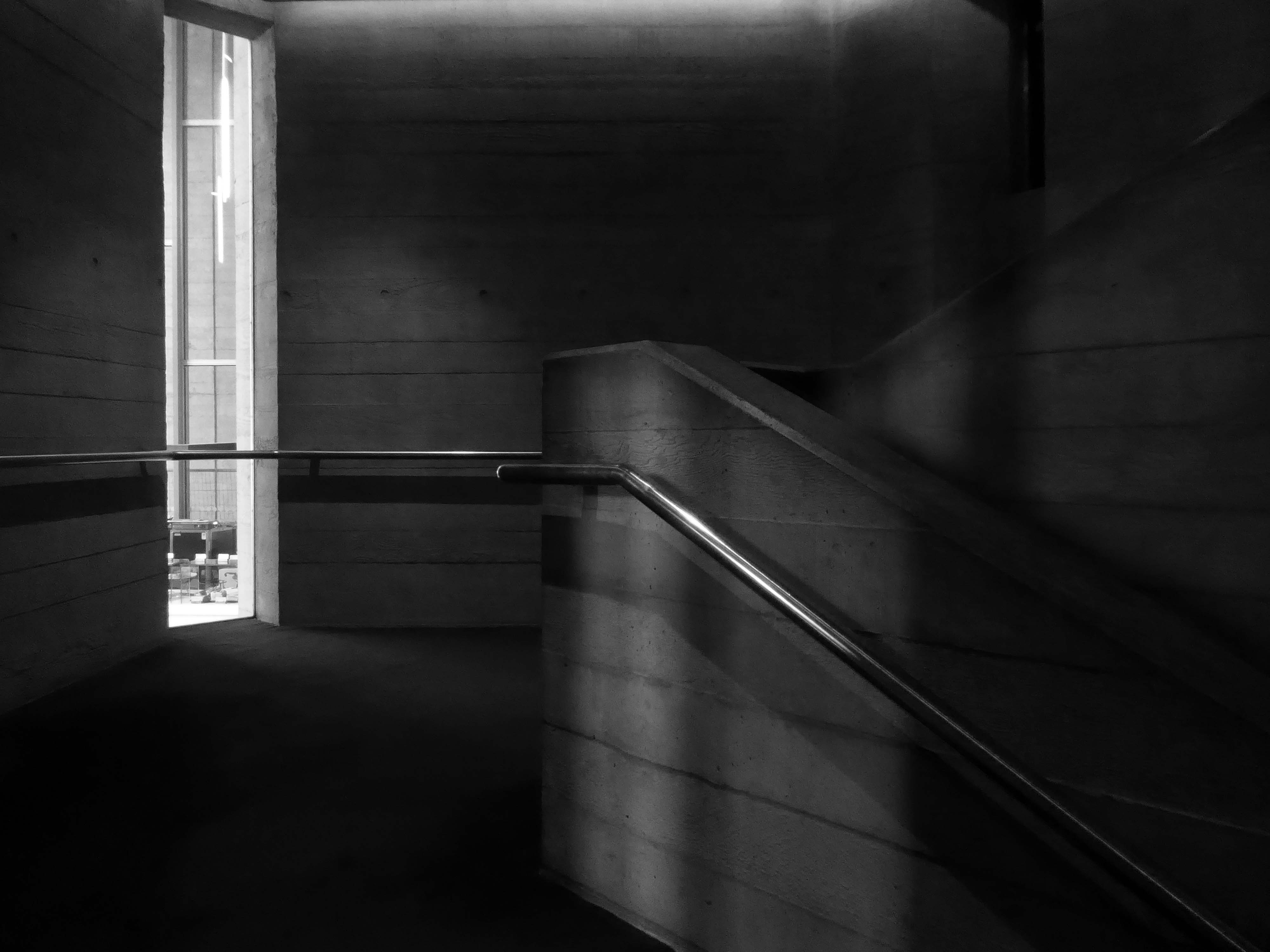
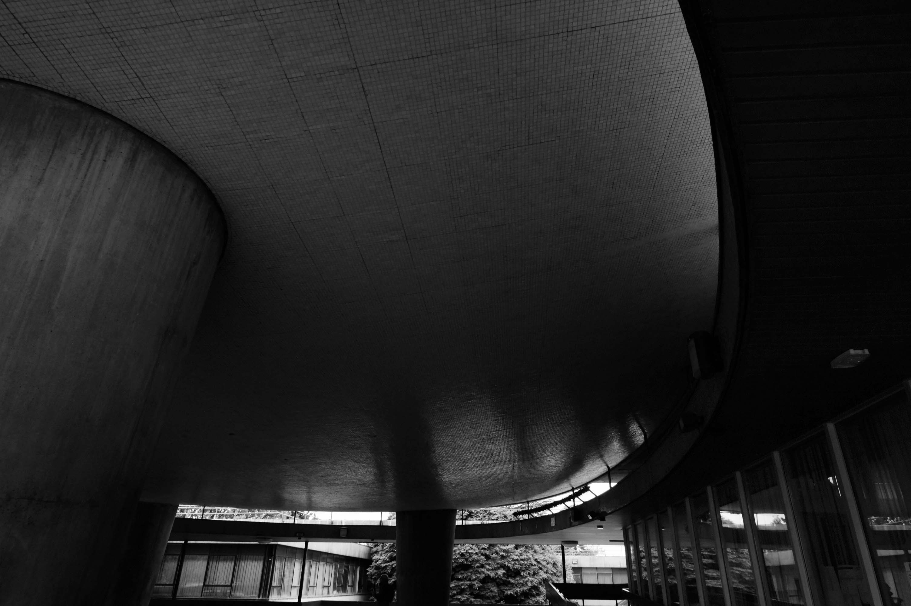
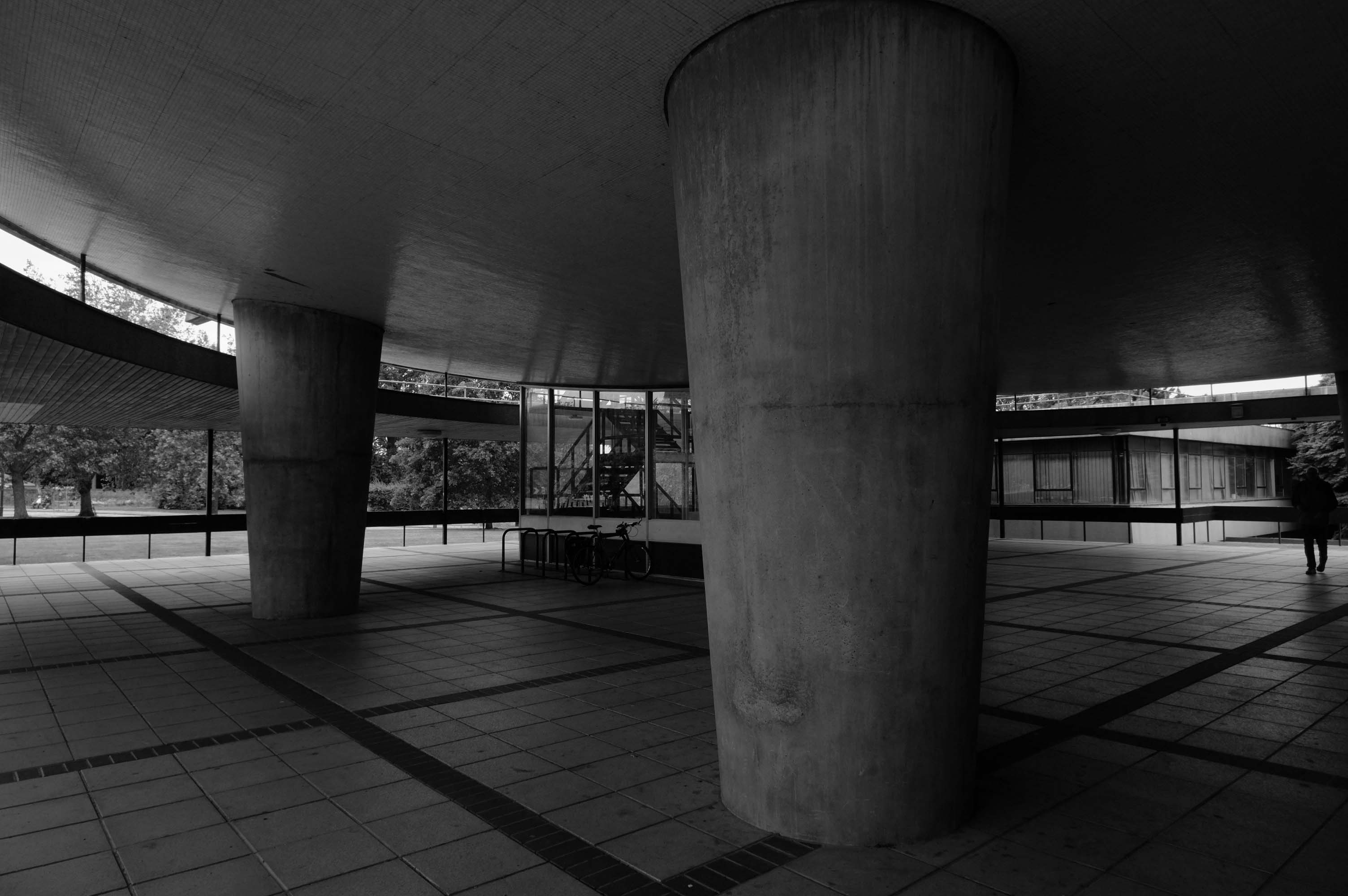
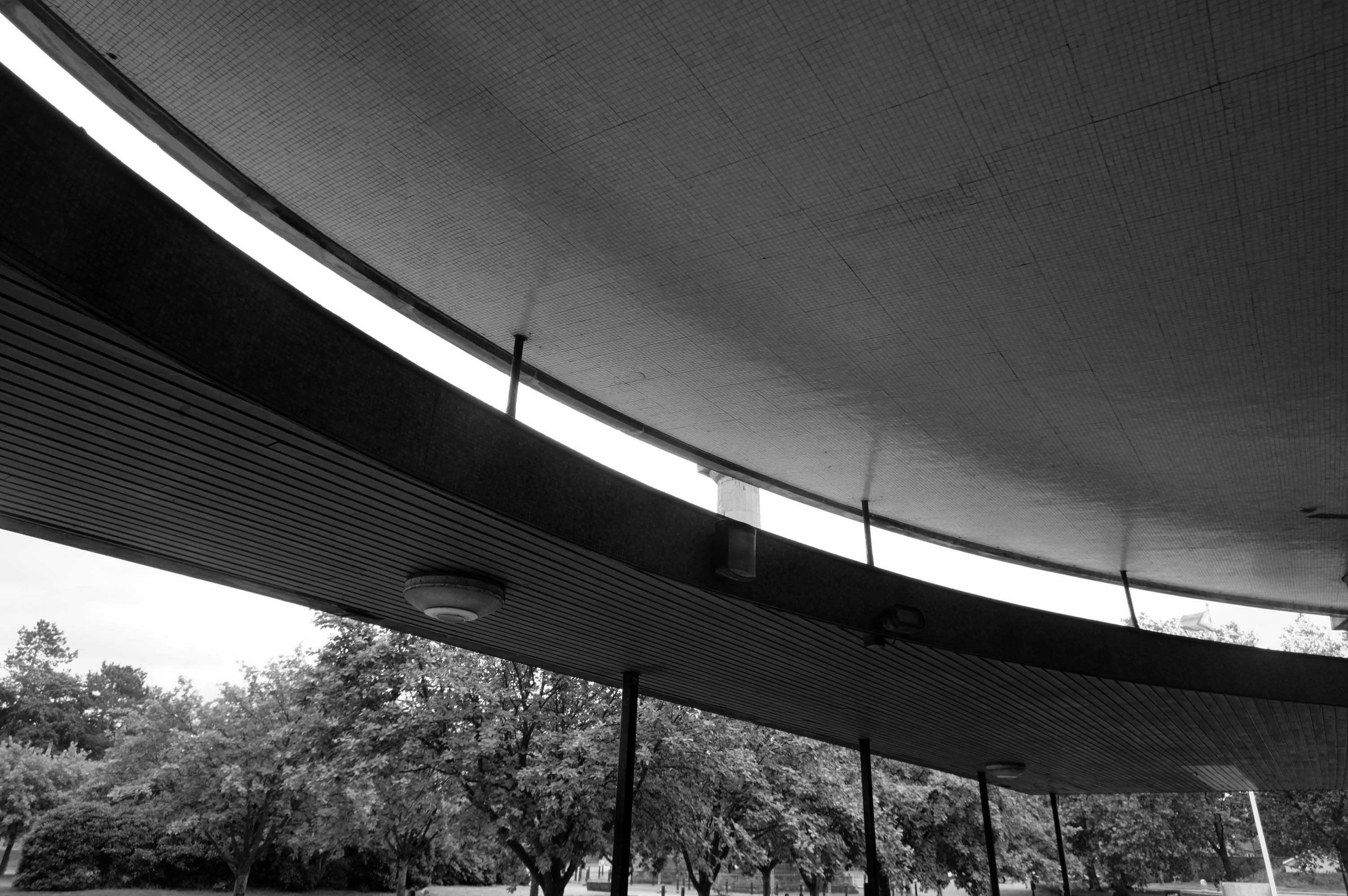
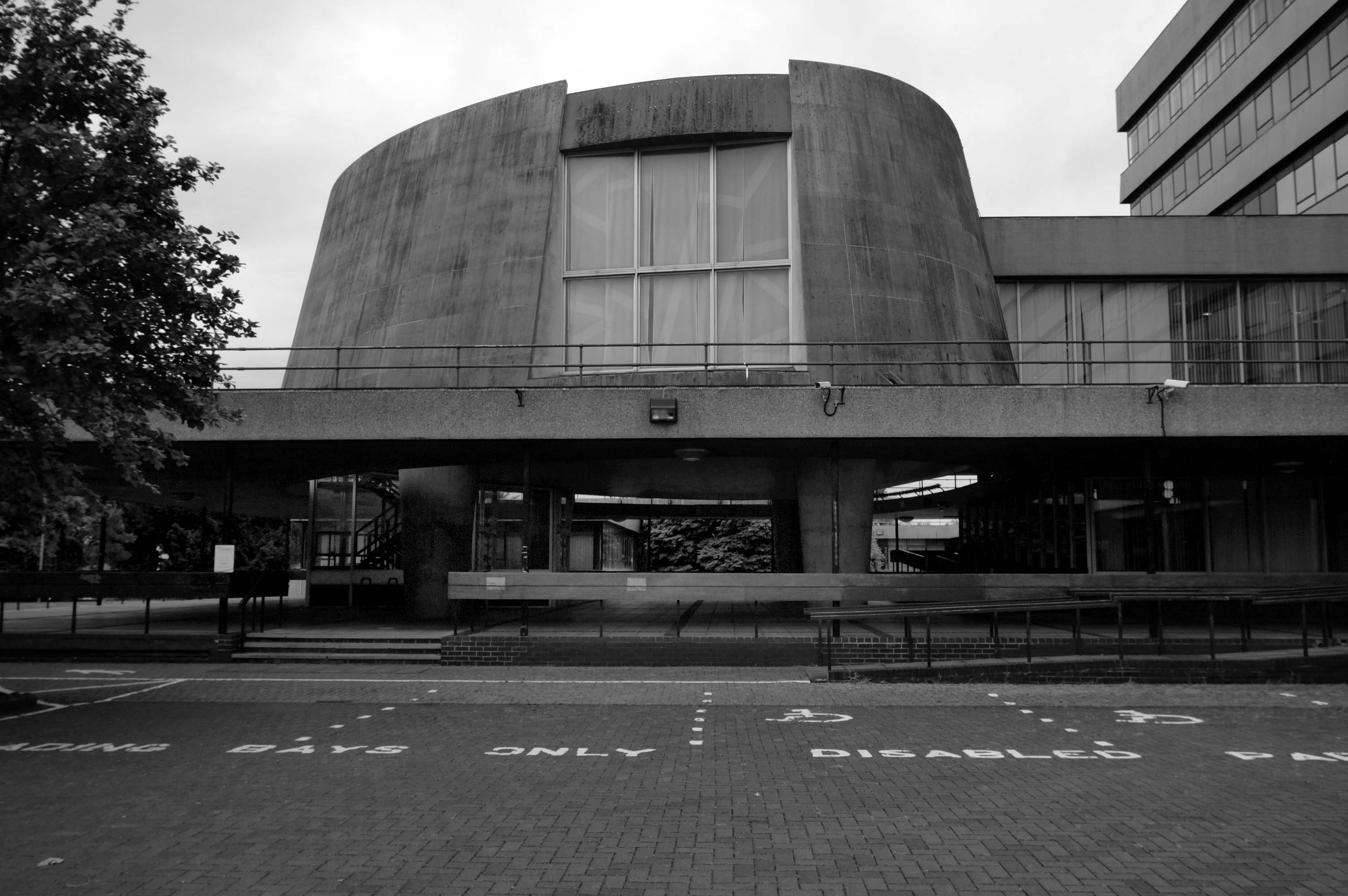
Denys Lasdun was chosen by a jury, which included actor Sir Lawrence Olivier, to design the building. In spite of Lasdun’s fine modernist credentials he was to many a surprising choice – he had never designed a theatre. Within the National Theatre are three separate and very distinct auditoriums. Symbolically and practically they are loosely modelled on theatre designs from the three greatest periods of western drama: the Olivier on classical Greek theatres, the Lyttelton on the proscenium-arch theatres of the past three centuries, and the Cottesloe on Tudor inn-yards. The building has become a national landmark in Great Britain and has been listed Grade II* since 1994.
I have several Brutalist badges, yet feel disinclined to badge myself a Brutalist, with or without a capital B.
Me, I’m a little more Polyarchitectural by nature.
Less seduced by Edmund Burke’s ideas of the sublime than others.
The passion caused by the great and sublime in nature, when those causes operate most powerfully is Astonishment, and astonishment is that state of the soul in which all its motions are suspended, with some degree of horror … No passion so effectually robs the mind of all its powers of acting and reasoning as fear. For fear, being an apprehension of pain or death, operates in a manner that resembles actual pain. Whatever therefore is terrible, with regard to sight, is sublime too … Indeed terror is in all cases whatsoever, either more openly or latently, the ruling principle of the sublime.
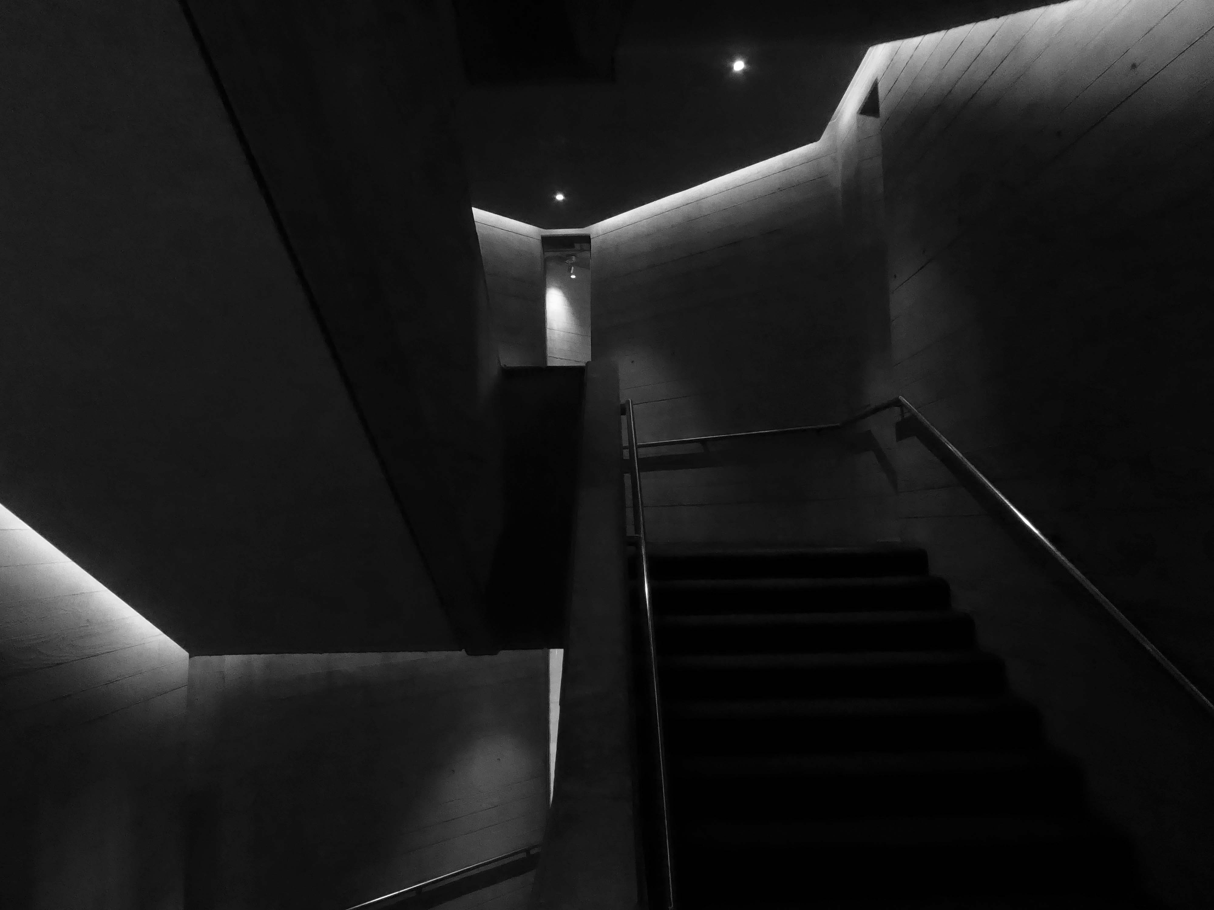
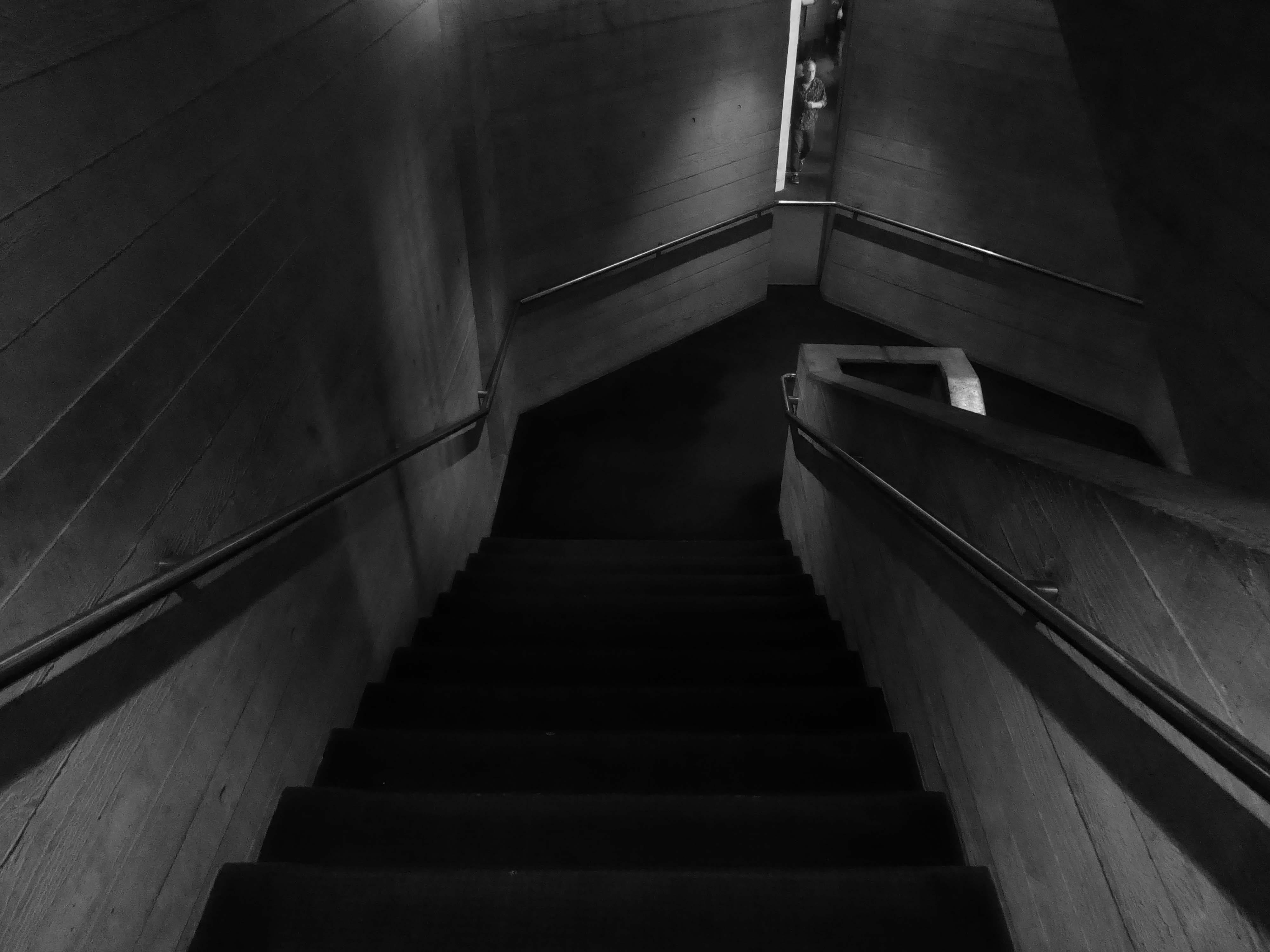
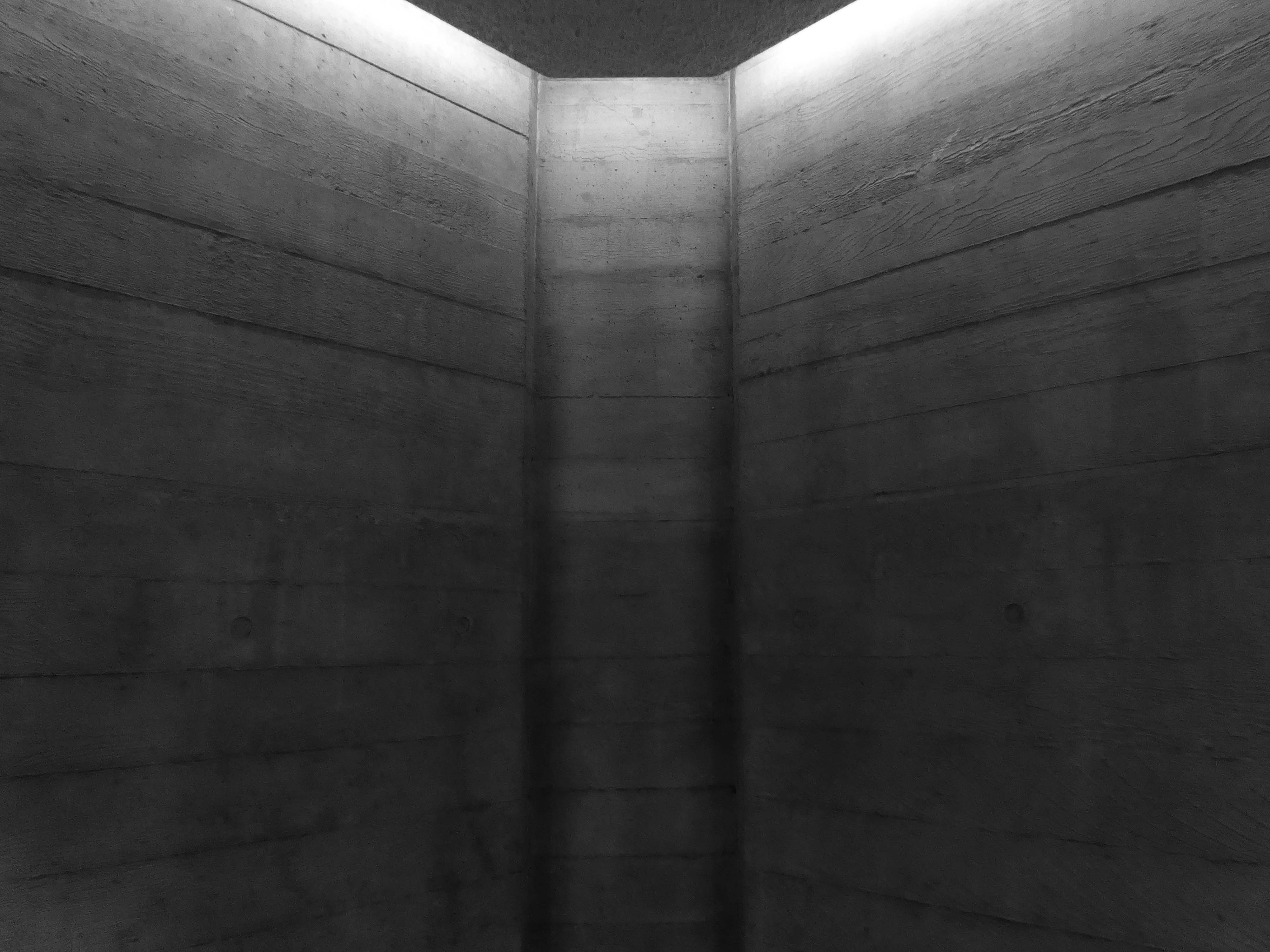
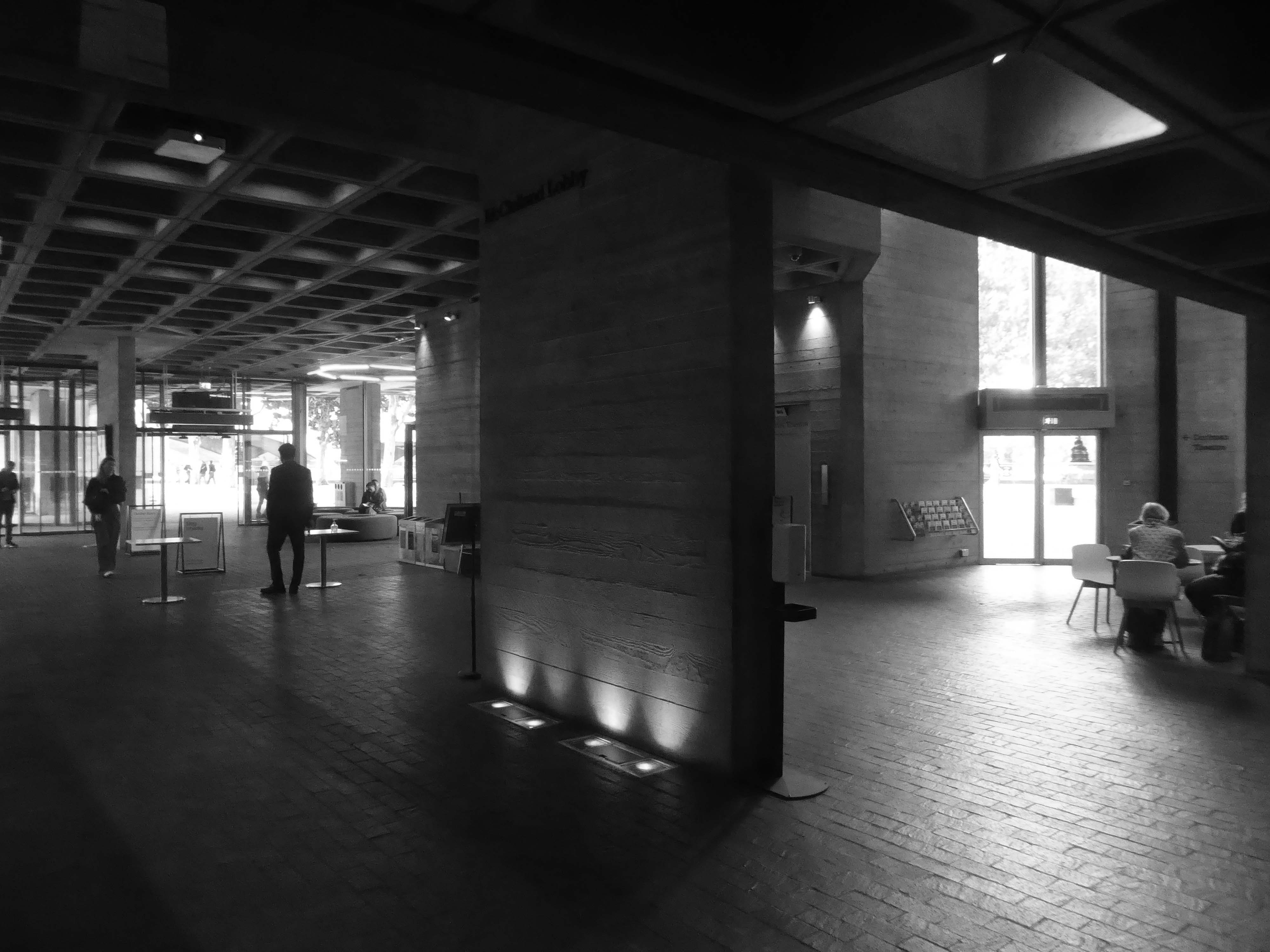
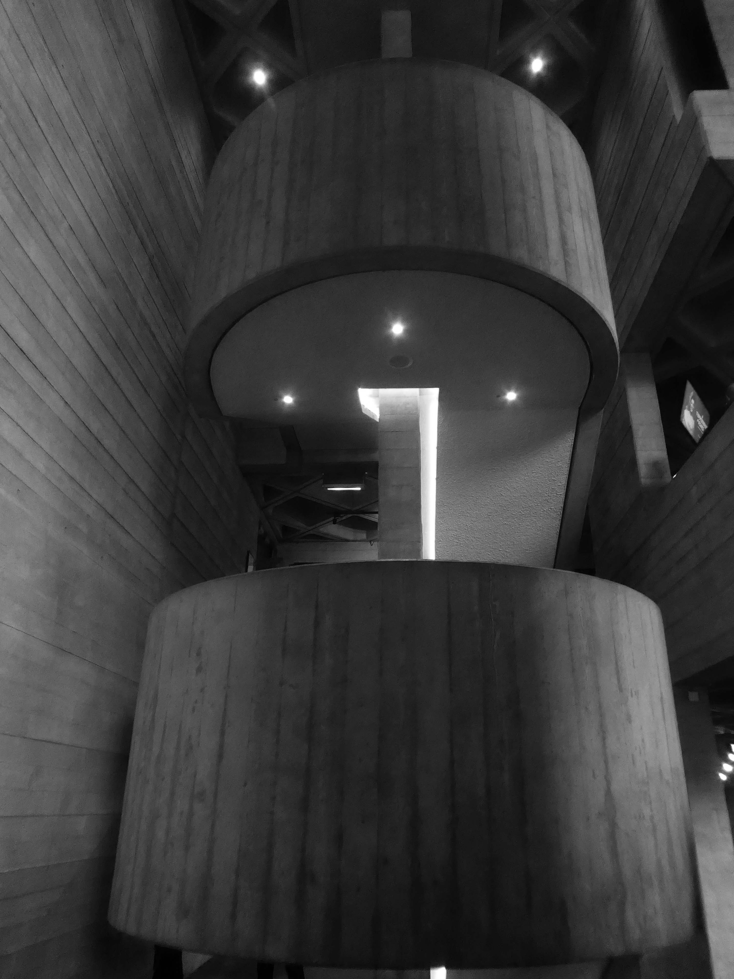
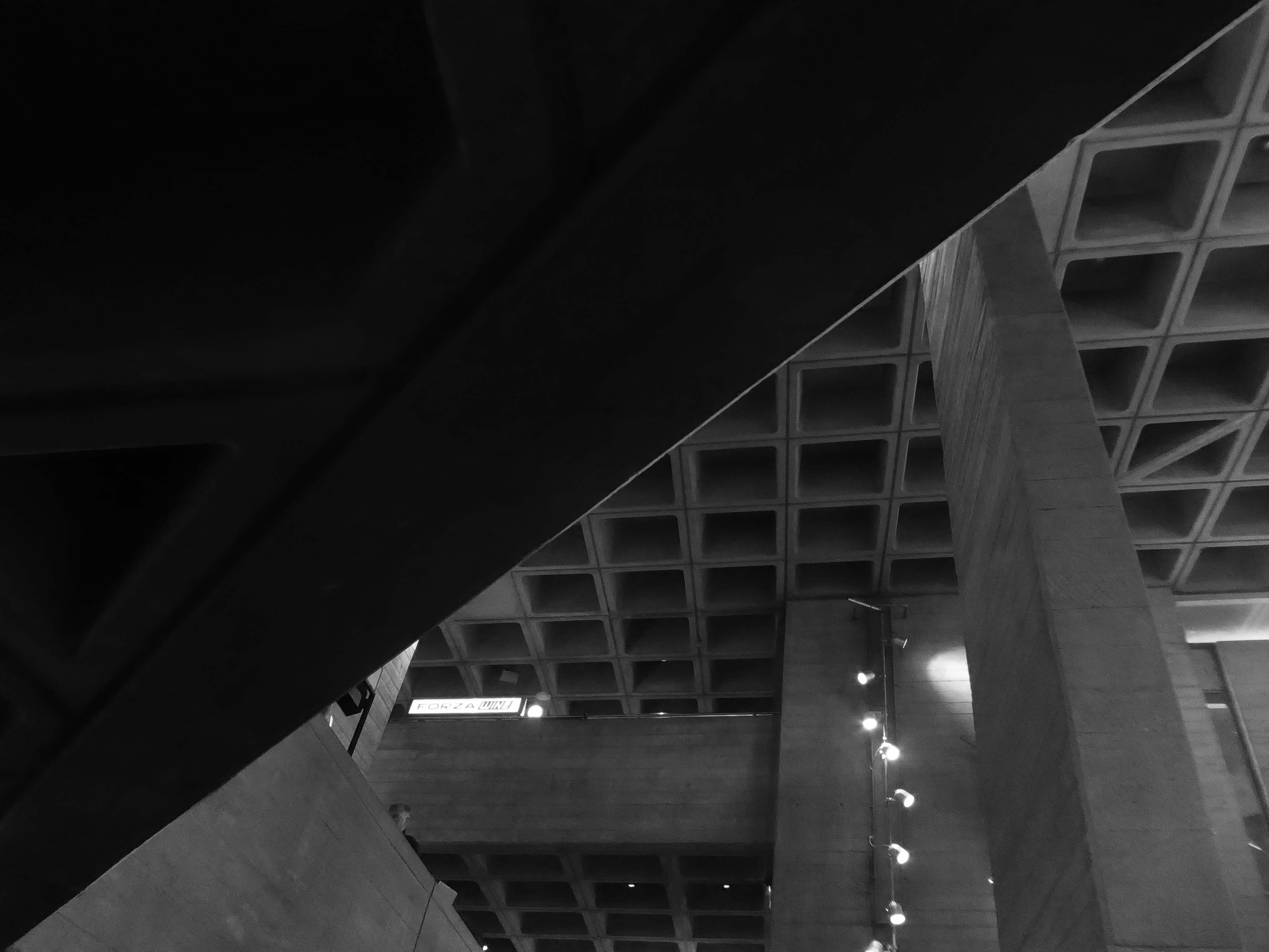
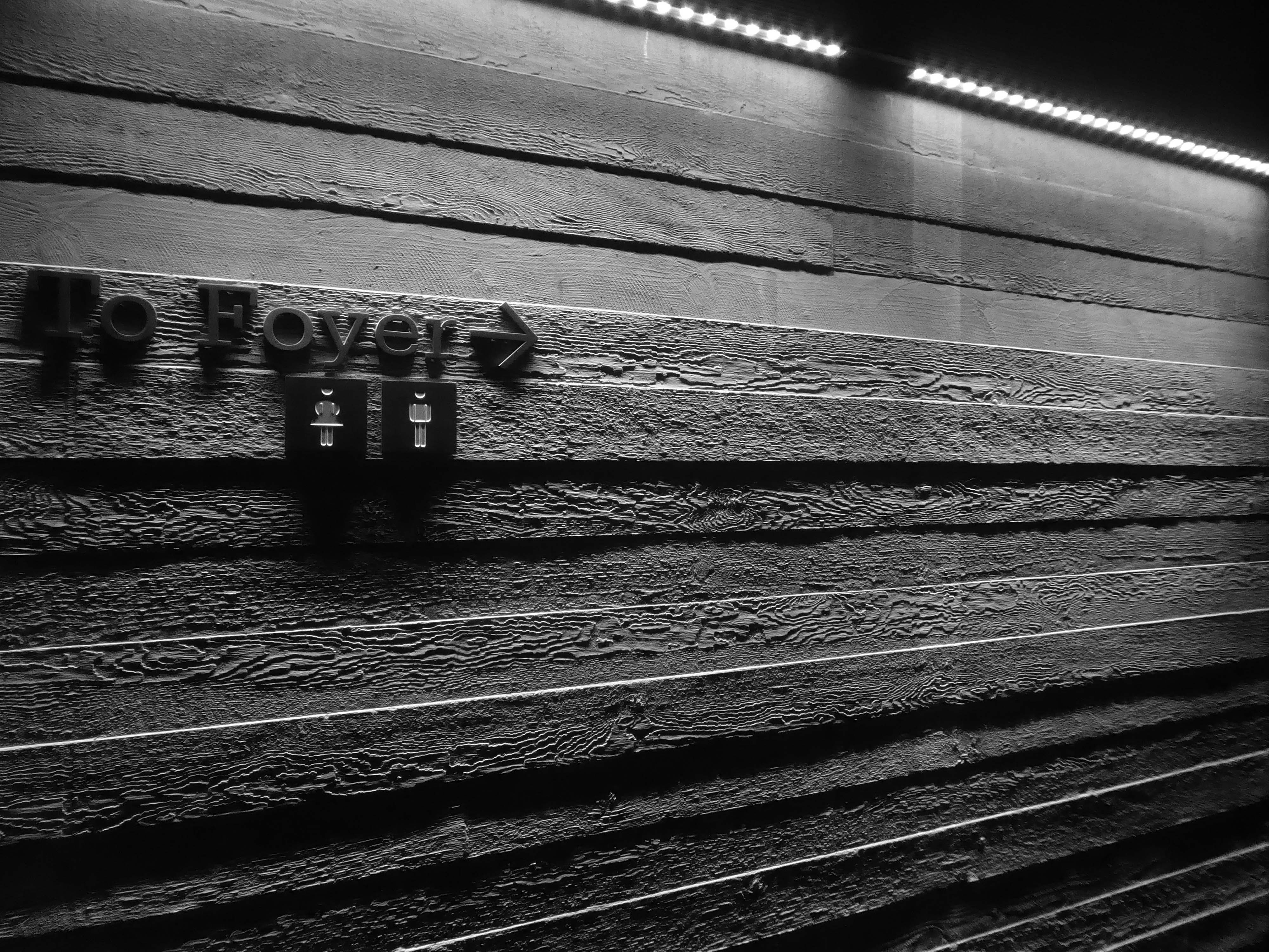
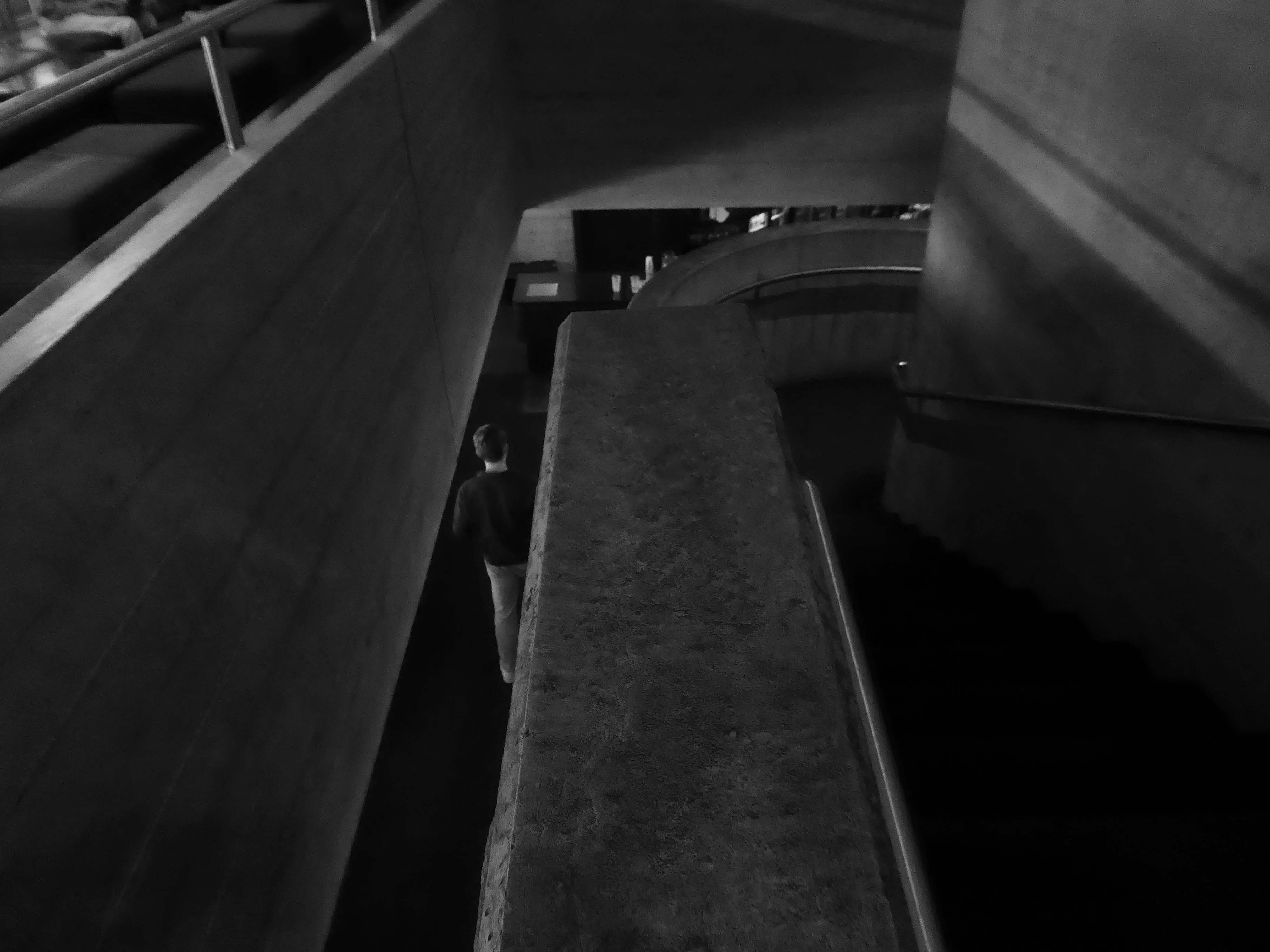
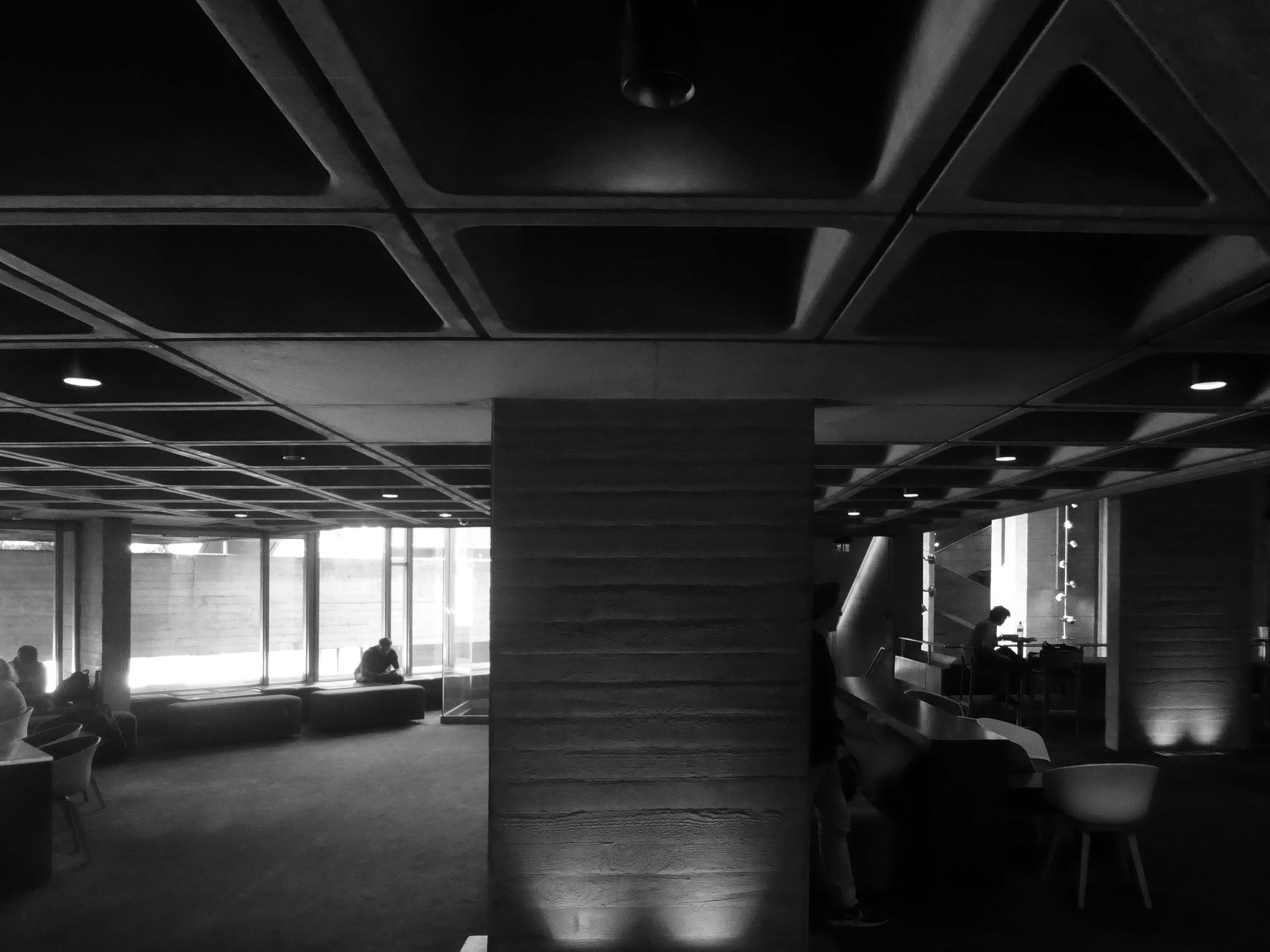
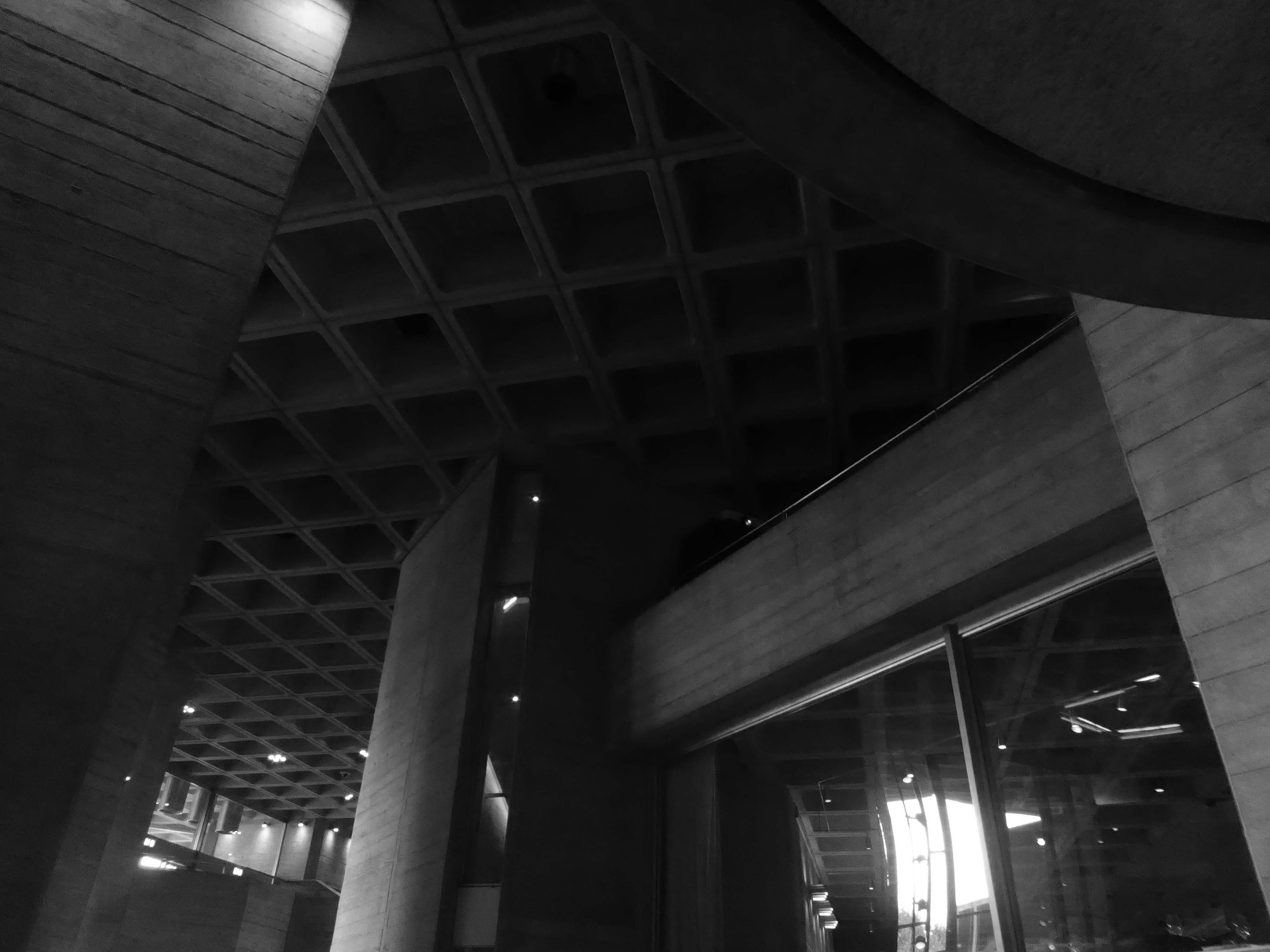
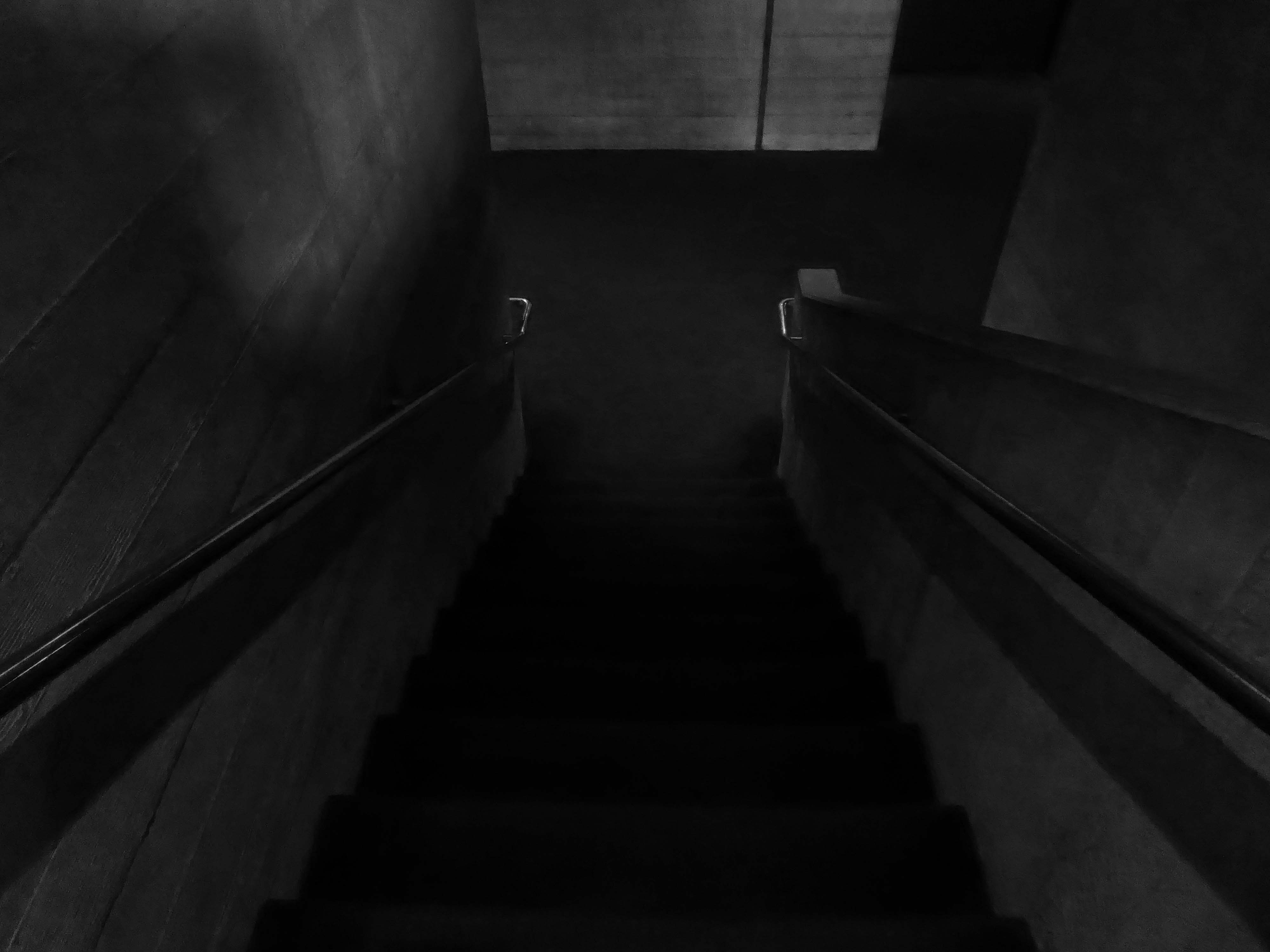
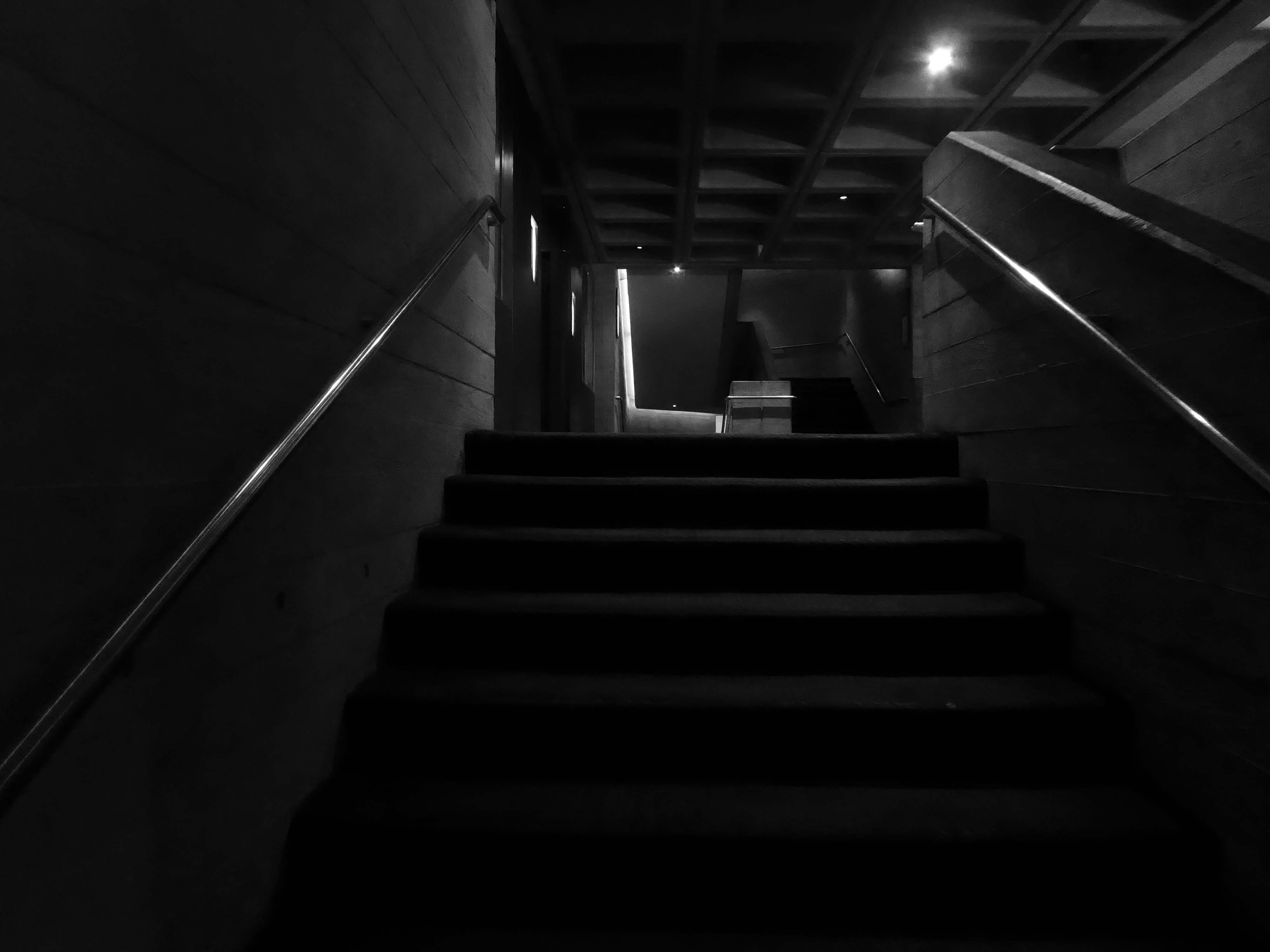
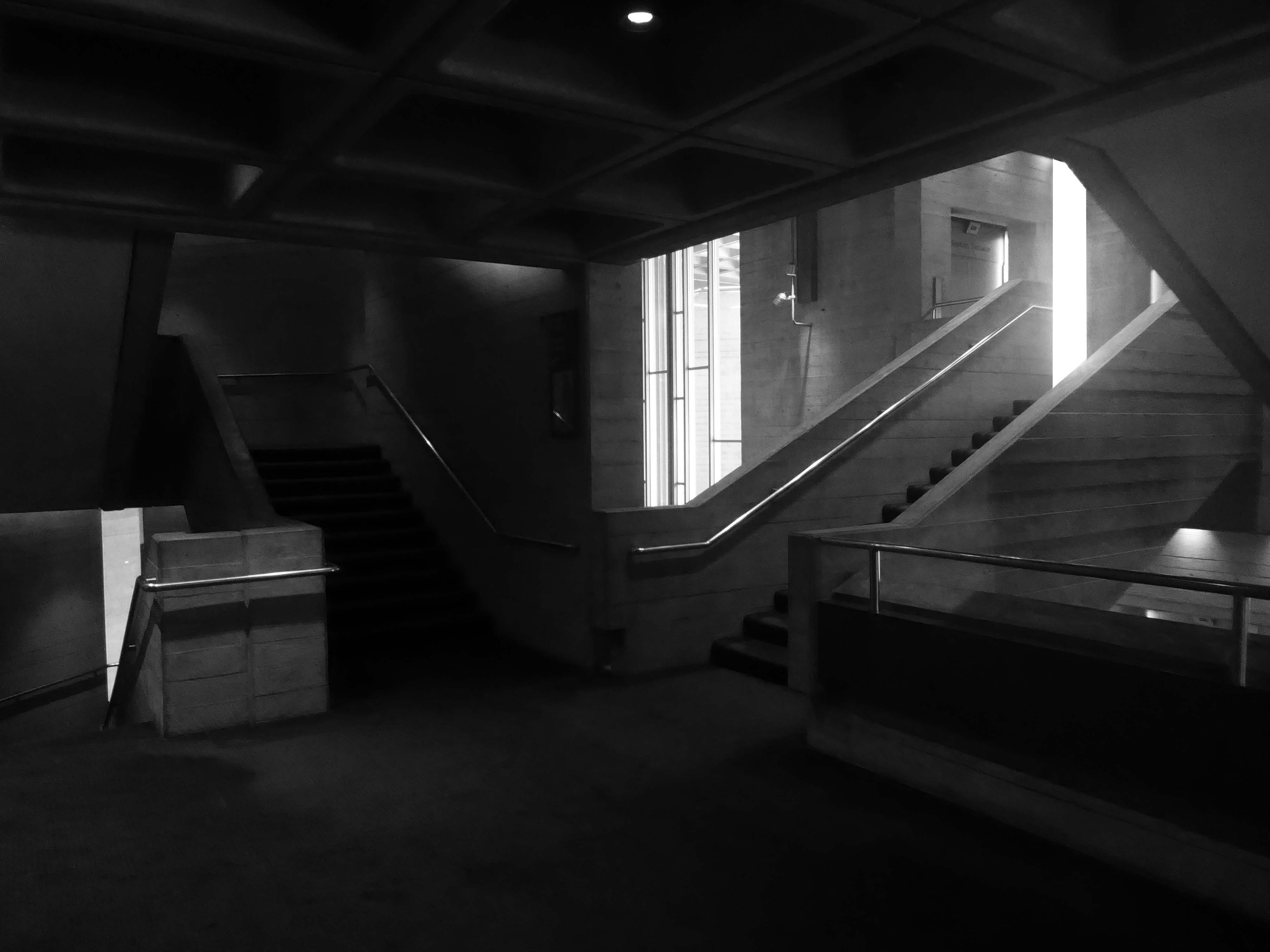
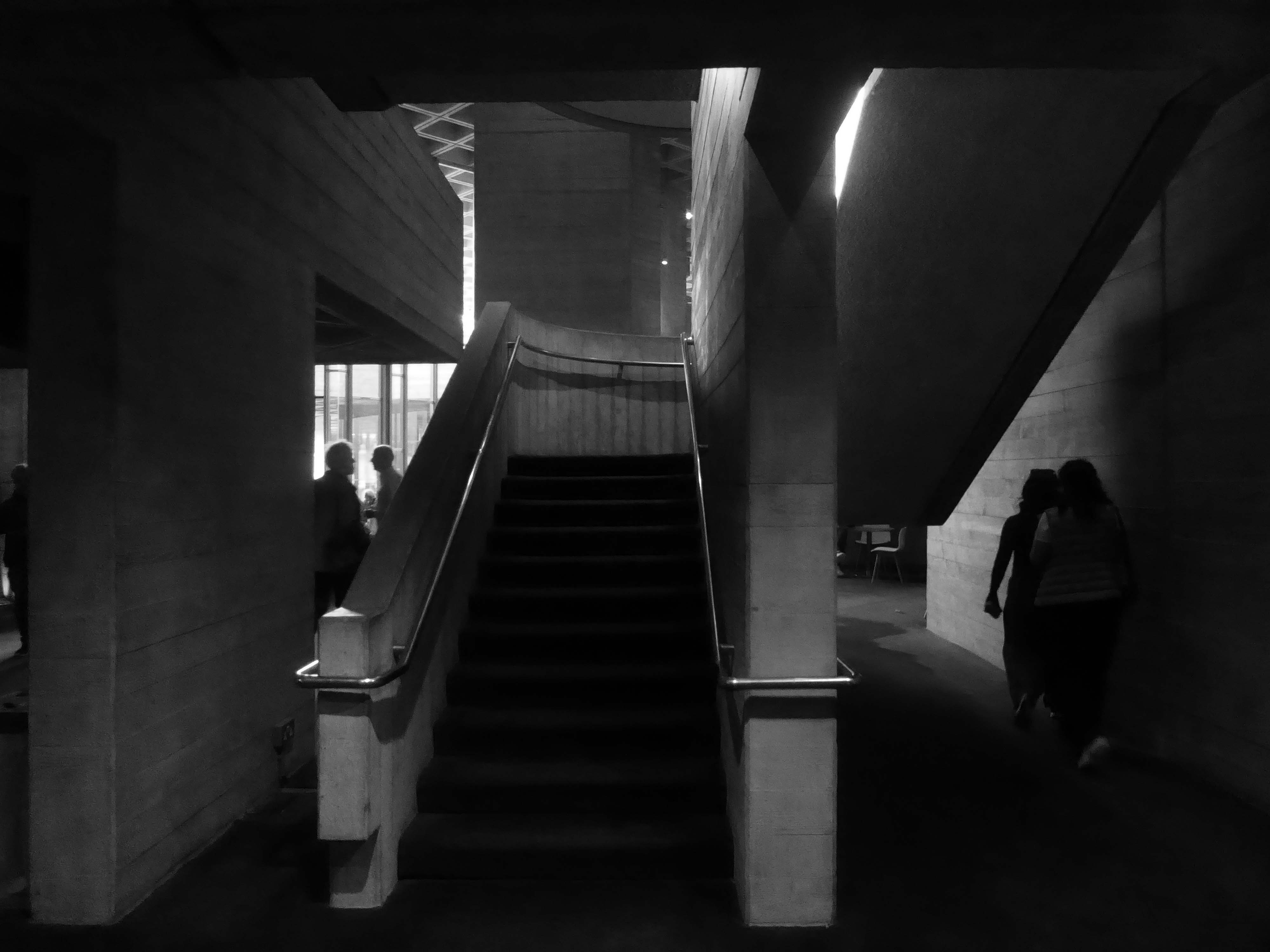
Furthermore, whilst the exterior of the National Theatre may well induce fear, and in some loathing, the interior feels both human and secure. When I explored the ins and outs of the public spaces, the monumental seems to be held carefully in check, despite the challenging contrasts in mass and volume. The exposed concrete surfaces and angular forms are softened by sensitive lighting and the presence of people, in motion and at rest.
So at a loose end on a showery day on the Southbank I caught shelter and solace within.
Previously on Modern Mooch – we encounter Mr Lasdun in Leeds and Liverpool
Far, far away from the mad, rushing crowd, Please carry me with you. Again I would wander where memories enfold me, There on the beautiful Island of Dreams.
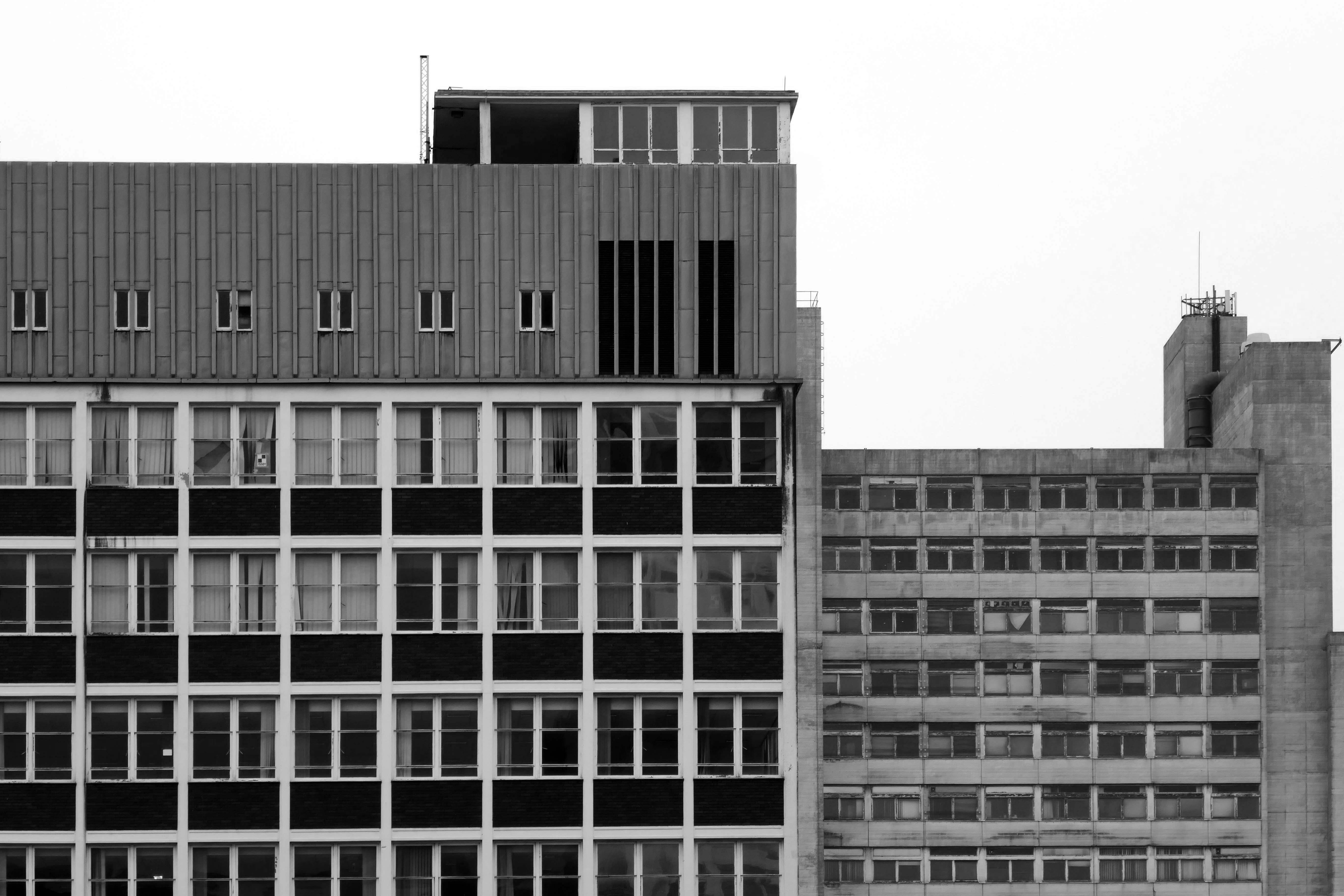
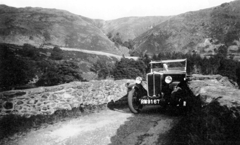
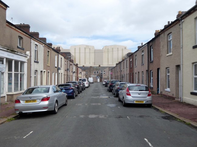
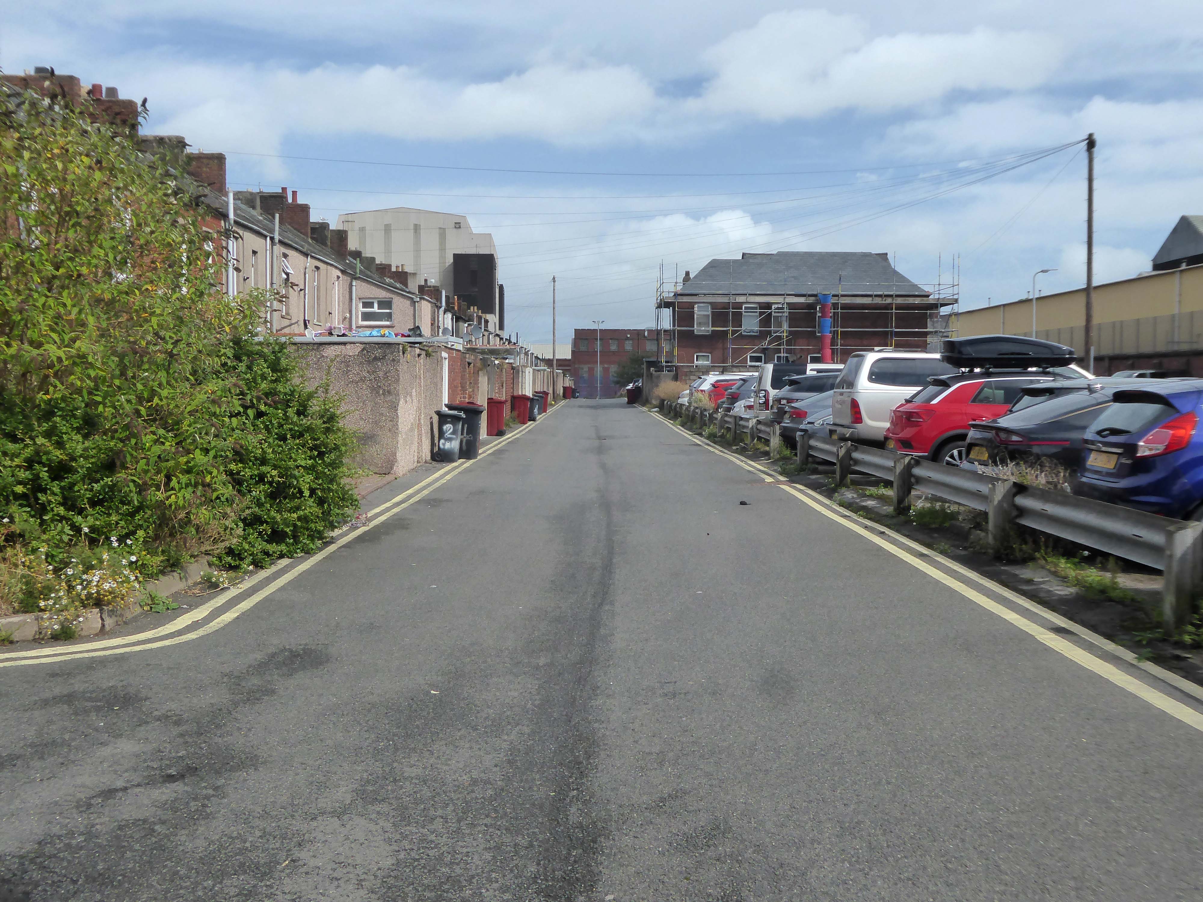
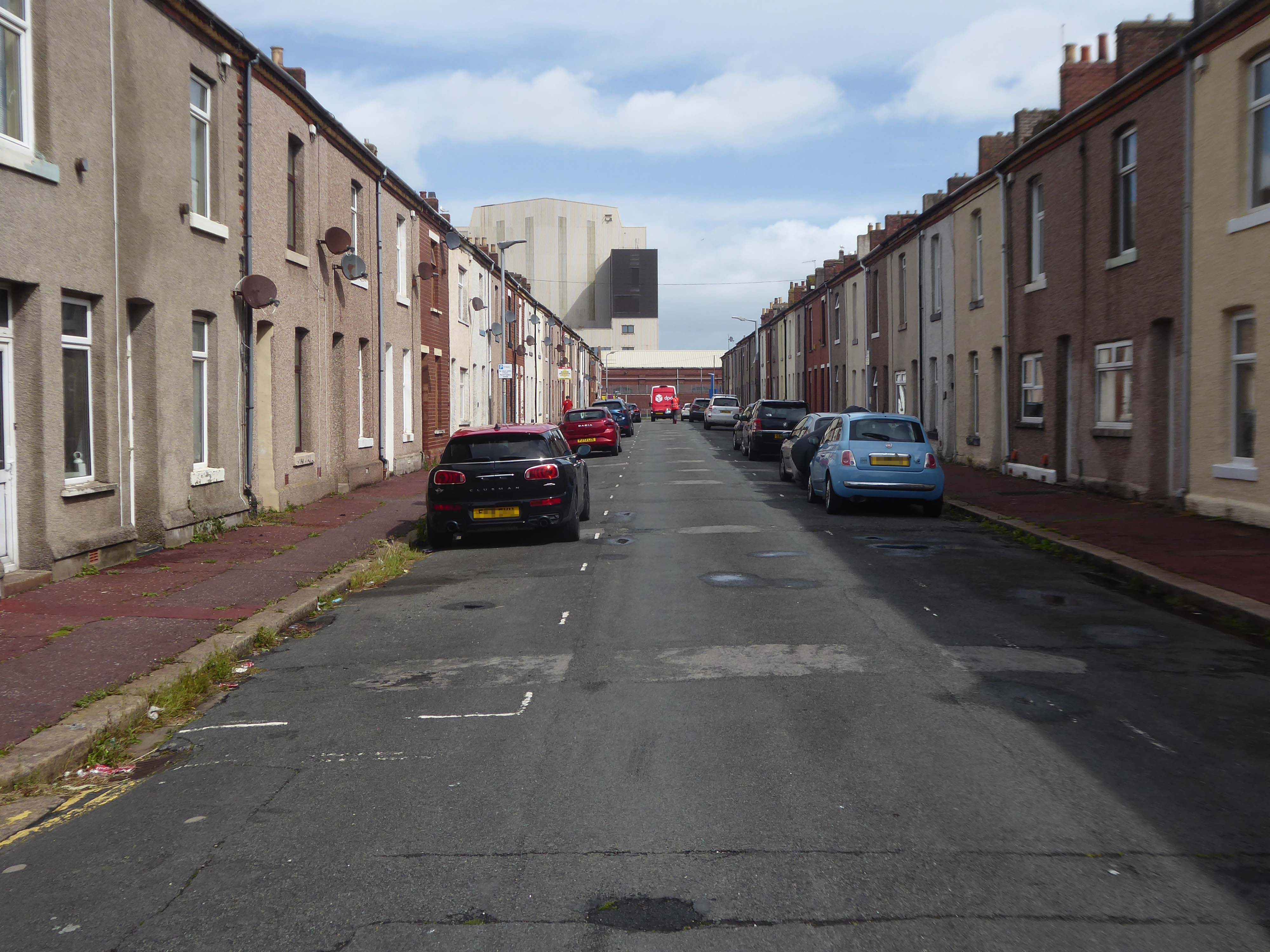
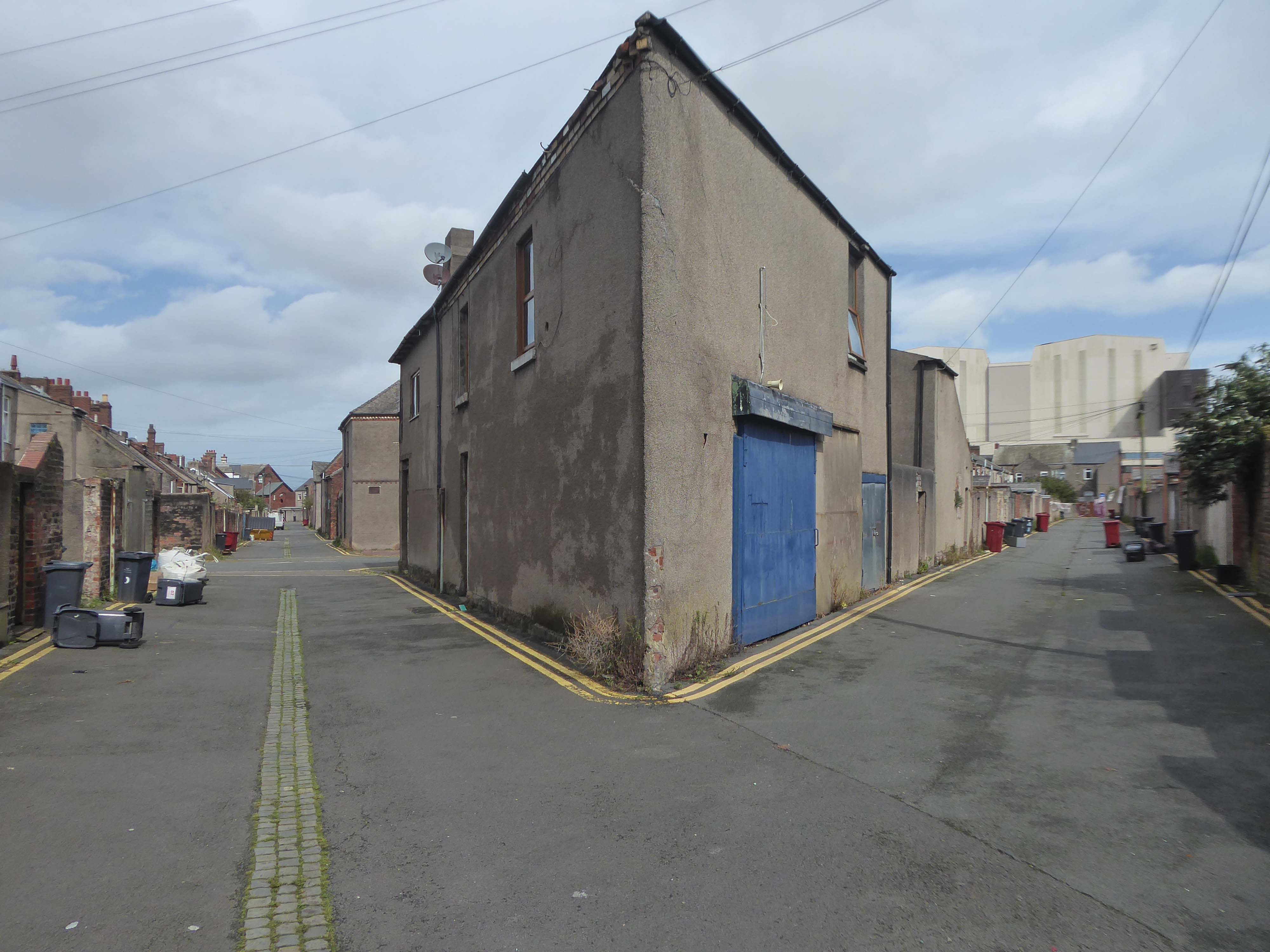
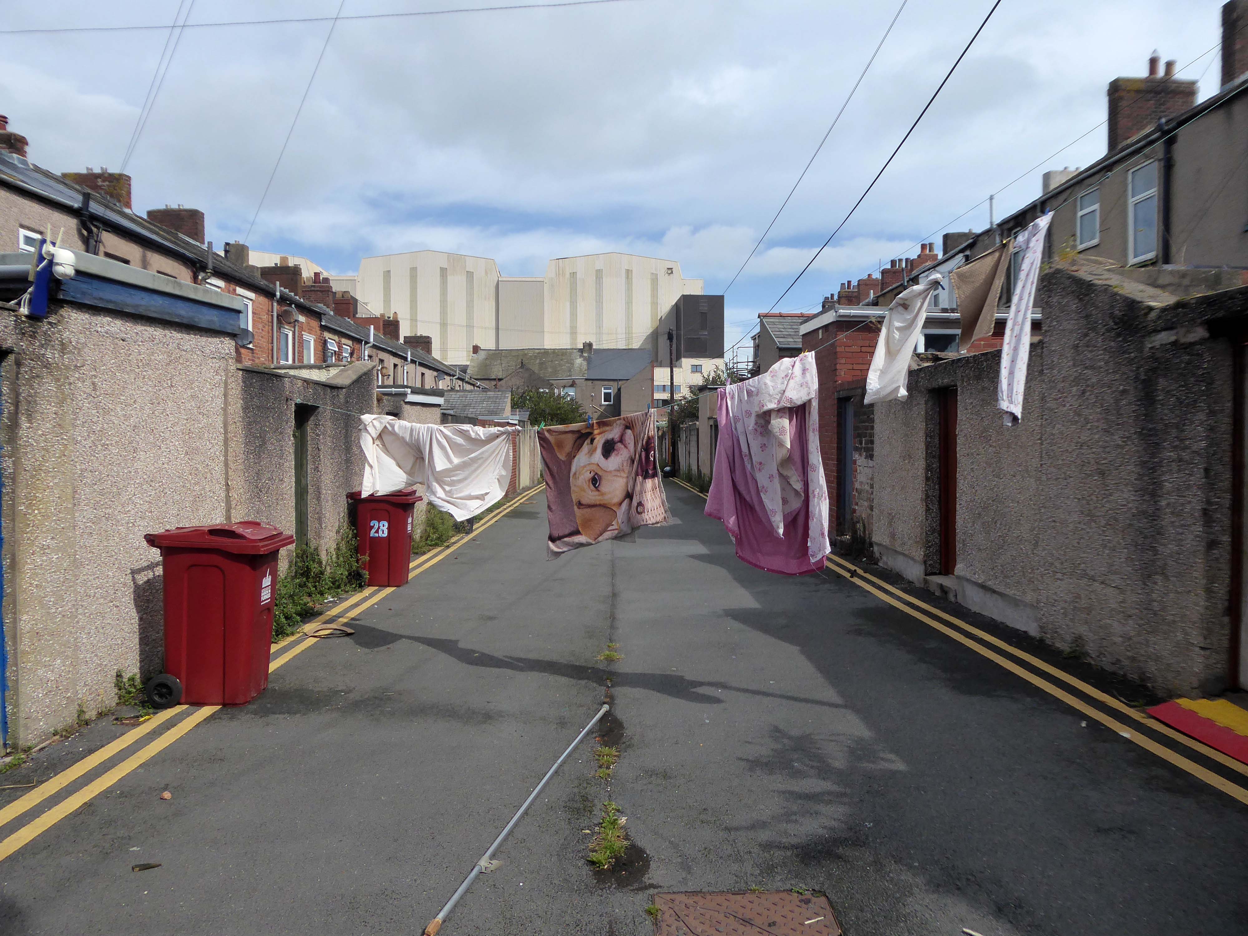
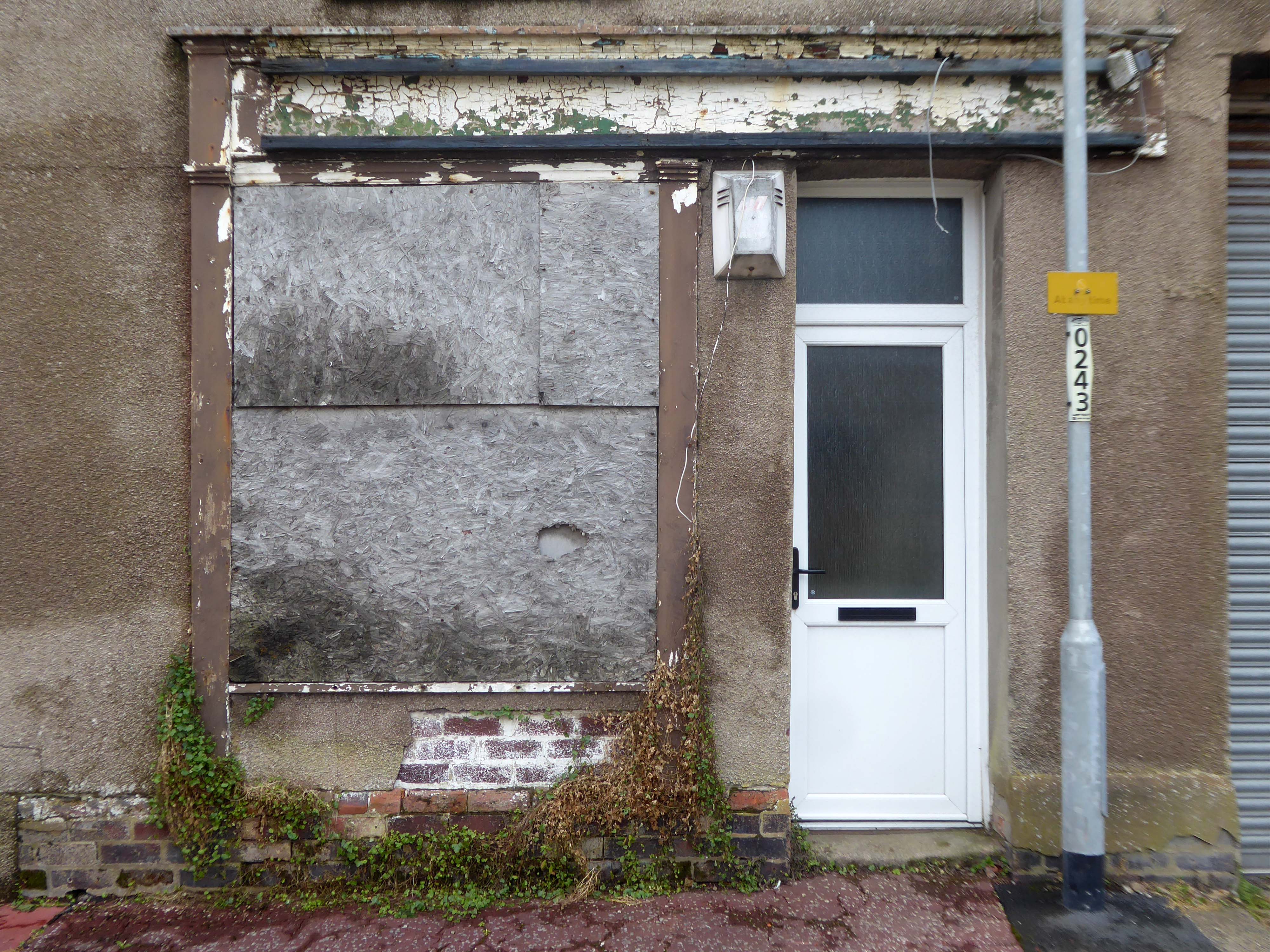
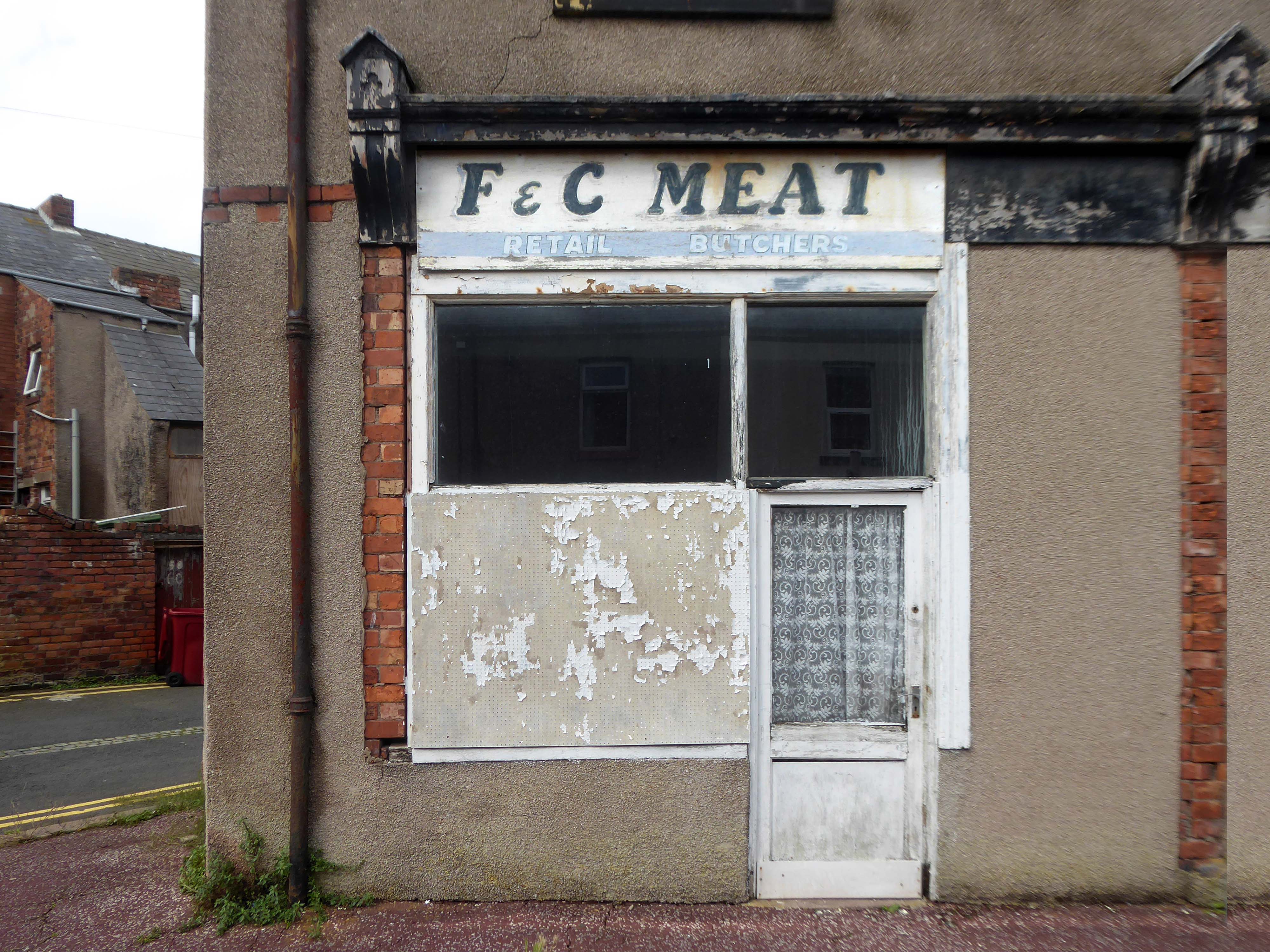
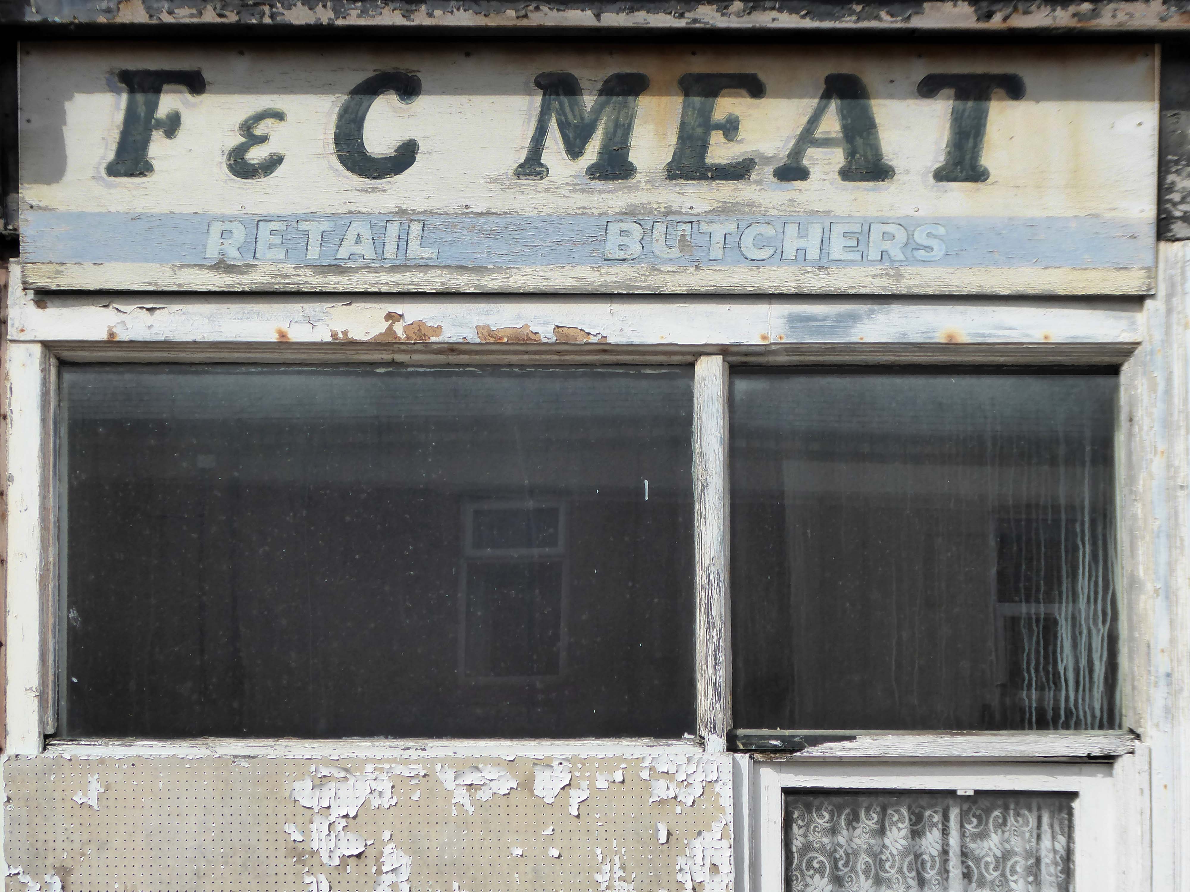
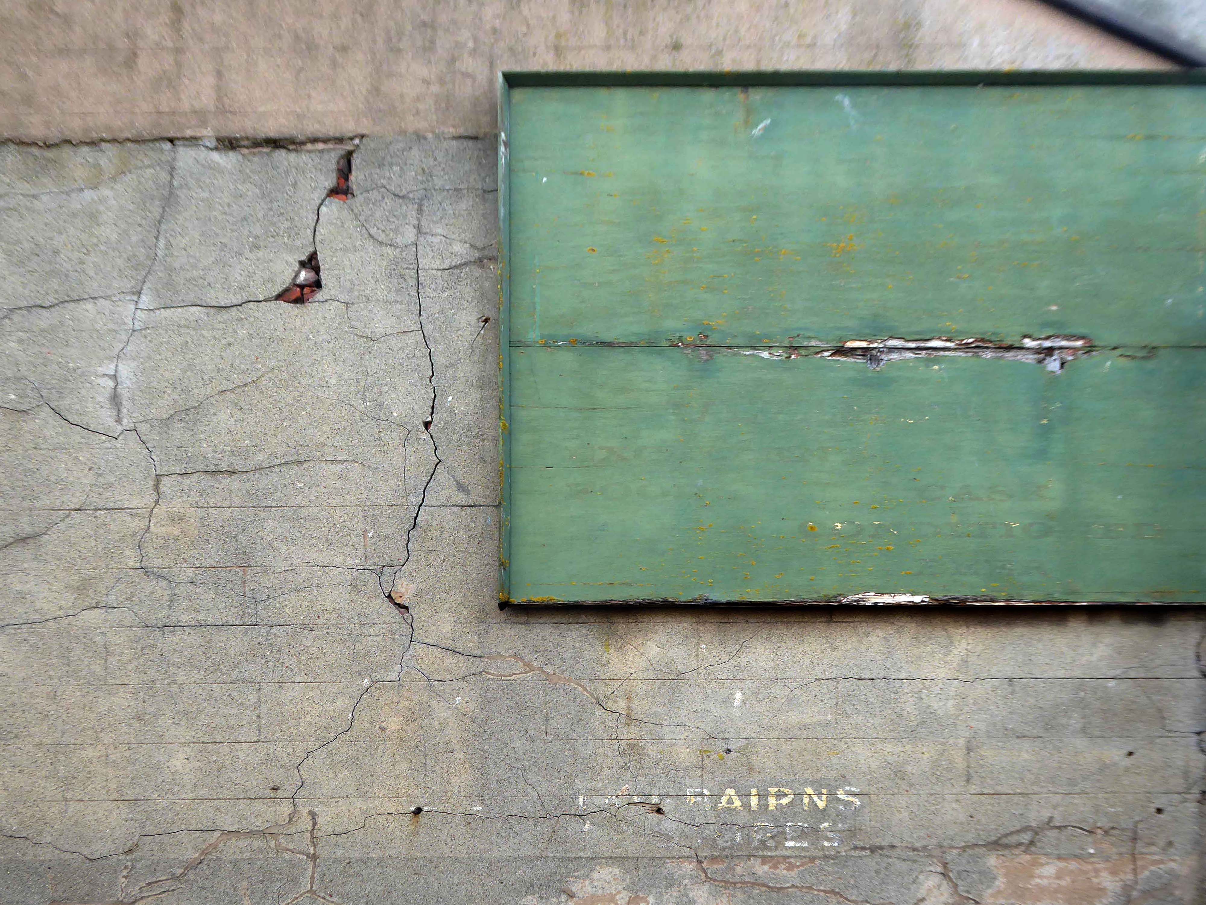
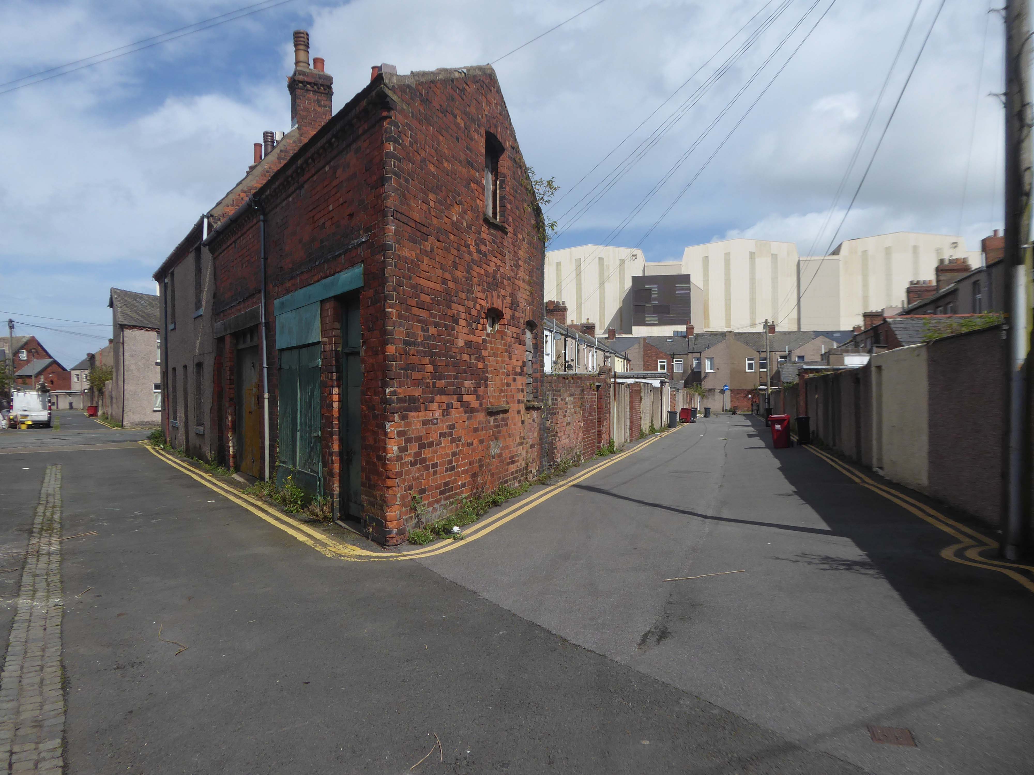
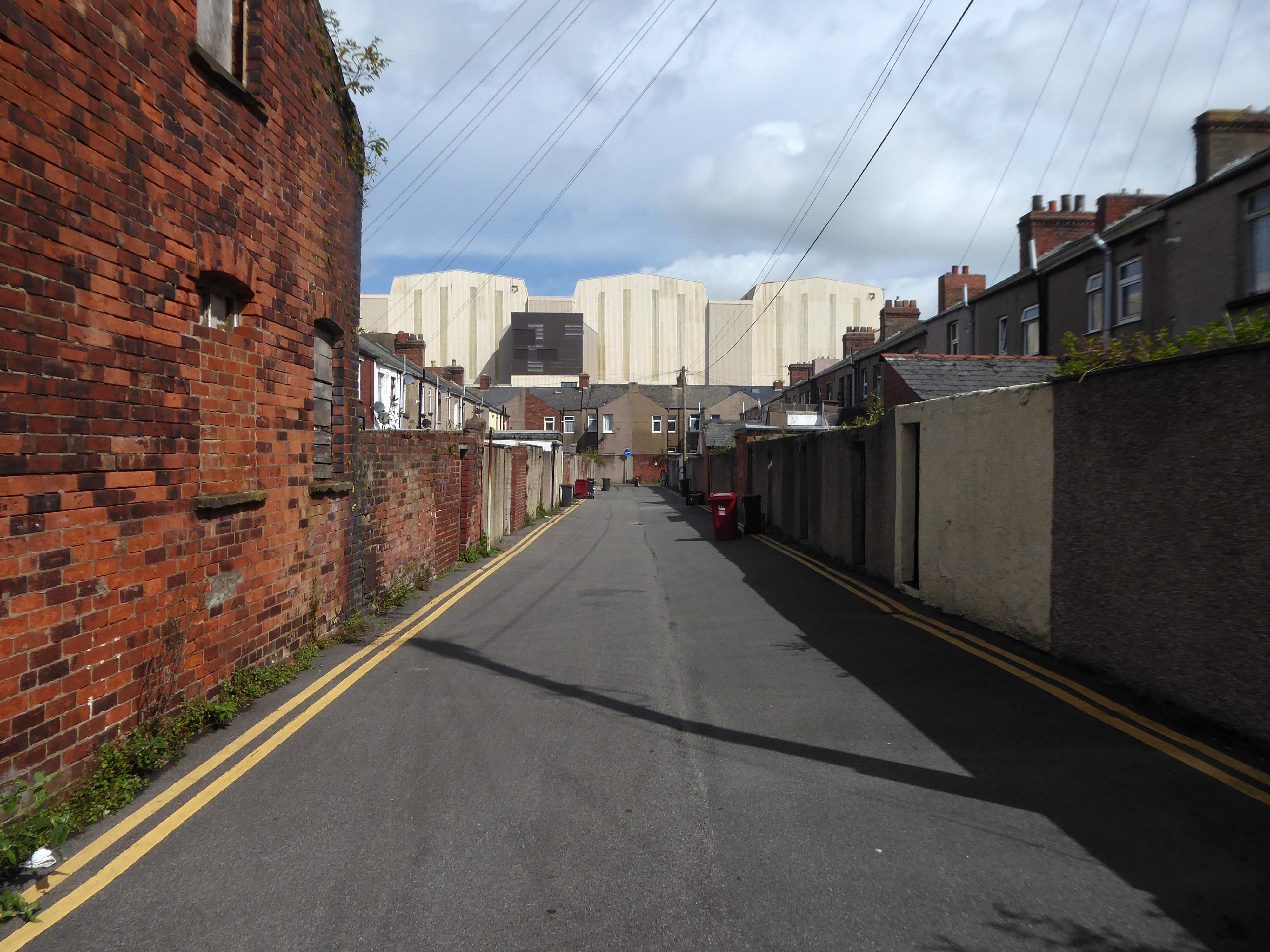
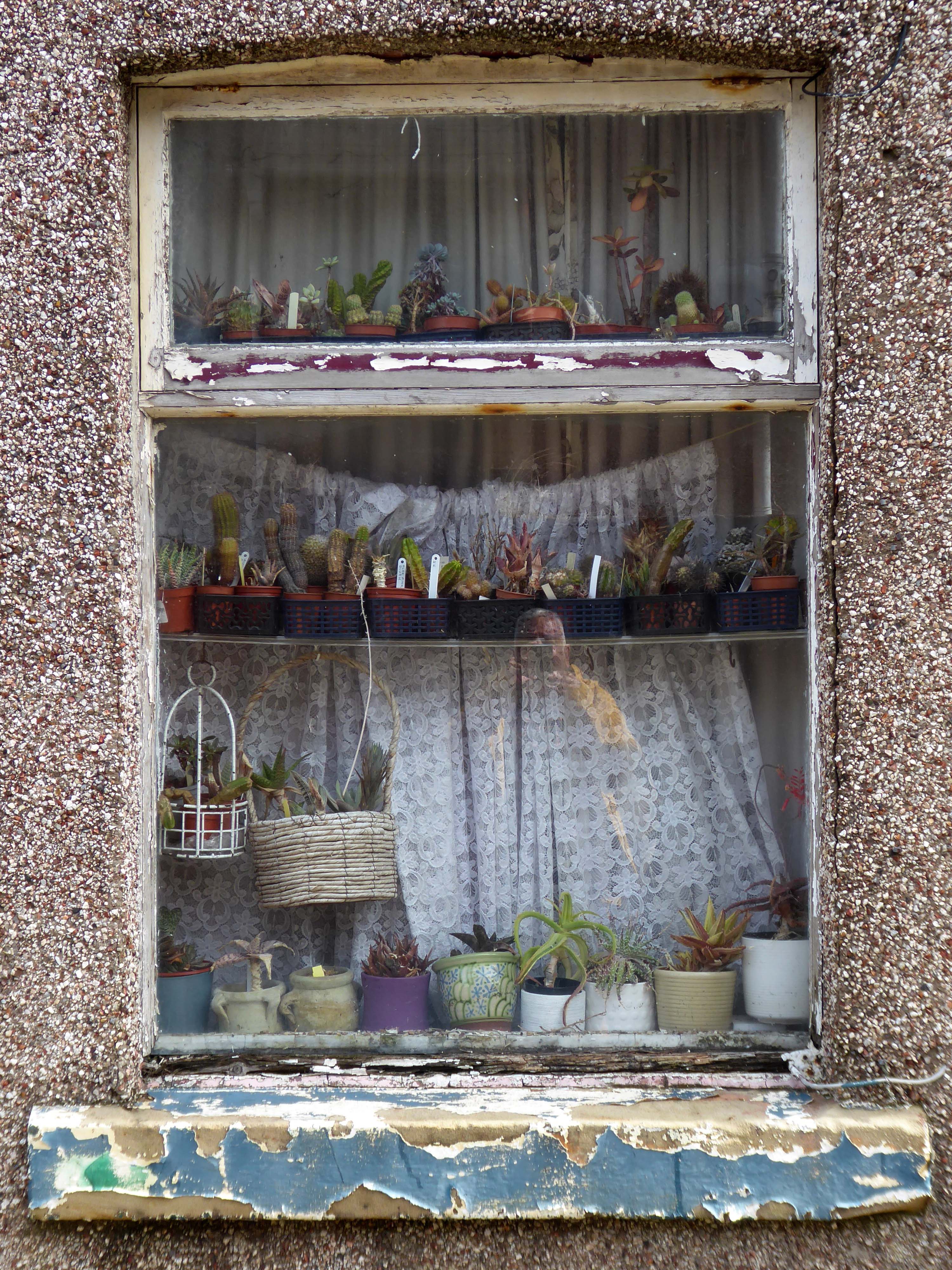
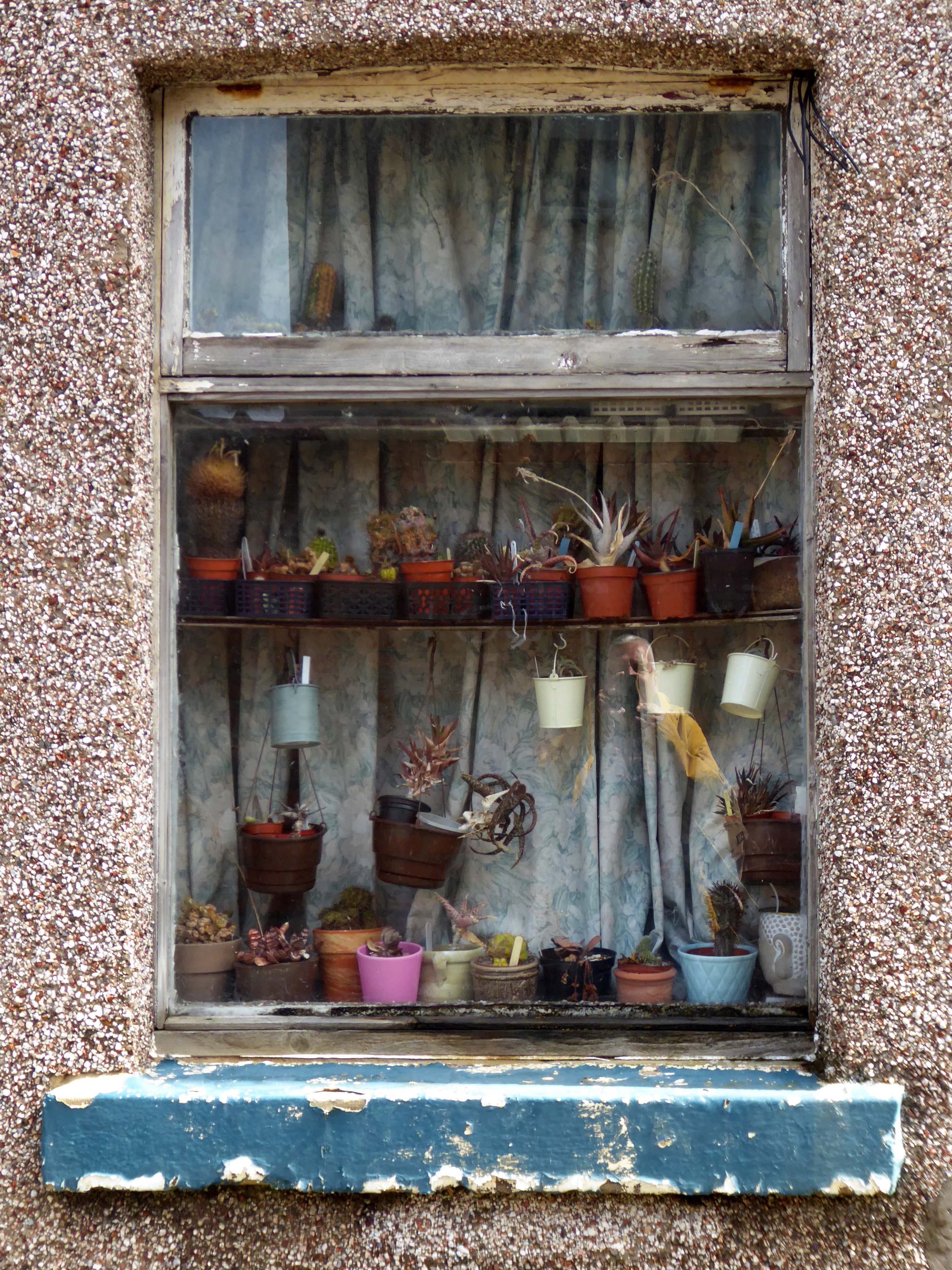
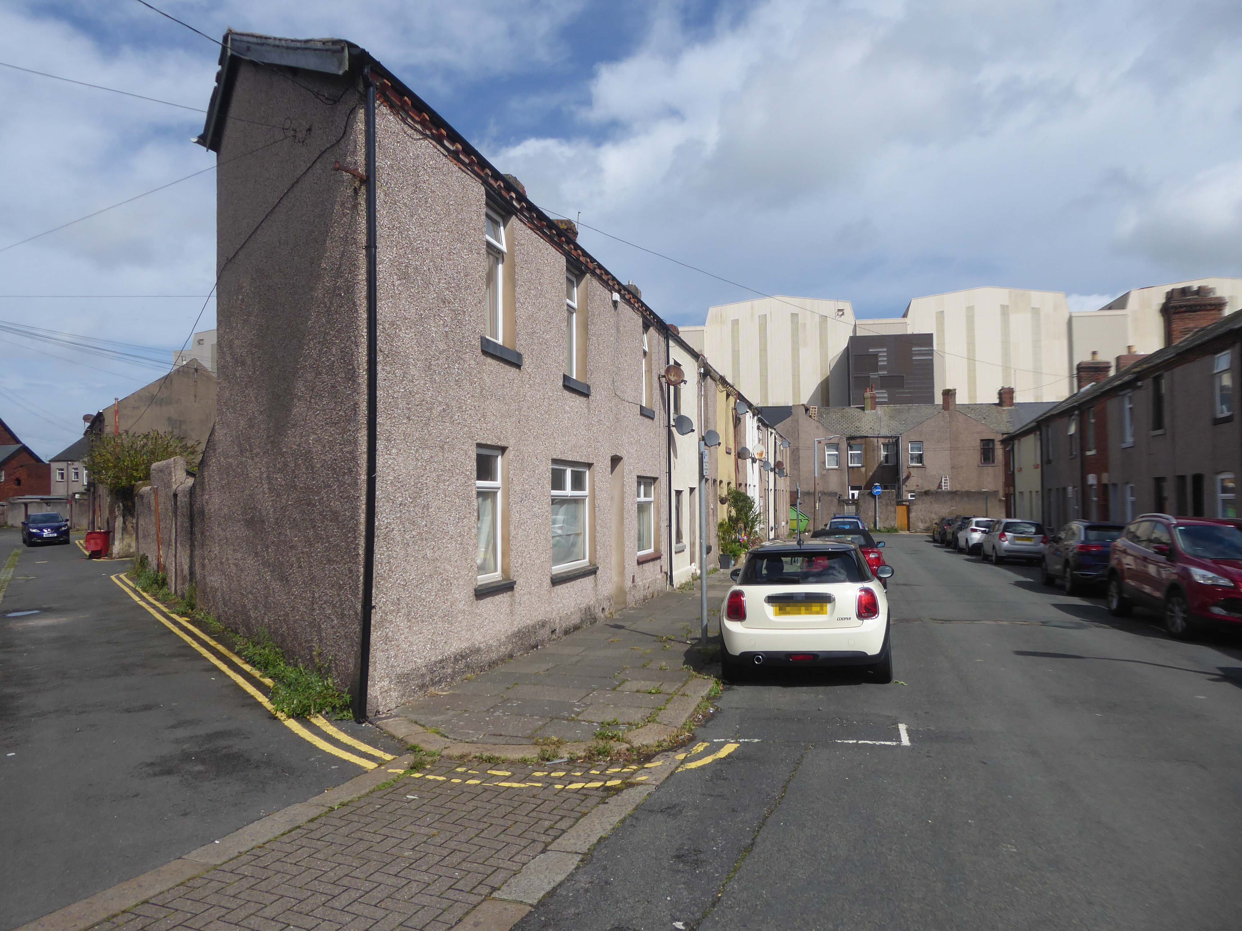
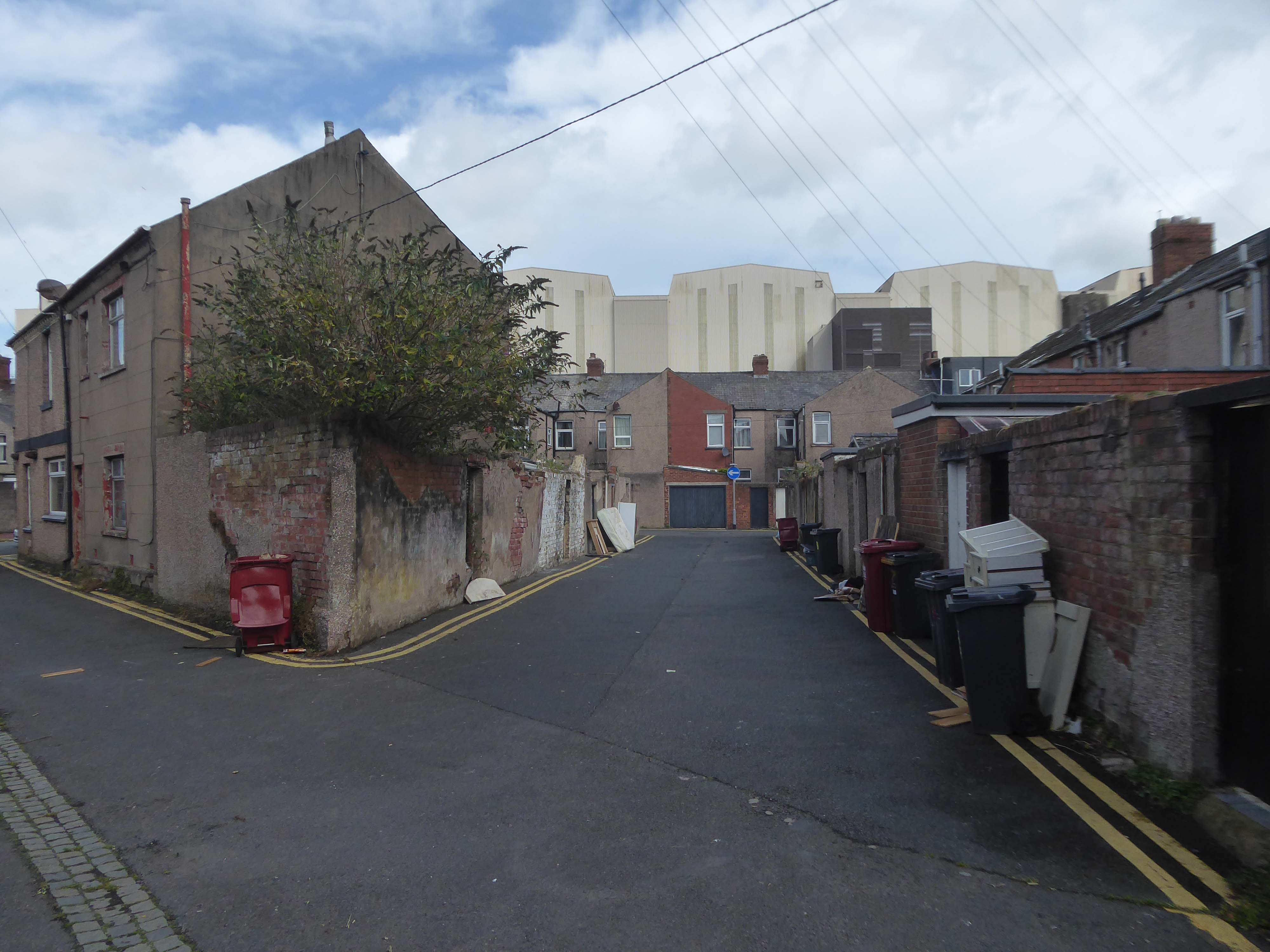
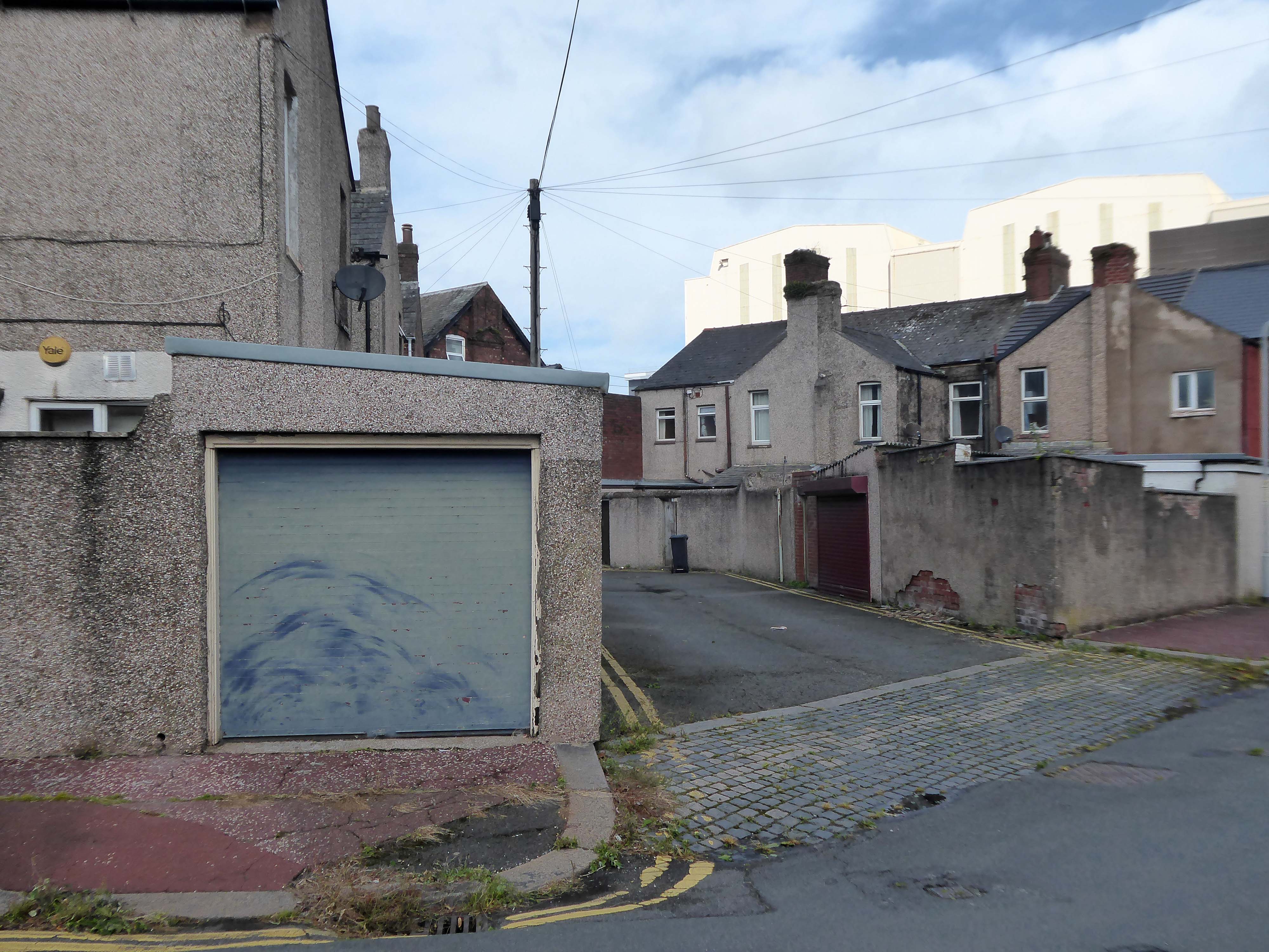
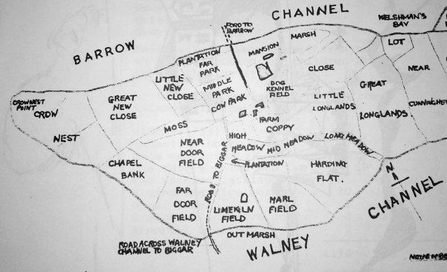
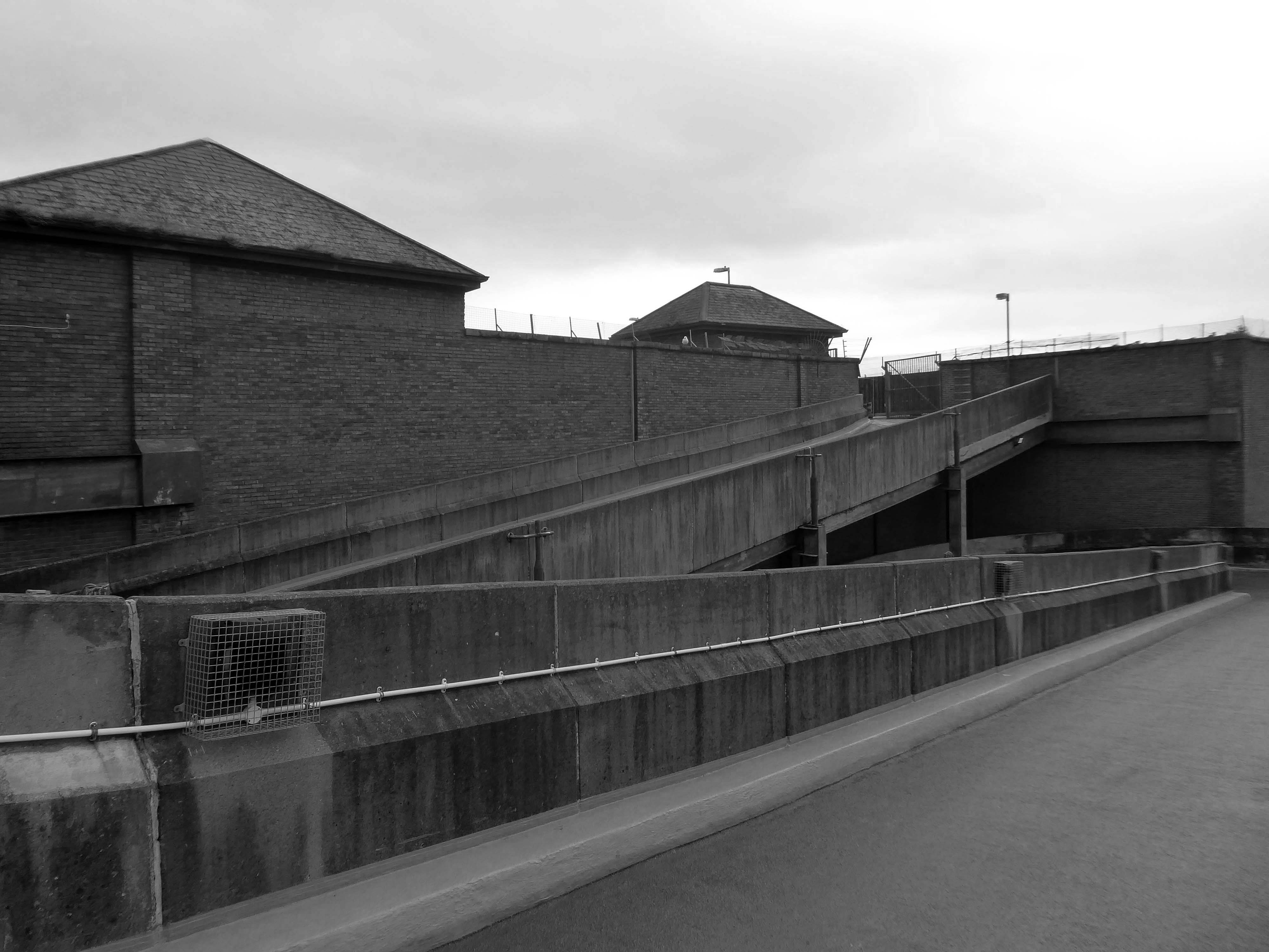
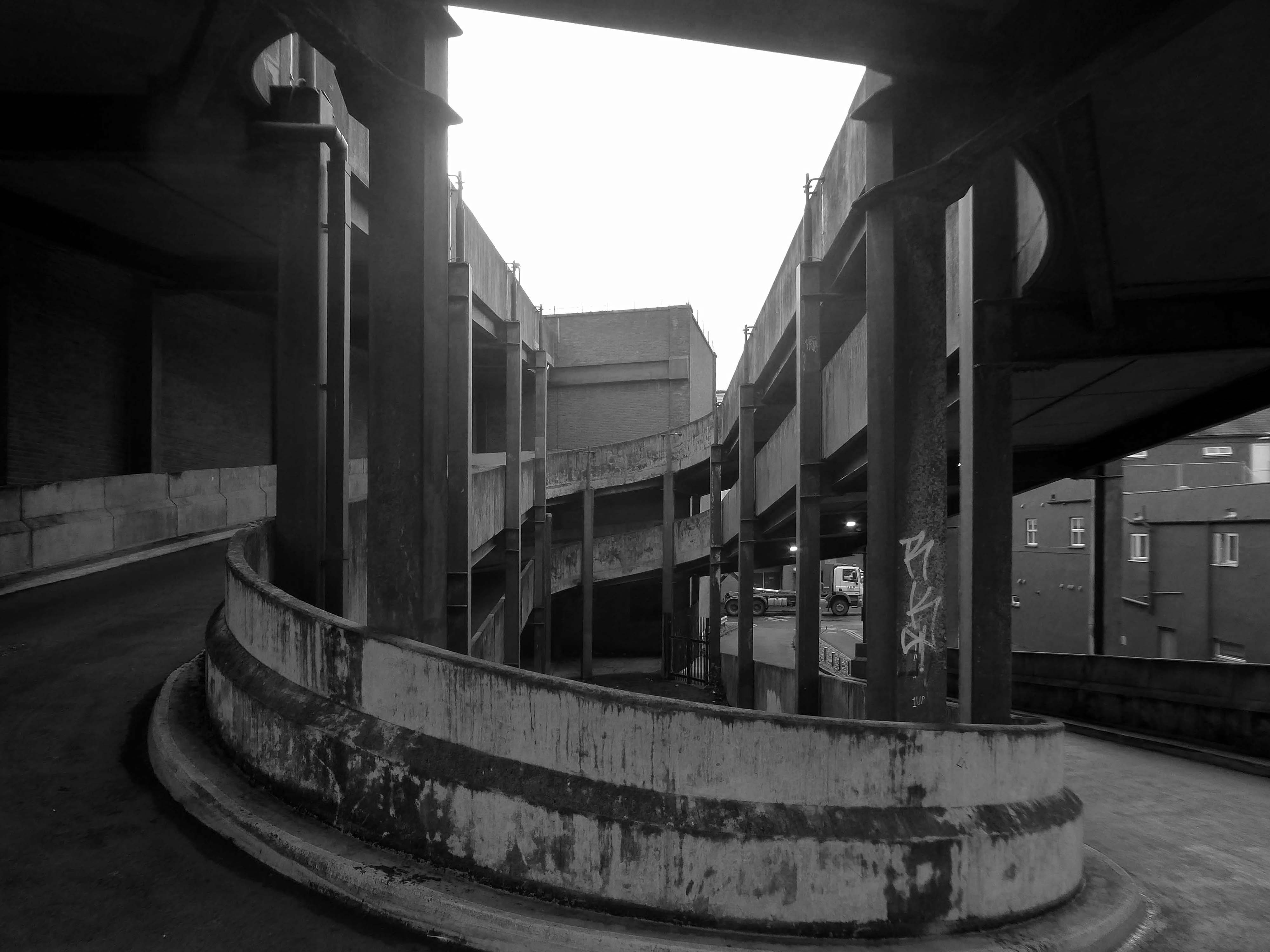
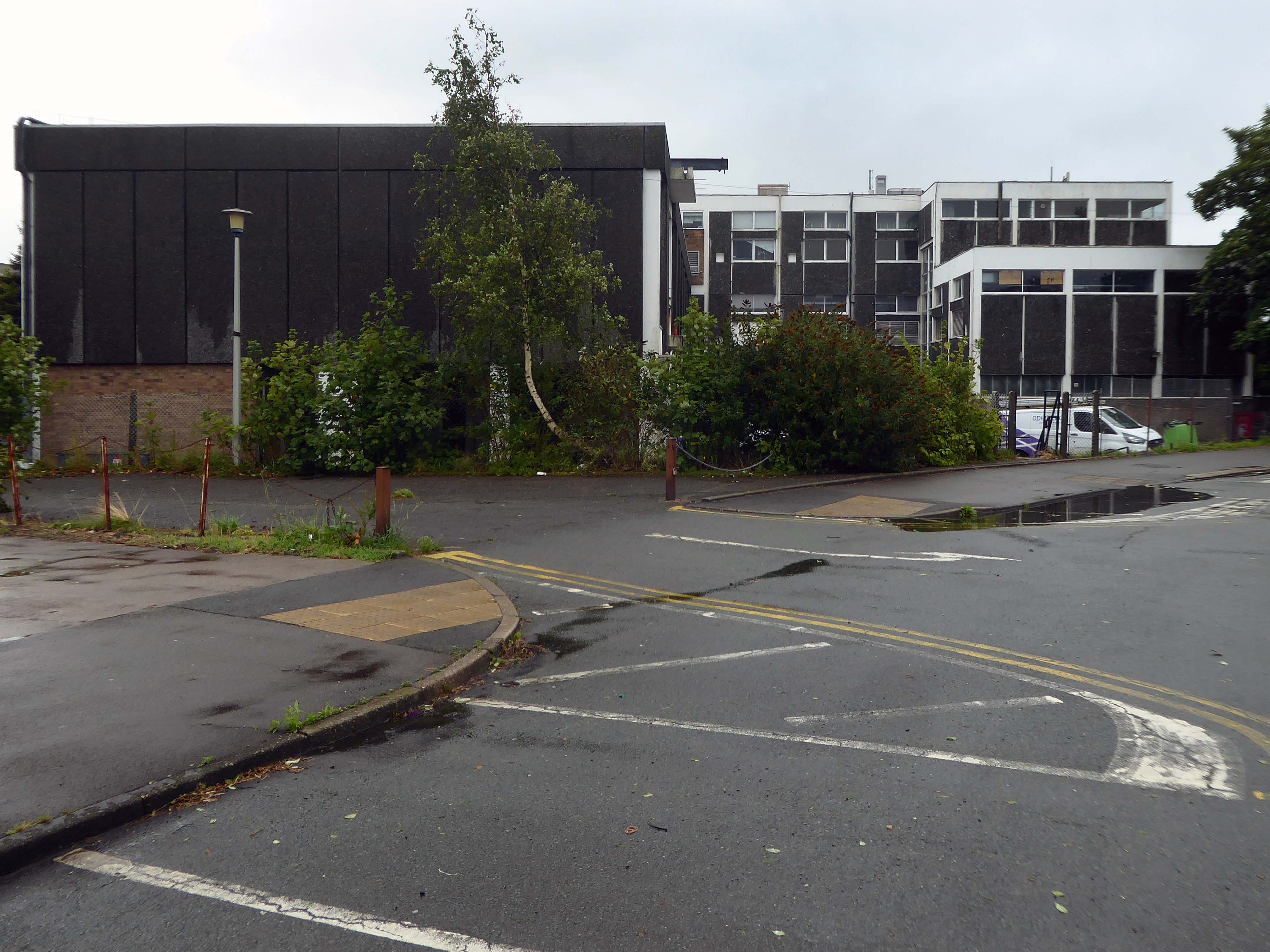
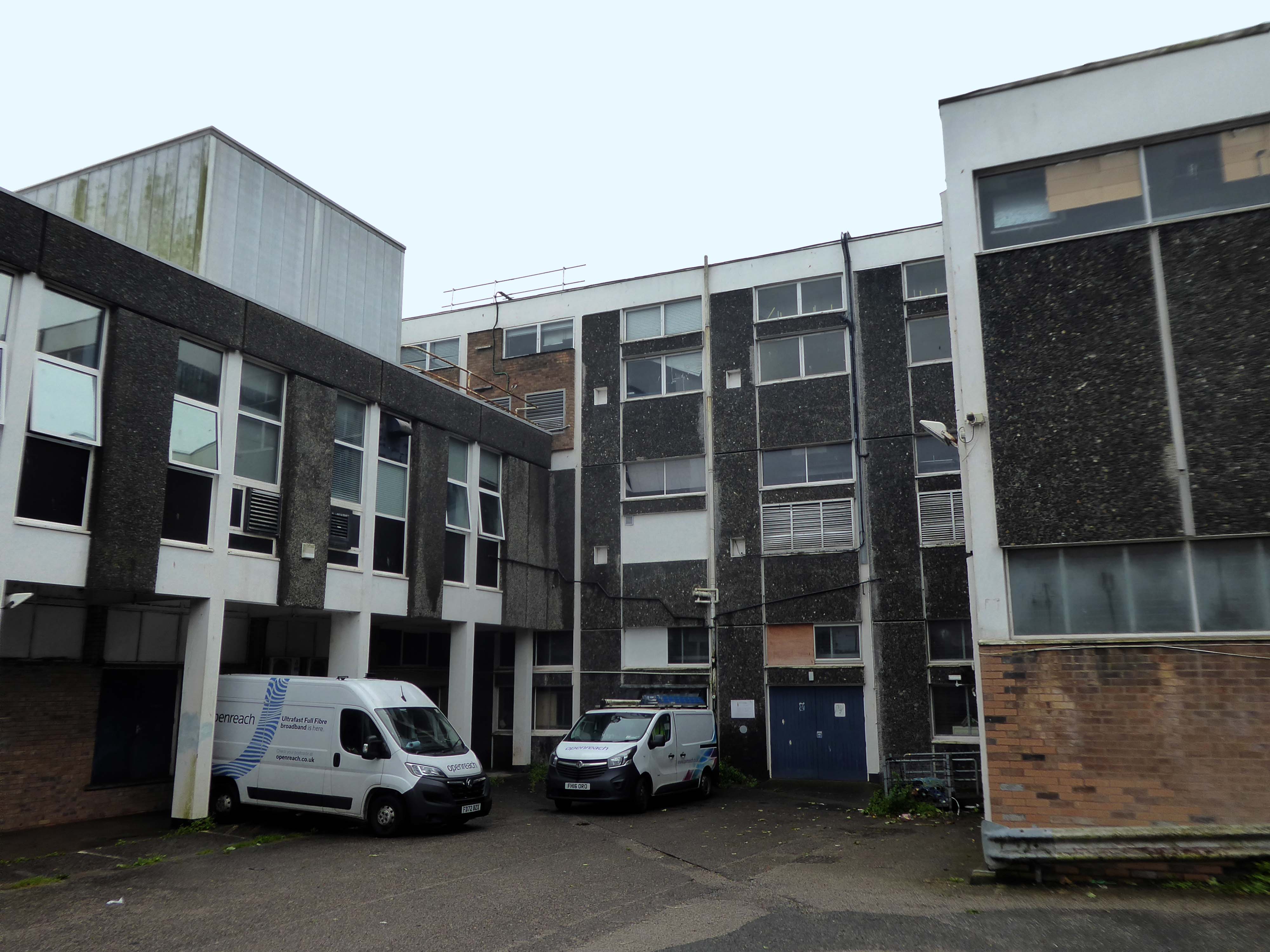
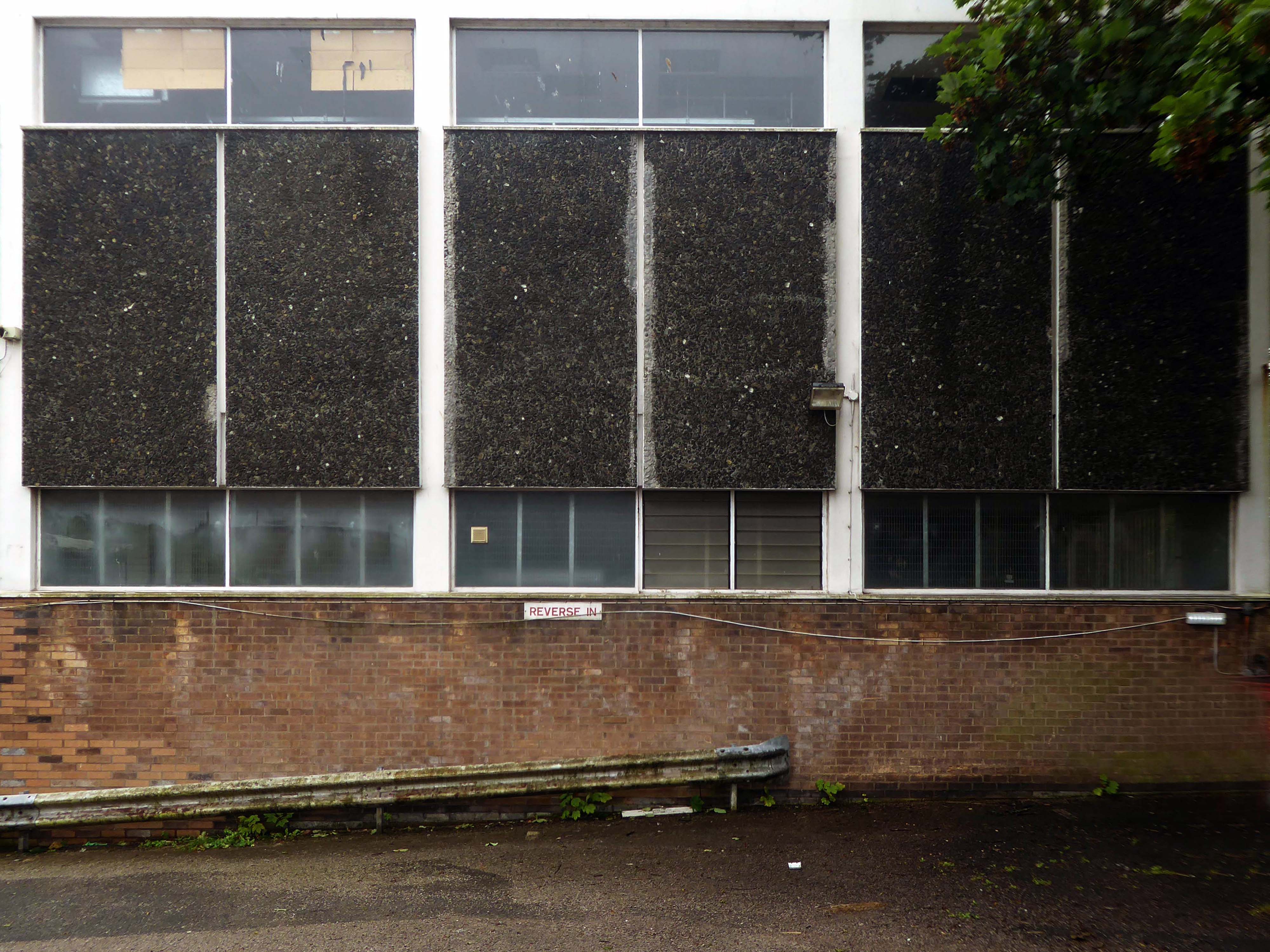
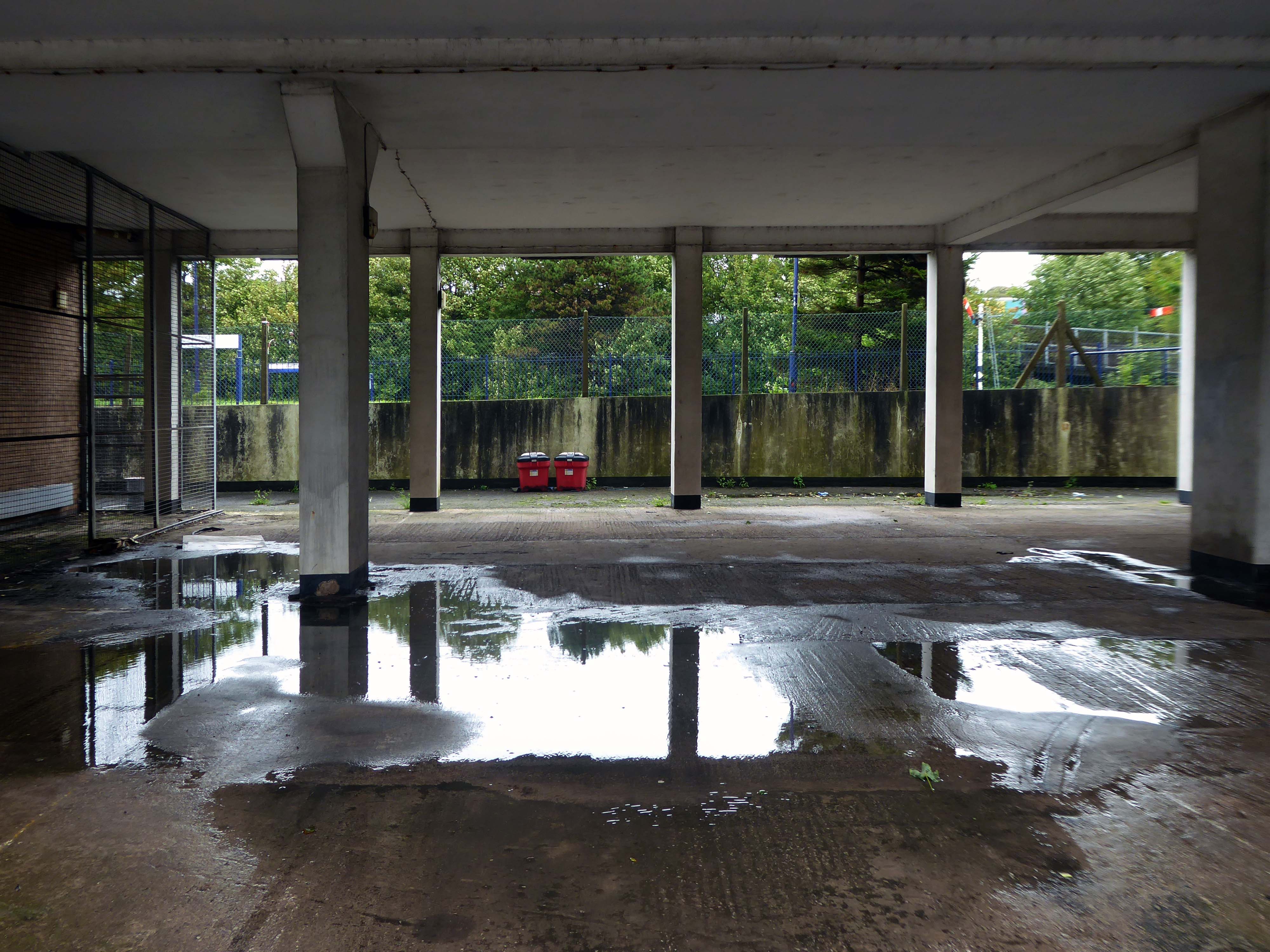
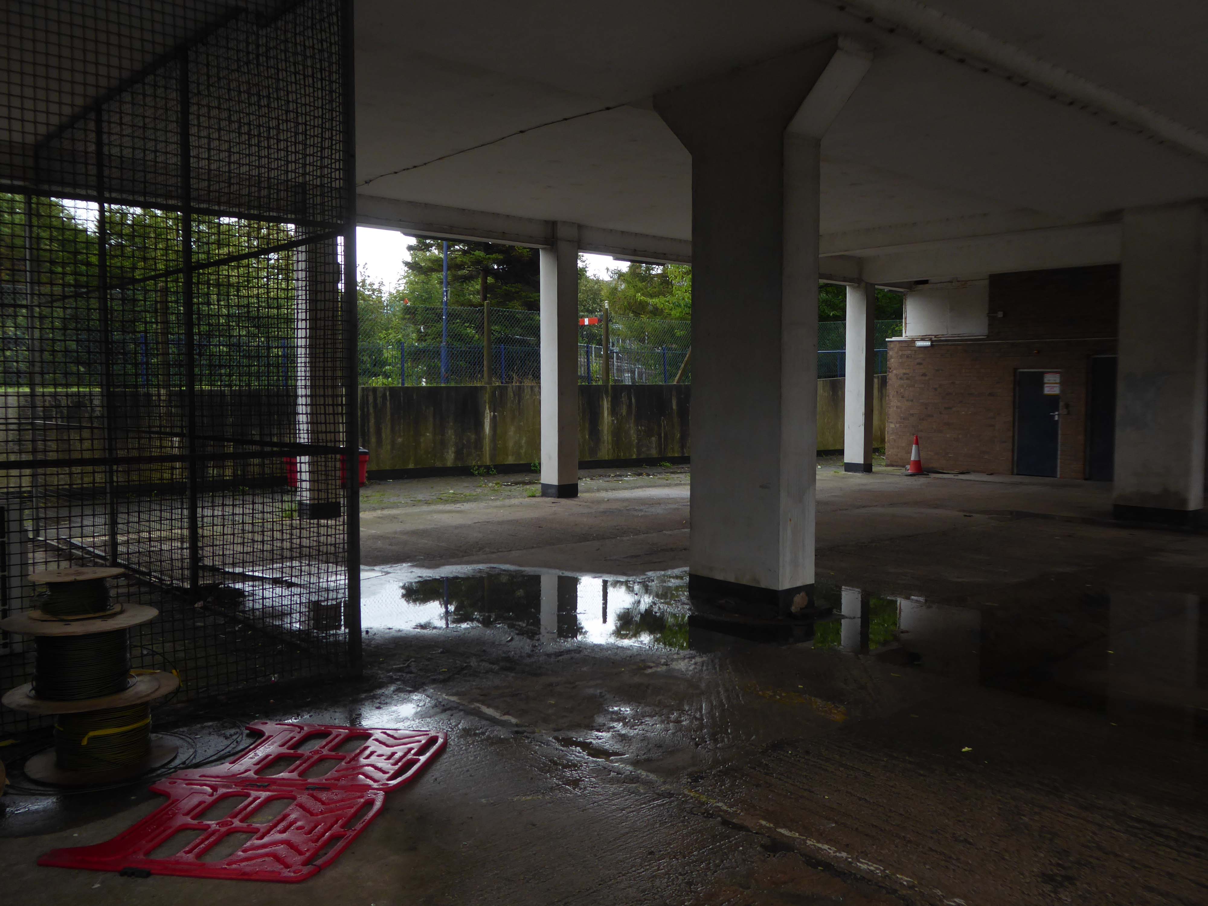
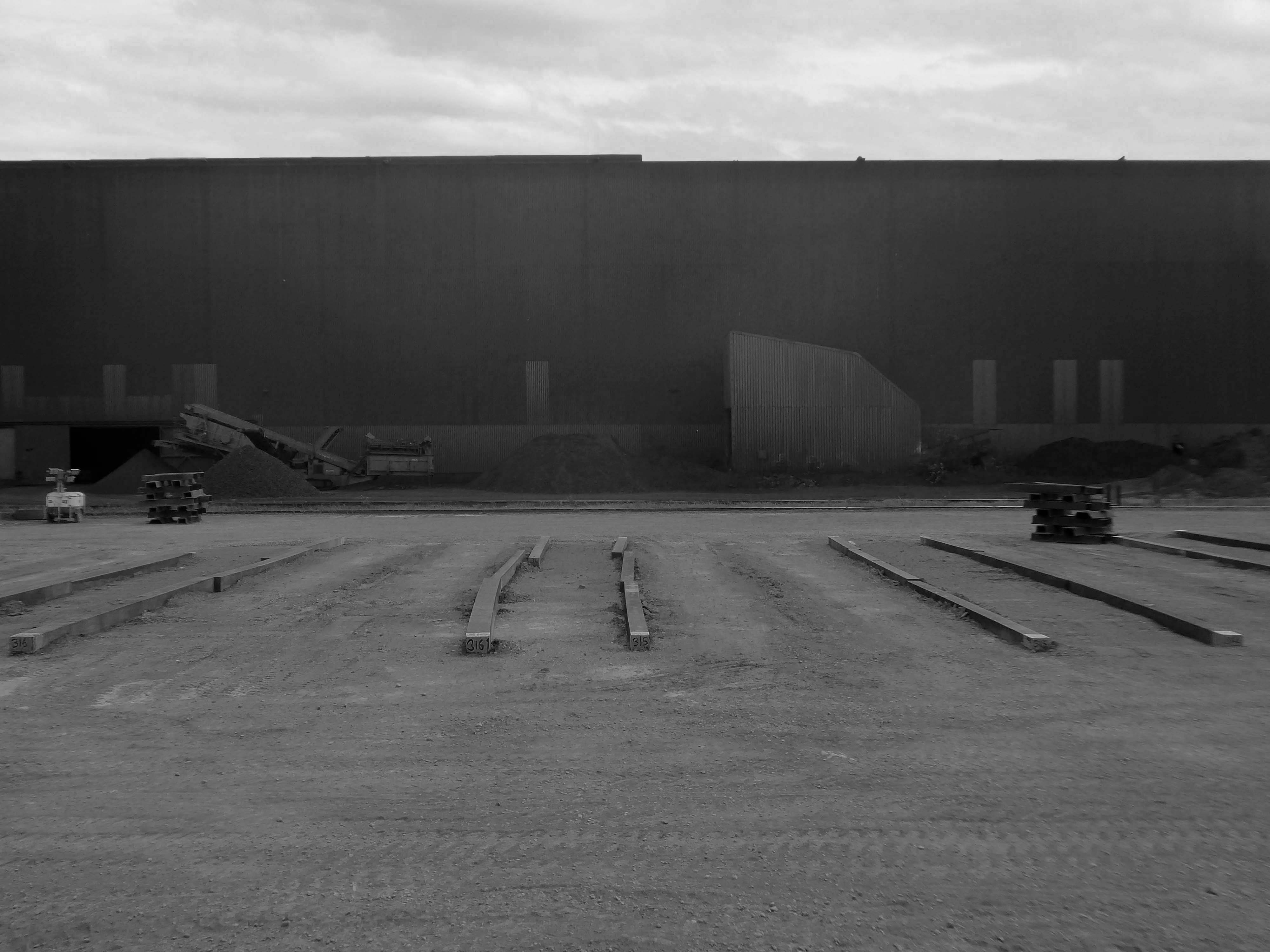
At the northern end of Barrow Island lies the Ferry Road Triangle. Covering an area formerly known by the field names, Crow Nest, Great New Close, Little New Close, Moss, Cow Park and Middle Park; the Ferry Road area has always been known as the Triangle, because the shape of the estate is truly a triangle.
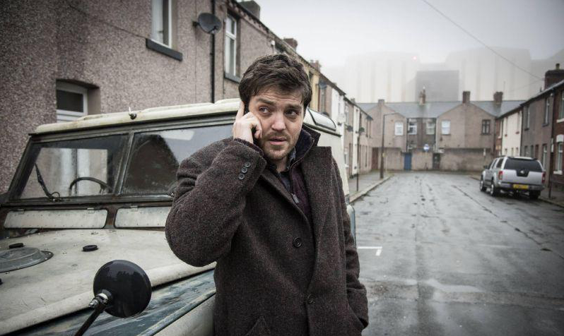
I had arrived in Barrow in Furness and taken to wandering the streets, hastily in search of nothing in particular.
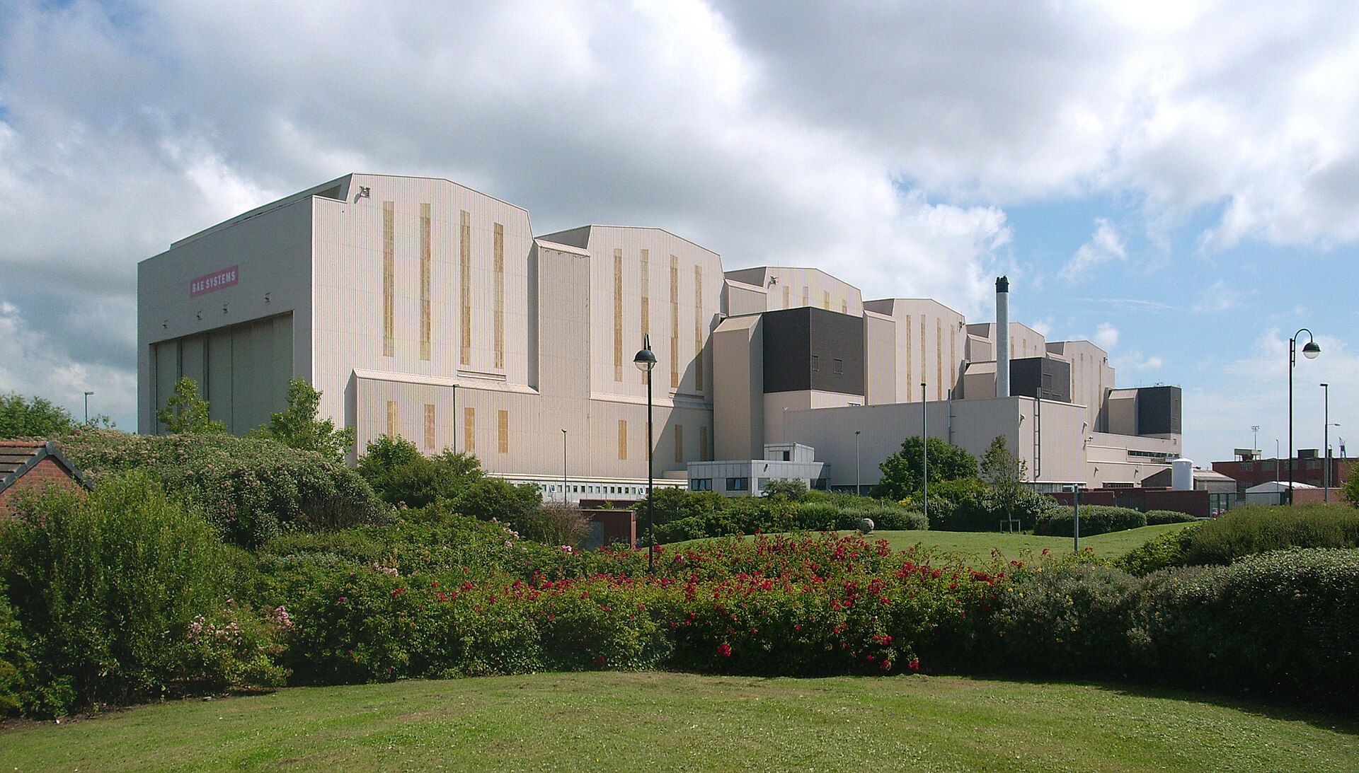
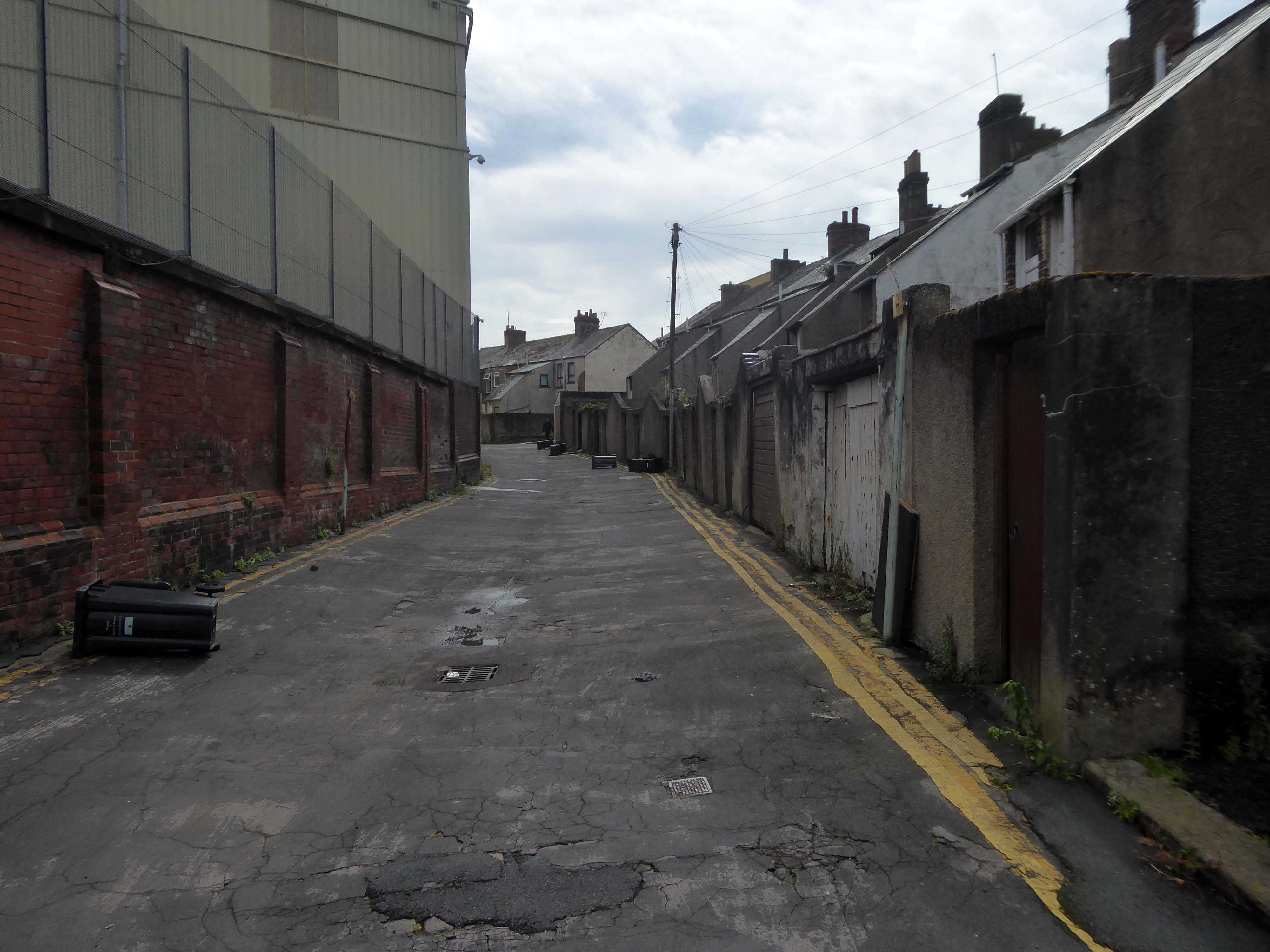
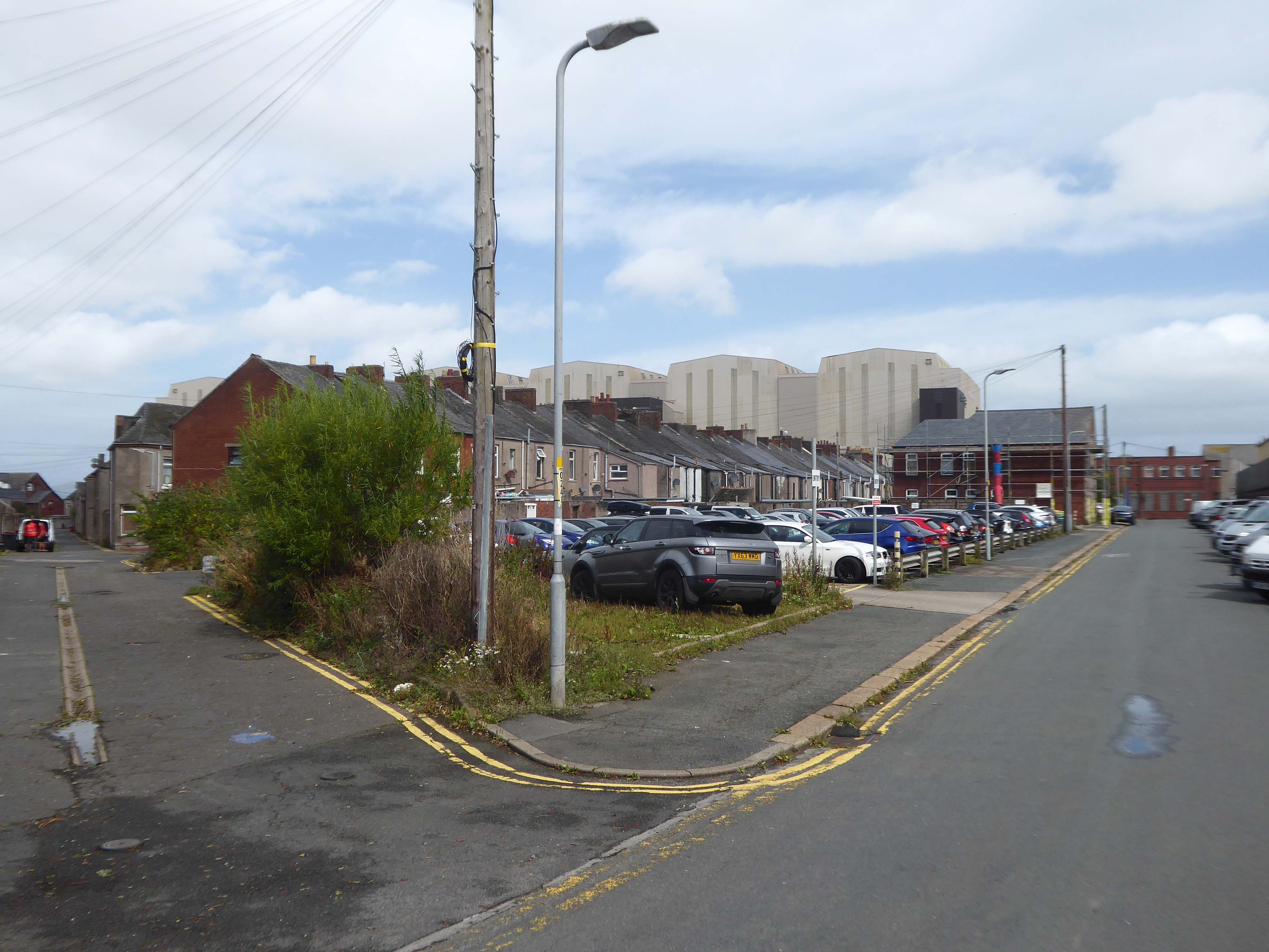
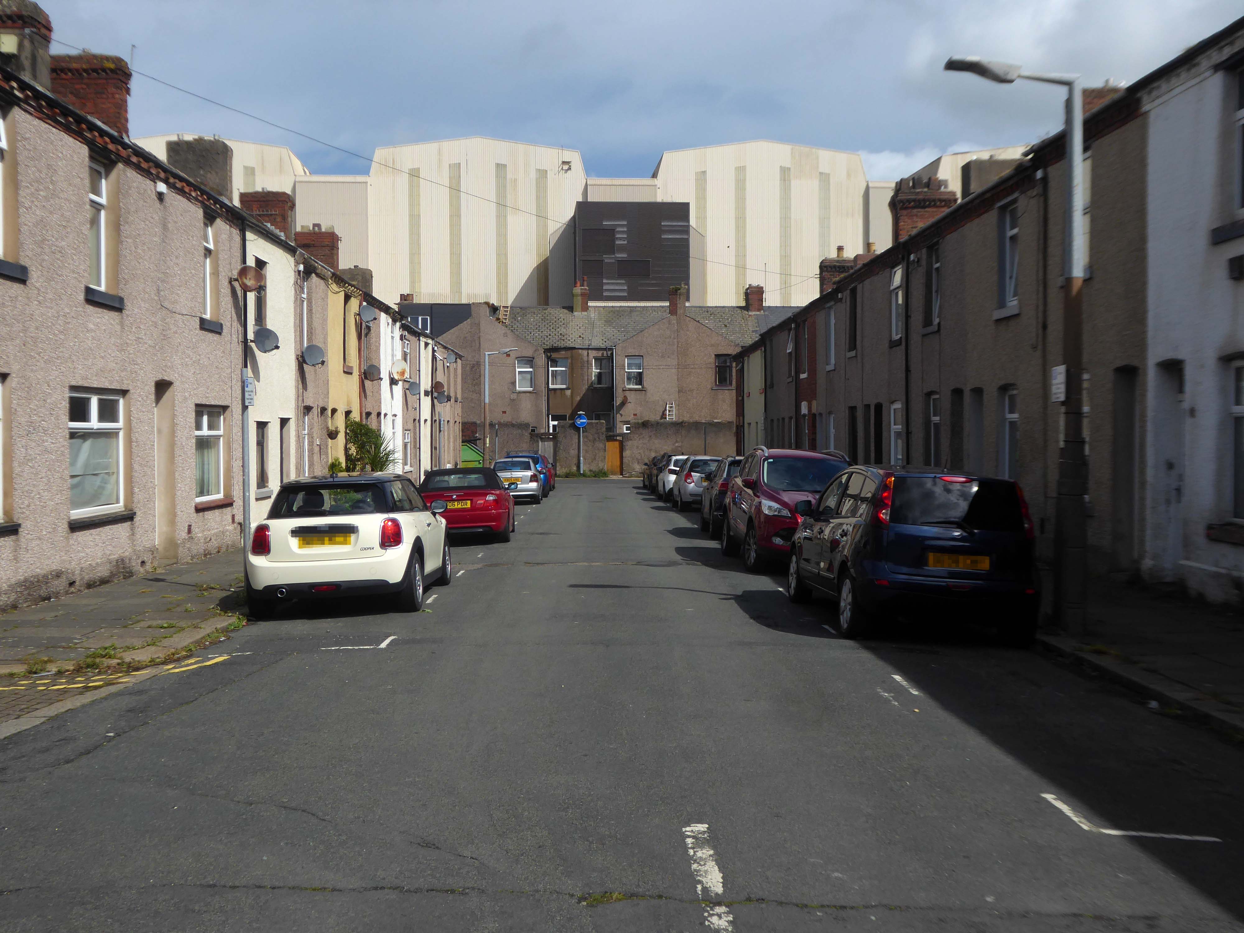
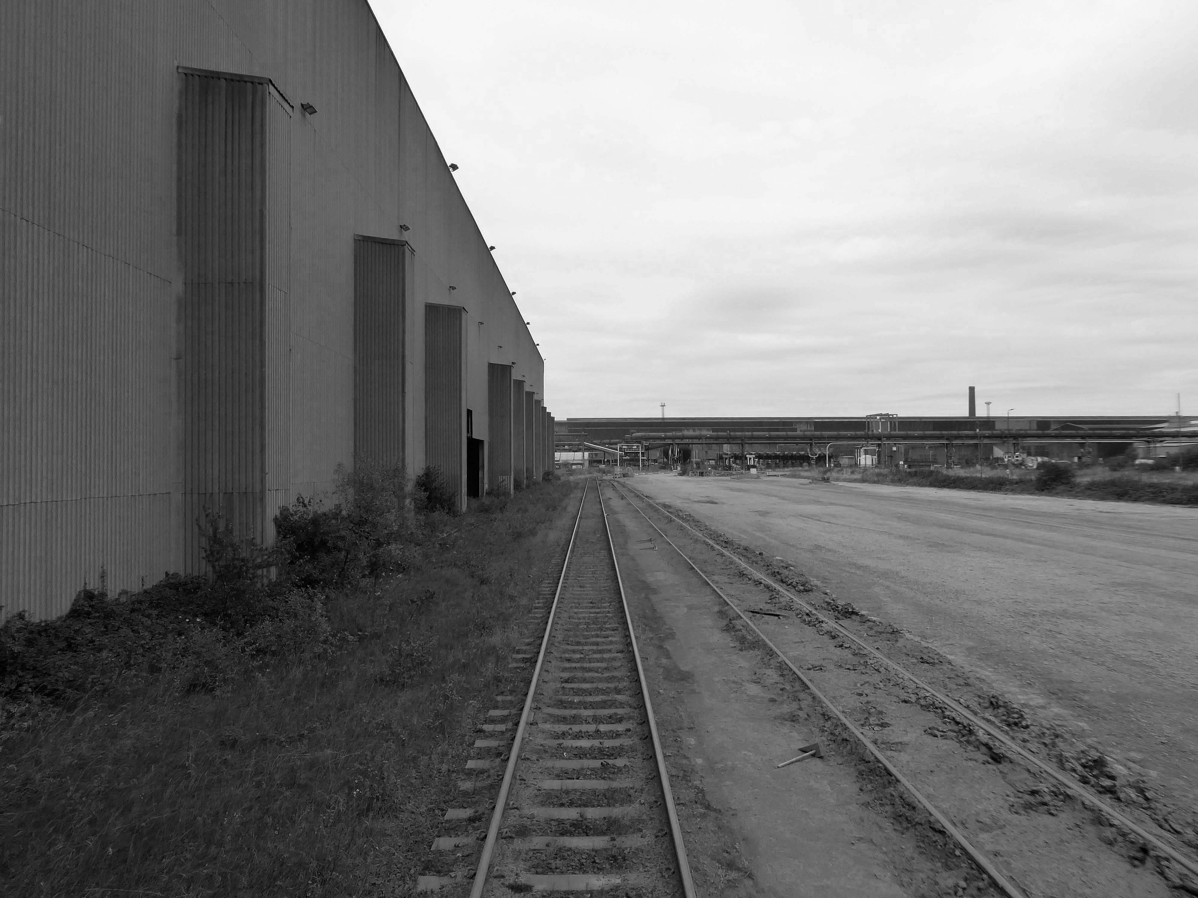
I came upon a neat triangle of terraced housing, which abutted the huge BAE Systems sheds.
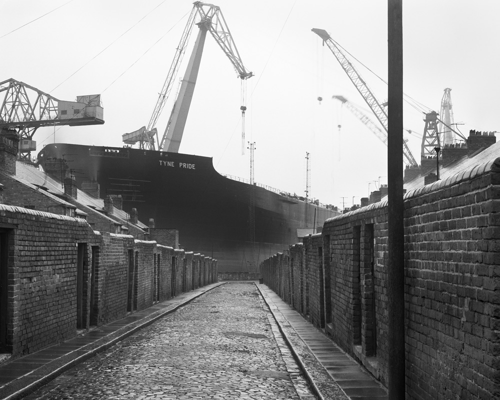
The collision of scale created by the low lying domestic buildings, and the gargantuan industrial nuclear submarine homes, immediately put me in mind of Chris Killip’s photographs.
He had recorded the last days of a dying industry, whilst the BAE contracts represent a long term lifeline to a once dying town.
The Ministry of Defence has awarded £3.95 billion of funding to BAE Systems for the next phase of the UK’s next-generation nuclear-powered attack submarine programme, known as SSN-AUKUS.
The funding follows the AUKUS announcement in March by the leaders of Australia, the UK and the United States. This will eventually see Australia and the UK operate SSN-AUKUS submarines, which will be based on the UK’s next generation design, incorporating technology from all three nations, including cutting-edge US submarine technologies.
Having started early design work in 2021, the £3.95bn funding will cover development work to 2028, enabling BAE Systems to move into the detailed design phase of the programme and begin to procure long-lead items. Manufacture will start towards the end of the decade with the first SSN-AUKUS boat due to be delivered in the late 2030s.
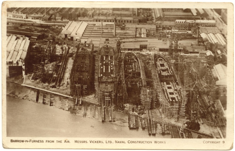
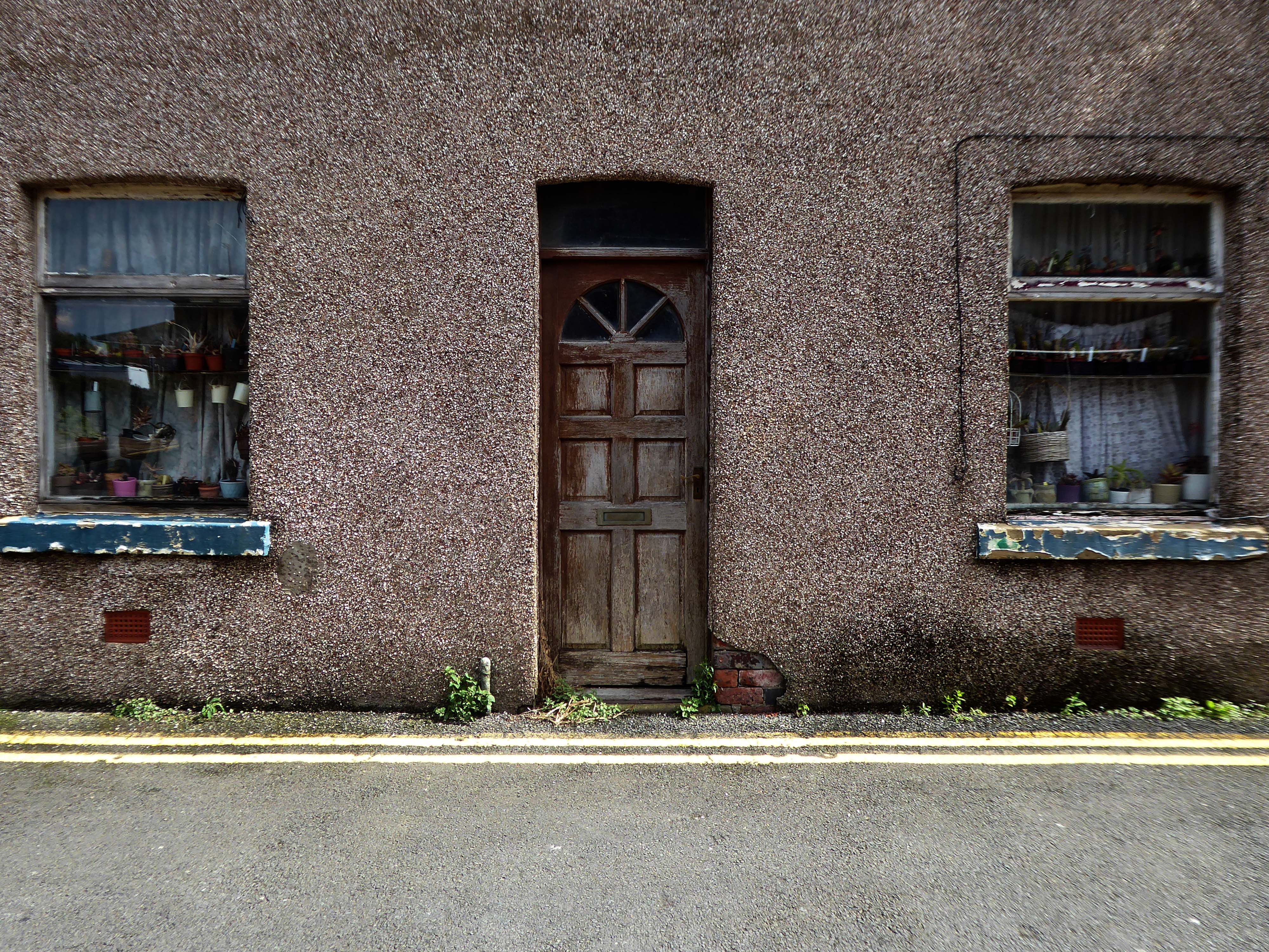
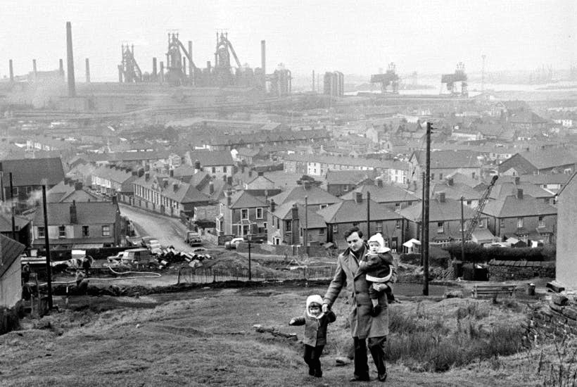
It has been said of Barrow: A rich mineral district was the cause, a railway was the effect, and an important manufacturing town the result.
The dramatic growth of Barrow-in-Furness in the late 19th and early 20th Centuries was fuelled by the ready availability of Furness iron ore. Significant investments were made in developing the town to exploit this resource. The various ironworks, steelworks, foundries, shipyards and docks required a huge influx of population to support them. This in turn led to the rapid building of rows of good quality mass-produced terraced housing for the workers, and substantial sandstone villas for the management.
I stopped to chat with a local lad – I had thought Barrow to be a hard town, he thought not.
There’s not much trouble, though we have hard times – how so?
The Tories – now my kids have all got jobs for the next twenty years.
There were no reported crimes in June 2024
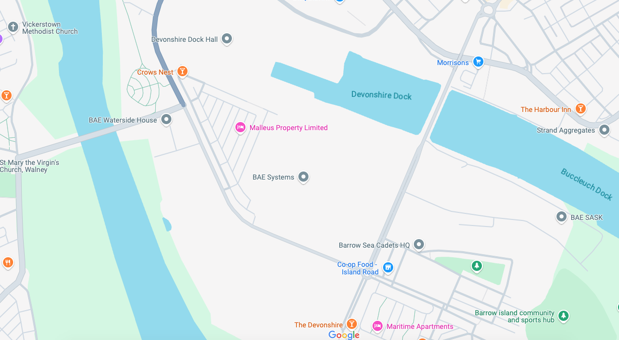
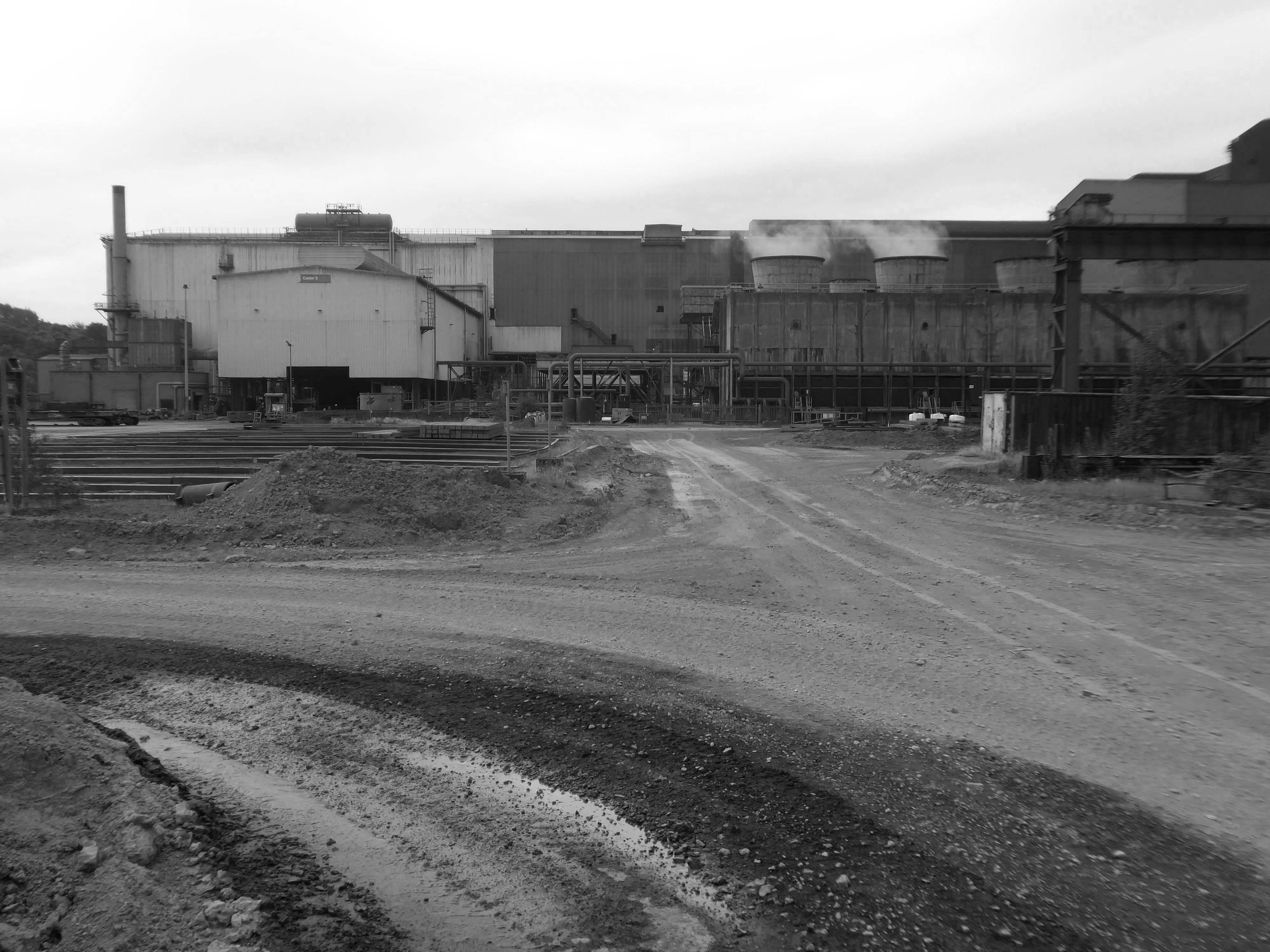
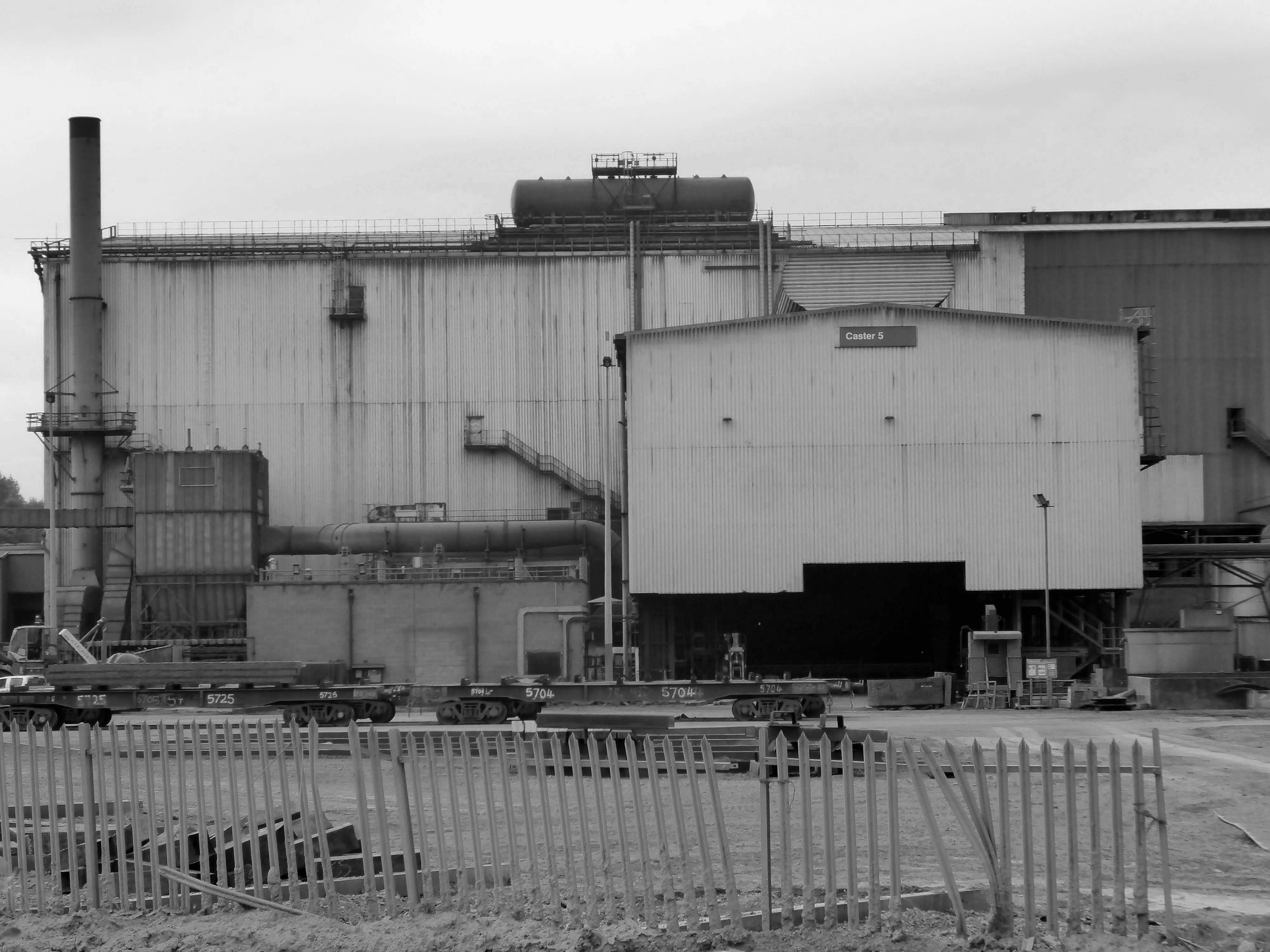
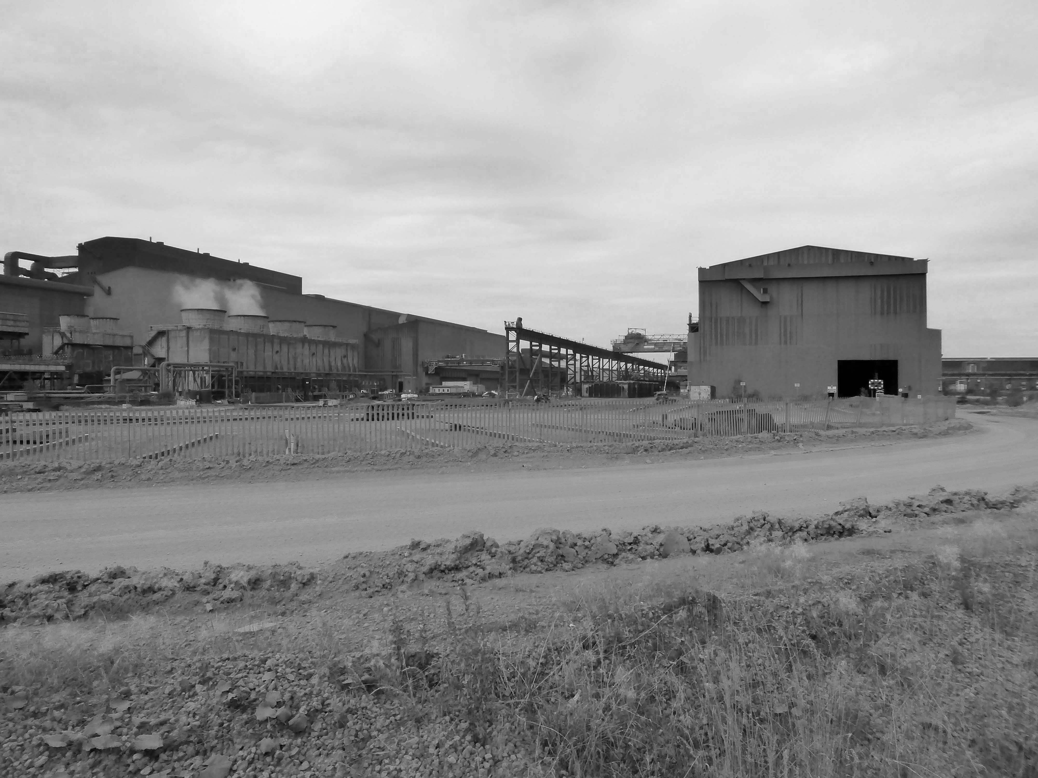
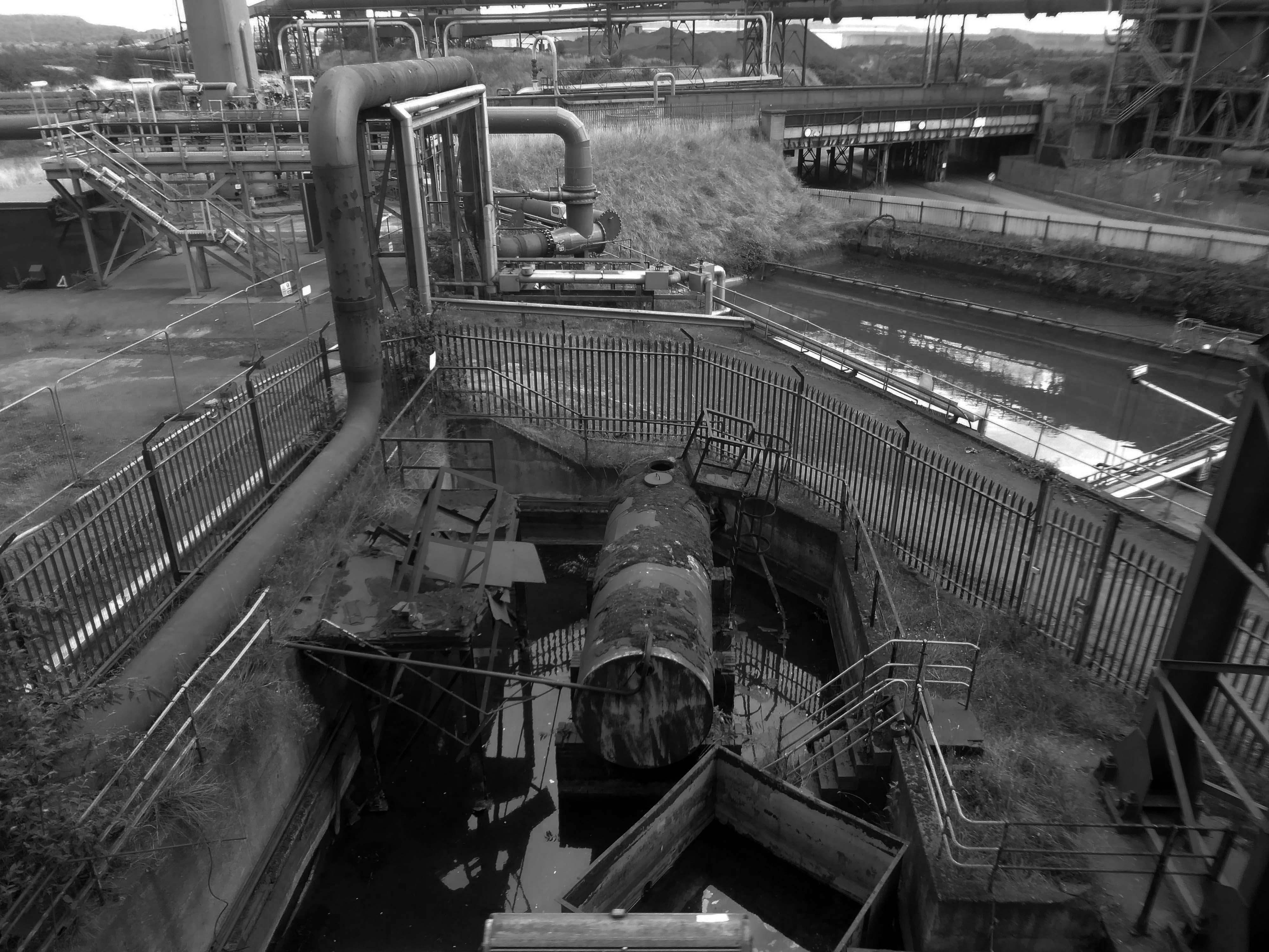
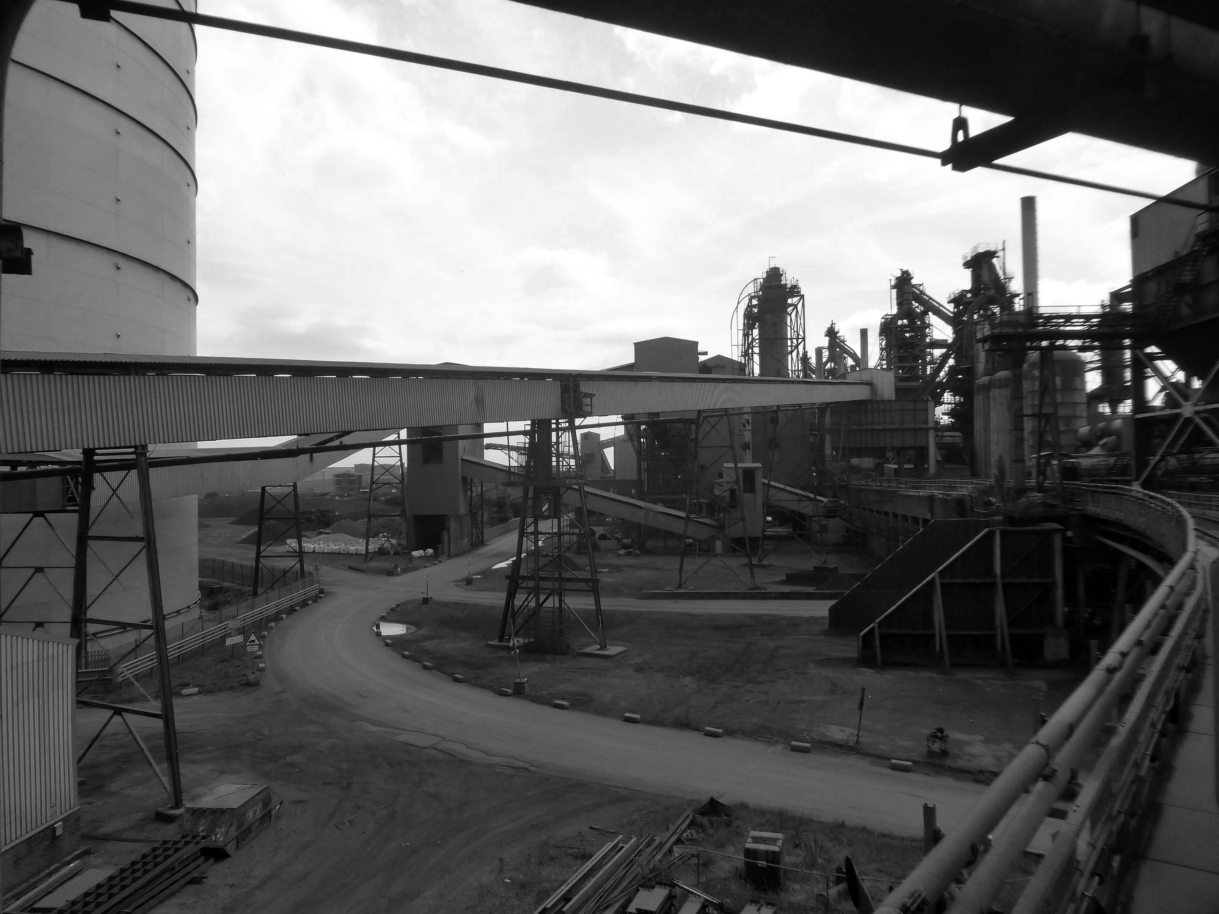
Devonshire Dock Hall is a large indoor shipbuilding and assembly complex that forms part of the BAE Systems shipyard.
Constructed between 1982 and 1986 by Alfred McAlpine plc for Vickers Shipbuilding and Engineering, DDH was built on land that was created by infilling part of Devonshire Dock with 2.4 million tonnes of sand pumped from nearby Roosecote Sands.
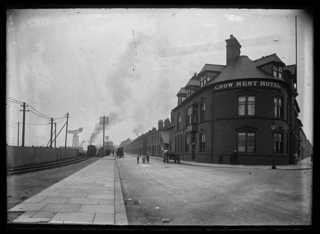
Opened in May 1888 it was described by the Barrow News as one of the best-appointed hotels in Barrow. From this start, Walton Lee, elected Town Councillor in 1886 envisaged an estate for the workers literally within spitting distance of their workplace.
A section of Career of Evil was filmed at The Crow’s Nest.
Barrow shipyard’s Devonshire Dock Hall, The Crow’s Nest pub, Barrow Island streets, including Stanley Road and Stewart Street, and Michaelson Road Bridge, all featured in episode one of Career of Evil on Sunday night.
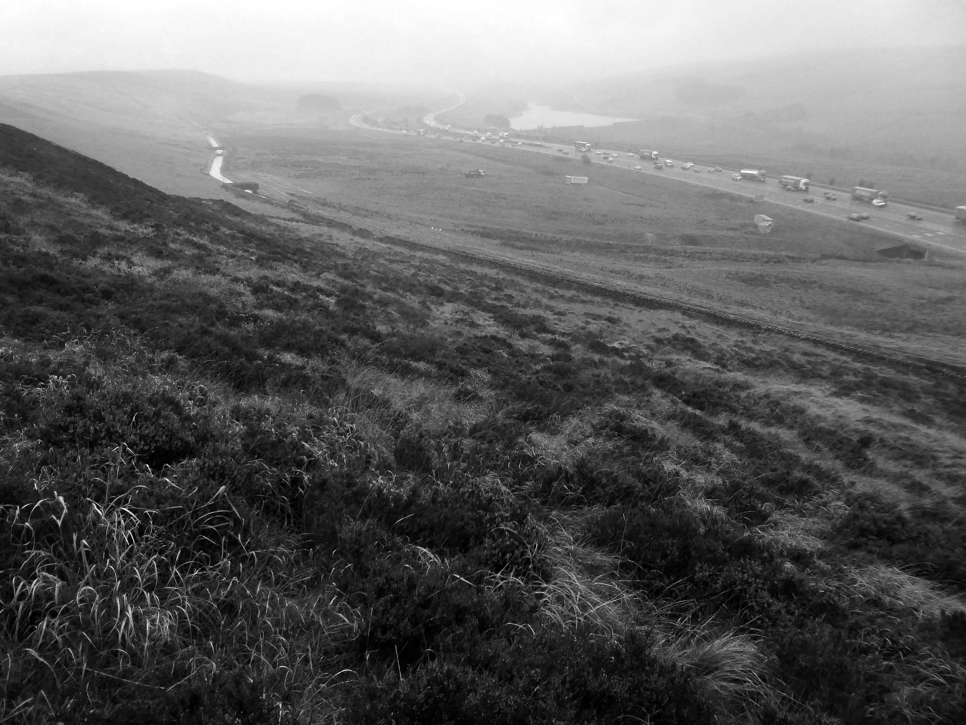
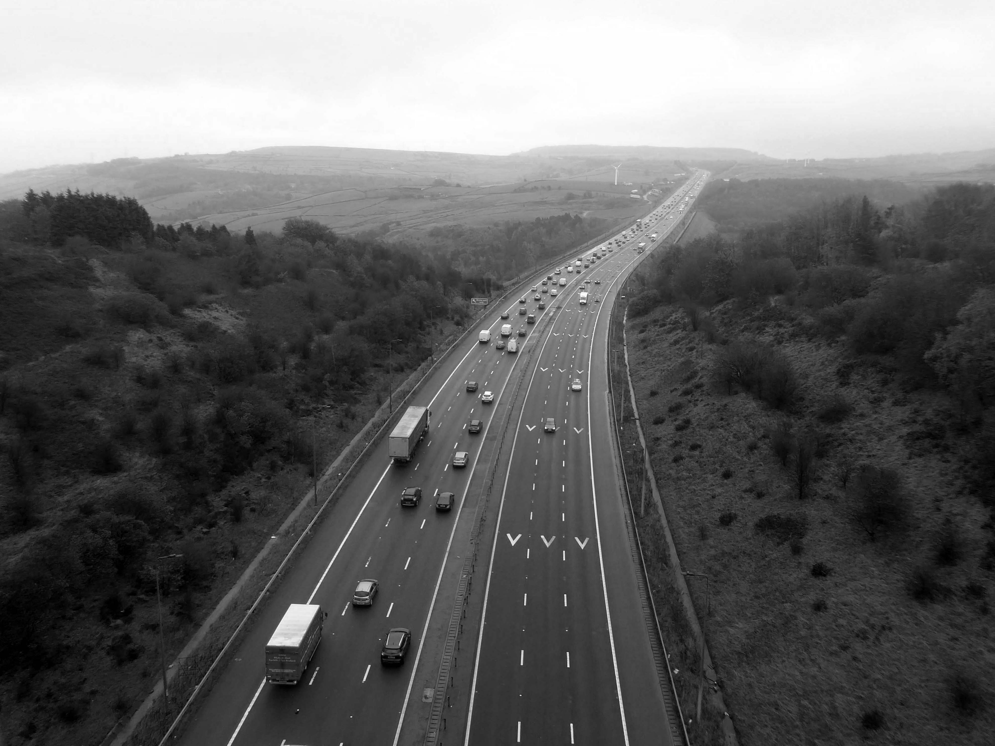
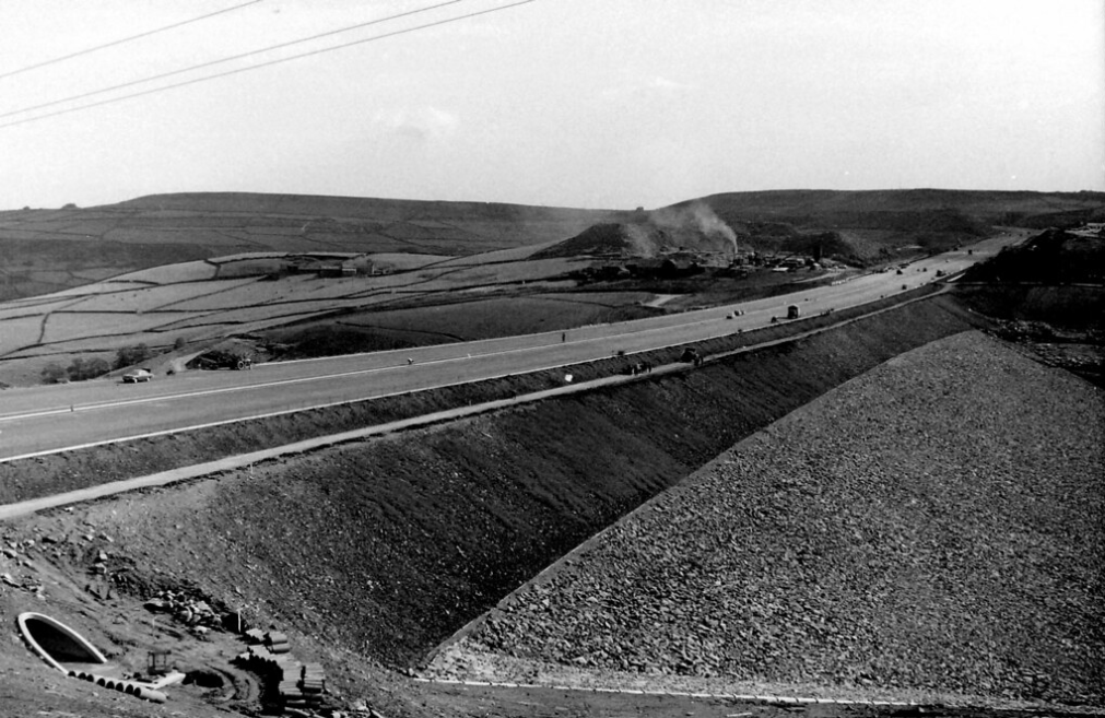
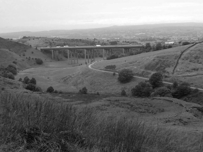
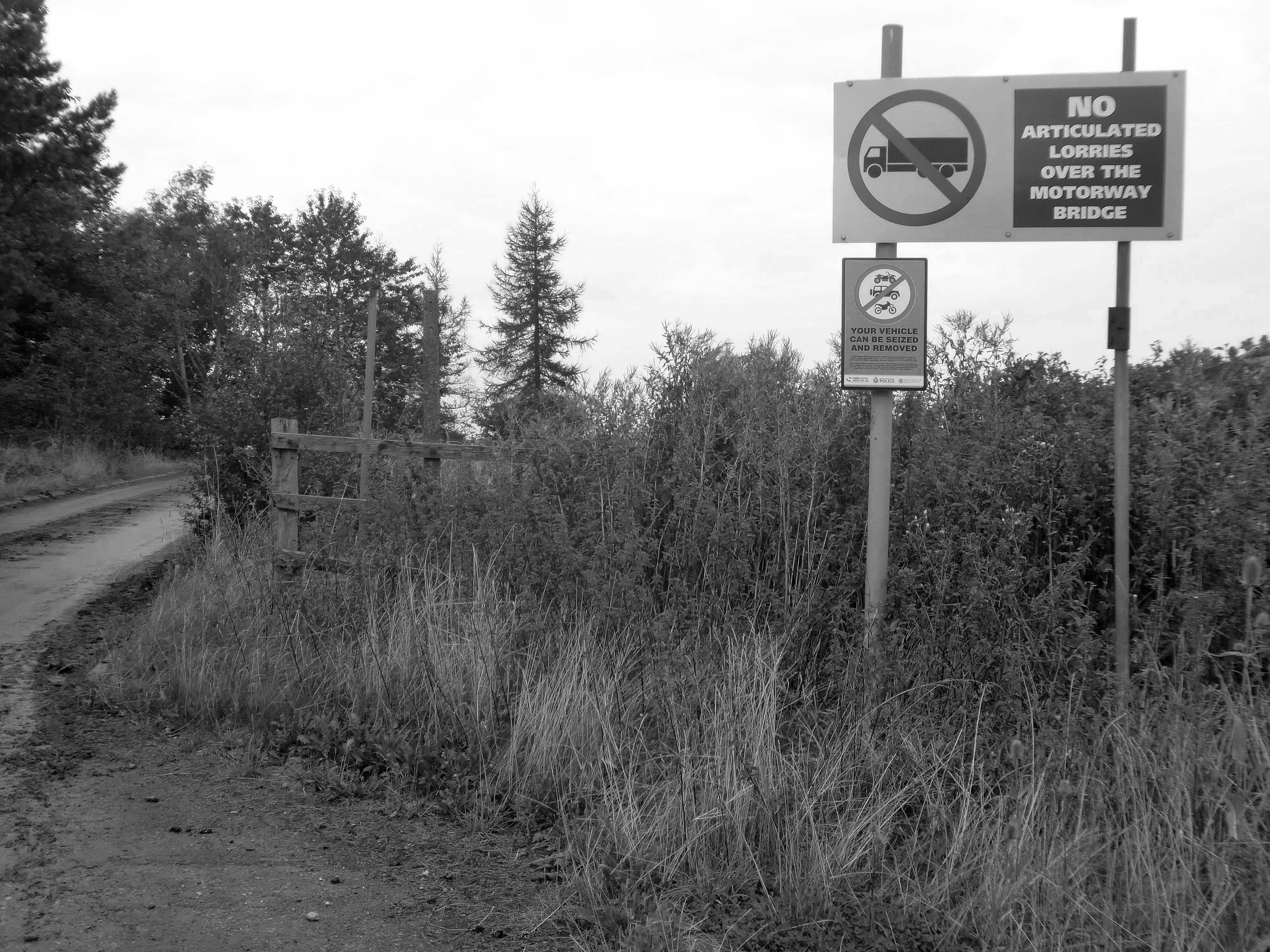
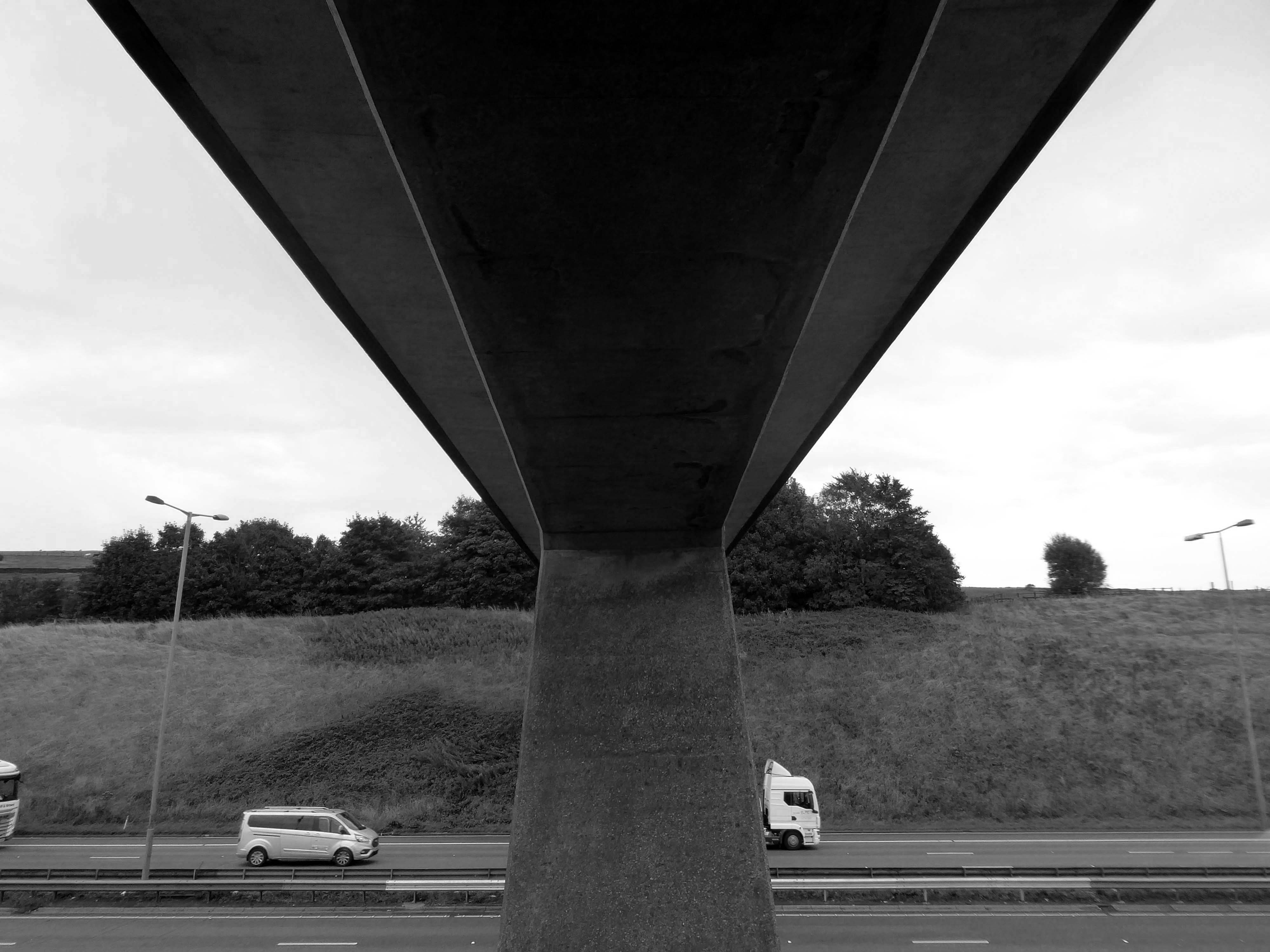
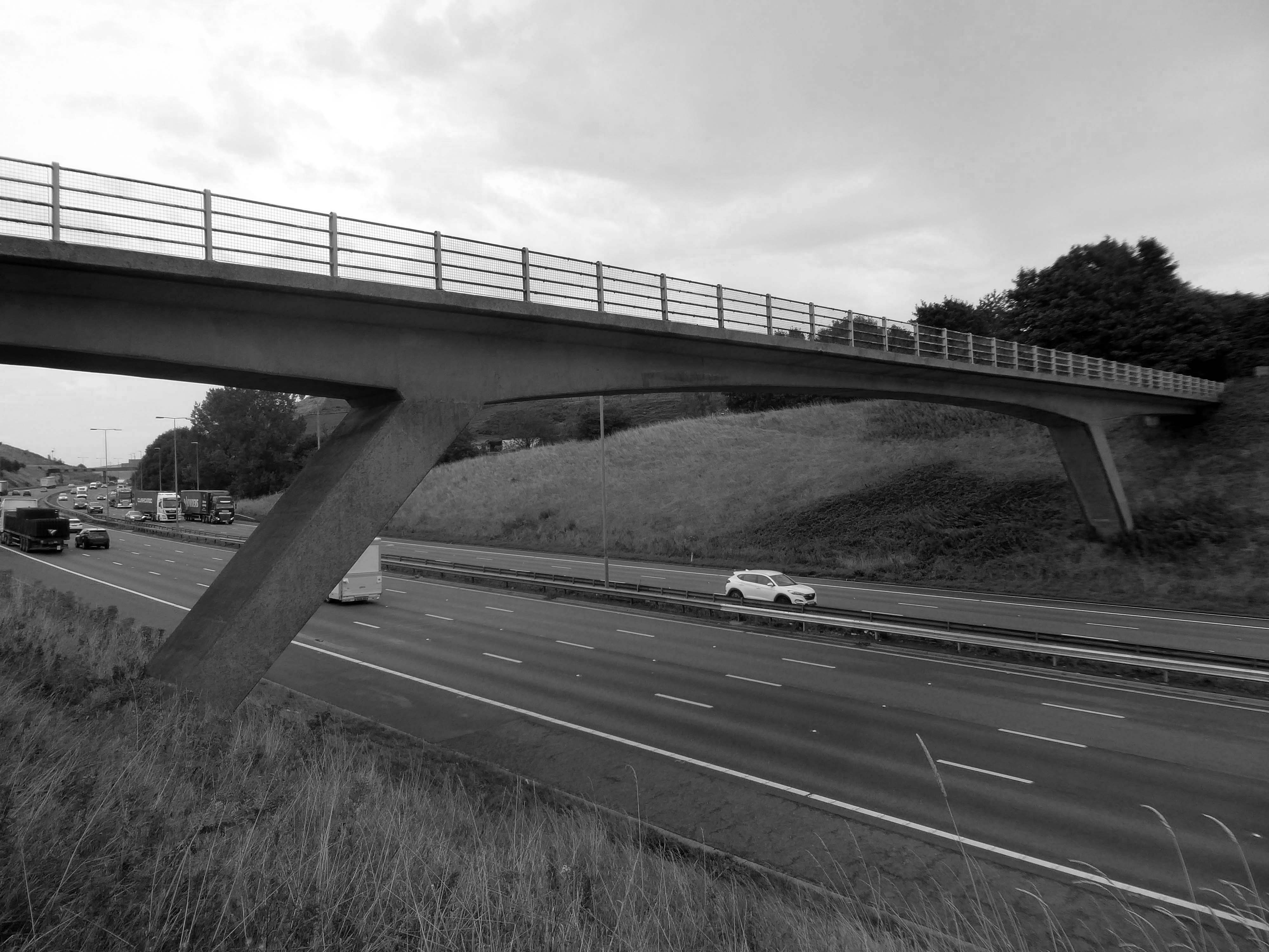
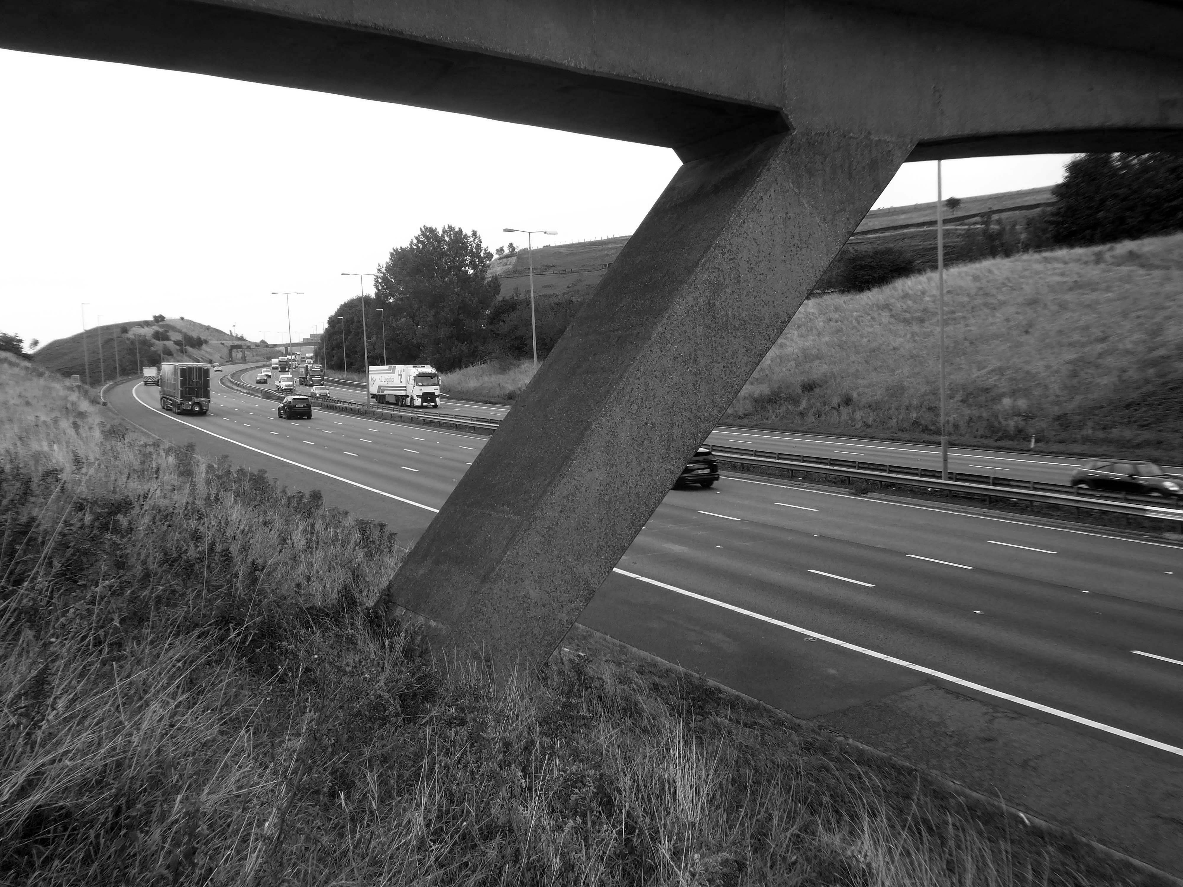
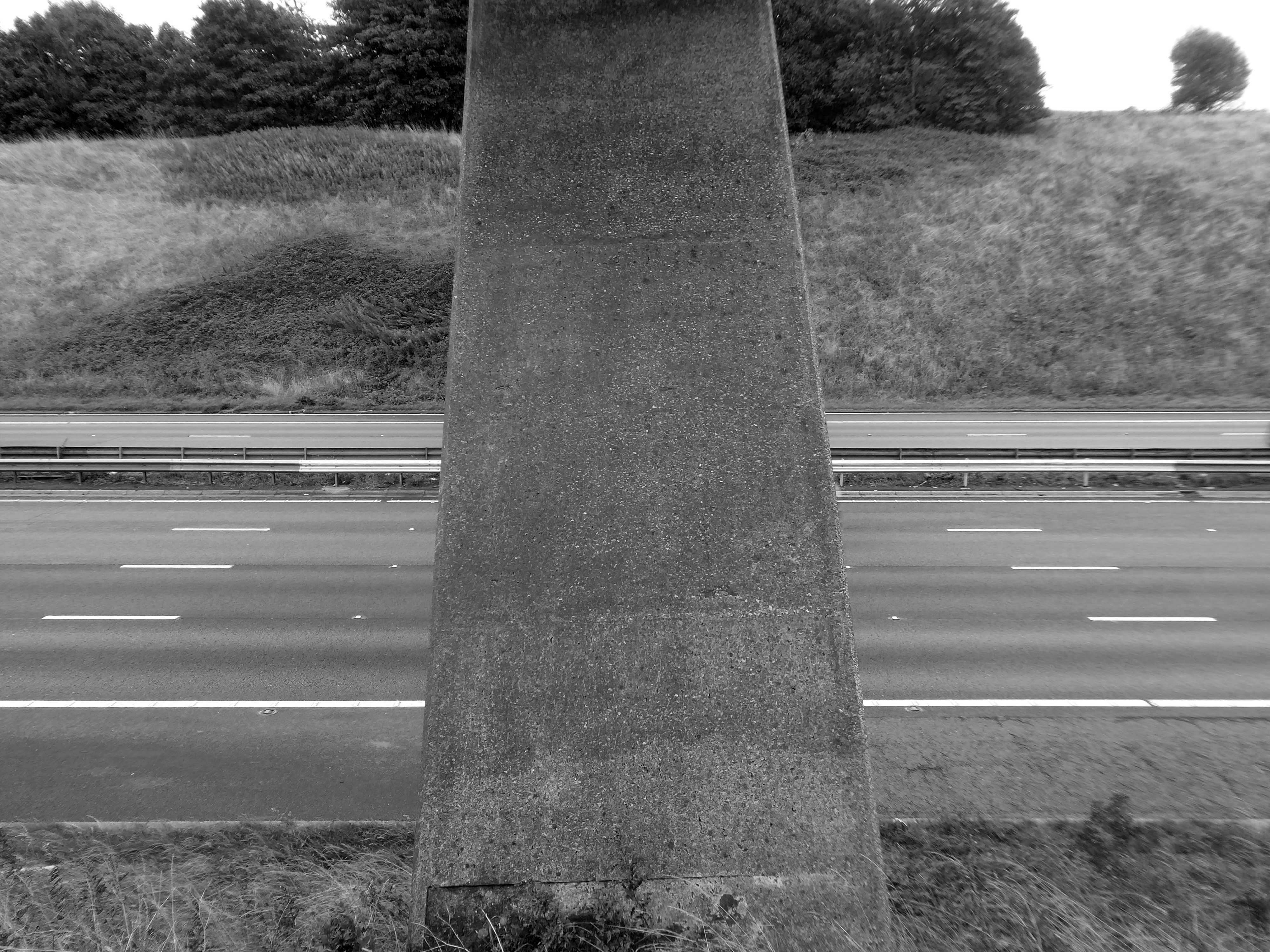
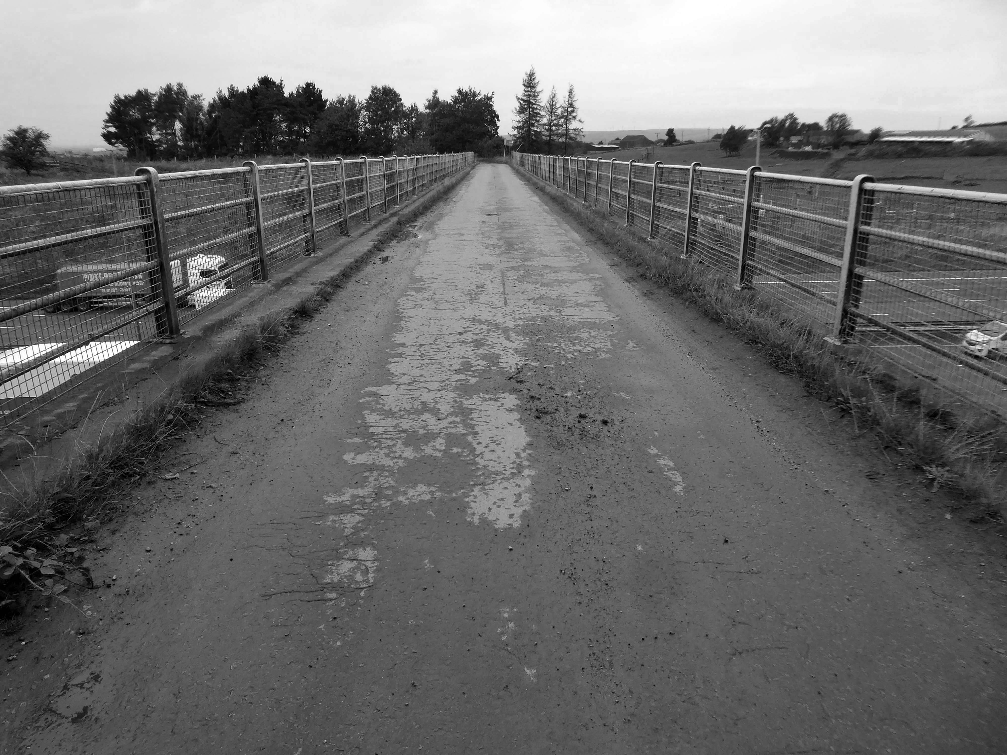
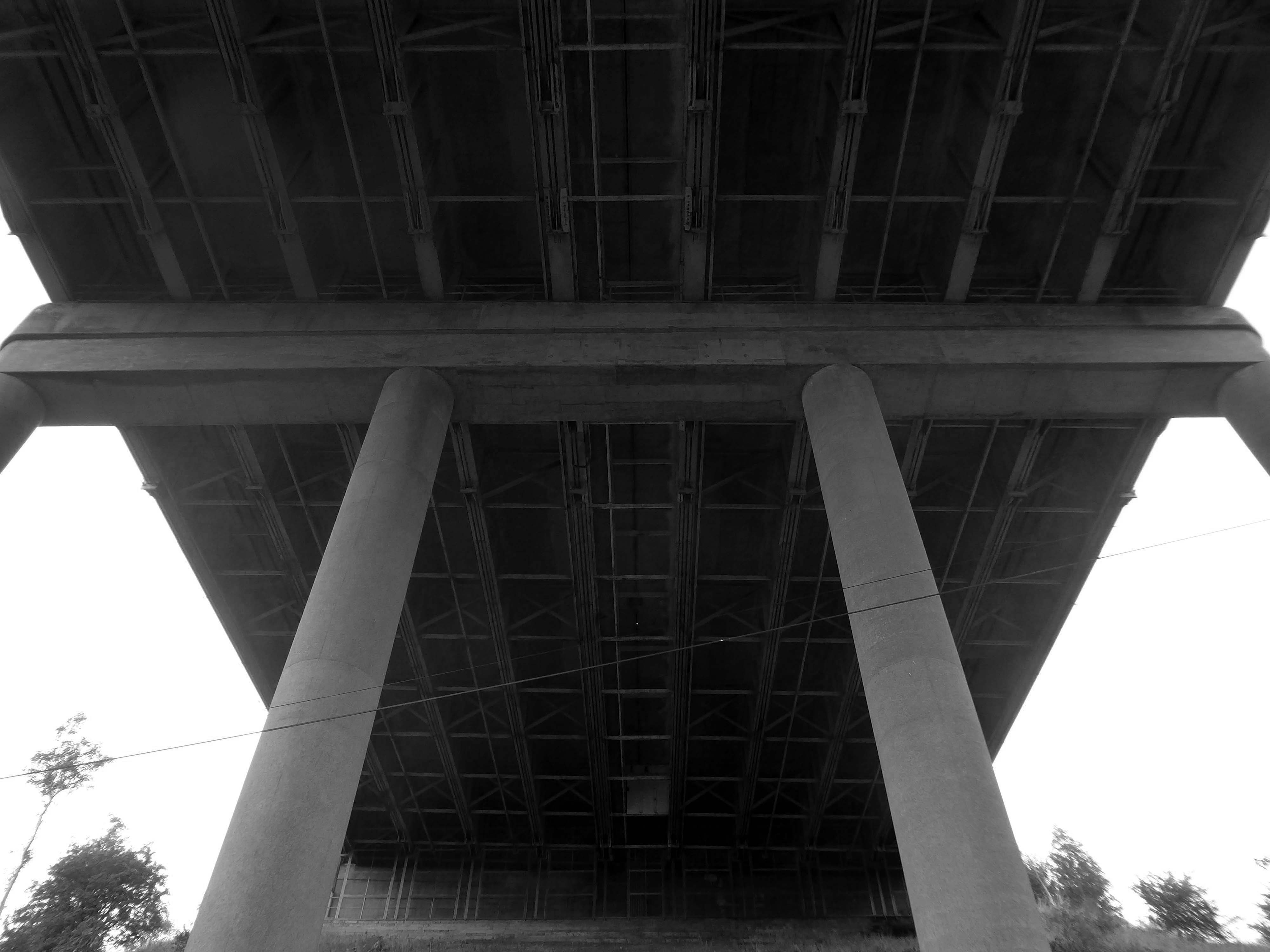
The M62 is a 107-mile-long west–east trans-Pennine motorway, connecting Liverpool and Hull via Manchester, Bradford, Leeds and Wakefield; 7 miles of the route is shared with the M60 orbital motorway around Manchester.
The motorway, which was first proposed in the 1930s, and conceived as two separate routes, was opened in stages between 1971 and 1976, with construction beginning at Pole Moor near Huddersfield and finishing at that time in Tarbock on the outskirts of Liverpool. The motorway absorbed the northern end of the Stretford-Eccles bypass, which was built between 1957 and 1960. Adjusted for inflation to 2007, its construction cost approximately £765 million. The motorway has an average daily traffic flow of 144,000 vehicles in West Yorkshire, and has several sections prone to gridlock, in particular, between Leeds and Huddersfield and the M60 section around Eccles.
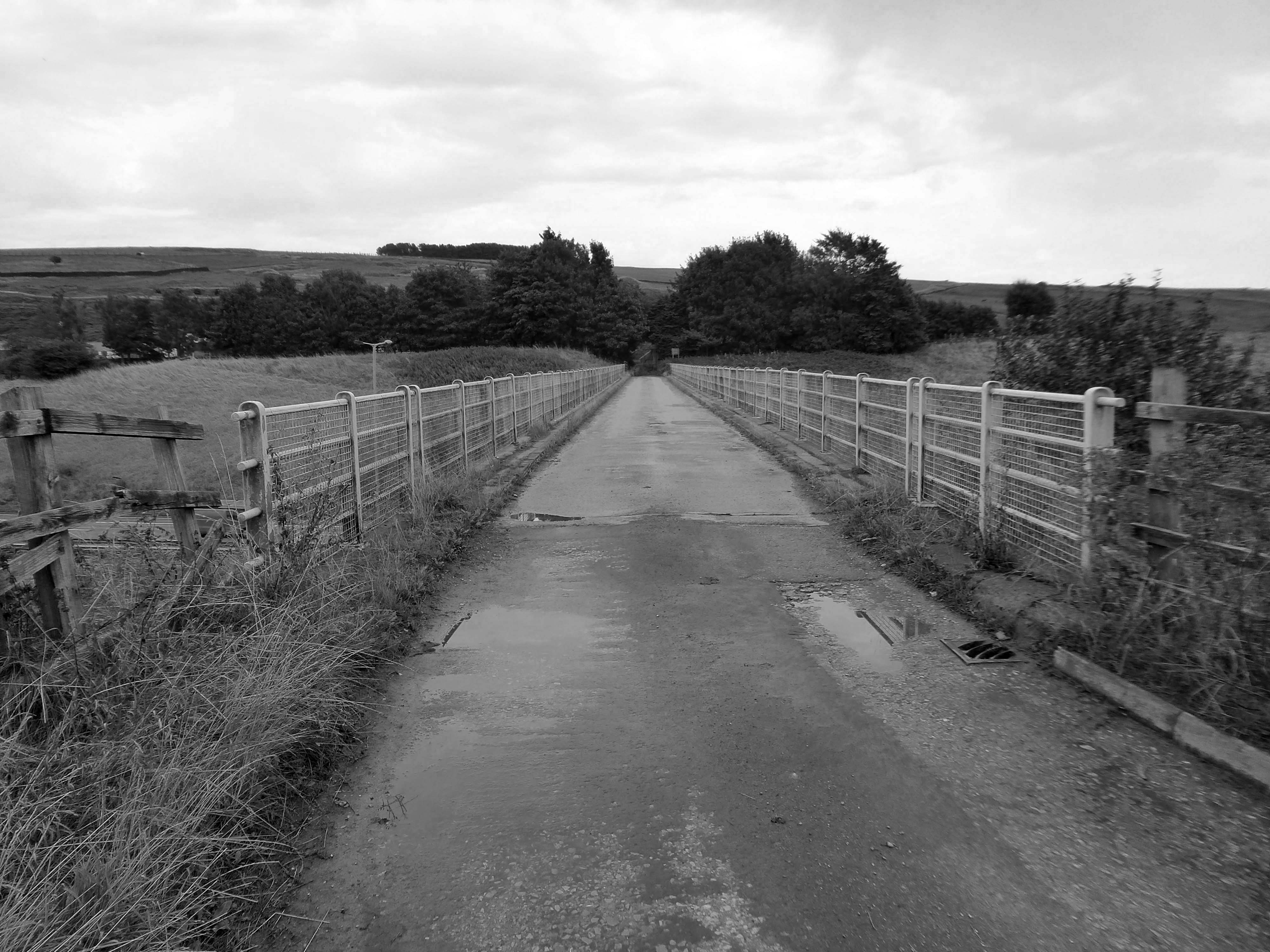
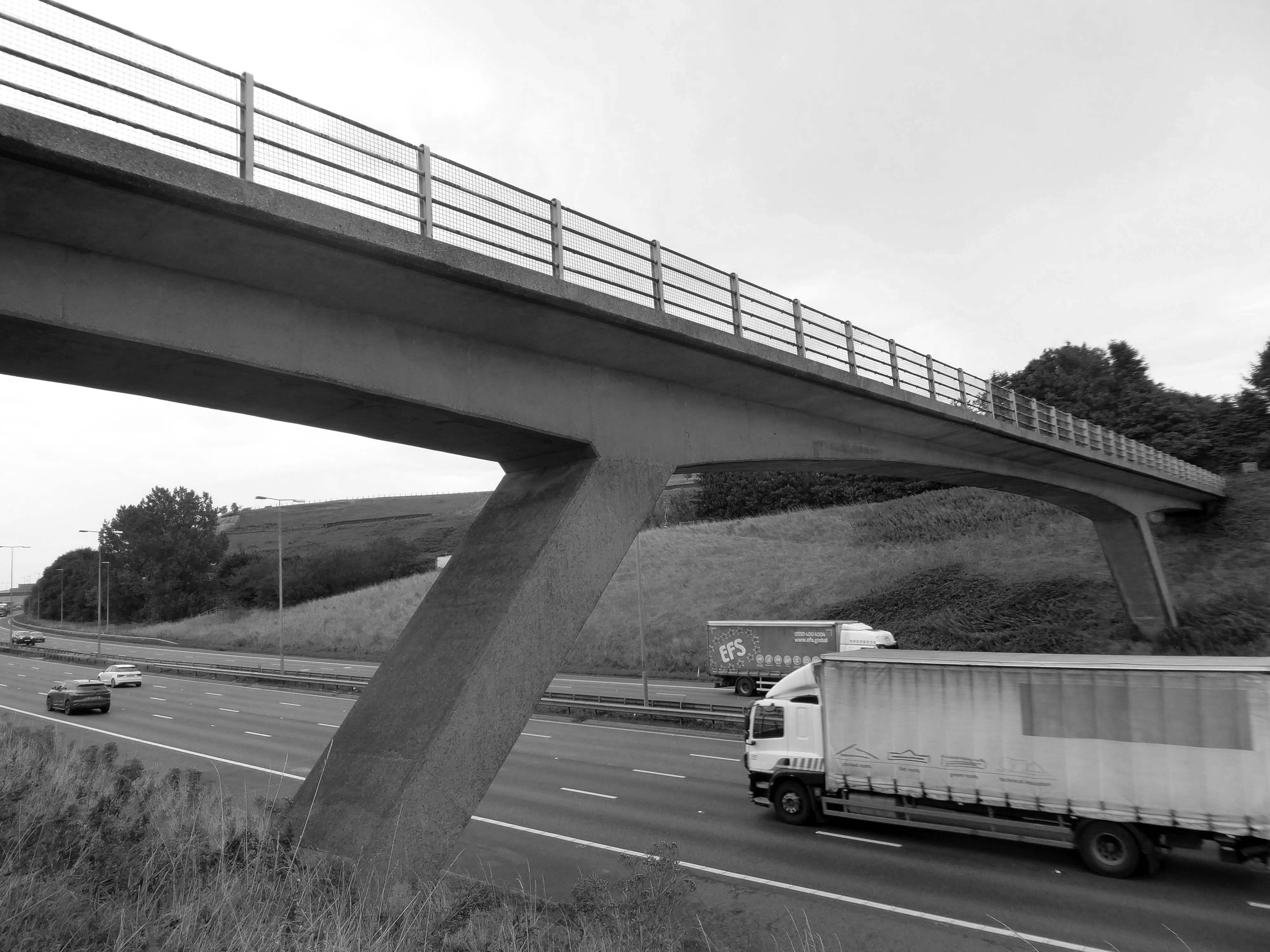
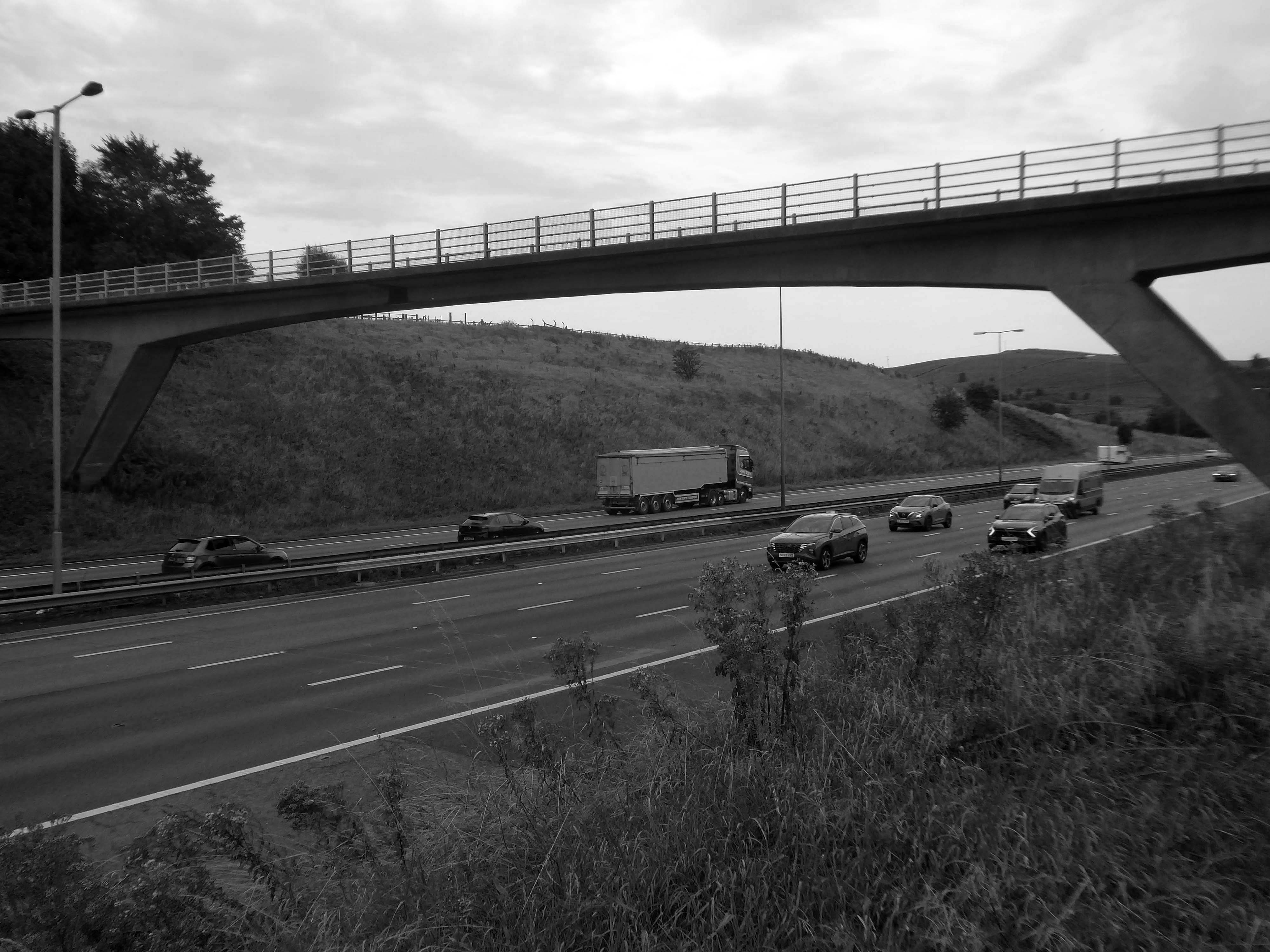
We were walking along Tunshill Lane on our way to the Piethorn Valley, our crossing of the M62 facilitated by this elegant road bridge.
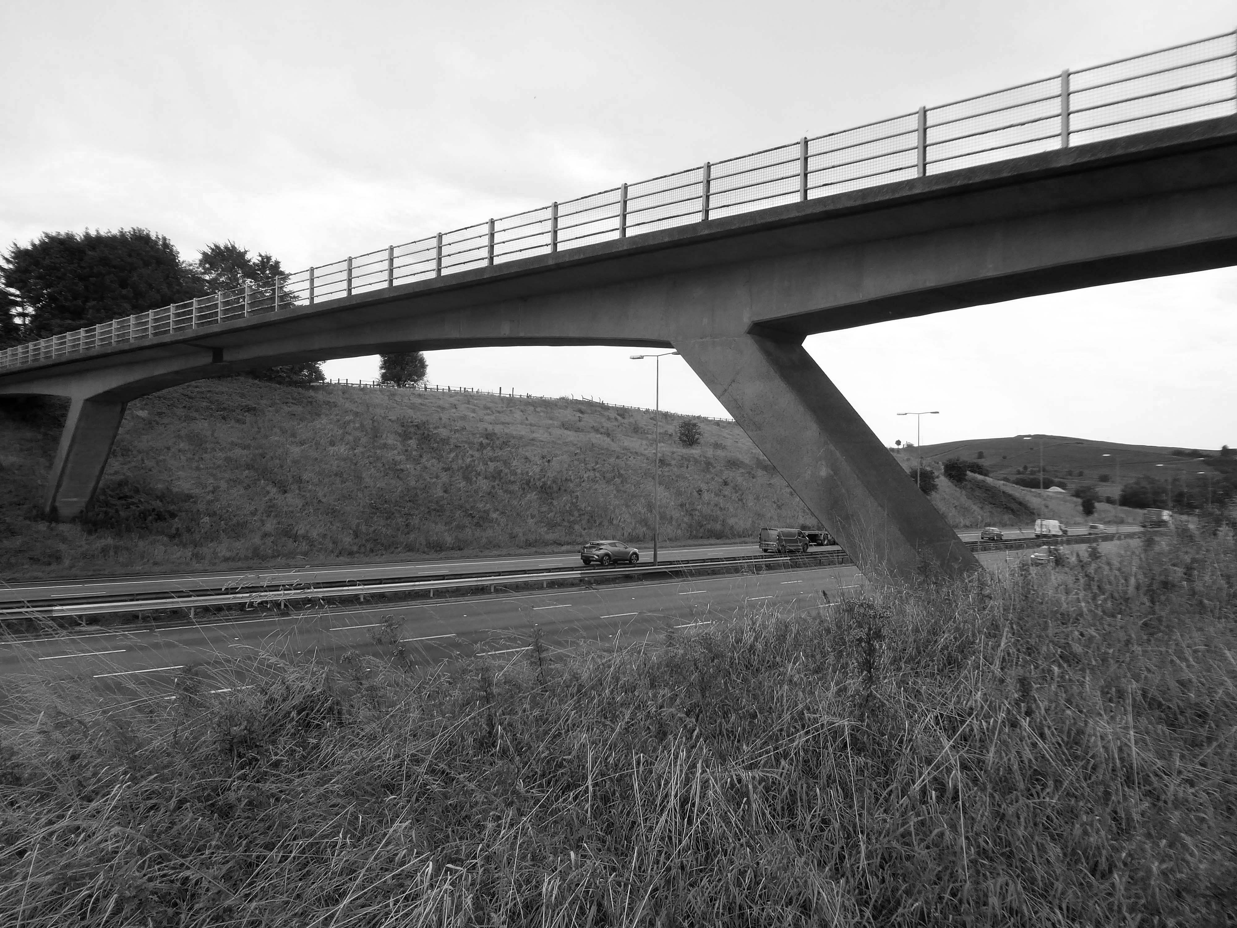
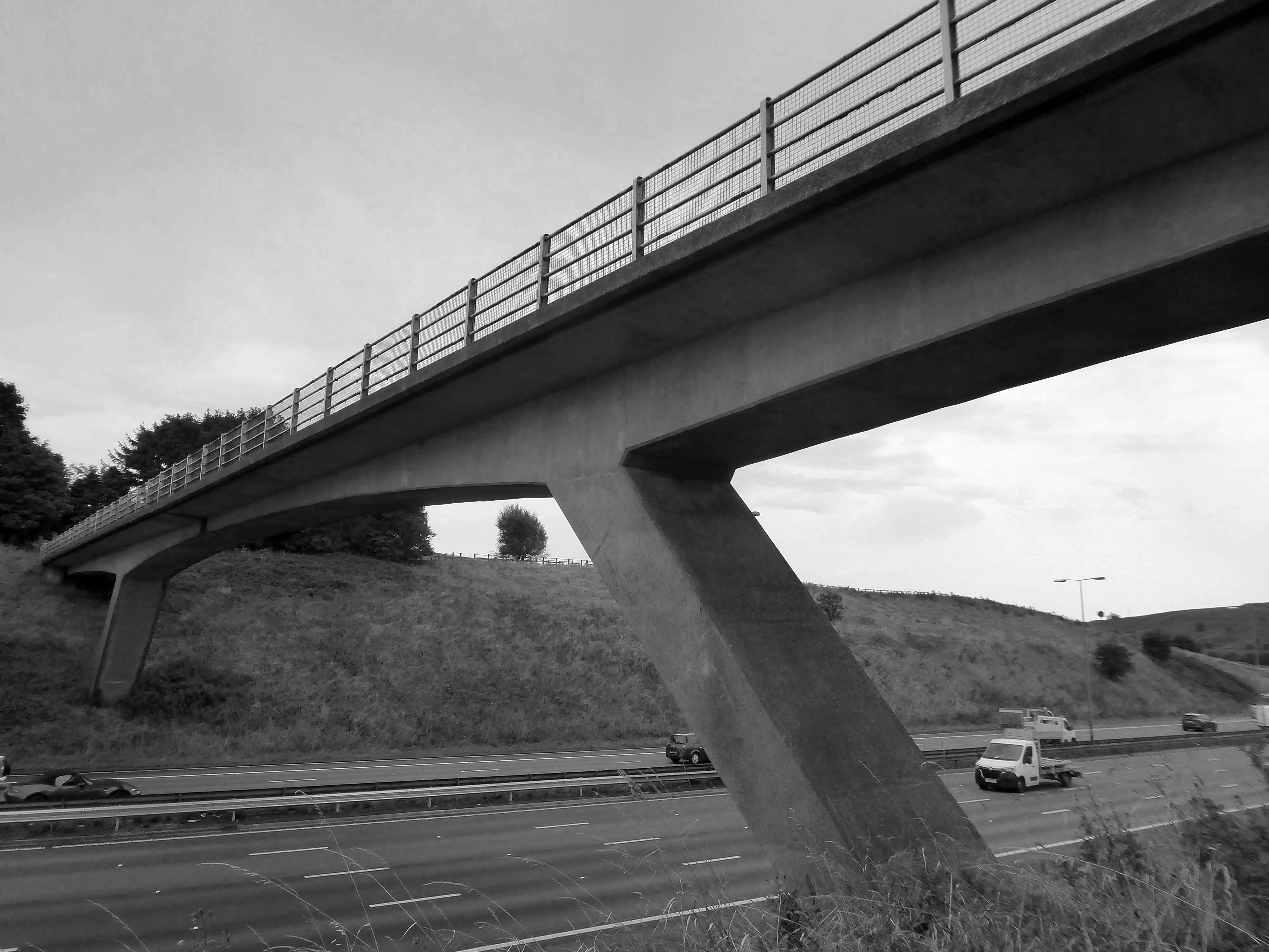
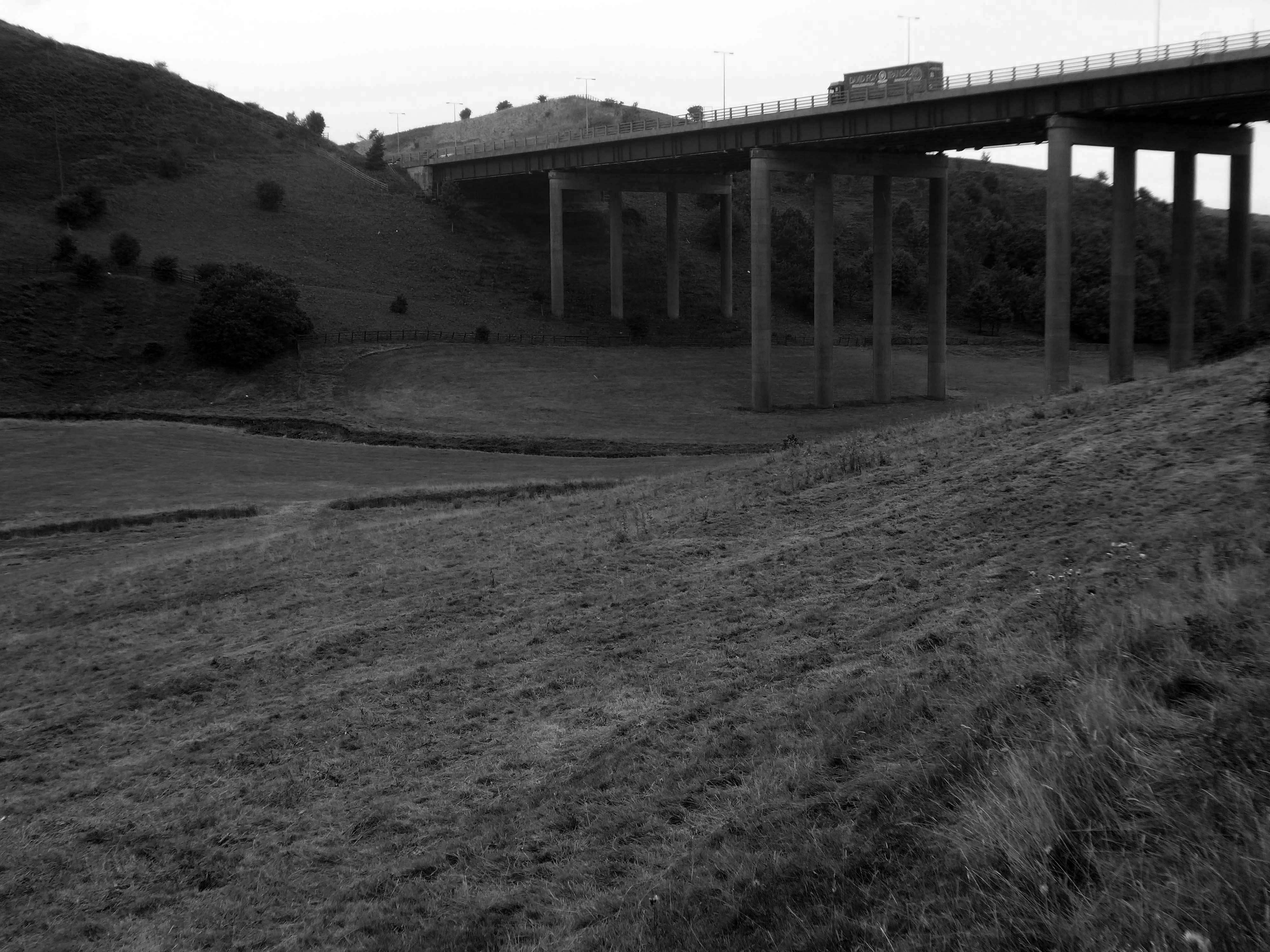
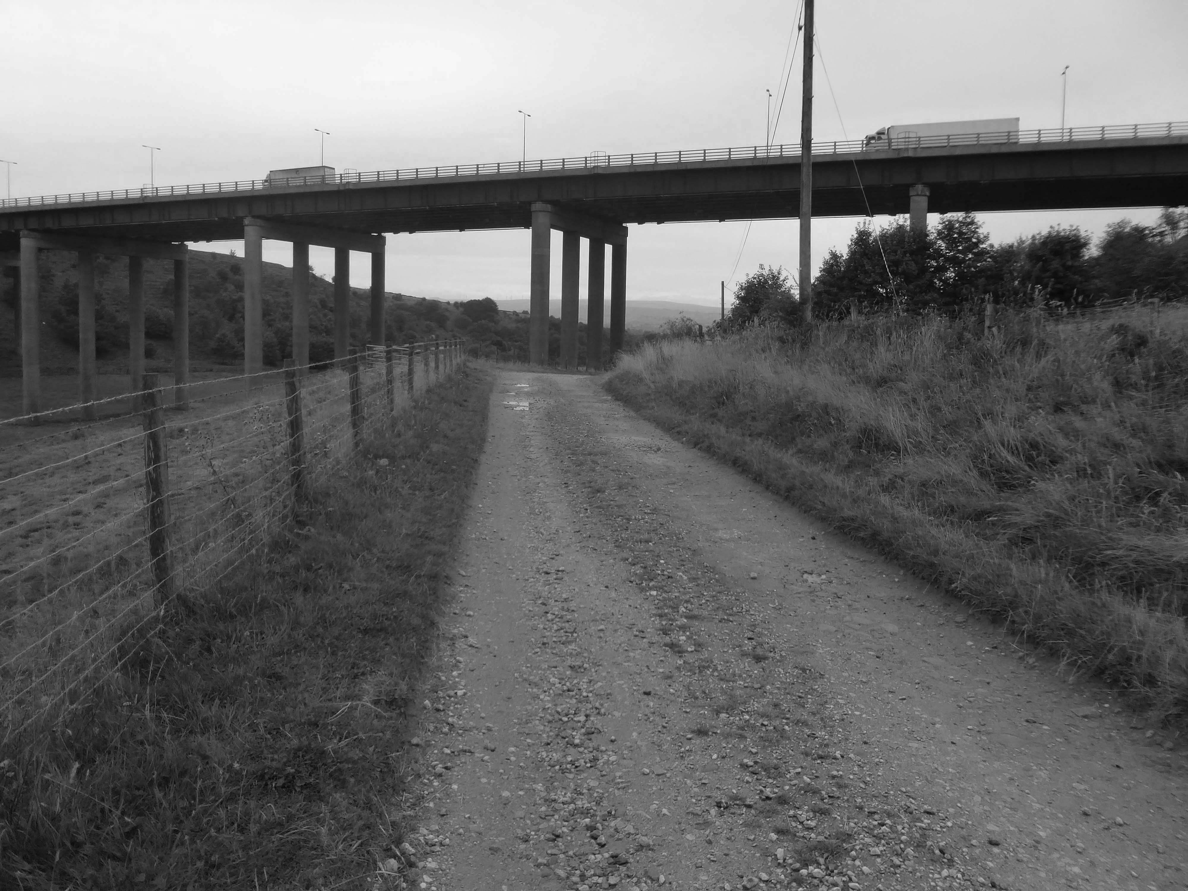
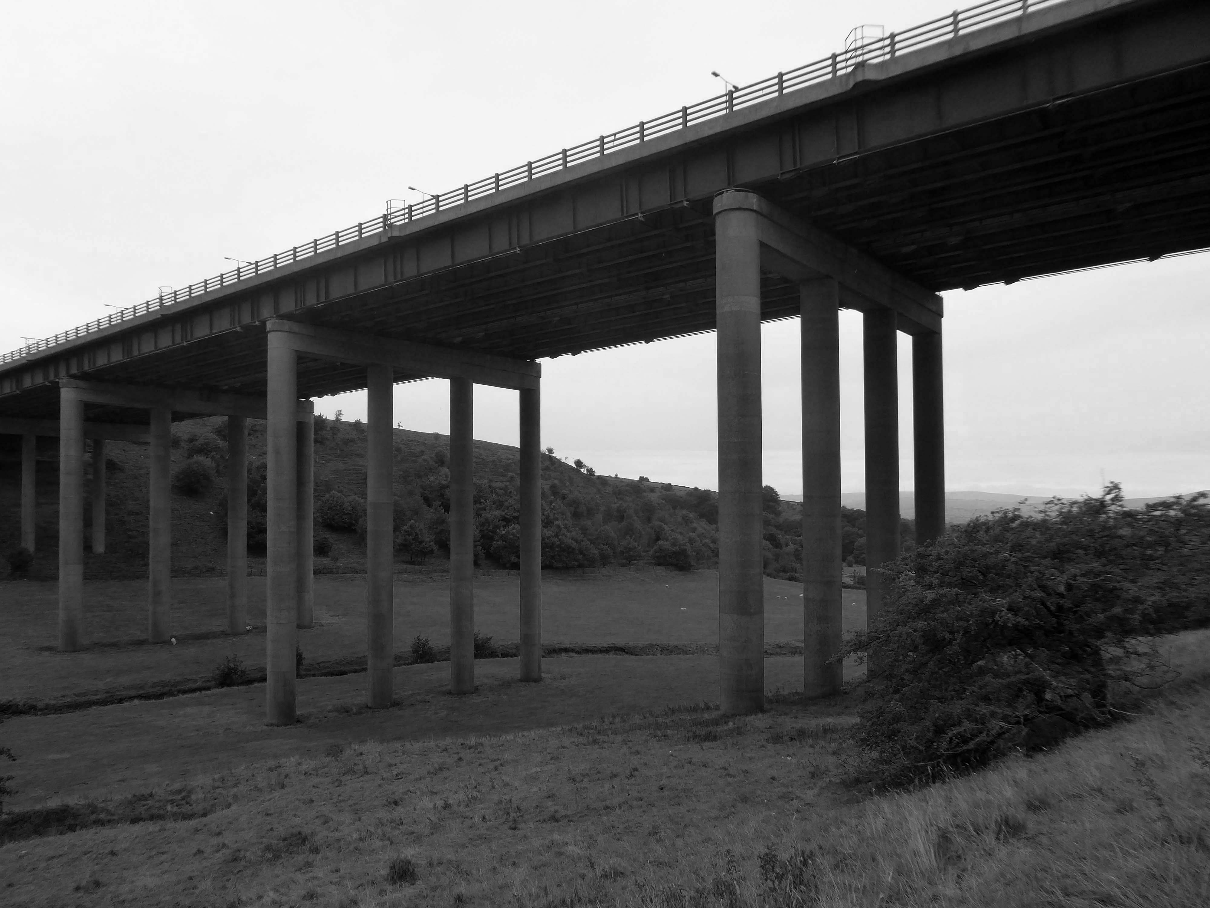
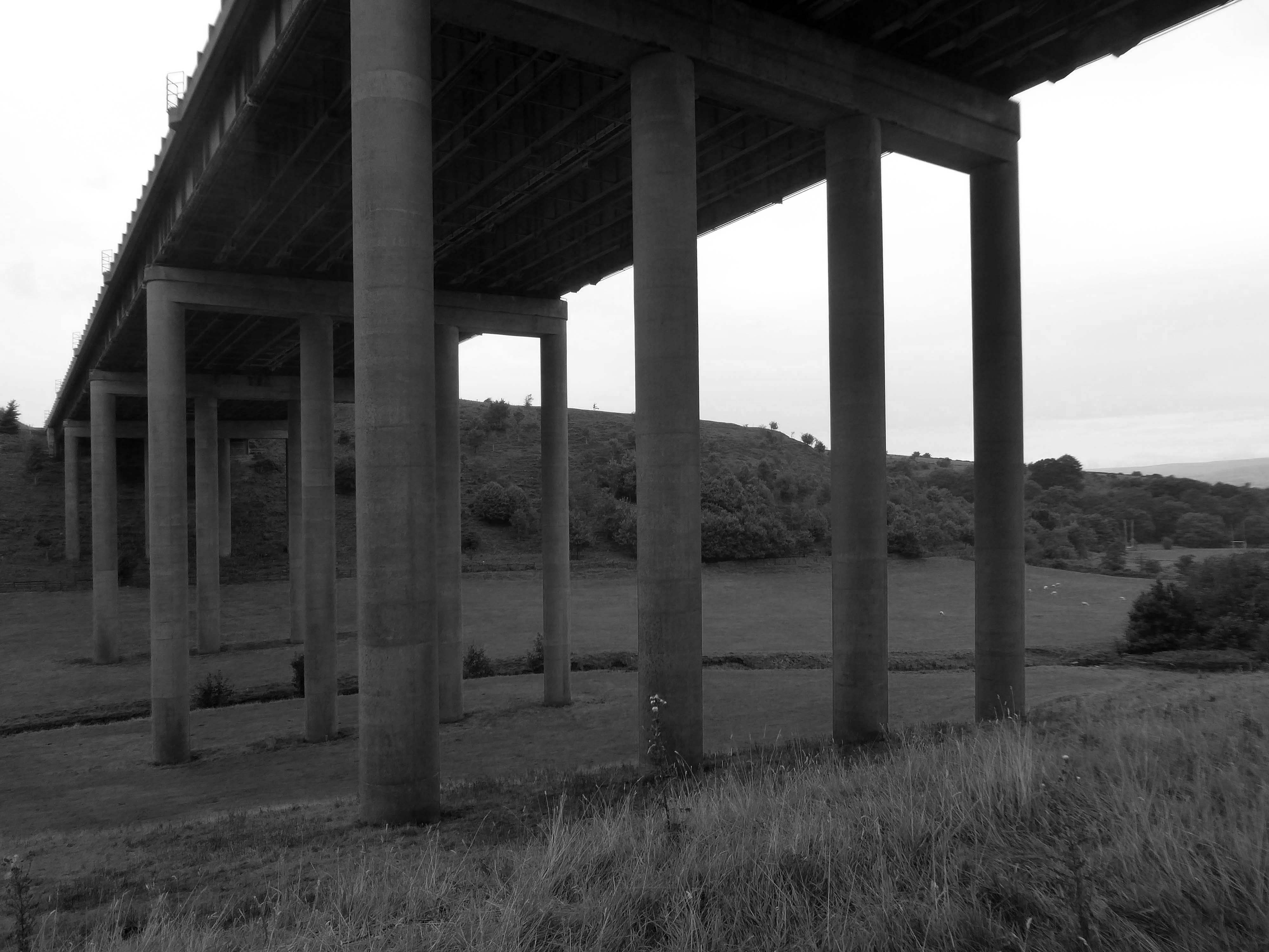
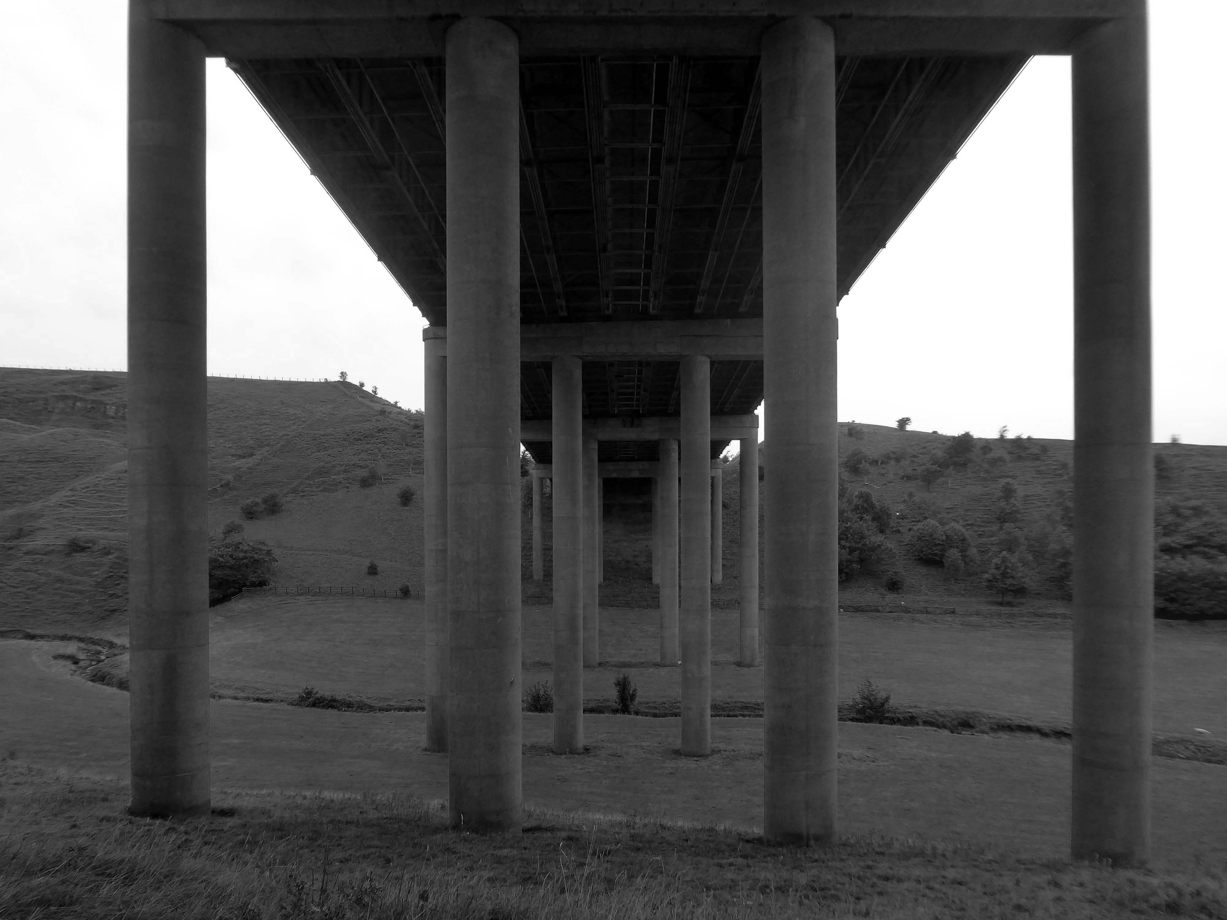
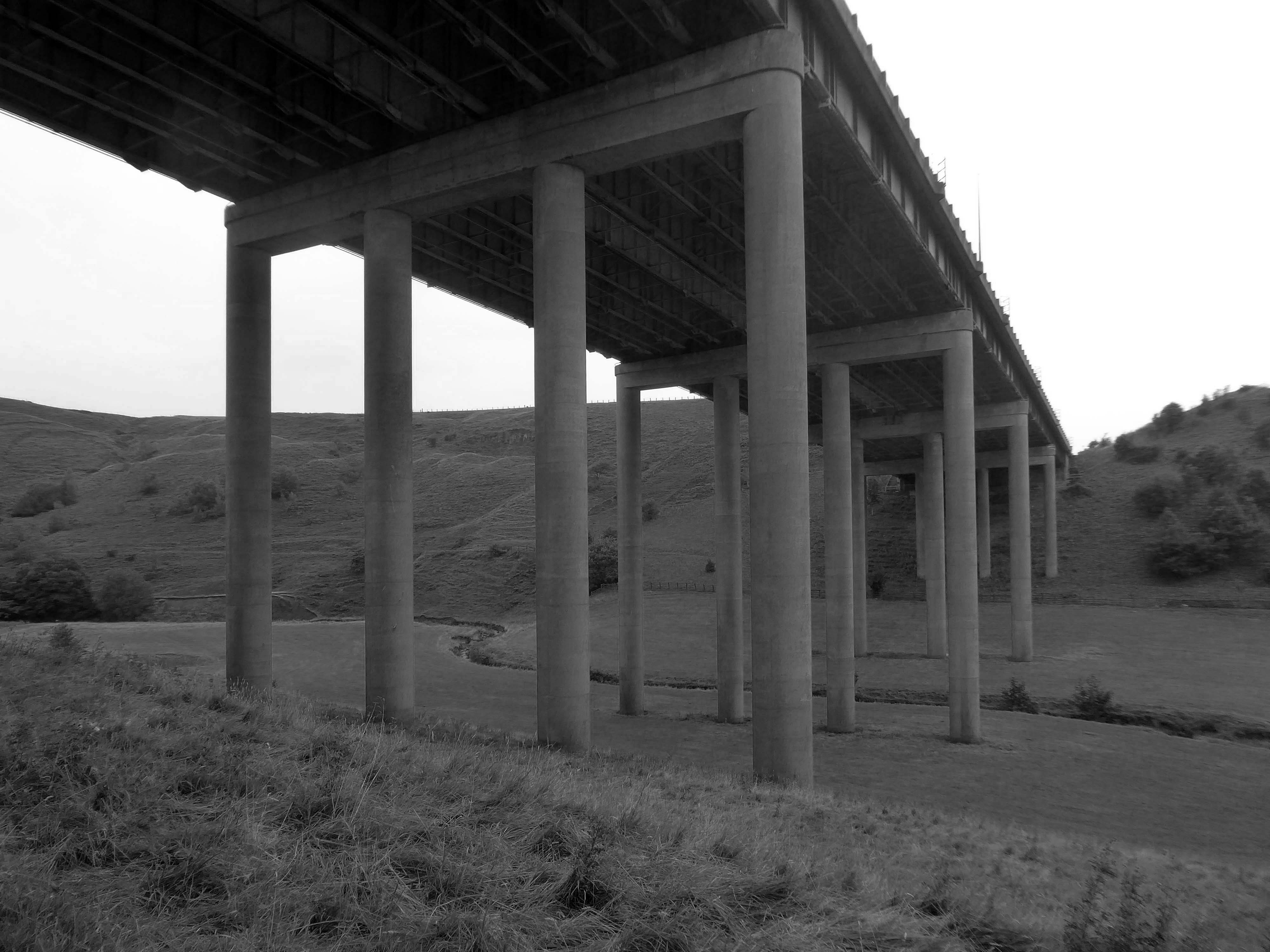
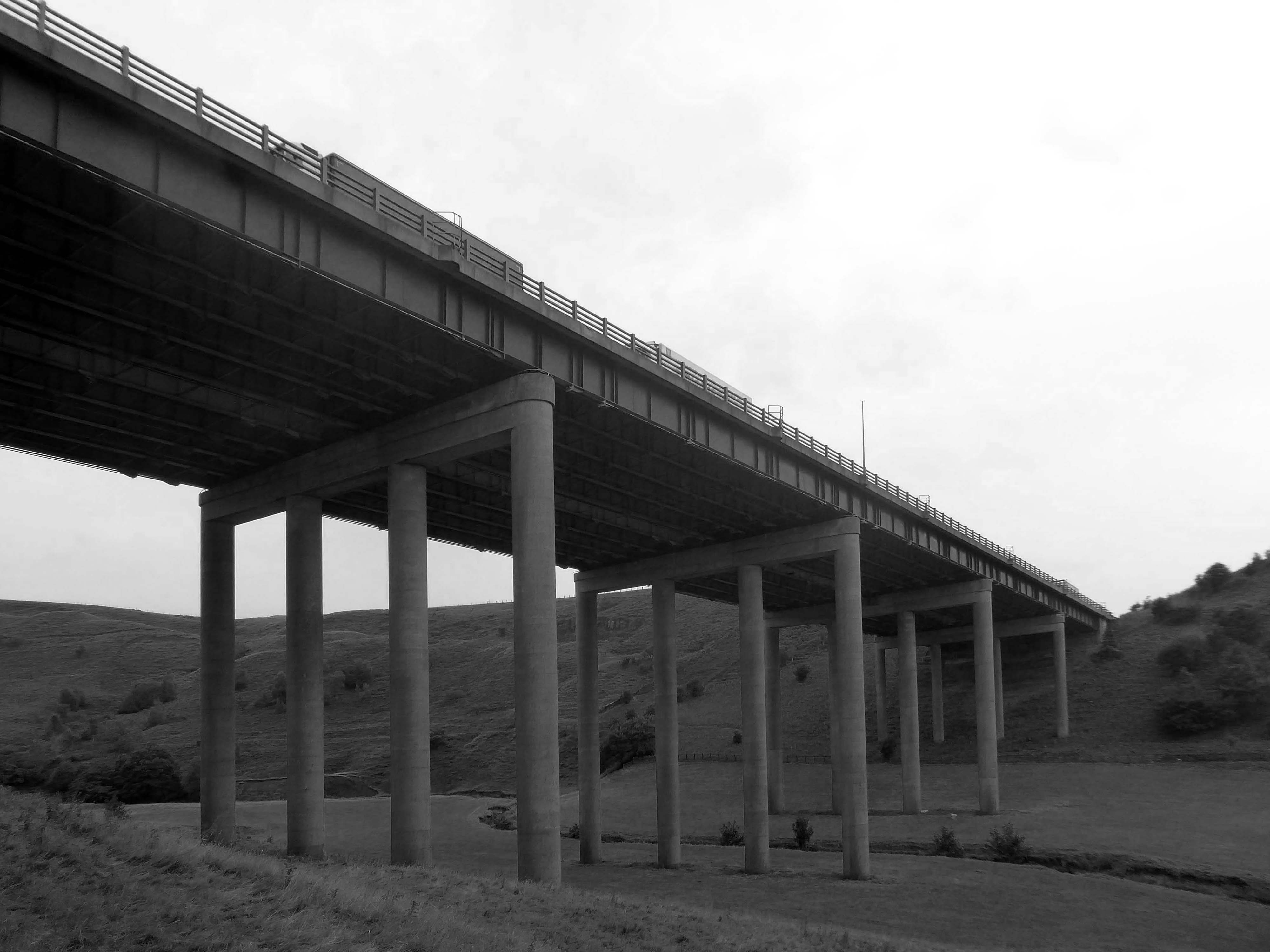
A notable structure between junctions 21 and 22 on the uphill section towards Windy Hill is the Rakewood Viaduct which carries the road over the Longden End Brook.
The viaduct is 280 yards long and 140 ft above the valley floor. It was built in 1966 by Reed & Mallik and opened to motorway traffic in October 1971. It has a sister bridge, the Gathurst Viaduct in Wigan, which carries the M6 motorway over the Leeds & Liverpool Canal, the Manchester-Southport line and the River Douglas and was constructed before the Rakewood Viaduct.
The steelwork deck was subcontracted to Robert Watson Steelwork of Bolton.
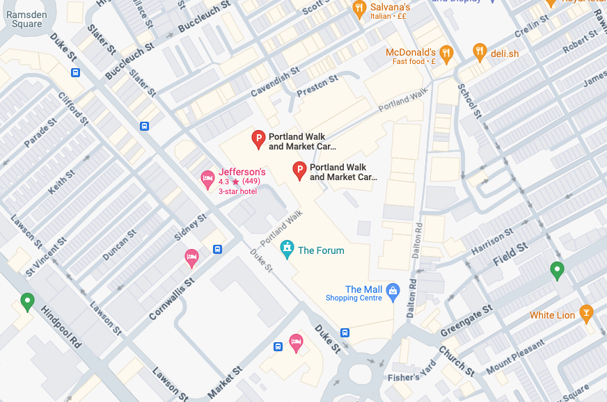
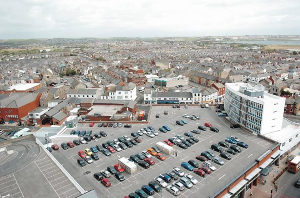
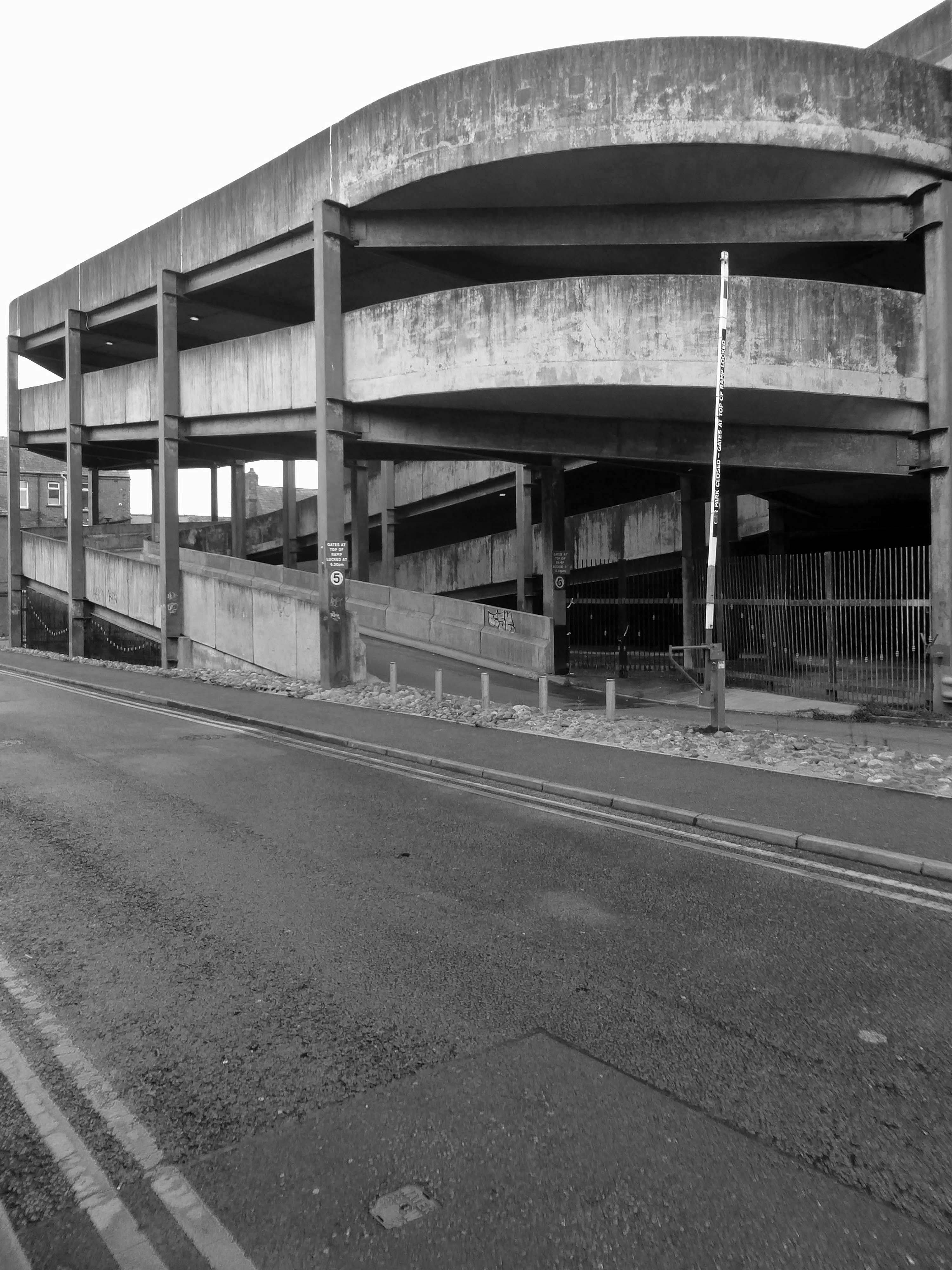
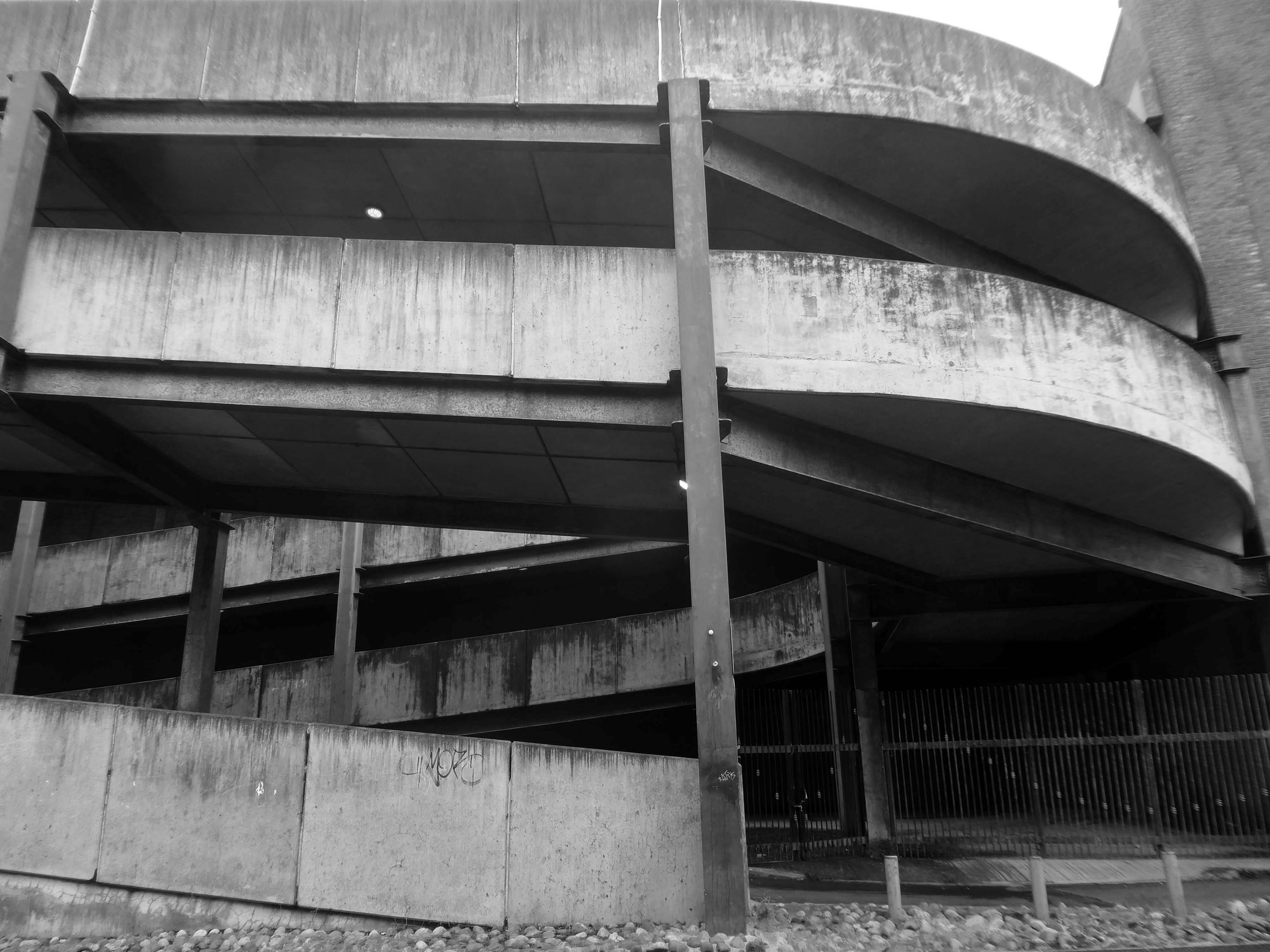
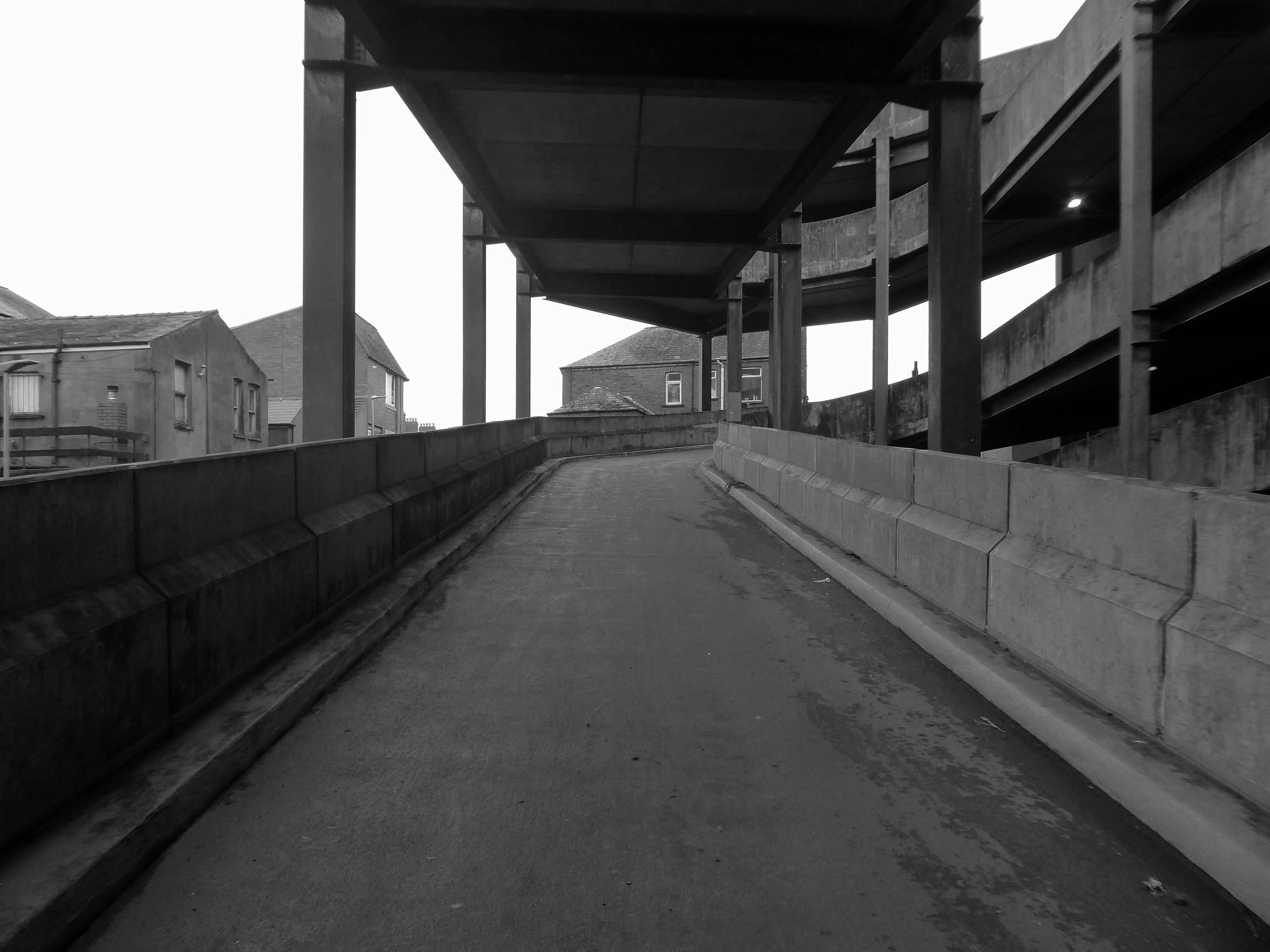
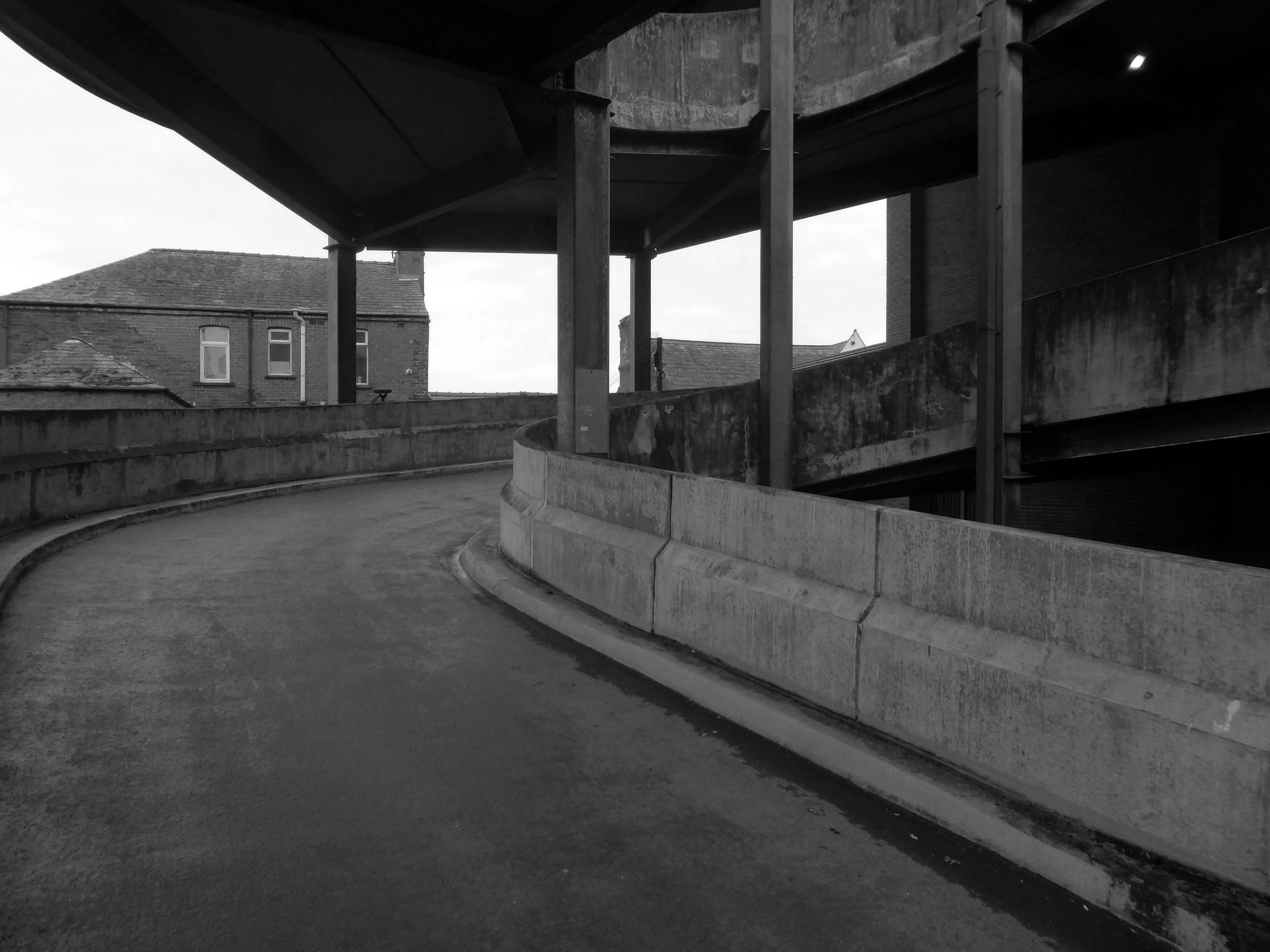
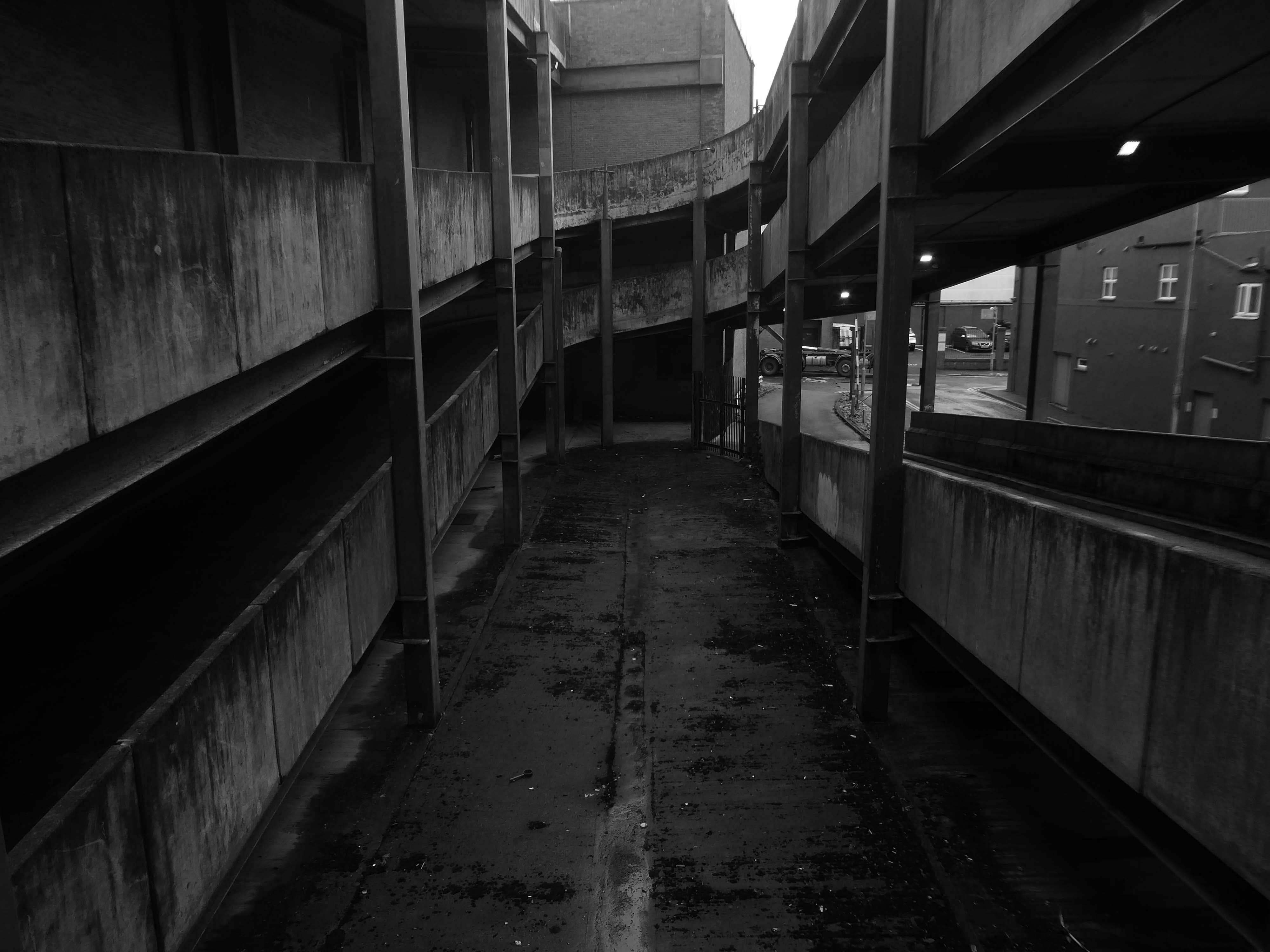
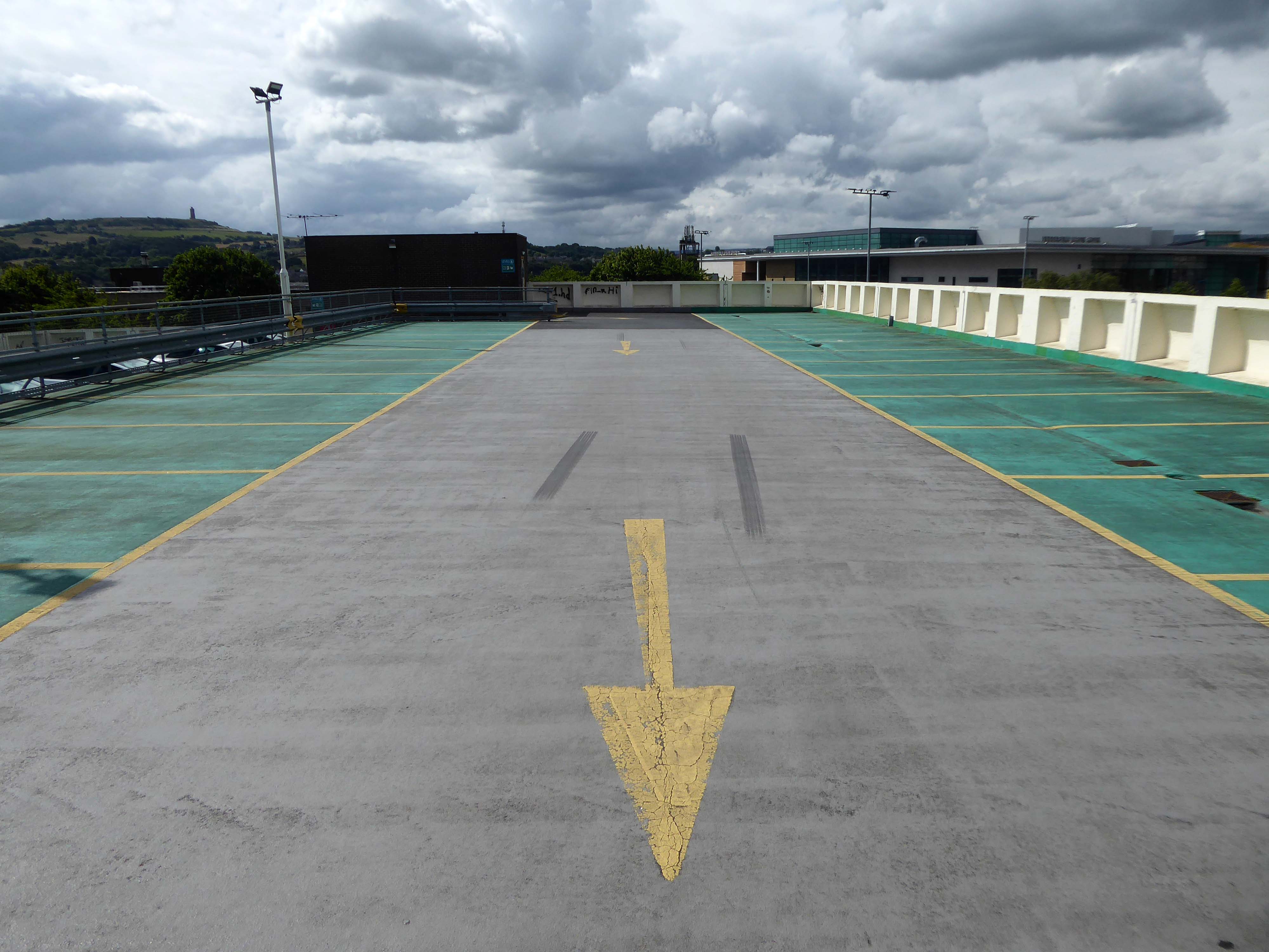
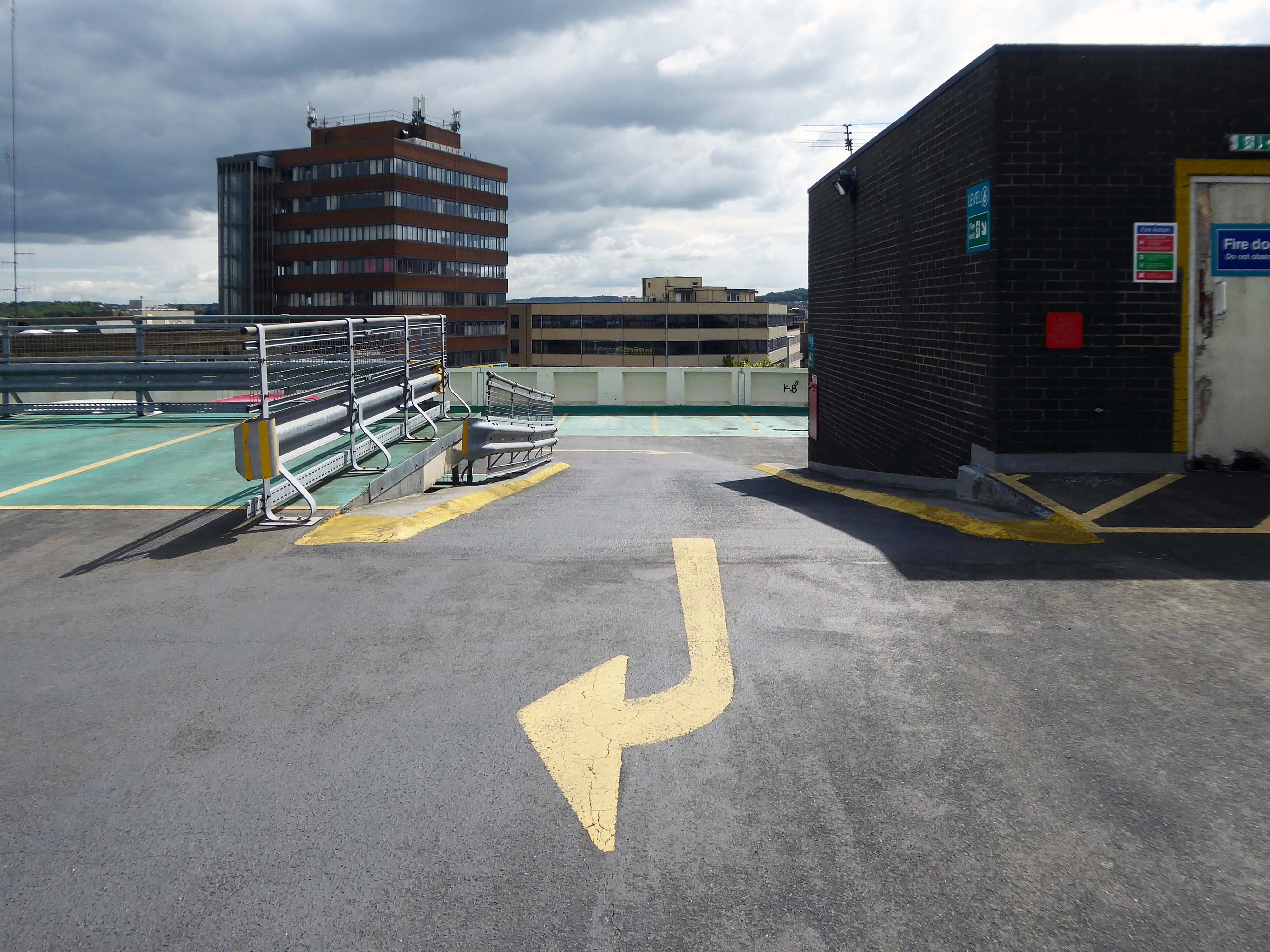
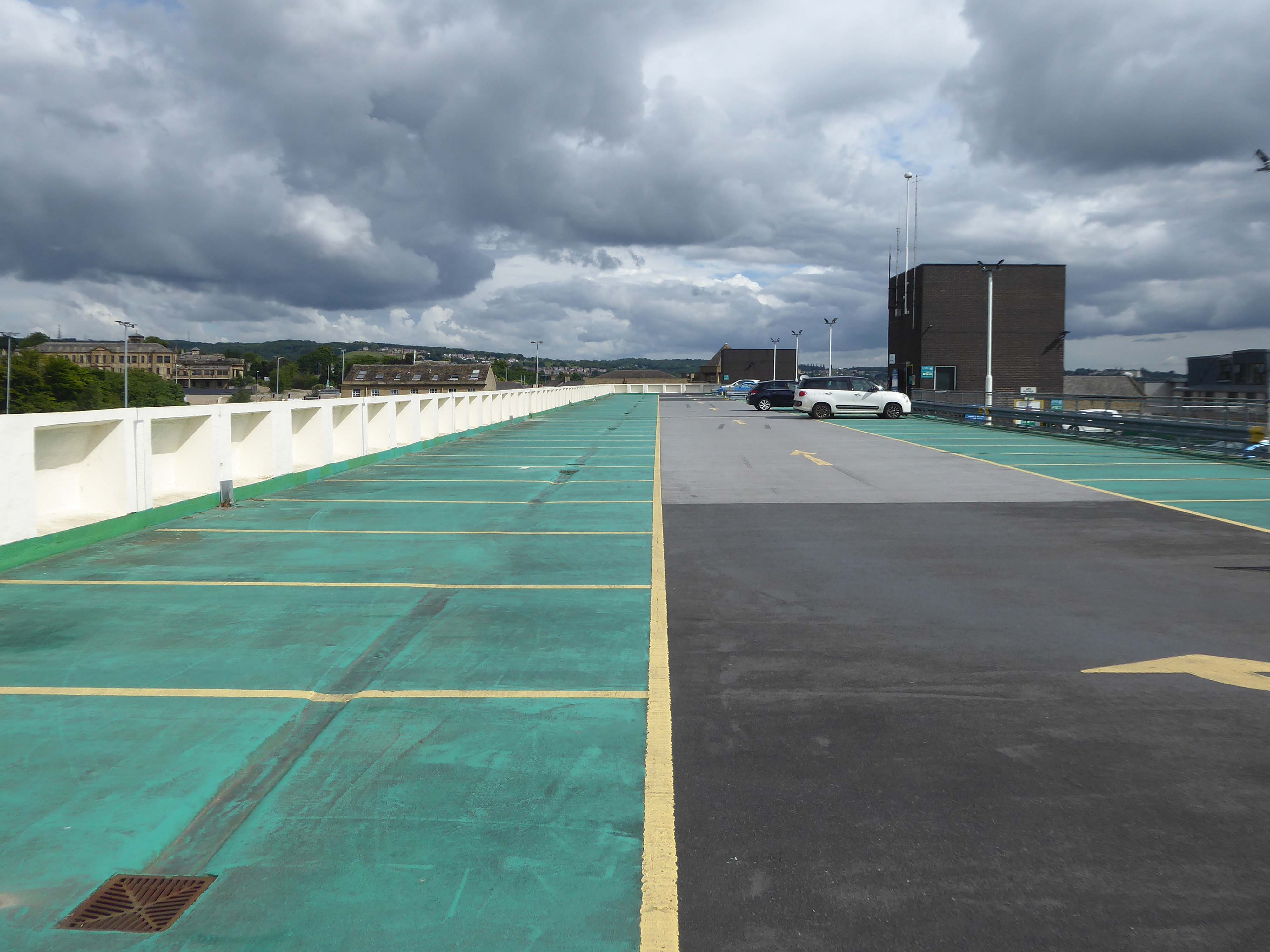
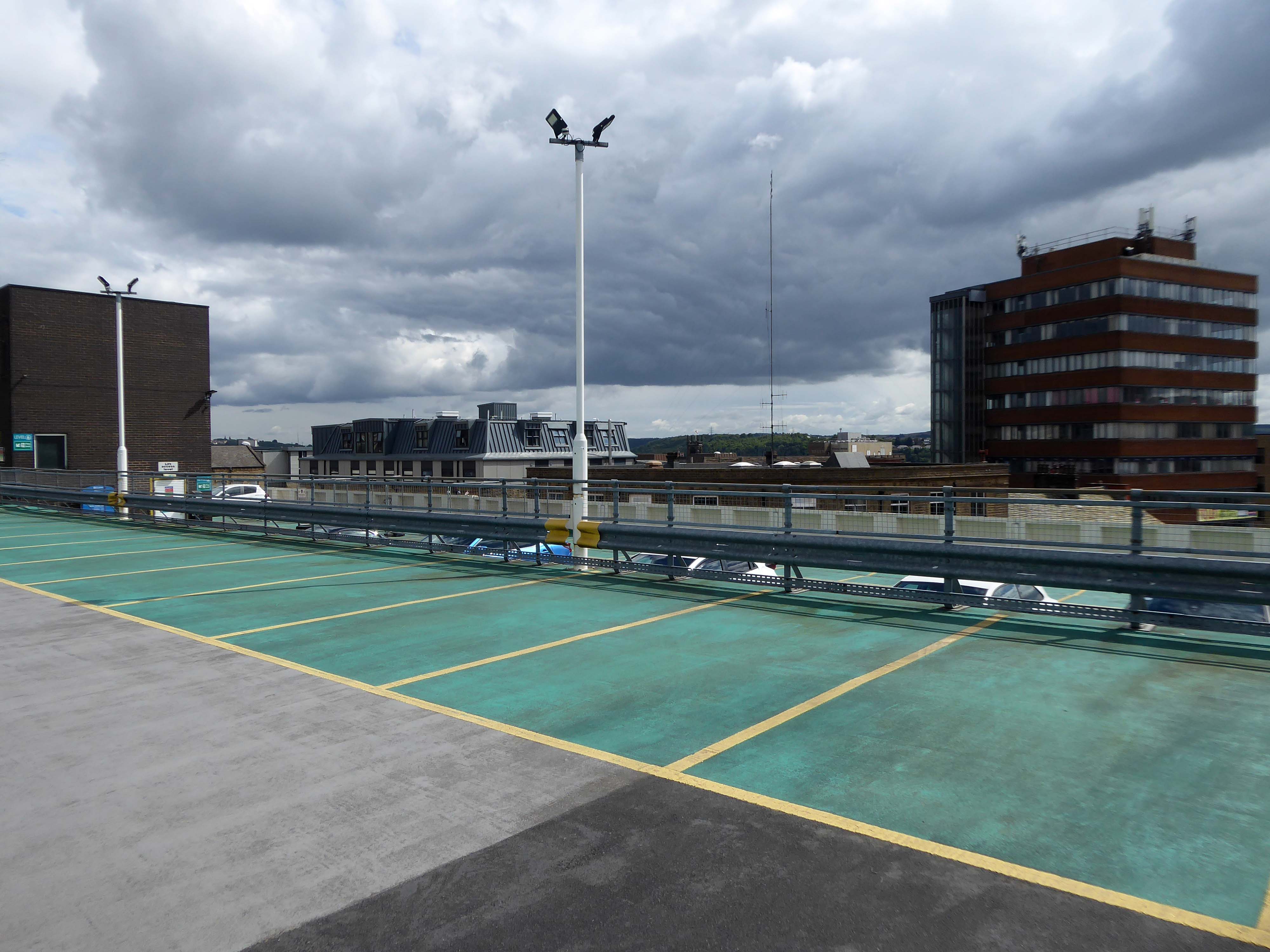
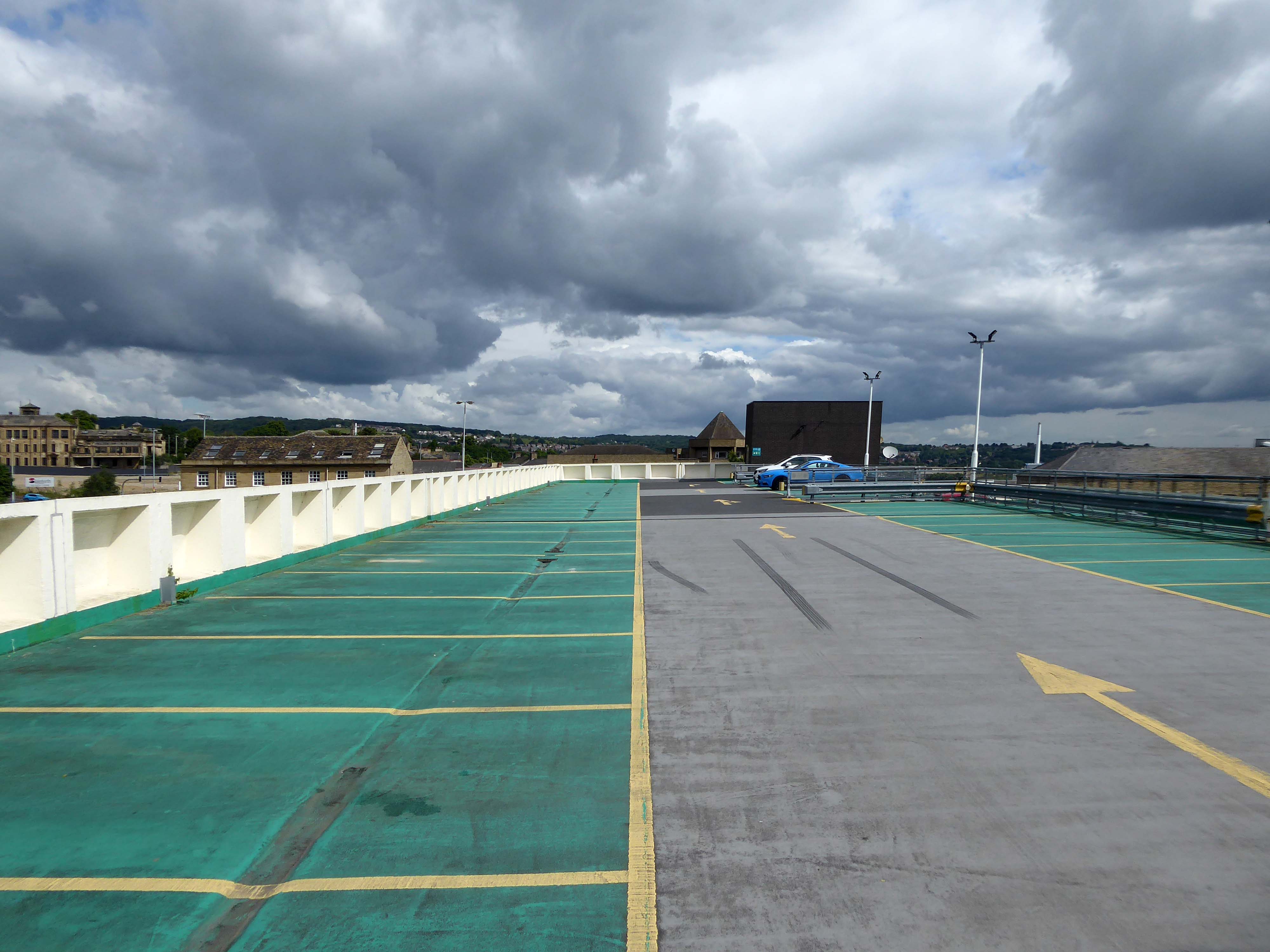
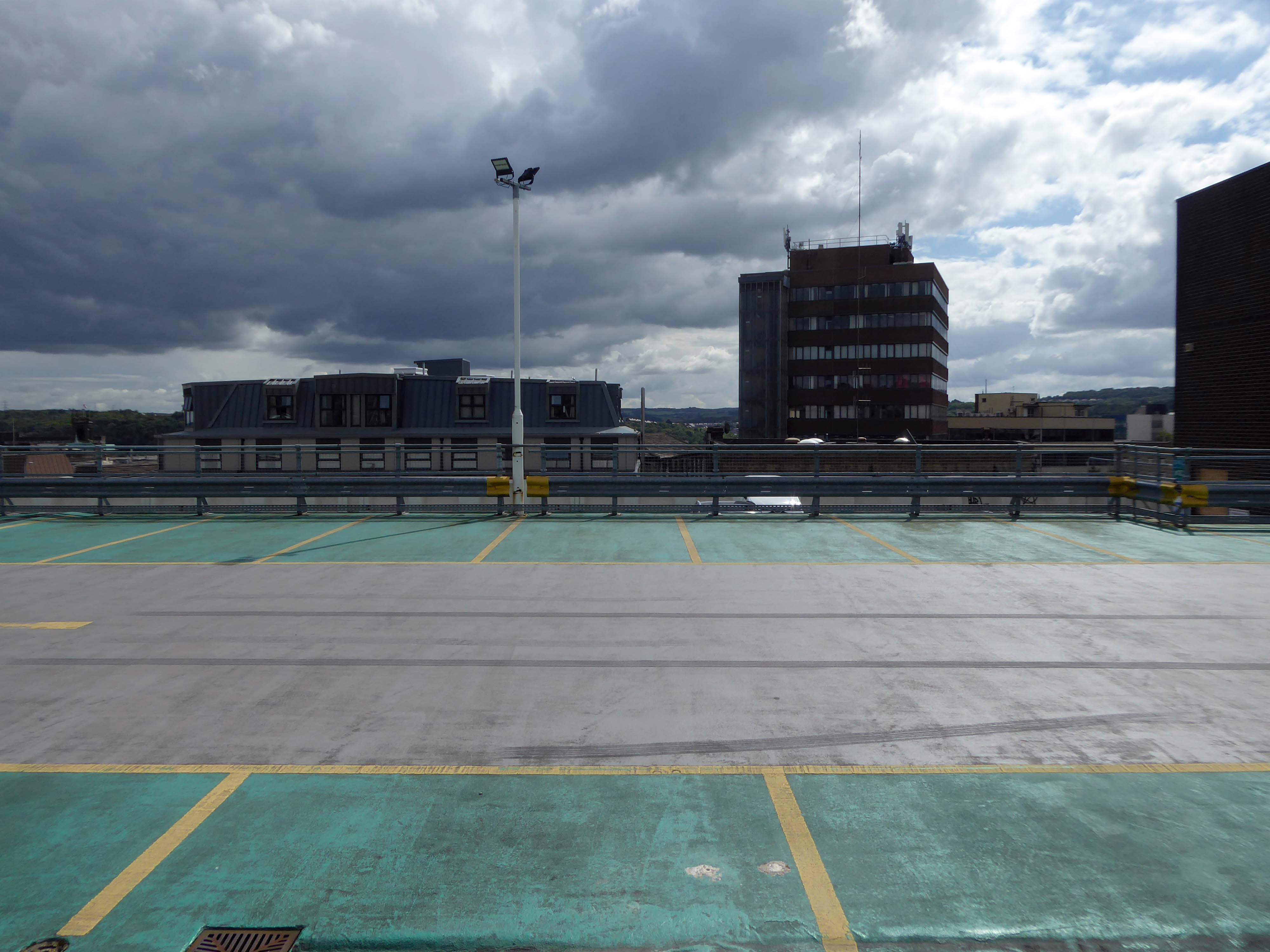
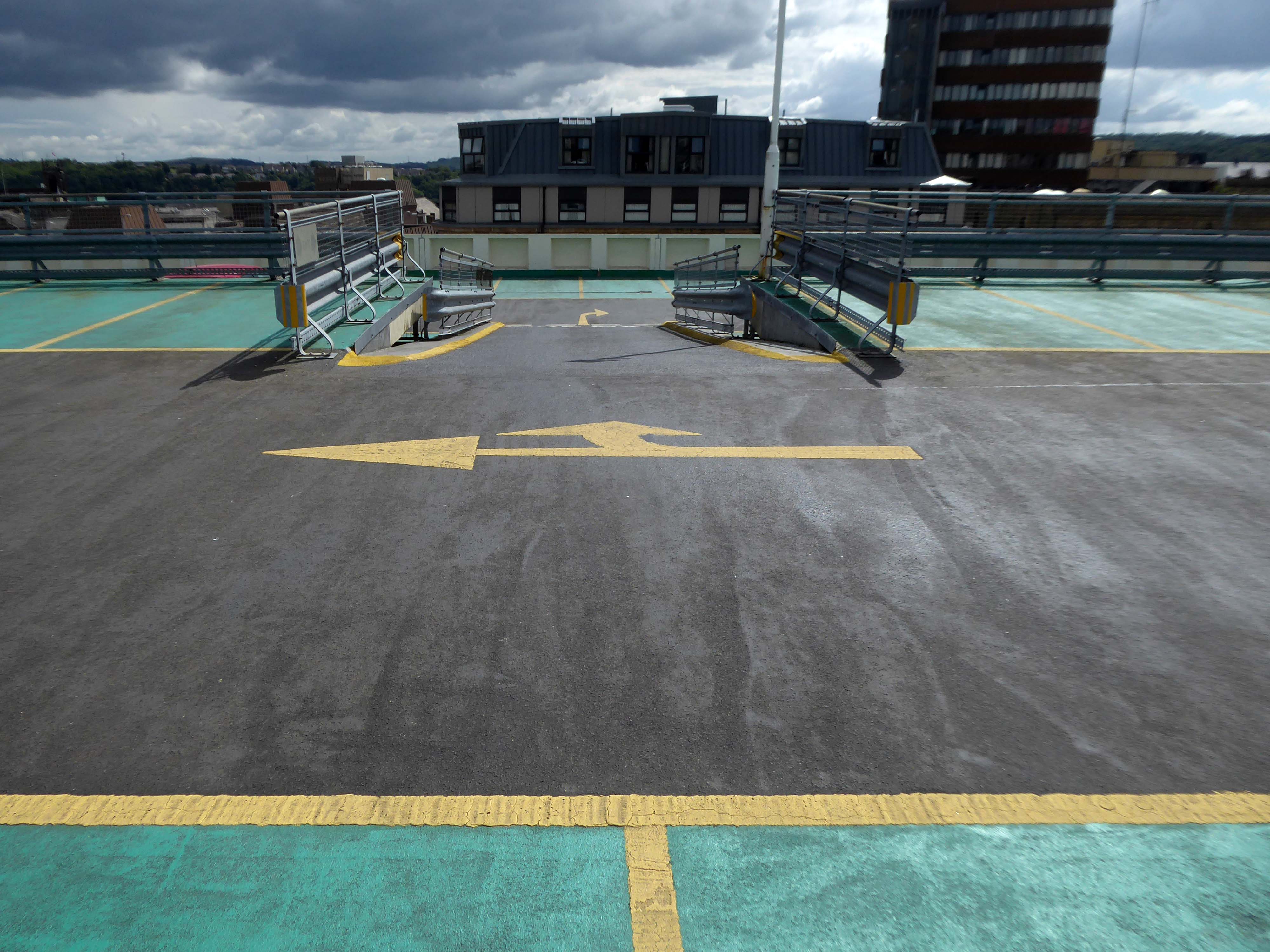
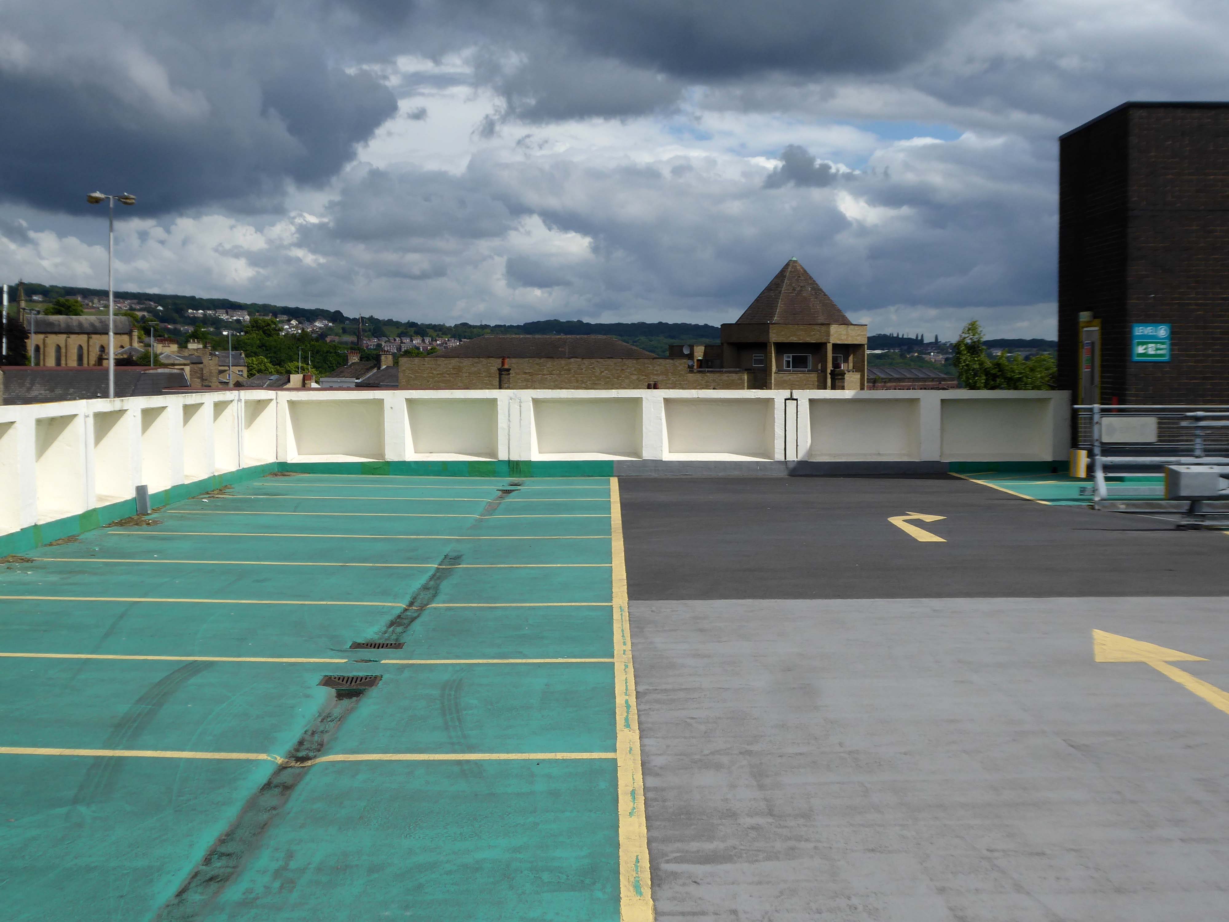
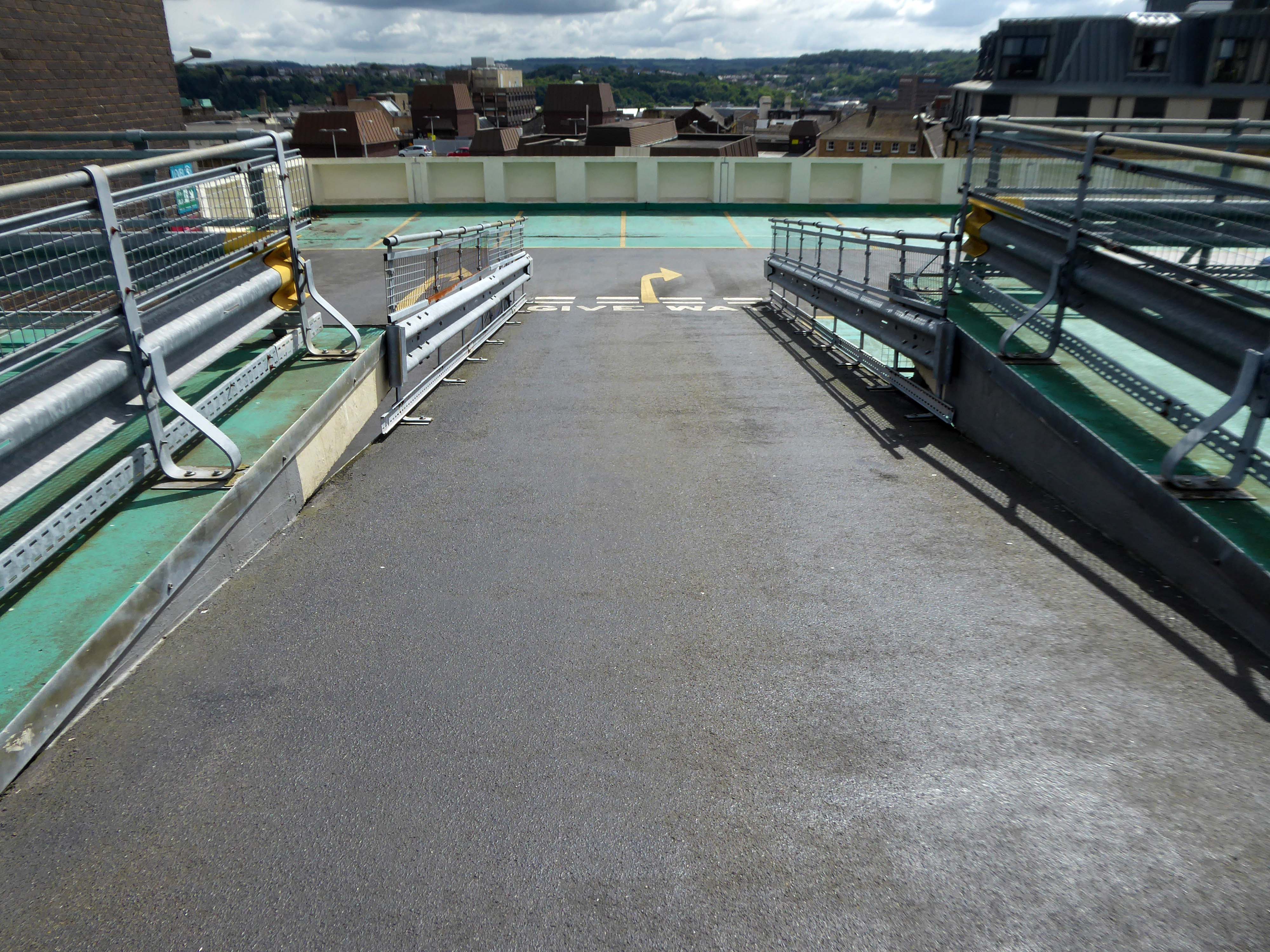
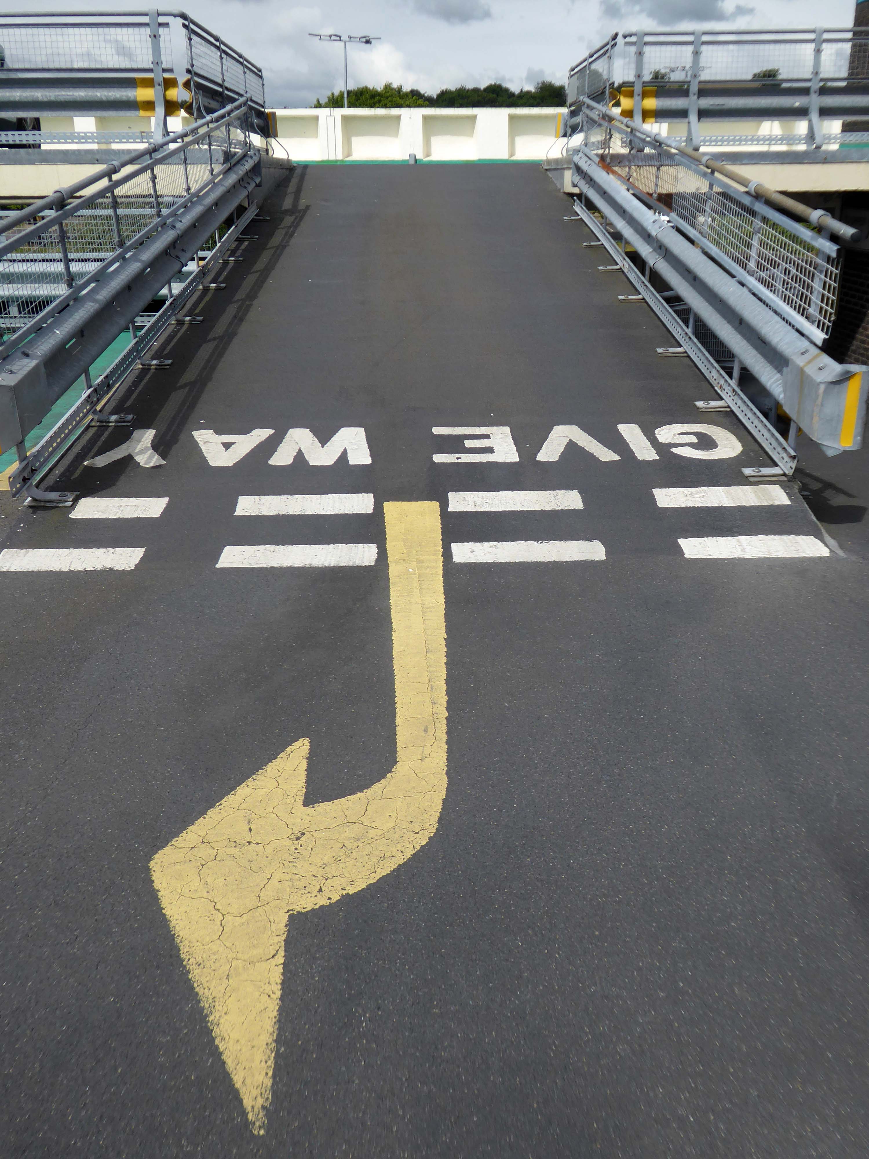
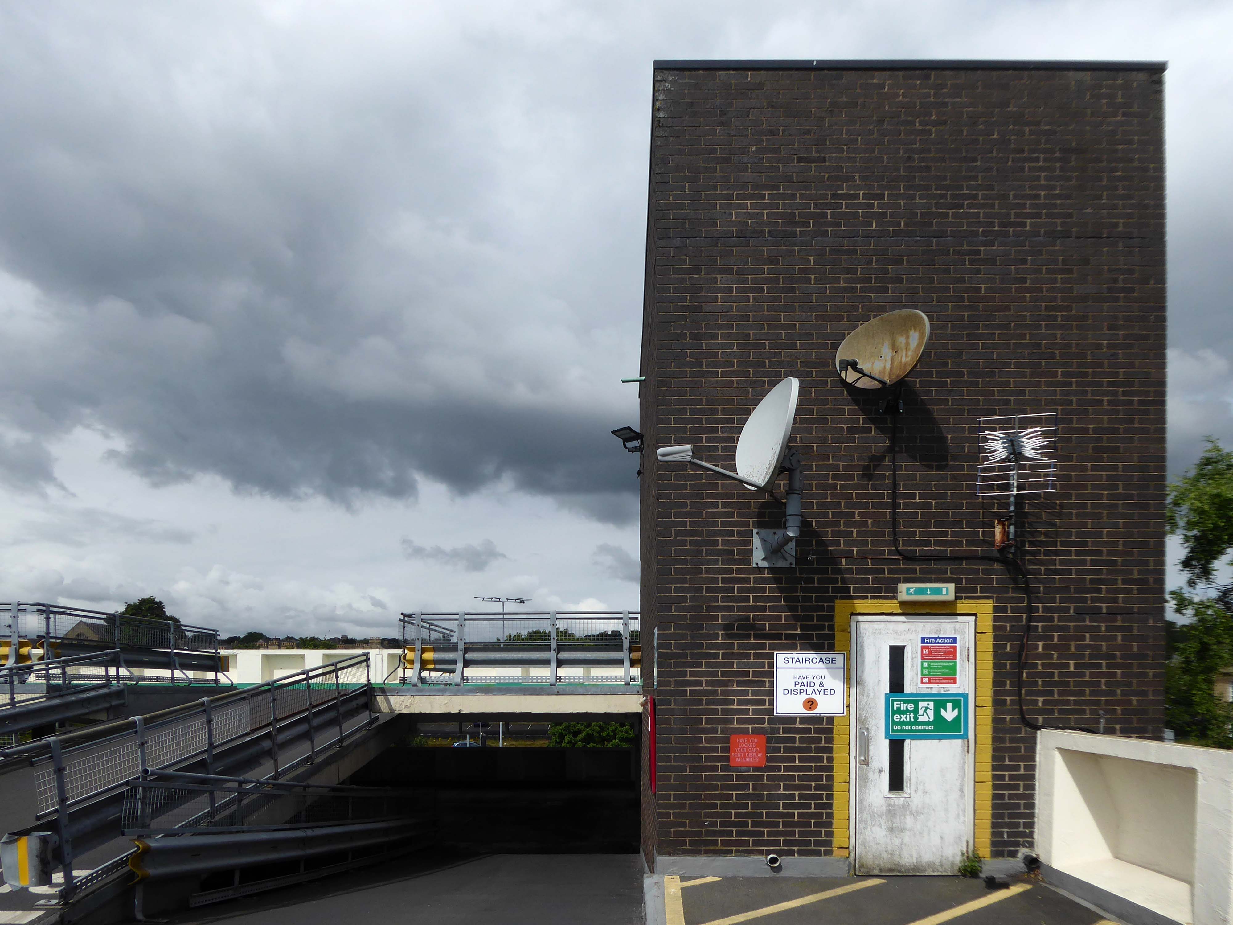
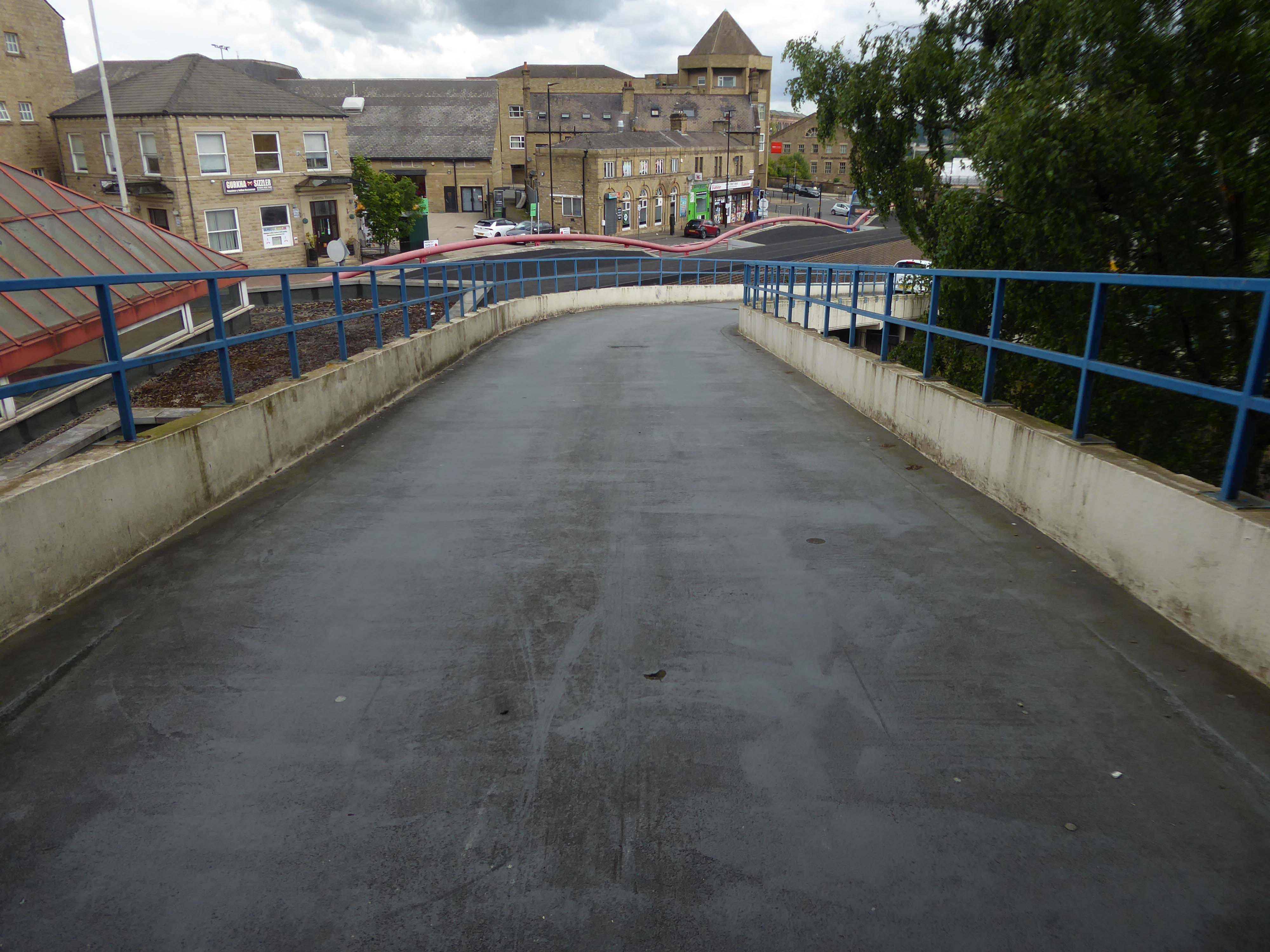
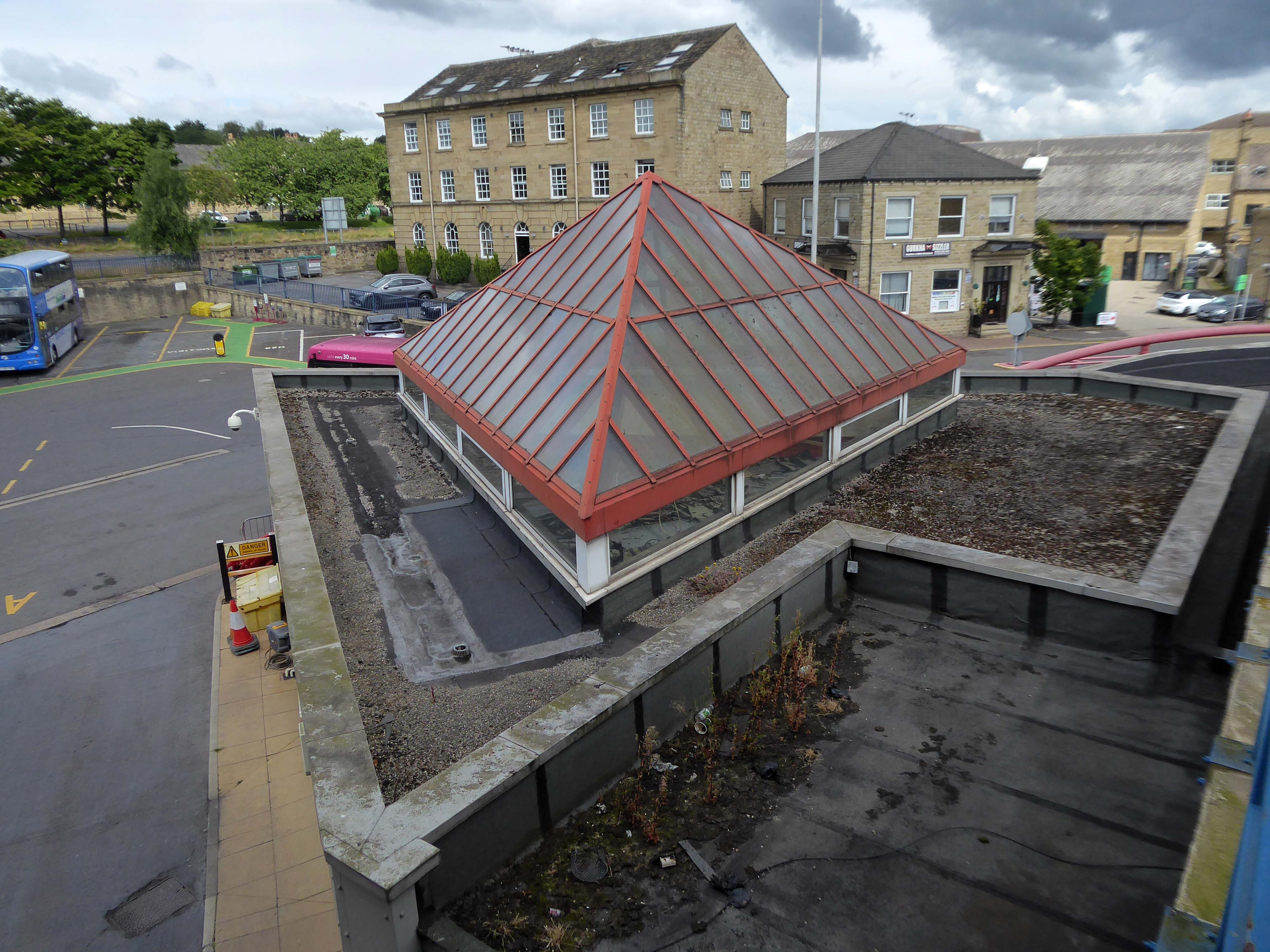
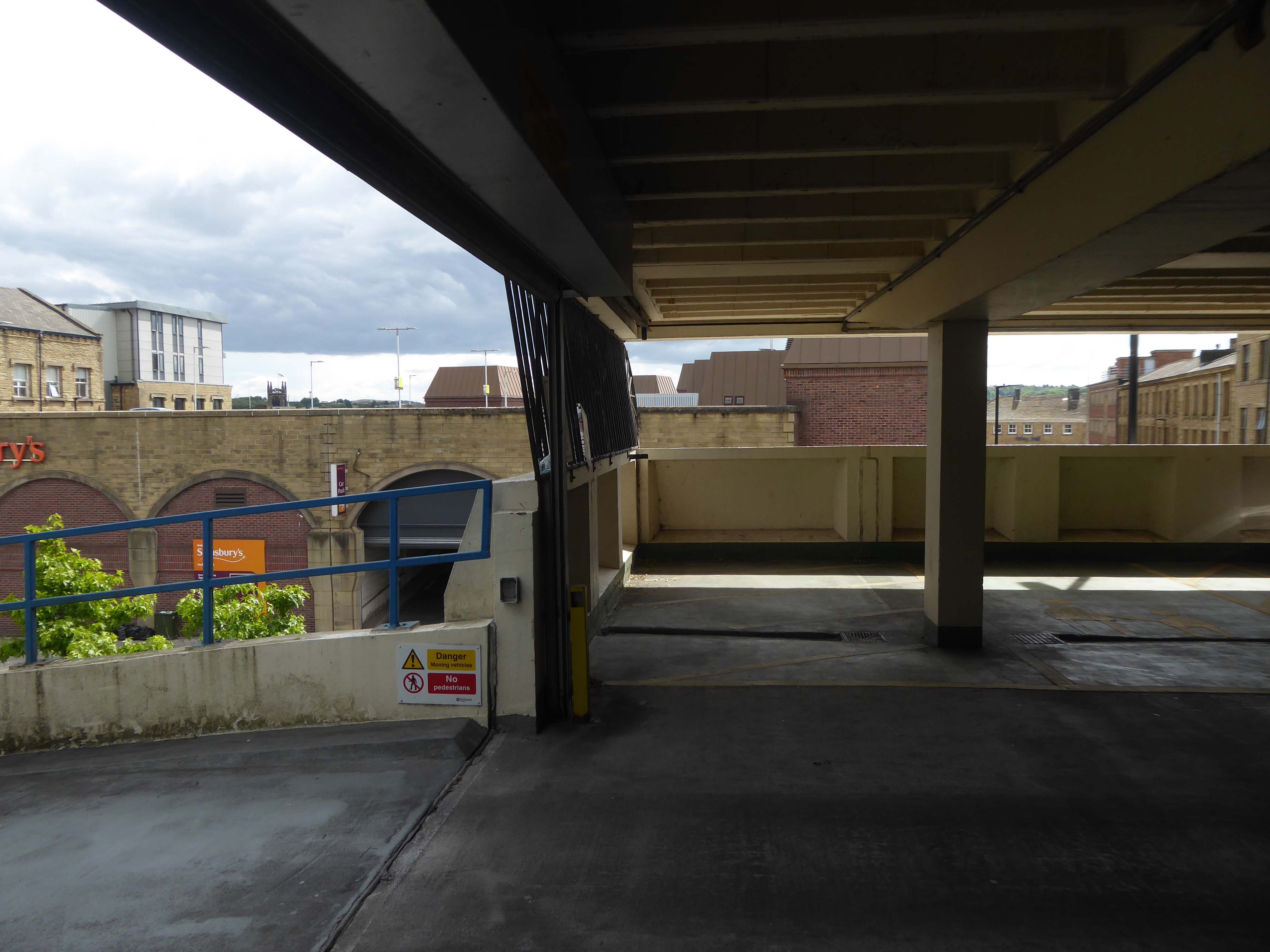
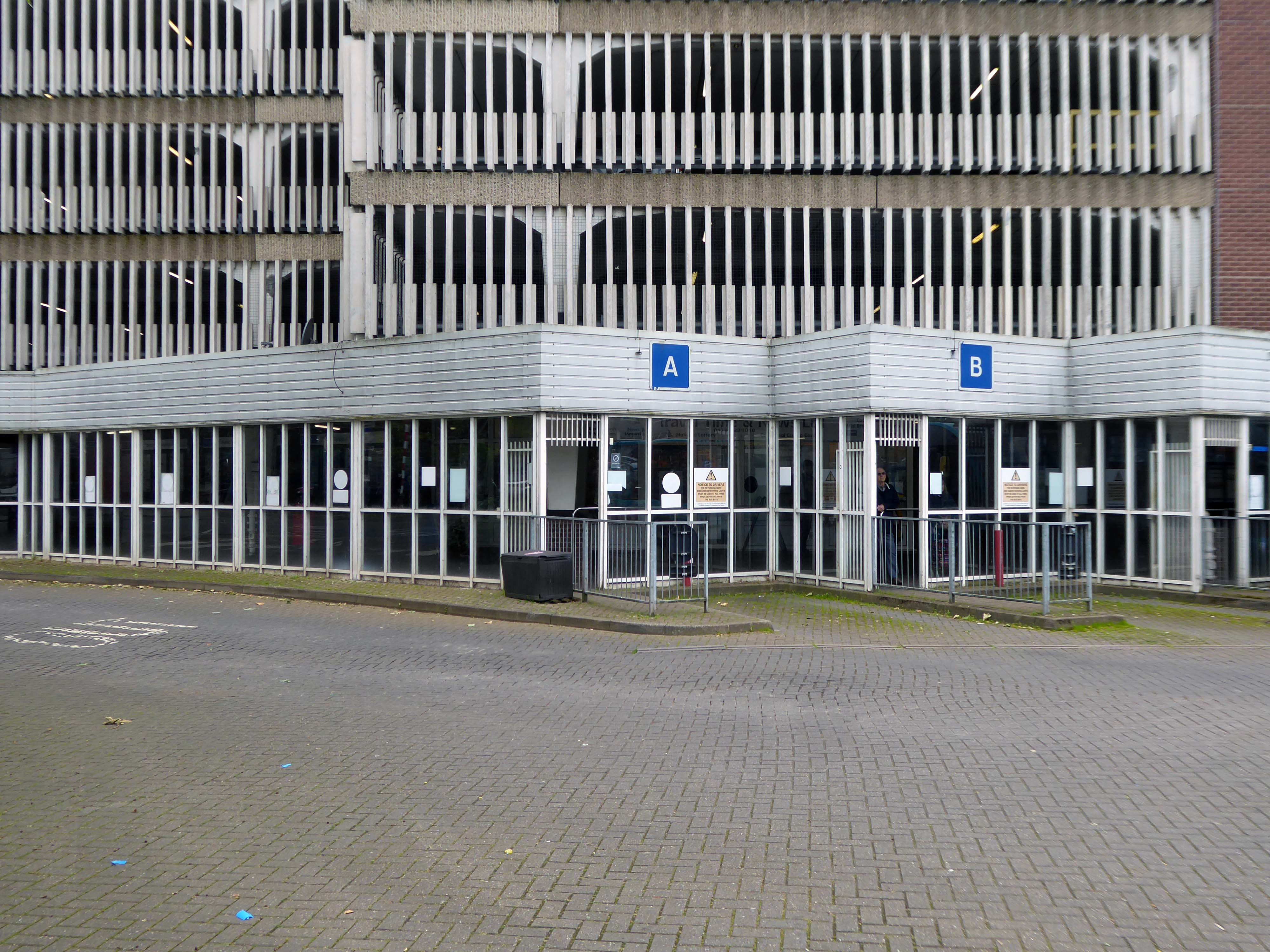
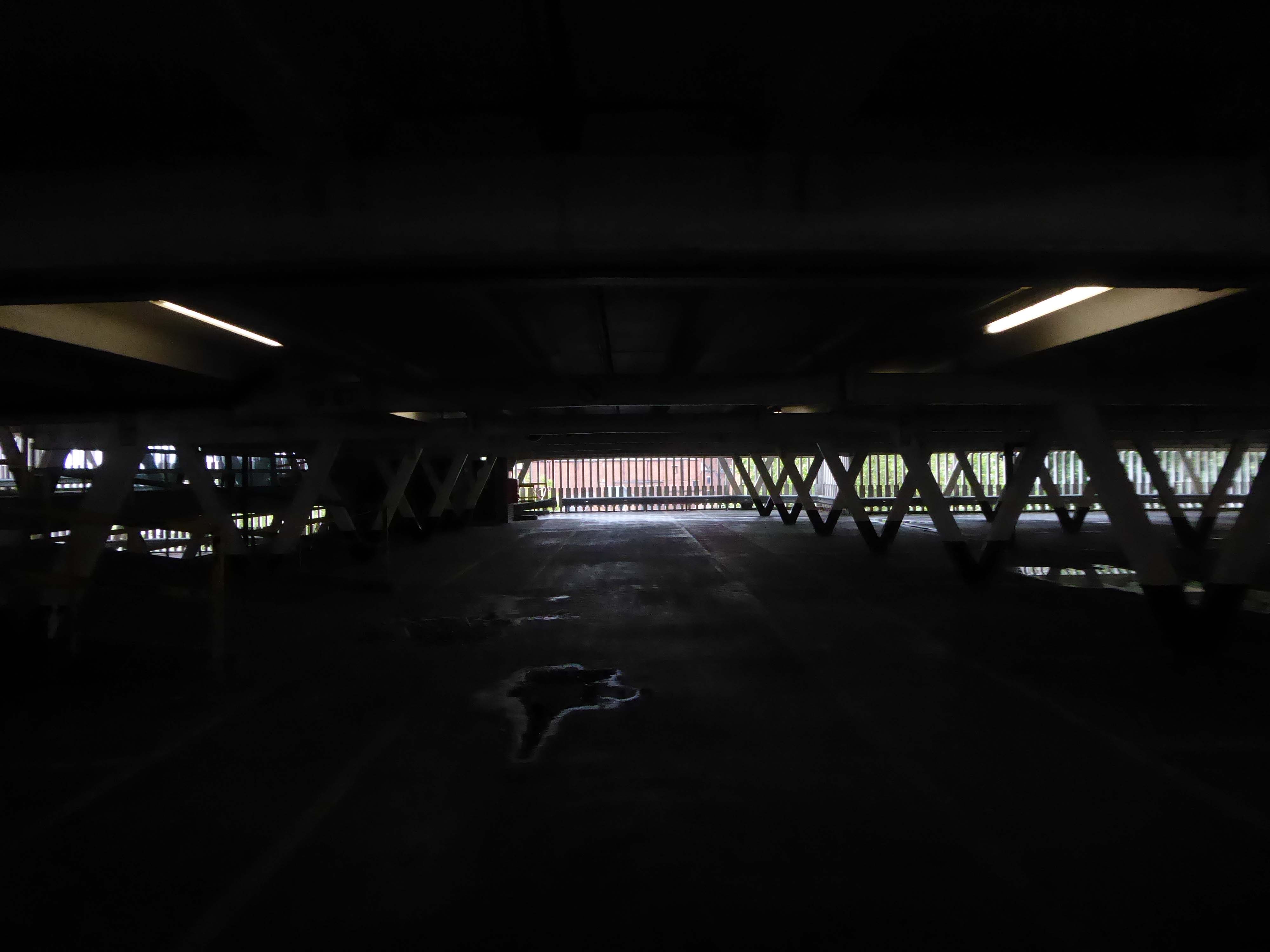
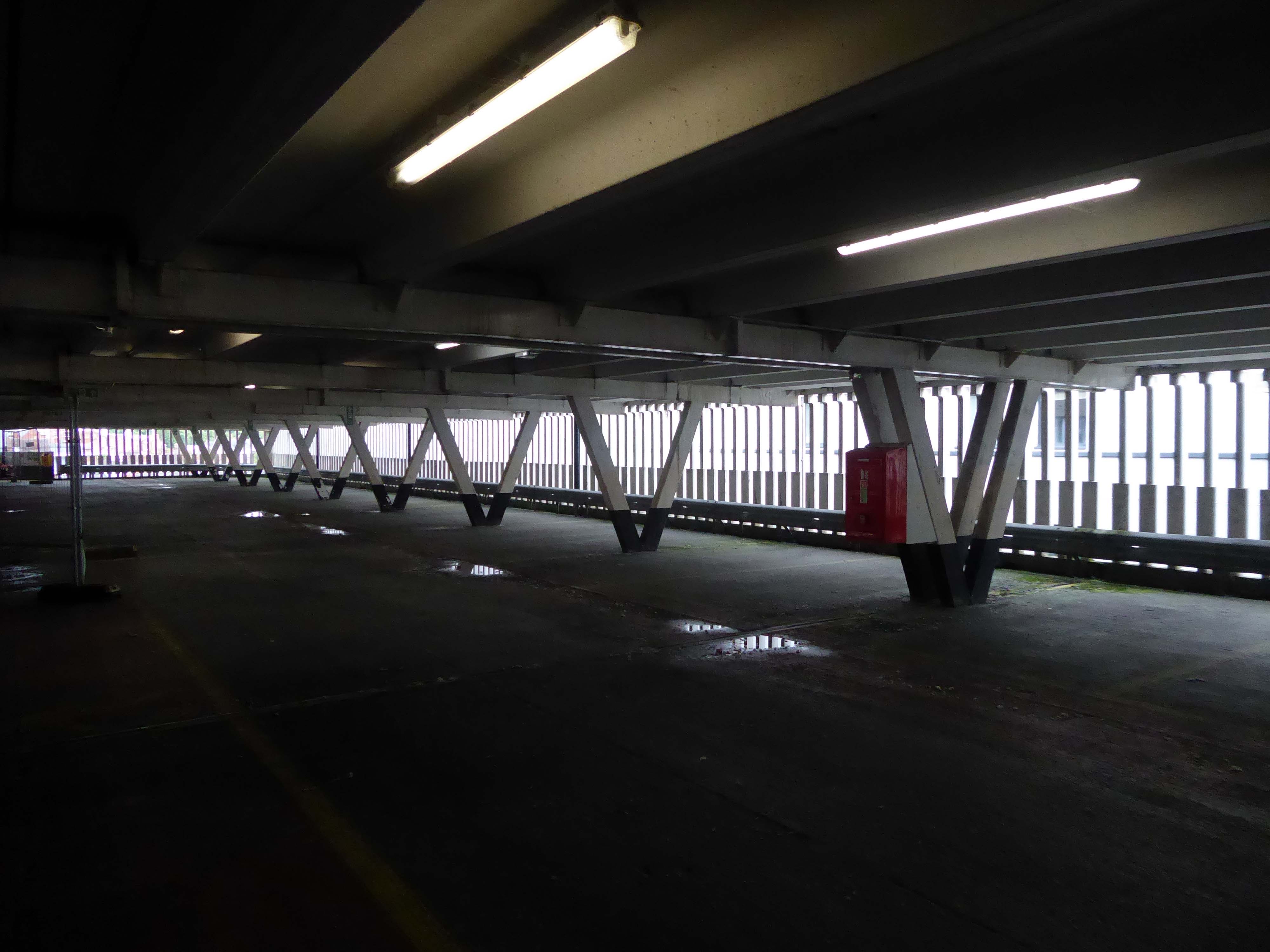
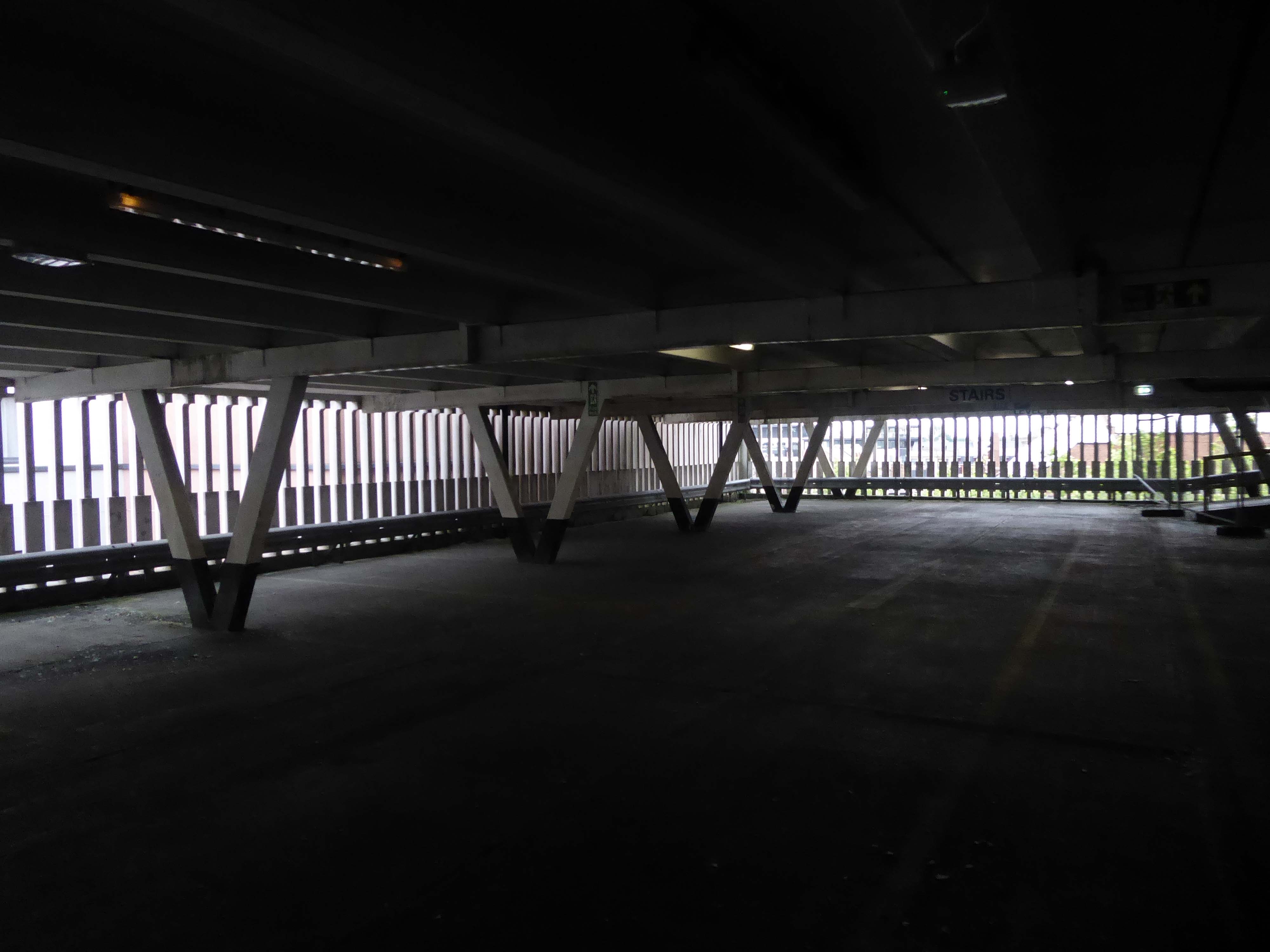
Westmorland and Furness Council said Portland Walk car park will close from the start of July.
In a statement the council revealed the rooftop car park will permanently close from July 1 following a review which found said it had ‘very low usage’.
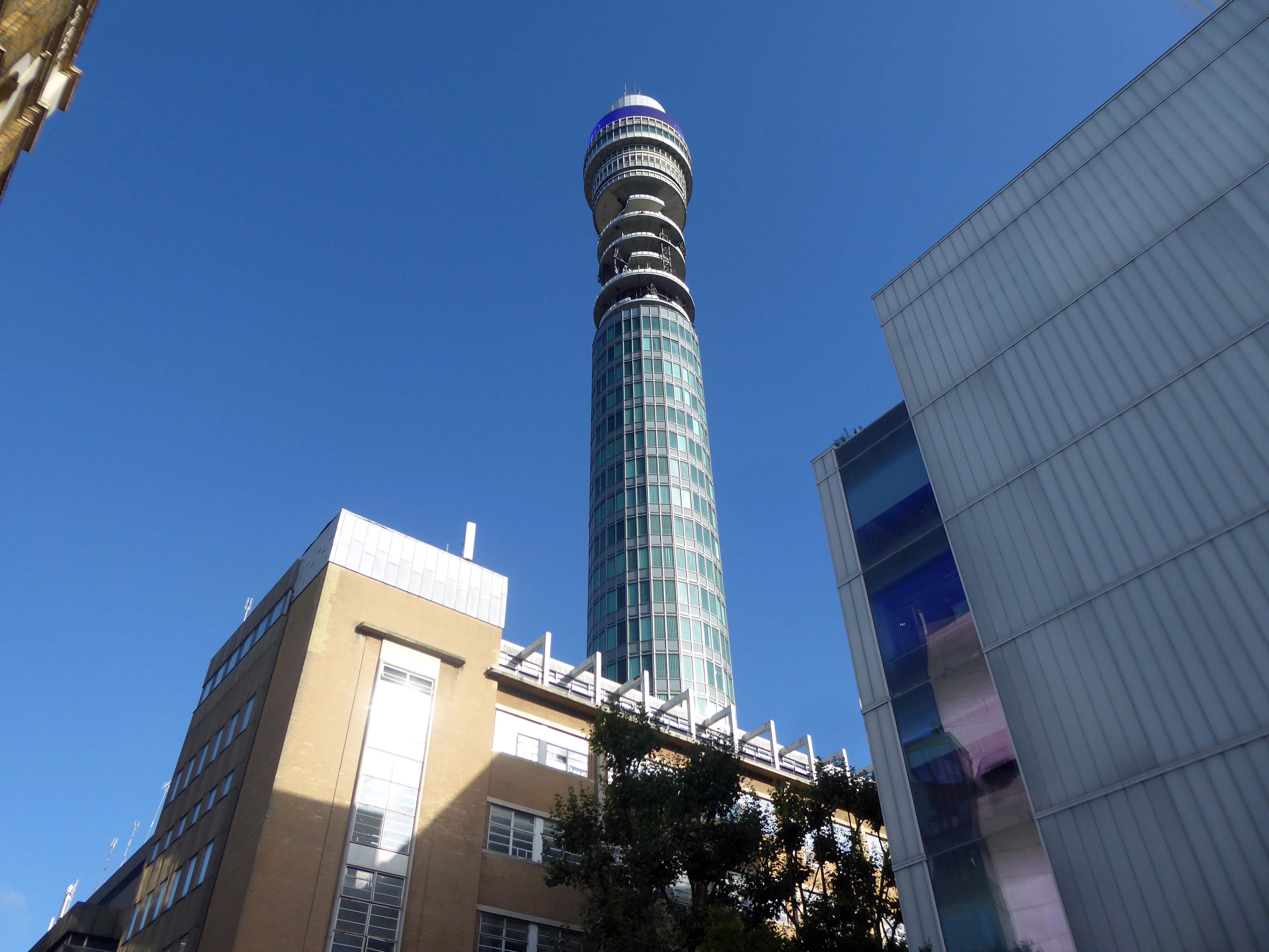
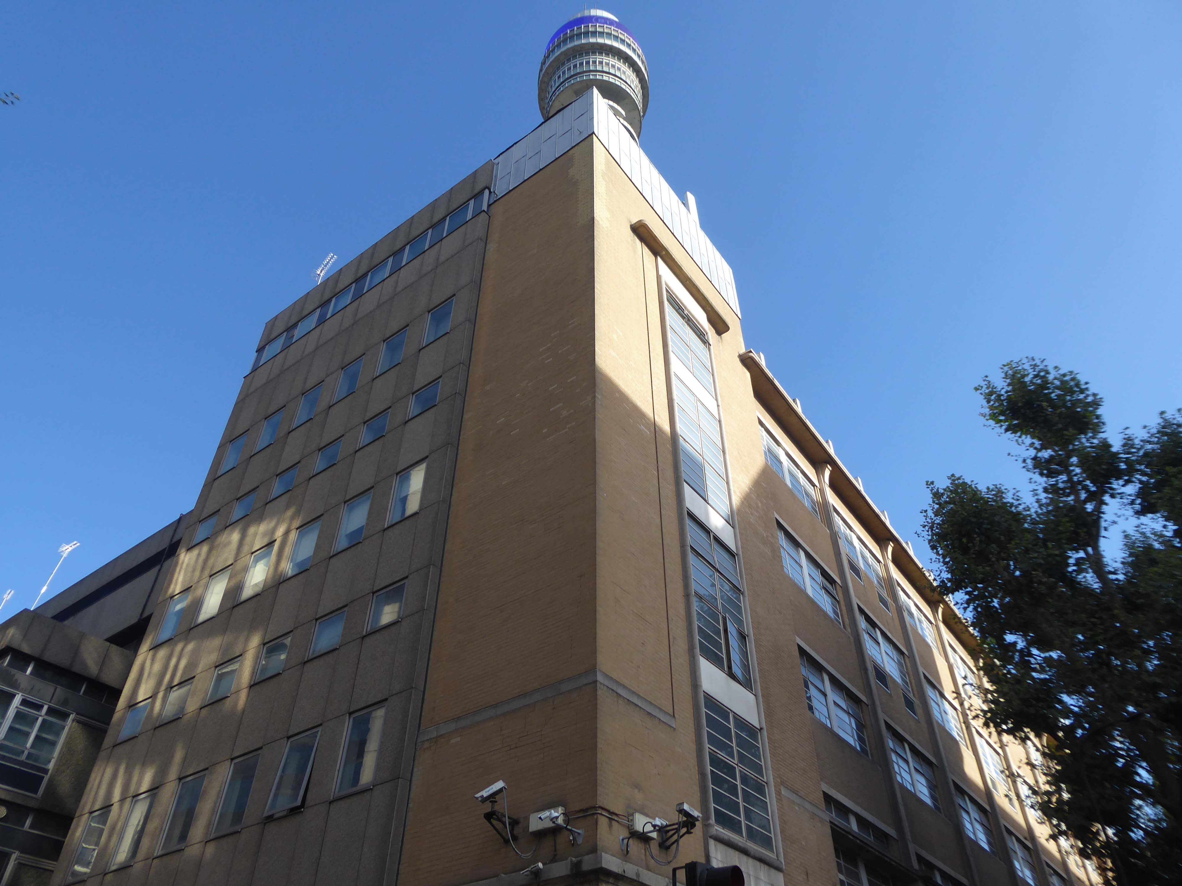
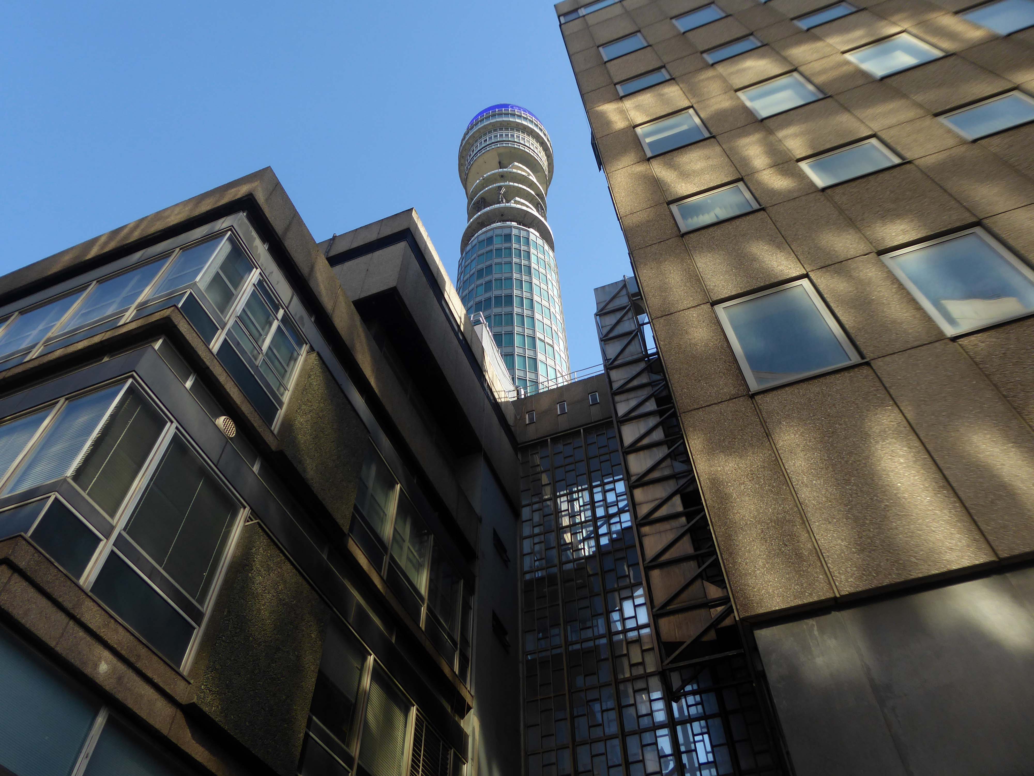
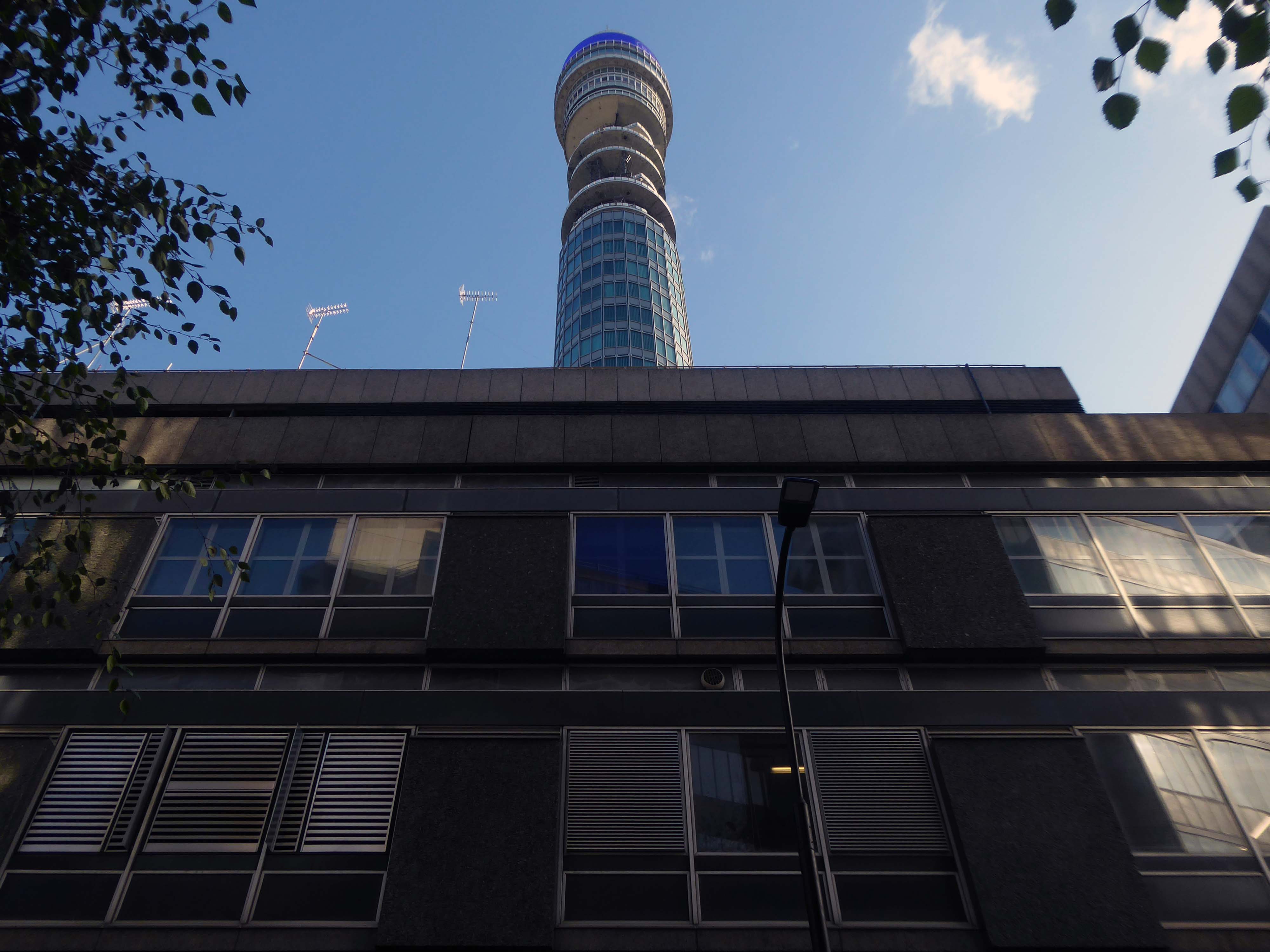
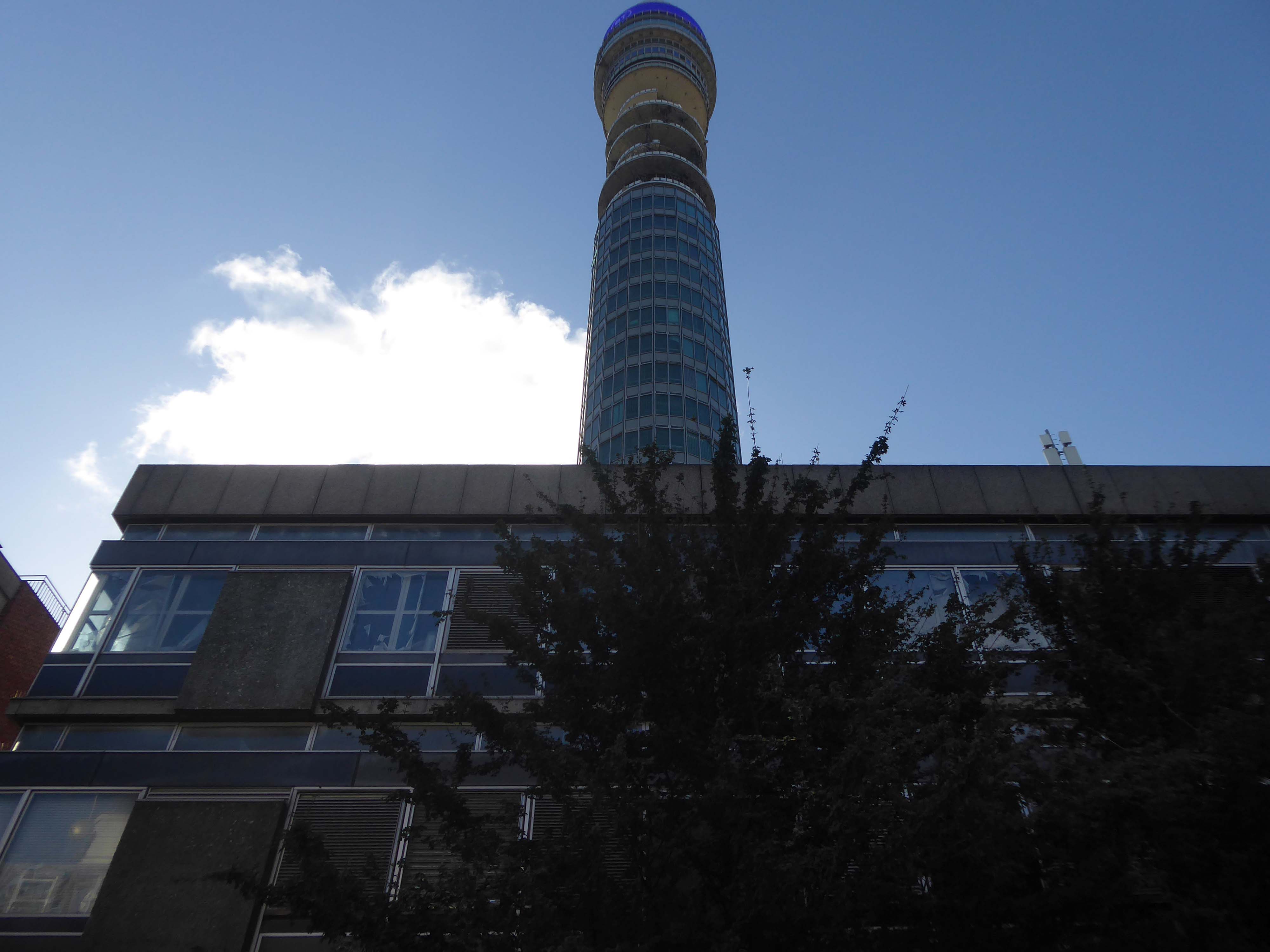
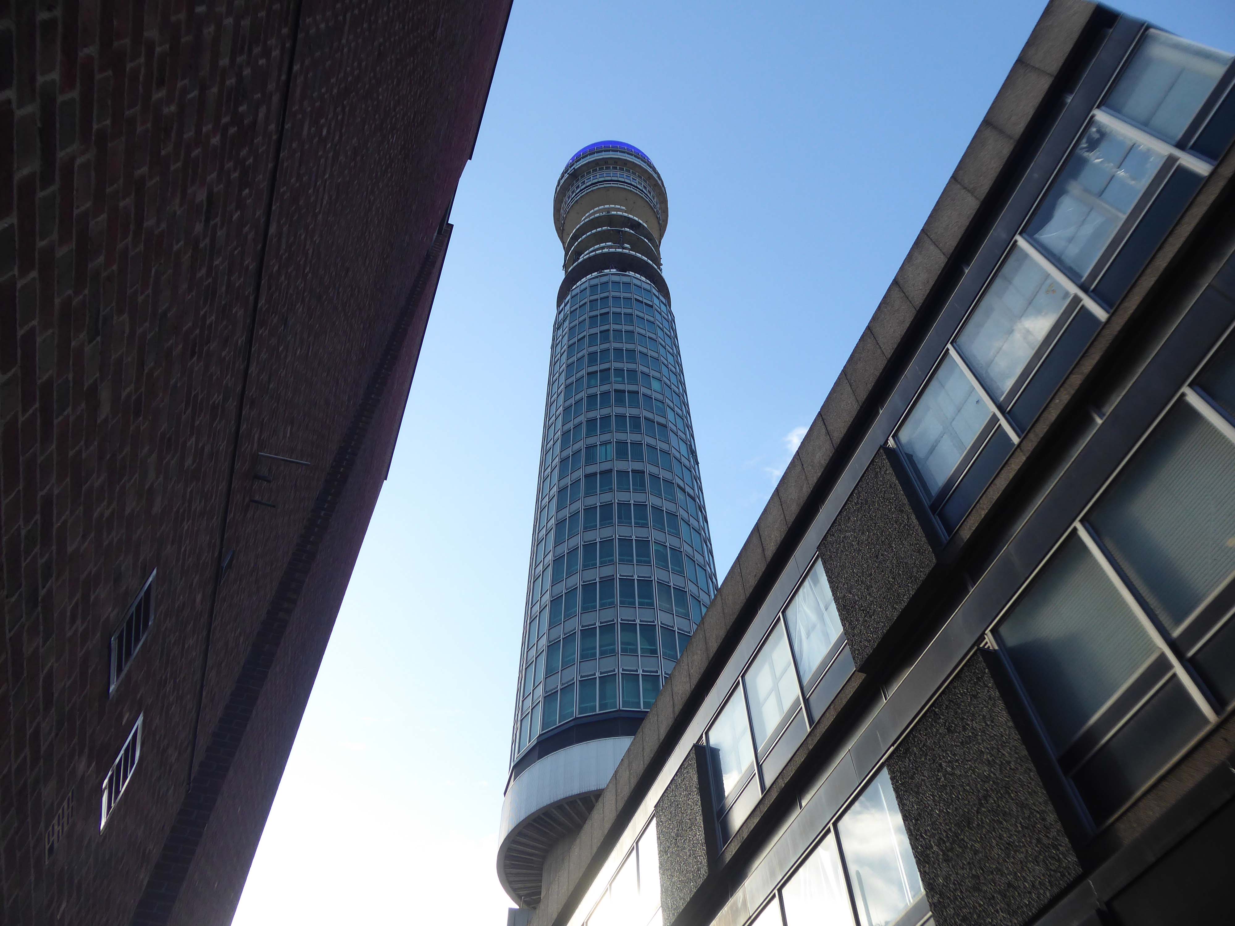
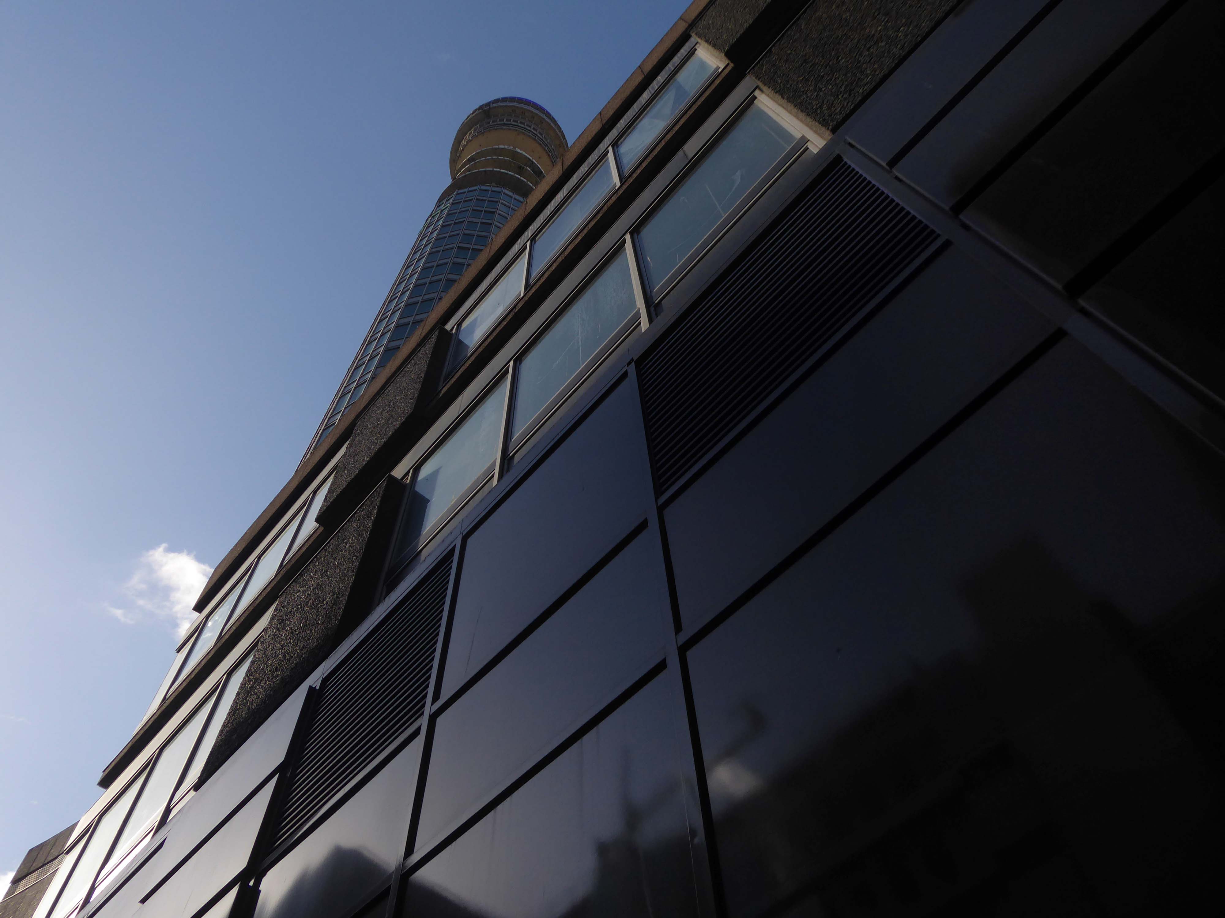
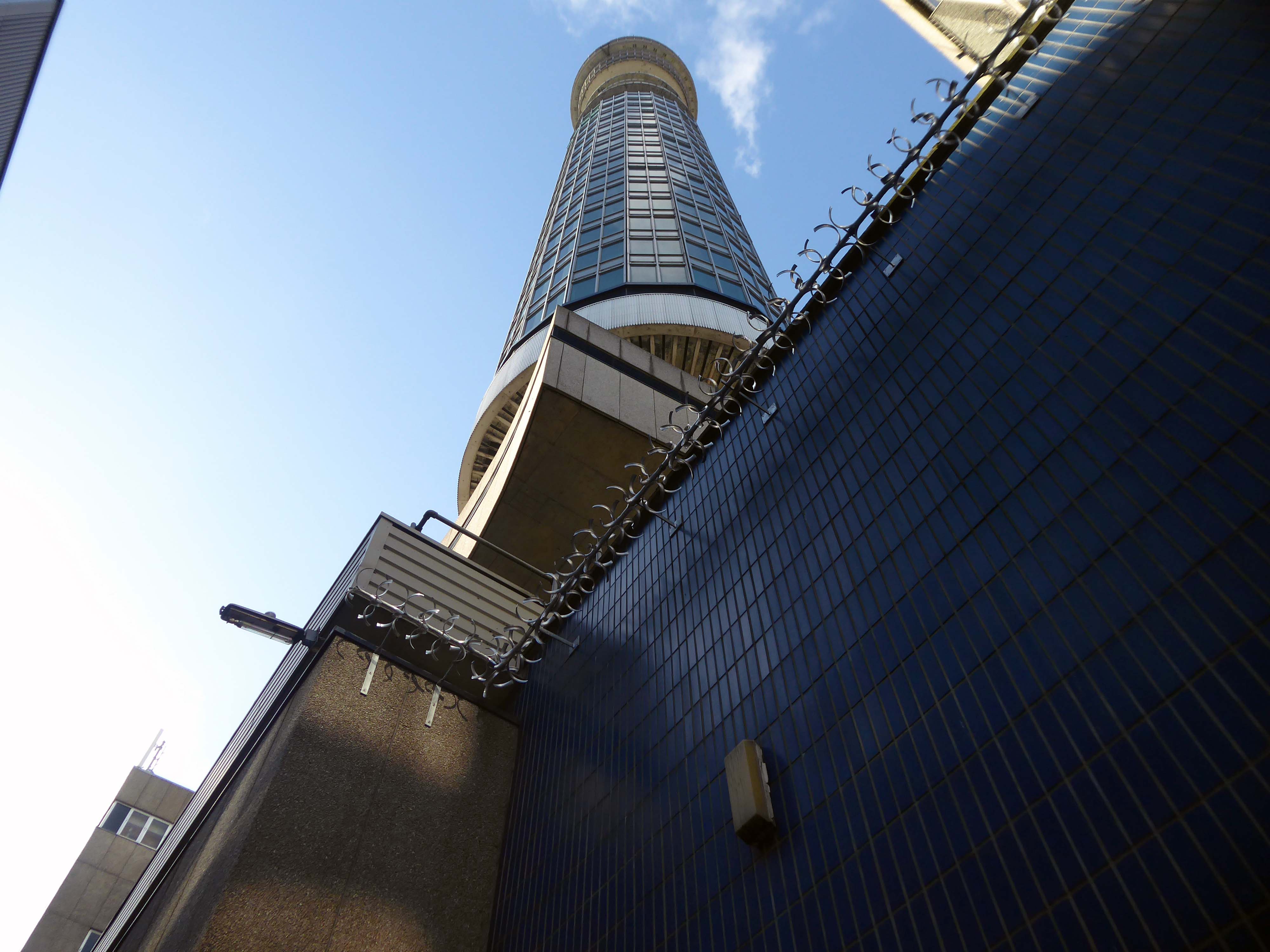
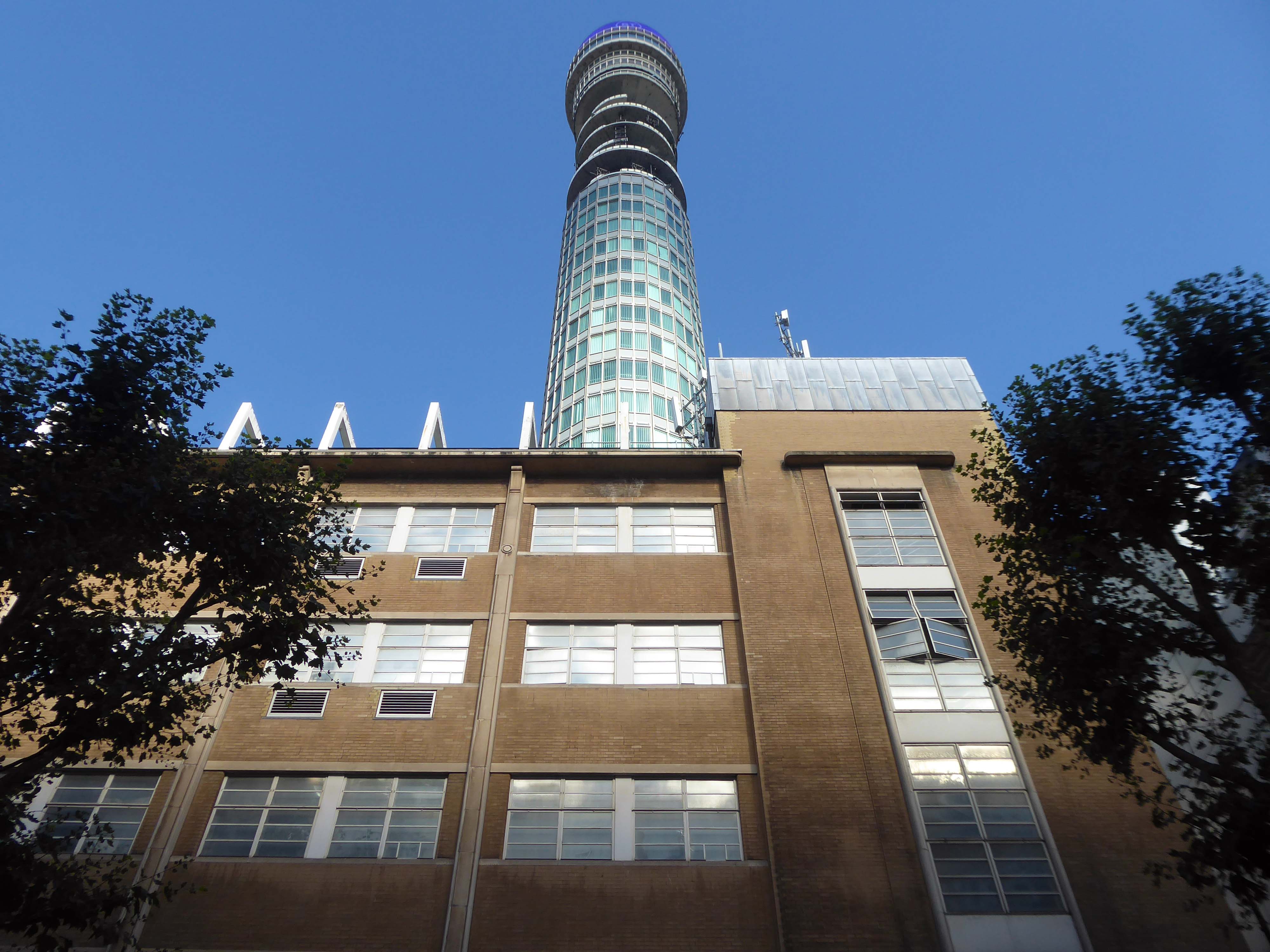
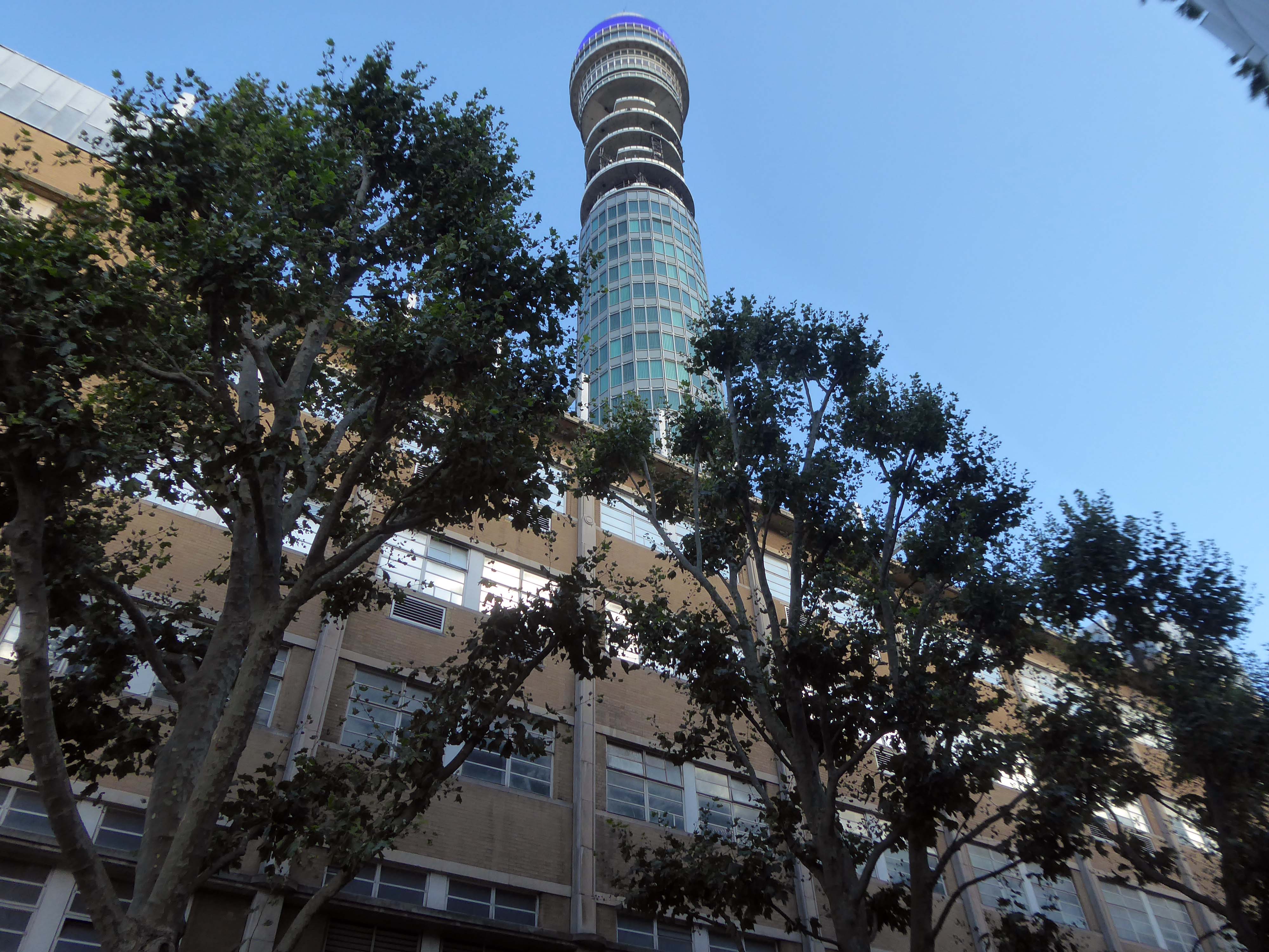
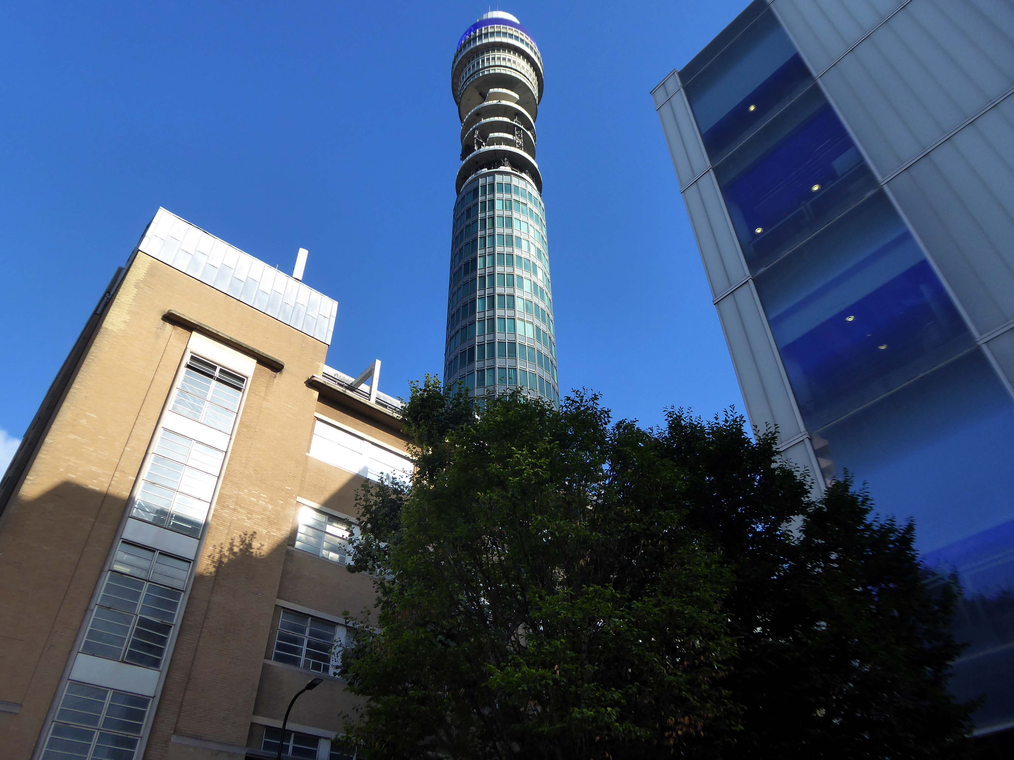
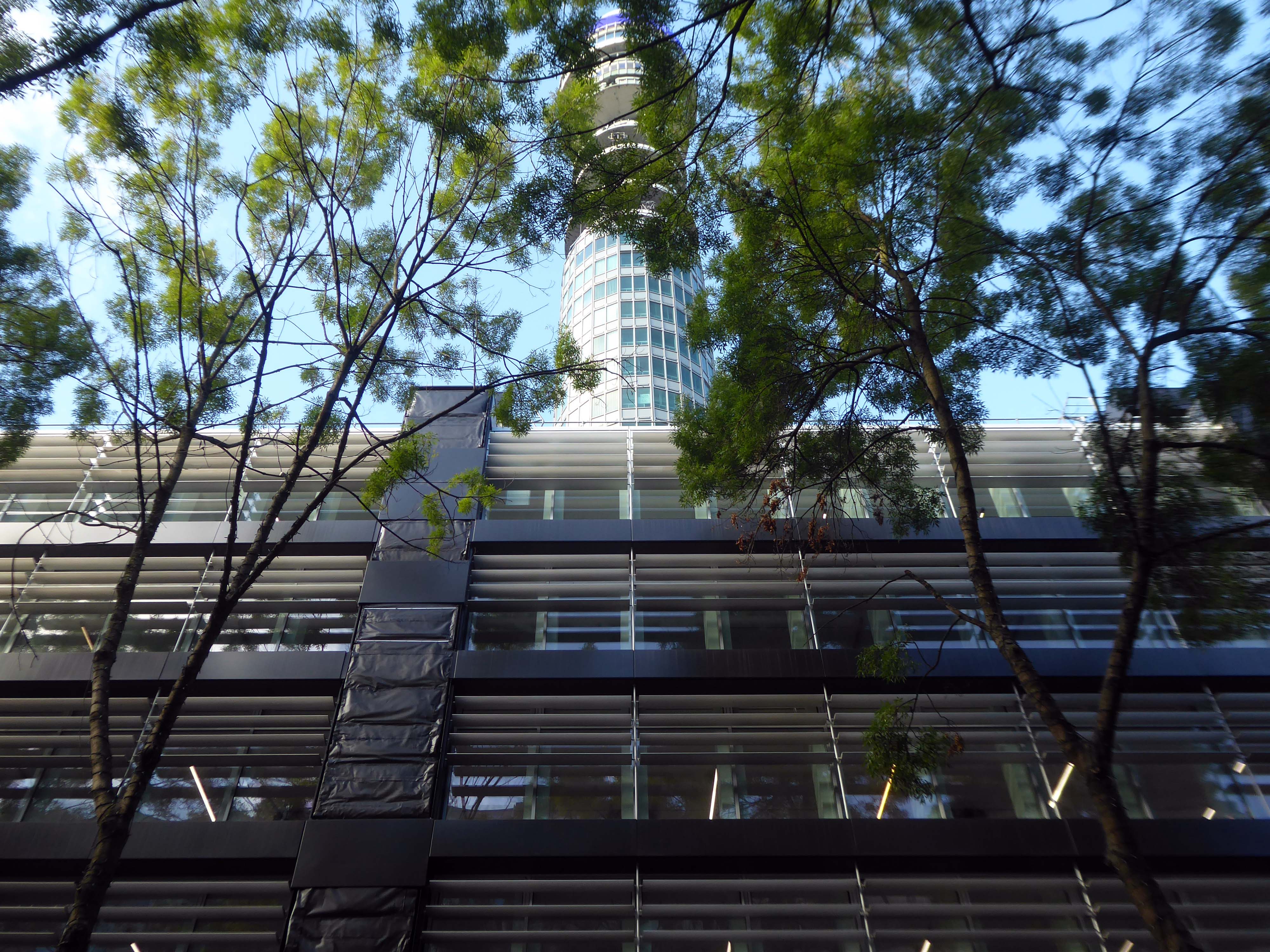
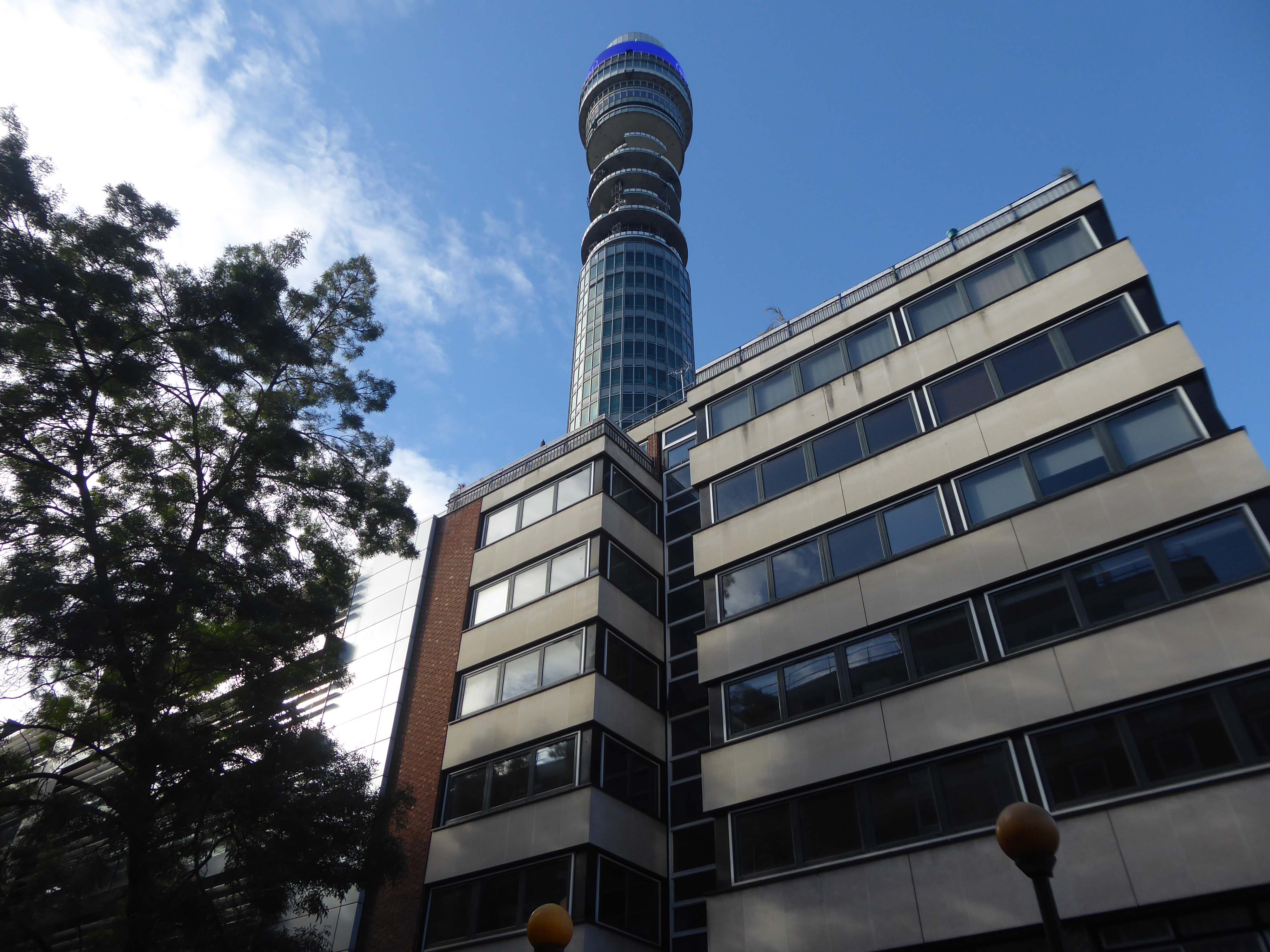
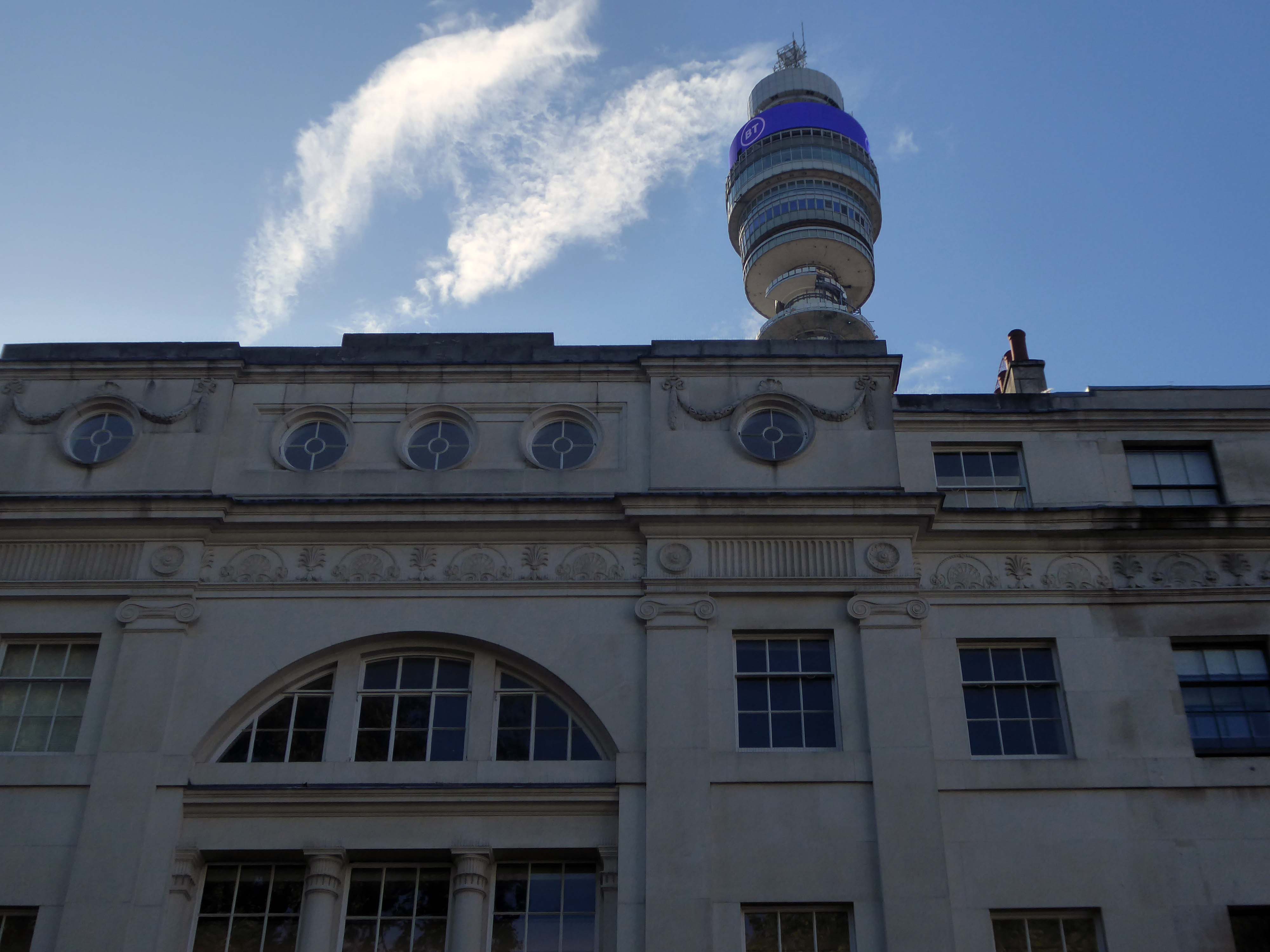
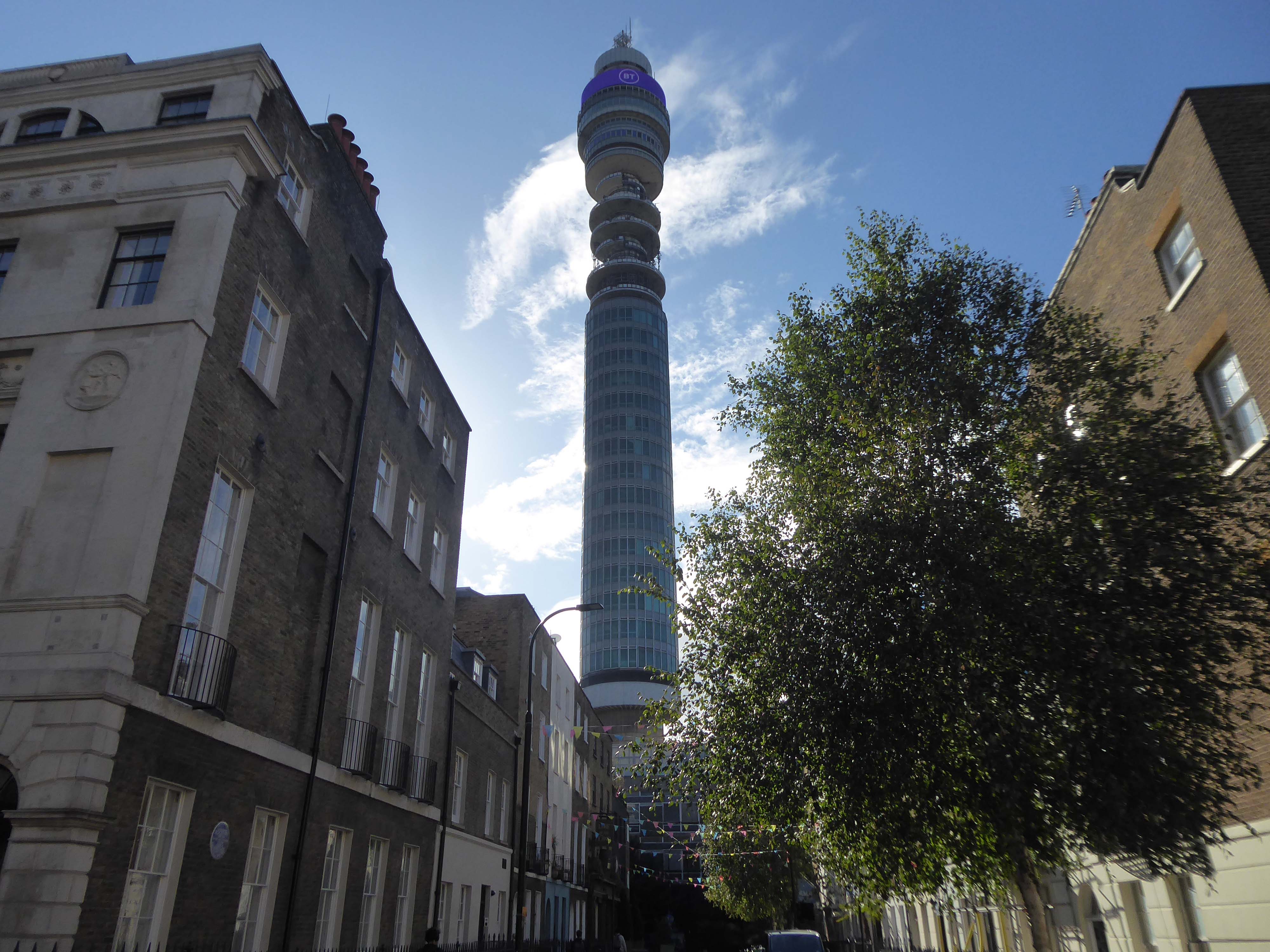
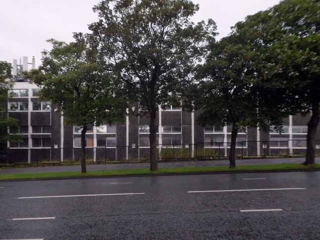
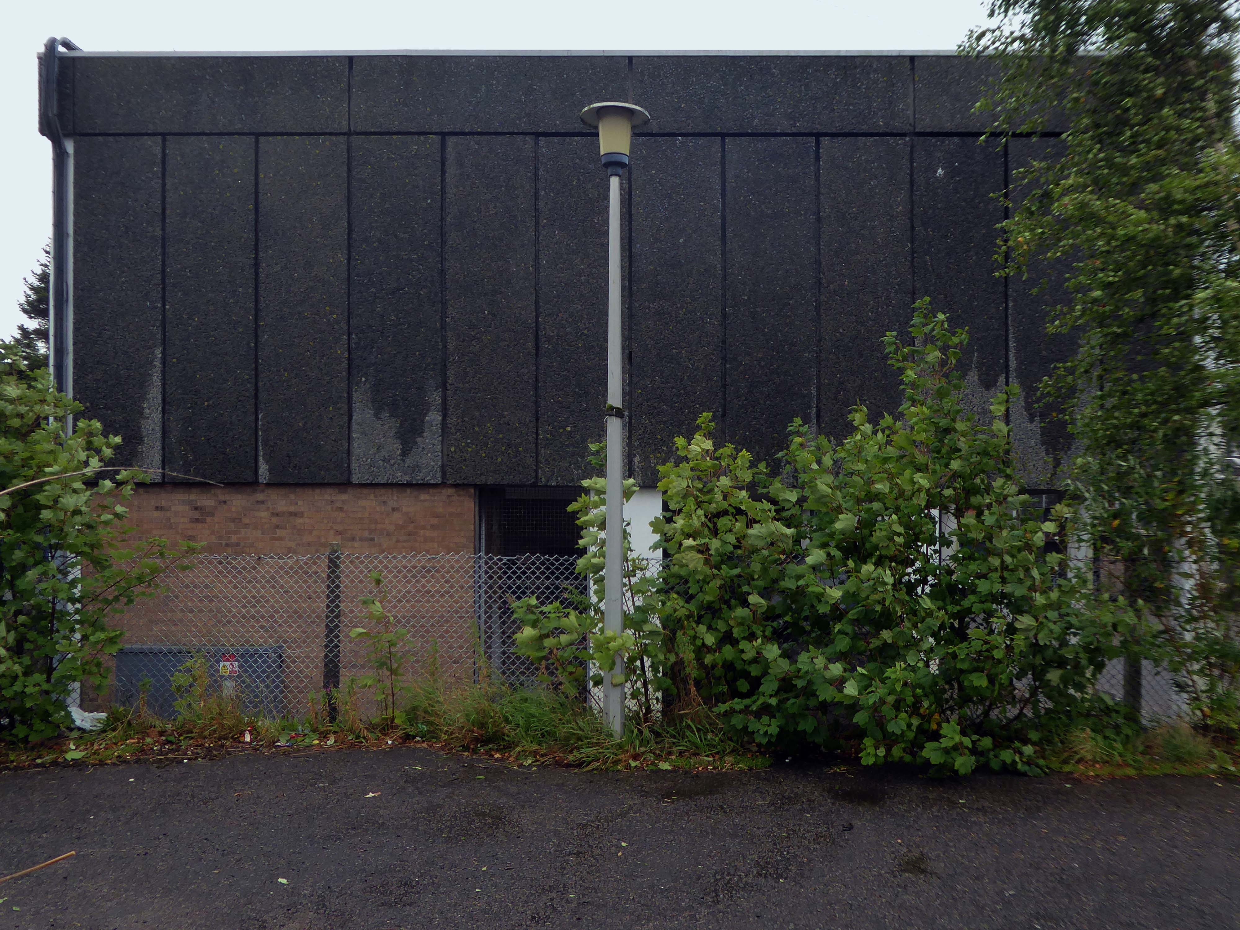
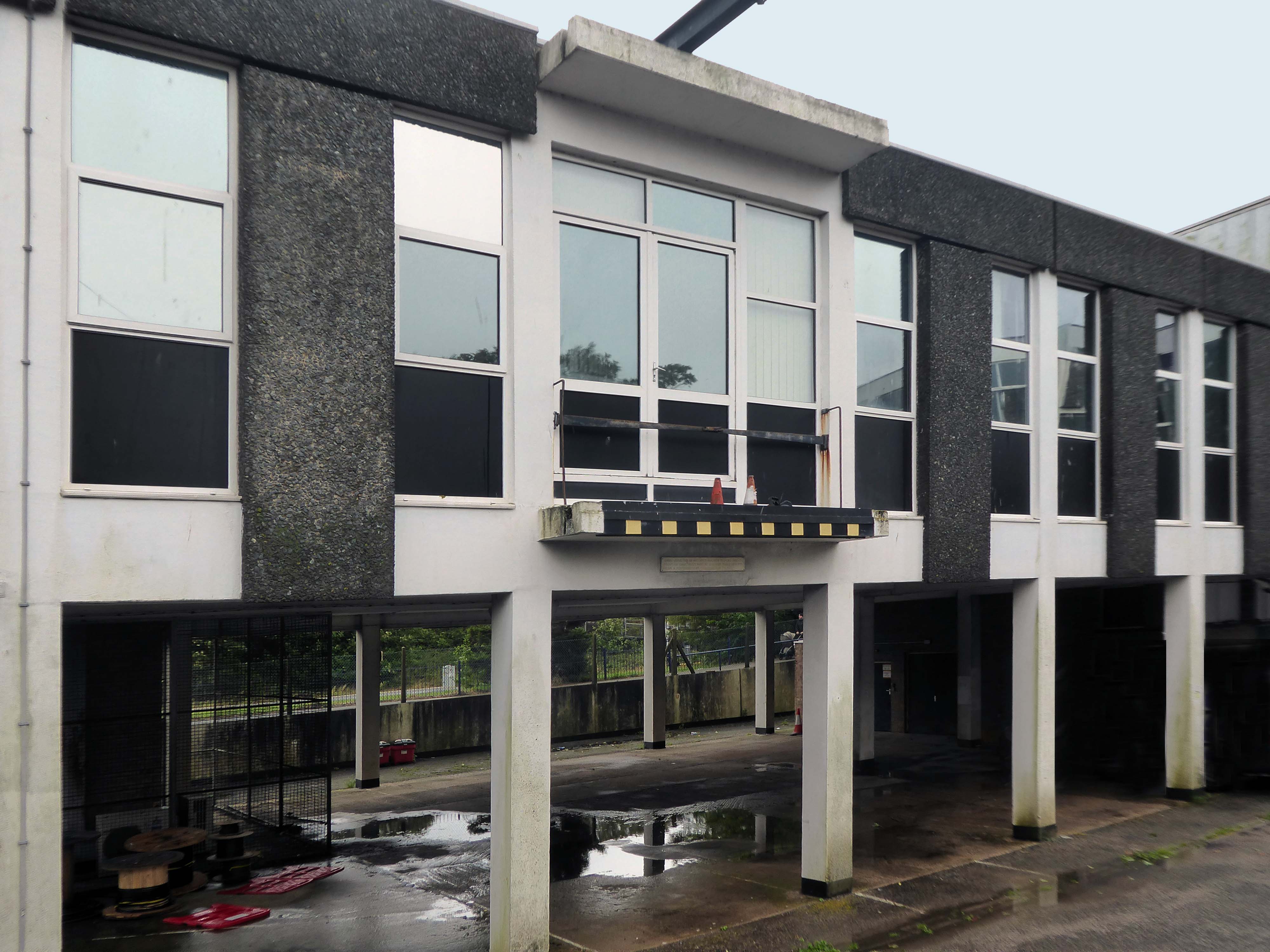
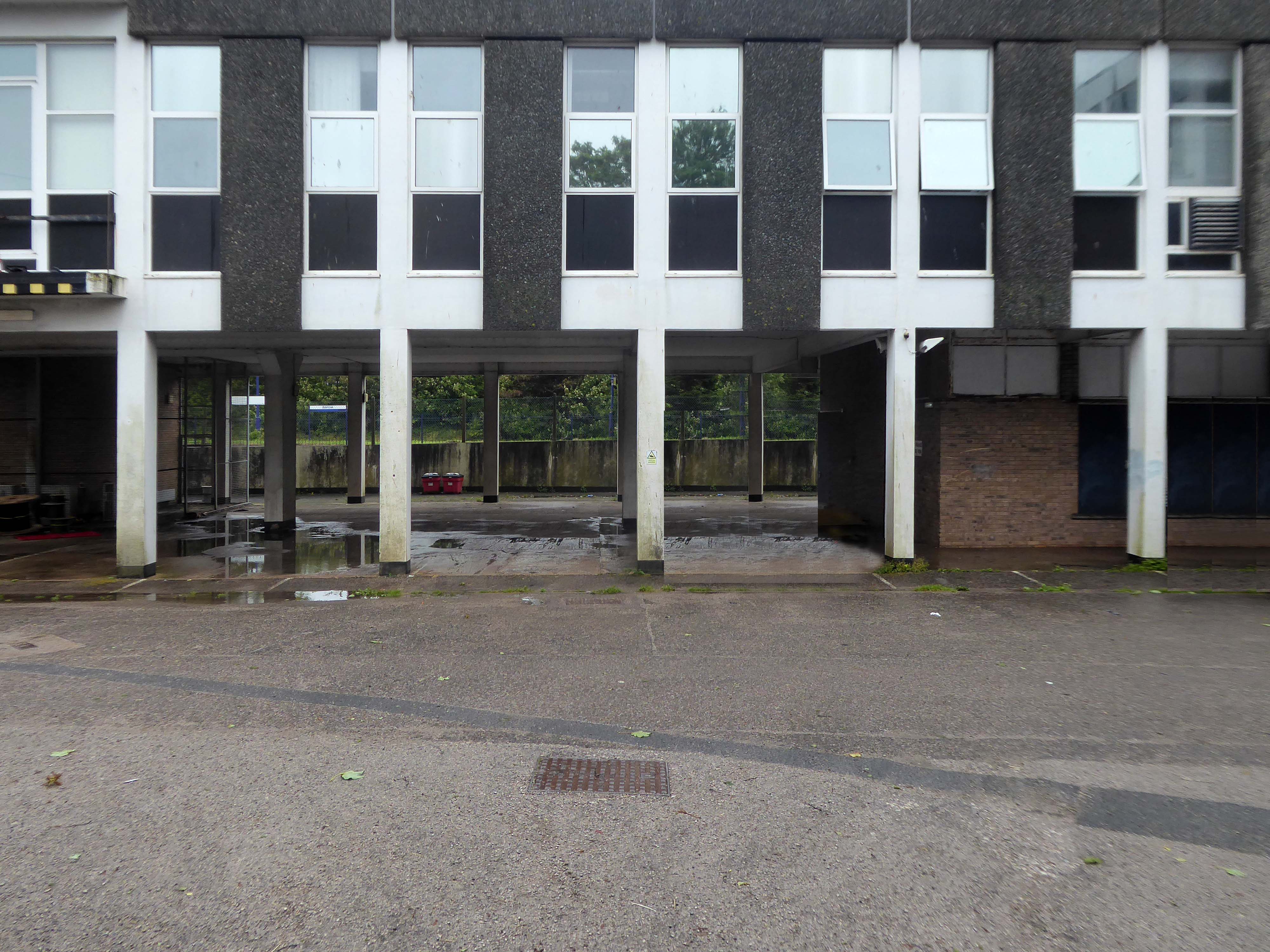
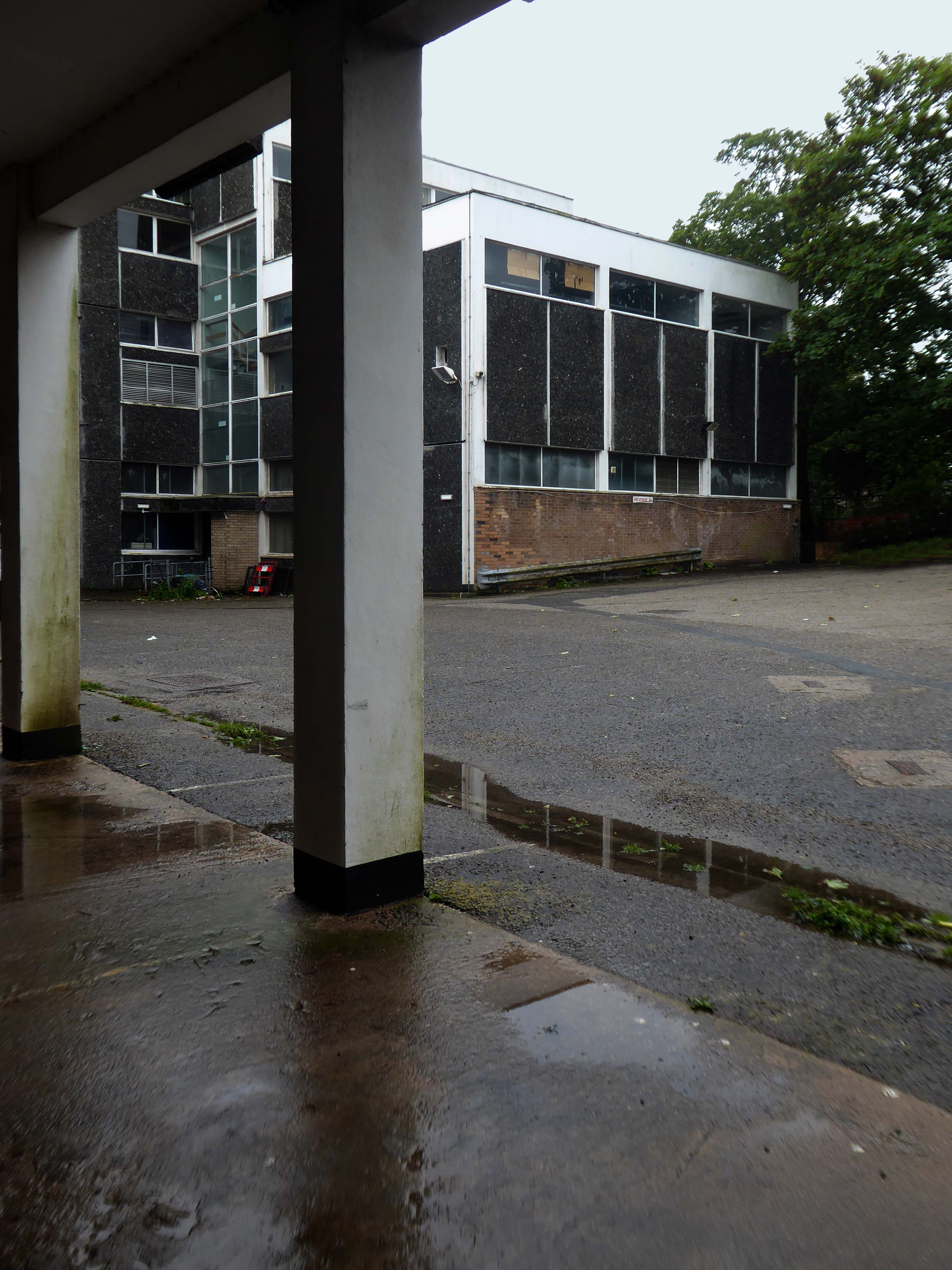
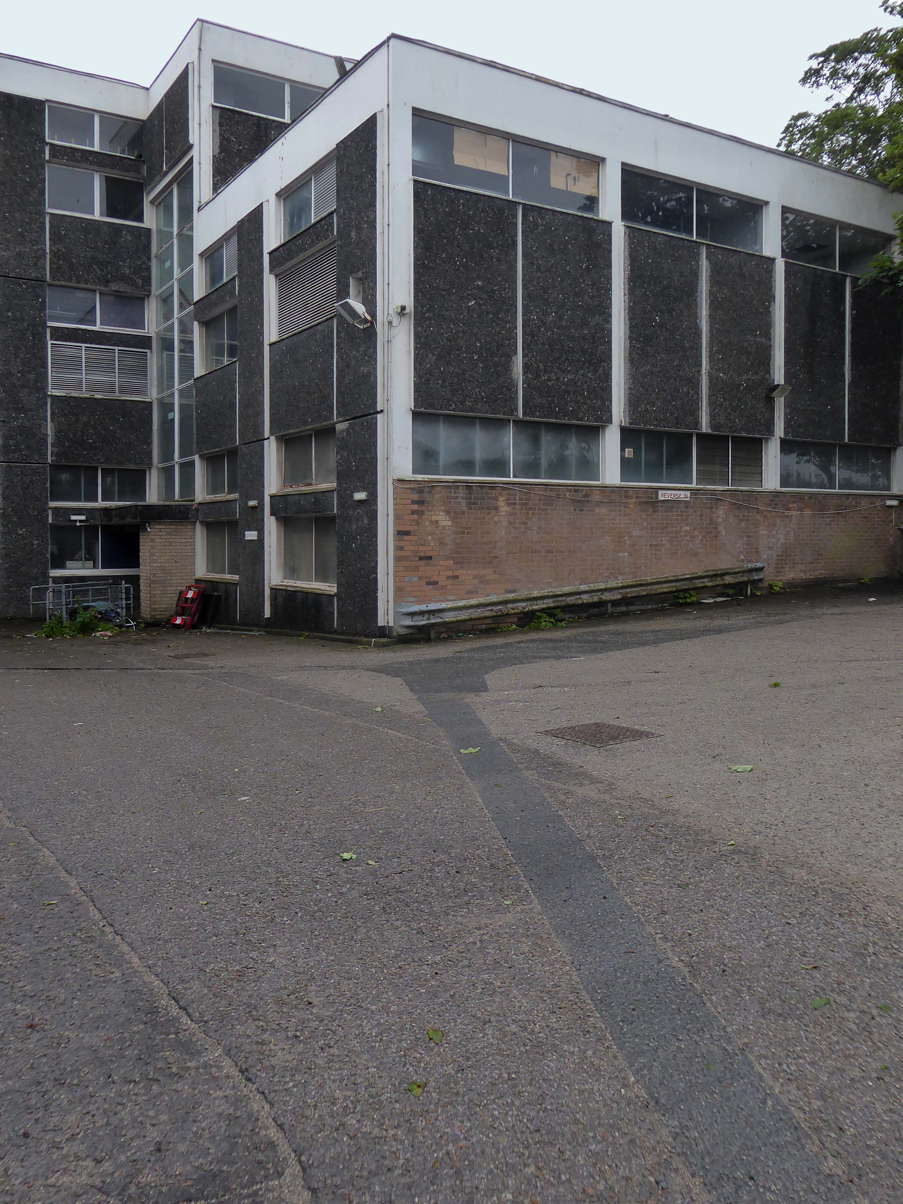
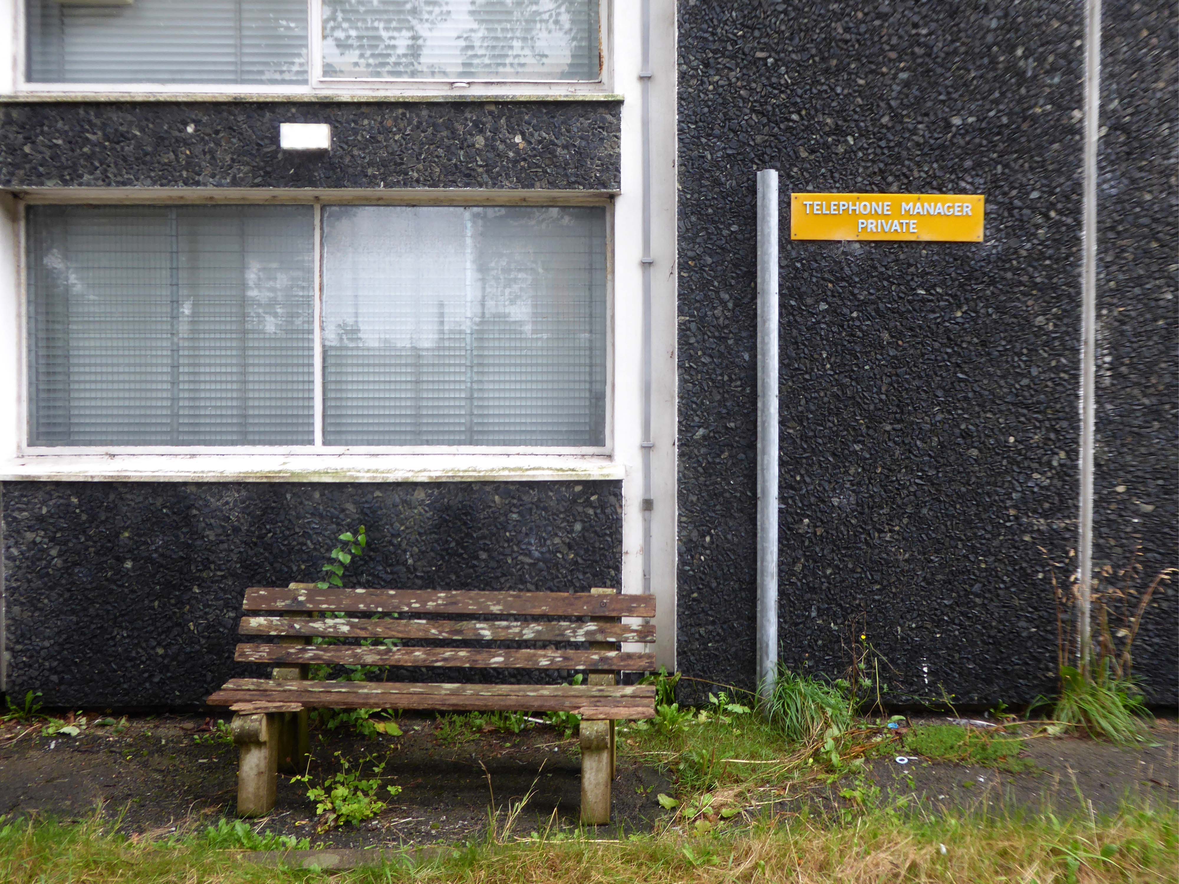
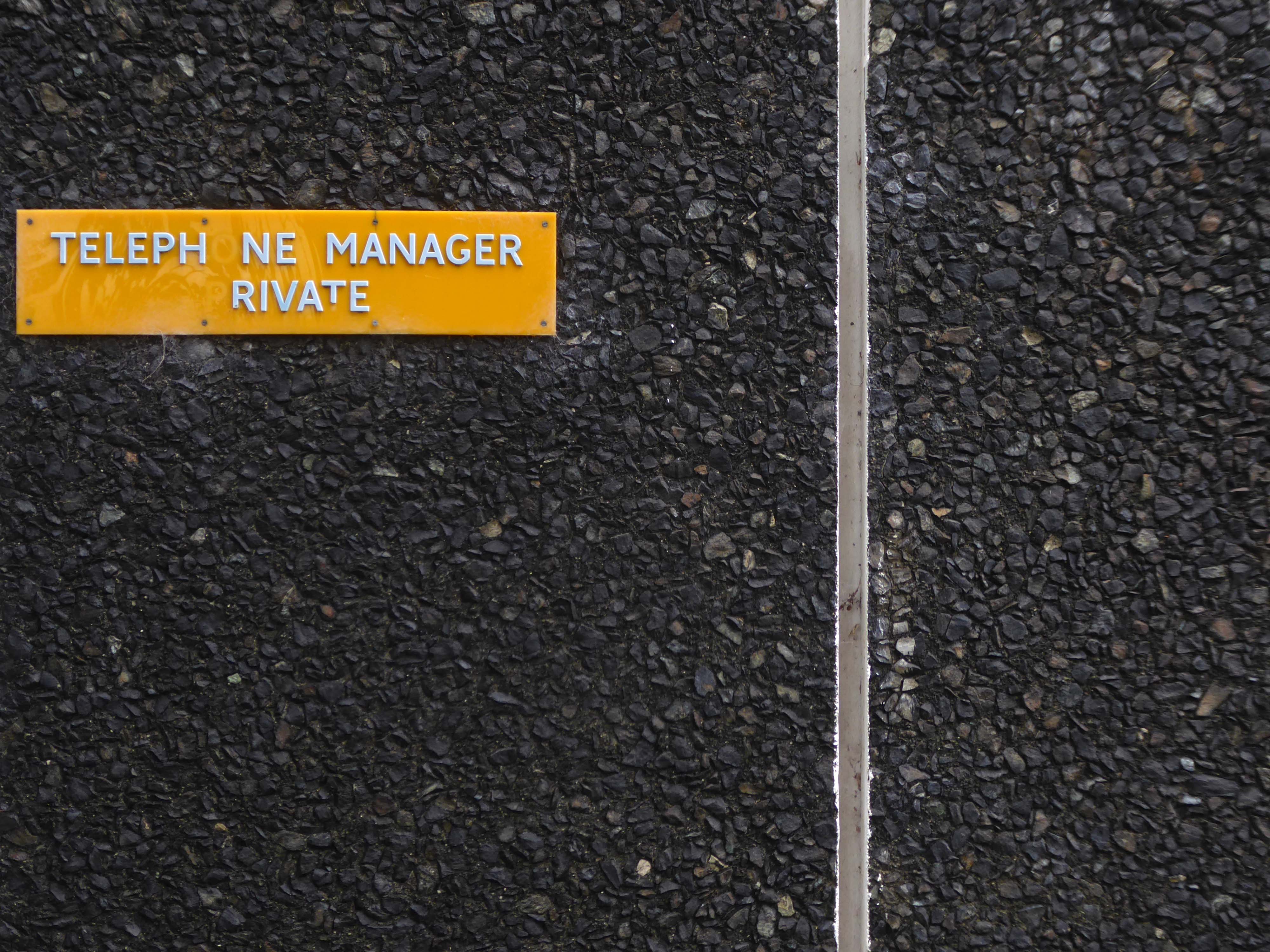
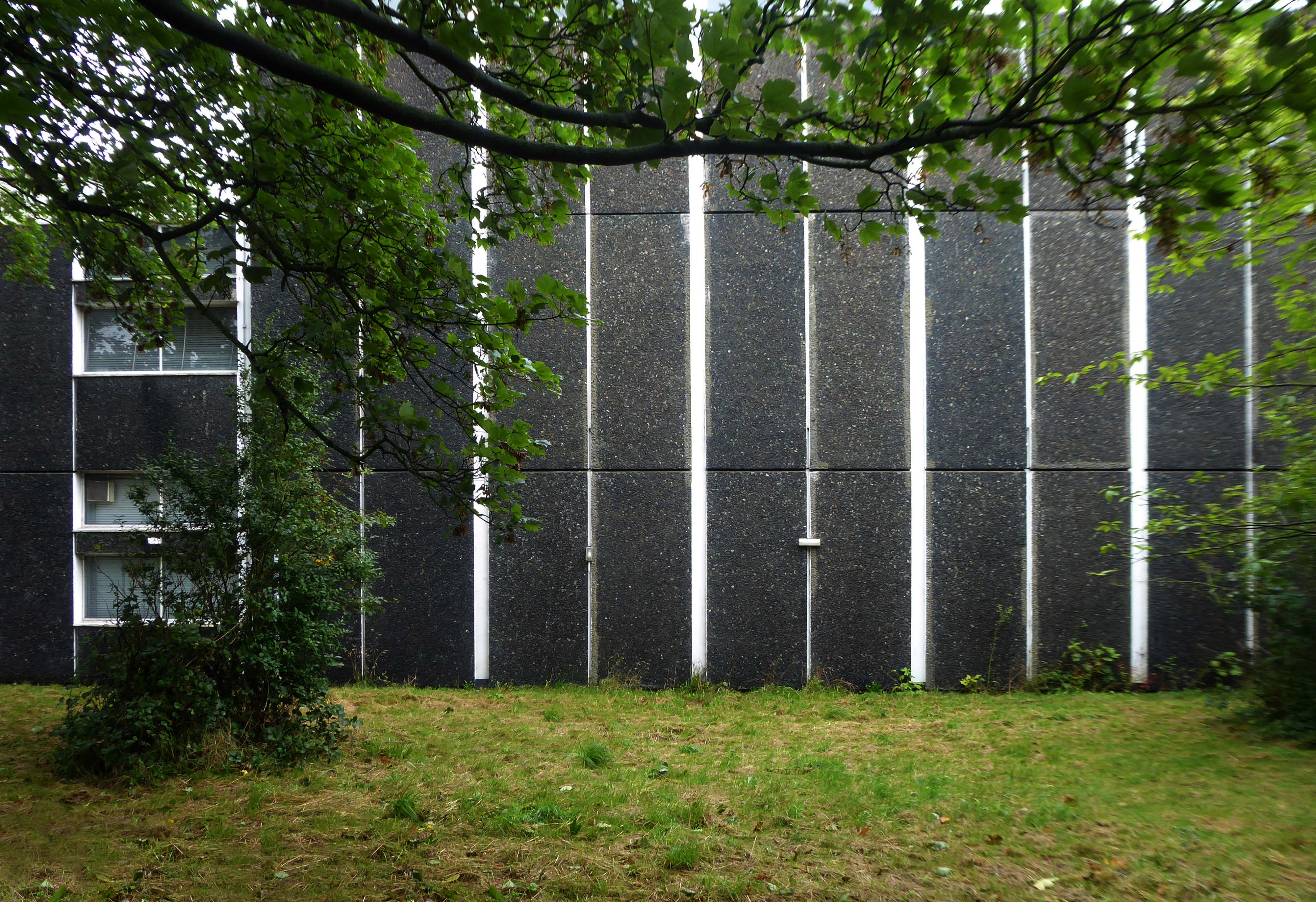
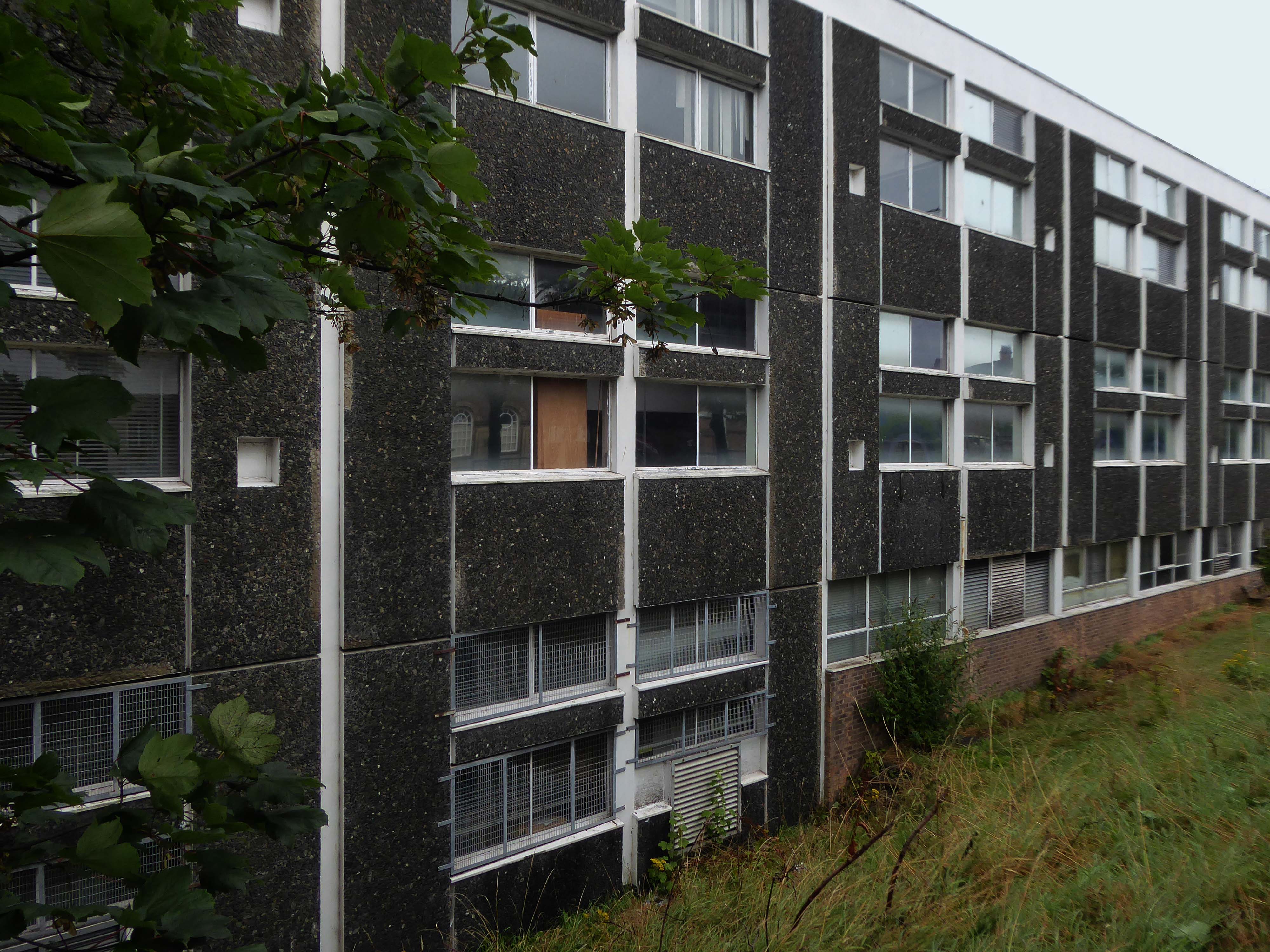
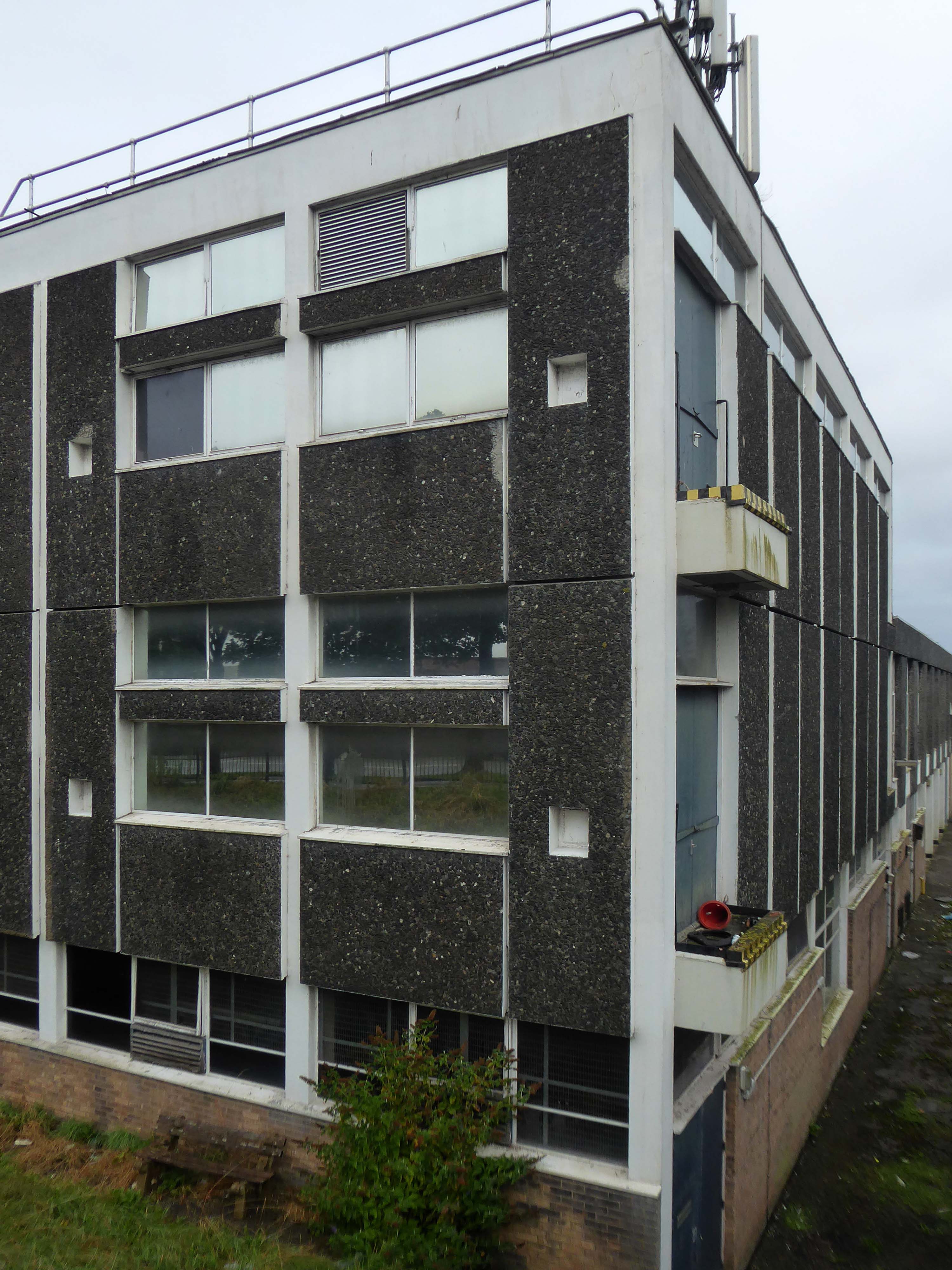
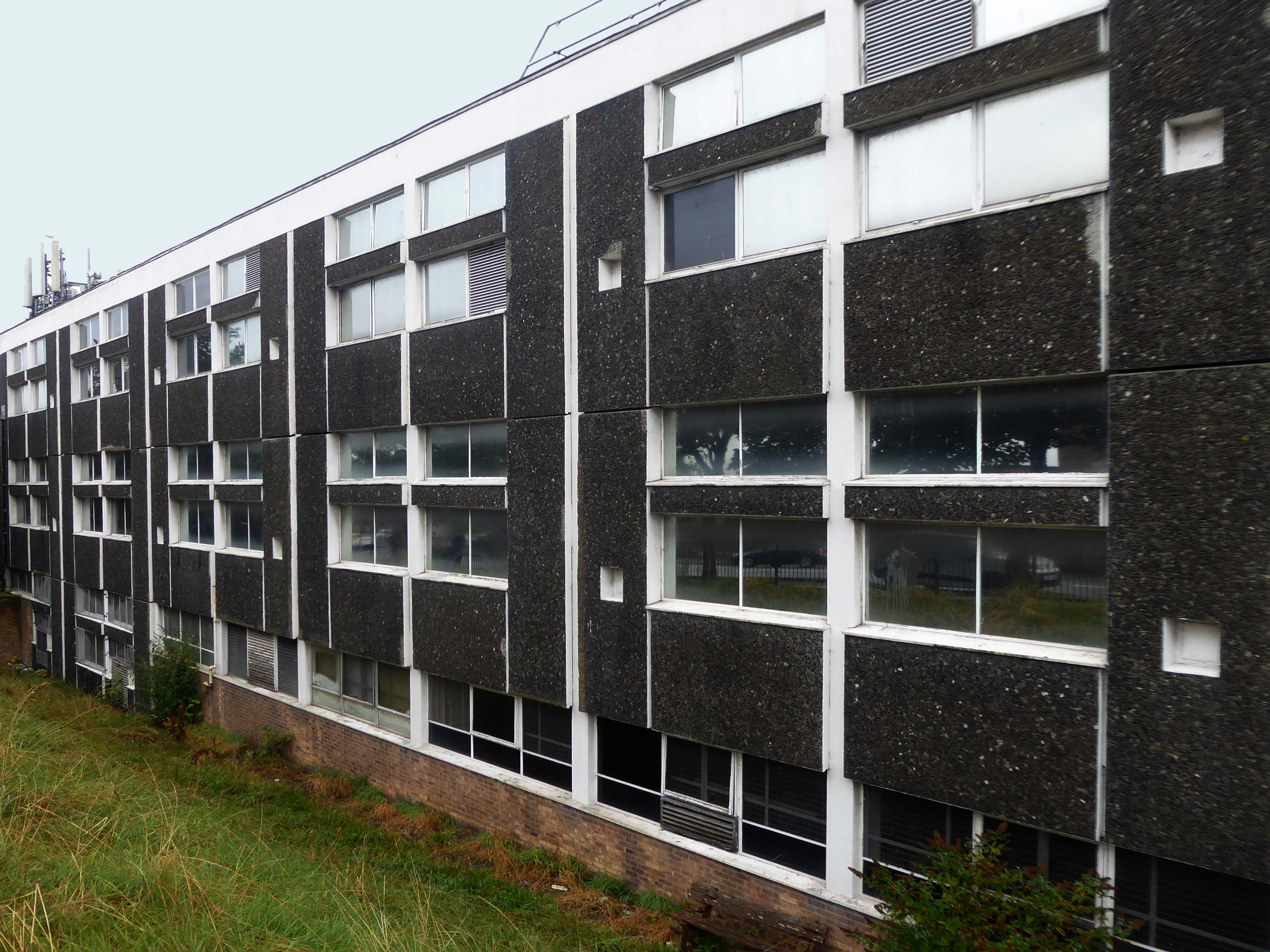
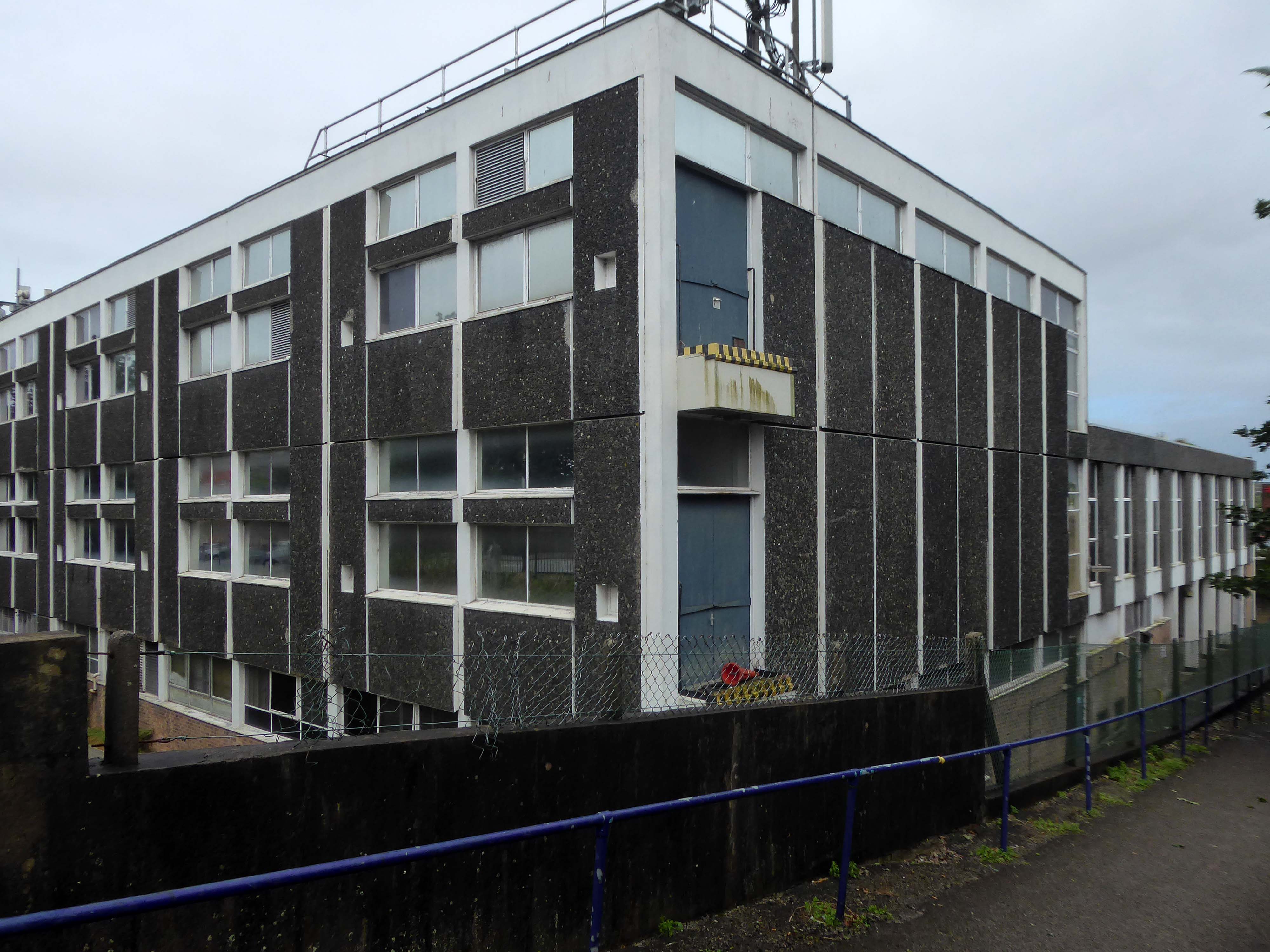
British Telecom Telephone Exchange Abbey Road Barrow in Furness LA14 5QZ
I took a train in the rain to Barrow in Furness.
I alighted, bathed in bright sunlight.
I espied a telephone Exchange.
The original building was designed by MOPBW senior architect M Williams and job architect P Chilton around 1966-67. Senior architect RN Dixon – of modernist talk fame, and job architect P Joyce were involved with some detailing around 1968, before Dixon designed an extension in 1972.
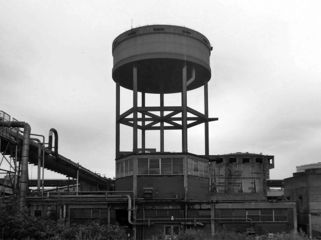
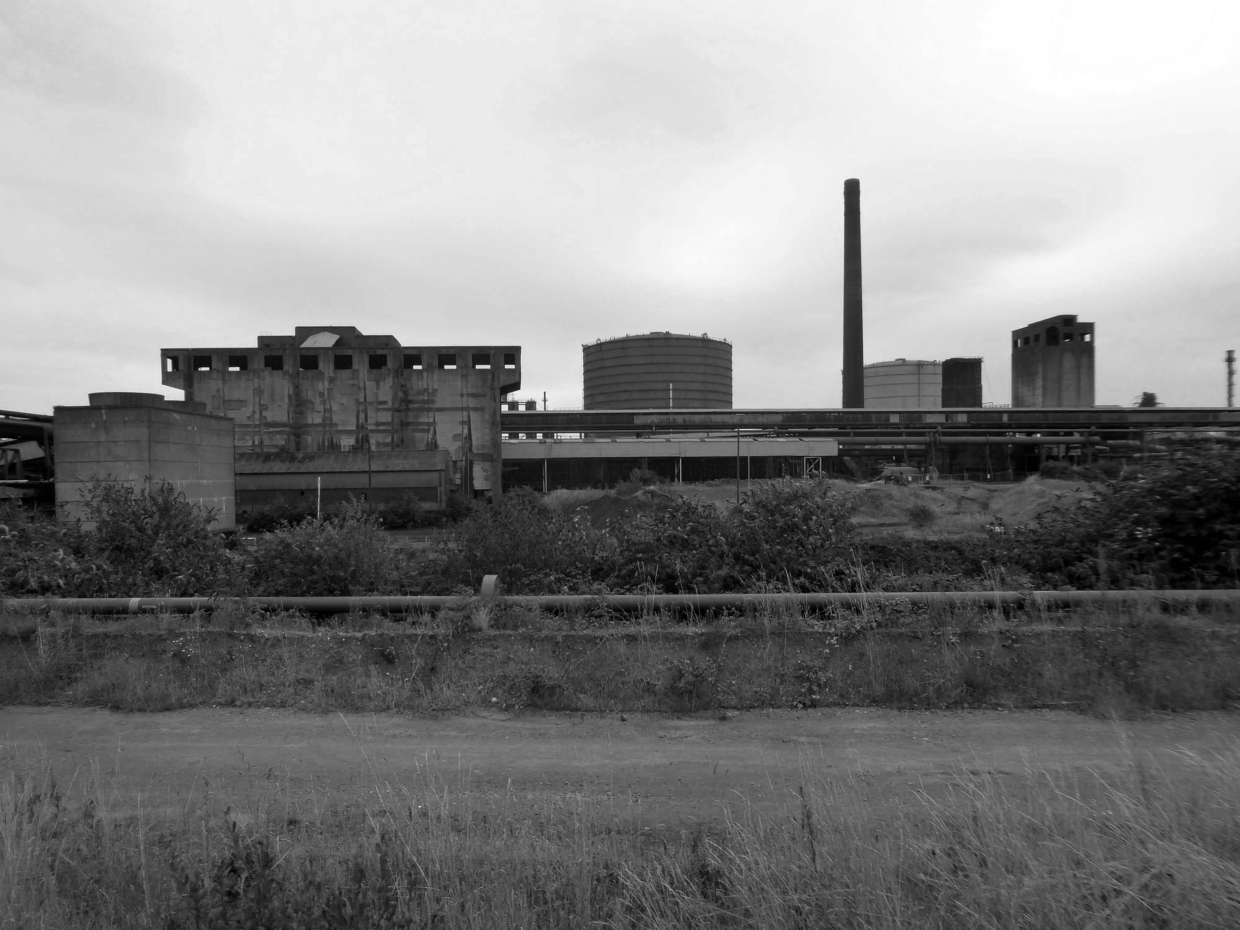
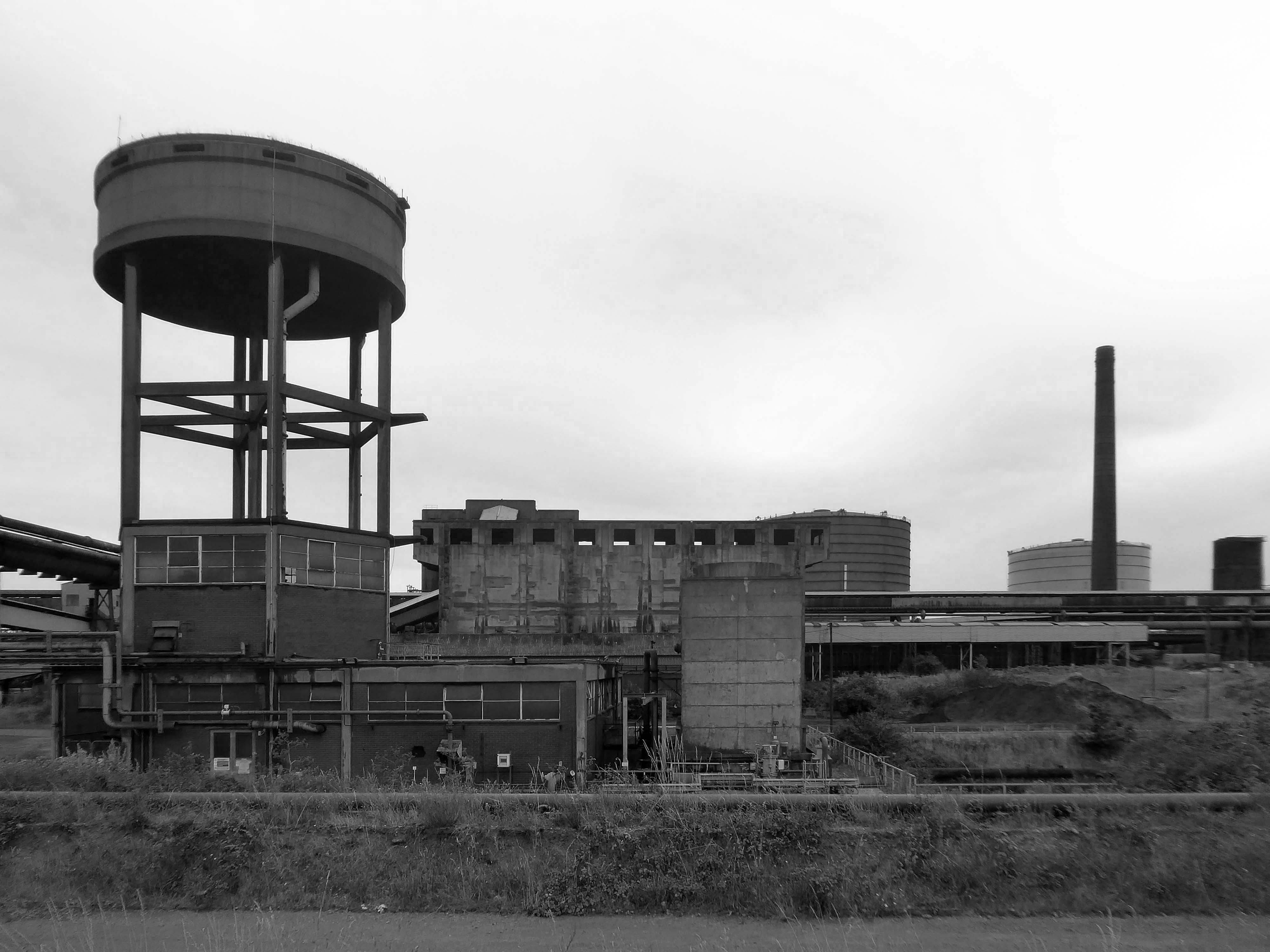
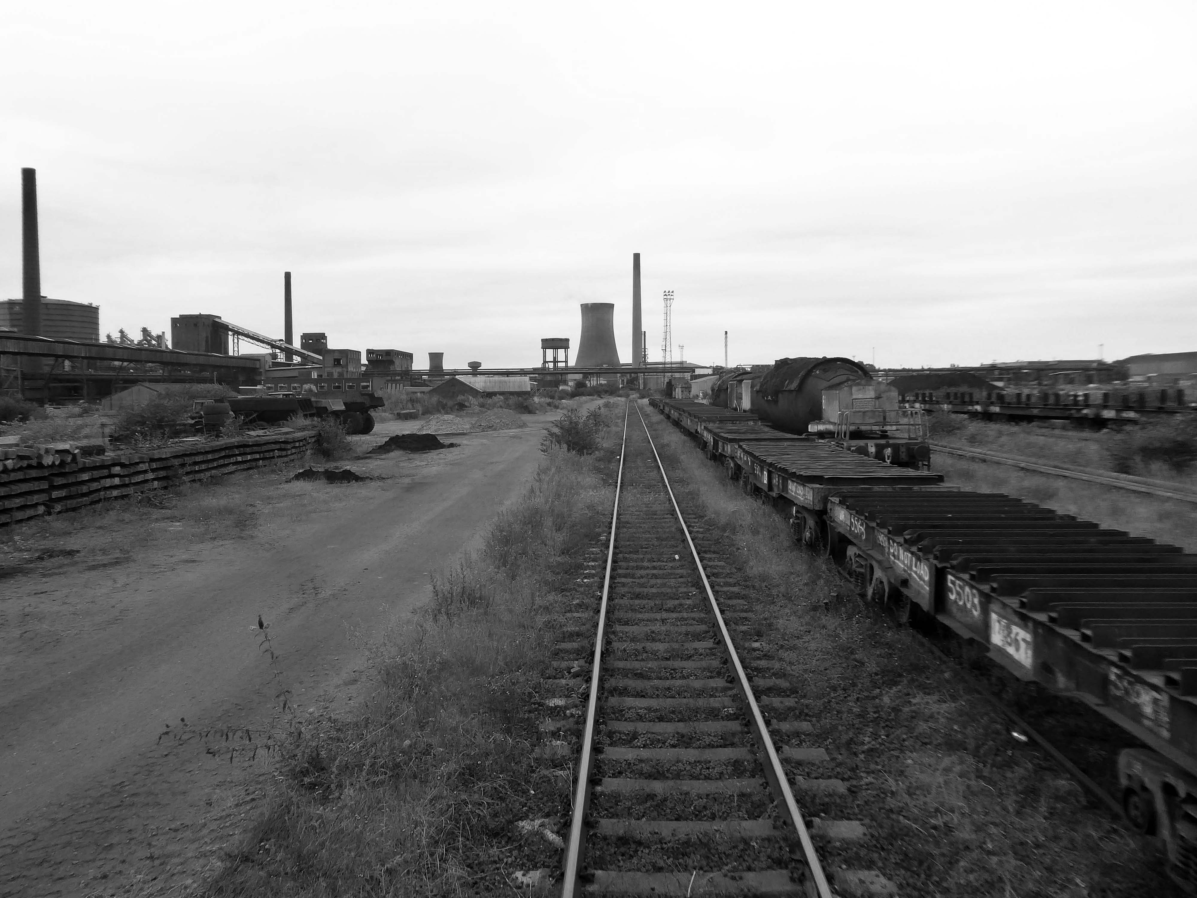
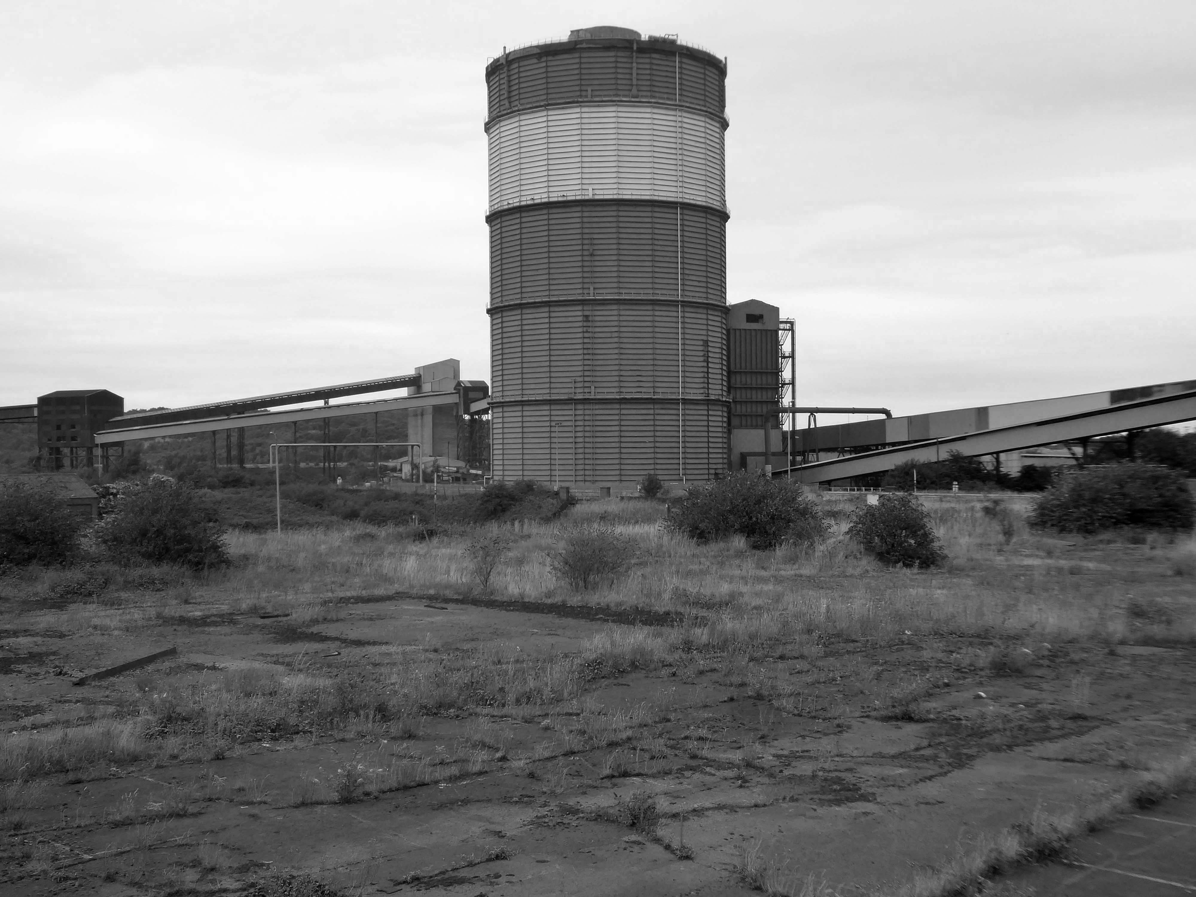
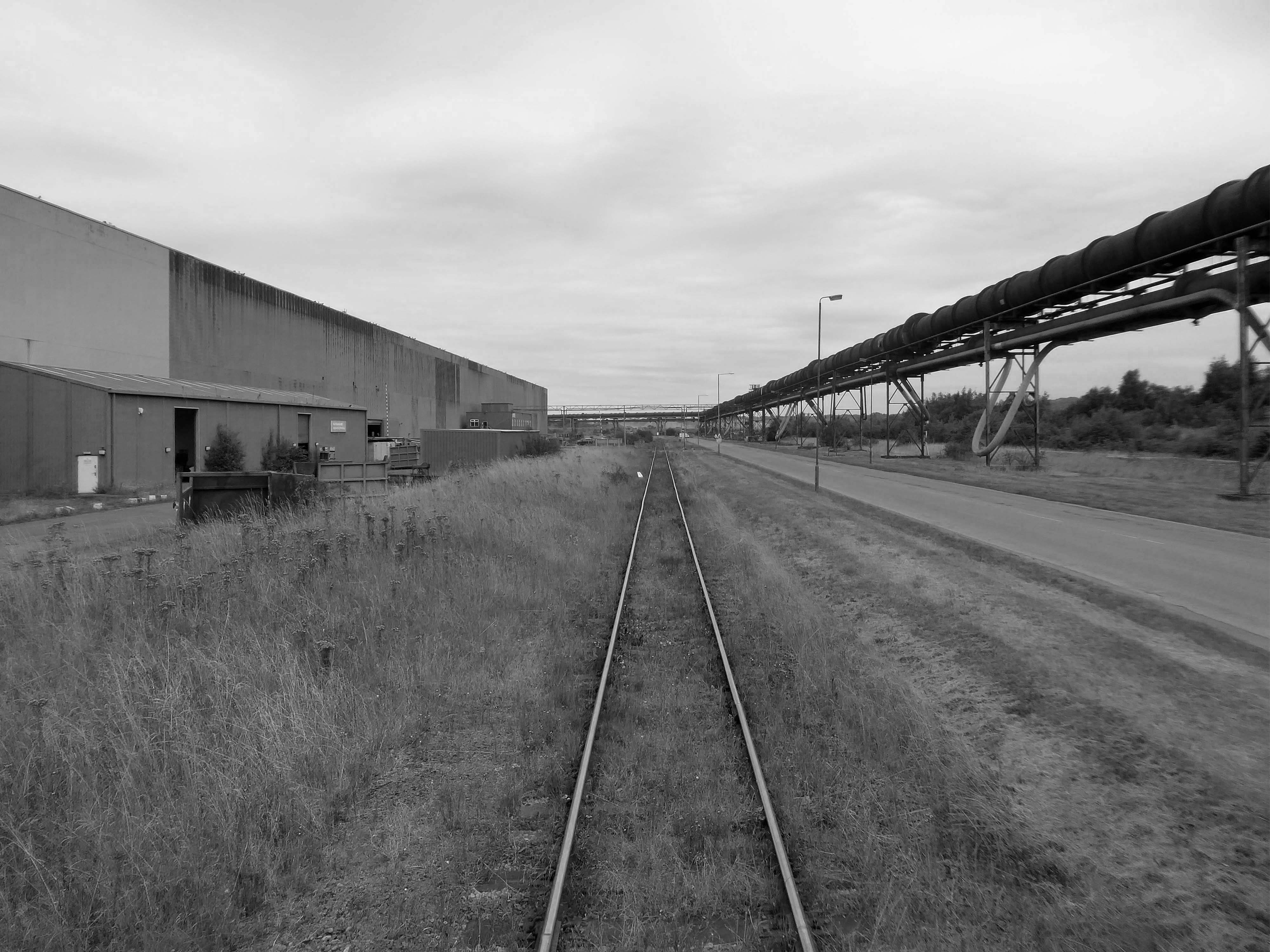
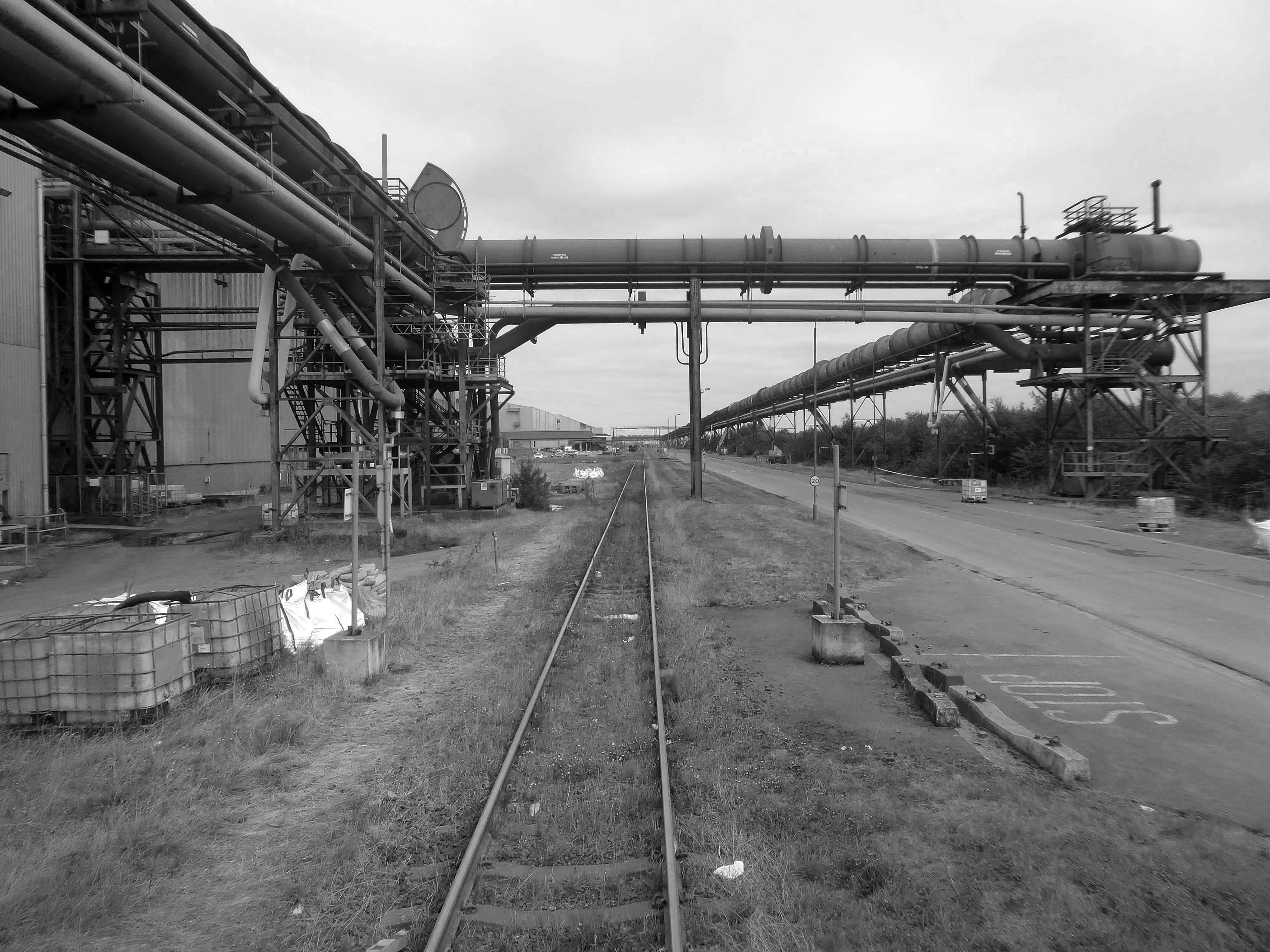
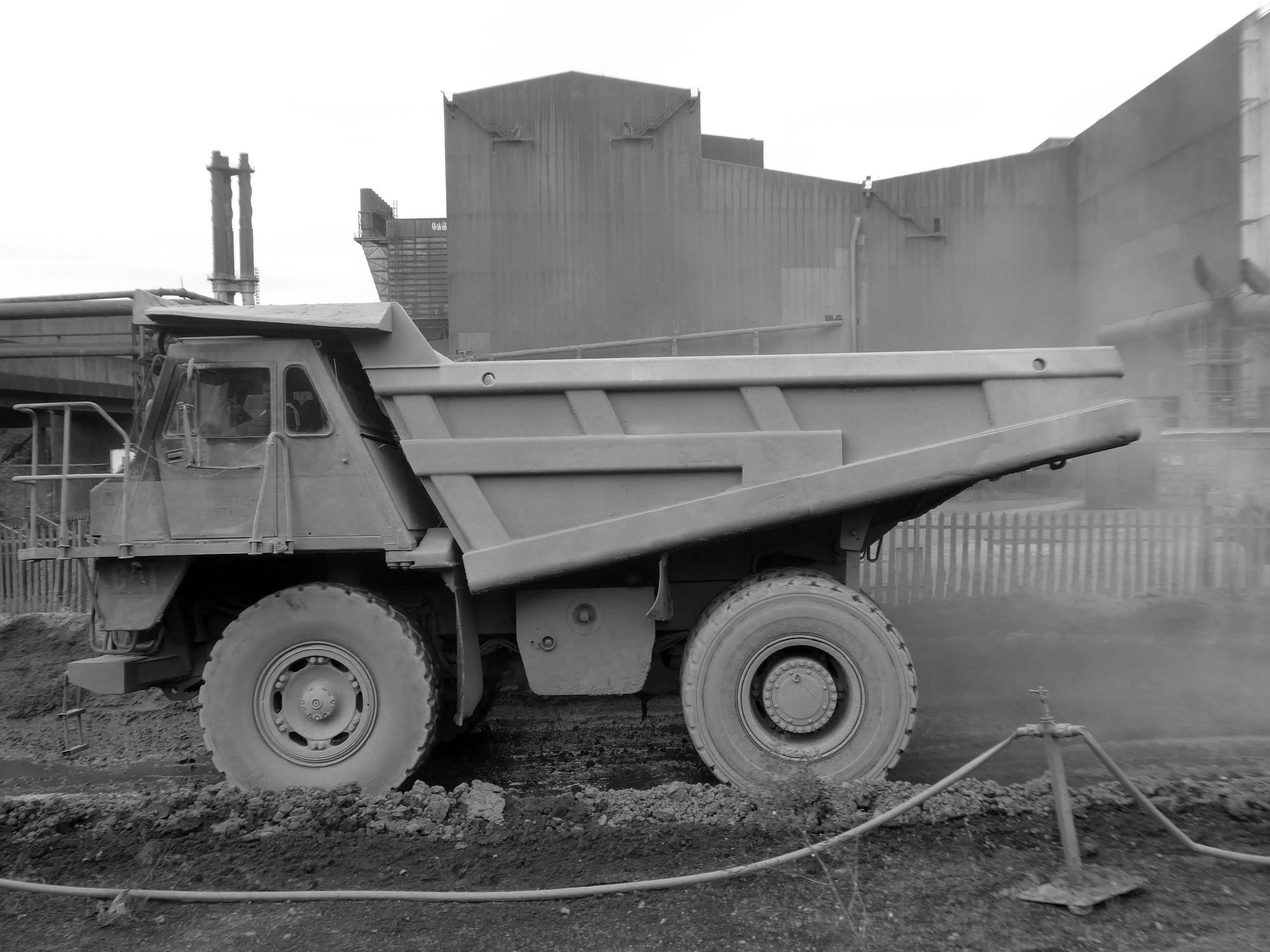
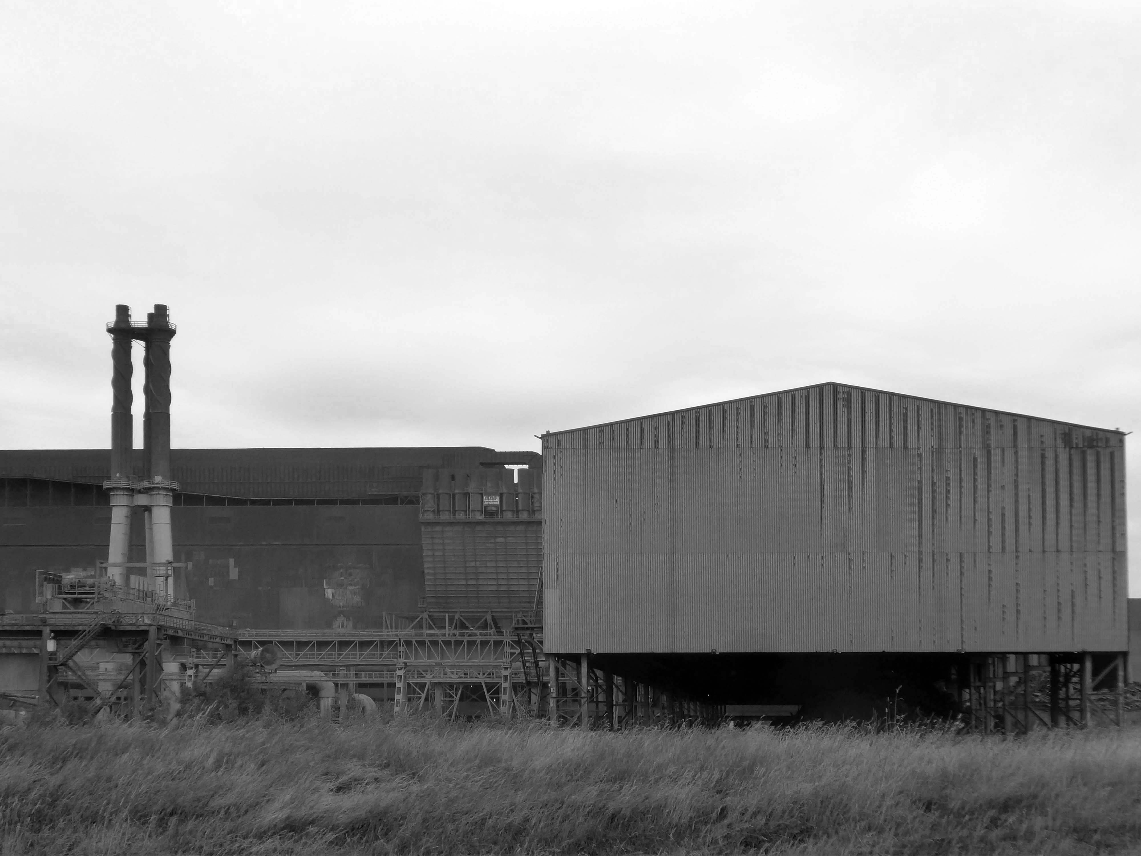
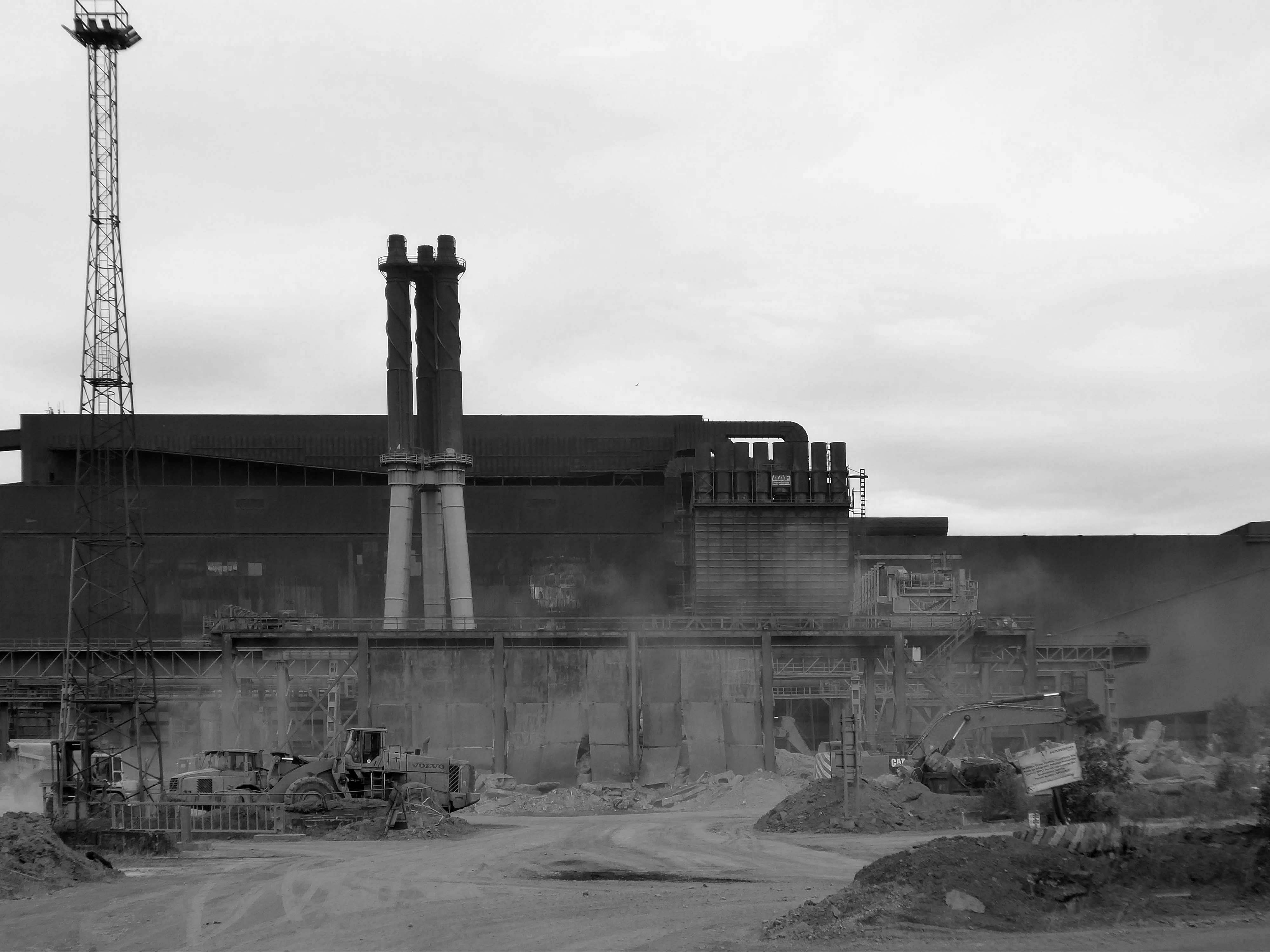
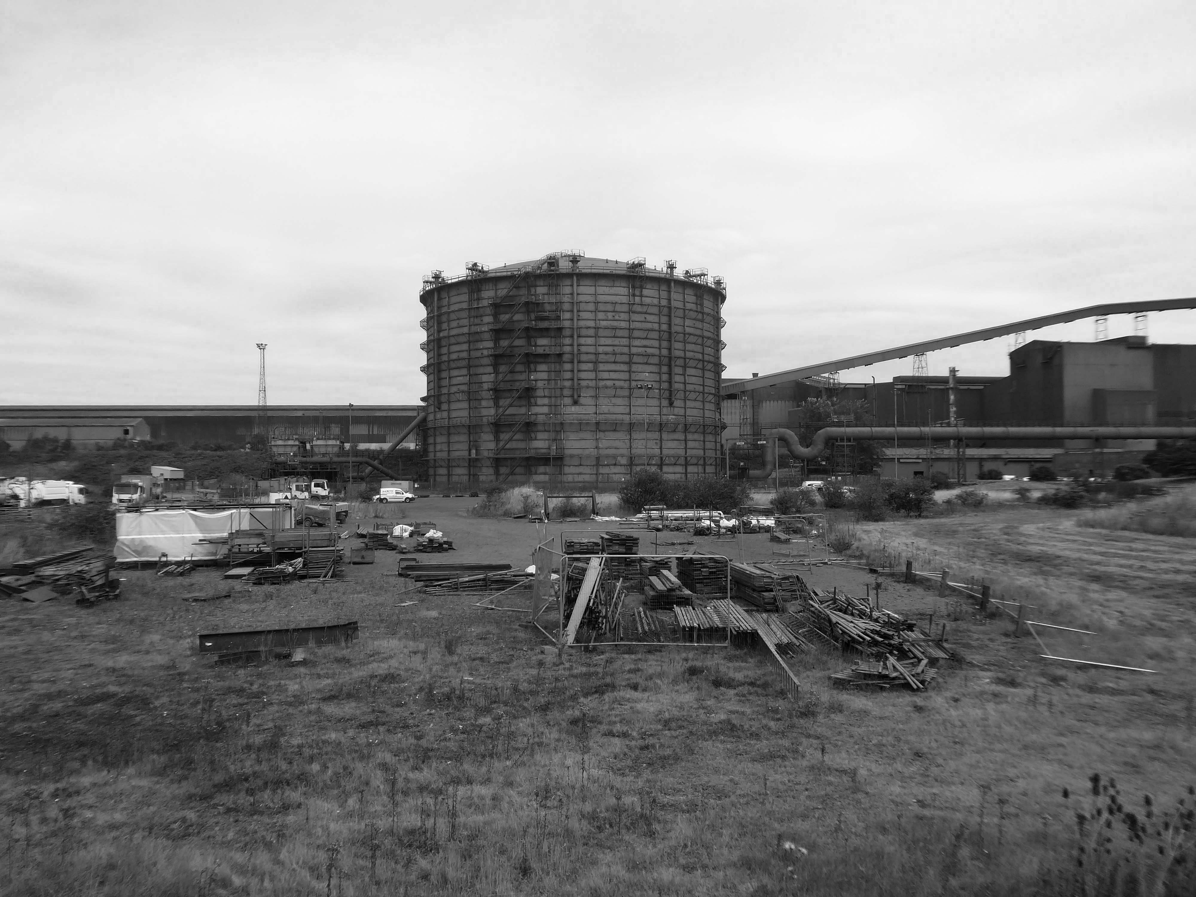
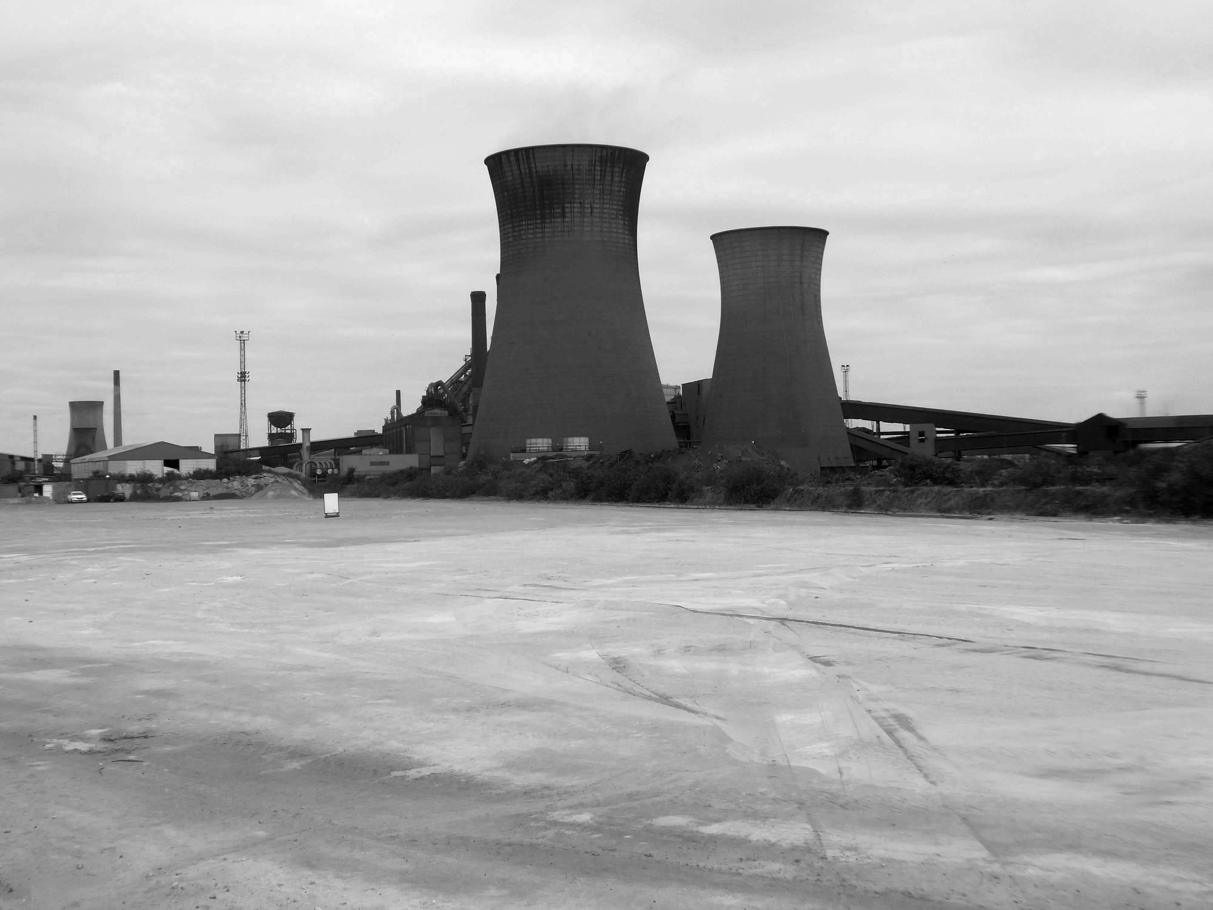
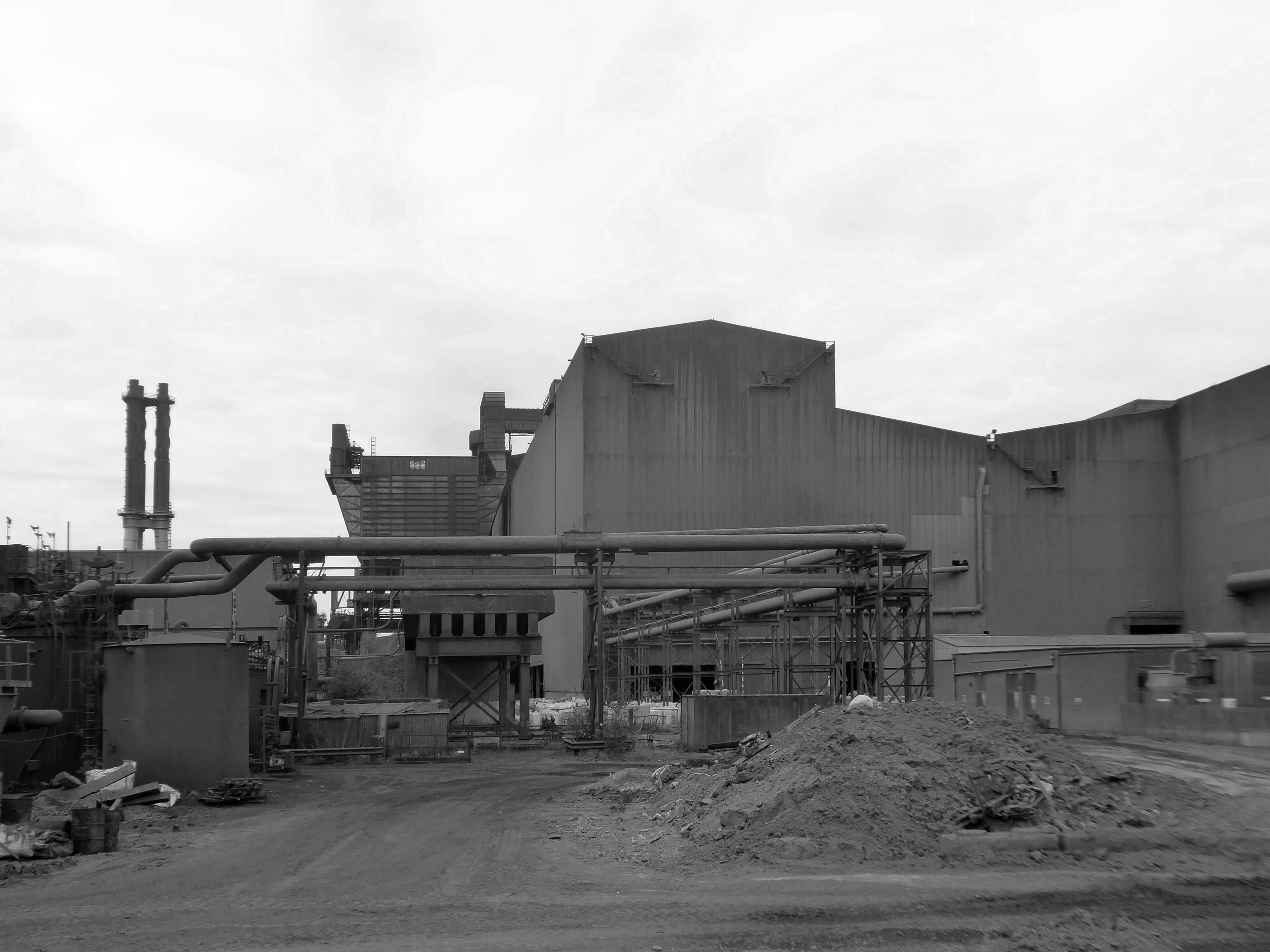
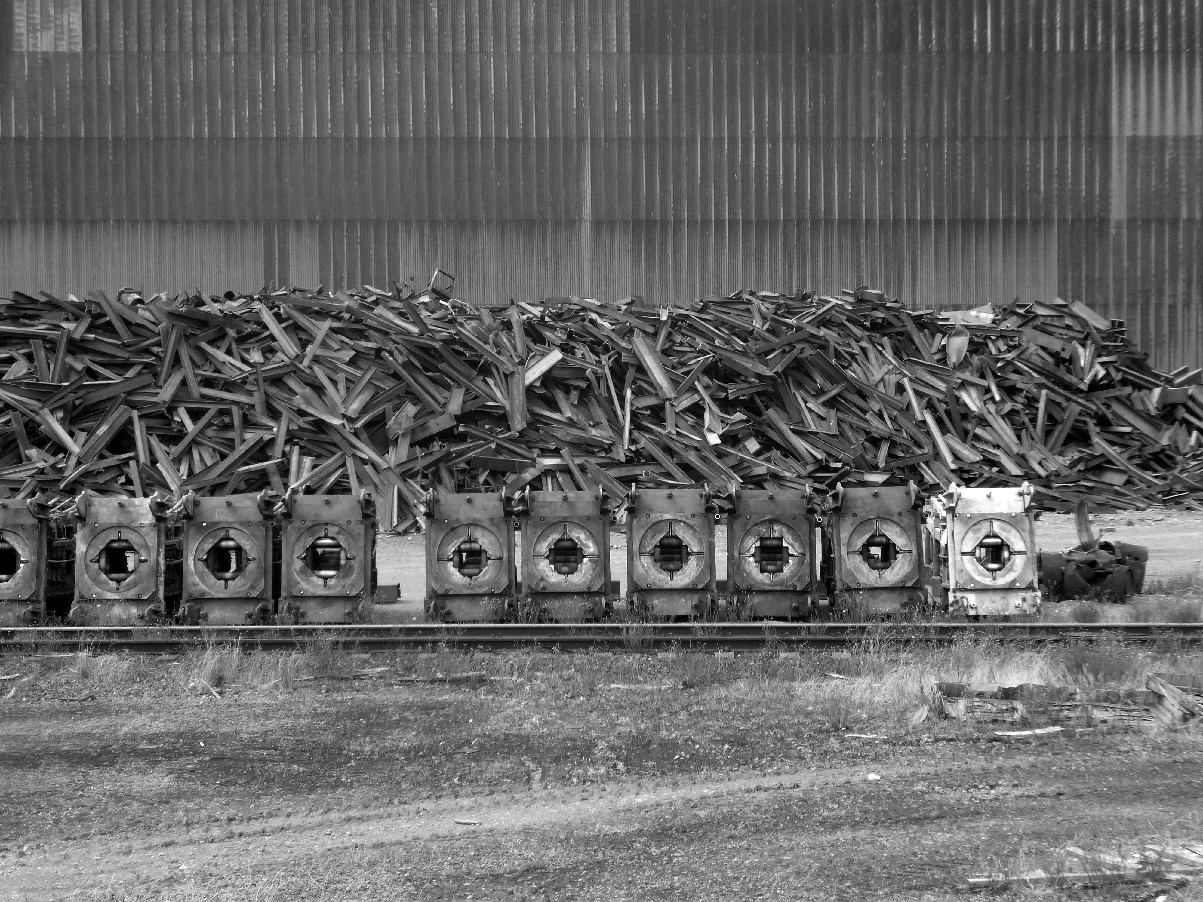
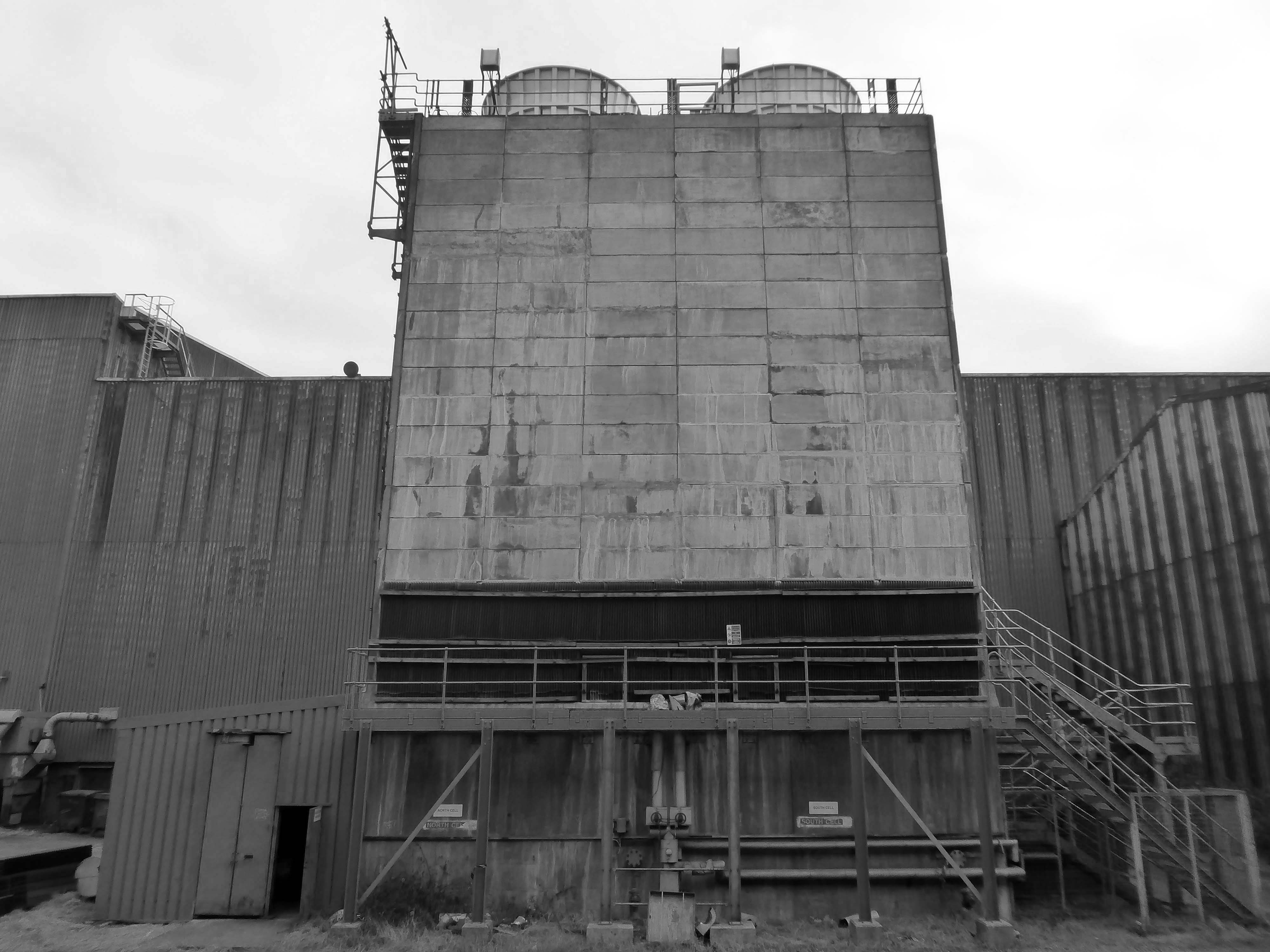
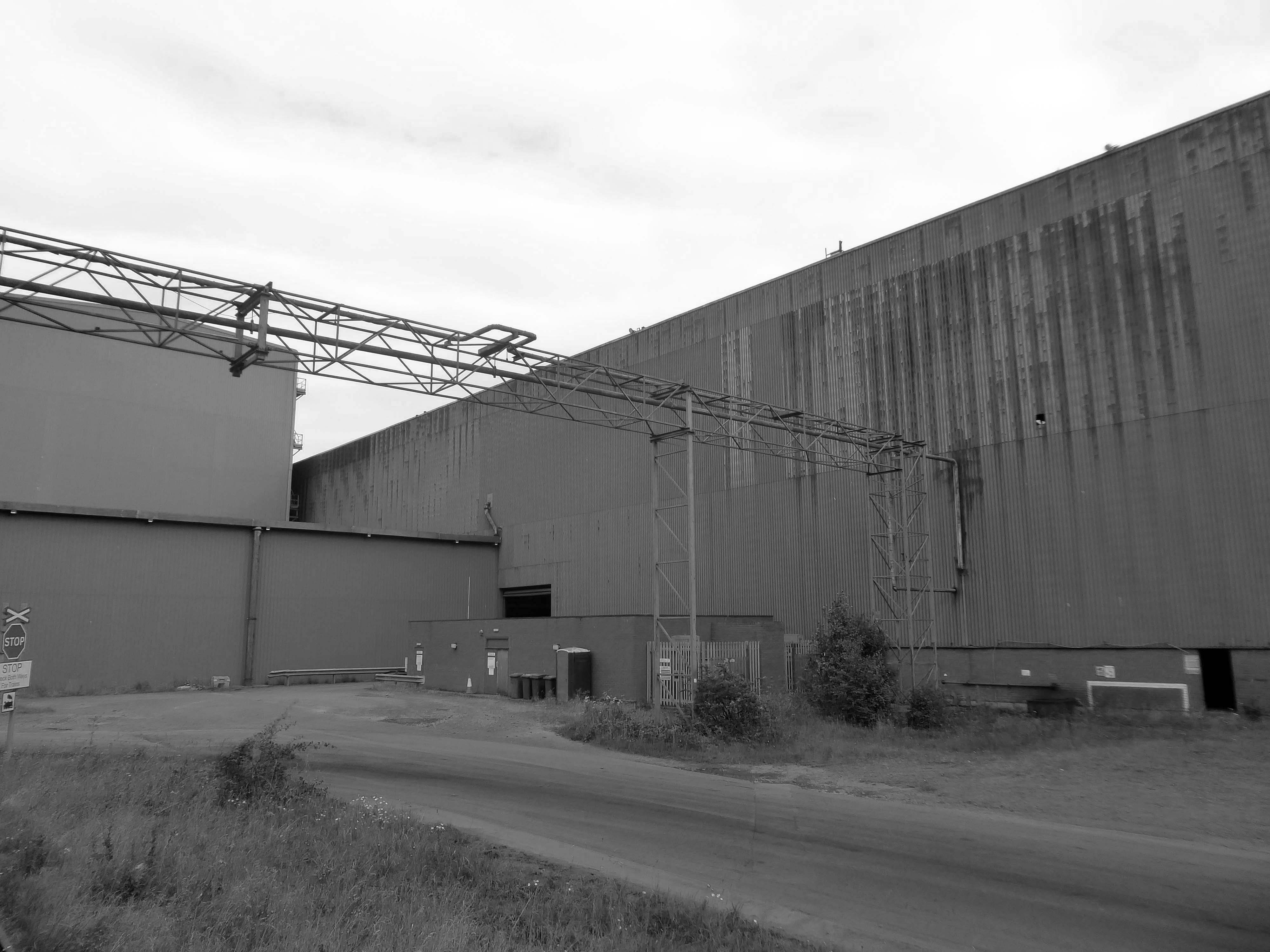
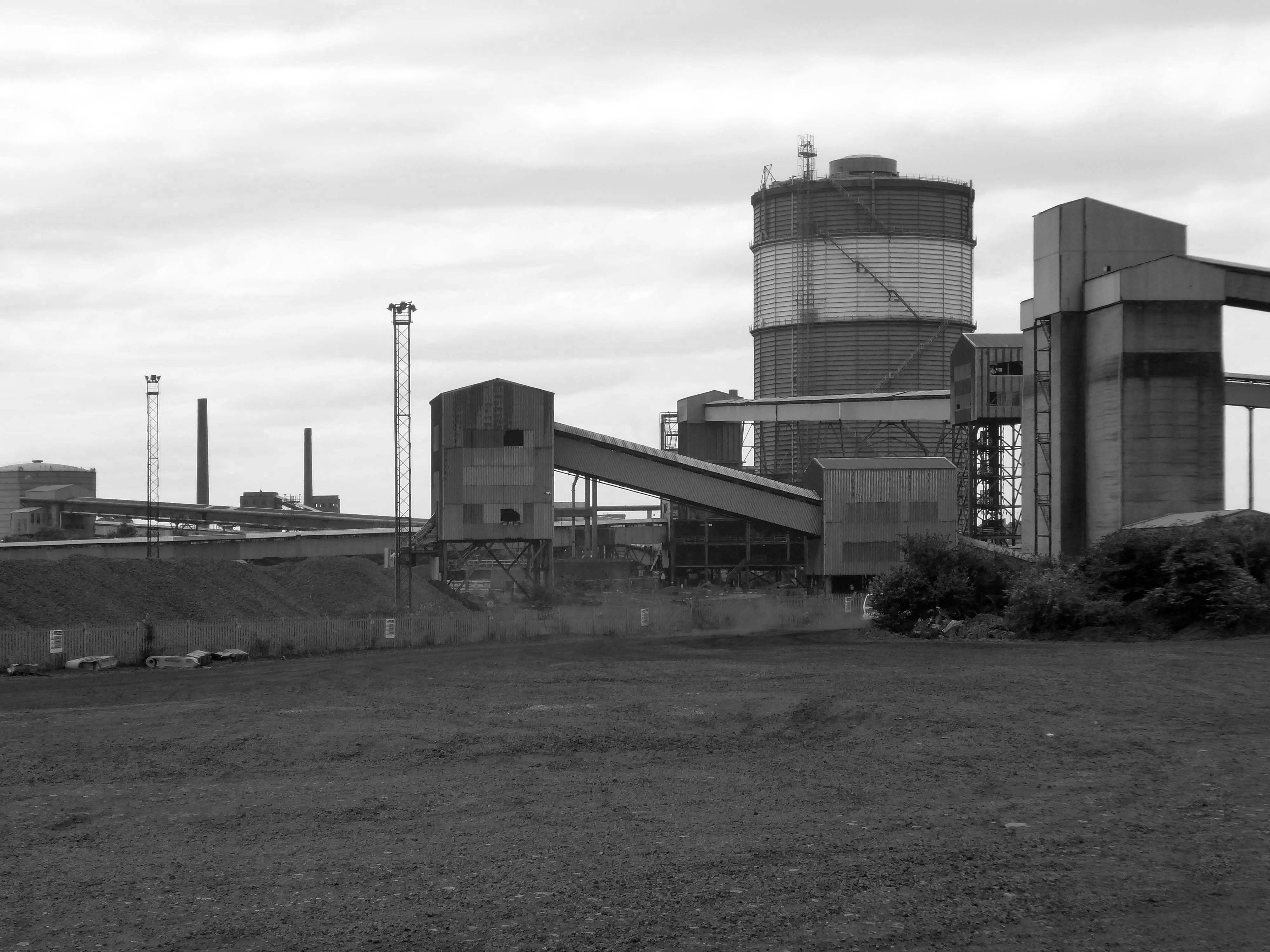
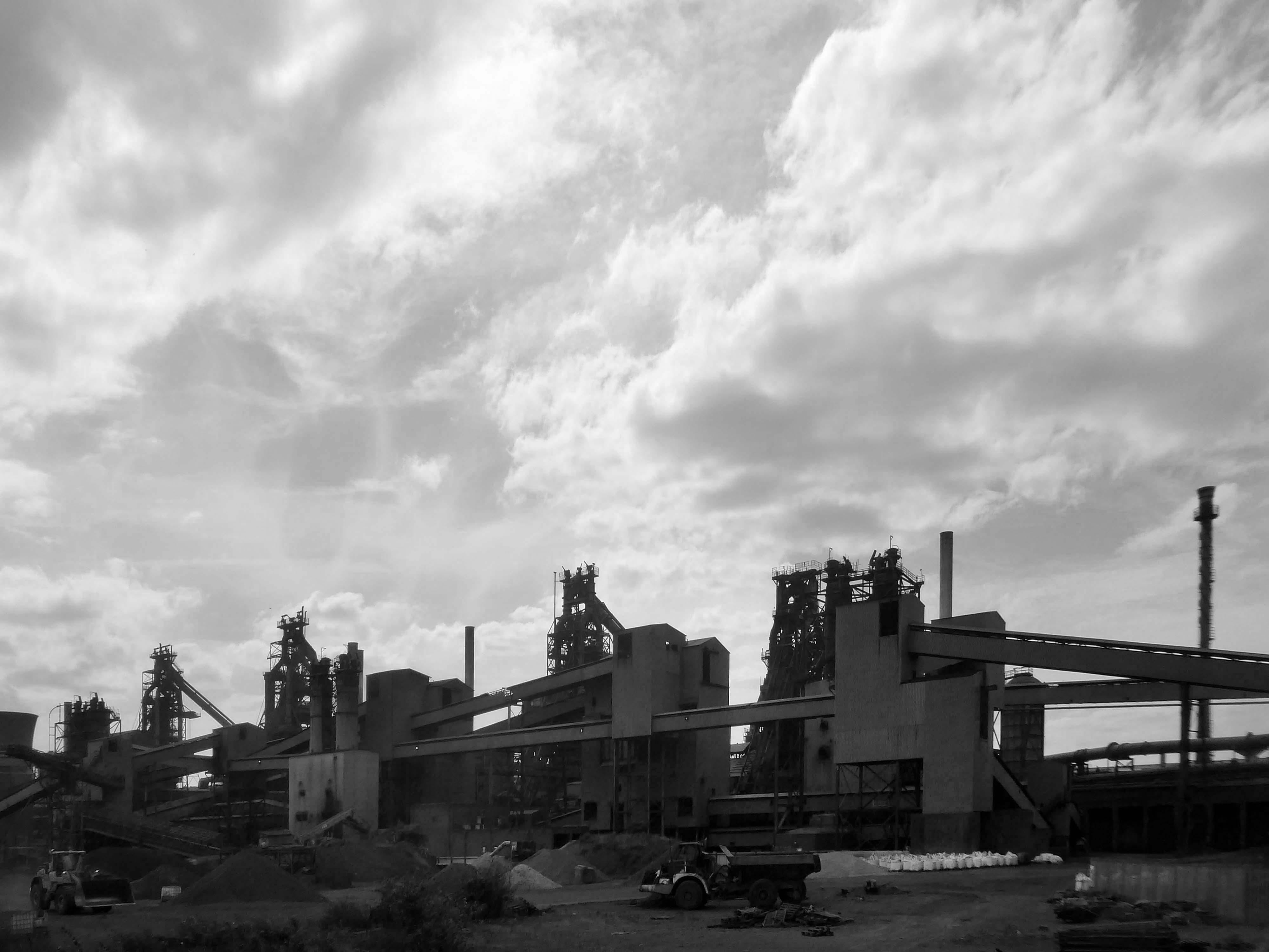
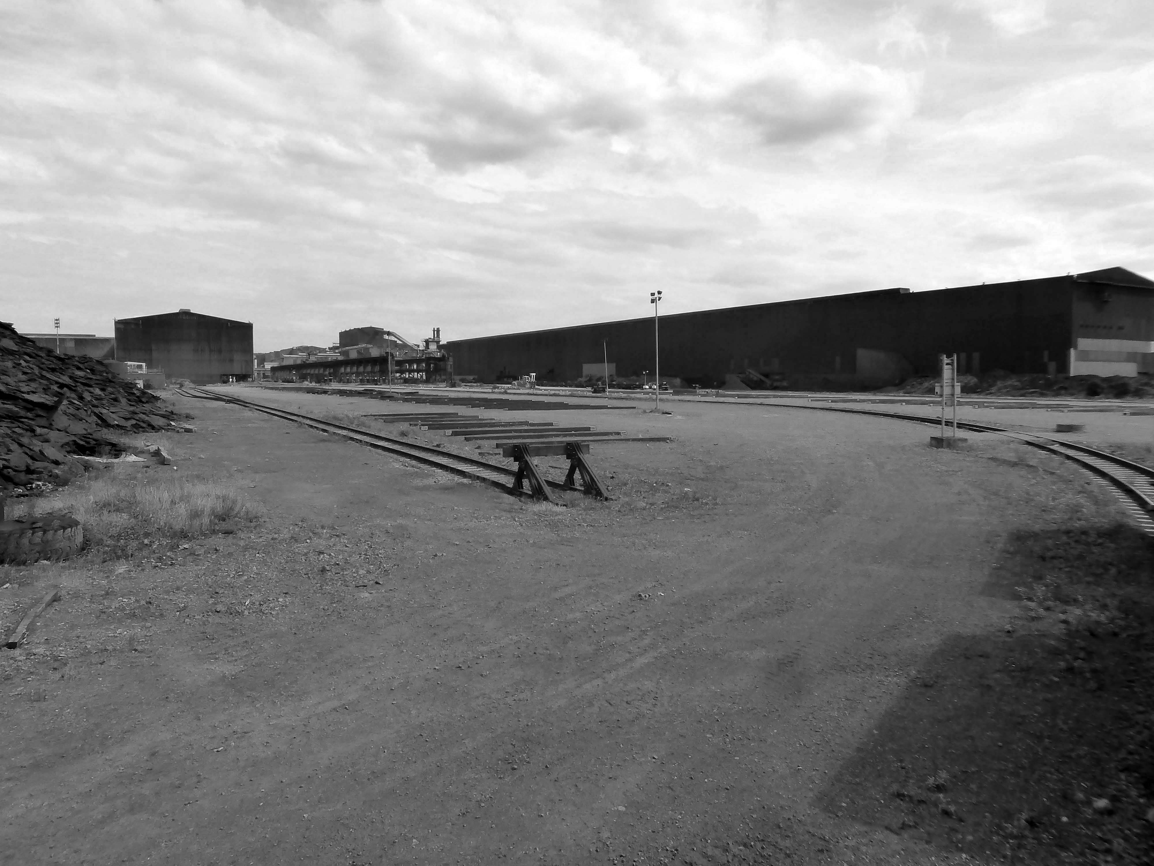
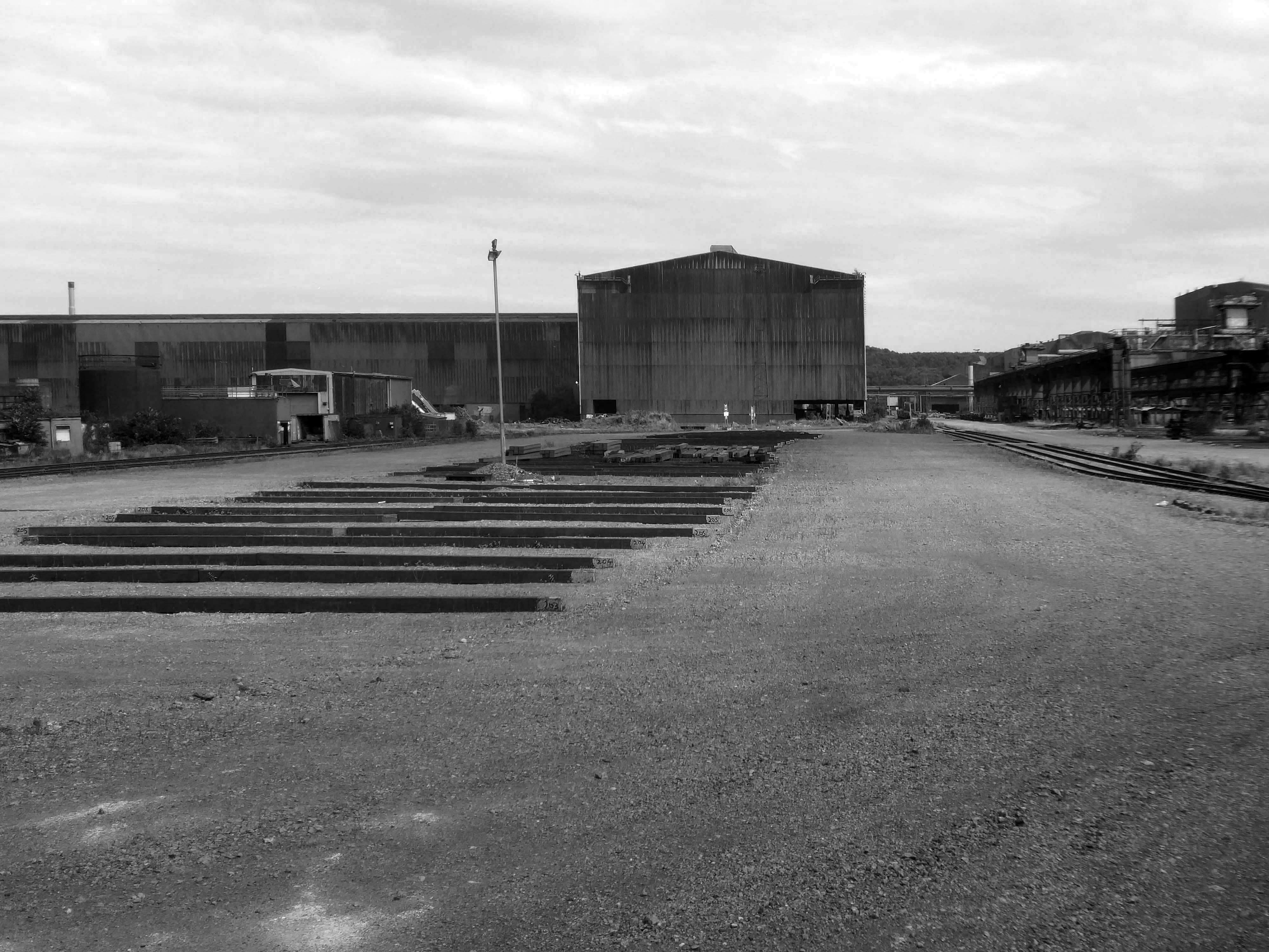
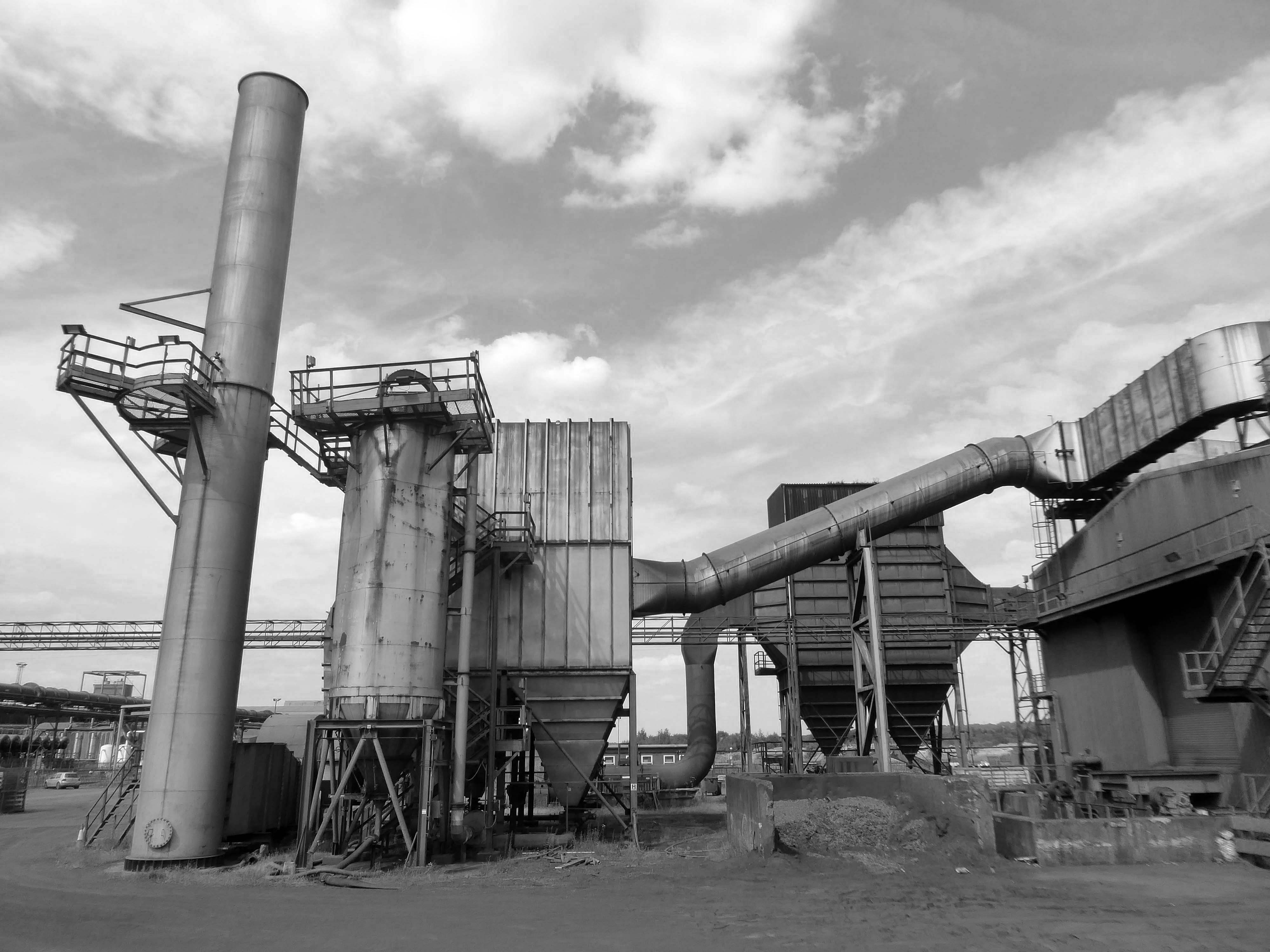
This video provides a refreshing and inspiring insight into the steel manufacturing industry and the people who make it happen.
The Iron and Steel Industry in Scunthorpe was established in the mid 19th century, following the discovery and exploitation of middle Lias ironstone east of Scunthorpe.
In 1967 three works became part of the nationalised British Steel Corporation.
Following privatisation in 1988, the company together with the rest of BSC became part of Corus in 1999, in 2007 becoming Tata Steel Europe. In 2016 the long products division of Tata Steel Europe was sold to Greybull Capital with Scunthorpe as the primary steel production site.
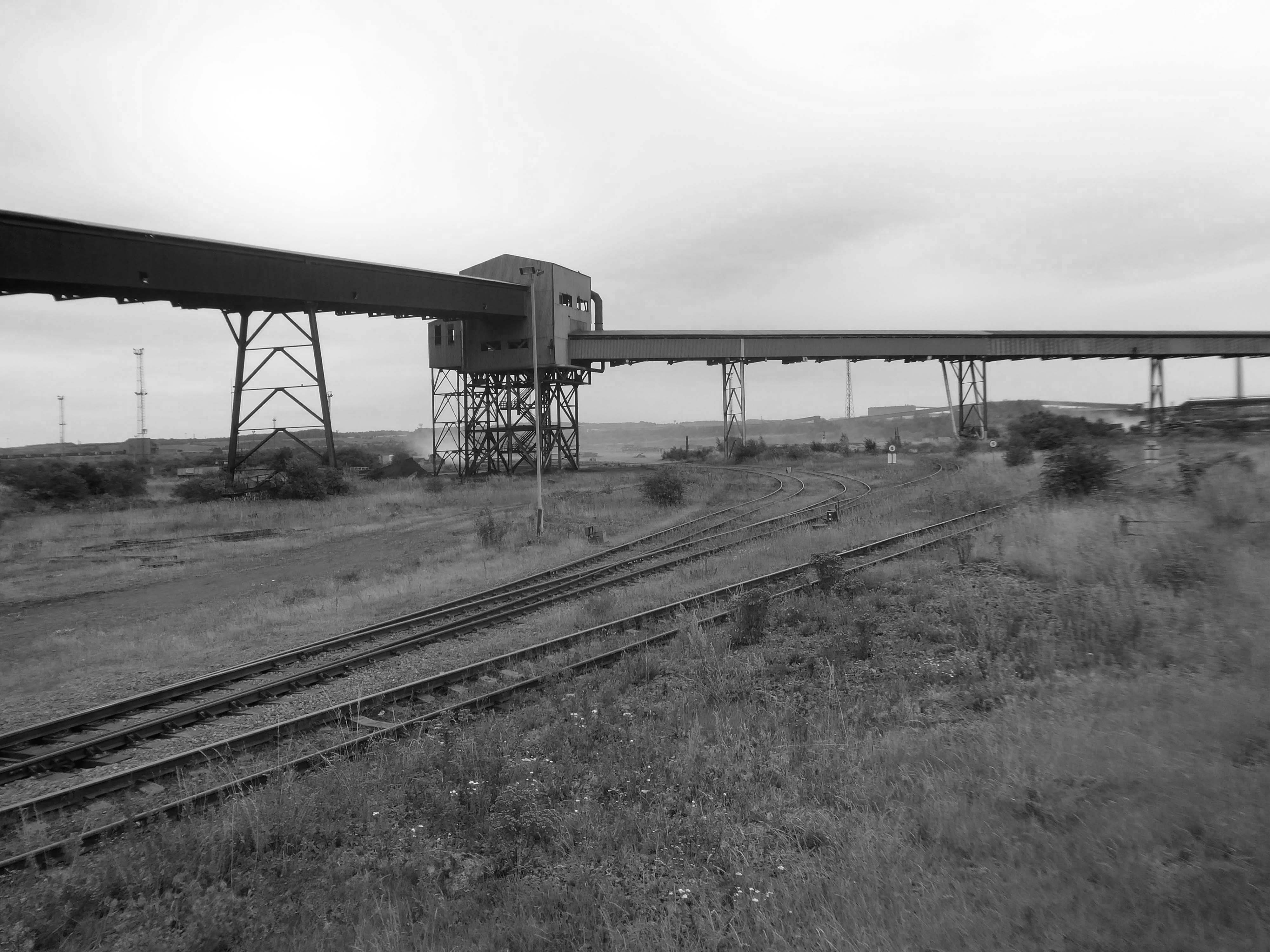
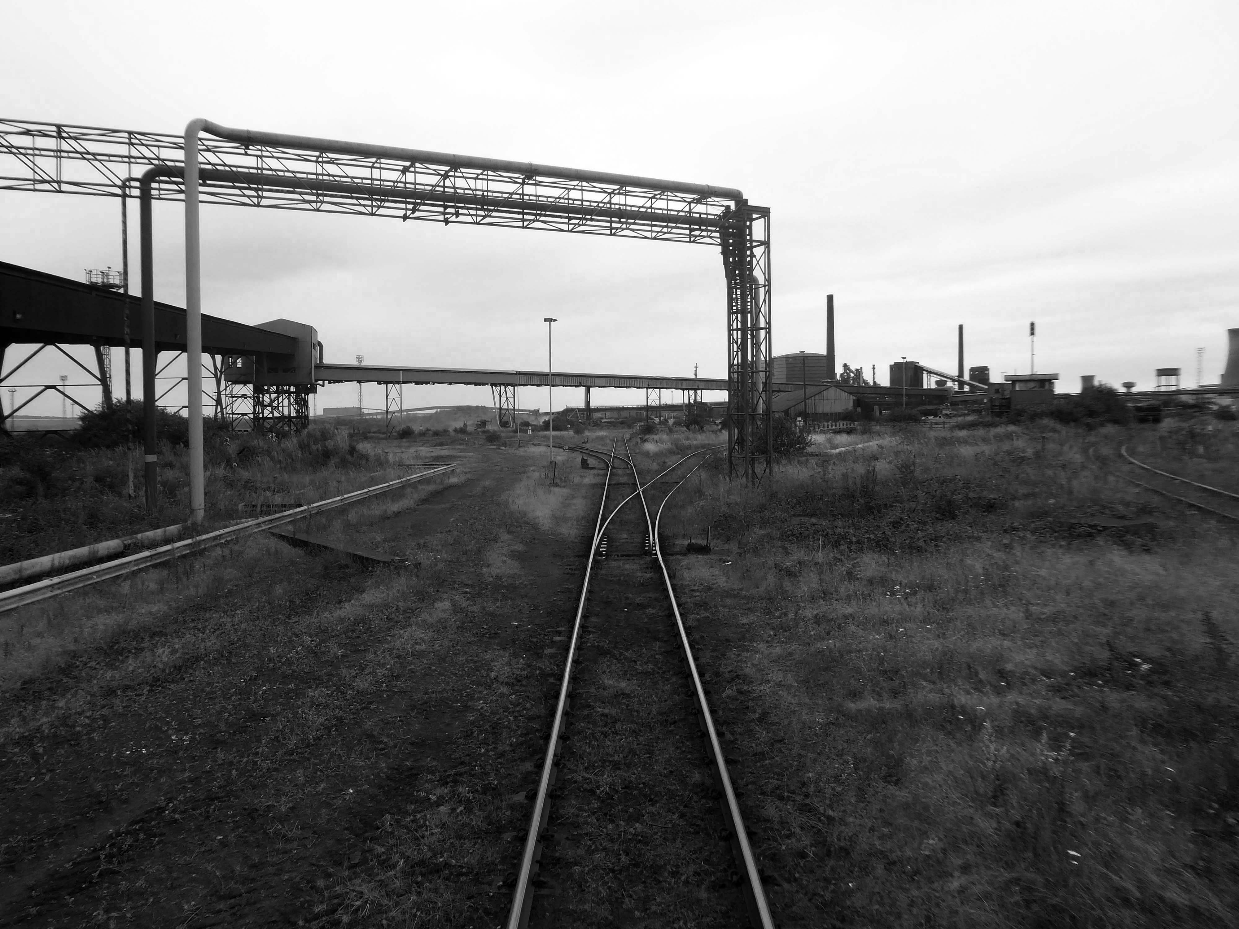
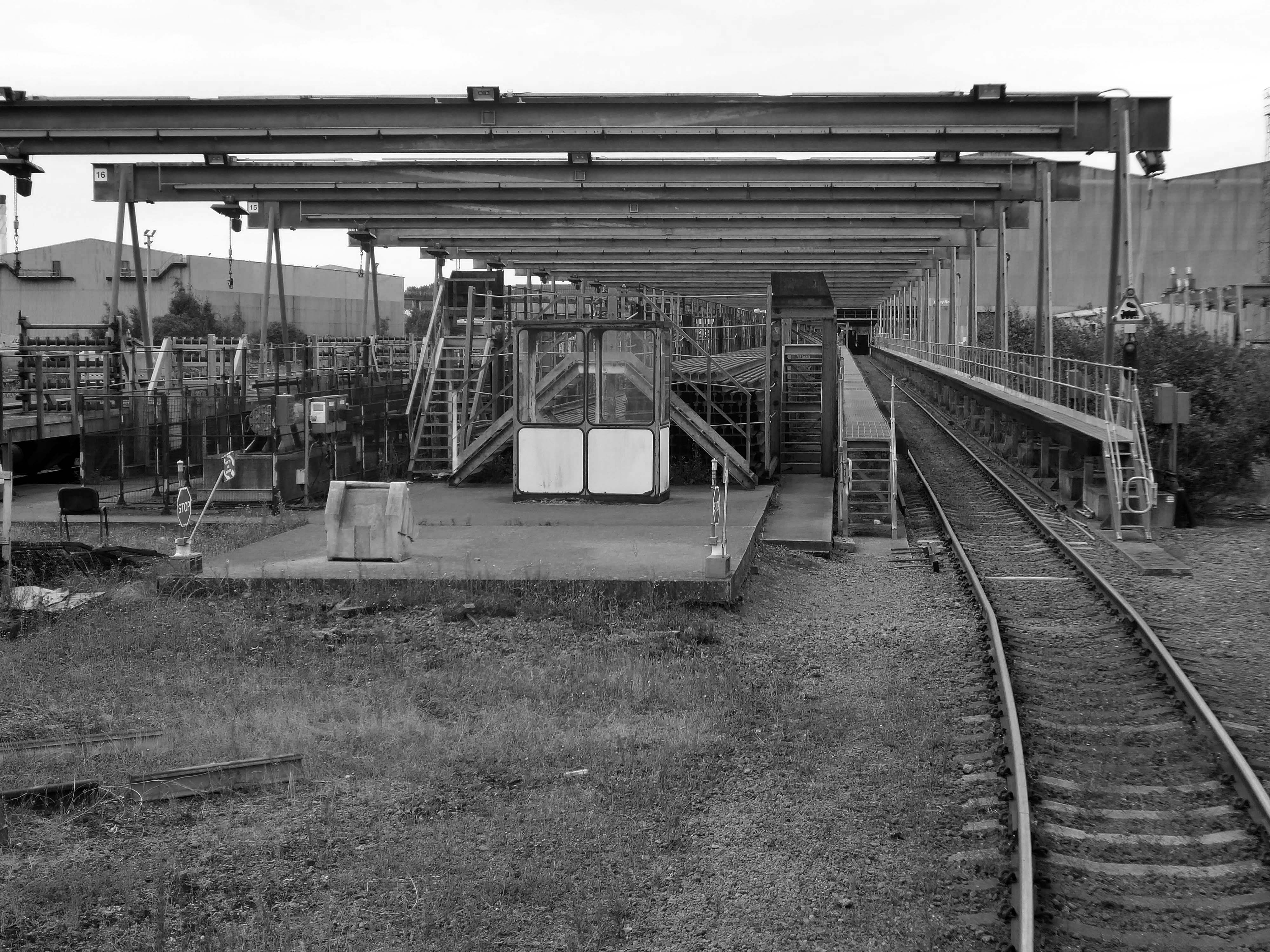
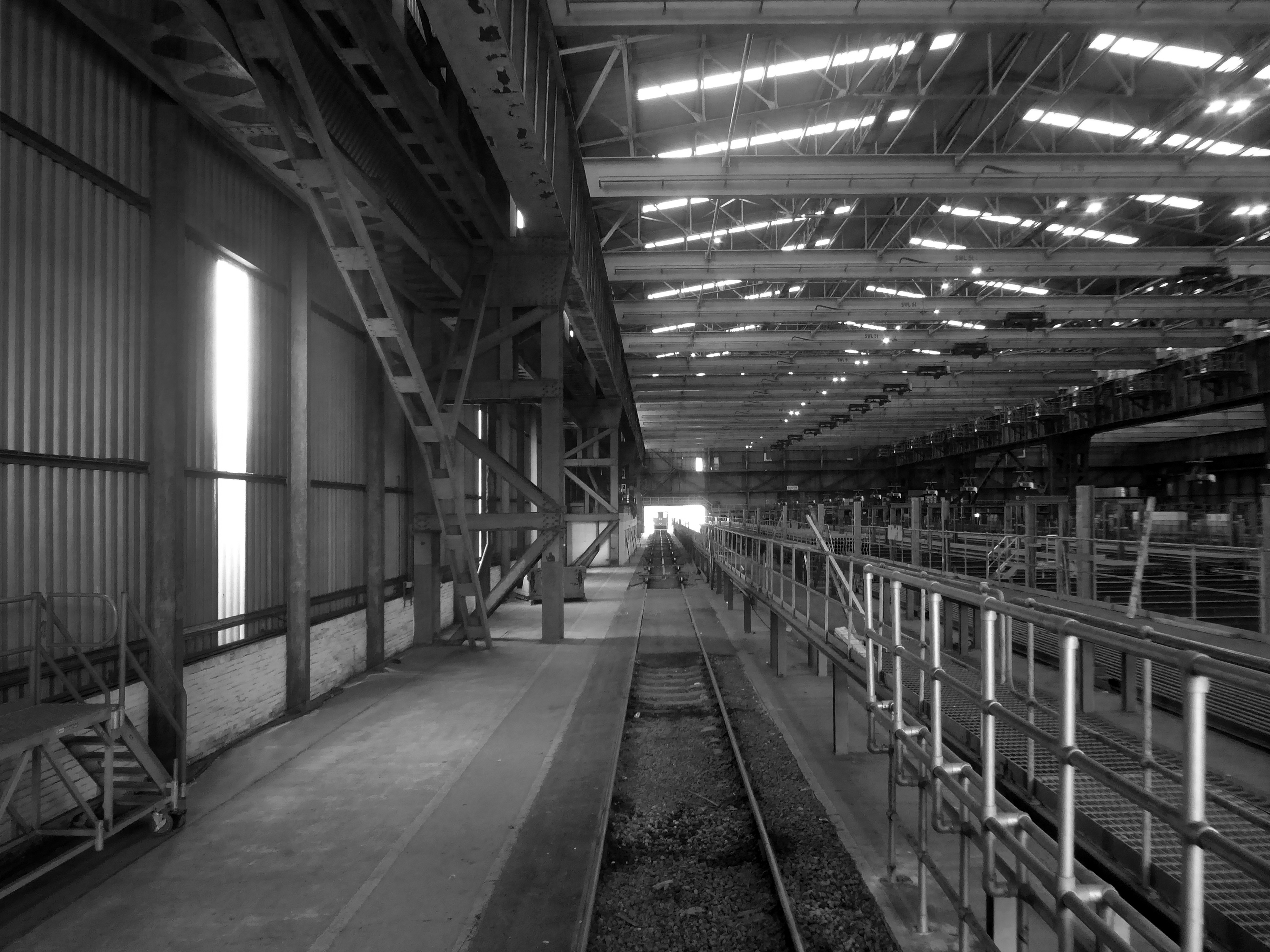
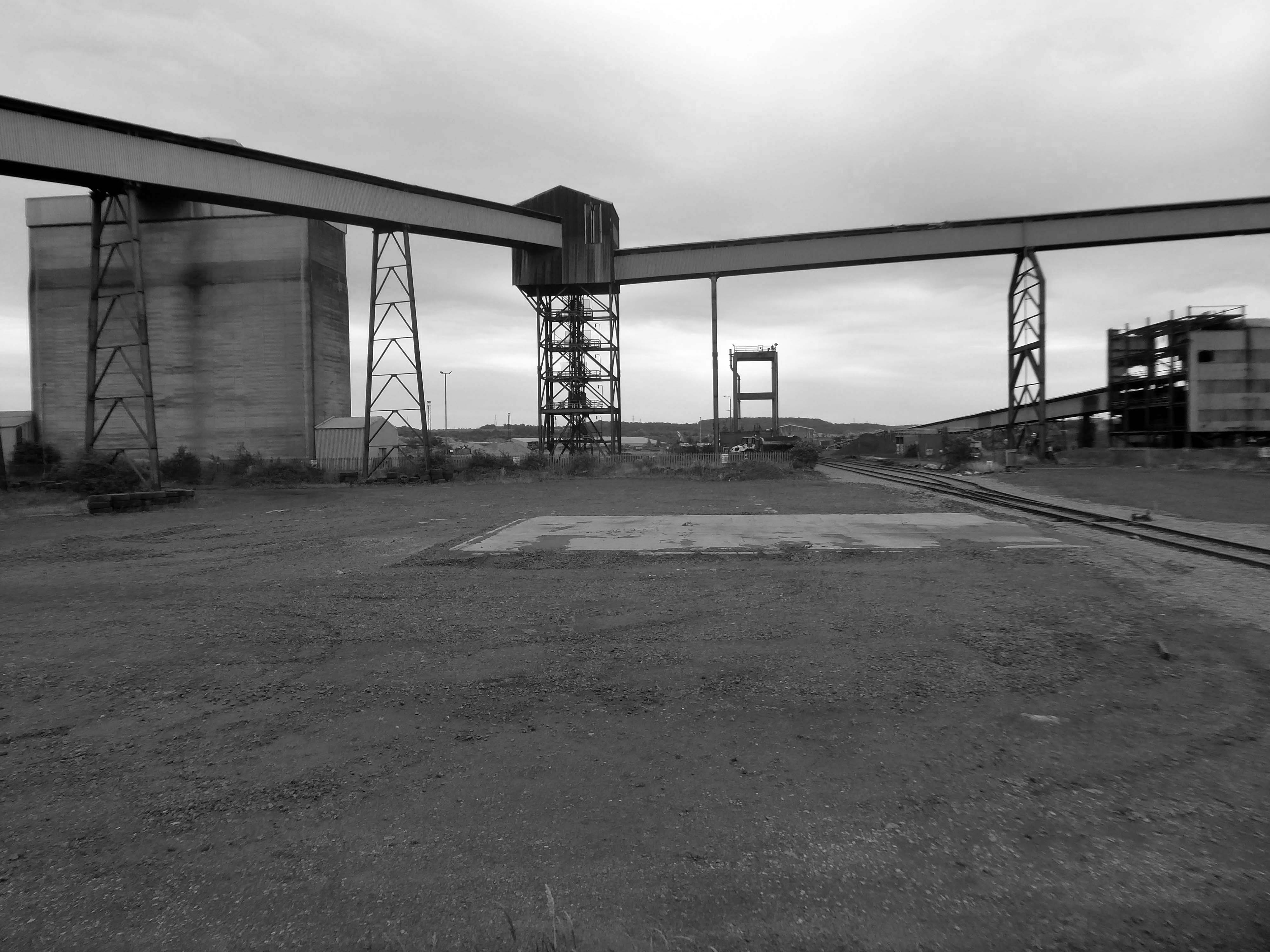
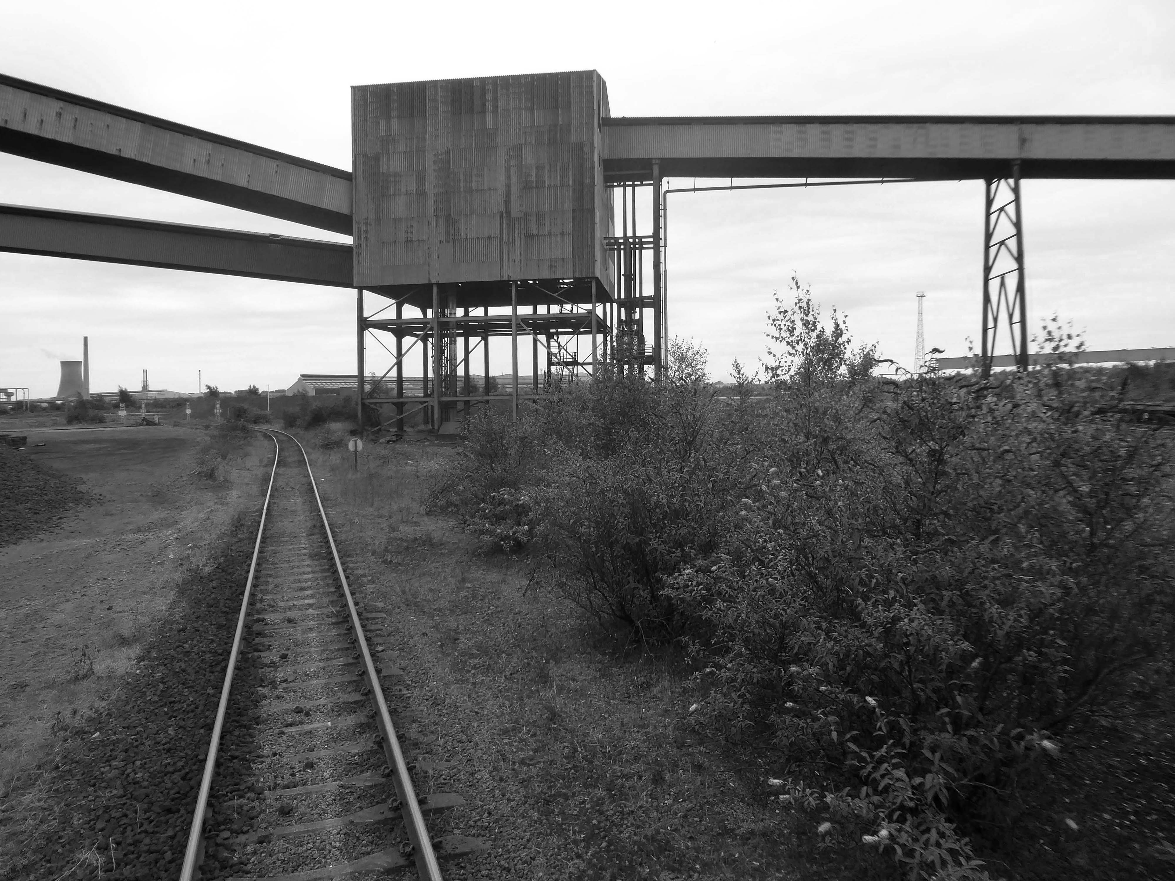
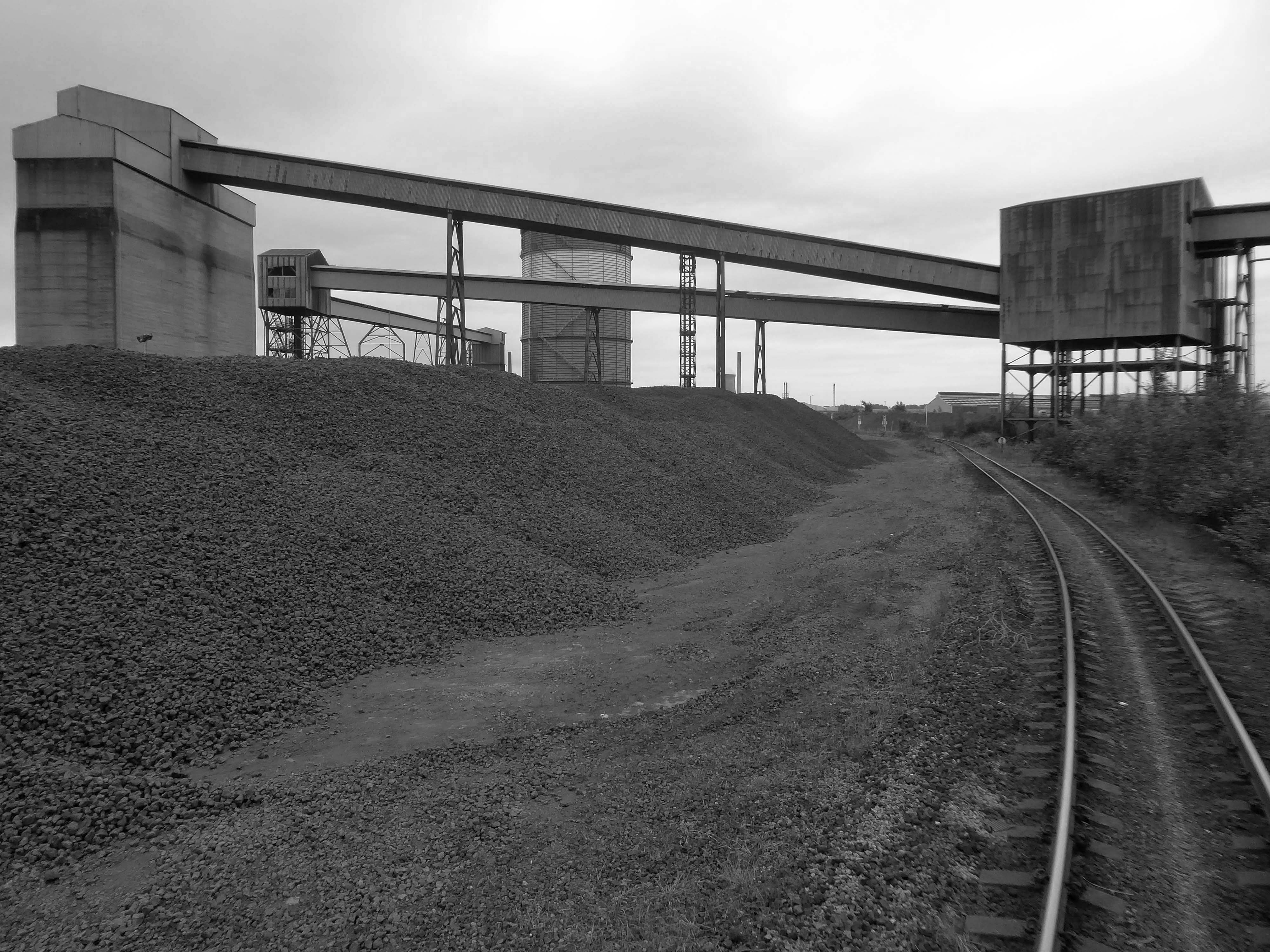
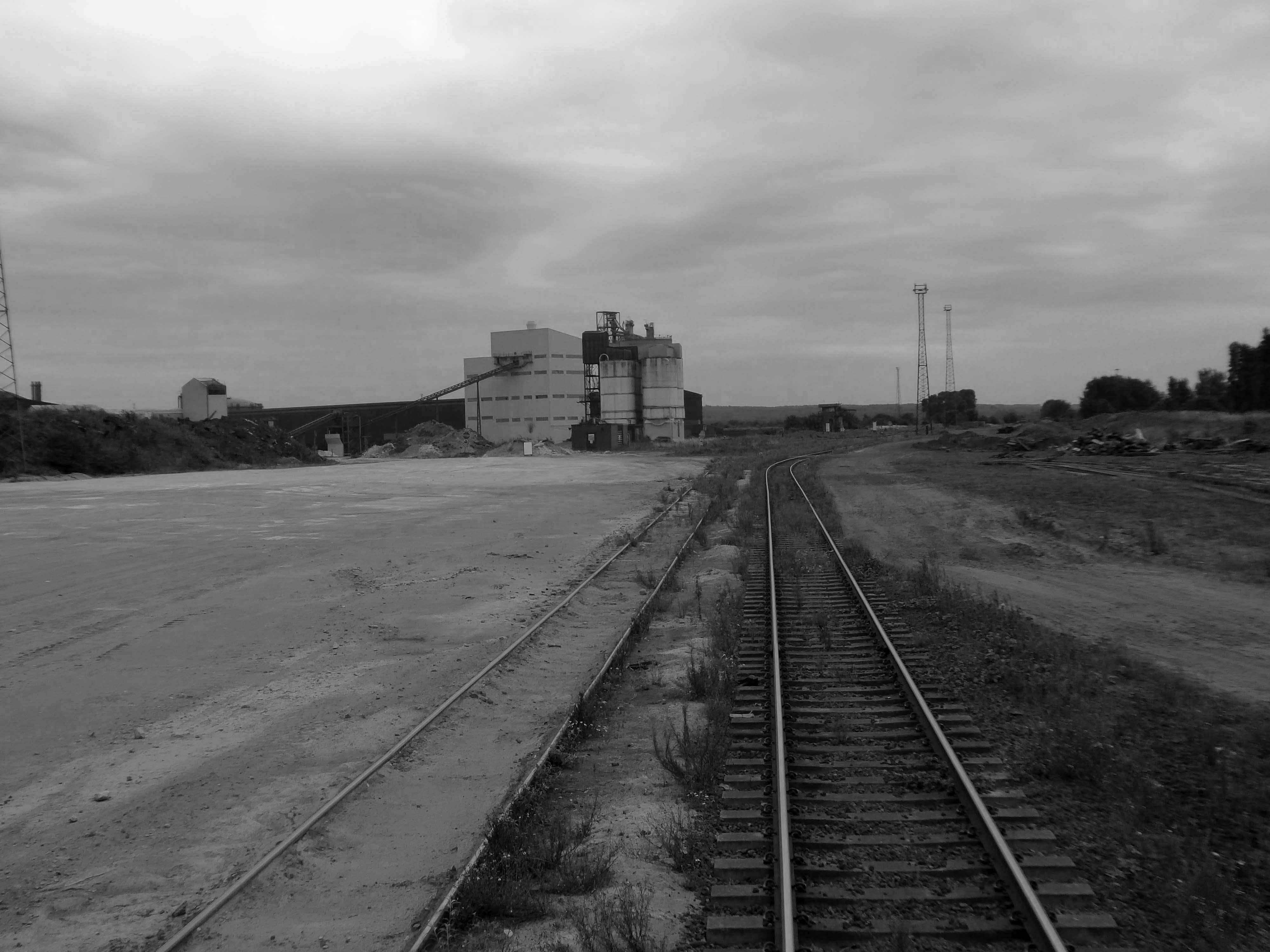
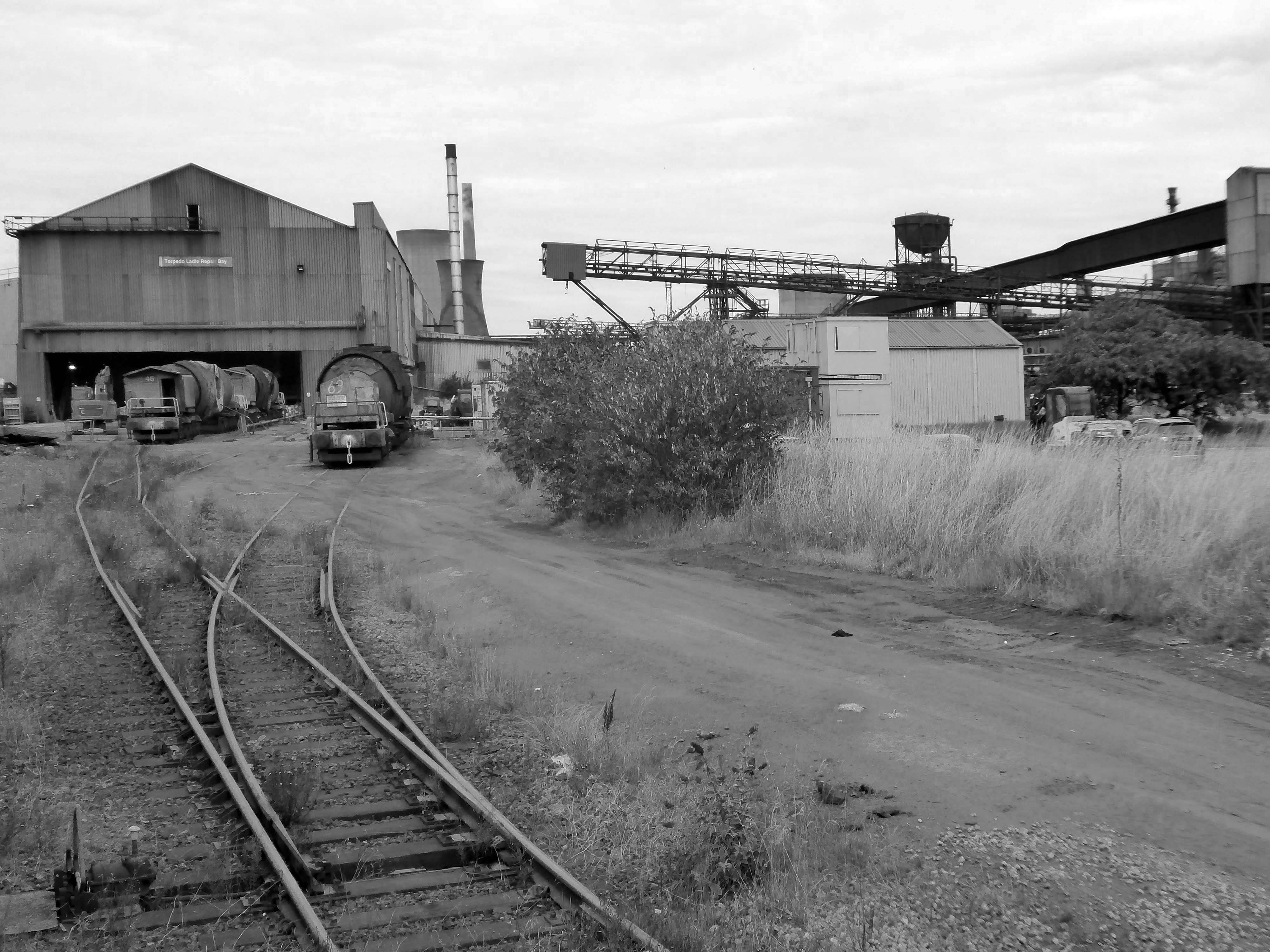
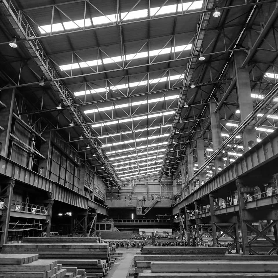
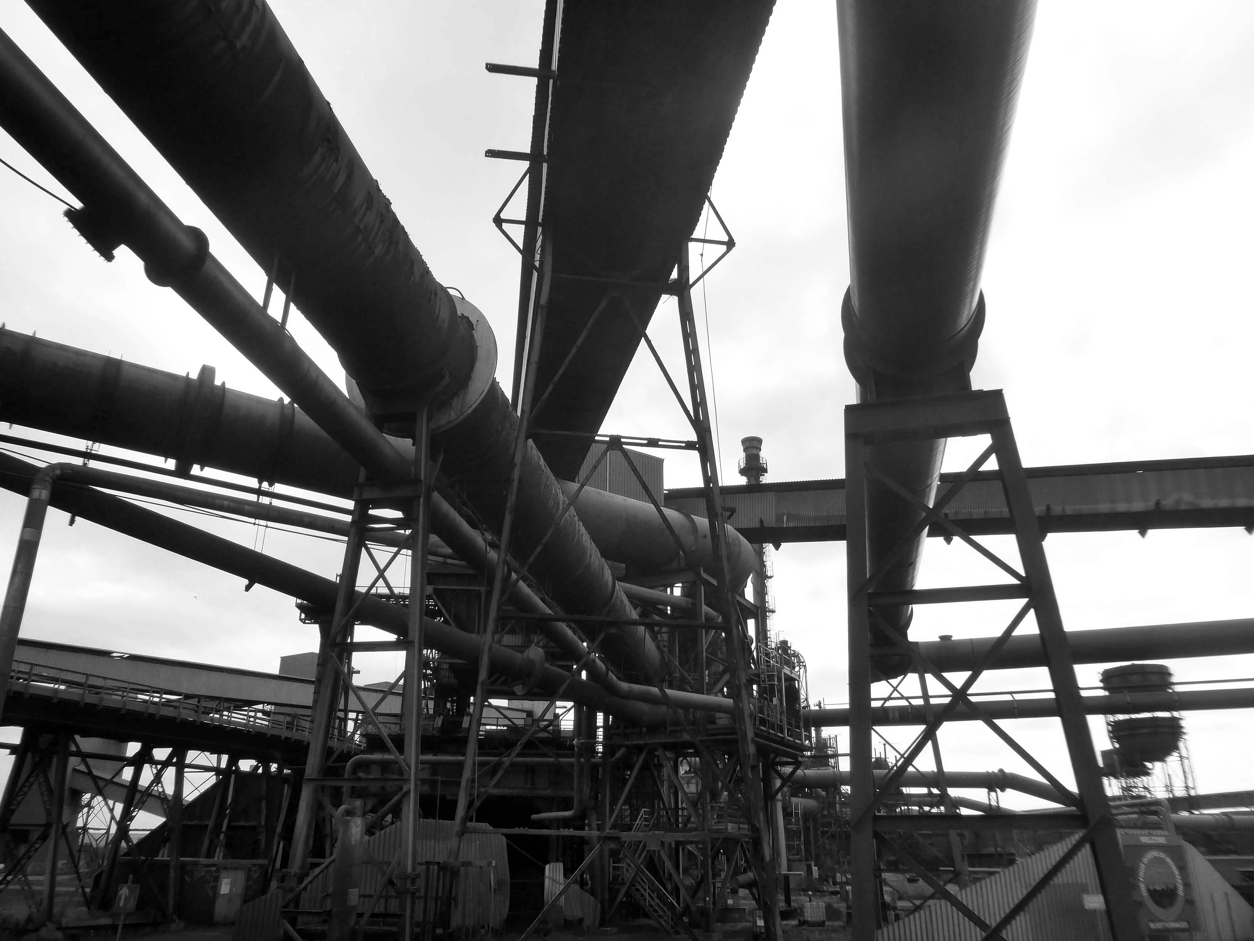
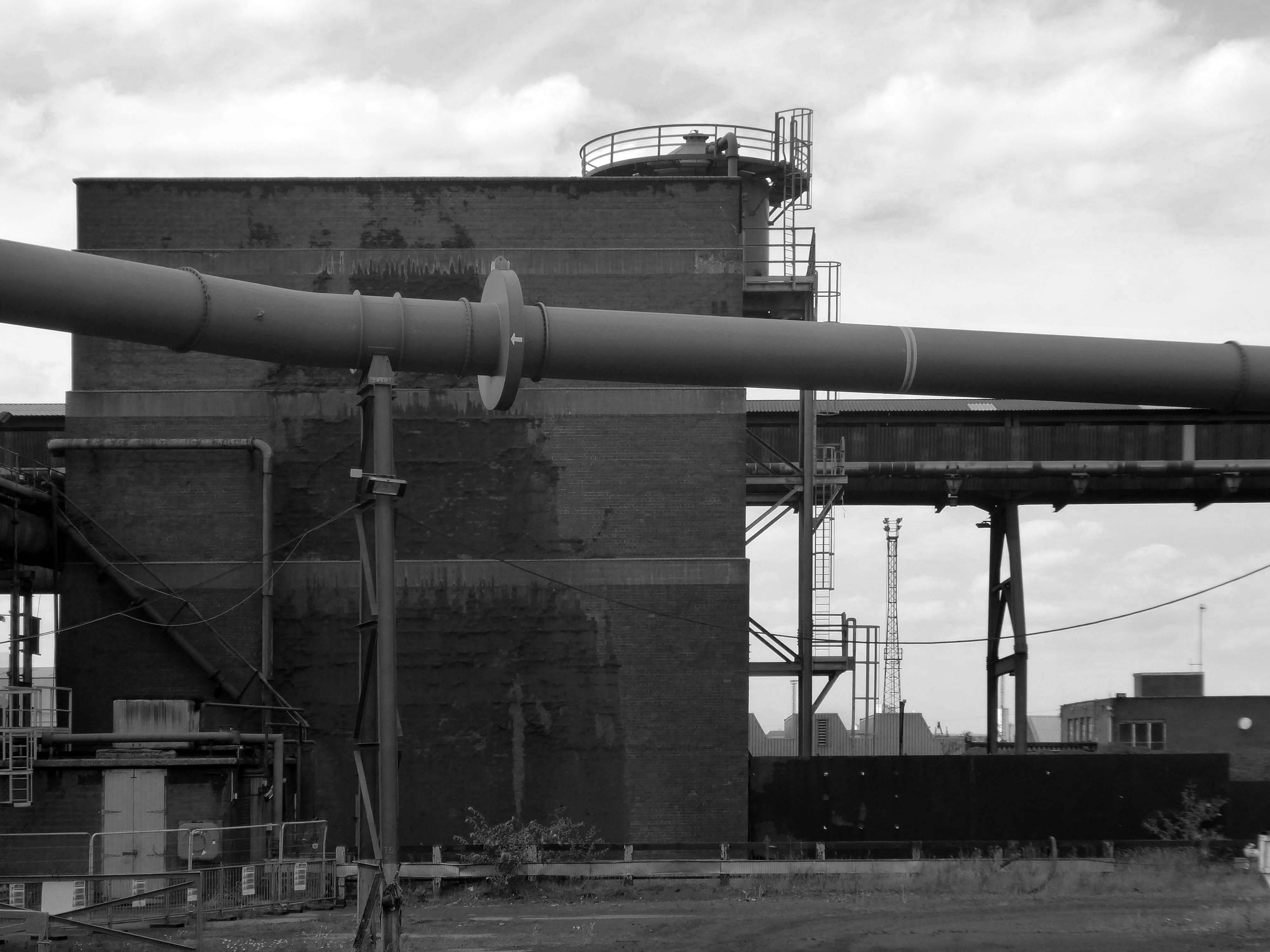
I took a brake van trip on the Appleby Frodingham Railway, touring the site’s network of working rail which encircles the works.
Very much in the spirit of Charles Sheeler’s Ford River Rouge Plant photographs, I was enthralled by the mass of massive buildings and their attendant infrastructure.
This is architecture on the grandest scale, the main furnace house being higher than St Pauls Cathedral.
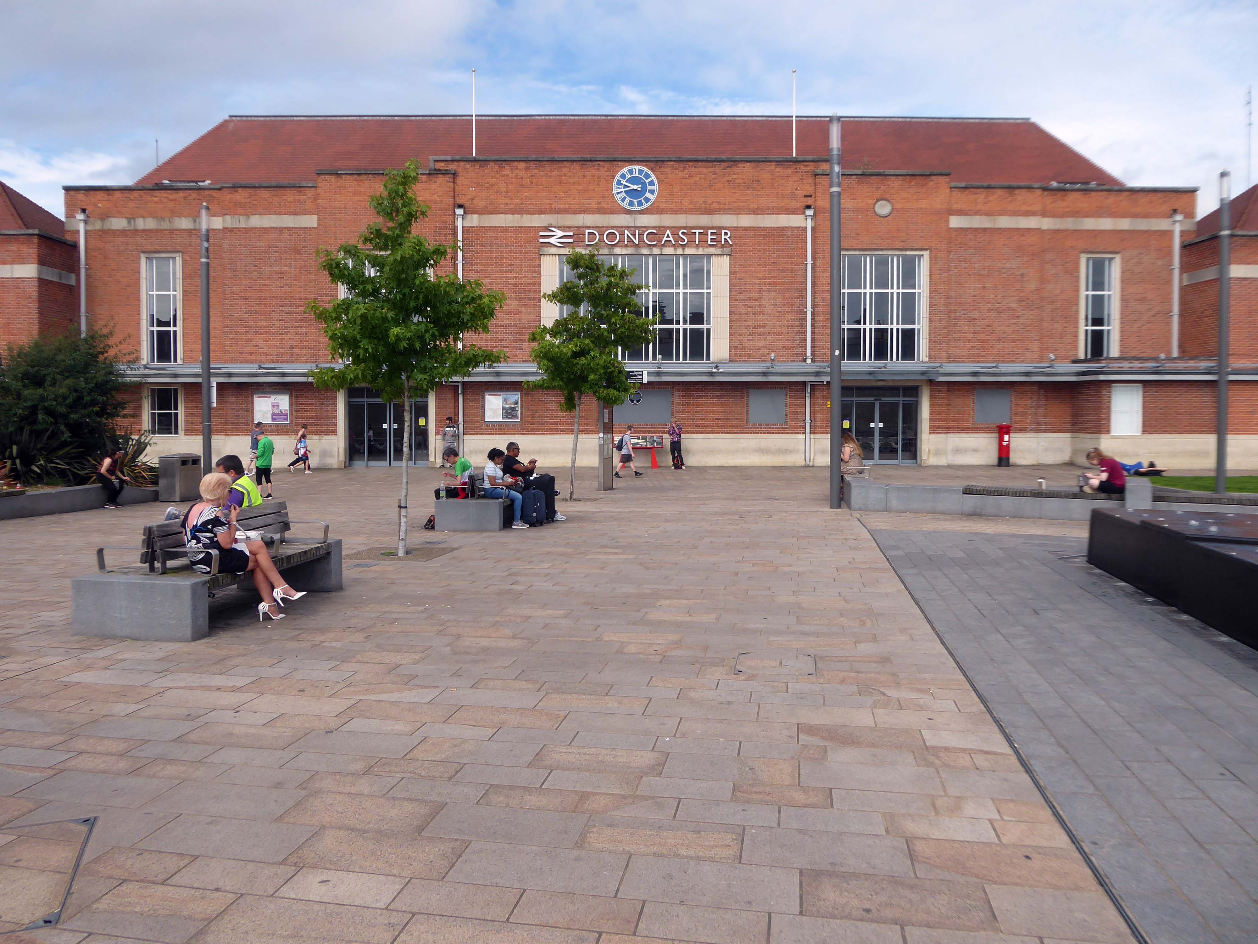
Arriving by train and ascending into the light – here’s the station lights.
The railway station has sharpened up its apron and facade.
We have transformed the station forecourt. It has become a quality gateway which delivers a great first impression for visitors arriving in Doncaster by train. This will help stimulate interest from investors and developers, helping to attract new investment and create jobs for the borough and wider region.
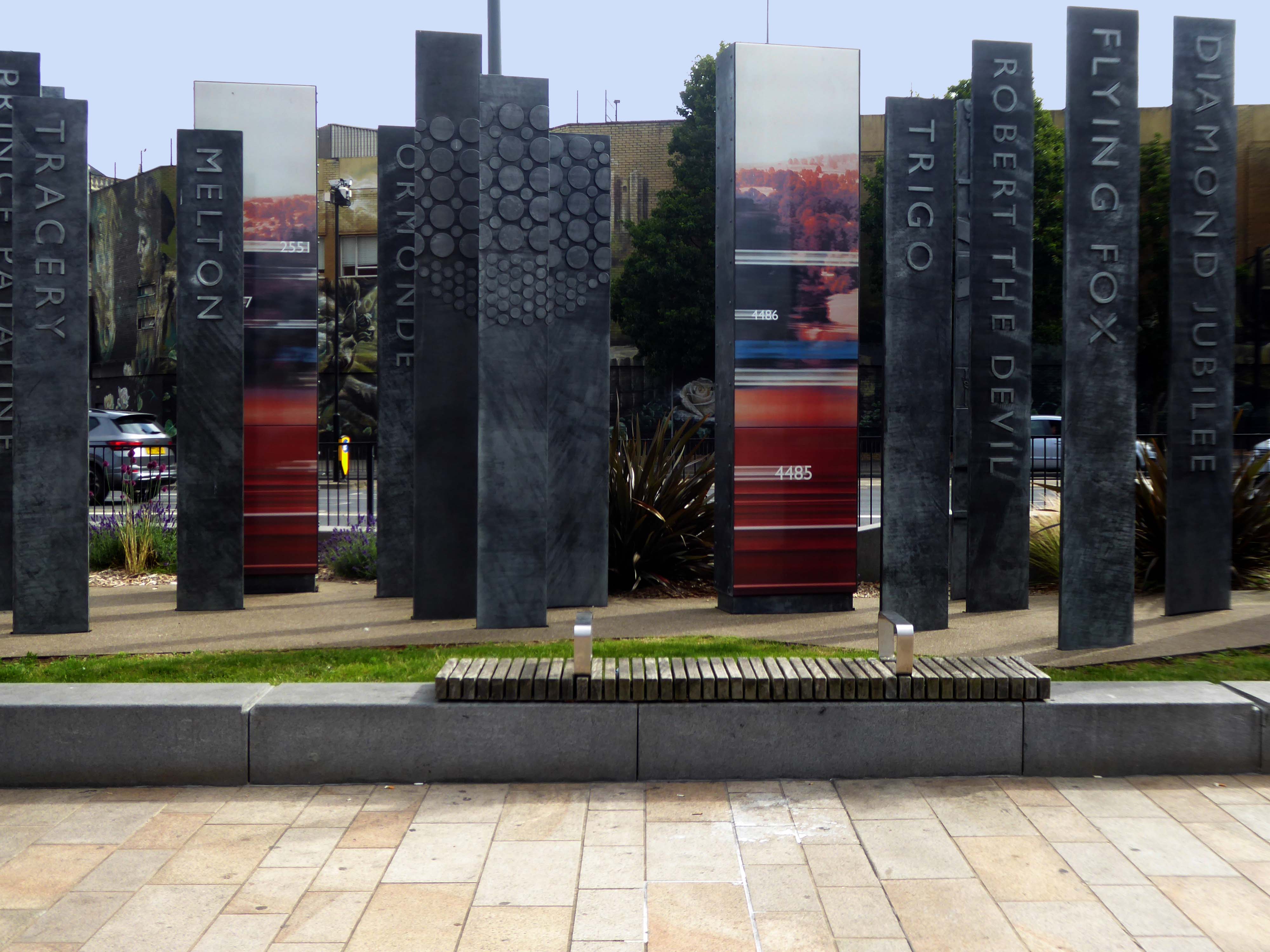
Celebrating engineering, speed and connectivity and stretching forty metres in length the public art at Doncaster Station consists of forty seven monoliths which are a nod to Doncaster’s past, present and future. With a fountain and three impressive water walls, the art takes centre stage in the new public space as you step out of the train station and head into the town centre.
The concept was devised by Doncaster Council and further developed by Chris Brammall.
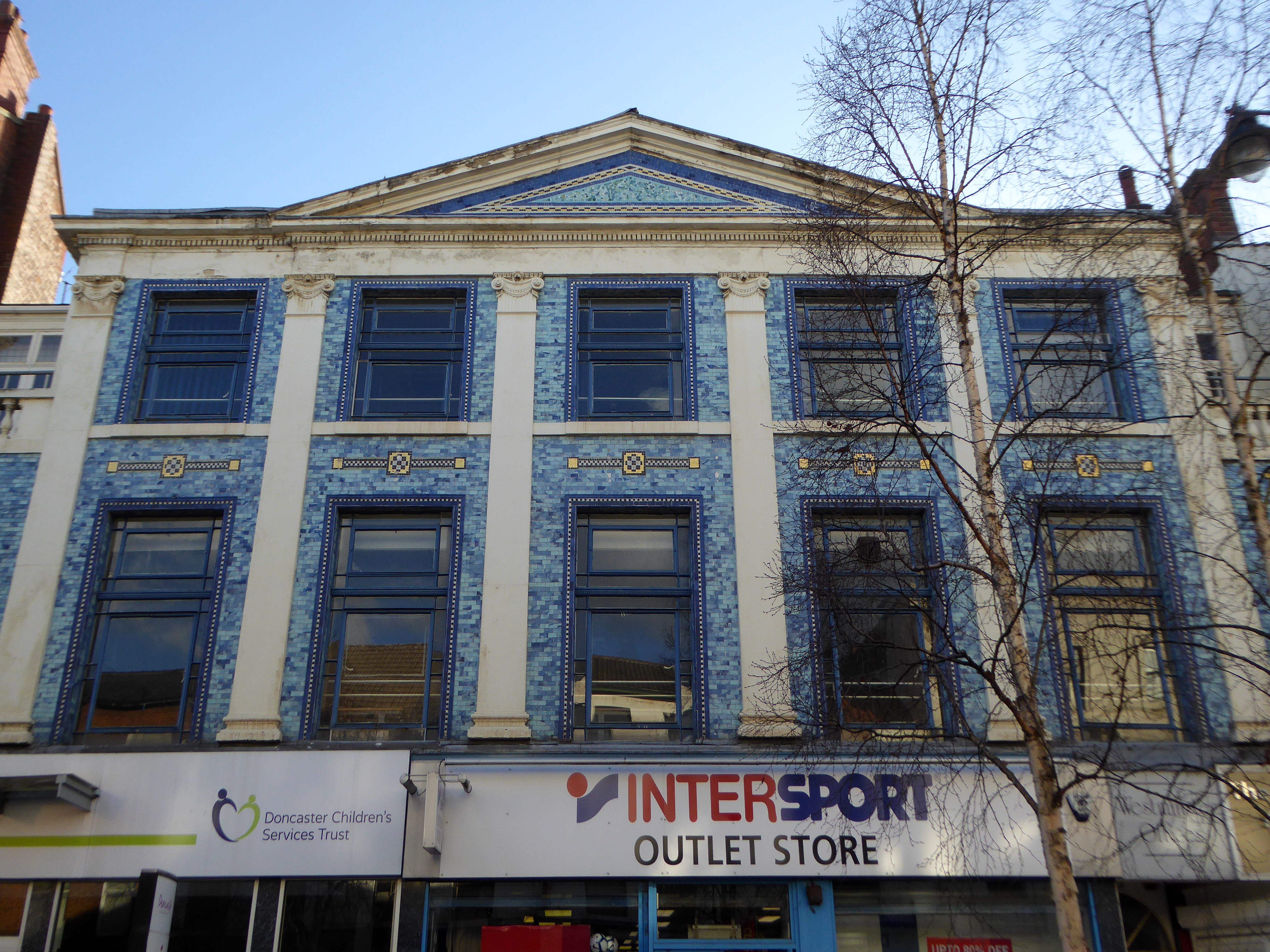
Typically the high and low streets of Britain’s industrial towns and cities, are an amalgam of architectural style and fashion, spanning at least two or three centuries.
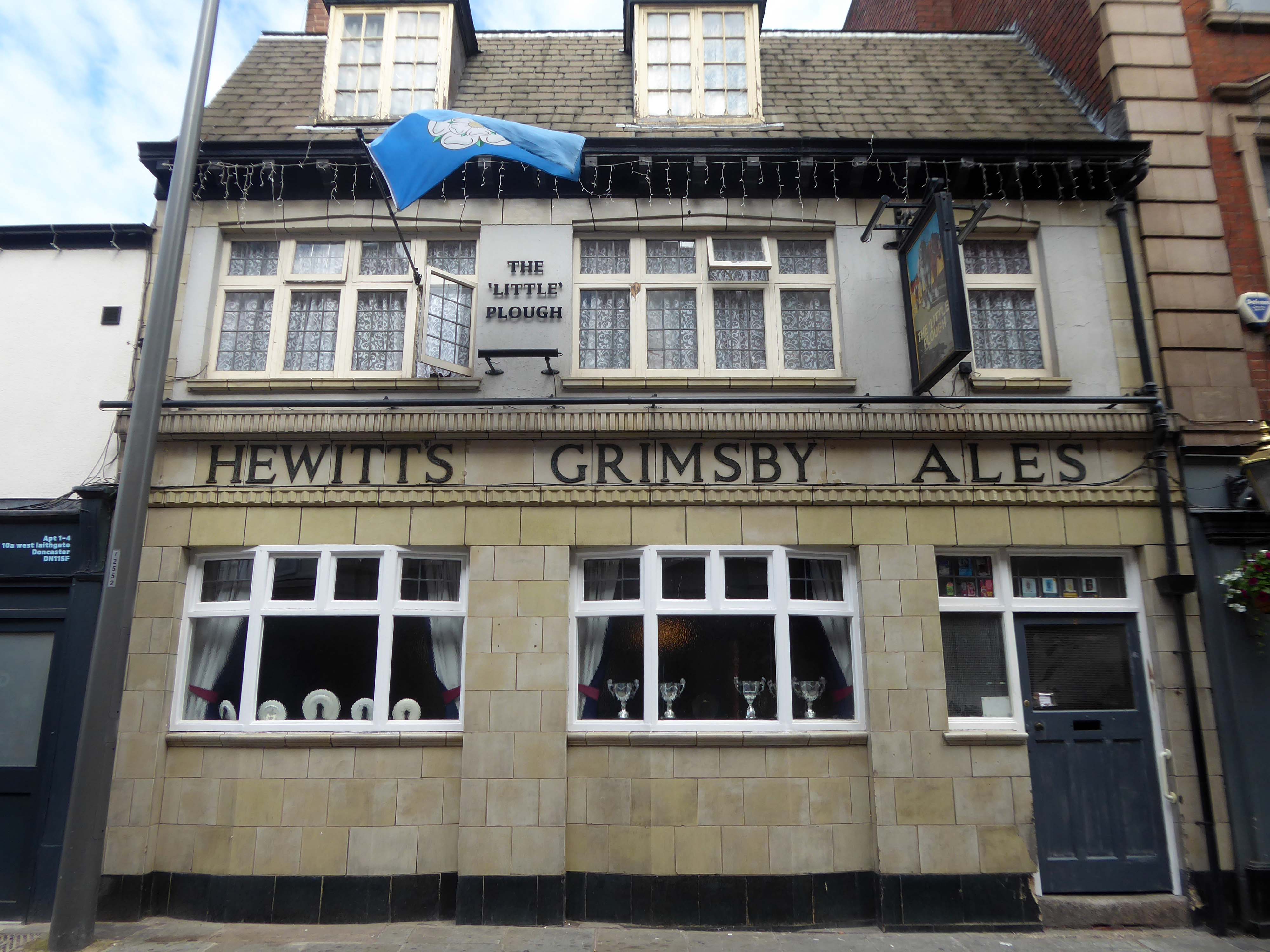
Behind the buff faience frontage is a lovely, small two-room pub with a well preserved interior created under plans of 1934. It was remodelled by the Grimsby brewers Hewitt Brothers Ltd who were Doncaster’s biggest pub owners for many years.
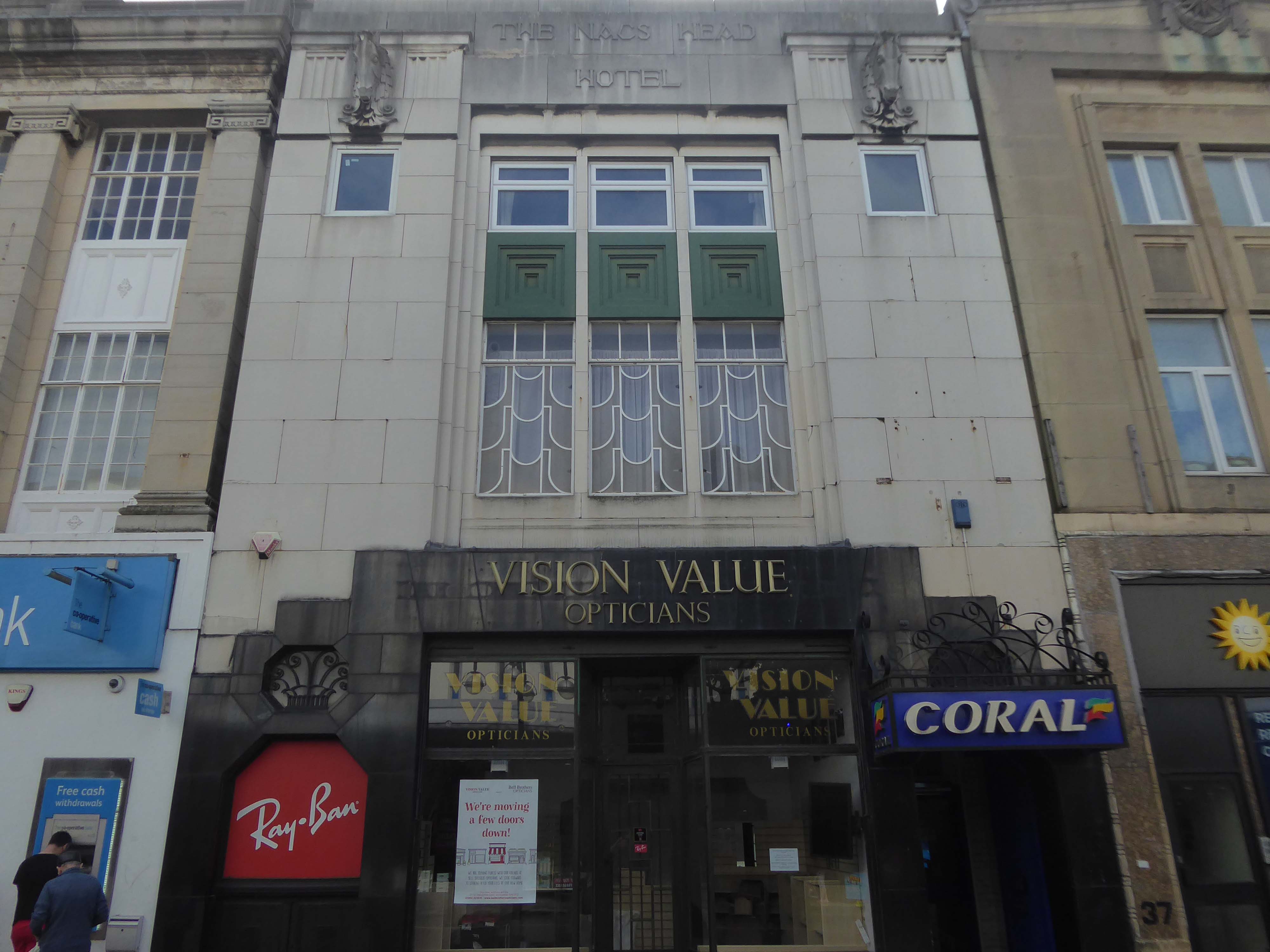
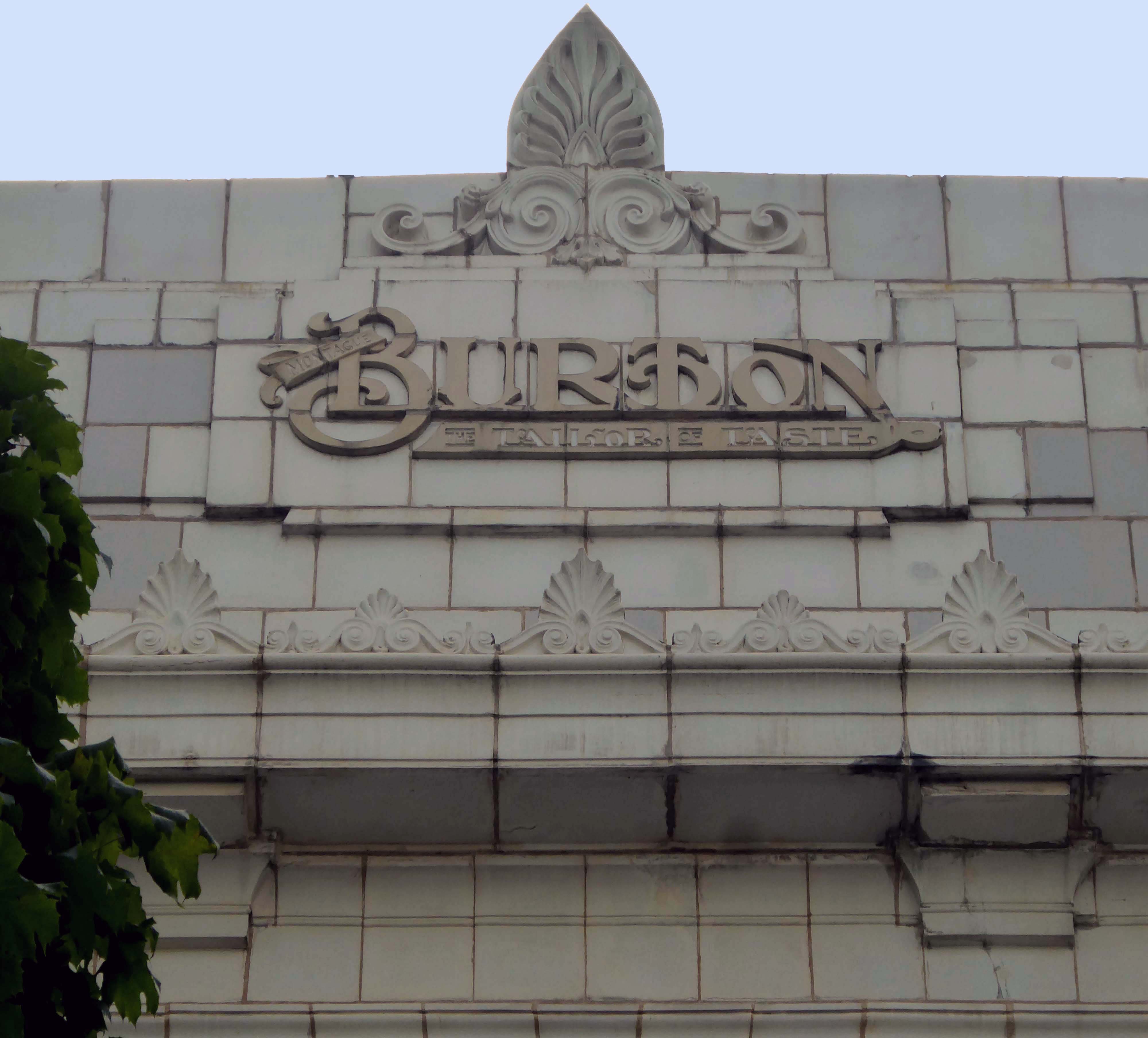
Of course, every town had a Burton’s – the tailor of taste.
This post war infill has that distinctive Festival of Britain feel, original metal window frames, Portland stone and blueish slate like panels.
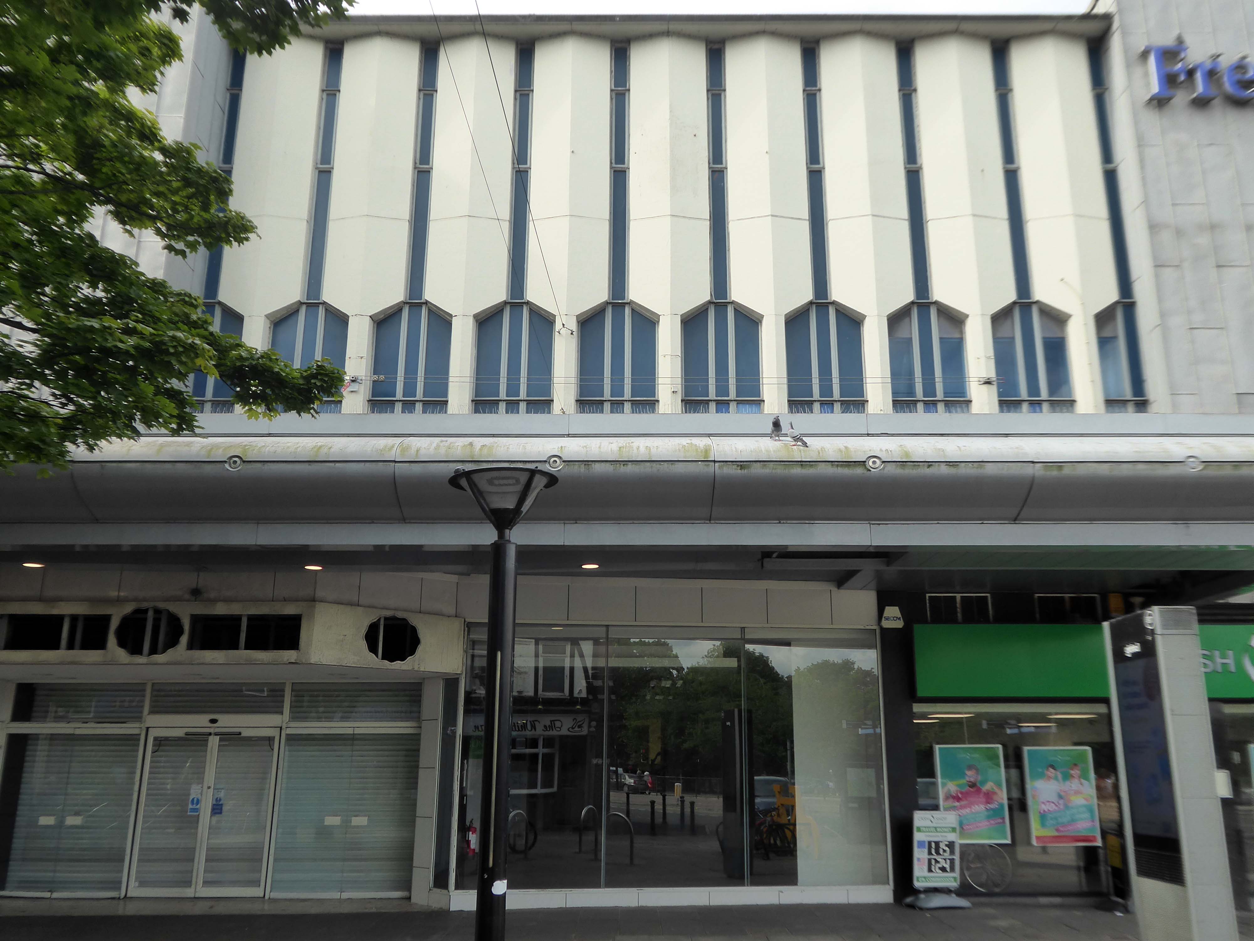
The revamped Frenchgate Shopping Centre, officially opened on October 4th 1968, has in places an upper tier, resistant to zinc over cladding.
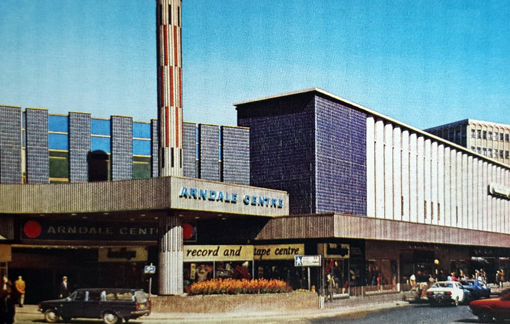
The centre has been the heart of the city for over 40 years and was originally called the Arndale Centre because it was built, owned and managed by the Arndale Group. It was renamed in 1988 after a change of ownership, with the new name reflecting the name of the street which passes to the east of the centre and which is one of Doncaster’s main shopping streets.
The sale of the centre came just a year after Frenchgate had undergone a £200 million facelift to transform it into the country’s first shopping centre with integrated public transport and retail interchange.
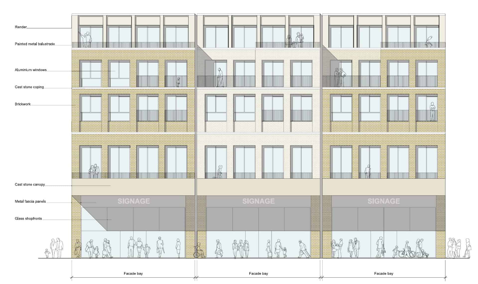
We propose this is fundamentally transformed though the addition of apartments that wrap along the back of the first-floor retail with a further 2.5 new storeys placed on top. We also feel additional height -up to seven or eight storeys, is justifiable to the corner of Frenchgate and Trafford Way.
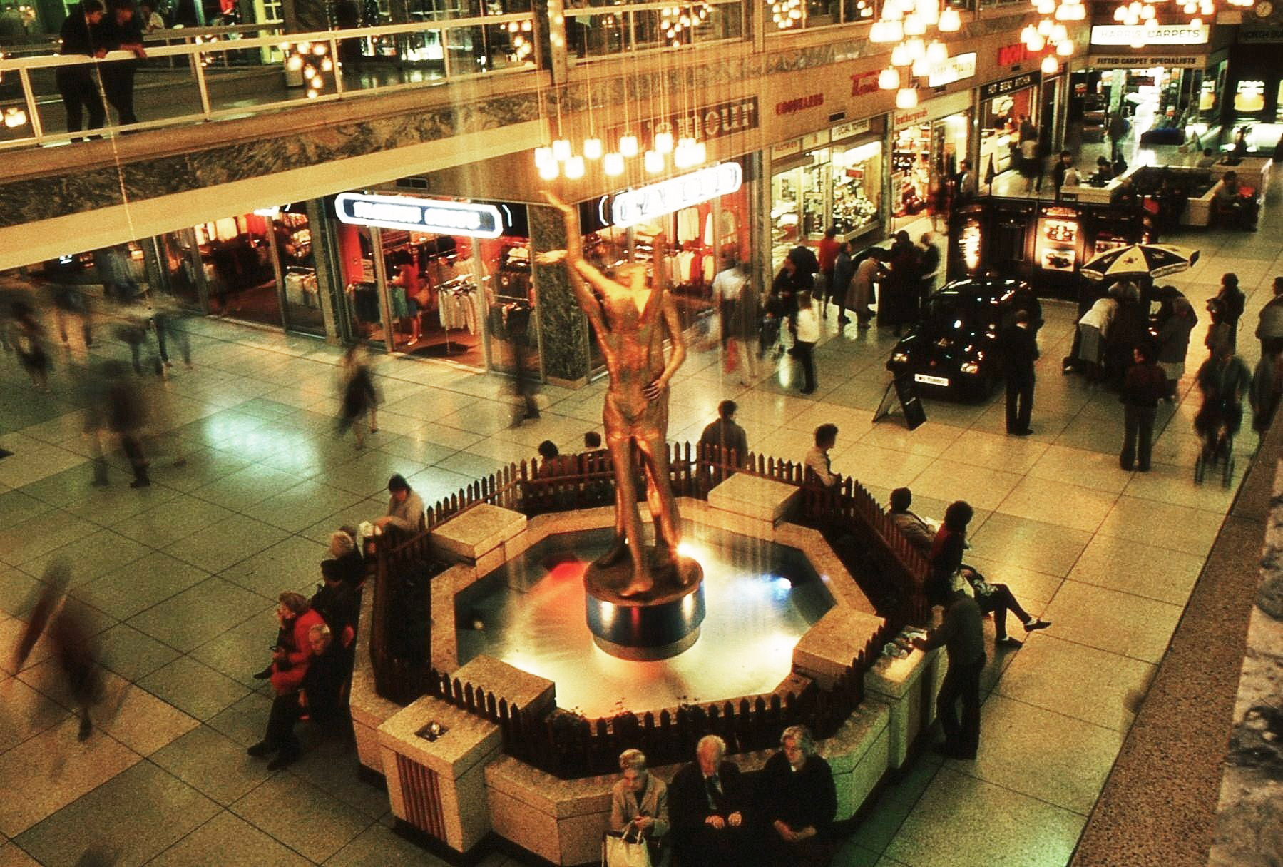
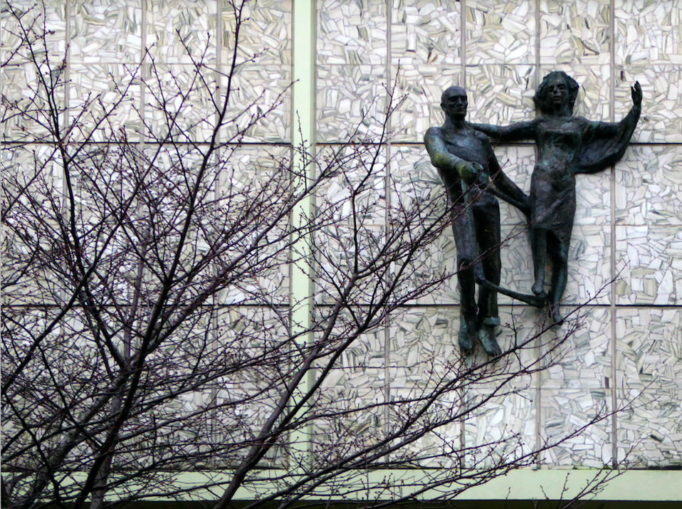
The Lovers were once located in the Arndale, removed to a local garden, unloved – then later reinstated in the Waterdale Centre, where we will embrace them a little later.
Turn right to take in the 1920s mosaic remake remodel of the Grade II listed Blue Building.
The Blue Building which used to be the Doncaster Design Centre and Tourist Information Centre was originally the home of John Whitaker, a wine merchant, and son of James Whitaker who was Mayor of Doncaster in 1758.
In 1925 the complete building was demolished apart from the facade which was retained and given a facing of decorative blue tiles. The intention was to build a shopping arcade from High Street to Printing Office Street. Only part of the arcade, known as the Westminster Arcade was built. It had a number of shops, the largest being that of Woodhouse & Co Furnishers.
Two adjacent 60s extensions – to the right a redundant post office to the left an almost redundant telephone exchange, with the earlier brick built exchange in smack dab the middle.
Turn another corner and it’s all at the Co-op now – the Grade II listed Danum Co-operativeBuilding, department store and offices: 1938-40 designed by T H Johnson & Son for the Doncaster Co-operative Society Ltd.
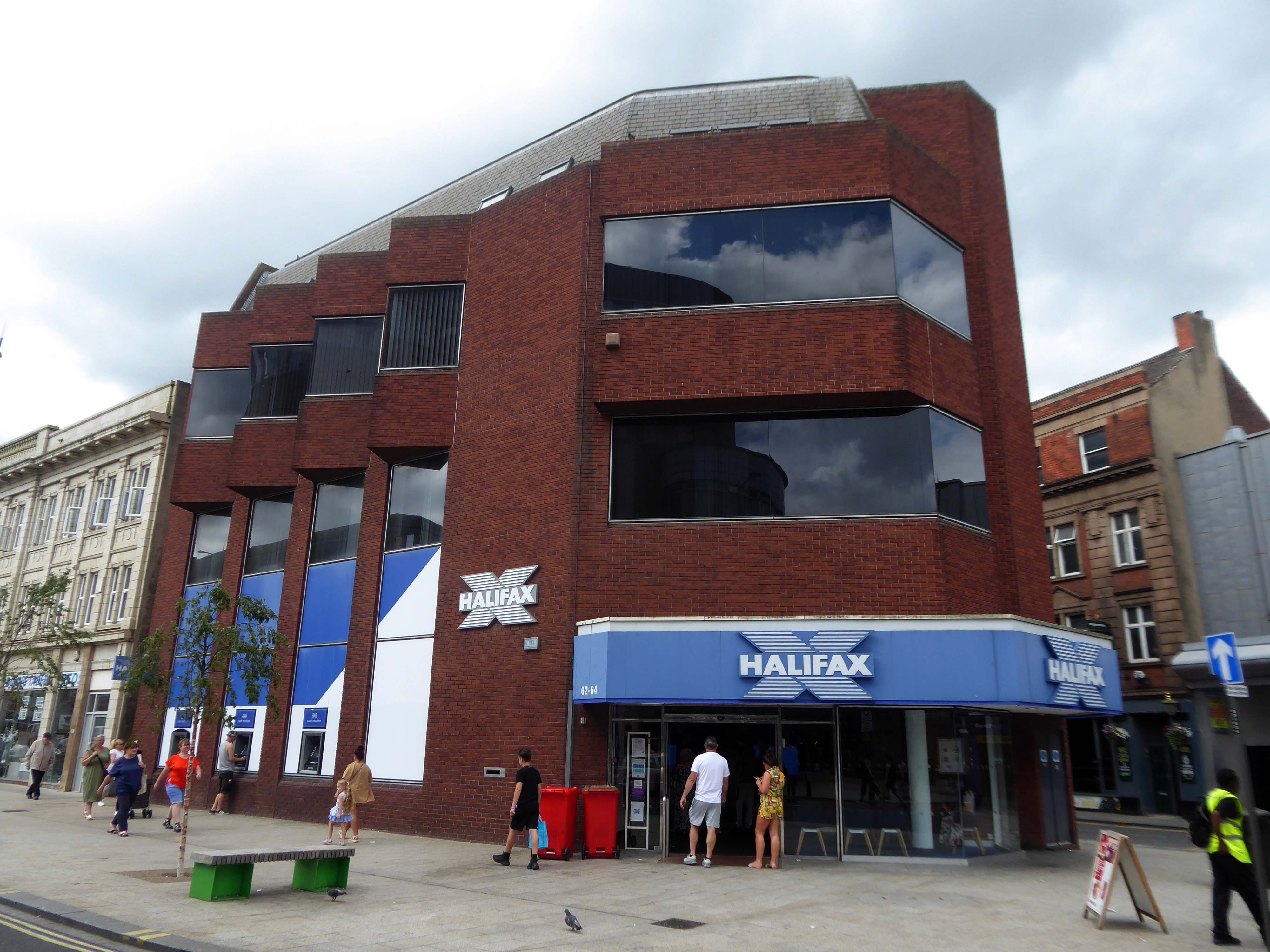
Over the road a zig-zag Halifax Building Society branch, tightly contorted by its corner footprint.
To the right of the Danum, this former Boyes store, having relocated to the Wilko site, the building is ripe for residential conversion.
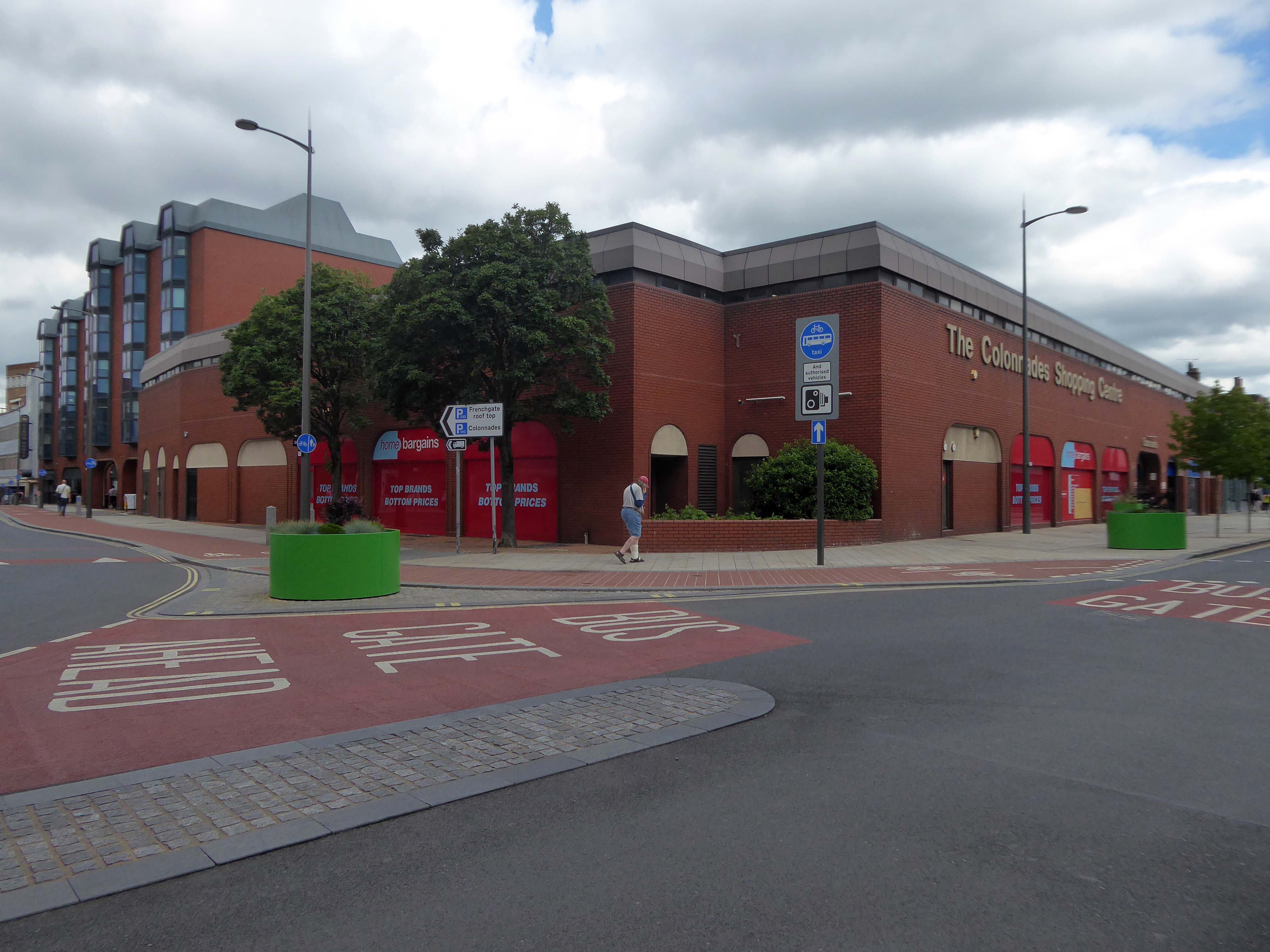
To the left the Colonnades Shopping Centre a fierce angular glass and brick bunker of mixed office and retail space – the sole occupant seeming to be Home Bargains.
A £3.3m makeover of the Colonnades shopping mall in Doncaster town centre was completed in 2019.
The scheme of works was co-ordinated by Doncaster Council and funded by the Sheffield City Region Local Growth Fund.
Built in the 1980s, the brick built building received a major overhaul. The investment saw the visual appearance enhanced inside and out. The five floors were transformed into the prime office space needed in the town centre and the enhancements to the retail area were also finished.
The shift in the town’s axis to the Frenchgate and Market areas, seems to have taken the wind out of its sails.
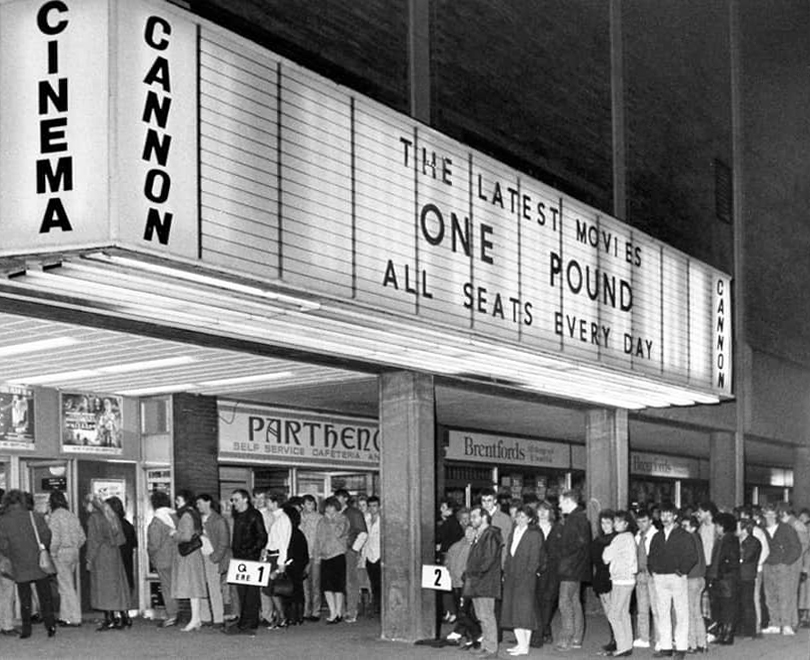
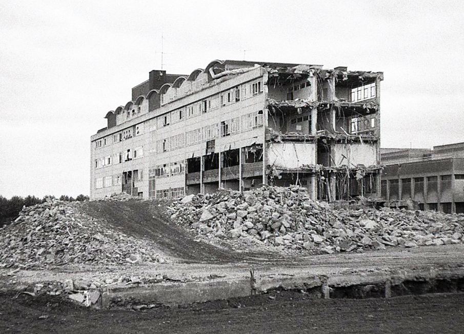
The former flicks now a redundant pale brick behemoth – no more and ABC.
Doncaster’s new £250,000 ABC cinema, part of the Golden Acres development near the town centre, was opened on May 18th 1967.
Closed in January 1981 for conversion into a triple screen it re-opened on 9th April 1981 with seating in the three screens for 477, 201 and 135.
The Cannon Group took control in the mid-1980’s and it was re-named Cannon and it closed on 18th June 1992, screening its opening film Doctor Zhivago.
Cinema Treasures
The Golden Acres development seemed to have morphed into the Waterdale Centre.
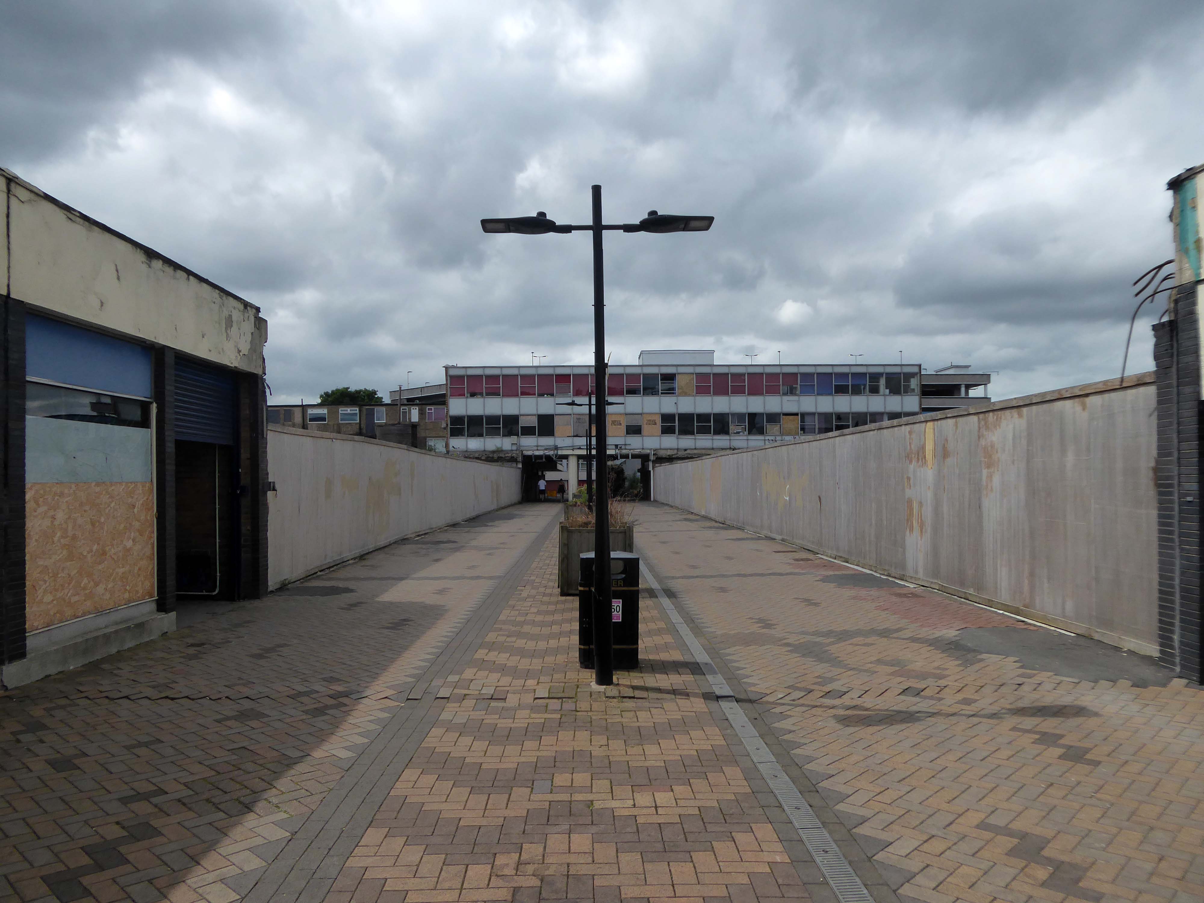
It is currently being reshaped to provide a line of desire twixt the Civic and Cultural areas, from the town centre. There are still the remnants of homes, shops and a pub amongst the demolition – almost inevitably there is new paving.
Waterdale is a well-known part of Doncaster’s town centre. During its heyday it was a bustling area with people flocking to shops and the like – it was a place you had to visit while you were in town. However, it had suffered a steady decline which continued when the southern bus station closed – Frenchgate Interchange opening, and Doncaster College moved to the Hub at the Waterfront. With limited public transport entering the area and no student population on its doorstep, less people had reason to pass through.
Demolition of the College.
The Civic and Cultural Quarter is transforming Waterdale reconnecting it to the town centre. The quality and content of the plans is raising the profile of this part of town to new levels. The carefully thought out layout and consistent building design is giving the area a clear identity. It is already becoming a big attraction that draws people in and encourages redevelopment in the neighbouring areas.
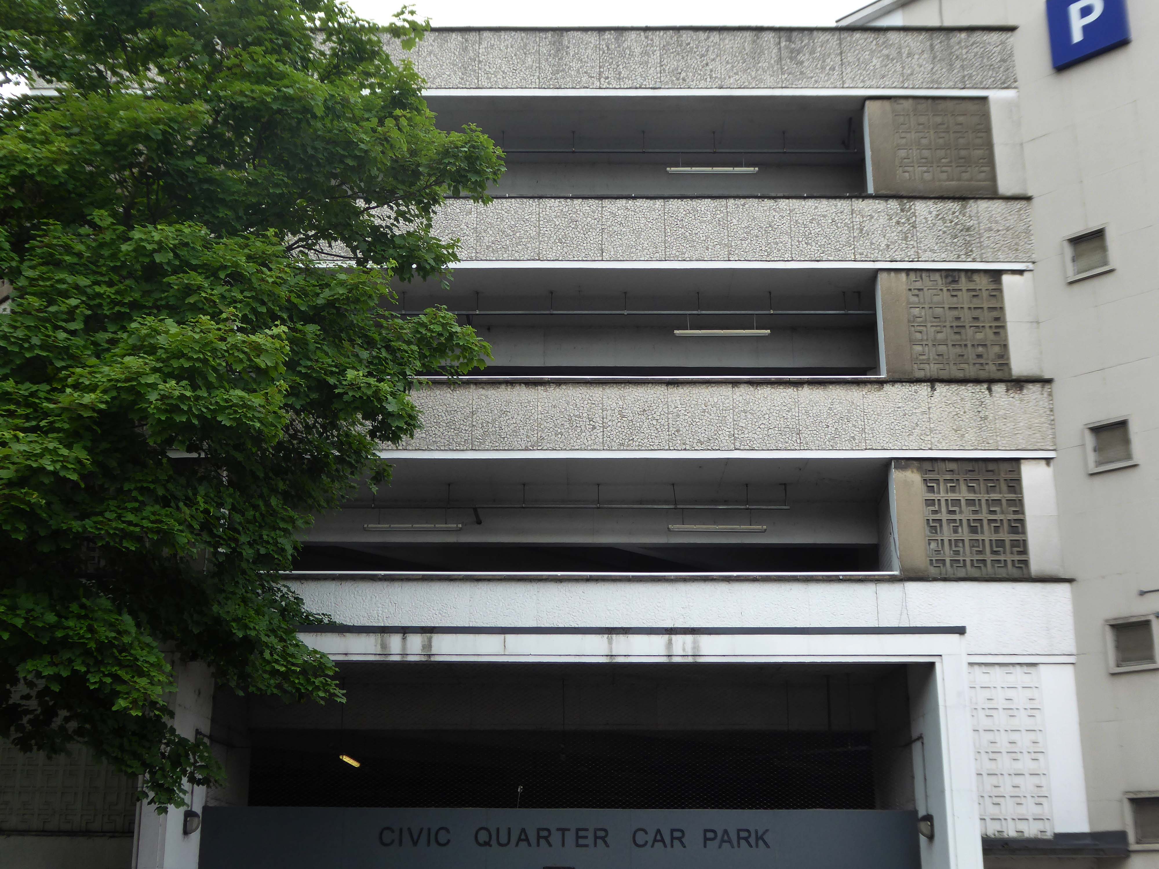
The weary walker is diverted toward the Civic Quarter Car Park.
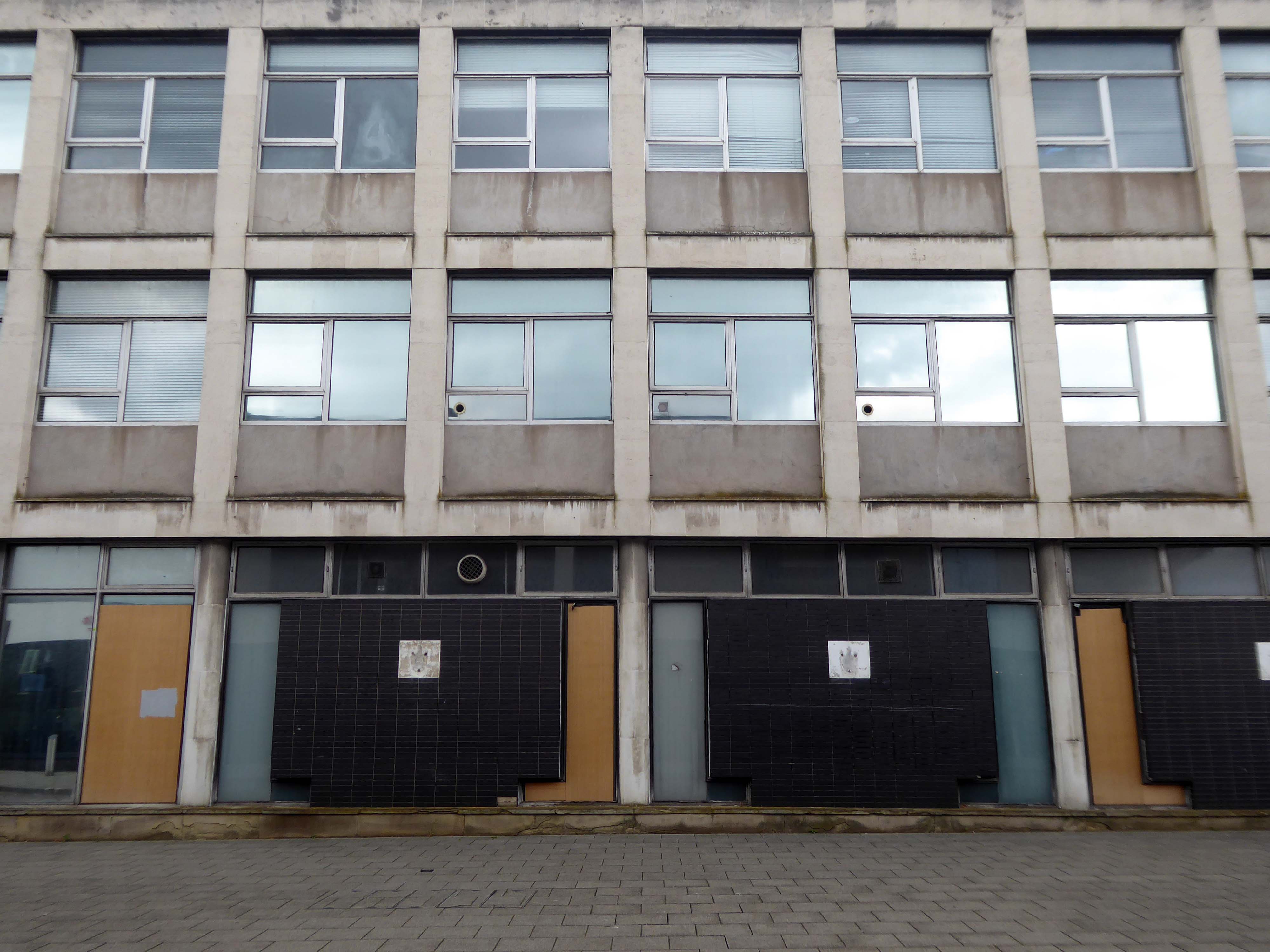
The former Civic Offices are to be demolished.
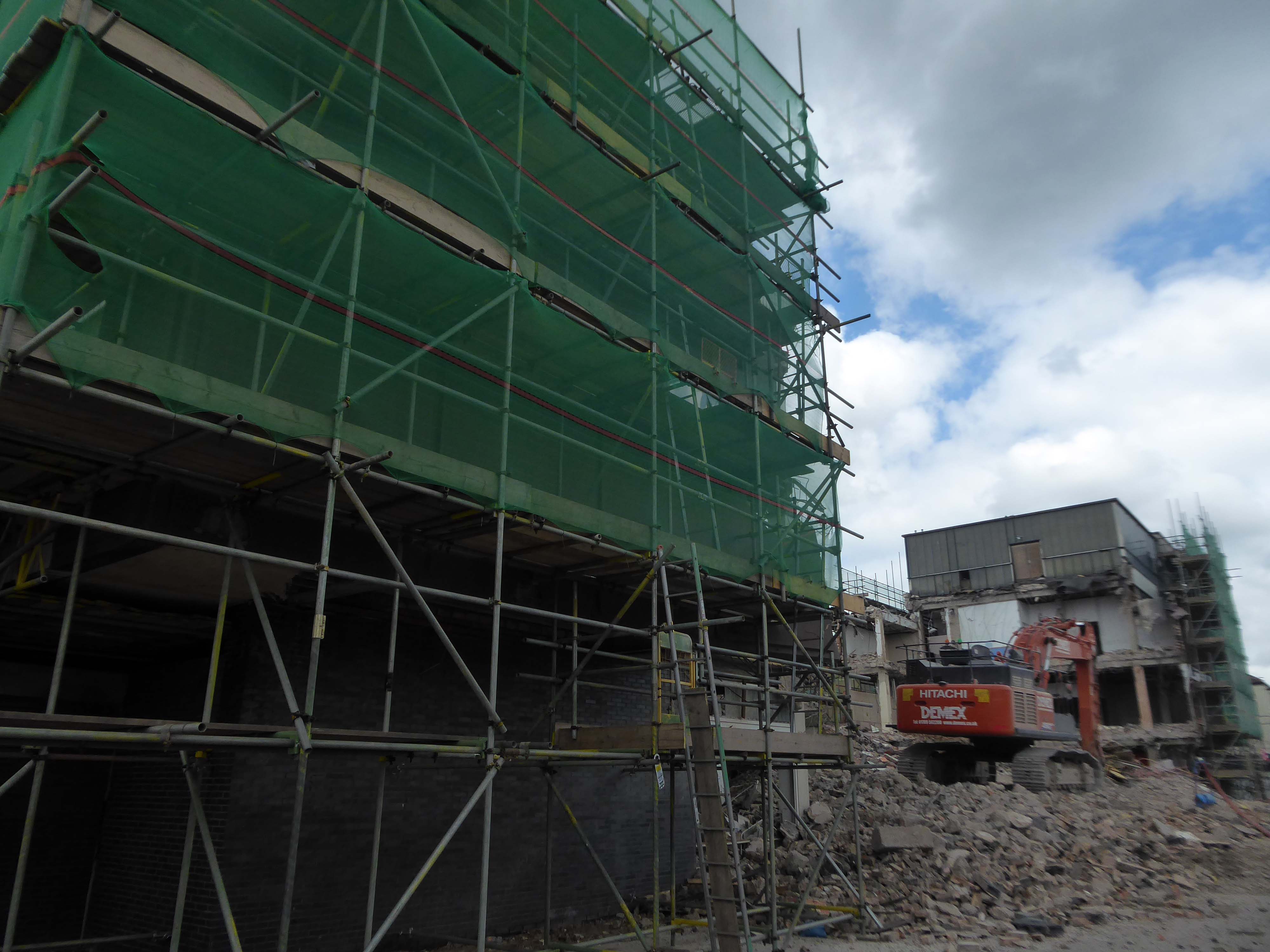
Demolition of the Central Library is well under way.
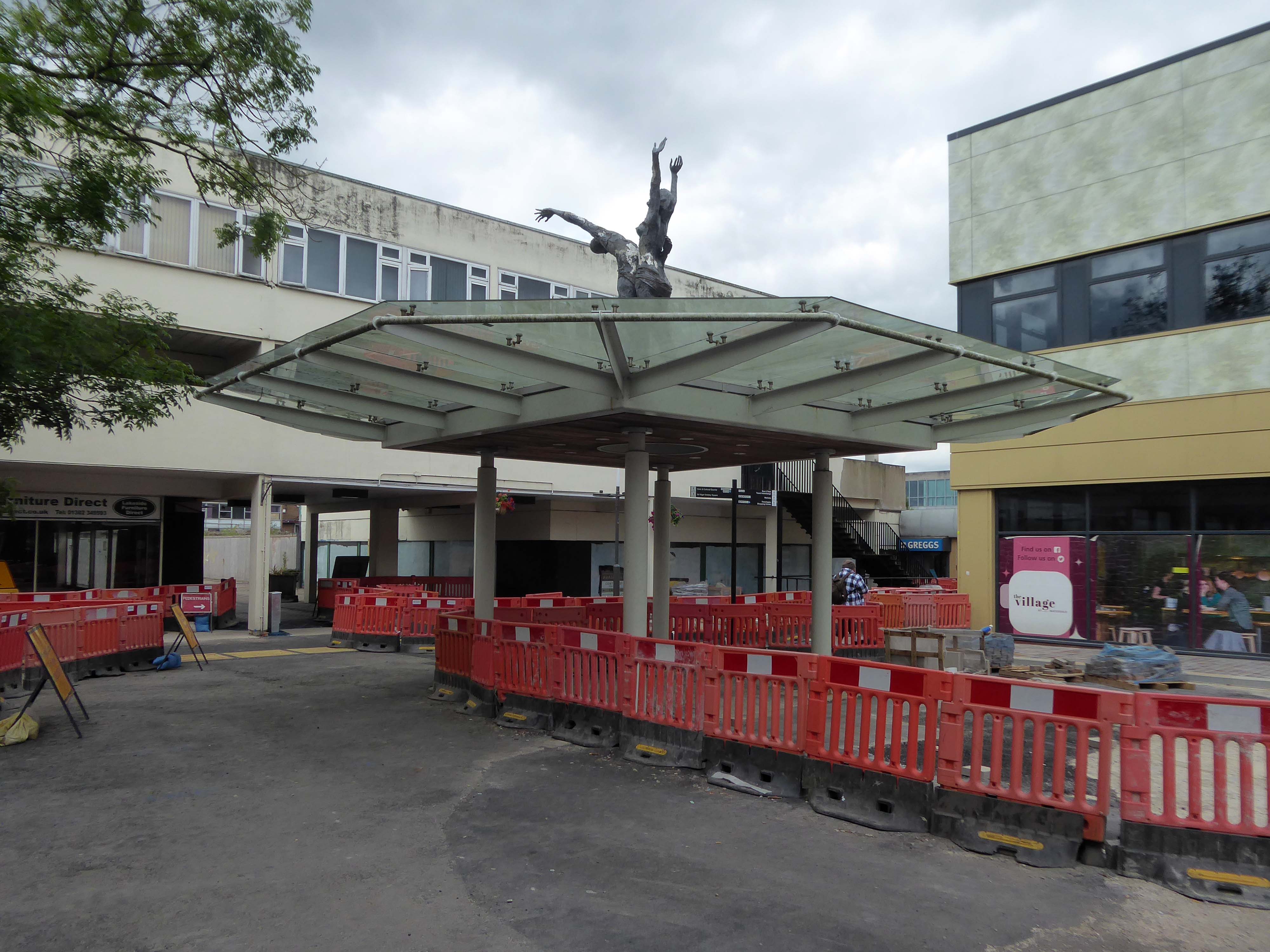
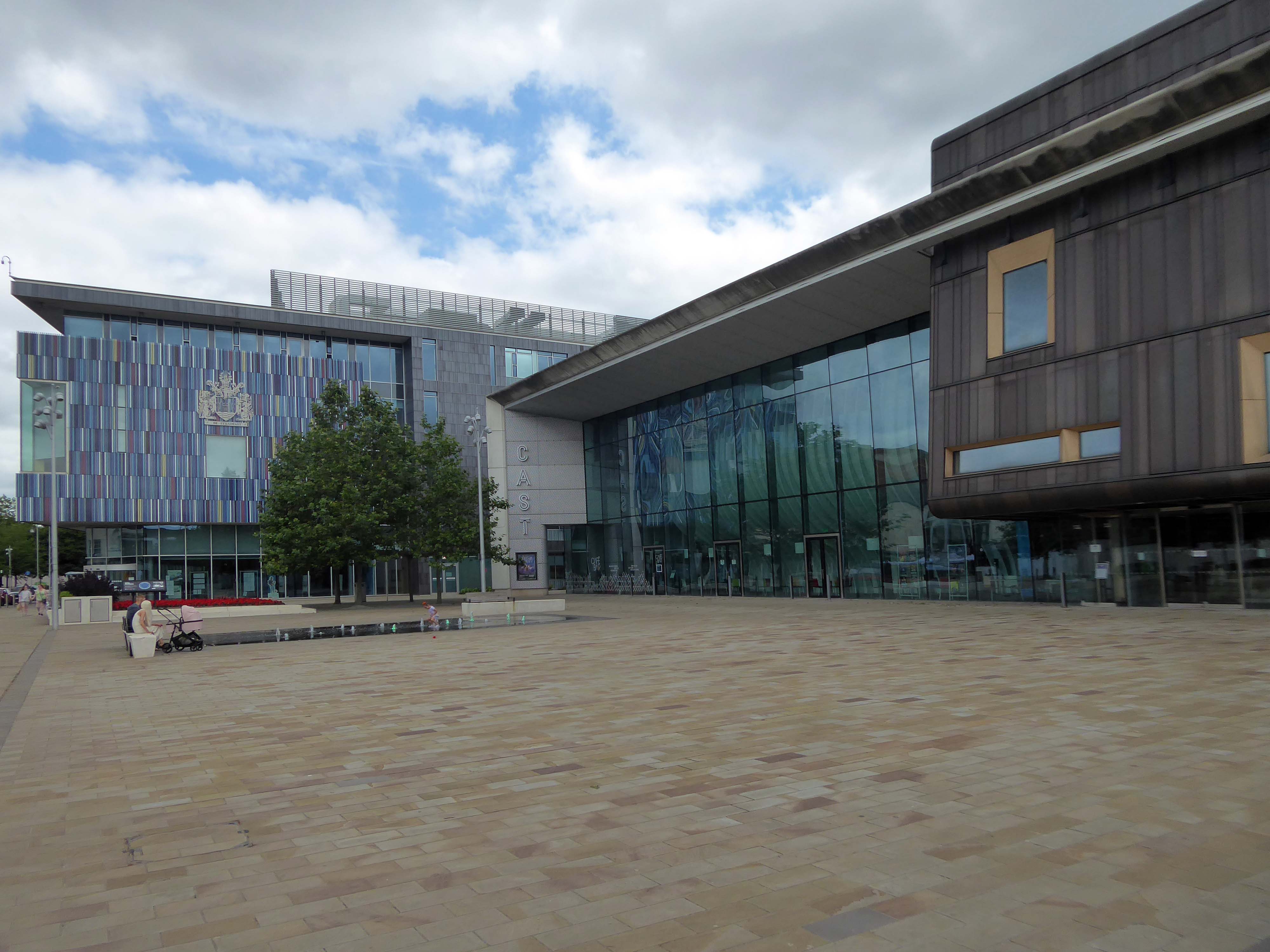
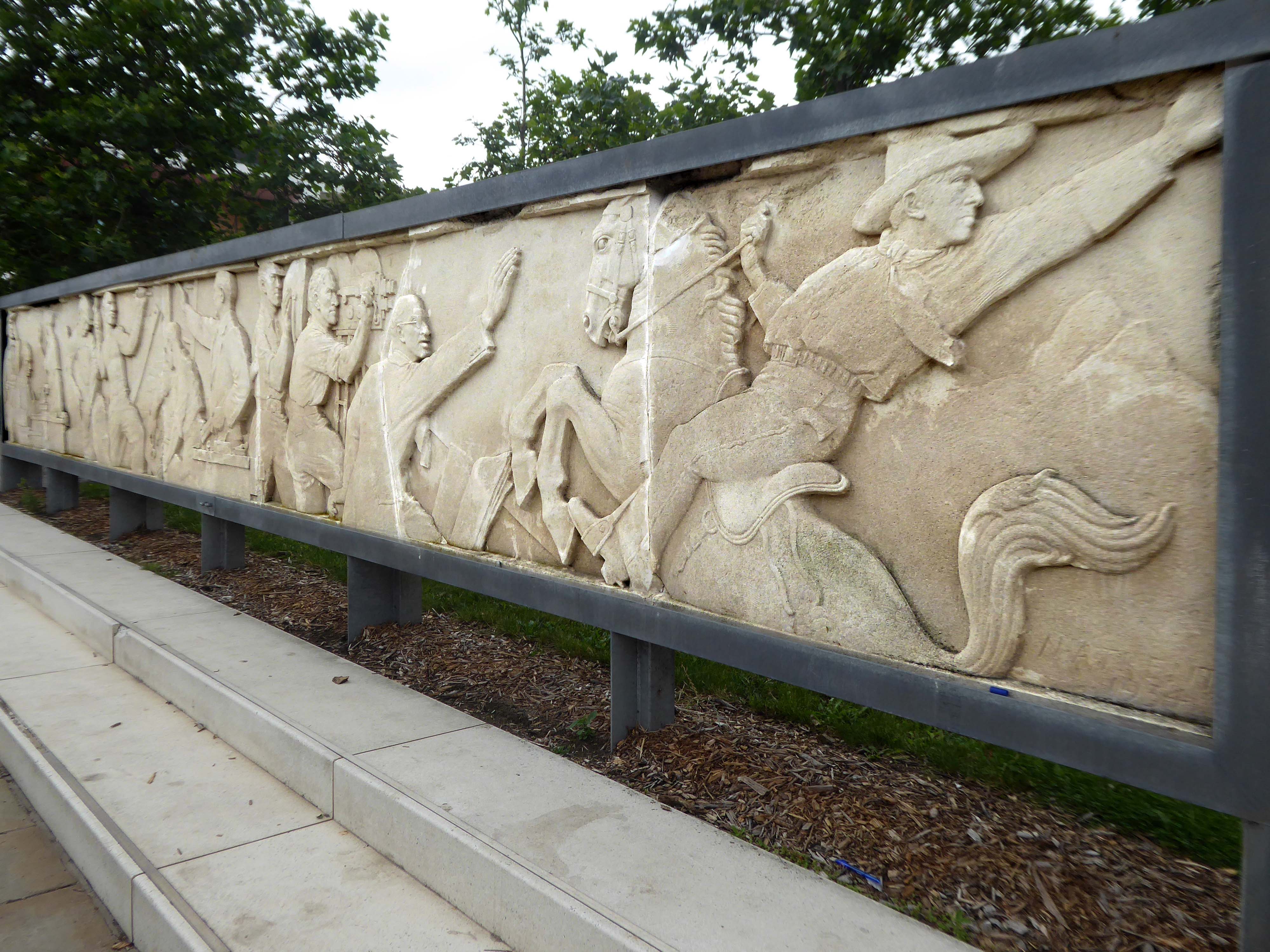
Facing the former library we find the CAST Theatre, Civic Buildings and Savoy Cinema, grouped around Sir Nigel Gresley Square.
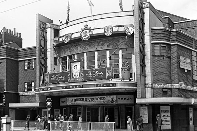
Within the square is a frieze, salvaged from the former Gaumont Cinema, the work of sculptor Newbury Abbot Trent.
The Gaumont Palace Theatre in Hall Gate at the corner of Thorne Road, Doncaster opened on 3rd September 1934 with Jesse Matthews in Evergreen.
It was designed by architects WE Trent and W Sydney Trent.
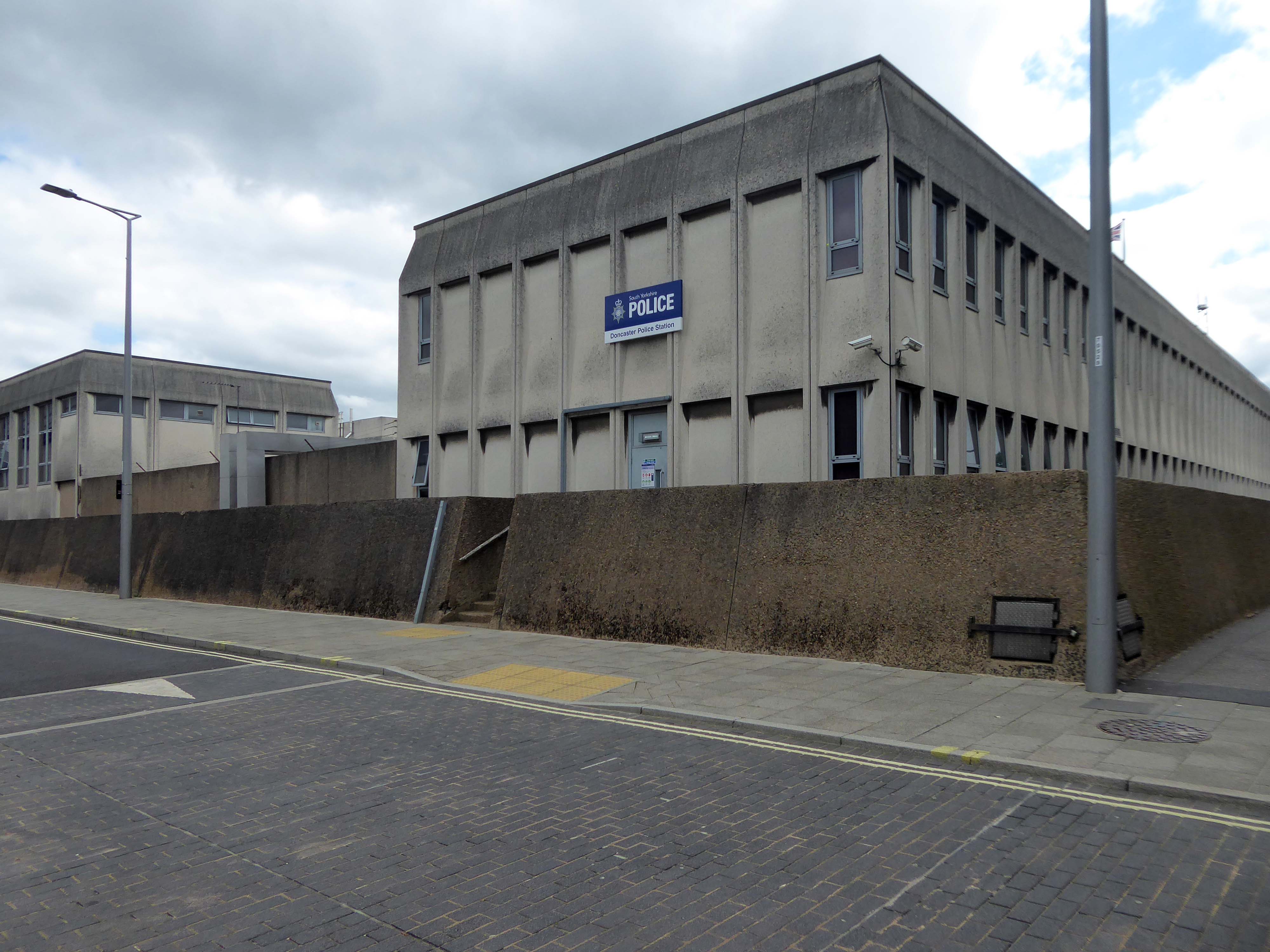
In 1949 WH Price the Borough Surveyor produced an outline plan for the area, with a green space at its heart, it was never realised. In 1955 Frederick Gibberd produced his plan to include a ten storey Town Hall, Art School, Technical College and Civic Theatre, revised and reduced in 1963 – eventually his Police Station and Law Courts were completed in 1969.
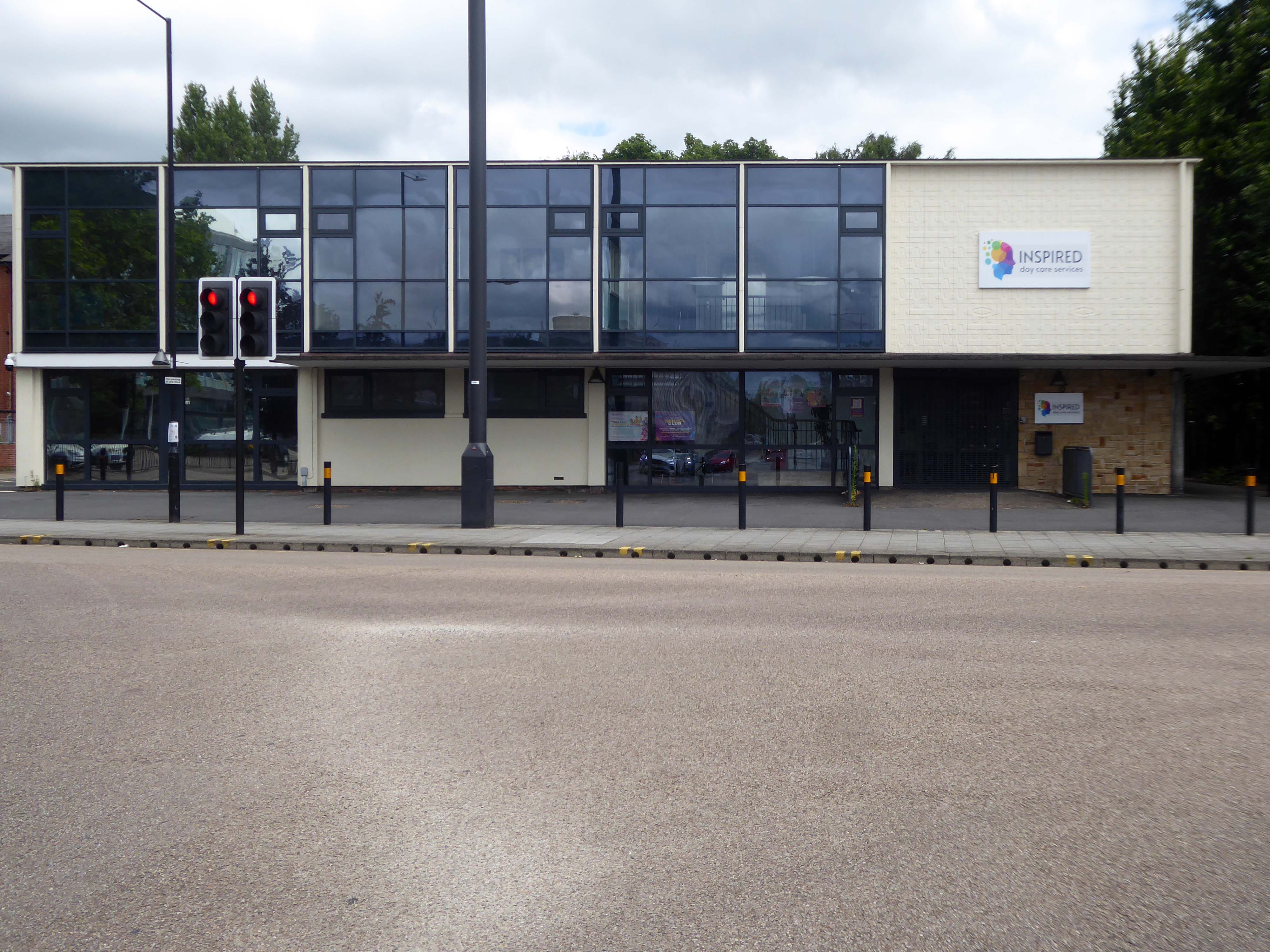
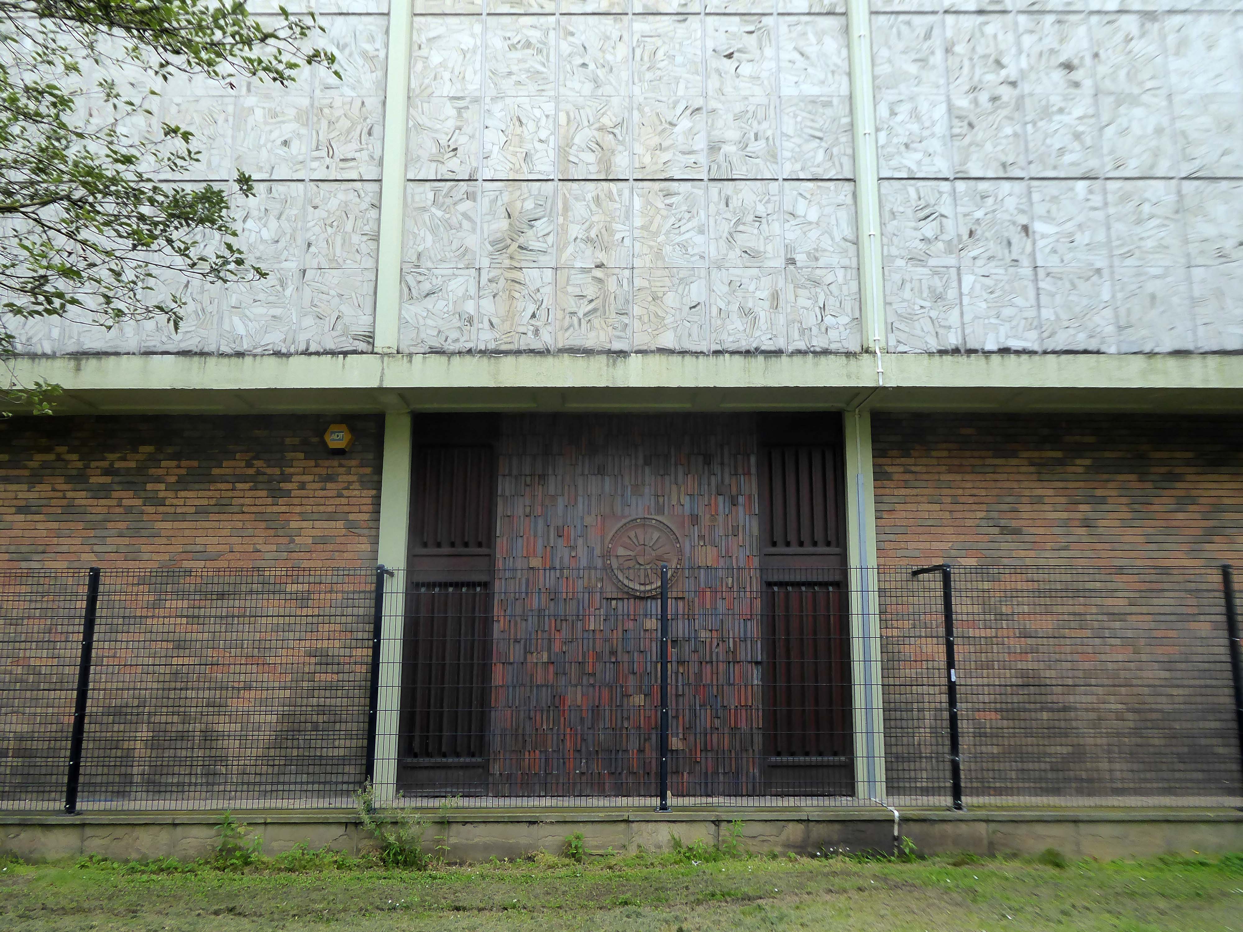
The former NHS Clinic at the ‘T Junction’ is transformed into a day care service.
The building was designed in the office of the Doncaster Borough Architect’s Department in a team led by borough architect Mr LJ Tucker.
The ceramic designs were a later addition when it was discovered that the large open areas of glass overheated almost everything inside, the work was undertaken by LJ Tucker and family.
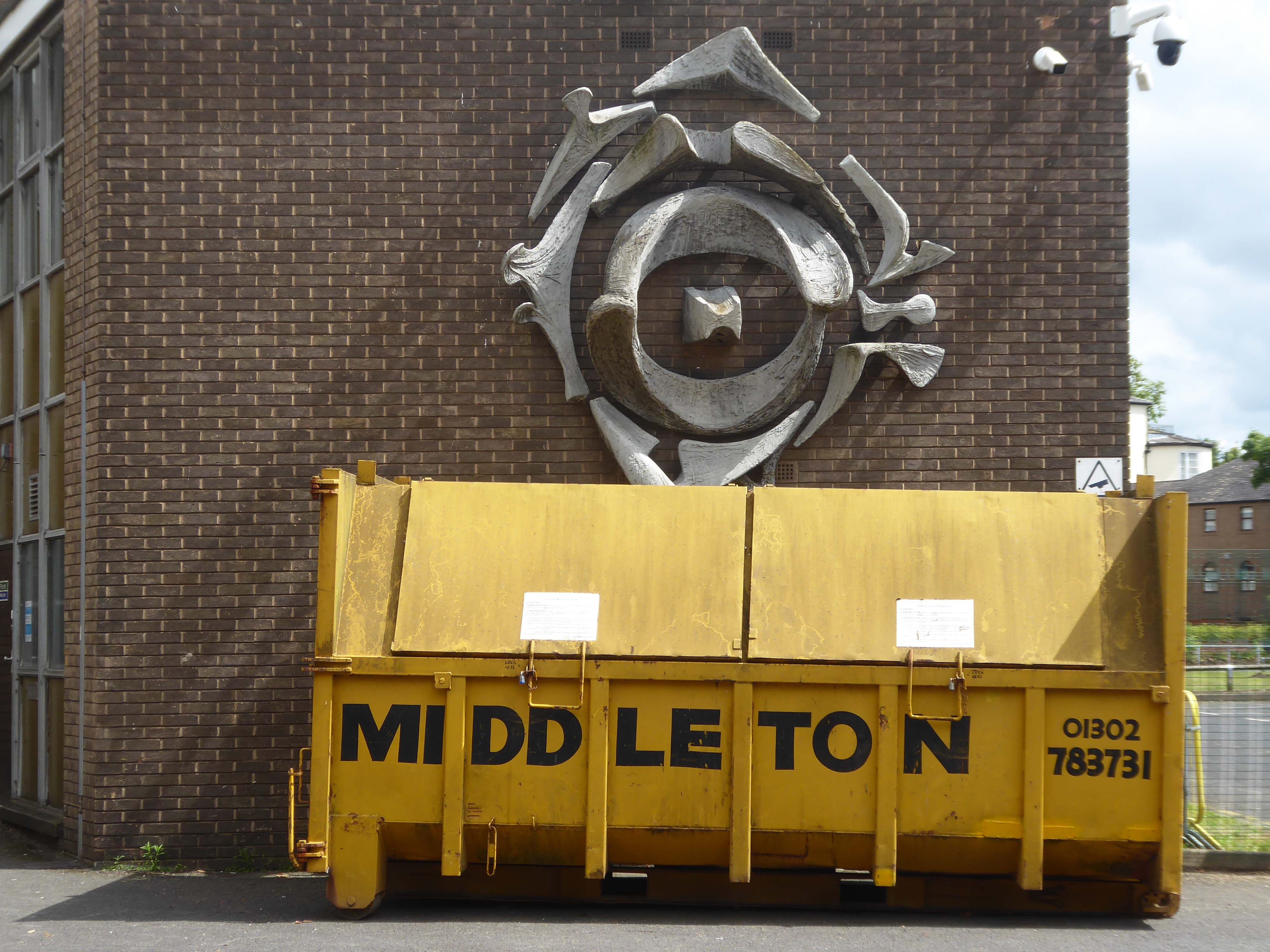
The sculptural work by Franta Belsky, now has a skip for company.
As a footnote the work by Fabio Barraclough reveals a murky past.
Barraclough was born in Madrid in 1923, to a Spanish mother and Yorkshire father who founded Madrid’s Chamber of Commerce. He moved to London with his family in the 1930s as a refugee from Francoist Spain. He taught fine art and sculpture at Rugby School, where colleagues considered him “highly entertaining, a most unorthodox and highly gifted” teacher. He established himself during the 1960s and early 1970s as an authority on sculpture, publishing in academic journals and becoming a member of the Royal British Society of Sculptors.
In 2000, it was revealed that Barraclough, while outwardly living the life of anti-apartheid activist since the 1970s, had been a paid informant of the South African state security police. The media was used to promote his image as a “brilliant, liberal artist with apparently impeccable credentials” in order to gain public trust, while he was funnelling money from anti-apartheid groups to the police. He died on 6th January 2019.
Over the way faros the green sward is St Peter in Chains RC – A large and striking design by JH Langtry-Langton, incorporating important furnishings by J F Bentley from the predecessor church, along with good furnishings of the 1970s. The churches houses the modern successor to the medieval shrine of Our Lady of Doncaster.
Figurative stained glass by Patrick Feeny for Hardman in 1973 and abstract glass fitted in 2000 as part of reordering and revival of the shrine.
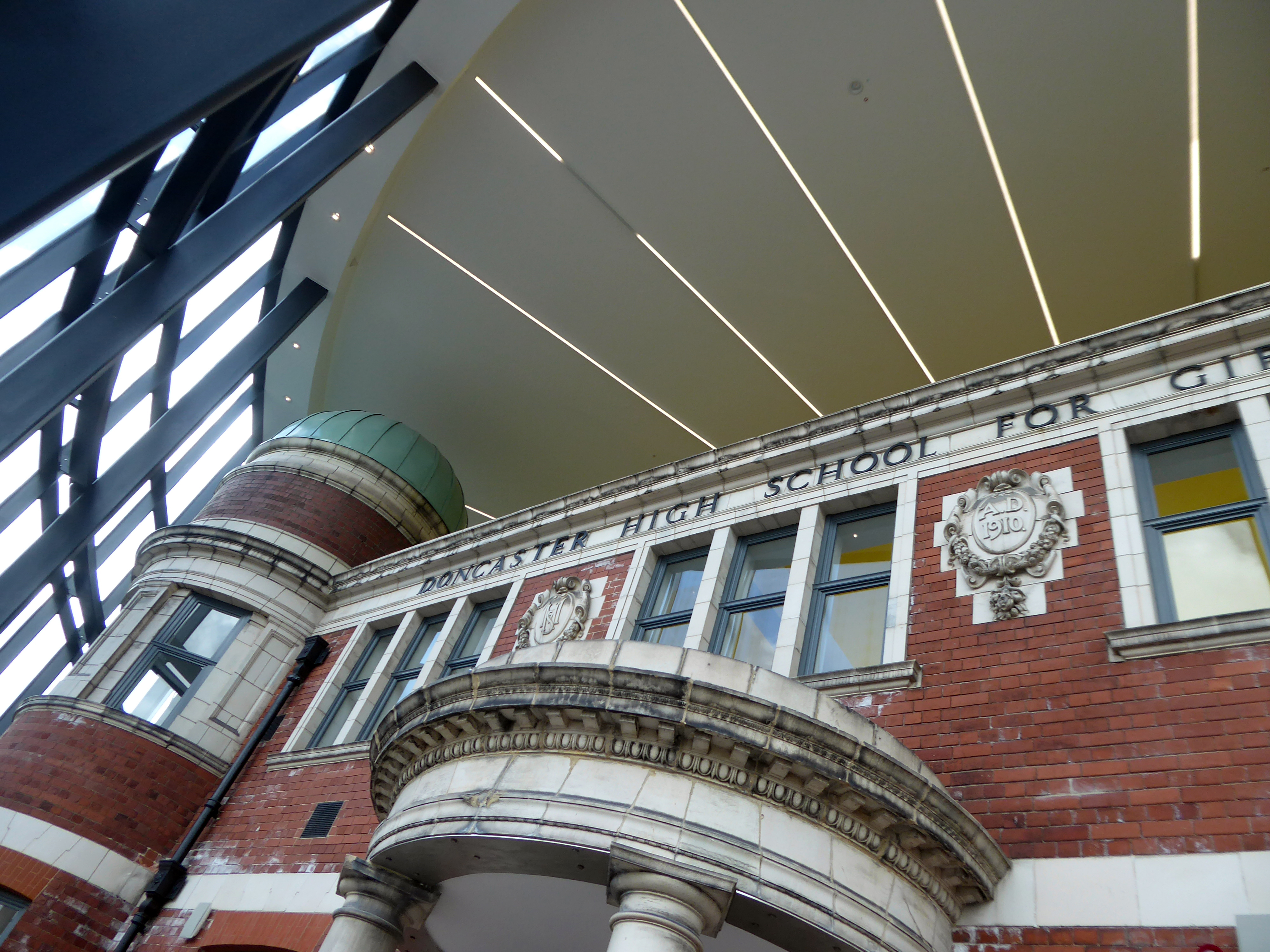
Designed by architects Bond Bryan and built by main contractor Willmott Dixon, the new cultural and learning hub has been created following the restoration of four existing buildings.
A key focal point of the scheme is the restored frontage of the Edwardian former Doncaster High School for Girls, which has been framed by Senior’s slimline SF52 aluminium curtain wall and showcased within a new steel-frame building. The glazed facade, which was fabricated and installed by Senior’s supply chain partner Chemplas, also features Senior’s aluminium commercial doors.
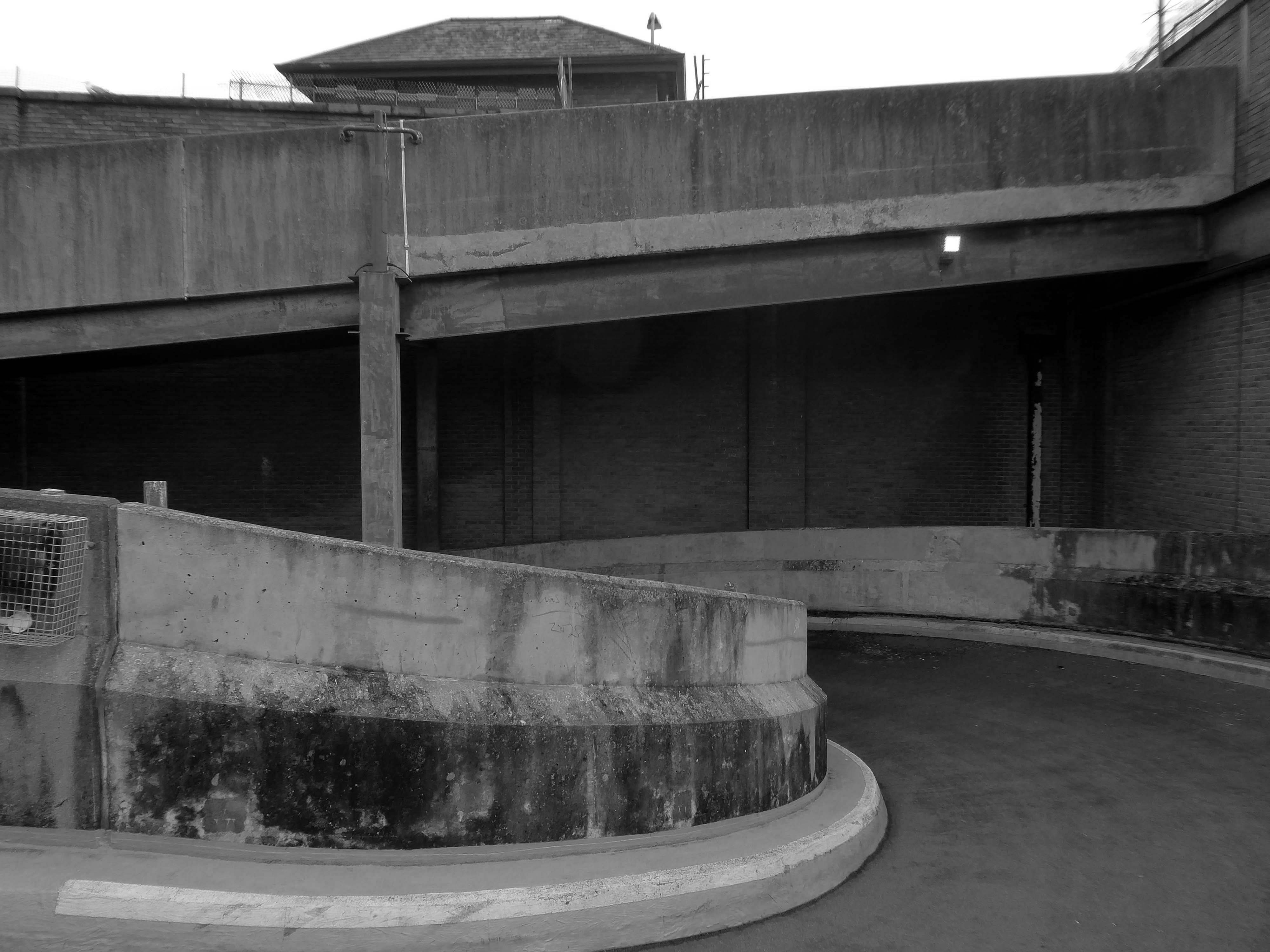
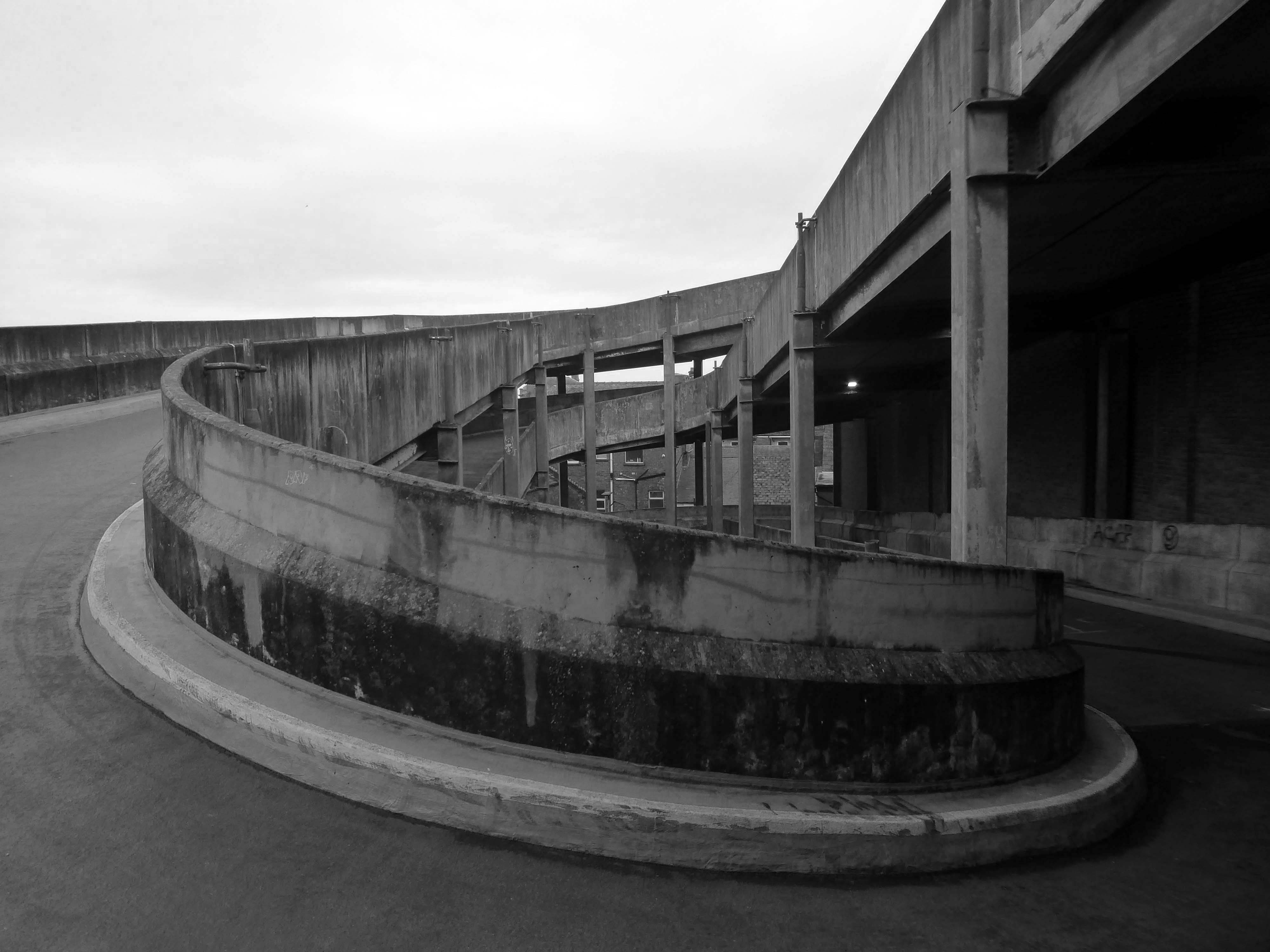
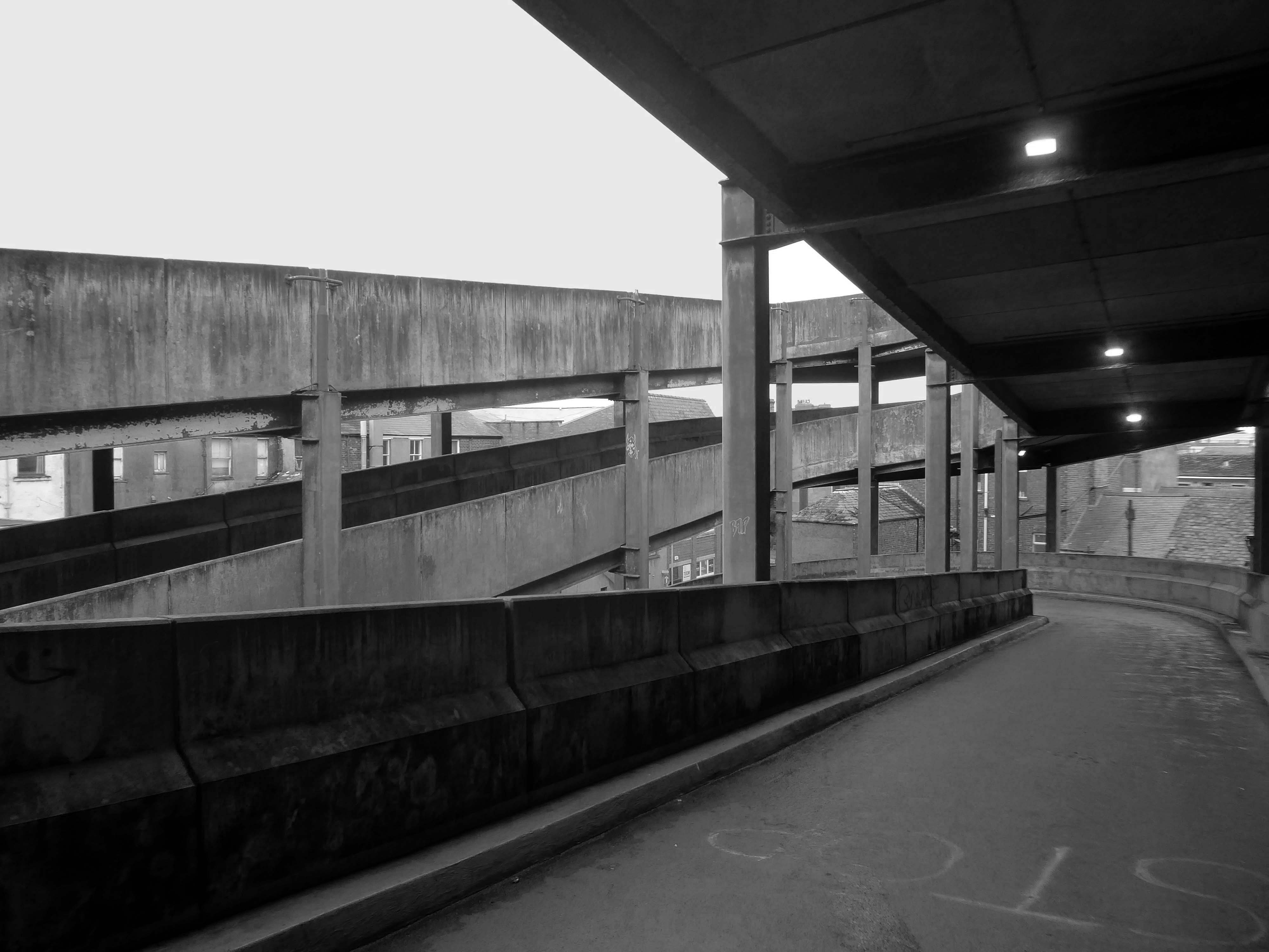
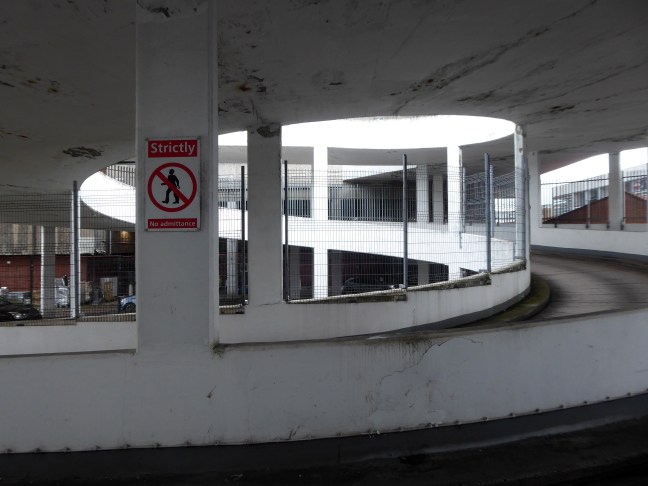
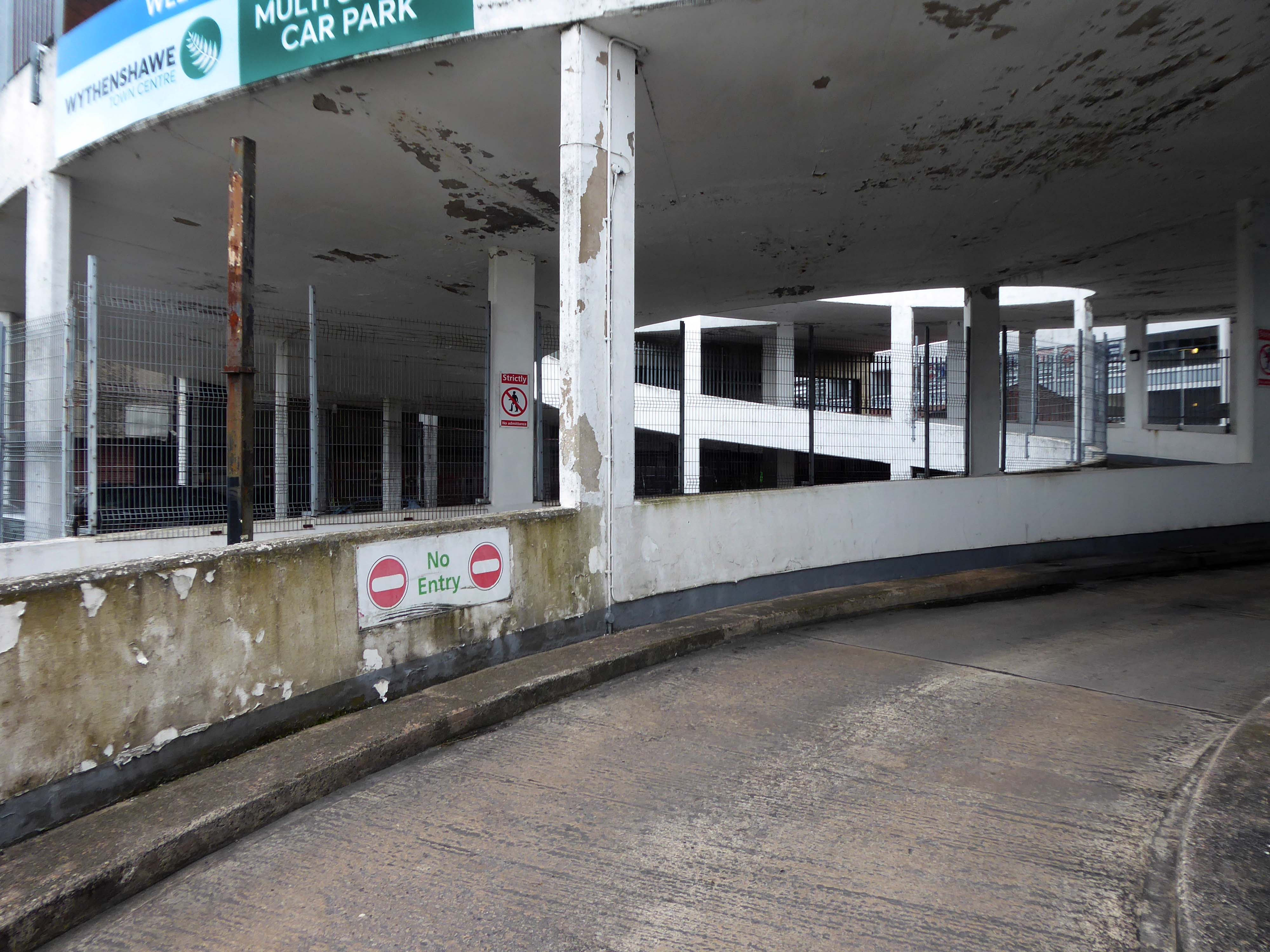
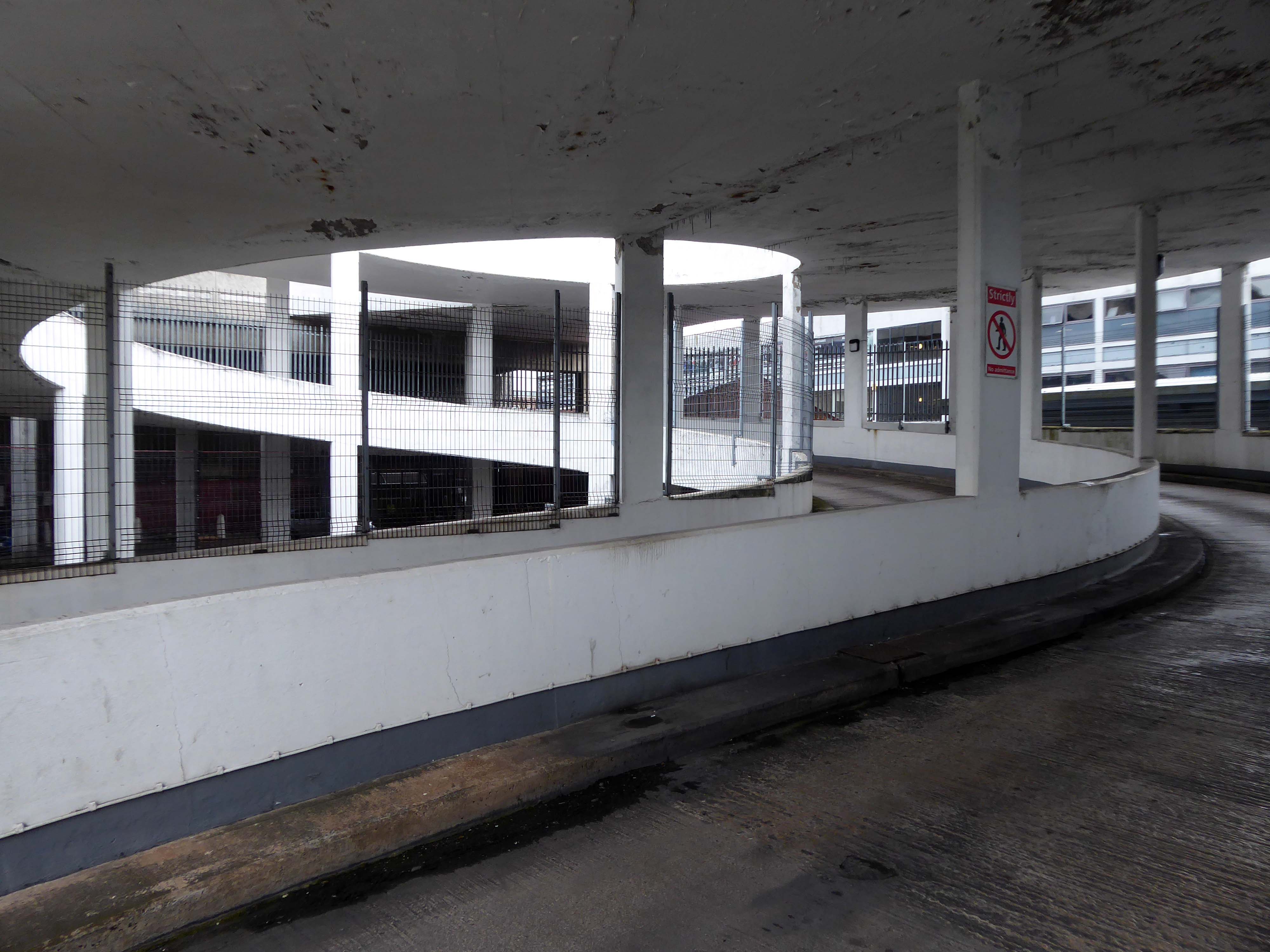
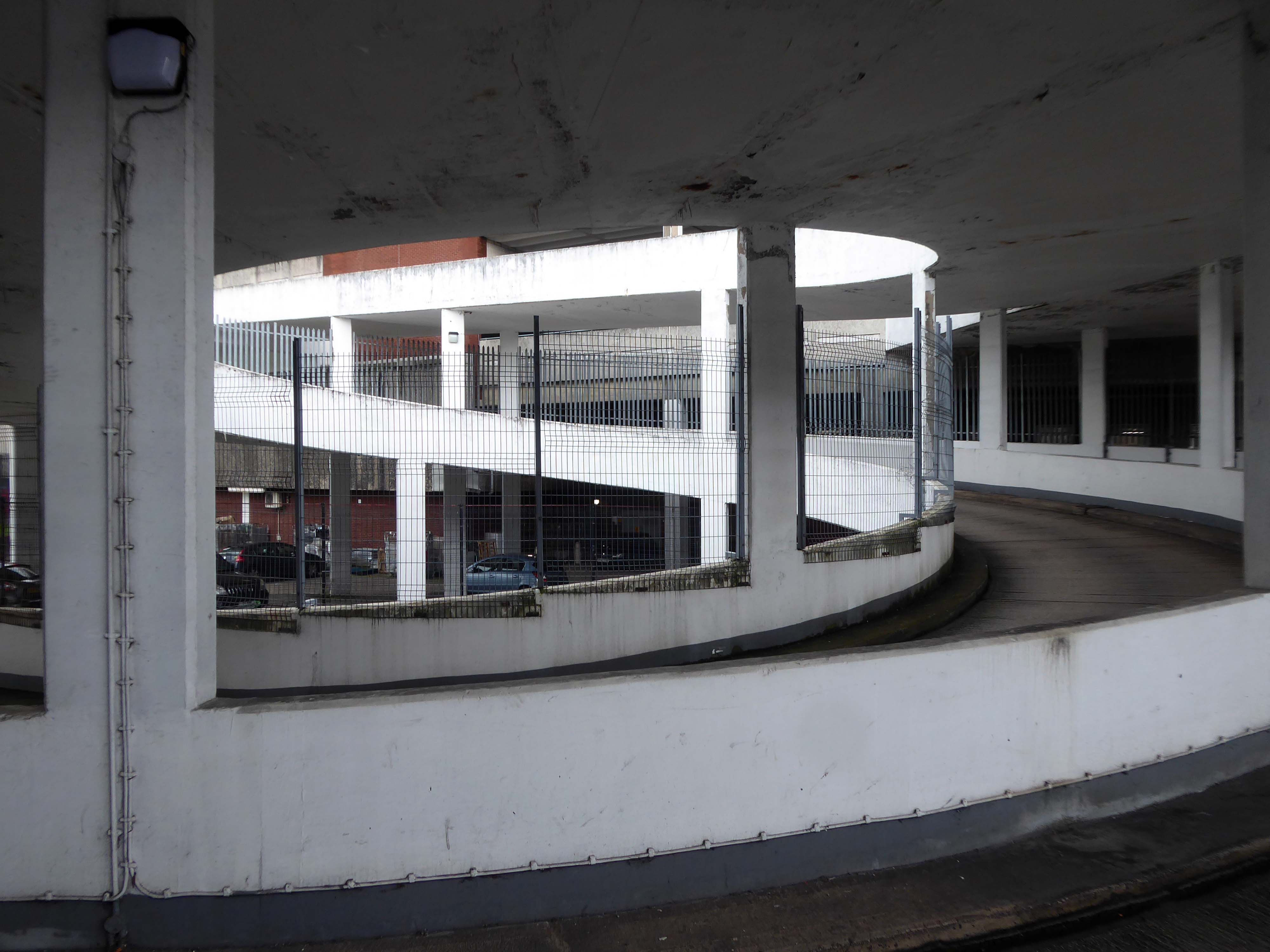
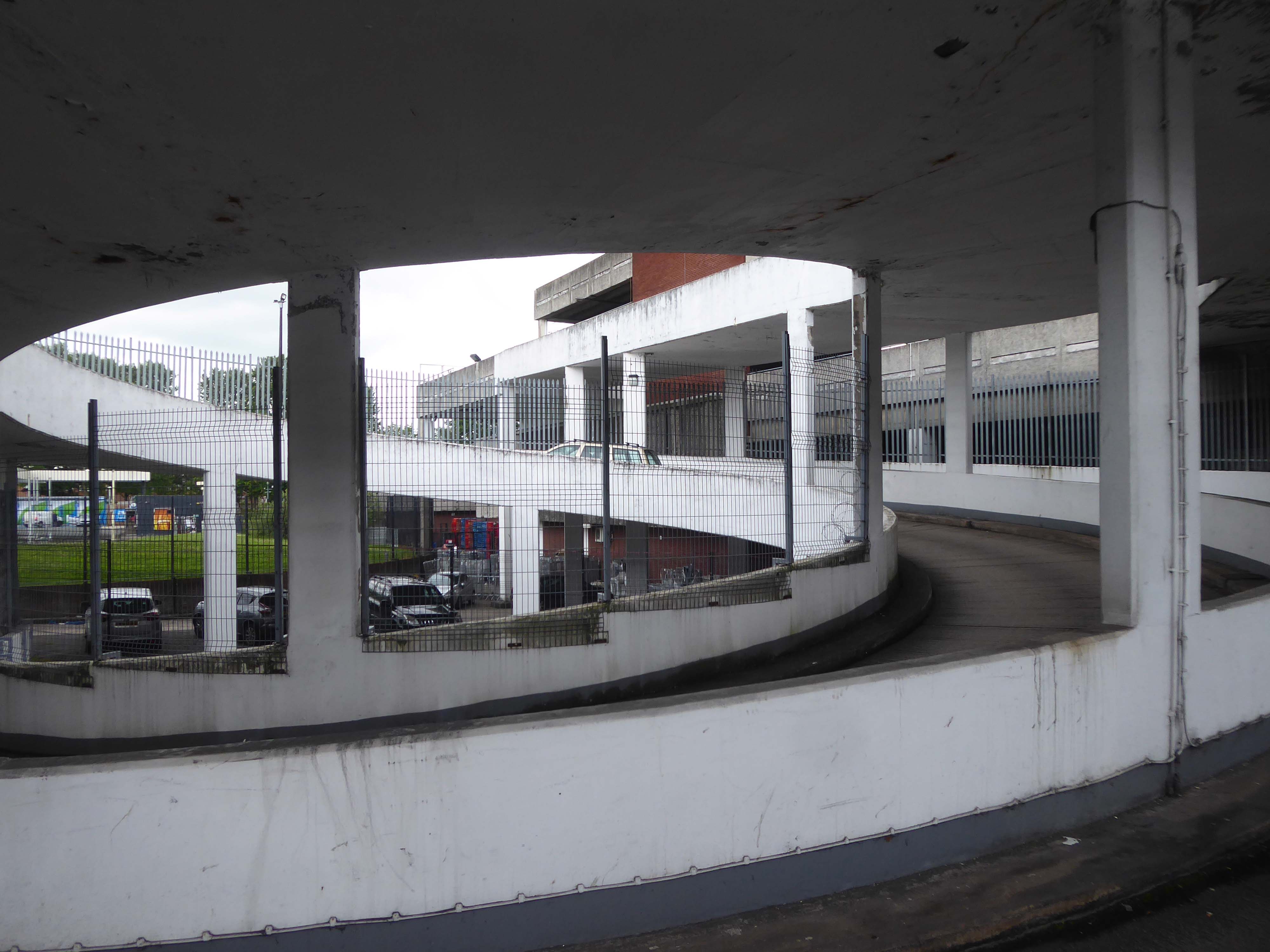
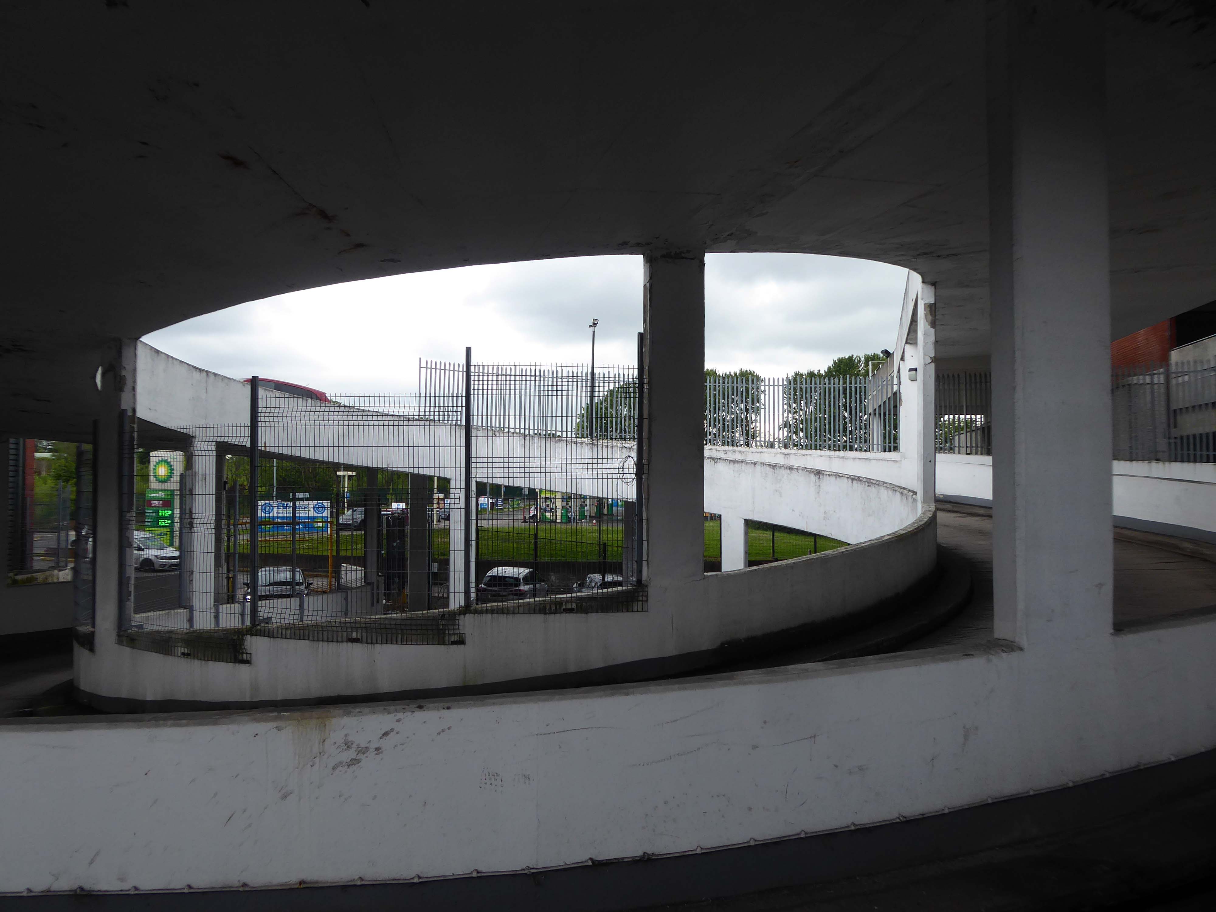
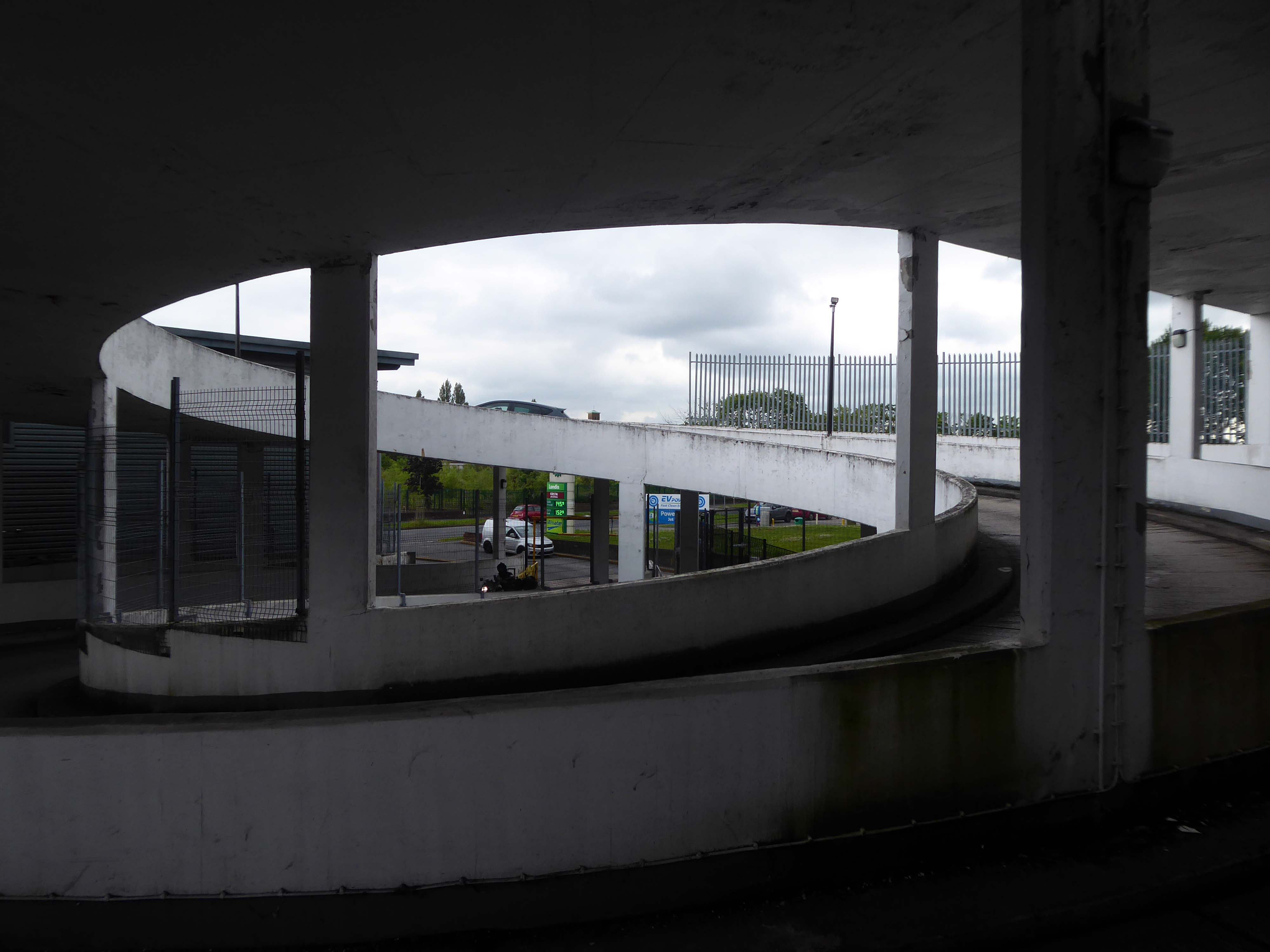
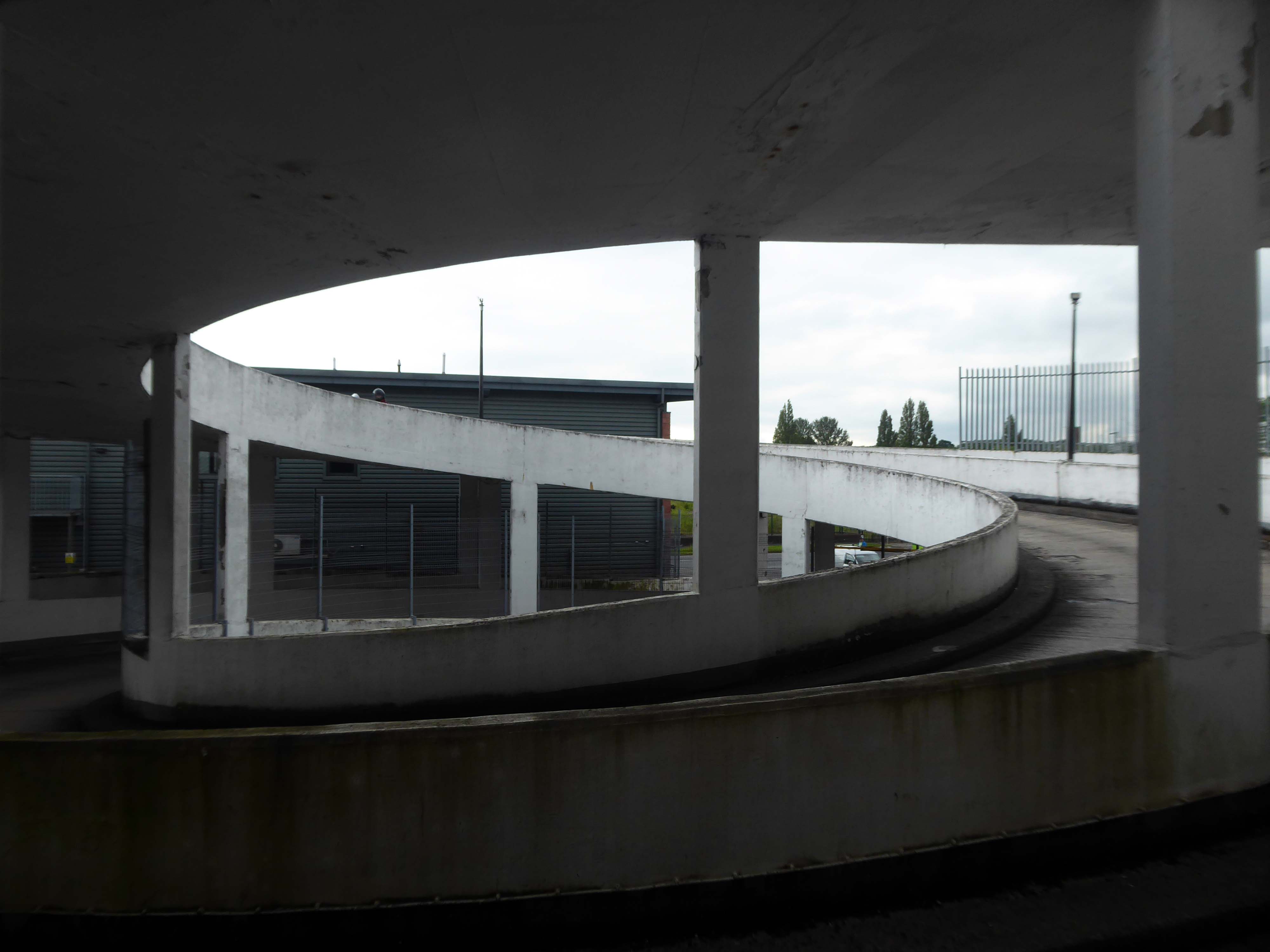
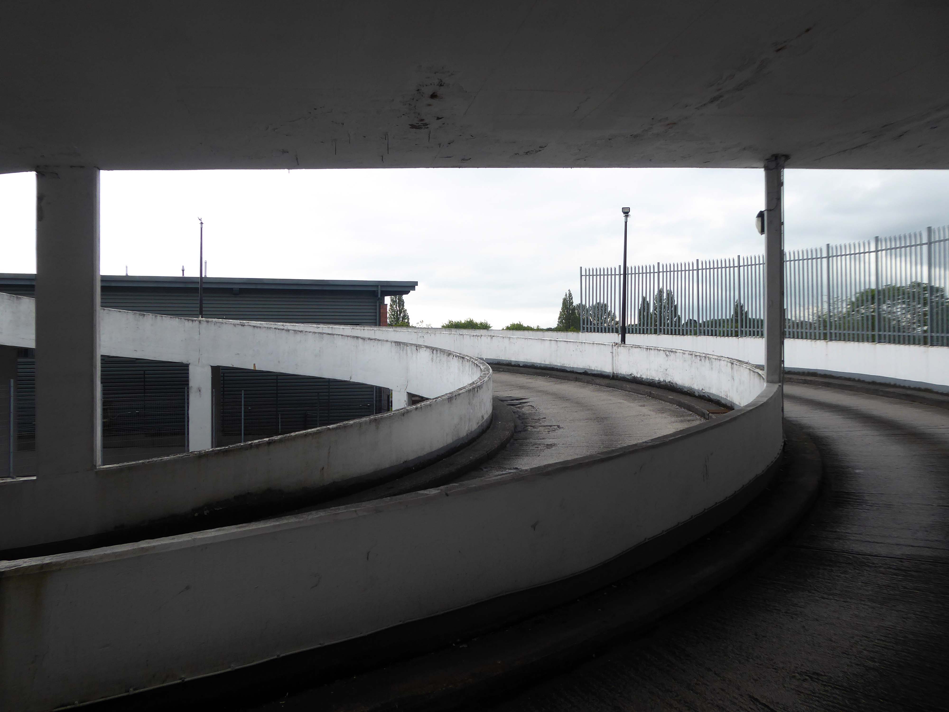
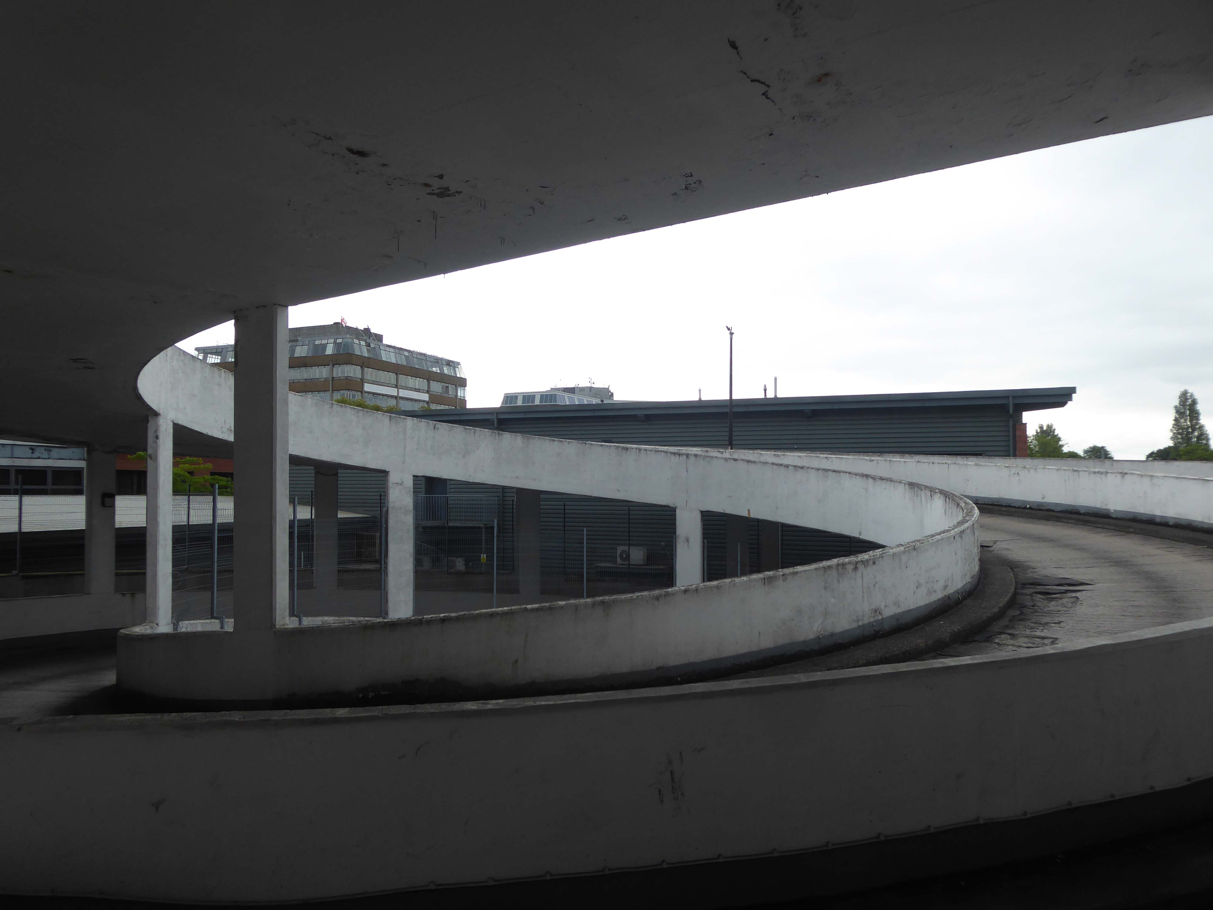
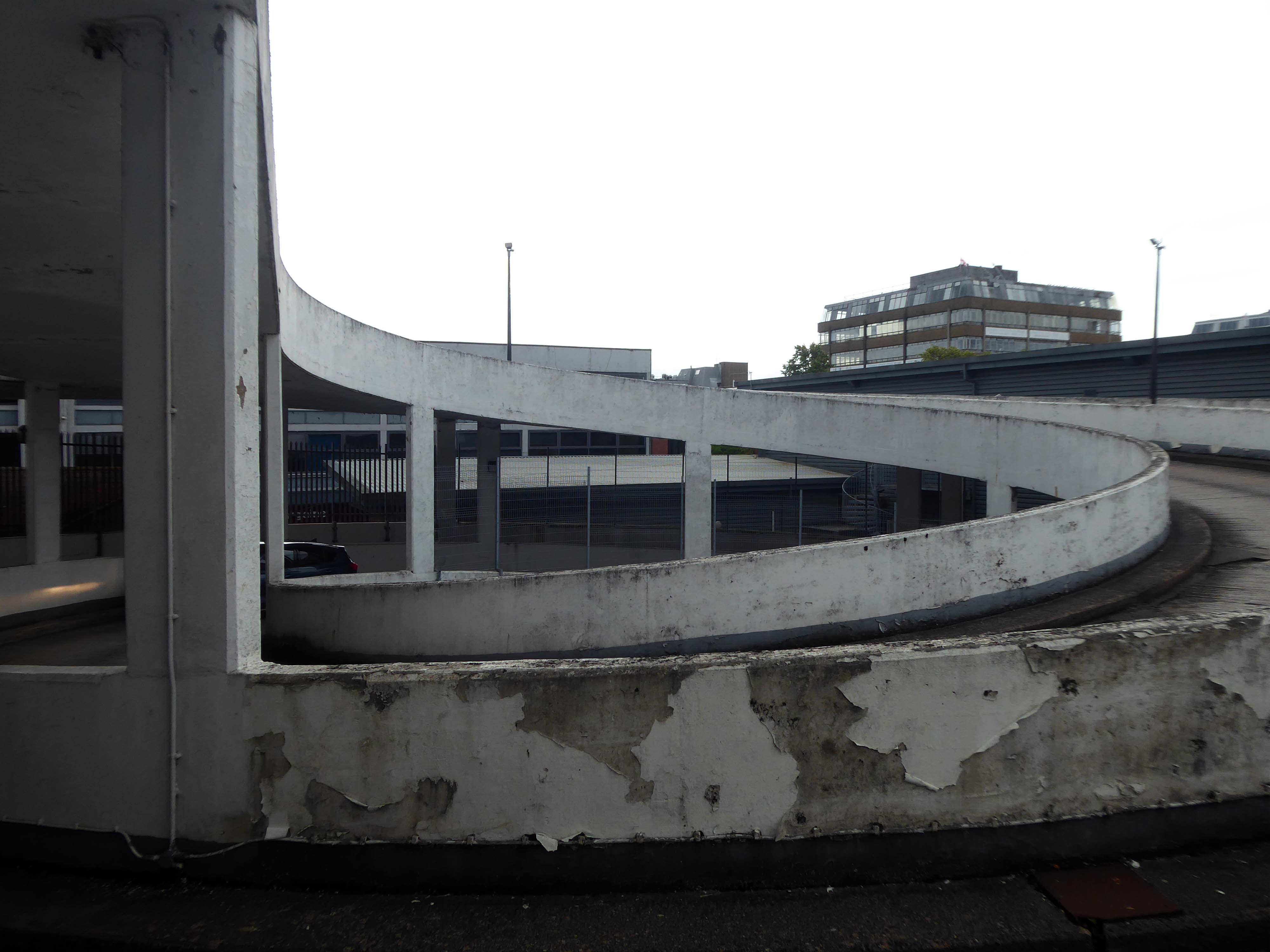
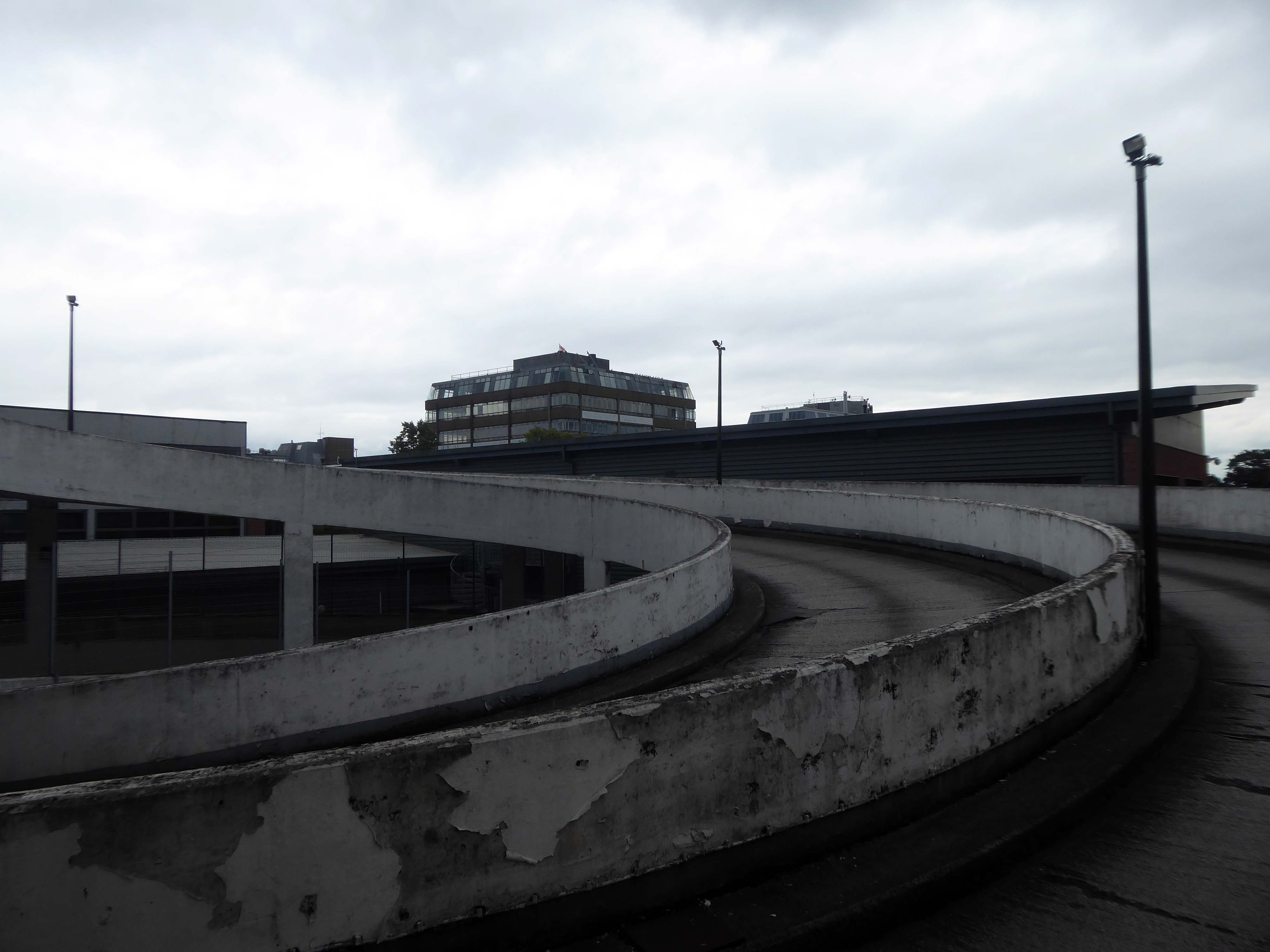
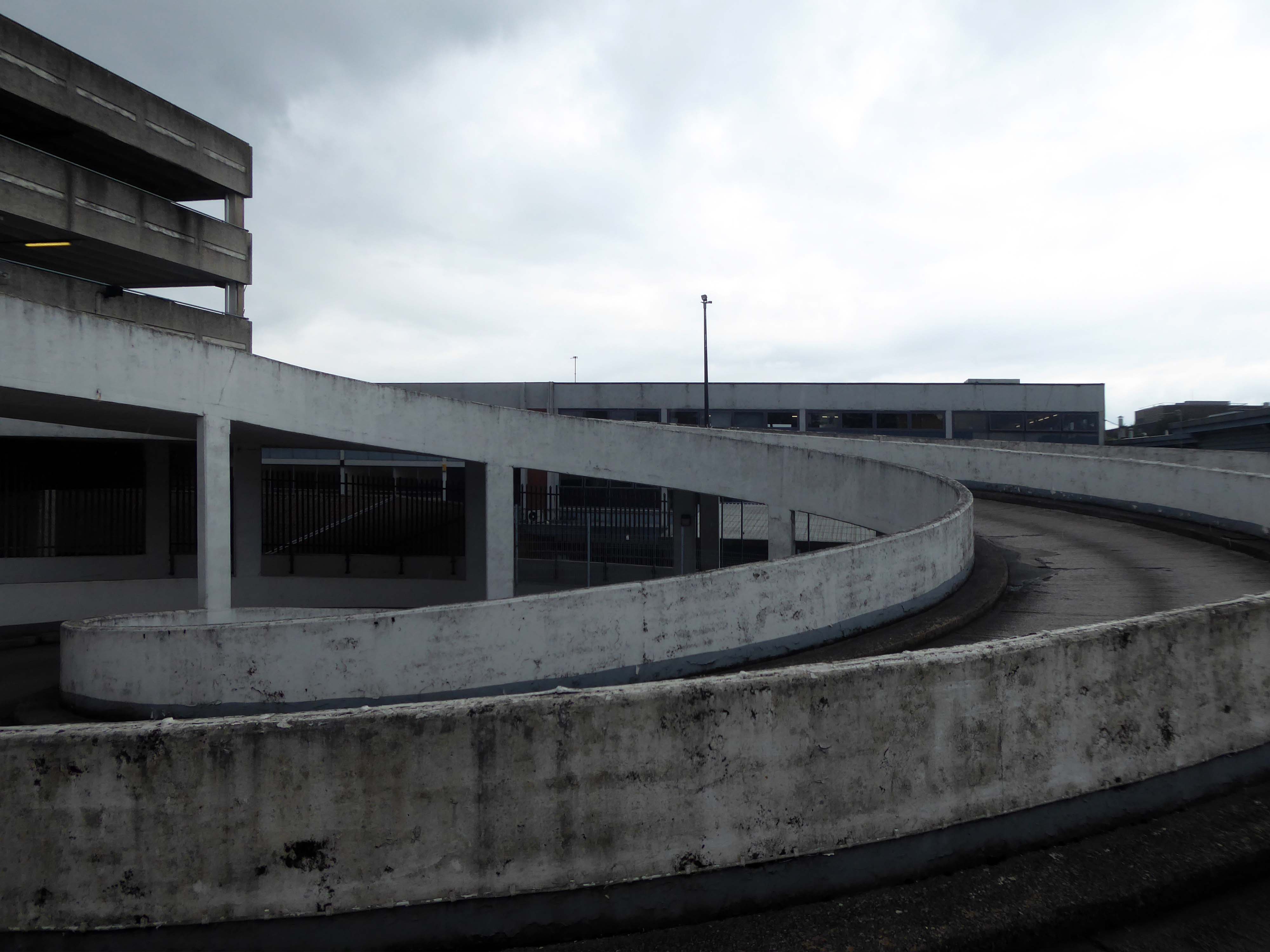
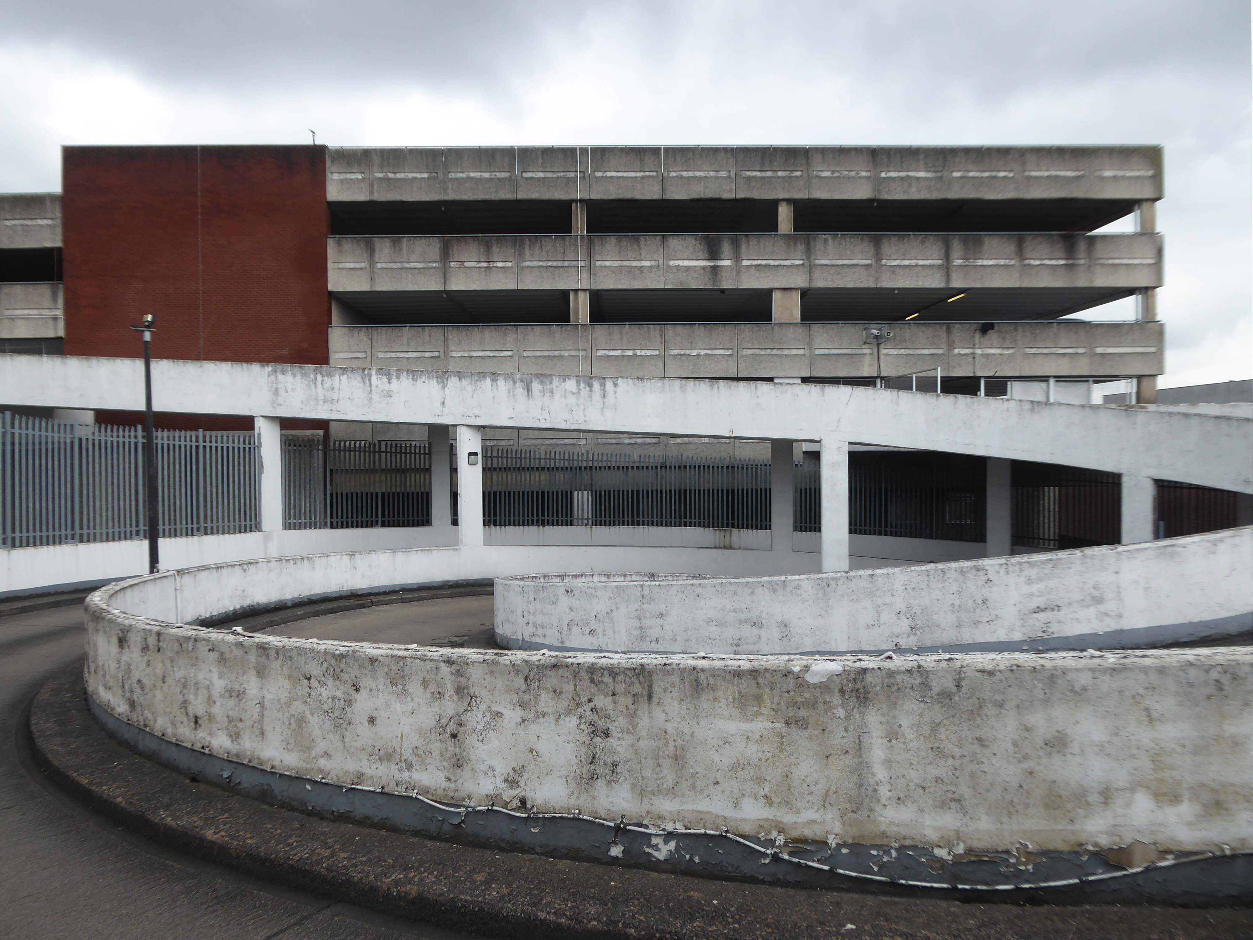
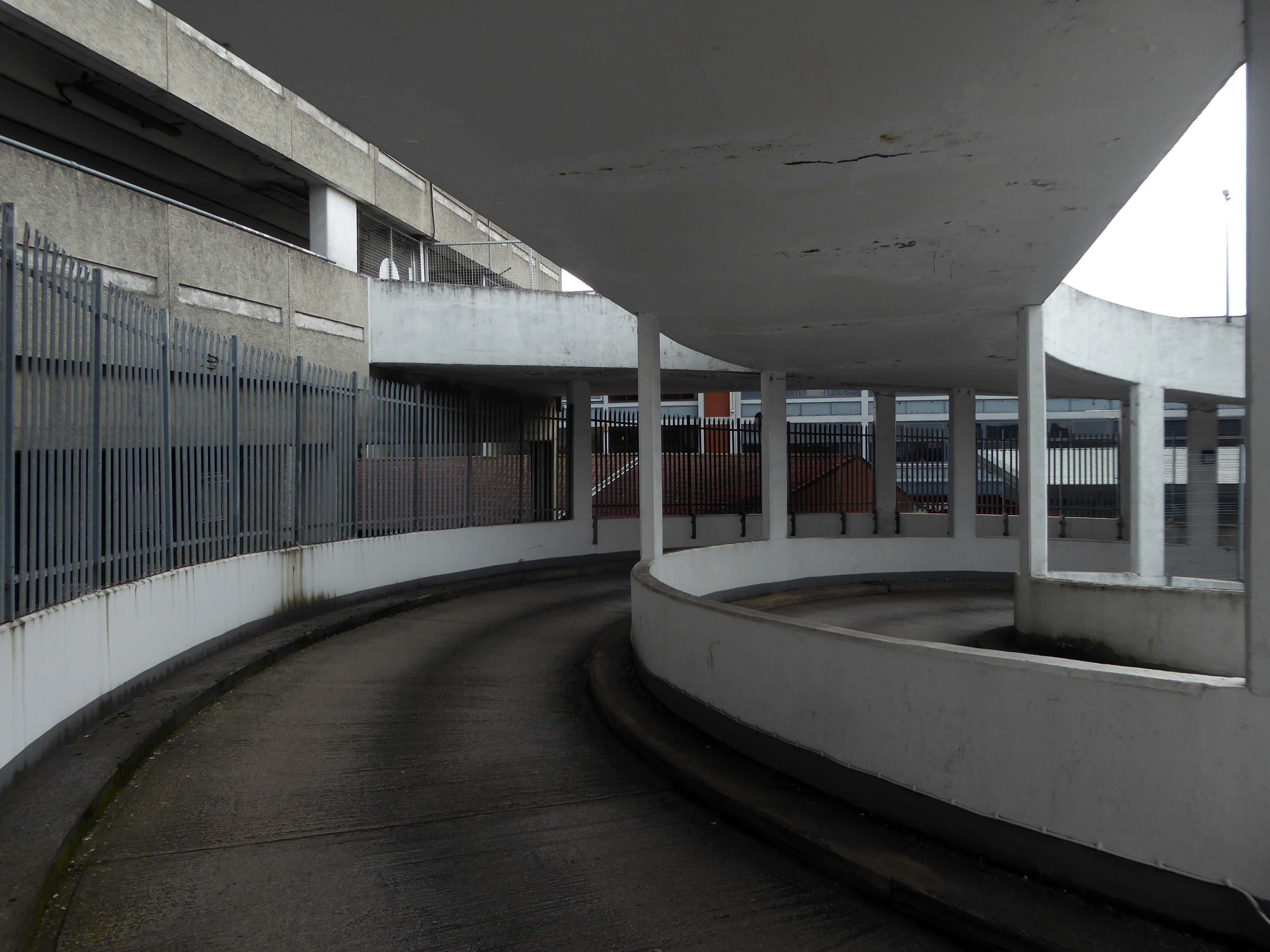
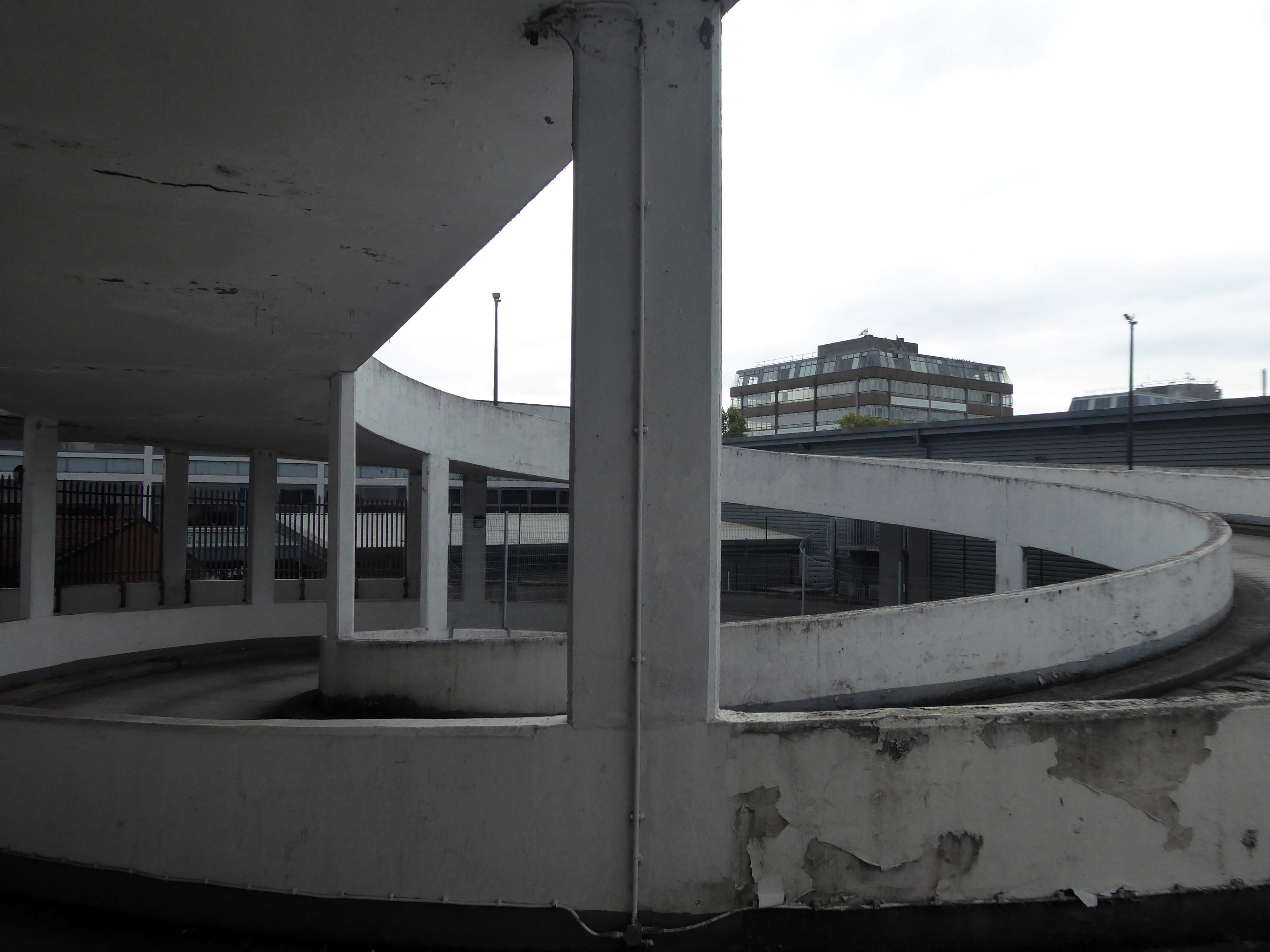
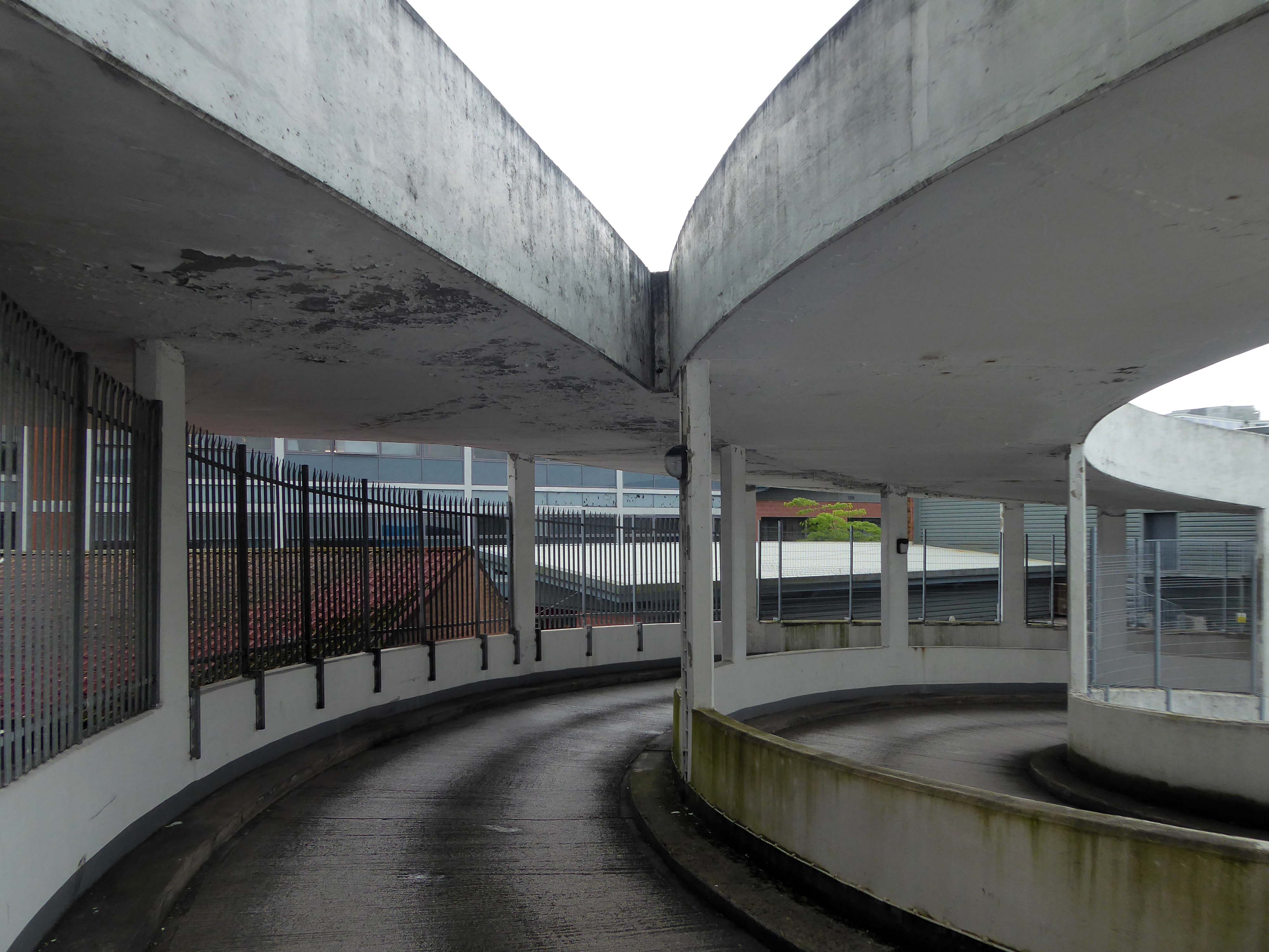
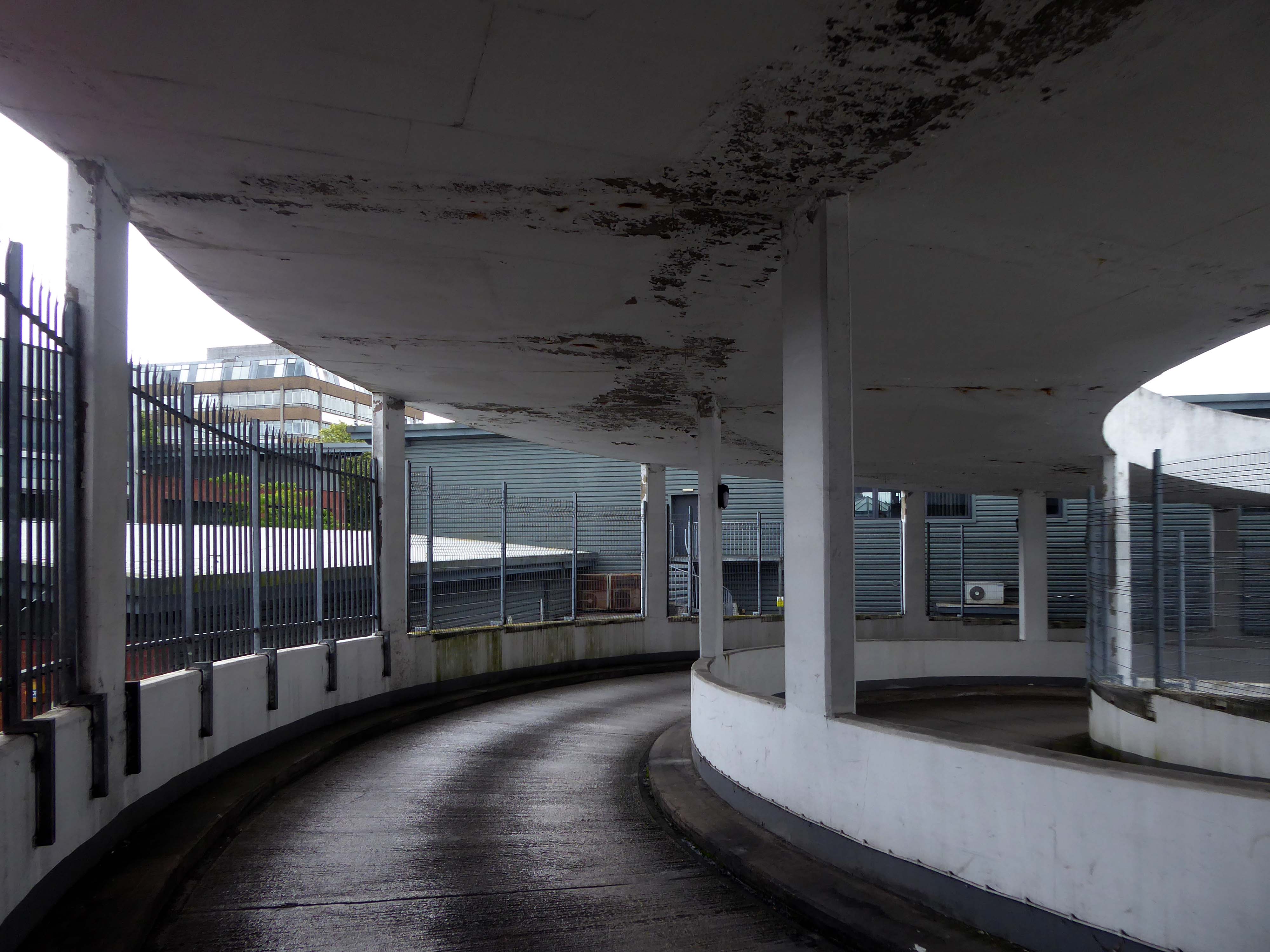
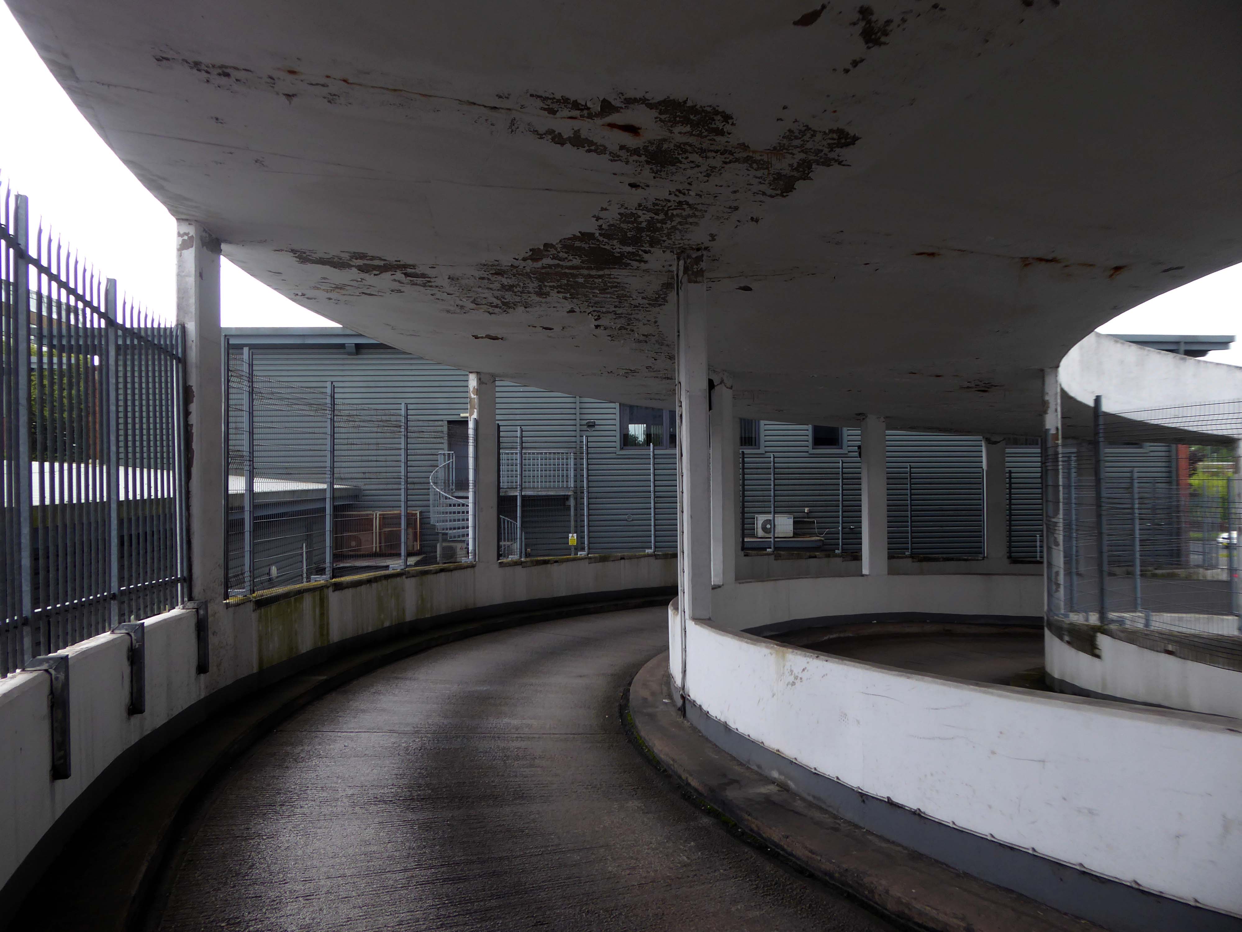
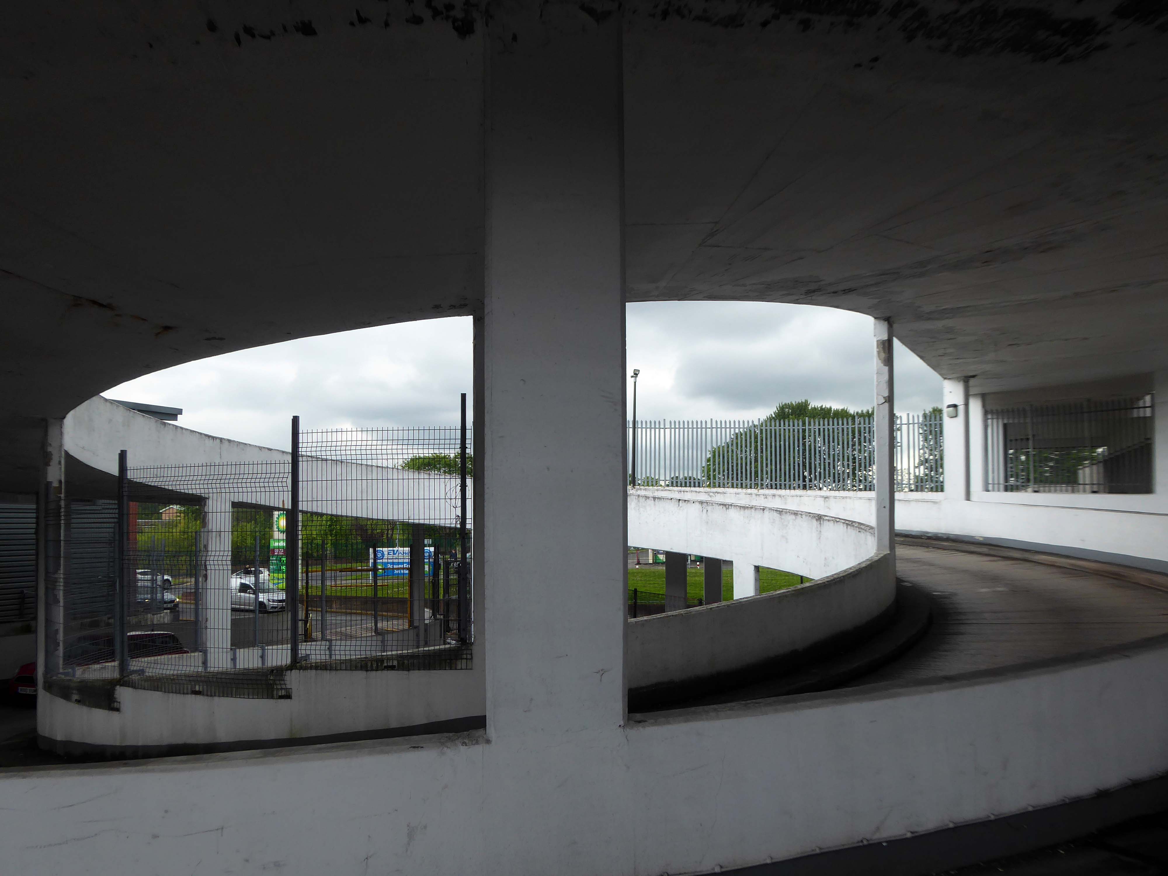
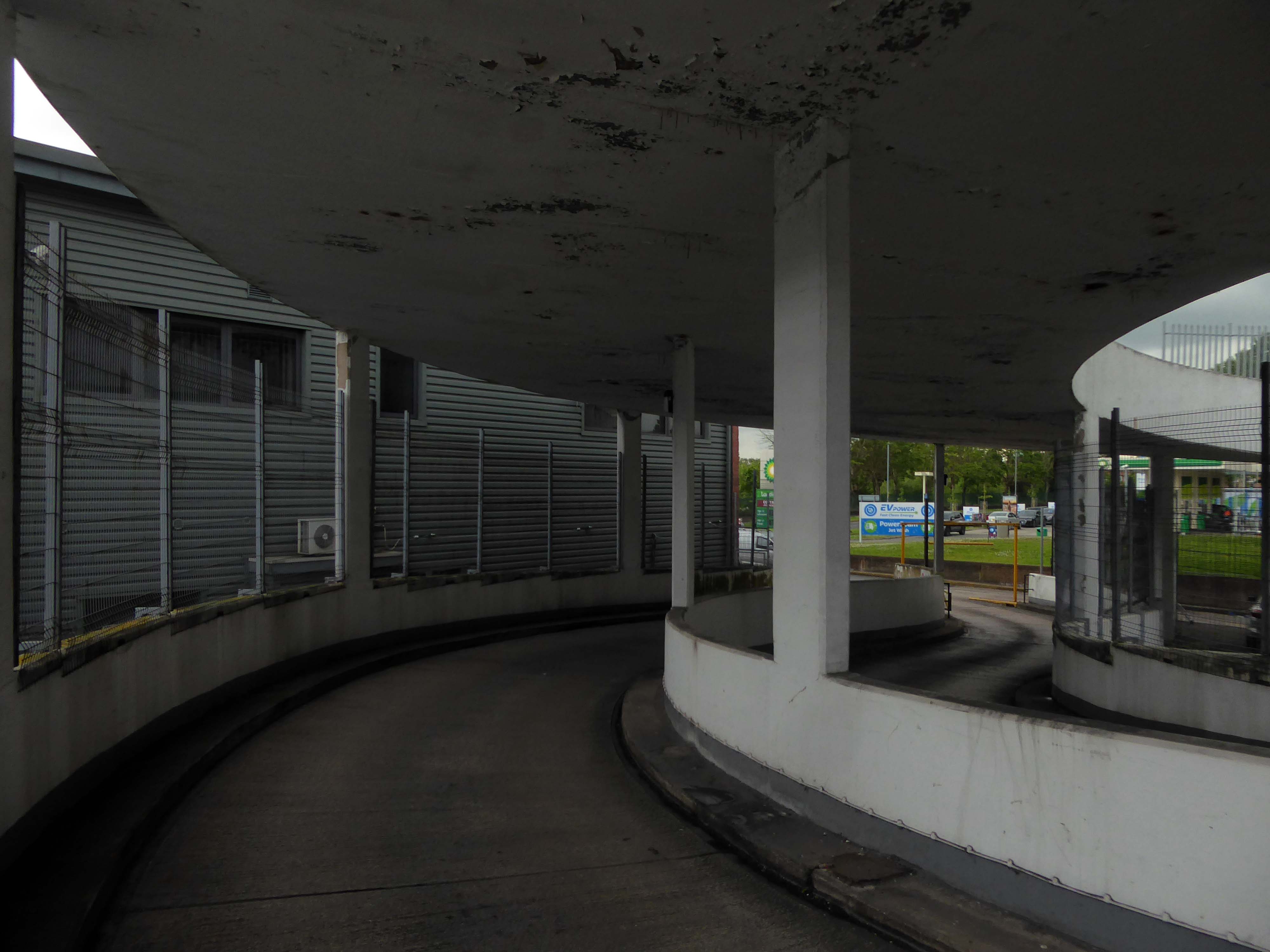
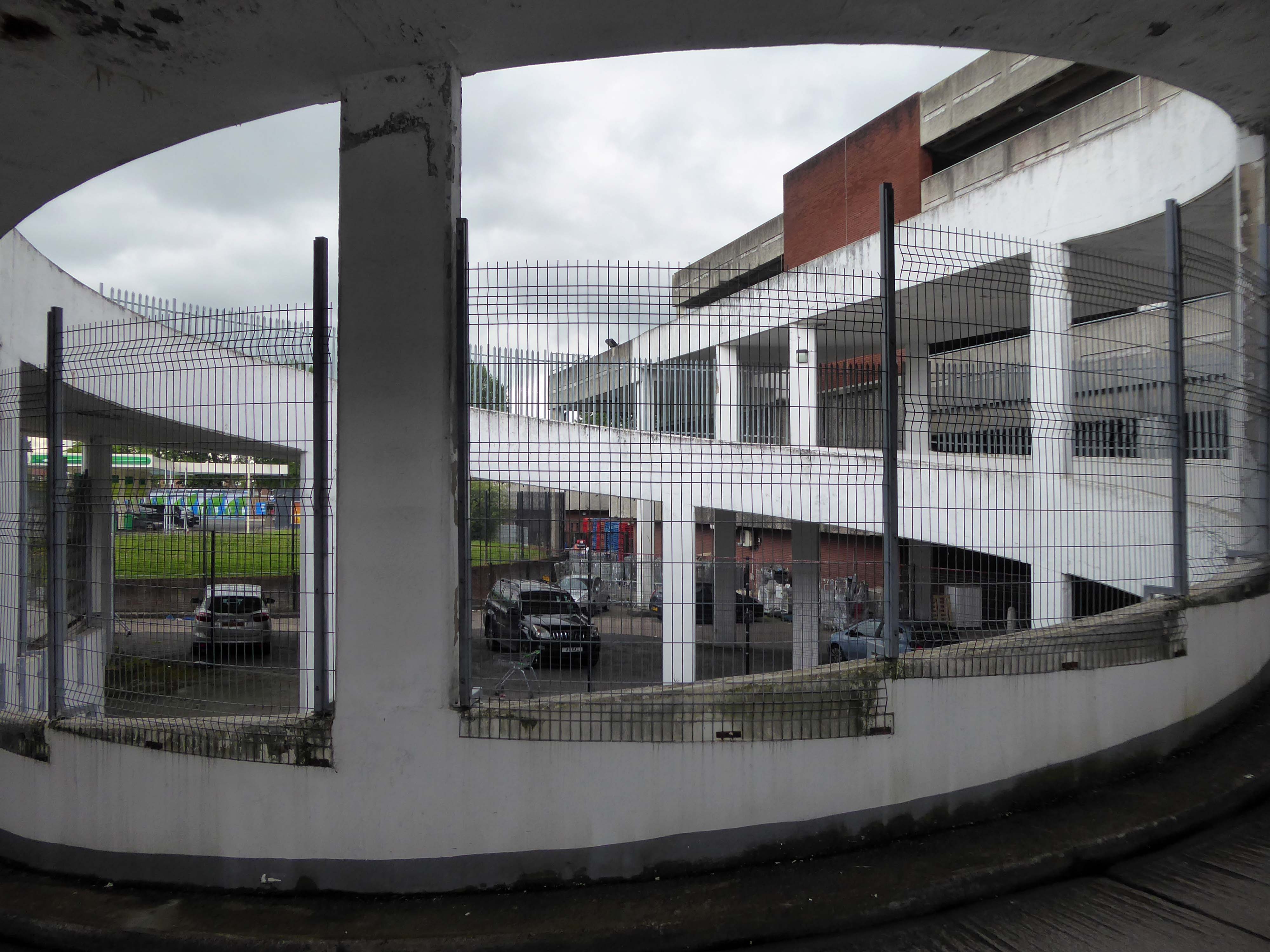
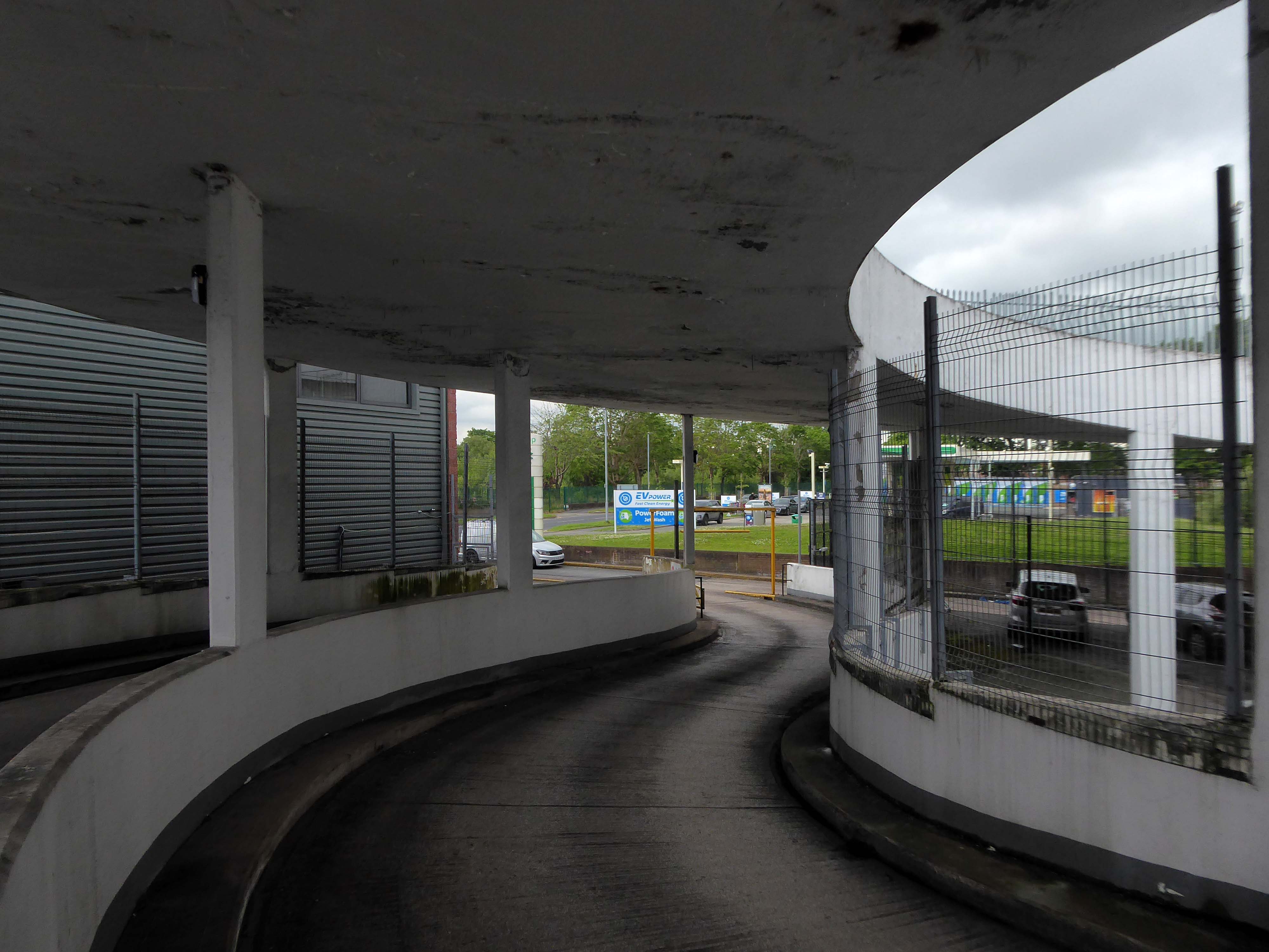
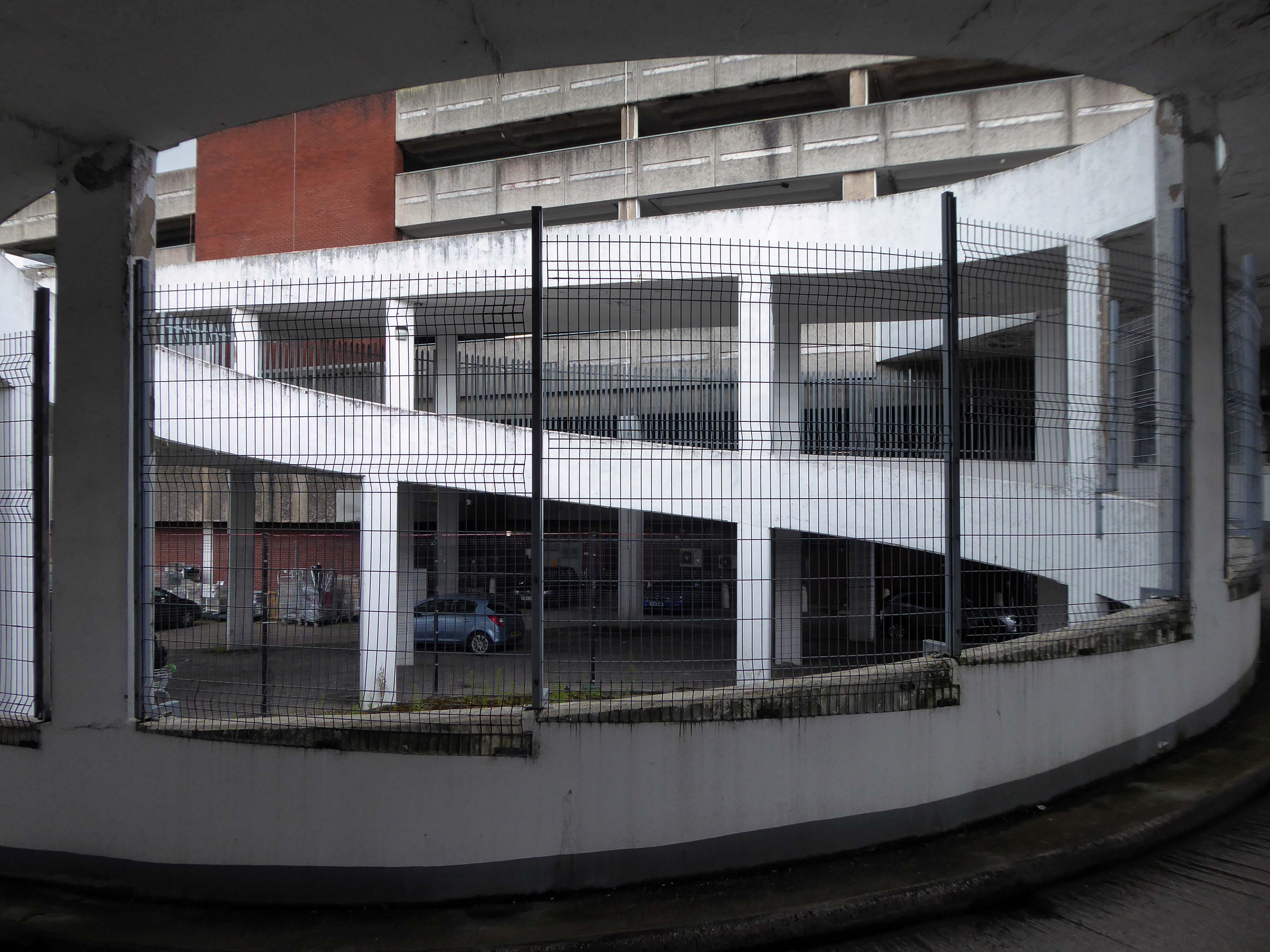
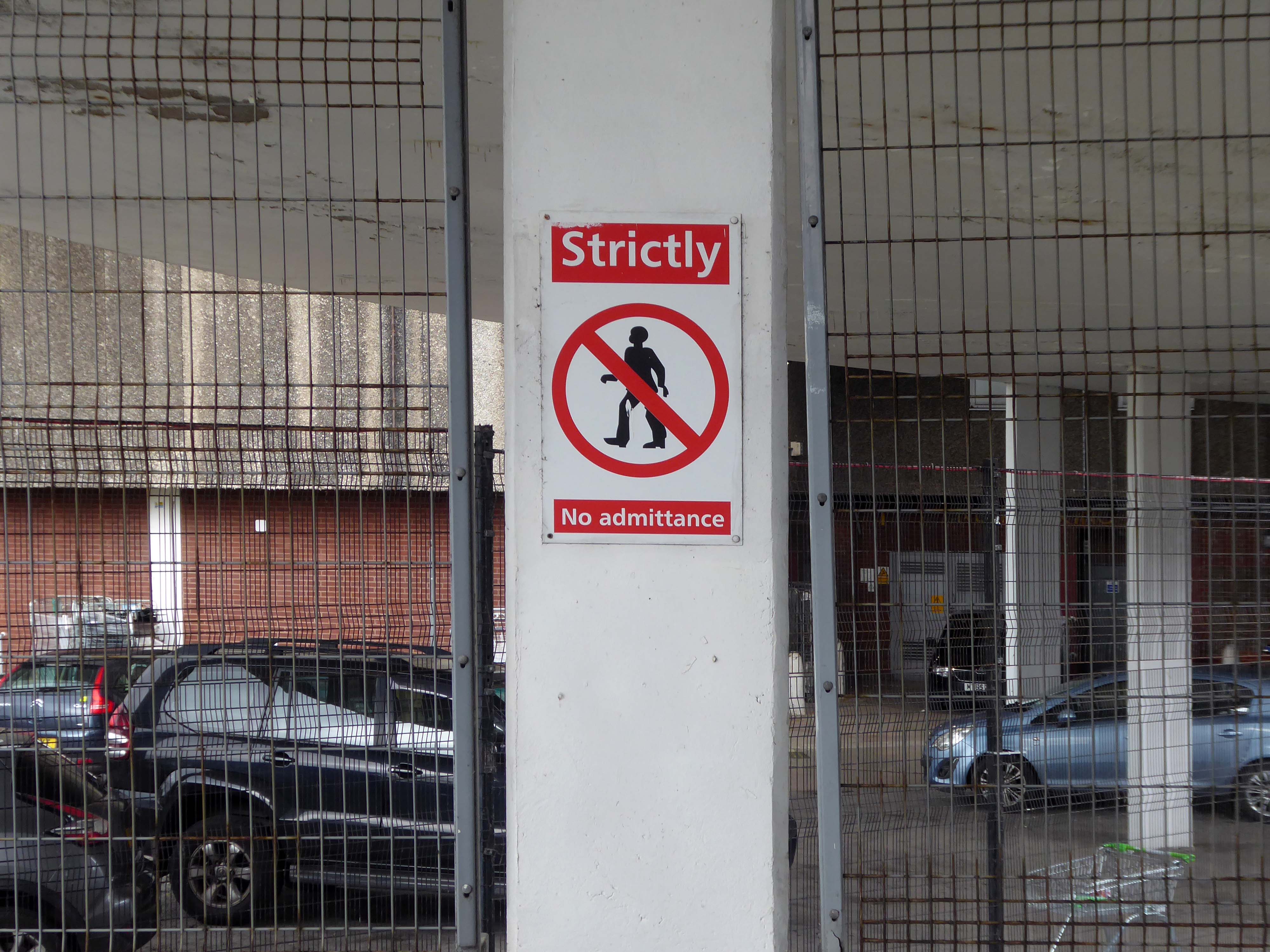
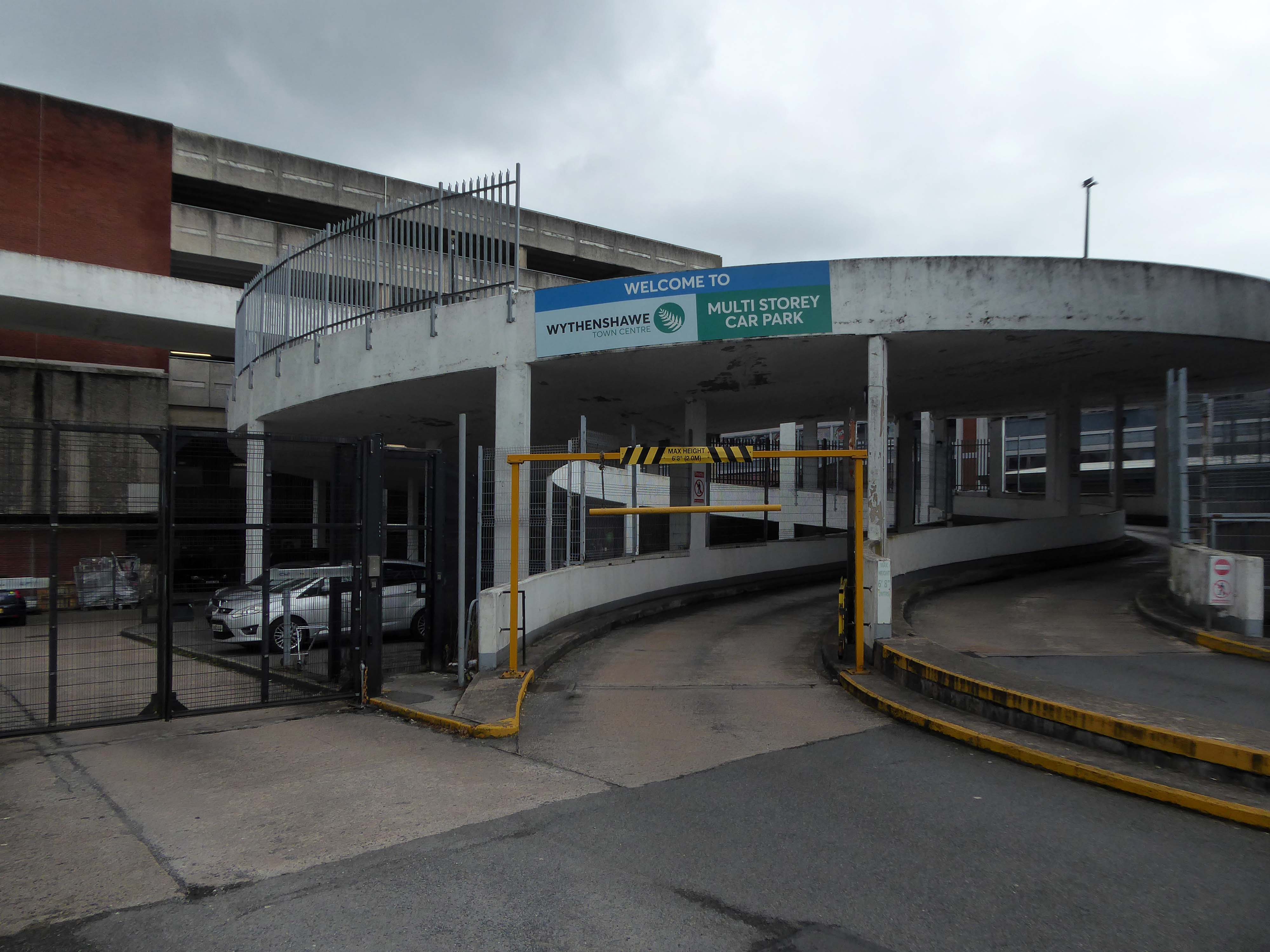
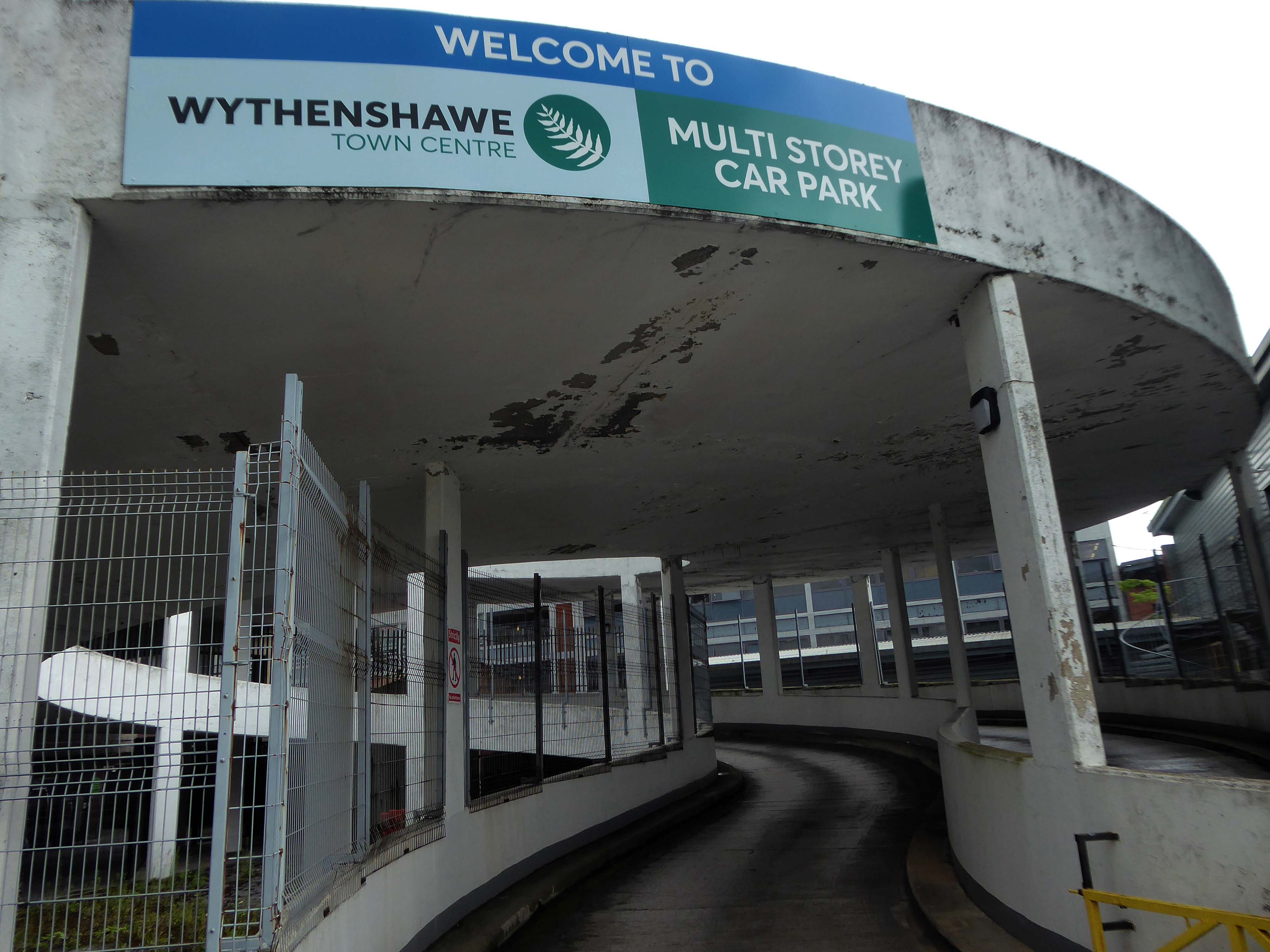
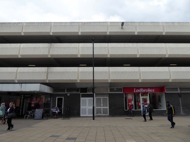
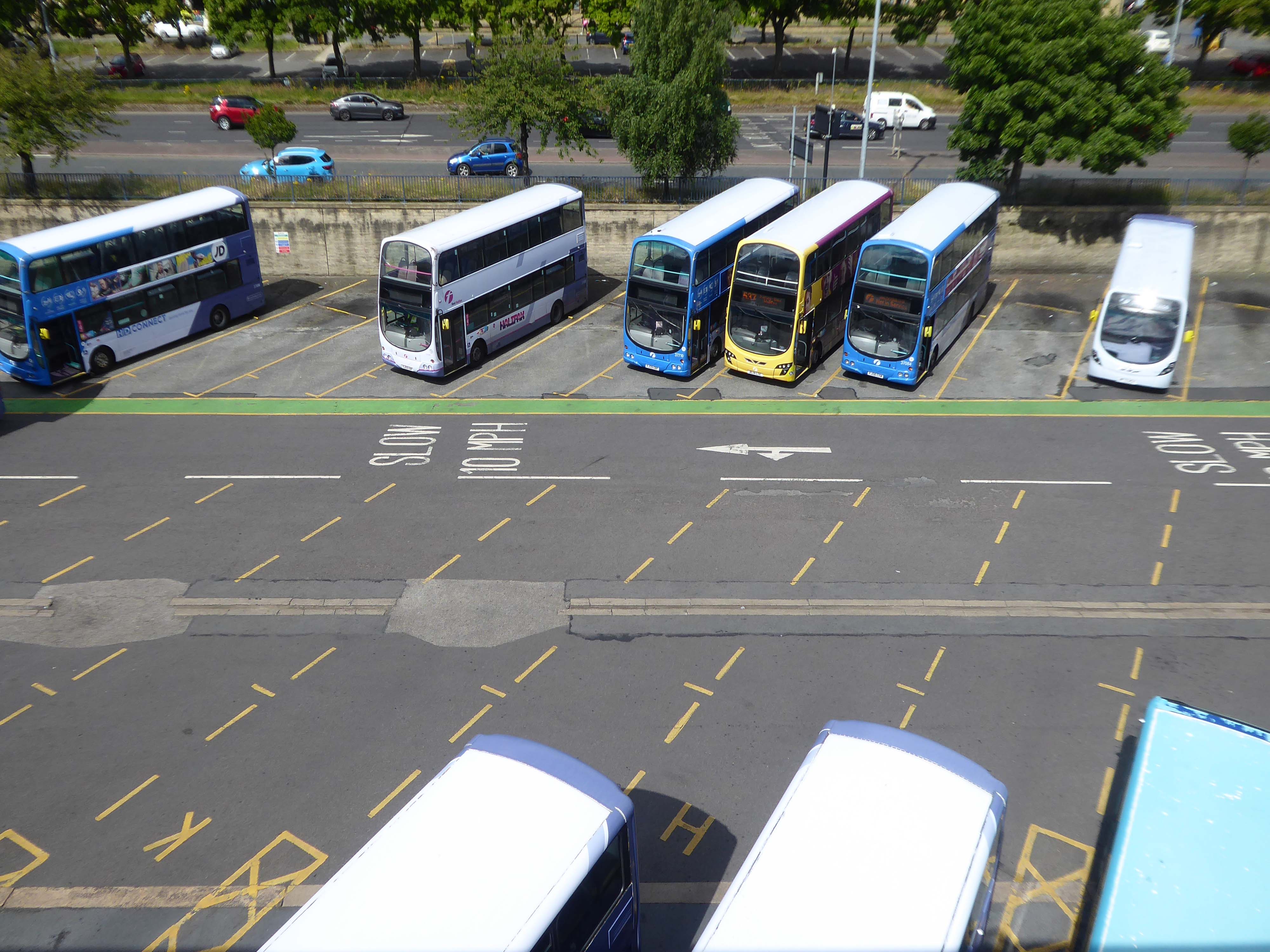
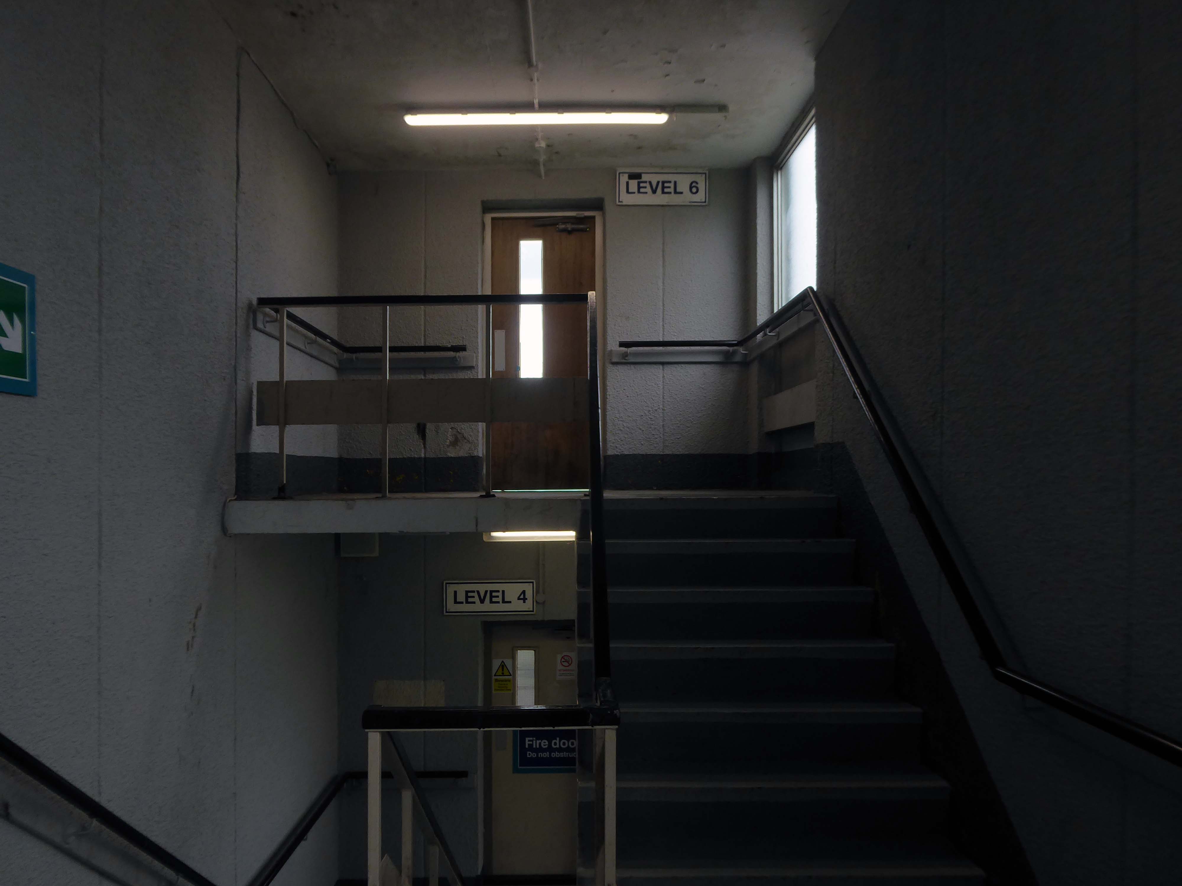
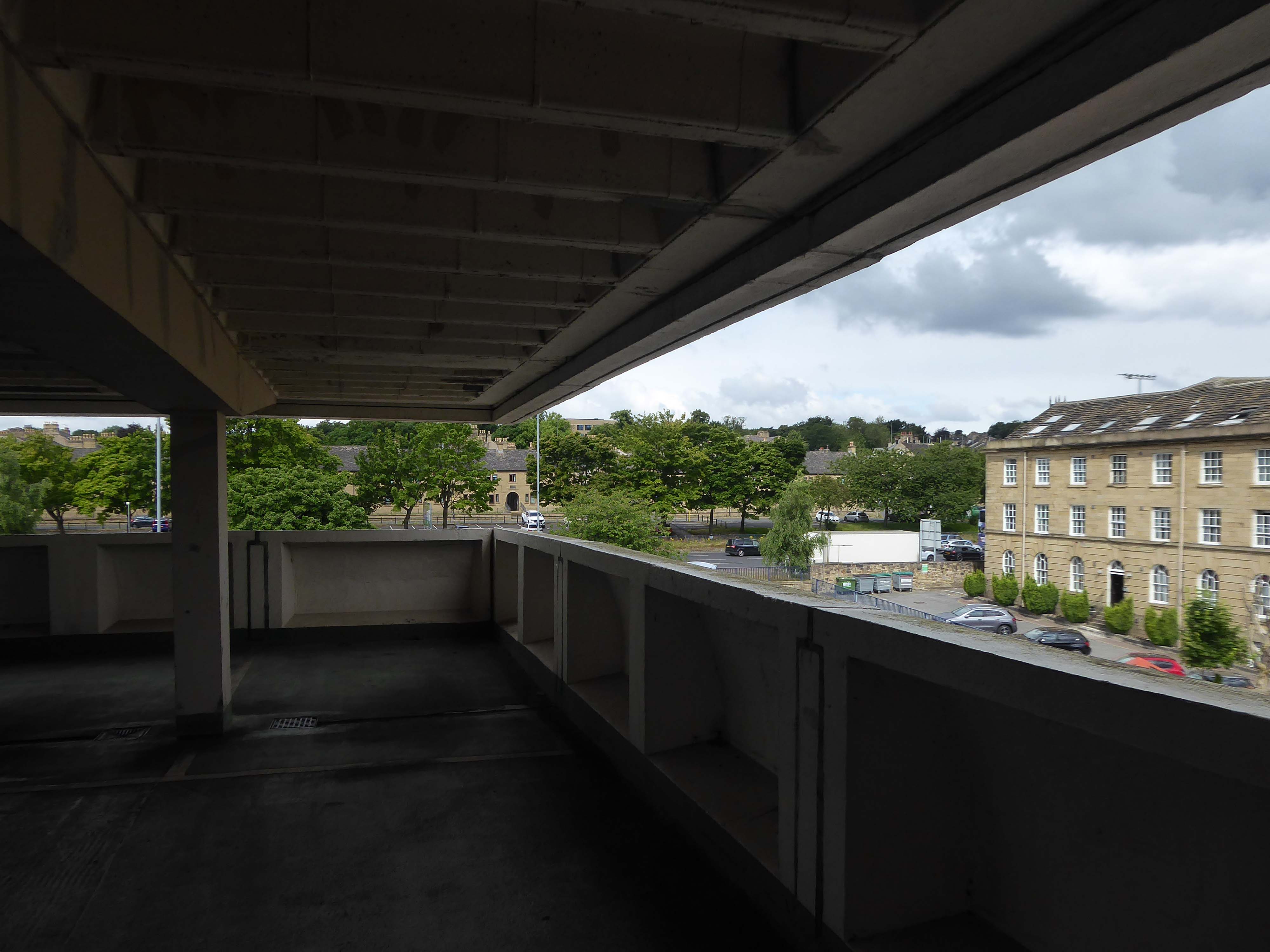
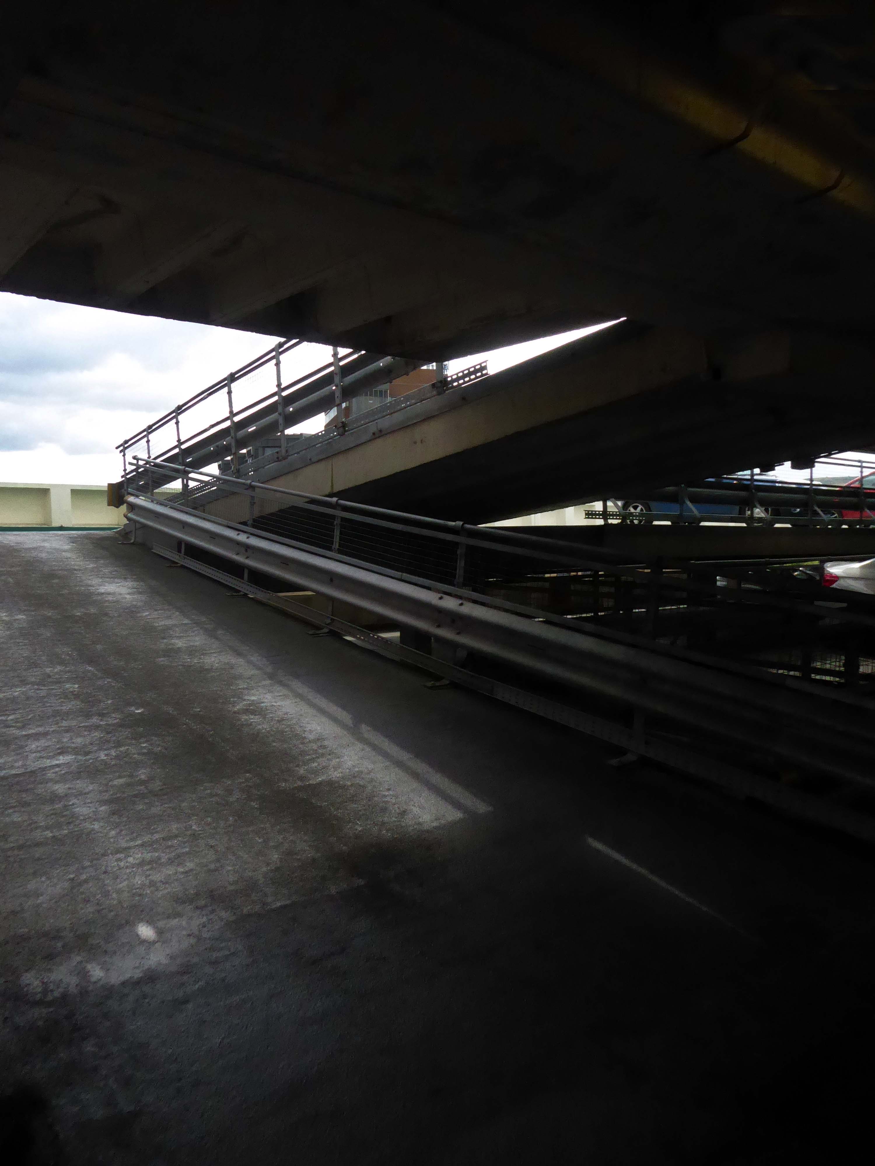
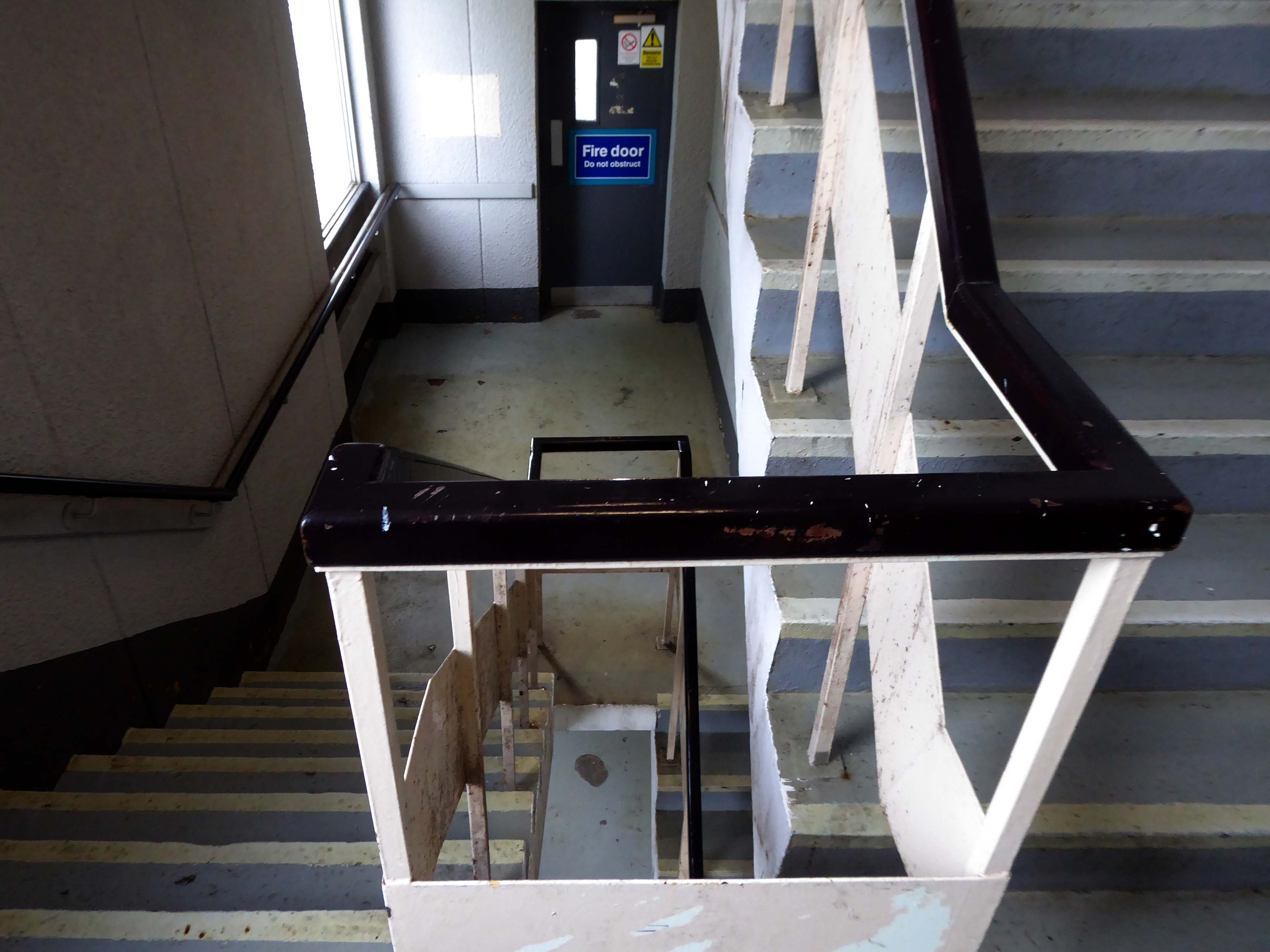
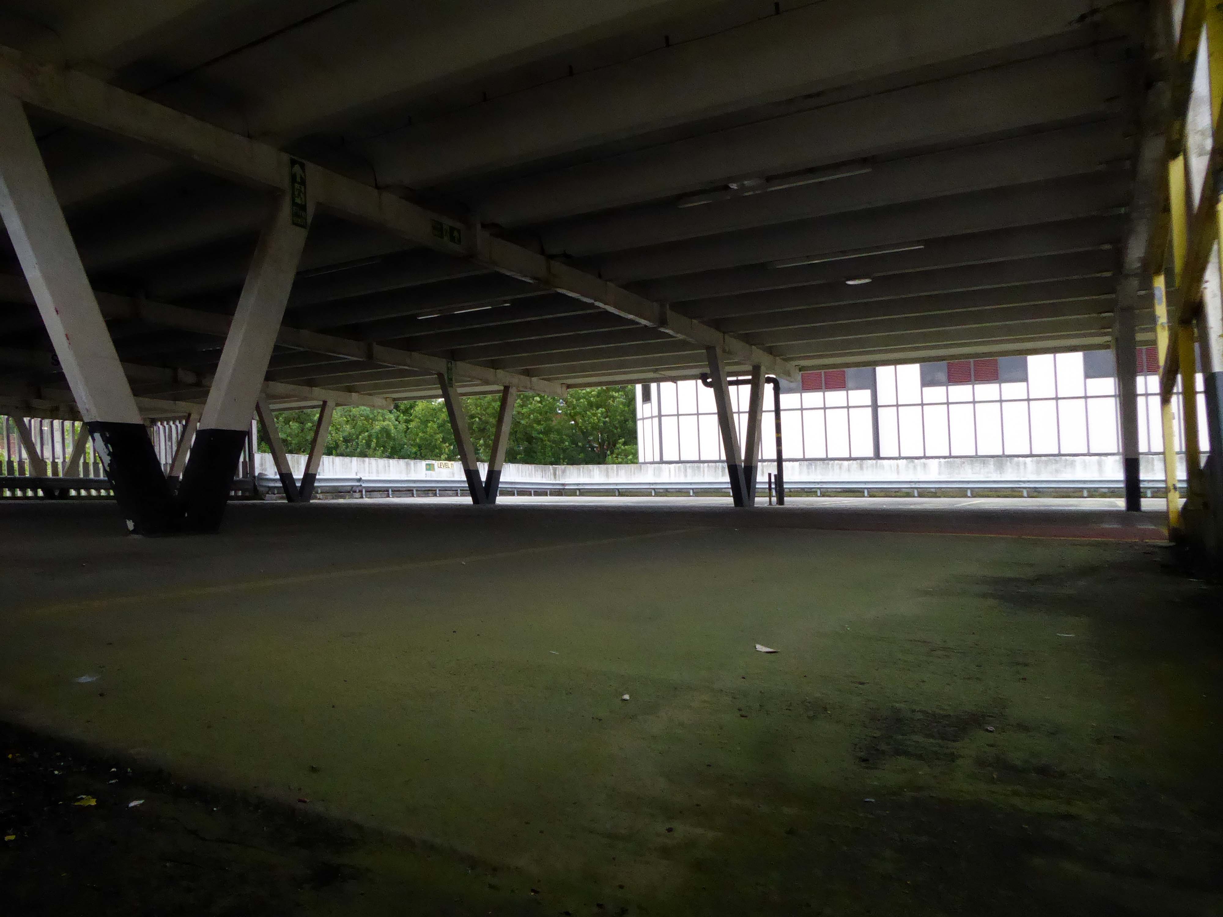
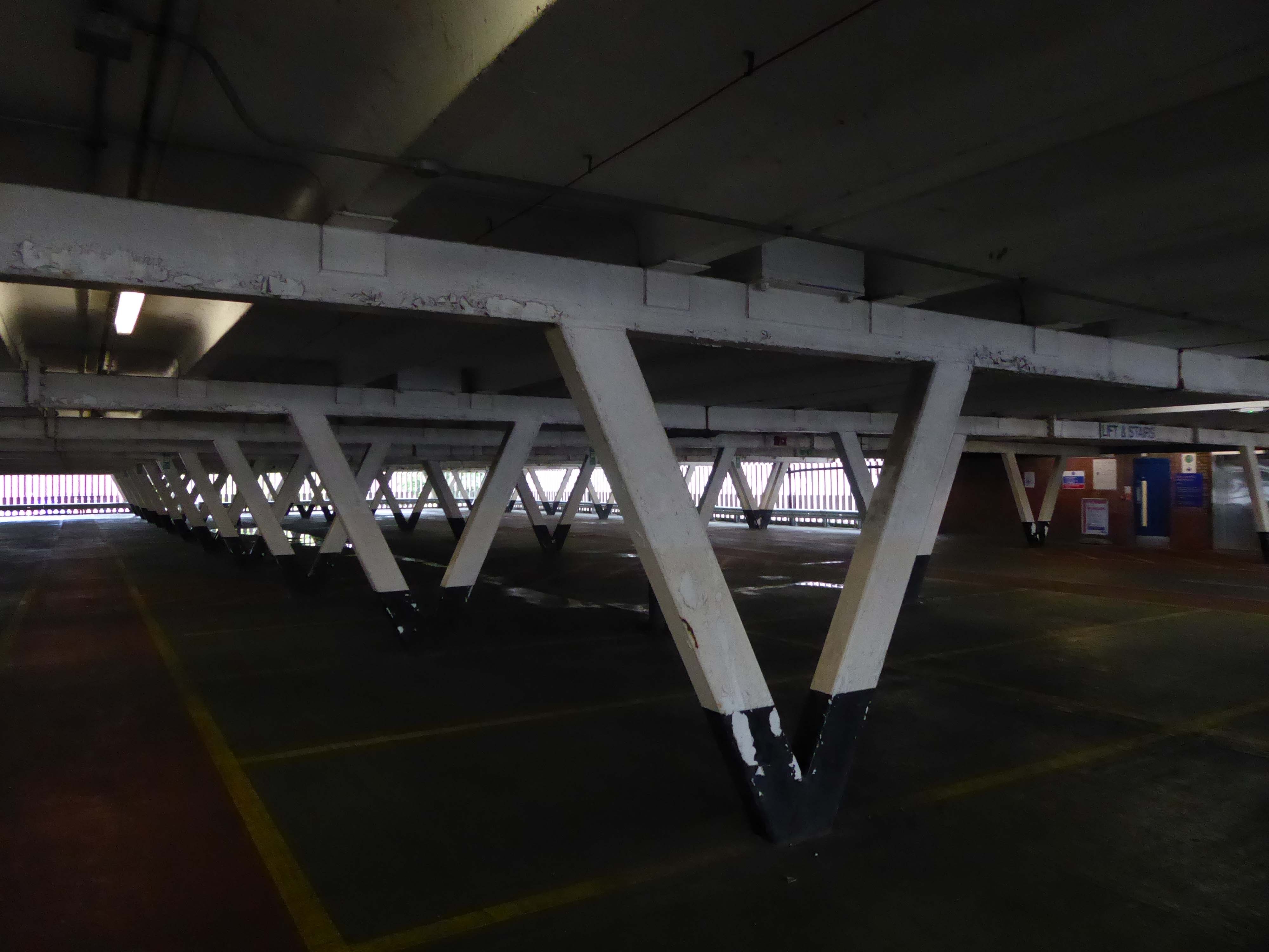
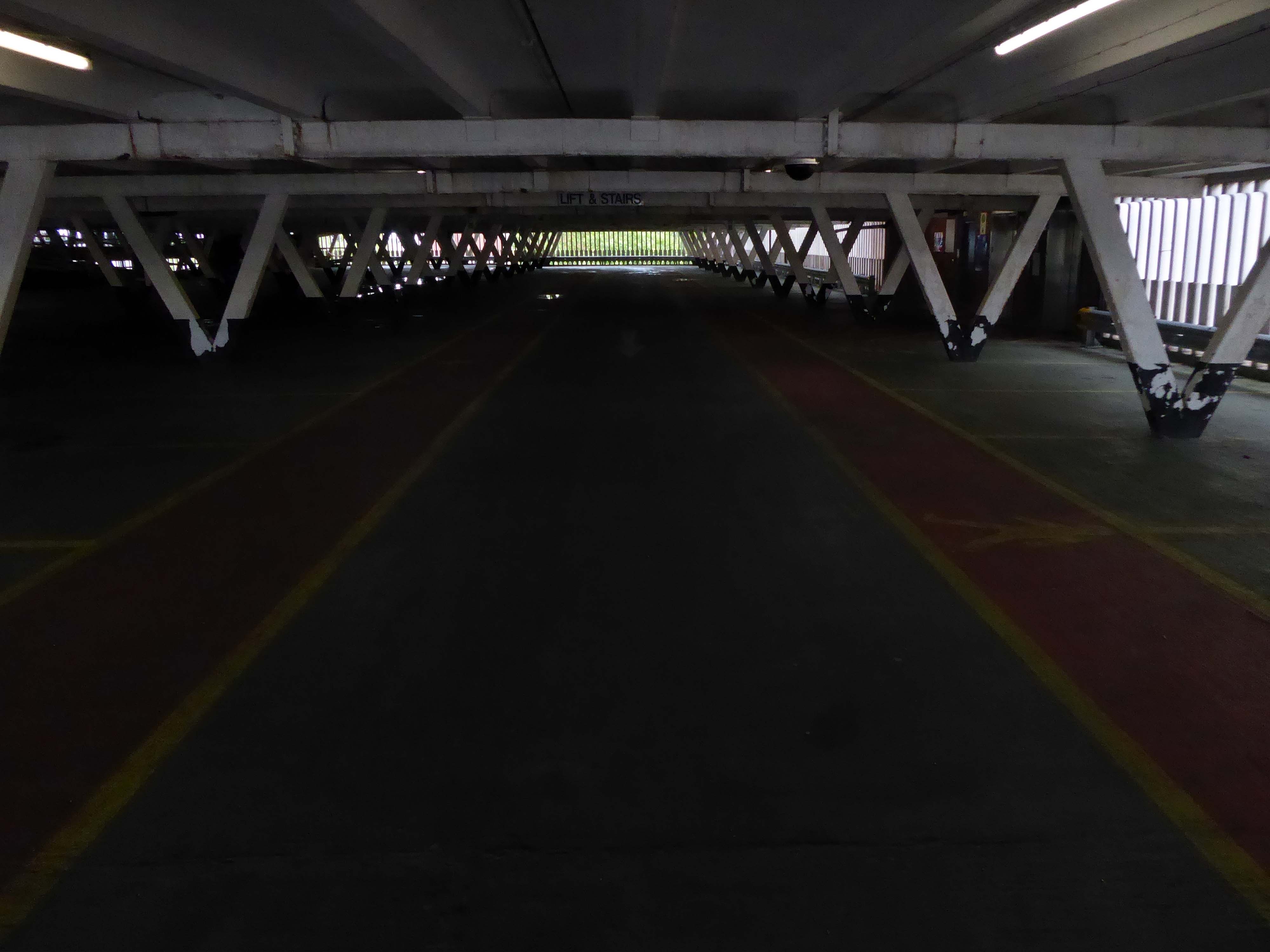
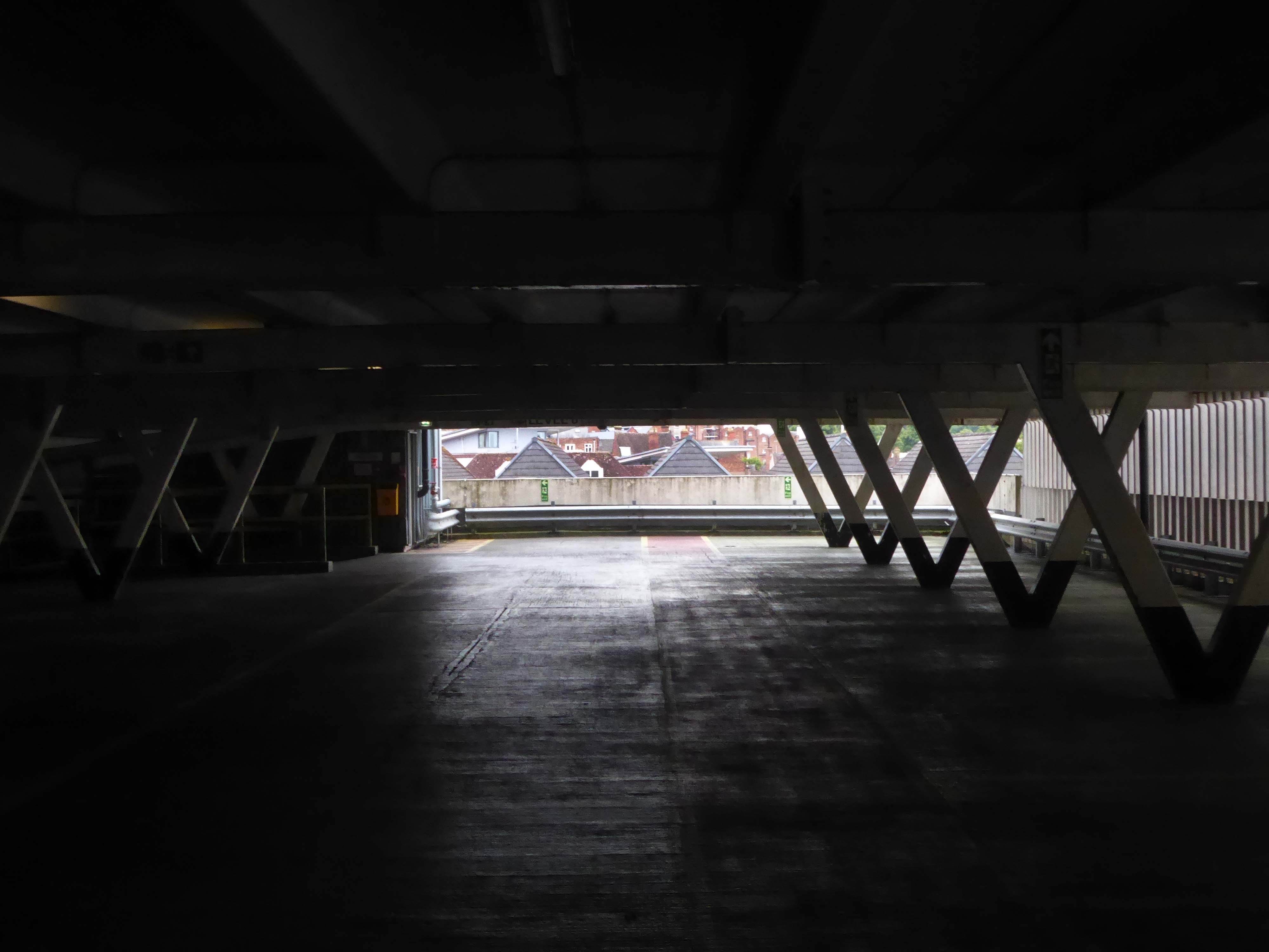
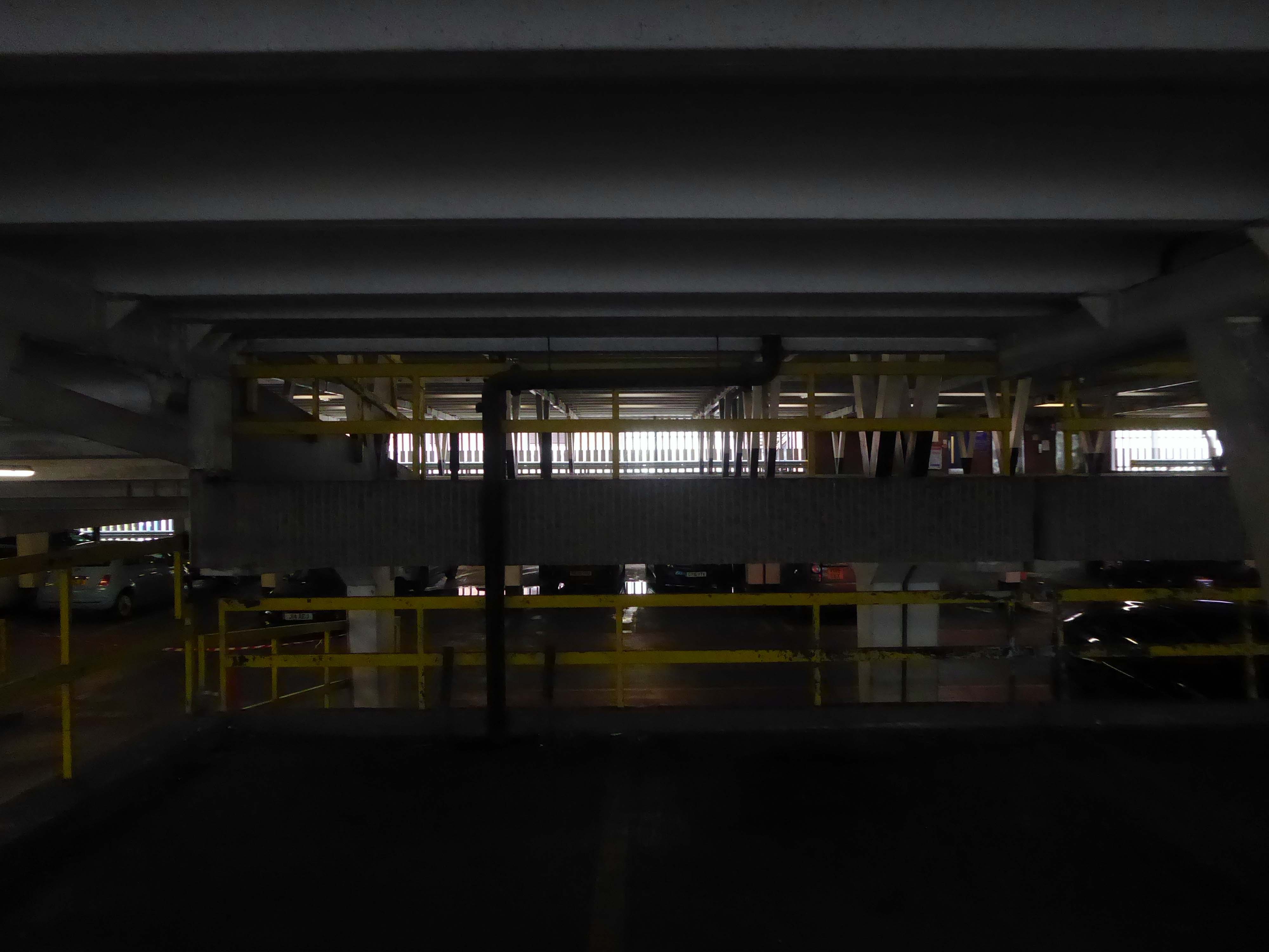
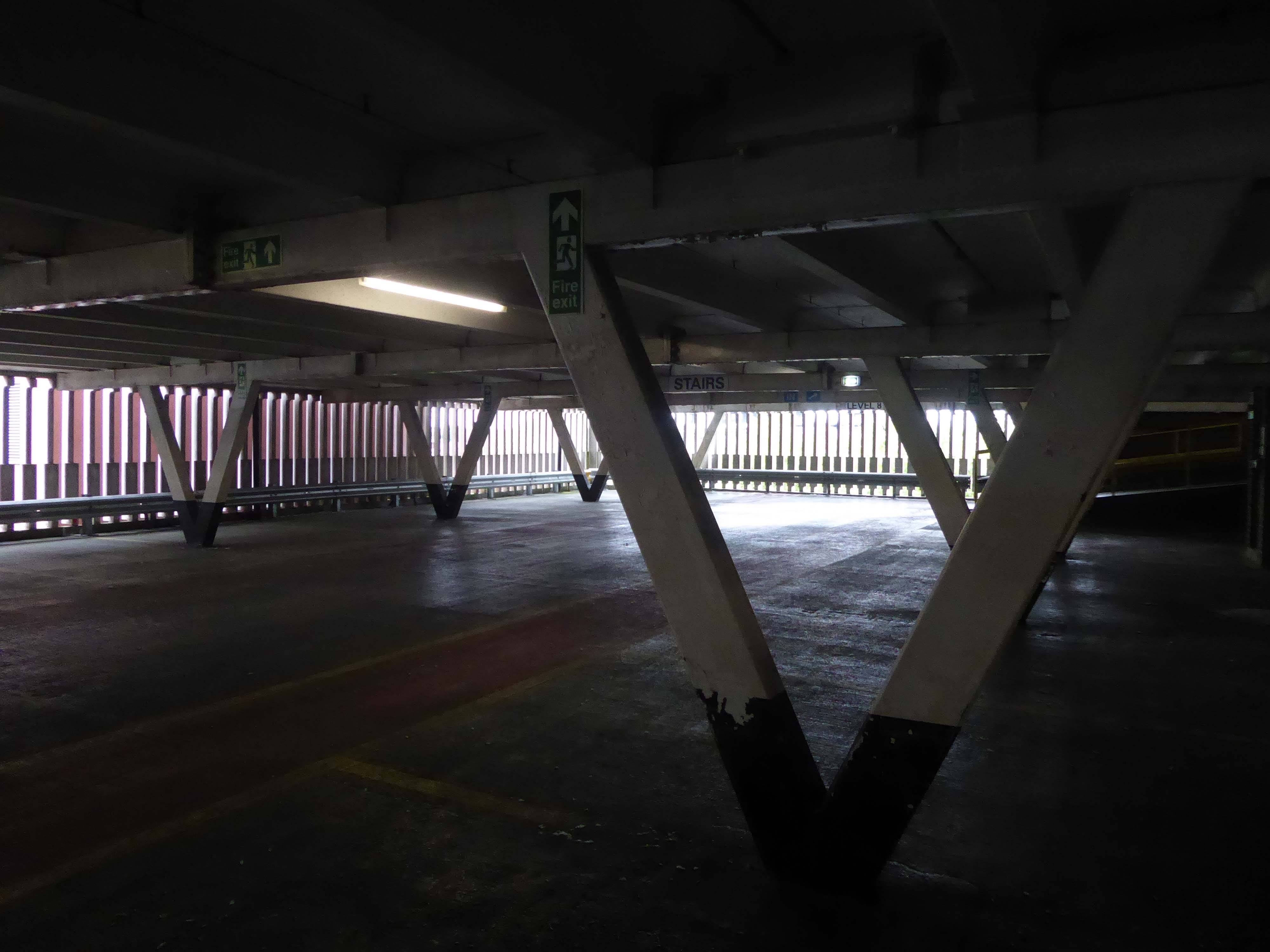
Multi Storey Car Park Rowlandsway Manchester M22 5RG
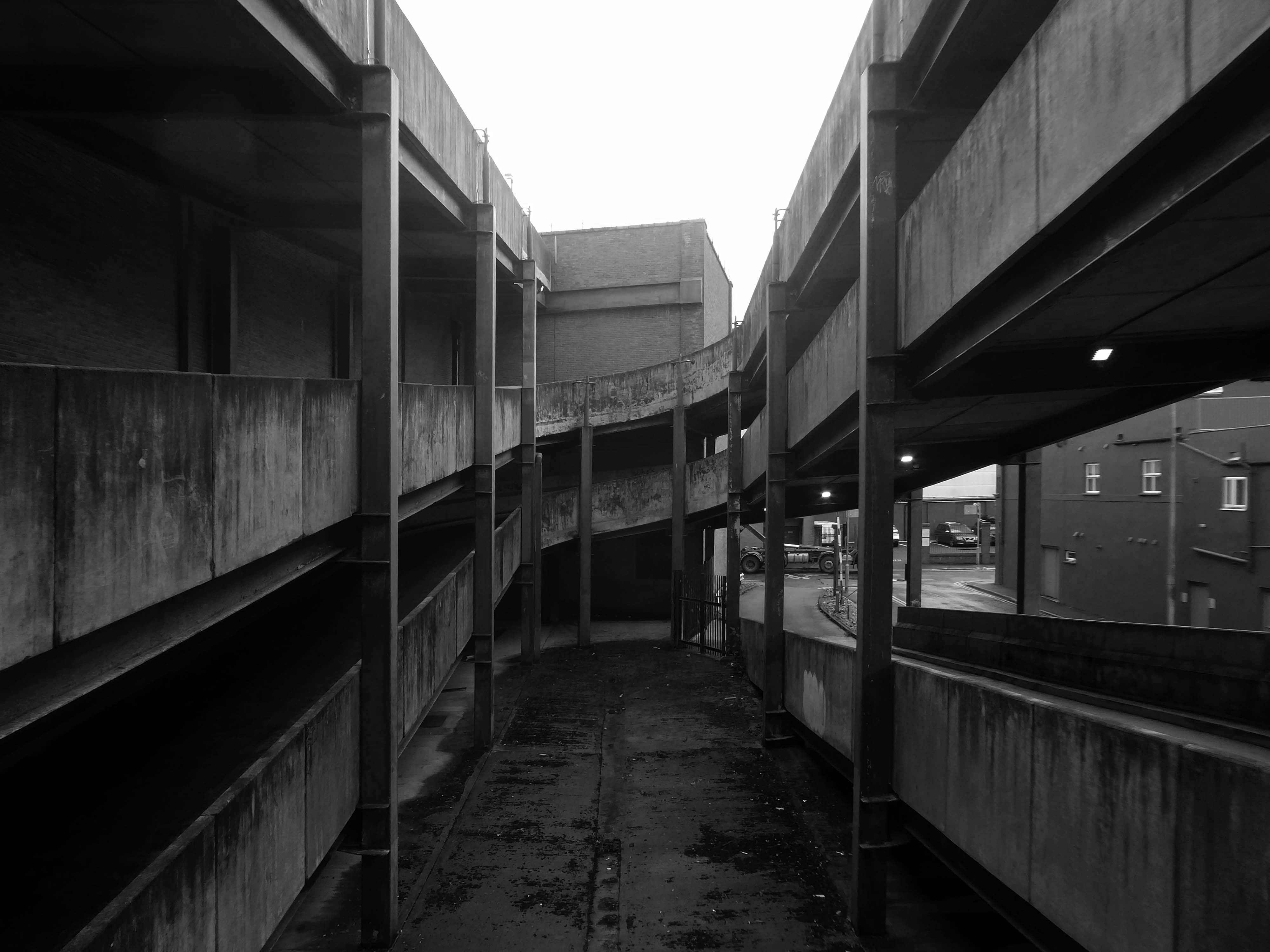
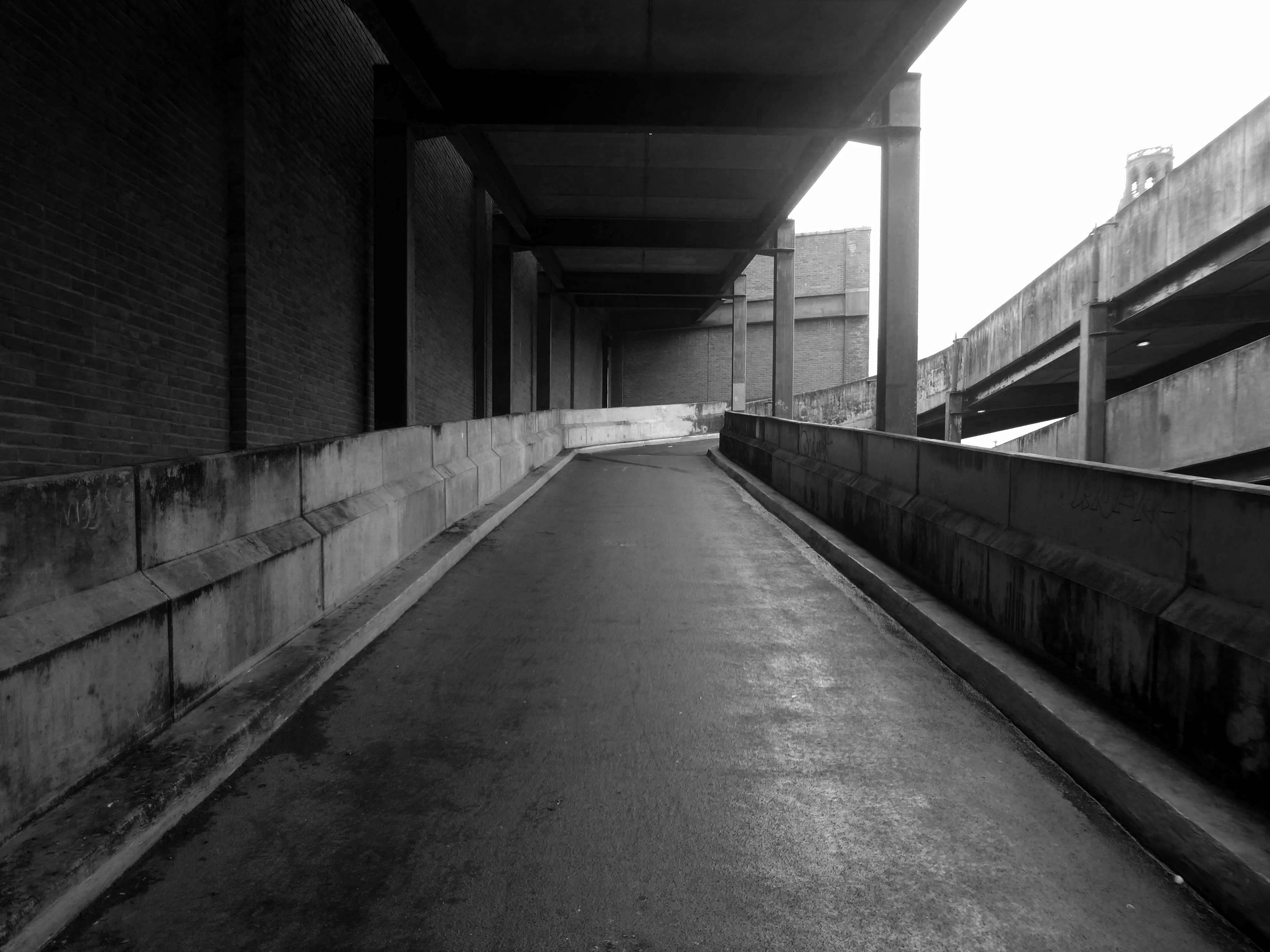
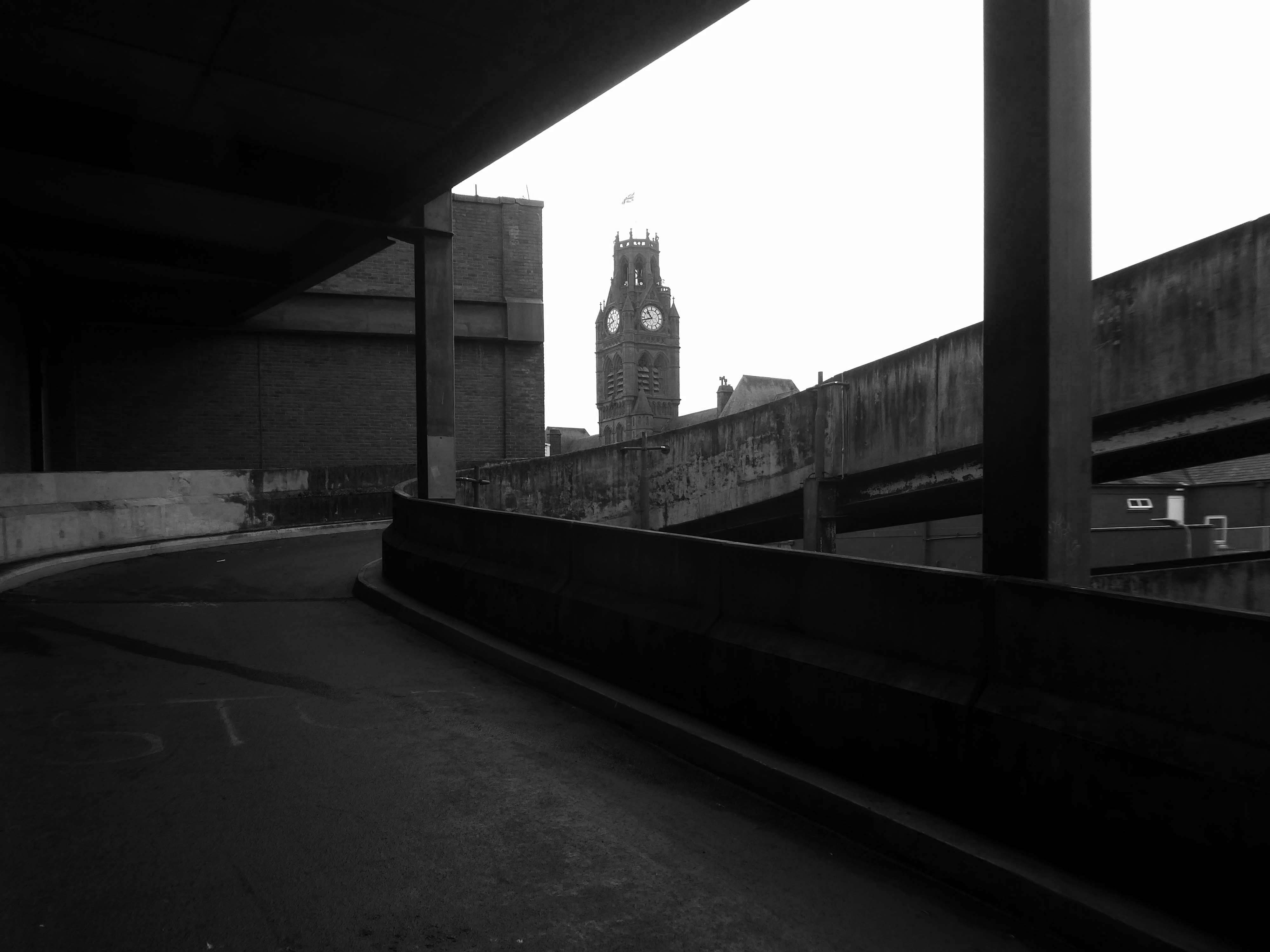
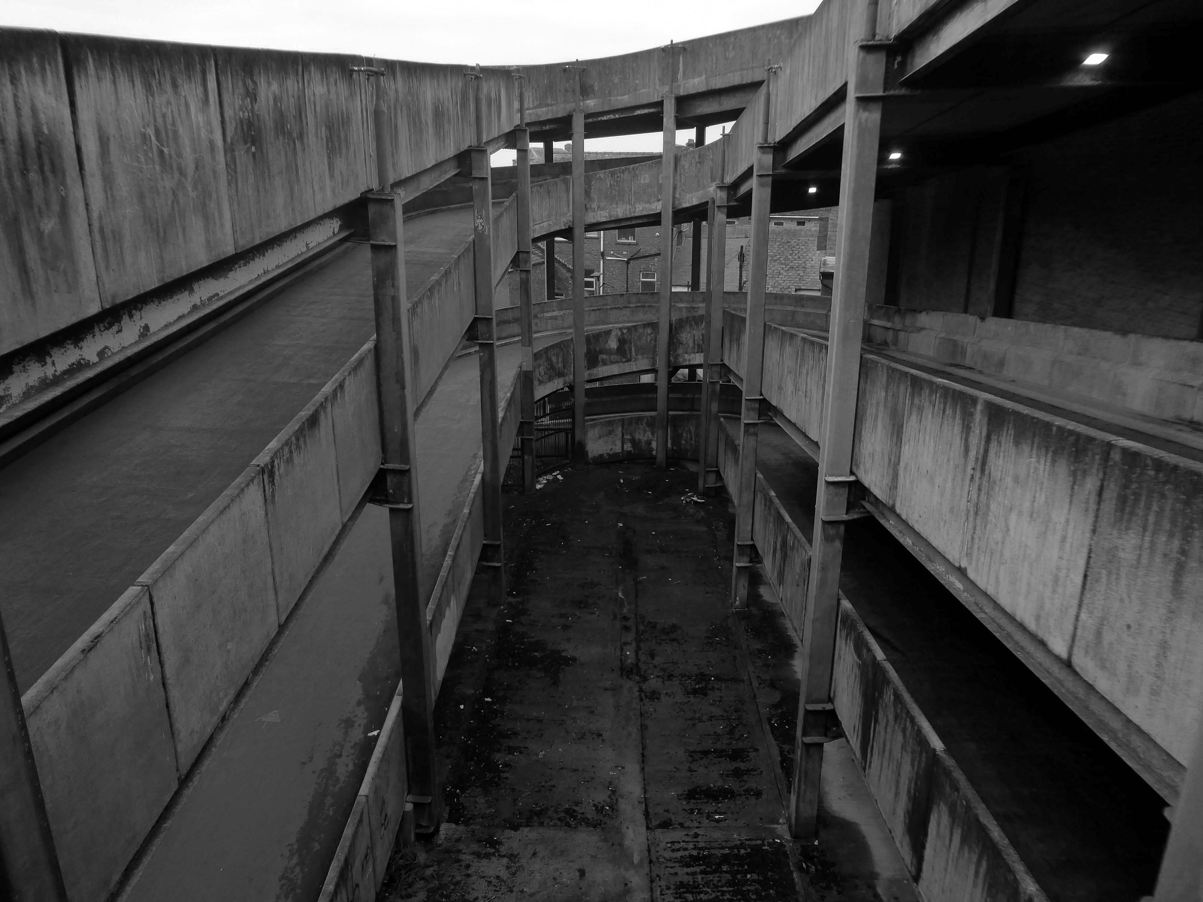
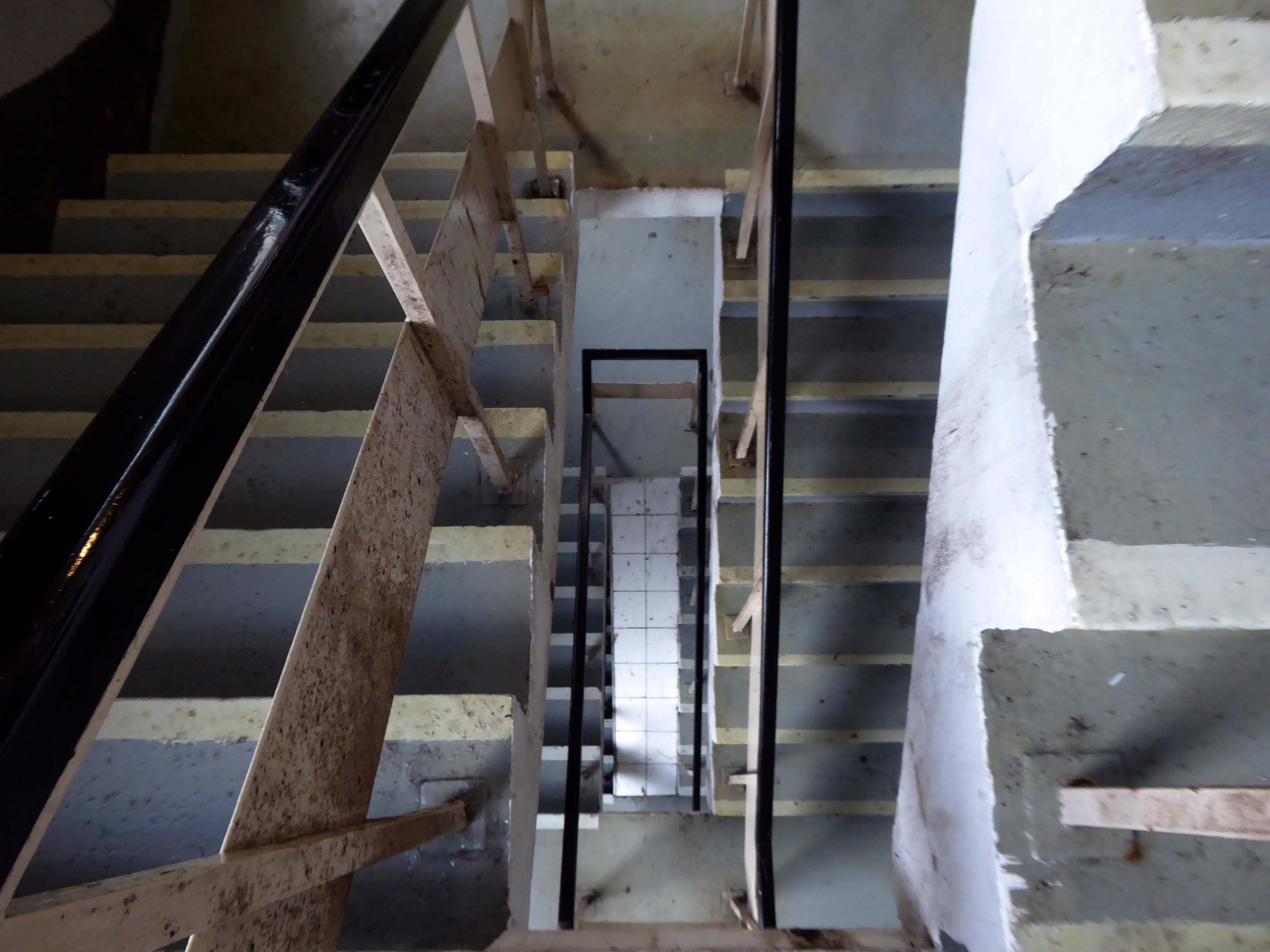
I’ve lost count of the countless times I have visited countless car parks.
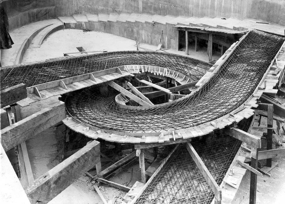
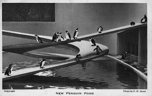
I do have a fondness for ramps – particularly helical ramps, one of my most memorable early modernist encounters, was with Lubetkin’s penguin pool.
The cast concrete taking on a truly sculptural dimension.
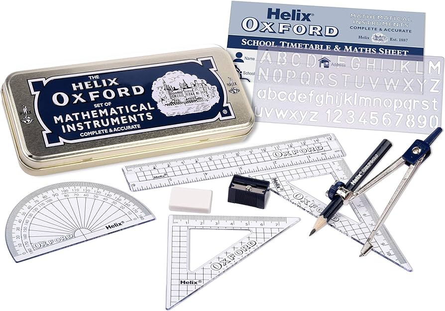
There is also the Proustian recollection of a collection of geometry lessons and Helix instruments.
It has all left a lasting impression and I have subsequently taken every opportunity to waddle penguin like up and down several concrete car park ramps.
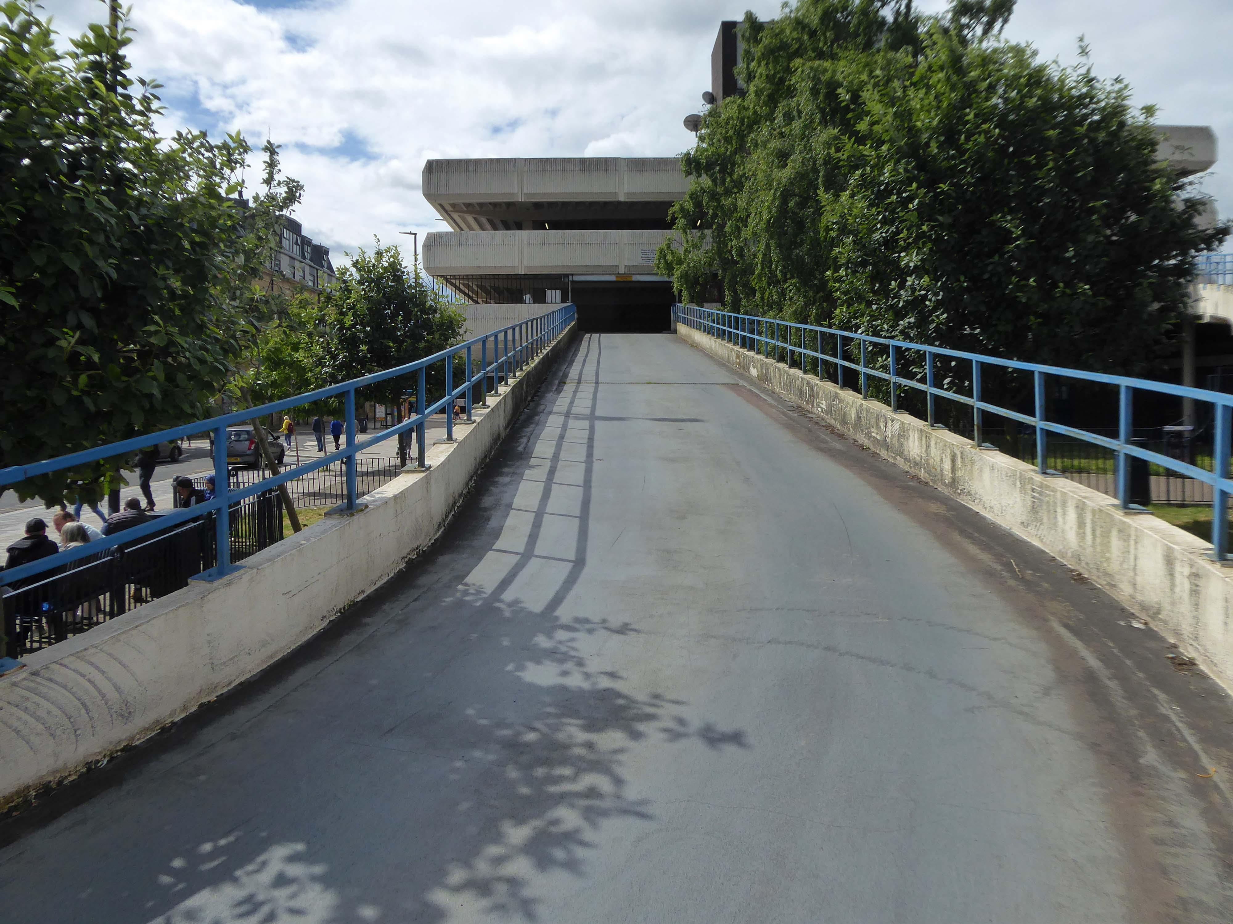
I was informed by the seriously erudite Christopher Marsden that the bus station and car park were the work of Derek C W Vane: Borough Architect 1972-1974.
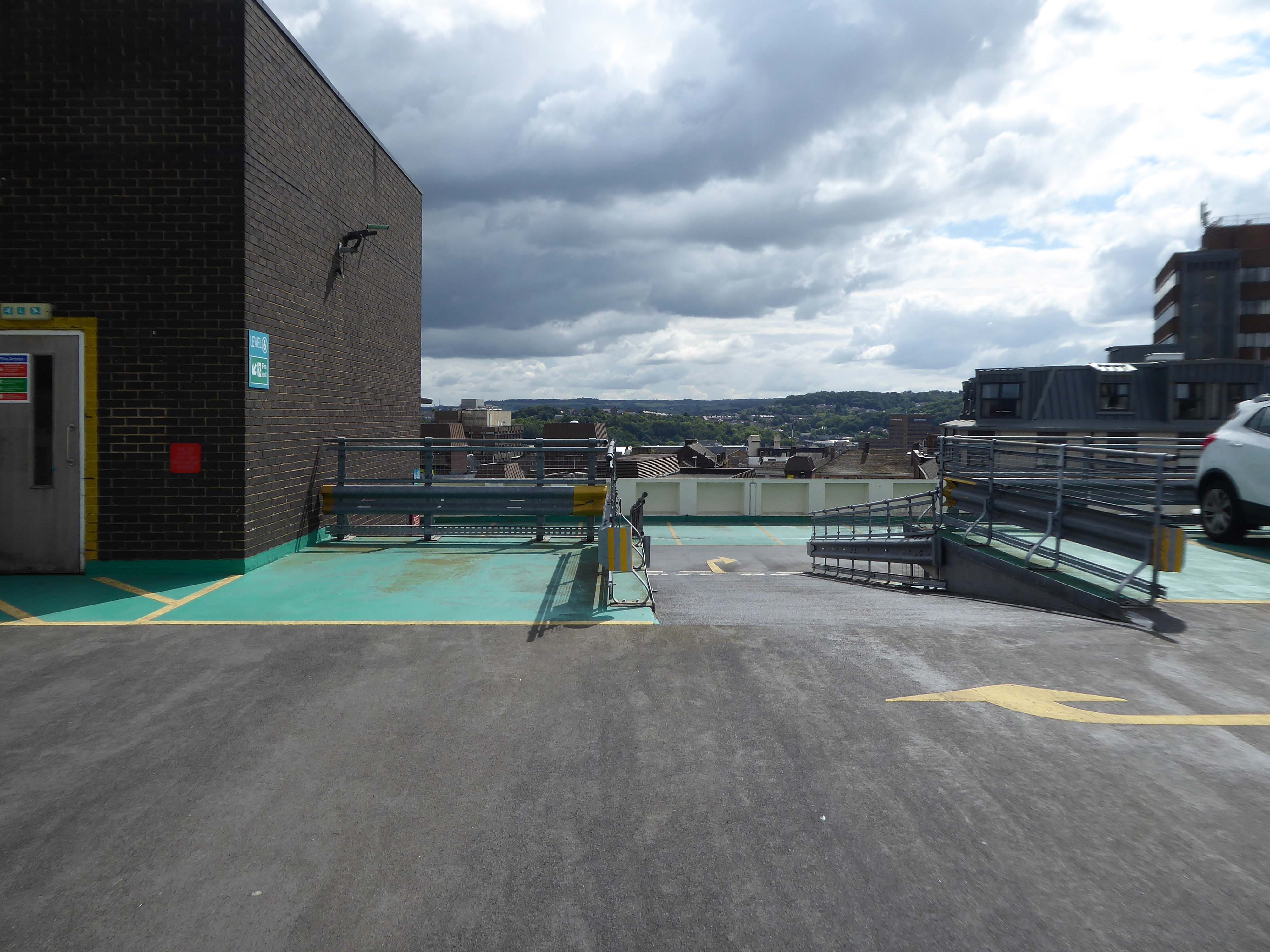
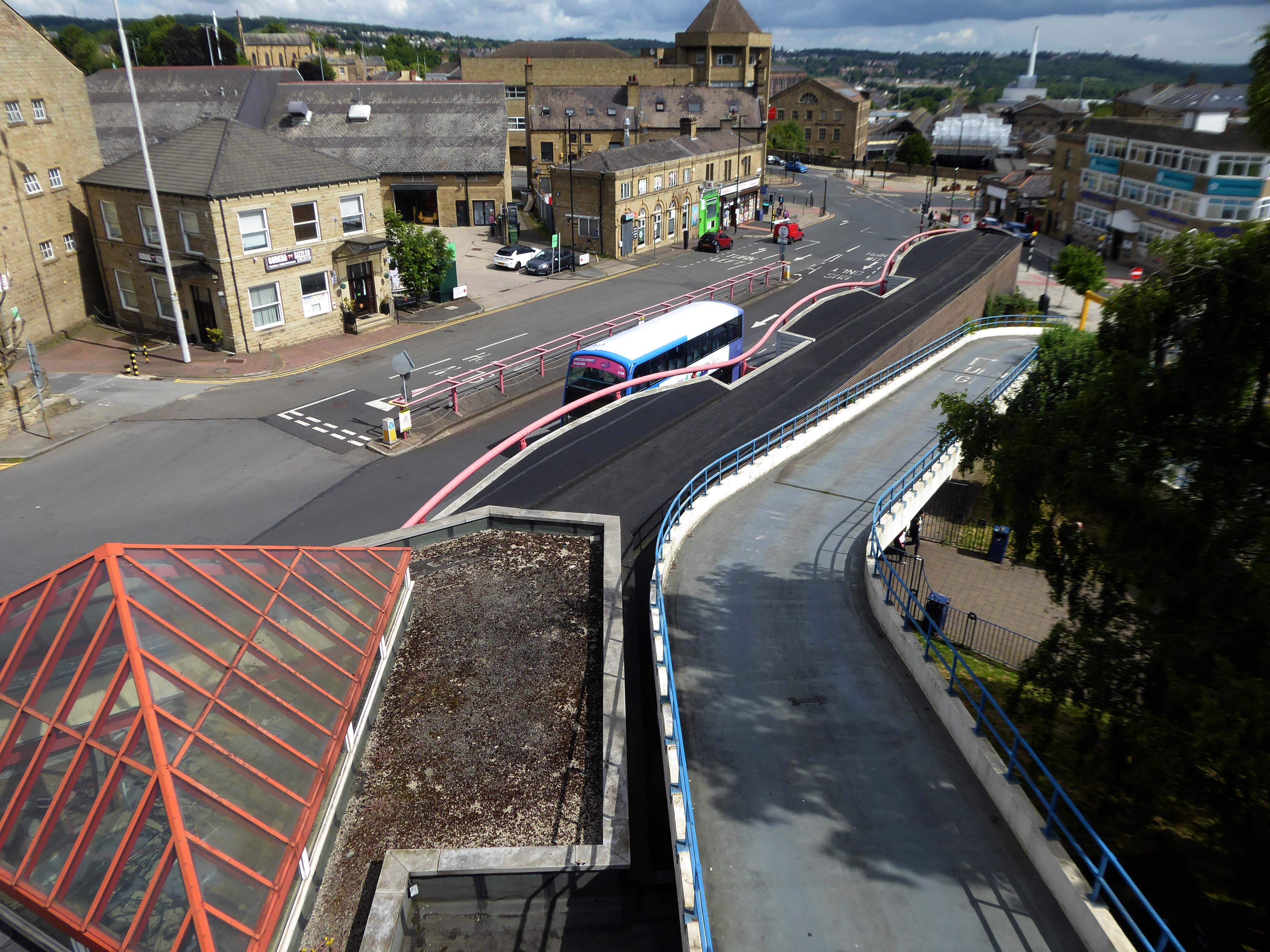
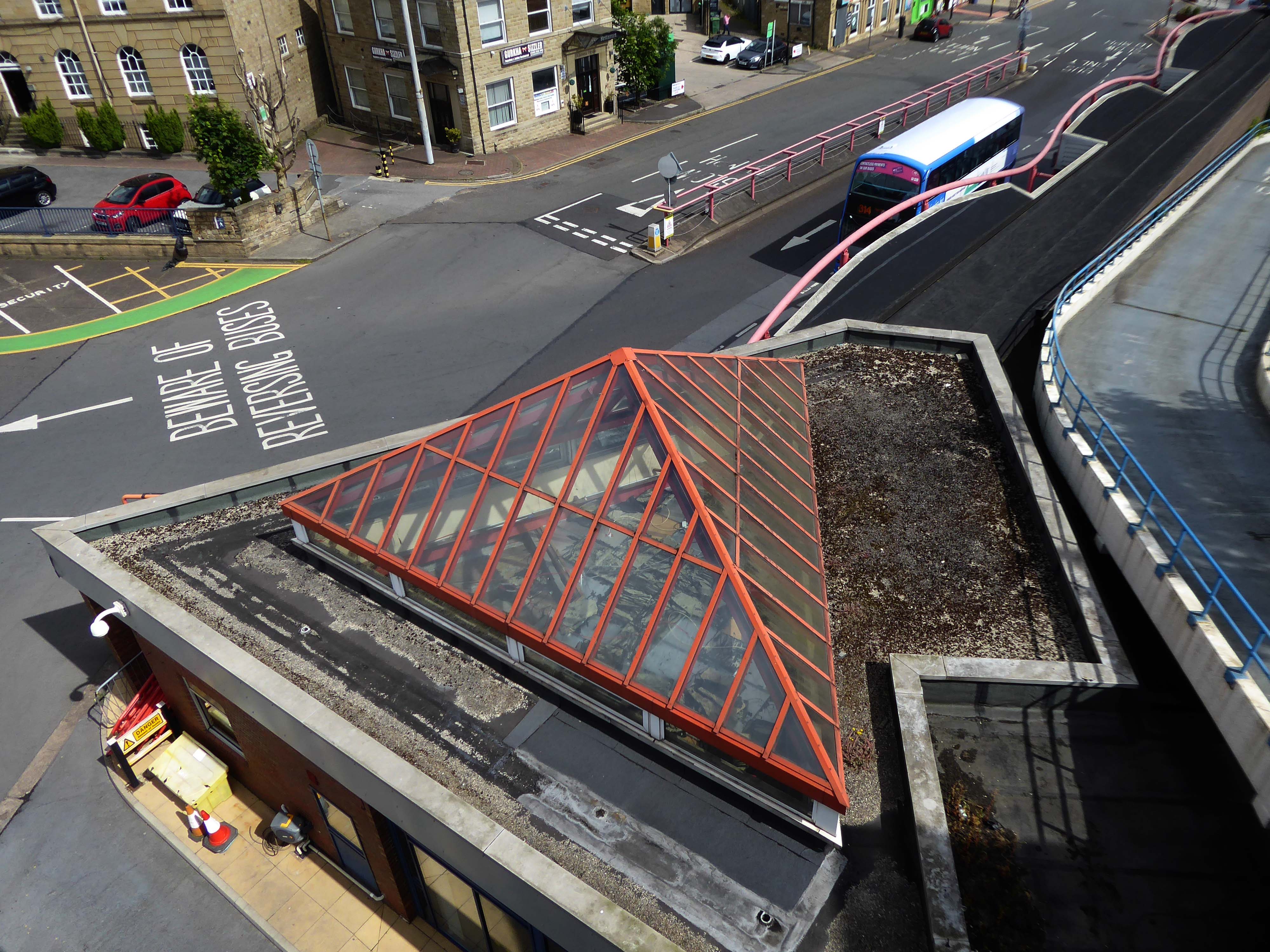
Having visited and photographed the bus station in 2016 I thought that it was about time I went up in the world, to the top level of the car park.
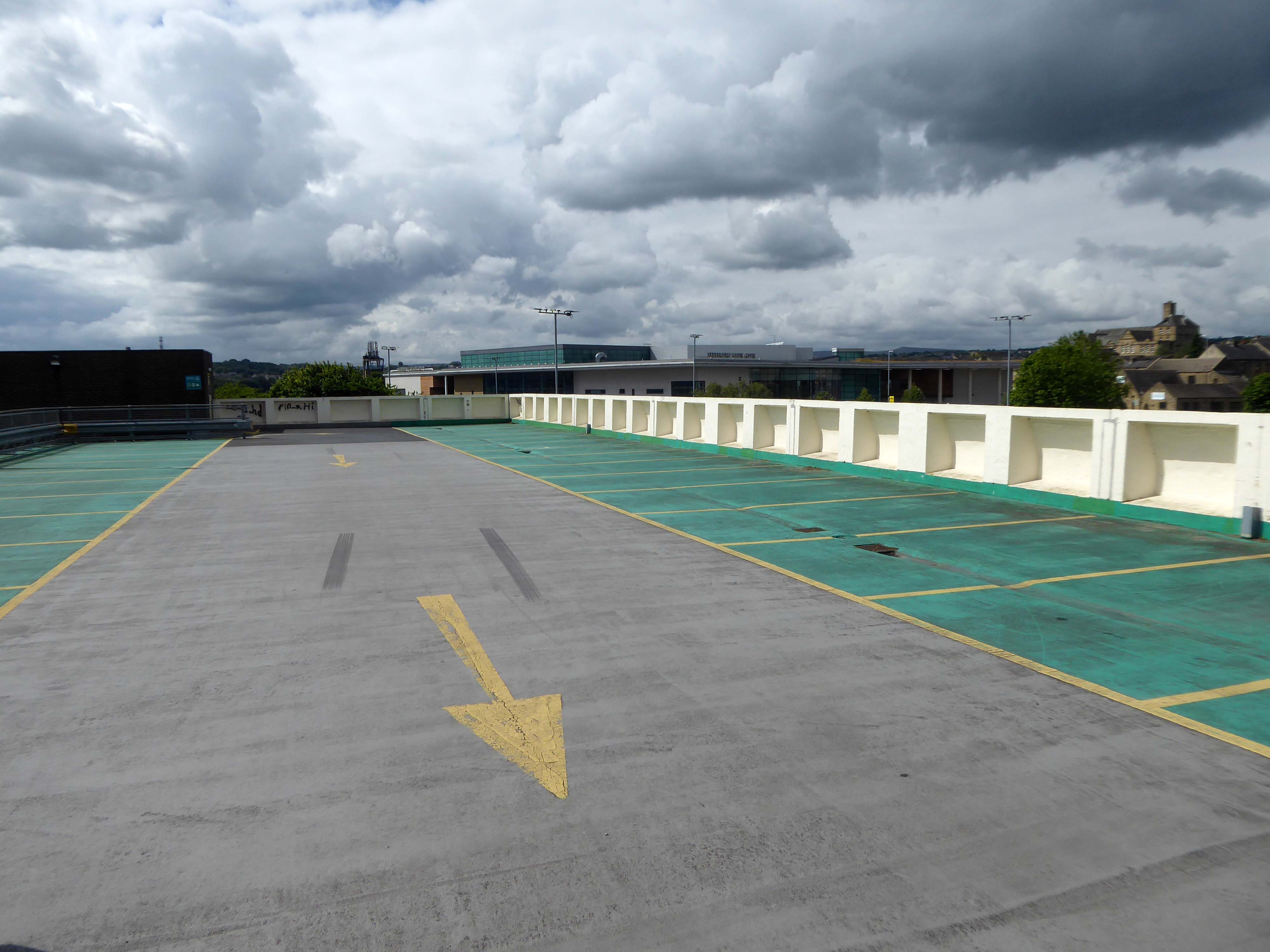
Mixed opinions from Parkopedia reviewers – let’s take a look around.
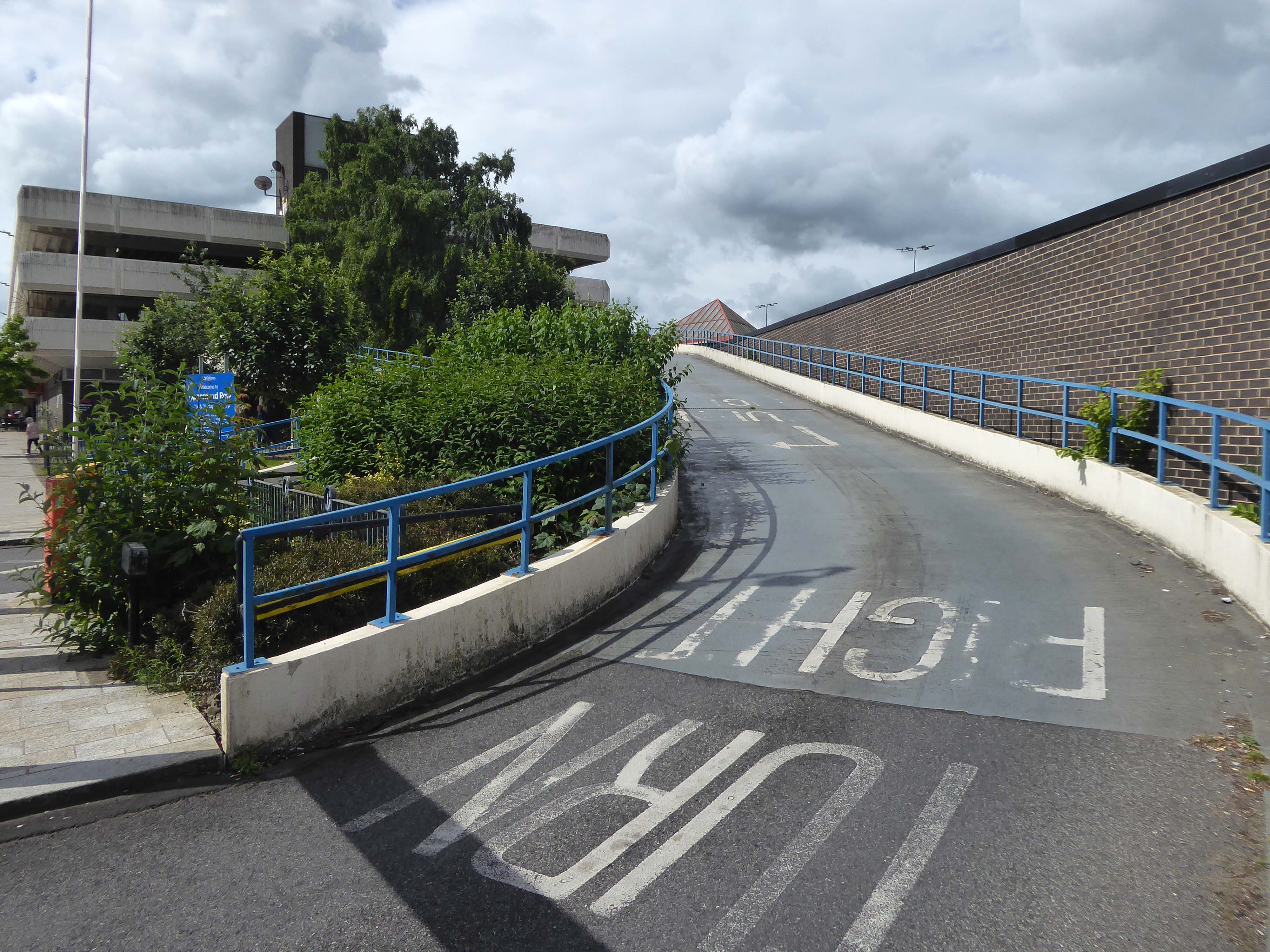
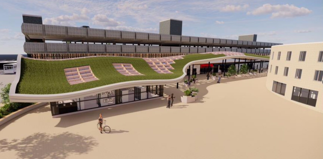
There are plans for refurbishment outlined in 2022 in the Huddersfield Hub.
The bus station will undergo a major revamp both inside and out and the most striking feature will be a sweeping canopy with a living grass roof which will run right across the main frontage from Macaulay Square to Upperhead Row.
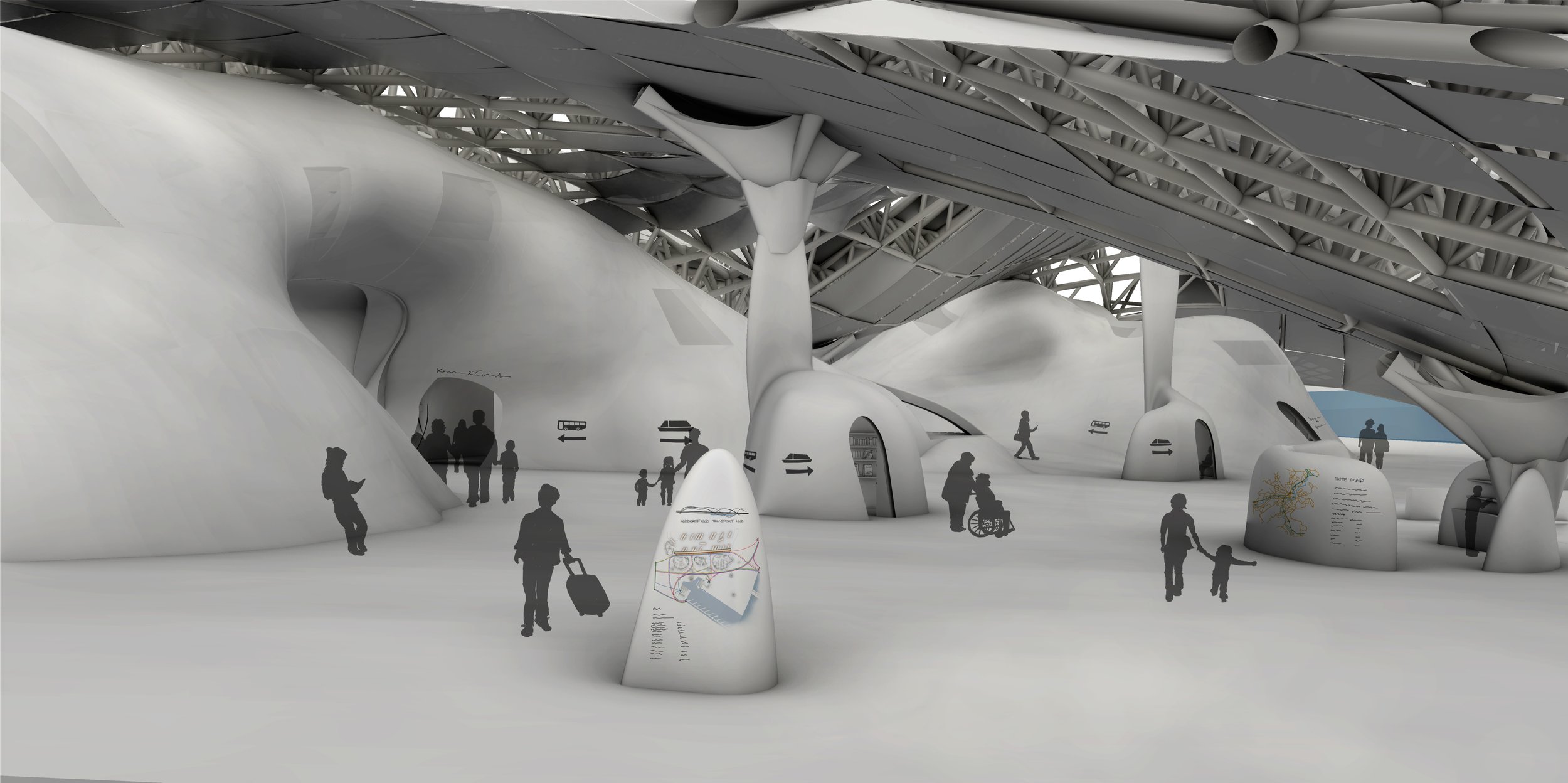
Also of note a project by Kate Matthews to seriously rethink the role and design of the space.
The starting point for this project was the Welcoming Water group scenario, involving the controlled flooding of areas of the town.
The new interchange includes facilities for cycling, walking, and public transit. The basin and marina on the new lake allow for an increased focus on water-based transport, including a new bus-boat. The main Transport Hub sits below an undulating roof and contains not only the bus bays and ticketing facilities, but also co-working and relaxation spaces. The curves of the roof, trying to confuse the binary of floor and ceiling, are just one example of the ambiguity throughout the scheme.
This project was nominated for the Architects for Health Student Design Award in 2021.
The Ferodo Factory was founded in Caernarfon in 1962, and officially opened by Princess Margaret.
However, the Ferodo Factory faced a significant setback in April 2001, when a lengthy industrial strike by the Transport and General Workers Union members began.
The strike lasted for an astonishing two and a half years.
Following the strike, the Ferodo Factory underwent a change in ownership. Bluefield Caernarfon Ltd acquired the site in 2007/08, with plans for redevelopment and revitalization. However, these plans did not come to fruition, and the factory’s buildings gradually fell into disrepair.
The site was identified as a potential location for a multi-million pound North Wales prison. This development would have created numerous job opportunities and breathed new life into the area.
Plans for this proposed redevelopment where rejected.
An appeal was launched in 2023 to find ex-strikers, in order to invite them to the premiere of a documentary to mark the 20th anniversary of one of Britain’s longest industrial disputes.
The hard-hitting film, Y Lein: Streic Friction Dynamics – The Line: Friction Dynamics Strike, has been made by Dïon Wyn, the grandson of one of the strikers, Raymond Roberts, who was determined the historic injustice should never be forgotten.
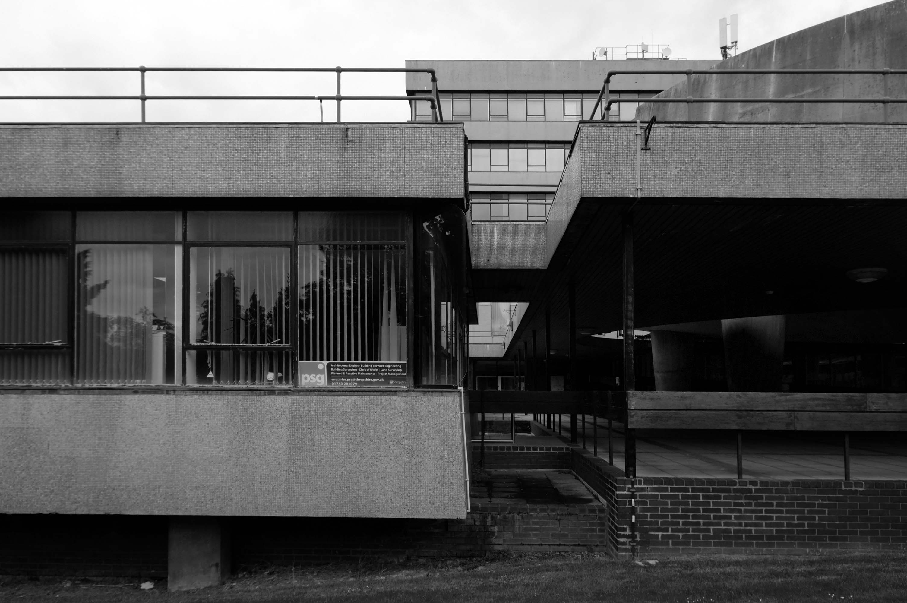
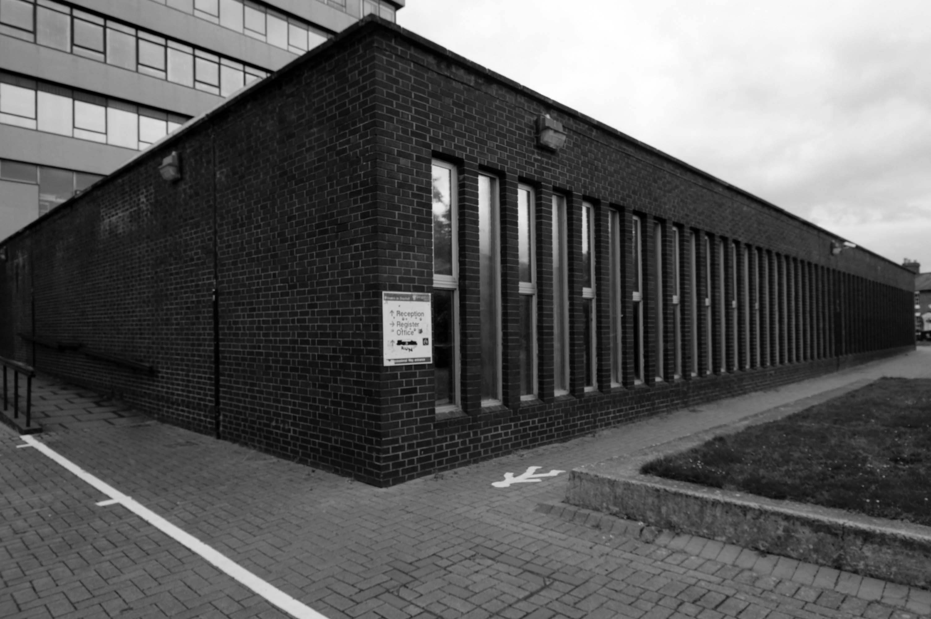
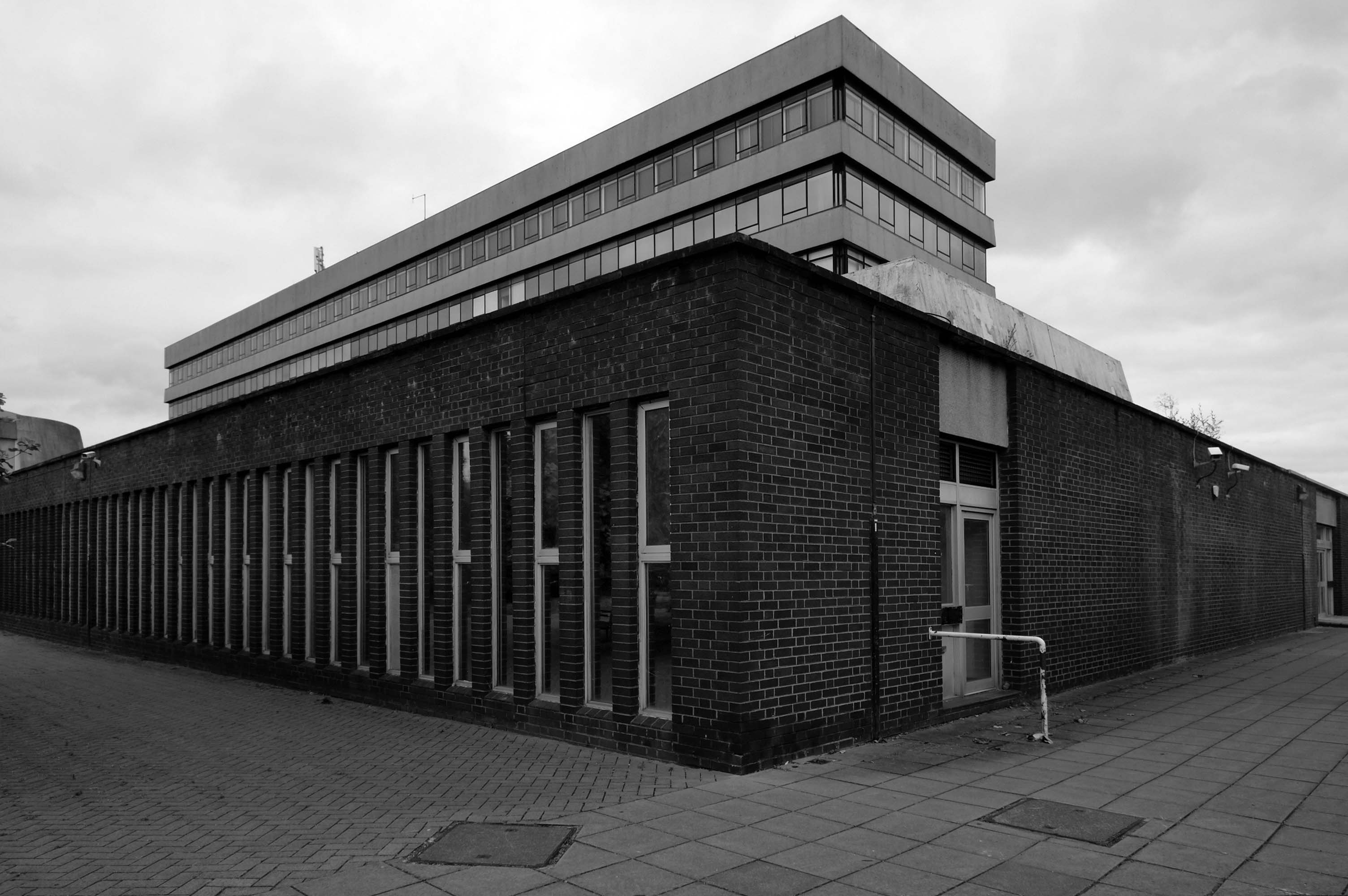
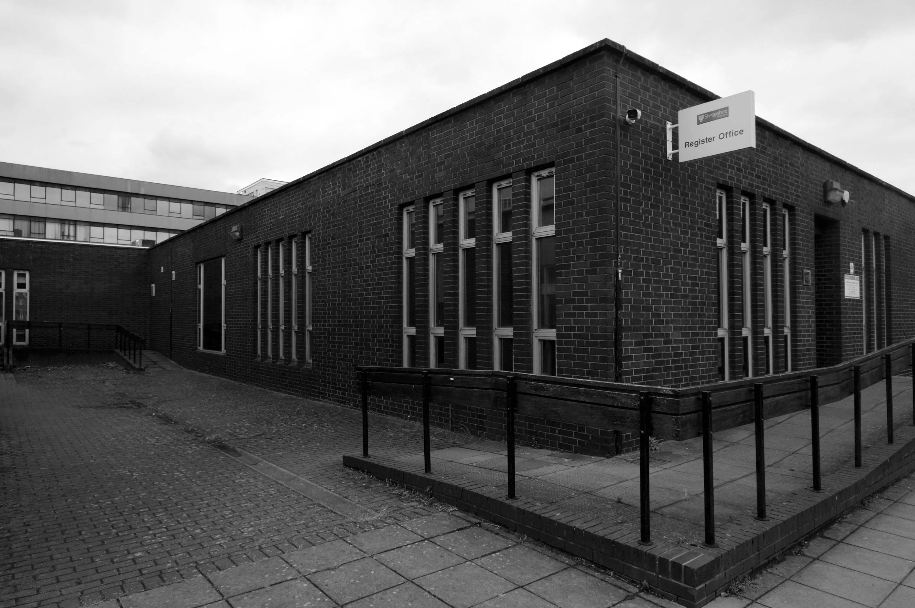
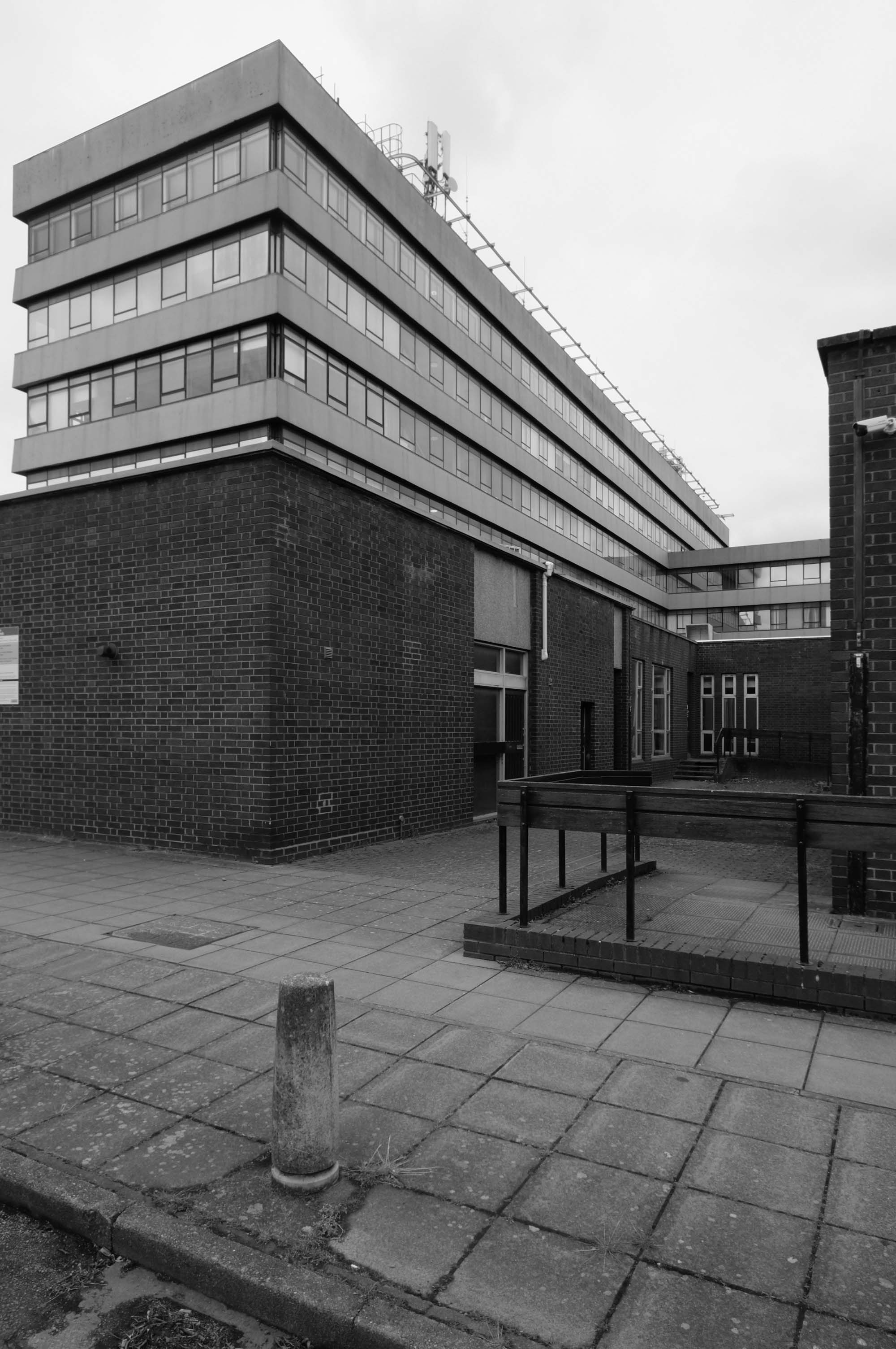
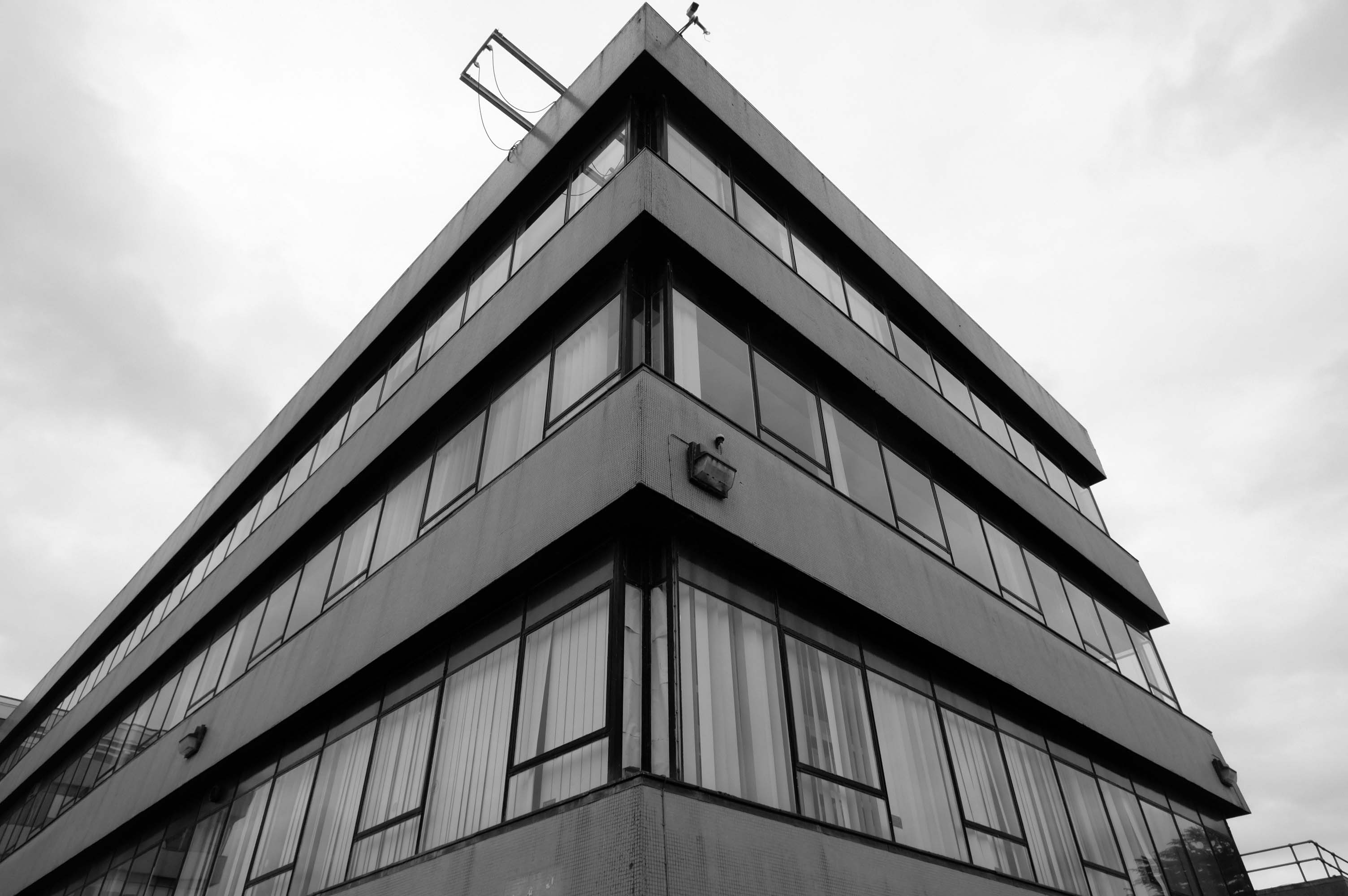
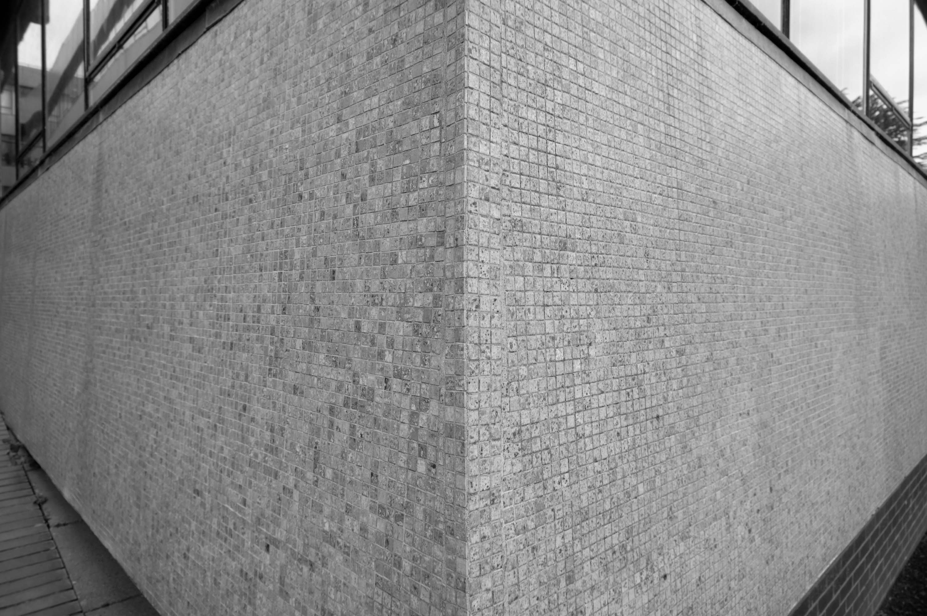
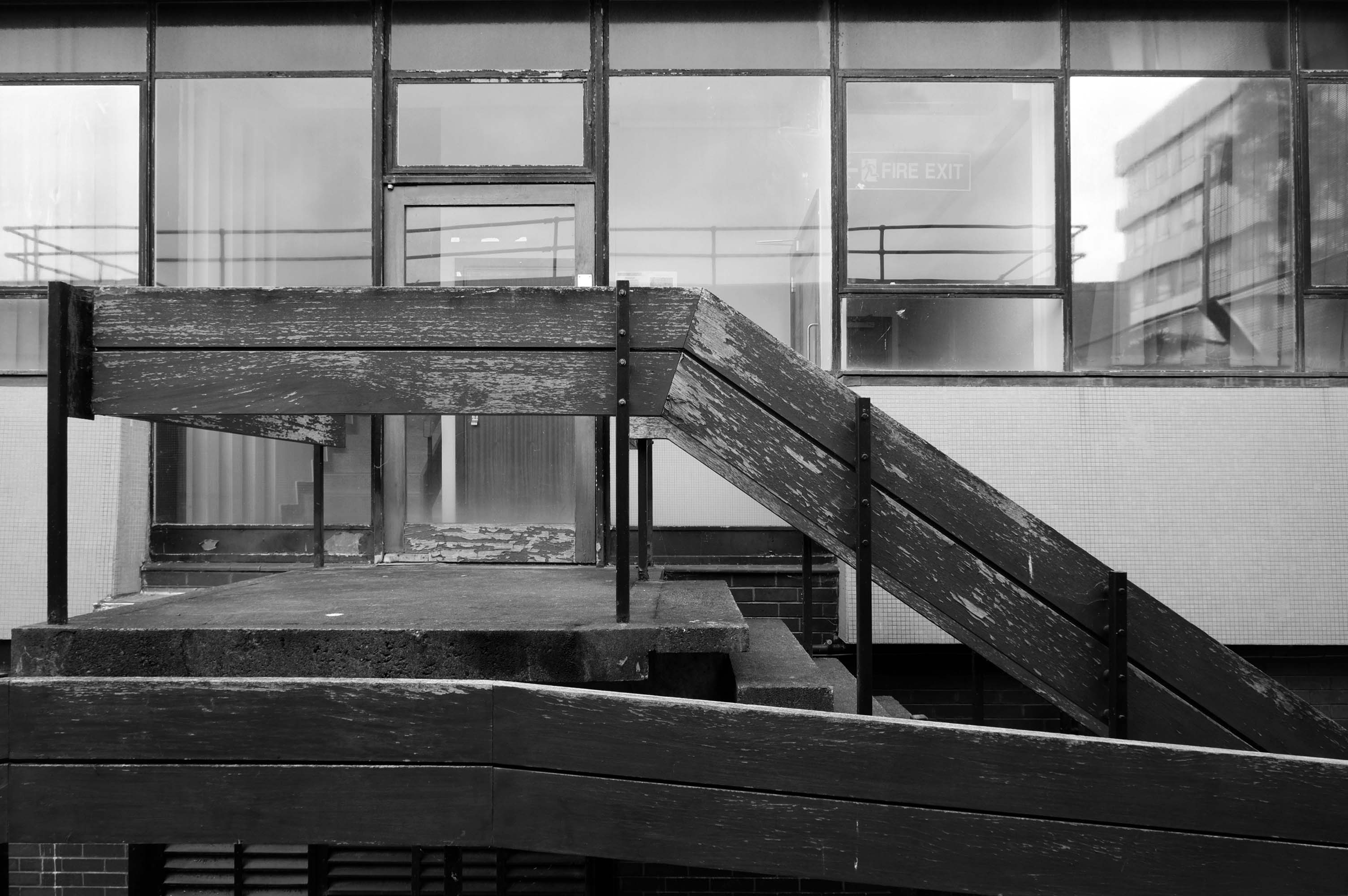
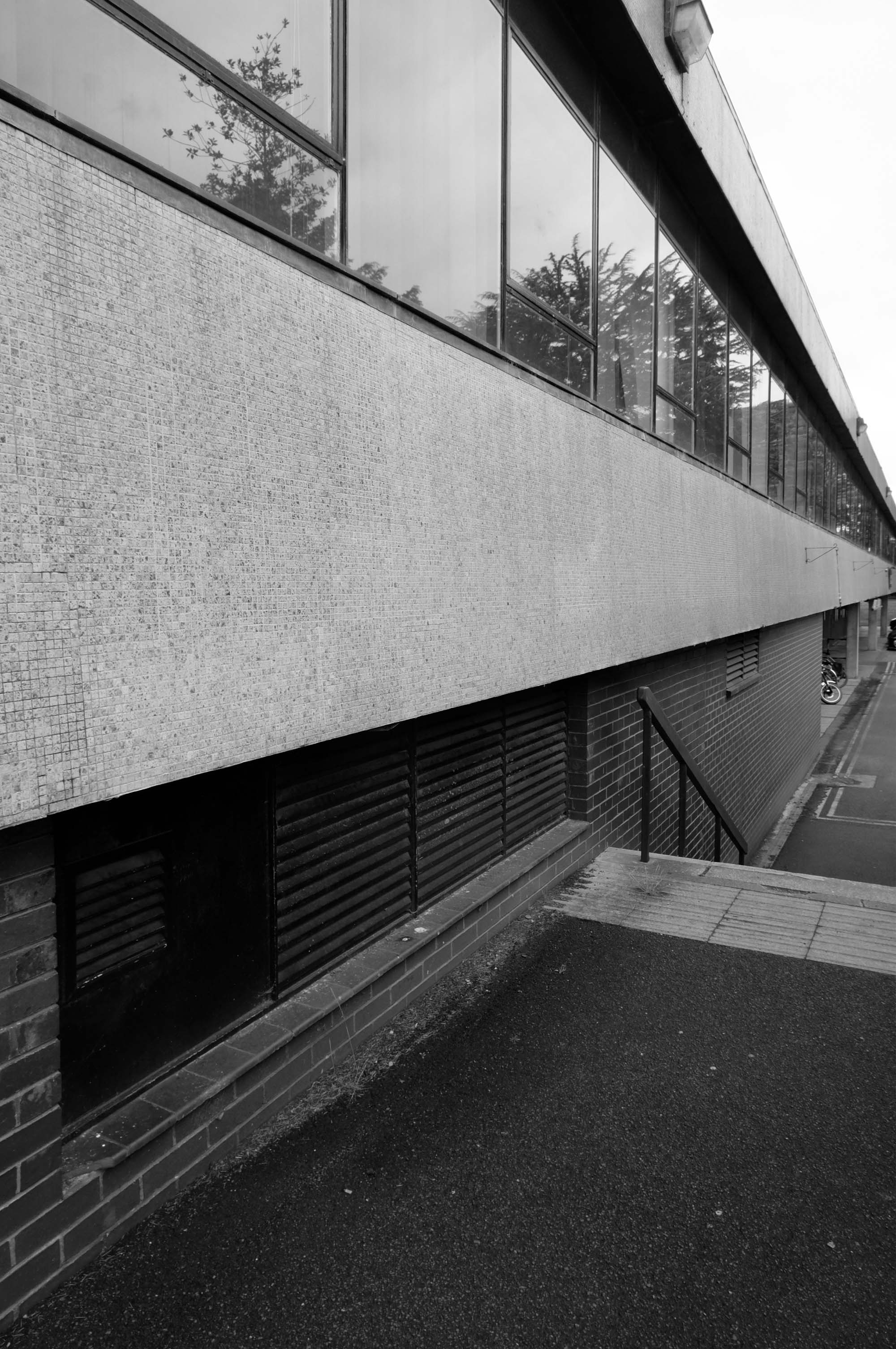
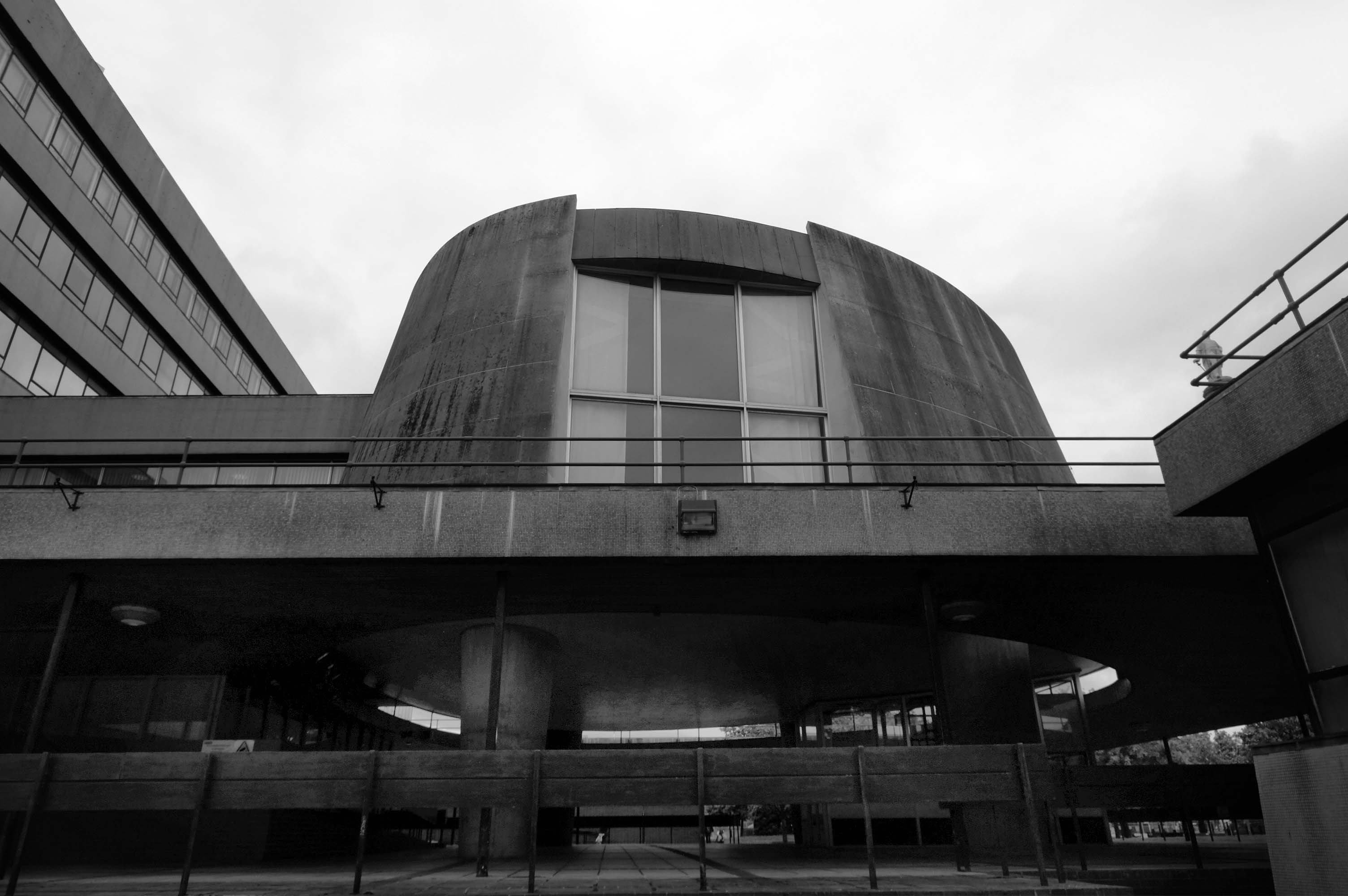
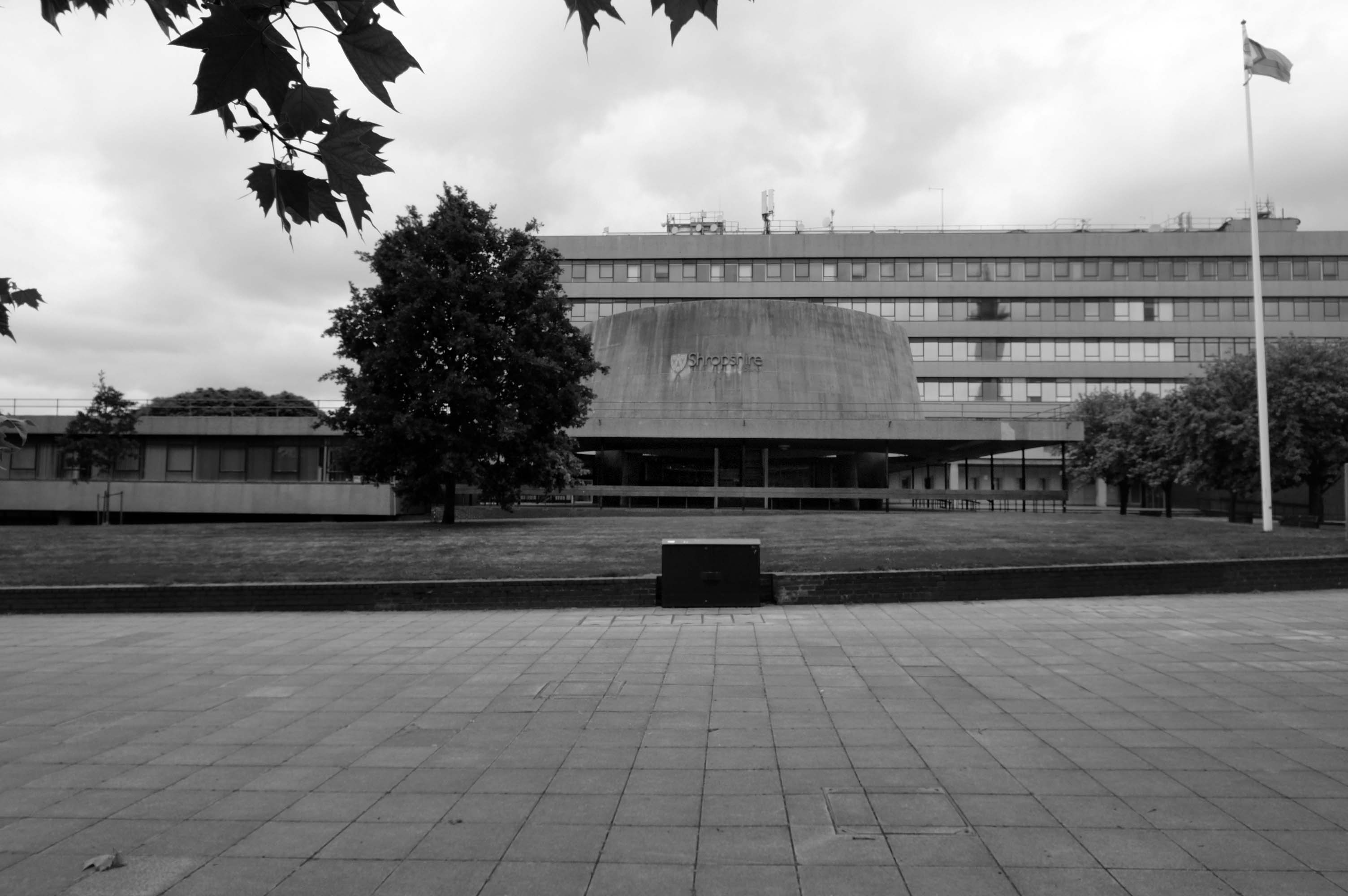
The foundation stone for the new building was laid by Sir Offley Wakeman, a former chairman of the county council, on 25 July 1964. It was designed by Ralph Crowe, the County Architect, in the Modernist style, built at a cost of £1.8 million and was completed in April 1966.
It was officially opened by Queen Elizabeth II, accompanied by the Duke of Edinburgh, on 17 March 1967.
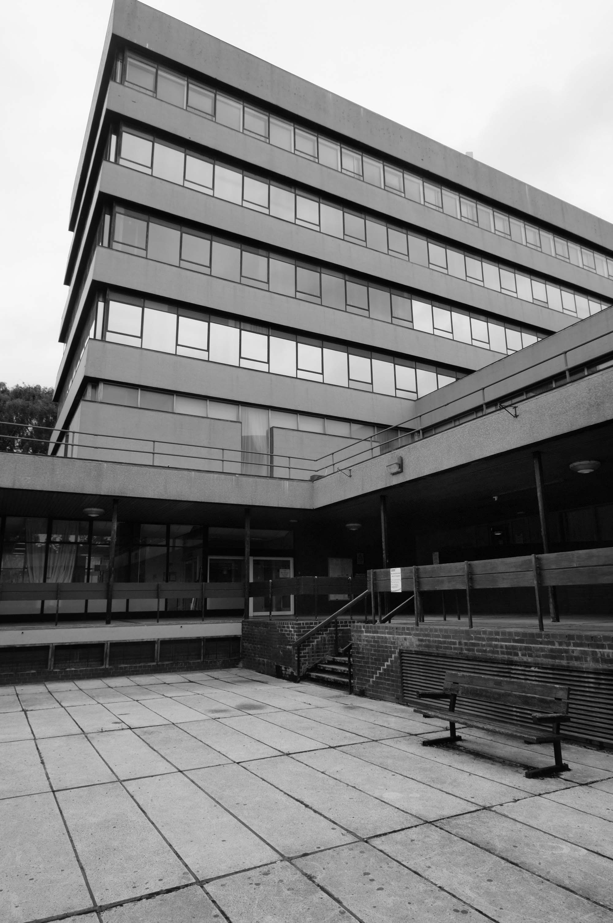
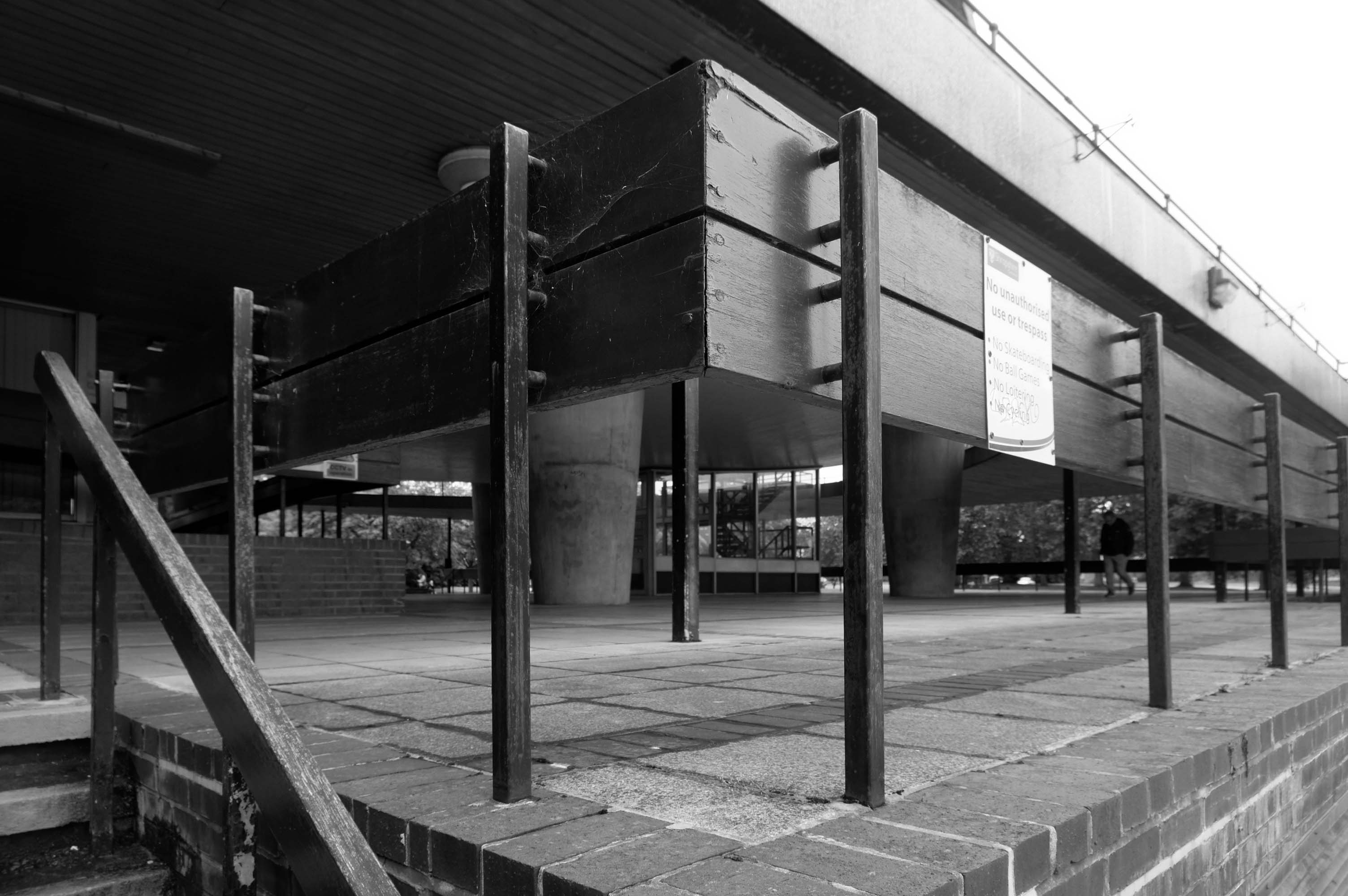
The design for the six-storey building facing Abbey Foregate involved continuous bands of glazing with concrete panels above and below: it also included an unusual ovoid-shaped council chamber which jutted out to the south-west of the main building.
Pevsner described the building as – the major monument to post-war modernism in the county.
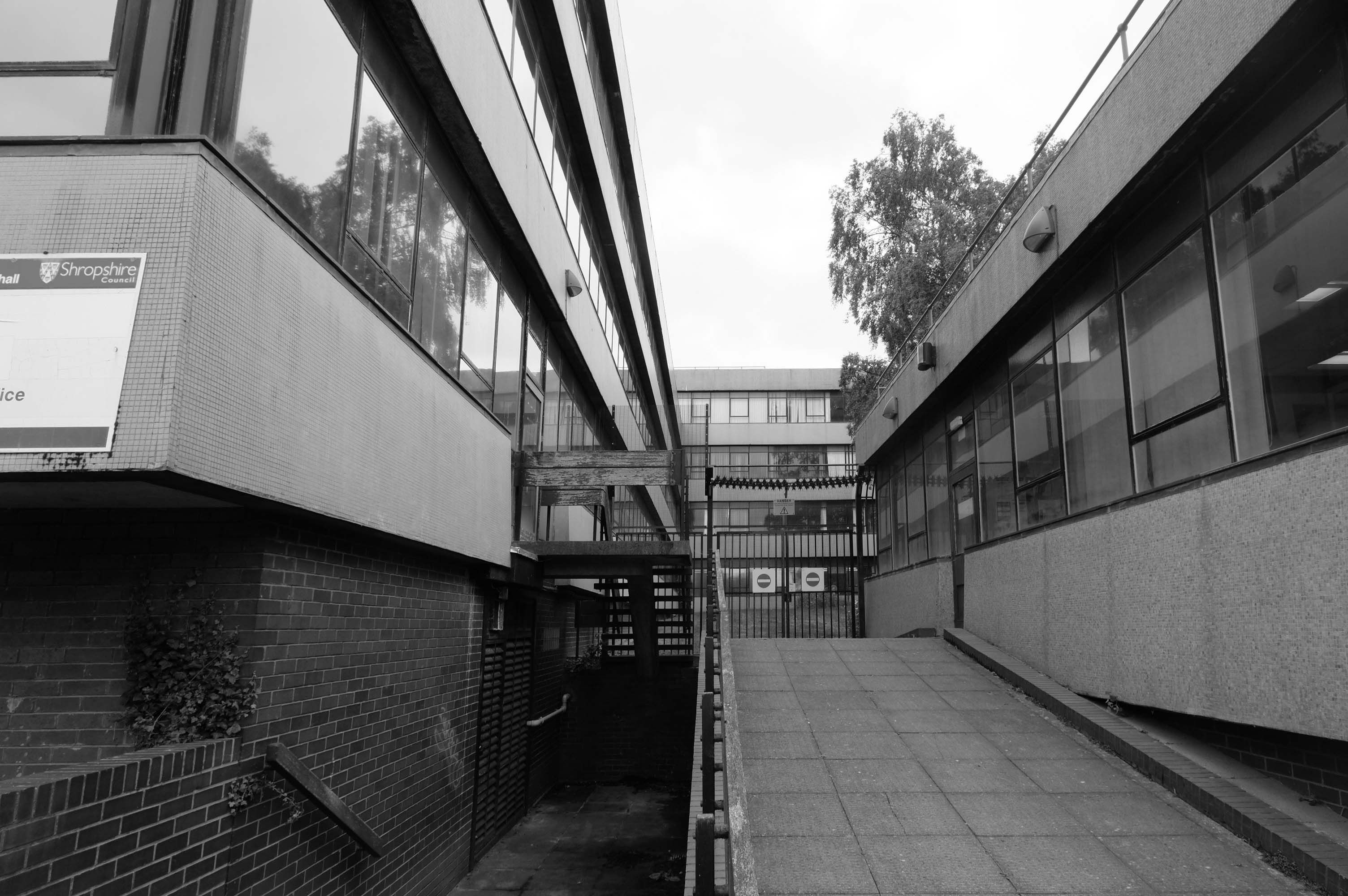
Shropshire Council initially backed a scheme drawn up by HLM Architects in 2017 to revamp Shirehall to provide modern working facilities as well as commercial opportunities. However this plan has not progressed and the local authority has said that making the building fit for purpose would require ‘a multi-million pound investment’.
in September 2020, the council indicated that it would rather sell the building and move to the town centre. Then in October 2020, following an application for a certificate of immunity from listing requested by the county council, English Heritage decided not to list County Hall as the building did not meet the criteria for listing post-1945 buildings.
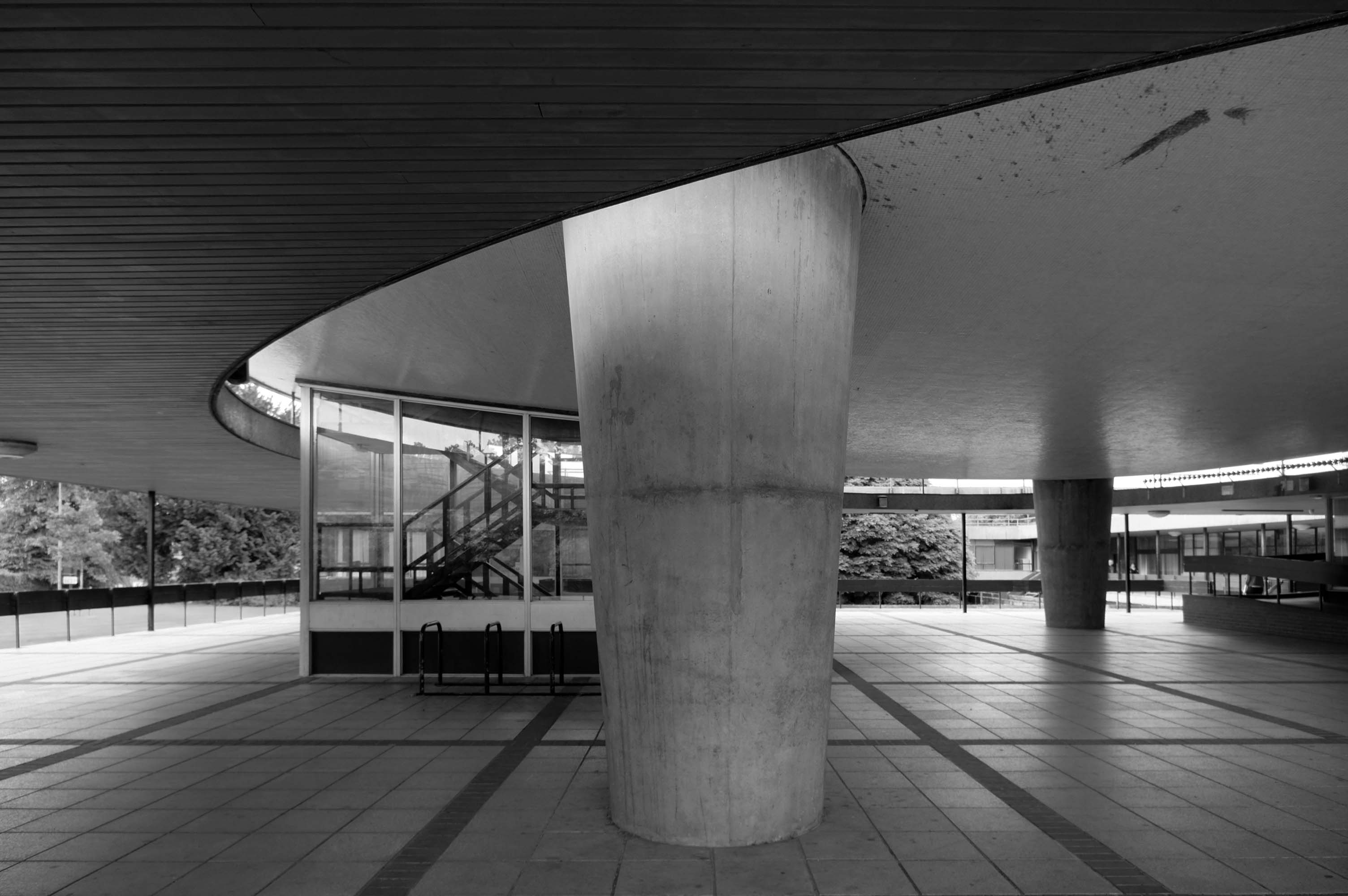
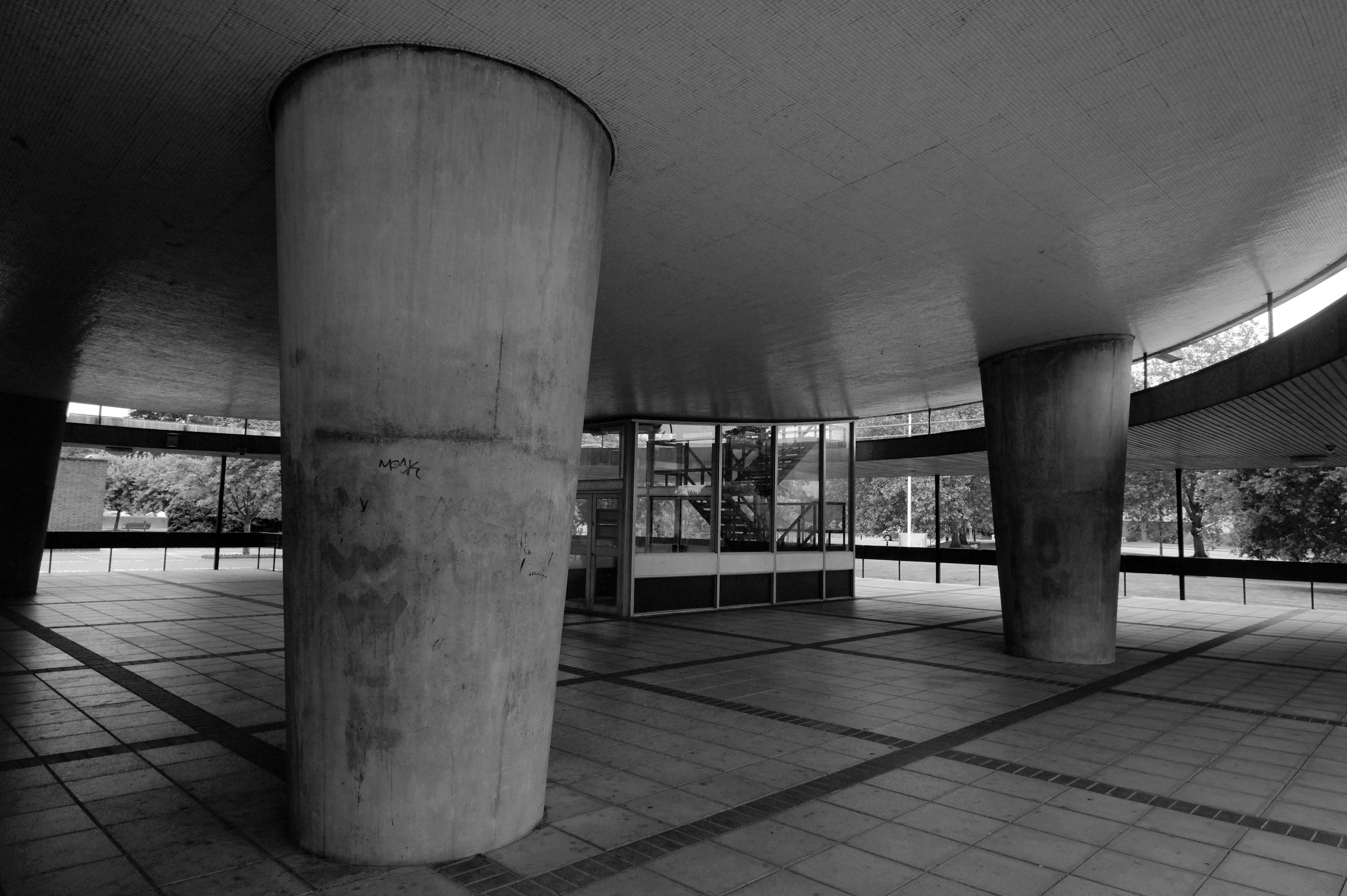
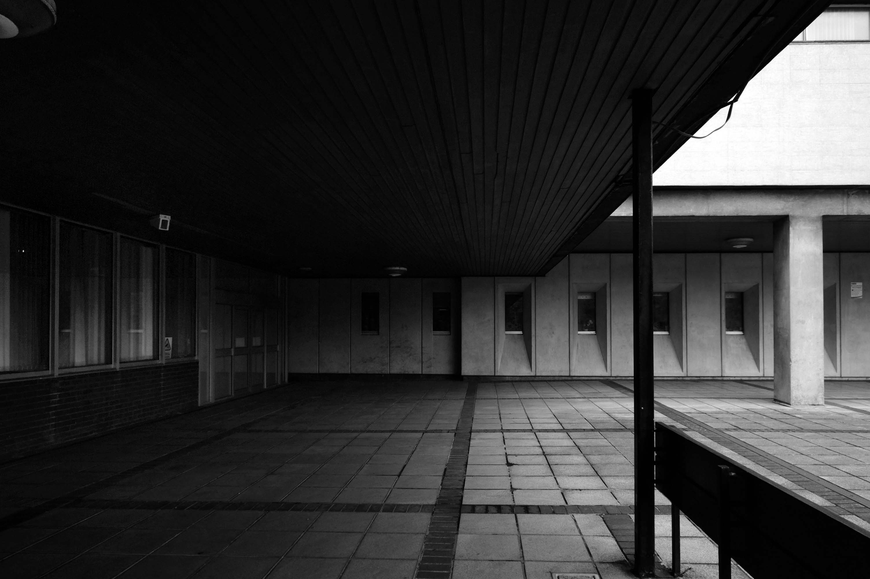
Shropshire Council Raven Meadows Shrewsbury SY1 1PL
Built by Truscon Ltd. – 1969
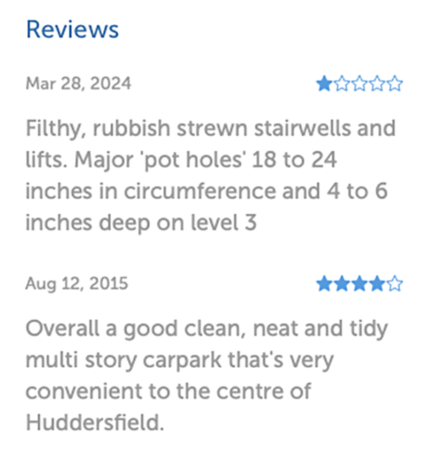
I am a disabled driver and found a lot of the direction signs worn away. When I came to leave I wanted to use the machine on the ground floor. This was out of order, as a lot of other people found. The office was empty as the staff were outside smoking. I then had to negotiate stars back to the 7th floor where the next machine was located. There was no sign on the ground floor machine telling it was out of use and where the next machine was located.
If staff want to have a smoke they should at least leave someone in the office.
Most of the parking spaces are very tight and I would not recommend the use of this car park unless you have a small car and a crystal ball to find the disabled parking and the payment meters.
The rudest man at the kiosk, that I have ever had an encounter with, over a ticket that was blurred. He had a go at me for not going to him straight away – I went when I went to leave and it wouldn’t work. He also had a go at me because I pressed the buzzer on the intercom. Very strange unhelpful man. Made an issue for no reason! Awful to deal with I never write reviews, but I hope this gets back to him and with hope he will gain some manners.
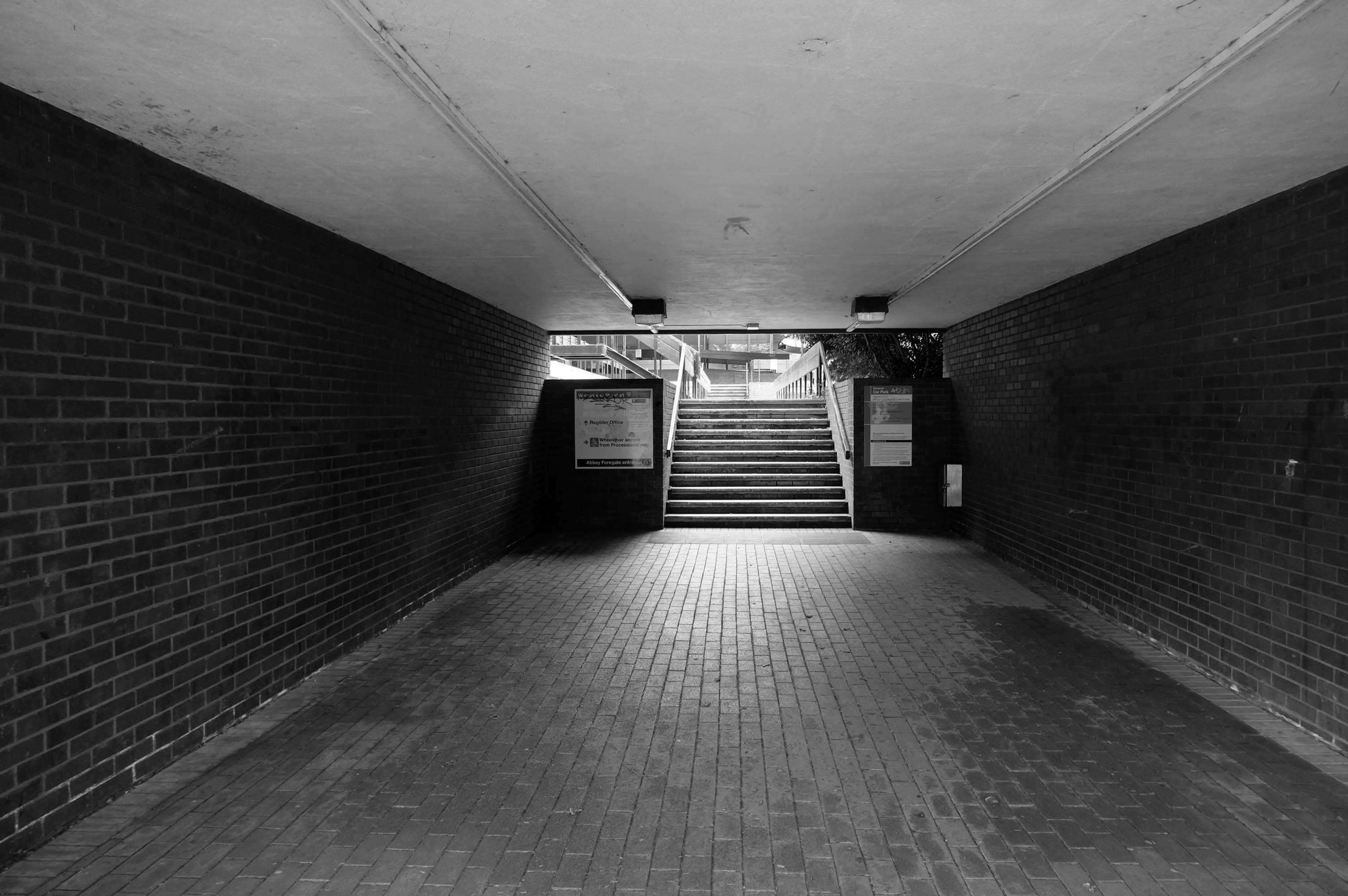
Being a pedestrian, I entered through the bus station on foot.
The station is considered to be dated due to its 1980s architecture partially under a 1960s multi-storey car park. There have been plans for the station to be modernised and rebuilt, or even demolished completely, as part of the town’s Big Town Plan. The demolition of the station would mean the town would not have a central bus terminus and would instead use smaller sites on the town’s Park and Ride routes.
Shrewsbury Bus Station is a disgrace. I am embarrassed to use it. I don’t feel comfortable with using it. Yet, it is the bus hub for our county. It is one of the main gateways into Shrewsbury and Shropshire for those travelling by public transport.
New bus hubs and interchanges have been developed around the country. Shropshire Council meanwhile ignores Shrewsbury Bus Station. It promises a new bus interchange, but that is in Phase 4 of its plans to redevelop Shrewsbury town centre between Pride Hill and the riverfront. In the current financial climate and with the council stretched to the limit on existing funding, Phase 4 is probably more than a decade away.
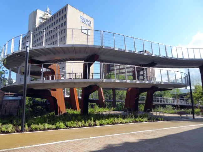
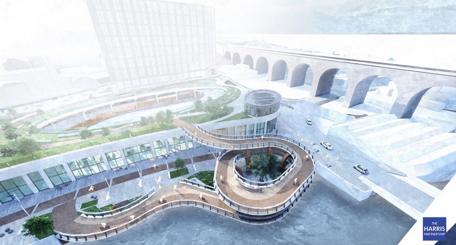
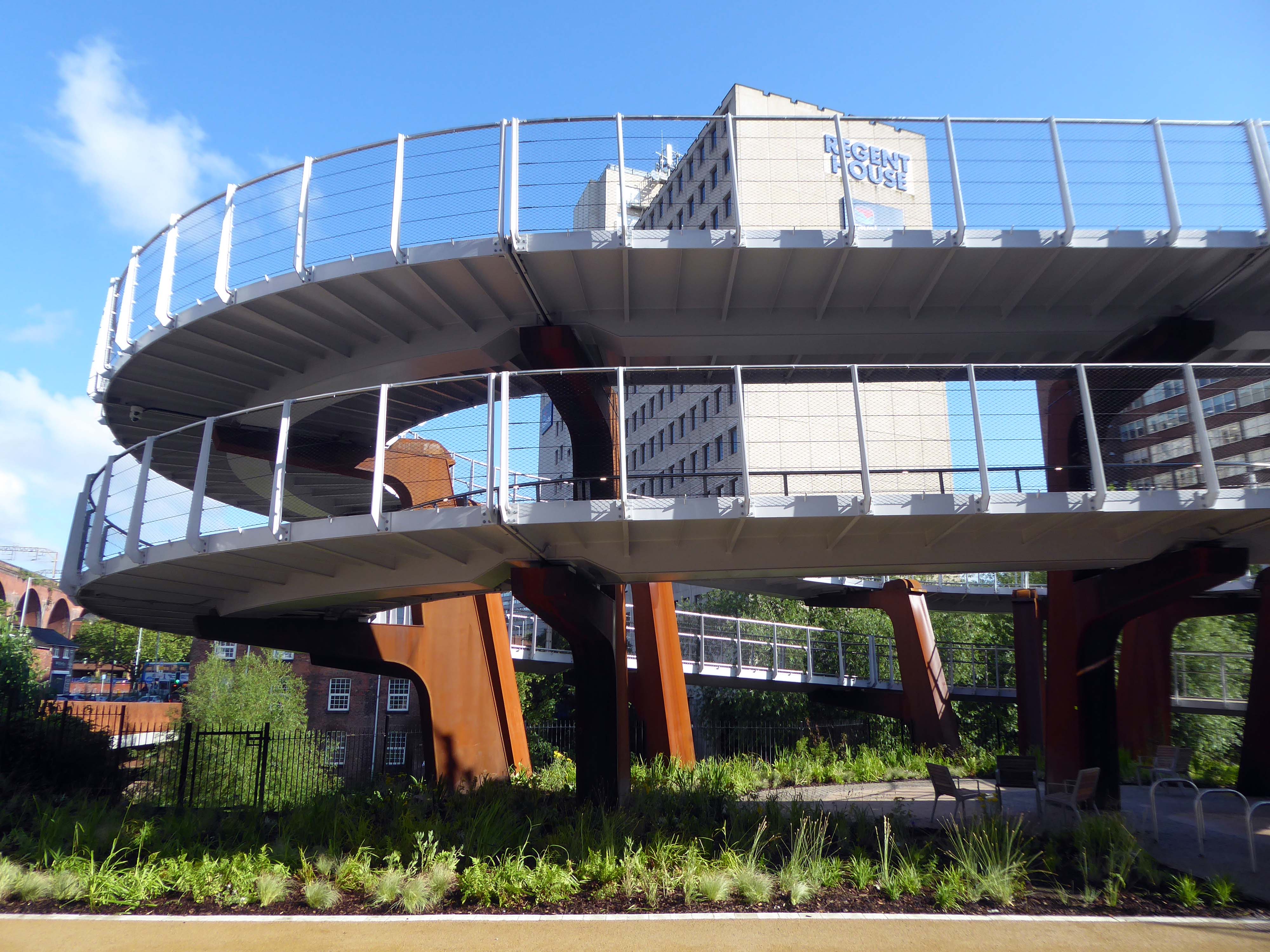
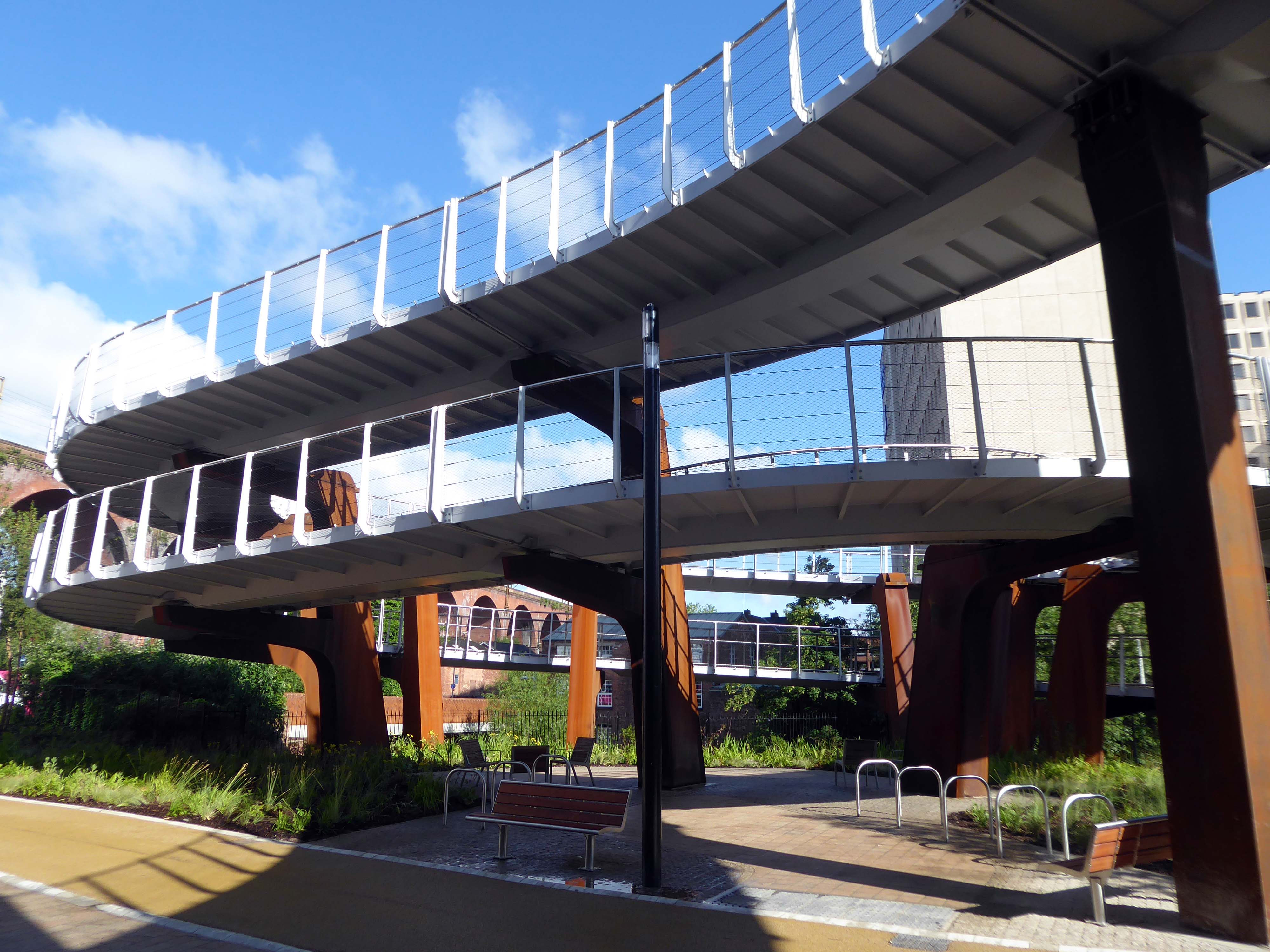
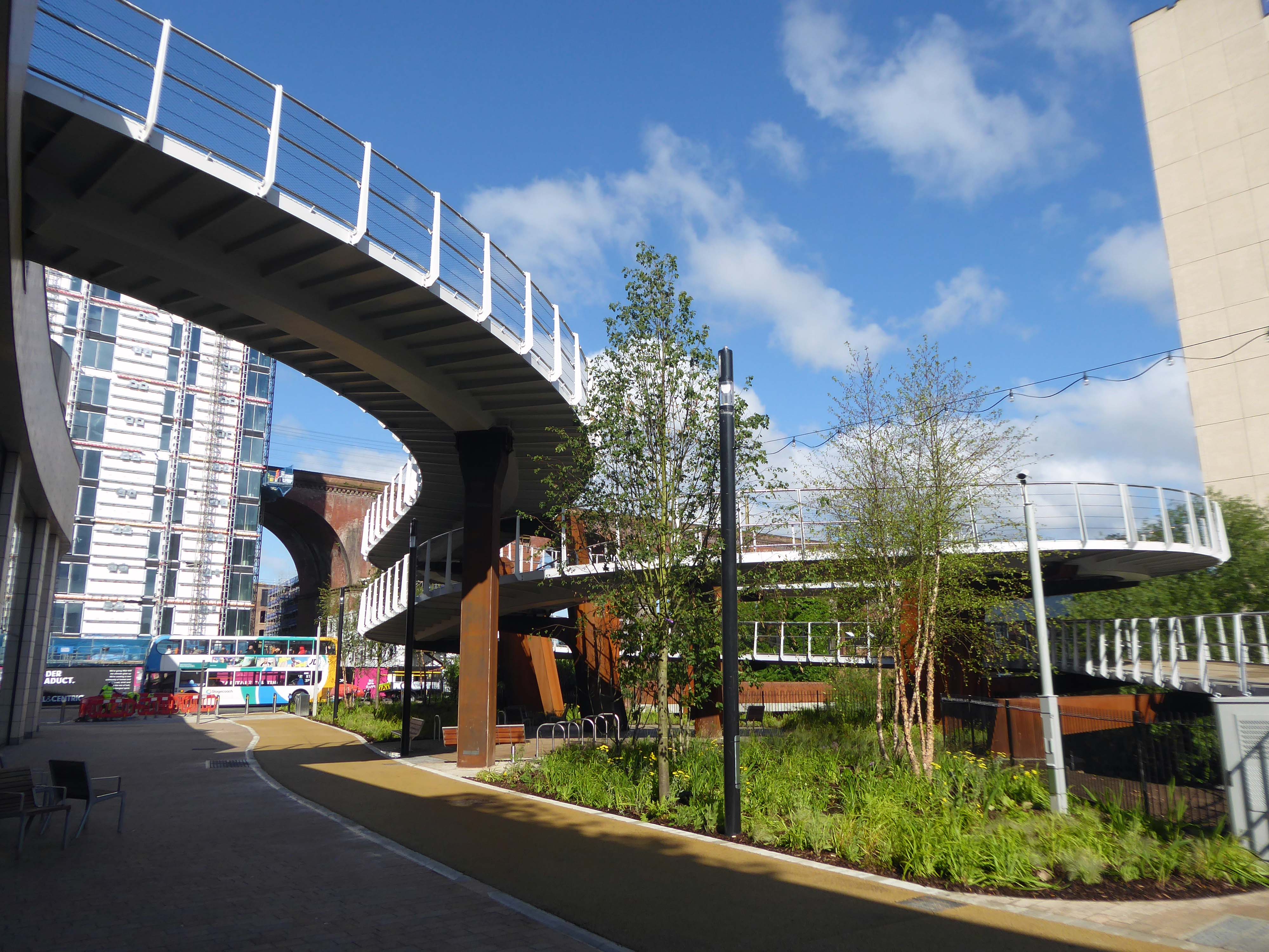
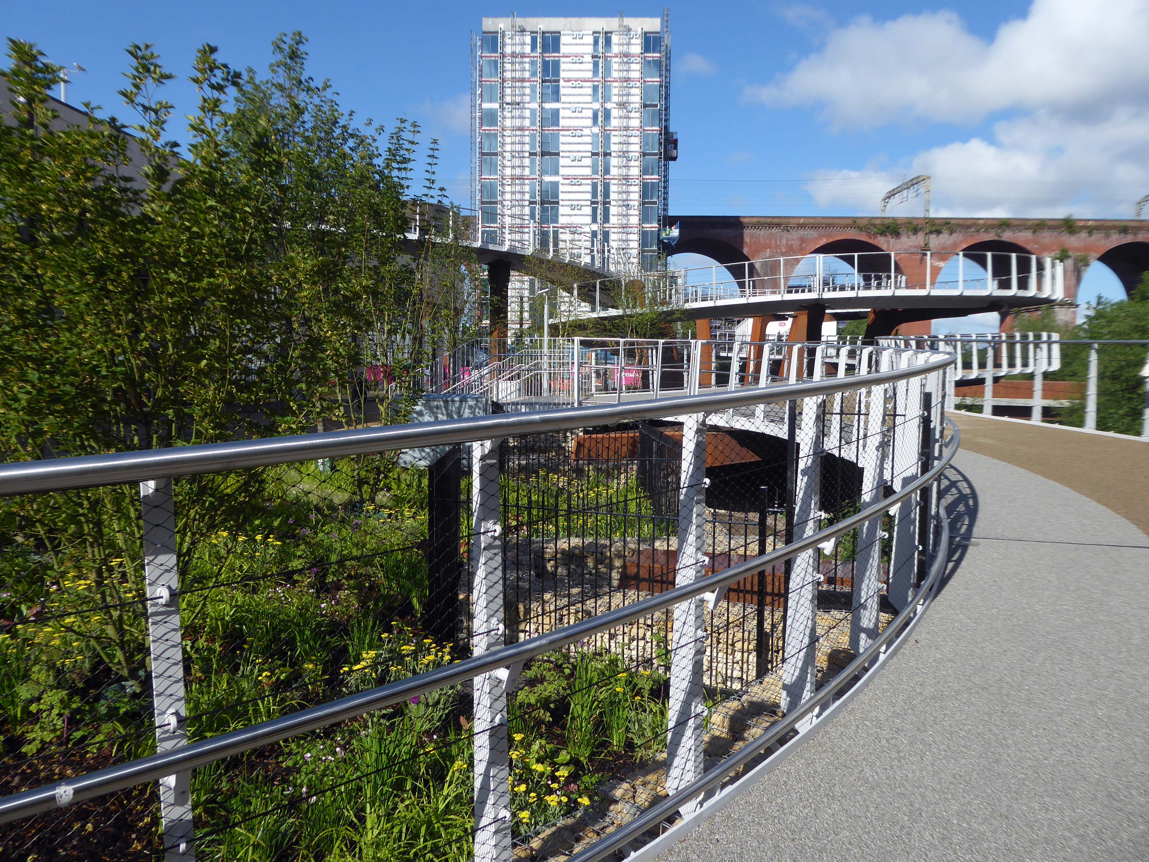
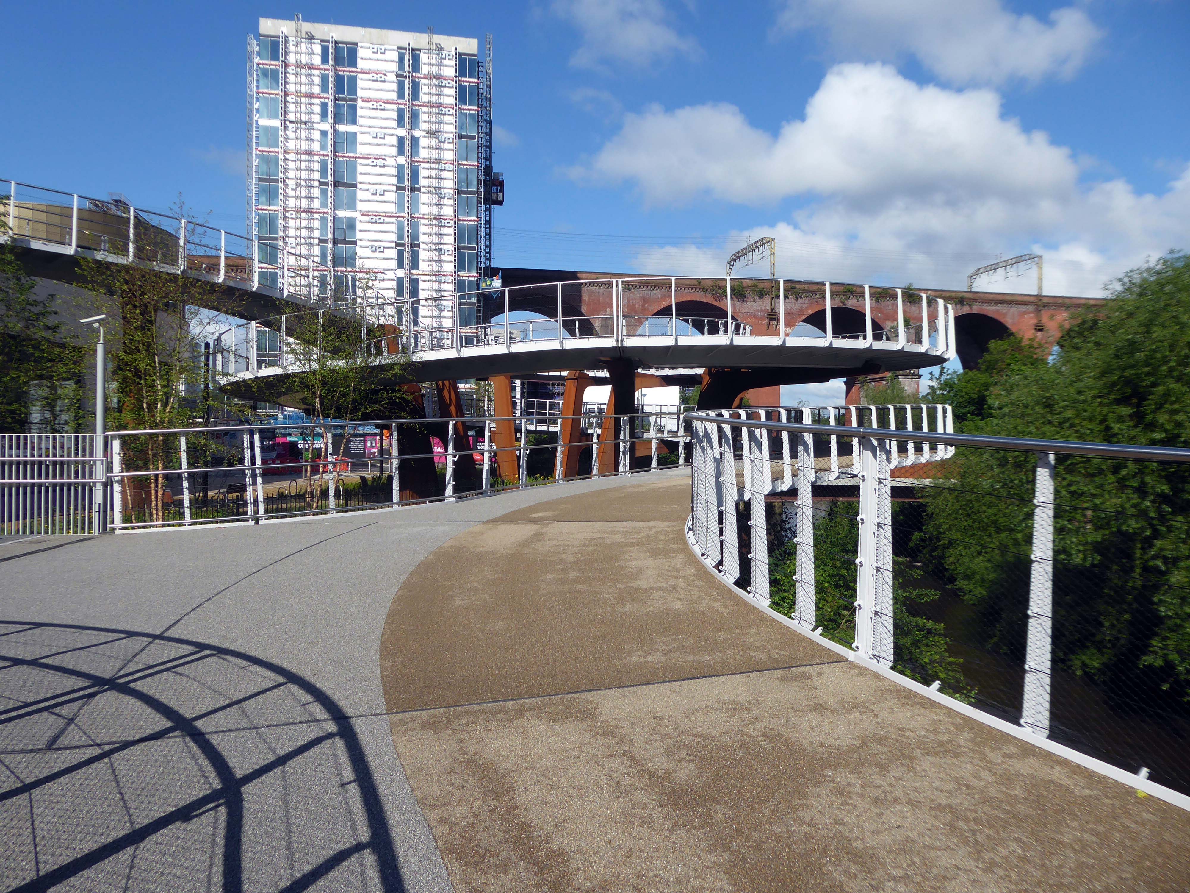
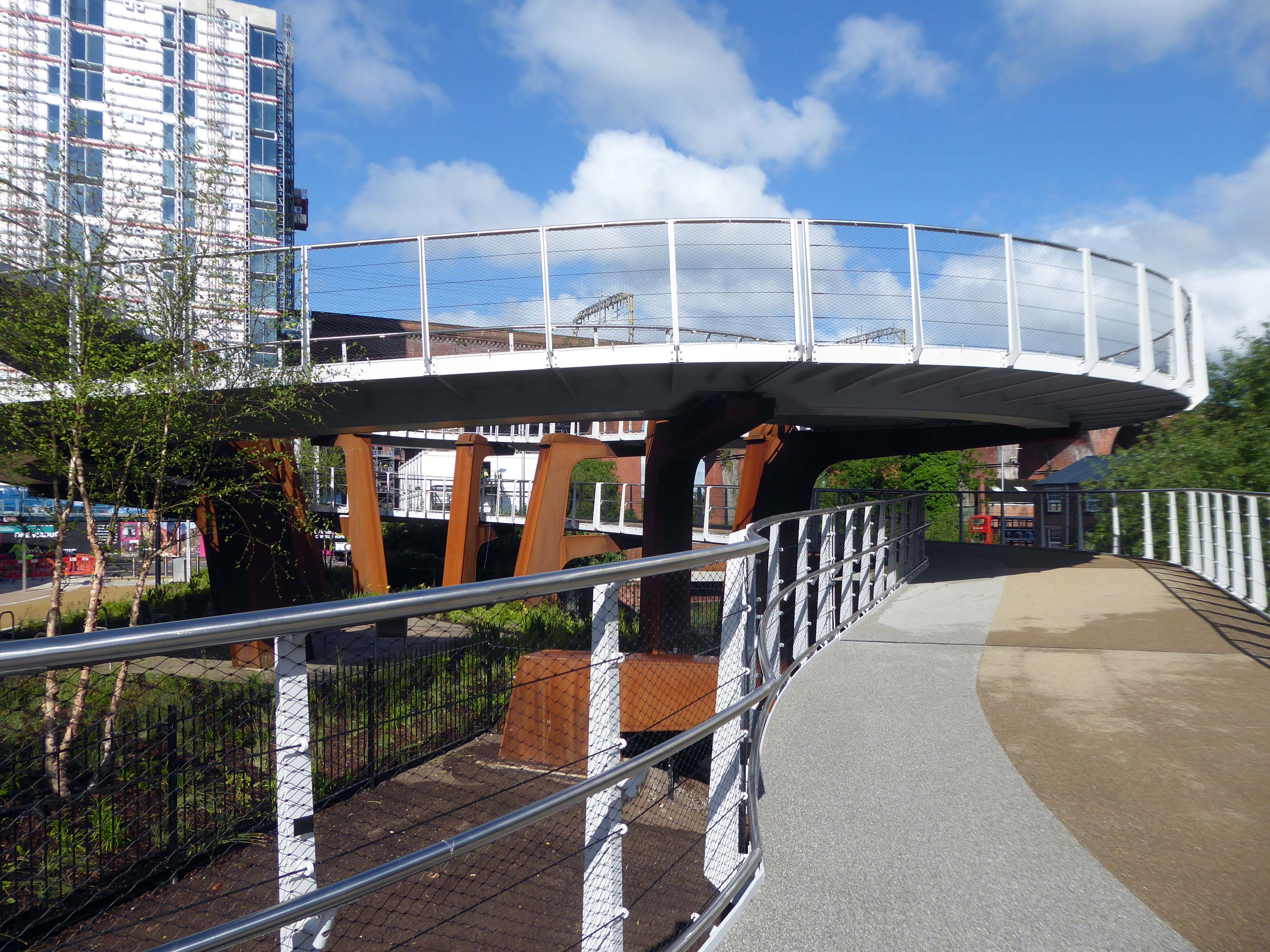
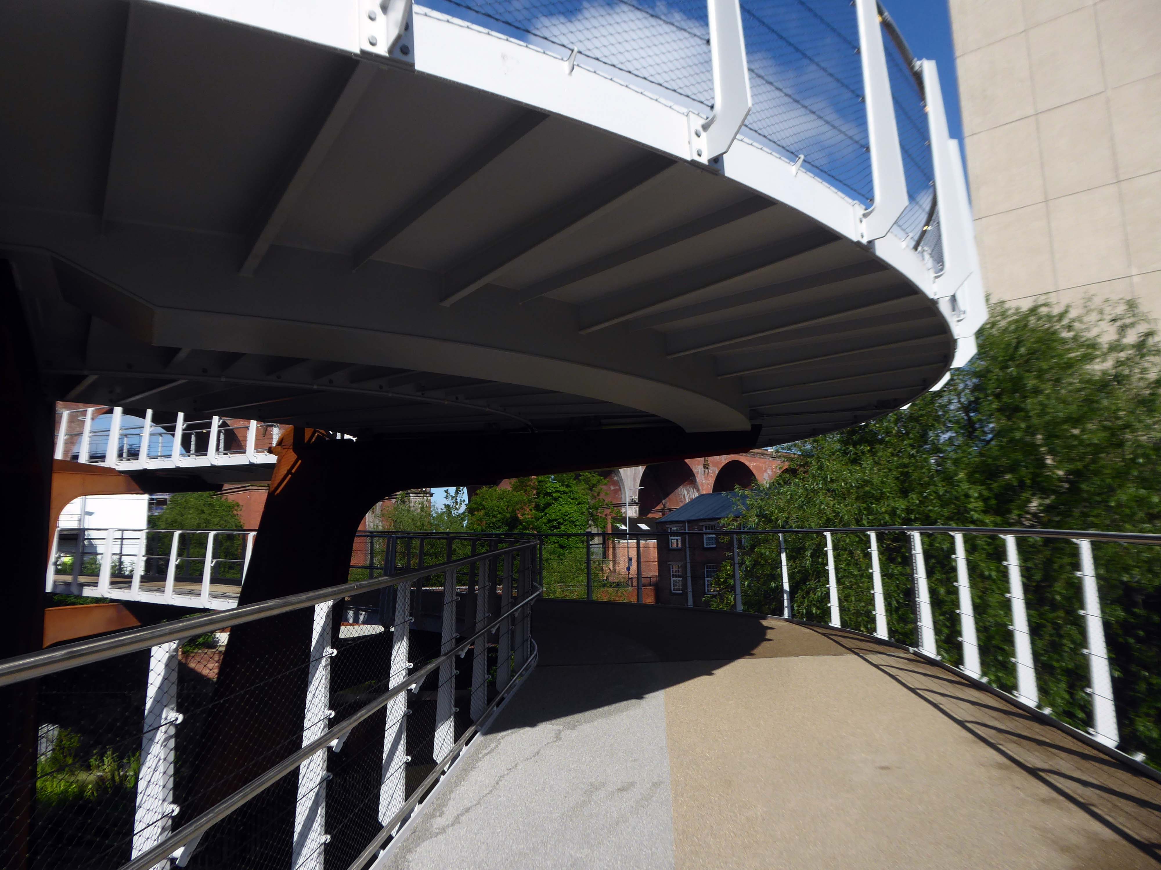
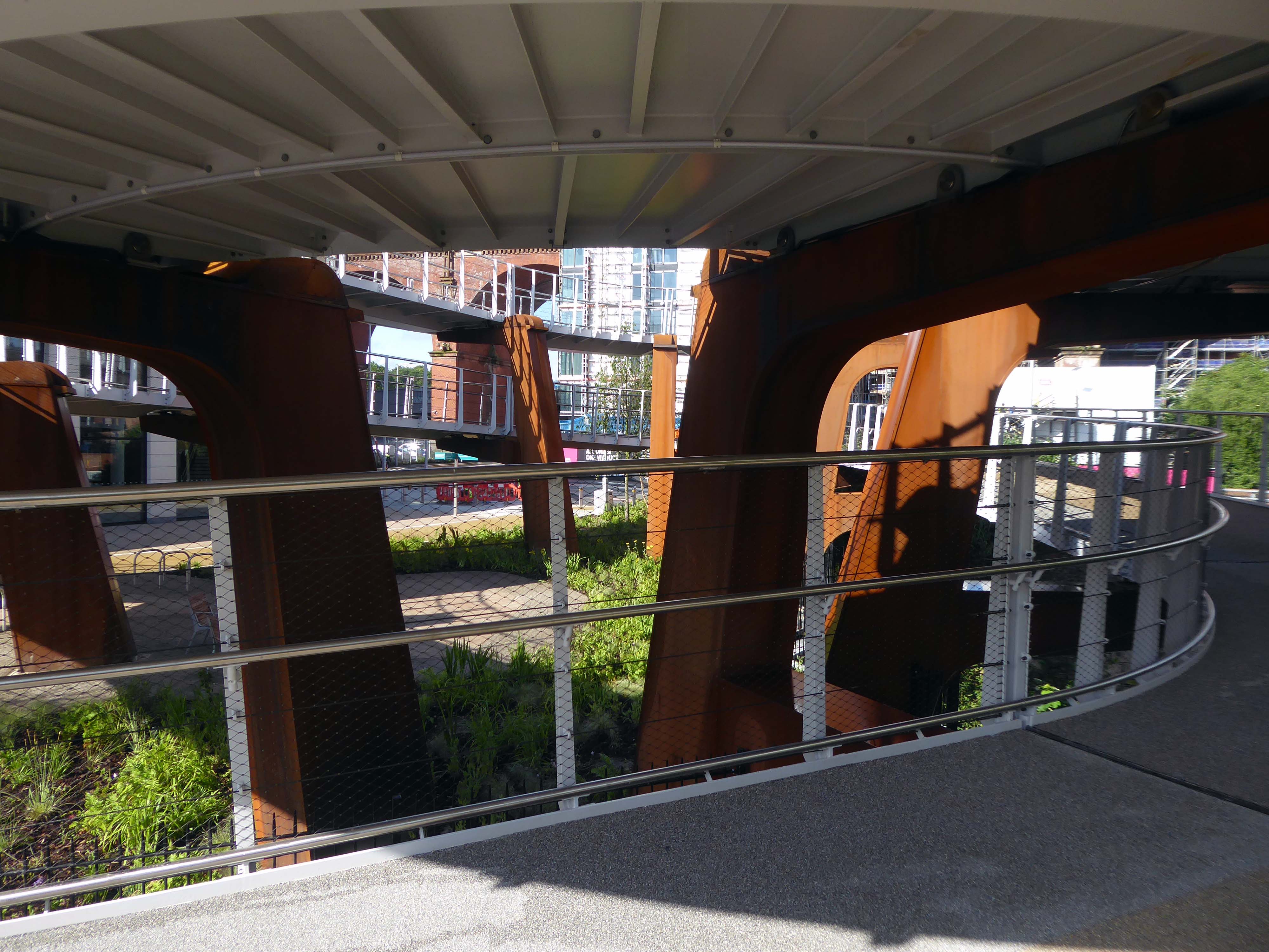
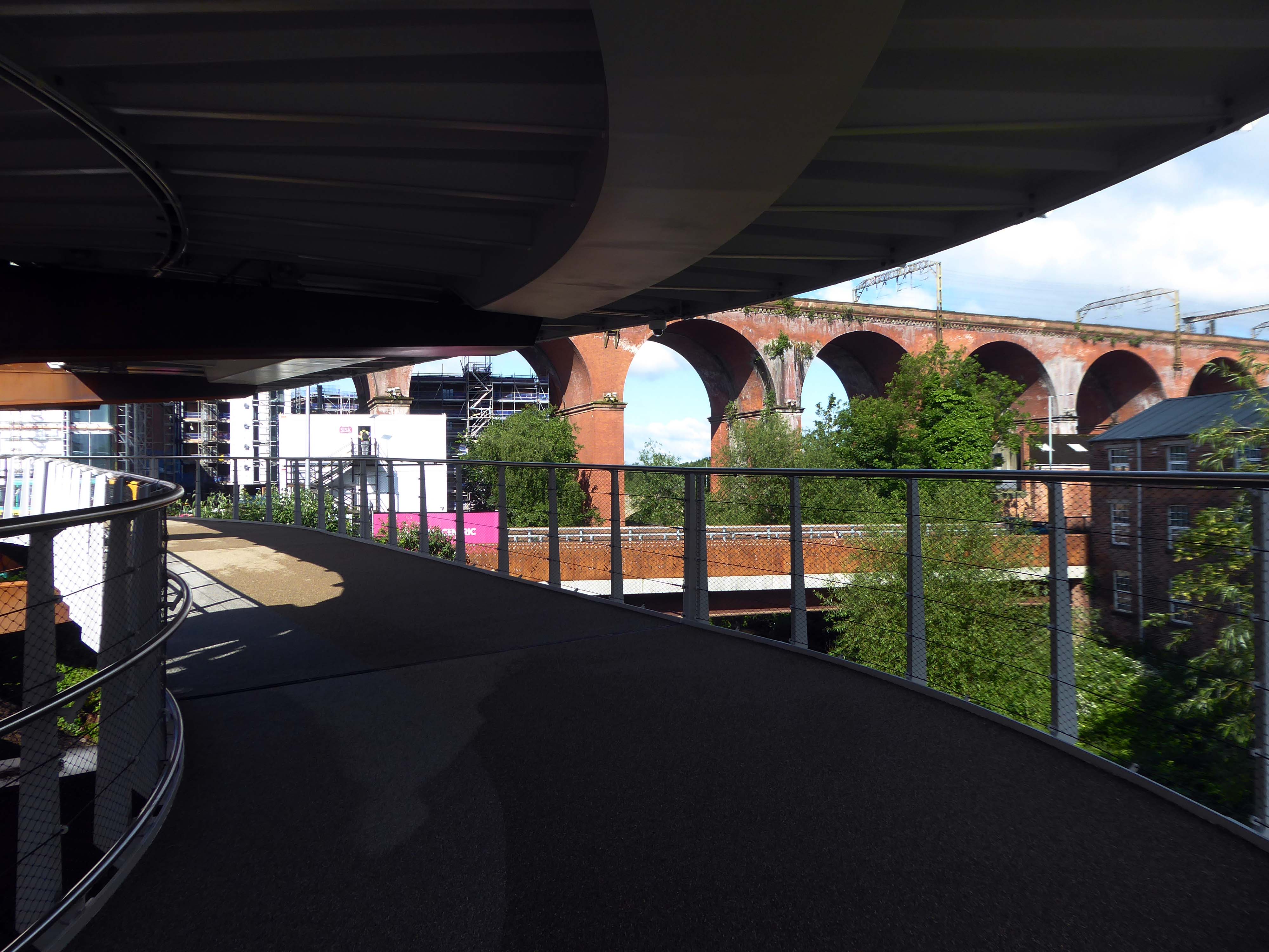
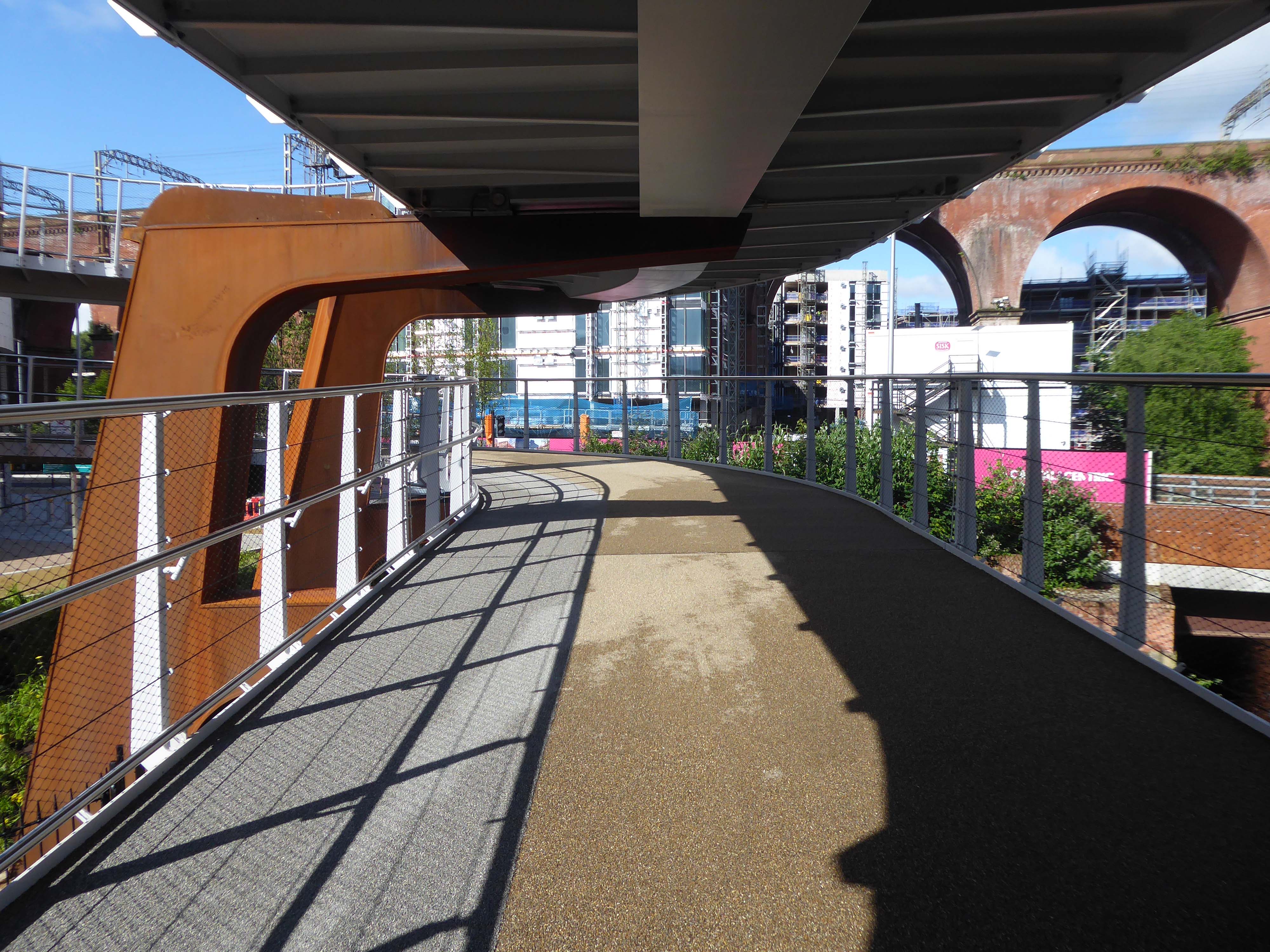
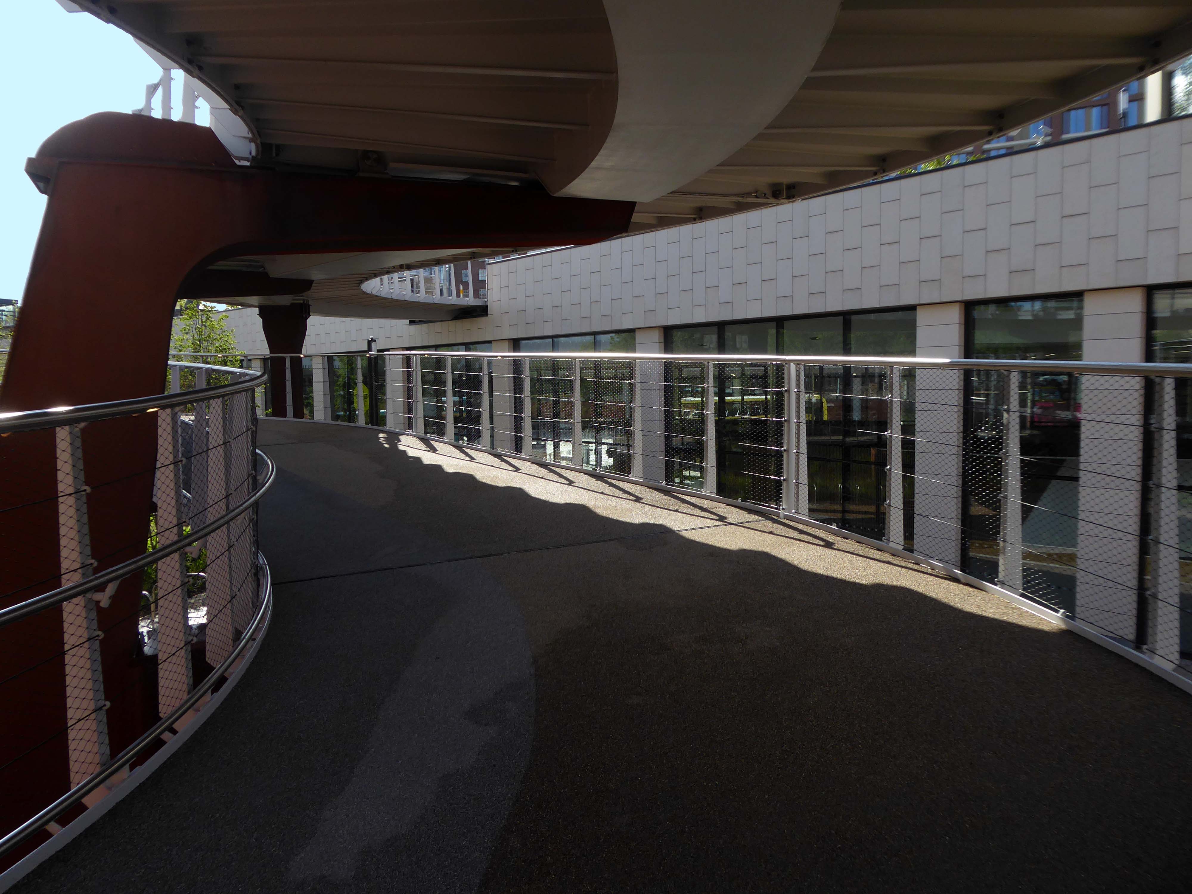
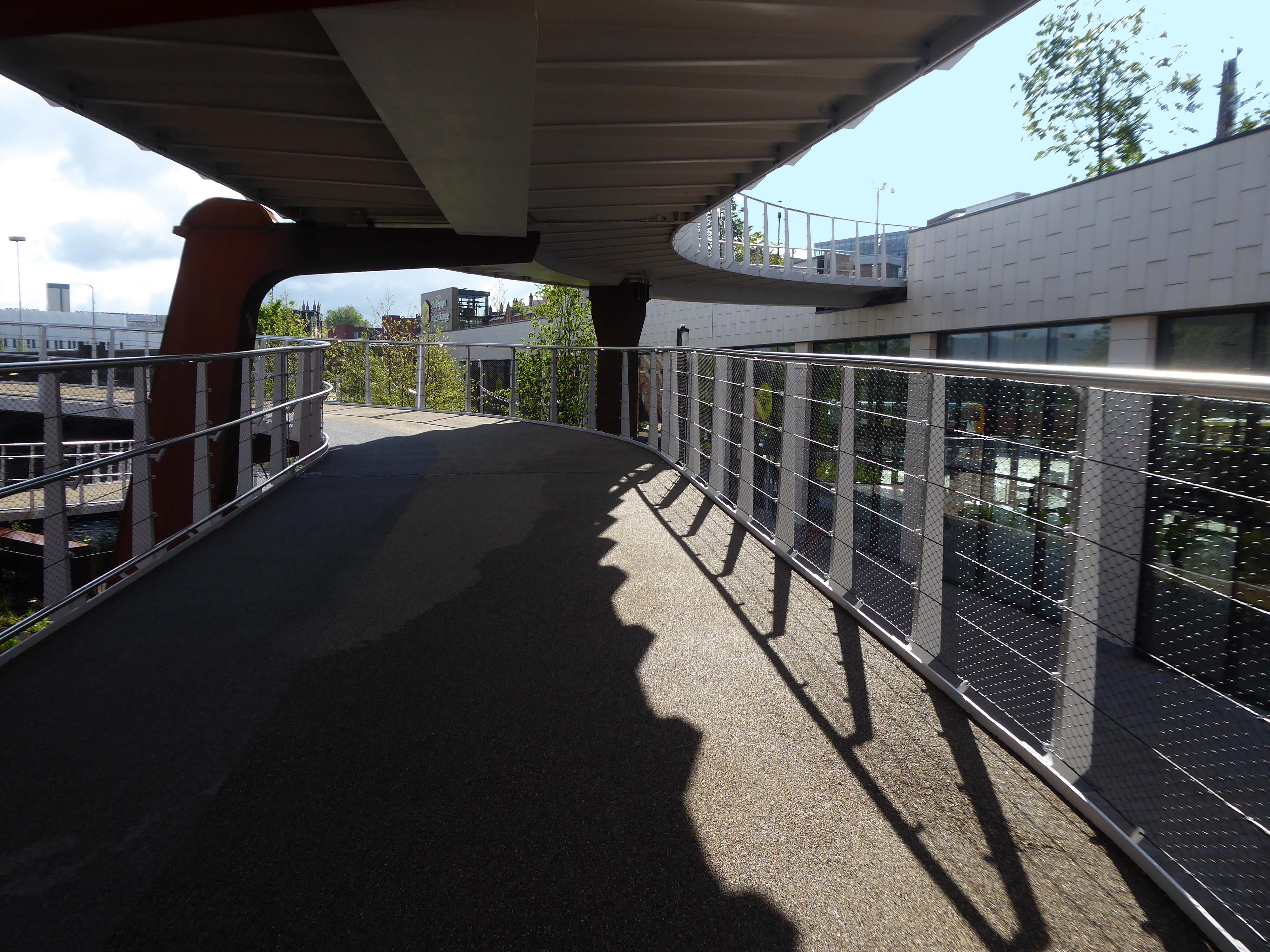
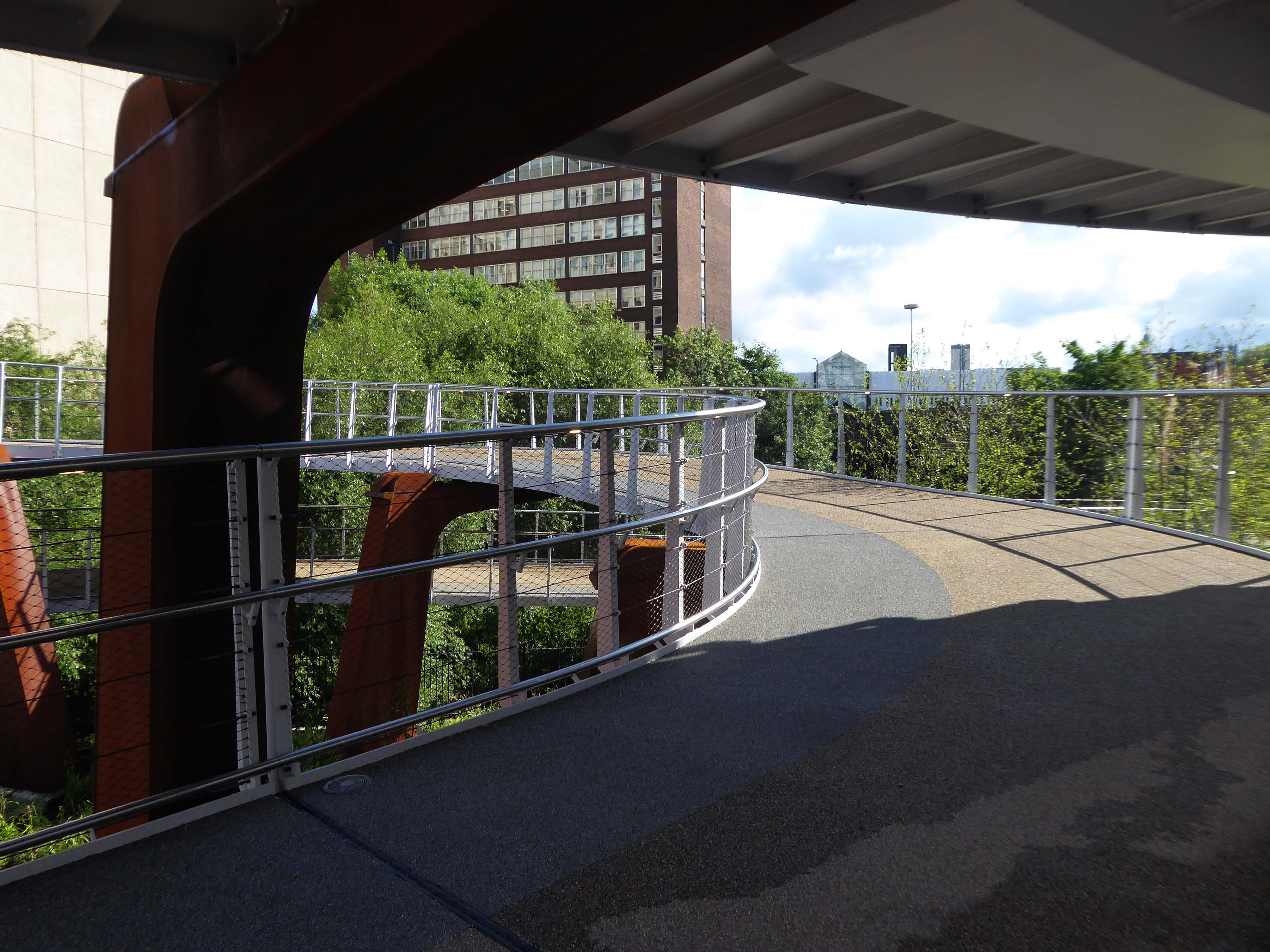
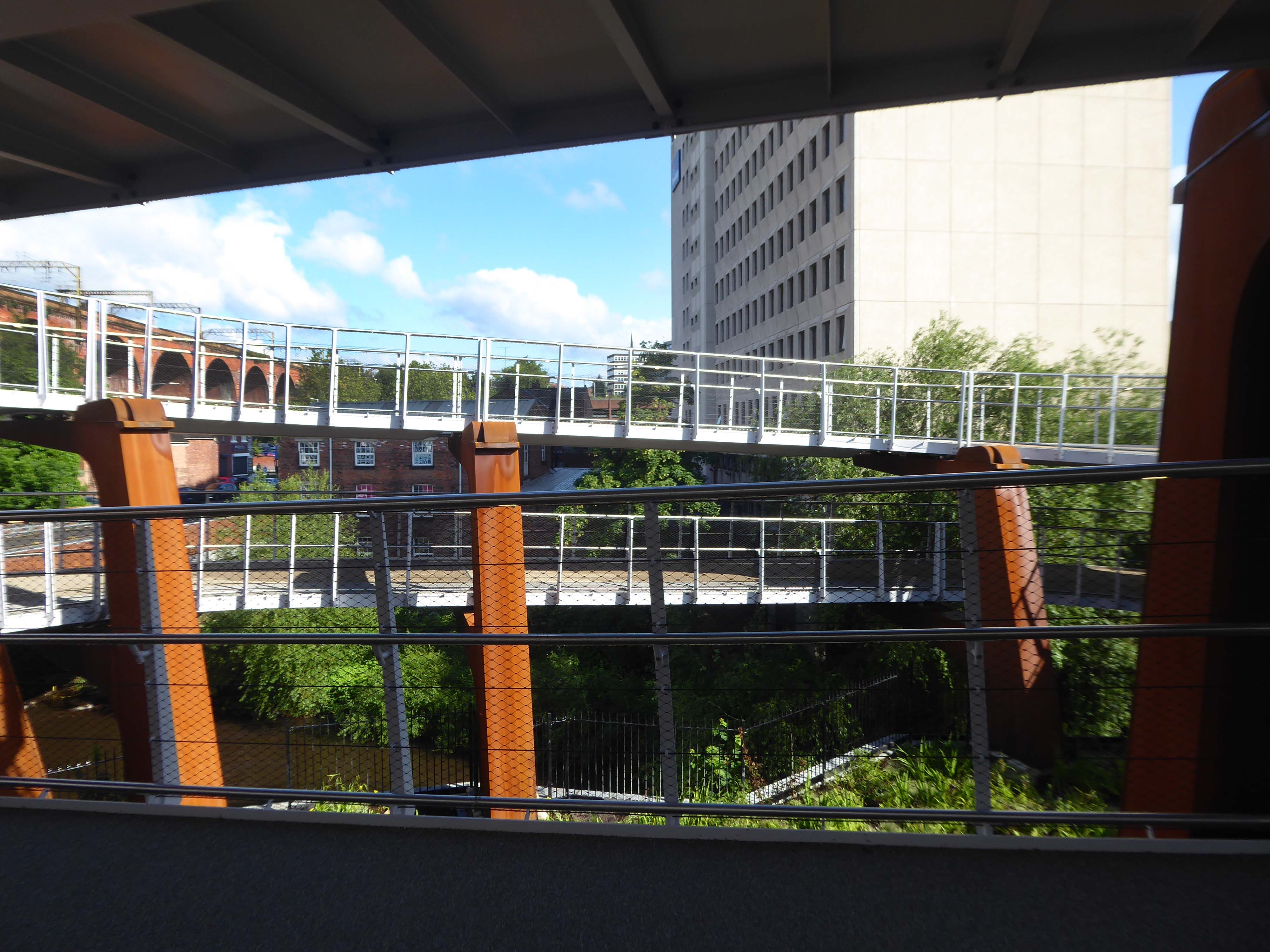
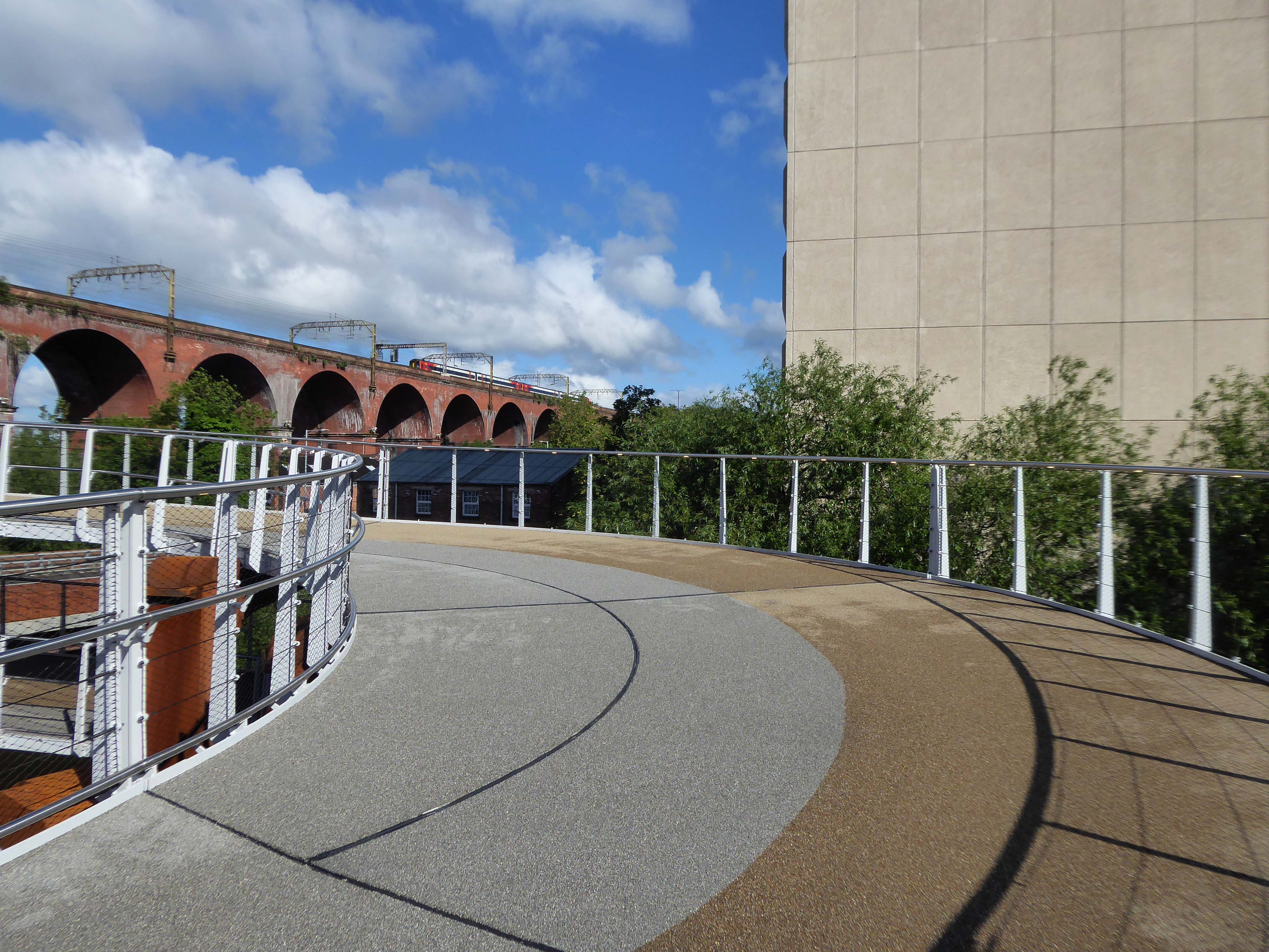
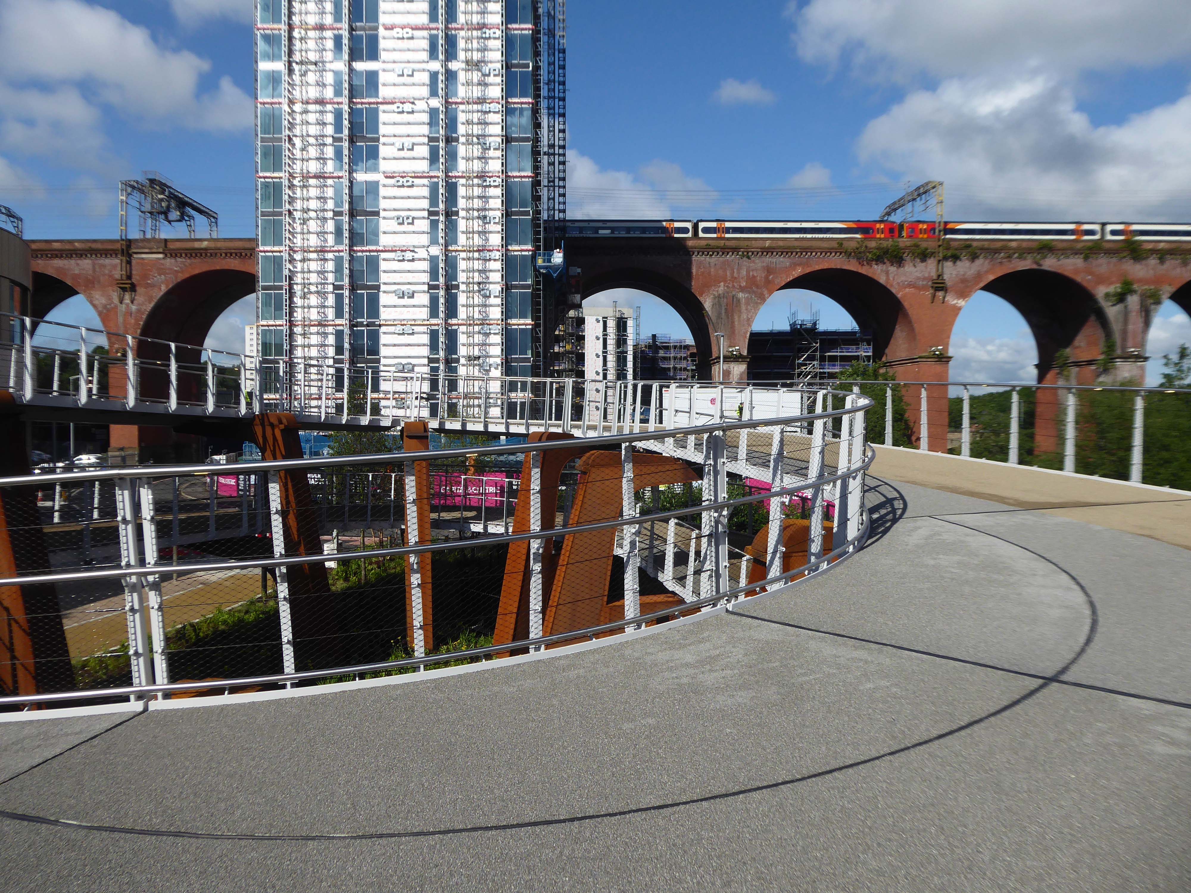
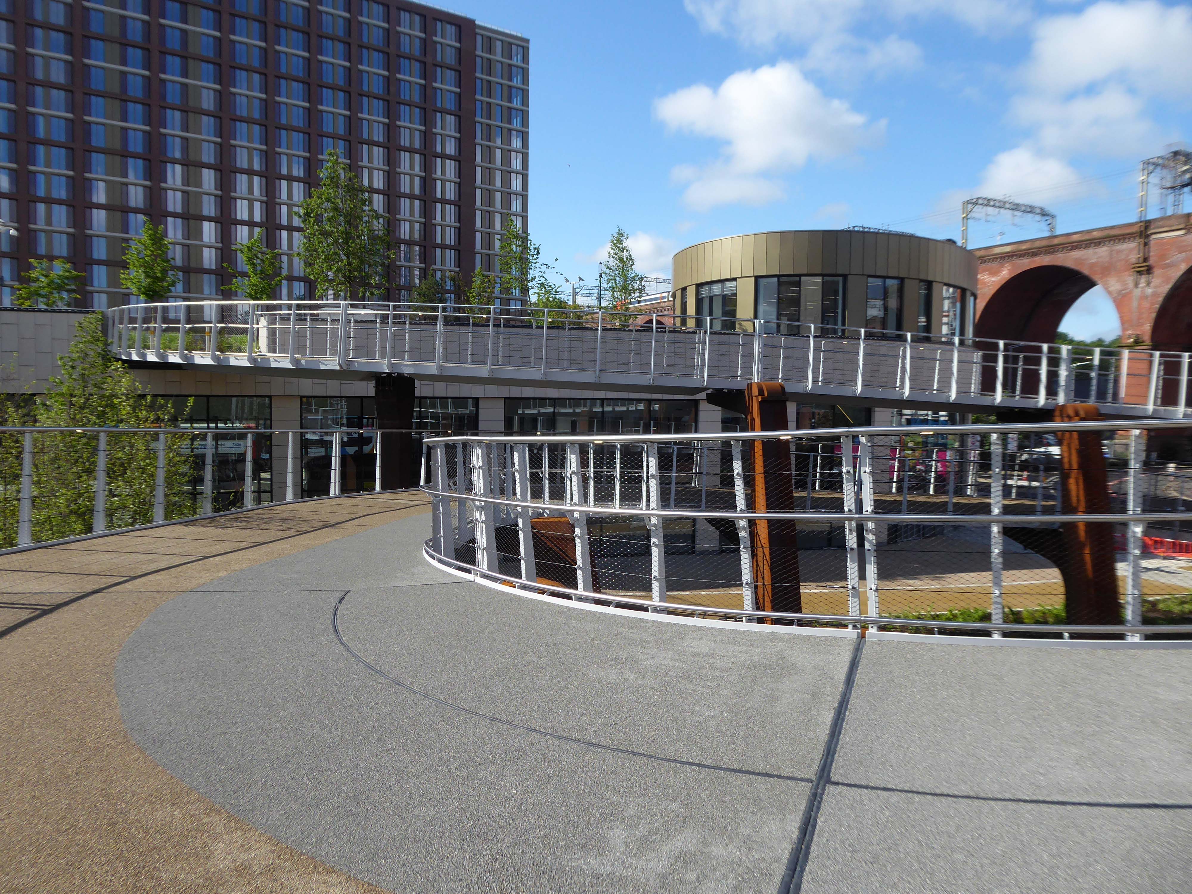
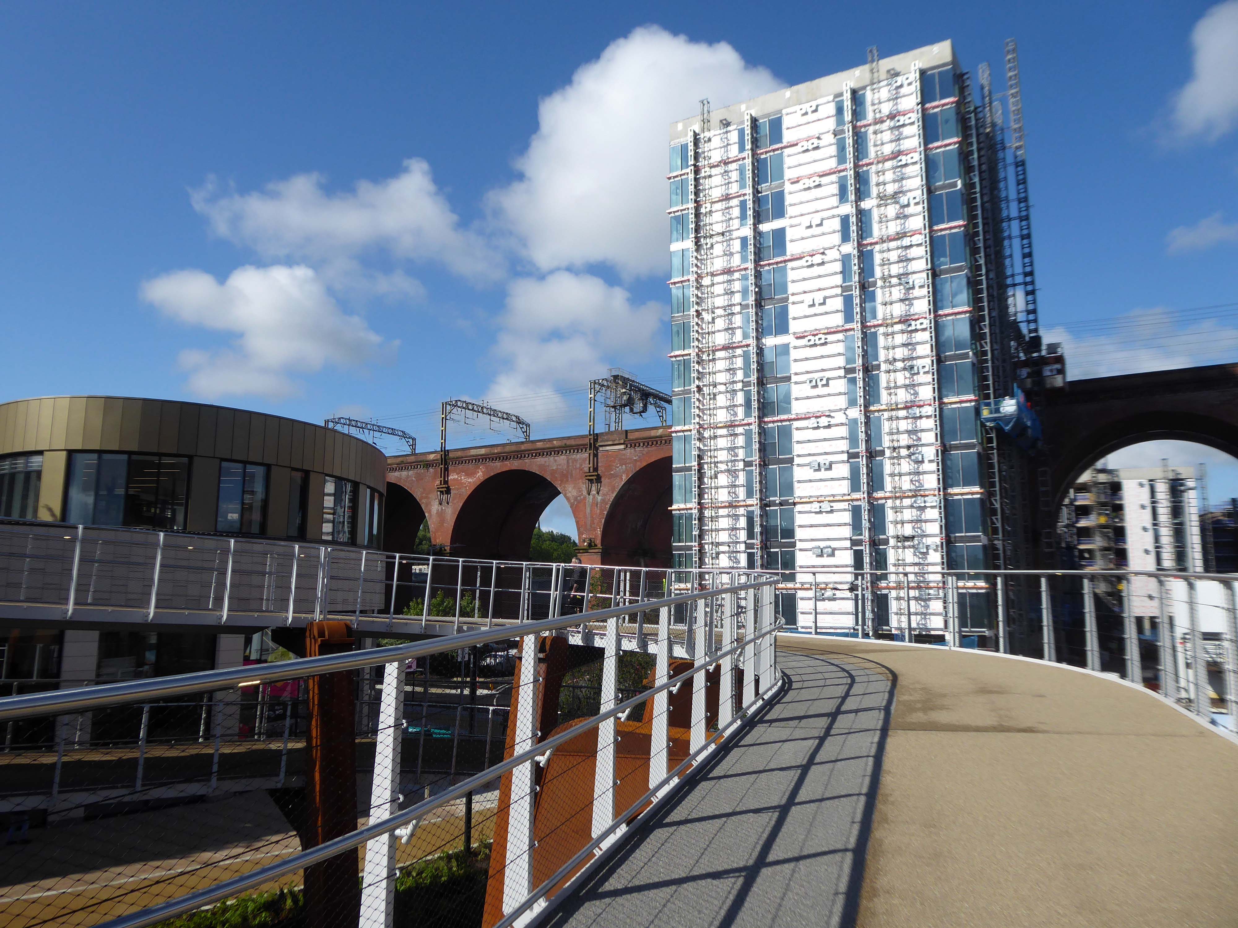
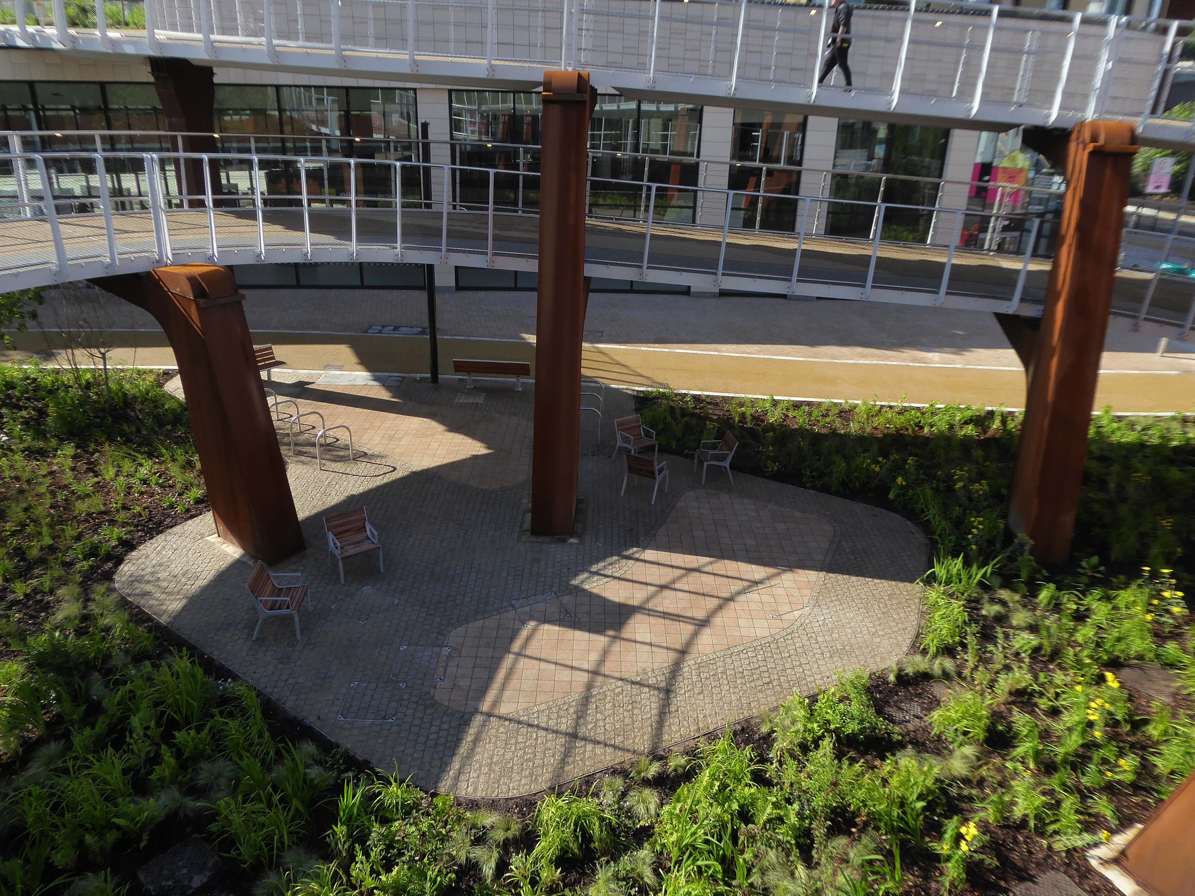
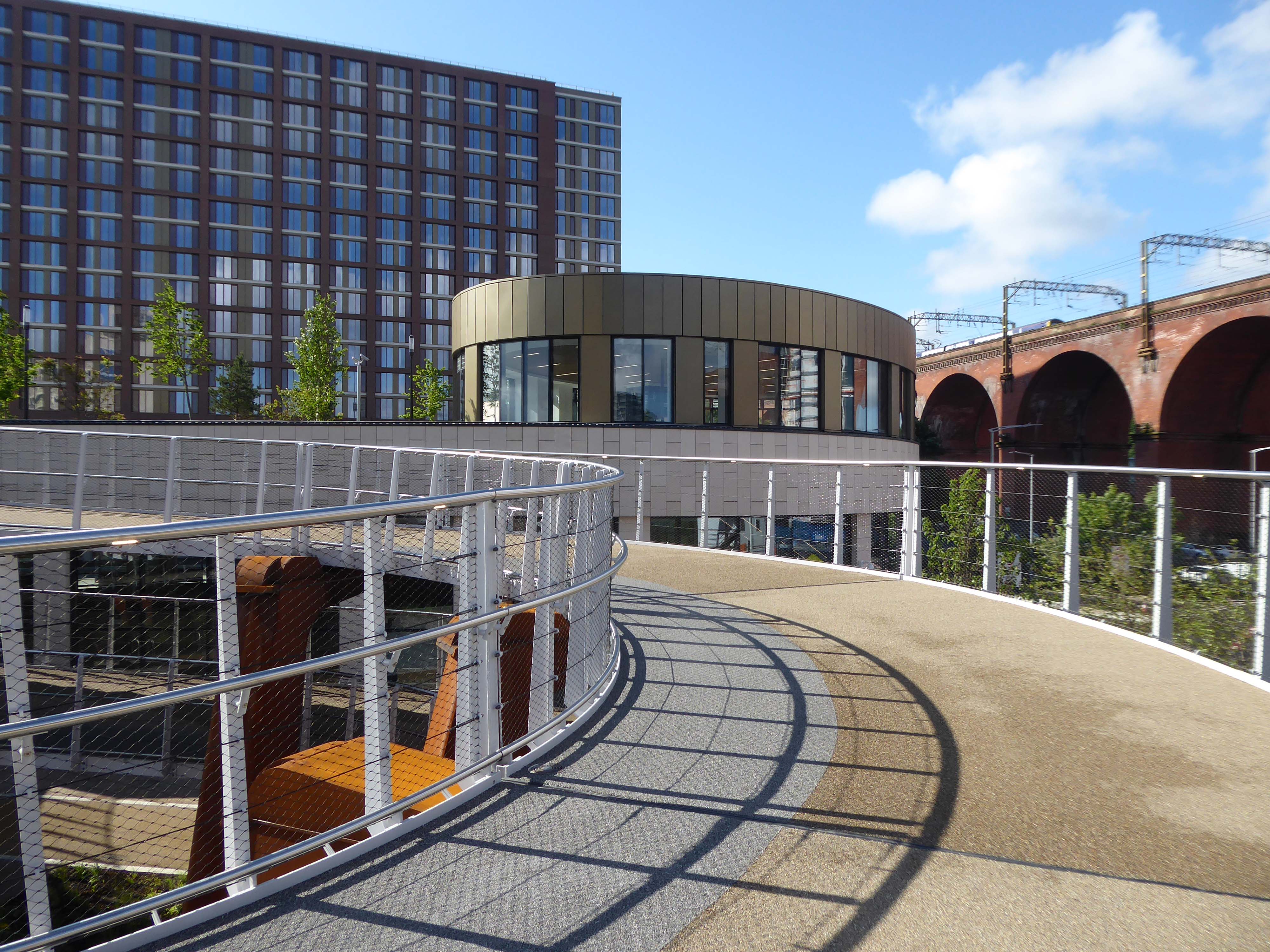
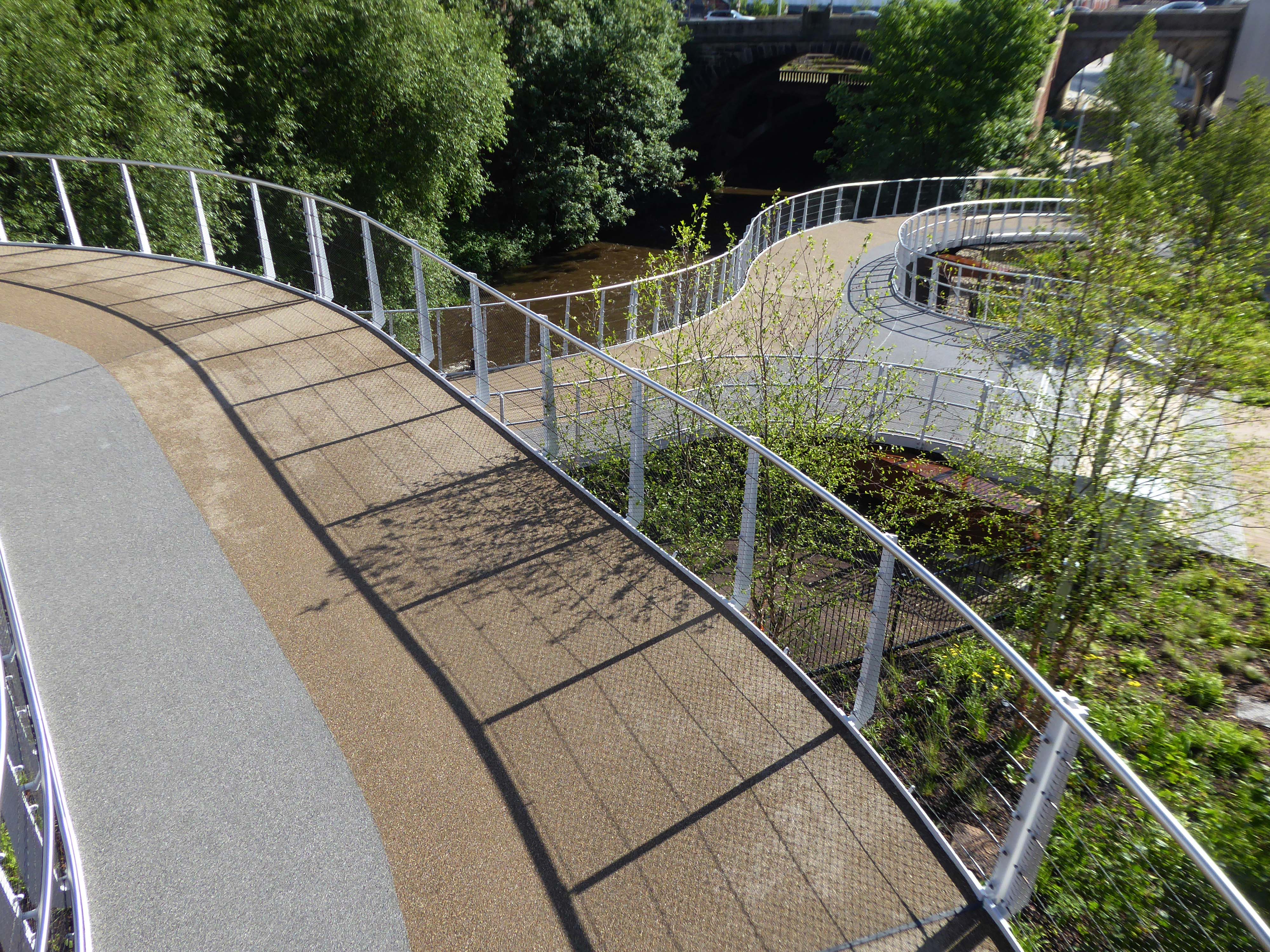
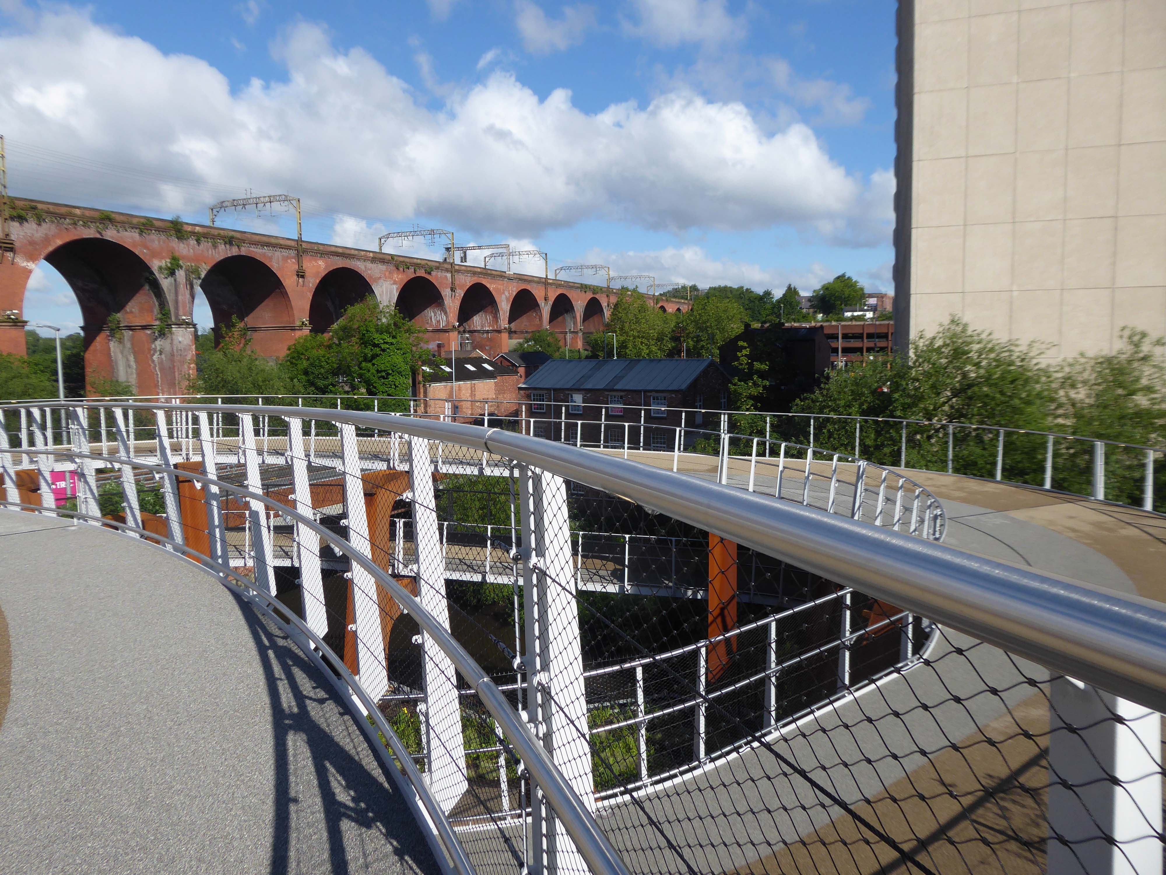
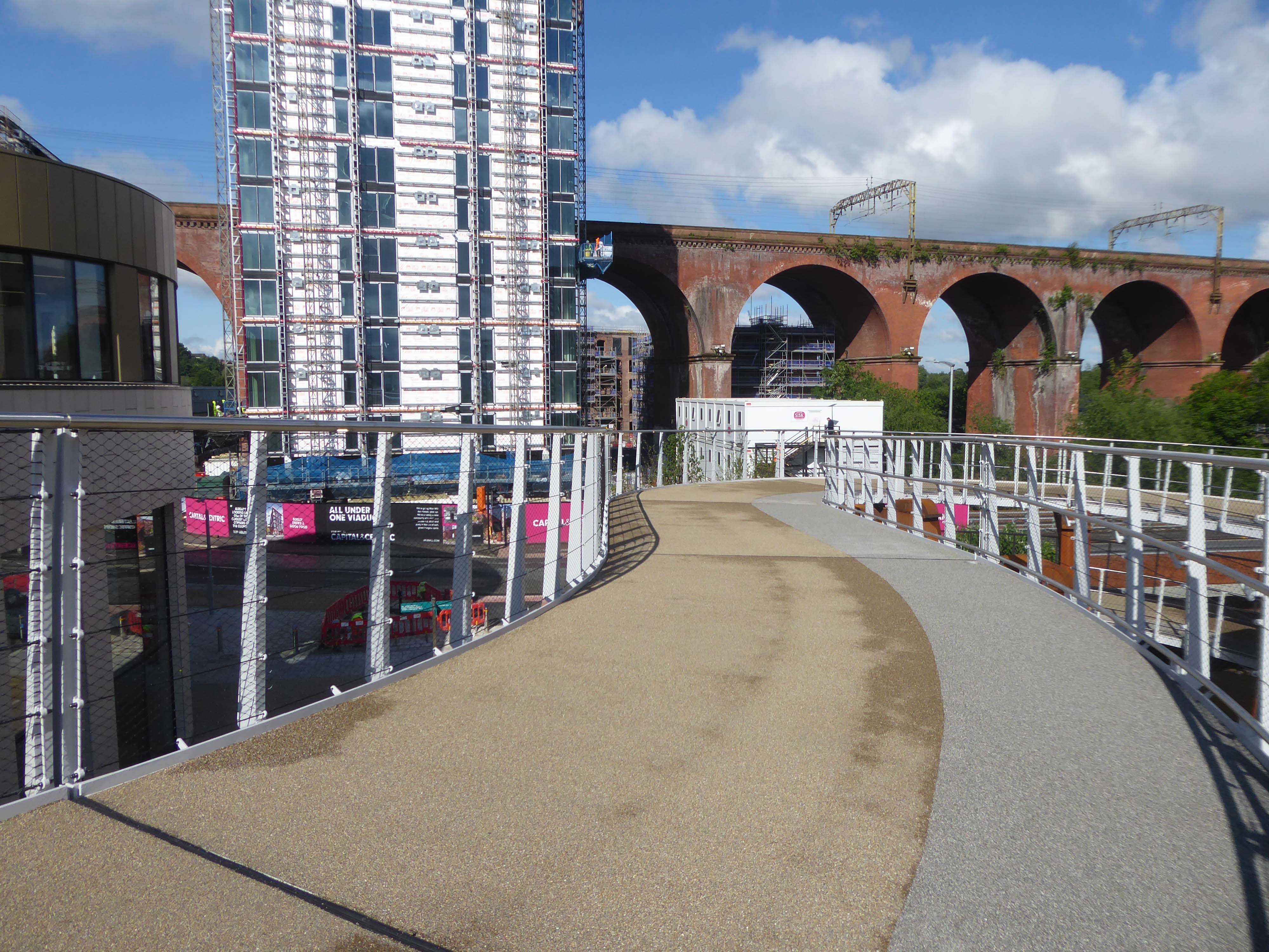
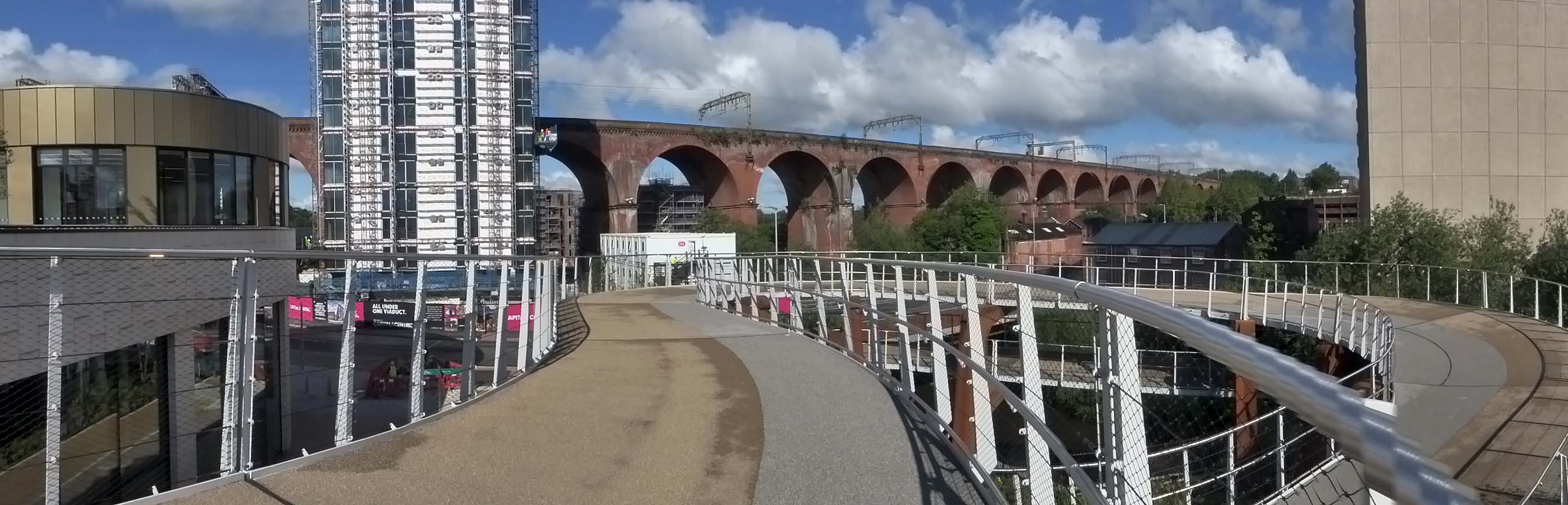
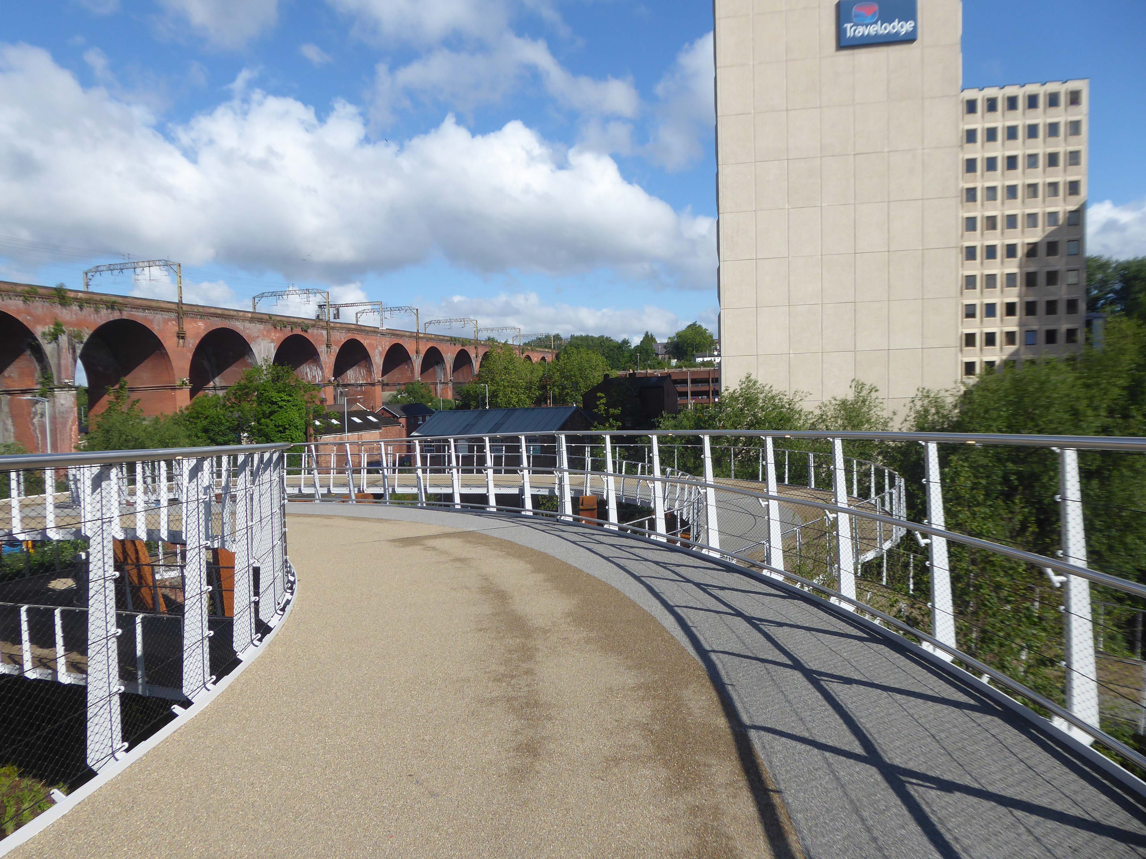
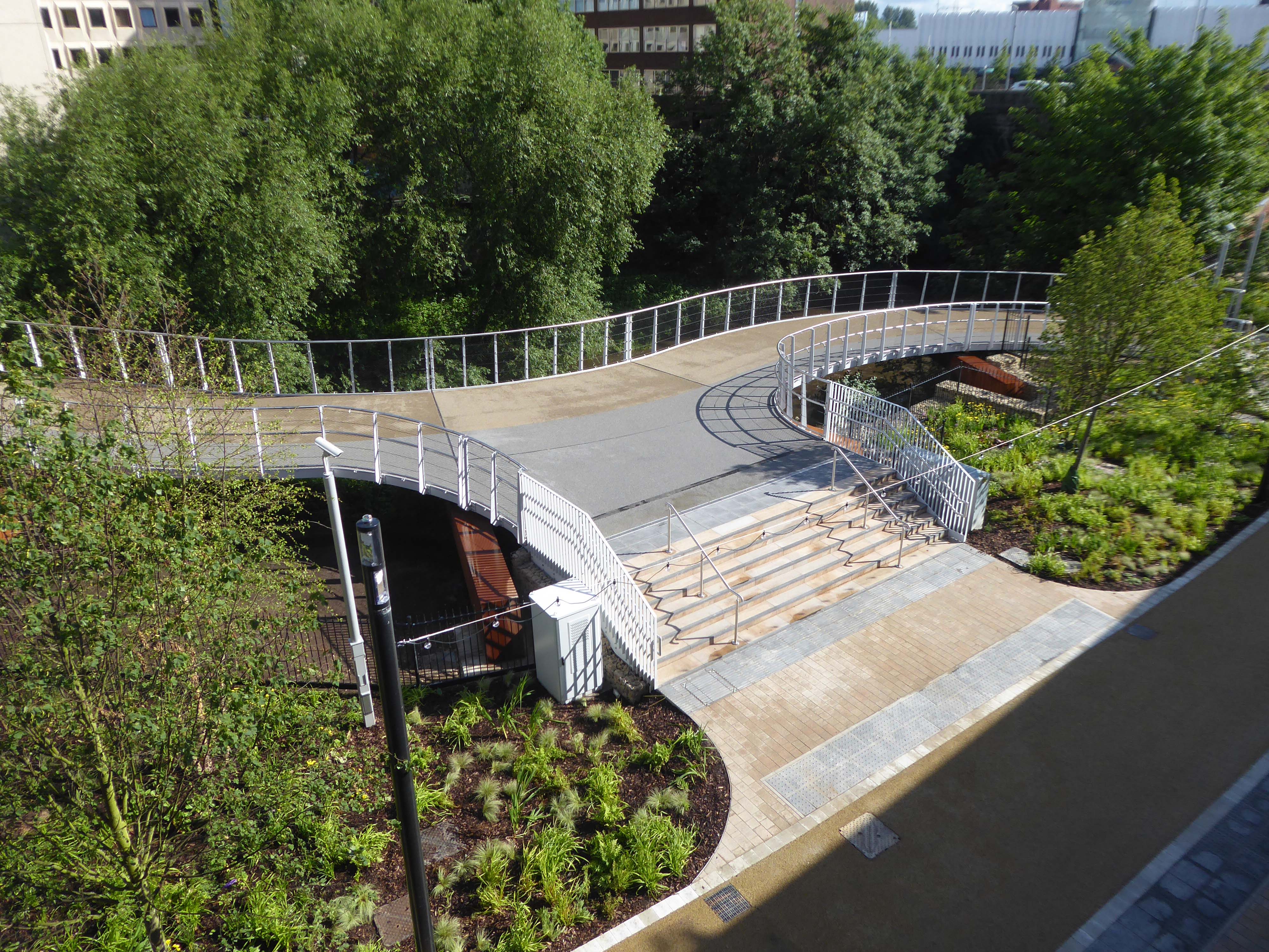
It’s now all grown up into a fully fledged transport interchange – with its very own pedestrian and cycling ramp.
The 189-metre ramp provides a seamless and accessible route to navigate the level change from the rooftop park to the river Mersey frontage, leading to the Trans Pennine Trail route.
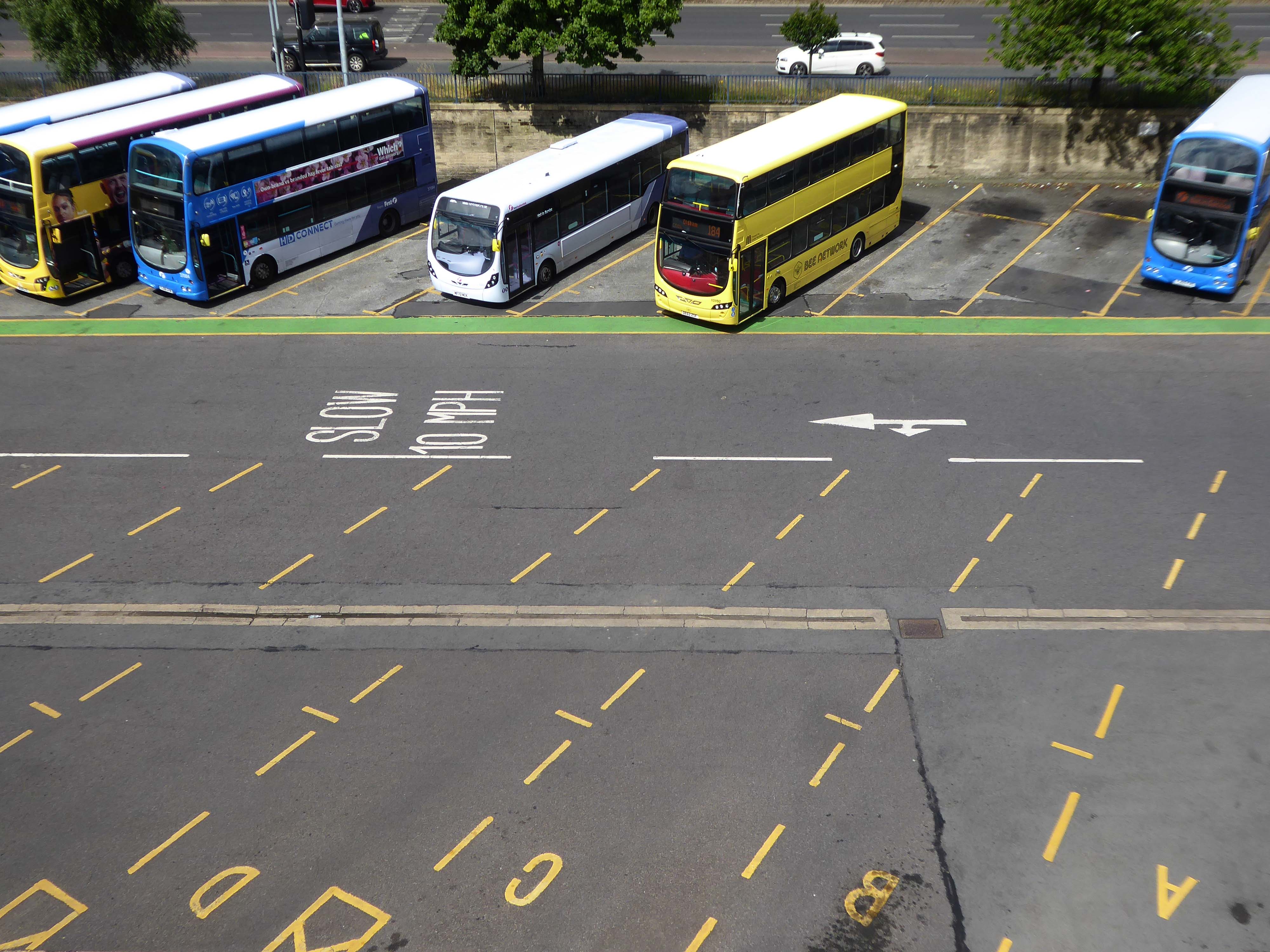
Forming part of the Stockport Interchange Mixed Use development scheme, and which also includes a new cycle and pedestrian link from Stockport rail station to the new park, as well as connecting the new facility to the wider Bee Network cycling and walking infrastructure, which is designed to encourage more people to make journeys on foot or by bike.