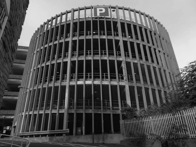
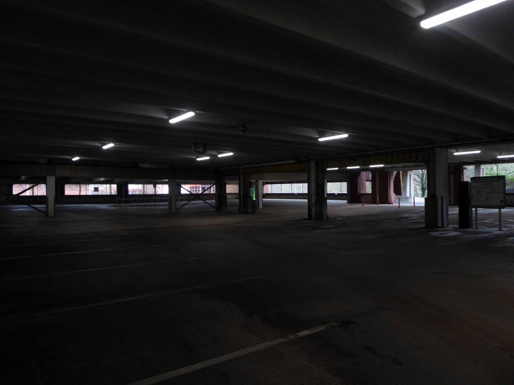
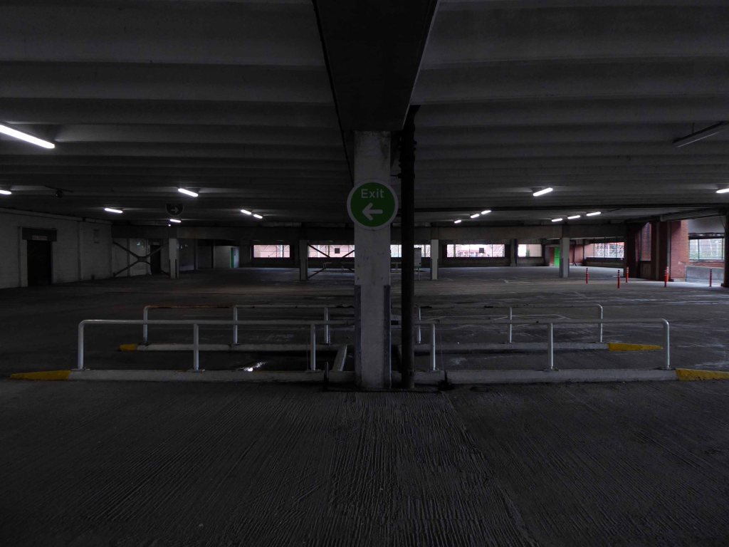
Tontine car park, the 255-space multi-storey car park in Exchange Street, St Helens, has been closed since February this year for a revamp.
This has seen a new lighting system, new signage and re-lined parking spaces installed throughout following an investment by St Helens Borough Council.
In a statement, the local authority said:
Old and failing pay on foot equipment has also been replaced with brand new pay and display machines which take cash.
St Helens Star 2020
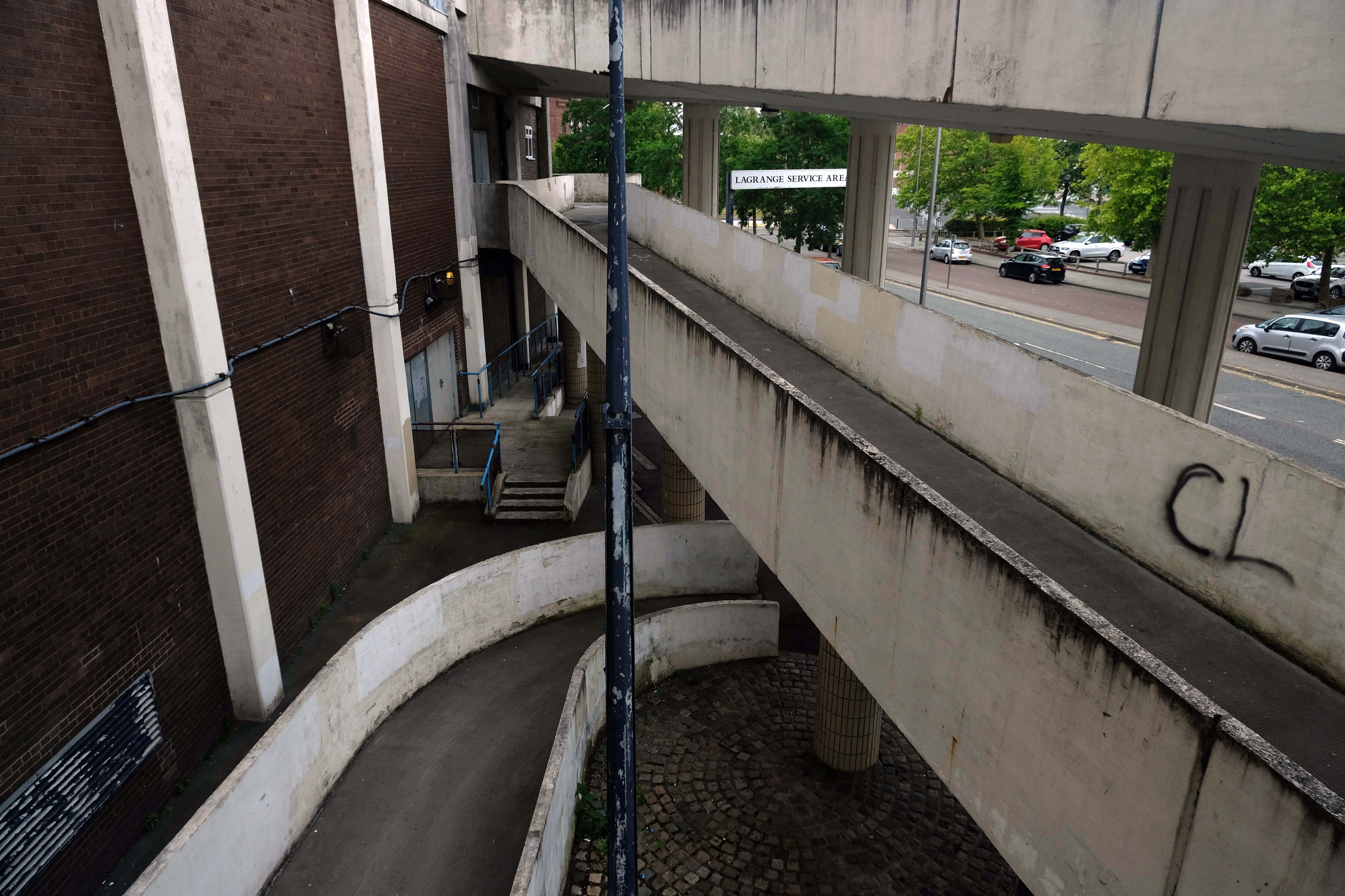
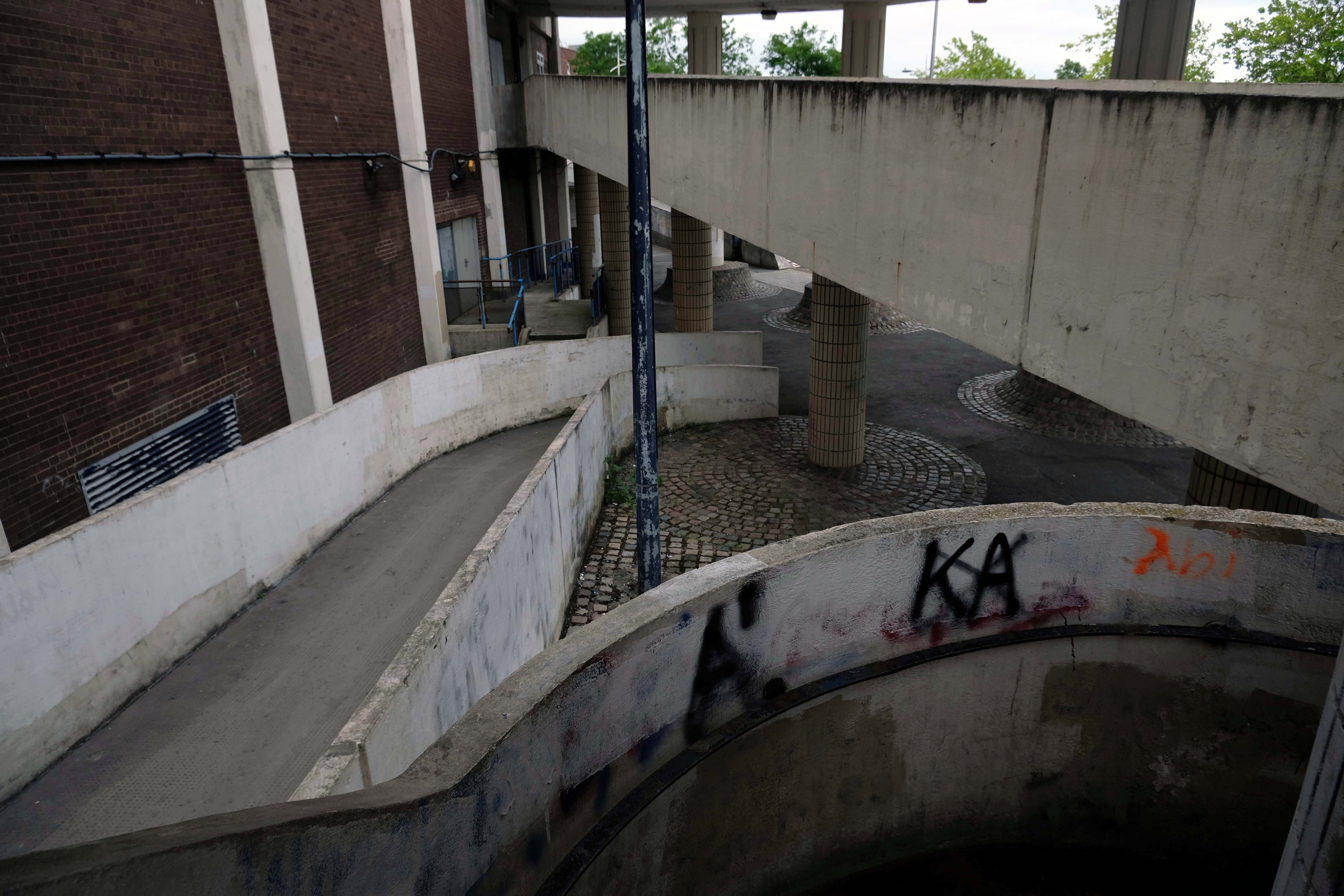
Well that there Bauhaus has a whole heap to answer for – with its curves and its concrete.
Influencing the sweeps and swoops of the car ramps and pedestrian walkways.
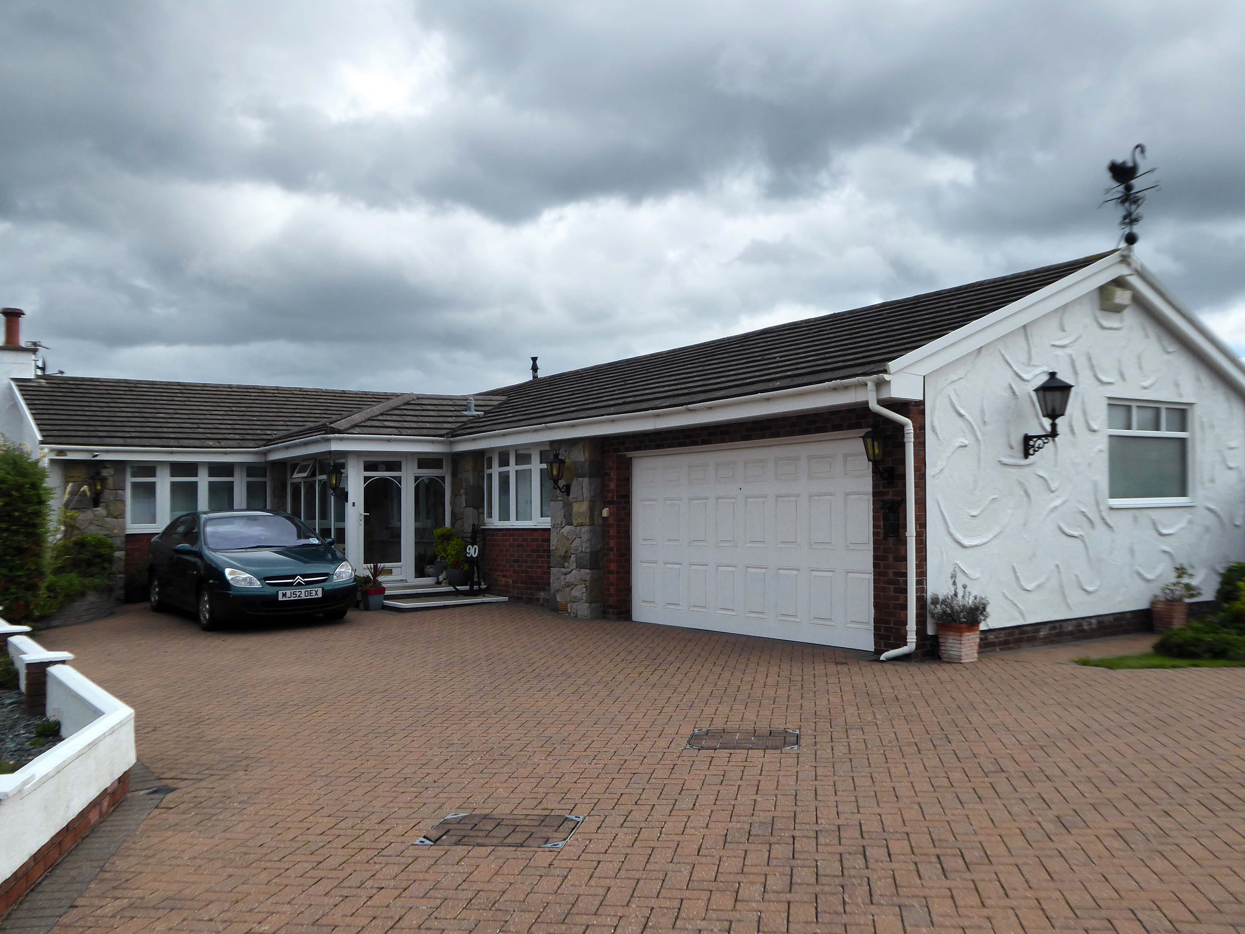
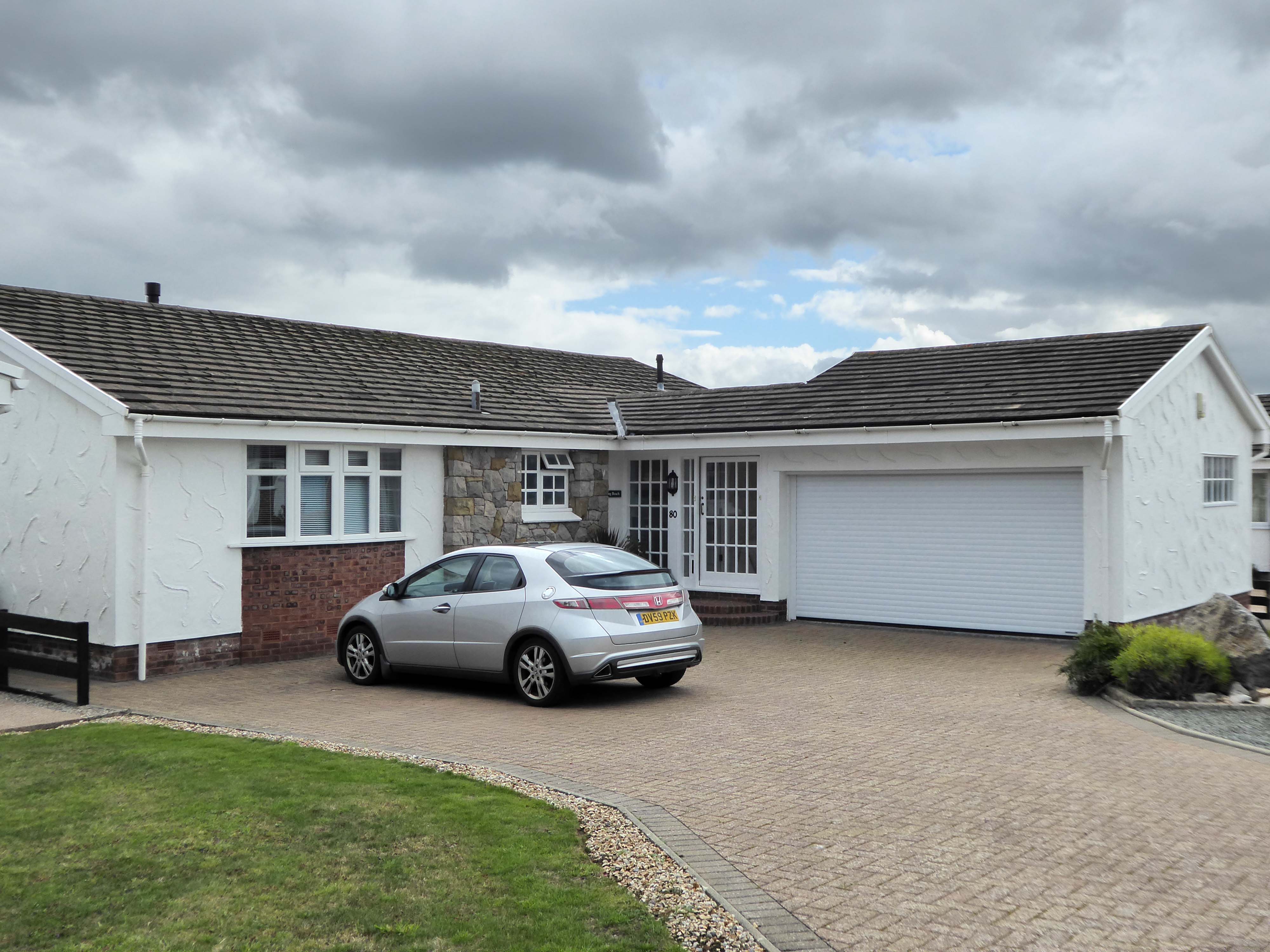
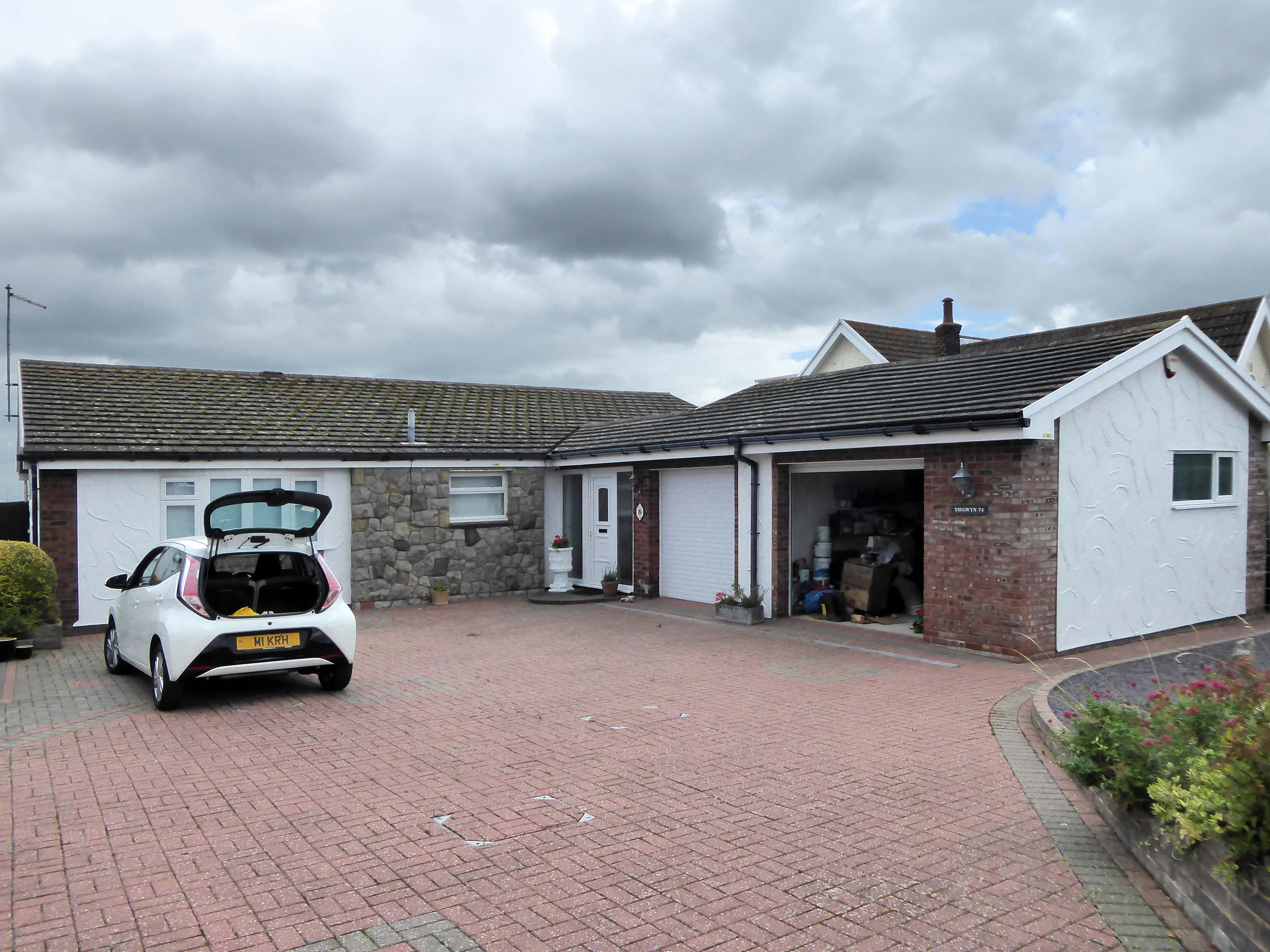
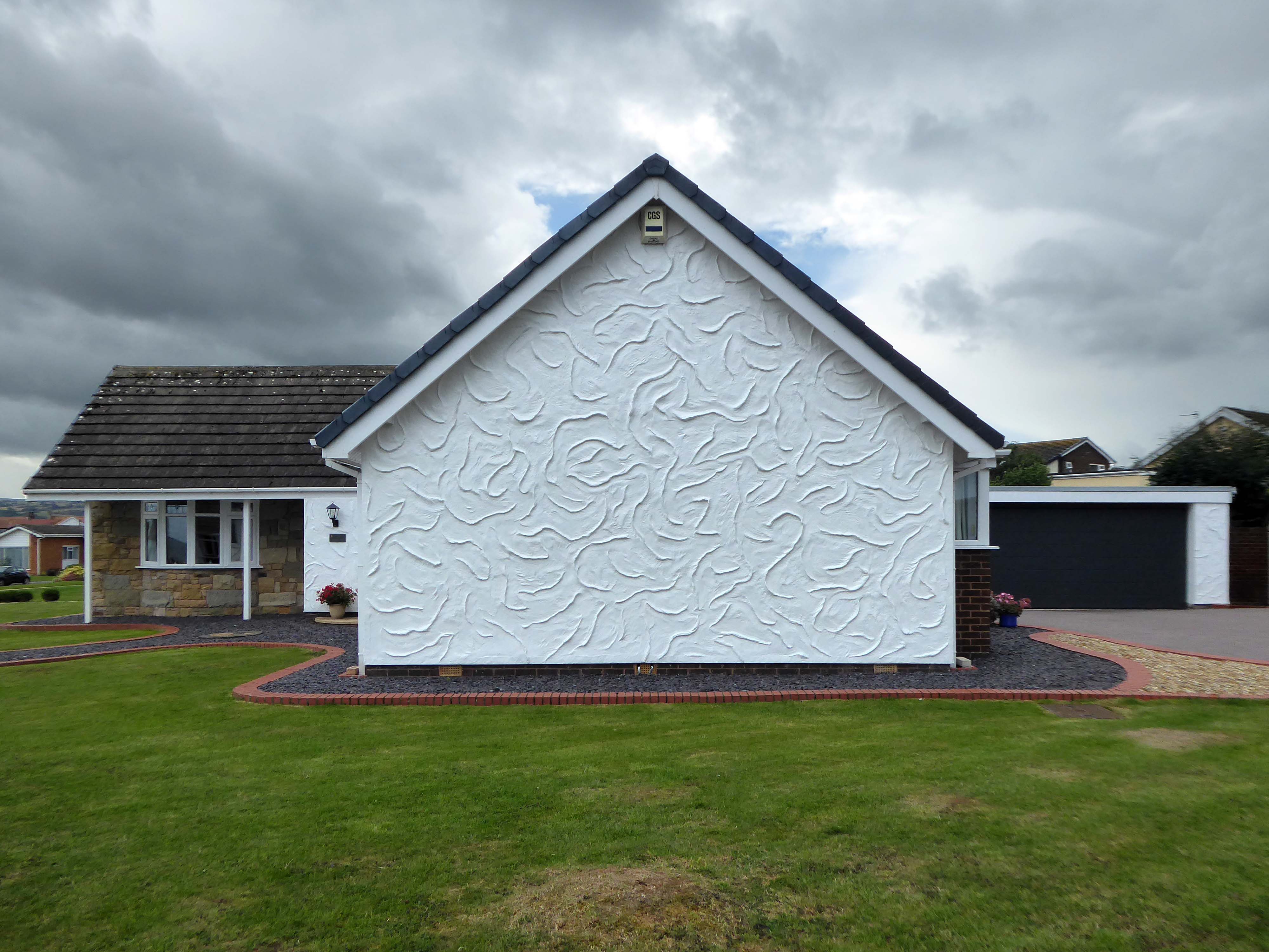
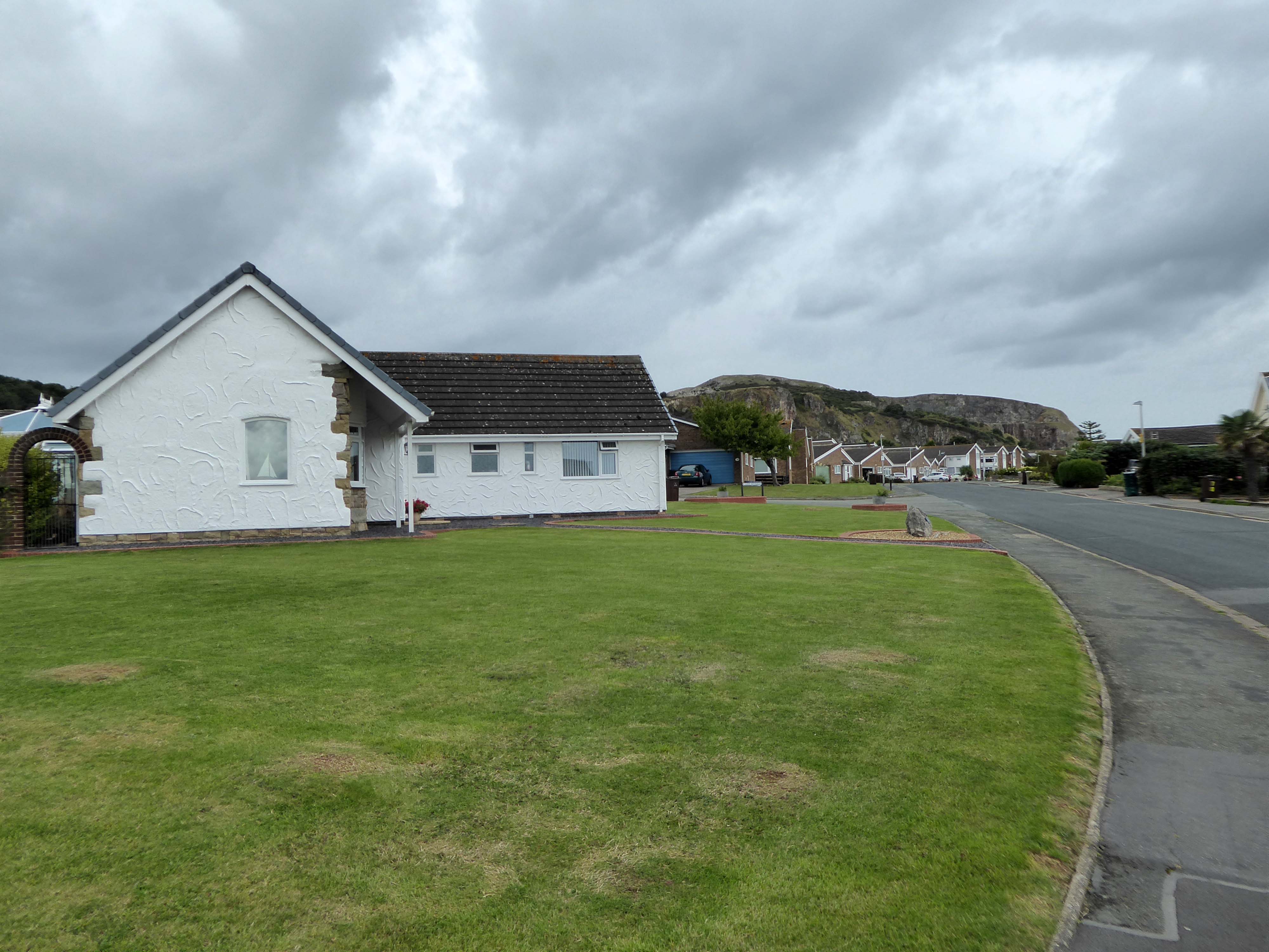
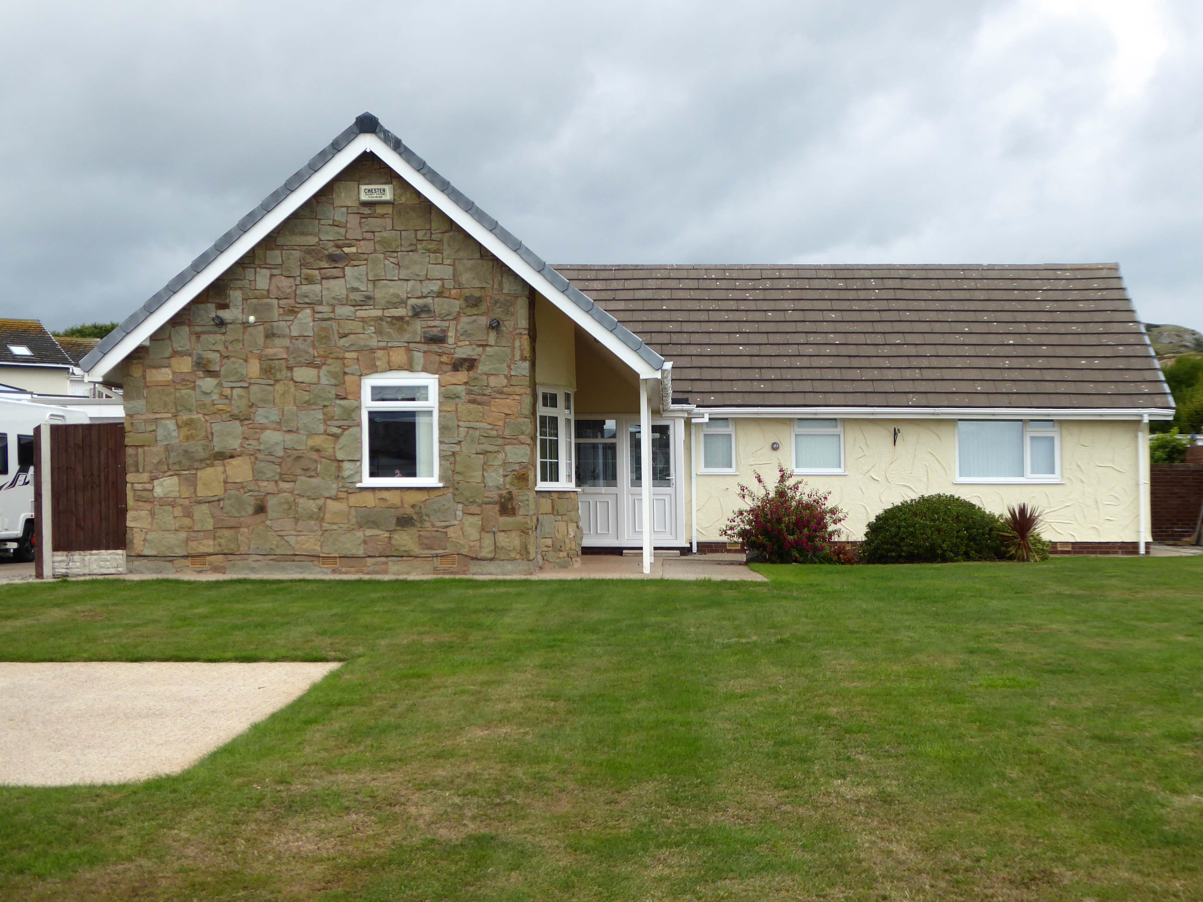
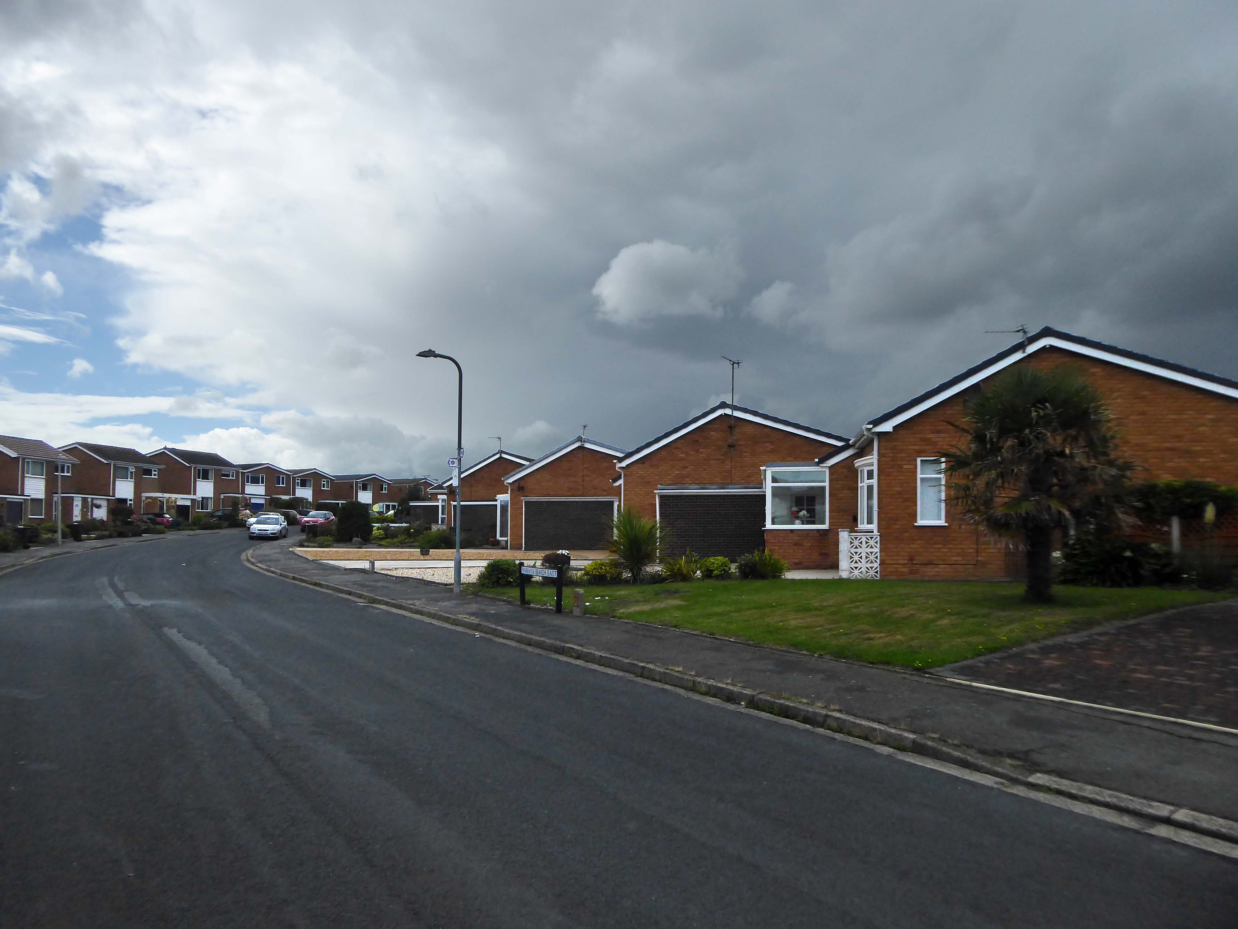
I have to admit that I’m fascinated by the manicured homes of this long sweep of road reaching from the base of the Little Orme.
It was fascination, I know And it might have ended right then, at the start Just a passing glance, just a brief romance And I might have gone on my way, empty hearted
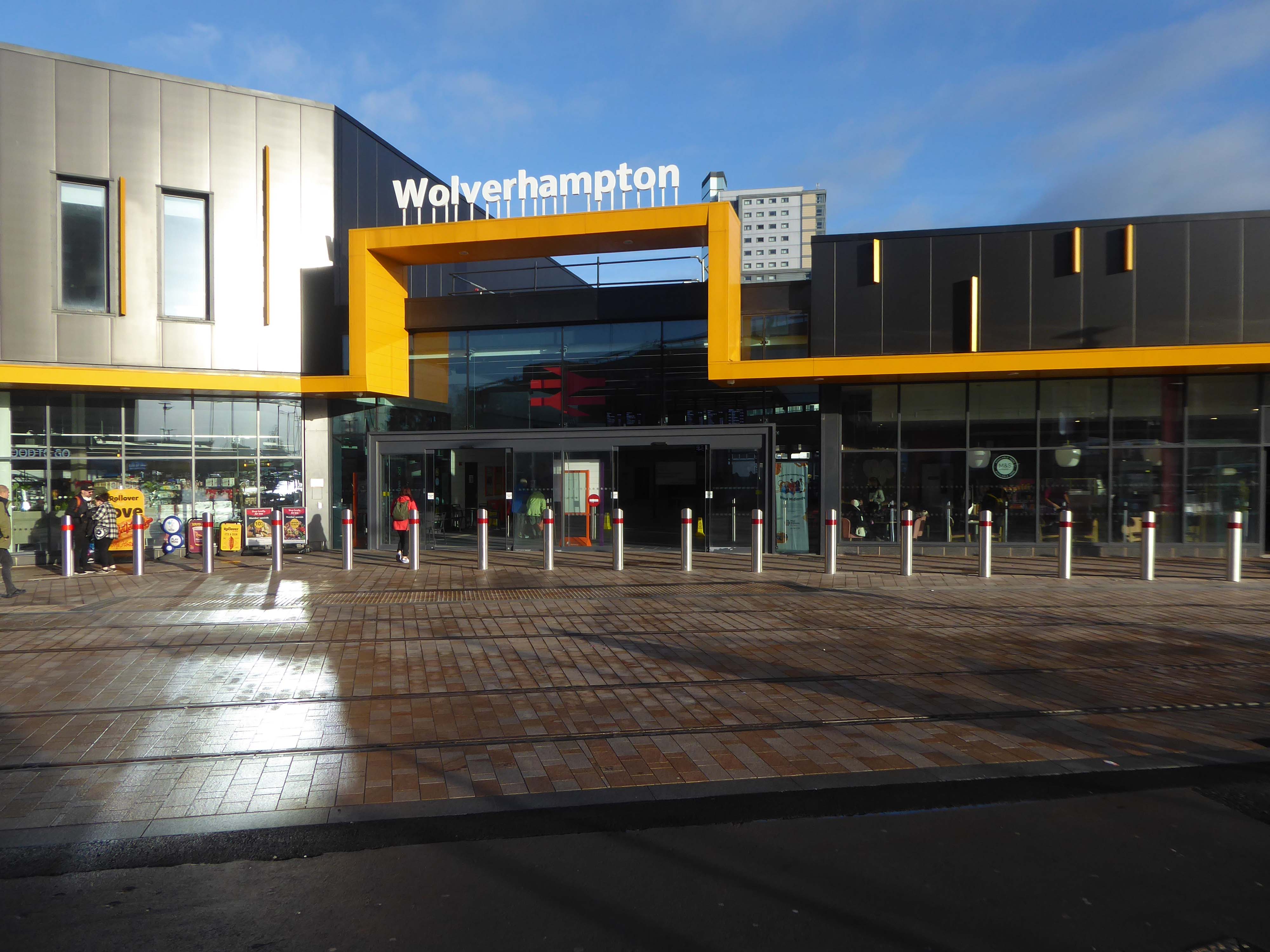
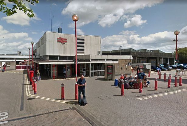
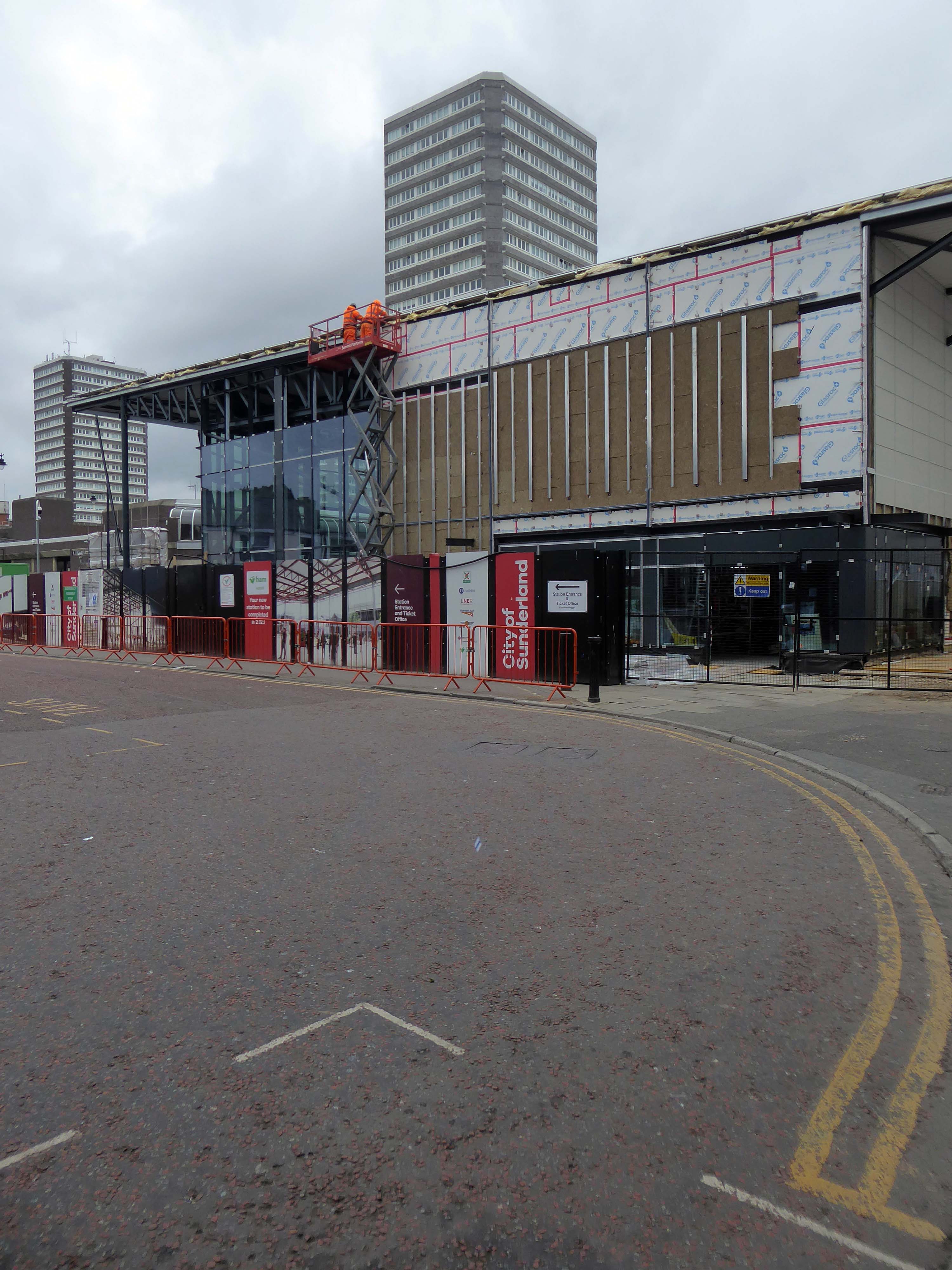
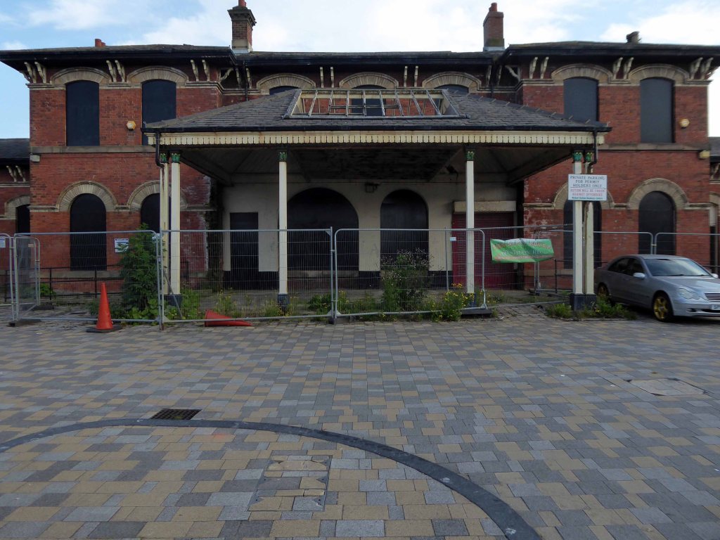
We begin at the Railway Station – recently refurbished, overwriting its 60s iteration – completely rebuilt by the architect Ray Moorcroft as part of the modernisation programme which saw the West Coast Main Line electrified.
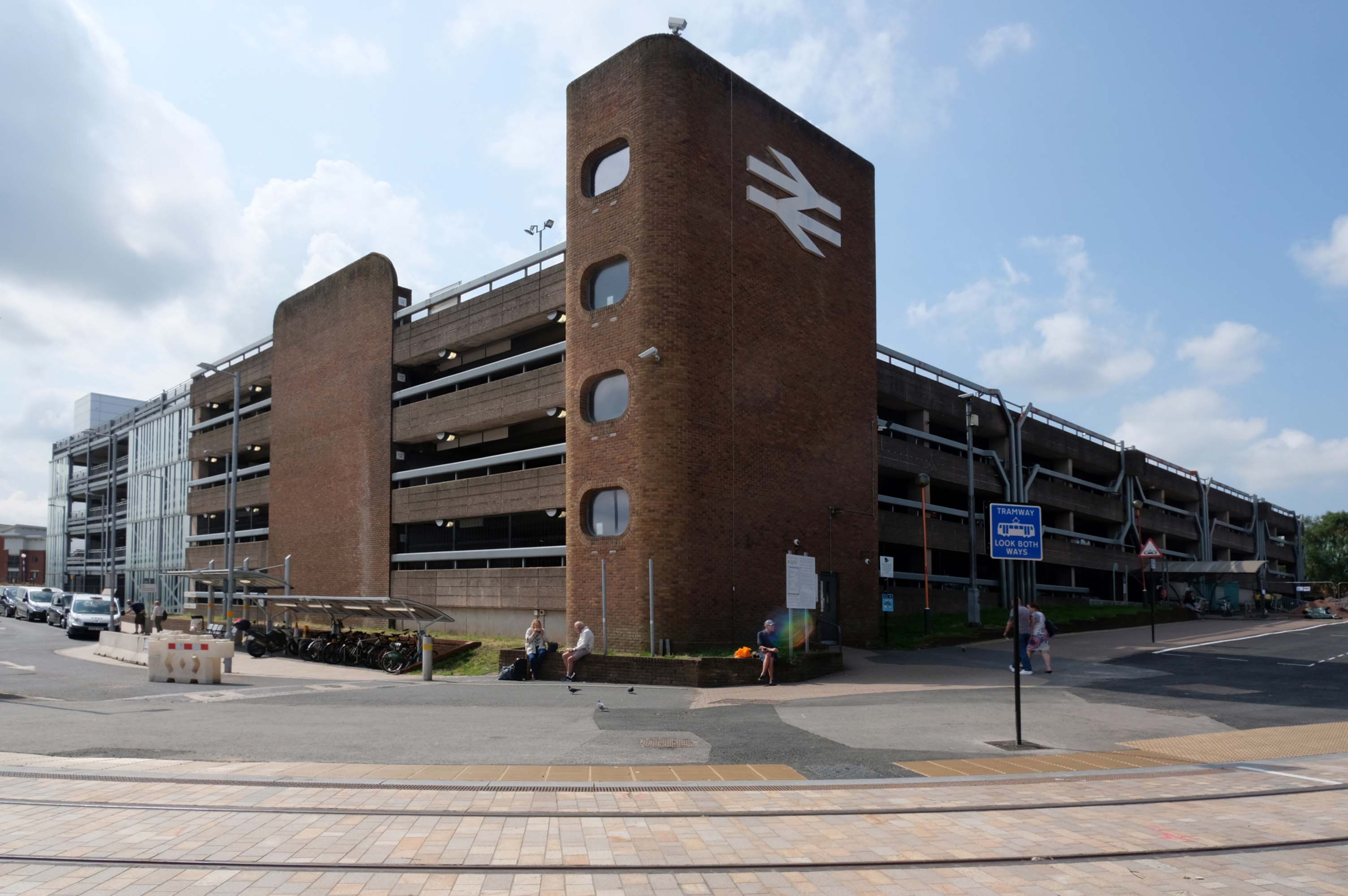
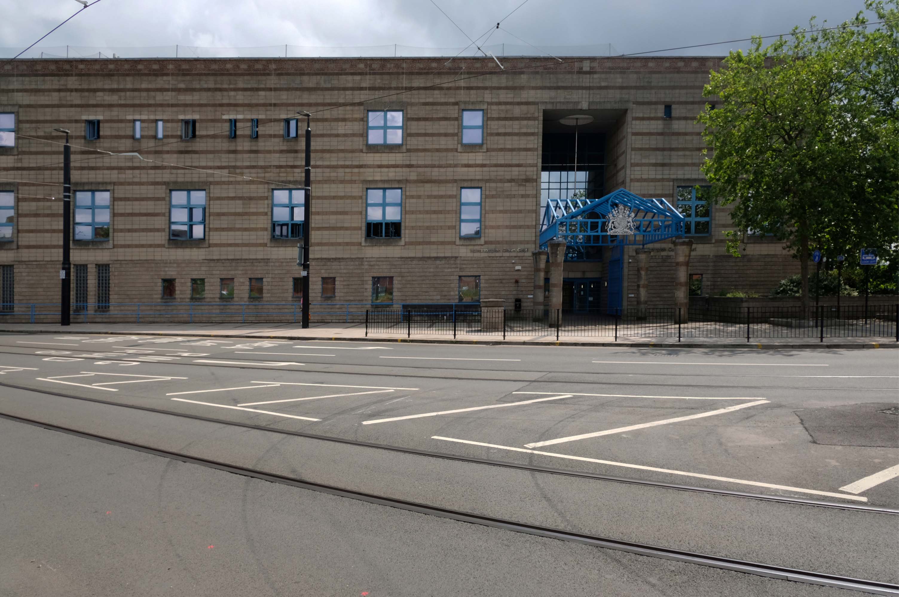
Across the way an enormous brick clad multi-storey car park – skirted by the lines for the tram, which travels to and from Birmingham.
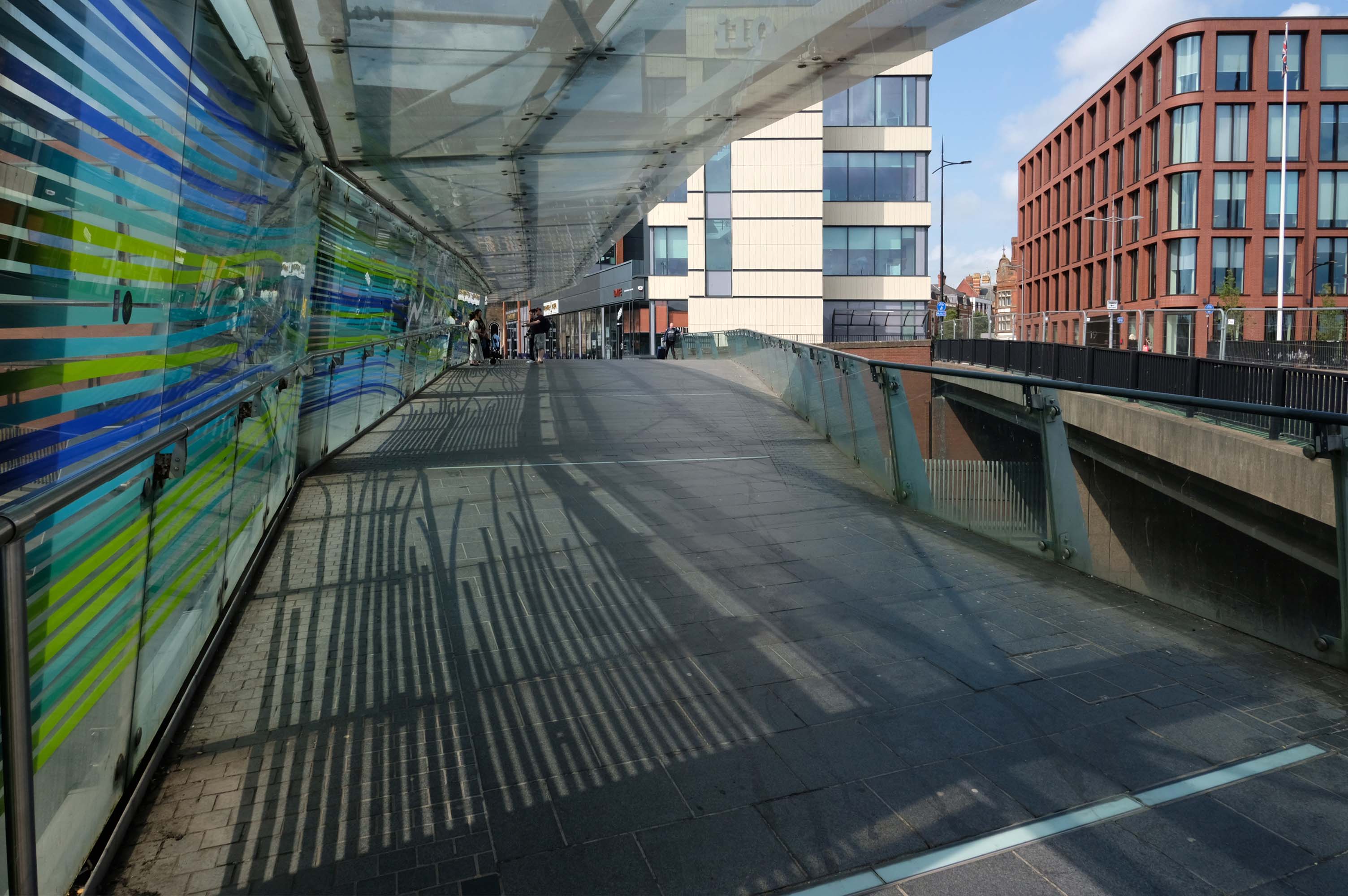
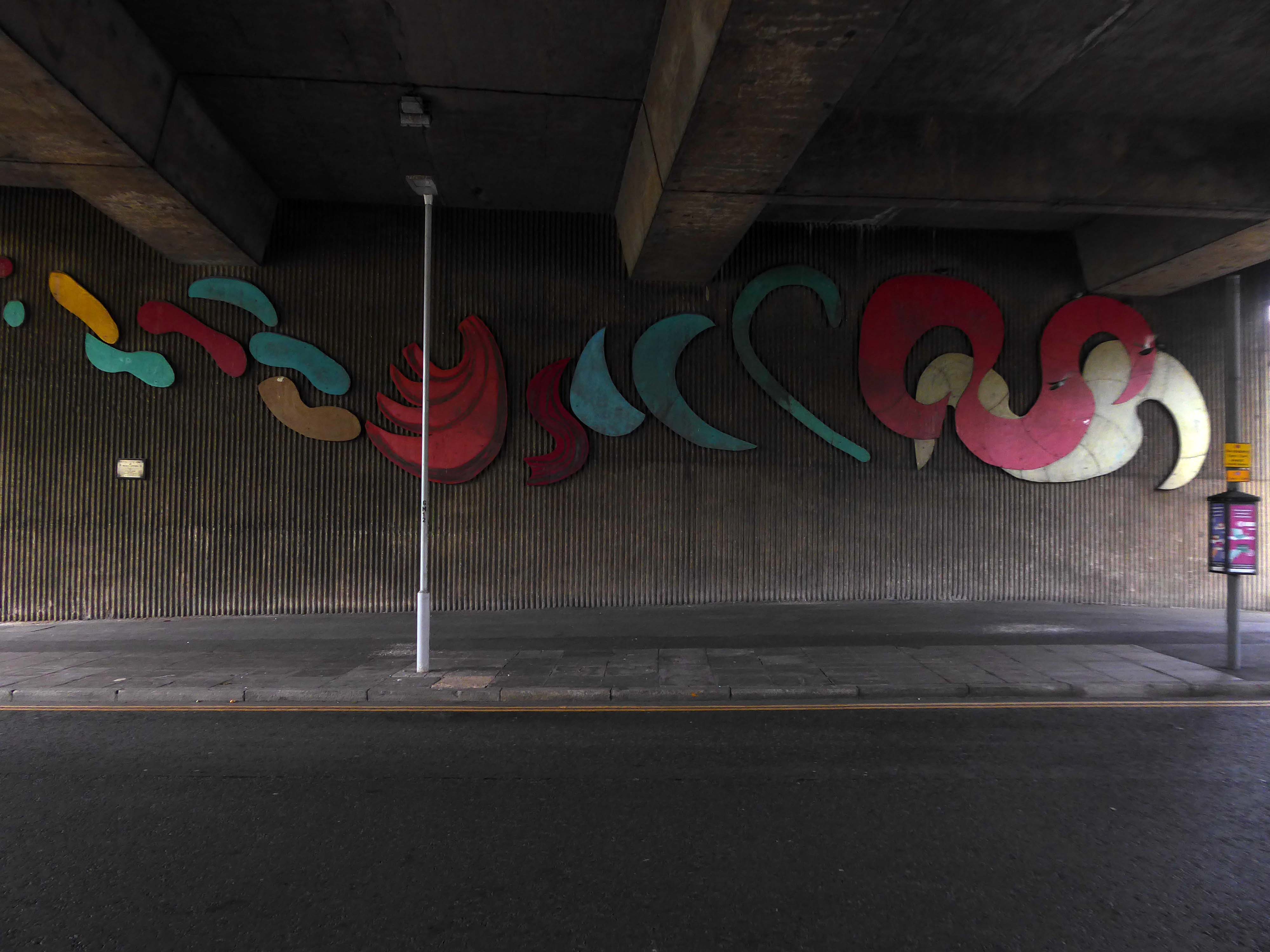
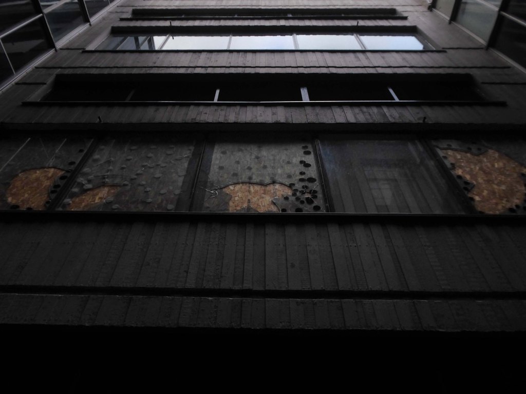
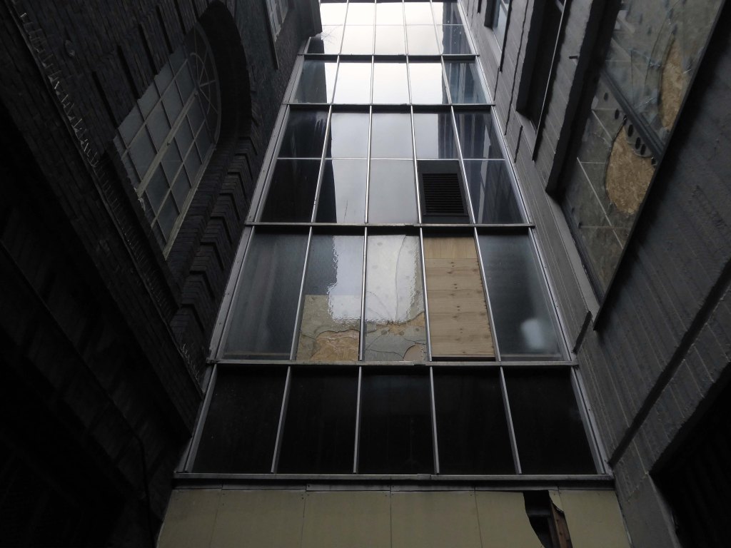
Walk across the brand new pedestrian footbridge over the ring road.
Architectural glass artist Kate Maestri was commissioned to produce the artwork design which features glass with blue and green strips of colour running through it.
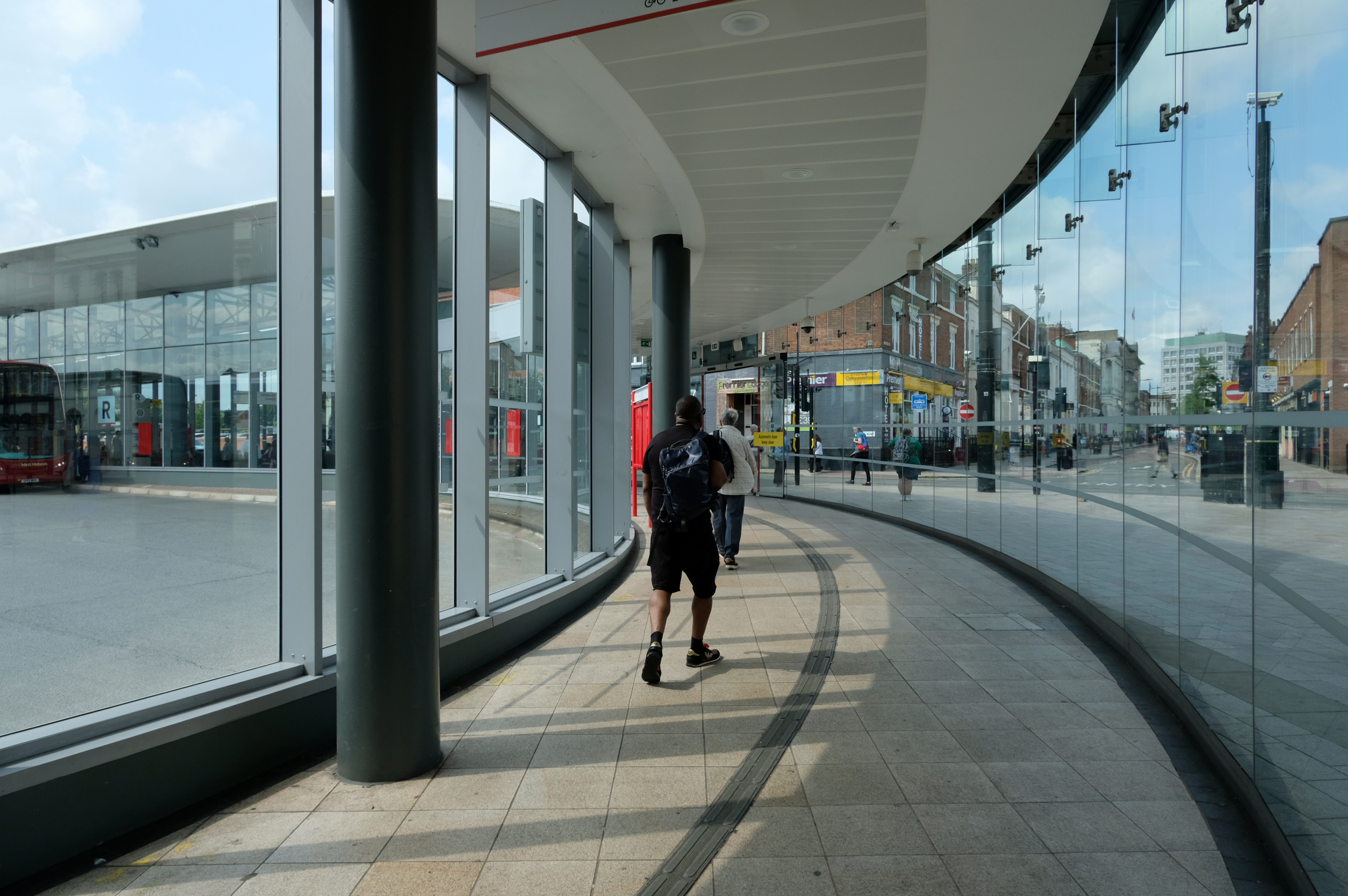
Linking the Rail Station with the brand new Bus Station.
The normal practice of the Wolverhampton Bus Service is to have dirty, smelly buses, that are cramped and extremely hot in the summer and freezing cold in winter. They offer no announcements apologizing for delays they know about and don’t appear to care how long passengers wait with no idea of how or when they’ll be getting a bus.
The best thing you can do is learn to drive as quickly as possible and get your own vehicle or car pool.
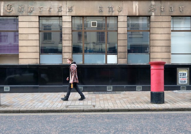
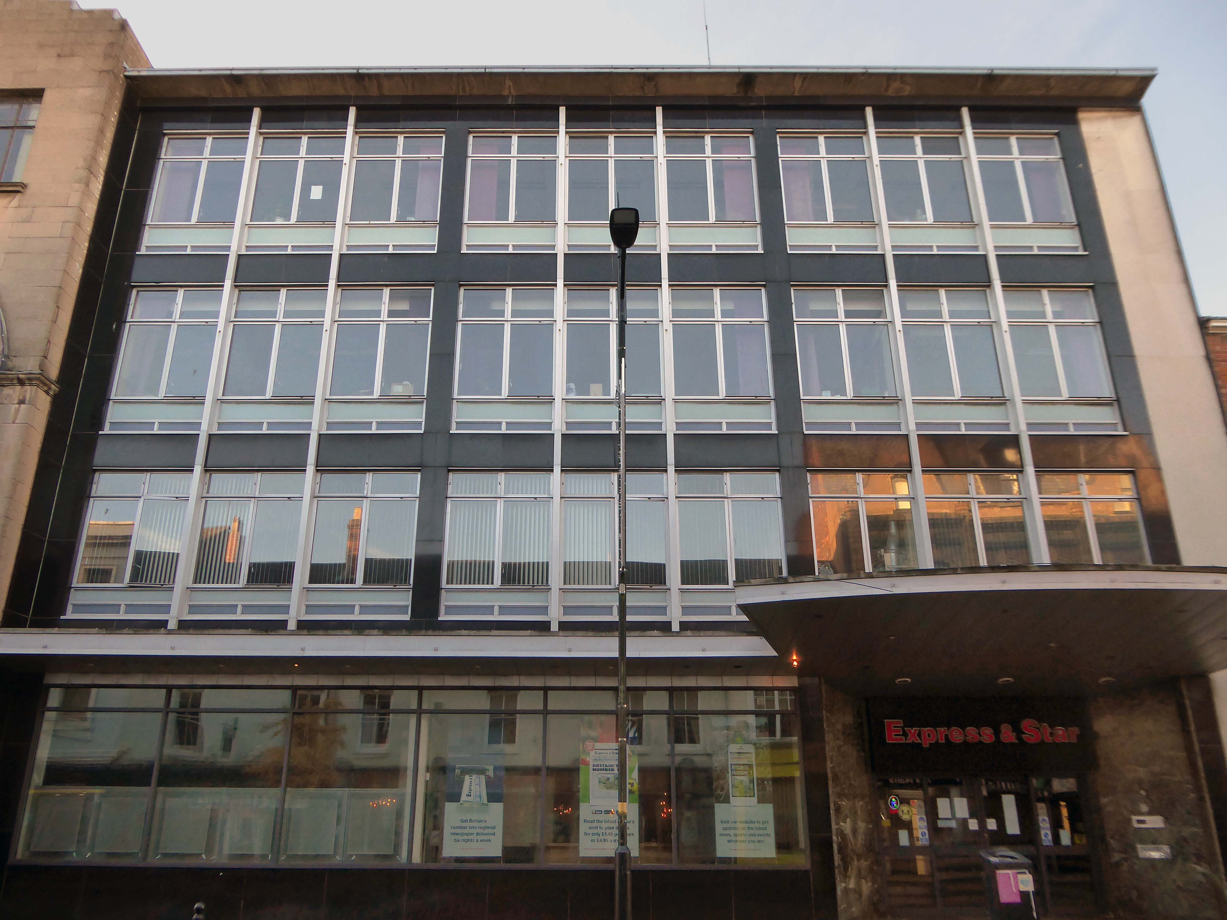
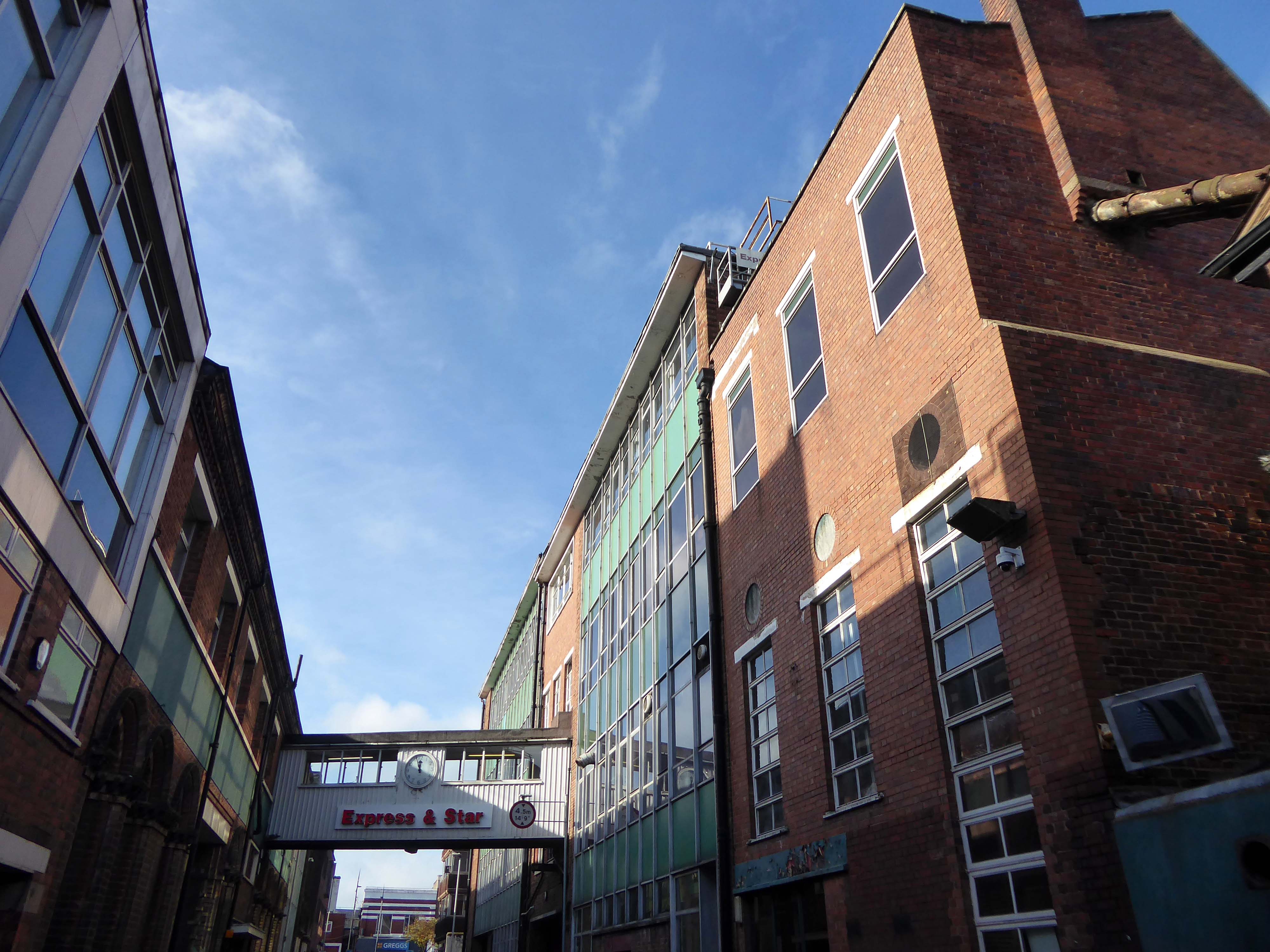
Midland News Association managing director Matt Ross confirmed the company is now looking at the building’s future.
For a number of years we have been exploring opportunities surrounding our historic Express & Star offices in the heart of Wolverhampton.
After removing the printing presses from the site and restructuring our departments we now have significant spare capacity available and so are looking at the various options available to us, be that redeveloping the current site or exiting the building altogether.
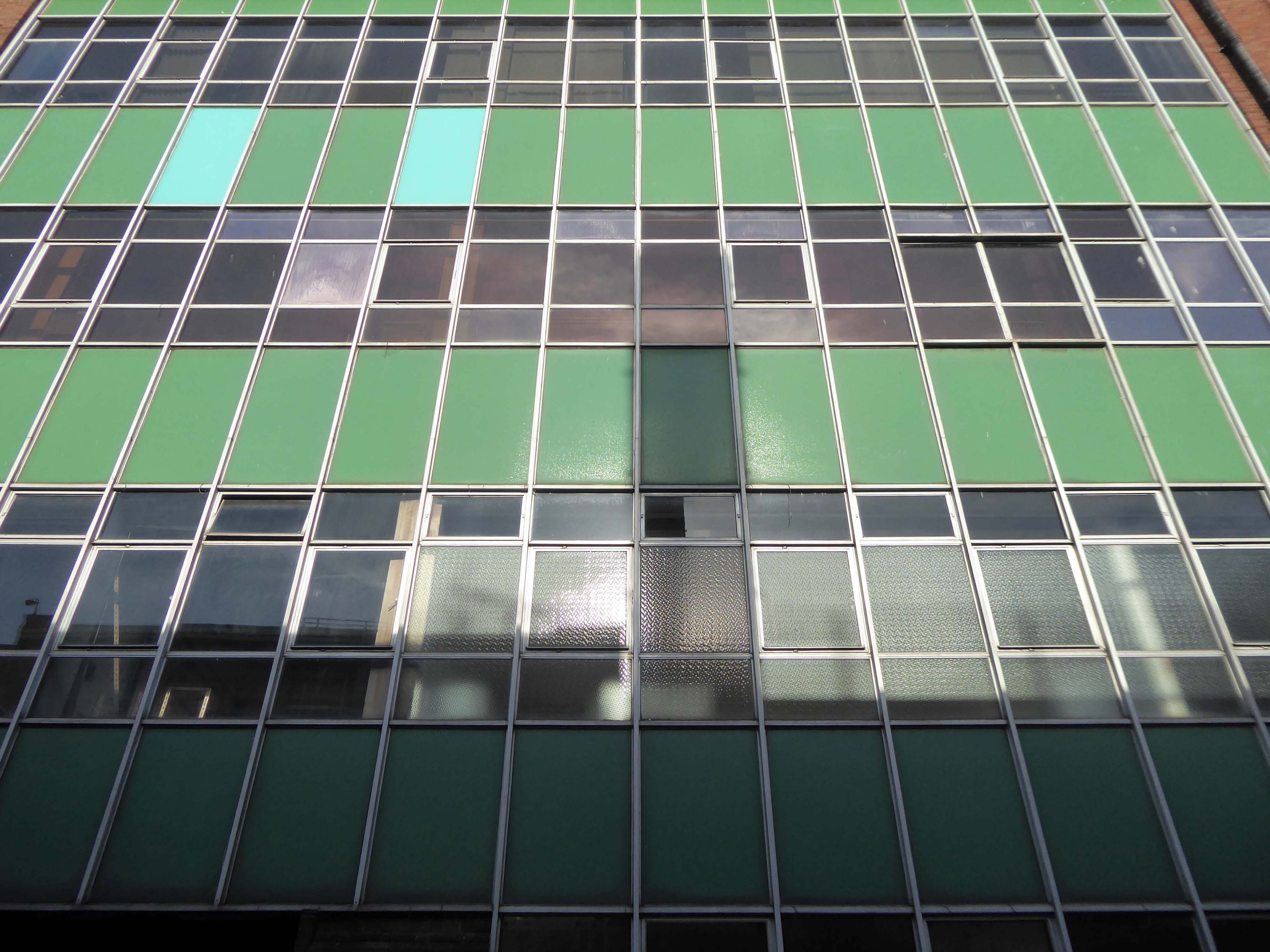
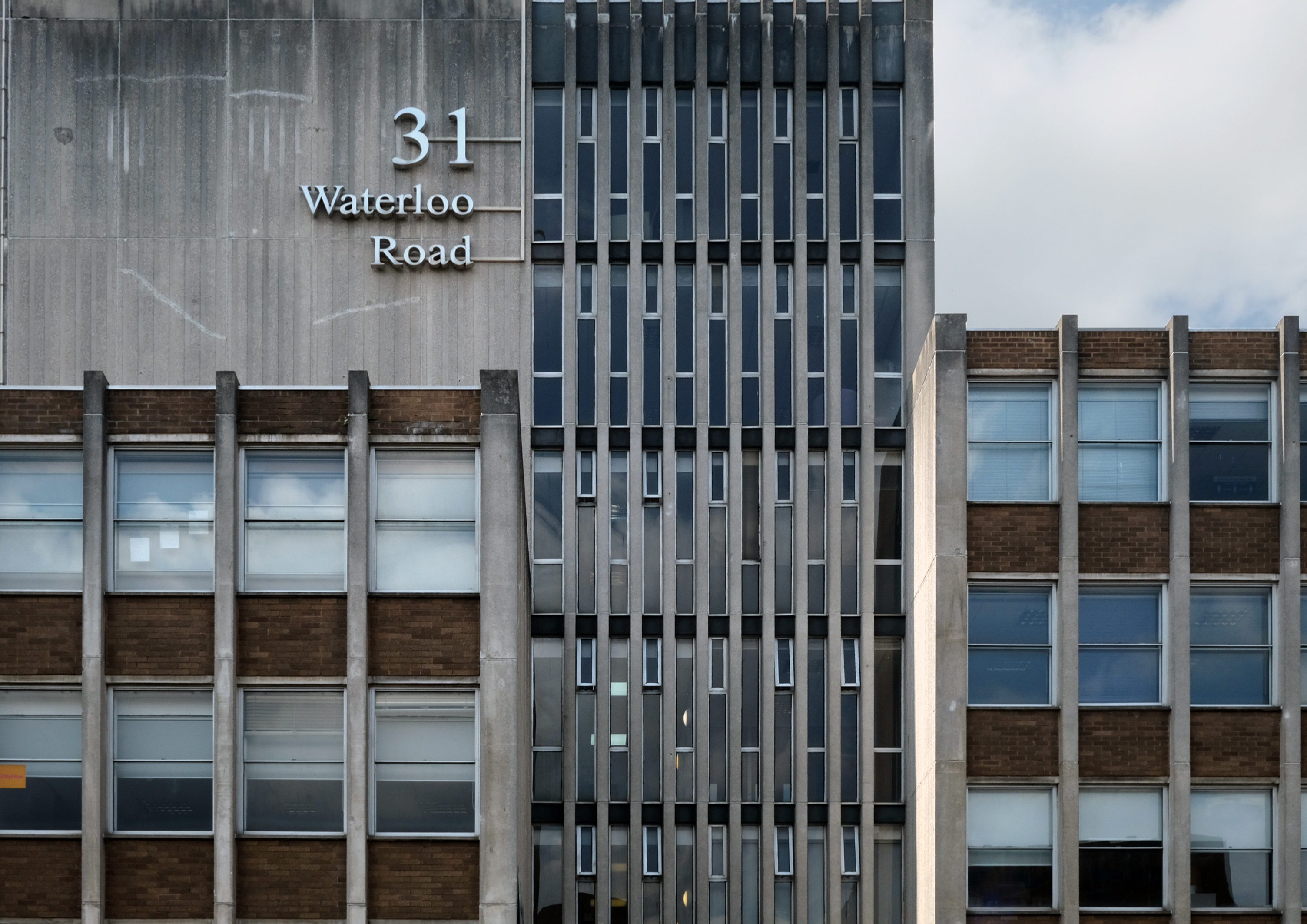
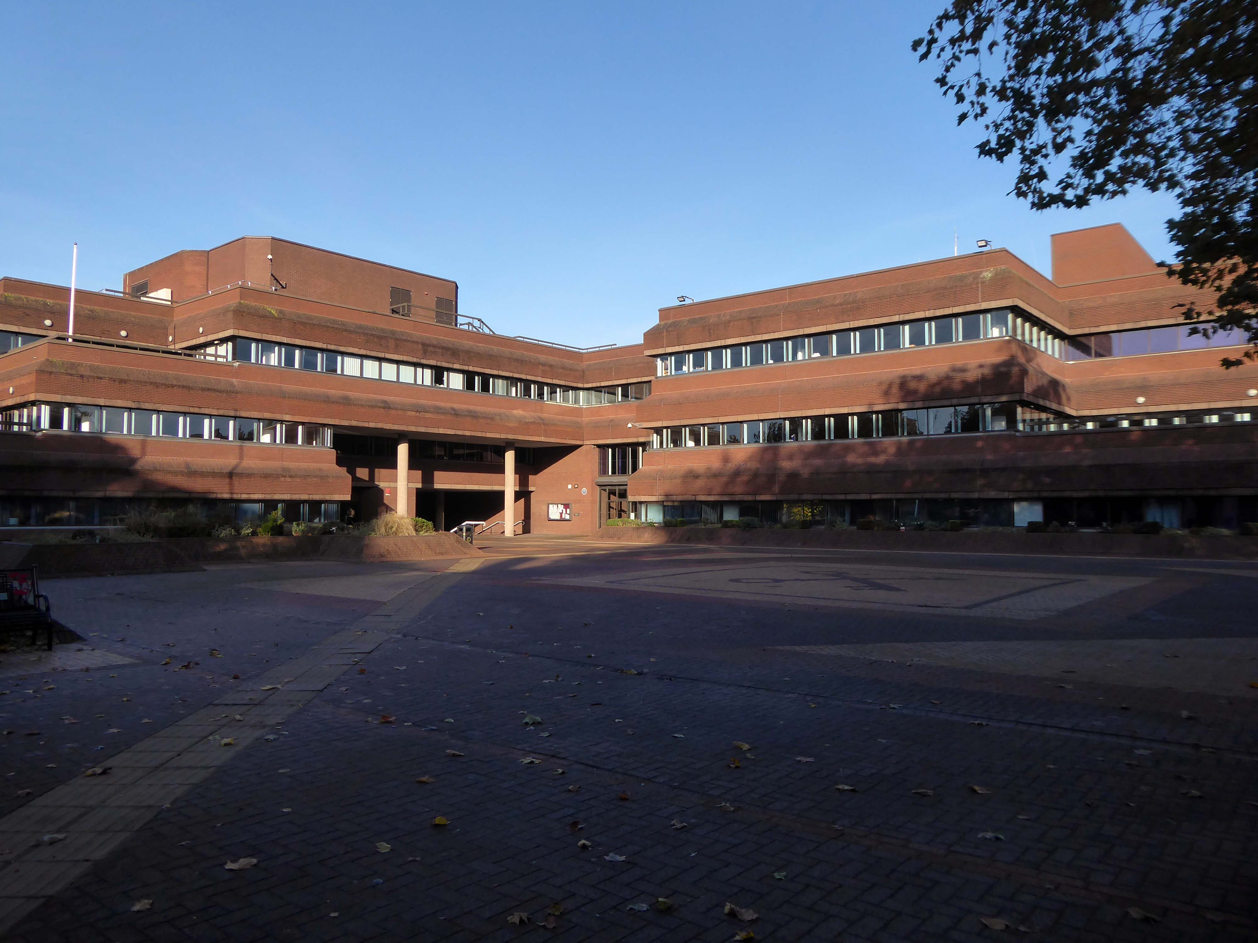
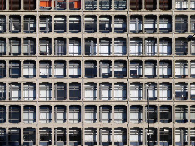
Extension is by architects: H Marcus Brown & Lewis 1965
With further work at the rear.
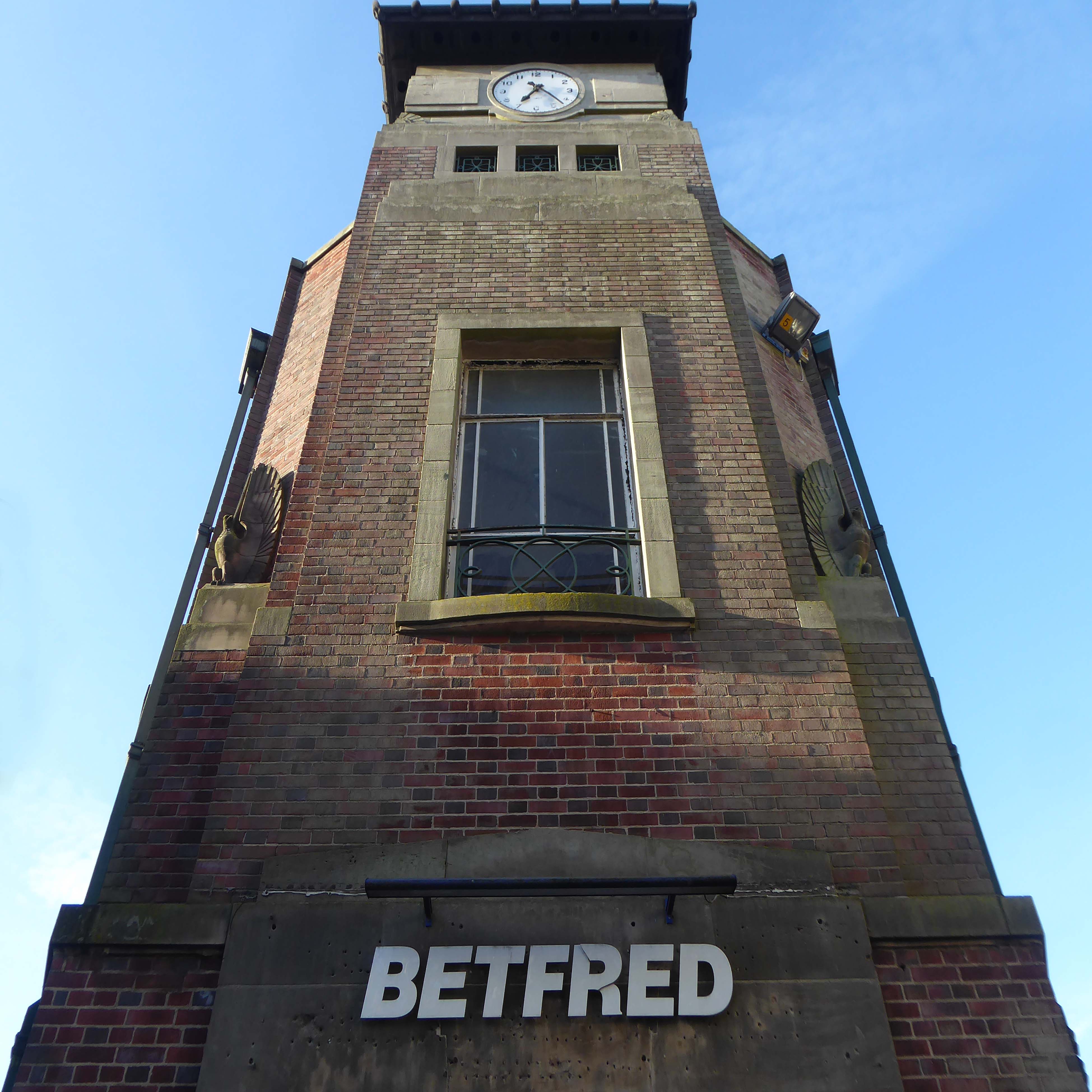
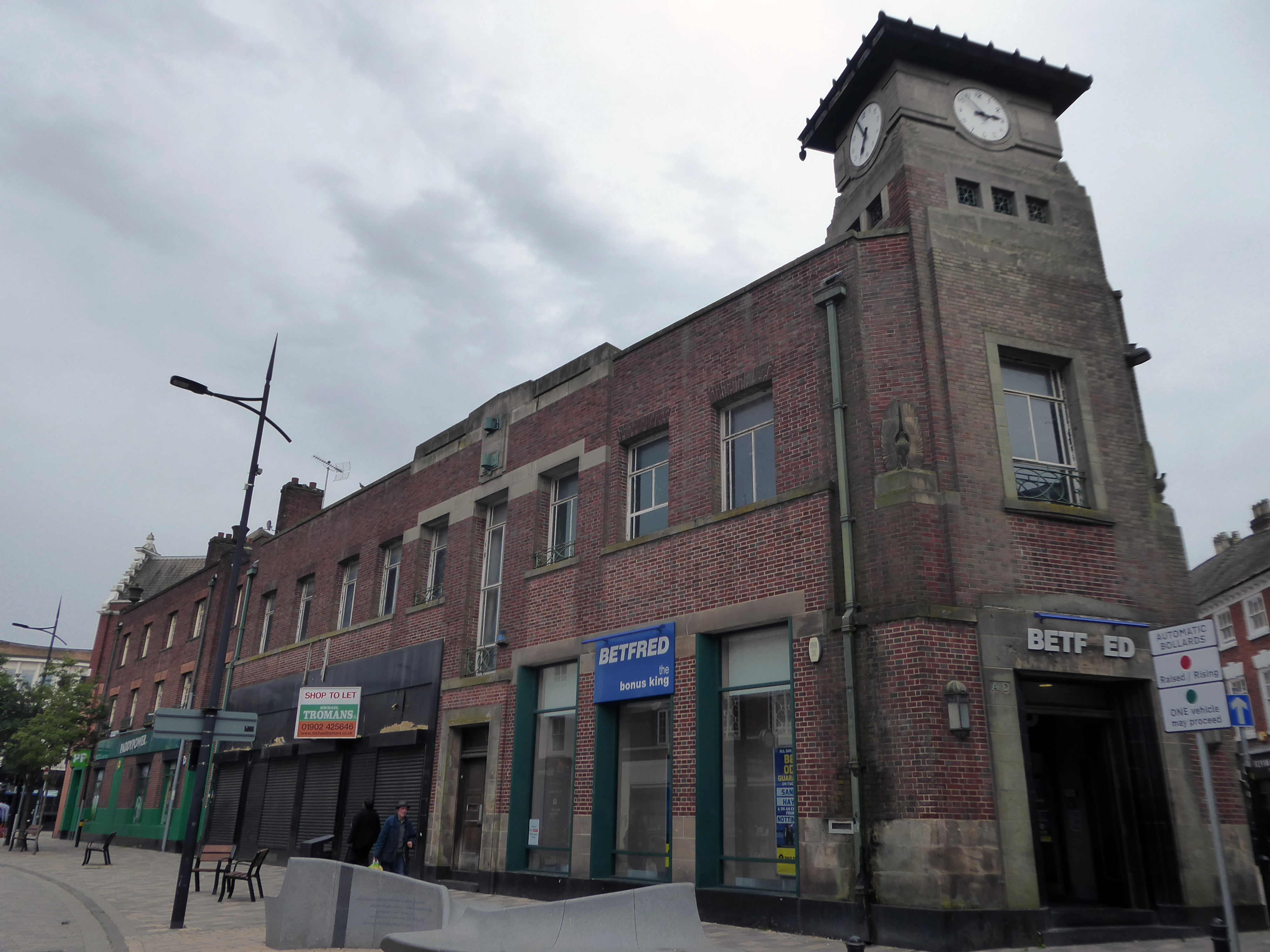
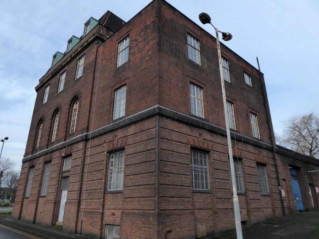
Along Princess Street this corner group, with an impressive clock tower – originally HQ for the South Staffordshire Building Society
Architects: George A Boswell of Glasgow 1932.
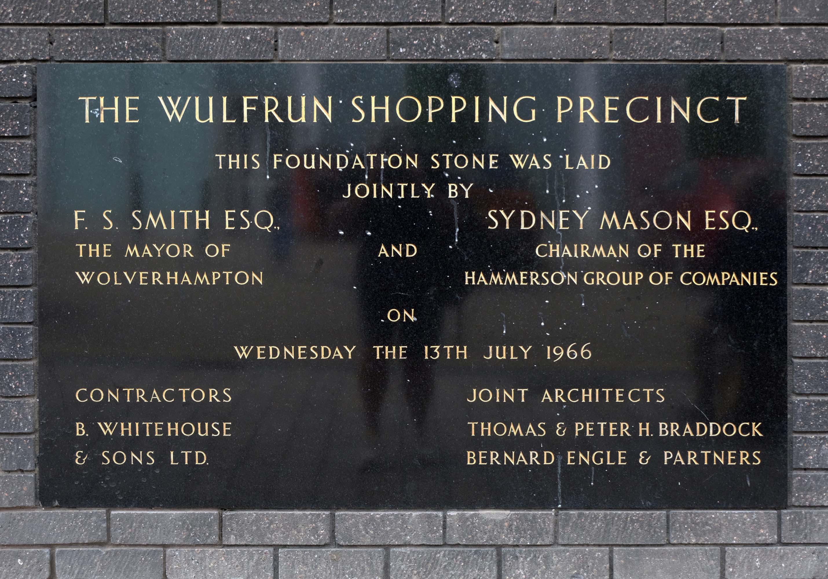
On to the Mander Centre – opened on 6th March 1968, refurbished 1987, 2003 and 2016-17.
The Mander Shopping Centre in the heart Wolverhampton is your one-stop shopping destination for all things fashion, home, beauty, food and technology.
Architects: James A Roberts principal architect Stanley Sellers.
Developed by Manders Holdings Plc, the paint, inks and property conglomerate, between 1968 and 1974. The site occupies four and a half acres comprising the old Georgian works and offices of the Mander family firm, founded in 1773, as well as the site of the former Queens Arcade.
Architects: T & PH Braddock and also Bernard Engle & Partners.
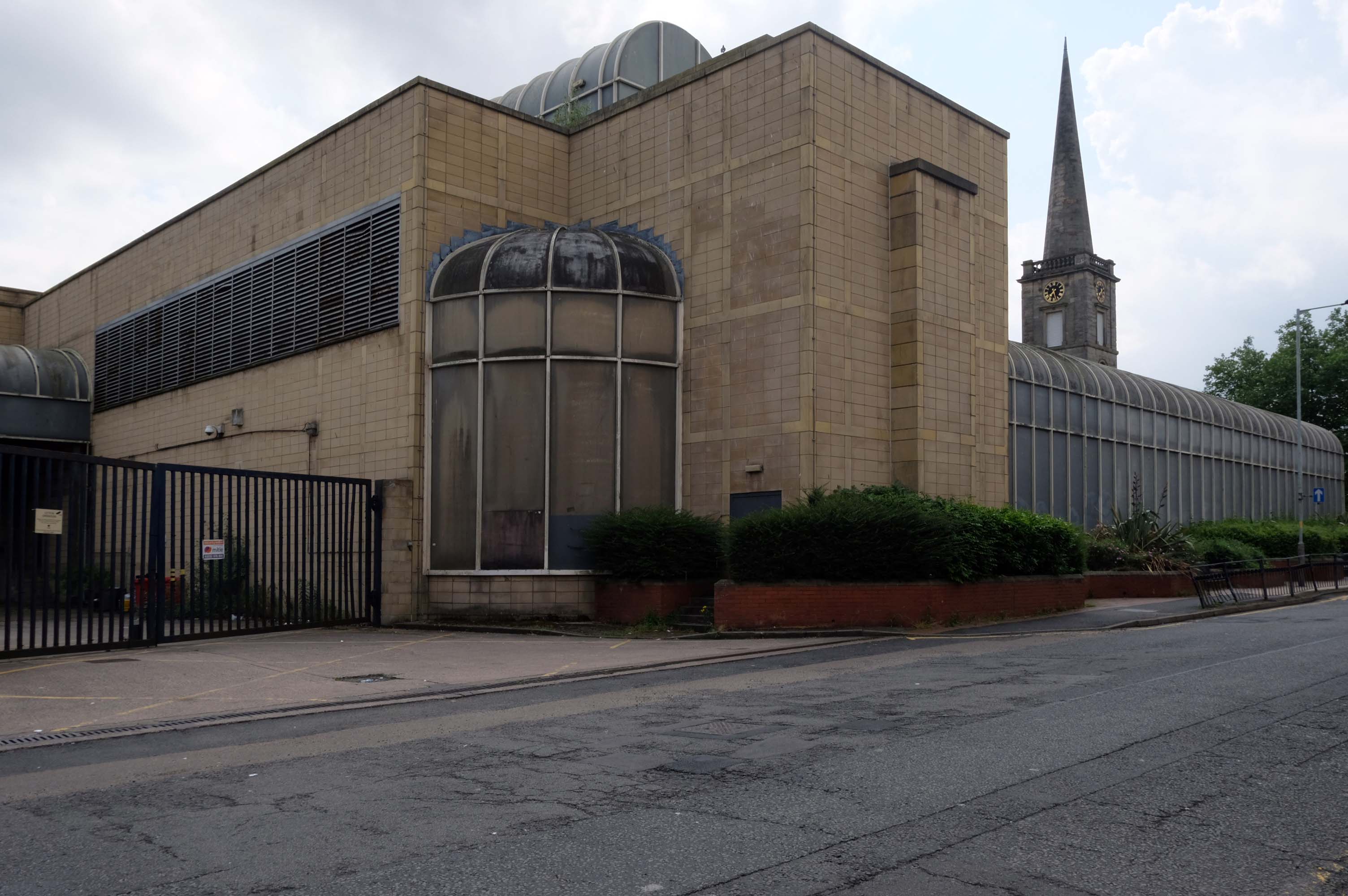
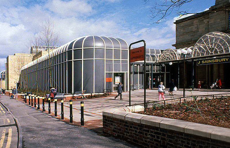
Along St Georges Parade, an abandoned Sainsbury’s church combo – store designed by J Sainsbury’s Architects Department opened 1988.
The church was built between 1828 and 1830 – architect: James Morgan, at a cost of £10,268. It was consecrated on Thursday 2 September 1830 by the Bishop of Lichfield, it was made redundant in 1978.
The site is currently under lease to Sainsbury’s for a further three years and will come forward on a phased basis subject to their lease concluding. The council is in active dialogue with prospective development partners on the redevelopment of this site and in wider consultation with Homes England.
Notable cases included trial and conviction of four members of The Stone Roses, in October 1990, for criminal damage to the offices of their former record company.
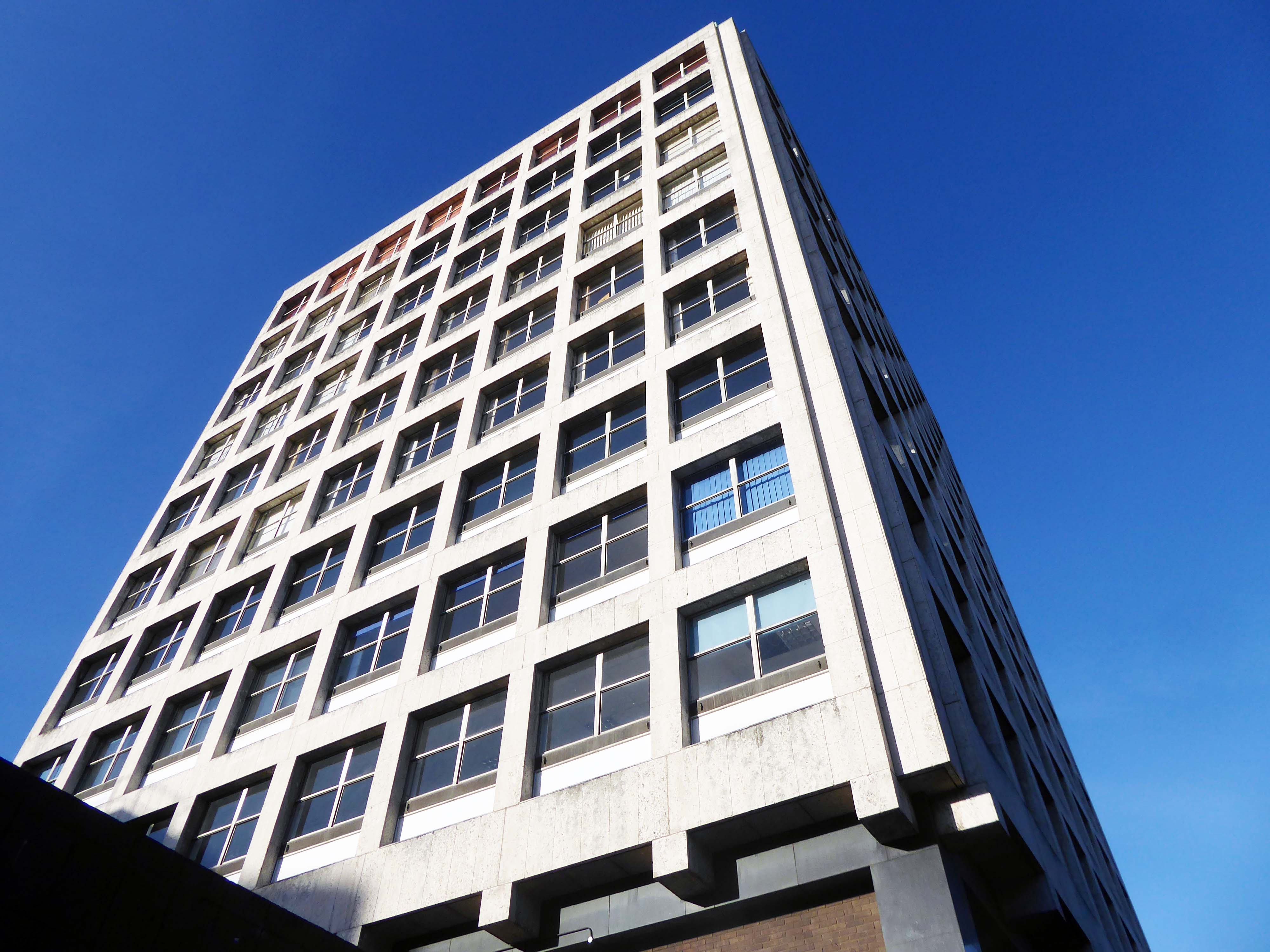
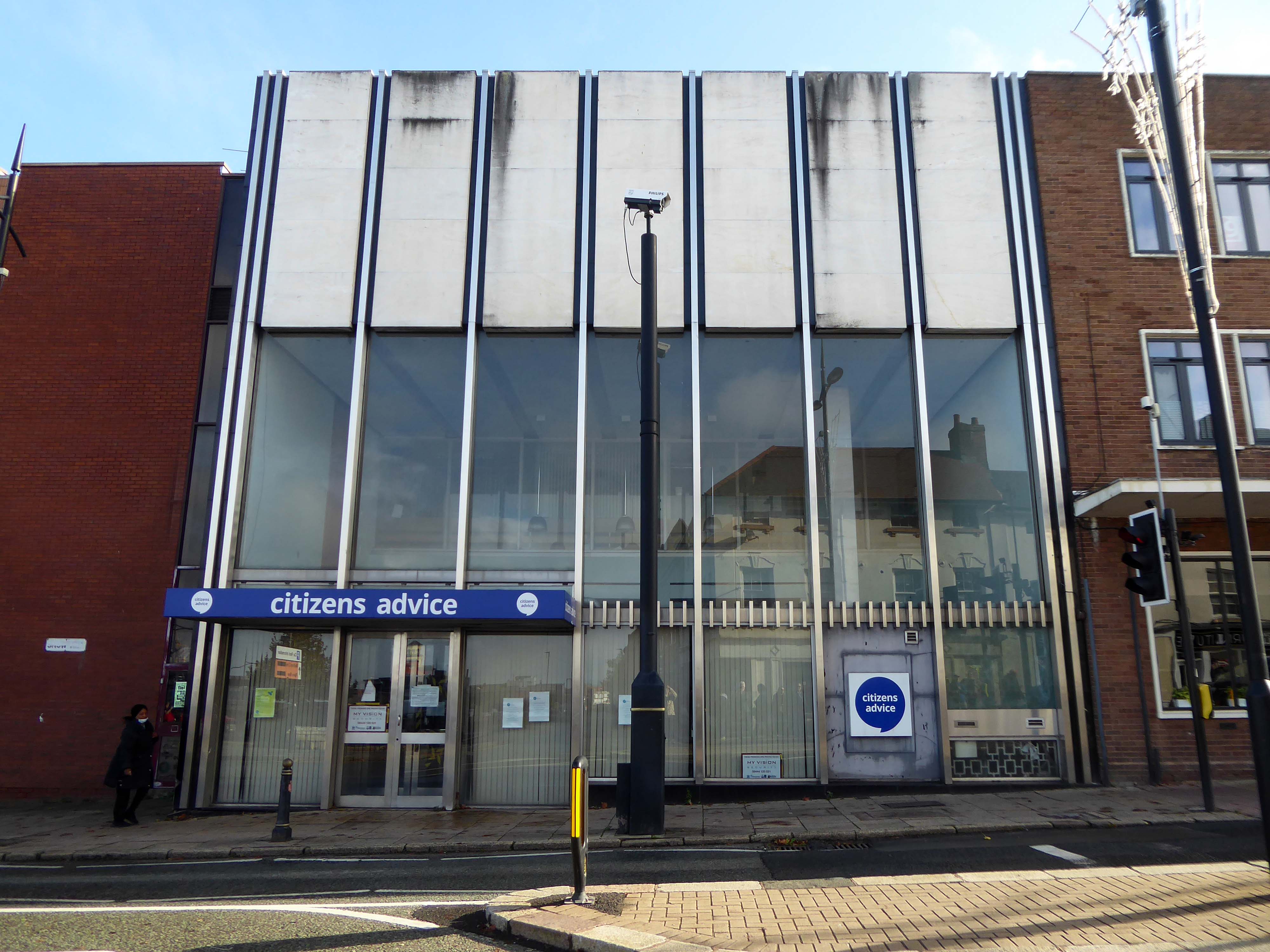
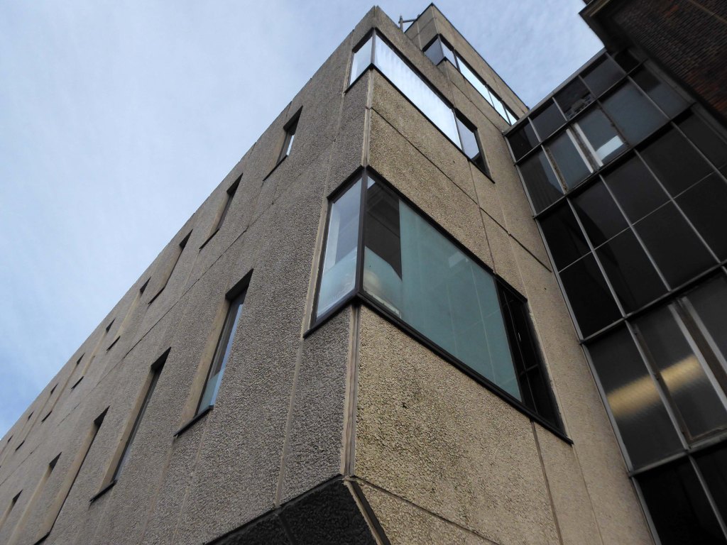
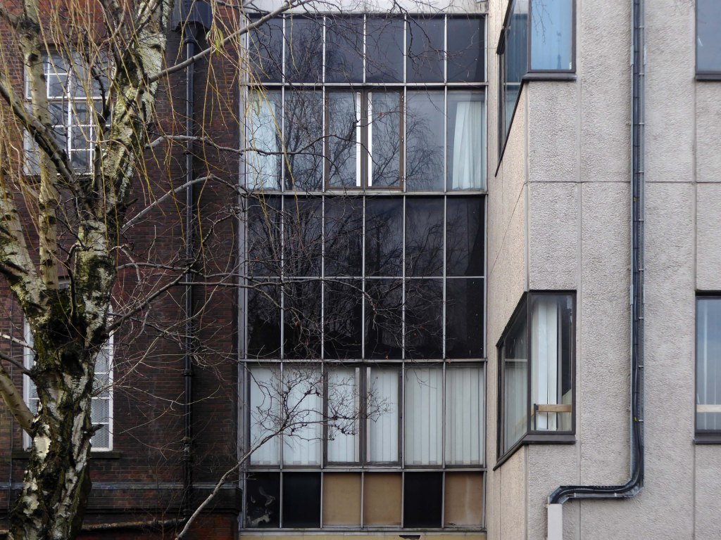
Thence up Snow Hill to the former Citizens Advice former Barclays Bank currently empty.
Architects: John HD Madin & Partners 1969
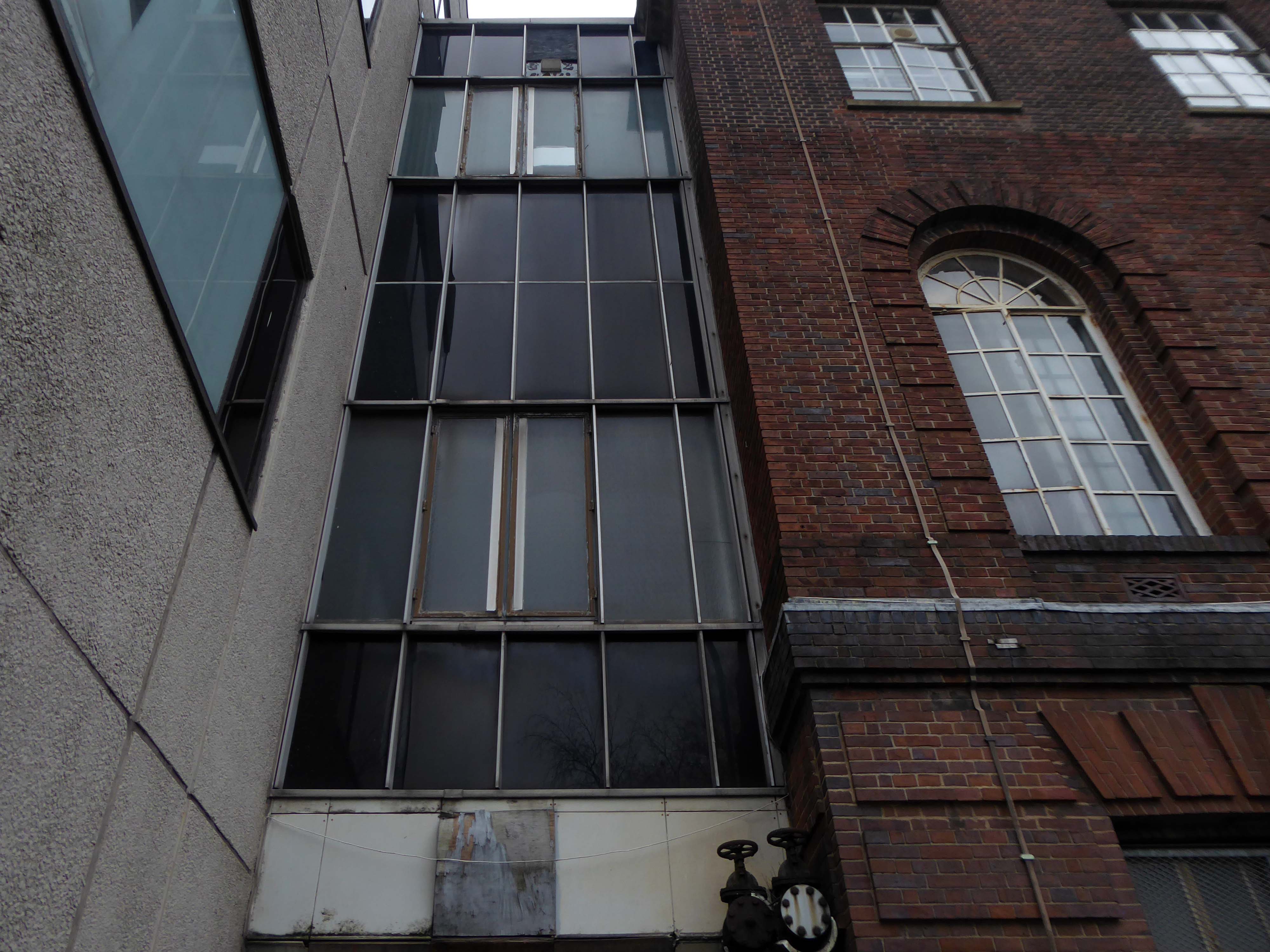
Take time to have a look around the back.
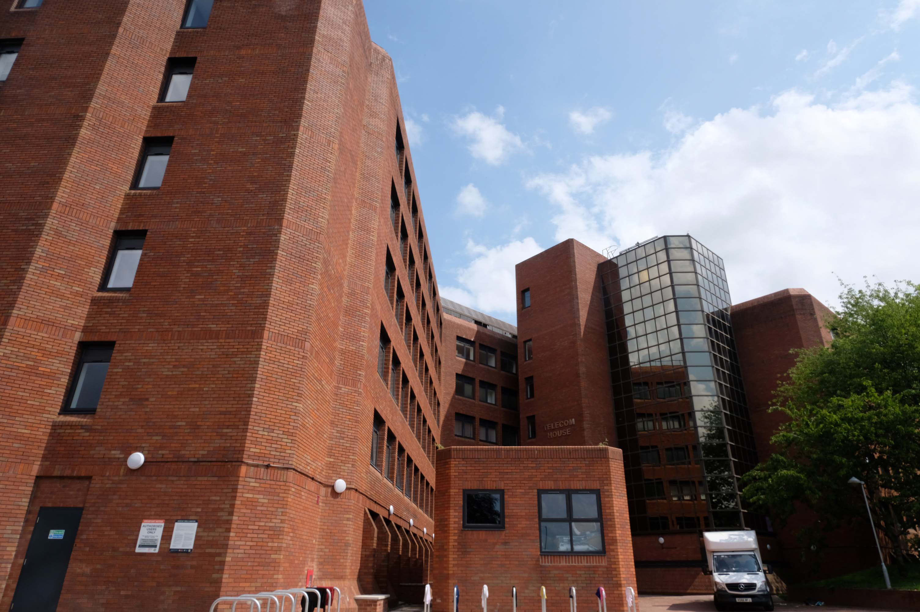
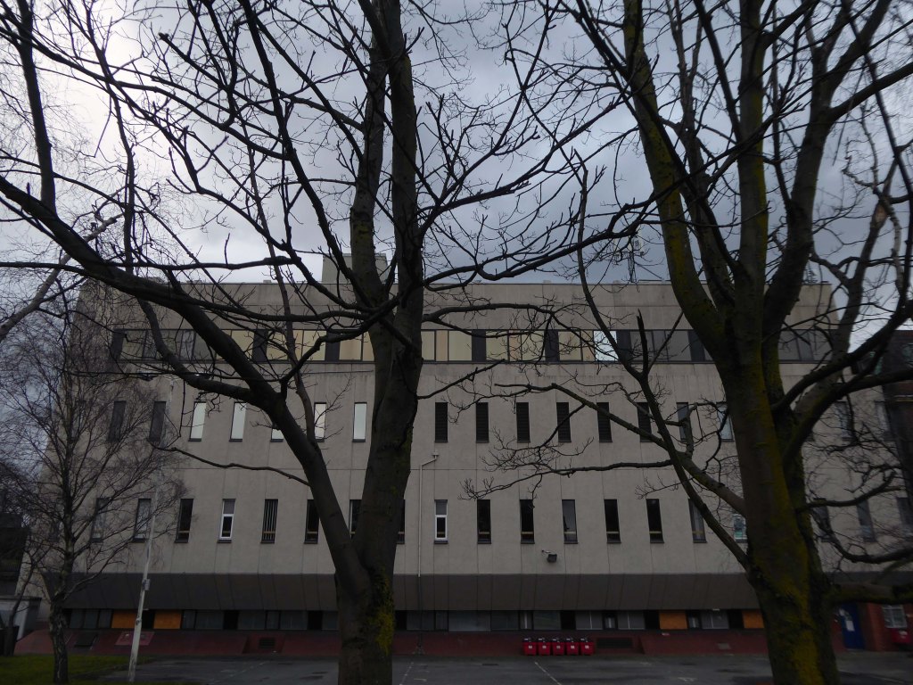
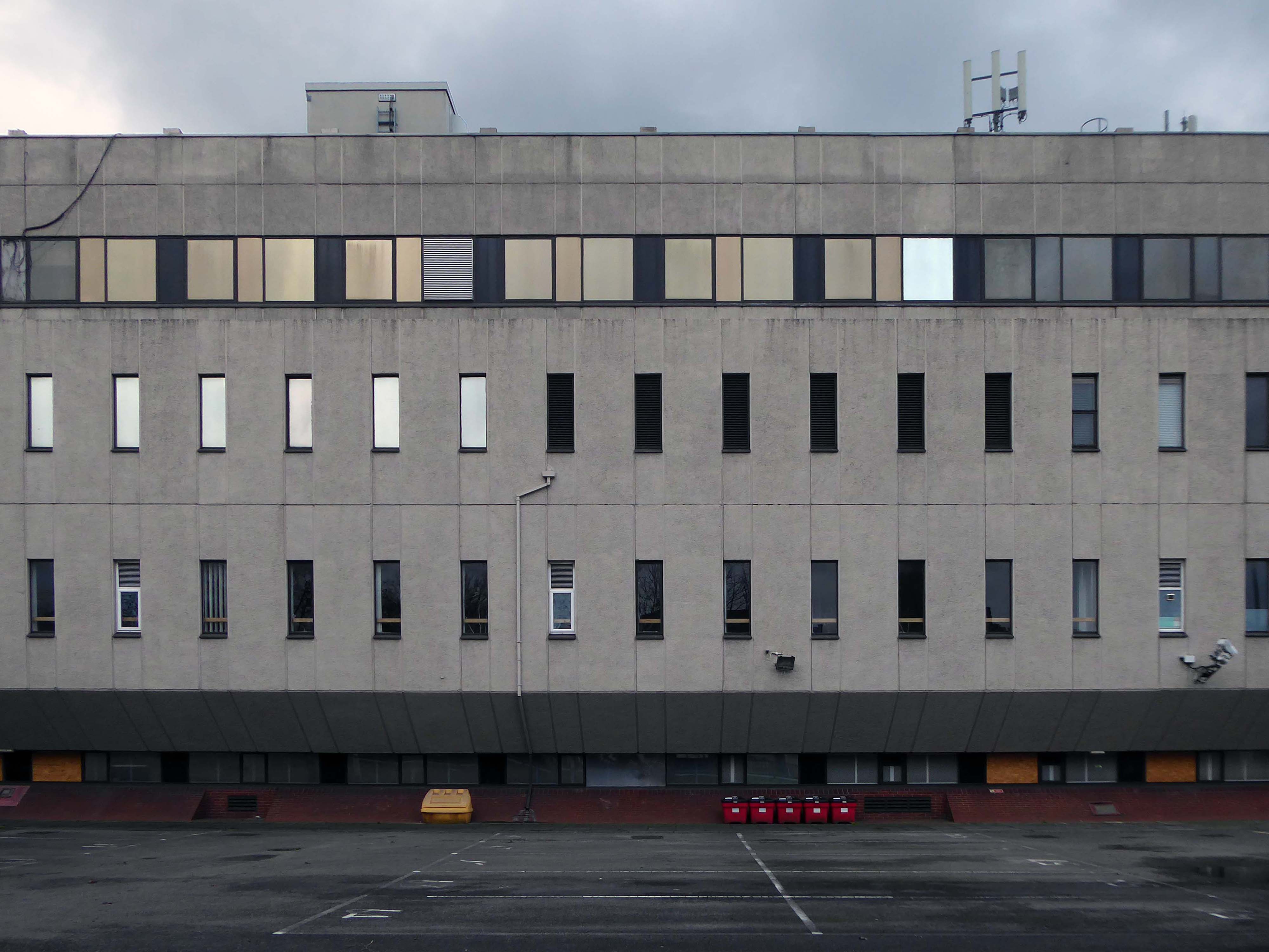
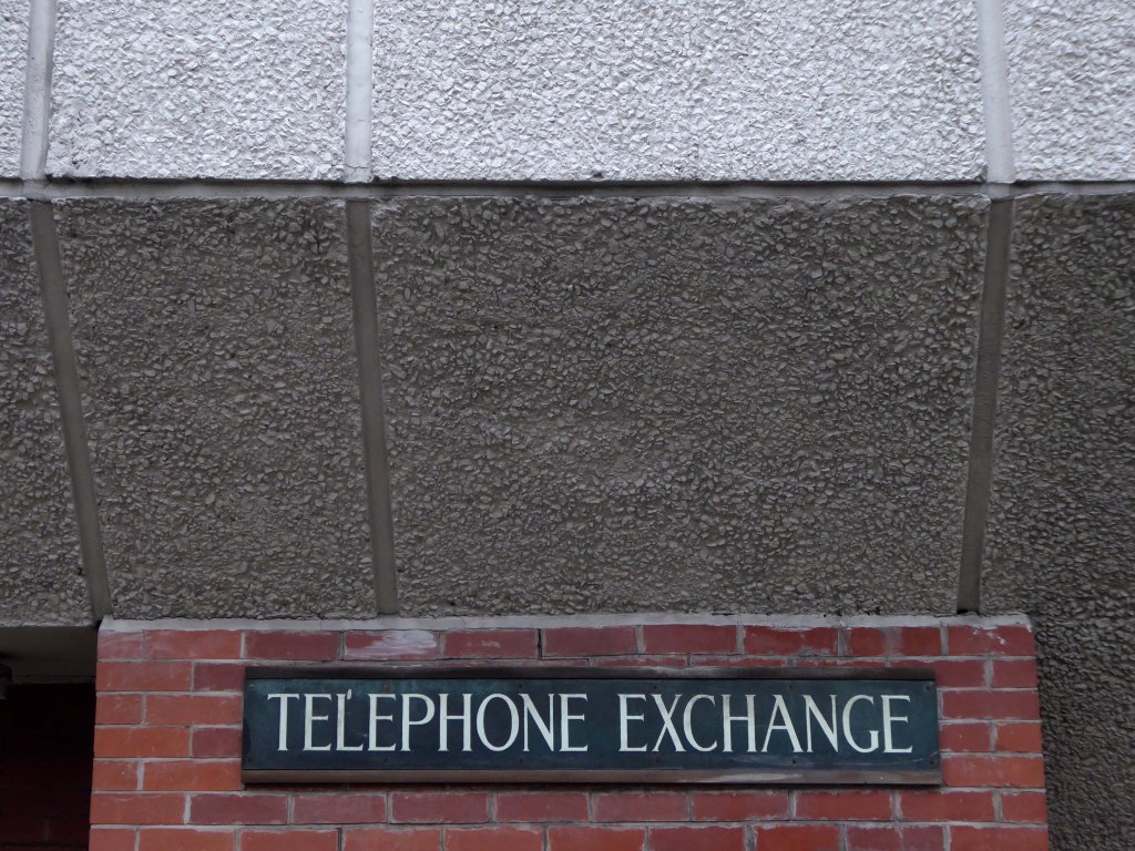
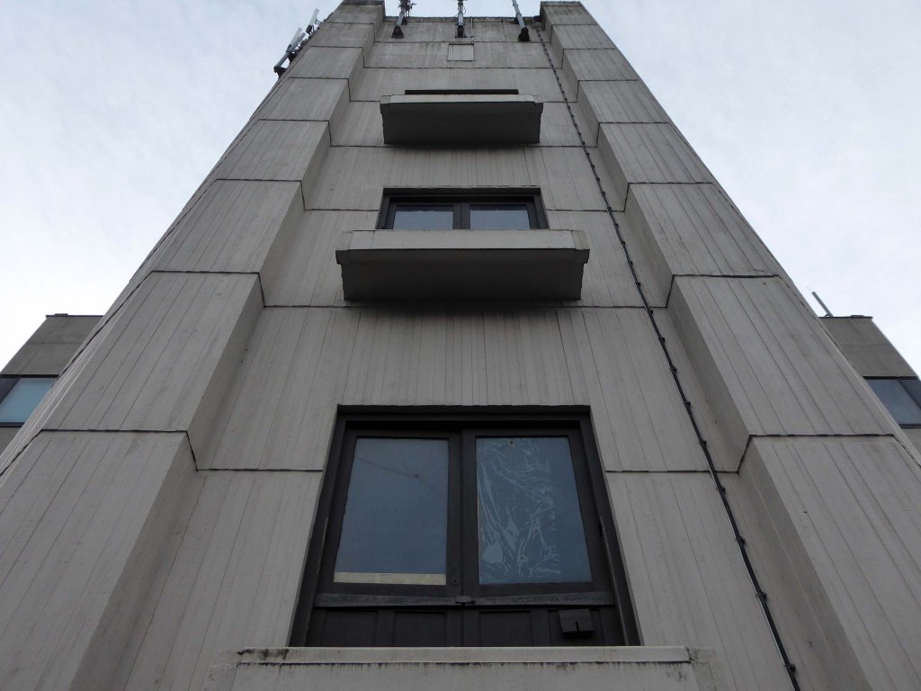
Off to Church Street and Telecom House
Sold for £4.25 million to Empire Property in 2022.
It had previously been sold for more than £3m in July 2018, also for use for apartments, to Inspired Asset Management which later went into receivership.
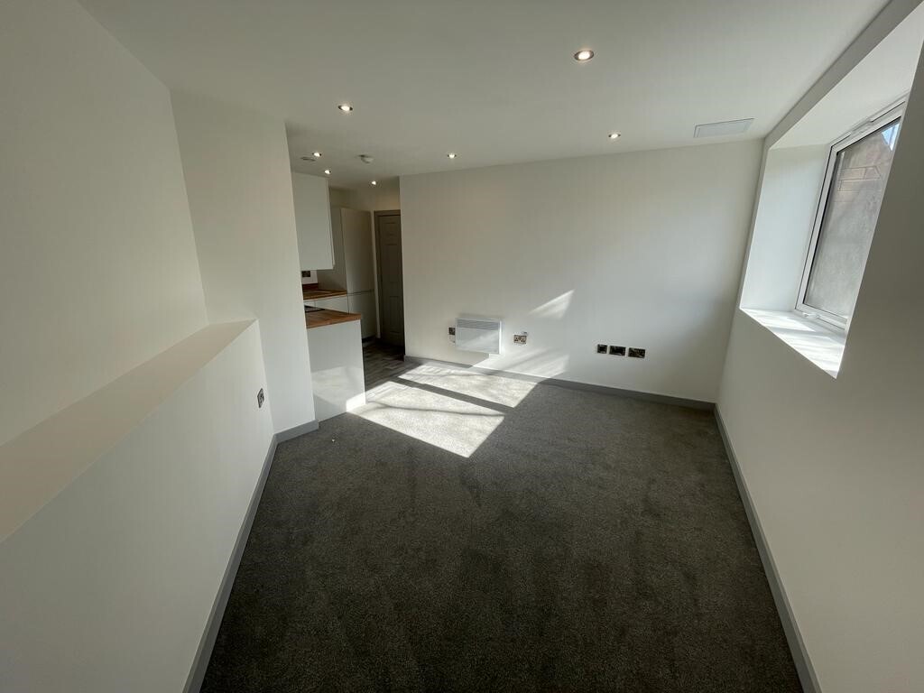
Located on a popular apartment block on Church street in the Wolverhampton centre, this 1 bedroom property has been newly renovated throughout and compromises an entrance hallway, open plan lounge/kitchen with in built appliances, shower room and double bedroom.
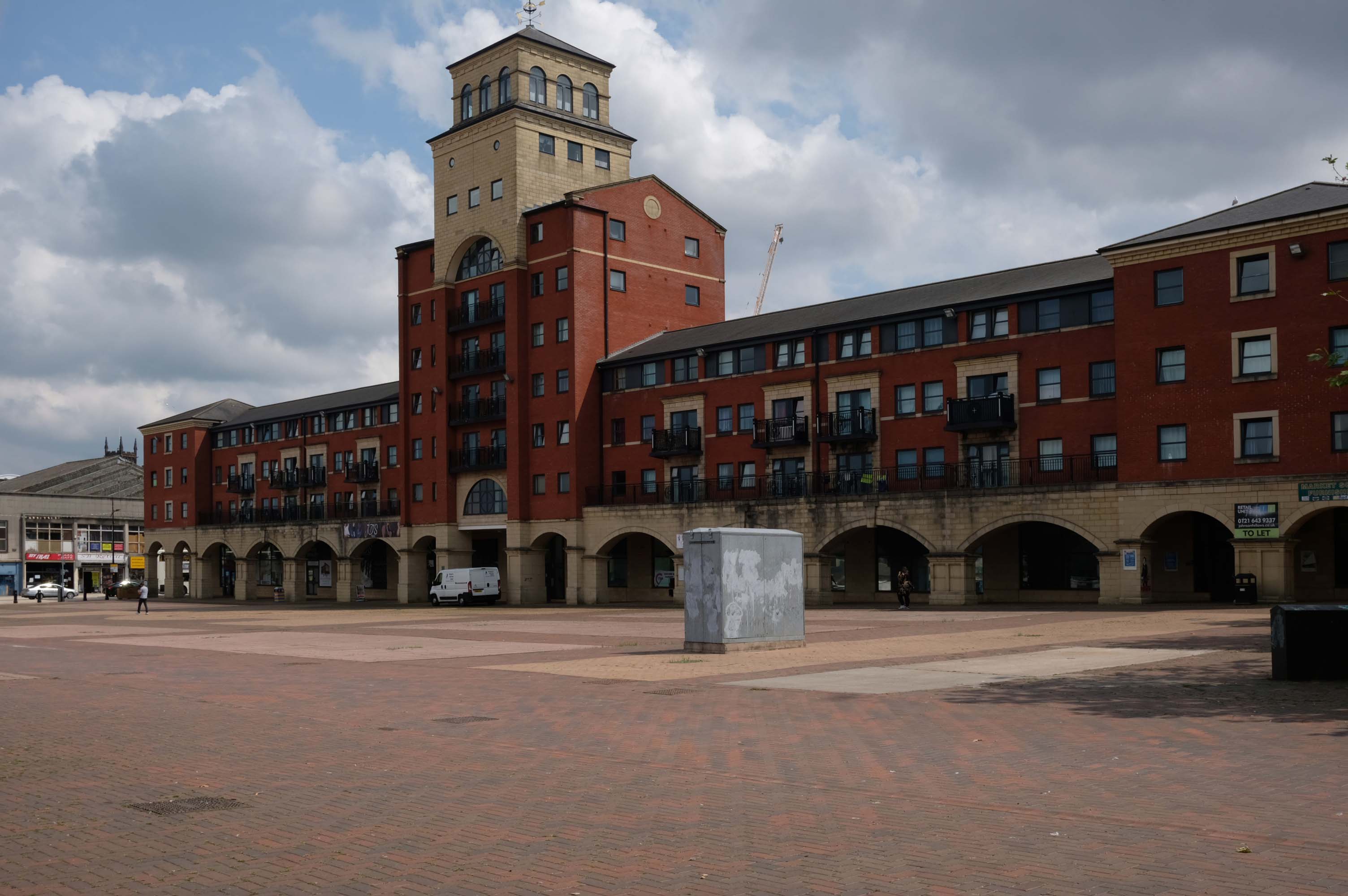
Next to this modern piazza New Market Square – Architects: Nicol Thomas from a concept by head of planning Costas Georghiou.
Formed from the former Market Square, a mix of flats and shops opened in 2004, in an Italianate version of the modish school of streaky bacon.
In 2021 the Coca-Cola Christmas Truck visit to the Midlands was cancelled.
It was meant to arrive at Market Square in Wolverhampton at 11am today but failed to show up.
One fan had waited since 7am this morning to see the Coca-Cola truck.
While schoolchildren were left gutted when the truck didn’t turn up – and one boy had been so excited his mother said he had been talking about the red truck all morning.
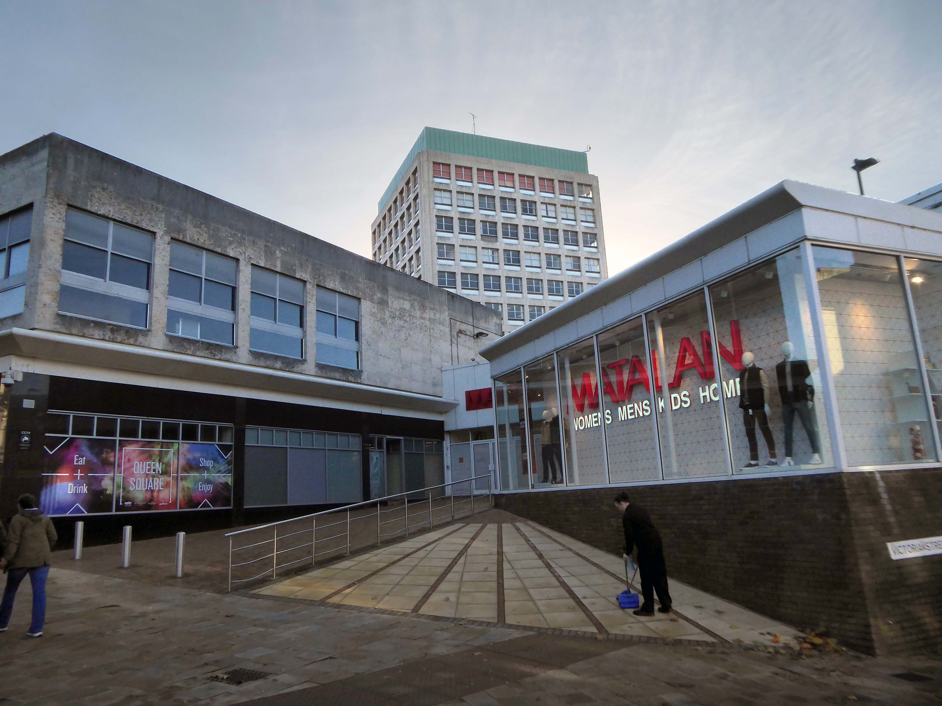
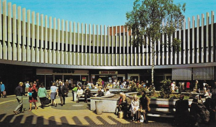
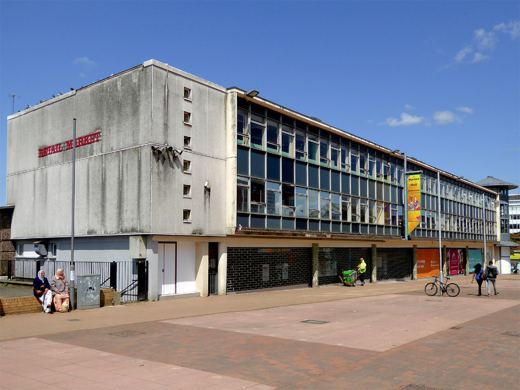
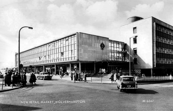
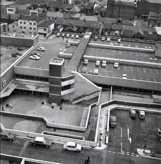
Retail Market – Late 1950s market hall and offices above.
Architects: Borough Surveyor.
Excellent example of the Festival of Britain style of architecture, won Civic Trust Award 1960.
Locally Listed March 2000.
demolished January 2017.
Photo: Roger Kidd
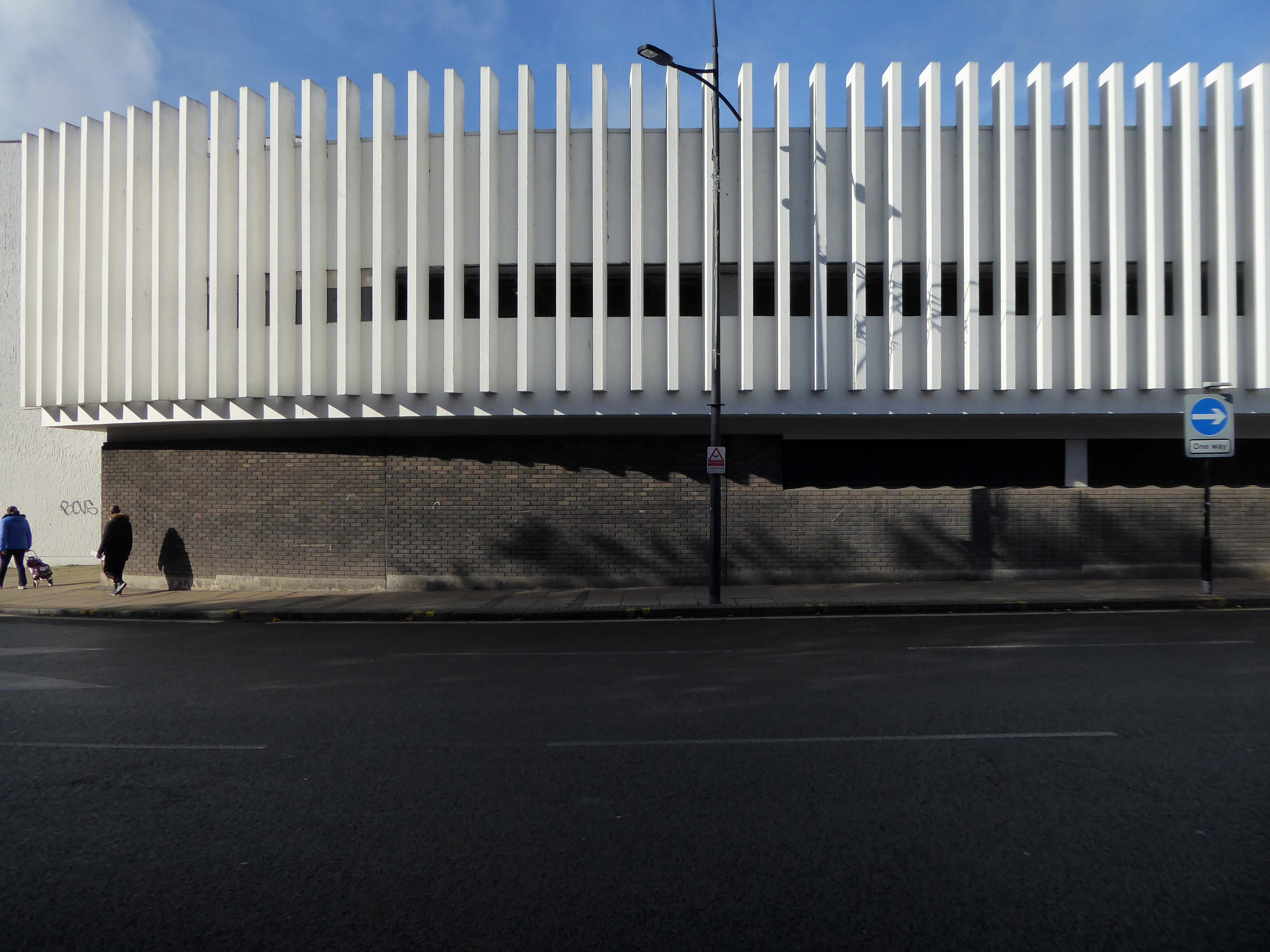
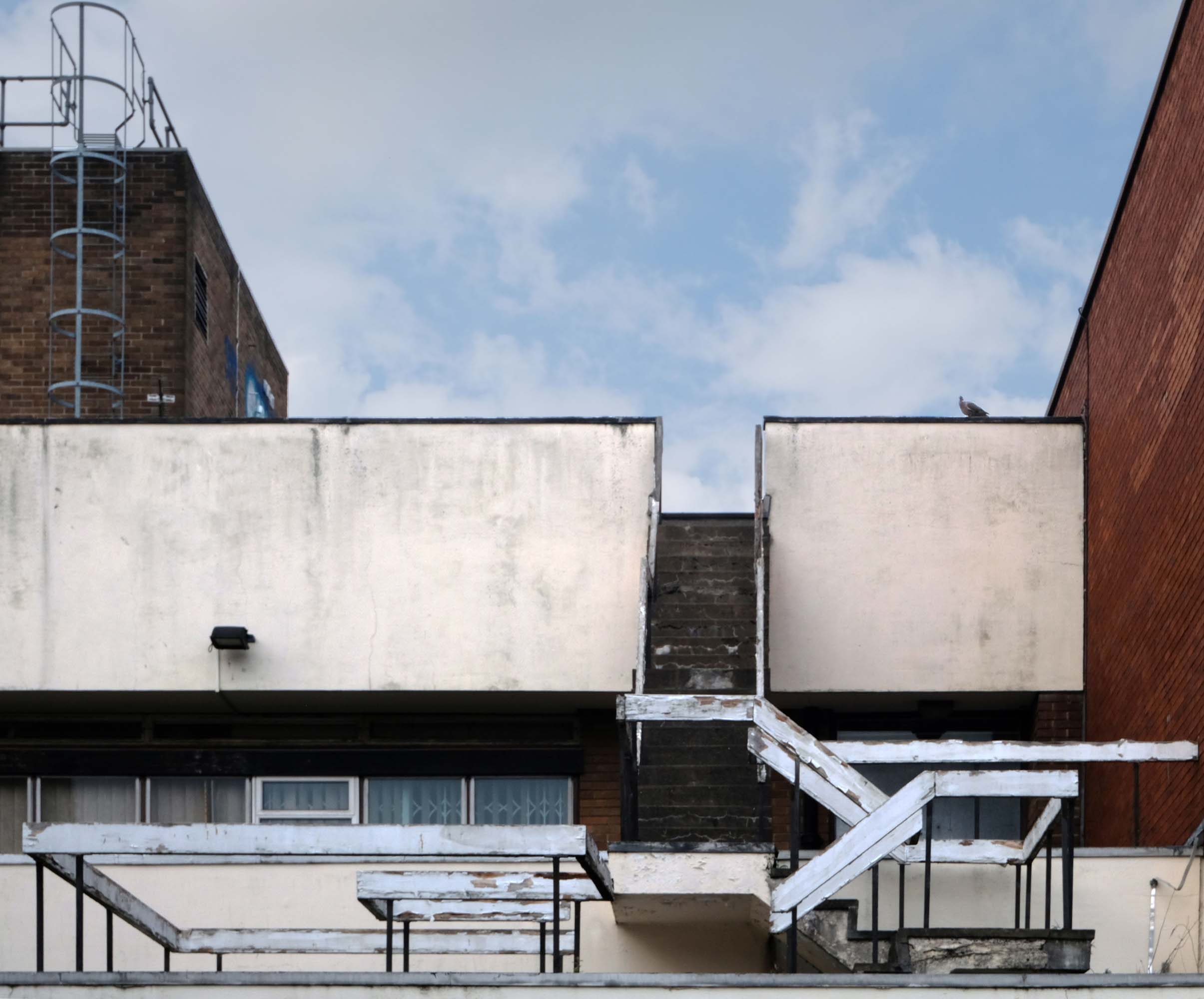
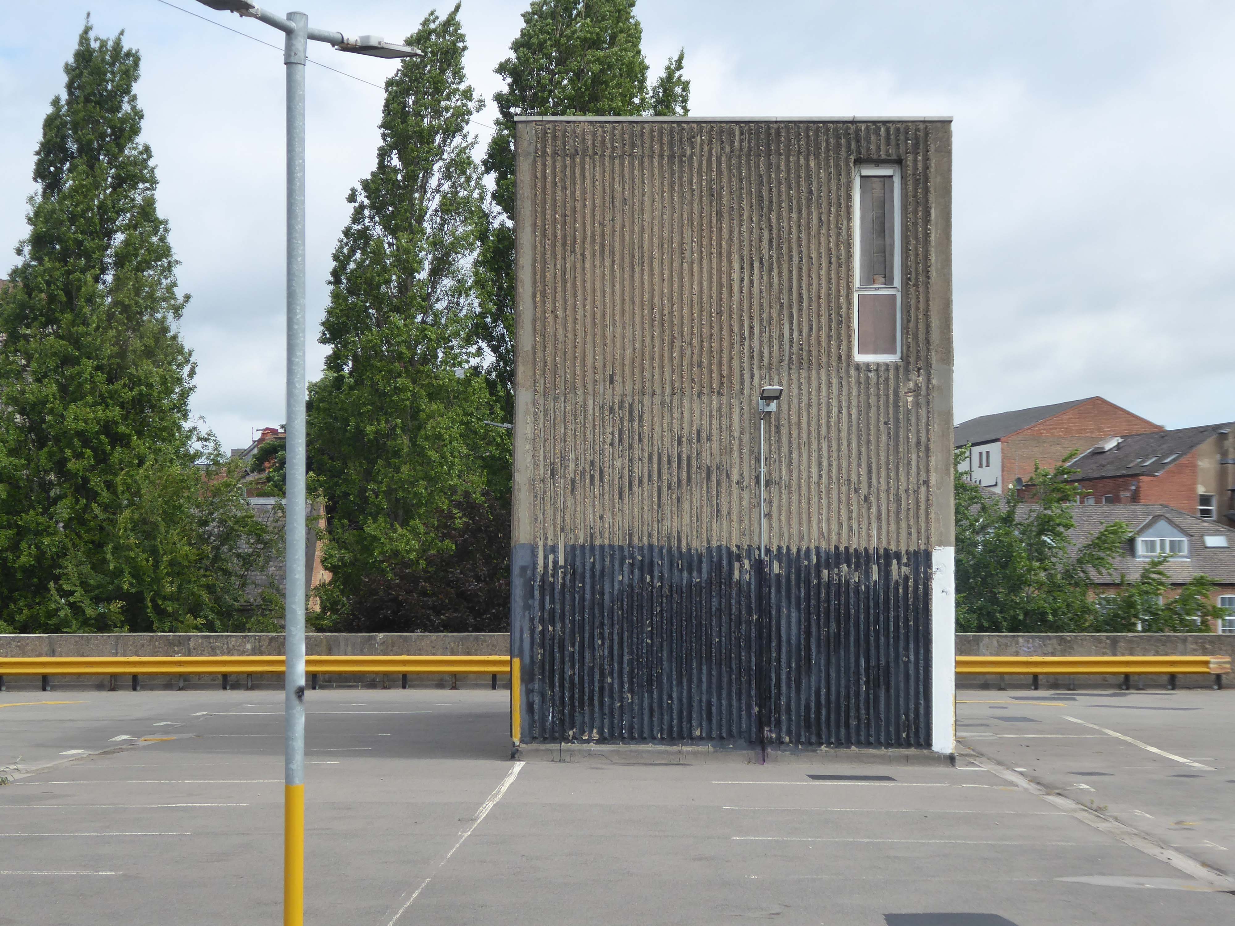
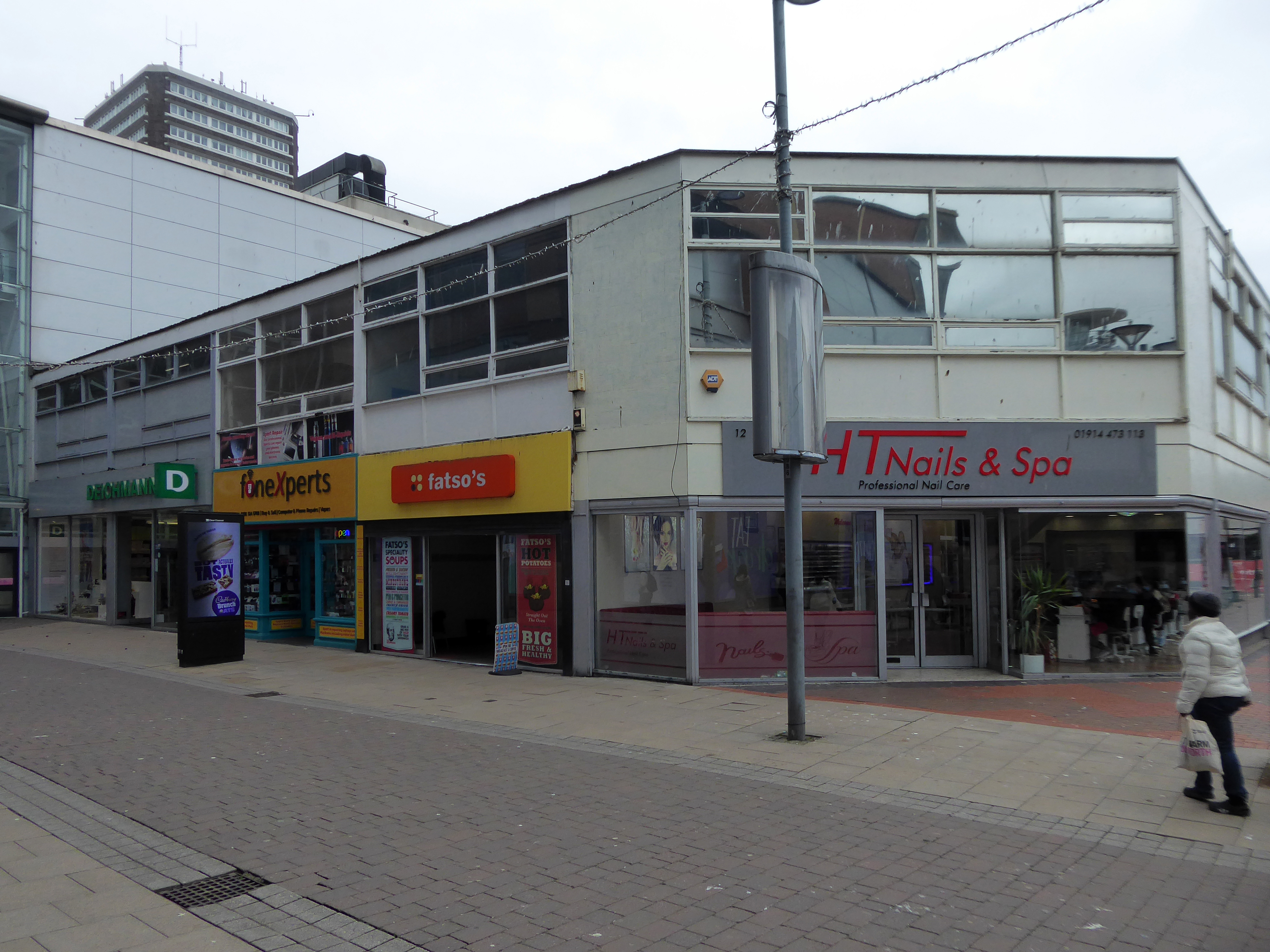
This development that wraps itself around Salop, Skinner and School Streets appears to be of a similar period to the Retail Market – and sports a Lady Wulfrun in relief.
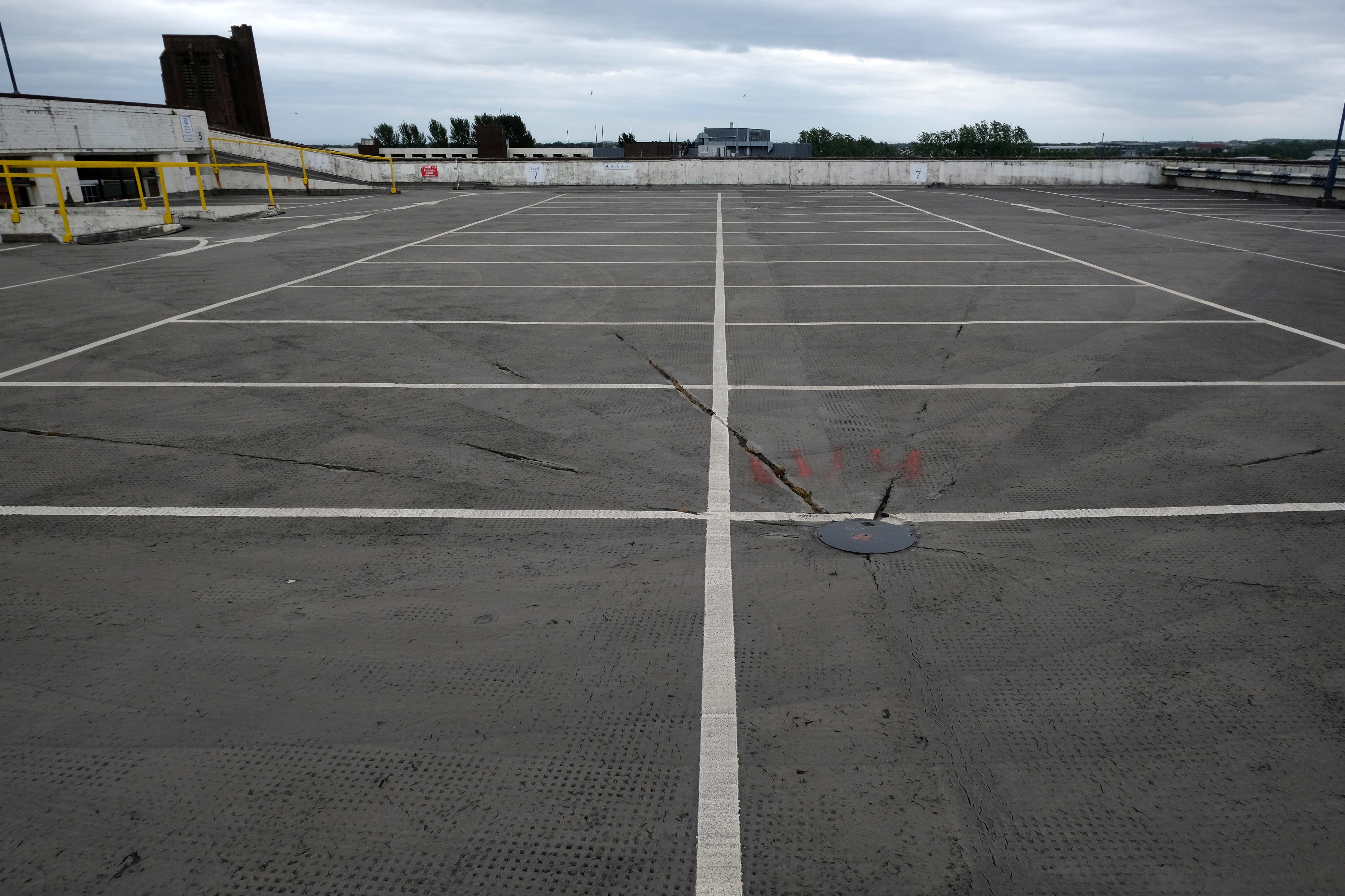
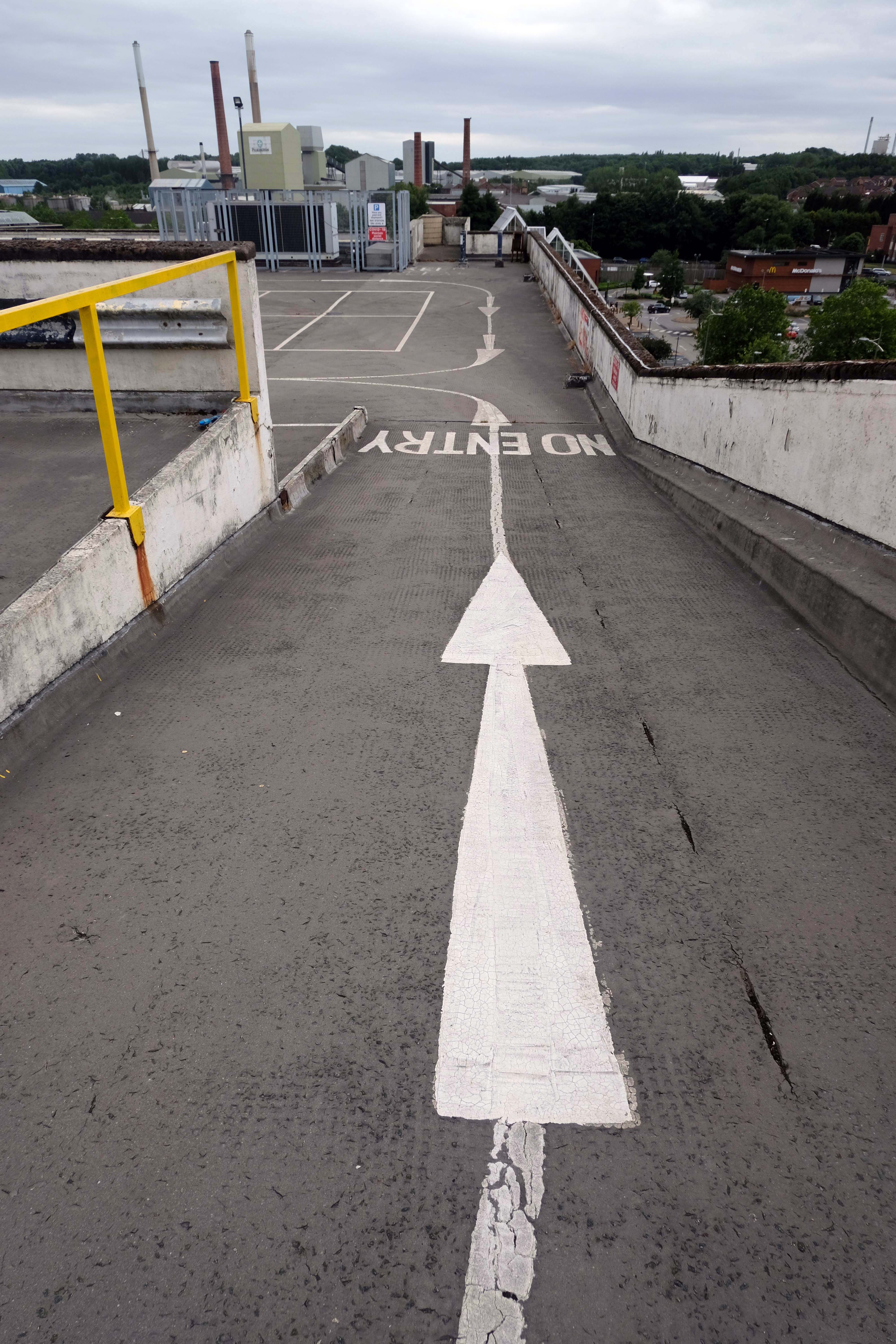
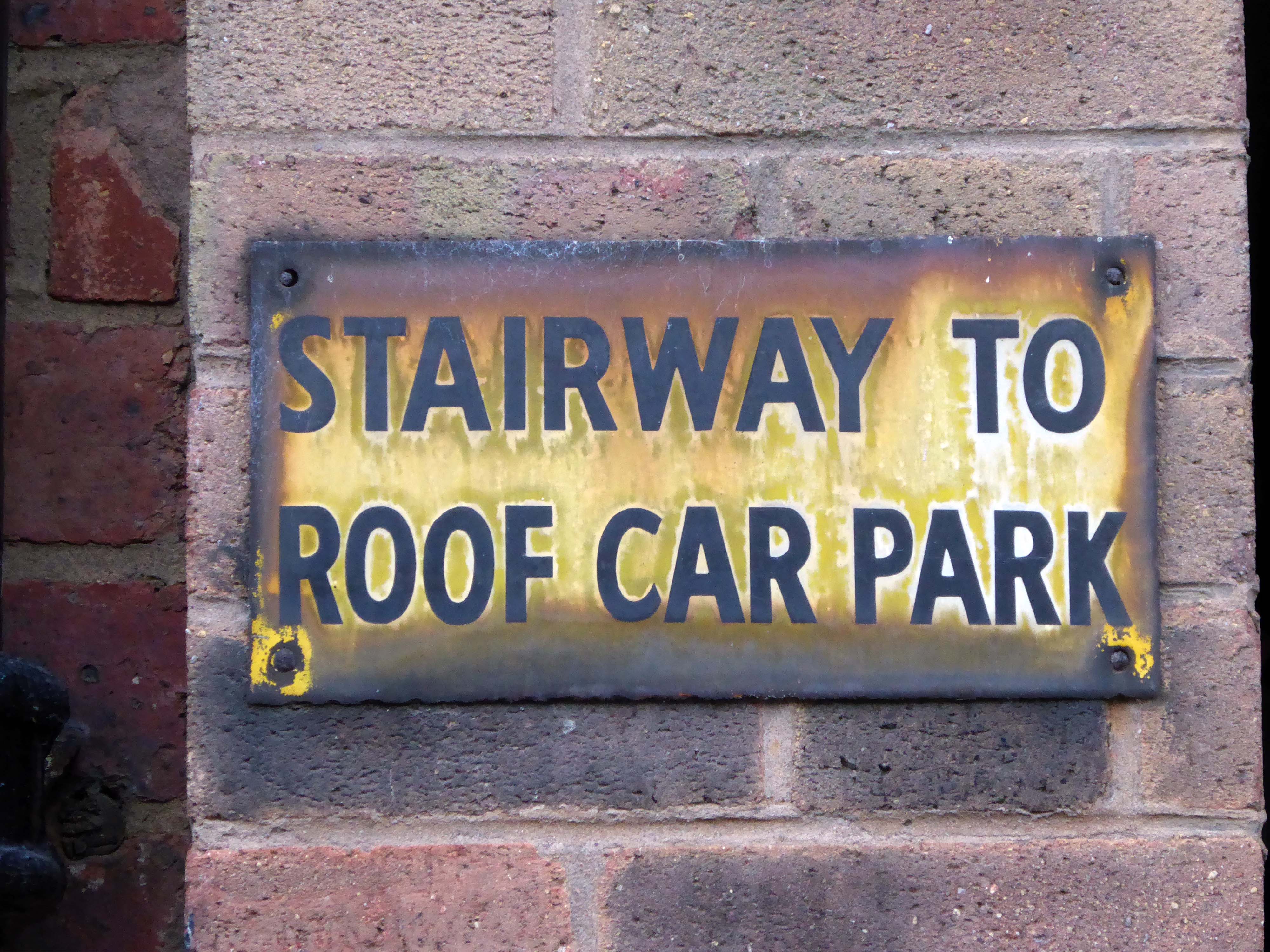
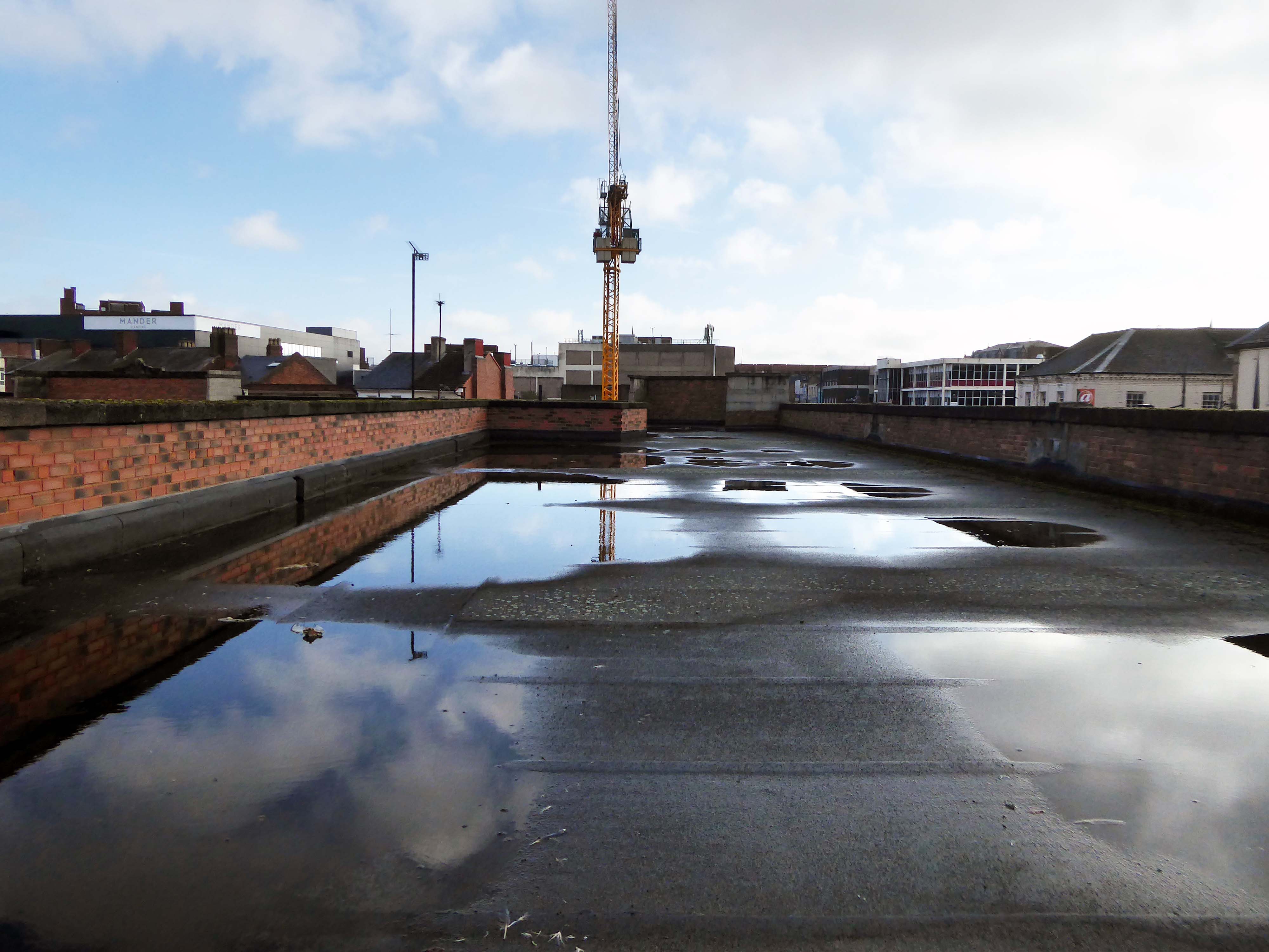
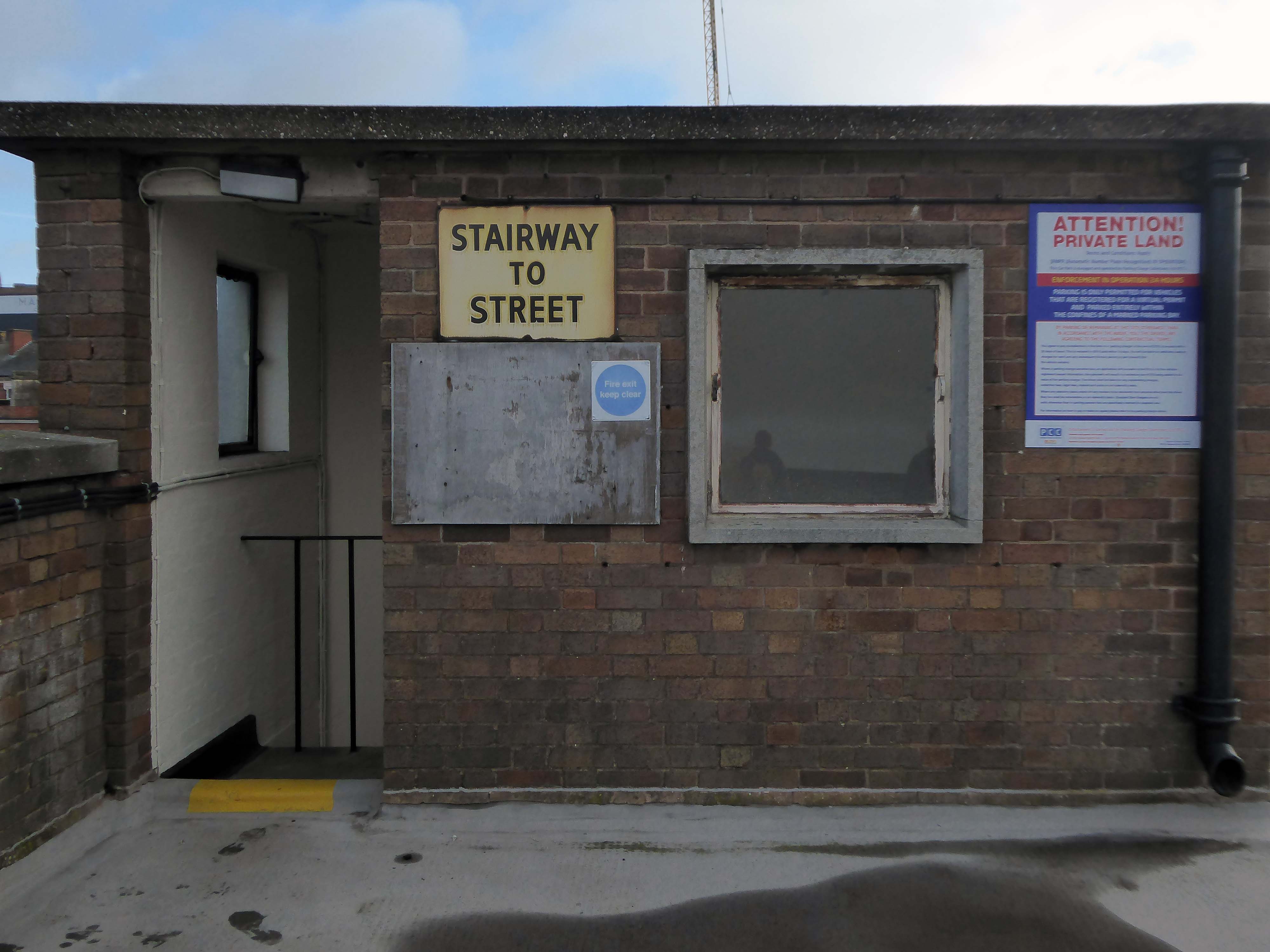
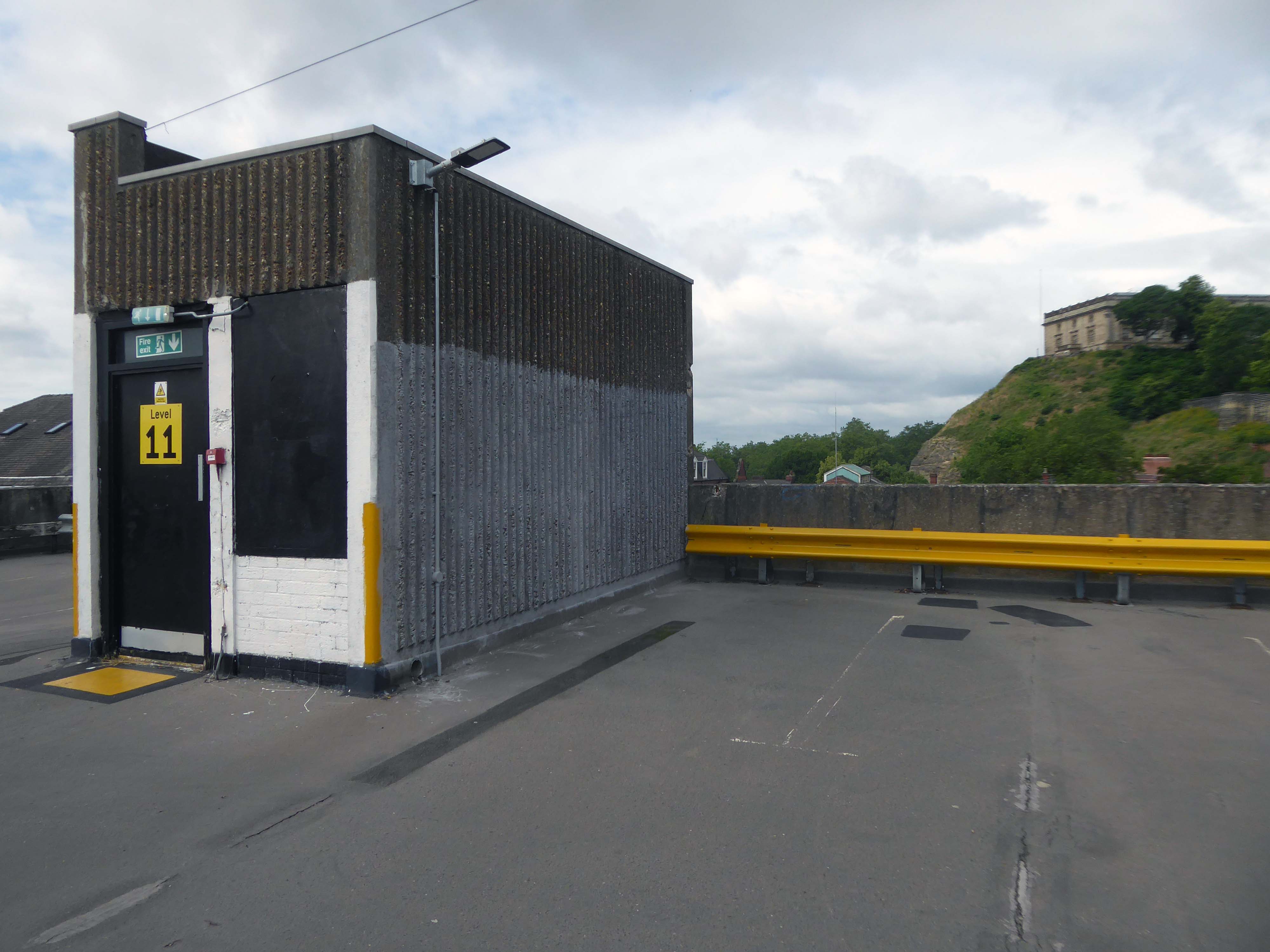
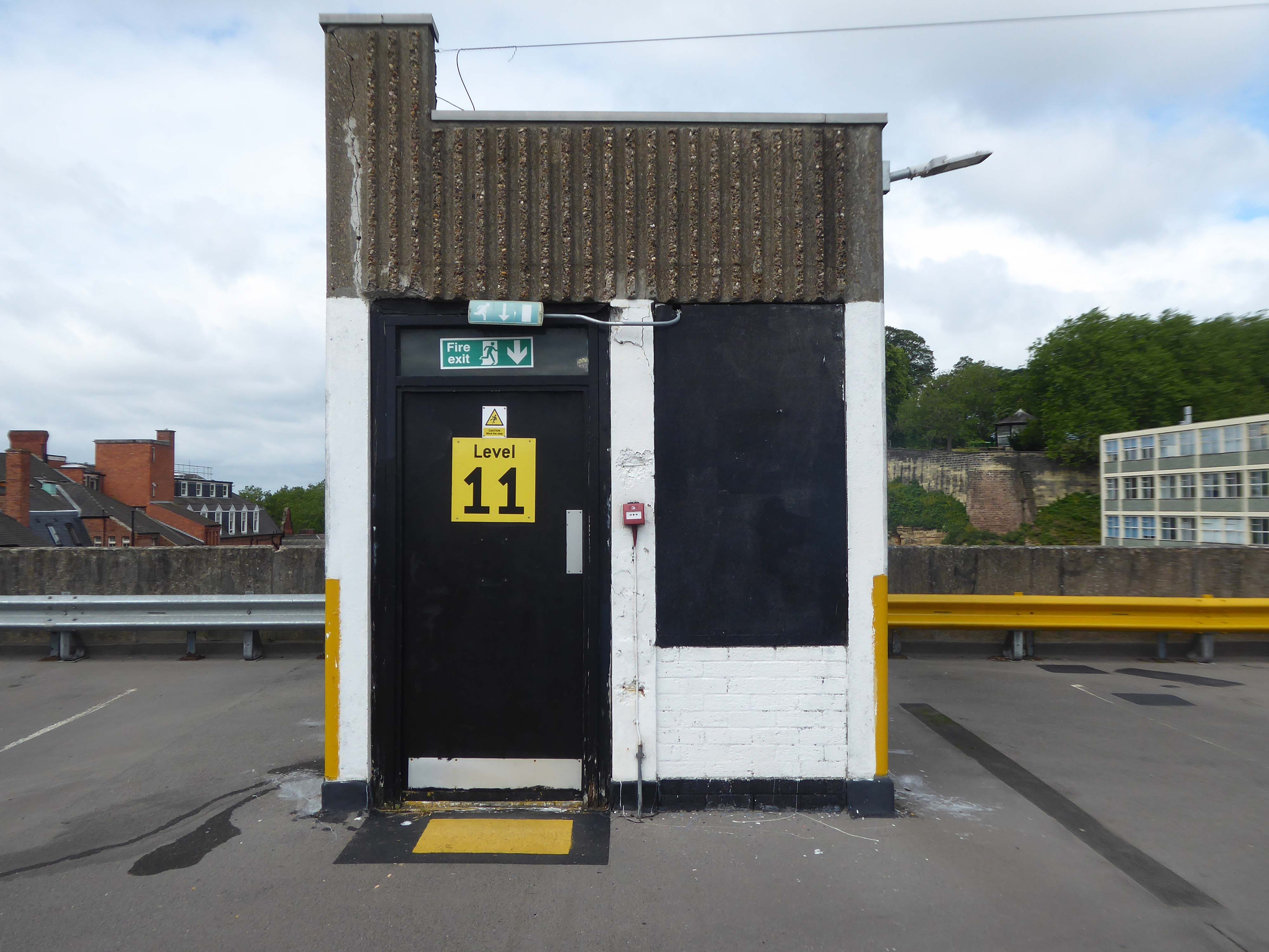
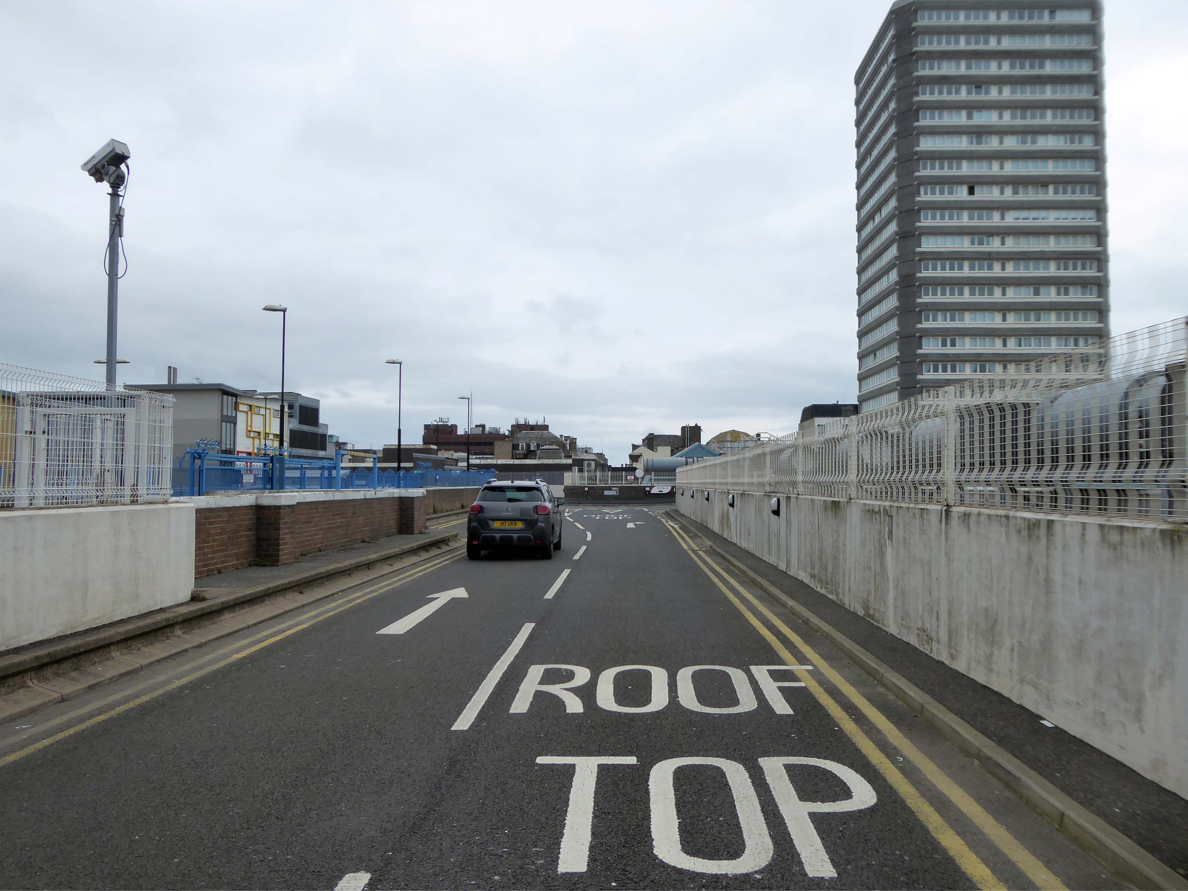
There is access to its roof top car park.
And also an exit back to street level.
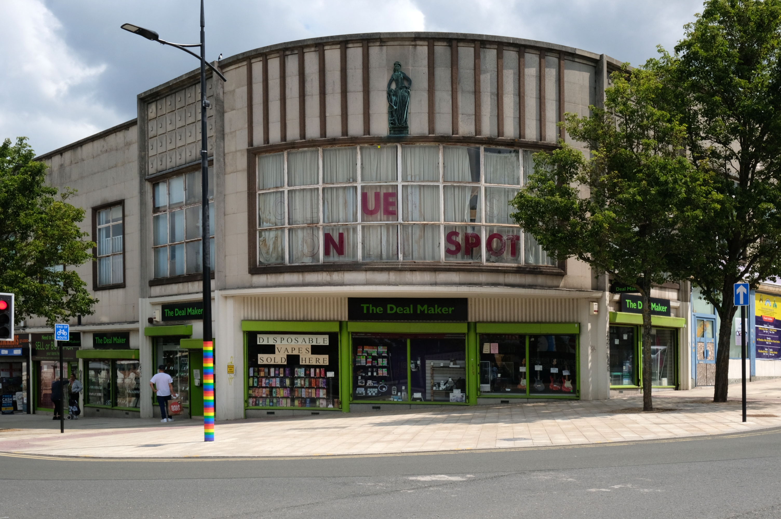
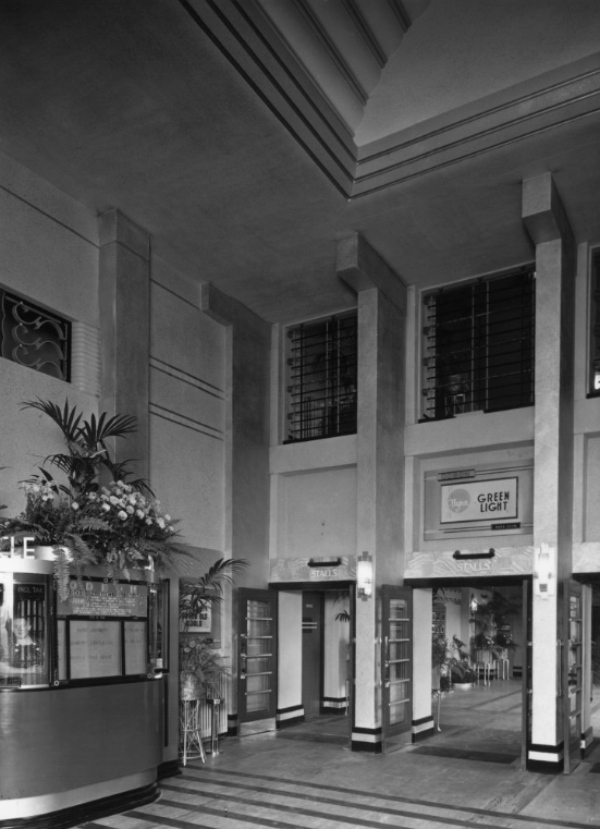
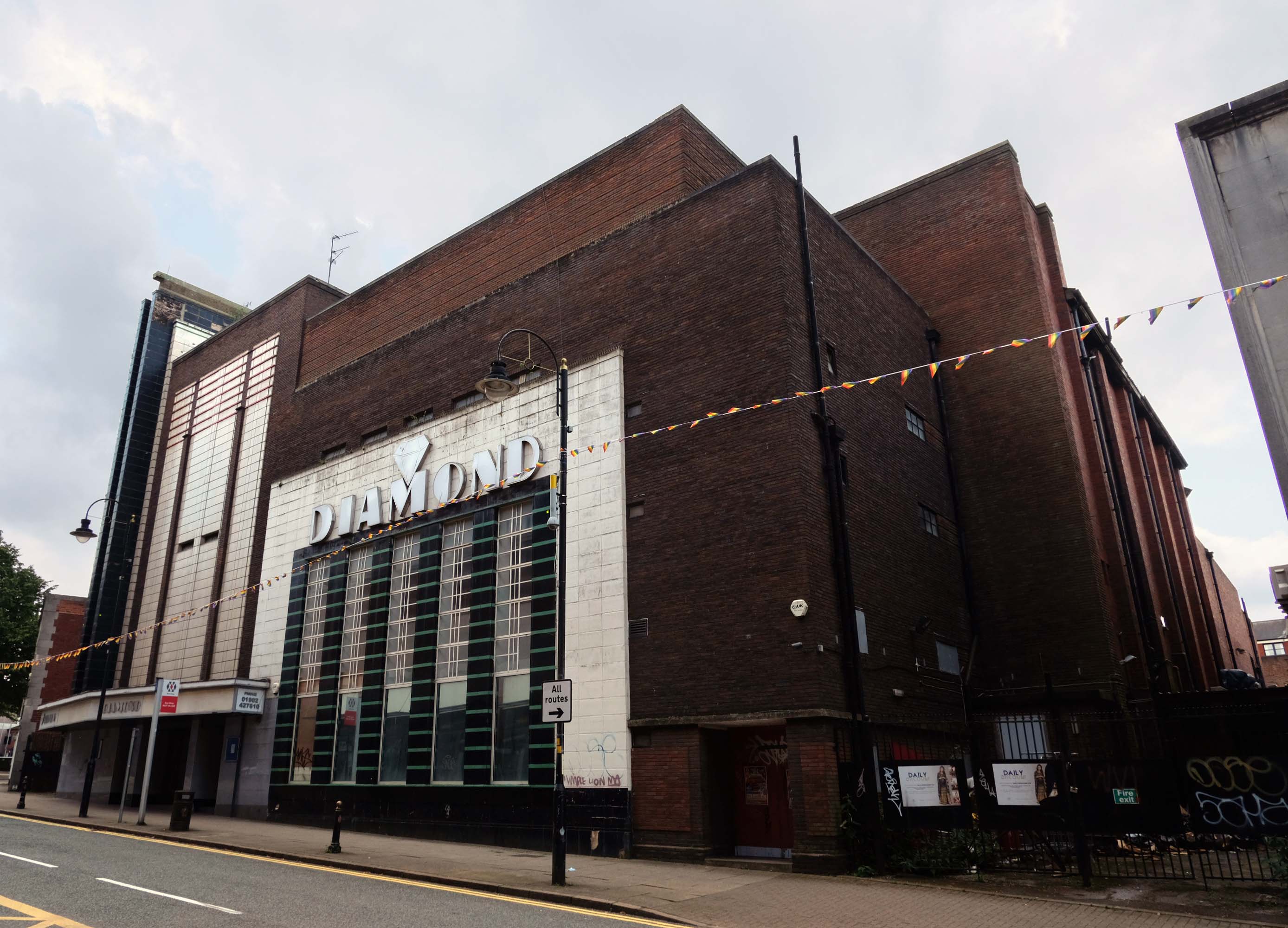
Where we find at street level the former Odeon Cinema, opened on 11th September 1937 with Conrad Veidt in Dark Journey.
In October 2000, the former Odeon was designated a Grade II Listed building by English Heritage.
RIBA pix
In recent years it was a Mecca Bingo Club, but this was closed in March 2007 In October 2009, it had been refurbished and re-opened as the Diamond Banqueting Suite. In April 2021 police raided the vacant building to discover an illegal cannabis farm operating in the building.
Four men were arrested.
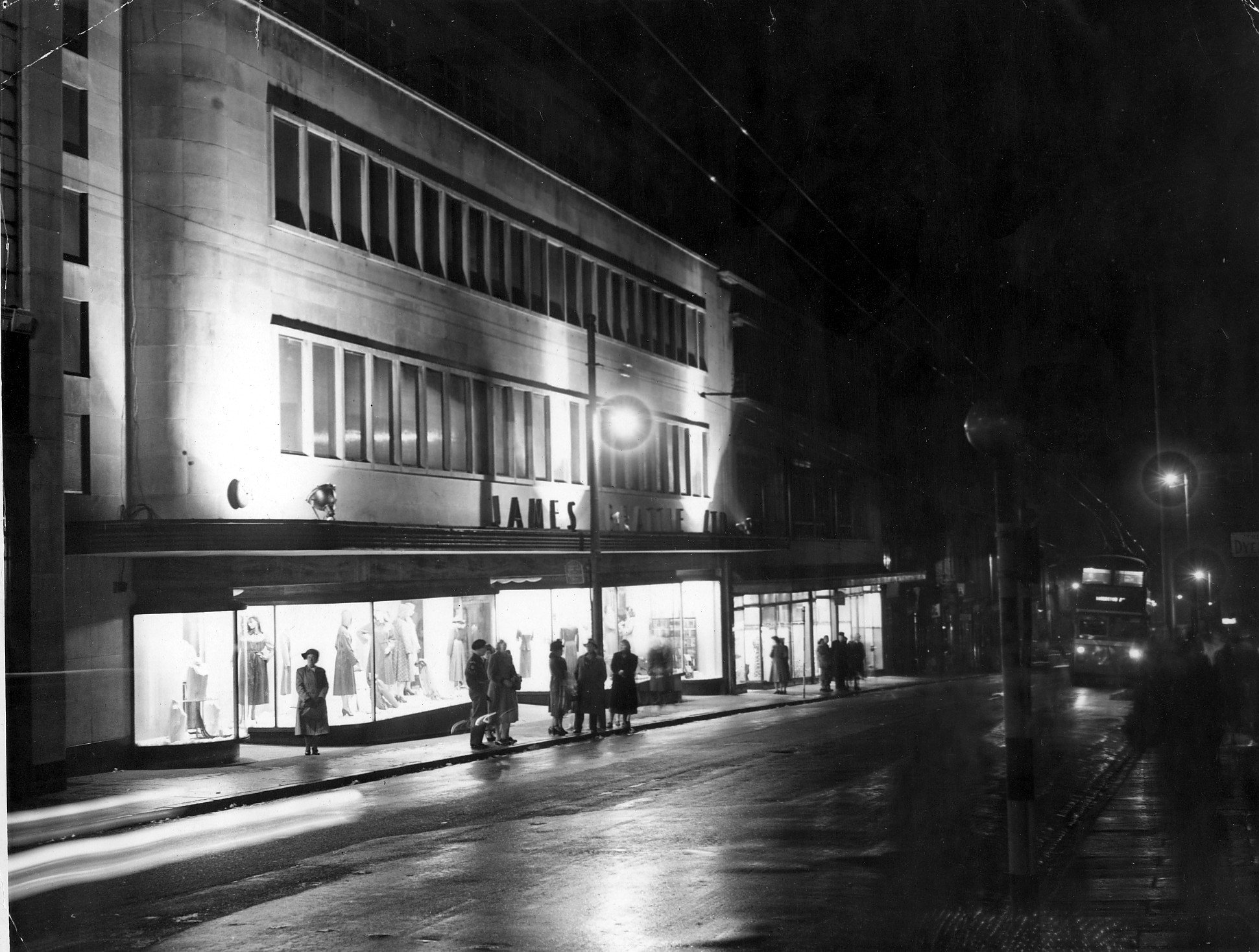
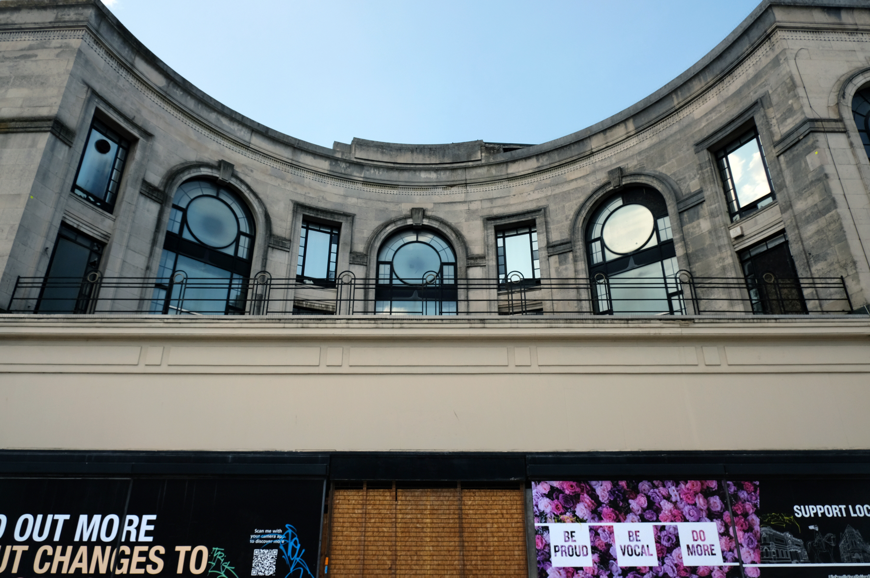
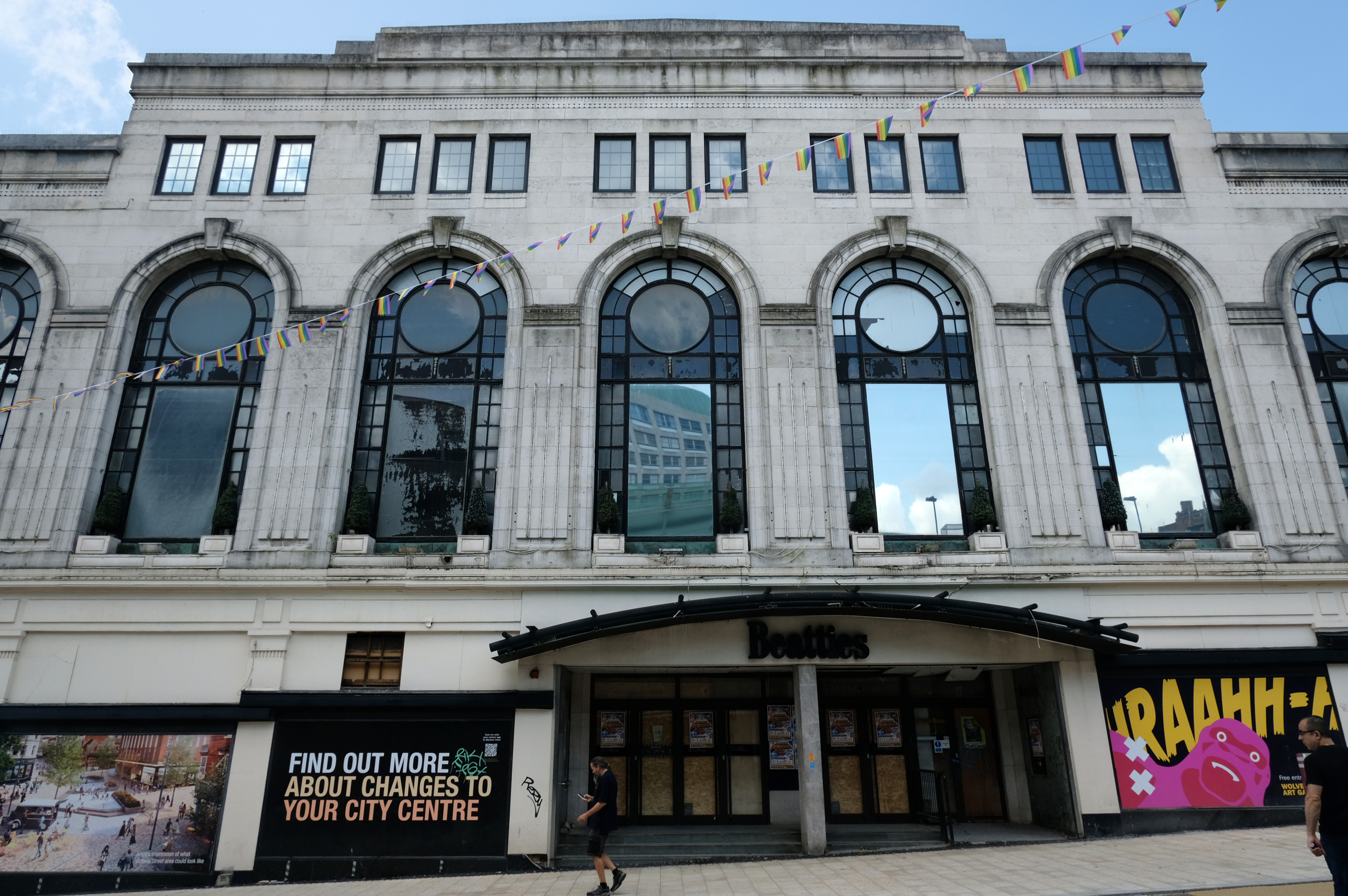
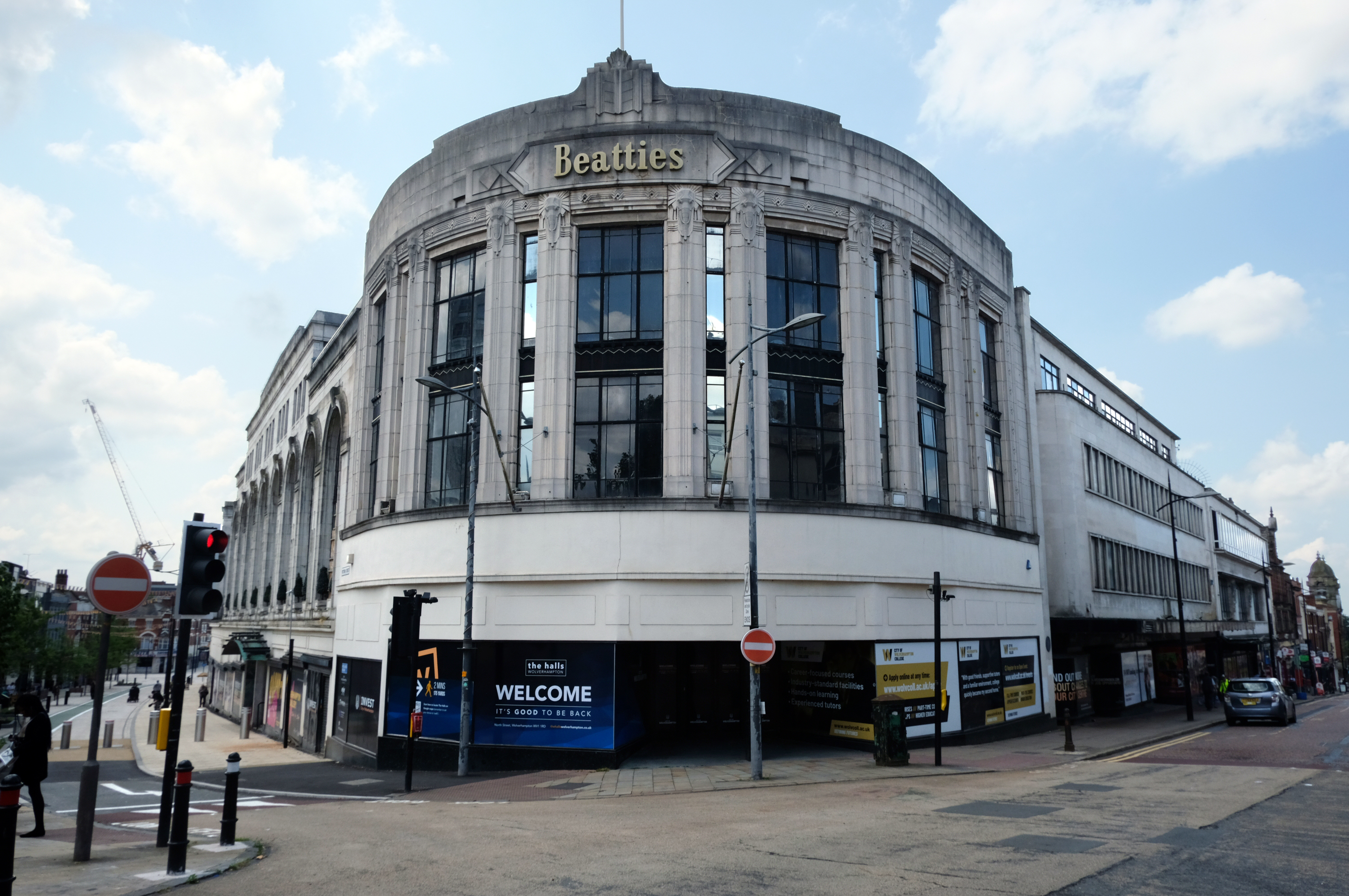
Let’s take a turn around the corner to Victoria Street where we find the complex of Beatties Buildings.
Architects: Lavender, Twentyman and Percy 1920’s – 30’s
The C20 Beatties store is a multi-period site developed first in the 1920s-30s. A Burton’s men’s clothes shop was built on a curved corner site at Victoria St/Darlington St and Beatties themselves replaced their existing Victoria St store in the 1930s with a building by local architects Lavender, Twentyman and Percy. Beatties later acquired and incorporated the Burton’s shop into their store. These two buildings form the locally listed building to which were added a mid-C20 extension along Darlington St and a late-C20 development to the rear at Skinner St.
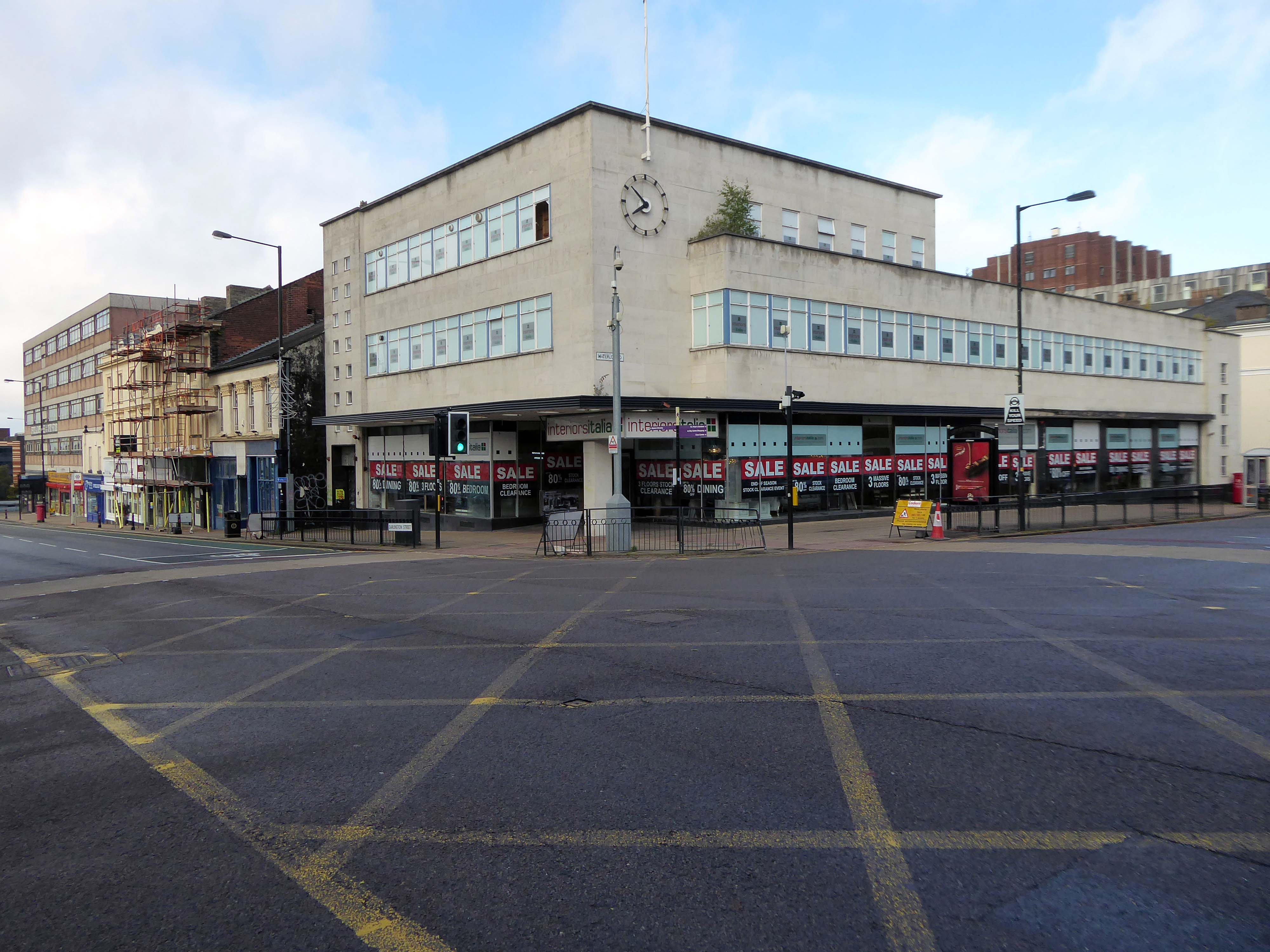
An imperious Portland stone clad mixed us block on Waterloo Road, with a delightful clock.
Formerly the Gas Showrooms then SunAlliance & LondonInsurance offices – aka Clock Chambers
The showroom in Darlington Street was also the centre of a radio network that controlled a fleet of service vans. This enabled customers to receive service within minutes of making a telephone call. Demonstrations of cookery, washing and refrigeration were given by the Gas Board’s Home Service Advisers and a number of the company’s engineers, who specialised in designing gas equipment for industrial processes operated an advisory service for manufacturers.
Architects: Richard Twentyman 1939.
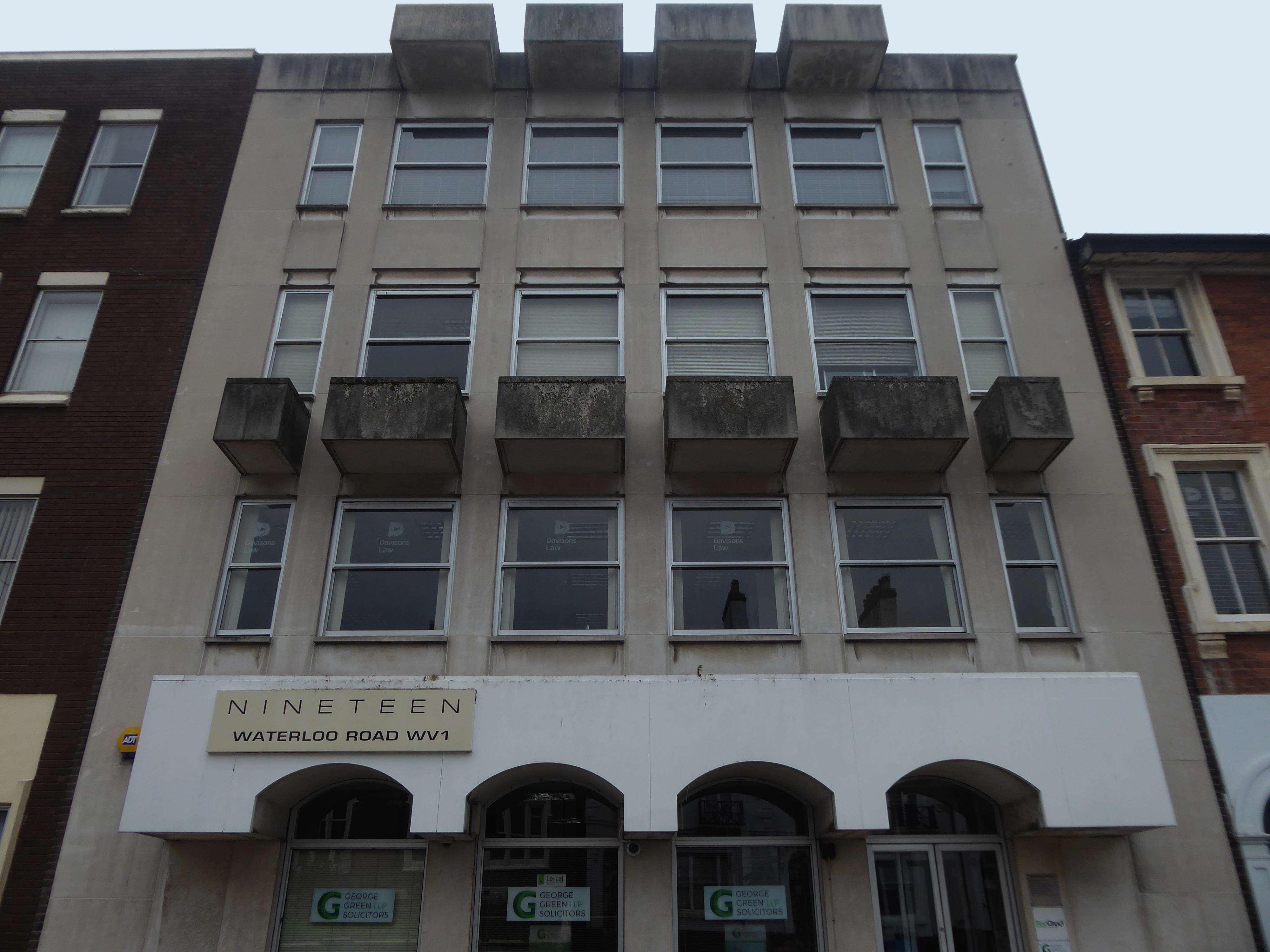
Nineteen Waterloo Road latterly First City House formerly home to Eagle Star Insurance 1970
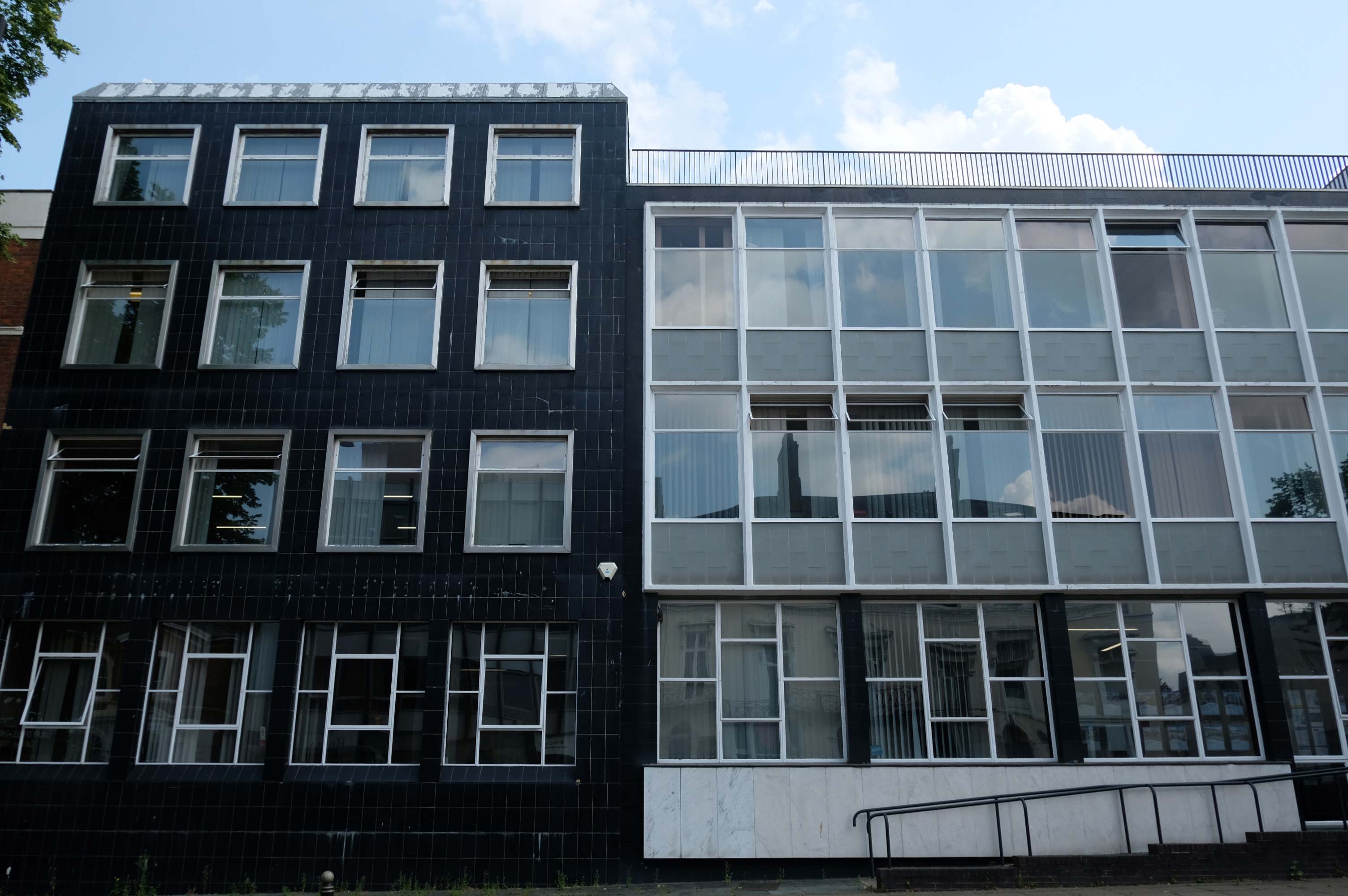
8-10 Waterloo Road architects: Richard Twentyman 1959 extended 1966.
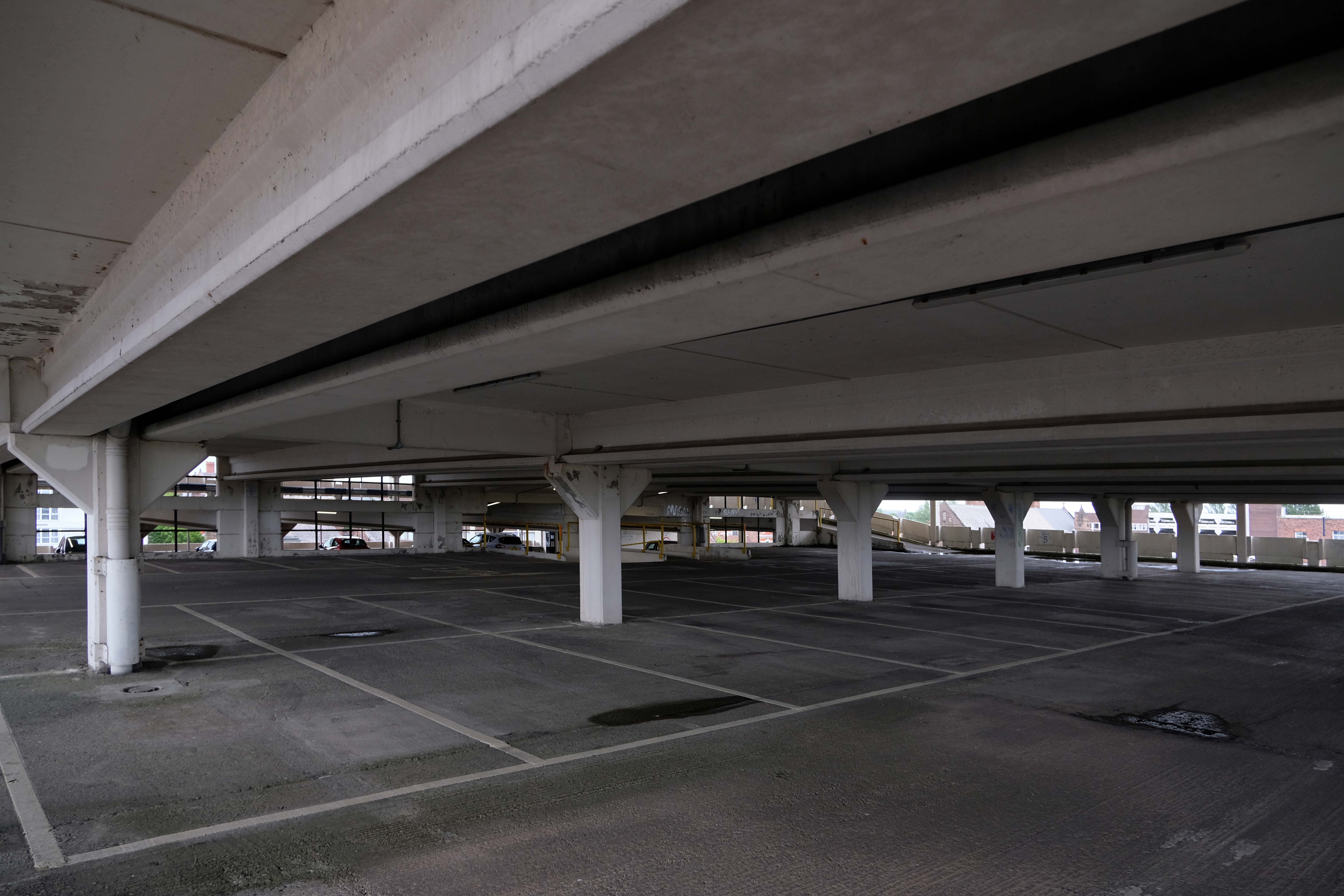
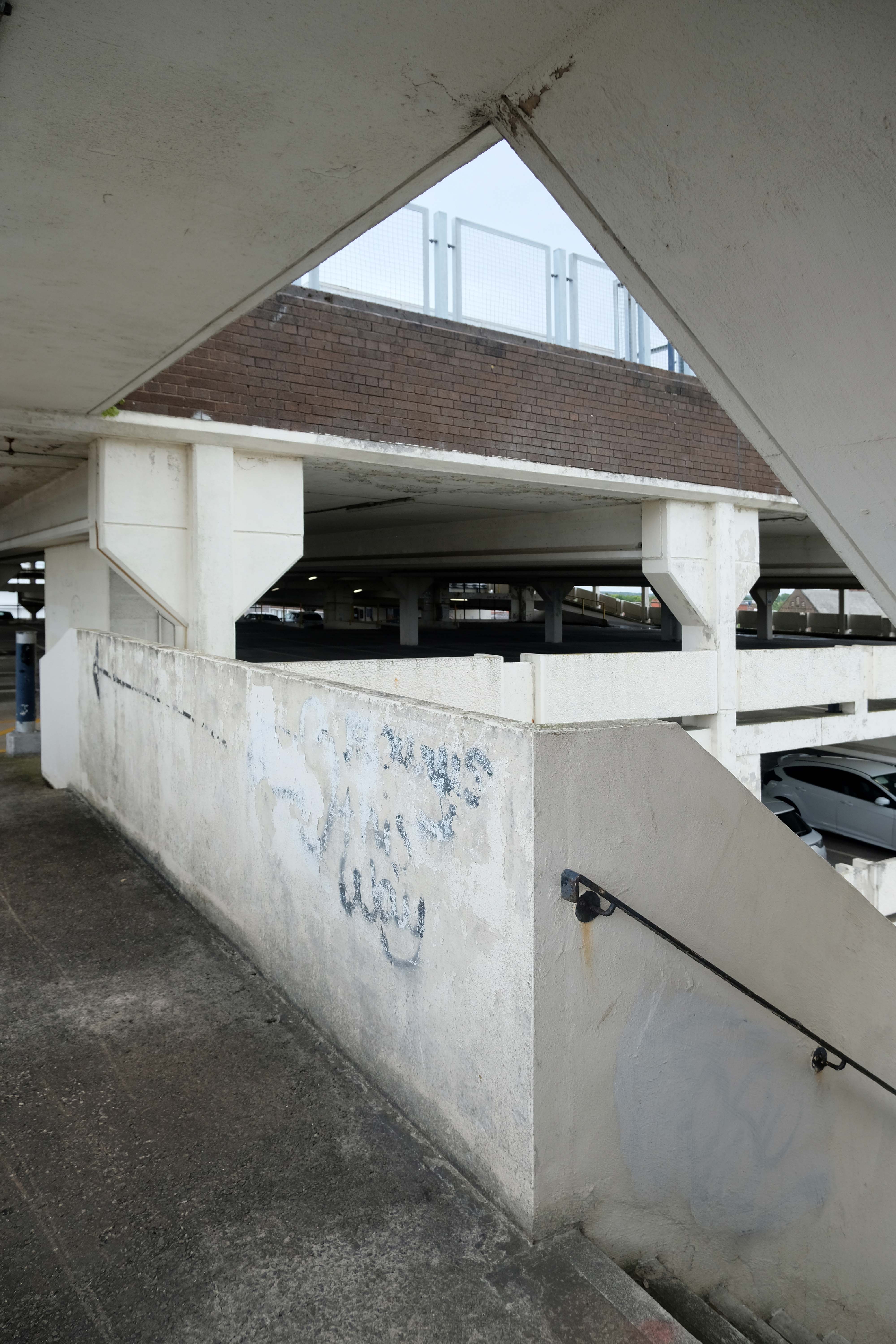
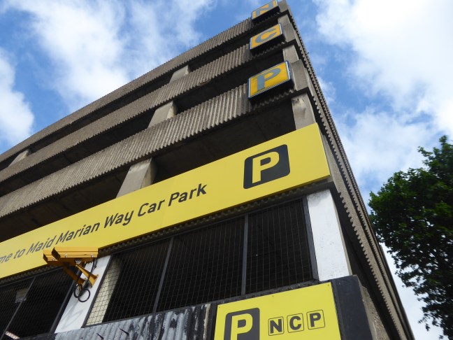
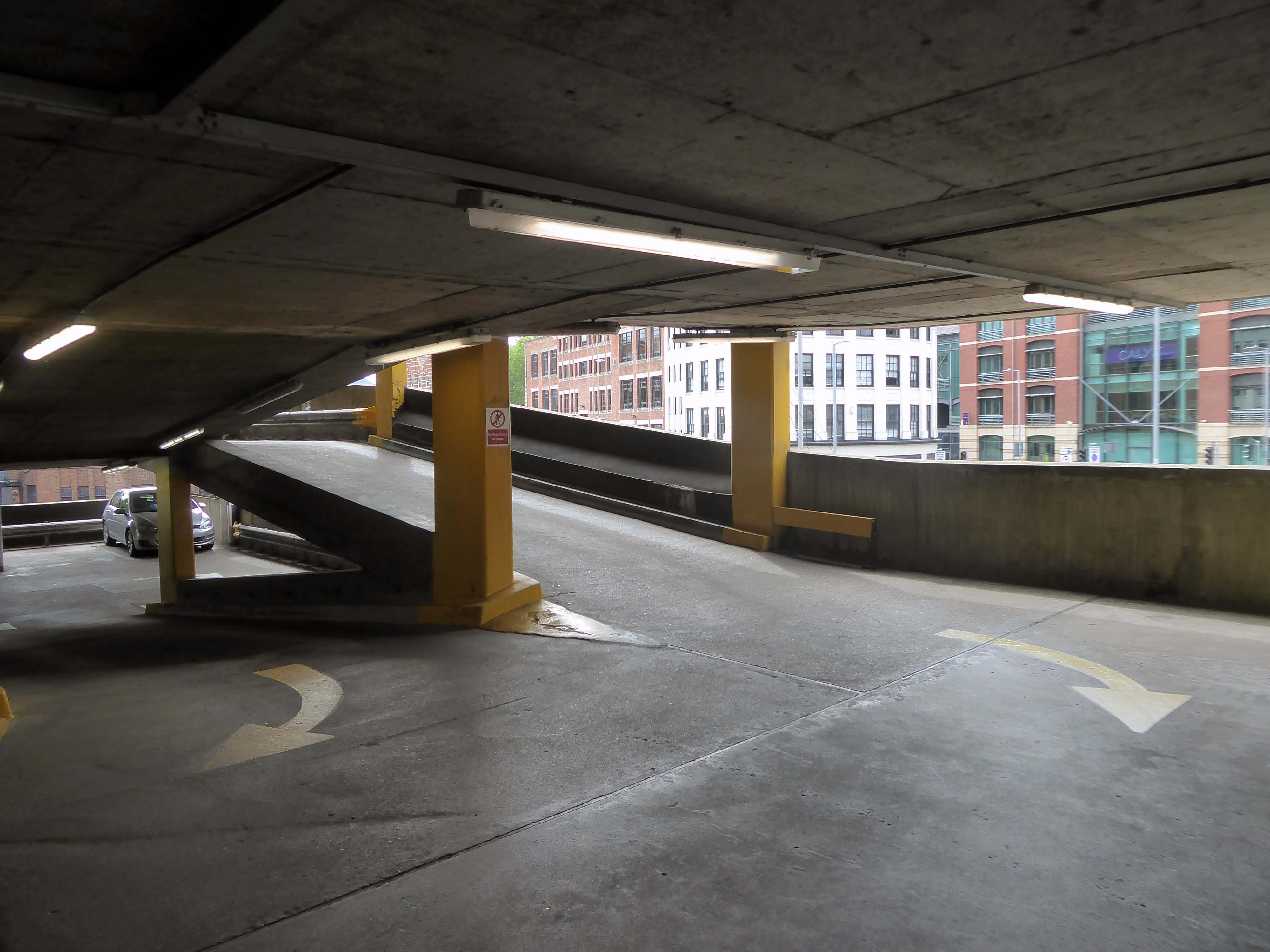
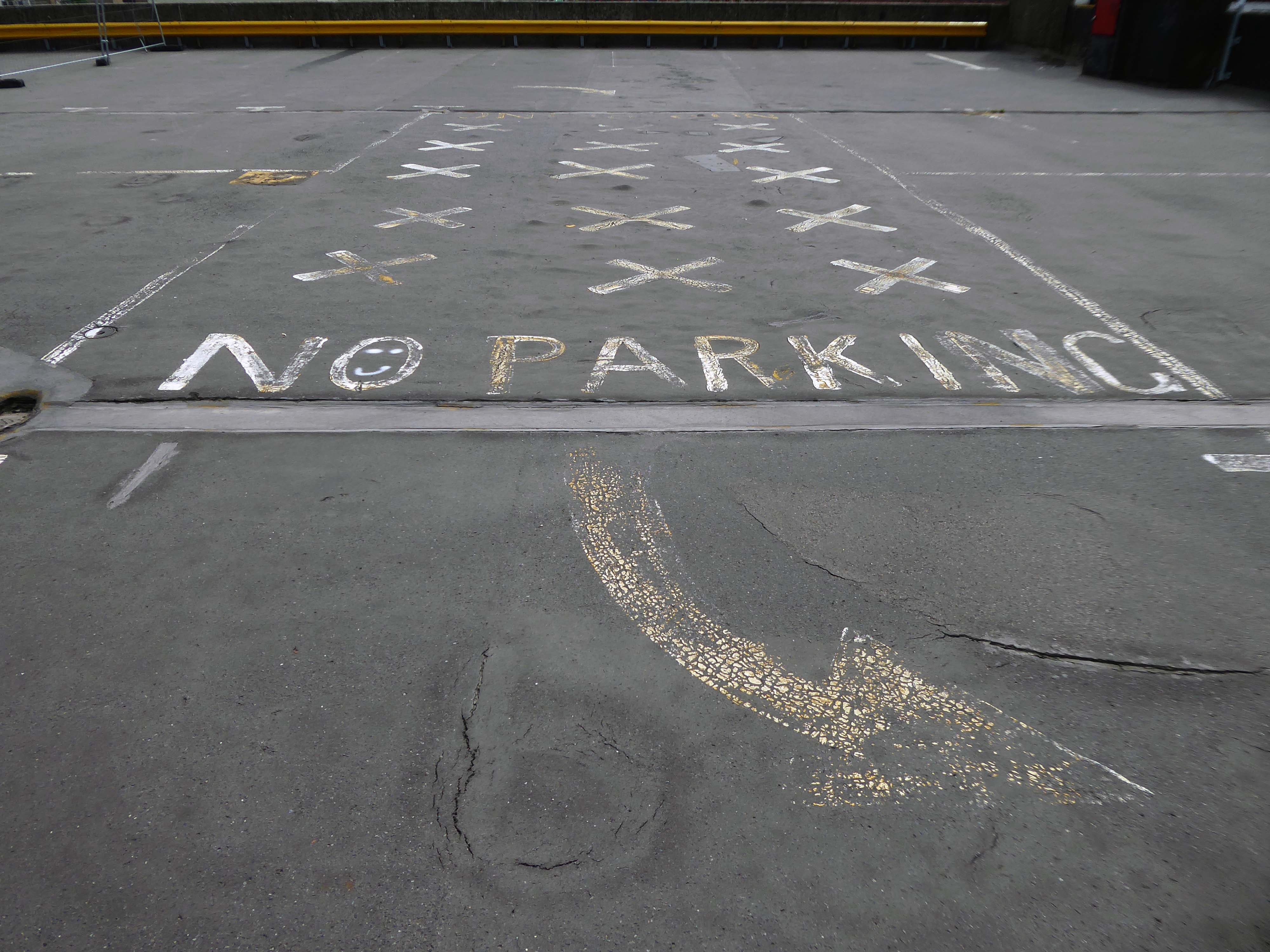
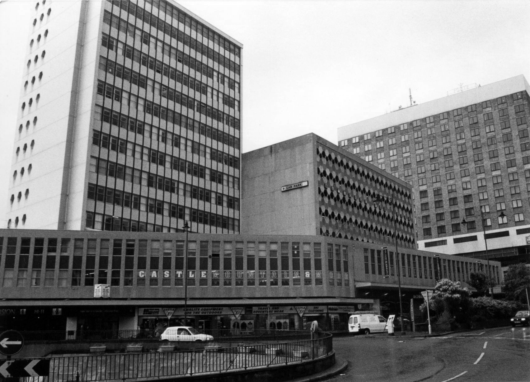
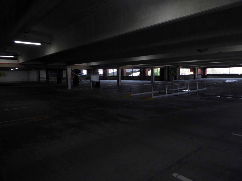
This has narrow ramps up and down, and narrow parking spots.
One ticket machine upon entry wouldn’t dispense – the other was covered with a bag but did work, very weird.
Becky T
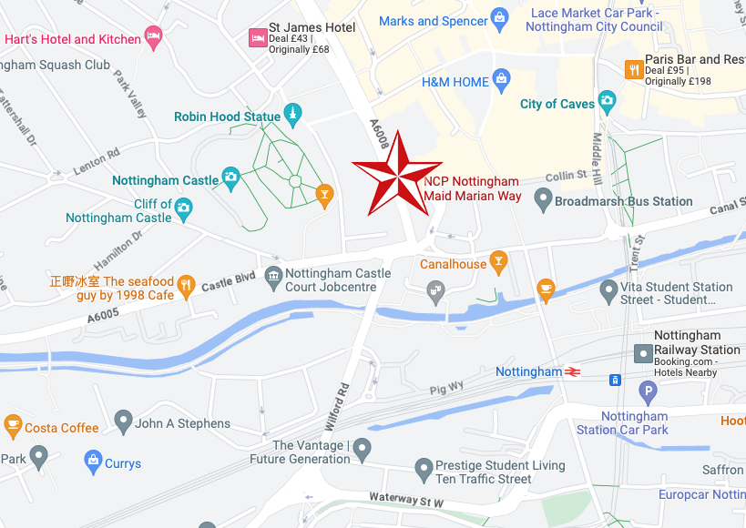
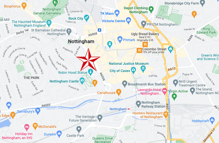
Anyway, a way must have a name, so why not Maid Marion?
Olivia De Havilland
Maid Marian is the heroine of the Robin Hood legend in English folklore, often taken to be his lover. She is not mentioned in the early, medieval versions of the legend, but was the subject of at least two plays by 1600. Her history and circumstances are obscure, but she commanded high respect in Robin’s circle for her courage and independence as well as her beauty and loyalty. For this reason, she is celebrated by feminist commentators as one of the early strong female characters in English literature.
Robin Hood and DH Lawrence apart it seems most apt – so Maid Marion Way it is then.
In November 1945, the city council decided to ask Parliament for the go ahead for a scheme likely to cost more than half a million pounds.
However, it would cut a swathe through medieval streets, wiping some from the map and spelling the end of a community life which had thrived for centuries.
The arguments, discussions and negotiations rumbled on for years. It would be 1963 before work finally got underway and the new road was built.
Less than two years after it was completed, it was given a label that has stuck over the past four decades — the ugliest street in Europe.
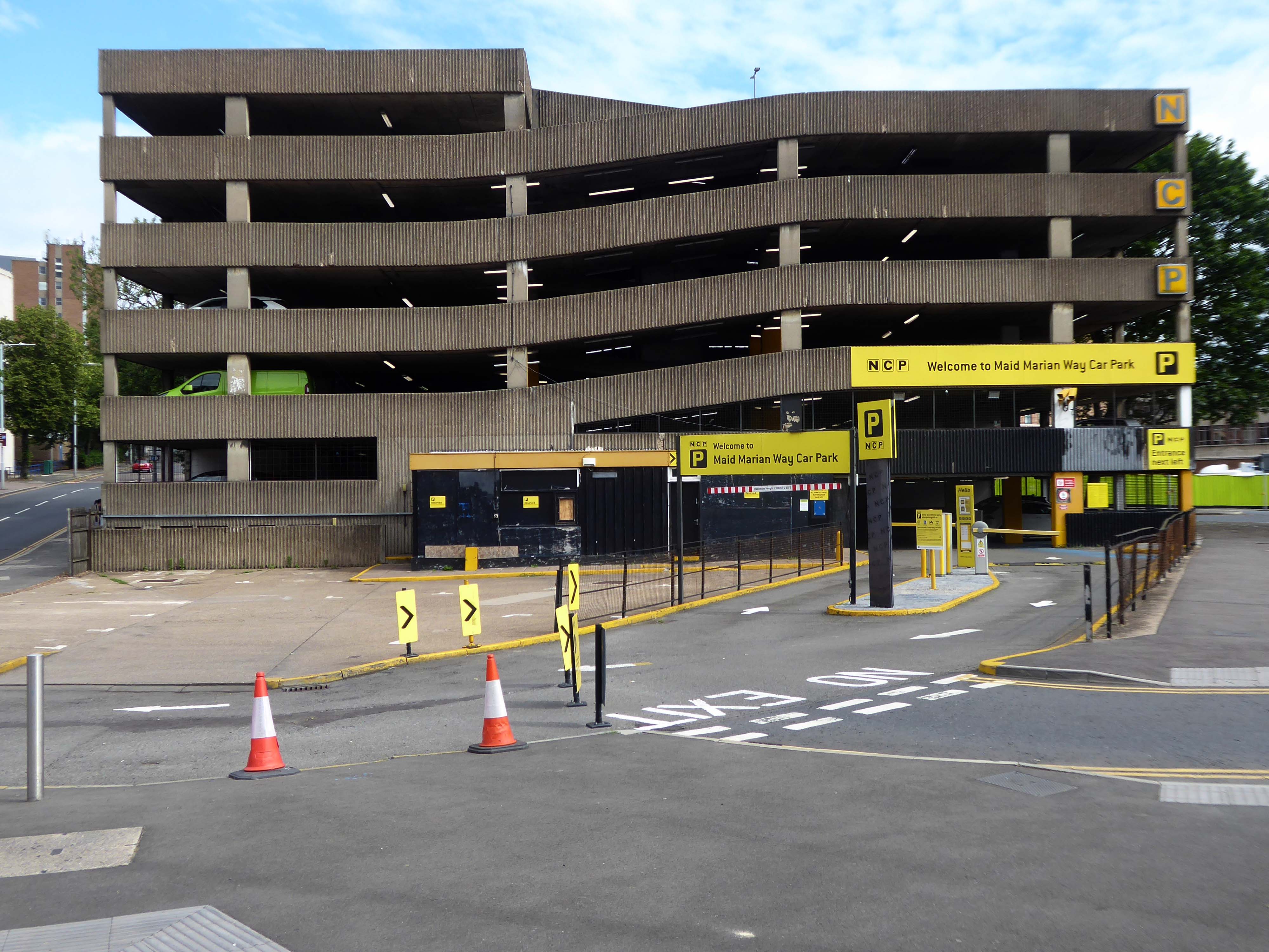
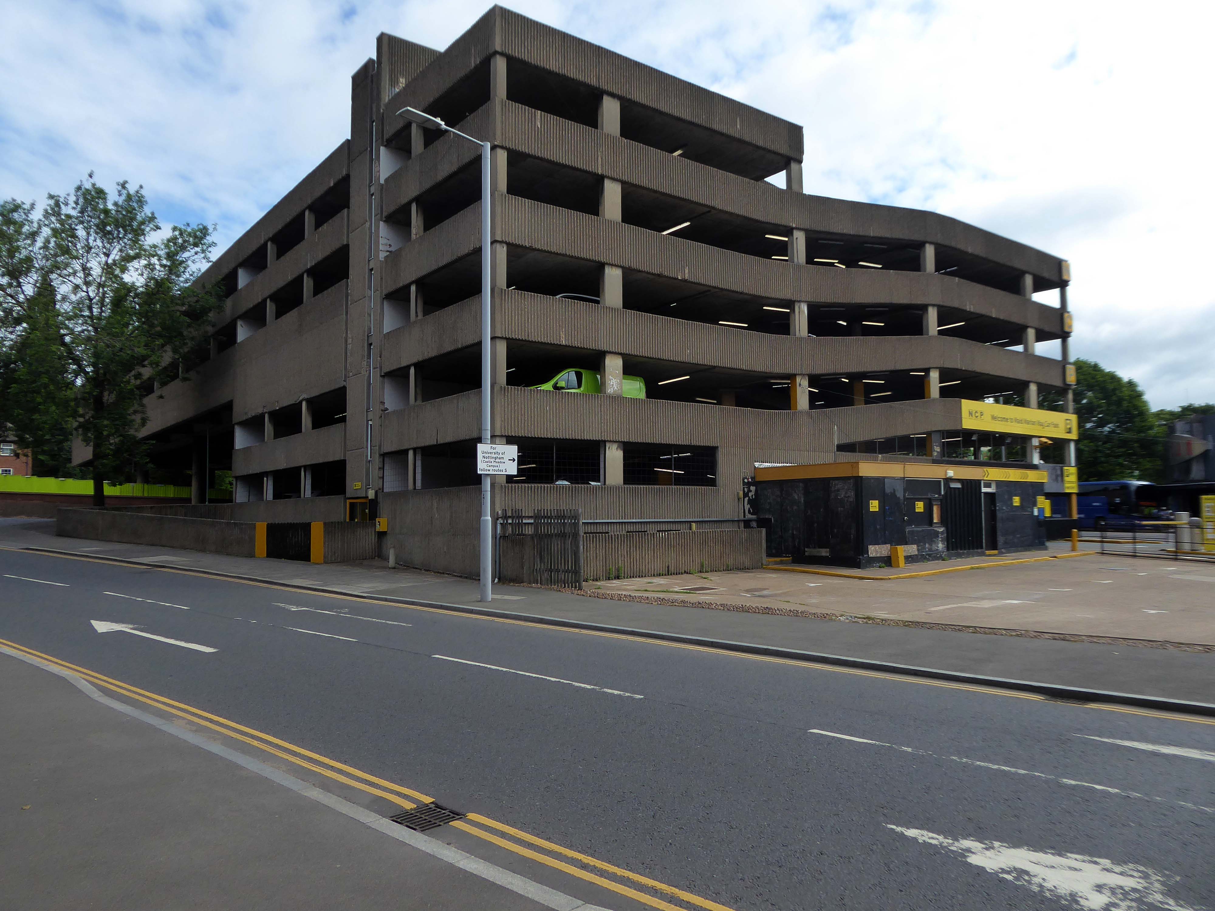
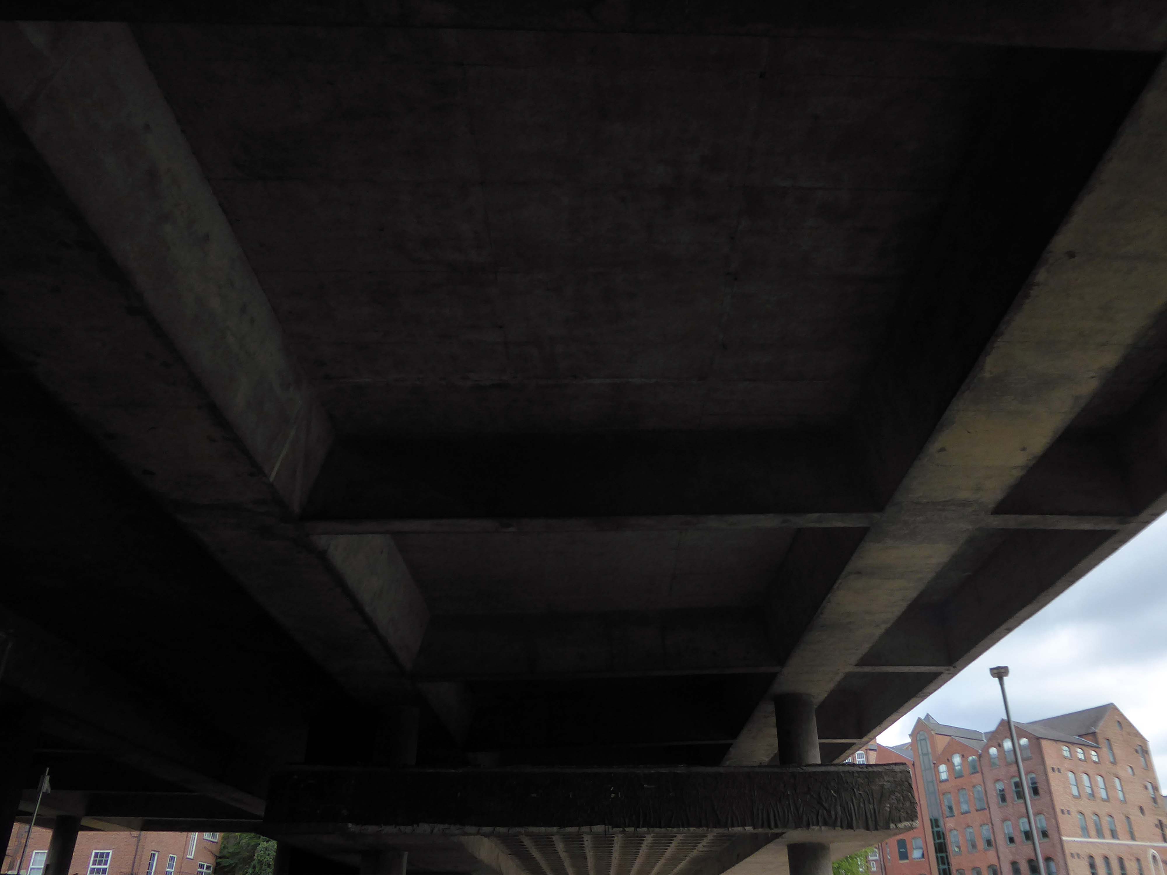
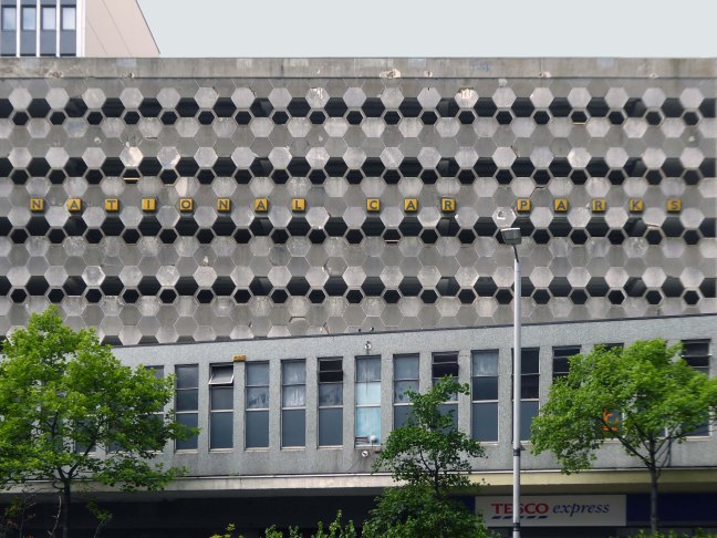
Dual carriageways mean cars, cars mean car parks and car parks mean business.
Whether you’re visiting a student or are one yourself, parking at our car park on Maid Marian Way gives you easy access to the University of Nottingham.
For those who want a bit of retail therapy, look no further than the Intu Victoria shopping centre. Located within easy walking distance of our Maid Marian car park and right in the heart of the city centre, you’ll have a choice of over fifty shops to browse.
If you’re a bit of a history buff then Nottingham Castle should definitely be on your ‘to do’ list. Park near the castle at Maid Marian Way, and you’re just minutes away from reliving tales of the past as you explore the original hidden caves equipped with a dungeon. Make sure you don’t leave without taking a picture with Nottingham’s most famous resident, Robin Hood, found just outside the castle.
Had a lovely conversation with a lady in the machine after my parking ticket was swallowed and learnt lots about the poor acoustic in car parks. They charged me twice to park my car which made me feel lots of negative emotions towards them. So all in all, a bit of rollercoaster. Highly recommend this experience for anyone looking for somewhere to park that enjoys conflict and has lots of money they don’t need.
Very expensive, dirty and with rough sleepers lying on each stairs landing.
Felt very unsafe.
Parkopedia
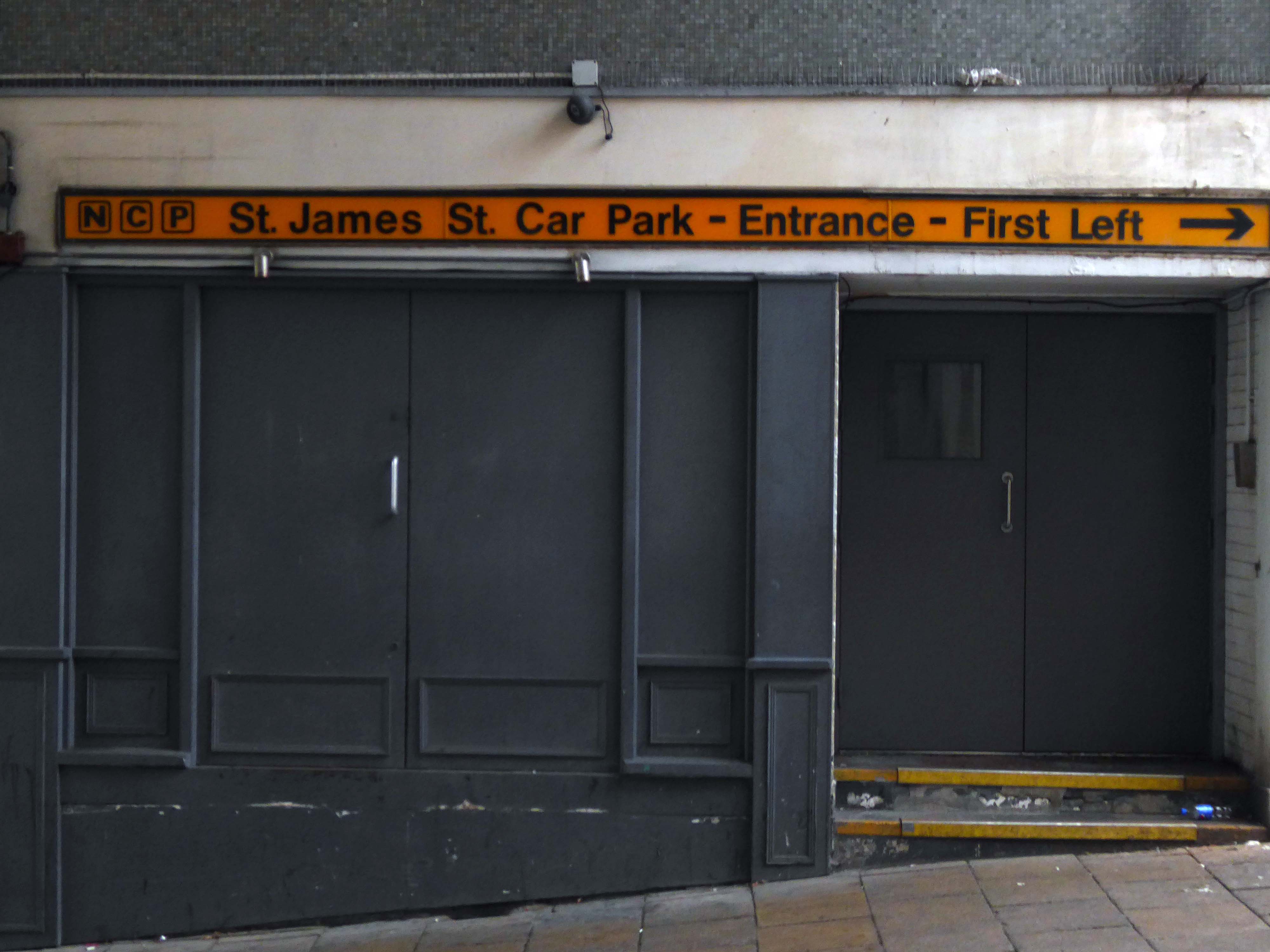
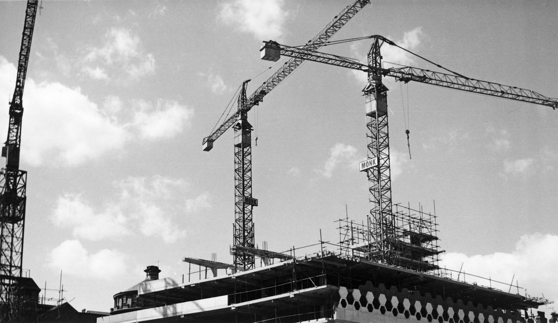
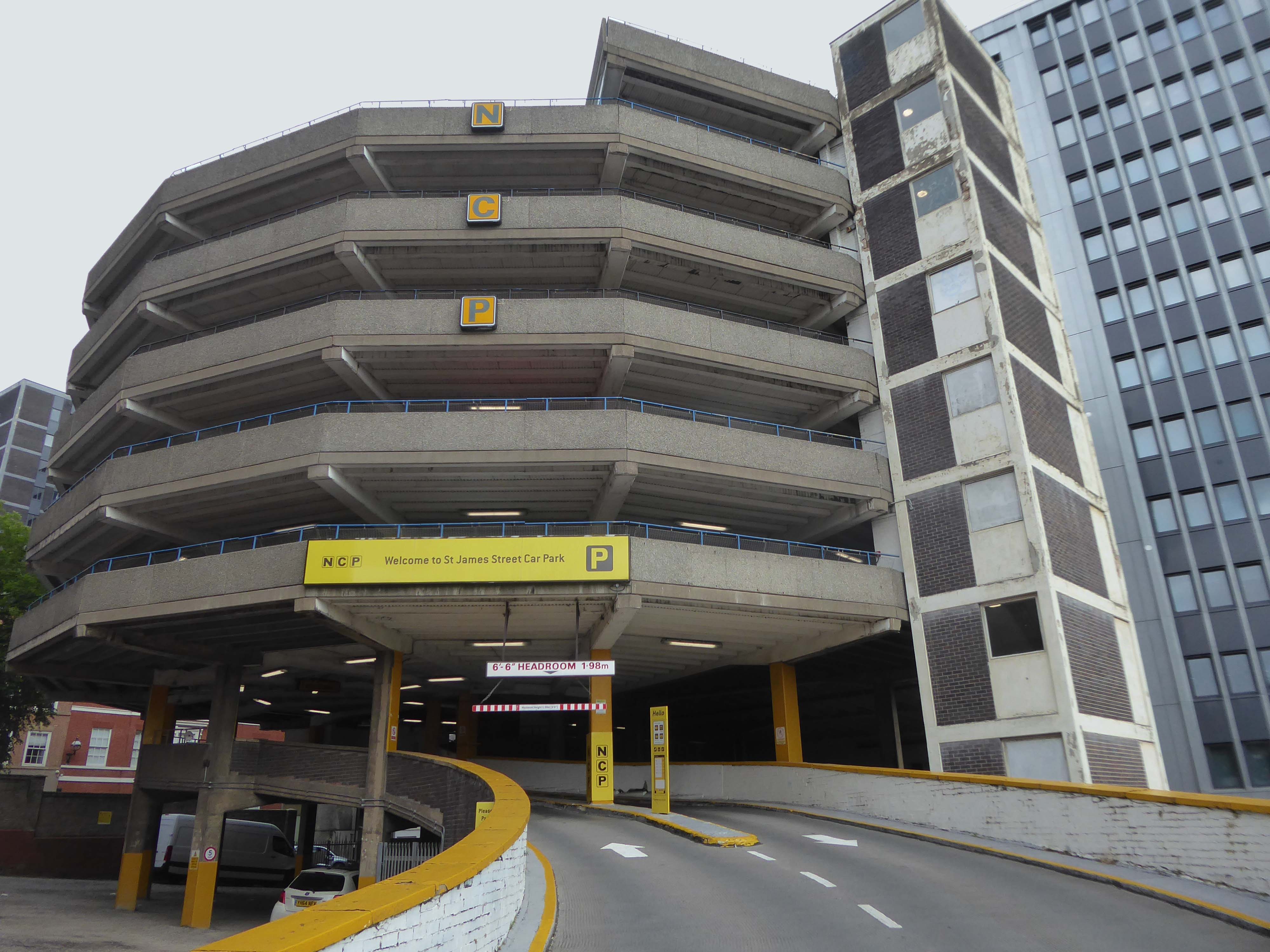
Located in the heart of Nottingham, our parking on St James Street puts you right in the historical centre of this ancient city. Get your picture taken with the legendary Robin Hood Statue, then take a tour of the Castle, Museum and Art Gallery before staying in the stylish boutique accommodation of St James Hotel.
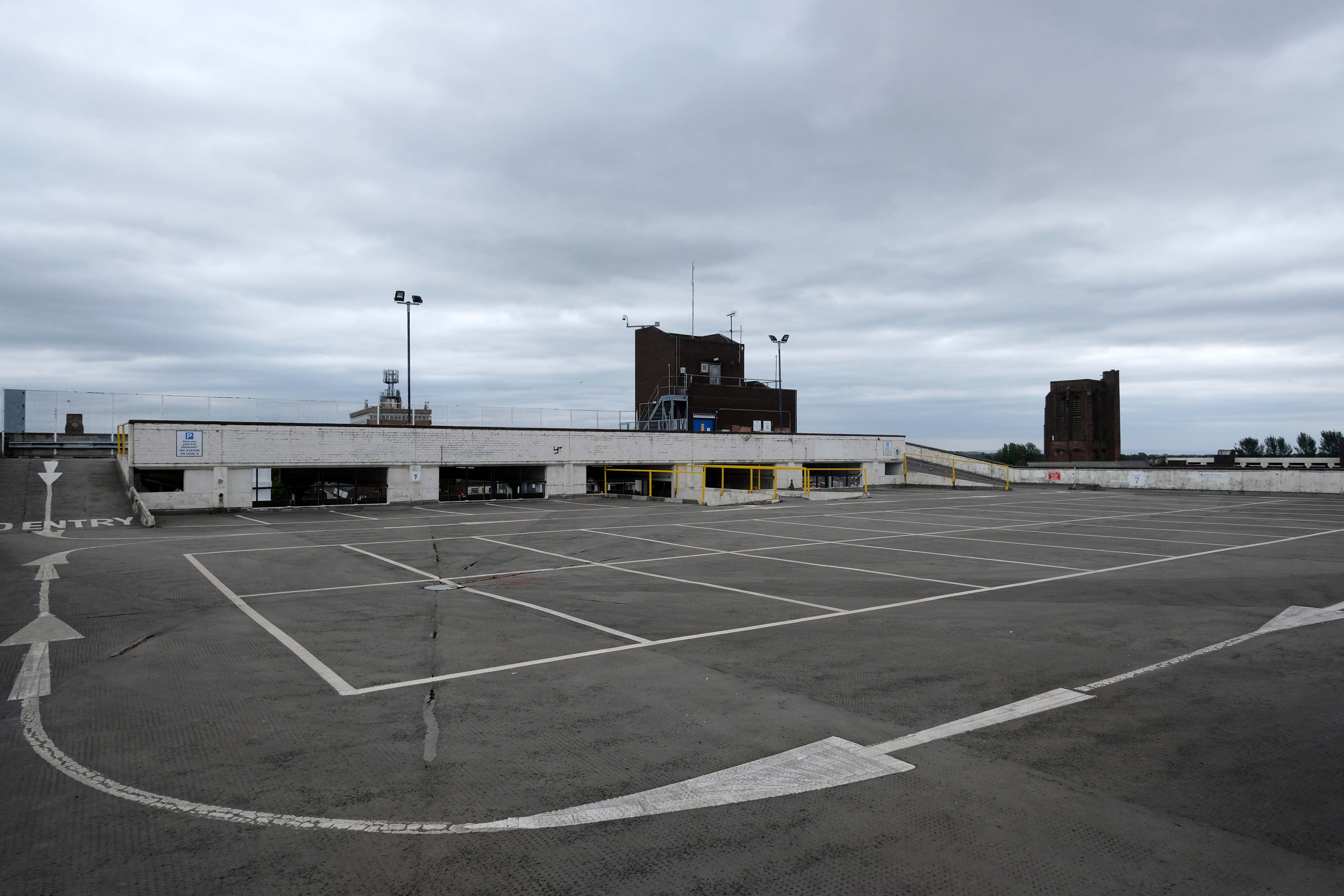
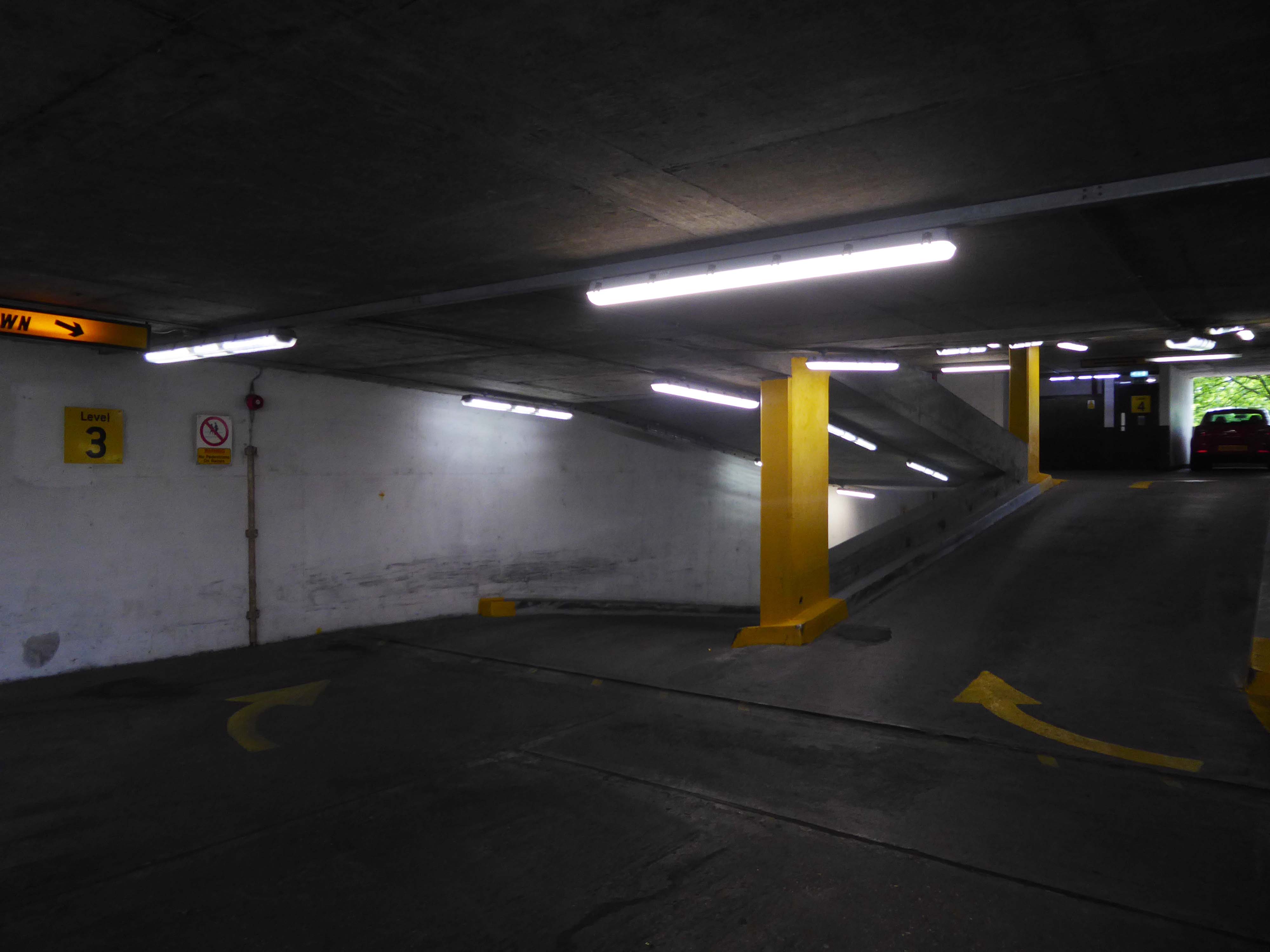
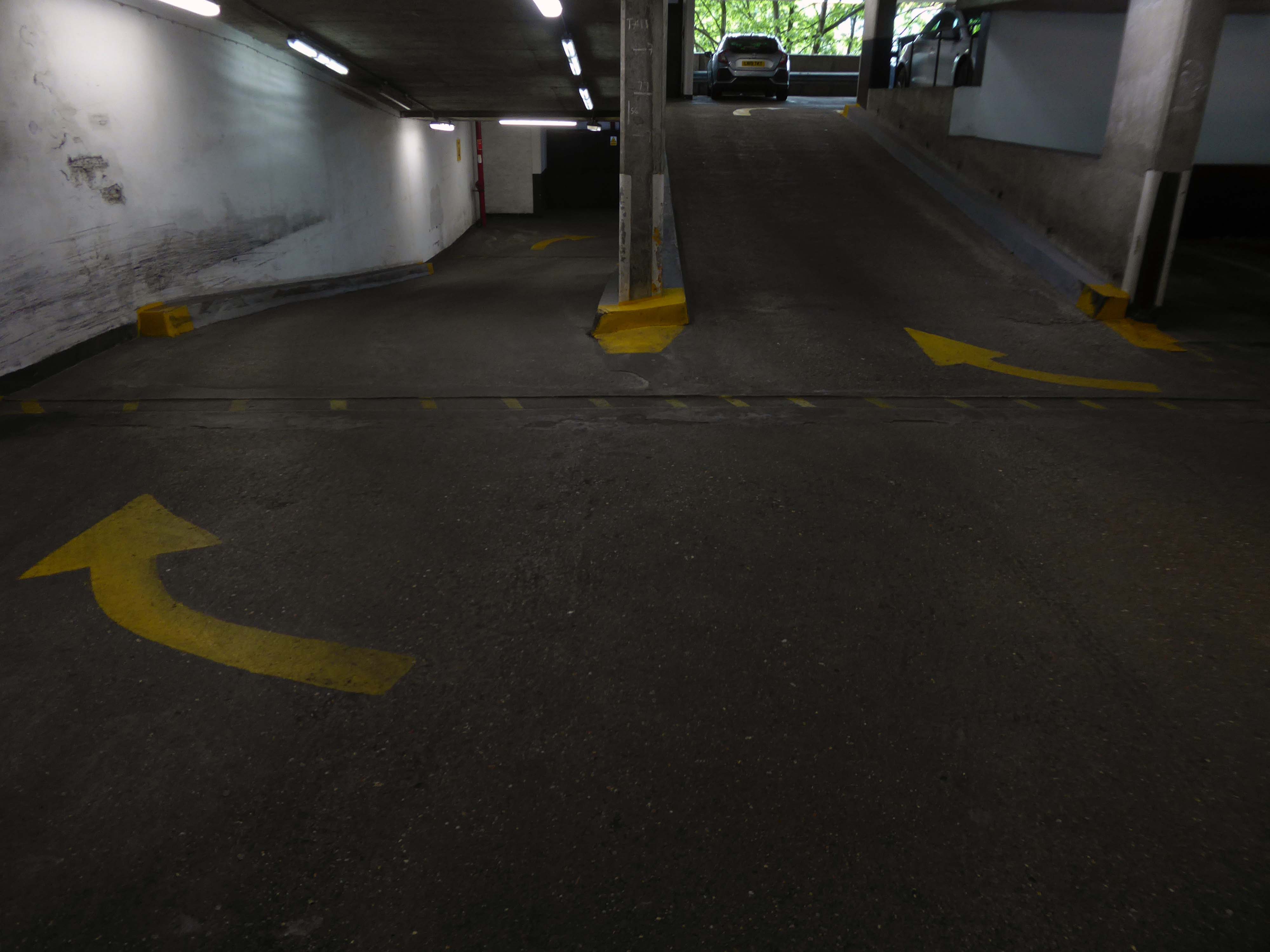
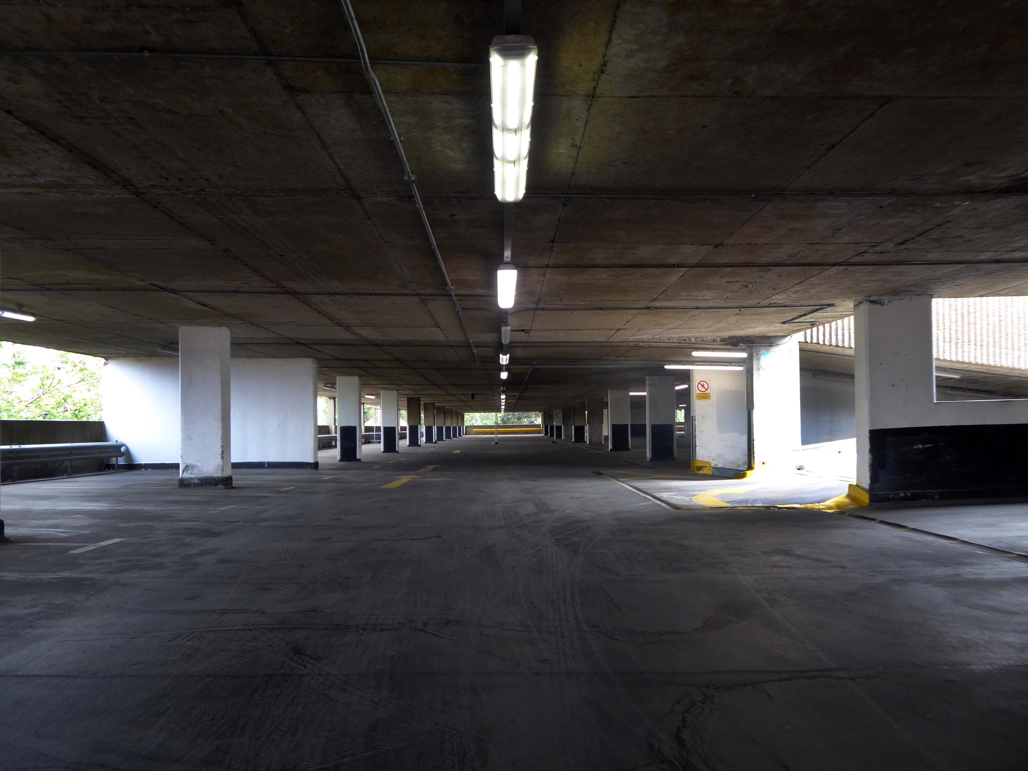
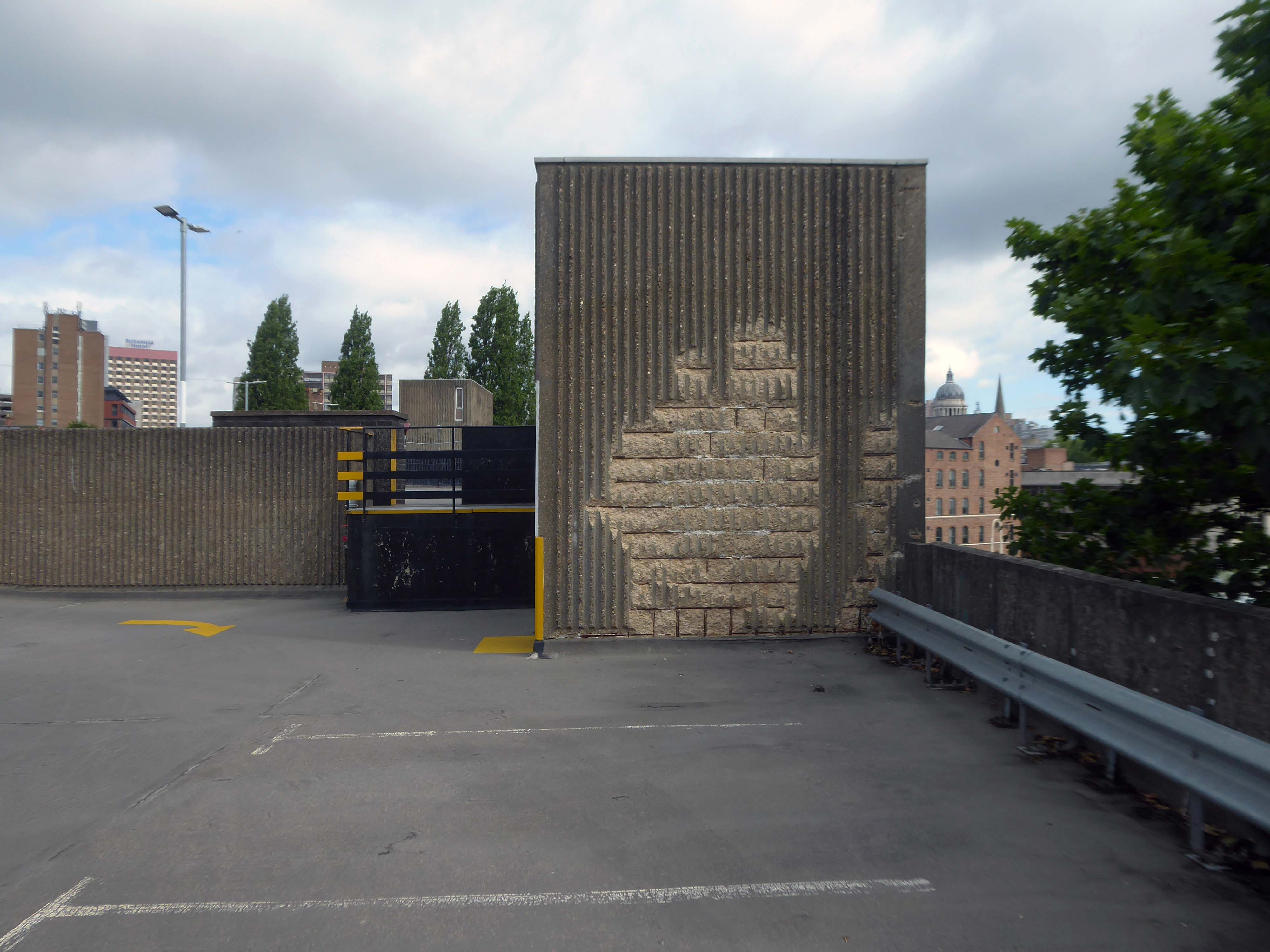
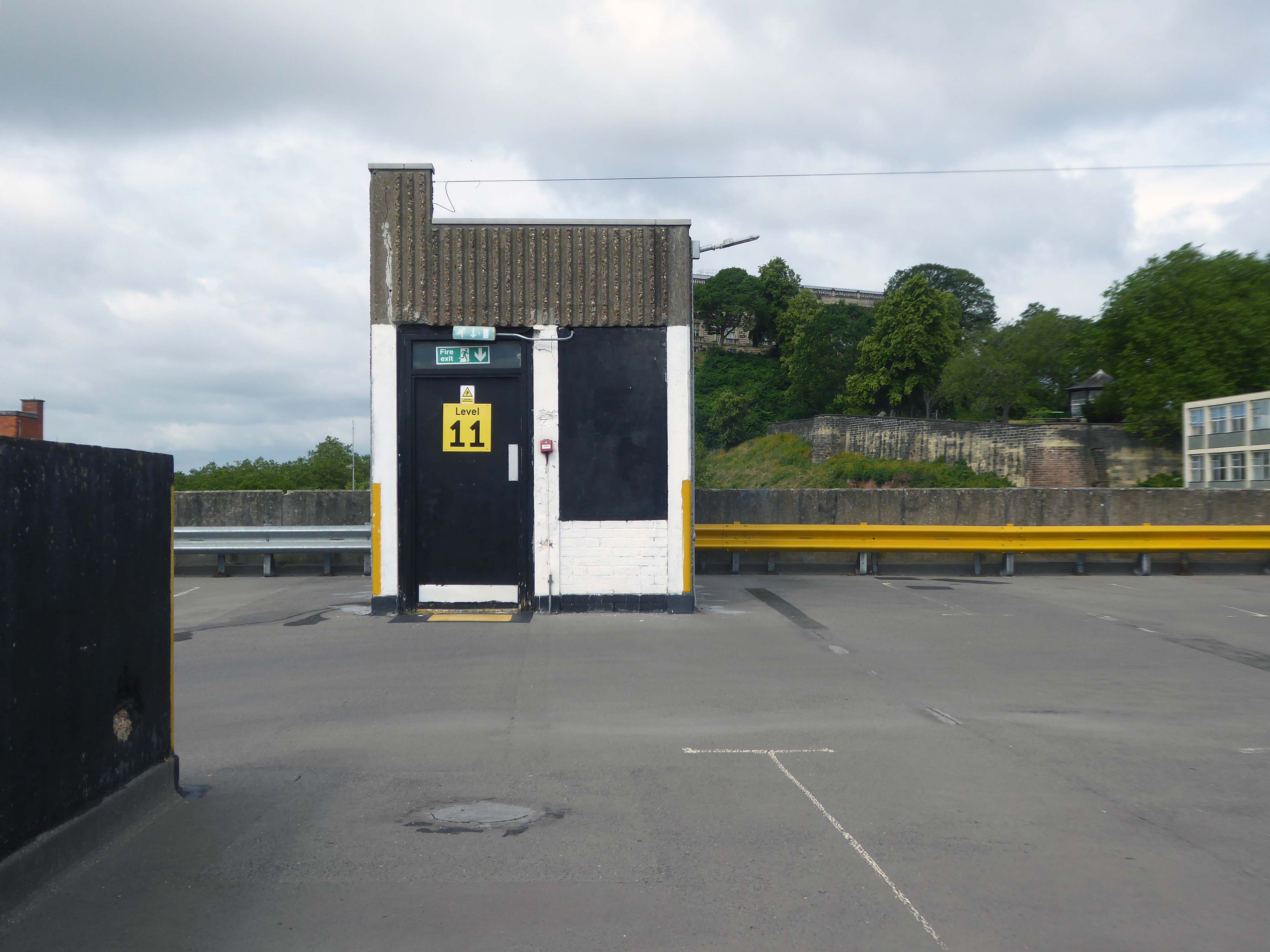
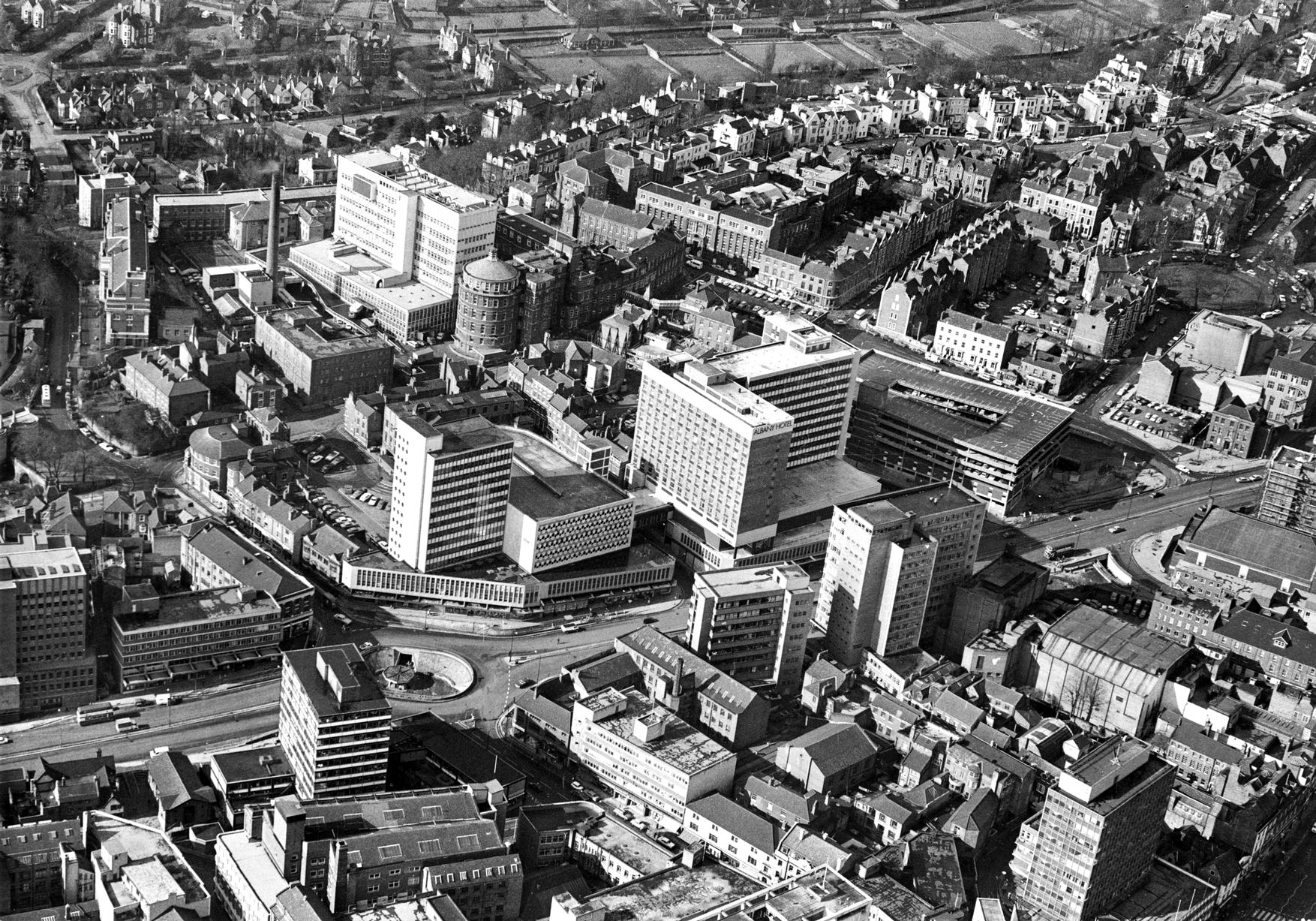
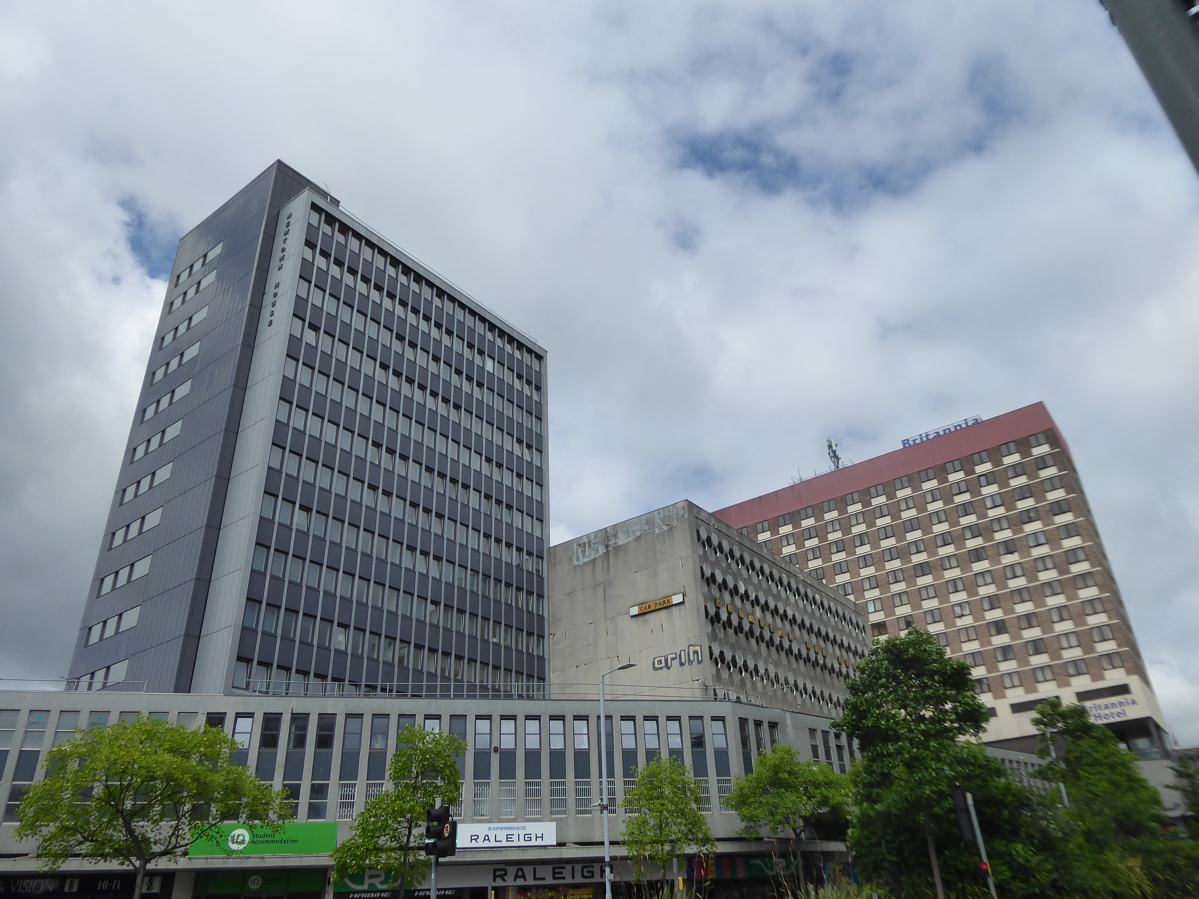
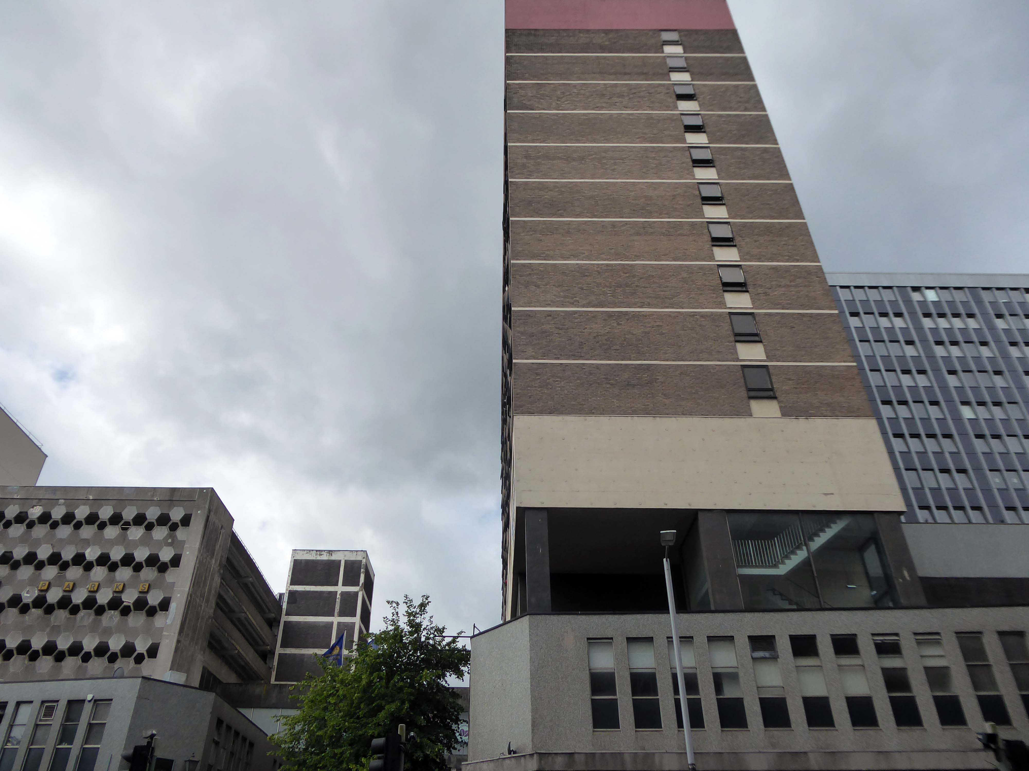
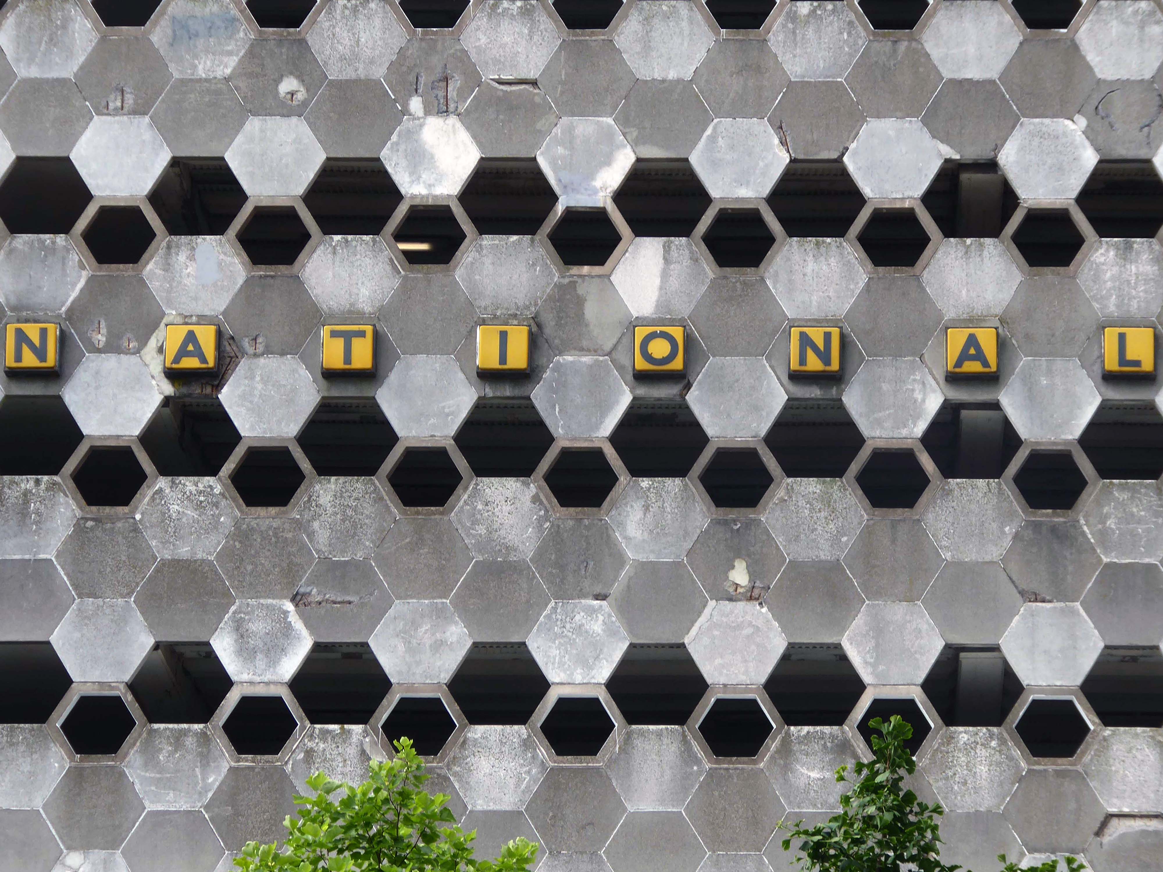
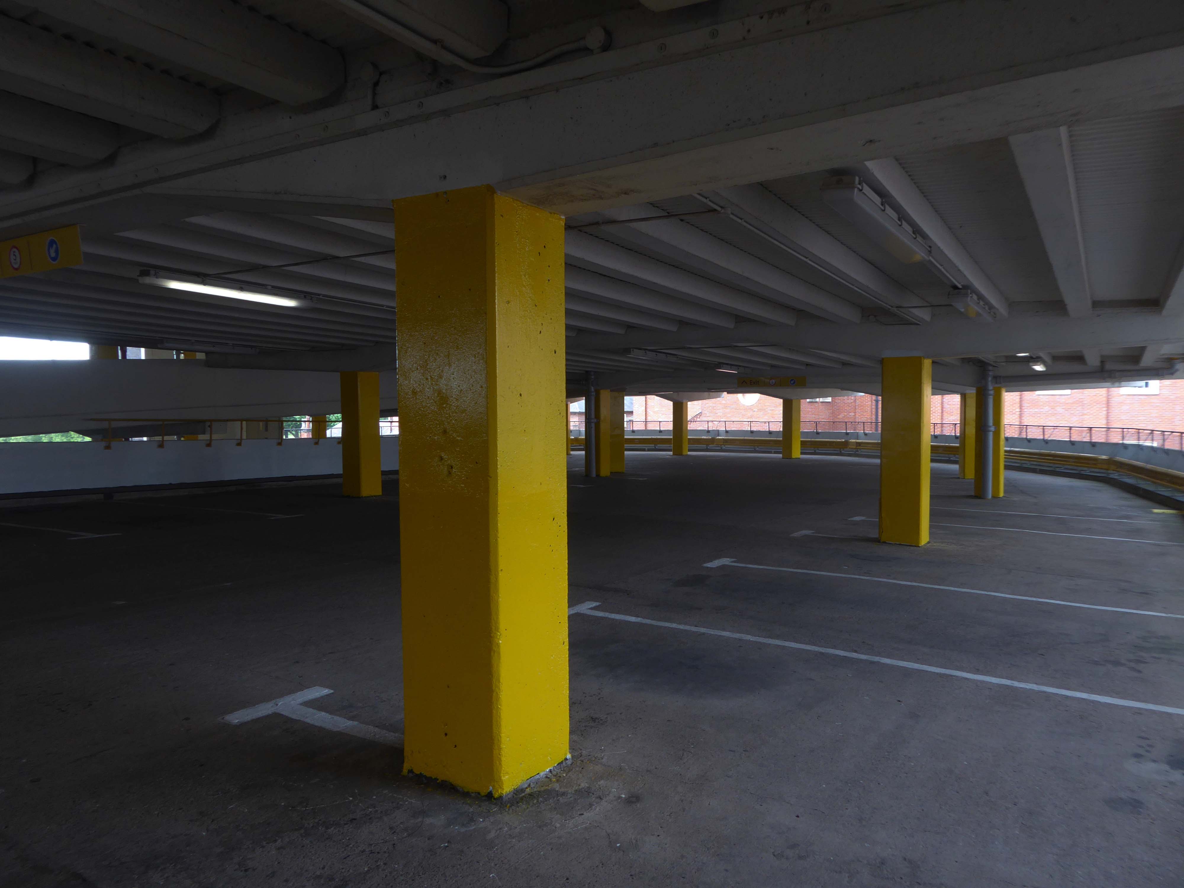
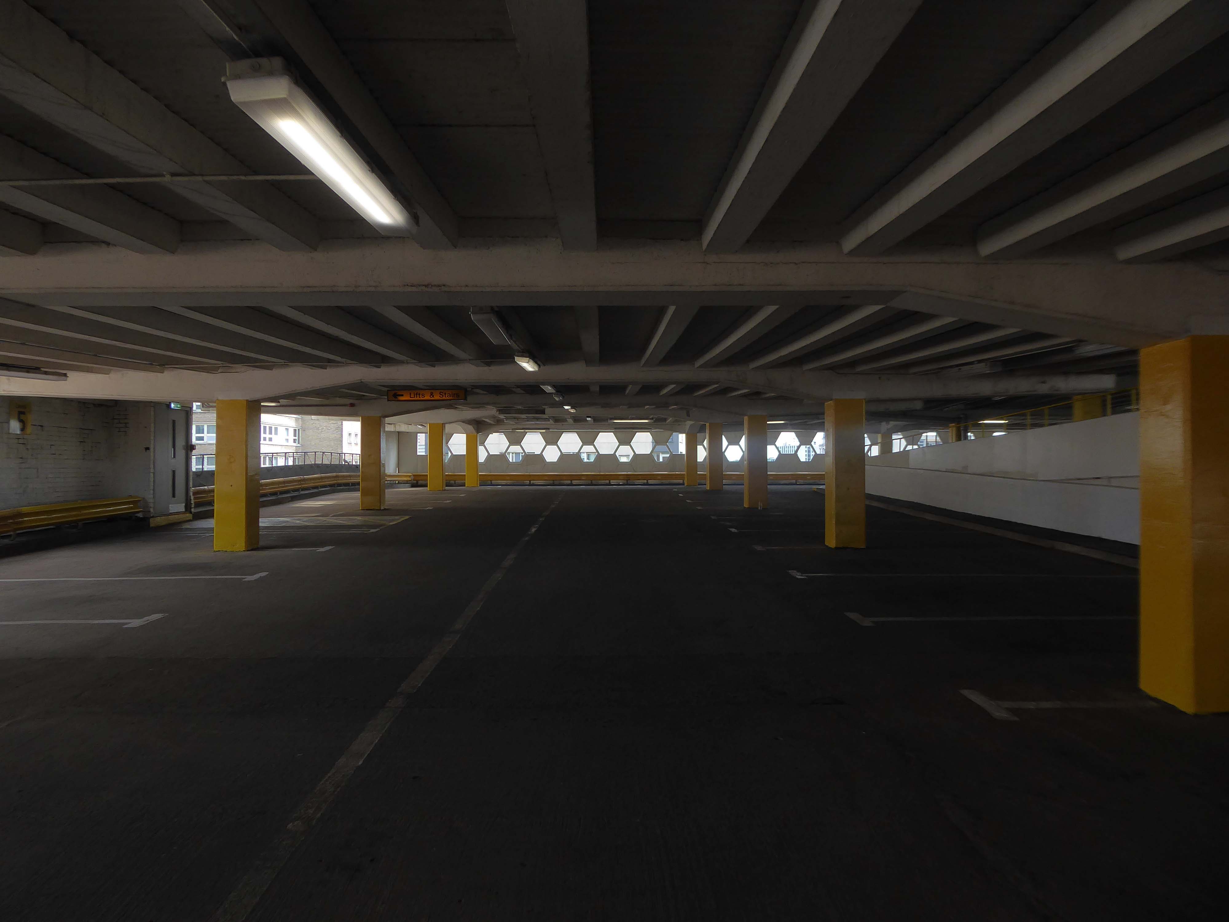
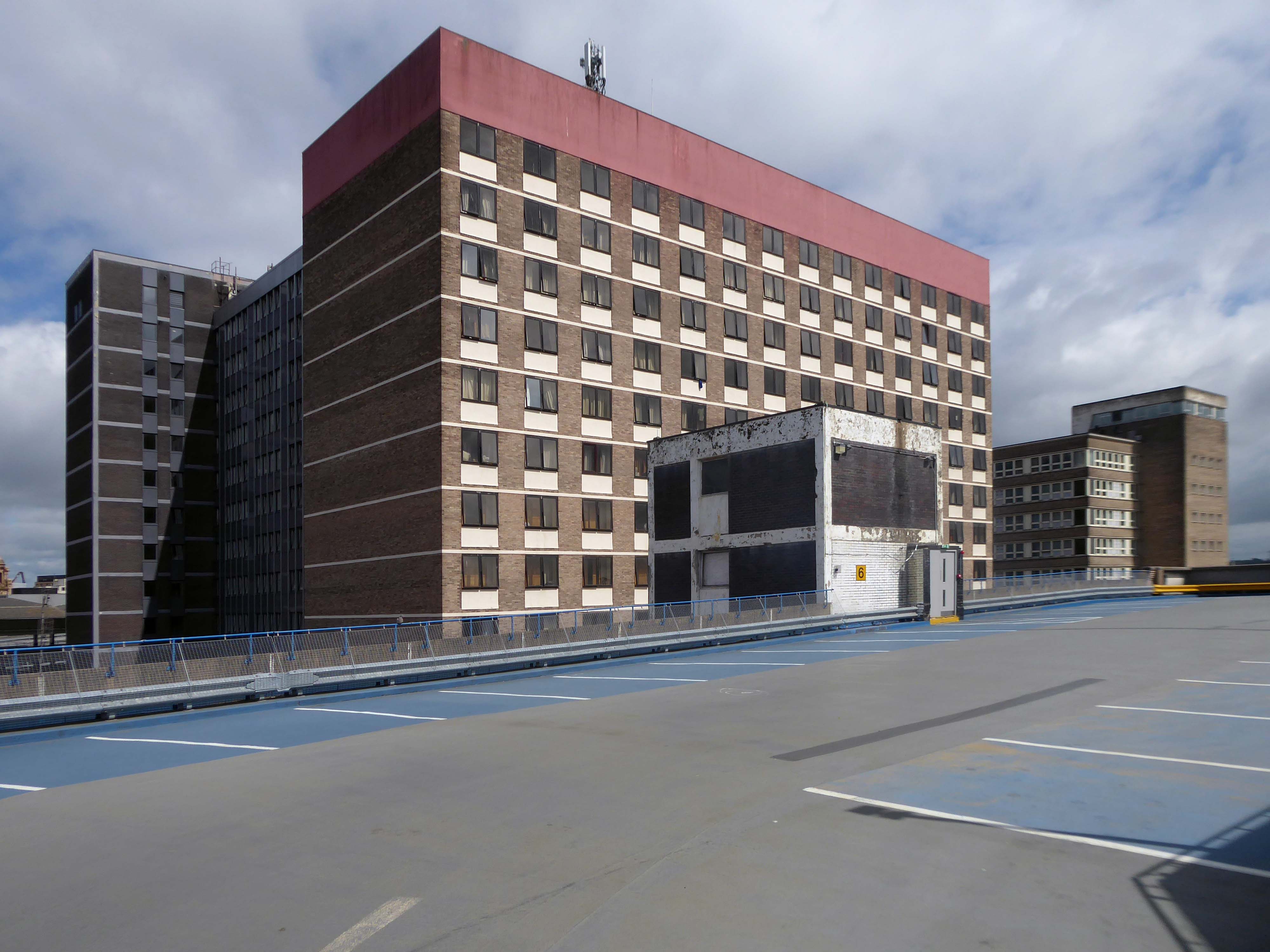
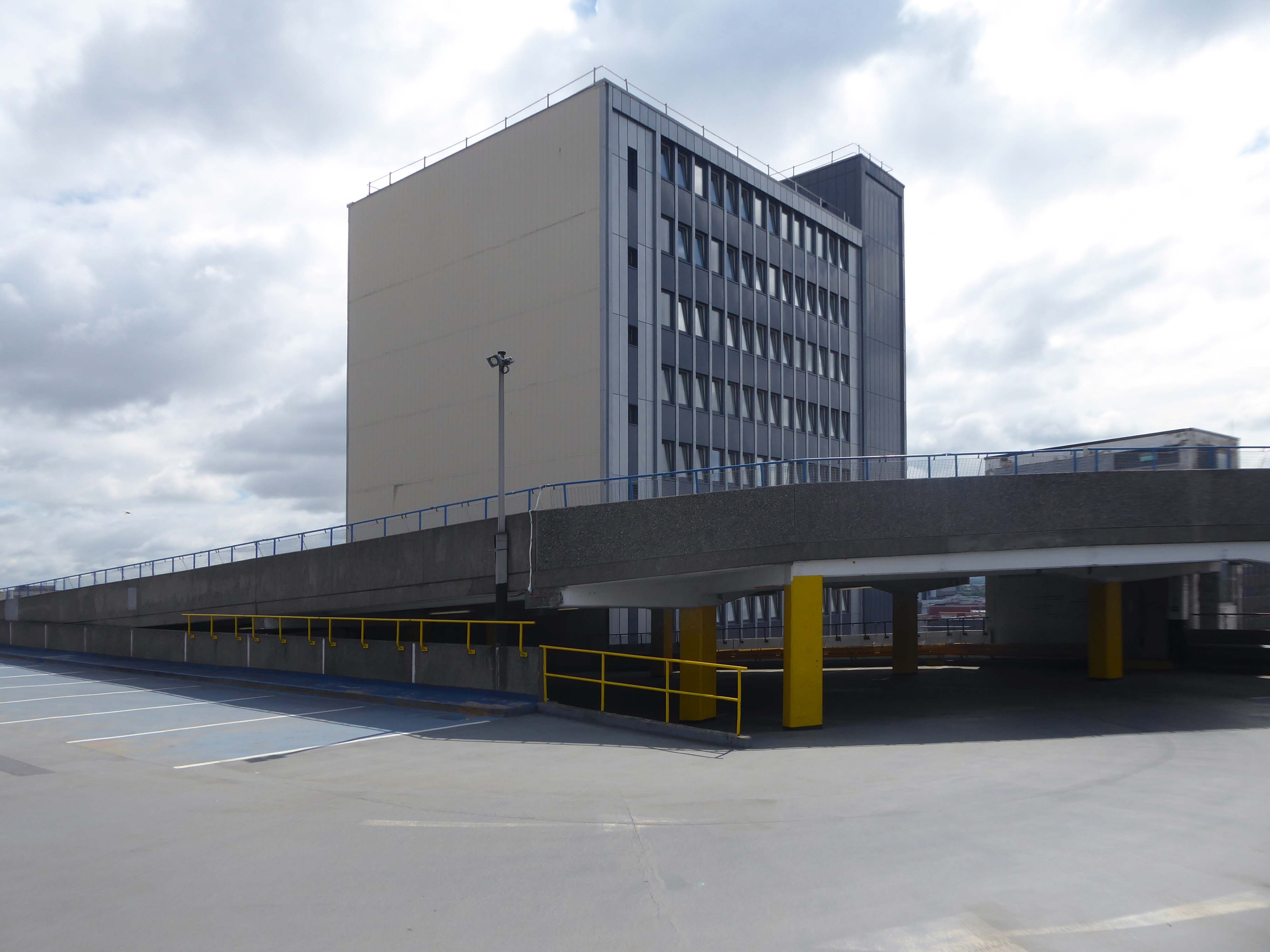
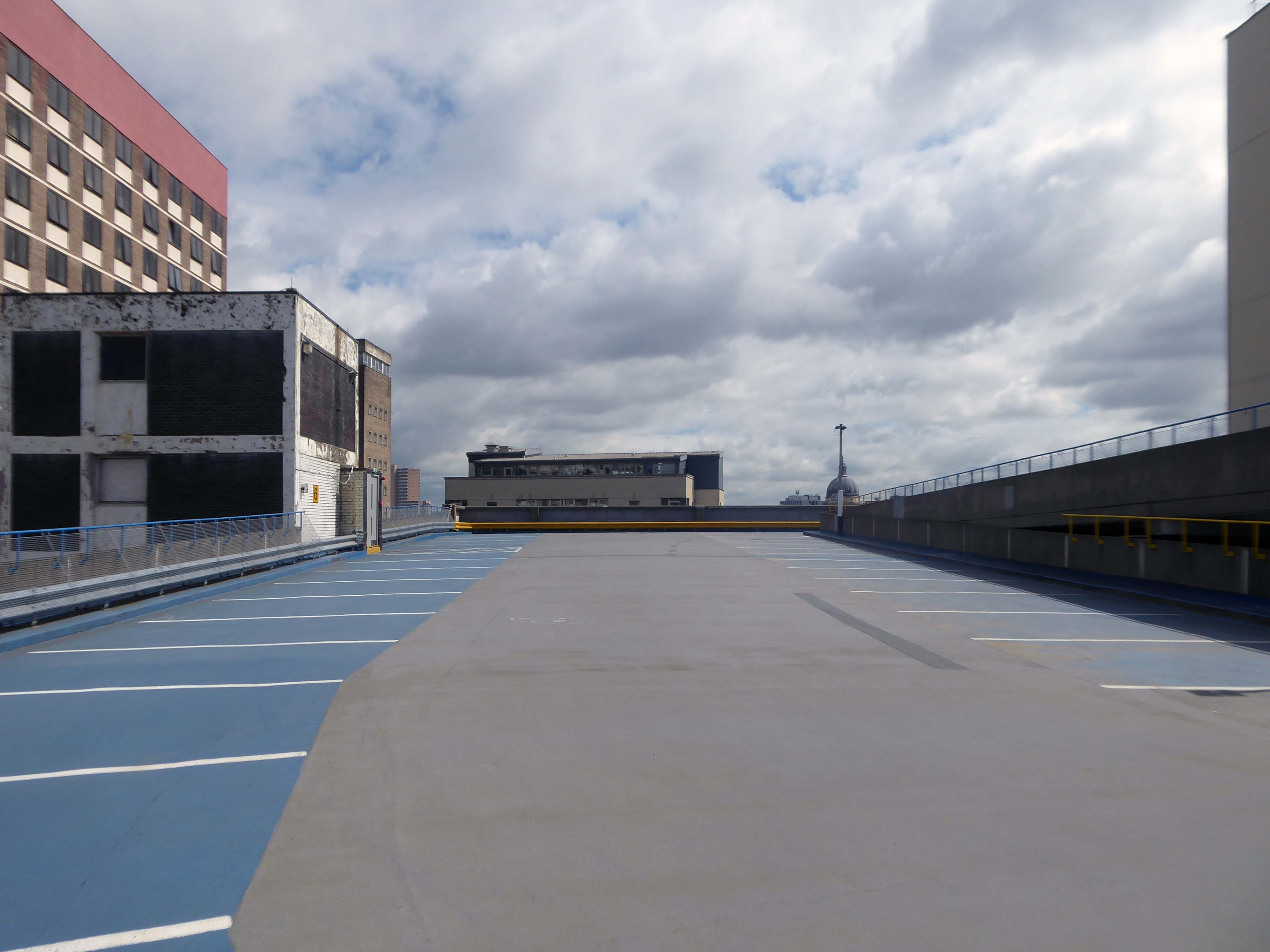
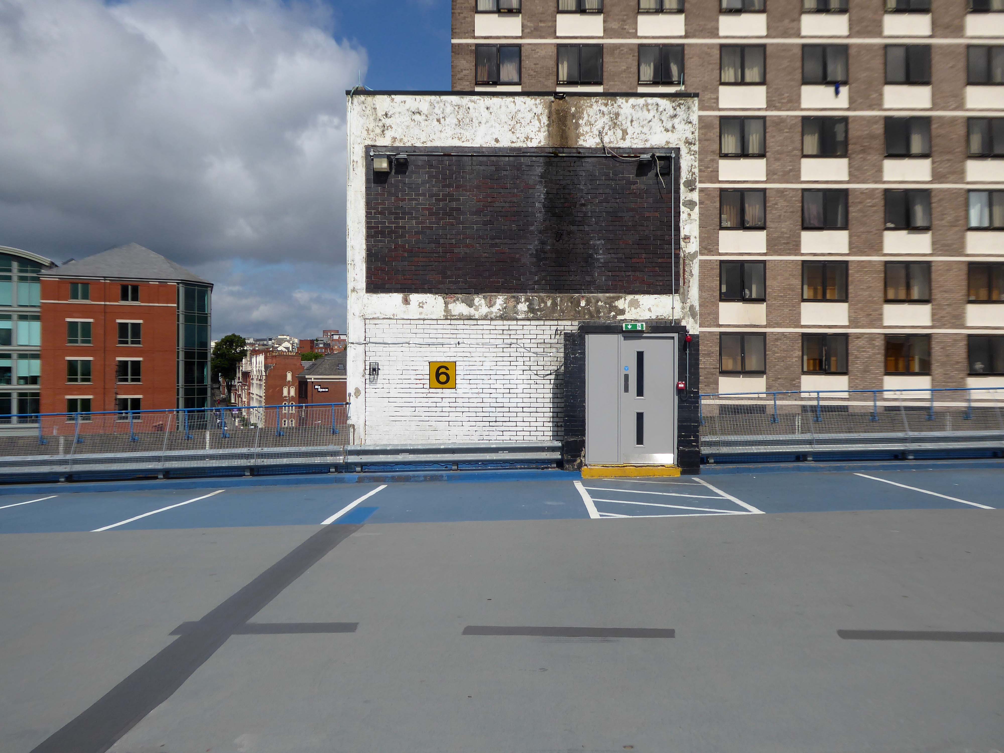
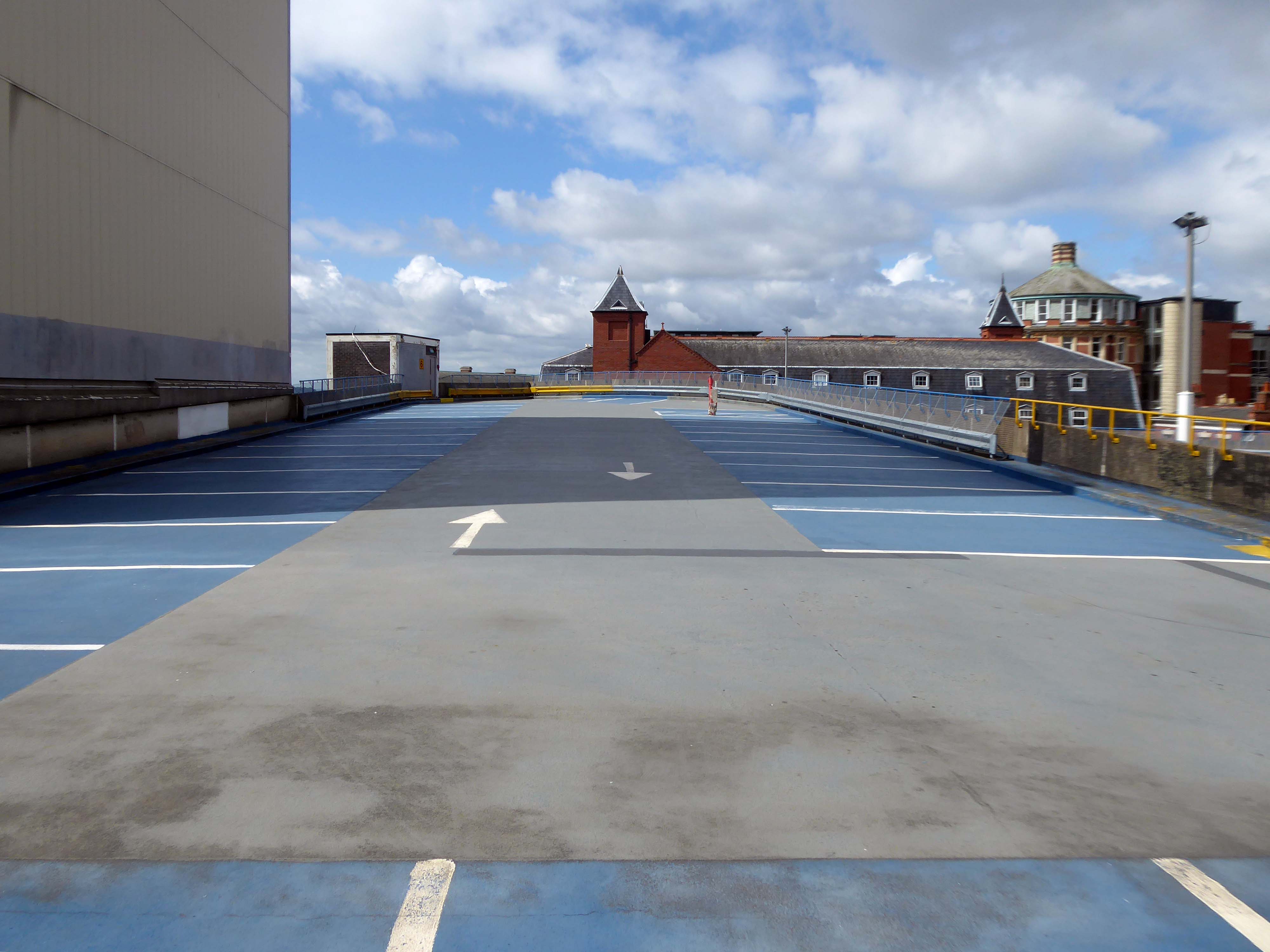
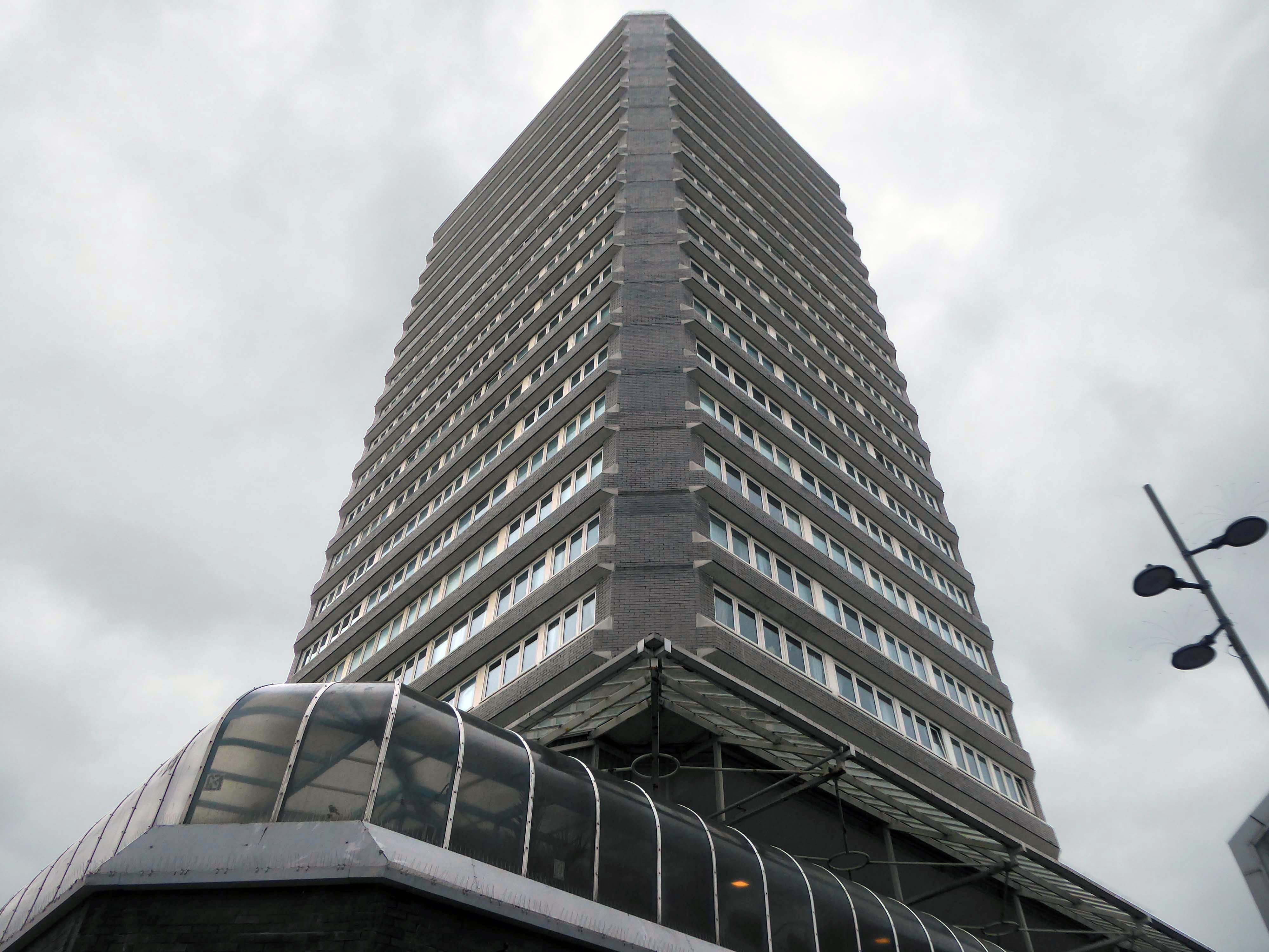
An overwhelming three-part development by John P Osborne & Sons. Phase 1 has a multi-storey car park 1962 above shops; followed by the fifteen-storey Britannic Hotel 1966, elevations by James Roberts.
Elain Harwood
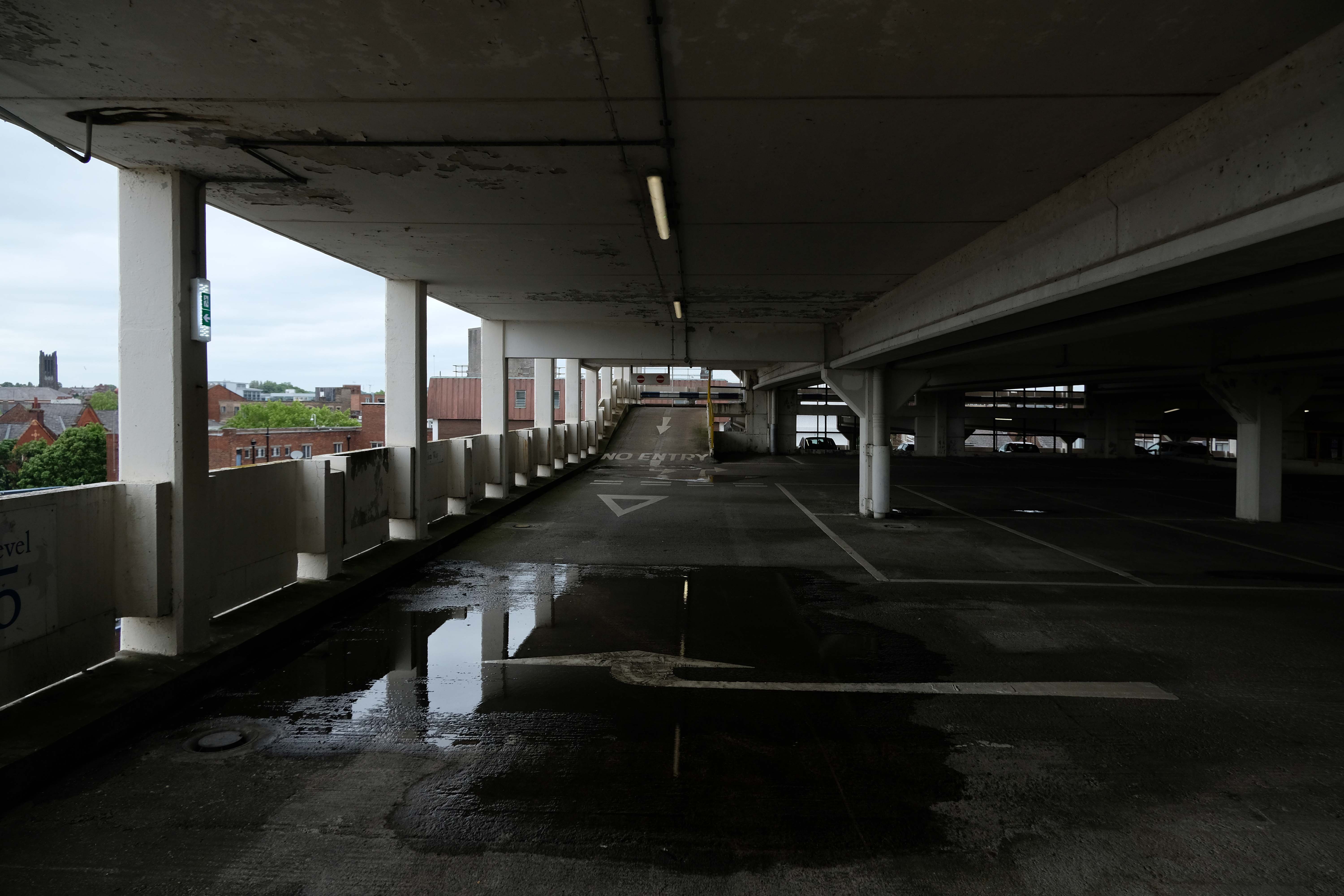
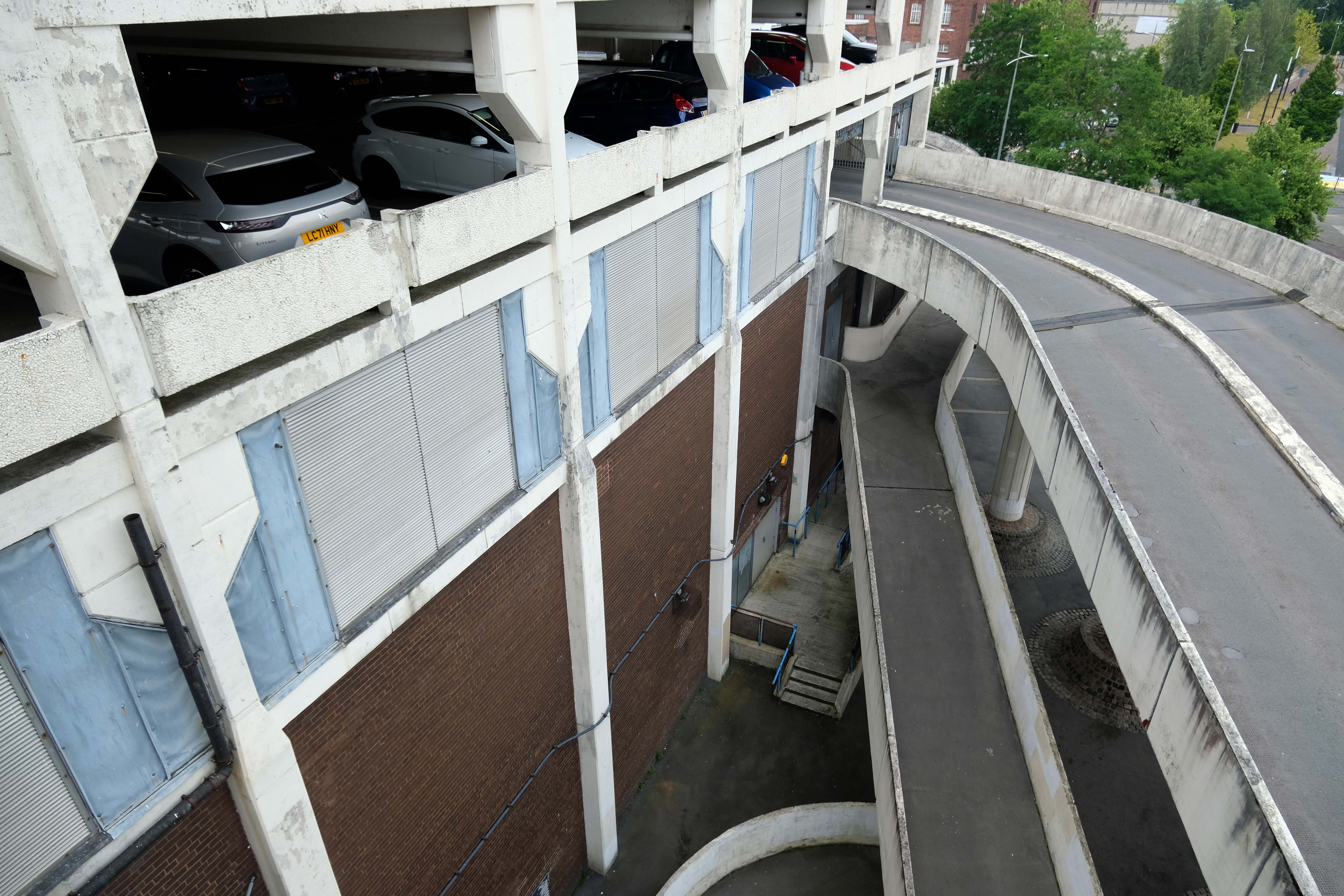
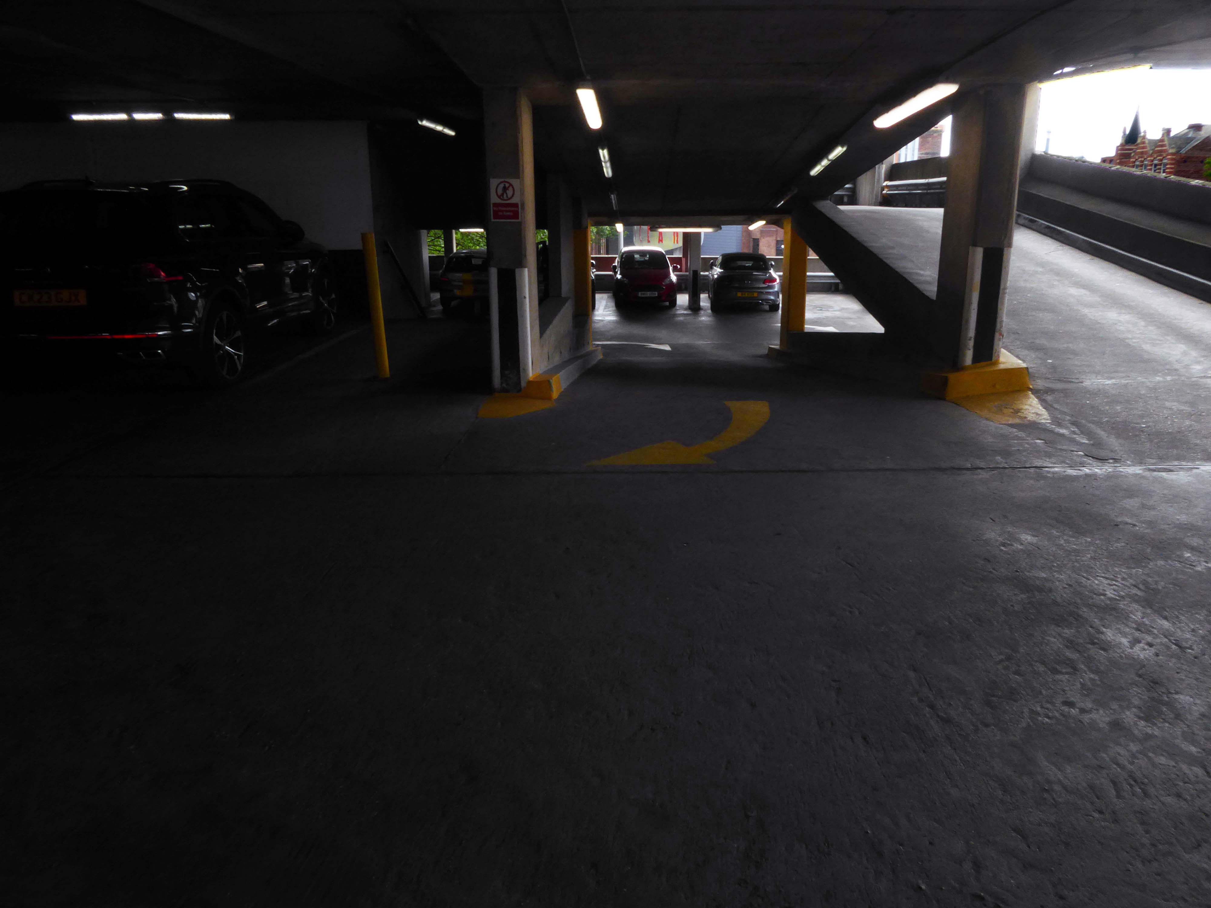
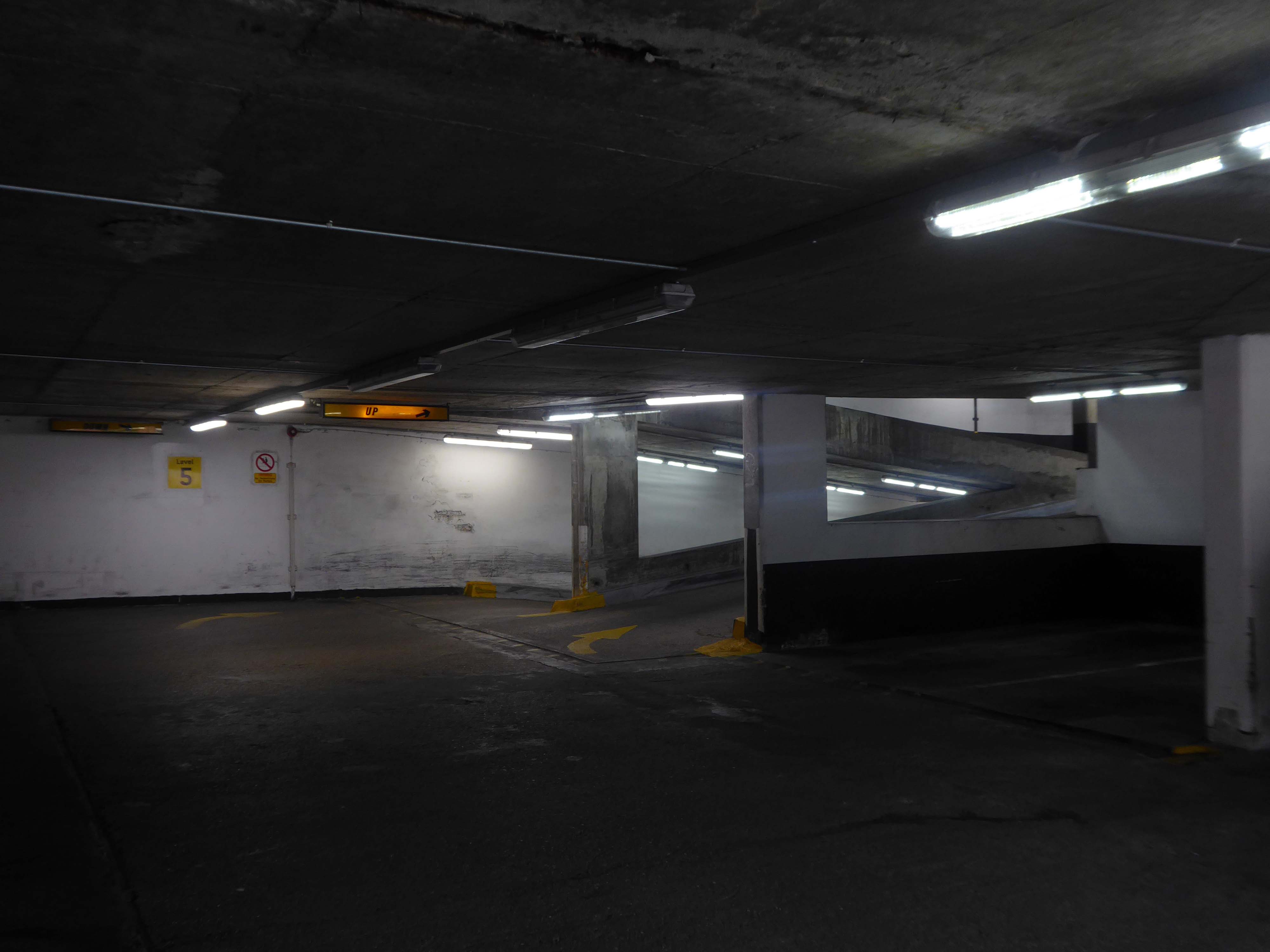
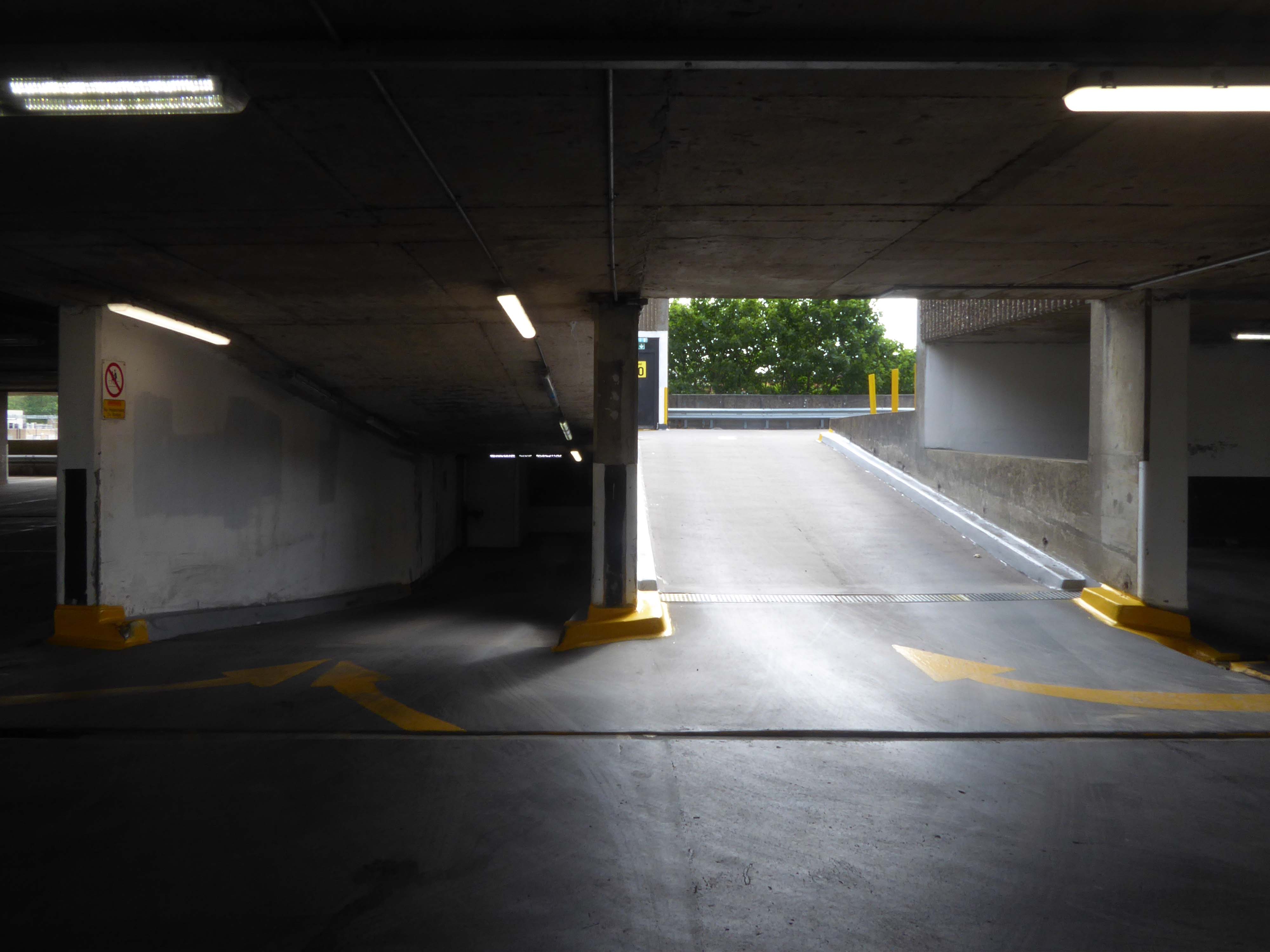
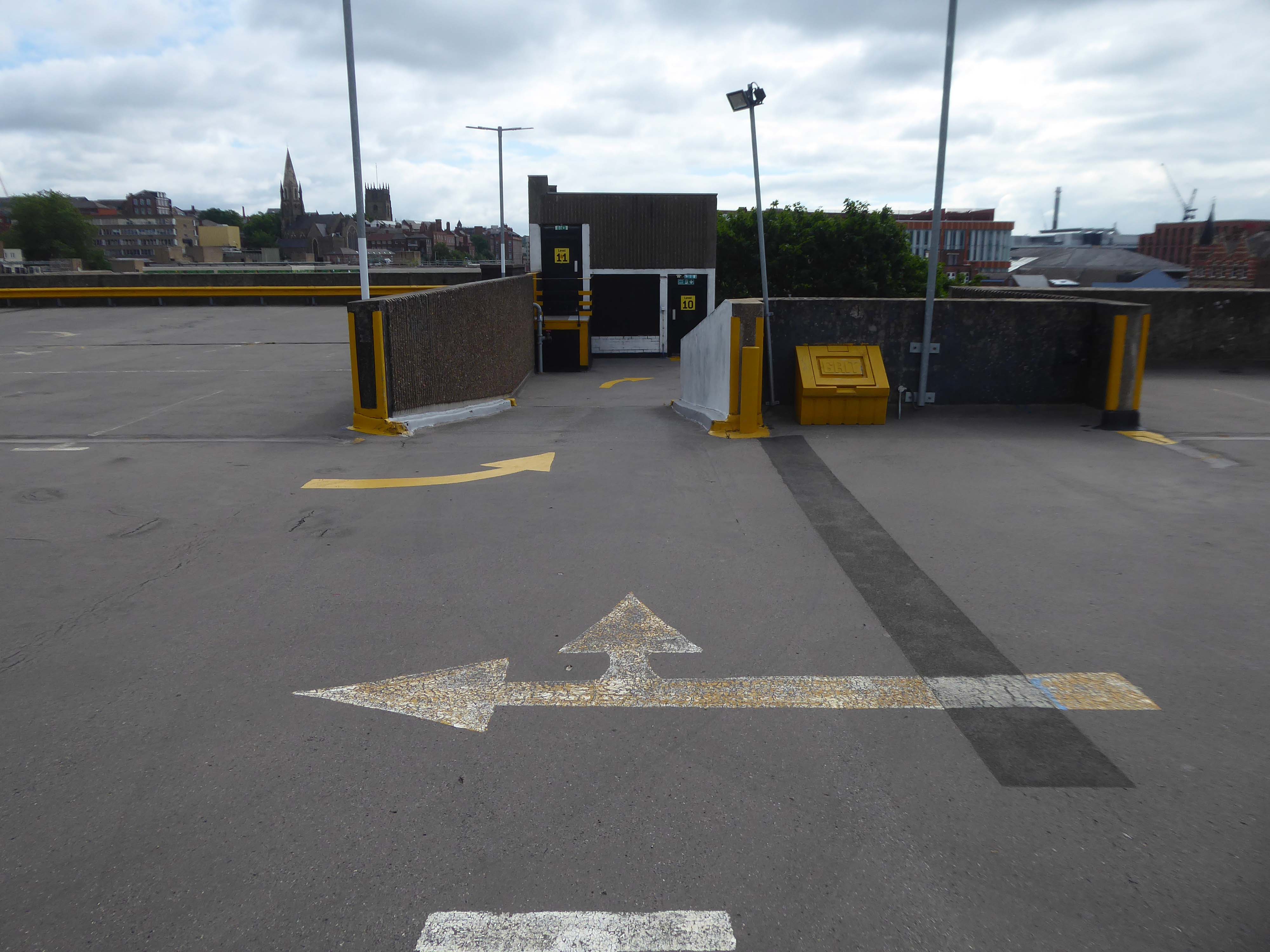
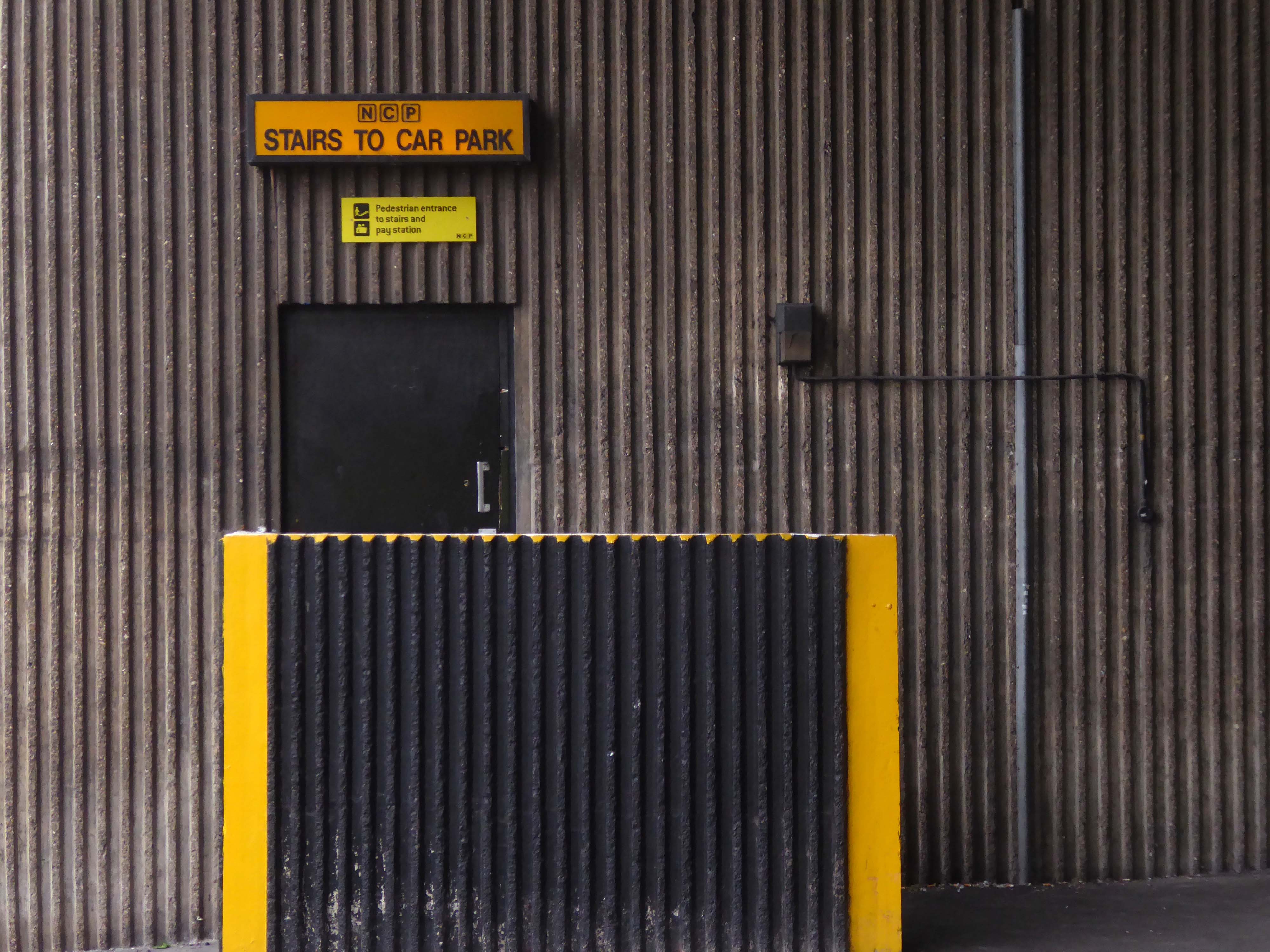
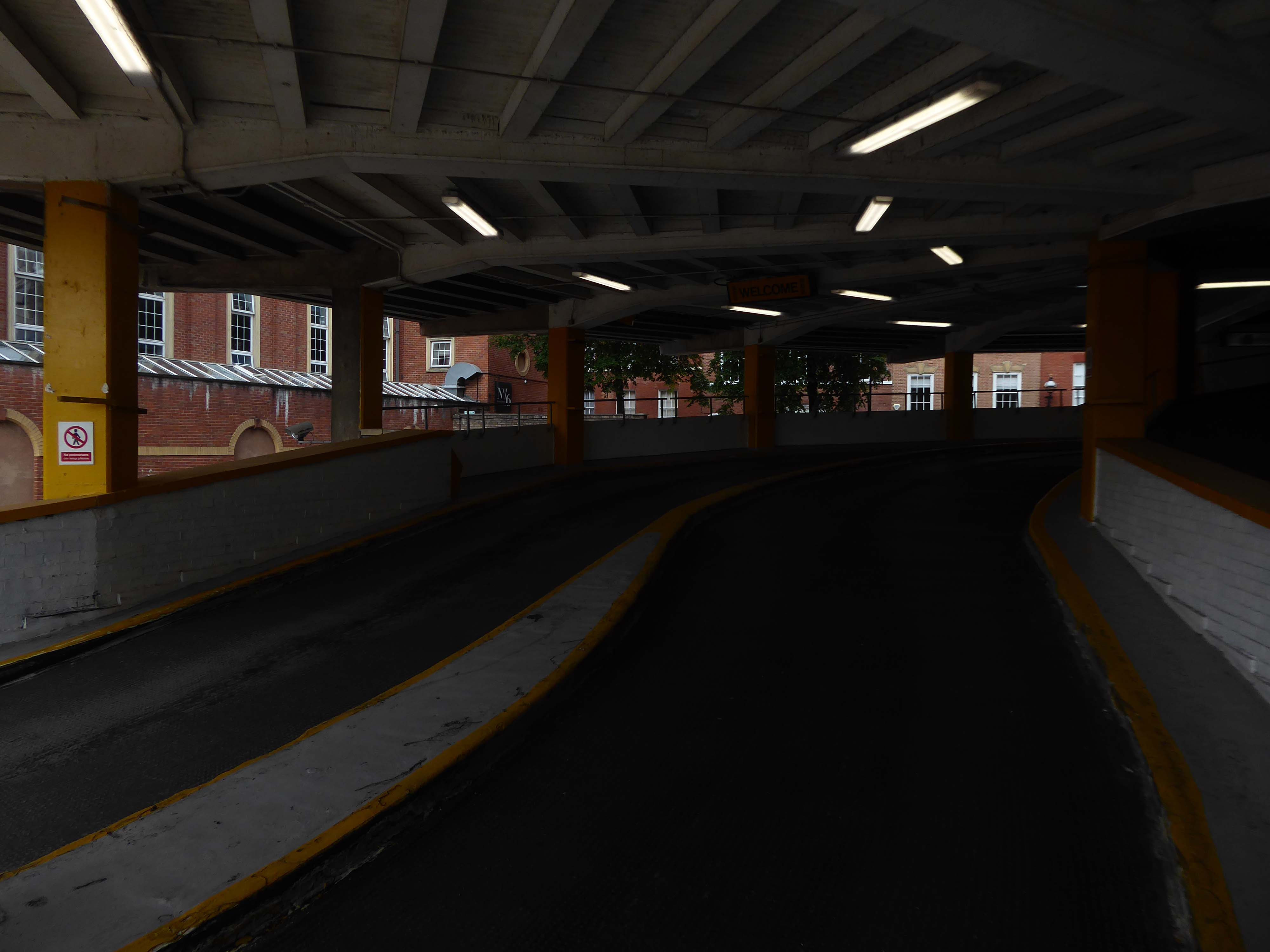
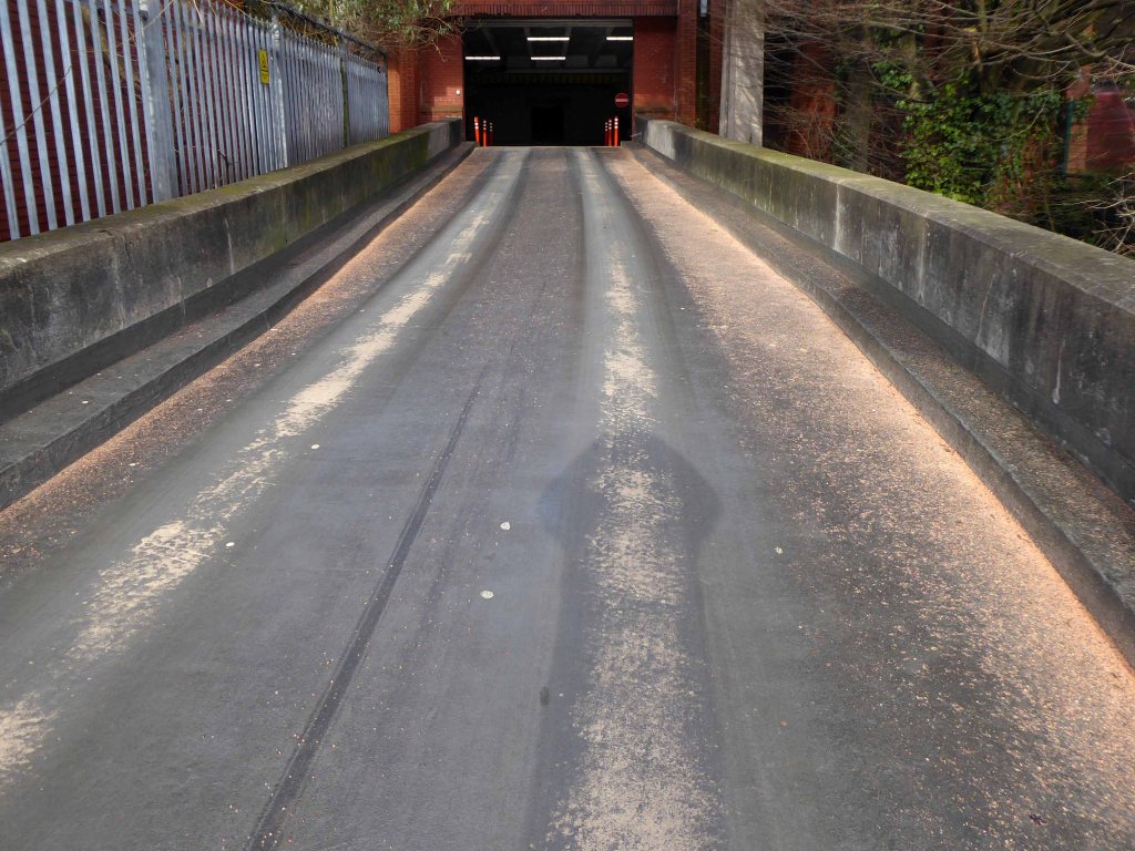
Eschewing the pedestrian entrance, I ascended the ramp – walk like a car!
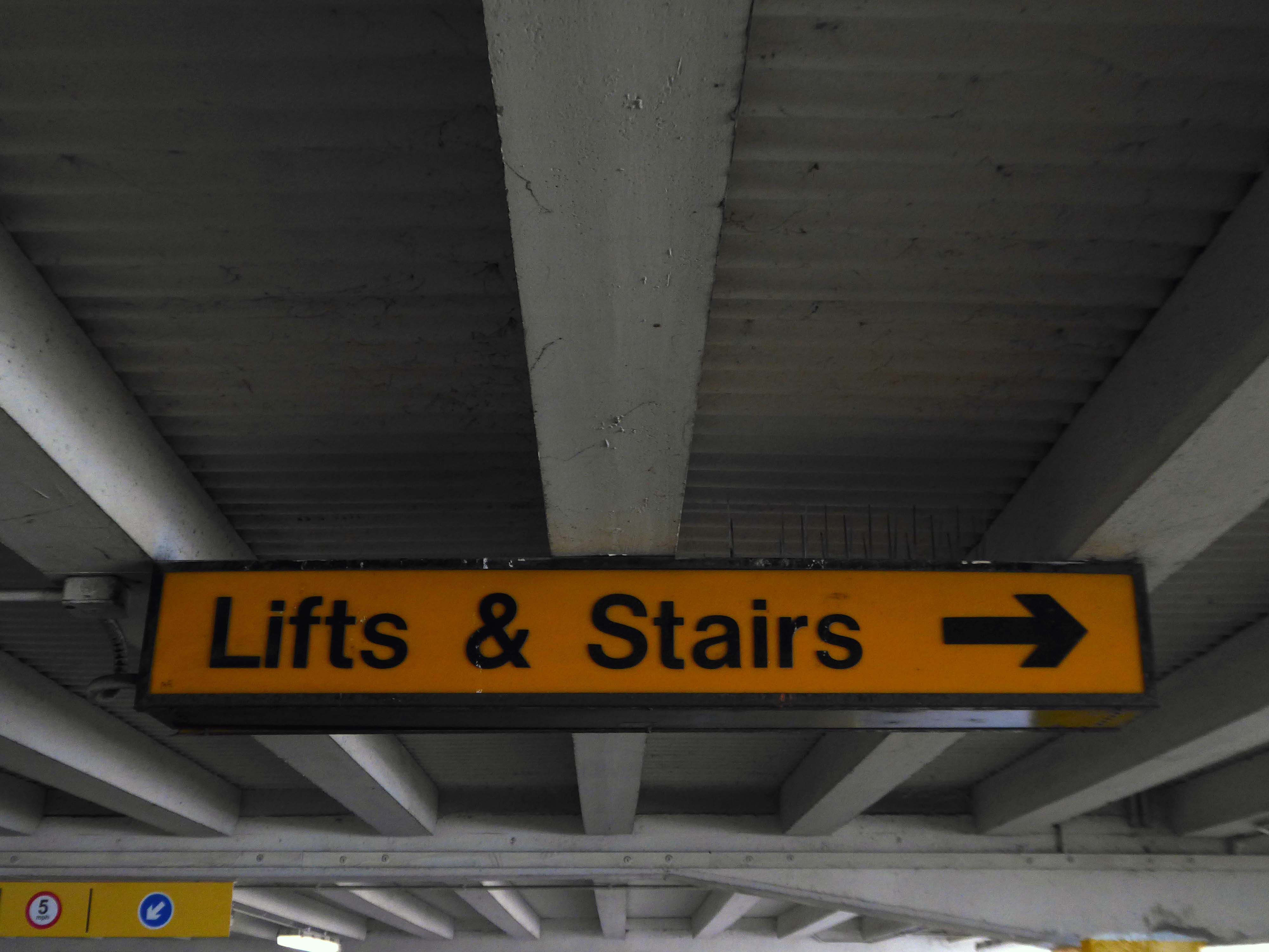
Weaving between yellow pillars, taking care on the stairs.
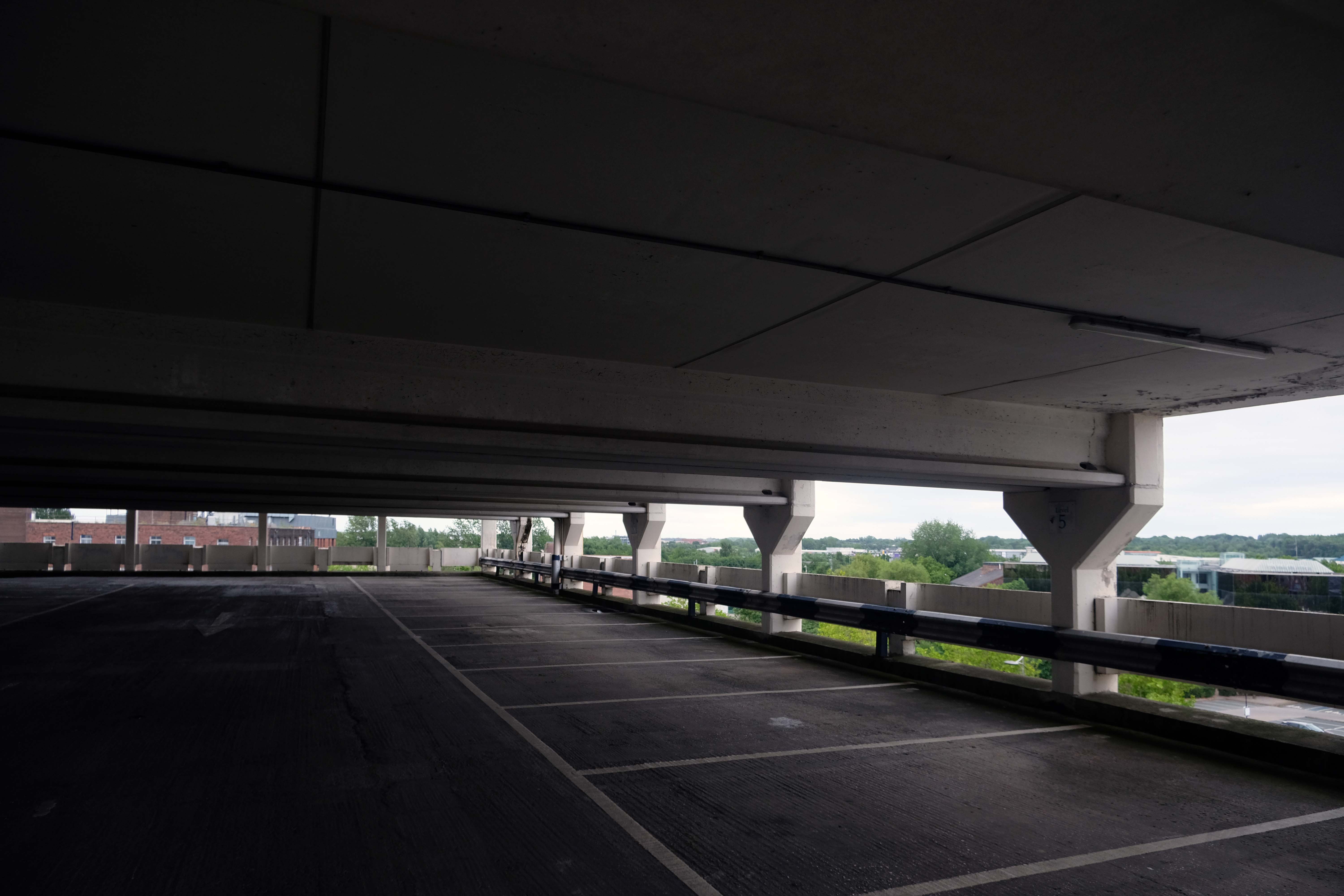
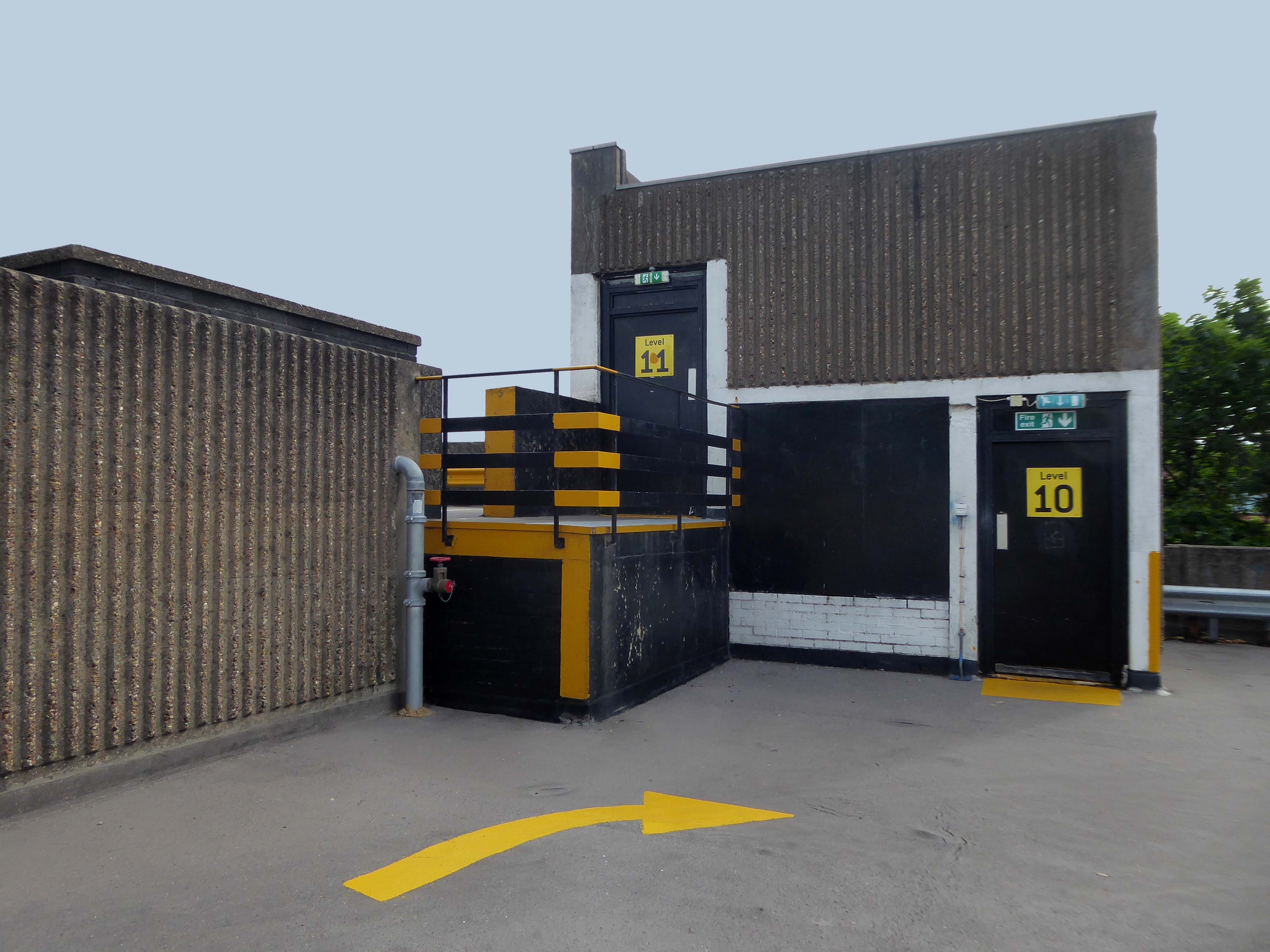
I’m on the top of the world lookin’ down on creation And the only explanation I can find Is the love that I’ve found, ever since you’ve been around Your love’s put me at the top of the world
There is evidence that the current town location has been occupied since prehistoric times. Prehistoric tools found in the caves of Graig Fawr, in the nearby village of Meliden, have revealed the existence of early human habitation in the area.
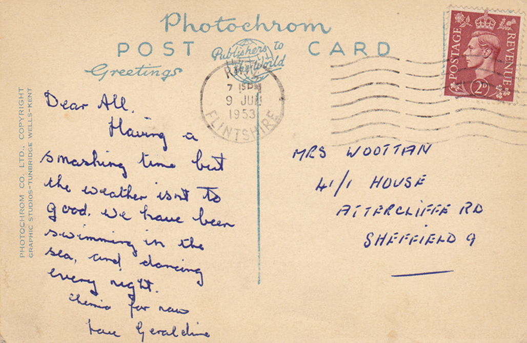
“Sunny Prestatyn” became famous for its beach, clean seas and promenade entertainers, and visiting for a bathe was considered very healthy by city-dwelling Victorians.
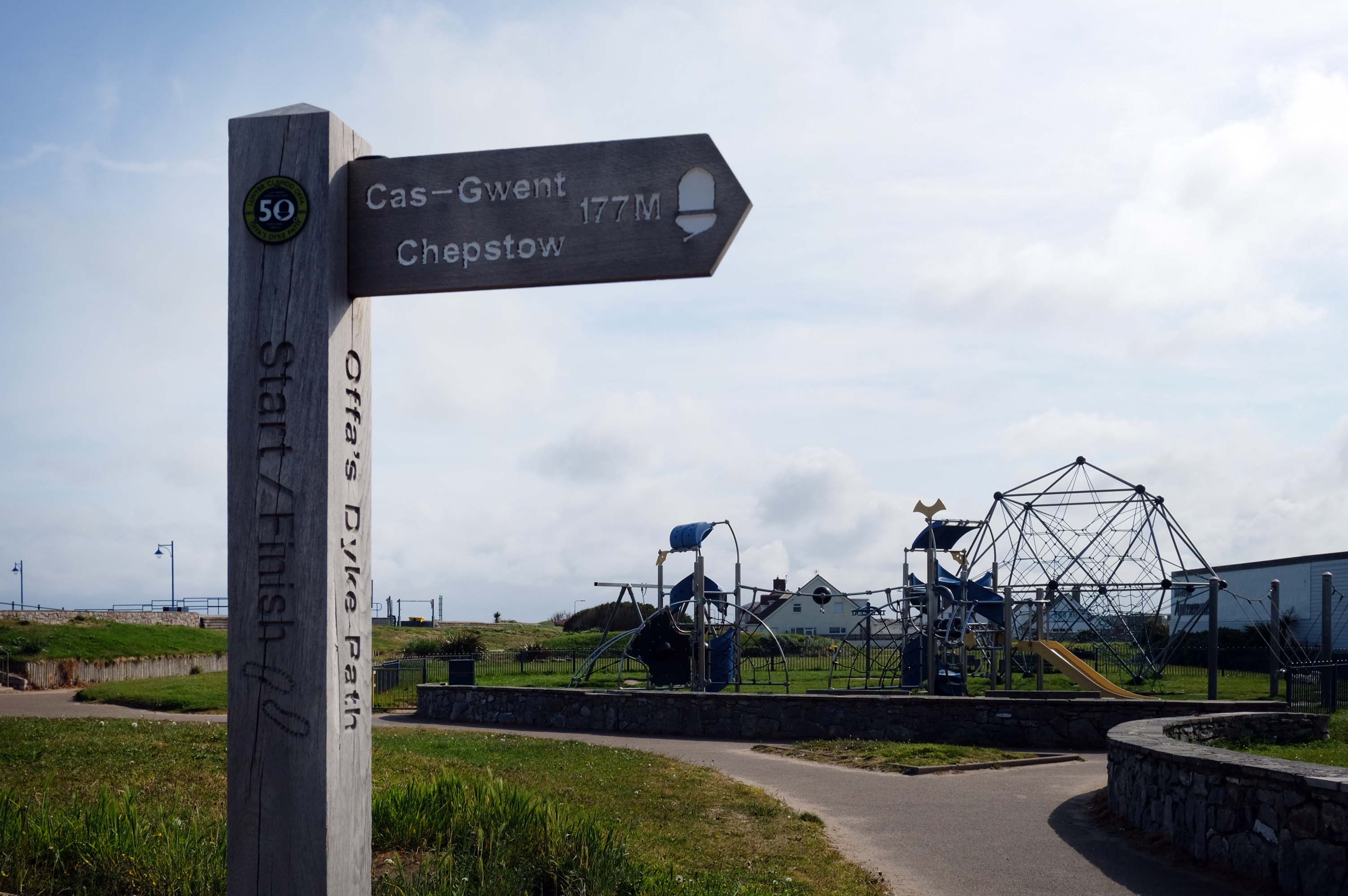
The town is at the northern end of the Offa’s Dyke Path, although not on Offa’s Dyke itself.
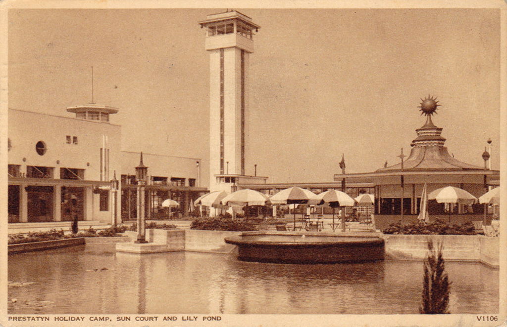
The holiday camp in Prestatyn was built by the London Midland and Scottish Railway Co. in 1939. The main buildings were in classic 1930s style, featuring rounded building ends, steel framed windows and porthole windows. Chalets showed an early form of sectionalised building method.
Requisitioned as a military camp until after the Second World War, it reopened as a holiday camp in the early 1950s. The site was demolished and cleared between February and March 2001.
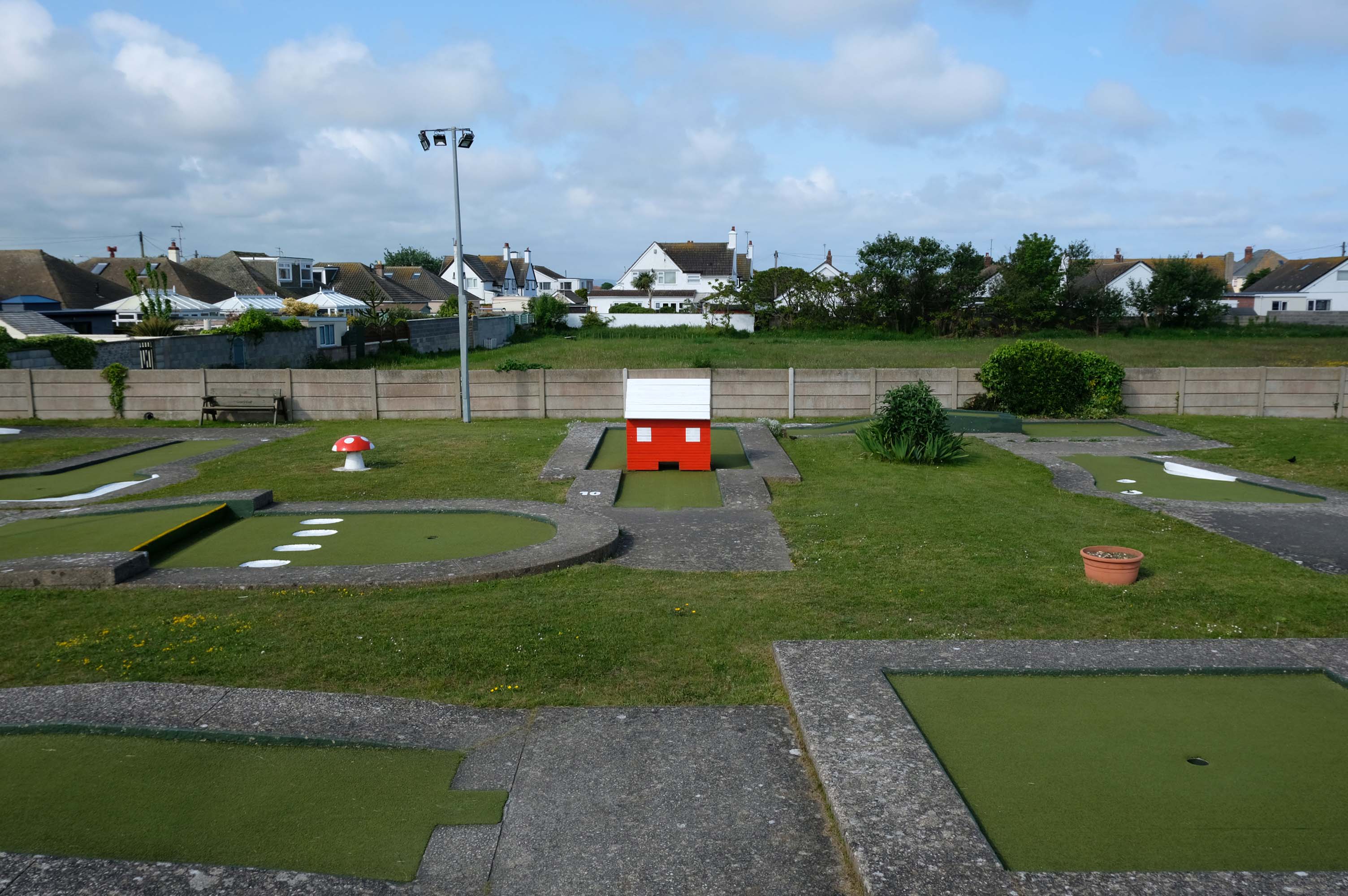
Prestatyn offers the opportunity to engage in an impromptu game of Crazy Golf – though the facility was closed on the morning of my visit.
The crazy golf was fantastic the kids didn’t want to leave plus the lady was so helpful plus the price were very reasonable – would highly recommended.
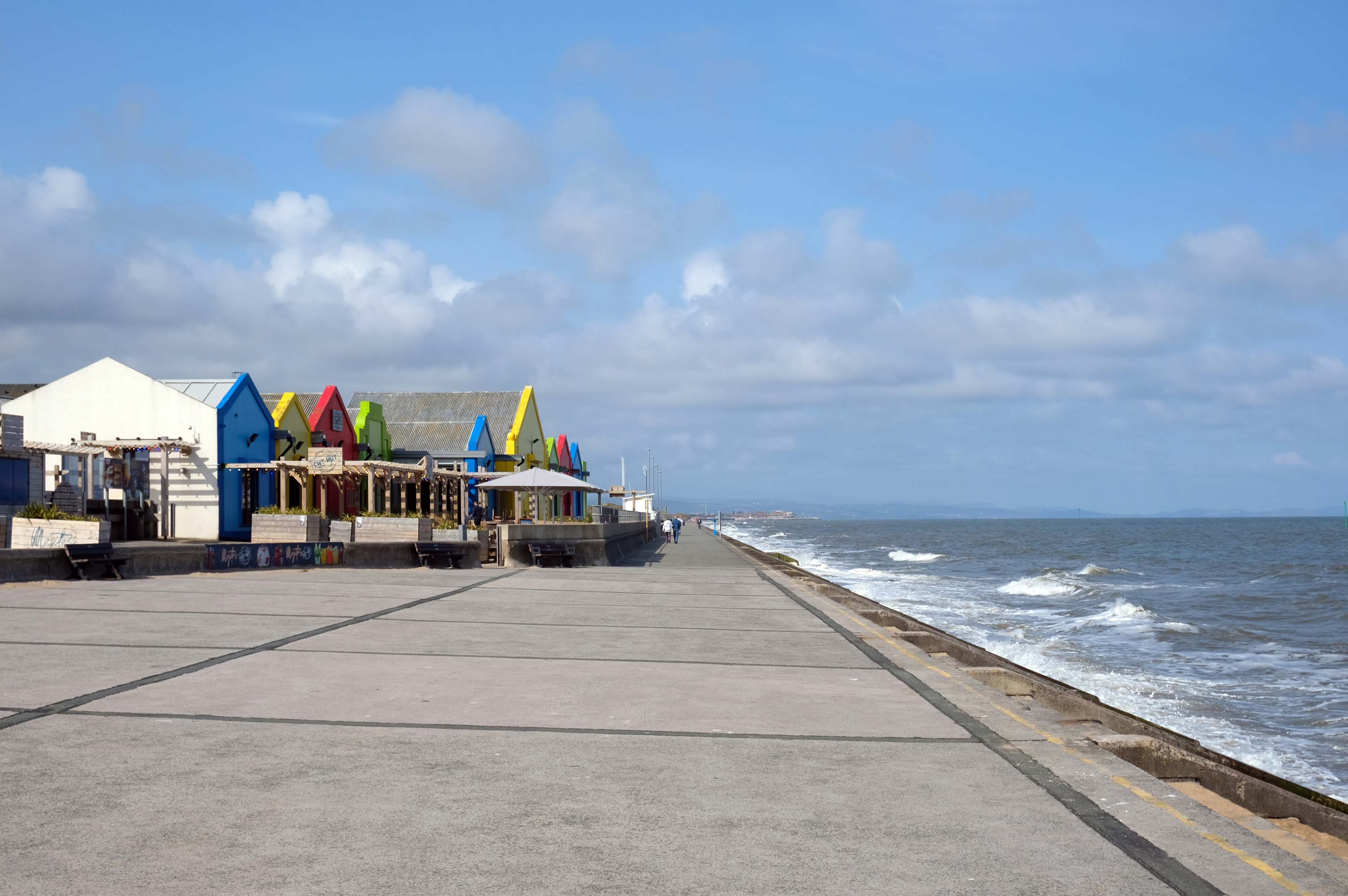
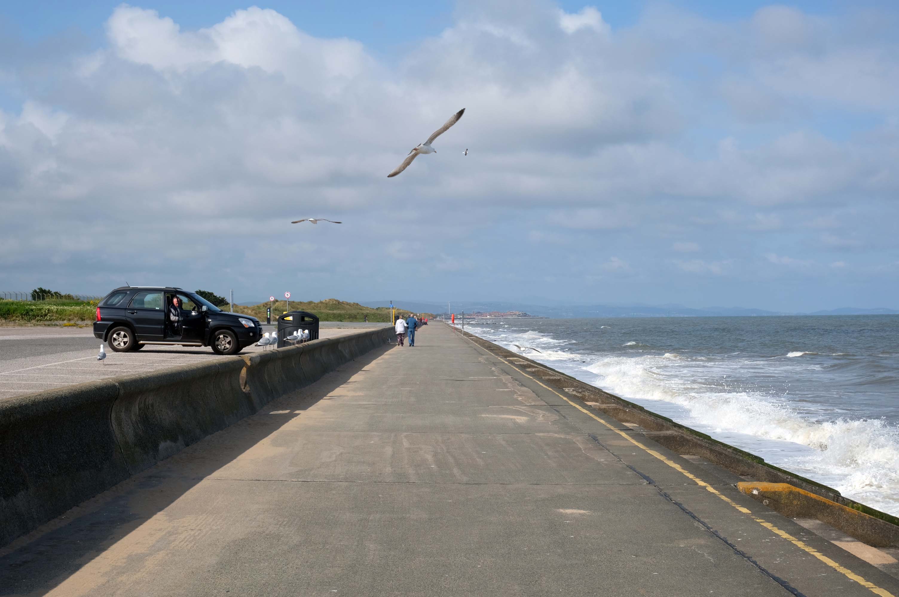
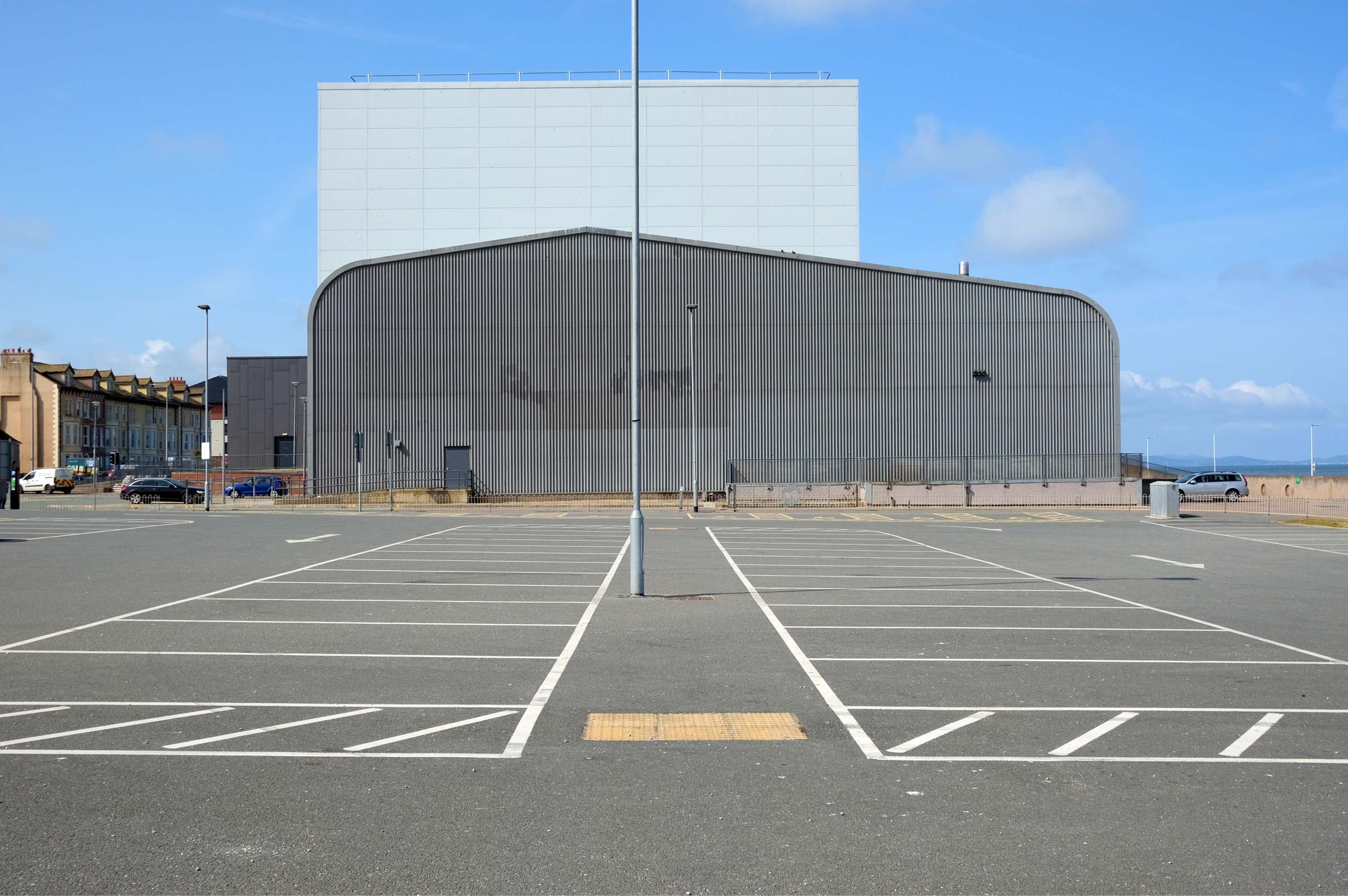
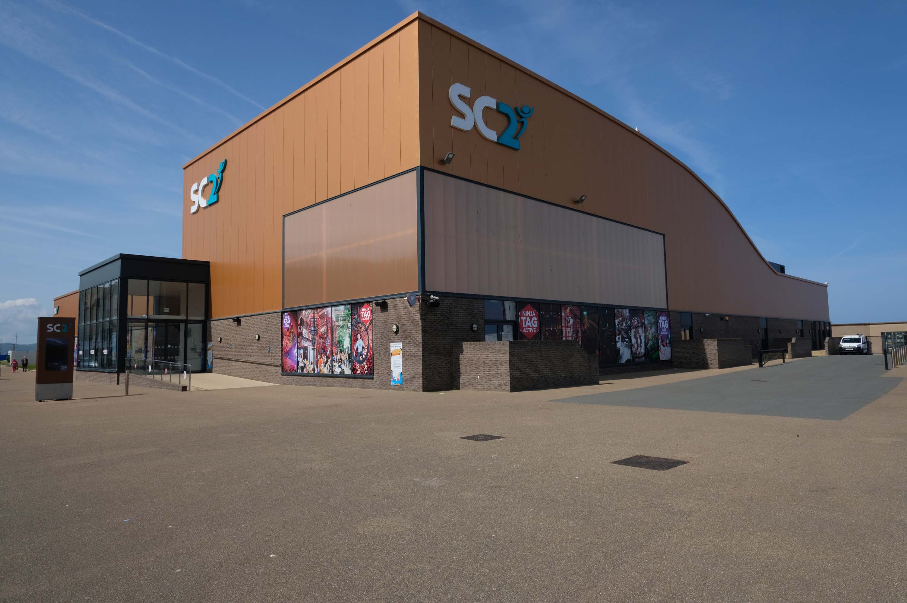
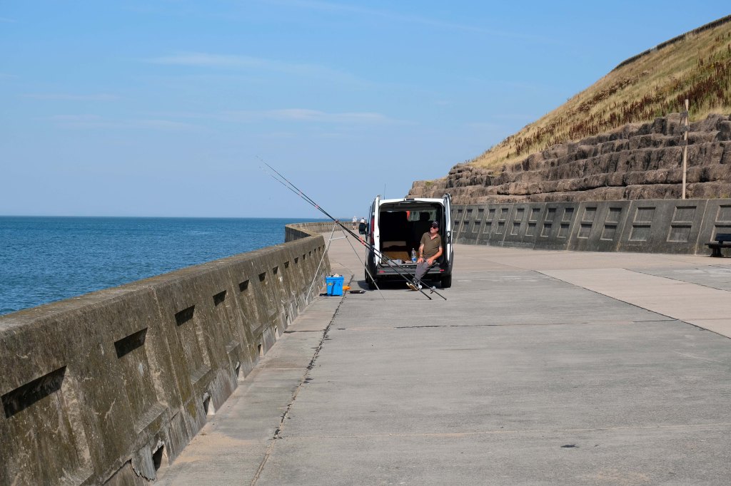
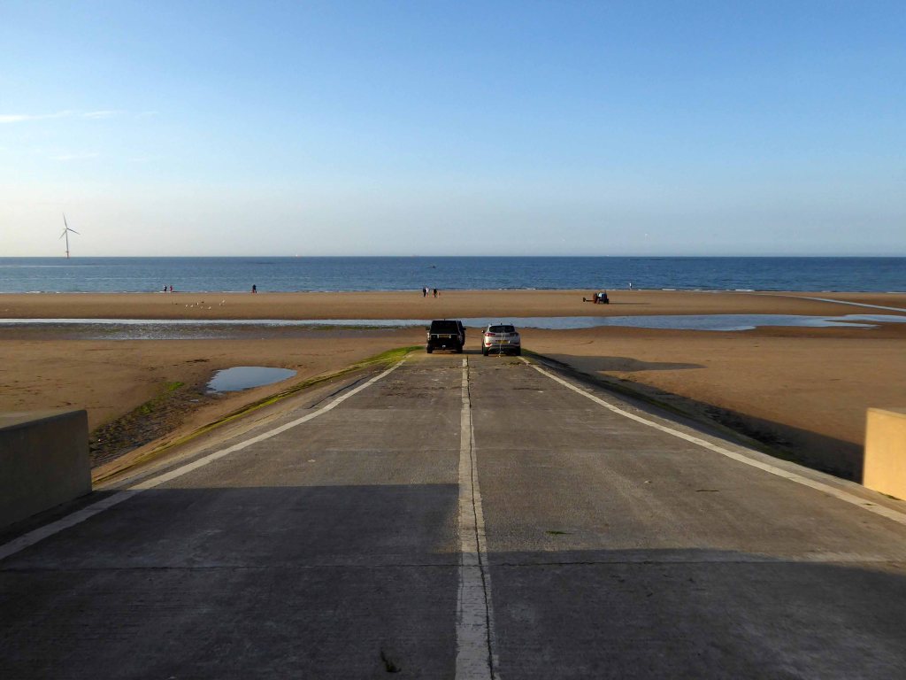
The promenade is dominated by a tight knit group of modern leisure facilities.
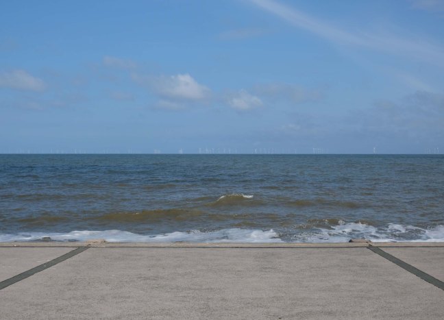
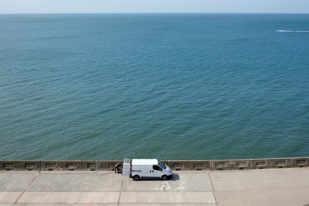
An expansive car park fronts directly onto the seafront.
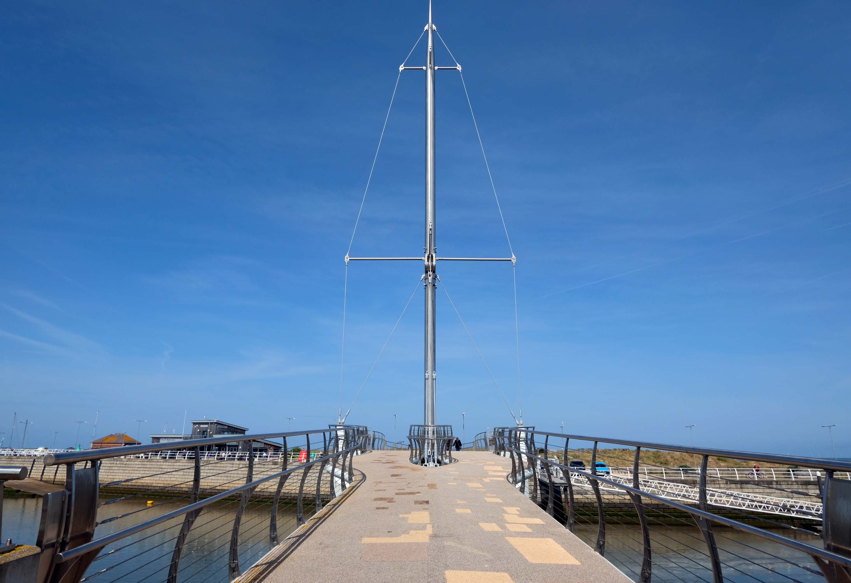
There have been serious reinforcements made to the seawalls – ensuring that the passing cyclist will not be washed away, by the crashing waves of the incoming tide.
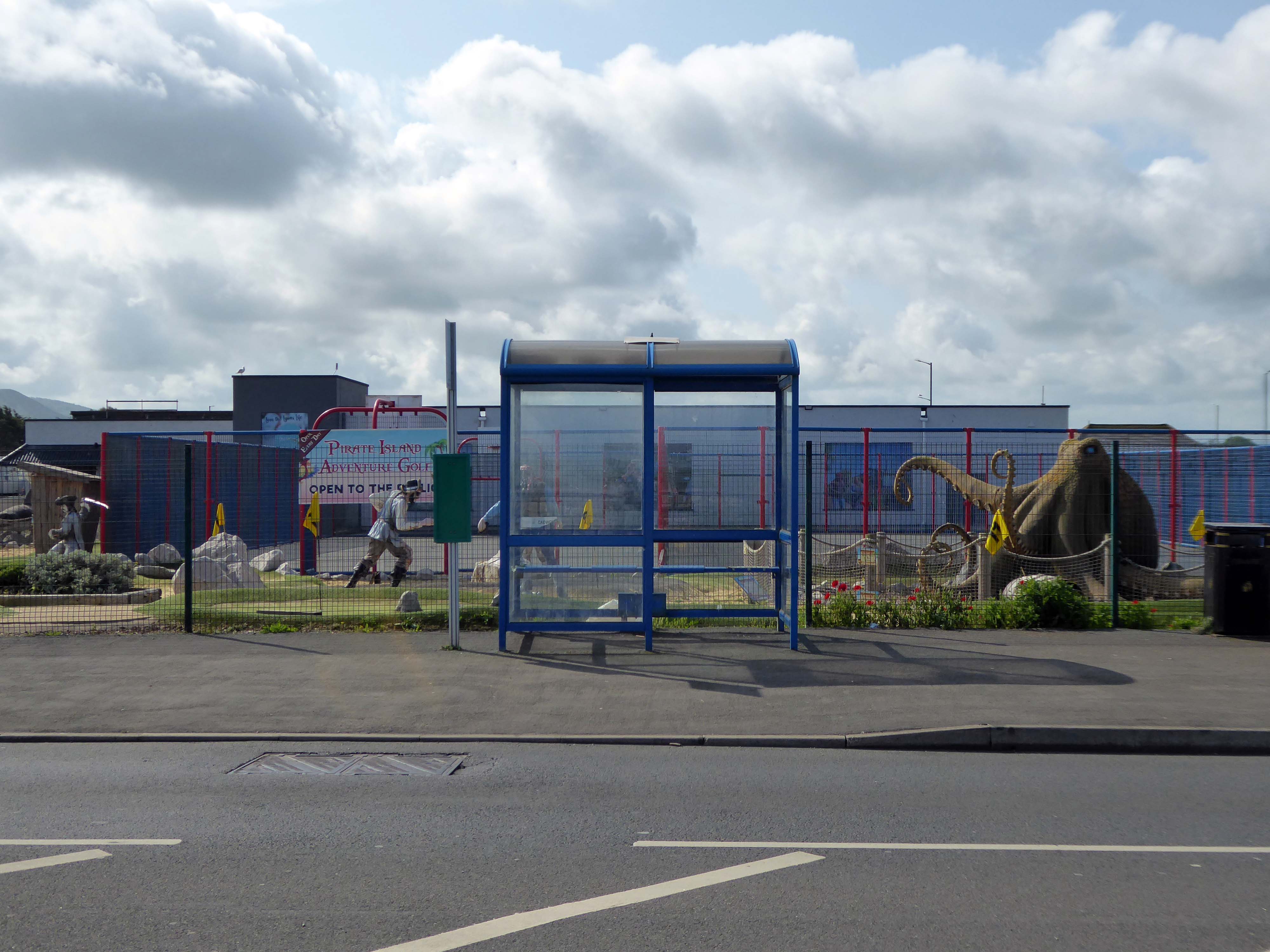
The reinforcement work demands that we temporarily detour onto the Rhyl Coast Road, where we encounter Pirate Island Adventure Golf.
Uncover hidden treasure on the North Welsh Coast at Pirate Island Adventure Golf at Lyons Robin Hood Holiday Park.
Make friends with the great white shark, octopus, and the resident pirates who guard the Island.
This 18-hole course is a fun and crazy challenge for all the family, with stunning views of Rhyl seafront to boot. Plus, it’s located just a stone’s throw away from Sherwoods Sports Bar where refreshments are served.
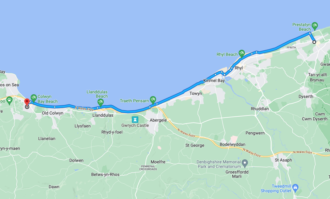
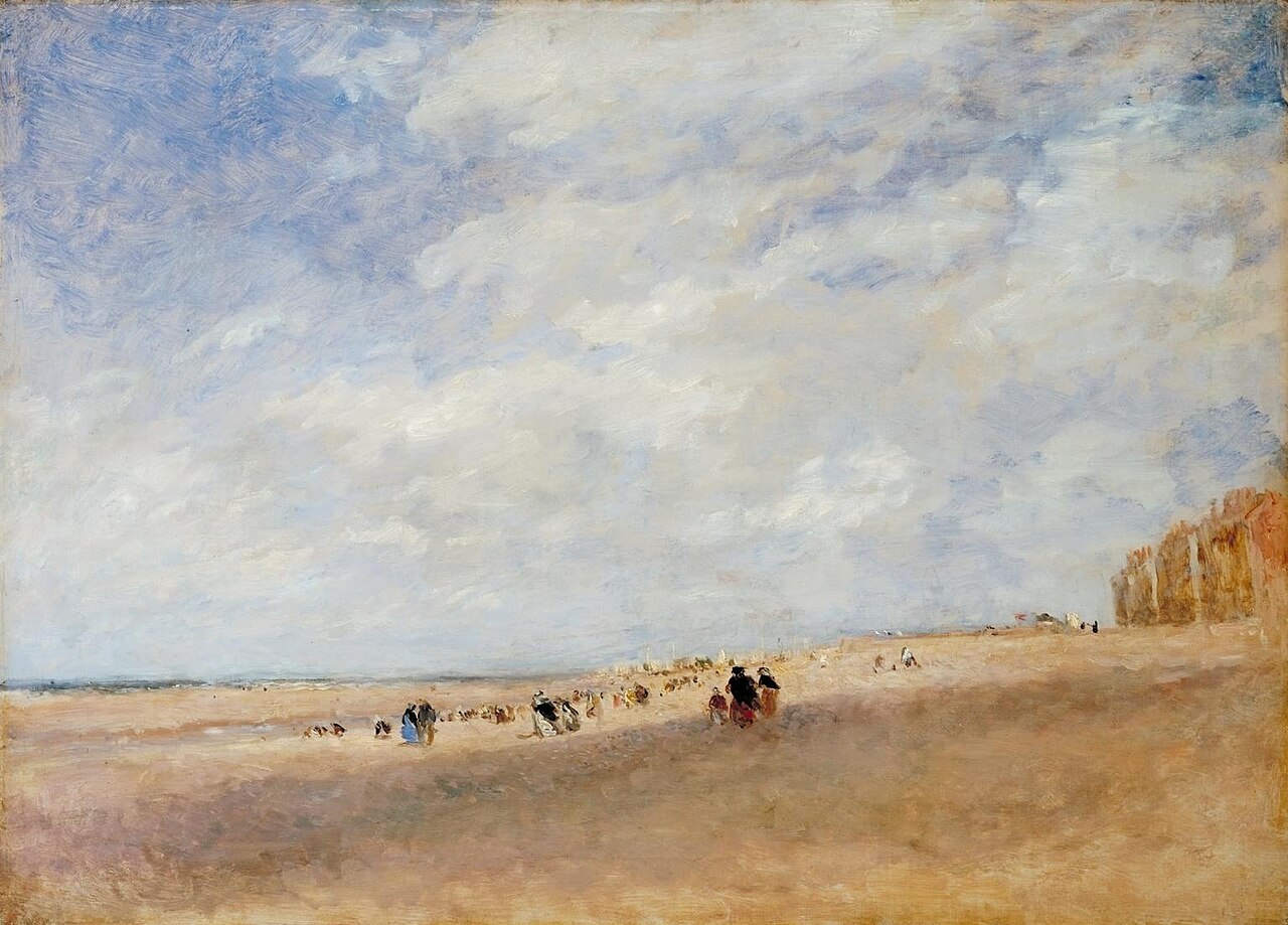
Rhyl
Rhyl Sands: David Cox 1854
The Welsh orthography has proved difficult for English writers to transliterate as Rhyl’s opening voiceless alveolar trill is uncommon in the English language.
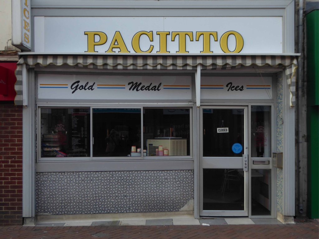
I nipped into town for a tub from Sidoli’s – £1.83 well spent.
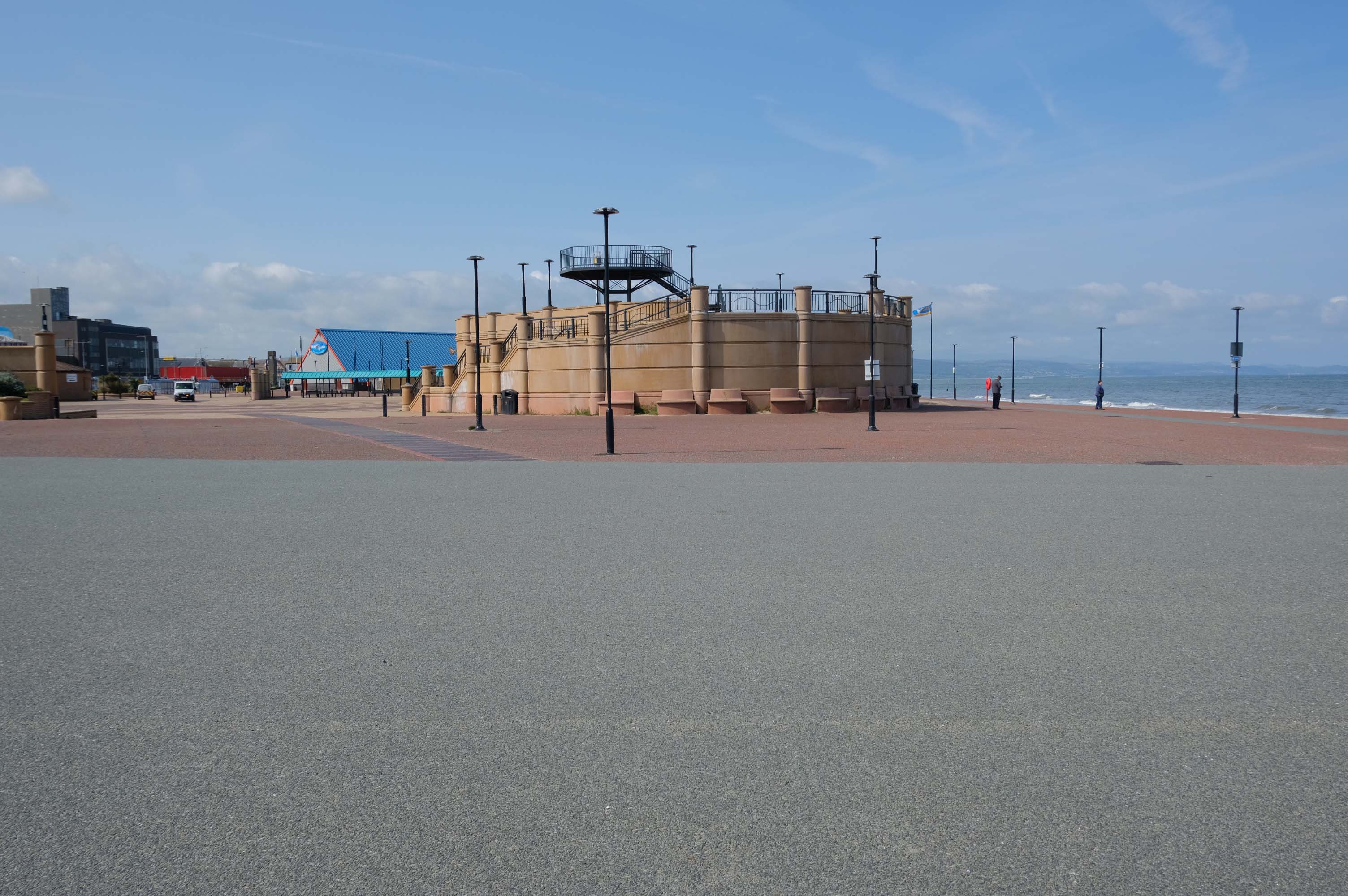
The promenade is home to a series of entertainments including the Rhyl Pavilion Theatre
The theatre, owned and operated by Denbighshire Council, has also been re-clad as part of the project, designed by architects Space & Place.
It forms part of a wider redevelopment of Rhyl’s seafront, which includes the demolition of the Sun Centre and the construction of a £15m water park.
There is a also a becalmed Post Modernist Piazza – named Rhyl Events Arena.
The playful nursery geometry of the SeaQuarium.
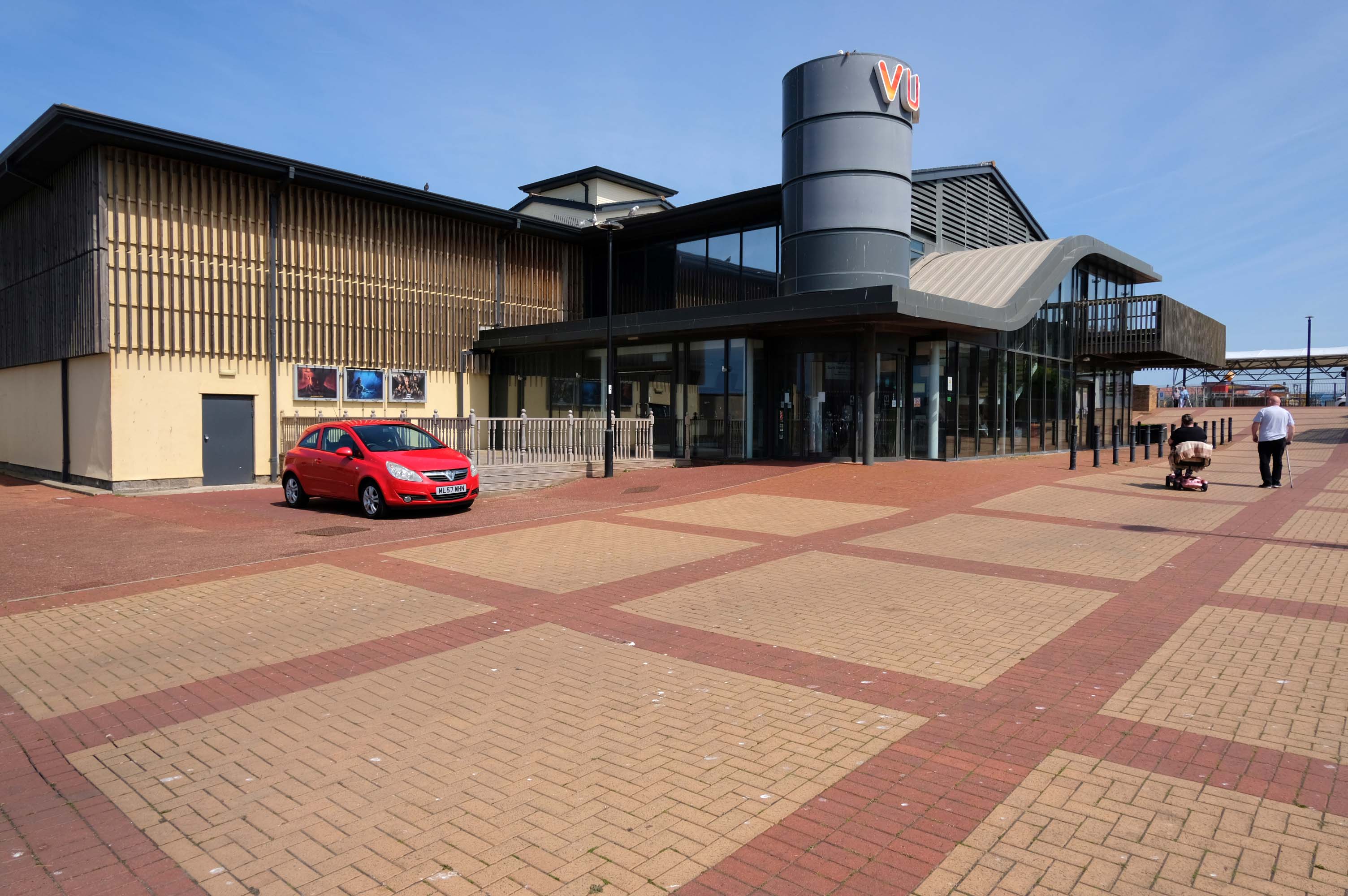
The functionalist Vue Cinema.
Tickets were £5.99 for a standard seat, the staff said not to bother upgrading as the premium seats were rubbish, sound was okay and picture quality was okay.
Food price was expensive so it maybe cheap to get in, but £16.99 for a large popcorn and drink ups the price, would go again if in the area.
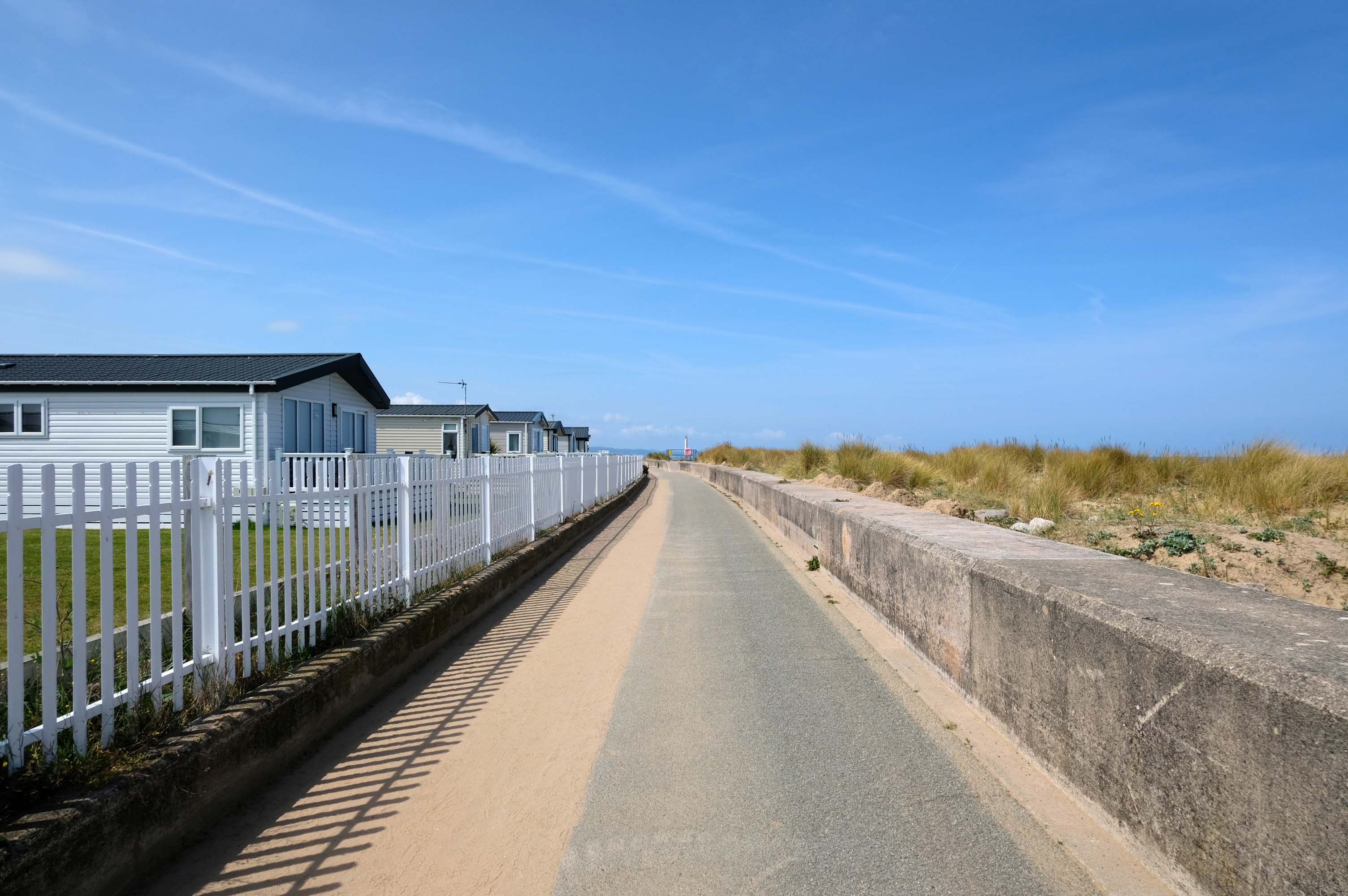
Much of the coast is fringed with chalets and static caravans.
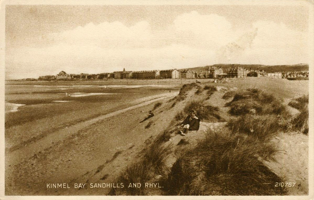
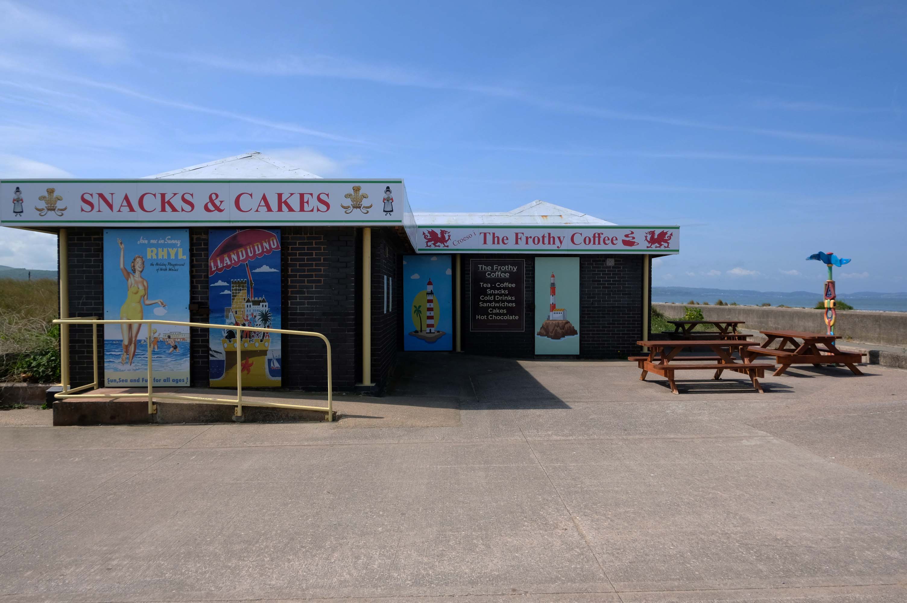
Kinmel Bay
Home to The Frothy Coffee.
There aren’t enough food, service, value or atmosphere ratings for The Frothy Coffee, yet – be one of the first to write a review!
Kinmel Bay beach is popular with tourists and the local population. In addition to various small shops and takeaway outlets, there is also an Asda superstore that opened in 1981, which includes a large petrol filling station.
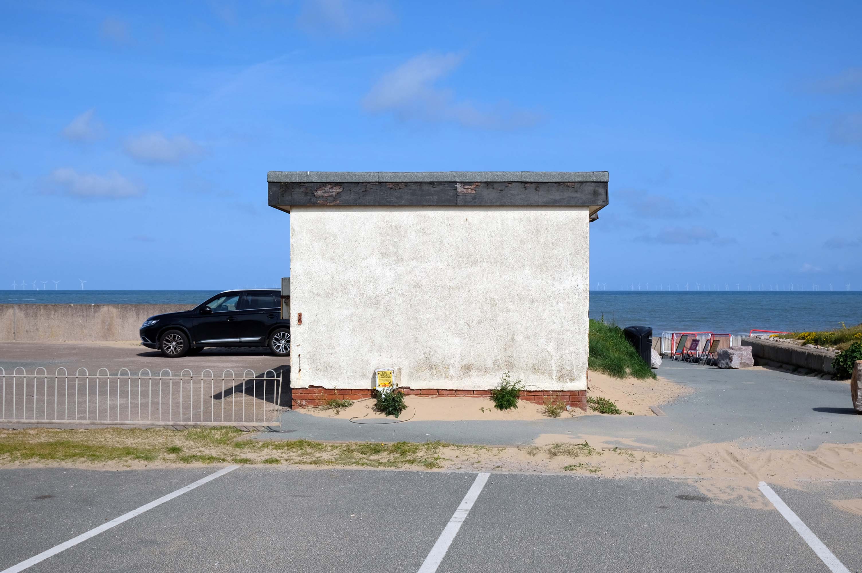
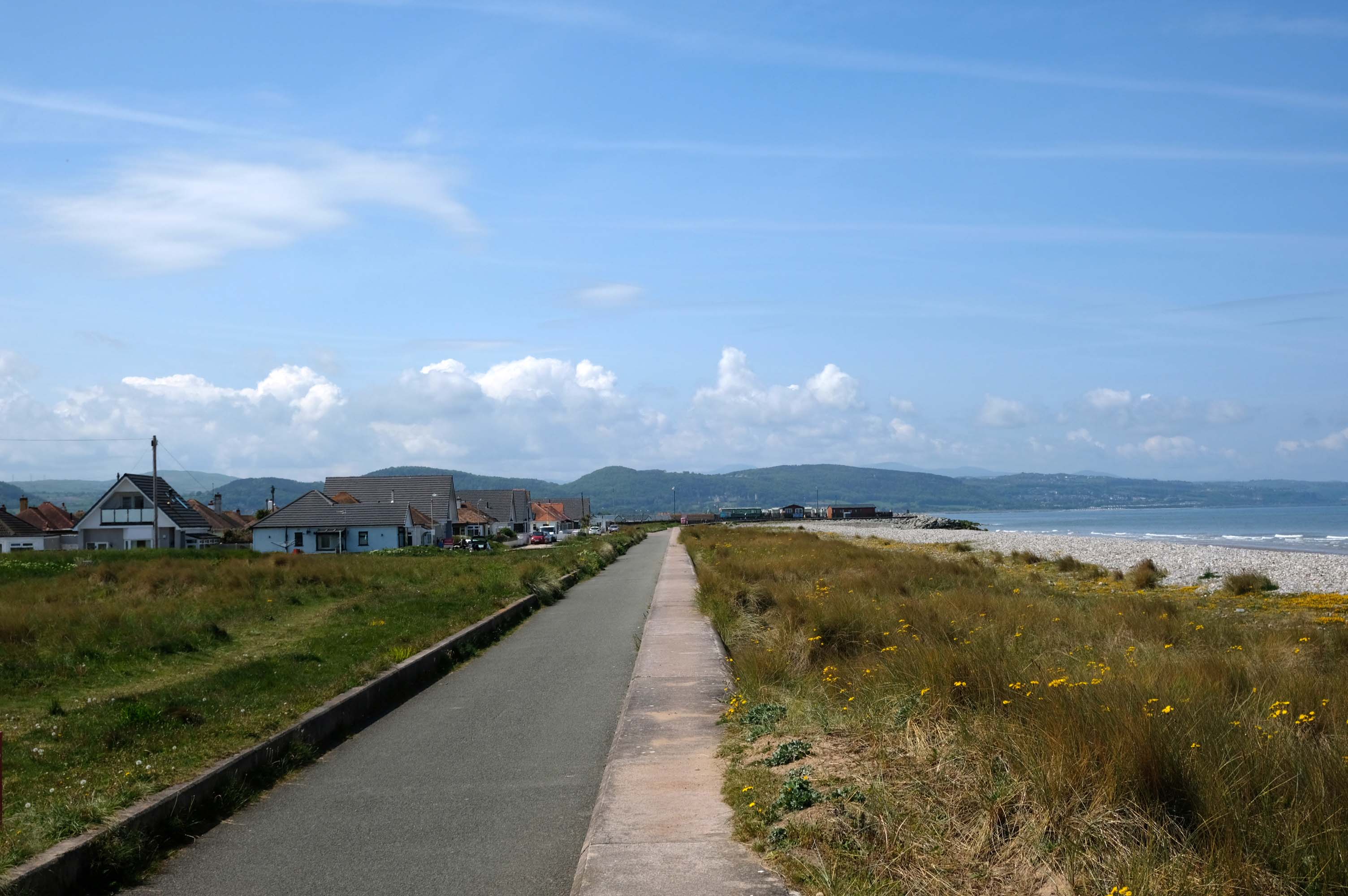
The concrete shore is softened by grasses and wild flowers – with views of the mountains beyond.
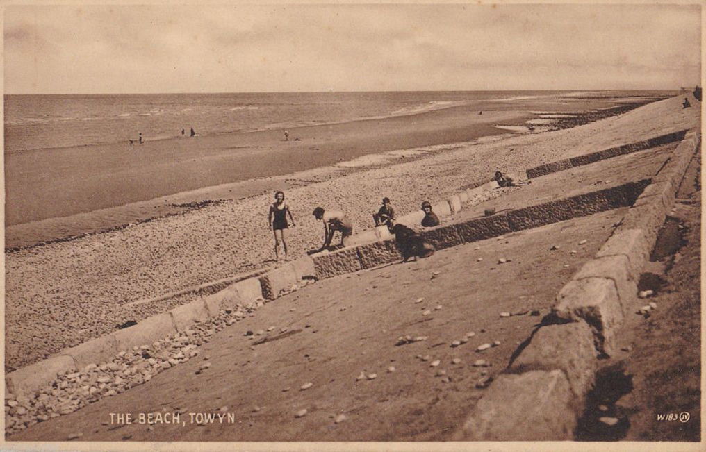
Here we are in Towyn
The town made national headlines in 1990 when a combination of gale-force winds, a high tide and rough seas caused Towyn’s flood defences to be breached at about 11.00am on 26 February. Four square miles of land was flooded, affecting 2,800 properties and causing areas of the resort to be evacuated. Further flooding occurred later the same week, on 1 March, shortly after the site of the disaster was visited by Prince Charles and Princess Diana.
Scientific experts also believe that the silt left behind from the flooding had left the town with a higher concentration of radioactivity, over ten times the governmental safety limits, most likely originating from the nuclear processing plant at Sellafield which had been dispersed into the Irish Sea over many years since its construction.
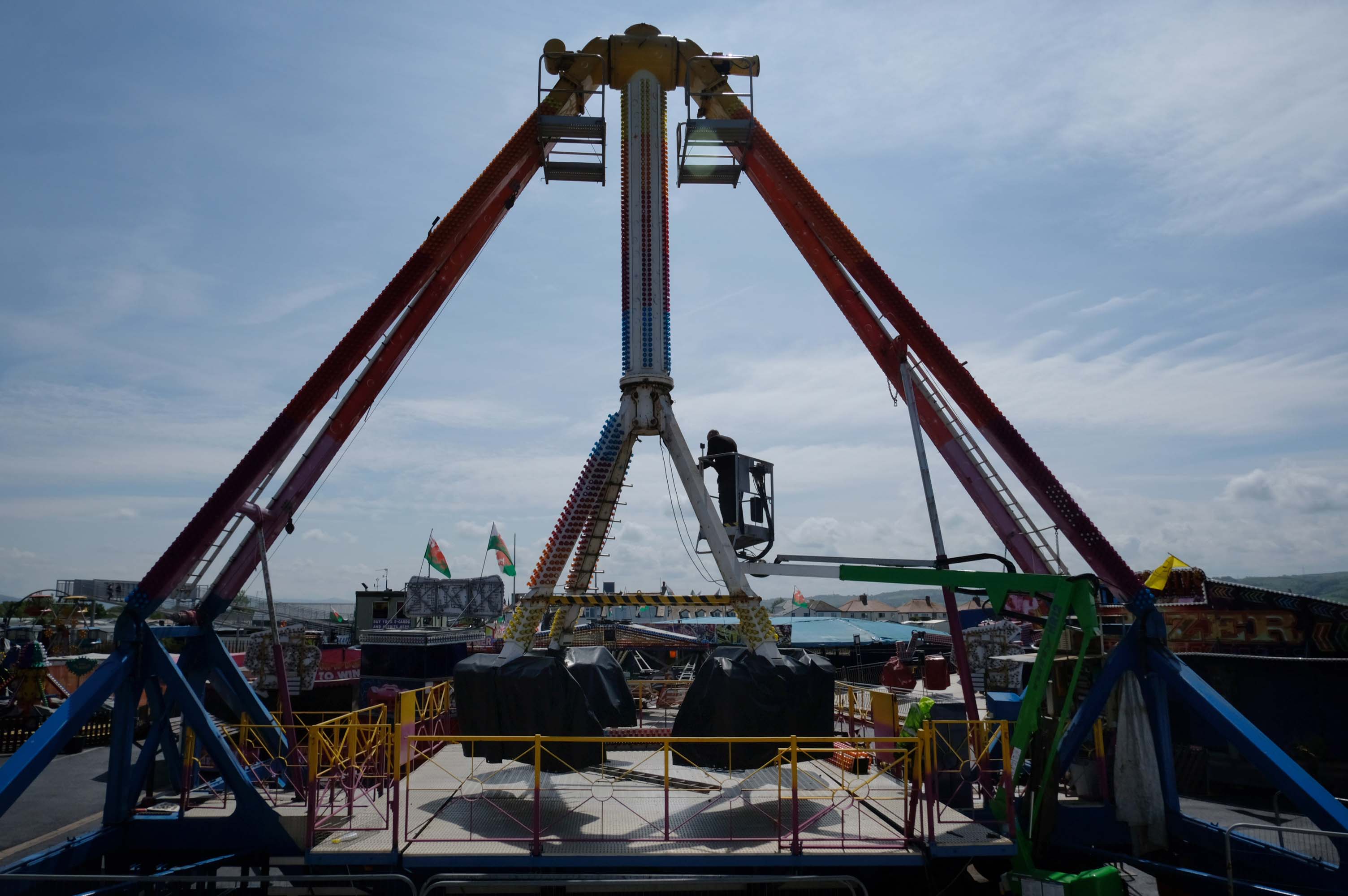
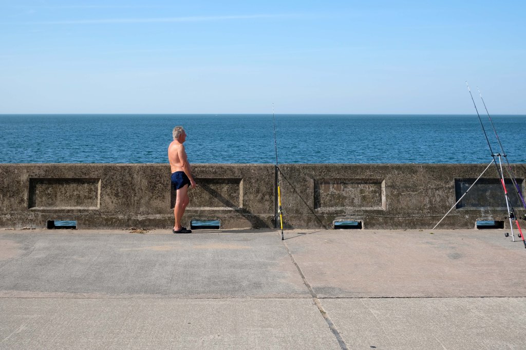
Excitements galore, await at the well maintained funfair.
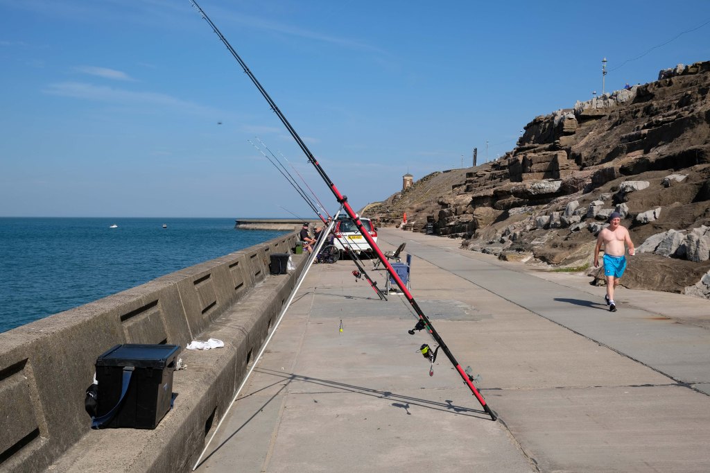
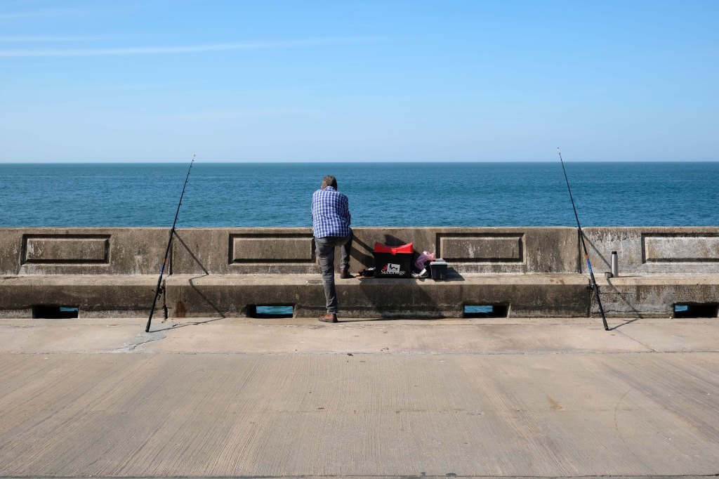
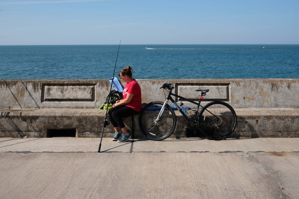
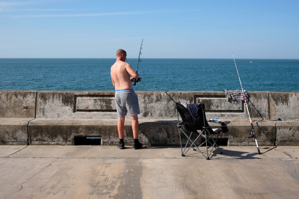
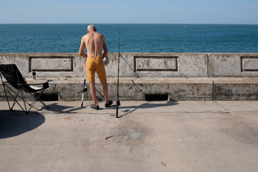
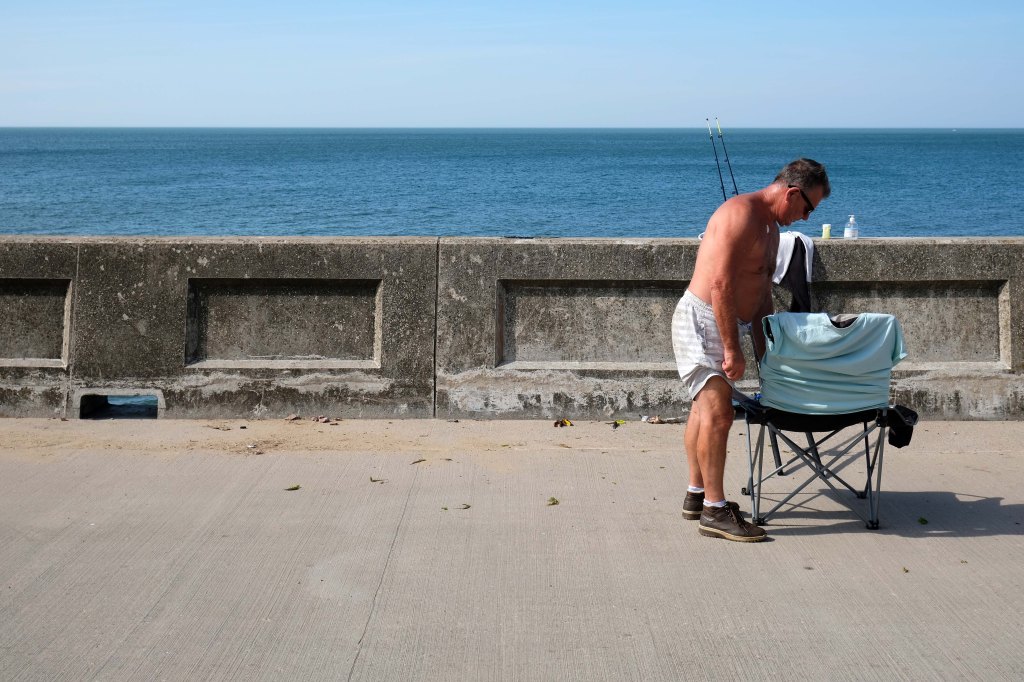
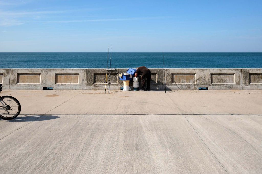
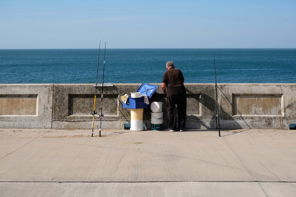
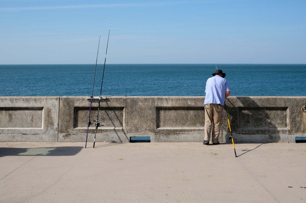
Motor cars to the fore, as the intrepid sea-anglers prepare for a day of sea-angling.
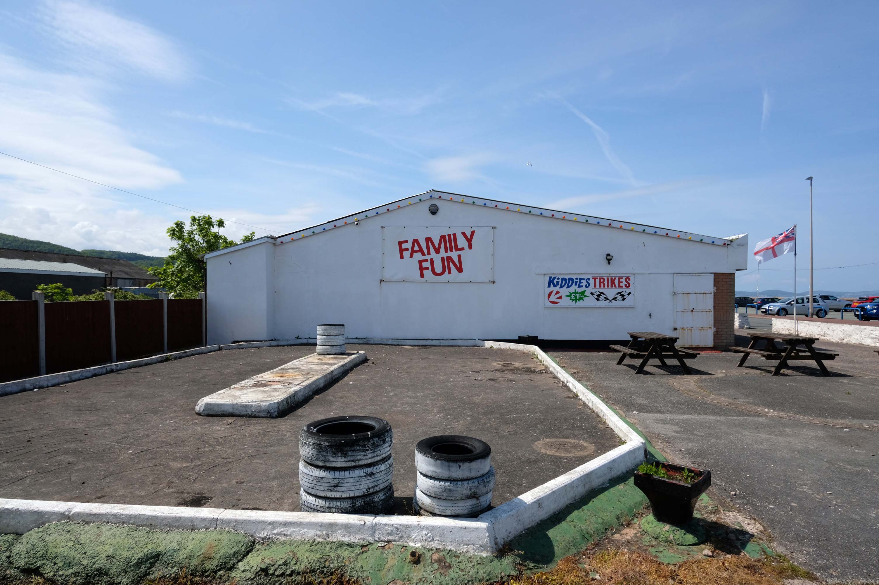
Abergele where Family Fun can be found in the form of Kiddies Karts.
In 2020/21 Abergele hosted the 20th and 21st editions of I’m a Celebrity Get Me Out of Here! at Gwrych Castle, due to the Covid pandemic restrictions in Australia.
I failed to avail myself with a chilly treat courtesy of Danny’s Whippy, having already had my 99 tub, from Sidoli’s in Rhyl.
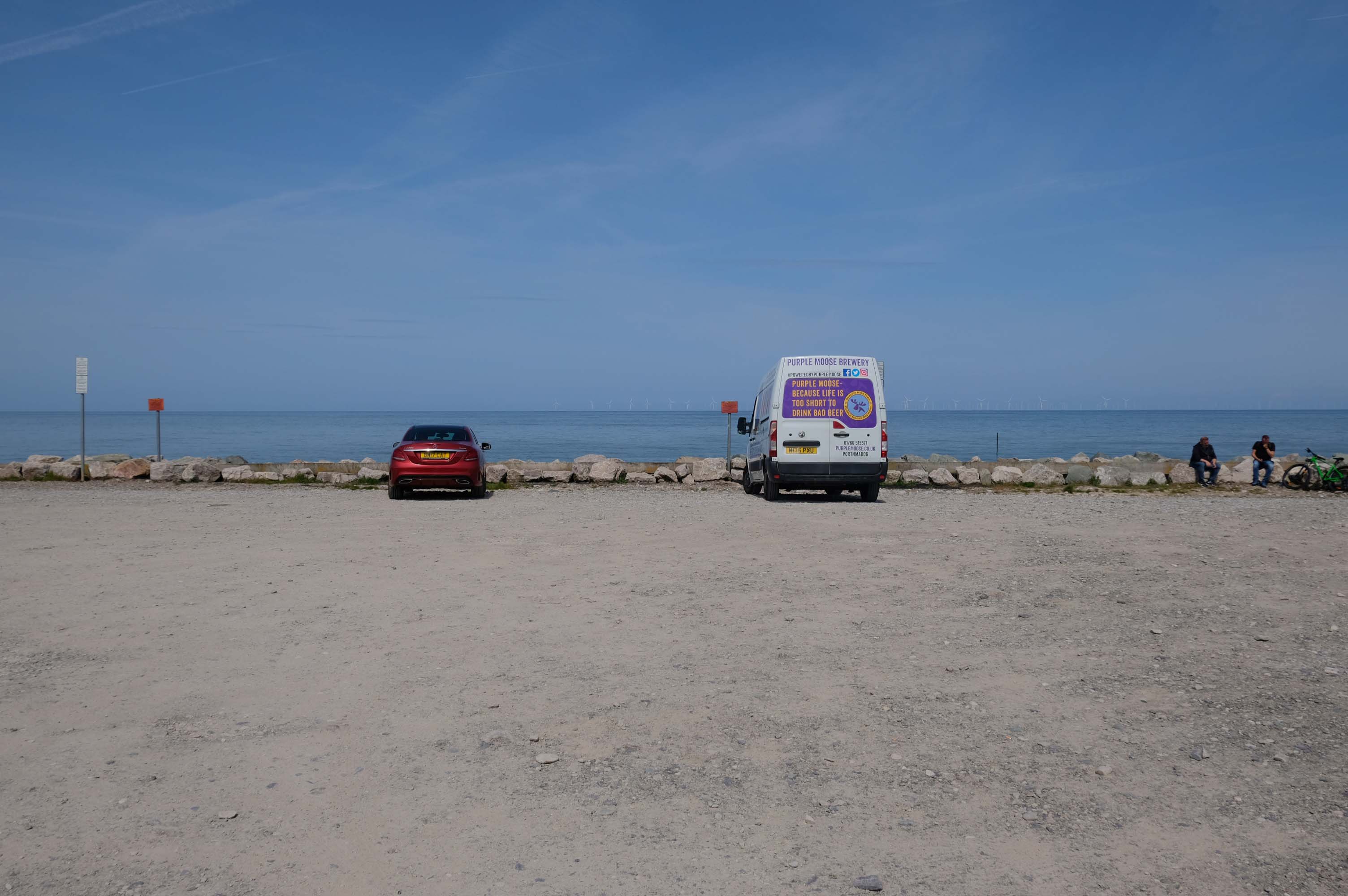
Local brewery Purple Moose’s delivery van driver takes a timely break, whilst fellow cyclists stop for a cig and a chat.
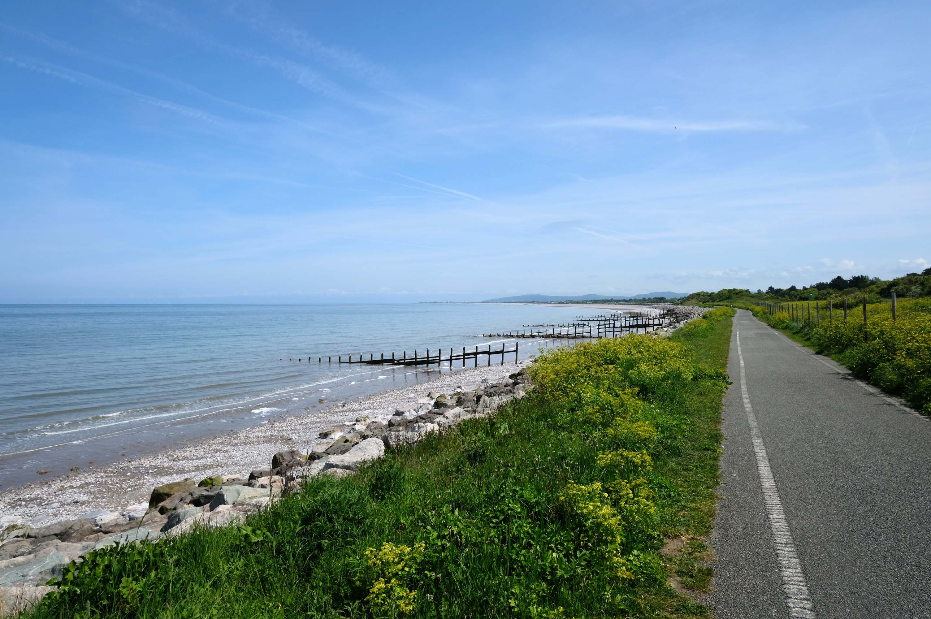
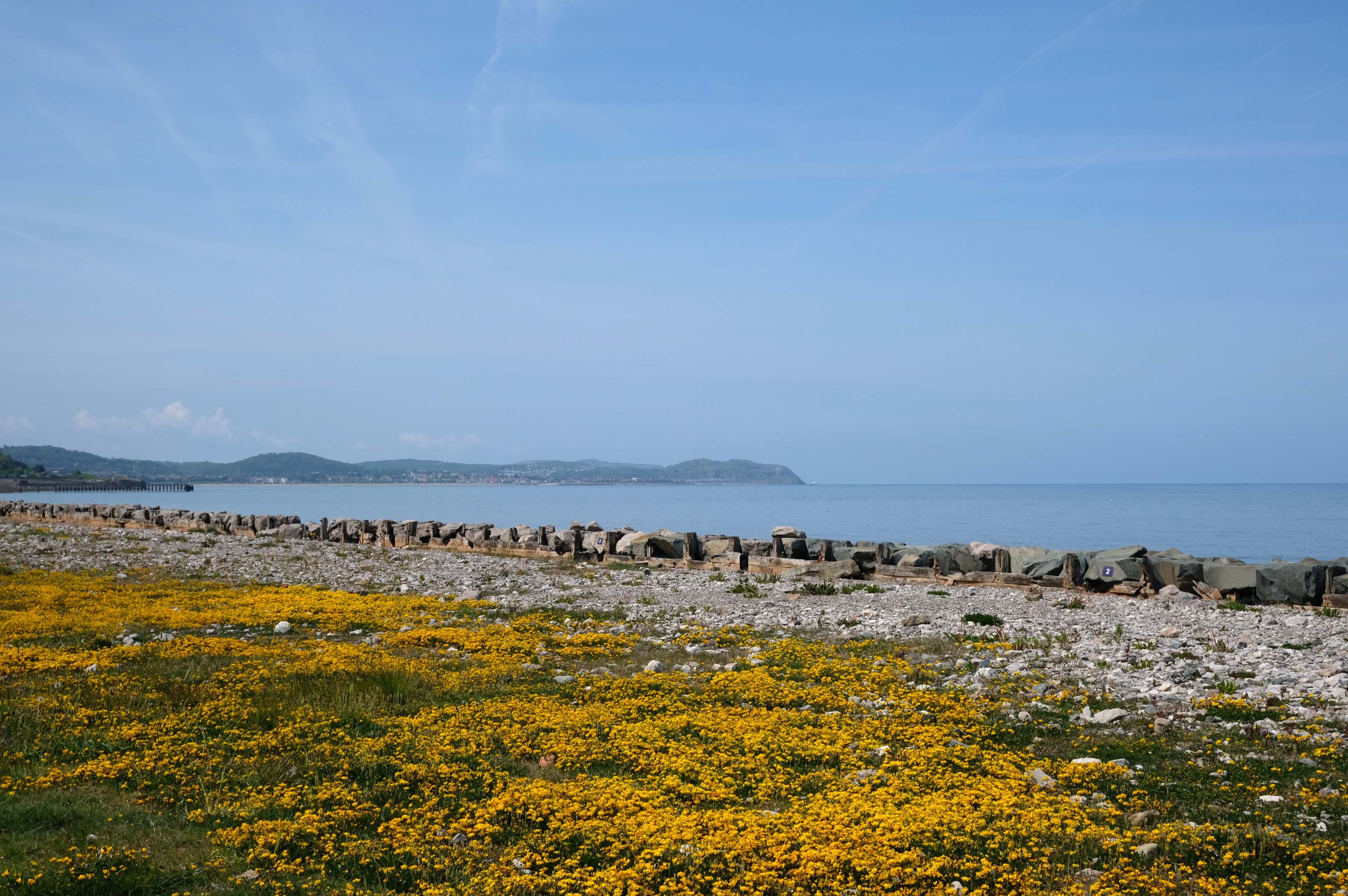
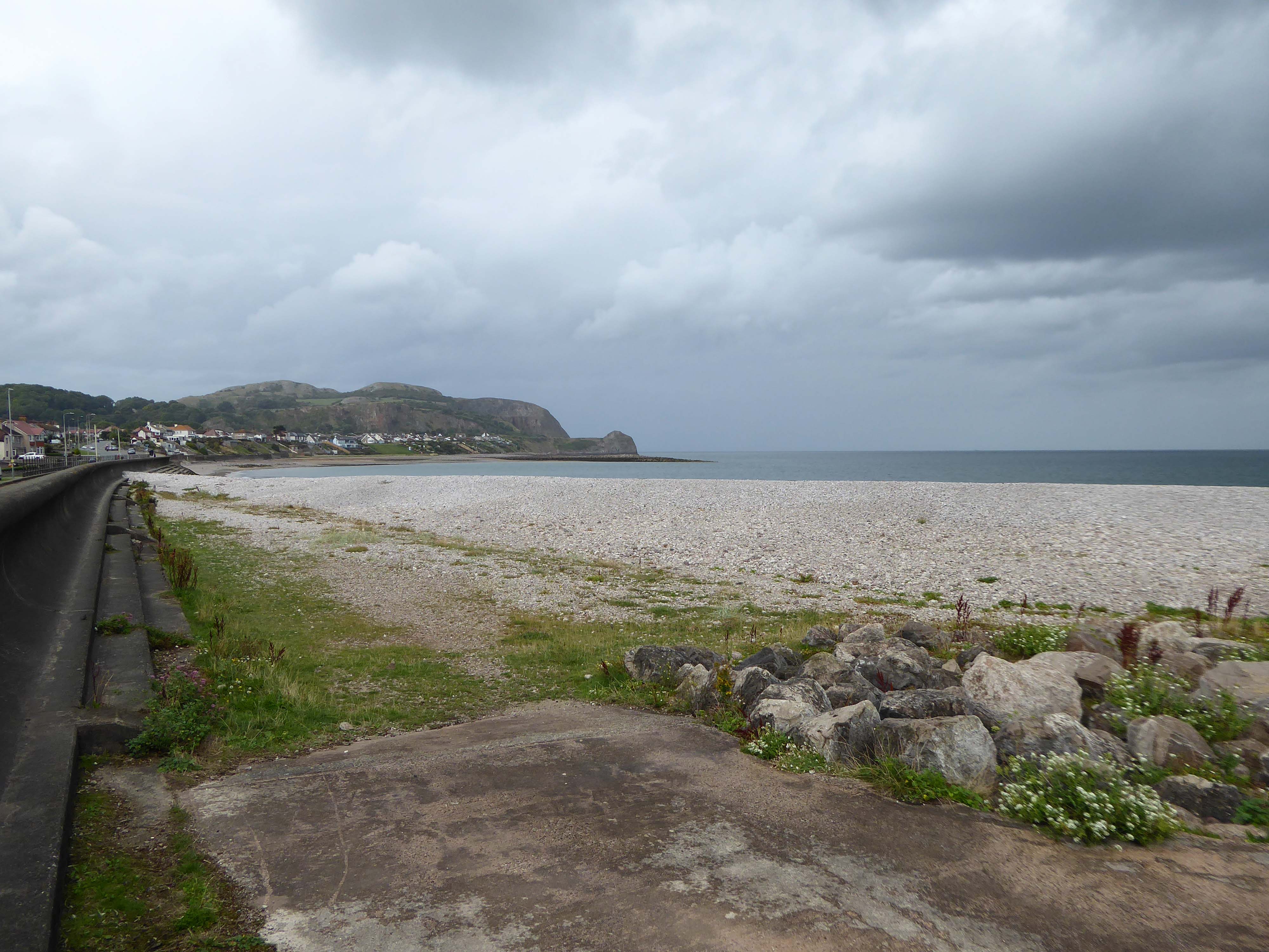
Rugged rocks, sadly lacking ragged rascals, as the Little Orme comes into view.
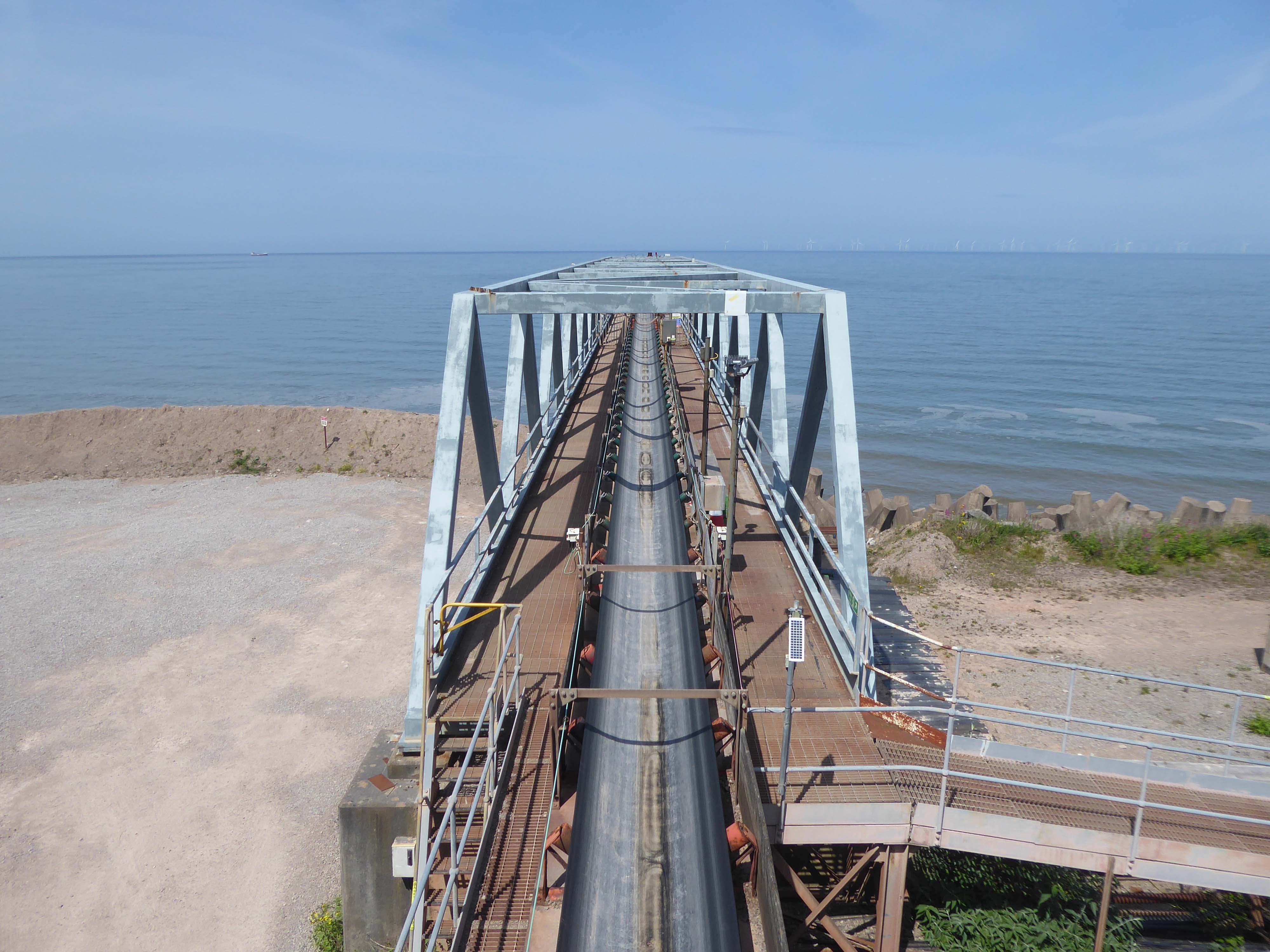
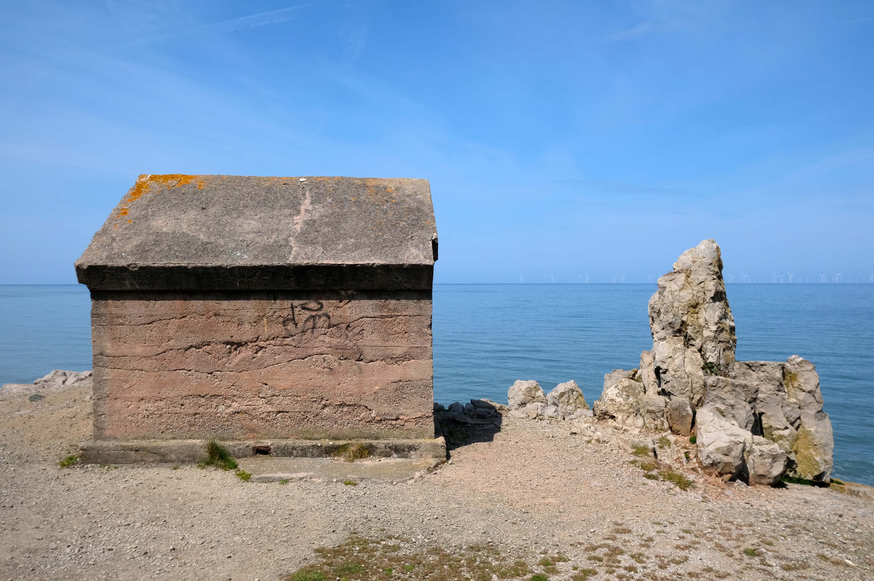
Cast concrete defences, and Raynes Quarry jetty at Llandulas.
The quarry was originally known as Llysfaen Limeworks, being close to Llysfaen railway station. James Trevelyan Raynes of Rock Ferry, Birkenhead, took over the quarry in the 1870s, adding large new limekilns. Lime from the quarry was shipped to various alkali works. Alkali was used for soap, textiles and many other goods.
Quarrying in this area has also produced porcelain-like limestone for high quality architectural uses. St Margaret’s Church – also known as the Marble Church in Bodelwyddan, was built with limestone from Llanddulas.
In November 2011 one of the freighters, MV Swanland, sank in stormy weather on the Irish Sea after collecting 3,000 tons of stone from Raynes jetty bound for the Isle of Wight.
Two crewmen were rescued but five, all Russian, were lost.
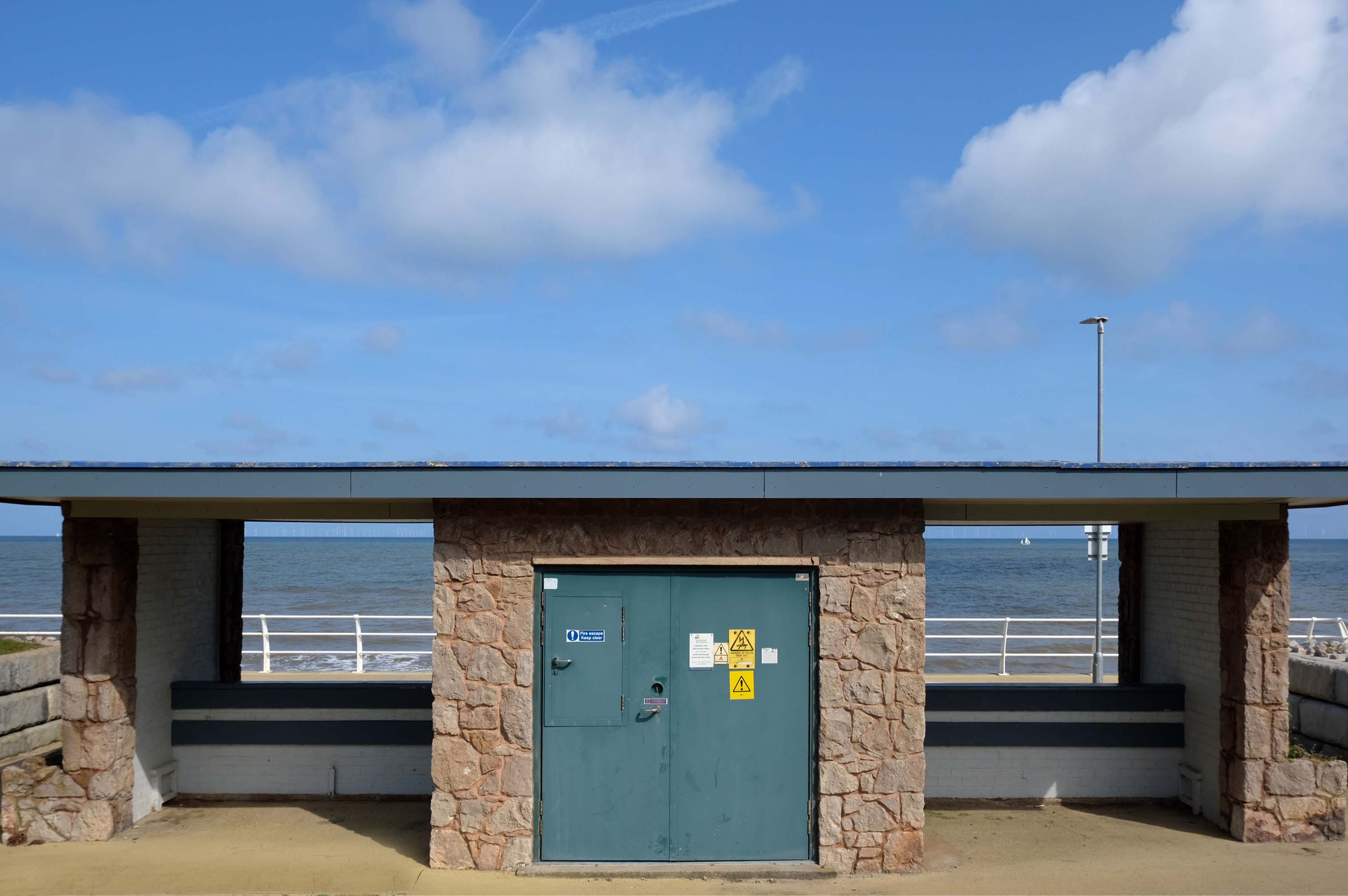
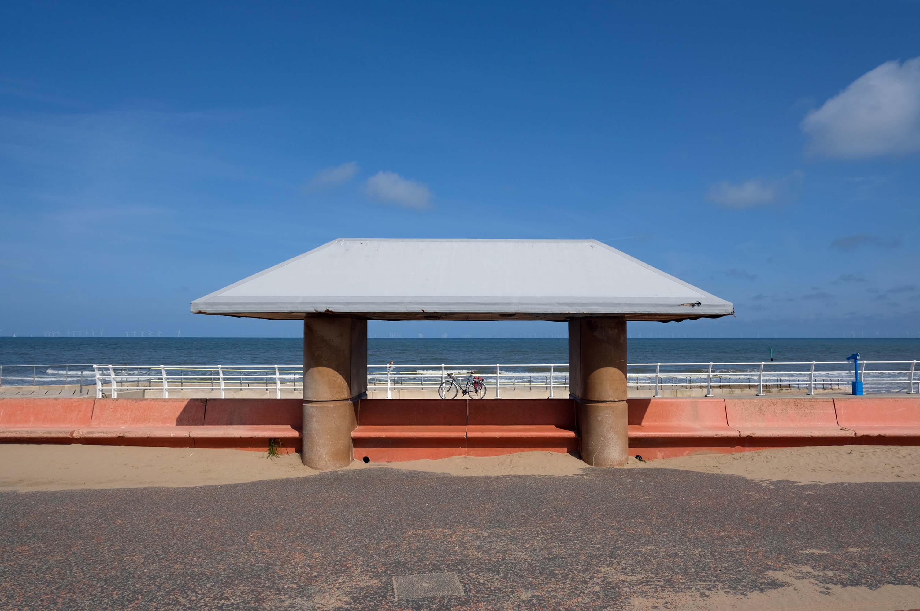
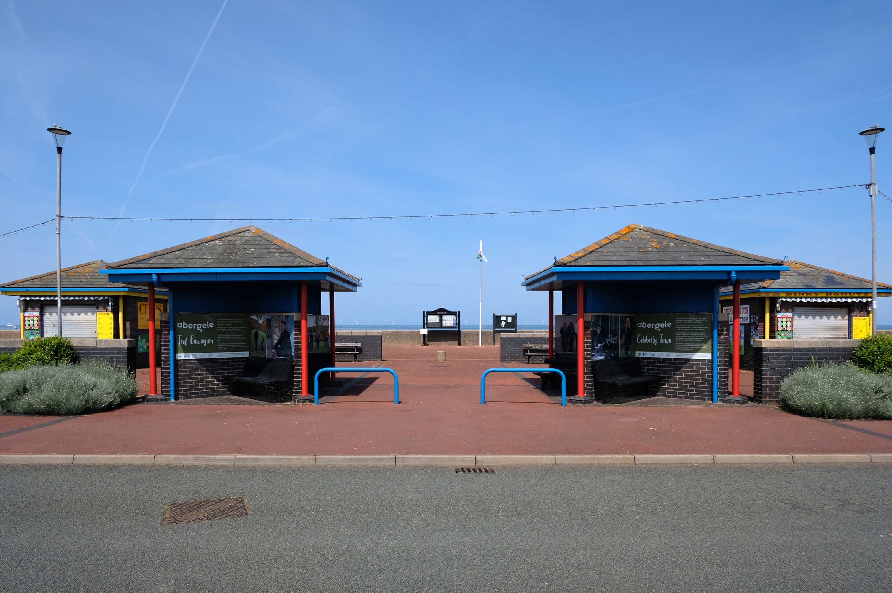
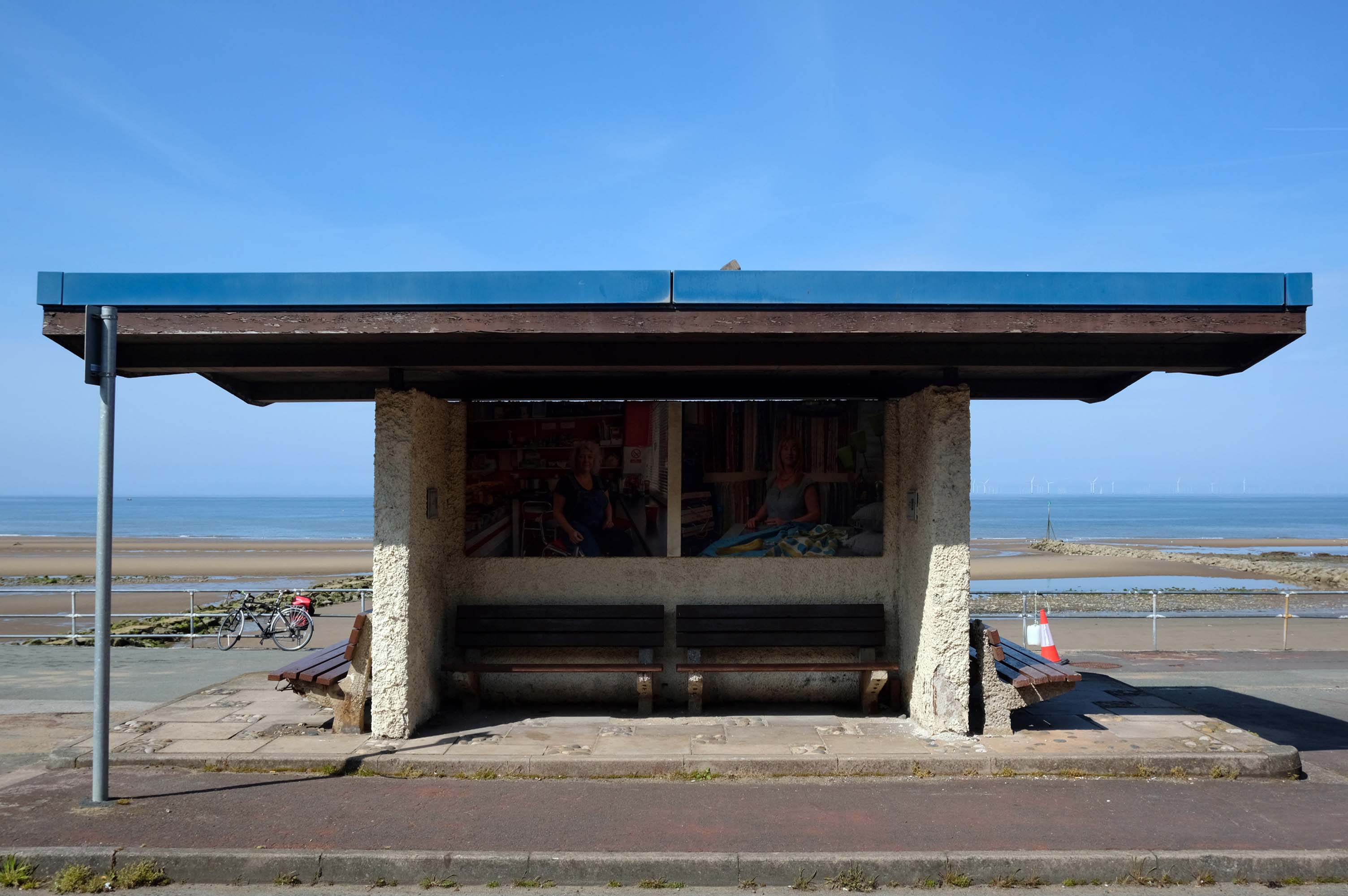
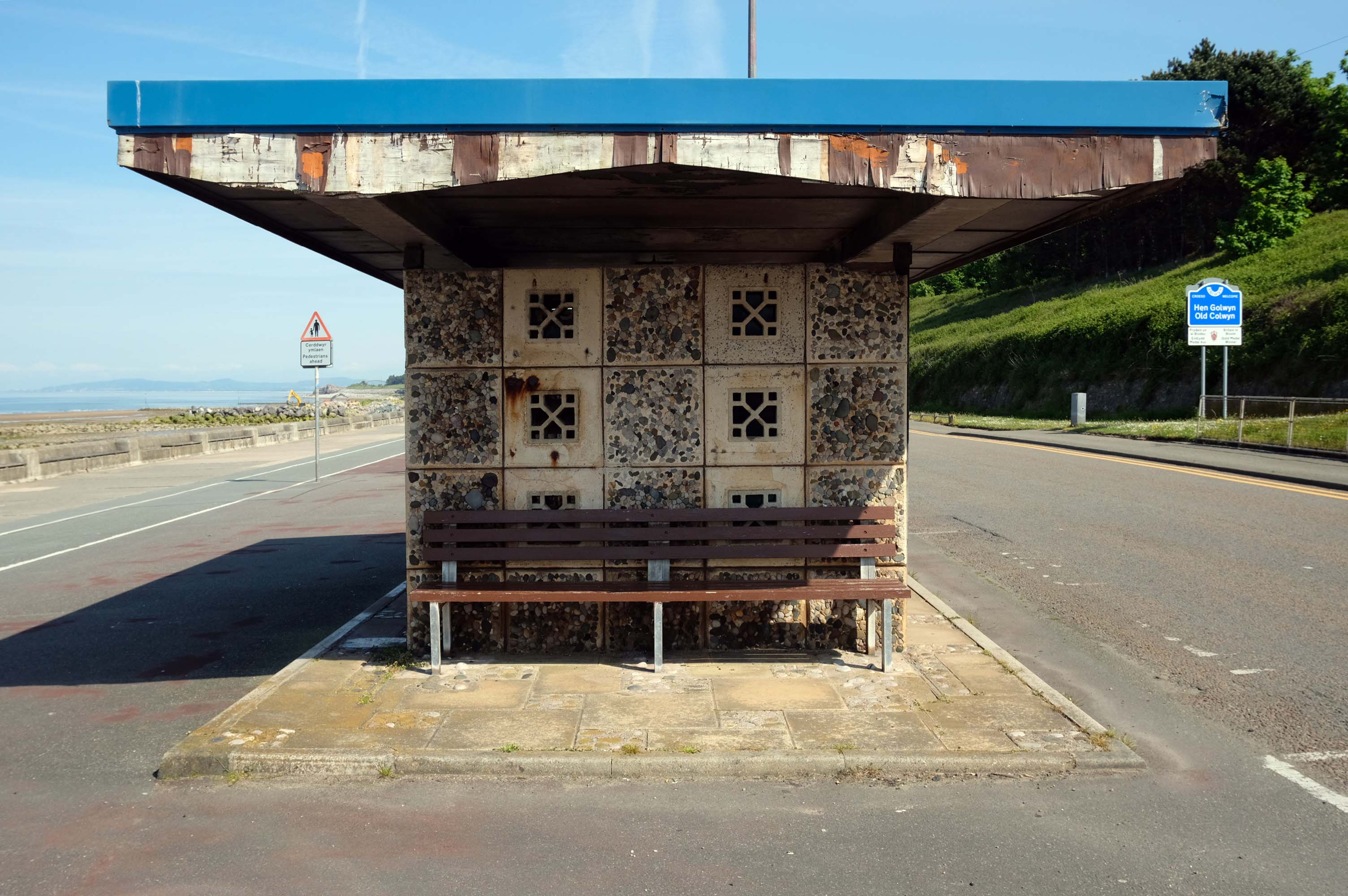
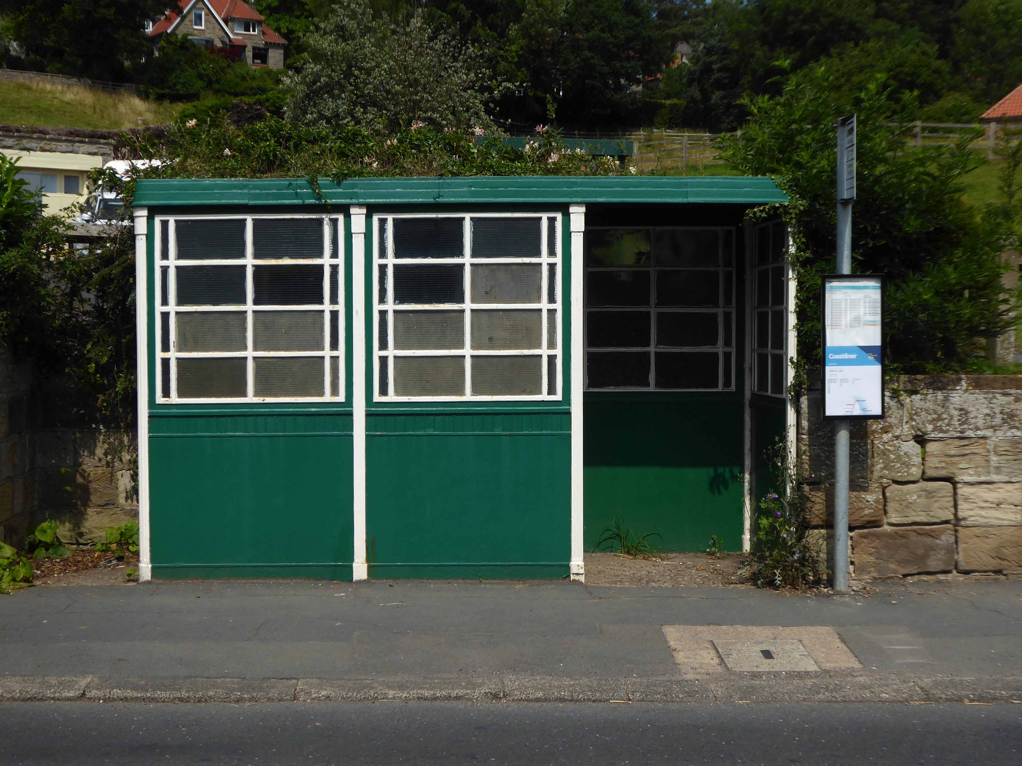
Almost the end of the line here in Old Colwyn – where there are the last of a series of shelters.
Formerly lining the prom all the way to Rhos on Sea
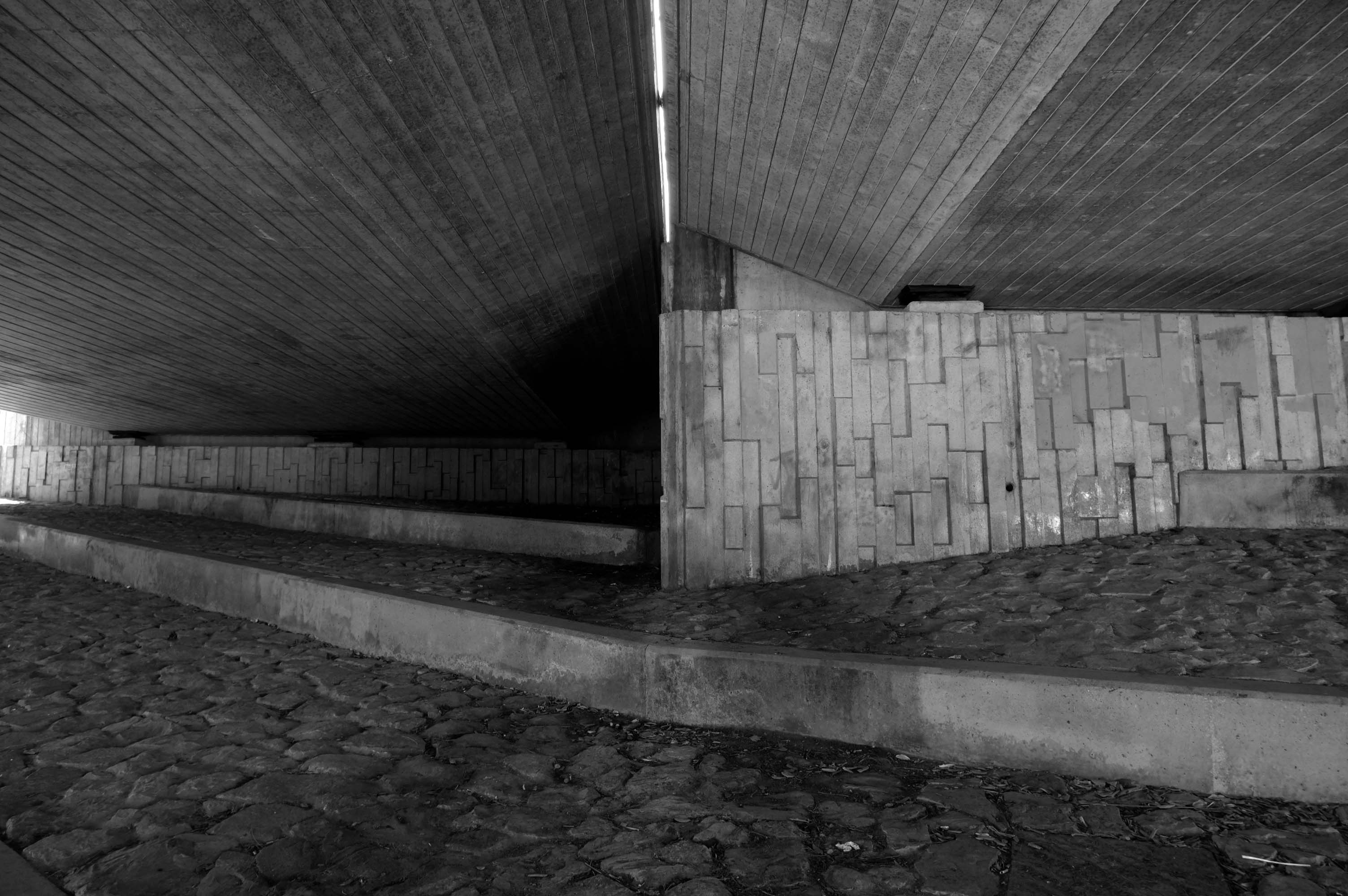
Cutting under the A55 Expressway to Colwyn Bay.
During World War II the Colwyn Bay Hotel, Marine Road – now demolished, was the headquarters of the Ministry of Food. This also housed the Cocoa & Chocolate division and was the communications hub for the ministry, they continued to use the hotel until 1953.
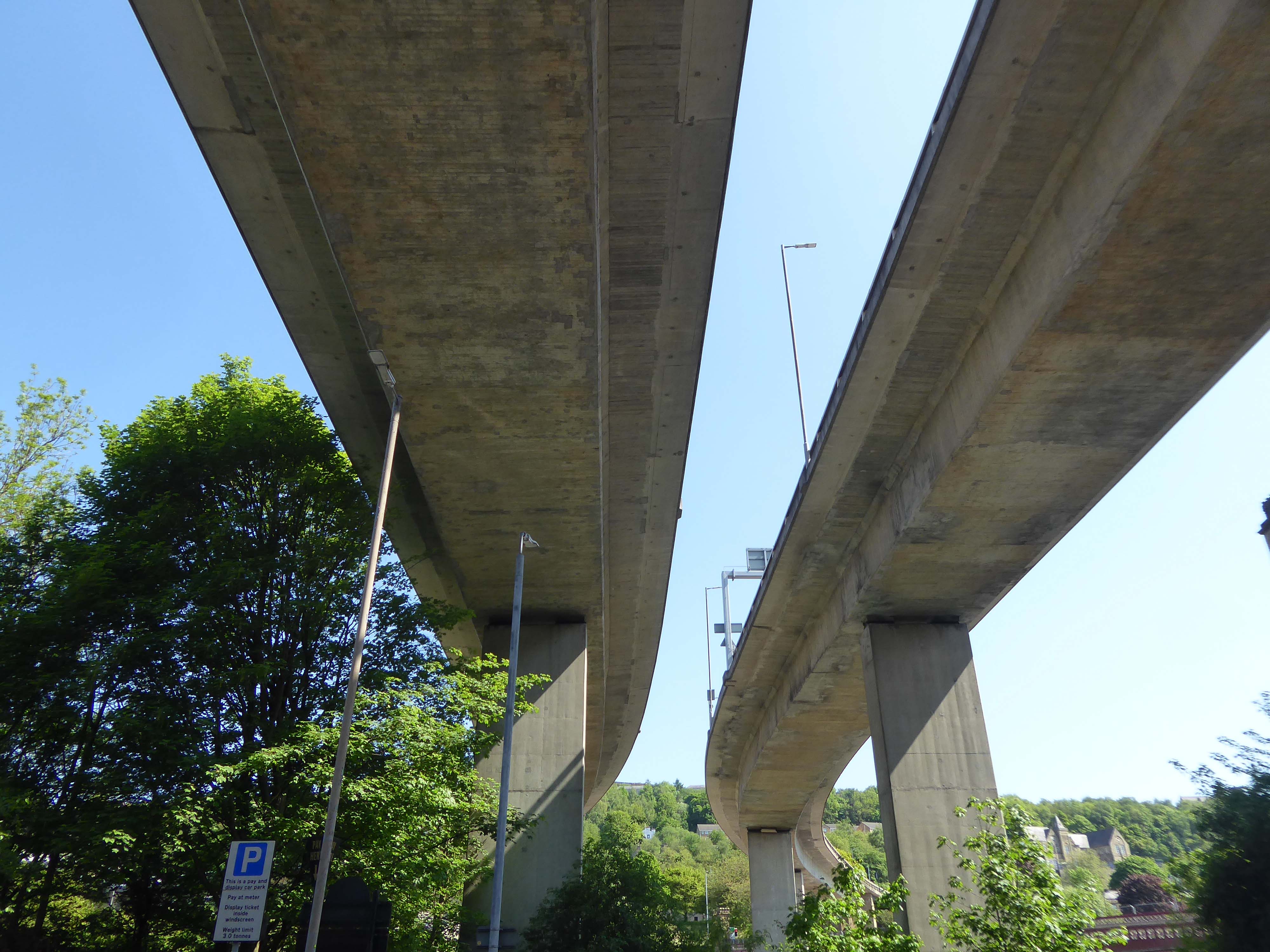
One man who saw the wisdom of building a road infrastructure to deal with high volumes of traffic passing through Halifax and to provide convenient links to the M62.
That man was prominent town councillor John Burdock.
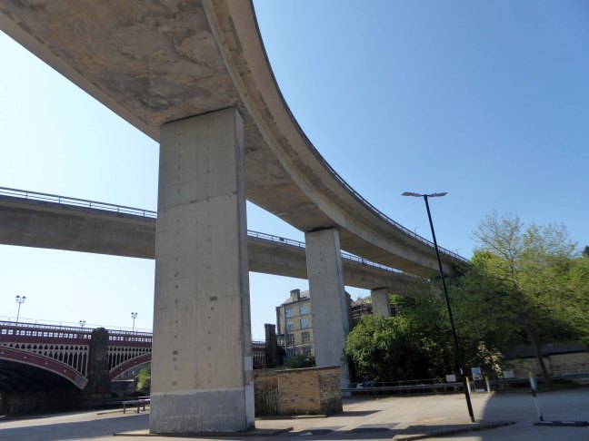
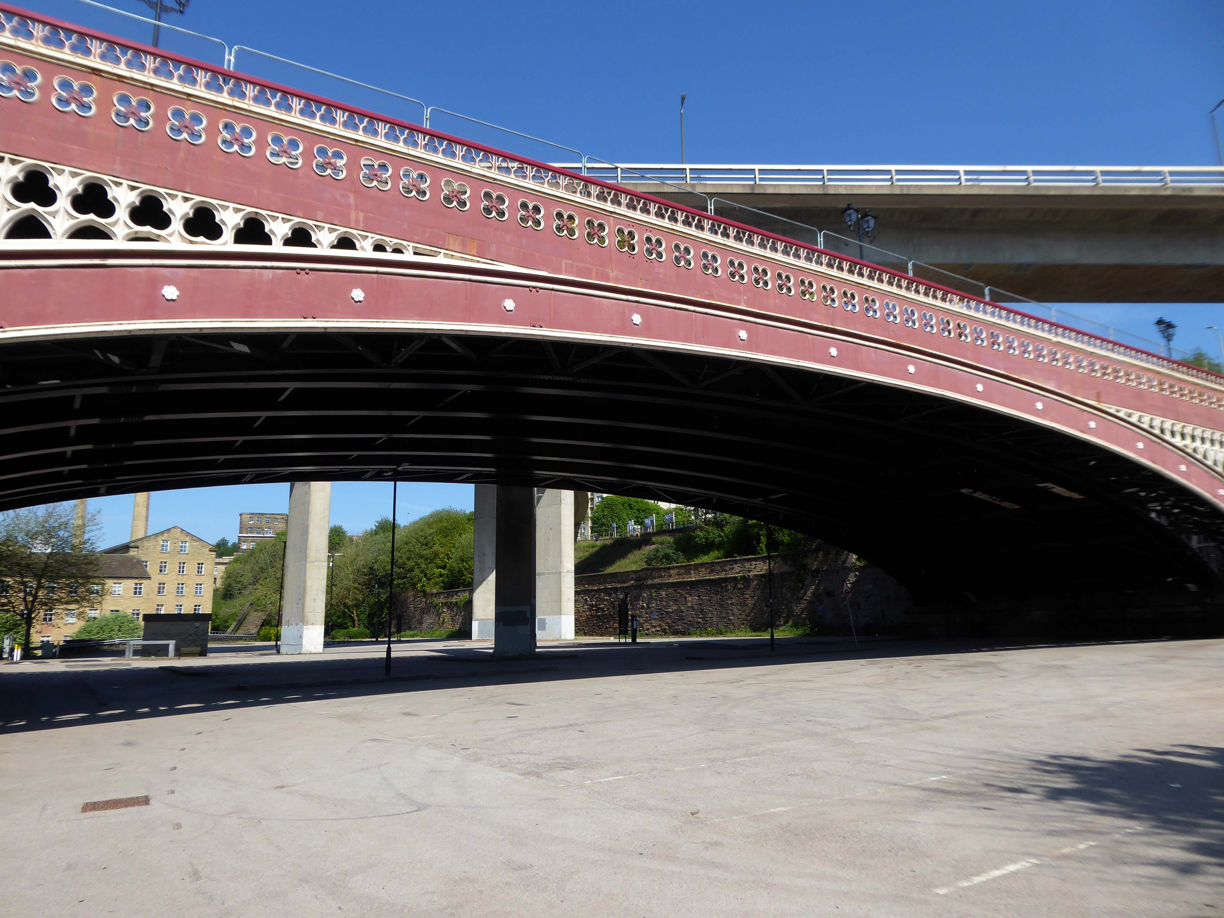
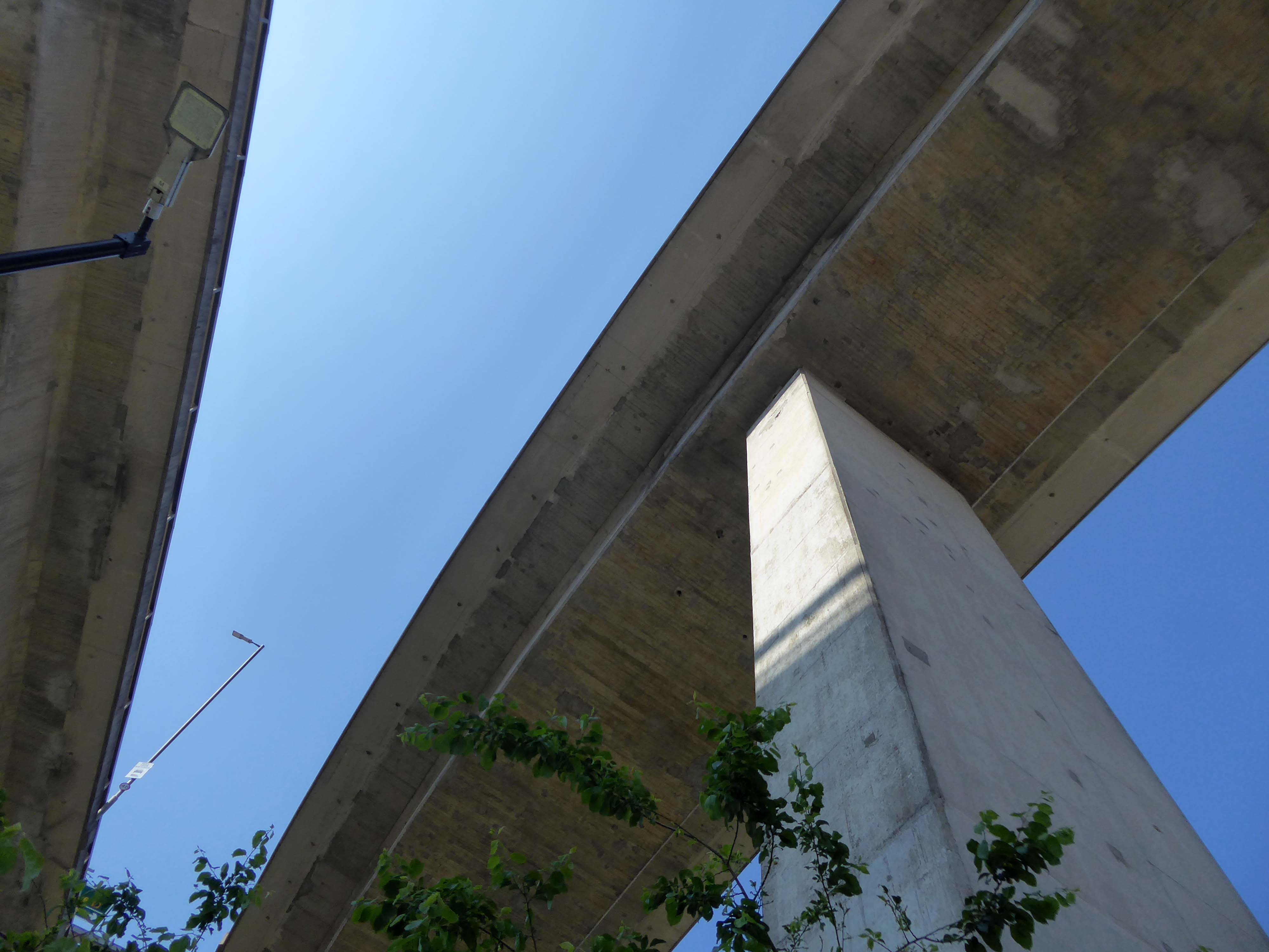
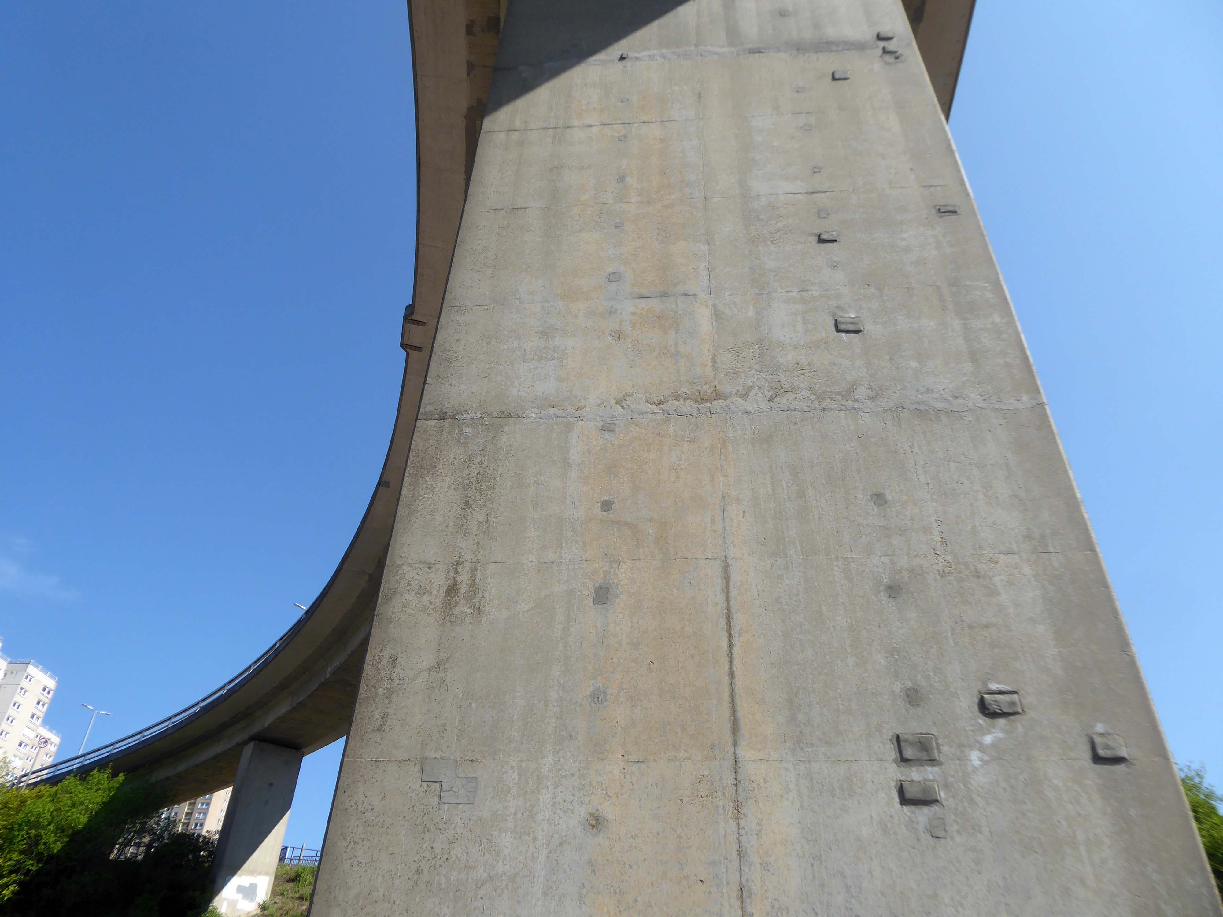
Burdock Way, the modern flyover system, was opened in 1973 to take the A58 and A629 traffic over the River Hebble.
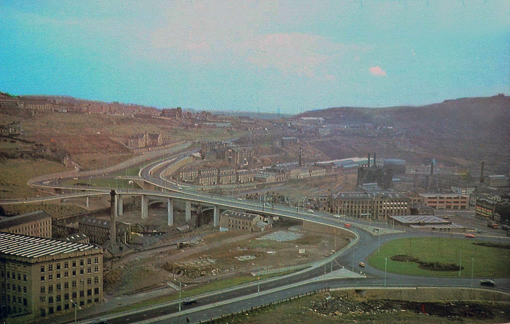
Faced with the problem of very high volumes of through traffic in its town centre, and with the impending construction of the M62 too far to the south to provide relief for the town, Halifax needed a bypass. The steep sided valley that the town centre inhabits prevented a conventional road from being built around the town, and so in the early 1970’s construction began on Burdock Way – one of the most adventurous relief road schemes built in Britain, certainly by a town the size of Halifax.
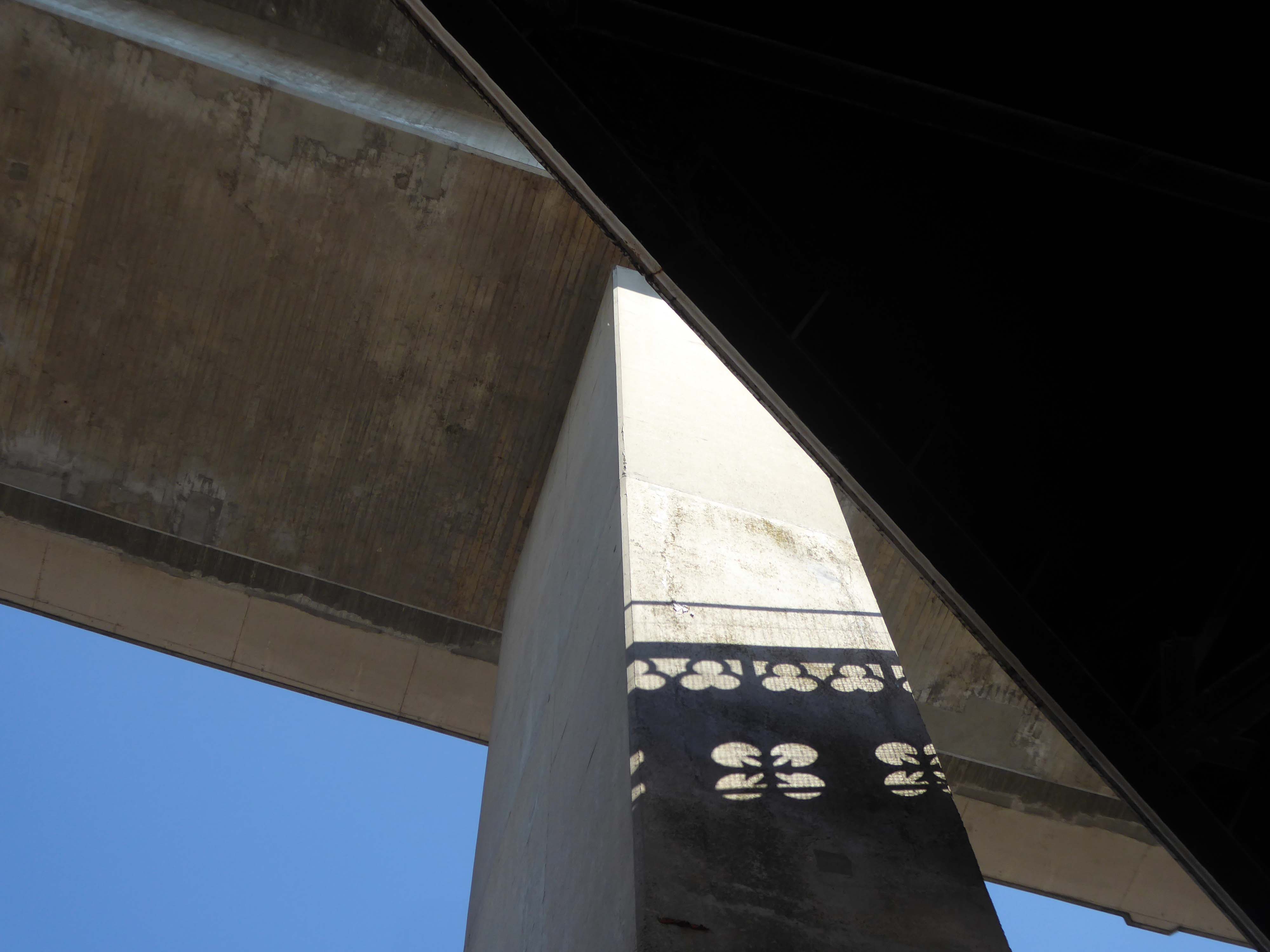
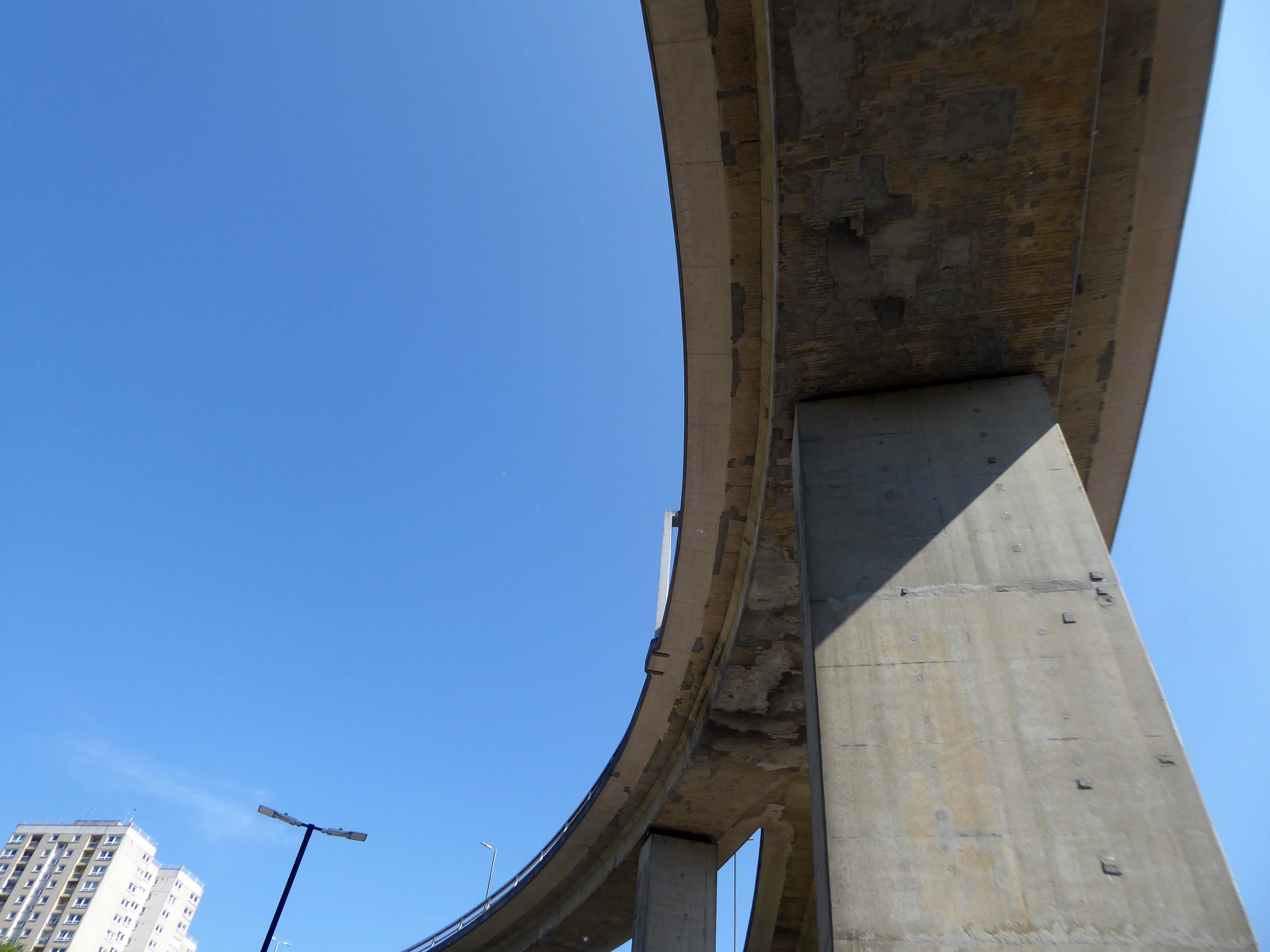
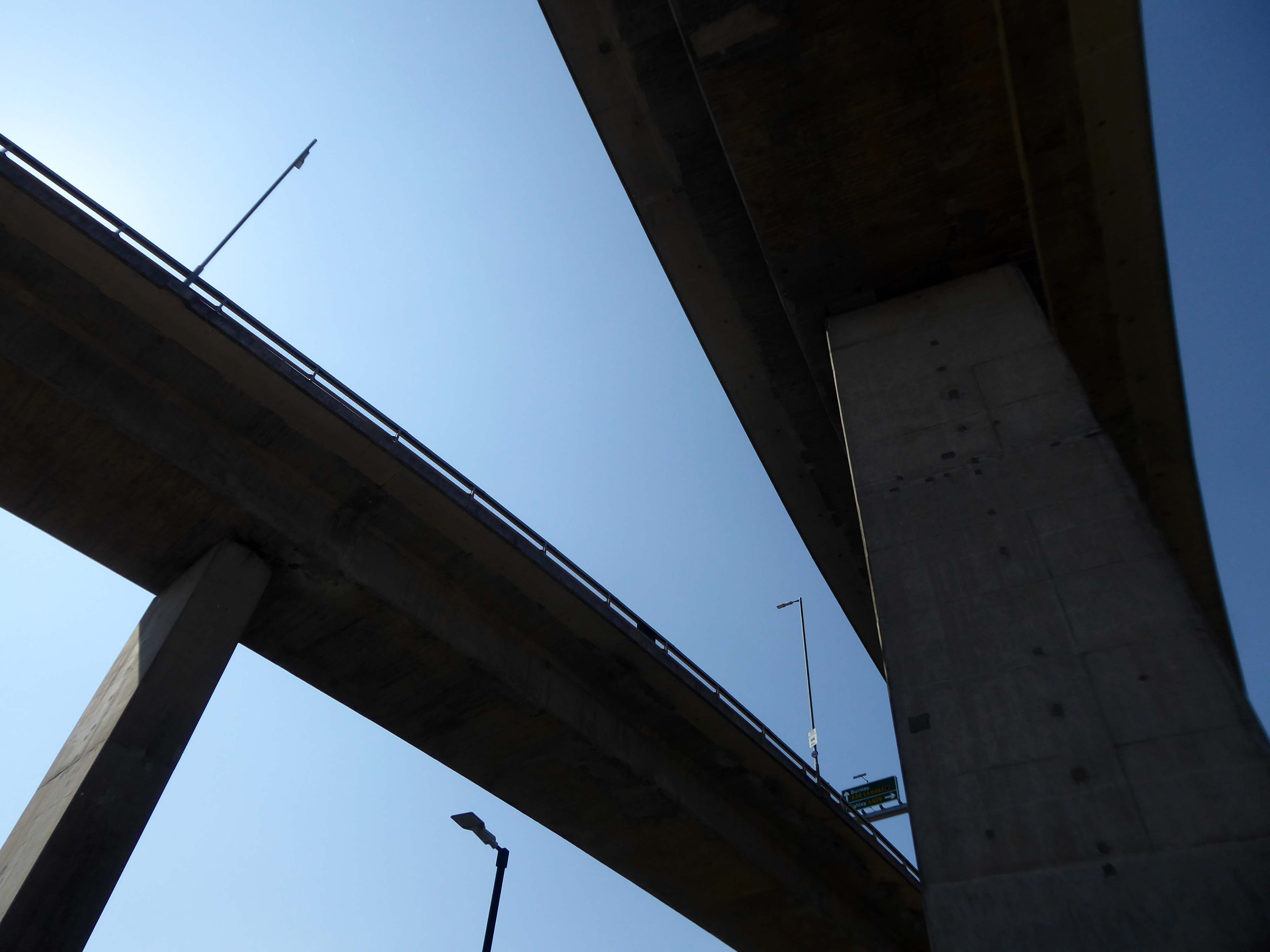
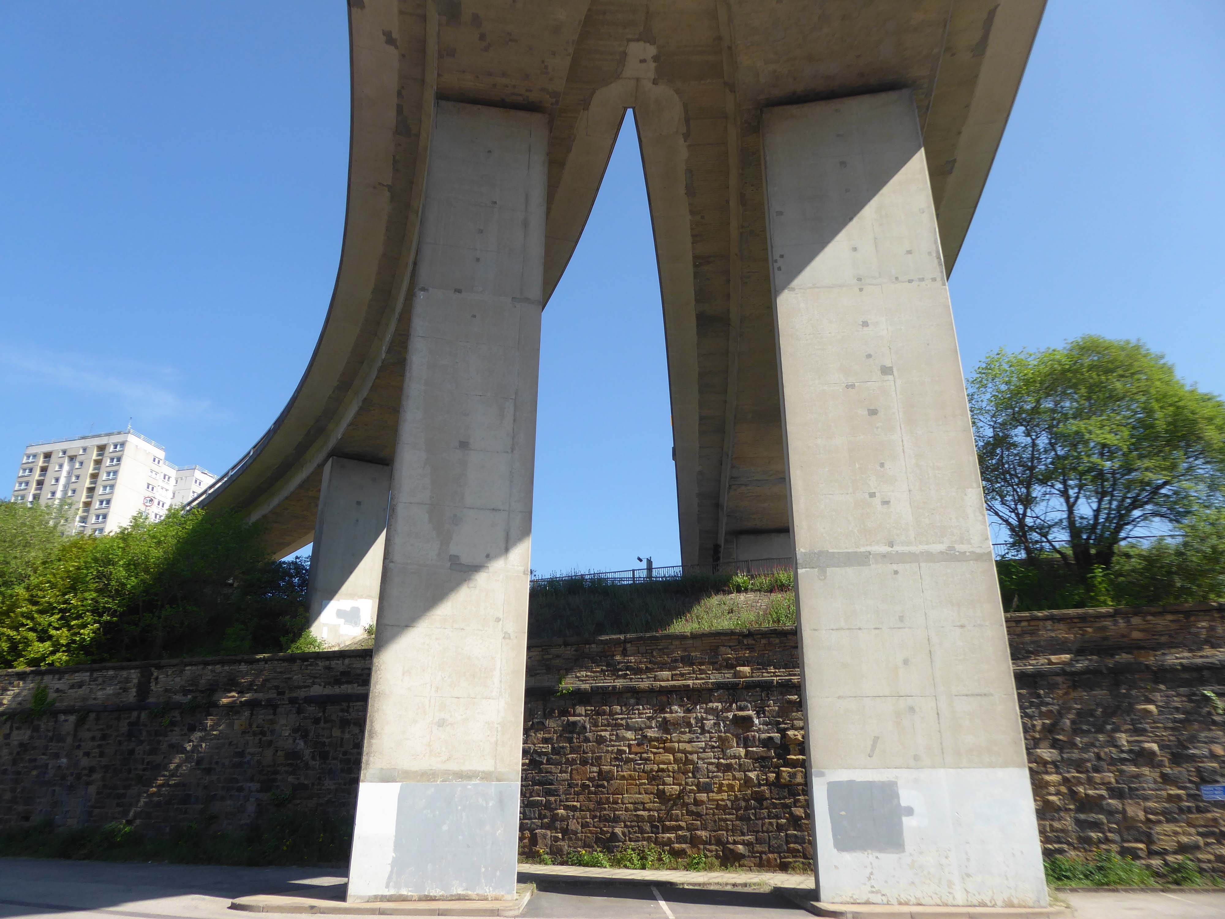
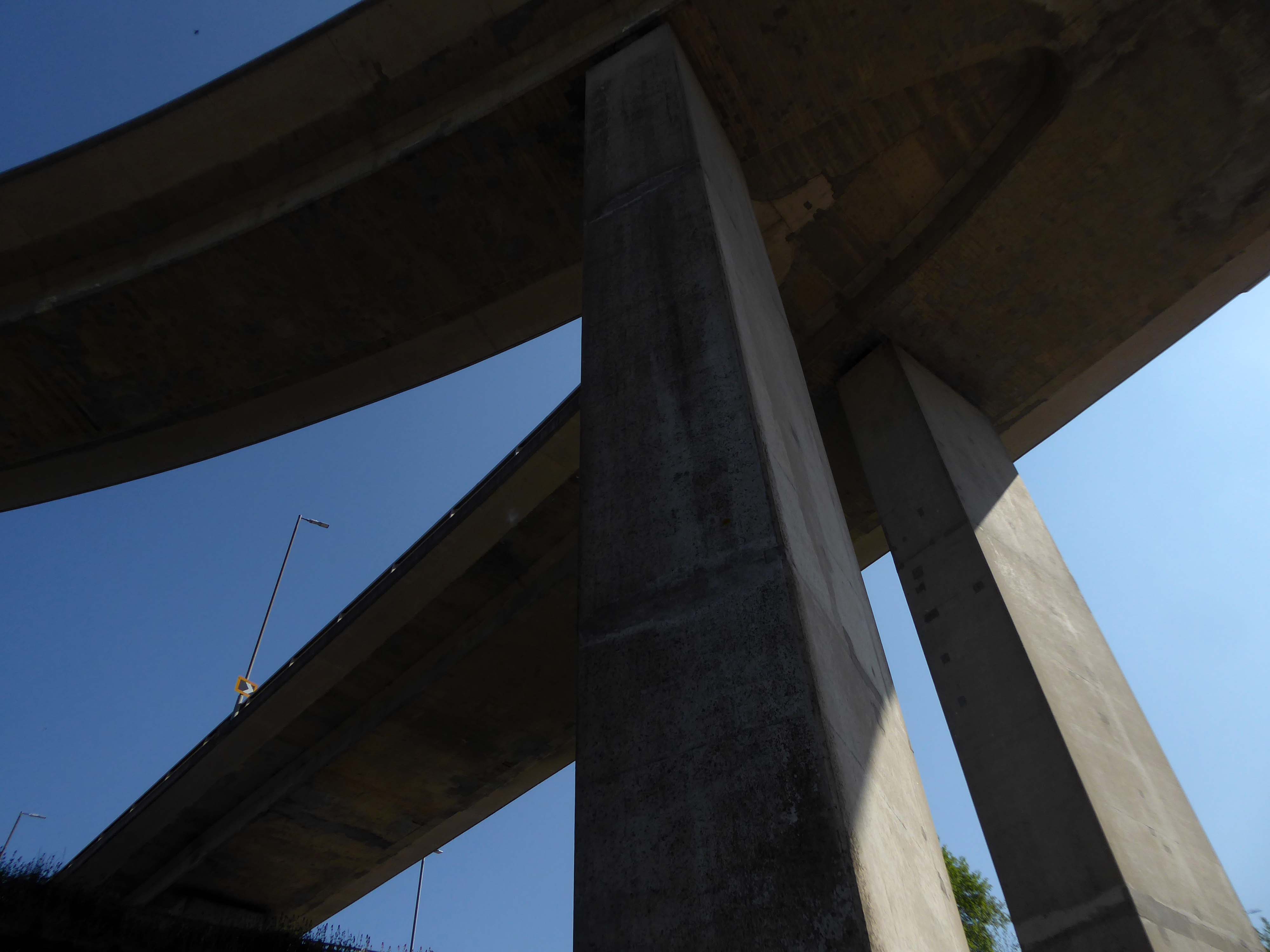
Only one phase of the futuristic road was ever built, but what exists is a partially grade-separated dual carriageway that runs through deep trenches and over tall viaducts close to the heart of the town. At its eastern end is a truly byzantine piece of traffic engineering that stretches the definition of a roundabout to its limit.
In October 1971 the official celebrations went anything but according to plan. It had been decided to give the people of Halifax a half day holiday so they could attend the opening, but there were not enough police on duty to control the sightseers. It was impossible to get complete silence for the speeches and arrangements to tell the artillery guns at Southowram Road when to fire broke down. They were fired prematurely while an archdeacon was offering prayers. The Mayor, HC McCrae, finally managed to announce that the bridge was officially open and he scurried back to the town hall where he hosted a banquet.
Burdock Way has never been fully completed as it is missing certain sections envisaged in the early 1960s plans. There are a number of reasons for this, but it is mainly owing to West Yorkshire County Council’s cost cutting in the 1970s.
Yorkshire Post
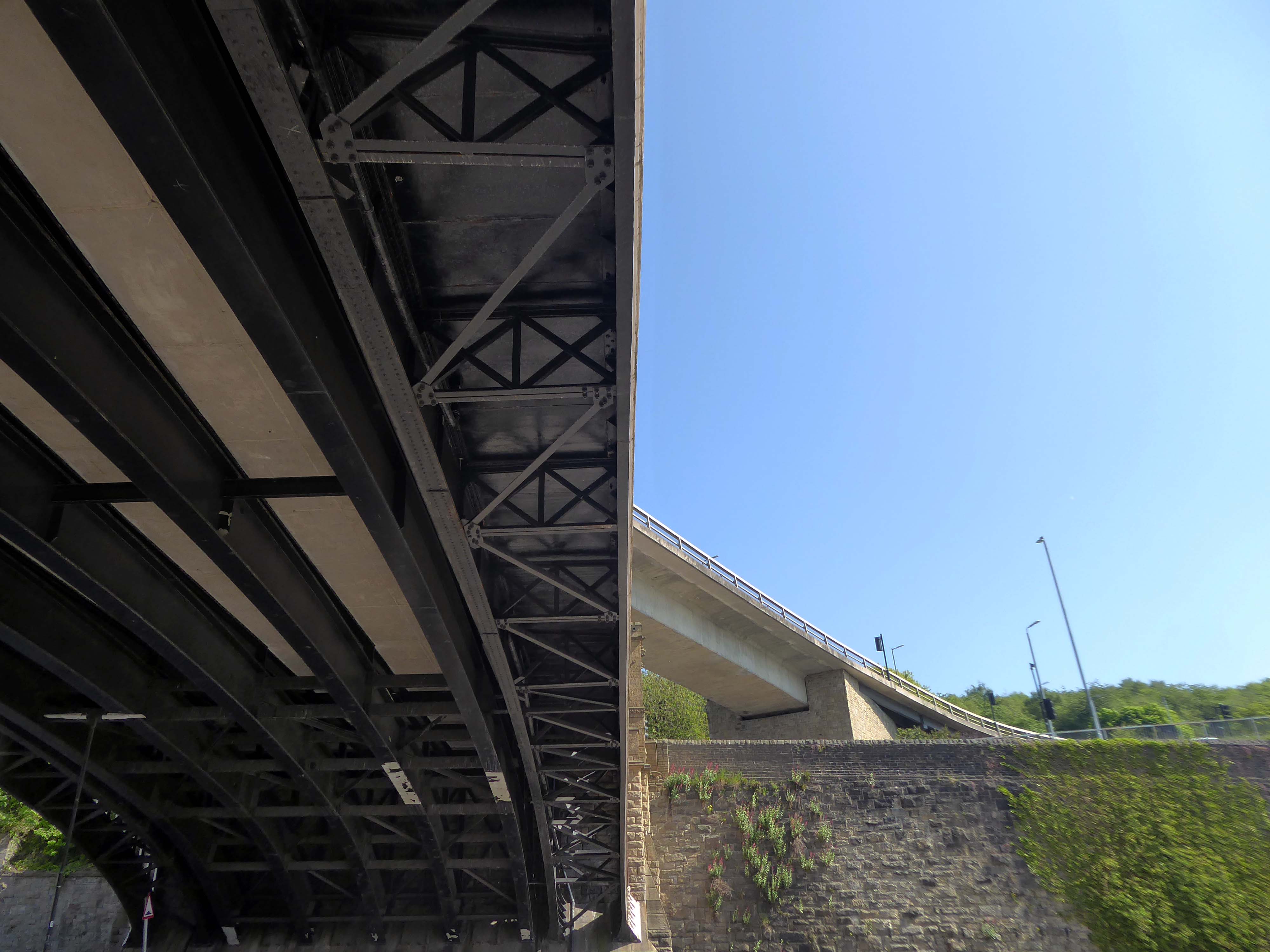
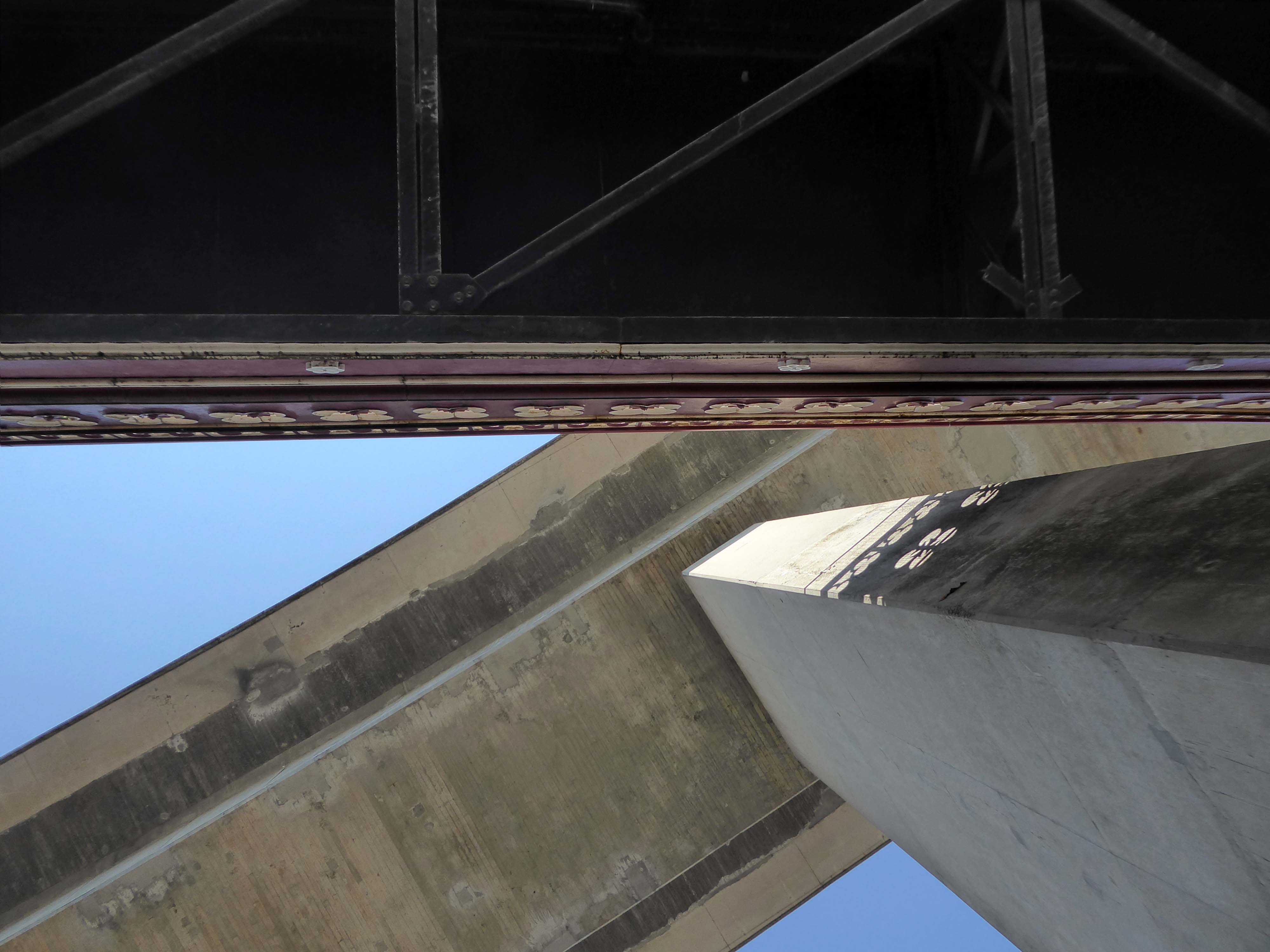
This is the Valley of the Gwangi in the West Riding – minus the dinosaurs.
An urban chasm, the gulf between everything and nothing.
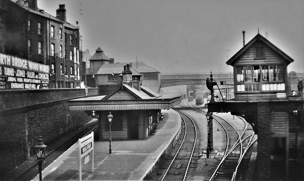
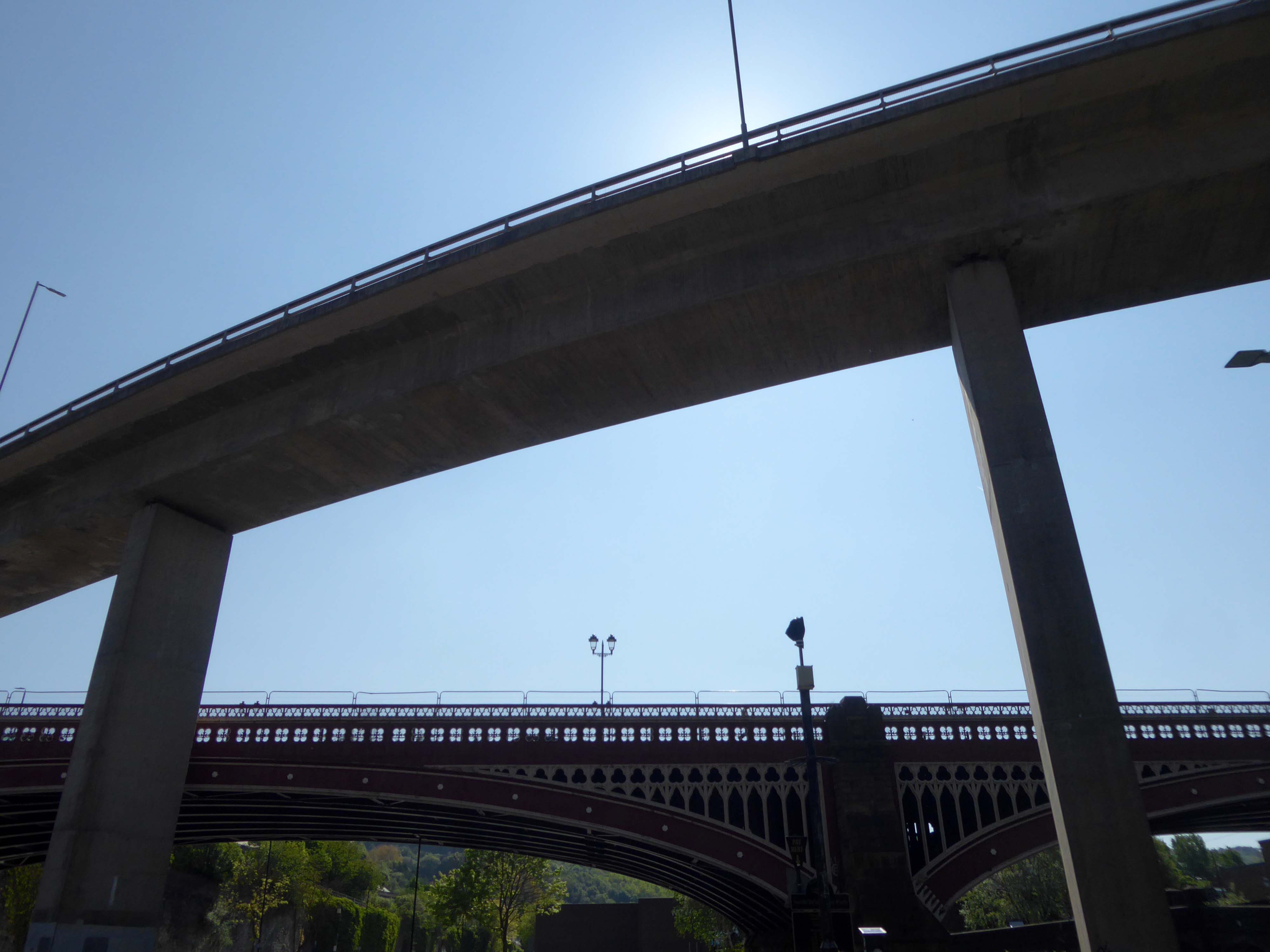
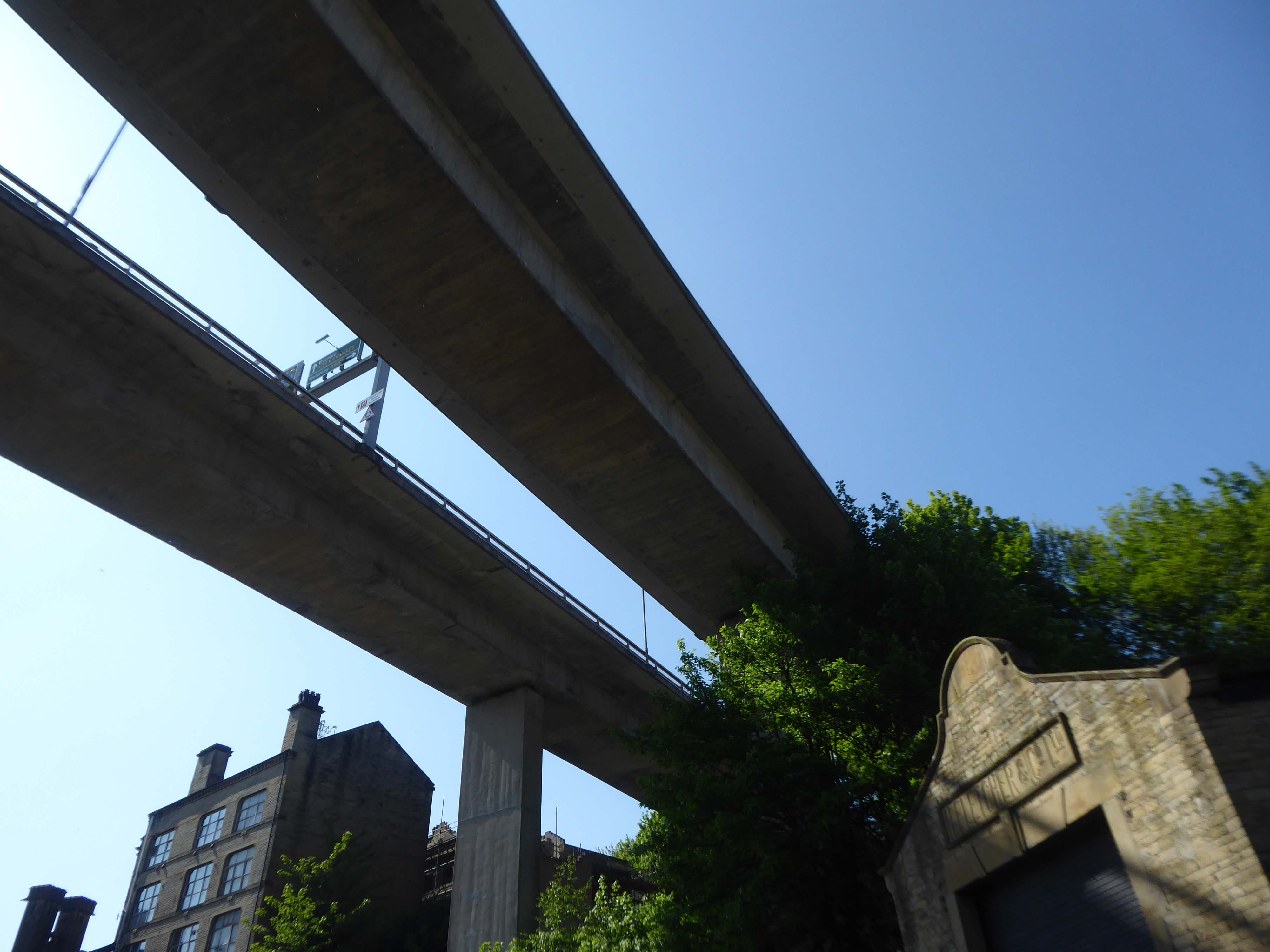
North Bridge is a Victorian iron and stone bridge crossing the valley of the River Hebble, connecting the town to roads to Bradford and Leeds. Replacing an earlier six arch stone bridge it was raised to allow the subsequent construction of the Halifax High Level Railway beneath it, along with an adjoining station.
Opened in 1871 amid chaotic crowd scenes it carried increasingly heavy traffic until it was by-passed by the Burdock Way in 1973.
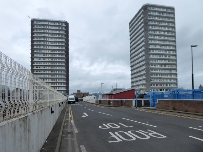
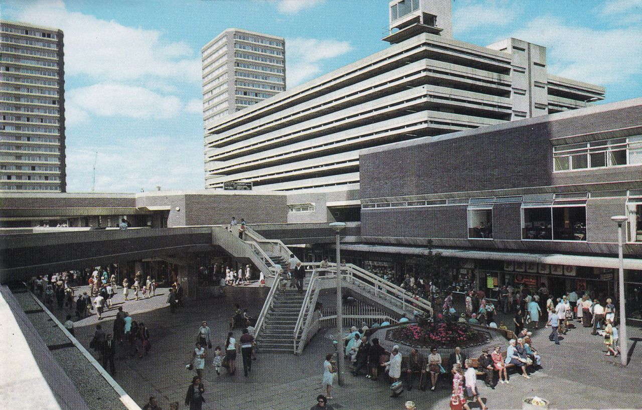
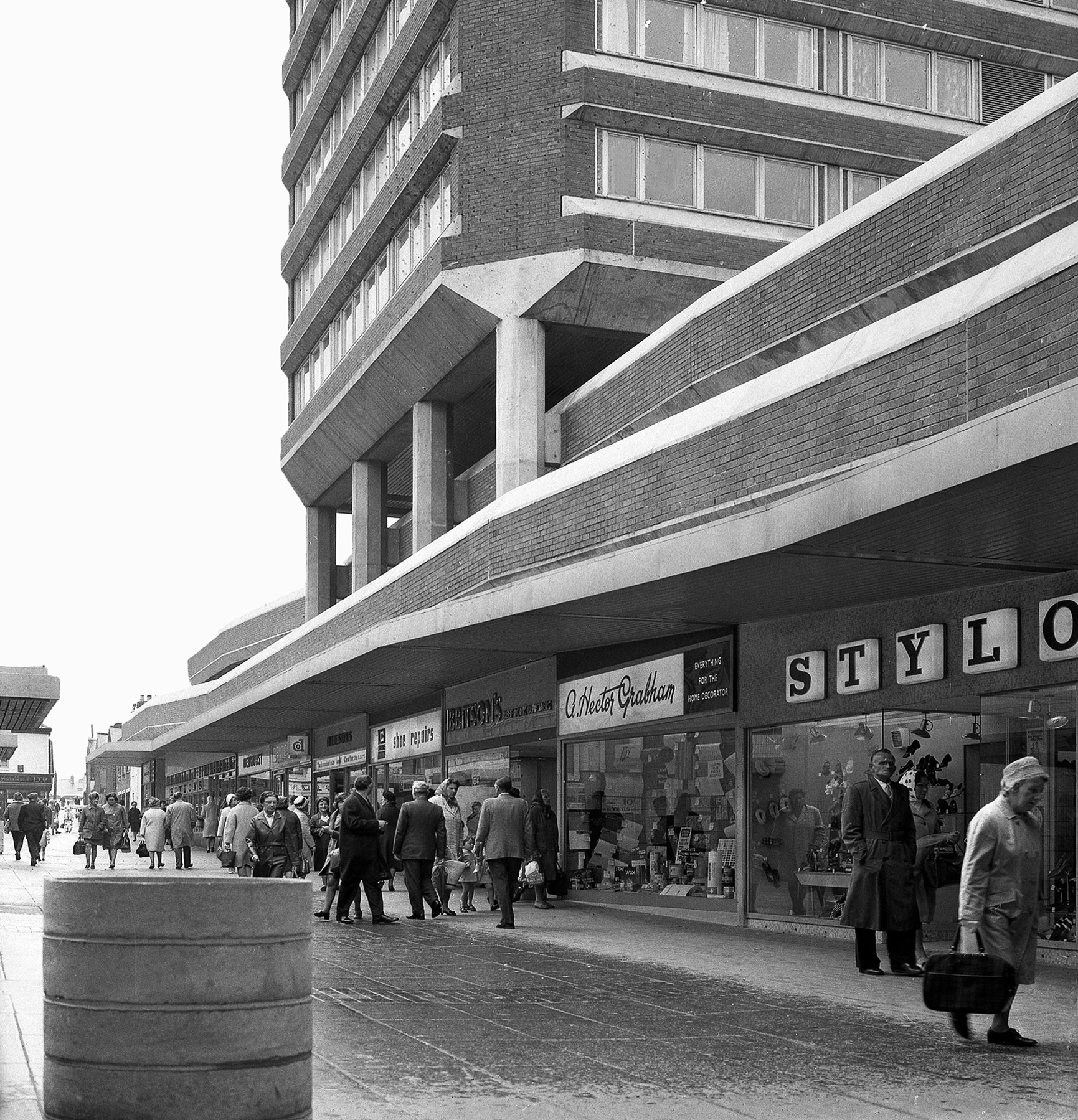
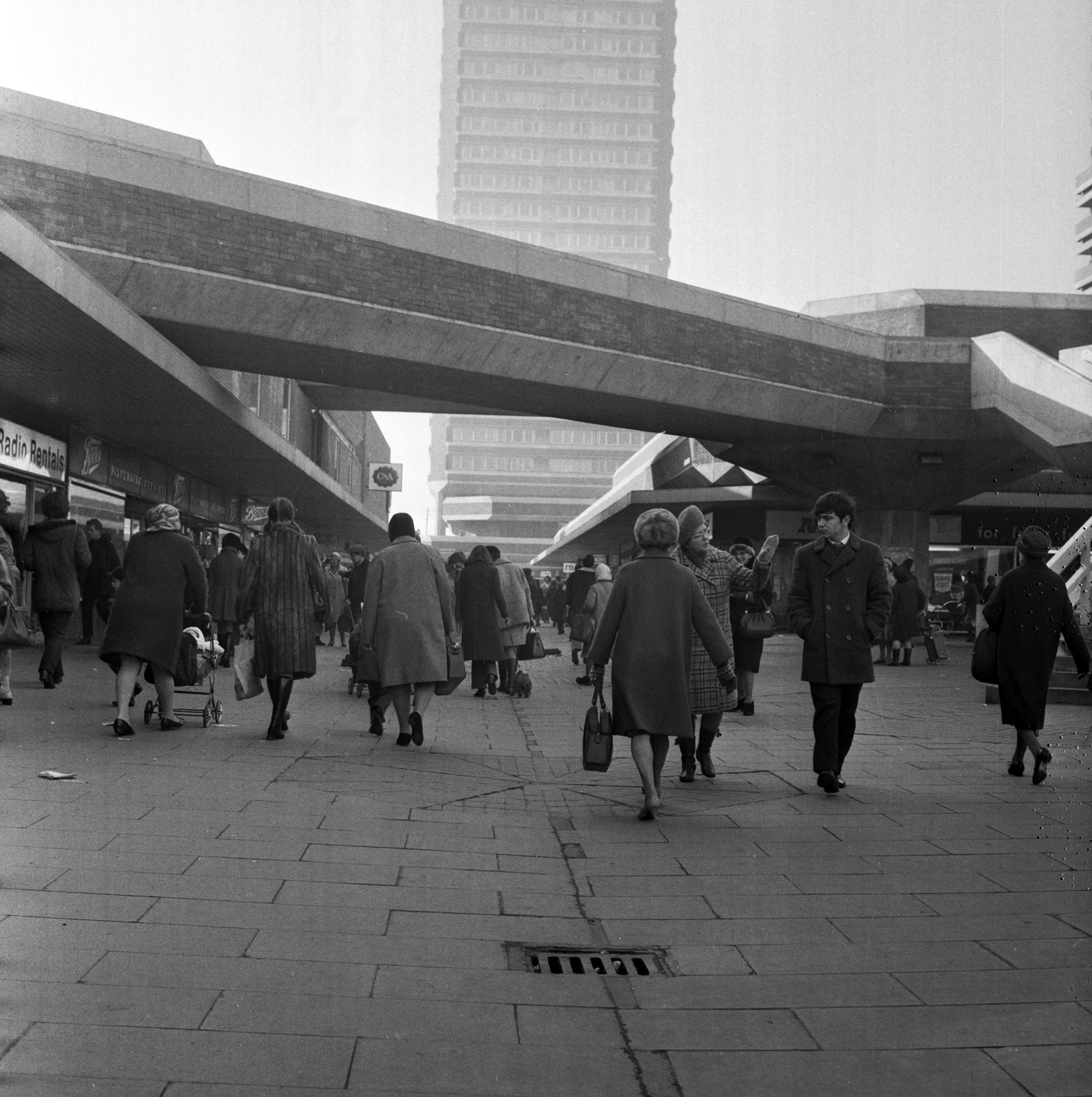
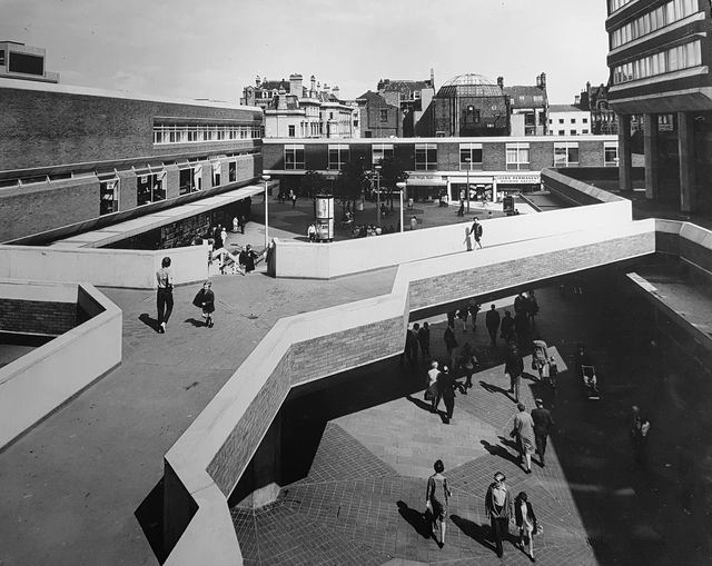
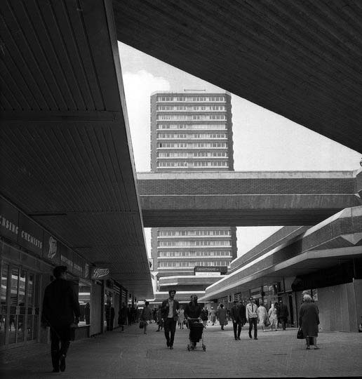
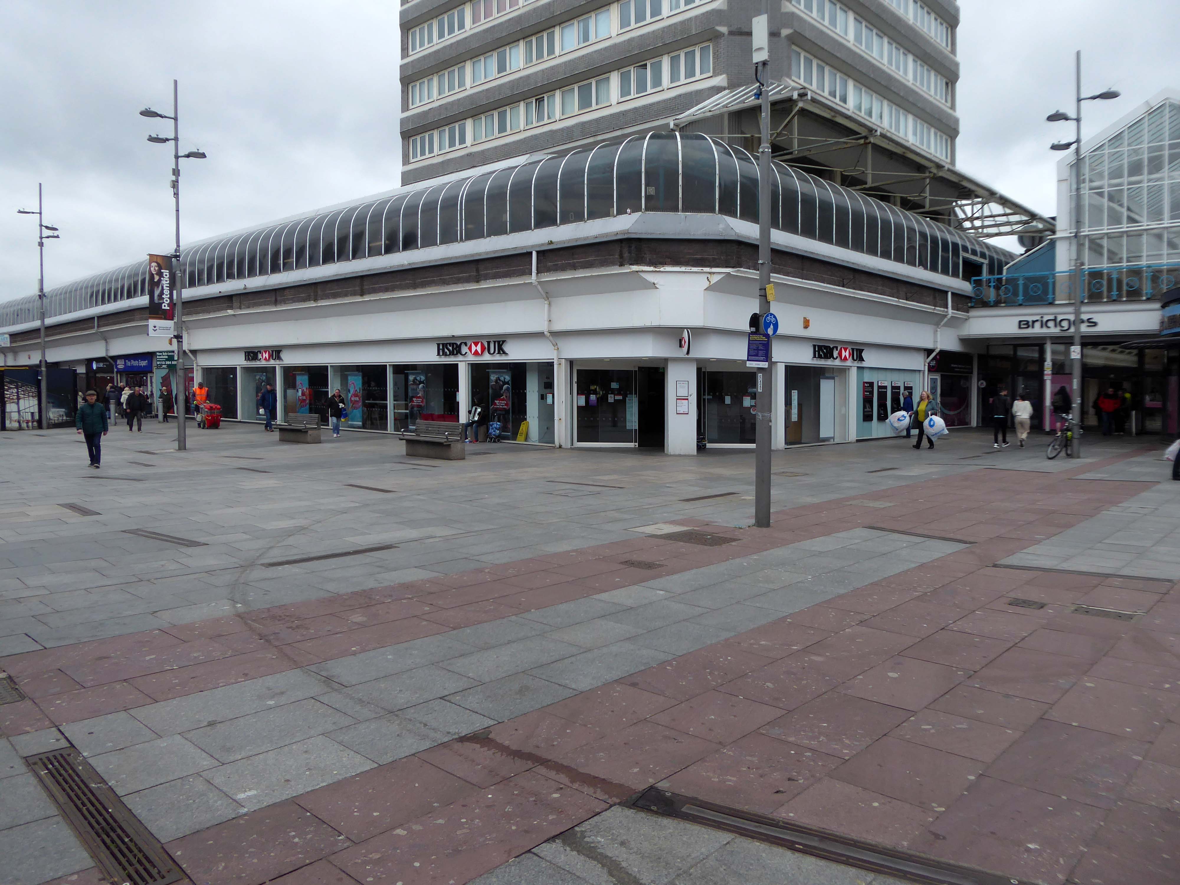
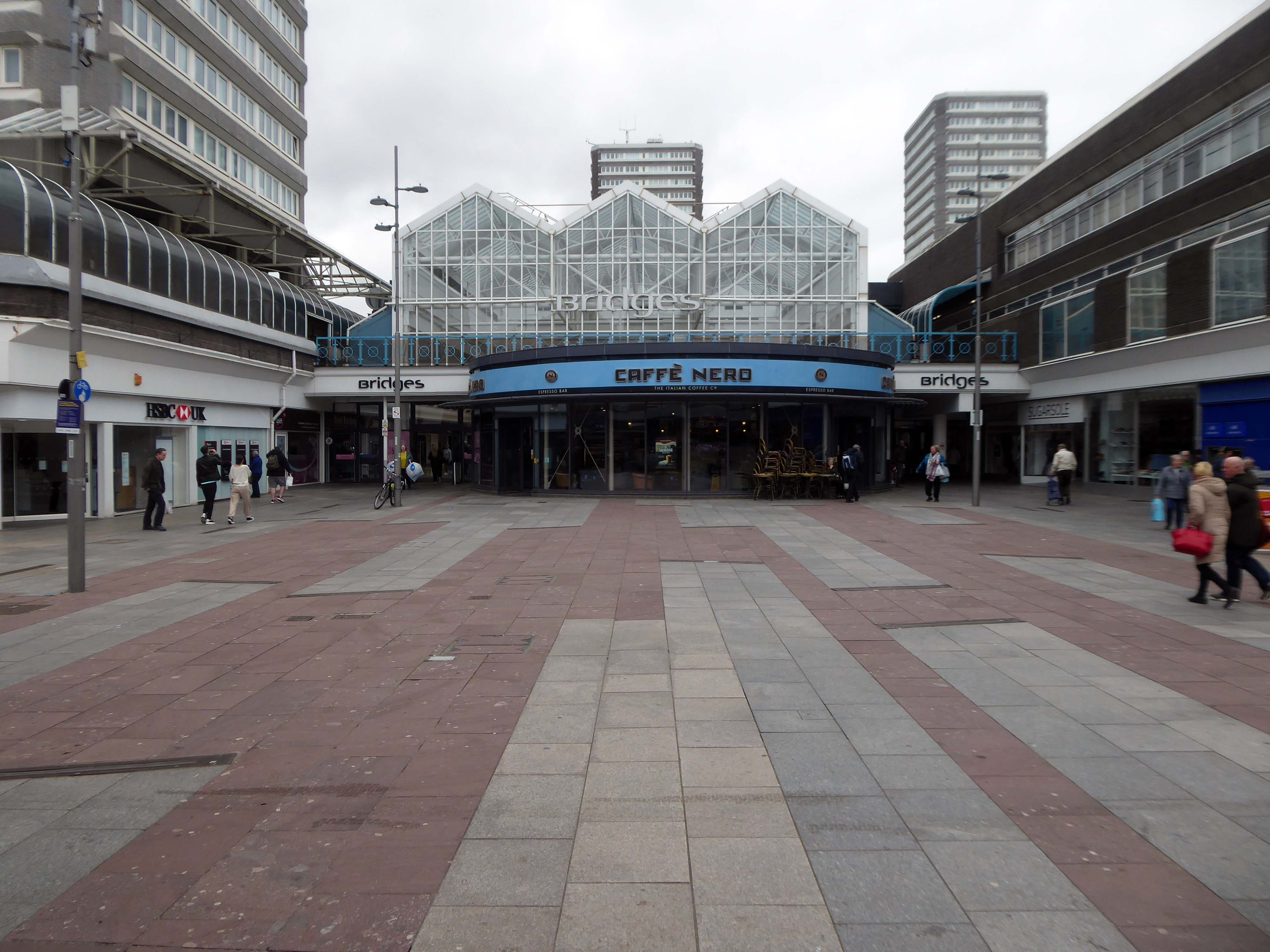
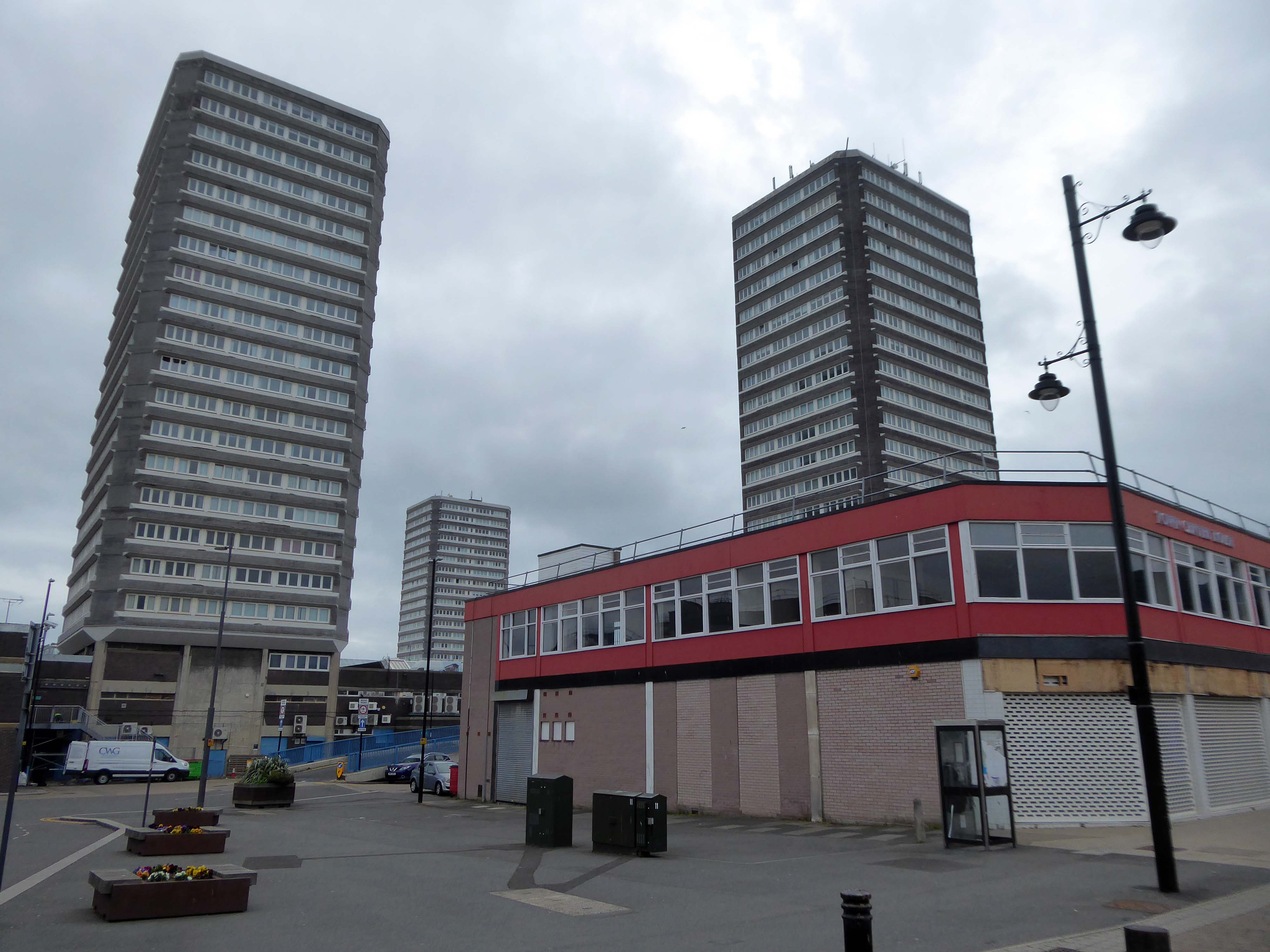
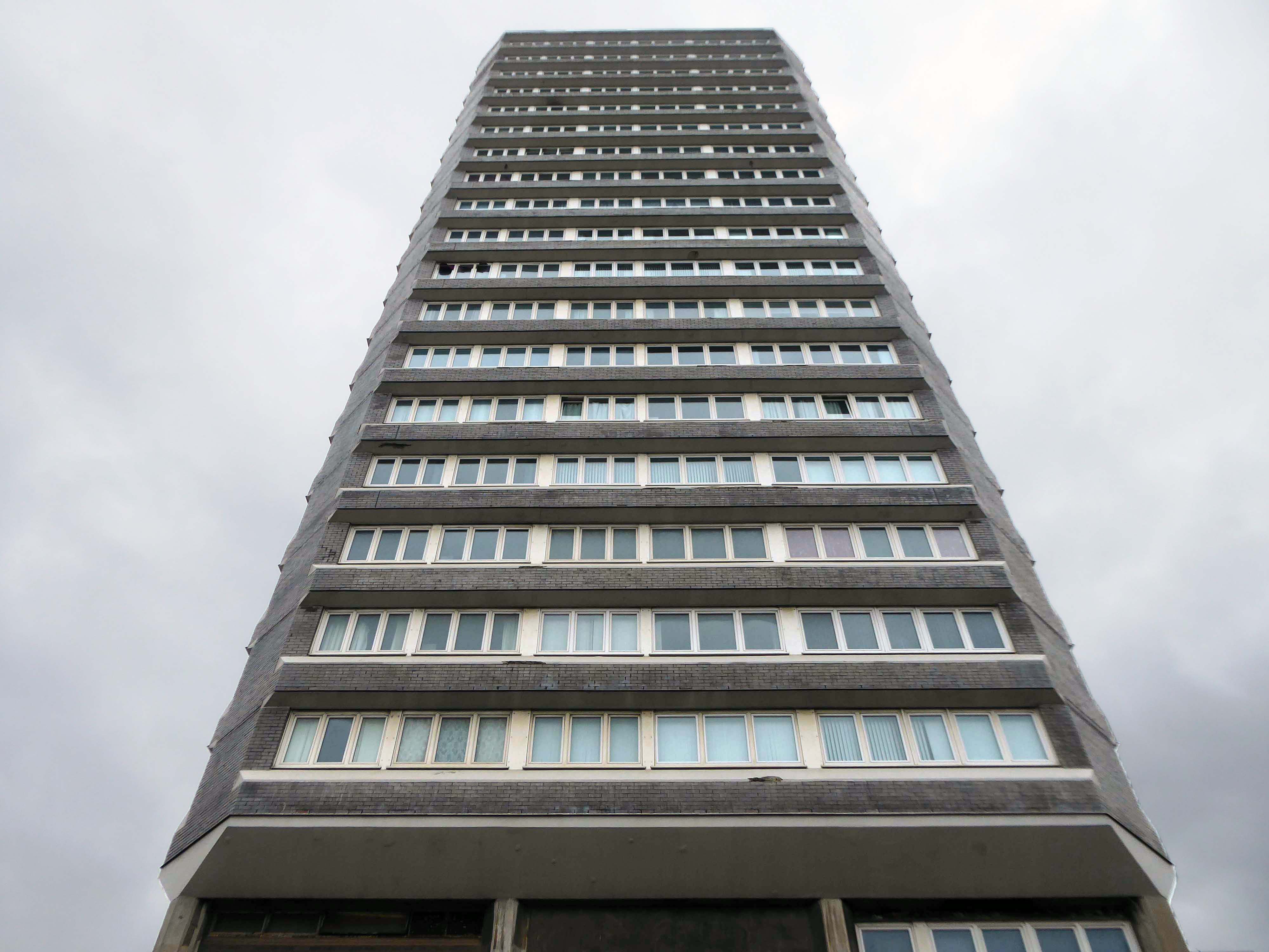
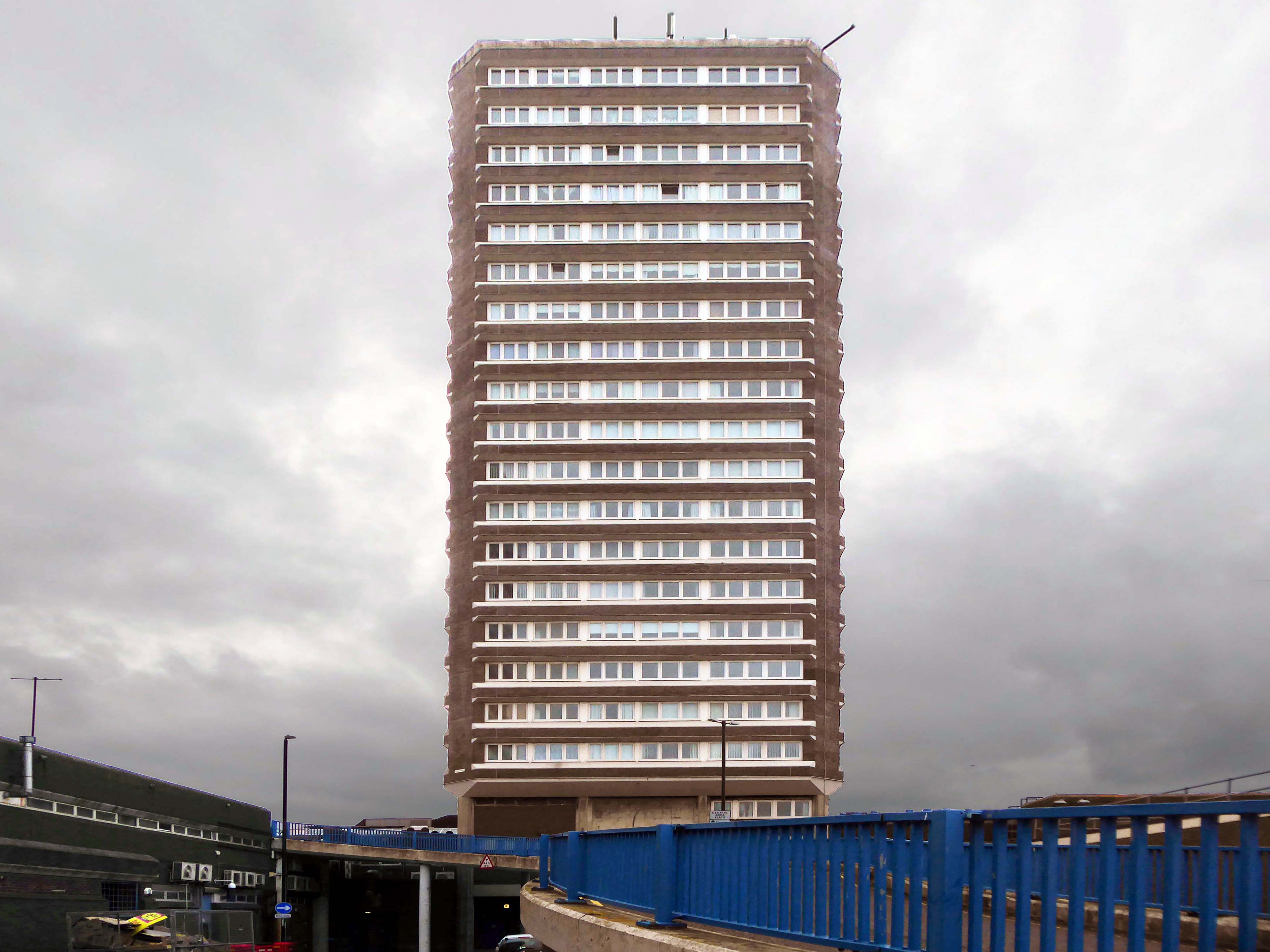
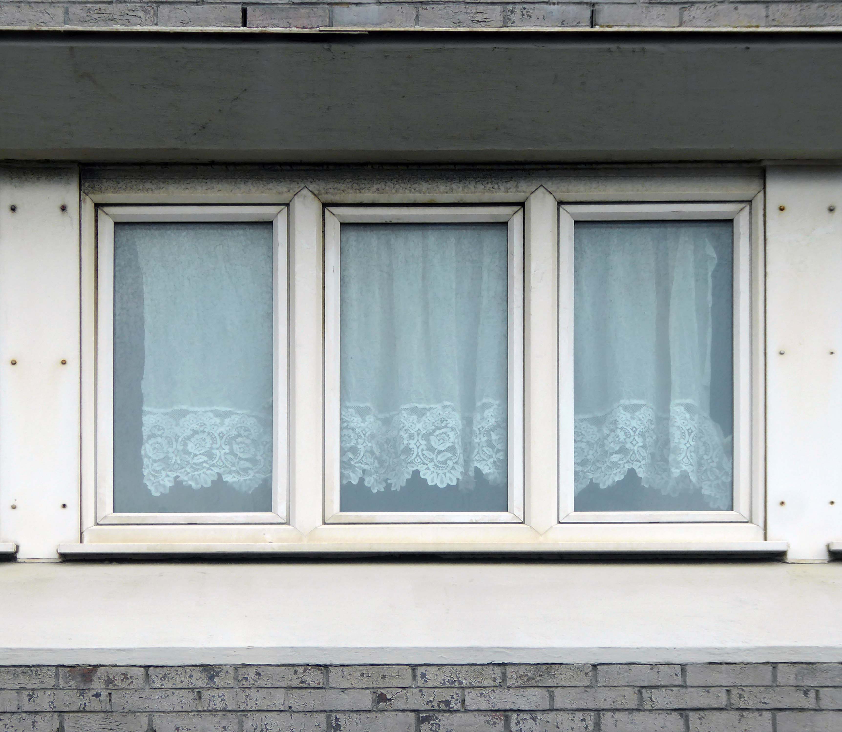
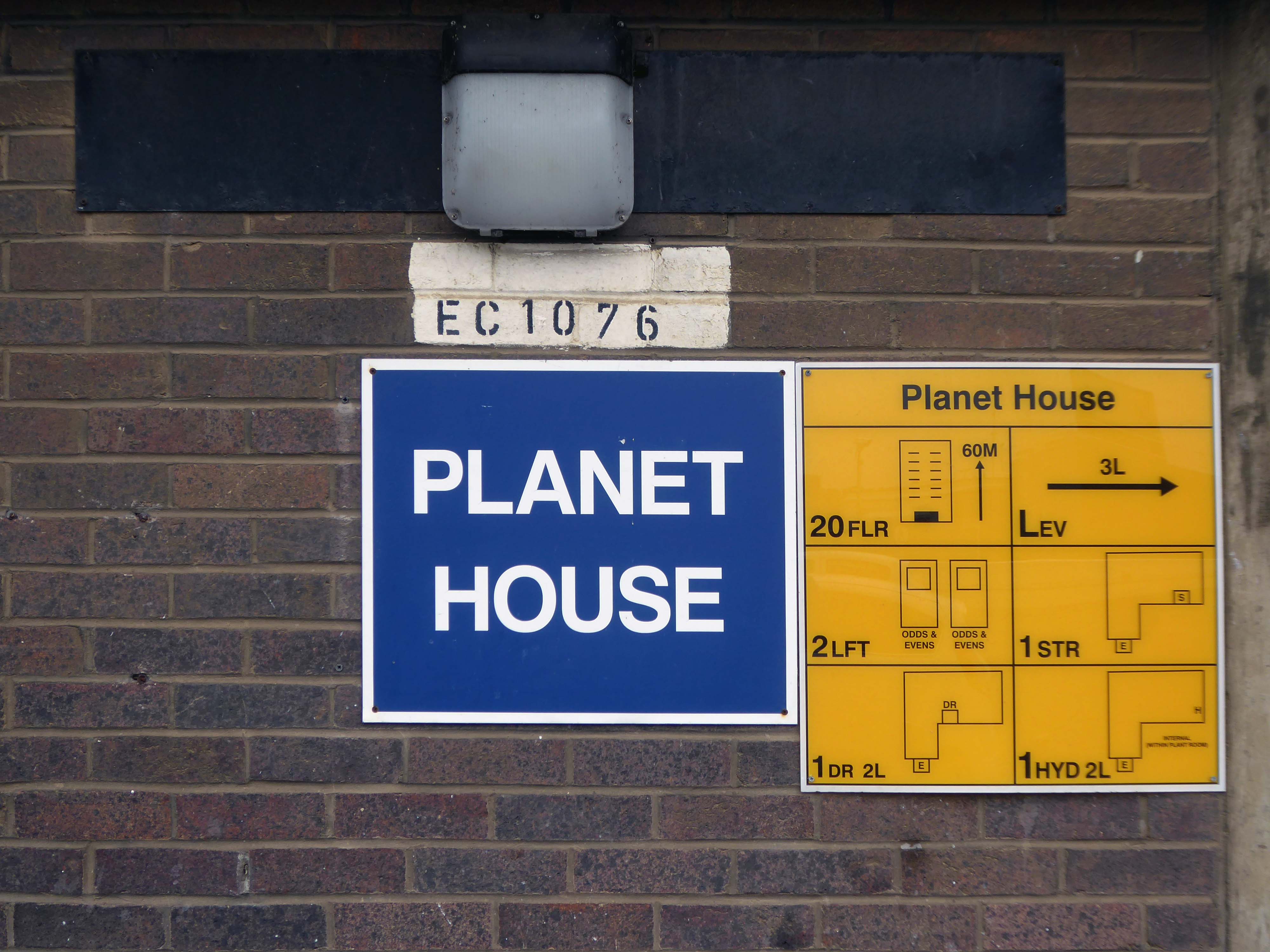
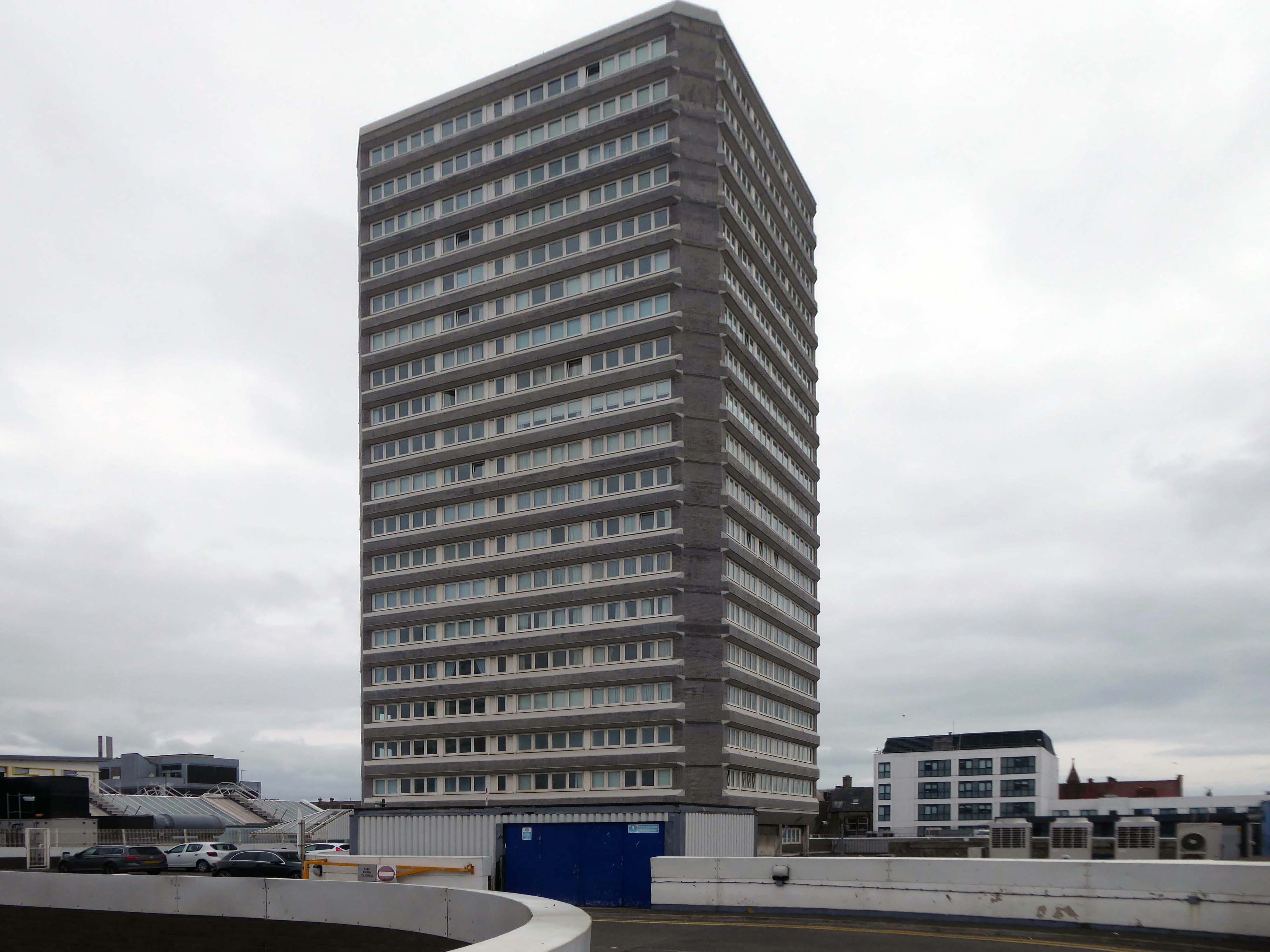
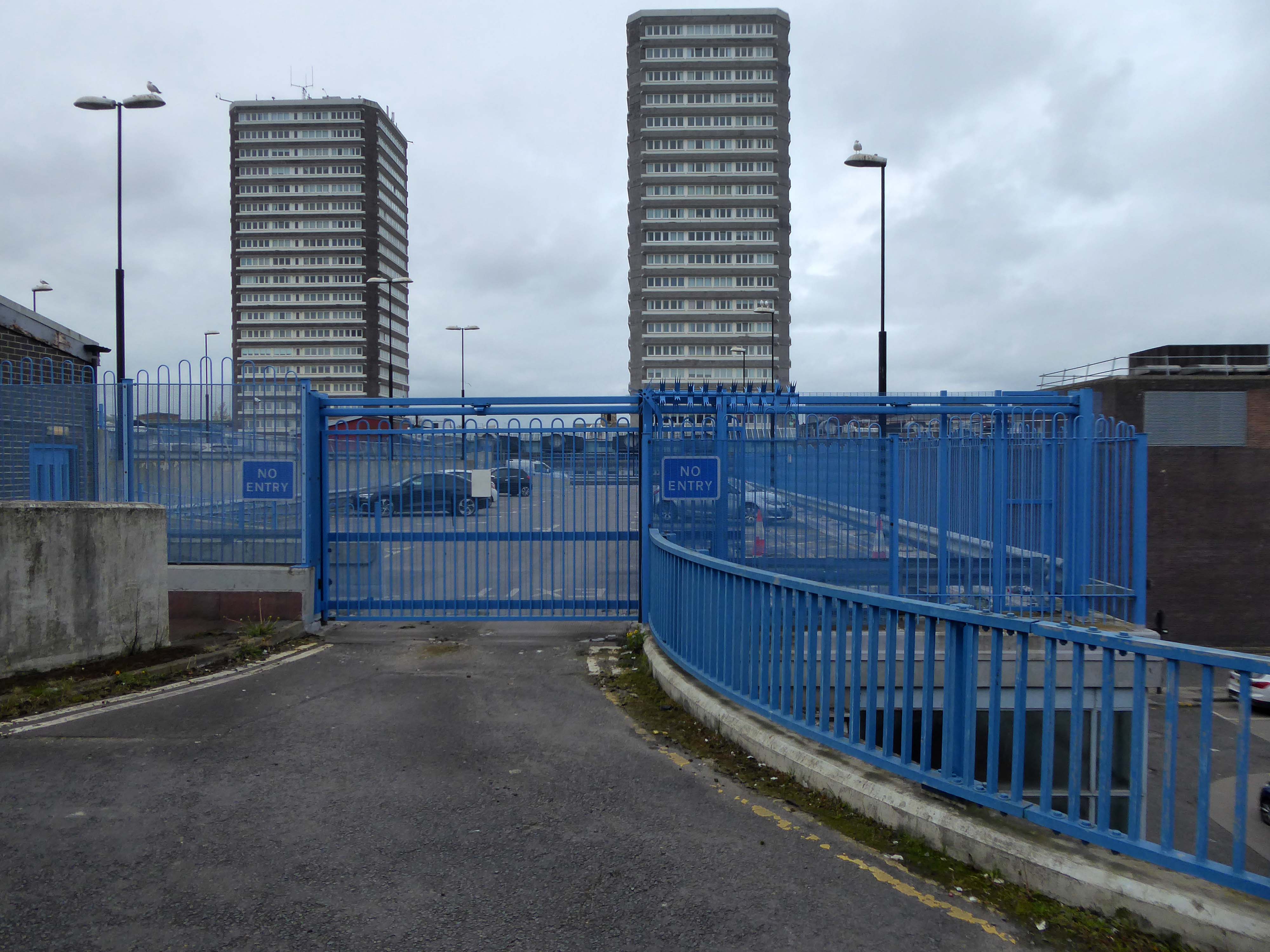
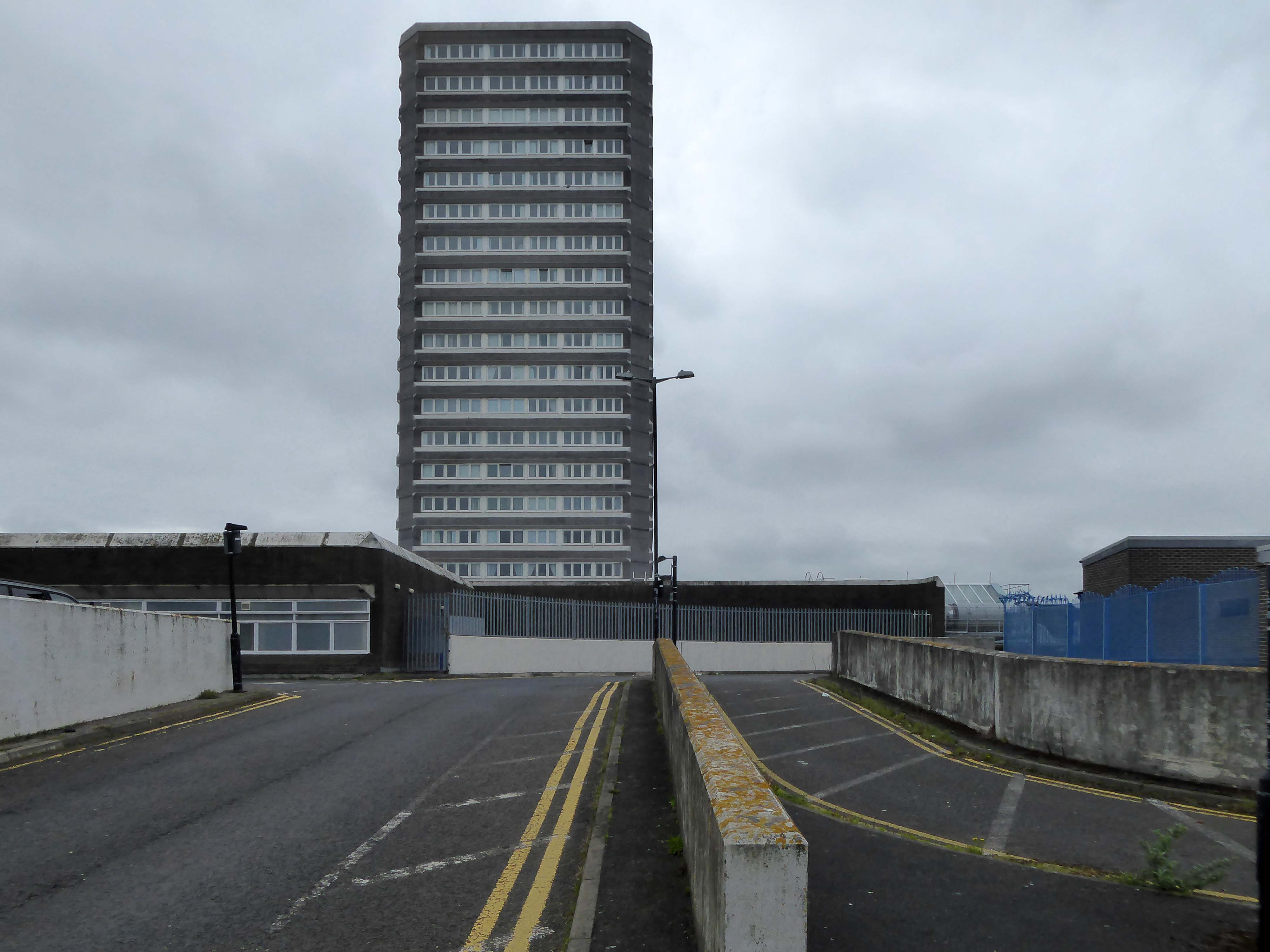
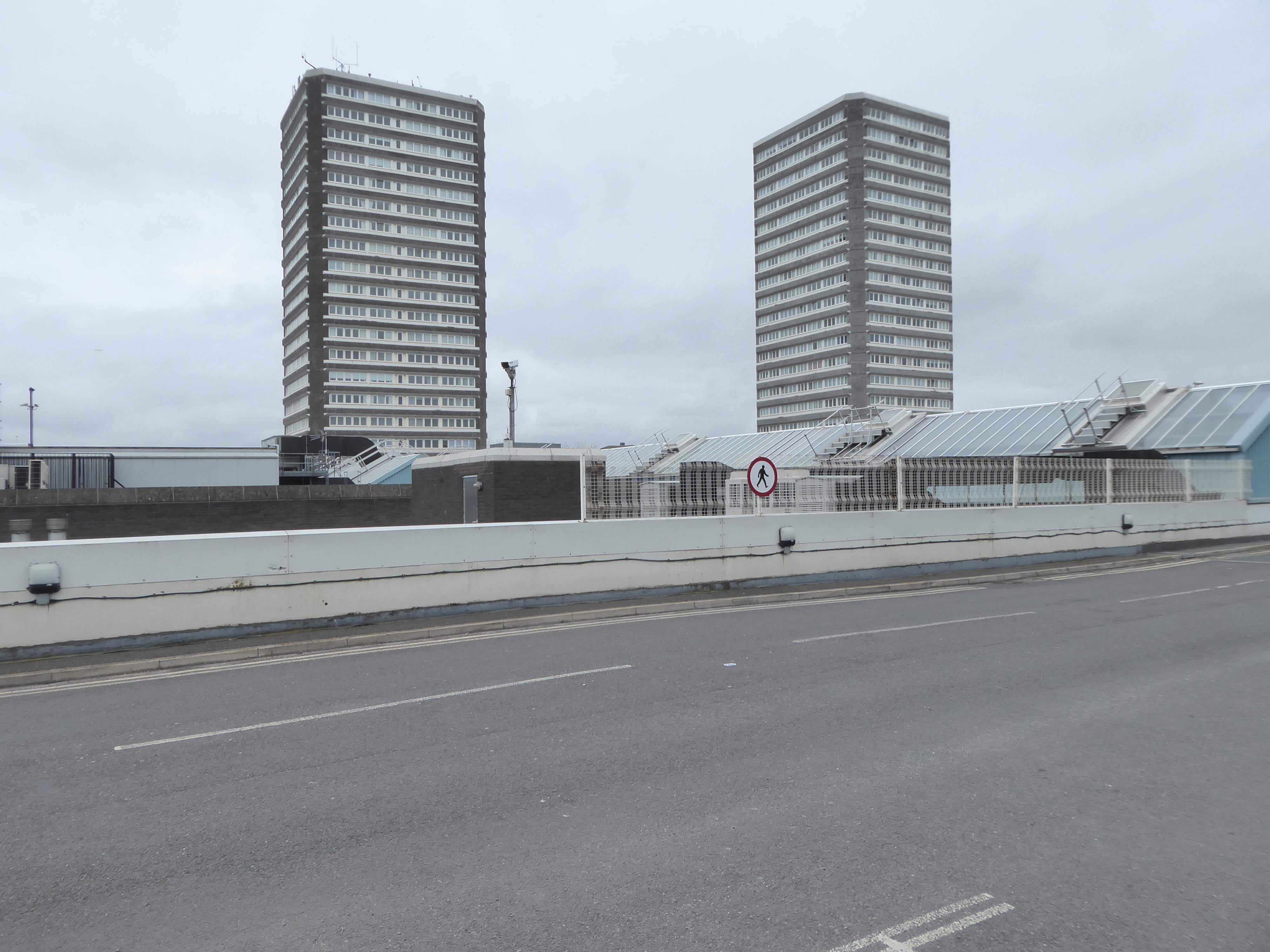
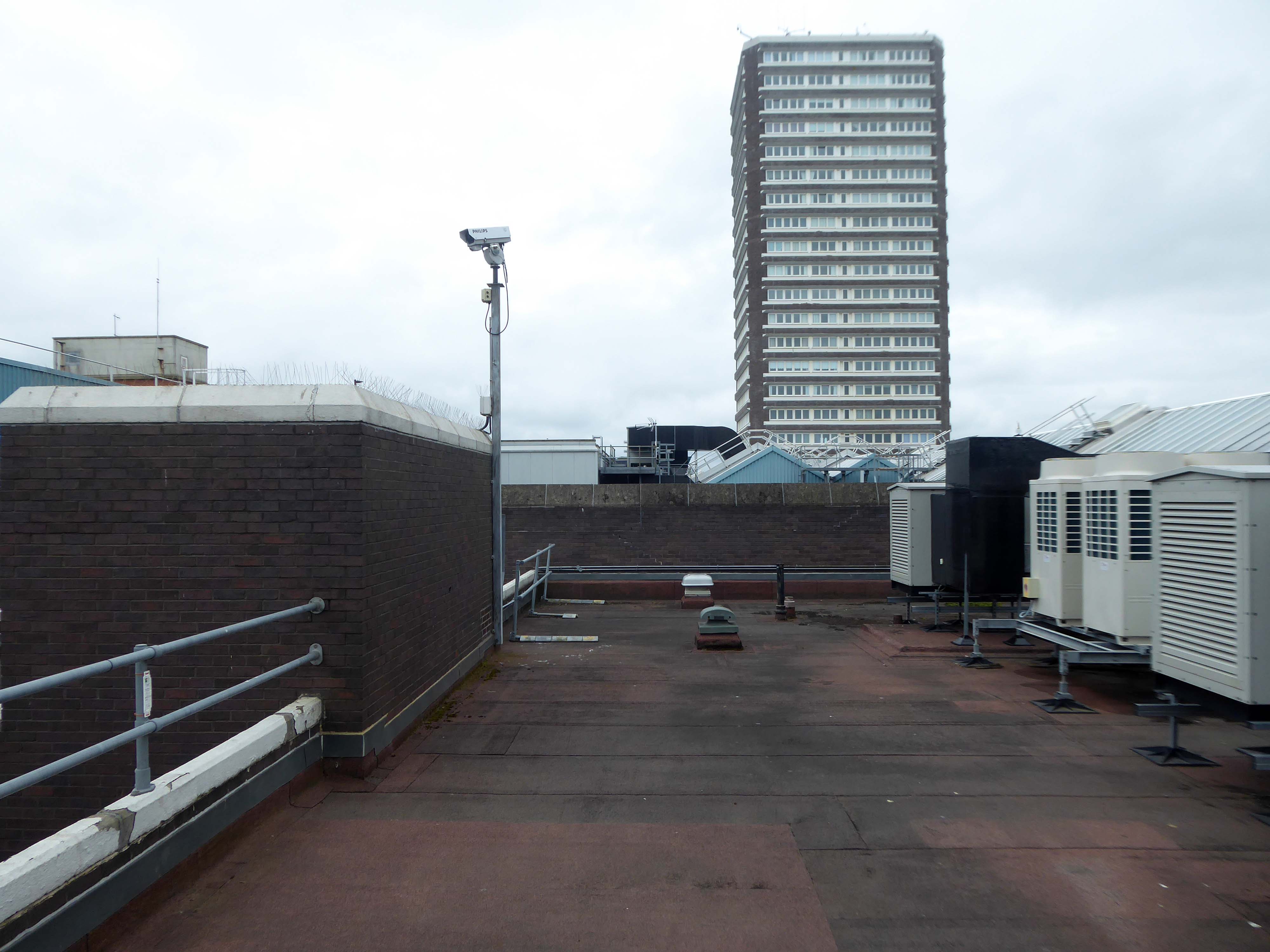
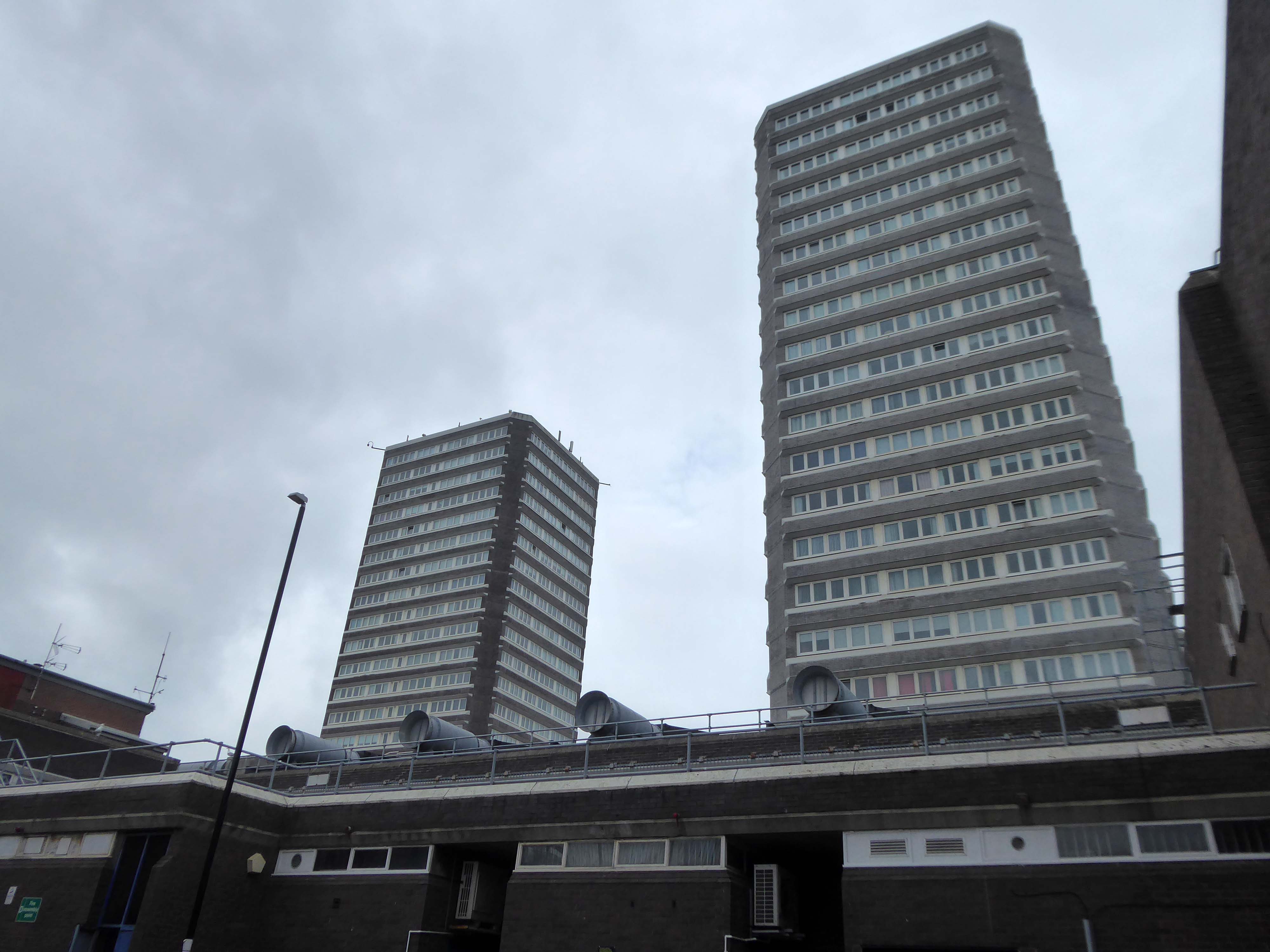
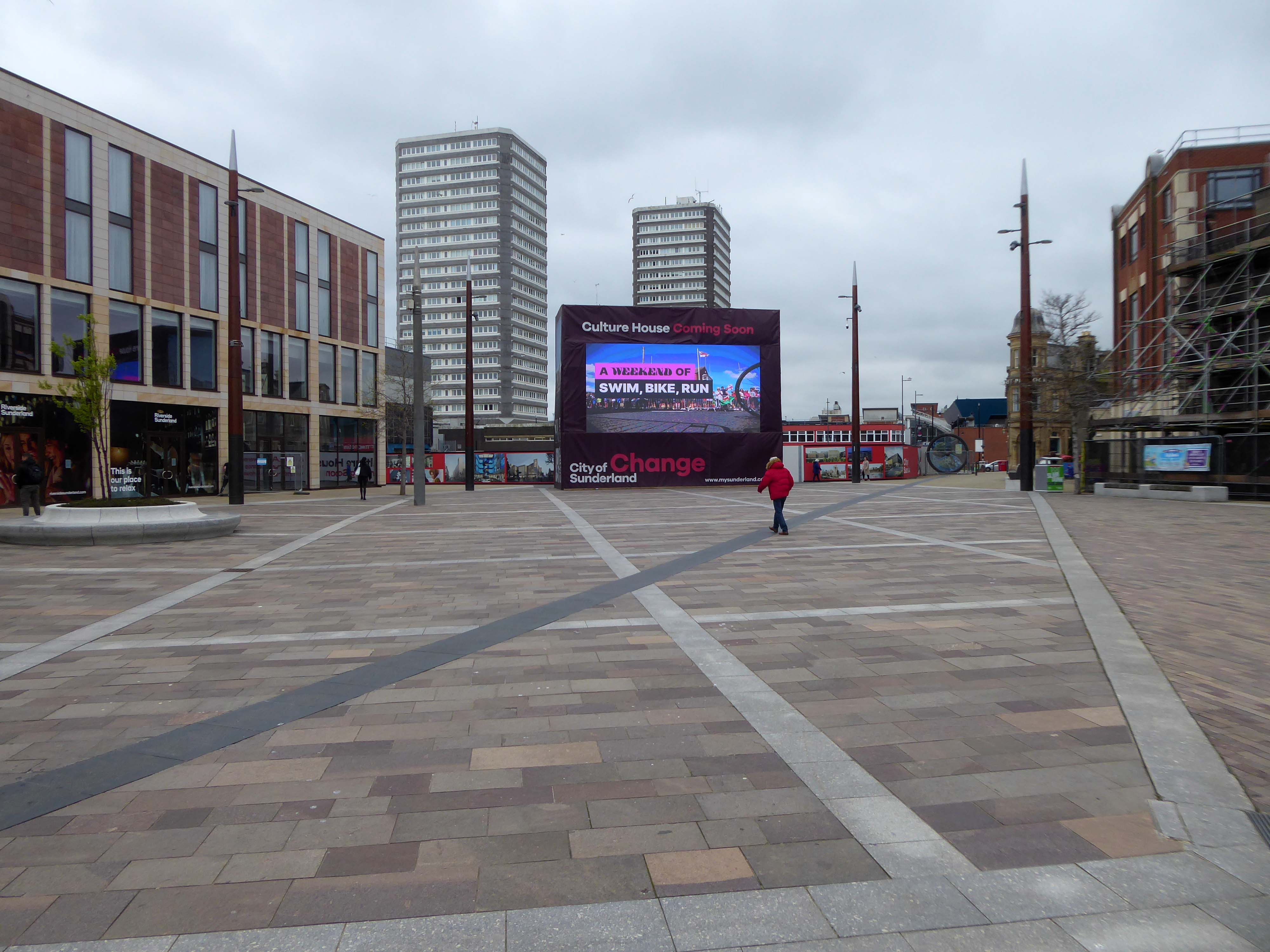
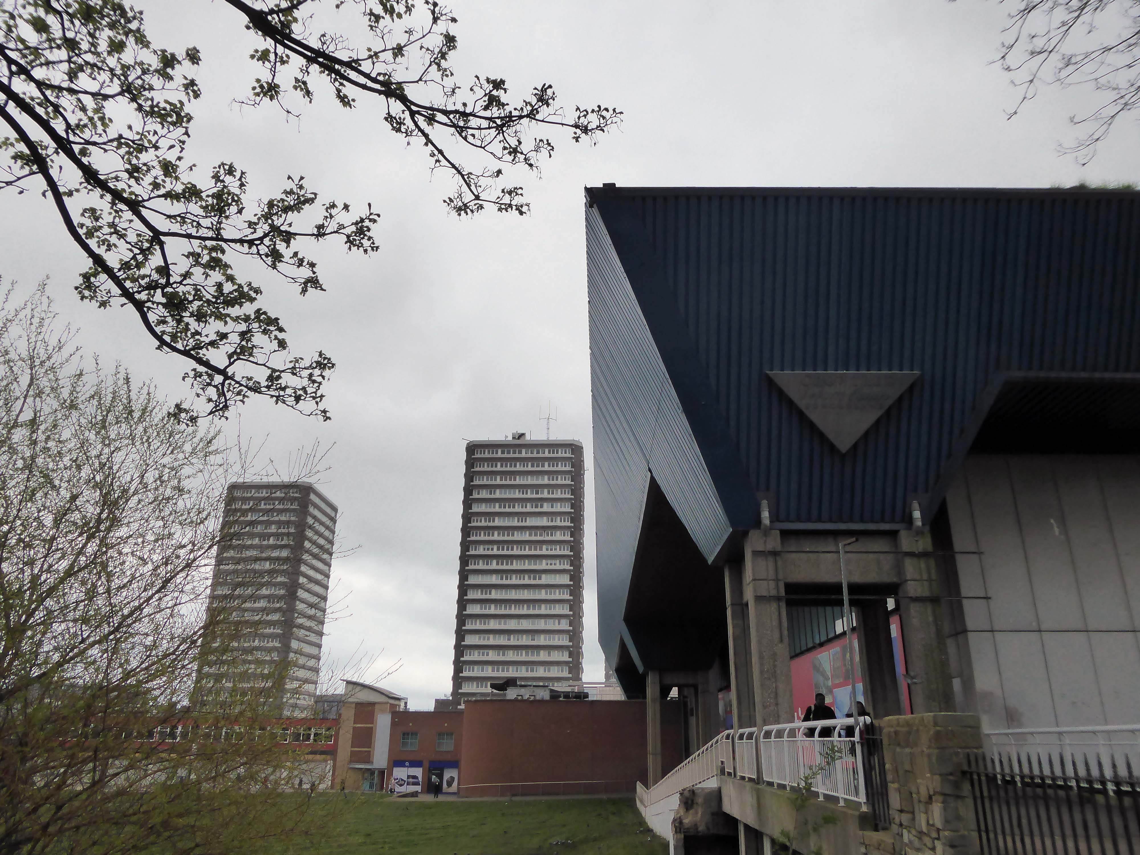
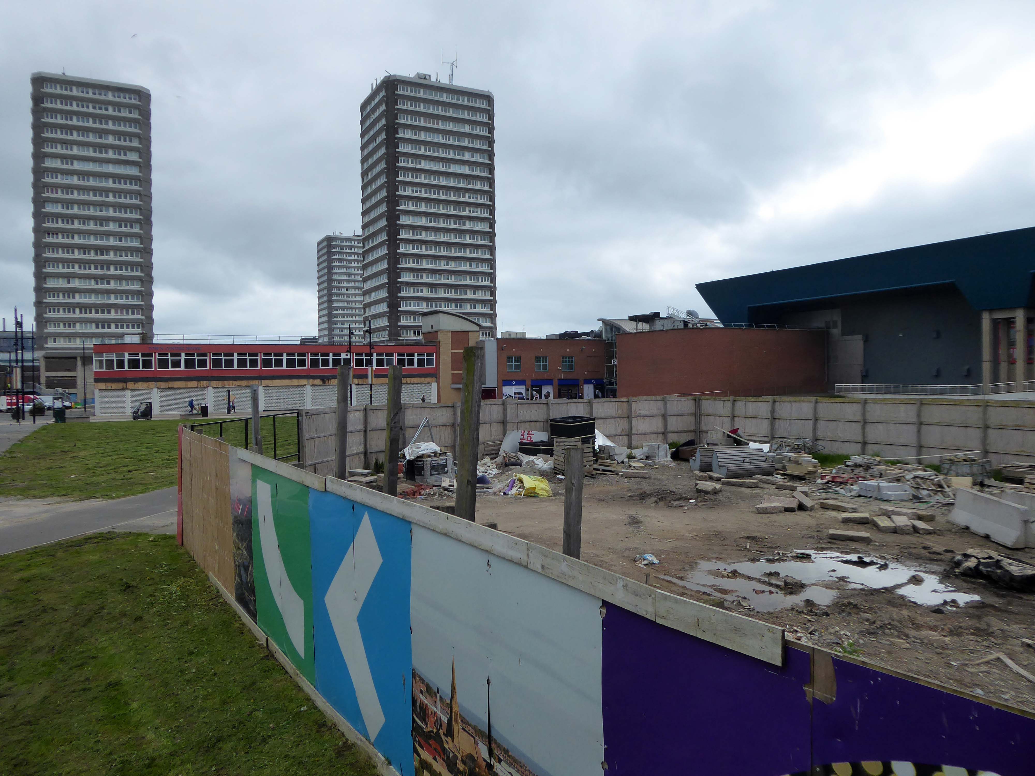
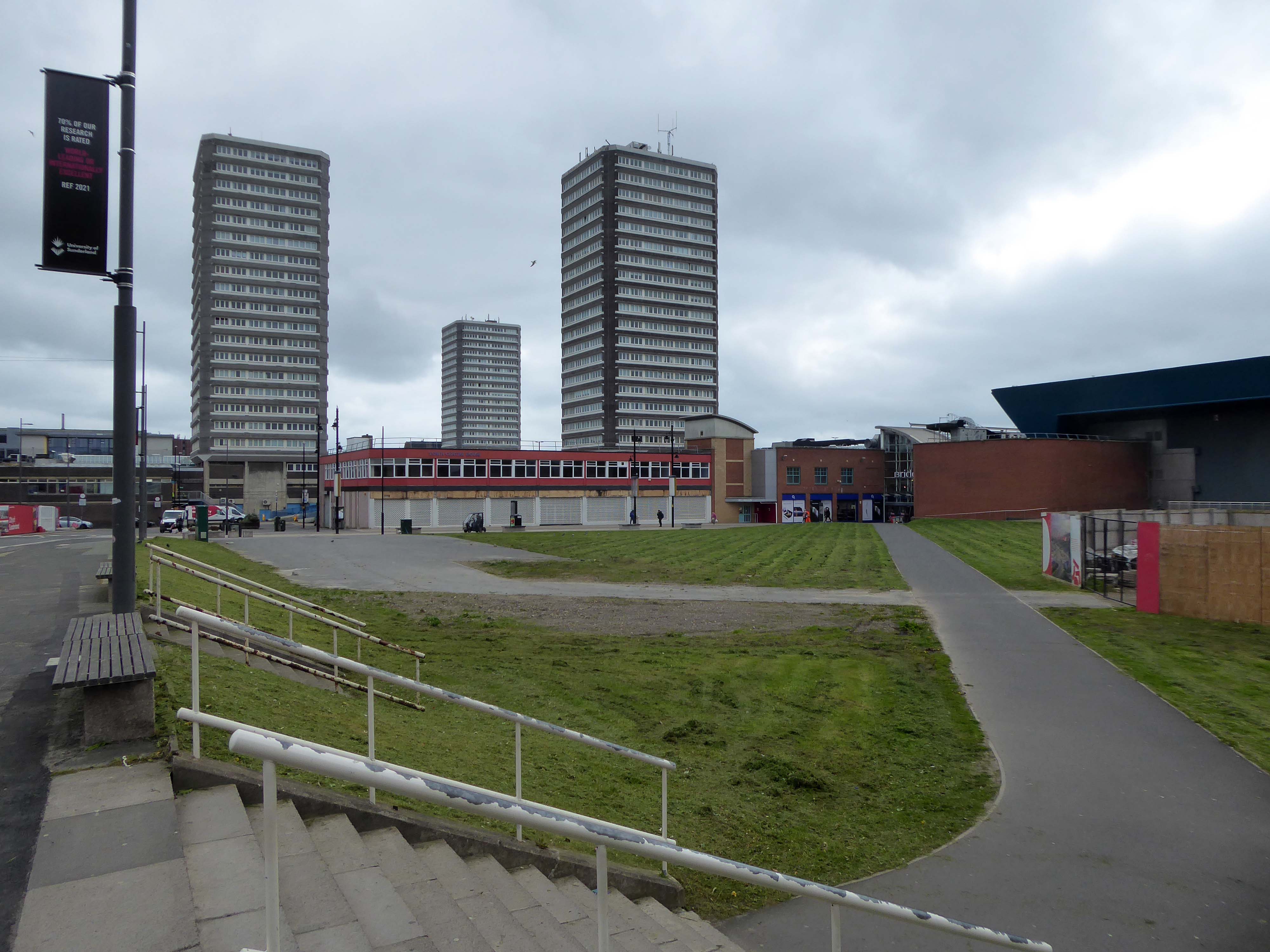
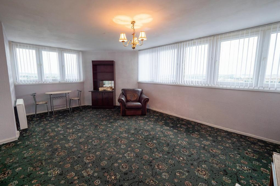
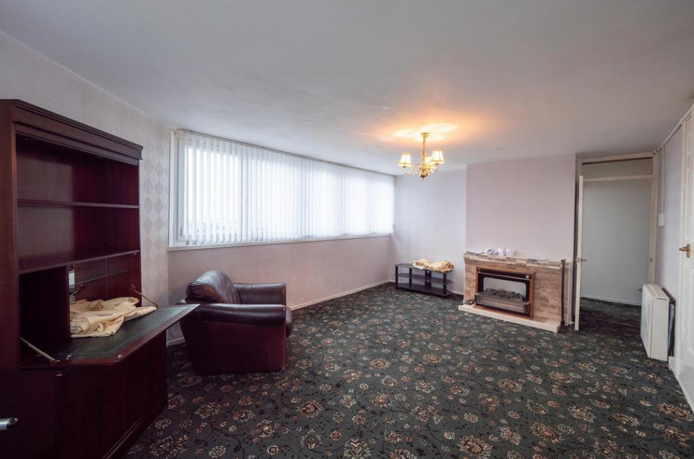
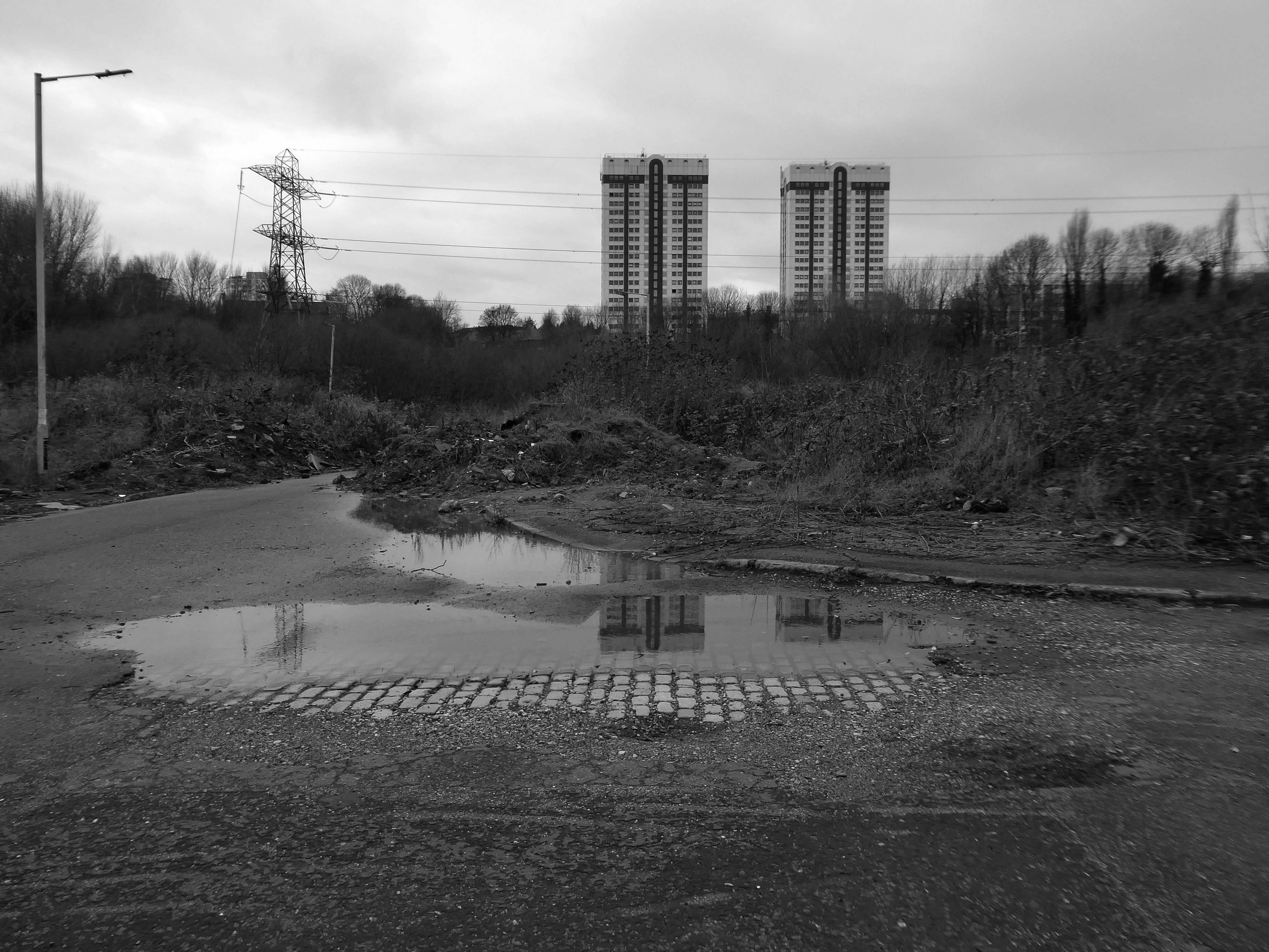
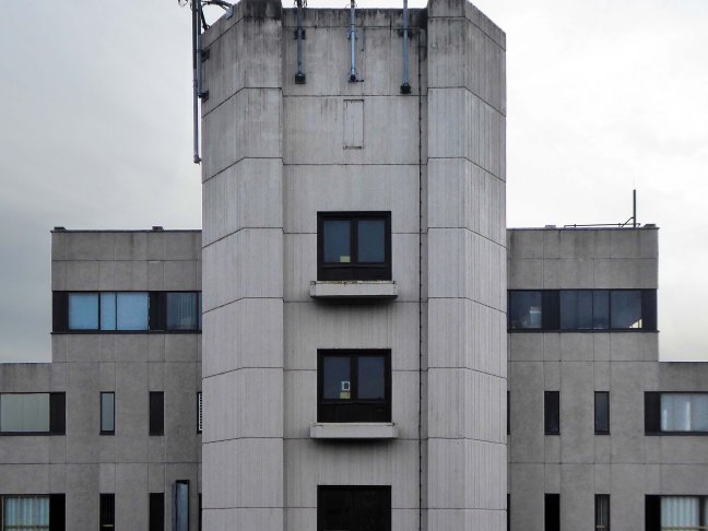
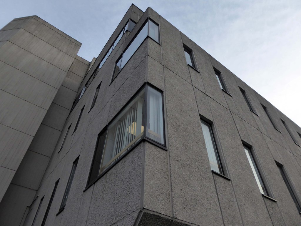
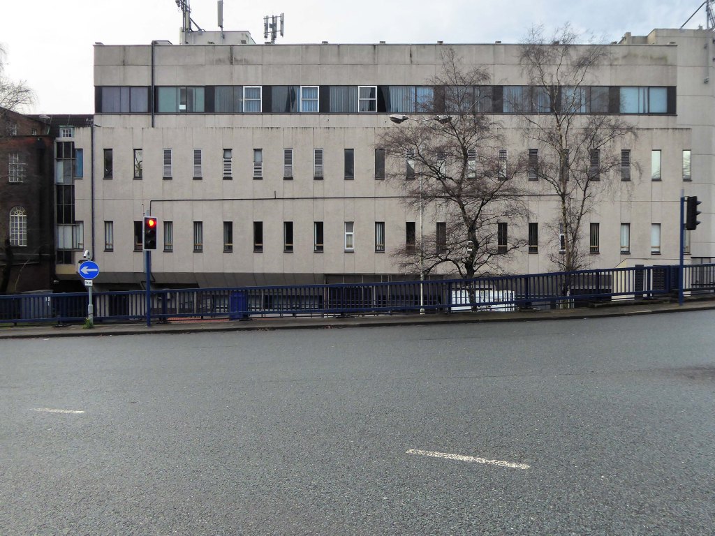
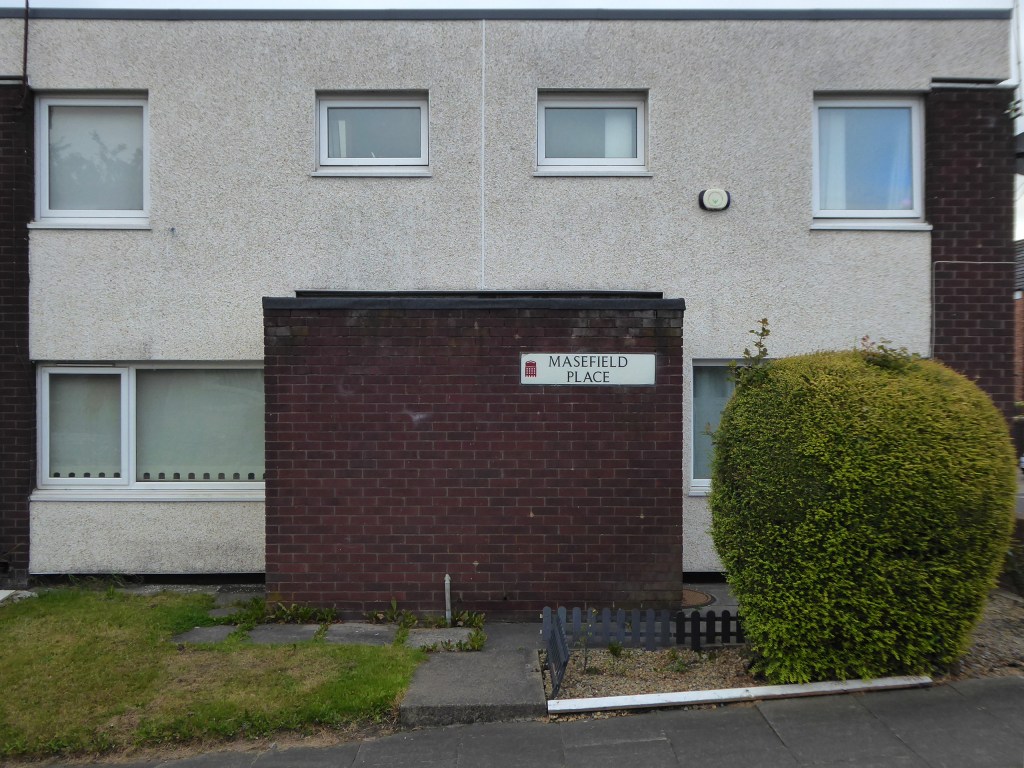
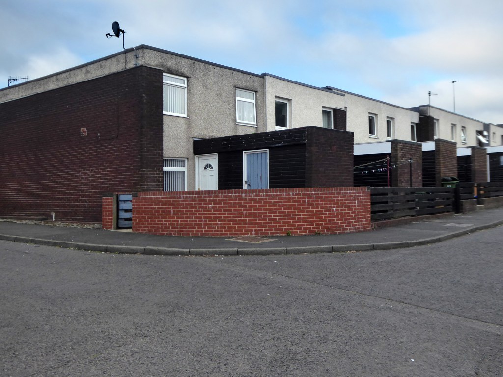
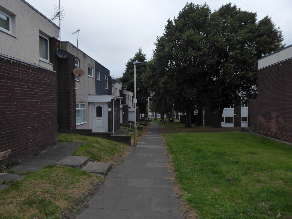
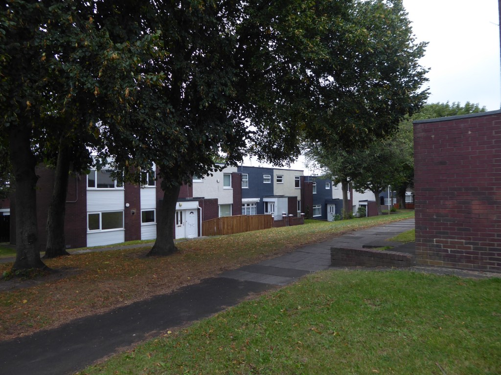
Three nineteen-storey point blocks built as public housing as part of the redevelopment of Sunderland town centre. The blocks contain 270 dwellings in total. Construction was approved by committee in 1967.
The blocks were constructed by Sunderland County Borough Council.
The developers of the Town Central Area were Town and City Properties Ltd. It is believed that they contributed £38,600 to the development of the blocks.
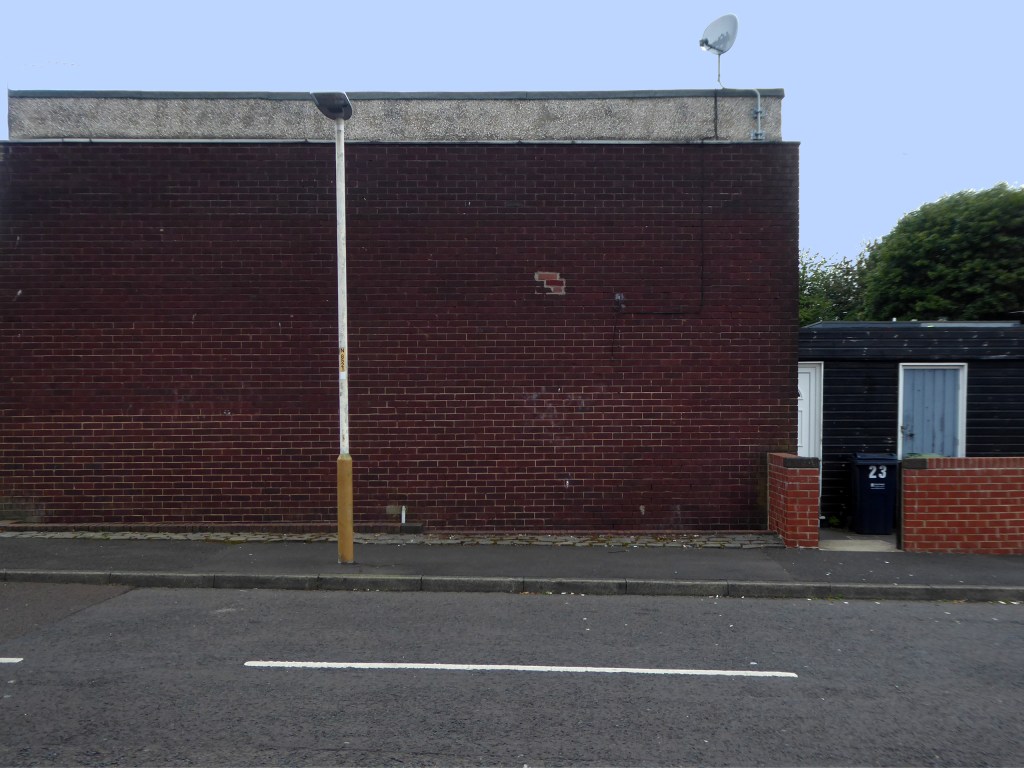
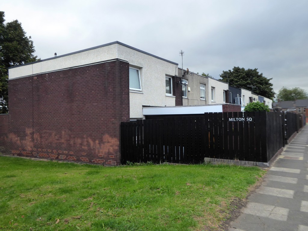
Ian Frazer and Associates were the architects for the sub-structural works only.
Llewelyn, Davies, Weeks and Partners were the structural and mechanical engineers in addition to being the architects for the tower blocks.
Gilbert-Ash Northern Ltd.’s tender for the contract was £959,258 – construction began in March 1967.
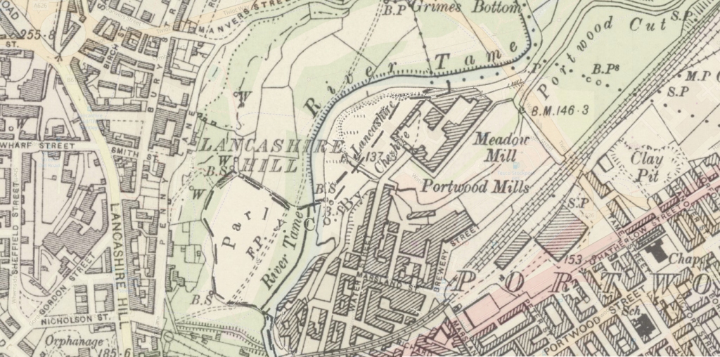
The 19th-century industrial concentrations in the above-named urban areas resulted in the Tame being a much polluted waterway. As well as industrial pollution from the dyes and bleaches used in textile mills, effluent from specialised paper-making cigarette papers, engineering effluents, including base metal washings from battery manufacture, phenols from the huge coal-gas plant in Denton, rain-wash from roads and abandoned coal spoil heaps there was also the sewage effluent from the surrounding population. Up to two-thirds of the river’s flow at its confluence with the Goyt had passed through a sewage works. The anti-pollution efforts of the last thirty years of the 20th century have resulted in positive fauna distributions.
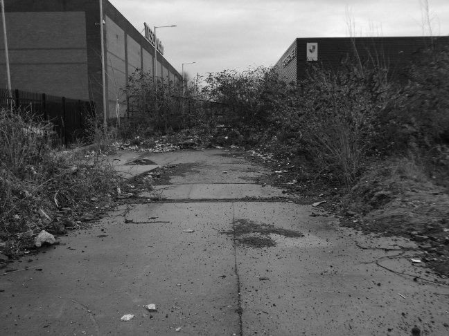
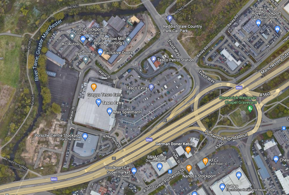
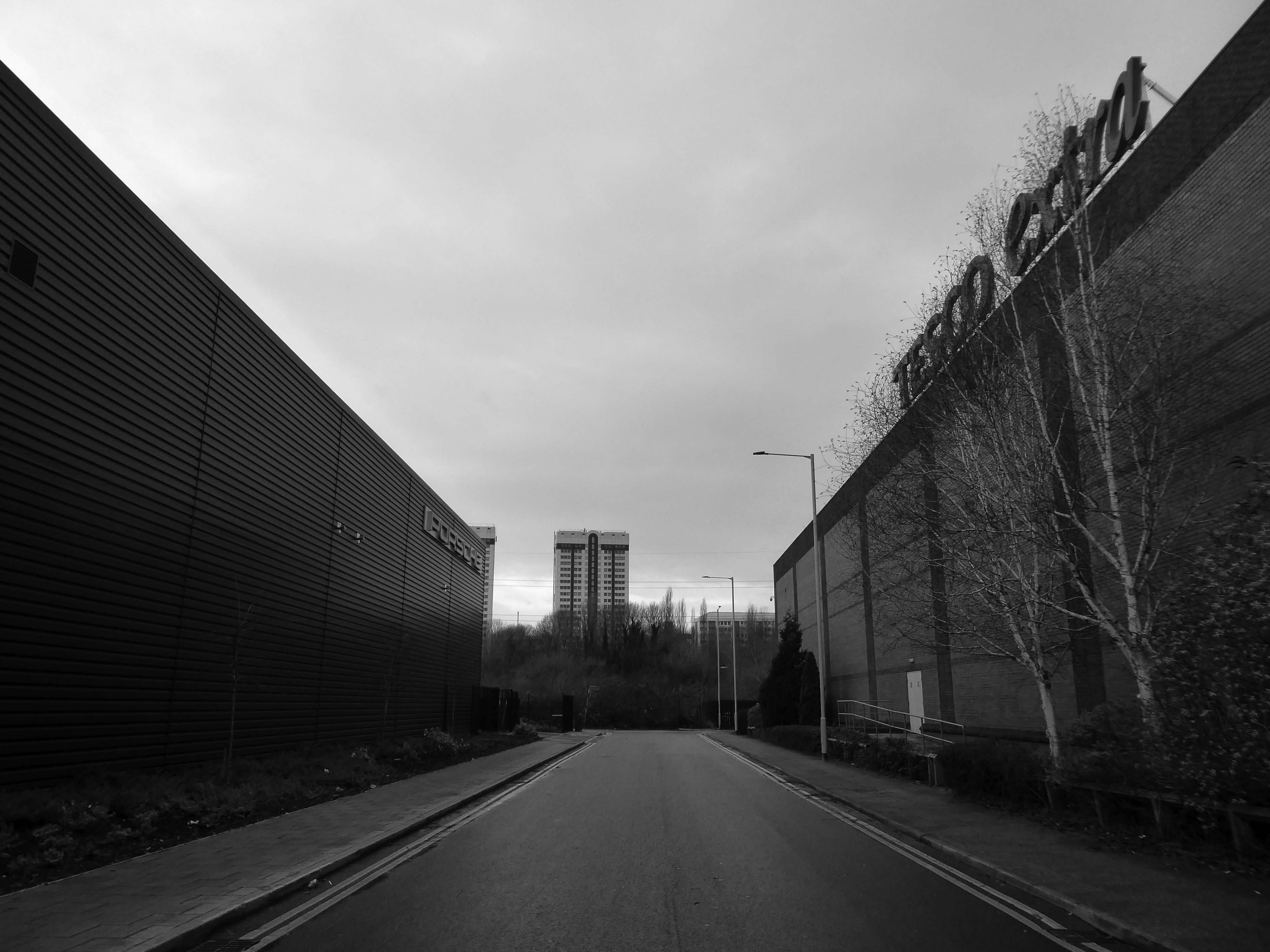
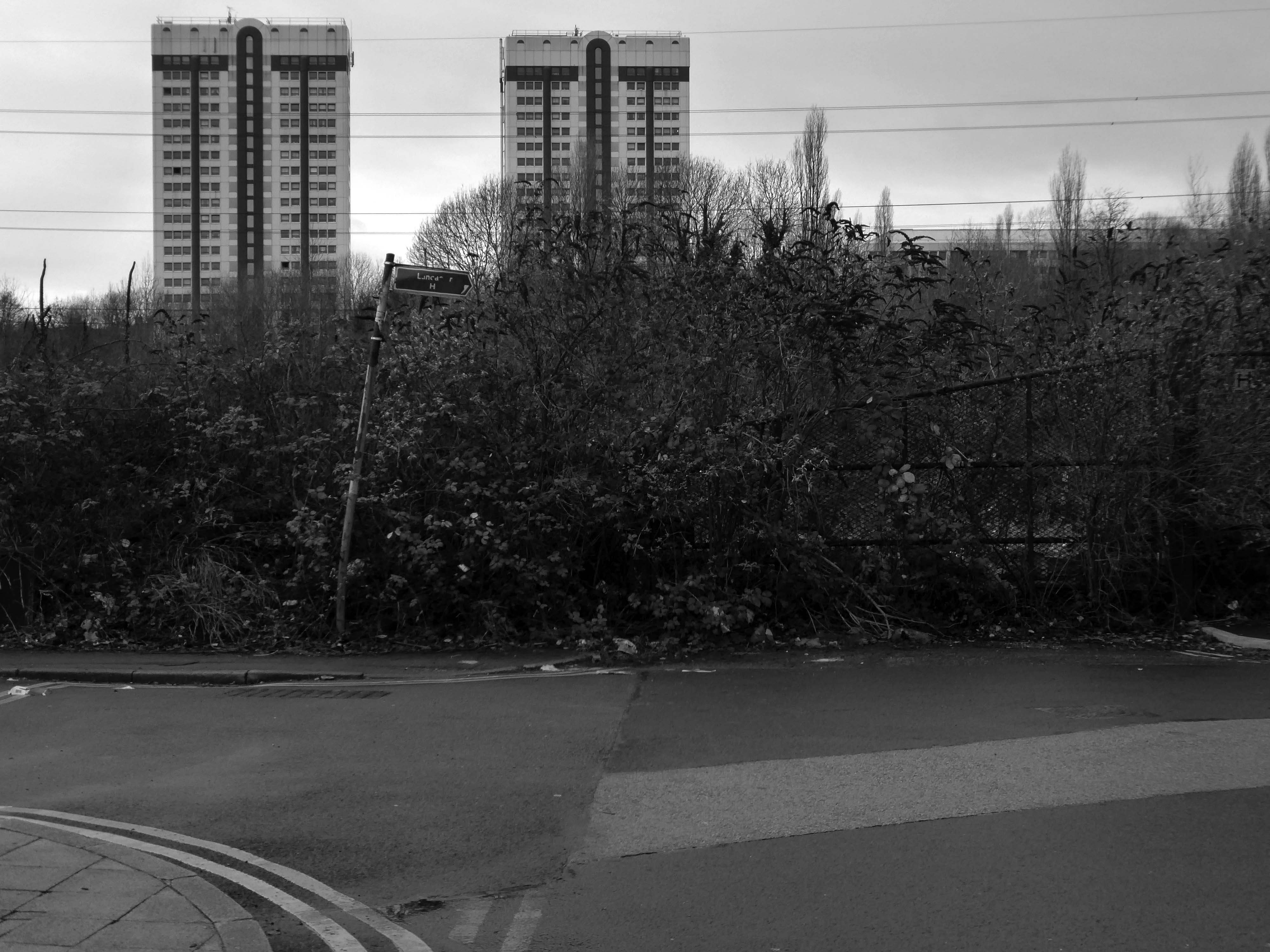
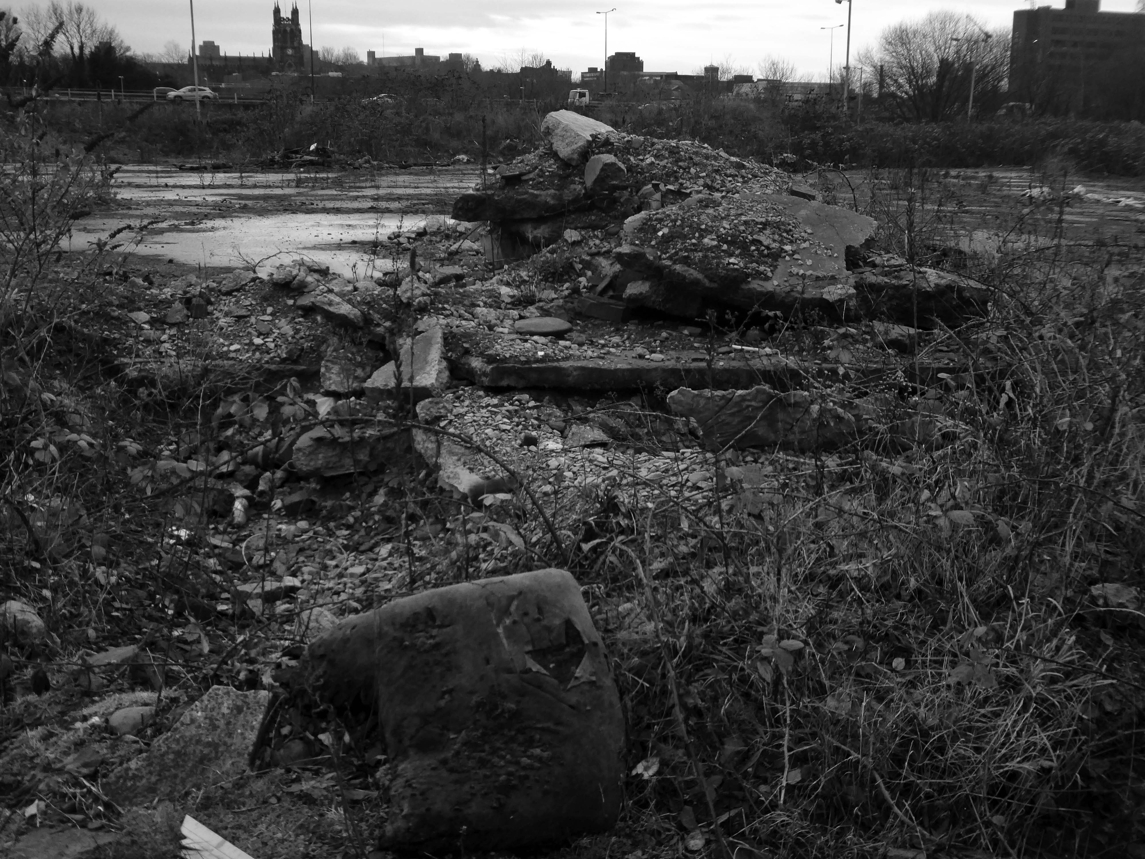
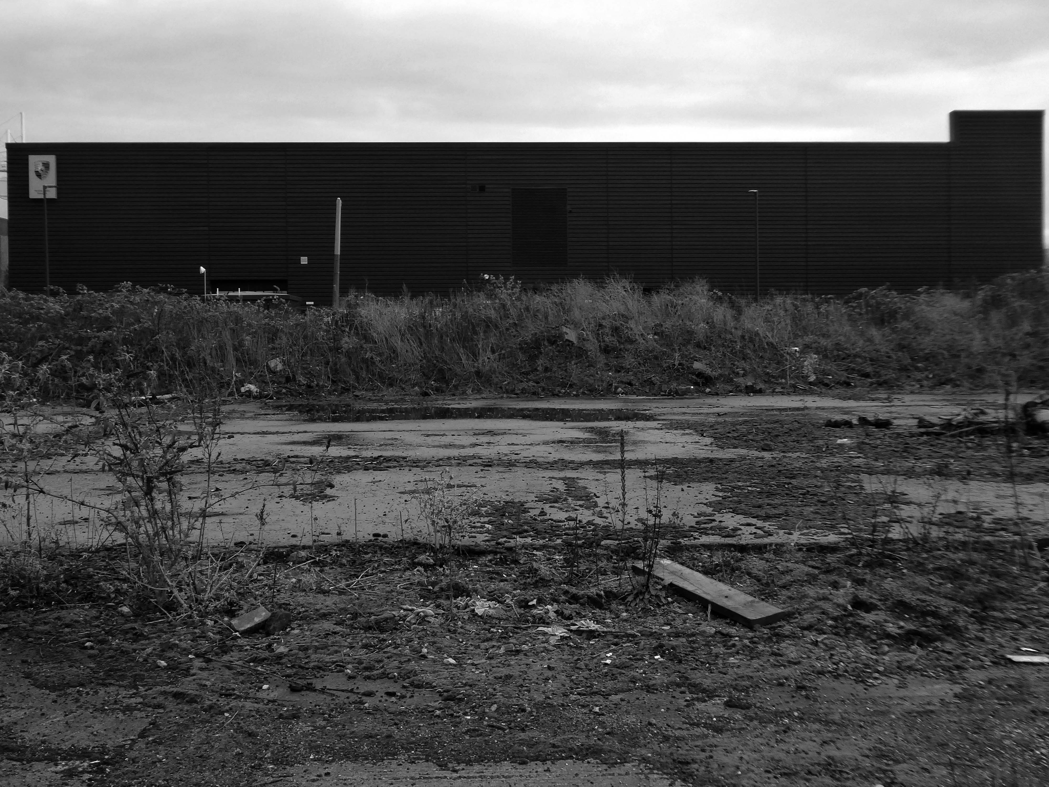
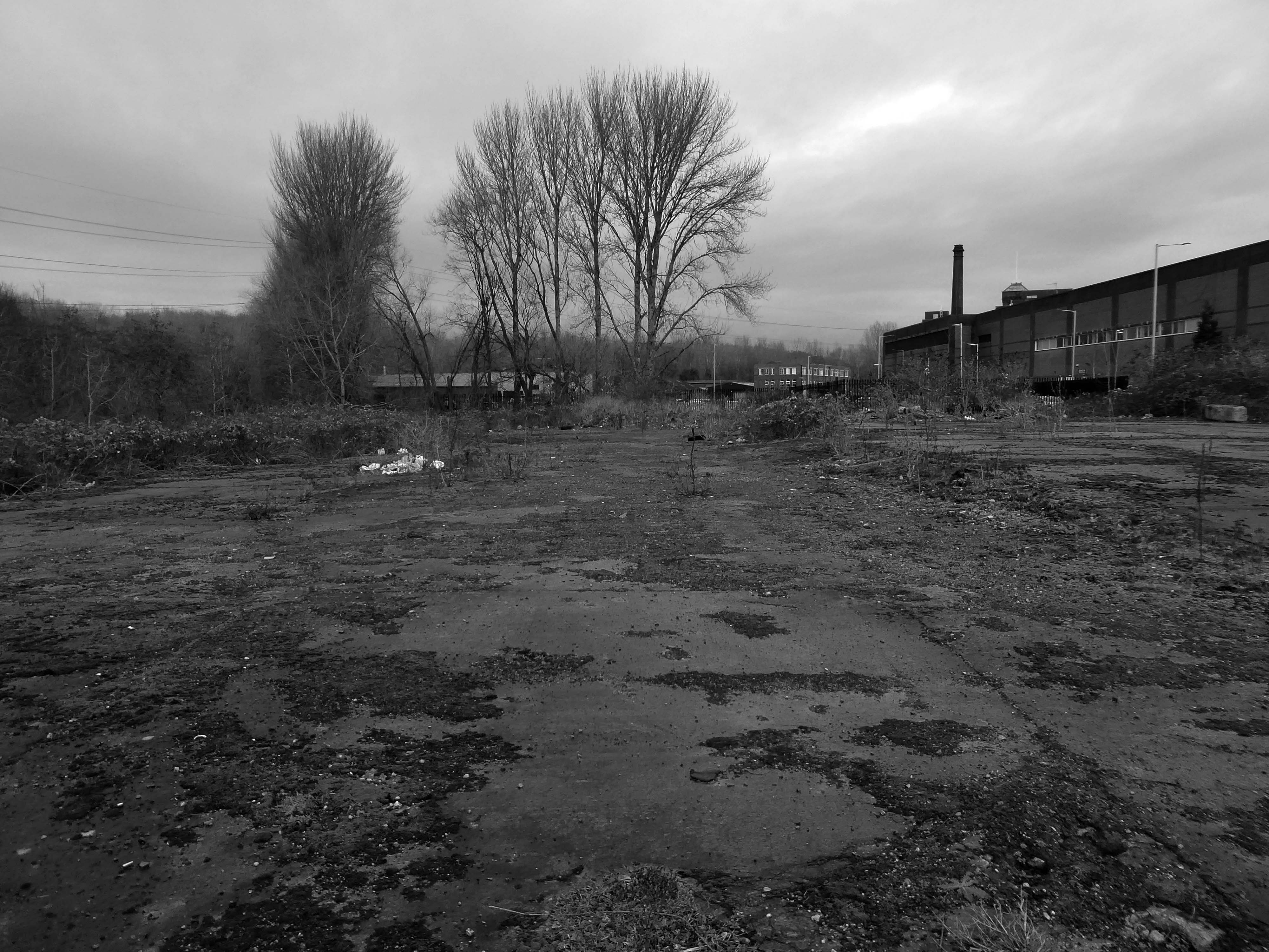
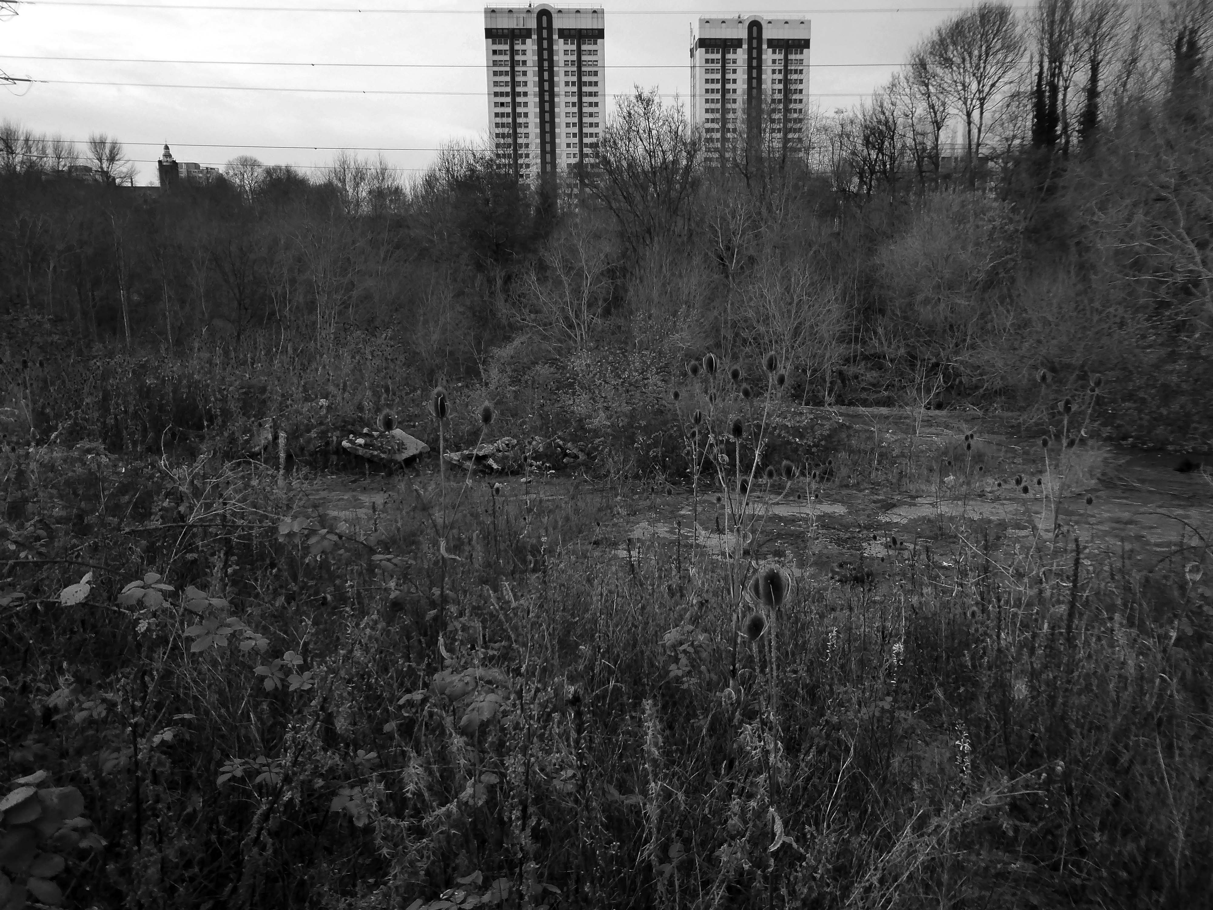
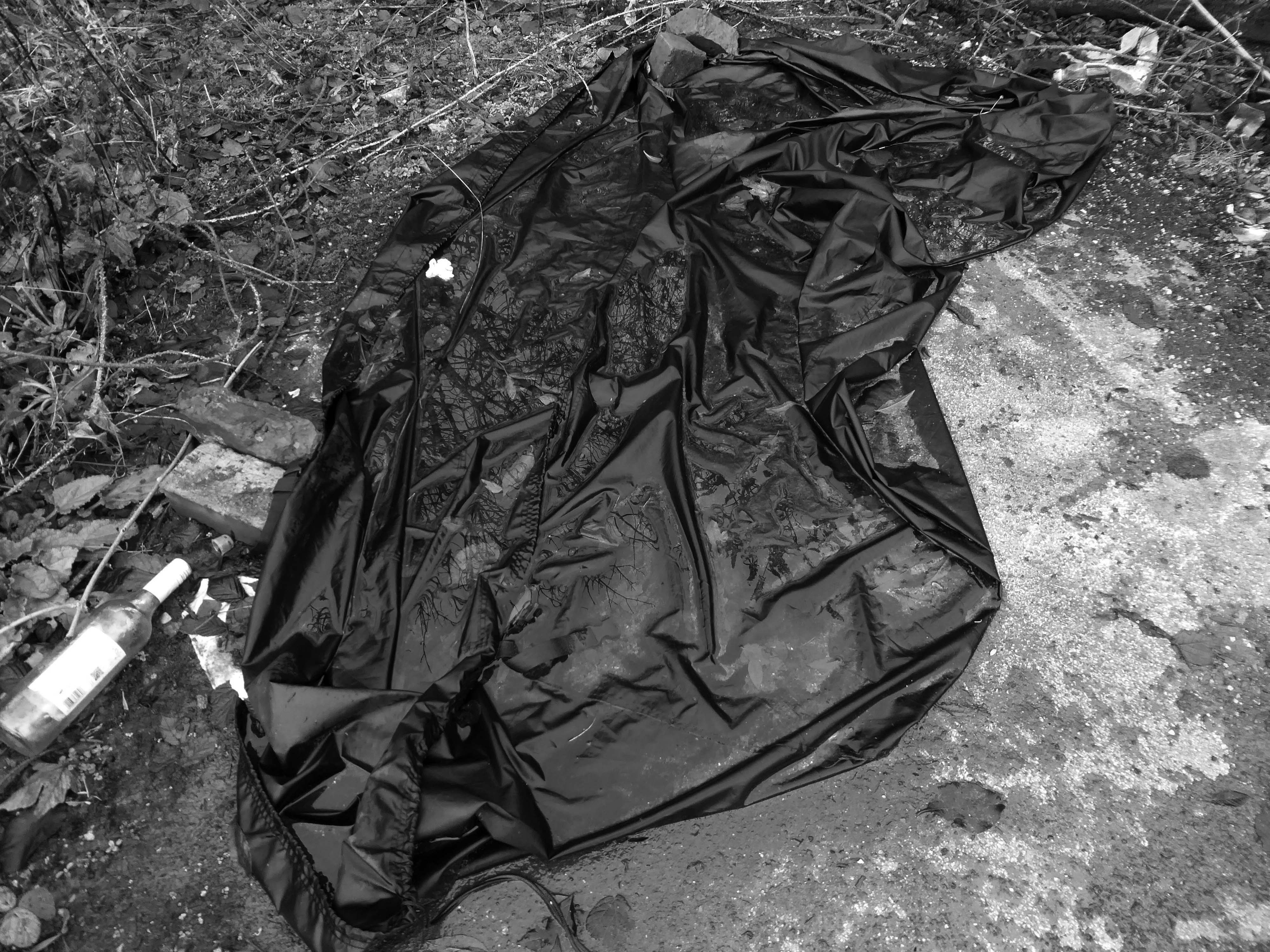
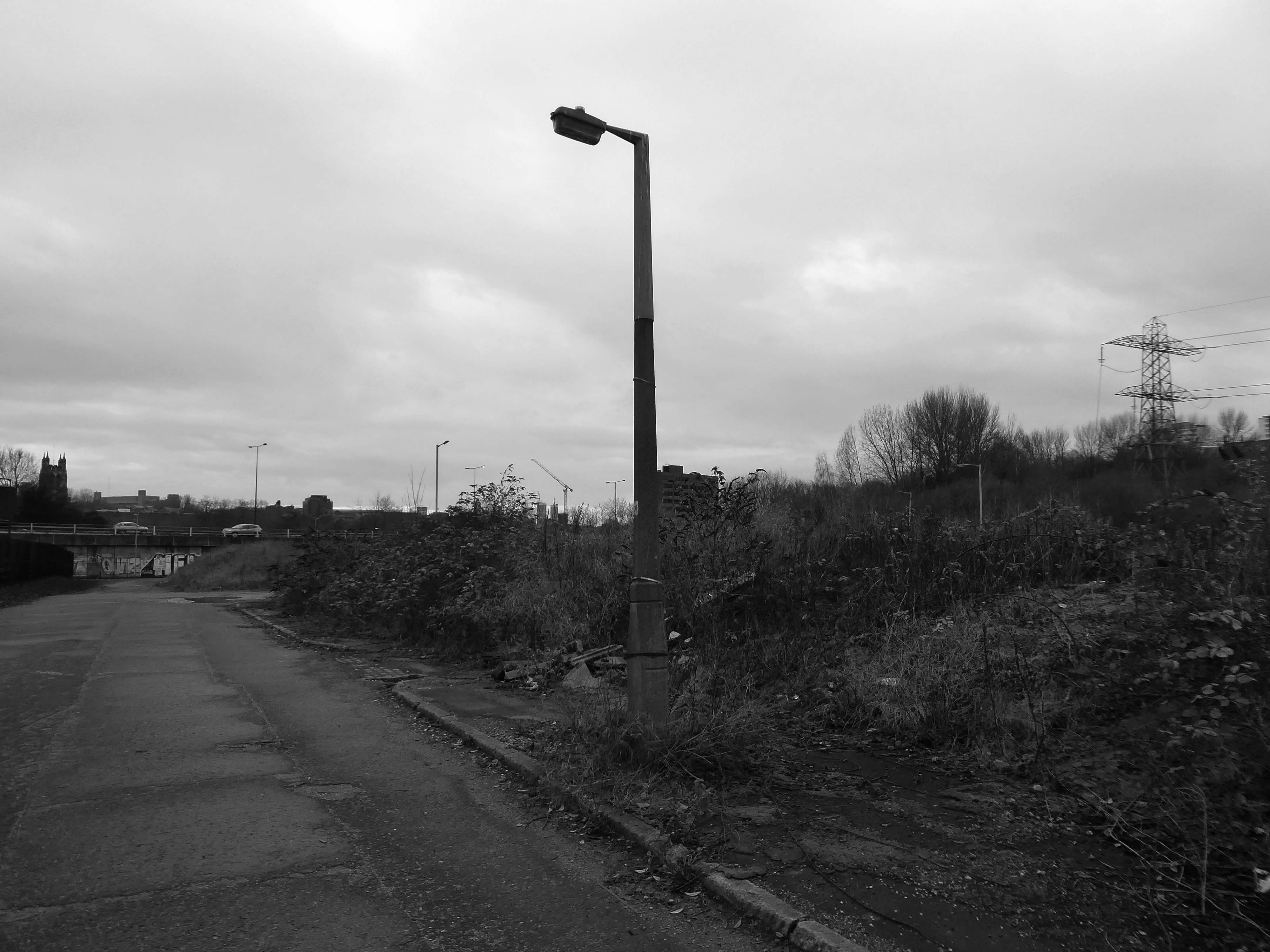
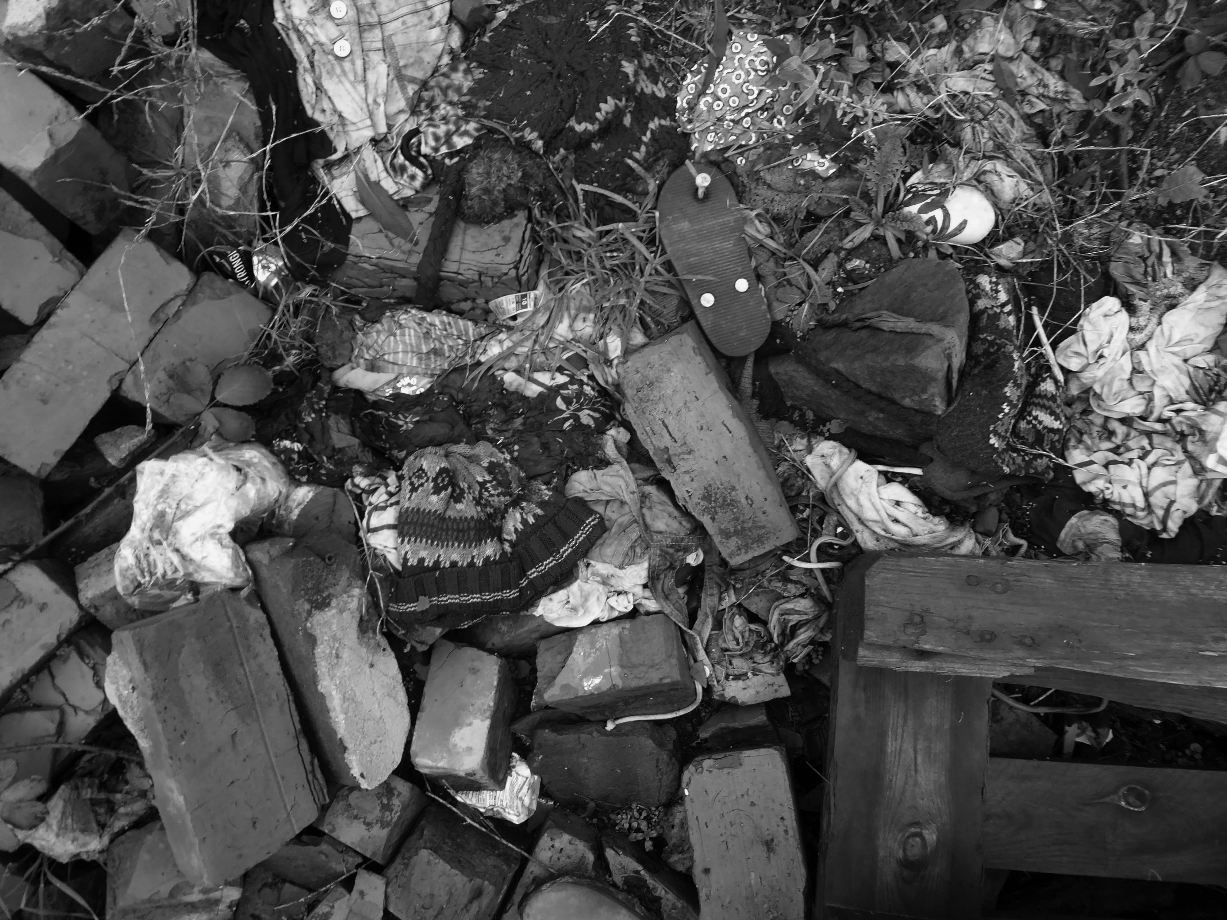
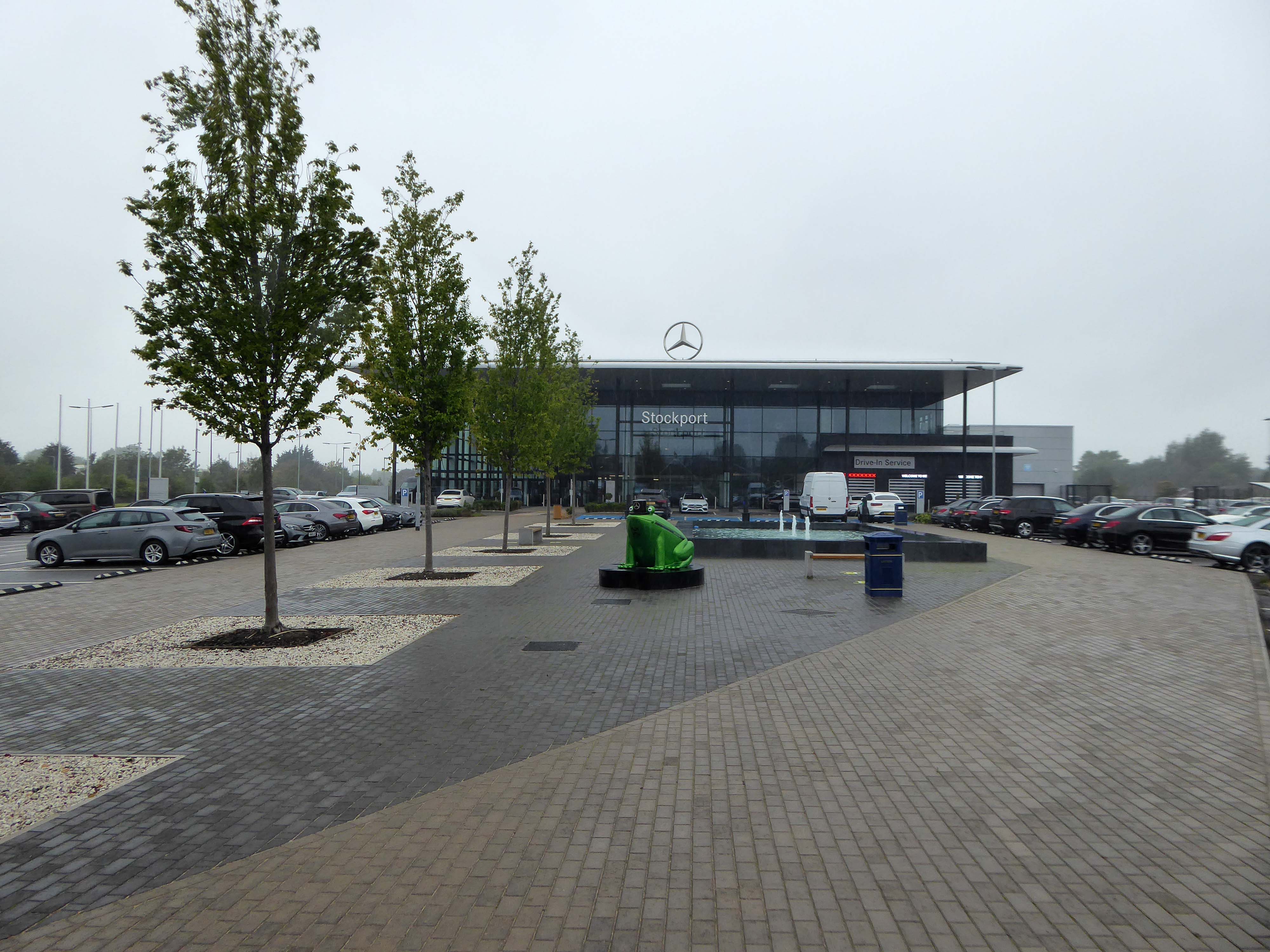
There is a plot of land to the left of Porsche which remains undeveloped, I often walk around this area, what would have once been for myself and others the place of childhood high jinx.
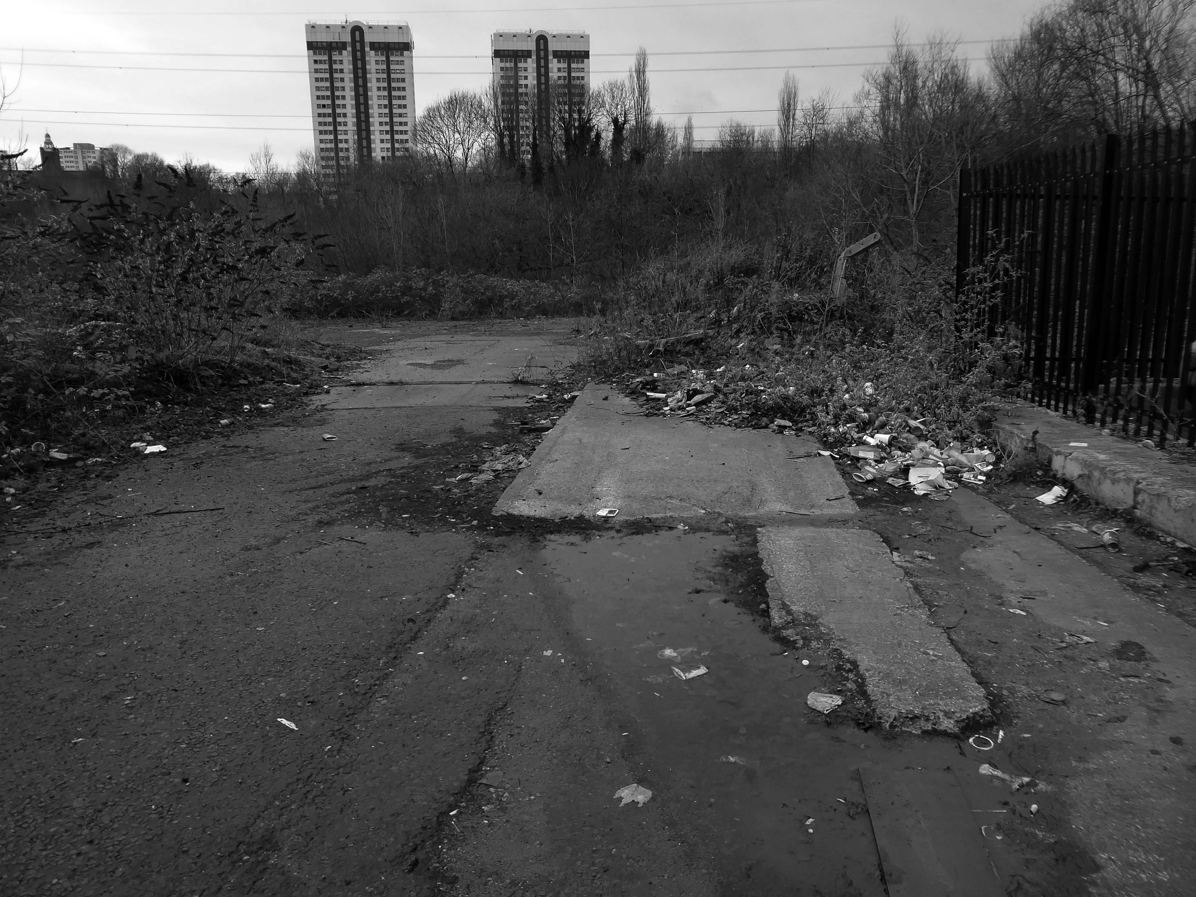
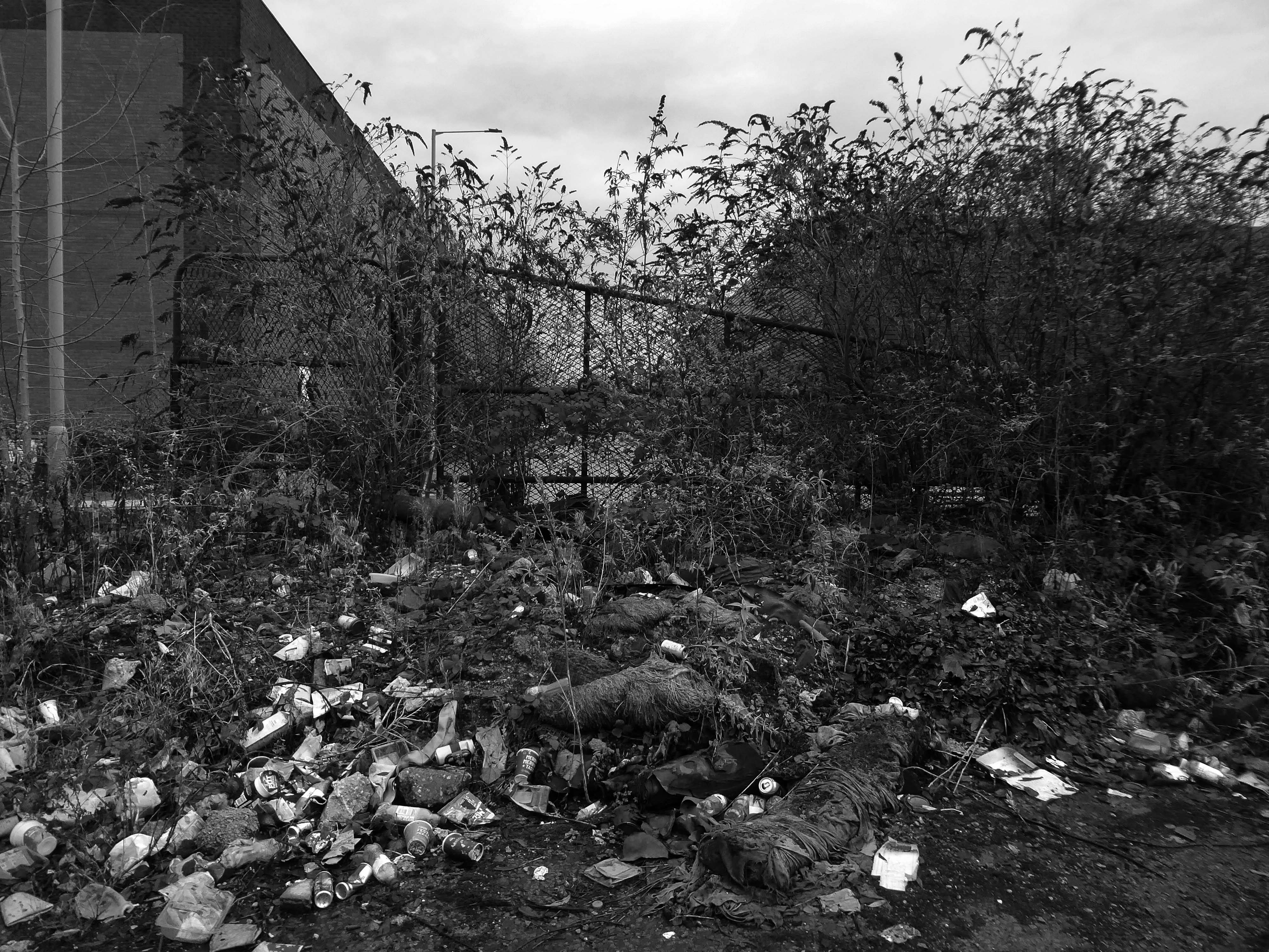
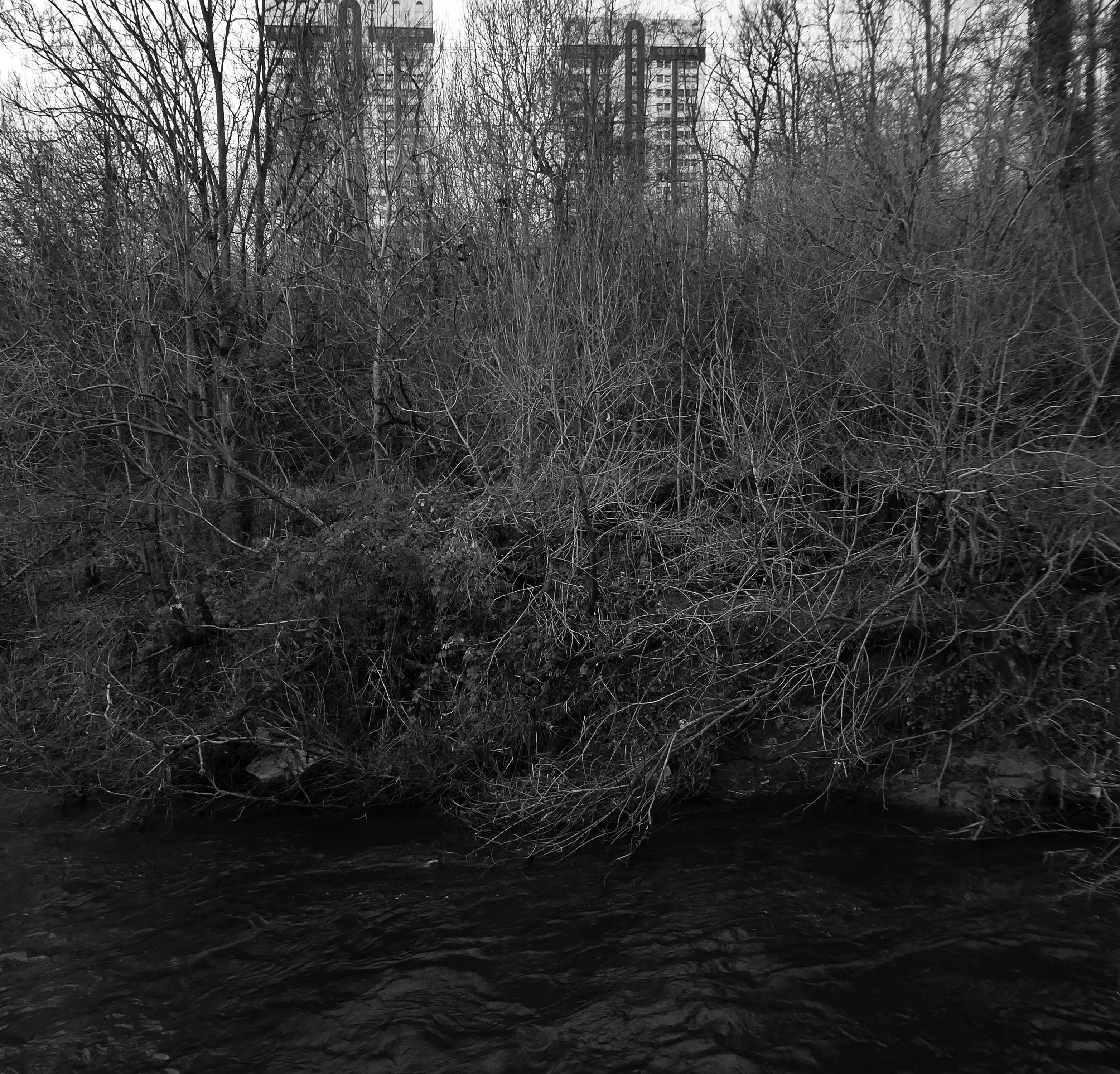
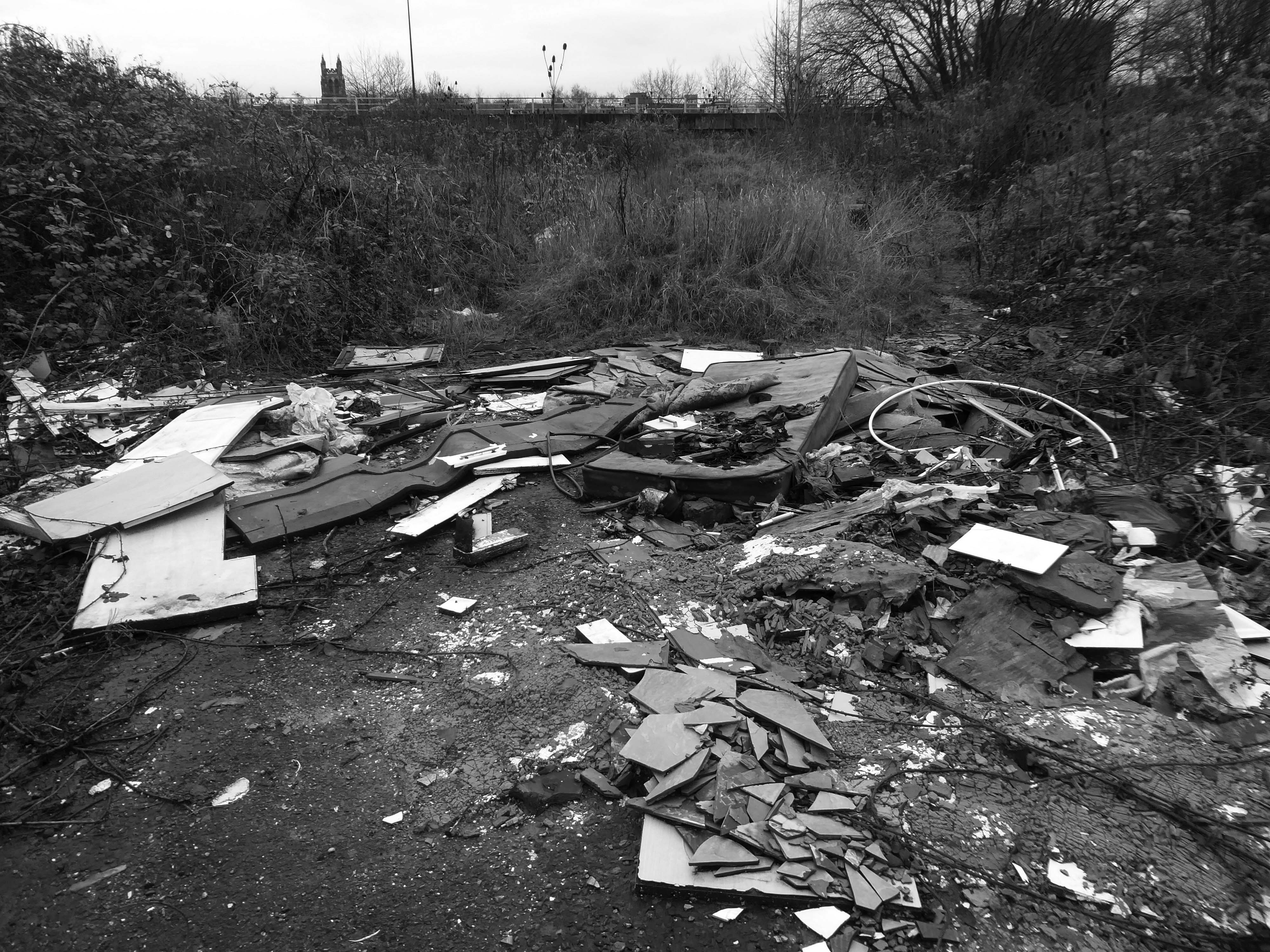
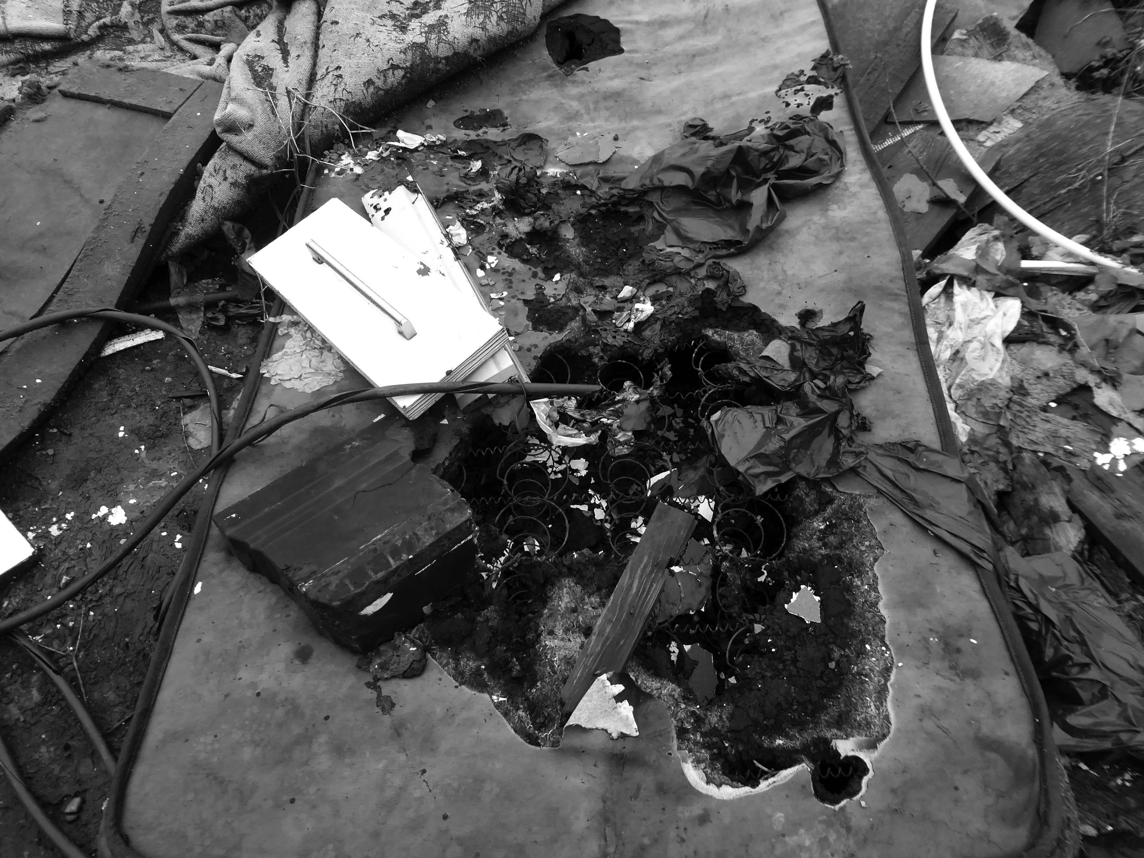
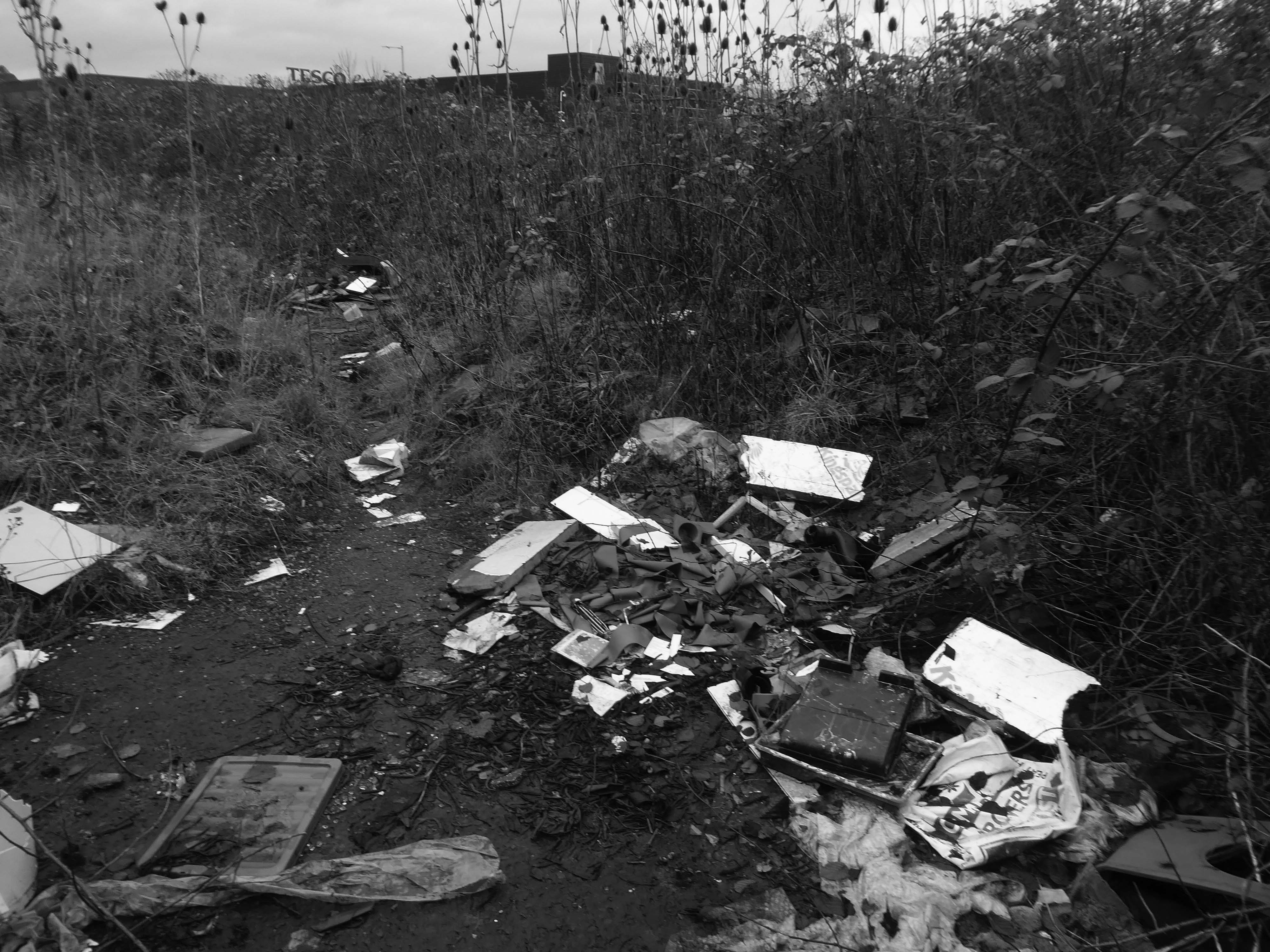
Now it is the domain of the fly-tipper, the home of the homeless, a war zone for a species which has declared war upon itself.
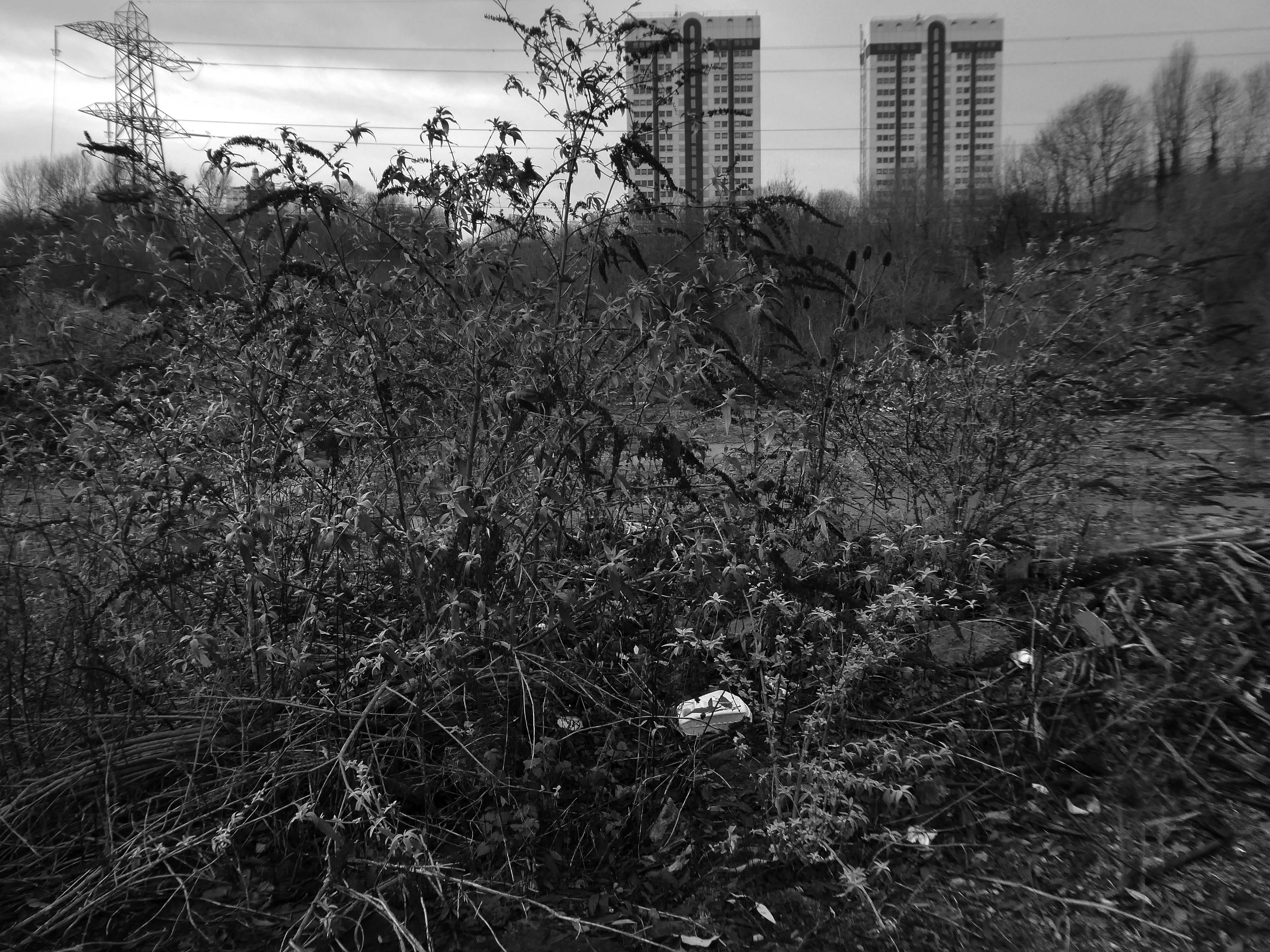
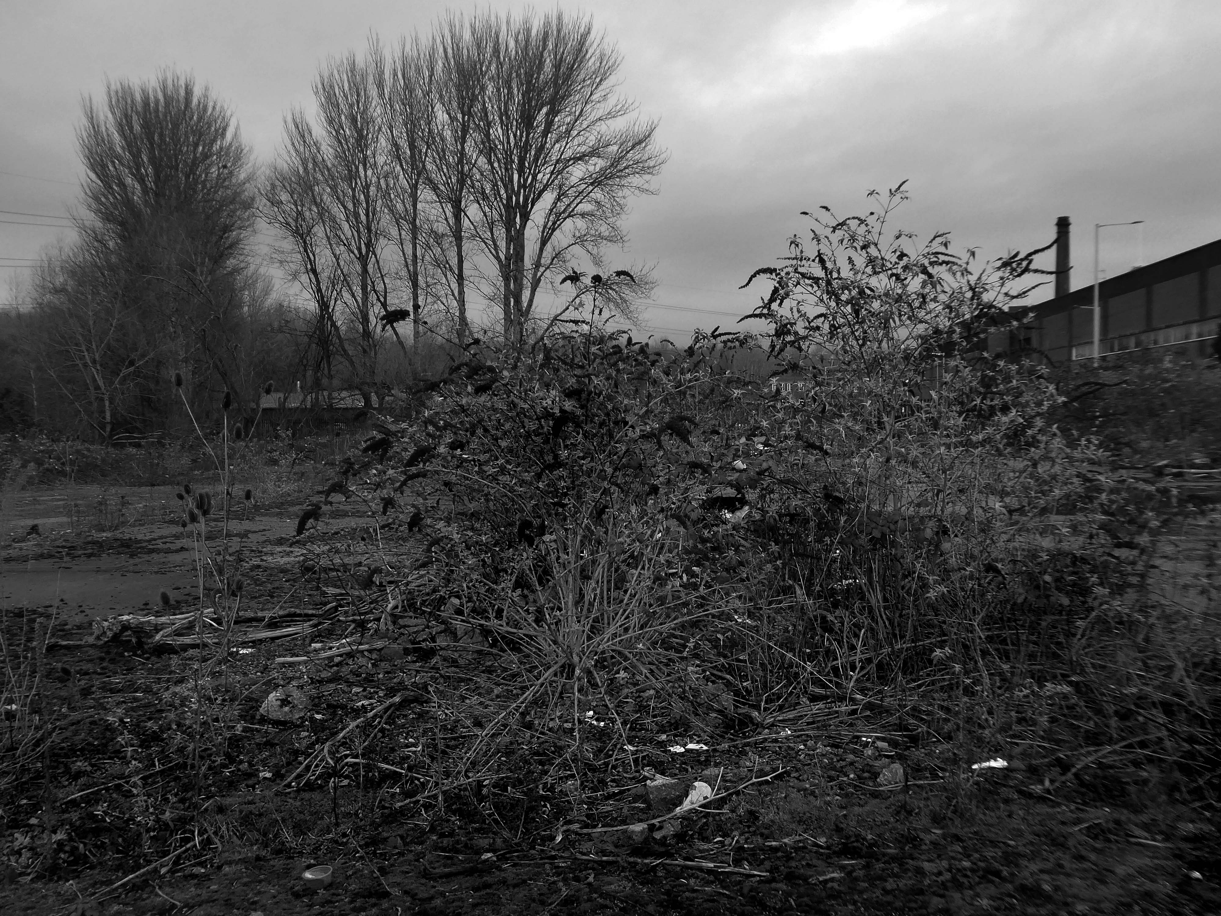
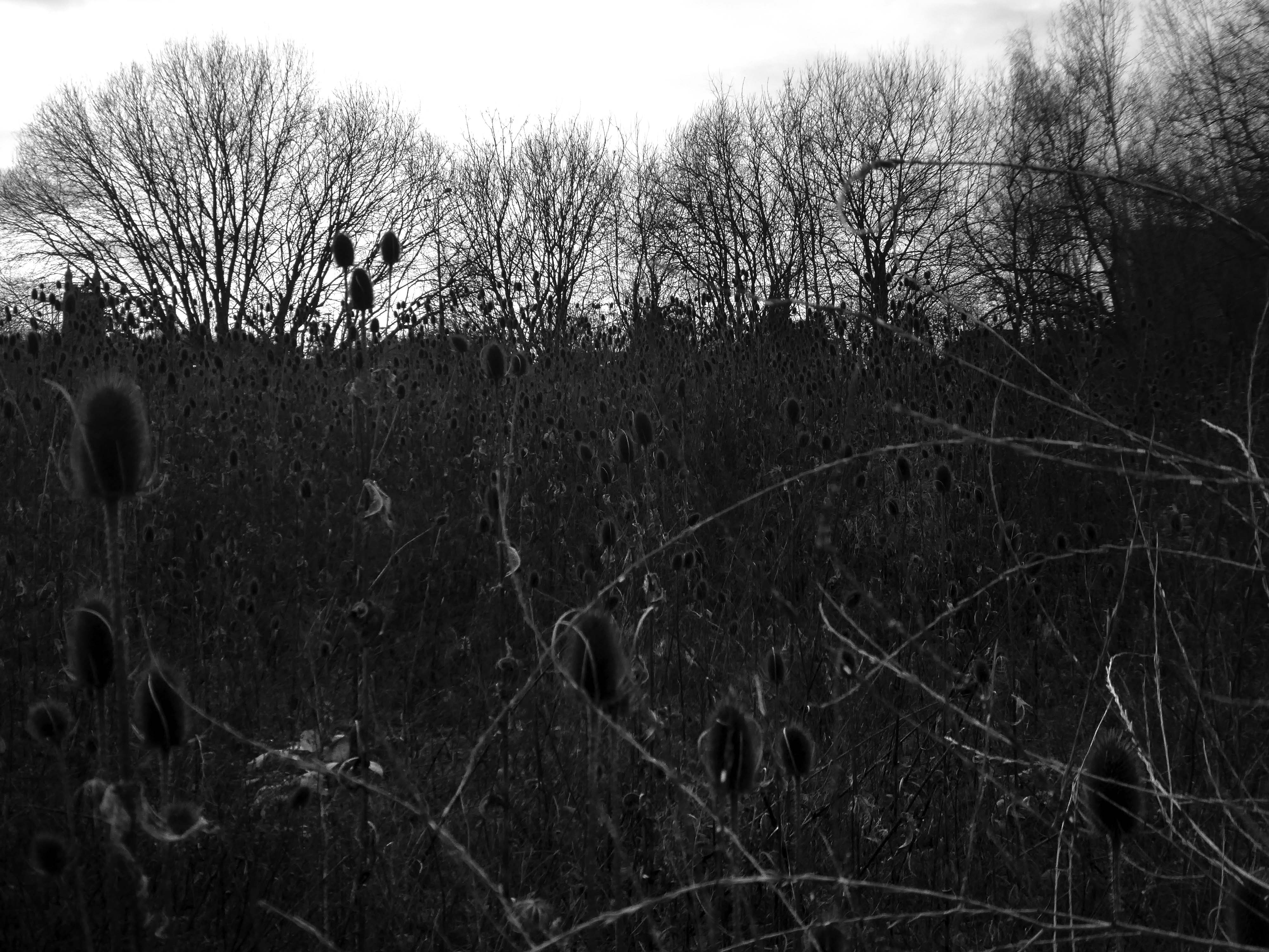
A desert of detritus, interpolated with tangles of brambles, seas of teasels and the ubiquitous buddleia.
This is the unofficial showroom for the unofficial Anthropocene Epoch – always crashing in a different car, during increasingly unseasonal weather, the superabundance of abundance.
It seems that the sun may set on us, before the sun finally sets.
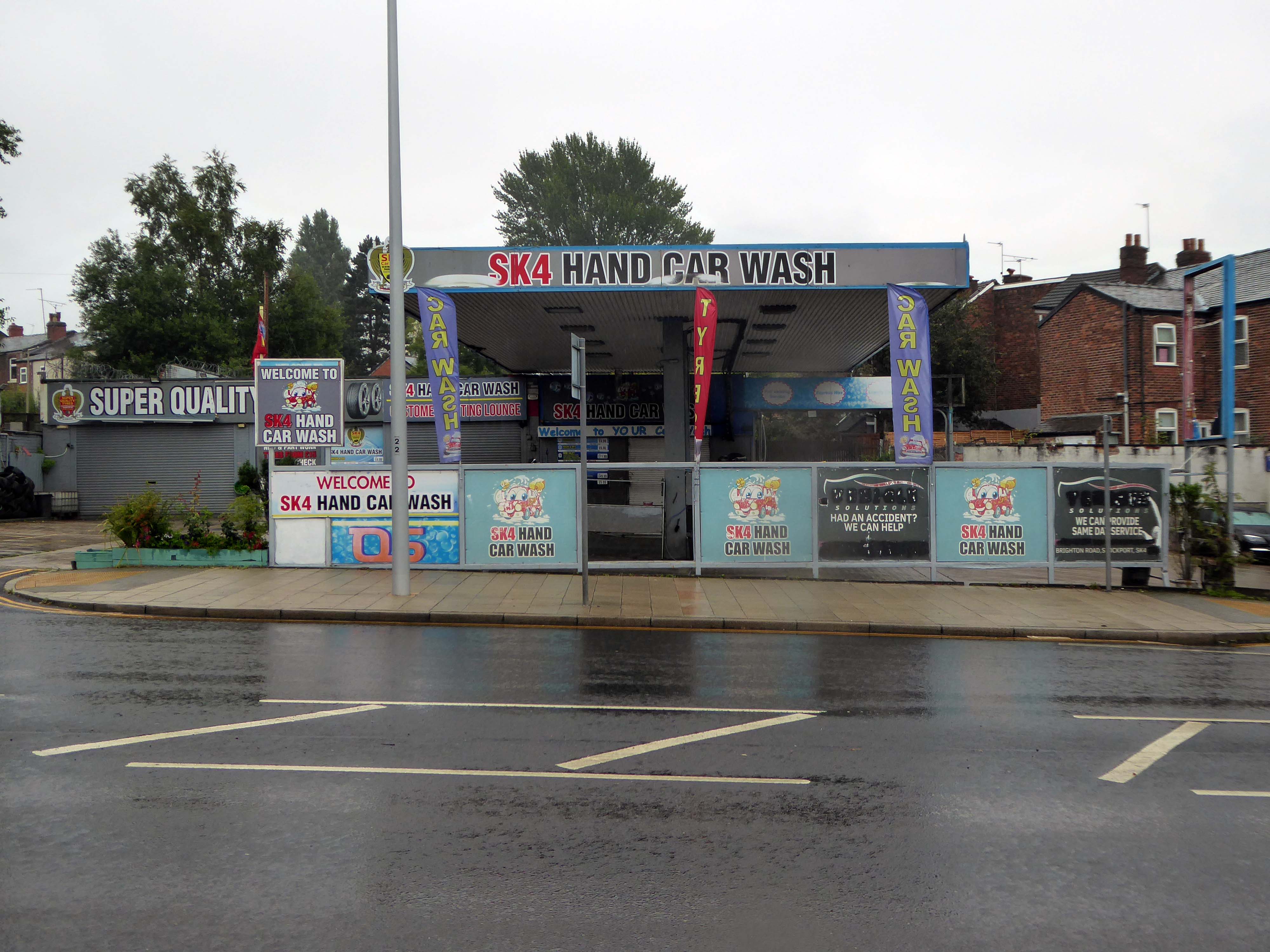
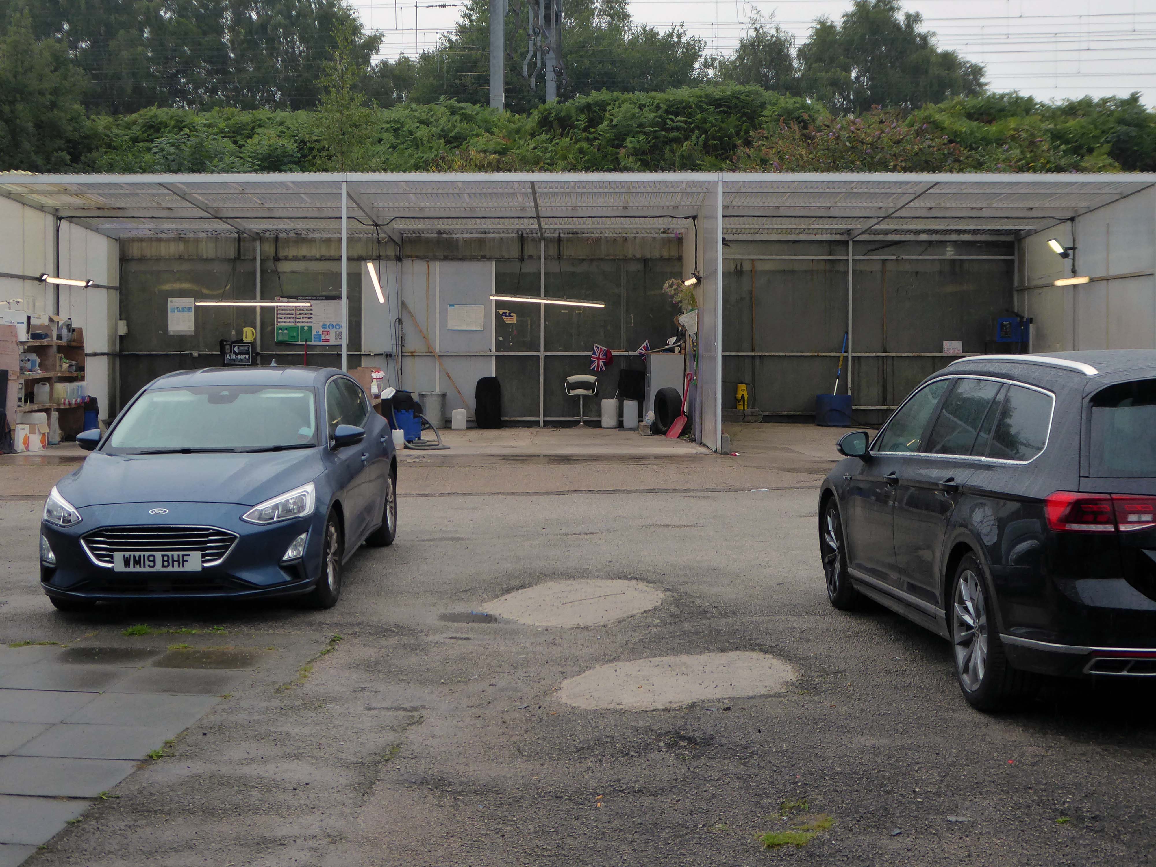
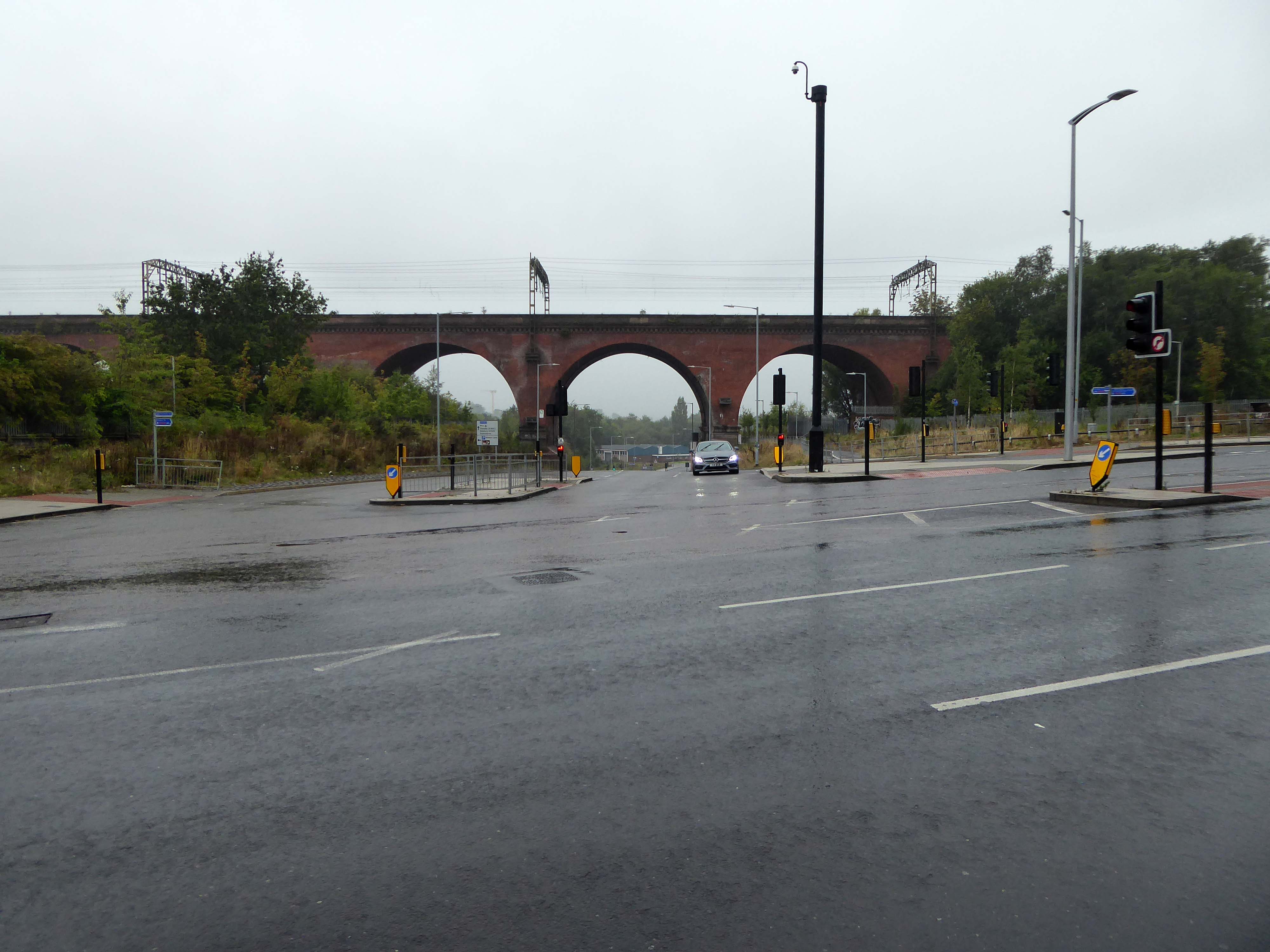
Let’s take a peep at Portwood.
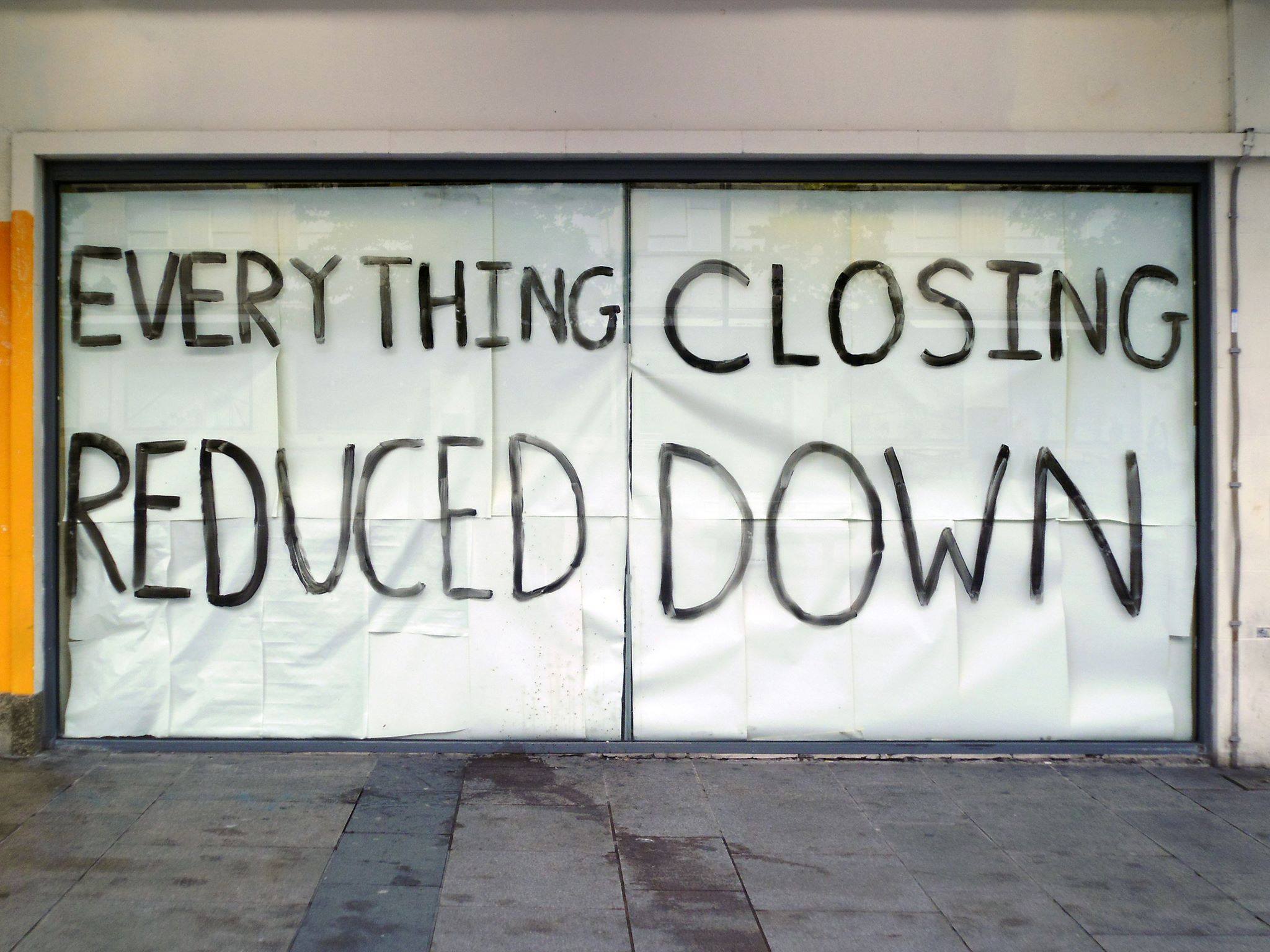
Game over.
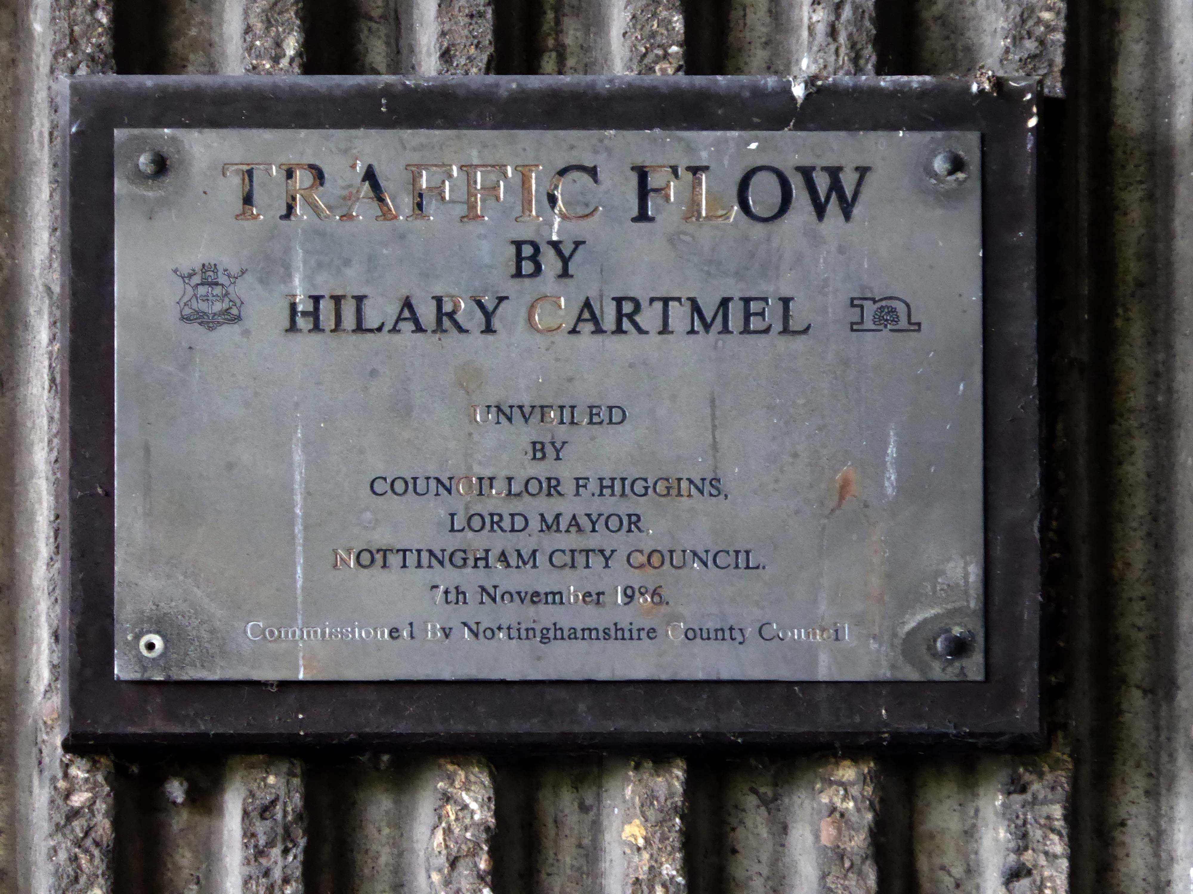
Vehicle use affects our whole quality of local life. Traffic can be dangerous and intimidating, dividing communities and making street life unpleasant, whilst air pollution and traffic noise can make urban living uncomfortable.
The impacts of mass consumption are: Misuse of land and resources, exporting pollution and waste from rich countries to poor countries, obesity due to excessive consumption, a cycle of waste, disparities and poverty.
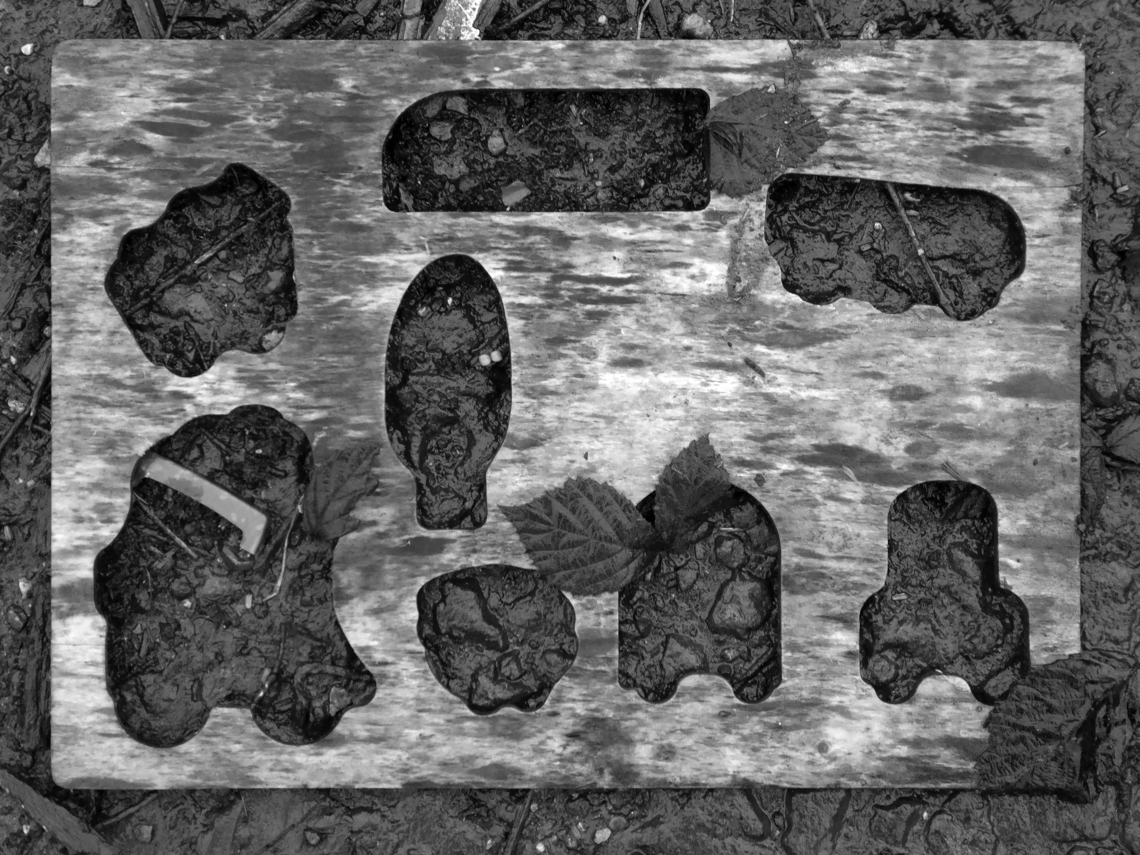
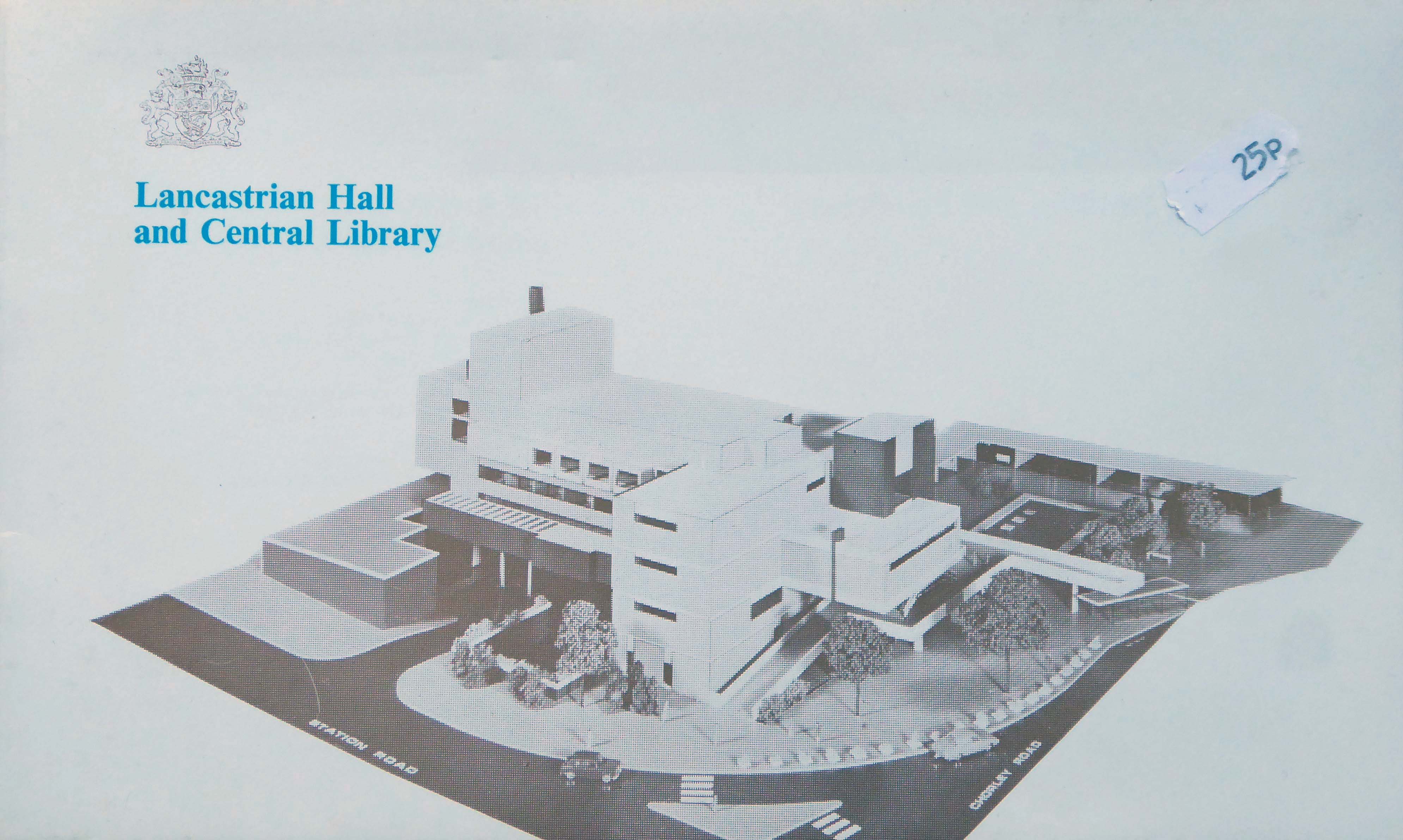
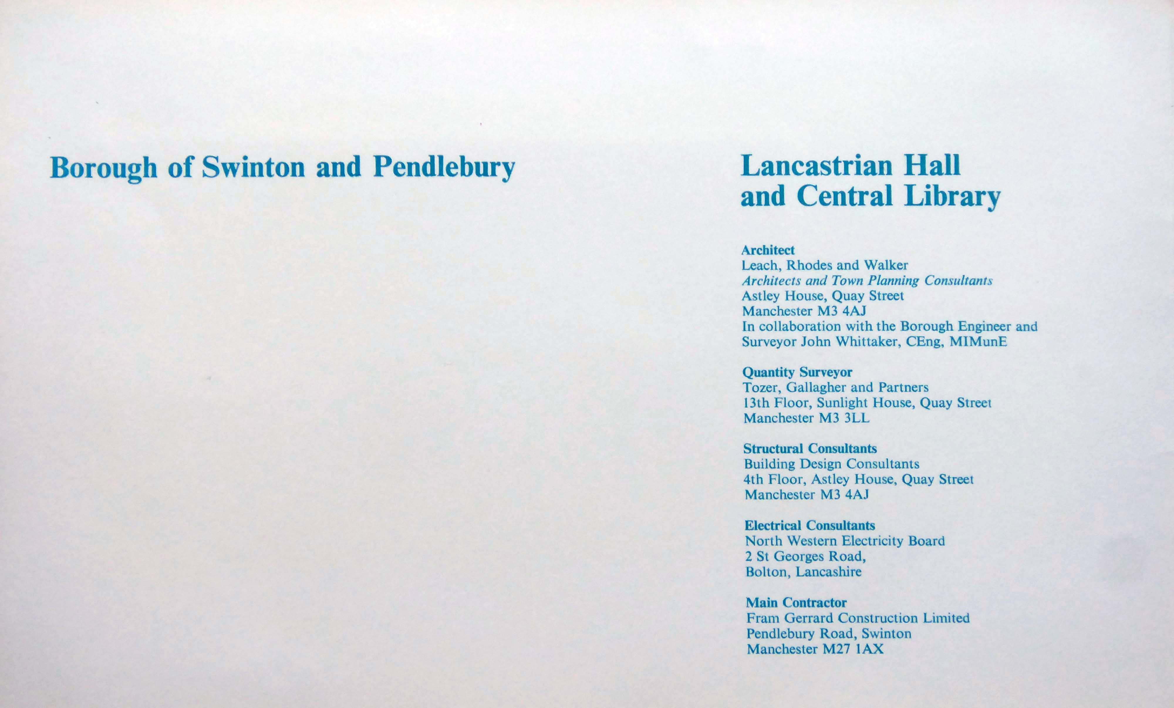
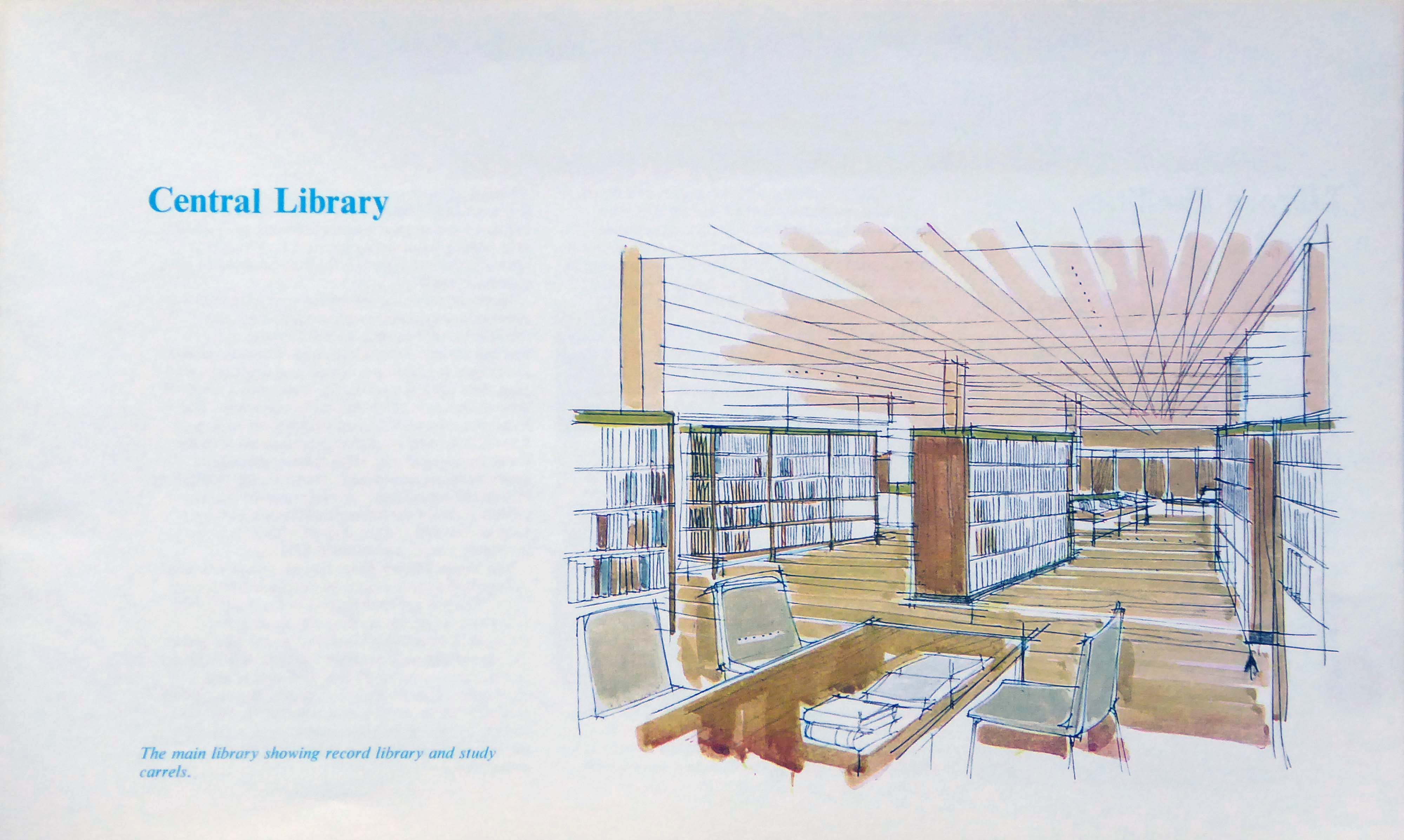
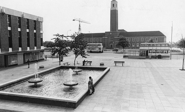
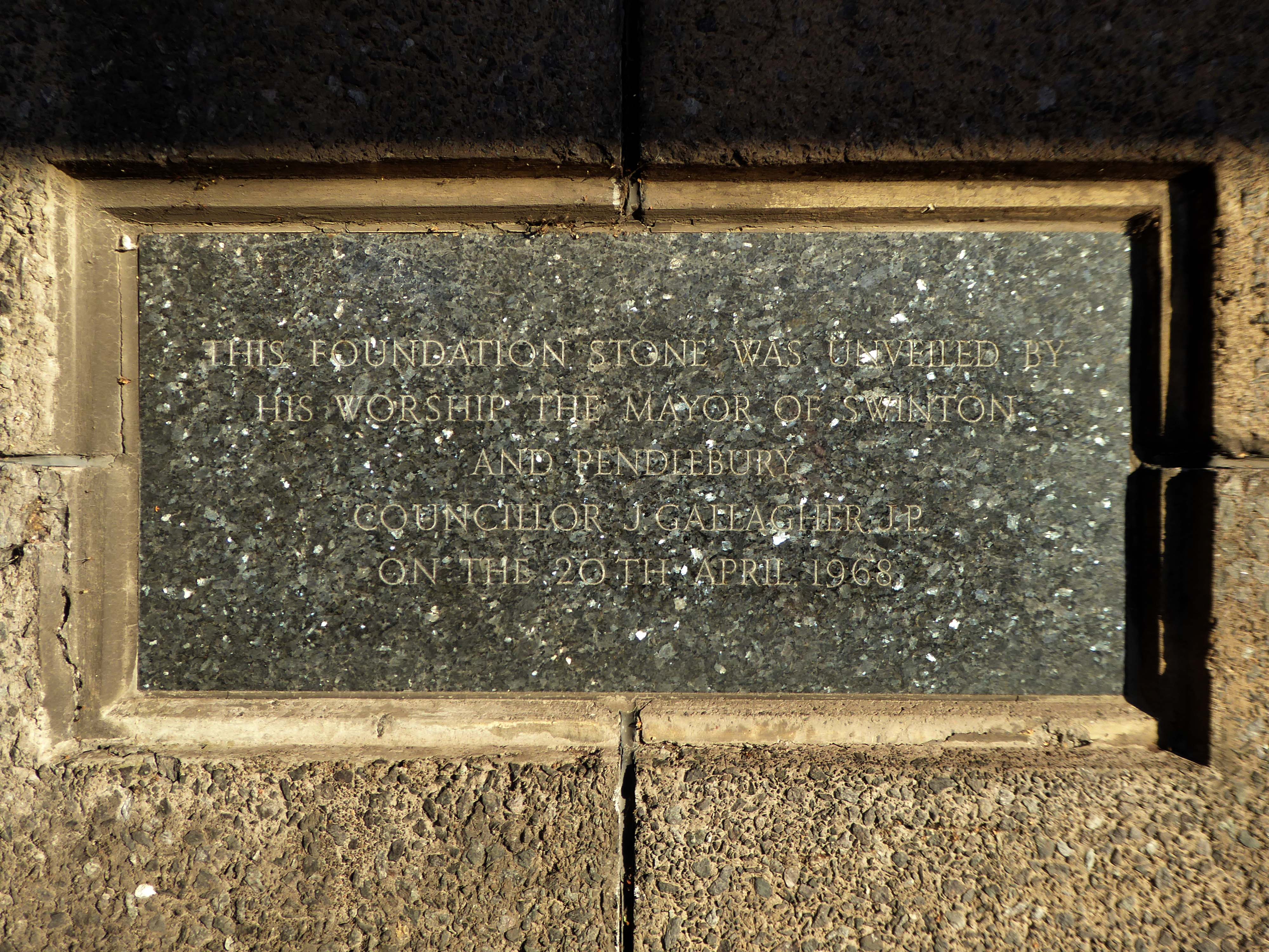
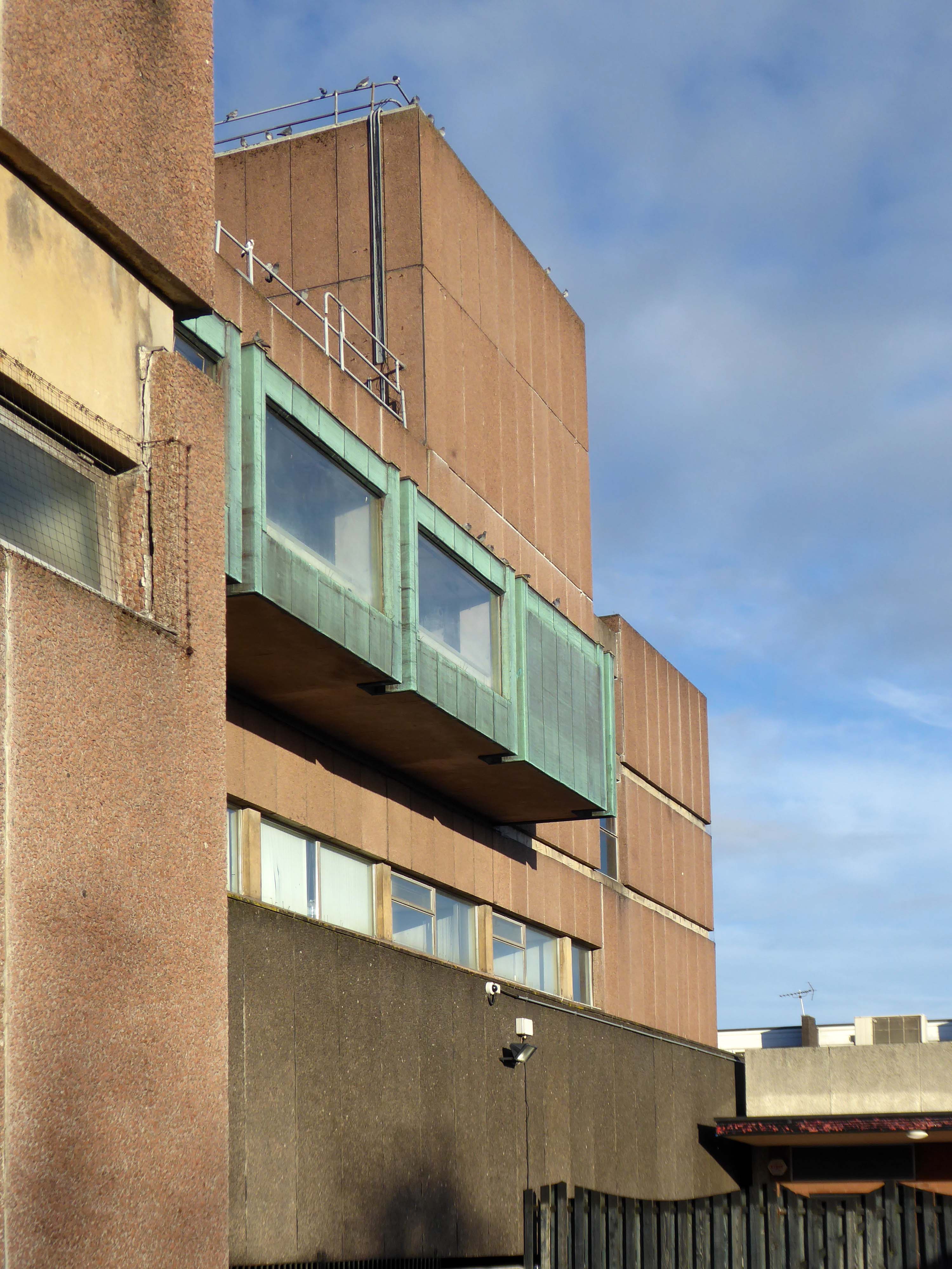
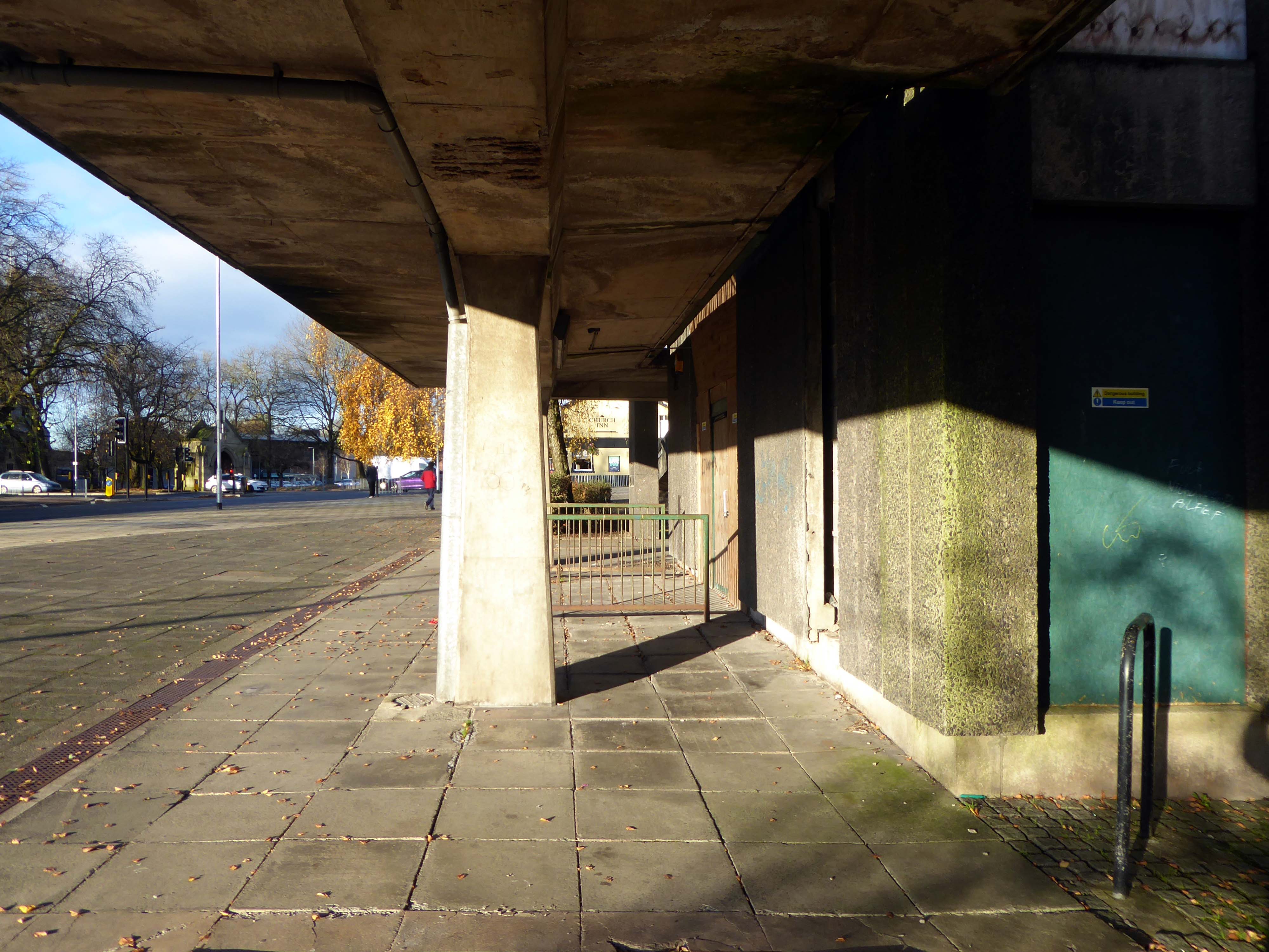
Completed in 1969 to designs by Leach Rhodes and Walker in collaboration with the Borough Engineer John Whittaker
Constructed at the tail end of the Sixties – the last gasp of Municipal Modernism in the Borough, providing education, edification and entertainment for the local population.
The fountain is gone, the building is closed – the party’s over.
The Fast Cars are history – well they were history, until I was told that they are still speeding along!
A council has spent £348,000 on a masterplan for a town centre that the public has never seen.
Consultants have been used to come up with ideas to regenerate Swinton in Salford.
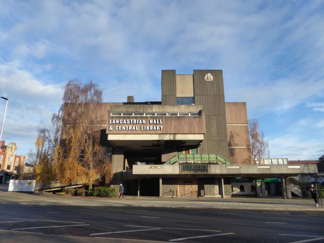
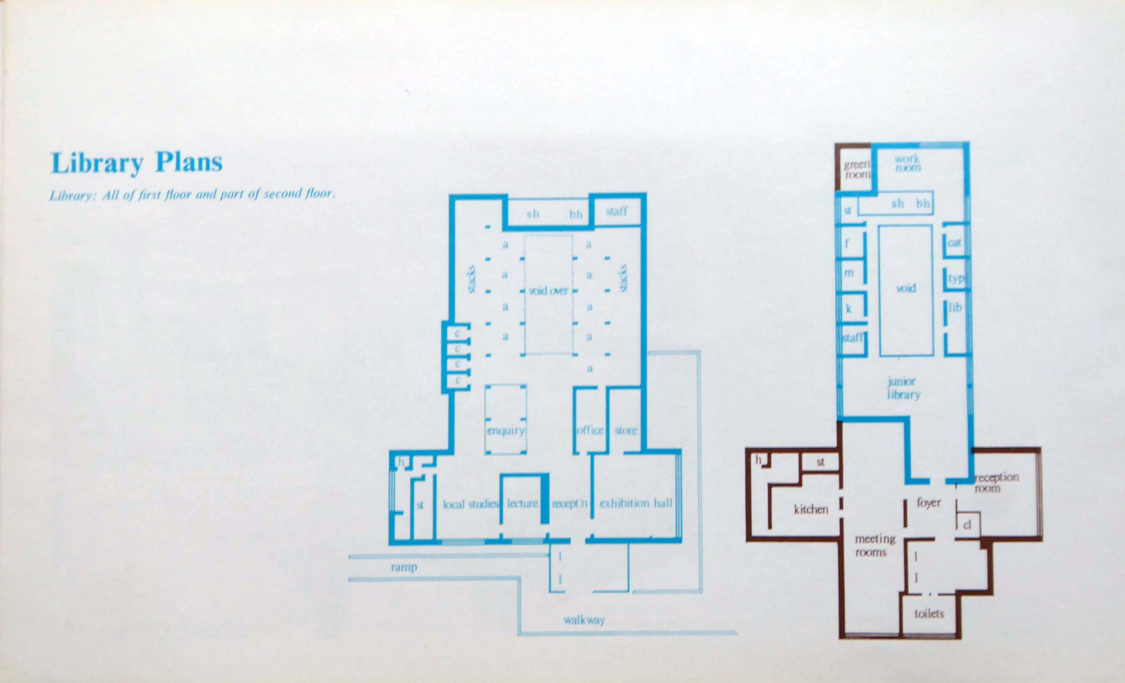
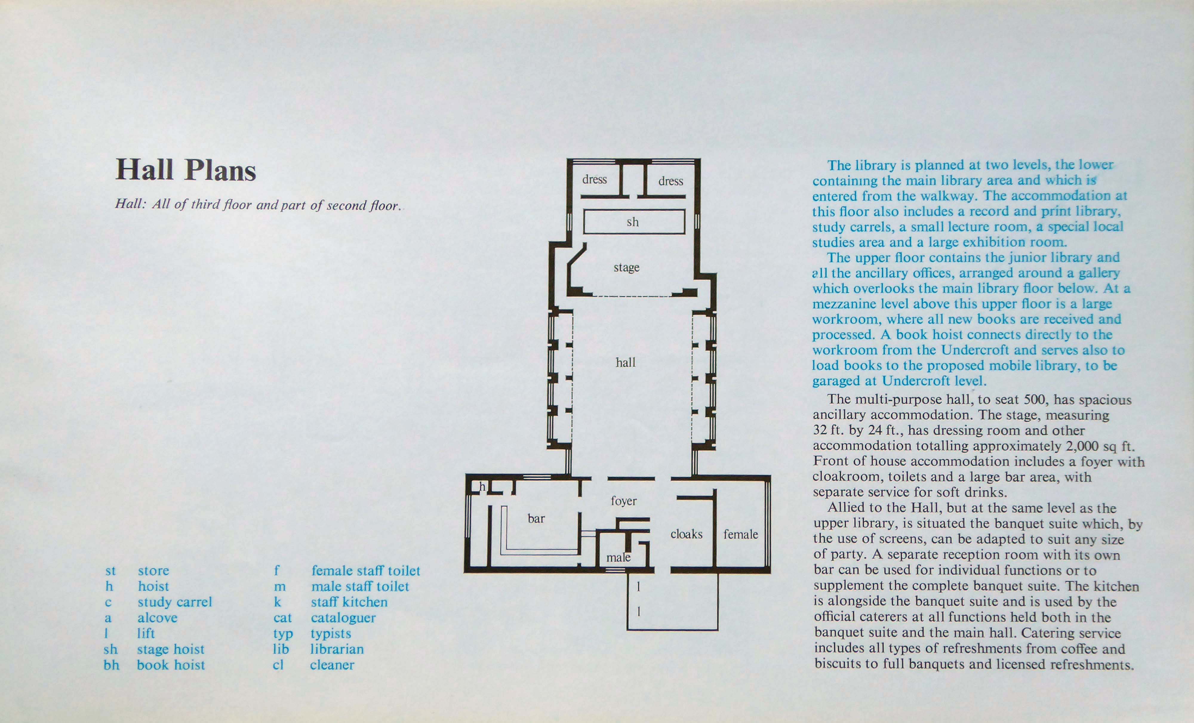
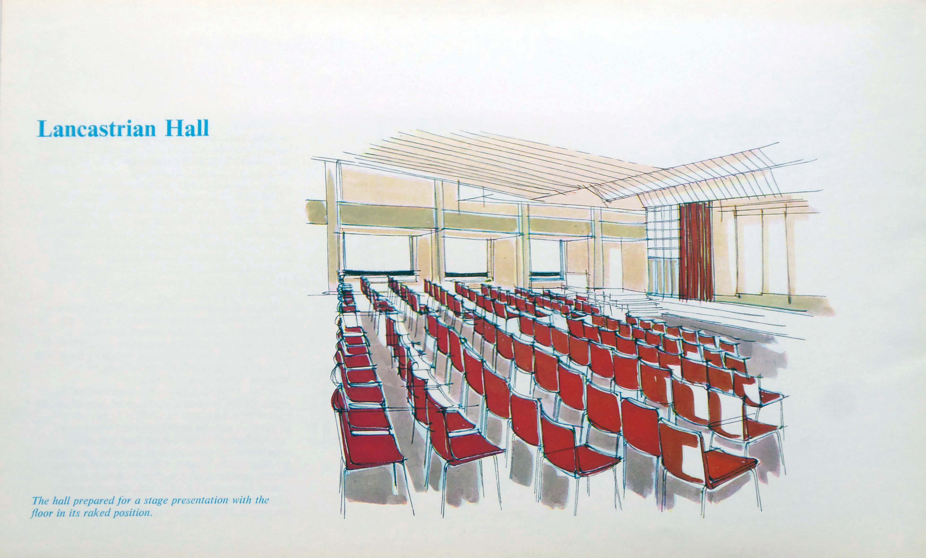
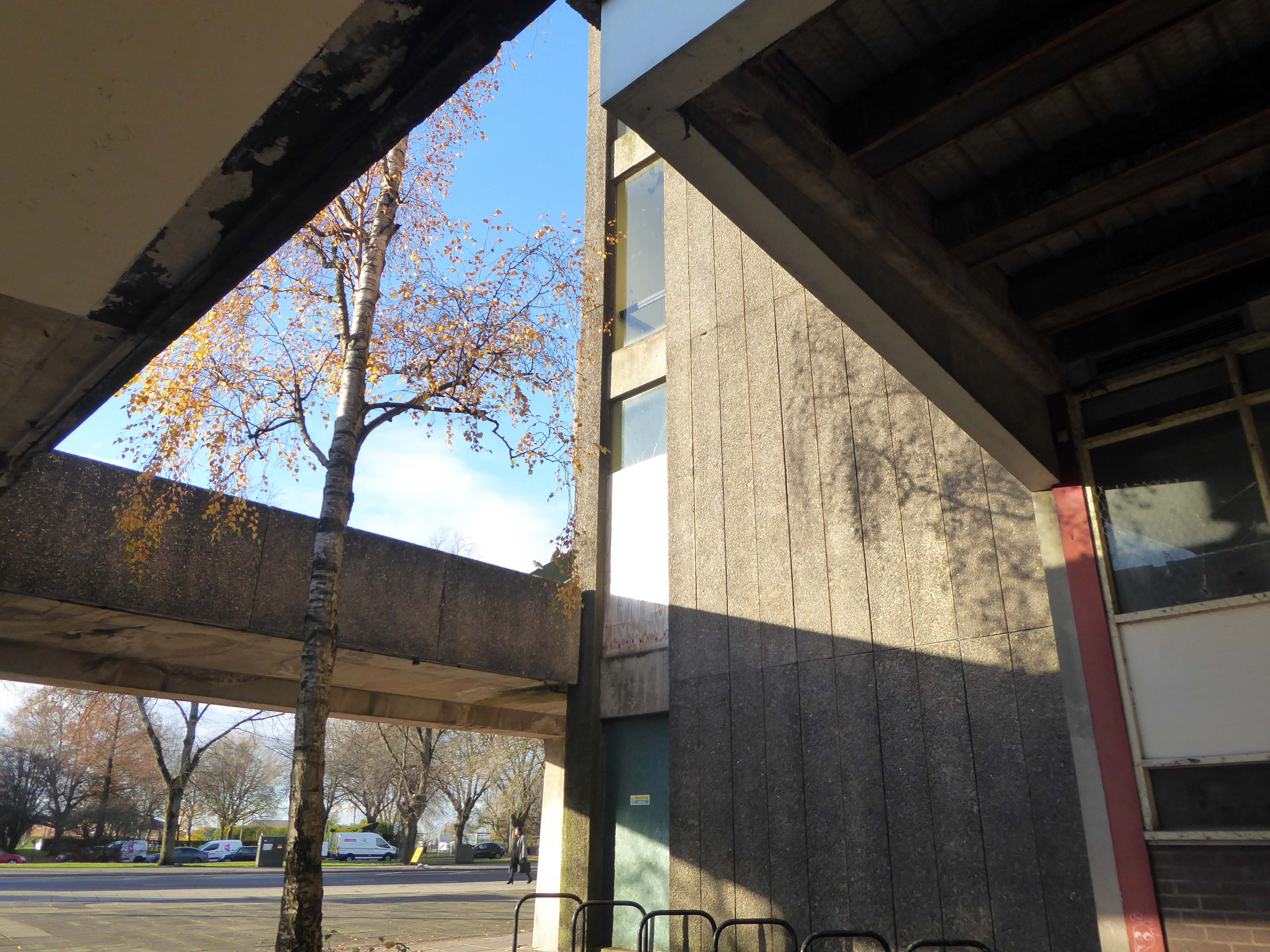
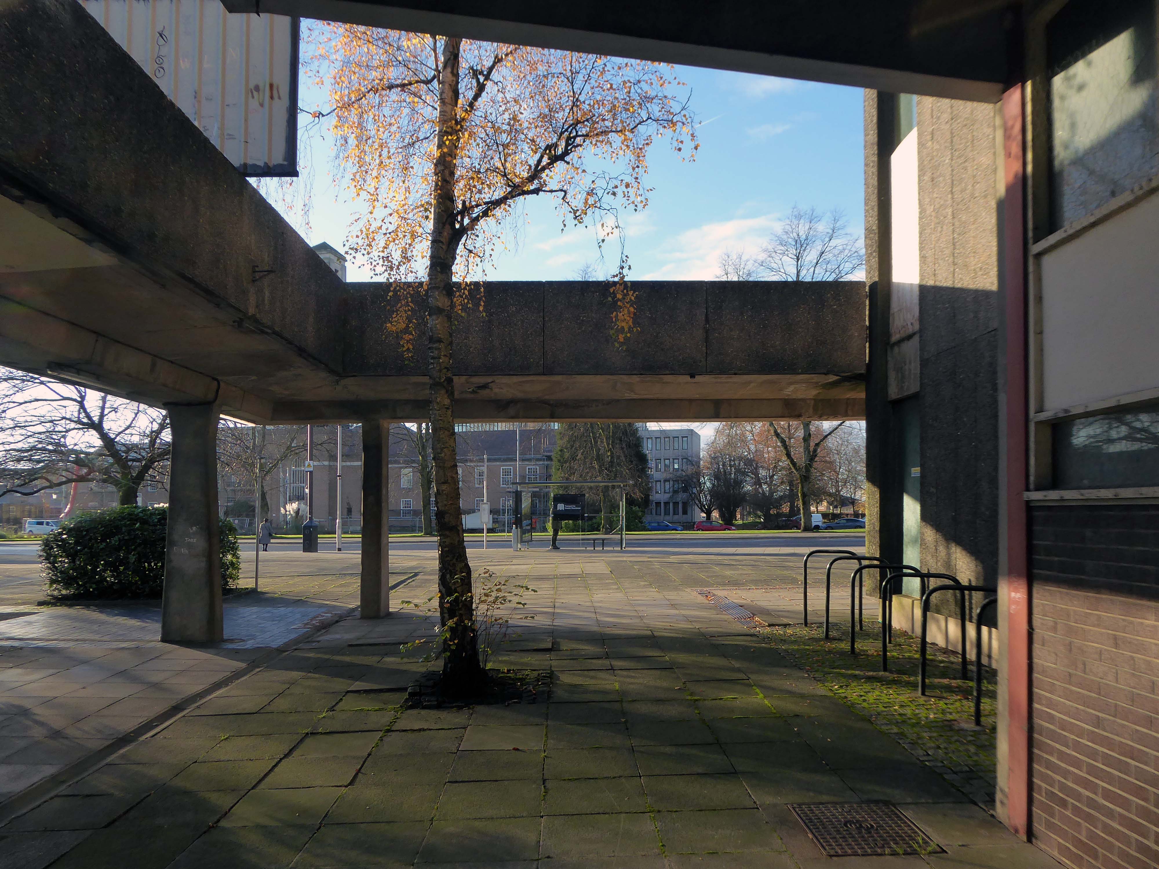
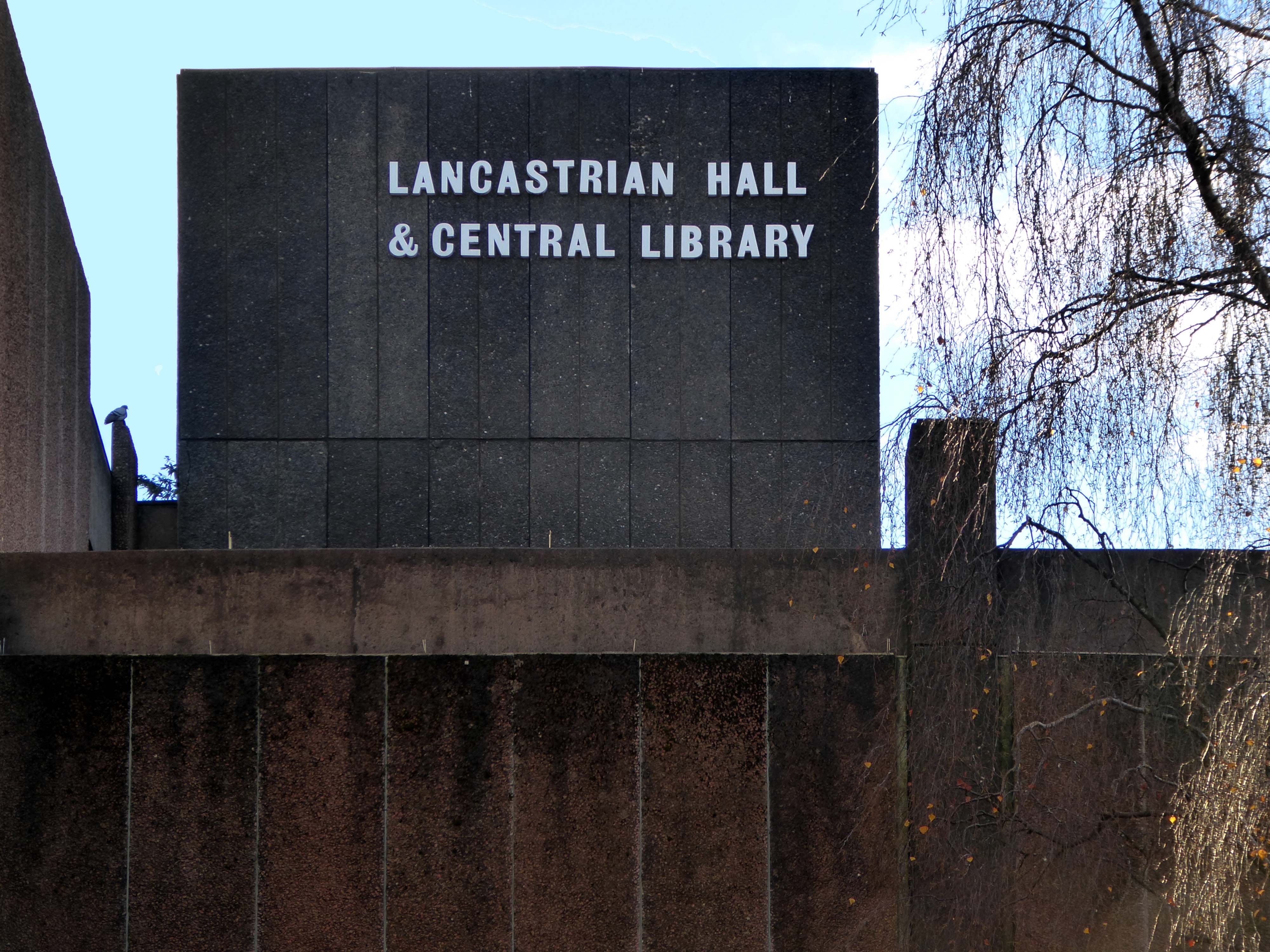
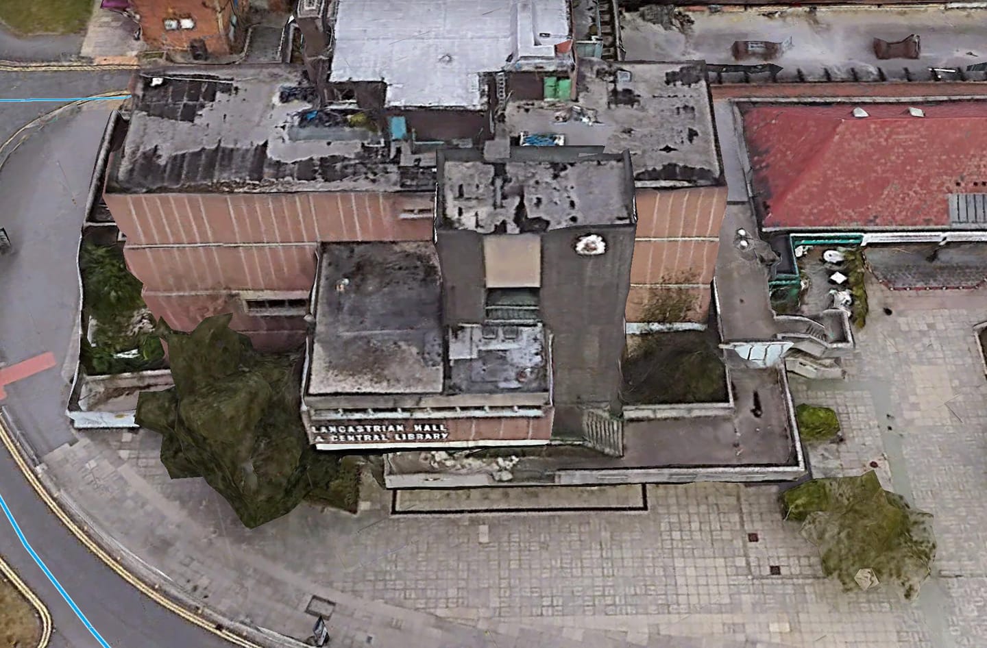
The town centre is dominated by the imposing Lancastrian Hall, opened in 1969, with an adjoining shopping mall.
The hall housed a council library and was used for civic and community meetings, wedding receptions and election counts.
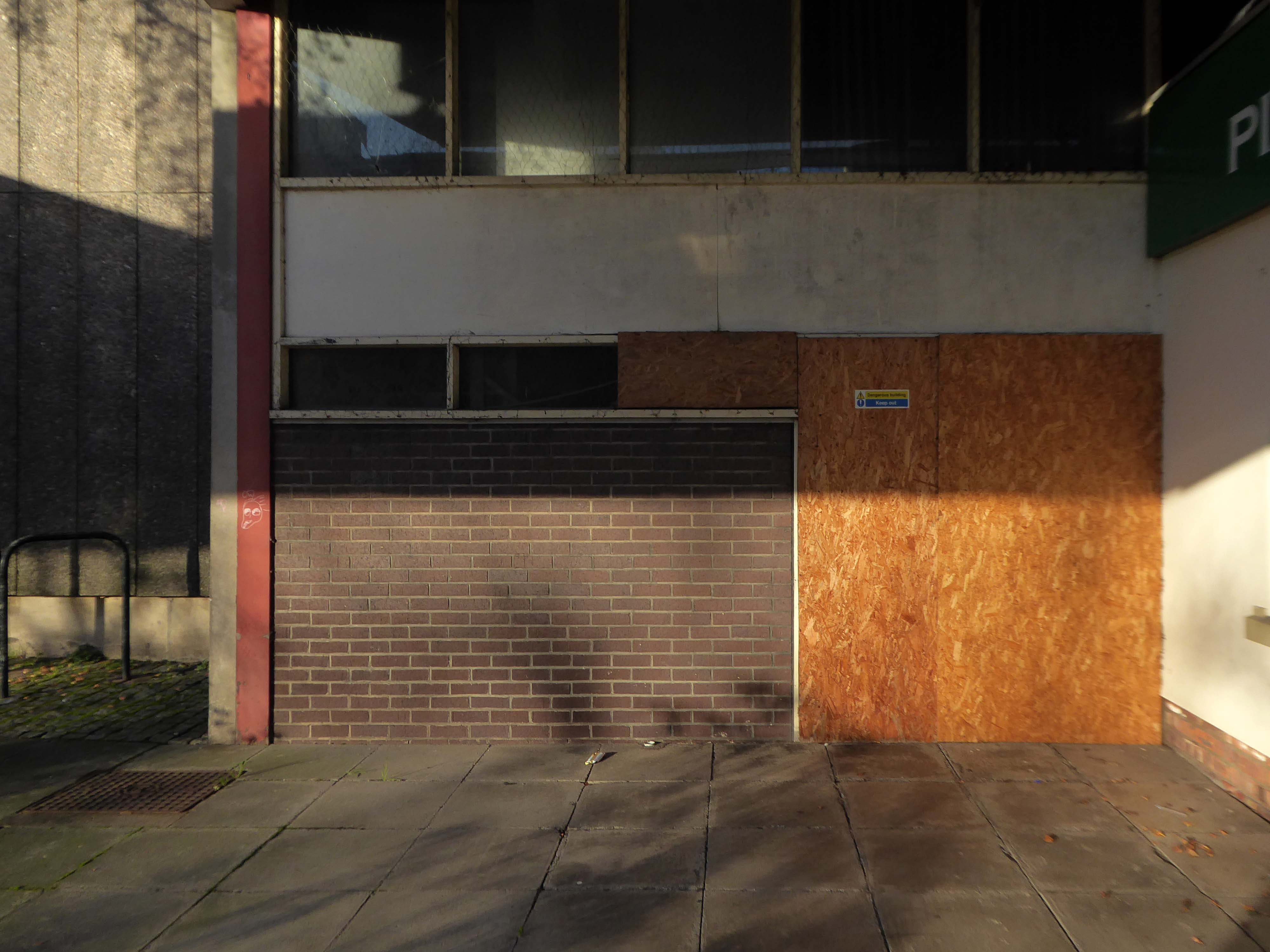
But it has been closed since 2015 after the library moved to the new Gateway Building on the other side of Chorley Road.
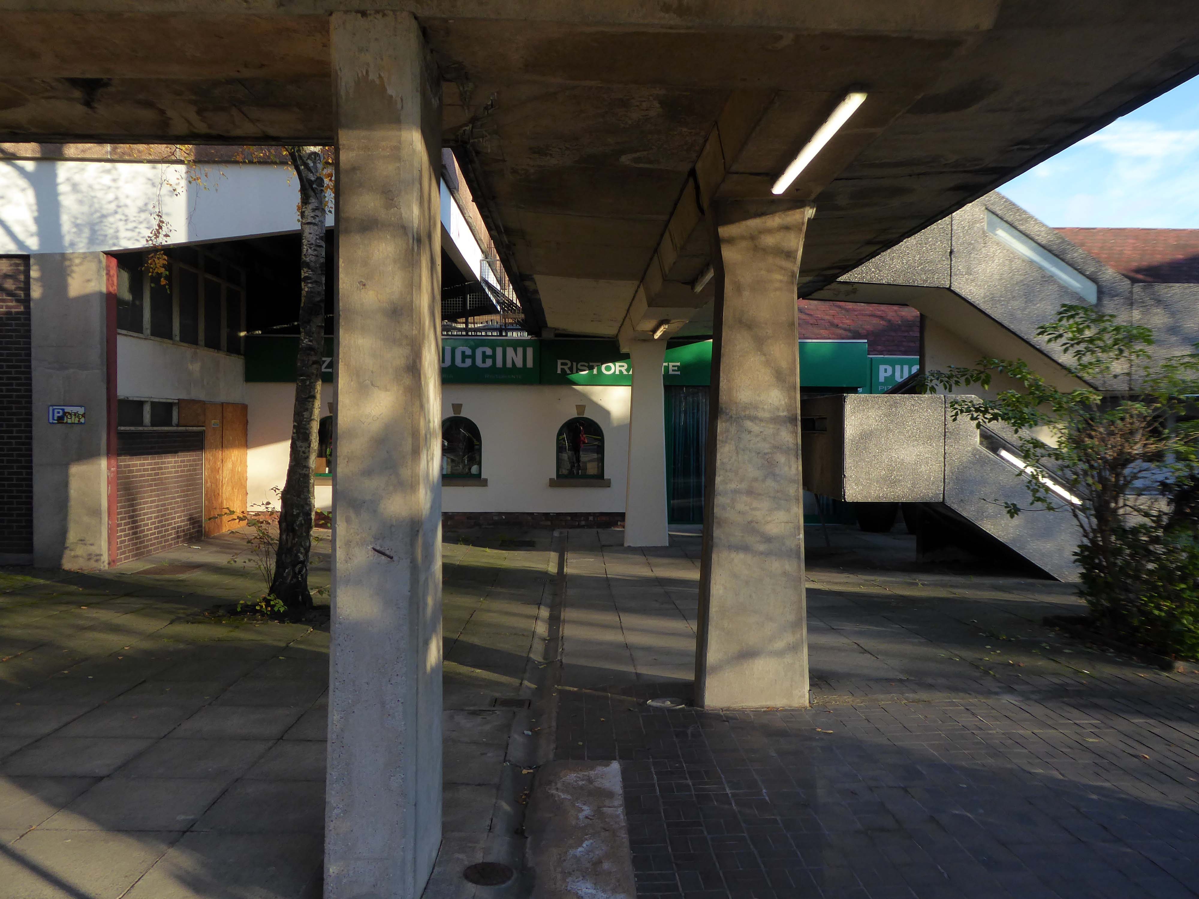
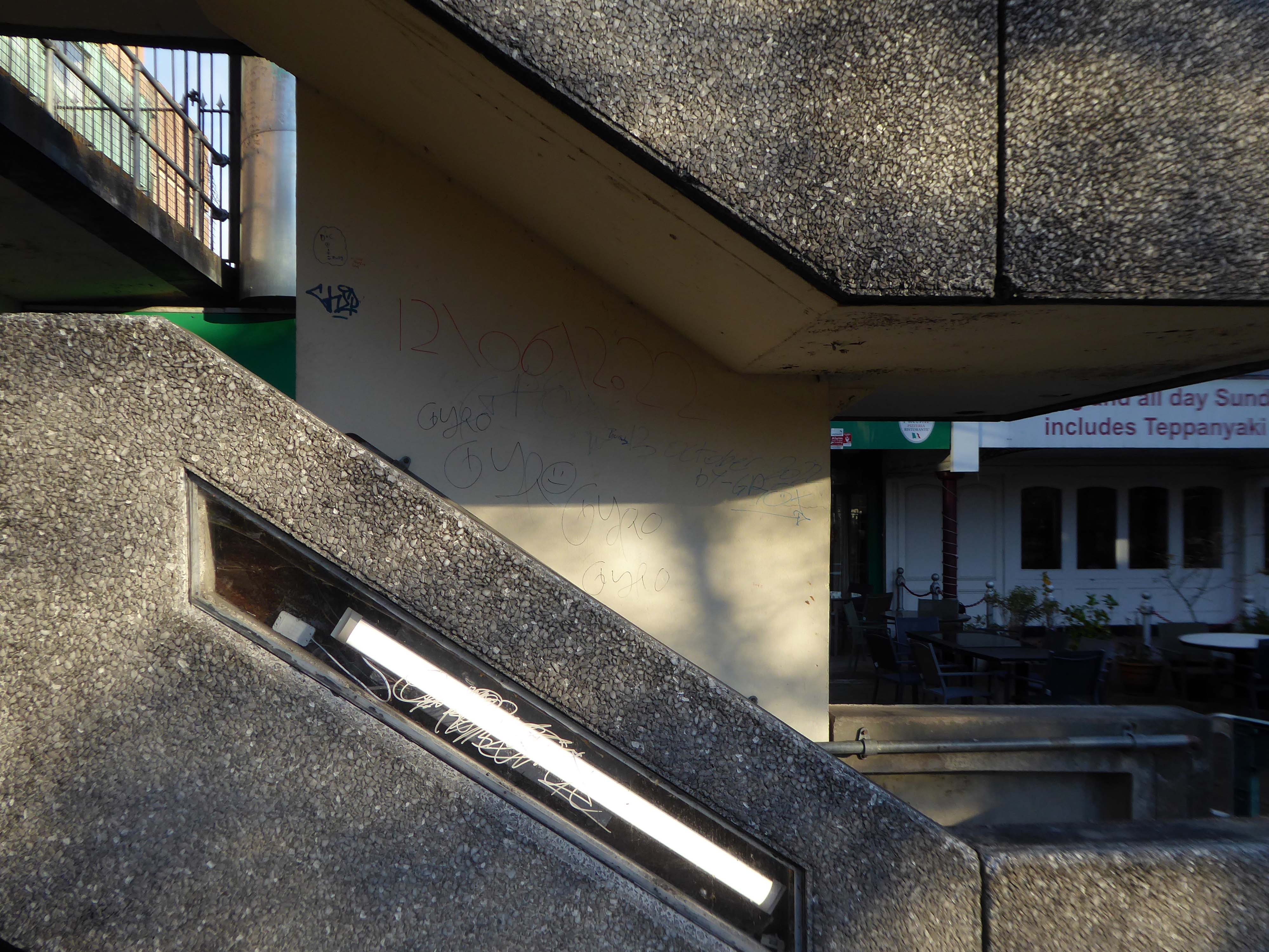
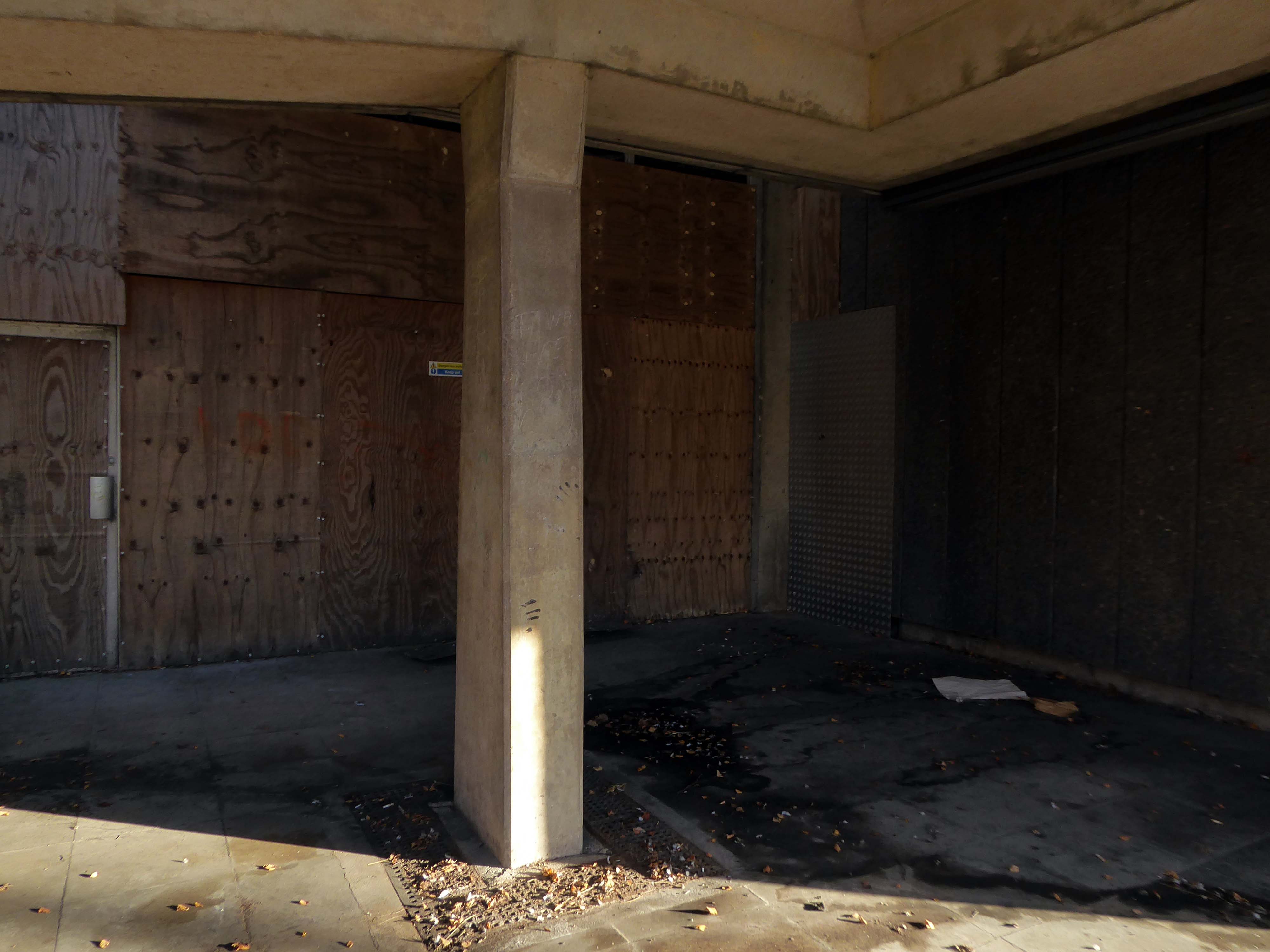
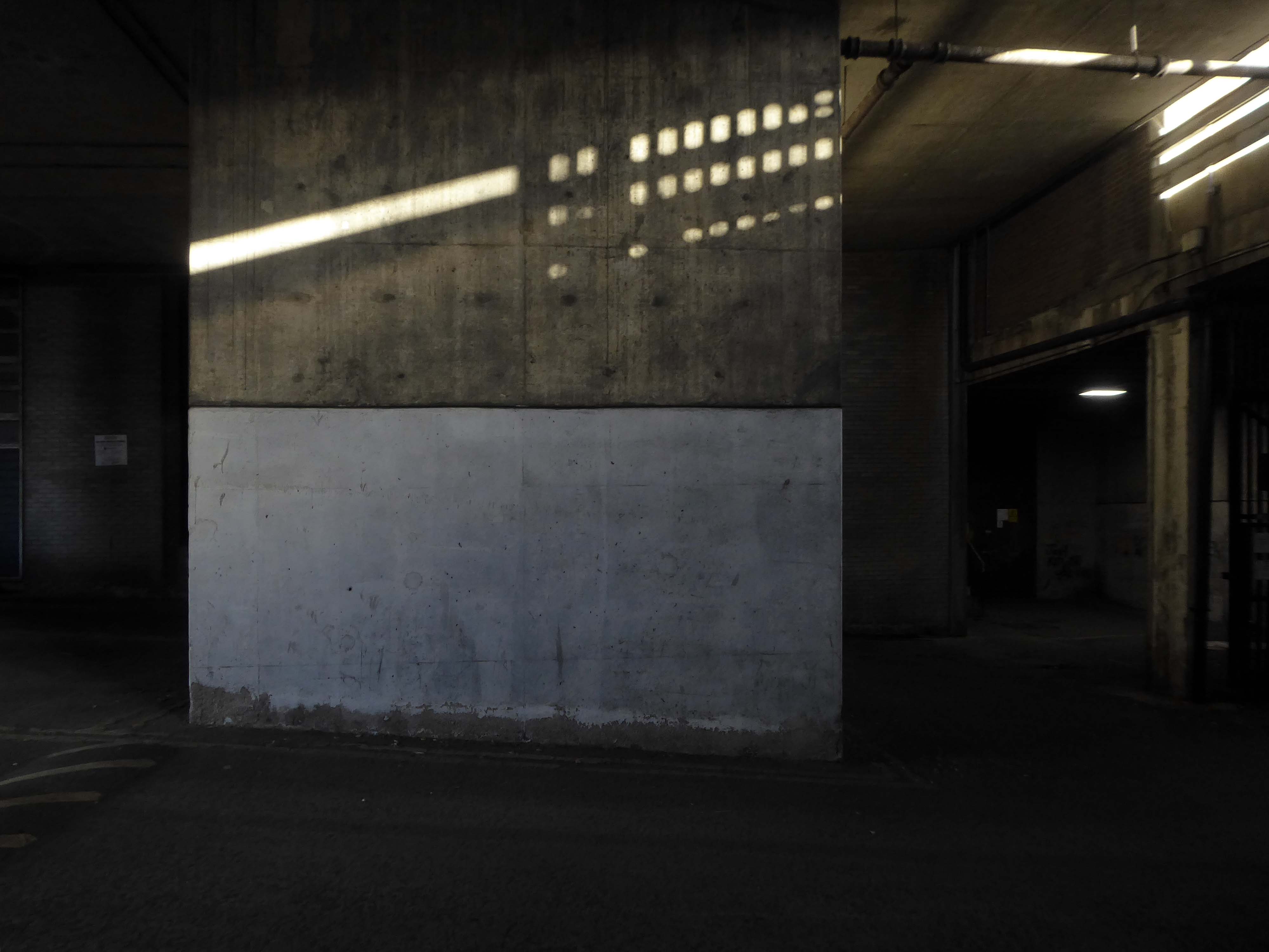
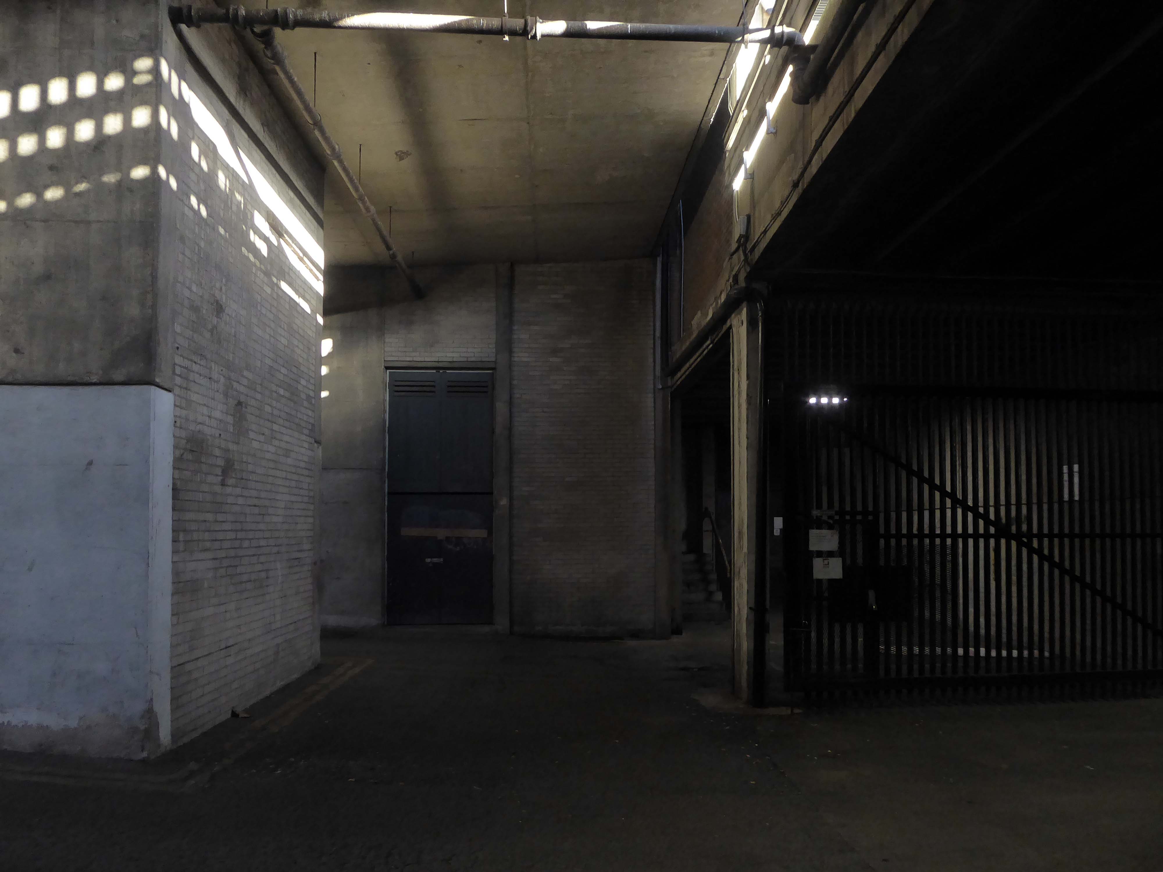
So this magical structure of stairways, undercrofts, elevated walks and majestic concrete clad volumes is under threat.
Swinton and the Lancastrian Hall deserve much better.
Over 550 people took part in the recent visioning work, and we are grateful for their time and valuable contributions.
An overwhelming majority of those who shared their views saw Swinton as a good place to live and bring up a family – somewhere friendly, with a strong sense of community.
People valued their local green spaces, but strongly felt that there needed to be more investment in the town centre, and a plan to tackle empty buildings and shops.
Overall, people felt that Swinton needed to be a more vibrant place, with more going on – and more reasons for people to visit and spend their leisure time there.
This is an opportunity to create tomorrow’s local centre, but that does rely on removing the Lancastrian Hall, rethinking the shopping centre, and repurposing the Civic Centre and the spaces around it.
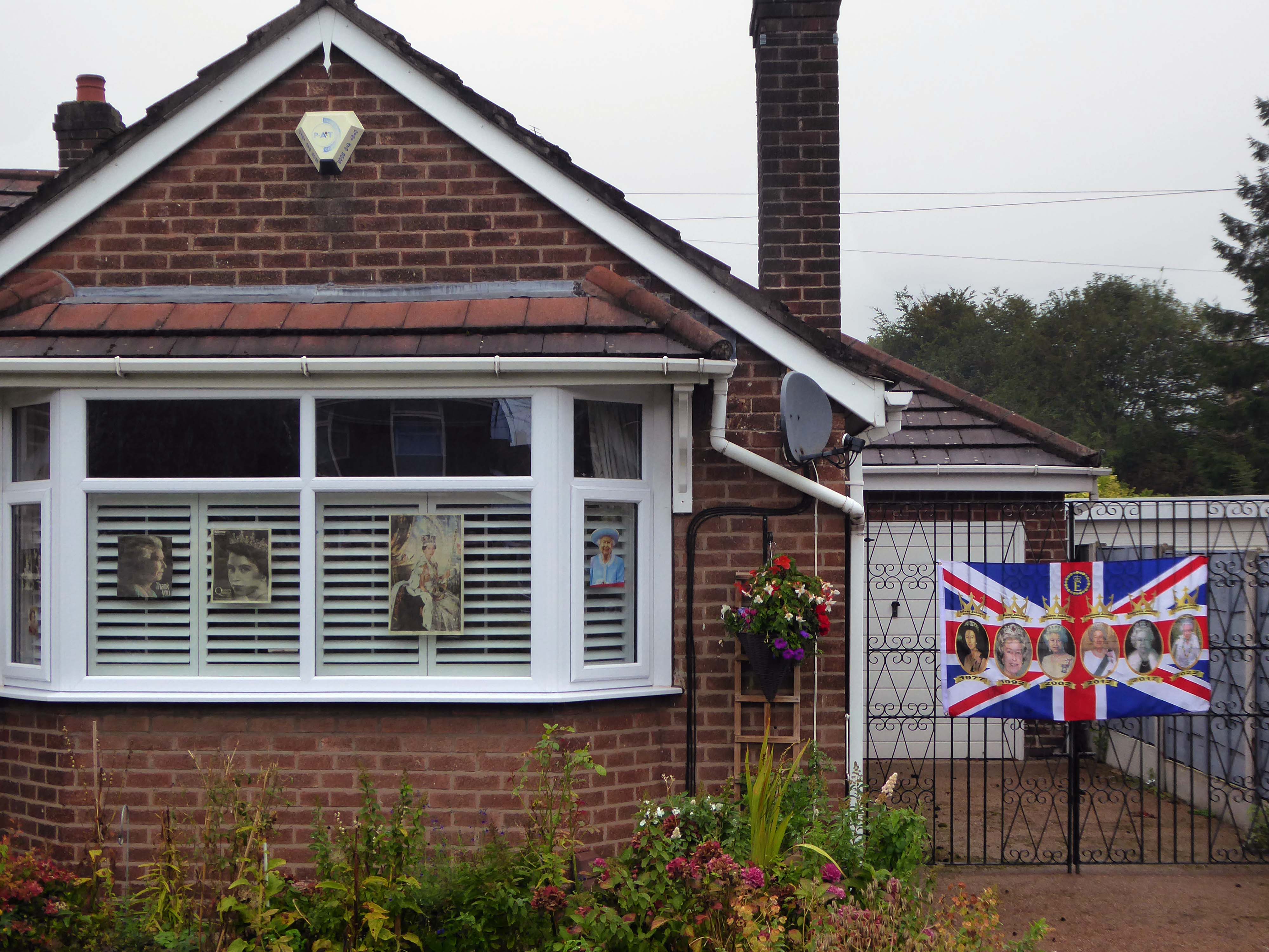
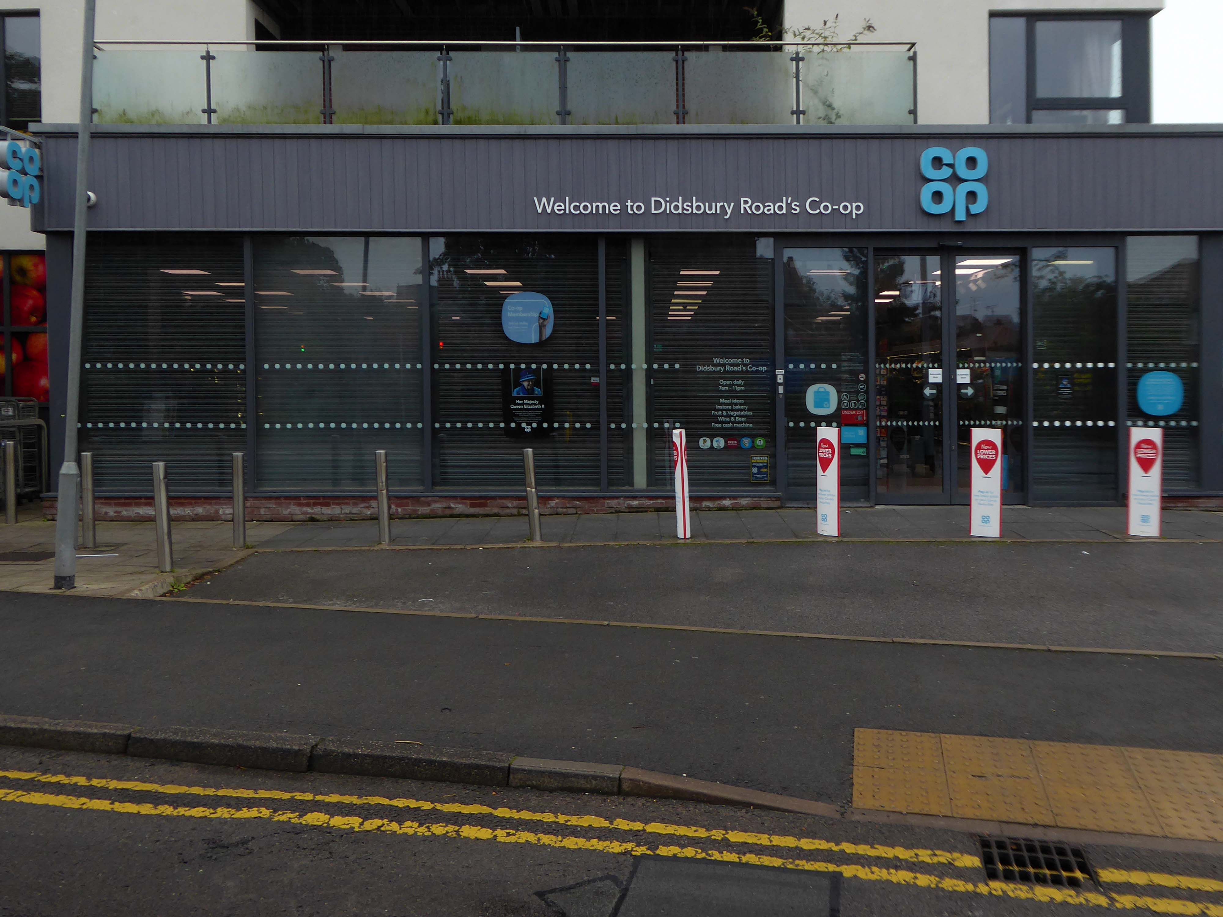
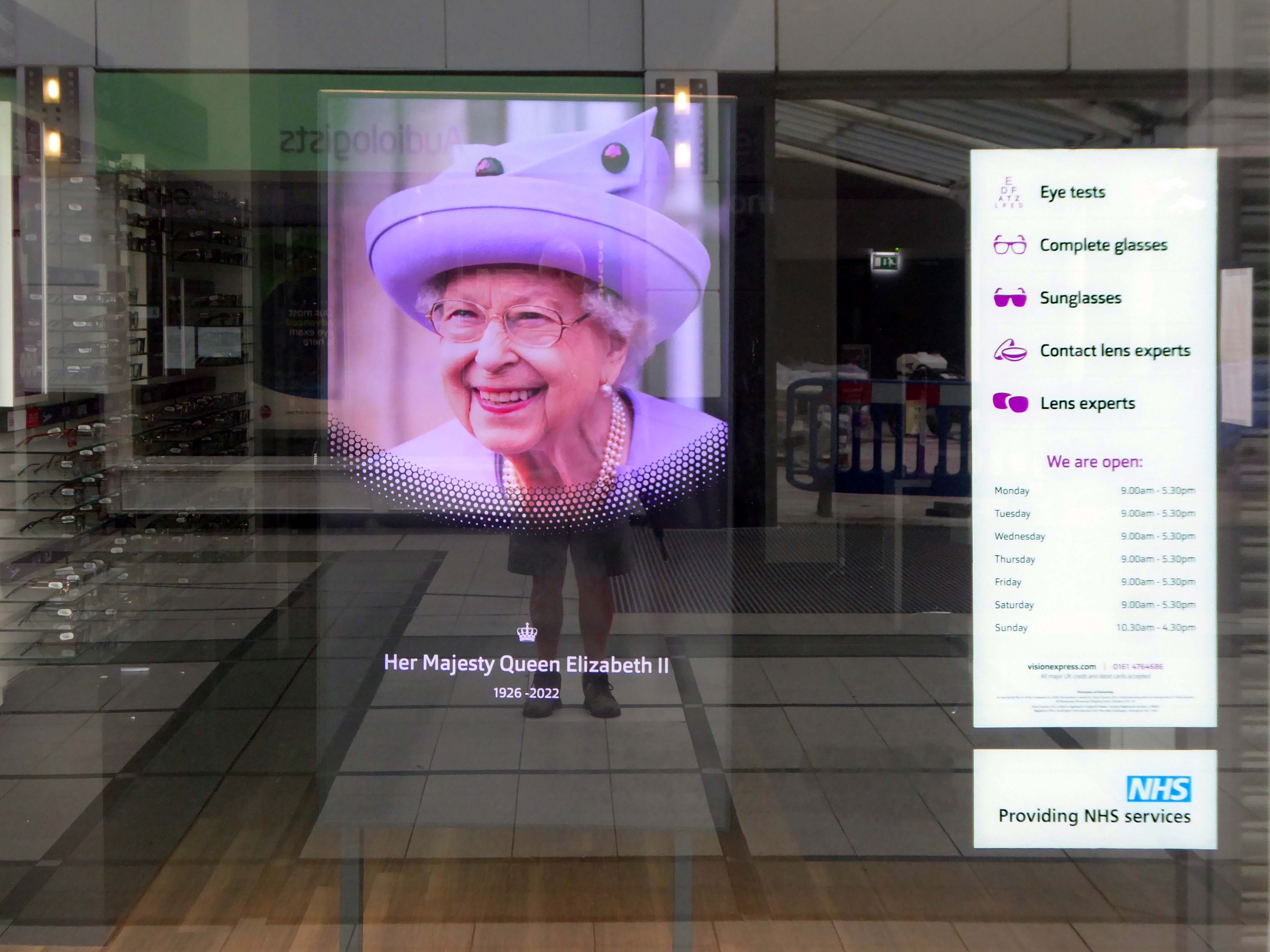
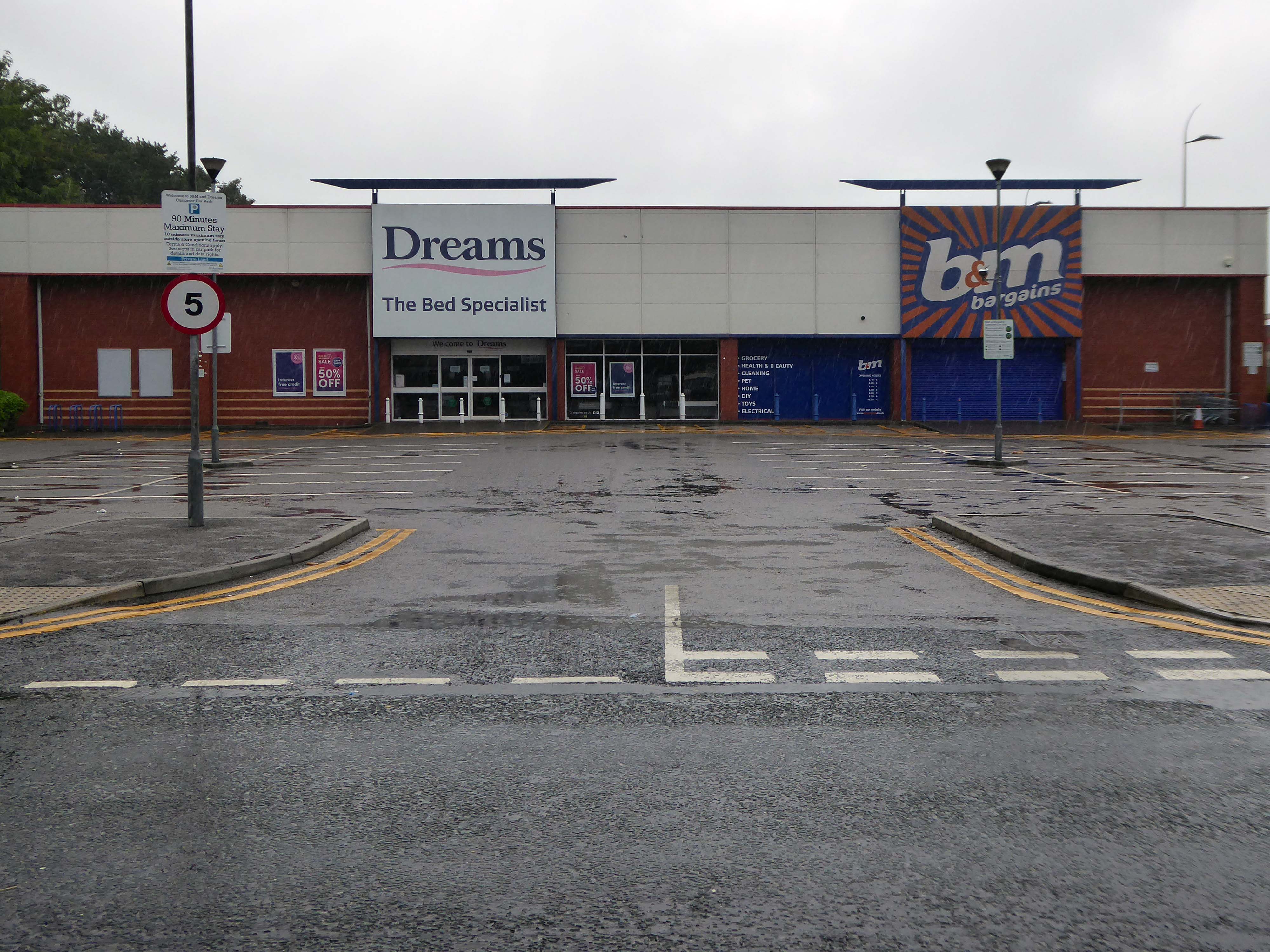
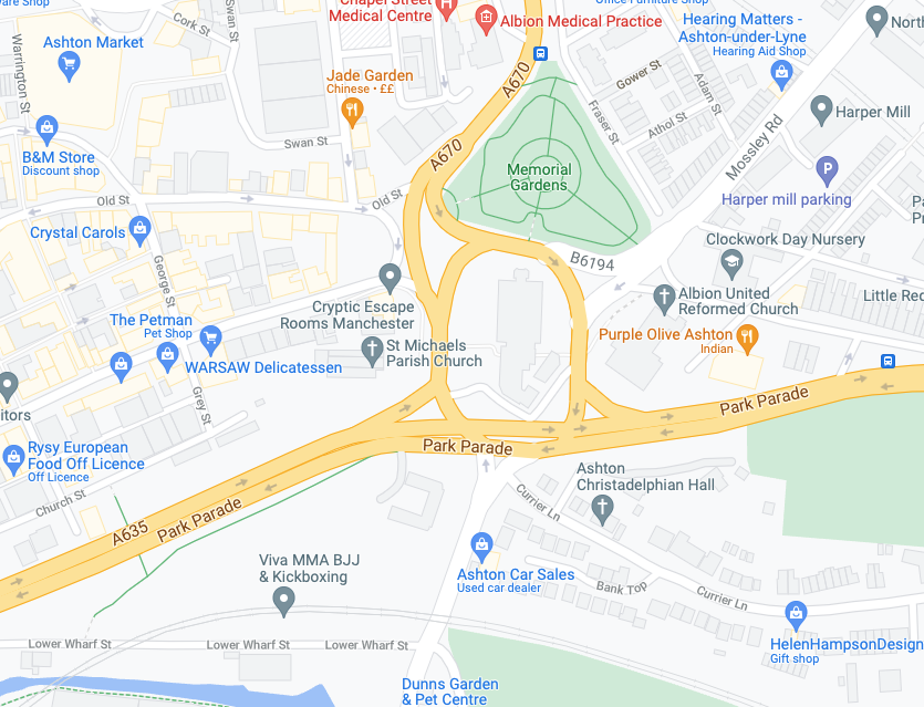
On the day of HM Queen Elizabeth II’s Diamond Jubilee, I cycled around Ashton under Lyne in search of landmarks of her sixty year reign.
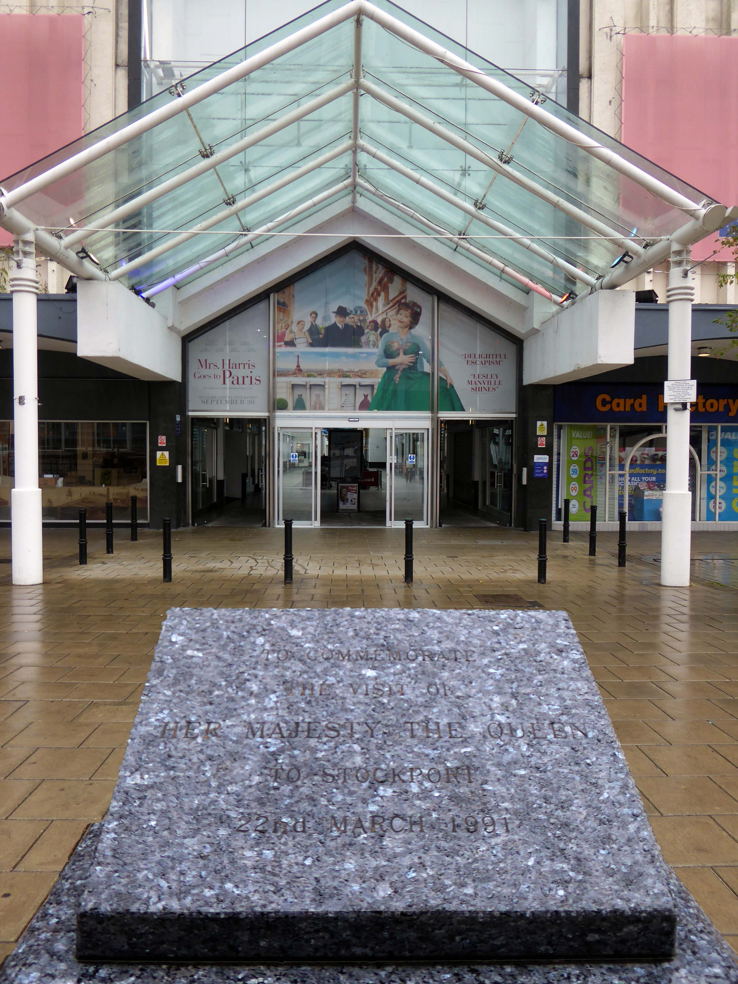
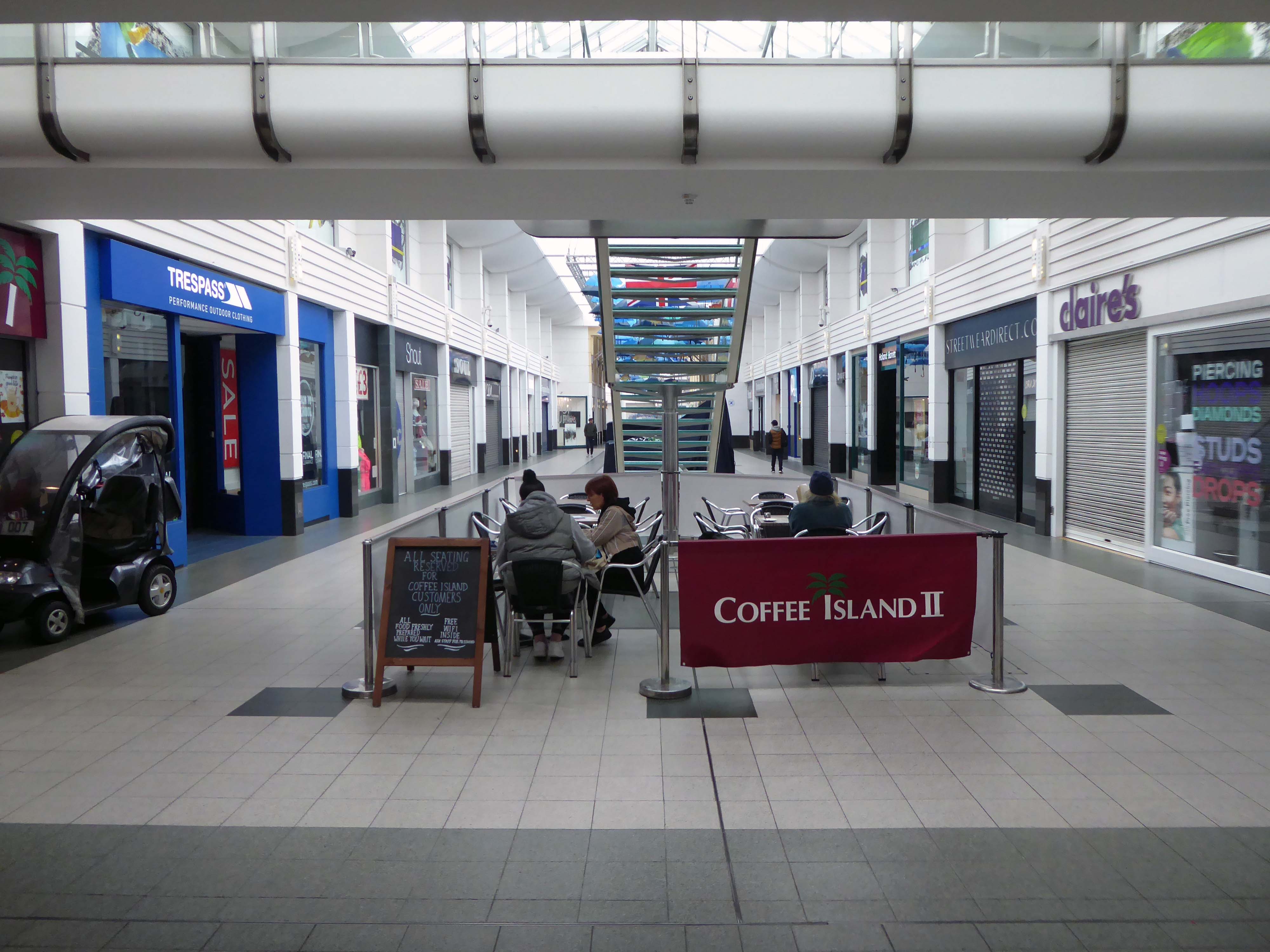
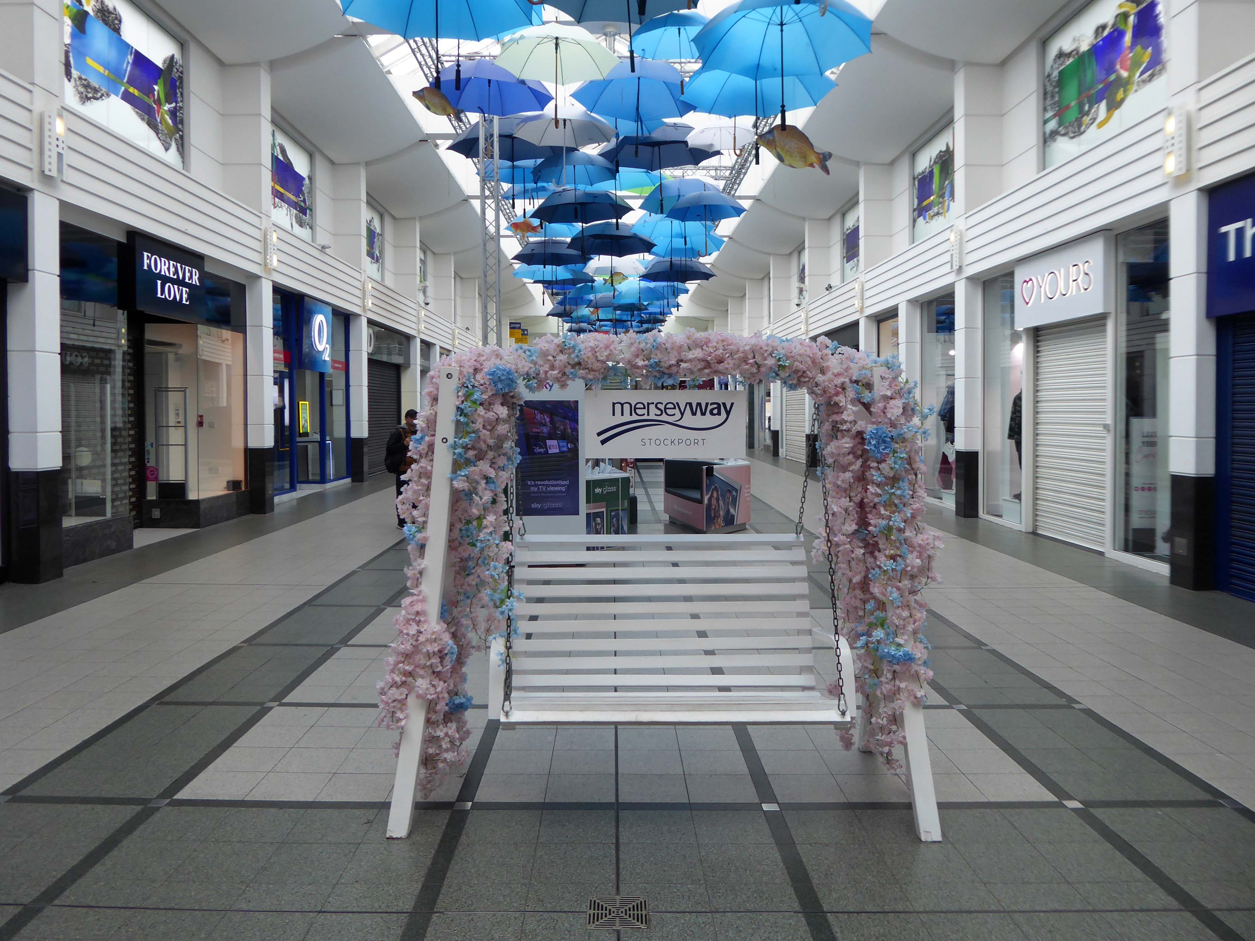
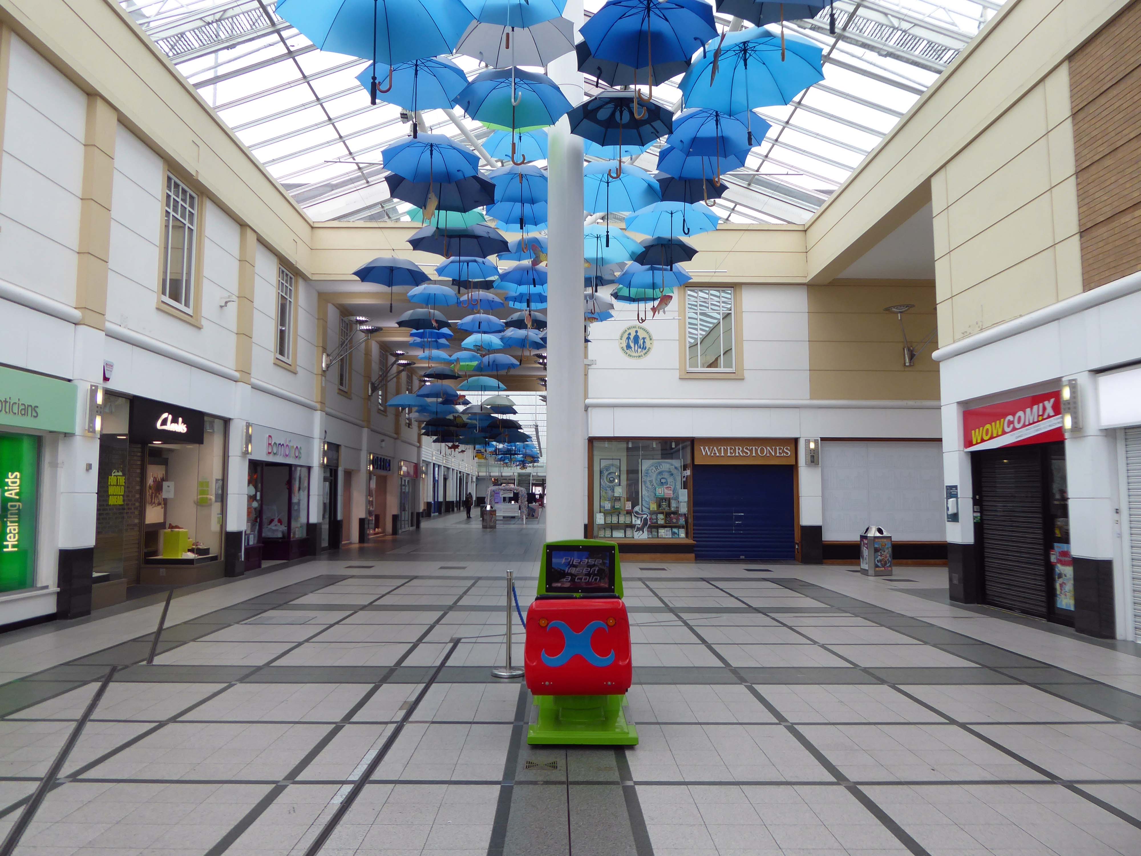
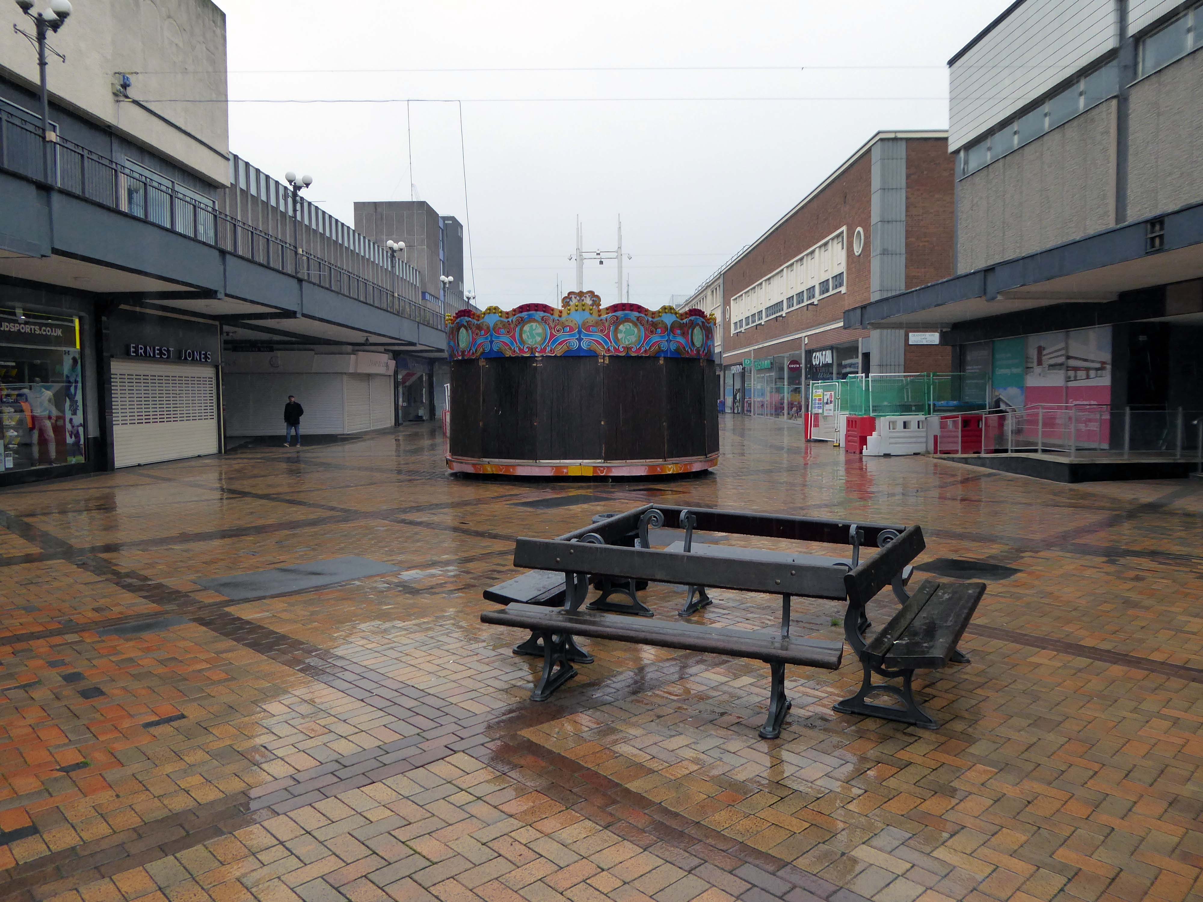
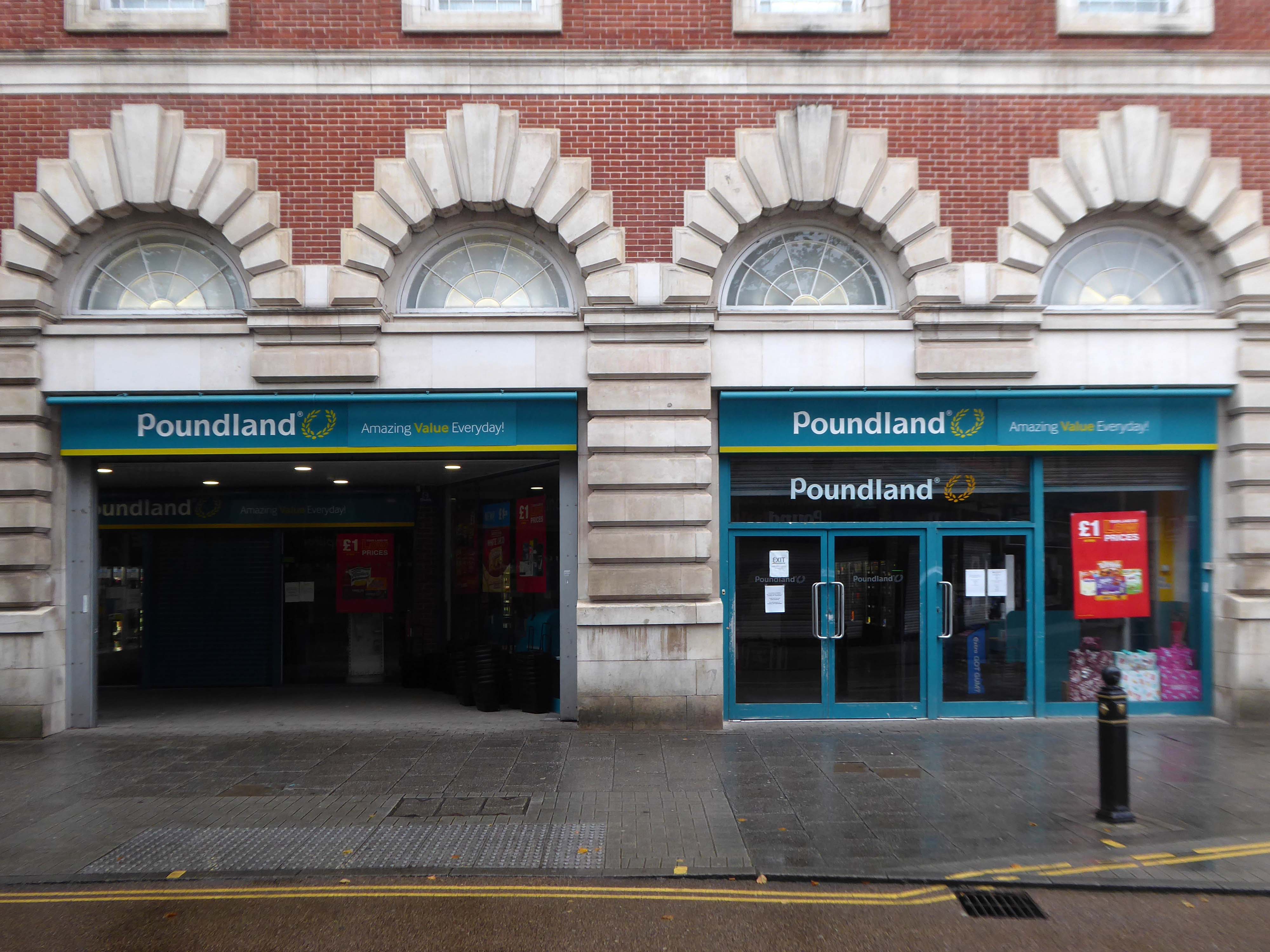
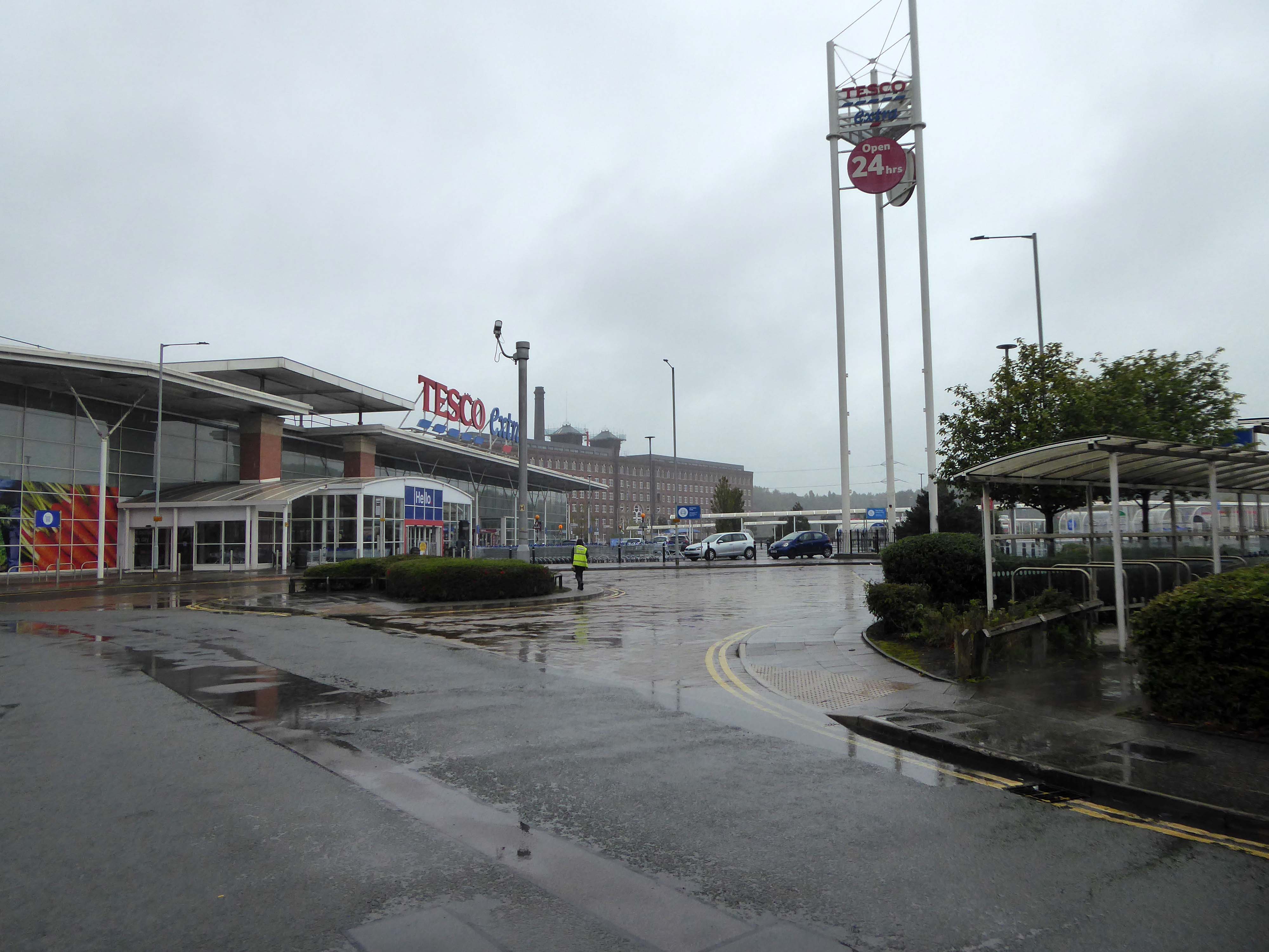
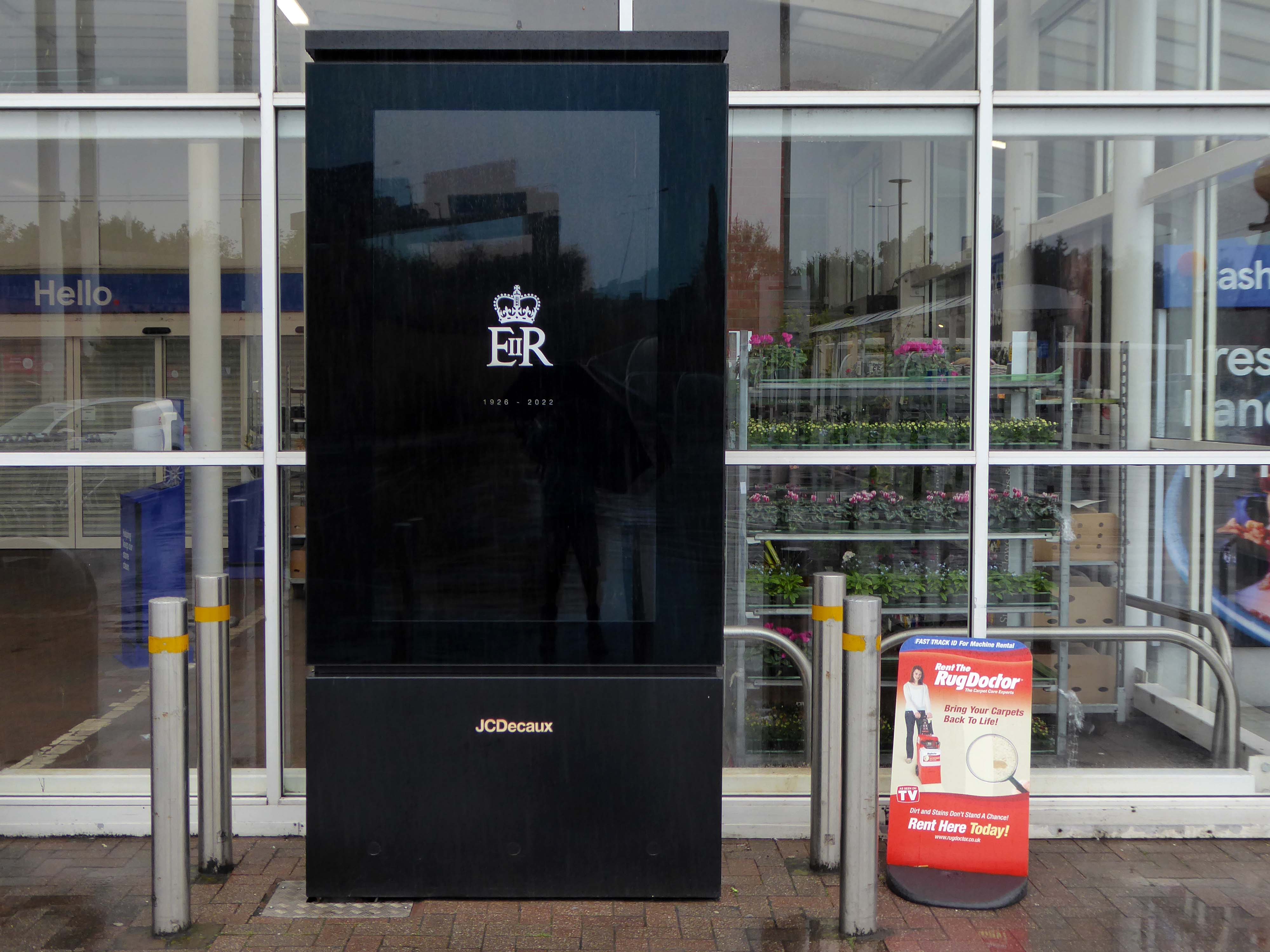
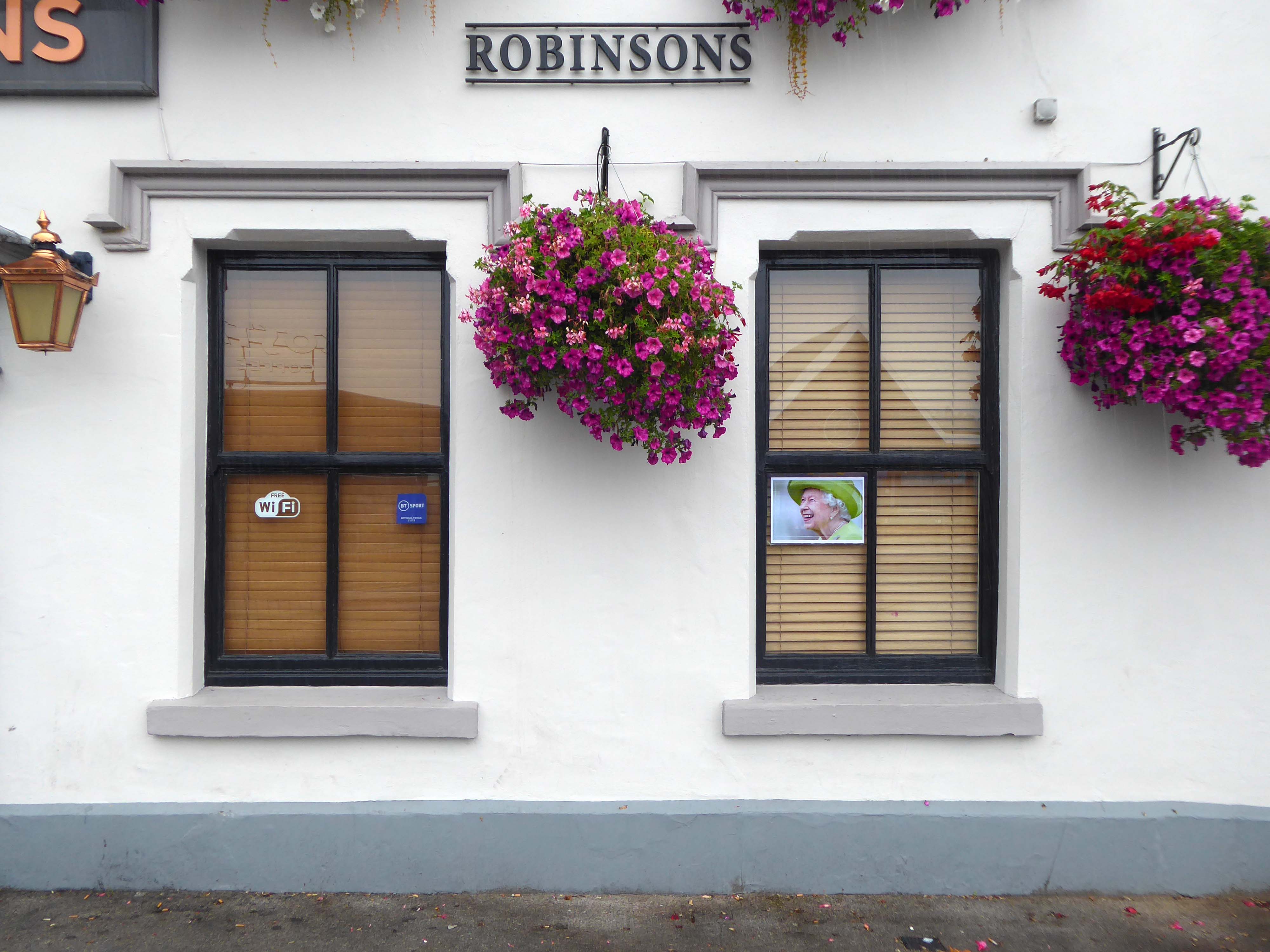
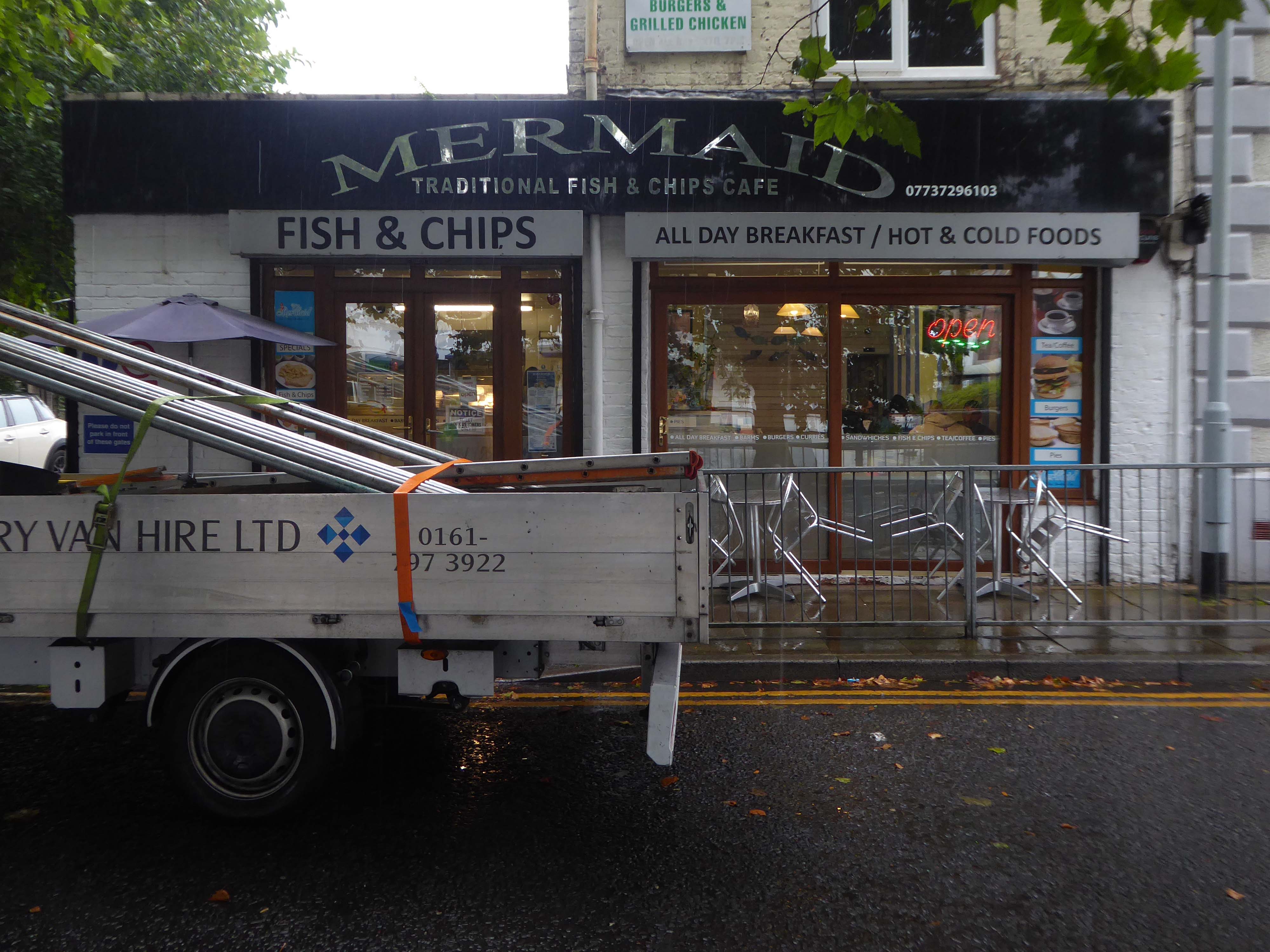
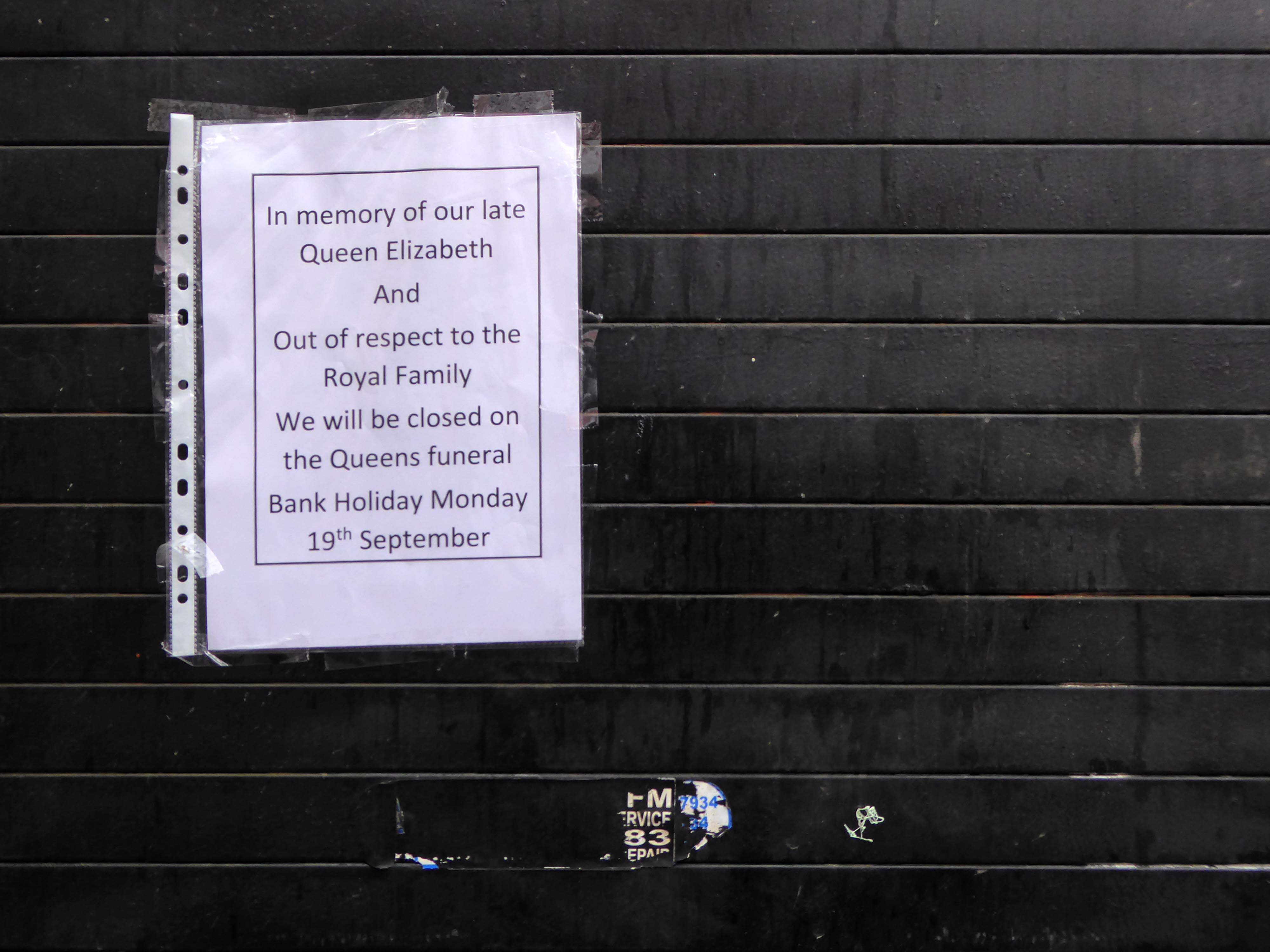
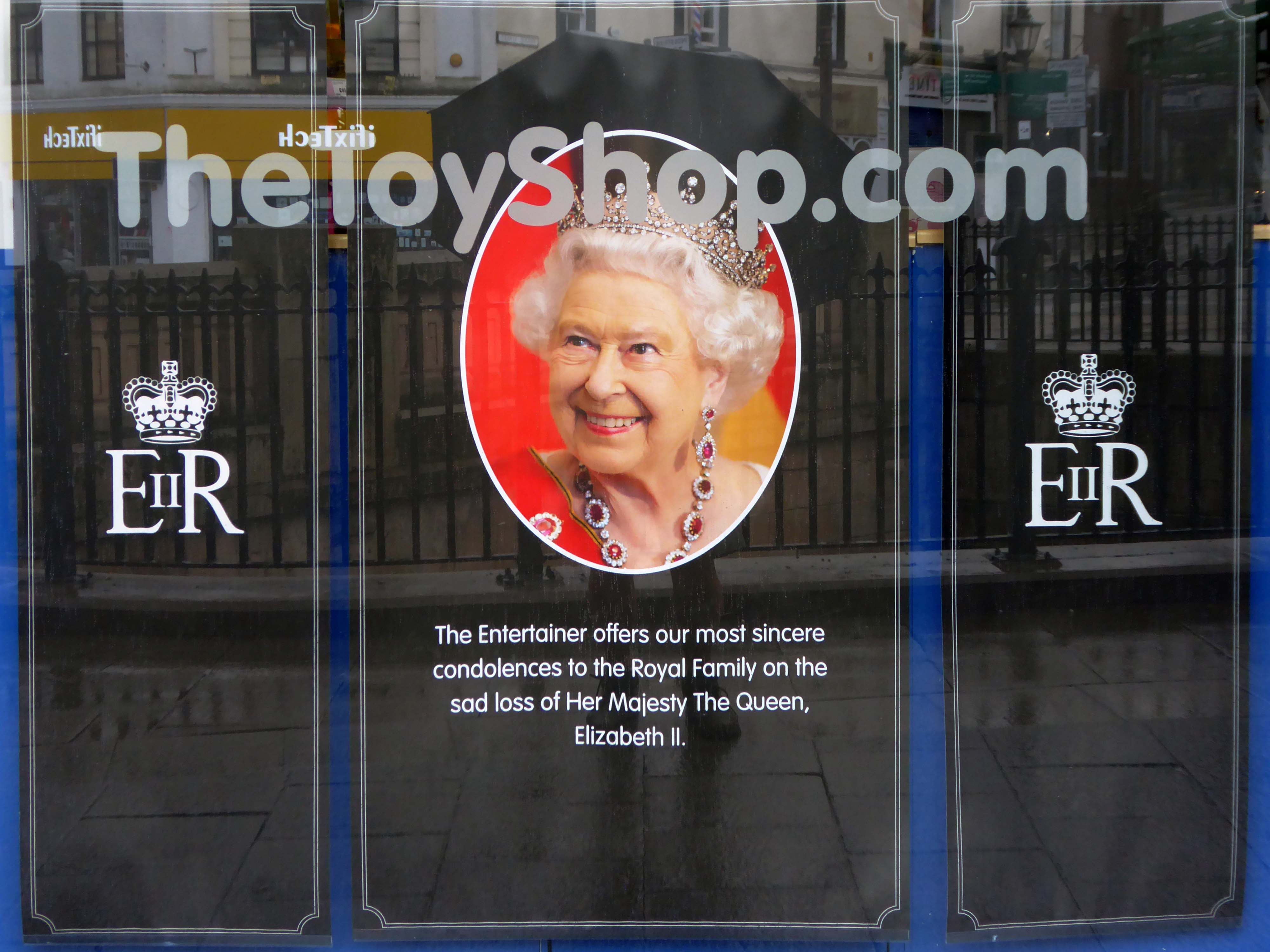
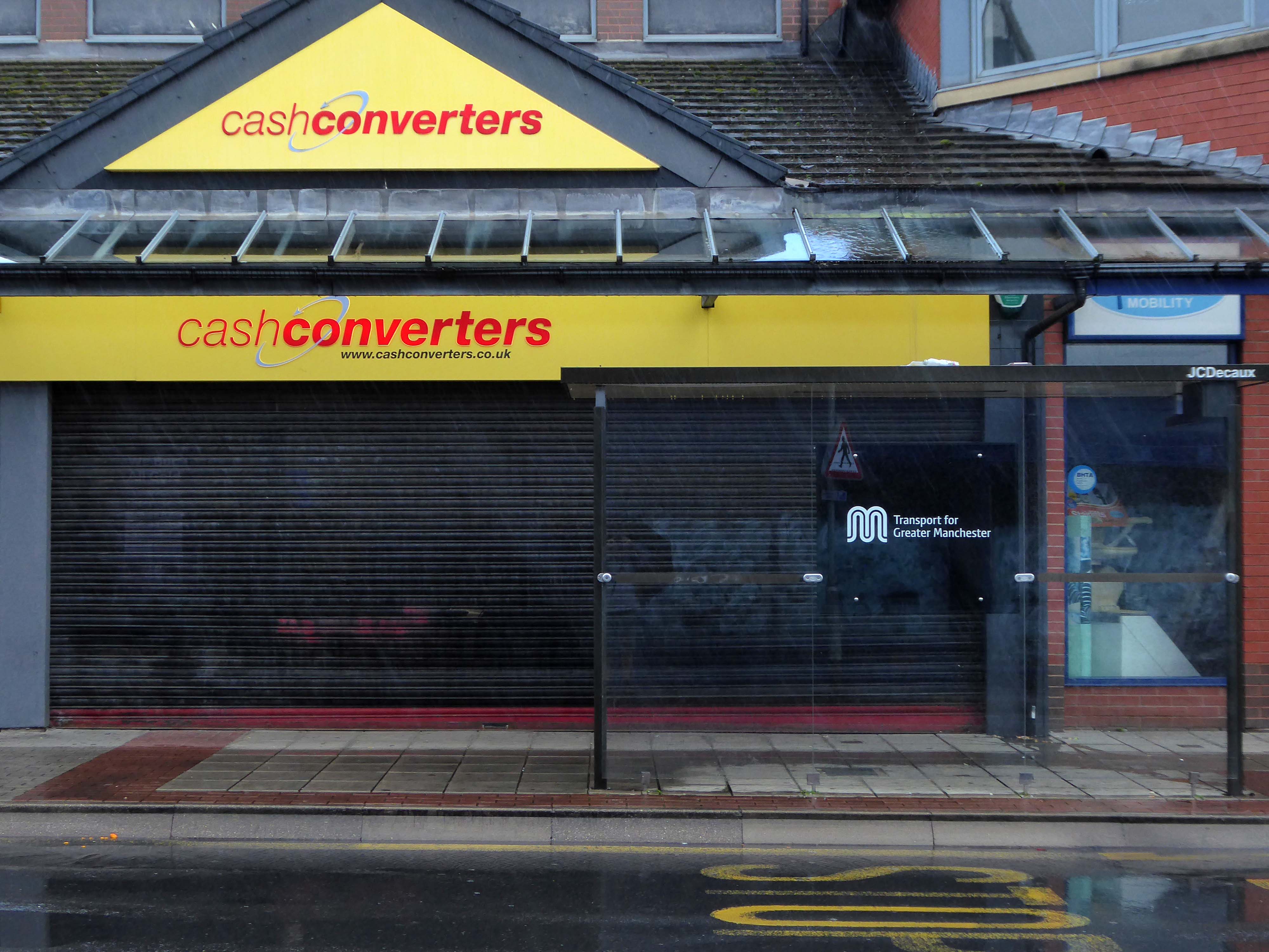
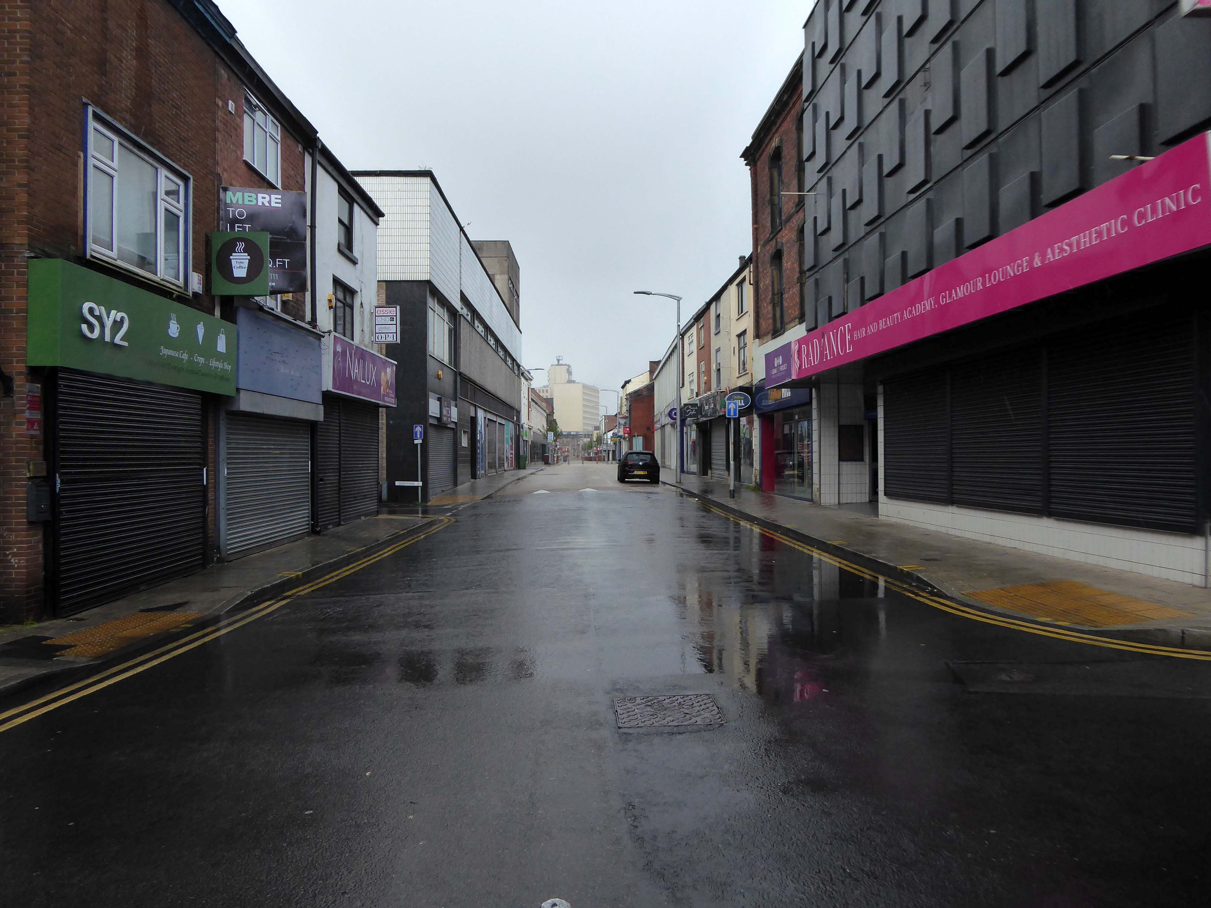
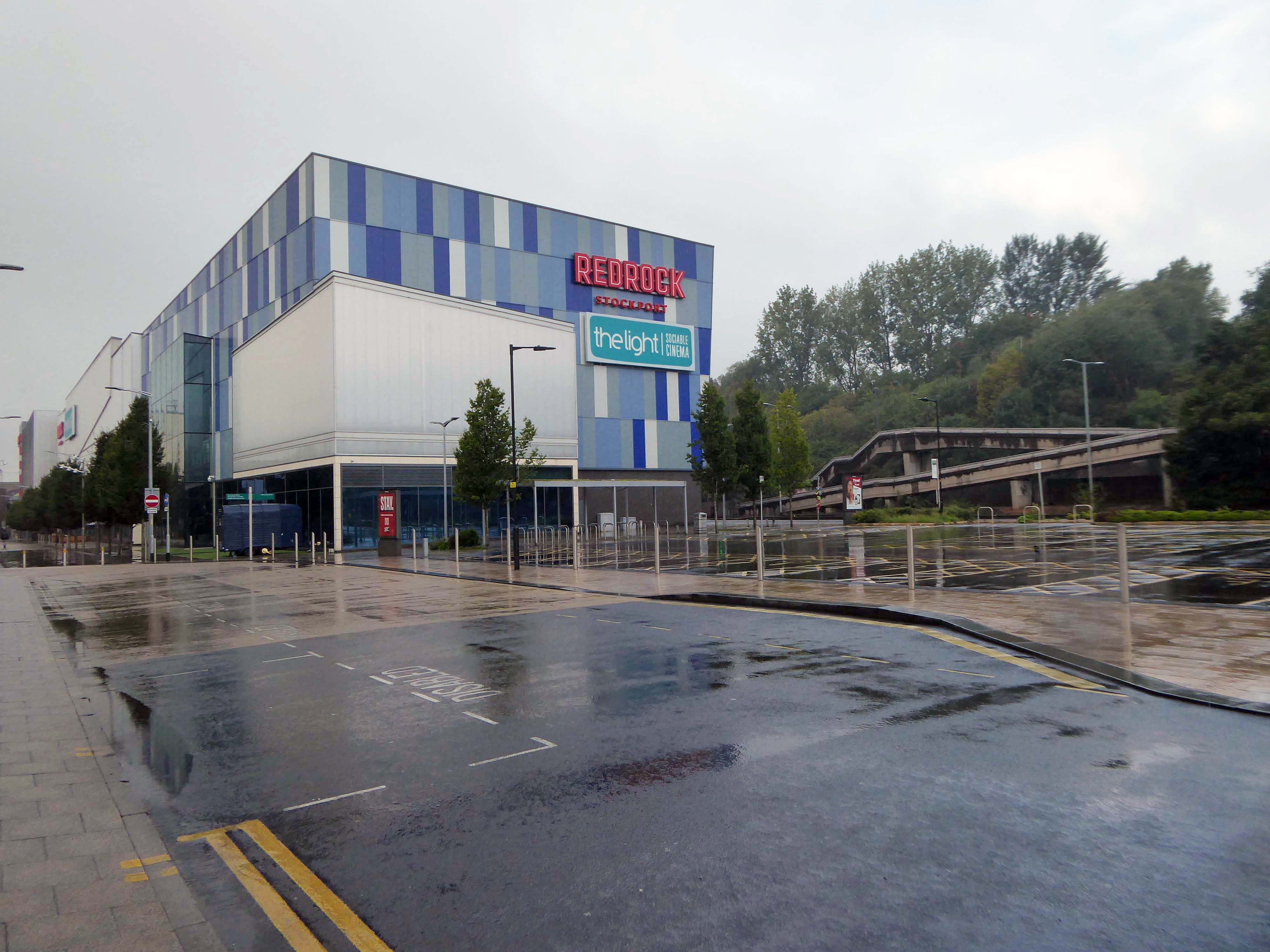
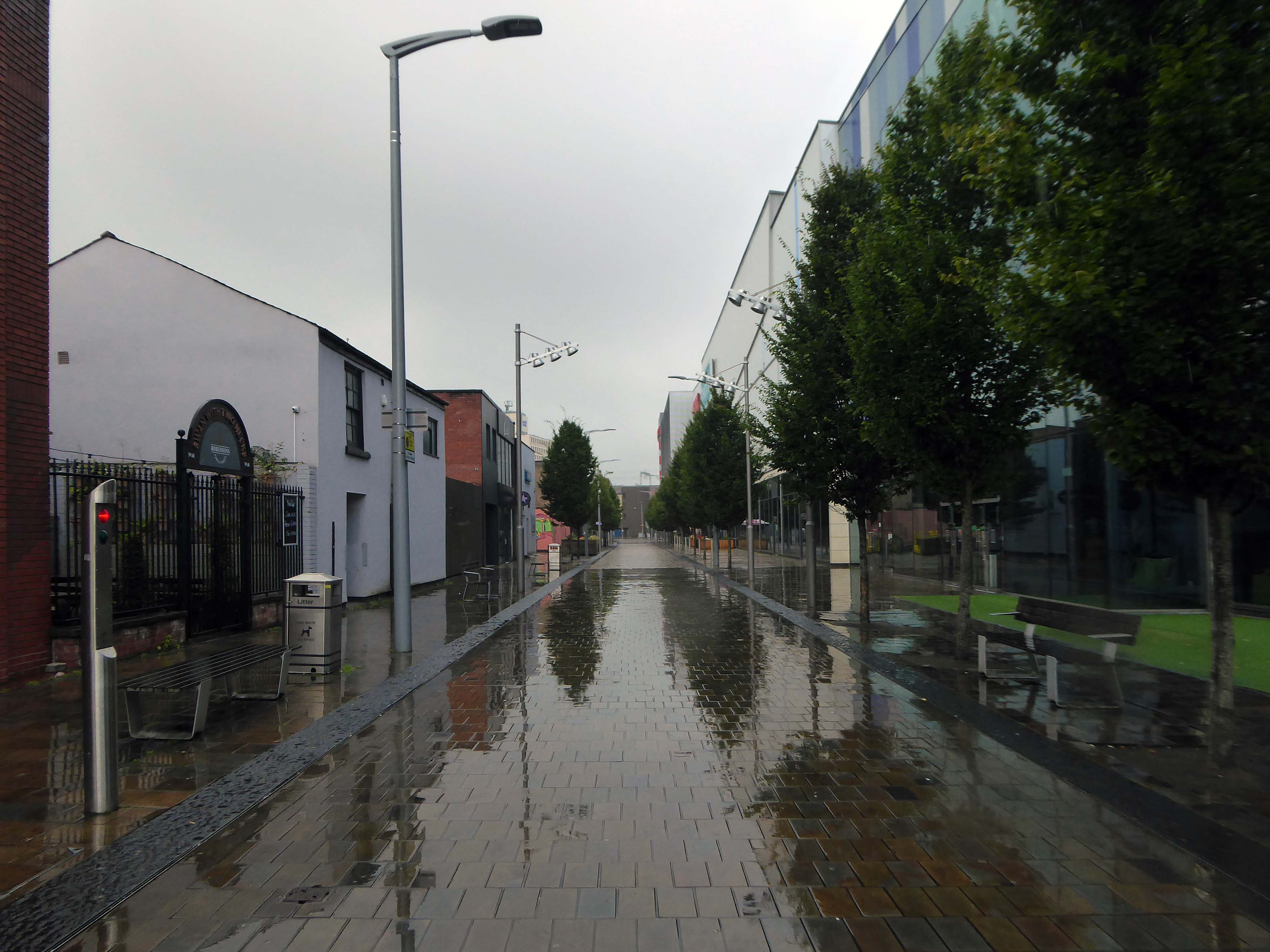
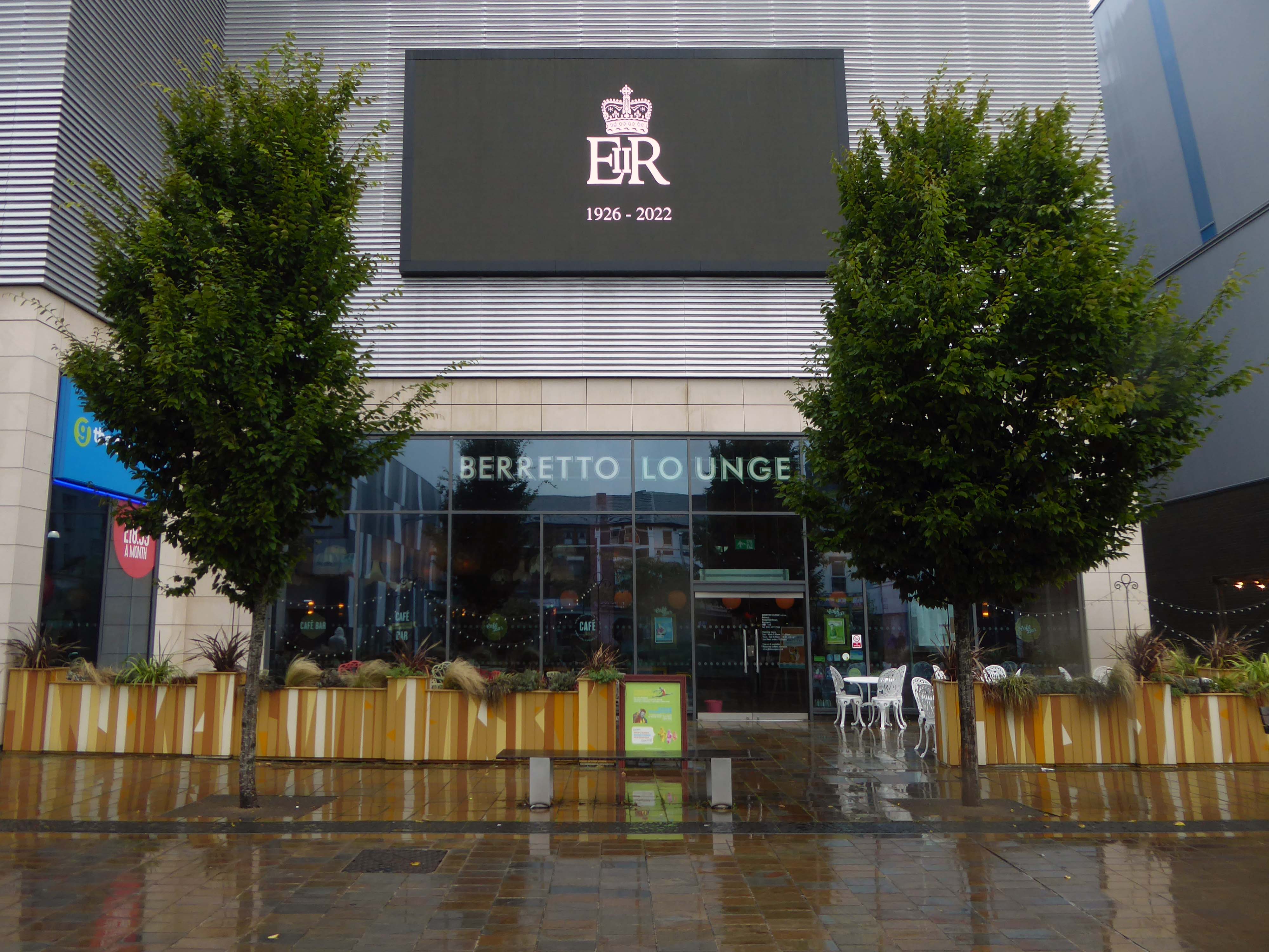
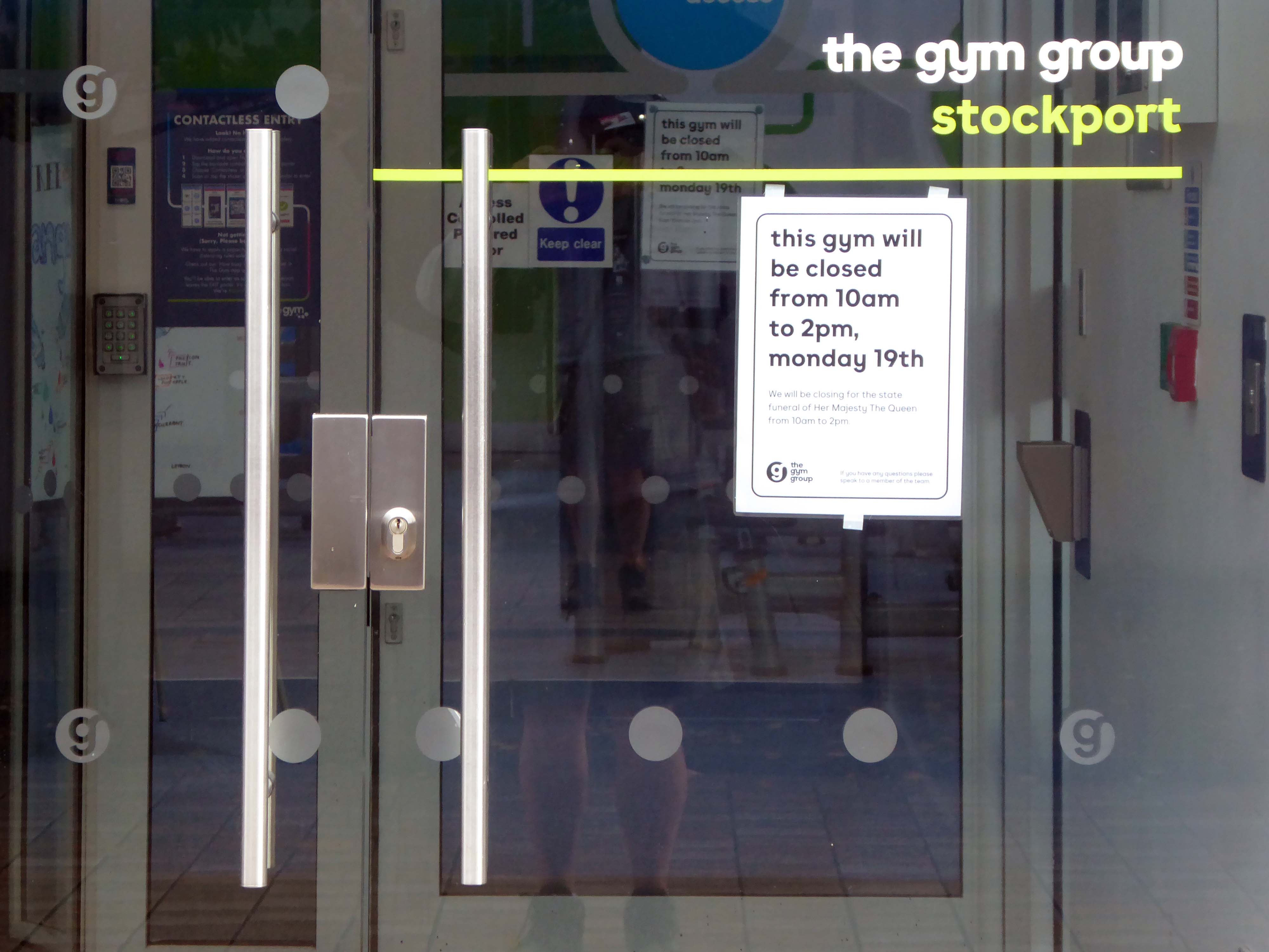
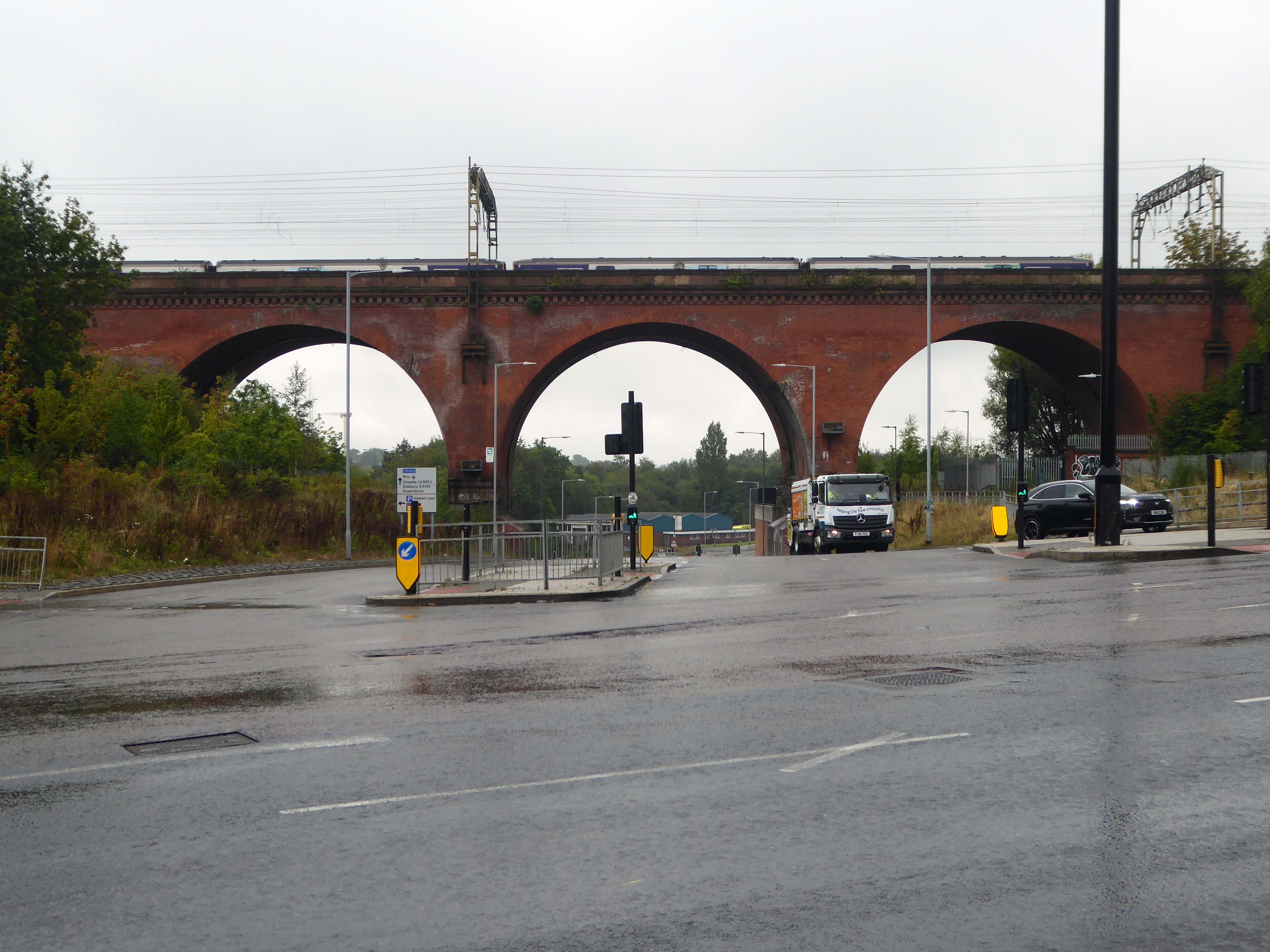
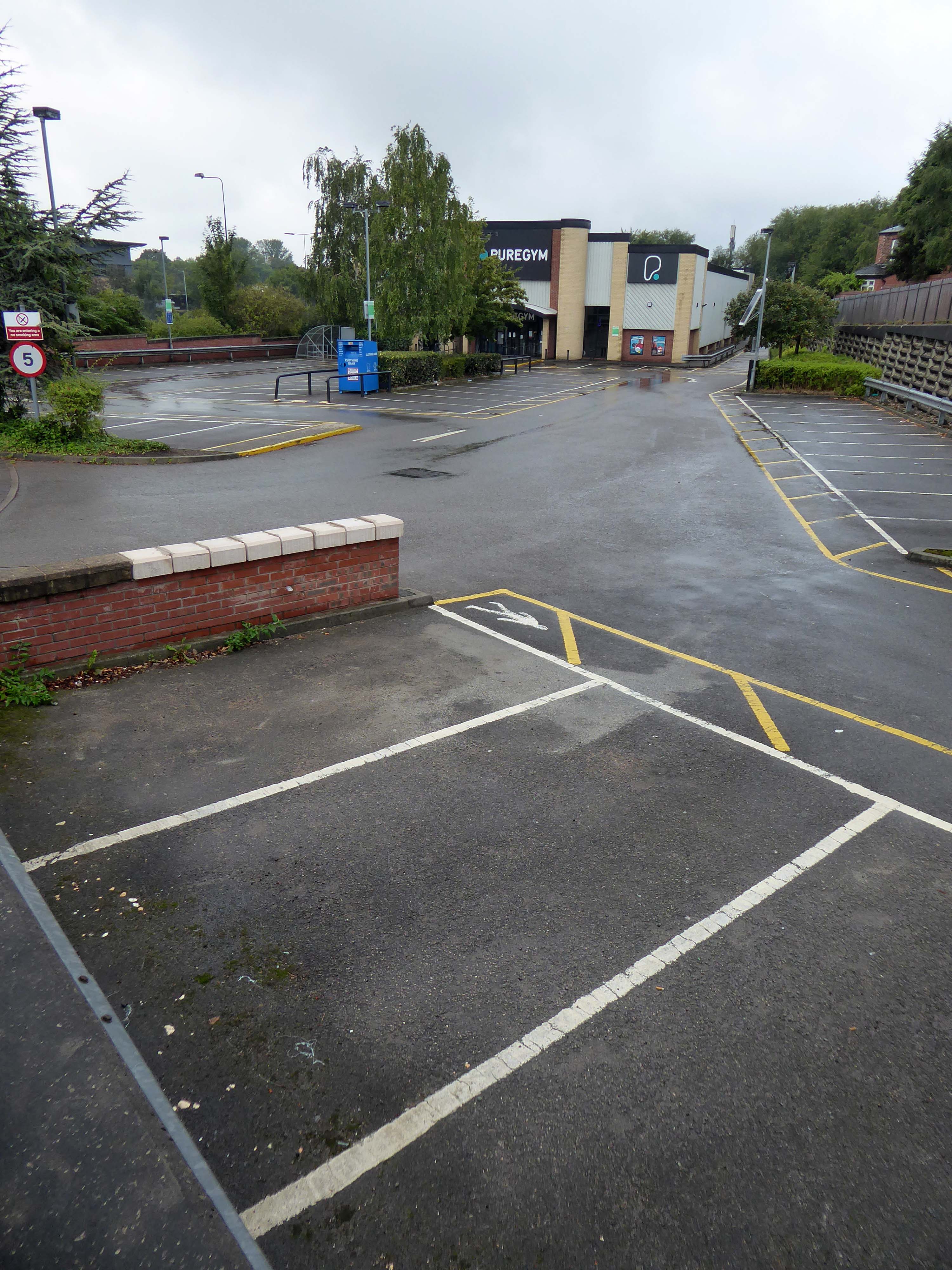
Today, on the day of her funeral, I set out for a walk around Stockport, to record a town largely closed for business. Overcast but far from downcast, I defied the almost persistent fine rain and these are the pictures that I took.
Many of the subjects are products of her time on the throne.
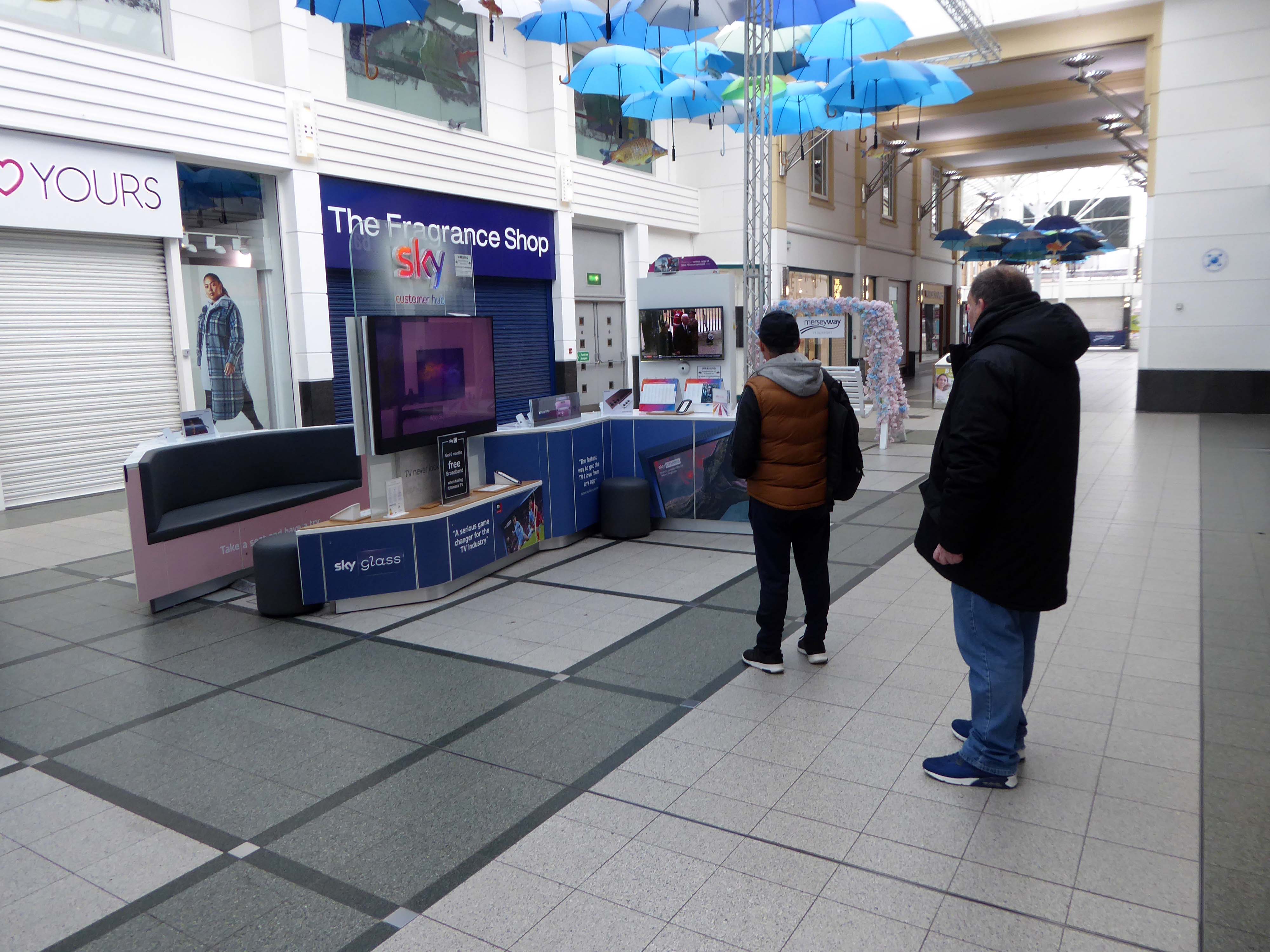
The traffic was much lighter, there were few pedestrians, a couple of cafés were open and two men watched the funeral service on the Sky TV stand in the precinct.
Lately I have been frequenting bad houses Places no respectable man would be seen I hate myself for my weakness My past sickens me I tell myself I will not go Even as I drive there
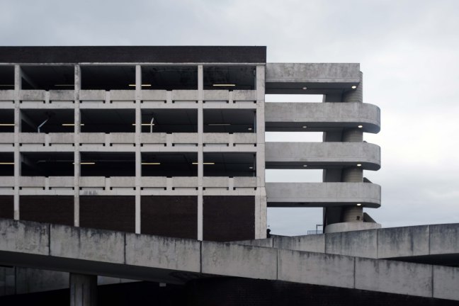
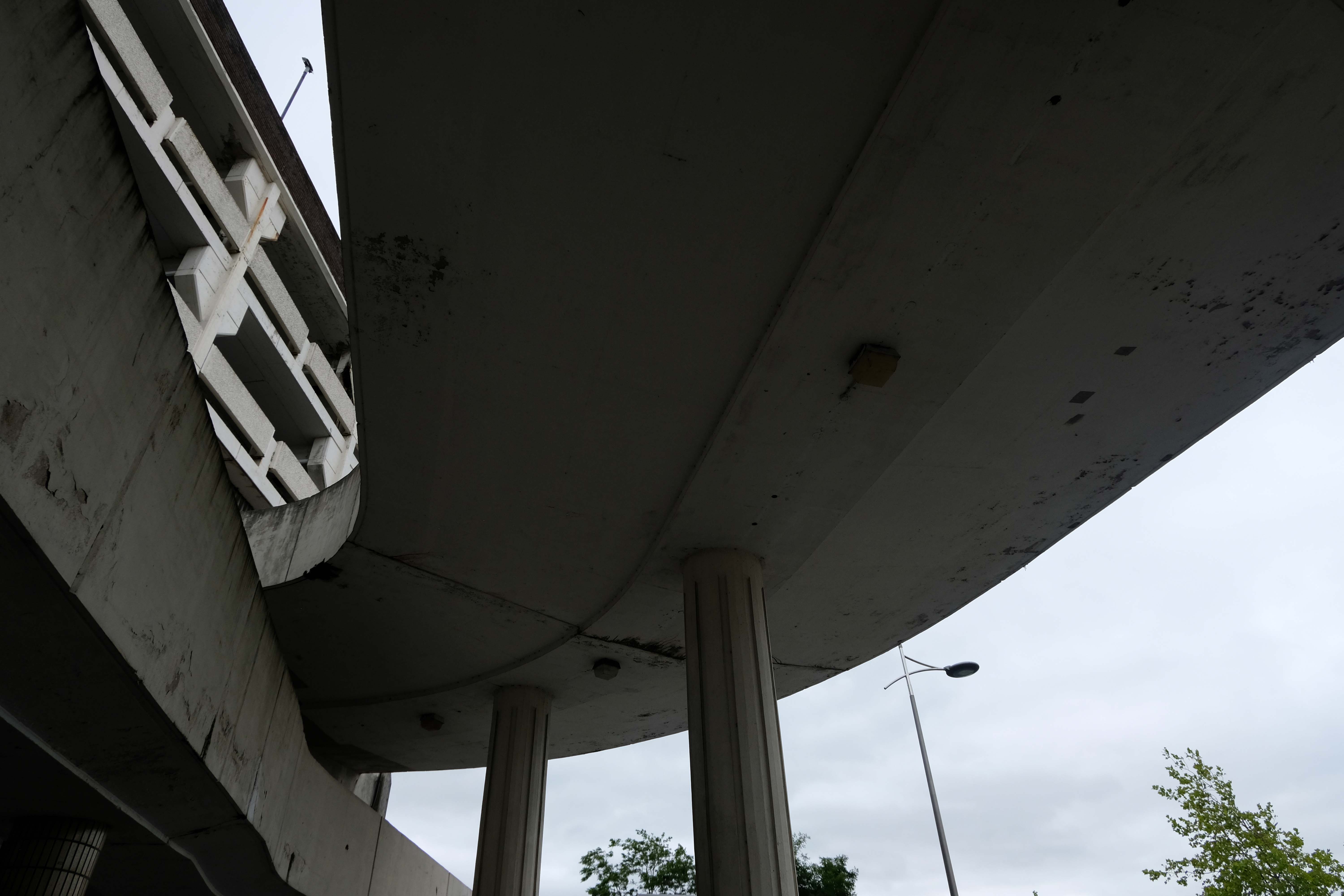
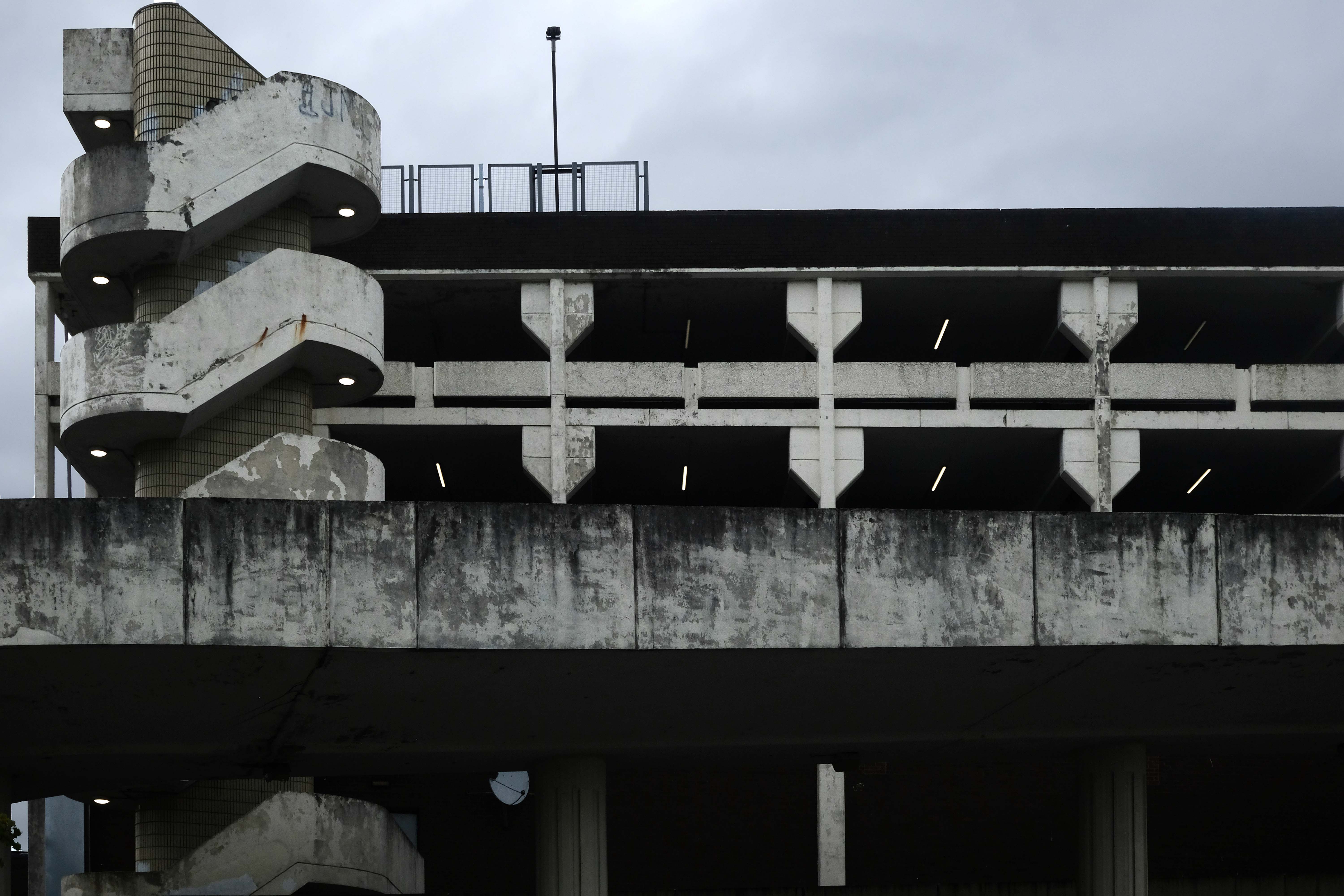
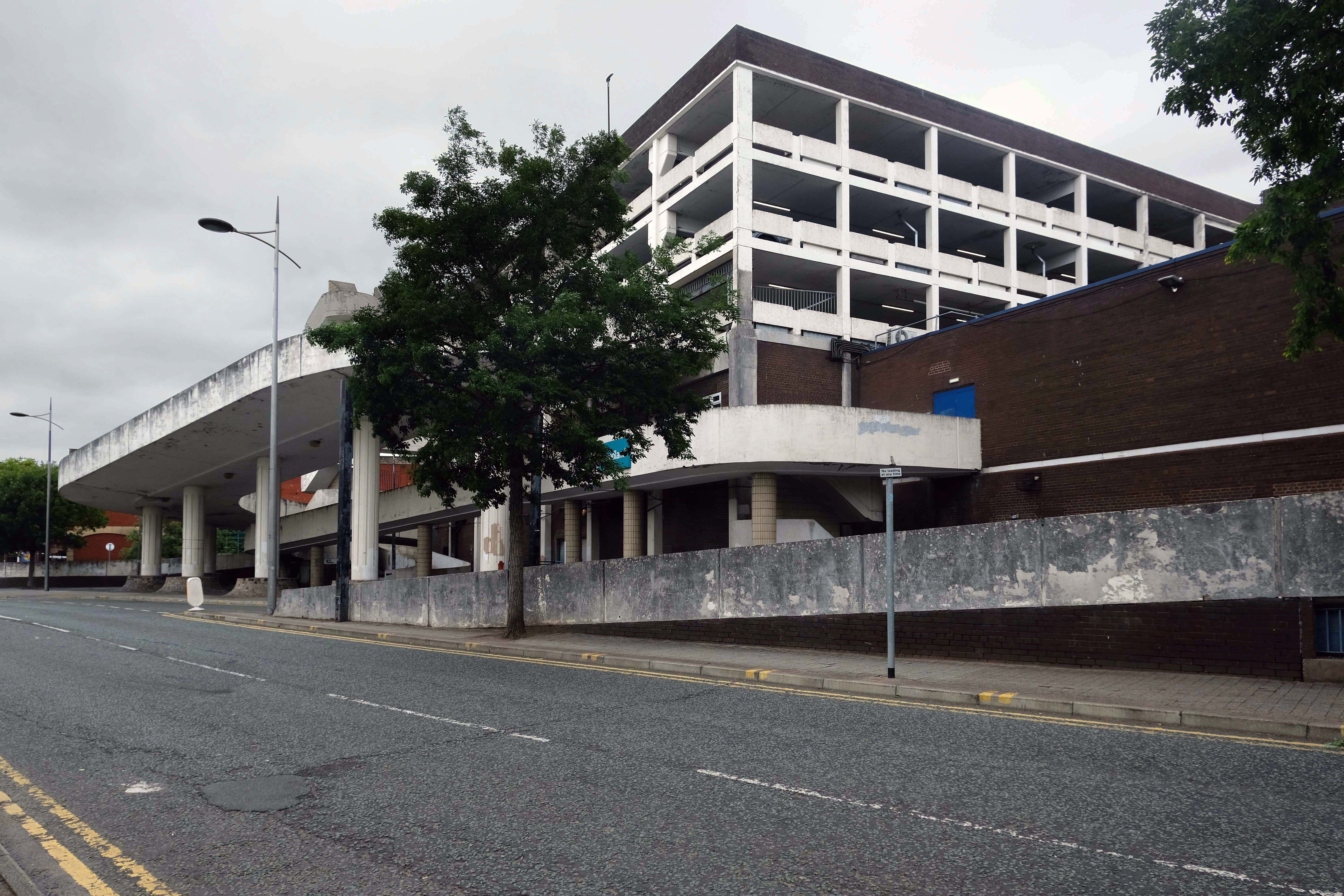
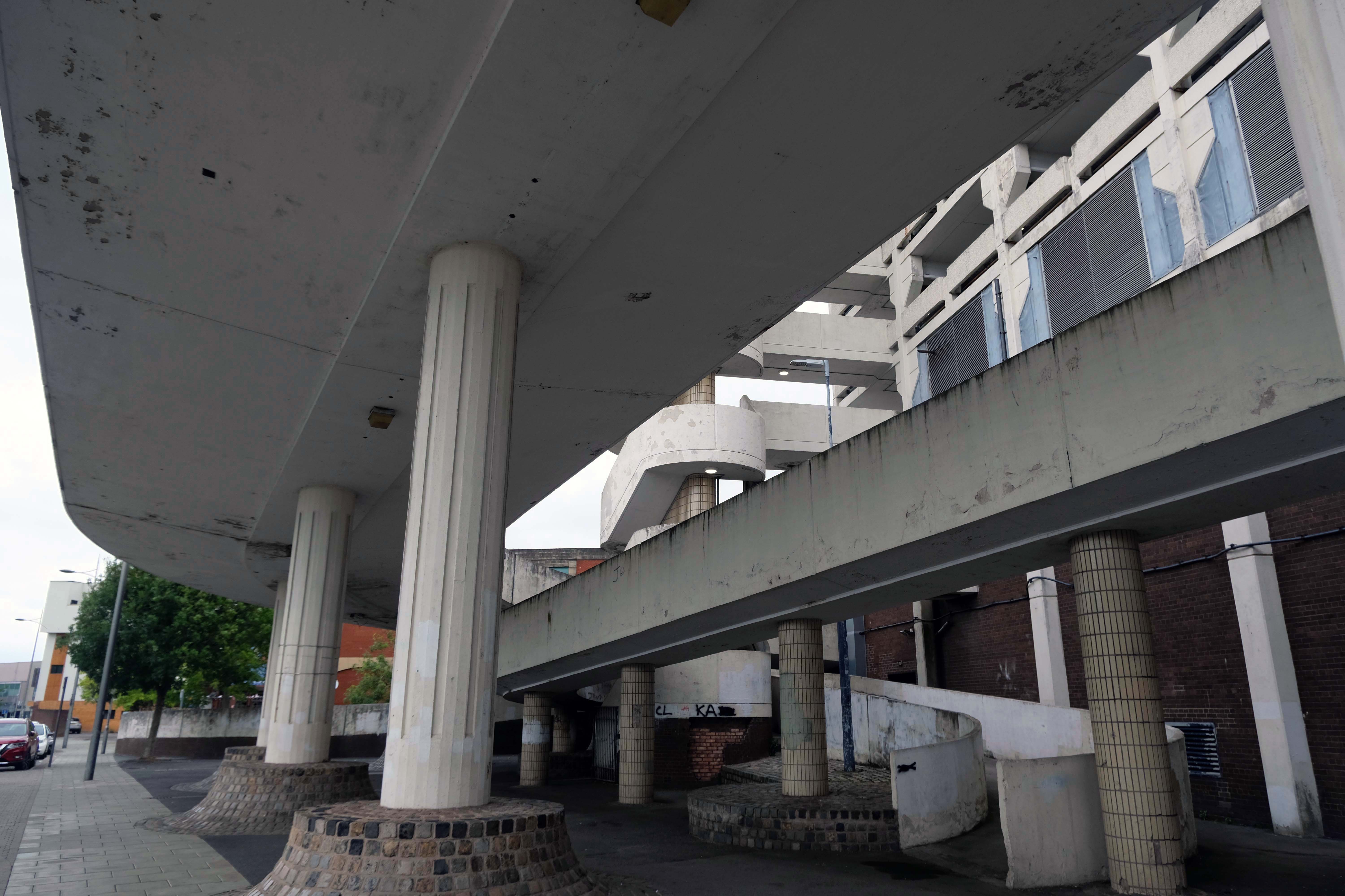
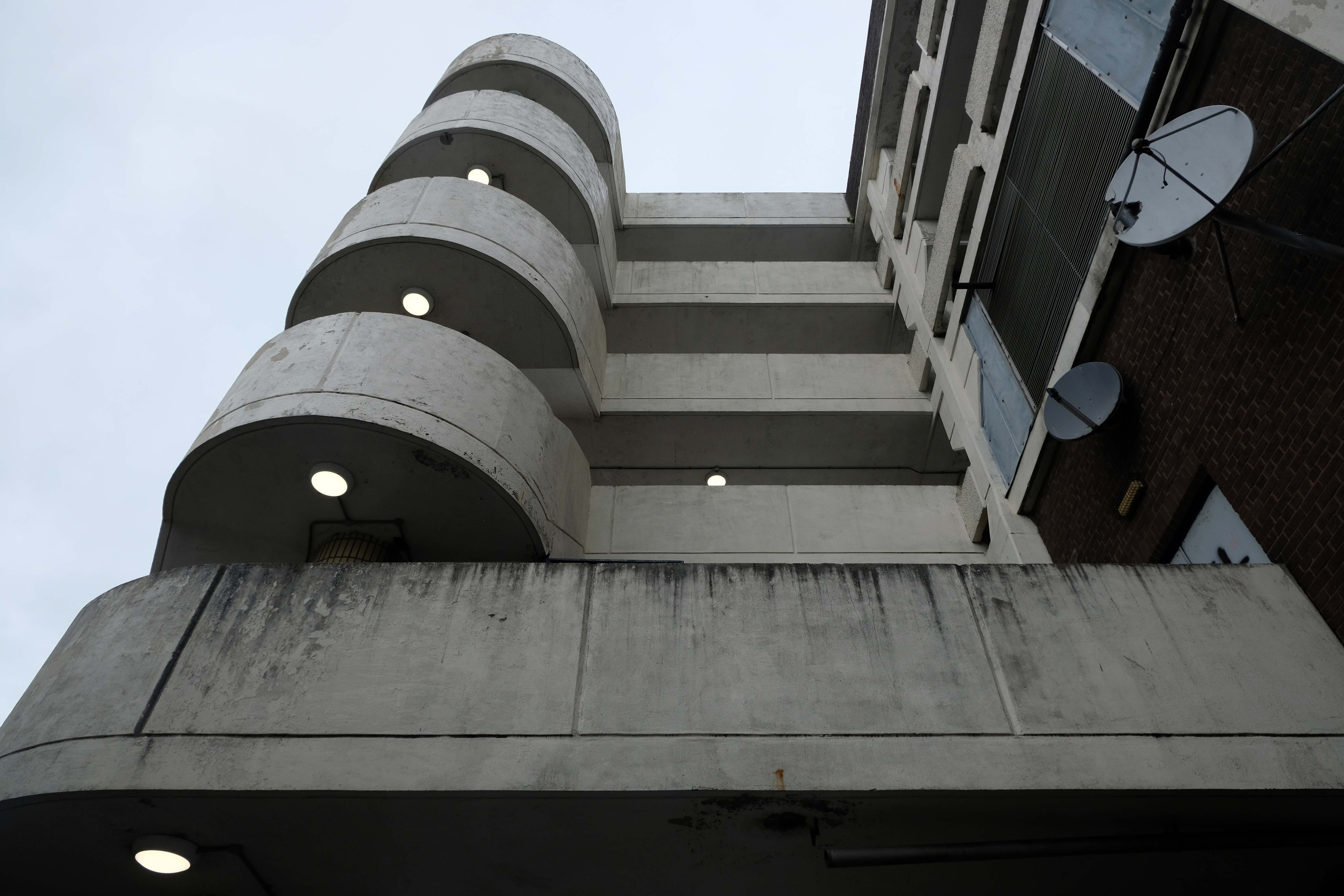
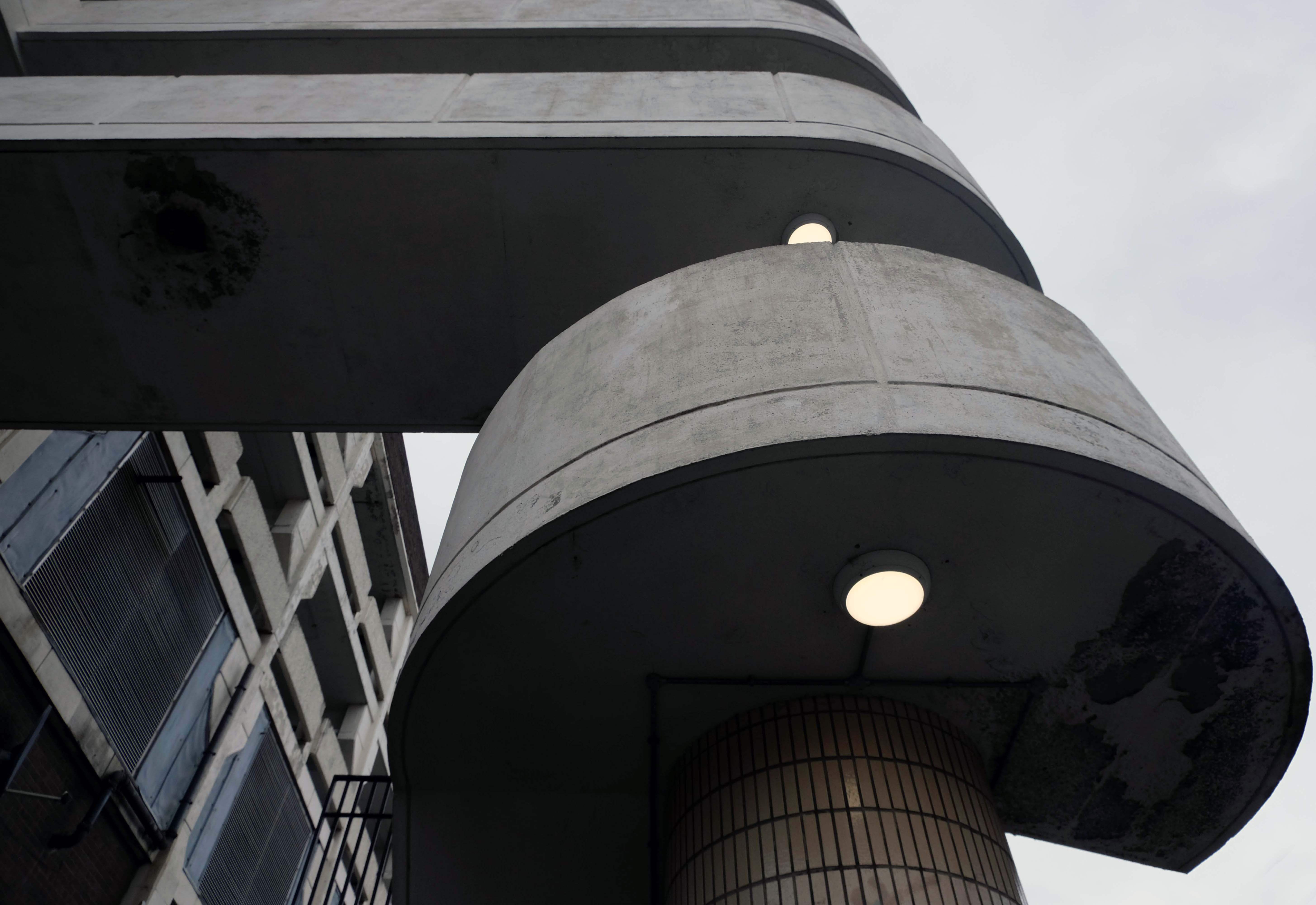
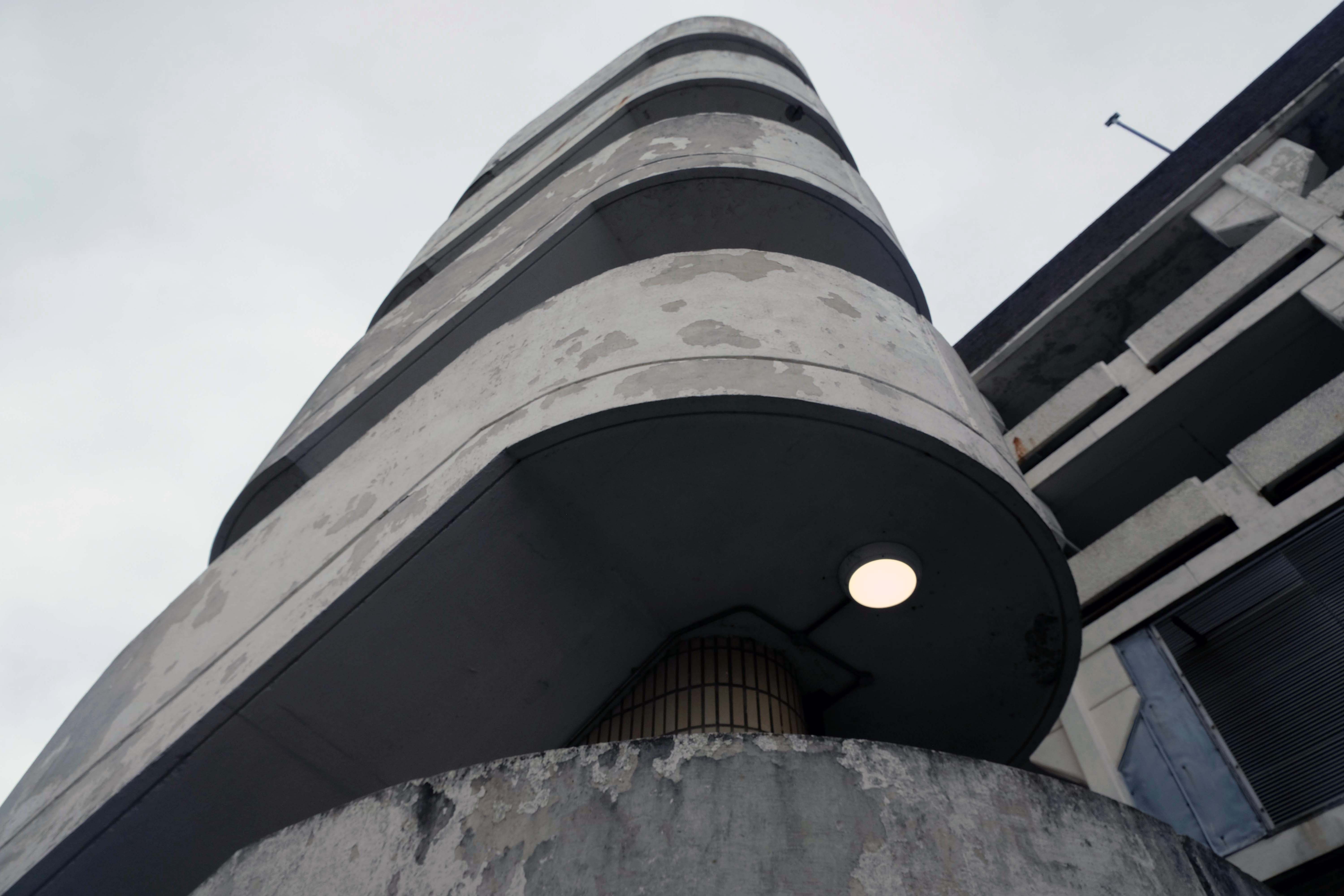
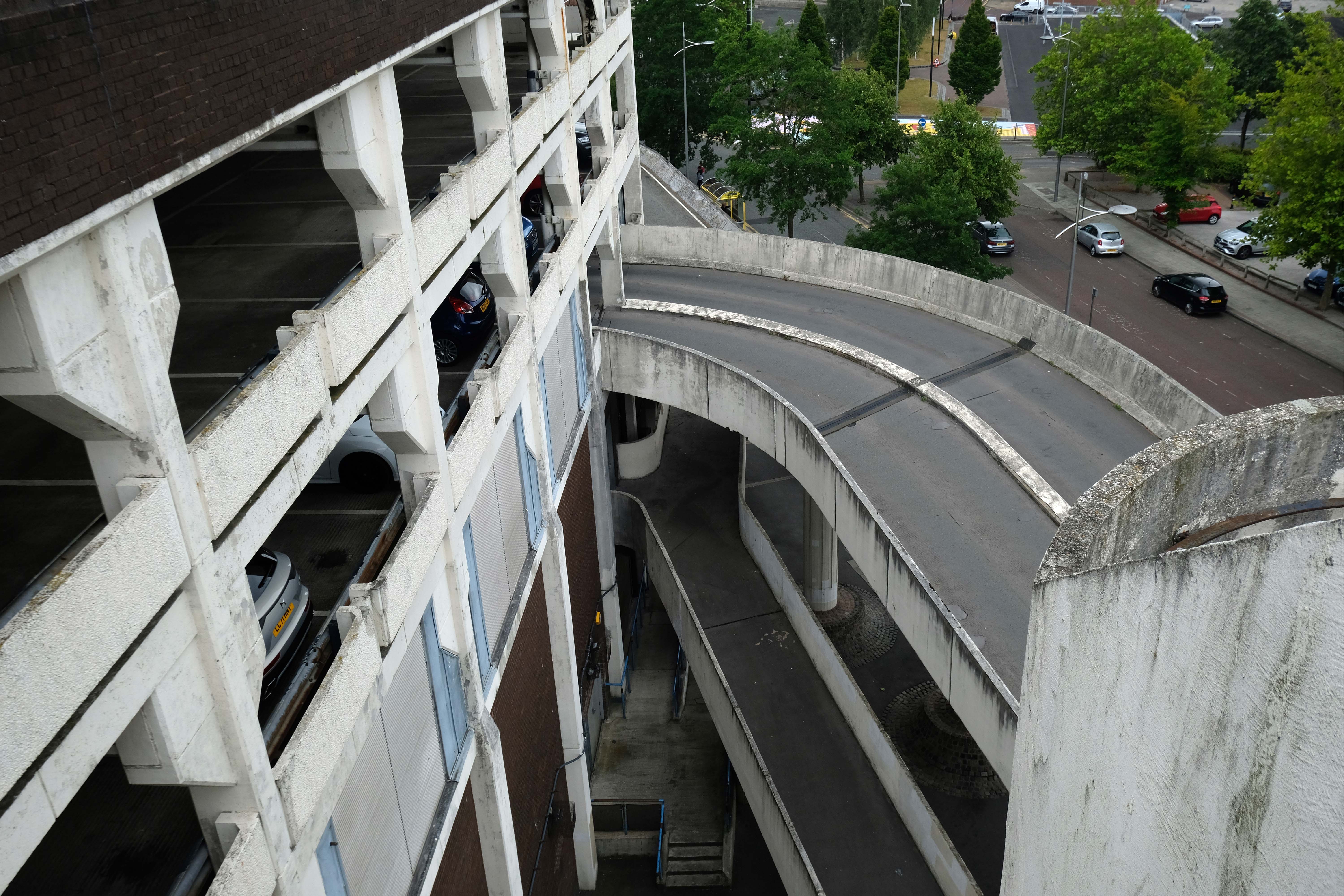
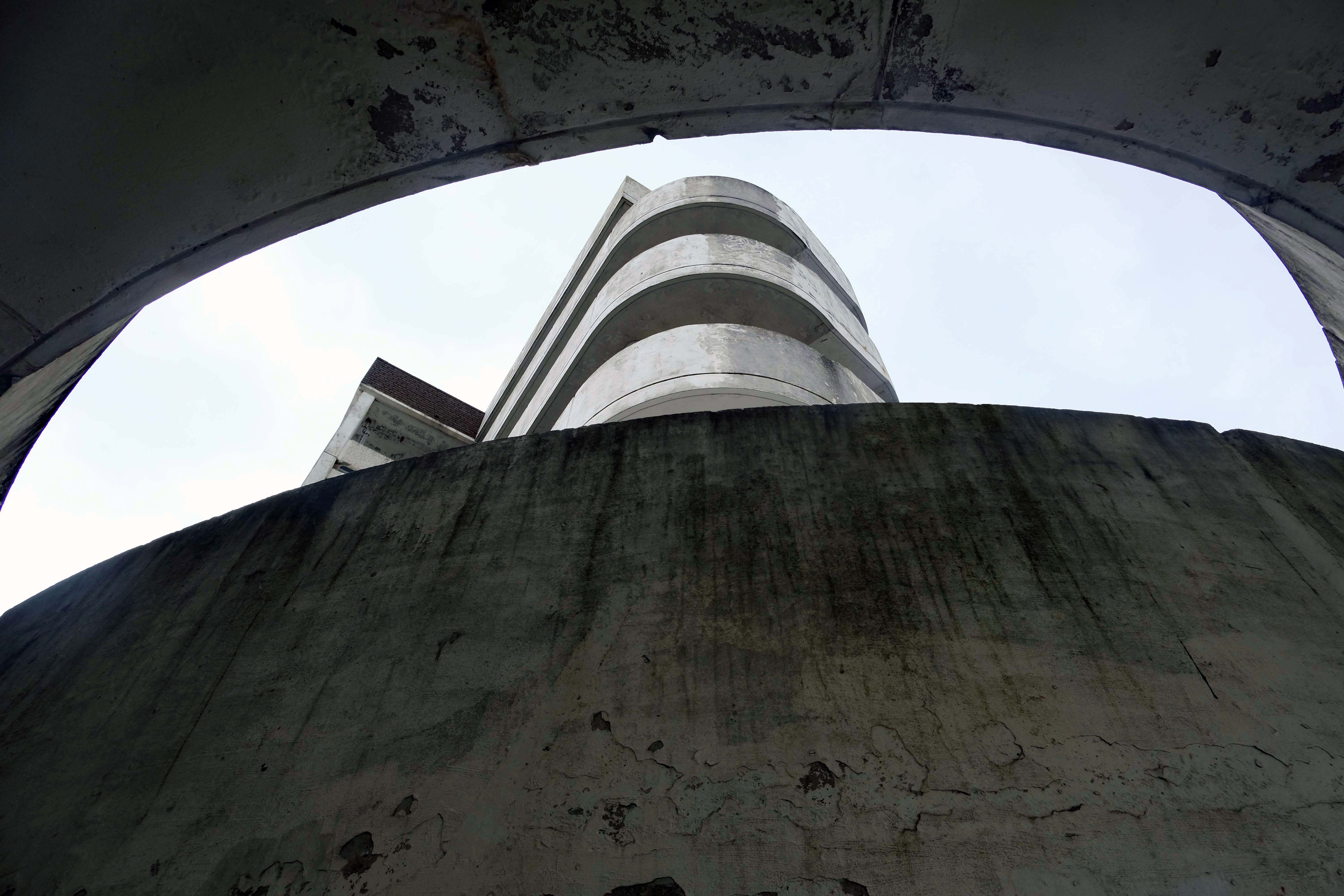
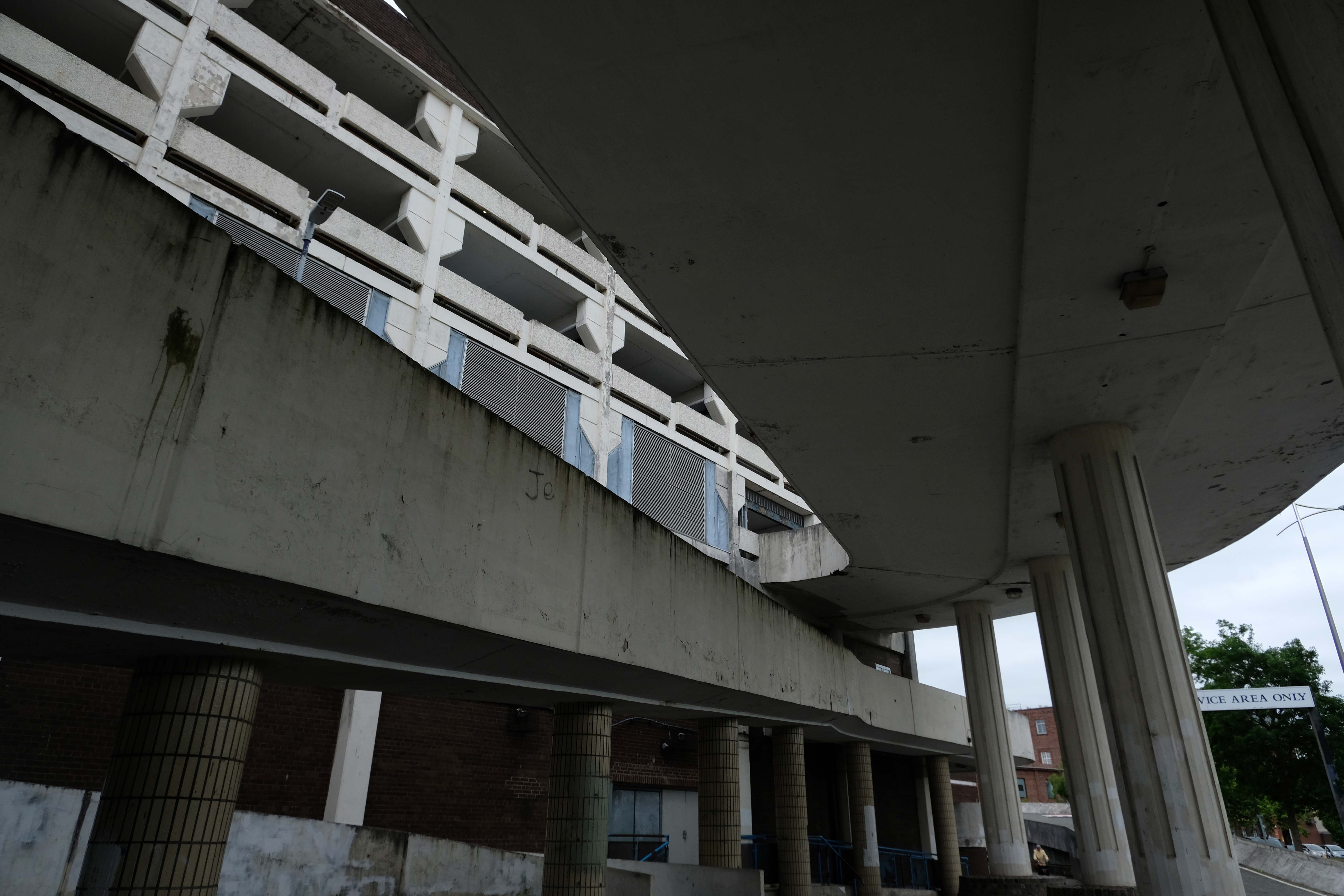
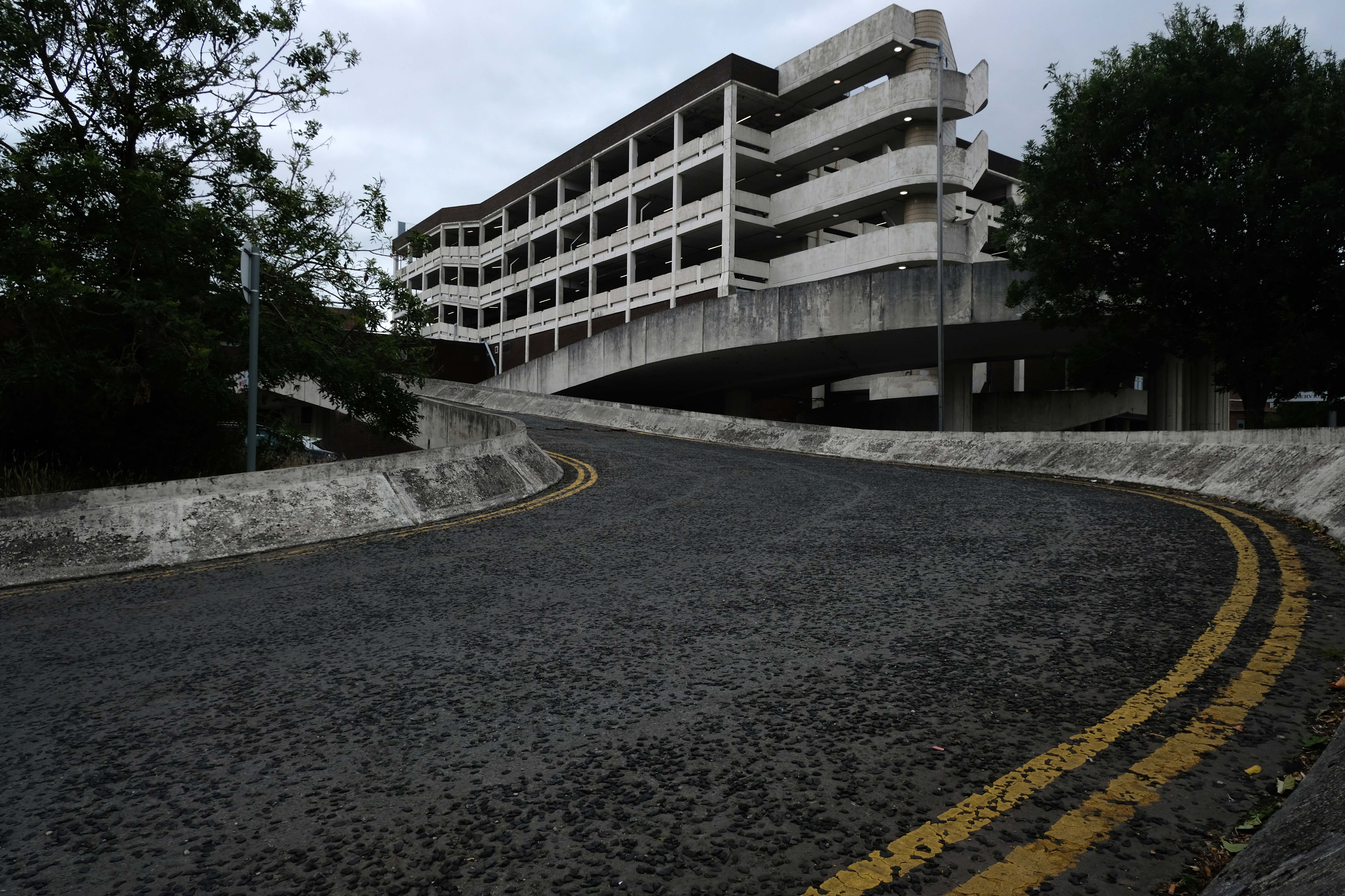
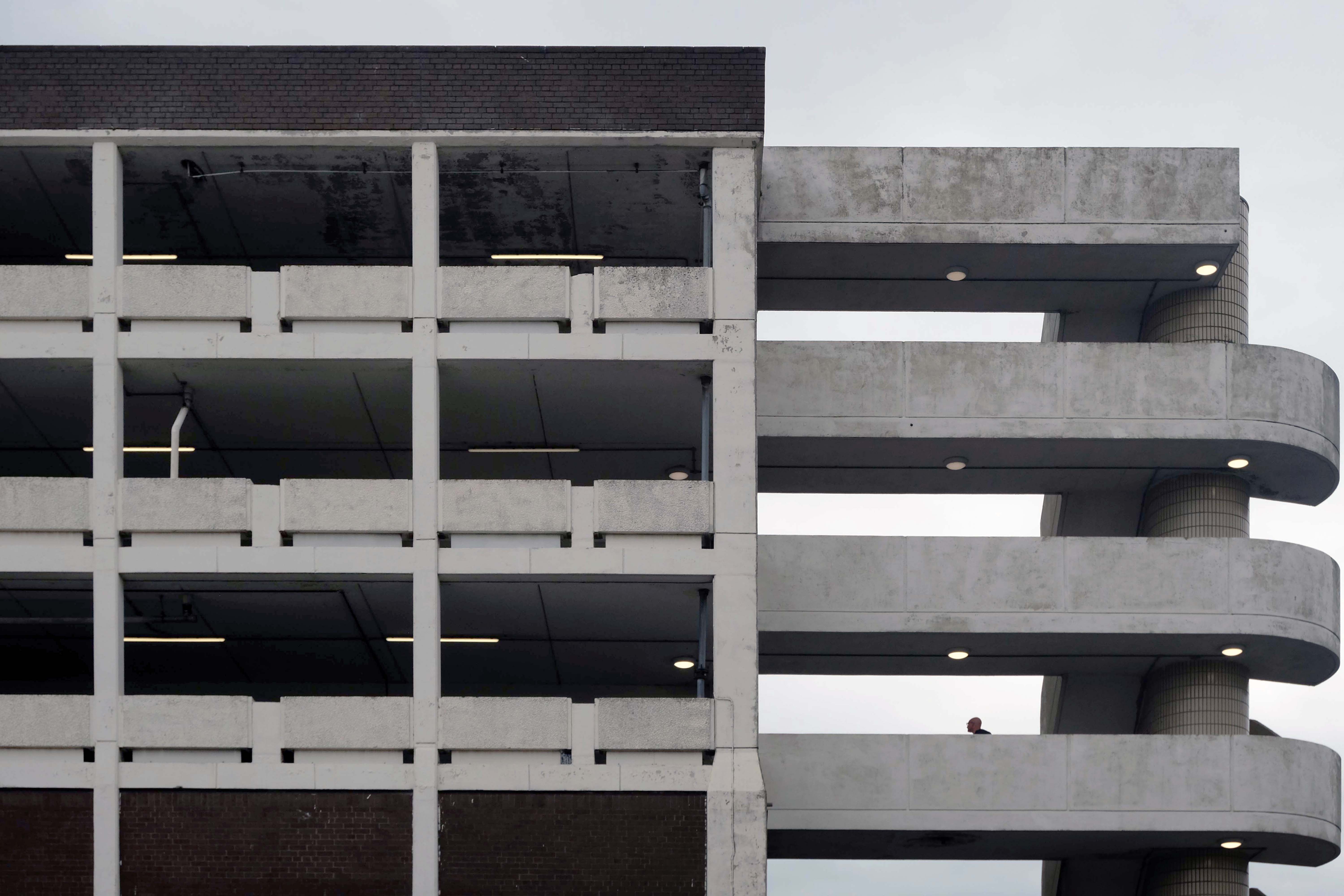
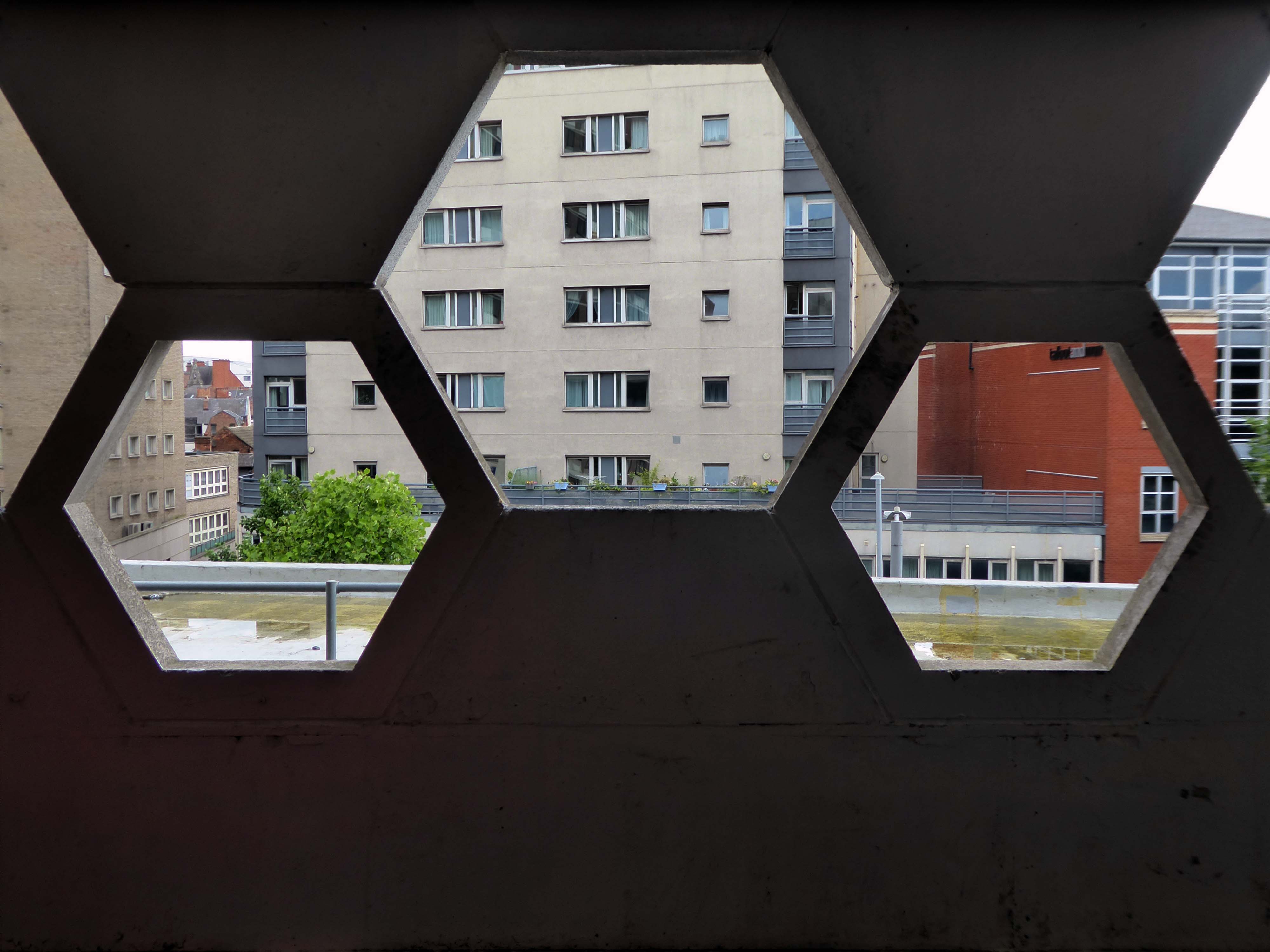
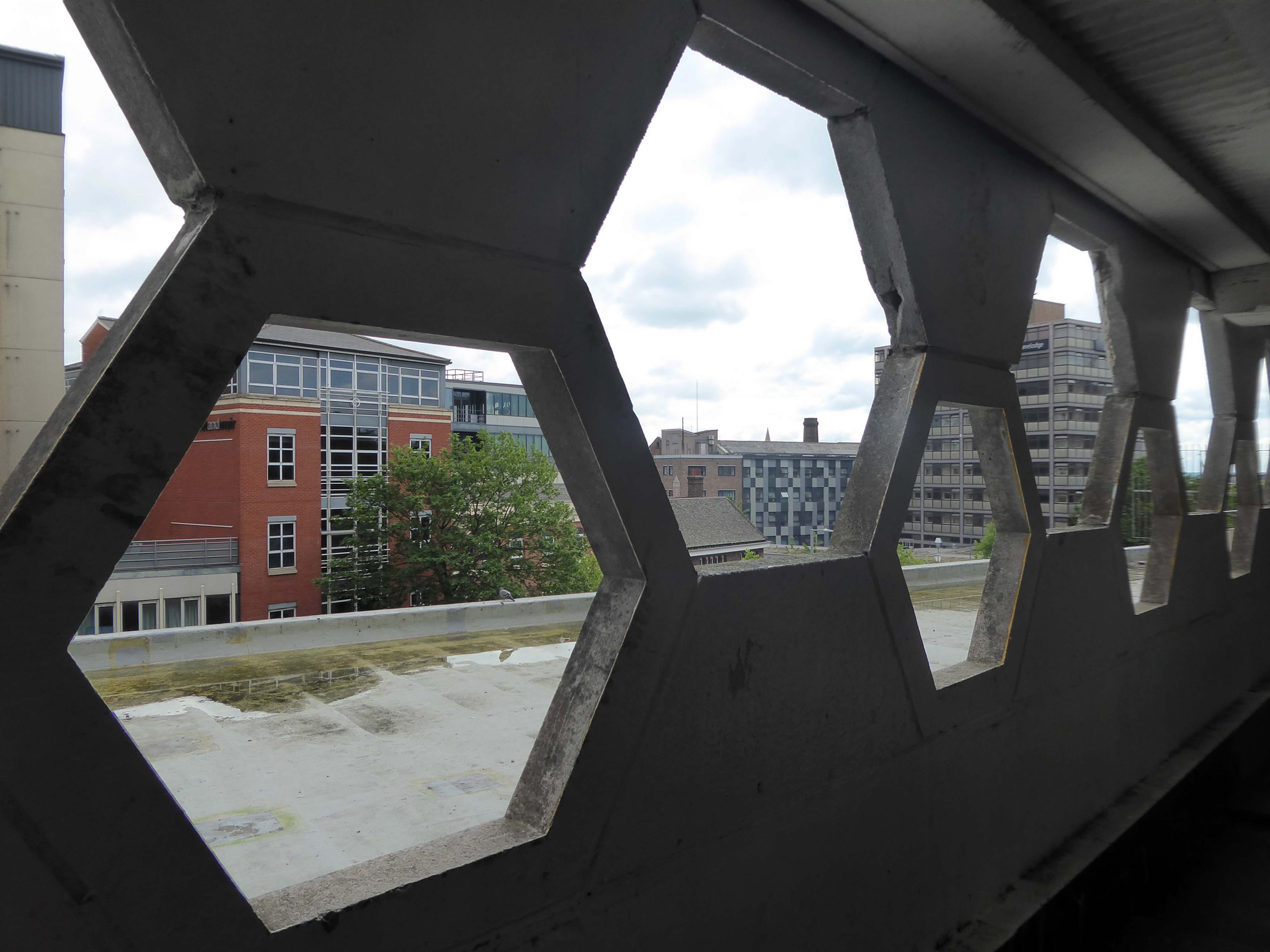
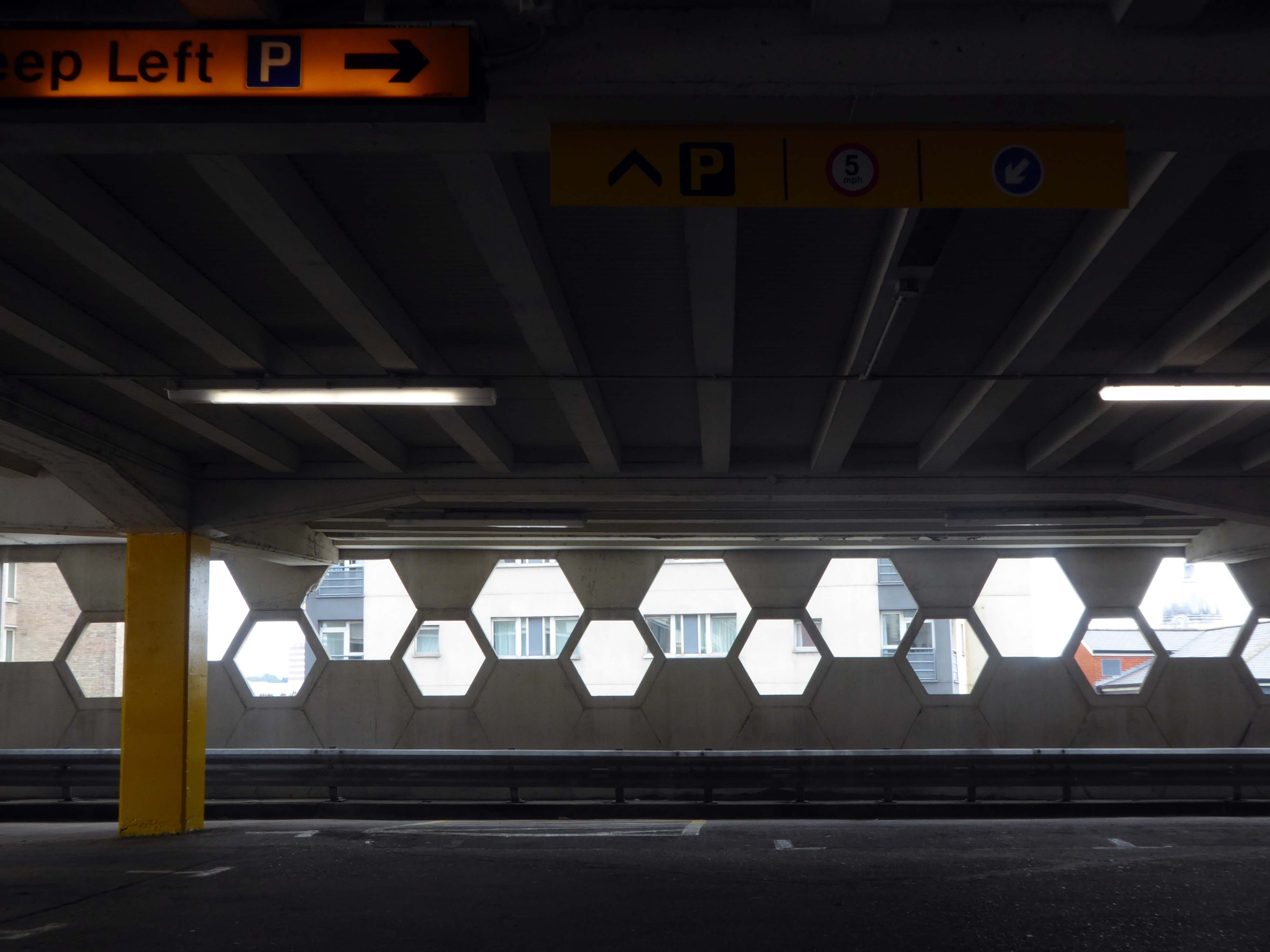
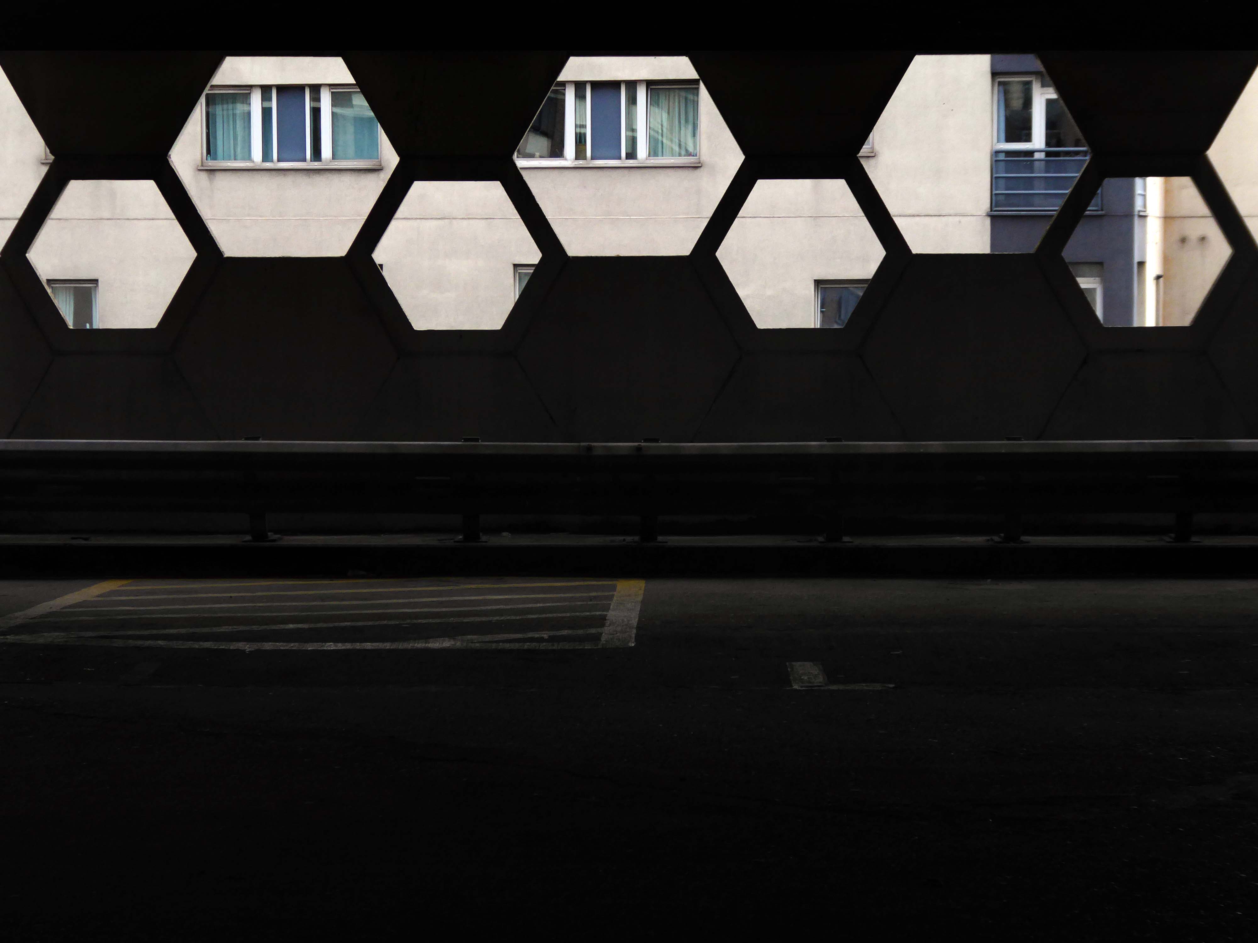
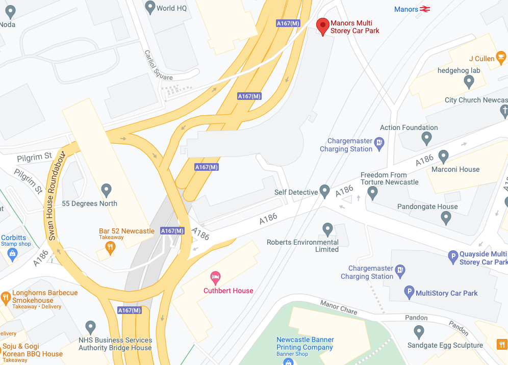
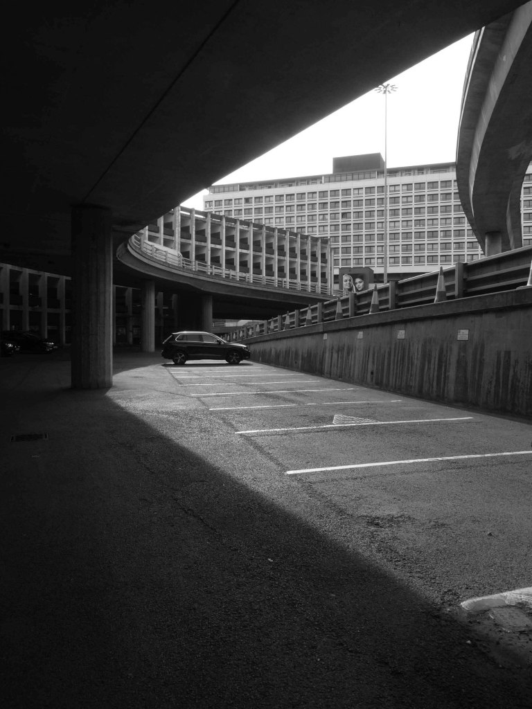
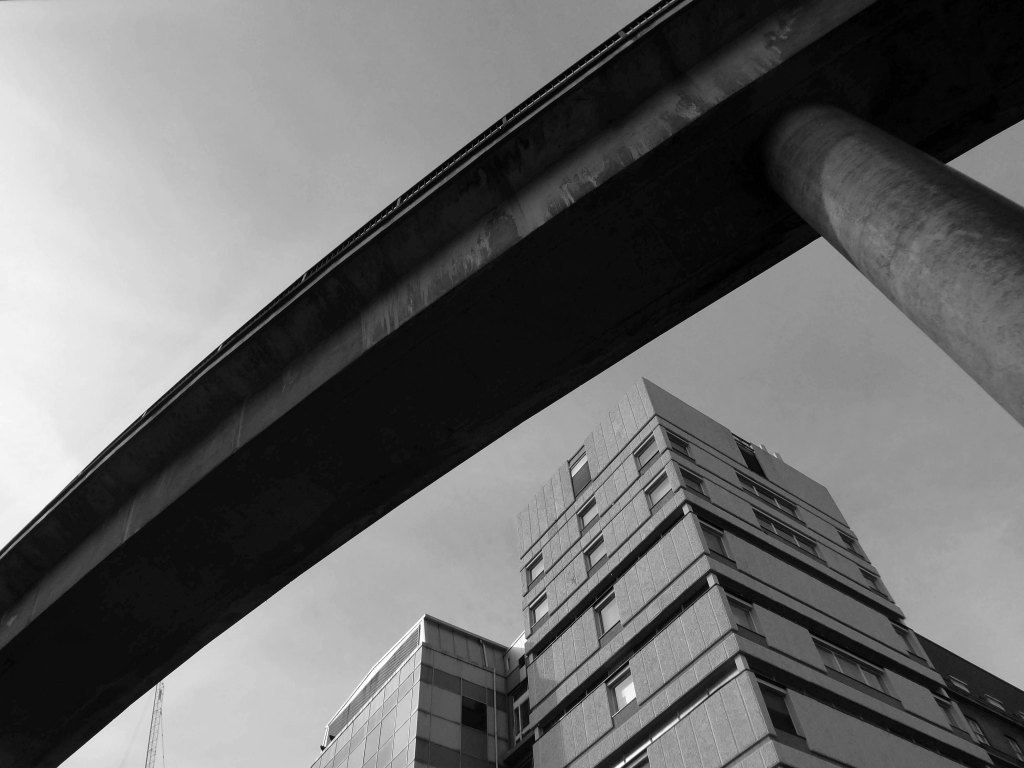
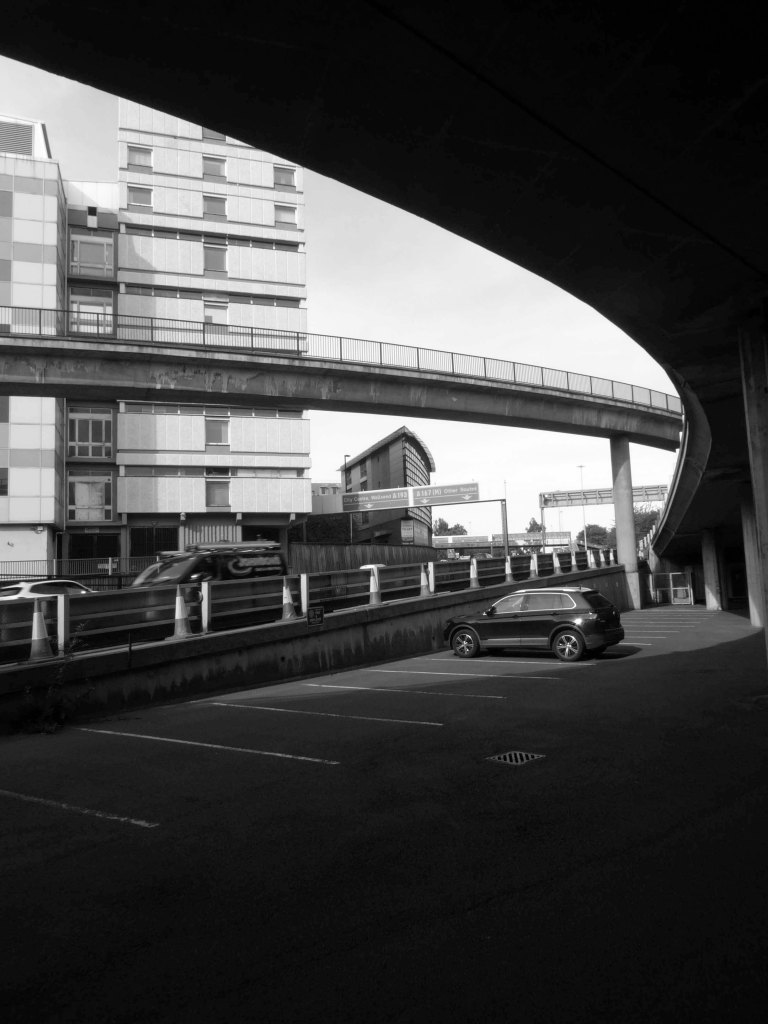
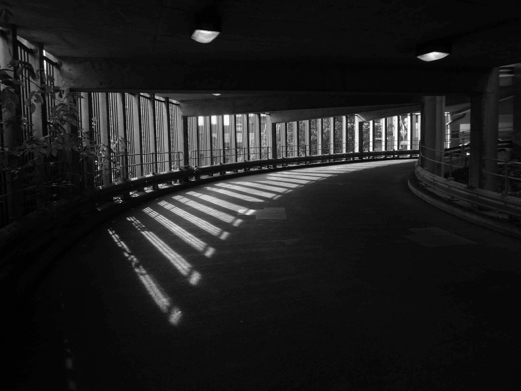
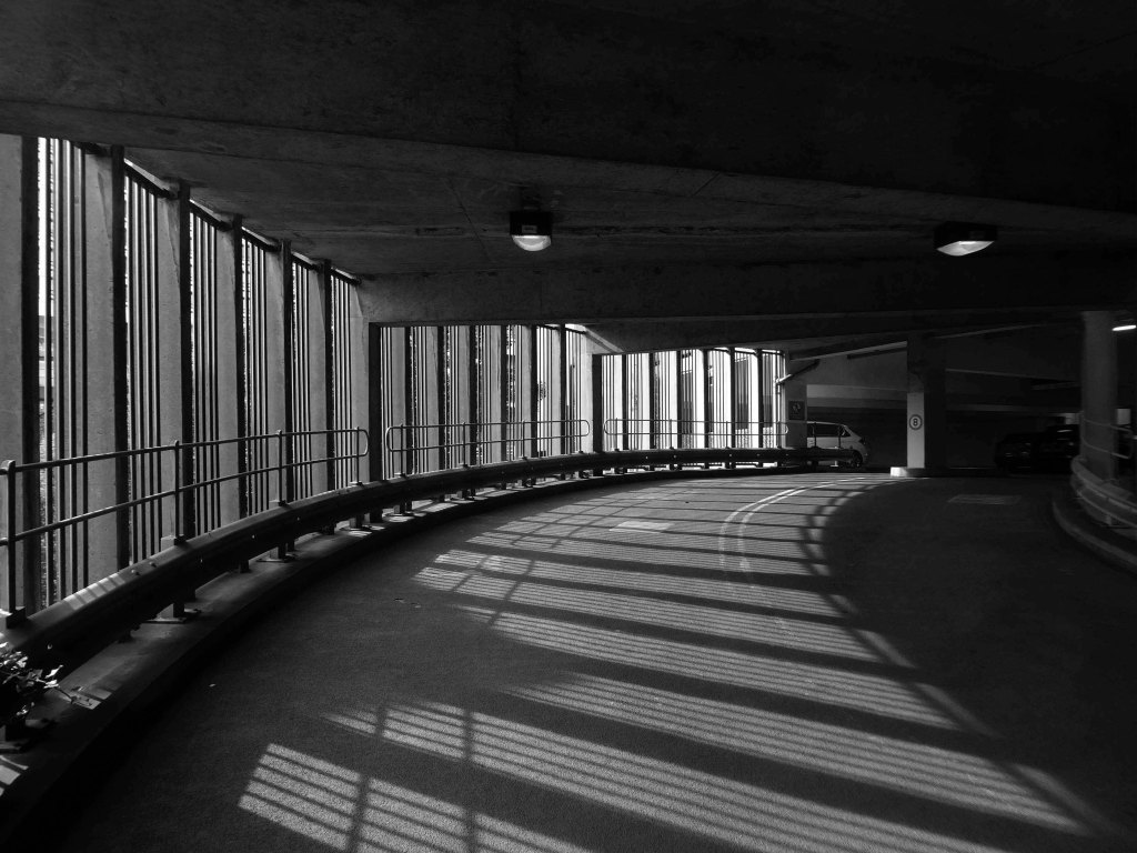
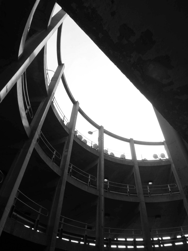
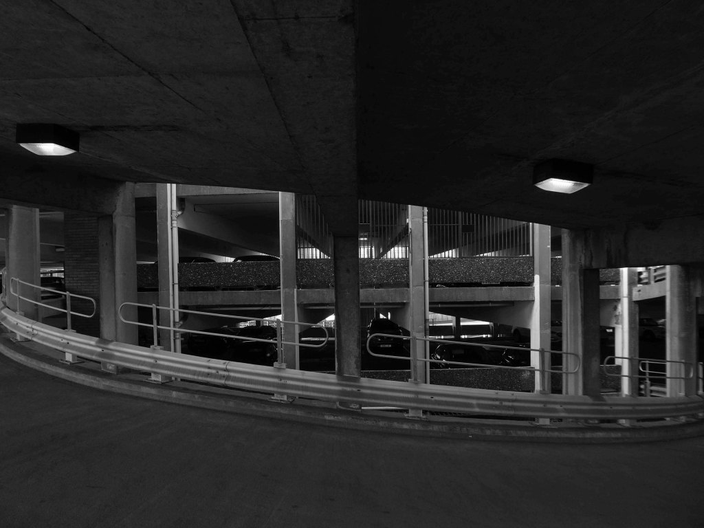
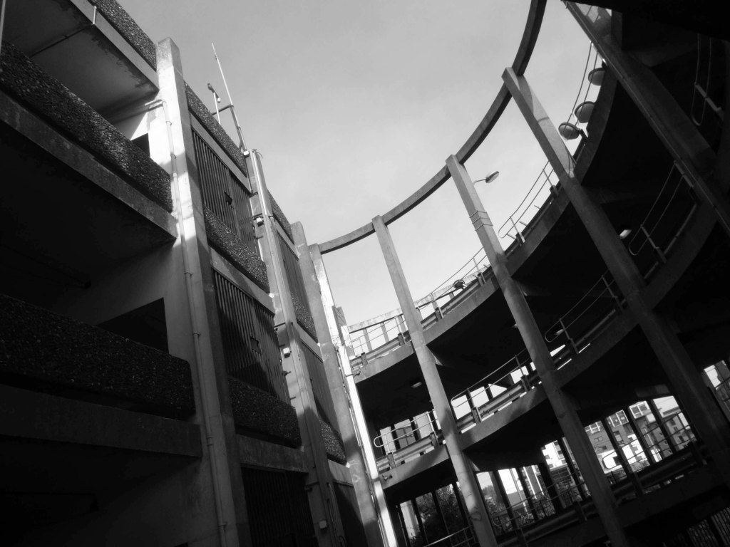
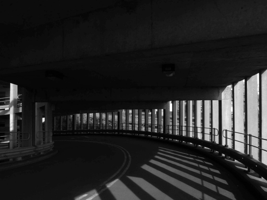
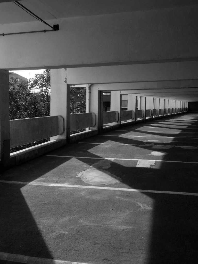
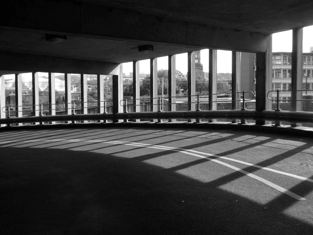
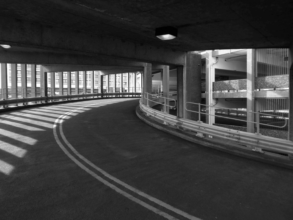
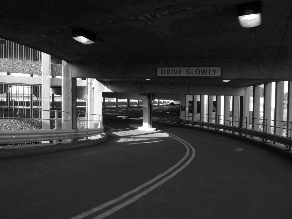
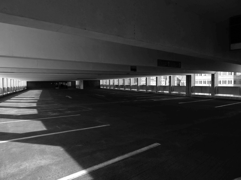
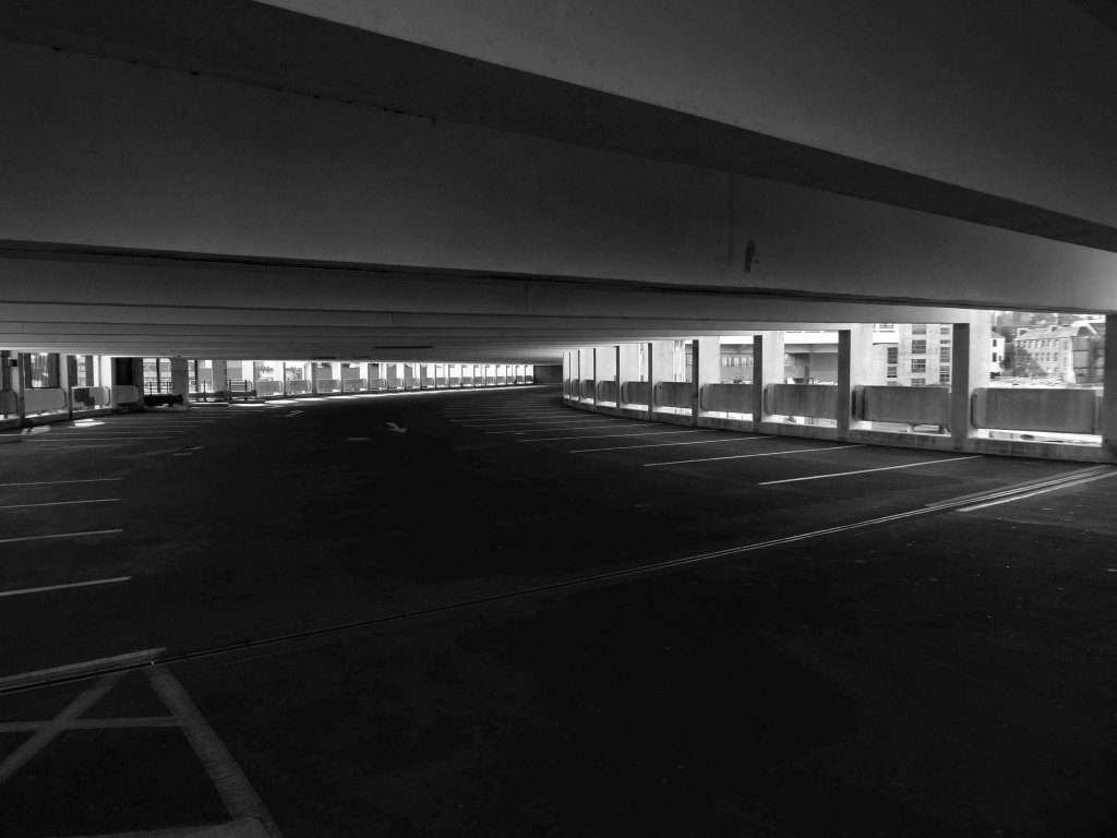
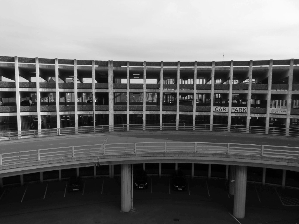
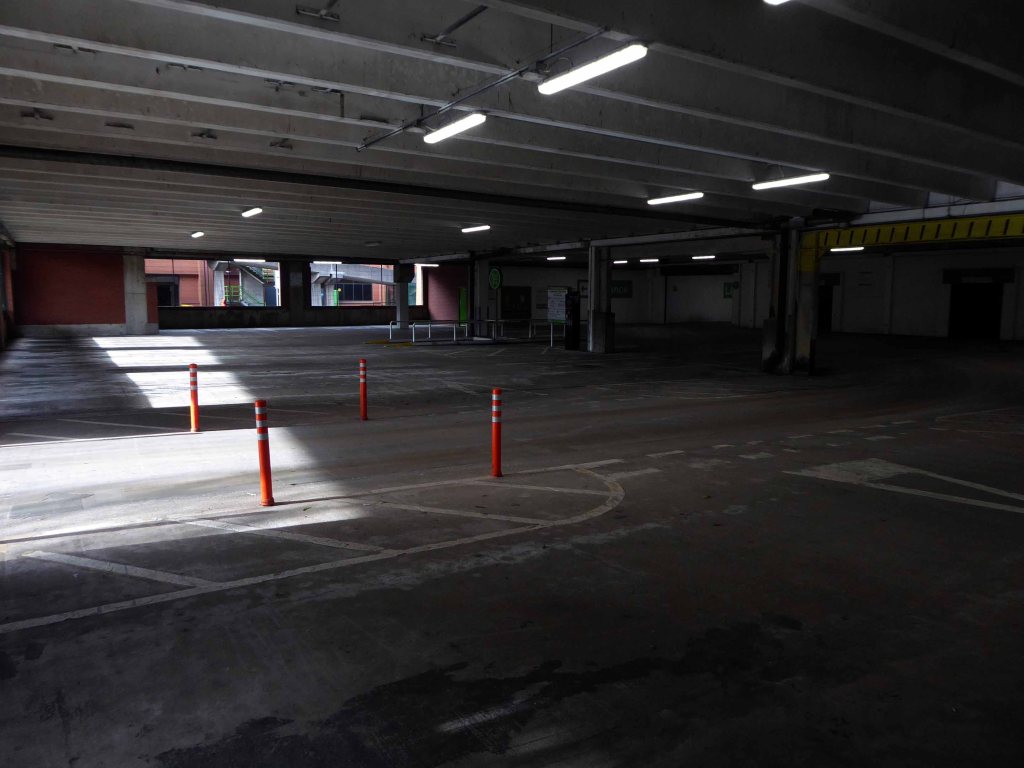
Manors Car Park’s distinctive form derives from the constraints of the train line to east which collided with the new Central East Motorway A167 M which dips beneath, shaping the car park between these constraints. The curvature of the concrete decks sweeps uniformally across the site, interrupted only by the circulation ramp. The car park was the first multi-story car park in Newcastle and marked the beginnings of Wilfred Burns car-centric plans for the modernisation of the city through the Central East Motorway Plan – 1963.
Burns plan aimed to increase the economic growth of the city through greater convenience for an emerging car owning populace and even went as far as to incentivised cars travel by offering limited free parking in the city centre.
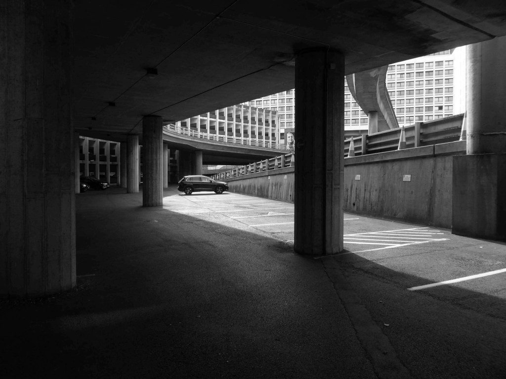
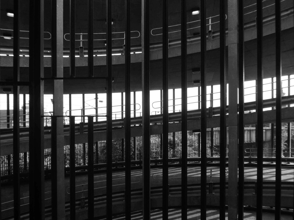
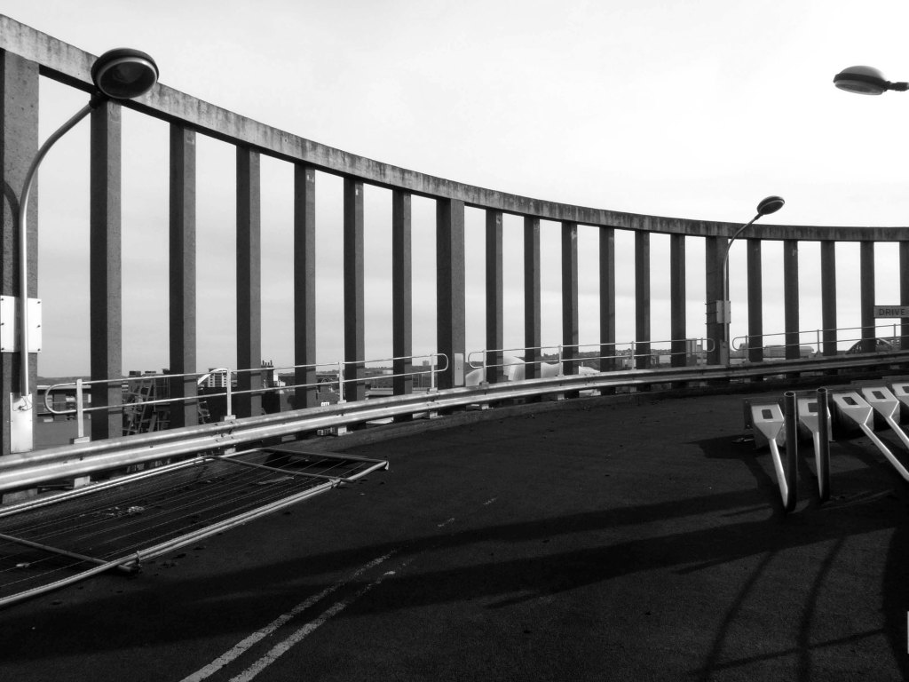
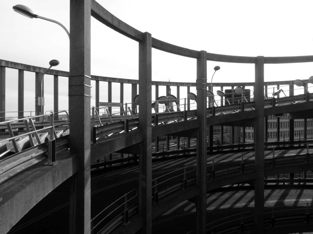
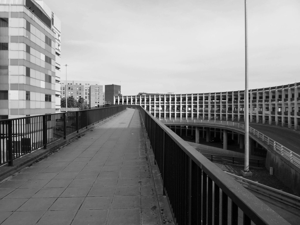
Manors car park connected and accompanied by an equally dramatic and elongated pedestrian footbridge from Manors Train Station – today Manors Metro, touching the car park for access before swooping under Swan House on Pilgrim Street Roundabout. The bridge takes what feels like the longest imaginable route over the motorway, allowing pedestrians to bypass Northumberland high street and take in the theatrics of the swooping concrete forms and motorway traffic.
In the early 1960s, under the leadership of T Dan Smith and his chief planning officer Wilf Burns, Newcastle city council undertook a comprehensive re-planning of the city centre that, had it been carried out to its full extent, would have led to the construction of underground motorways and a series of raised pedestrian decks running along Northumberland Street in the main shopping zone. The plan was that the new city would encircle the historical core, which would be preserved; meanwhile vast swathes of Georgian housing to the east would be razed. There were also plans for high-rise towers in the centre, only one of which was built.
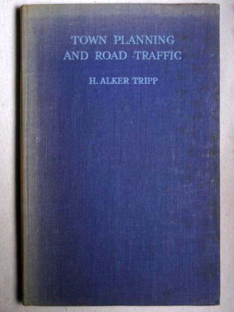
This tendency in town planning was due in part to the publication of H. Alker Tripp’s book of 1942.
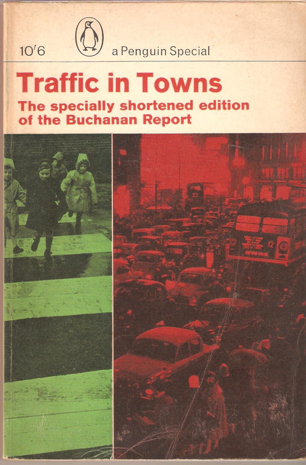
Along with Traffic in Towns an influential report and popular book on urban and transport planning policy published 25 November 1963 for the UK Ministry of Transport by a team headed by the architect, civil engineer and planner Colin Buchanan. The report warned of the potential damage caused by the motor car, while offering ways to mitigate it. It gave planners a set of policy blueprints to deal with its effects on the urban environment, including traffic containment and segregation, which could be balanced against urban redevelopment, new corridor and distribution roads and precincts.
These policies shaped the development of the urban landscape in the UK and some other countries for two or three decades. Unusually for a technical policy report, it was so much in demand that Penguin abridged it and republished it as a book in 1964.
Wikipedia
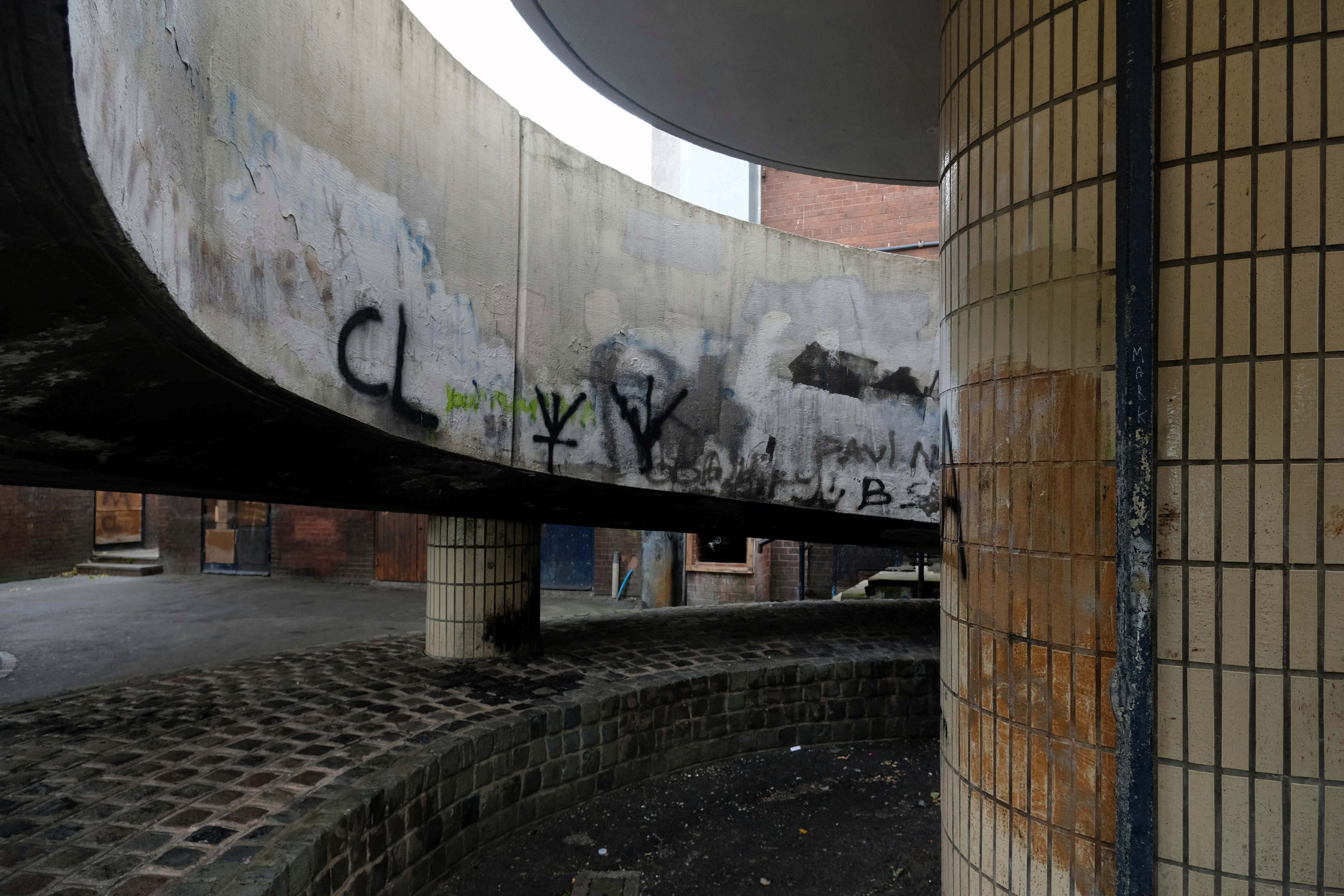
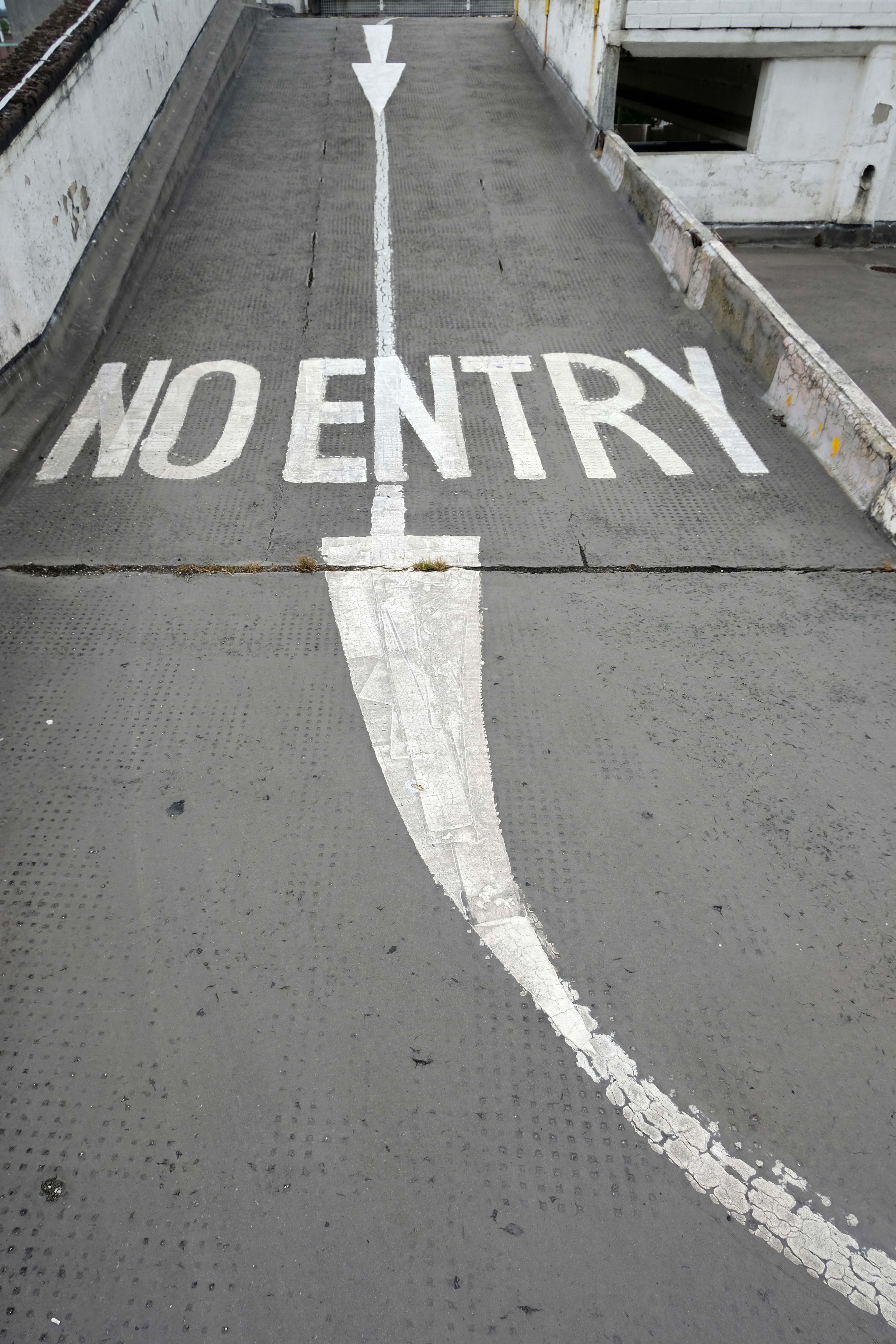
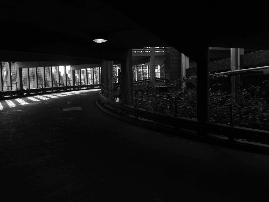
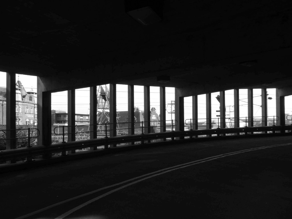
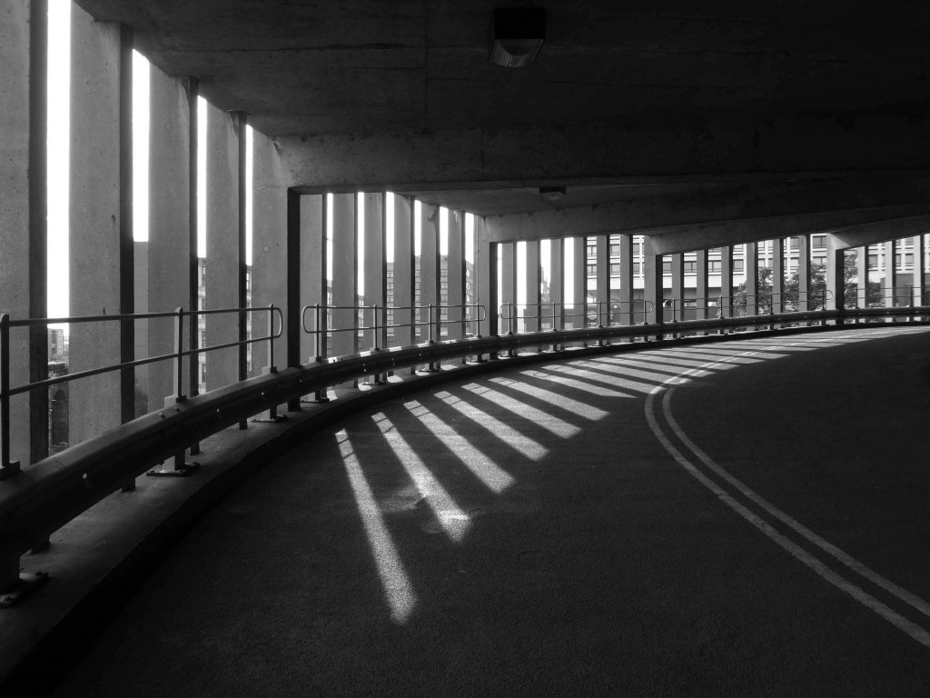
In a one man war against the segregation of traffic and pedestrian I often walk car parks, ramps and all.
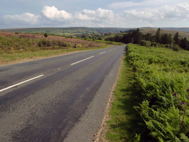
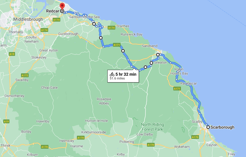
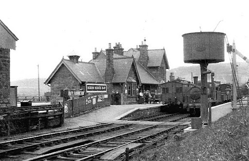
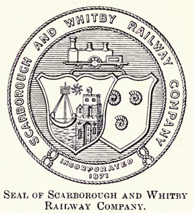
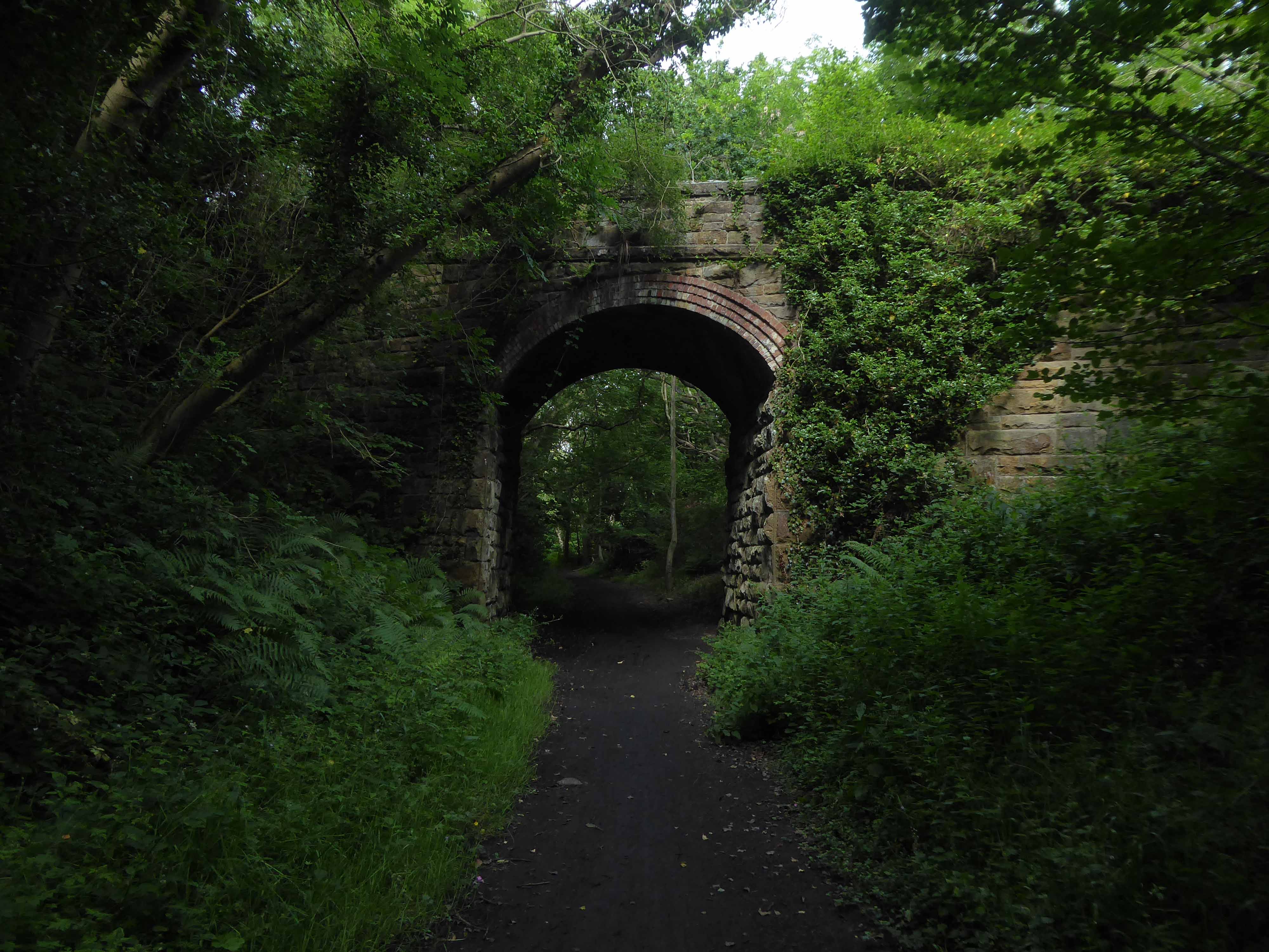
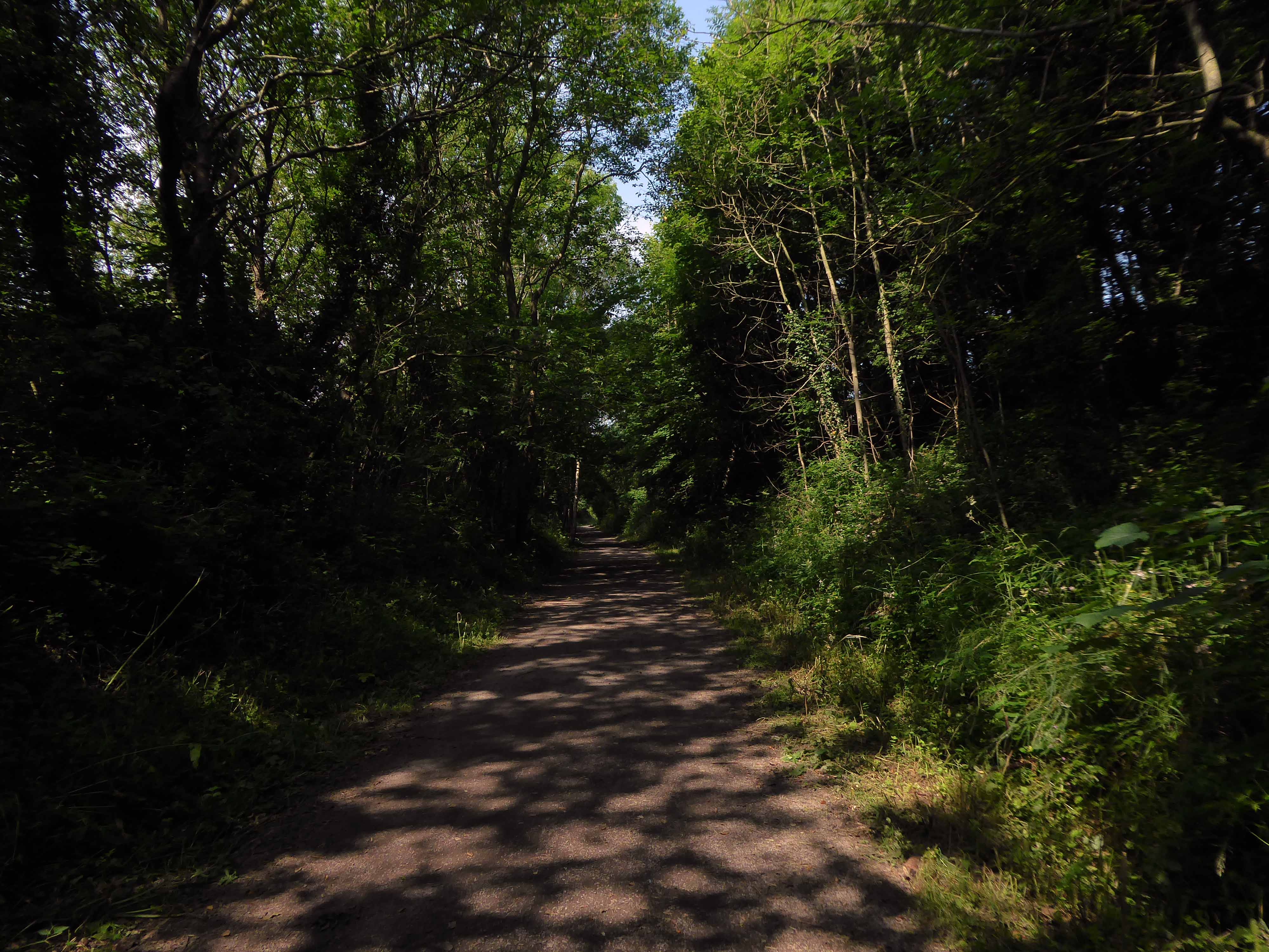
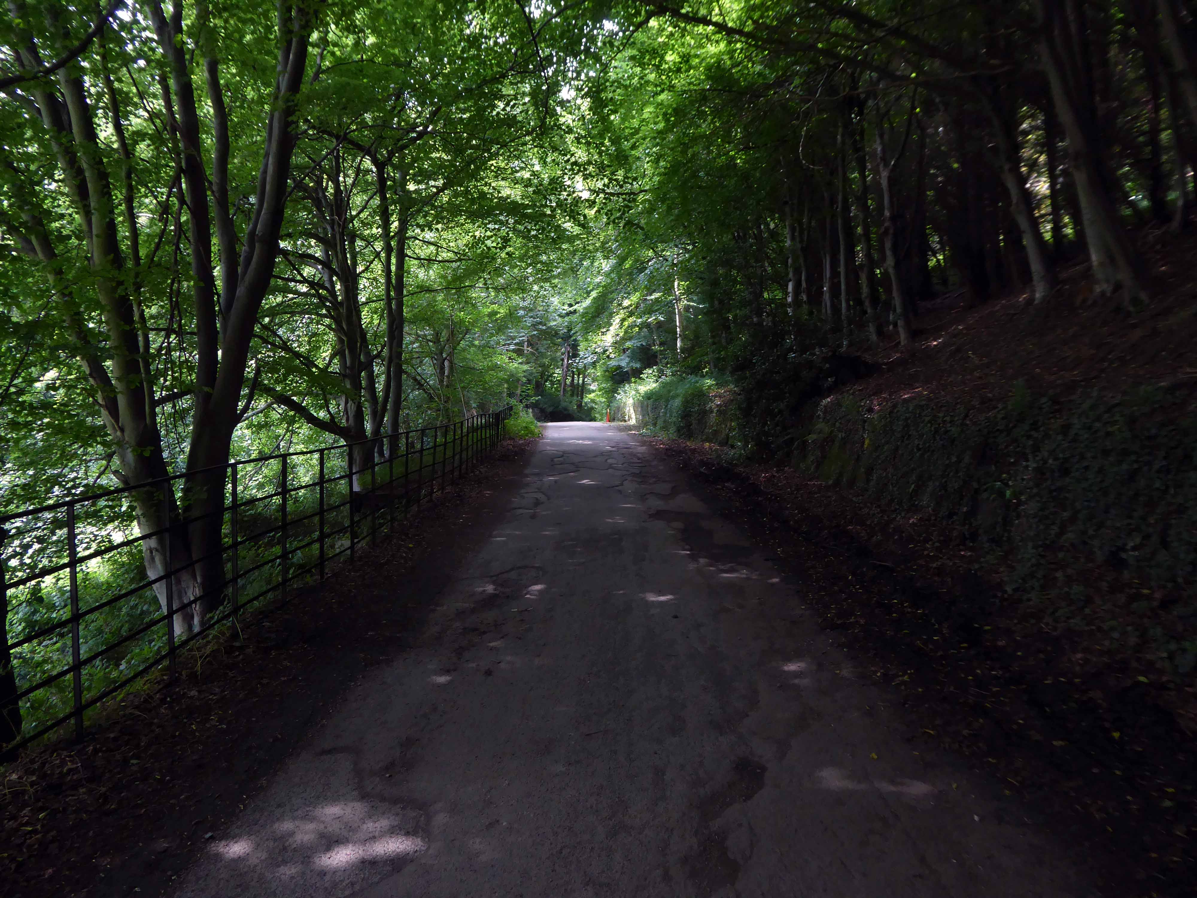
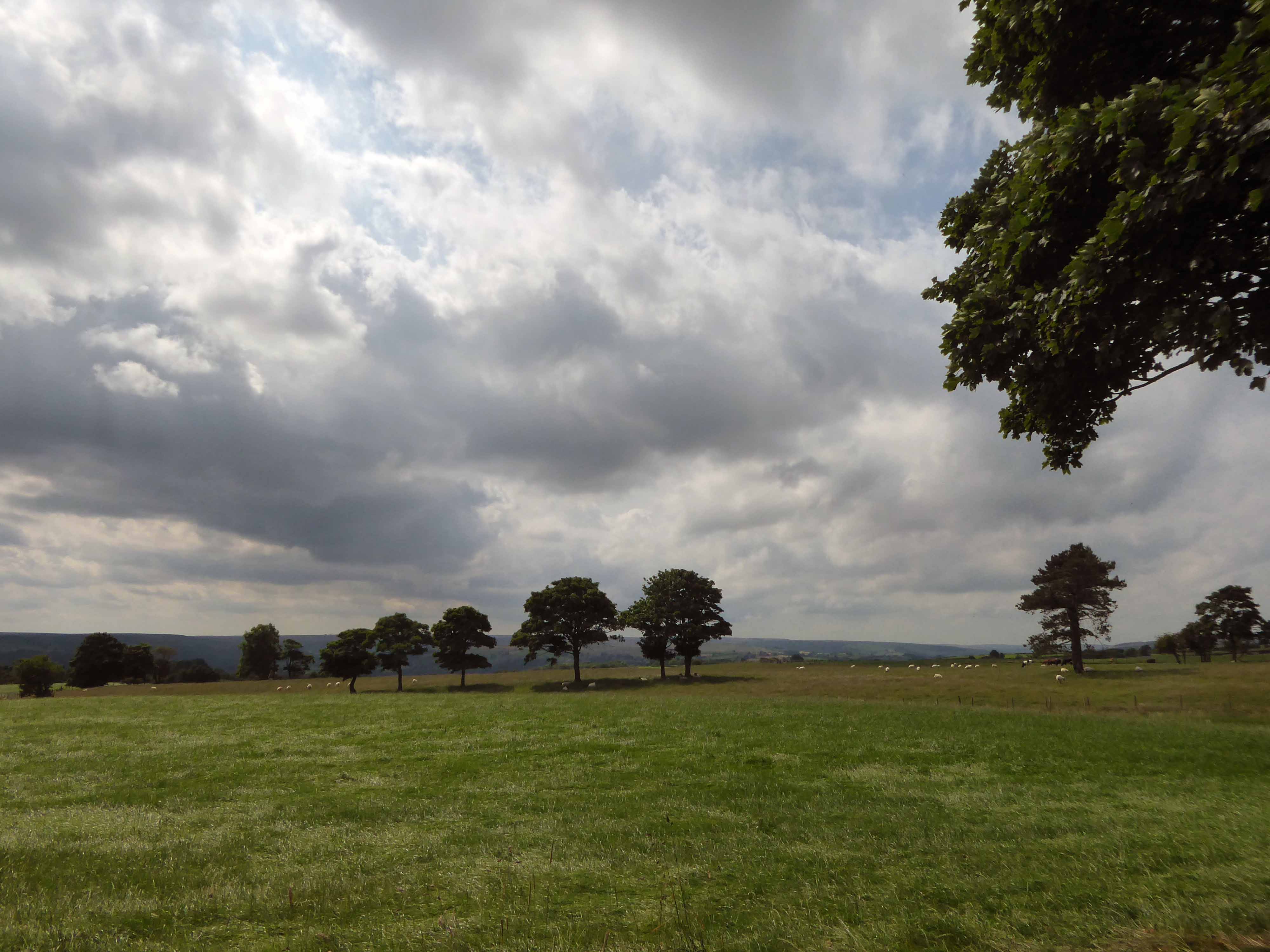
Formerly the Scarbough to Whitby Railway – the line opened in 1885 and closed in 1965 as part of the Beeching Axe.
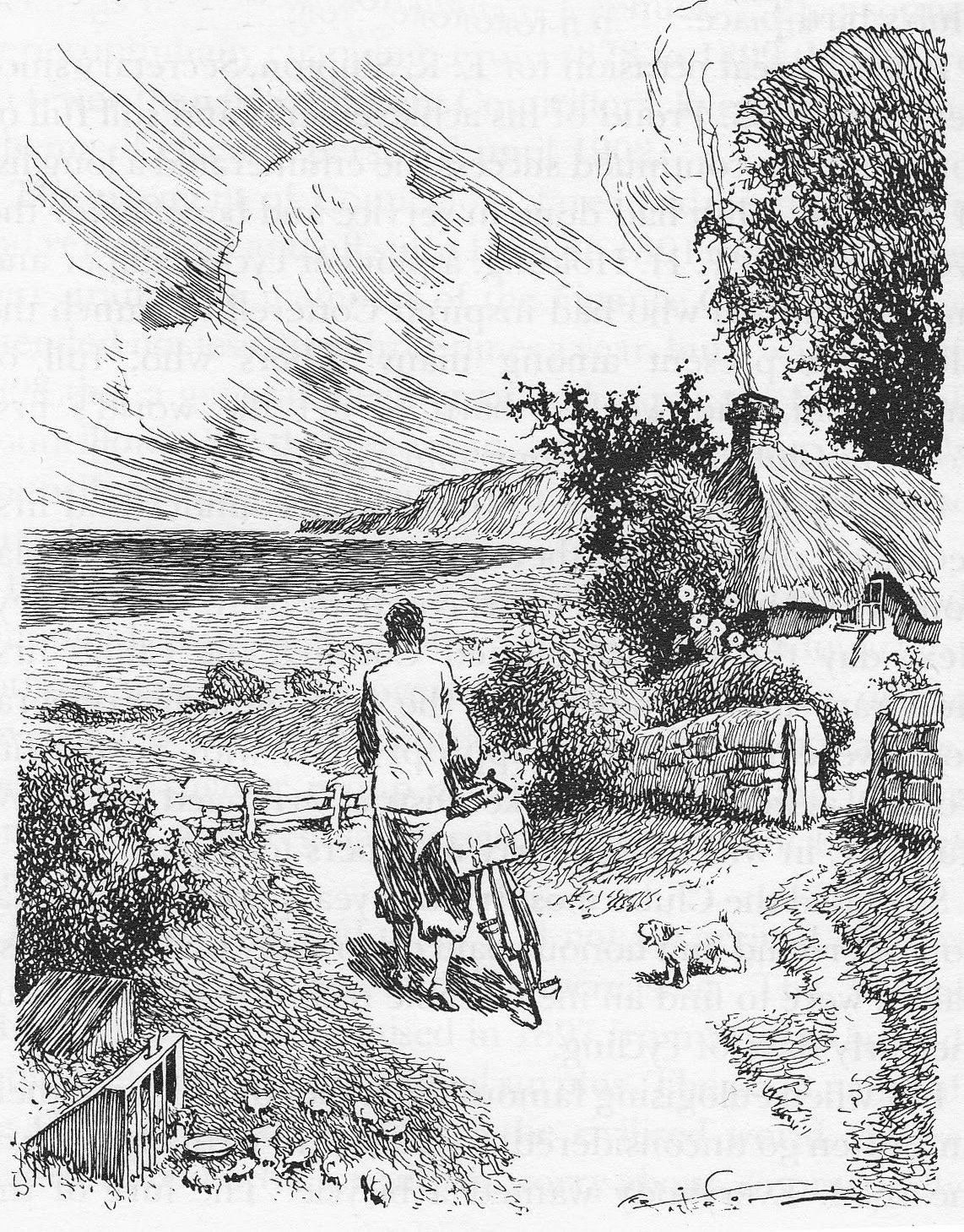
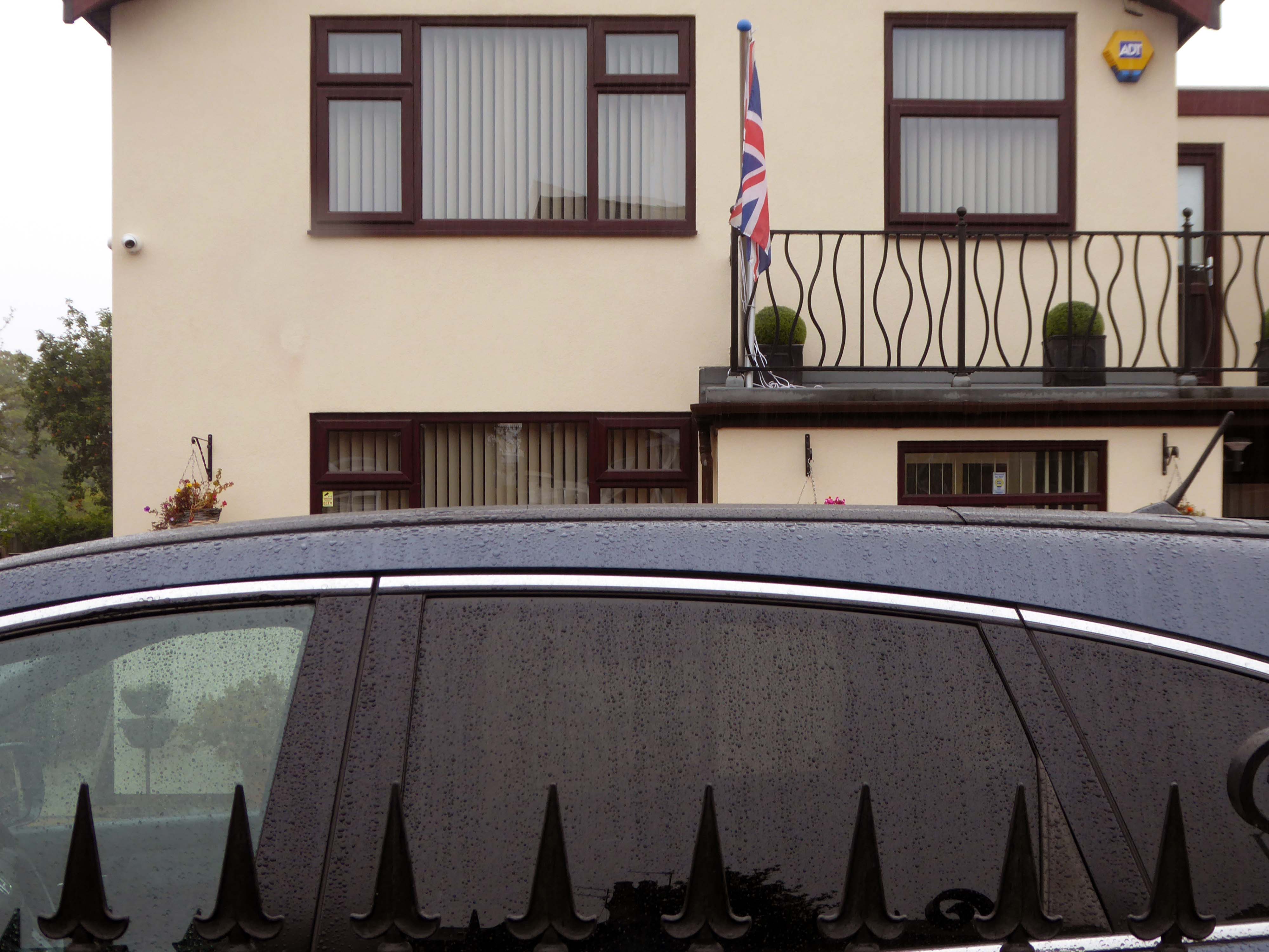
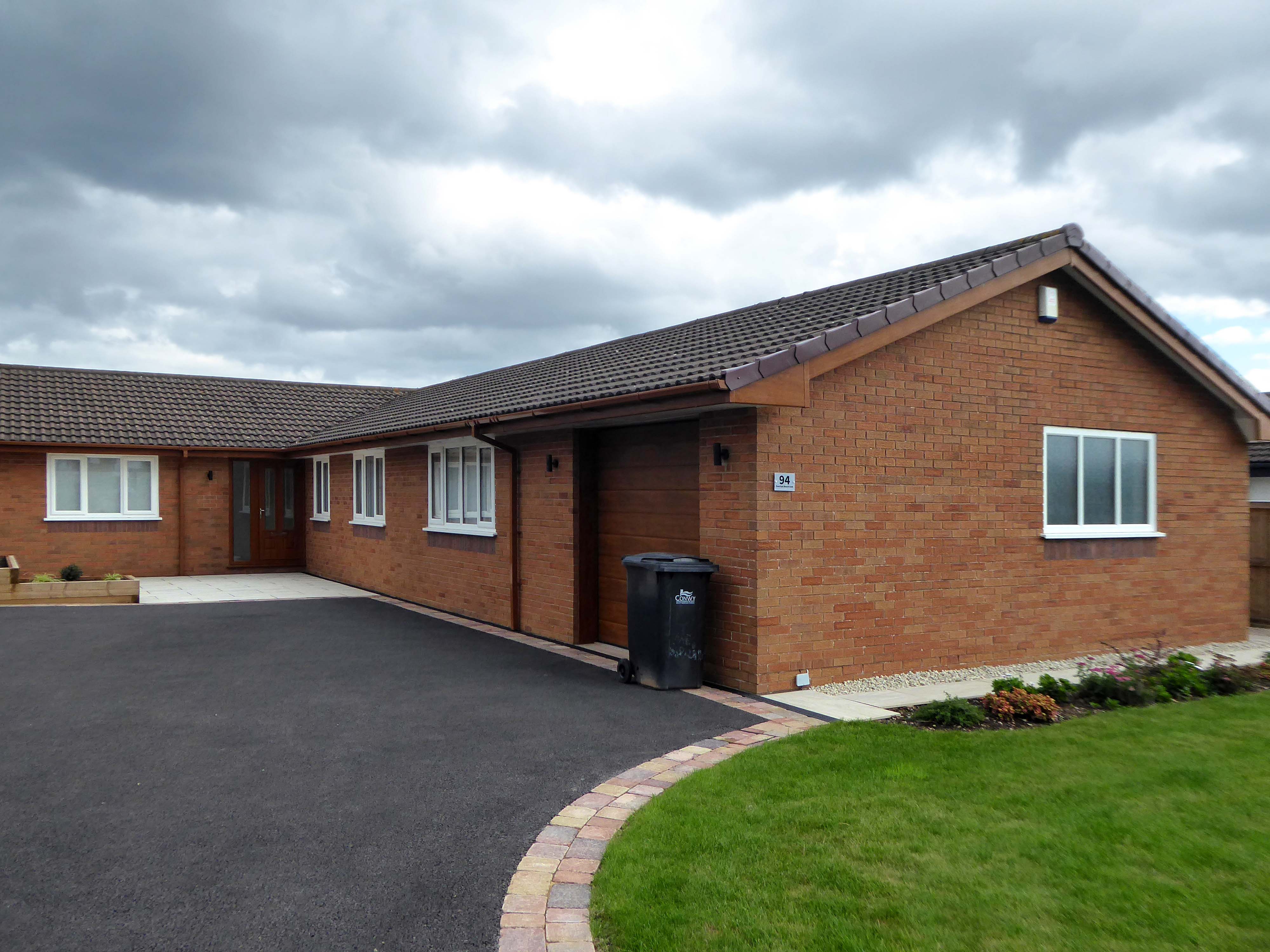
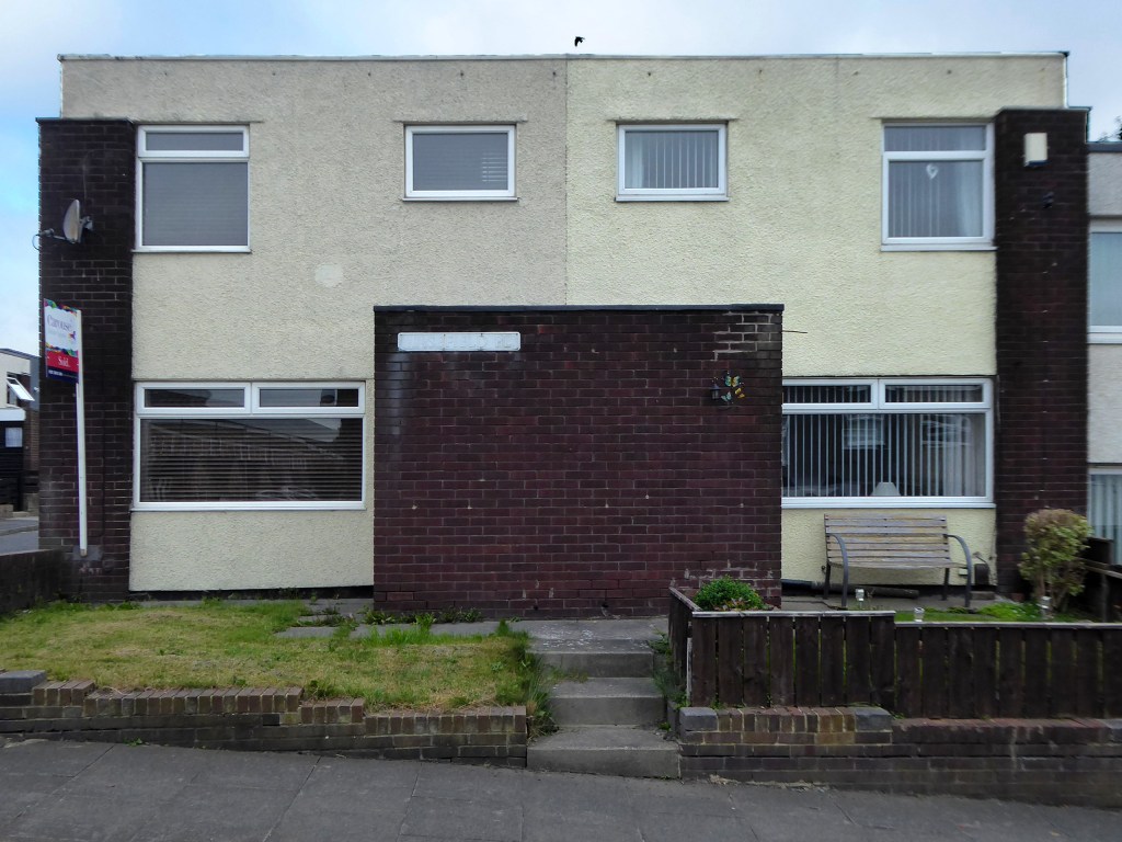
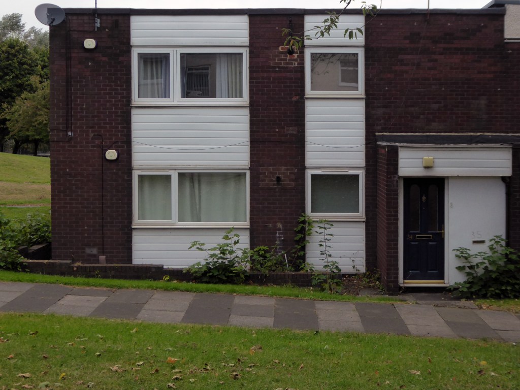
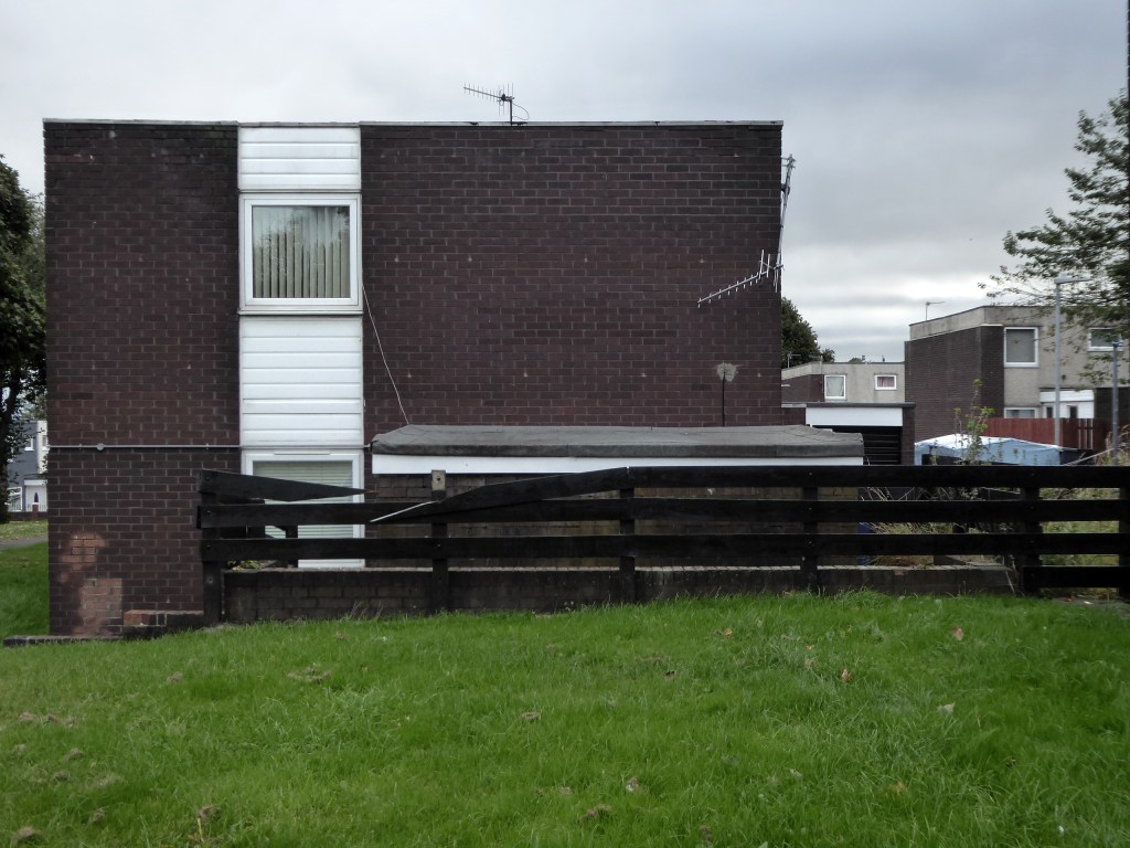
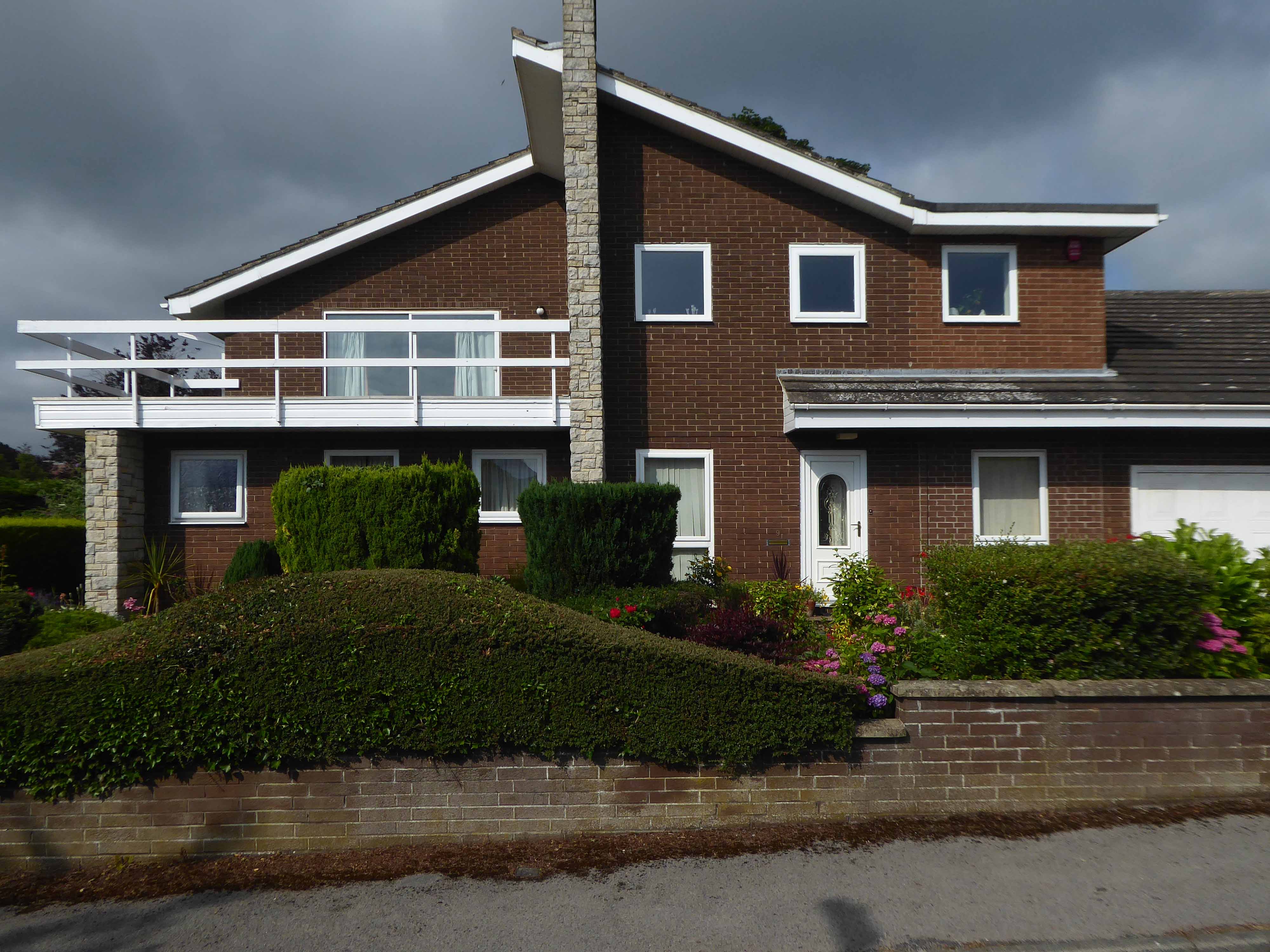
Yet again I chance upon a delightful post-war home.
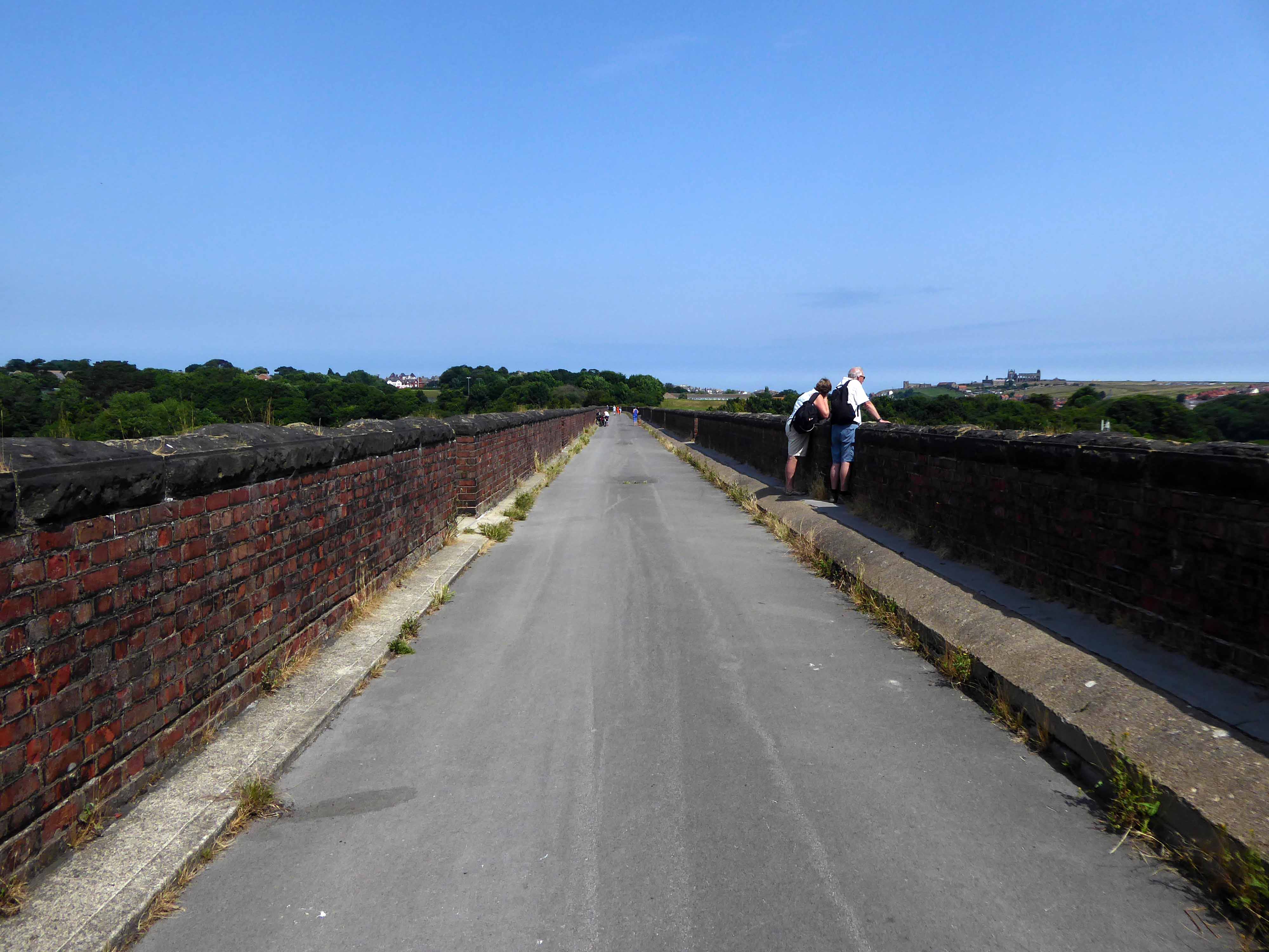
I parted company with the track dropping down to the Esk Valley from the Larpool Viaduct.
Construction began in October 1882 and was complete by October 1884.
Two men fell from the piers during construction, but recovered.
I found myself in Ruswarp, home to this enchanting bus shelter.
I bombed along the main road to Sleights.
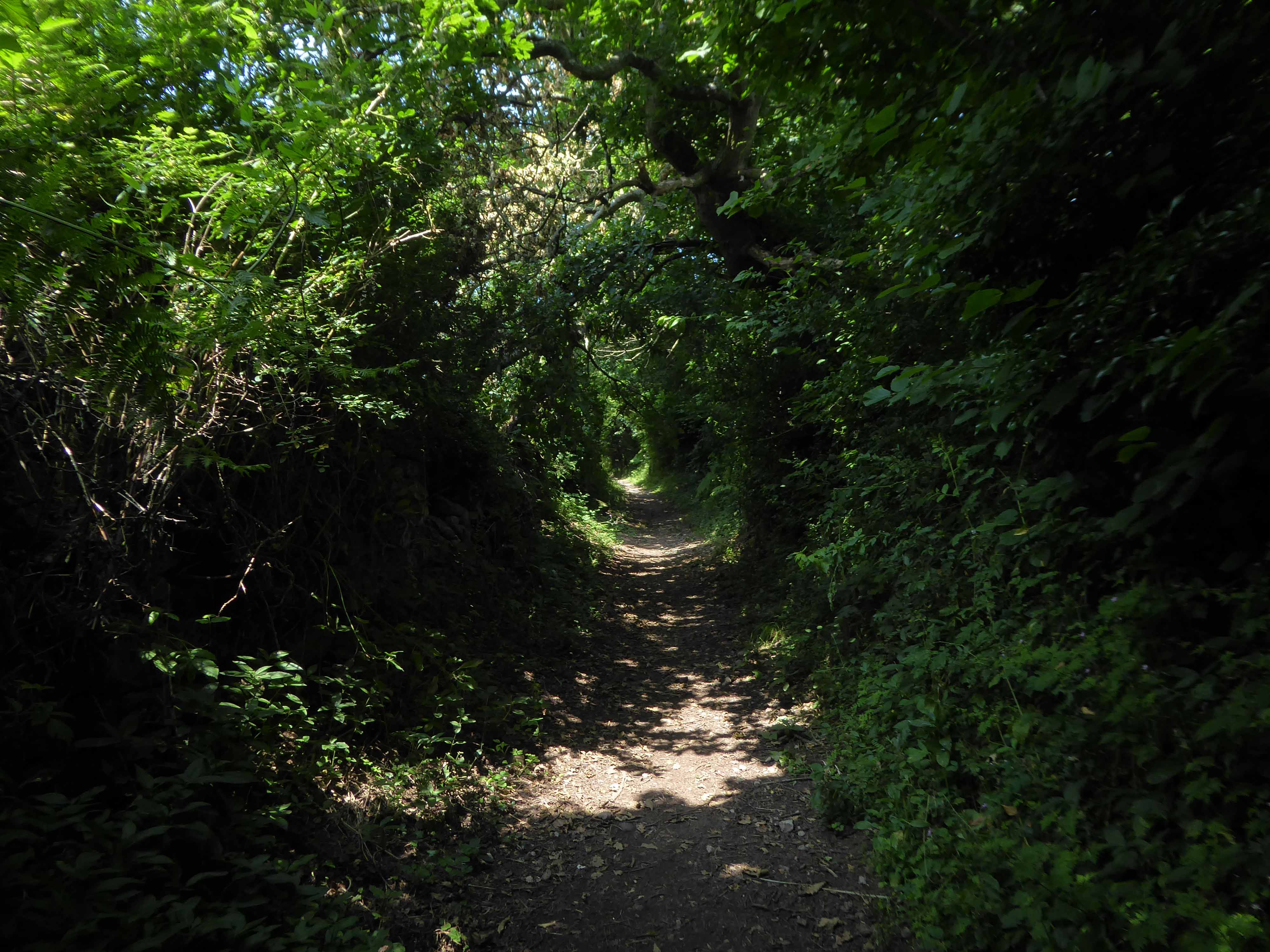
There then followed a hesitant ascent, descent, ascent along a badly signed bridleway, fearing that I had climbed the hill in error I retraced, then retraced.
A difficult push ensued, a precipitous path, rough and untended, rising ever higher and higher.
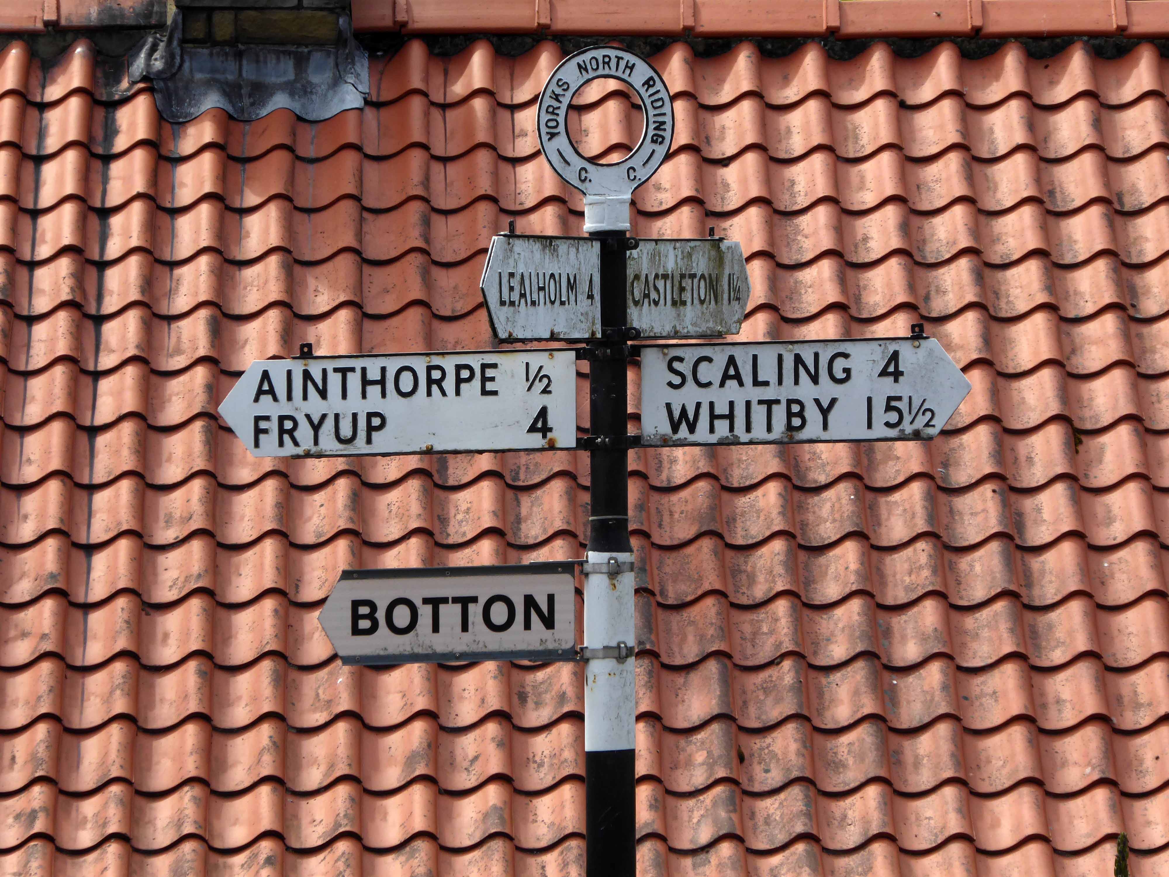
Finally arriving at Aislaby, more than somewhat exhausted – the village is mentioned in the Domesday Book as Asuluesbi.
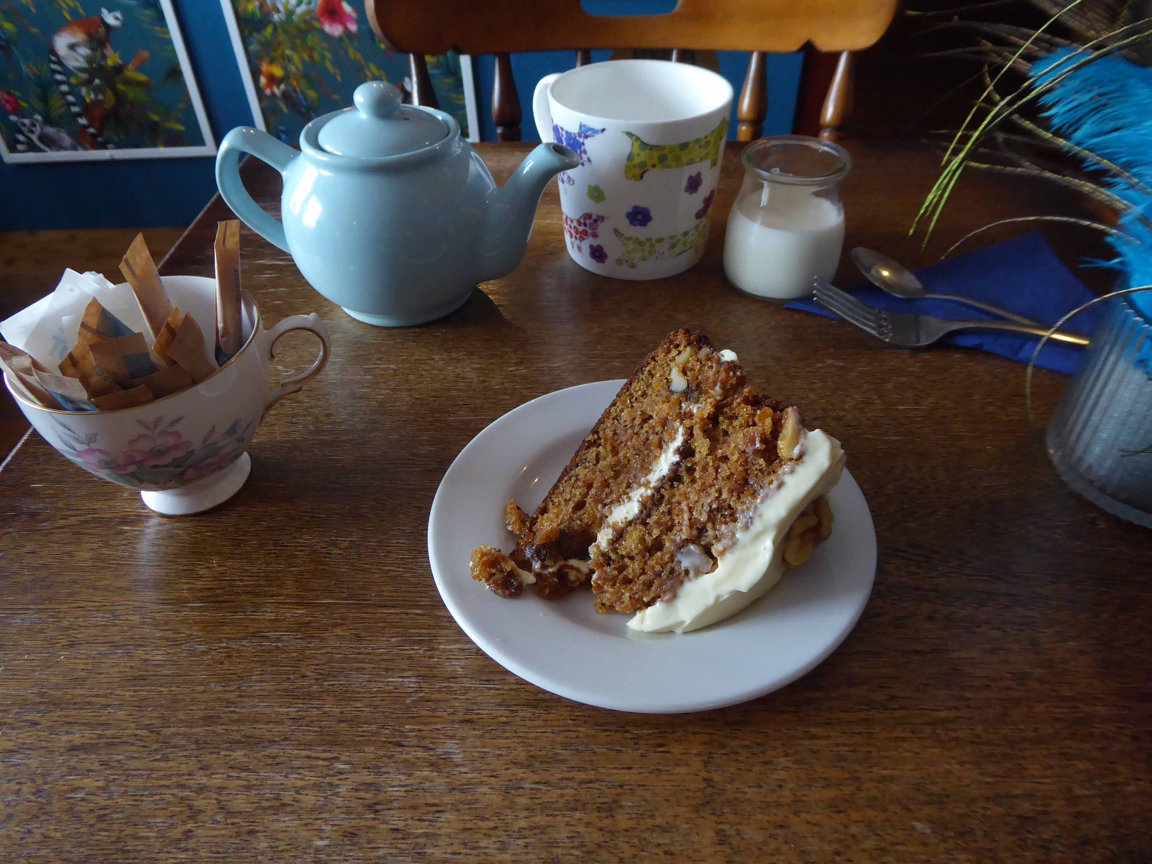
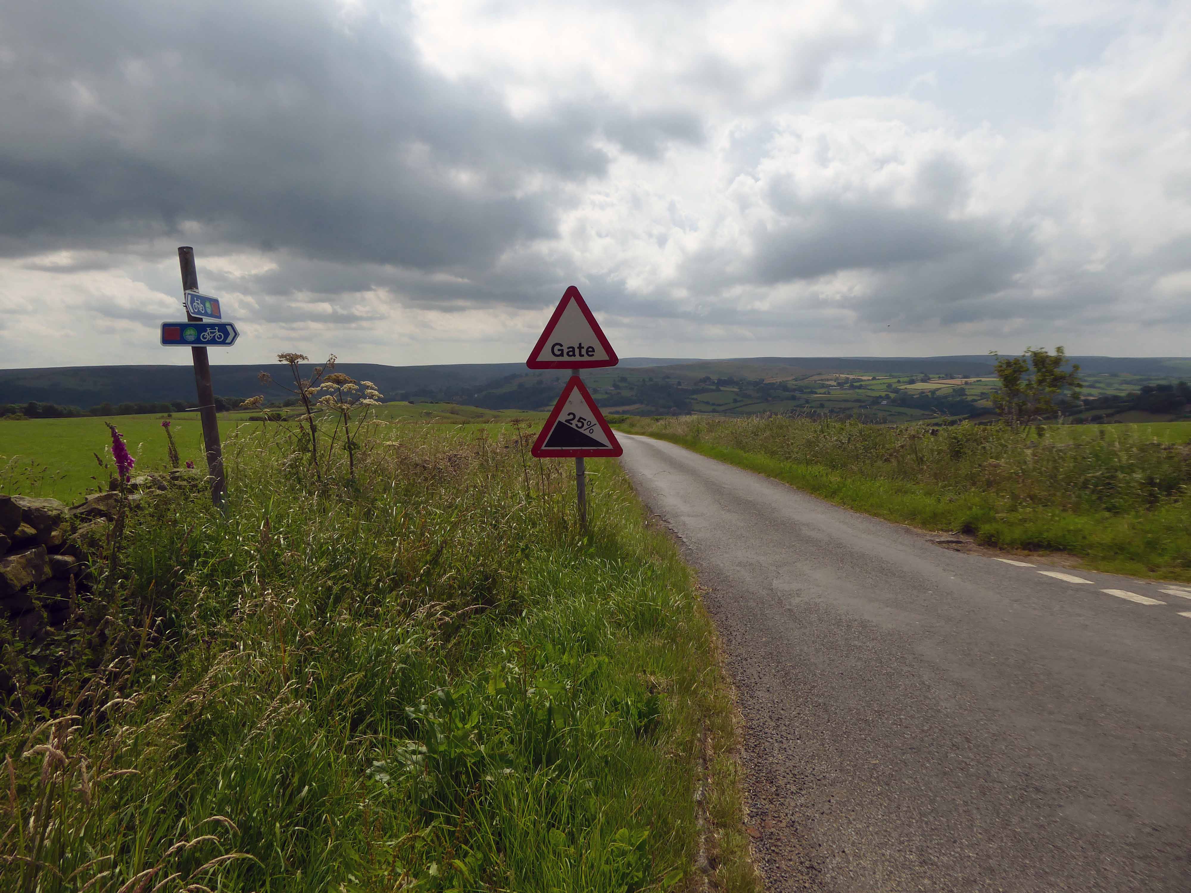
Pausing to catch my breath I took the wildly undulating road to Egton – along the way I was alerted to the presence of a tea stop by two touring cyclists from Nottingham.
The curious name Fryup probably derives from the Old English reconstruction Frige-hop: Frige was an Anglo-Saxon goddess equated with the Old Norse Frigg; hop denoted a small valley.
An old woman at Fryup was well known locally for keeping the Mark’s e’en watch – 24 April, as she lived alongside a corpse road known as Old Hell Road.
The practice involved a village seer holding vigil between 11pm and 1am to watch for the wraiths of those who would die in the following 12 months.
Castleton Moor ghost.
In the village I was given further directions by two elderly gents, who had been engaged in a discussion concerning their long term mapping of acid rain levels in the area.
One was wearing a Marshall Jefferson t-shirt.
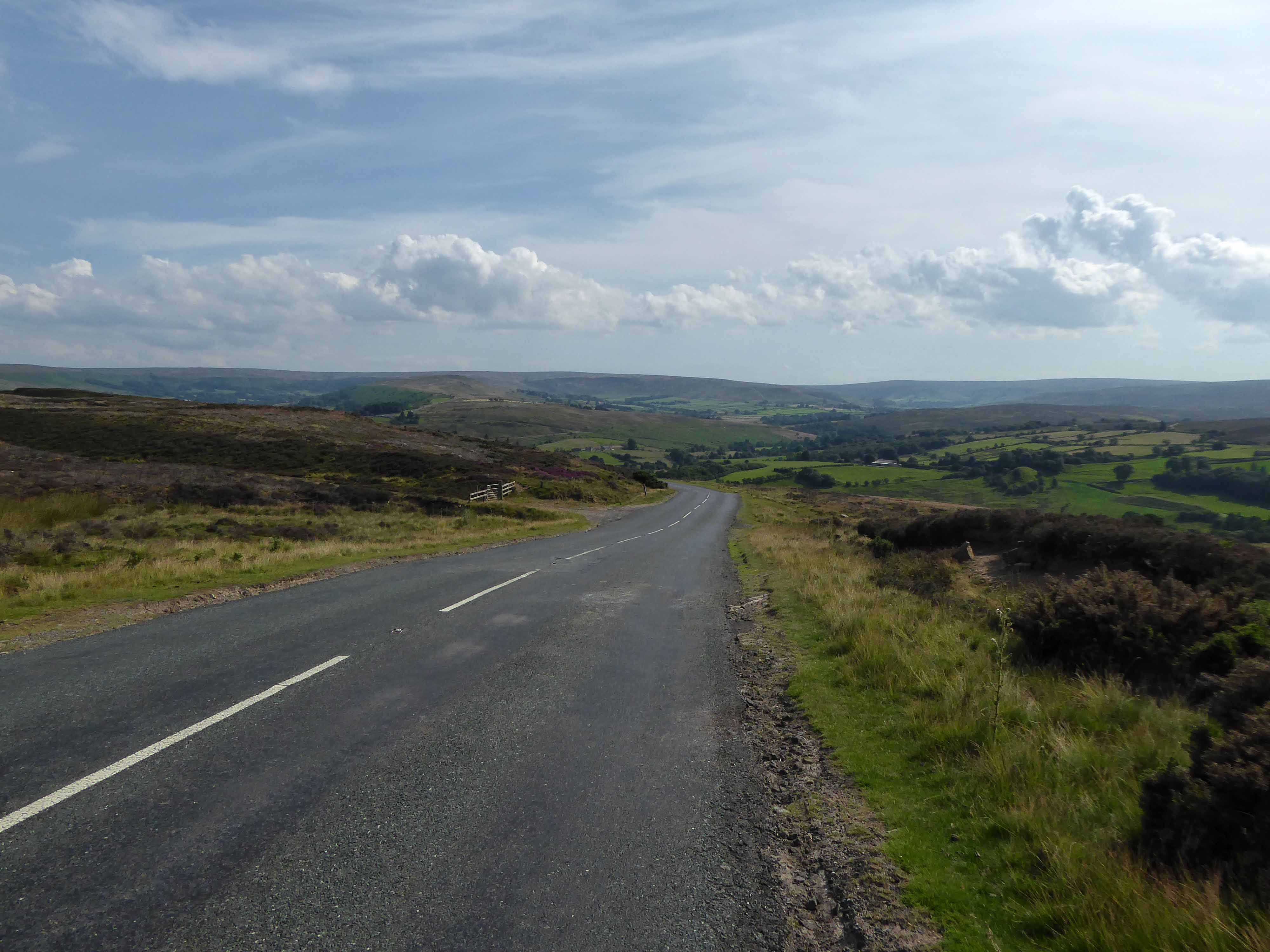
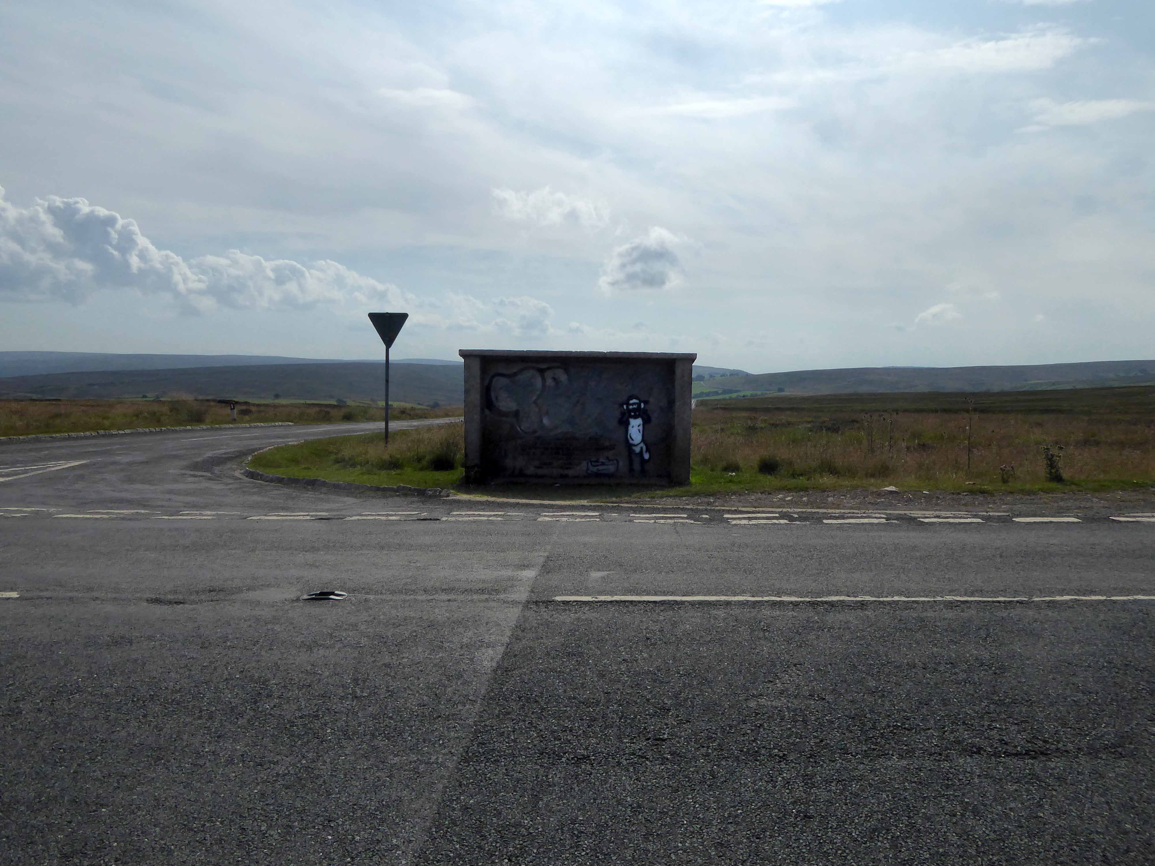
I climbed Langburn Bank onto the flatish open moorland.
Taking a brief break to snap this concrete shelter.
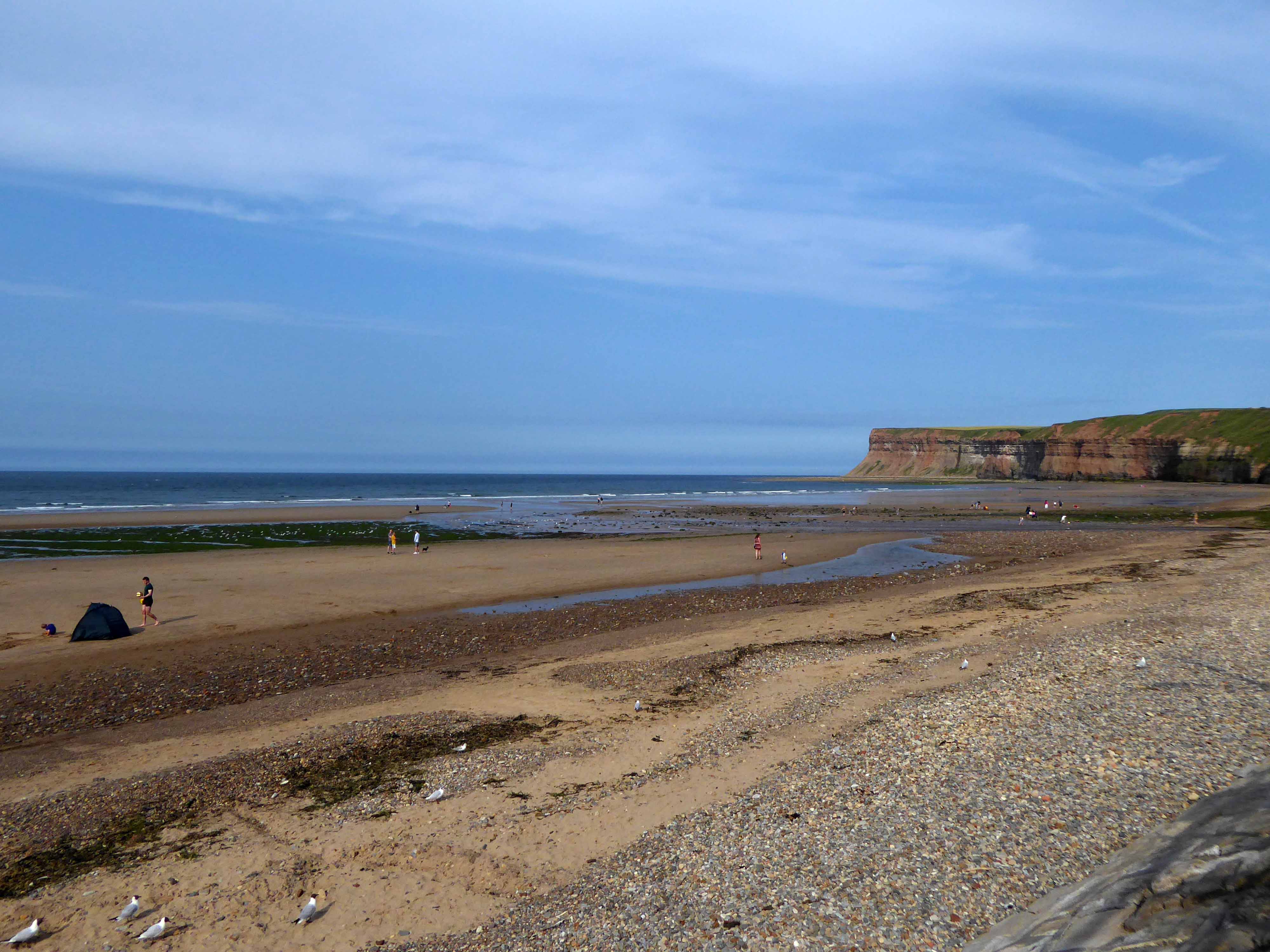
There then followed a hair stirring series of hairpin descents to the coast at Saltburn.
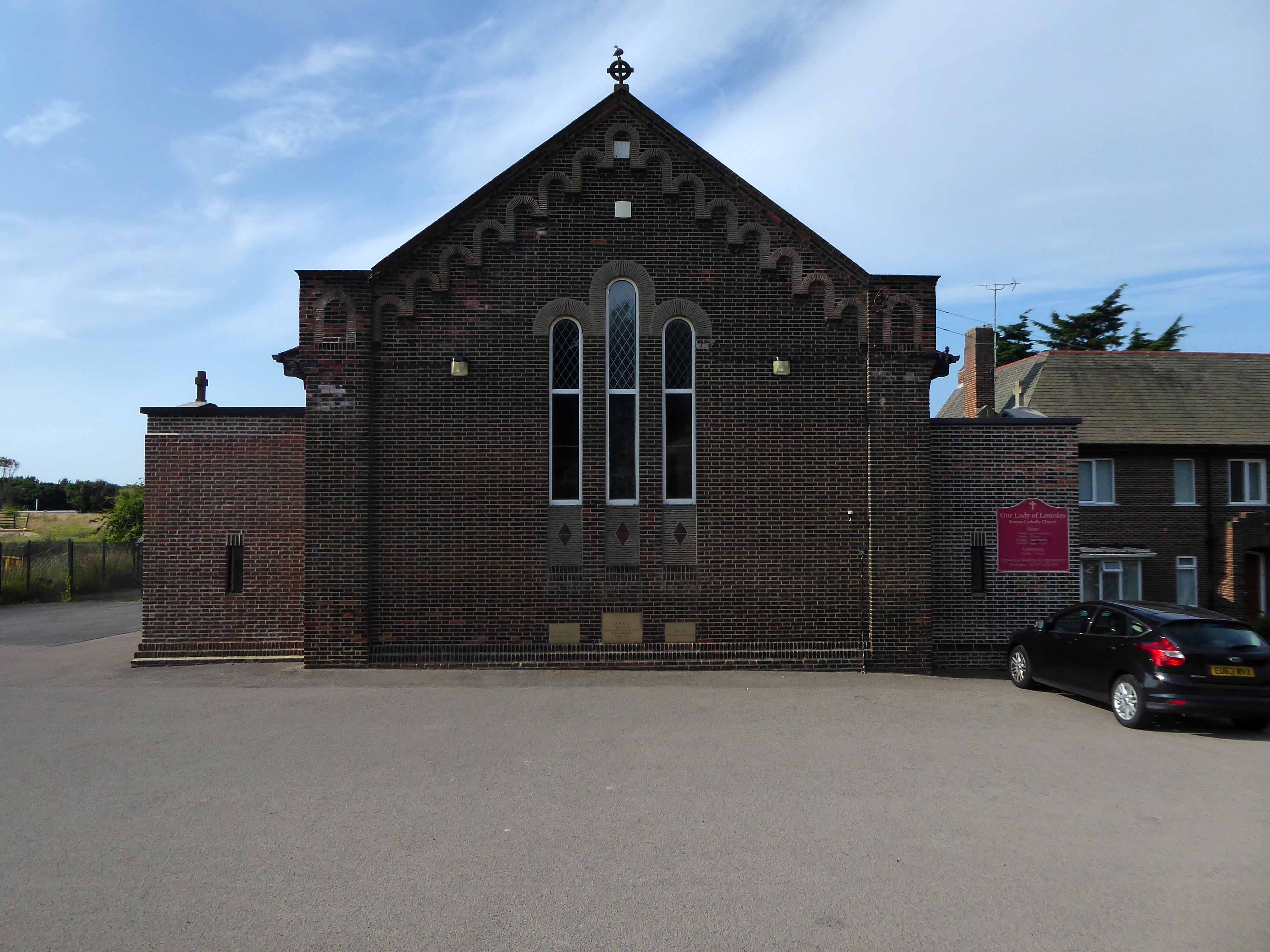
Built in 1928, this church was designed with some care and is an attractive, if fairly modest, Lombard Romanesque-style essay in brick. The use of a semi-circular apse, narrow brickwork and use of tile for decorative effect give it a pleasing appearance, typical of restrained but elegant work between the wars.
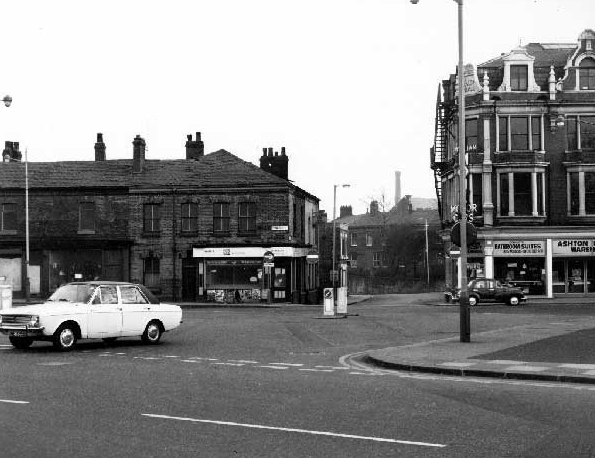
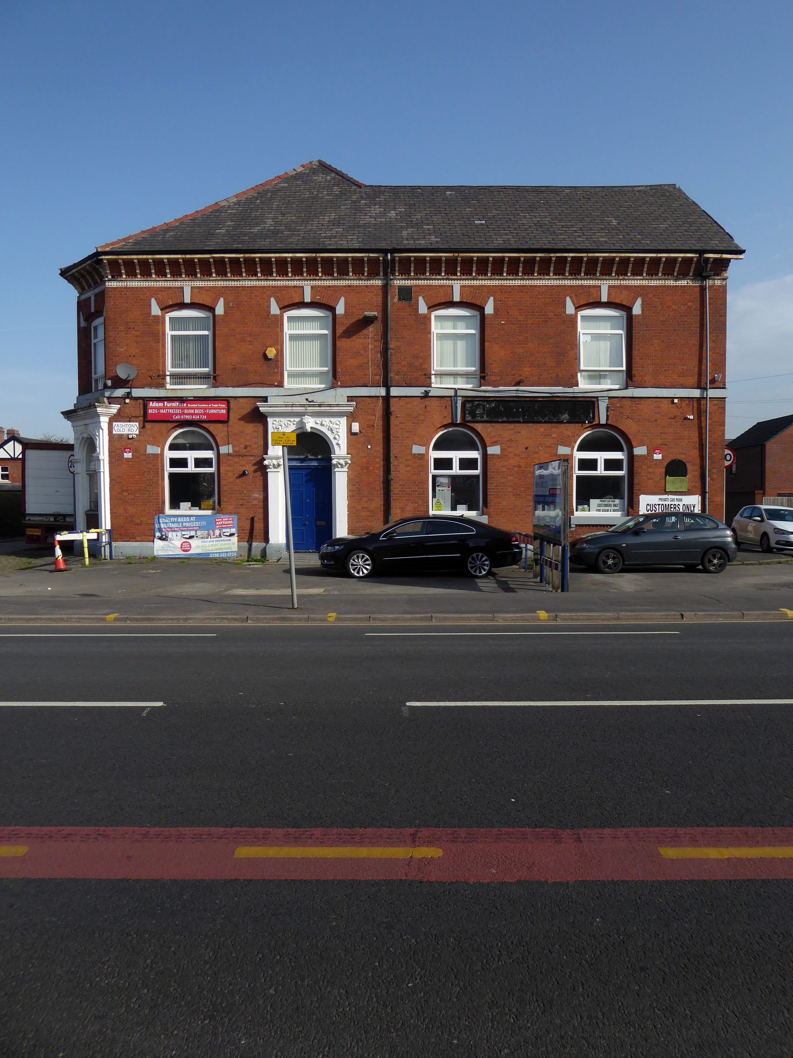
I arrived and took a look around, first time in town, here’s what I found.
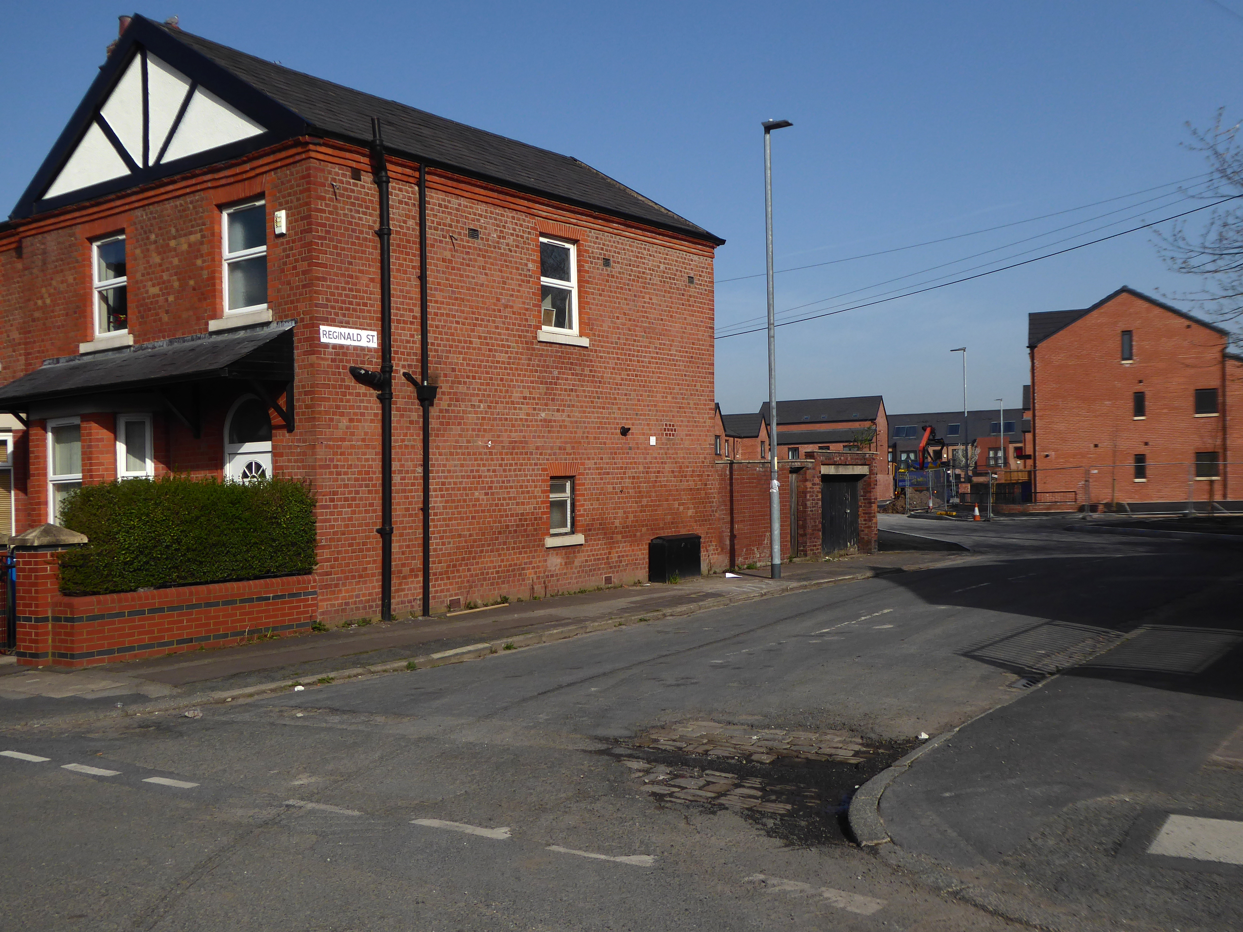
There’s been more than a few comings and goings along Ashton Old Road.
1906
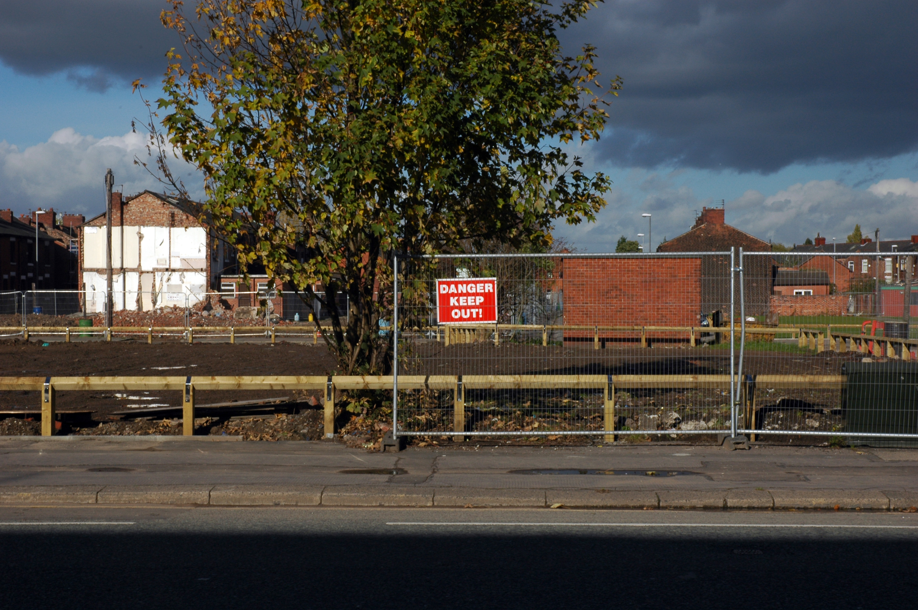
Where once there were fields, homes and industry arrive, as the Industrial Revolution is in full swing.
1908
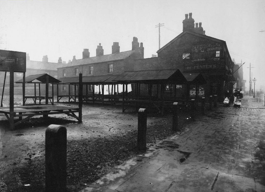
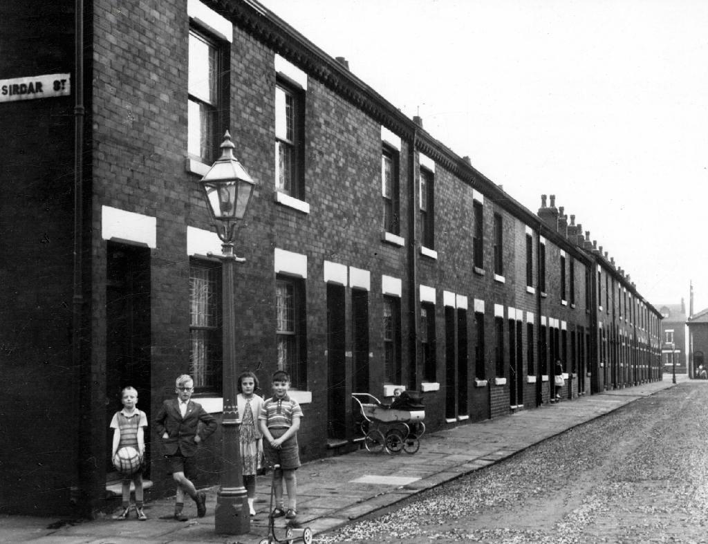
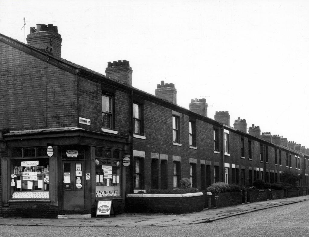
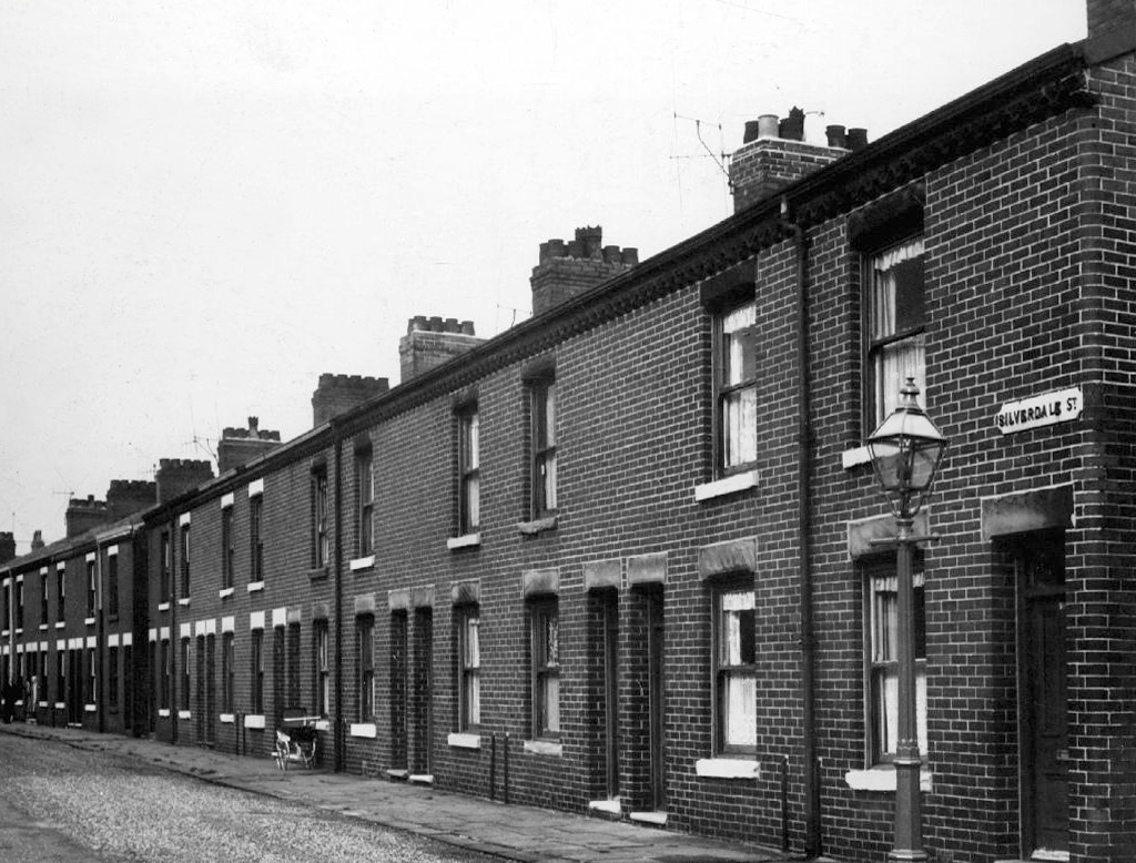
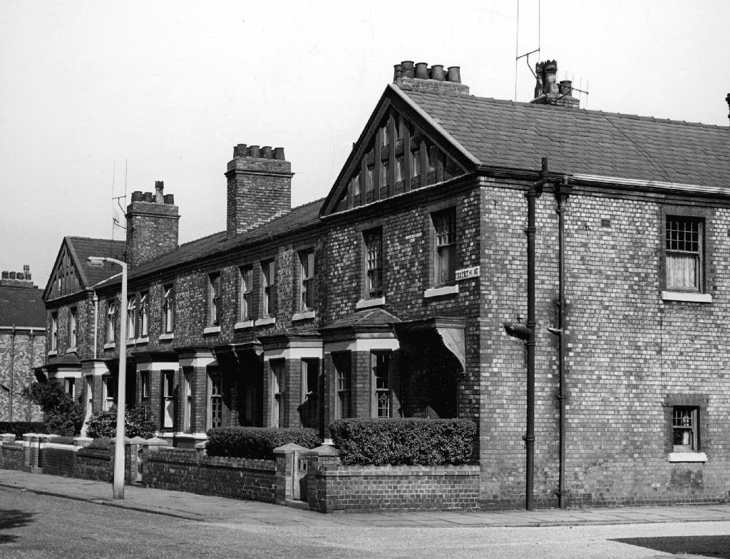
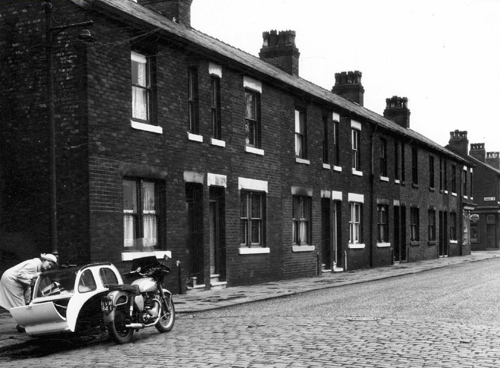
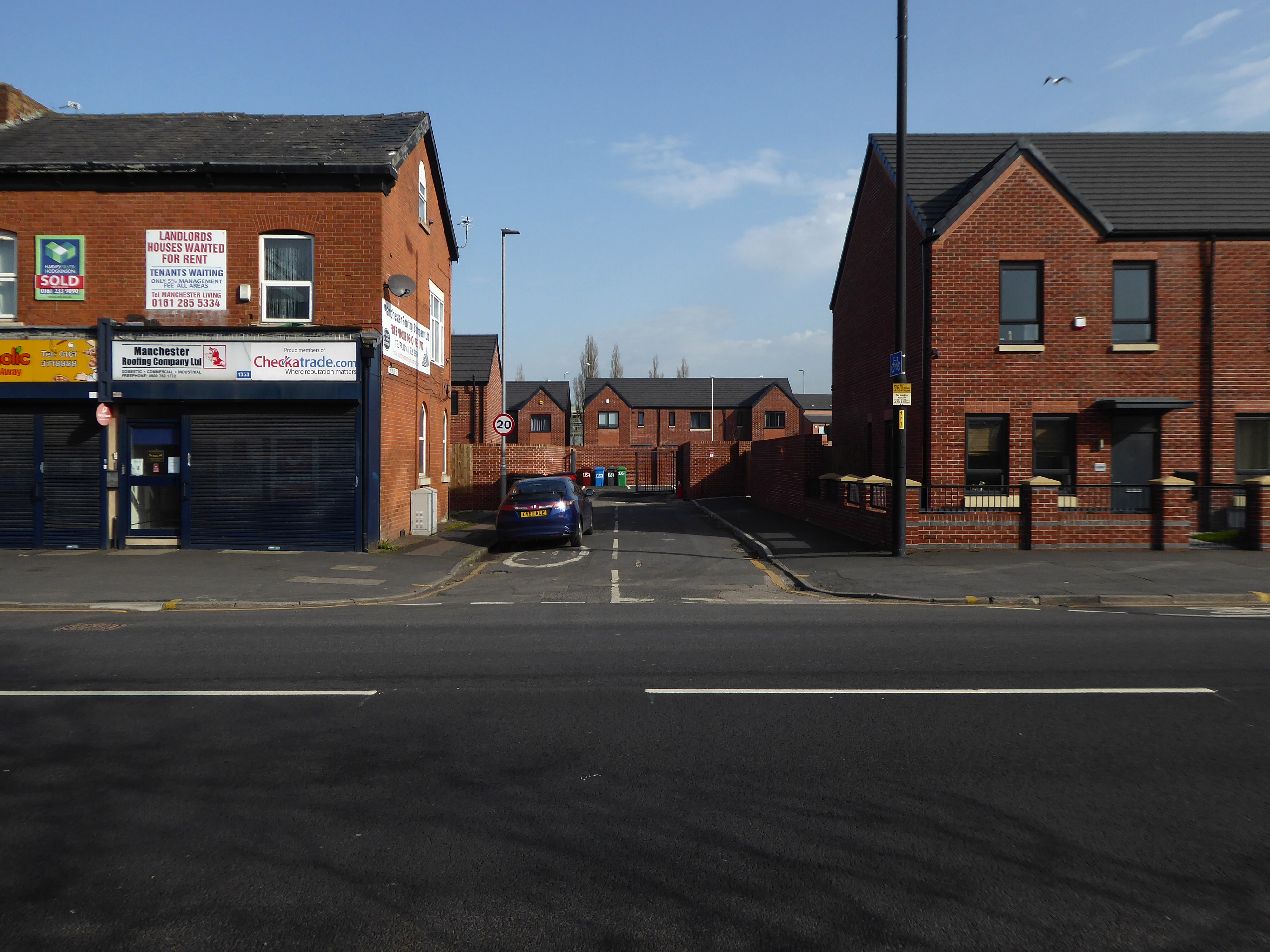
The streets to the north of Ashton Old Road are alive with shops, homes, people and prams.
Along with the occasional motor car.
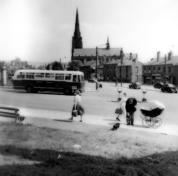
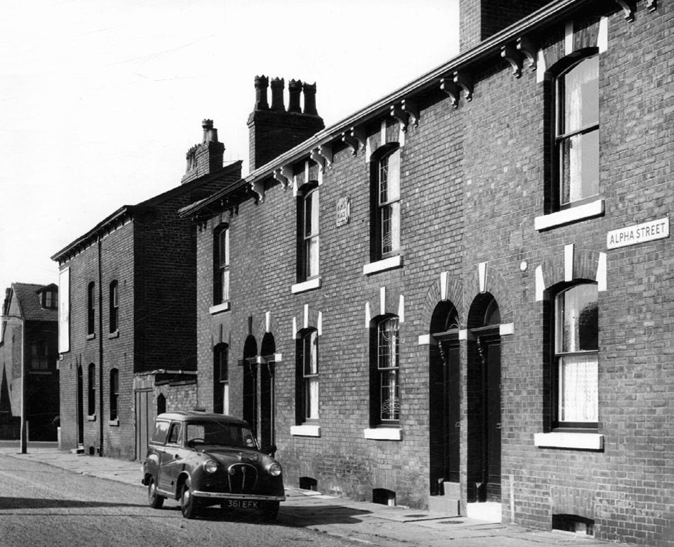
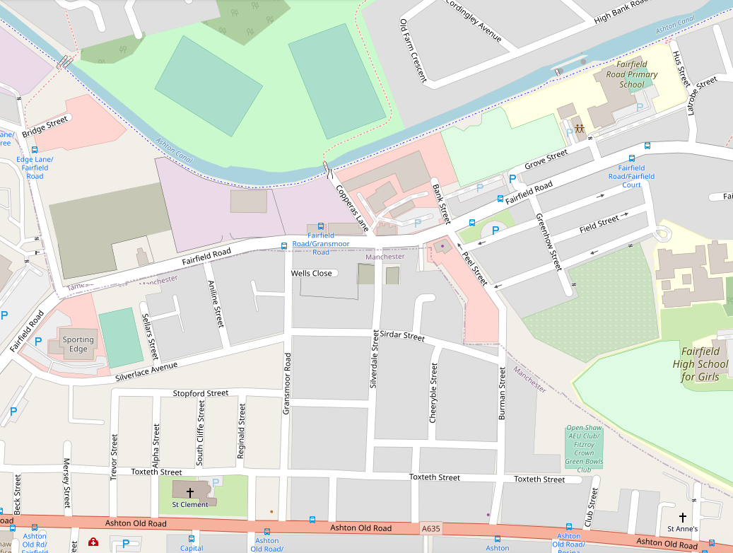
Alpha StreetBowness StreetBurman StreetSilverdale StreetToxteth StreetTrevor Street
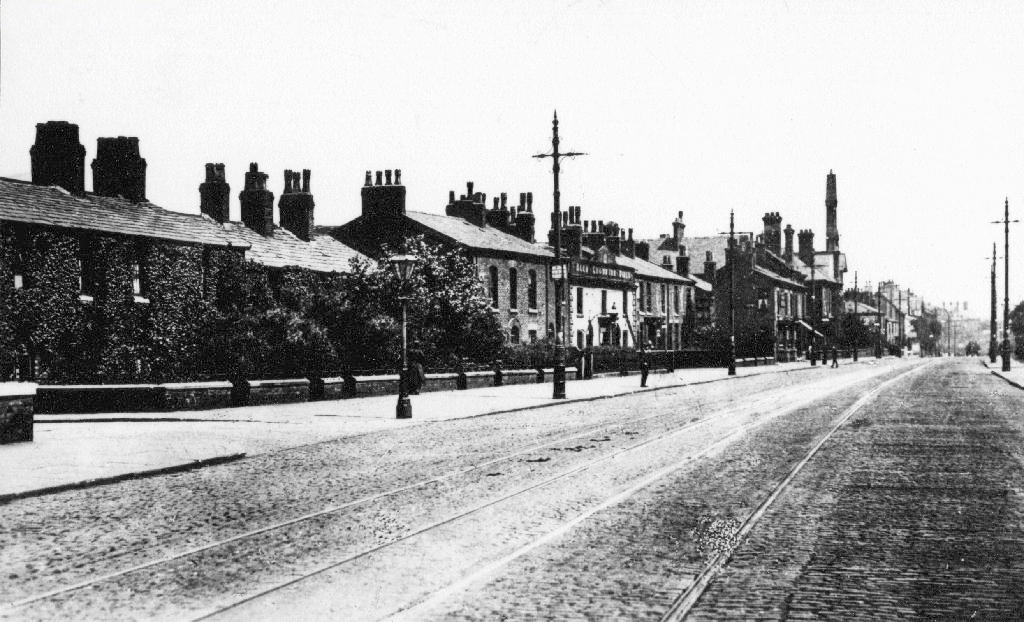
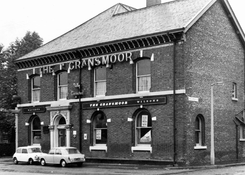
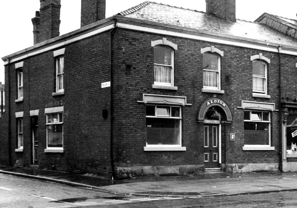
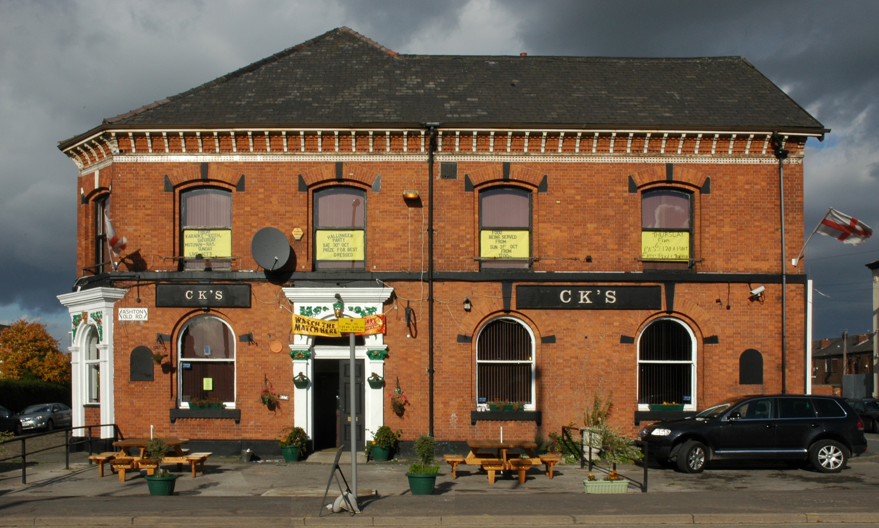
The Old Road boasted some fine busy boozers.
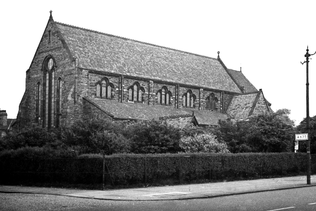
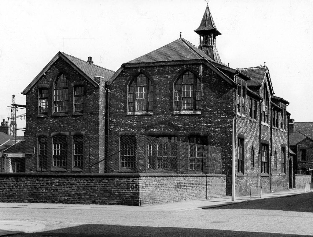
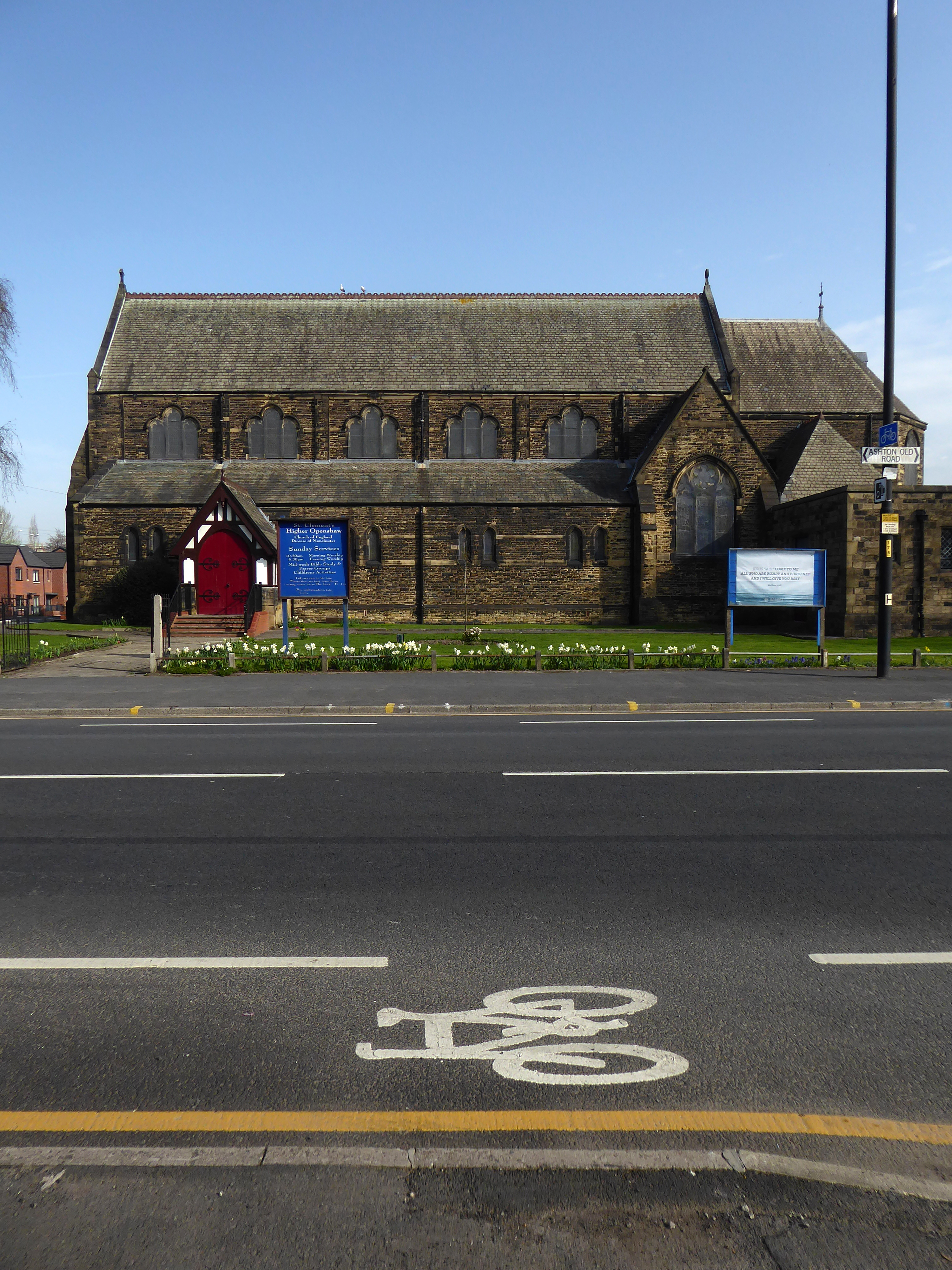
And a splendid church and school.
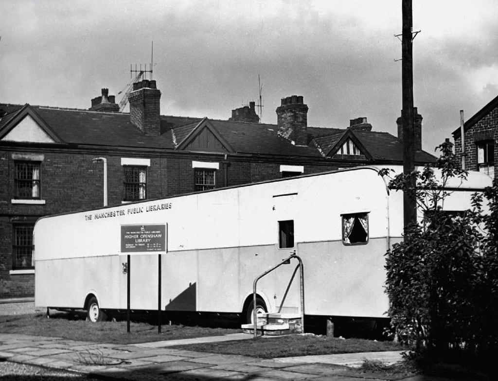
St Clements
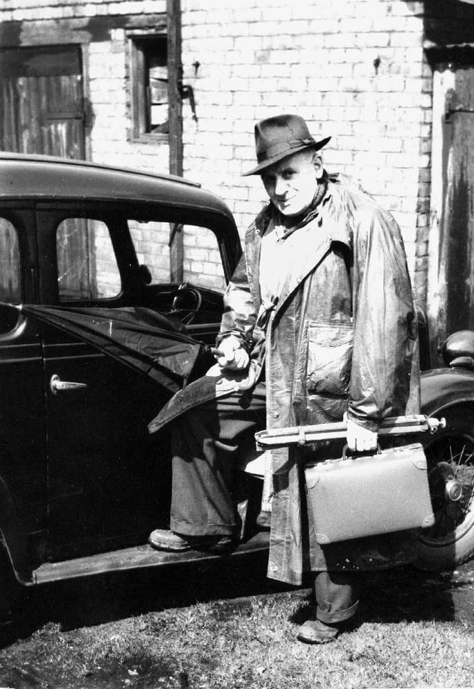
The man responsible for the majority of these archive photographs is Tommy Brooks of 56 Gransmoor Road.
He is my hero, a member go the Manchester Amateur Photographic Society, cycling the streets of Manchester to produce a unique record of life in the Sixties.
Converted to retail use 24th September 2012 after closure. This interesting Victorian building stands back from the road with what may well be a coach road in front. Inside the high ceilings and glorious plasterwork gave the impression of a gentlemen’s club. Though it previously sold cask Banks’s beers in its earlier years, its final days were seen out with only keg beers being available.
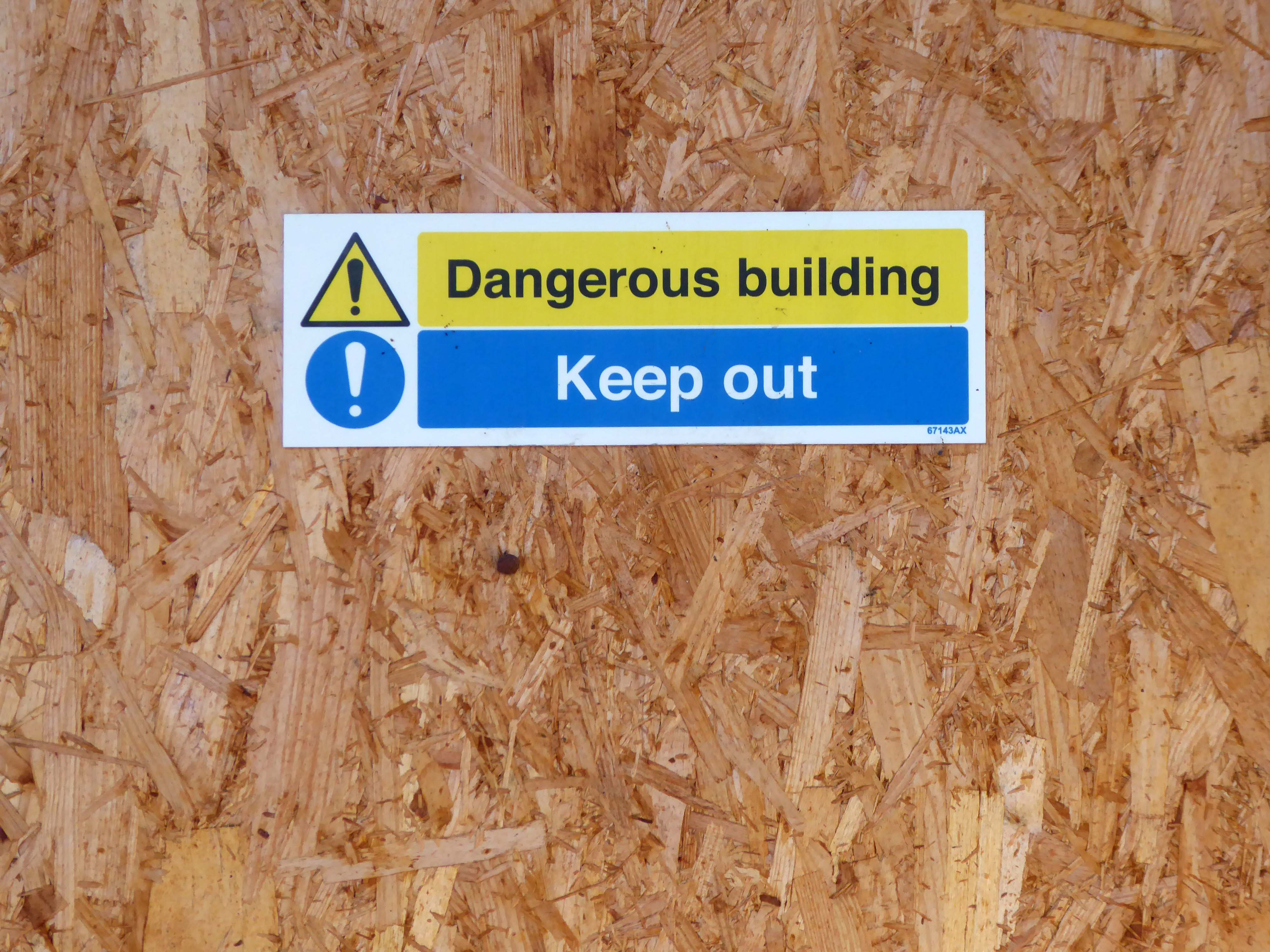
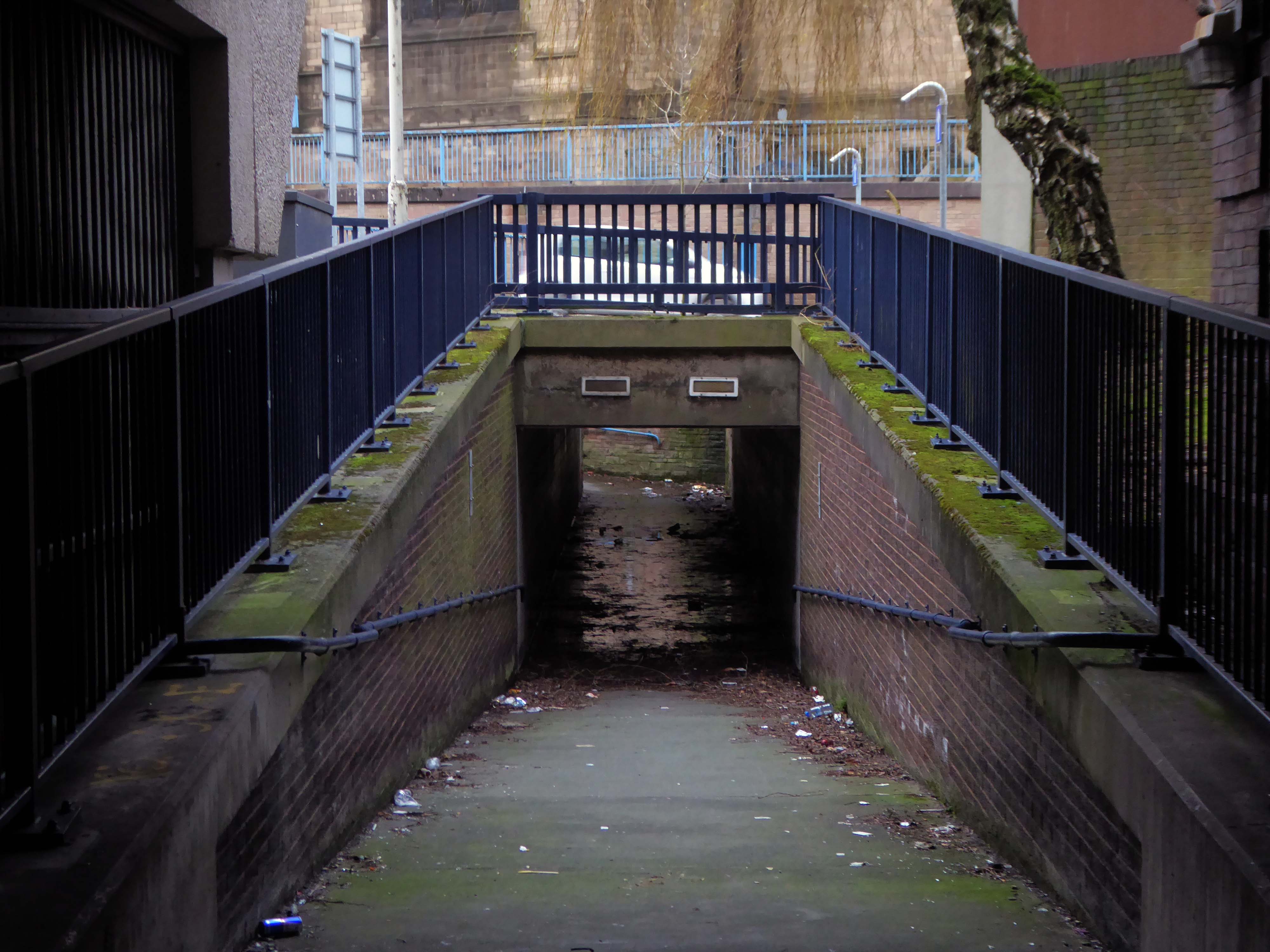
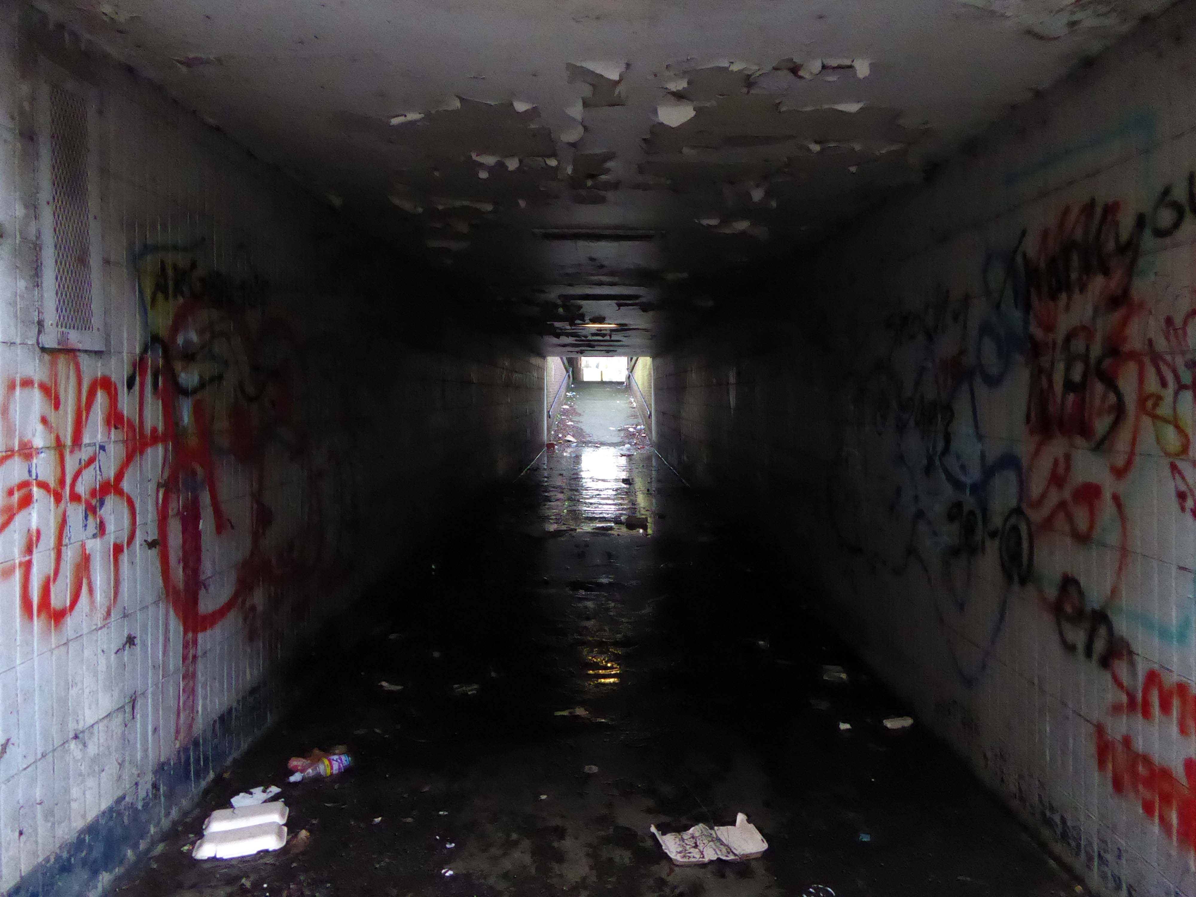
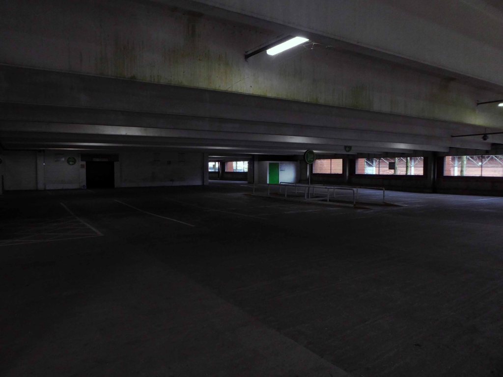
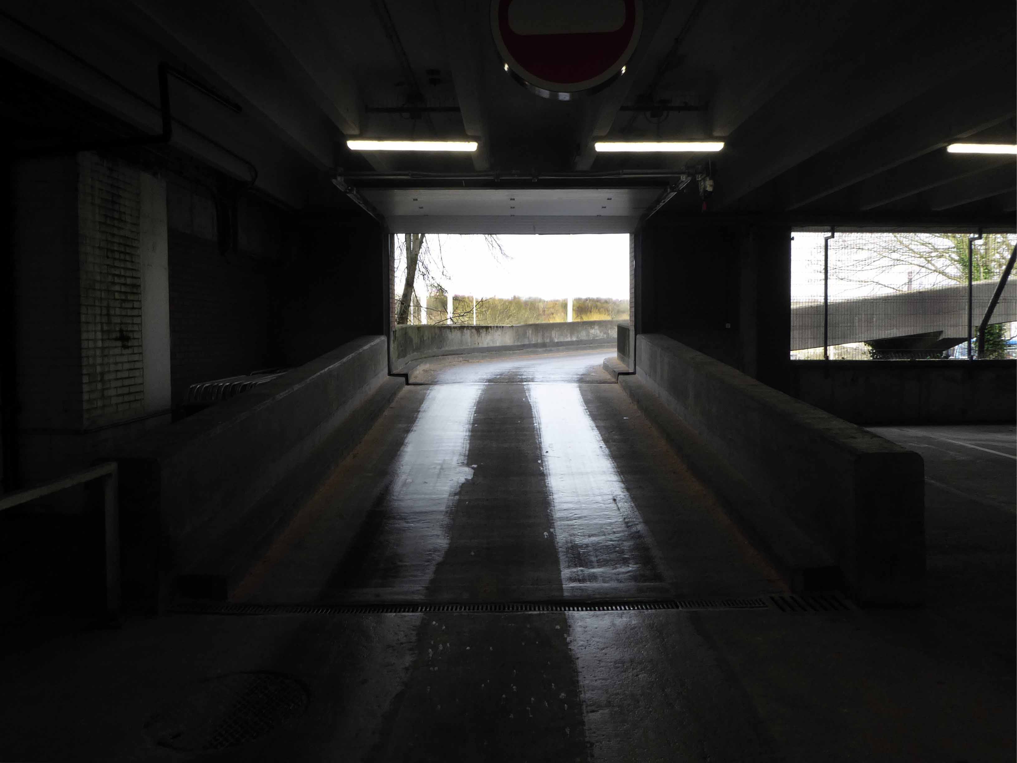
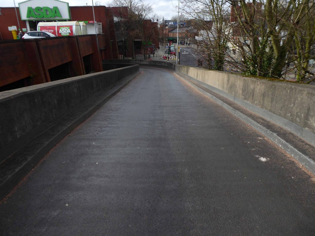
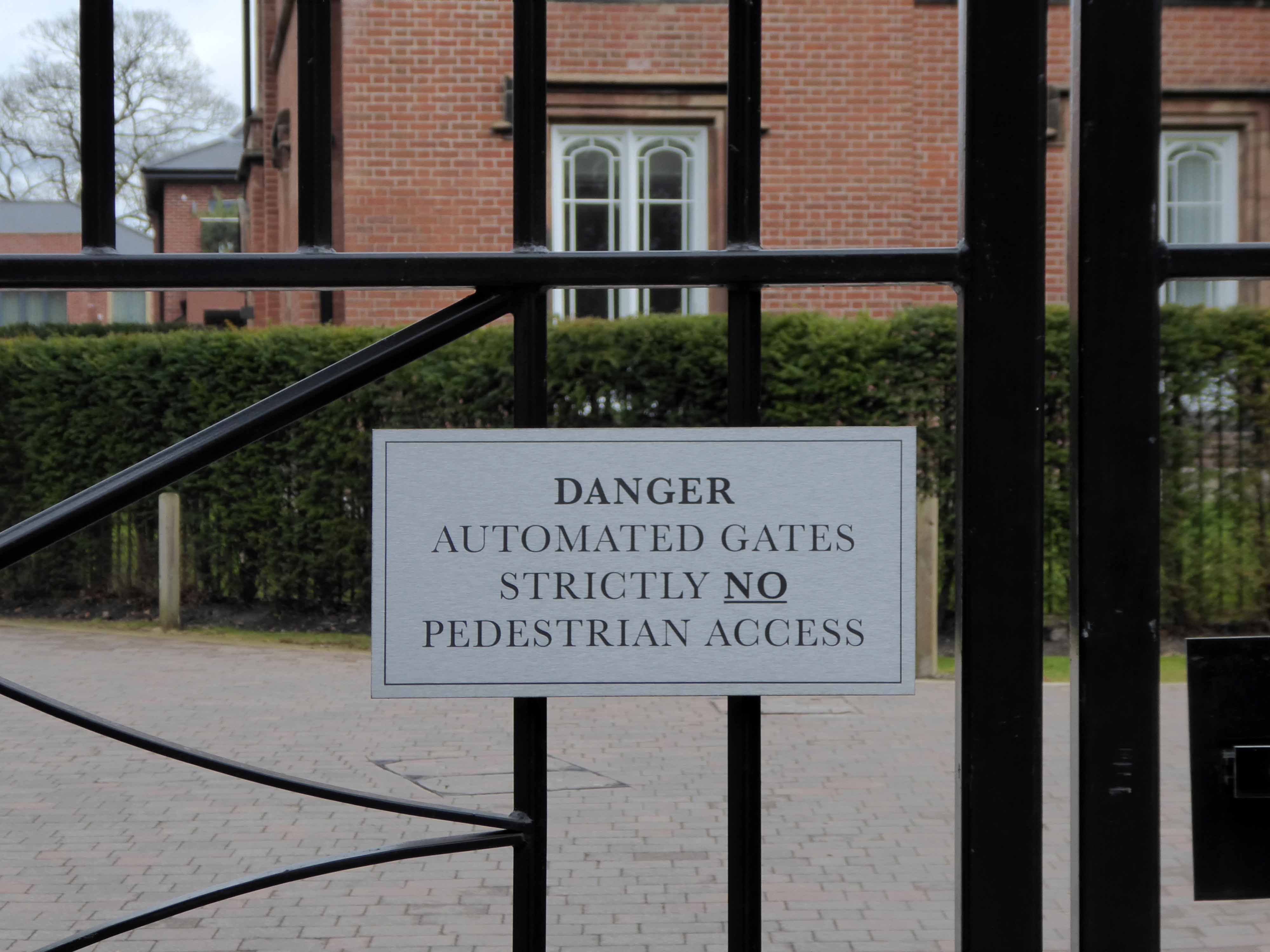
It’s addictive passing the no access signs, onwards into the abyss.
He hated all this, and somehow he couldn’t get away.
Joseph Conrad – Heart of Darkness
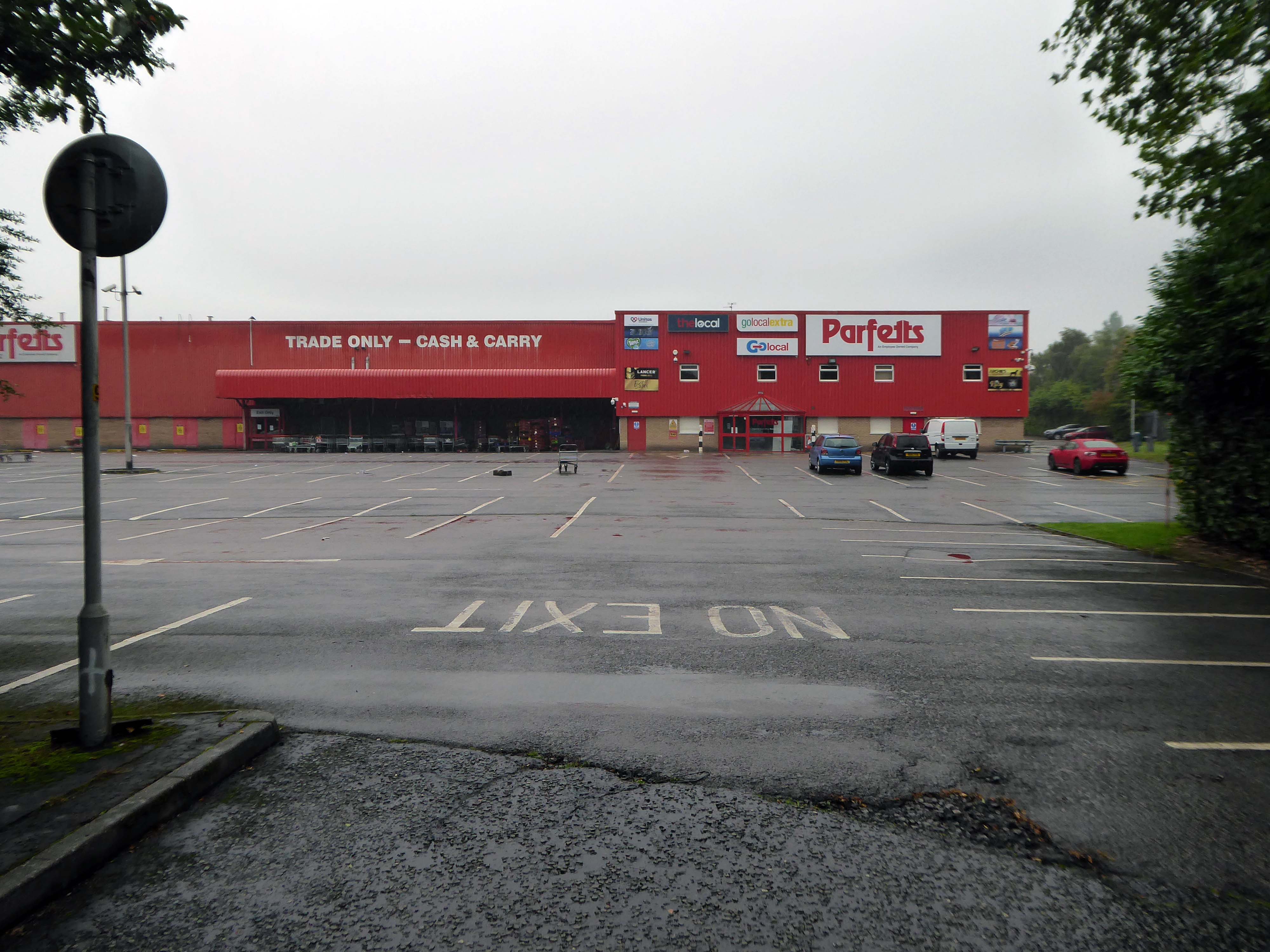
Asda Stores Ltd is a British supermarket chain. It is headquartered in Leeds. The company was founded in 1949 when the Asquith family merged their retail business with the Associated Dairies company of Yorkshire.
It was listed on the London Stock Exchange until 1999 when it was acquired by Walmart for £6.7 billion.
In February 2021, EG Group – led by the Issa brothers and TDR Capital, acquired Asda.
The company was fined £850,000 in 2006 for offering 340 staff at a Dartford depot a pay rise in return for giving up a union collective bargaining agreement. Poor relations continued as Asda management attempted to introduce new rights and working practices shortly thereafter at another centre in Washington, Tyne and Wear.
Let’s hope that the new owners having been ruled against in an equal pay dispute, attempt to forge better labour relations.
In March 2021 the employees won a Supreme Court ruling upholding an earlier court ruling permitting the action, and enabling employment tribunal action to decide equal value claims.
Asda stated: This ruling relates to one stage of a complex case that is likely to take several years to reach a conclusion.
The claim could lead to about £500 million of compensation to lower paid employees.
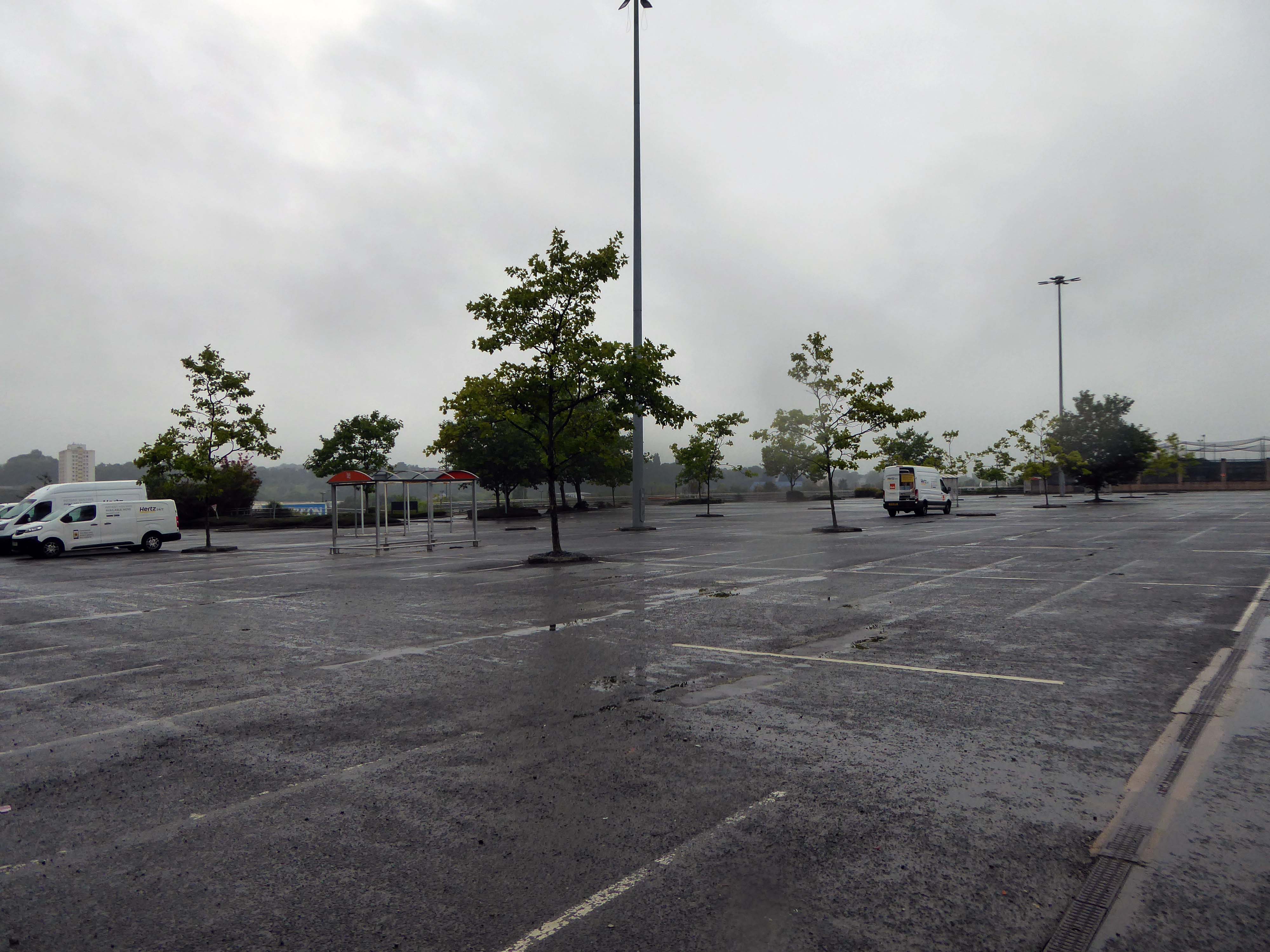
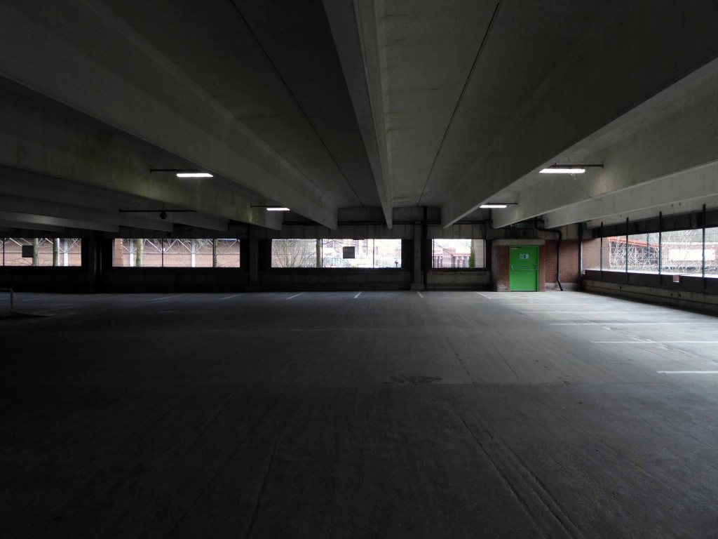
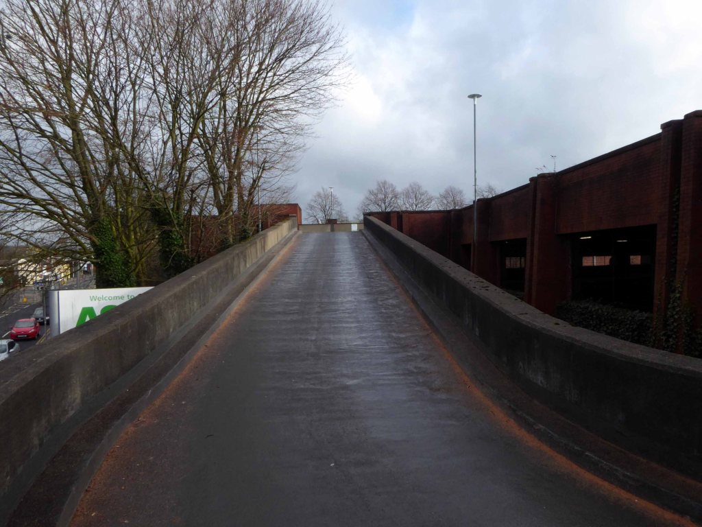
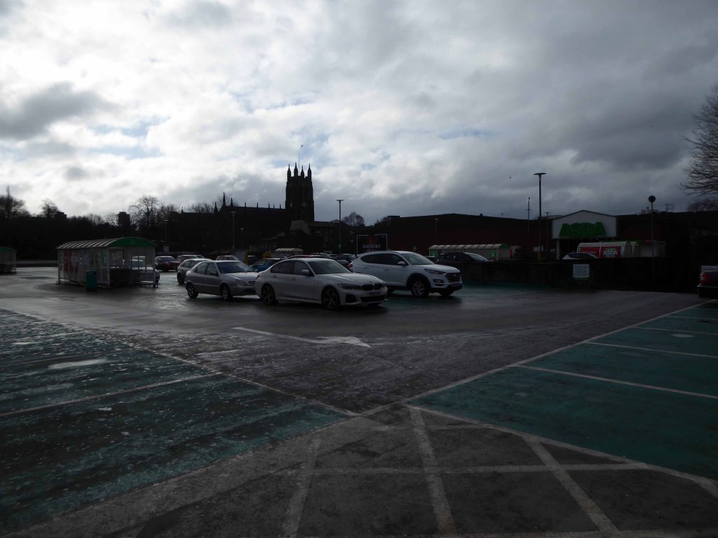
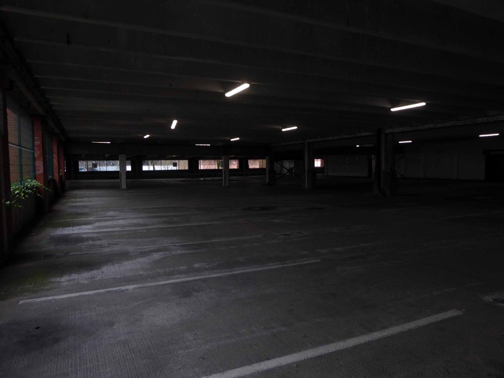
All that aside, let’s have a look at what the car park is like.
When the figures say crime is falling, why are we more frightened than ever? Could our towns and cities be creating fear and mistrust? More property is being built in Britain than at any time since the Second World War – but it’s owned by private corporations, designed for profit and watched over by CCTV. From the Docklands boom to cities such as Manchester, gated apartment developments, gleaming business districts and plazas have sprung up over the country.
Has this ‘regeneration’ really made our lives better?
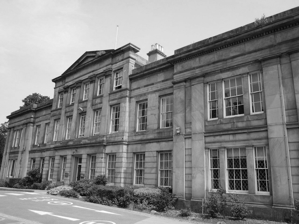
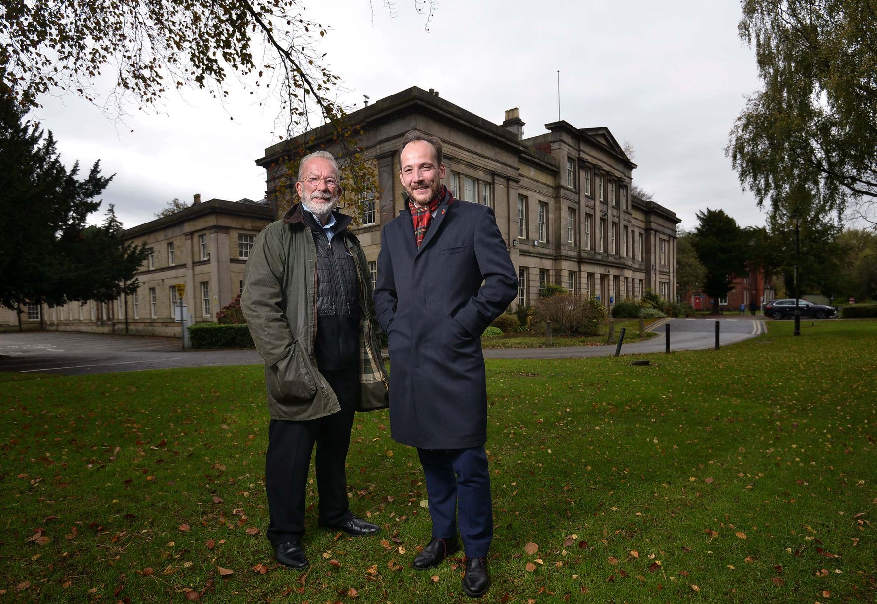
I’m returning to the MMU Didsbury Campus, the site began life as a baronial deer park and estate, in 1740 the site was purchased by the Broome family, and a new house was constructed after 1785 by William Broome, from 1812 owned by Colonel Parker. Following a succession of uses and owners the School of Education is established.
I studied for a PGCE in Art there in 1984.
Subsequently, fun and fashionable free-market economics, have increasingly governed the management of education and its assets.
MMU sold the site for an undisclosed sum to the developers PJ Livesey.
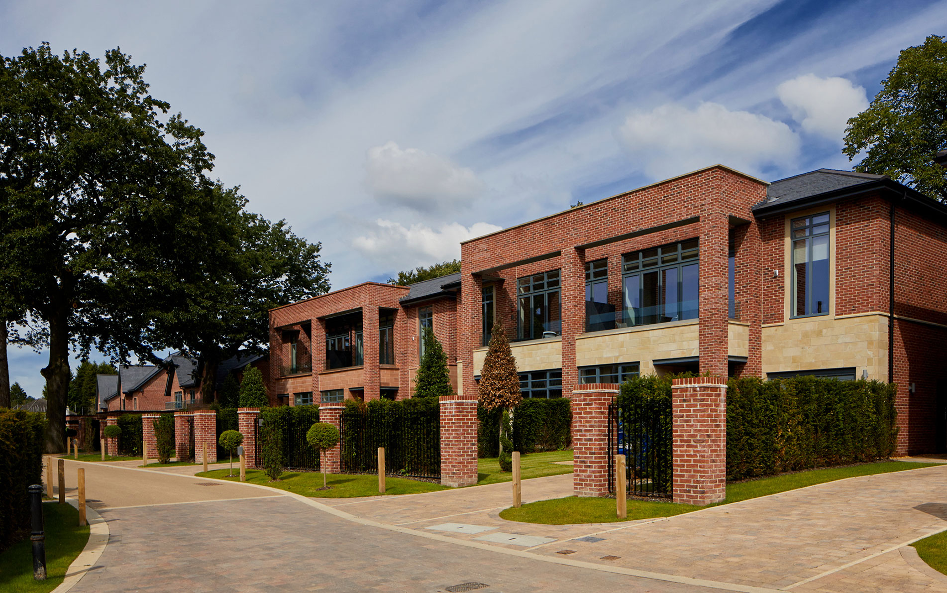
This is Sandown House, formerly the administrative block, redeveloped as private homes, each valued at £675,000 and upwards.
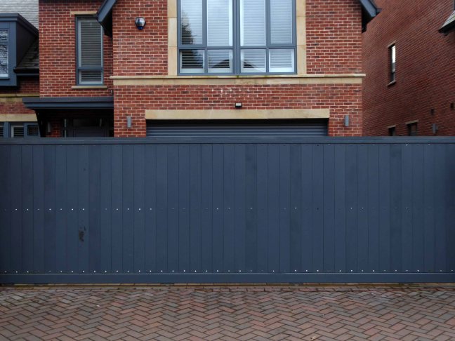
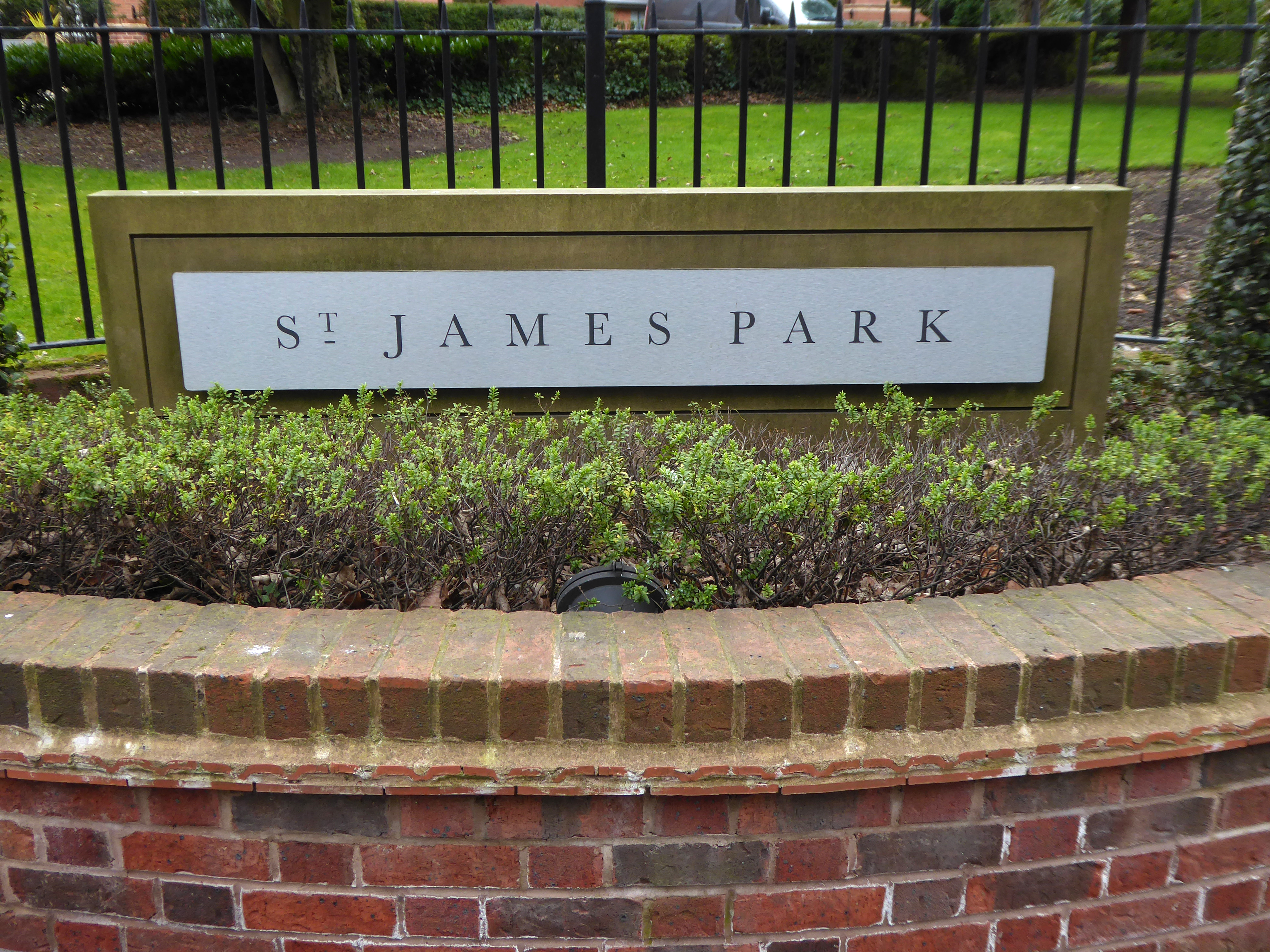
St James Park is an exclusive collection of beautifully converted heritage buildings and individually designed luxury homes offering opulent living accommodation finished to an uncompromising specification. Beautifully styled and perfectly connected, this gated development is located moments away from the heart of Didsbury Village.
So why choose a gated community?
The fear of fear it would seem, is on the increase, whilst crime itself is decreasing.
Royal Institute of Chartered Surveyors says that although residents feel safer in gated communities, it is more of a perception than a reality. Research in the US suggests that gating may not deter criminals and initial studies in the UK suggest the same.
If they are allowed to develop unchecked, it will breed hostility and threaten the social cohesion of the UK’s cities, the surveyors warn.
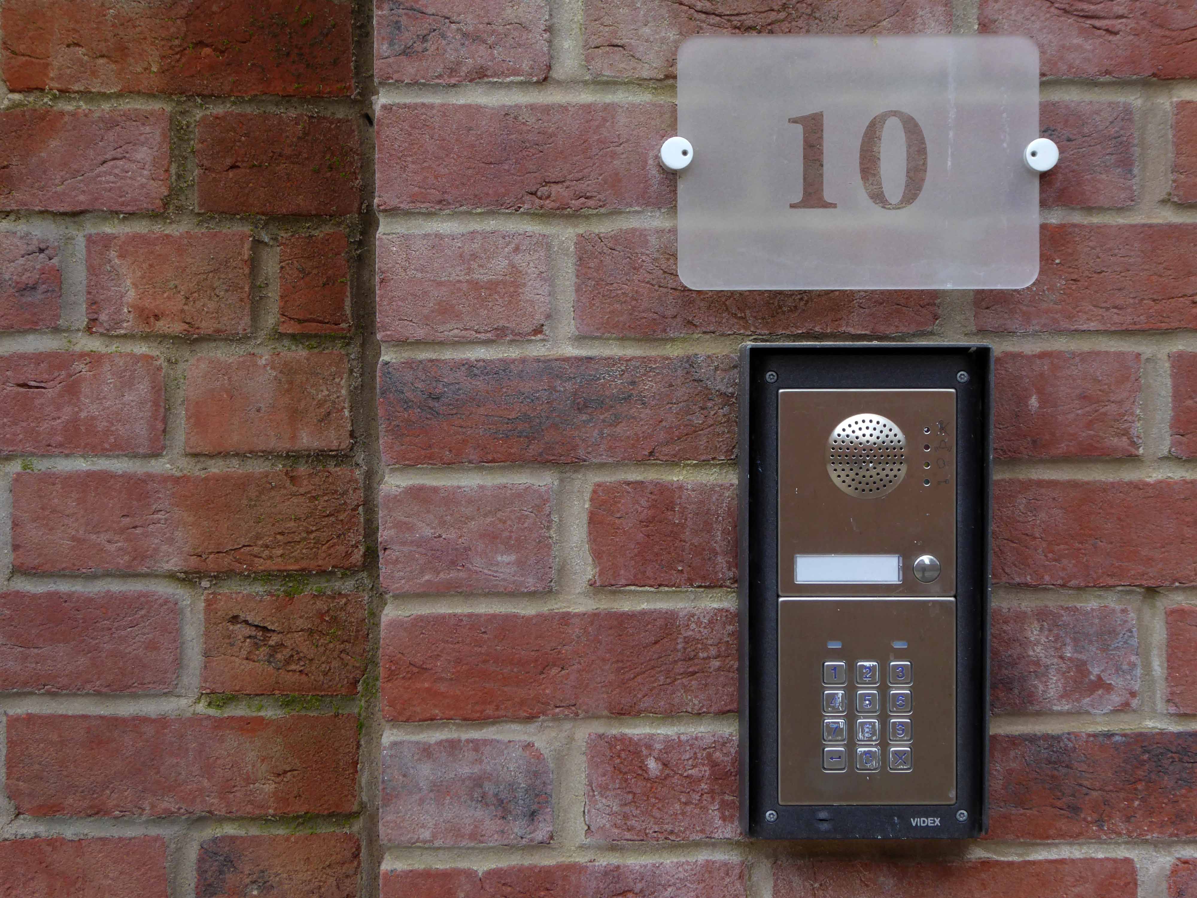
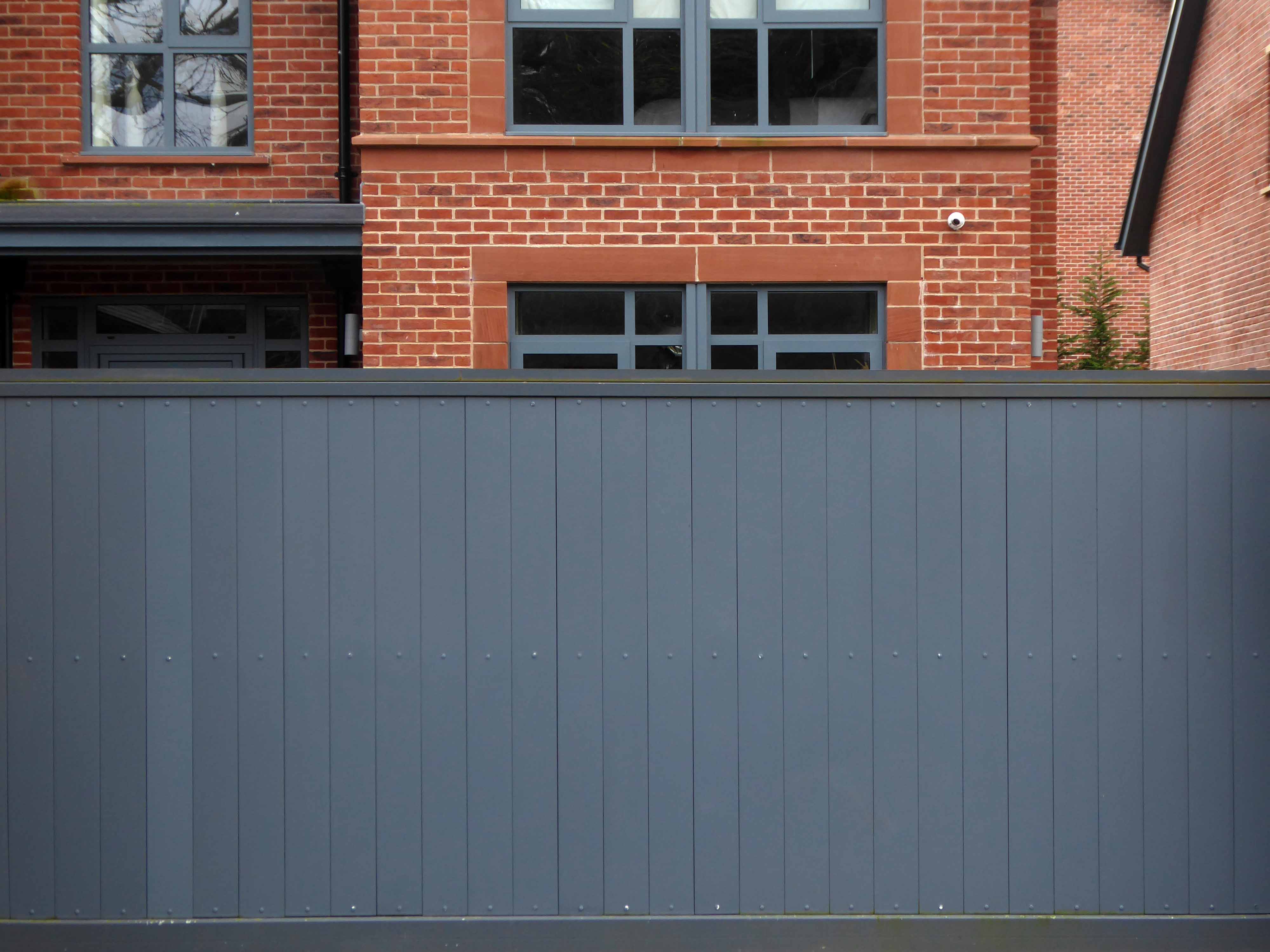
Social exclusion, the bitter taste of economic apartheid is obviously the plat du jour here in St James Place – there is limited pedestrian access and secure gates to inhibit unwanted automotive ingress.
There is an exciting array of CCTV devices, encoded gates and doors, ever higher railings in evidence.
Security for the terminally insecure.
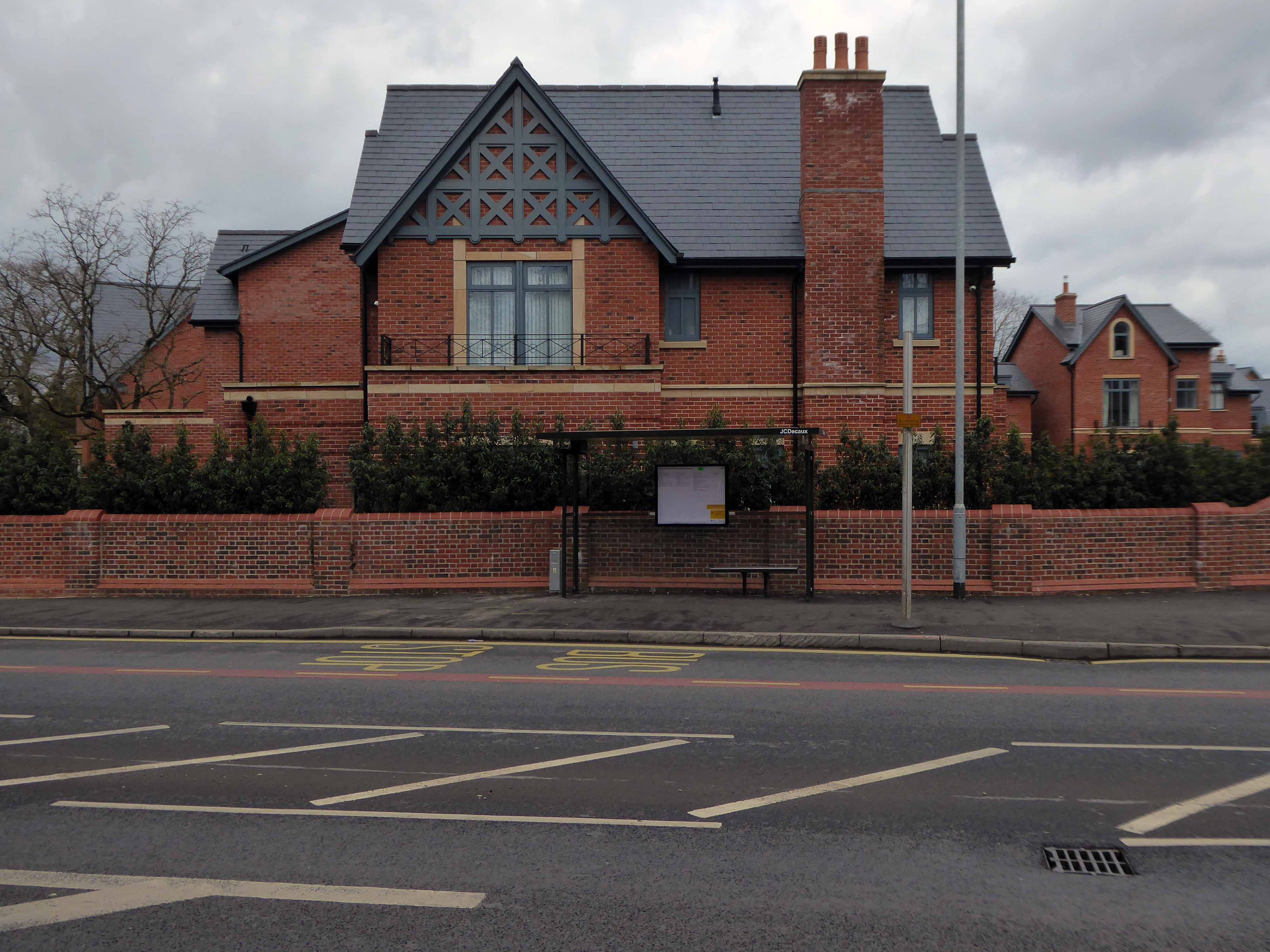
It is possible to live in an open environment in East Didsbury, here on Ford Lane folks come and go, hopefully interacting with friends, neighbours. family and strangers passing idly by.
Though this is one of the most affluent areas of Manchester, and happily one is unlikely to find oneself with an unemployed collier as a neighbour.
Community minded, demographically diverse cities, will produce safe, secure, healthy places to live.
There is no evidence that gated communities are in any way safer, in fact they may well be socially divisive – this is the never never land of smoked glass Range Rover windows and mirrored wardrobes.
Architectural critic Ian Nairn makes a convincing case for a socially mixed residential development, which still maintains a regard for the area’s heritage.
I visited Lillington Gardens Estate in August 2018 – now a mature development, where those residents I spoke with, seemed happy and content with their homes.
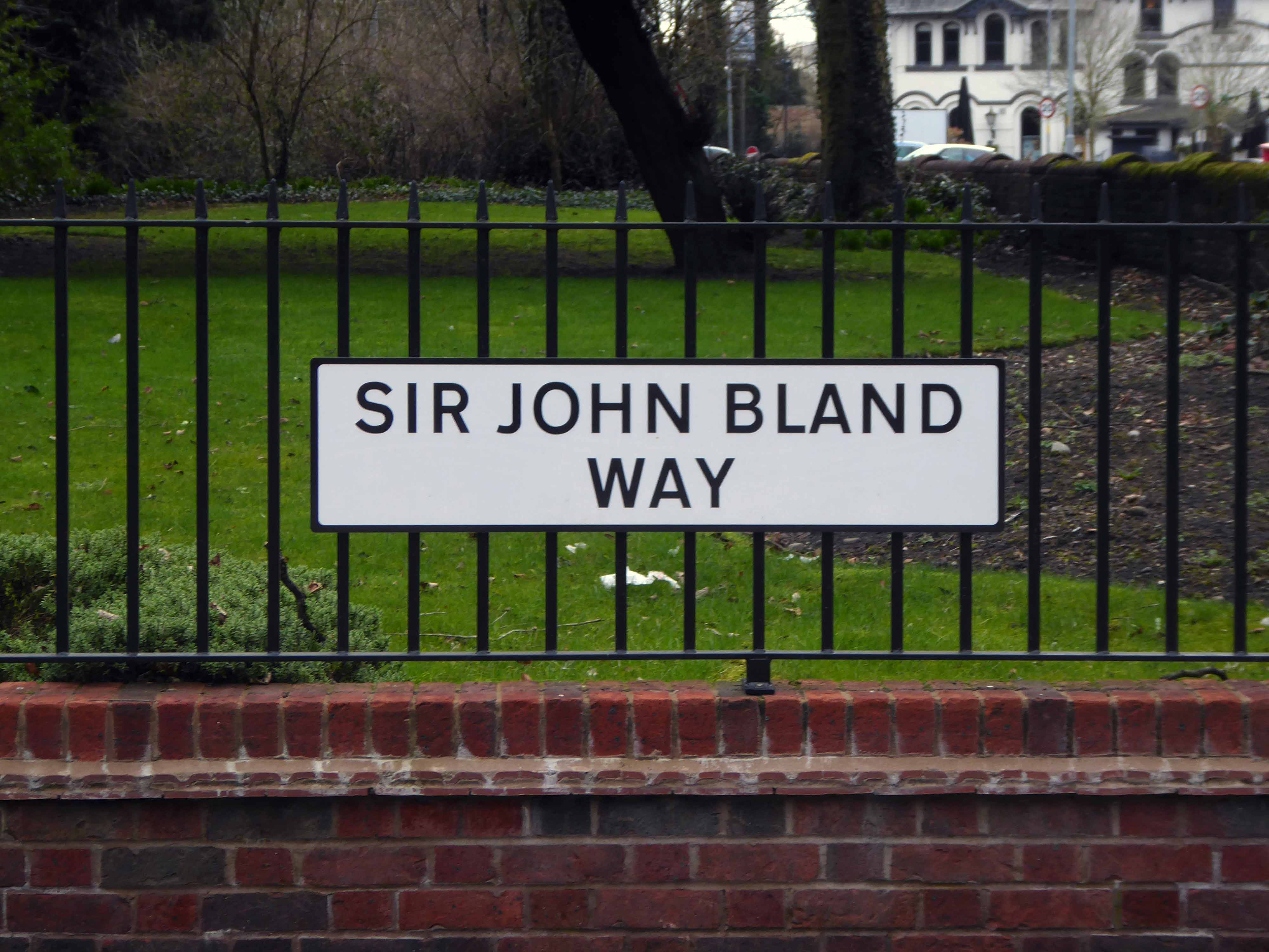
Sir John Bland 5th Baronet 1691 – 1743 of Kippax Park and Hulme Hall, was a British landowner and politician who sat in the House of Commons from 1713 to 1727.
His mother was Anne Mosley, daughter of Sir Edward Mosley of Hulme.
He retired from Parliament aged 35 and moved the focus of his local political activity from Yorkshire to Lancashire, where his mother had inherited Hulme Hall and the Lancashire estates which covered most of Manchester.
This is the celebration of privilege, power and property in pressed aluminium and print, saluting the progenitors of the Mosely Family, who once upon a time, were Manchester’s wealthiest landowners.
We live in an owned landscape where access is an issue.
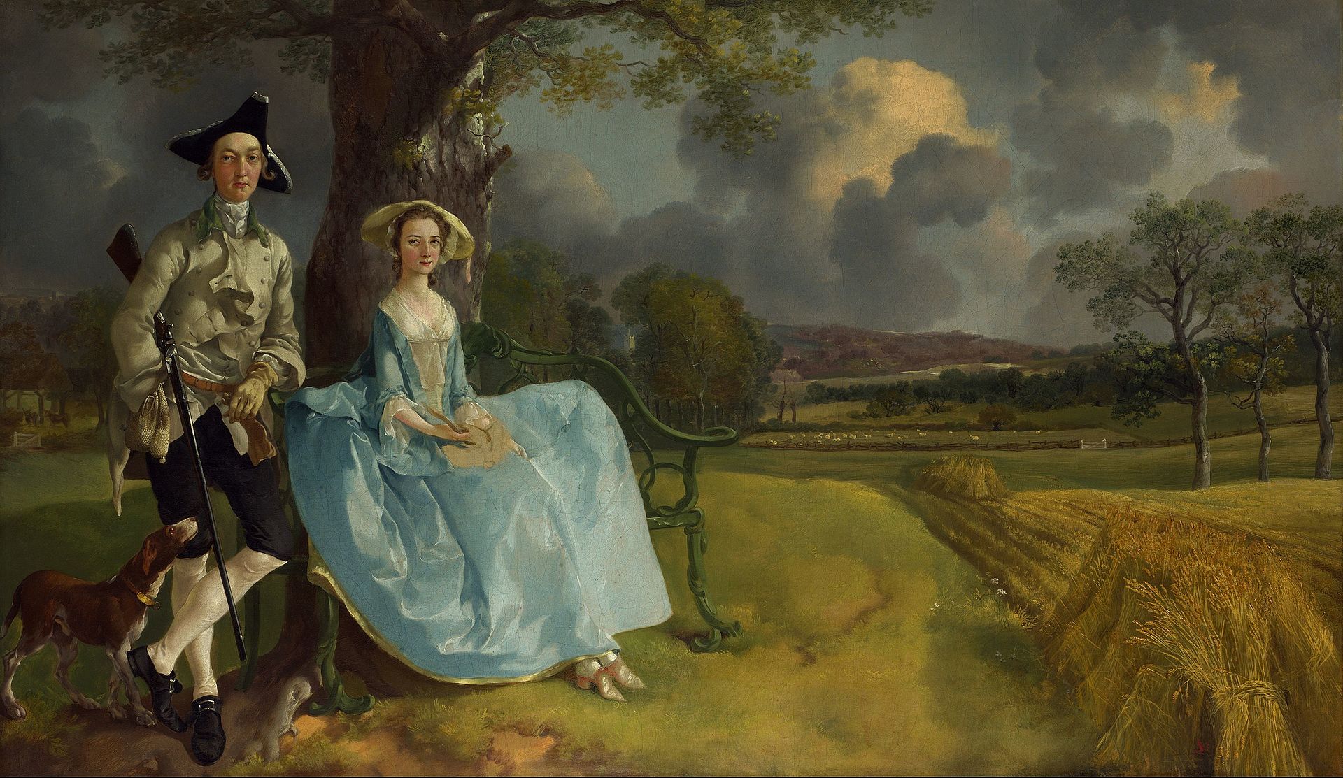
Mr and Mrs Andrews would note, that little or nothing has changed, since Gainsborough’s time.
Completed shortly after Mr. Andrews’ marriage to the daughter of a neighbouring gentry, a marriage that enhanced his estate, the image captures the unchanging power of property relations in pre-industrial England.
“They are not a couple in nature as Rousseau imagined nature,” John Berger comments. “They are landowners and their proprietary attitude to what surrounds them is visible in their stance and their expressions.”
The first thing I’d say is this is going to be an aspirational site within an aspirational area – PJ Livesey
So how did we get here?
Baroness Thatcher makes massive tax cuts for the wealthy, funded by North Sea Oil revenues, impoverishing the public purse, undervaluing the privatisation of public assets, encouraging the right to buy, yet inhibiting the building of social housing, hot housing the property owning democracy.
The term ‘property-owning democracy’ emerges from a discursive history of use. Coined by British MP Noel Skelton in 1920, the concept compounded the terms ‘property-owning’ and ‘democracy’ as a conservative response to left-leaning ideas of liberalism and socialism. At this stage, the term represented the necessity of protecting property rights from democratic organisation.
More recently stamp duty holidays, houses as speculative assets not homes, low interest rates, massive middle-class inheritances, deregulation in the financial sector, all fuel the upwardly mobile housing boom.
Whilst for the lower orders years and years of pay freezes, attacks upon trade unions, the continued decline in manufacturing, small state austerity, zero hour contracts, rent hikes, attacks on the unemployed, universal credit and indexed benefits, have all fuelled reduced social mobility.
Looks like we have a schism on our hands.
The UK became a much more equal nation during the post-war years. The data available shows that the share of income going to the top 10% of the population fell over the 40 years to 1979, from 34.6% in 1938 to 21% in 1979, while the share going to the bottom 10% rose slightly.
Since 1979 this process of narrowing inequality has reversed sharply, inequality rose considerably over the 1980s, reaching a peak in 1990.
Come, now, you rich men, weep and wail over the miseries that are coming upon you. Your riches have rotted, and your clothing has become moth-eaten. Your gold and silver have rusted away, and their rust will be a witness against you and will consume your flesh. What you have stored up will be like a fire in the last days. Look! The wages you have withheld from the workers who harvested your fields keep crying out, and the cries for help of the reapers have reached the ears of Jehovah of armies. You have lived in luxury and for self-gratification on the earth. You have fattened your hearts on the day of slaughter.
St James Park is an exclusive collection of beautifully converted heritage buildings and individually designed luxury homes offering opulent living accommodation finished to an uncompromising specification. Beautifully styled and perfectly connected, this gated development is located moments away from the heart of Didsbury Village, where residents can enjoy an abundance of independent café bars, restaurants and boutiques, as well as Didsbury Park on the doorstep.
Alderman Moss bequeathed the house and gardens to the City of Manchester on his death in 1919 because he wanted the house and its contents to remain, as far as possible, intact “to show what a comfortable house of the olden times was like”.
Everything’s gone grey, in the aspirational race for the neutral high ground of individualism, they have painted you into a corner of dull, monochromatic conformity.
Welcome to the professional world of self interested, low-interest, the get rich quick deregulated go-getter.
Now get out.
I dreaded walking where there was no path And pressed with cautious tread the meadow swath And always turned to look with wary eye And always feared the owner coming by; Yet everything about where I had gone Appeared so beautiful I ventured on And when I gained the road where all are free I fancied every stranger frowned at me And every kinder look appeared to say “You’ve been on trespass in your walk today.” I’ve often thought, the day appeared so fine, How beautiful if such a place were mine; But, having naught, I never feel alone And cannot use another’s as my own.
John Clare
This is a revamped version of my original post, I was contacted by residents, who had reservations concerning the photographs that I had taken of their homes, whilst on their private roads, without their permission, in contravention of current legislation.
I have replaced these with photographs taken from public roads and also from pictures found on the developer’s website.
Places are different: Subtopia is the annihilation of the difference by attempting to make one type of scenery standard for town, suburb, countryside and wild. So what has to be done is to maintain and intensify the difference between places. This is the basic principle of visual planning. It is also the end to which all the other branches of planning – sociology, traffic circulation, industry, housing hygiene – are means. They all attempt to make life more rewarding, more healthy, less pointlessly arduous.