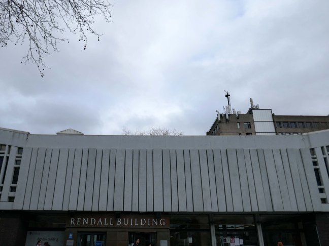
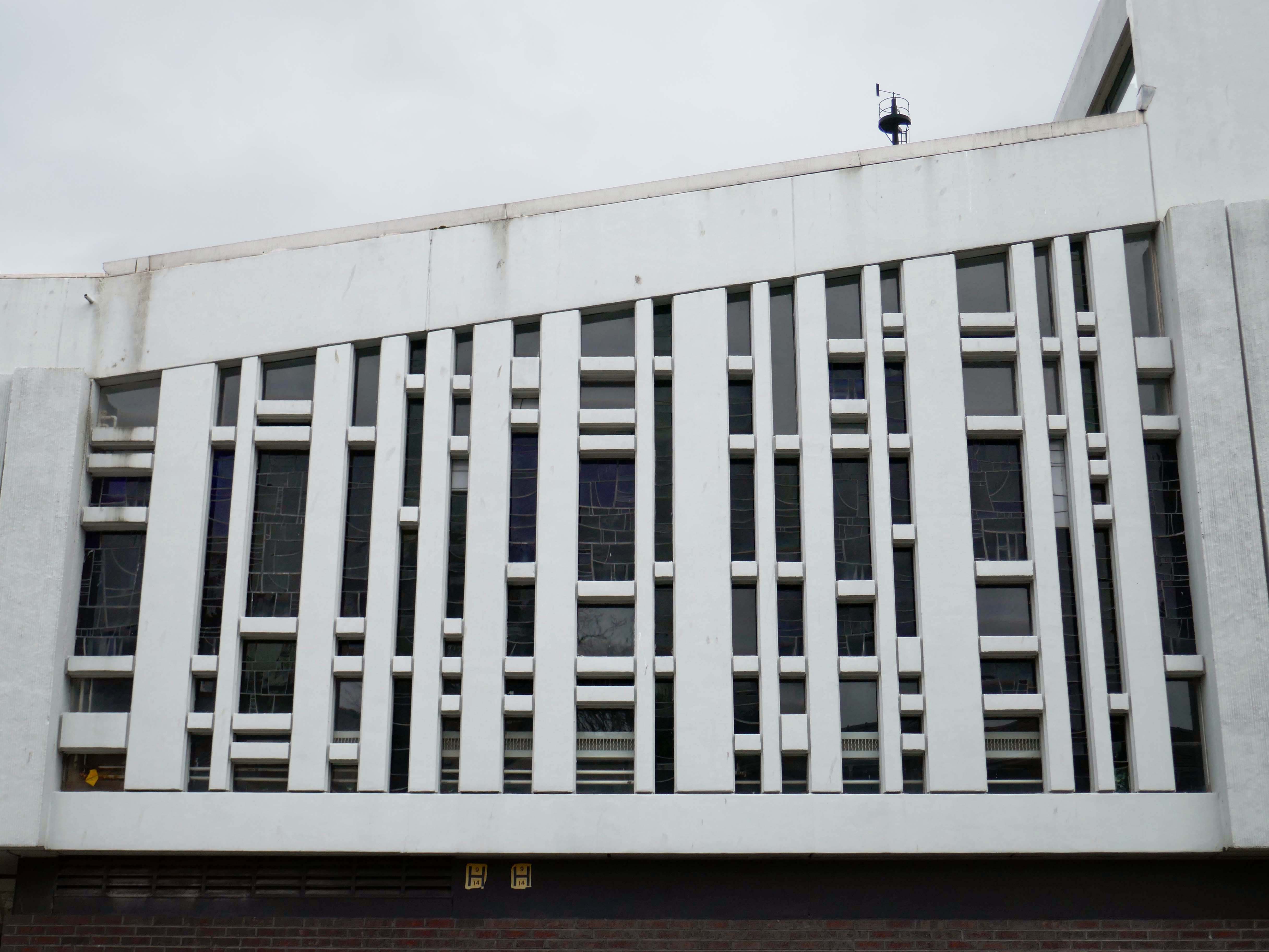
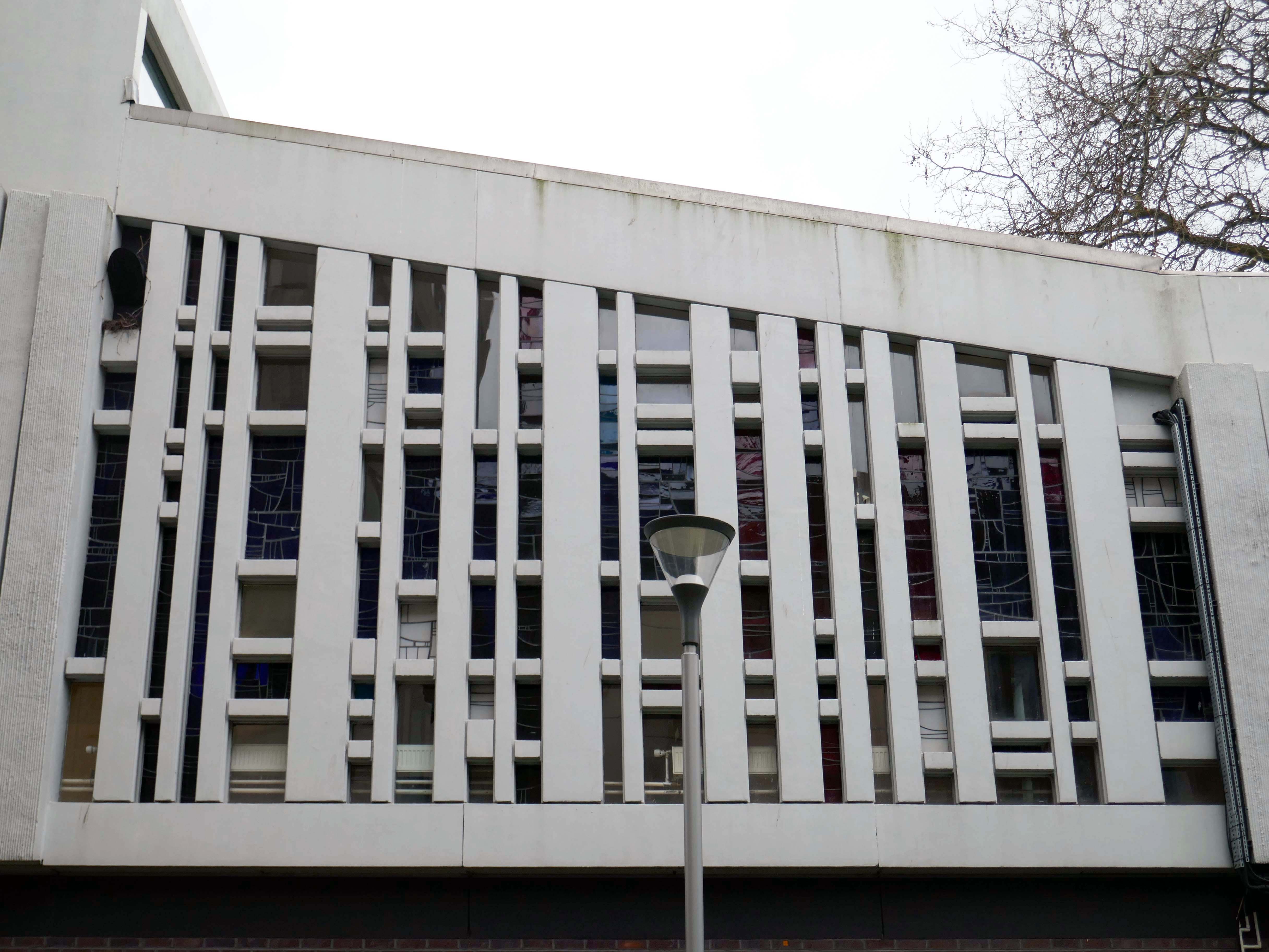
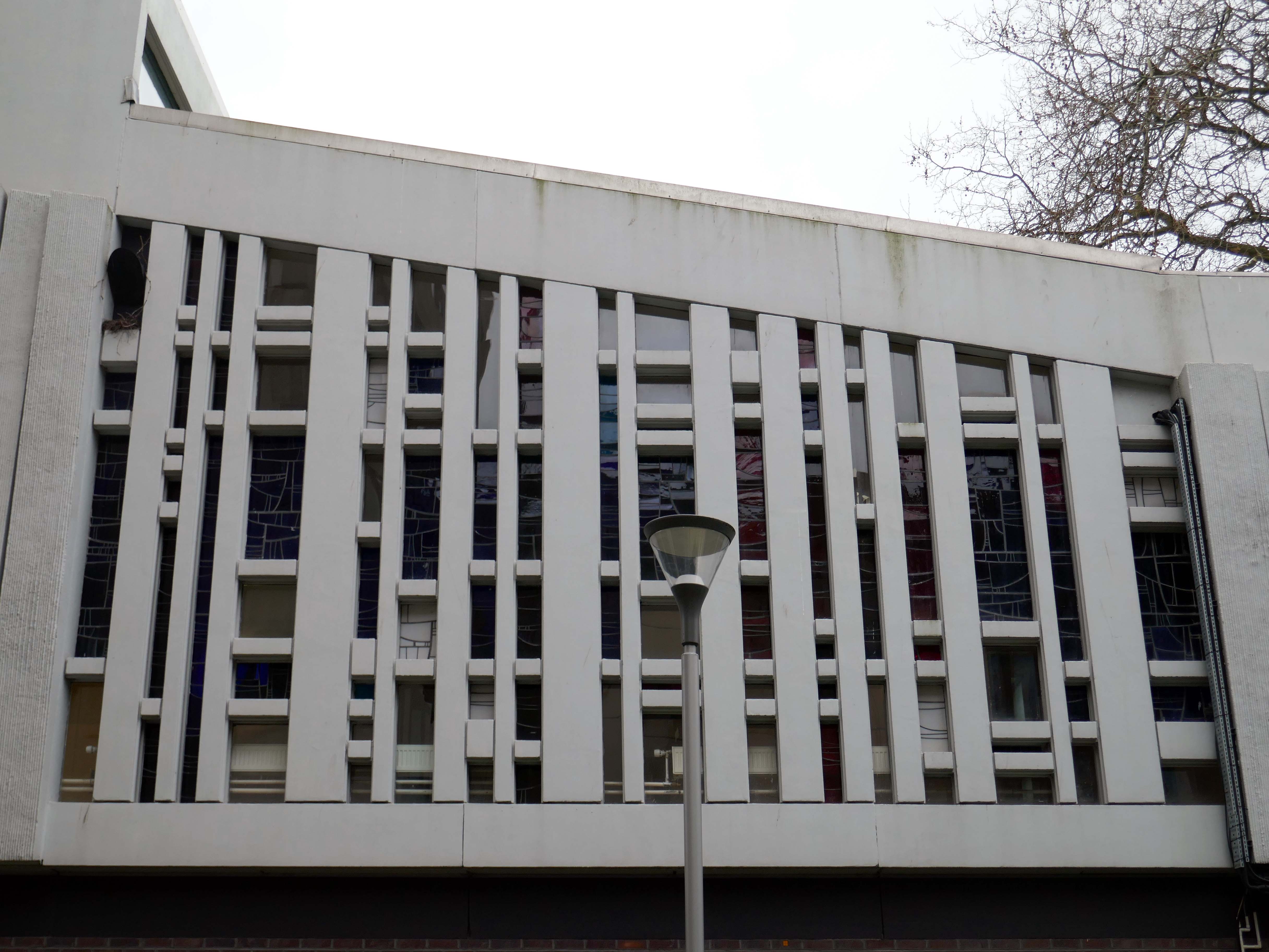
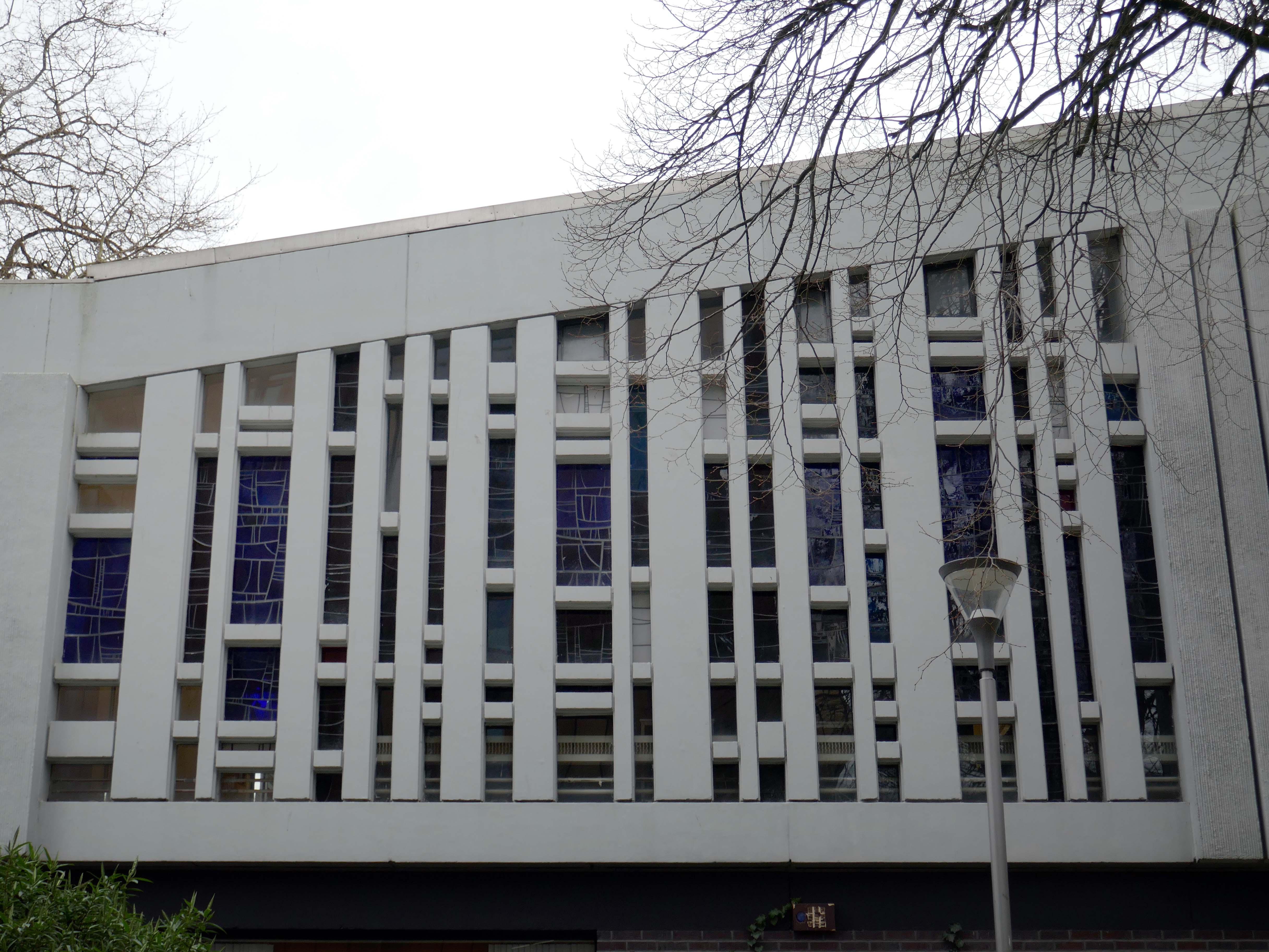
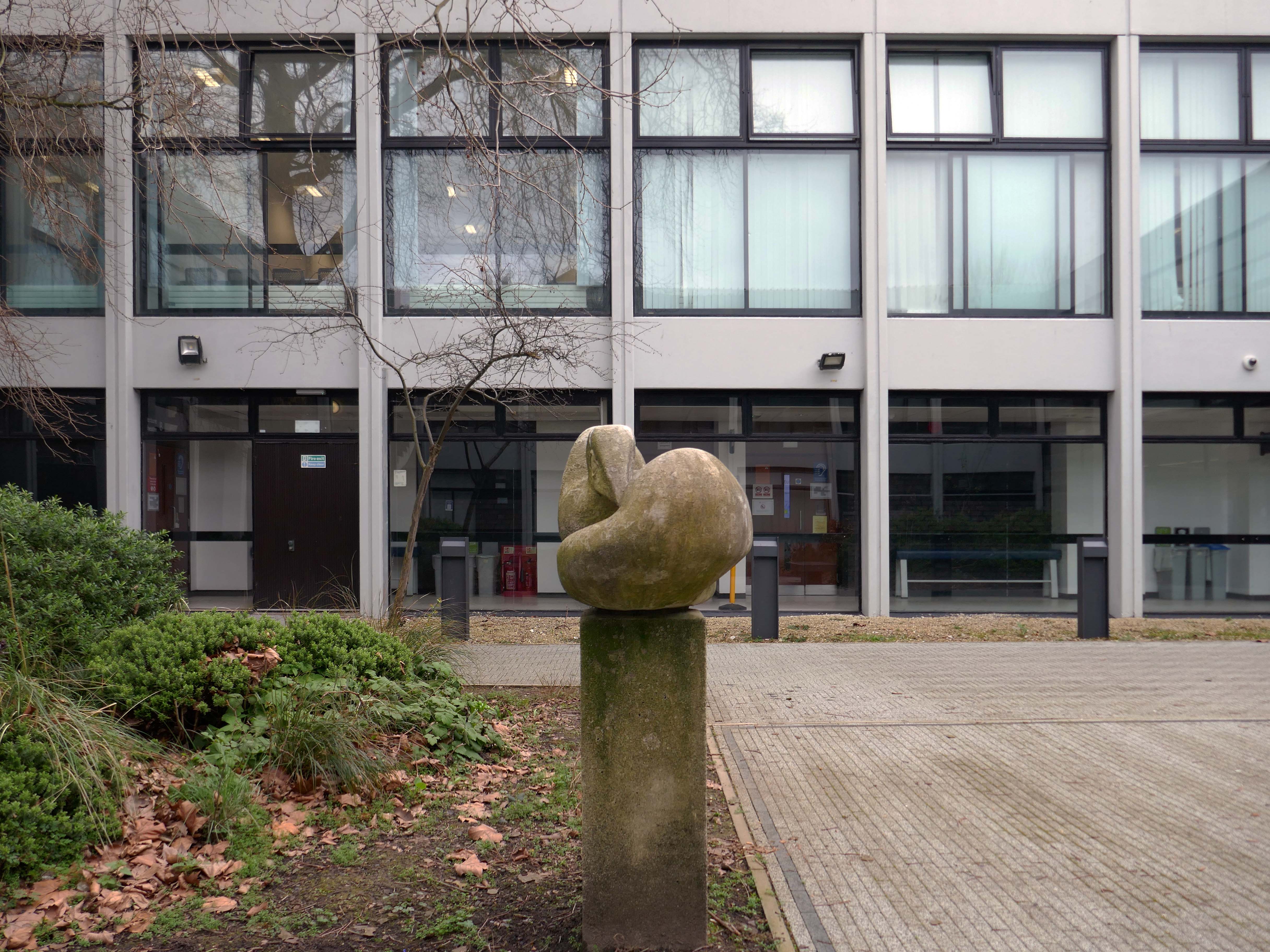
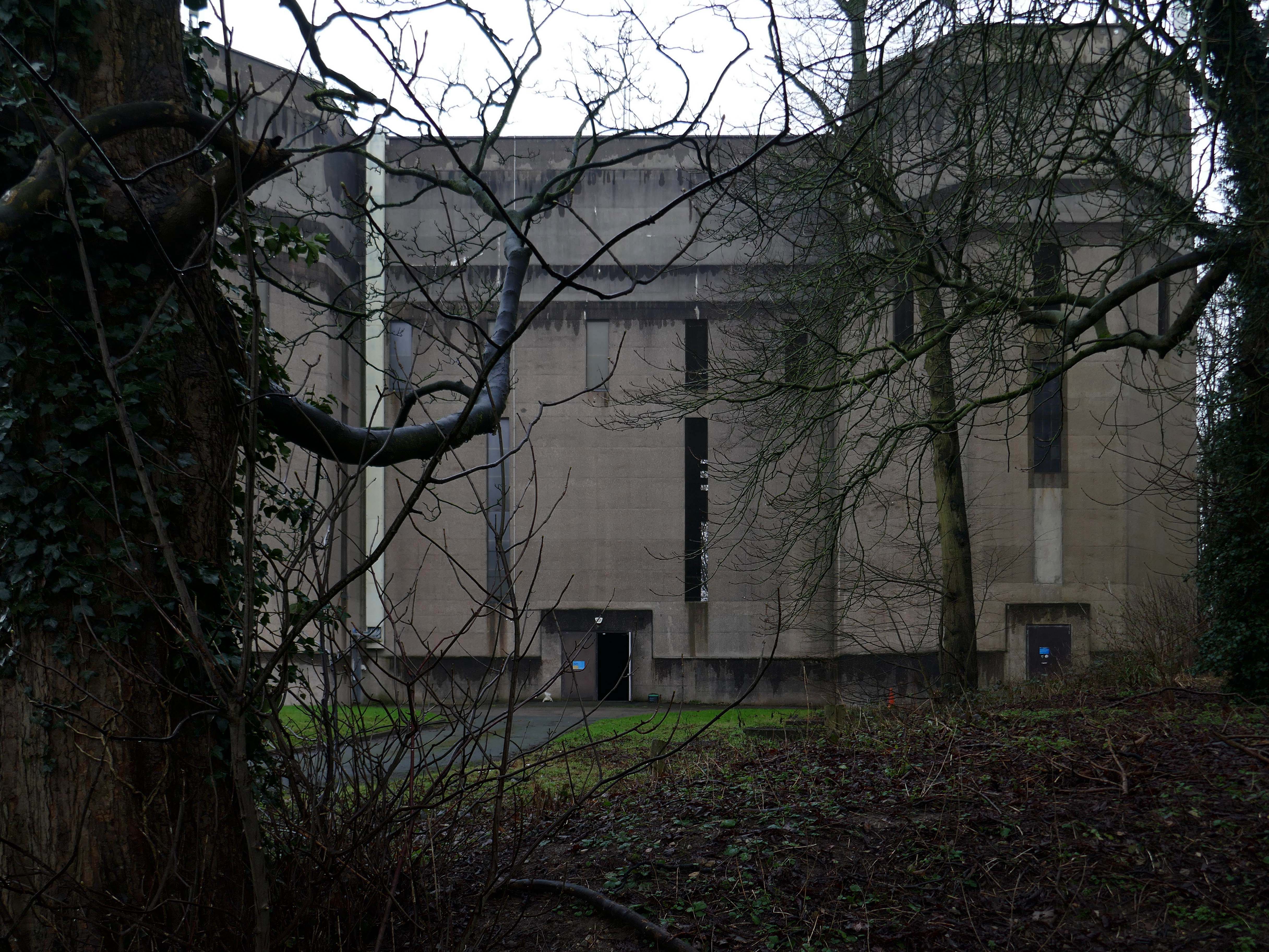
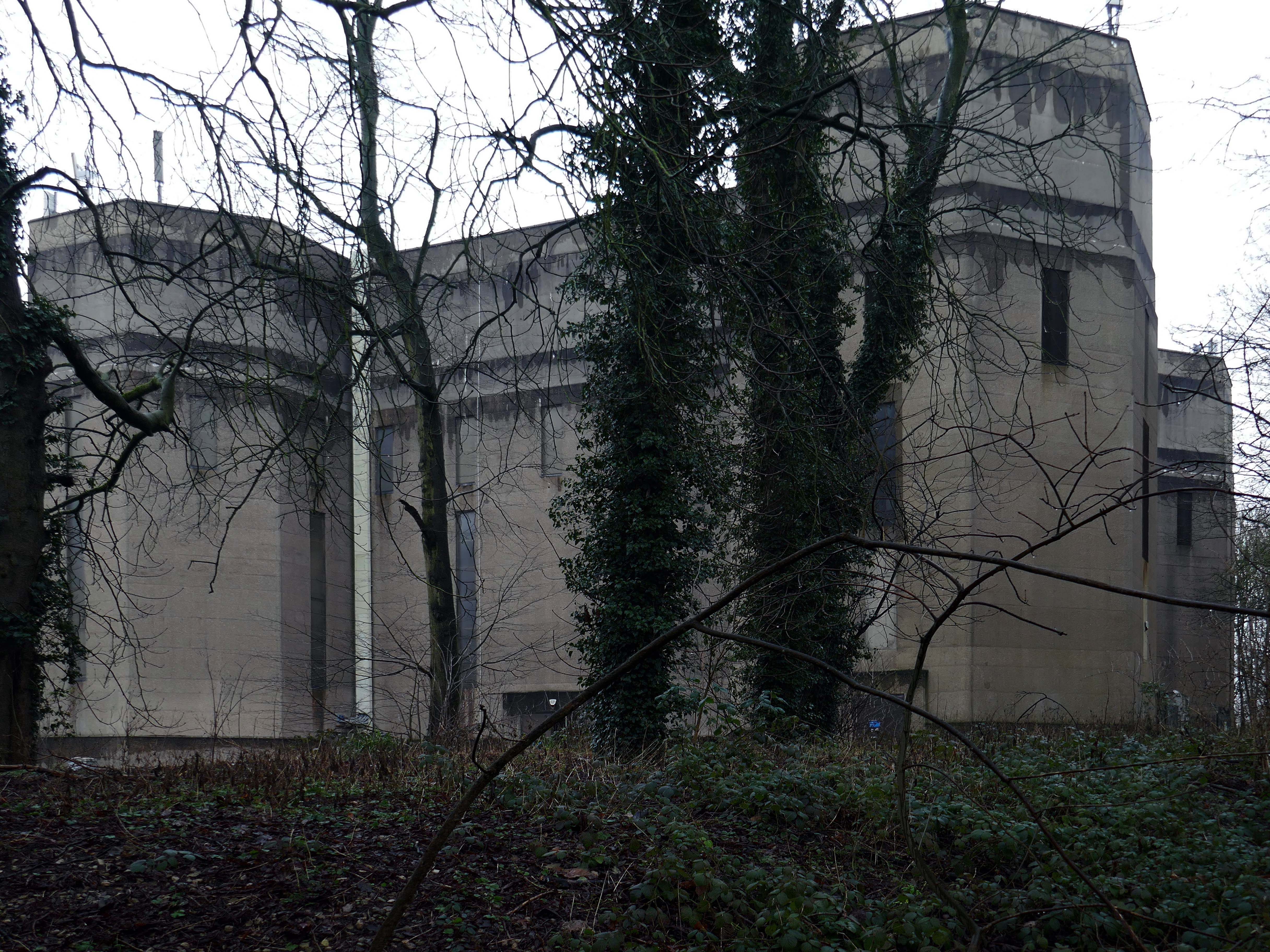
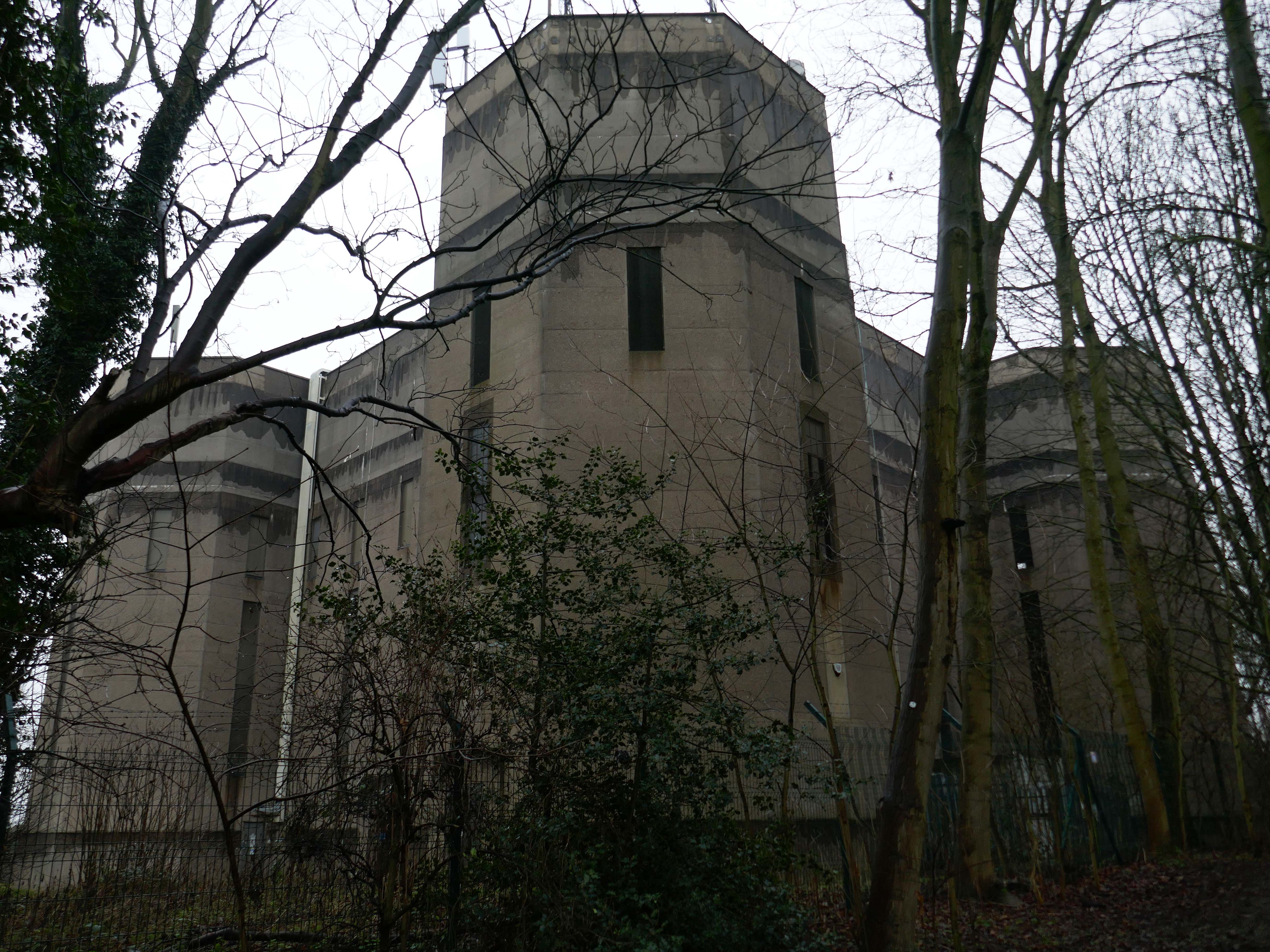
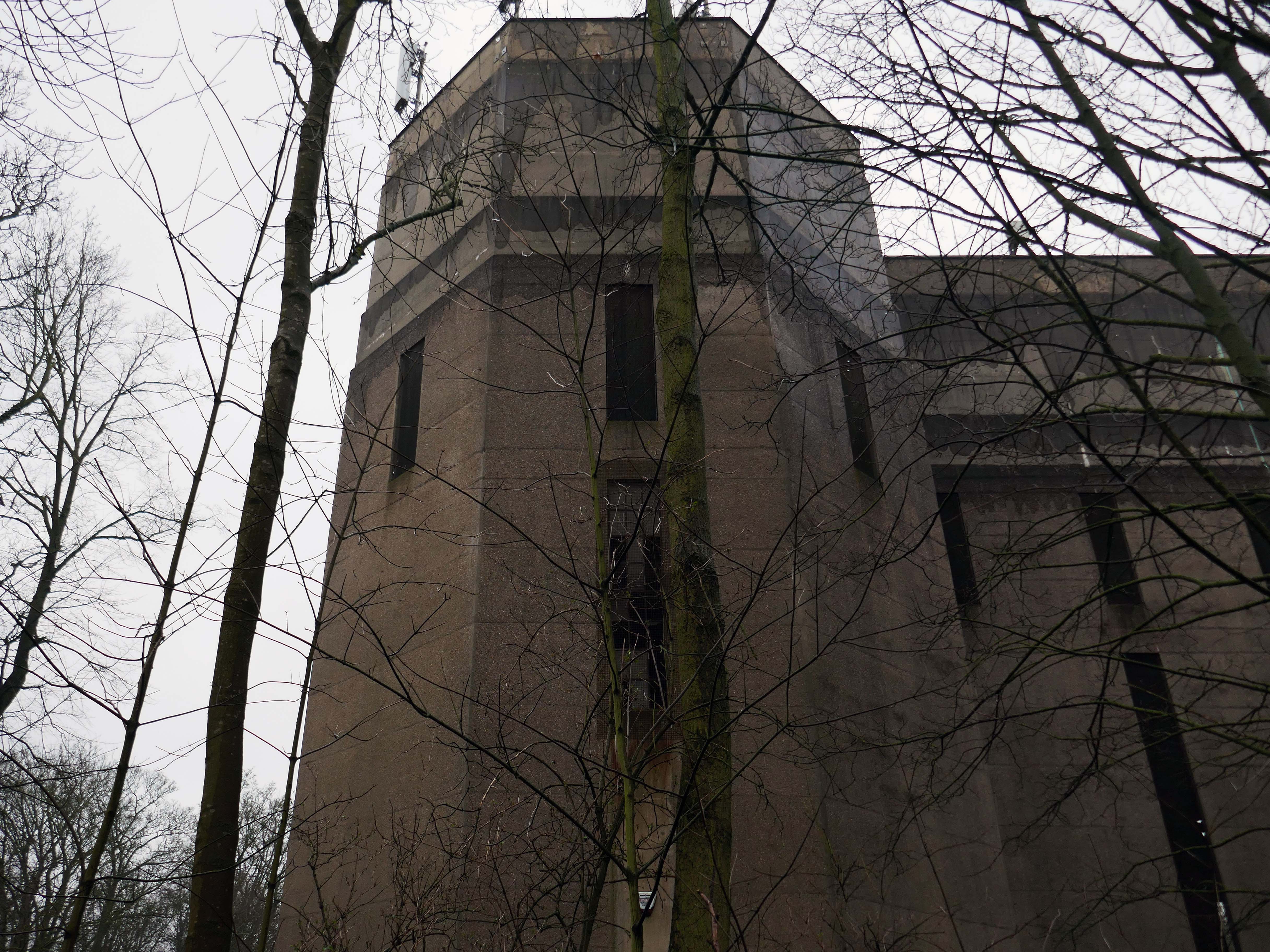
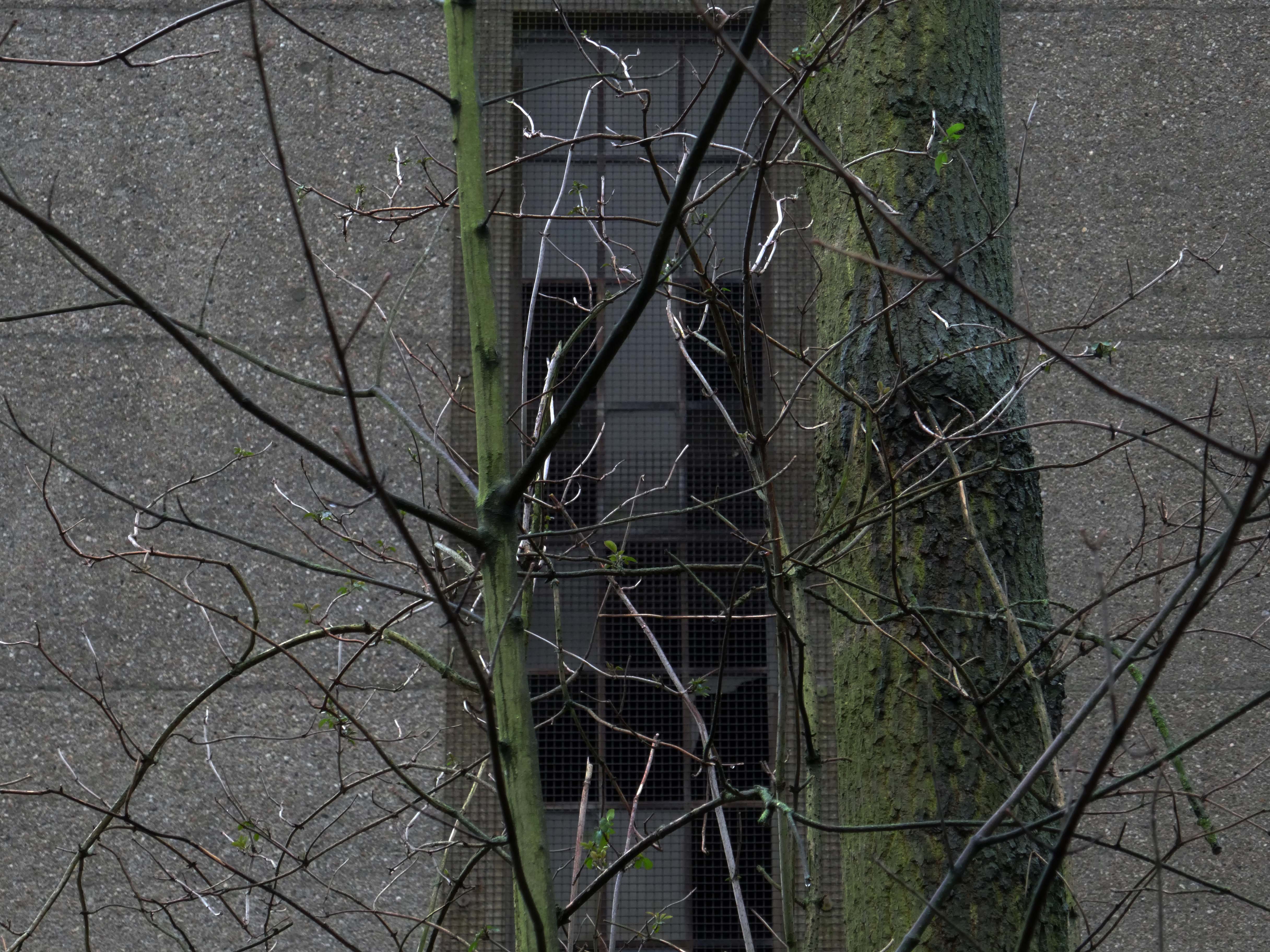
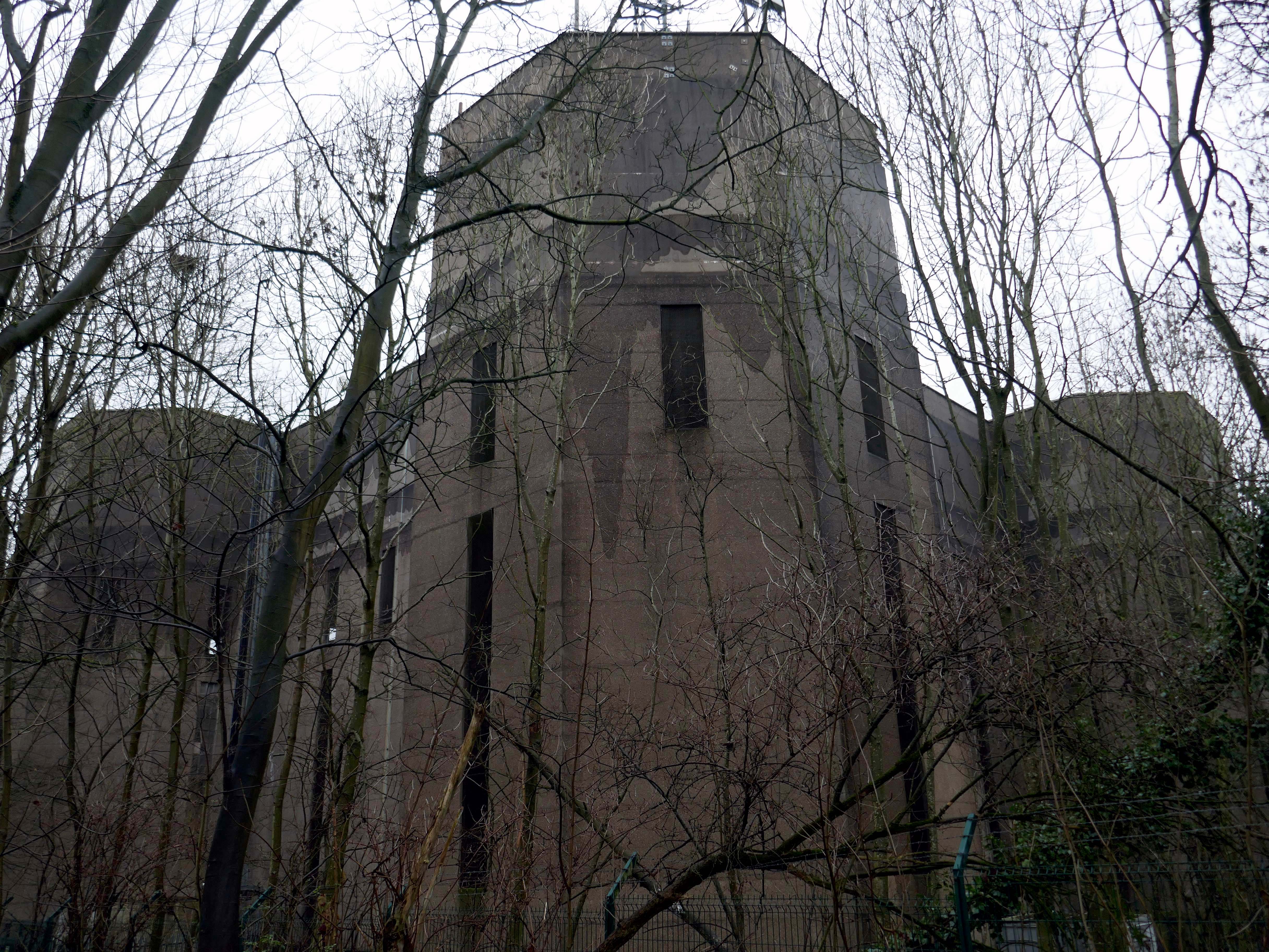
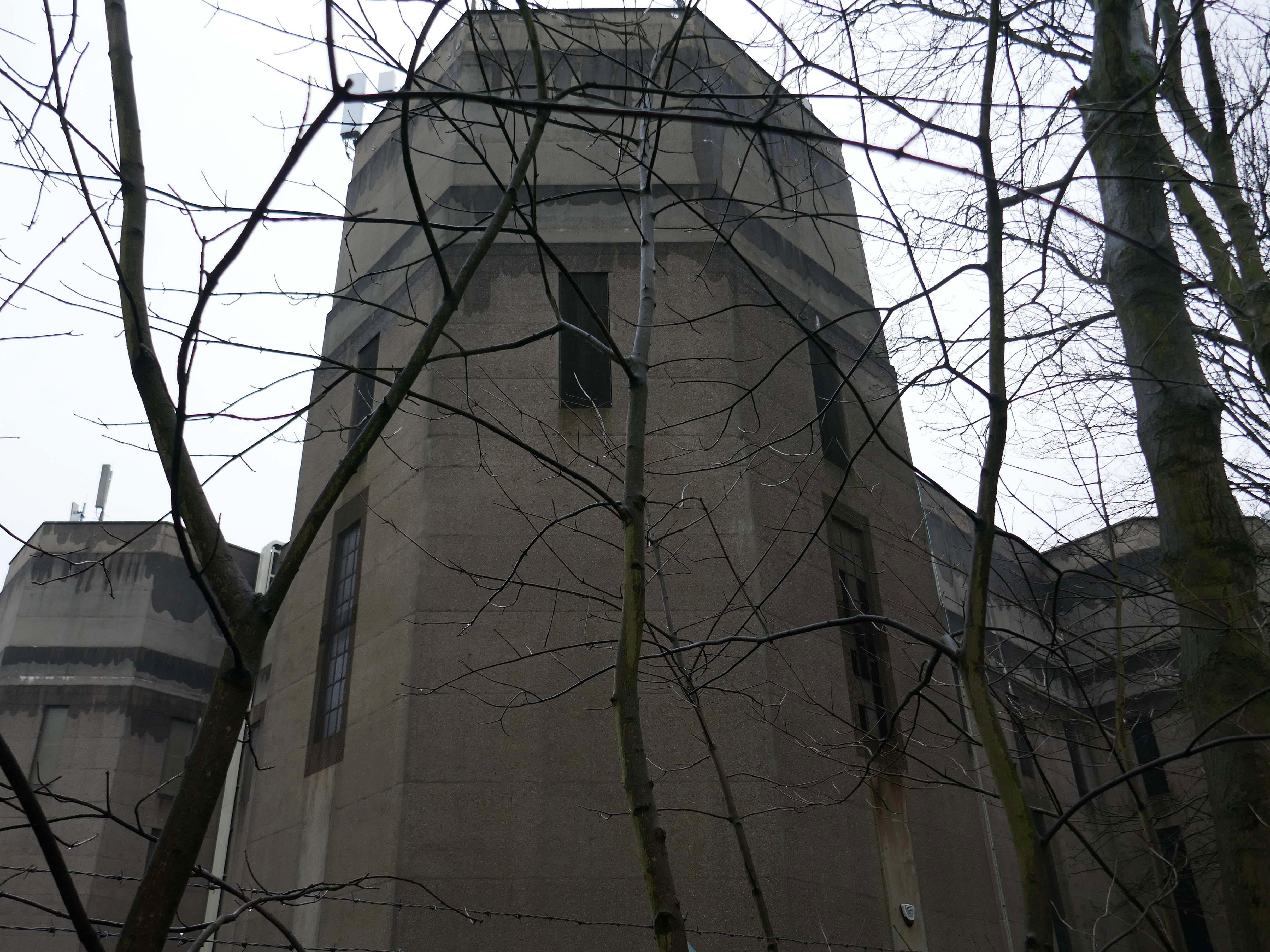
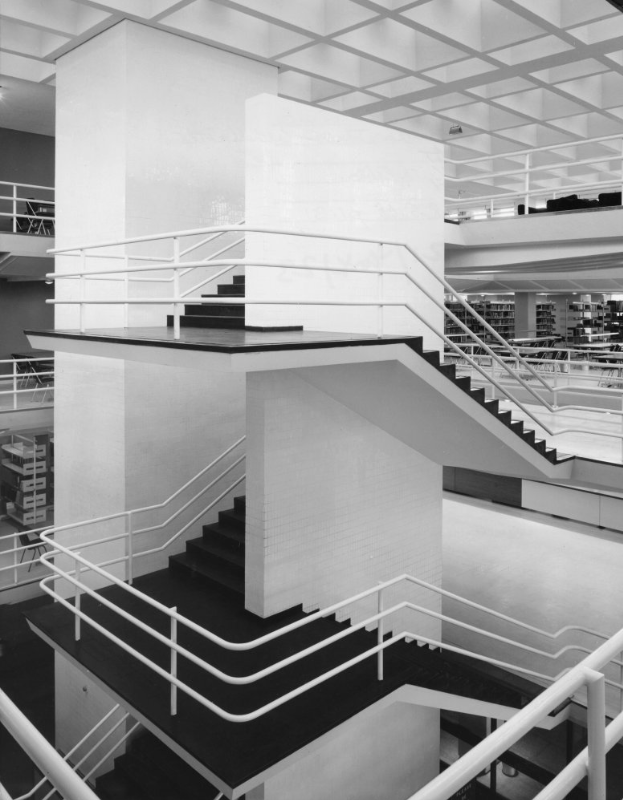
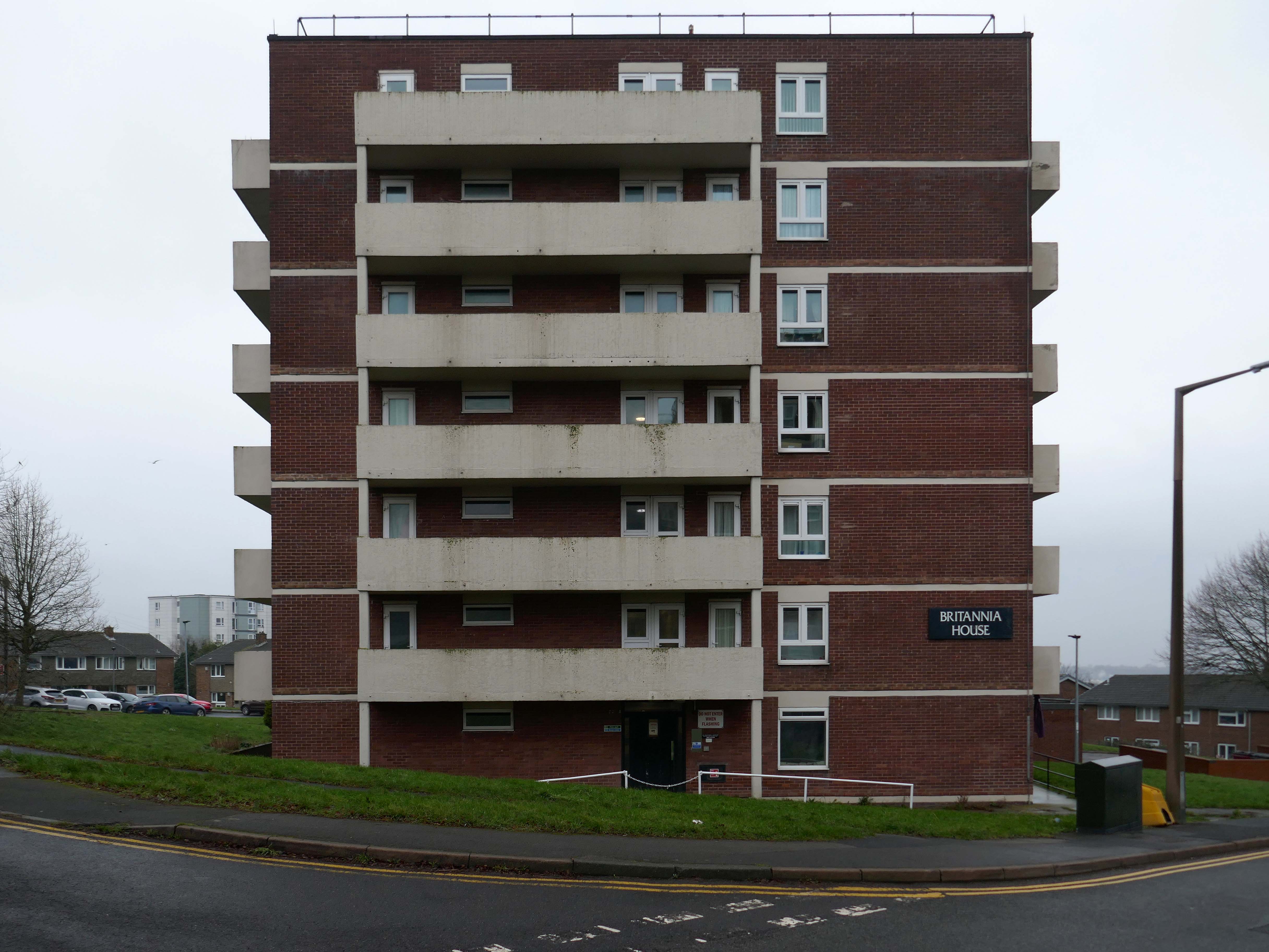
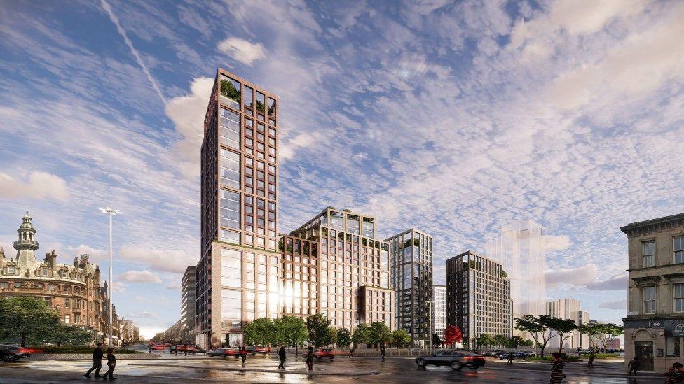
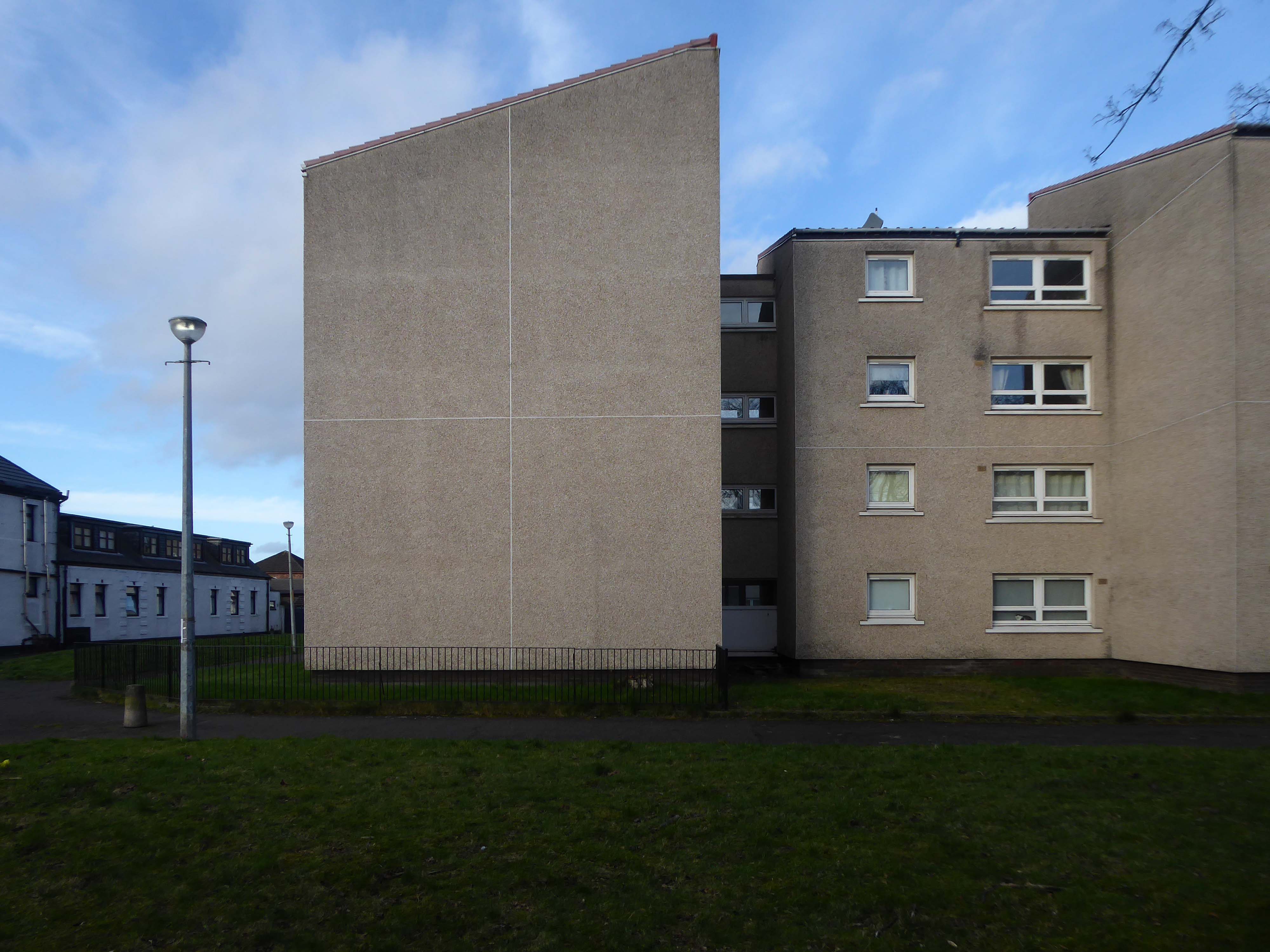
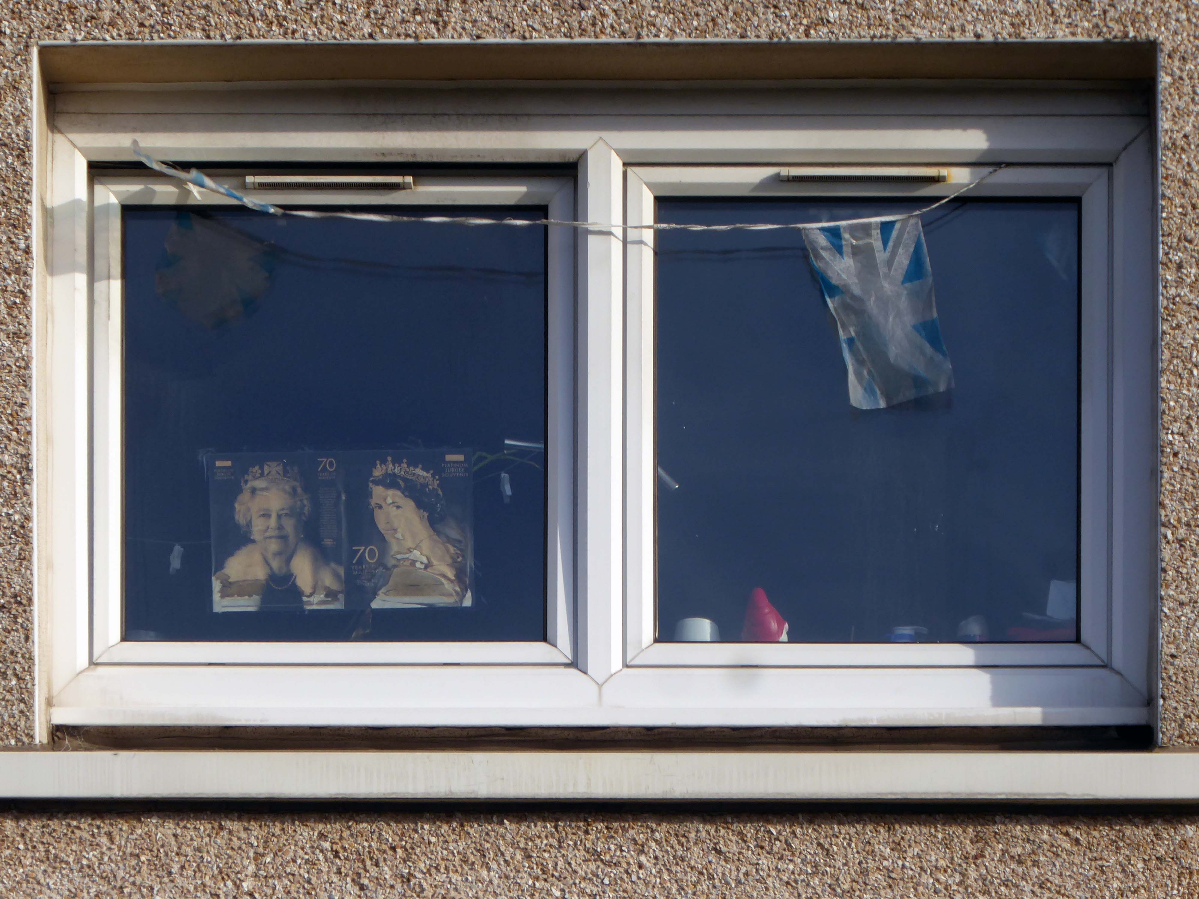
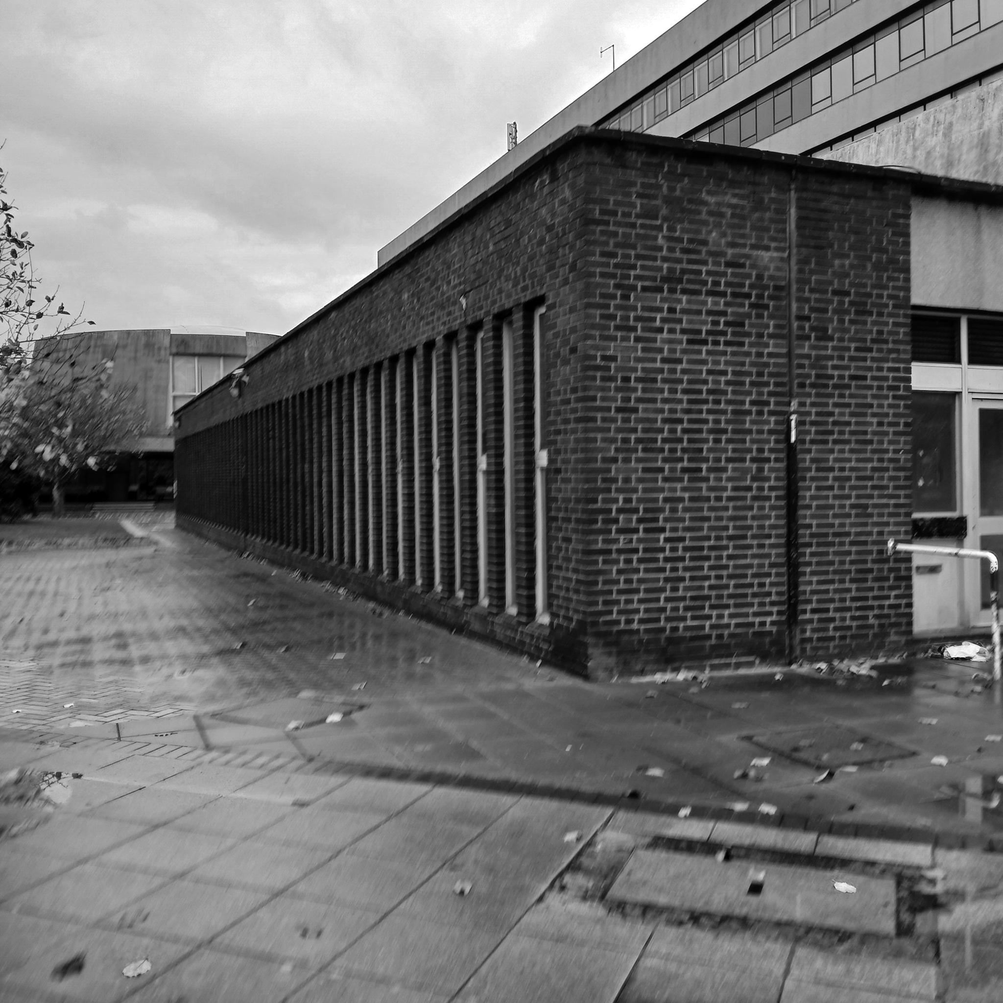
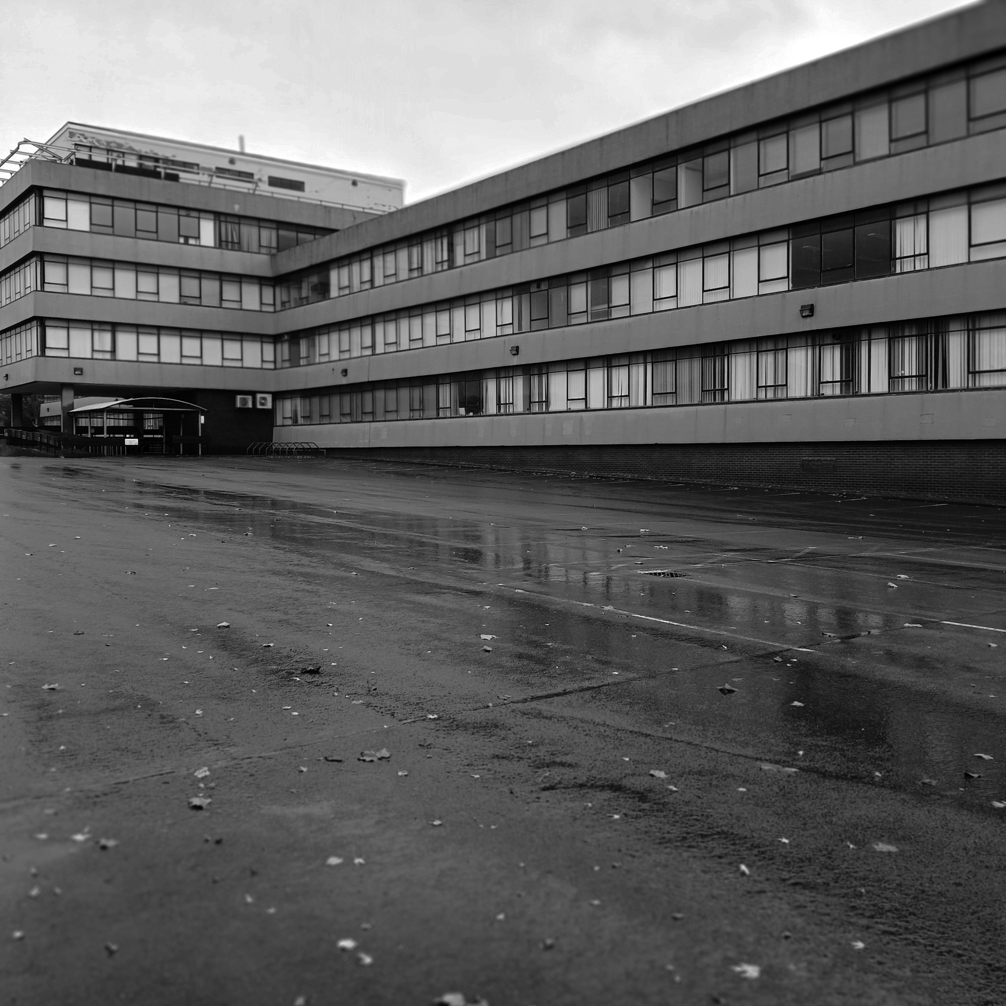
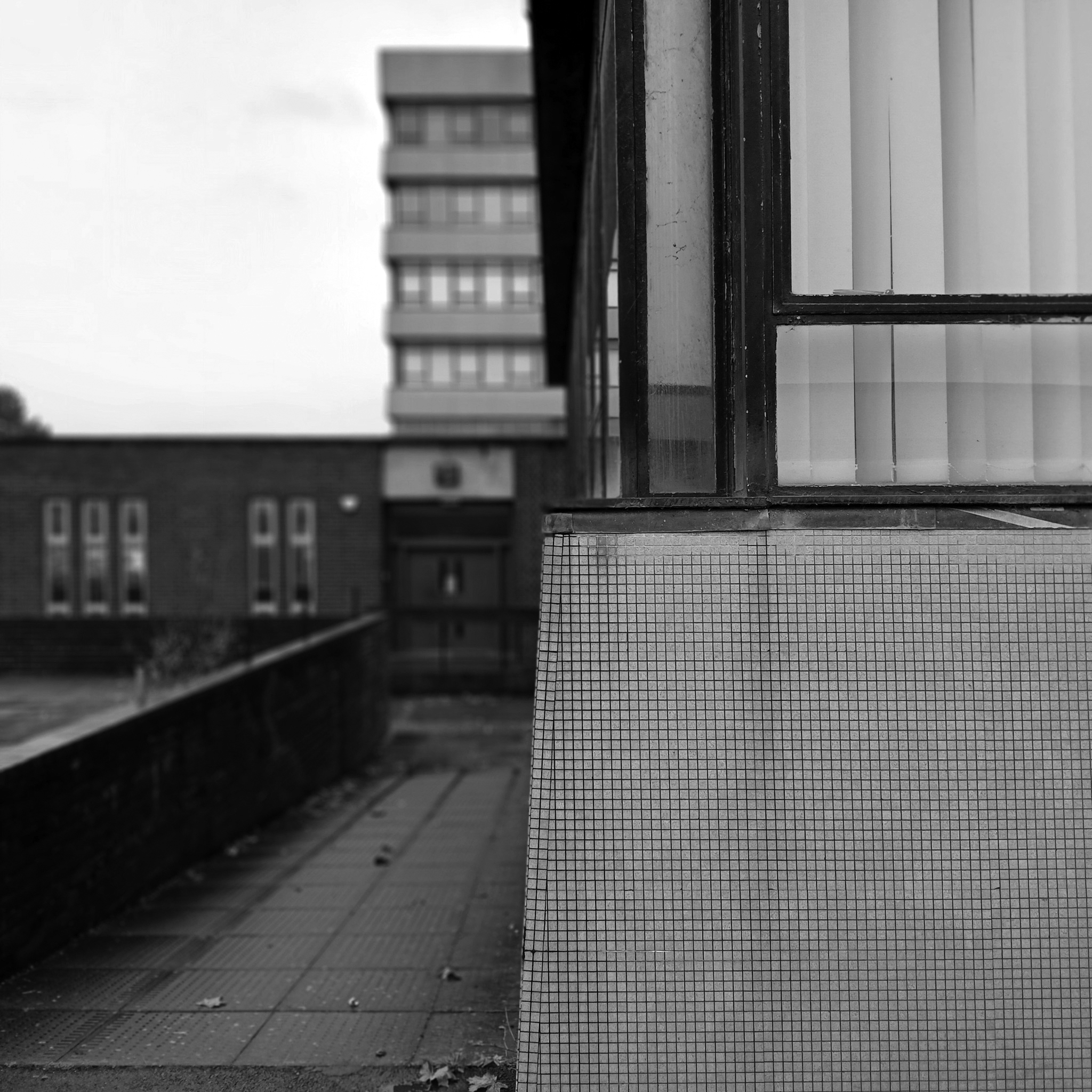
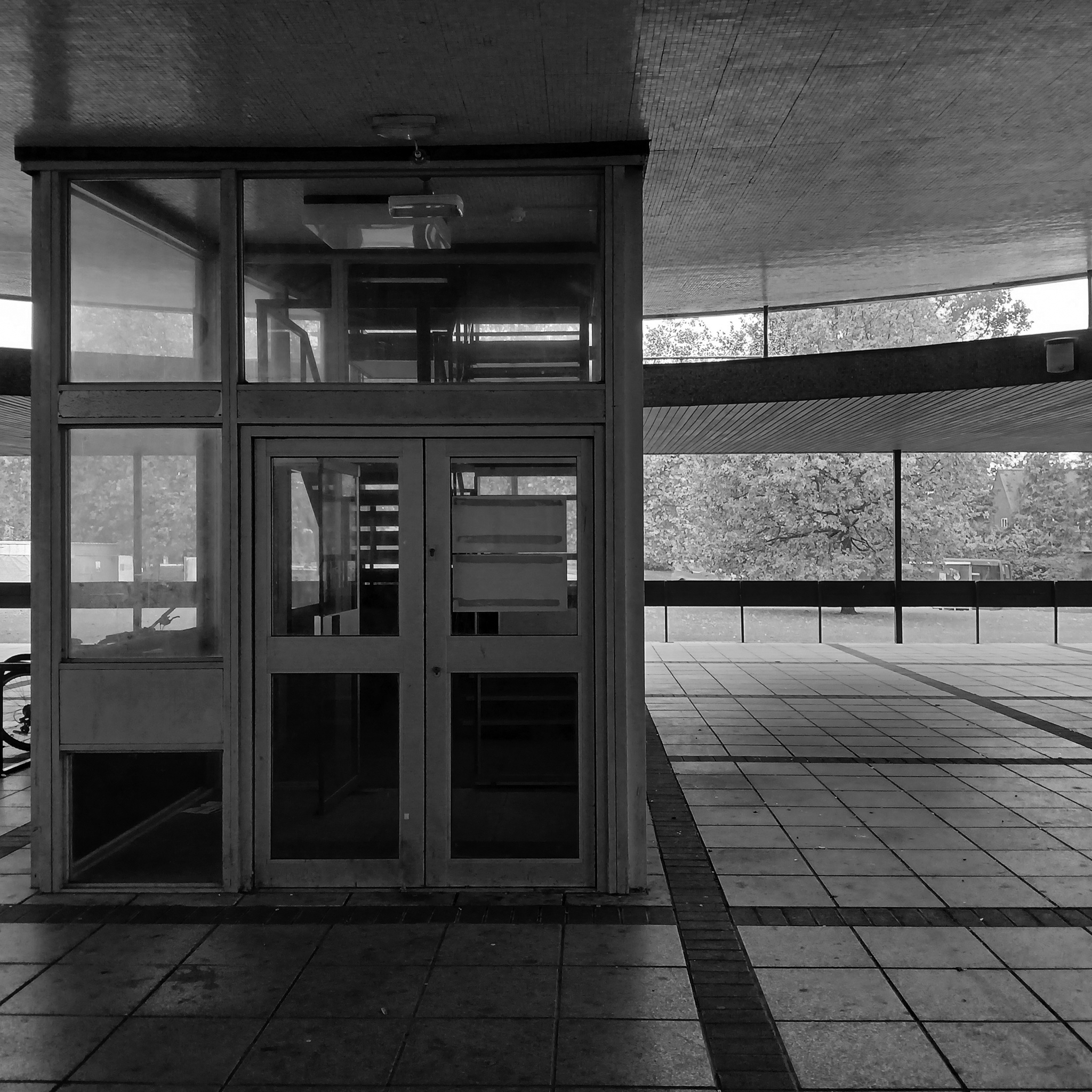
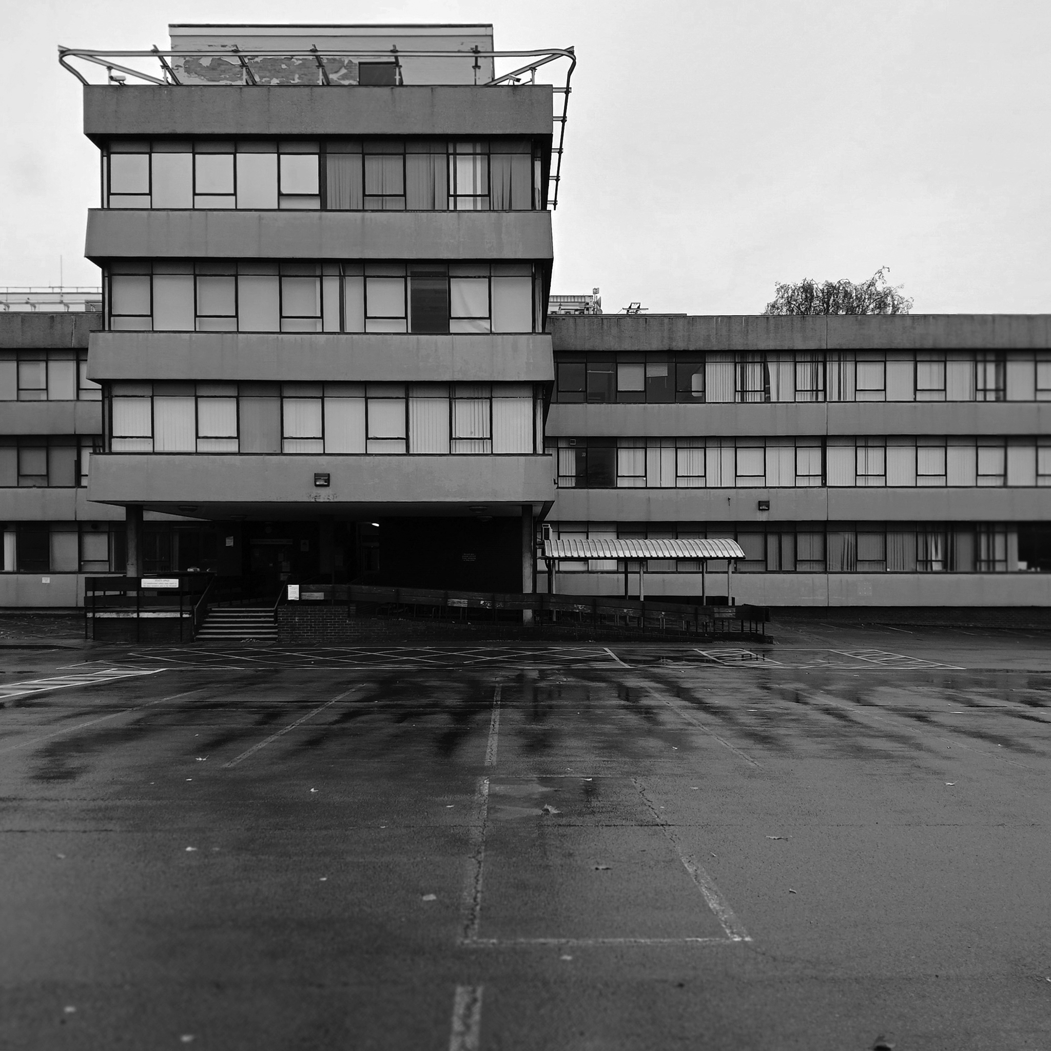
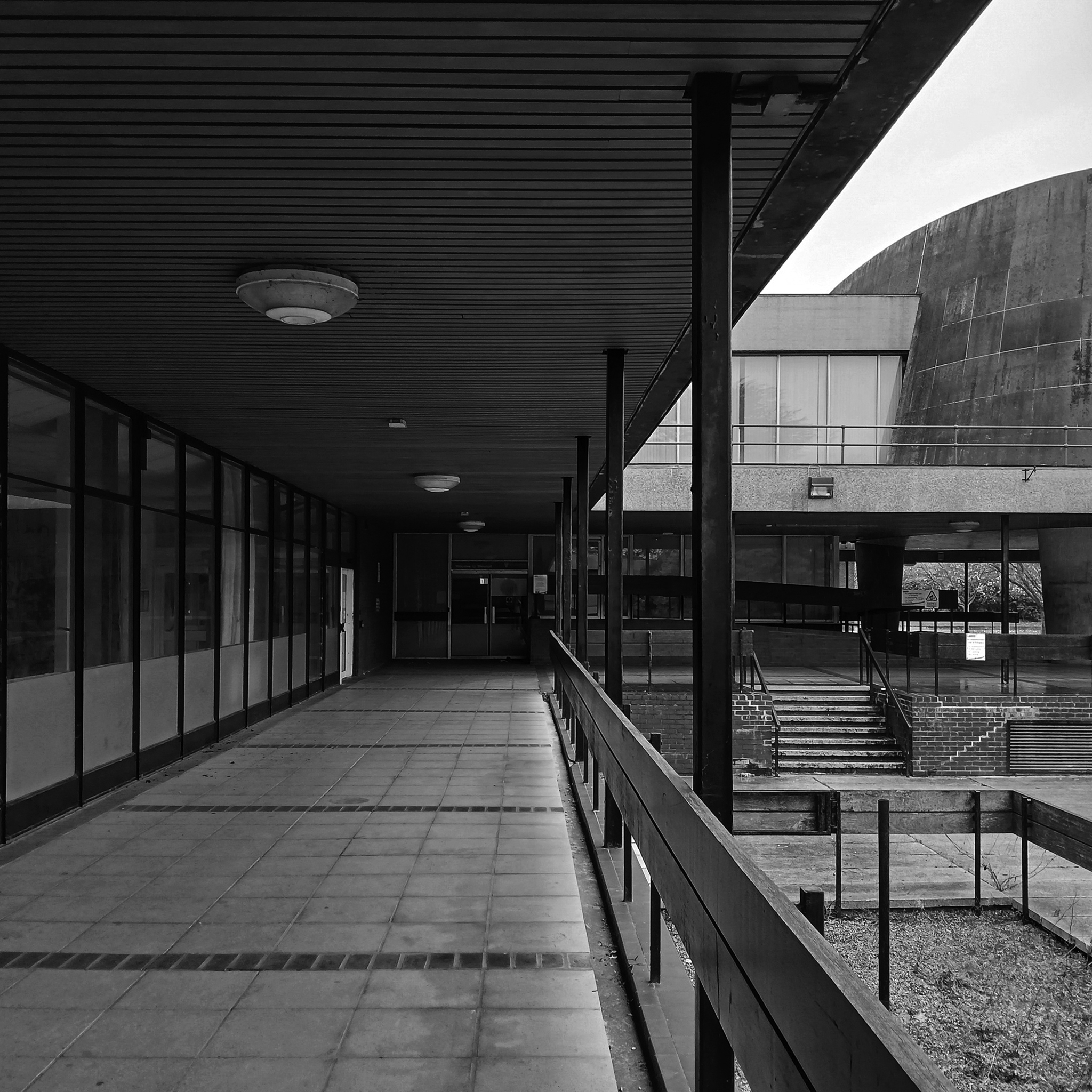
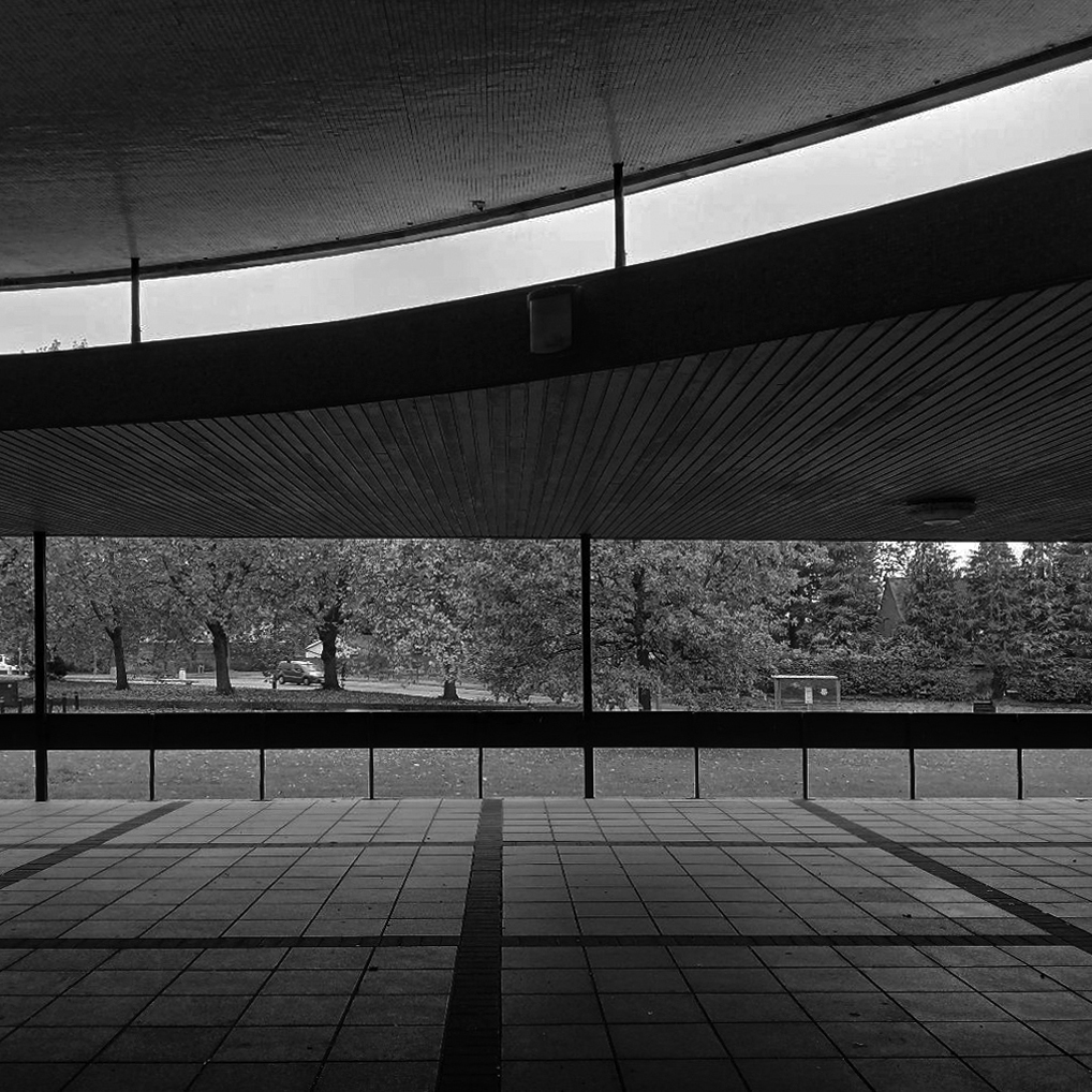
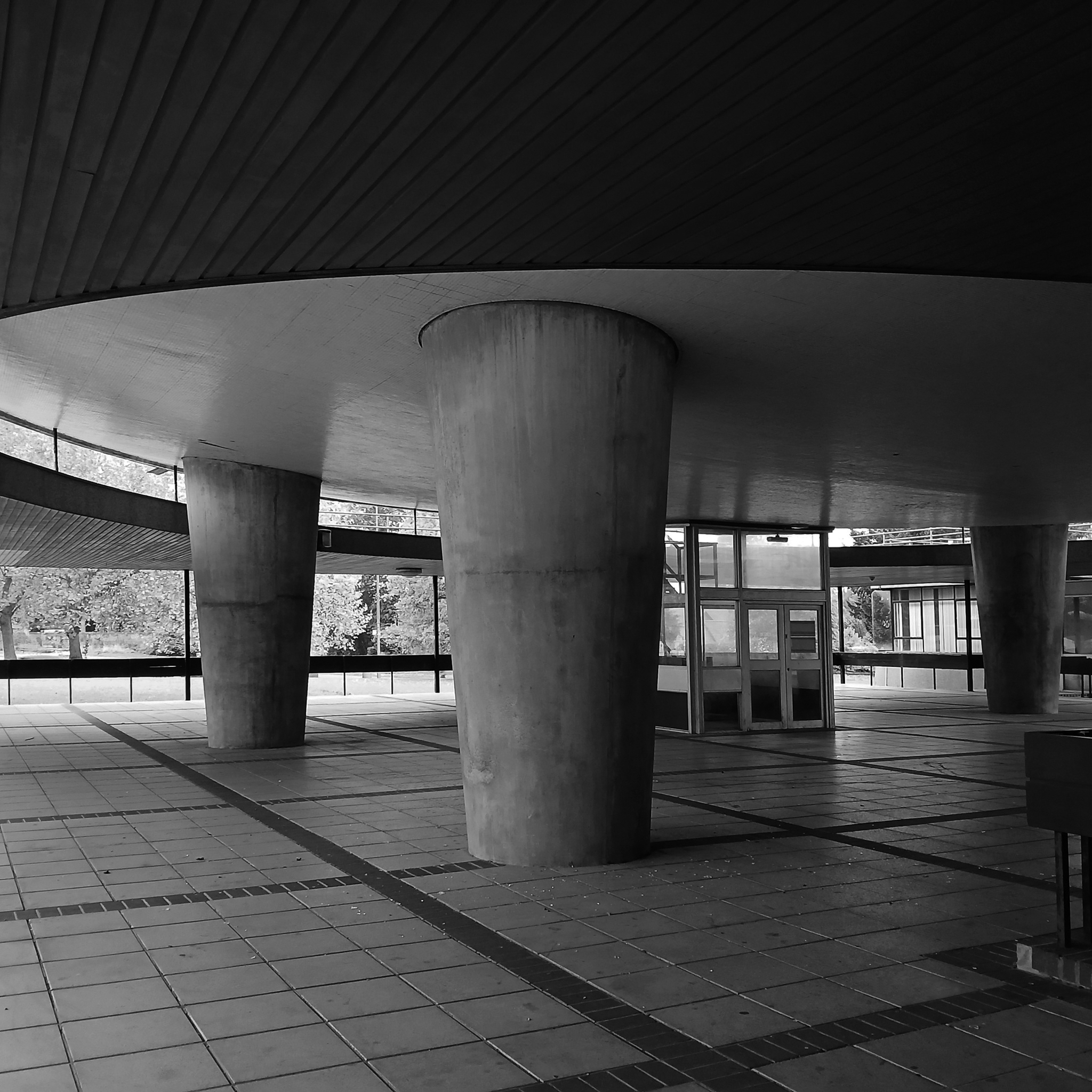
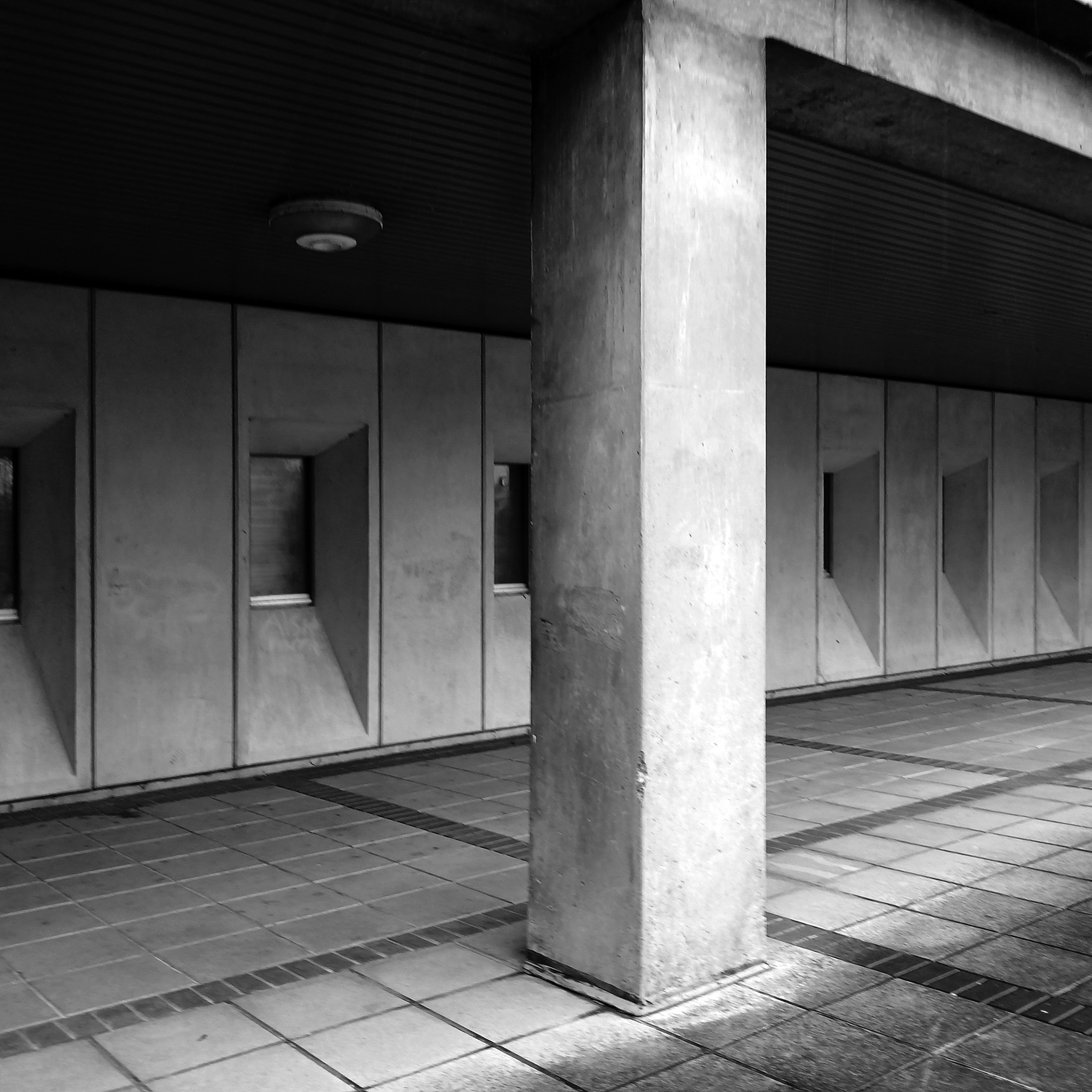
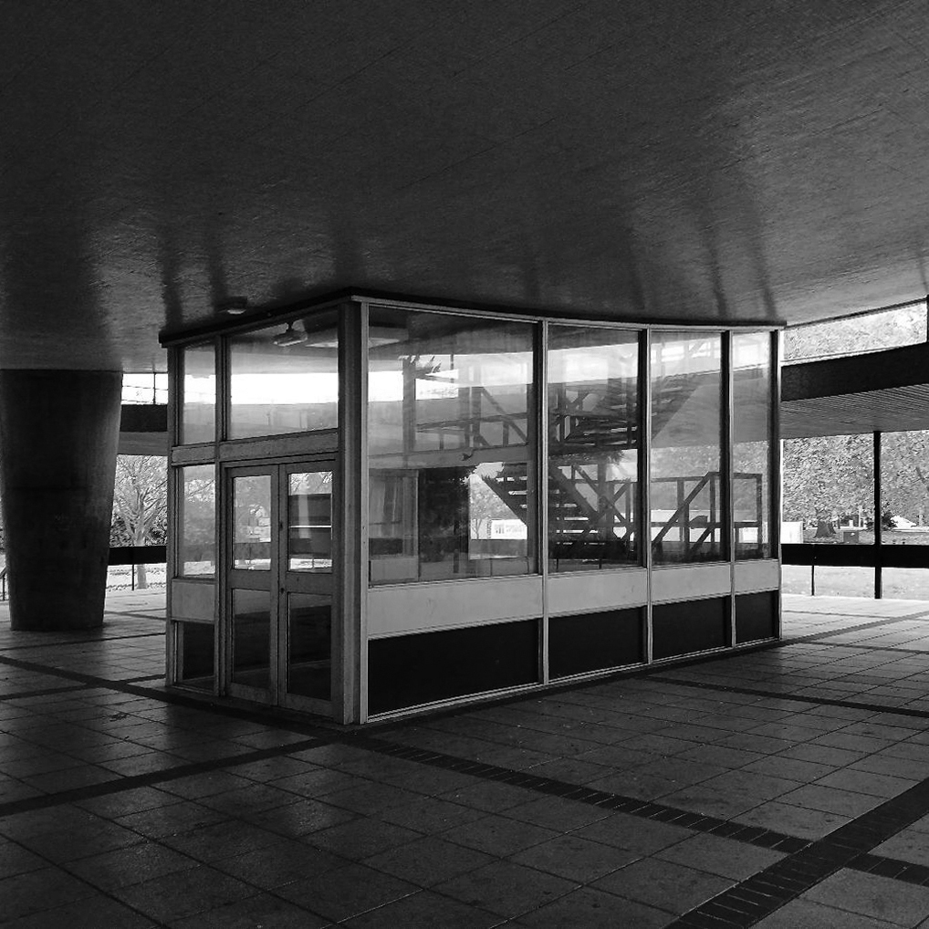
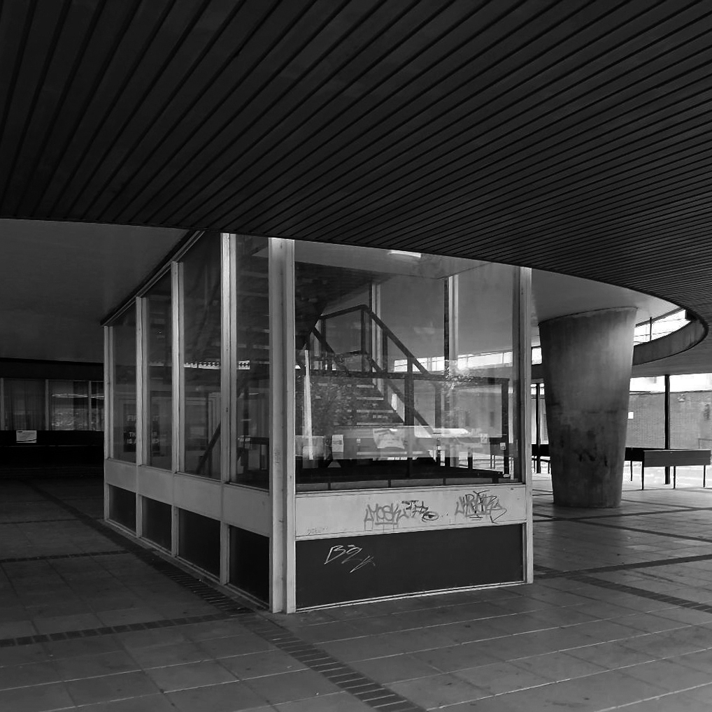
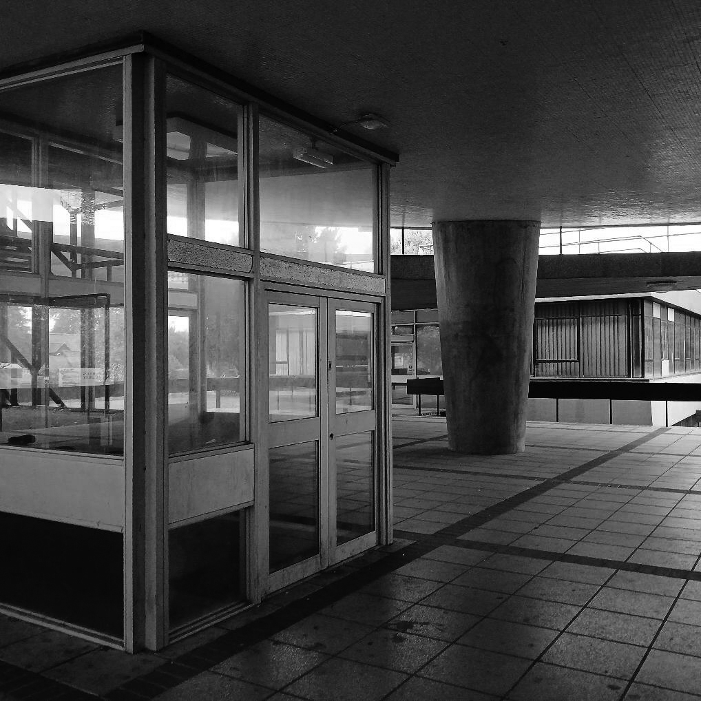
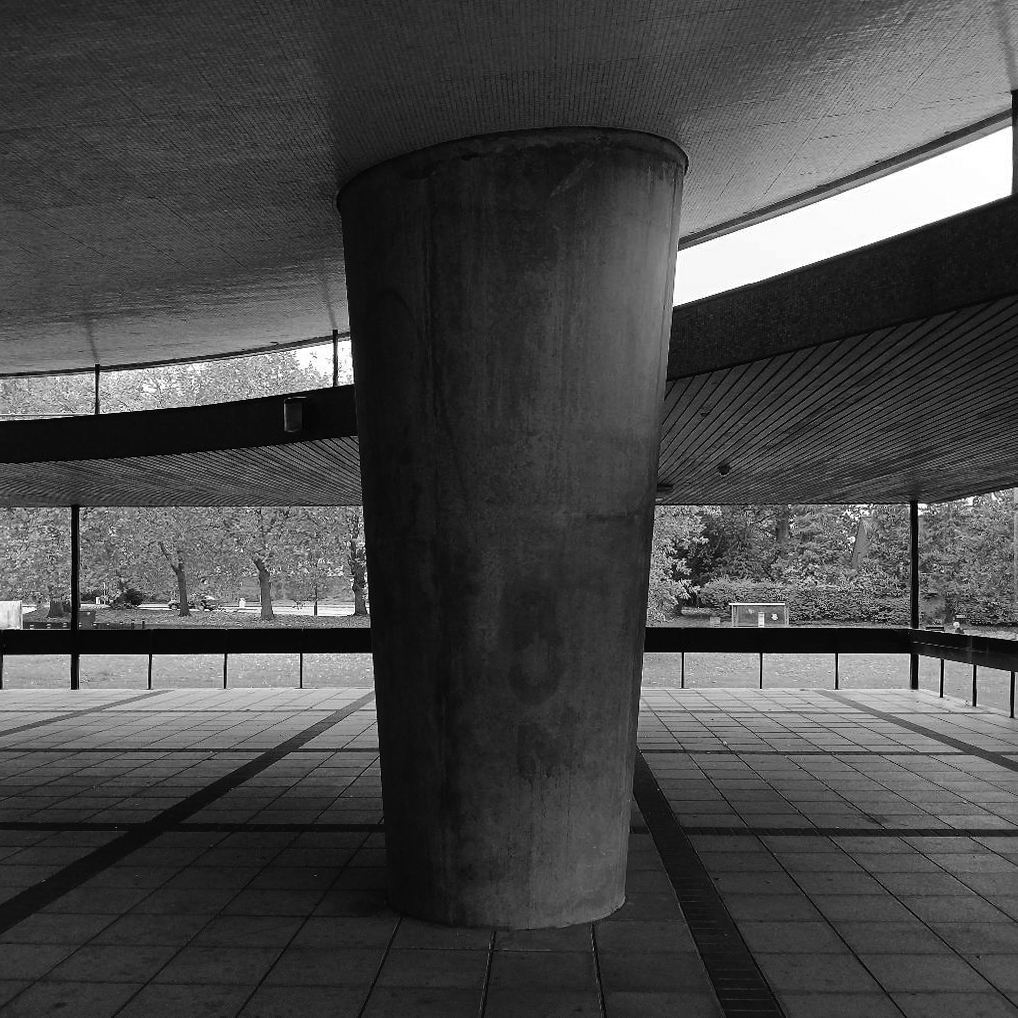
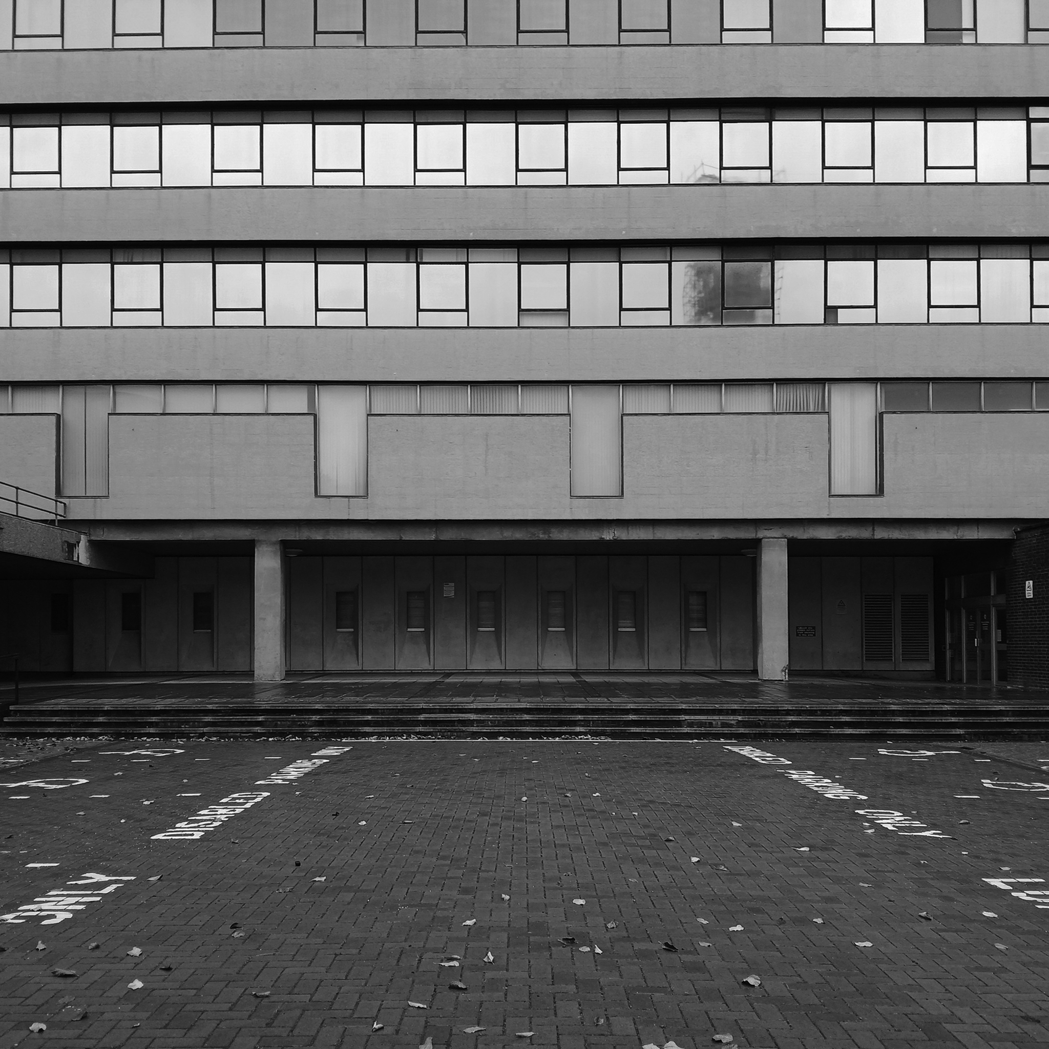
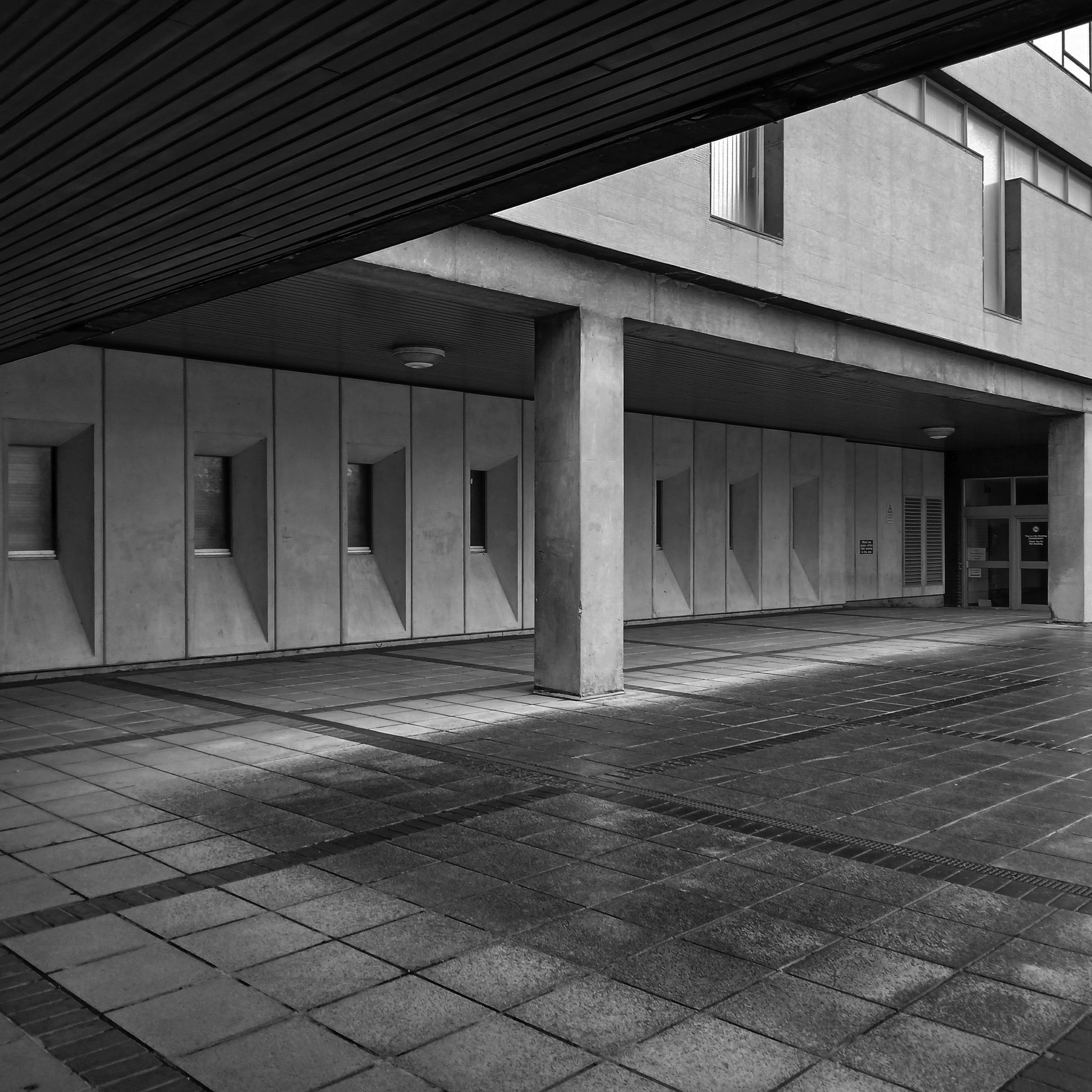
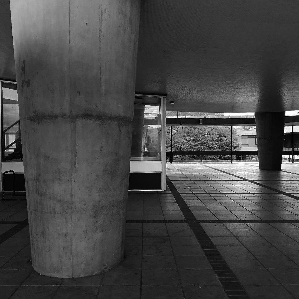
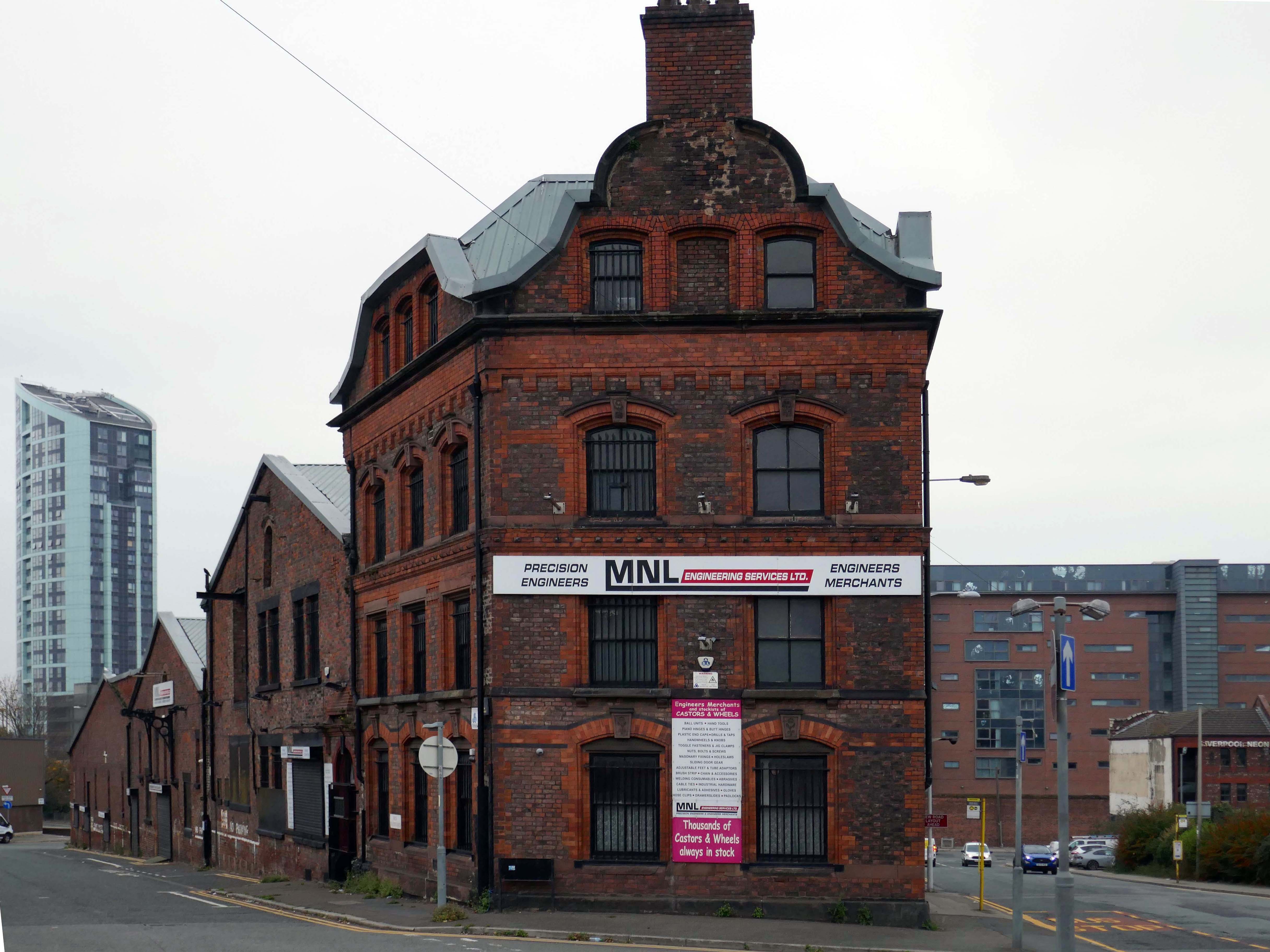
Rendall Building by Bryan & Norman Westwood, Piet & Partners 1964-6
Named after Gerald Henry Rendall who was an English educator and college administrator.
He was principal of University College Liverpool.
We have been here before at liverpool-university, exploring the space betwixt and between the two cathedrals.
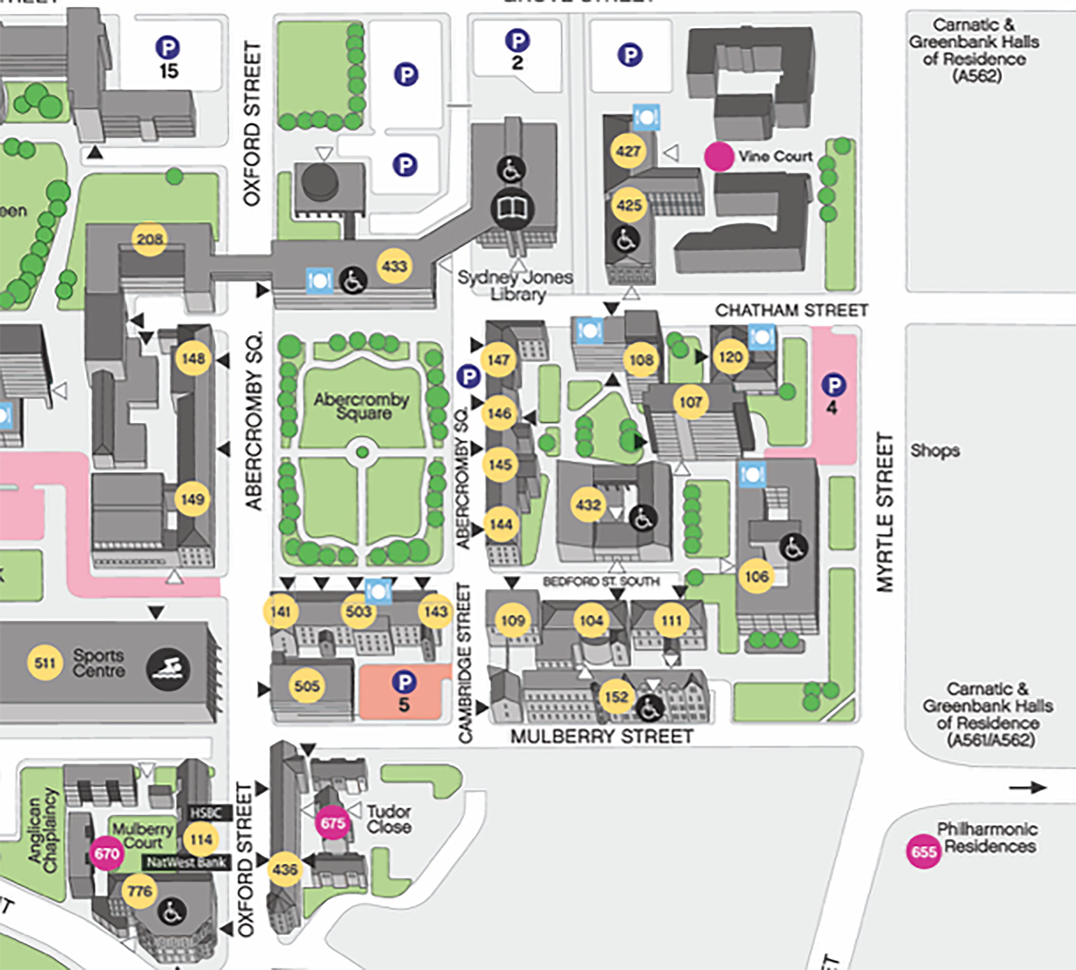
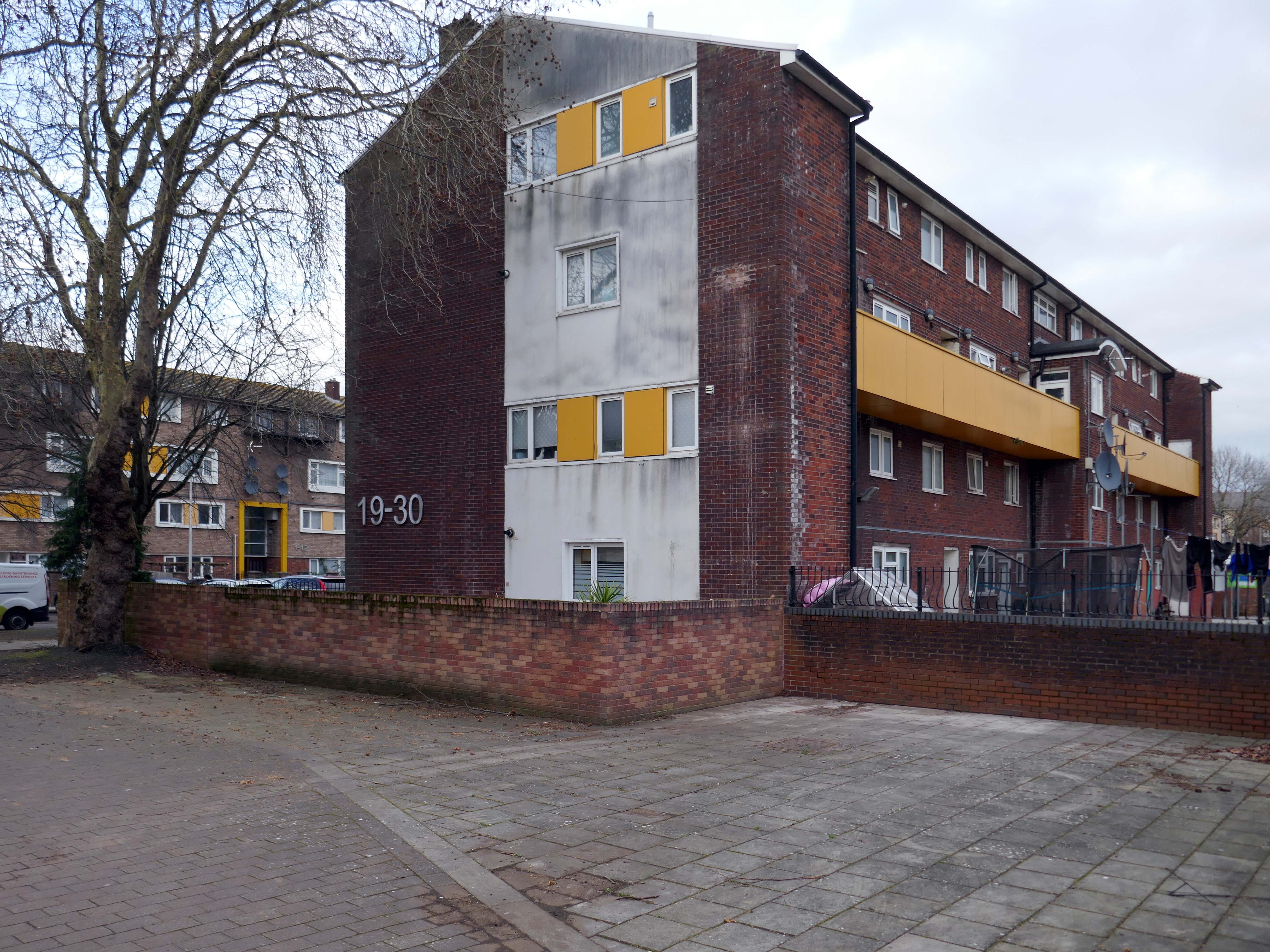
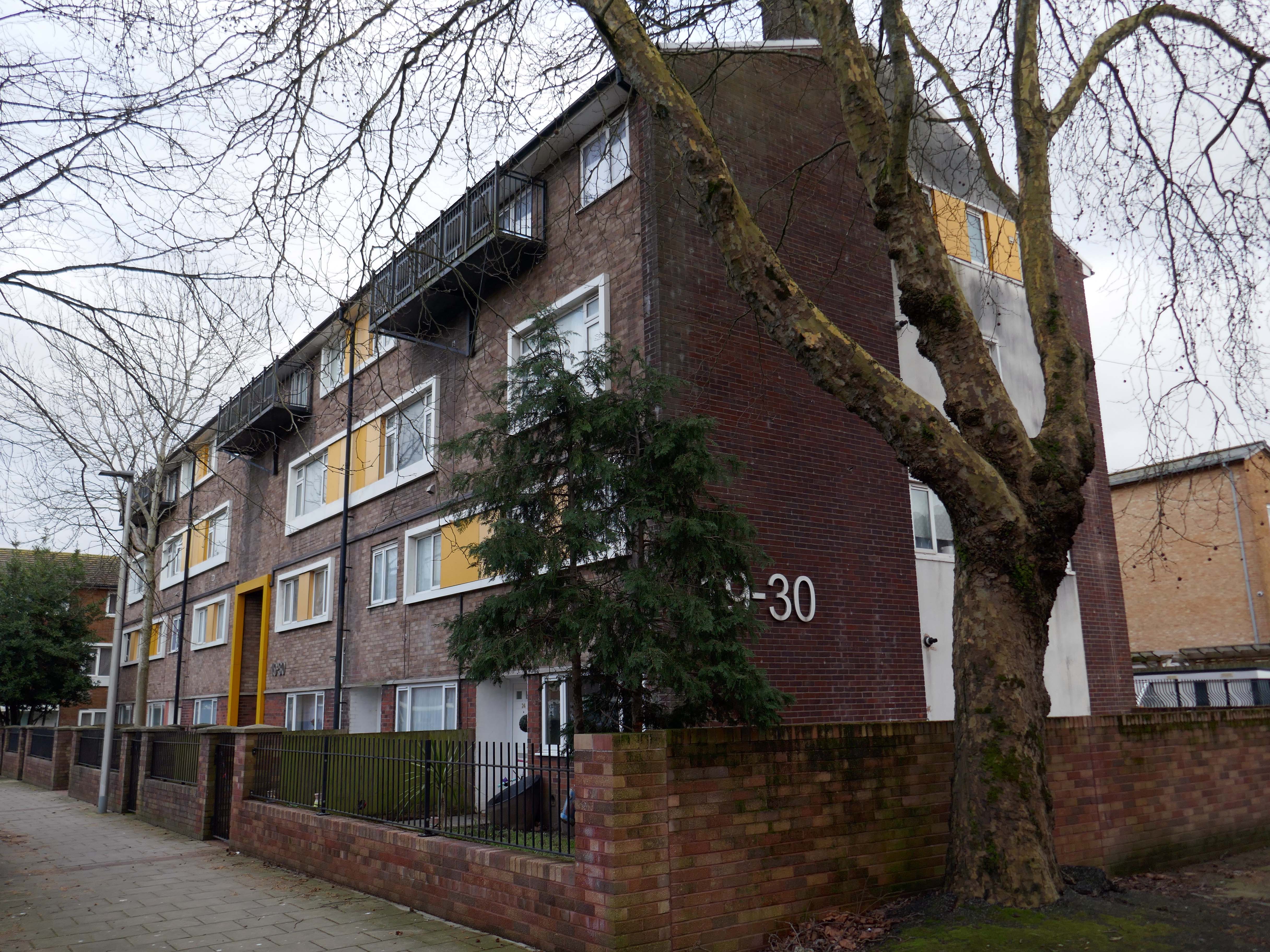
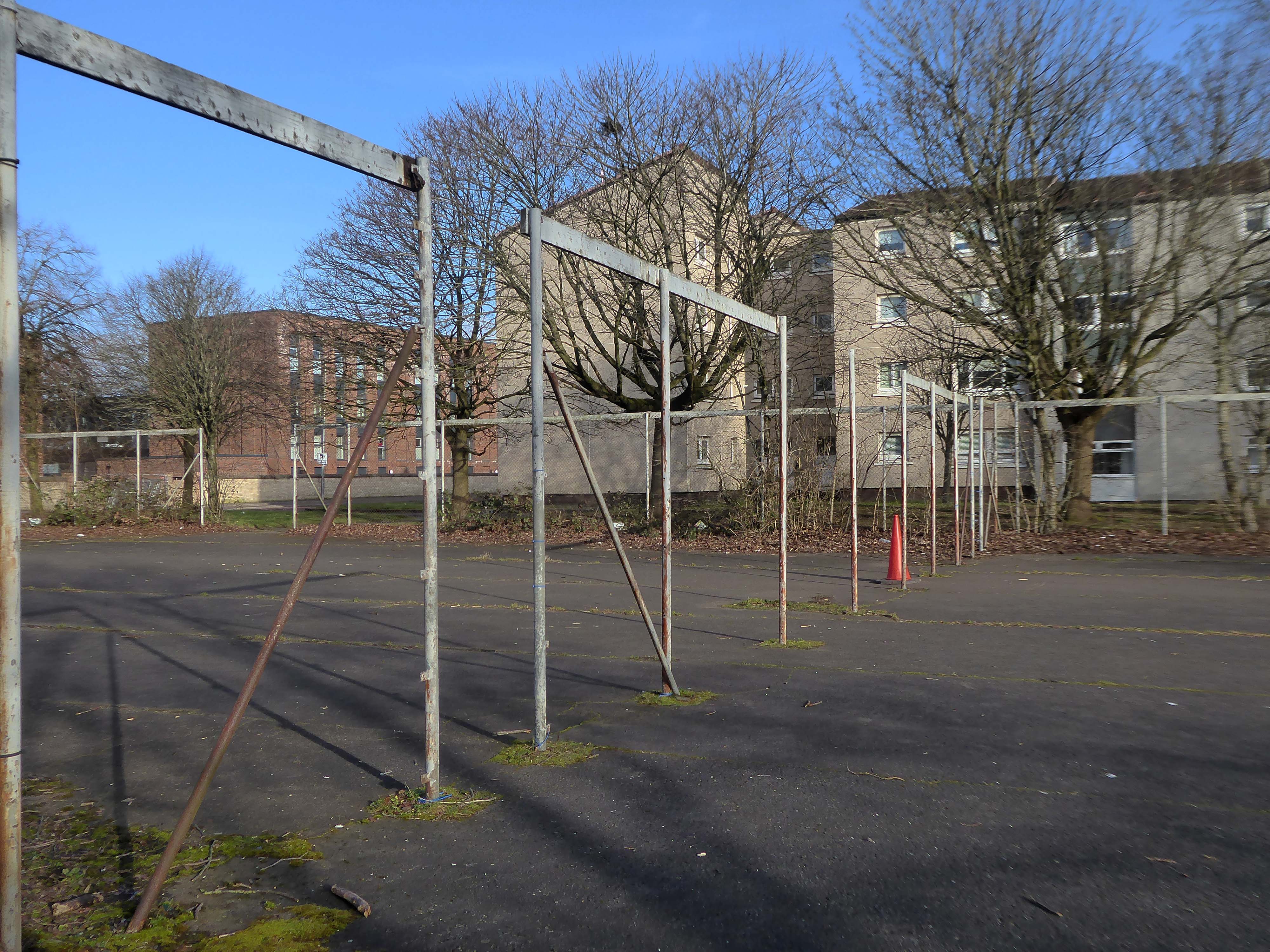
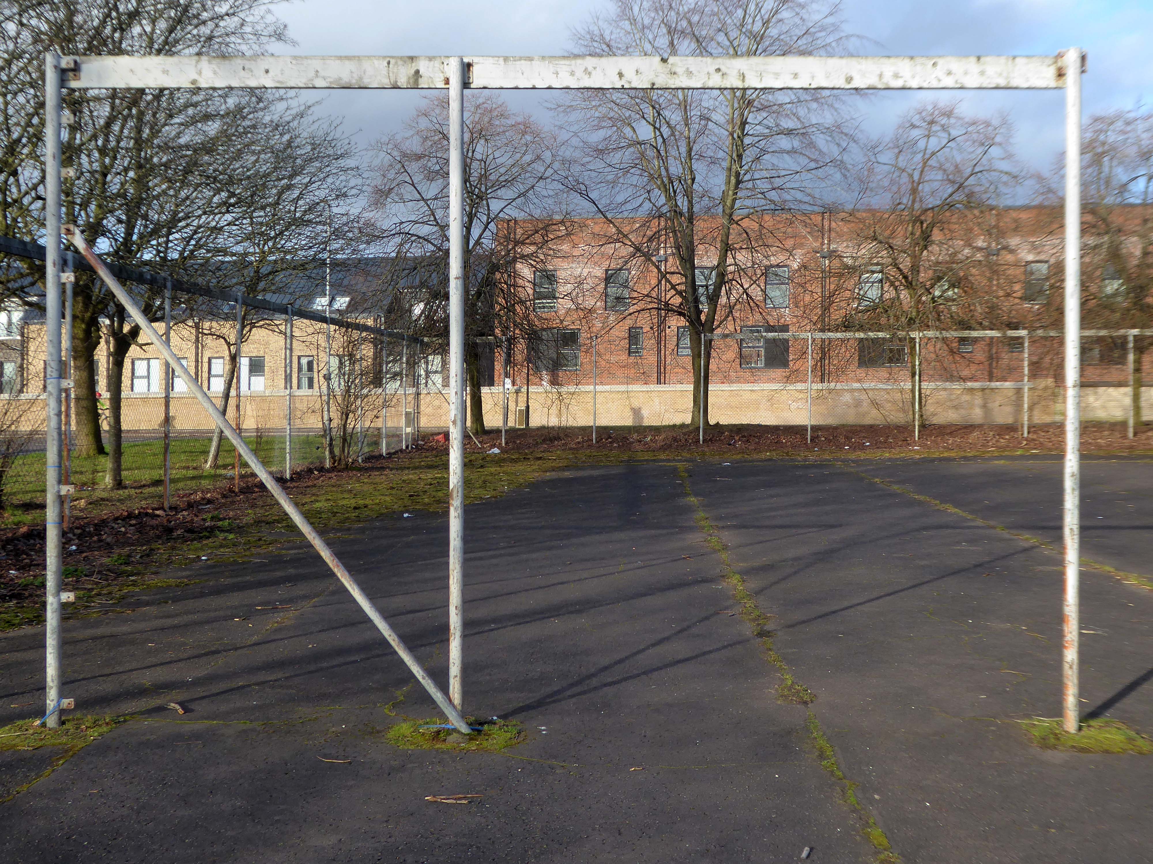
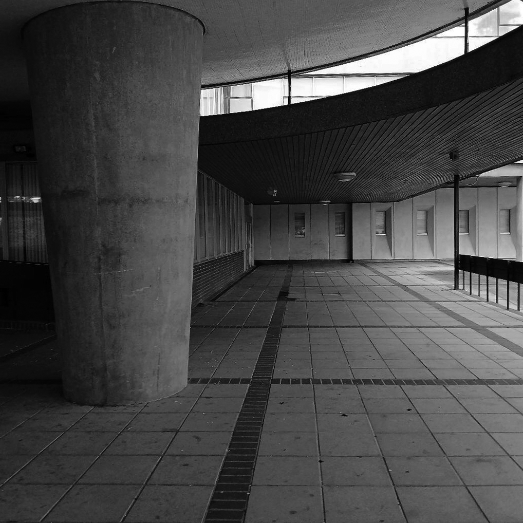
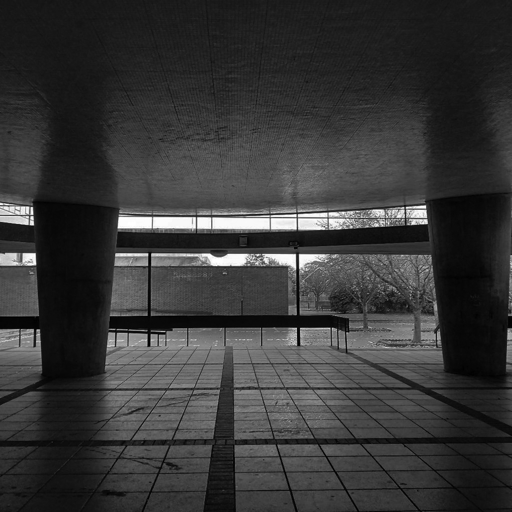
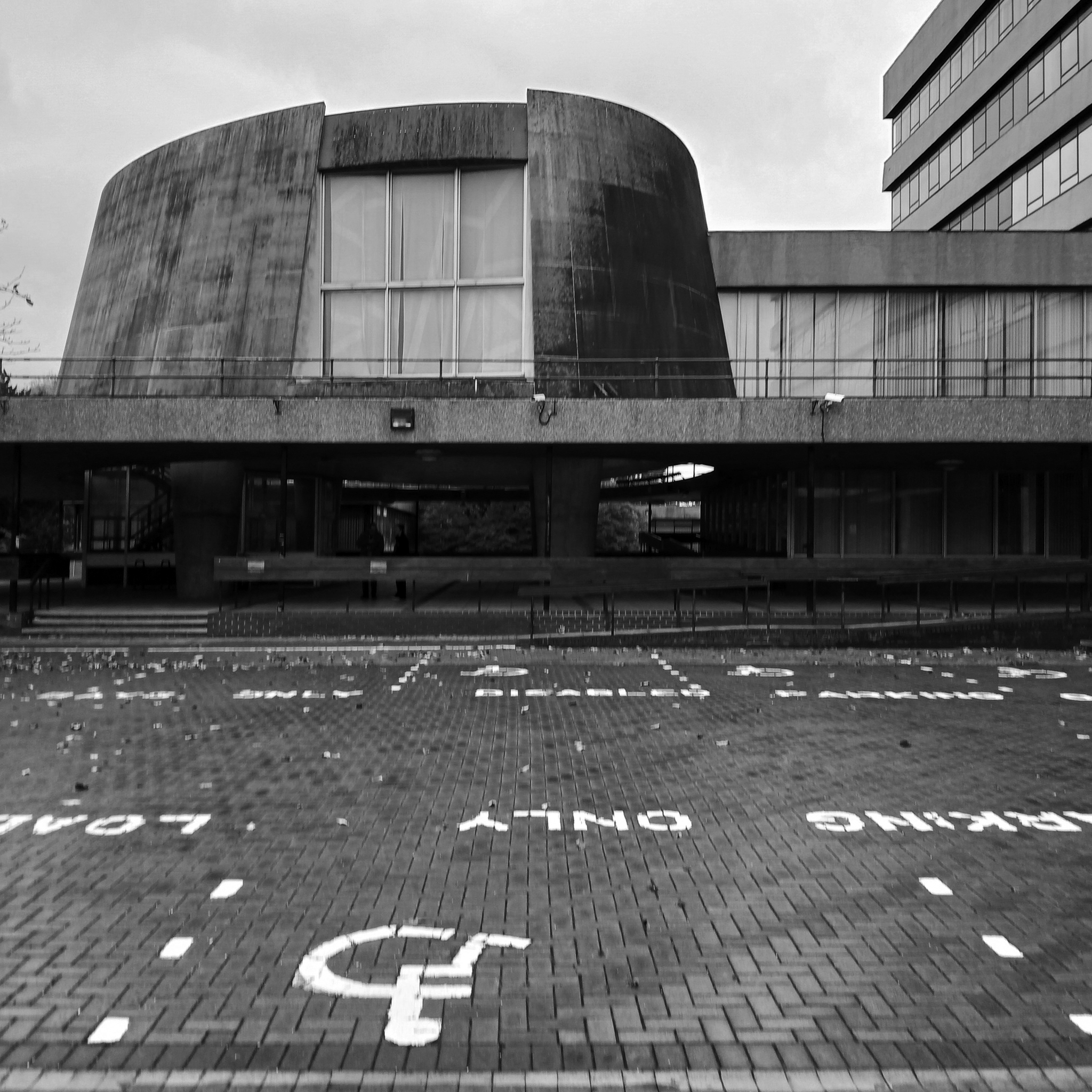
On this occasion, I wish to draw attention to this relatively small but perfectly formed building – #432 on your maps.
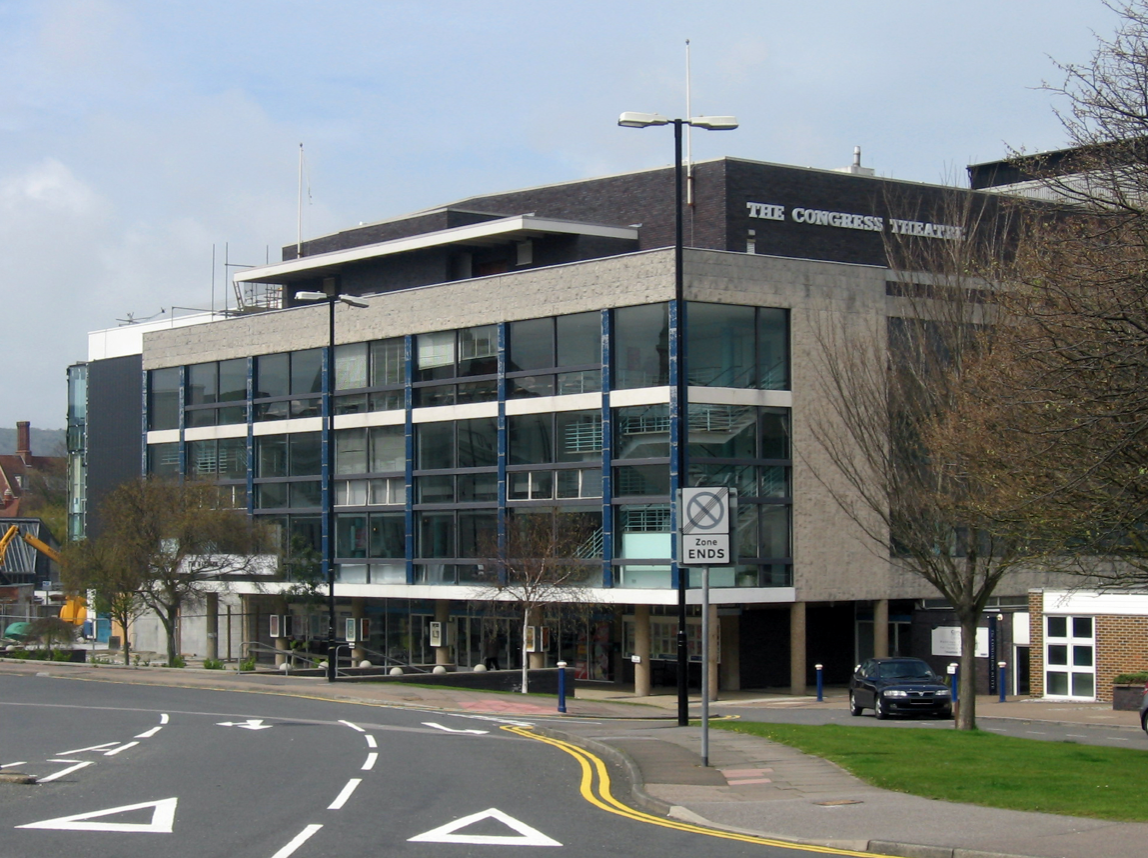
Westwood, Piet & Partners were well-known architects during the post-war period in Britain and built a body of varied work including army barracks, retail and theatre design. An example of their work is the Congress Theatre in Eastbourne – Grade II* listed.
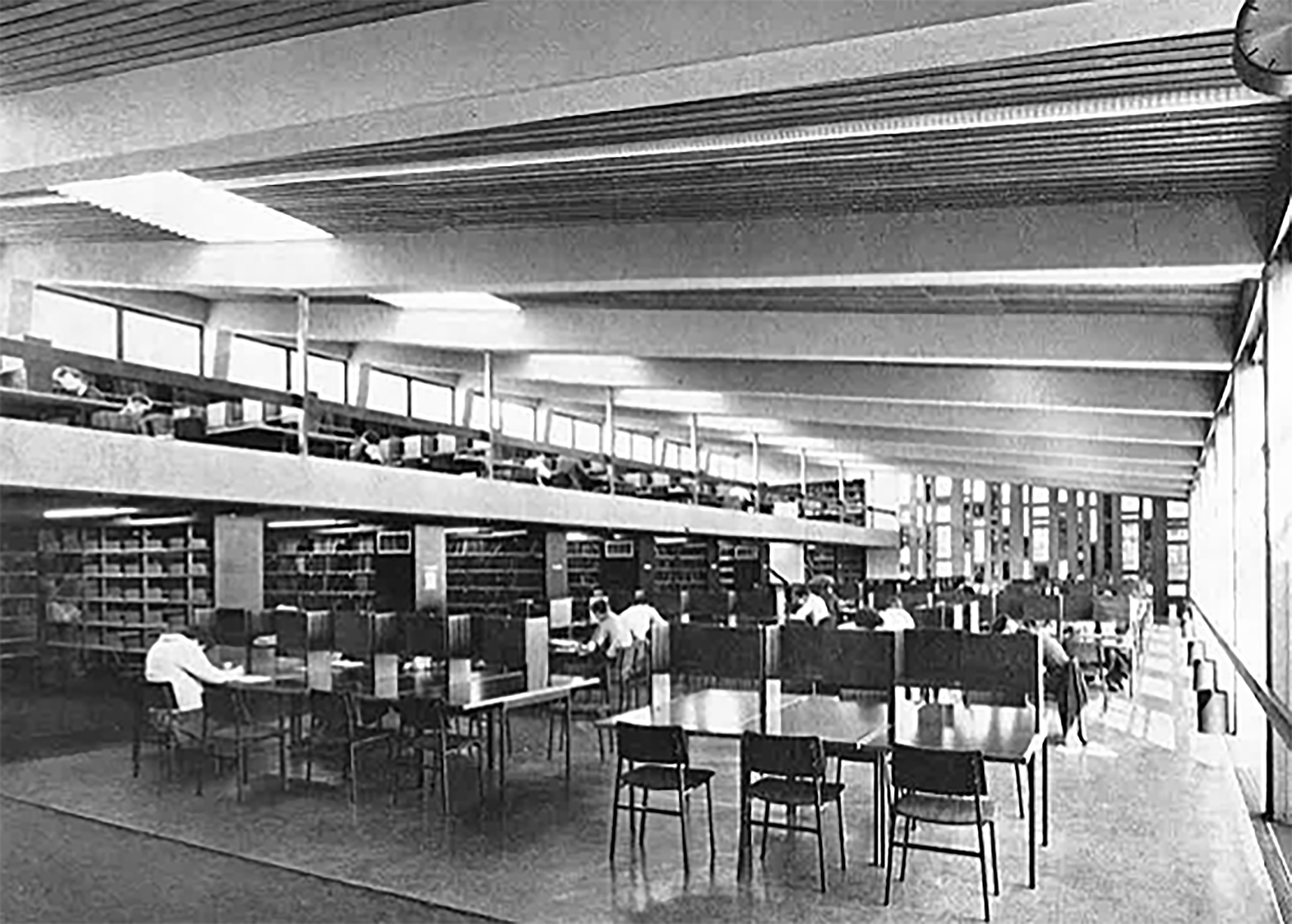
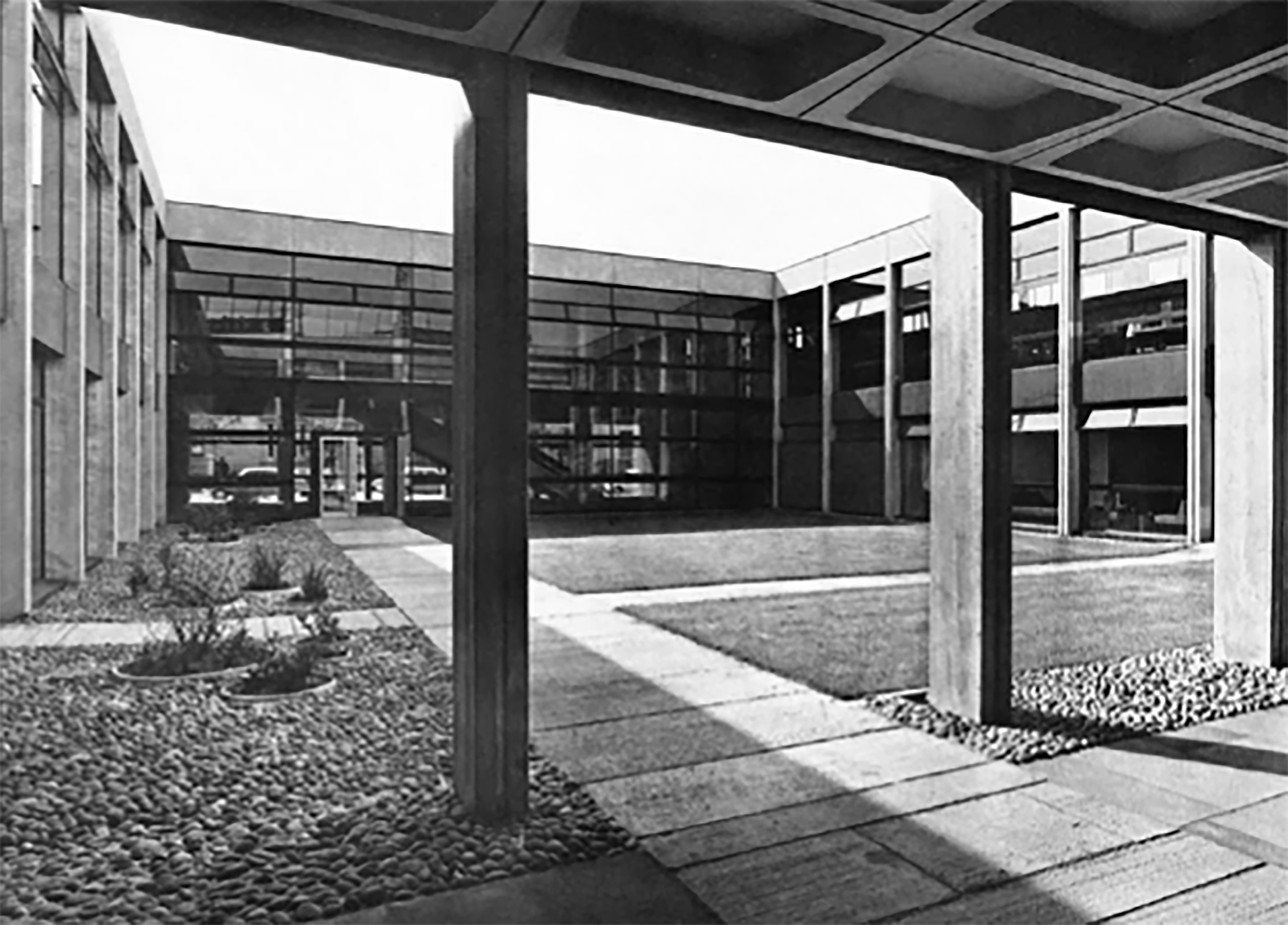
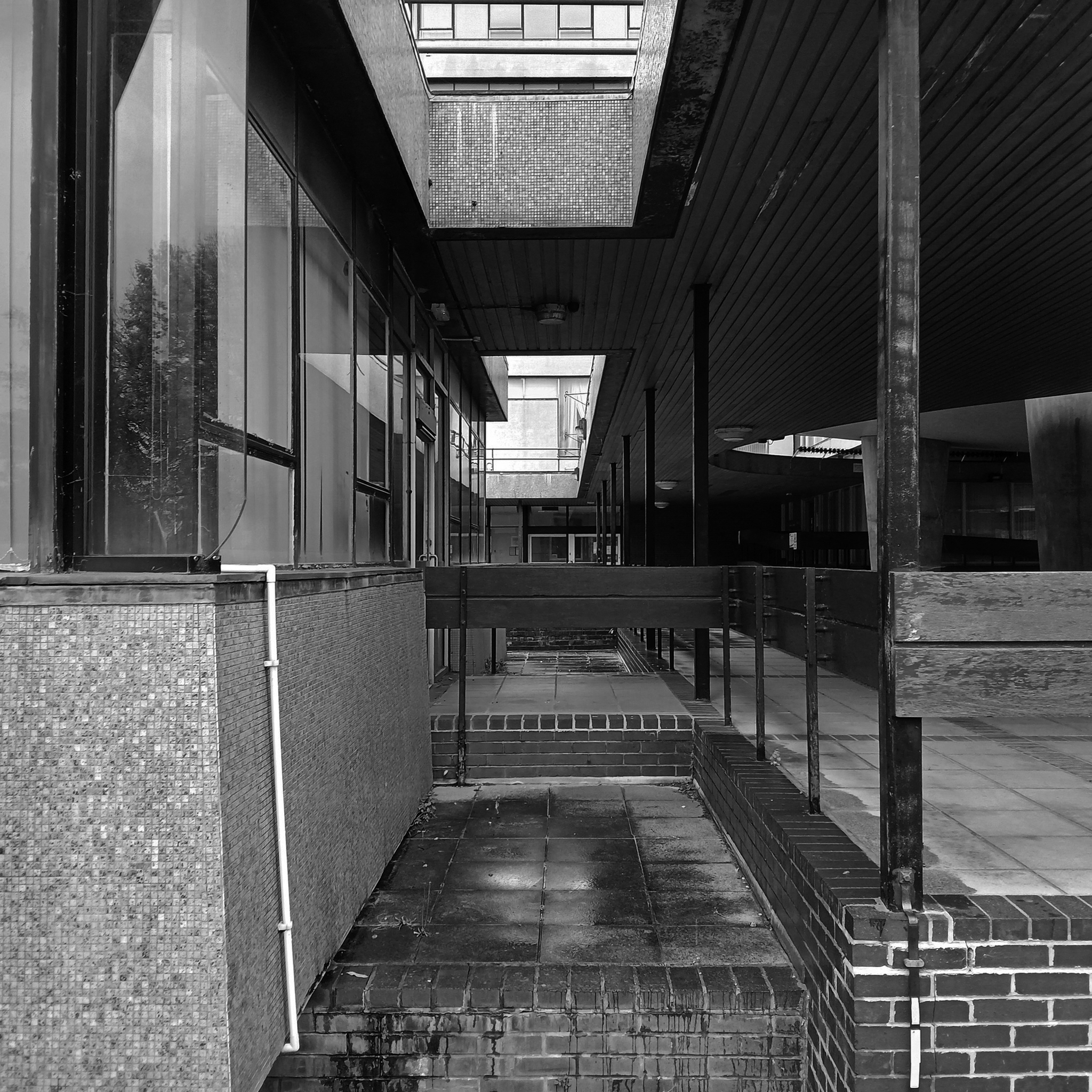
Originally built to accommodate the arts library and lecture rooms on the south campus as the University grew to accommodate larger numbers of students.
The current use as lecture and seminar rooms maintains the building’s use as a key learning space on campus.
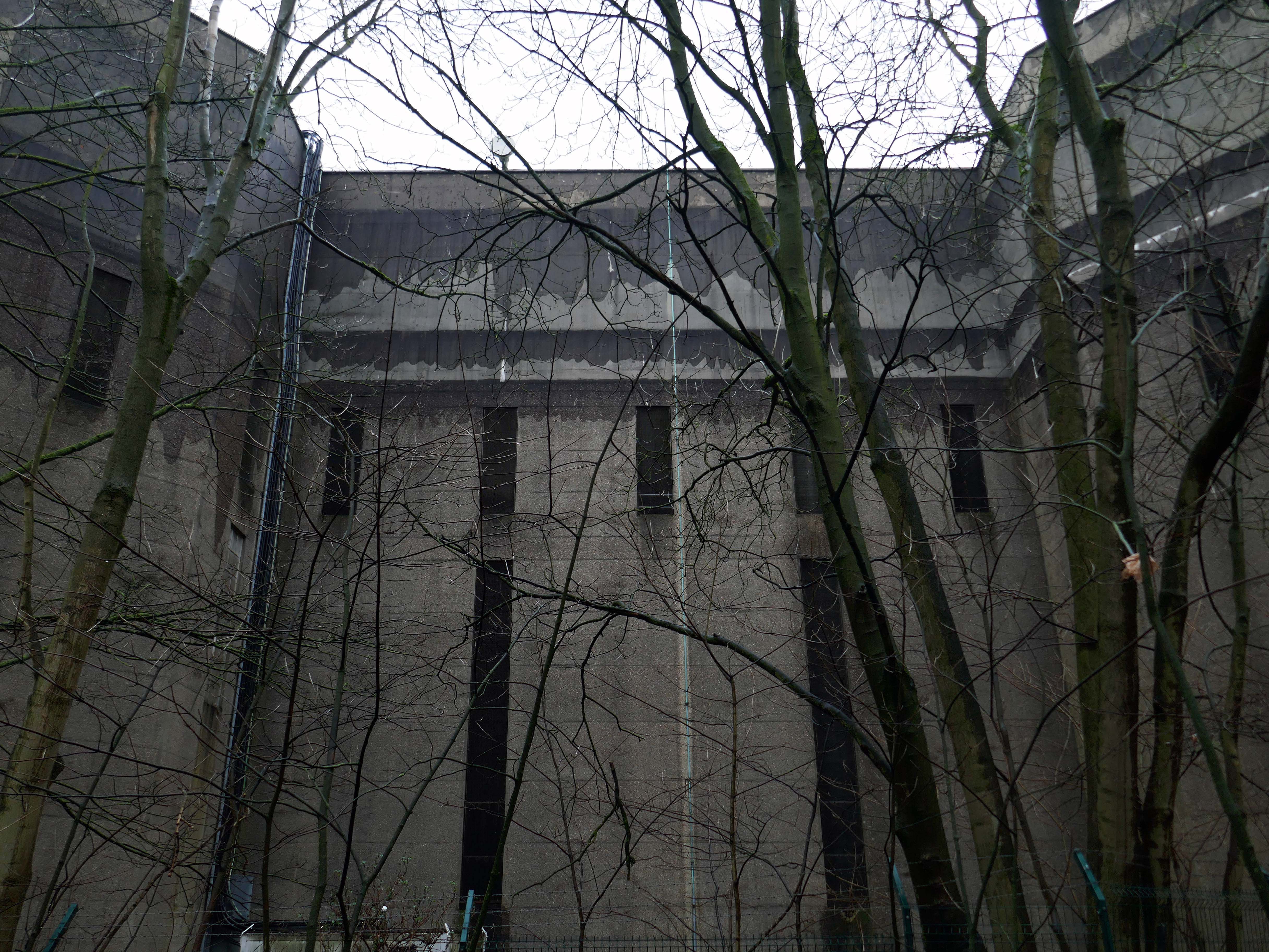
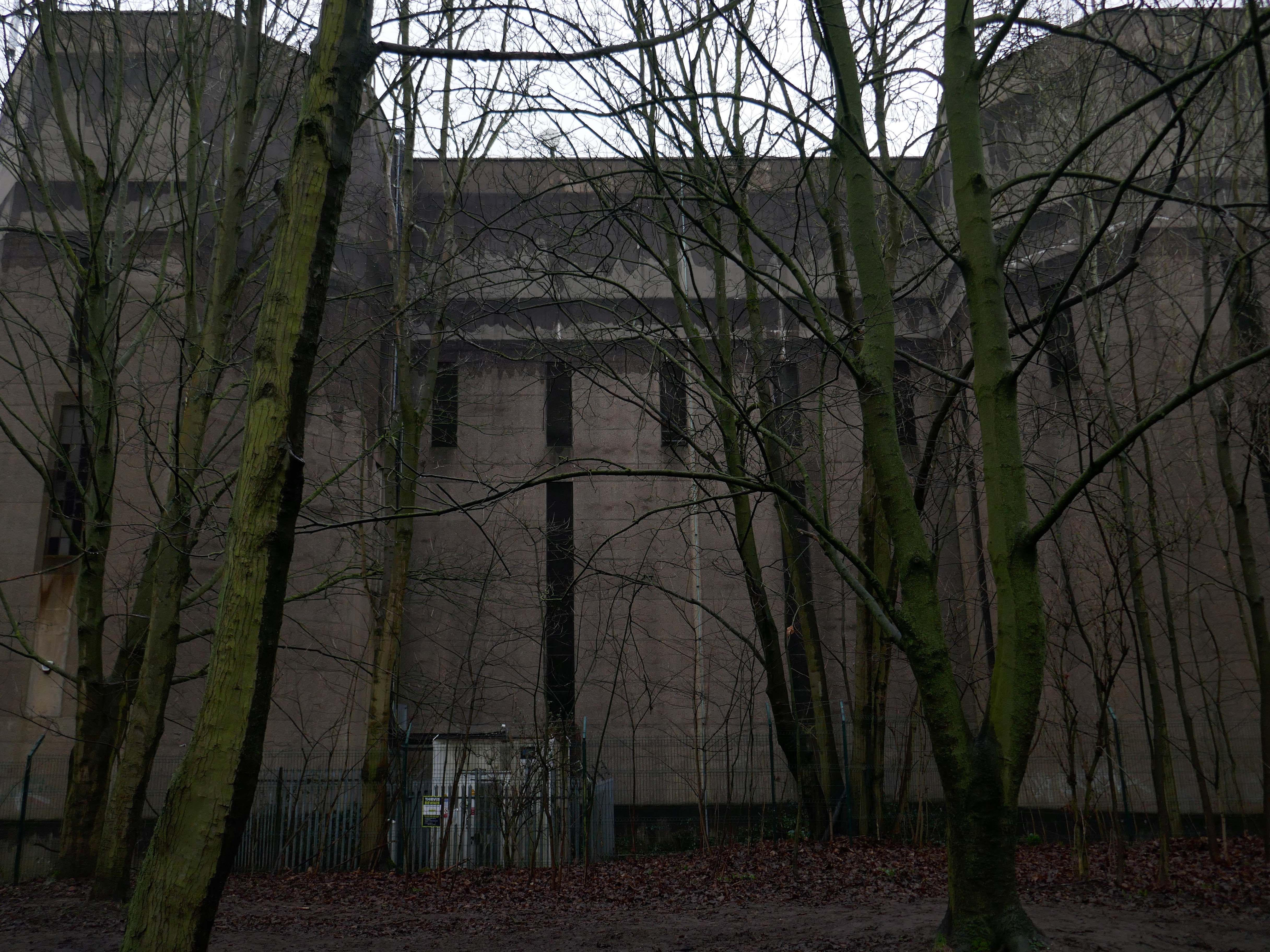
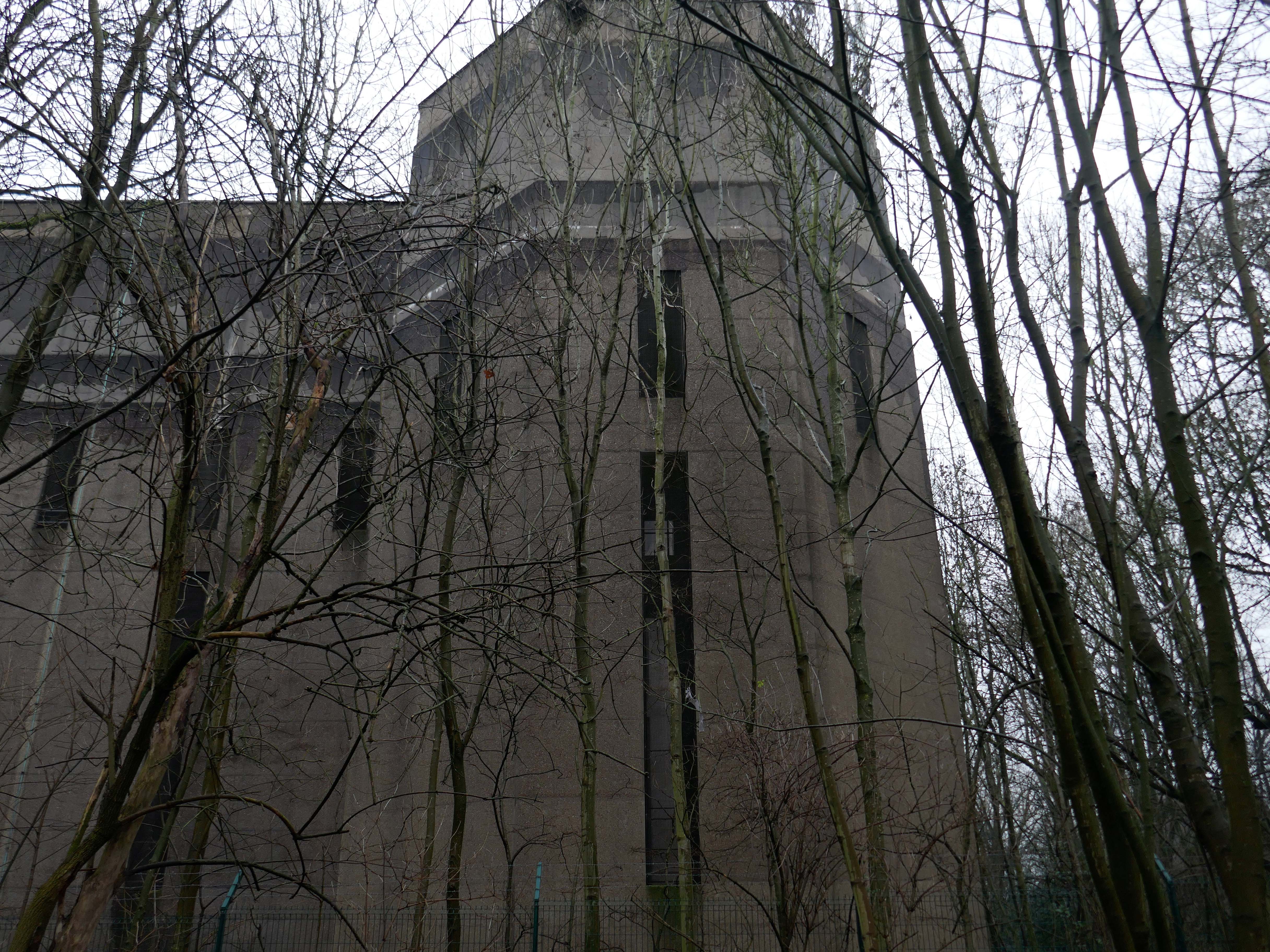
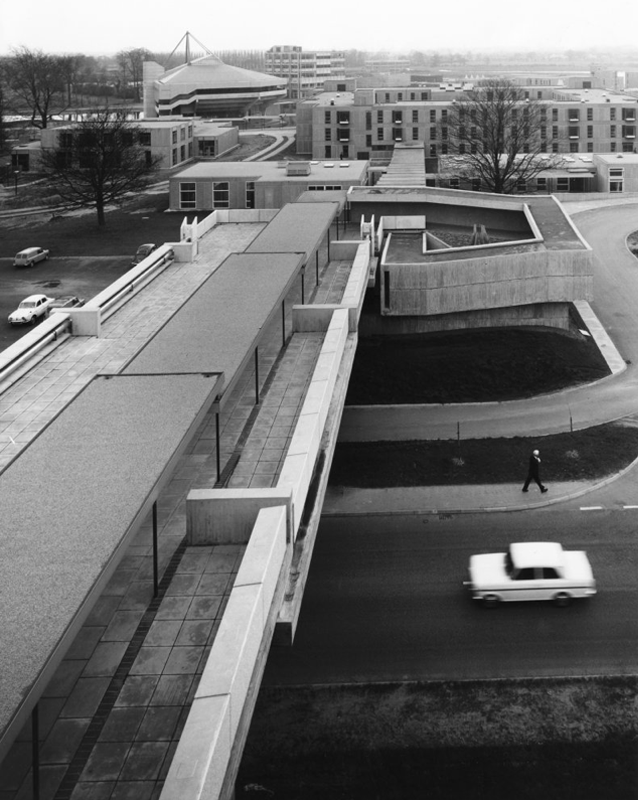
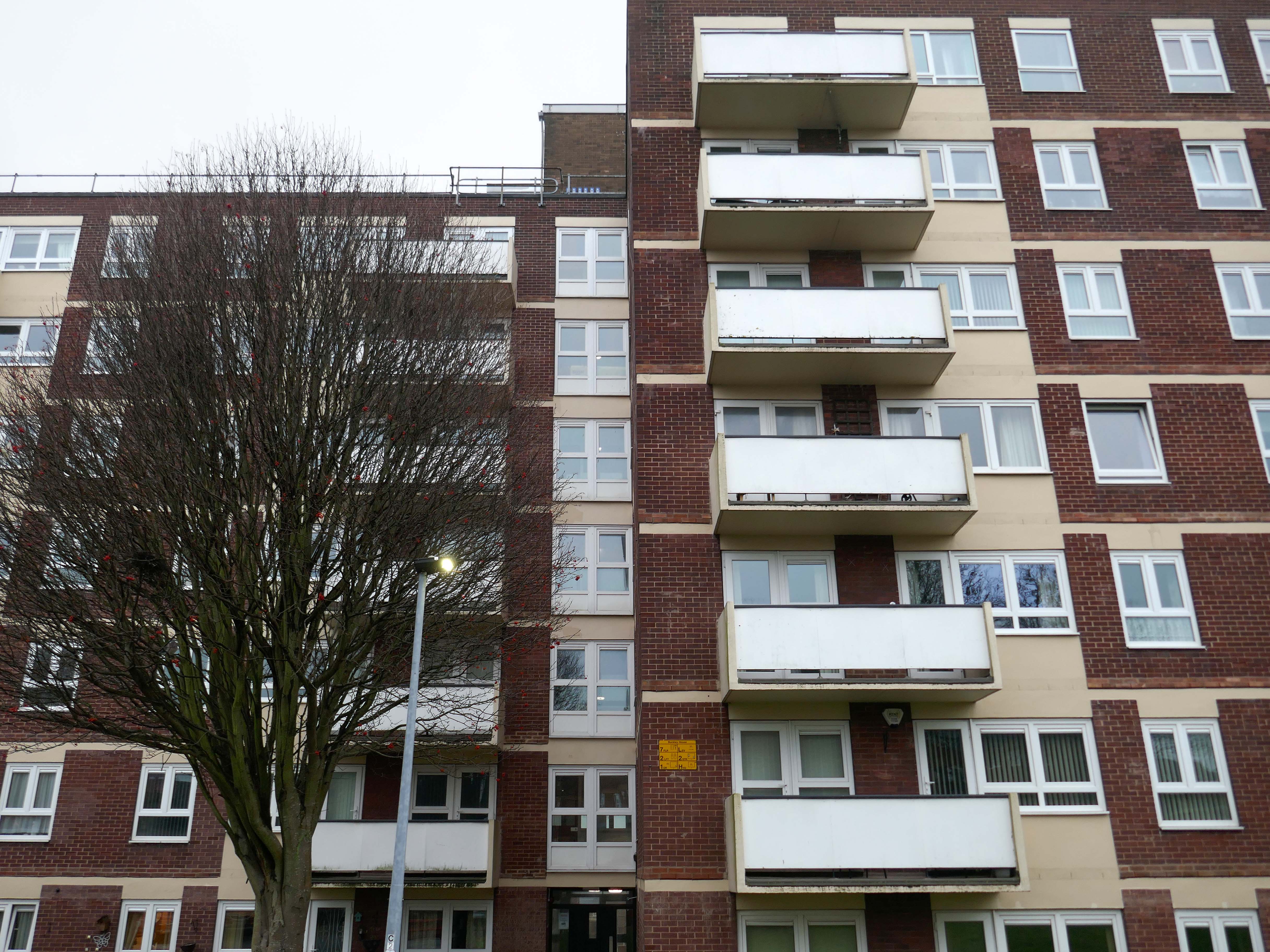
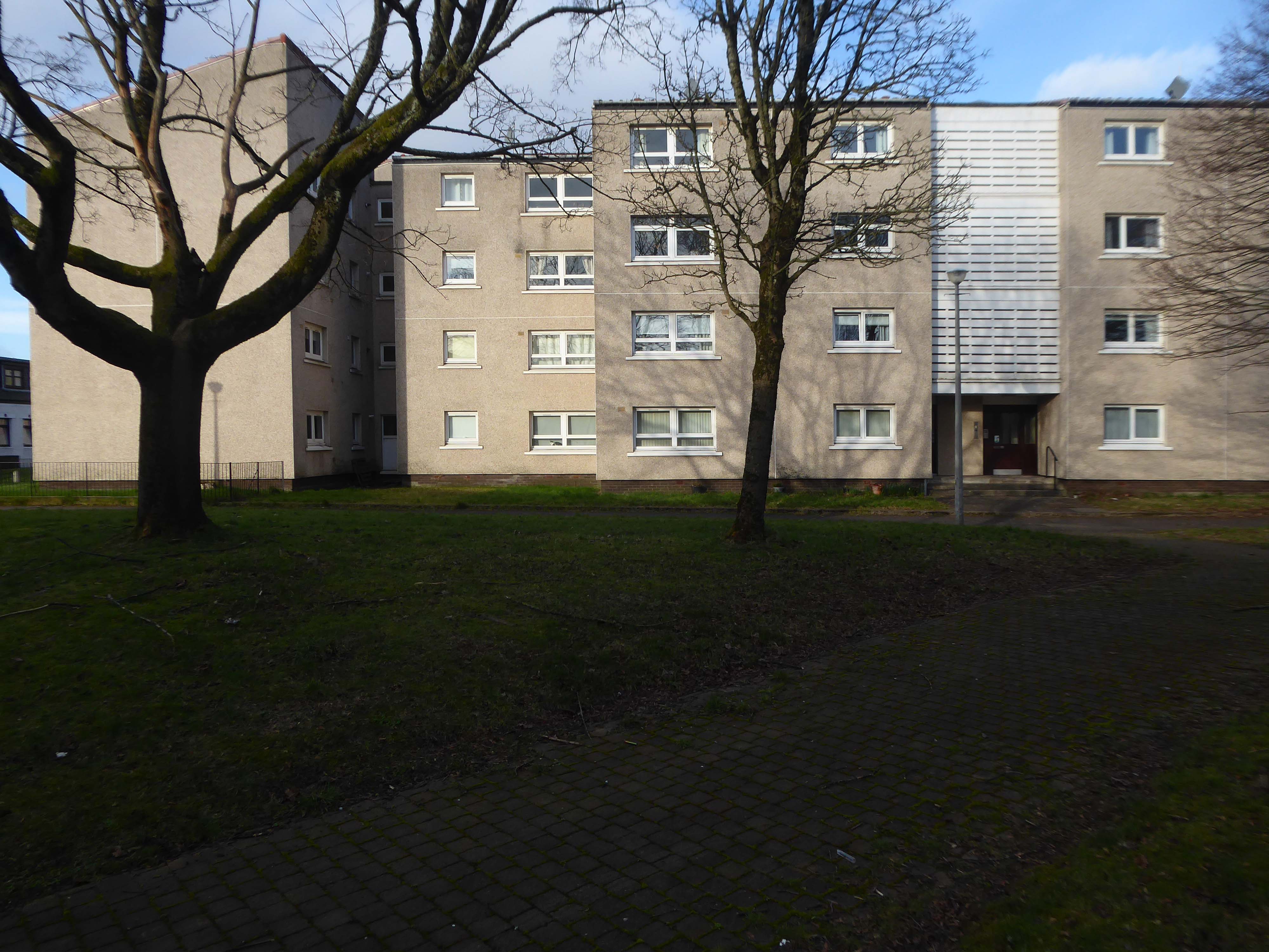
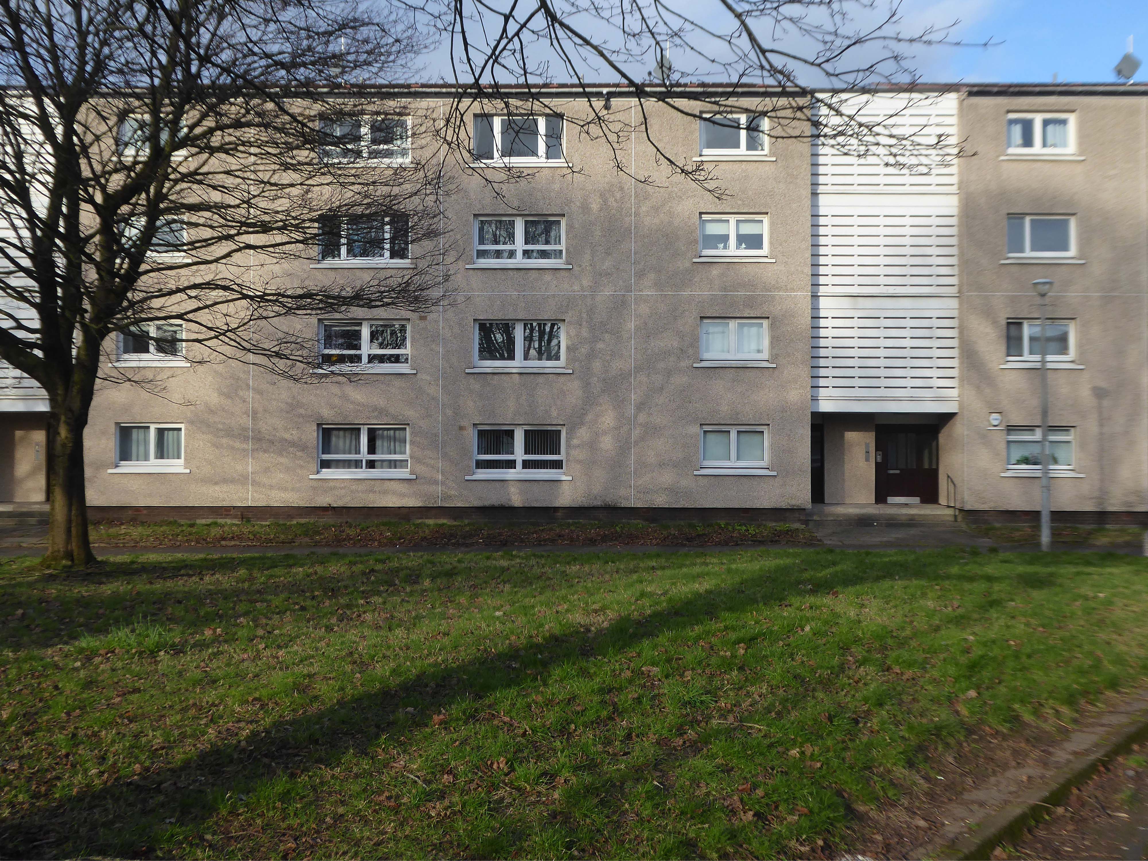
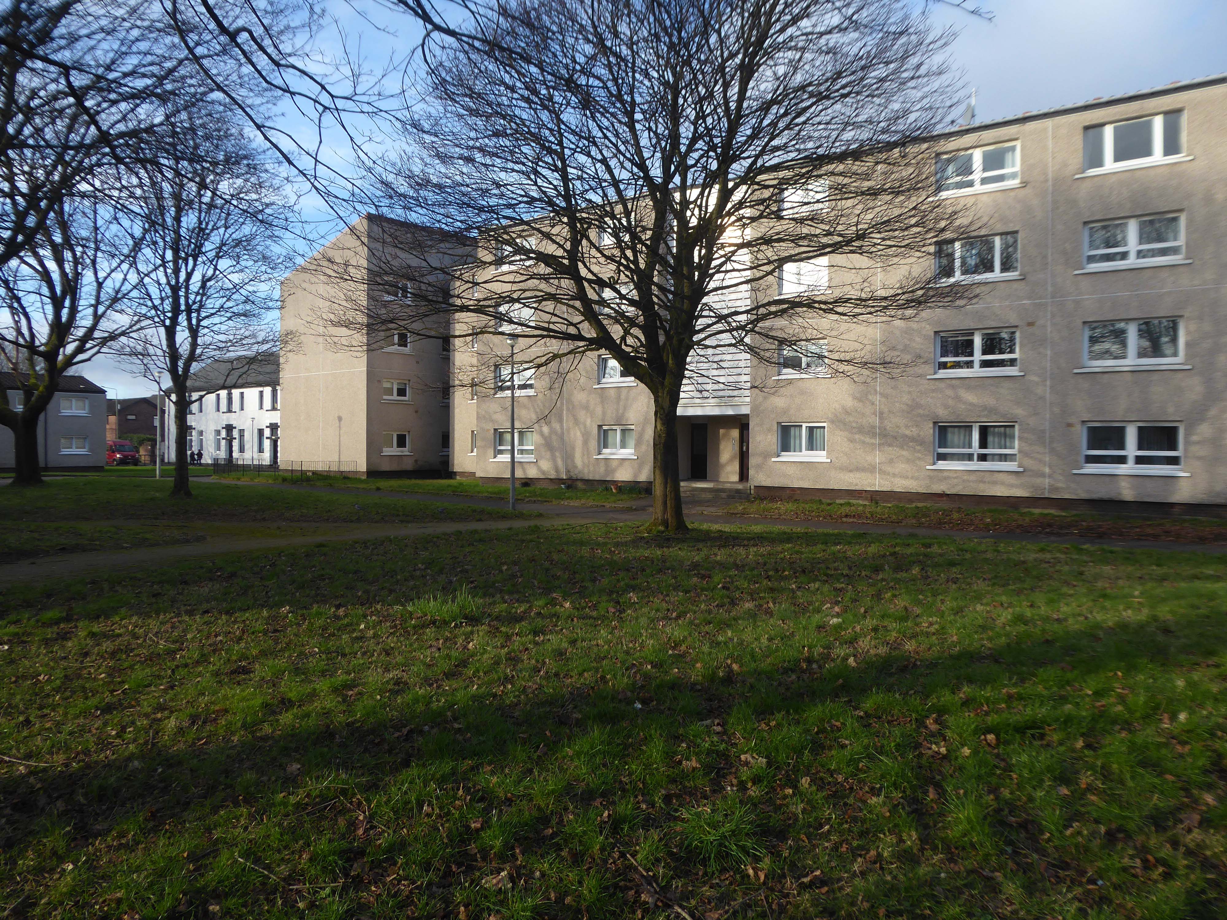
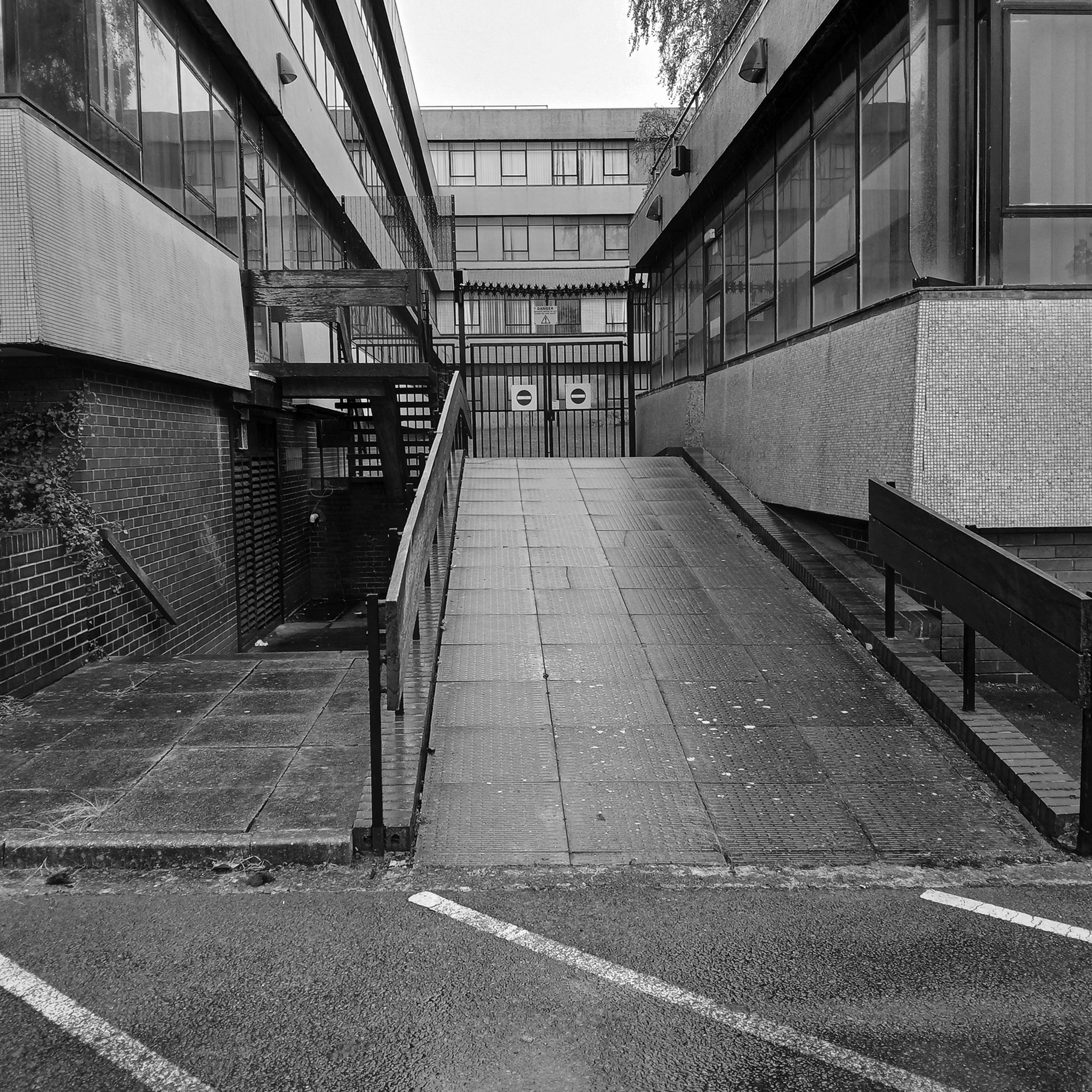
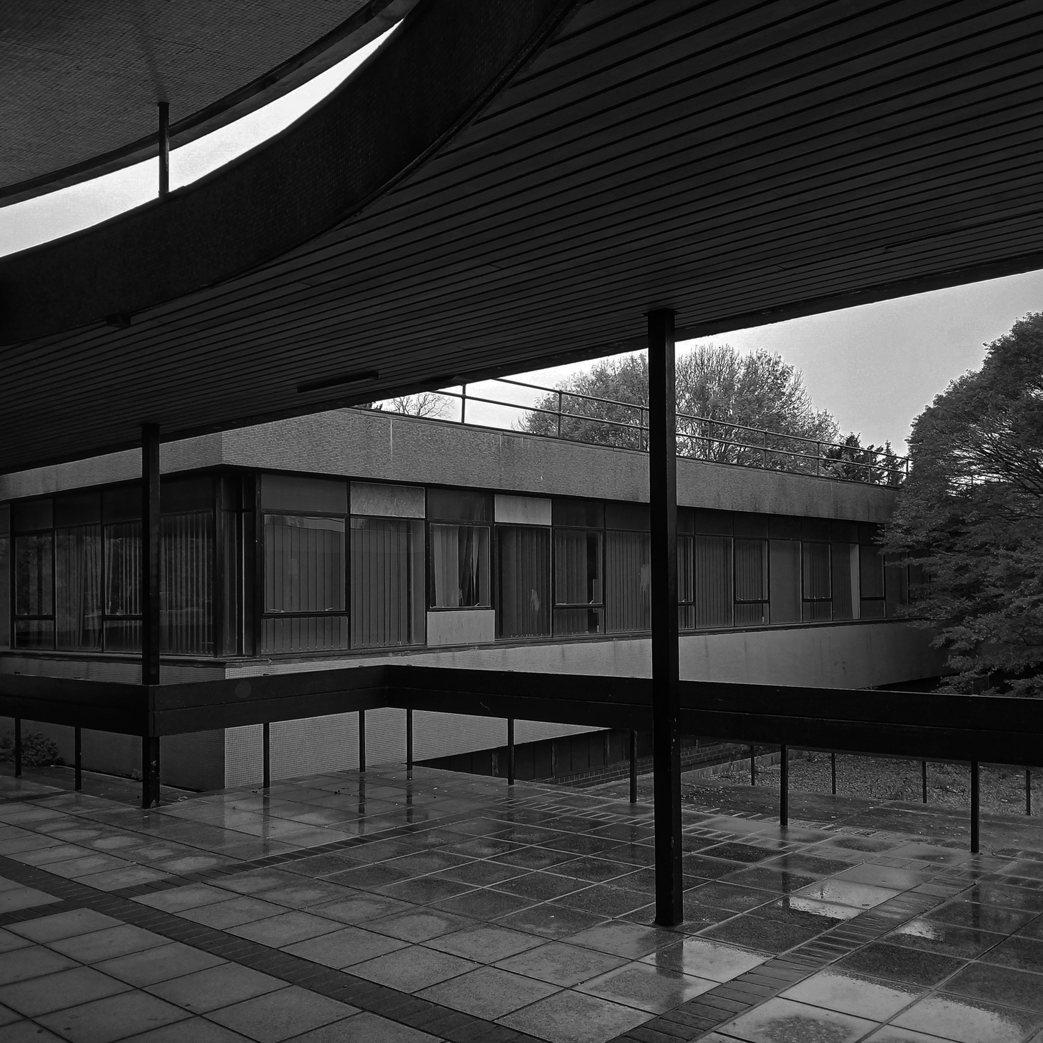
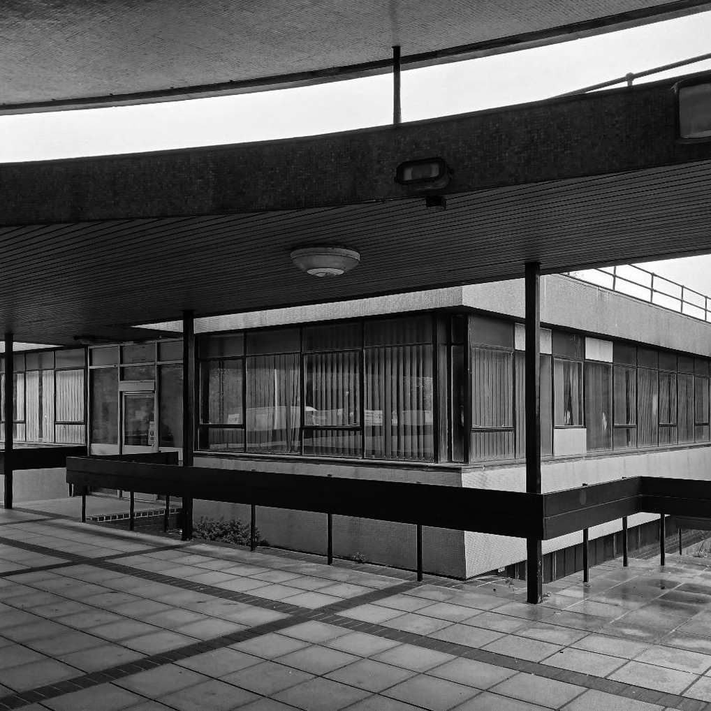
Located in an area of the southern campus where Westwood, Piet & Partners designed four blocks resulting in a group which Pevsner described as the
Most coherent and satisfying part of the precinct. The massing and materiality of the external is complementary and respectful to the surrounding Georgian buildings.
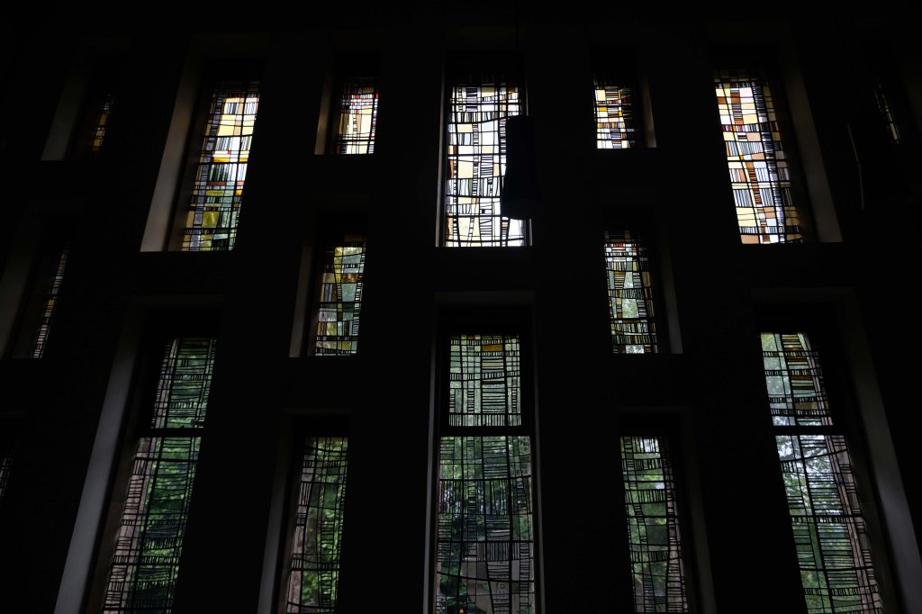
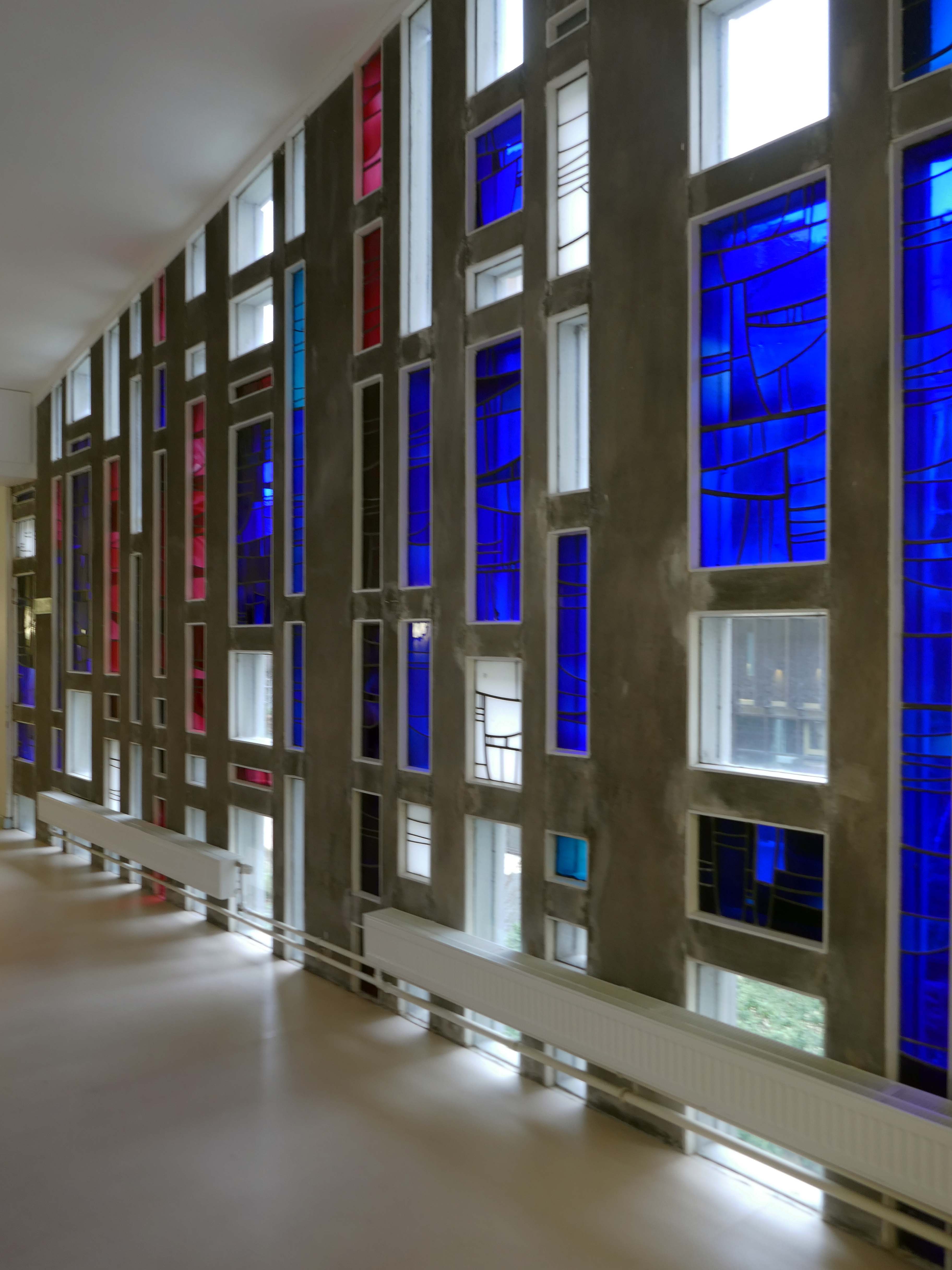
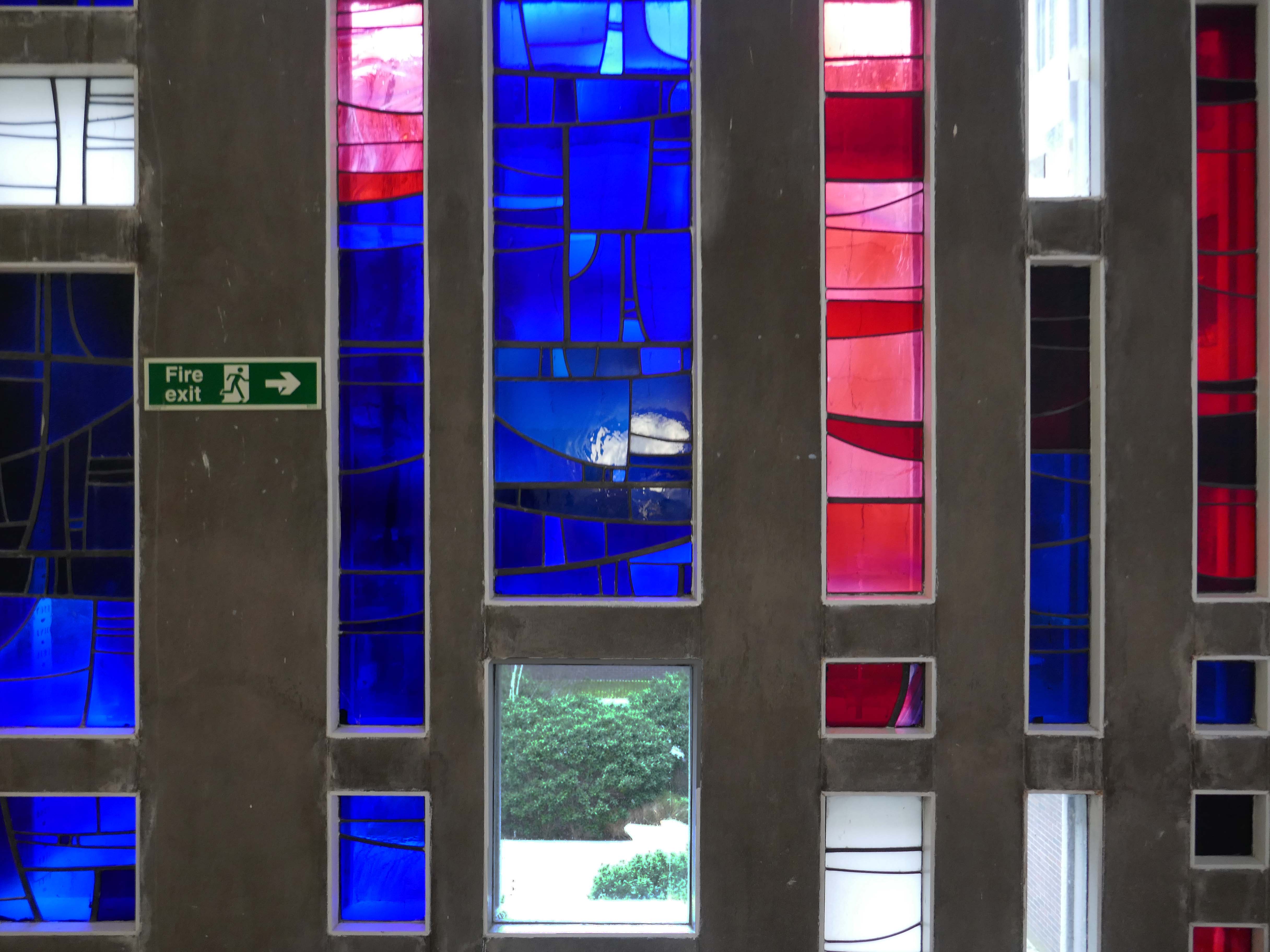
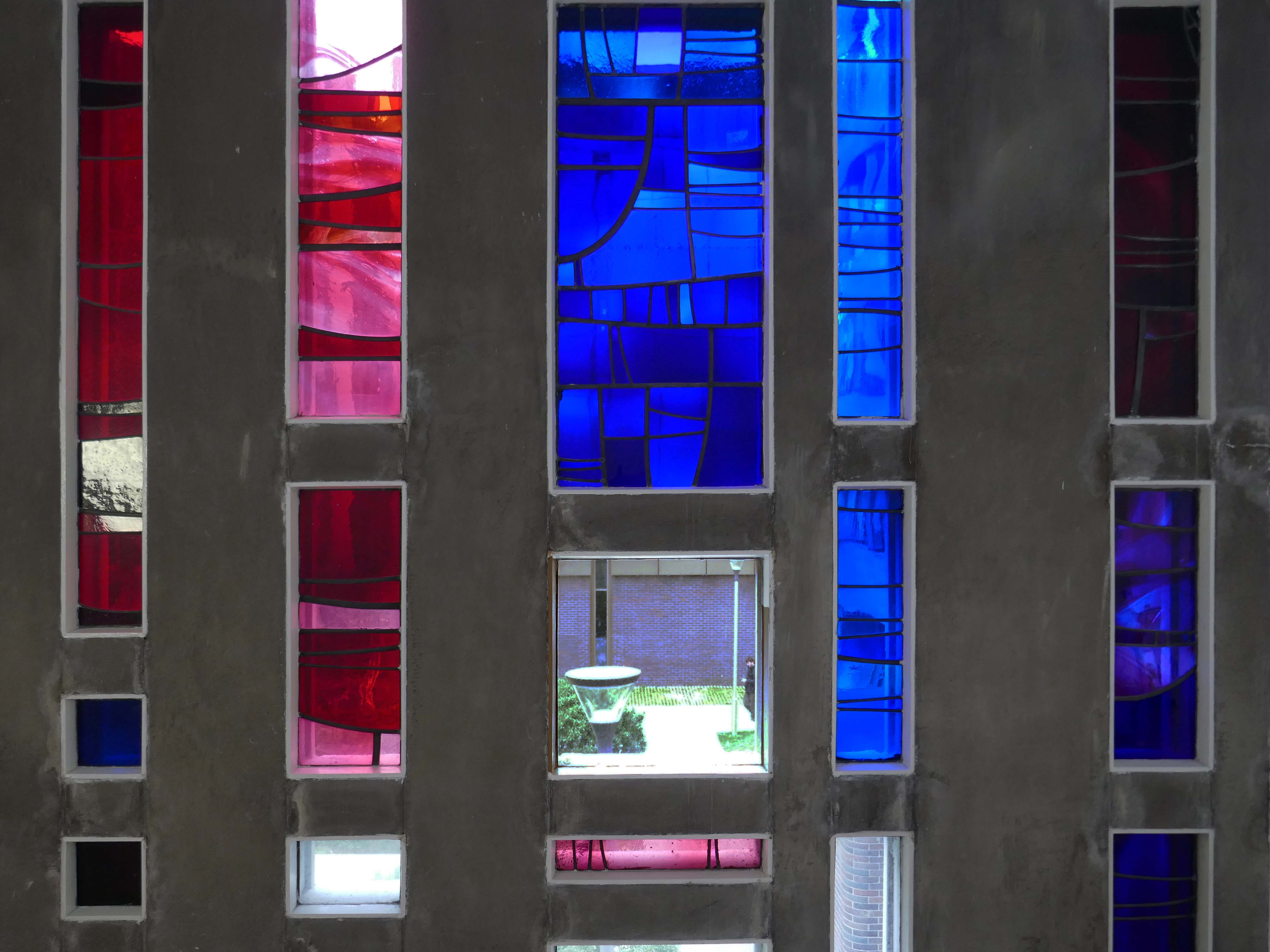
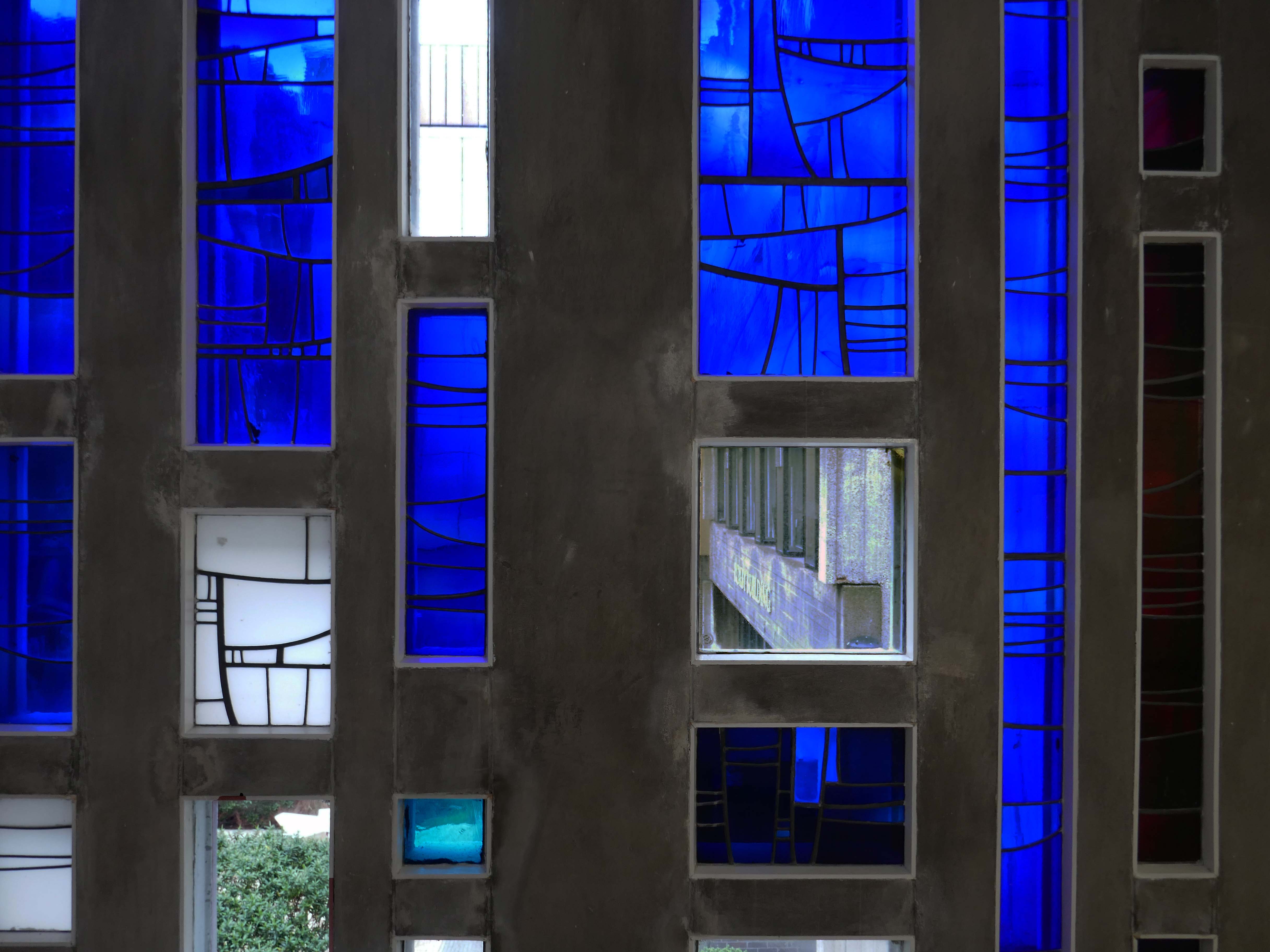
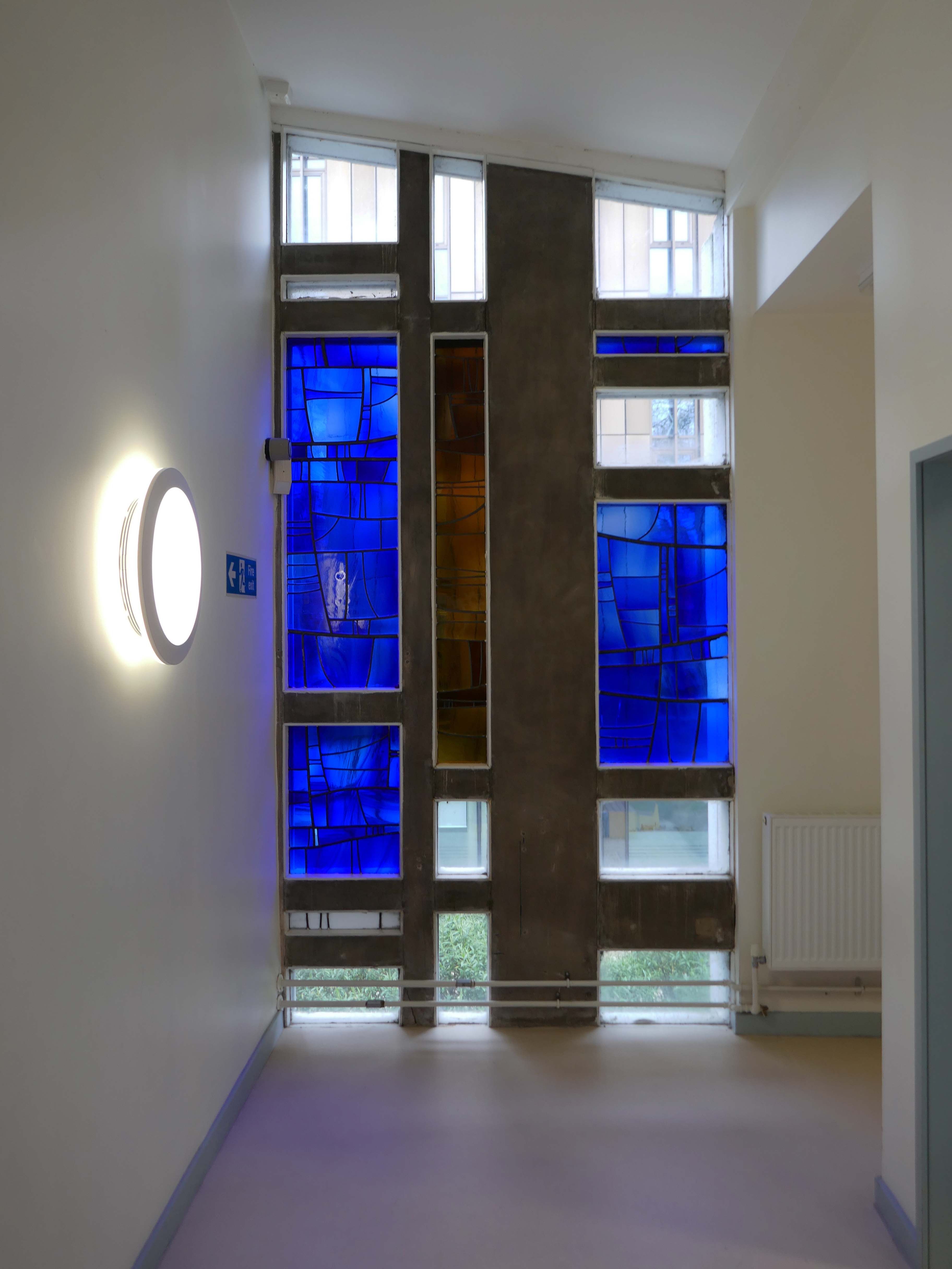
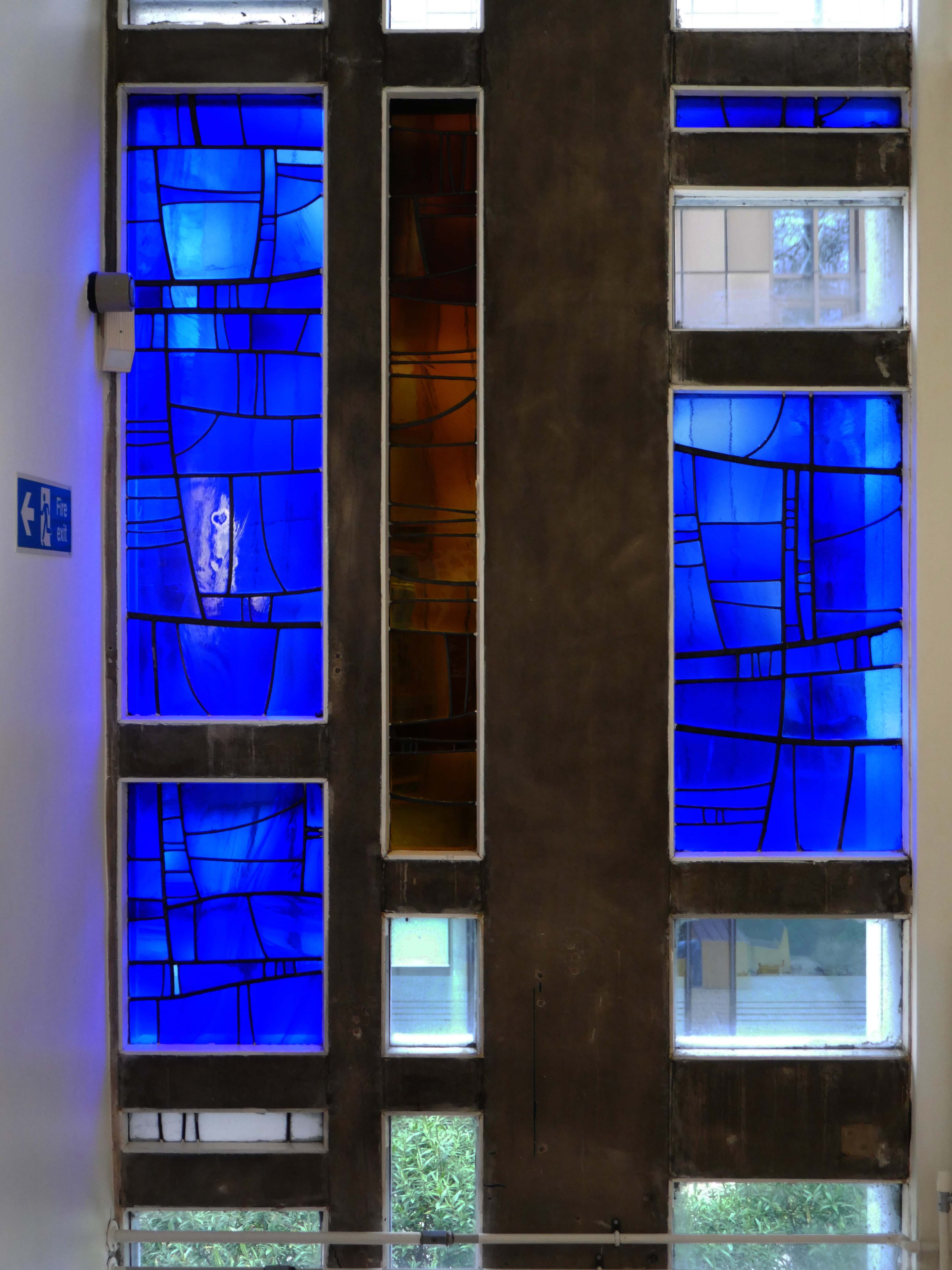
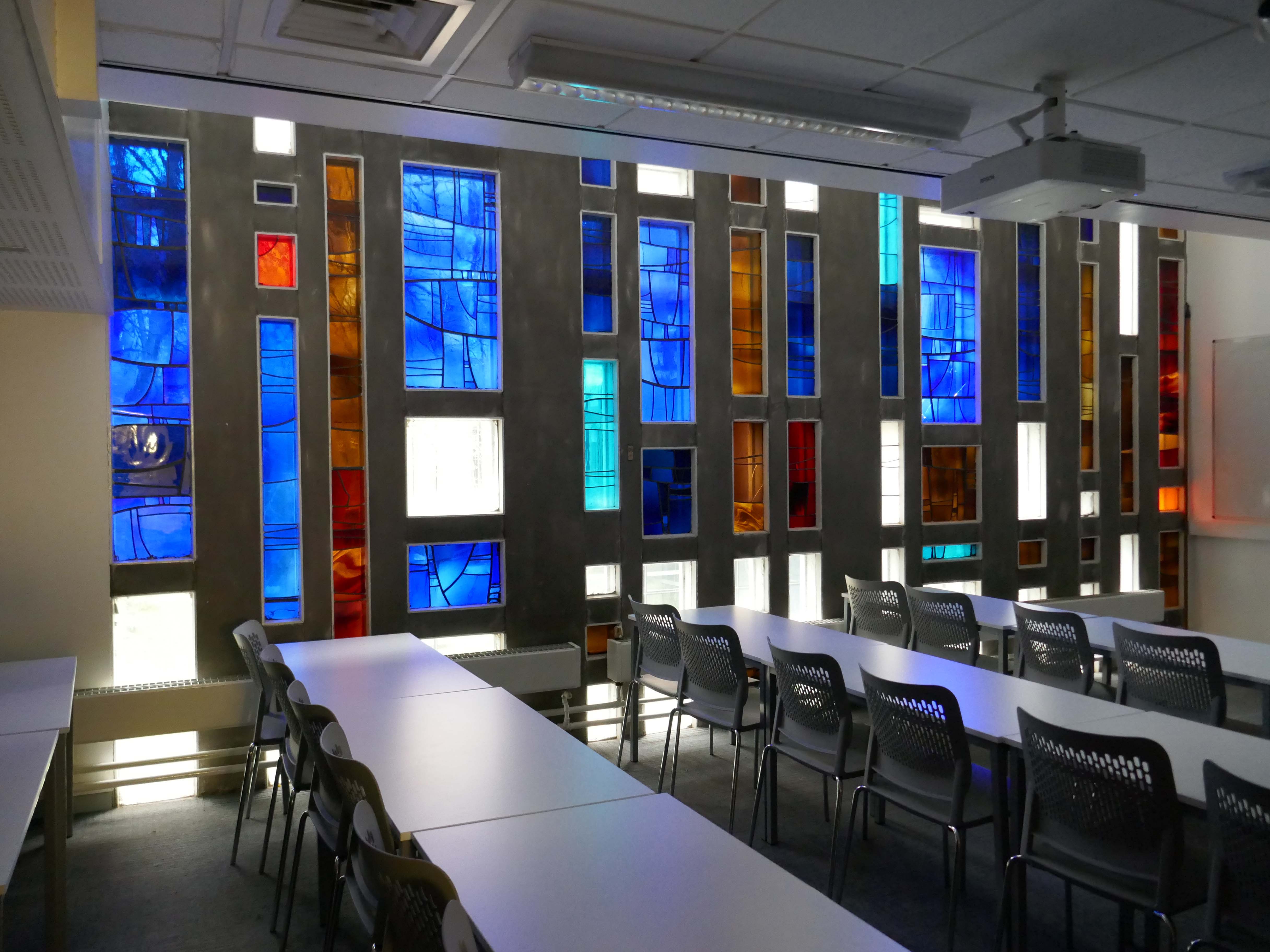
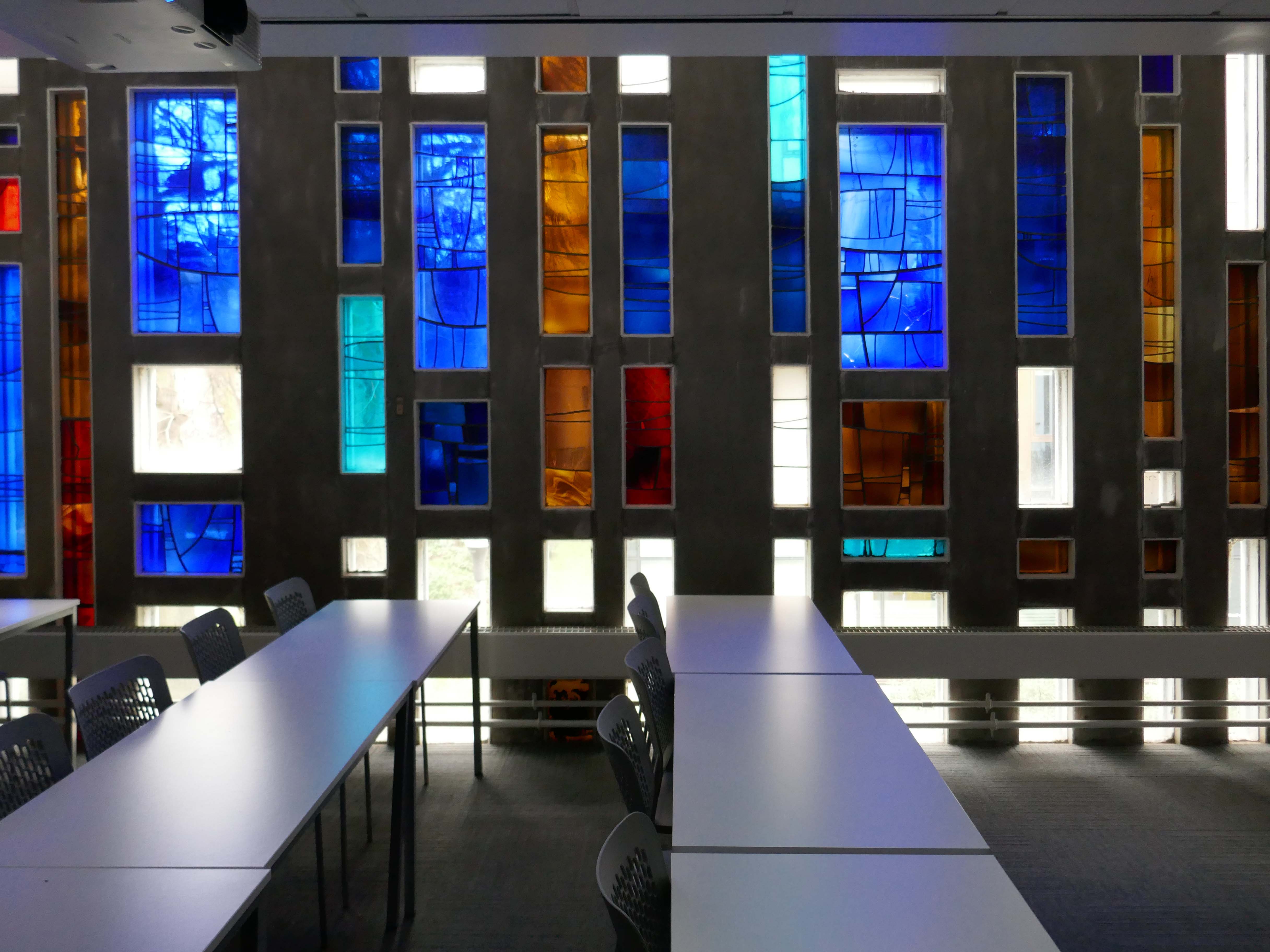
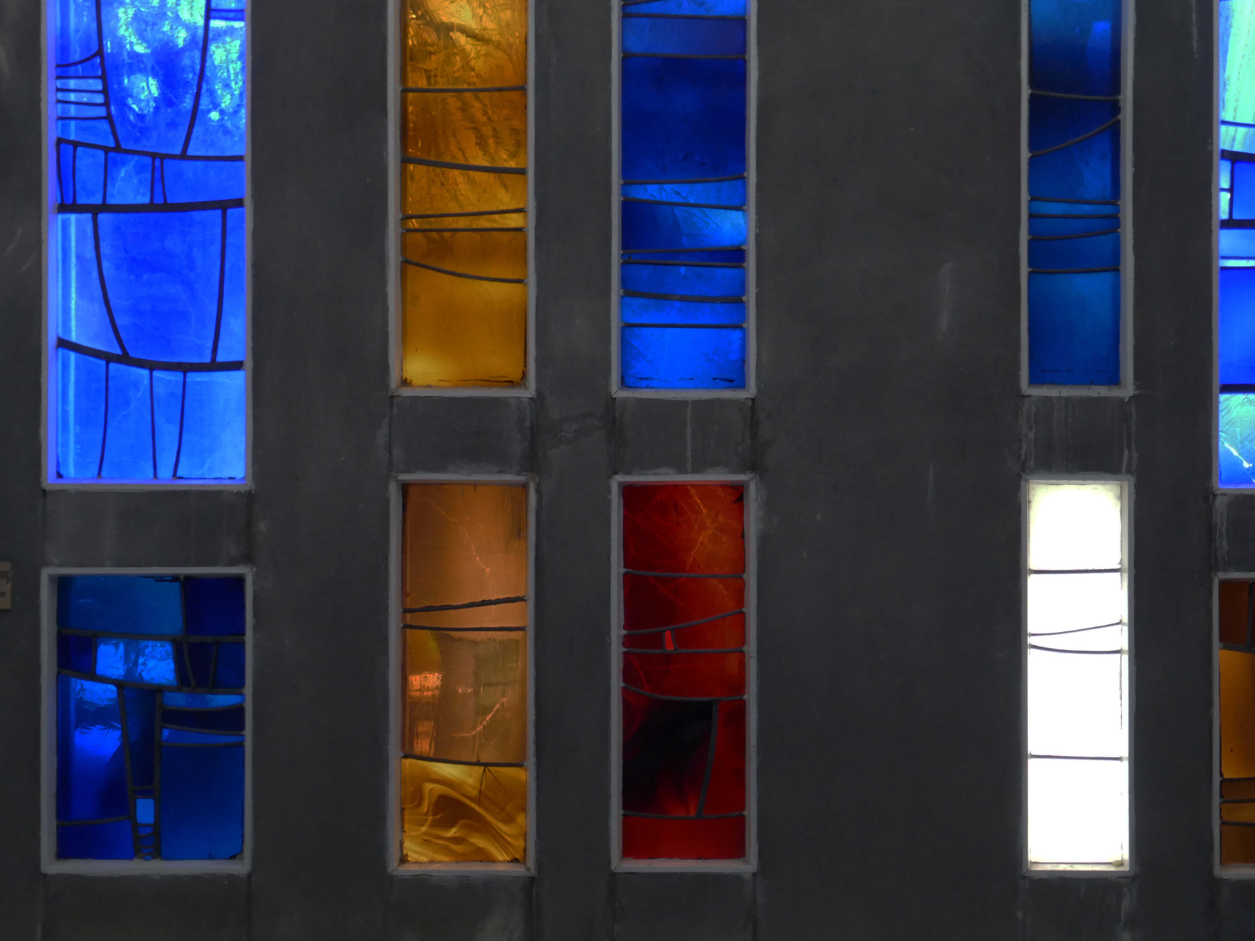
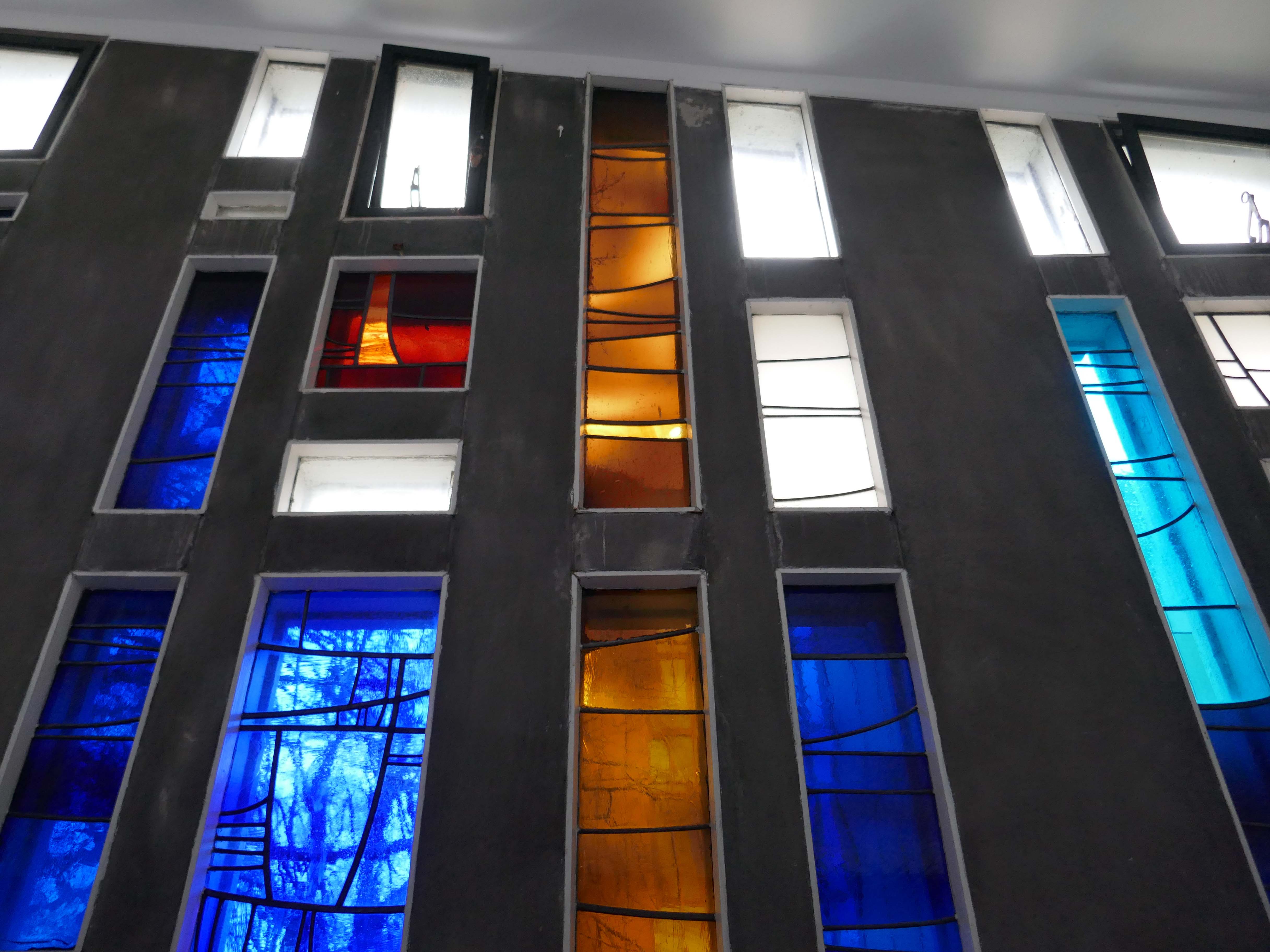
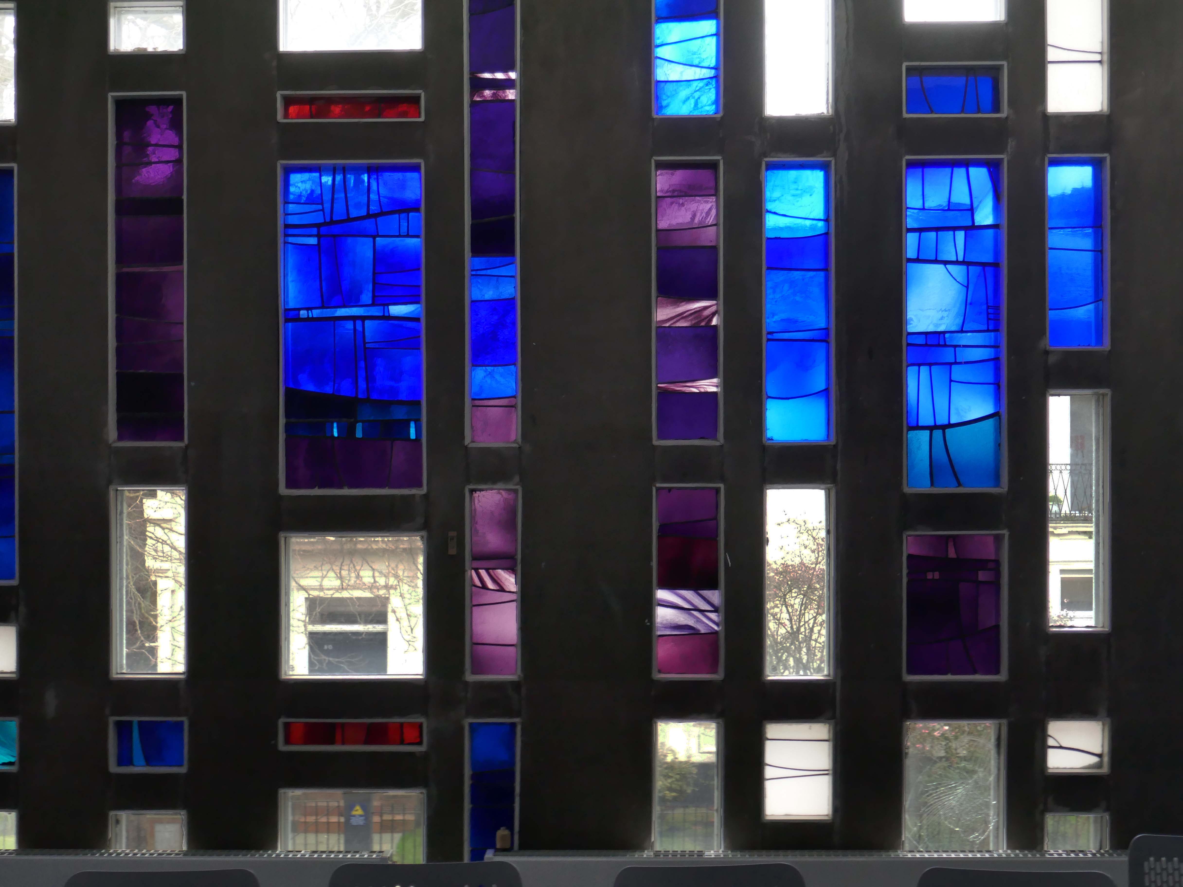
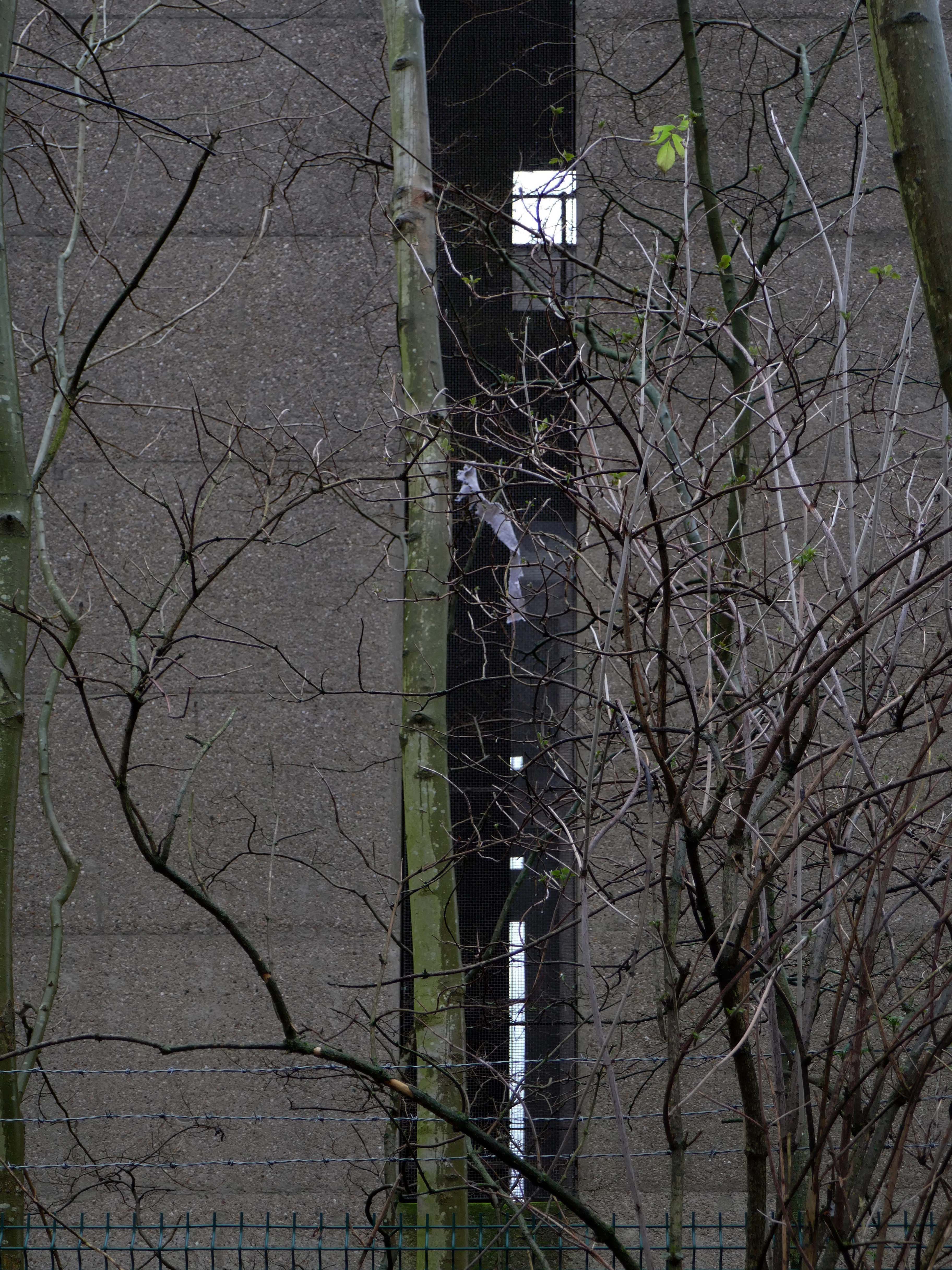
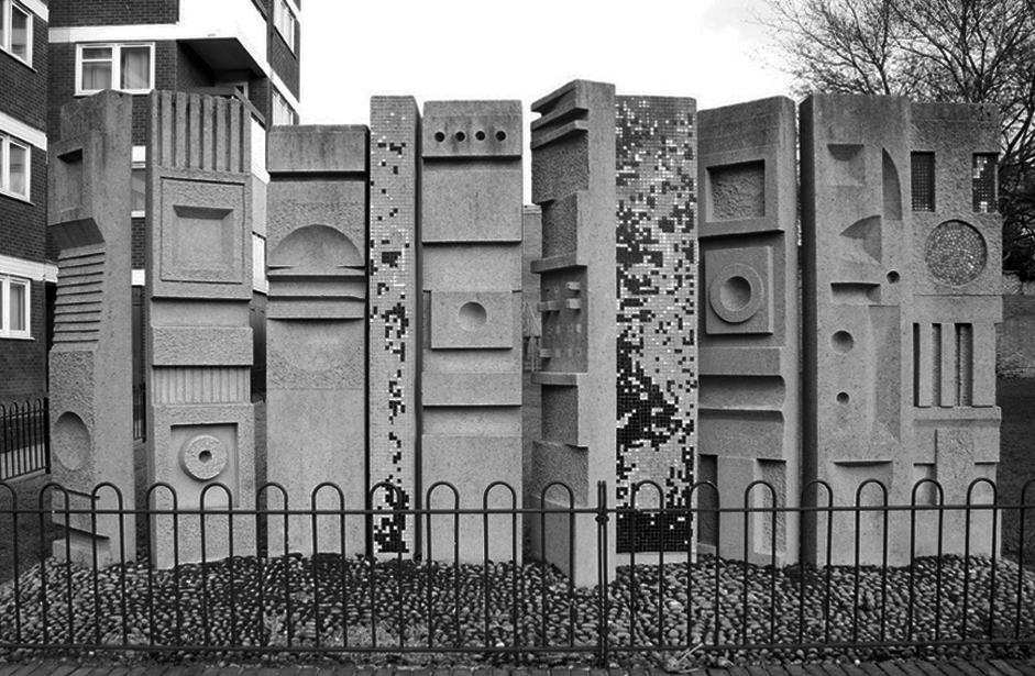
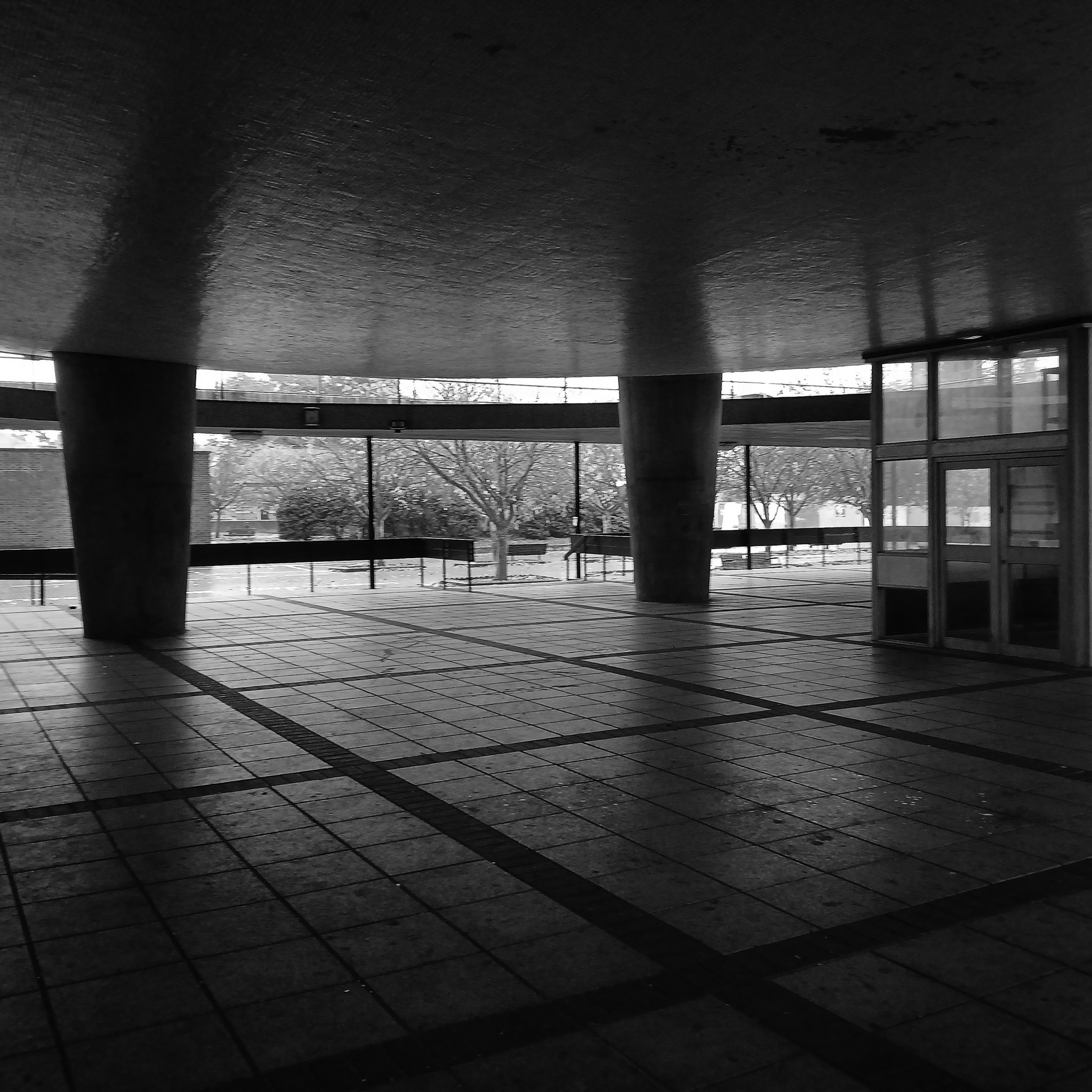
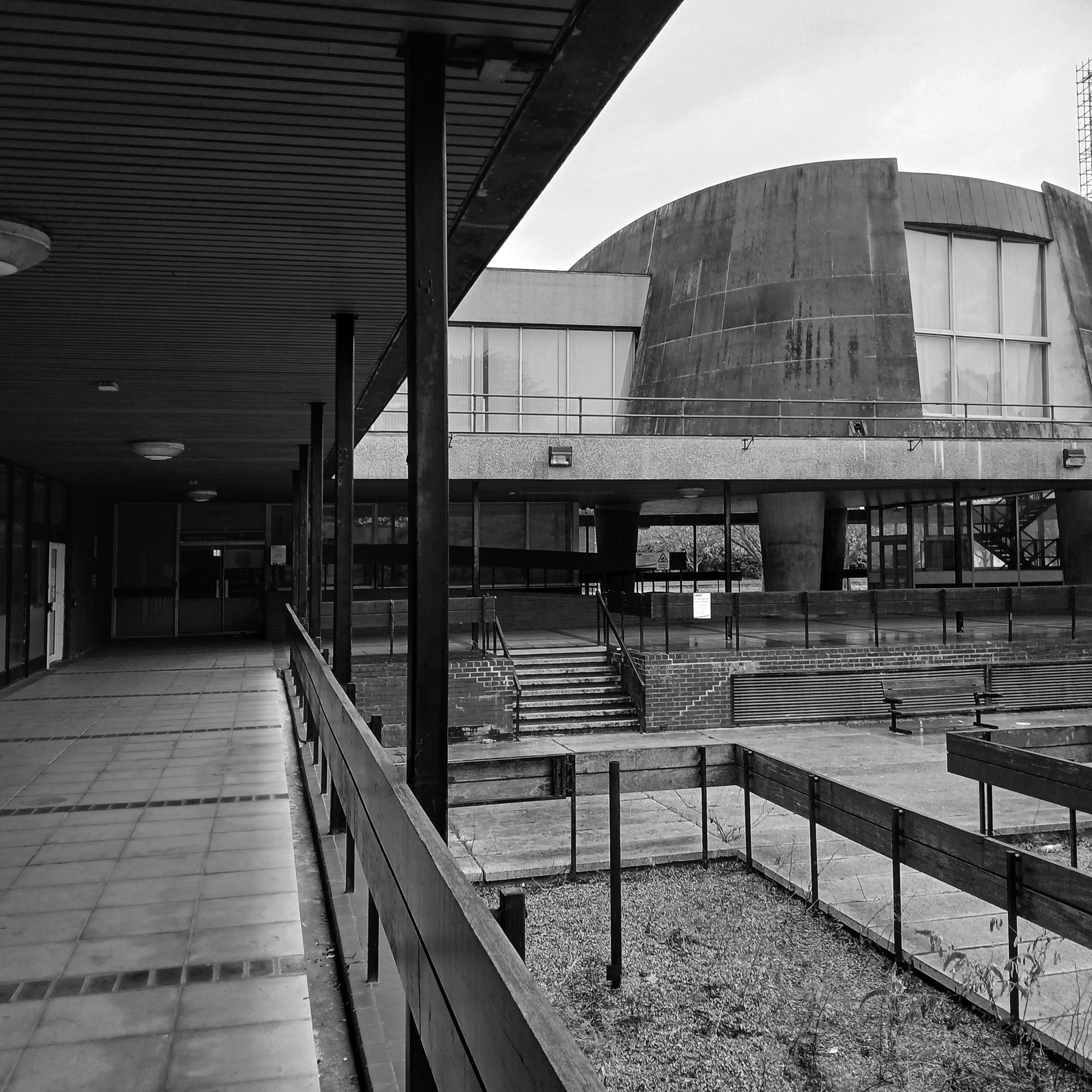
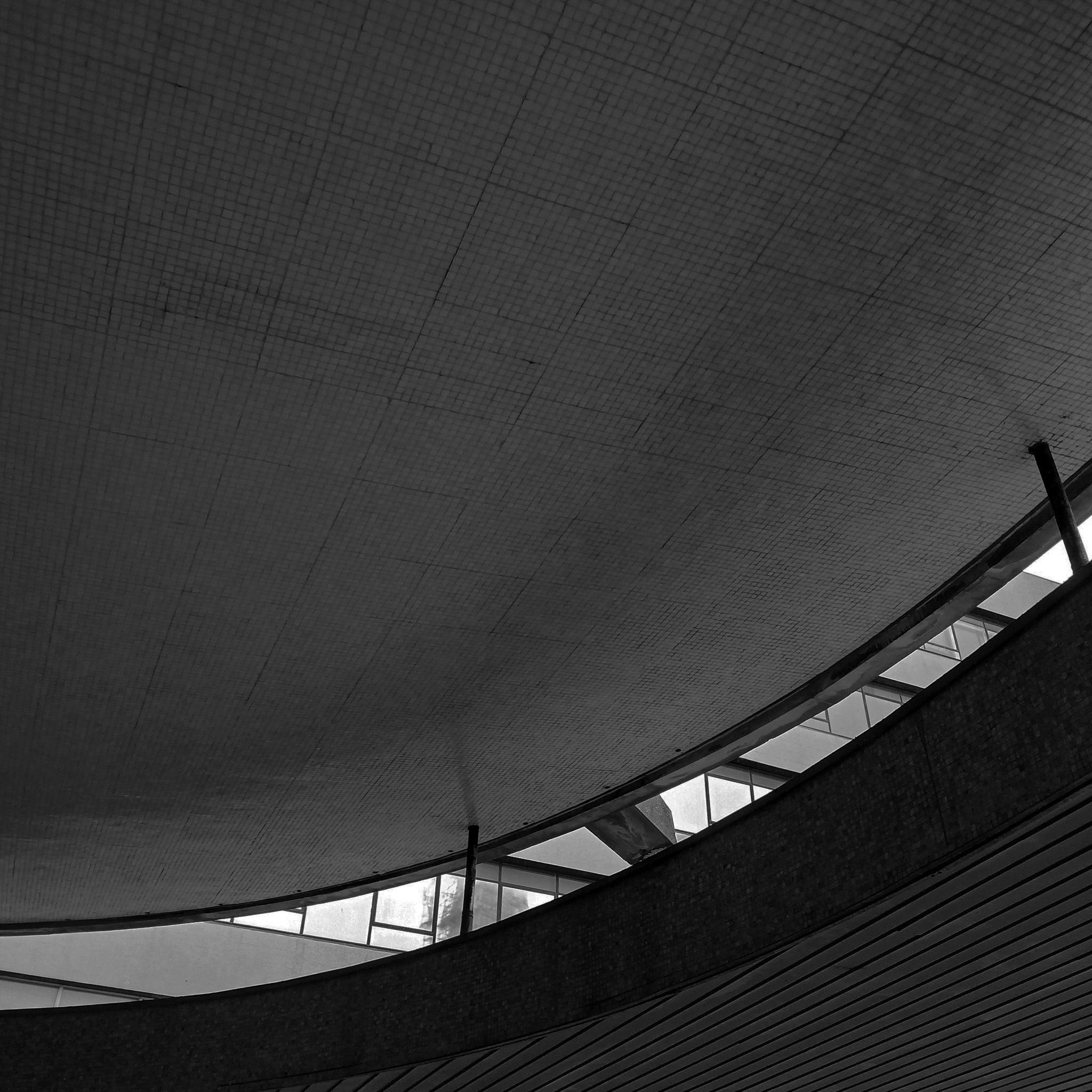
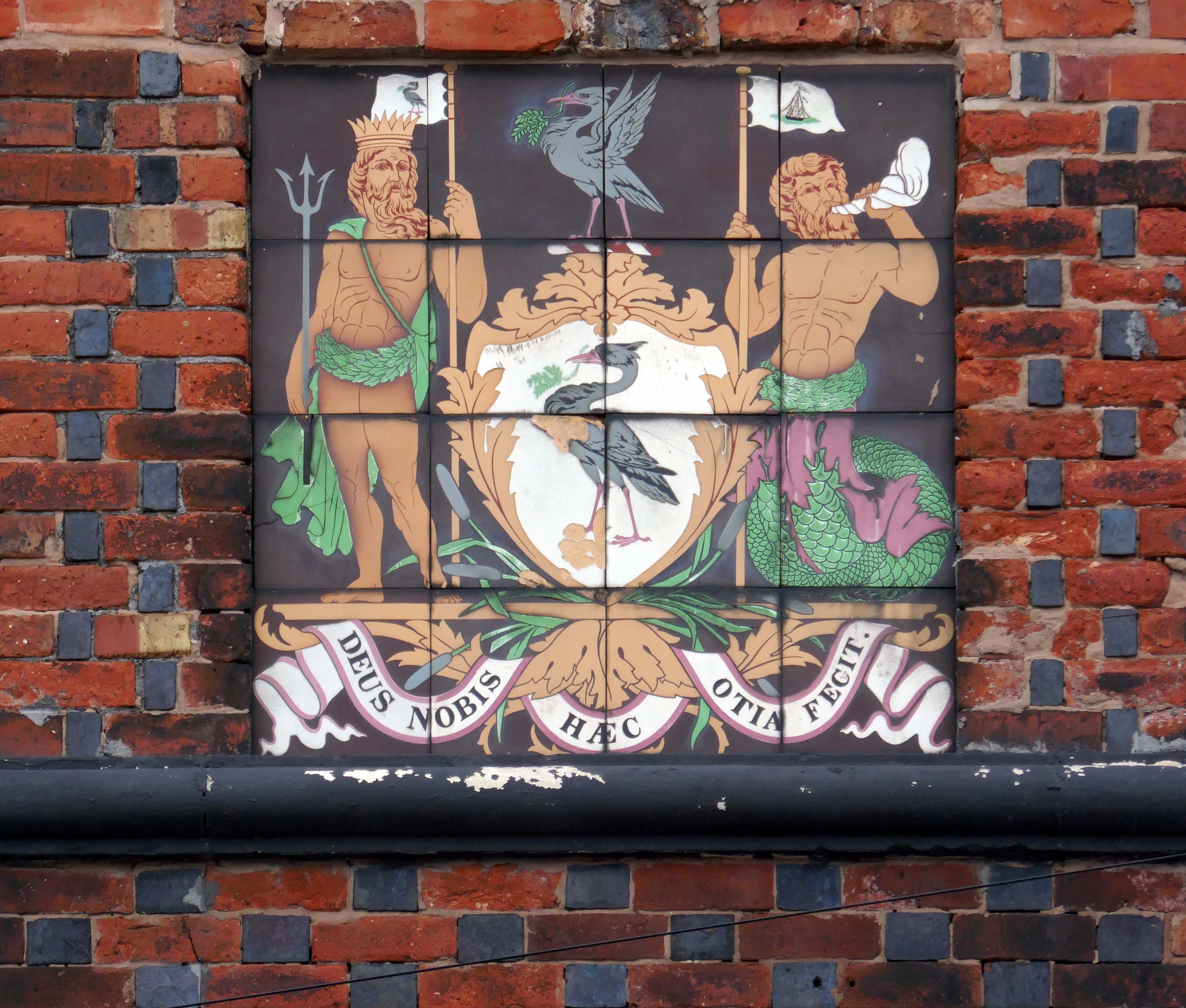
Between the concrete is ‘dalle de verre’ stained glass by Gillian Rees-Thomas.
she was also responsible for the side chapel windows at St Mark’s Broomhill Sheffield.
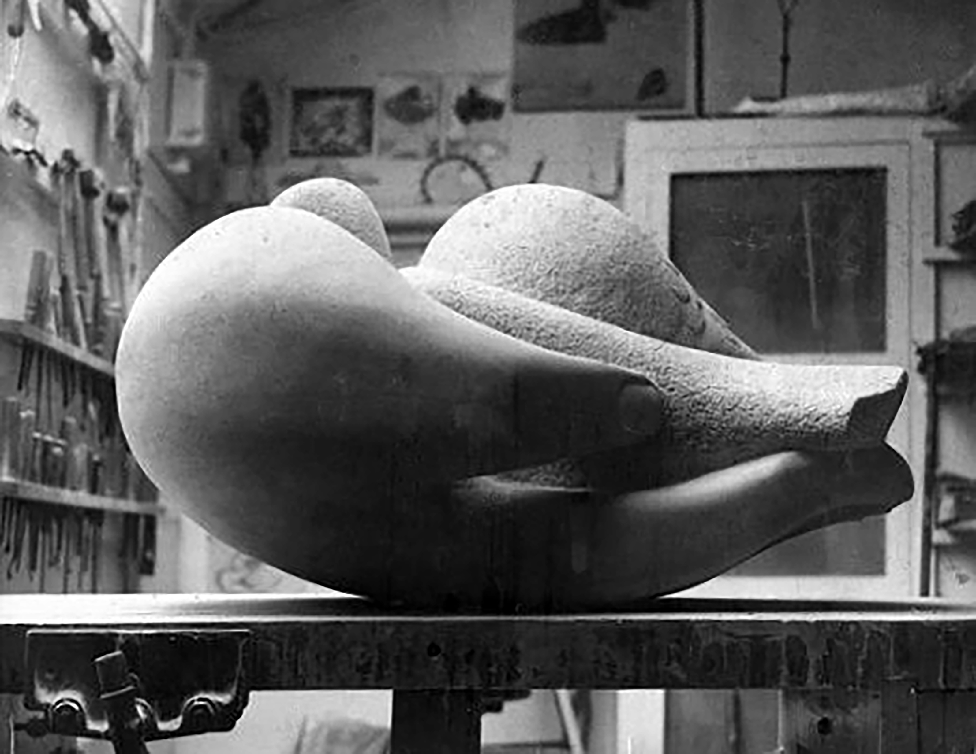
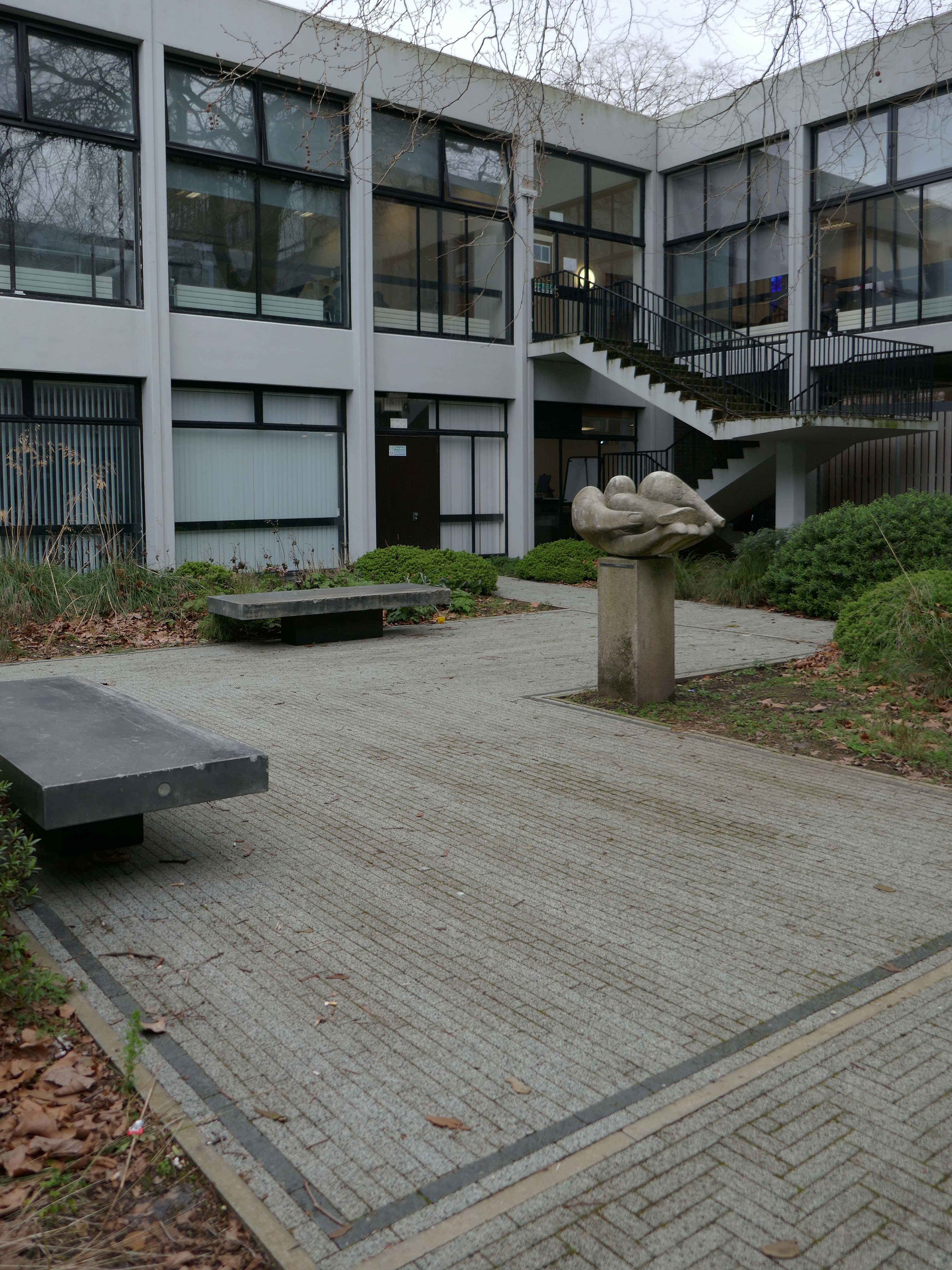
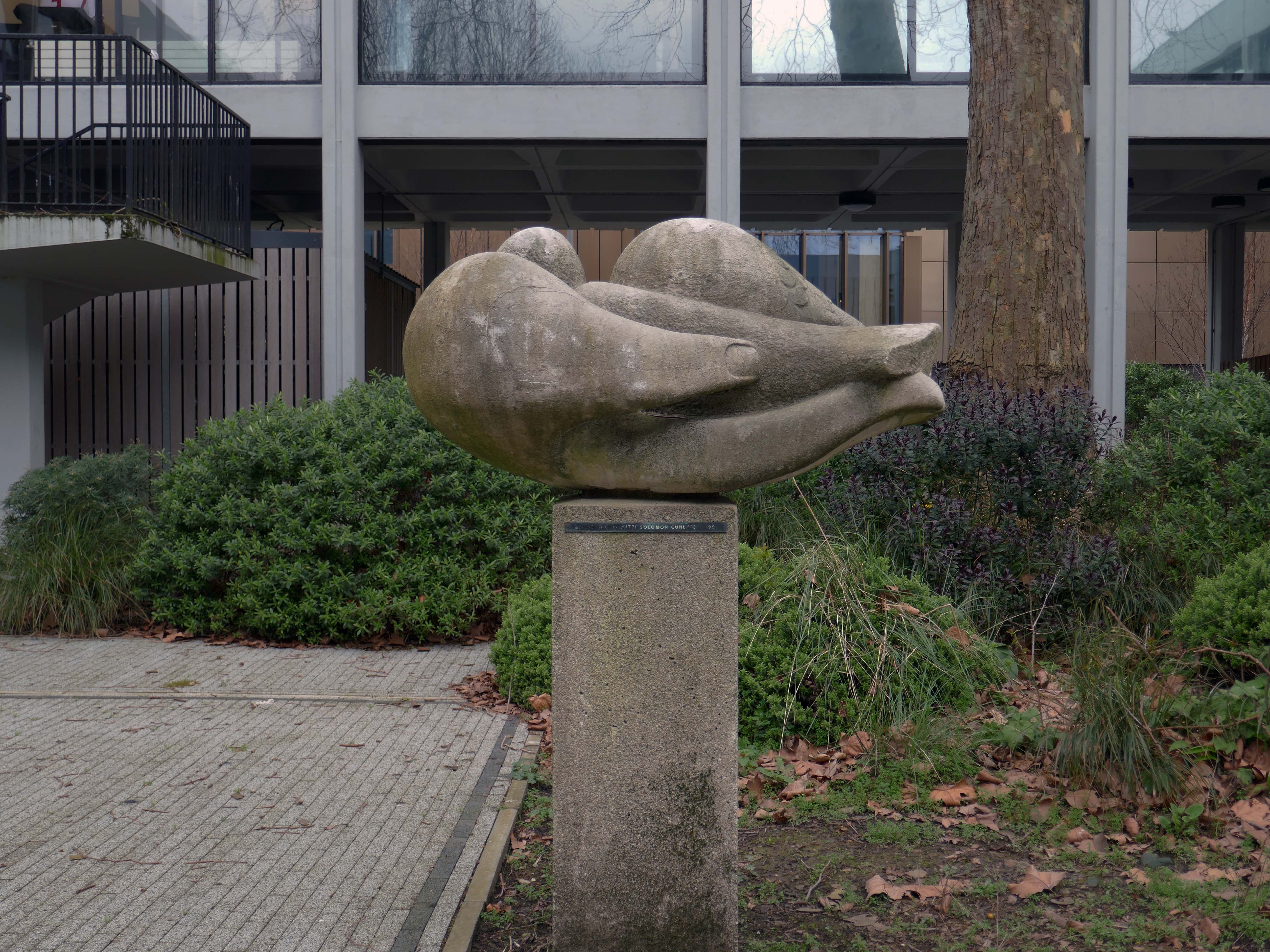
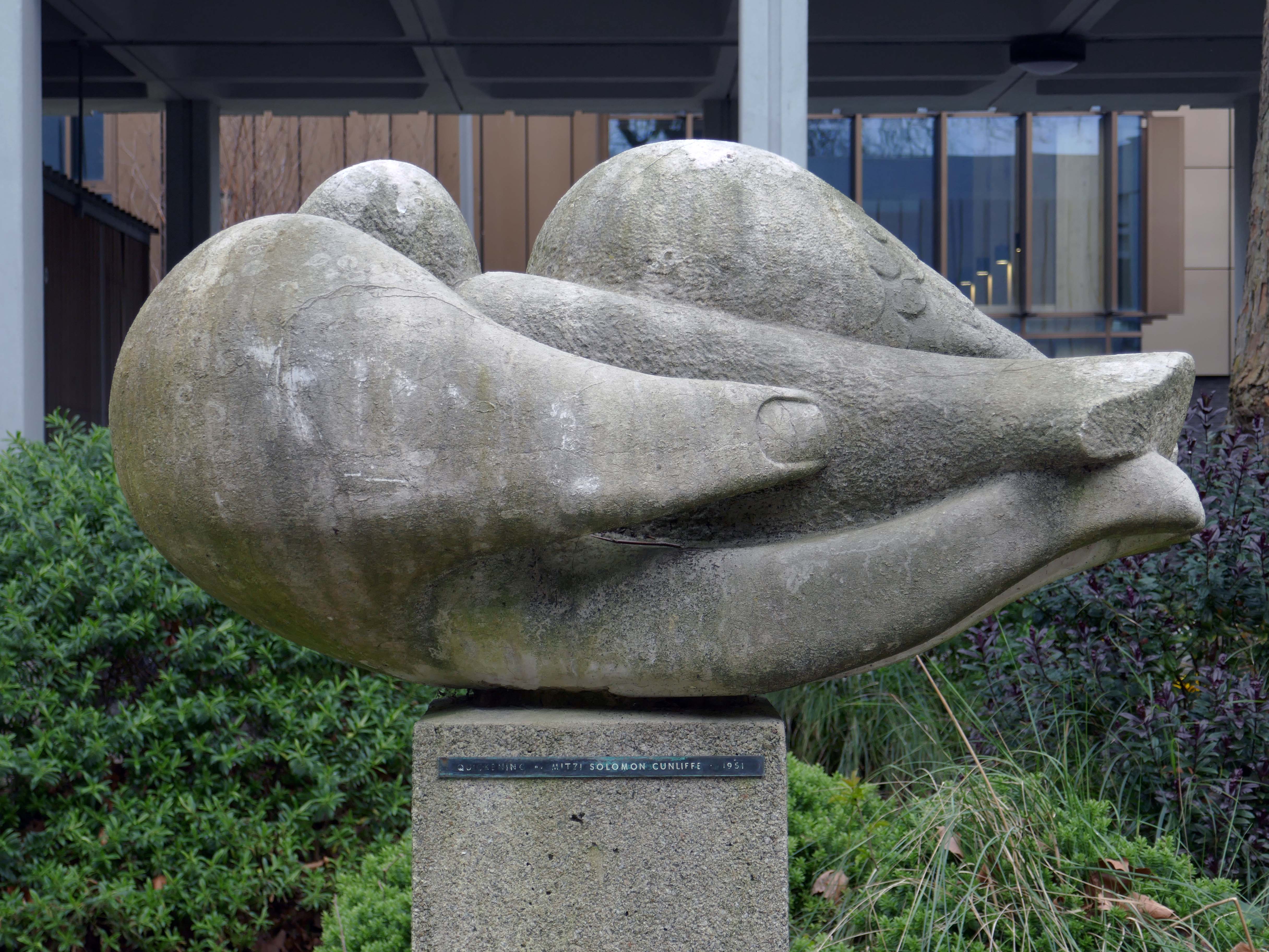
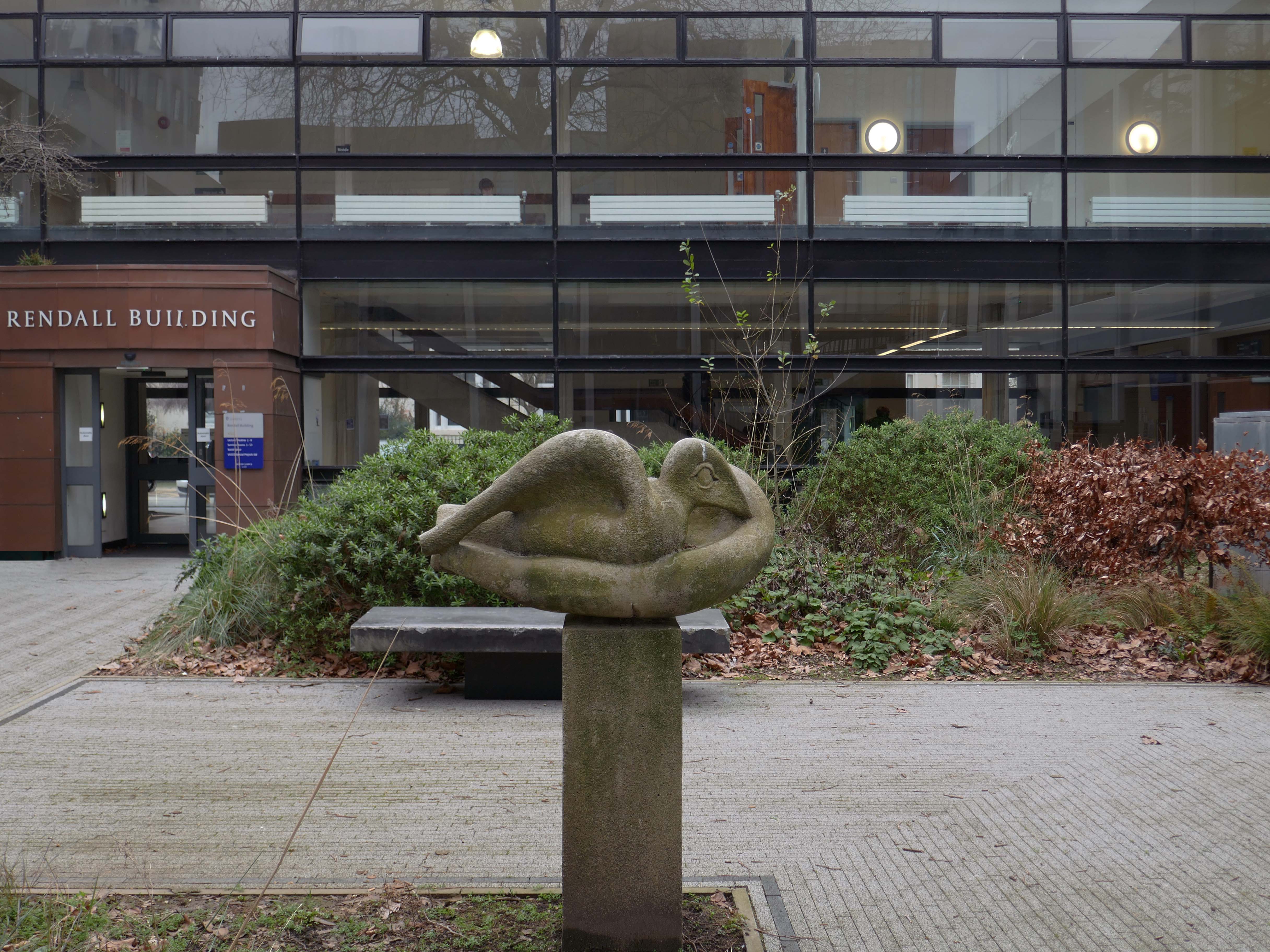
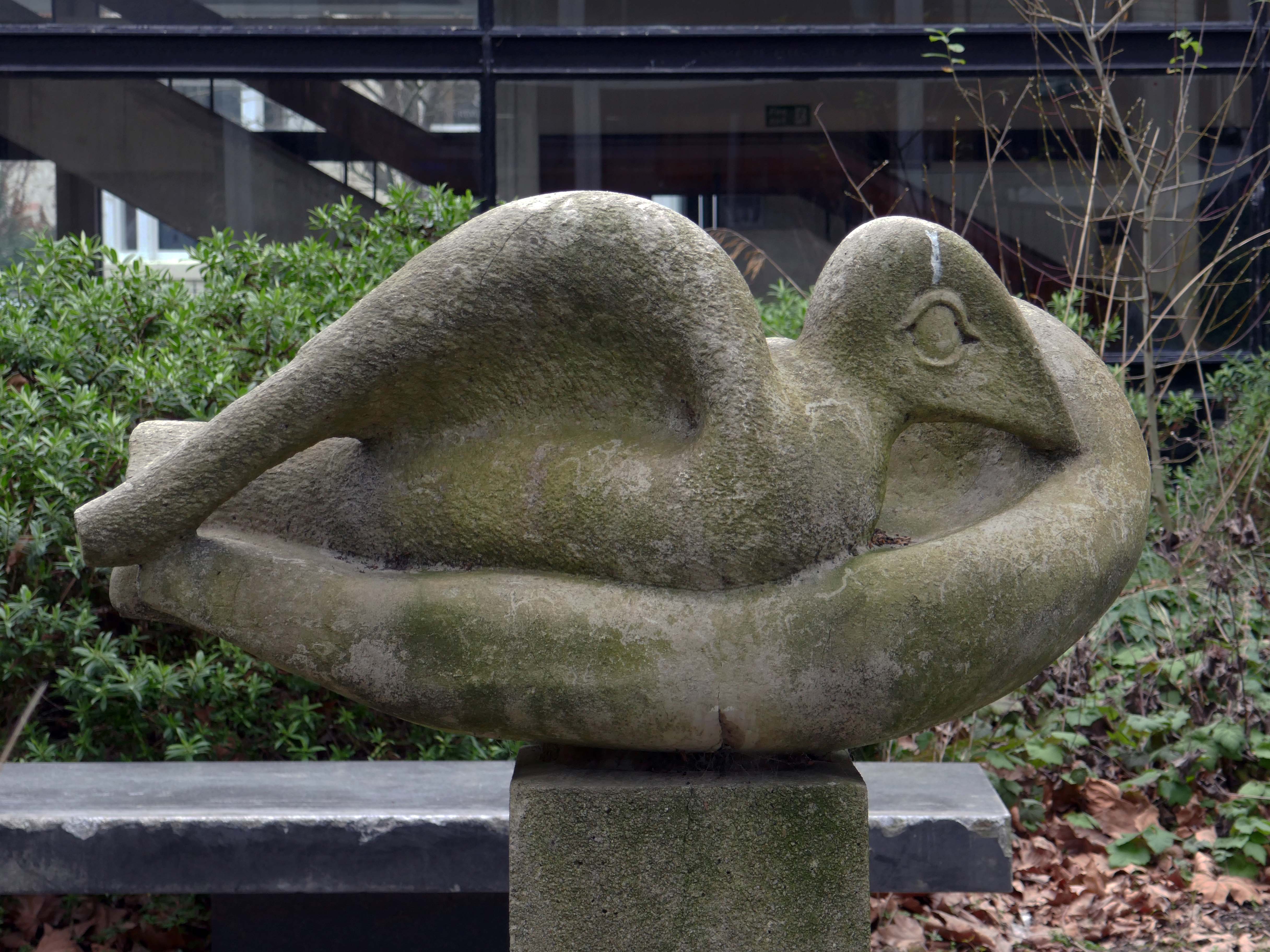
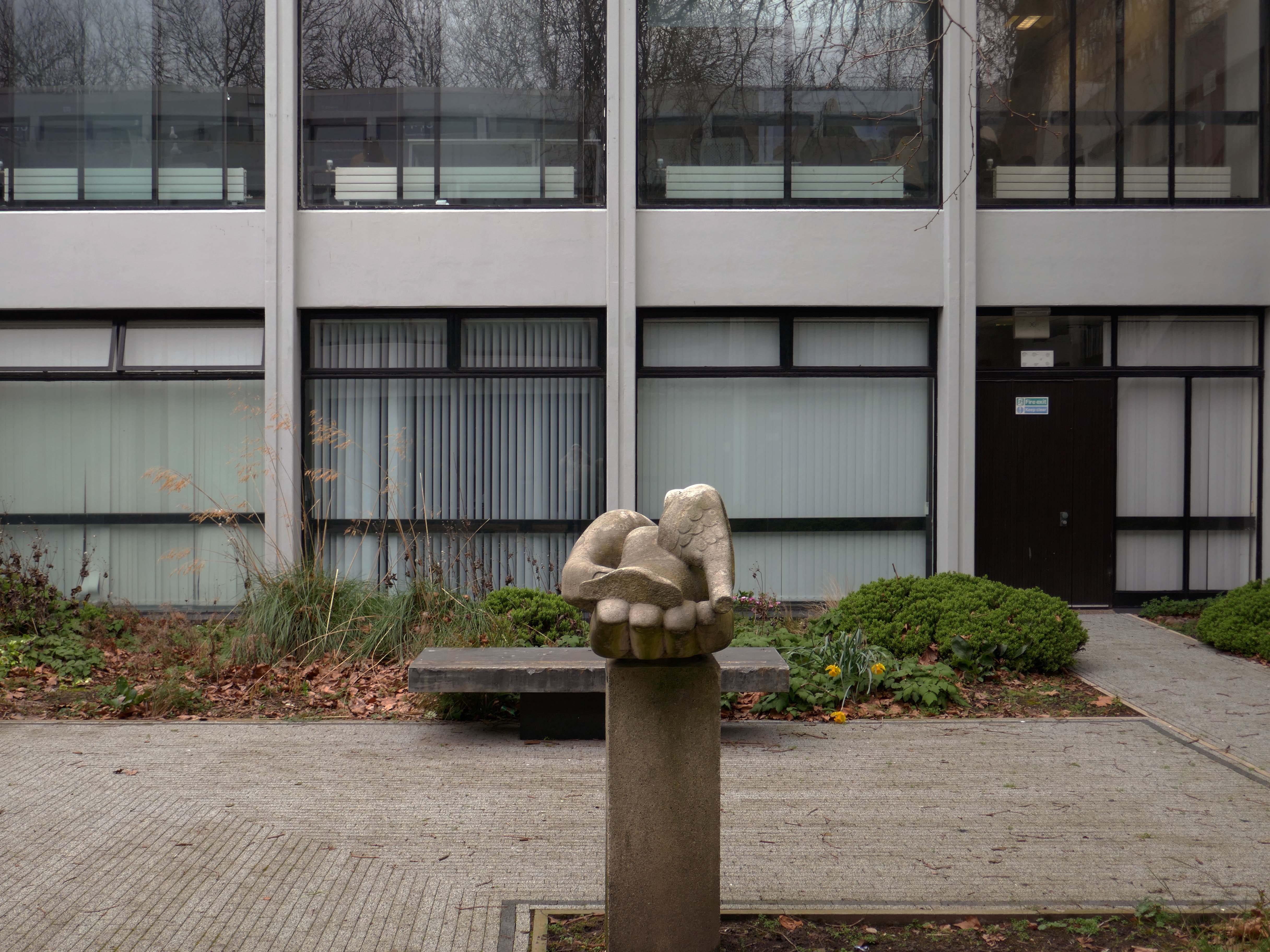
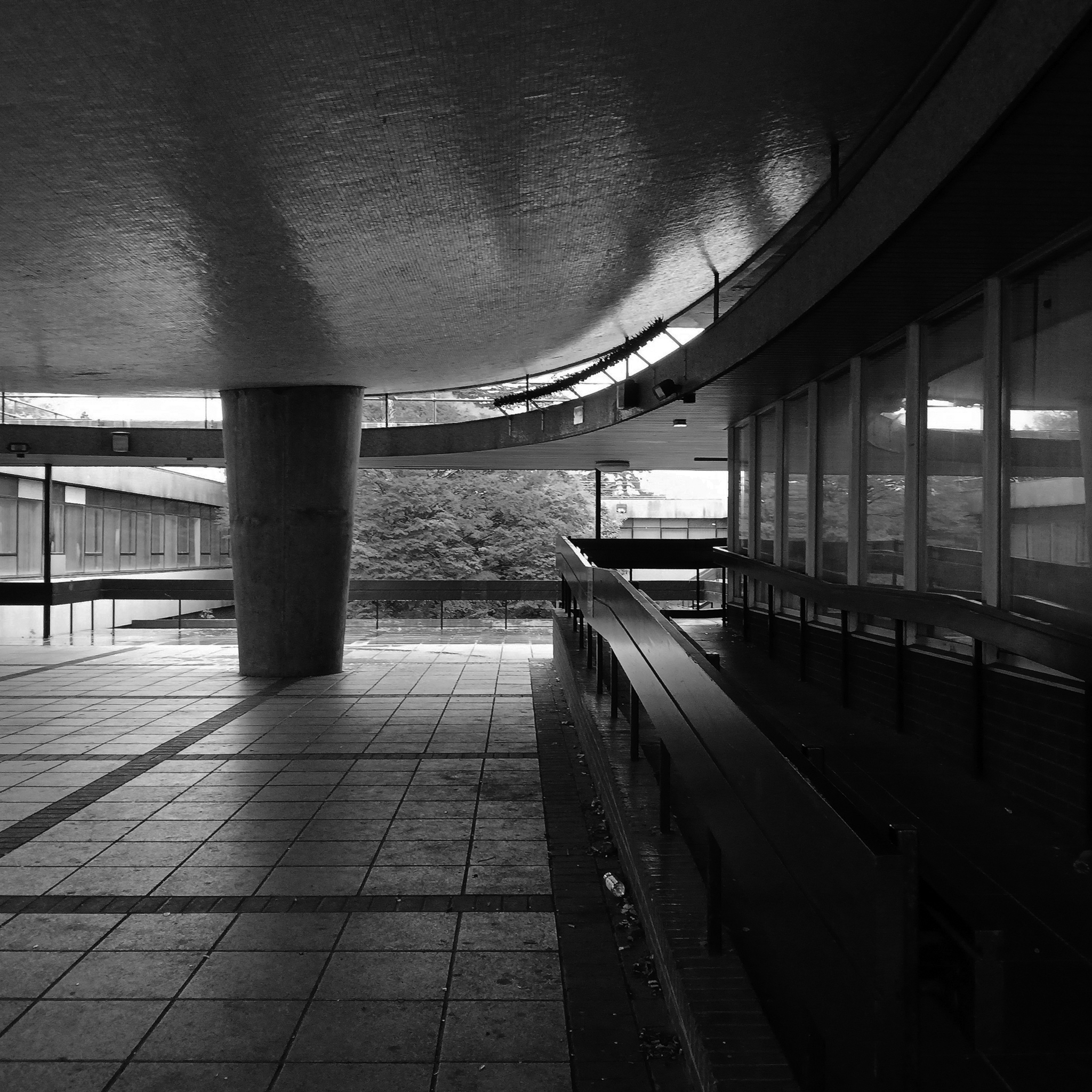
The courtyard contains a sculpture by Mitzi Solomon Cunliffe – The Quickening previously located behind the School of Architecture.
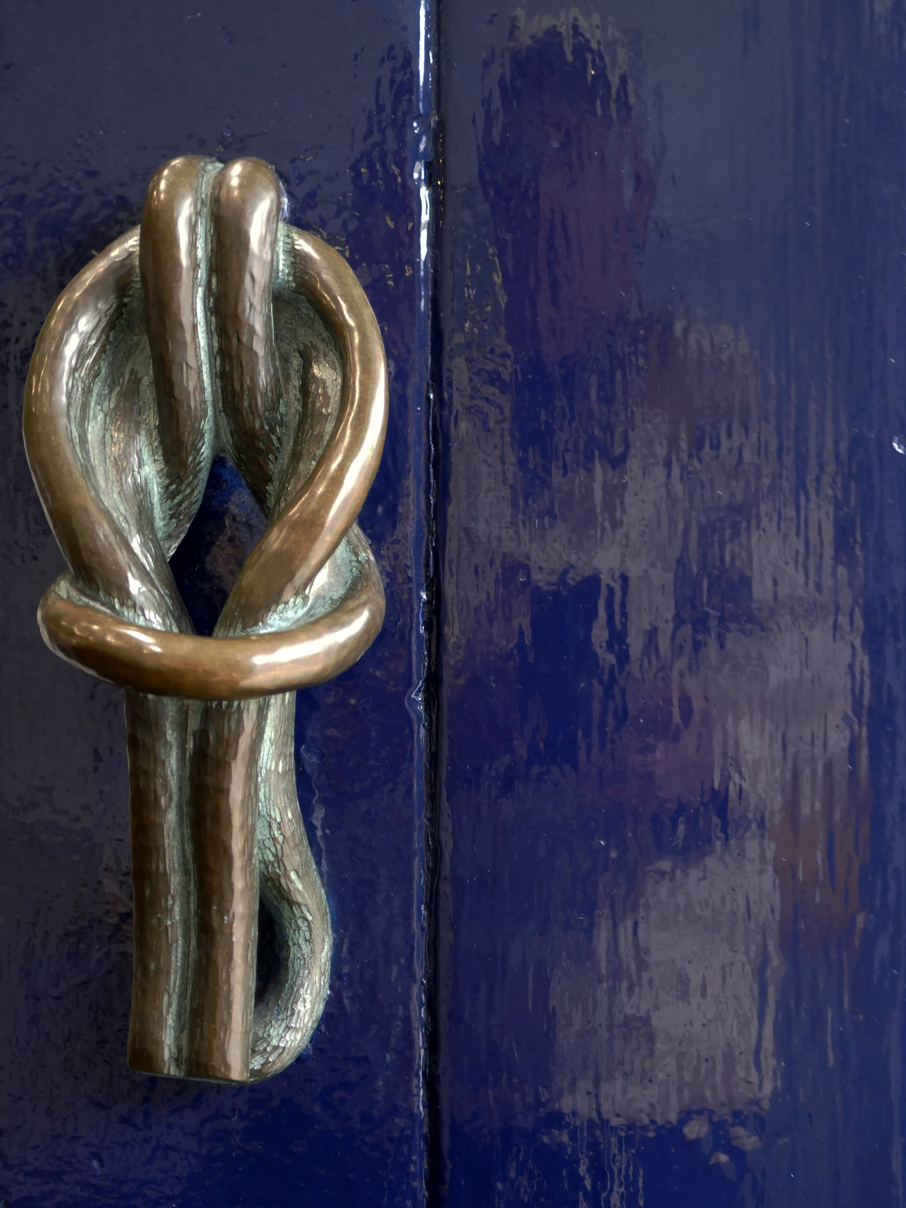
Somebody at the University of Liverpool saw Mitzi’s work at the Festival of Britain and took note. She was immediately commissioned to create three items for the University: a public sculpture to go in the courtyard of the School of Civic Design’s new building, a decorative sculpture for the inside the building and the handles for its front-door.
The public sculpture, is in the form of a hand gently holding a dove. It stood in its original position for sixty-nine years until sent away for conservation and then relocated across campus in 2020, to outside the Rendall Building.
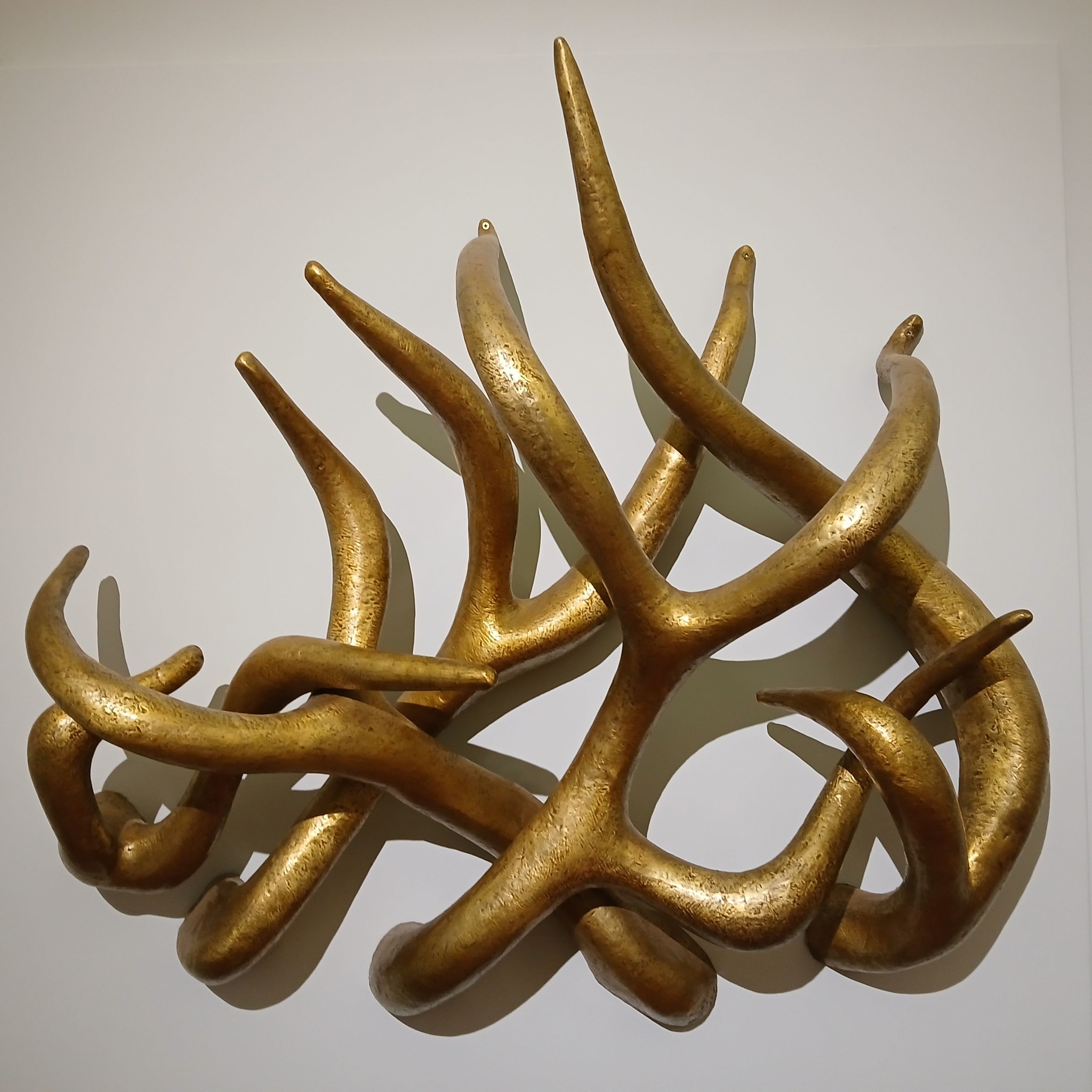
The other sculpture that Mitzi created for the building is easily the spikiest thing in our art collection. ‘Loosestrife’ is a number of tentacle-like arms that intertwine and project outwards. For many it looks like an assemblage of golden deer antlers but it may be based on spires of the flower called loosestrife.
‘Loosestrife’ had been recorded on its arrival as being made of bronze and had turned completely black over the years, probably because it was hung in an area where students smoked back in the day. When it was removed from the School of Civic Design building in 2018 and sent for cleaning, it was revealed to actually be made of brass. It is very heavy and takes four technicians with lifting gear to hang it for display.
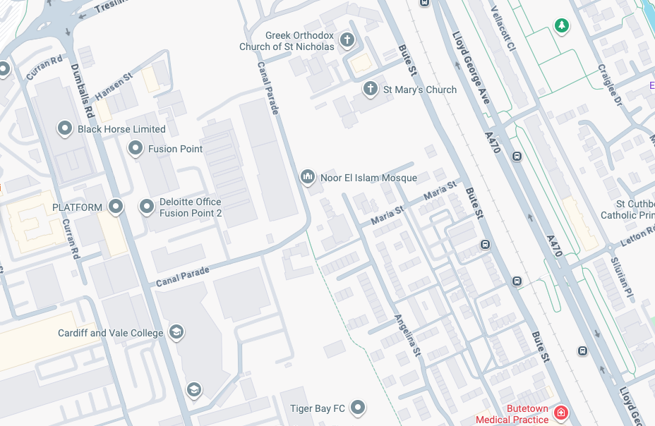
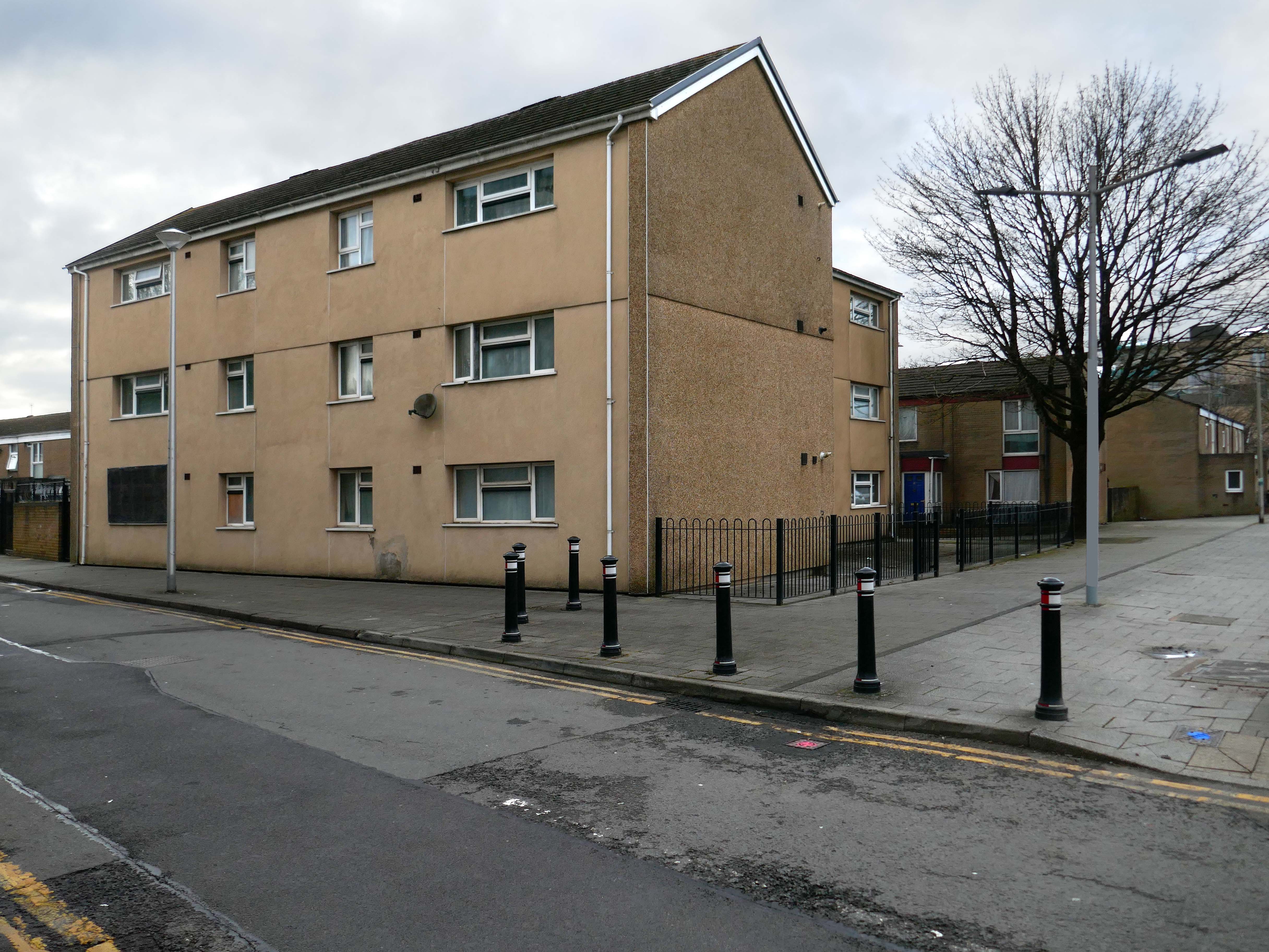
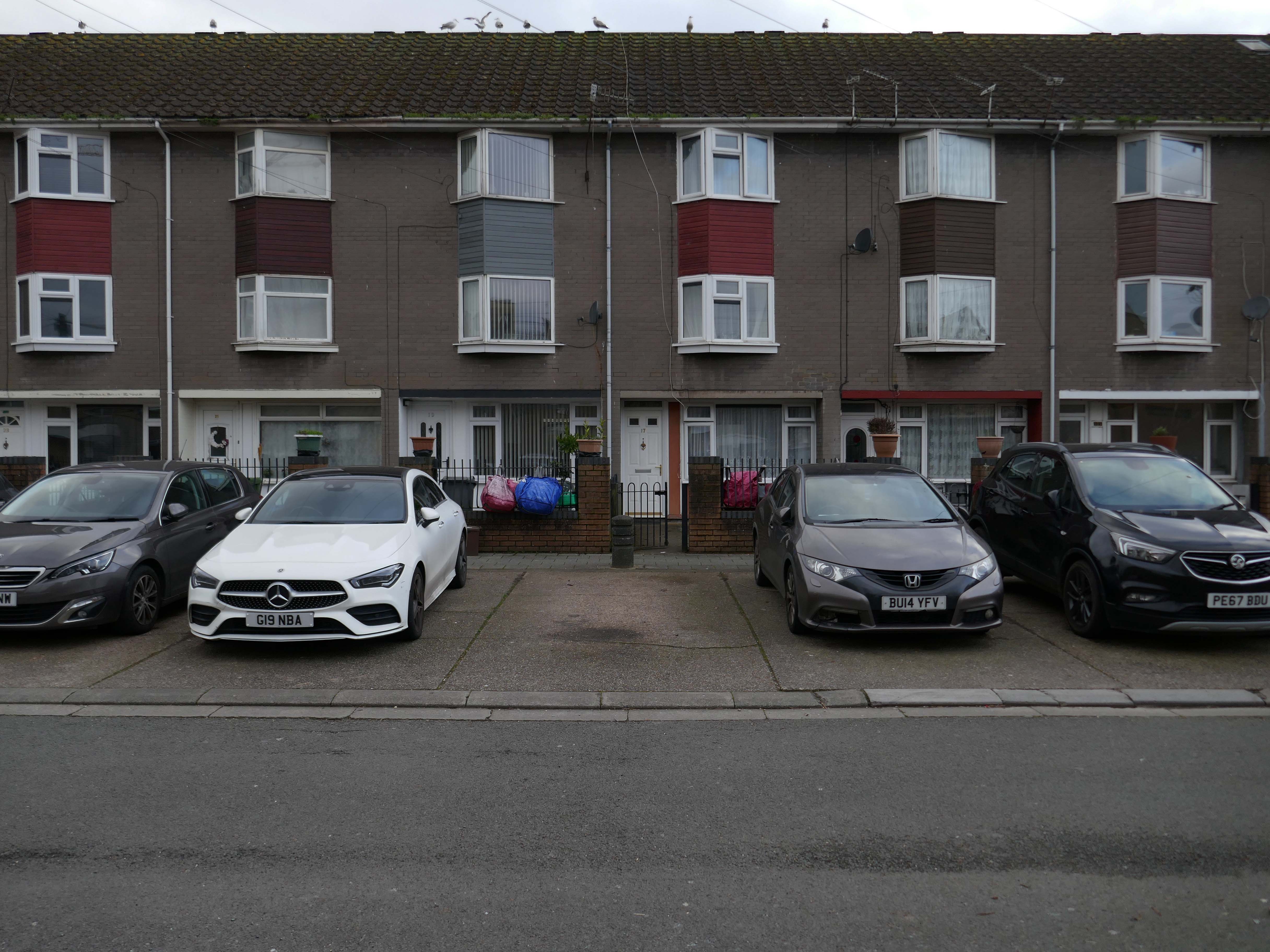
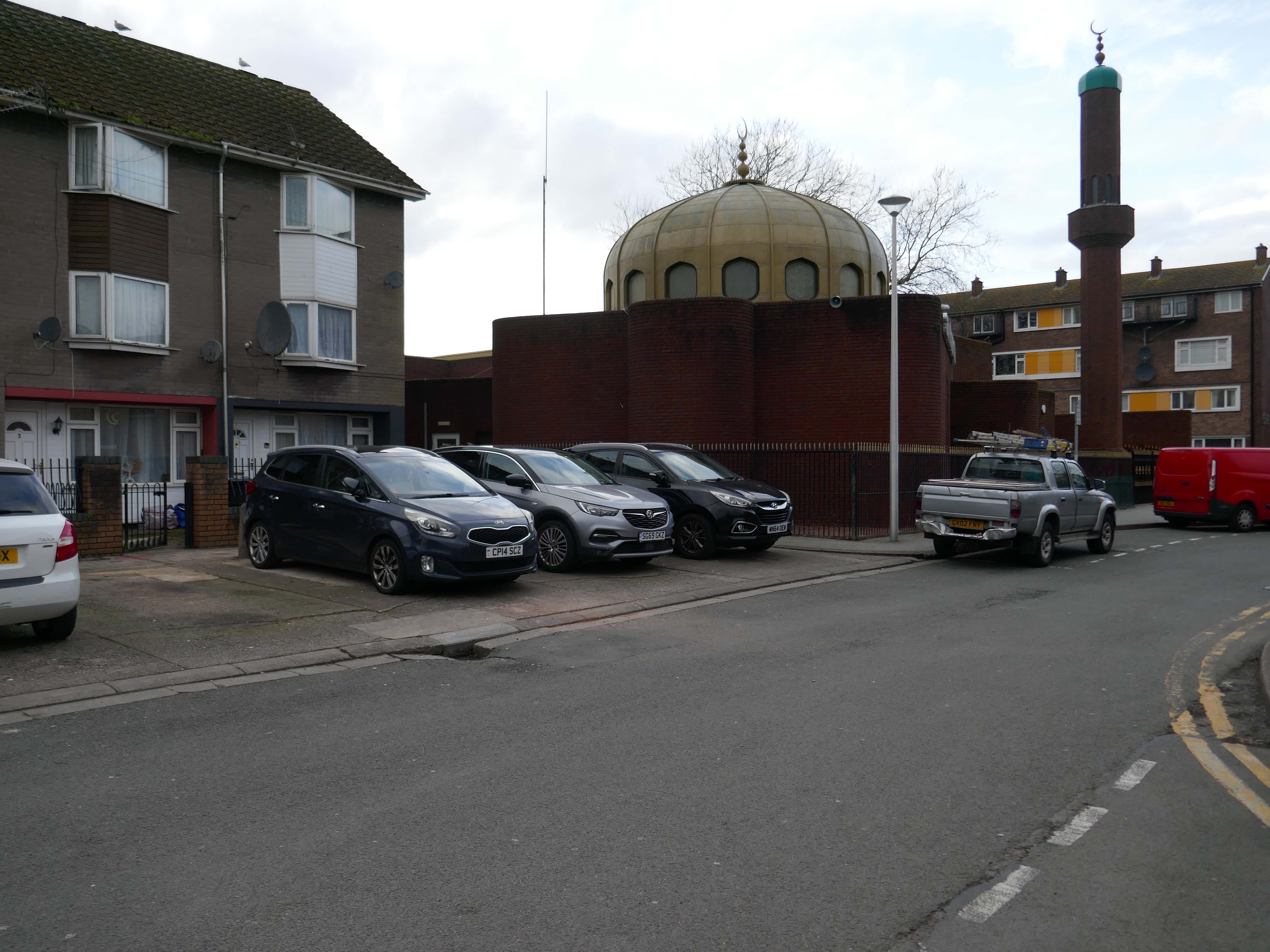
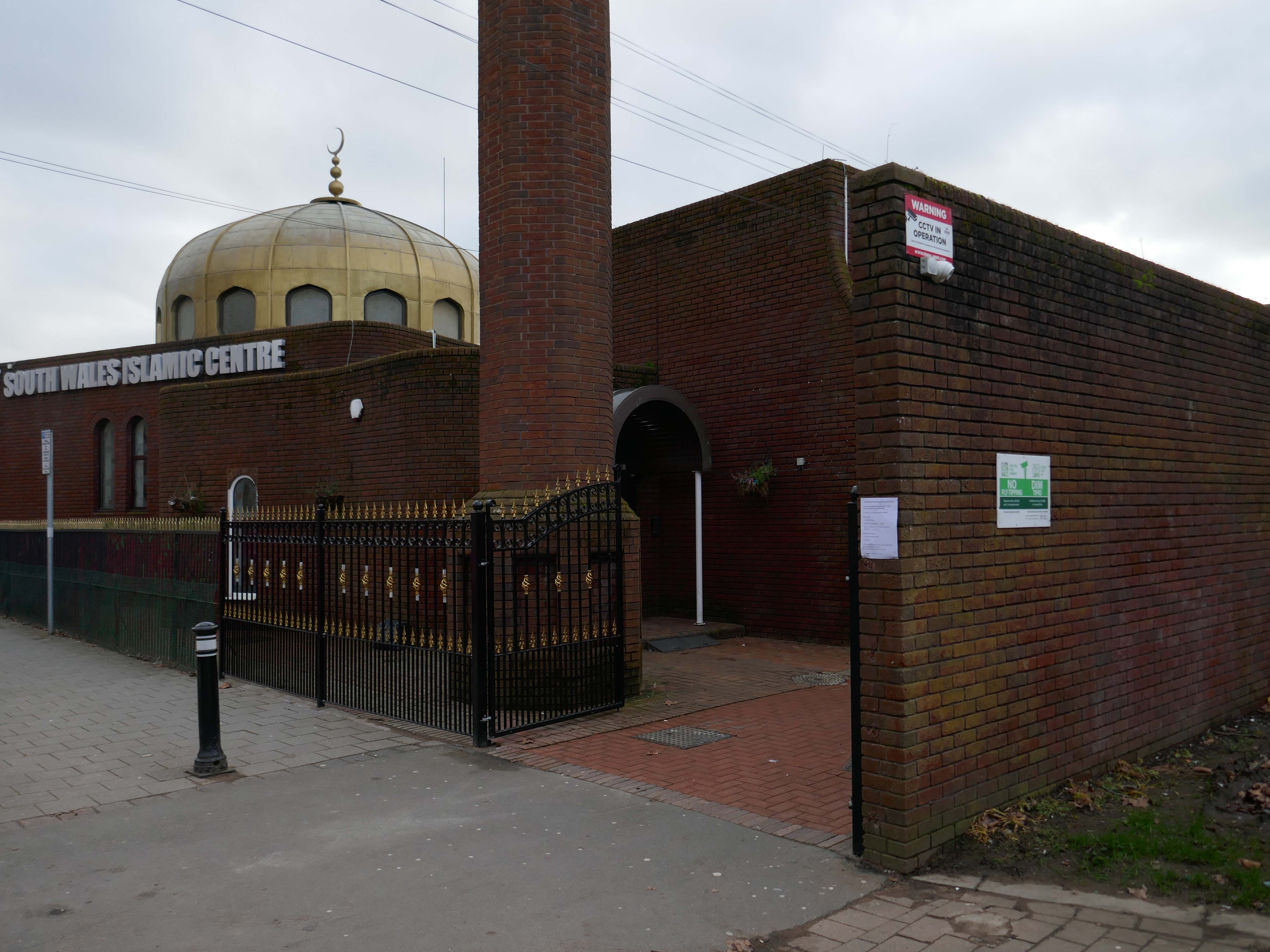
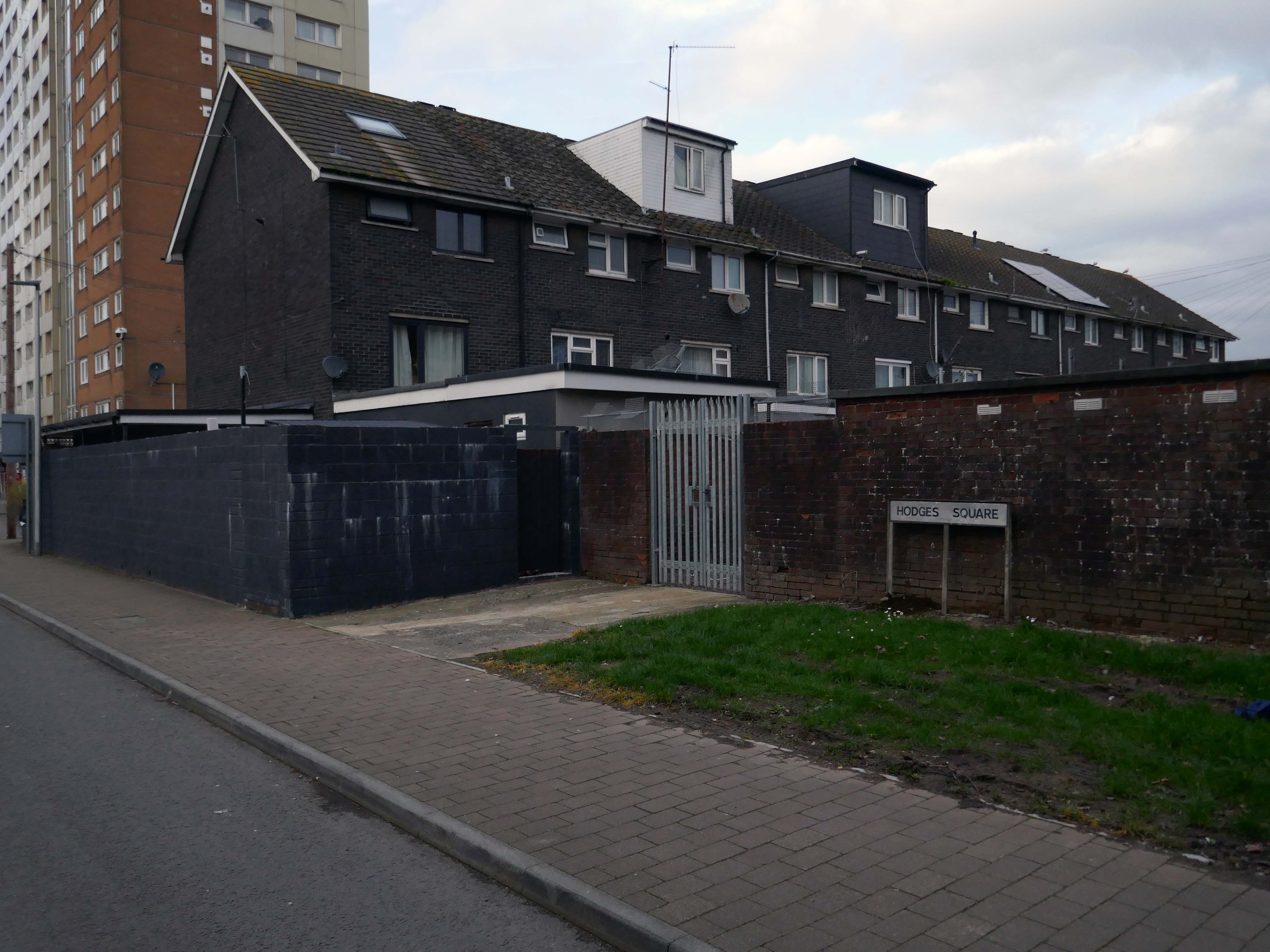
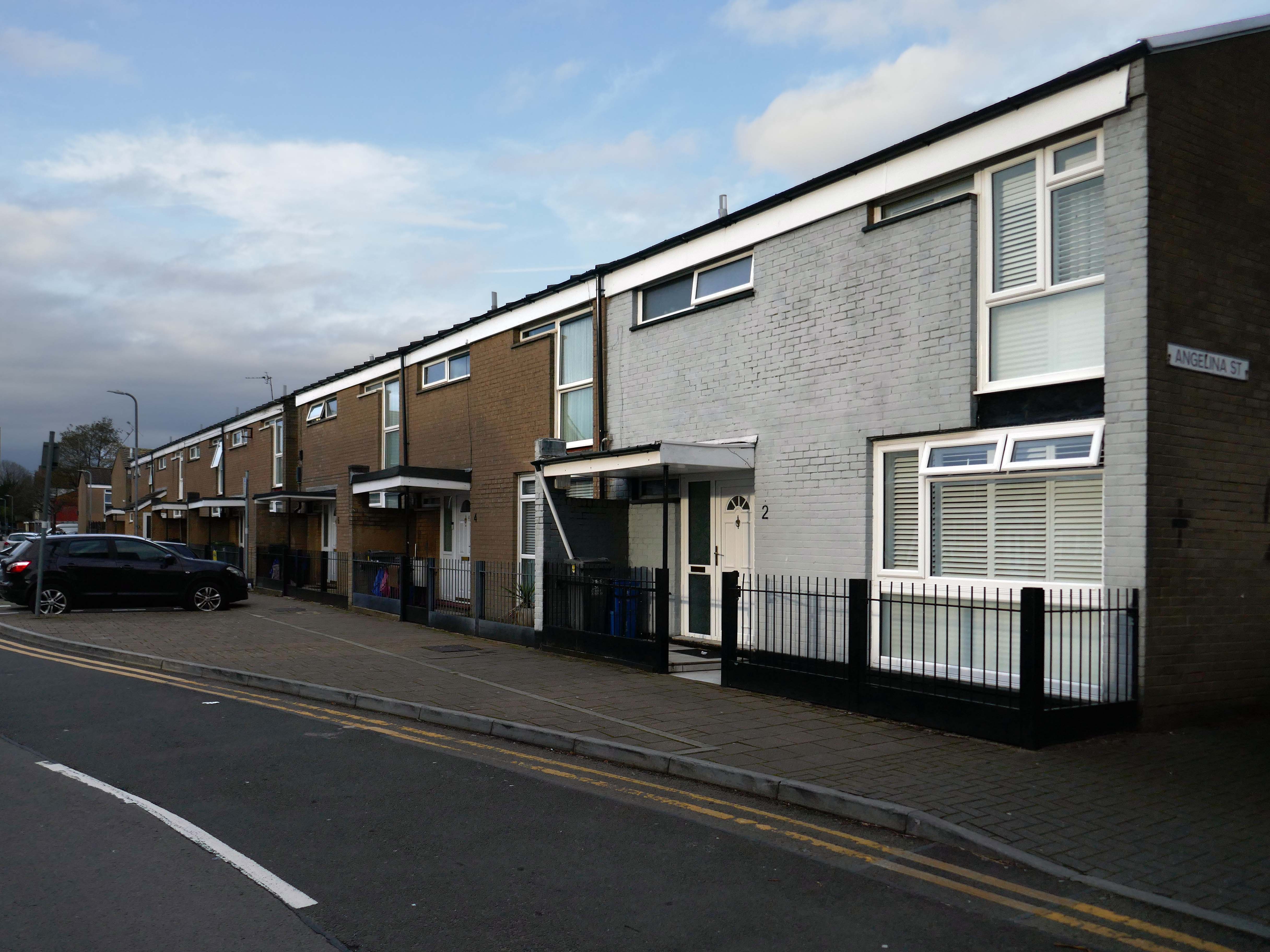
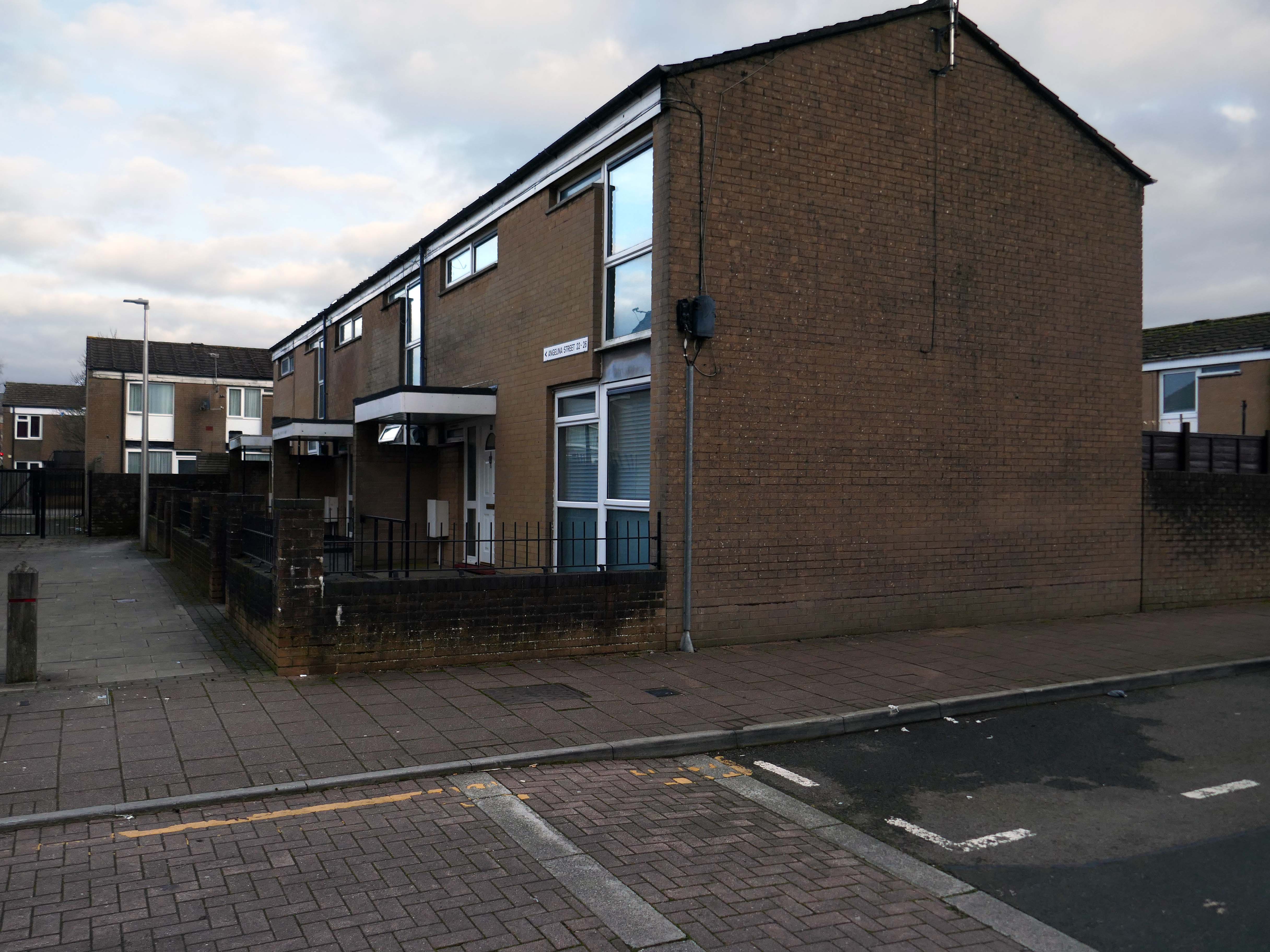
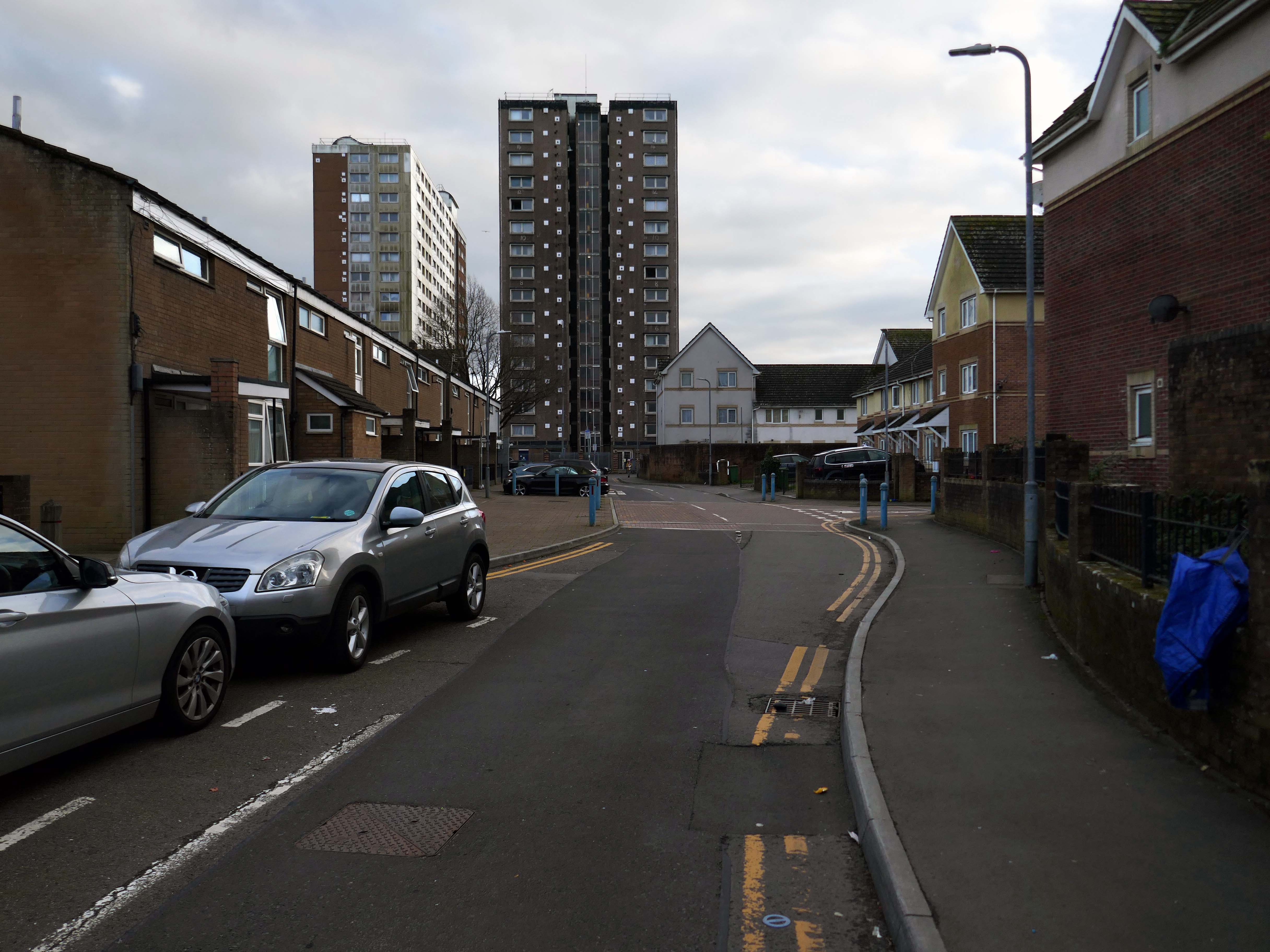
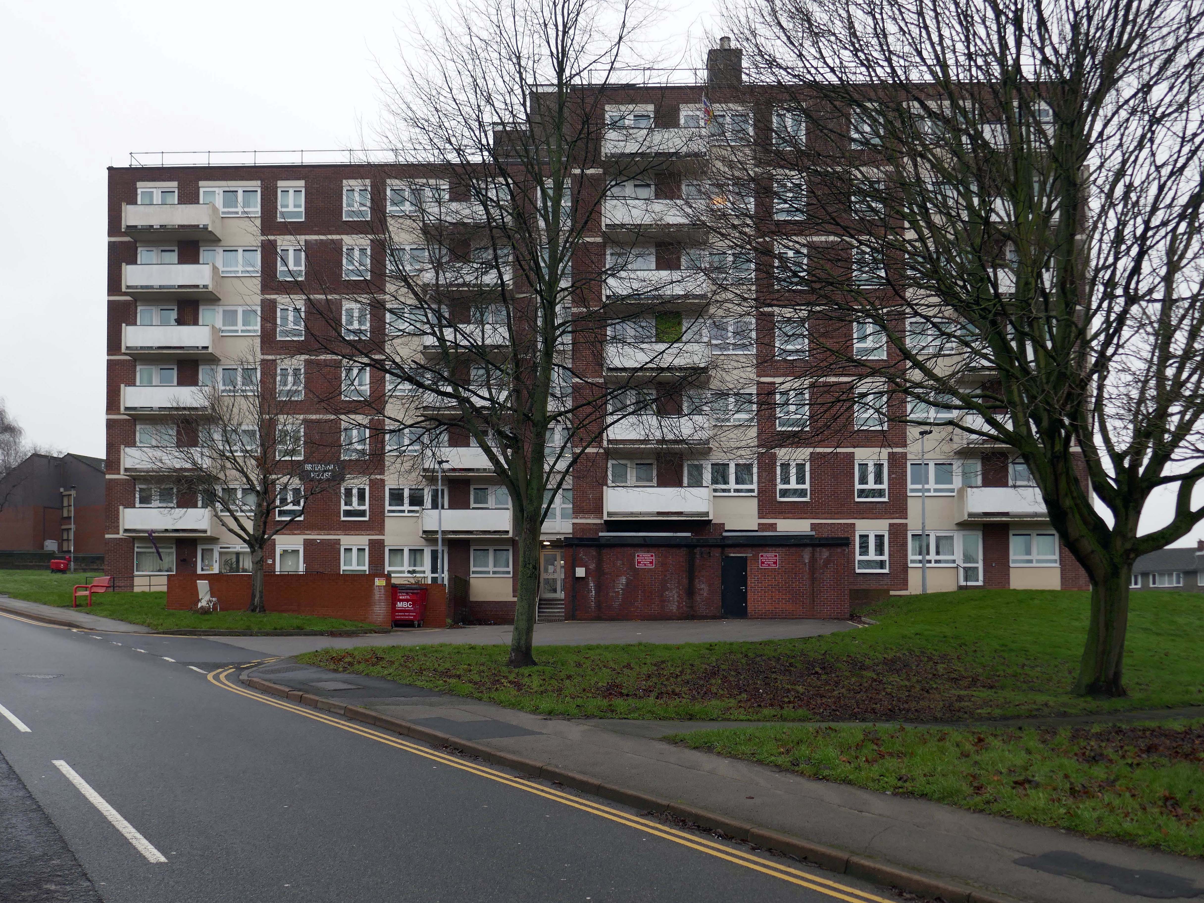
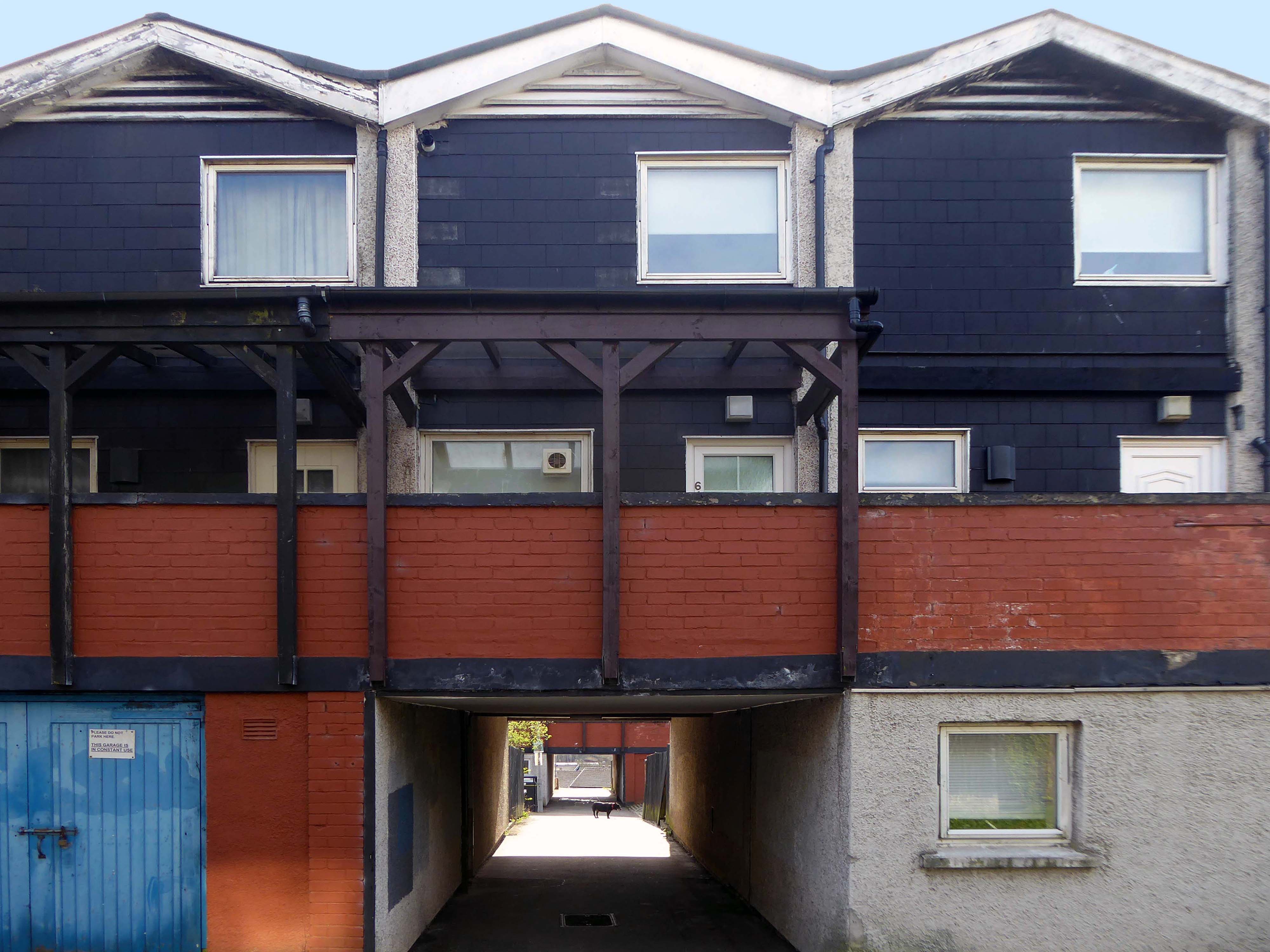
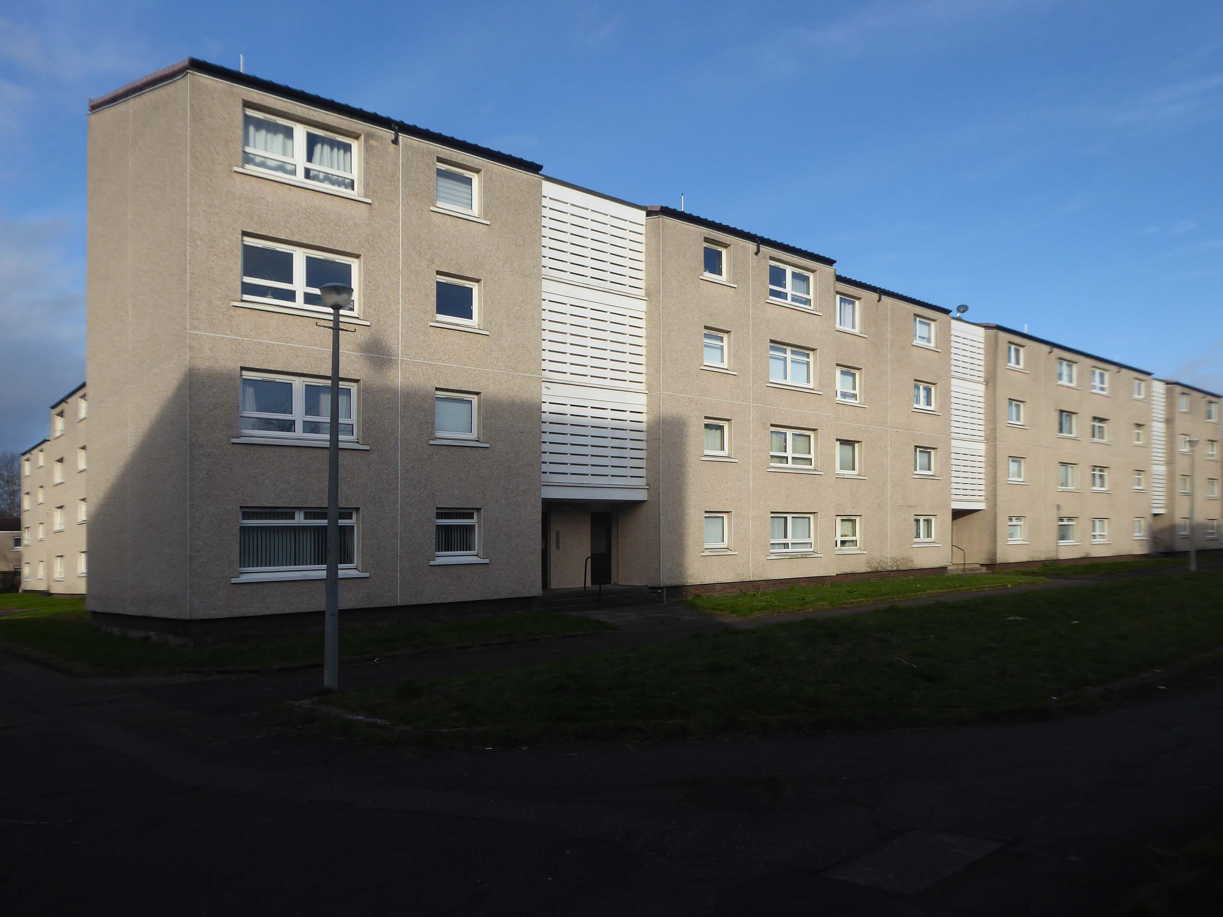
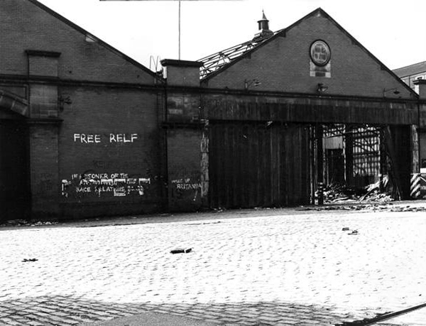
Butetown – or The Docks Tre-biwt is a district and community in the south of the city of Cardiff. It was originally a model housing estate built in the early 19th century by the 2nd Marquess of Bute, for whose title the area was named.
Commonly known as Tiger Bay, this area became one of the UK’s first multiculturalcommunities with people from over fifty countries settled here by the outbreak of the First World War, working in the docks and allied industries. Some of the largest communities included the Somalis, Yemenis and Greeks, whose influence still lives on today.
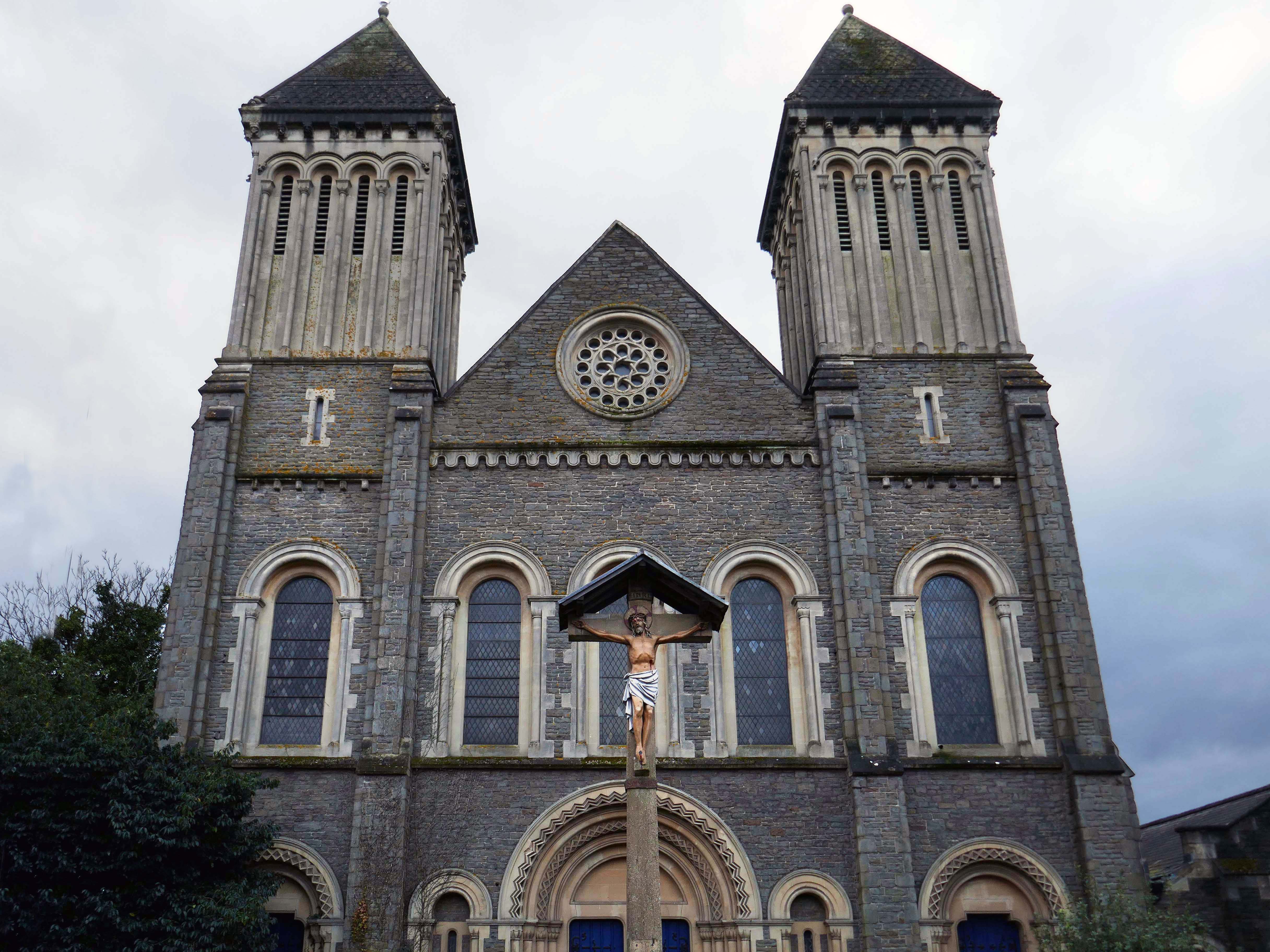
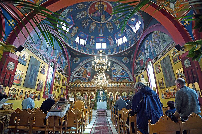
In 1906, work began on the present-day church, which also serves the Russian Orthodox community in south Wales. Designed by local architects, James and Morgan, it is located on a site provided by the 4th Marquess of Bute, to the west of Bute Street. The modestly-sized building is of Byzantine style with a domed nave and an apse at the east end. It retains the original dedication to StNicholas. The interior is very ornate, with a lot of carved woodwork. The dome and upper walls have painted Biblical scenes in vivid colours with gold decoration.
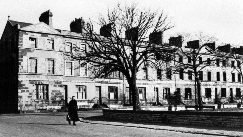
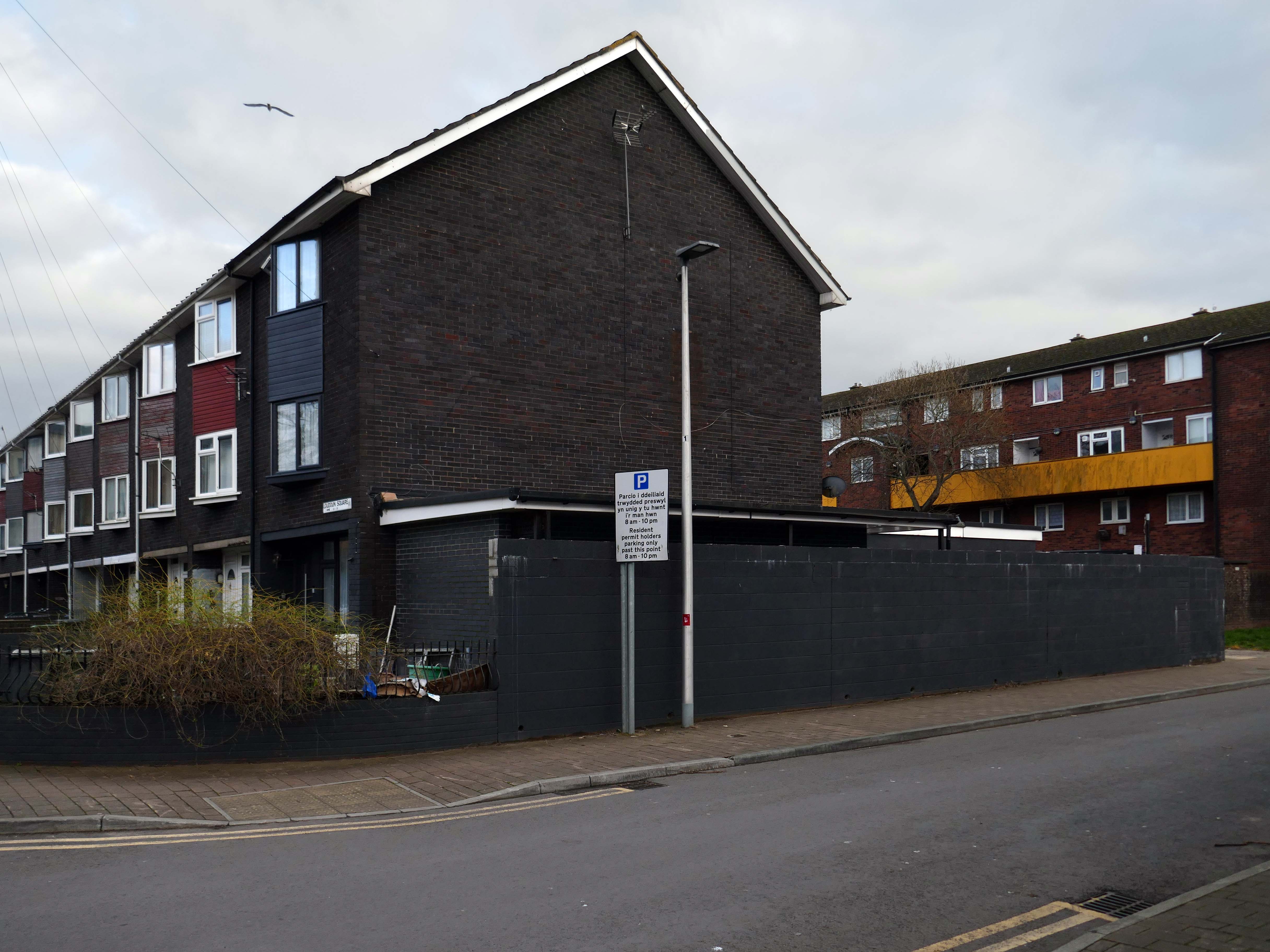
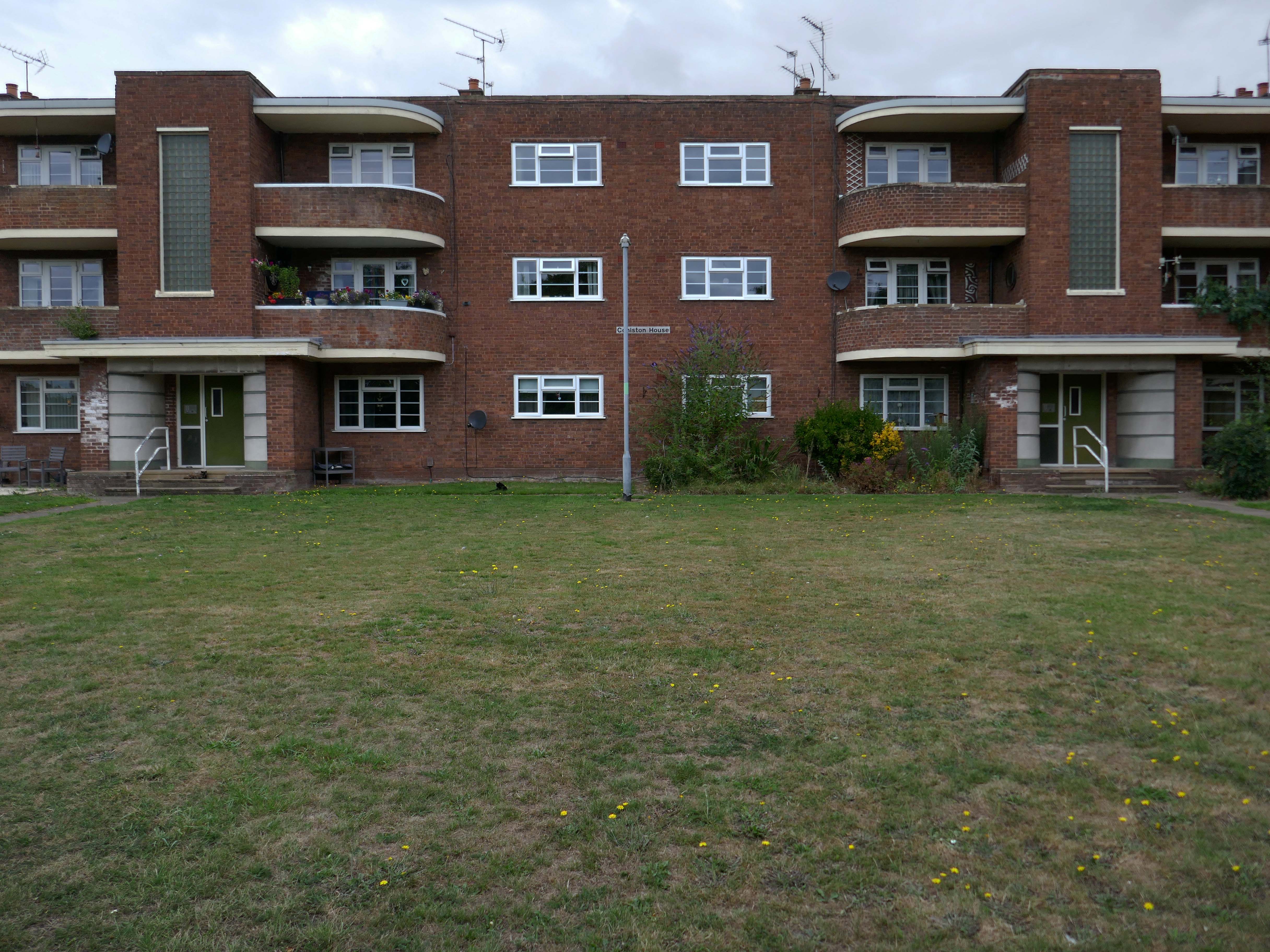
Loudoun Square was originally built in the mid-1850s as upmarket homes for merchants, mariners, ship brokers and the like around a central park.
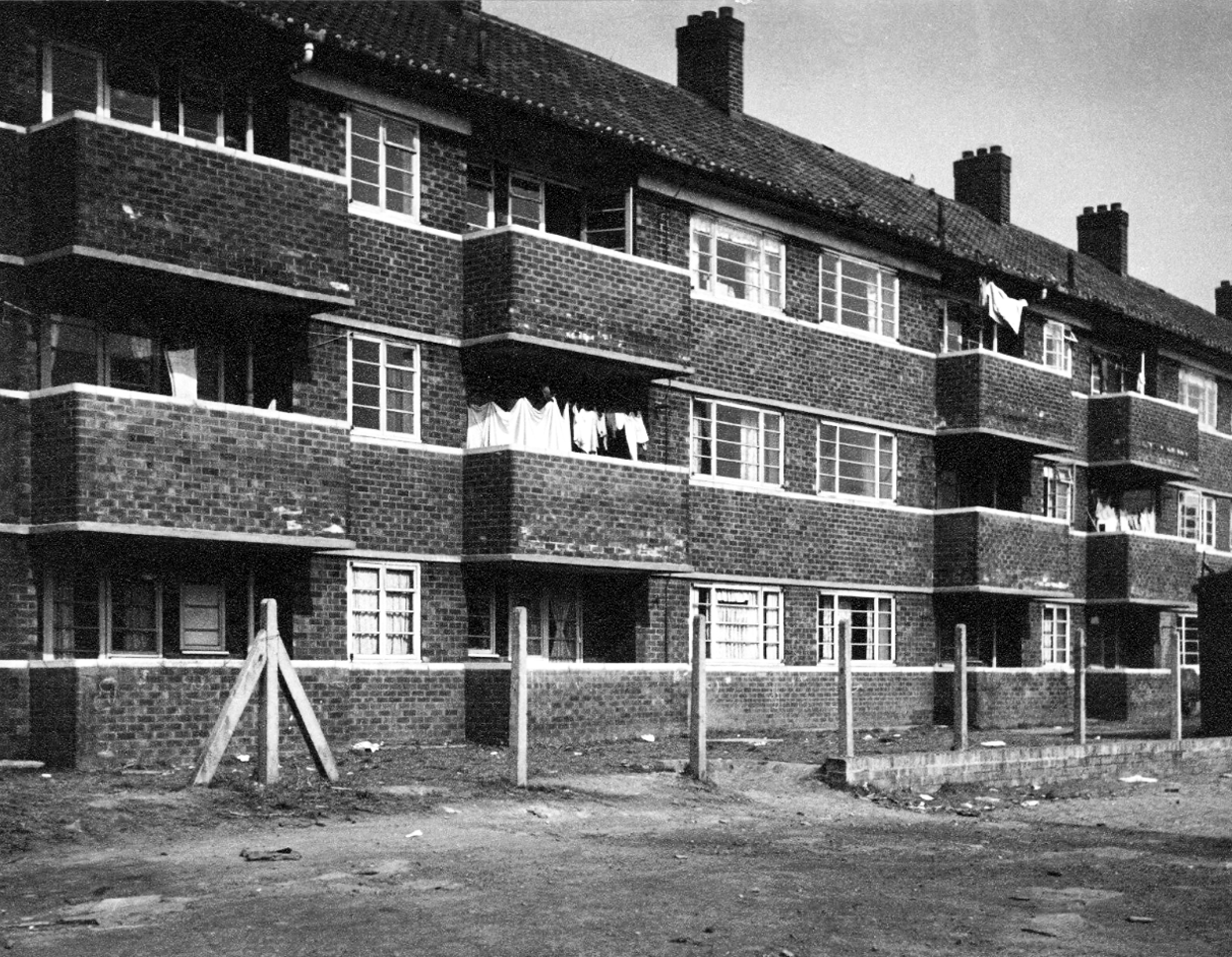
Photo 1962
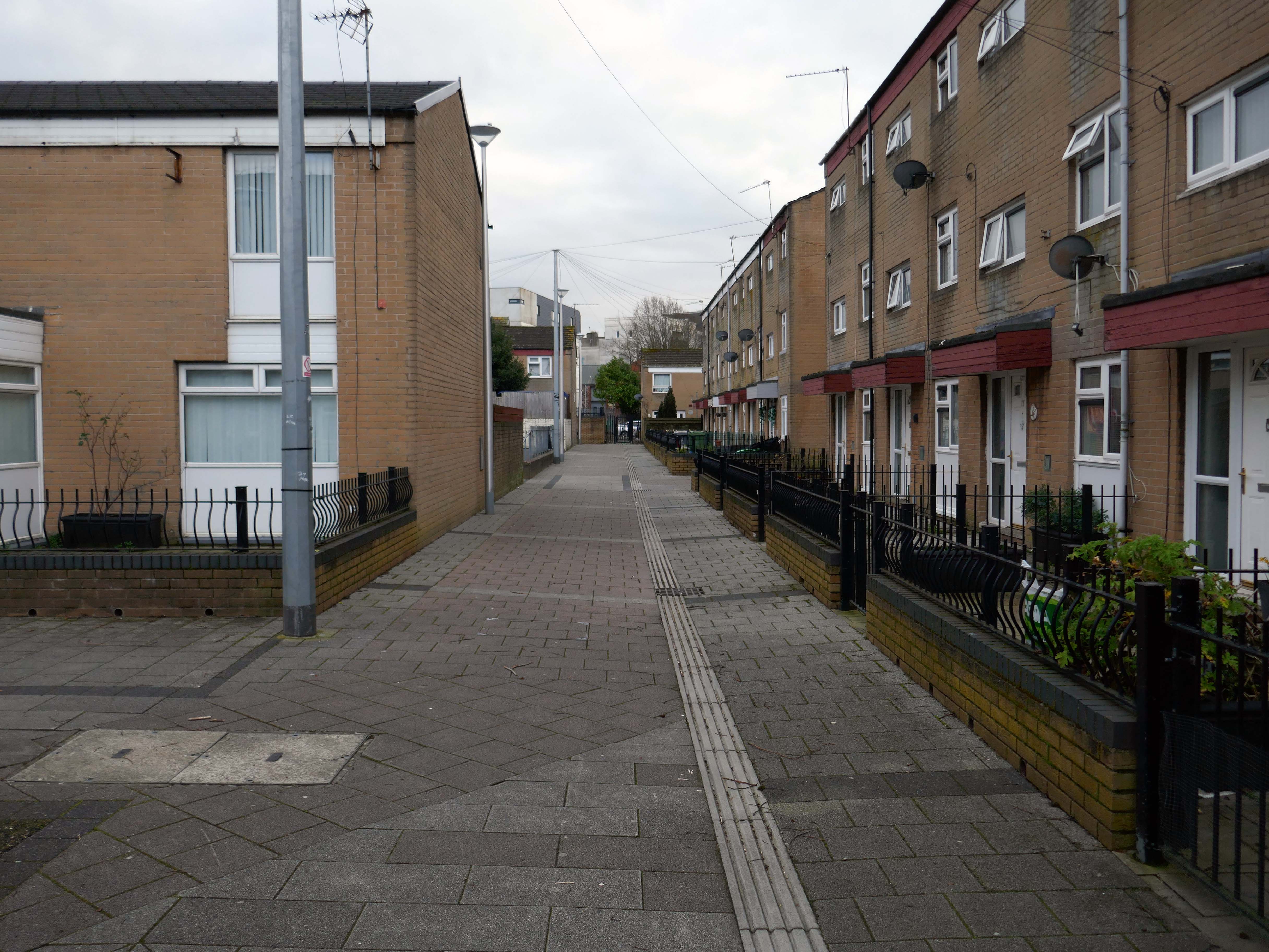
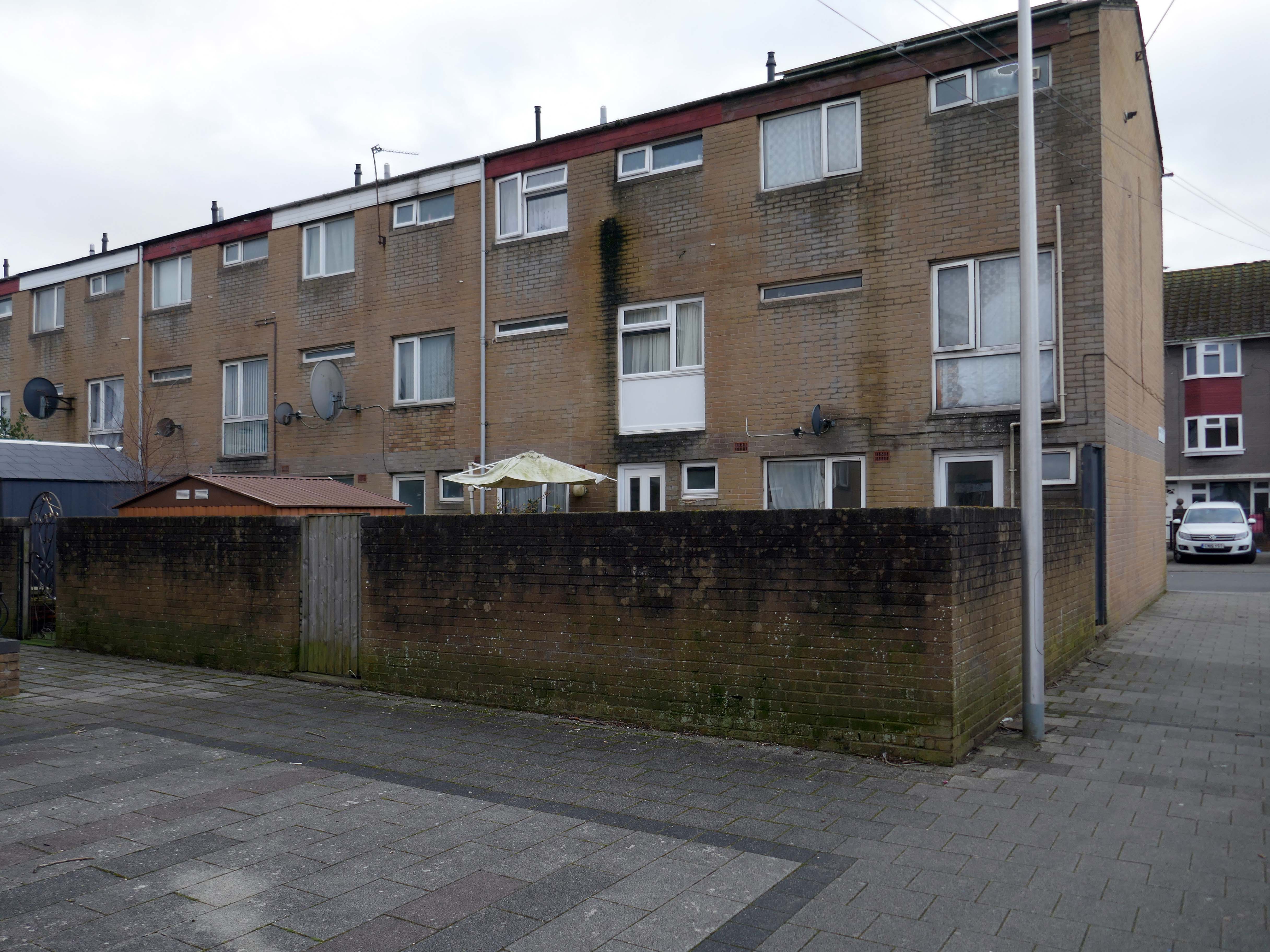
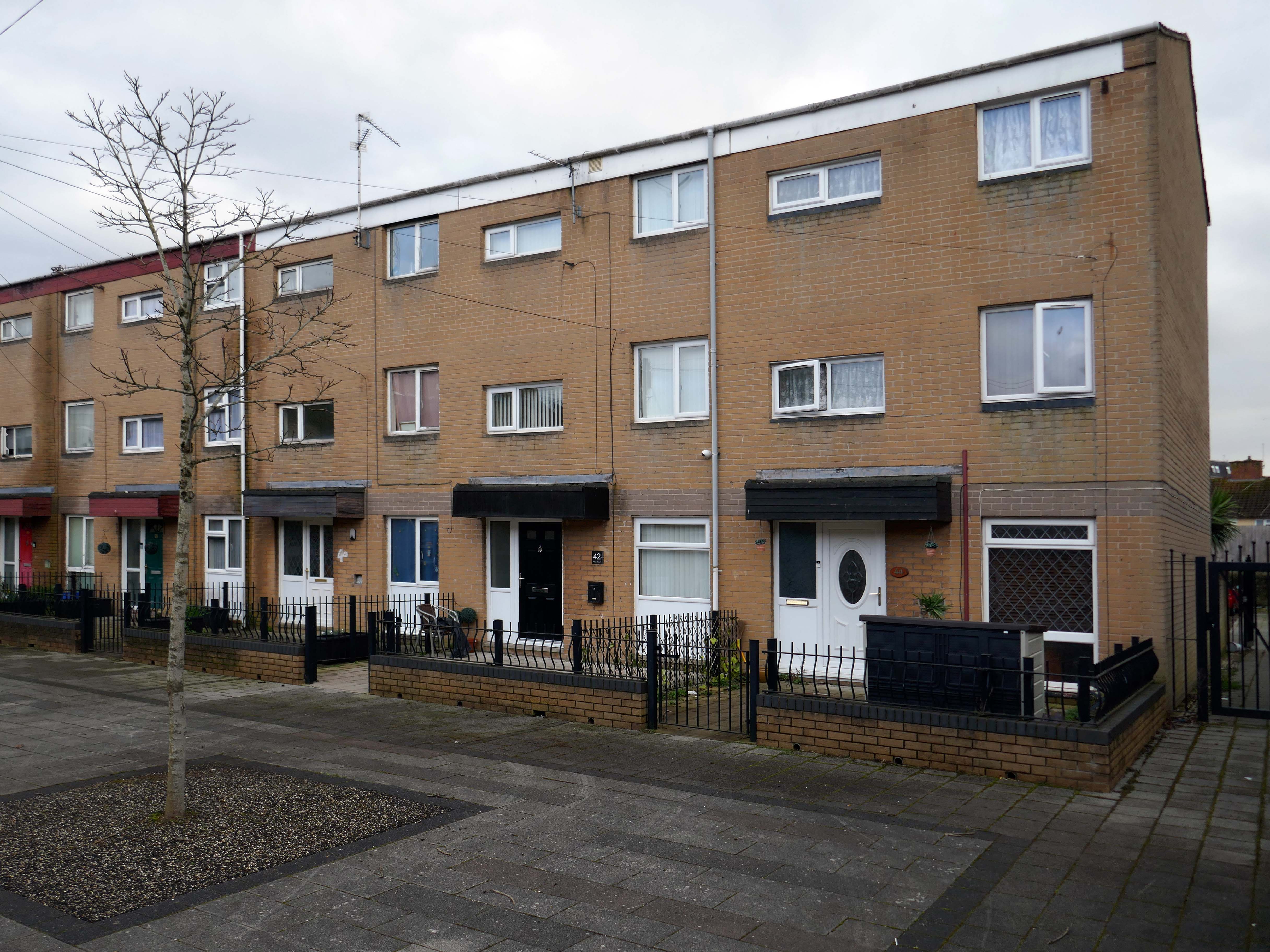
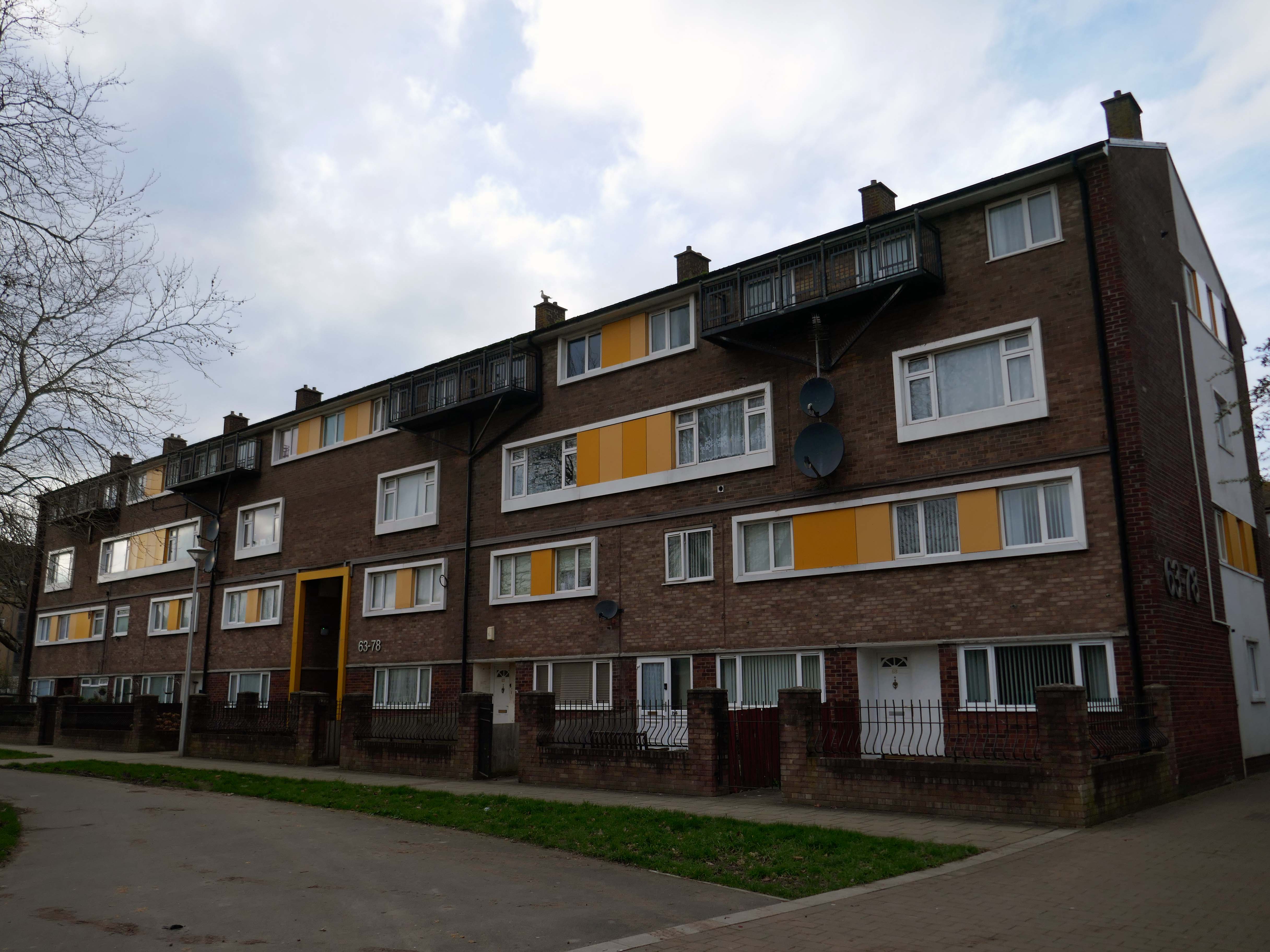
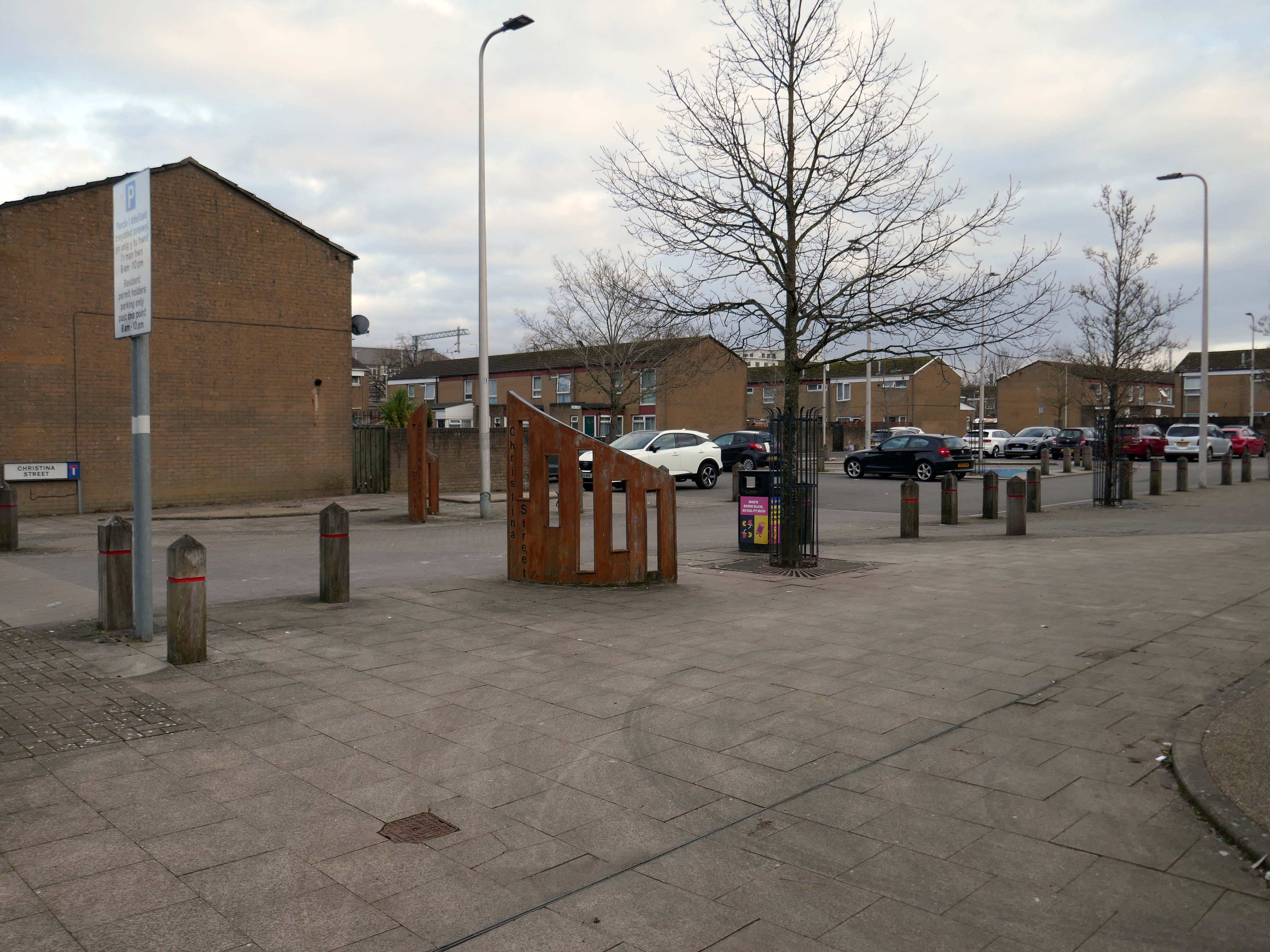
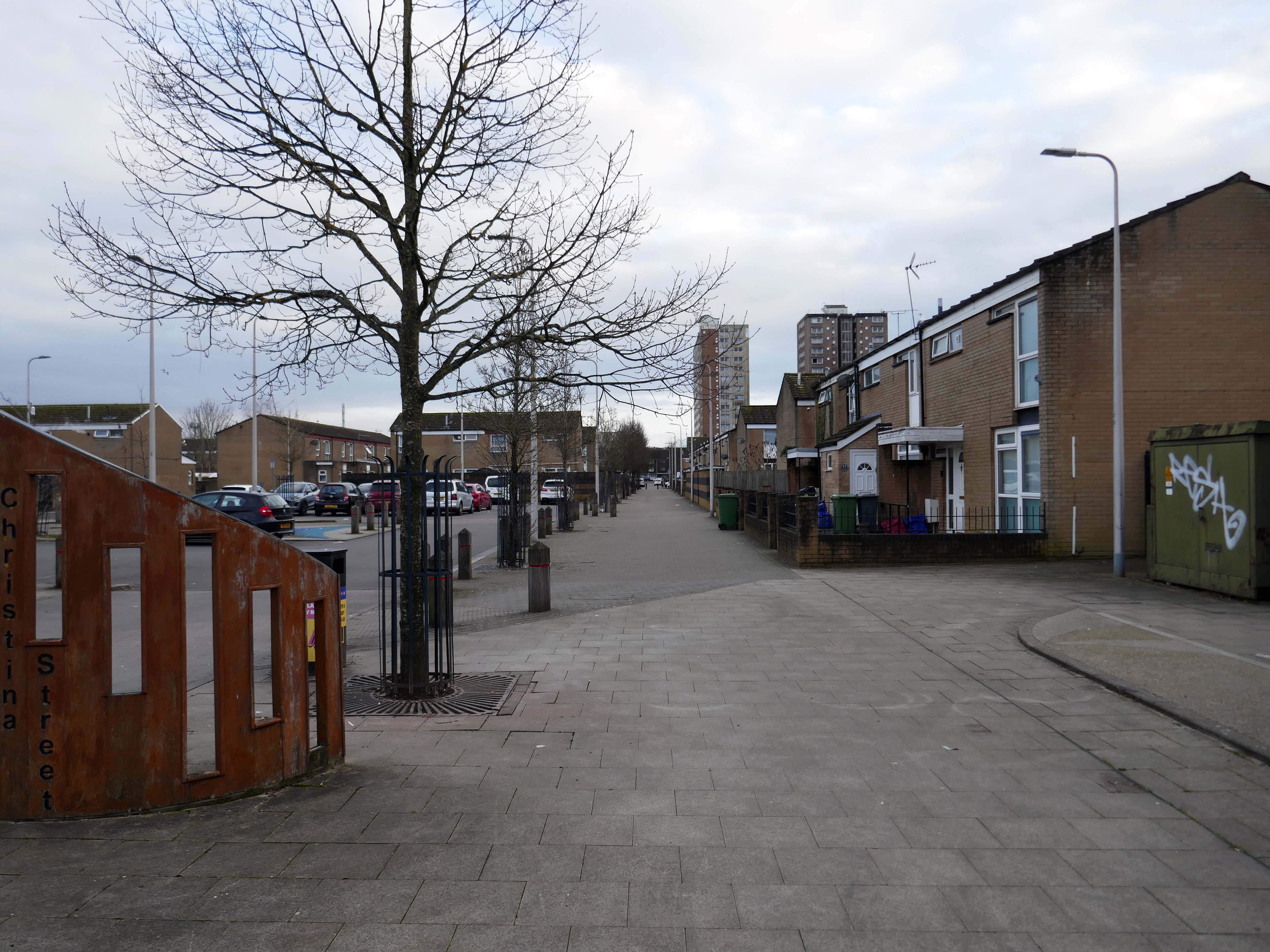
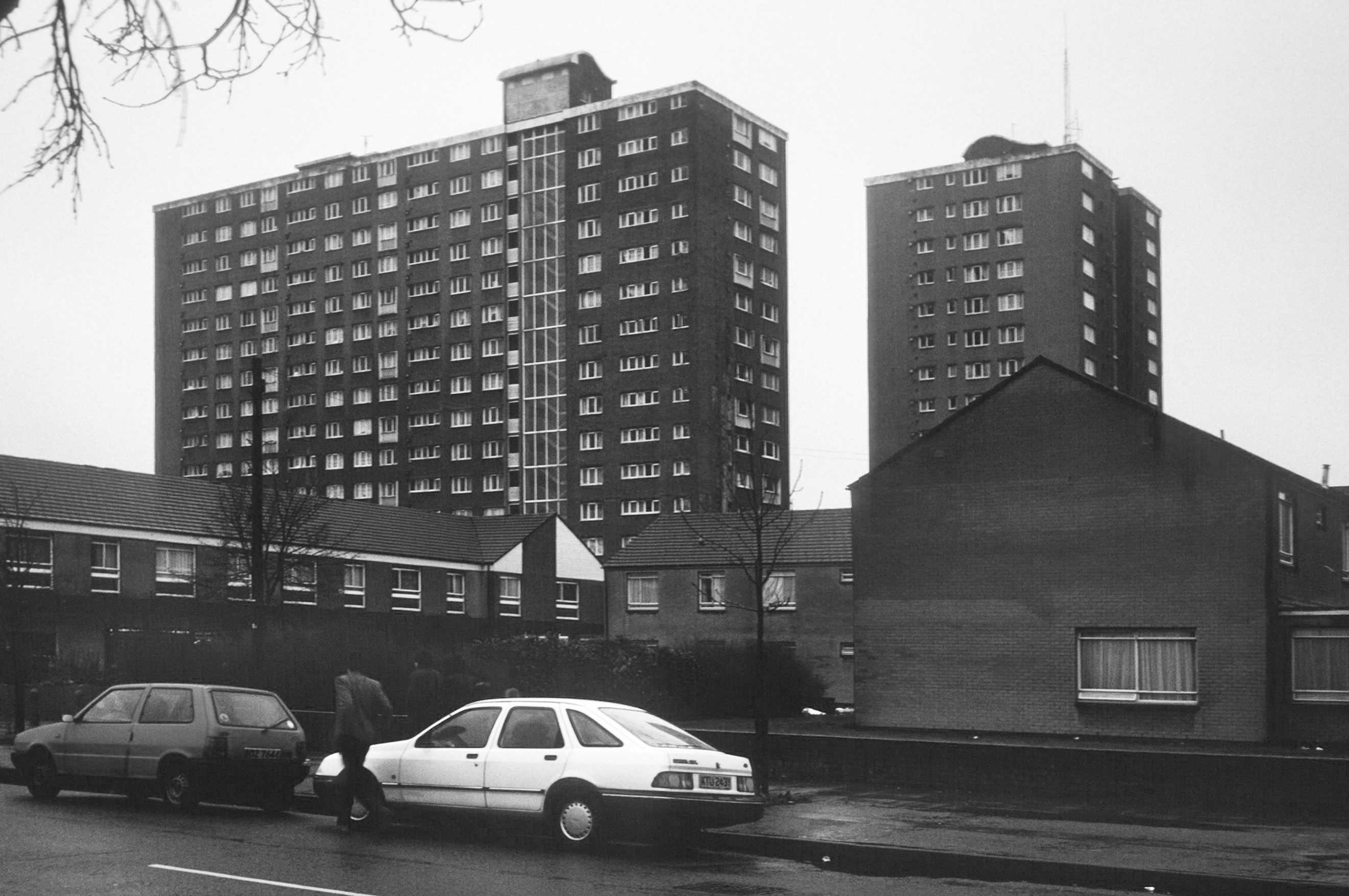
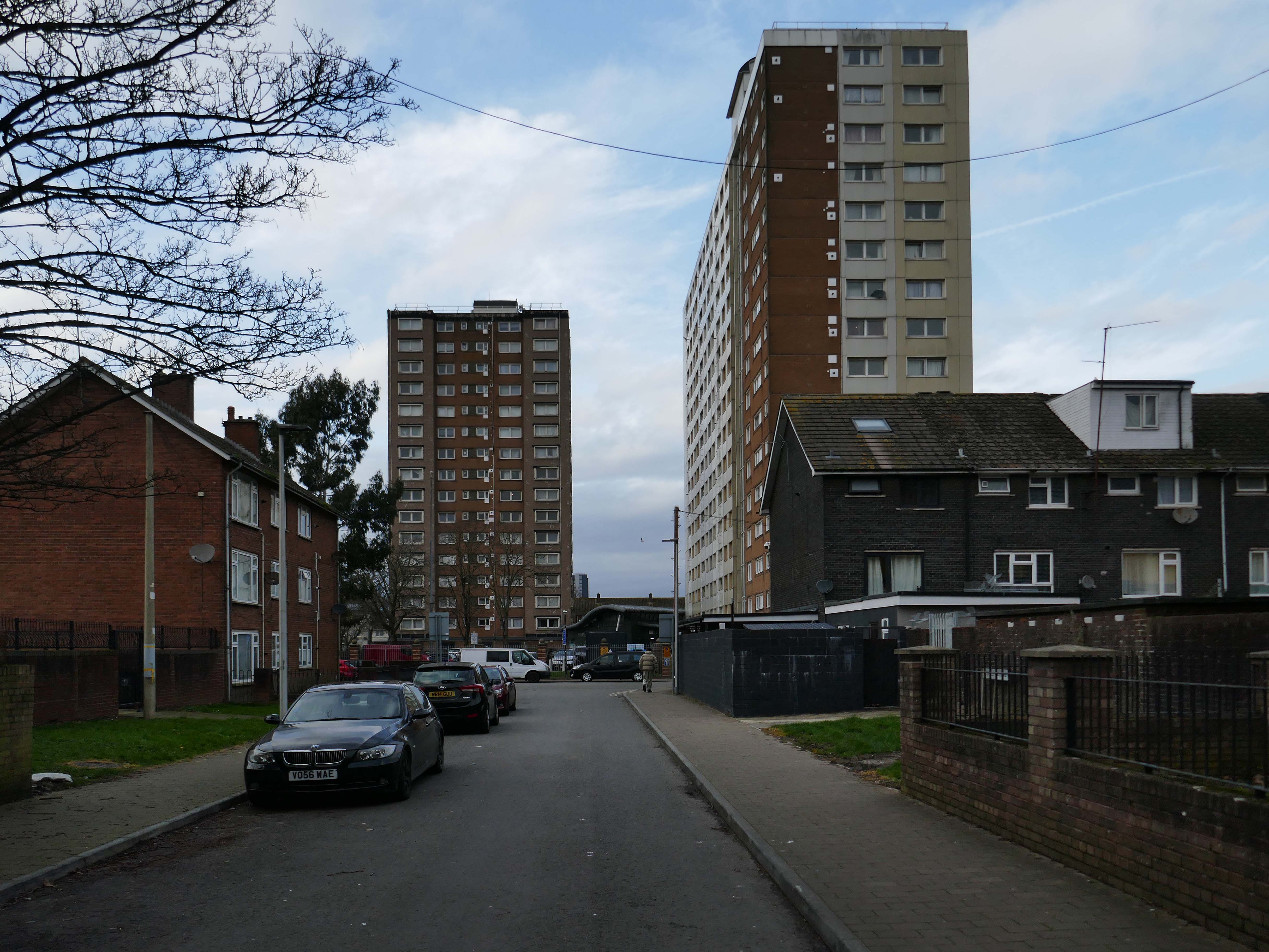
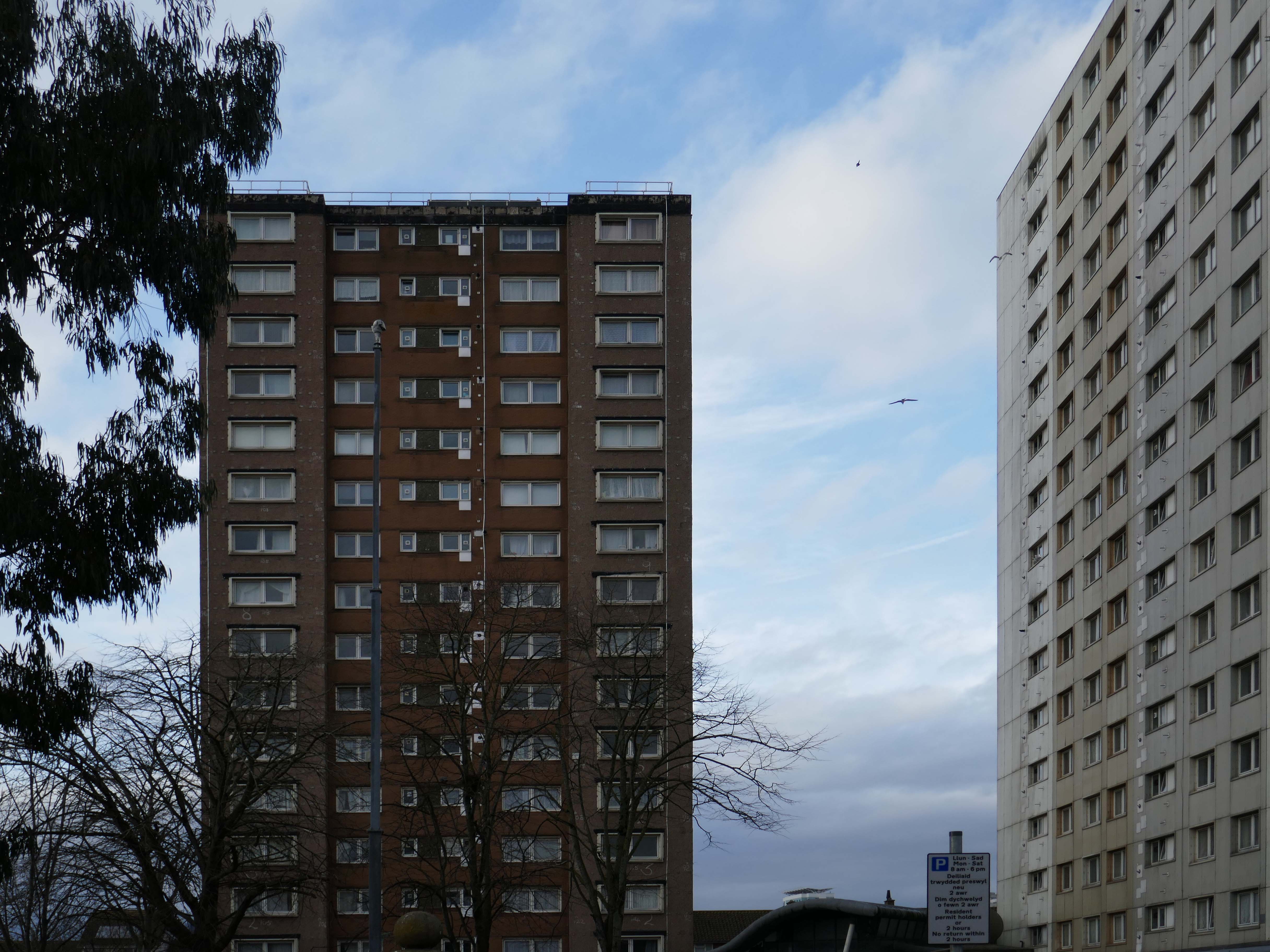
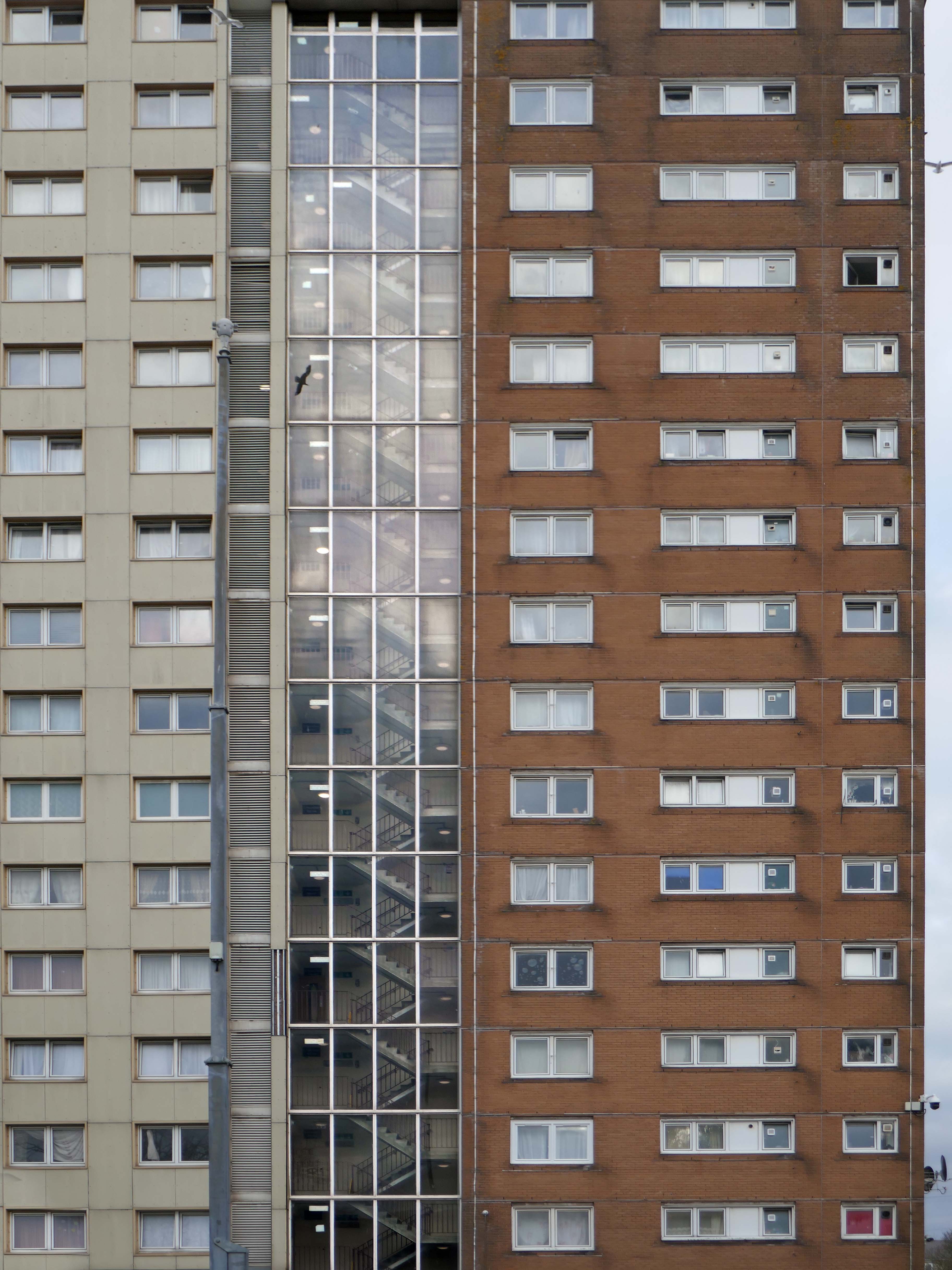
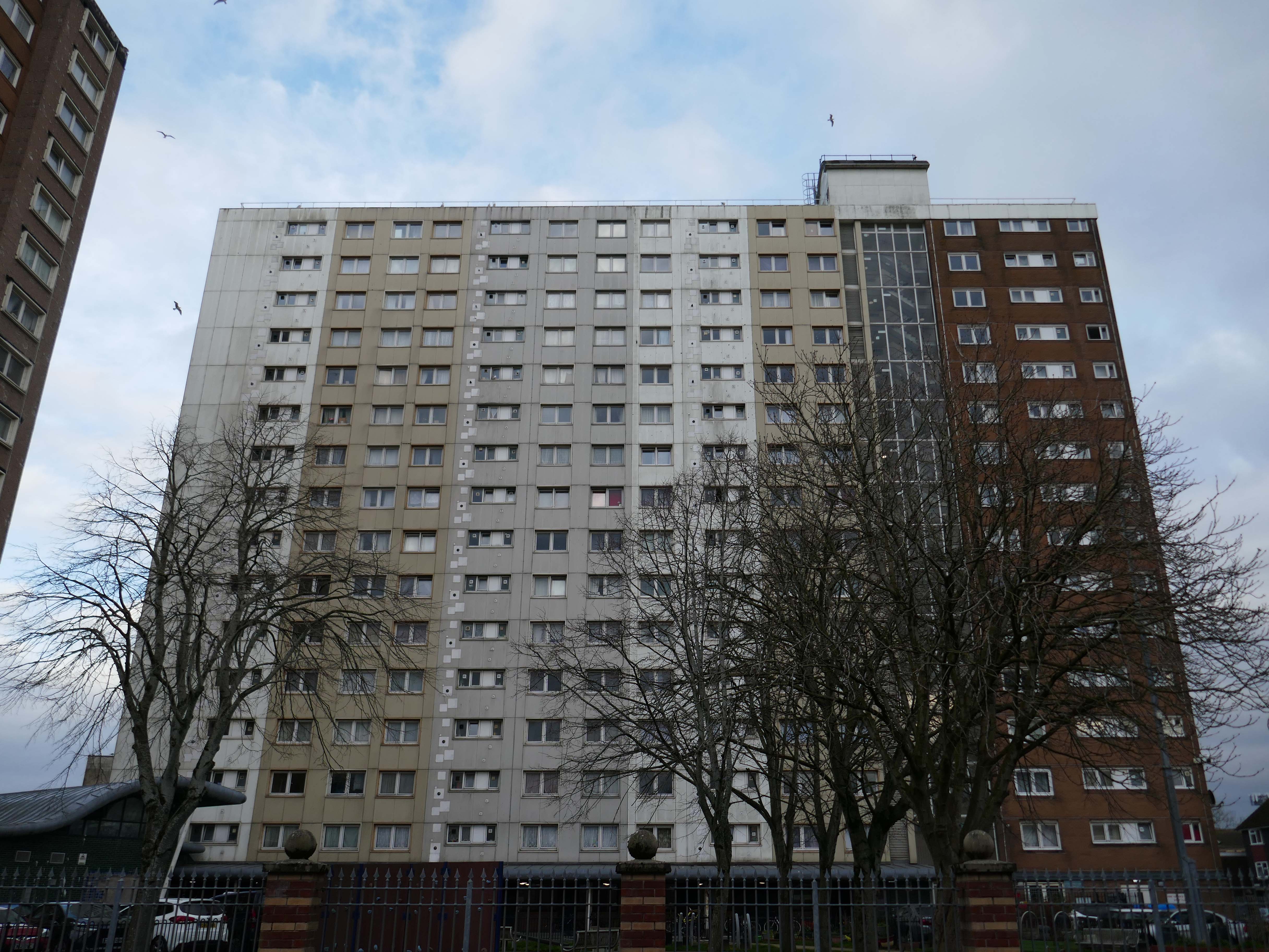
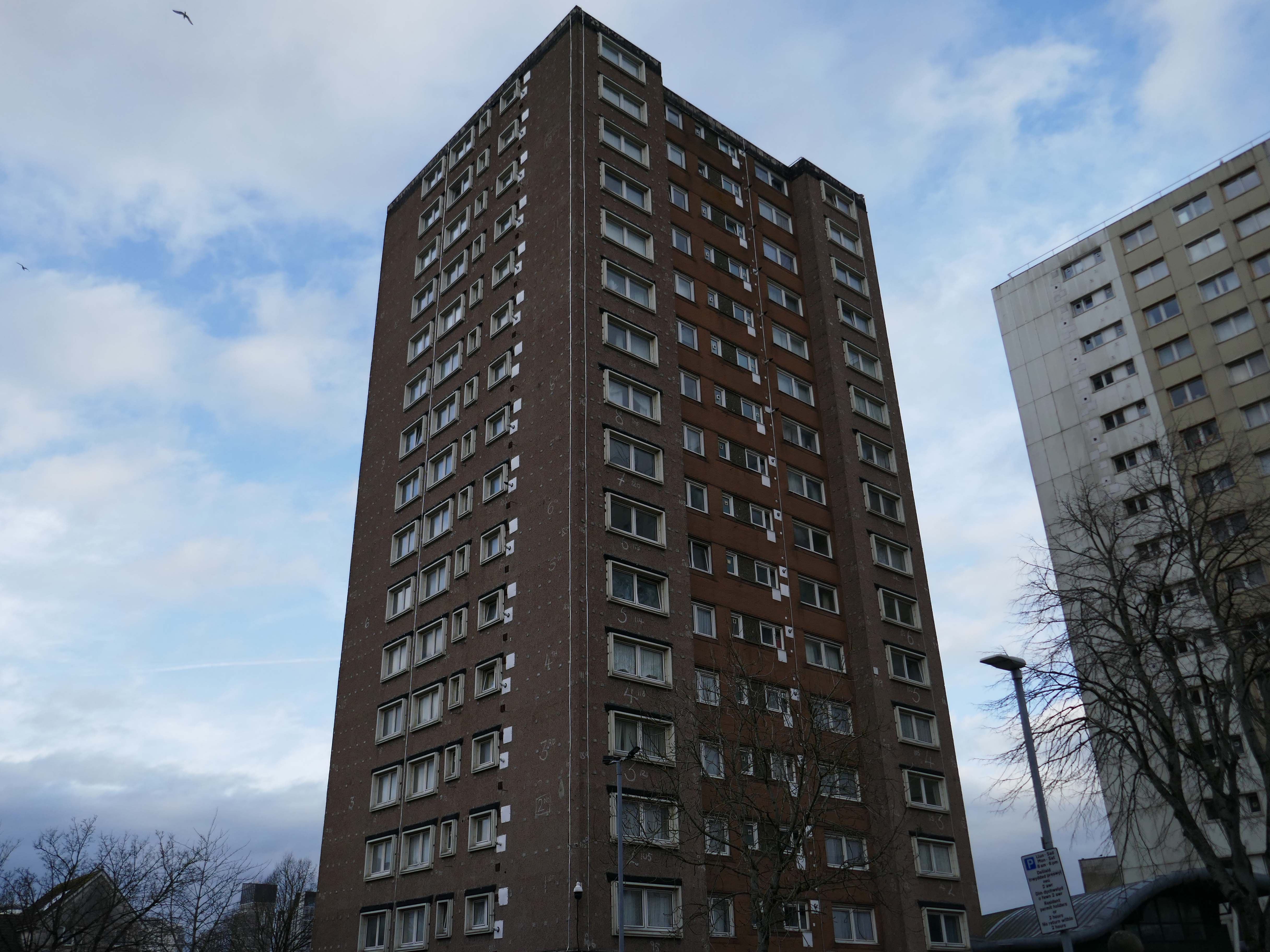
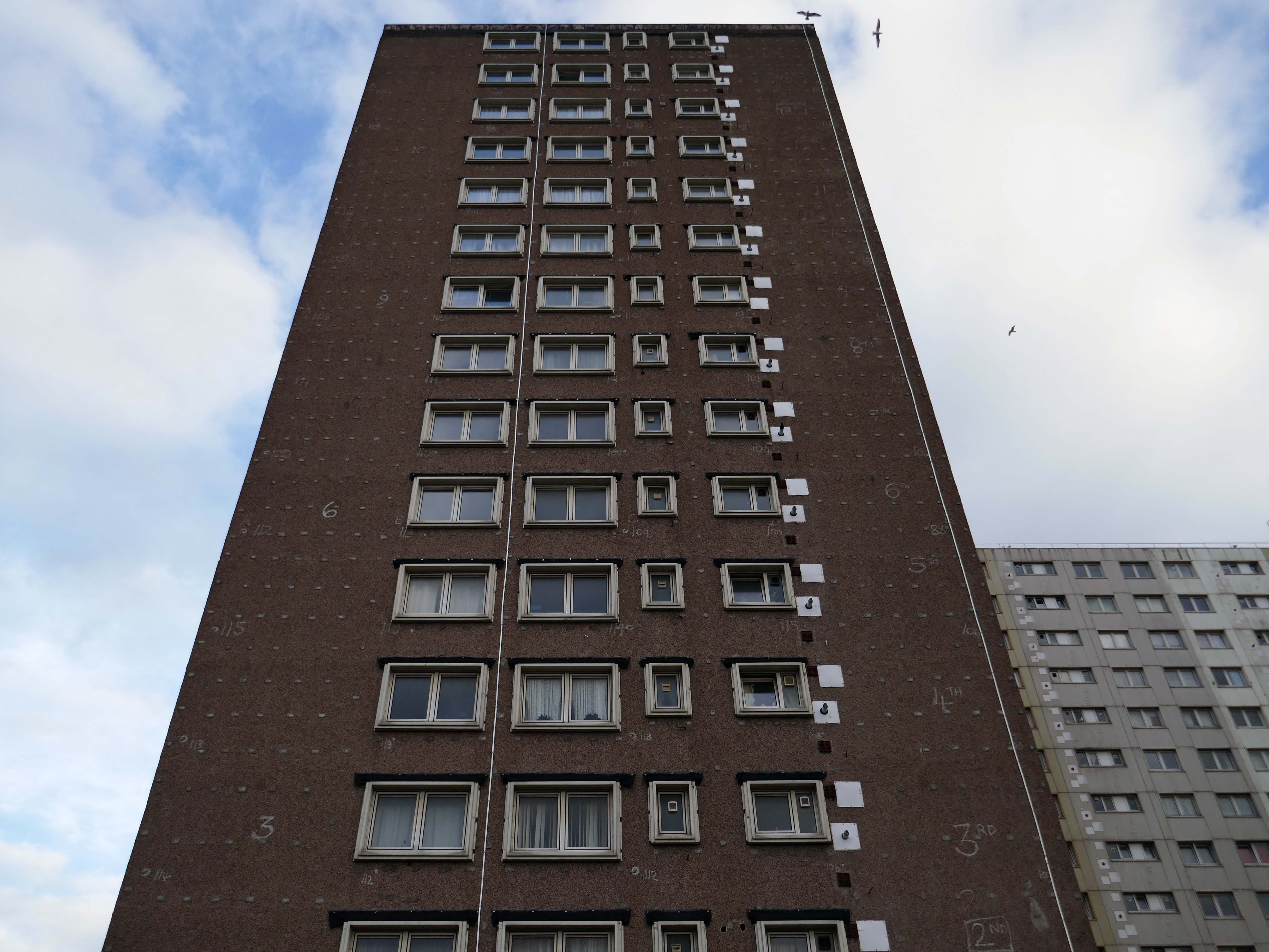
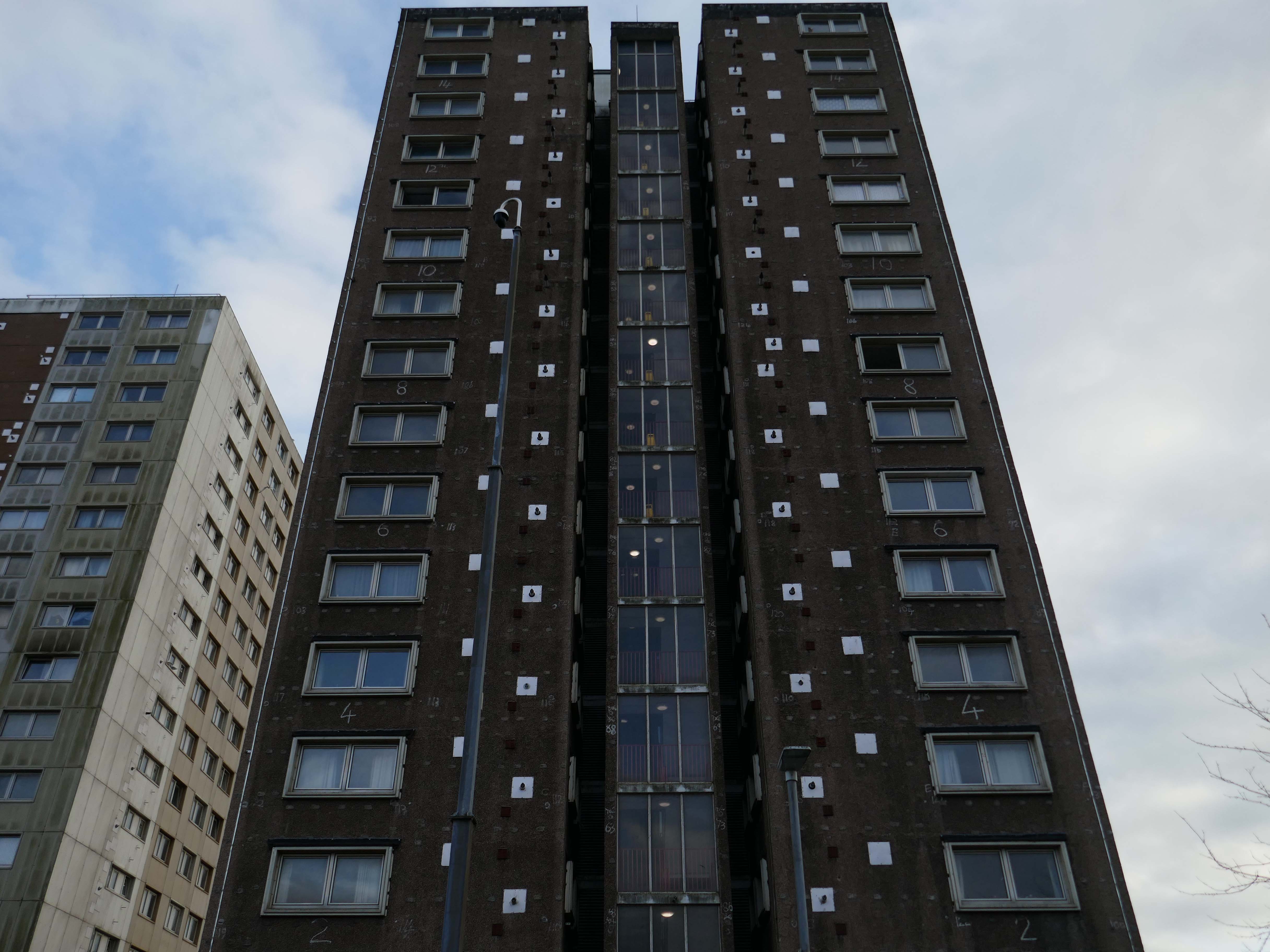
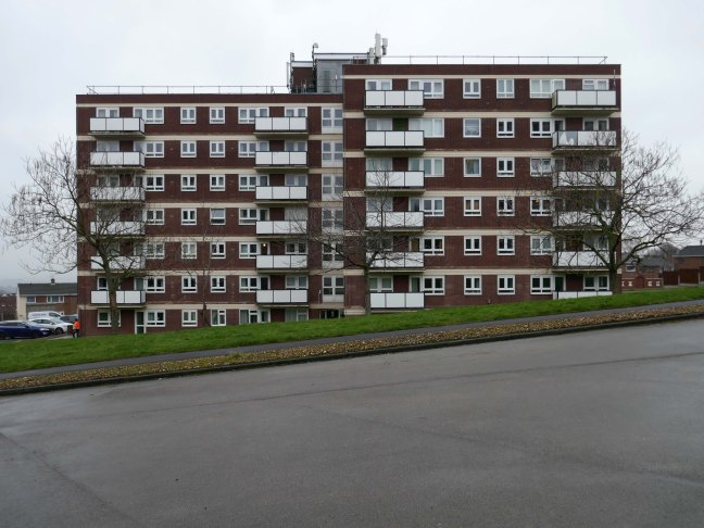
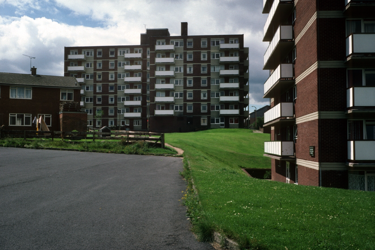
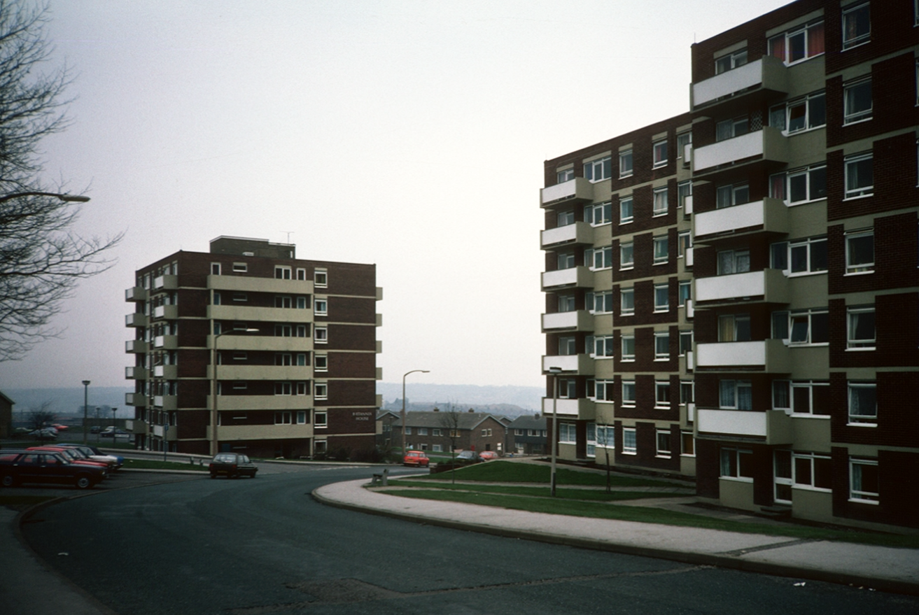
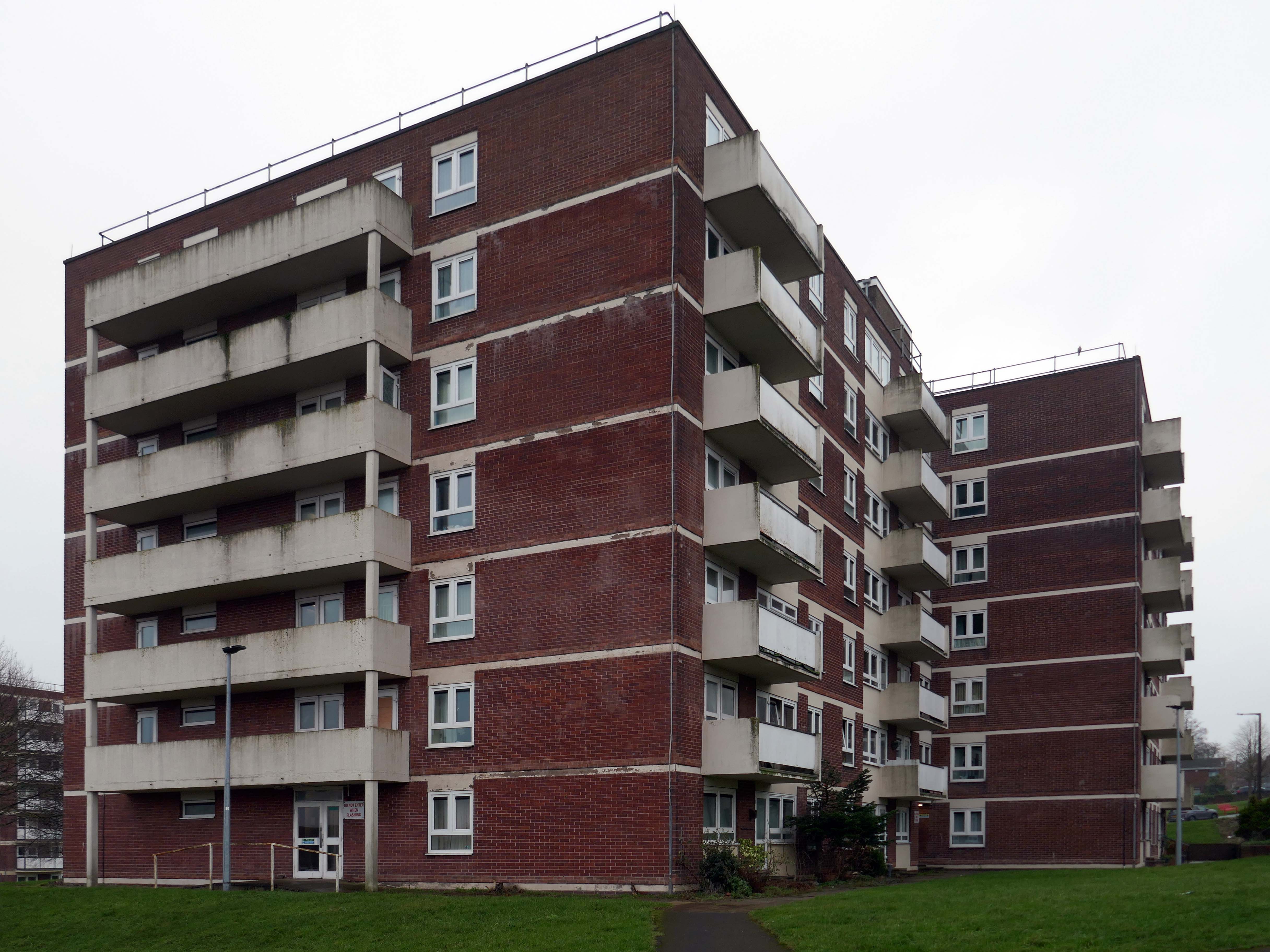
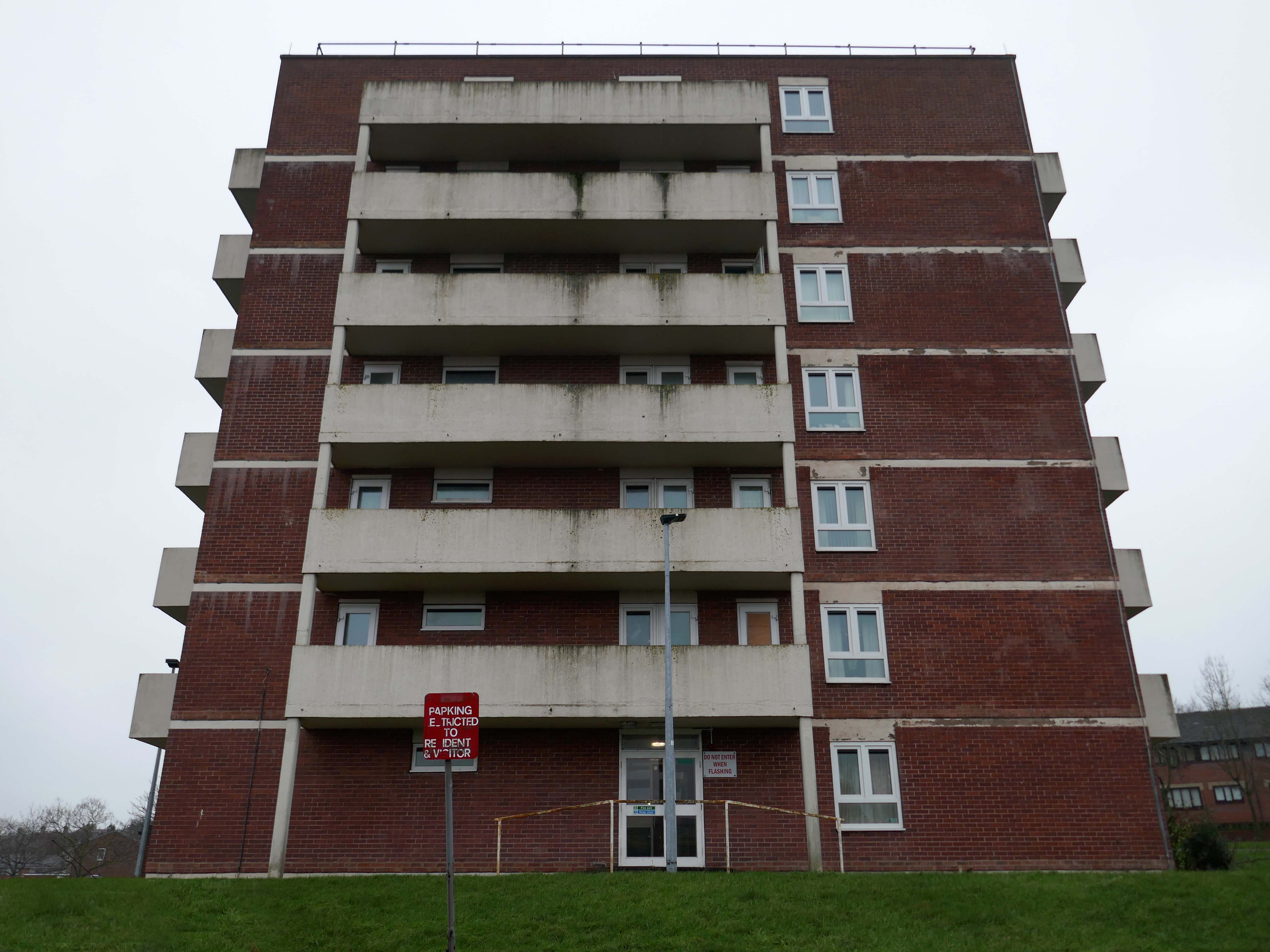
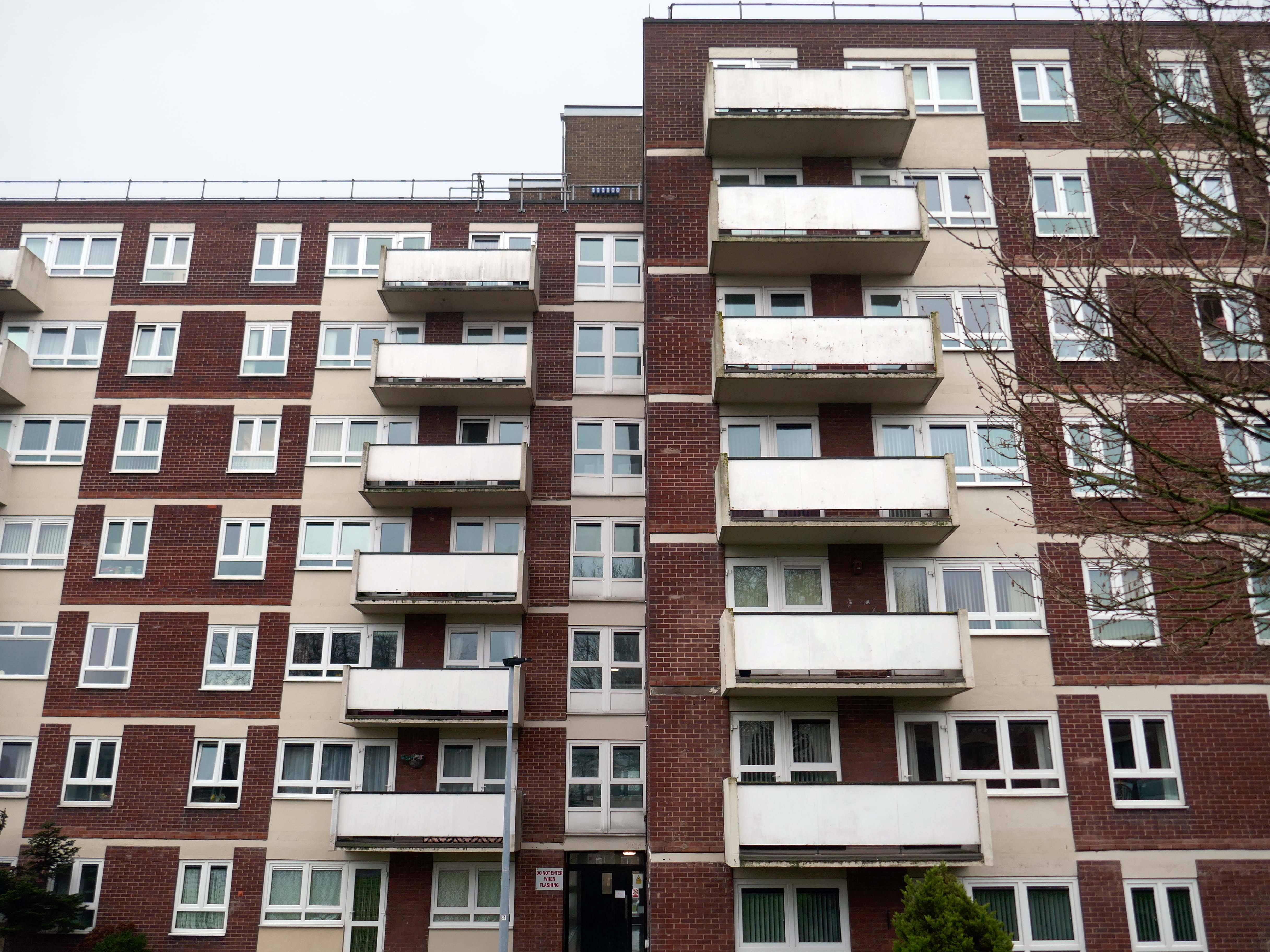
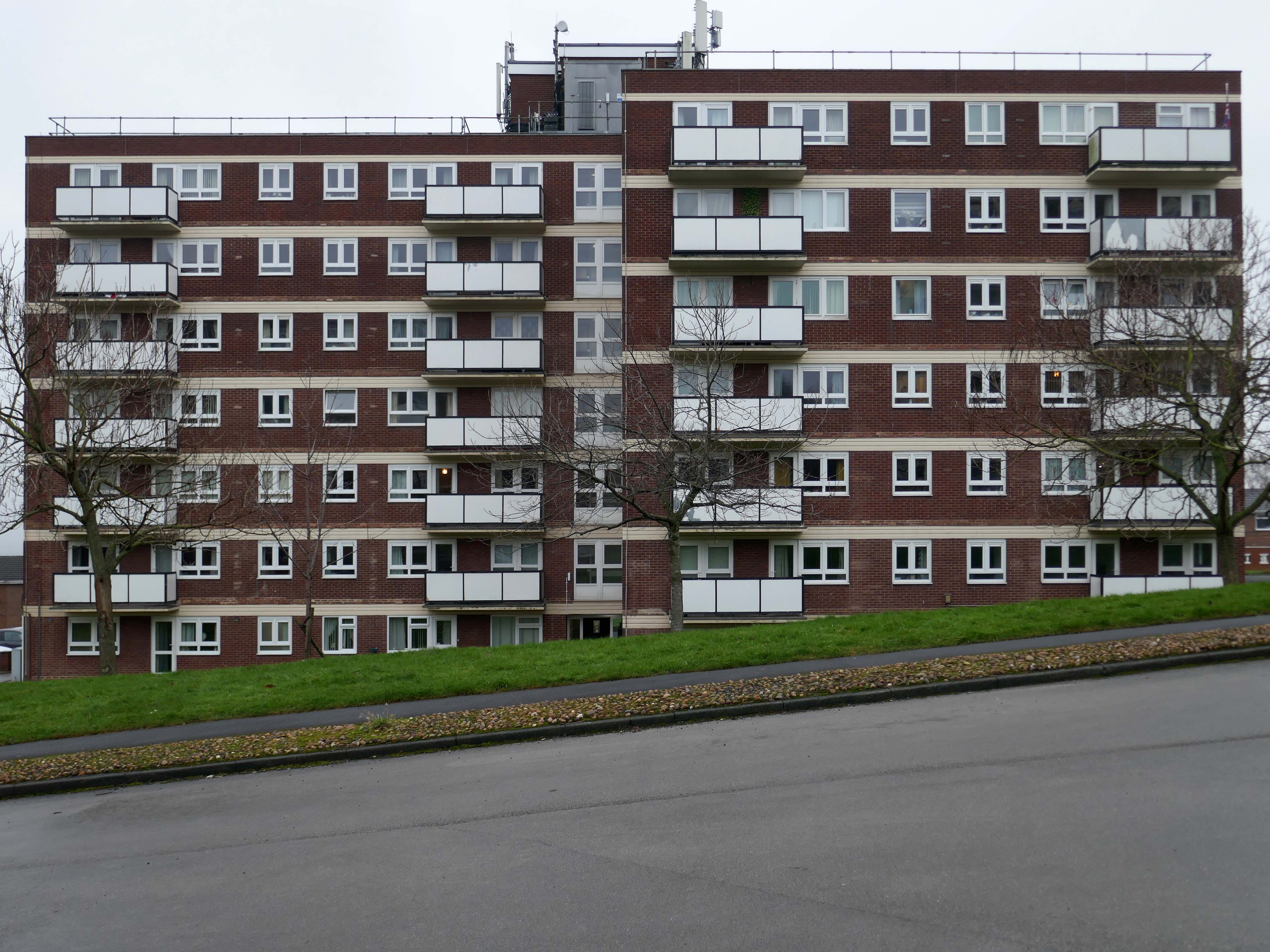
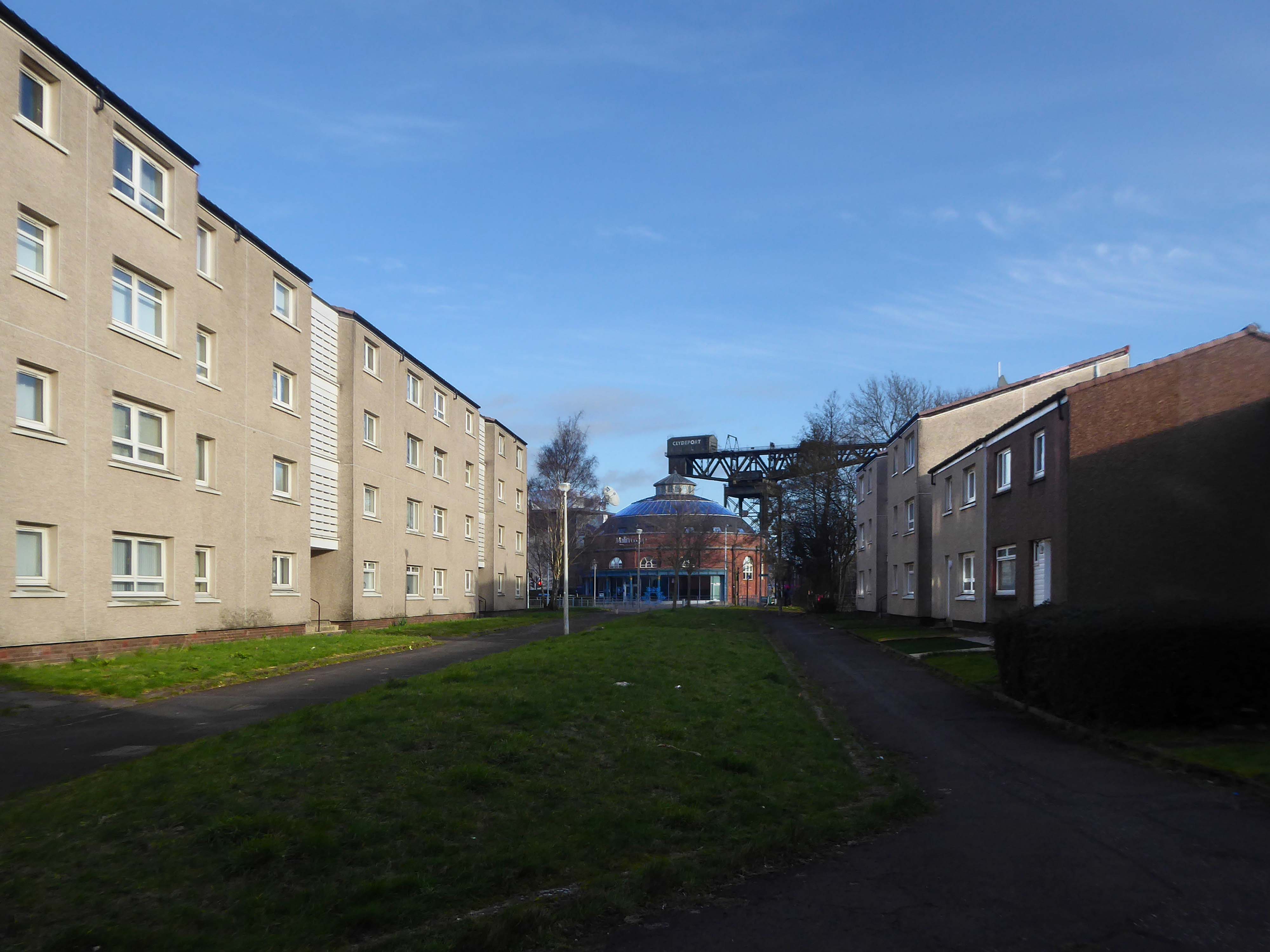
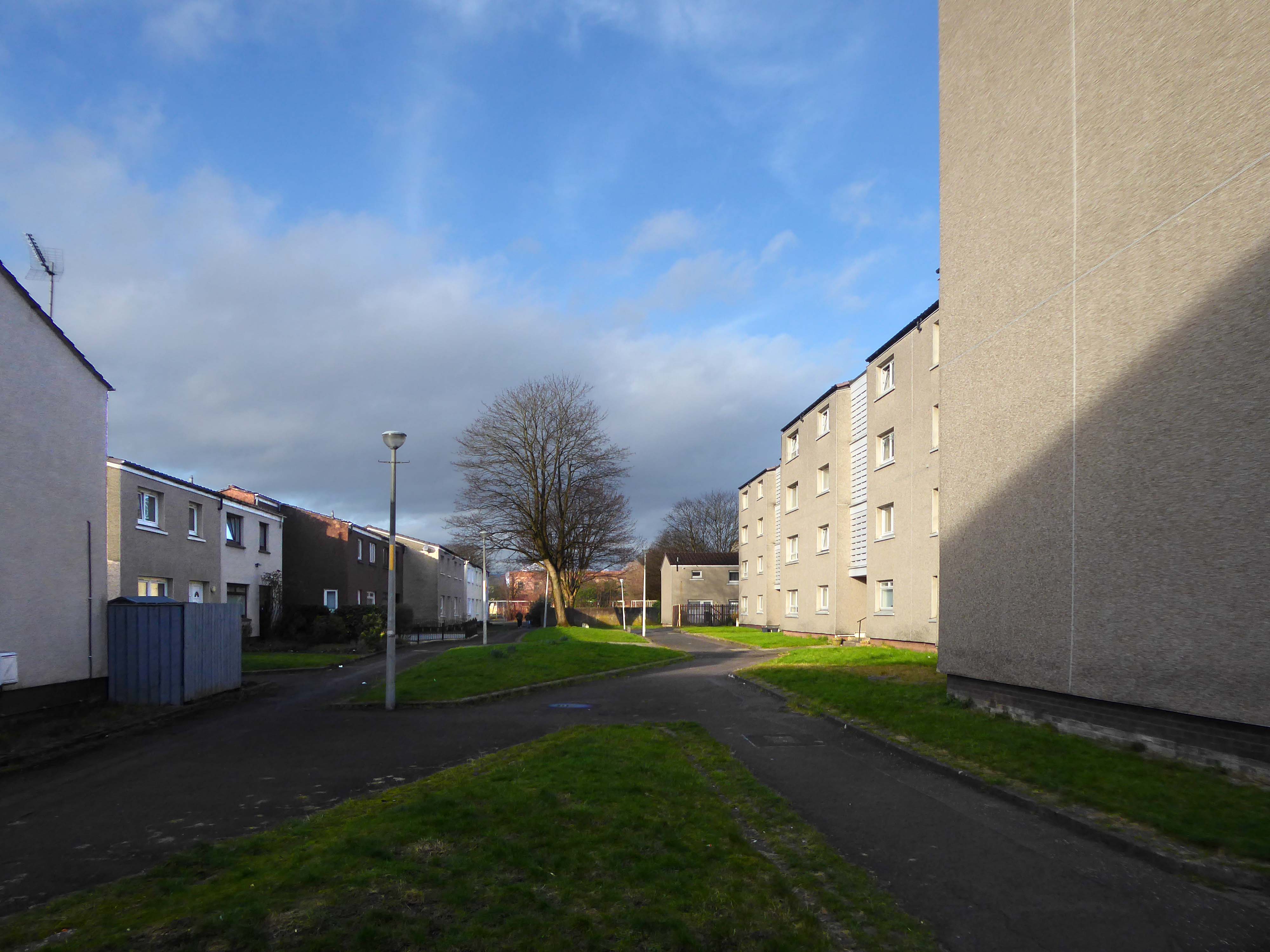
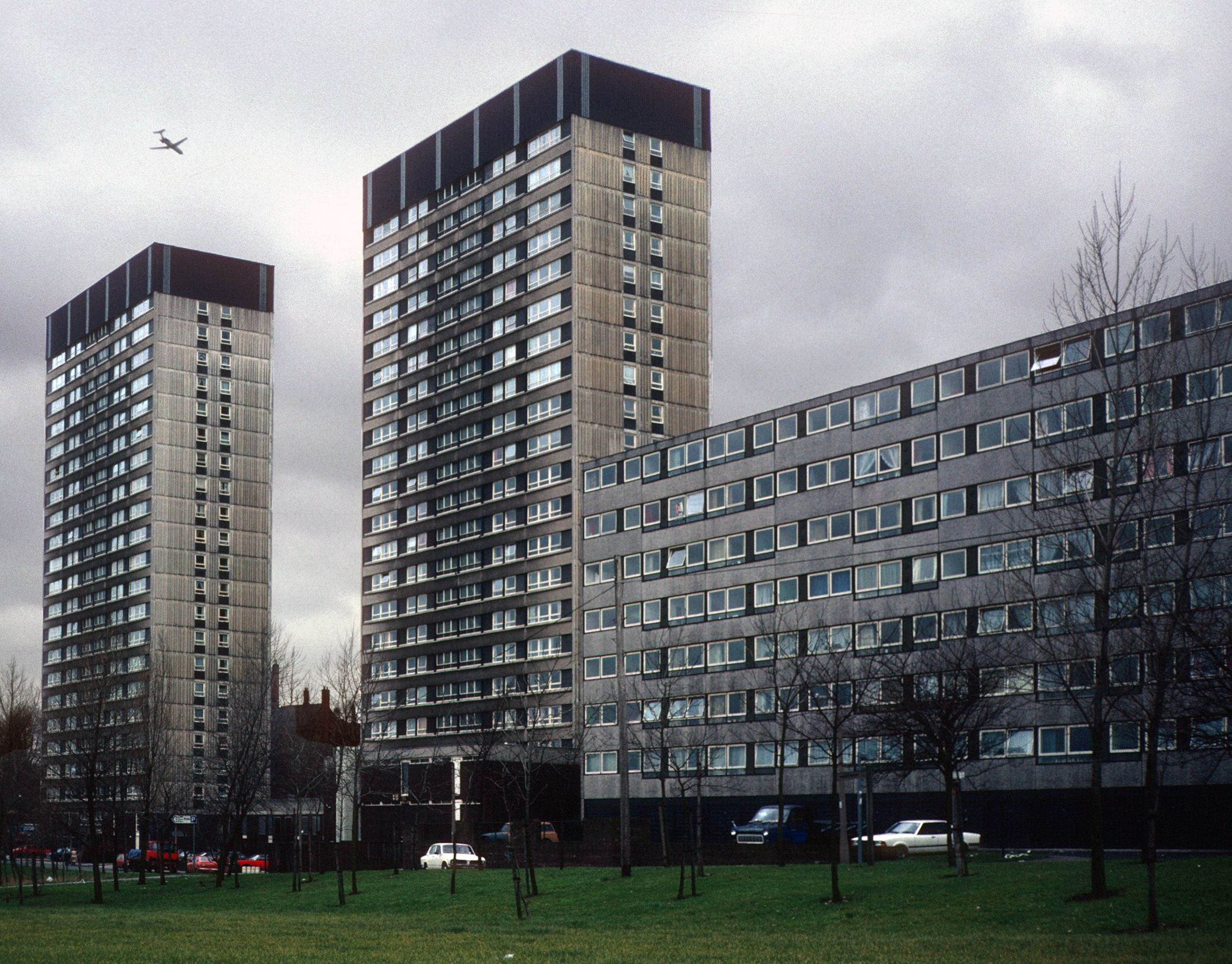
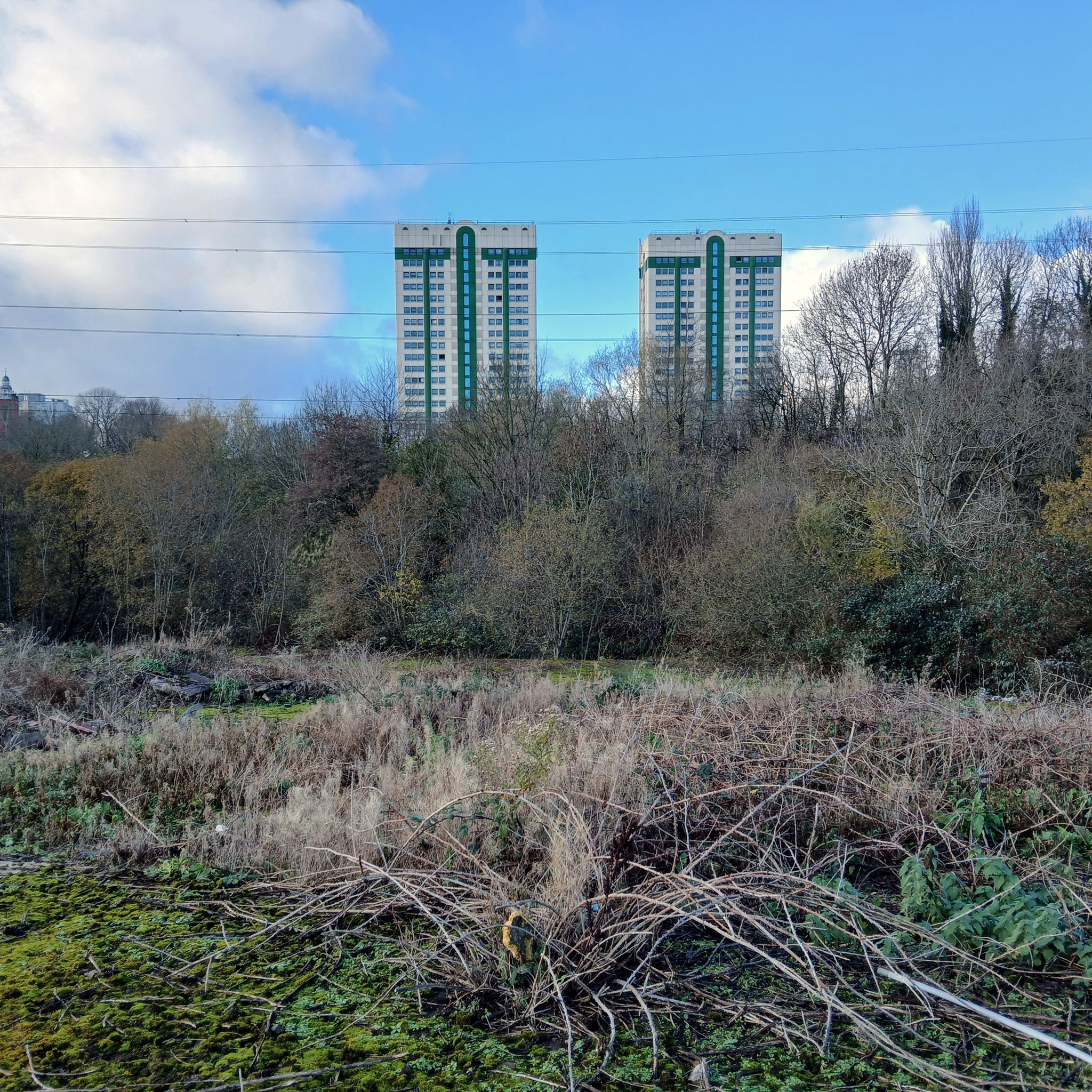
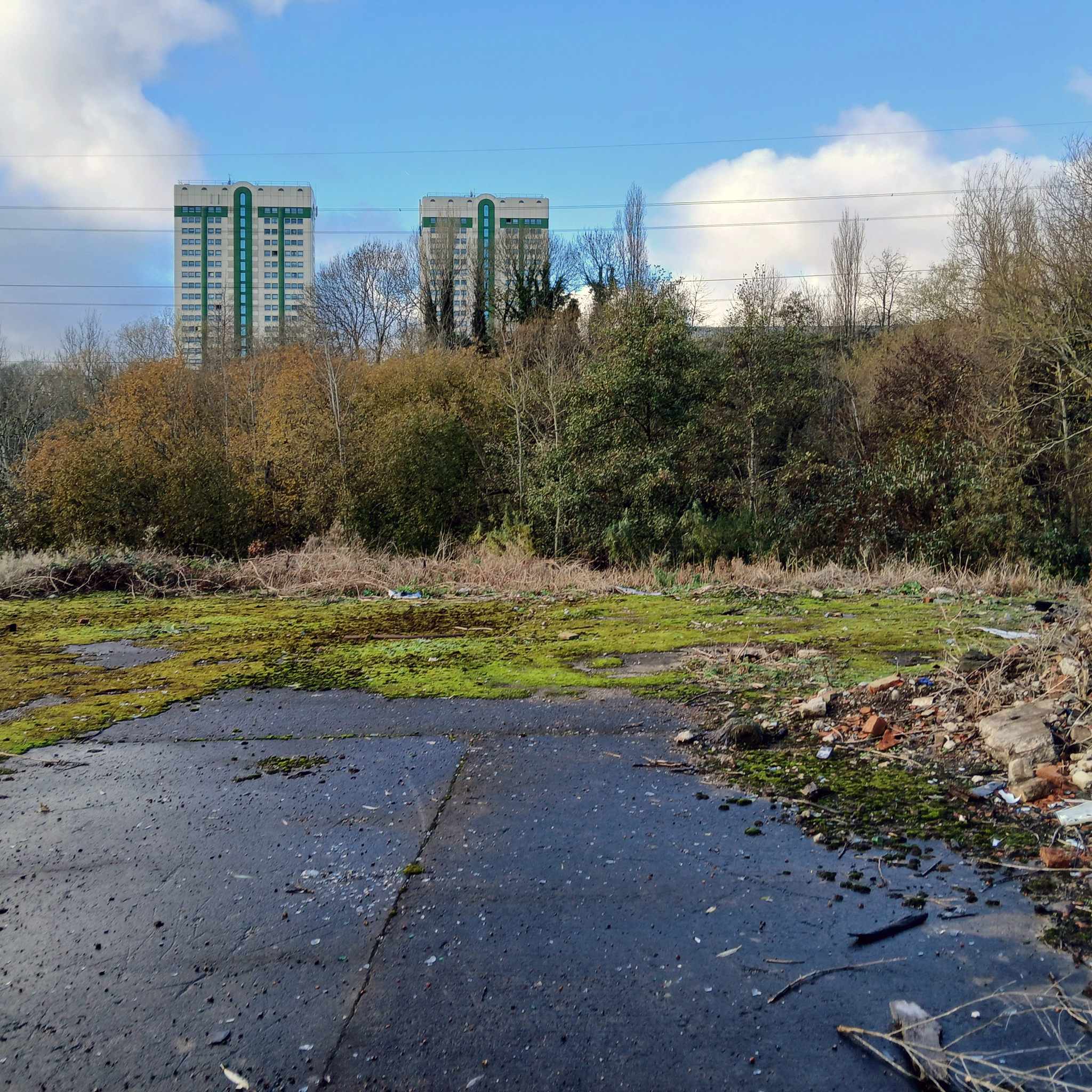
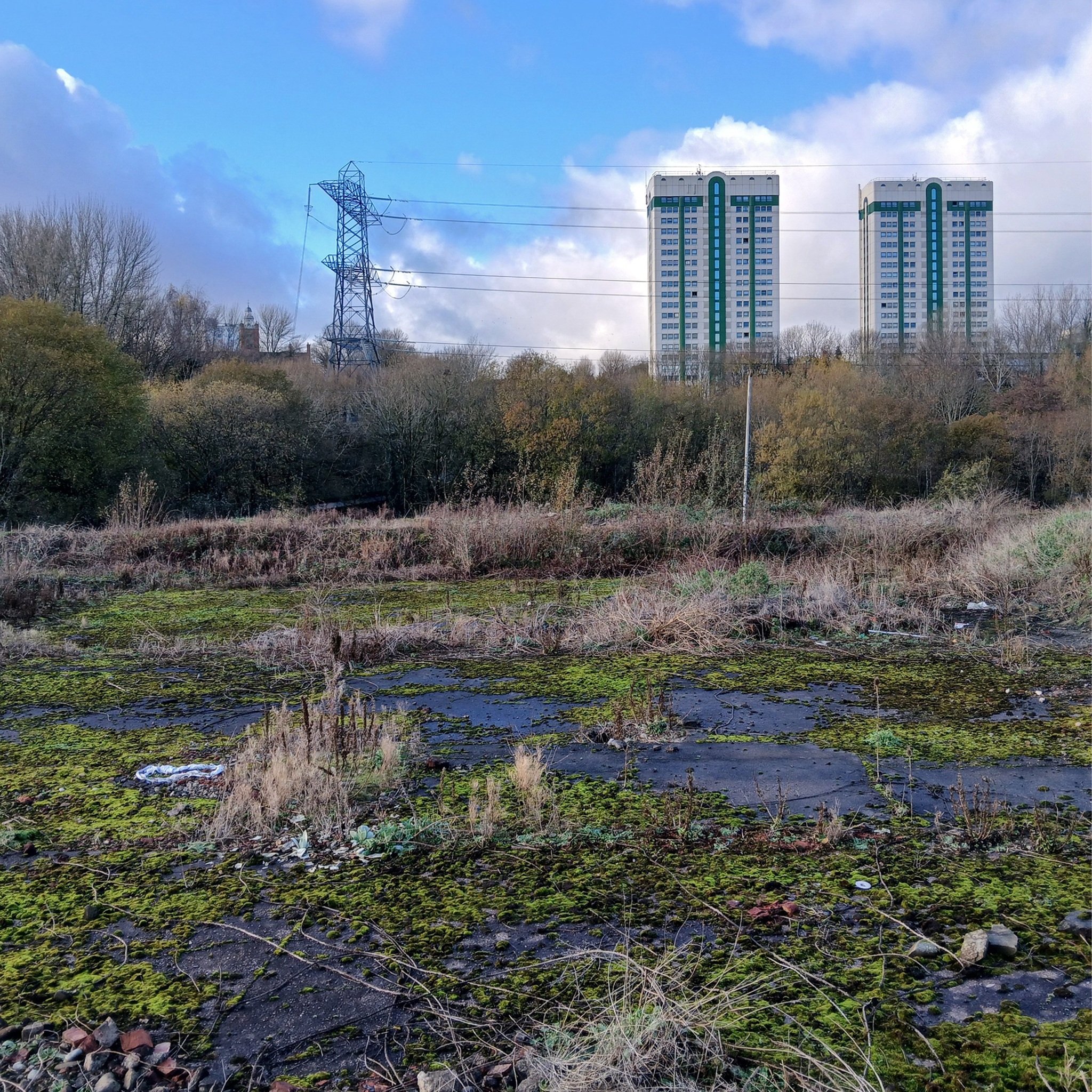
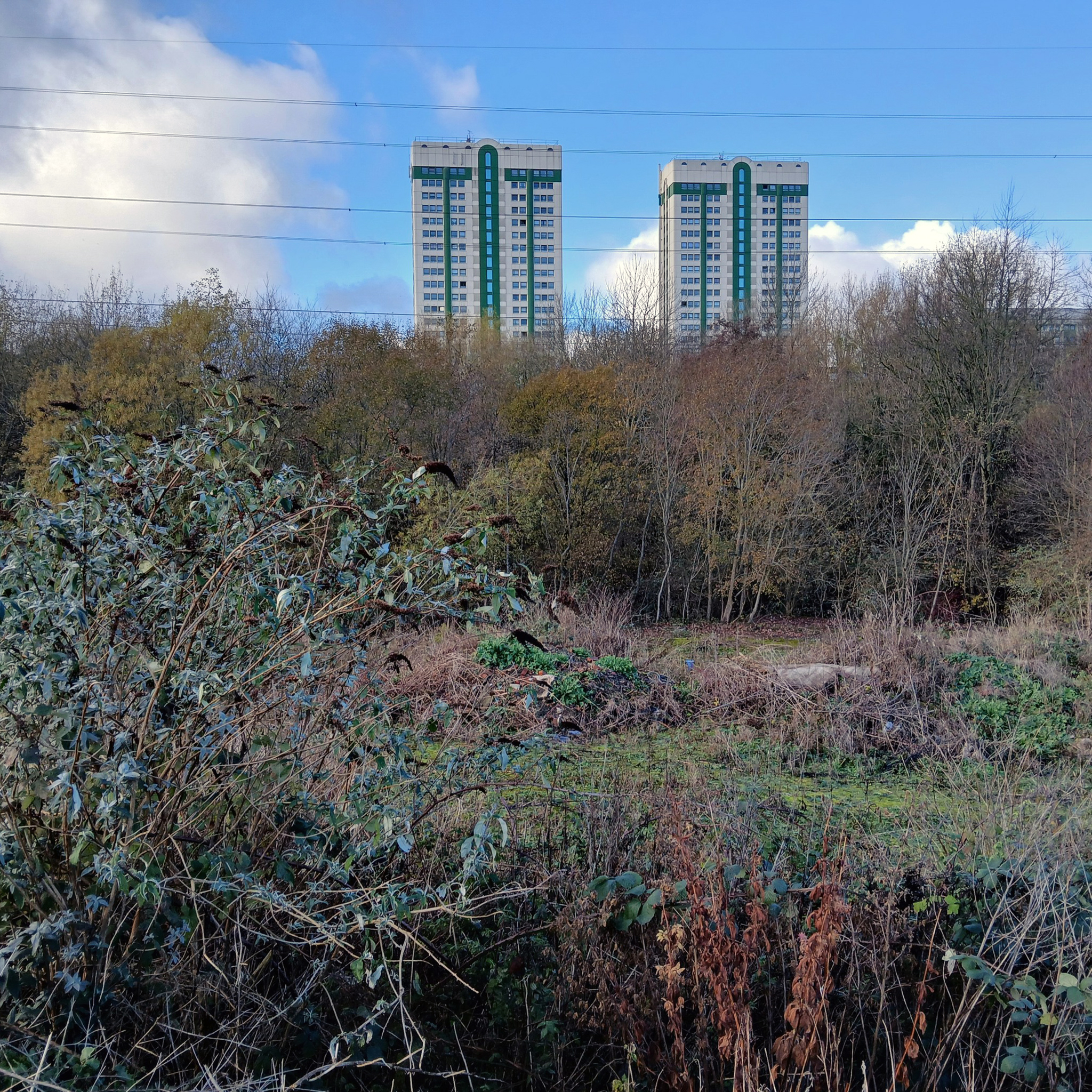
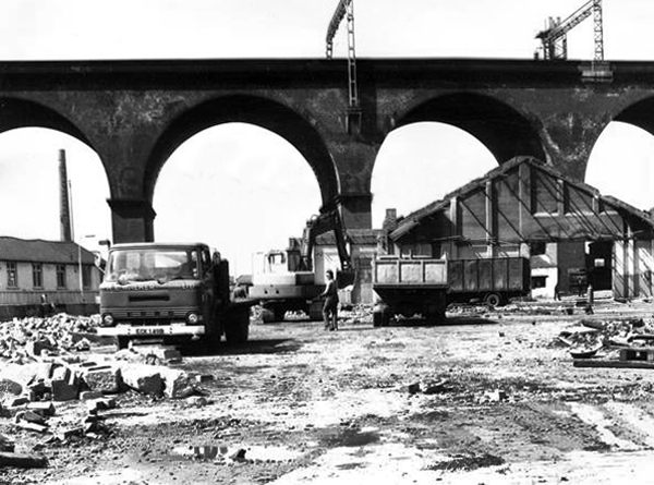
In the 1960s, most of the original housing was demolished including the historic Loudoun Square, the original heart of Butetown. In its place was a typical 1960s housing estate of low-rise courts and alleys, and two high-rise blocks of flats.
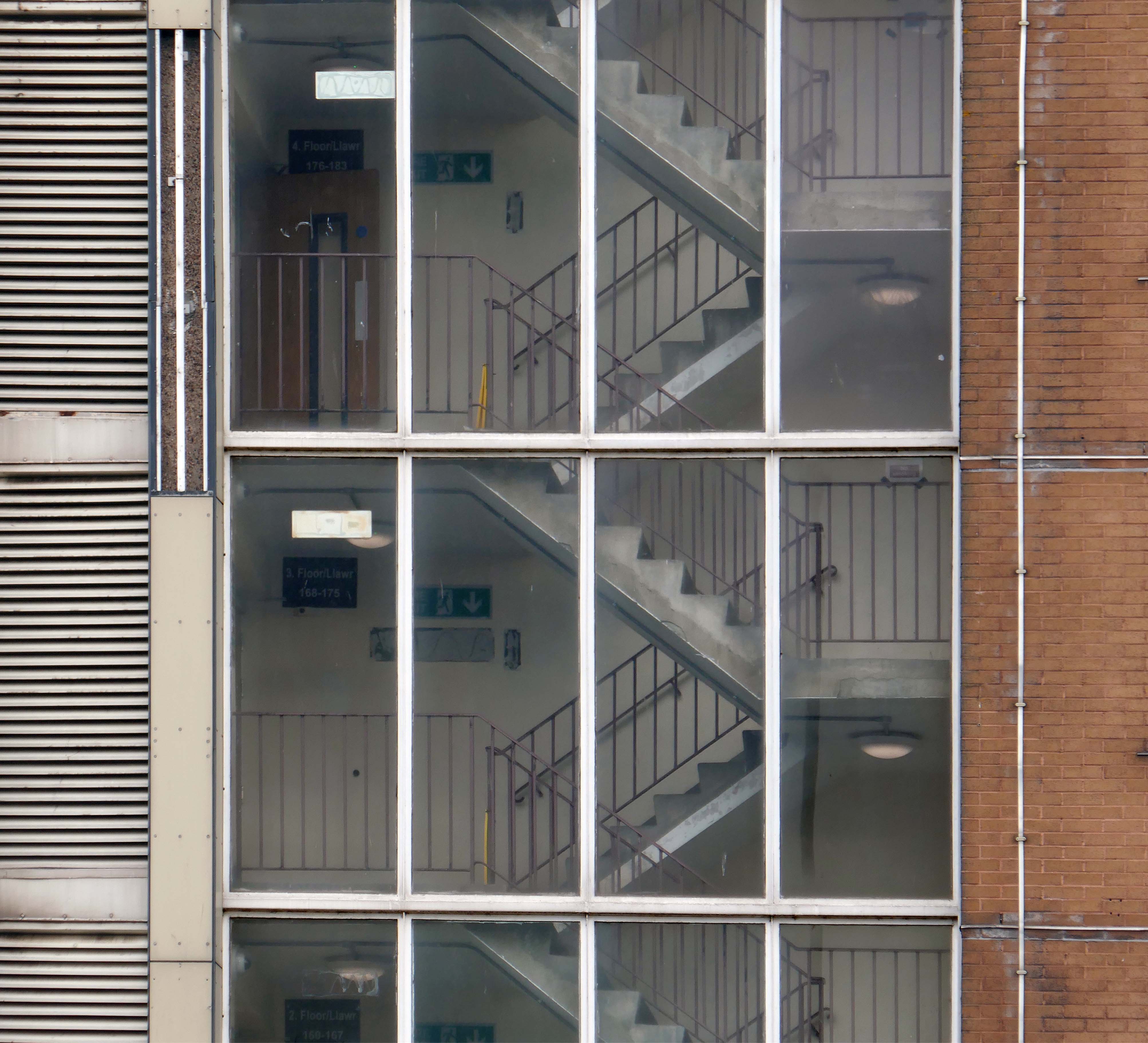
Between 1960 and 1966 two sixteen-storey tower blocks, Loudoun House and Nelson House, were built on the centre of Loudoun Square
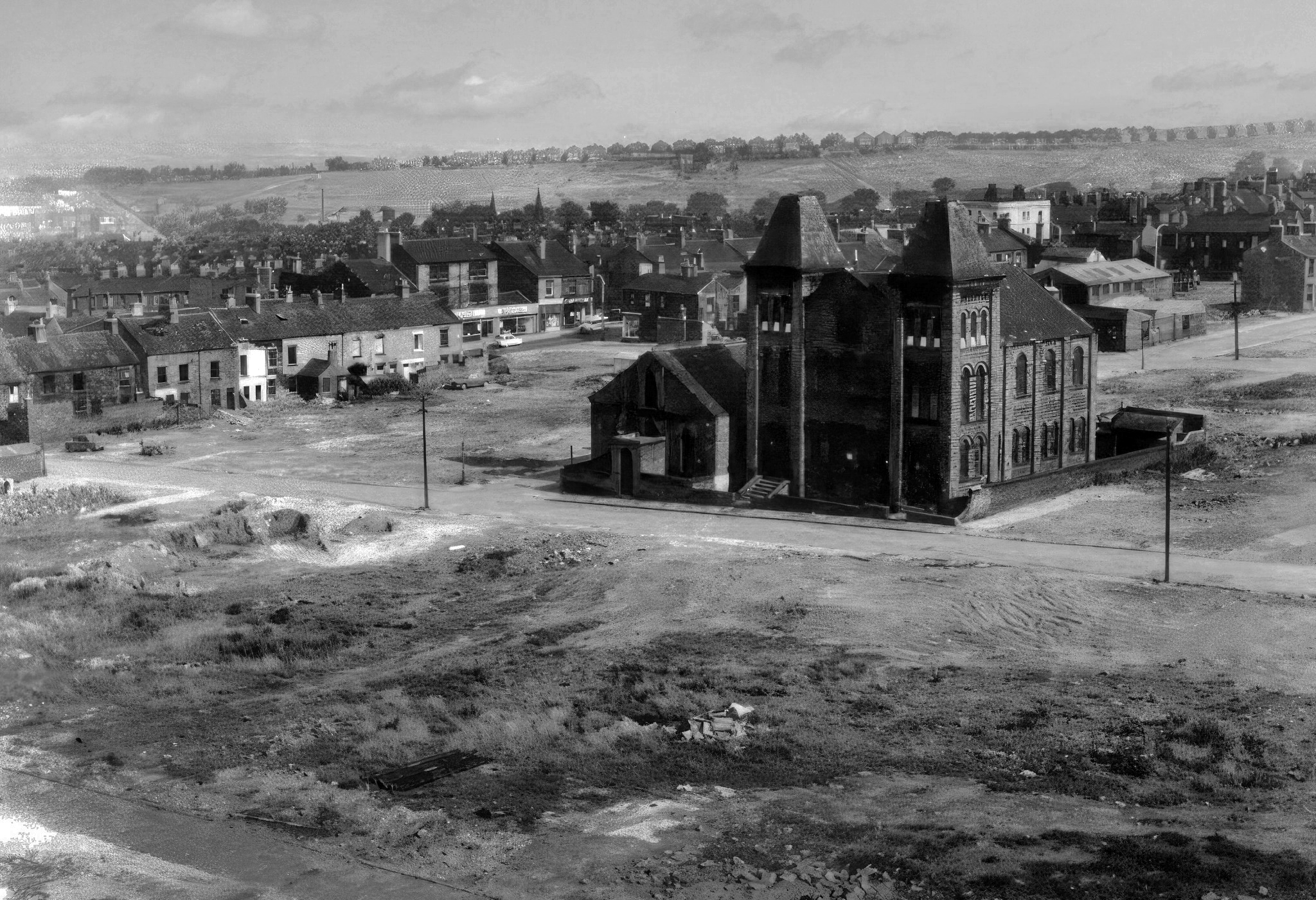
The demolition of the old buildings in Bute Street gets under way in 1963.
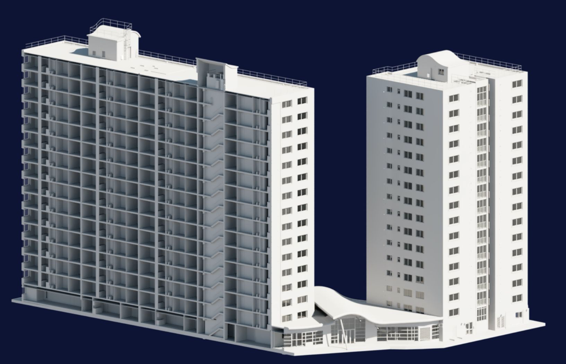
Surveybase have undertaken detailed scanning and modelling prior to the planned post Grenfell re-cladding.
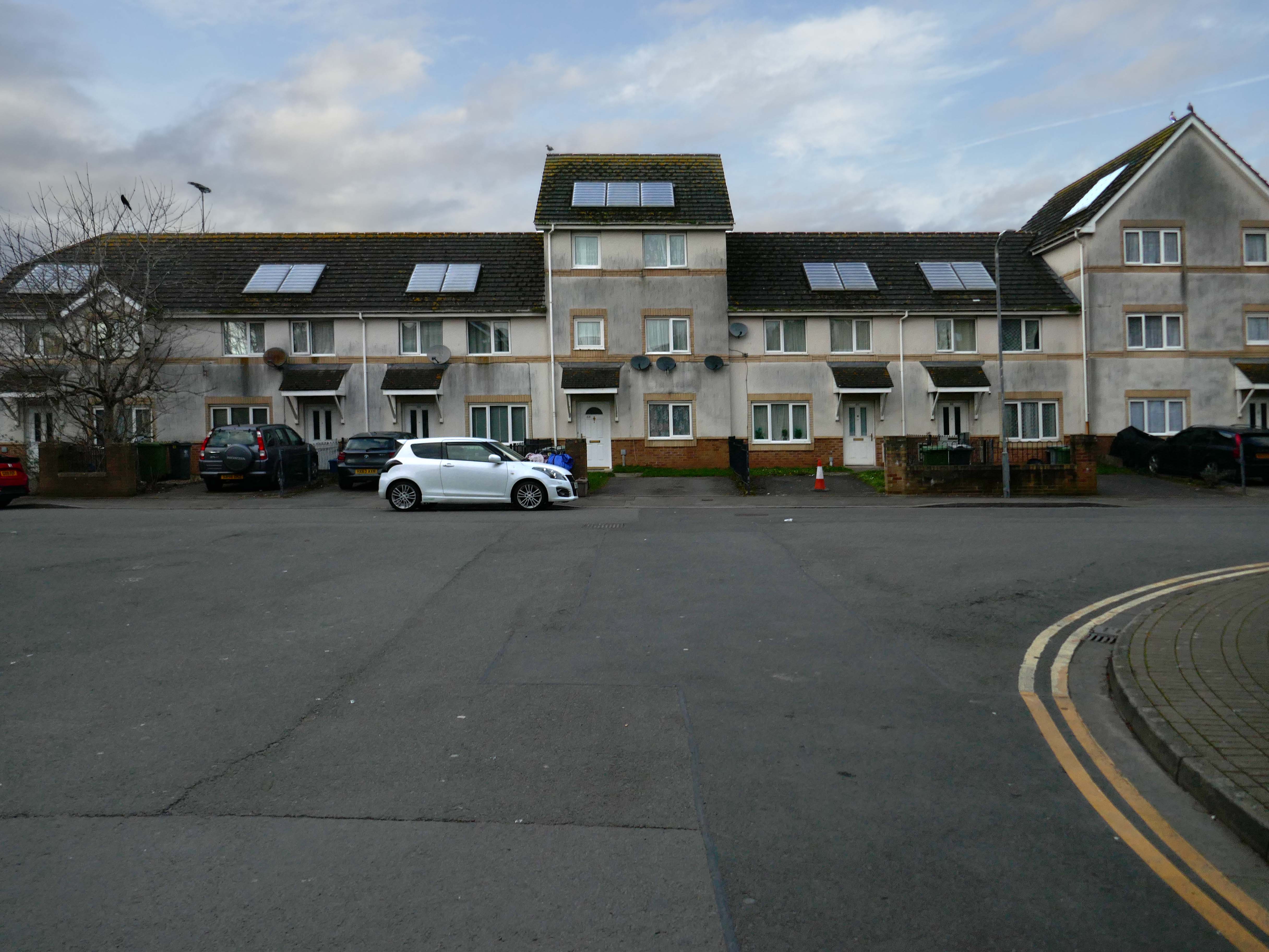
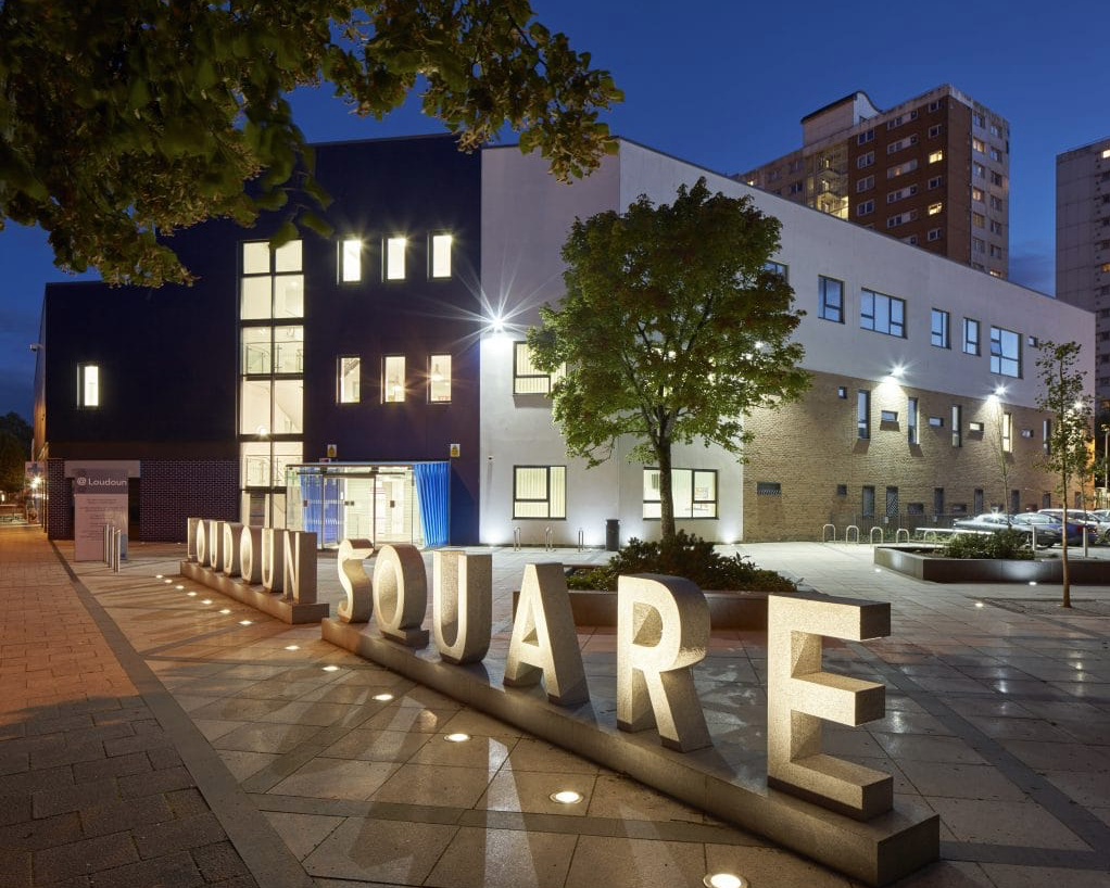
The Loudoun Square regeneration project is a collaboration between Cardiff City Council, Cardiff Community Housing Association, Cardiff Local Health Board and Cardiff and Vale NHS Trust. The site is located between Cardiff City Centre and Cardiff Bay, and was previously occupied by an existing health centre and local shops, together with a vacant area of land.
The area has been regenerated with the creation of new modern facilities to serve the local community and include a new health centre, shops, affordable homes and community facilities.
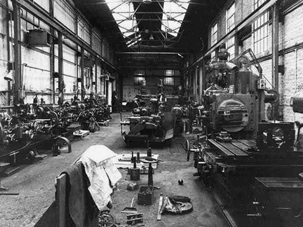
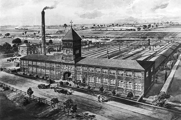
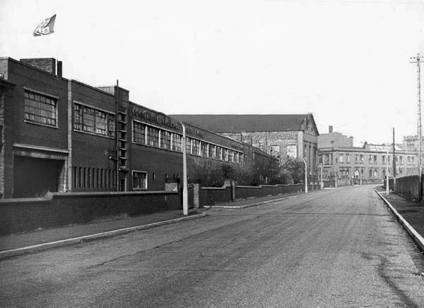
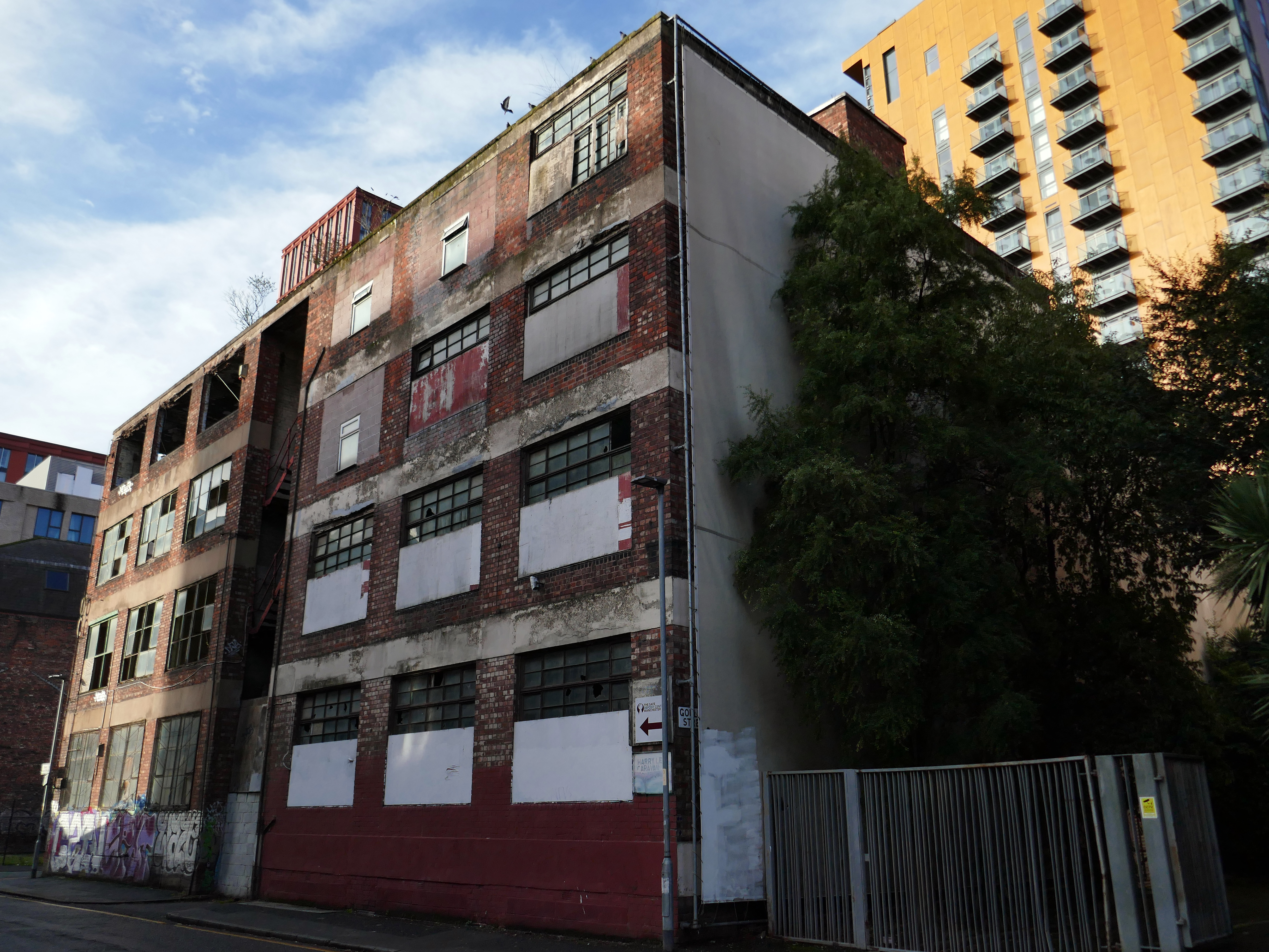
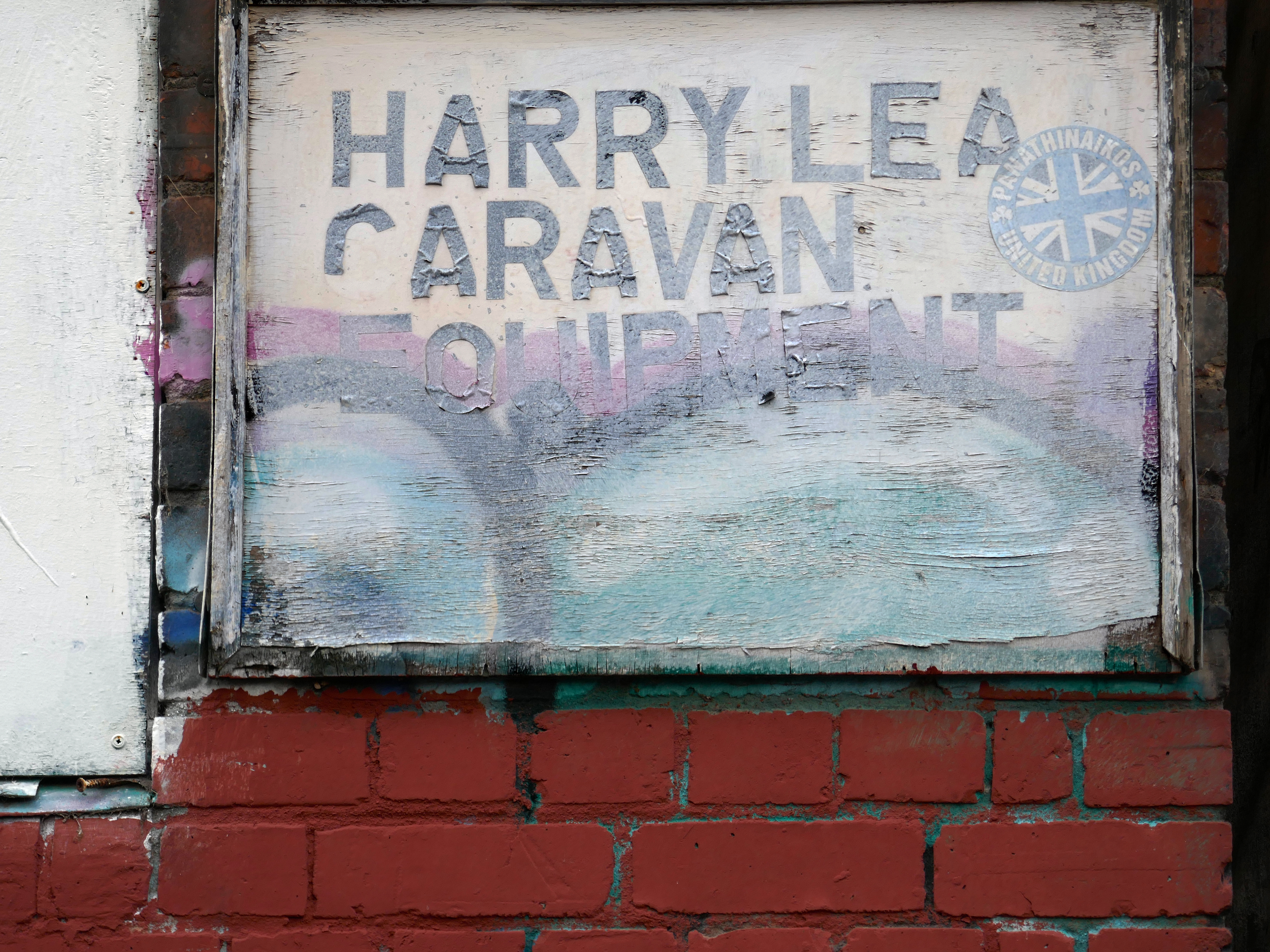
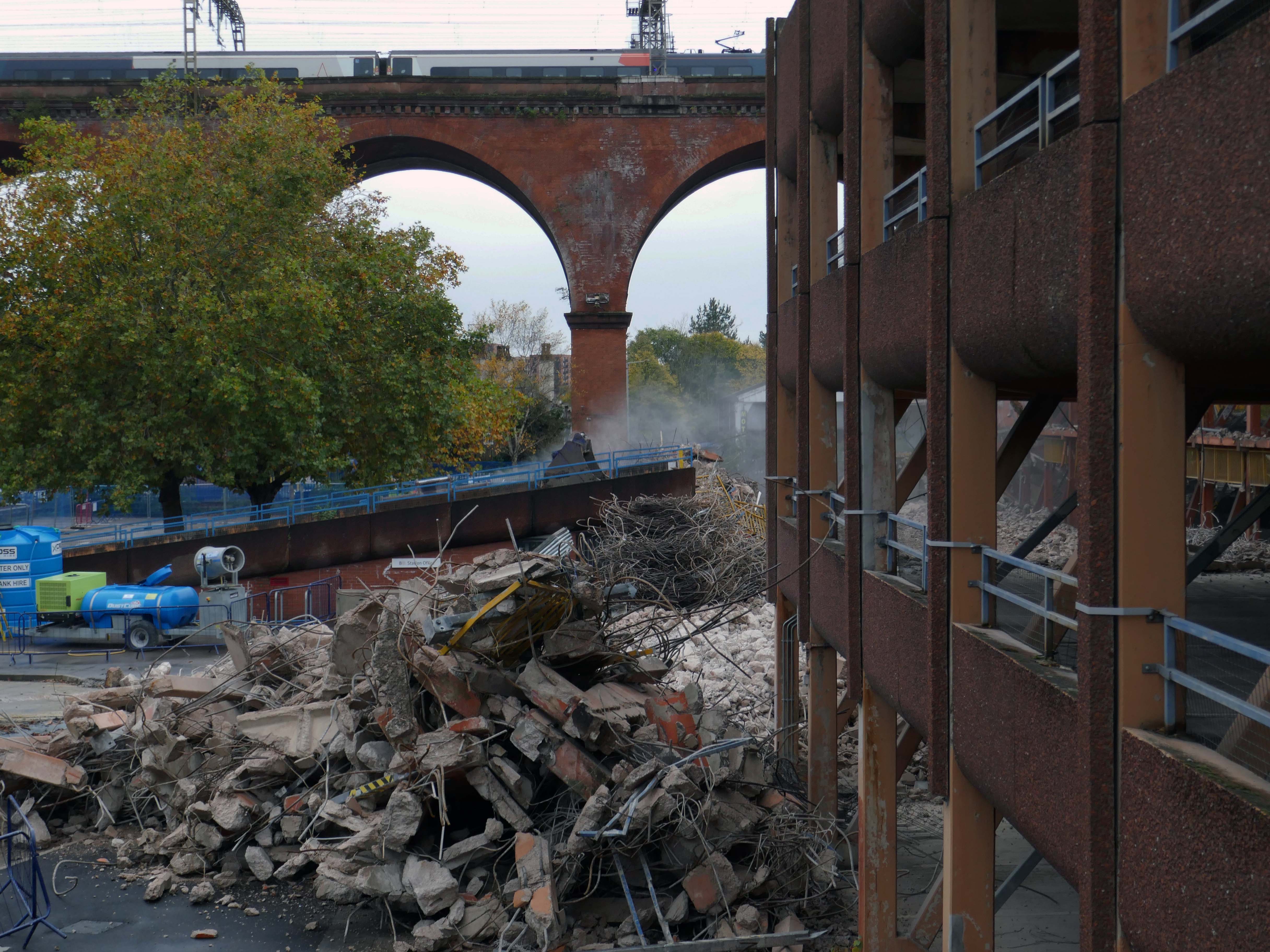
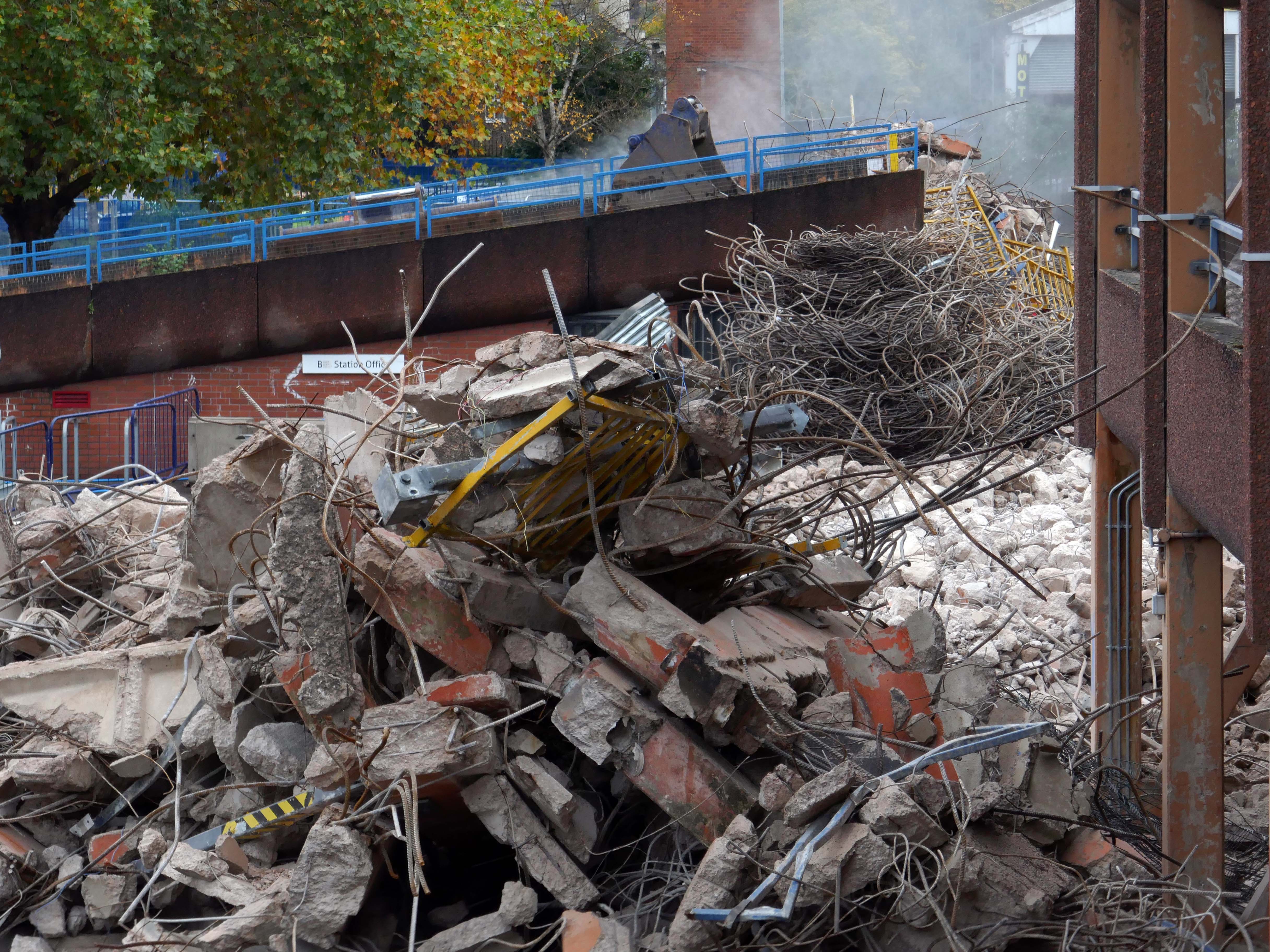
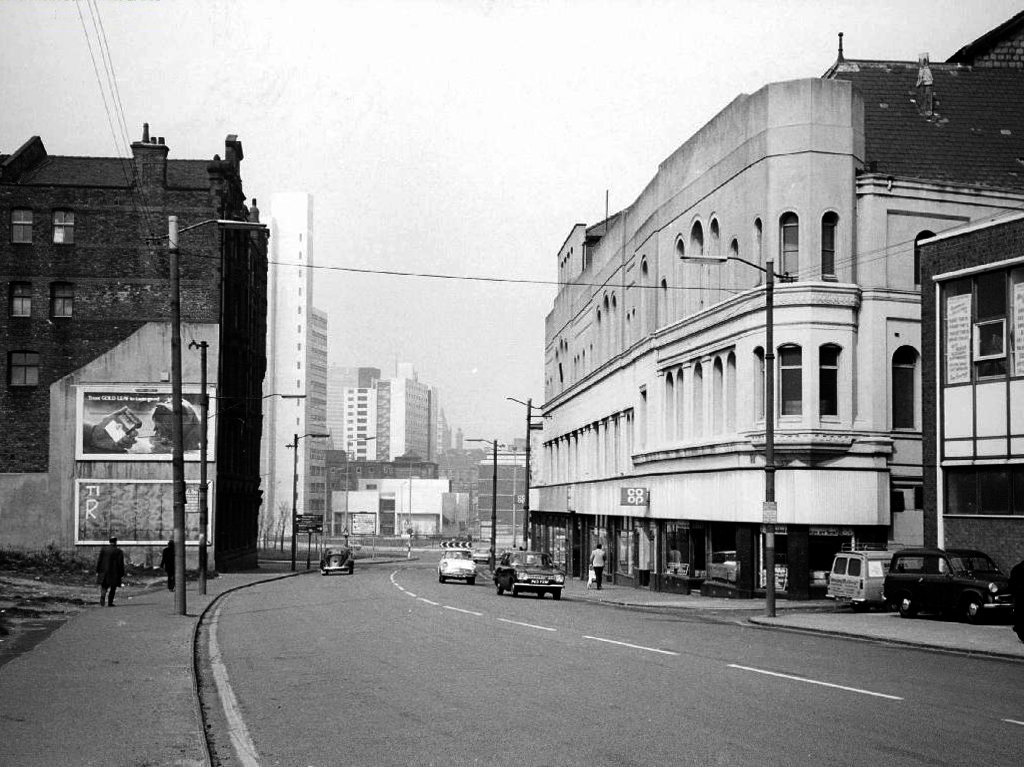
Manchester Guardian Printing Works owned by Taylor Garnett & Evans & Co. Ltd- a view of factory dated 1902.
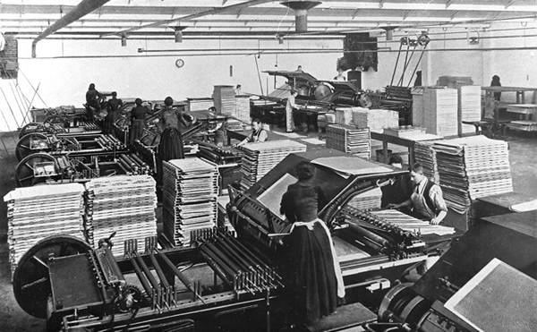
Lithographic Printing Dept 1902.
CWS Printing Works – formerly the Guardian Print Works showing a view from the road dated 1972.
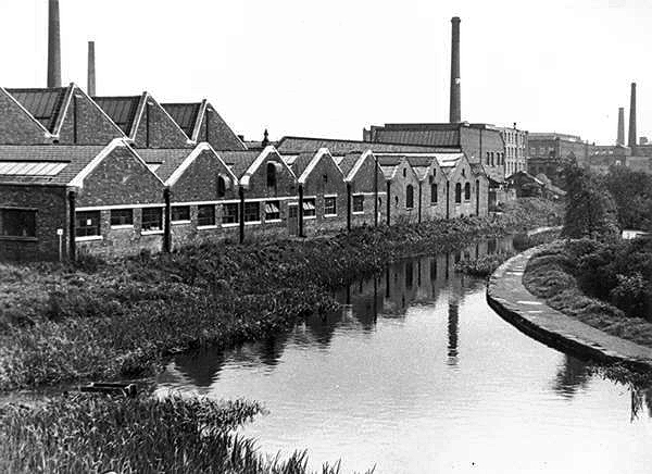
CWS Printing Works showing a rear view with canal in the foreground.
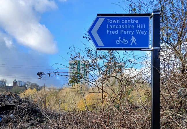
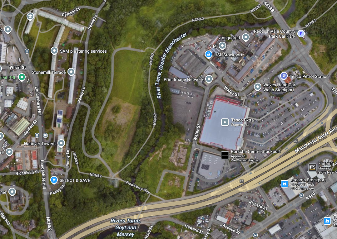
The Stockport Branch Canal was a five mile branch of the Ashton Canal from Clayton to Stockport.
An important cargo was the supply of grain to William Nelstrop & Company’s Albion Corn Mill at Stockport Basin.
In its early days there was passenger carrying on the Ashton Canal and one of the routes was between Manchester and Stockport.
Commercial carrying ceased in the 1930s but it lingered on into the 1950s’ as a barely navigable waterway. At one stage in the 1950s it was dredged but this improvement did not attract any traffic. Stockport Basin was the first section to be filled in but it was not until 1962 that the canal was officially abandoned by the British Transport Commission, who had been responsible for it since 1948.
It took many years to fill in and this was a disagreeable procedure for people living along its length.
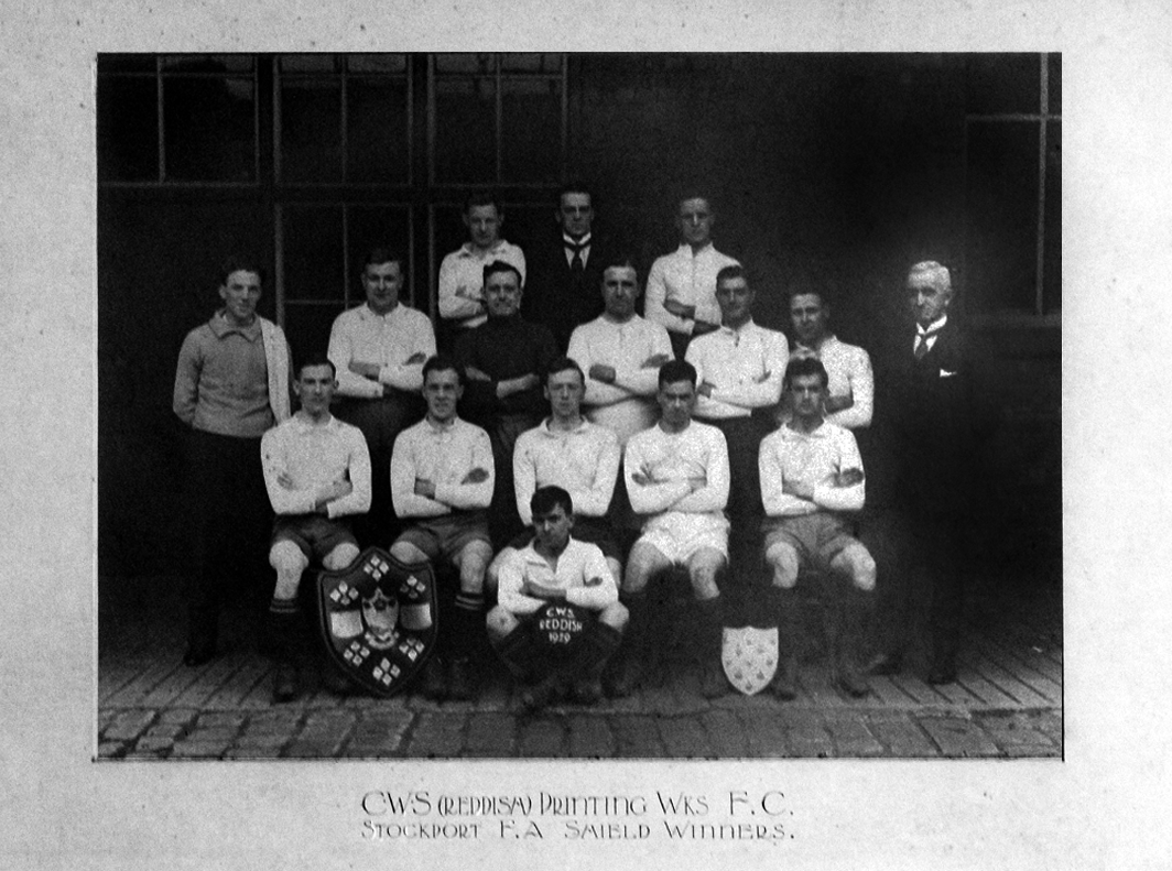
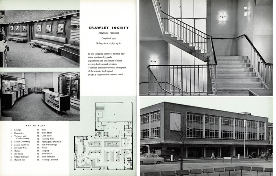
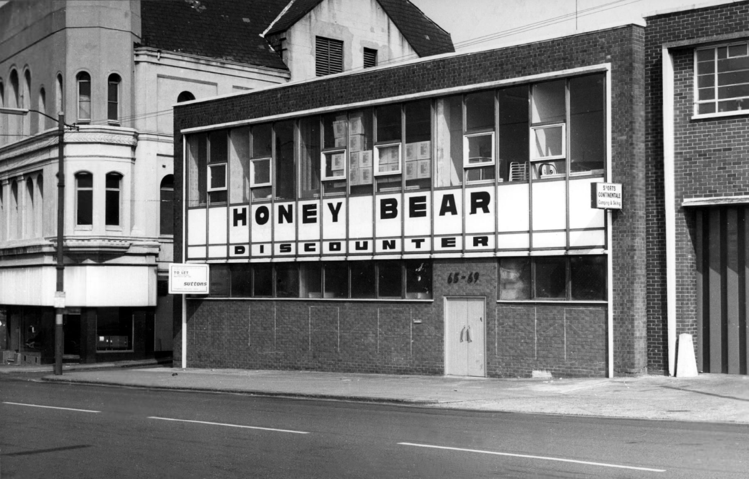
From a very lavish production, printed of course by the CWS’s own Printing Works at Reddish, is a description of the new flagship department store for the Crawley Co-operative Society that was opened in 1959. The elevations and facade are very much of their day, quite ‘Festival of Britain in style, and the store was a prominent feature of the planned New Town’s centre.
The wide variety of printed material which the CWS required, created a need that could not be met locally by a single source, another large print works was required in Longsight.
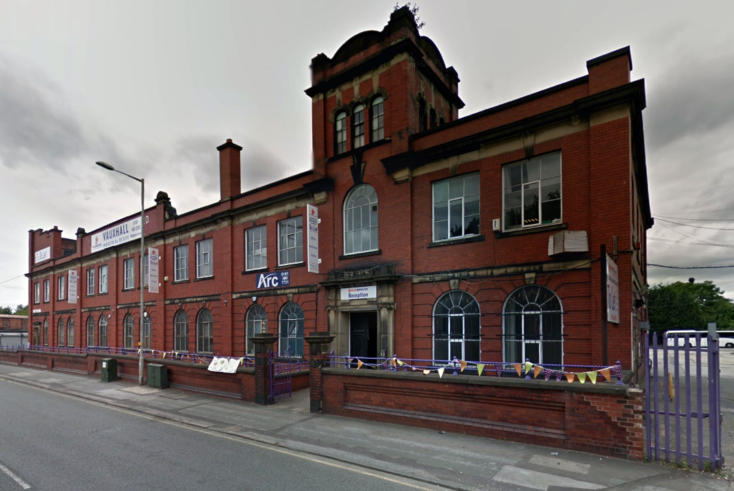
Craven Brothers Works 2008
1900 – Further growth prompted the construction of the Vauxhall Works at Reddish, near Stockport. The company kept the works at Osborne Street, Rochdale Road, with about 500 employees, open until 1920. The 1915 O.S. map shows Vauxhall Engineering Works with its south-east corner on Osborne Street, Collyhurst, and bounded on the north by streets of terraced houses and to the south by the L&YR Manchester-Normanton line.
The Developement of Reddish – quite a number of Manchester firms are prospecting the neighbourhood of Reddish, writes a correspondent, while Messrs. Heywood are about to erect electrical engineering works in Sandfold-lane, and Messrs. Rowley and Co, boiler-makers, are fitting works in the neighbourhood. Messrs. Craven Brothers, engineers, of Salford, have purchased 14-acres of land near the Reddish Station, on the estate of Mr. H. P. Greg, on which they intend to erect large engineering works.
The first sod was cut on Thursday afternoon by Mr. William Craven, in the presence of his brother directors in 1900.
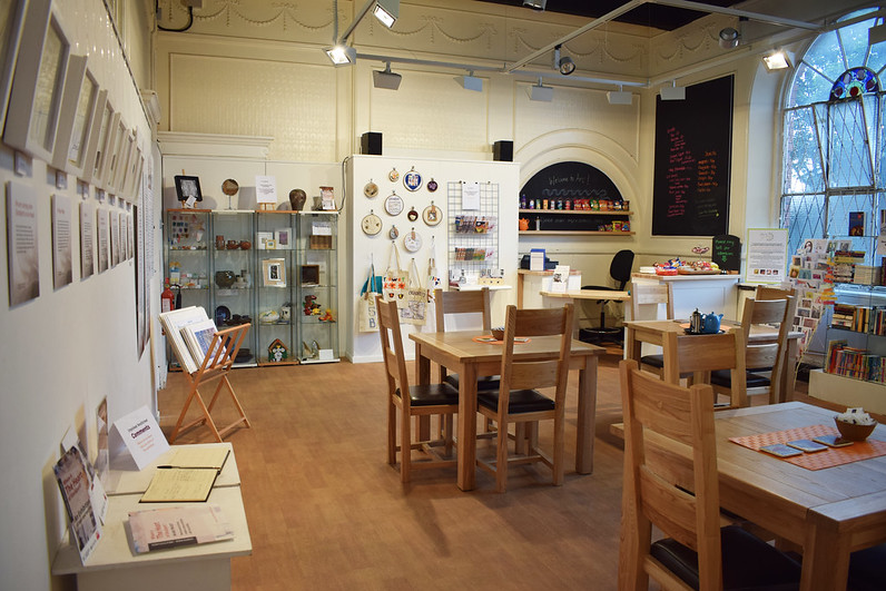
ARC began in 1995 at Greek Street, Stockport under the name of MAPS and moved to the Vauxhall Industrial Estate Craven Works building in early 1997. Arts for Recovery in the Community or ‘Arc’ was then launched in 2005. The Arc Centre in its current form, including gallery servung refreshments and public programme has been running since 2016.
Of course, we are sad to say goodbye to the old Craven Brothers factory and the Reddish community as our base. We are so grateful to the local residents and businesses who have supported us for so long. Please, don’t be strangers! We made the building our own over the years and take with us many, many great memories.
Looking to the future at Wellington Mill, we will have exclusive use of several rooms on the floor accessed via the A6 and Hat Works Museum shop. This will include a large art studio, ceramics studio, offices and storage spaces. We will also share the large cafe, events and retail space with the Hat Works museums team and work together to build a bigger audience for both organisations and hopefully a Stockport town centre creative arts hub.
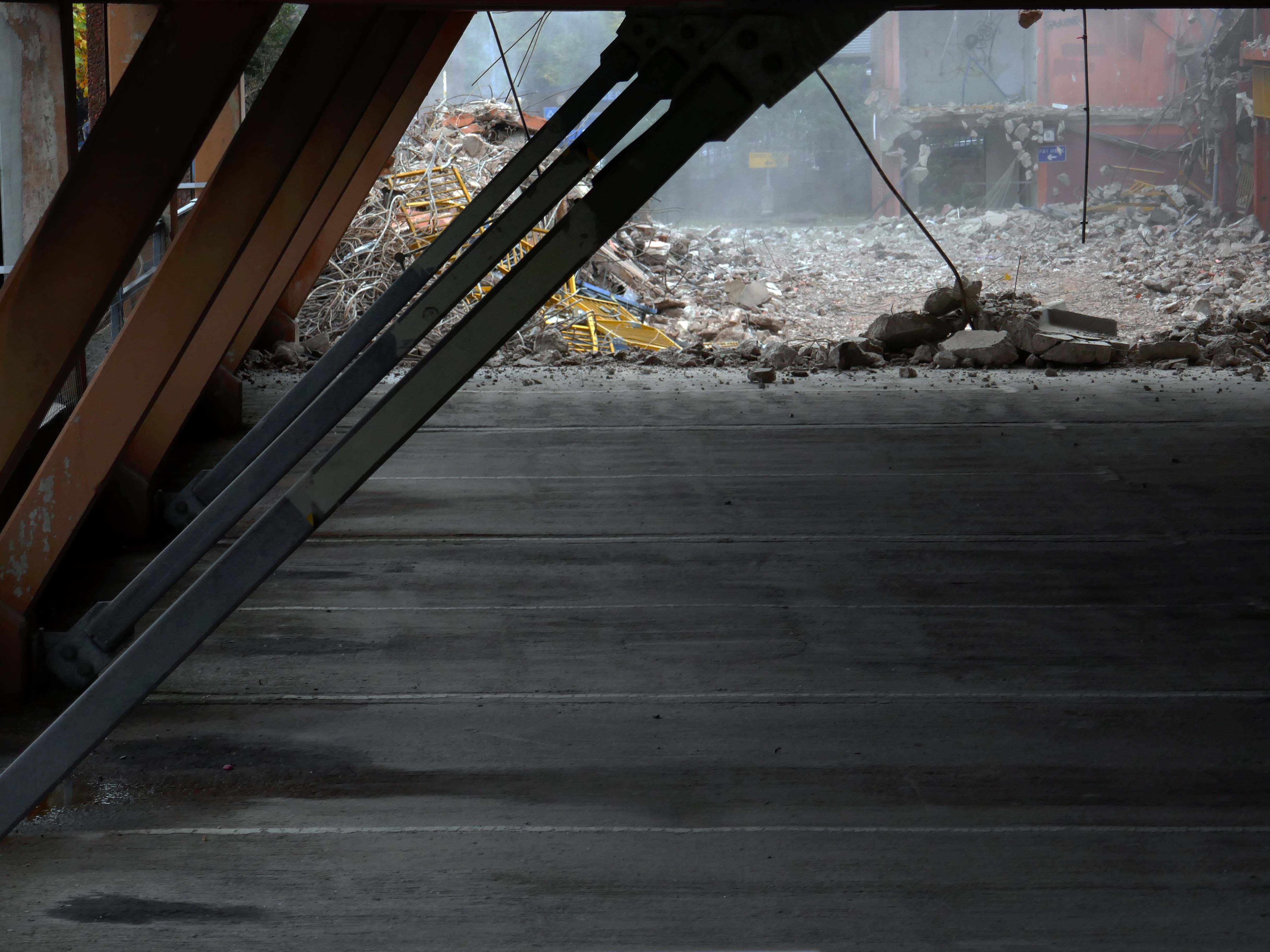
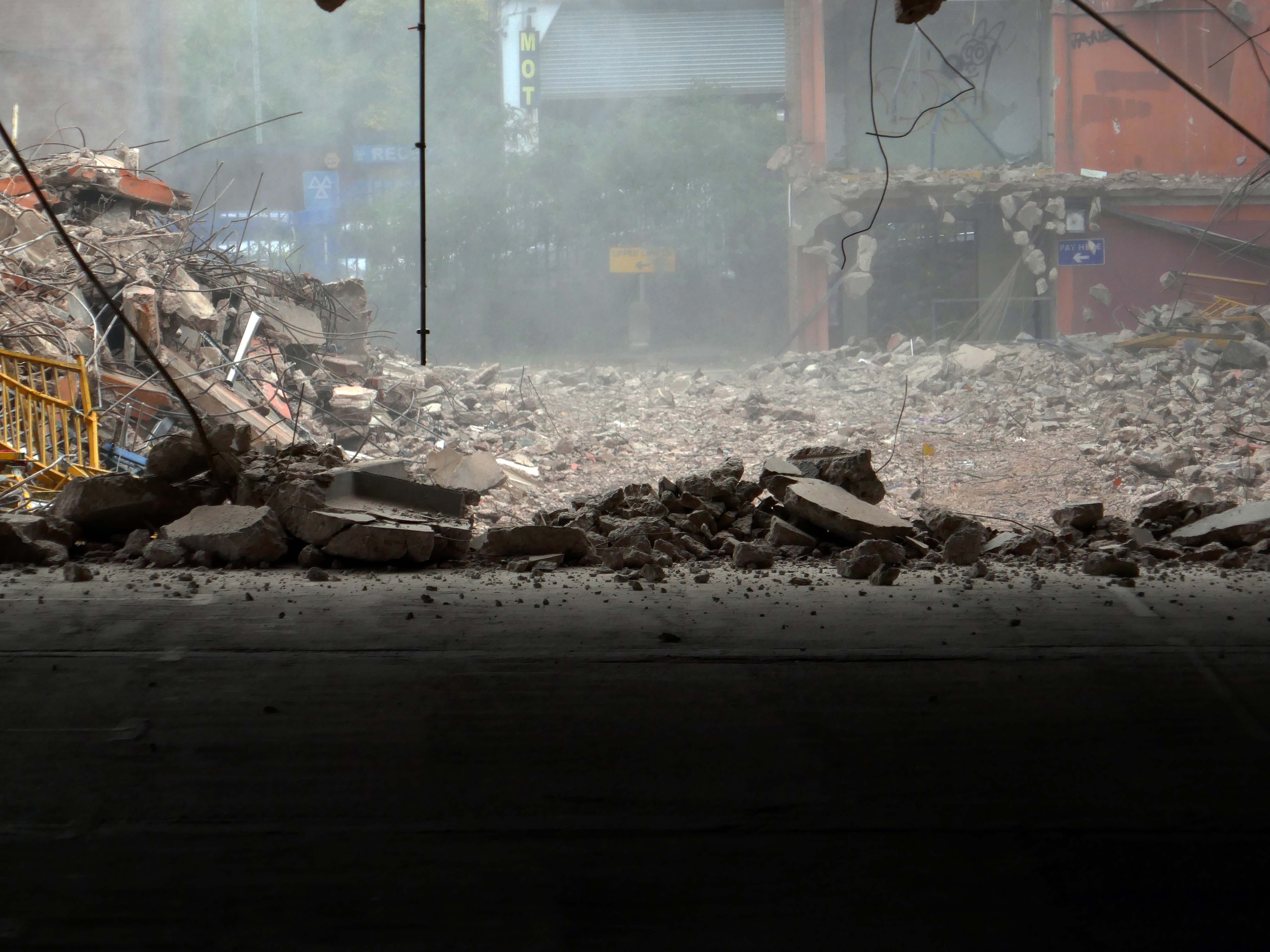
And lo, it came to pass, from the onset of the Industrial Revolution to today, a whole world of work is dismantled. A transport infrastructure is literally filled in, and the former homes of industry demolished.
The CWS is no longer the global behemoth it once was, and print technology has changed beyond recognition.
With it goes a whole series of social relationships and identities bound up in shared occupations.
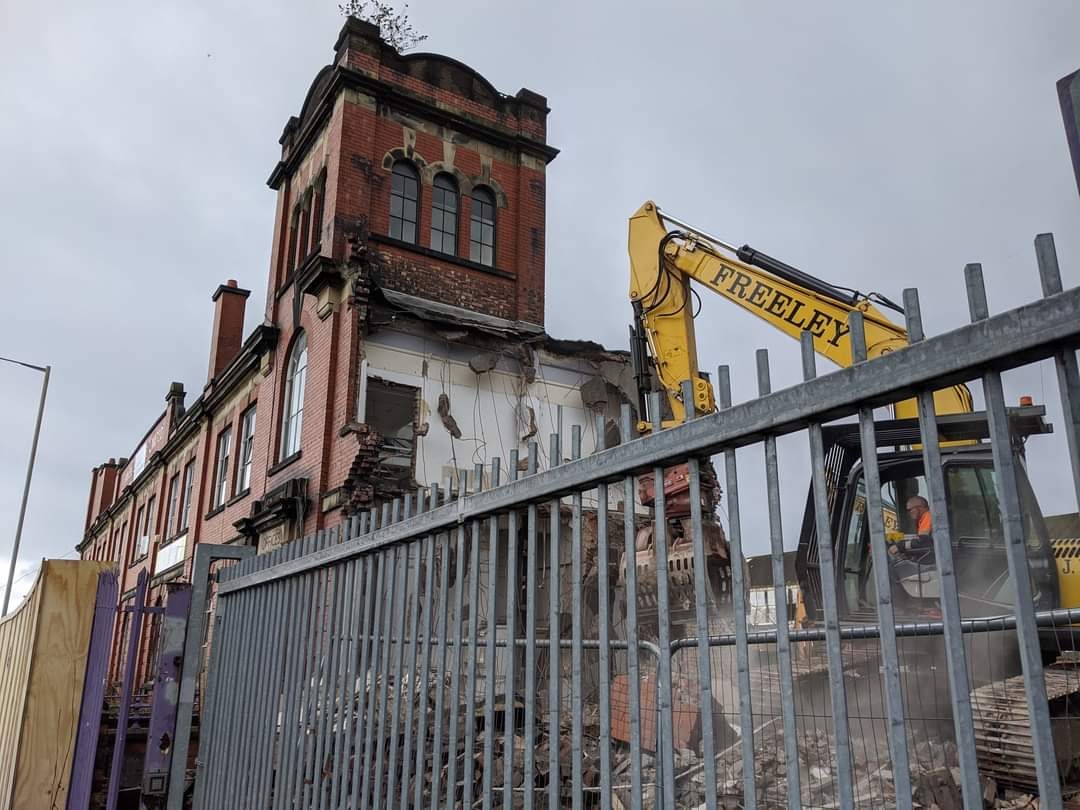
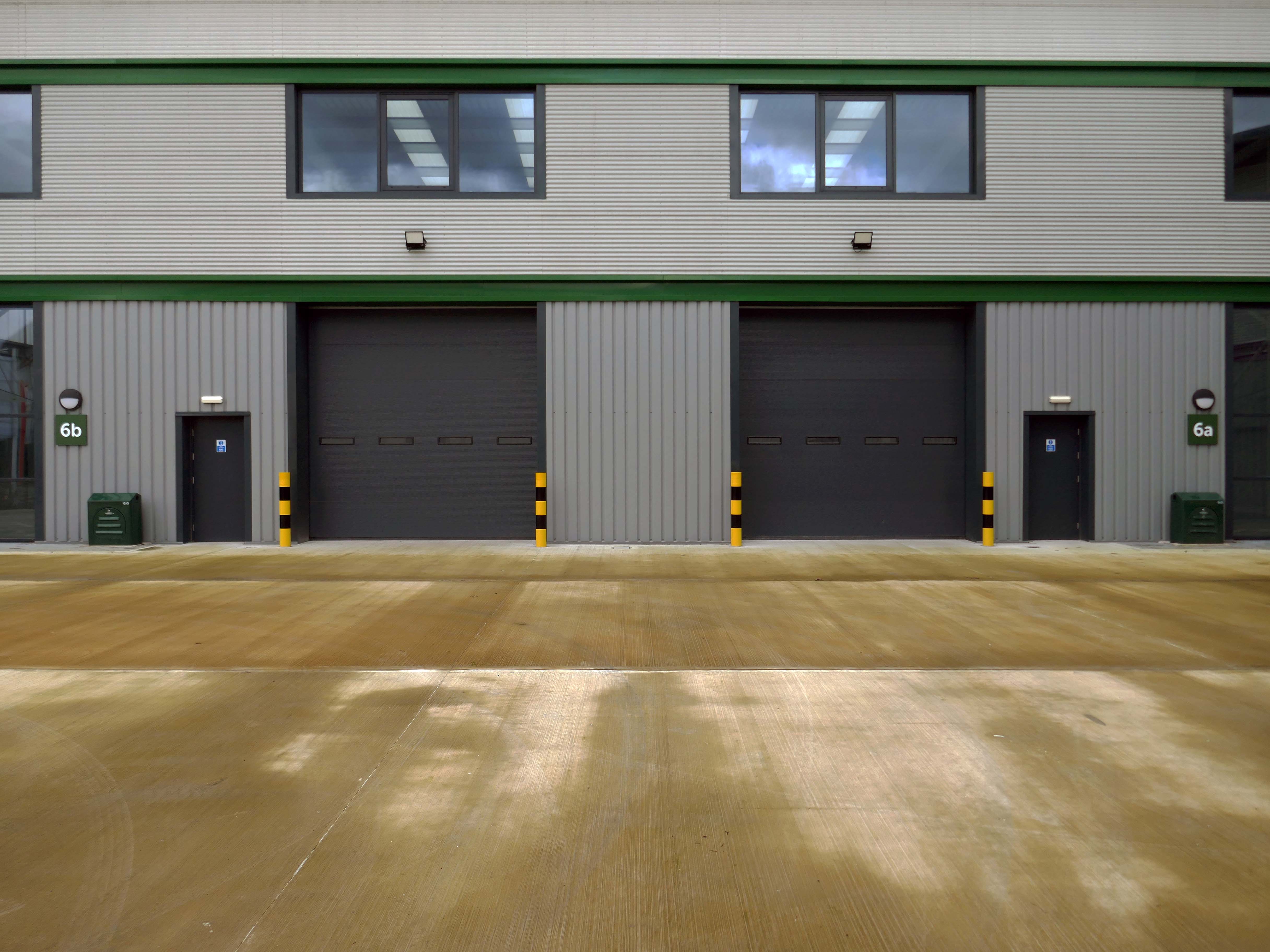
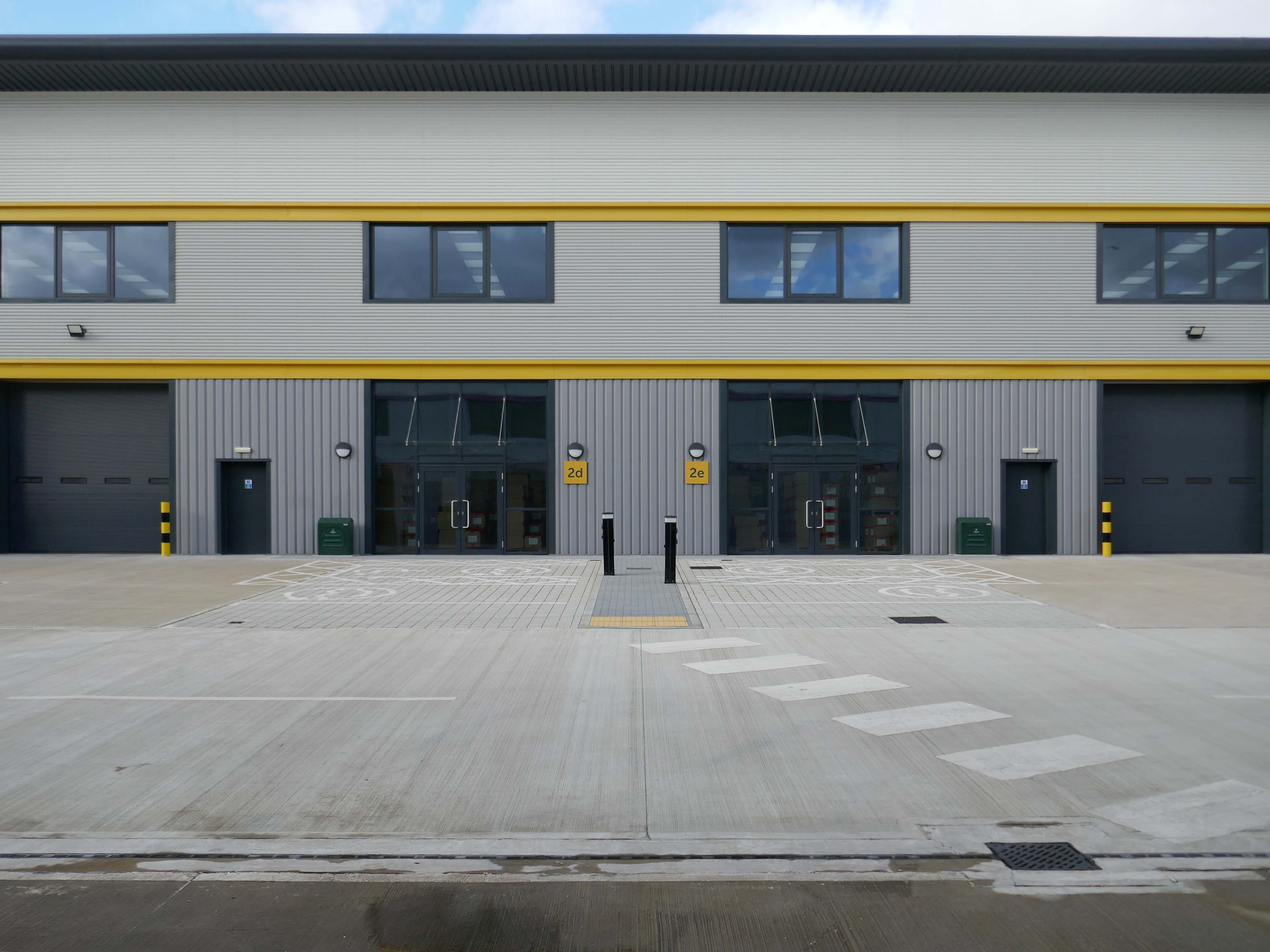
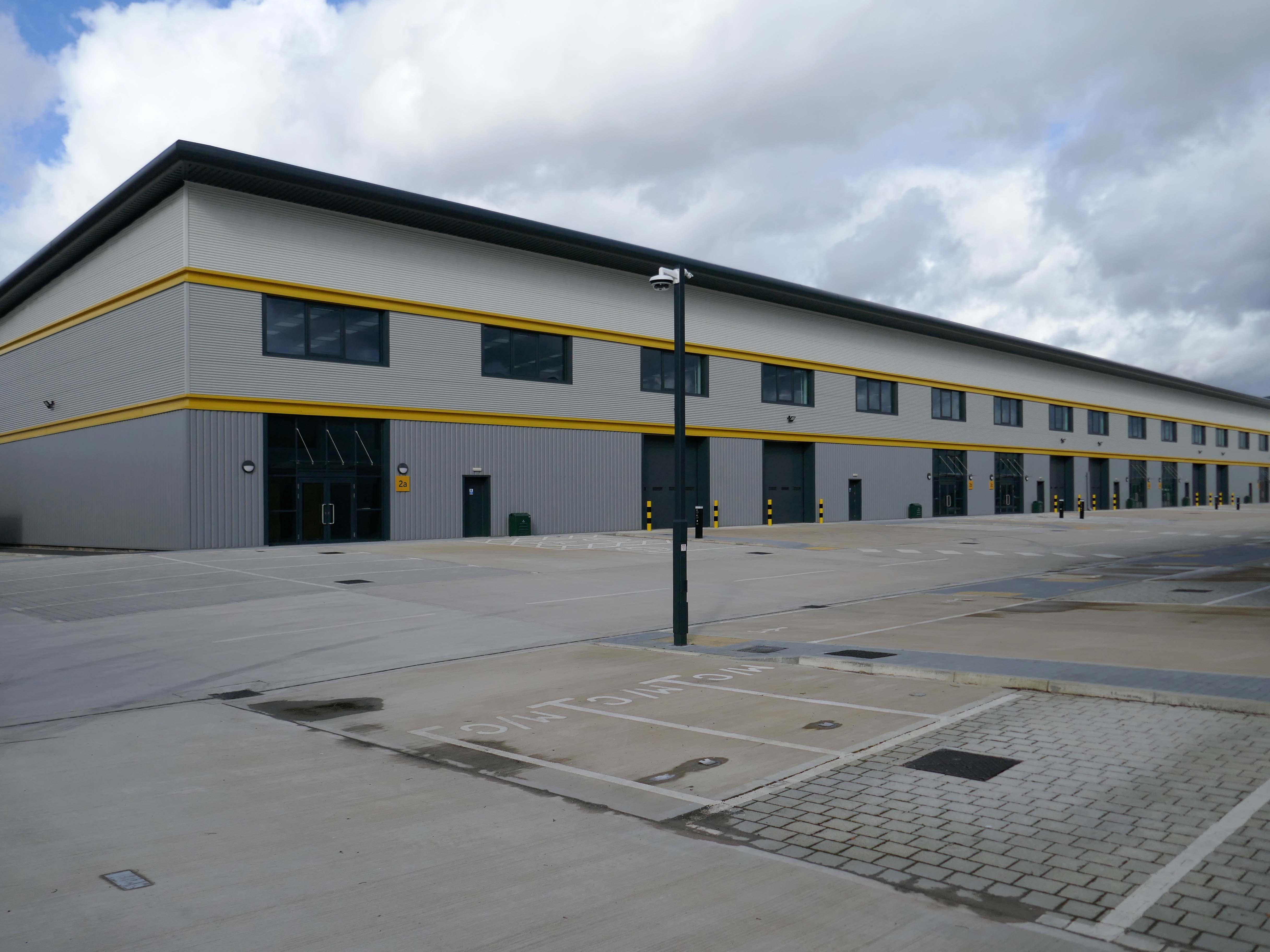
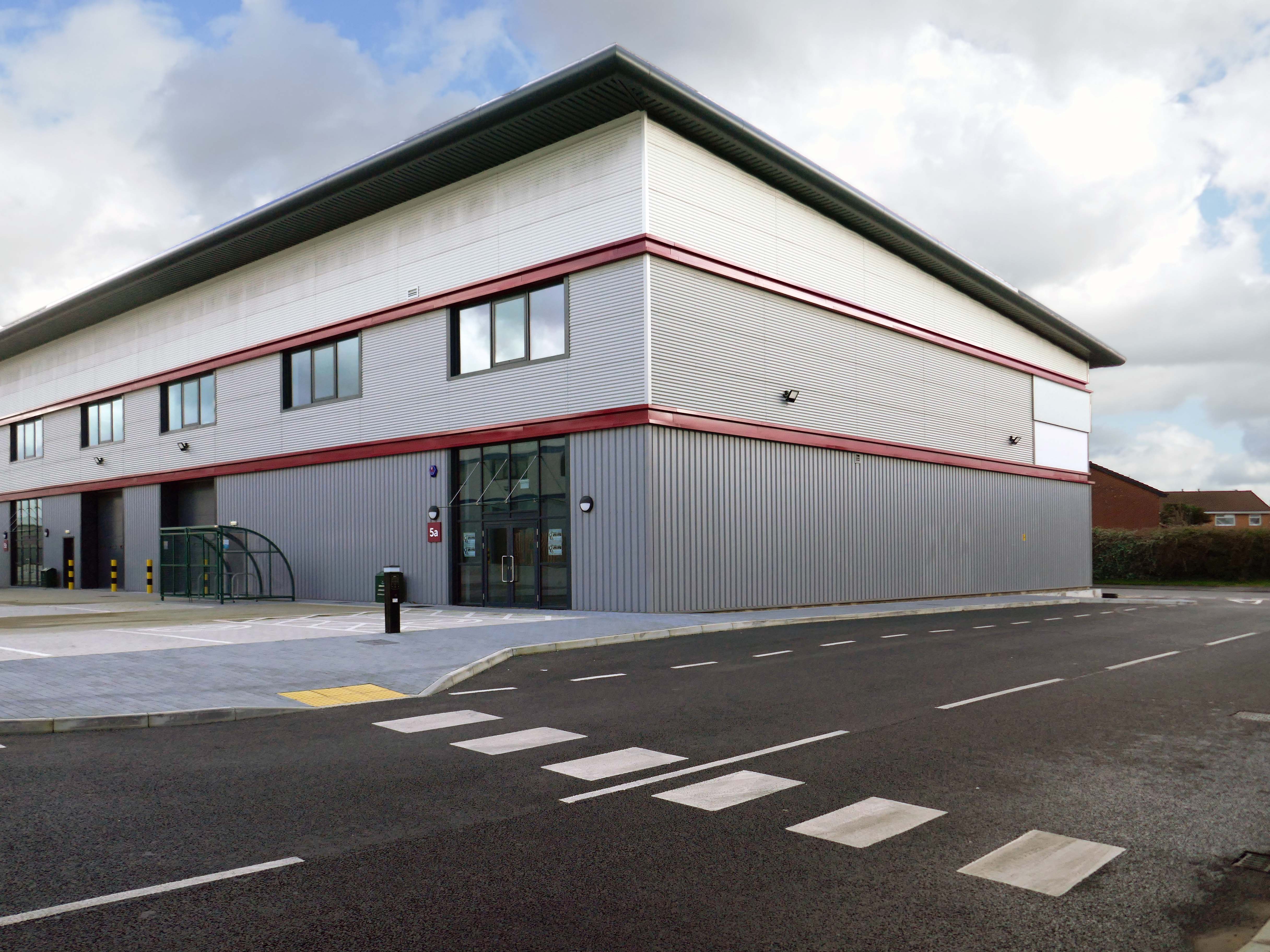
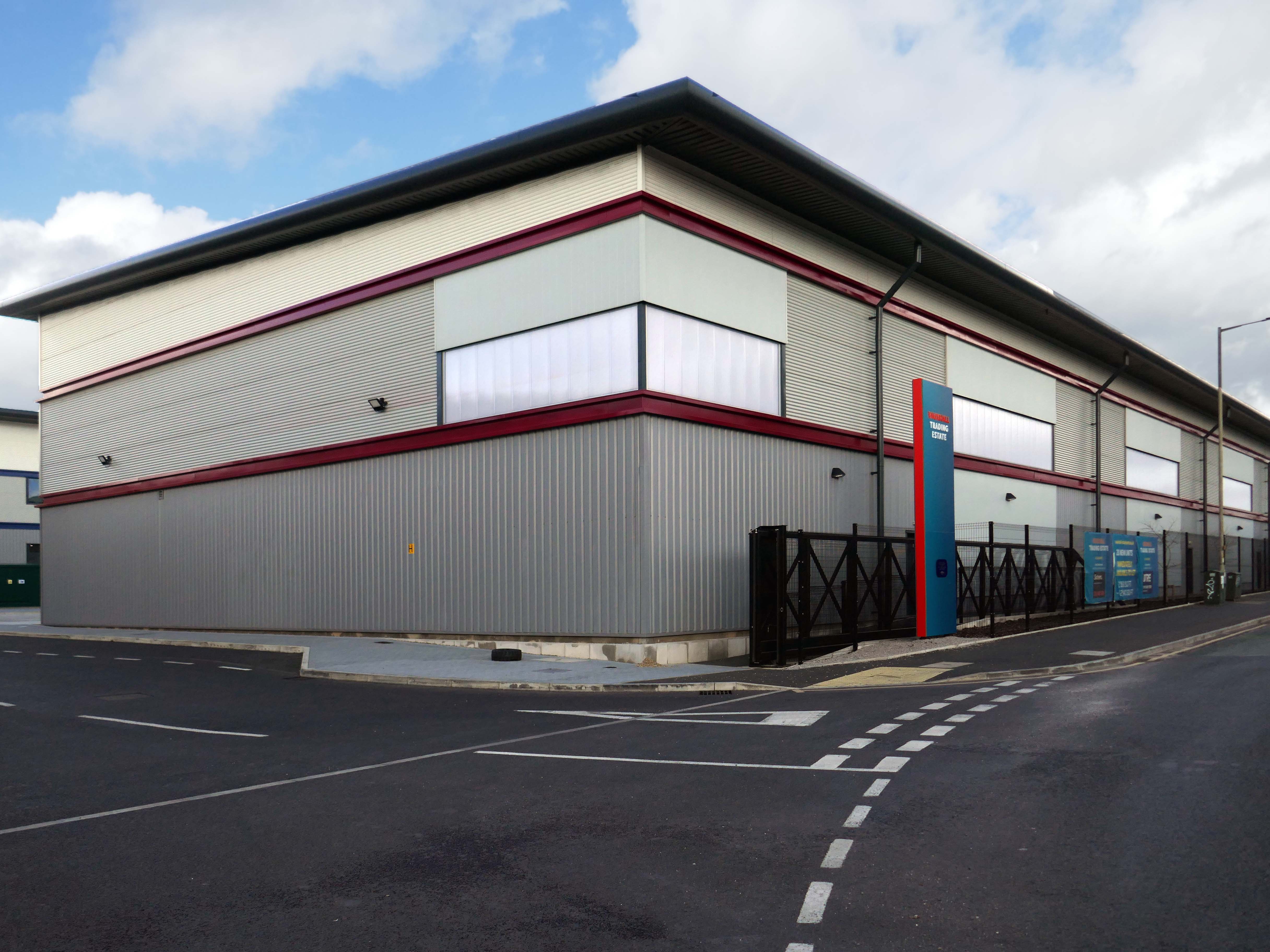
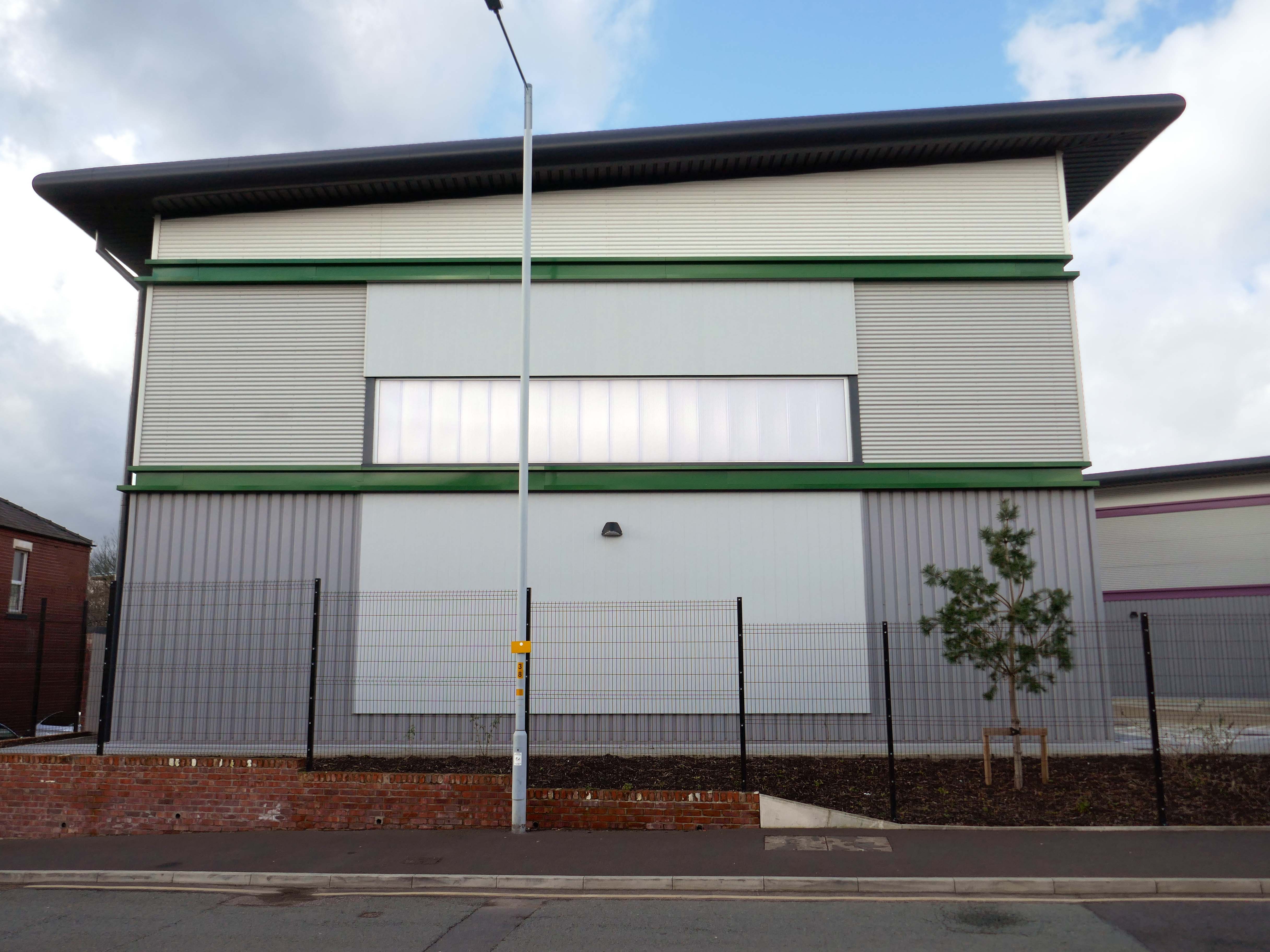
Our excavations at Vauxhall Industrial Estate, undertaken in advance of the redevelopment of the site by RECOM Solutions and Vauxhall Industrial Estate Ltd, revealed a number of features associated with the Craven Brothers’ Works. Two excavation areas were opened, targeted on features shown on historic mapping but no longer surviving: Area 1 in the north, targeting a small chimney and outbuildings adjacent to the machine shops; and Area 2 in the south targeting a chimney and part of the footprint of Building 3. In Area 1, the archaeological remains had been heavily truncated by the installation of chemical vats in the late 20th century after Craven Brothers closed; however, the foundations of the targeted outbuildings and the chimney were uncovered, as well as the remains of a railway track running alongside the machine shops, represented by in situ sleepers.
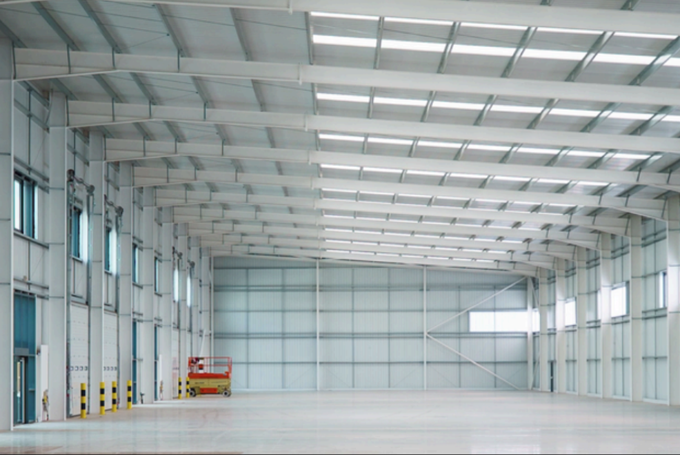
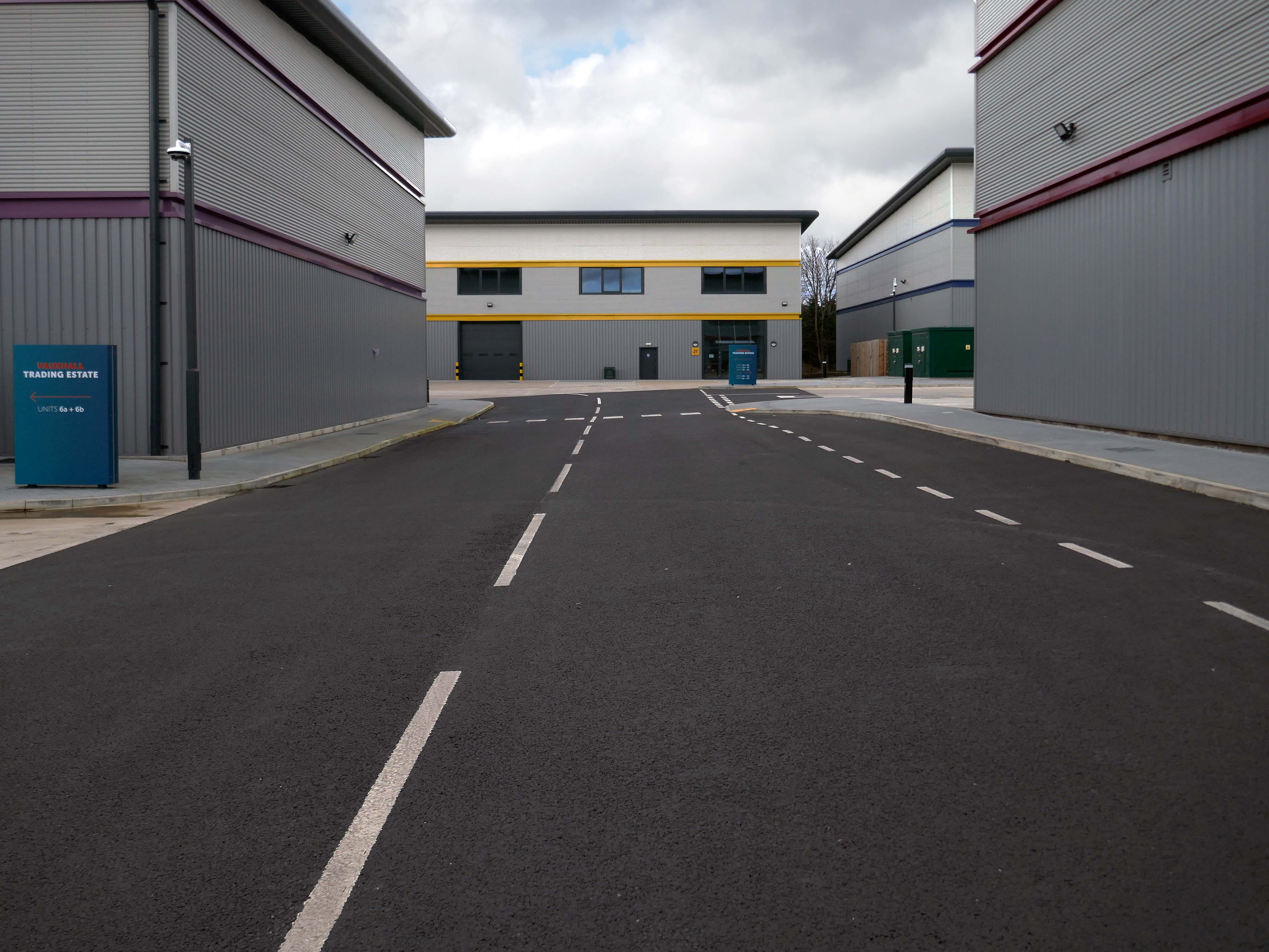
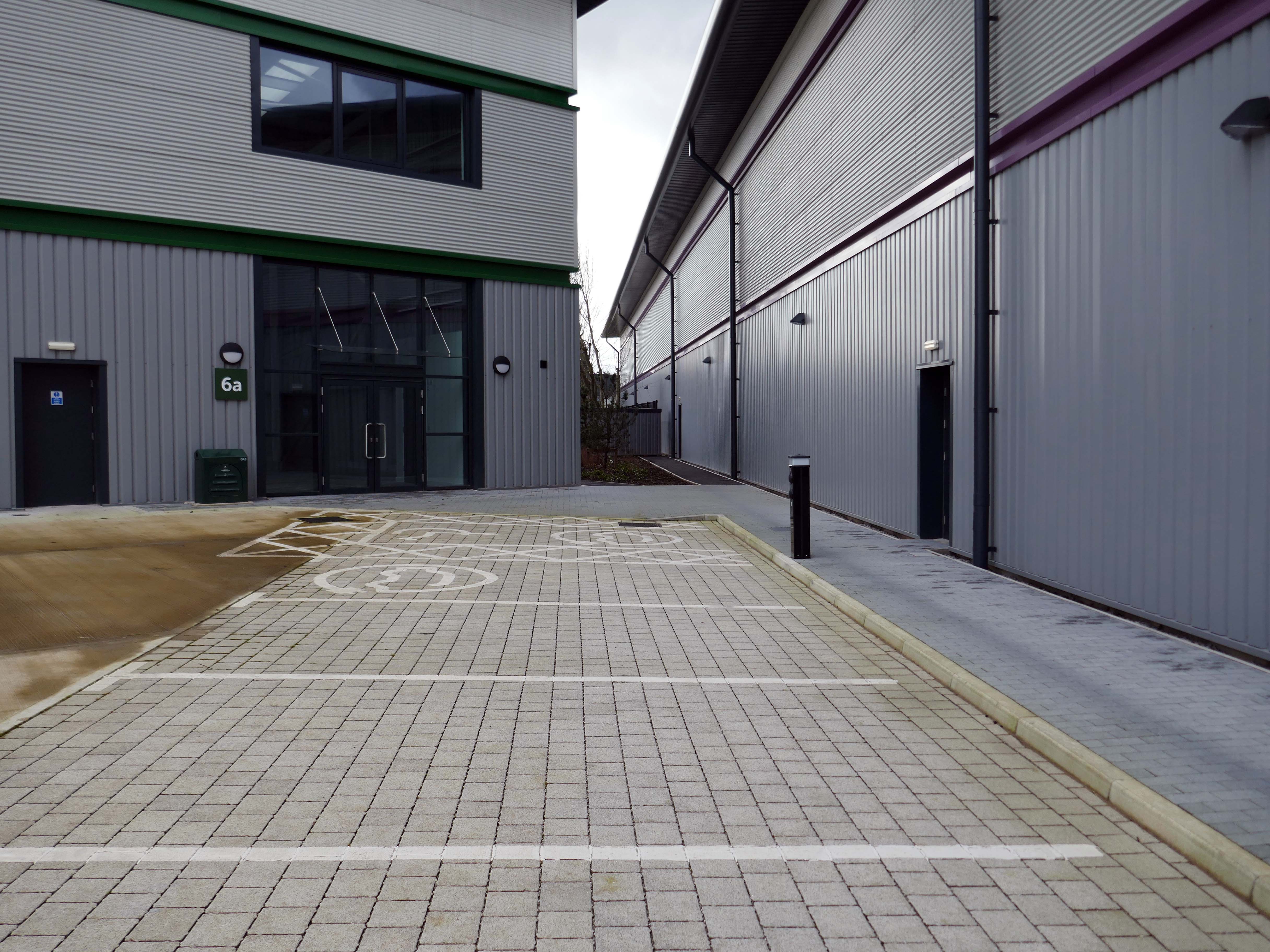
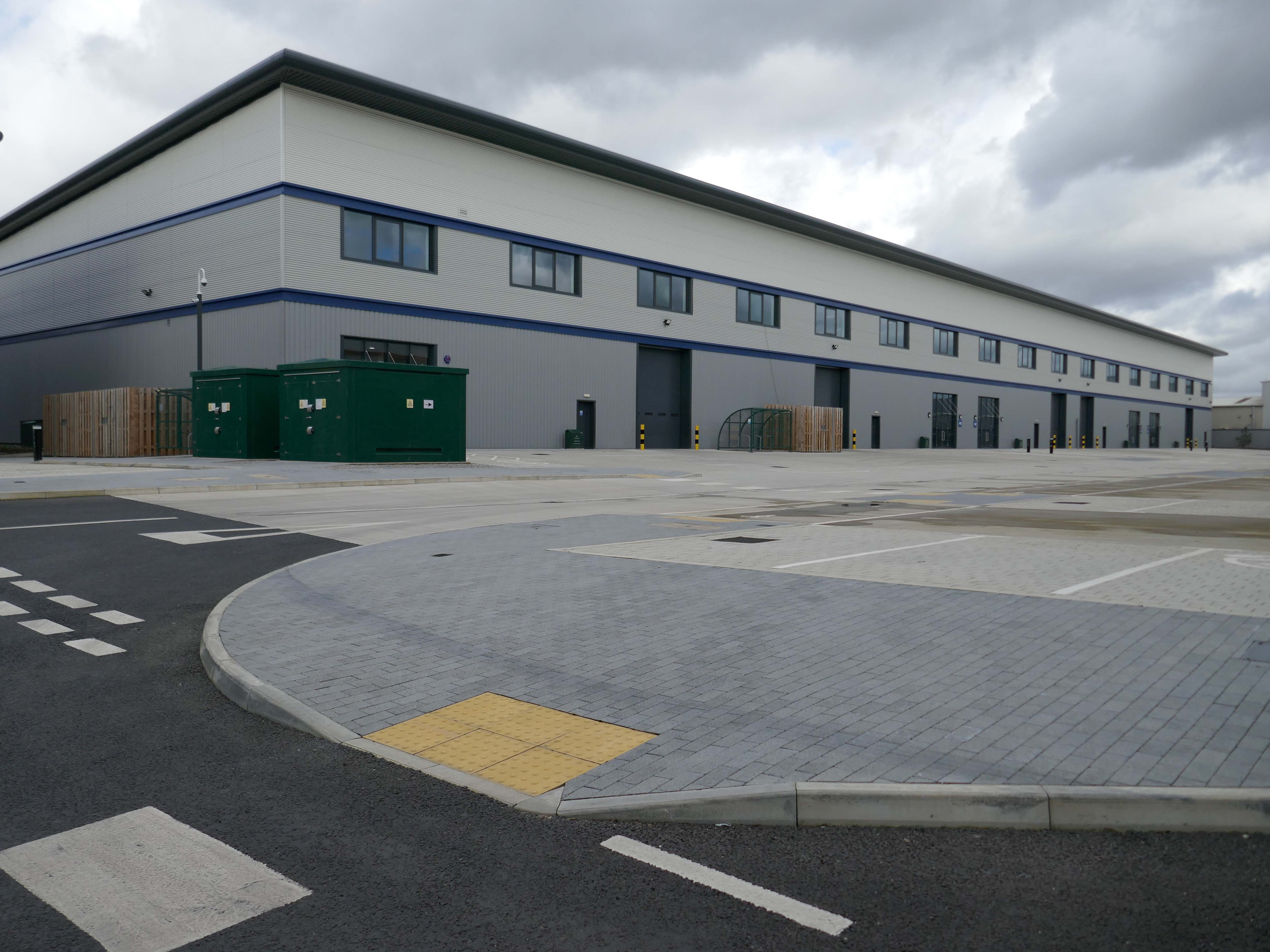
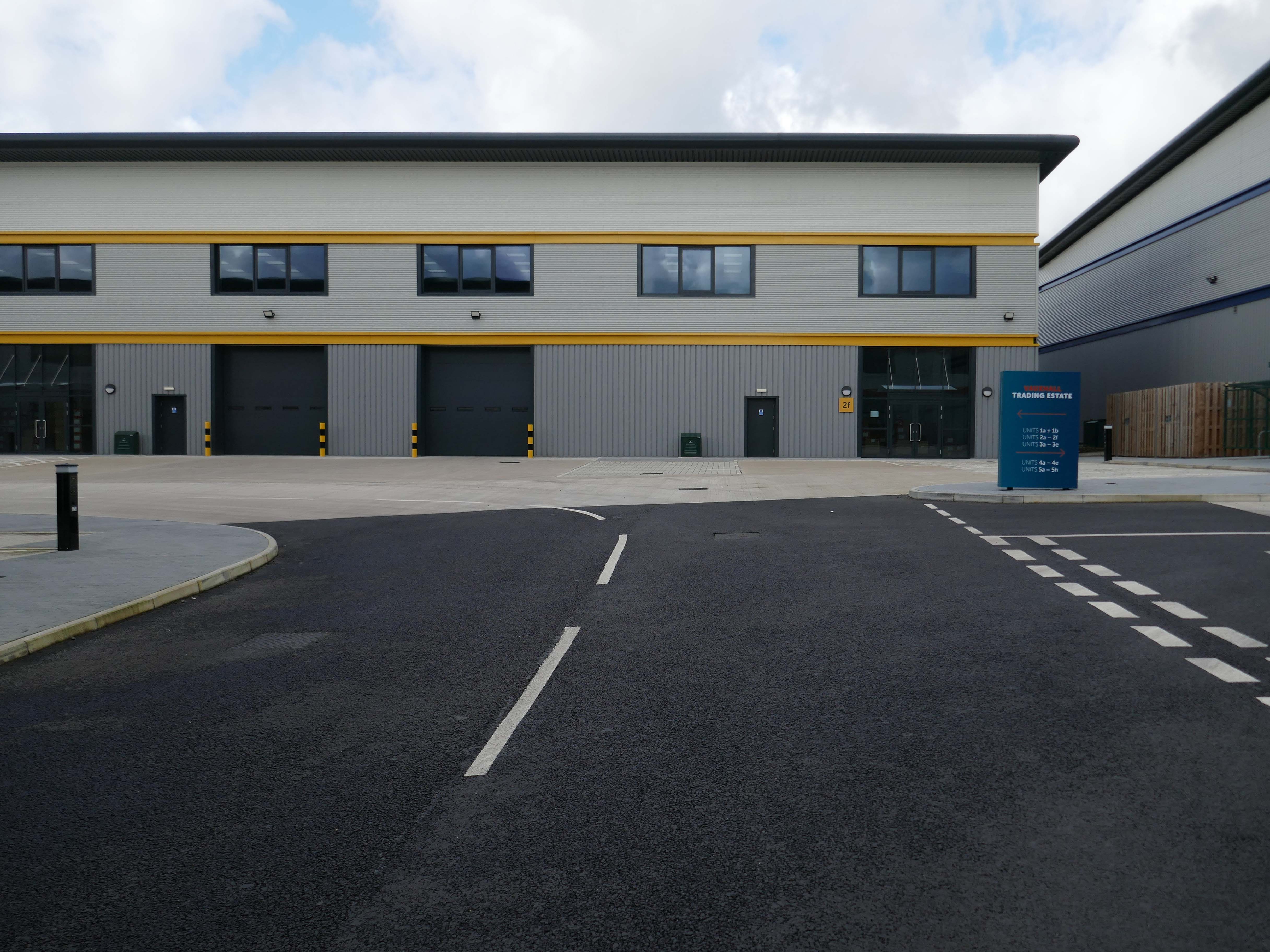
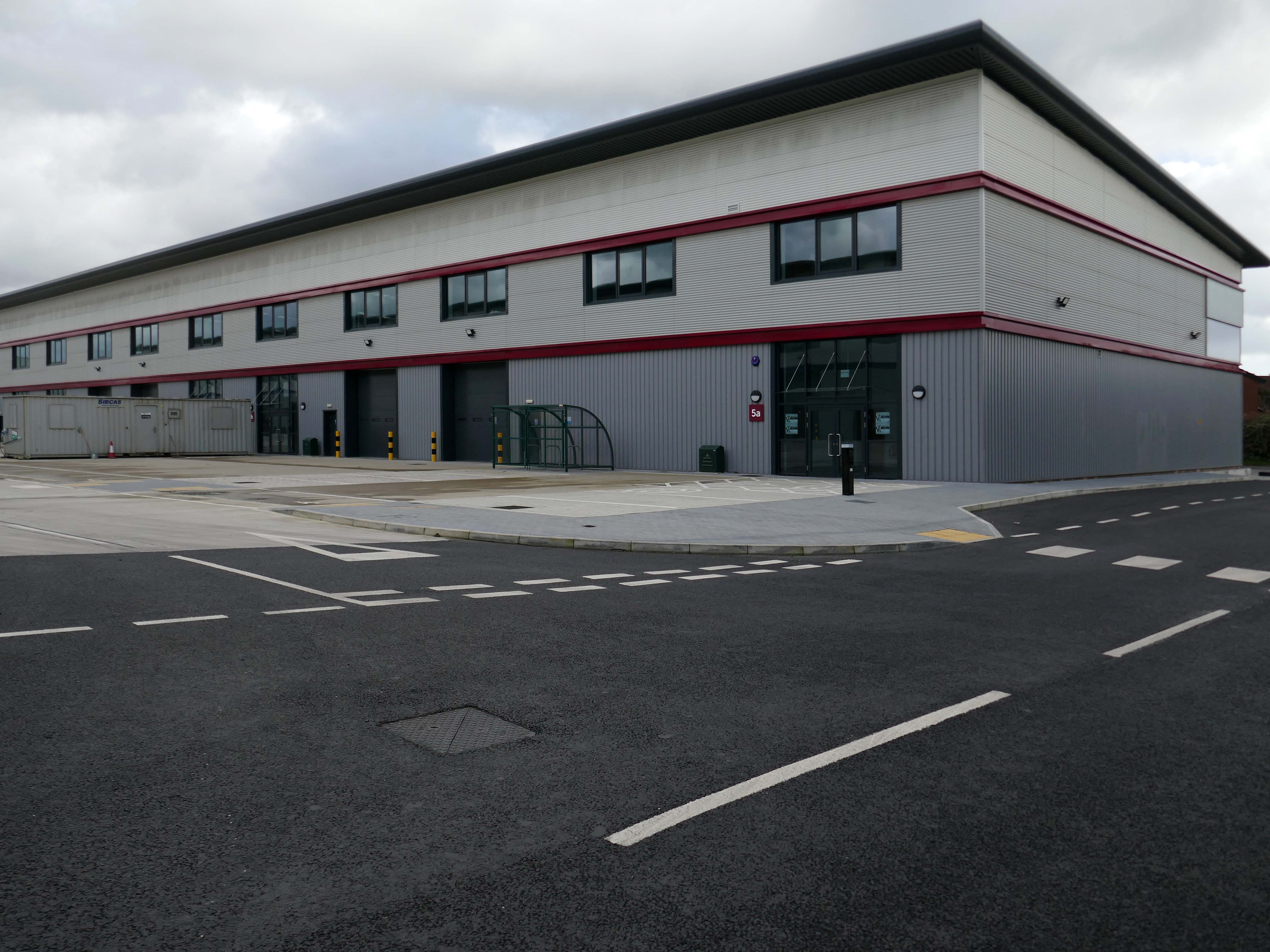
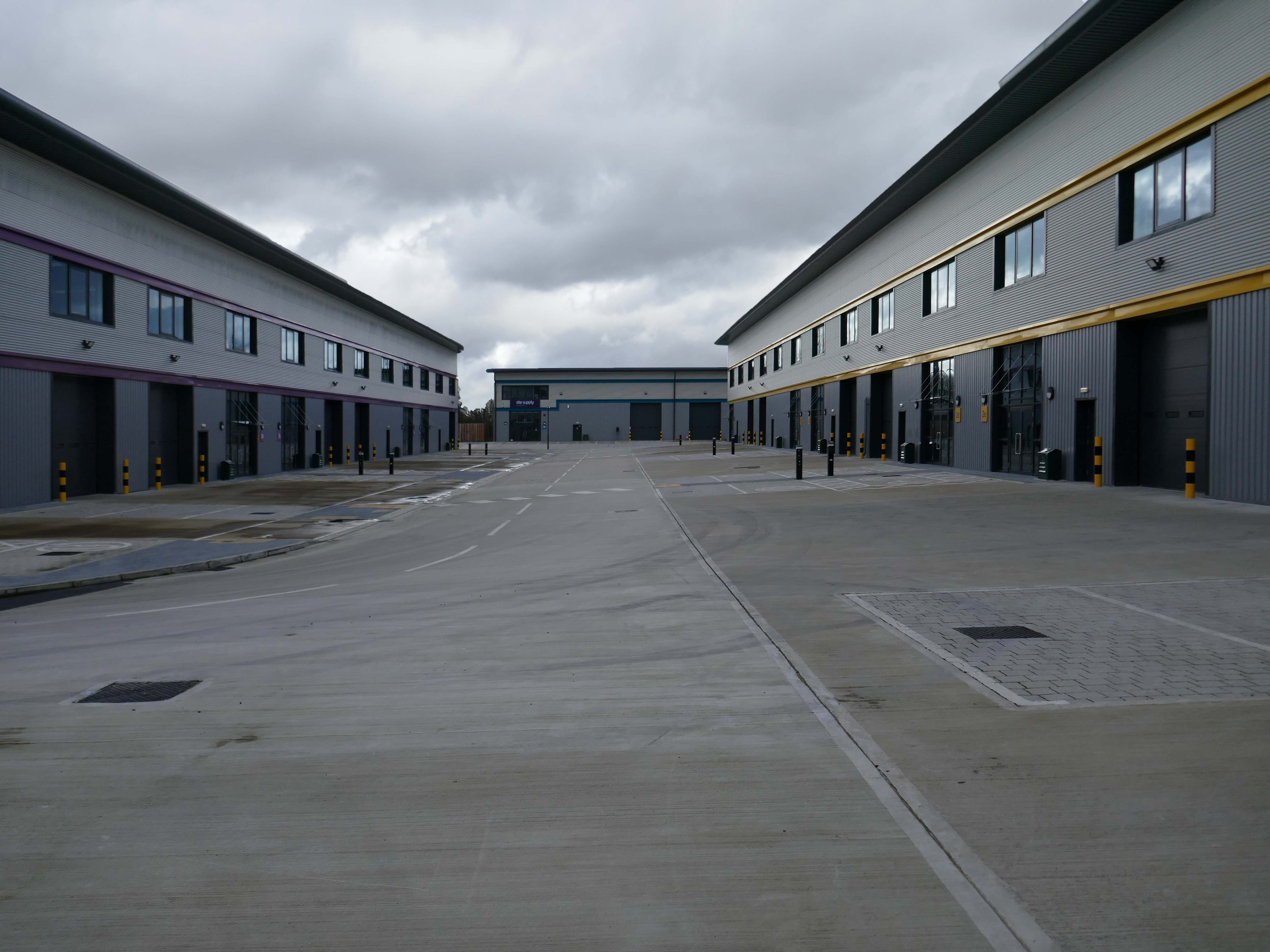
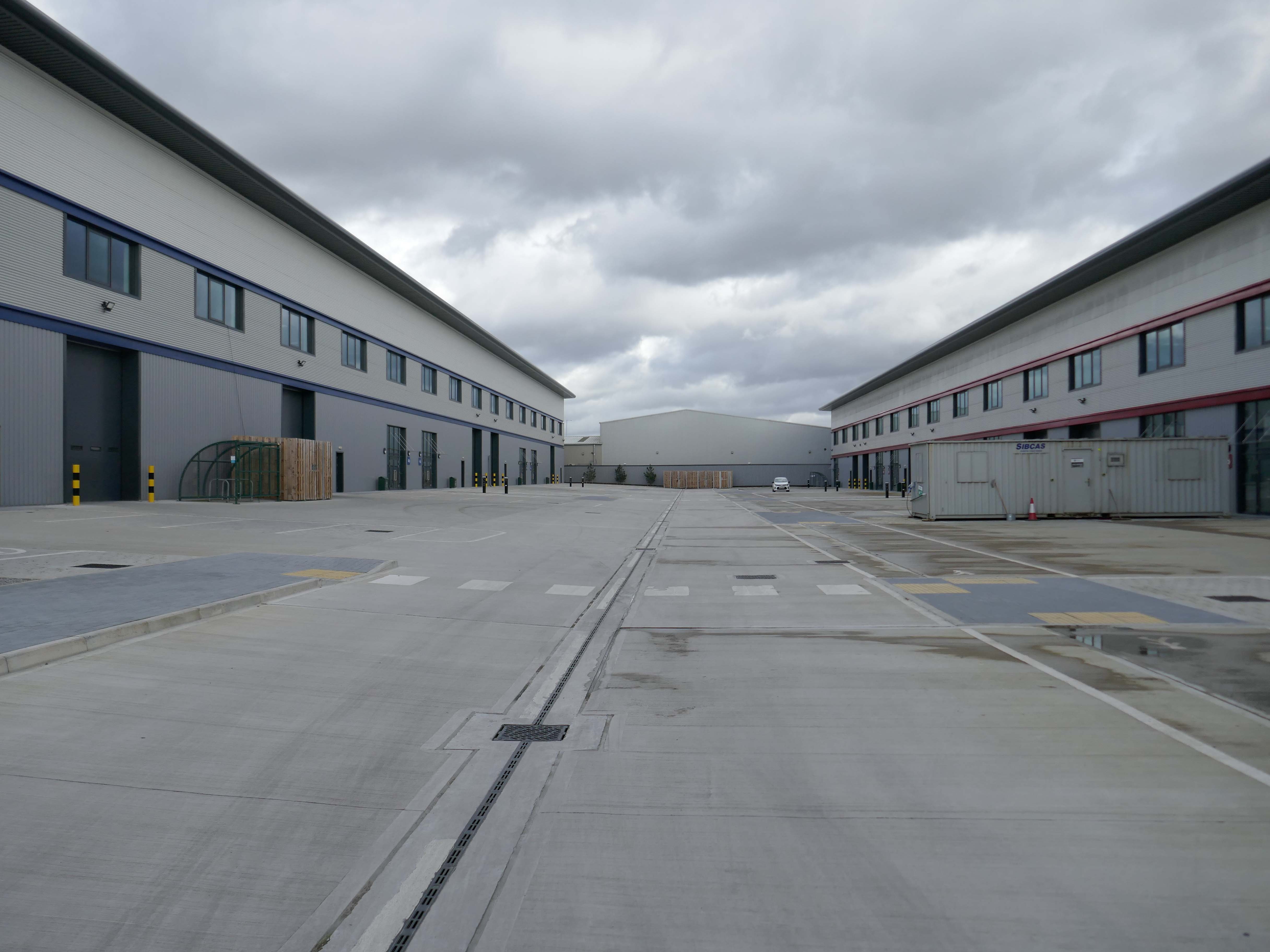
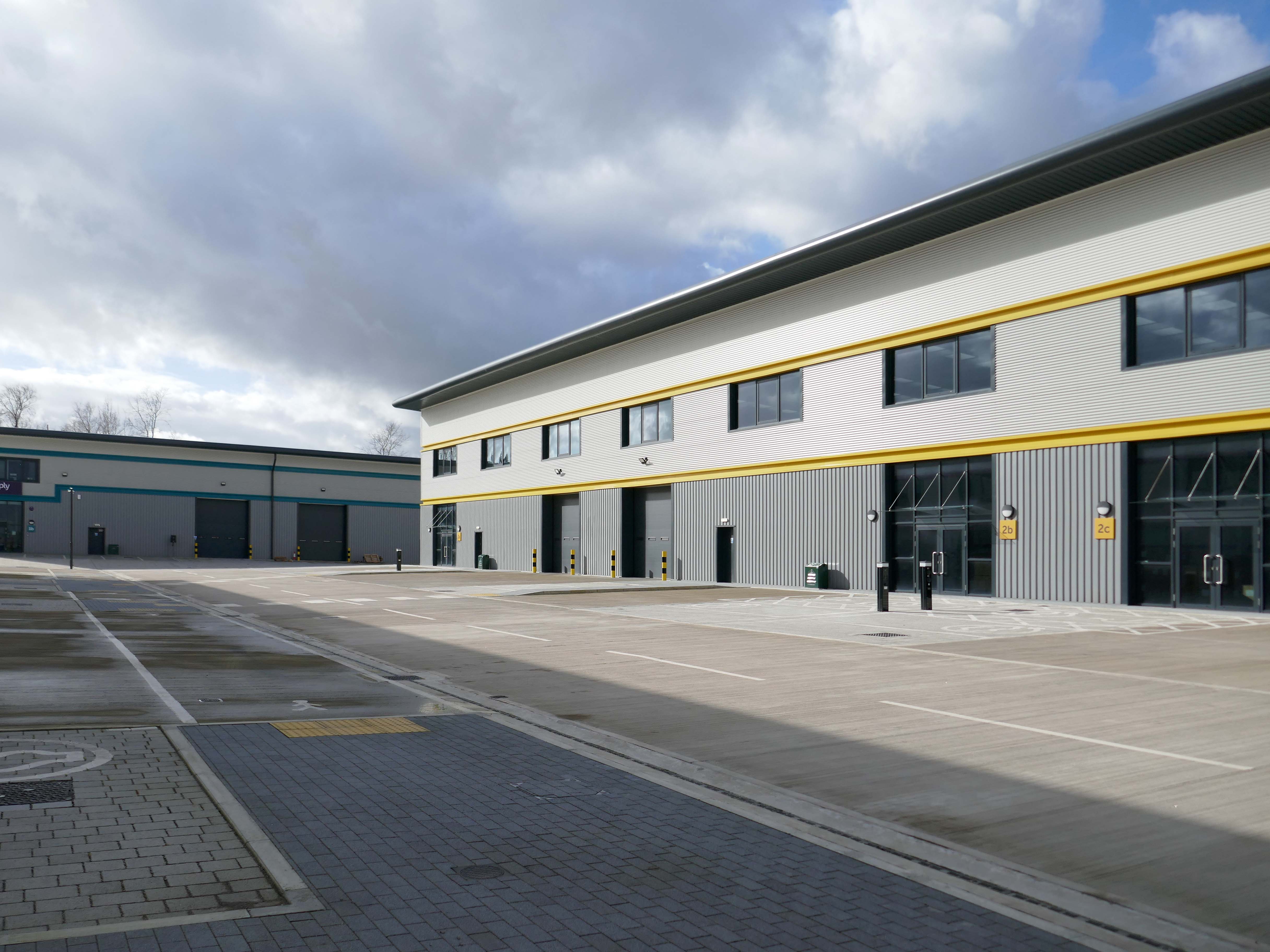
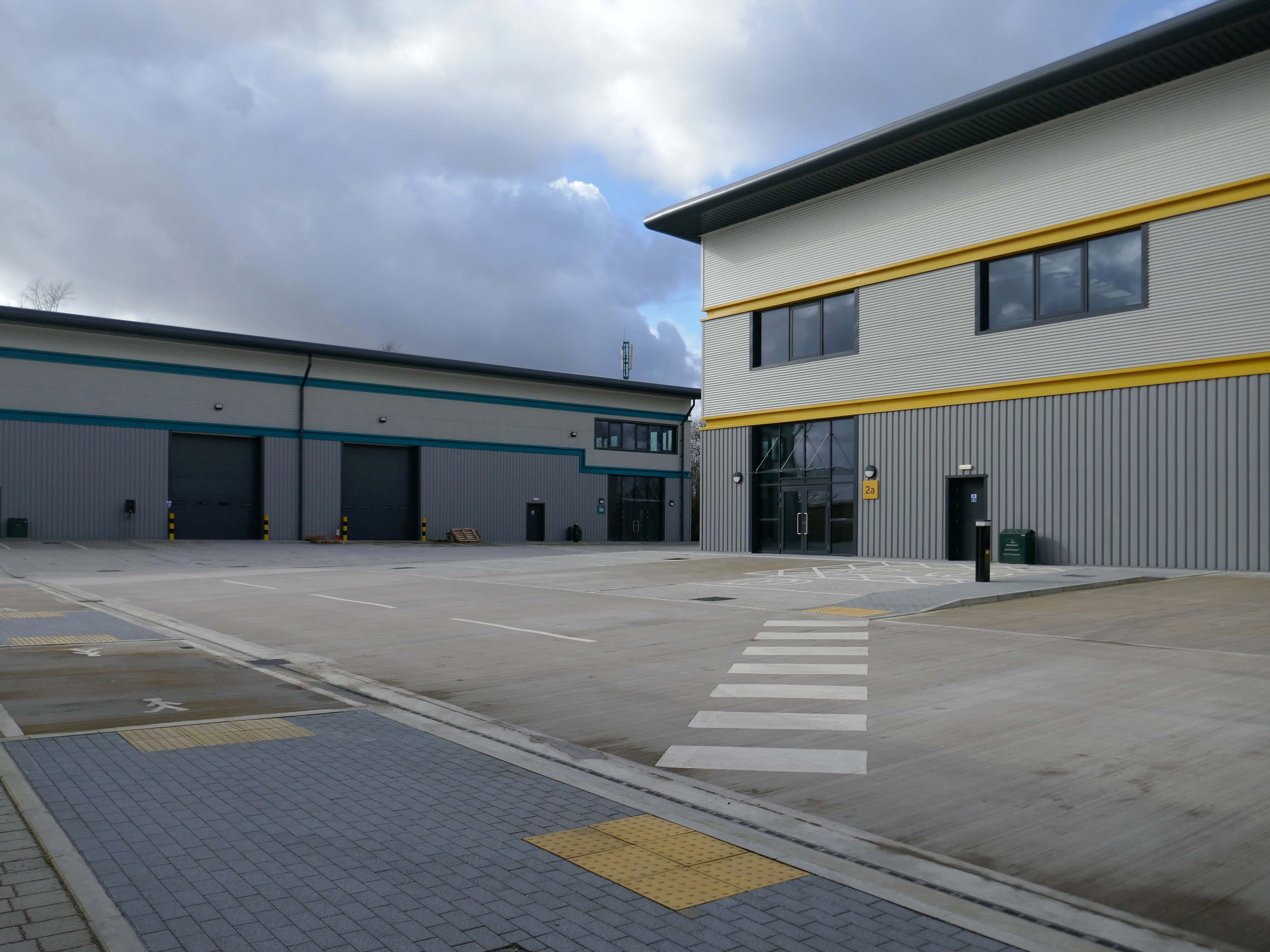
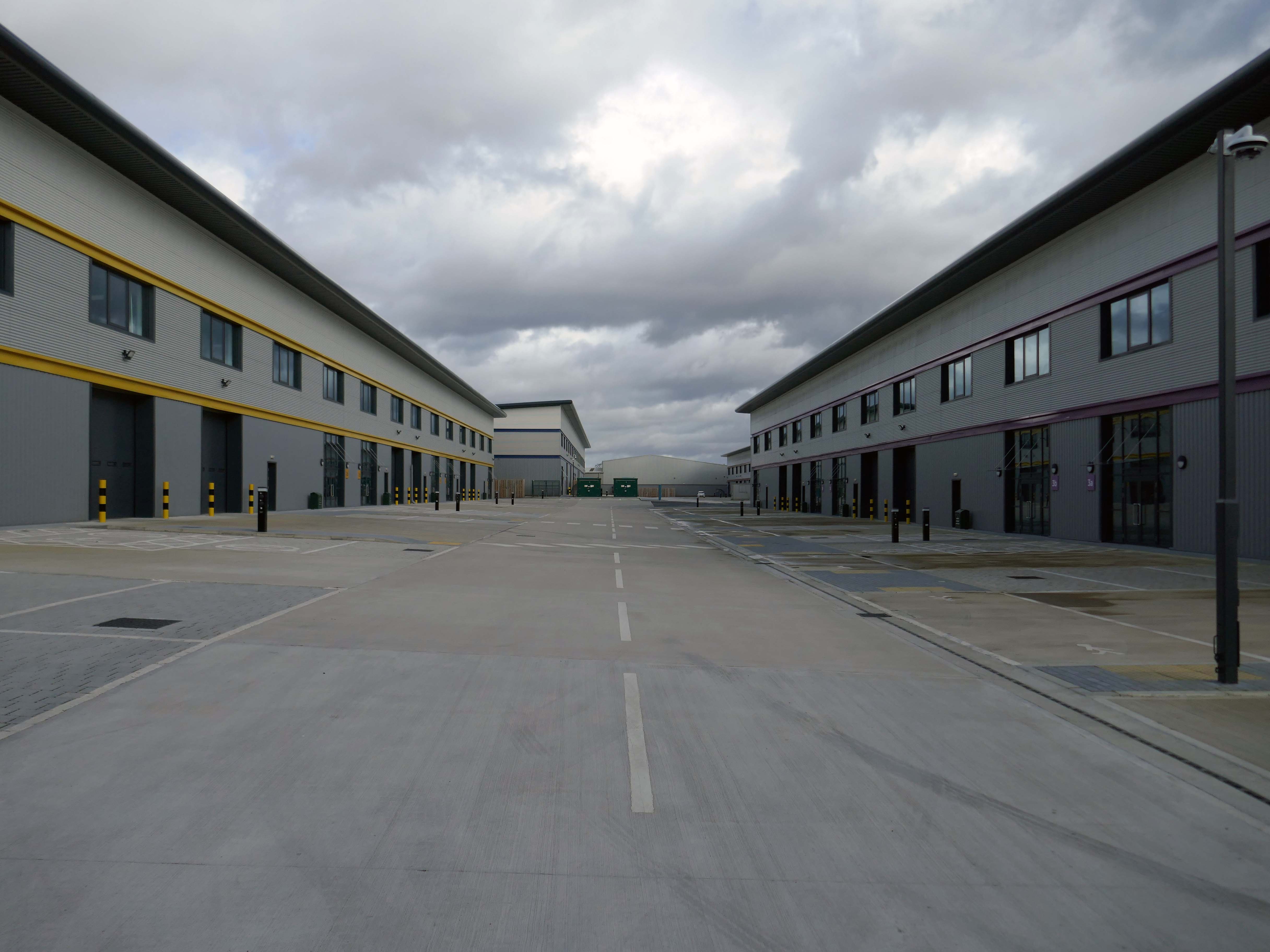
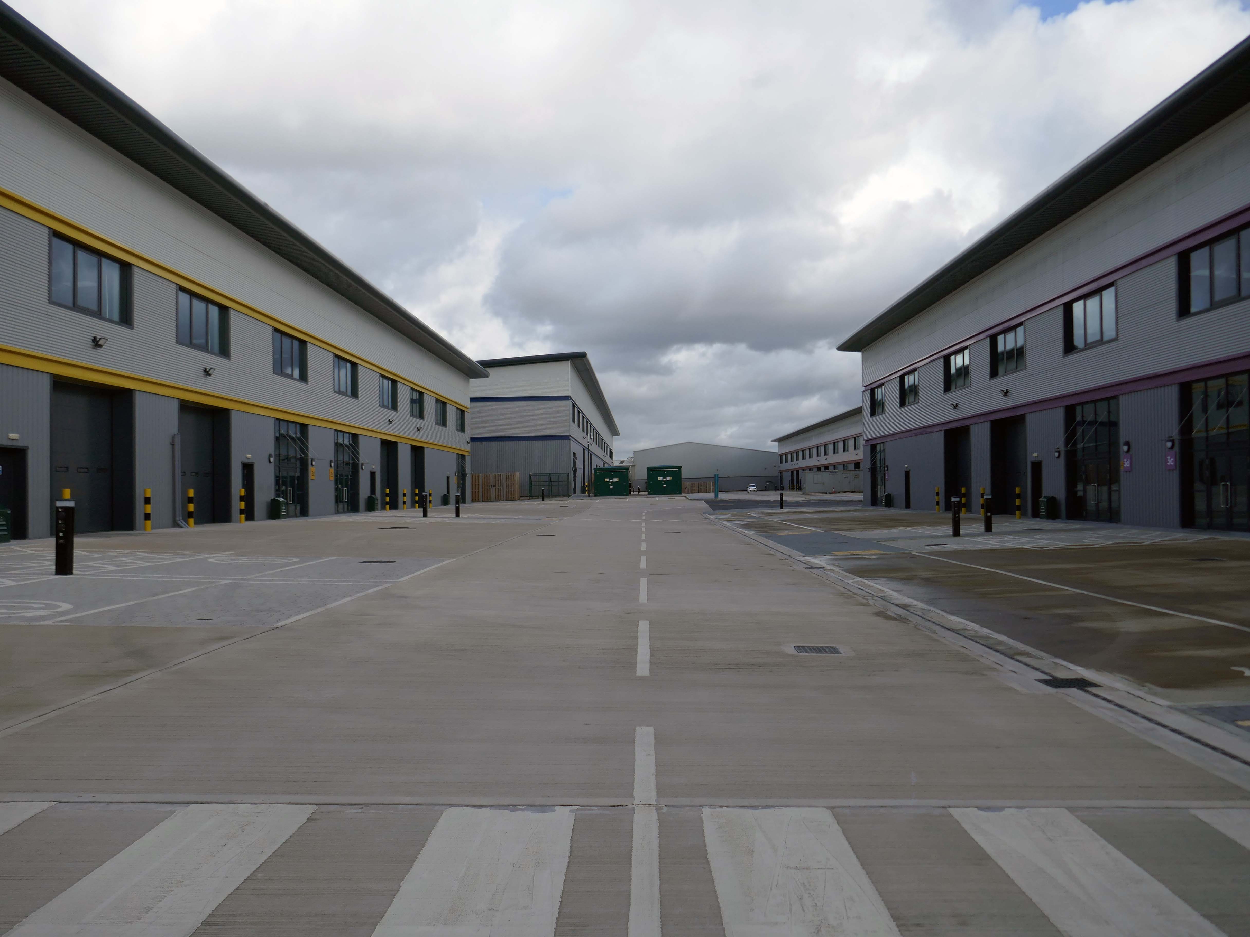
Vauxhall Trading Estate, formerly Vauxhall Industrial Estate, was a collection of dilapidated old industrial buildings, which have been demolished and new modern industrial units provided. RECOM provided project management services to demolish all previous buildings and prepare the site for the main contractor, achieve planning consent, enter a BAPA with Network Rail, tender and appoint the successful main contractor and then provide the Employer’s Agent service throughout the construction phase.
We worked with the design team to produce project specific Employer’s Requirements, ensuring that the client’s brief to provide high quality industrial units was delivered. We ensured the client’s interests were maintained throughout the project, making objective decisions that aligned with the client’s goals. In order to de-risk the project prior to entering into the main contract, we advised the client on what site investigations, enabling works and surveys needed to be undertaken. As the Employer’s Agent, we ensured that the conditions of the contract were adhered to, managing claims from the contractor,ensuring that the client’s position was protected.
Demolition works and embodied carbon created through construction works, is being offset against the sustainable energy created post occupation including: mix of air-source heat pumps and gas-fired radiant tube heating for heating and cooling, and photovoltaic solar panels installed on rooftops to generate green electricity for occupiers.
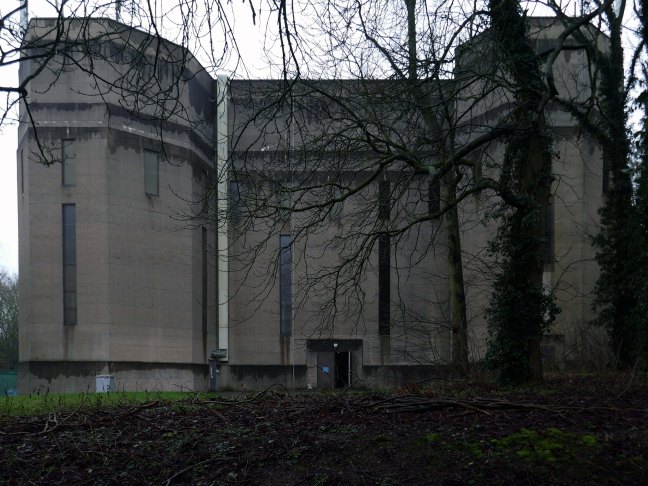
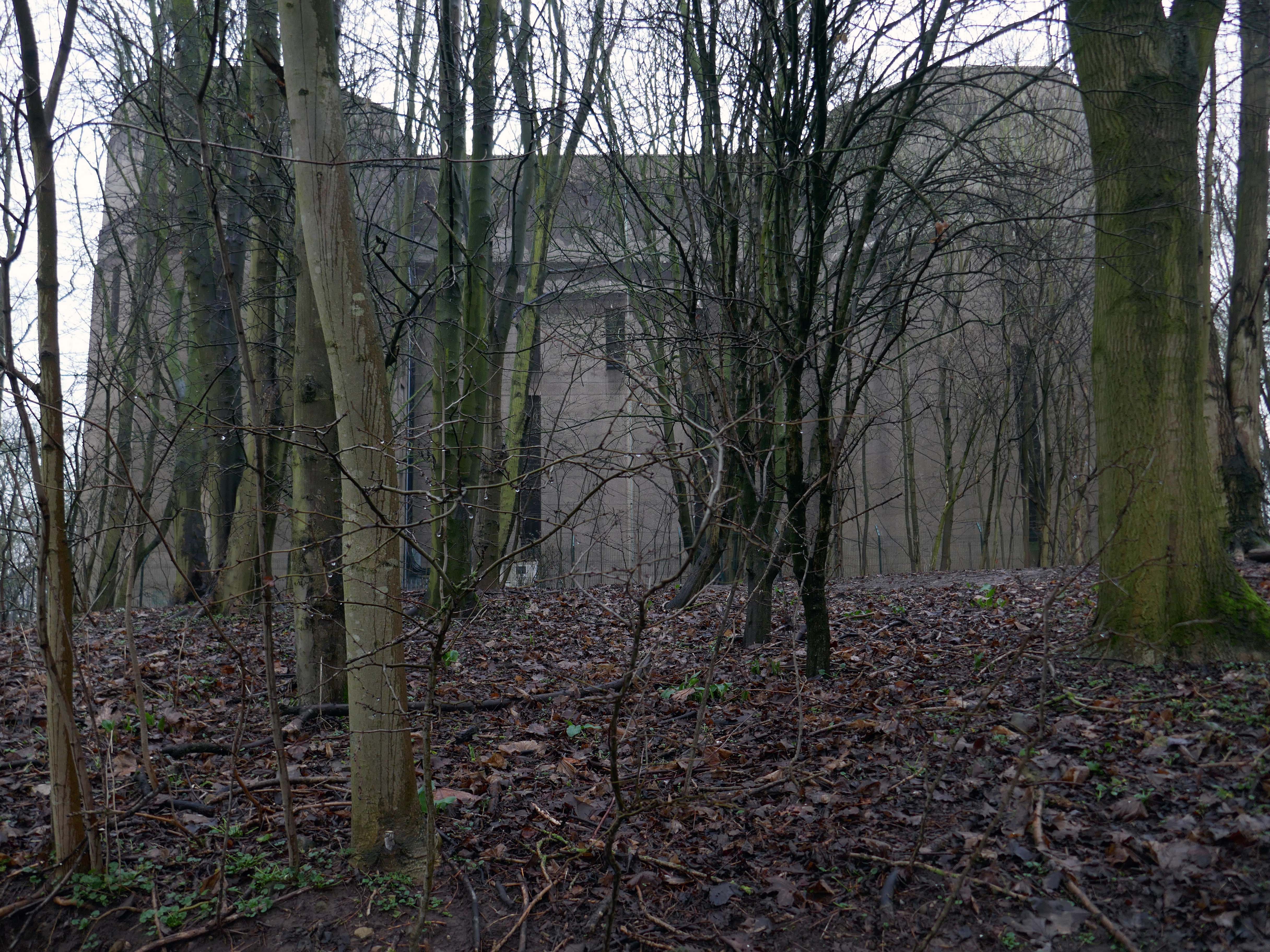
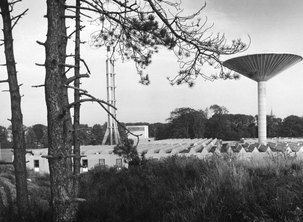
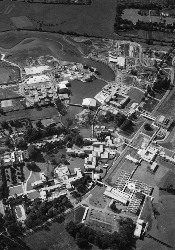
Exploring the University of York campus the first point of interest which we encountered was the Water Tower.
Siward’s Howe, sometimes written Siwards How and also known as Heslington Hill or Bunny Hill is a terminal moraine located to the south-east of the city of York.
The howe is situated north west of the Morrell Library building of the University of York. The southern side of the howe is part of Alcuin College of the University of York.
Its imposing water tower is visible from many parts of the nearby suburbs of Tang Hall and Osbaldwick.
Siward’s Howe is named for Siward, Earl of Northumbria, the 11th century Danish warrior.
Siward died at York during 1055 and is rumoured to have been buried beneath the tumuli at the wooded summit.
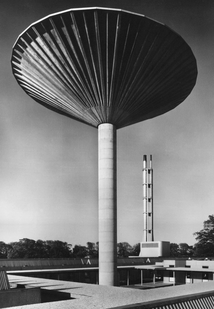
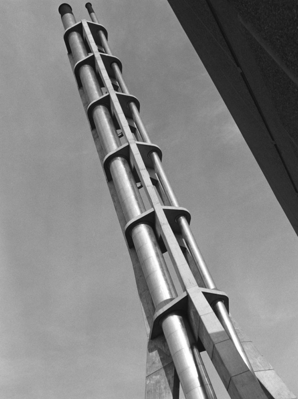
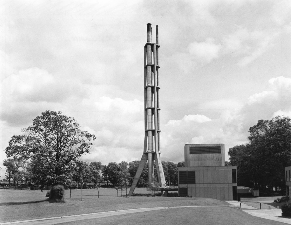
Built in 1955 the water tower contained one million gallons of water – the largest in England at the time.
It’s still operational, and provides water to Dunnington and Elvington.
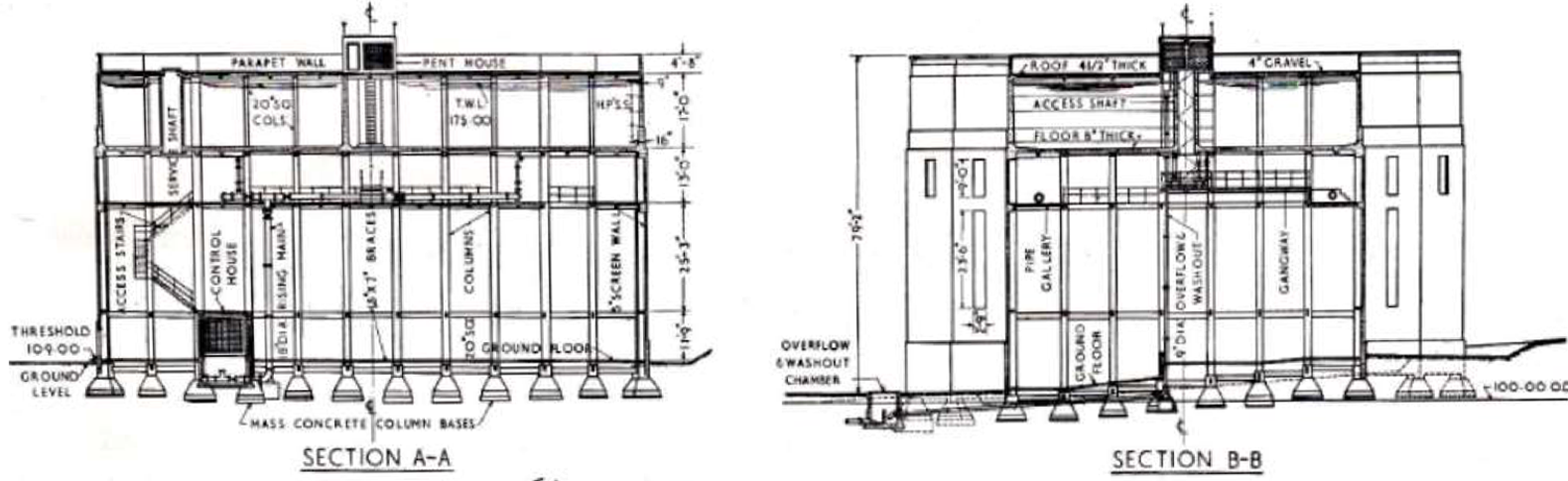
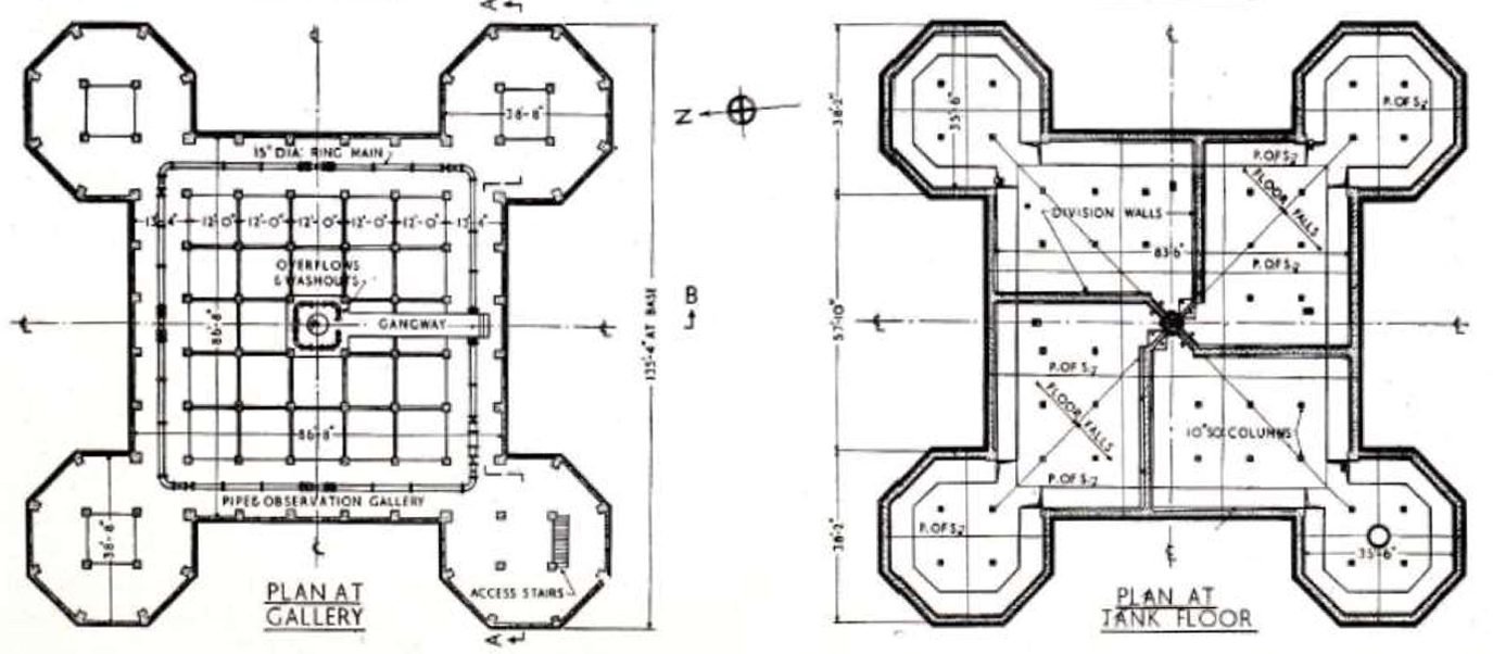
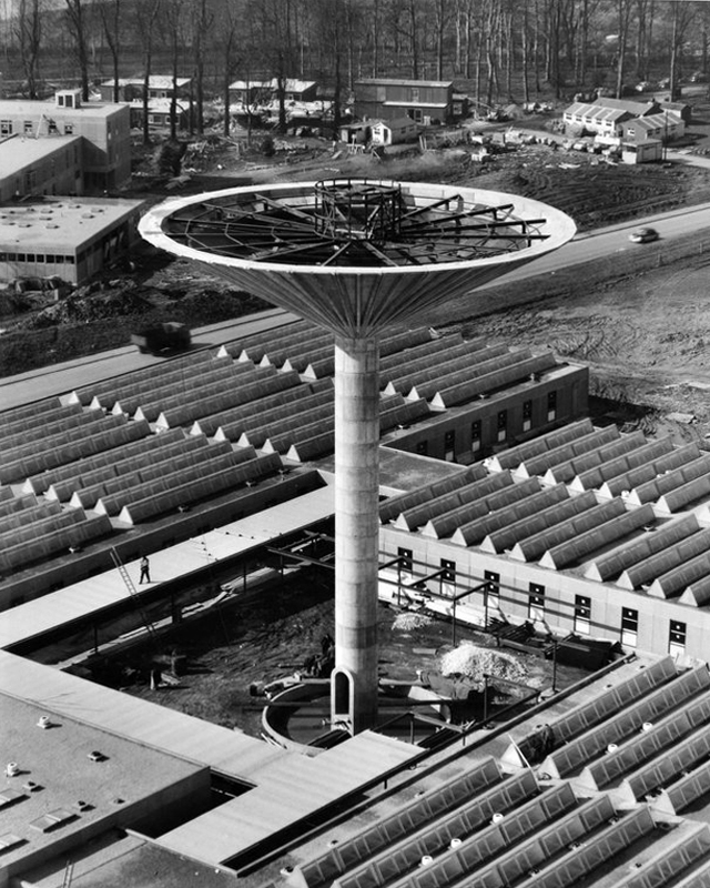
The shape of the tank and supporting structure on plan takes the form of a large central square portion, each corner of which is eclipsed by an octagonal tower seven faces of which are revealed.
The central tank is fifteen feet deep and is eighty three feet and six inches square.
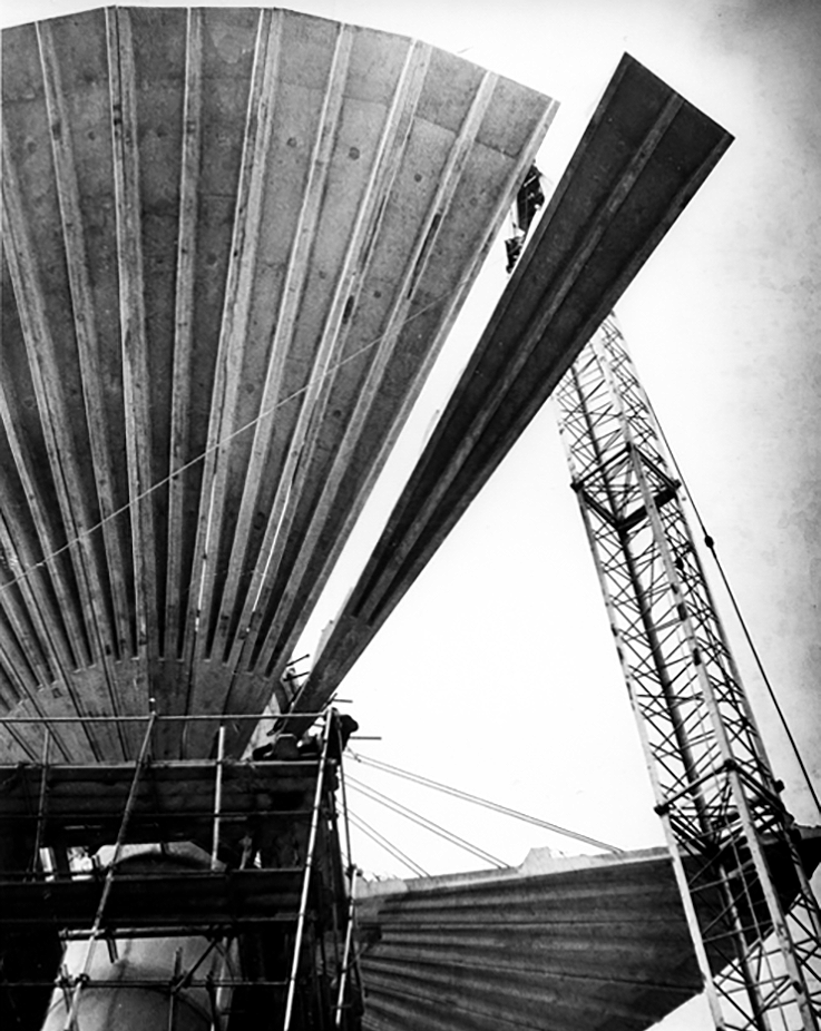
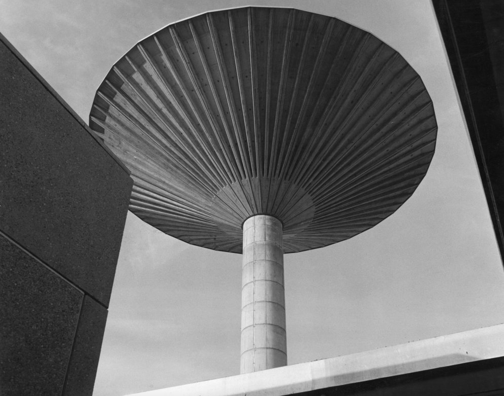
The Tower comprised of an inverted twenty one metre diameter conical tank which was made up of thirty two pre cast concrete petals each weighing eight and a half tonnes. The Overall Height of the Tower was approximately twenty eight metres, the central core stem being two point three metres diameter .
Photo Steve Collins 2011
Photo RIBA pix
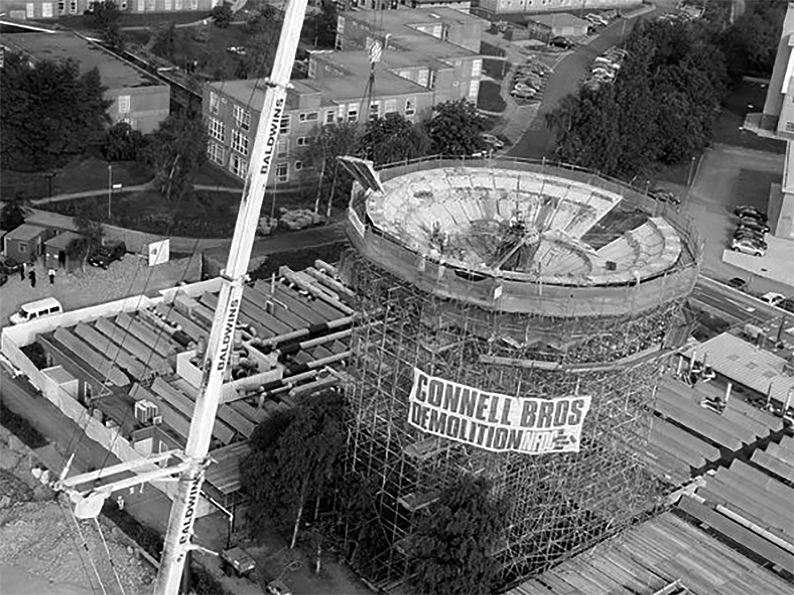
The landmark, built in 1965 to hold fifty thousand gallons of water for the chemistry department, is crumbling away due to carbonation and has been covered in a protective net to stop pieces hitting passers-by.
Bill Burns, building maintenance surveyor for the university, said many concrete structures of the 1960s and 1970s were suffering the same fate as the speed of building often meant salt got into the aggregate used in the concrete mix.
There was a degree of uncertainty surrounding the demolition of the pre-cast structure of the Tower as it had been subject to deterioration since erection. At Tender stage, the thirty two petals forming the bowl of the water tank were described as each individually being restrained by wire ropes to the central core. Upon opening up the works, it was found that the stated thirty two restraining Ropes had only been used during the construction of the bowl and had been removed, therefore the petals of the tank were gaining support from the ring beams.
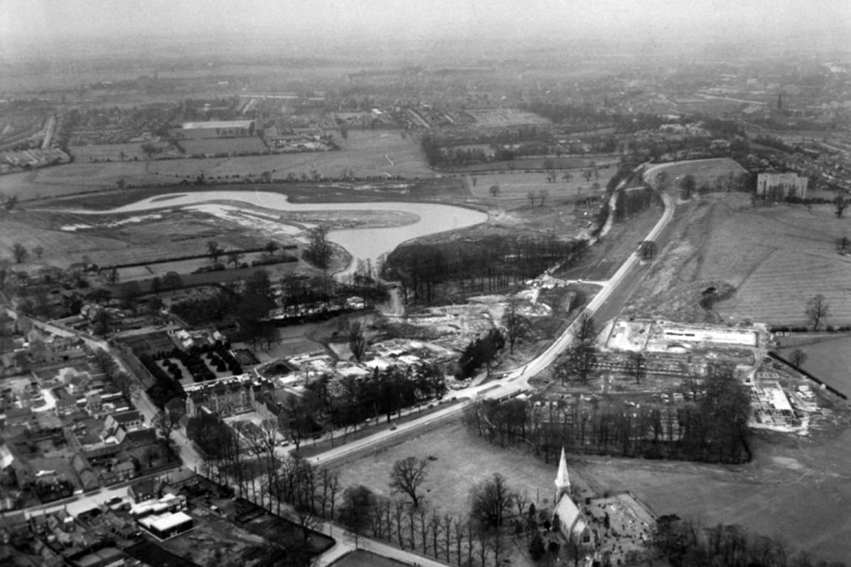
Though plans for a university in York first appeared as early as 1617, it would be over three centuries before they came to fruition. In 1960, permission was finally granted for the University of York to be built, marking the beginning of our journey.
Before the Second World War, Heslington was a quiet rural retreat with a local aristocracy, and a working agricultural village.
Fresh, young, forward-looking and enthusiastic, the University of York was known for its friendly atmosphere before it even opened its doors.
Planning and building the University happened with astonishing speed. In April 1960 the Government approved the establishment and less than three years, on 9 October 1963, the first students walked through the gates of Heslington Hall.
In the 1970s, college social life began to blossom.
Central Hall was the venue for The Who, The Kinks, Fairport Convention, John Martyn, Ian Dury and the Blockheads, Hot Chocolate, Humphrey Littleton, Acker Bilk, Paul Tortelier, Julian Bream, John Williams and others.
Paul and Linda McCartney appeared one day out of the blue with their new band Wings and performed a concert in Goodricke College Dining Room.
The beginning of the 1980s came with significant challenges for the University.
The decade saw the start of cuts across higher education. Staff were exhorted to make economies including turning down their thermostats, recycling, and making telephone calls as short as possible. There was also a fire in the Department of Chemistry.
In 1990, the Vice-Chancellor, Berrick Saul, recounted to court that York had been described by a senior member of the Universities Funding Council as “a well-run university with a relatively low profile.”
What a difference a decade makes.
By the end of the 1990s, York was dominating national league tables for research and teaching and was receiving international press coverage for achievement across the disciplines.
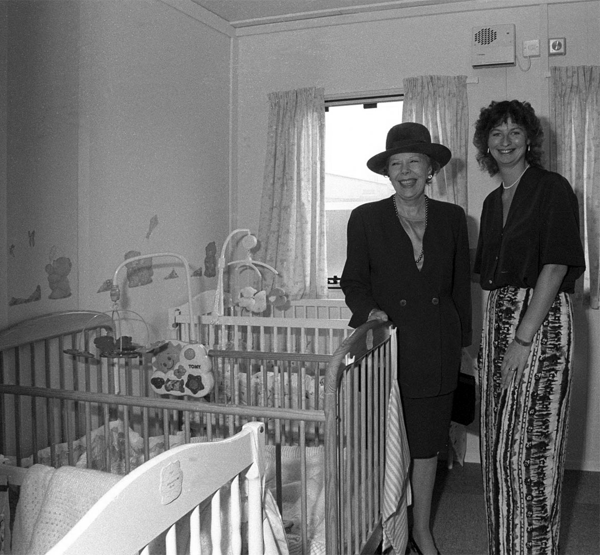
University Chancellor Dame Janet Baker at the opening of the University’s Baby Unit, October 1994 – York Digital Library
The 90s was characterised by advancement and recognition. York remained a popular choice among prospective students growing from 4,300 to 8,500 students without compromising its high entry standards. As the Sunday Times pointed out, “elitism does not appear to be the price of excellence at York”. York was one of only very few universities whose entry from state schools and colleges (around 80 per cent) was the same as the proportion of A-level students in the state system.
The introduction of official quality assessments and the proliferation of newspaper league tables saw the University’s stock rocket. After years of academic advancement, York began to get the recognition it deserved. National recognition attracted additional funding and investment. Research grants rose to over £20m per annum, and the University enjoyed one of the highest incomes per researcher in the higher education sector.
The Sir Jack Lyons Music Research Centre is opened by Roger Wright, controller of BBC Radio 3, 2004
The planning for Heslington East began in earnest in 2002 with the arrival of Brian Cantor as Vice-Chancellor. It took years of master-planning, liaison with interest groups, negotiations with land-owners and local communities, an 8-hour city planning meeting and a Public Inquiry to achieve the purchase of land and complex planning permissions for a site equal to the size of the original Heslington West campus. In 2009, the new Goodricke College opened as the first building on Heslington East.
At the time of the 40th anniversary in 2003, we wrote about Heslington East:
It will be everything that the designers of the original campus hoped for – integrated, landscaped and traffic-free, with a large expanse of water, and a very eager populace.
On 25th November 2010, we were named “University of the Year” at the Times Higher Education Awards, achieving praise from the judges for our “success in combining academic excellence with social inclusion, as well as its record in scientific discovery”.
The development of Campus East continued throughout the decade, with four new sites to accommodate academic departments and a variety of support and social buildings, including the Ron Cooke Hub and York Sports Village.
Campus West also saw much expansion and redevelopment during the 2010s, with the opening of the £13.8m Spring Lane Learning and Teaching Building and £16m Biology teaching and laboratory facility in 2016.
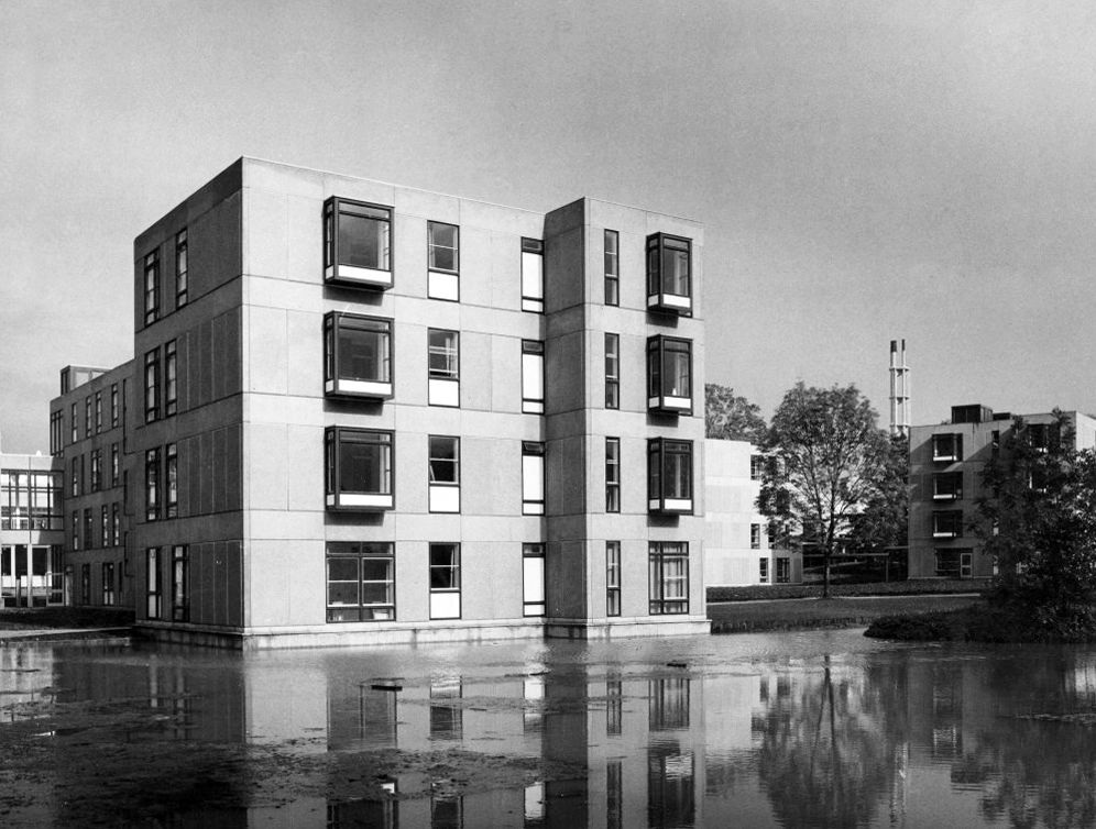
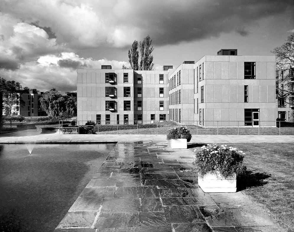
The University of York was founded in 1963 and work on its campus facilities in the grounds of Heslington Hall was begun in 1964. The first two colleges, Langwith and Derwent, accepted residential students for the autumn term of 1965. The original buildings were designed by Sir Andrew Derbyshire of Robert Matthew Johnson-Marshall & Partners, and assembled using the CLASP system of prefabricated construction.
RIBA
Founded in 1956 by architects Robert Matthew and Stirrat Johnson-Marshall, RMJM’s first offices were based in London and Edinburgh.
RMJM is now one of the largest architecture and design networks in the world. Services include architecture, development management, engineering, interior design, landscape design, lead consultancy, master planning, product design, specialist advisory services, and urban design
Langwith College 1965 – photo Reginald Hugo de Burgh Galwey
Constructed using the Consortium of Local Authorities Special Programme – CLASP system, formed in 1957 by Local Authorities in England to develop a shared prefabricated system for the construction of school buildings. The resulting CLASP building system was initially developed by Charles Herbert Aslin, the county architect for Hertfordshire.
CLASP’s popularity in coal mining areas was in part because the system permitted fairly straightforward replacement of subsidence-damaged sections of building, and the lightness of the structures. The system was also later used for the construction of railway stations, offices, university buildings, and churches until the late 1970s.
Today, 3000 examples are still in use.
Photo – Keith Gibson 1965
The system utilised prefabricated light gauge steel frames which could be built economically up to a maximum of four storeys. The frames were finished in a variety of claddings and their modular nature could be employed to produce architecturally satisfying buildings. Initially developed solely for schools, the system was also used to provide offices and housing.
The cynics’ definition of the CLASP acronym, circulating in the 1970s, was:
collection of loosely assembled steel parts.
CLASP buildings fell out of favour in the late 1970s. Budgetary advances and changing architectural tastes made the scheme obsolete.
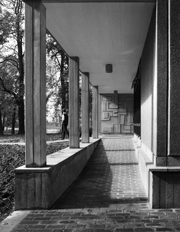
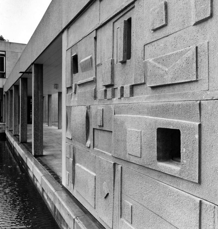
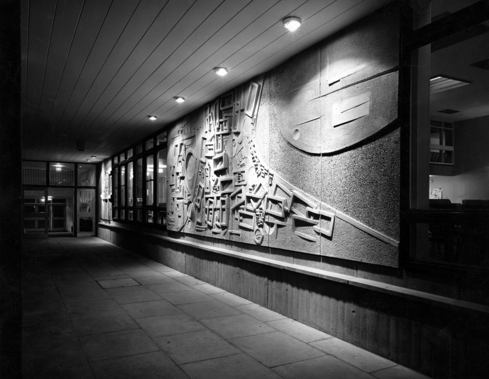
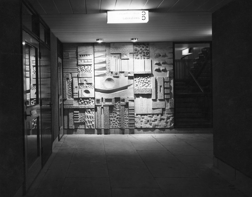
Walkway Derwent College with concrete relief by Fred Millett 1965
Photos 1965 Bill Toomey
Fred Millett 1920–1980 was a muralist and poster artist who exhibited at the Festival of Britain and was commissioned by London Transport, National Westminster Bank, University of York and the General Post Office. He also taught Perception and Communication at the Polytechnic of Central London.
Fred Millett – Sculpted Wall Raglan Estate Camden 1965
Originally part of the children’s playground, the work is a feature of a post war estate designed by Frank Scarlett in Kentish Town
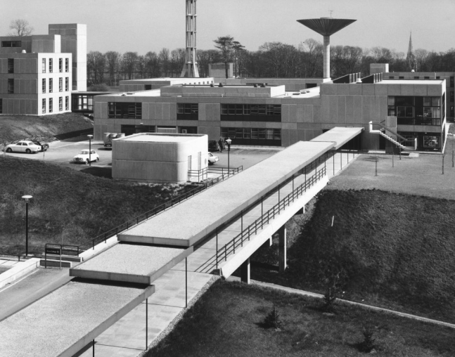
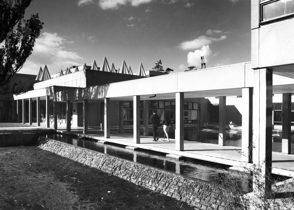
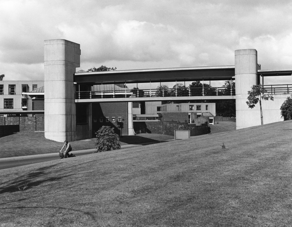
JB Morrell Library seen from the south side of Heslington Road with linking pedestrian bridge and ramp in foreground and cast aluminium sculpture by Austin Wright.
Austin Wright 1911-1997 is a significant post-war sculptor whose personal and professional lives were deeply intertwined with the city of York.
He was born on 4th June 1911 in Chester but spent his childhood in Cardiff. Though a largely self-taught artist, Austin took evening classes at Cardiff Art School. Austin attended New College, University of Oxford for his degree in Modern Languages before he started his teacher training. His first job as a teacher started in 1934 at The Downs, Malvern in Worcestershire. The school attracted artistic people. W.H. Auden taught English for example, and the art master organised a Dada exhibition one year. Here, Austin taught painting and sculpture as well as French and German.
Covered pedestrian bridge linking the southern side of the campus to the JB Morrell Library on the north side.
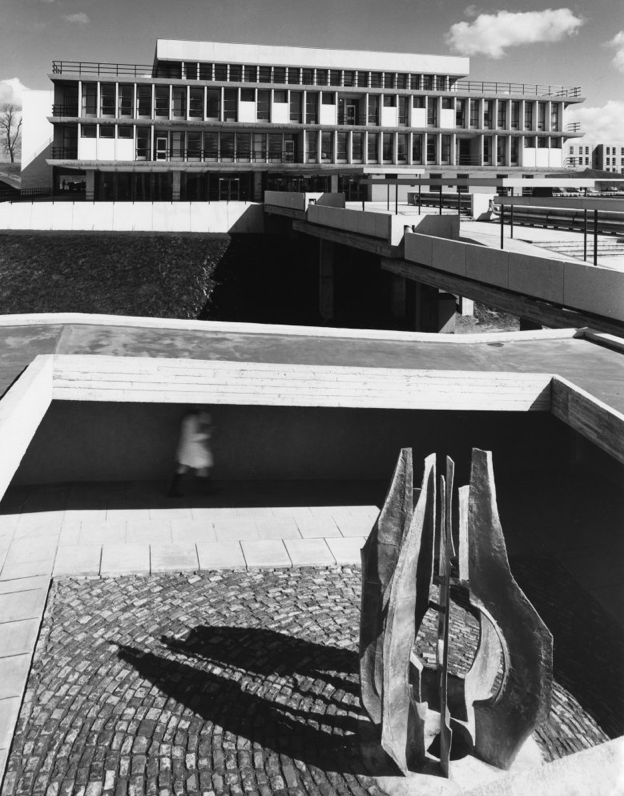
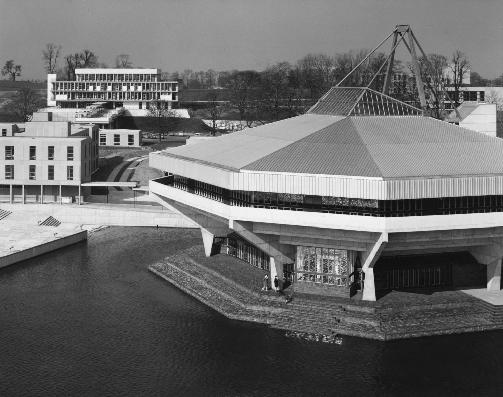
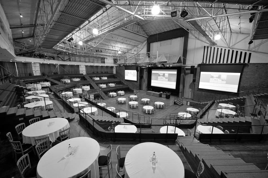
Central Hall
Colloquially known as The Spaceship designed by John Speight, constructed in 1966–1968. The hall is seen as a tour de force of the university, appearing on merchandise and often used as a background for university publicity.
Central lecture and recreation hall to the University of York, 1966-1968 by Robert Matthew, Johnson-Marshall & Partners with Stirrat Johnson-Marshall and Andrew Derbyshire as partners in charge, and John Speight as job architect.
* it forms part of a wave of seven new universities that improved access to higher education and marked the high point of publicly-funded architecture in post-war Britain;
* it is a physical manifestation of the University of York Development Plan, which was heralded as the beginning of contemporary university planning in Britain;
* it continues a historic tradition established by late-C19/early-C20 ‘red brick’ universities of featuring a great hall for special events.
* it has an imaginative and bold design with a striking architectural form and massing that is the focus of the most dramatic views across the campus lake;
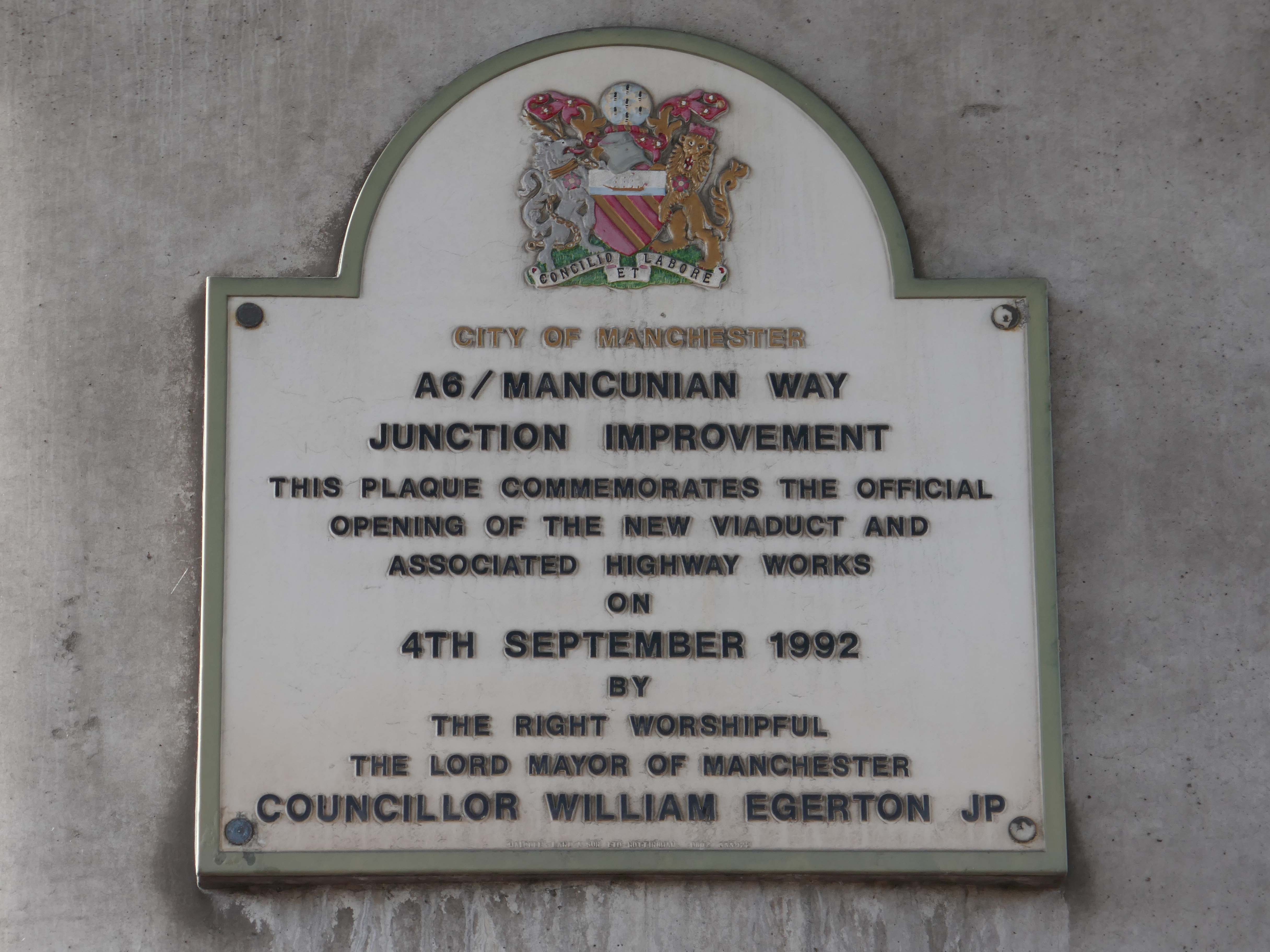
On Wednesday 21st January, I boarded the 9.33 for Blackpool from Platform 14 Manchester Piccadilly station.
10.35 the train terminated at Preston – thus far and no further.
Thinking on my feet, I legged it rapido to Preston Bus Station and just about caught the 68 bus to Blackpool.
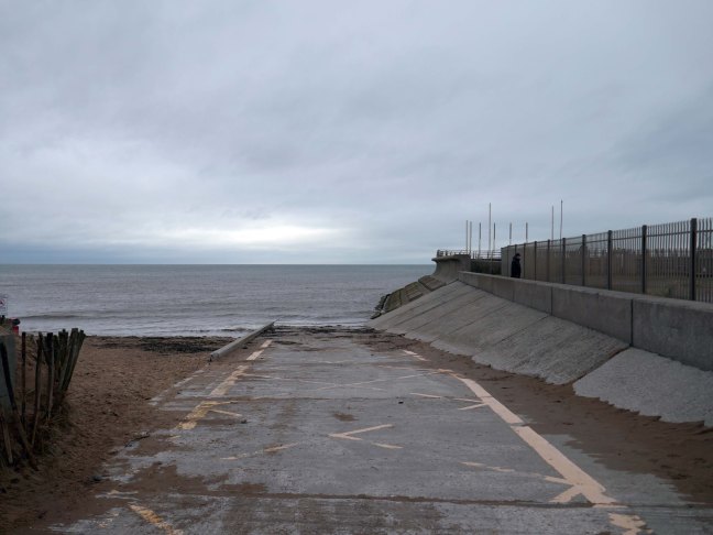
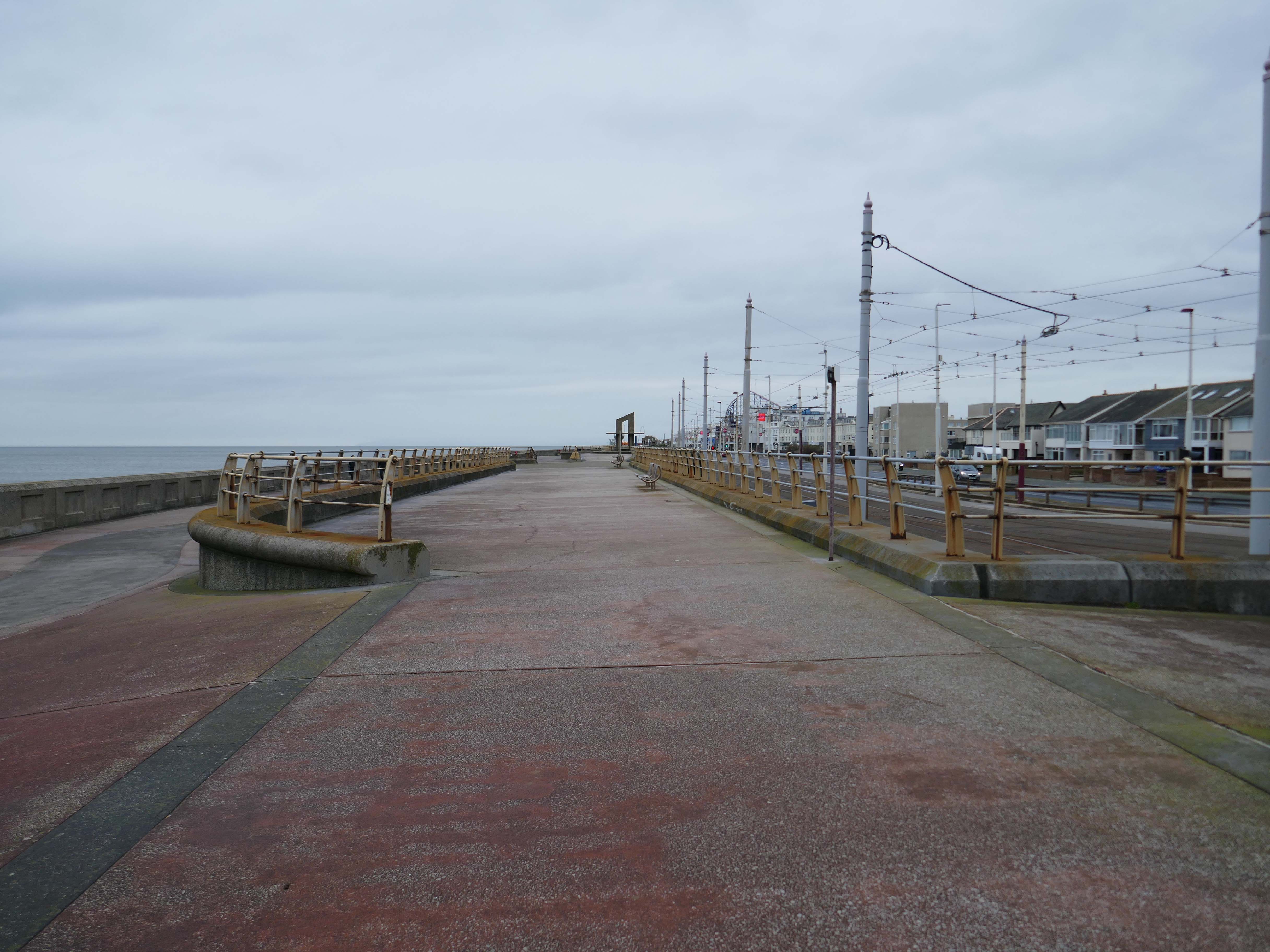
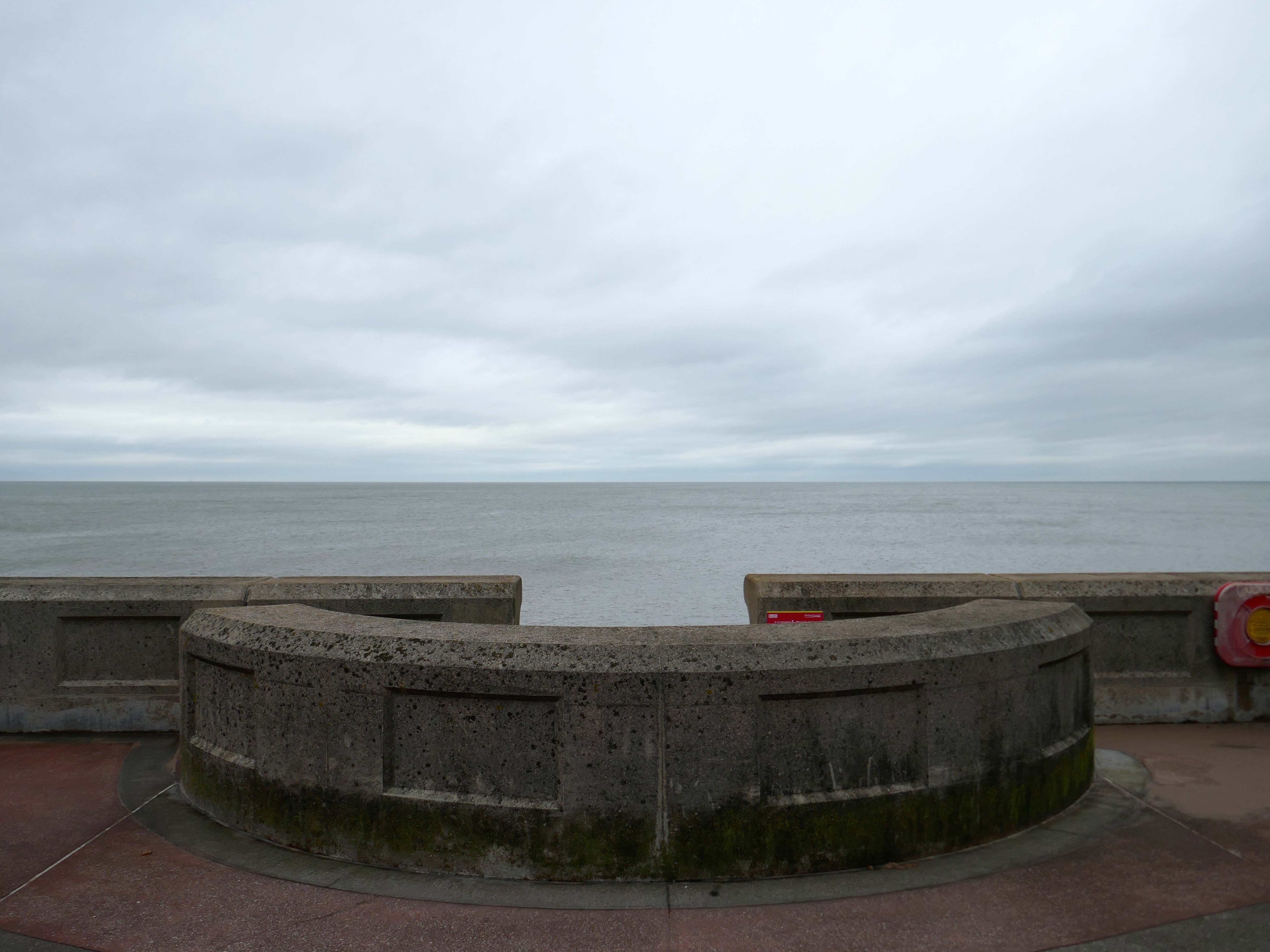
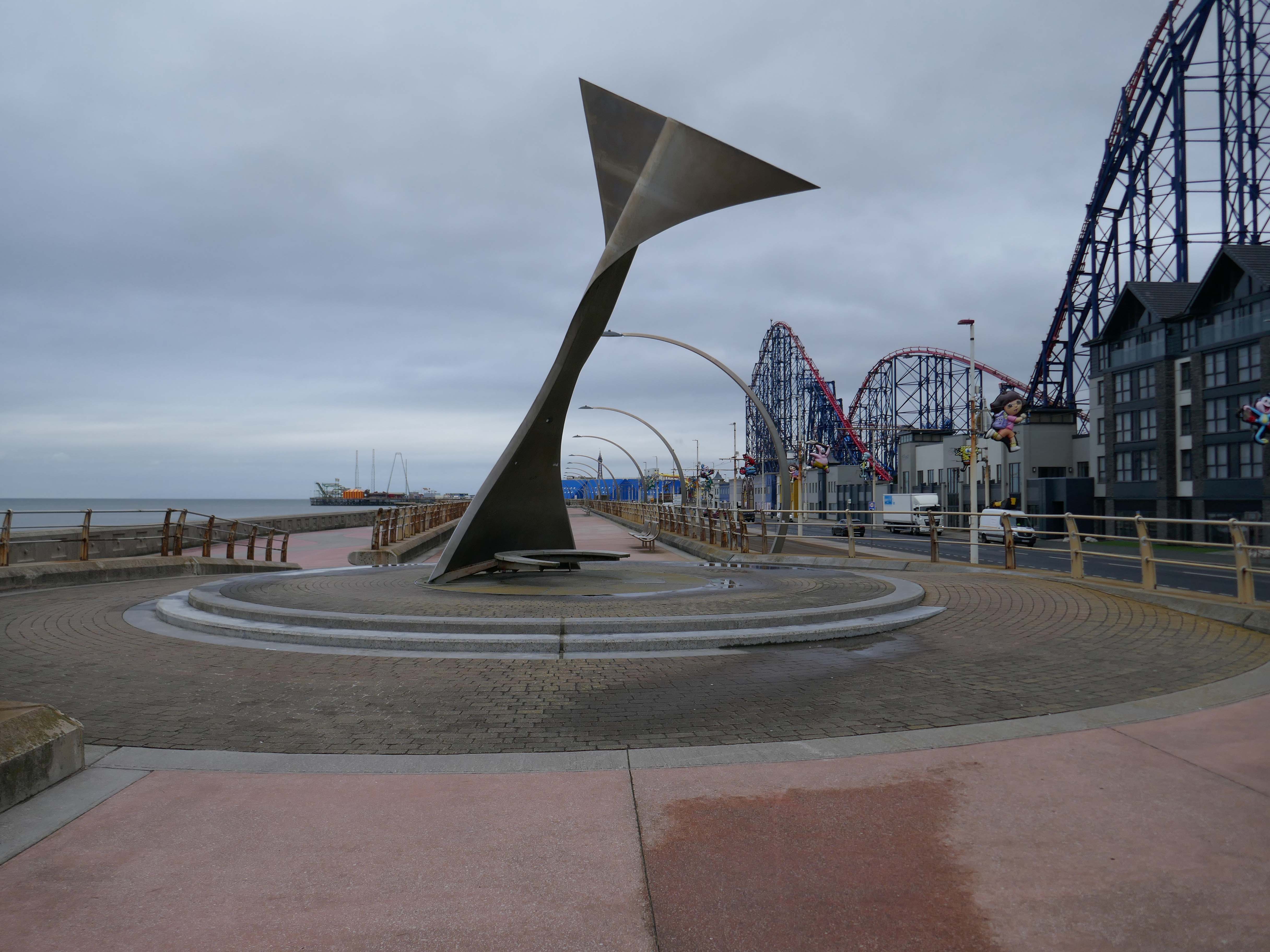
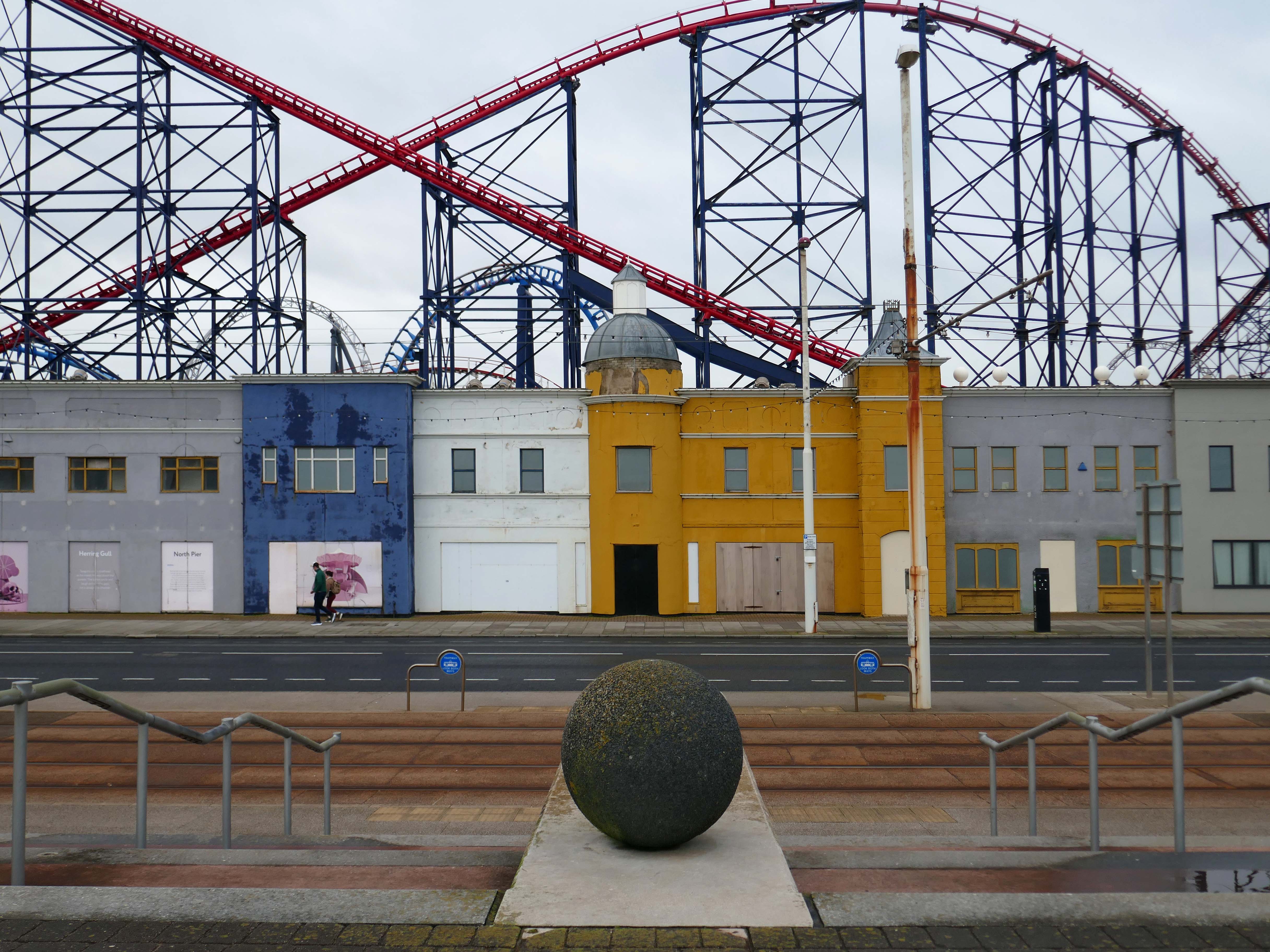
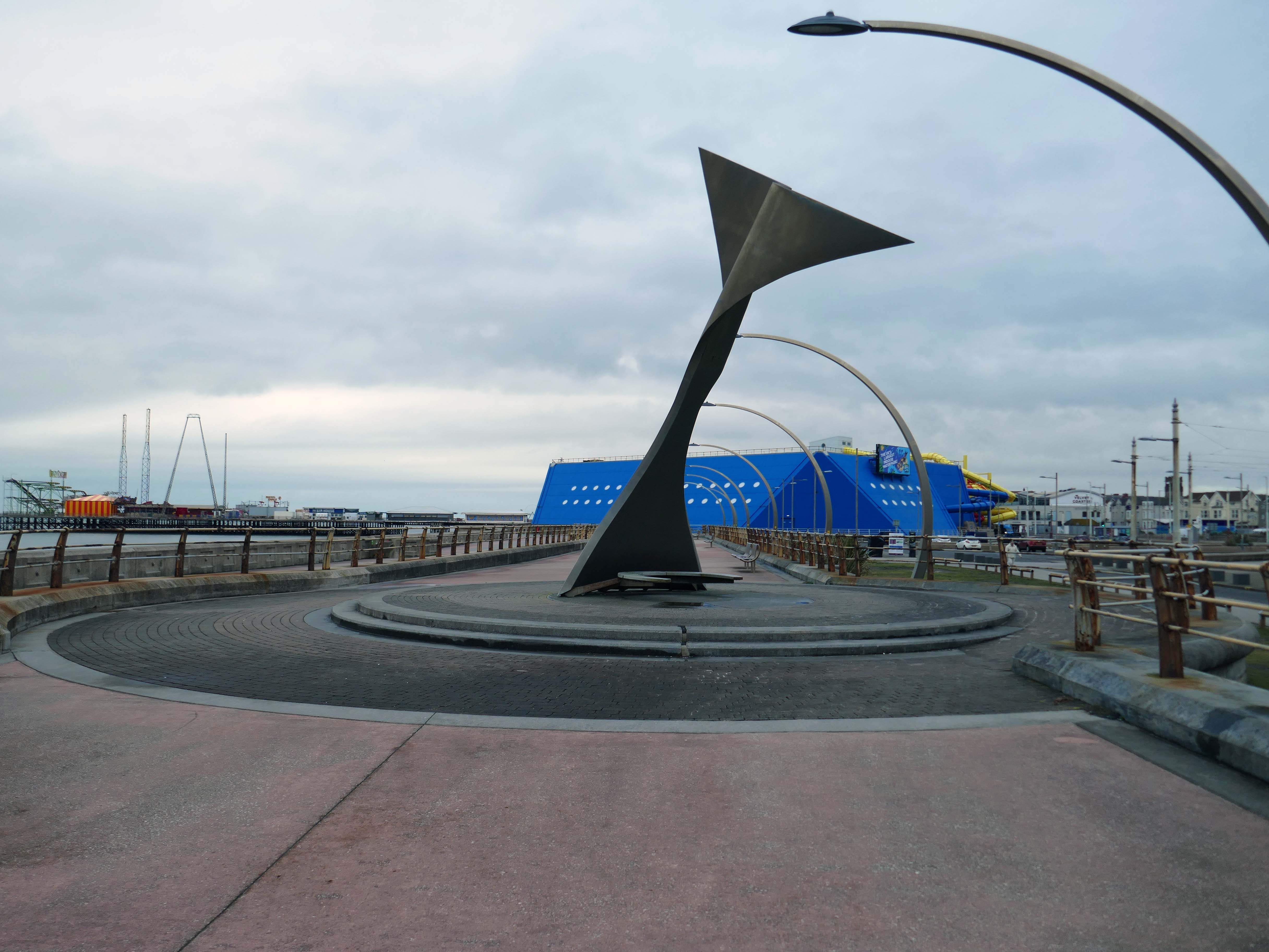
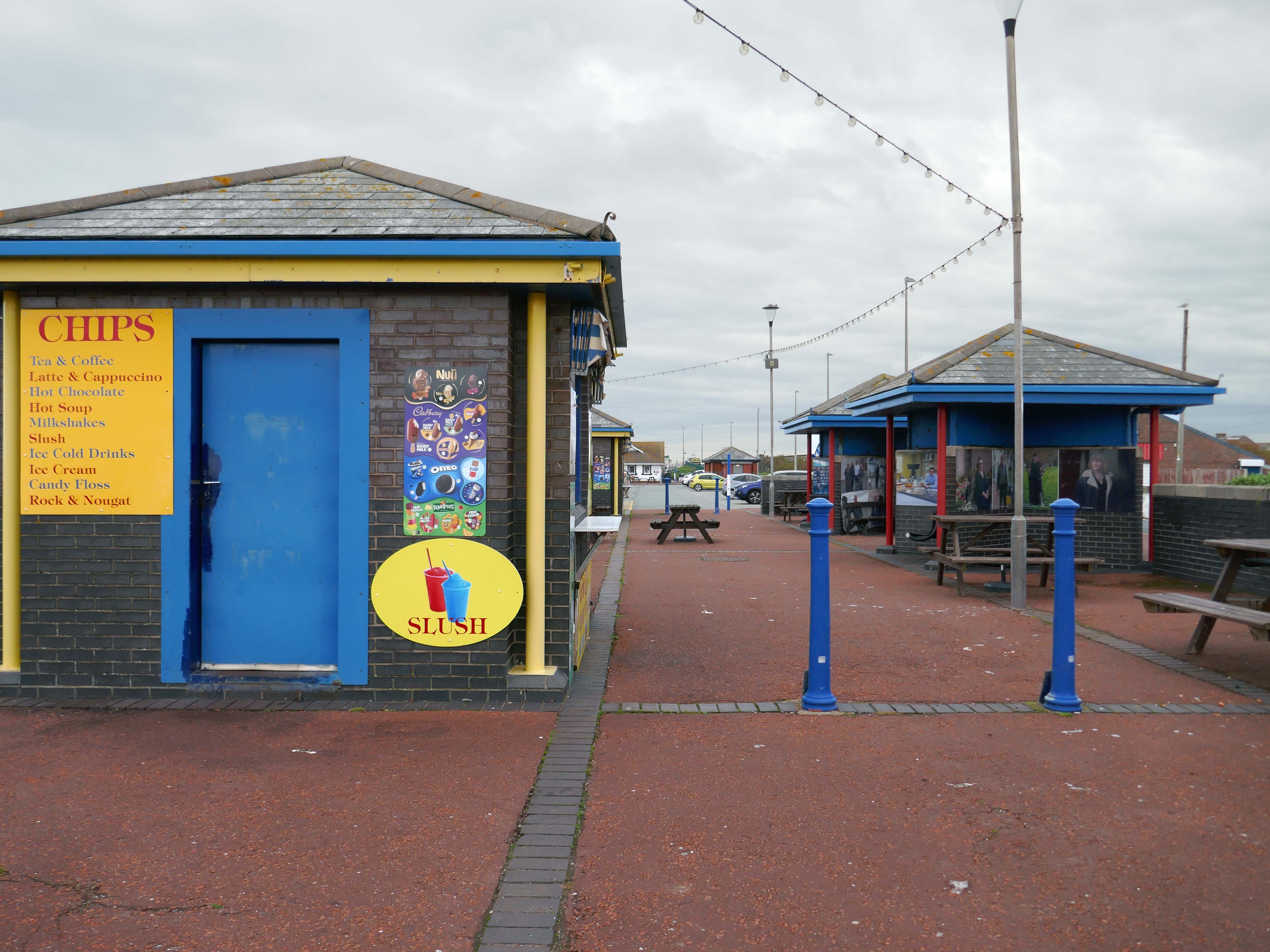
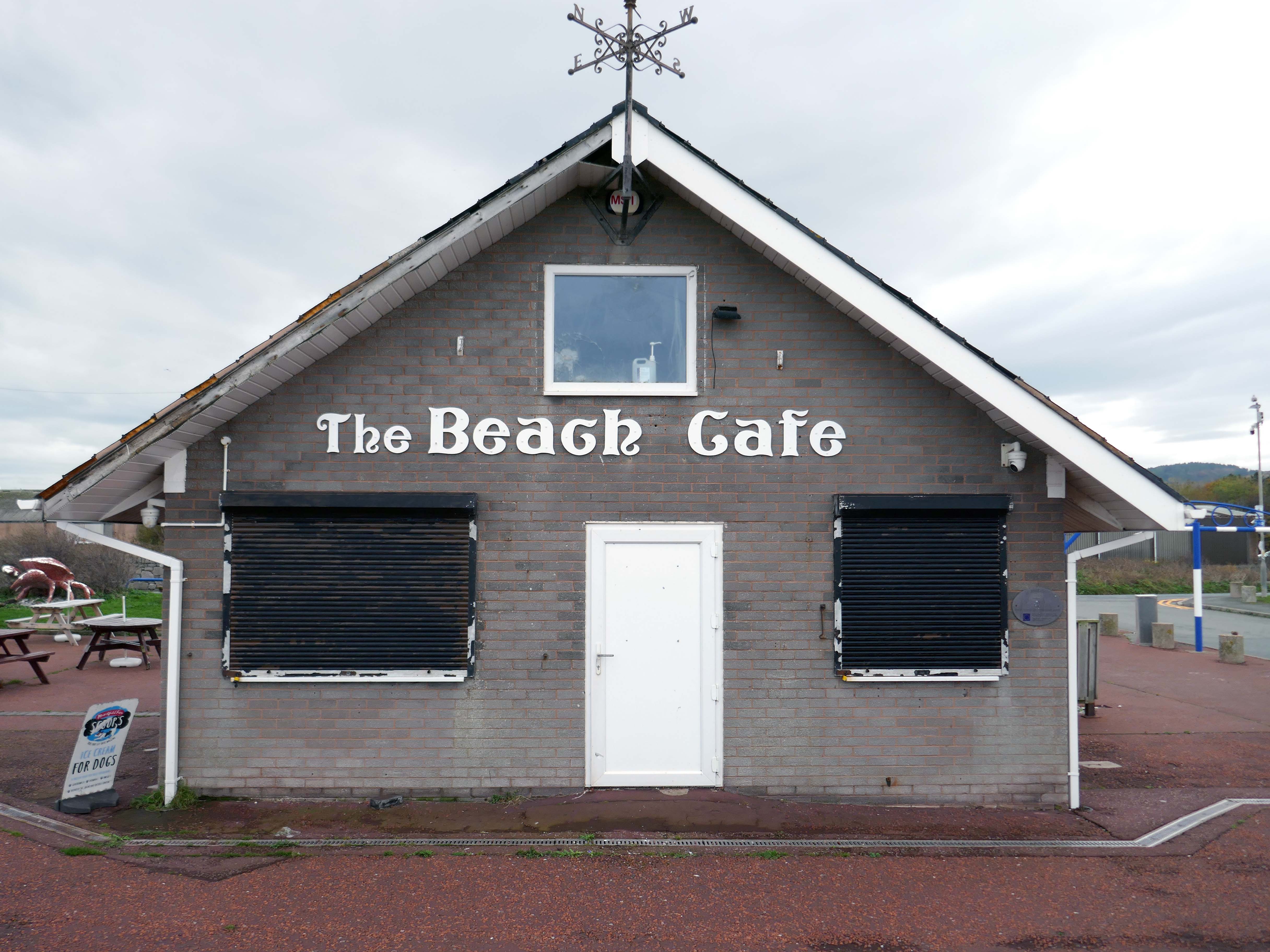
Already an hour or two behind time I elected to alight at Squires Gate, and take a walk along the South Promenade toward the town centre.
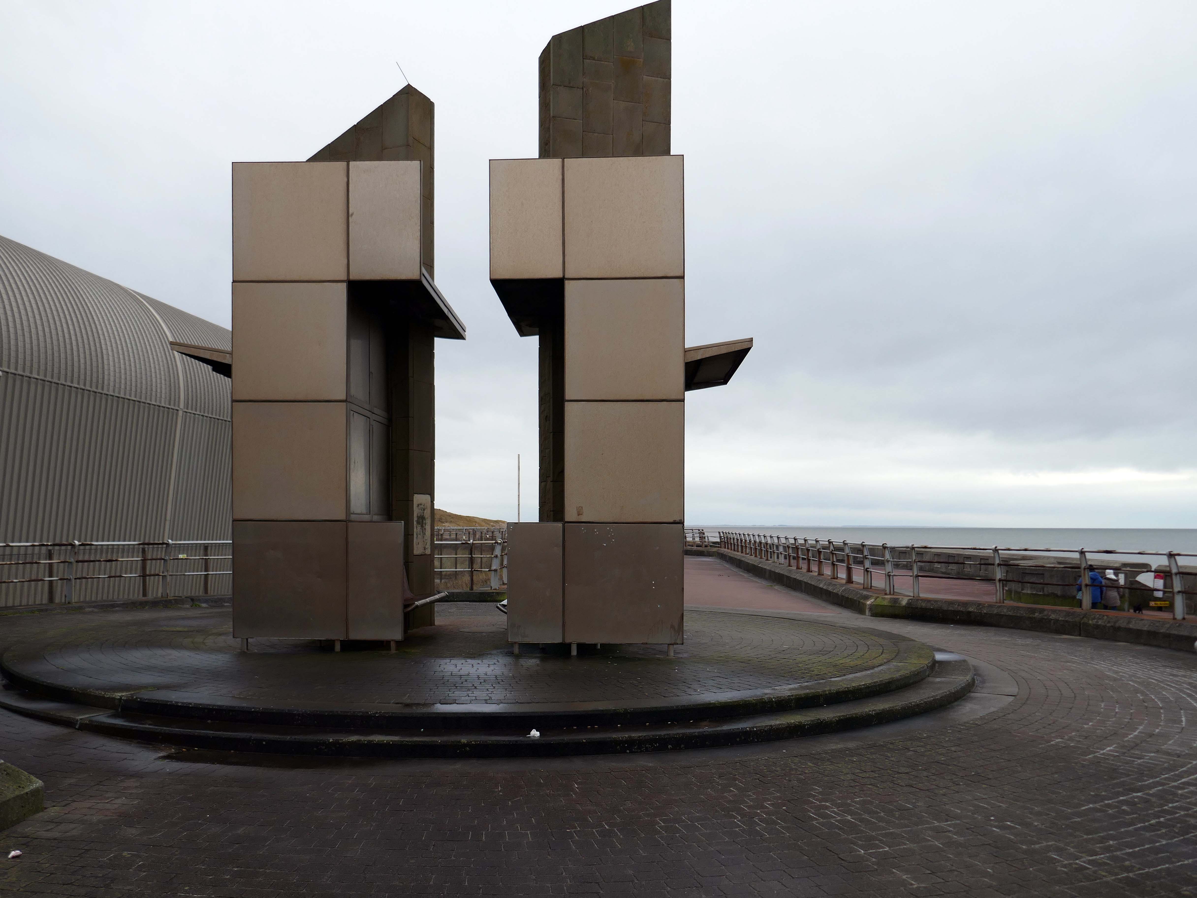
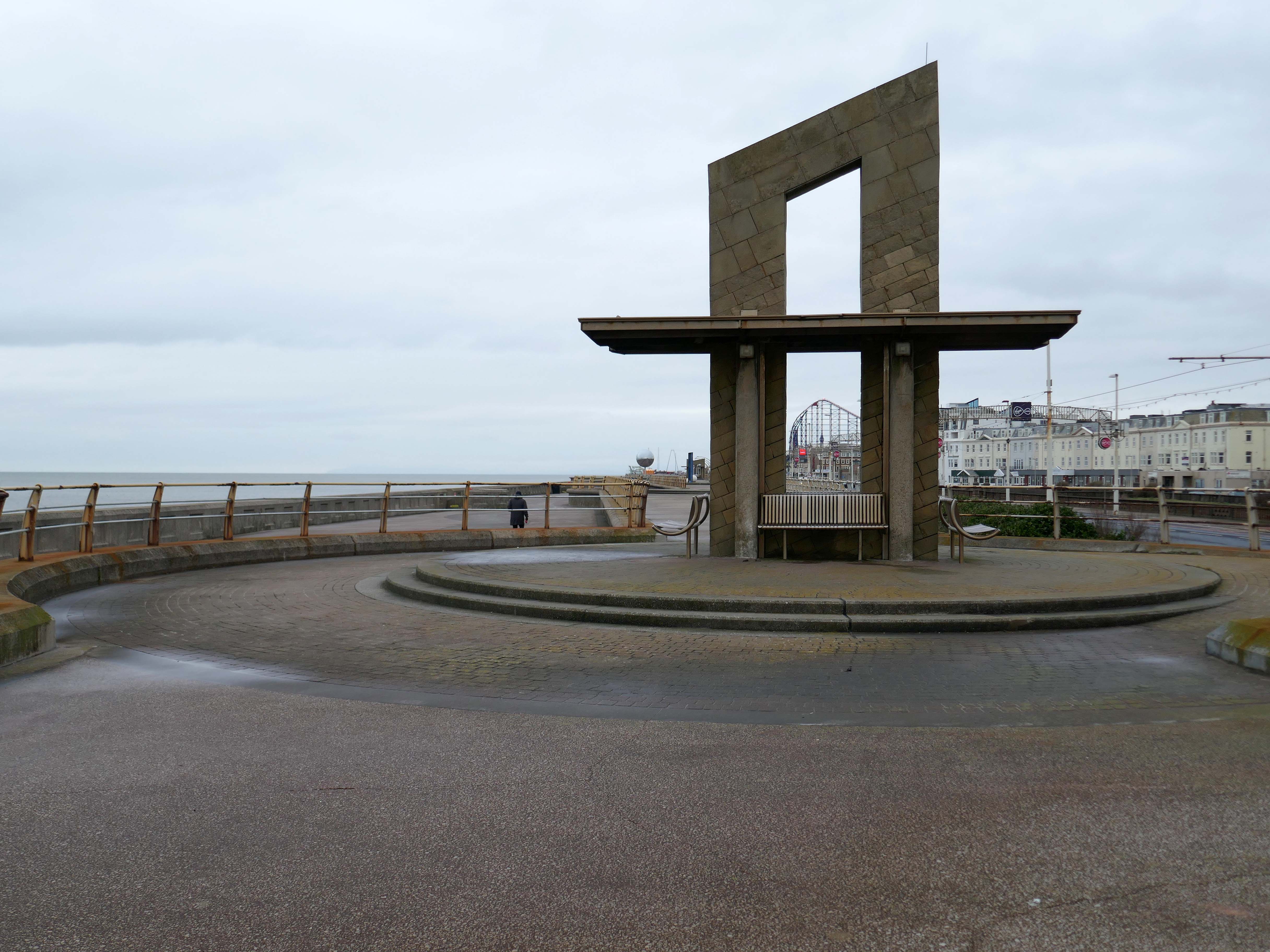
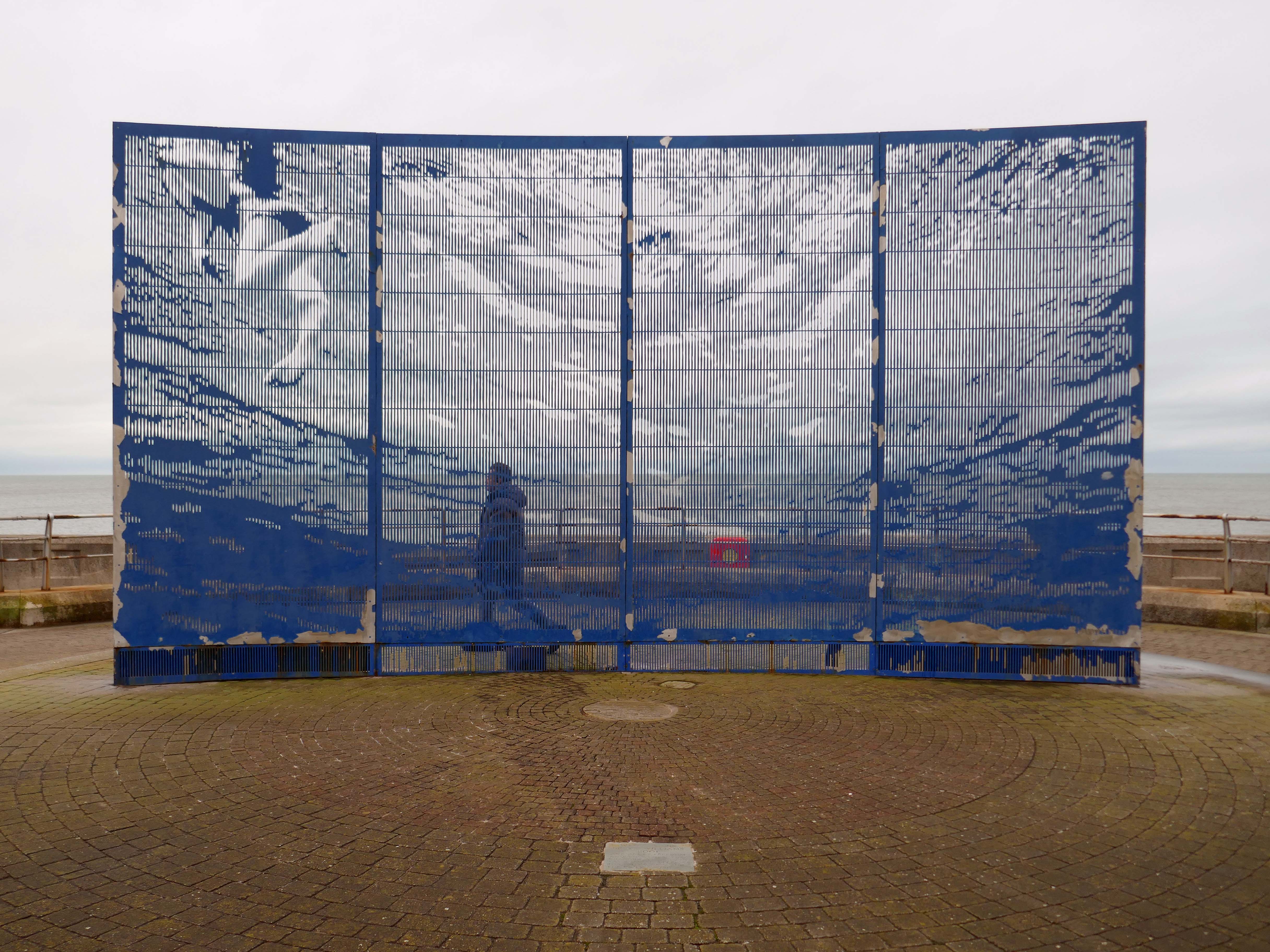
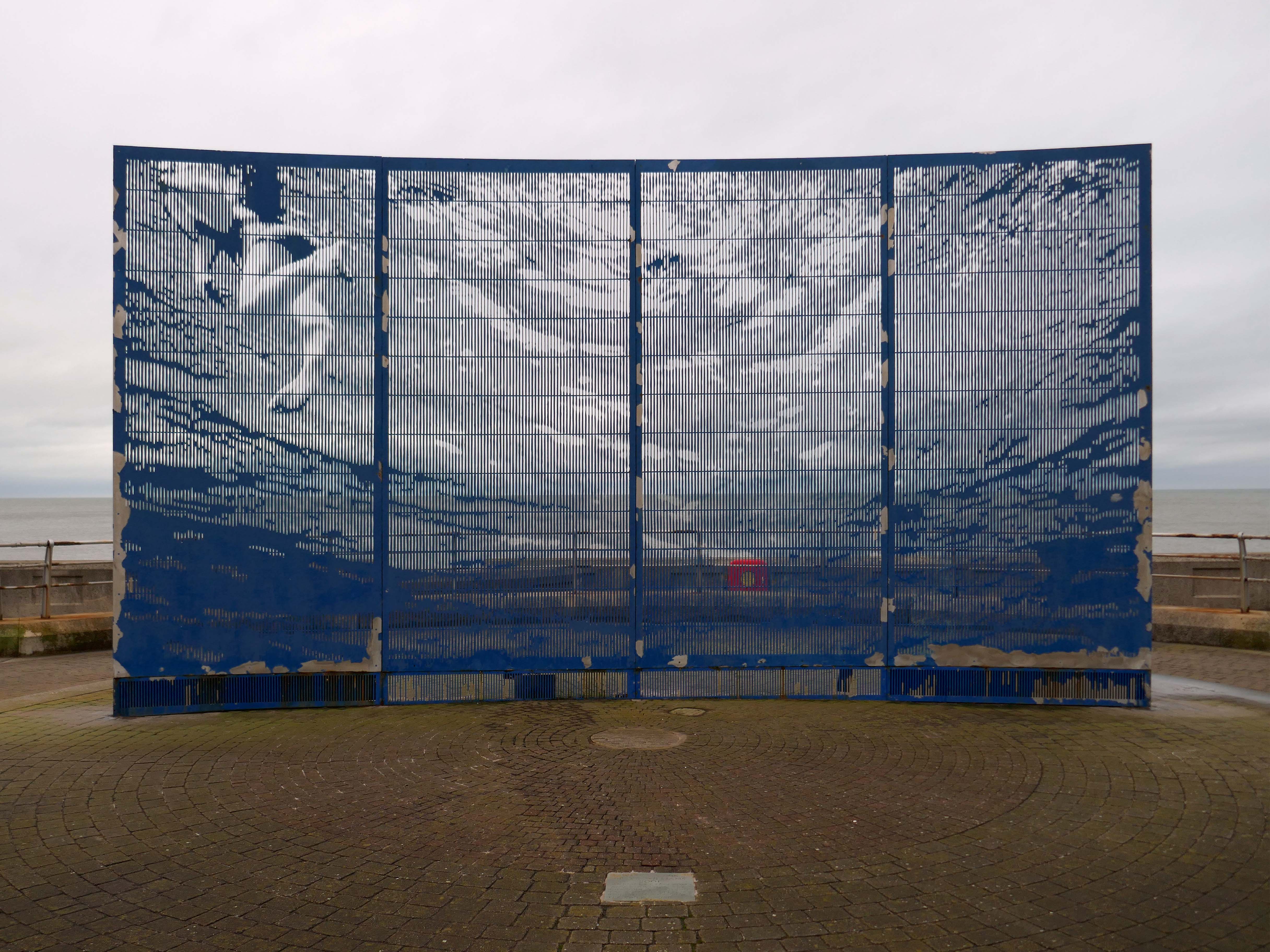
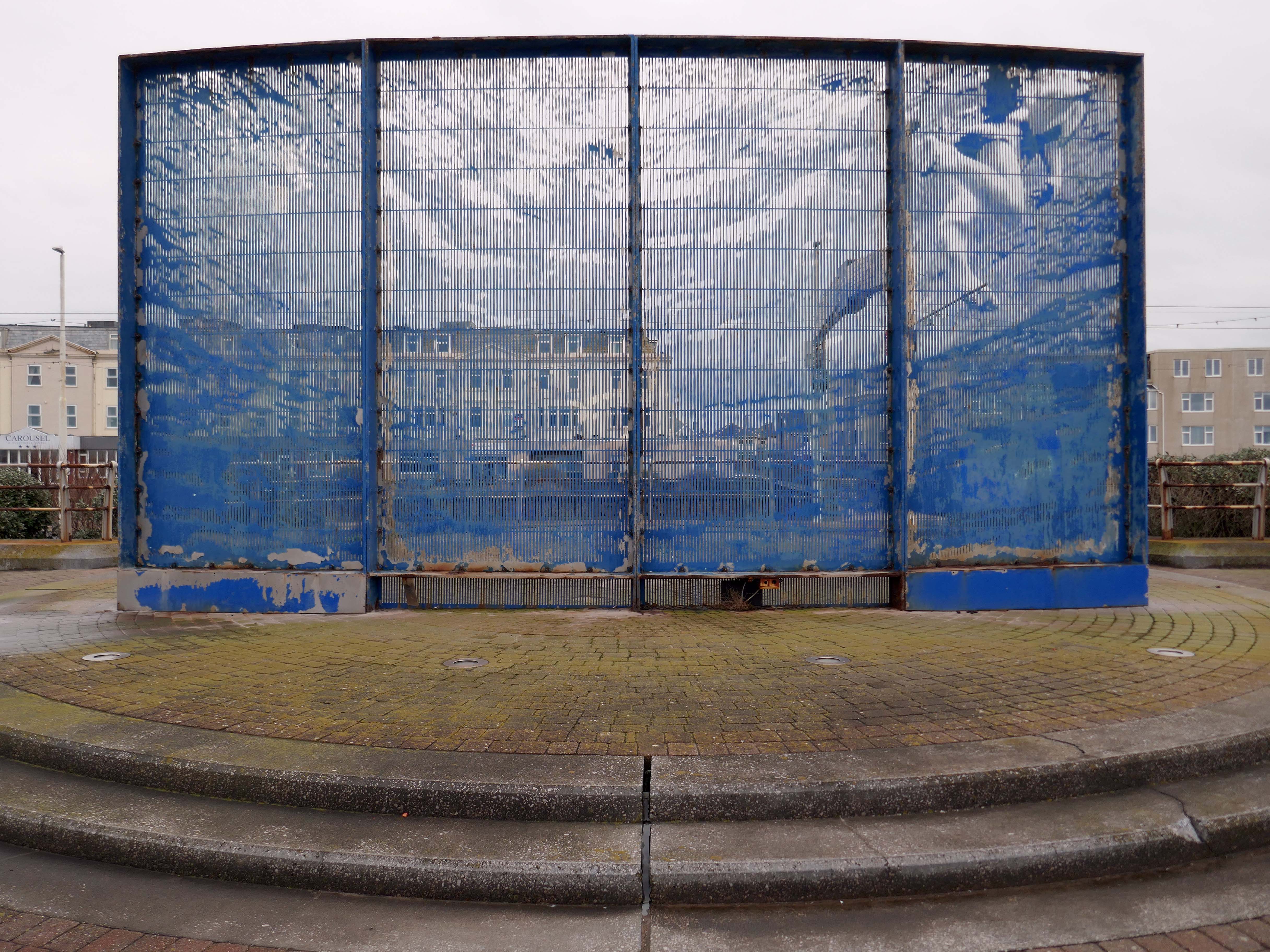
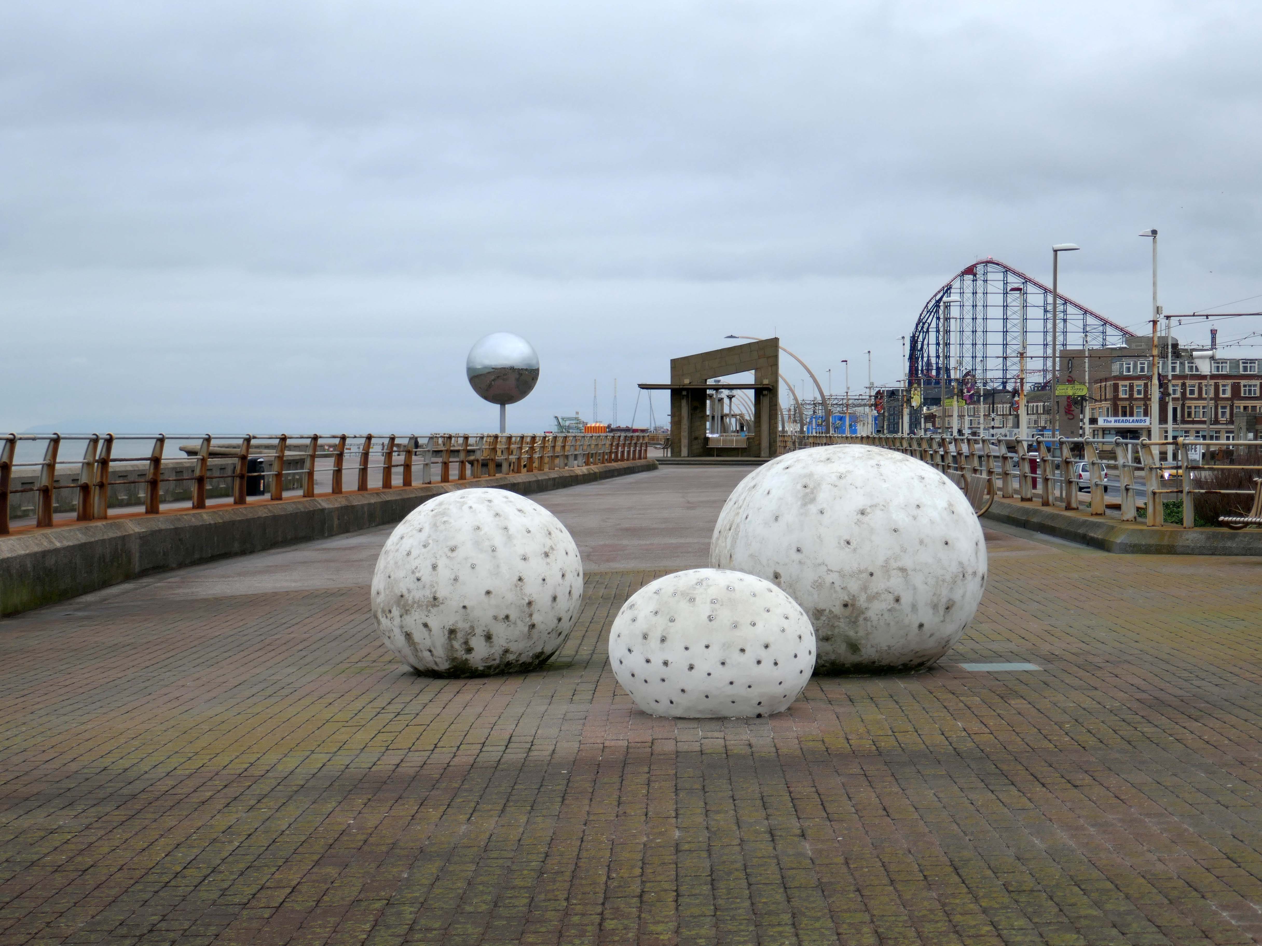
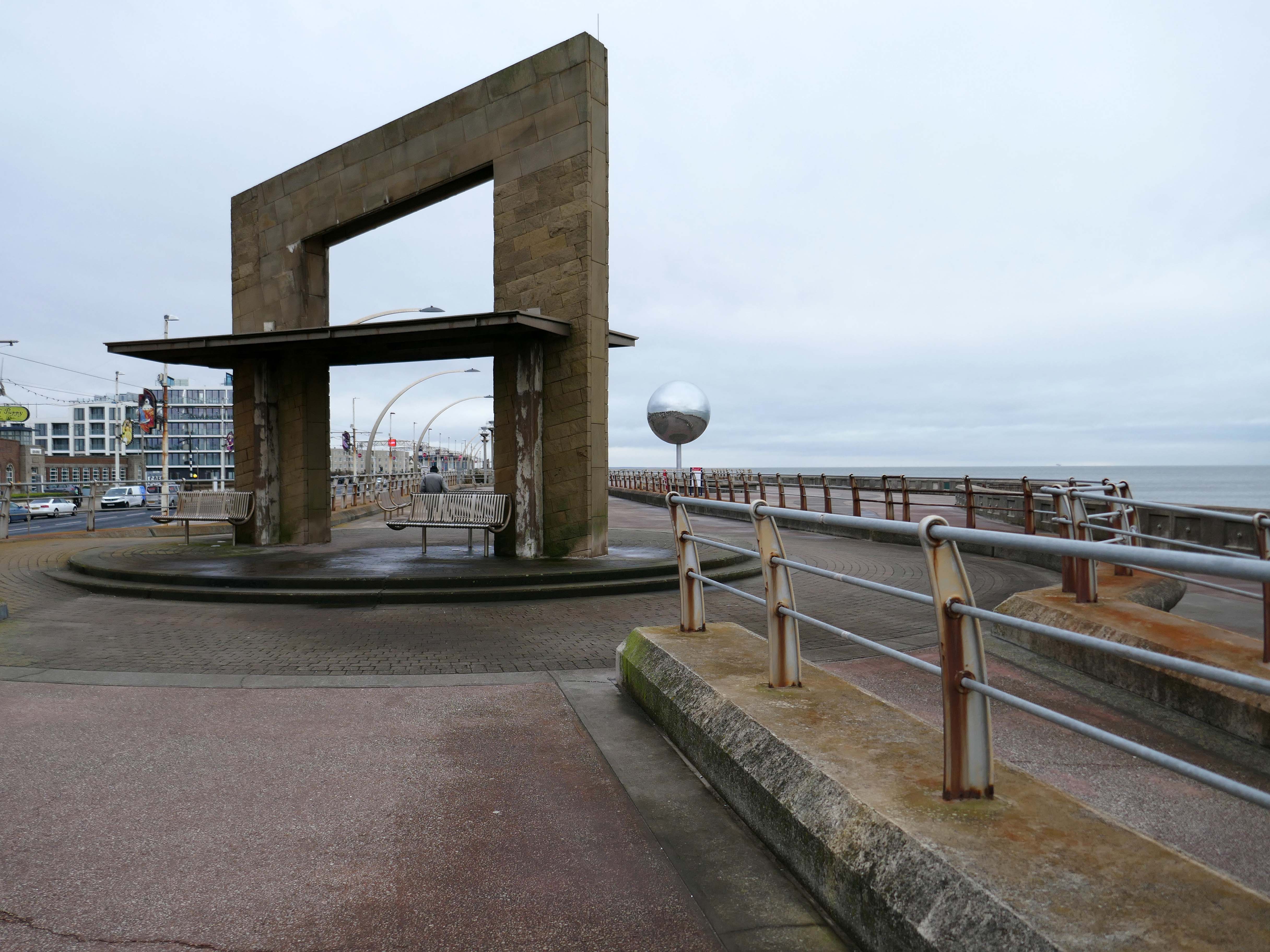
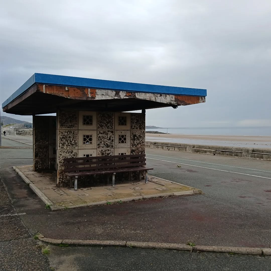
The promenade is home to a plethora of public art works and sculptural shelters.
The Great Promenade Show originated from the major redevelopment undertaken by the then Department for Environment, Food and Rural Affairs to replace and strengthen the 2km long South Promenade’s seawall flood defences. This £20 million project entailed removing the existing Victorian promenade and replacing it with a new well-designed concrete promenade on two levels. The upper level was to incorporate ’roundels’ every hundred metres, on which it was intended to site specially designed features, including wind shelters and visual displays possibly representative of the history of Blackpool. A Millennium Lottery bid was made by the Council to this end, though a commitment to start building had to be made before the outcome of the bid was known. The bid was unsuccessful, but the sites for visual features along the new promenade remained, as did the Council’s commitment to occupying them. At this point, responsibility for managing the project shifted from the Council’s Technical Services Department to its Education, Leisure and Cultural Services Division.
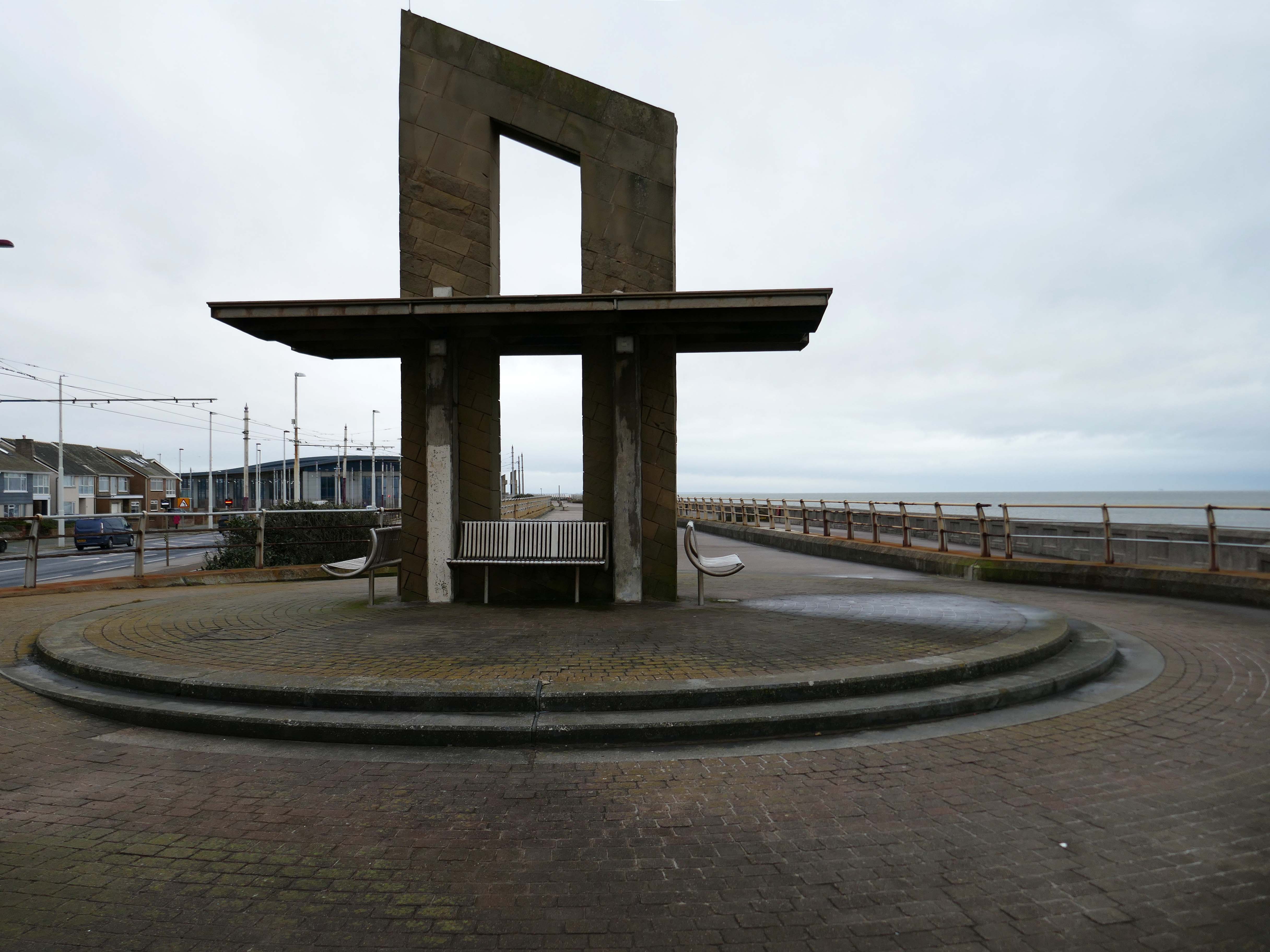
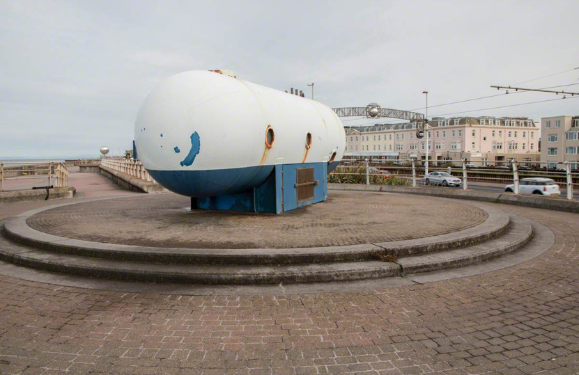
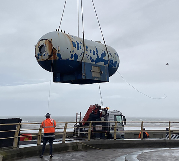
Like a sinister exhibit in one of Blackpool ‘s Victorian freak shows, the skeleton of a killer whale made from pulsating dark blue neon can be viewed through portholes within a metal tank like a decompression chamber.
The work was subsequently removed.
The structure has been on display for the public to enjoy for over 15 years and was deemed unsightly due to corrosion, which is why the decision was taken to remove it. PTSG Building Access Specialists Ltd planned the decommissioning and contract crane lift from start to completion.
Designed to be viewed in motion from the adjacent tram track and road, the photographic image of a swimming child laser cut into an 8m long curved stainless steel screen gradually resolves and disappears again as the viewer moves past.
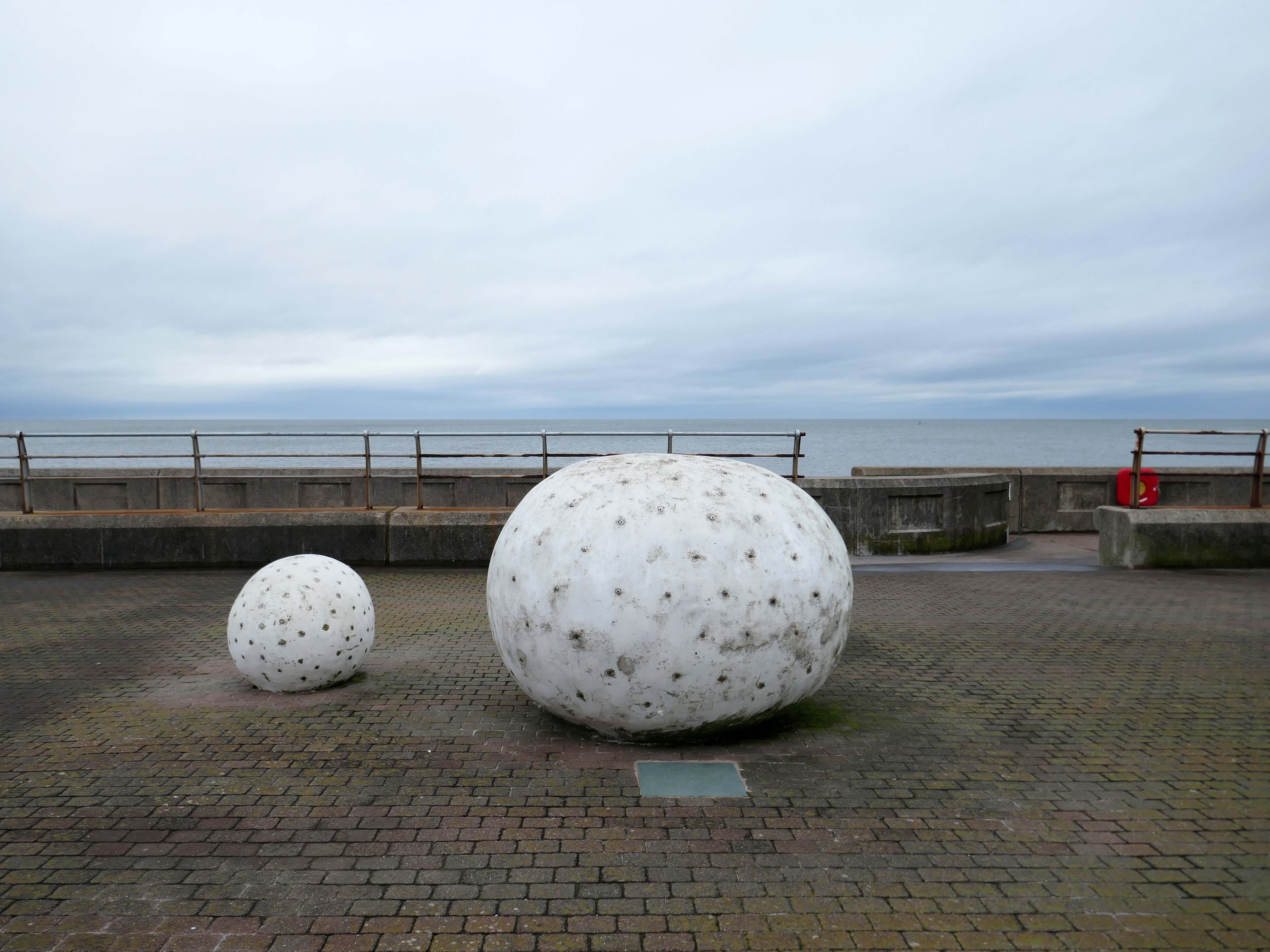
Glam Rocks by Peter Freeman
Inspired by Las Vegas and the Blackpool Illuminations, three large pebble-like modelled shapes glitter after dark, as hundreds of fibre optic light points on their surface slowly change colour and sparkle.
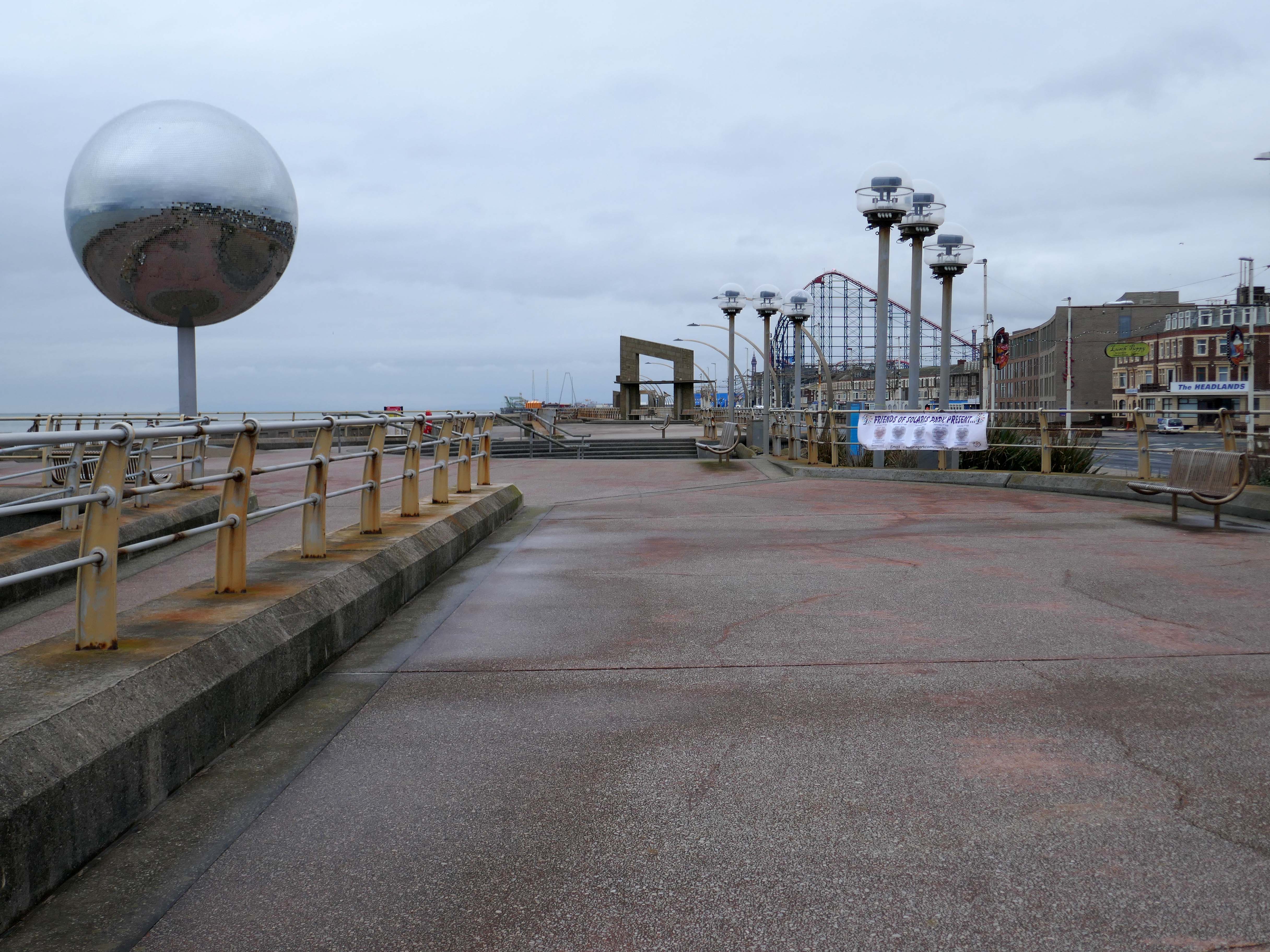
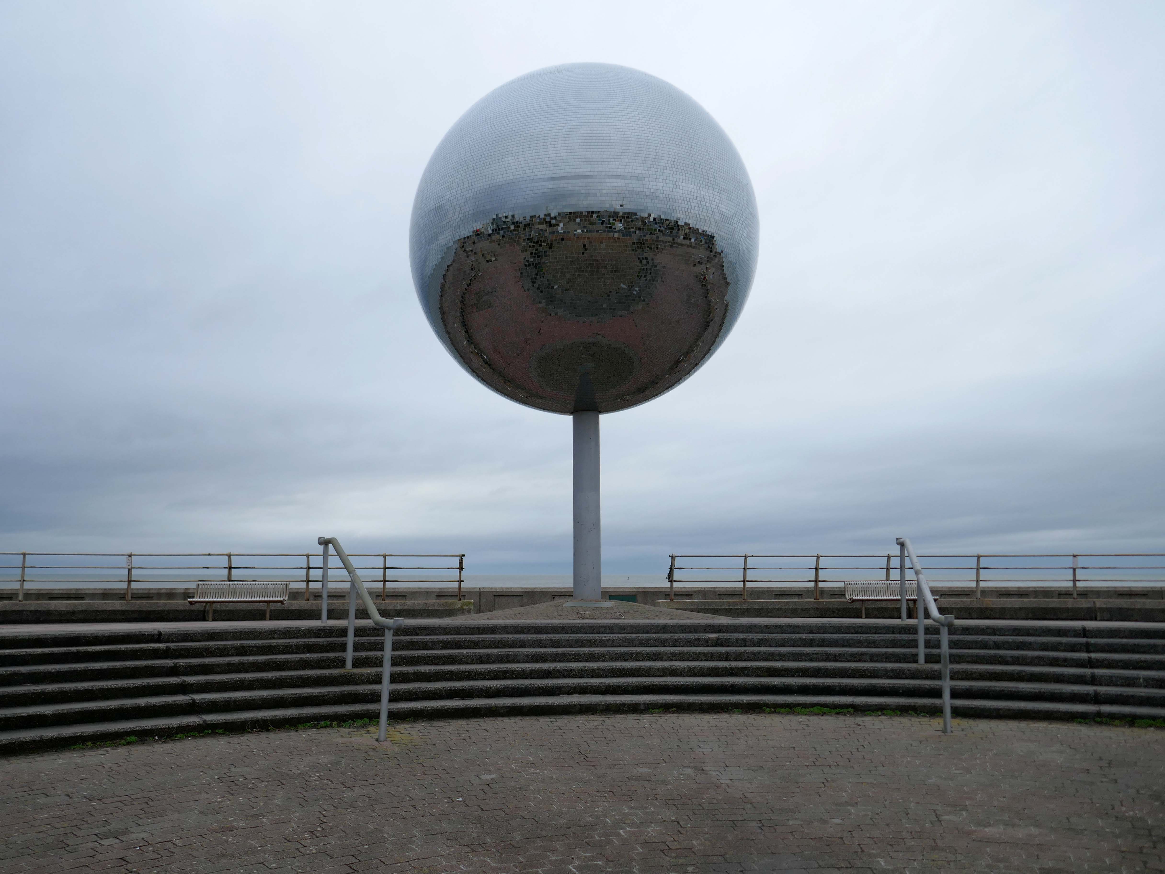
They Shoot Horses, Don’t They? by Michael Trainor and The Art Department
Blackpool is known as the “ballroom capital of Britain”. This rotating ball 6m in diameter, covered in almost 47,000 mirrors, has been claimed as the world’s largest mirror ball, and is named after the 1969 film about a depression era ballroom marathon in the USA.
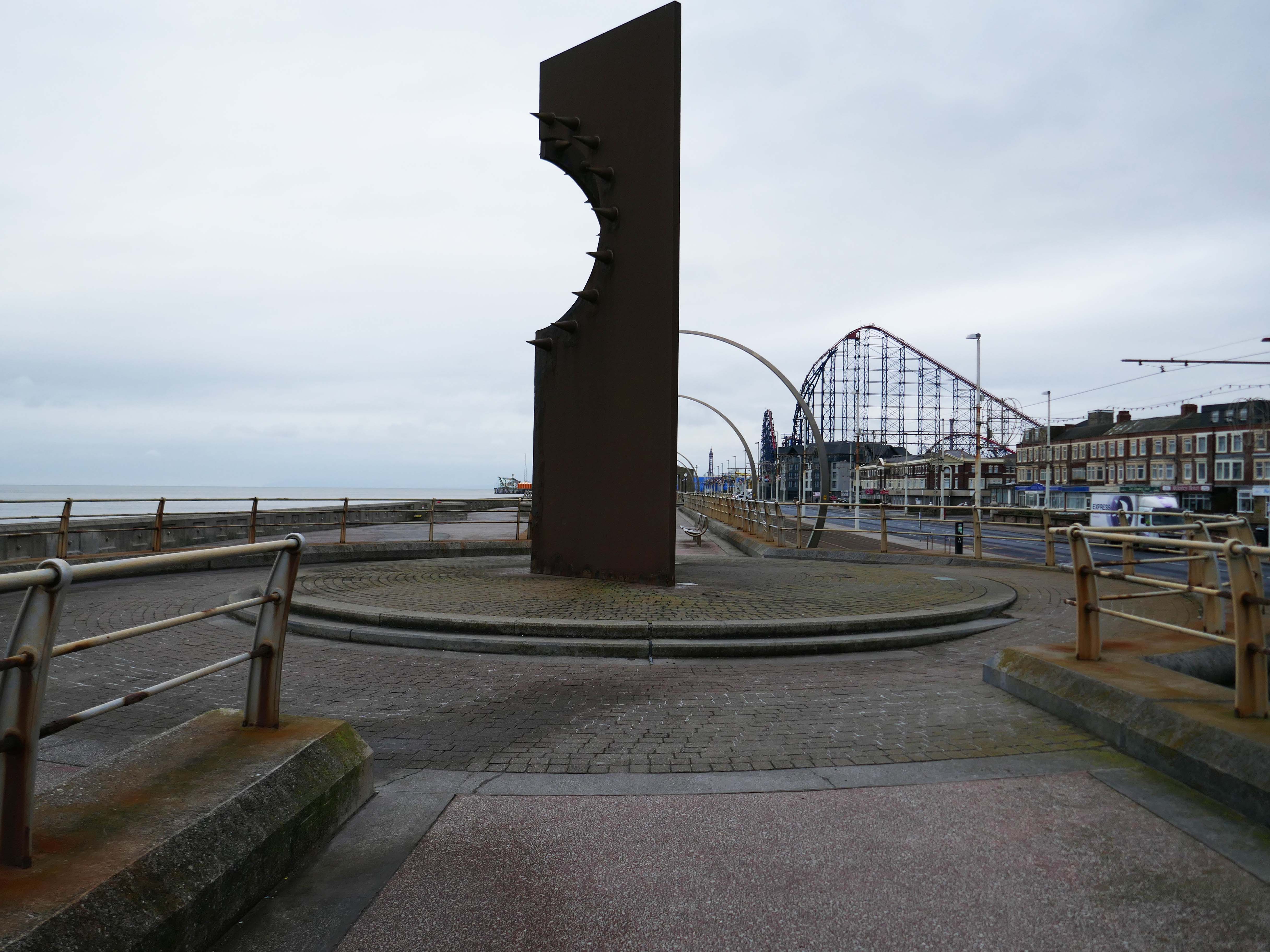
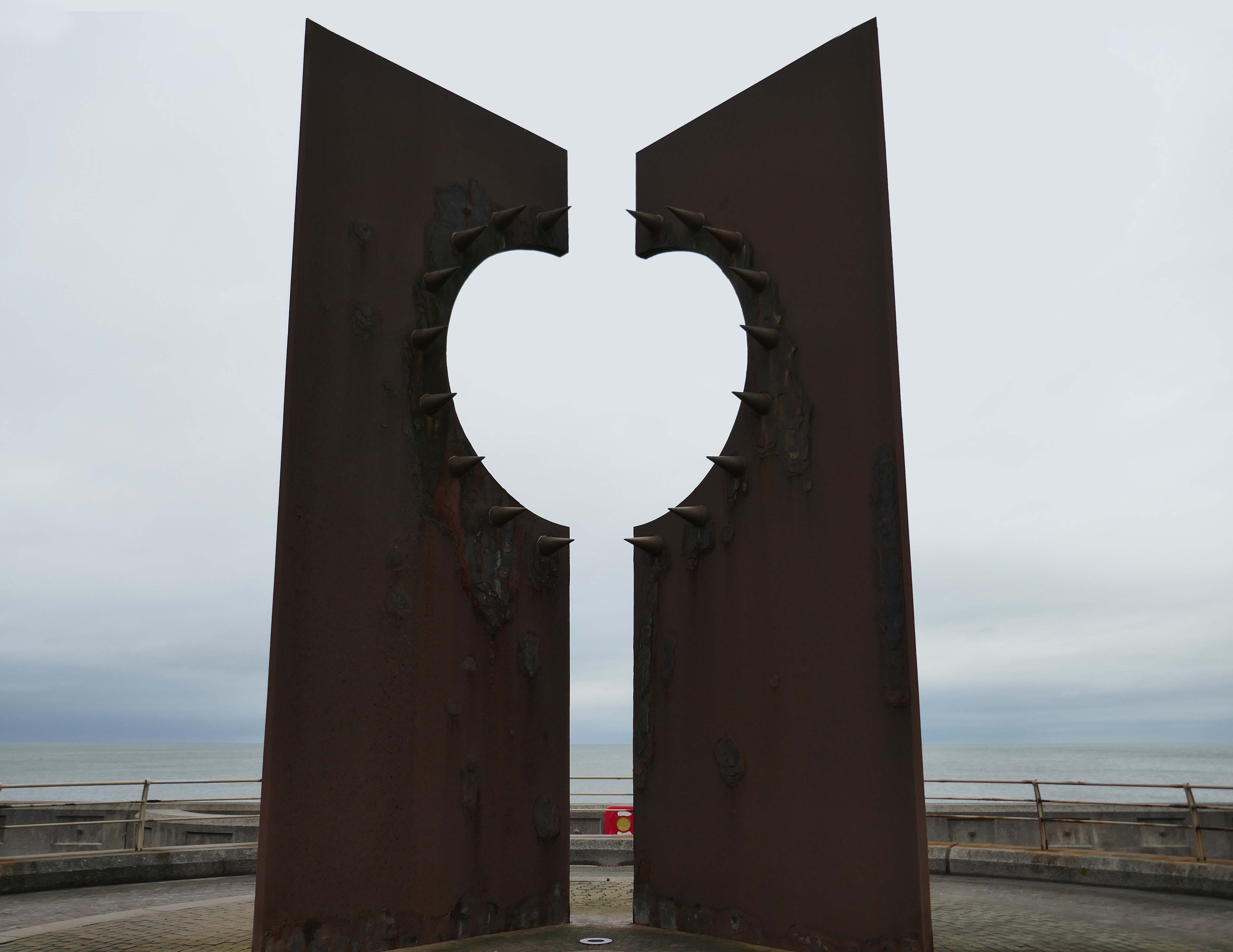
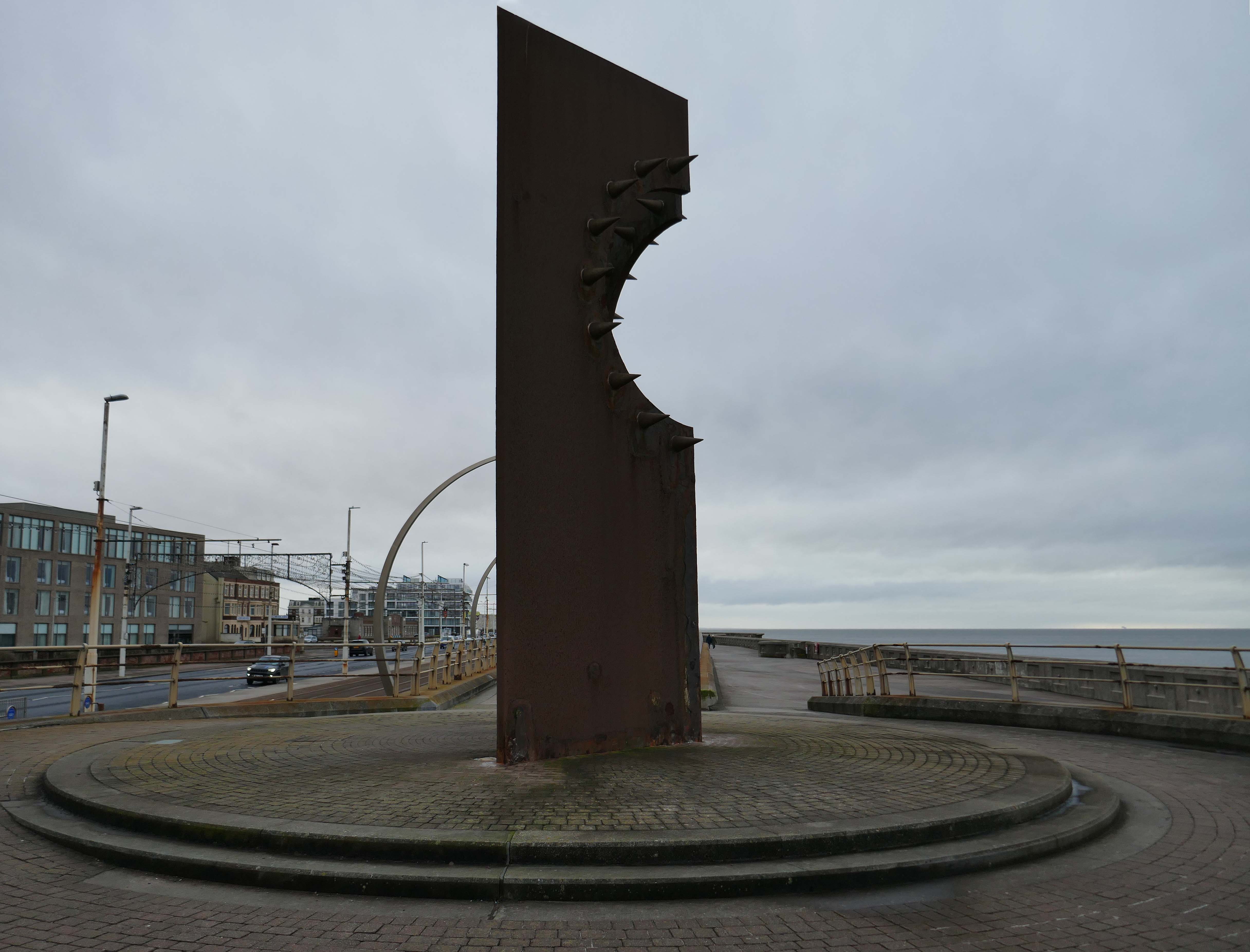
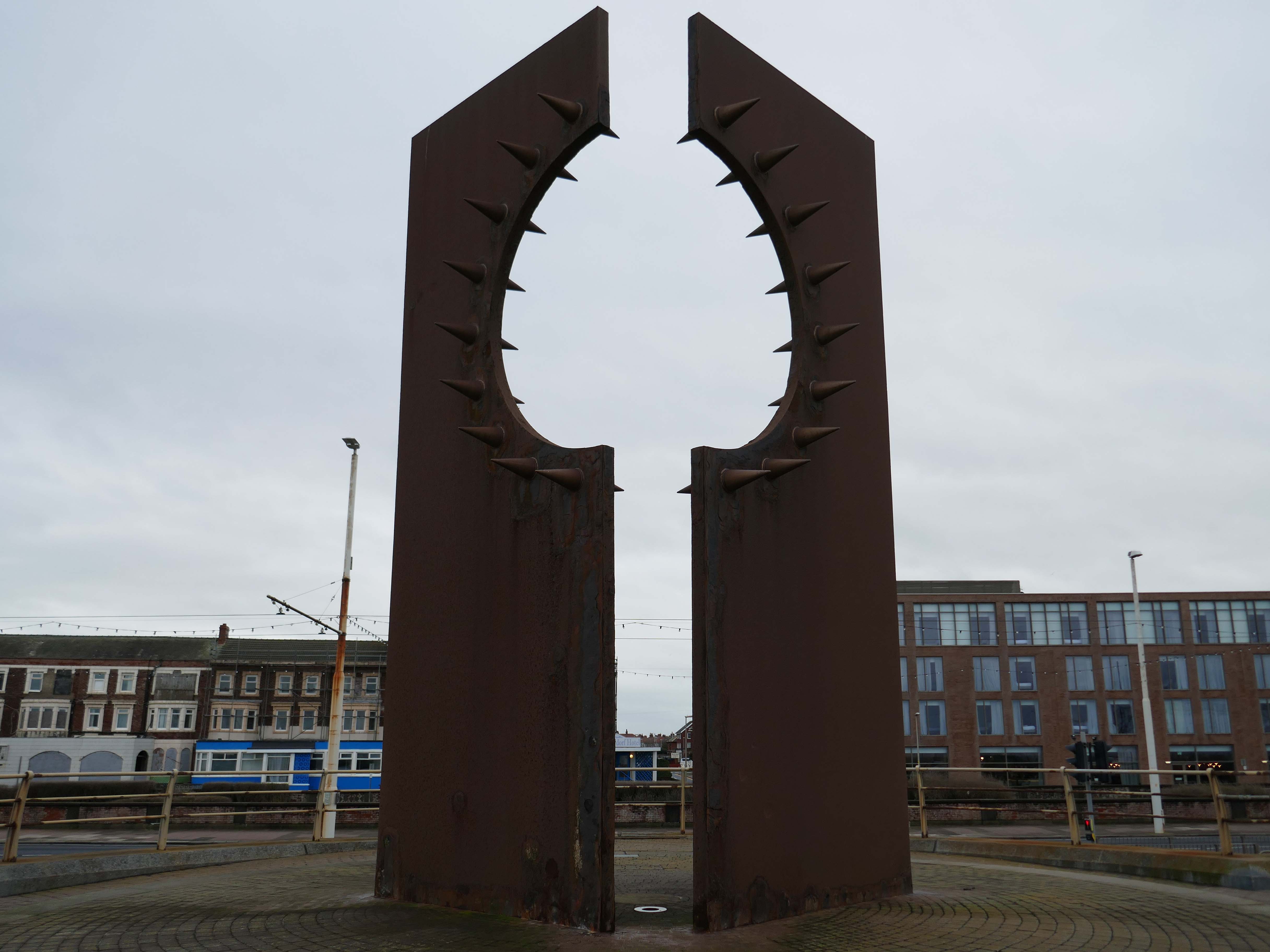
Desire by Chris Knight
An abstract sculpture 8m high, contrasting rusty corten steel with shiny stainless steel spikes, inspired by the town’s reputation as a destination for ‘dirty weekends’, and its hidden ‘fetish scene’. It casts the shadow of a spiky heart on the promenade.
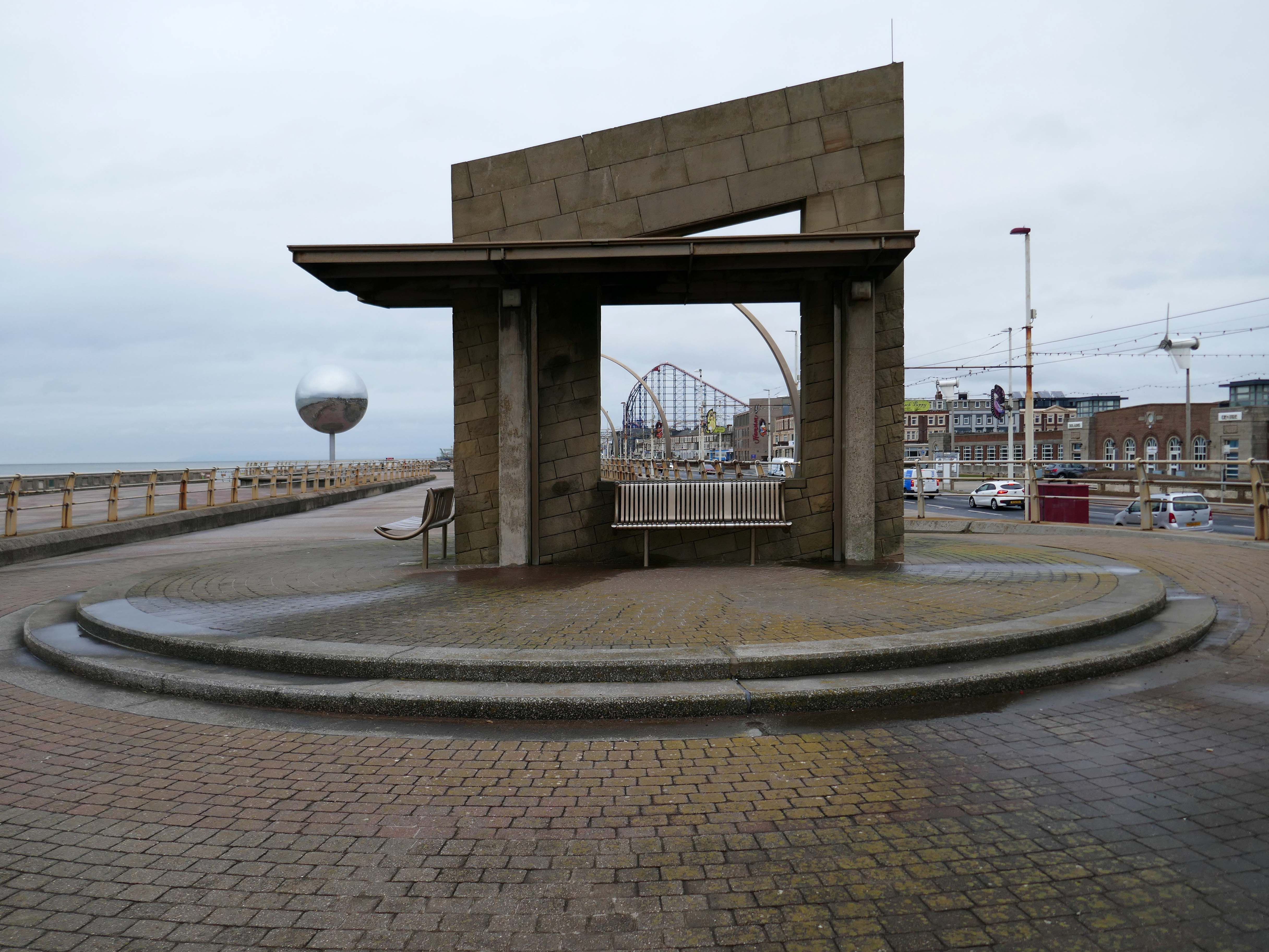
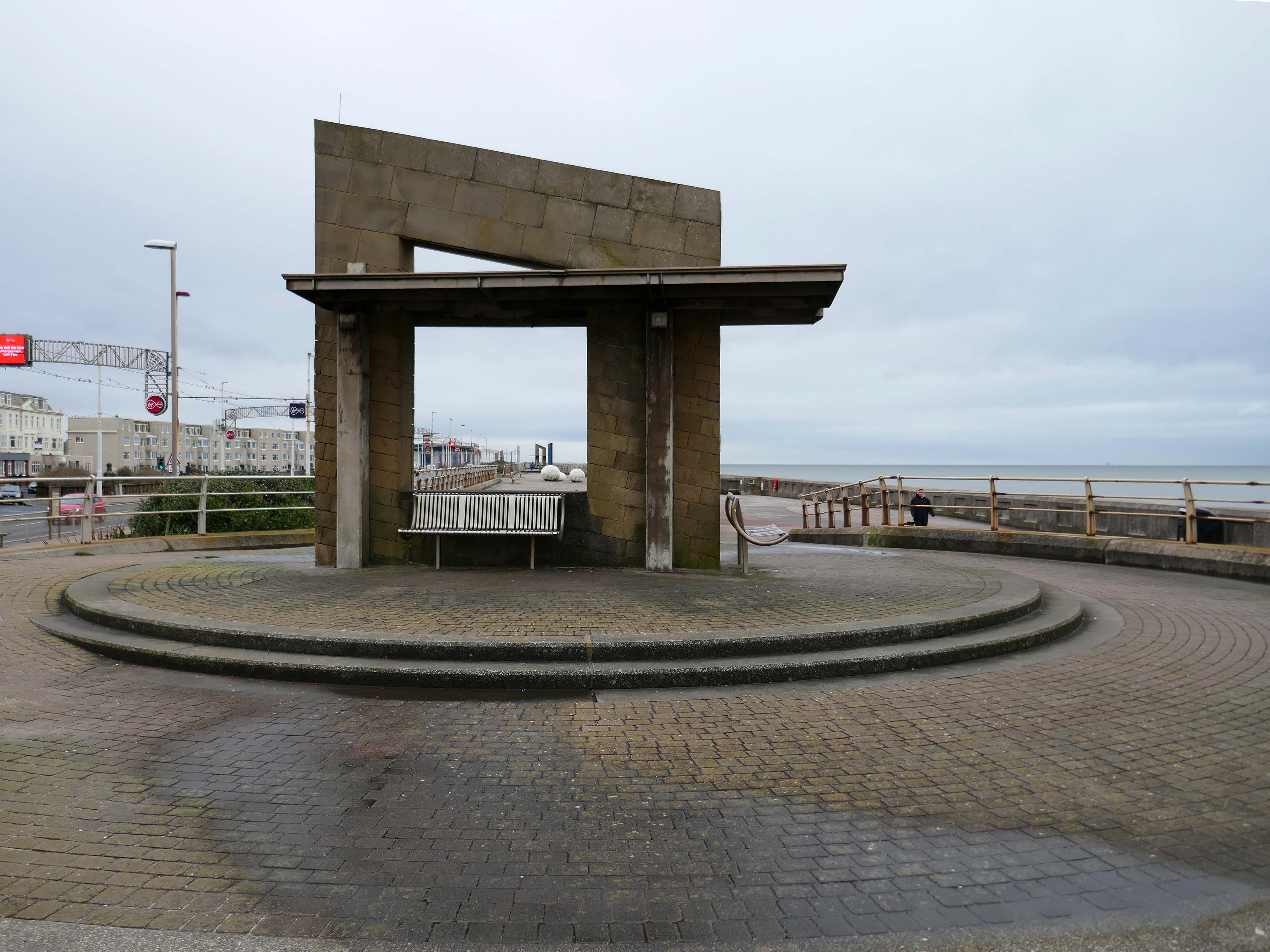
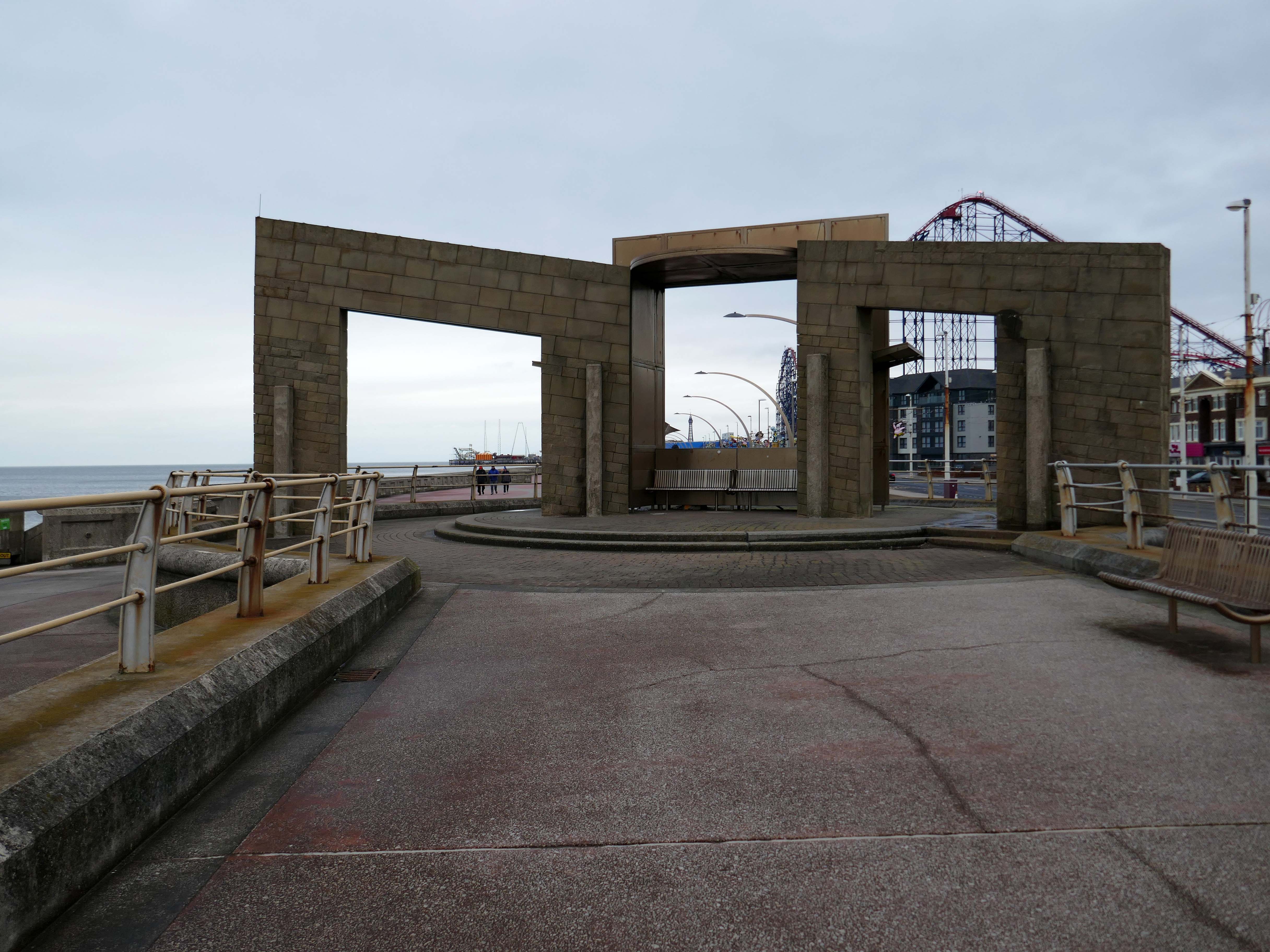
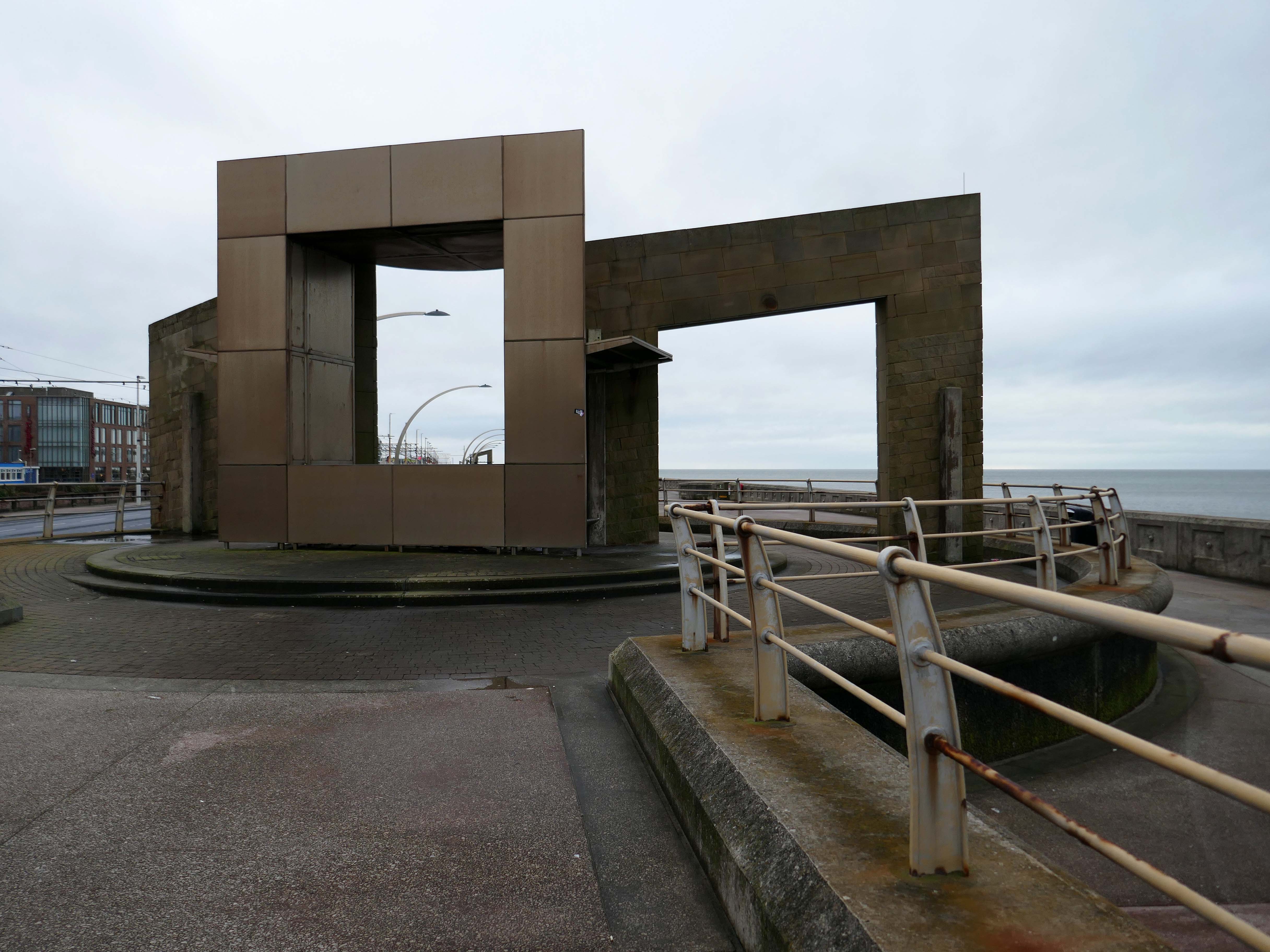
Swivelling Wind Shelters by Ian McChesney with Atelier One
Three 8m high, stainless steel shelters turn like weather vanes, keeping their occupants away from the prevailing wind. Designed by architect Ian McChesney, in collaboration with engineers Atelier One, the graceful sculptural form of the shelters, shaped like whales’ flukes, is structured like an aircraft wing, vibrating in strong gusts of wind.
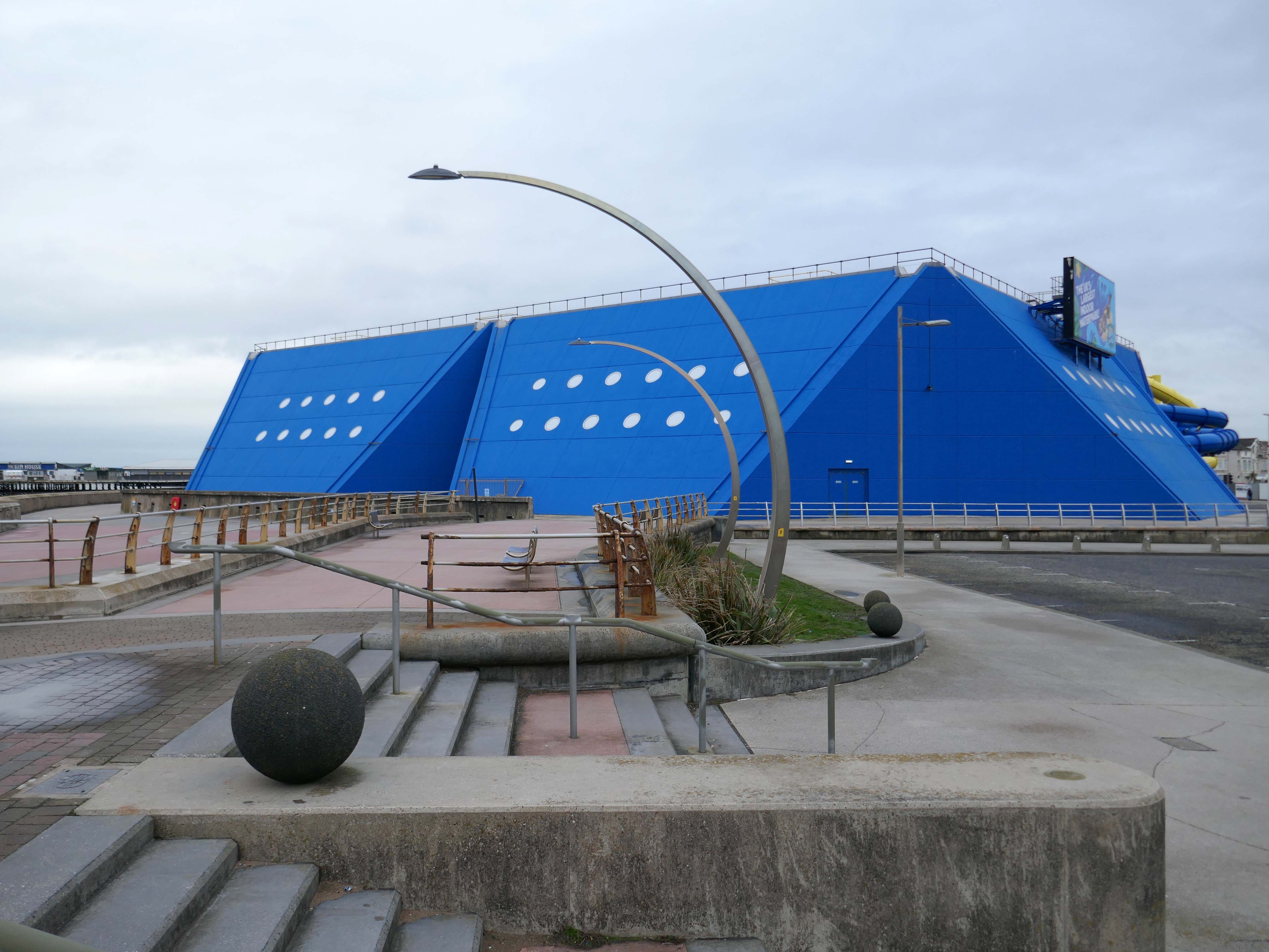
Sandcastle the UK’s largest indoor water park.
Sandcastle opened on 26 June 1986 on the site of the former South Shore Open Air Baths as a joint public/private partnership. Operation of the facility was taken back into Blackpool Council ownership in 2003. A significant investment in new attractions costing £5.5M was also agreed, which was delivered in two phases, with the second opening in 2006 on time and on budget.
In 2012, Sandcastle opened two new Aztec-themed slides, one with a chamber called ‘Aztec Falls’, and a toboggan-like slide called ‘Montazooma’.
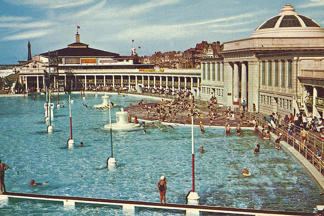
Situated adjacent to the South Pier at Blackpool was the open- air swimming bath. Elliptical in form, it was designed in the renaissance style of architecture, with white ivory terracotta, known as ‘Marmola’. It was said to be the largest and finest of its kind in the world and similar in design to the colosseum of ancient Rome.
Built at a cost of around £70,000, Designed by JC Robinson – Borough Architect, it was officially opened on the 9th June 1923, the same day as the first Blackpool Carnival, by the Mayor of Blackpool, Councillor Henry Brooks. The opening ceremony was followed by a short swimming exhibition in which Blackpool swimmer Lucy Morton took part. The following year Lucy was to win a gold medal in the 1924 Paris Olympics.
Sadly in 1983, following years of neglect and falling attendances, the bath was demolished.
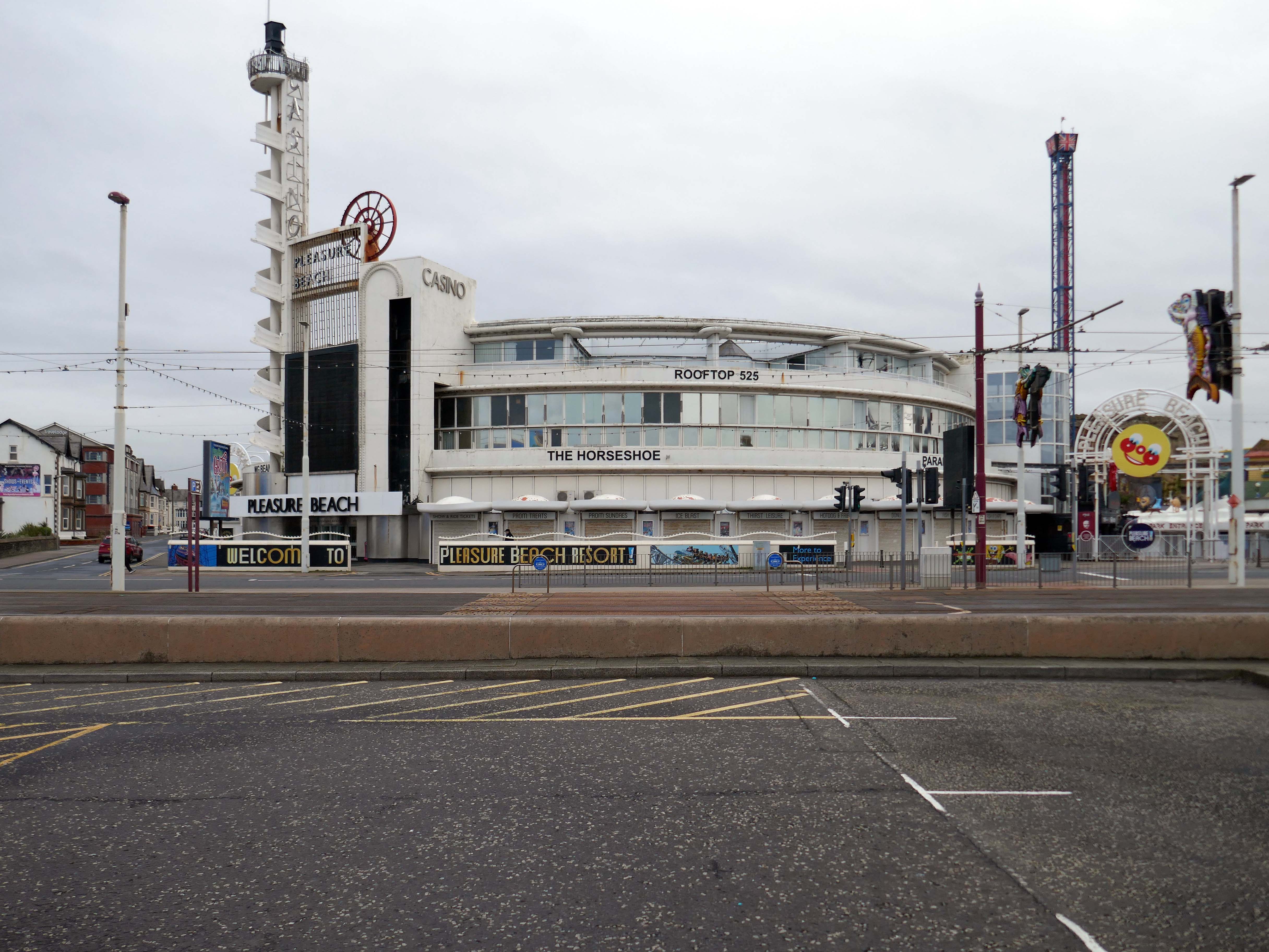
Built to the designs of Joseph Emberton for Leonard Thompson; restored and altered 1972 and 1977-9 by Keith Ingham. Reinforced concrete in the International Modern style. Circular plan, the circle broken by three principal projections marking the main entrance and foyer, the main exit and the main public stairs. The key to the plan were the central kitchens on the ground and first floors, serving (on the former) a number of restaurants and (on the latter) a banqueting room. Kitchens now on first floor only. The result is a sequence of intriguingly curved rooms; originally there was no public access to this inner core area or directly across the building, but this has now been provided. The basement contained stores, a billiard room and sports facilities, now in mixed use. Between ground and first floor is a mezzanine office range, with private flat over. Top floor built as roof garden, provided with a glazed curtain wall in c.1940 by Emberton and largely infilled as an extra floor in 1972.
My baby takes the morning train He works from nine till five and then He takes another home again To find me waitin’ for him
Sheena Easton
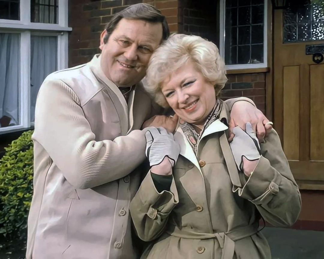
Welcome to the land of Terry and June – the seemingly complacent home to the newly aspirational classes, anathema to those thrill seeking Modernists, embracing the dynamism of the city, or those Ruralists protecting the integrity of the countryside.
Tradition has broken down. Taste is utterly debased, the town, long since degraded, is now being annihilated by a flabby, shoddy, romantic nature worship. That romantic nature worship is destroying also the object of its adoration, the countryside.
The growth of British towns and cities, from the onset of the Industrial Revolution, created a demand for new homes, the earliest developments were close to the centres of production and administration. Followed by the creation of outlying estates for the fleeing middle classes, as the smoke began to billow and the trains and buses began to run.
Originally the work of speculative private enterprise, followed by homes built by the local authority along with charitable institutions.
My own experience has taught me that Suburbia is architecturally diverse, socially less so, as various areas are segregated by class, and perhaps less so by ethnicity and/or culture.
The majority of the population live in Suburbia it seems, there now follows a selection of the suburban sites which I have visited in the last ten years or so.
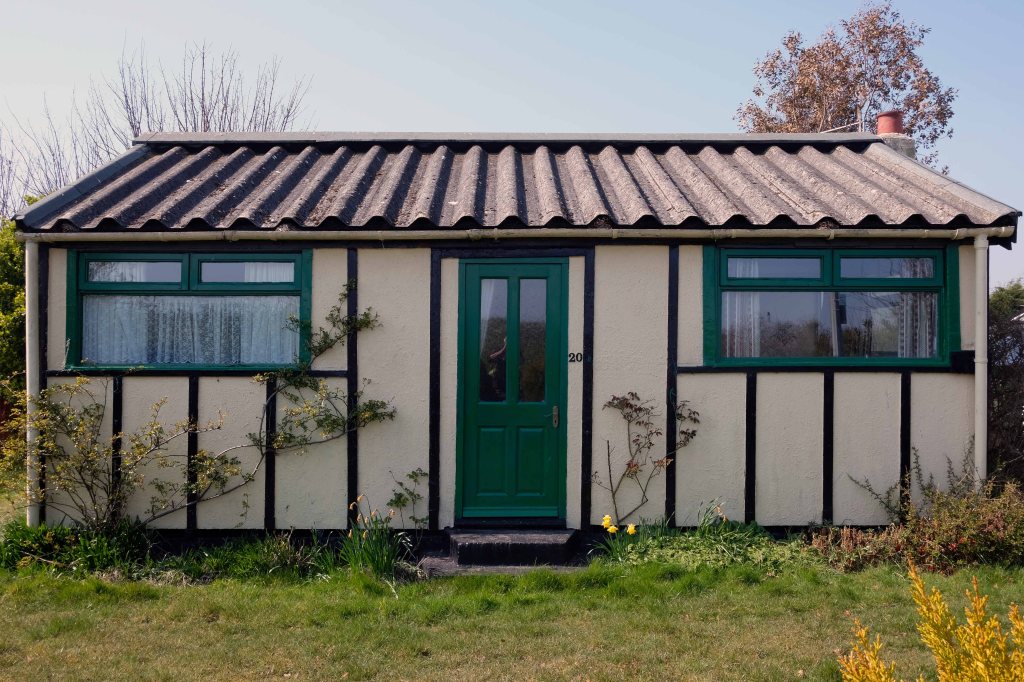
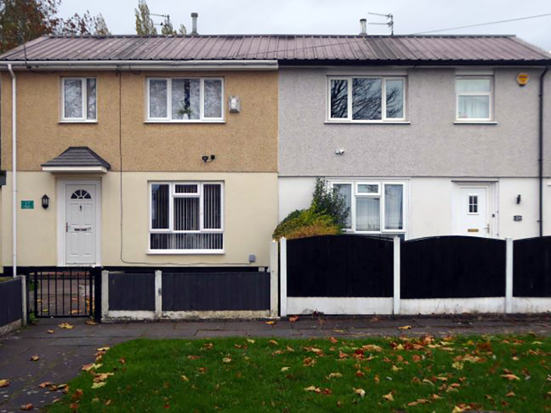
In search of Suburbia.
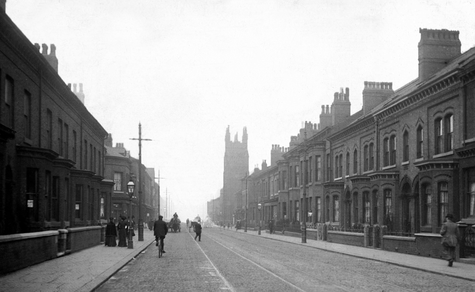
There are areas of Victorian terraced housing Manchester which survived clearance – such as Jetson Street in Abbey Hey.
By 1931 1.1 million council houses were built and 2.8 million privately owned homes.
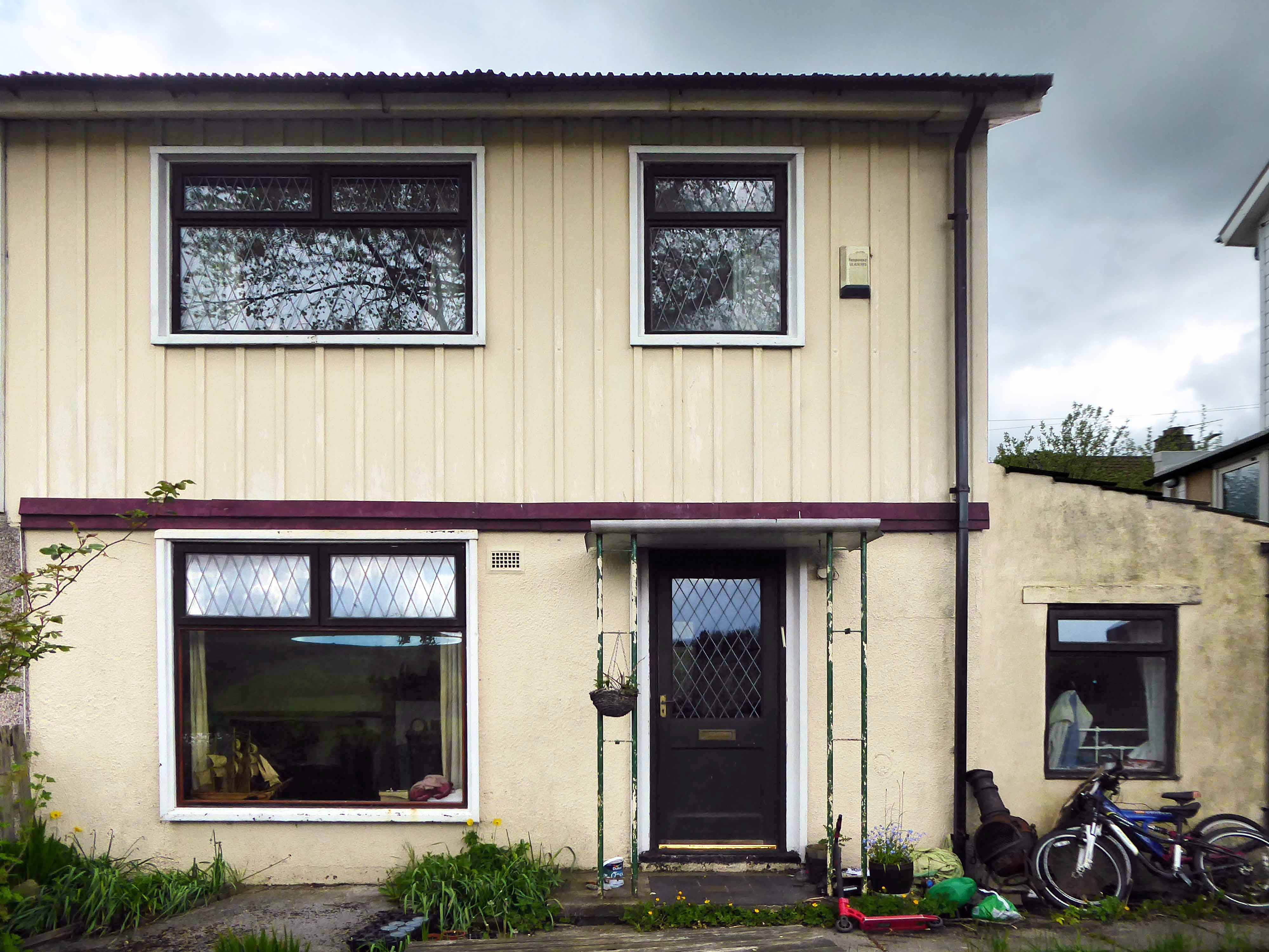
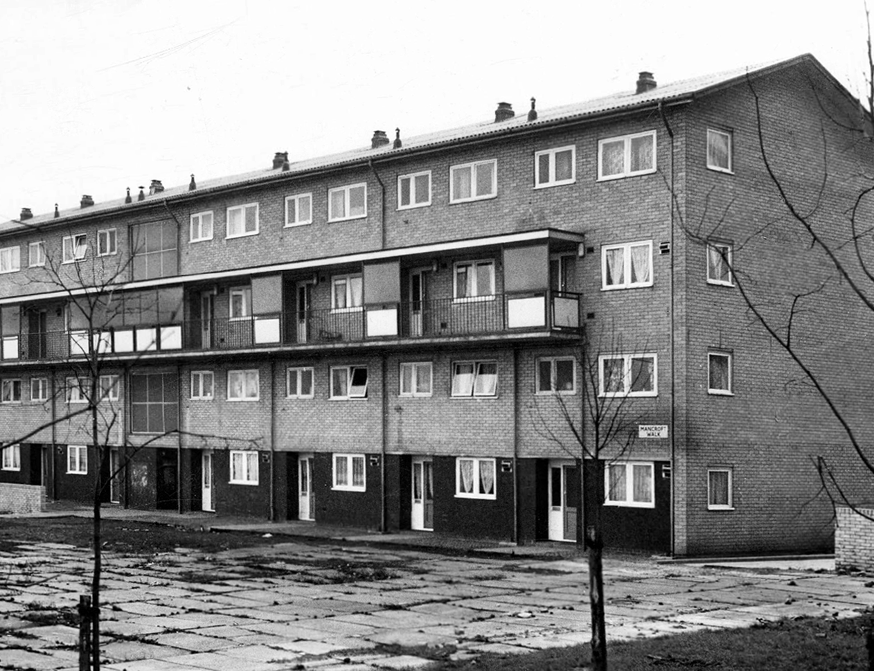
Post WW2 the emphasis was on an expansion of social housing, along with a growth in privately owned property – detailed information and analysis of social housing can be found here at Municipal Dreams.
These homes were at times both temporary and of non-standard construction.
This prefabricated house was originally built for the good folk of Doncaster, later finding itself in Humberston Fitties
These Wythenshawe BISFHomes designed by Frederick Gibberd, the so-called Tin Town are still very much habitable homes.
Post war development was inextricably linked to the New Towns.
The new towns in the United Kingdom were planned under the powers of the New Towns Act 1946 and later acts to relocate people from poor or bombed-out housing following World War II. Designated new towns were placed under the supervision of a development corporation, and were developed in three waves. Later developments included the “expanded towns”: existing towns which were substantially expanded to accommodate what was called the “overspill” population from densely populated areas of deprivation.
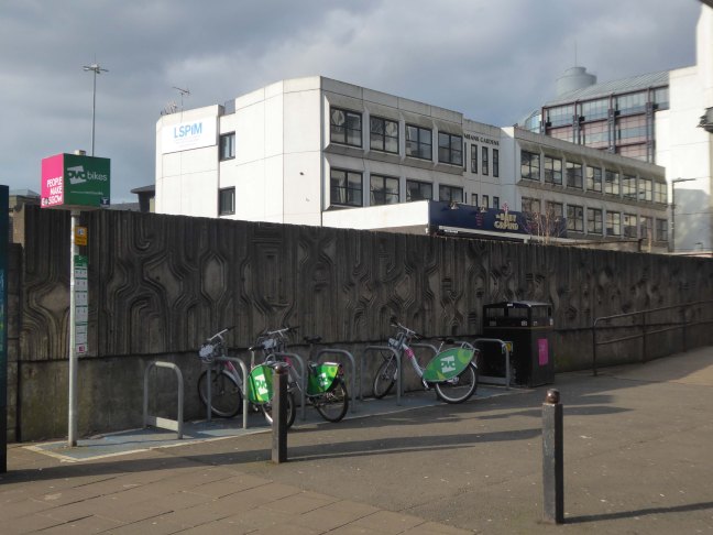
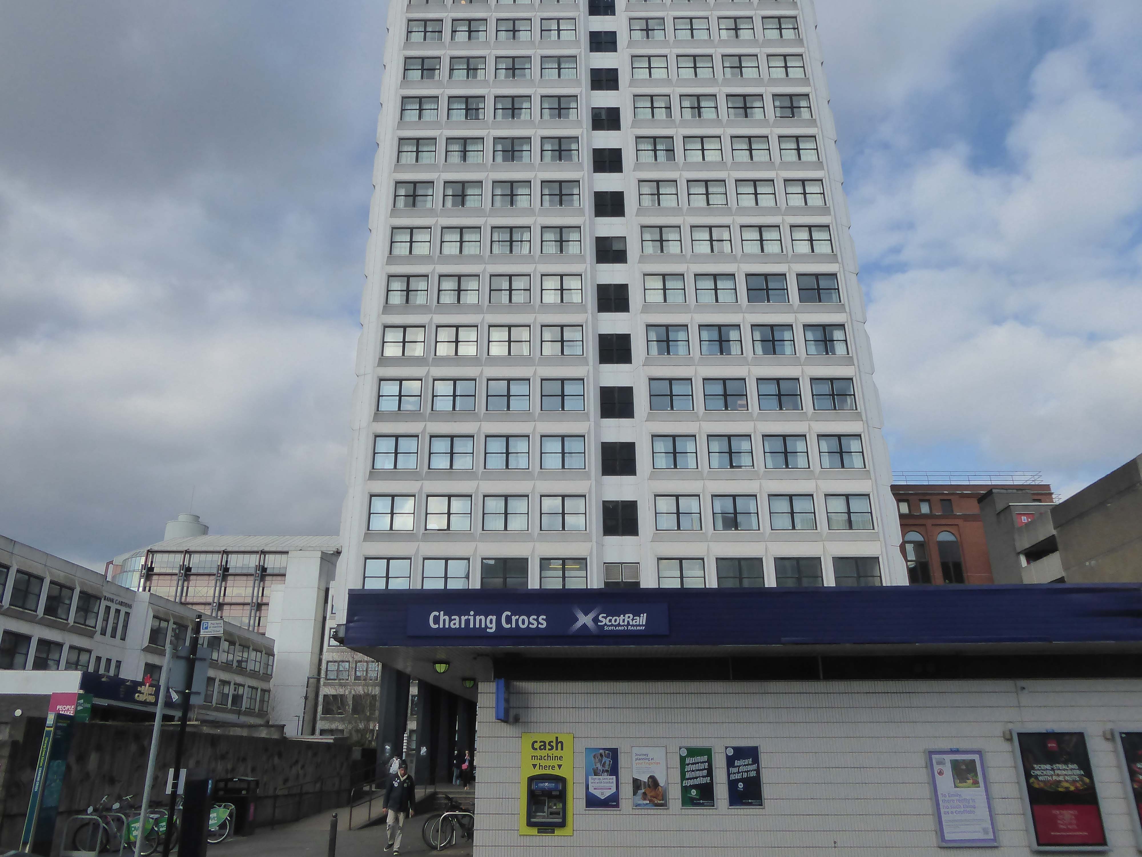
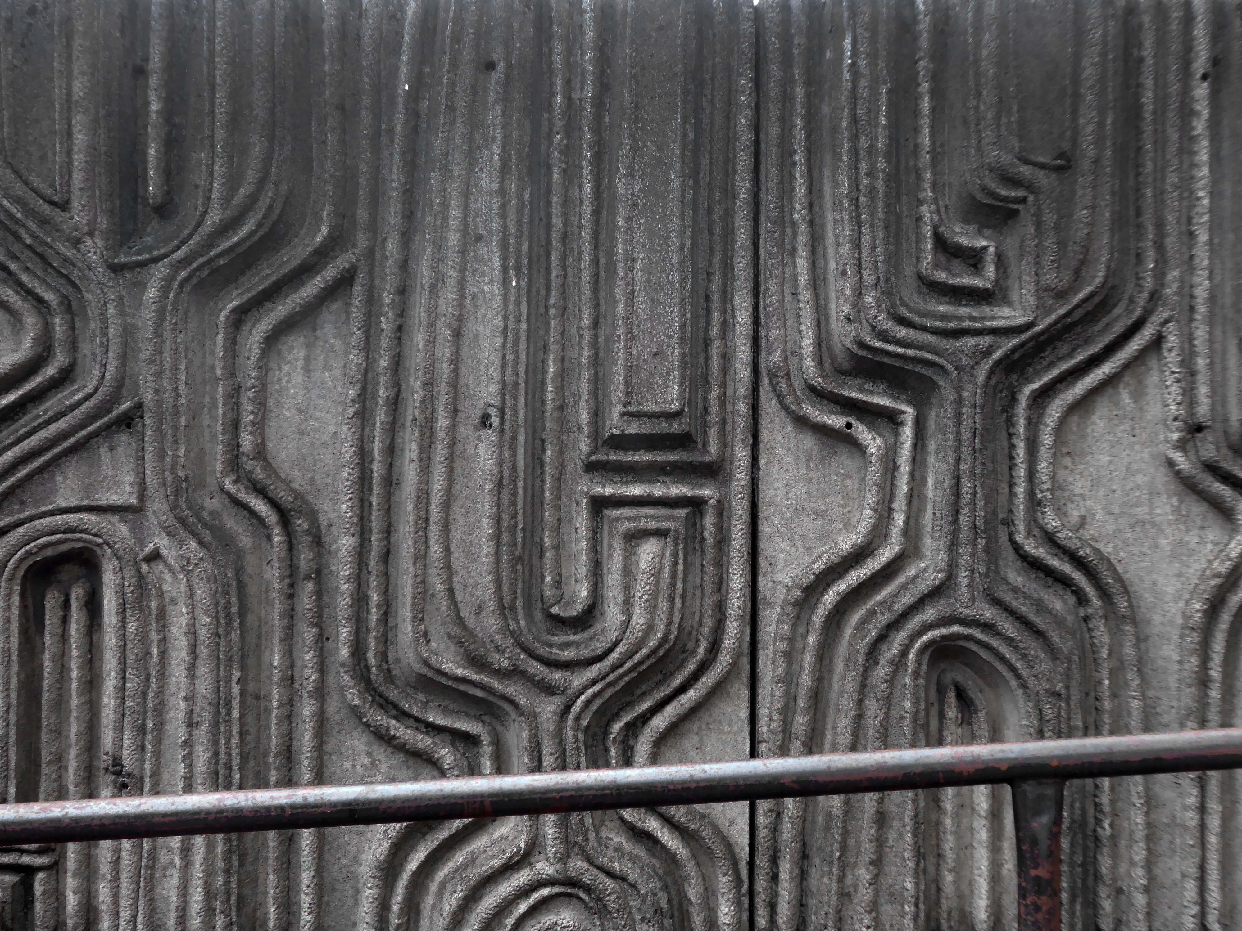
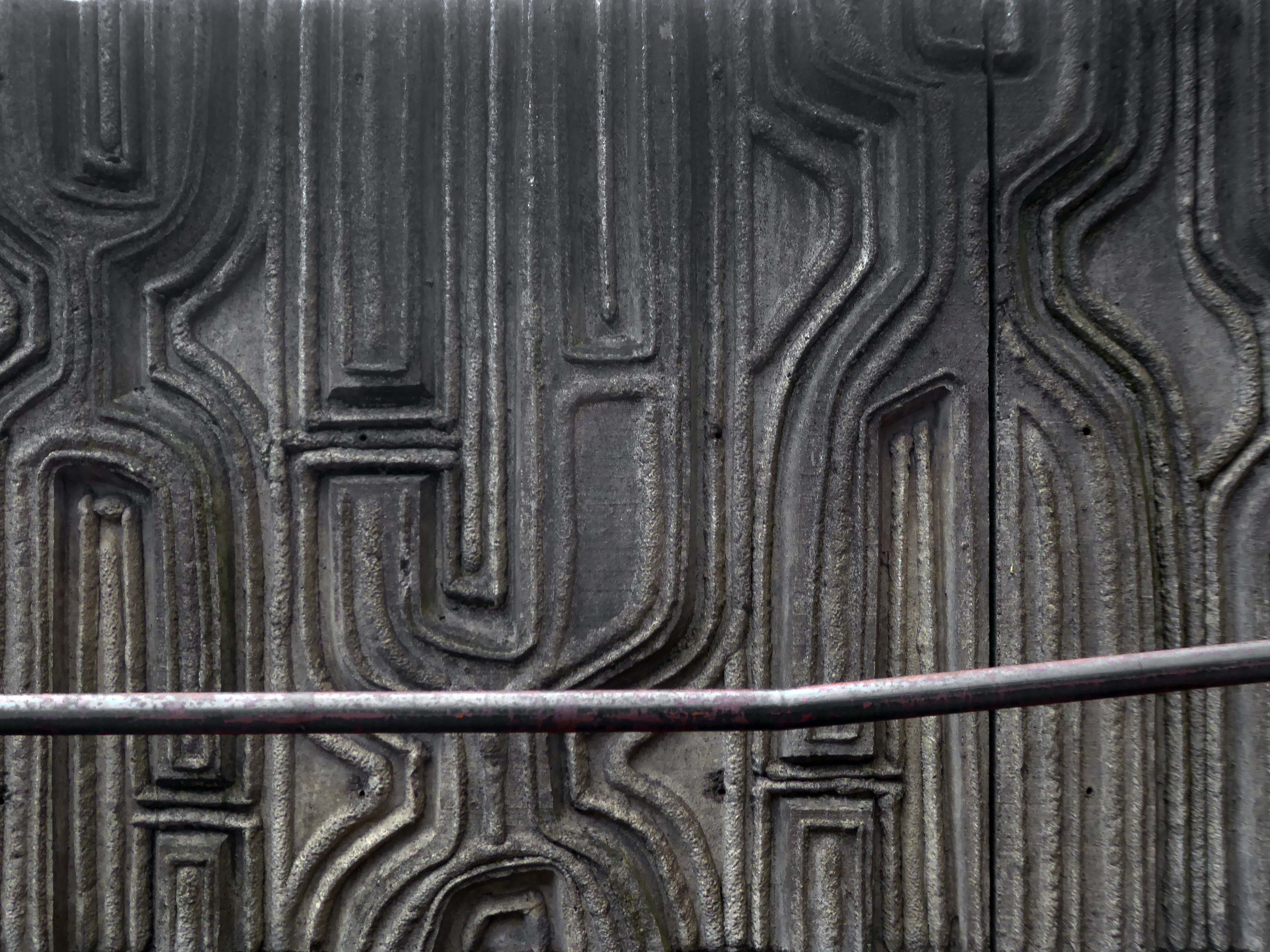
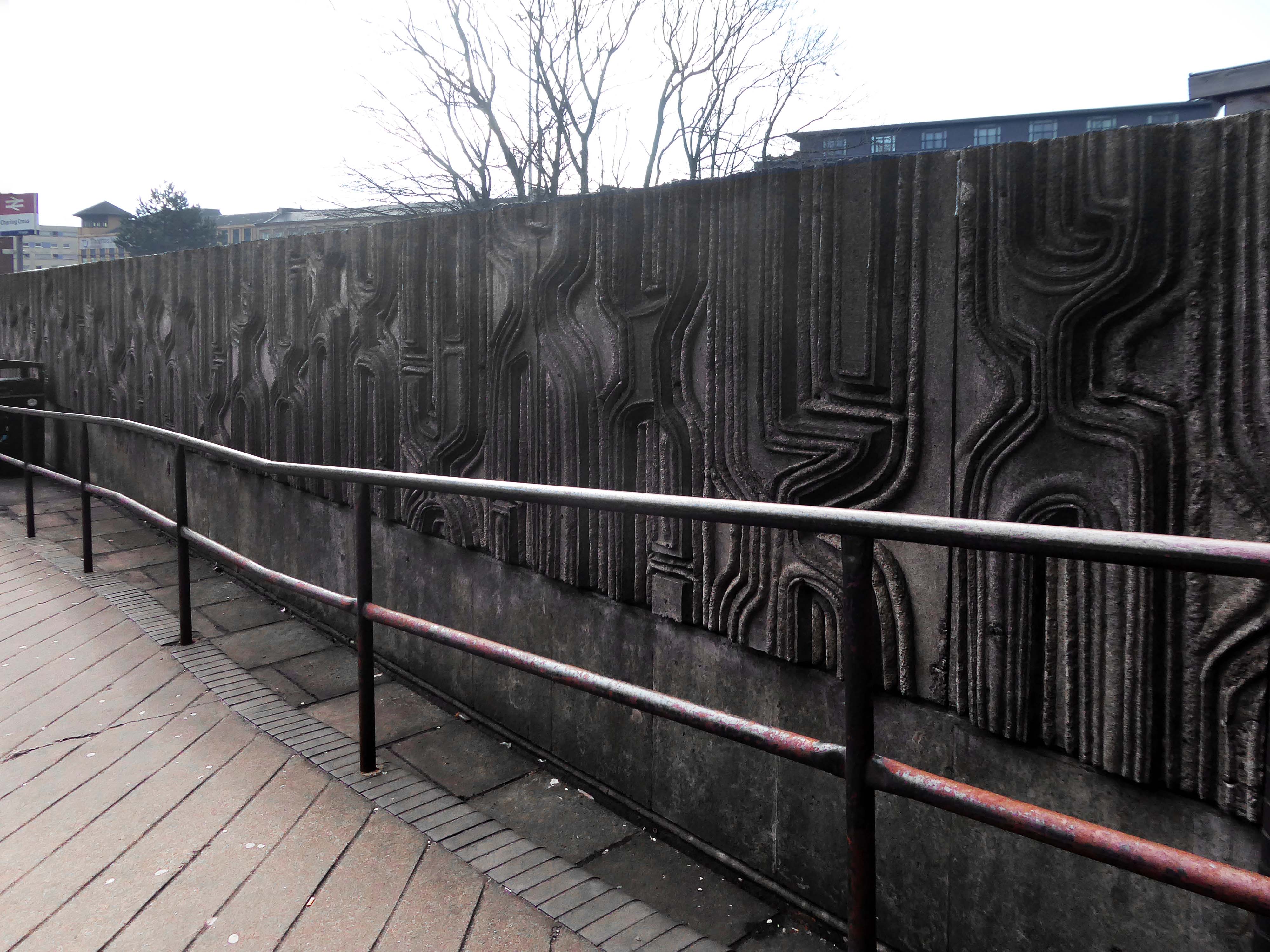
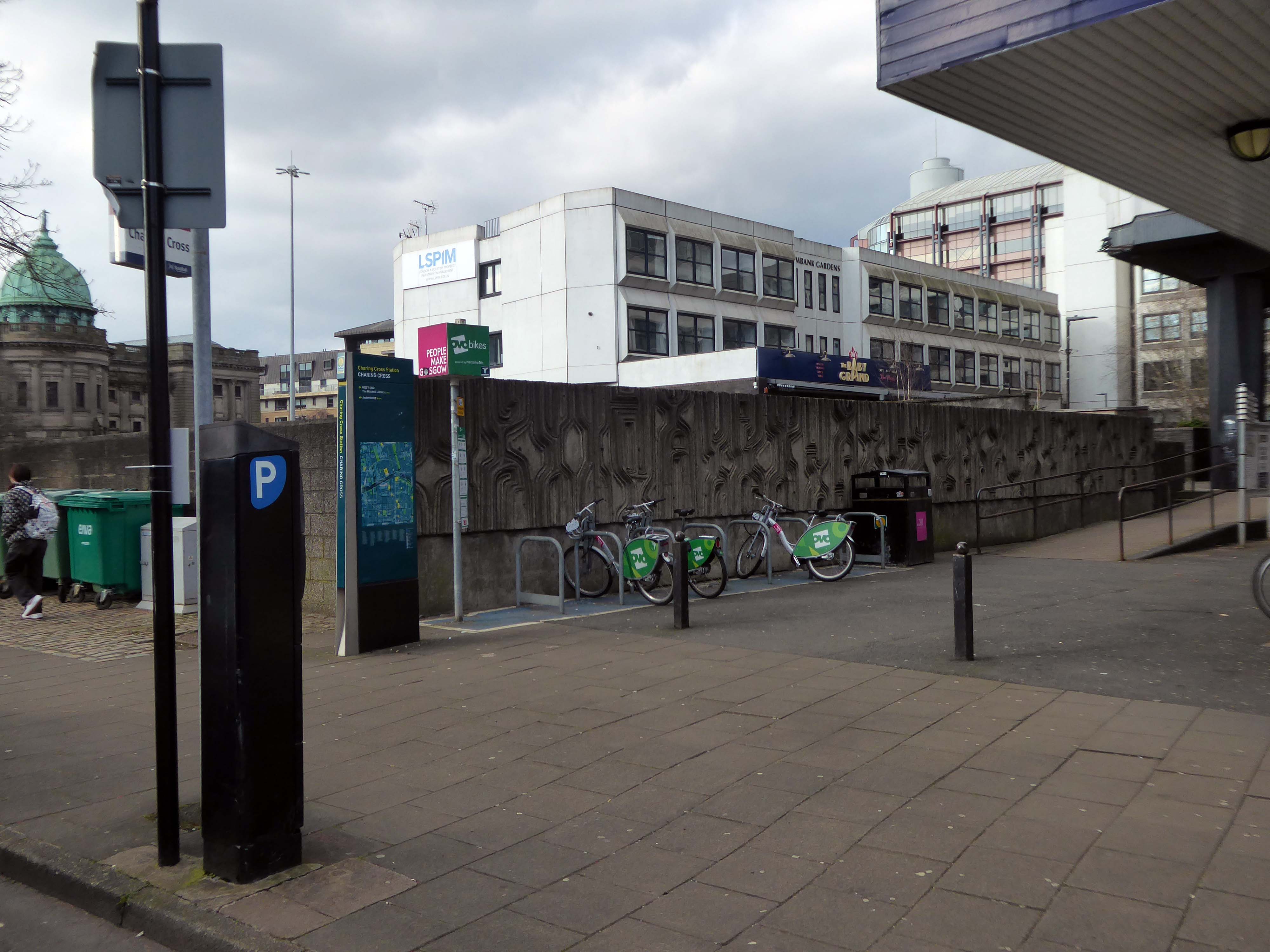
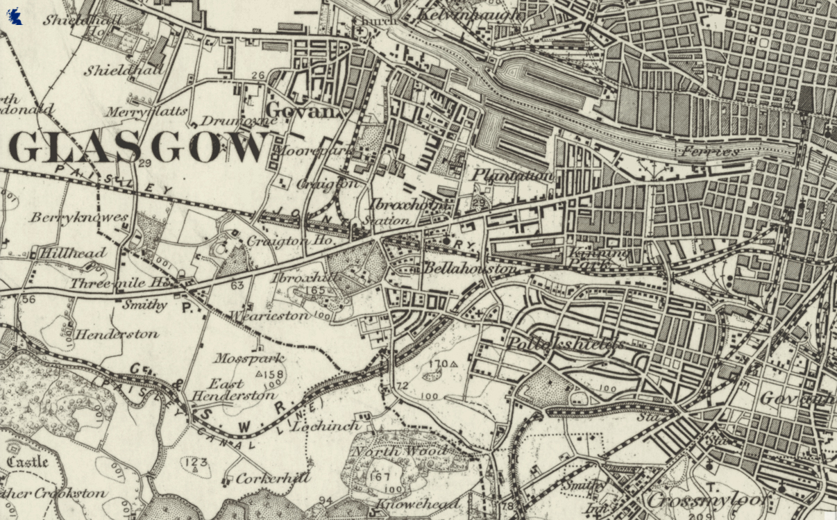
Dating from 1886, it was originally part of the Glasgow City and District Railway, the first underground railway in Scotland, and as such the station is built below the surface of the surrounding streets. The station was built using the cut and cover method, with the original walls being visible on the open air section at the western end of the platforms.
In 1968 it was demolished due to it being in the path of the new Glasgow Inner Ring Road, and the surface access to the station was moved to its eastern end, with a new surface building constructed as part of the Elmbank Gardens office complex in 1971 – the building was designed by the Richard Seifert & Partners.
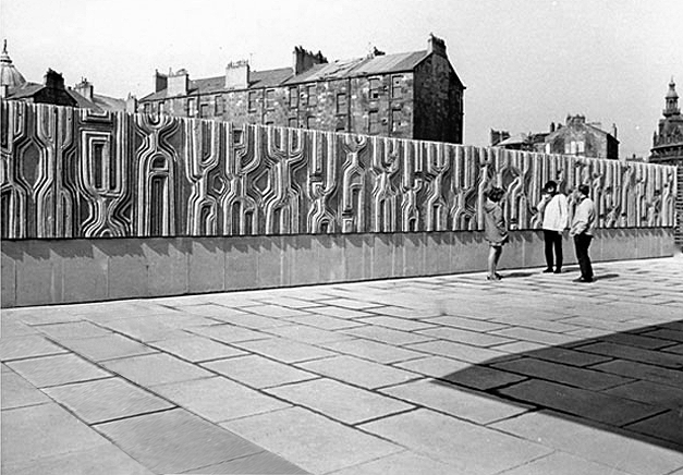
I was there in 2024 to photograph the Charles Anderson mural.
Constructed in situ – one third has now been removed at the northern end
Charles Anderson studied drawing and painting at Glasgow School of Art under David Donaldson, Mary Armour etc, graduating with Diploma in 1959. The following year he entered The Royal Scottish Academy painting competition for Post Graduate students and won the Chalmers Bursary. Joan Eardley – one of the adjudicators- took a keen interest in his work and encouraged him to exhibit at the RSA the same year.
Following a period of five years teaching art, He worked as a professional mural painter and sculptor for the next thirty years on major art and design projects throughout the United Kingdom, carrying out commissions for a wide variety of clients including local authorities, property developers, banks and major insurance companies. His most prestigious commission to date was the result of winning a national sculpture competition to provide a bronze figurative group which is entitled “The Community” for Livingston New Town in 1996. In early 1997 he returned to the painting of easel pictures and contributed to the annual exhibitions of The Royal Glasgow Institute, the Royal Scottish Society of Painters in Watercolours, The Royal Scottish Academy and The Paisley Art Institute. He has works in various private collections throughout the U.K. and abroad.
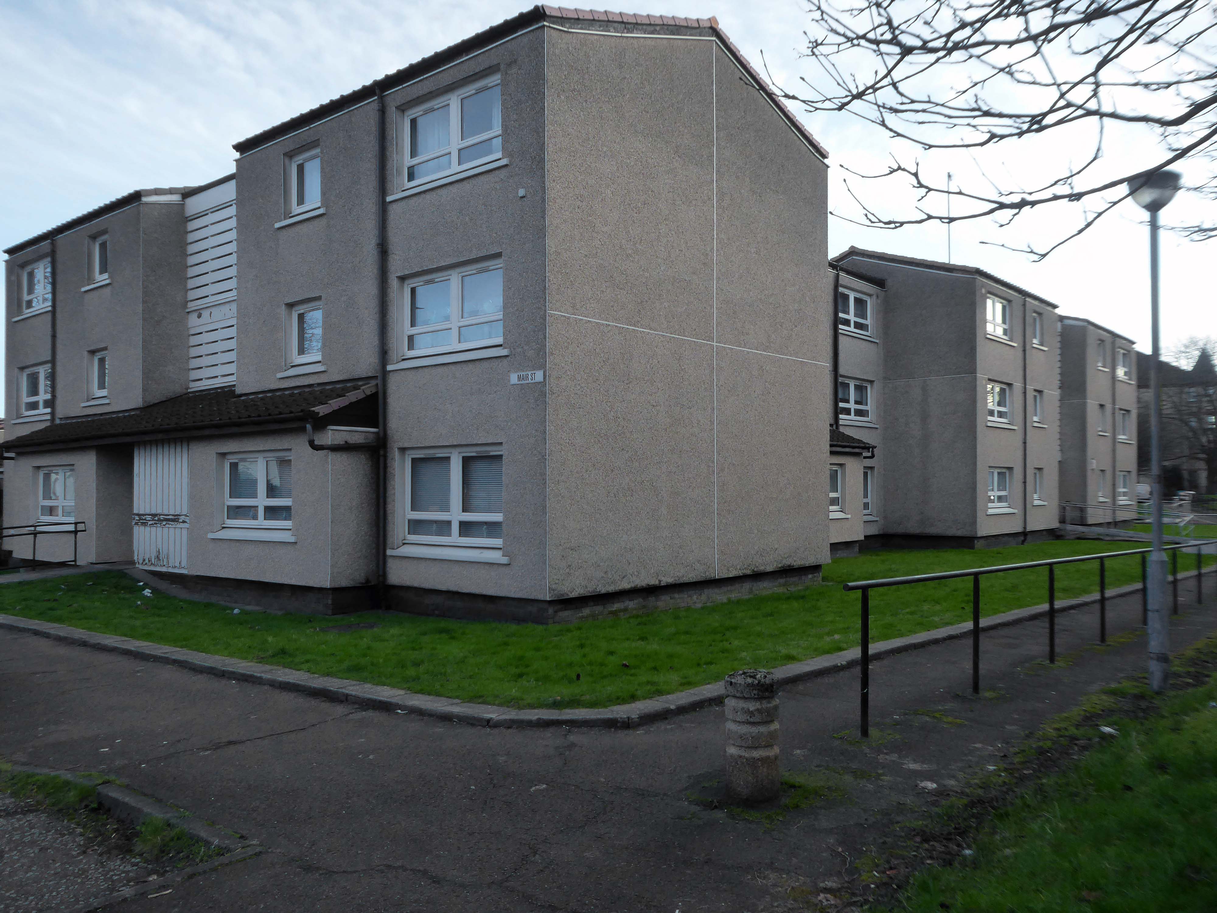
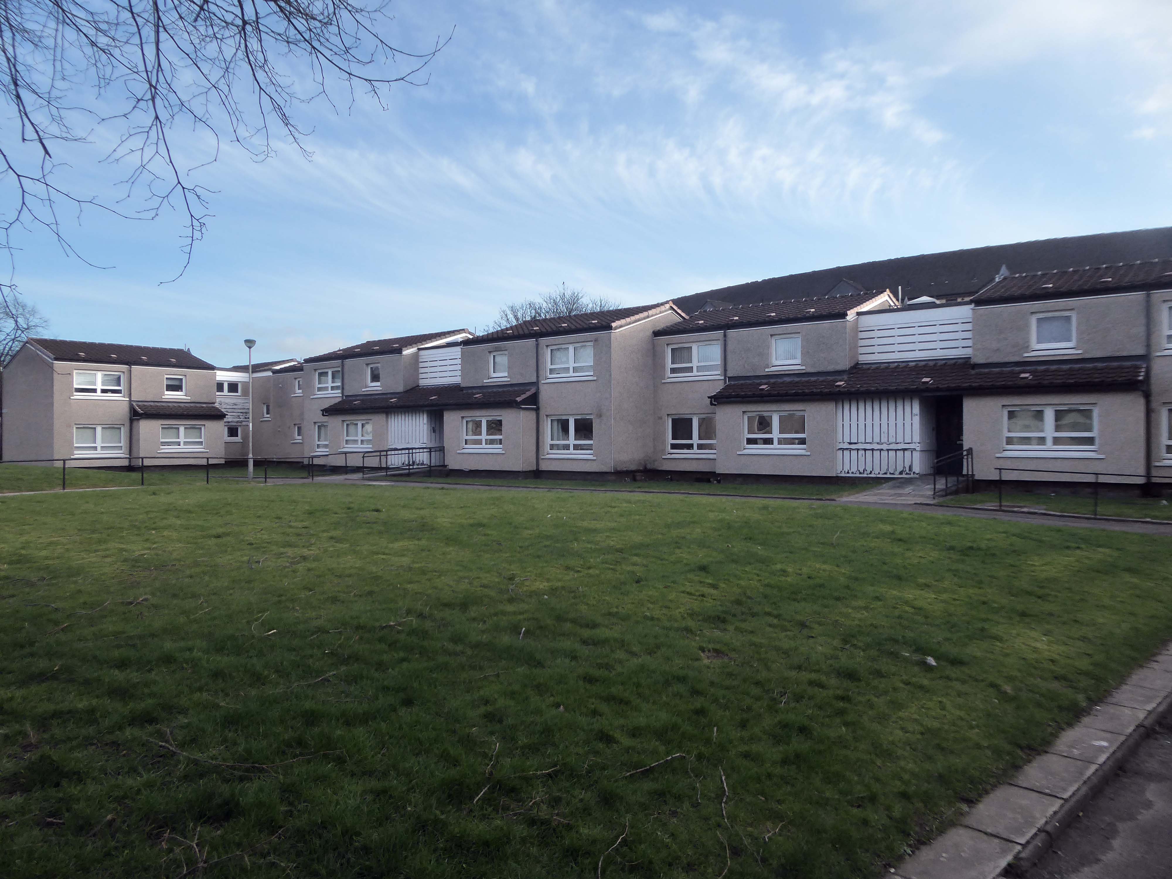
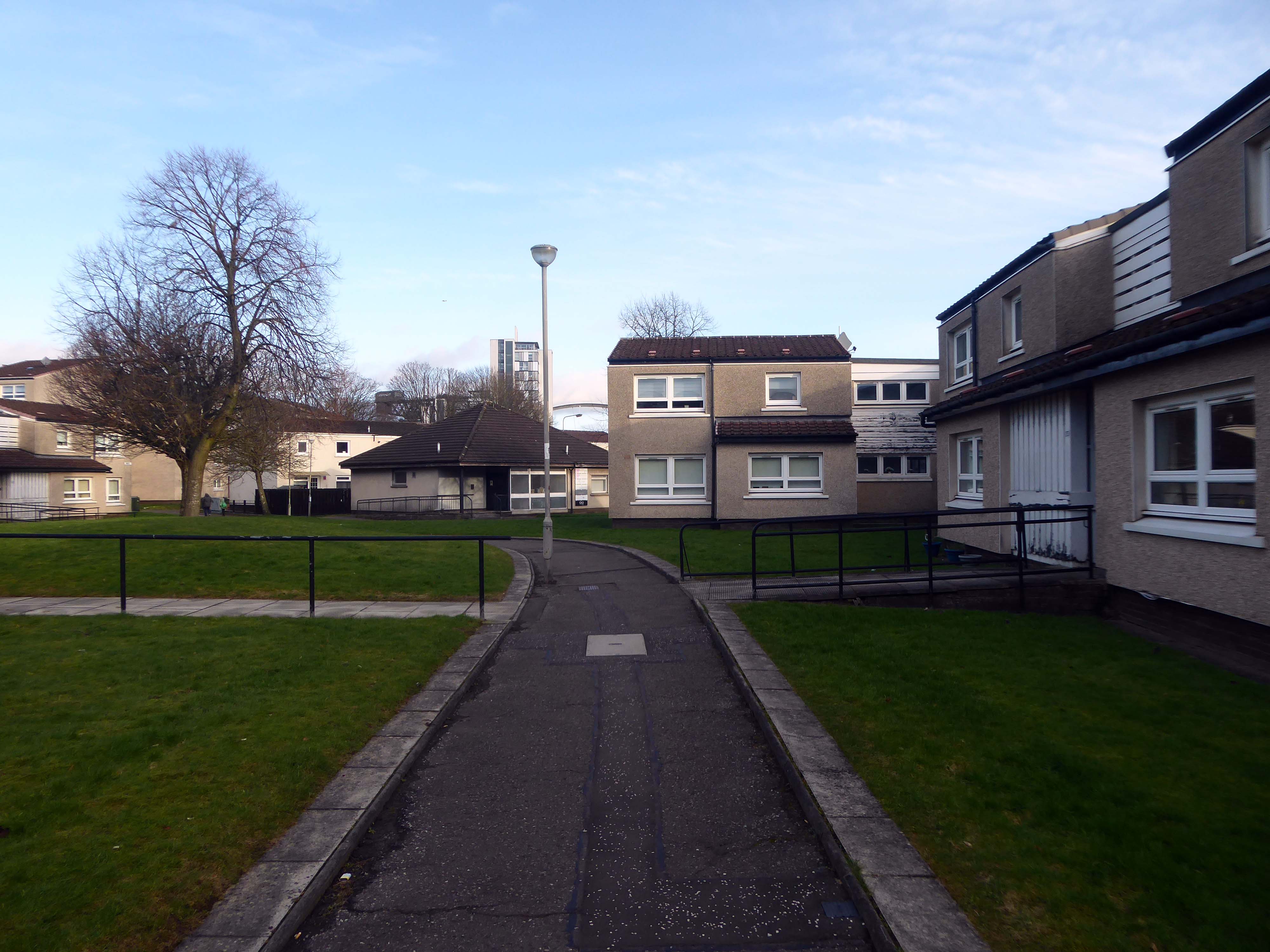
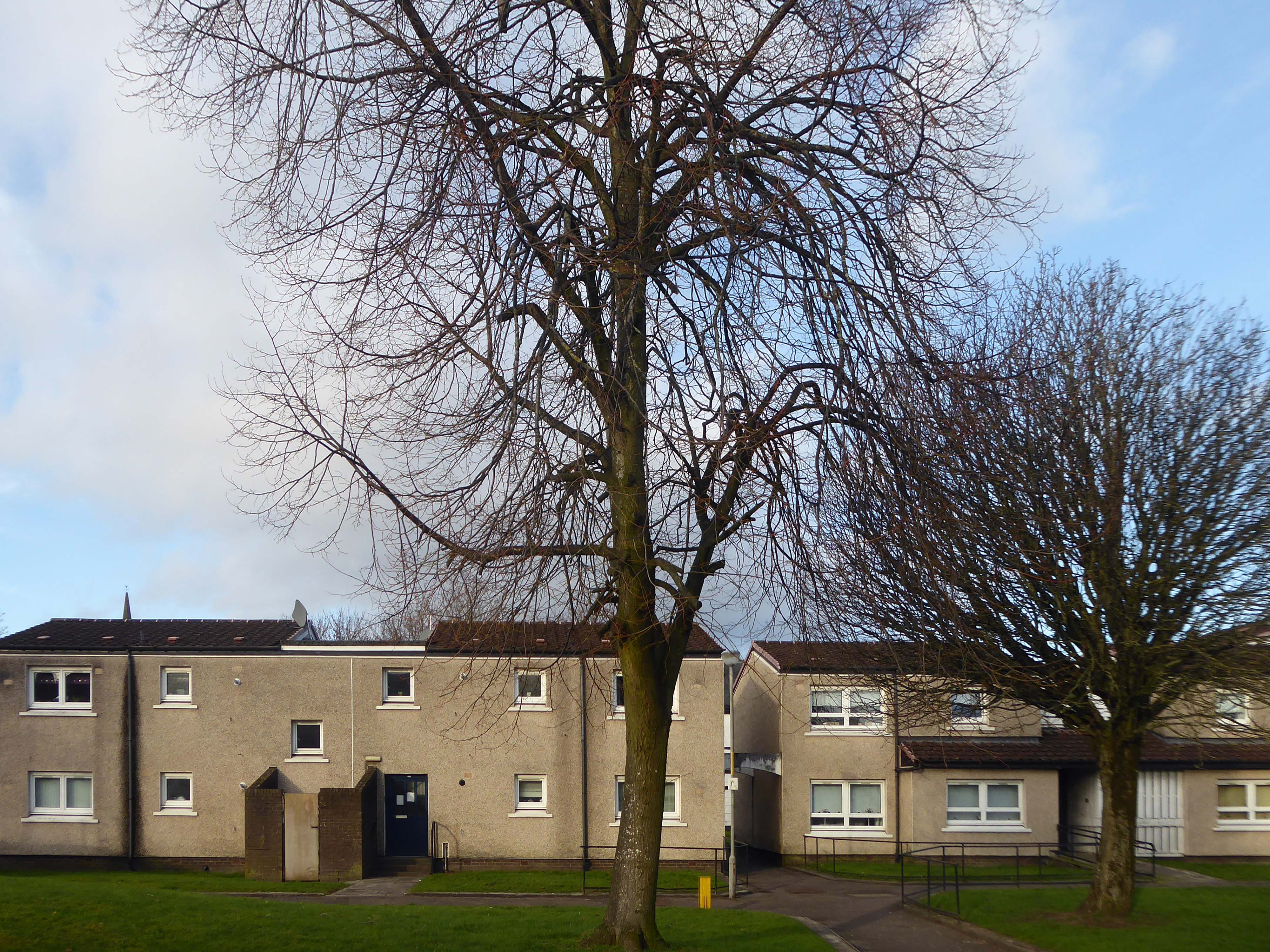
Plantation is an area in the city of Glasgow, Scotland. It is situated south of the River Clyde and is part of the former Burgh of Govan. It lies approximately between the areas of Cessnock and Ibrox to the west, Kingston to the east, and Kinning Park to the south.
The 80-acre Craigiehall estate, previously three smaller properties, was bought in 1783 by John Robertson, a cashier in the Glasgow Arms Bank, who with his brothers owned cotton and sugar plantations in the West Indies. He renamed it Plantation, possibly as a reminder of the West Indies plantations. It then, in 1793, passed to John Mair, a merchant who developed the building and gardens. Plantation passed to the Maclean family, in 1829, in the person of William Maclean, a Glasgow Baillie.
In the years that followed, the estate was bisected by the railway to the south, with the shipbuilding yards of The Clyde Trust cutting off the estate from the river. Plantation was laid out for tenement houses in the 1870s and Maclean, Plantation, Mair and Craigiehall Streets refer to the history of the old estate.
Plantation Quay formed part of the site for the Glasgow Garden Festival in 1988 and subsequent Glasgow Science Centre.
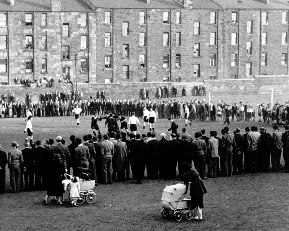
A crowd gathered to watch a football match at Plantation, 1955. The players in dark jerseys appear to be celebrating a goal.
The mostly male spectators are focused on the game, while in the foreground a couple of women pass by with prams. The tenements in the background provide their inhabitants with a bird’s-eye view of the match. Other spectators are perched on top of a high wall separating the tenement back courts from the football pitch.
In 1955 Partick Camera Club set out to create a photographic survey of Glasgow. As the project progressed, other camera clubs joined and each was allocated a district of the city to photograph. Glasgow Museums exhibited the photographs at Kelvingrove Art Gallery and Museum and at the People’s Place, and in 1956 the exhibition was shown at the Palace of Art in Bellahouston Park. The photographs are now part of Glasgow Museums’ collections.
So the folks, homes, industry and streets of the past have been and gone.
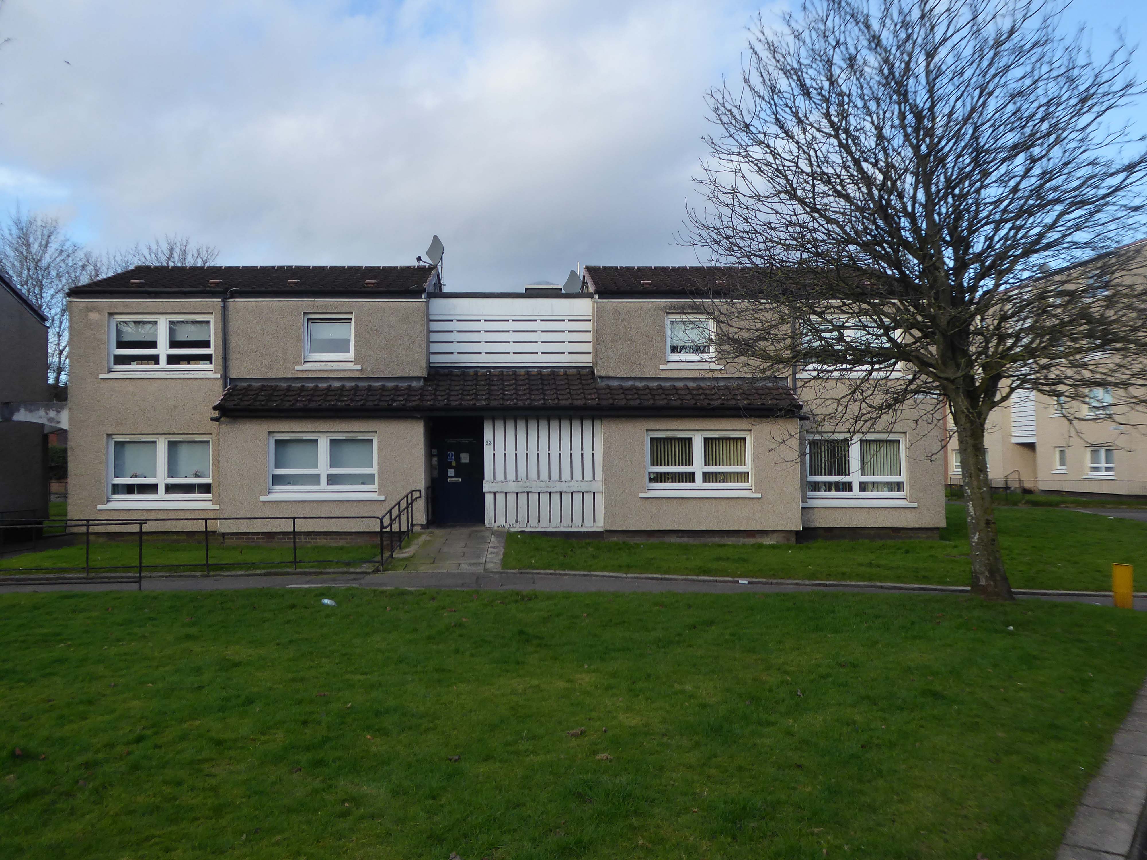
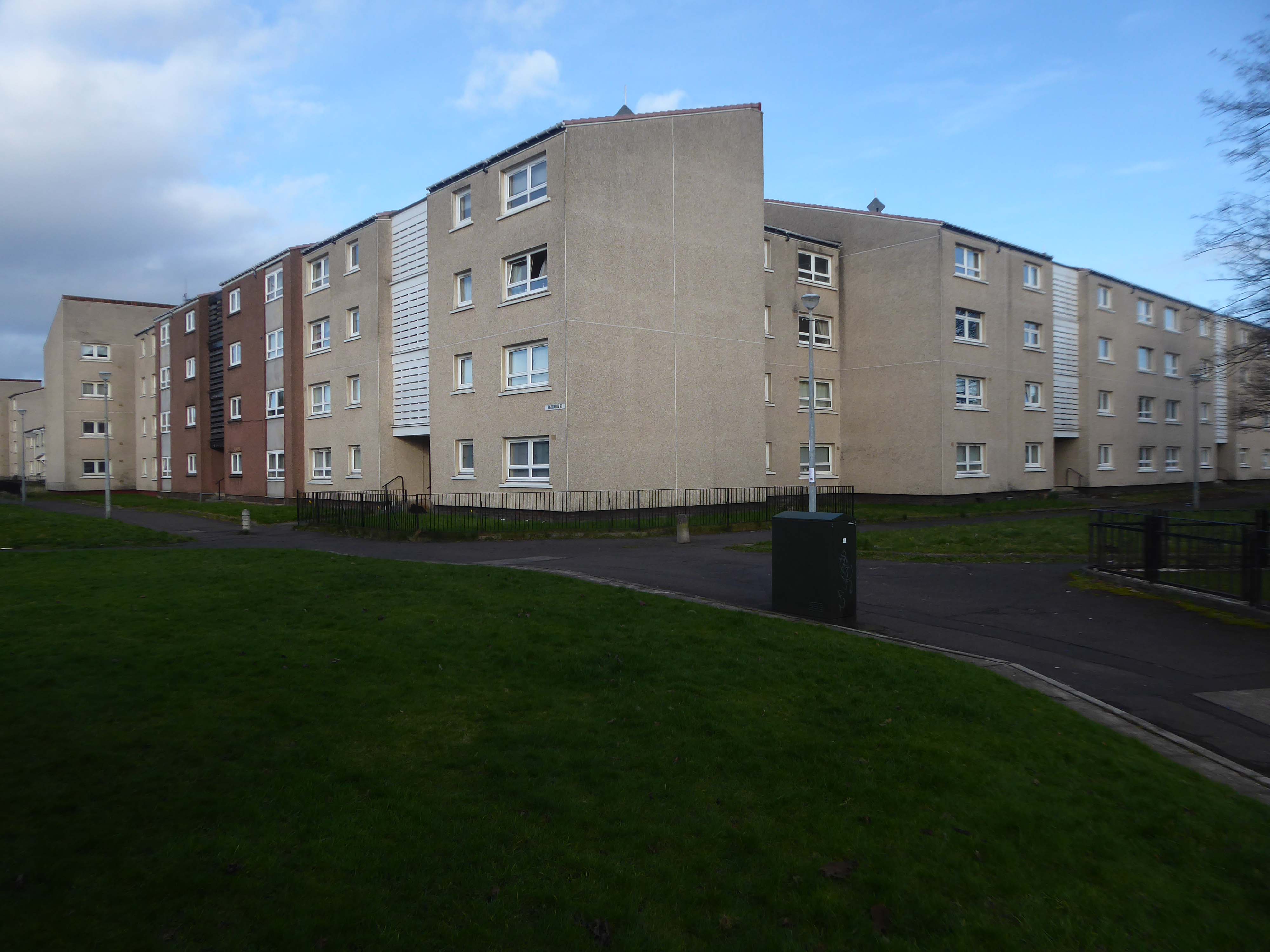
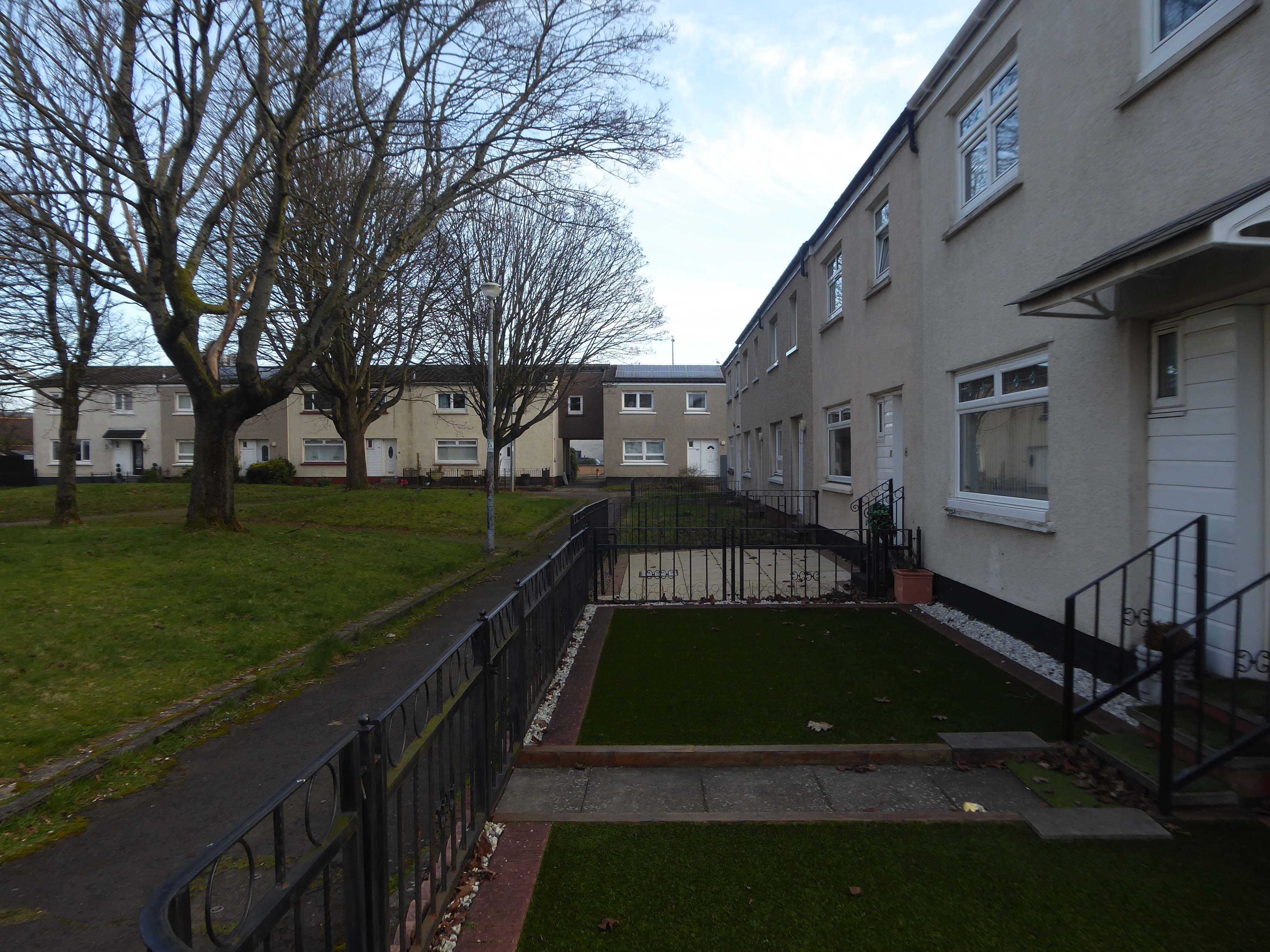
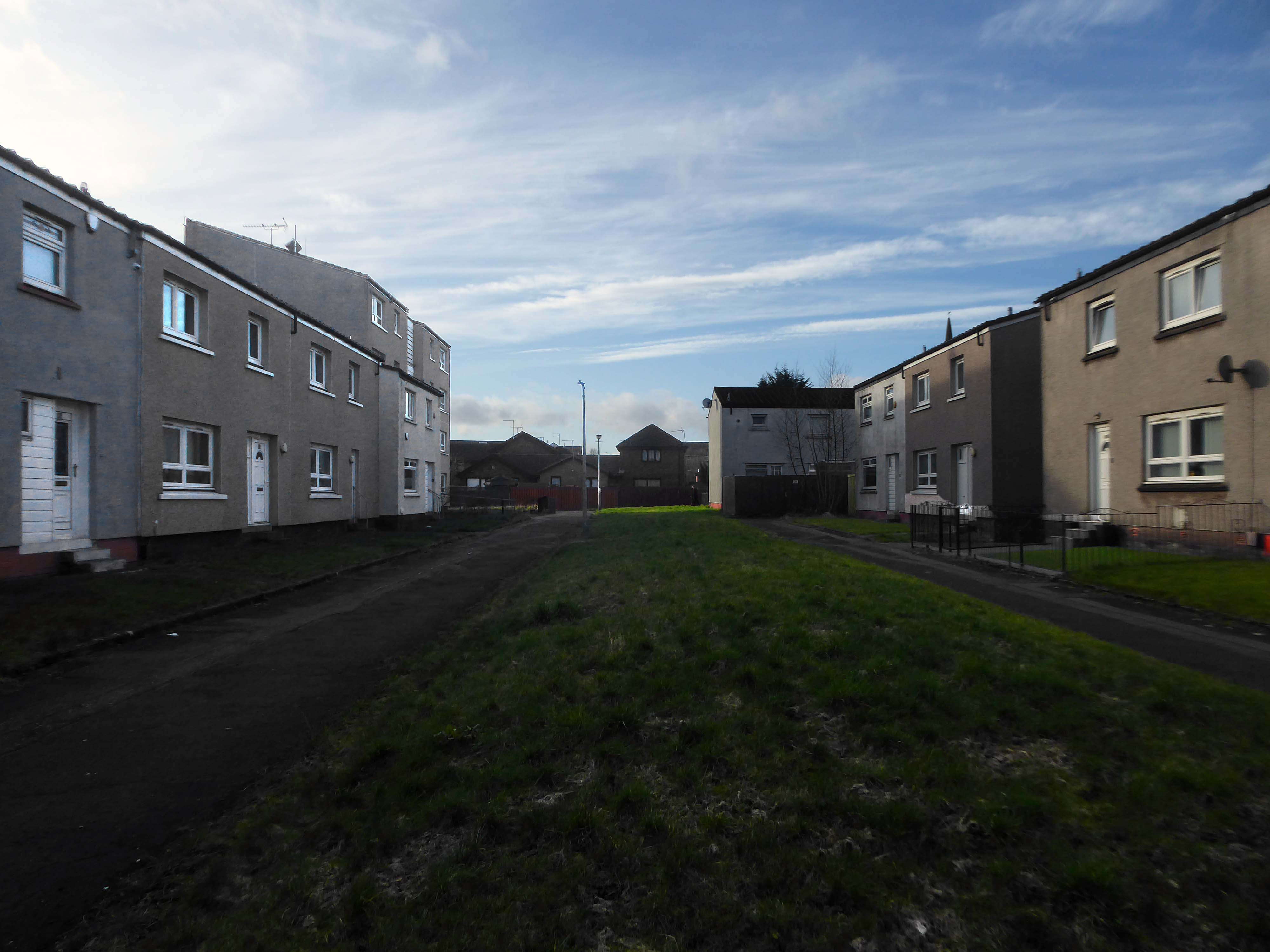
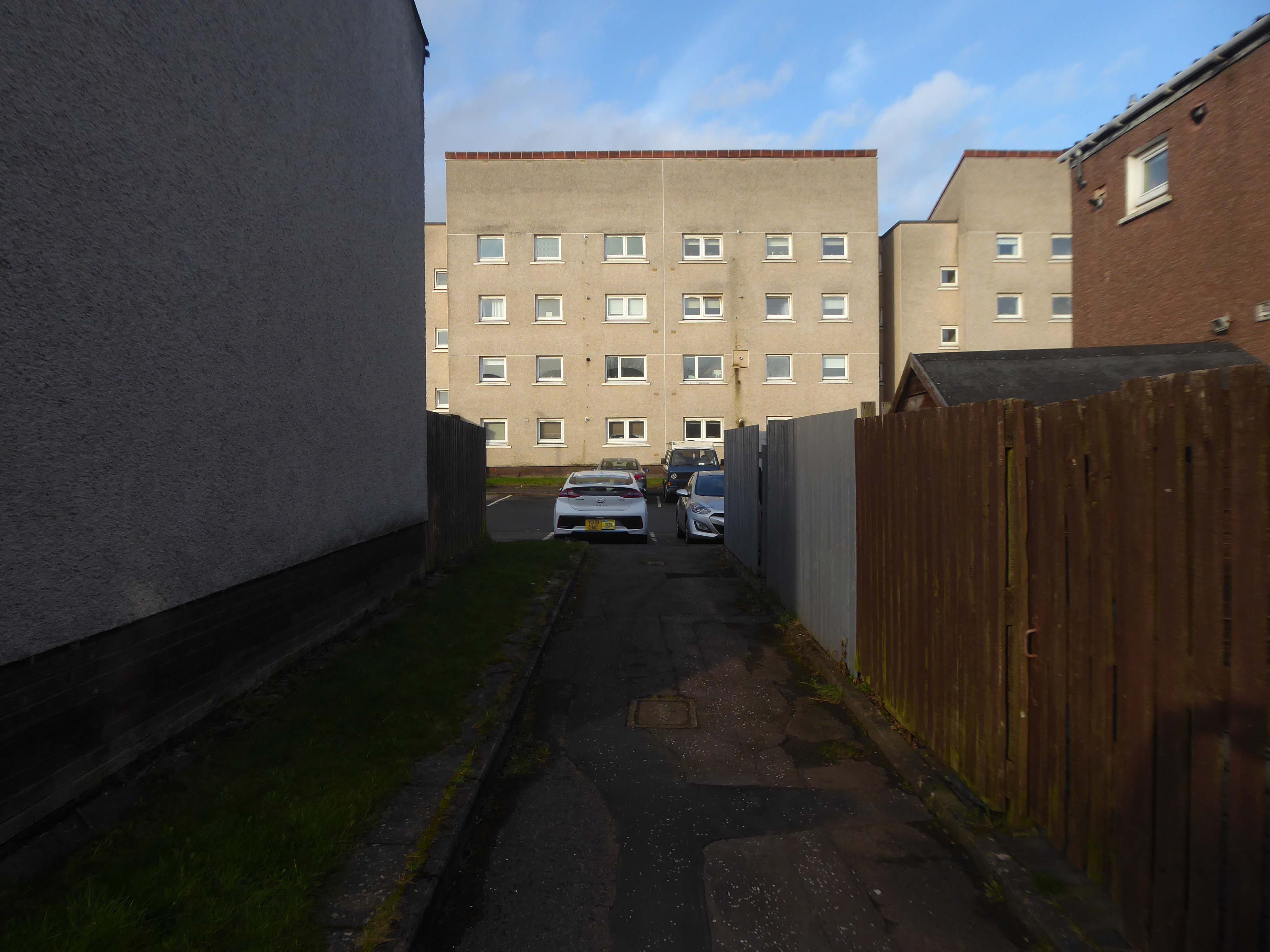
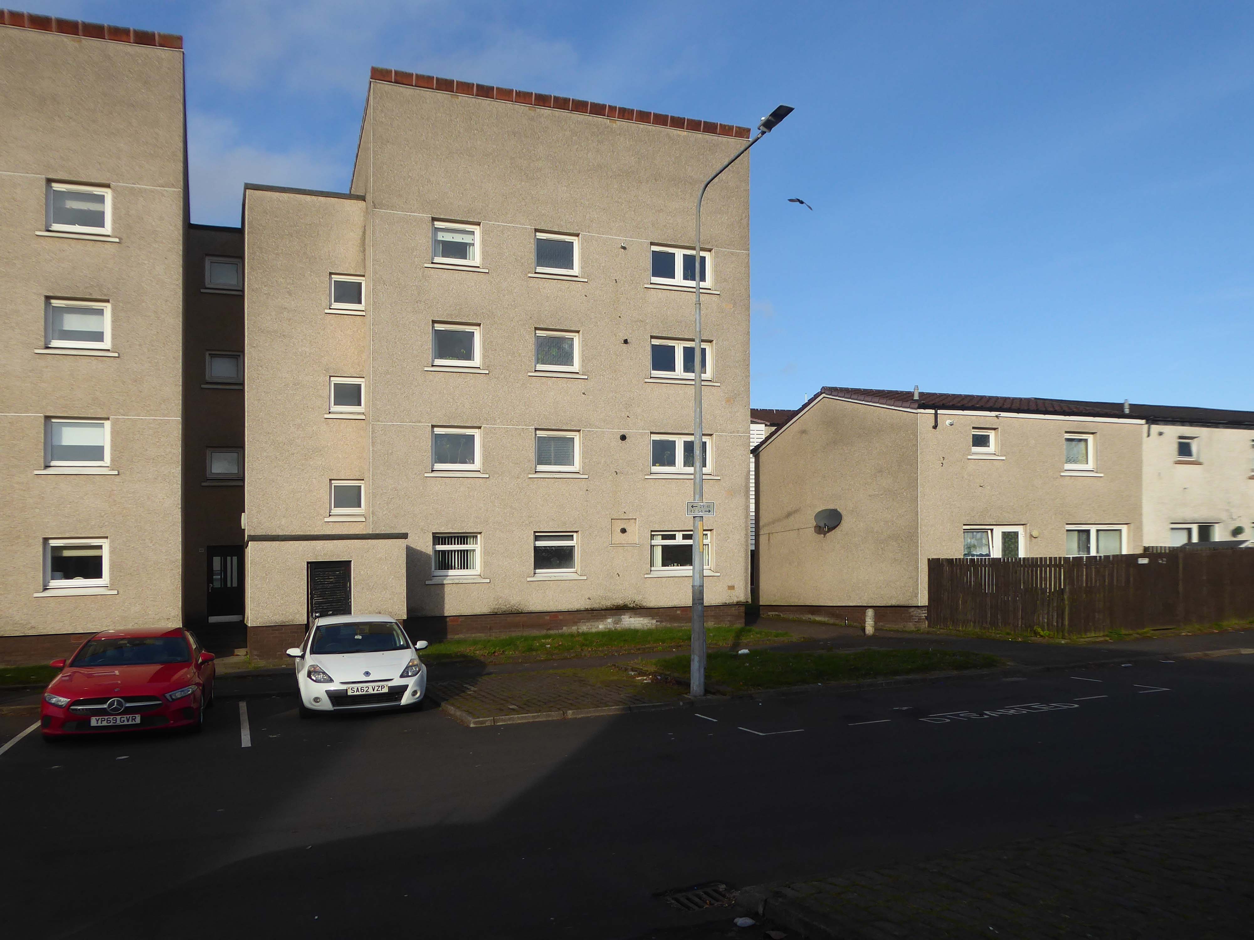
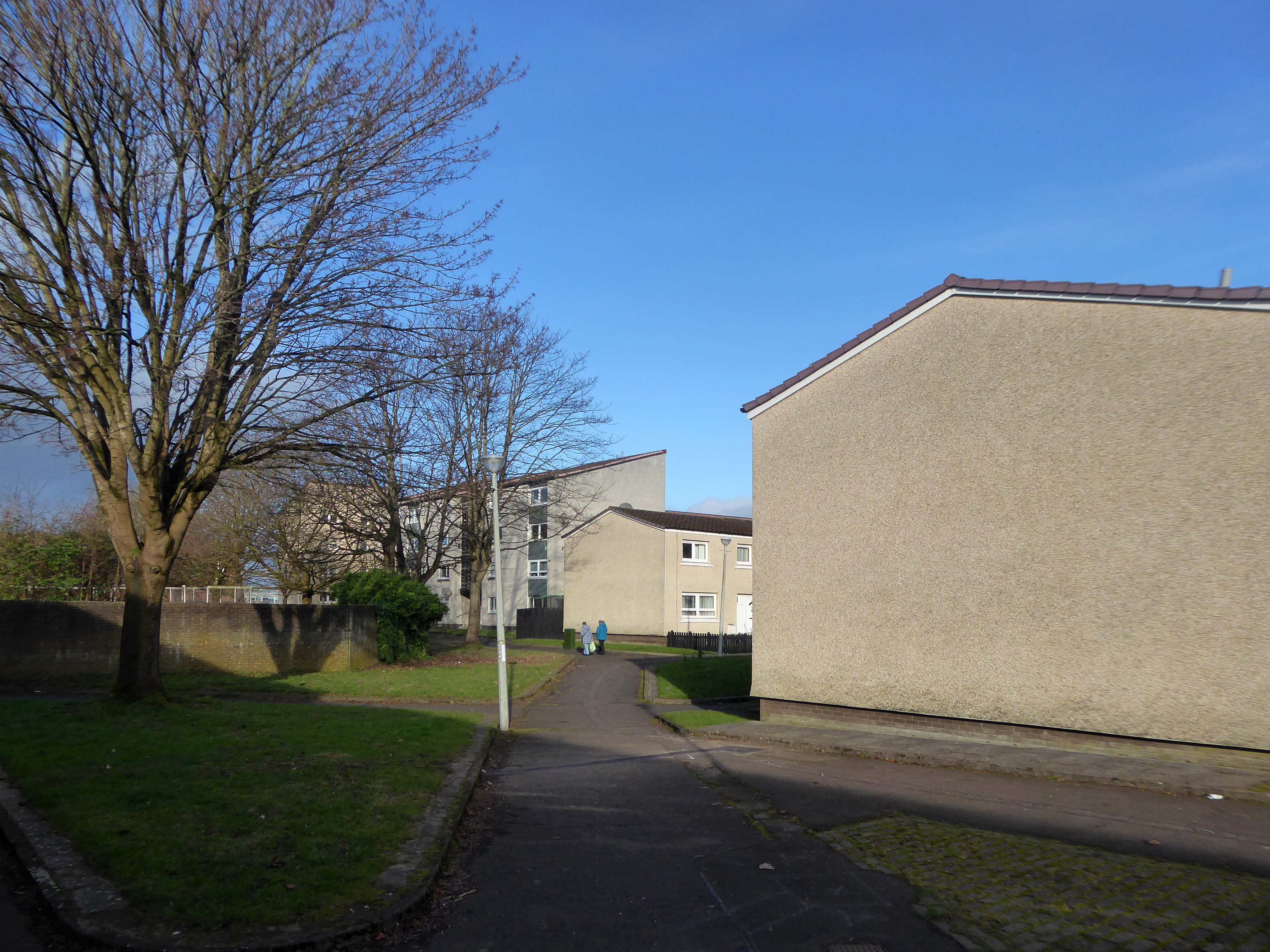
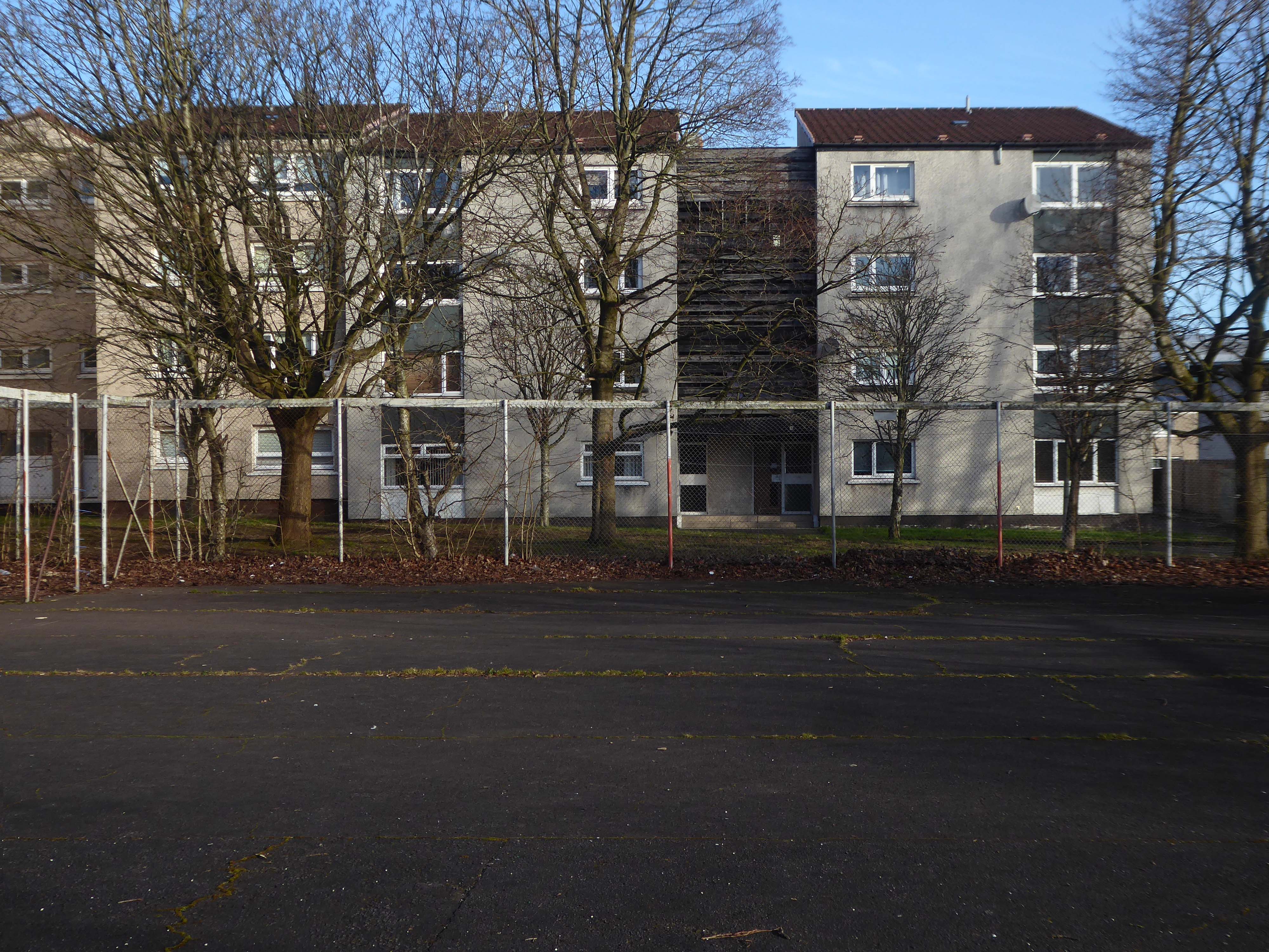
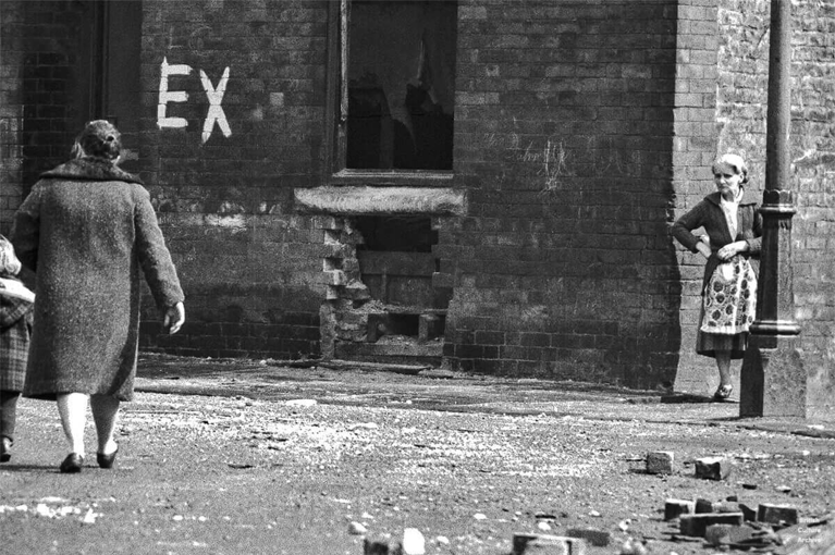
I was walking through the area in March 2023 one quite quiet morning, and attracted by the neat rows of austere grey terraces, low rise blocks and maisonettes, which have replaced the tenements.
The estate is clean and well maintained, open areas of grass criss crossed with pedestrian paths, surrounded by mature trees, motor cars have discrete parking areas.
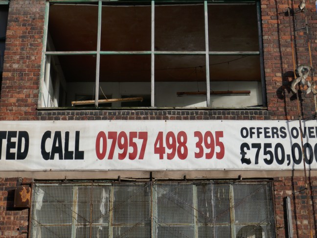
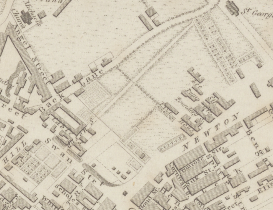
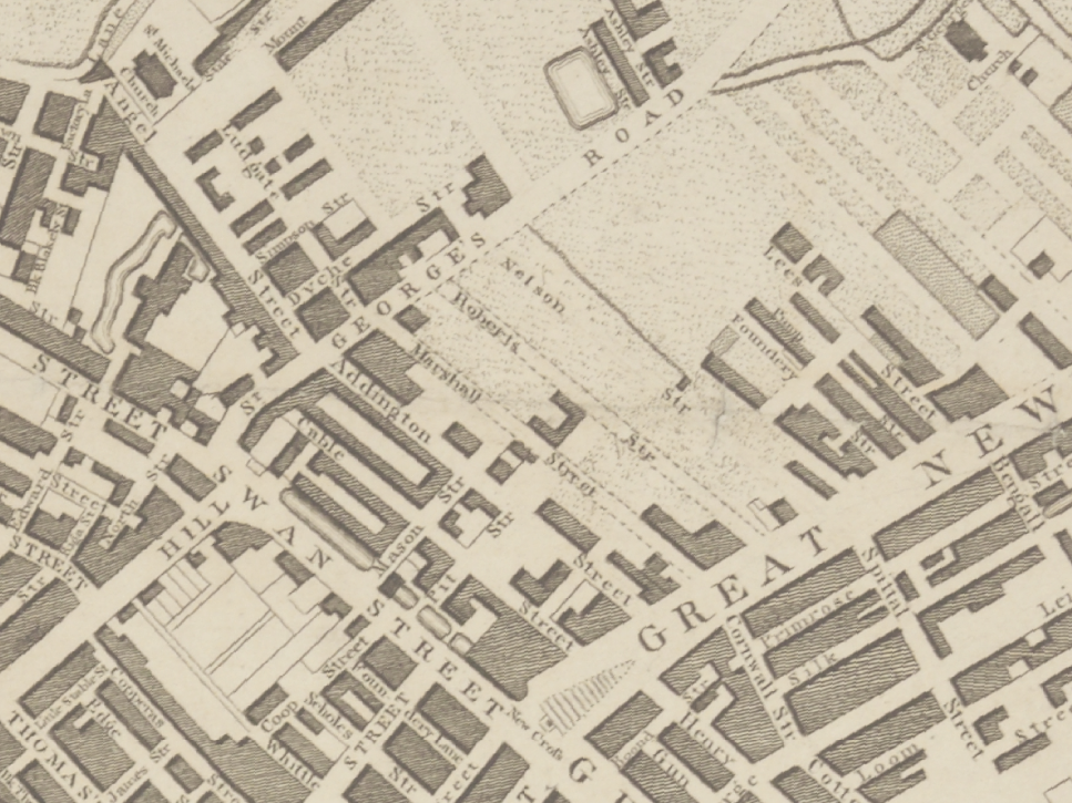
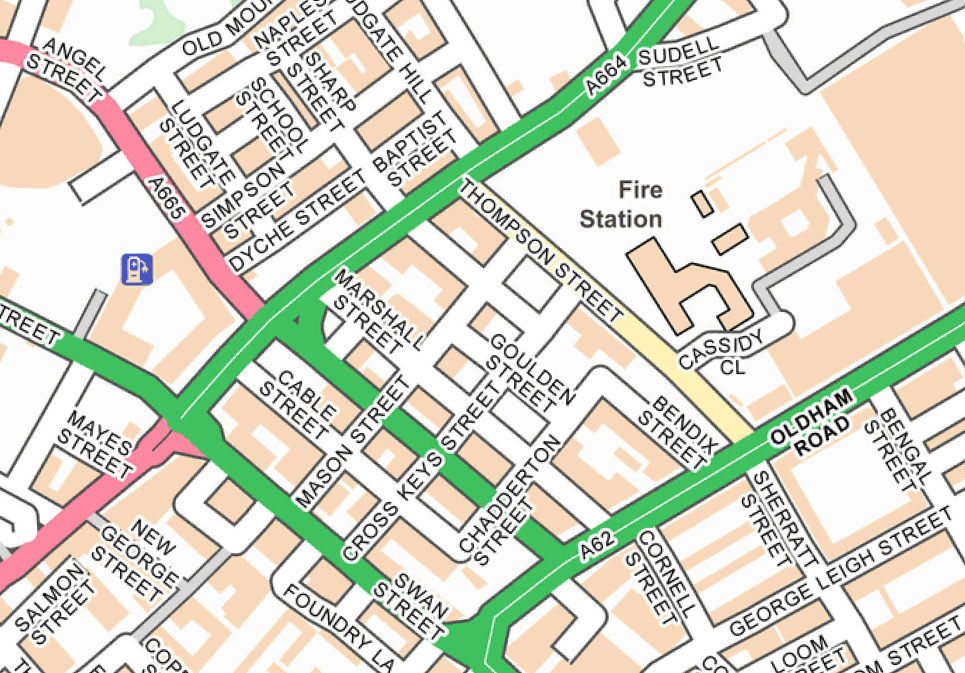
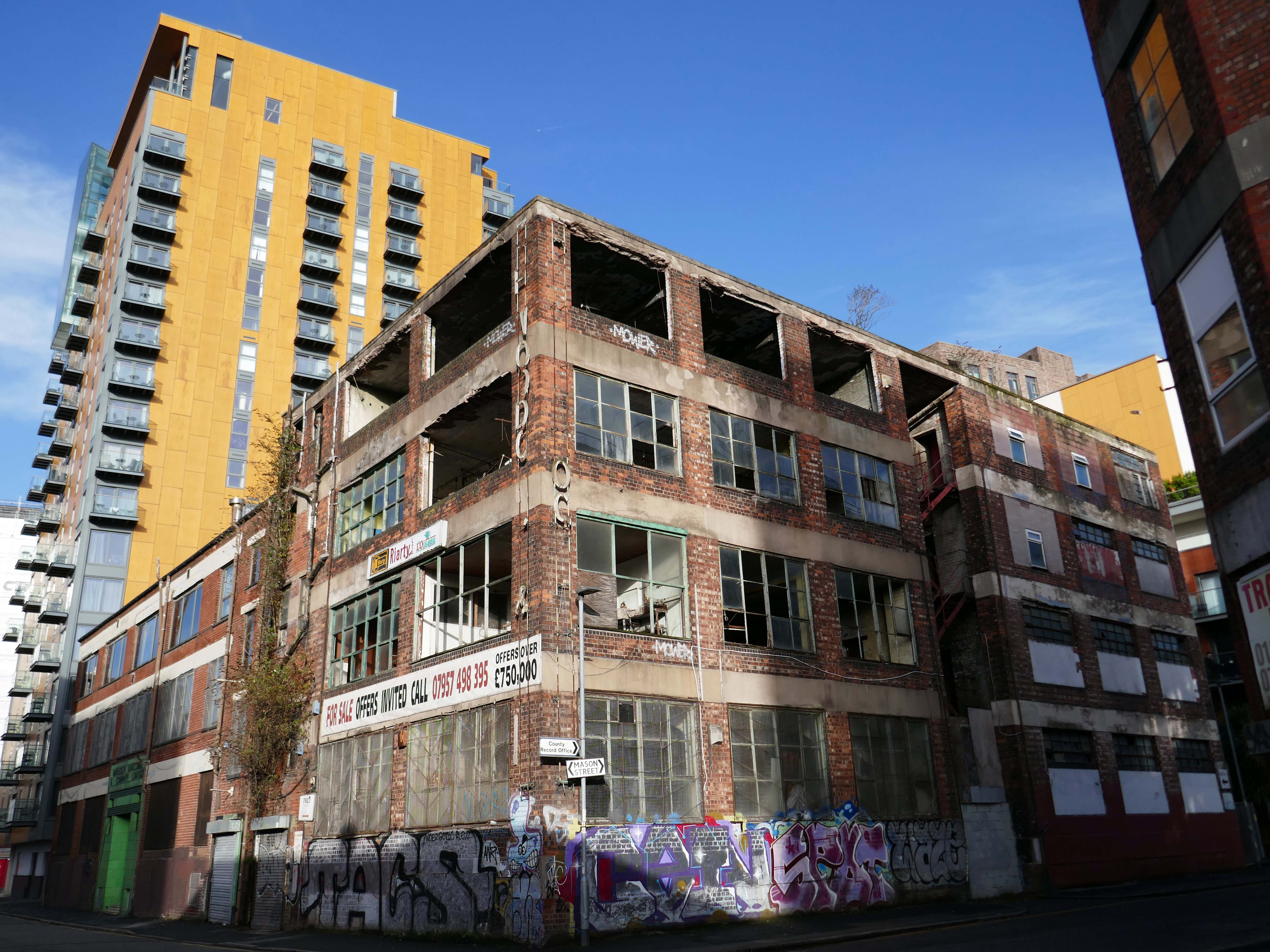
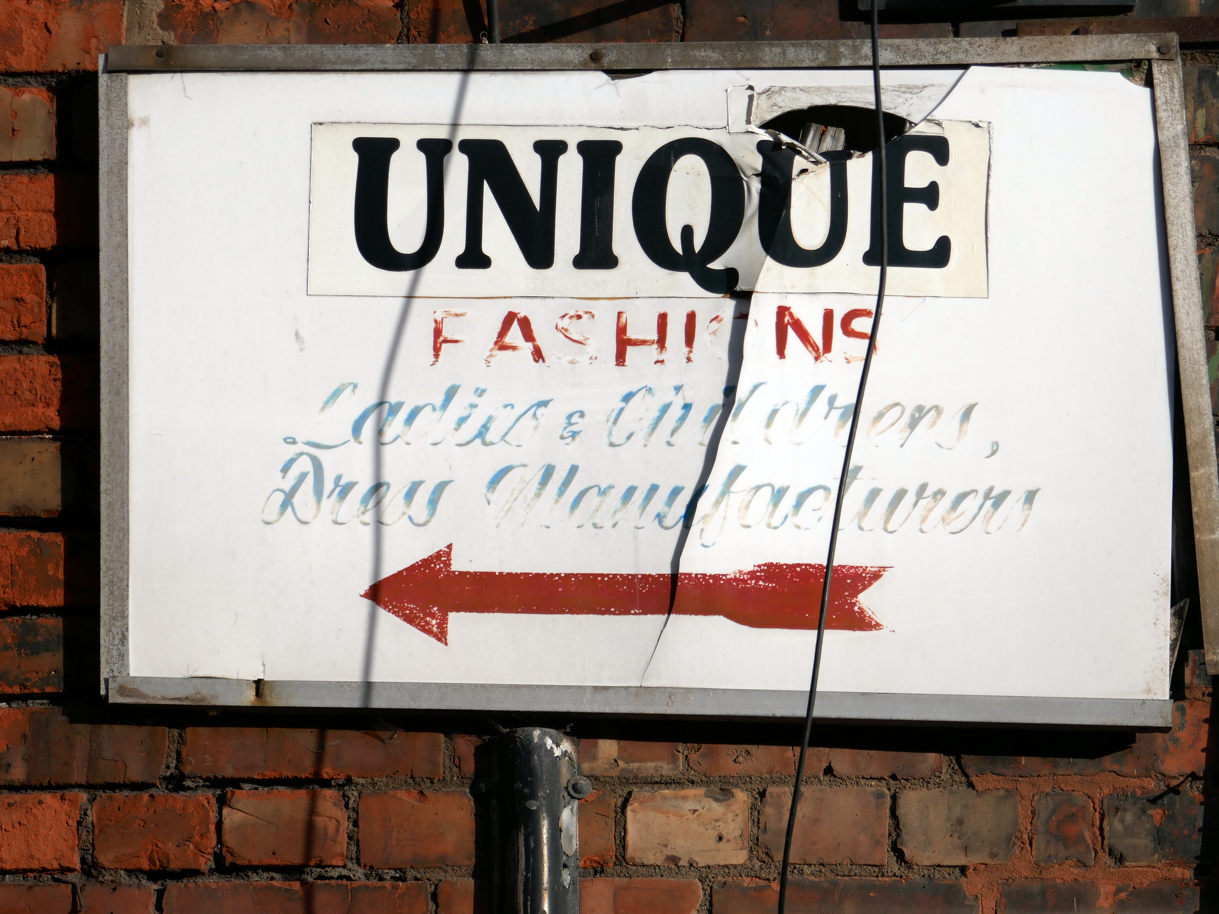
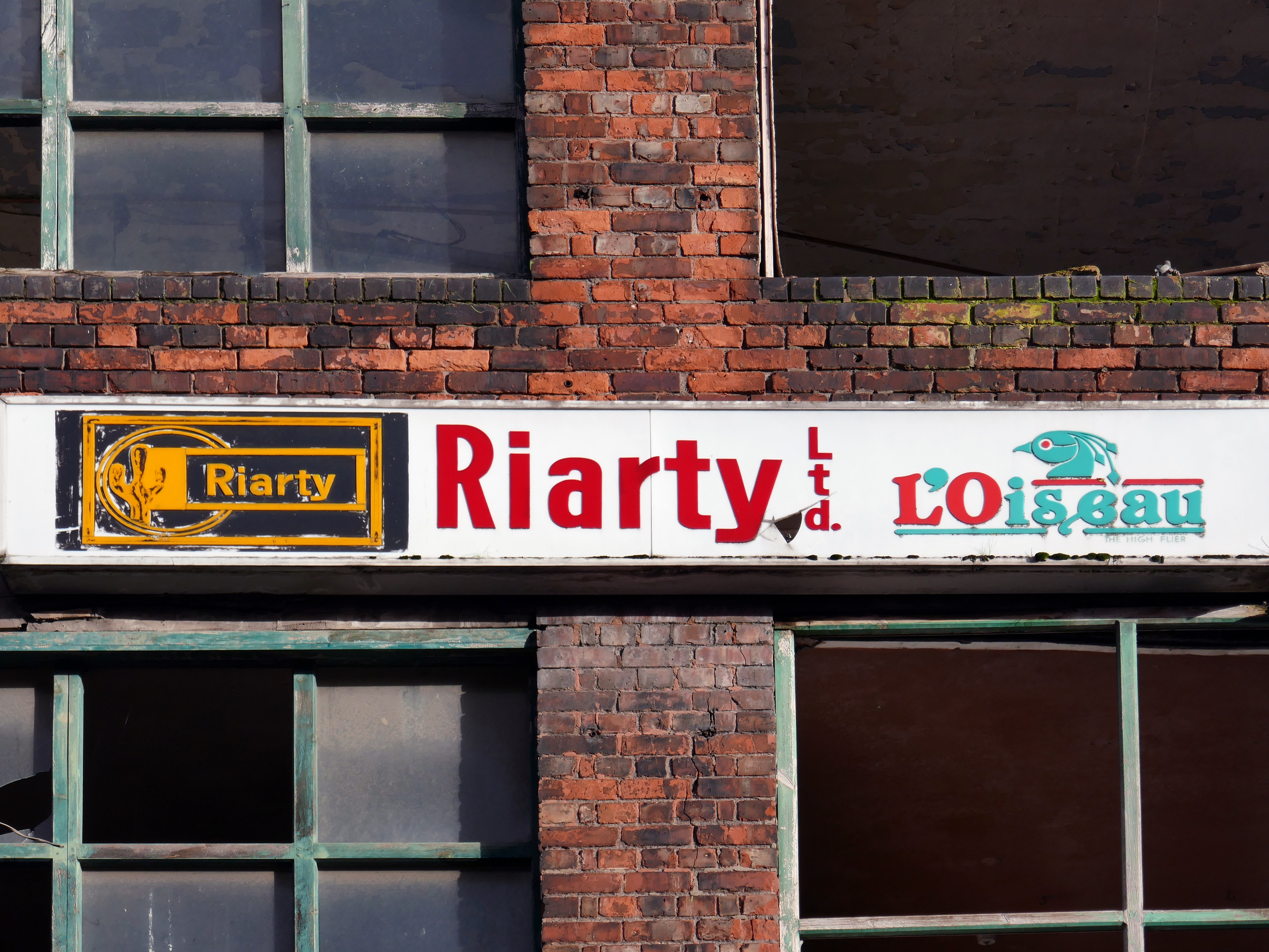
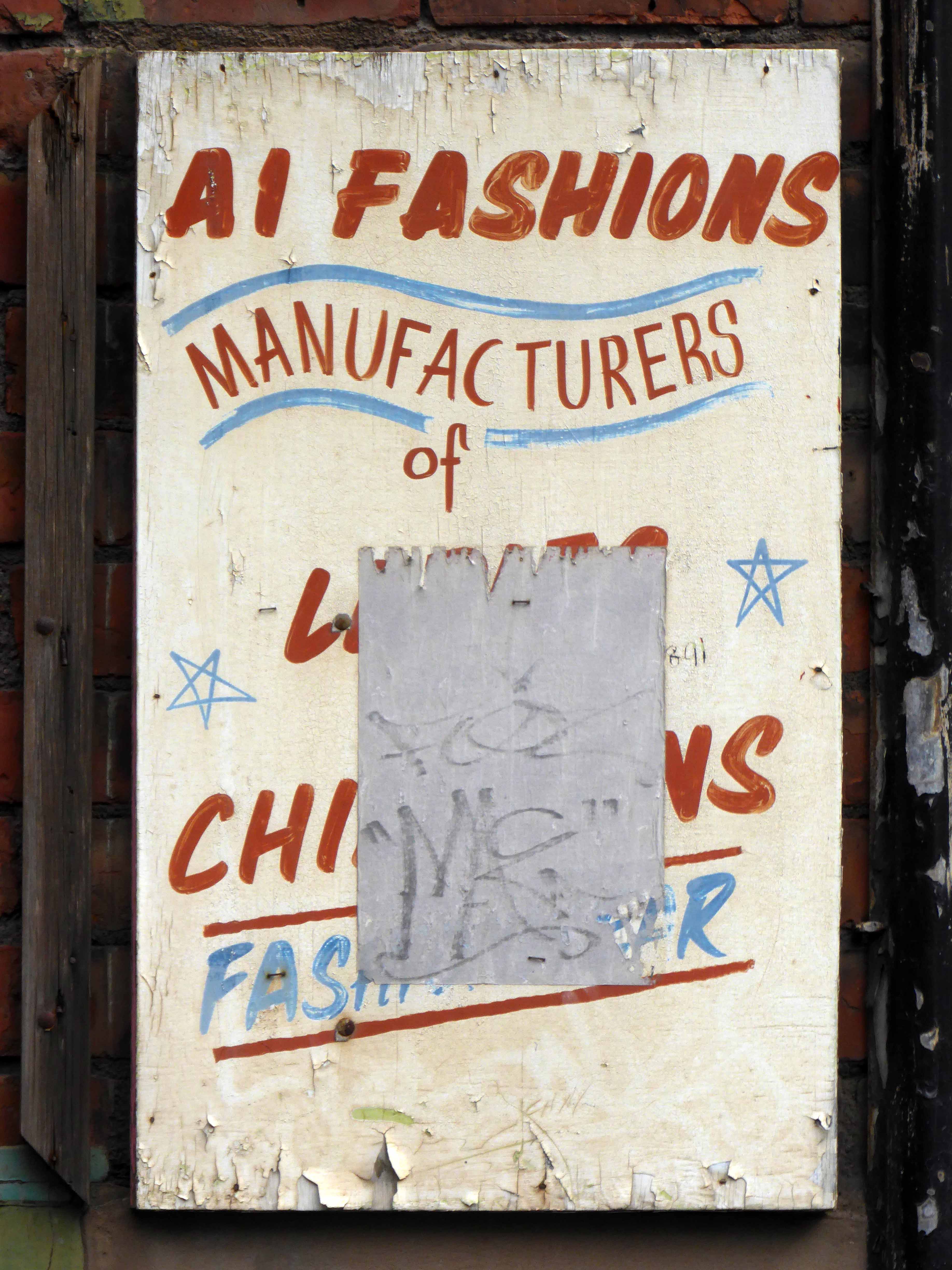
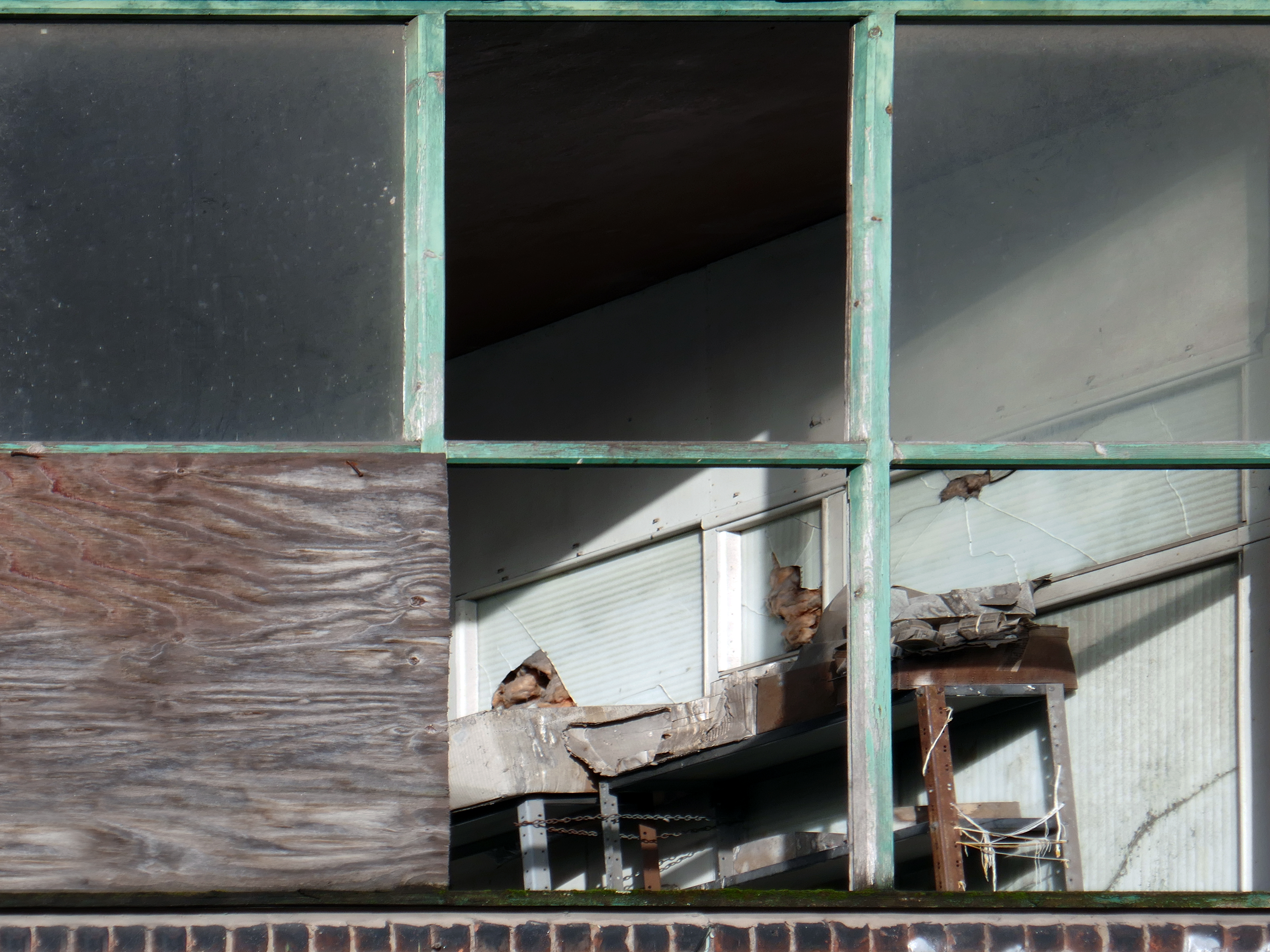
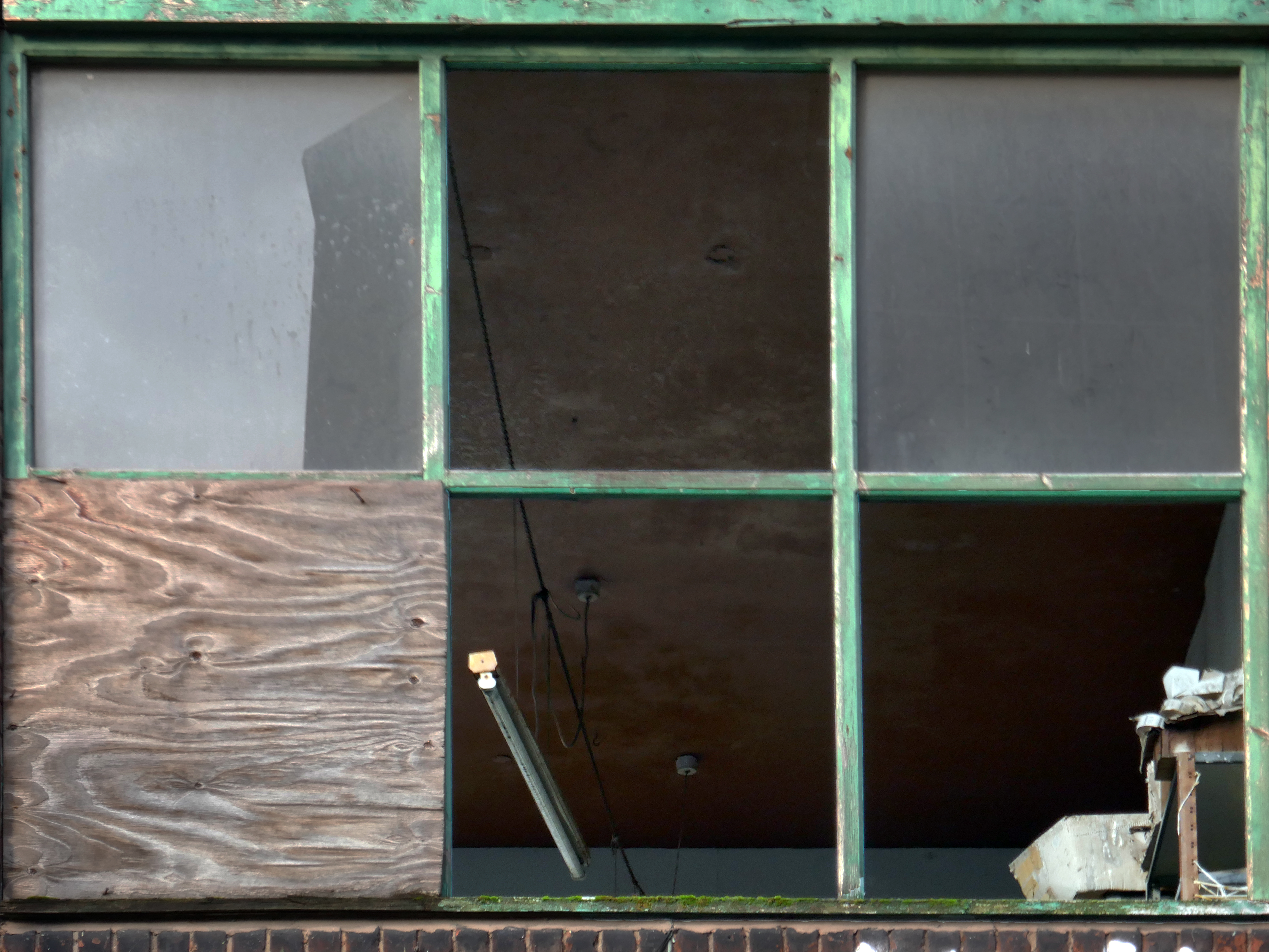
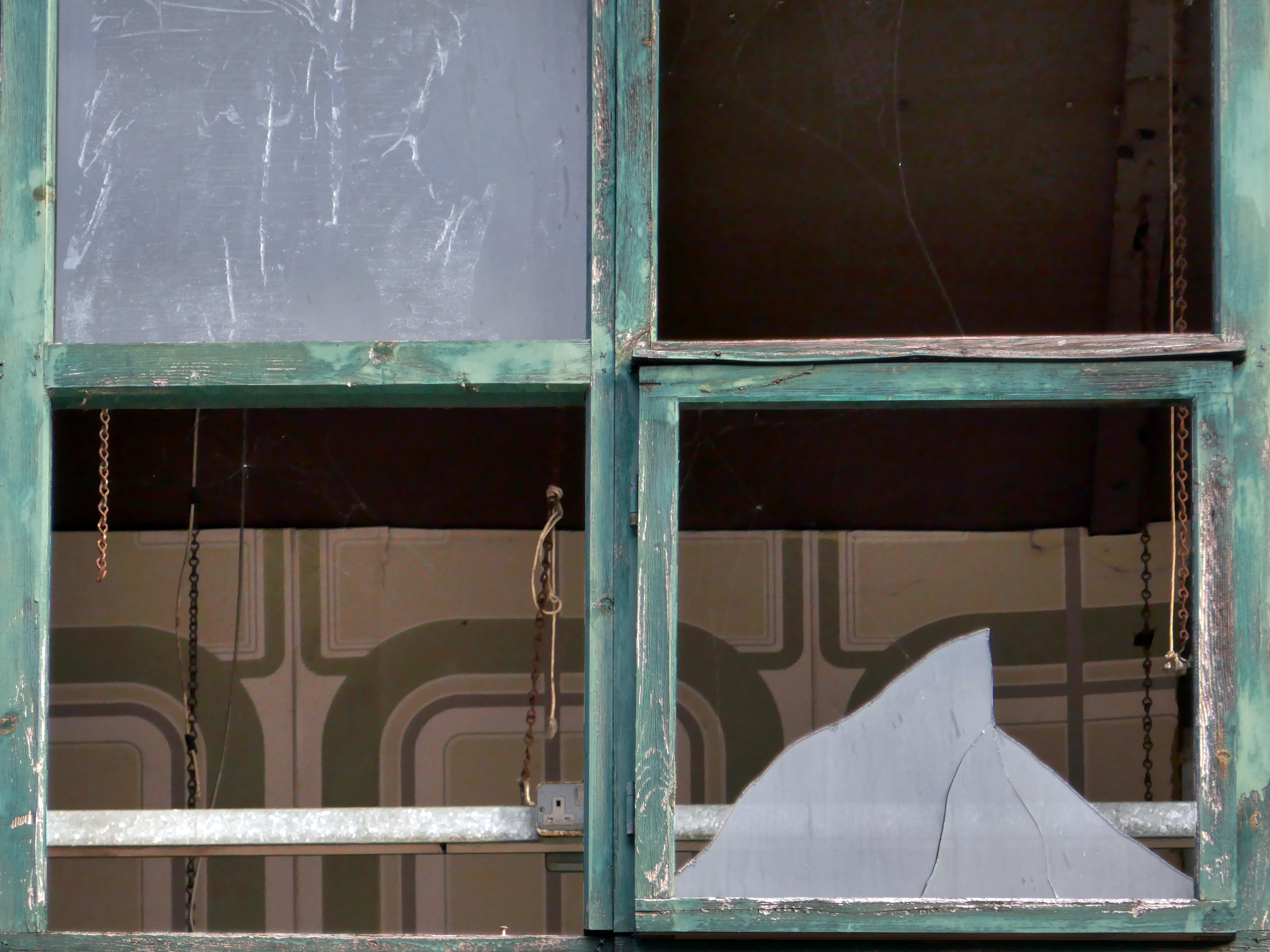
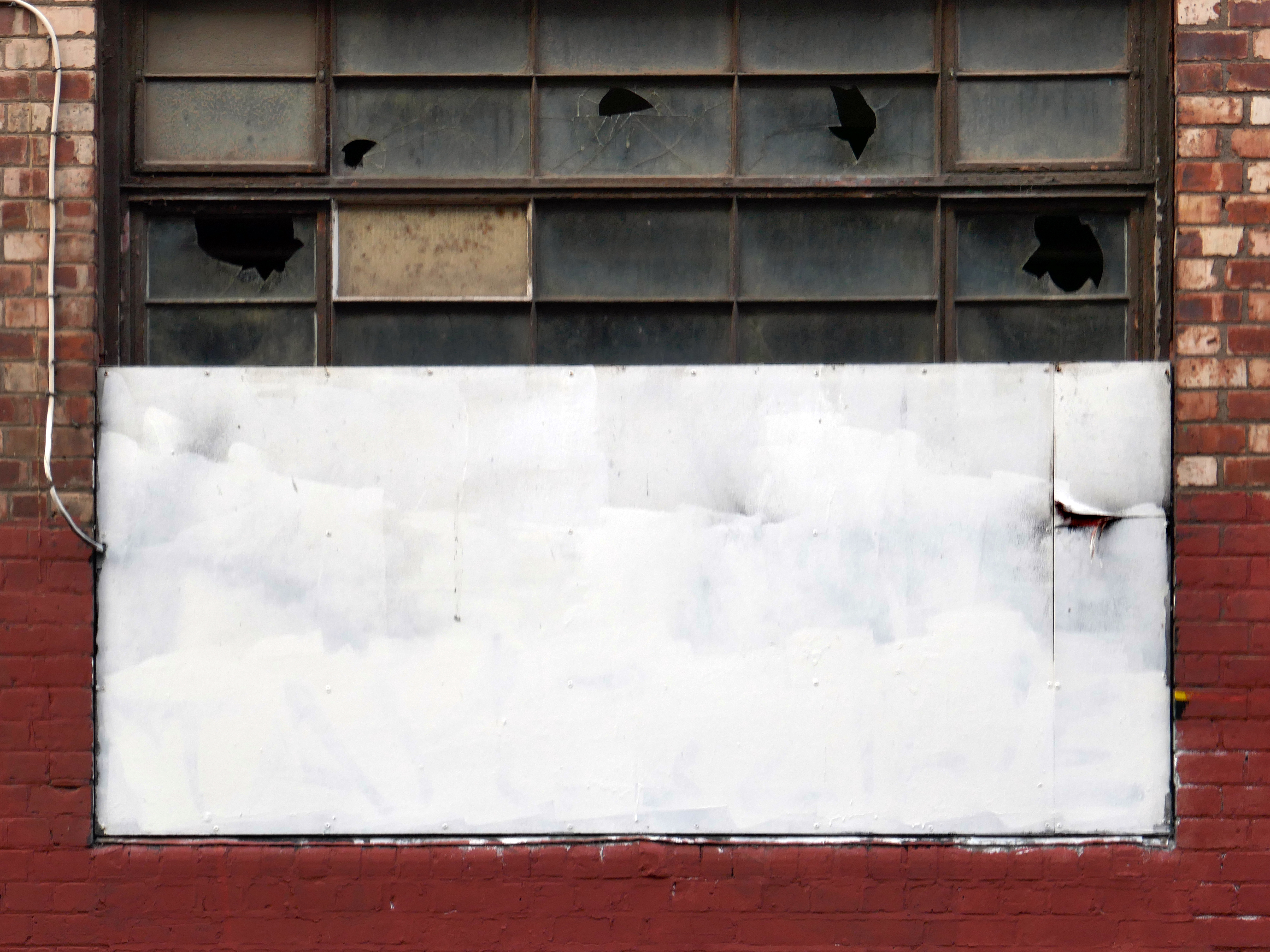
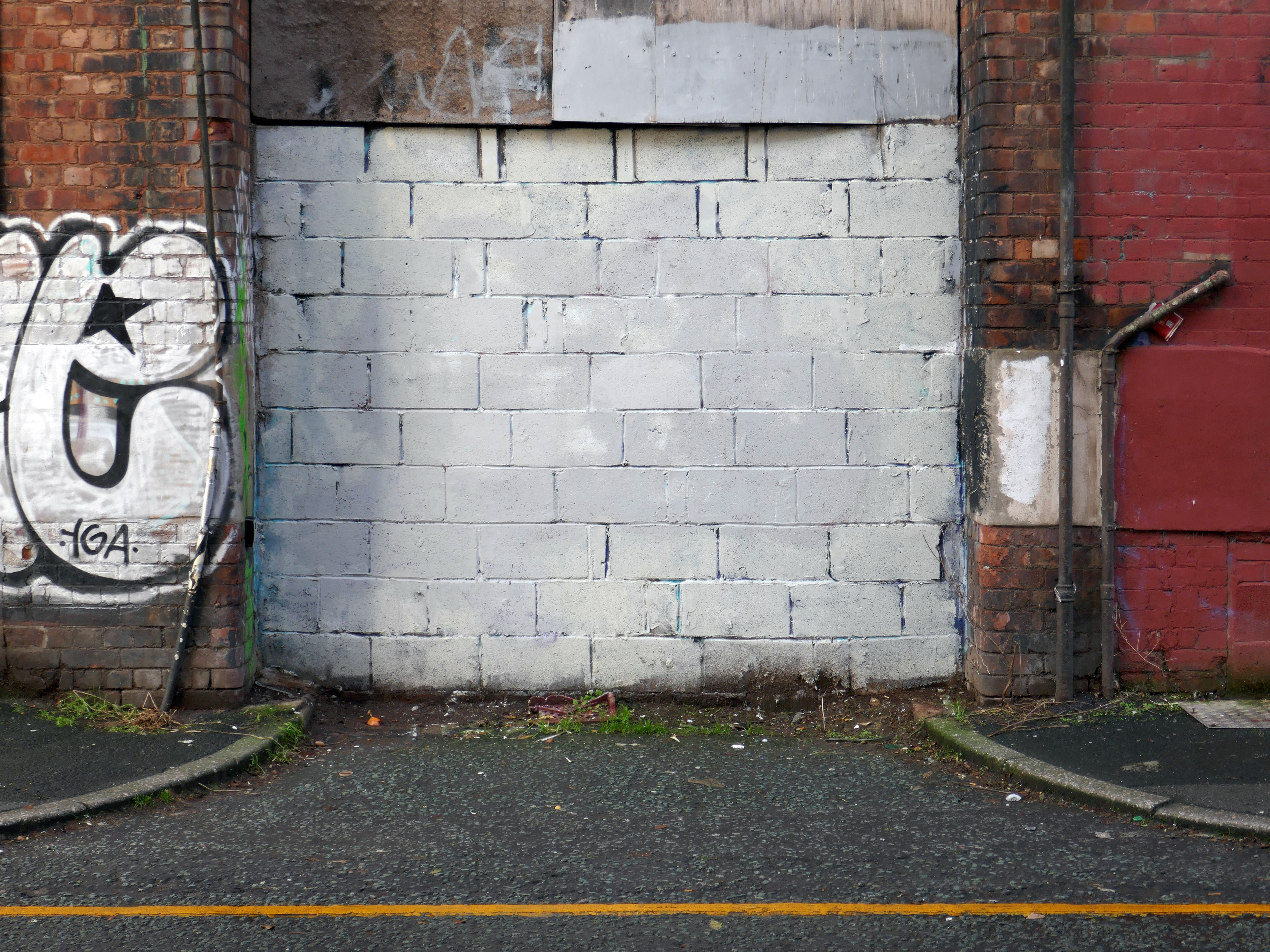
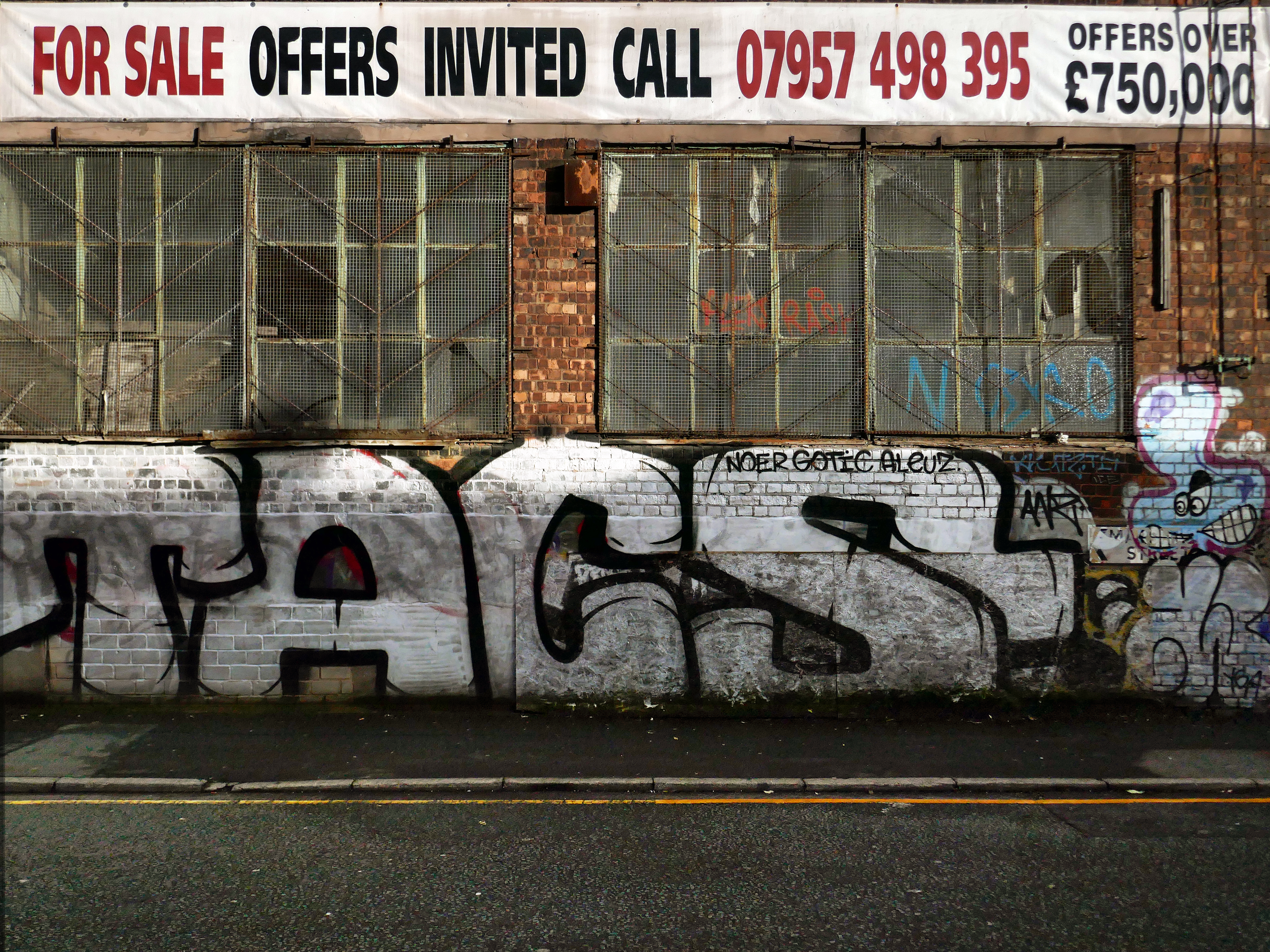
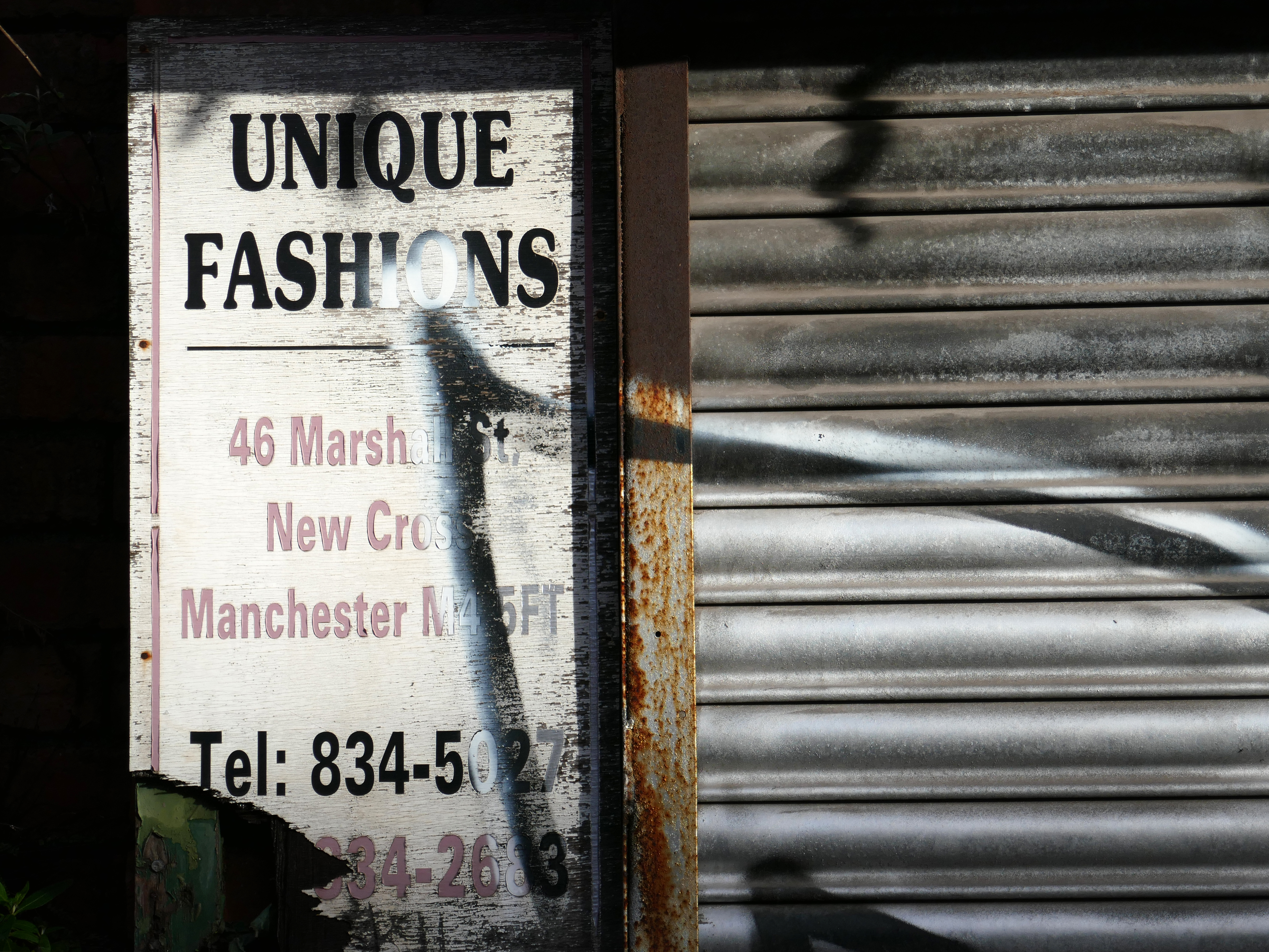
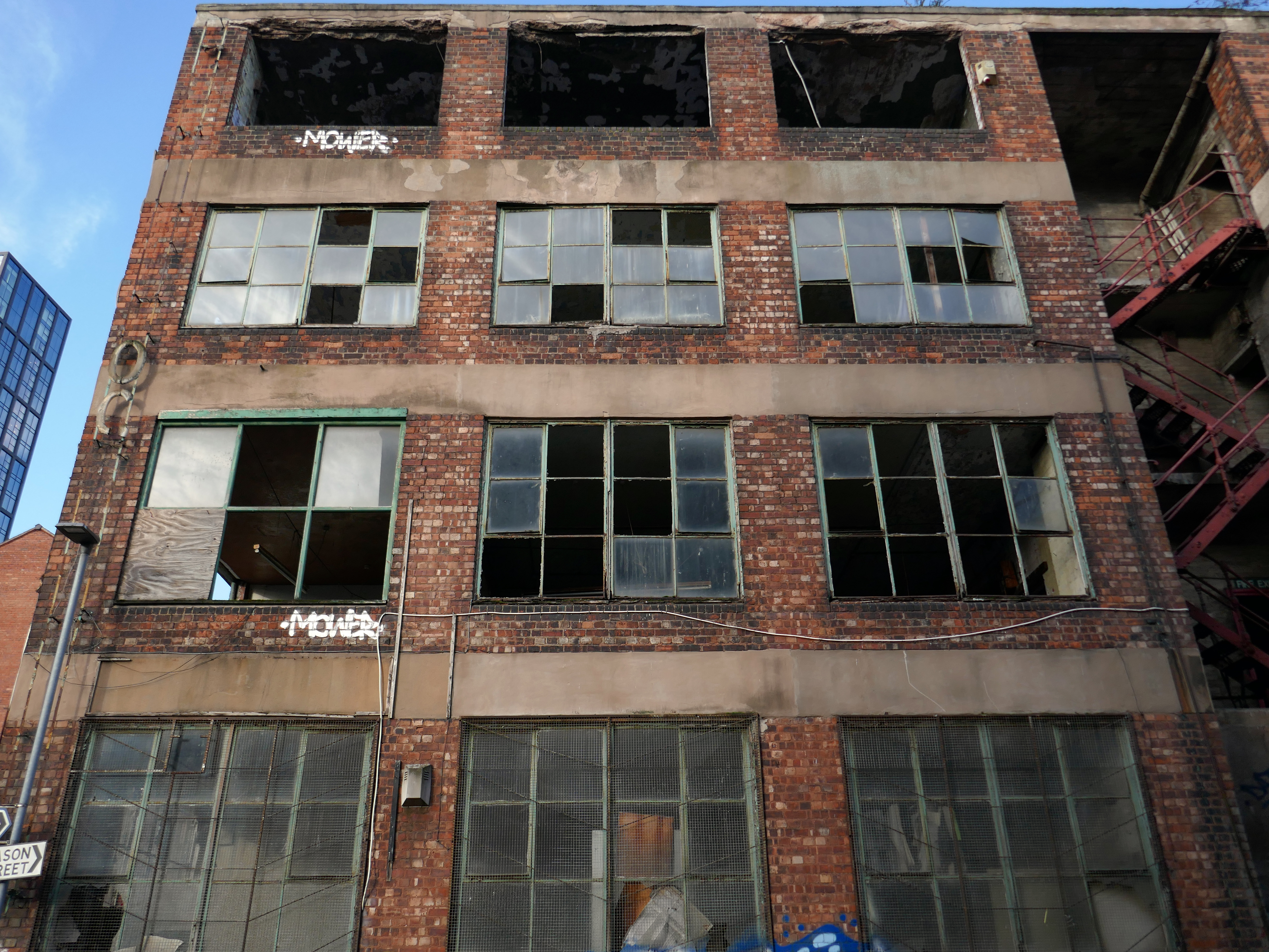
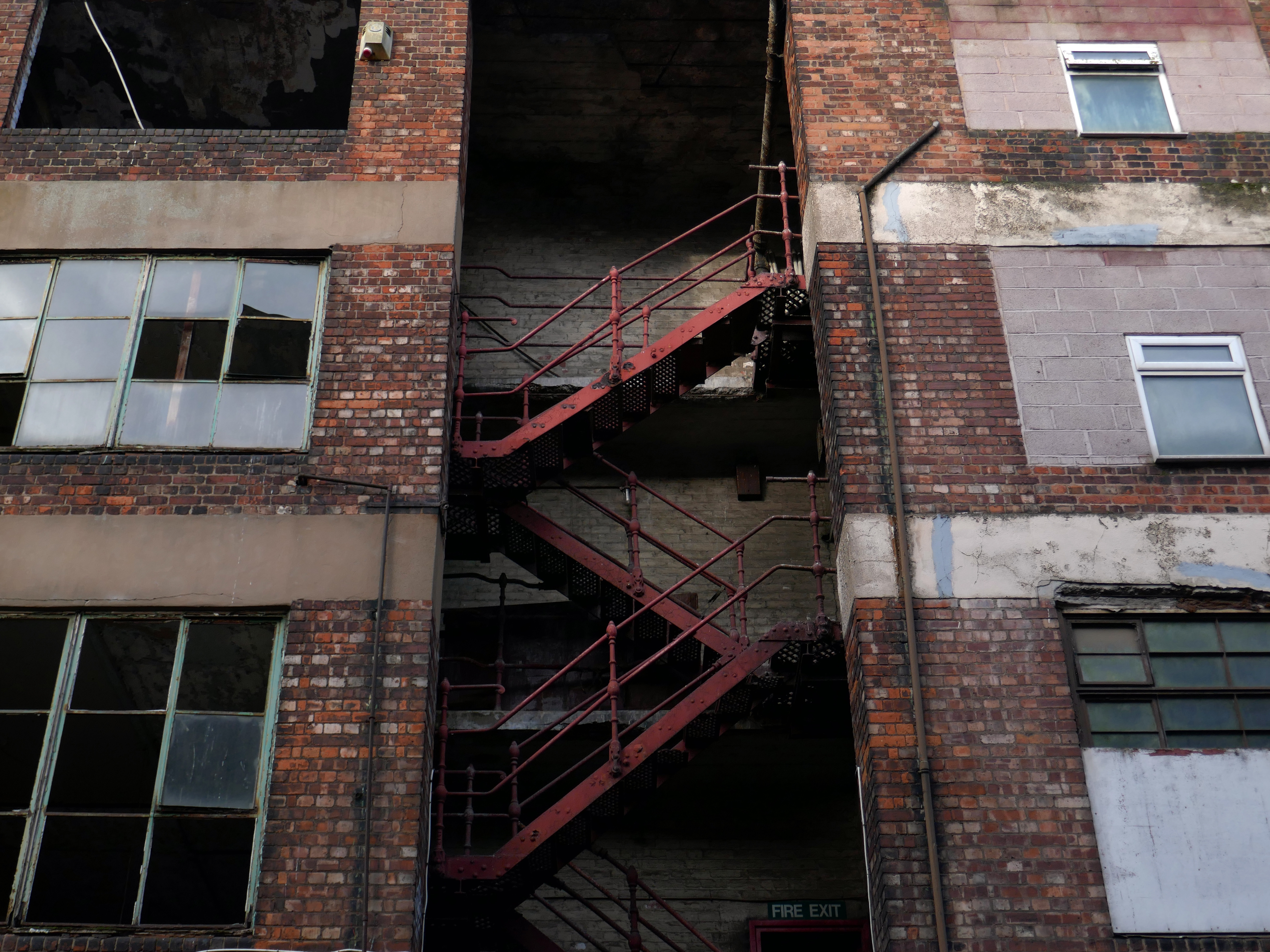
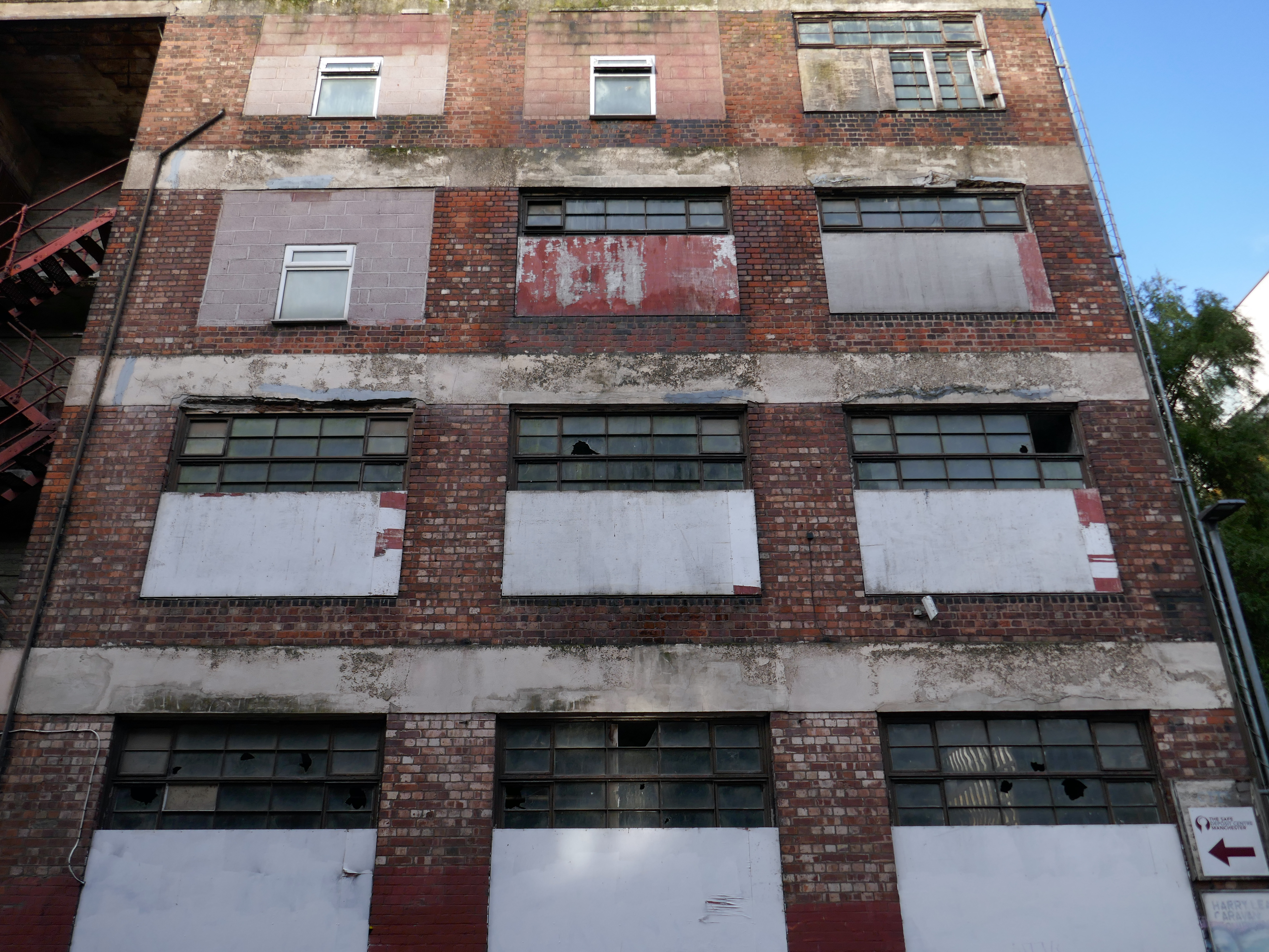
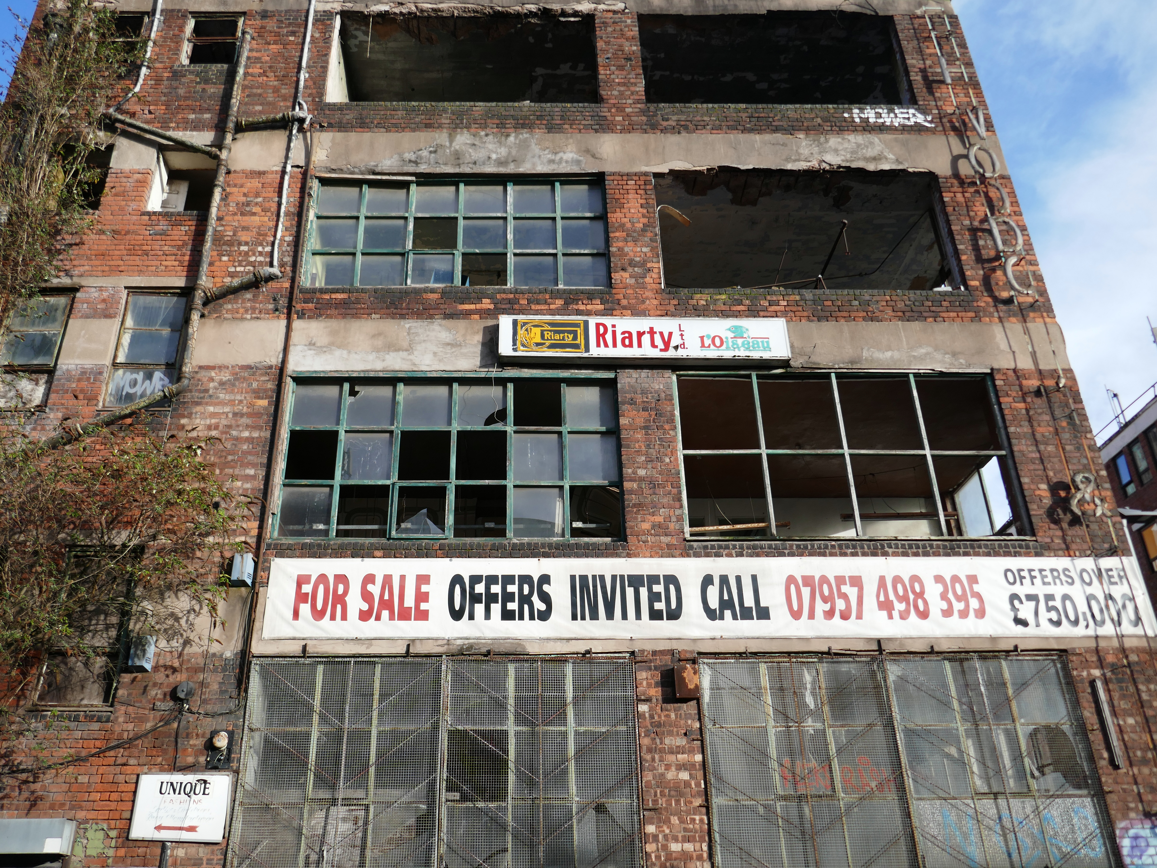
This building has always intrigued me, its sits amongst what was formerly the heart of Manchester’s Rag Trade. It is an area of signs and lost industry, the comings and goings having been and gone.
The surrounding buildings are gradually being refurbished or replaced, but somehow 46 Marshall Street is bucking the trend, though at some point someone somewhere will find over £750,000.
Gradually its wooden framed windows become the poked out eyes of its soul.
Light fittings hang limp and unlit, as the interior decor deteriorates.
The restless rust inhabits the lower metallic fenestration.
Block work blocks the blocked up entrances.
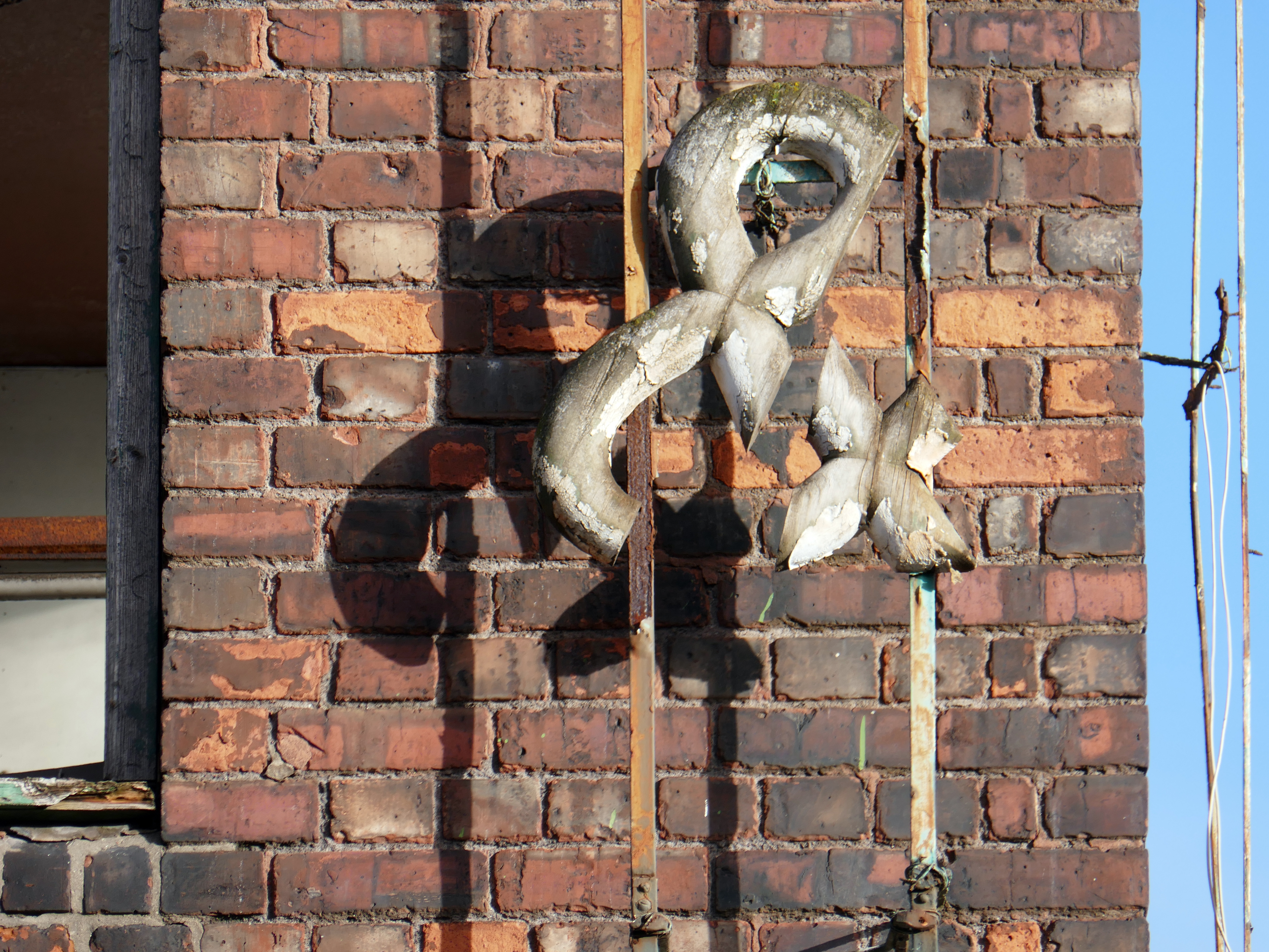
The ampersand can be traced back to the 1st century AD and the old Roman cursive, in which the letters E and T occasionally were written together to form a ligature.
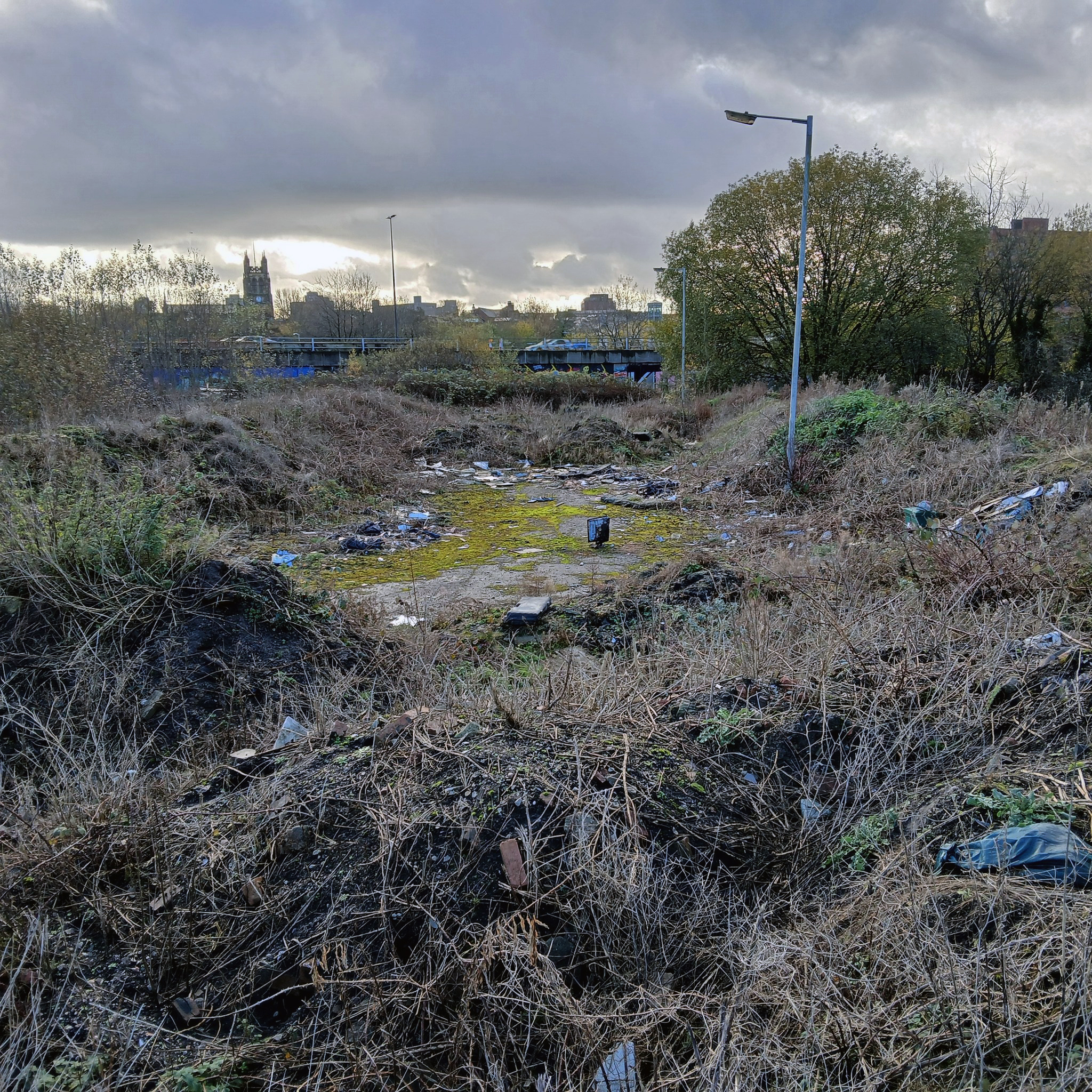
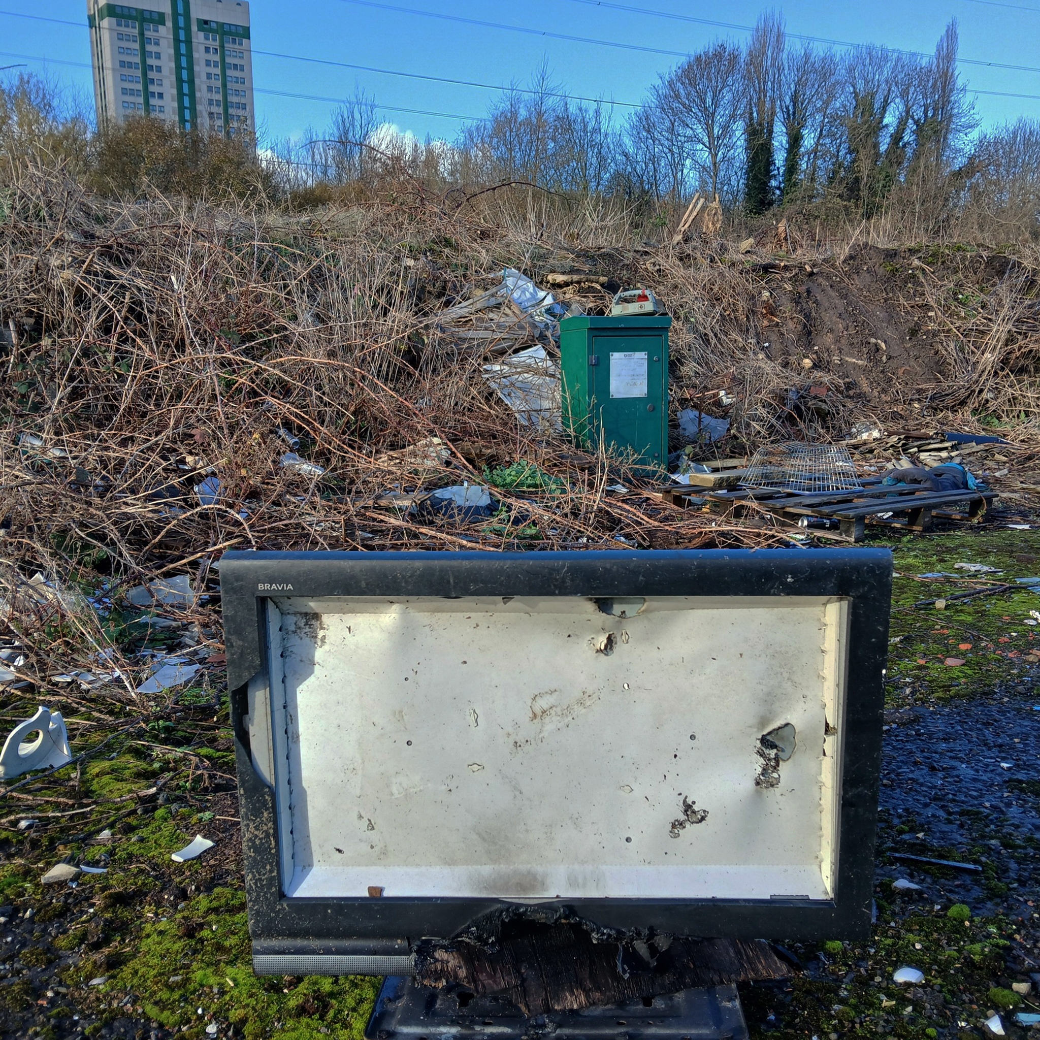
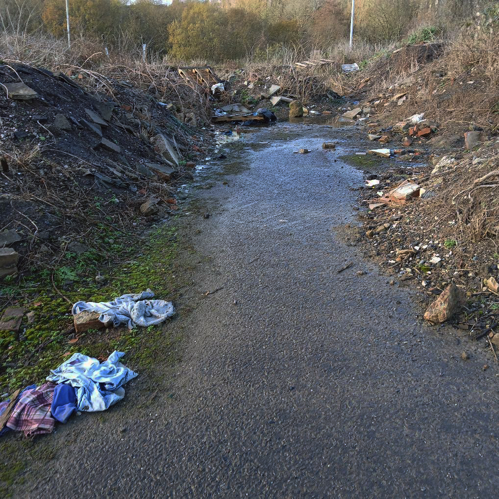
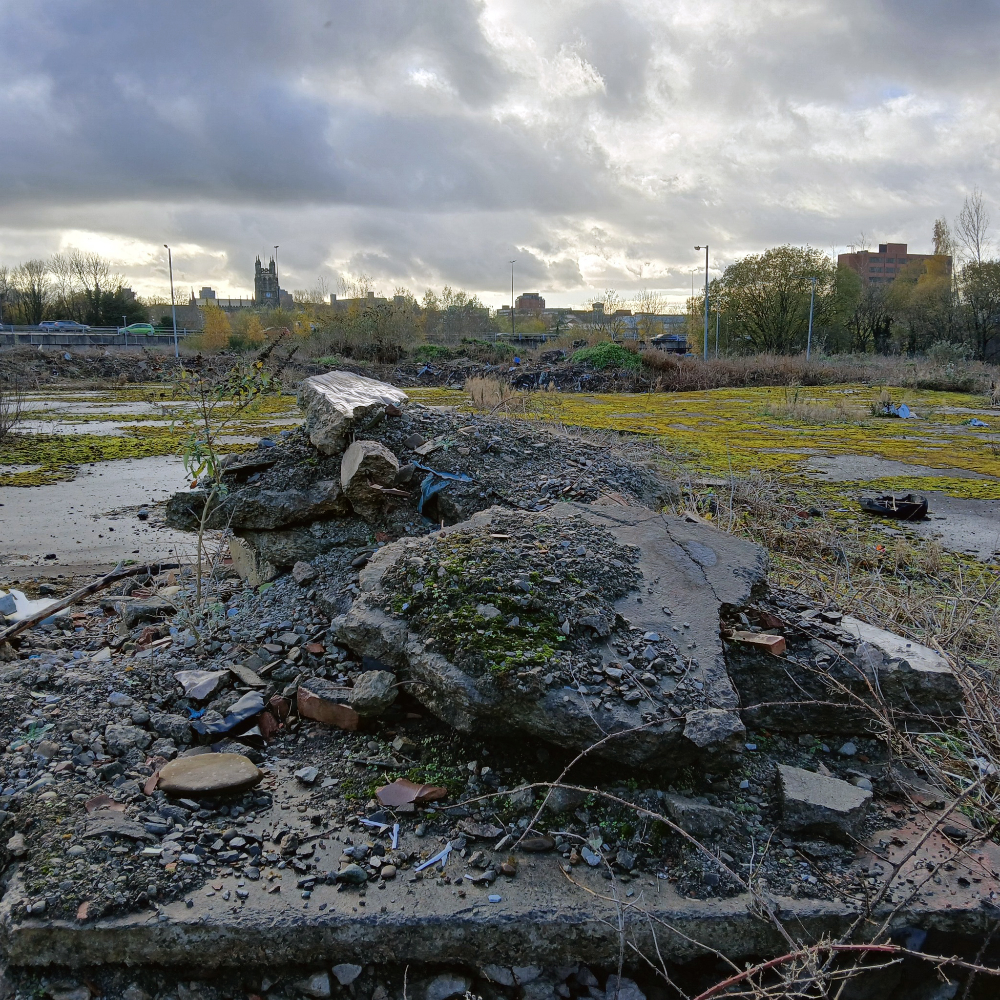
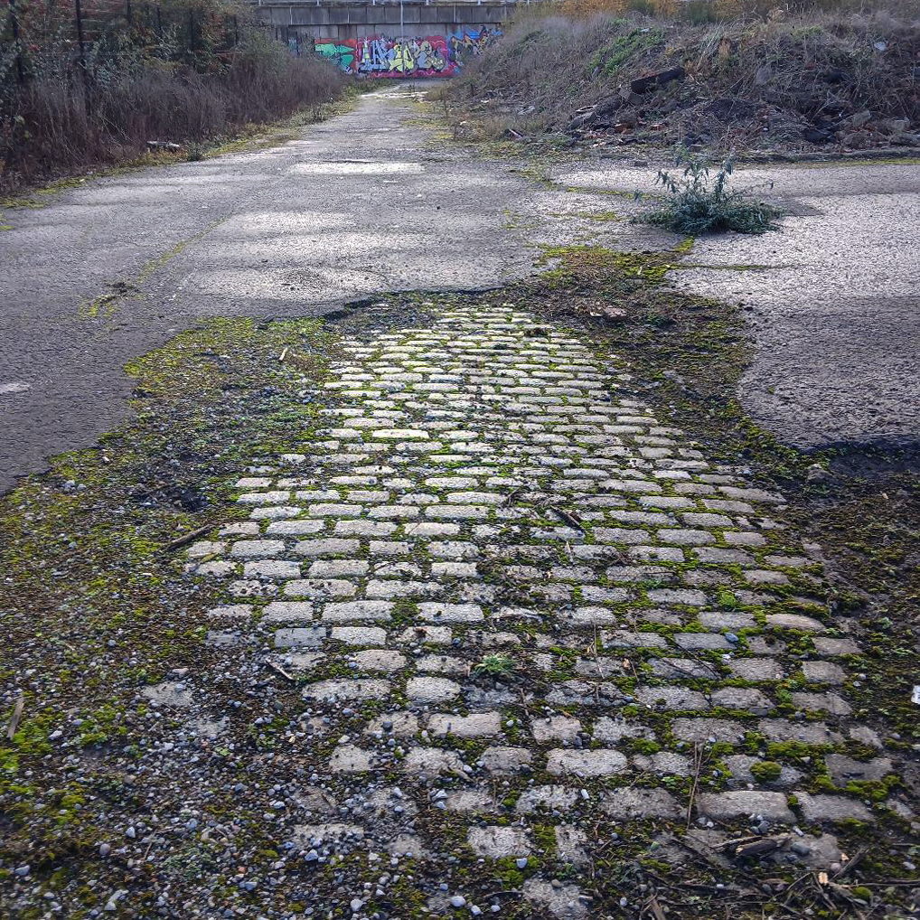
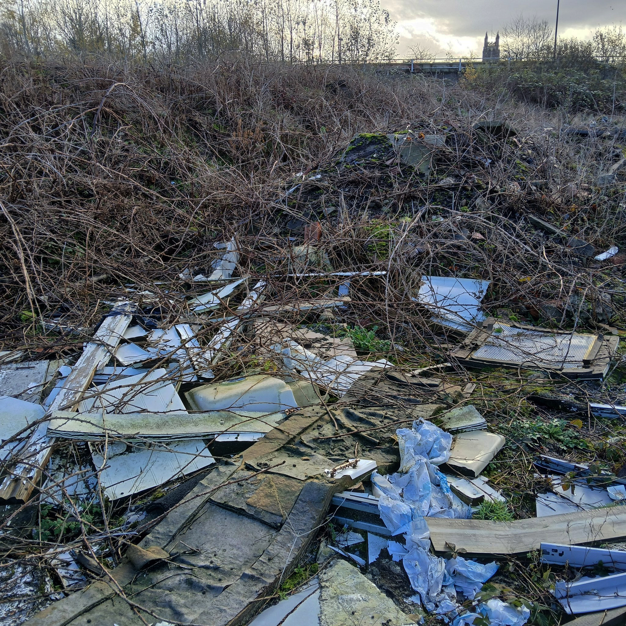
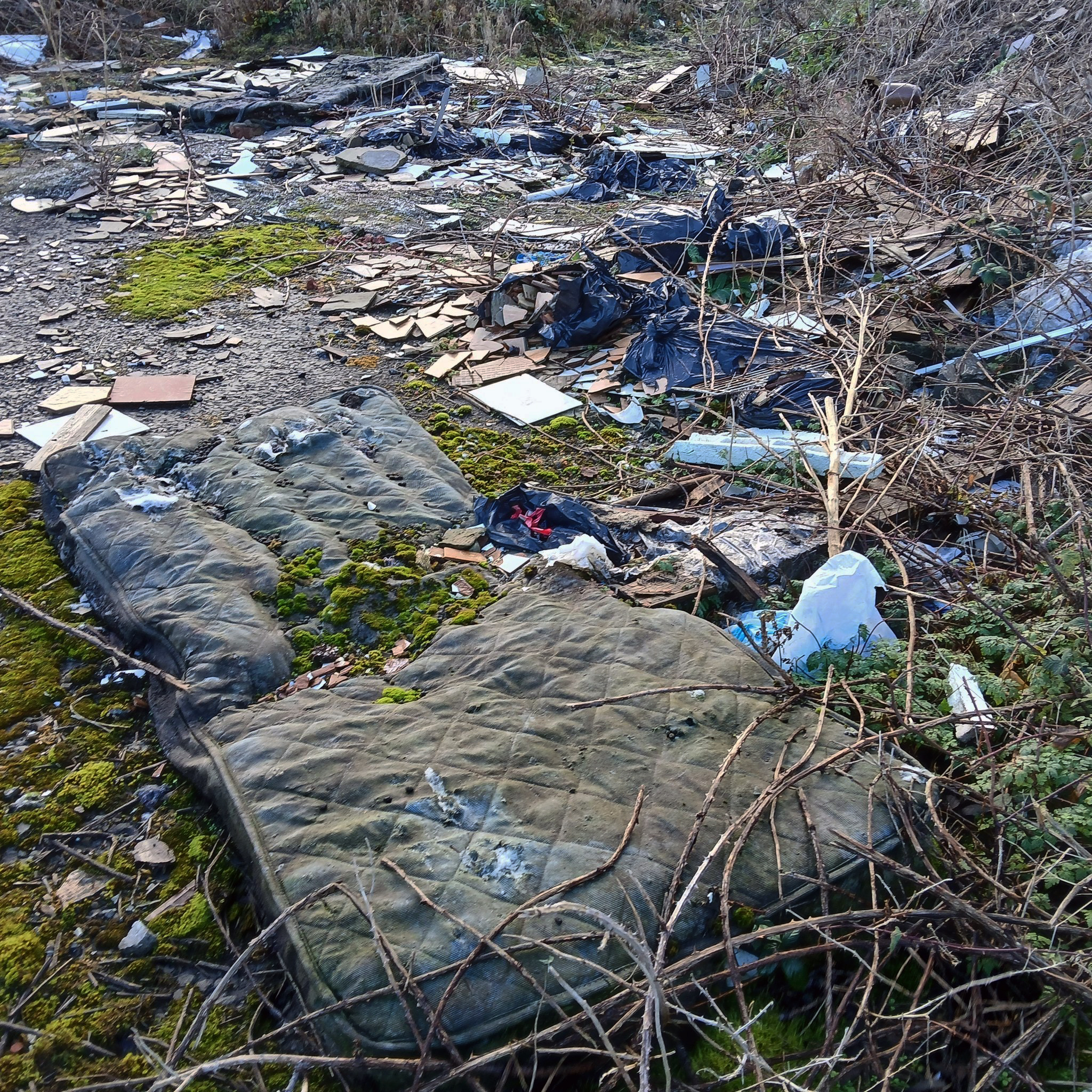
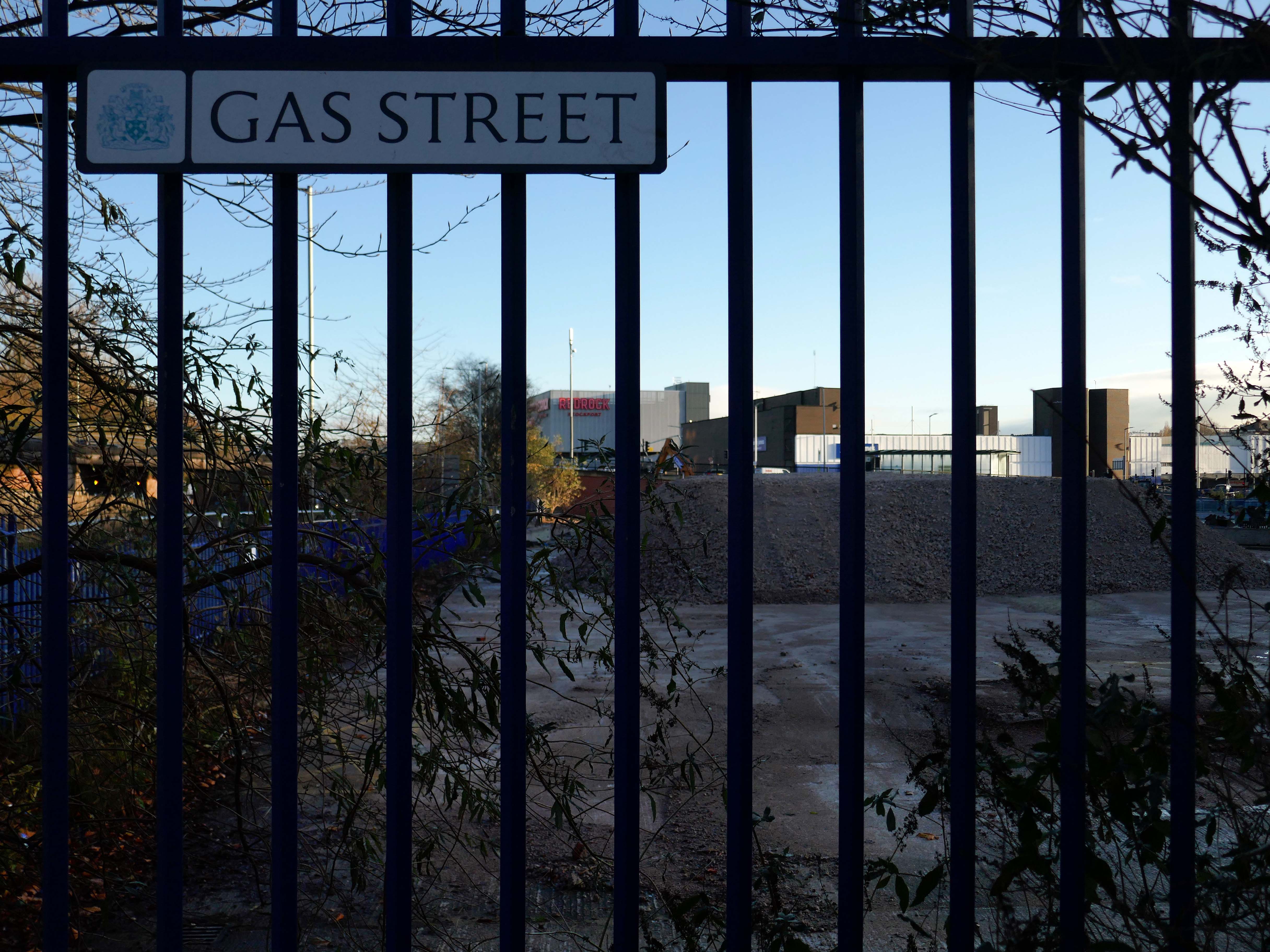
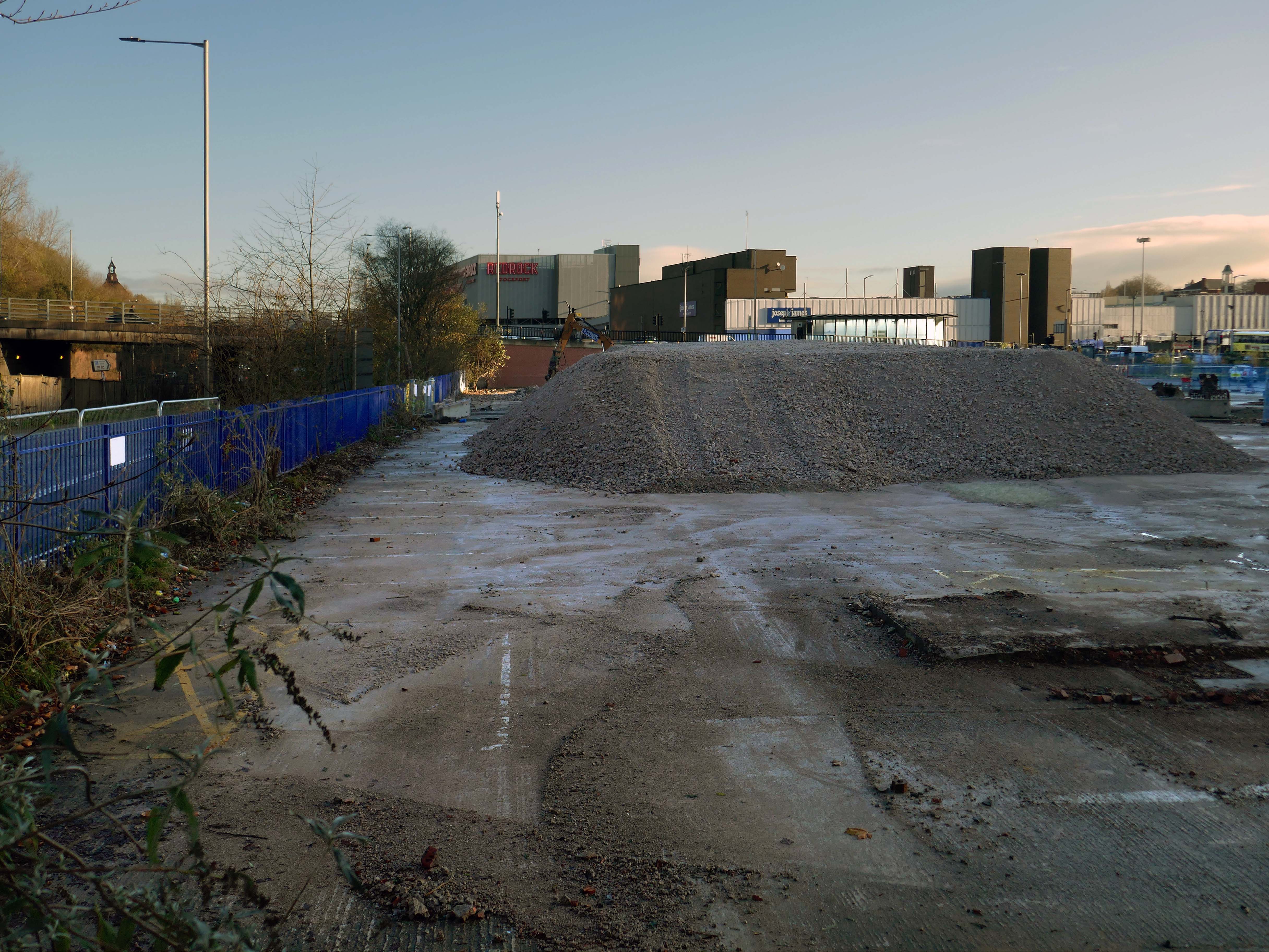
We can see the remains of the road system of this former industrial site, now colonised by brambles and greenery, the imposition of earth mounds and fly tipping.
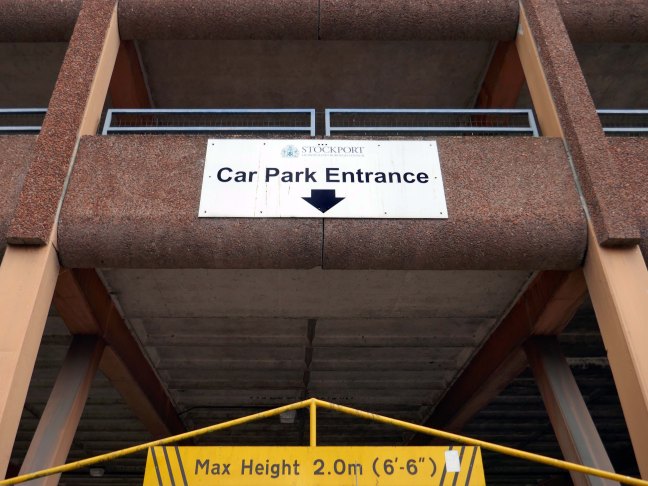
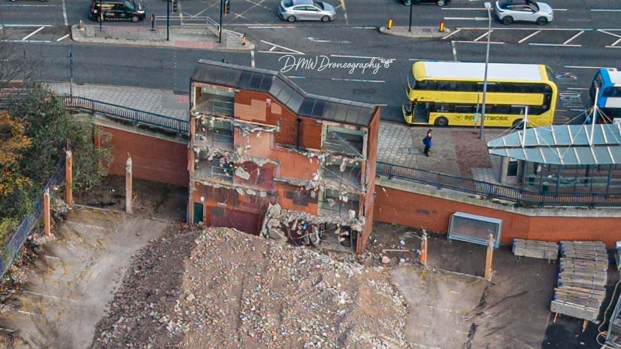
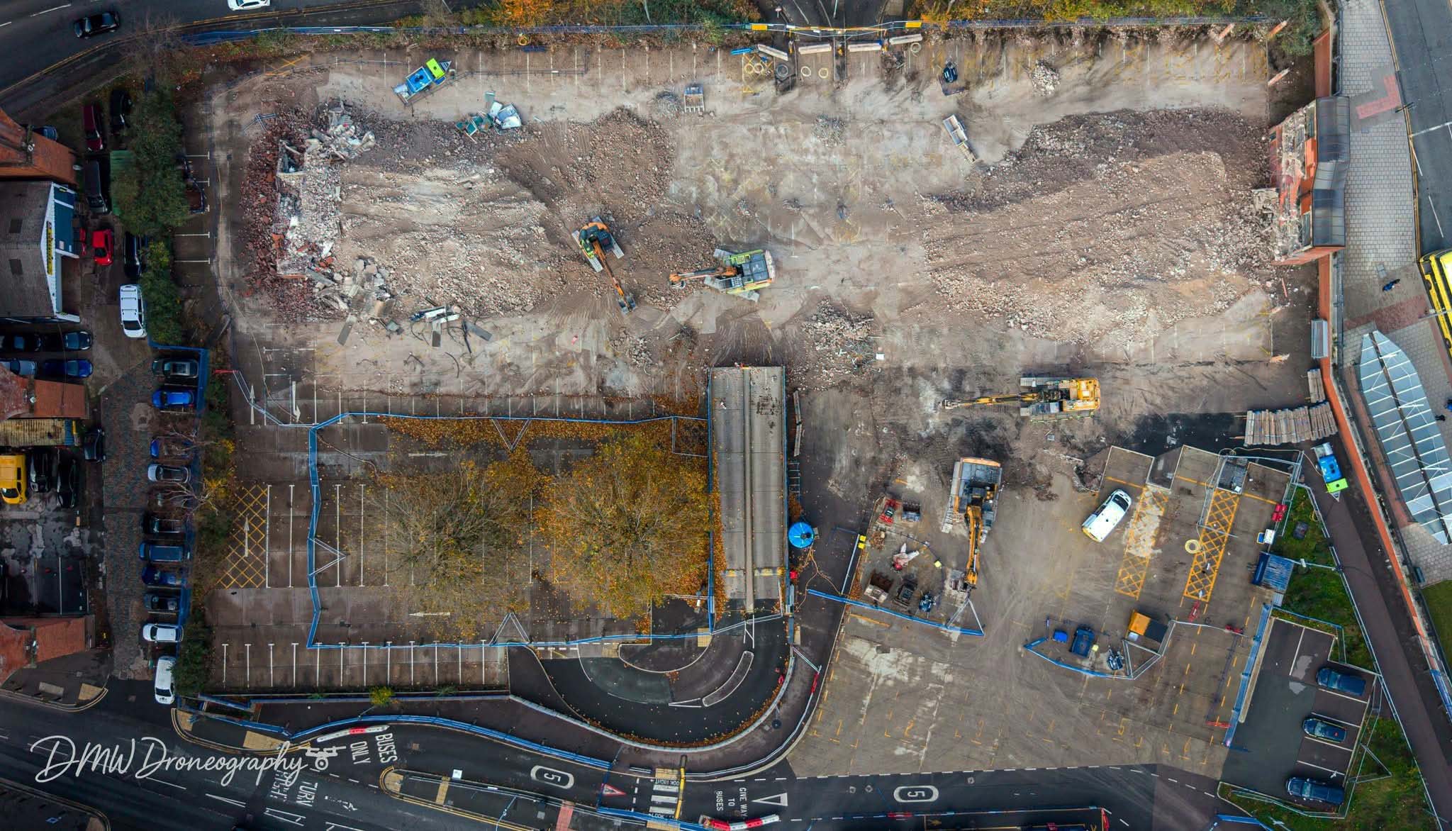
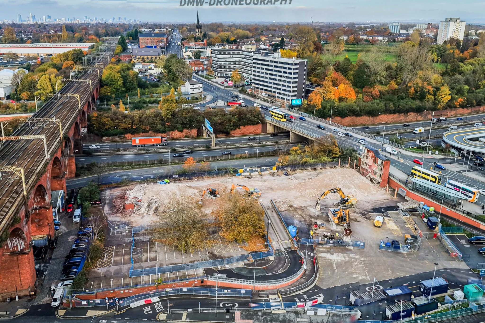
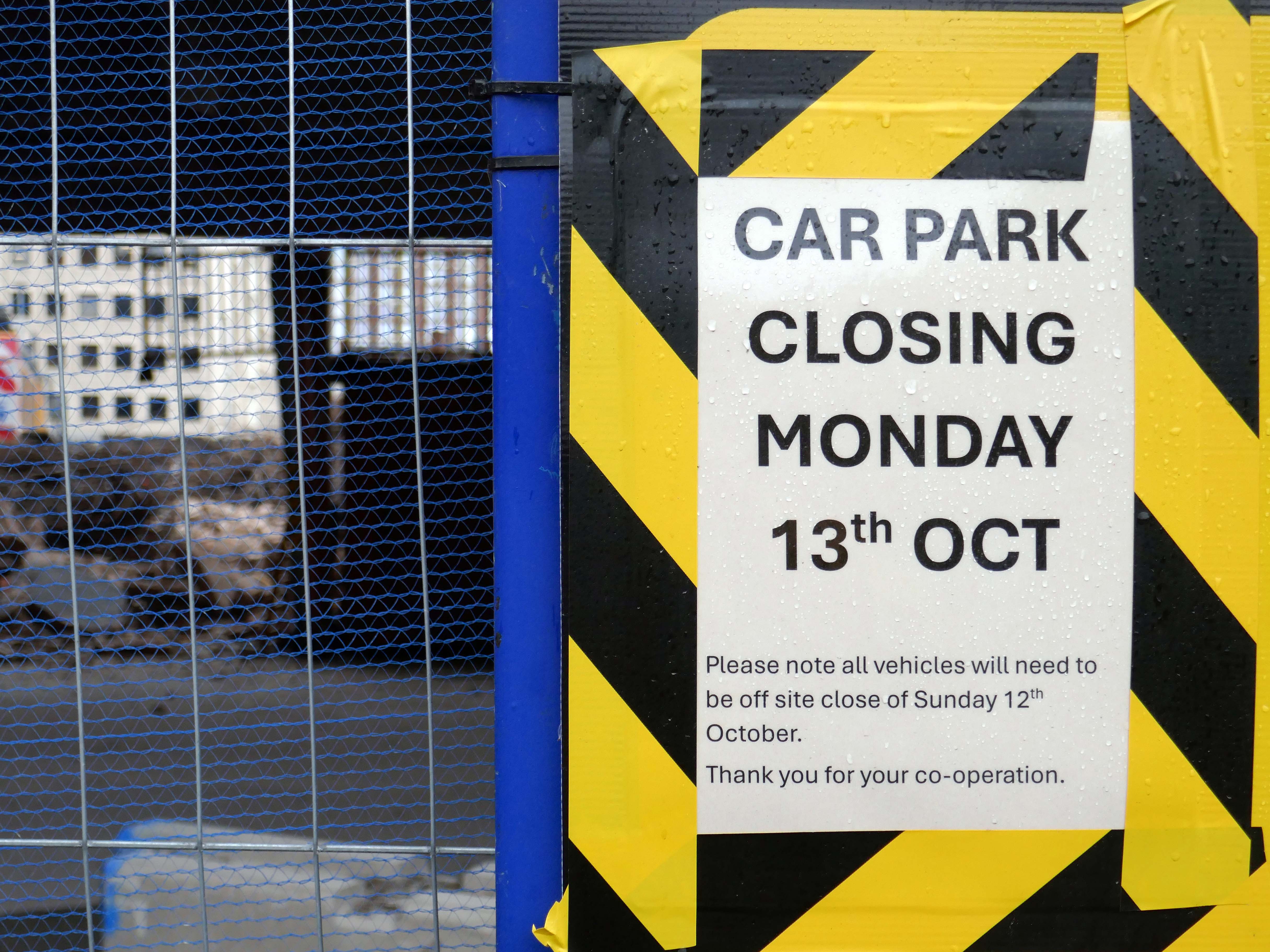
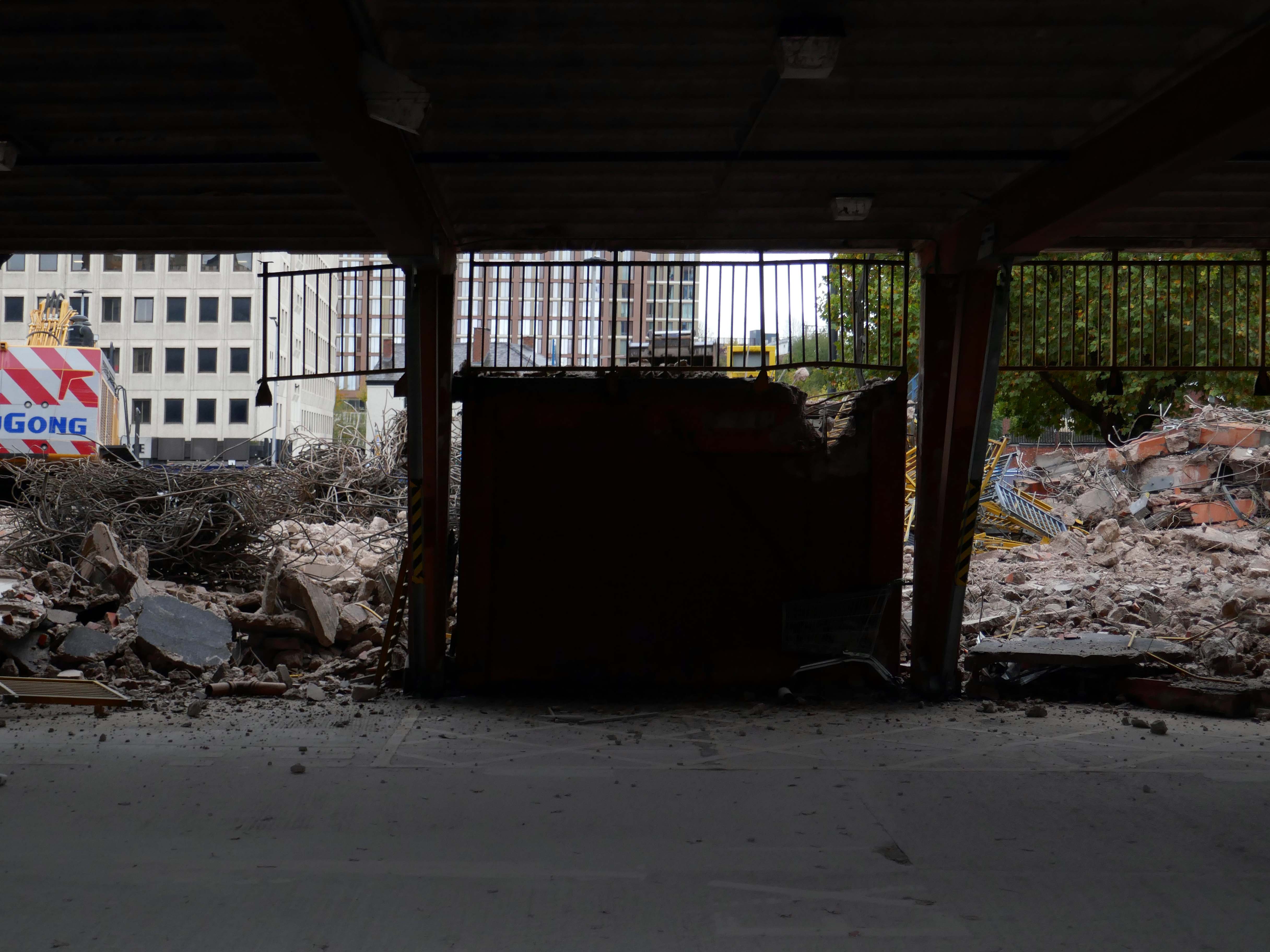
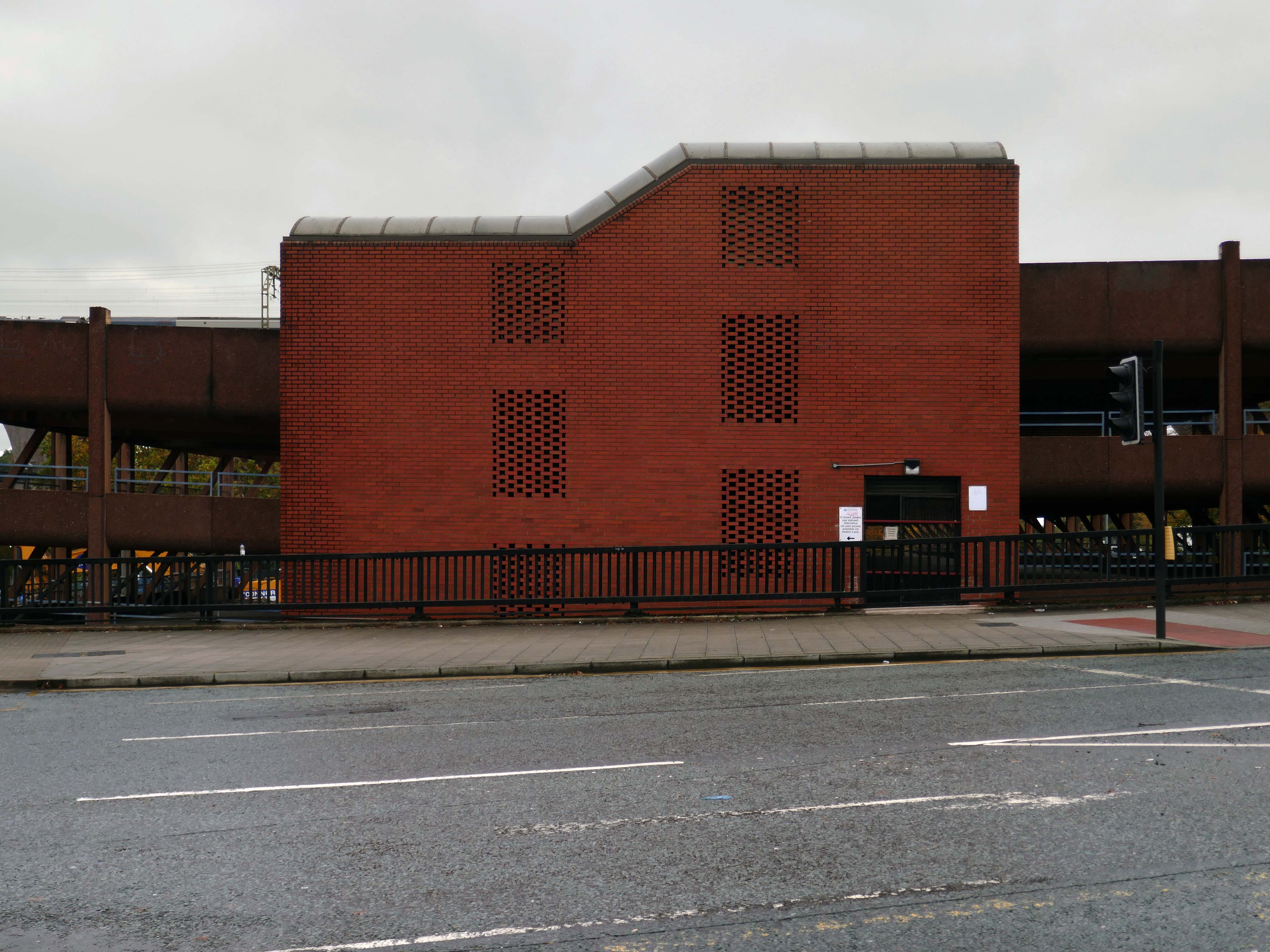
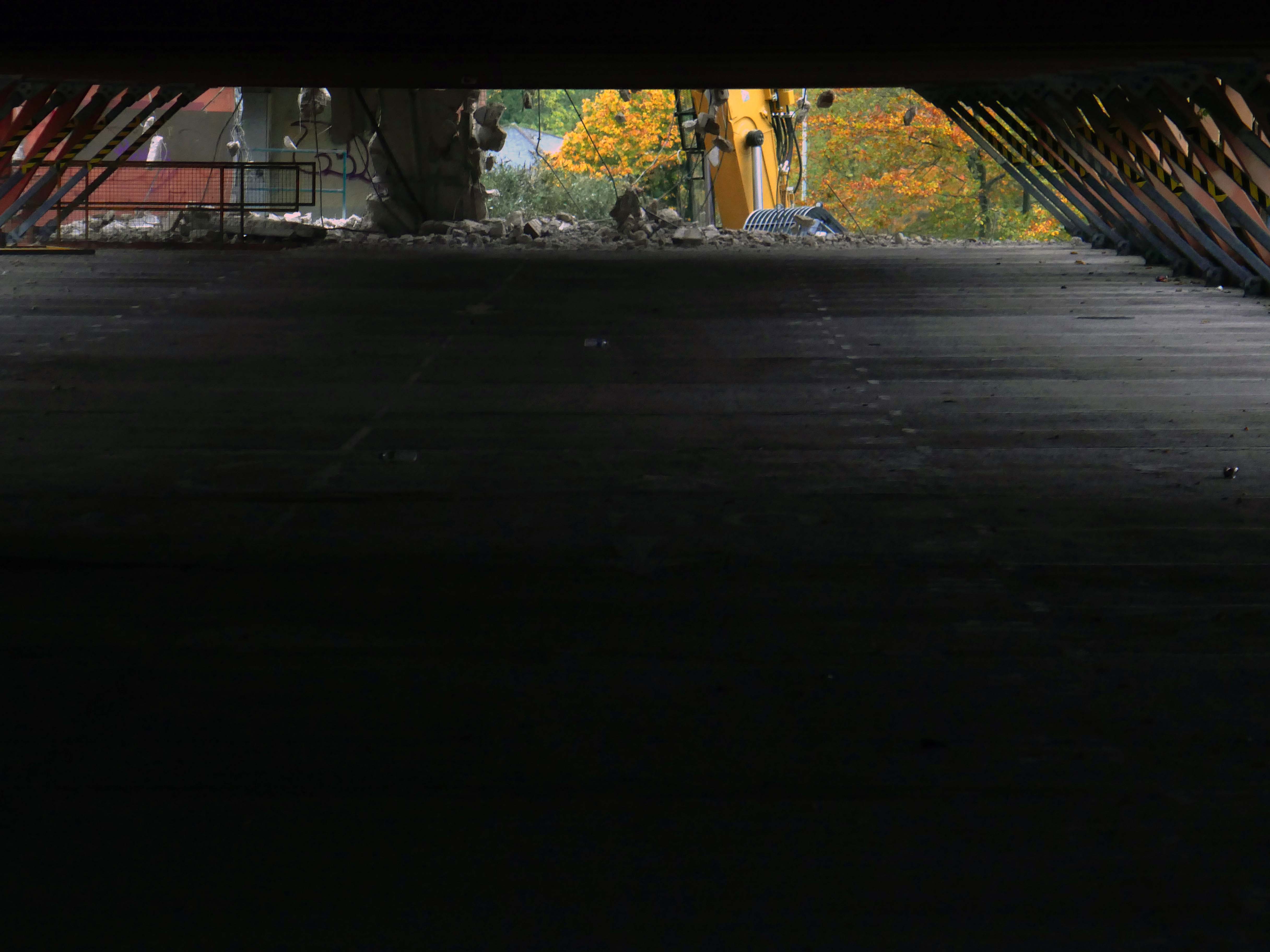
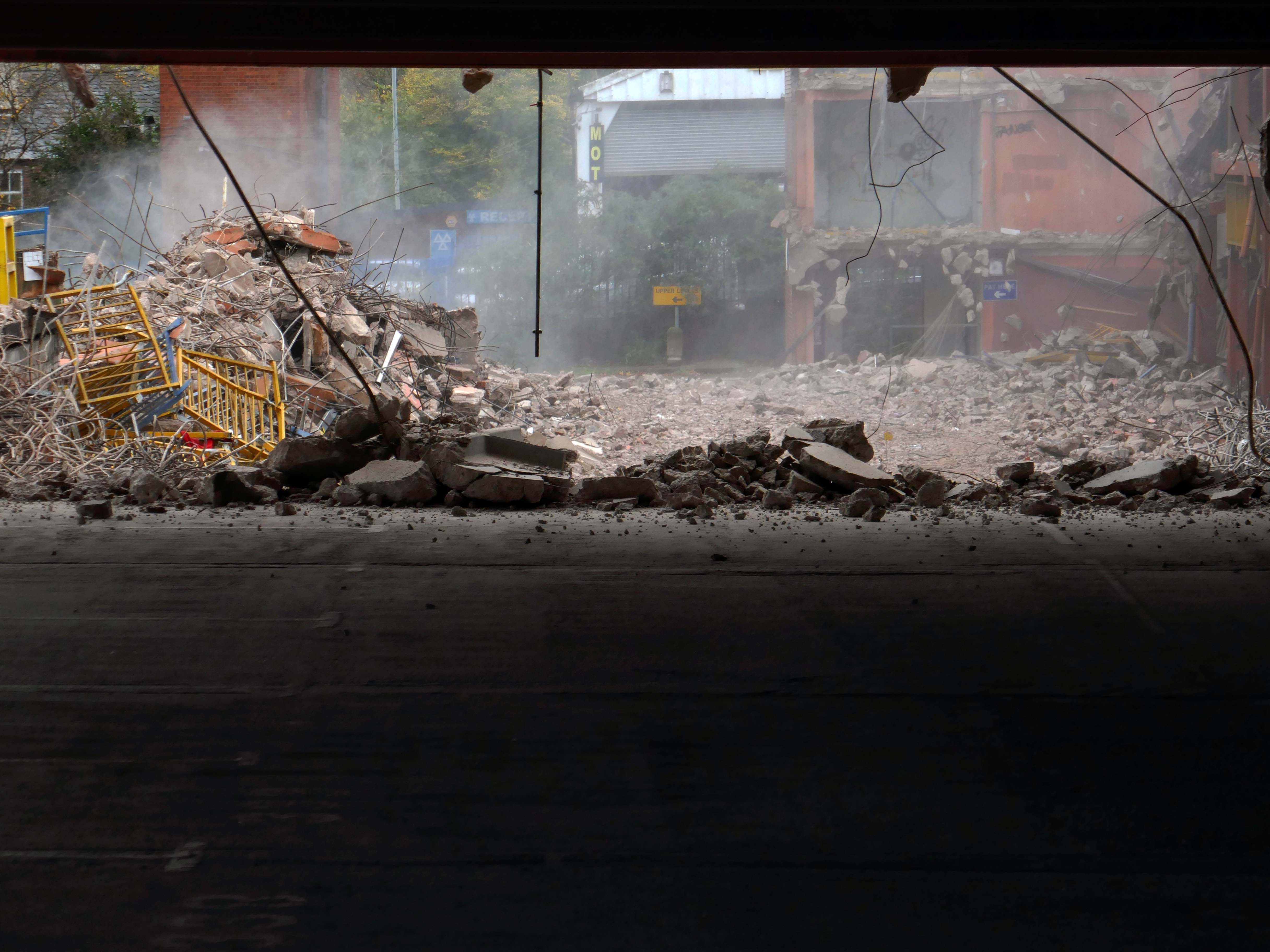
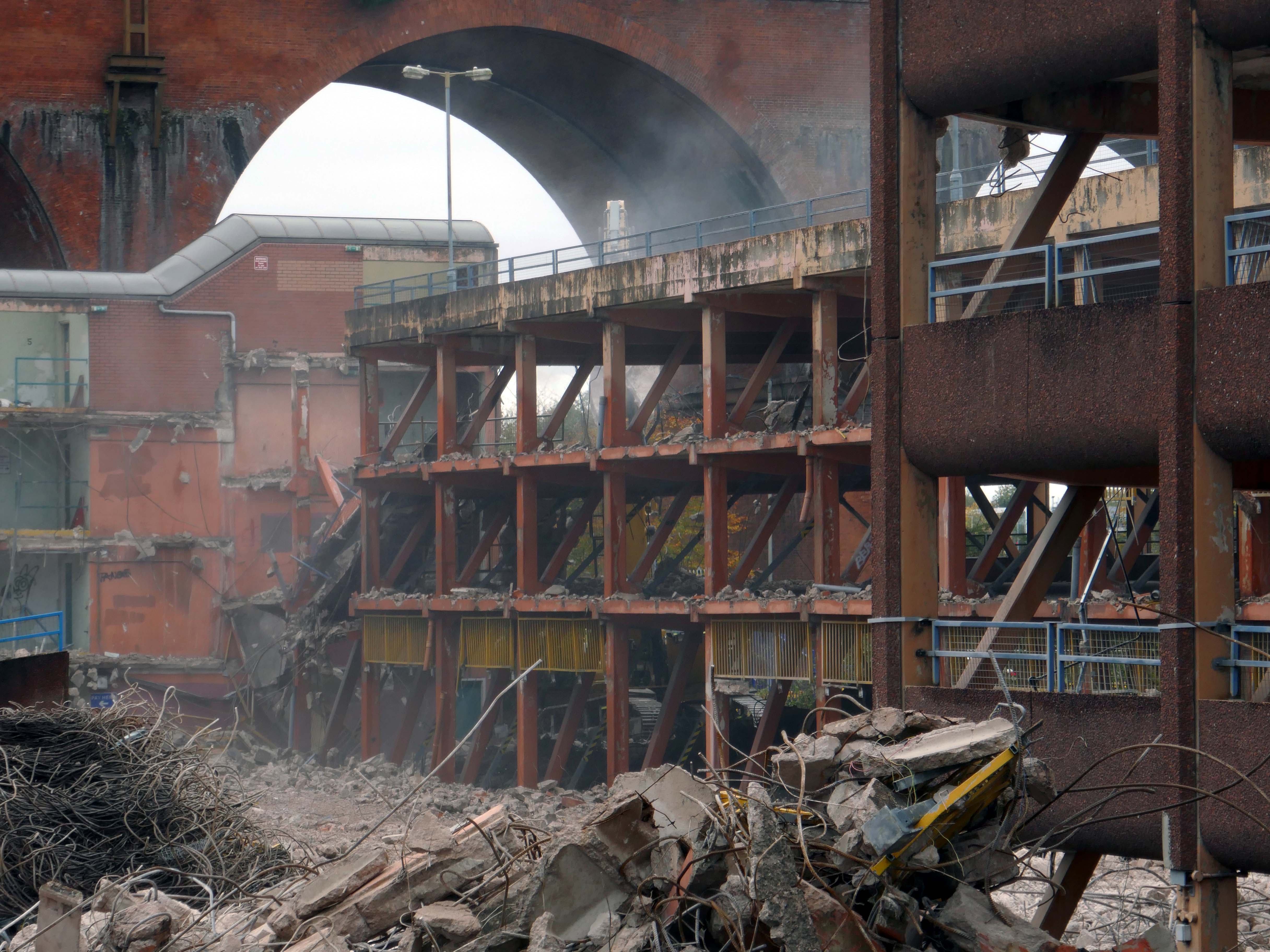
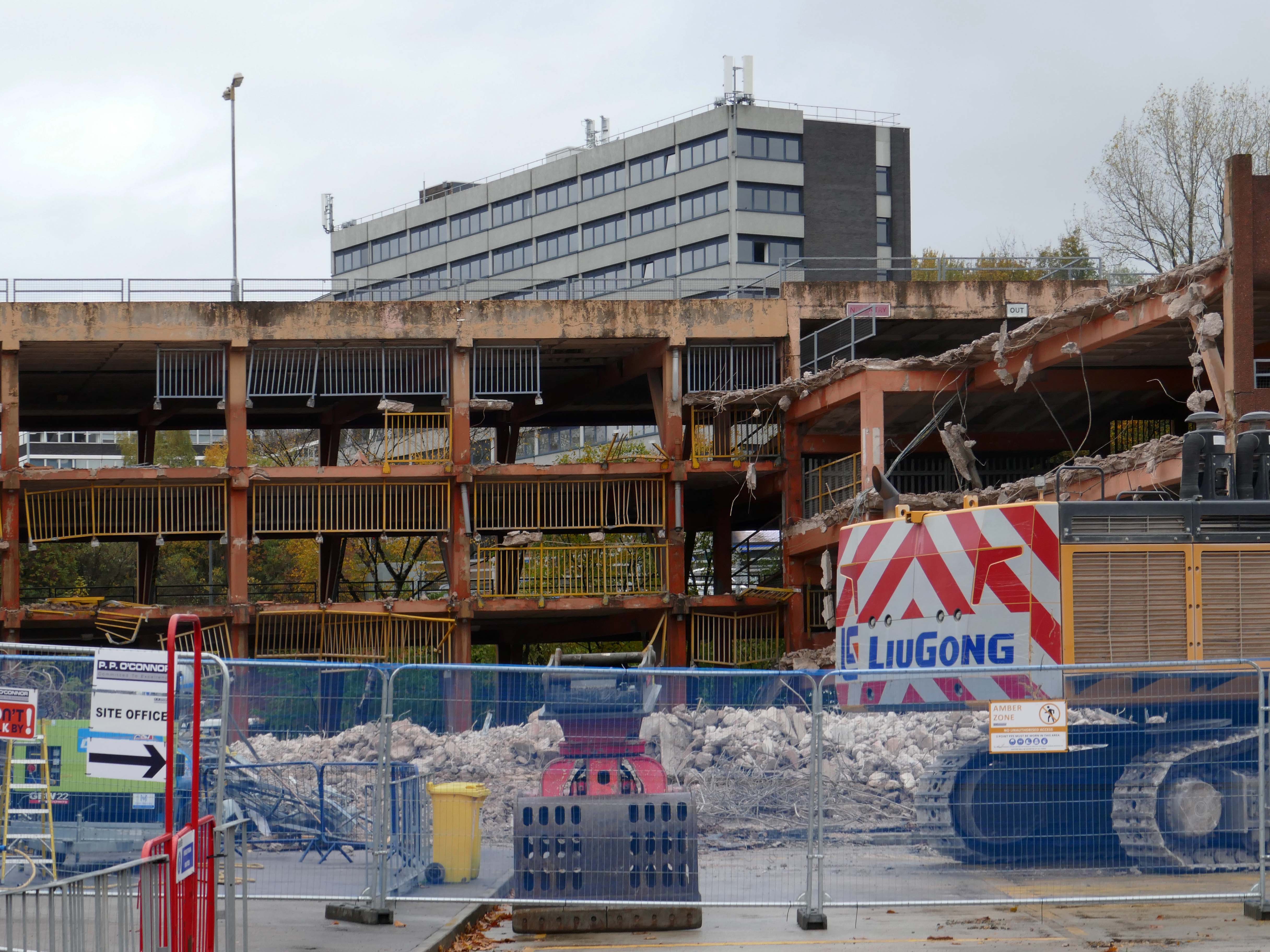
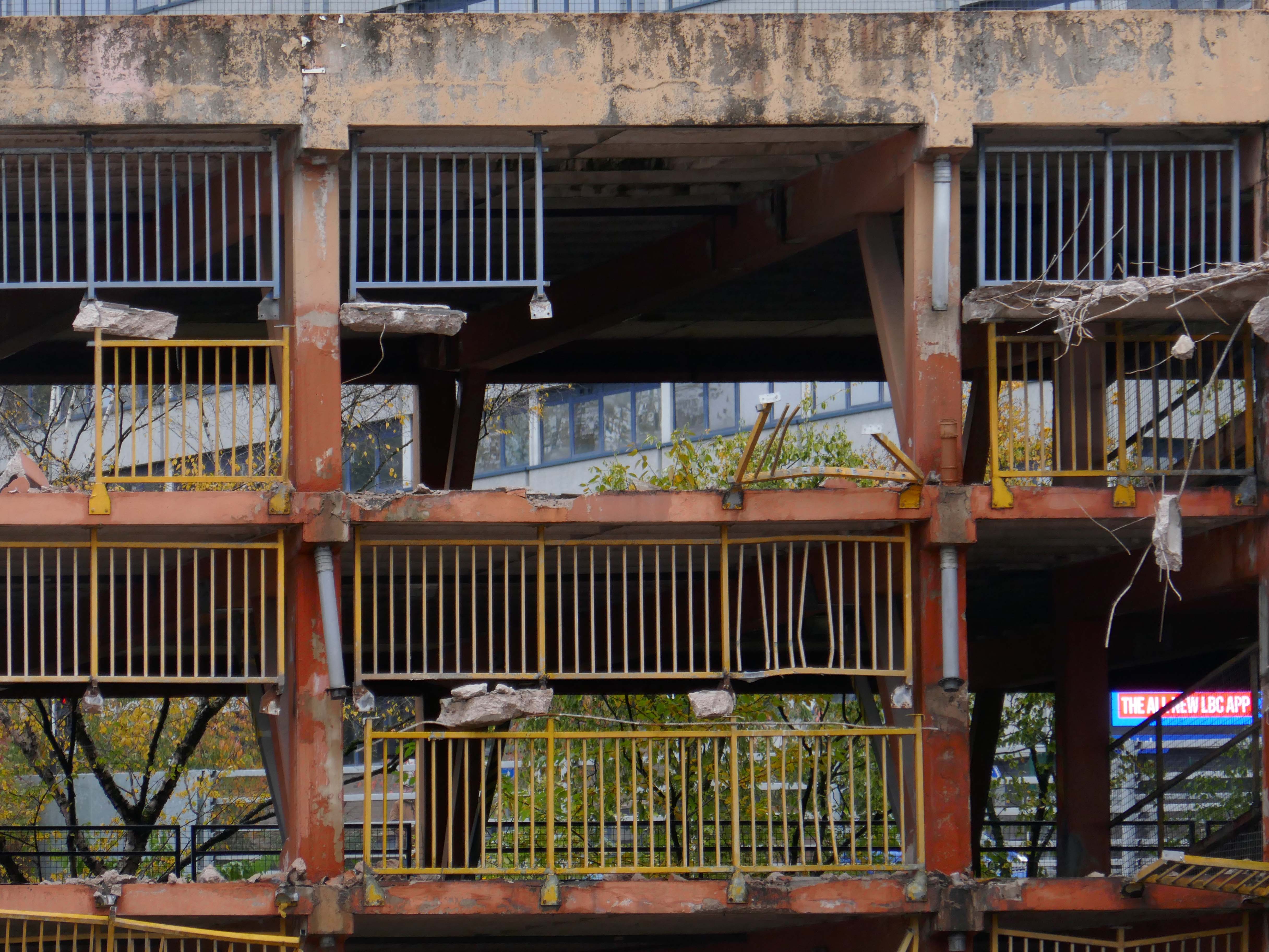
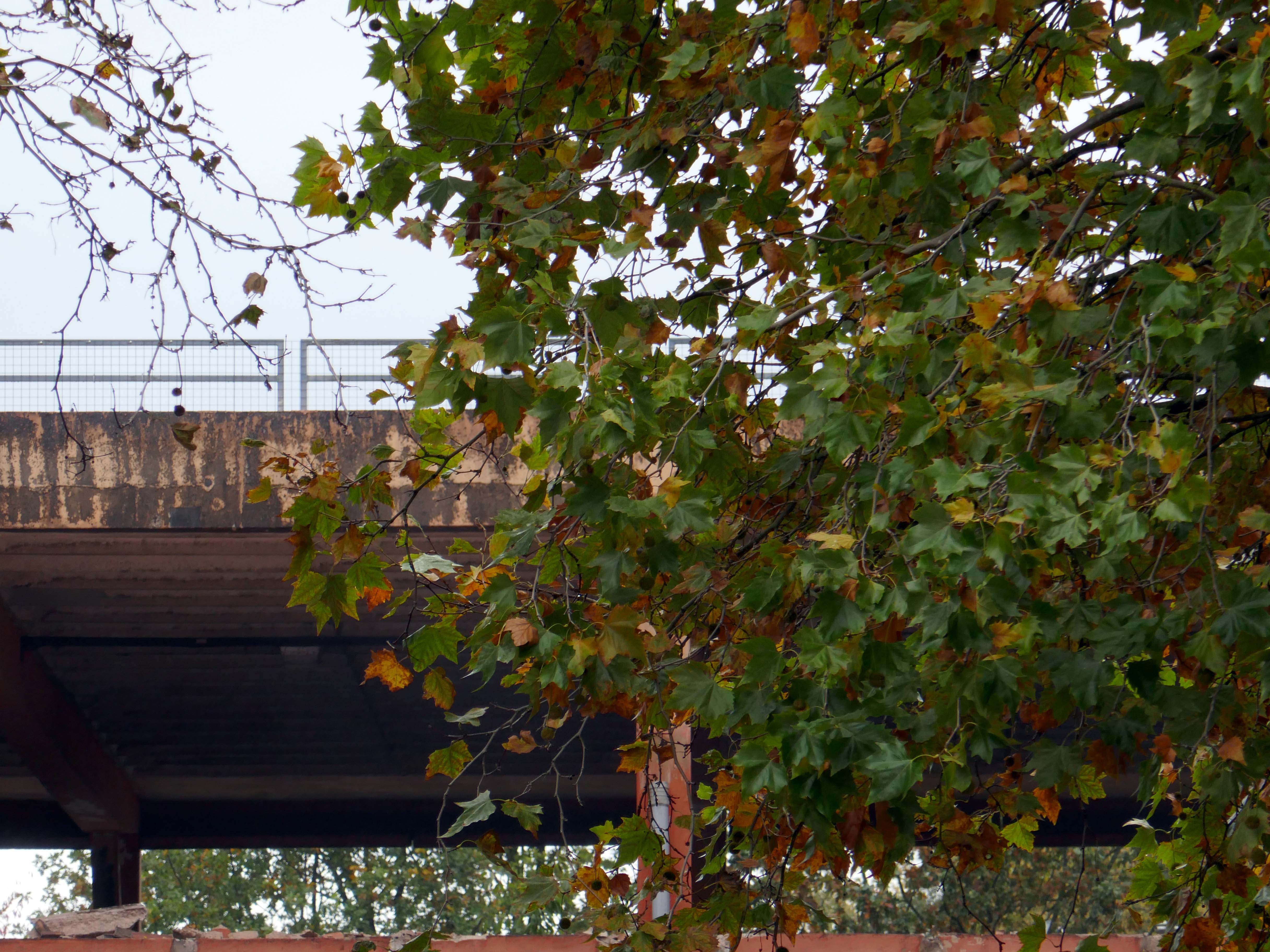
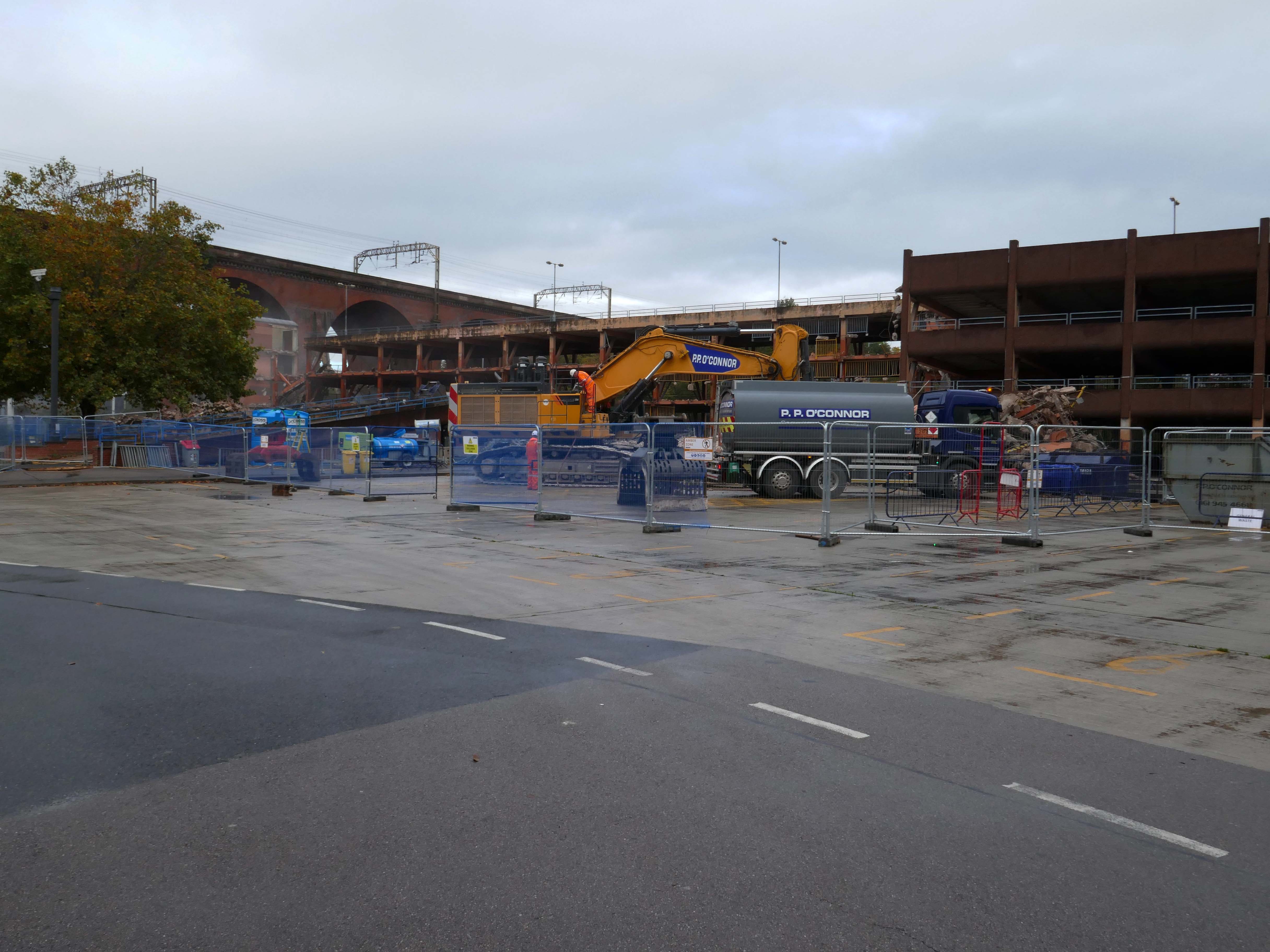
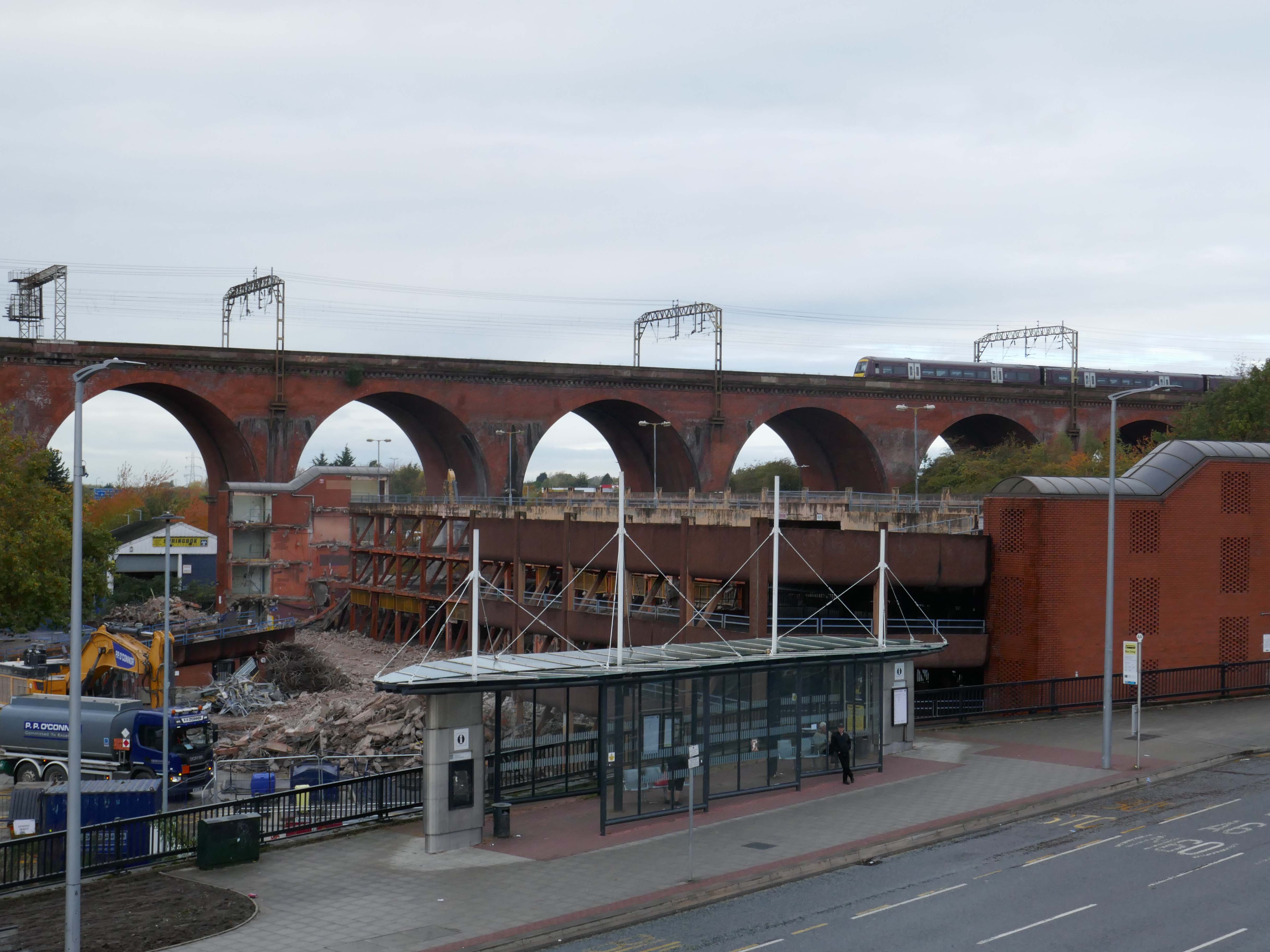
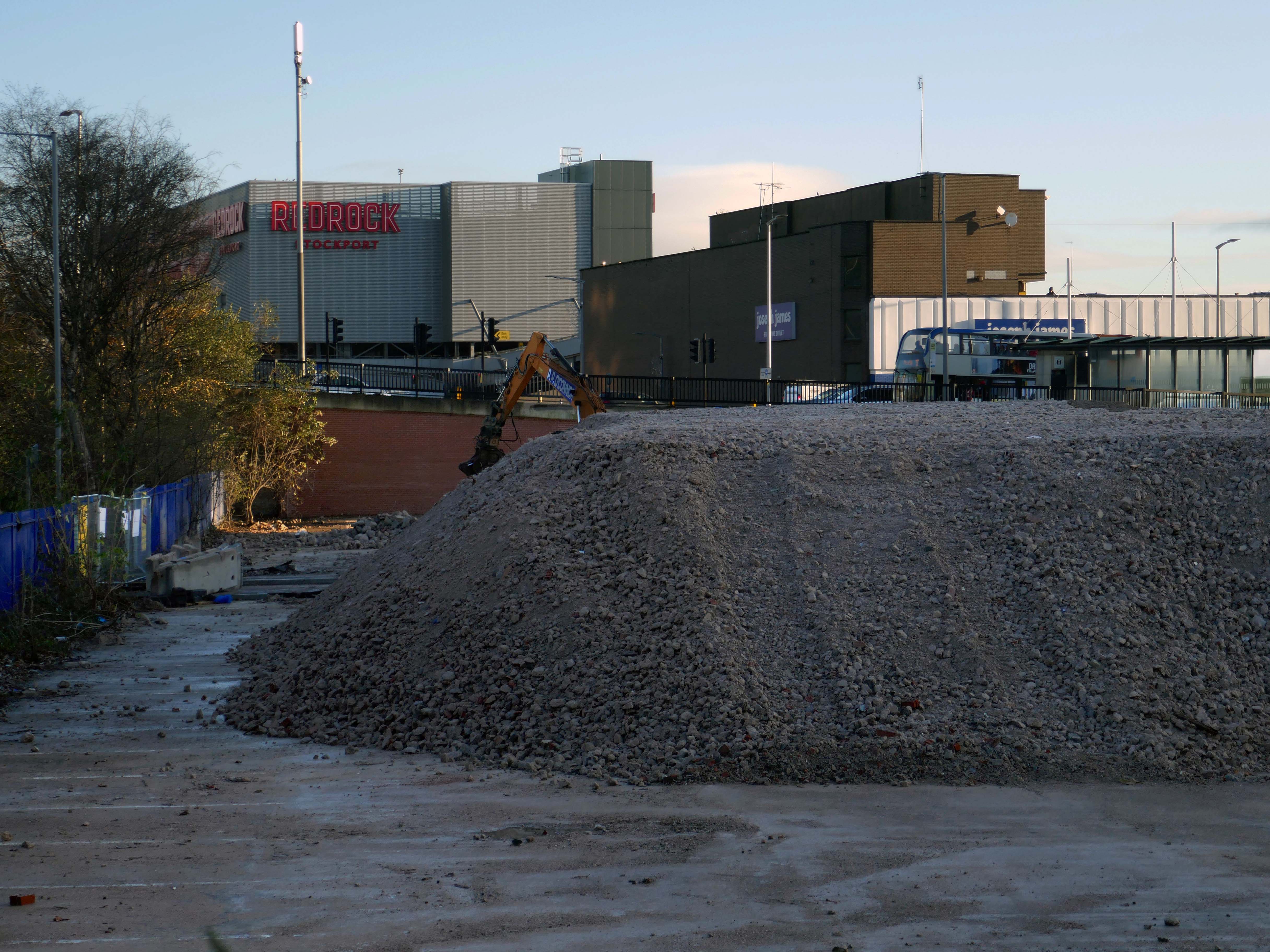
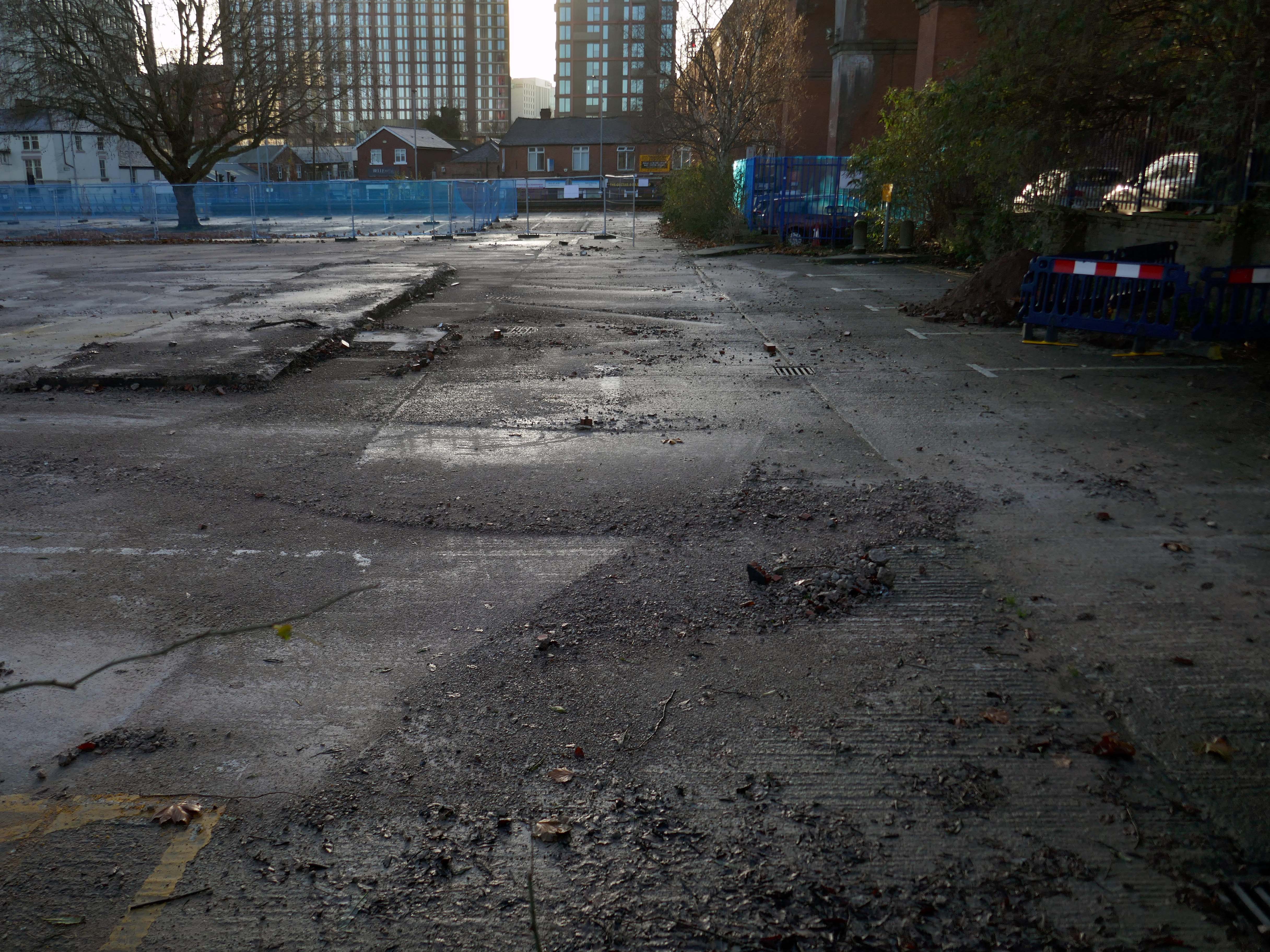
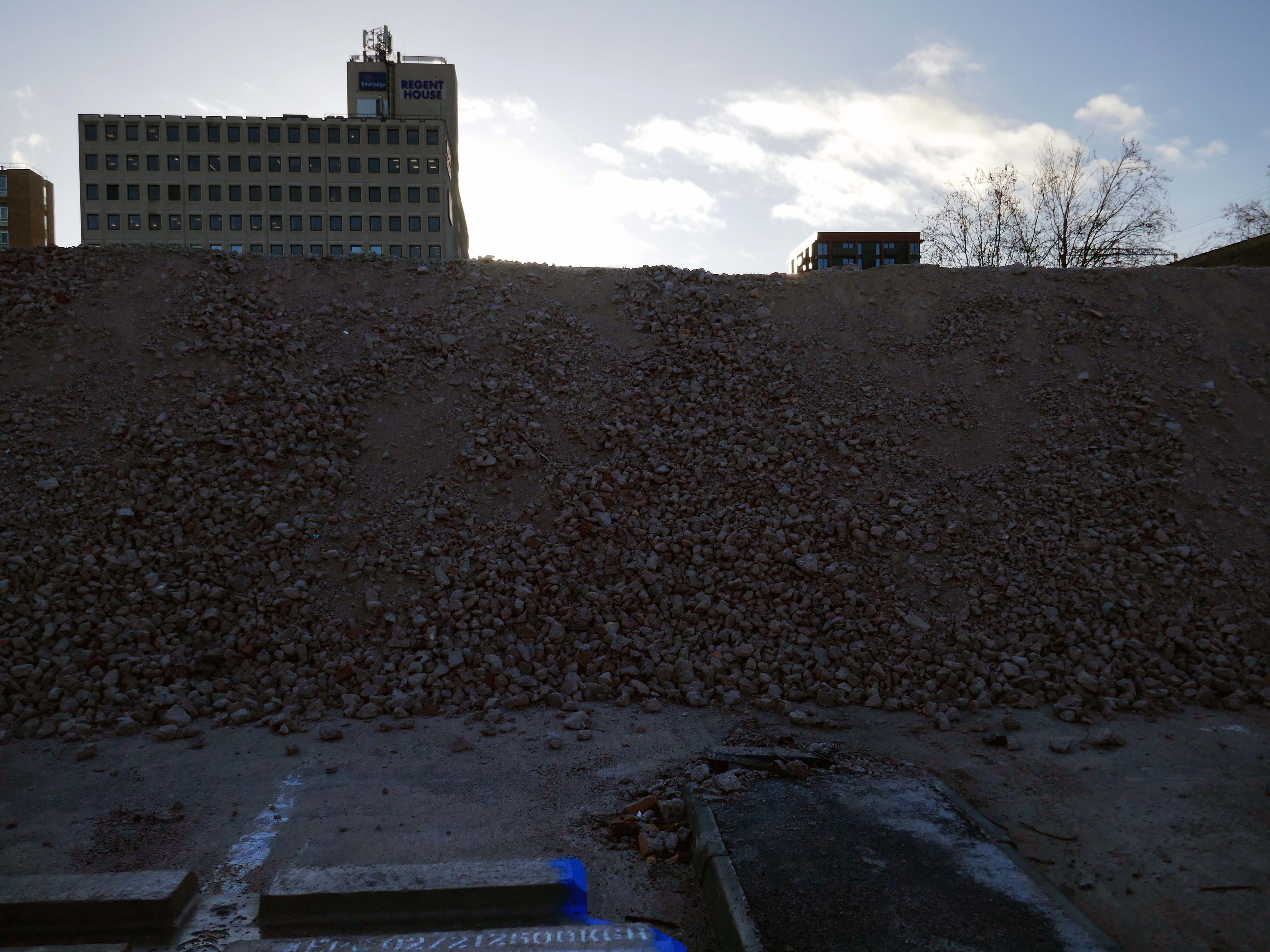
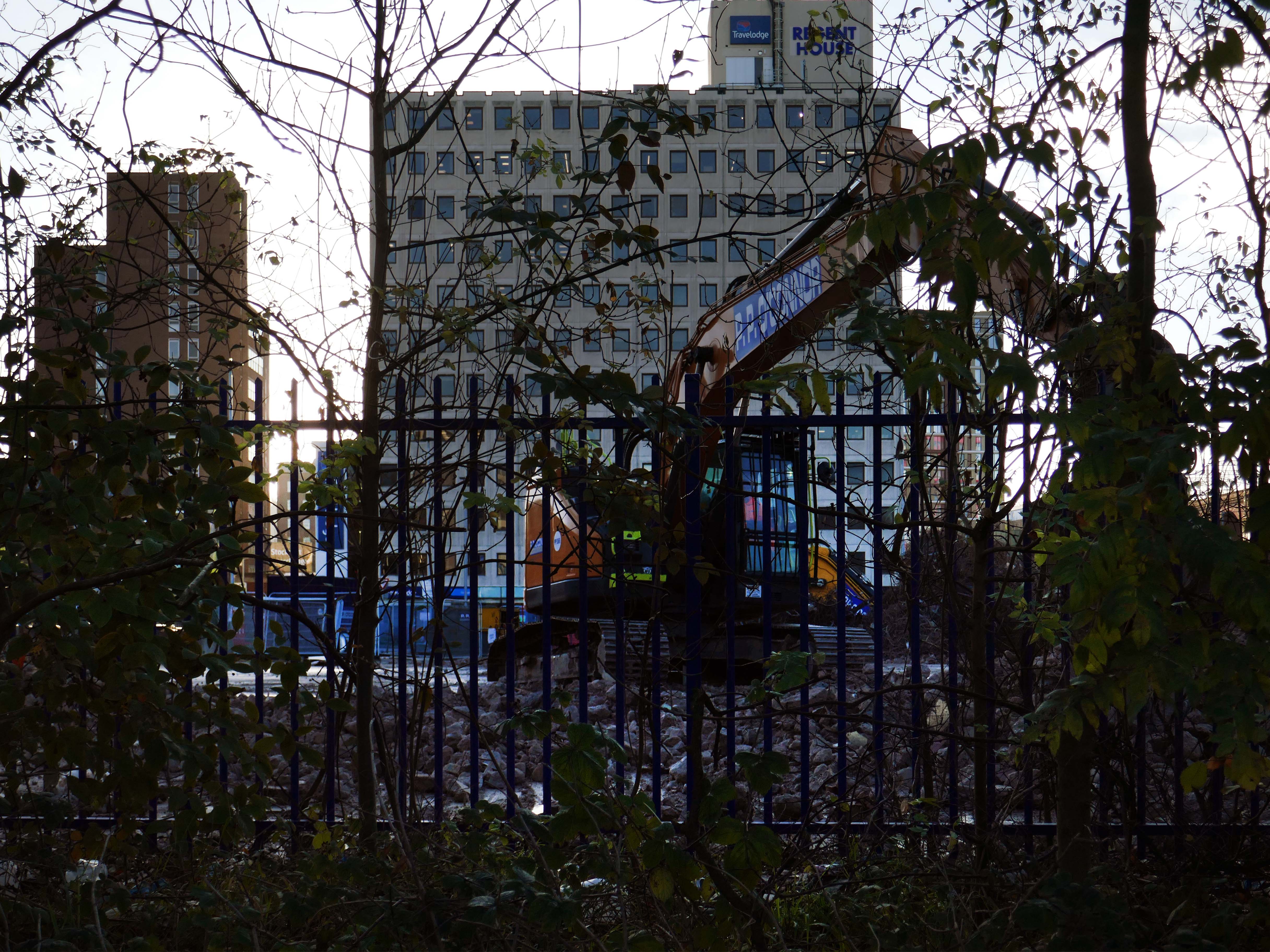
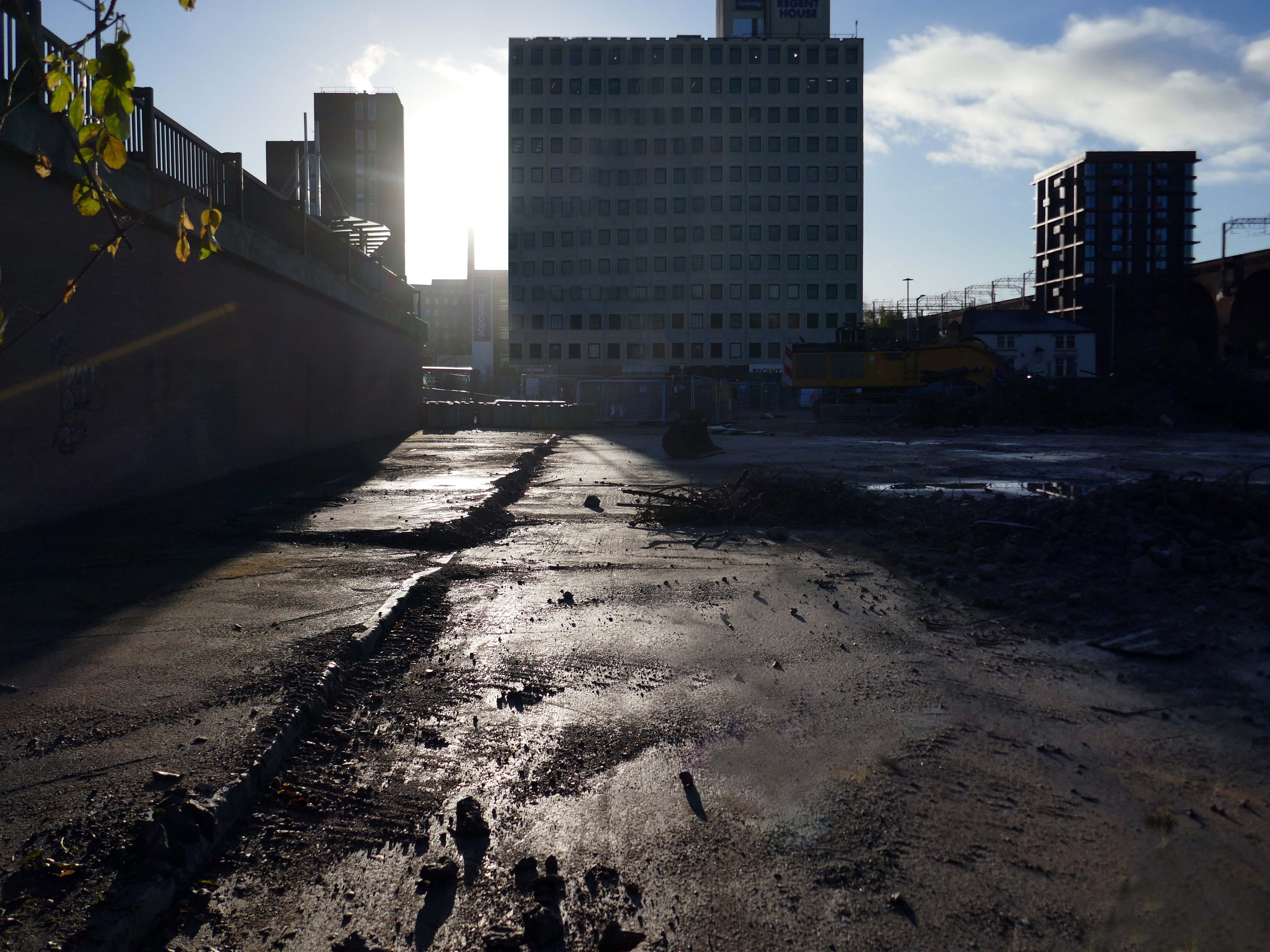
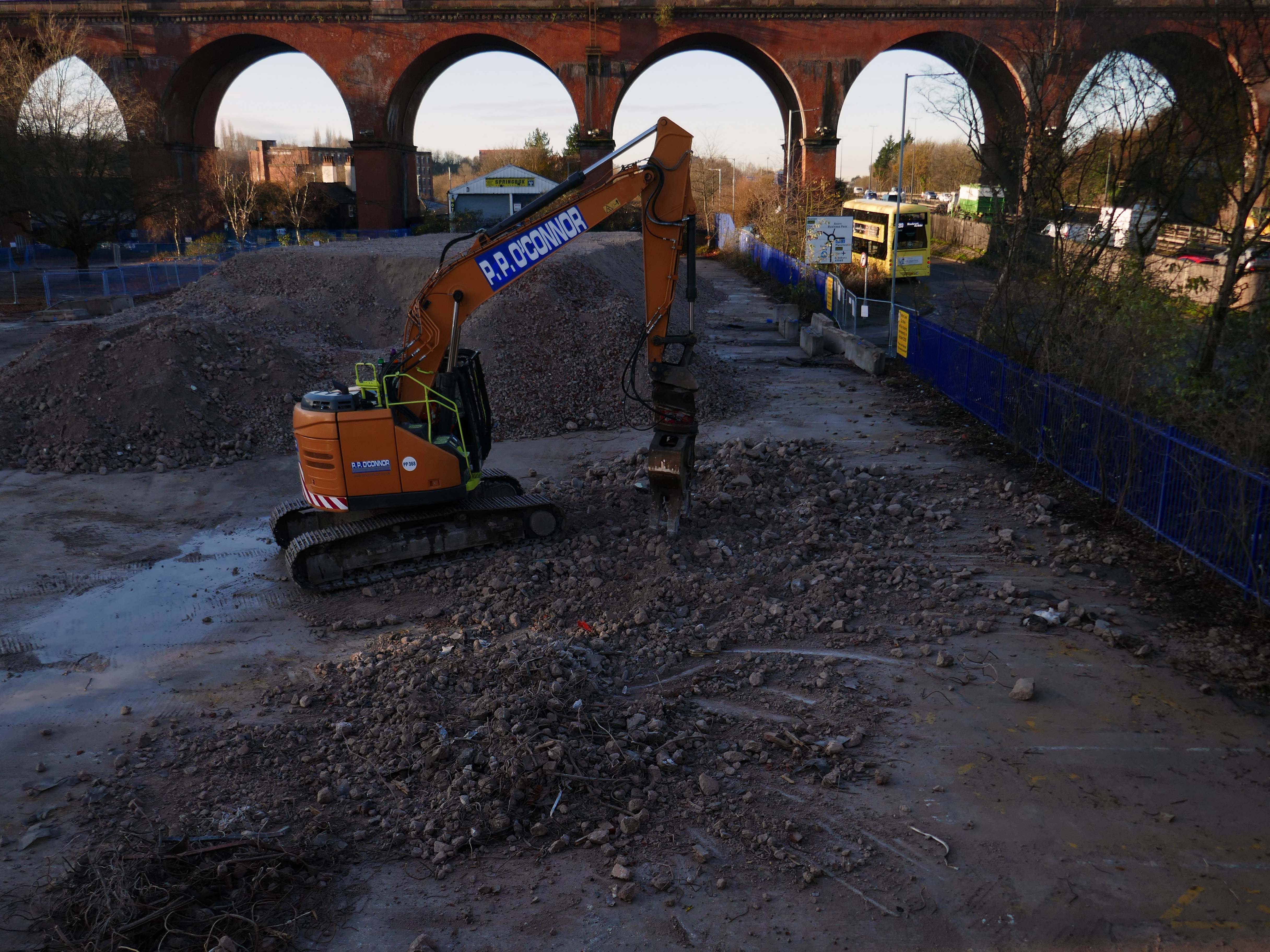
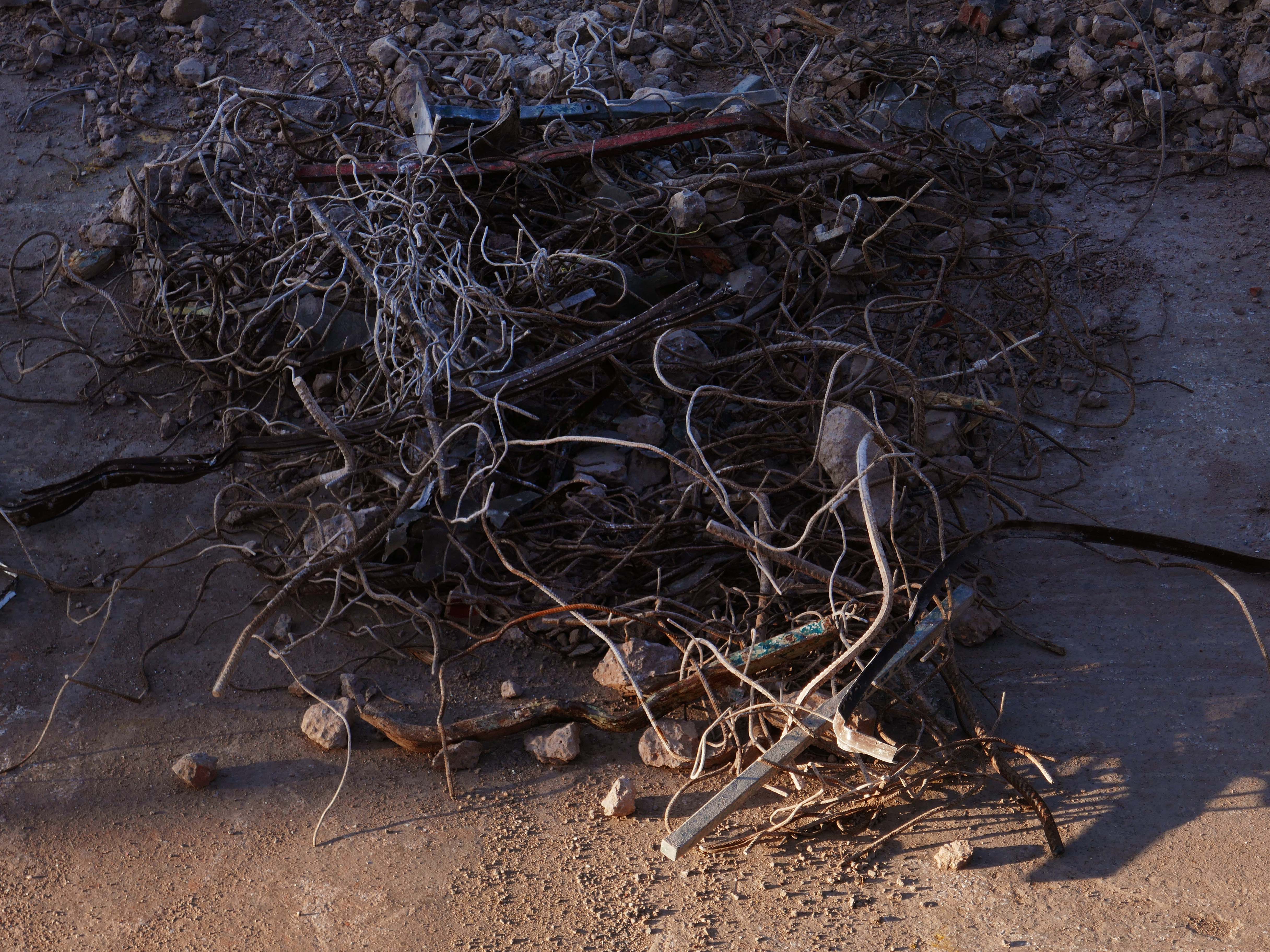
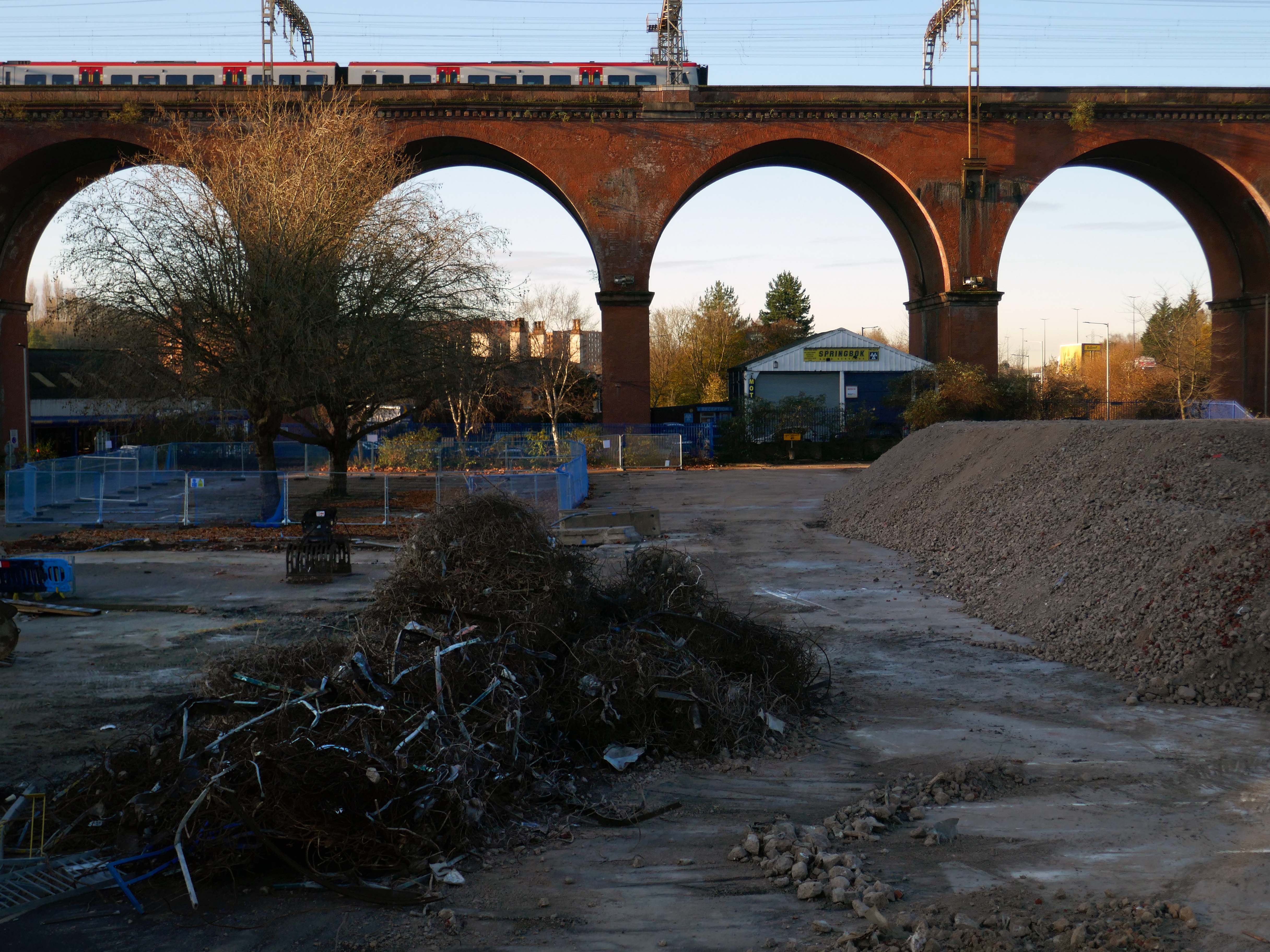
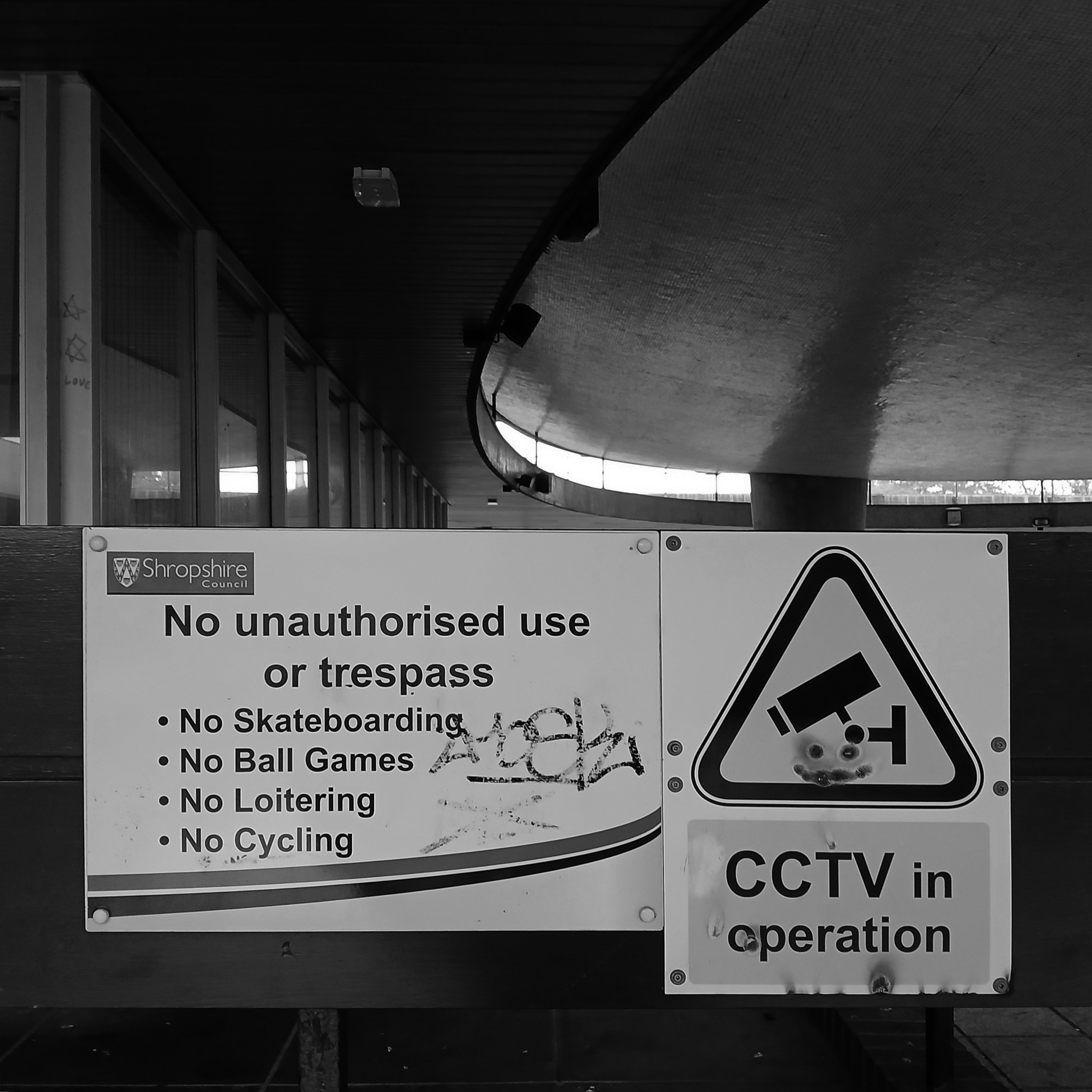
Heaton Lane car park is closed while demolition works take place.
Plans to demolish the car park were submitted by Stockport Council in September this year.
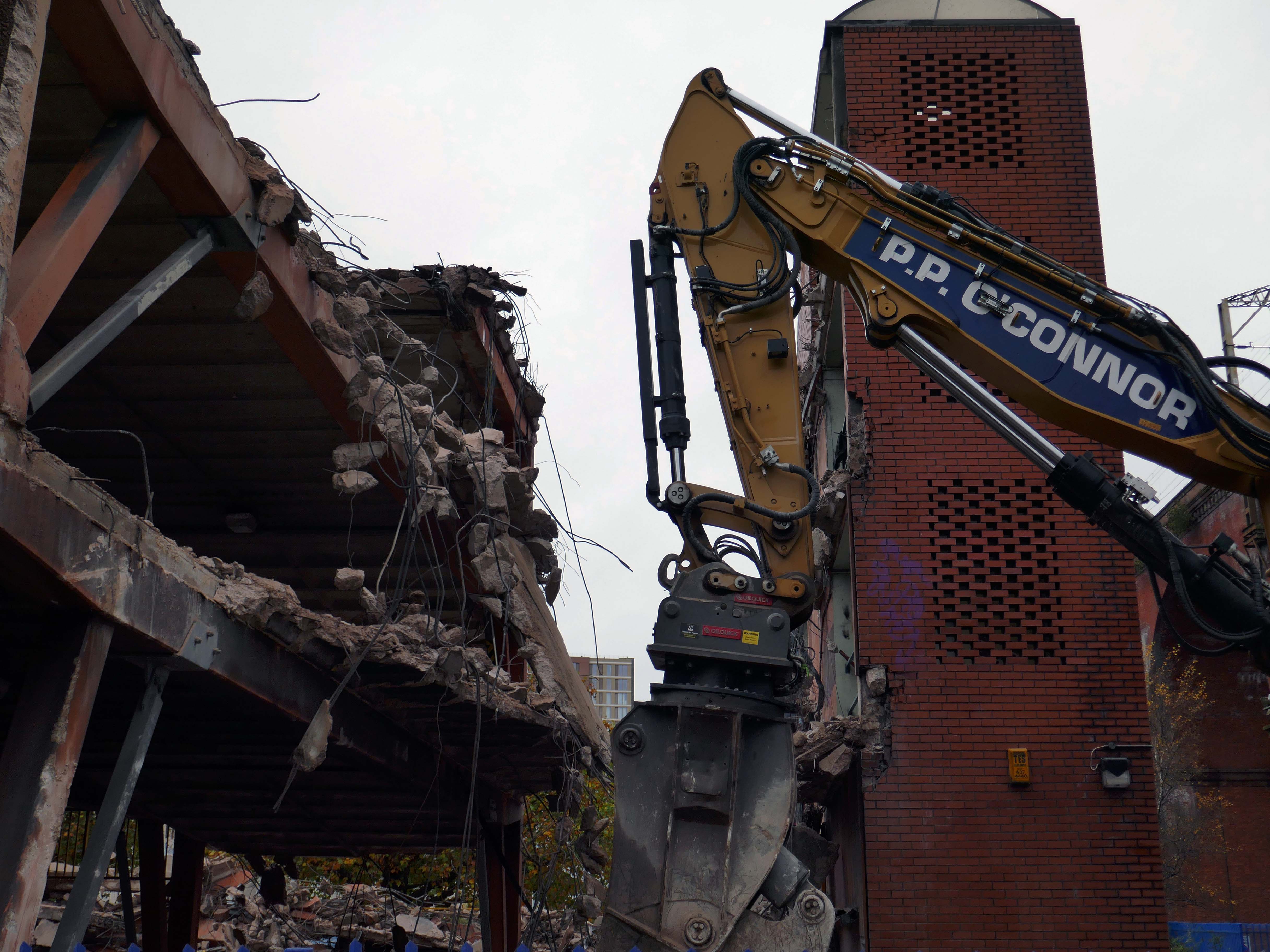
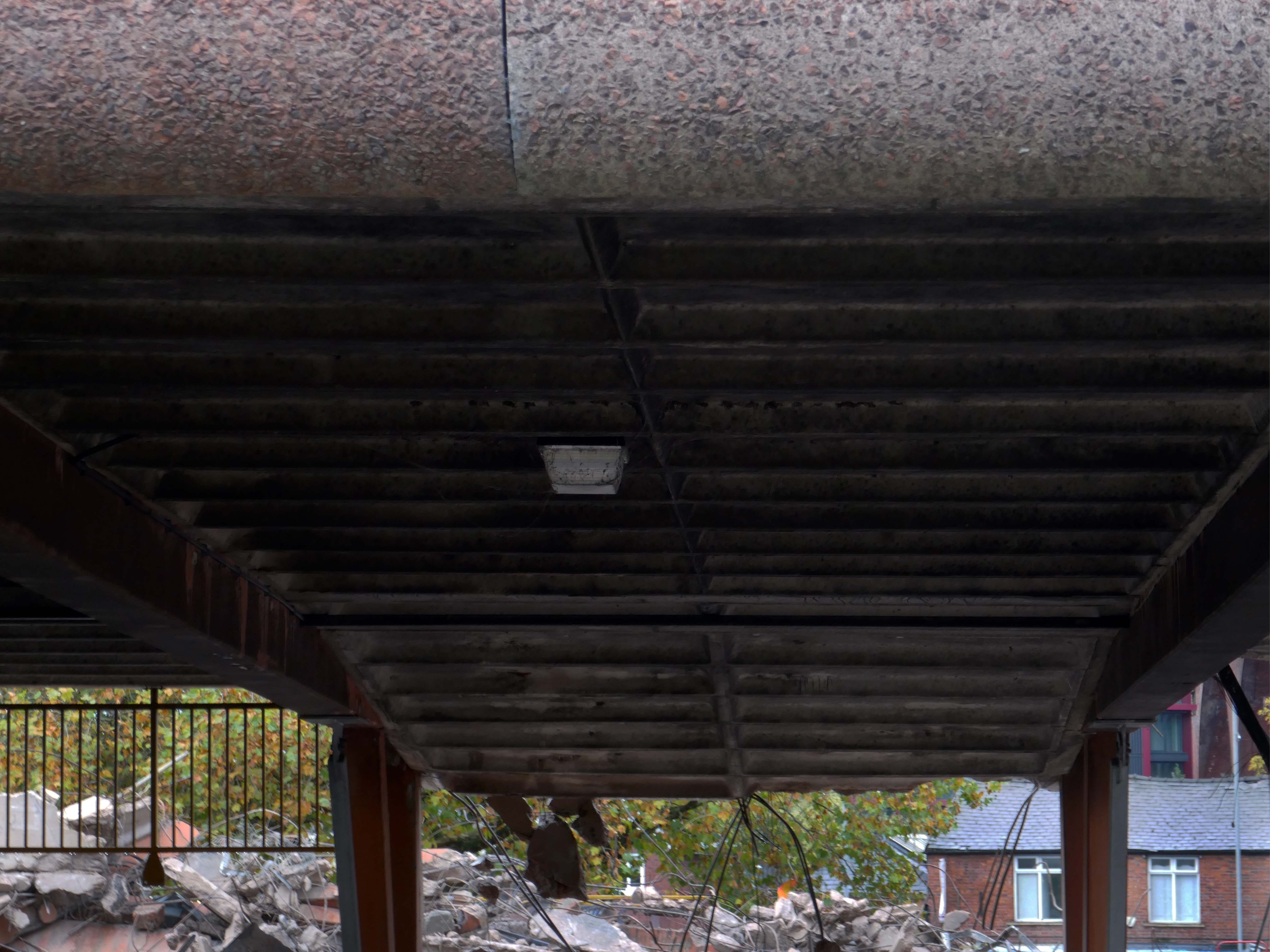
The plans propose removing the multi-storey car park down to ‘slab level’
The work itself will be carried out by removing floor slabs one by one from the parking bays, from the ground upwards. Contractor PP O’Connor has said it will take noise and dust into consideration when completing the works.
Dust suppression systems will be in place to minimise pollution.
Noise levels are not considered likely to be a nuisance, however the site manager will be able to review the demolition process if it’s deemed too high.
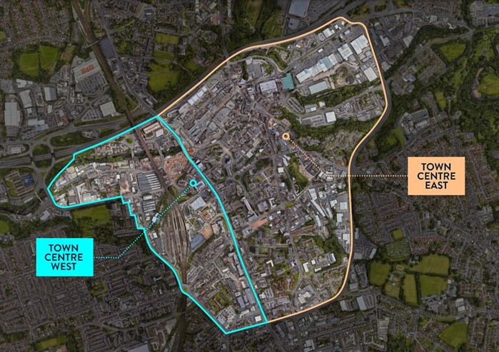
There car park is almost at the heart – on the edge of plans to regenerate the town centre.
The Strategic Regeneration Framework for Stockport Town Centre West set out how up to 4,000 new homes and 1m sq. ft of new employment floorspace and 5,300 new jobs could be delivered across Town Centre West by 2035.
In order to assess the overall economic benefit of an expanded Mayoral development area Stockport Council have developed an SRF for Stockport Town Centre East. This SRF sets out an illustrative masterplan to guide the creation of Stockport’s new neighbourhoods and achieve comprehensive urban regeneration by 2040. Together the SRFs for Town Centre West and Town Centre East will guide the development of a total of 8,000 new homes alongside services and amenities. The development set out in the SRFs will drive a transformational impact on the Stockport economy.
The Corporation is expected to be established in early 2026. It will provide a single, focused body for local decision-making; engagement with stakeholders including government departments, public agencies; private sector landowners, and developers; and to drive investment across the public and private sectors to realise the shared vision for the regeneration of the Area.
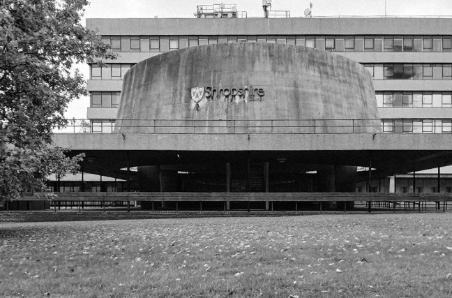
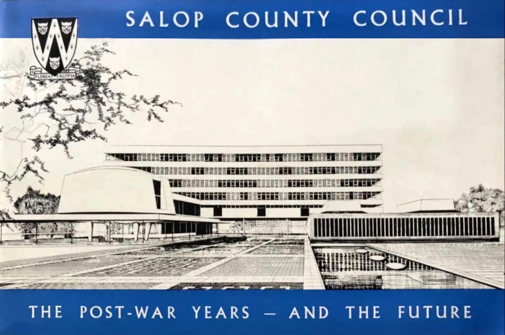
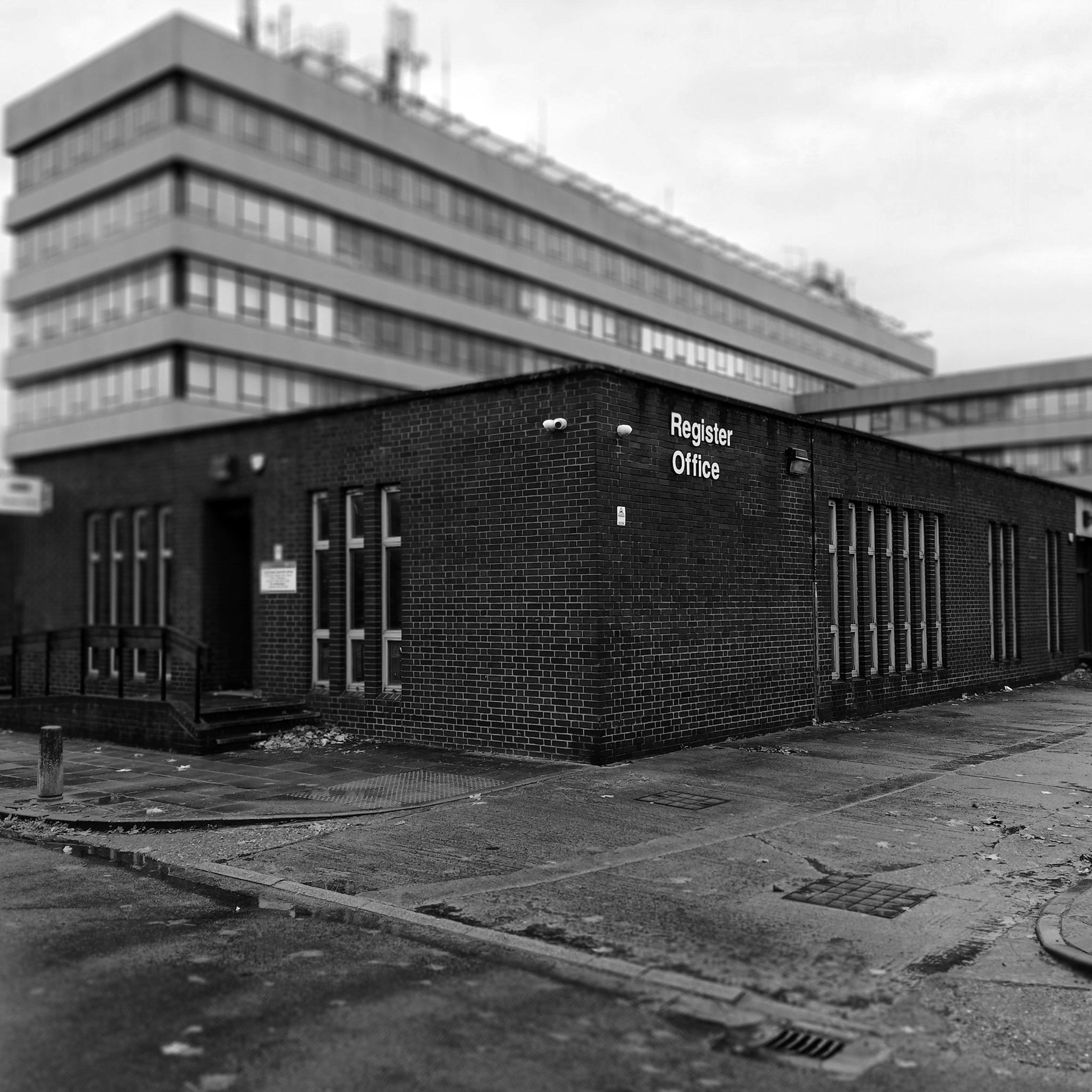
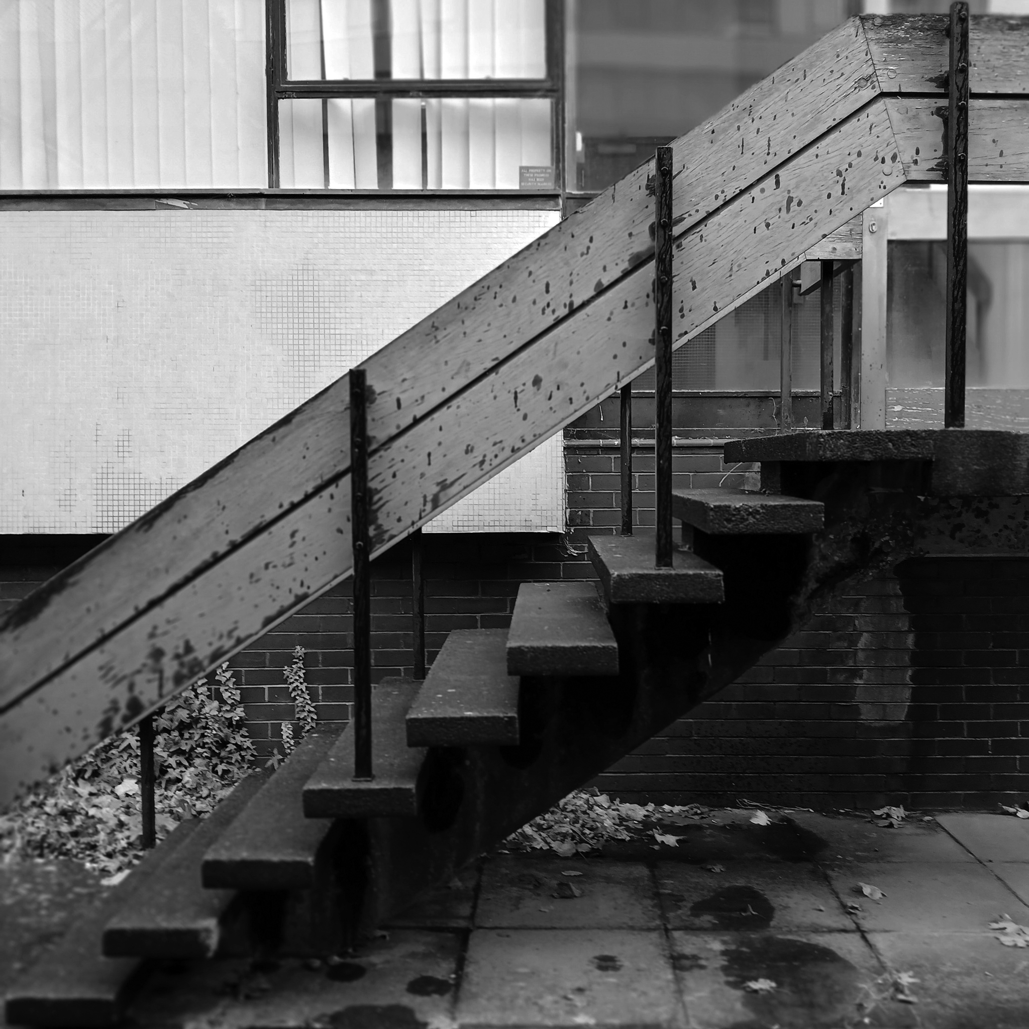
The foundation stone for the new building was laid by Sir Offley Wakeman, a former chairman of the county council, on 25 July 1964. It was designed by Ralph Crowe, the County Architect, in the Modernist style, built at a cost of £1.8 million and was completed in April 1966.
Having visited and snapped way back in June 2024, I returned in October 2025.
I had been asked to speak to the Shrewsbury Civic Society, regarding the history of Modernism in support of their campaign to save Shirehall.
The previous County Council were disposed toward demolition, the current administration are a little more circumspect.
Shropshire Council is considering a return to its former headquarters, less than a year after it moved out. The authority moved from 1960s-built Shirehall in Shrewsbury to the Guildhall in Frankwell, and said doing so would save up to £600,000 per year.
At a meeting on Wednesday, cabinet member for finance Roger Evans said the Liberal Democrats, who lead the council, had paused the demolition and sale of the land, and may retain parts of the building – but only if it could afford to do so.
“We would like to retain the council chamber and some of the associated buildings, but we do need to take account for the cost both in cash terms and in net zero terms,” he said. “What we have done is paused this decision and asked experts to look at it again, look at the whole site, do a reappraisal. The results are just now being recieved.
“I want to keep it as much as we can afford, both environmentally and cash-wise. Whether we can or not will depend, the council is strapped for cash.”
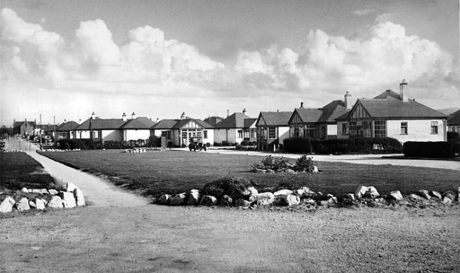
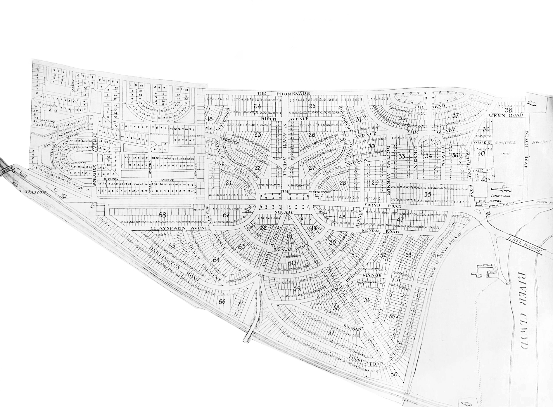
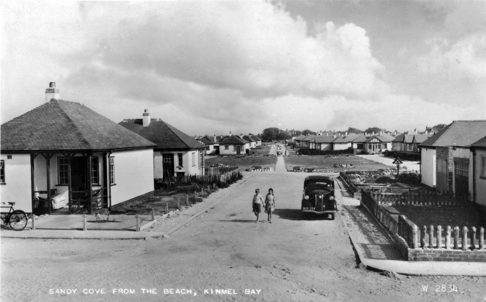
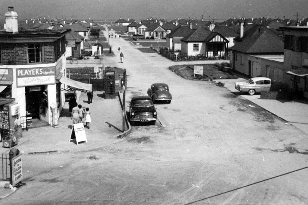
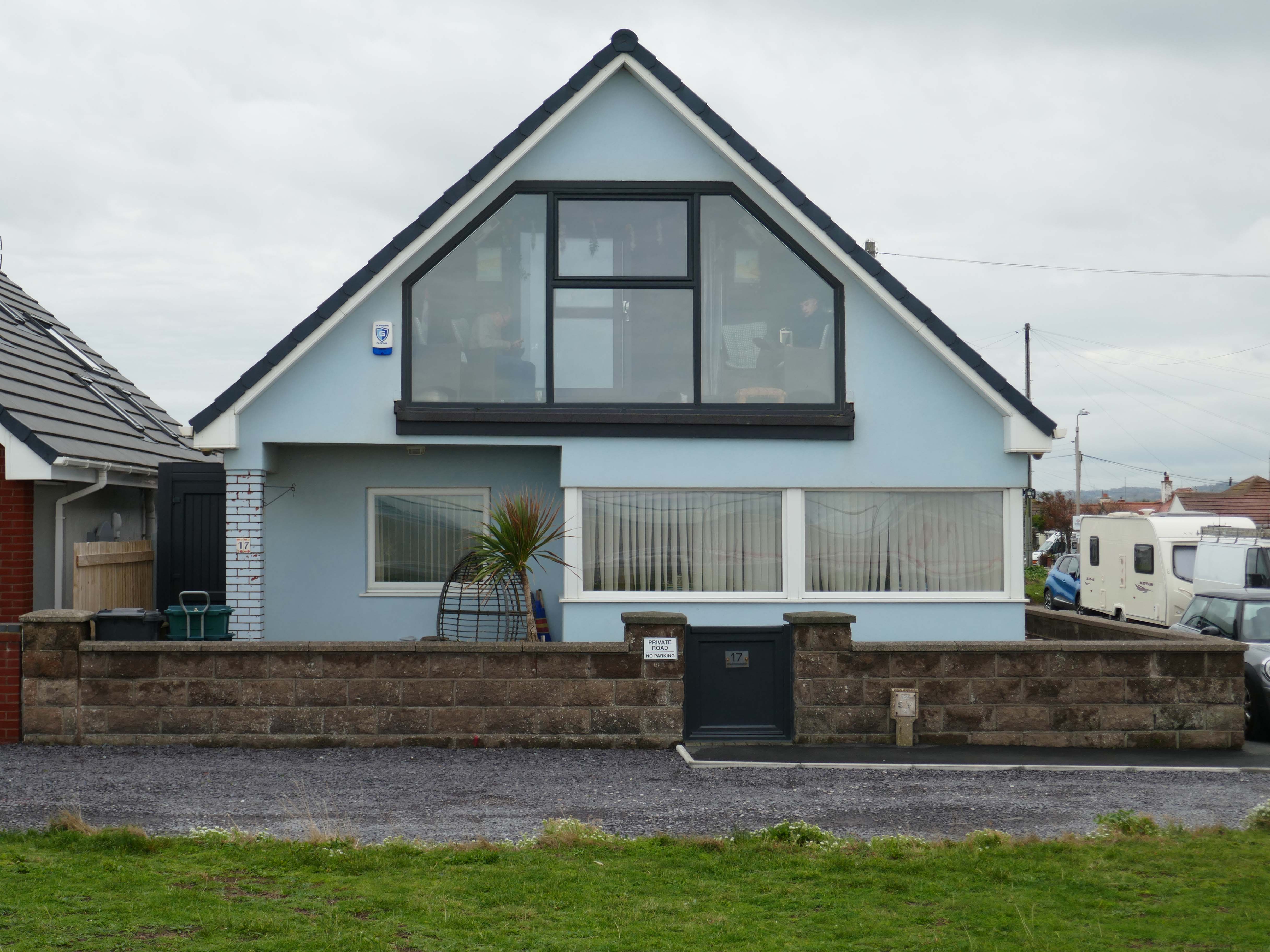
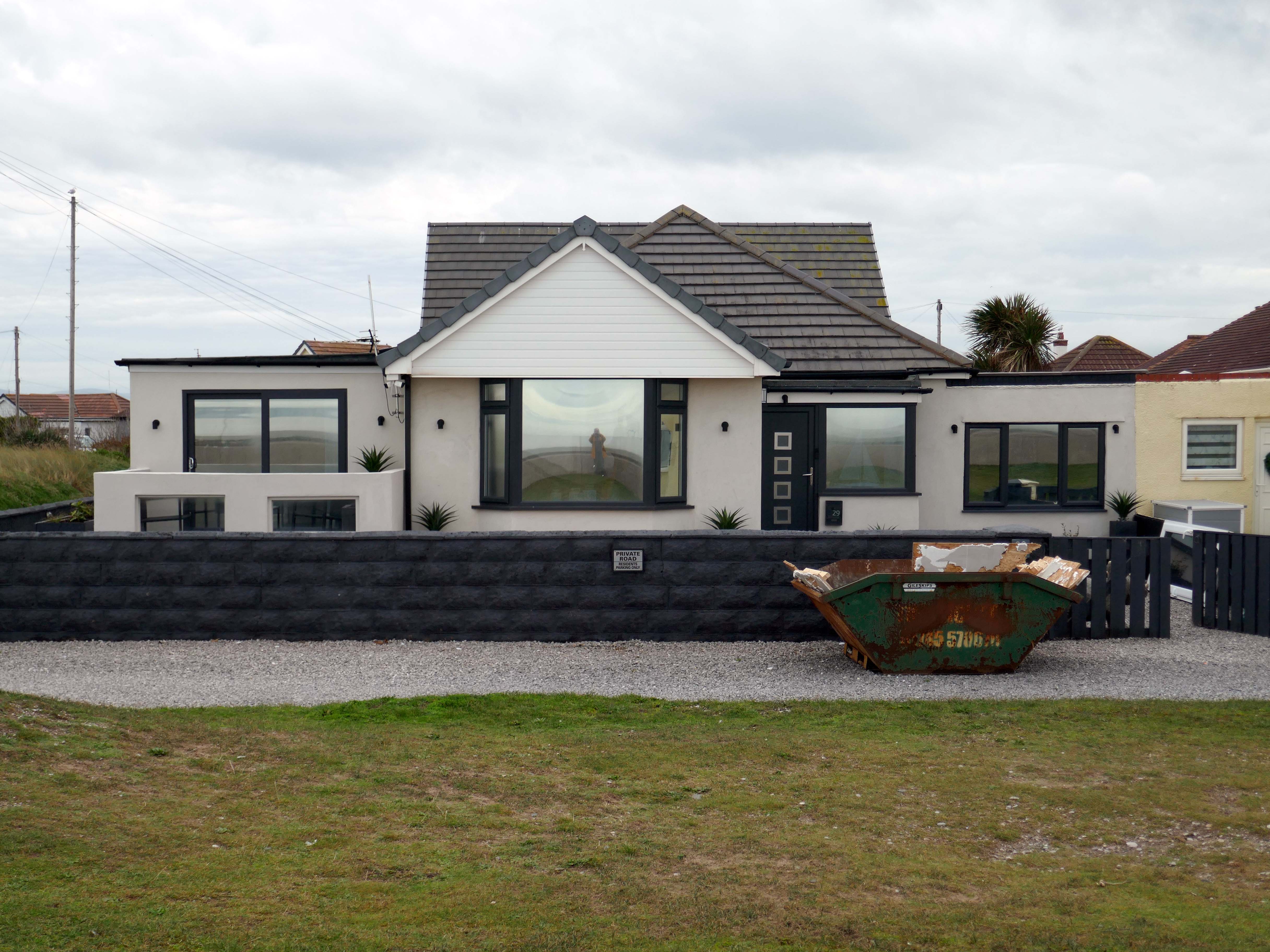
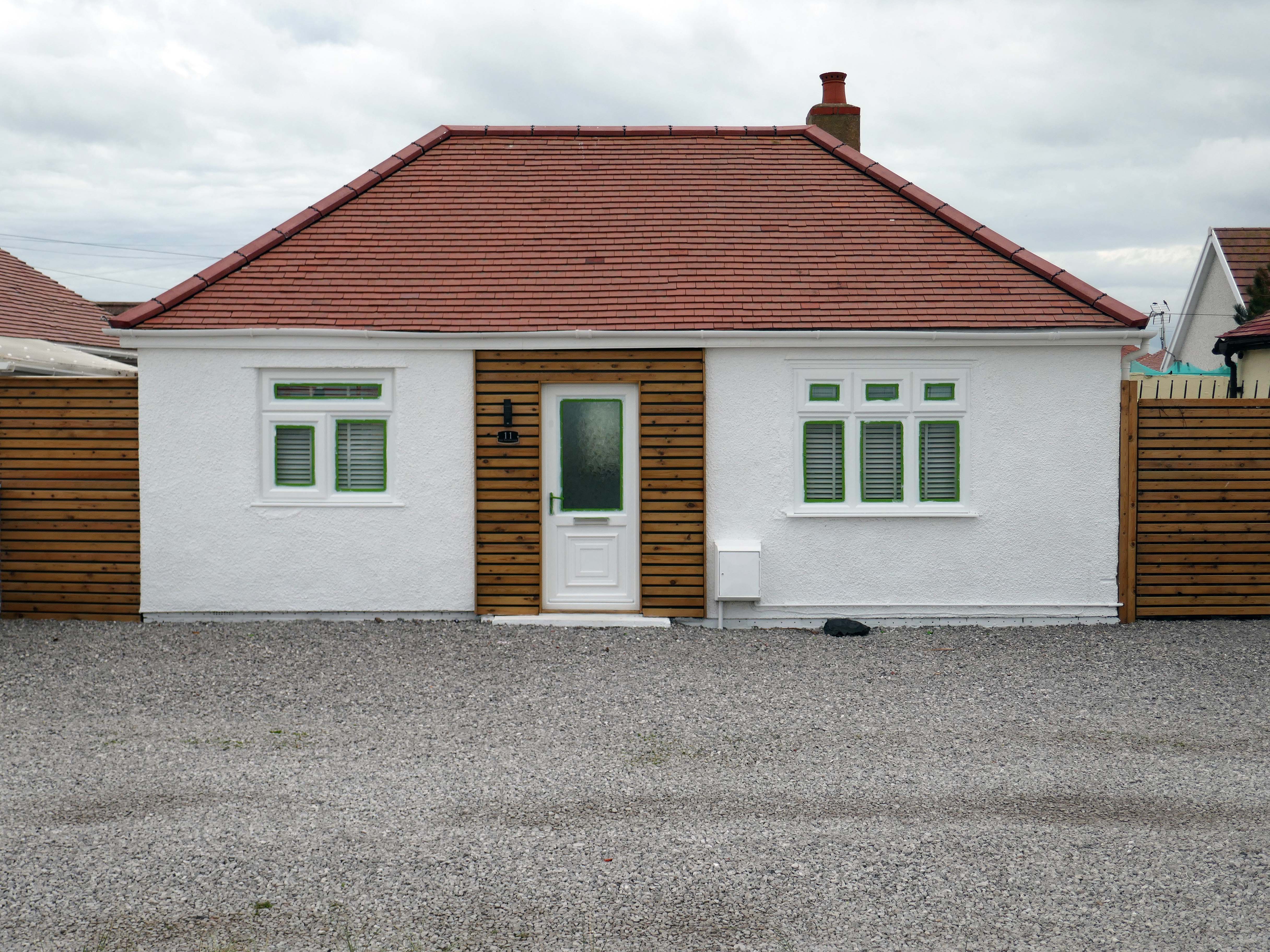
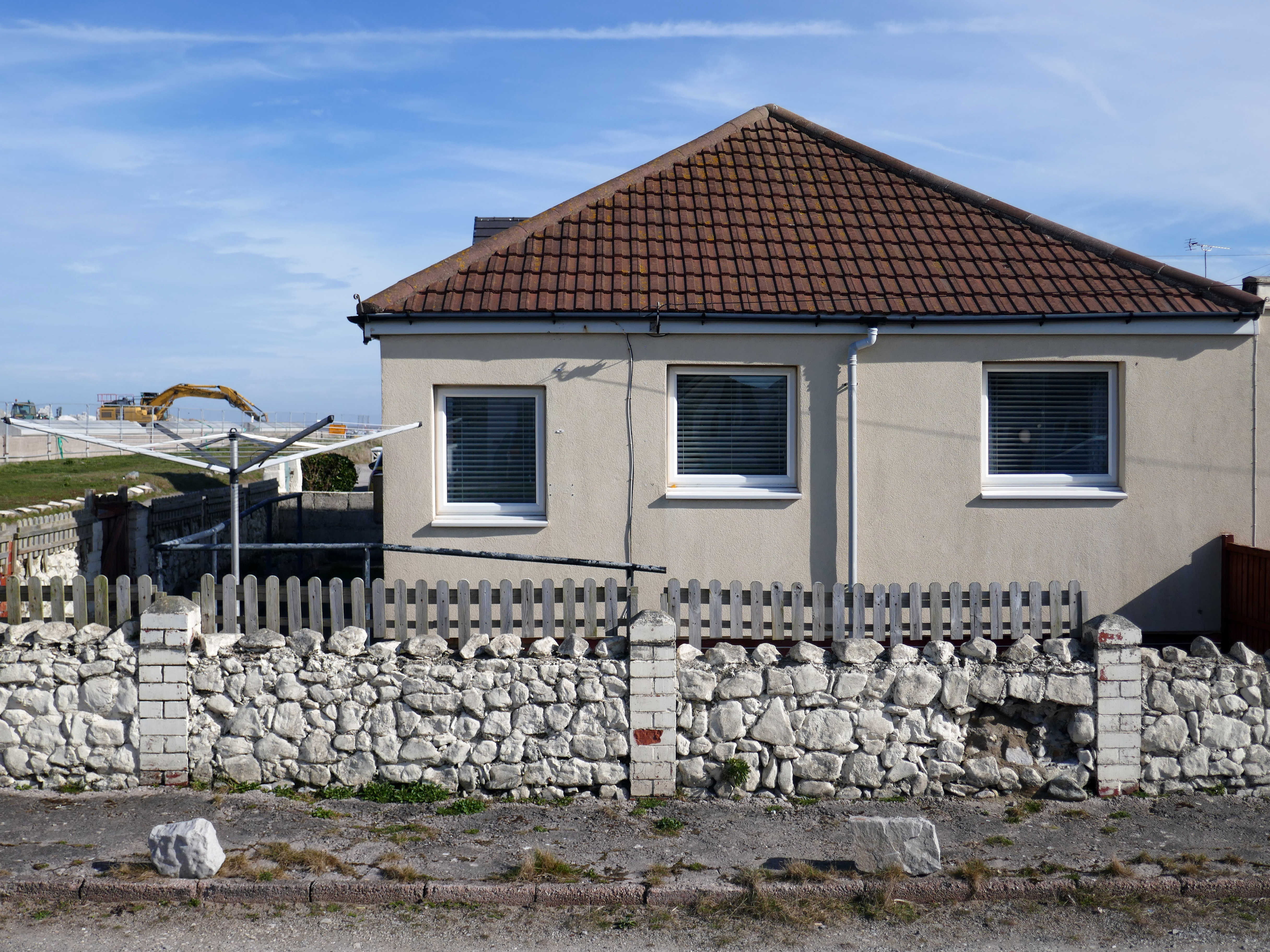
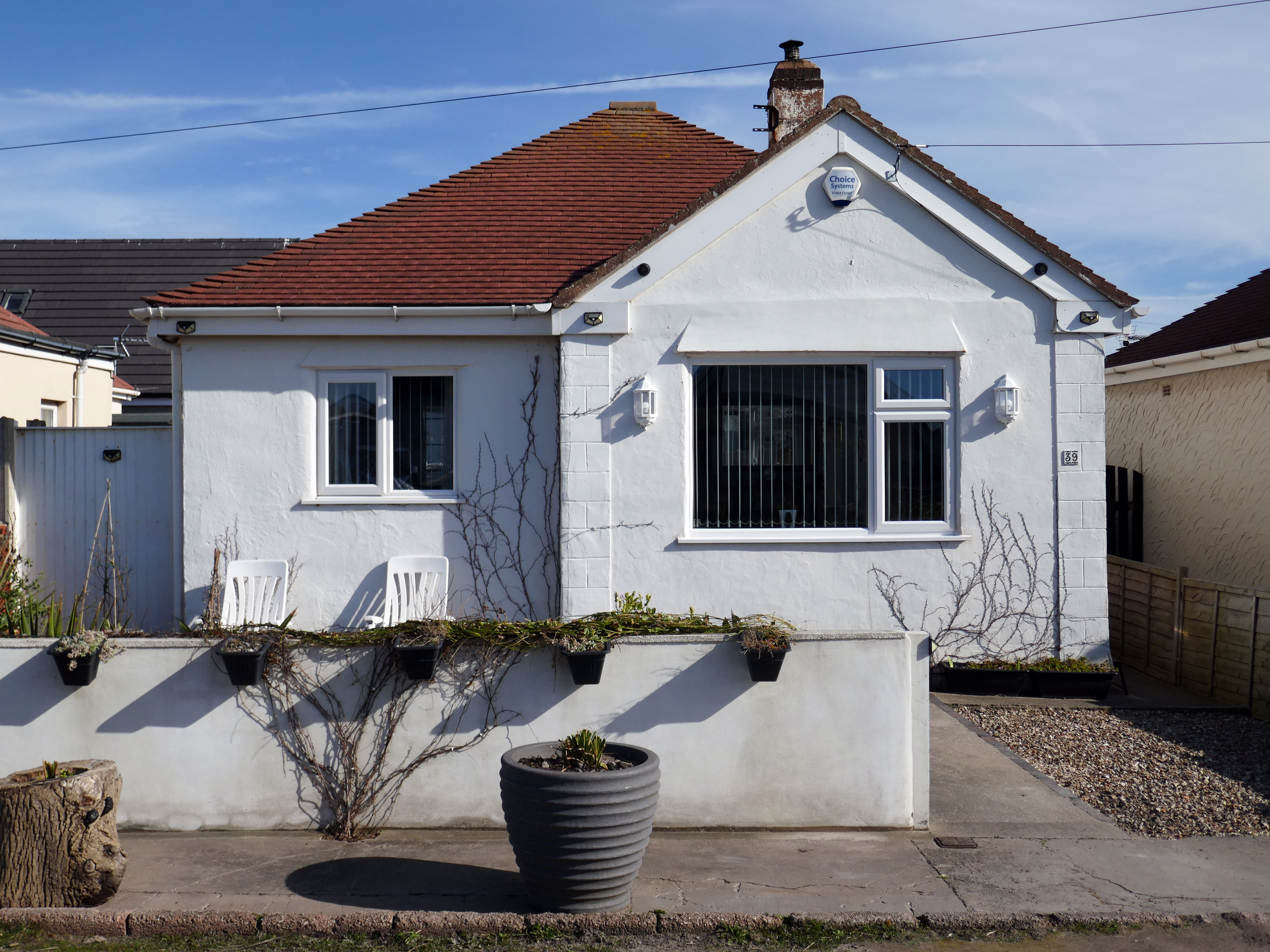
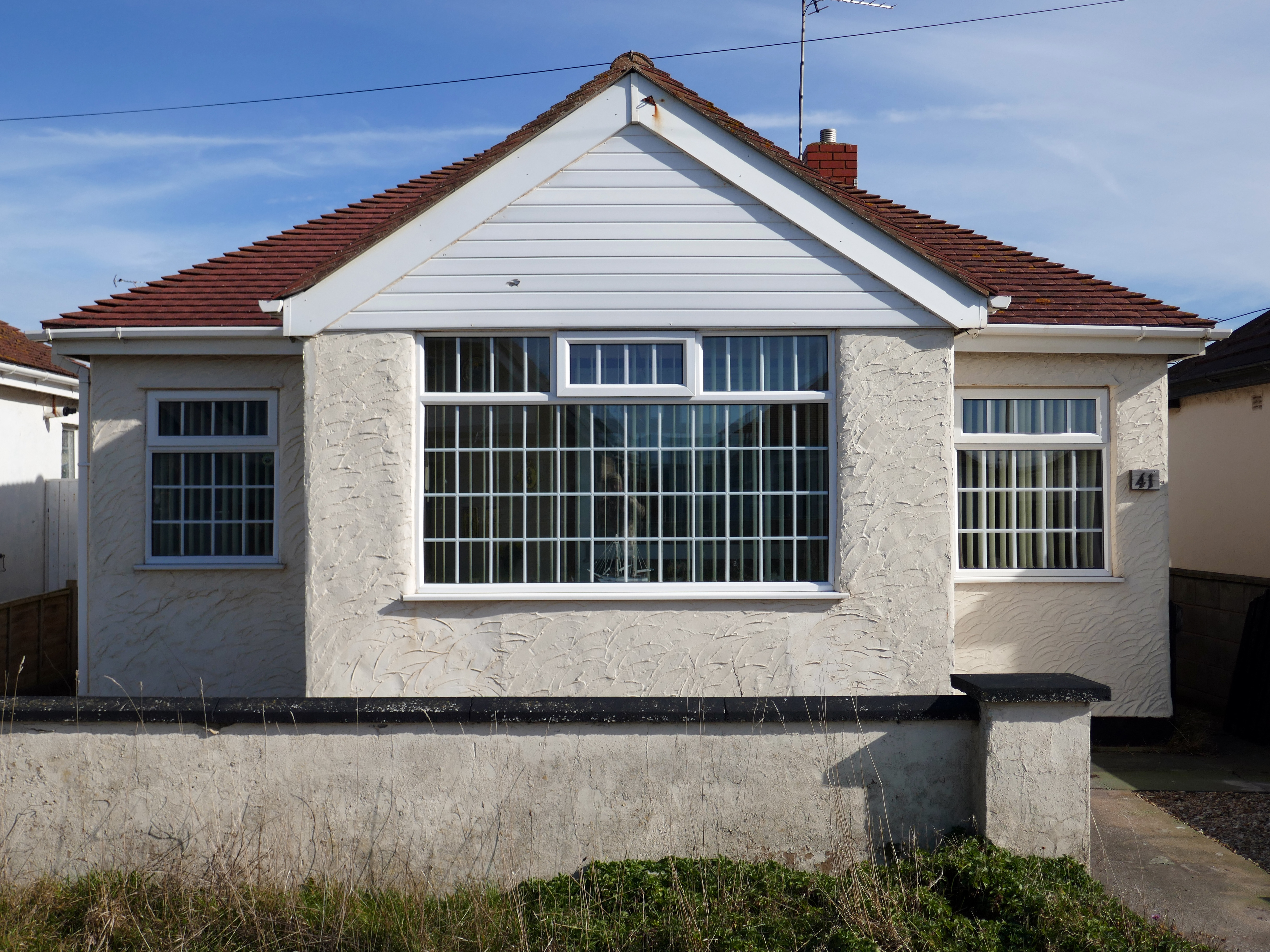
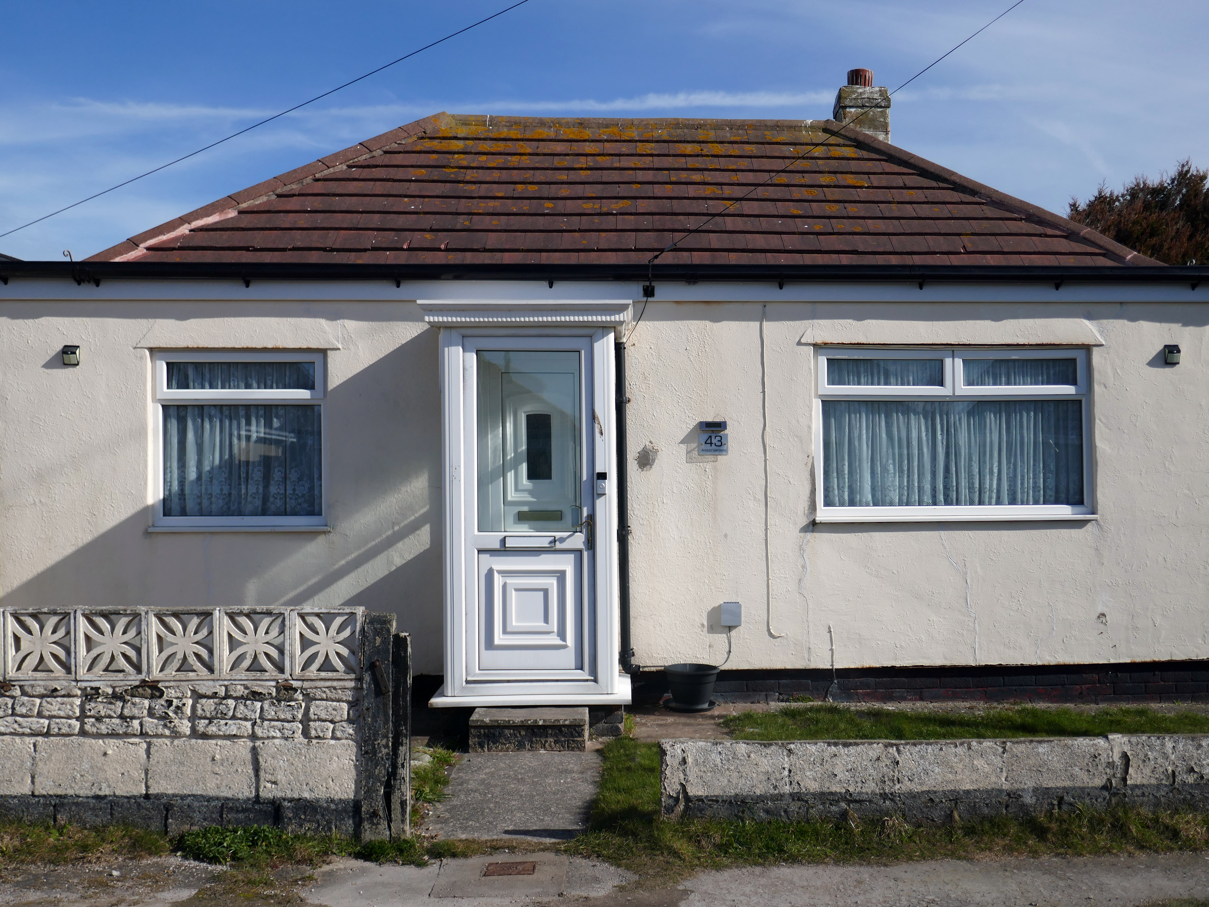
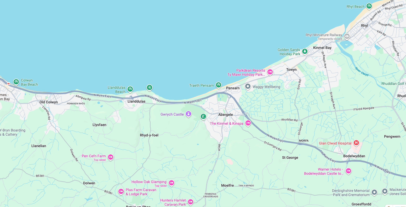
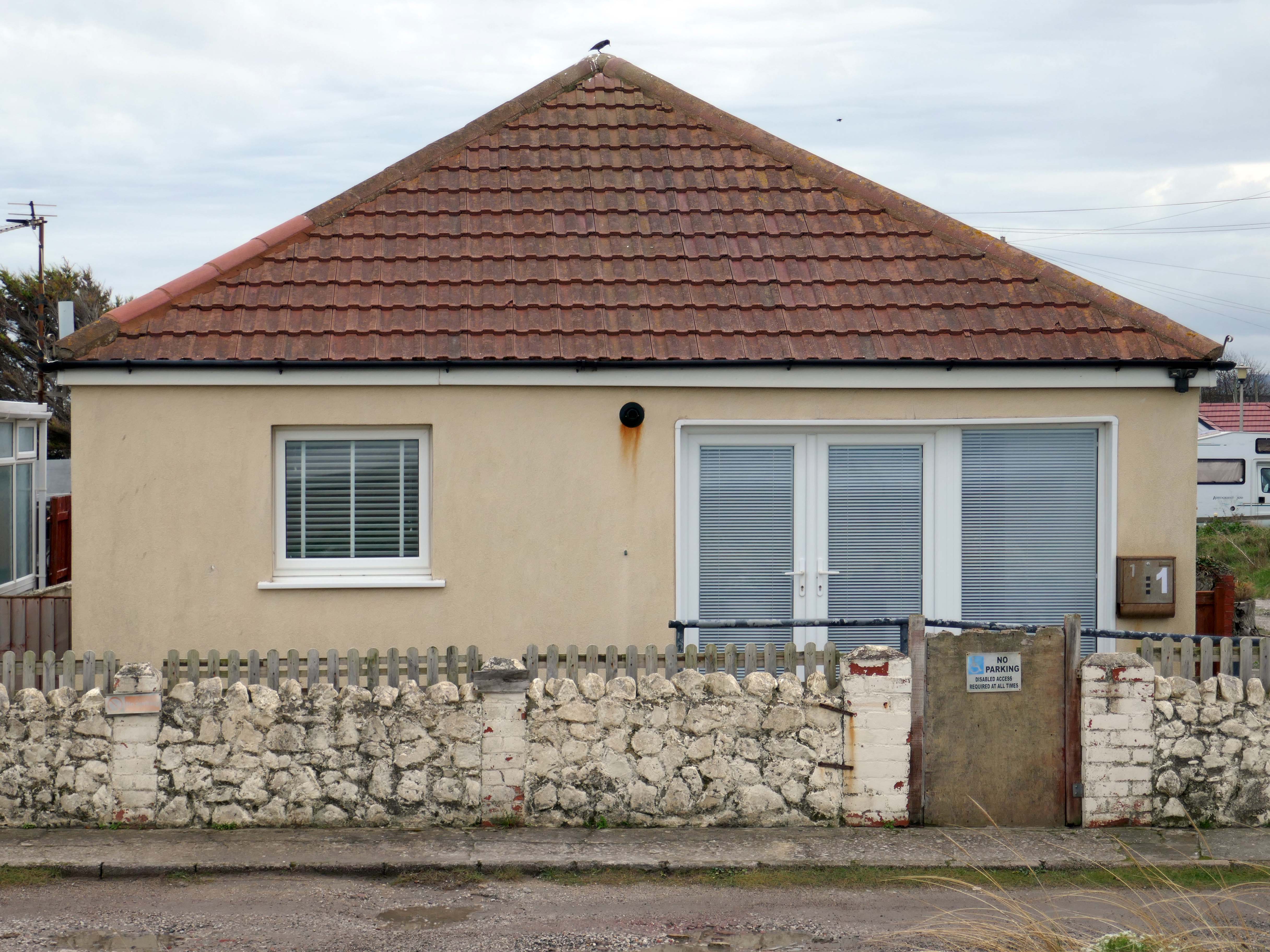
As I walked out one morning, as on other mornings I passed a group of bungalows along the North Wales Coast, as seen on many a trip twixt Rhyl and Colwyn Bay.
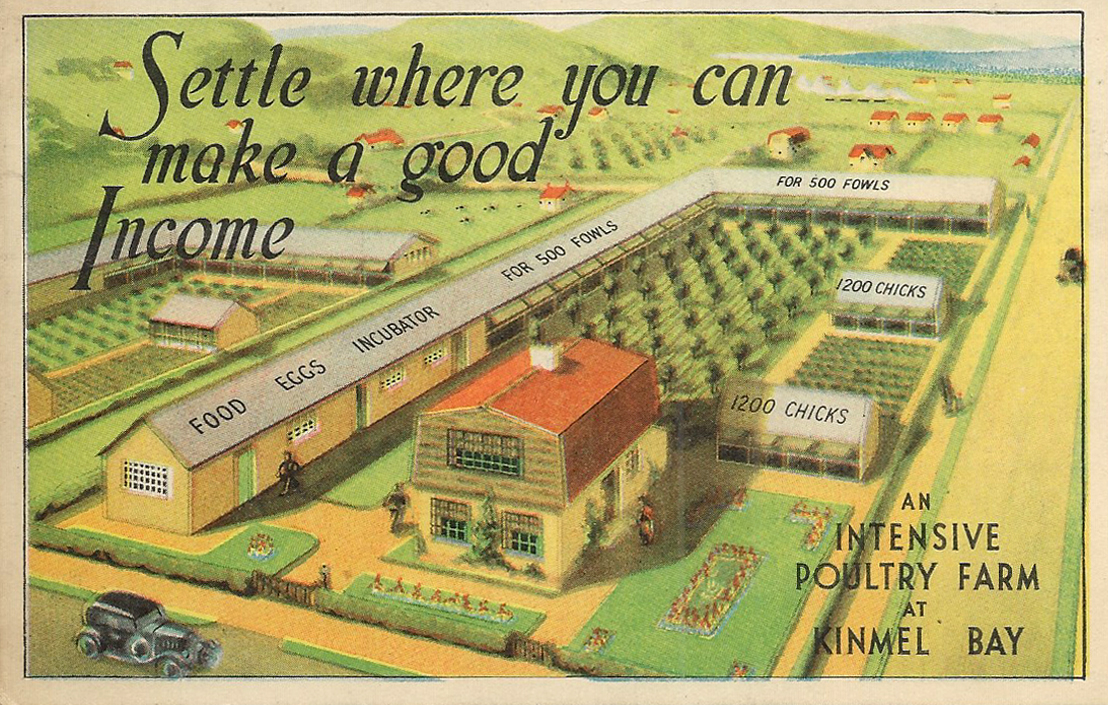
What is the history of this Kinmel Bay estate?
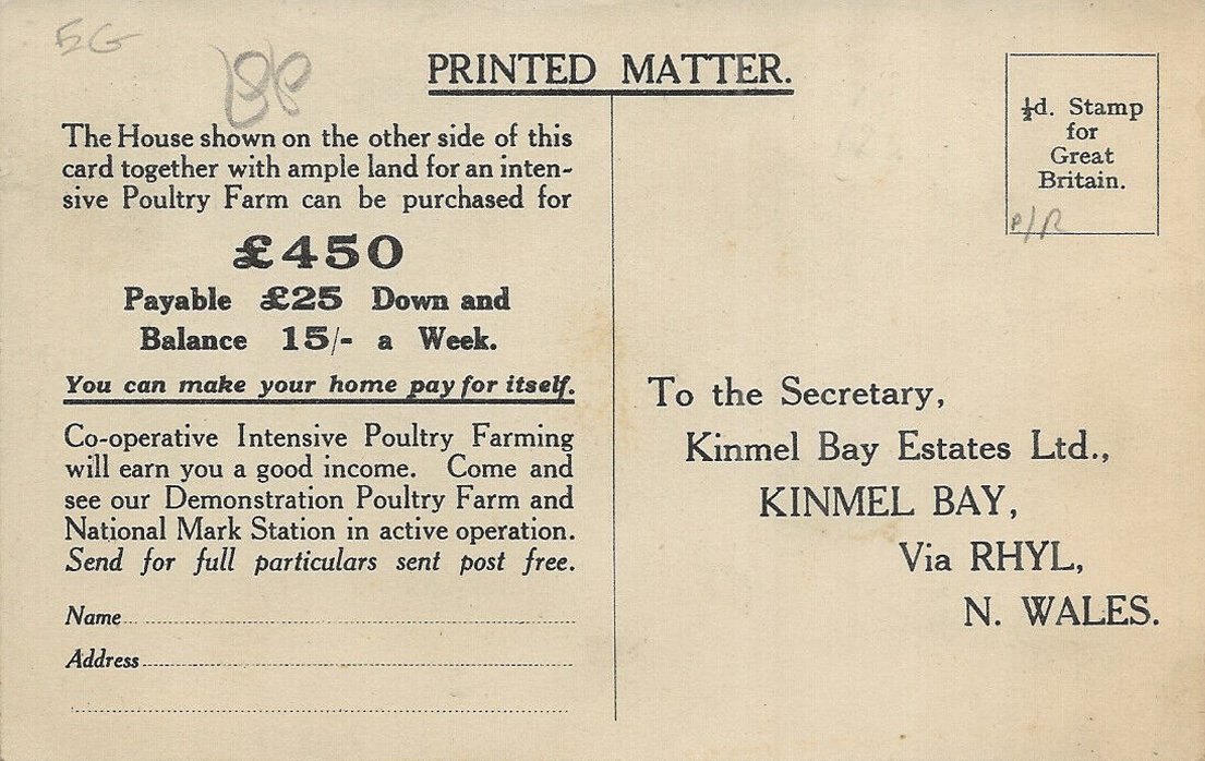
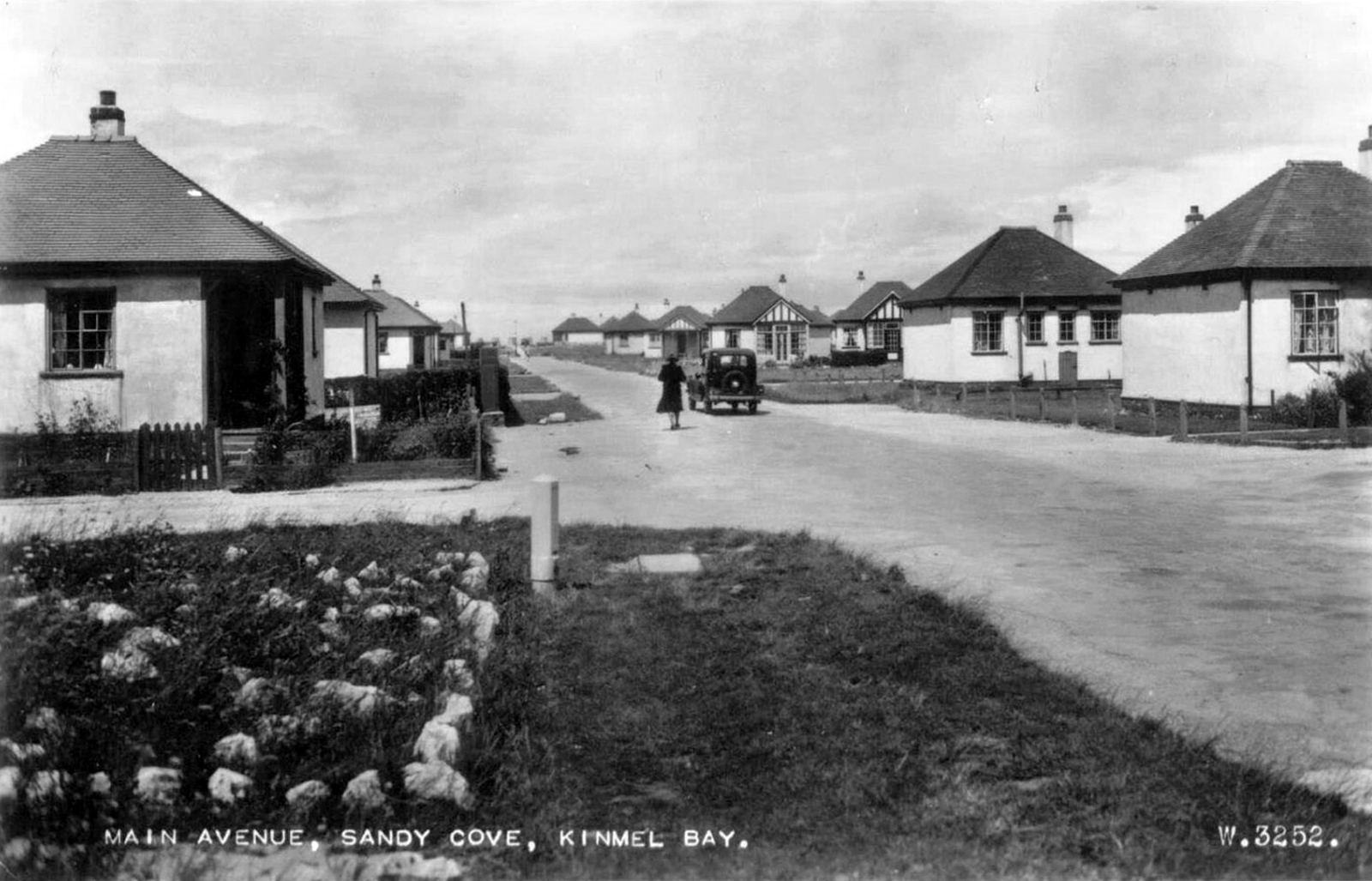
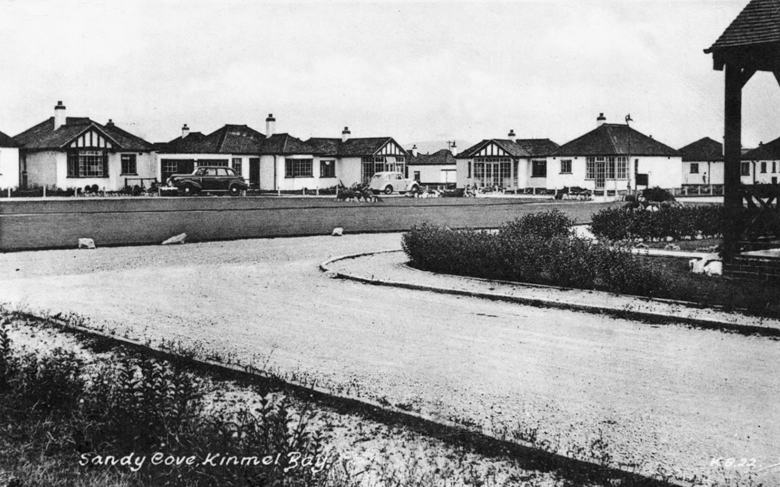
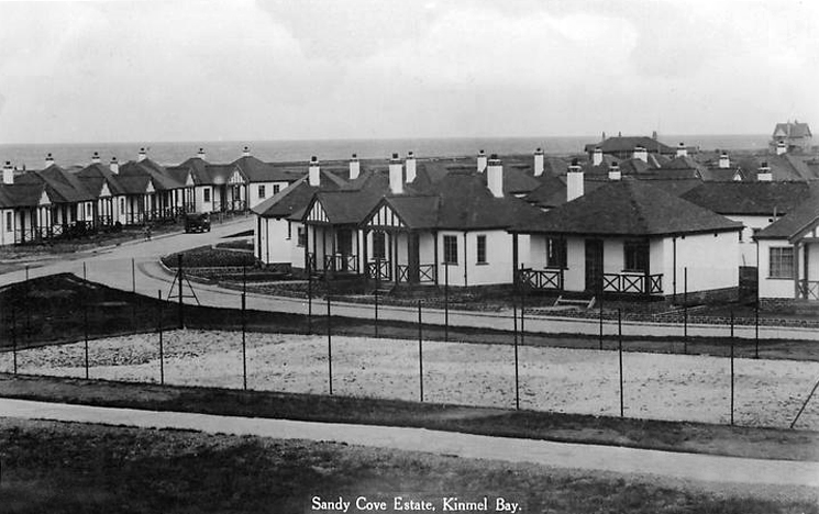
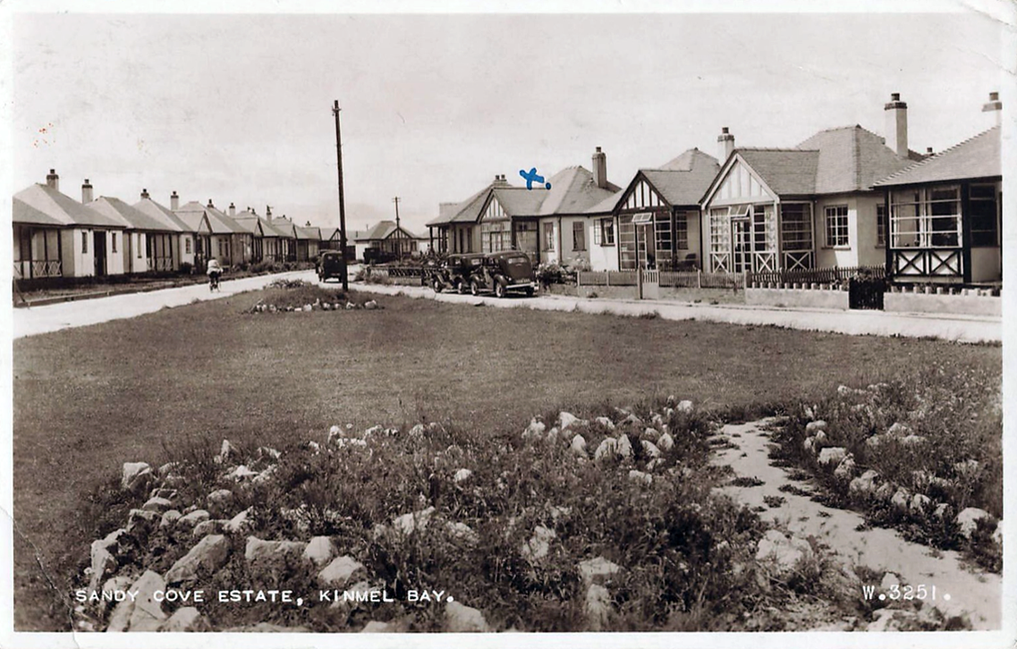
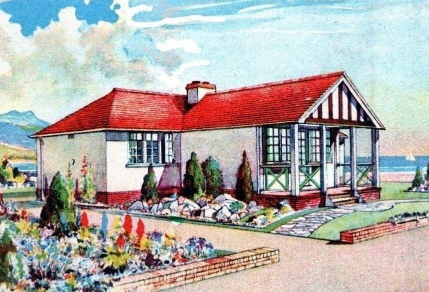
During the 1930s a company called Kinmel Estates Ltd came up with a idea of building a Holiday Village called Sandy Cove Estate. These Houses soon produced a lot of interest by many wishing to own their own holiday home and by the 1940s most were sold.
Due to unknown financial problems the Company went into liquidation in 1947 leaving further work on the infrastructure of the village undone. The Village was taken over by the Crown as the local Council showed no interest. It remained this way until 1997 when the land passed to The Kinmel Bay and Towyn Community Assocation Ltd.
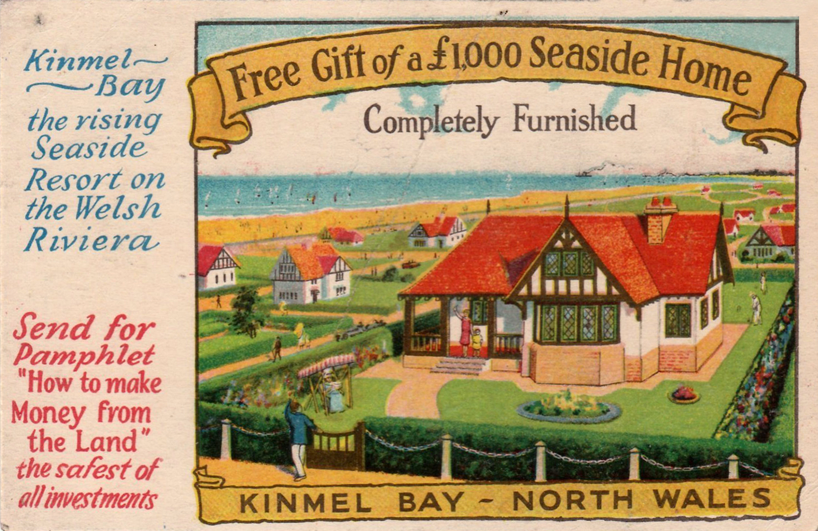
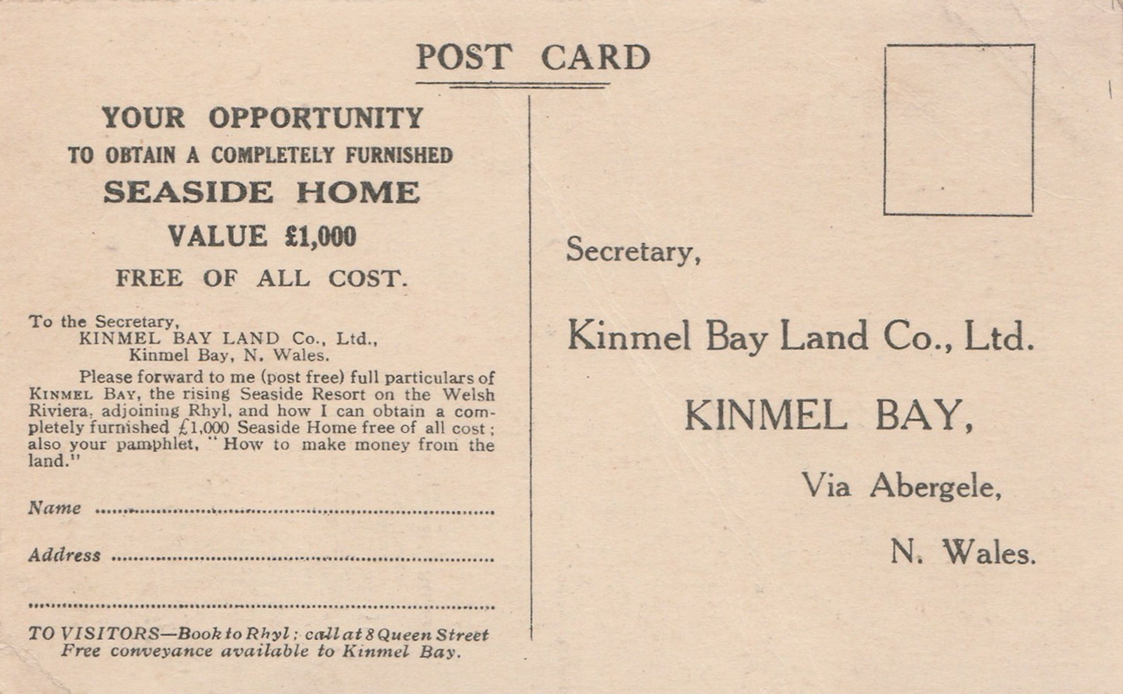
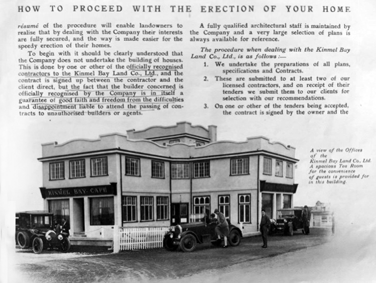
In 1925 a Mr Charles W Neville bought from 1,500 to 2,000 acres of land for the very small price of £30 an acre, and subsequently sold it at a handsome profit to himself, that is to say, to another company of which he is the moving spirit, a company known as the Kinmel Bay Land Company, of which he has been the dominating figure throughout.
By specious advertisements—which I have not now the time to show the House but they are contained in wonderful advertisements shown all over the Kingdom—and very cleverly devised contracts they have induced a large number of retired people, some with very small incomes, or small pensioners, to buy land which up to the year 1925 had cost £30 an acre at a price of from £100 a quarter of an acre up to £500 an acre with annual charges supposed to be for roadmaking, sewerage, and so on—a charge actually on the land which will last for all time, with the result that a beautiful site—a place of great possibilities to that part of the world—has been largely ruined and has brought a great deal of misery and discomfort to many people.
What is the present state of Kinmel Bay? In a few words I will give it. There is no proper system of sanitation or sewerage. Cesspools are a disgusting nuisance. In some cases they have to be emptied once a fortnight by the householder at an exorbitant cost, sometimes as much as £1 of poor people’s money. Ditches have become full. The sewerage in summer months is quite intolerable at times. Instances have been known of crude sewage floating on the surface and actually overflowing into a house in this area. There is no proper system of roads. Those that are made are mainly of twigs or branches of trees, old tin cans, and other rubbish, with a layer of stones on top. Even these roads, of course, are not maintained. Drinking water, at one time brown and muddy, has improved. A new company has been formed, a subsidiary of this very company, which is certainly selling rather purer water now, but at the exorbitant price of a minimum charge of 15s. a quarter to the householders. Of course, the hydrants are quite useless in the case of fire. Now we have here 1,380 acres built over in this scattered and haphazard manner with a population of over 2,000.
This seems to have been the oddest case of hucksterism – which also involved the sale of putative poultry farms. This image seems to be the only reference which I can find online.
Were they ever built?
Along with the aforementioned homes.
It would appear that they were perhaps self-assembly kits.
These are archival images from a variety of sources:
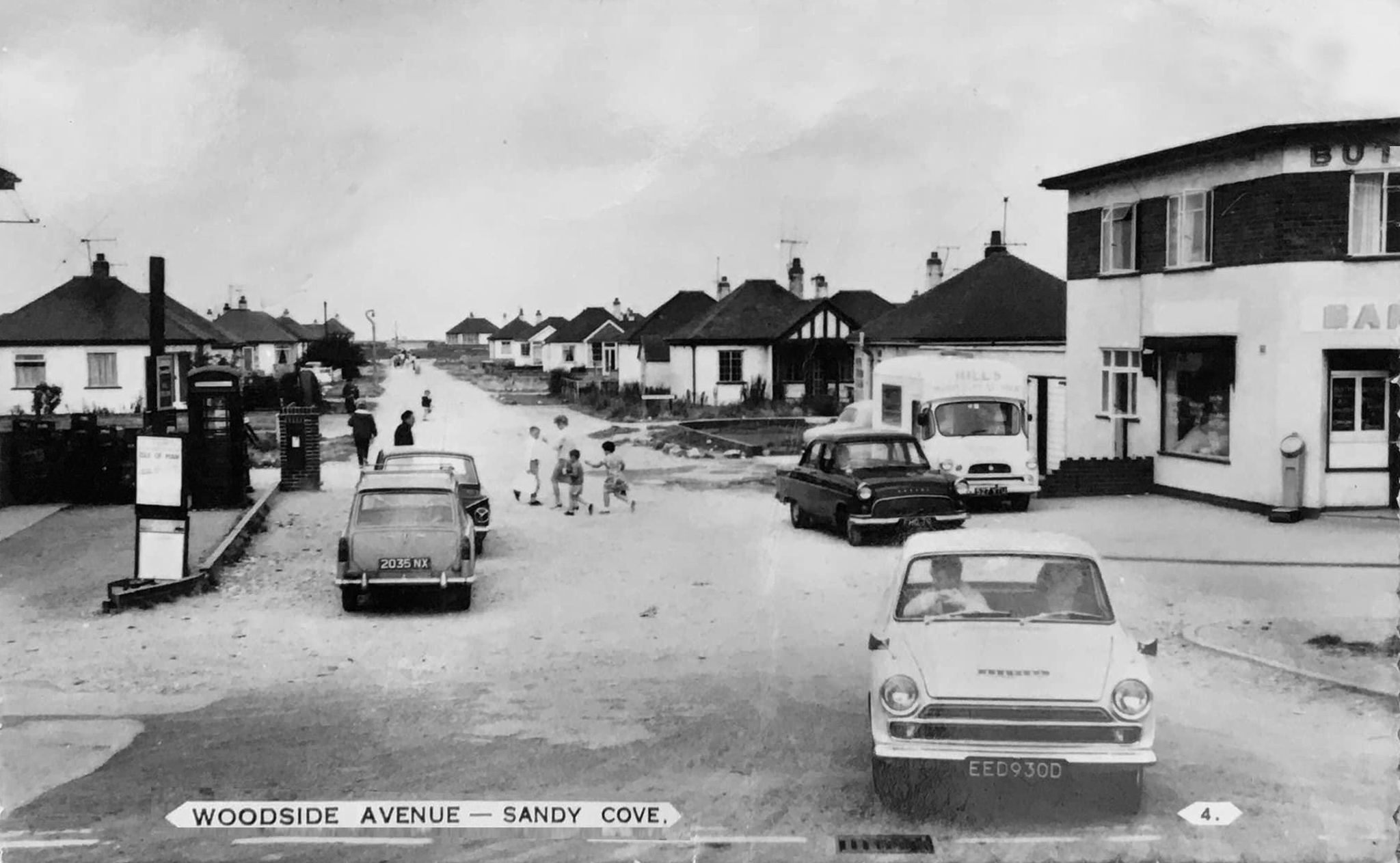
In the past Chester Avenue was nicknamed Dodge City thanks to its reputation for low-level crime and scruffiness.
It was like Beirut in the early days – said Mike Nolan, who has lived in the area since 1978.But now it is very pleasant, and since Cartrefi Conwy has taken over it has been even better. People want to come and live here now.
The issue of infrastructure management on the estate is still an issue it would seem:
Clwyd West MS Darren Millar yesterday raised in the Senedd the plight of residents living on Kinmel Bay’s Sandy Cove, who recently experienced flooding. Calling for a Welsh Government statement on the issue of unadopted roads during the Business Statement, Darren referred to the situation at Sandy Cove.Adverse weather on April 9th led to residents of the estate being evacuated from their homes. The estate has also been hit by flooding in the past.
Speaking in the Senedd Chamber, Darren said:
I’d like to receive an update from the Cabinet Secretary for Transport on the issue of unadopted roads. Sandy Cove in Kinmel Bay, which has around 250 properties on unadopted roads, experienced flooding during storm Pierrick just over 10 days ago.
That flooding was made worse because of the lack of drainage on that estate. It clearly needs an improvement to the drainage infrastructure. Those roads need to be up to an adoptable standard, and the poor condition of them is making life a misery for local residents.
The days when a vast multitude of things came and went have been and gone.
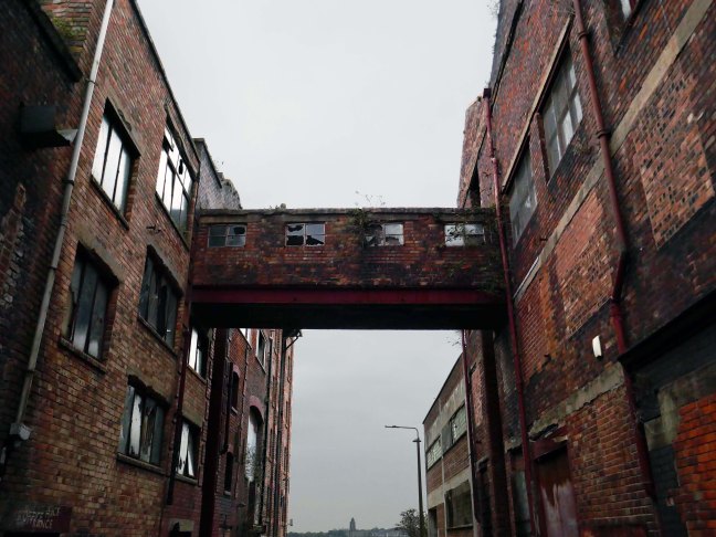
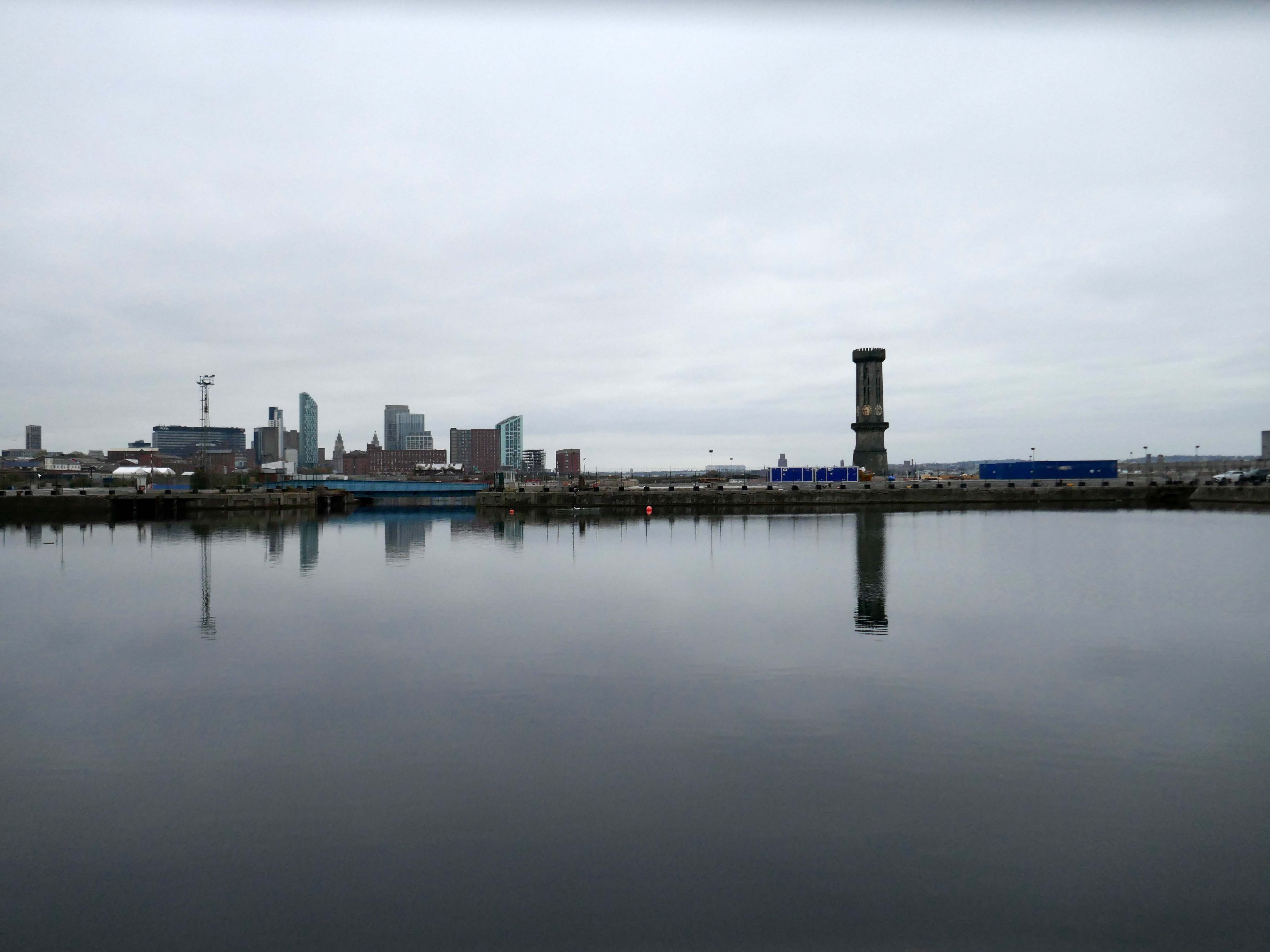
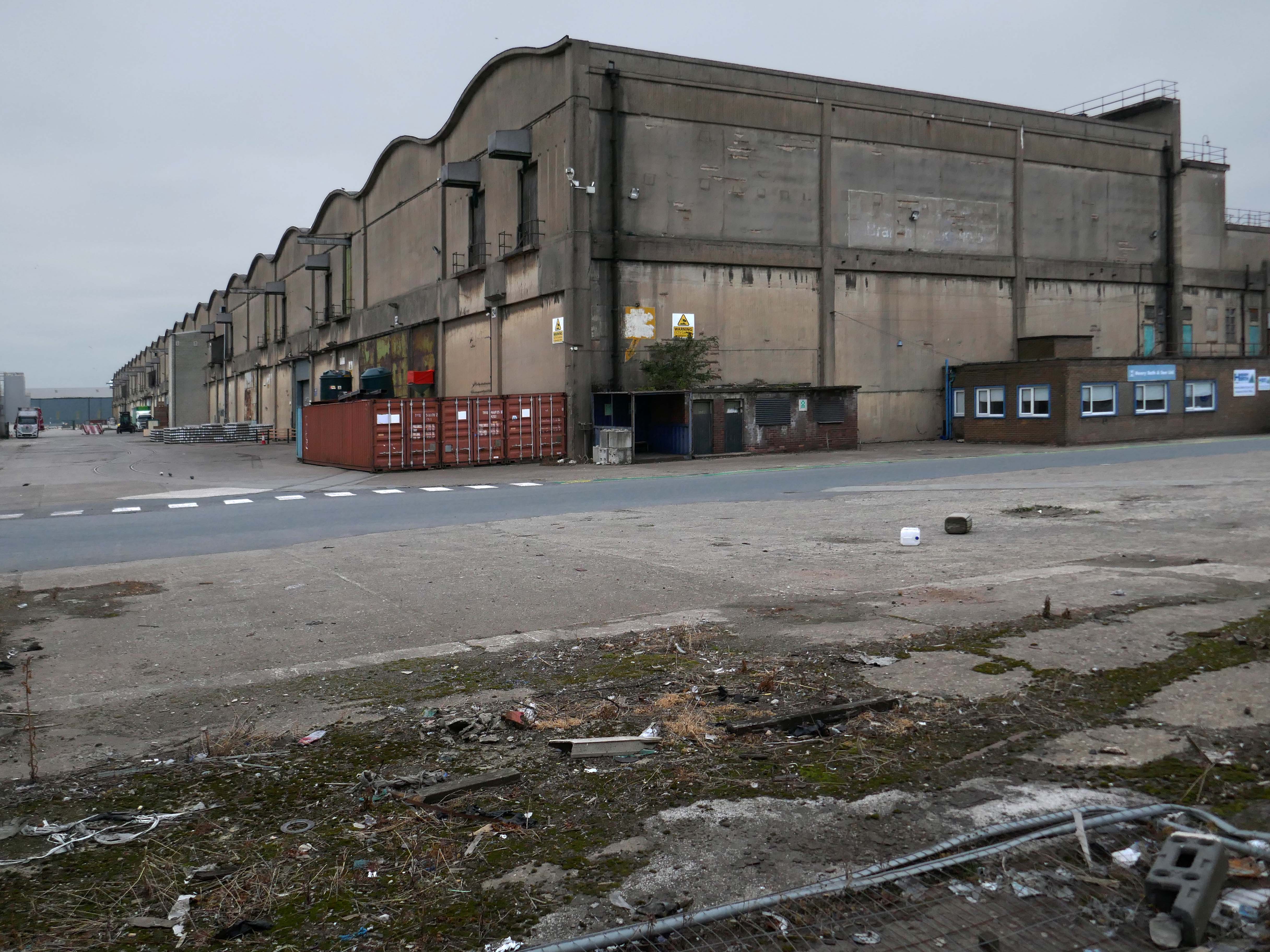
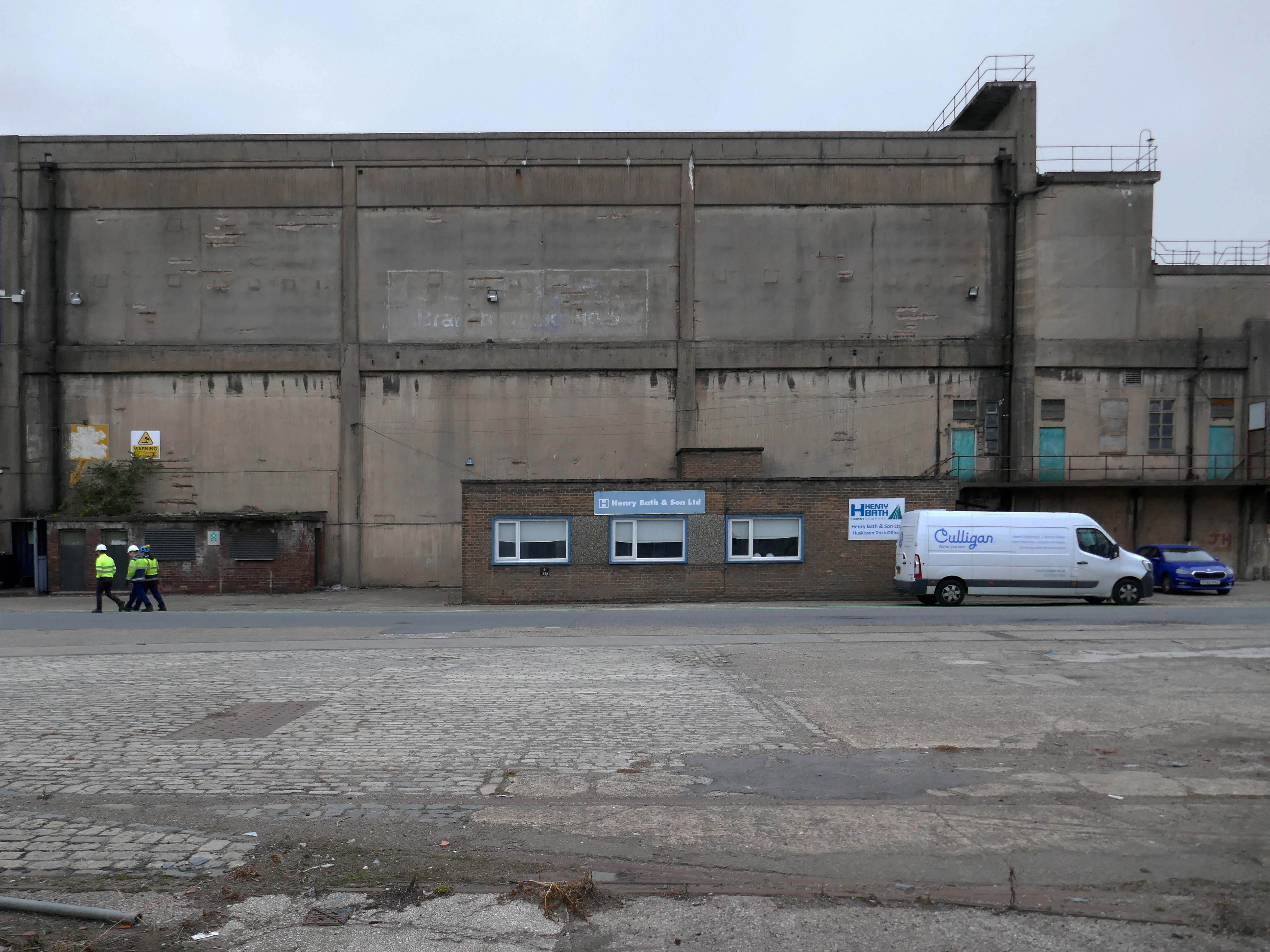
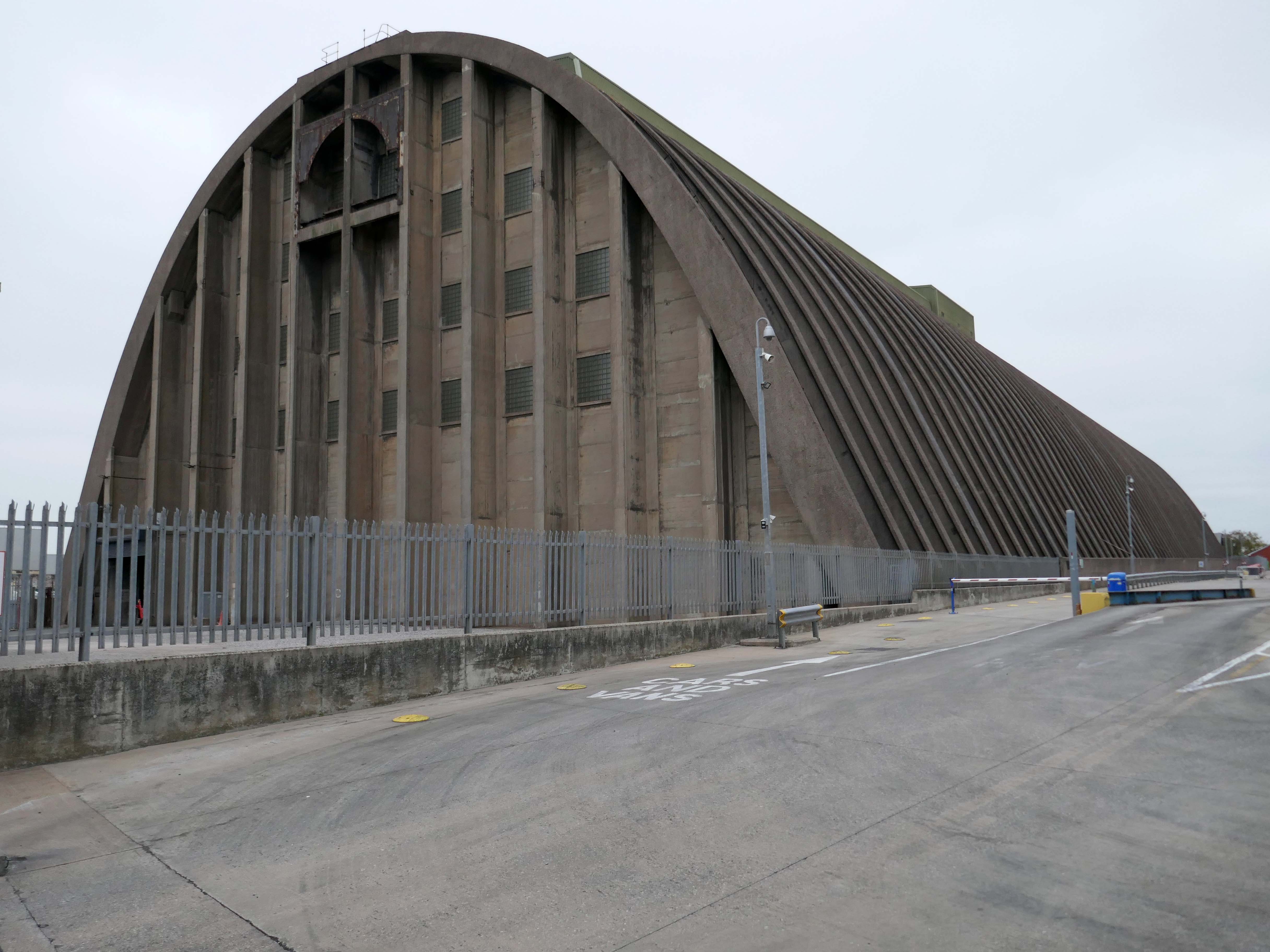
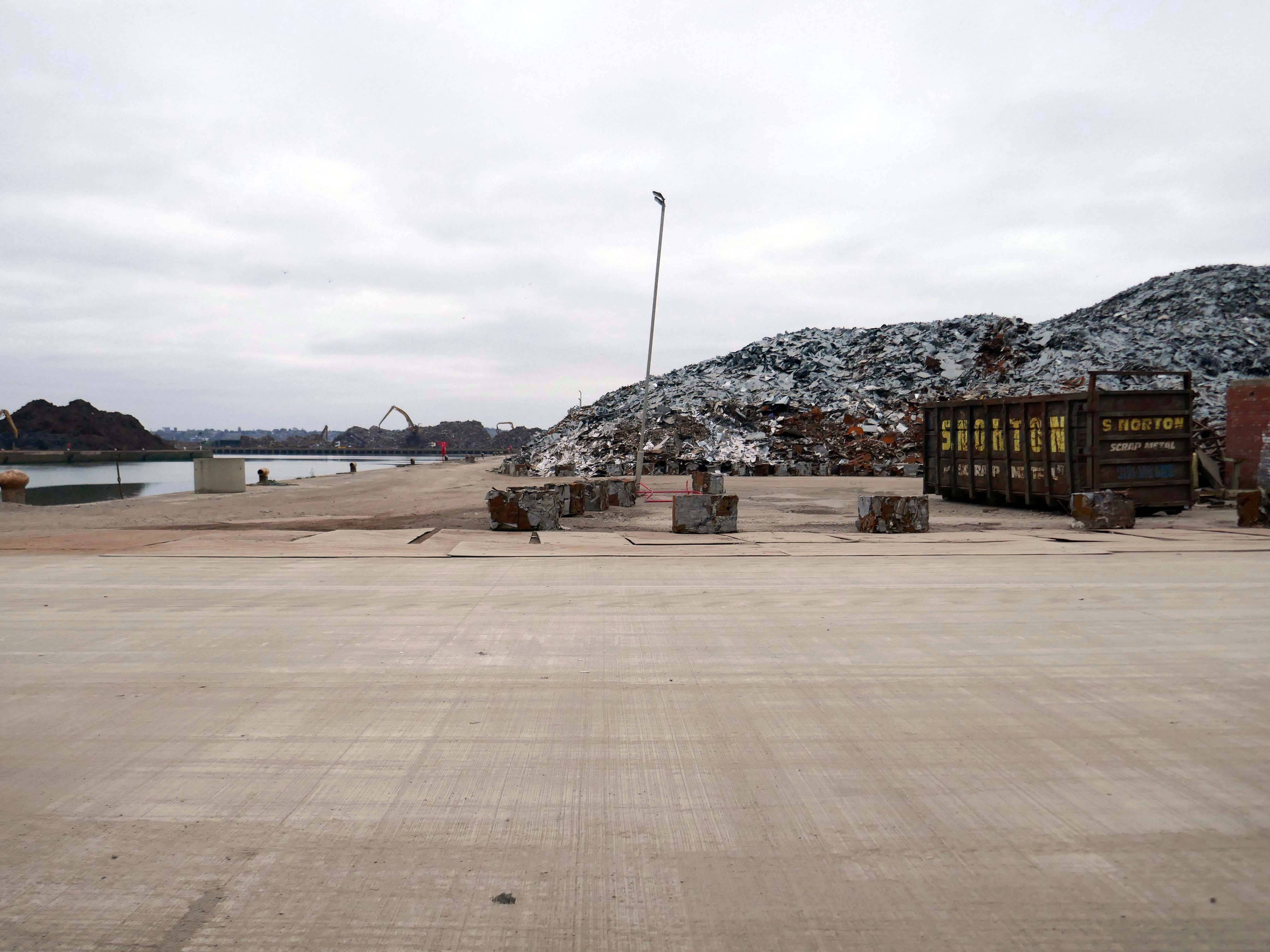
The docks as they were are no more.
Yet in 2023, the Port of Liverpool was the UK’s fourth busiest container port, handling over 30 million tonnes of freight per annum. It handles a wide variety of cargo, including containers, bulk cargoes such as coal, grain and animal feed, and roll-on/roll-off cargoes such as cars, trucks and recycled metals. The port is also home to one of the largest cruise terminals in the UK which handles approximately 200,000 passengers and over 100 cruise ships each year.
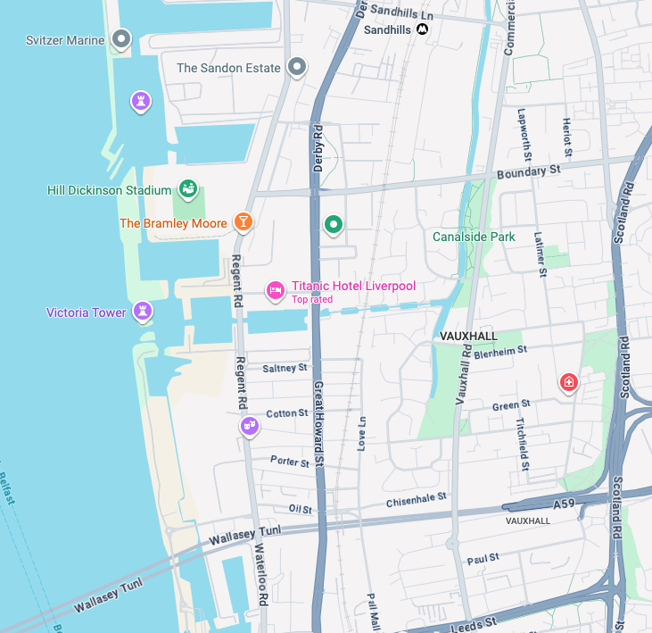
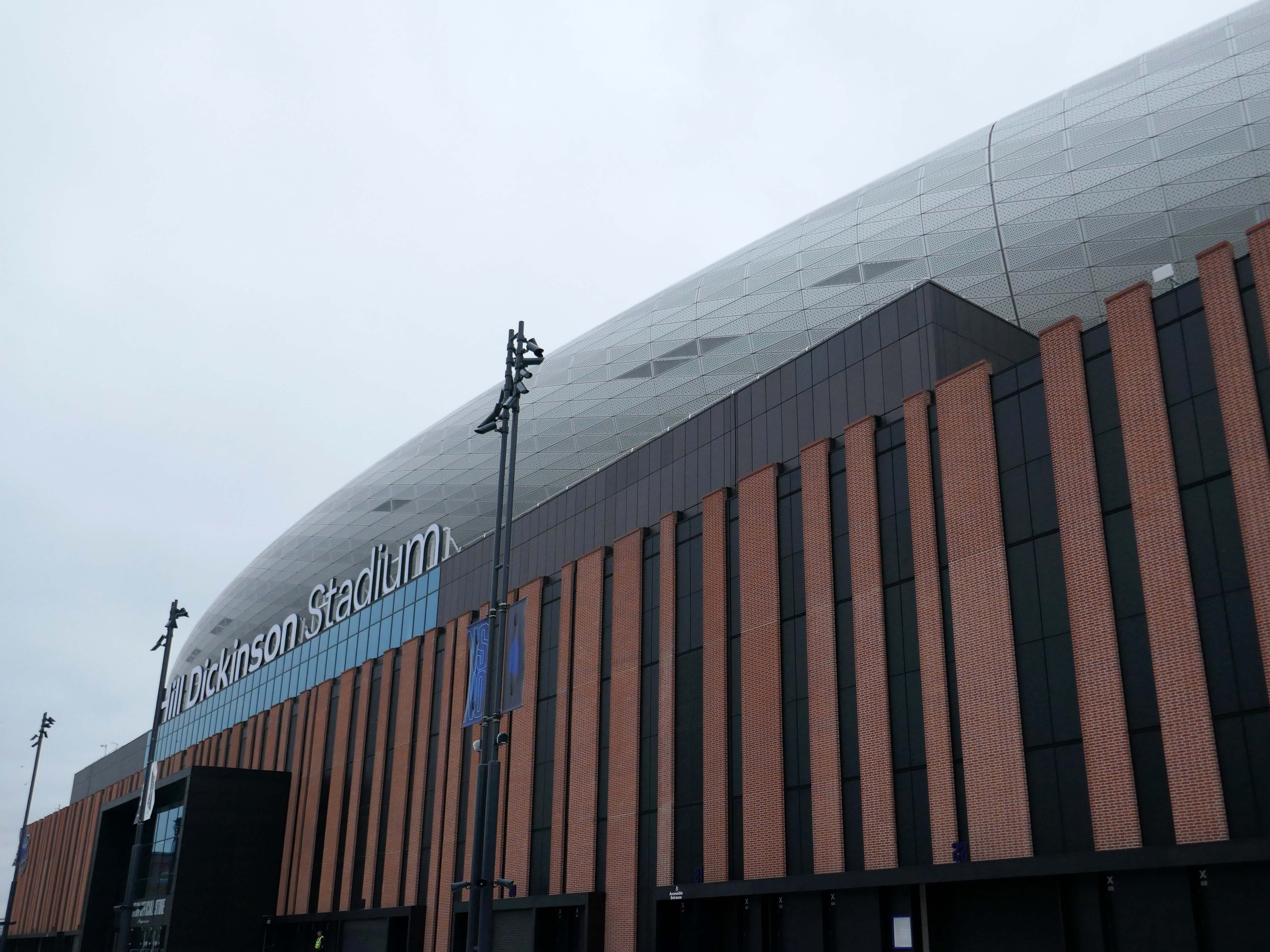
Now with the opening of the Titanic Hotel in the Stanley Dock and the arrival of the Toffees just up the road at the Hill Dickinson Stadium, the whole area is slowly being transformed into a destination, as they say in modern parlance.
However much of the Industrial heritage remains in various states of disarray, used and possibly disabused, but hanging on in there.
Time for the train home to Stockport – but you can bet I’ll be back.
And true to my word I have been back, several times – on this occasion alone and on foot.
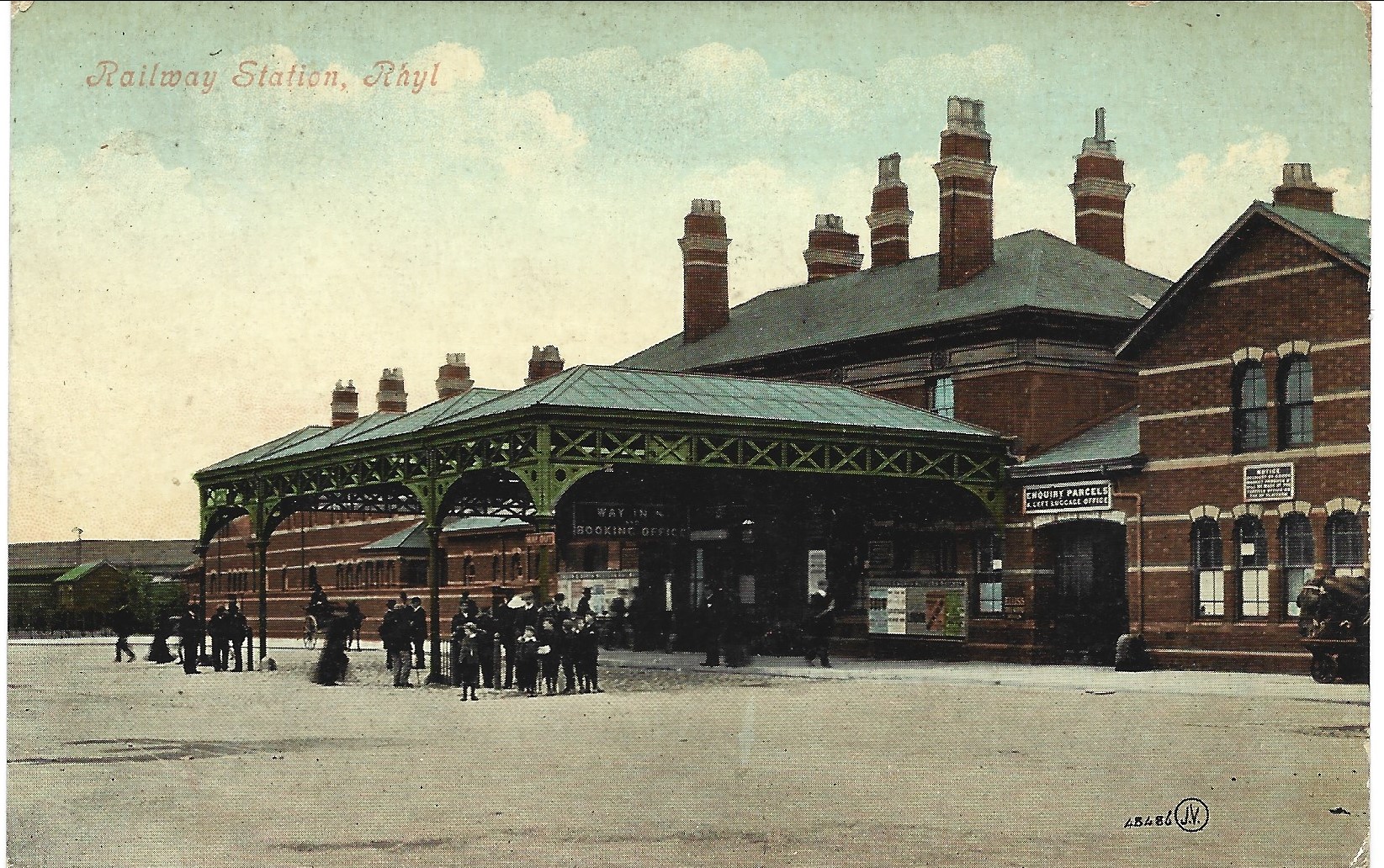
An almost overcast mid-grey day in November, alighting at Rhyl Station and loafing along to Colwyn Bay – this what I done seen.
1907
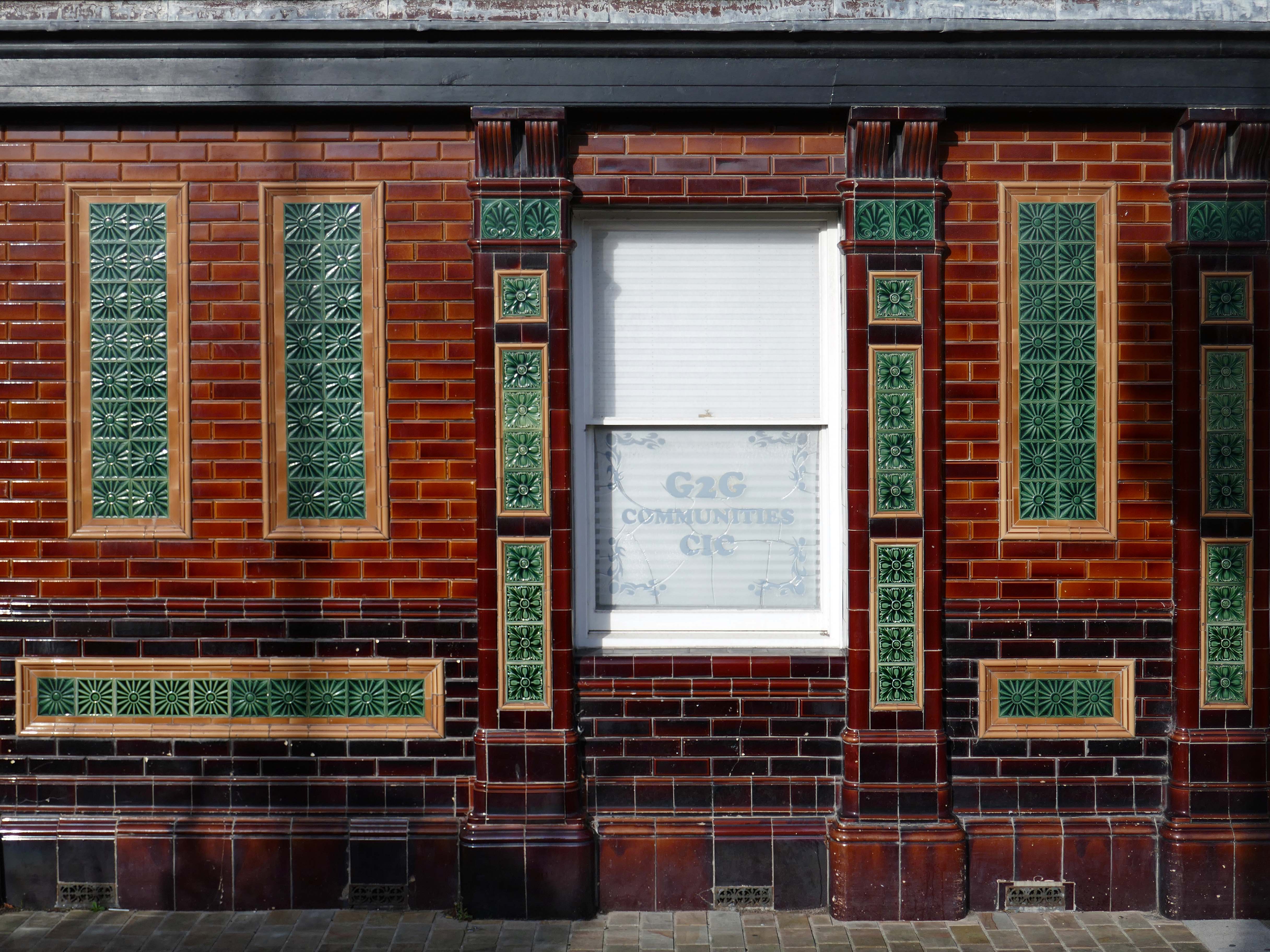
Former Bee and Station Hotel immediately opposite the Station.
The Bee and Station Hotel was built in the 1860s. The decorative tile work of the exterior was probably added during remodelling c.1890. Inside, the lobby is also richly decorated with brightly coloured tiling. The building was listed in 1991 as an excellent example of pub of the late 19th century with a complete tiled frontage and a rare surviving internal layout throughout.
The pub closed in 2005. The building reopened in 2013 after being refurbished and given a modern extension by Denbighshire County Council, under the Townscape Heritage Initiative, to provide new offices for small businesses
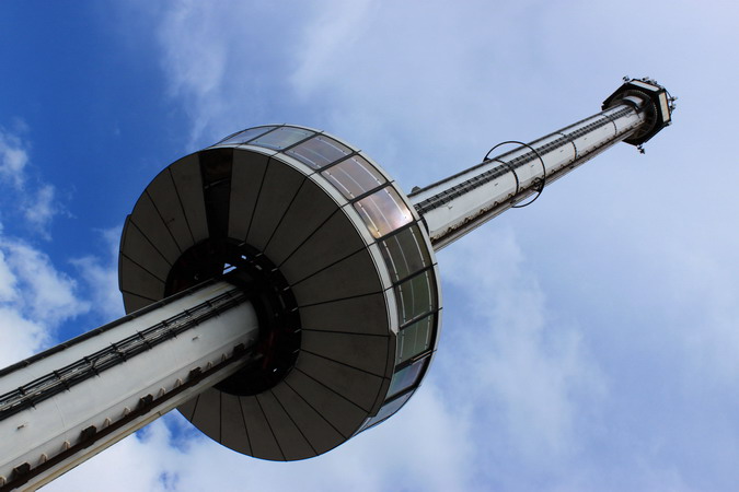
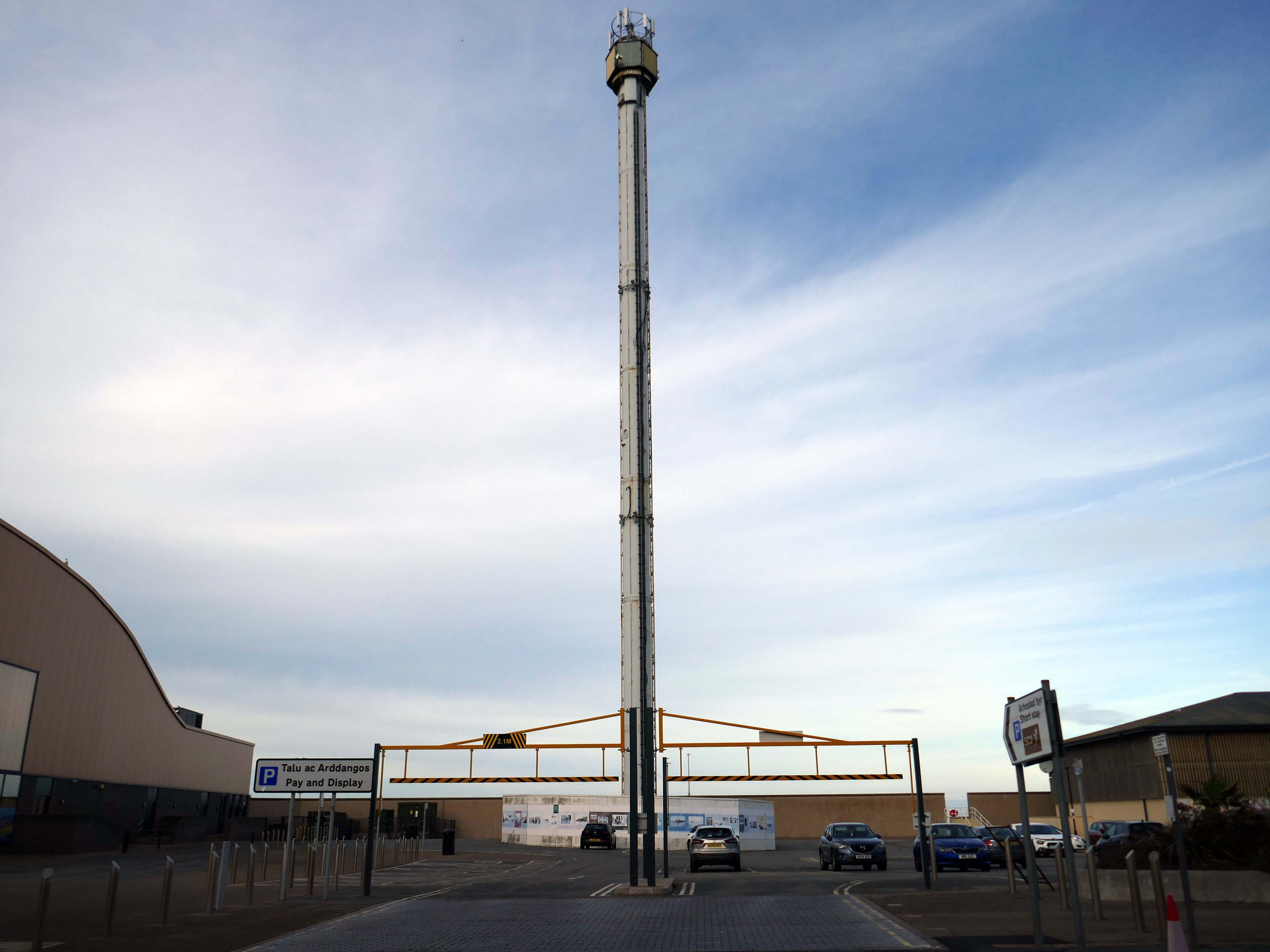
Onward to the seafront, home to the defunct Skytower.
The tower first operated at the 1988 Glasgow Garden Festival, where it was known as the Clydesdale Bank Tower and was opened by Prince Charles and Princess Diana. Following the festival, it was dismantled and reassembled on the Rhyl seafront.
The tower last operated in 2010. The following year, a safety report found that £400,000 worth of repairs were required to keep the ride operational. After standing but not operating for seven years, in 2017 work was carried out to turn the tower into a beacon.
Much has been done to improve the promenade, with sumptuous hard landscaping, coastal defences and seafront shelters.
The £66m Central Rhyl Coastal Defences Scheme will protect almost 600 properties in Rhyl from flooding and coastal erosion for decades to come.
85% of the construction costs have been funded by the Welsh Government, with the Deputy First Minister labelling the project a ‘significant milestone’ in efforts to protect Welsh communities from the growing threats of climate change. Denbighshire County Council contributed the remaining 15%.
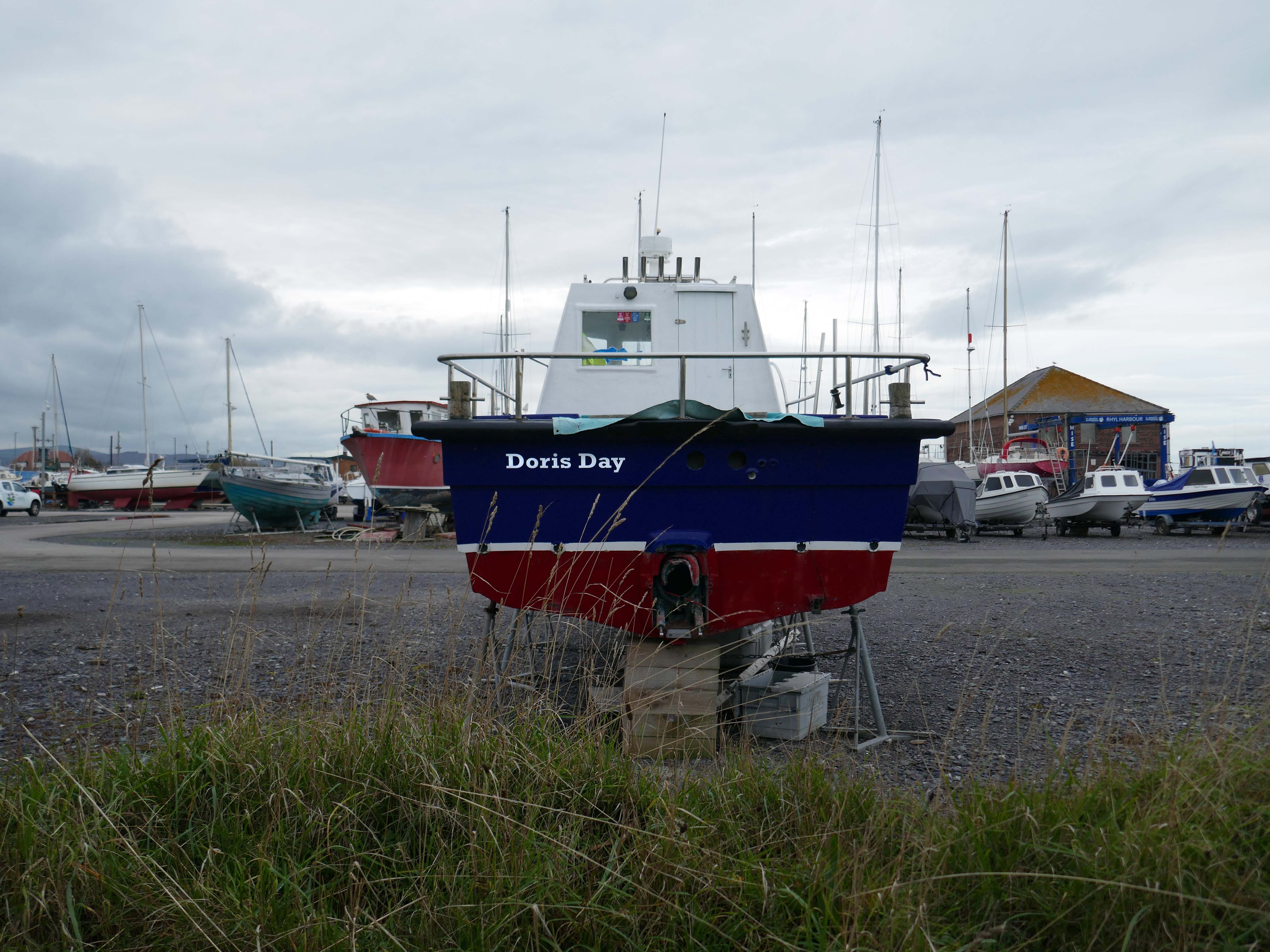
Over the estuary to Rhyl Harbour home to Doris Day.
Rhyl Harbour is located on the spectacular North Wales Coast and has undergone a dramatic refurbishment which has hugely improved the facilities on offer. The original timber yard which was used by sailing ships up until the Second World War, has been redeveloped and now offers storage for over 150 boats.
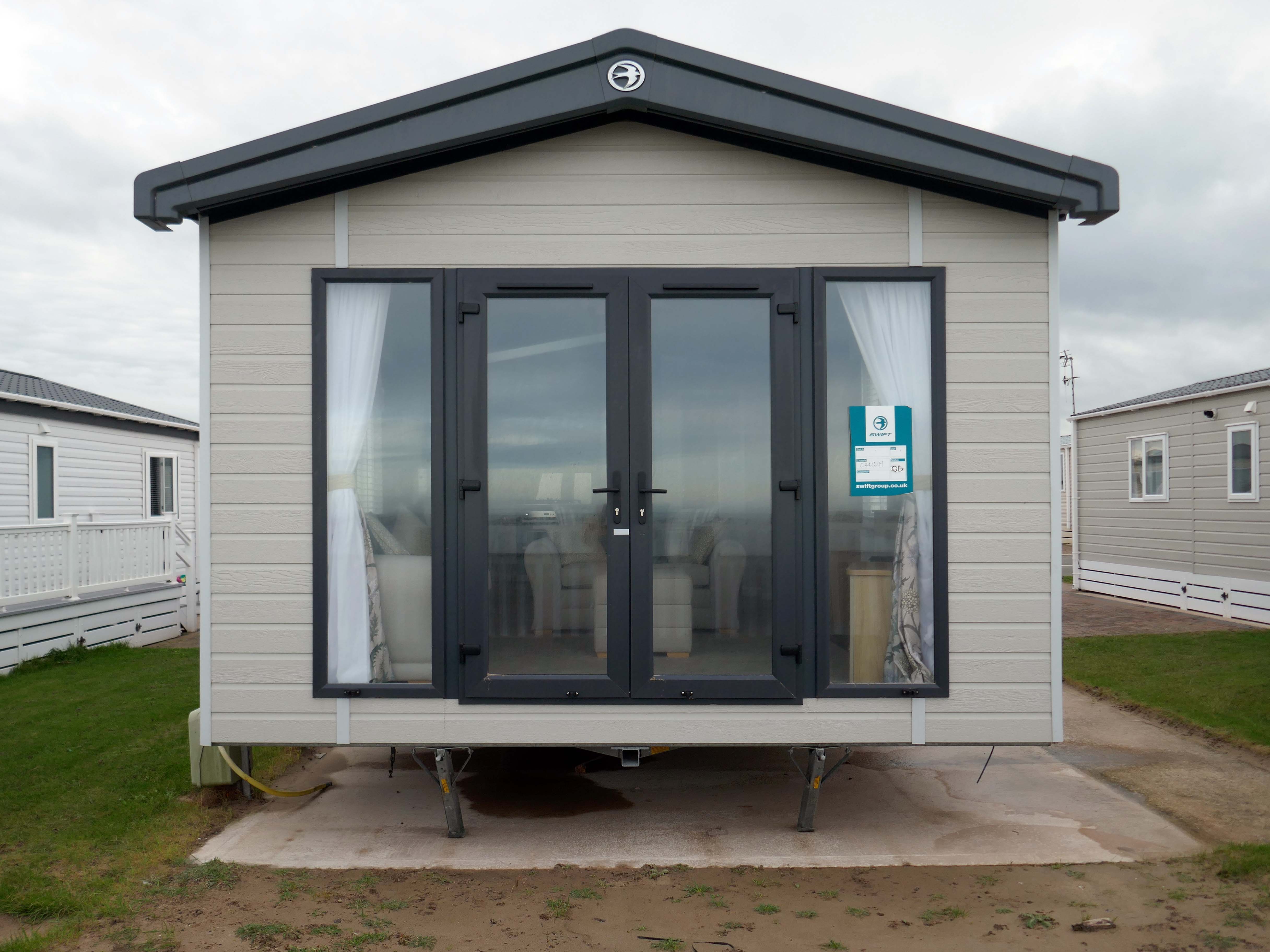
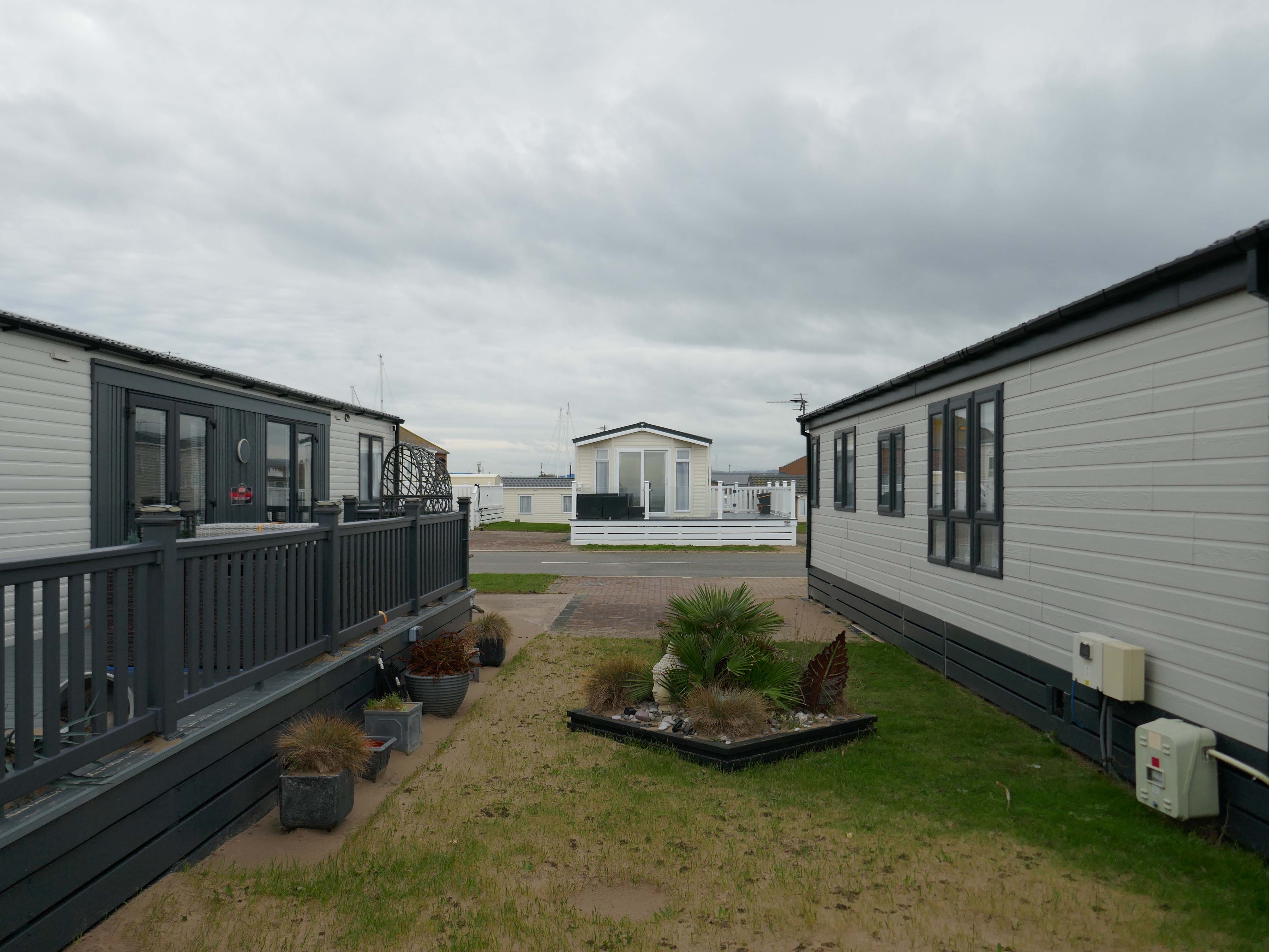
The foreshore home from home for thousands of caravan dwellers.
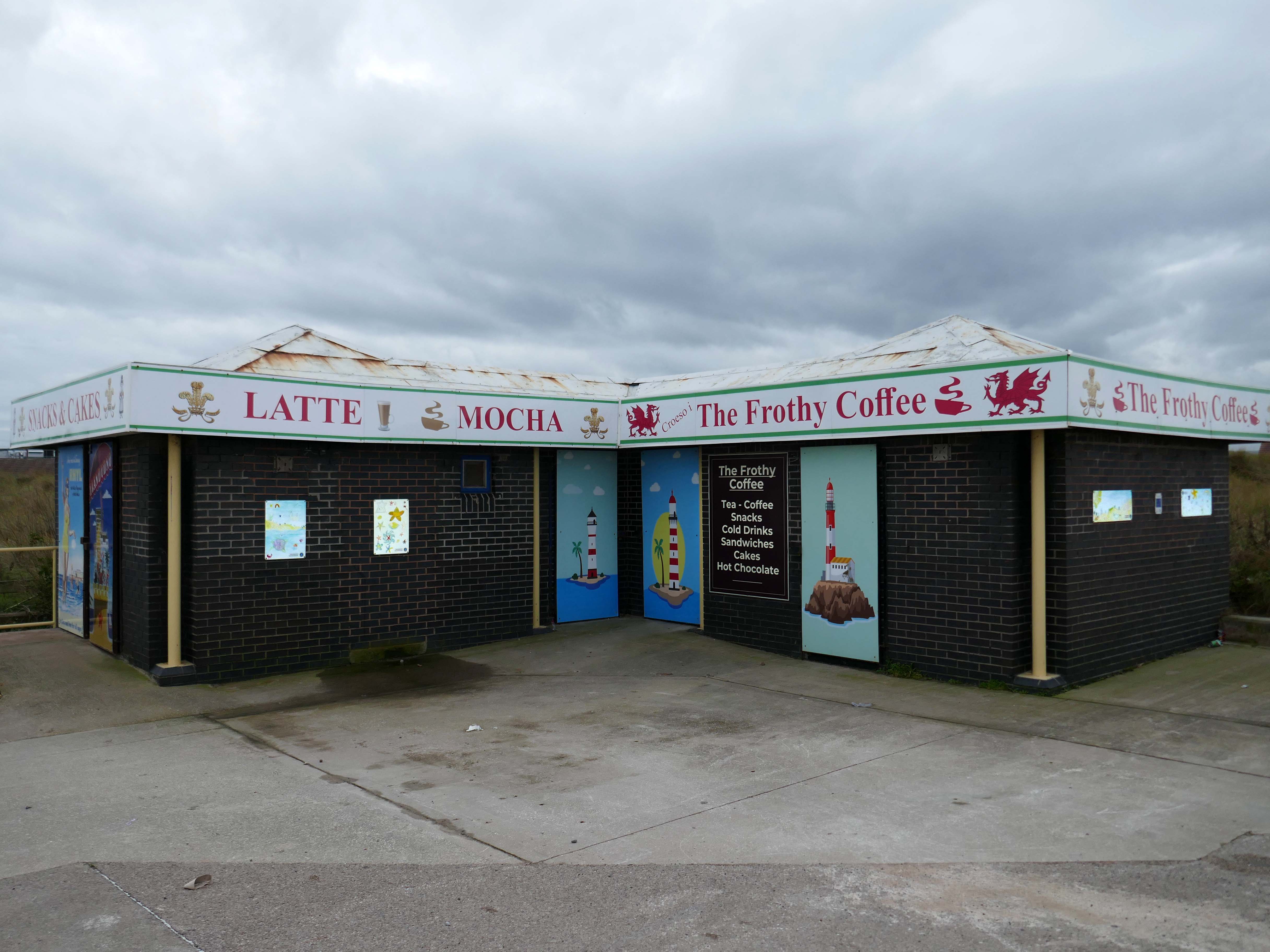
Golden Sands Holiday Park Rhyl has over 85 years history of fun filled holidays. Wonderfully located right next to the beach in Kinmel Bay in North Wales, it’s the perfect place for a family seaside holiday. It’s also an excellent base for exploring the beauty of North Wales. The town of Rhyl is closest, though also nearby are Prestatyn, Colwyn Bay and Llandudno – with the Great Orme. Blue Flag beaches offering wonderful seaside holiday traditions along with stunning Snowdonia National Park are within an easy drive.
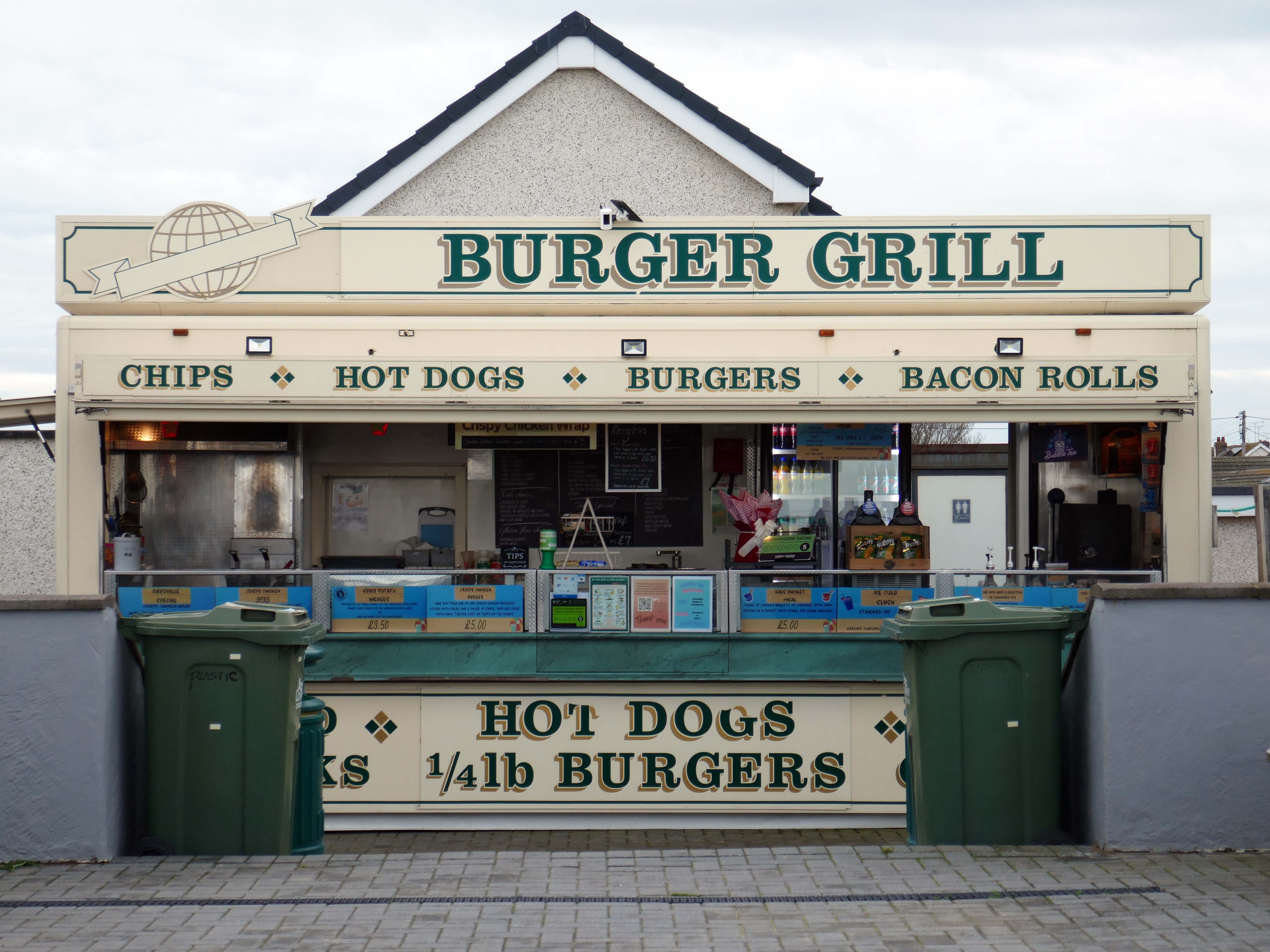
Fast food is often nutritionally poor and high in calories. Evidence demonstrates that overeating commercial fast food products can negatively impact health in both the short and long term.
However:
Baysville is lovely and clean, lots of tables and a good choice of foods from ice cream, donuts, burgers, hot and cold drinks and a bar. The staff are pleasant and welcoming.
Researchers have found people who drink up to three cups of coffee a day could have a healthier heart and a lower risk of dying of any cause.
But too much caffeine can produce anxiety, sleeplessness, agitation, palpitations, diarrhoea and restlessness. In individuals with a mental health condition caffeine can worsen psychosis and result in the need for higher amounts of medication.
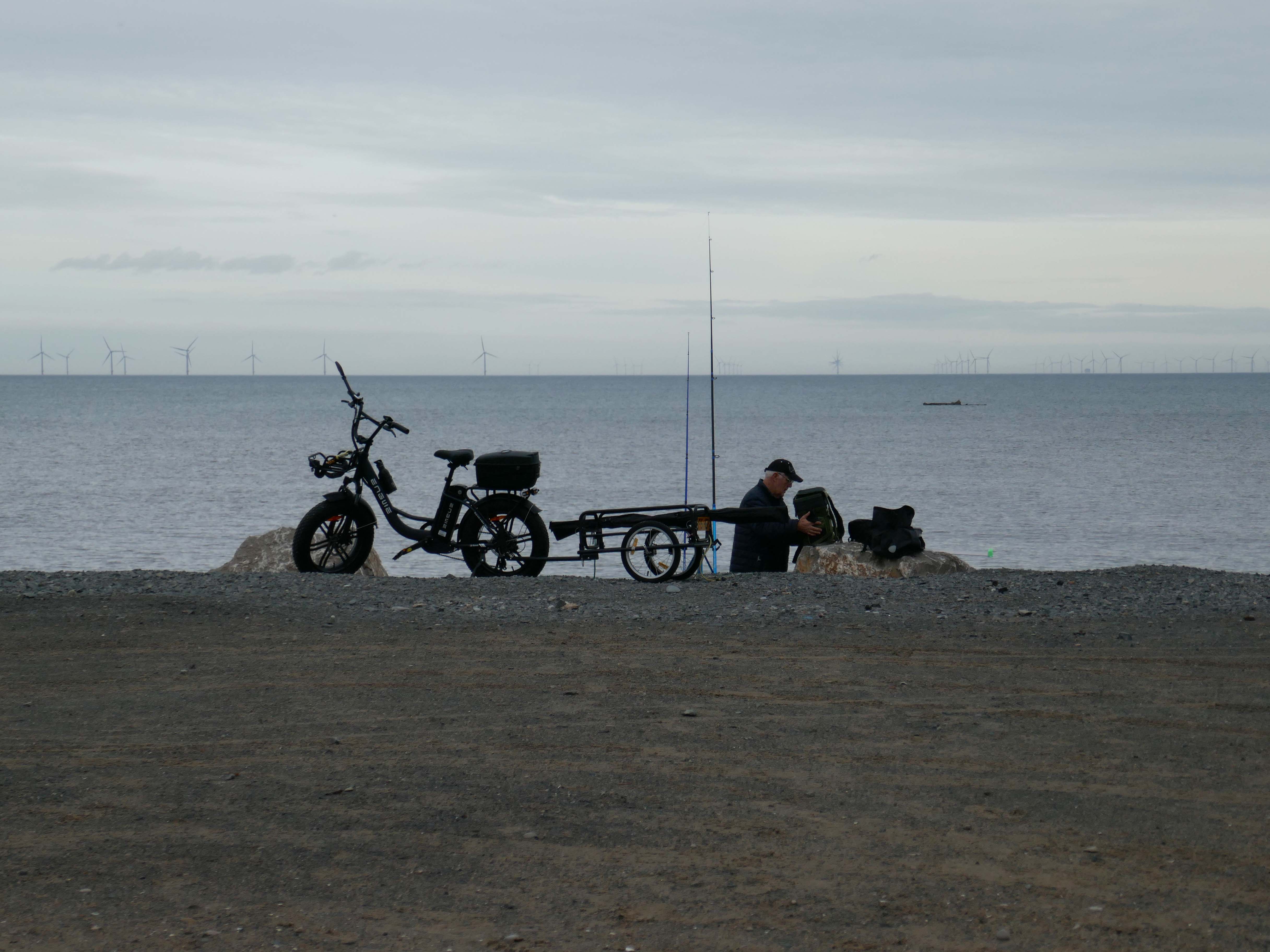
Possibly wiser to take a leisurely ride on your electric bicycle, followed by an hour or two of beach casting .
The coastal housing at Kinmel bay is undergoing a cosmetic upheaval, the determinedly down home bungalow swamped by the relentless monotone tide of home improvements.
The Sandy Cove Estate consists of 250 bungalows that were built in the 1930s by the Kinmel Estates Ltd, who sadly went into liquidation around 1947, before the estate was completed. This left the estate with only dirt tracks for roads with no sidewalks or pavements, no drainage for surface water or any adequate street lighting. After the liquidation of the company the roads and communal greens were escheated to the Crown who then offered the land free of charge to successive Councils for the to incorperate into the towns that were developing. This was refused by the Councils.
Fifty or more homes are ready for you to choose from, gardens and tennis courts have been provided for the sole use, in perpetuity of residents.
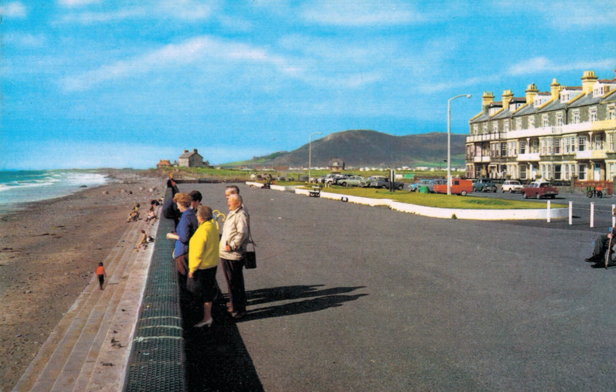
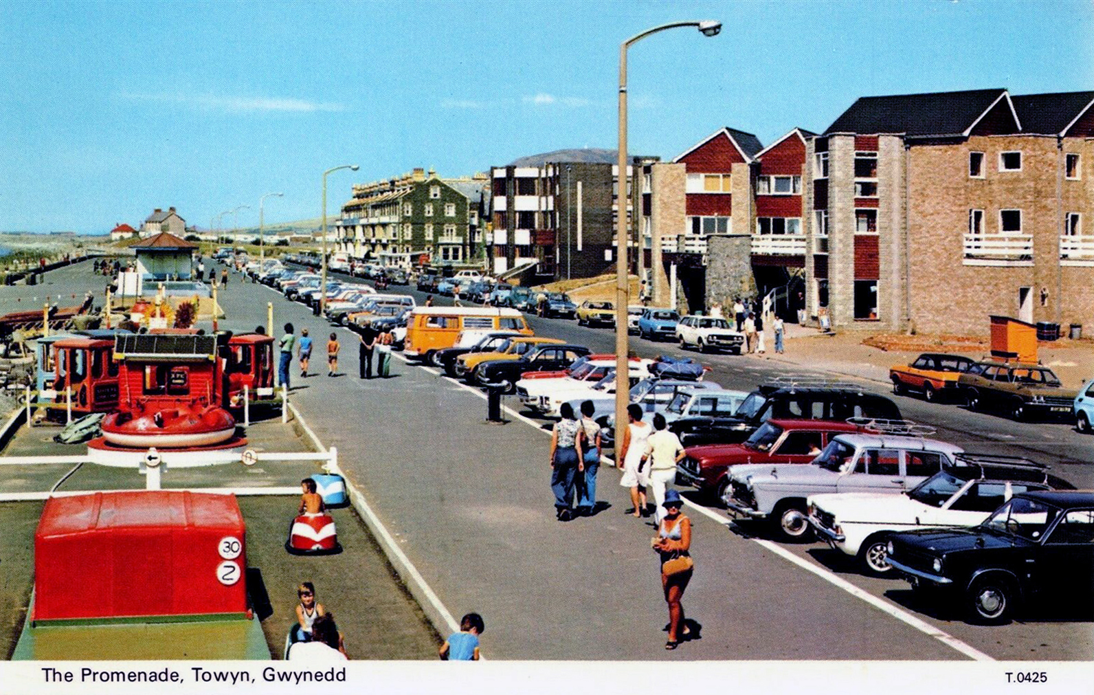
Onward now to Towyn.
The town made national headlines in 1990 when a combination of gale-force winds, a high tide and rough seas caused Towyn’s flood defences to be breached at about 11.00am on 26 February. 4 square miles of land was flooded, affecting 2,800 properties and causing areas of the resort to be evacuated. Further flooding occurred later the same week, on 1 March, shortly after the site of the disaster was visited by Prince Charles and Princess Diana.
Scientific experts also believe that the silt left behind from the flooding had left the town with a higher concentration of radioactivity, over ten times the governmental safety limits, most likely originating from the nuclear processing plant at Sellafield which had been dispersed into the Irish Sea over many years since its construction. The National Radiological Protection Board stated that there was a “small risk” to the people there, while the Welsh Office claimed there was no danger to the public. The coastal defences have since been reconstructed and significantly enhanced.
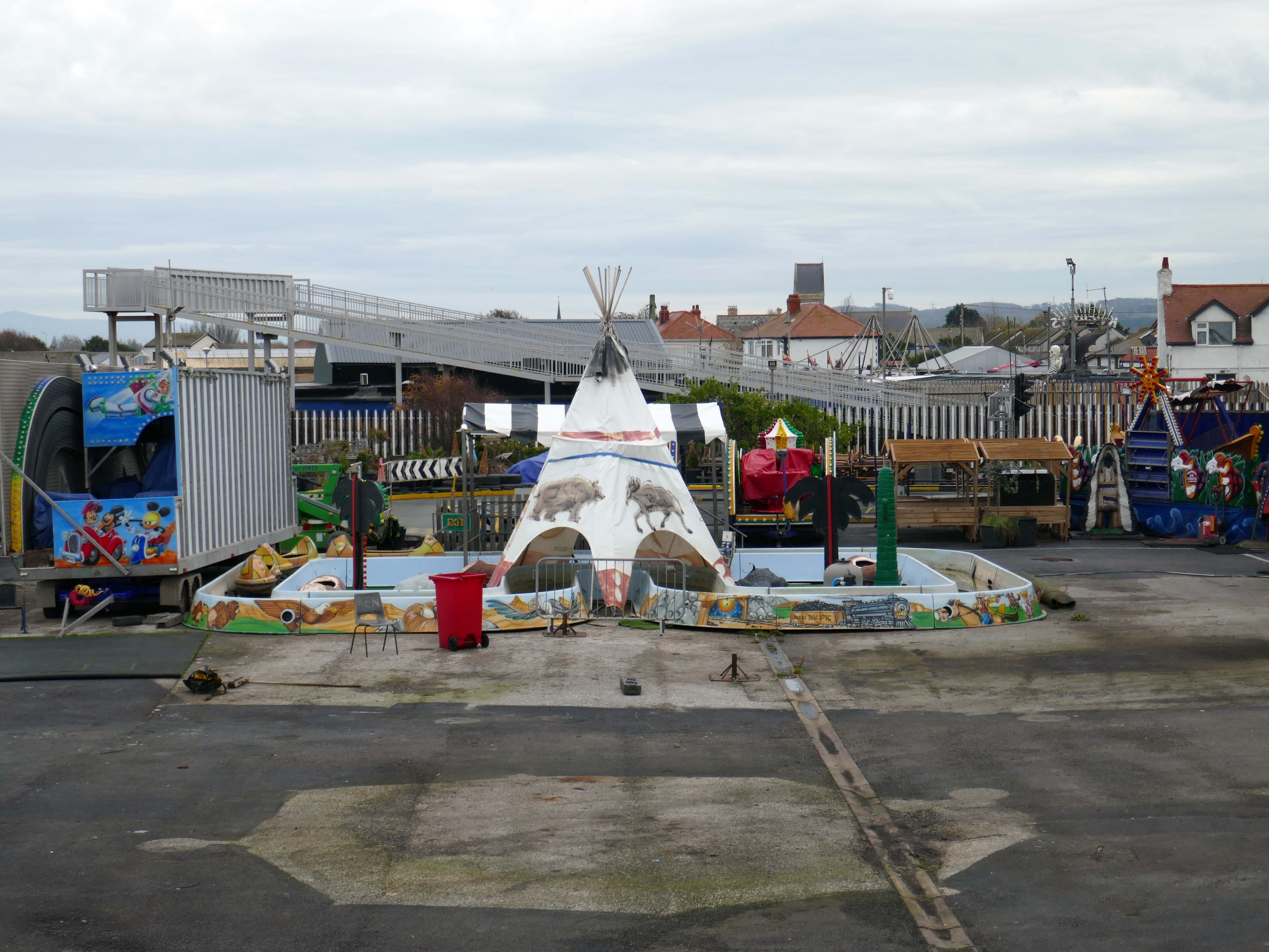
The People of the First Nation here at Knightly’s Fun Park are now safe from the threat of flood.
Knightly’s Funfair has a fantastic range of rides for the whole family! Experience high speed thrills and heart pumping excitement! We’ve got rides for the little ones too as well as games and food stalls to keep the whole family entertained all day!
We also welcome dogs, so you don’t have to leave your furry friends behind!
The monotone gentrified home is accompanied by the monotone SUV – the Land Rover Discovery Sport.
The joy of Discovery Sport is in finding that no adventure is out of reach. Offering the ultimate in comfort, while having the toughness to cope with family life.
According to a Europe-wide study, which included the UK, when vehicles are 300kg heavier, the risk of fatal injuries is 30% higher for vulnerable road users.
Pedestrians and cyclists are also 30% more likely to be killed if they’re hit by a car with a bonnet that’s 10cm higher than average.
E25 is Spirulina Extract Phycocyanin, when taken as directed, Spirulina generally doesn’t cause side effects. In some people, it may cause mild side effects, including headaches, diarrhoea, bloating and gas.
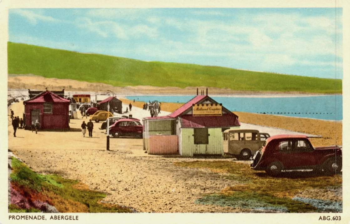
Here we are now at Abergele and Pensarn which have quiet sandy beaches close to historic sites and wooded hills. From here, you can escape the stresses of everyday life. Enjoy sea views, historic places such as Gwrych Castle – home to ITV’s I’m a Celebrity 2020 and 2021 TV series, and a range of things to do providing fun for all the family.
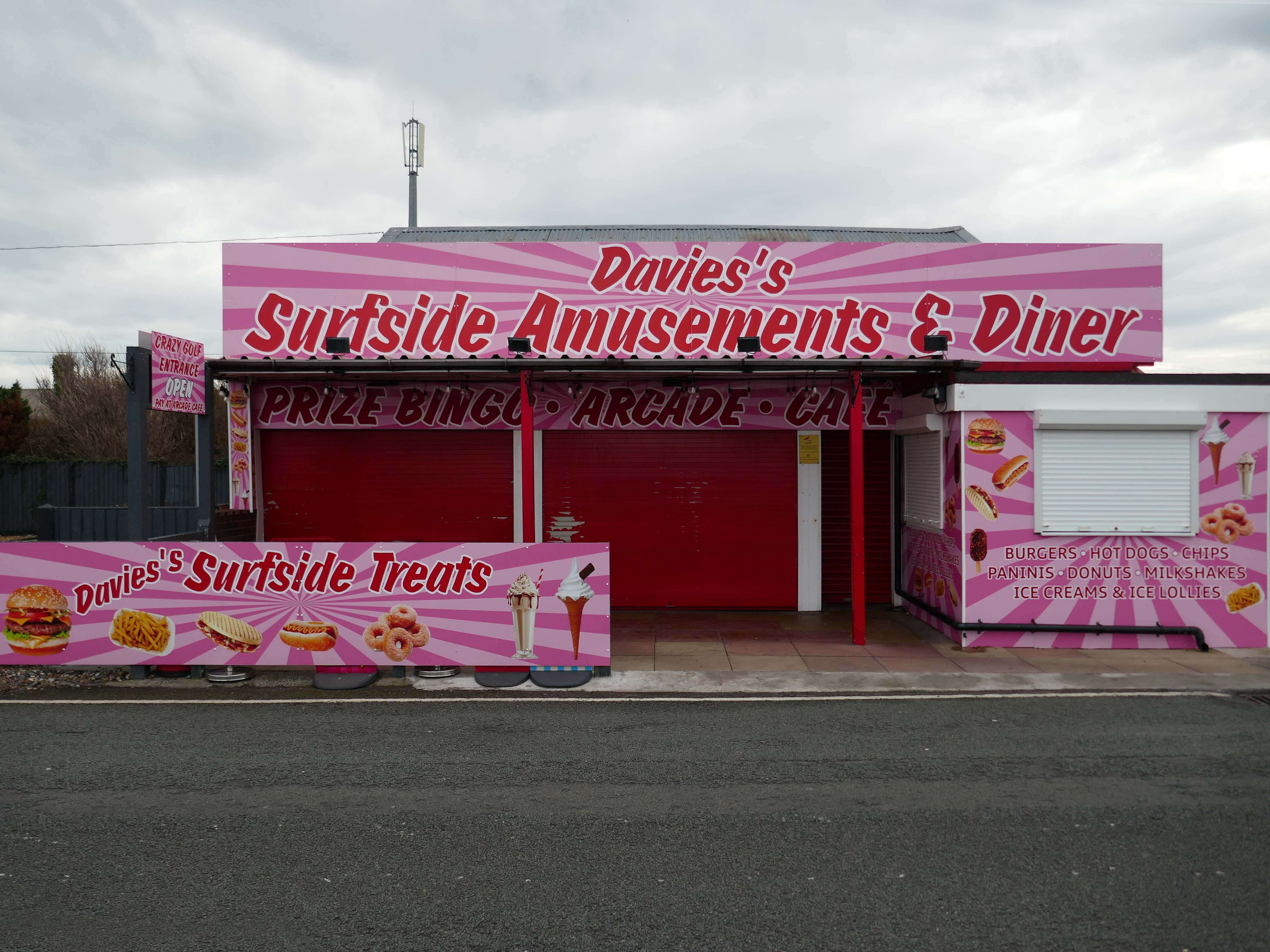
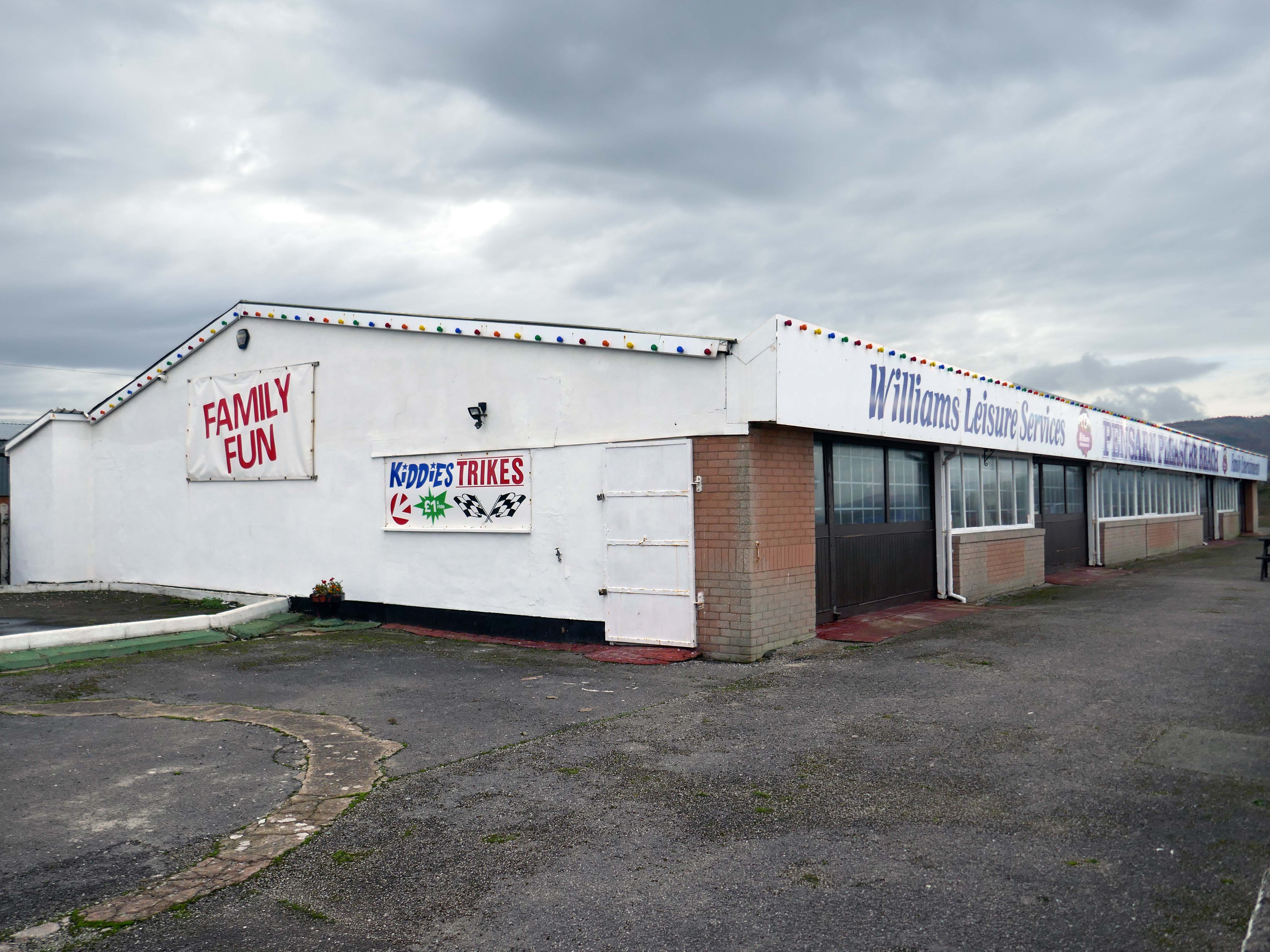
Pensarn Pleasure Beach Amusement Arcade, operated by Laurence Williams Amusements, offers a charming family-friendly experience. Visitors often highlight its nostalgic appeal with fun penny machines and small shops selling drinks and handmade goods.
While many appreciate the charm of the arcade, some mention that certain machines are quite dated and do not work properly, this aspect may affect overall enjoyment for some users.
The reviews indicate a good variety of activities including classic penny slots and local shops offering food and unique handmade items like dog harnesses, catering to diverse interests.
Such a pleasant stretch of coast to stretch your legs along.
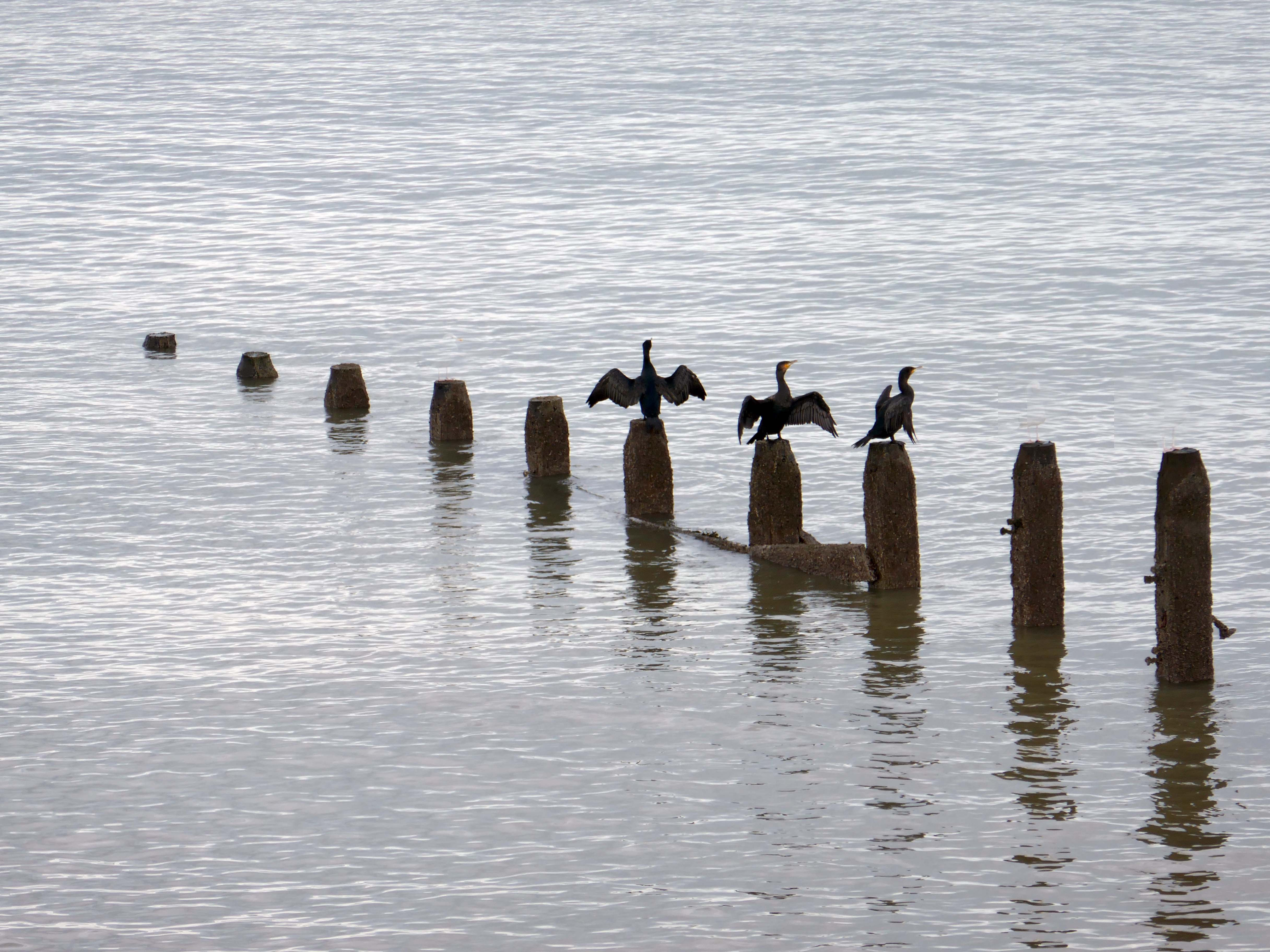
Or to stretch your wings for that matter, should you happen to be a cormorant.
Coastal defences from the giant concrete bobbers and jacks.
A tetrapod is a form of wave-dissipating concrete block used to prevent erosion caused by weather and longshore drift, primarily to enforce coastal structures such as seawalls and breakwaters. Tetrapods are made of concrete, and use a tetrahedral shape to dissipate the force of incoming waves by allowing water to flow around rather than against them, and to reduce displacement by interlocking.
Tetrapods were originally developed in 1950 by Pierre Danel and Paul Anglès d’Auriac of Laboratoire Dauphinois d’Hydraulique in Grenoble,who received a patent for the design. The French invention was named tétrapode, derived from Greek tetra ‘four’ and pode ‘foot’.
Tetrapods were first used at the thermal power station in Roches Noires in Casablanca, to protect the sea water intake.
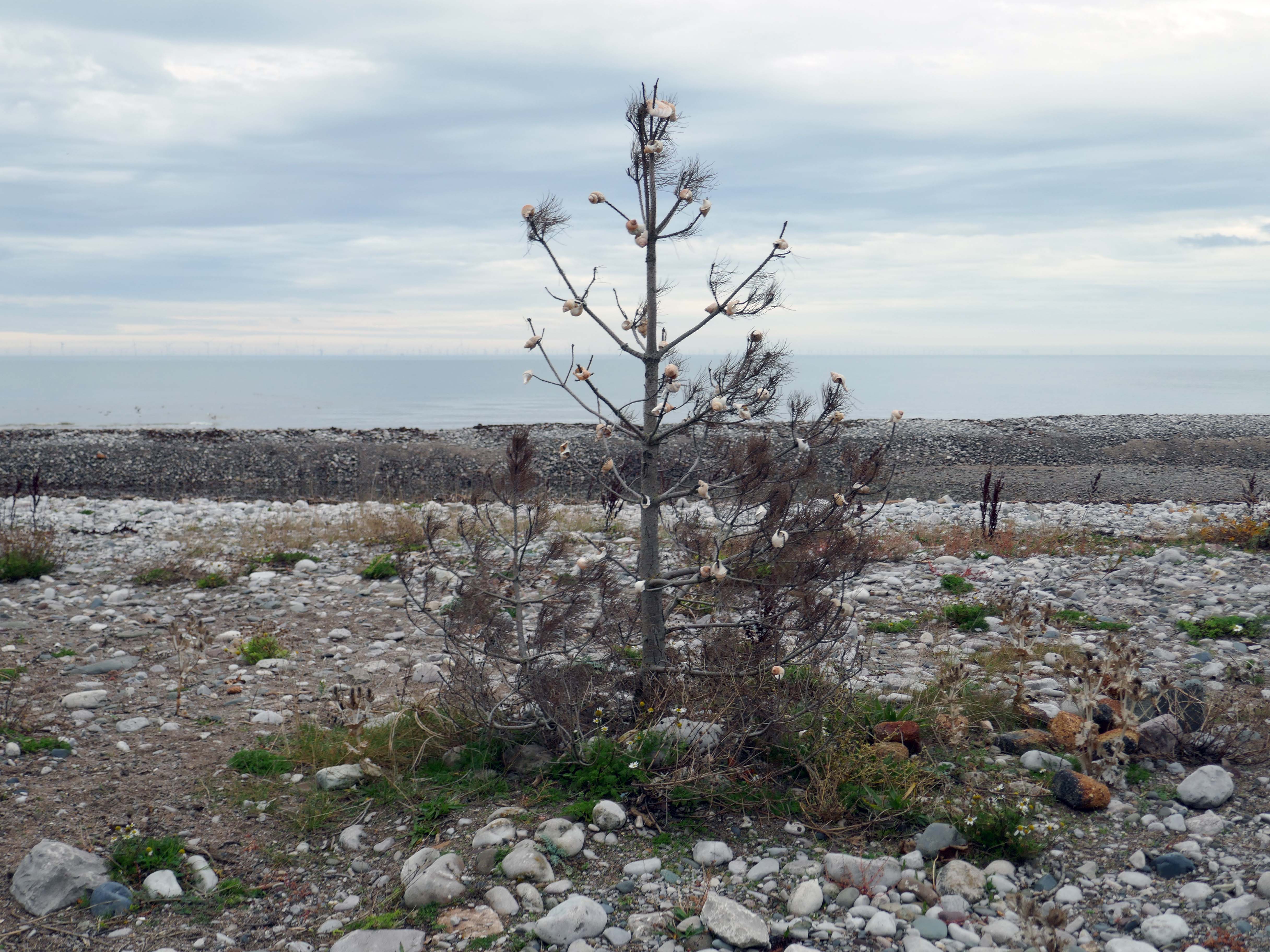
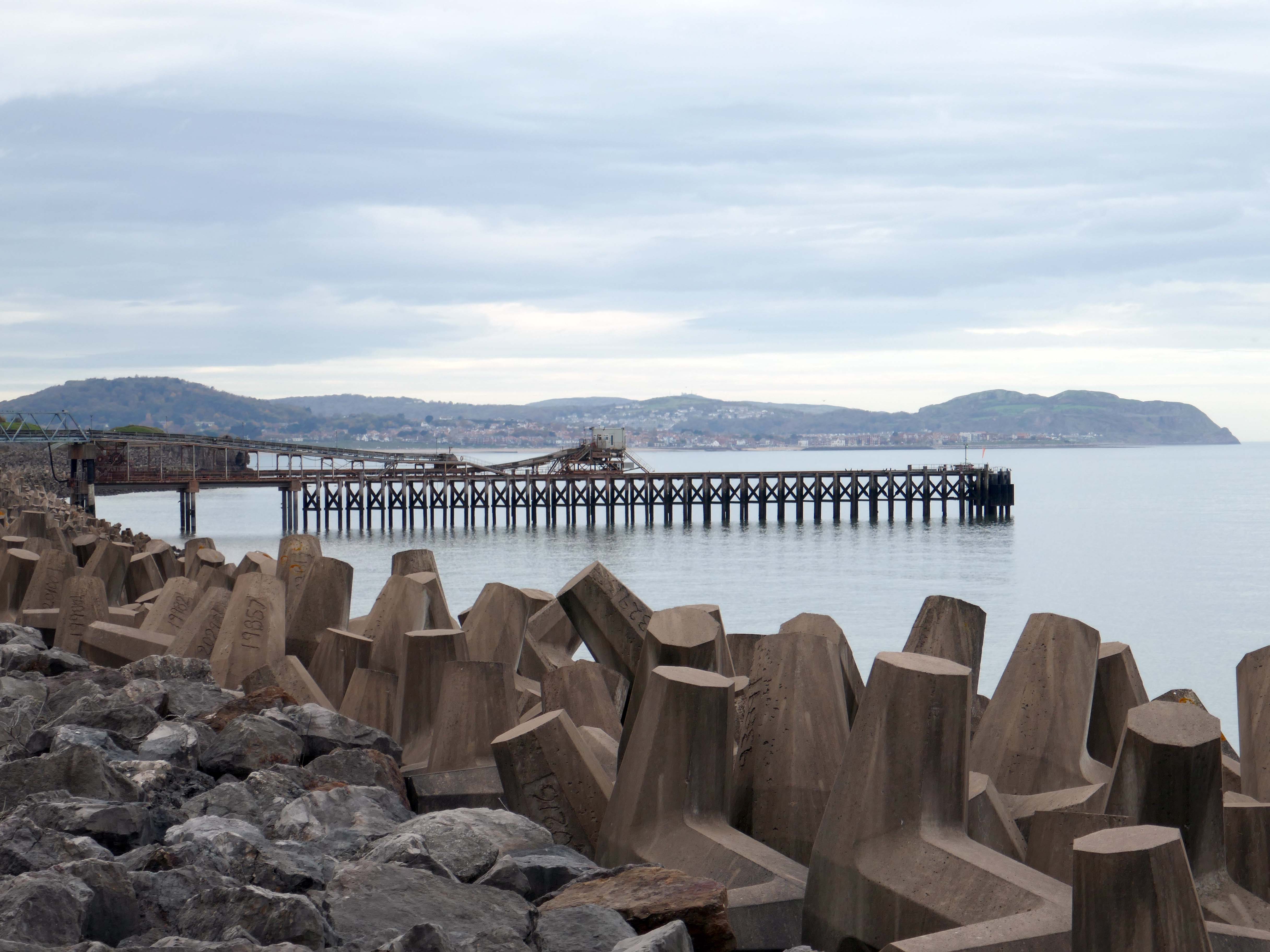
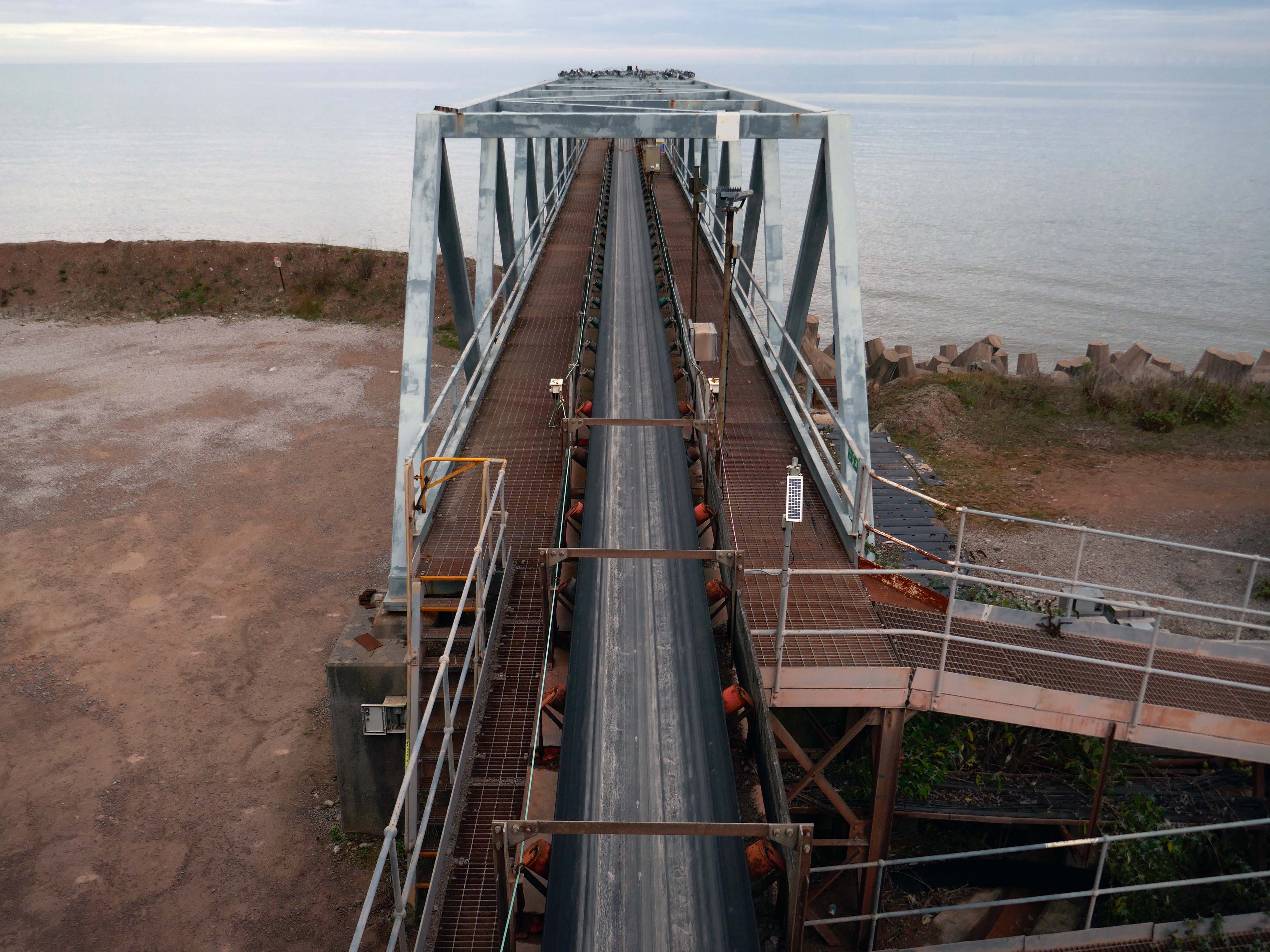
Next we pass Raynes Jetty the quarry conveyor belt – shifting and shipping limestone out to sea.
Limestone from Raynes quarry, to the south, is transported by conveyor belts to the jetty, crossing the A55 Expressway and railway. From the jetty it is loaded into coastal freighters which take it to other parts of the British Isles. Limestone from this quarry is a pure form of the rock, making it ideal for the chemical and cement industries.
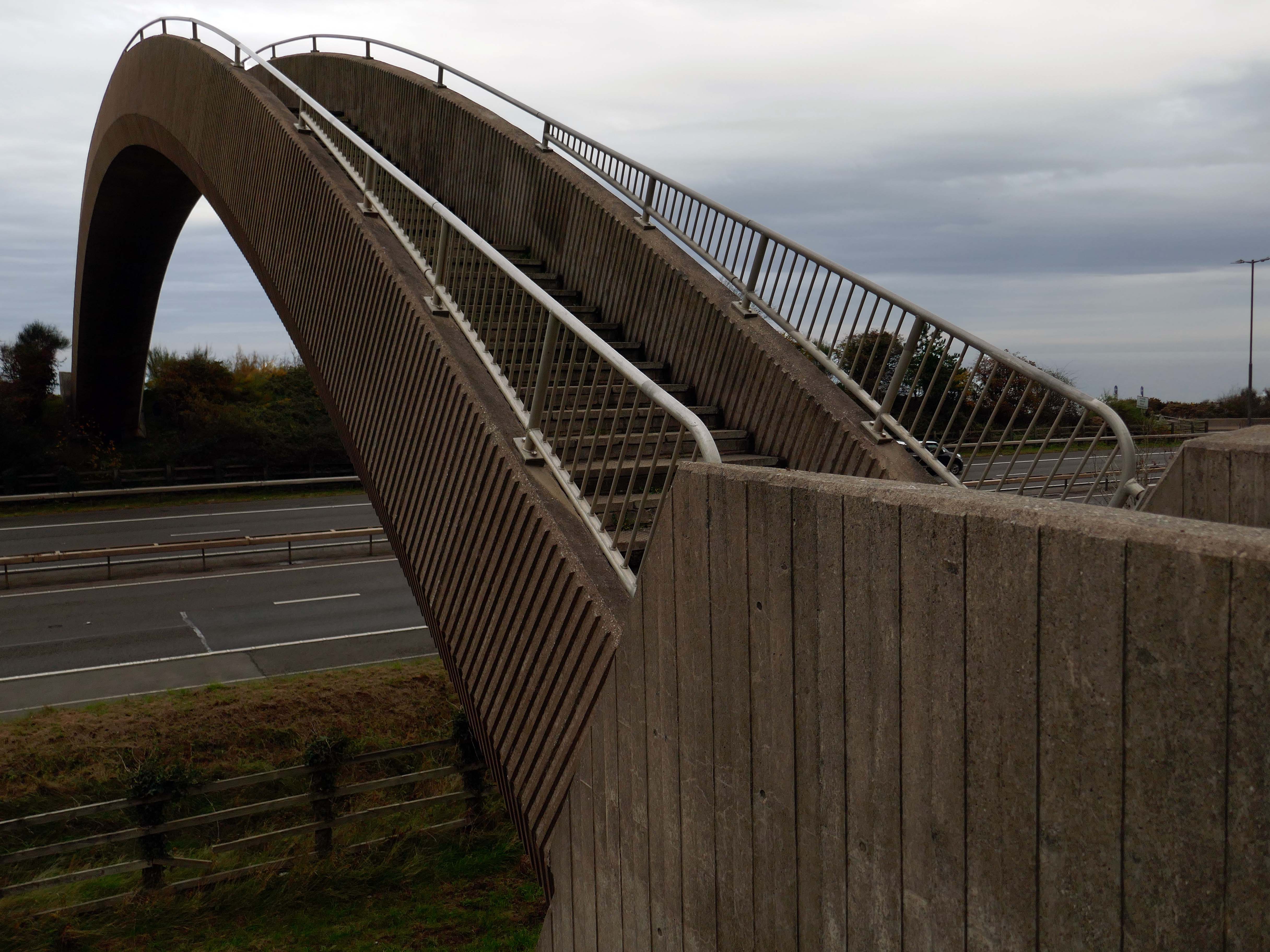
Limestone forming an important constituent part of the nearby concrete Rainbow Bridge – linking Old Colwyn’s pedestrians to the shore.
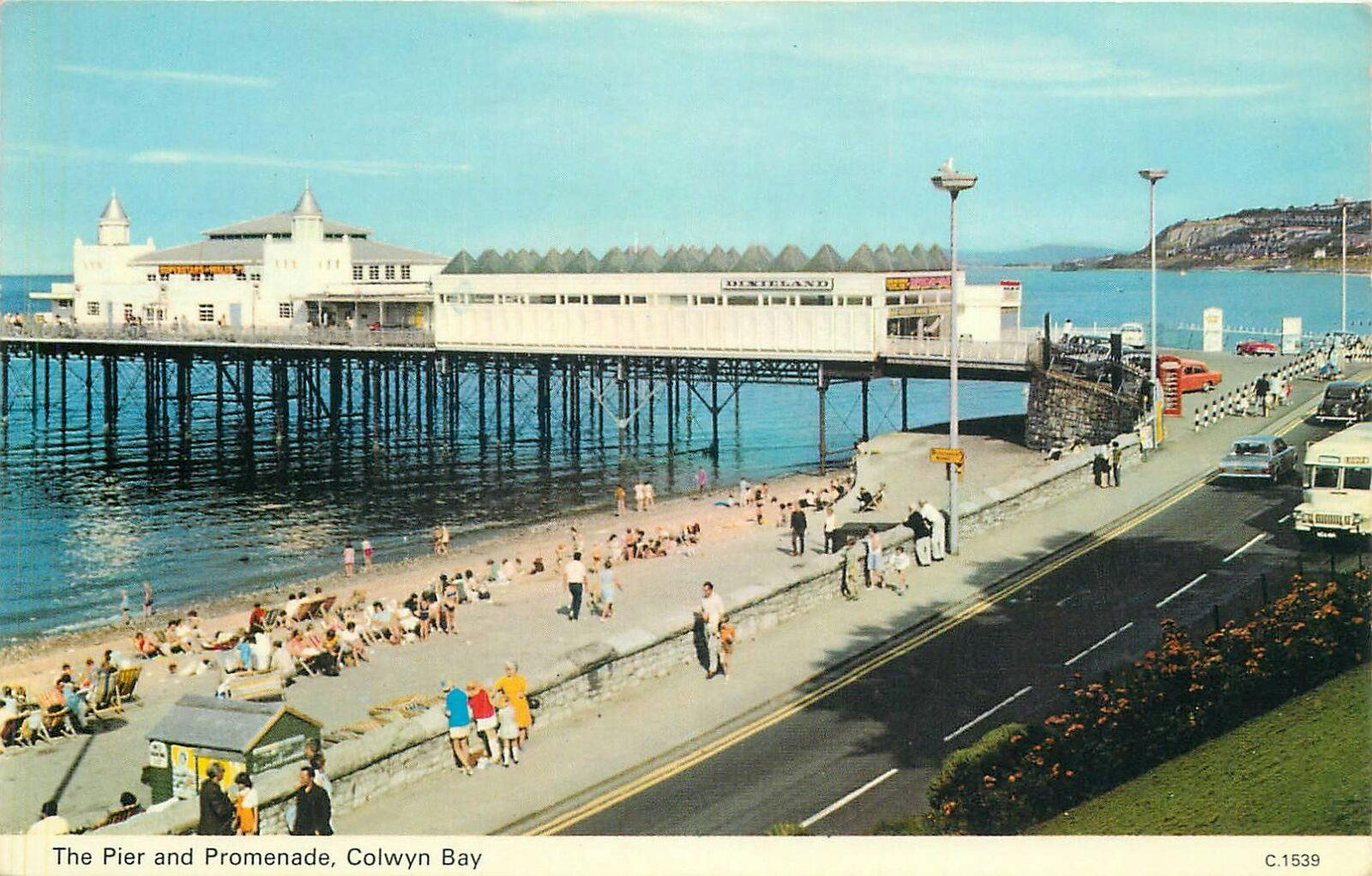
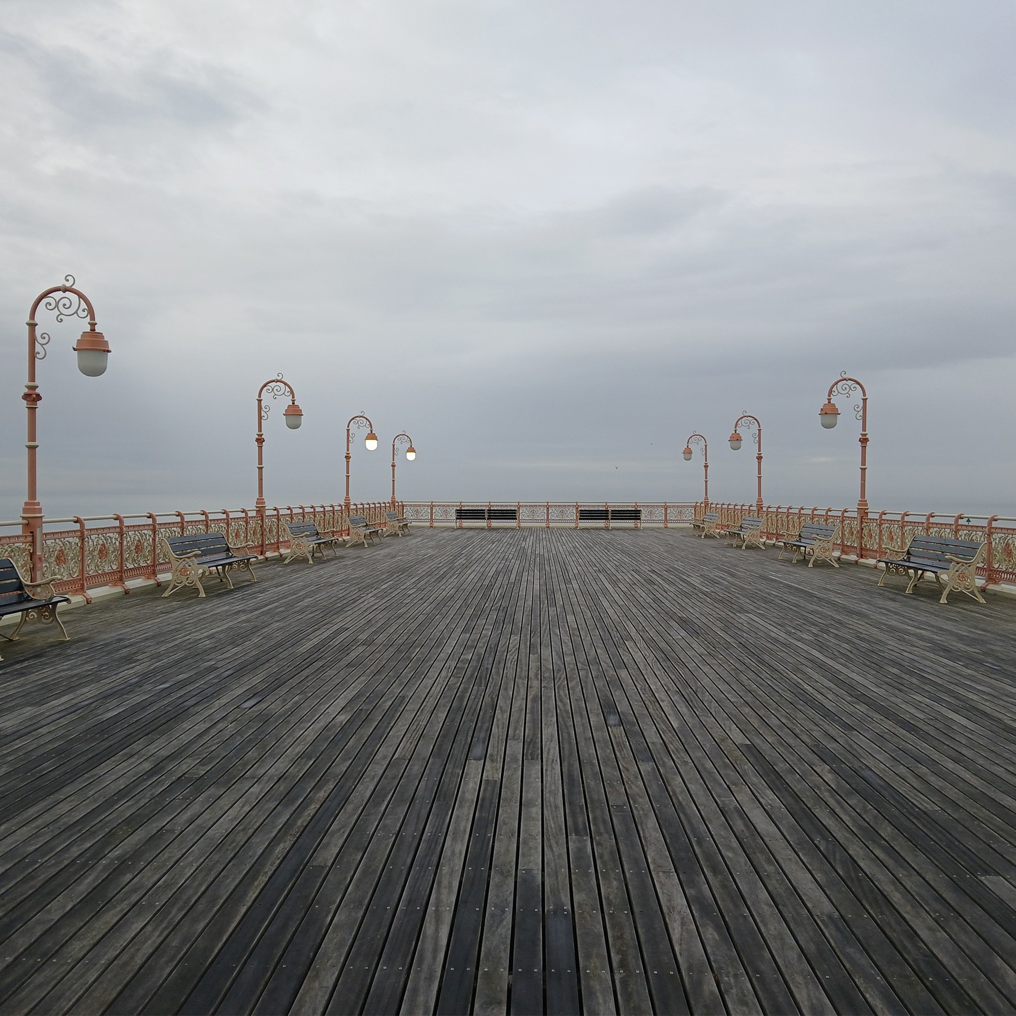
On the site of Colwyn Bay Pier is a seriously truncated pier.
It was conceived in the late 19th century, when Colwyn Bay wanted to catch up with other towns which had piers where steamers deposited and collected passengers. However, it was found that the proposed pier would have to extend almost half a mile to reach the area where the water was deep enough for ships. This was too costly, so the pier was built purely for entertainments. The councillors saved face by saying this would avoid day trippers arriving by steamer and lowering the tone of Colwyn Bay!
The pier was less than 100 metres long when it opened in 1900. The pavilion had a 2,500-seat theatre, shops and a restaurant. The opening performance featured Adelina Patti, one of the world’s most renowned operatic sopranos in her day.
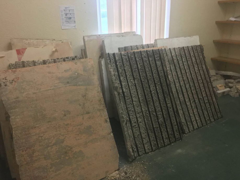
The final pavilion, opened in 1934, incorporated Art Deco features and murals by Eric Ravilious and Mary Adshead.
Both walls of the last remaining Eric Ravilious mural have been successfully removed, and were placed safely in storage. But with CCBC staff set to relocate to new Colwyn Bay offices a more permanent home is needed for the murals.
Many of those features were destroyed or obscured in post-war refurbishments. Entertainers who performed at the pier in this period included comedians Ken Dodd and Morecambe and Wise, and singers Harry Secombe and Elvis Costello.
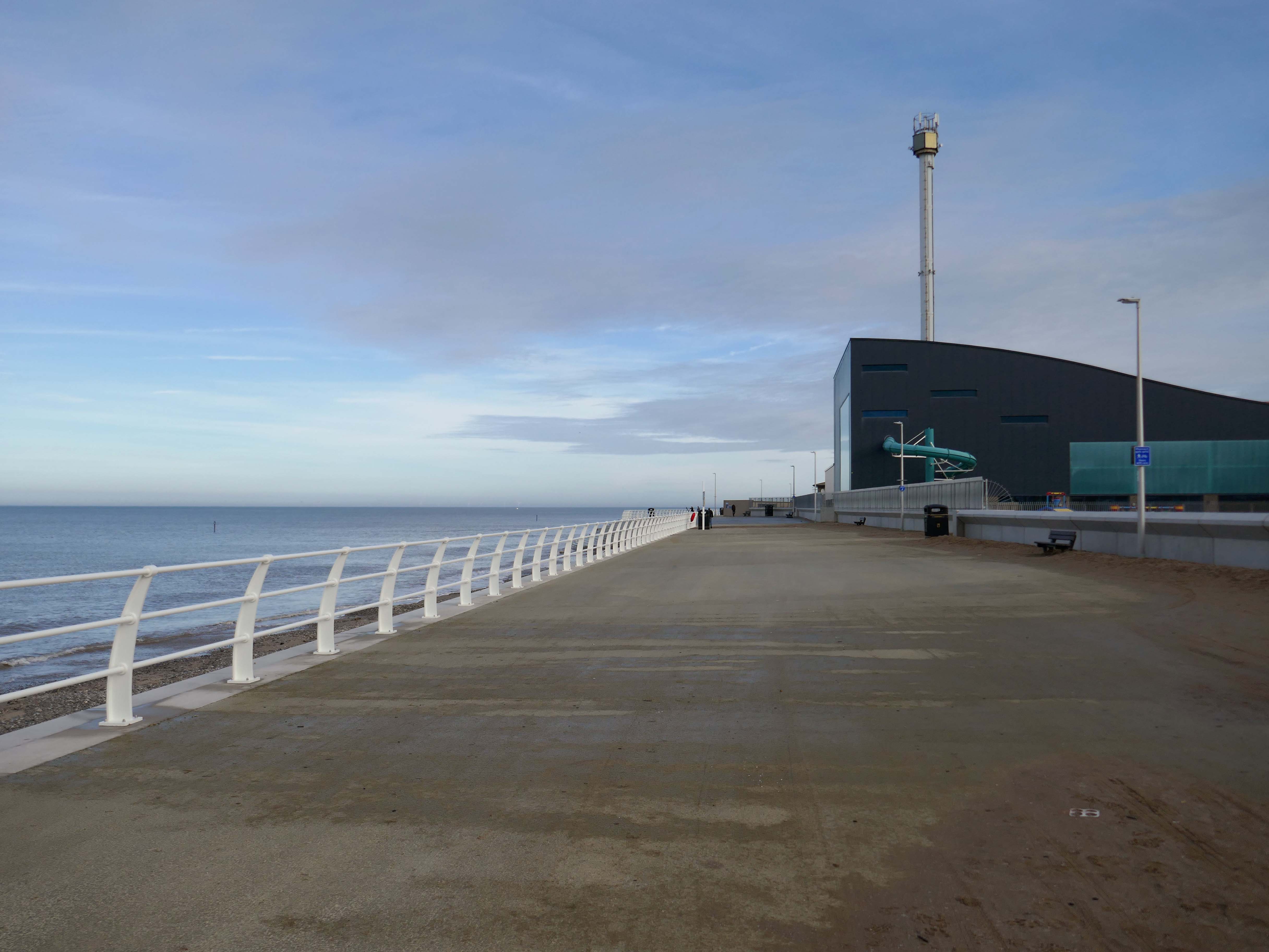
The new promenade, measuring 2.3 miles long, has been designed to protect the town and its infrastructure from the effects of the sea. The project was split into two phases; the first, to remove what was originally there and to construct the new raised promenade including a road, cycleway and car parking. The second phase was to transform the promenade with further development as well as reinforce the defence structures.
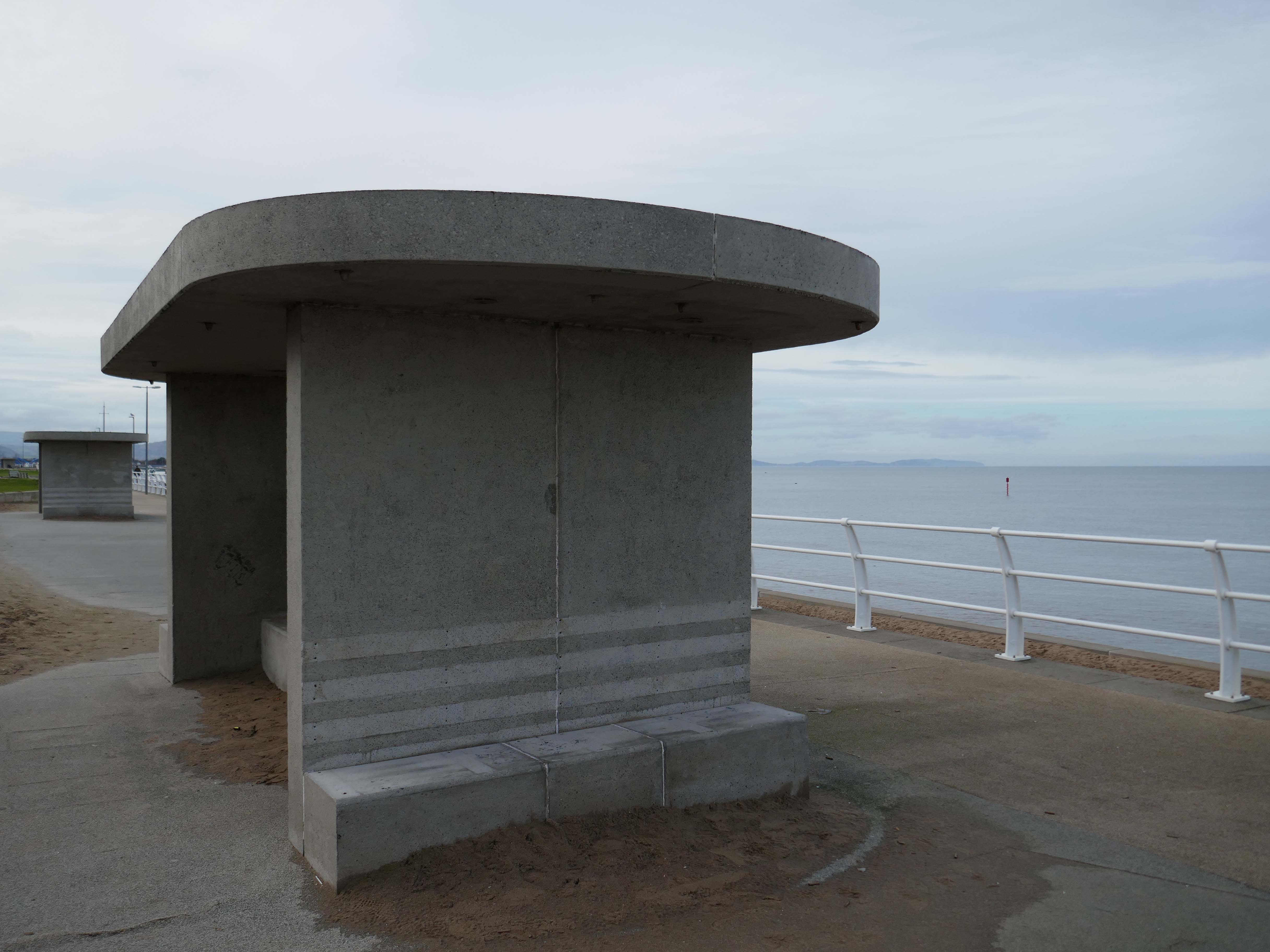
This is the last of the Sixties concrete shelters – which once stretched all the way to Rhos on Sea.
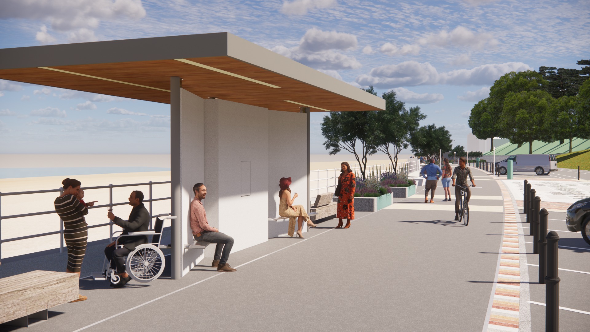
New shelters have appeared
A Conwy County Borough Council spokesperson said:
The shelters include new features such as solar power lighting and are designed to be accessible for wheelchair and mobility scooter users.
The closed design of the old shelters made anti-social behaviour easier and led to their condition deteriorating.
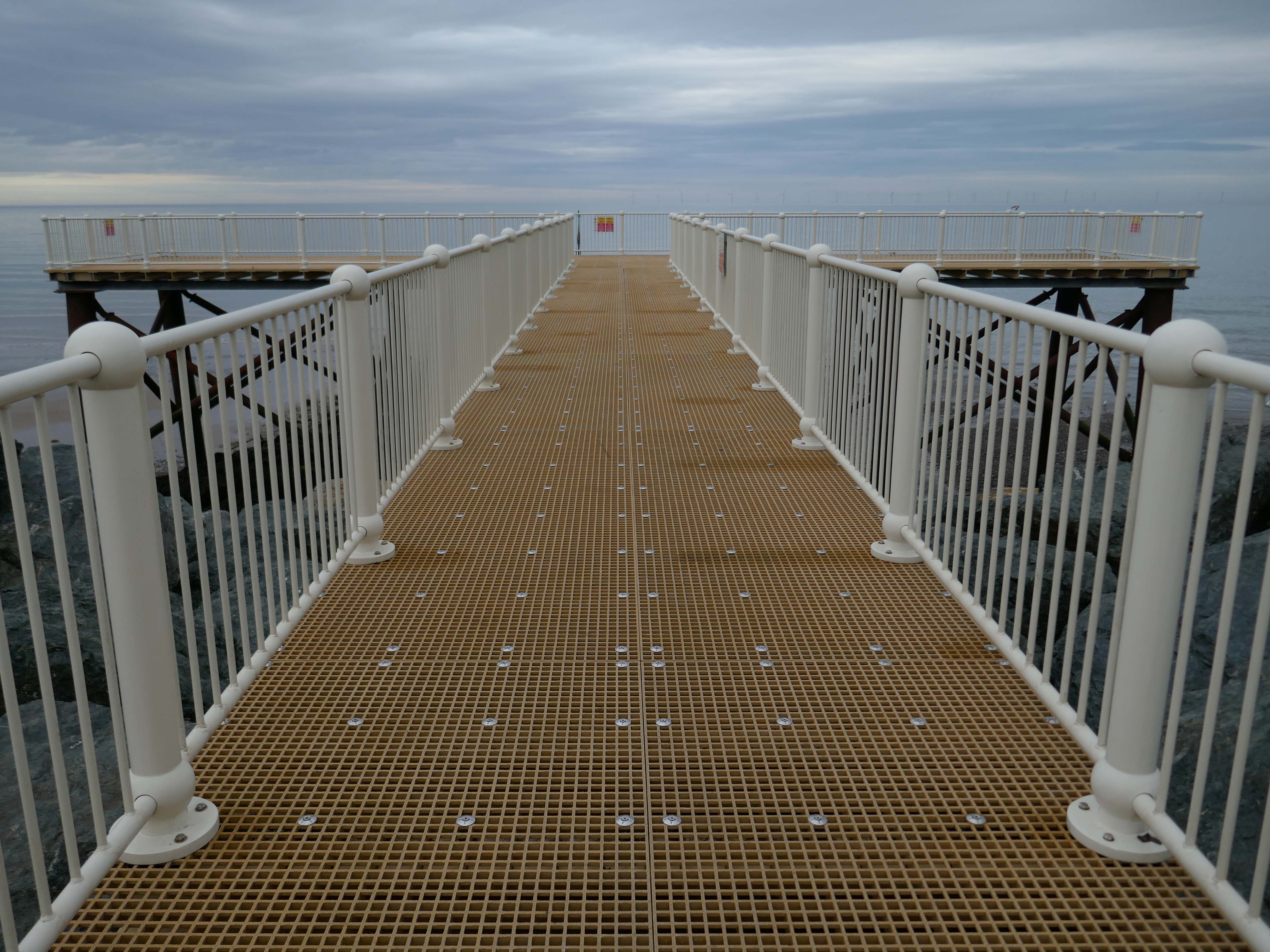
And a new pier has appeared.
Construction on the new Pier at Colwyn Bay commenced in July 2020. Despite being initially slated for completion in the summer, the erection of scaffolding and subsequent work on the 45-meter truncated Colwyn Bay pier were delayed. However, the project timeline was expedited, and the construction was successfully finished in July 2021.
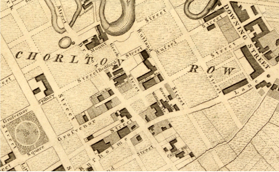
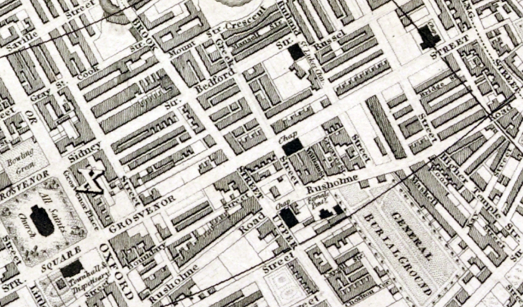
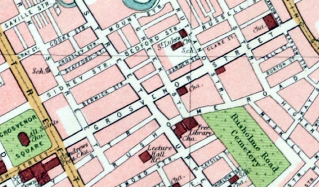
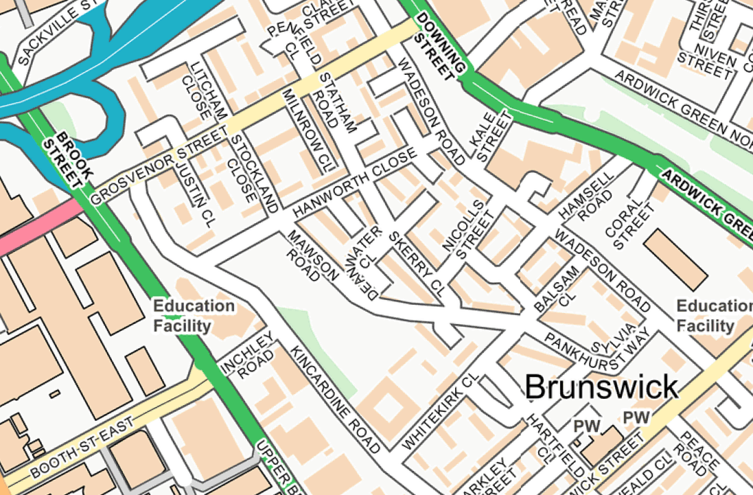
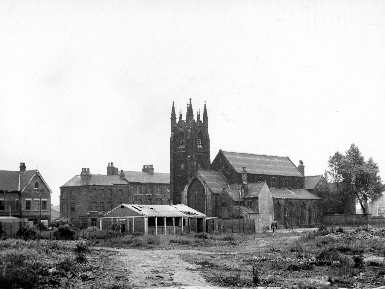
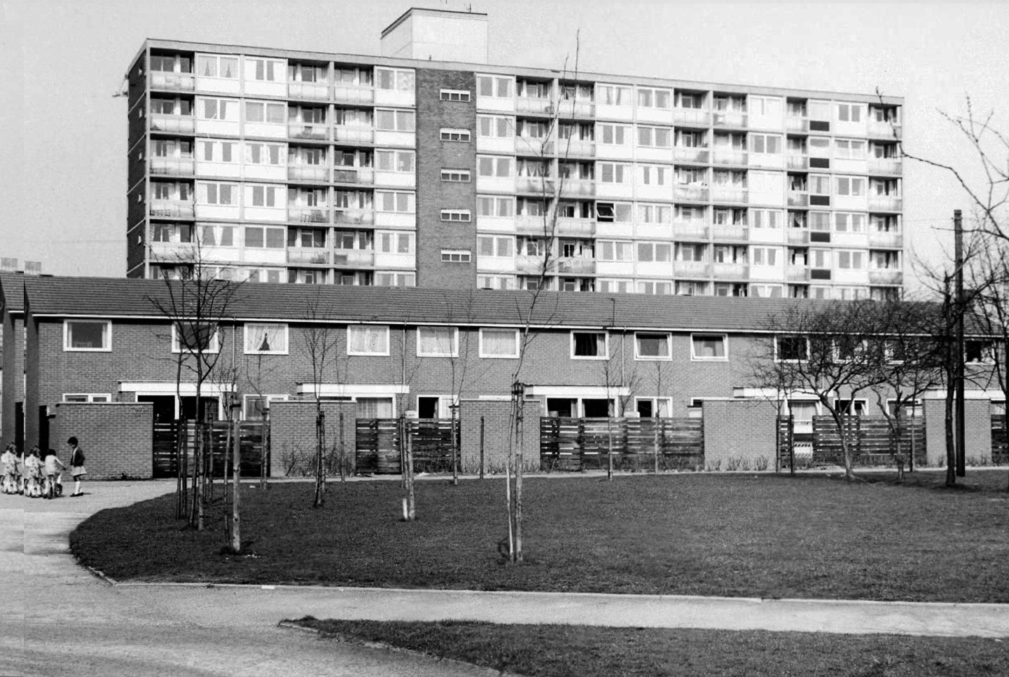
I was walking around town, with a view to updating my Ardwick Walk.
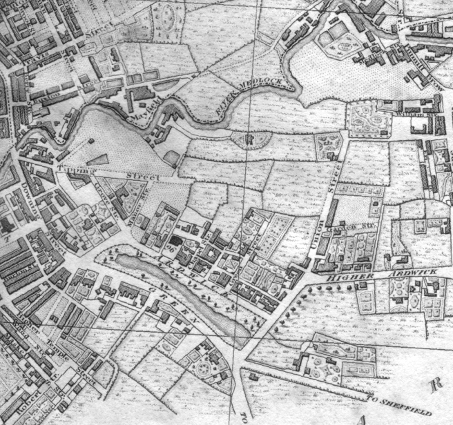
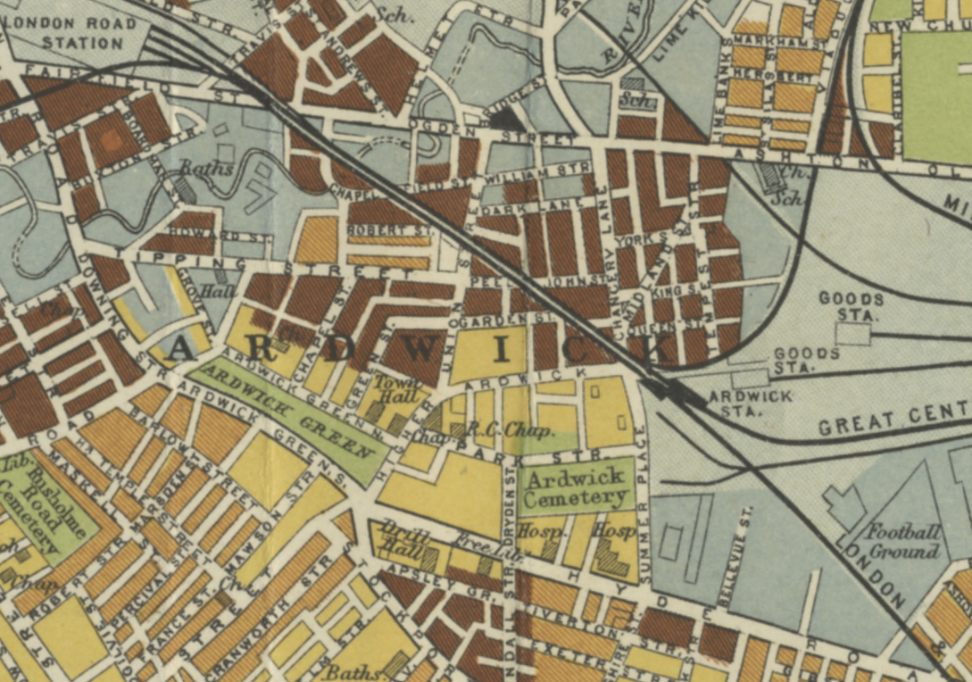
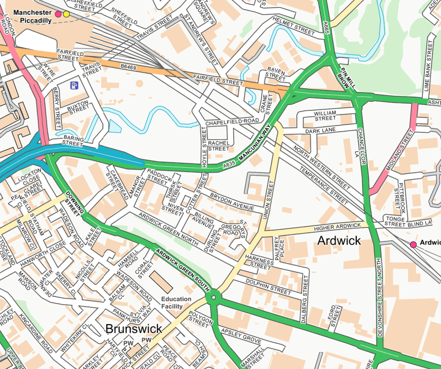
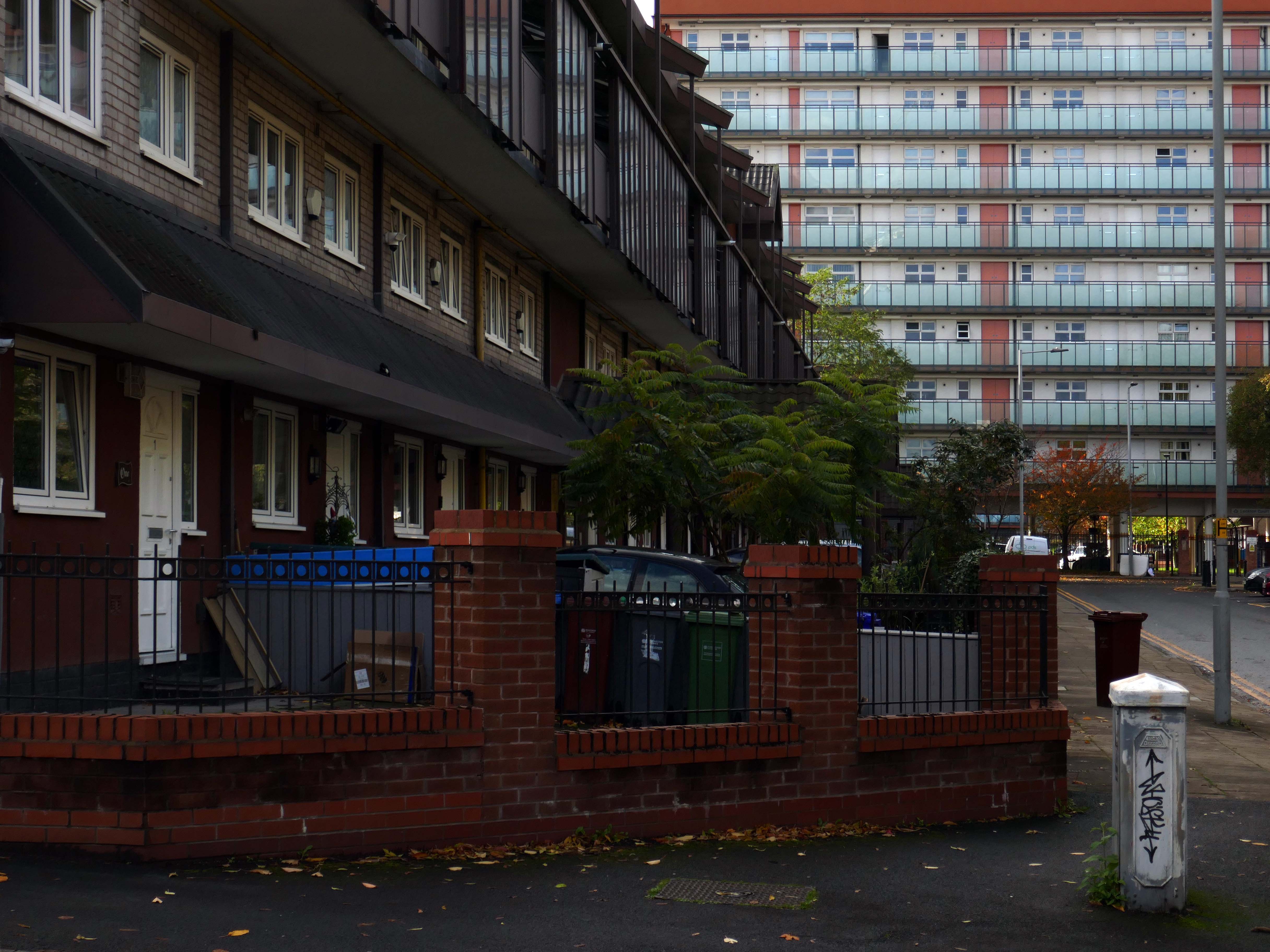
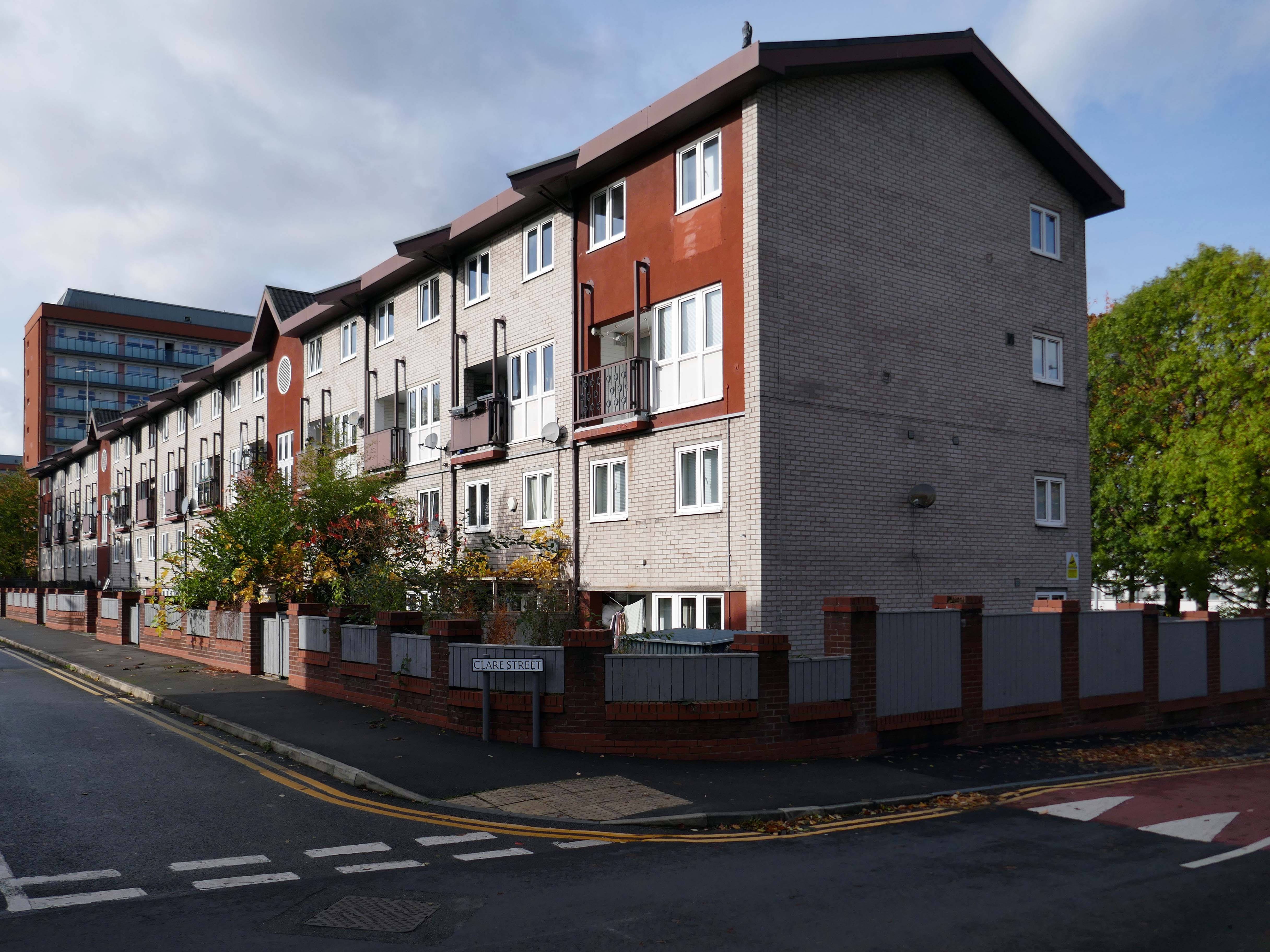
Idle curiosity took me toward the Brunswick Estate – that pocket of housing nestle twixt the Mancunian Way/River Medlock, Ardwick Green, Brunswick Street and Upper Brook Street.
Back in 1813, a web of streets and enclosed fields, and more fields, along with small groups of higher status housing, but by the early 20th century it was very much a working class district, within which industry began to grow.
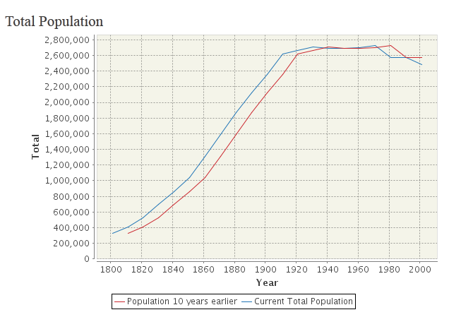
The population of Manchester expanded unstoppably throughout the nineteenth century.
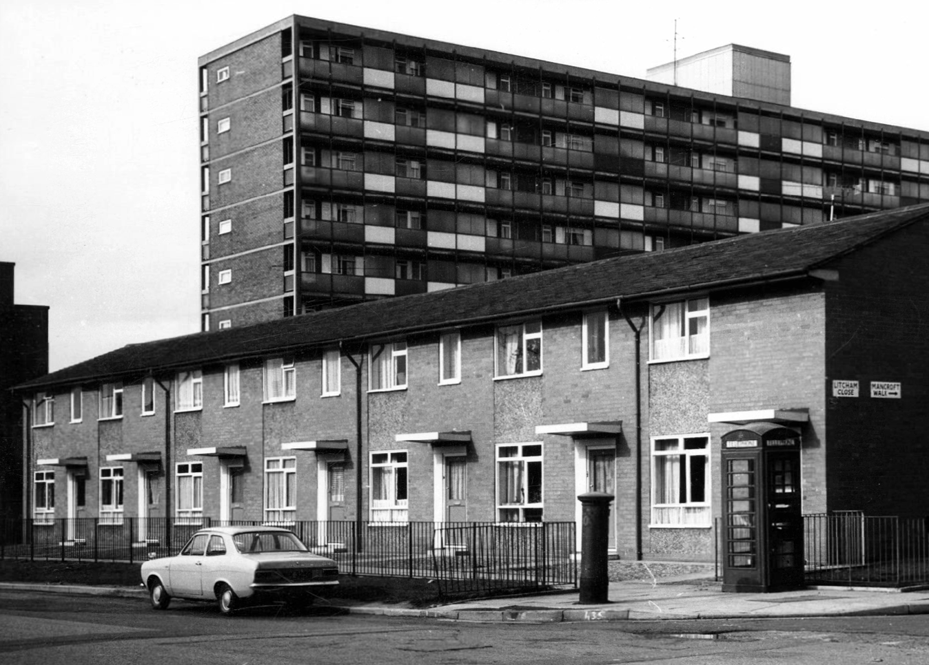
Extensive slum clearance in the nineteen sixties saw the area and its street names change, some erased forever in the new build.
In Manchester, in a vast belt immediately outside the central area of the city, there still exist all too many remnants of a planless, knotted chaos of dark, dismal and crumbling homes. Many of these crossed the verge of uninhabit-ableness long before their most elderly inhabitants were born.
St Paul’s and St Luke’s Brunswick Street W Higham 1970
Lamport Court W Higham 1970
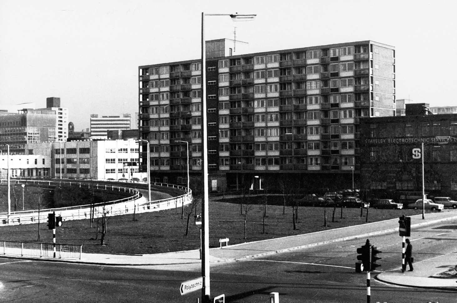
One of three nine-storey blocks, containing two hundred and nineteen dwellings; also including SilkinCourt and Lockton Court.
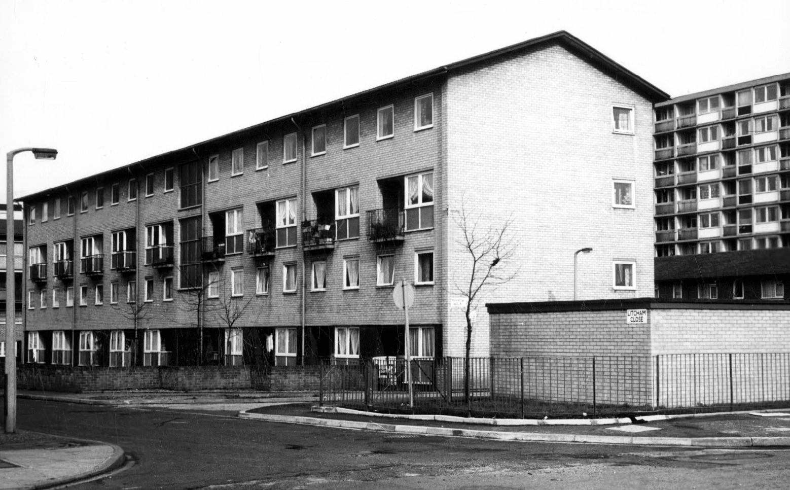
Litcham Close W Higham 1970
Harry Milligan 1903 – 1986 worked as the photographer at Manchester Central Library until his retirement in around 1968. He was instrumental in setting up the Manchester Region Industrial Archaeology Society in 1965. He volunteered at the North Western Museum of Science and Industry from 1968, assisting with reprographics requests. His knowledge of the history of photography in Manchester and the UK led to him taking on the role of Honorary Curator of Photography at the museum.
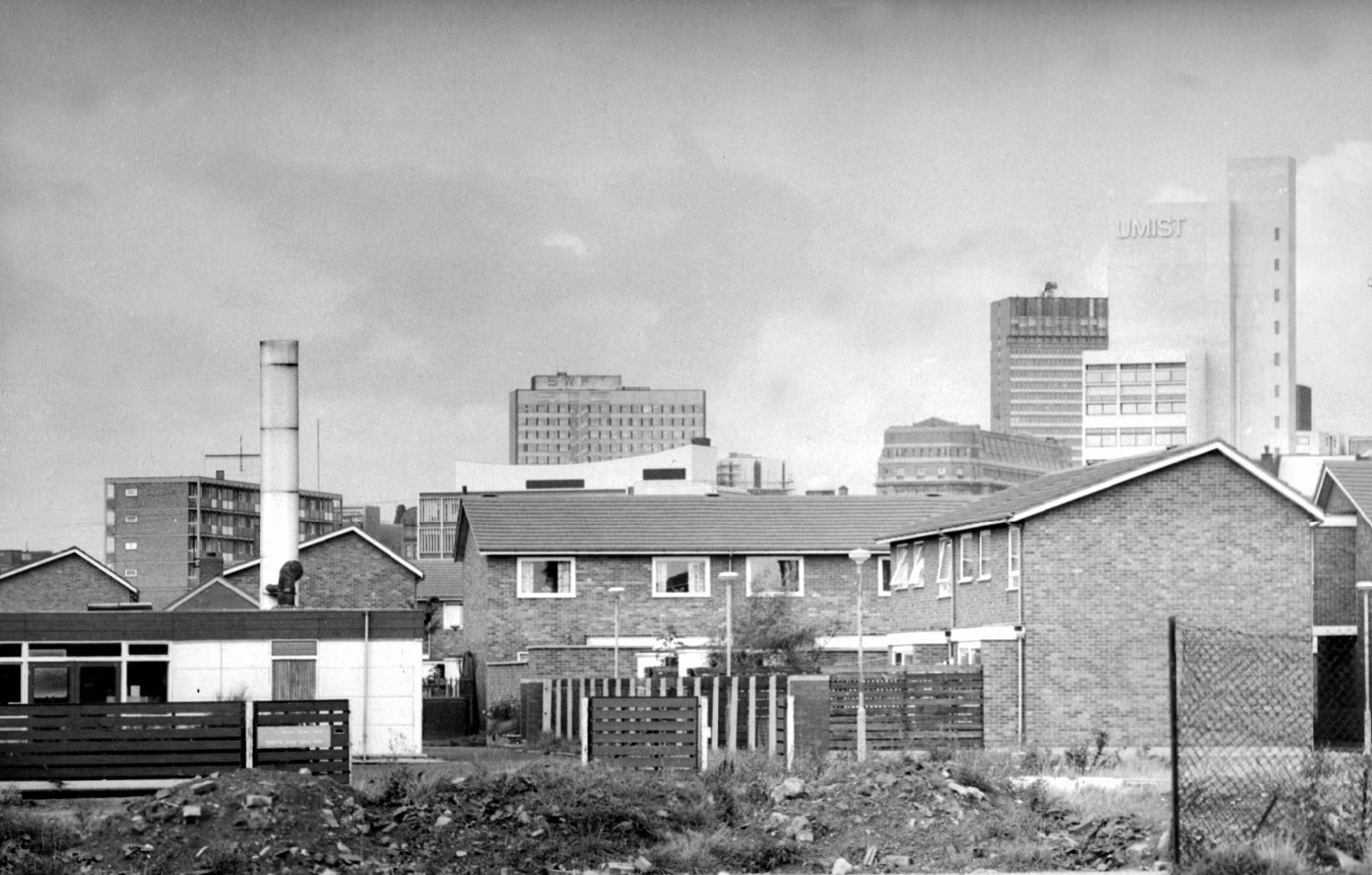
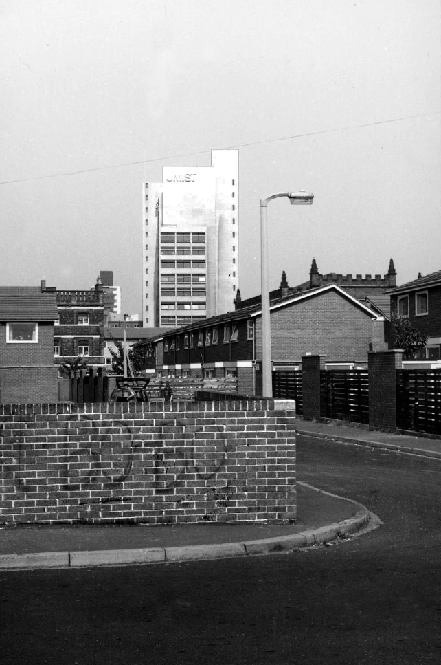
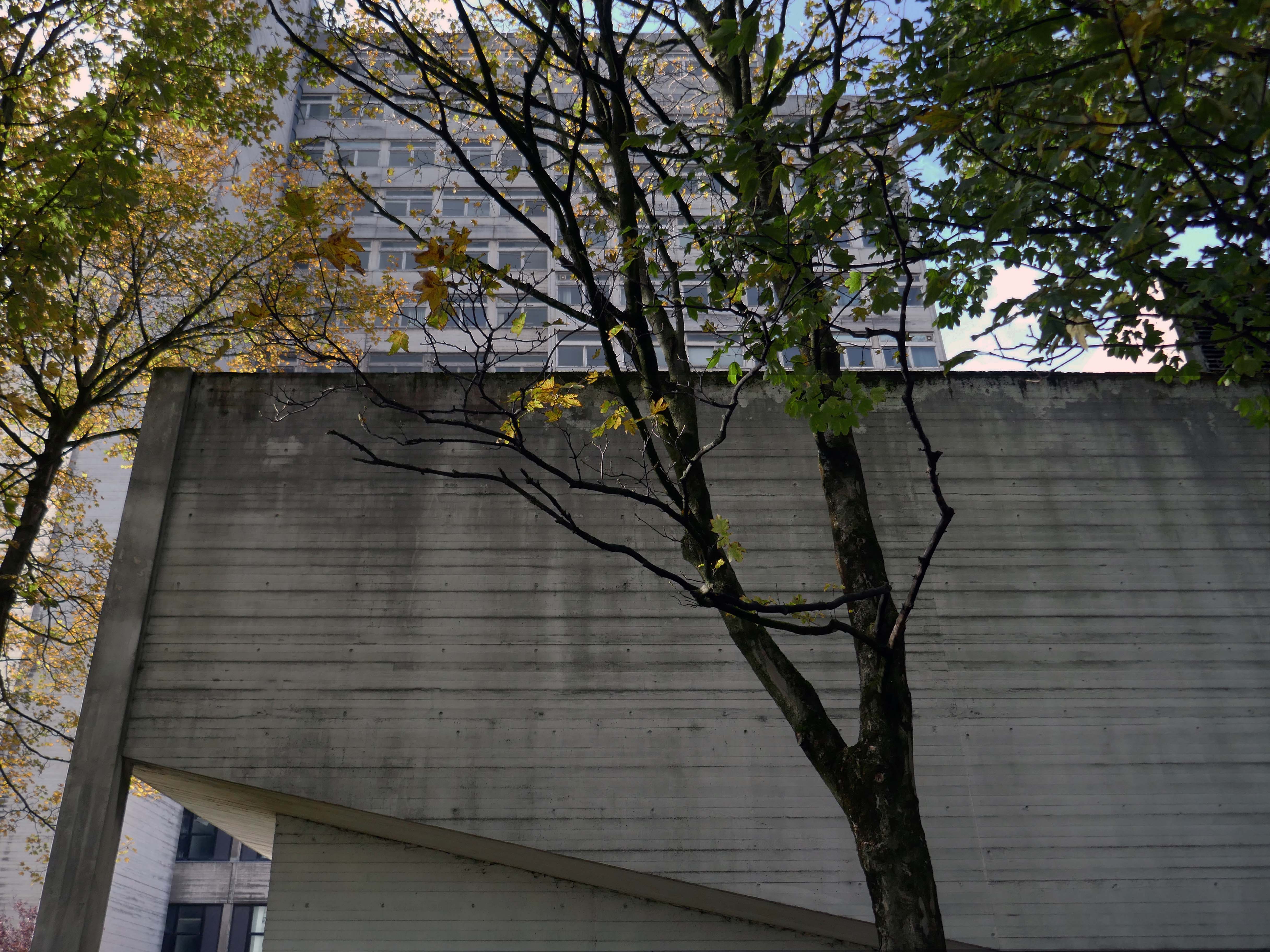
Panorama of Brunswick with UMIST in the background.
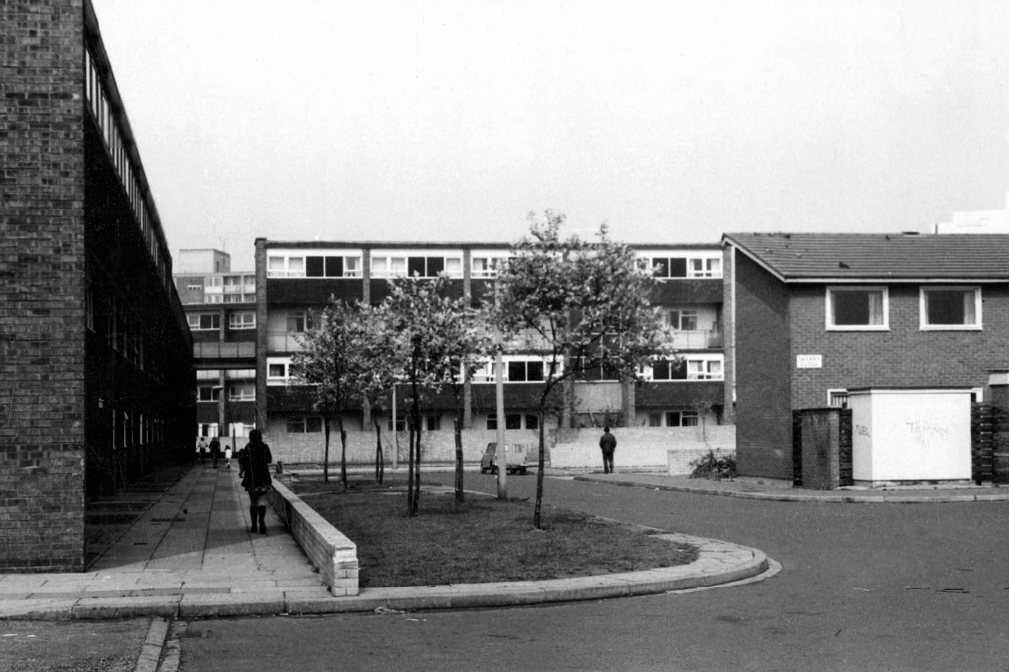
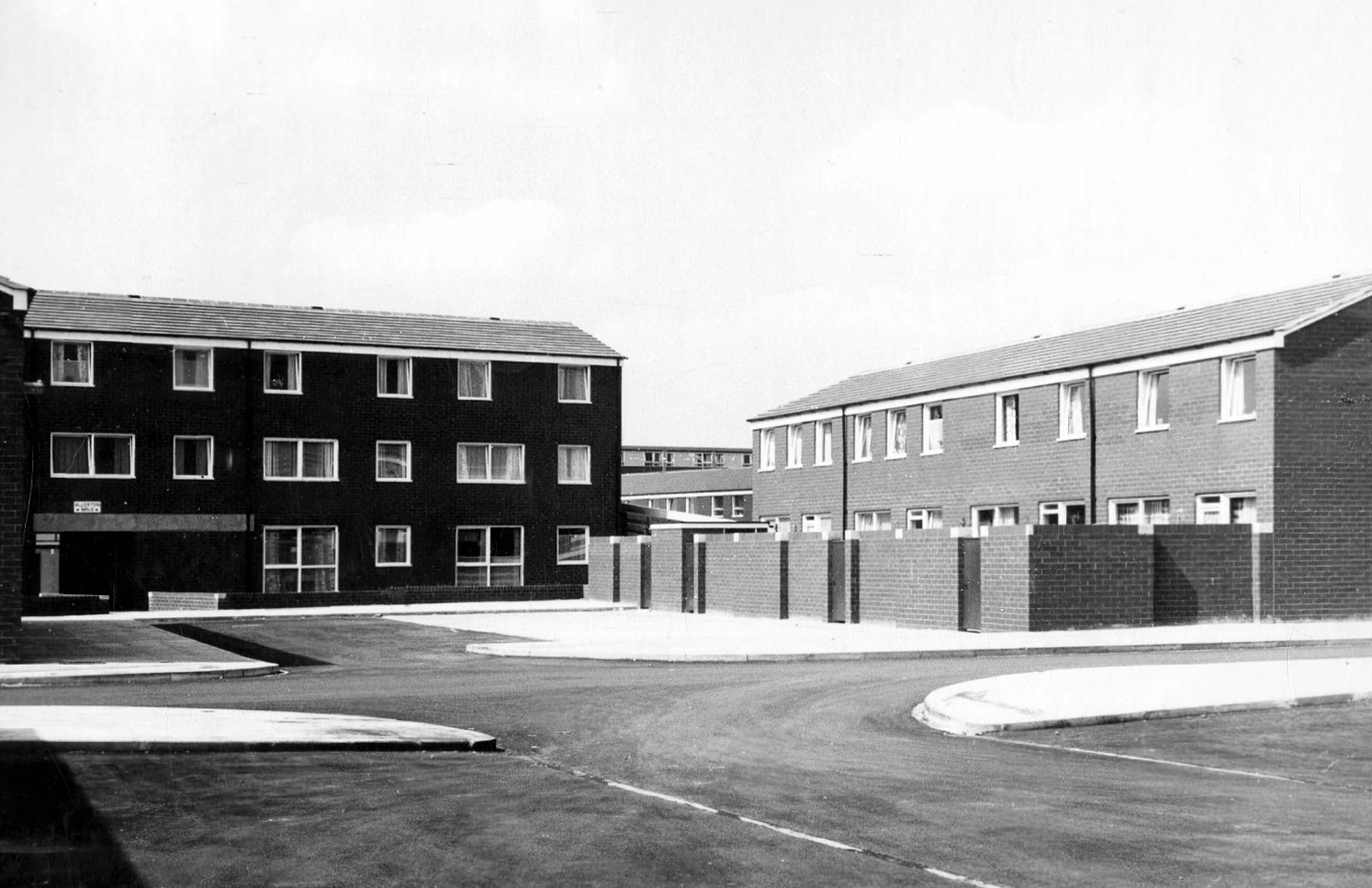
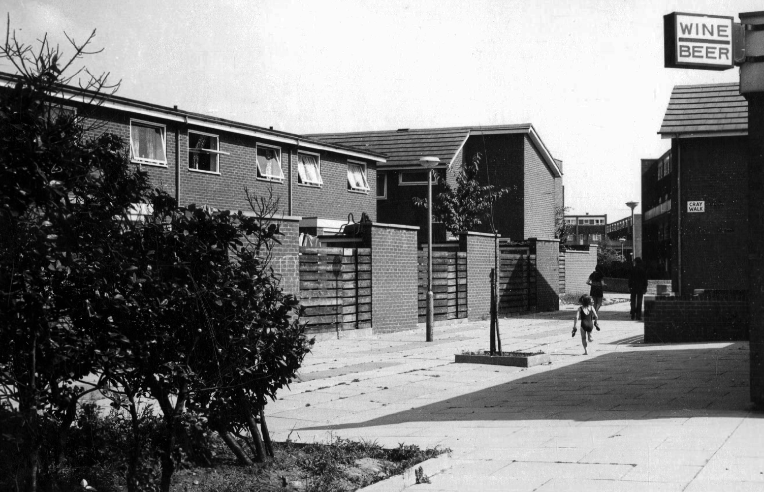
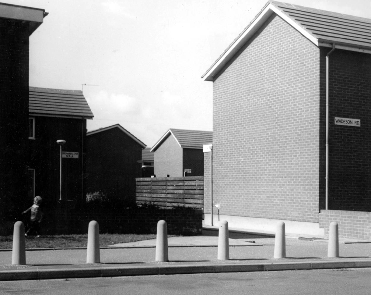
Hanworth Close area terraced housing and flats 1972.
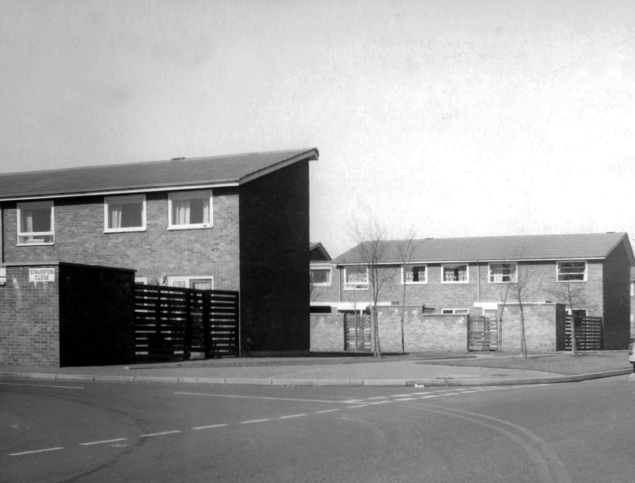
Staverton Close
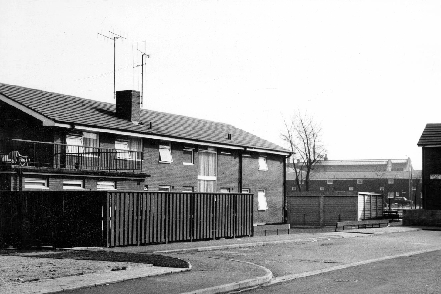
Melcroft Close
Wadeson Road
Helmshore Walk – Skerry Close
Cherryton Walk
Cray Walk
Wadeson Road
Hanworth Close
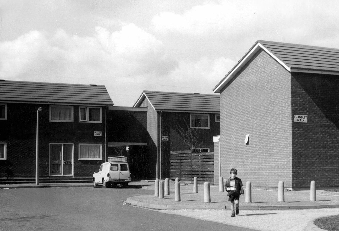
Pedley Walk
Cray Walk – note the decorative brick relief
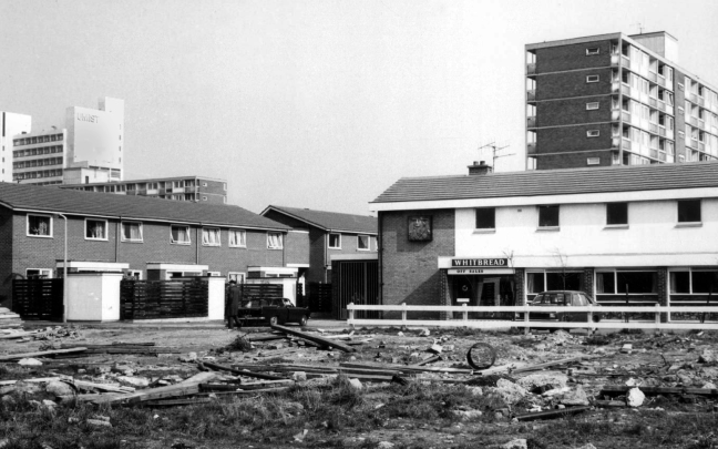
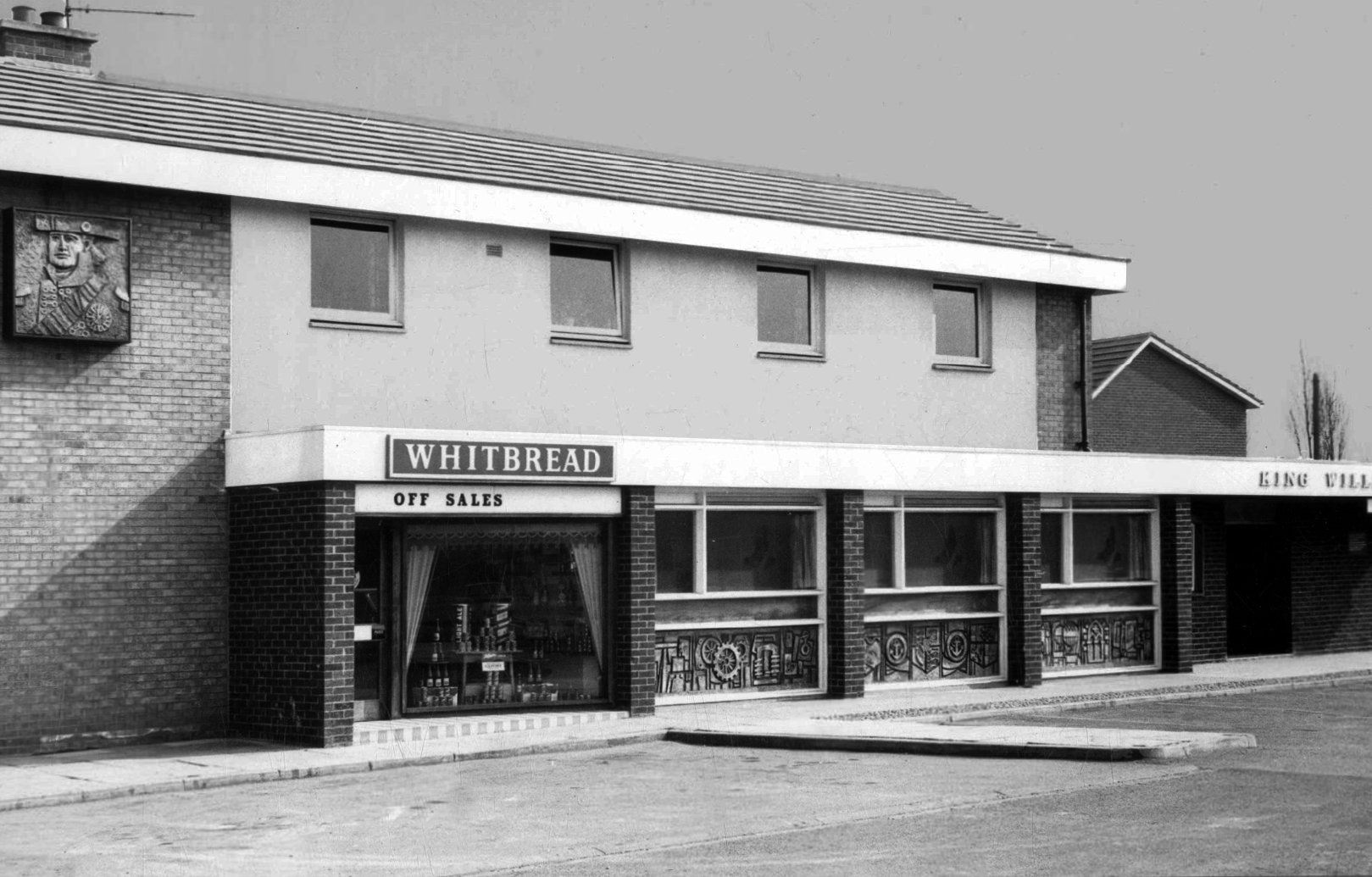
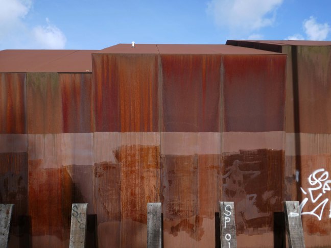
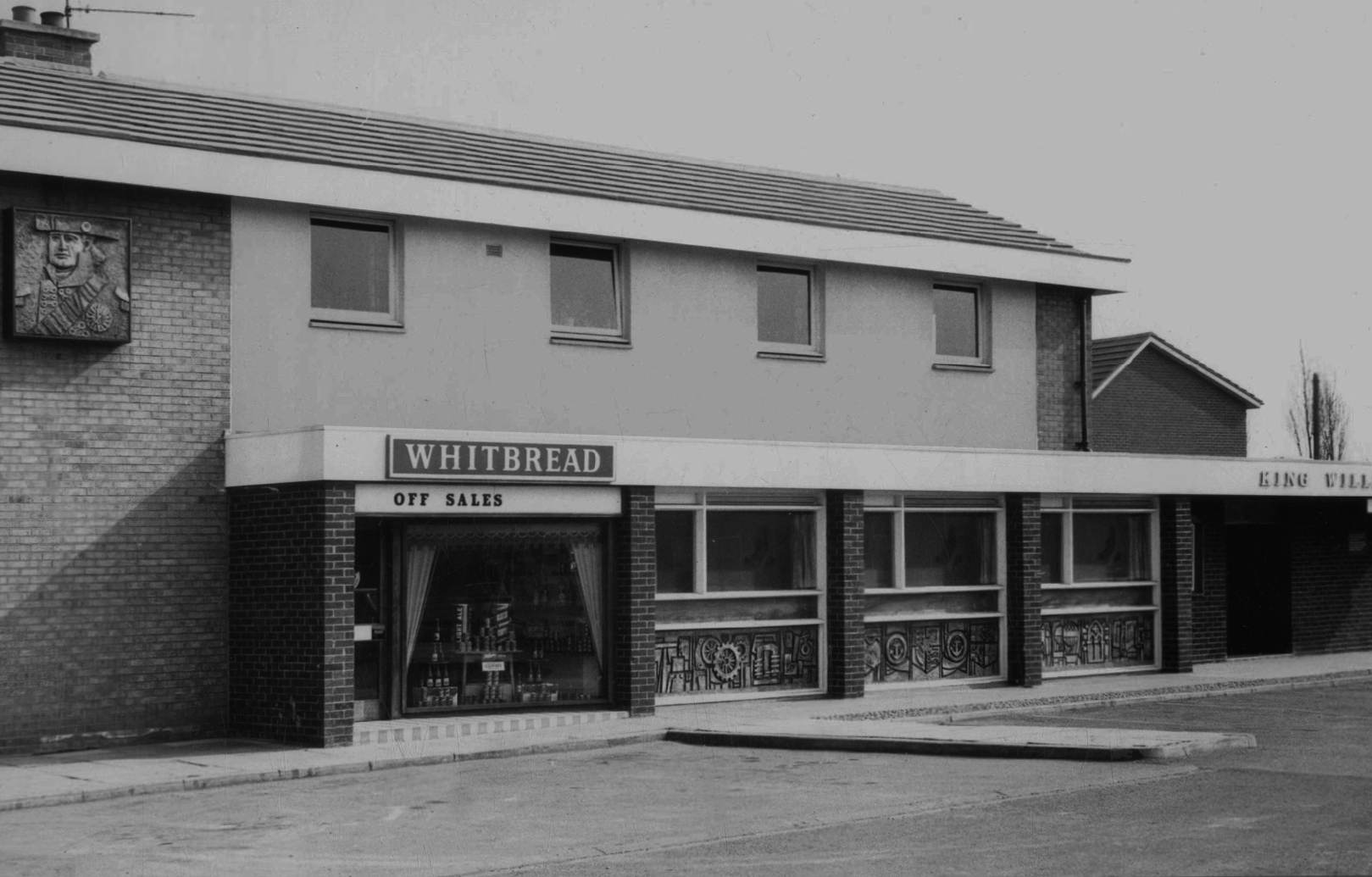
King William IV
Former Chesters then Whitbread estate pub was built in 1967. Closed in 1996 when it was converted to residential property. It had a brief spell 1991 to 1995 as brewery premises for the Dobbin’s West Coast Brewery, during this period the interior was stripped out to accommodate the brewery paraphernalia.
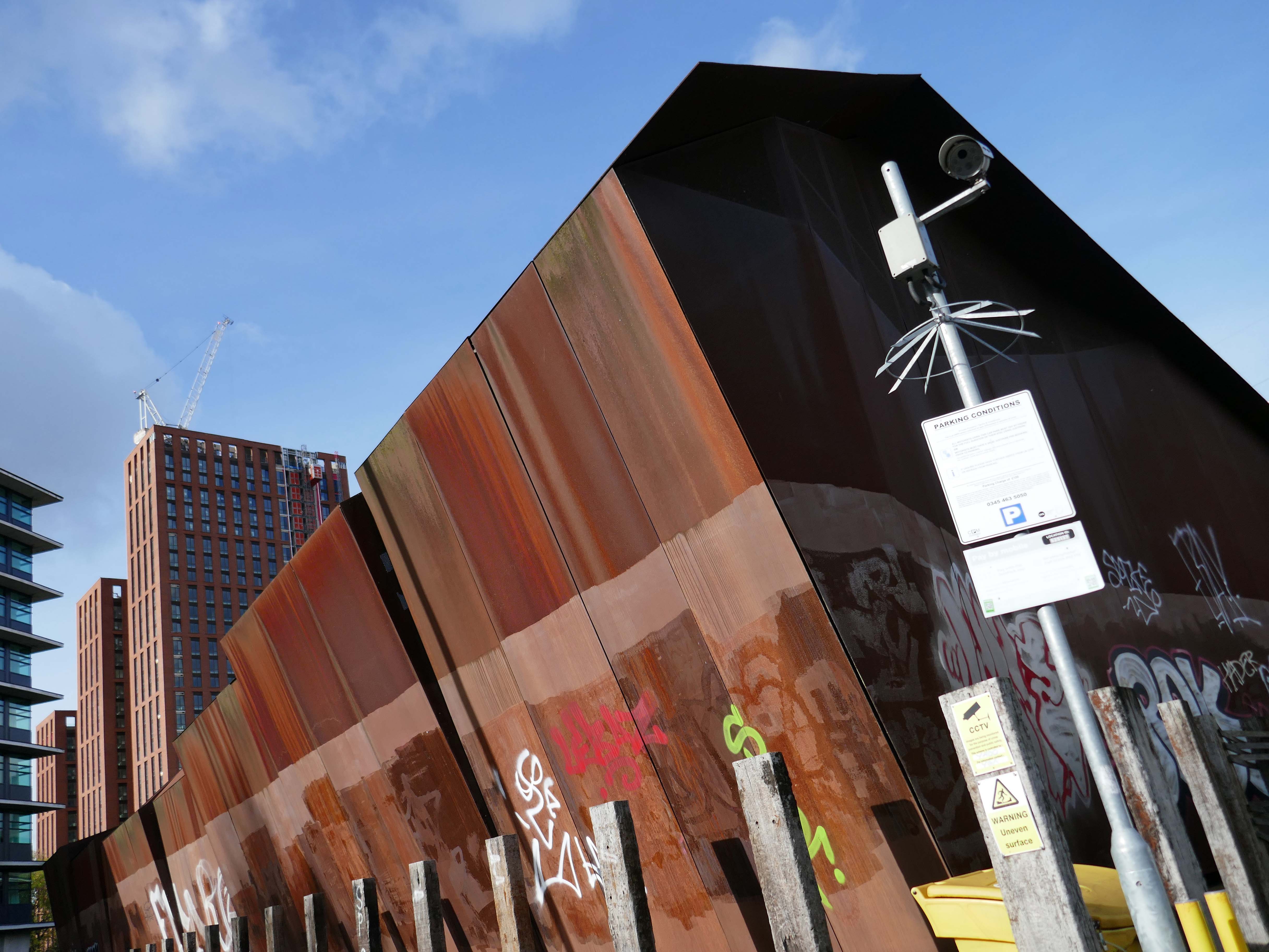
The building was cladded with a COR-TEN® steel envelope, the nature of which was relatively complex.
Corten steel sets itself apart due to the inclusion of unique alloying elements: chromium, nickel, copper and added phosphorous which gives the steel its self-protecting properties.
Platform 14 is primitive, I understand totally from an infrastructure standpoint because it’s on a bypass line on a bridge, but it gets too overcrowded and is windswept. The rest of the station is ok. Platforms 13/14 have not changed in 40 years, grim.
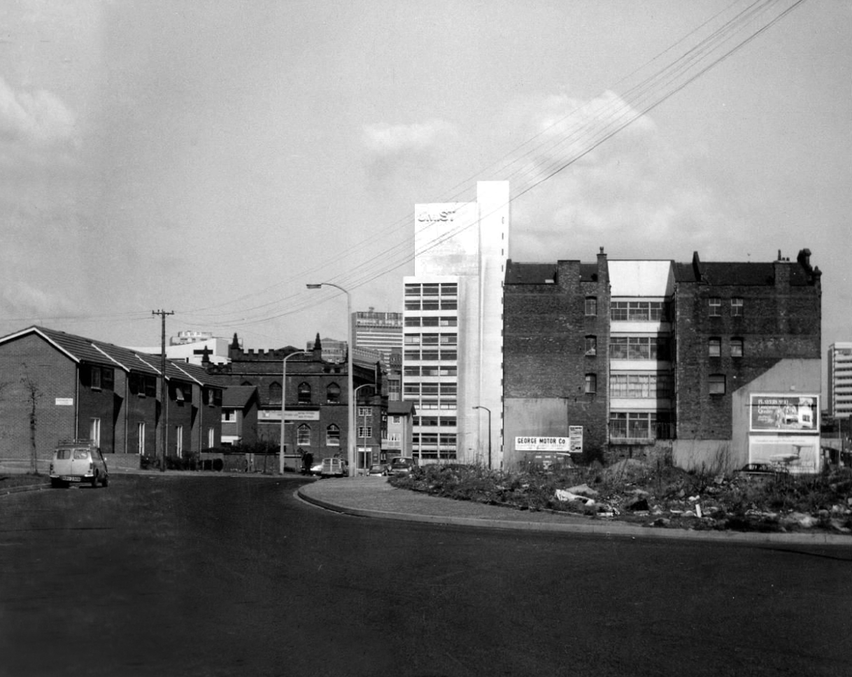
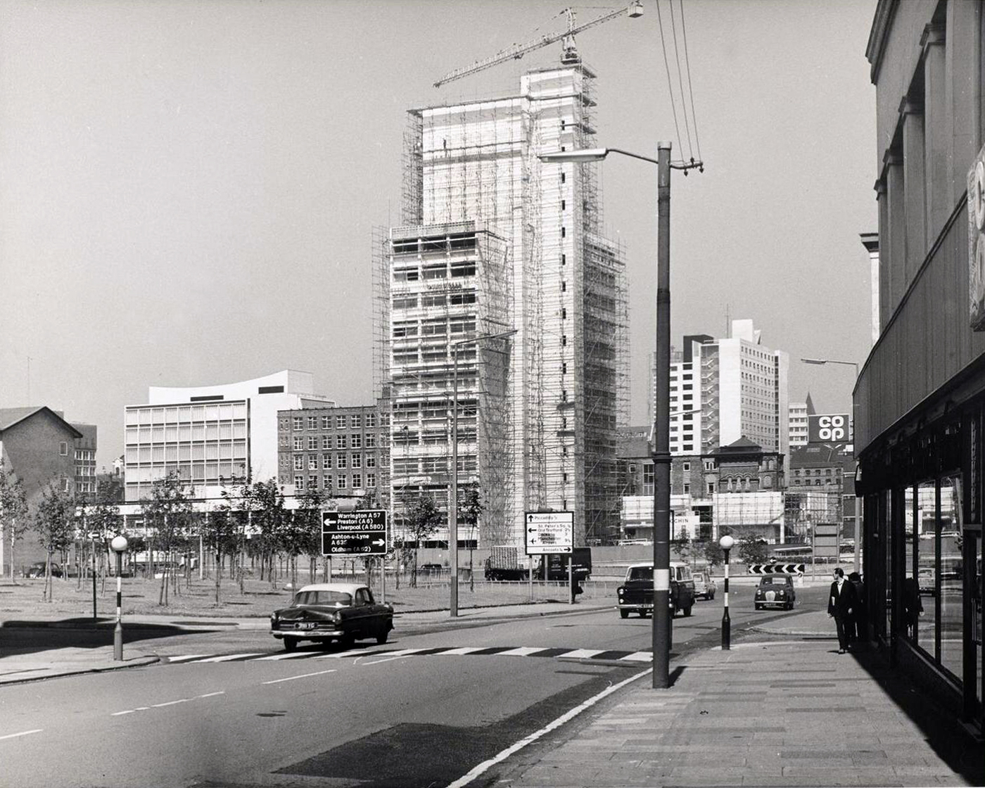
We the pass to the former BT Building – architects JW Hammond 1973.
Originally conceived as a hotel, there were no takers at the time, so it became the BT HQ.
Comprising 338 rooms, Manchester Marriott Hotel Piccadilly is near a shopping district, a 10-minute ride from Etihad Stadium. Offering a location right in the centre of a beautiful neighbourhood, this comfortable hotel boasts a lounge bar along with city views.
The developer’s architects now propose to ‘reimagine’ the artwork and incorporate it into the foyer of the new office building. However, this ‘reimagining’ requires large sections of the artwork to be removed by cutting away and ‘folding’ around 30% of the sculpture.
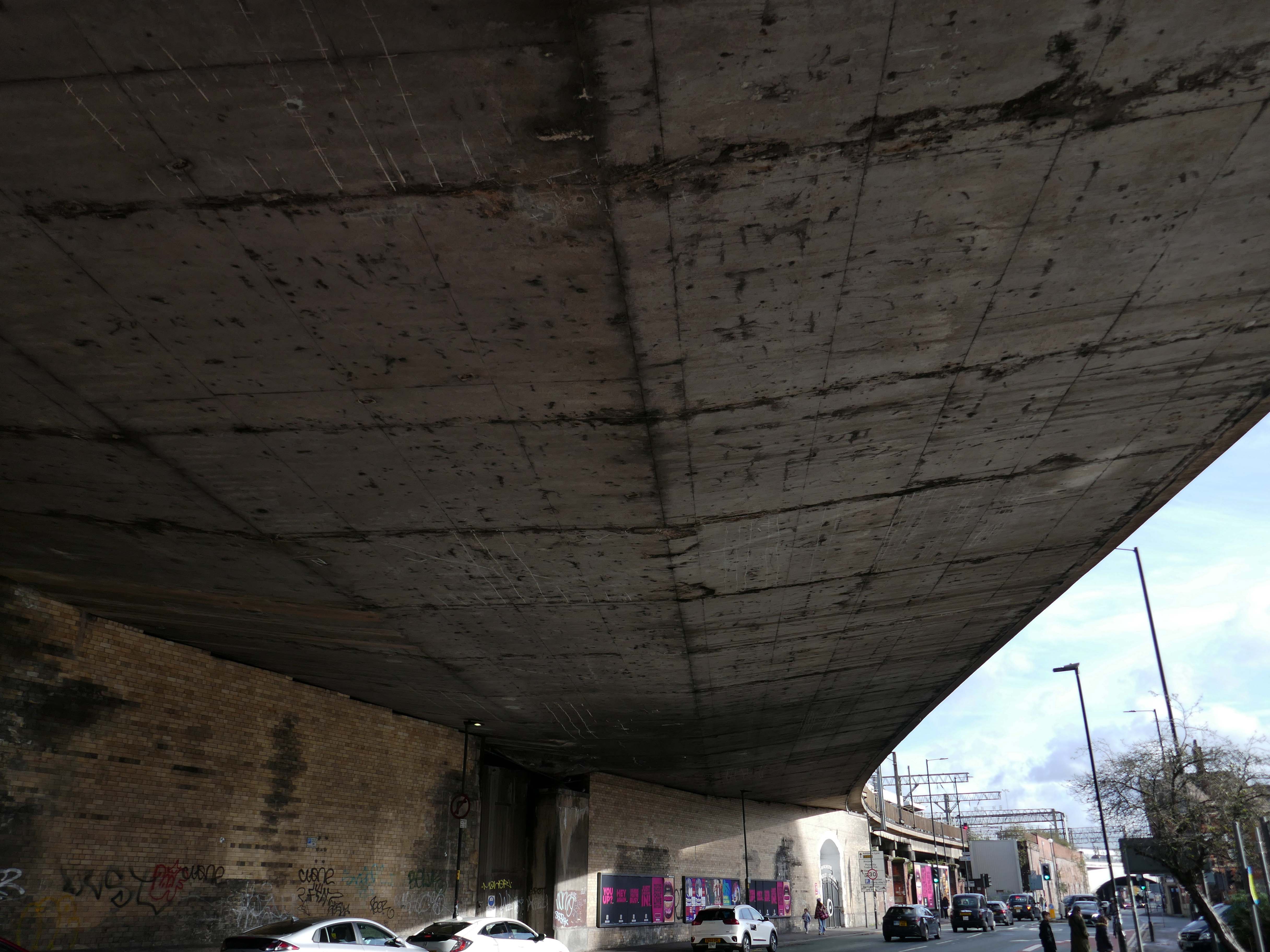
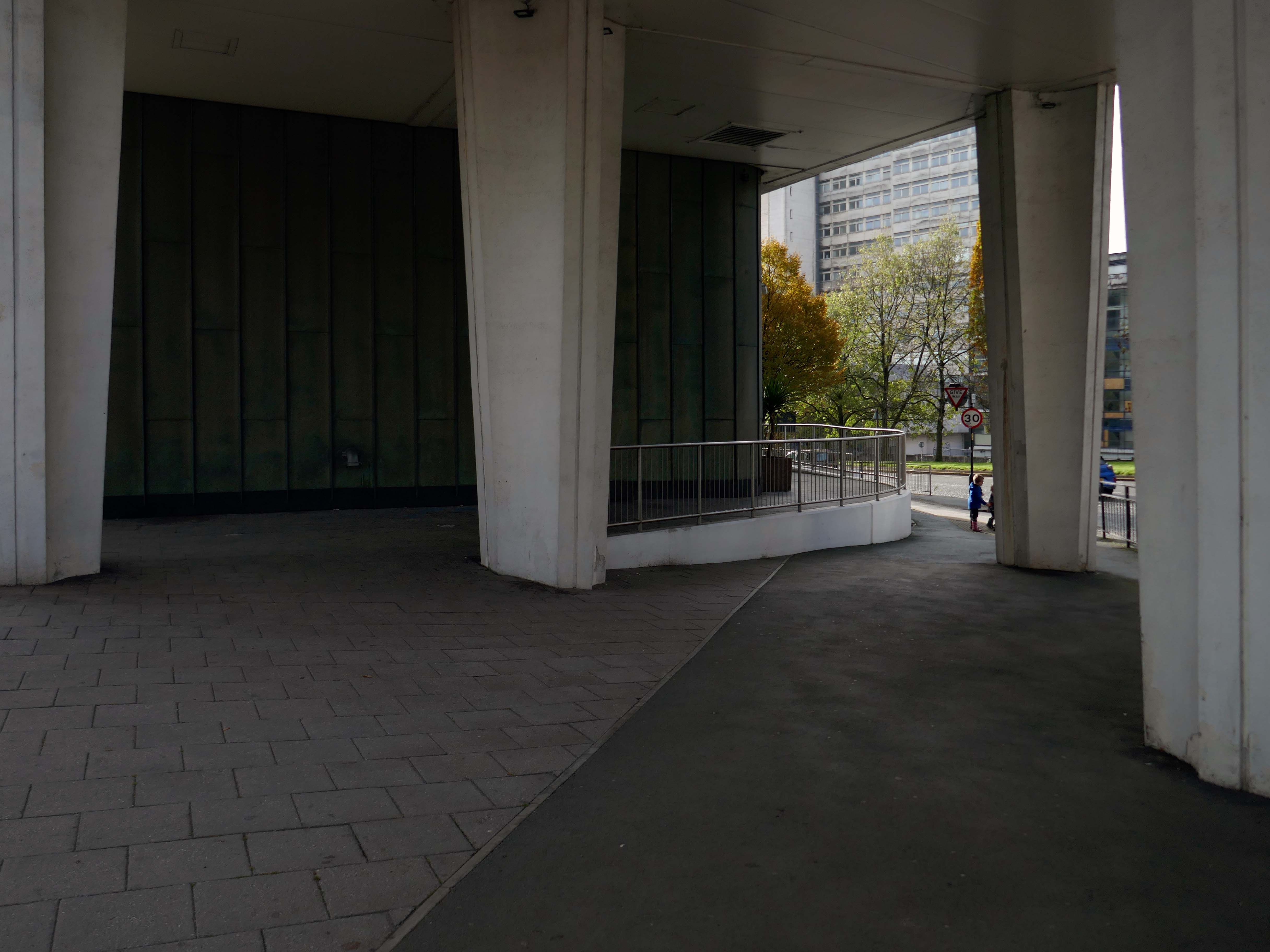
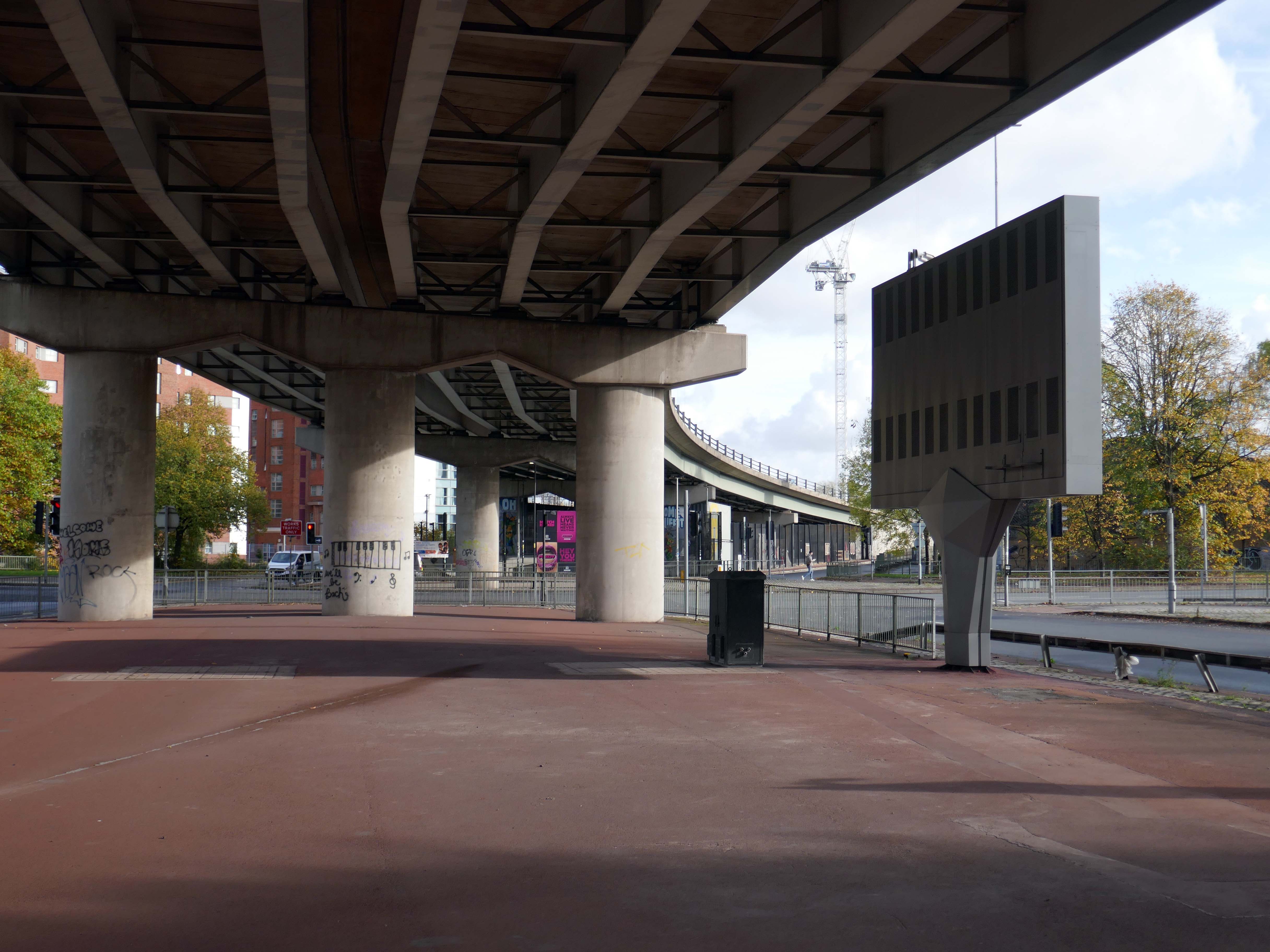
From beneath the roadway we can see the Ferranti Building.
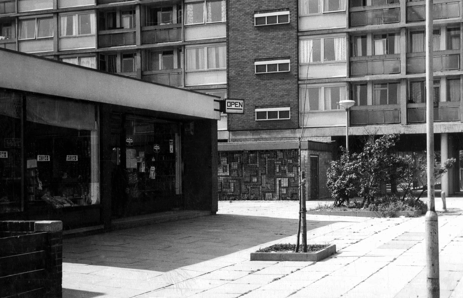
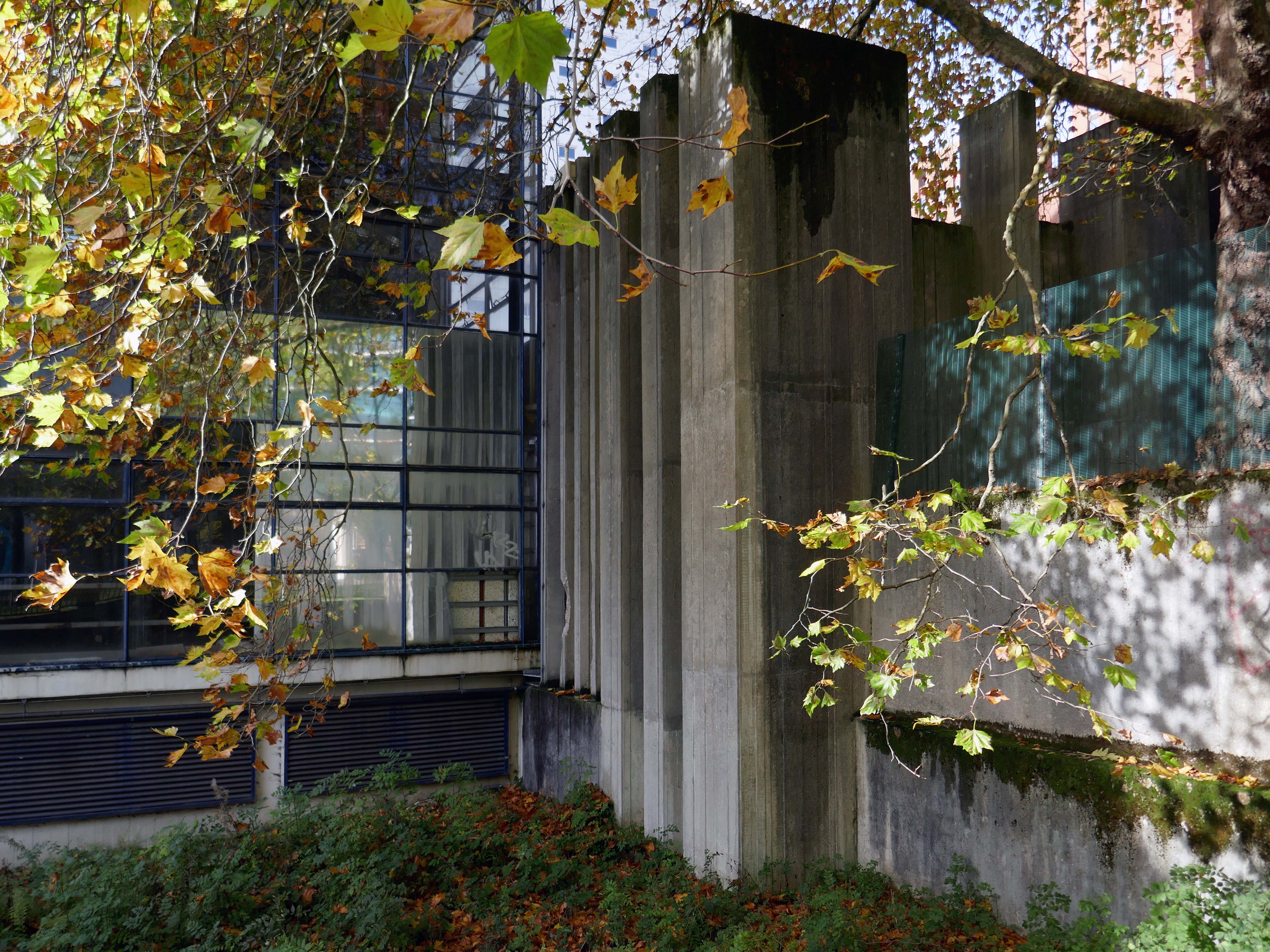
Crossing over to see the Brunswick Estate, built in the Sixties and Seventies and recently refurbished.
S4B is a partnership leading the £106m regeneration of Brunswick, Manchester. The Brunswick Regeneration PFI is a combination of government funding, private investment and expertise that will revitalise Brunswick. Improvements will include council home refurbishments, new homes for sale and to rent and an improved neighbourhood design.
Long gone lost estate pub from the estate – King William IV a former Chesters then Whitbread estate pub was built in 1967. Closed in 1996 when it was converted to residential property. It had a brief spell 1991 to 1995 as brewery premises for the Dobbin’s West Coast Brewery, during this period the interior was stripped out to accommodate the brewery paraphernalia.
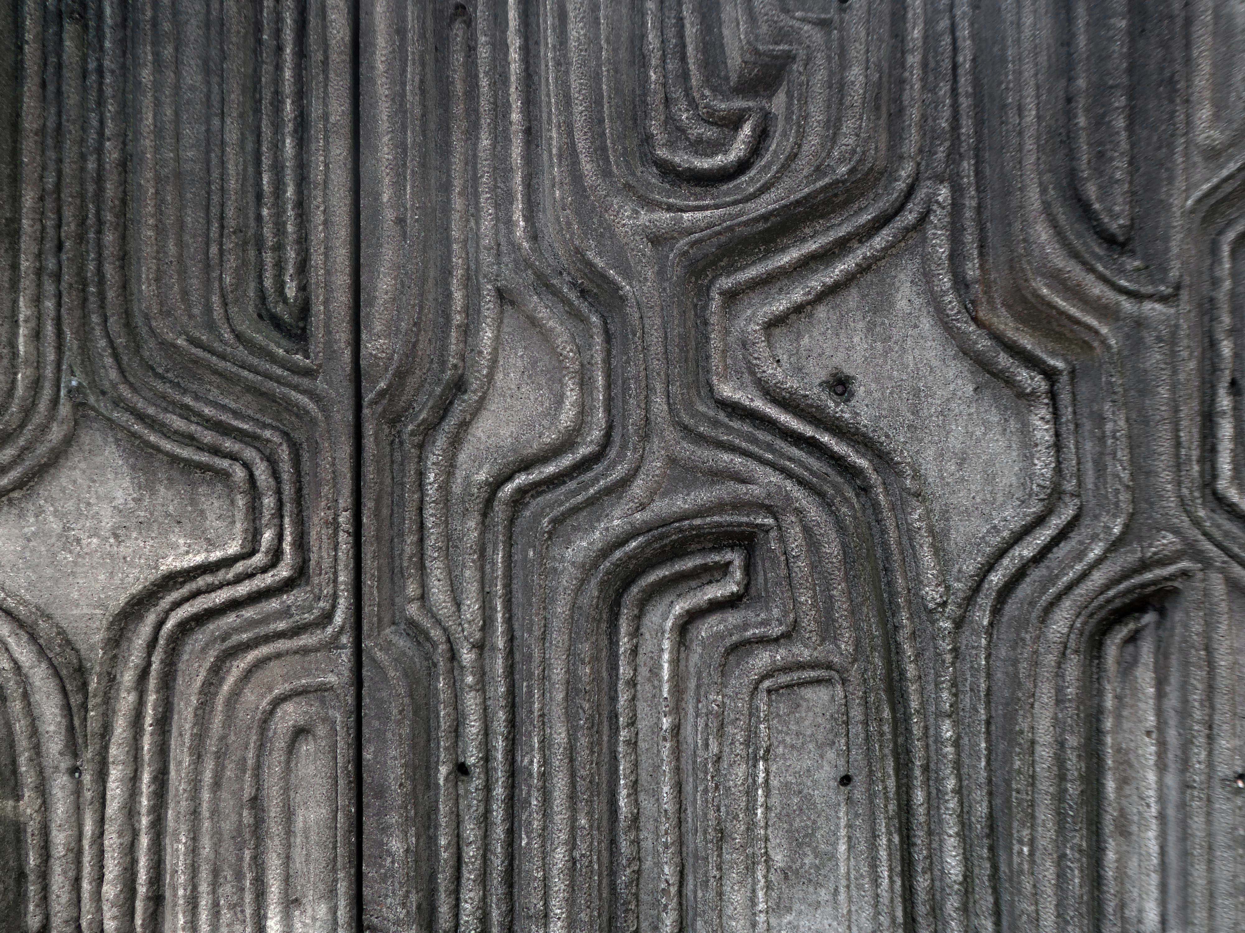
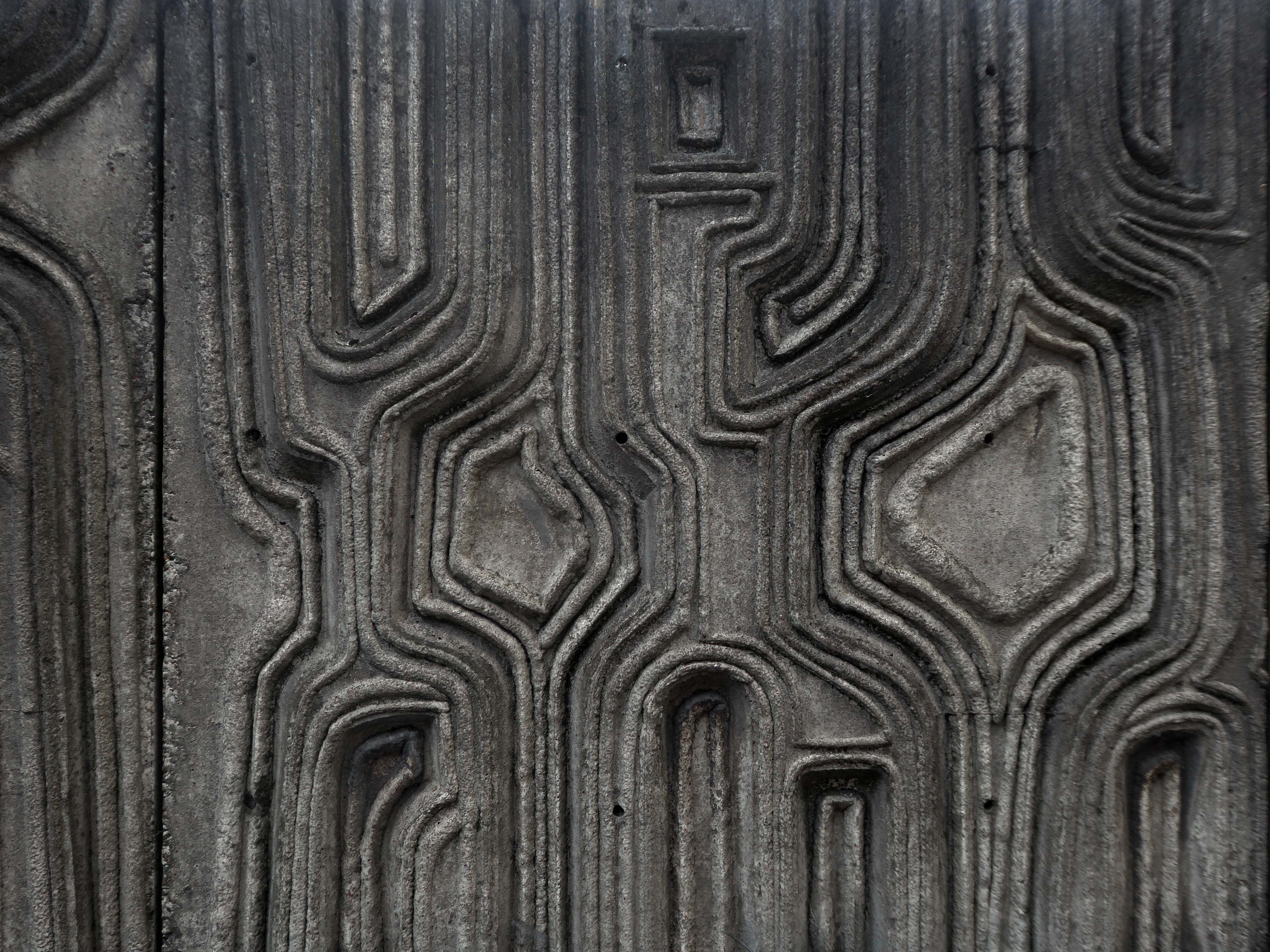
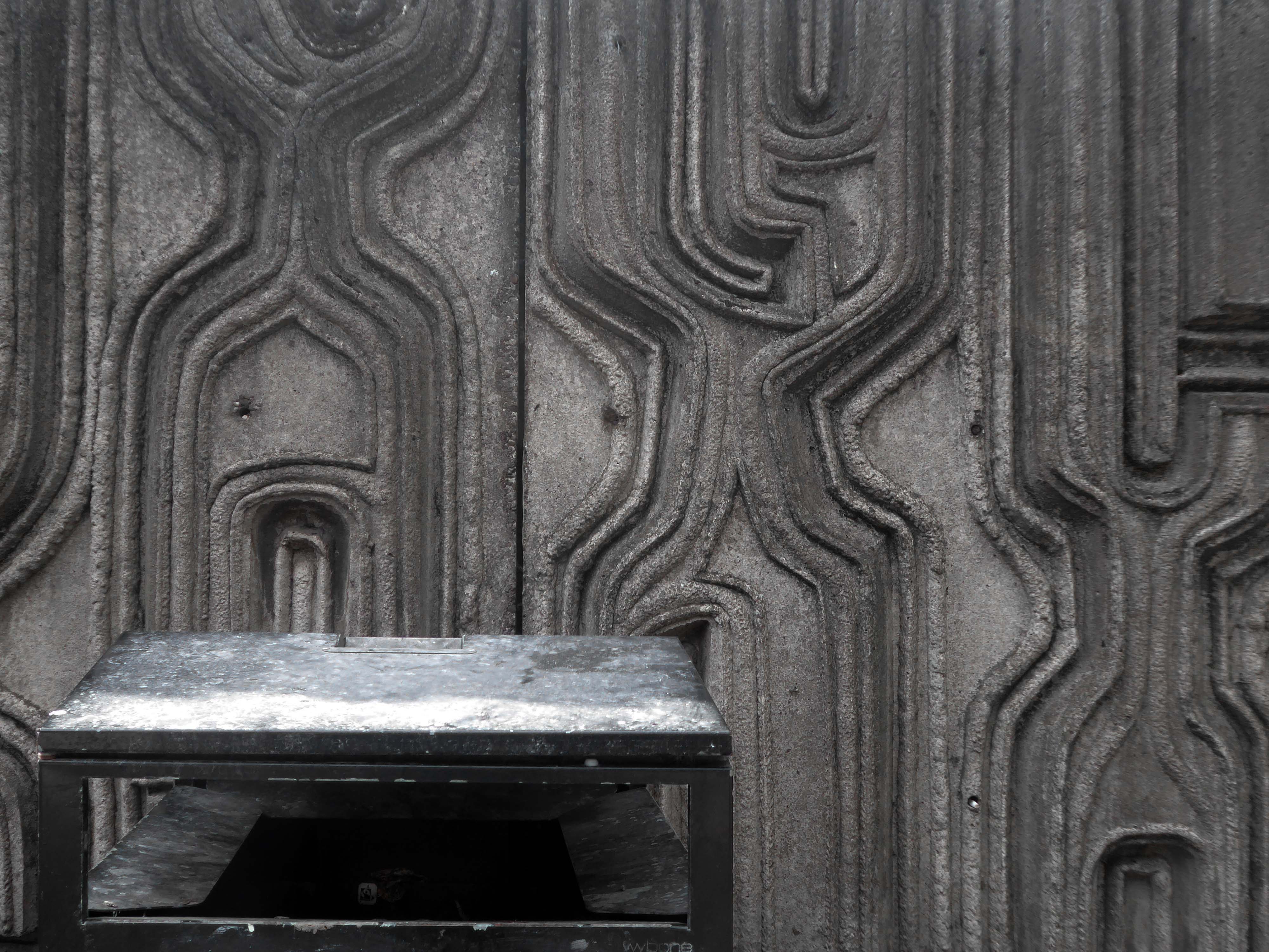
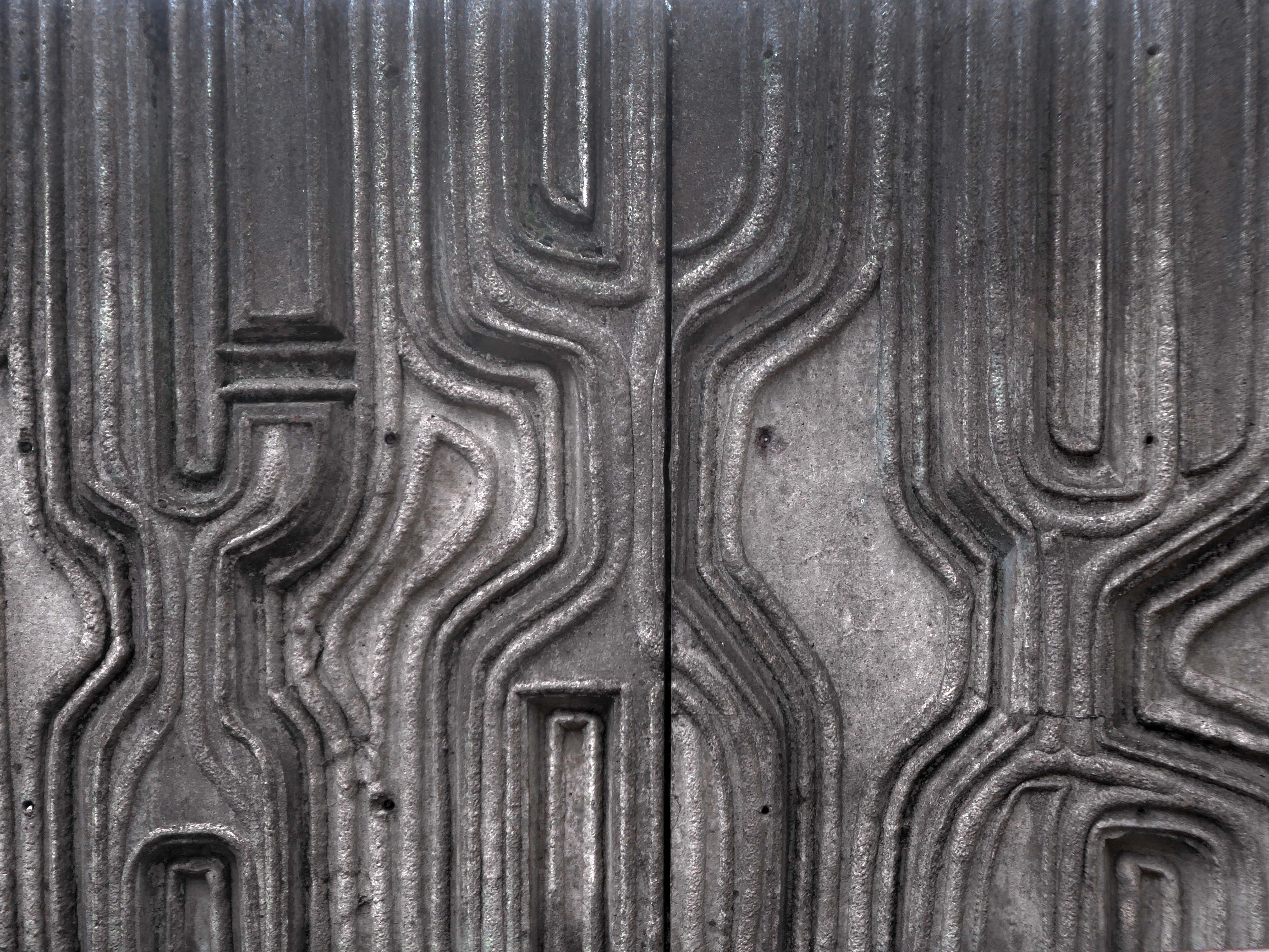
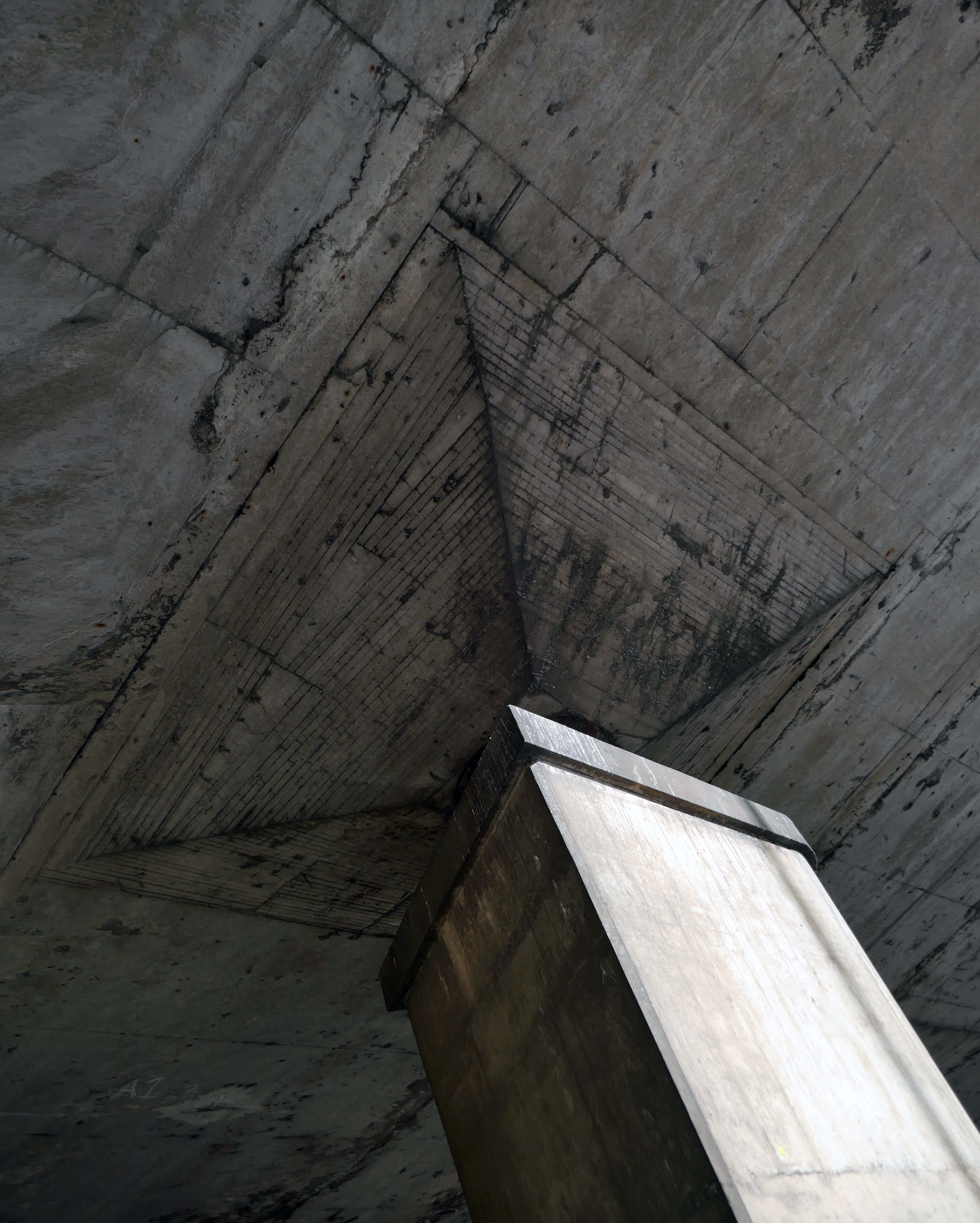
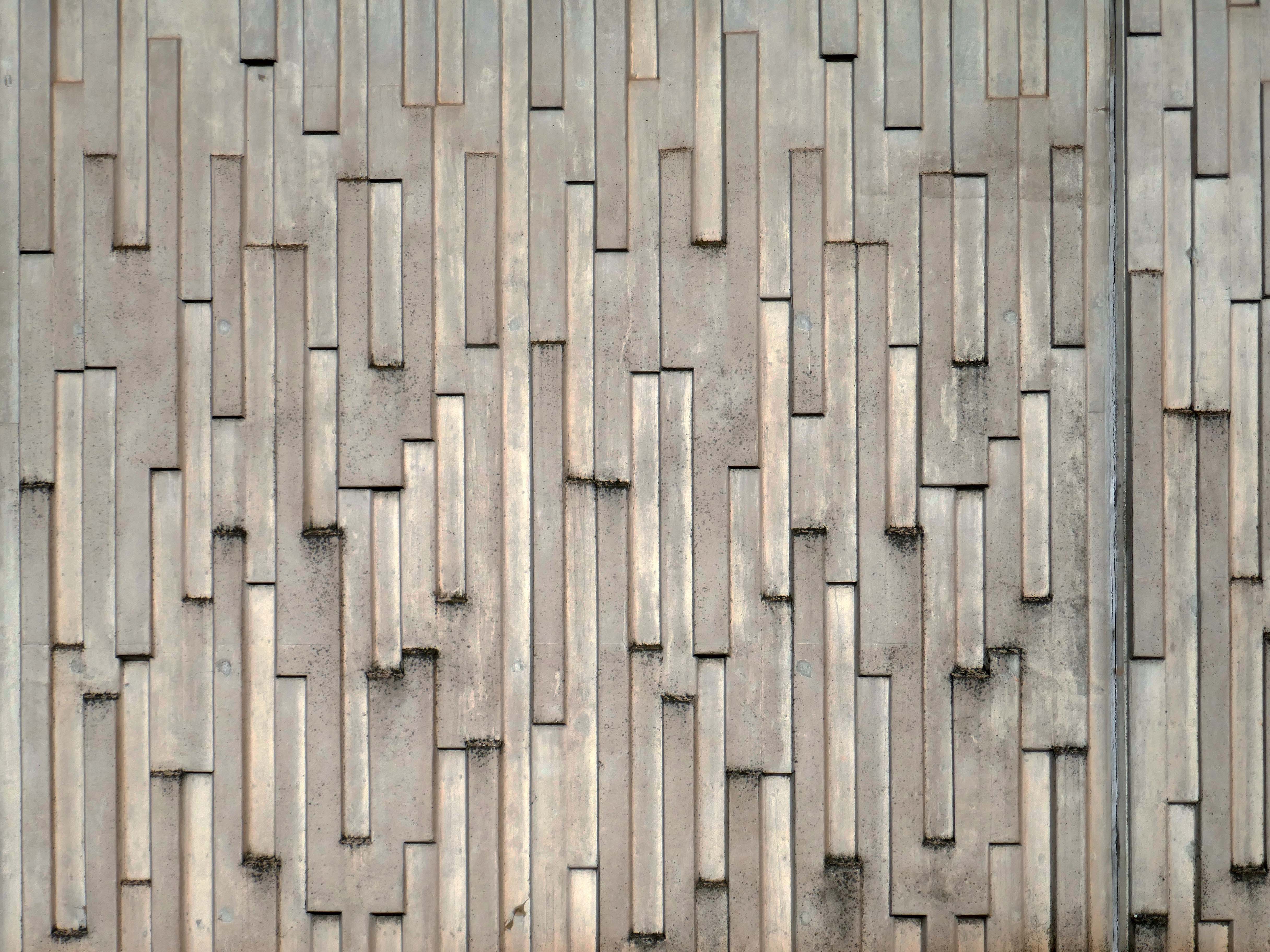
We take a jog around the block to see the concrete relief that clads the road ramp.
Where there was once a giant Cooperative Store there is now a light industrial and retail estate.
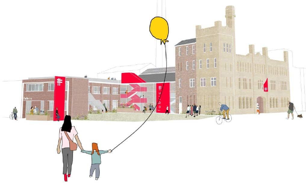
The Diocese of Manchester has been working in partnership with the Church Revitalisation Trust to open Fabric Church and refurbish the building, following a successful bid to the Church of England’s Strategic Mission and Ministry Investment Board.
We’re excited to be working alongside Fabric Church on the transformation of the Grade II listed former Ardwick Barracks in Manchester. This ambitious refurbishment project will see the historic site reimagined as a vibrant community hub, featuring a new worship hall, community café, offices, meeting spaces, and more.
Alongside Ardwick Green Park there are new housing developments nearing completion.
Ardwick Green combines contemporary design with great light infused spaces, offering stylish homes with a modern twist, private parking, outdoor spaces and a welcoming community atmosphere an urban retreat that truly feels like home.
With the city just moments away, living at Ardwick Green will give homeowners easy access to Manchester City Centre and beyond with its vibrant social scene, bustling business landscape and extensive transport network on your doorstep.
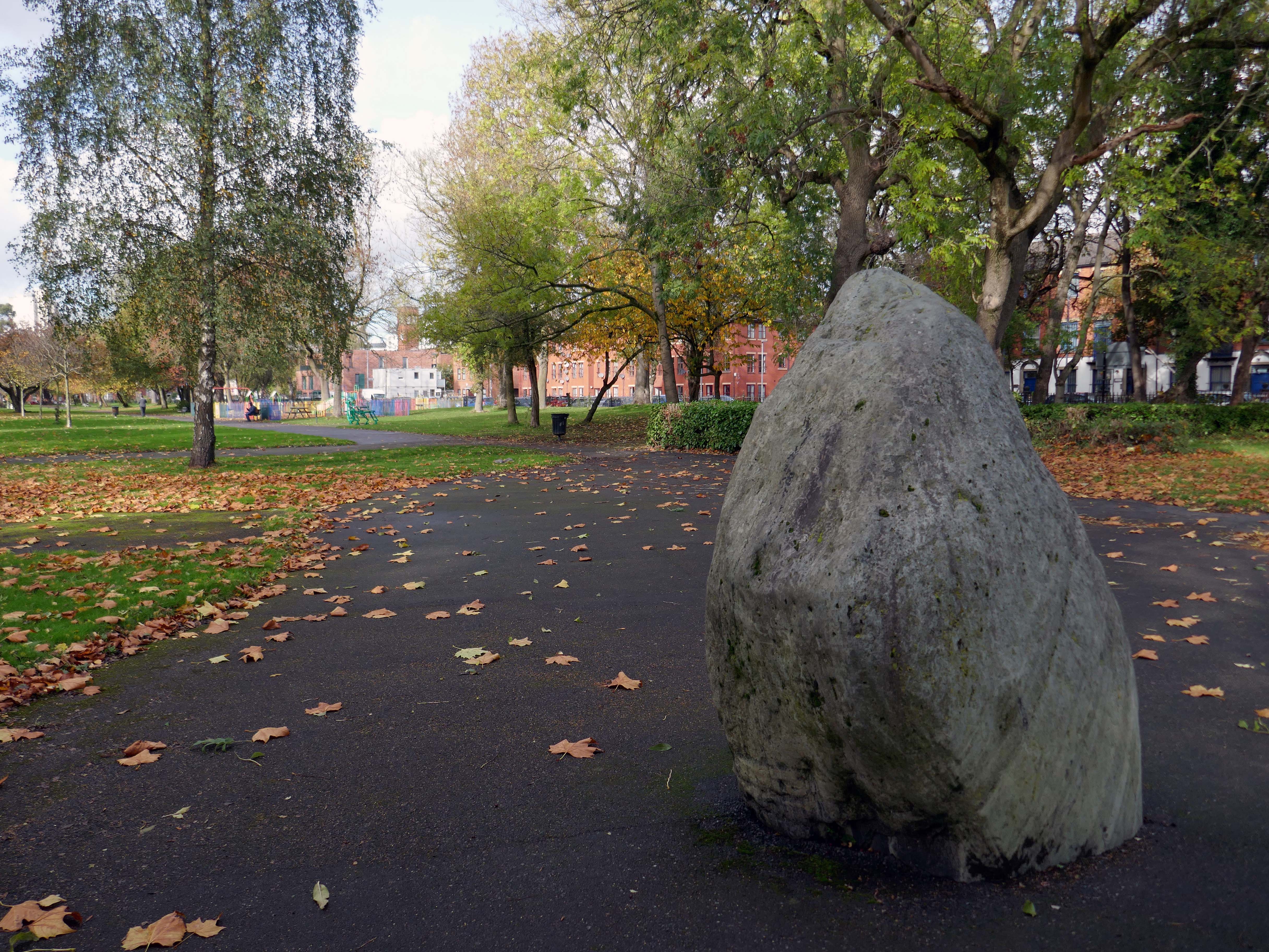
Without which much of what we understand as the modern age would possibly not now exist.
It appears to be green slate from the Lake District, the native underlying rock in this part of Manchester is a red sandstone.
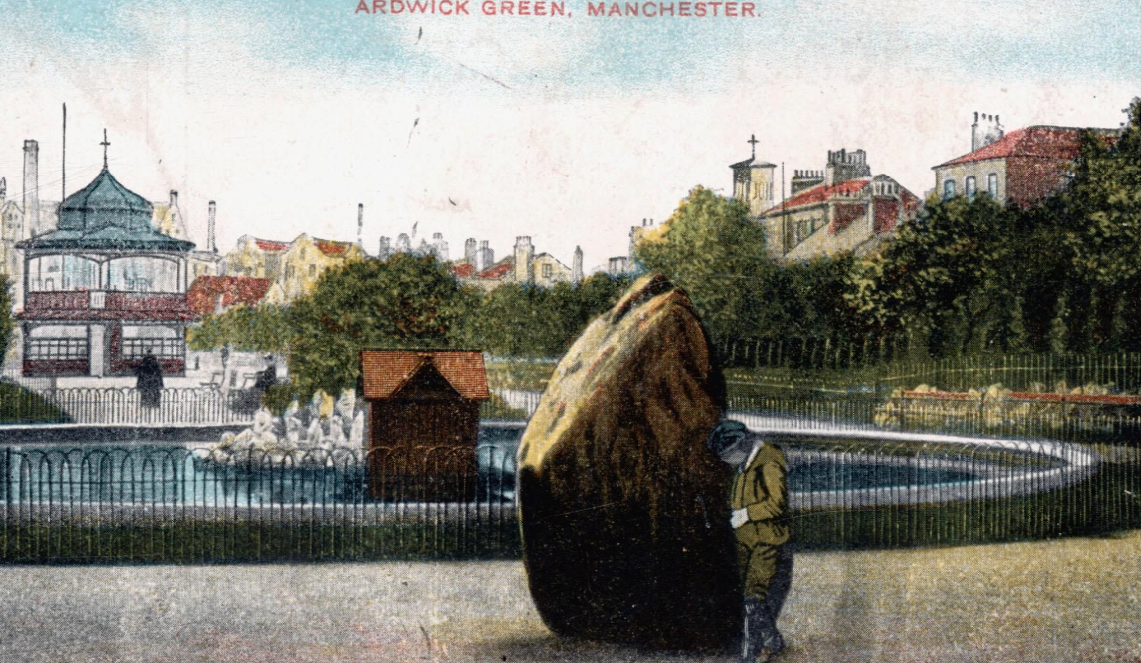
Postcard of 1906
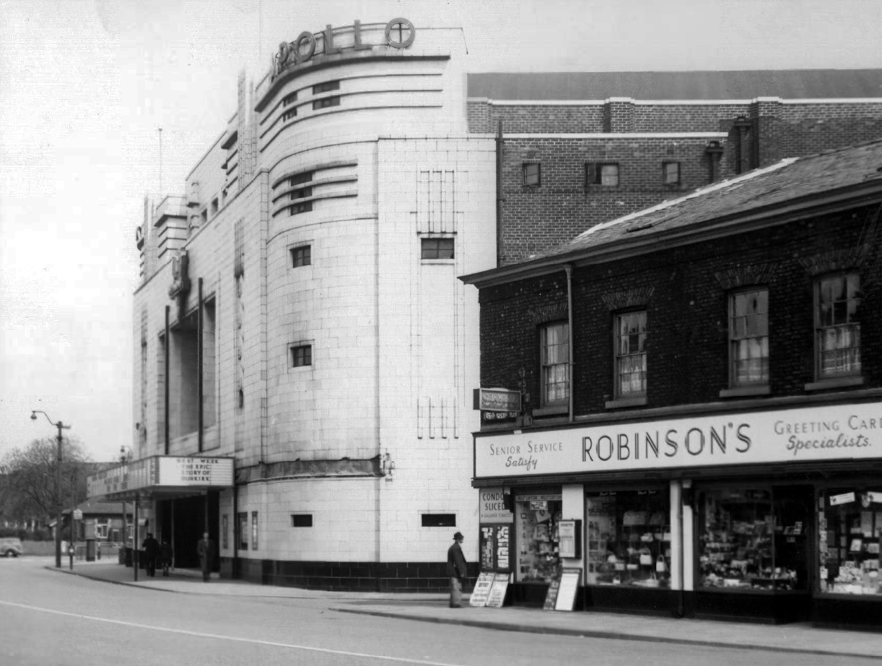
The Apollo of course prevails. – seen here in 1958
Architects: Peter Cummings Alex M Irvine
Opened on 29th August 1938 the interior decorations were carried out by noted interior designers Mollo & Egan with the Holophane lighting designed by R Gillespie Williams.
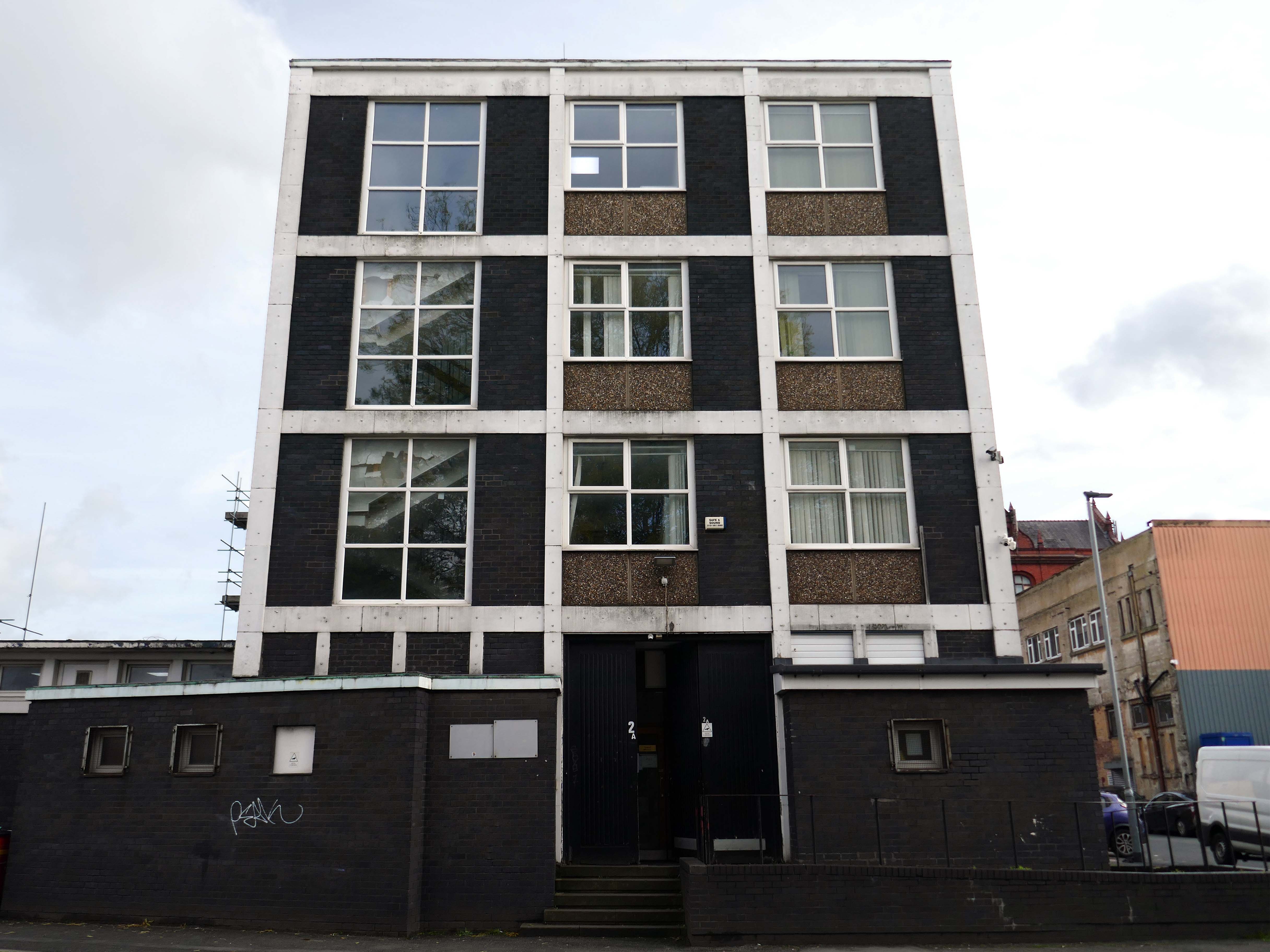
This Sixties municipal building remains a mystery.
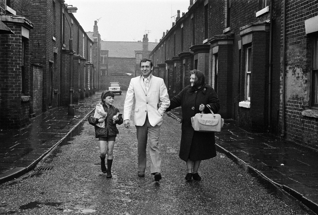
Actor Harry H Corbett visiting his childhood area in 1969, he lived on Earl Street and later in Wythenshawe.