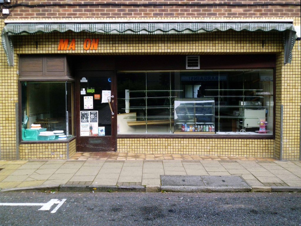
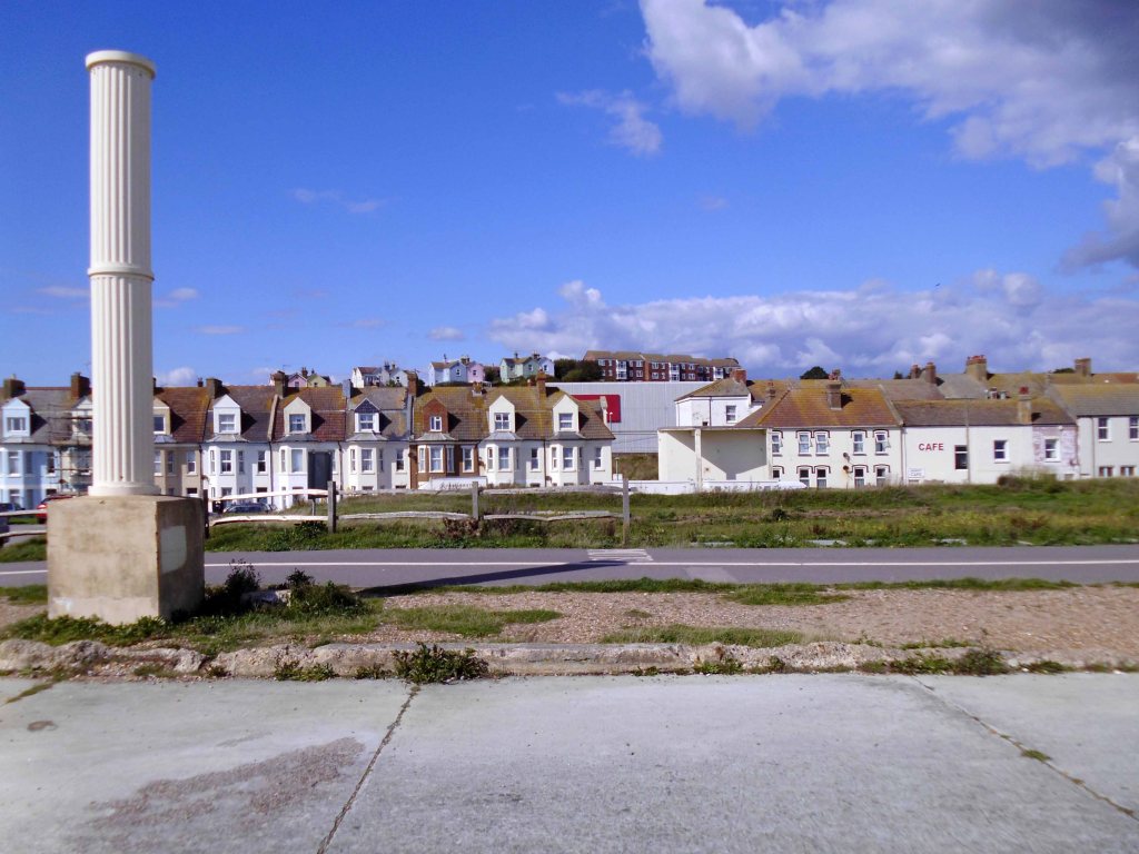
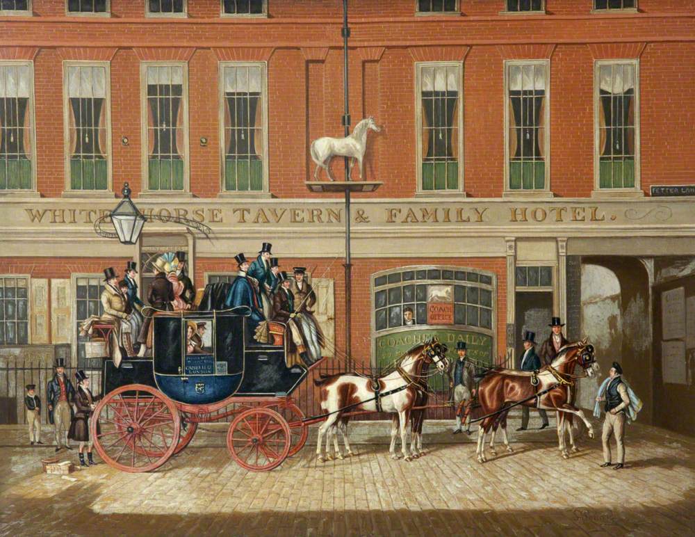
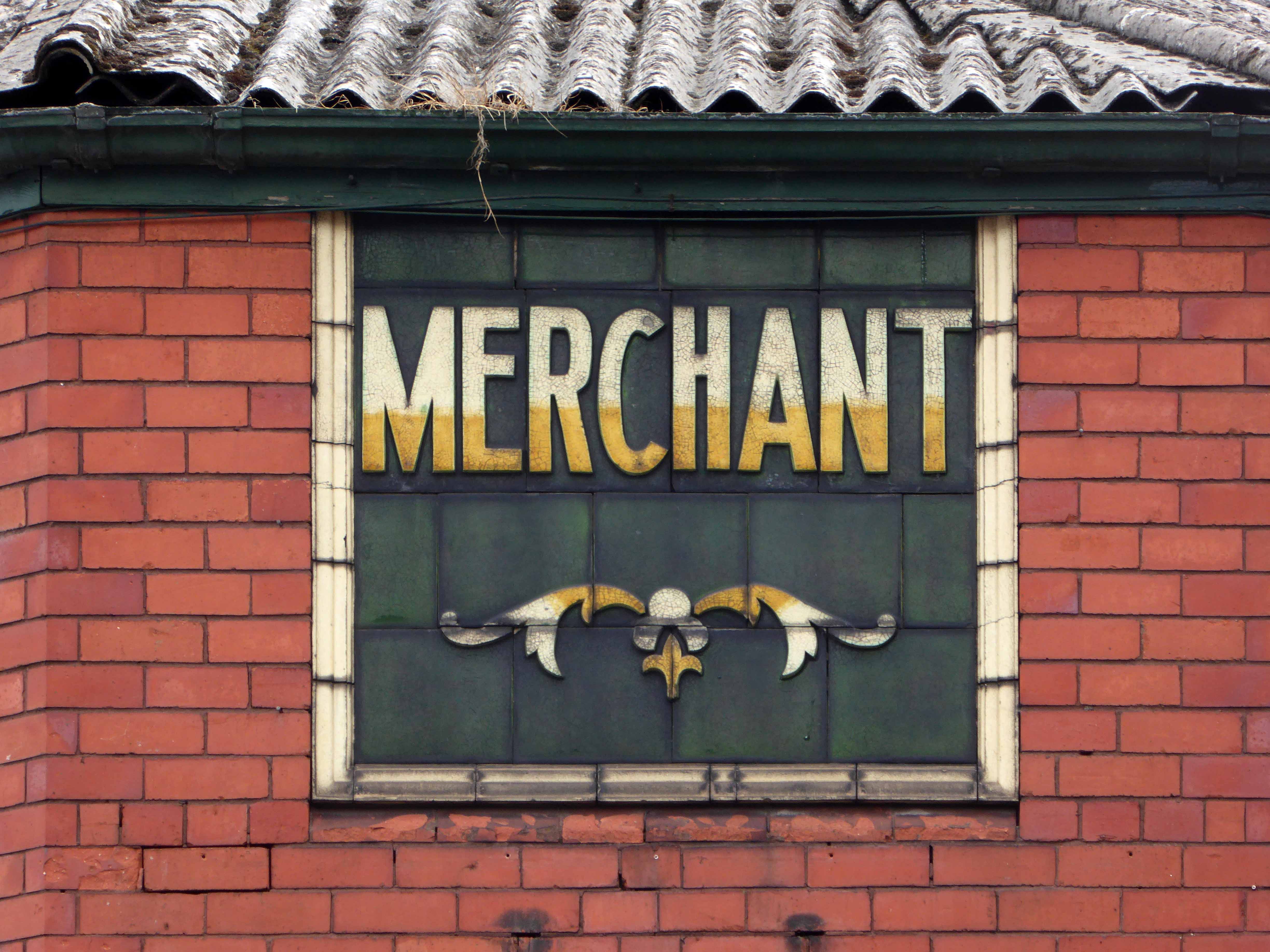
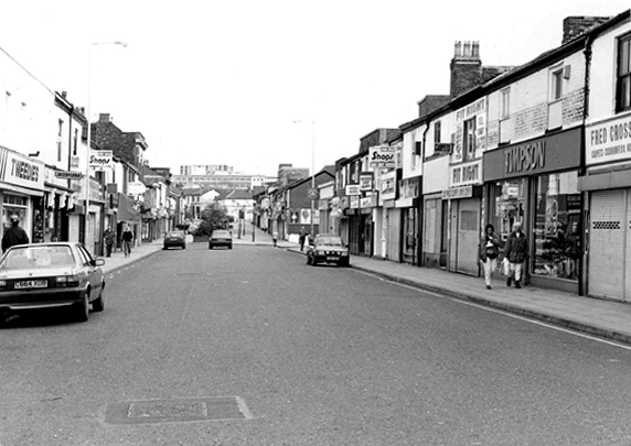
Leaving the compact anonymity of my B&B for the open road!
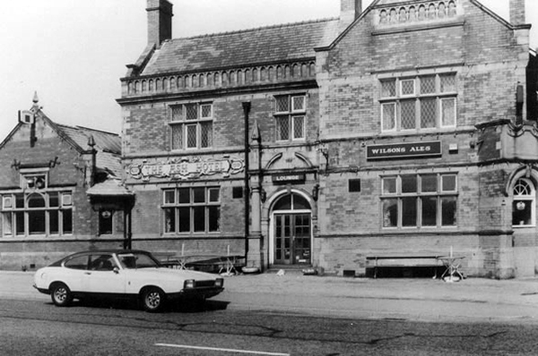
Having been unable to sample the joys of the Quality Hotel.
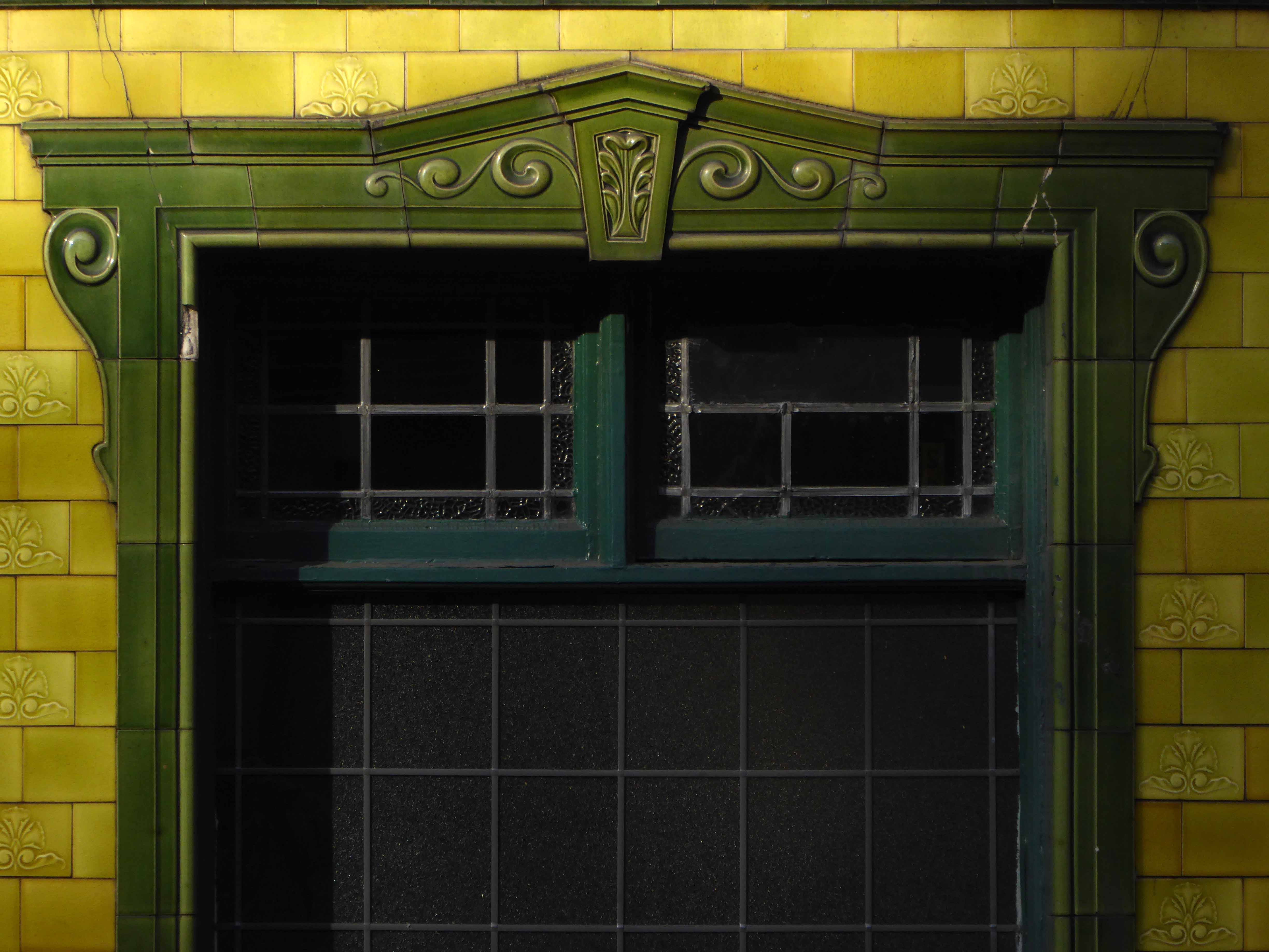
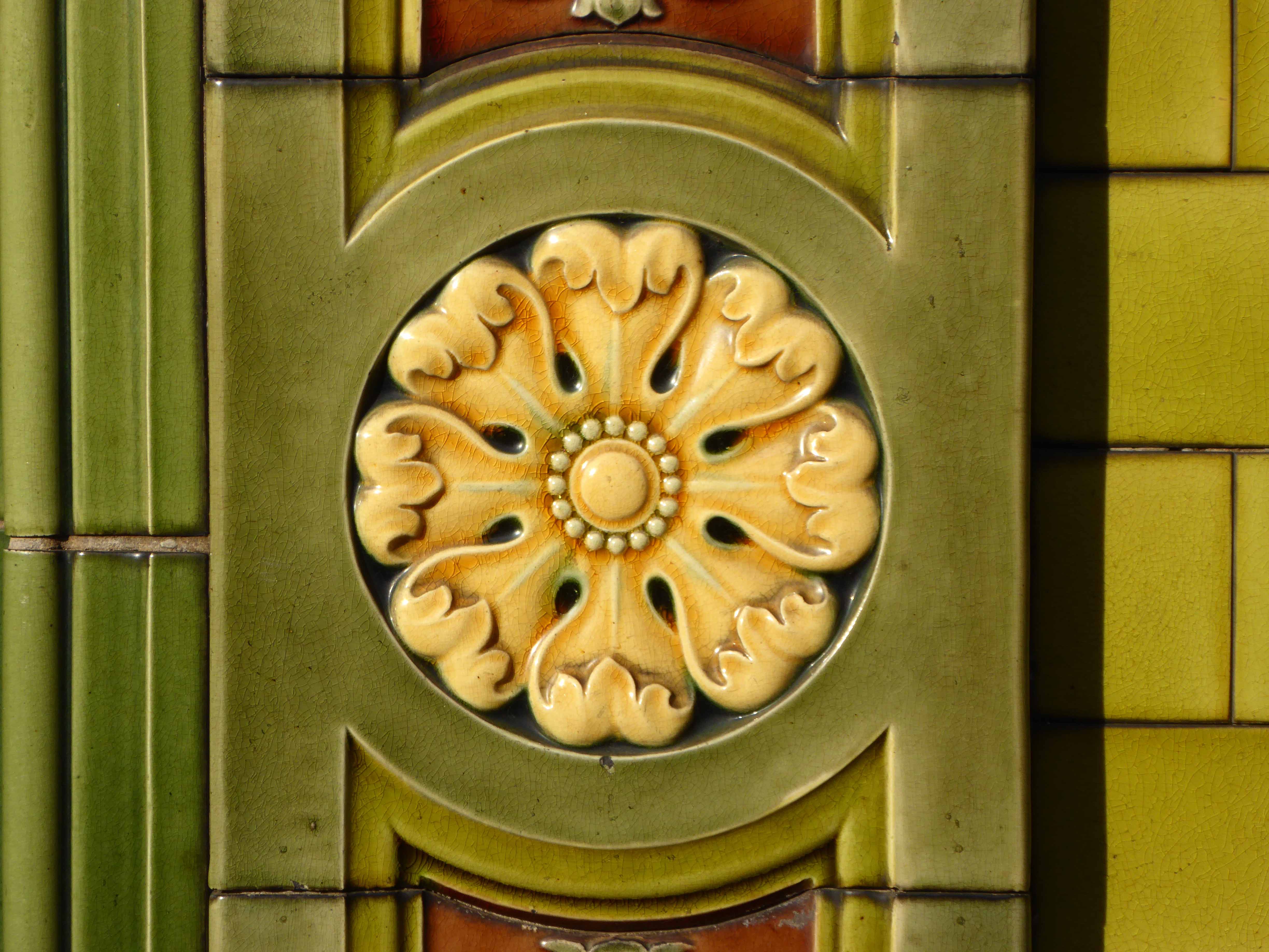
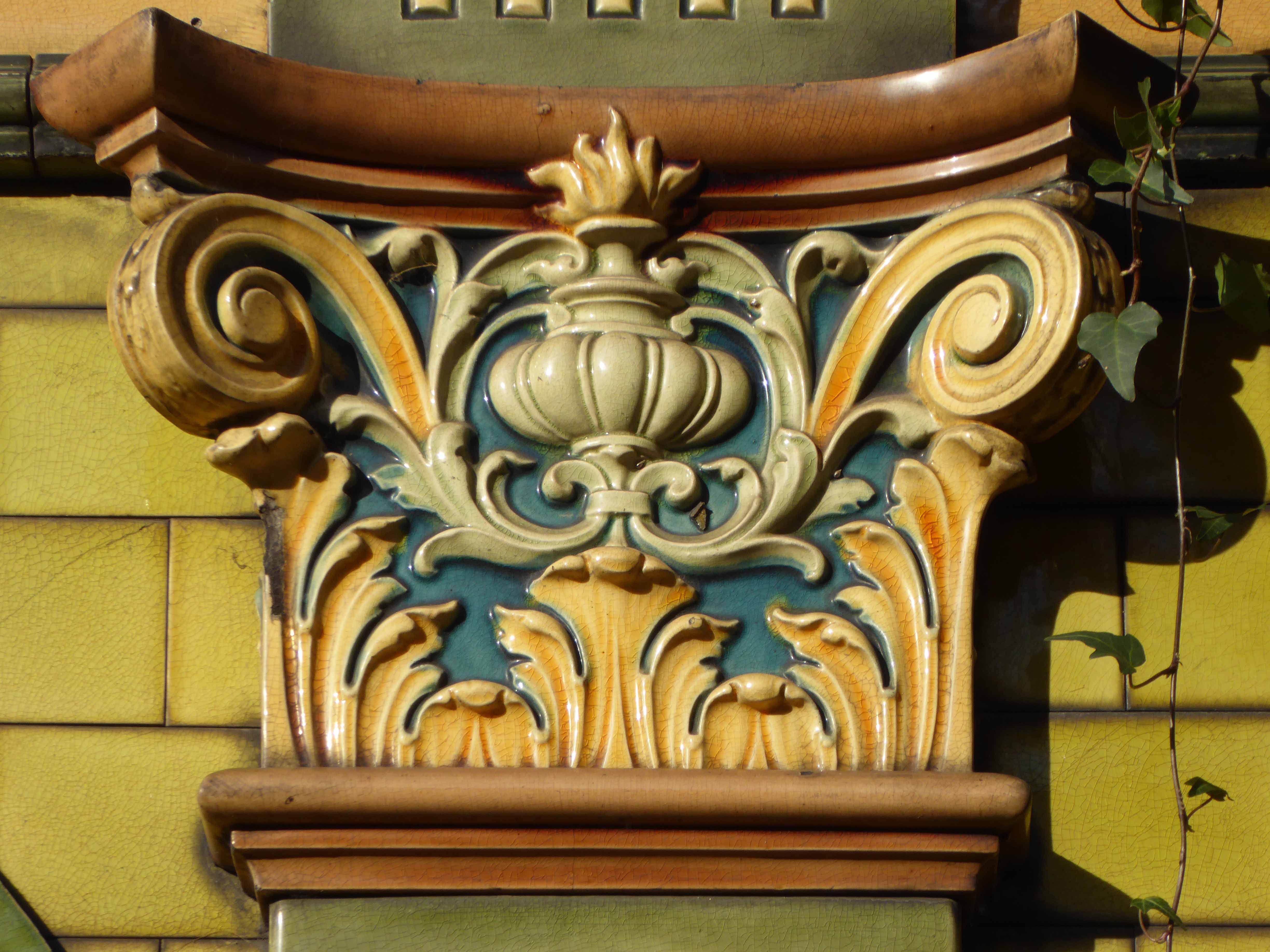
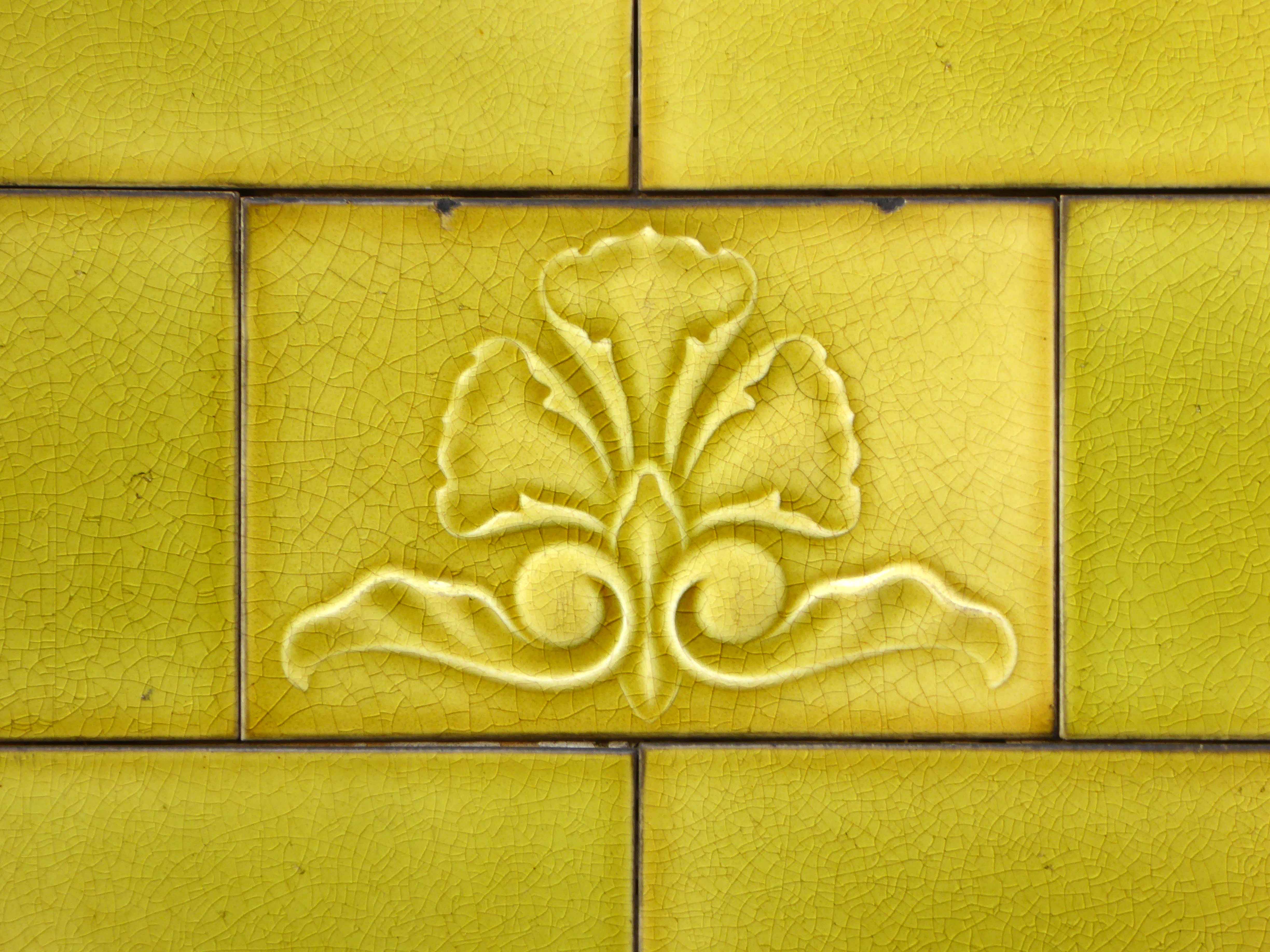
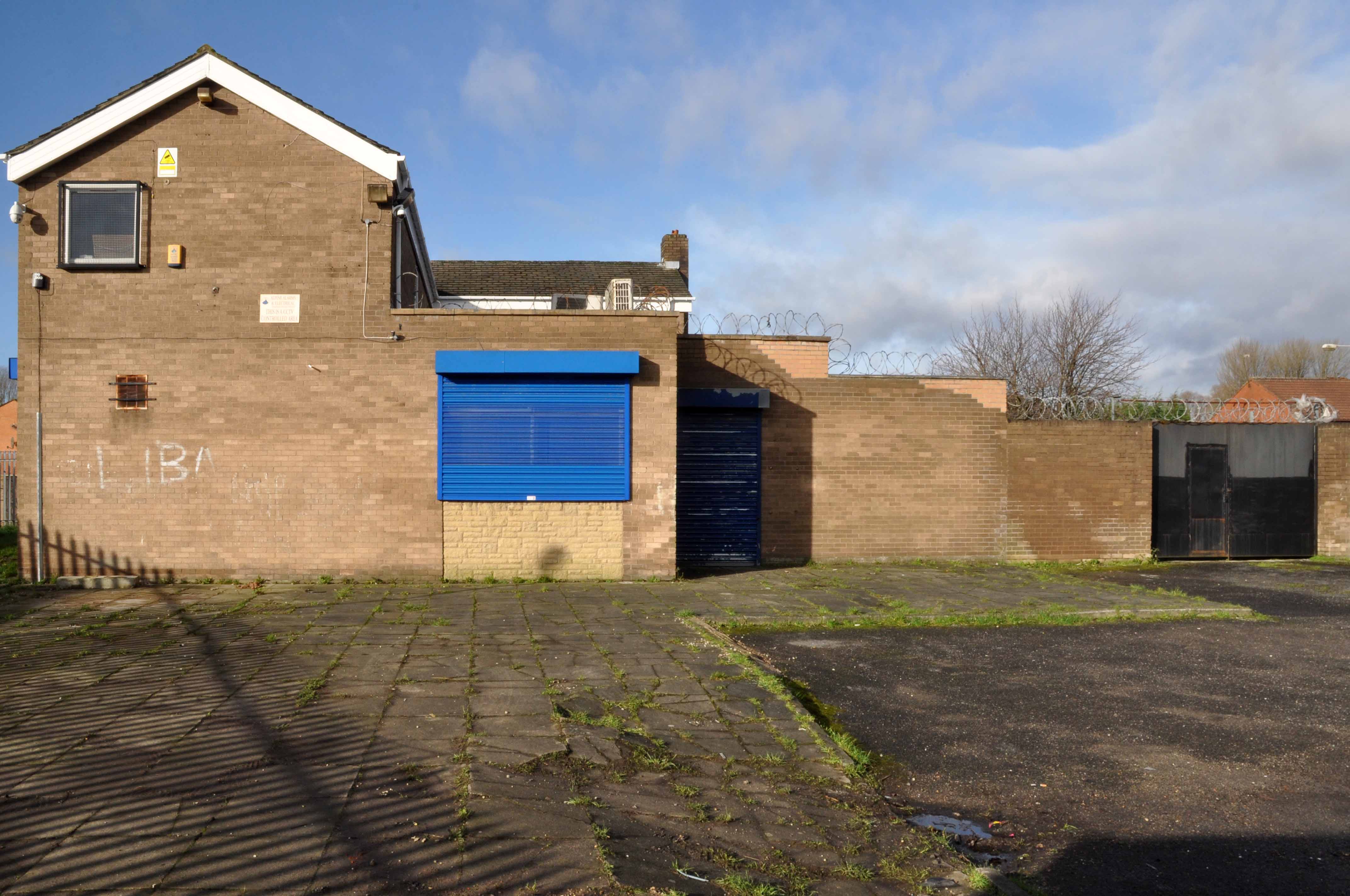
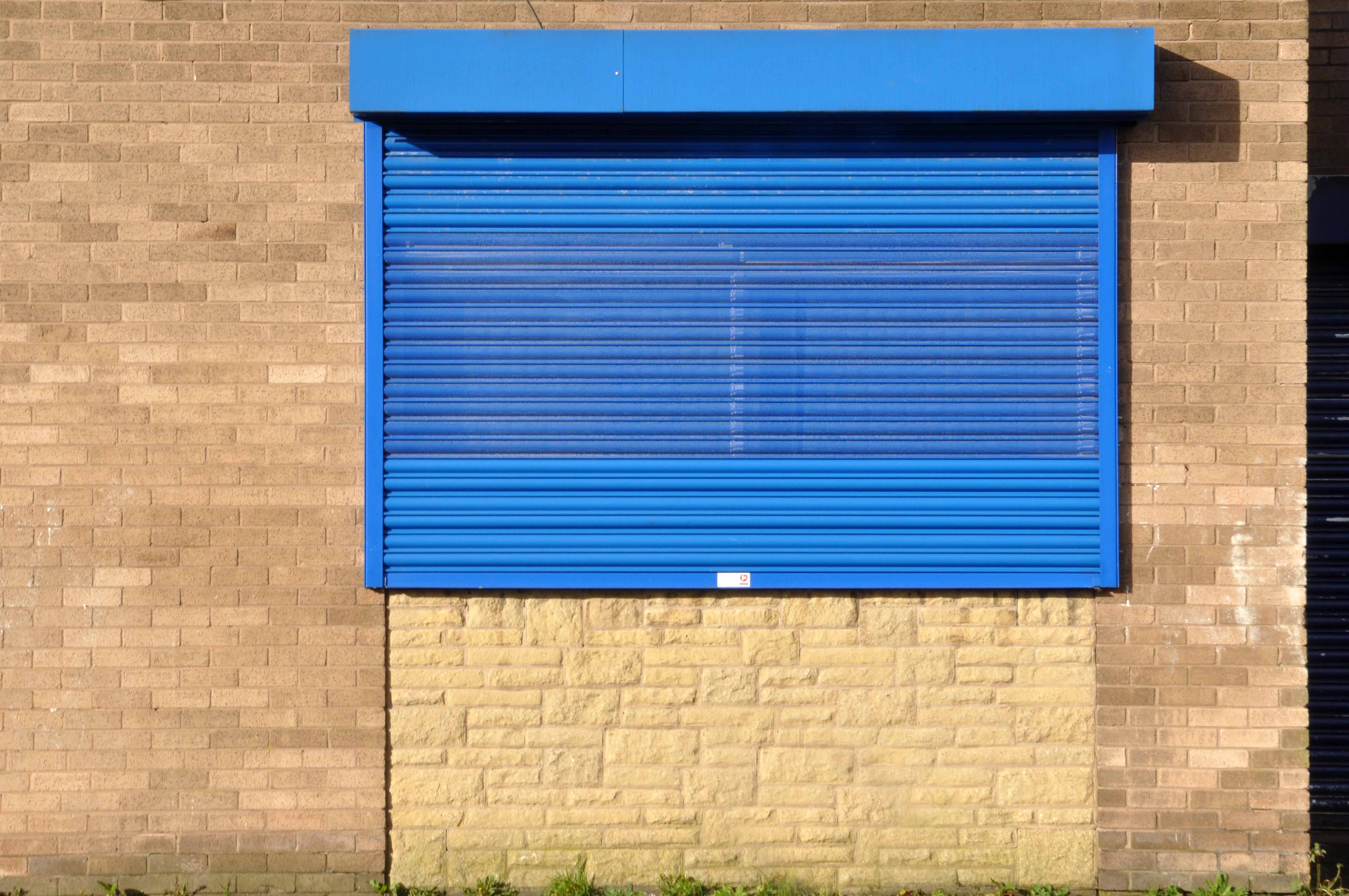
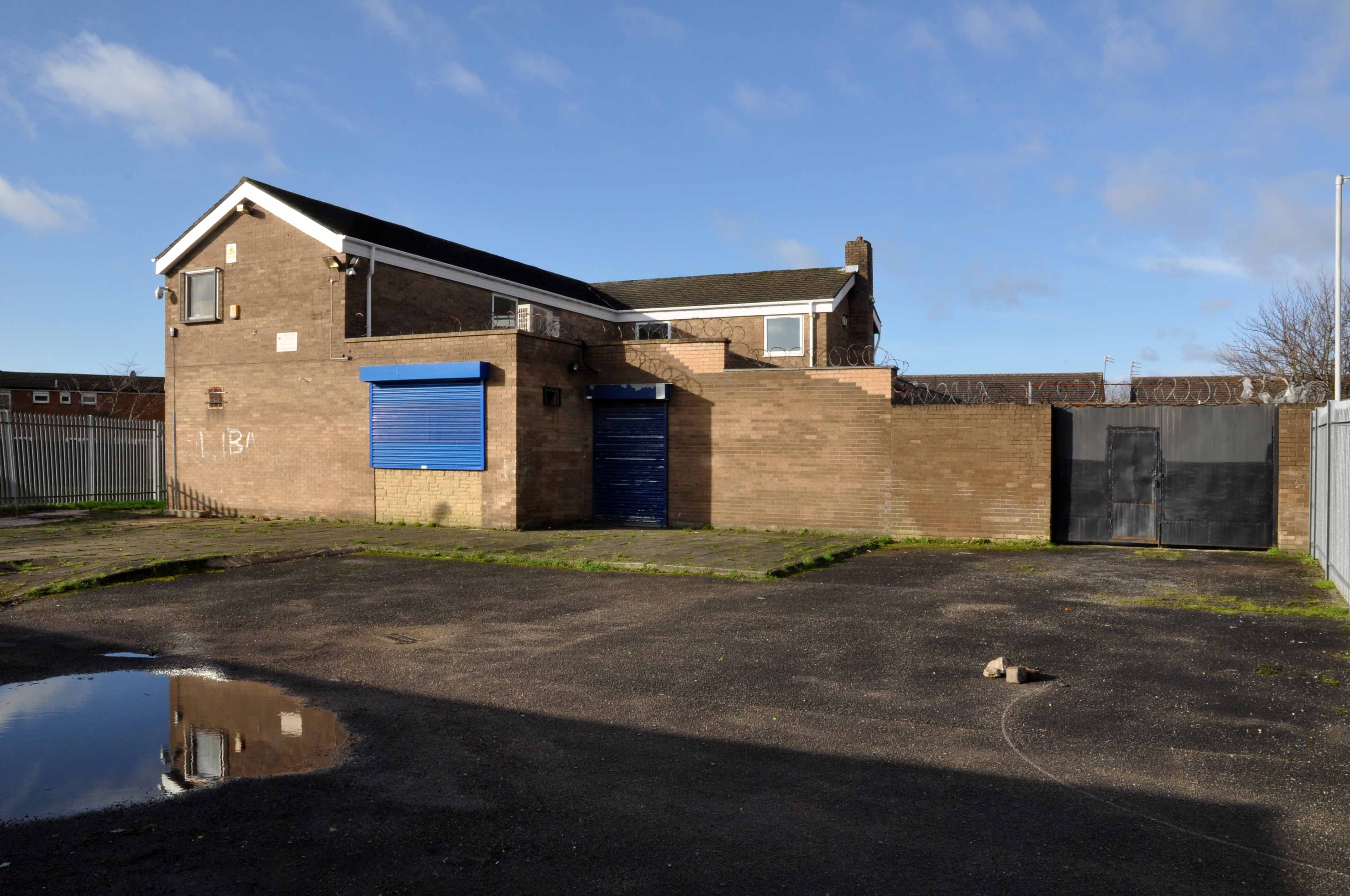
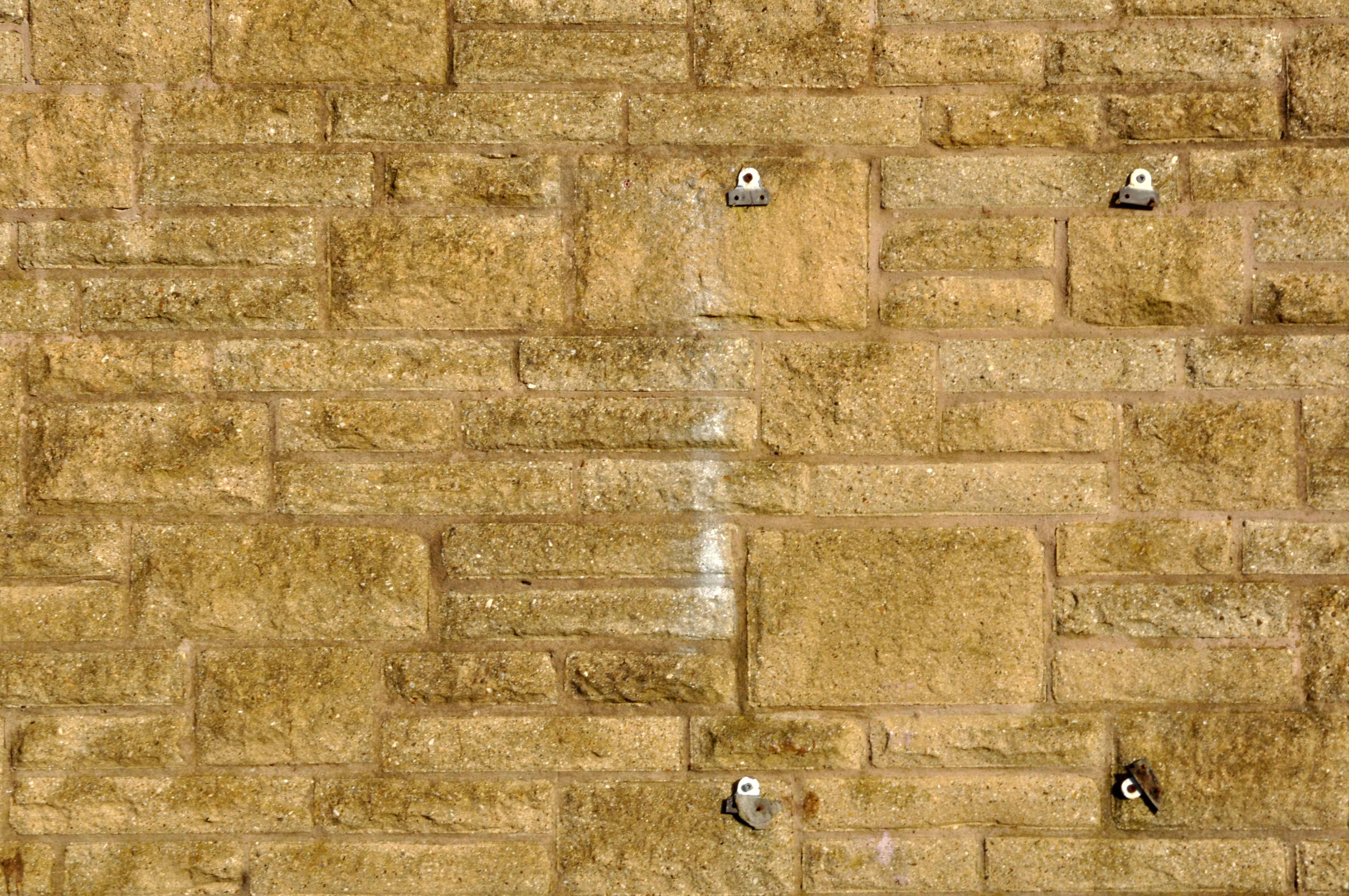
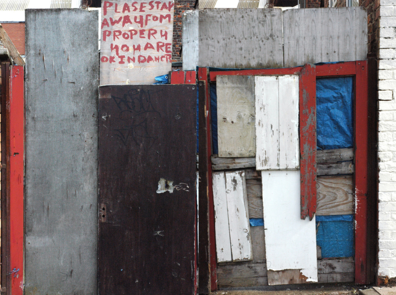
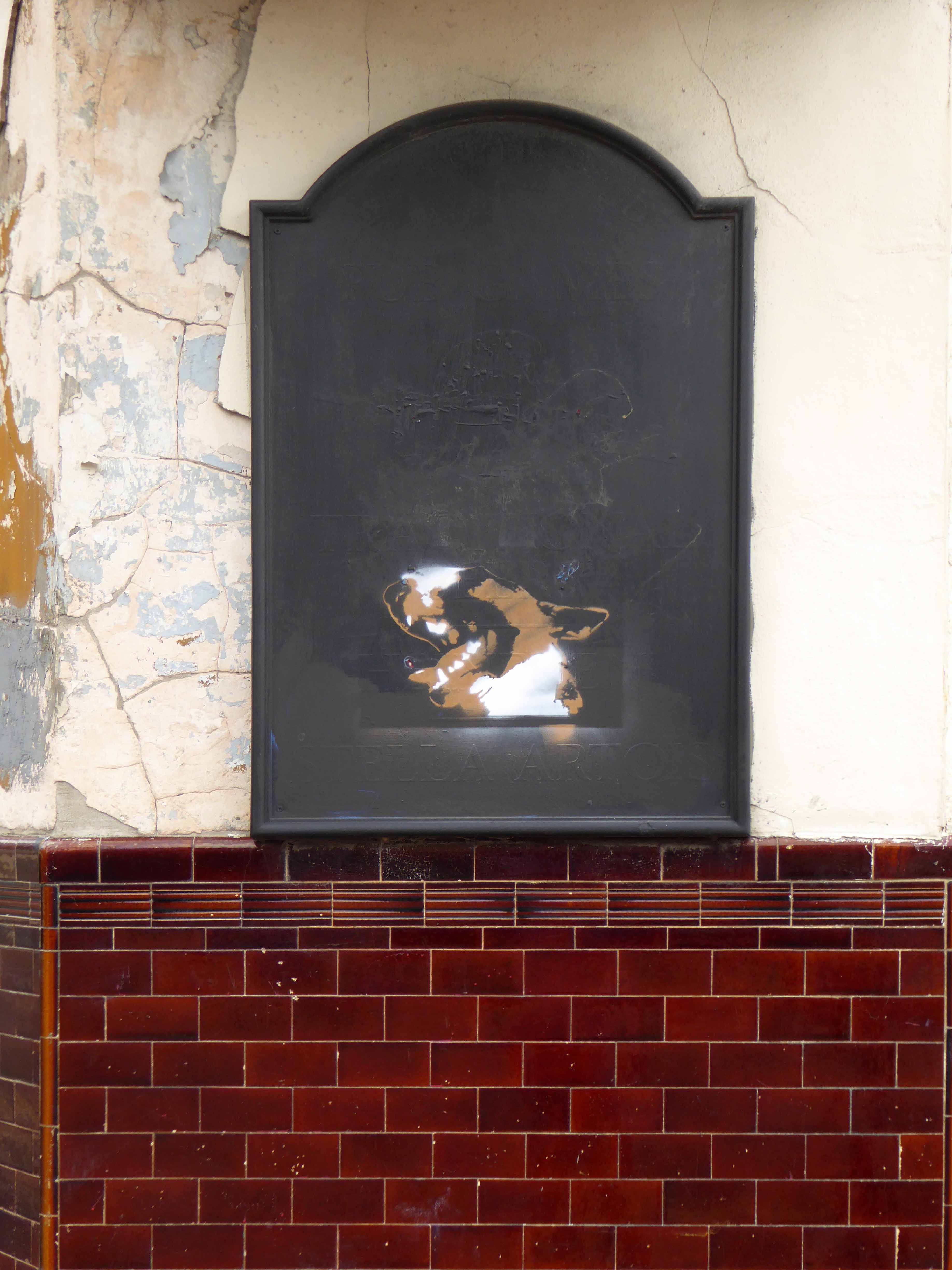
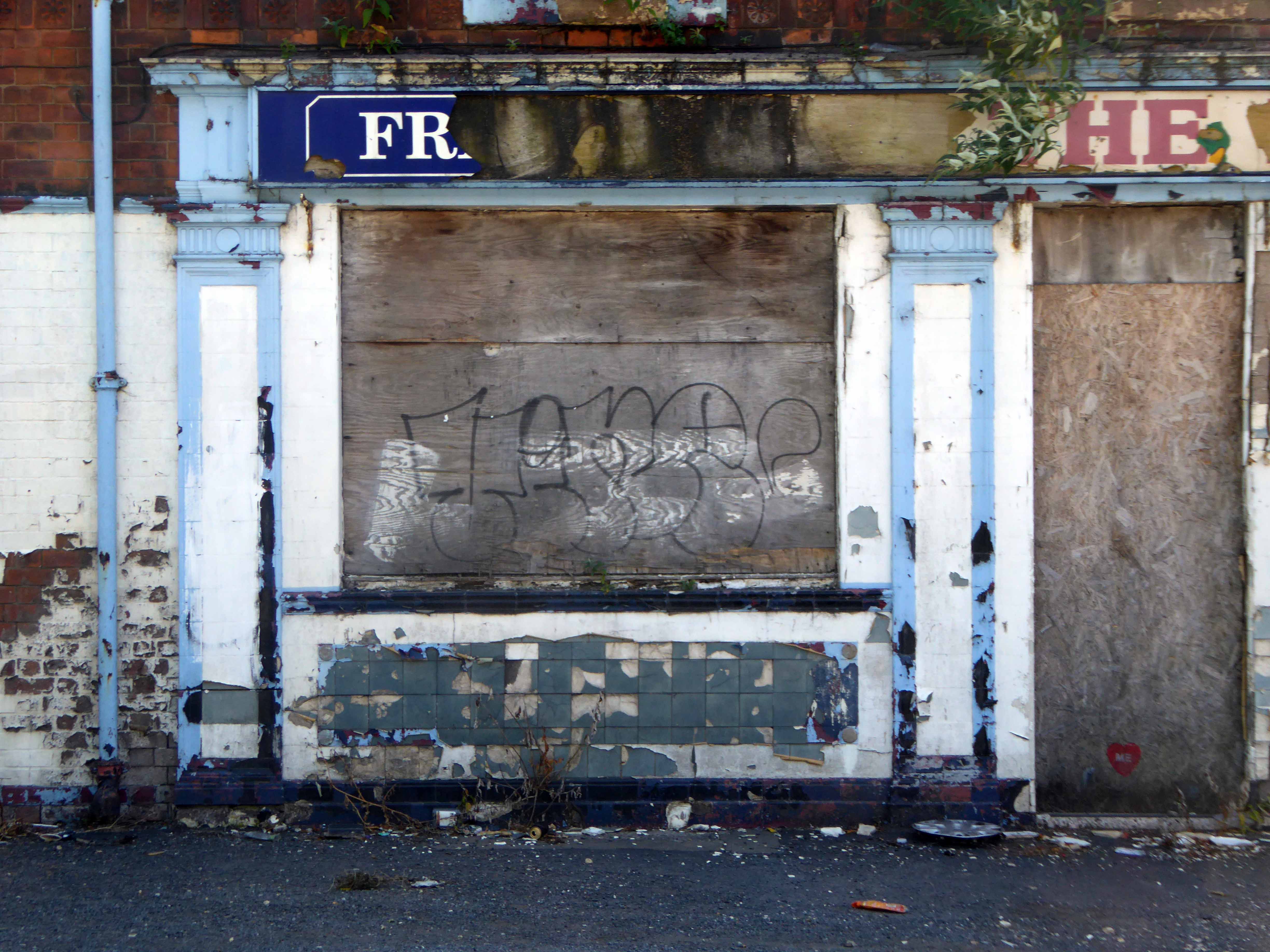
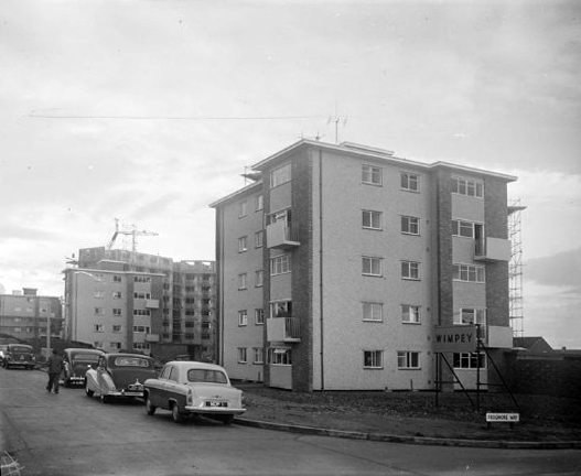
The Quality Hotel closed in 2014 and was demolished two years later after the site was bought by the city council following vandalism and fires.
The ten-storey concrete block was built in 1970 in the 350th anniversary year of The Mayflower ship setting sail from Plymouth for North America.
Gilpin Demolition
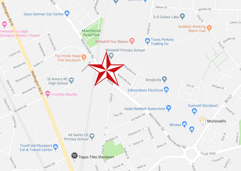
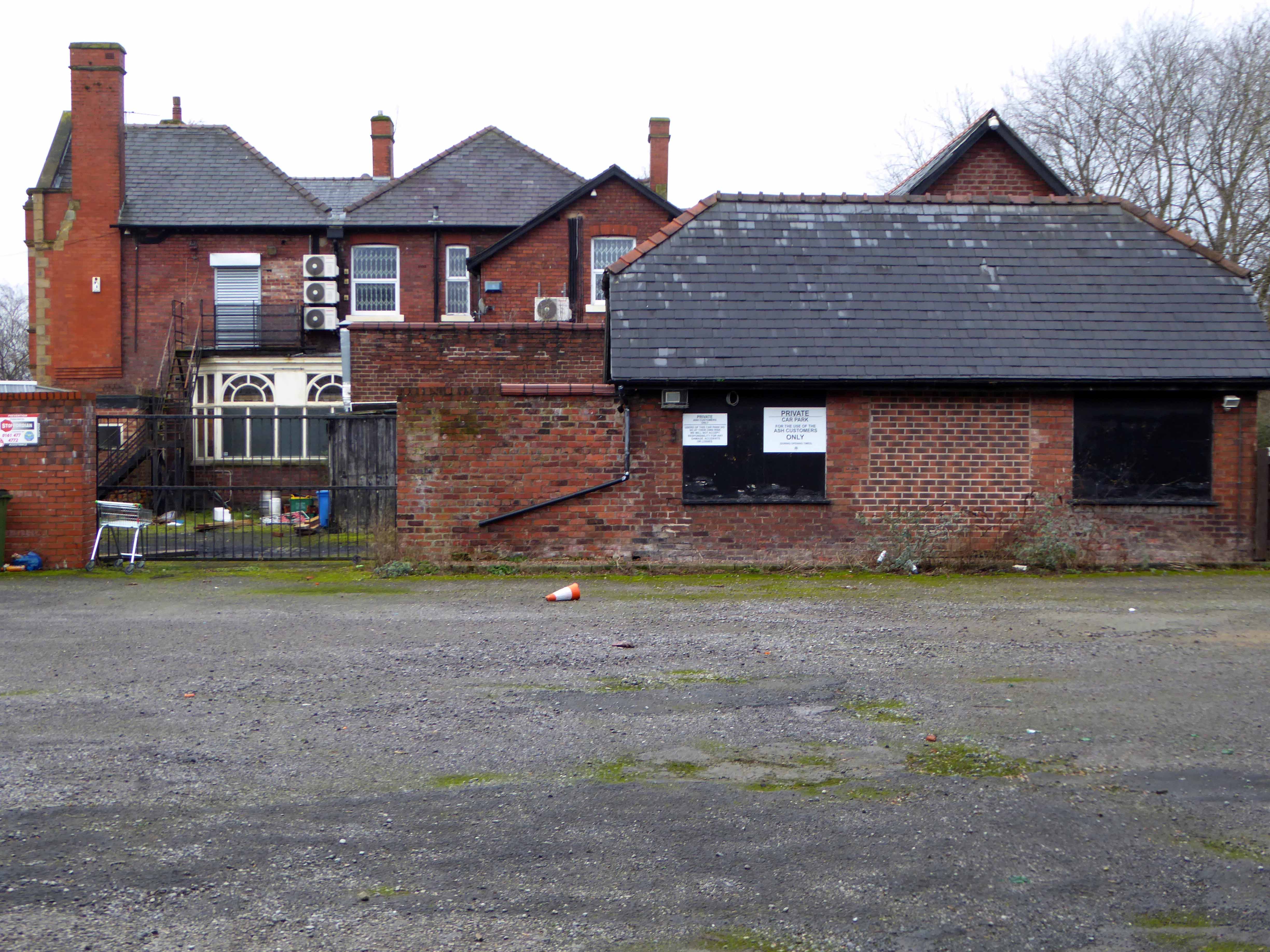
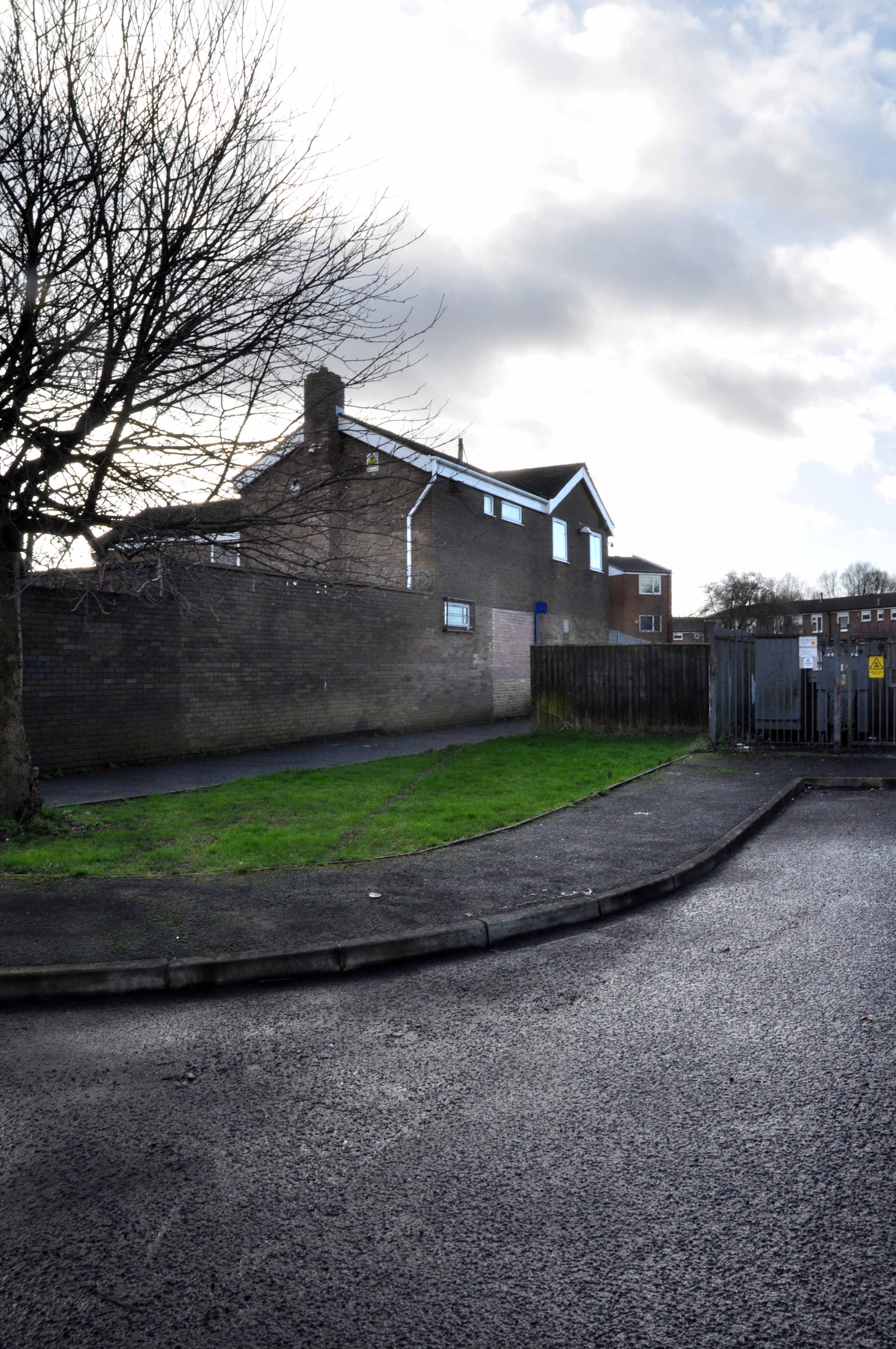
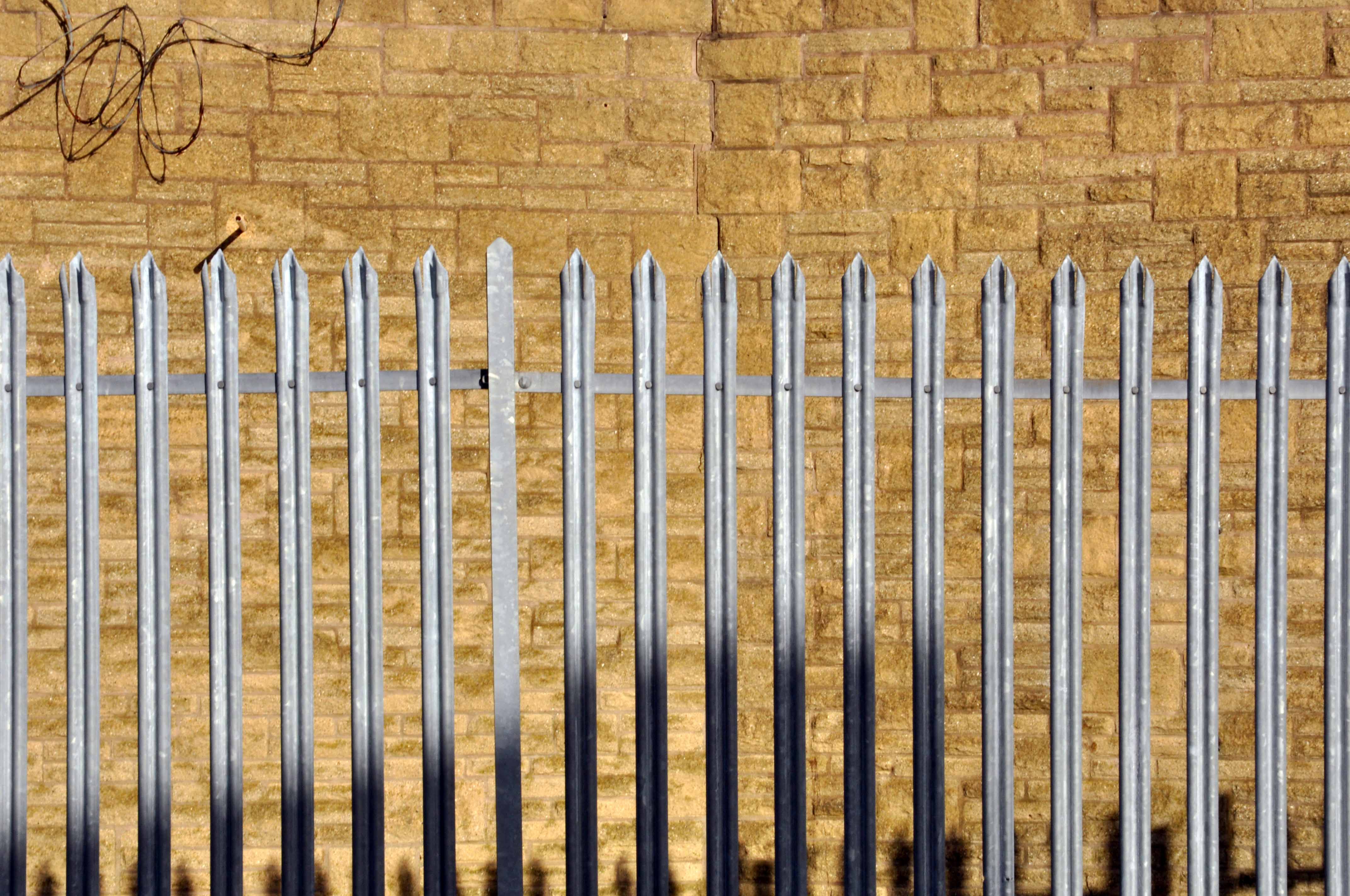
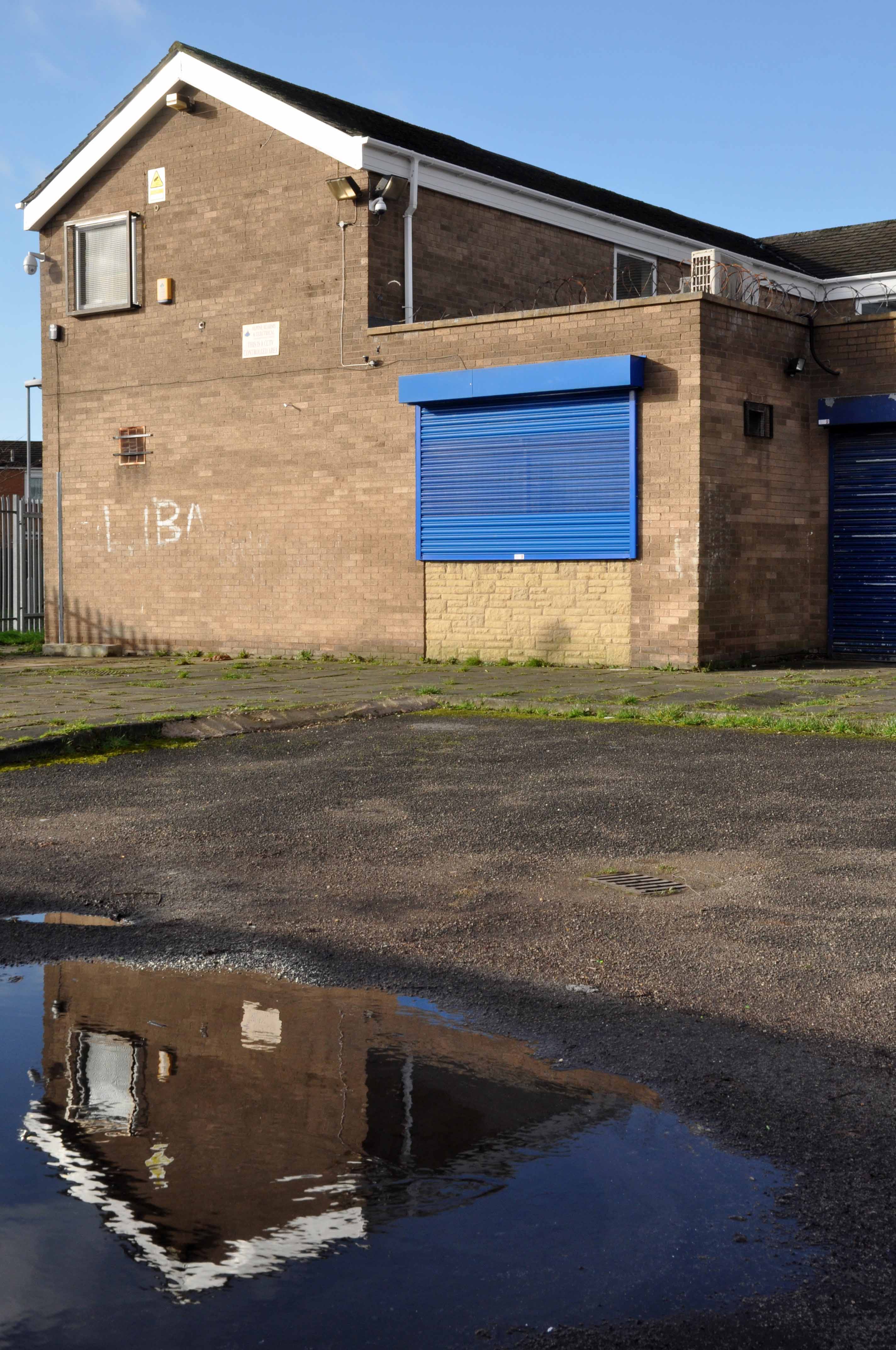
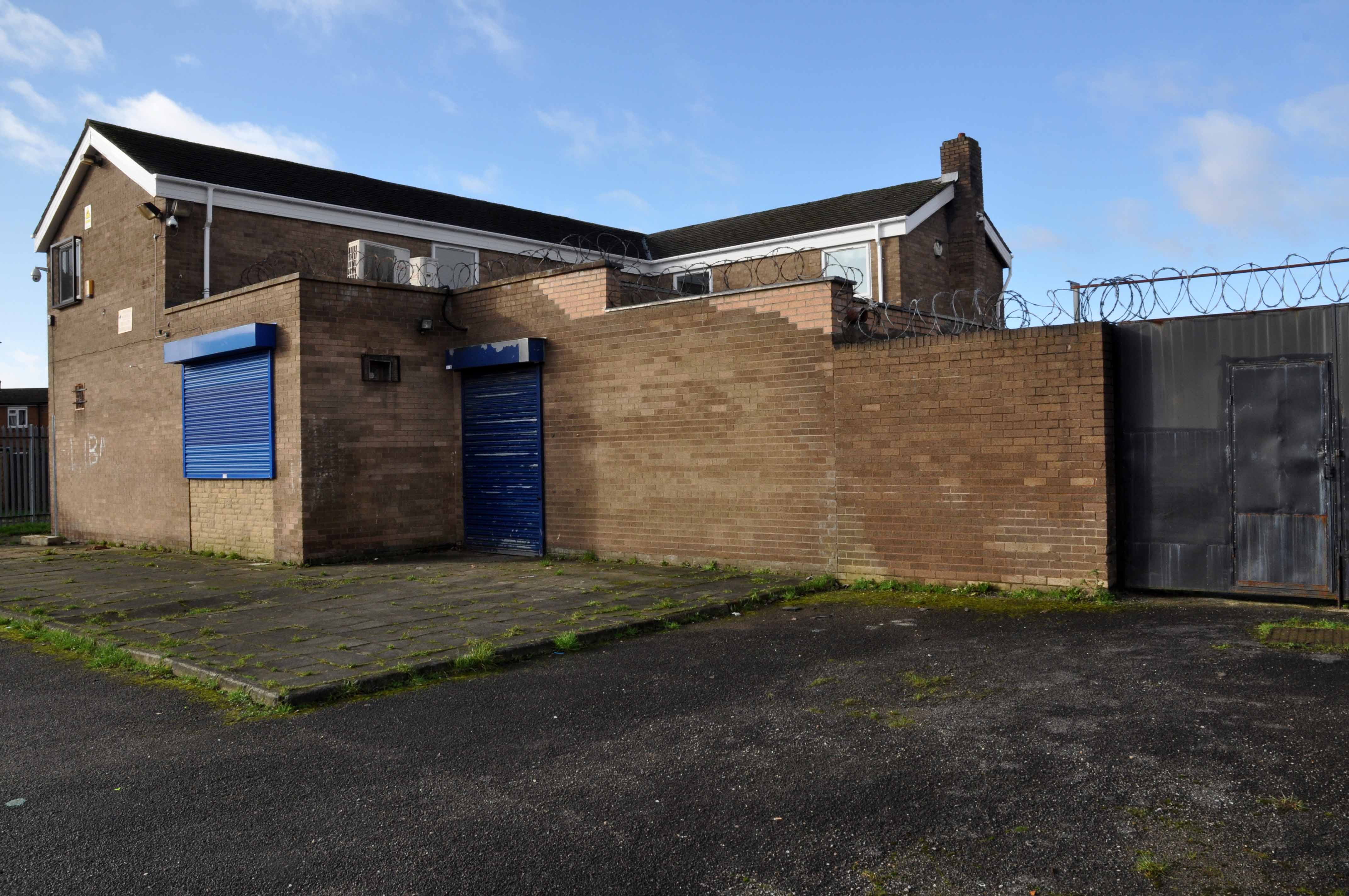
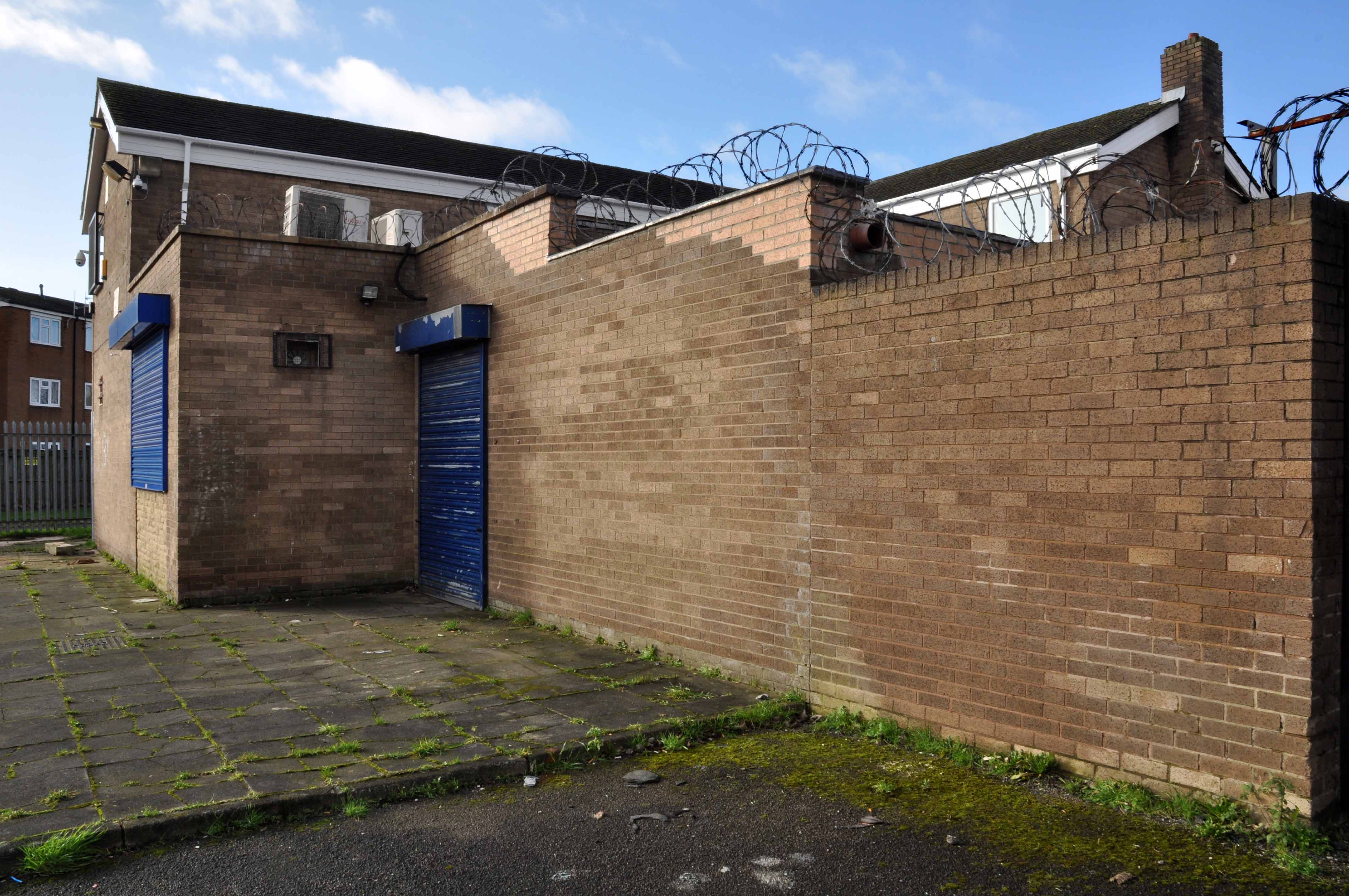
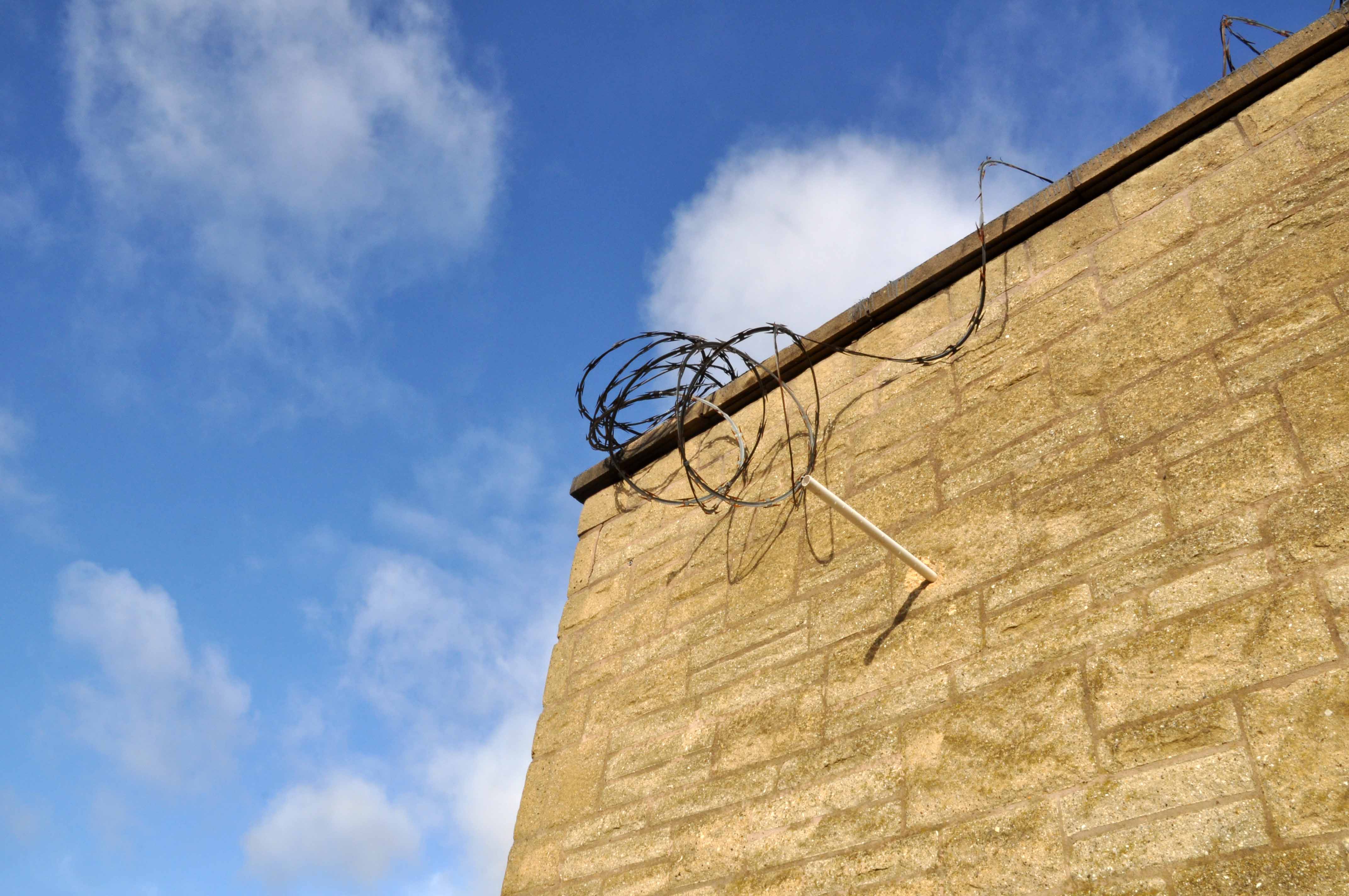
Plymouth Hoe’s fifty million pound hotel and apartments project appears to have ground to a halt with no building work happening more than a year after developers vowed it would start in 2018.
Henley Real Estate, the firm behind the plans for an 11-story hotel and a 15-floor block of flats on the demolished former Quality Hotel site, has gone silent on plans and not responded to emails and phone calls from Plymouth Live.
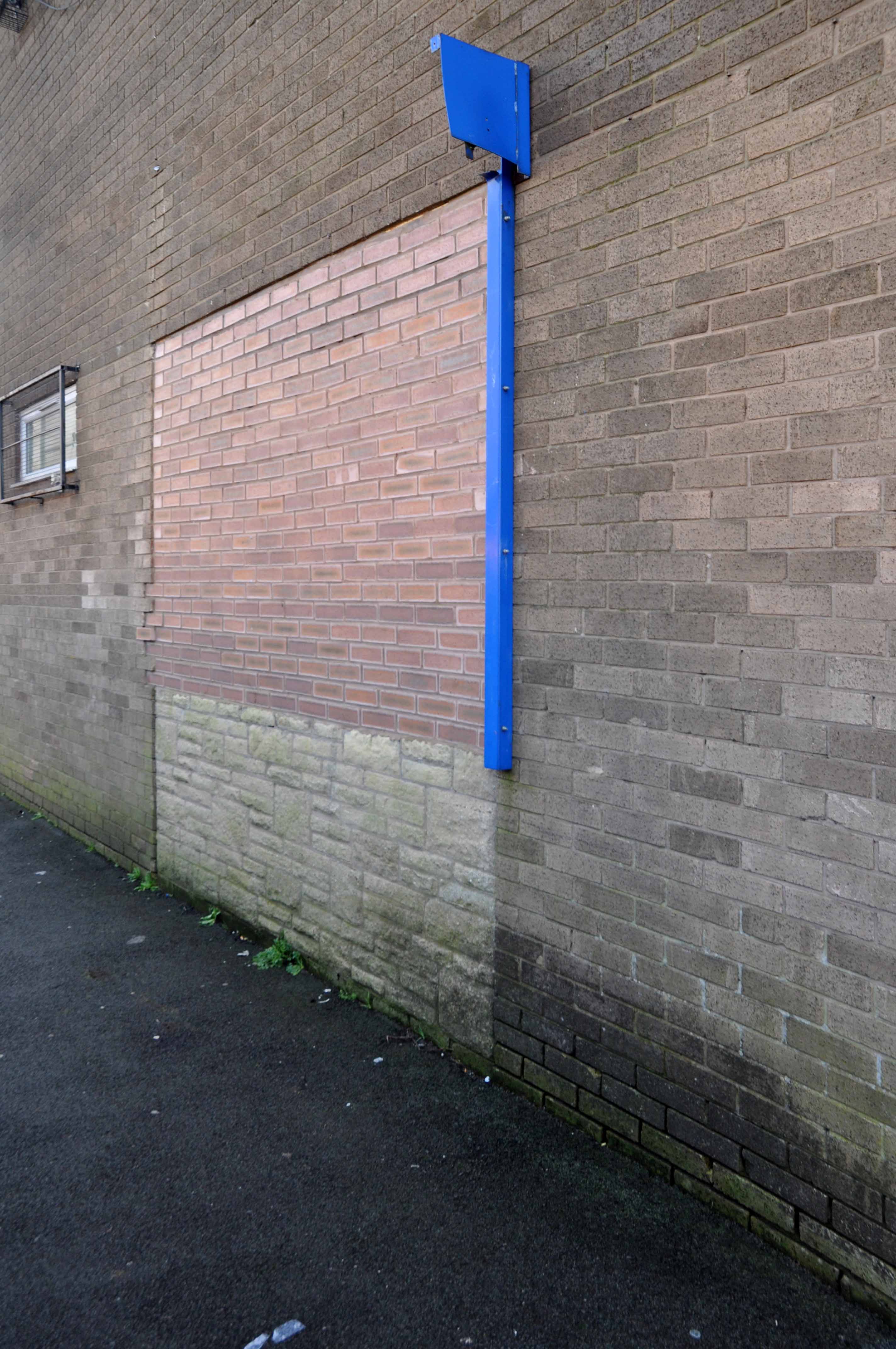
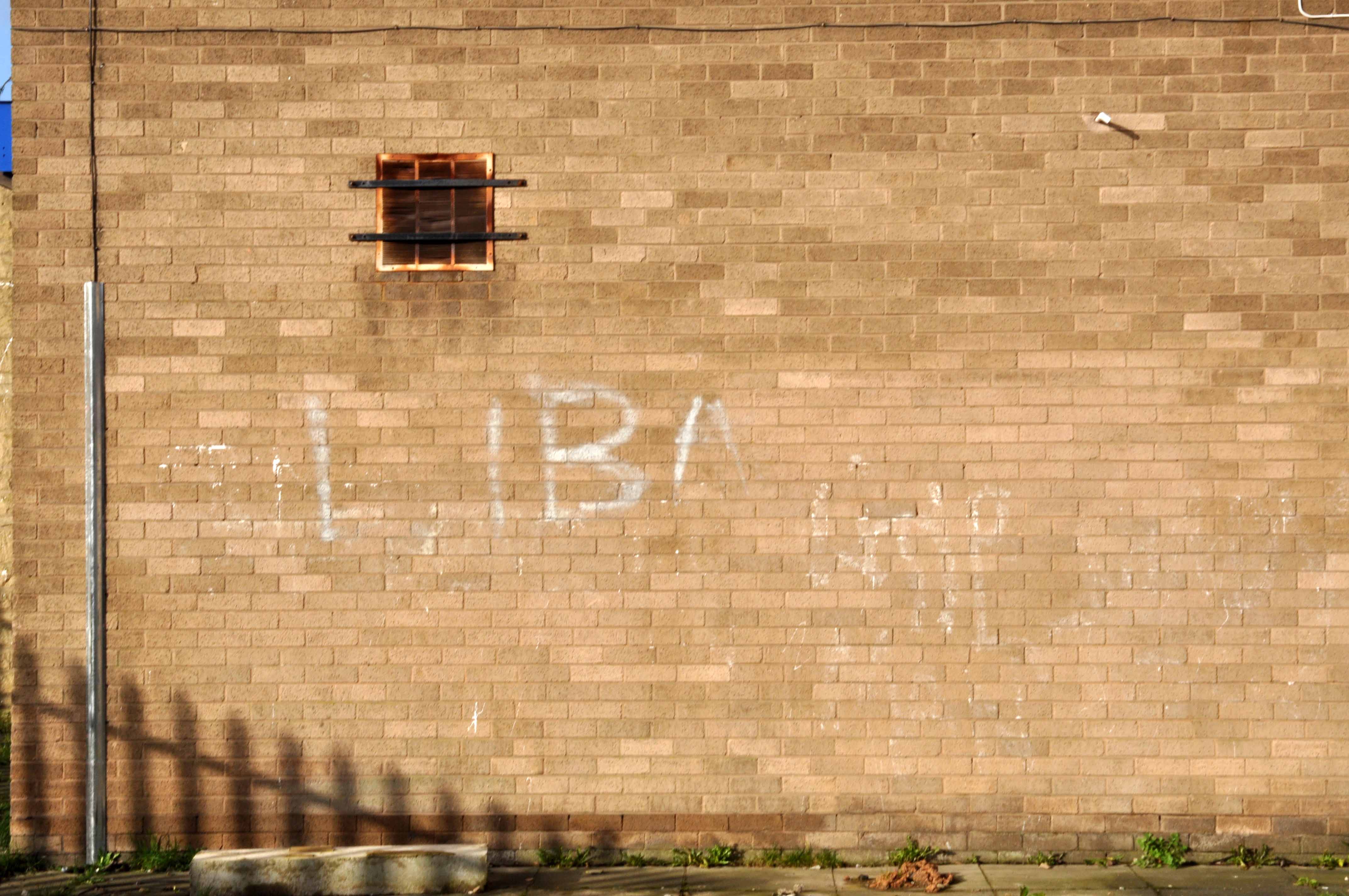
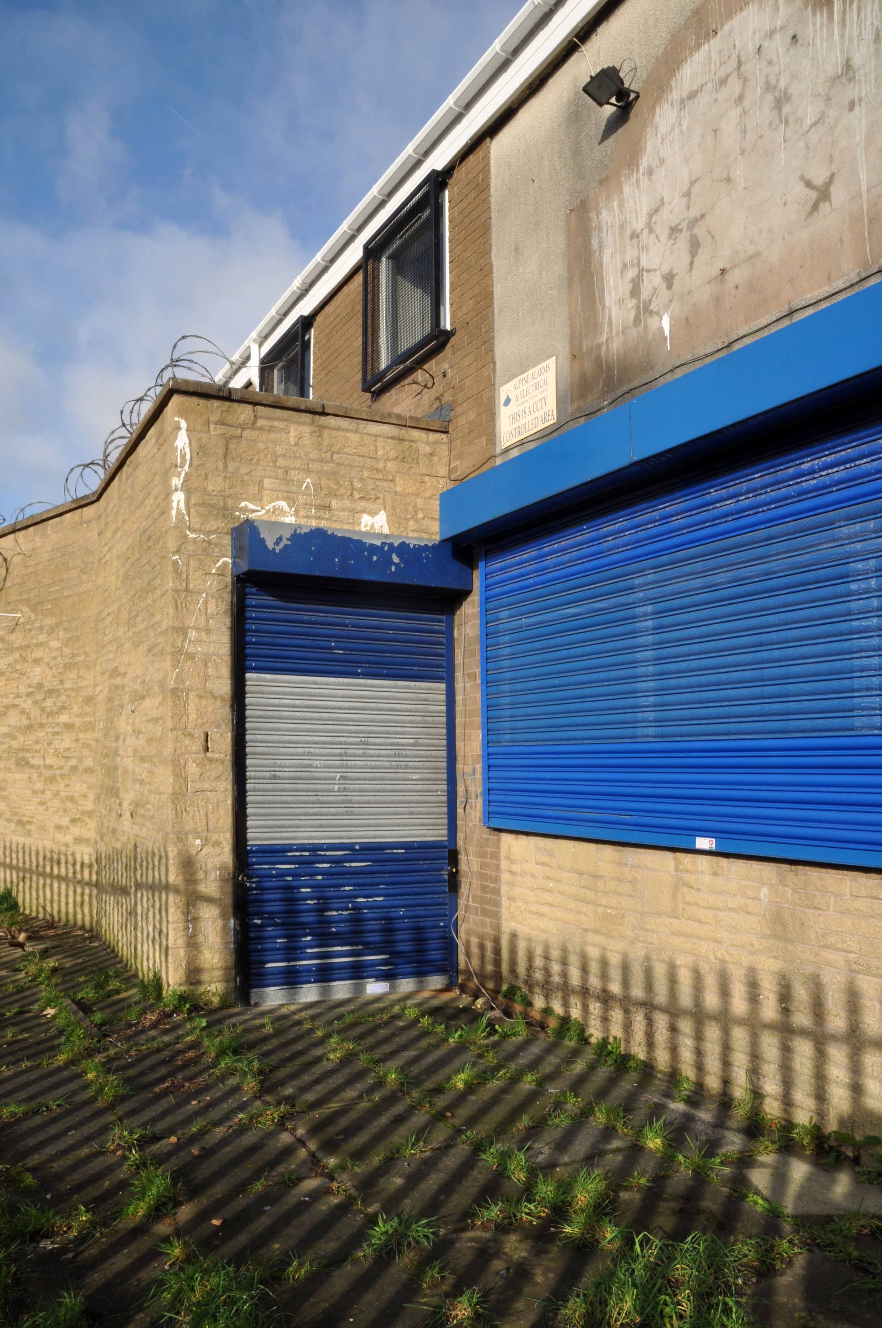
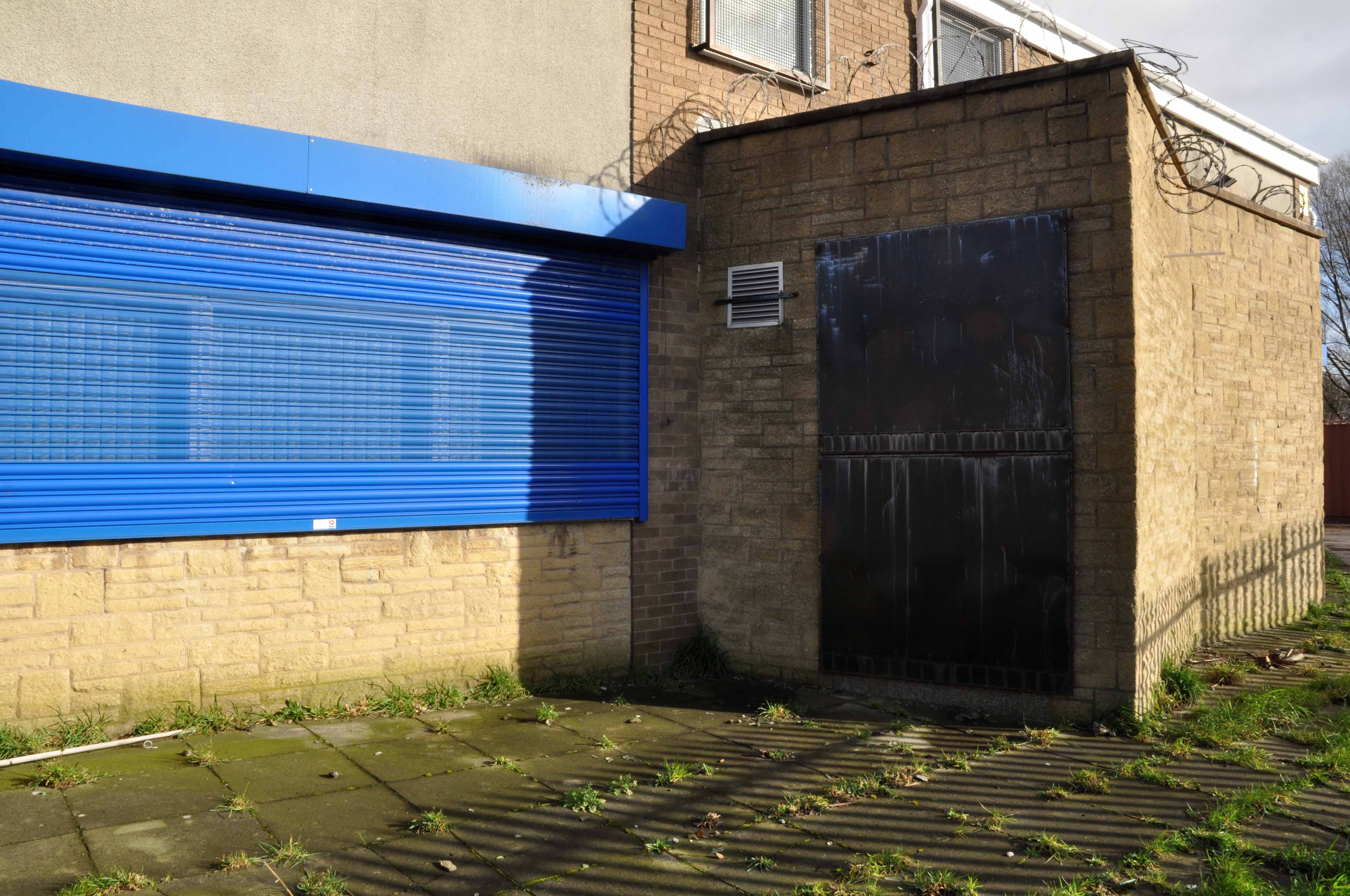
When we visited the site the only sign of life was some weeds growing out of the ground.
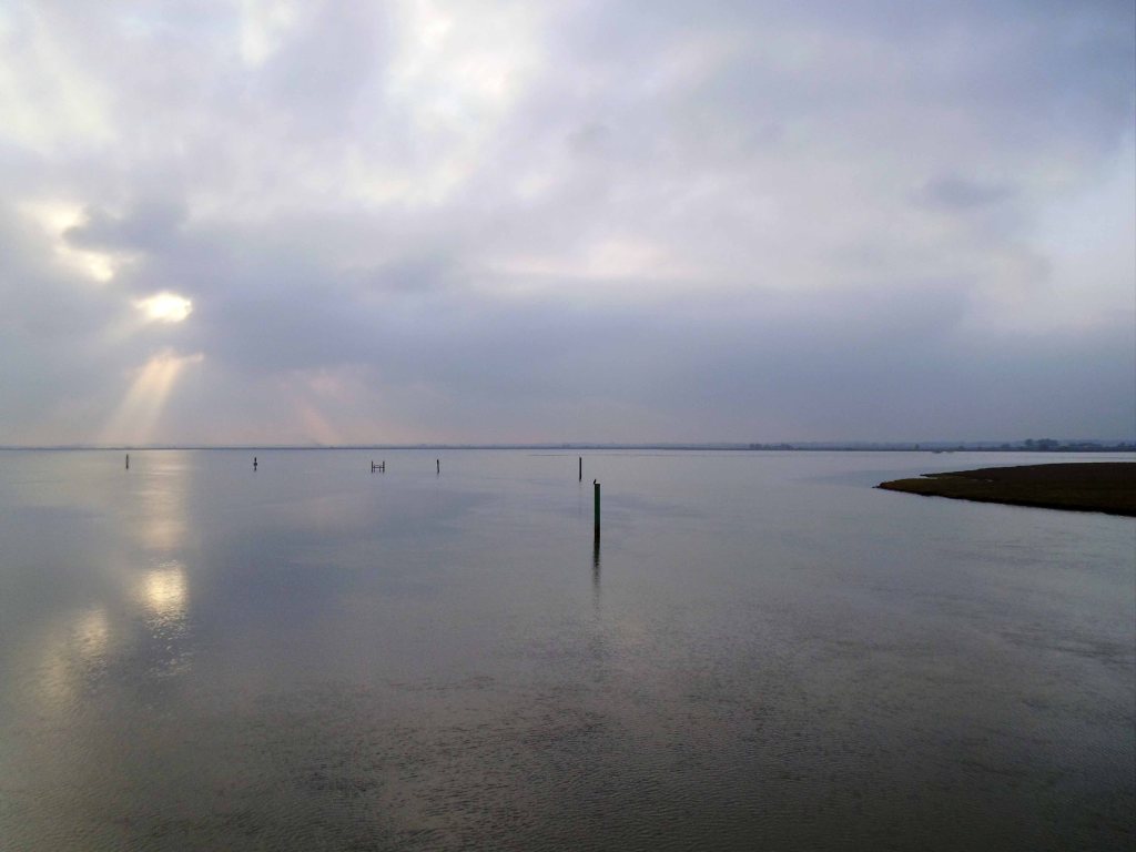
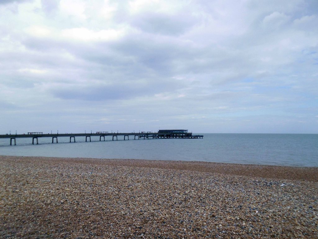
I’ll leave them to it, I’m off in search of the South West Passage
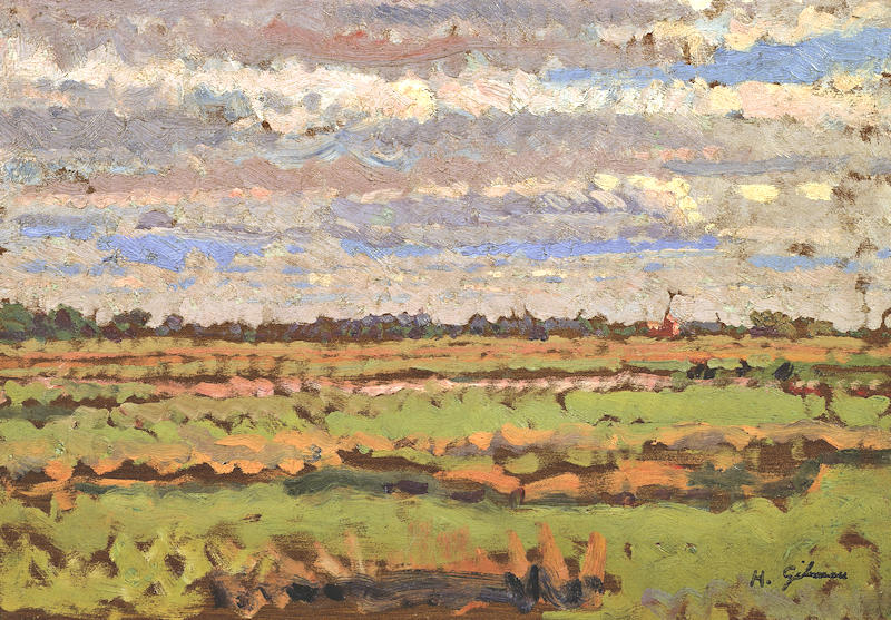
The South West Coast Path itself is 630 miles long and is the longest established National Trail in the country. Starting at Minehead in Somerset it runs along the coastline of Exmoor, continuing along the coast of North Devon into Cornwall. It follows the entire coastline of Cornwall, goes across the mouth of the River Tamar and continues into Devon. After running along the south coast of Devon it then follows the Dorset coastline before finally ending at Poole Harbour.
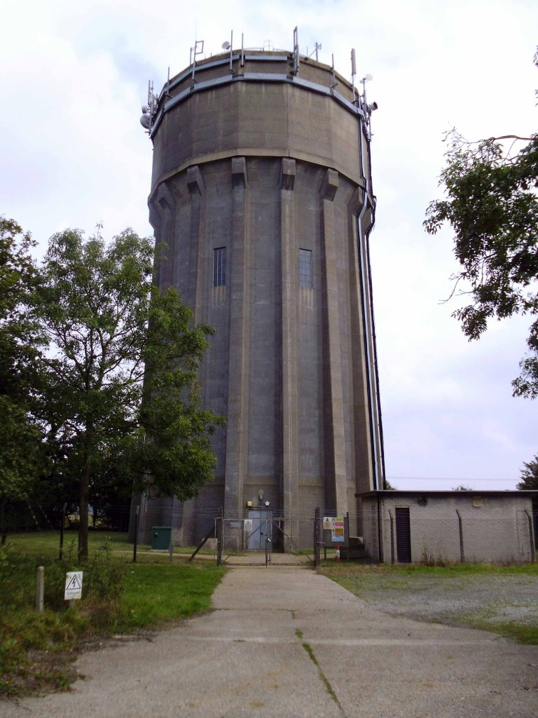
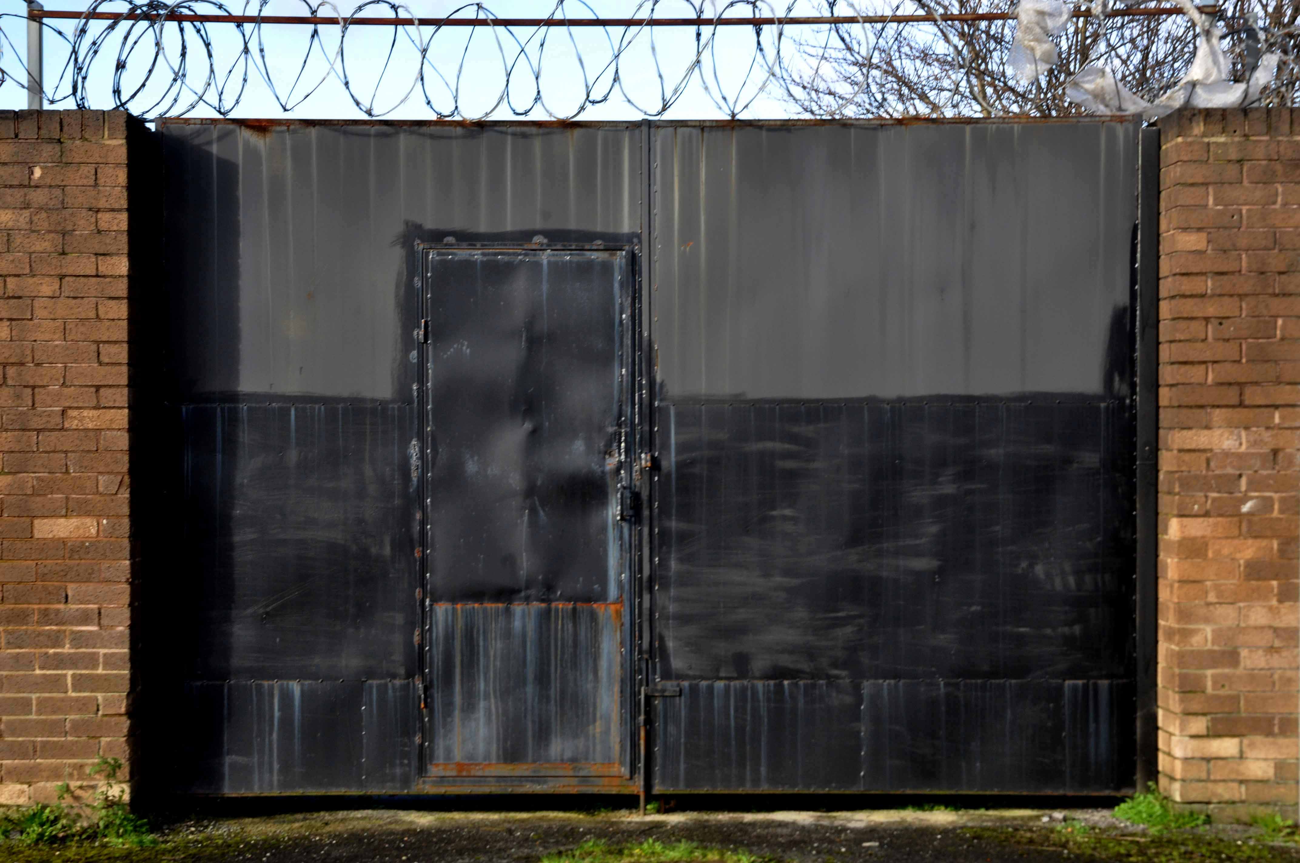
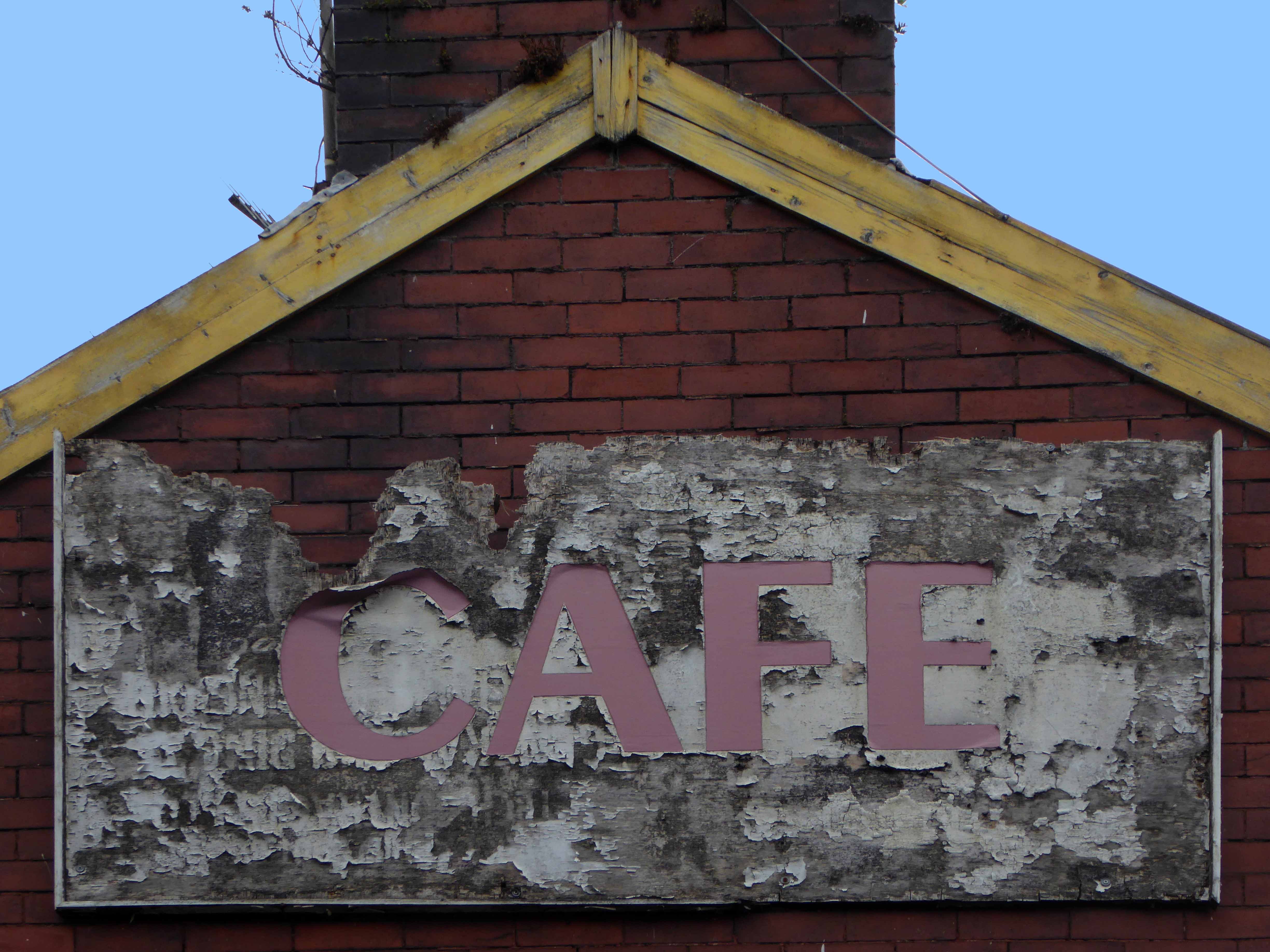
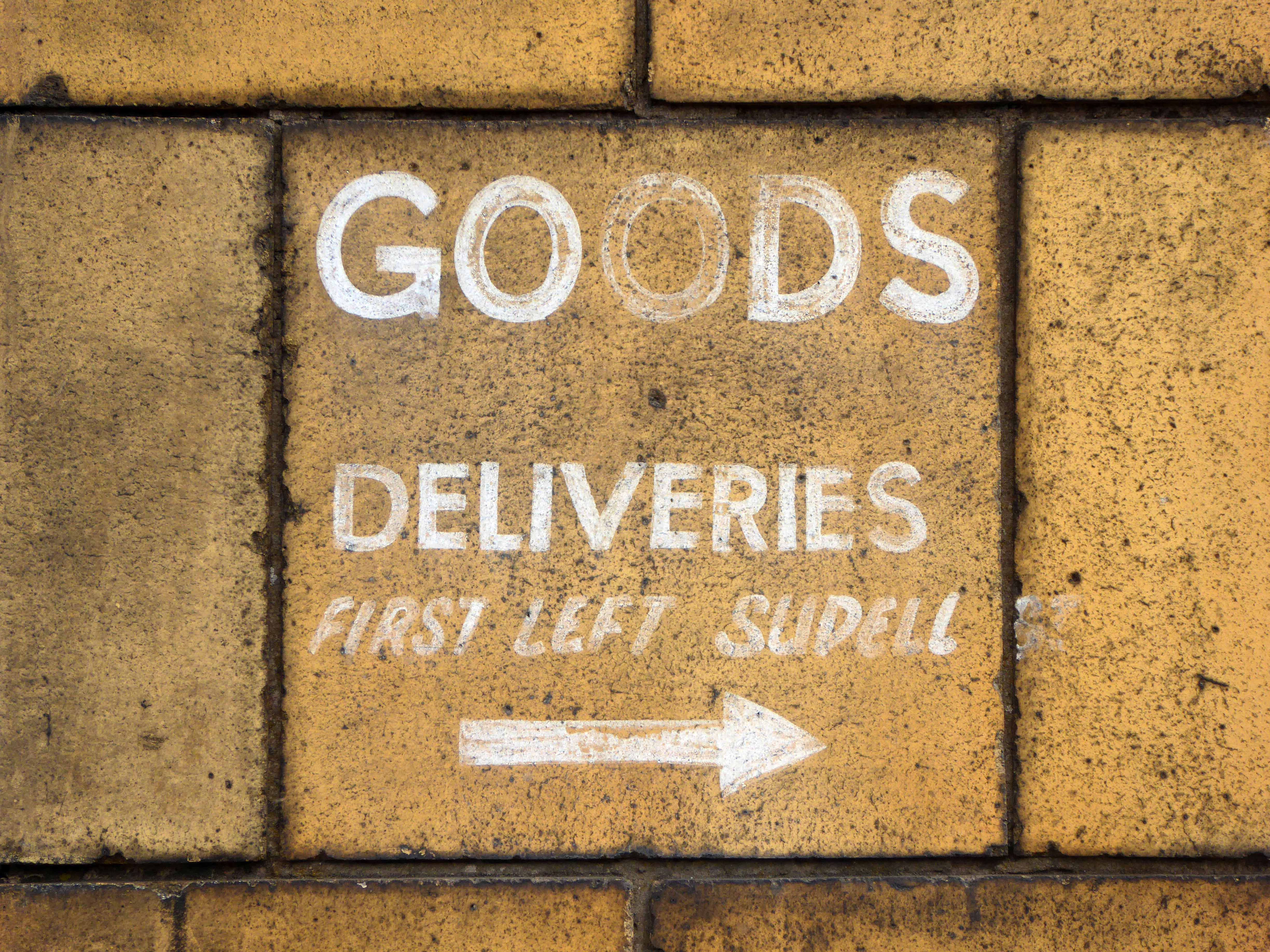
However if you follow the Coastal Path you’ll miss this delightful concrete fire station training tower in Plympton.
Along with the longest corrugated iron structure in the West Country.
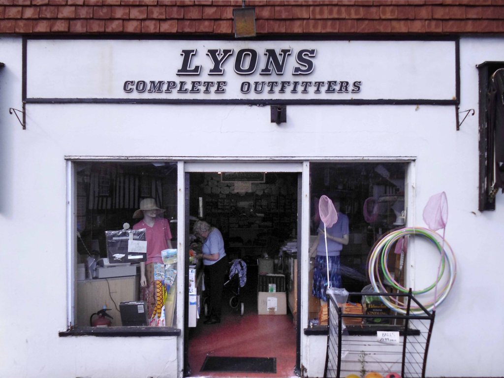
You’ll miss getting slightly lost and a cup of tea at the Dream Bites roadside café in Modbury.
Dream Bites café, we’re all is welcome, from cars to Biker’s to Ride outs to Puplic and to work companies even you the cyclists!
GREAT FOOD GREAT PRICE.
You’ll miss the deep hedged lanes of Devon.
Where the four x fours force you into the roadside brambles with consummate ease and regularity – even on a designated cycle route.
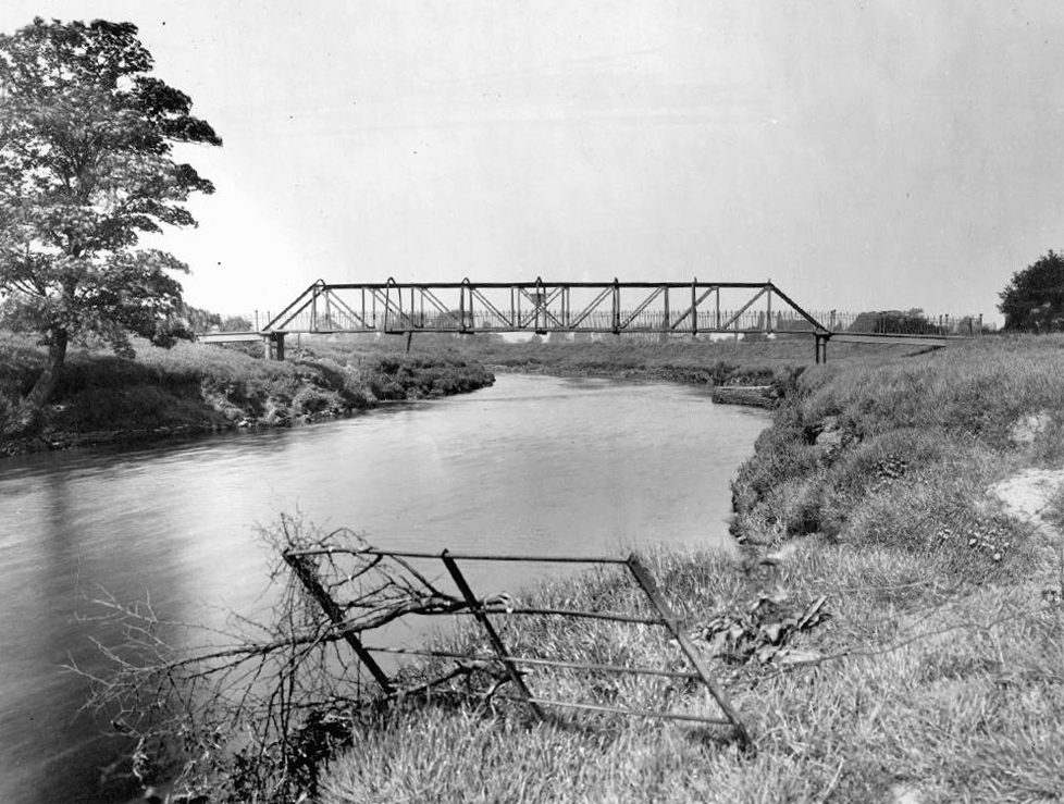
Respite from such trials and tribulations can be found upon siting a water tower or a deserted butchers – down at Slapton Ley.
Slapton Ley is the largest natural lake in south-west England. Although it is only separated from the sea by a narrow shingle bar, it is entirely freshwater.
Much beloved of my old pal Harry H Potts and family.
Then it’s up a hill down a hill to Dartmouth.
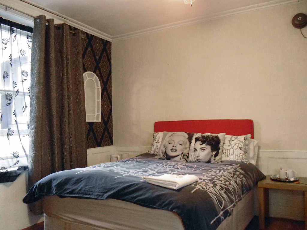
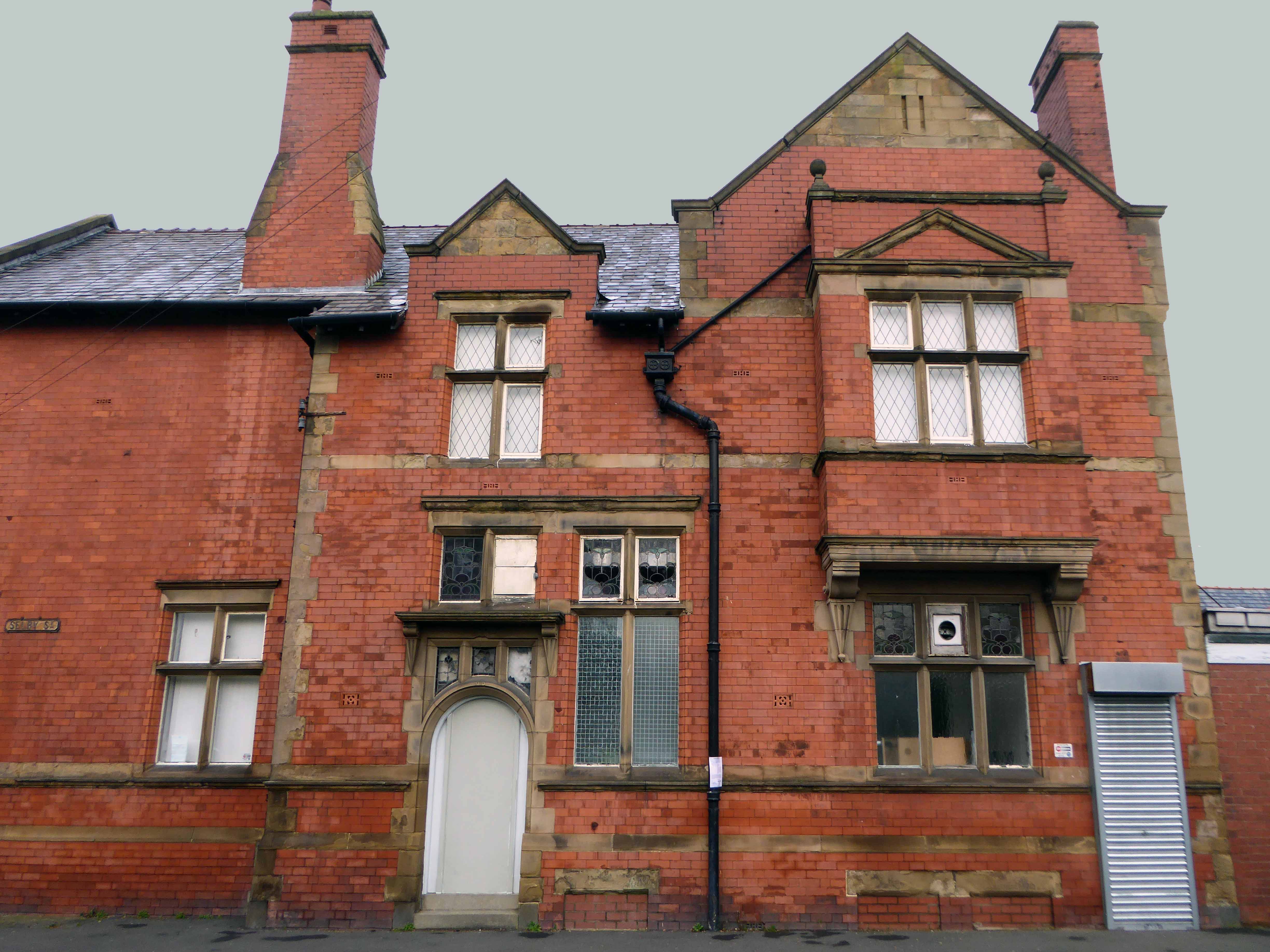
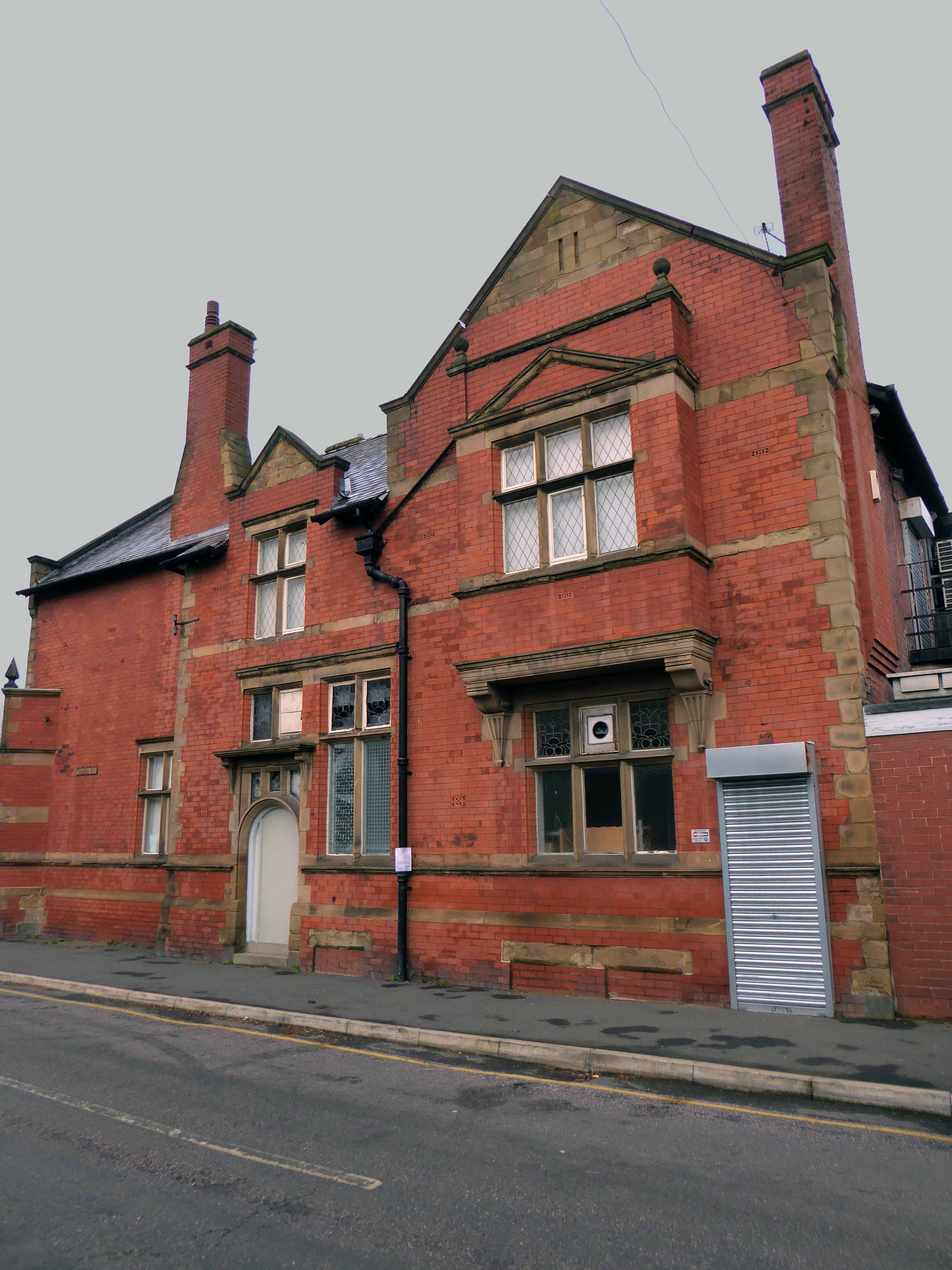
I made enquiries at several sea front hotels – who upon assessing my mode of dress and transport, despatched me to a back street pub B&B, suit y’self suits me, and my pocket.
The Seale Arms was just the job.
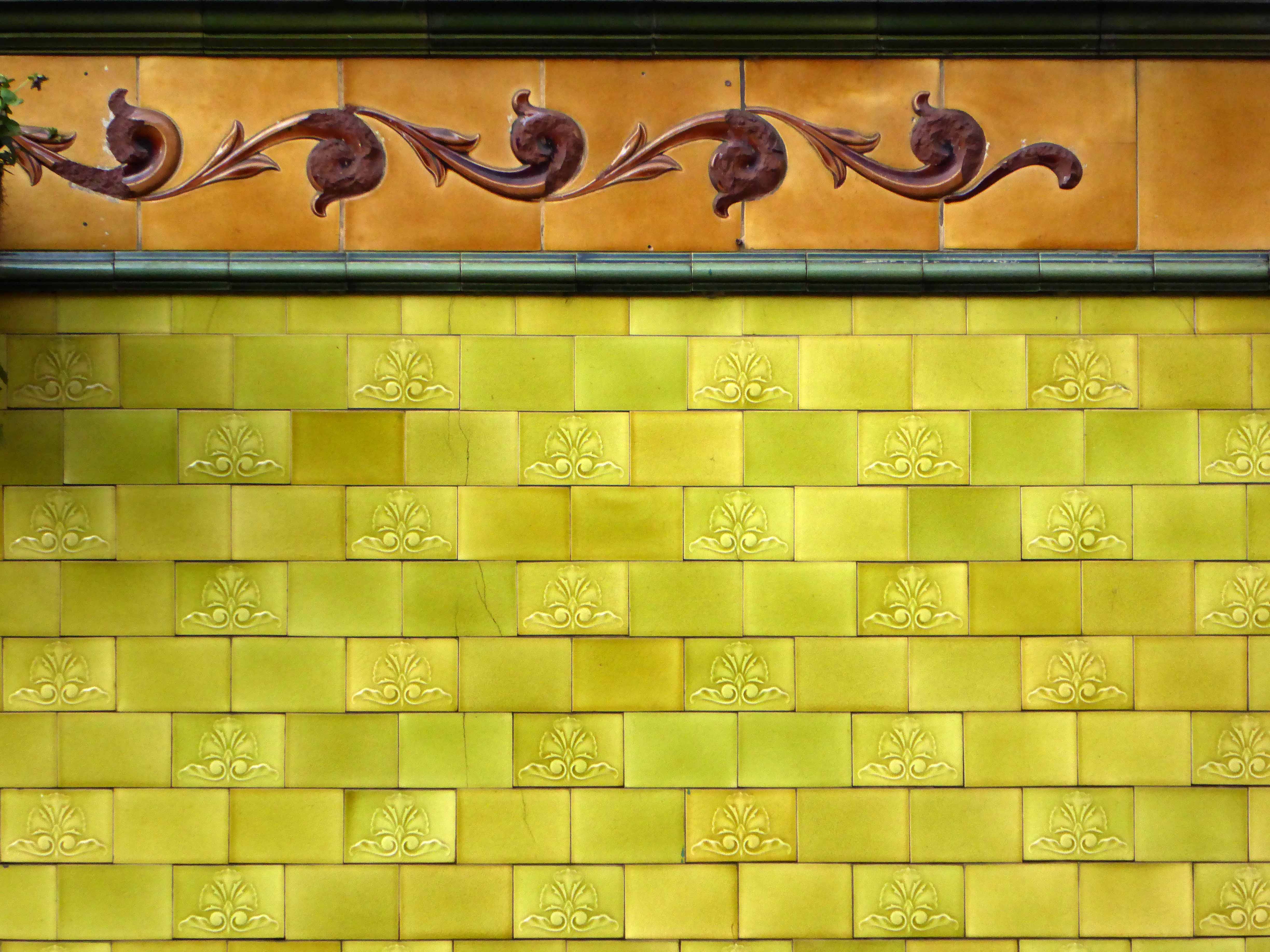
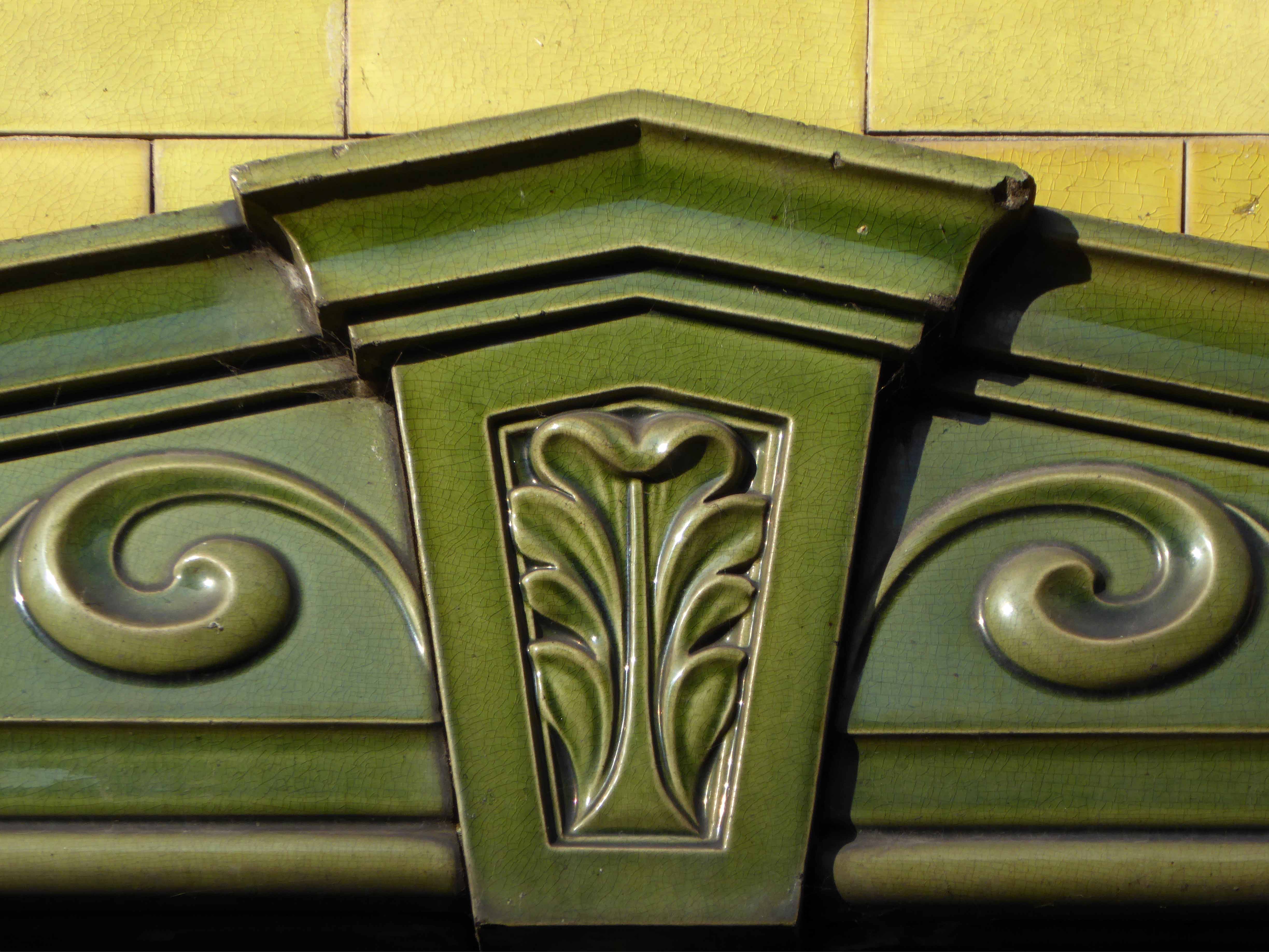
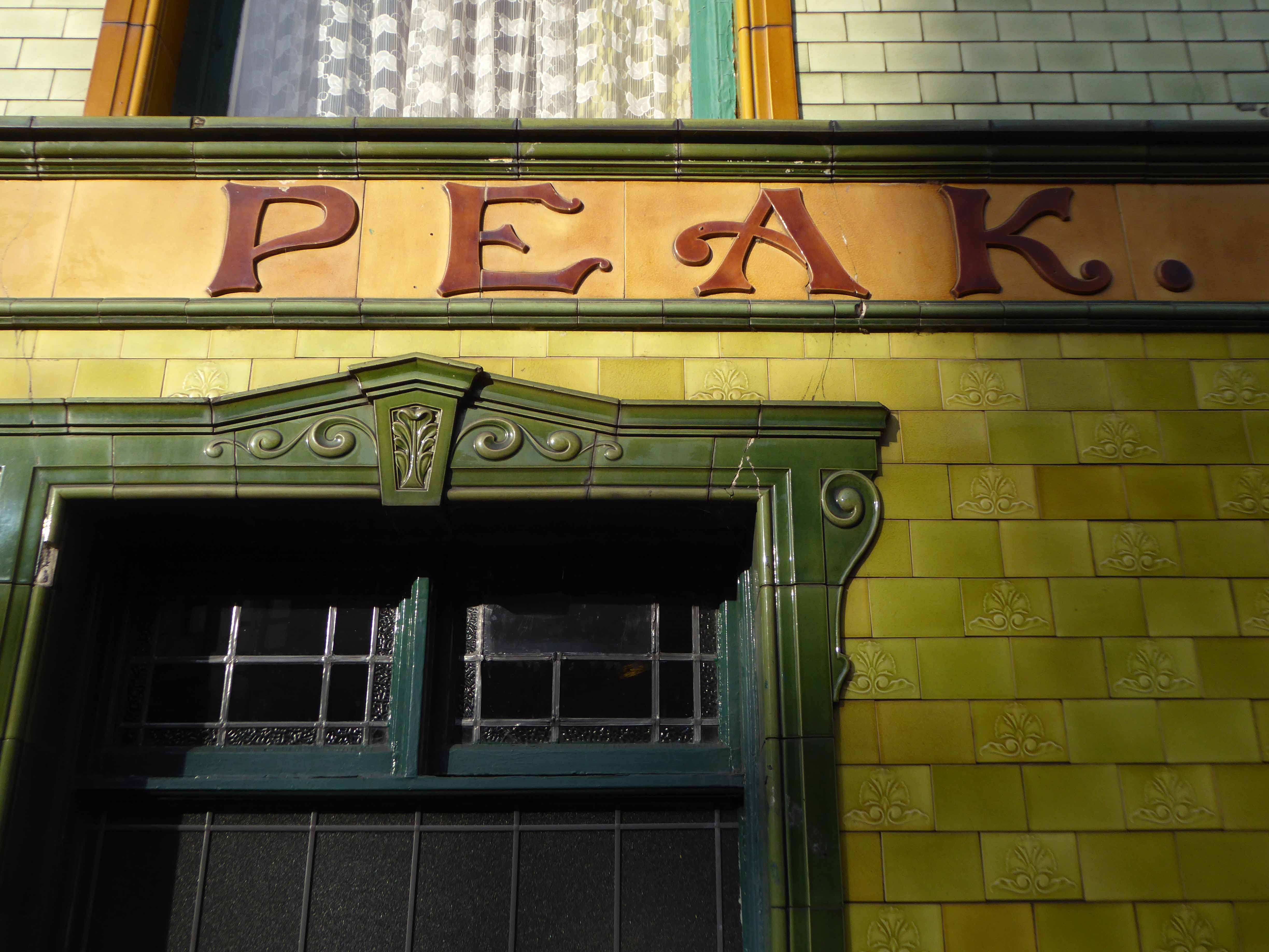
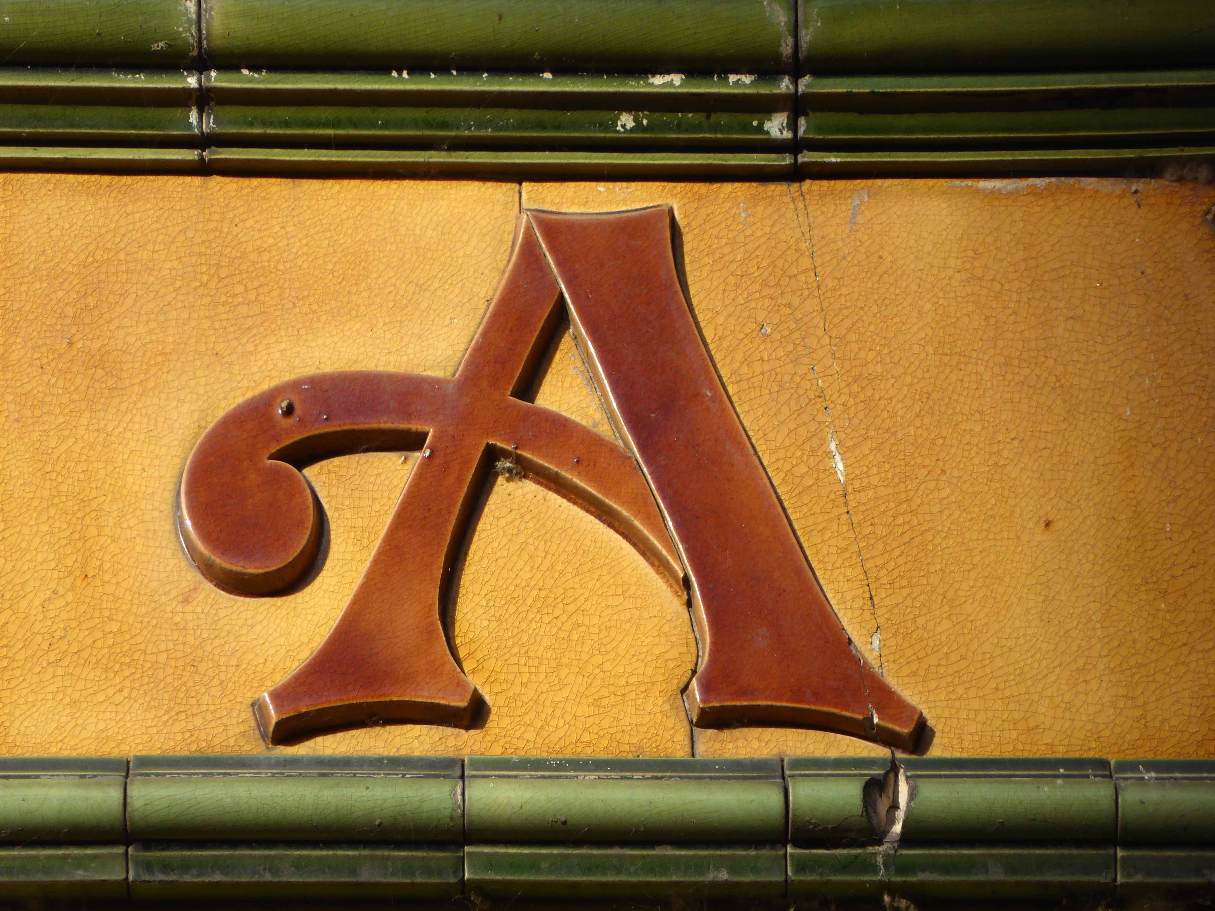
Quick change for the artist – let’s have a look around.
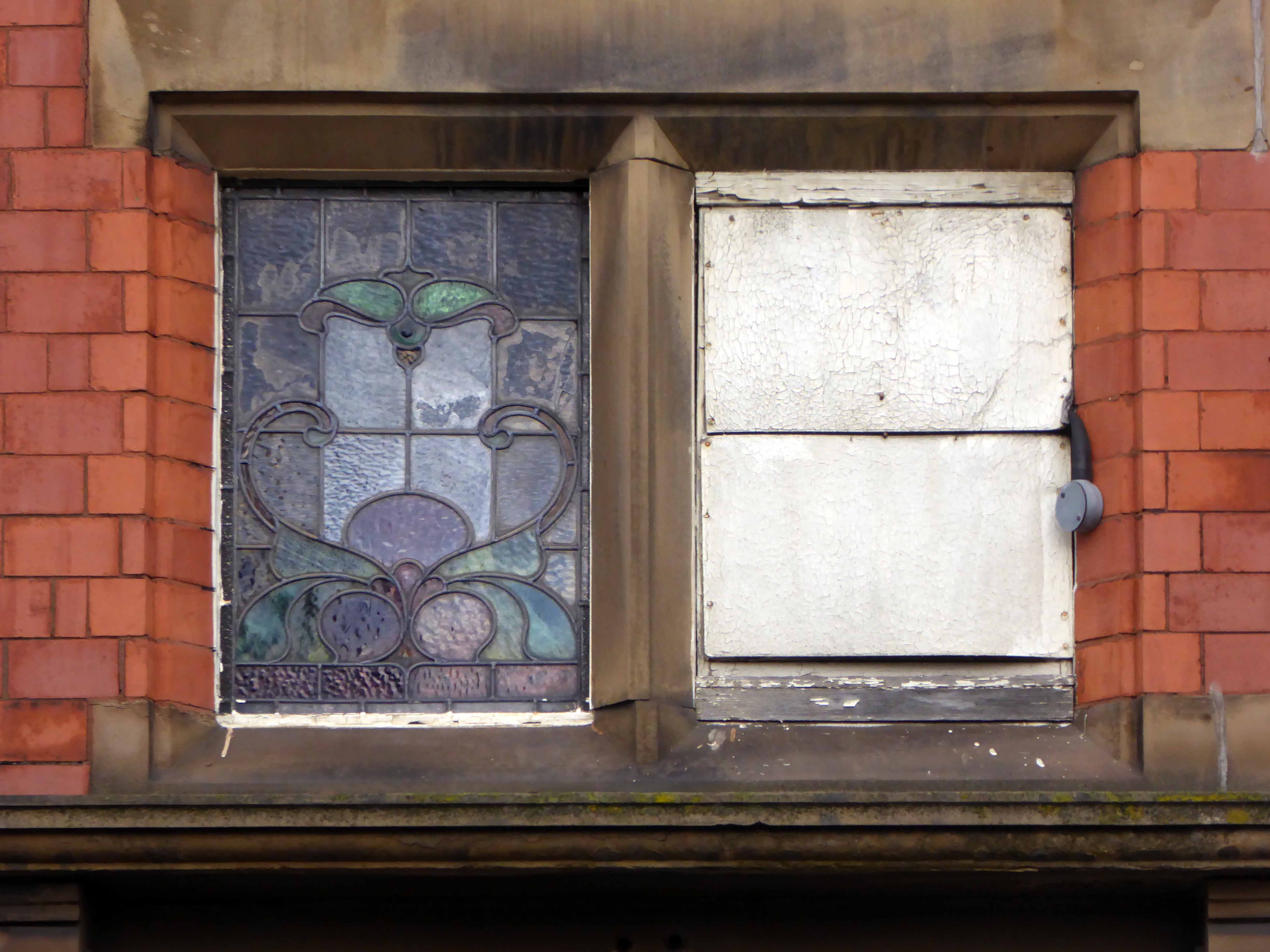
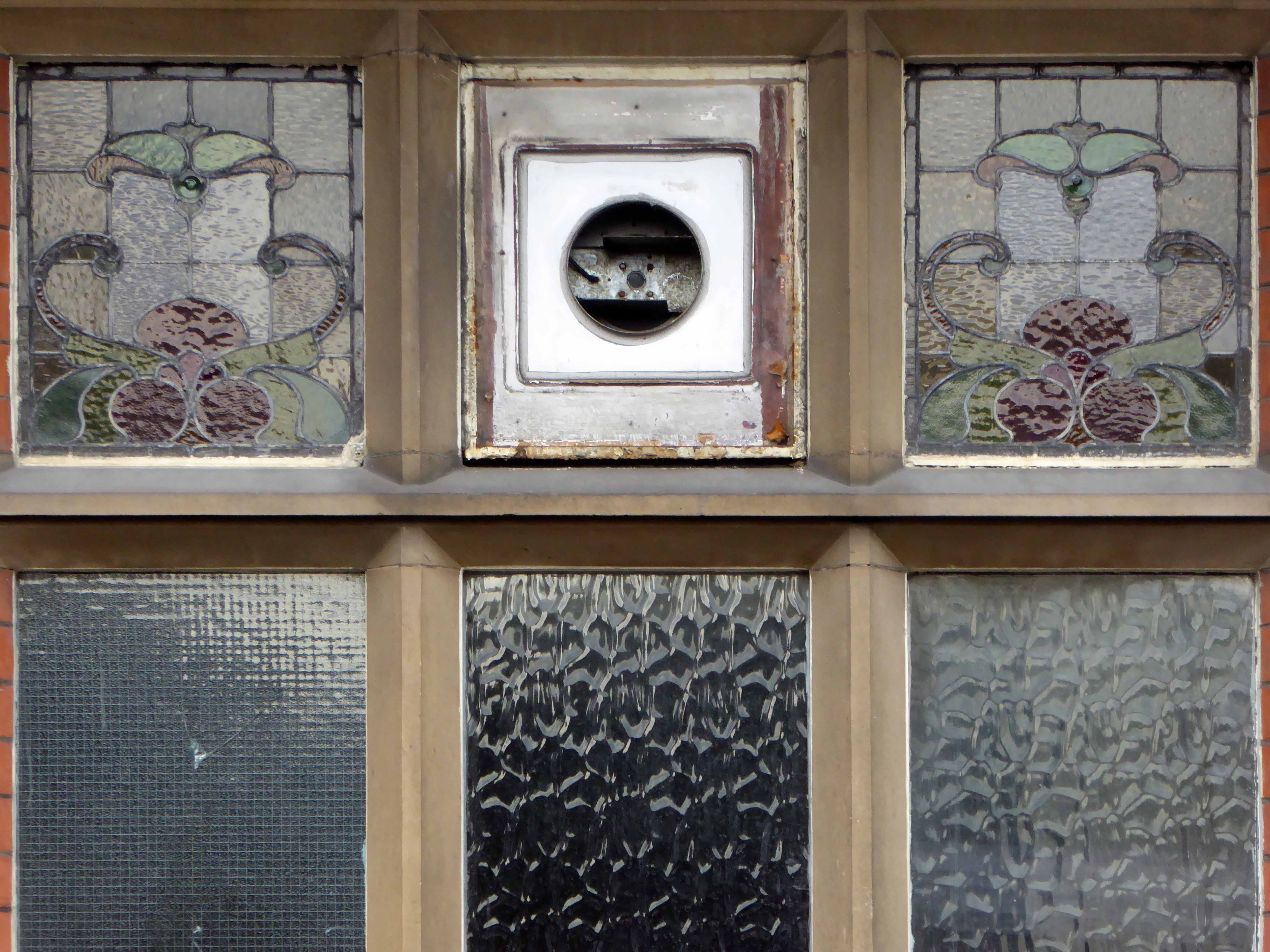
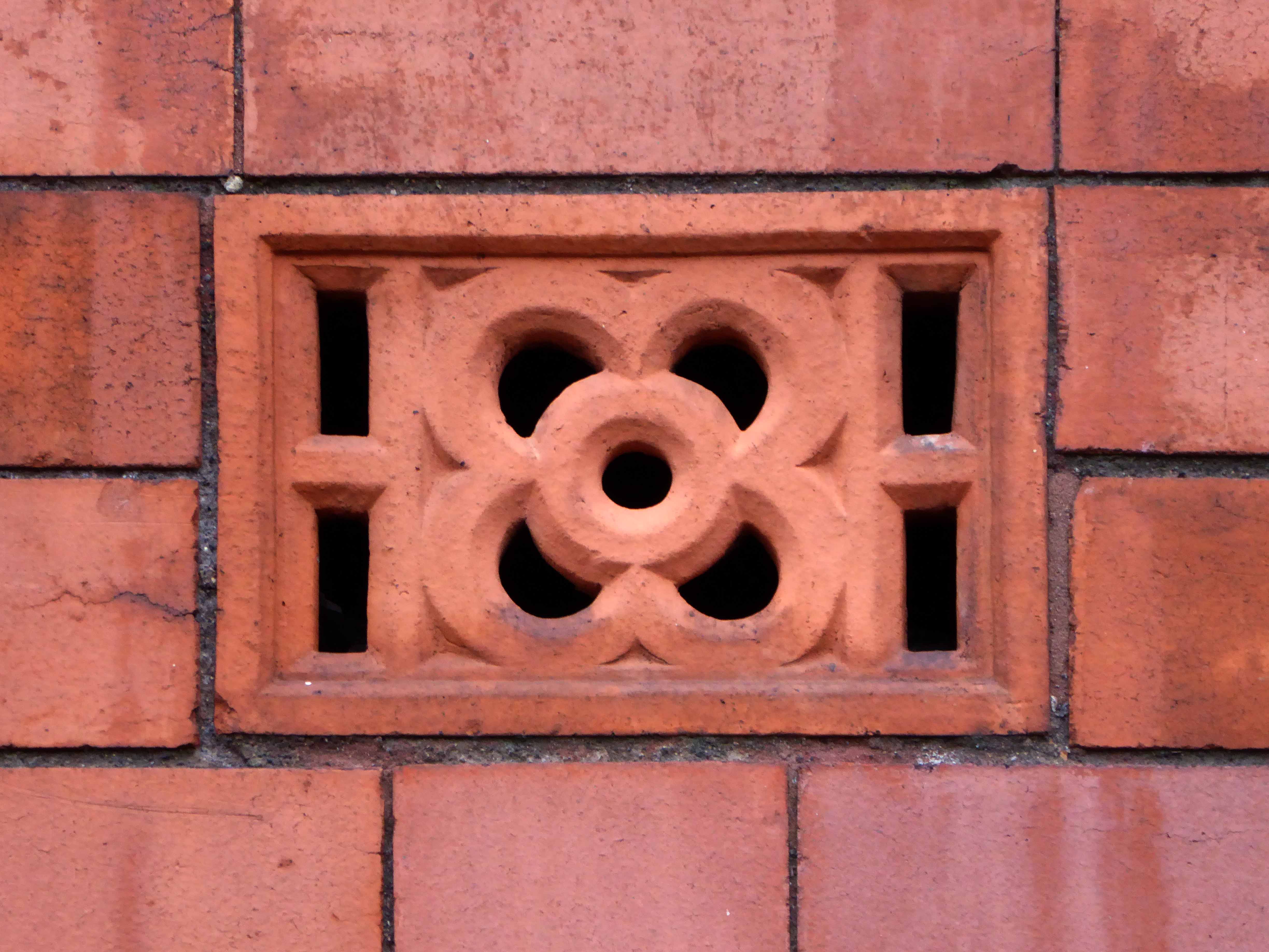
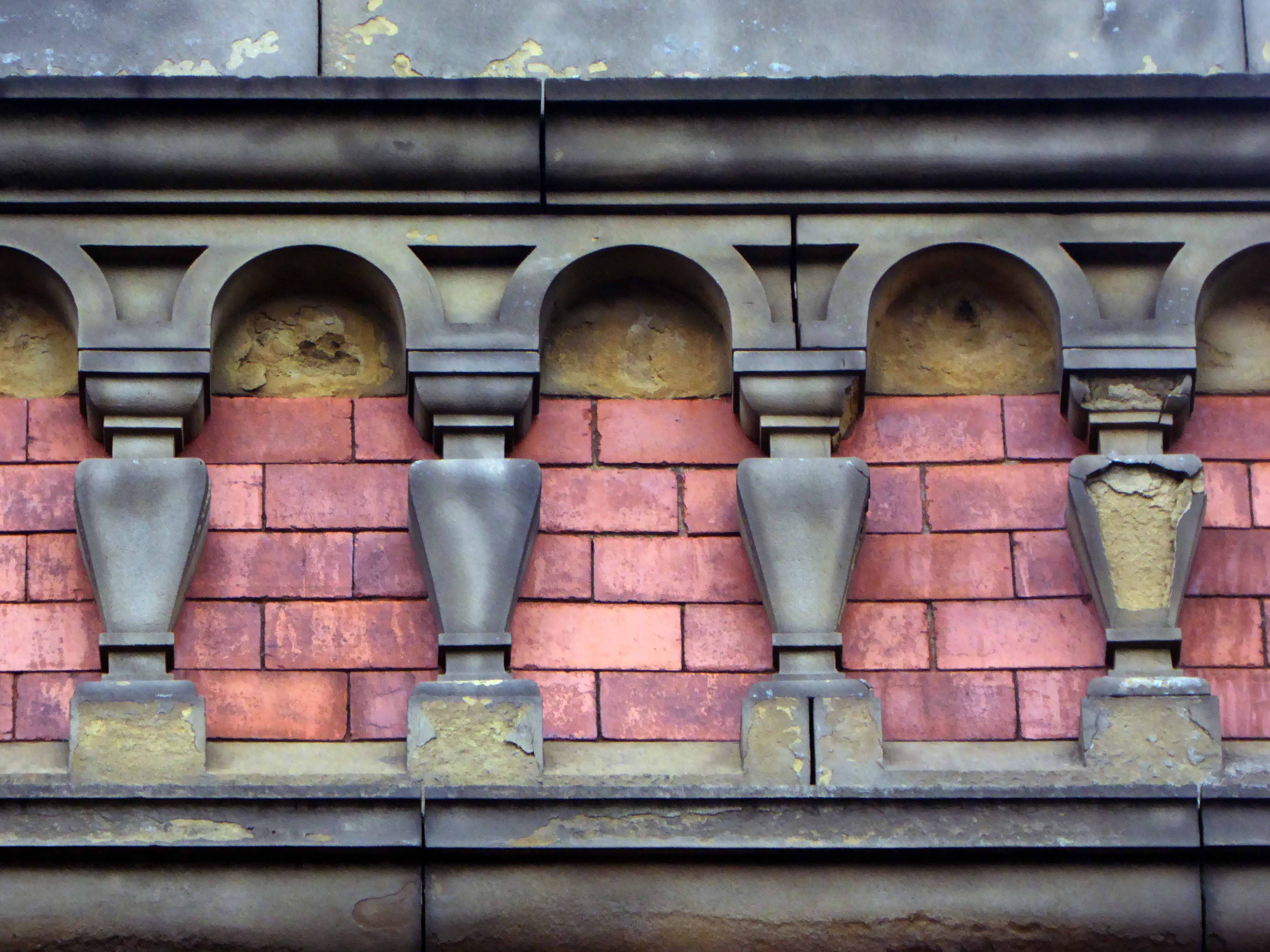
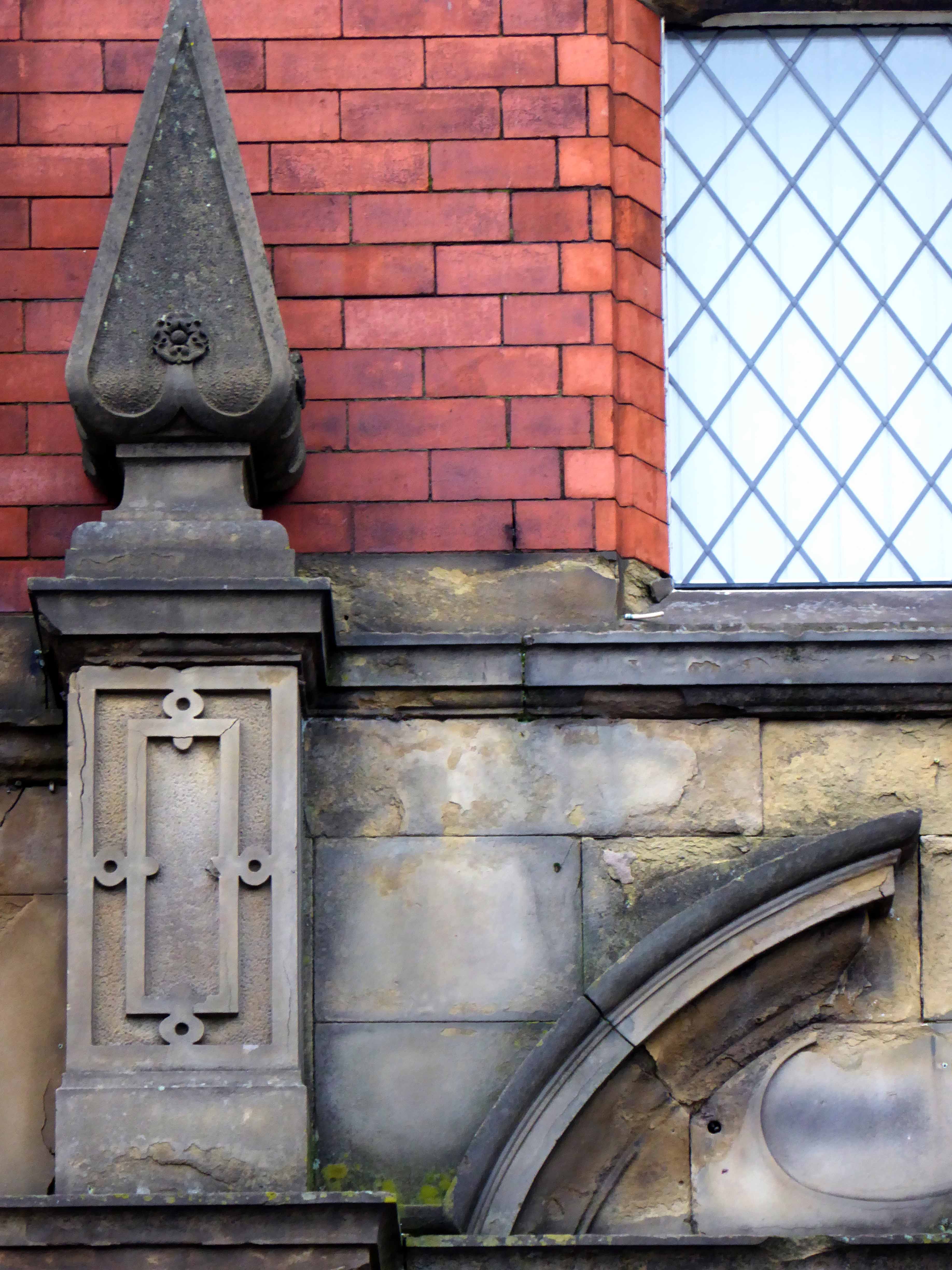
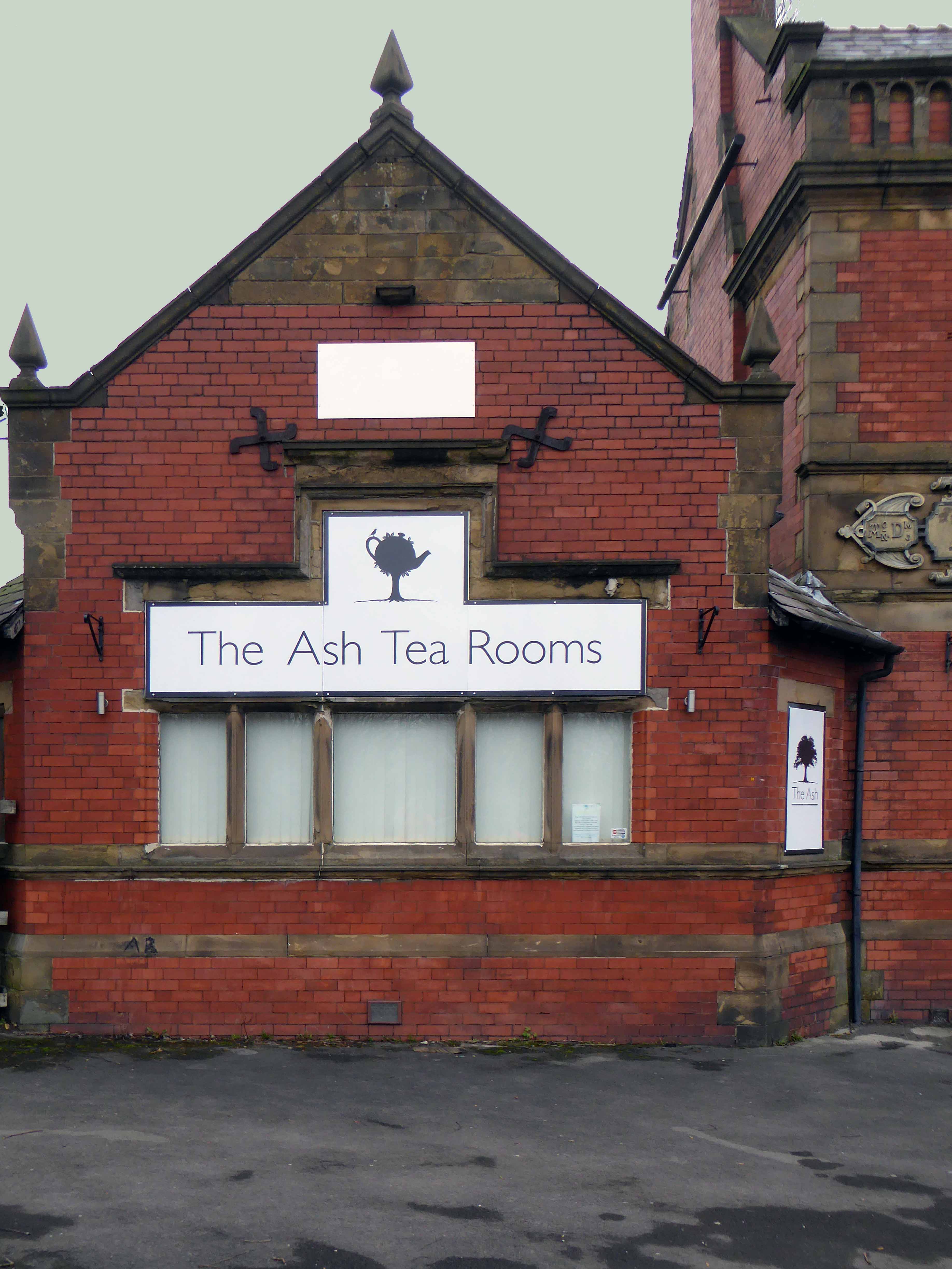
It’s full of historical architectural detail.
And slightly more hysterical architectural detail.
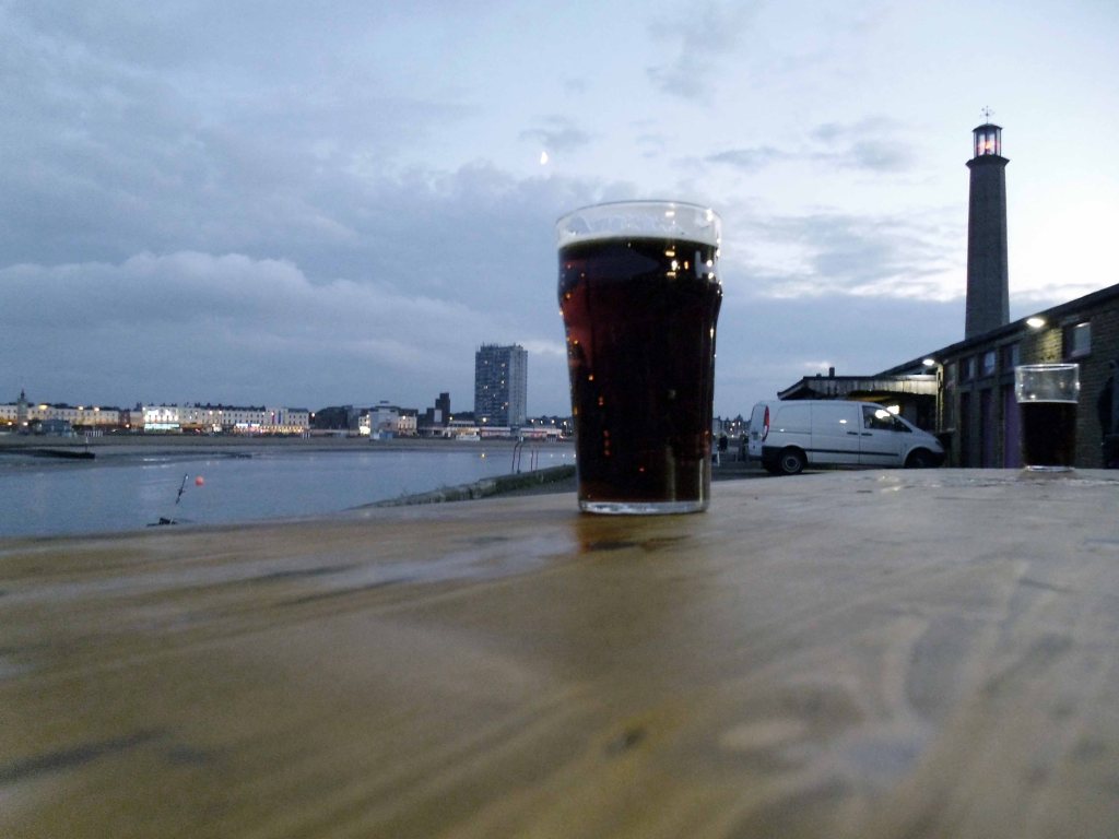
Time for a pint – chatting in the pub to yachting types, for it is here that the sense of tradition, the sea, power and wealth traditionally resides.
Following a sound night’s sleep, courtesy of the Ocean Hotel, I set out on my Ridgeback World Voyage – purchased through the Cycle to Work Scheme, I have essentially used it in order to cycle away from work.
My dream had always been to devise a way of life, where the lines between work, leisure and culture disappear, where such tiresome social constructs have finally become redundant – let’s go!
Having failed to learn from my previous jaunt, that a map is a handy aid to successful travel, I set off merrily without one – on Sunday 25th July 2015.
Following Sustrans’ signs will suffice, says I to myself.
I arrived safely in Brean, as the rain began to fall with a deeply disheartening enthusiasm.
The signage indicated a route across the beach – I quickly learnt that heavy rain and sand do not produce a sufficiently solid surface for cycling, when push comes to shove, there’s only one way forward.
Push.
There was no escape to the left, the extensive run of caravan parks and private leisure facilities having erected attractive razor wire topped barriers and locked gates – I pressed on.
With every arduous tortured sandy step, I developed an even deeper antipathy towards Pontin’s Brean Sands.
Here at Brean Sands we have been busy getting ready to welcome guests to our park. We have painted all our apartments, we have fitted over 10,000 metres skirting board throughout the apartments. All external soffits have been painted along with all the Double Decker apartments and main buildings. The QV Bar, Restaurant and also the Fun Factory have all had new flooring fitted. Our Restaurant bays are now refitted as well as improvements to our till area & reception desk.
Free at last from the sandy hell of the shore, I sought succour in this seaside café – where panoramic views of the sea come free.
Having enjoyed the multiple benefits of a breakfast not included tariff at the Ocean Hotel, I was now very, very hungry indeed – I made very, very short work of egg and beans on toast.
I briefly kept company with a Swiss couple, who were on an extensive motor car tour, I quickly became something of an apologist for the day’s foul weather.
It’s not always like this you know.
Stating the obvious, yet thinking the converse.
The panoramic view through the other window – a delightful row of rain soaked, link low rise maisonettes – nirvana!
I was arrested by this arresting wayside shelter/art gallery facility commemorating the Coronation of 1953, in the village of Chedzoy.
The village is at the western end of King’s Sedgemoor and lies on an ‘island’ of Burtle marine sands, close to King’s Sedgemoor Drain. The area was settled possibly in the Mesolithic period, and timber trackways from the third to first millennium B.C. provided routes to other settlements on the Somerset Levels. Roman artifacts have been found in the parish.
The name of the village is pronounced Chidgey or Chedzey, and derives its name from being Cedd’s Island. The zoy part of the name being derived from eg or ieg meaning island.
The shelter stands at the corner of Front and Higher Streets – it would appear that the Burghers of Chedzoy had exhausted their inexhaustible font of creative naming resources, by the time that streets had been invented – the Mesolithic fools.
The village people seem to be suffering from some collective false memory syndrome recollection of a fabulous Mer-family past.
Improving weather in the Bridgwater area, as we languish in the cool shade of the by-pass, beside the River Parrett.
The River Parrett has its source in the Thorney Mills springs in the hills around Chedington in Dorset in England and flows west through the Somerset Levels. The mouth is a Nature Reserve at Burnham on Sea where it flows into Bridgwater Bay on the Bristol Channel. The river is tidal for 18.6 miles up to Oath; and, because the fall of the river, between Langport and Bridgwater is only 1 foot per mile, it is prone to frequent flooding, in winter and high tides.
The River Parrett is 37 miles long and its main tributaries include the Rivers Tone, Isle and Yeo. The River Cary drains into the Parrett via the King’s Sedgemoor Drain. The River Parrett drains an area of over 652.5 square miles – comprising around fifty percent of the land area of Somerset.
Here we are in Williton – where the modern world is ready to sweep in unannounced as announced in the Somerset County Gazette.
Plans to build a new supermarket, retail units and health centre in Williton have been resubmitted this week. J. Gliddon and Sons Ltd. has put forward new plans for the redevelopment of land off the A39 Bank Street in Williton, behind its existing store.
The shop will be demolished to create the access road, with the company expected to occupy a new unit fronting onto Bank Street once the mini-roundabout has been built.
Well so far so good – I arrived in Minehead in one piece – bike intact.
Having only the vaguest notion of where my onward route lay – I hastened to the Tourist Information Office. Having carefully explained my malaise the helpful staff gazed at me with mild amazement, liberally mixed with slightly perplexed eye-rolling and the odd tut.
Having received quite detailed instructions, I was almost immediately lost, following a road that abruptly ceased to be a road. Reluctantly I picked up a woodland path, rutted with tree roots and certainly not a suitable cycling route.
It fell away sharply, as I careered out of control down the precipitous slope.
On reaching the end I discovered that my new rain jacket had also fallen away, along with my treasured Casio watch, which was tucked safely in the pocket.
I lightly bit my lip and reflected that climbing back up the precipitous slope, which I had only too recently incautiously careered down, was not an option – onward ever onward.
In my mind the younger me looks at the older me – having lost all faith in my ability to manage my life with even a modicum of honesty and integrity, or at best a basic grasp of reality.
A whitewashed Grade I Listed 15th-century Church, with a 14th-century tower.
Welcome to this outstanding Parish Church, which, thanks to it’s distinctive white appearance stands as a beacon on the hills of Exmoor. For centuries Selworthy Church has been a focus for residents and visitors as a place to experience the power and presence of God. We hope you find peace of God here and leave uplifted, refreshed and inspired.
Further on down the road somewhere or other I had a cup of tea and piece of cake.
Had I carried out even the most basic research, I would have known that the ups and downs of Exmoor are no easy ride, particularly in heavy rain without a rain jacket.
As the sky darkened I was heartened by the sight of the light’s of Ilfracombe, twinkling star like in the distance – following eighty six miles of toil and a measure of trouble, I finally arrived at the pre-booked digs. They had been concerned by my no-show, relieved when I finally arrived, incredulous when I told the tale of the day’s travails. The lady of the house ever so kindly washed and dried my sodden clothing.
I showered and hit the town – eschewing food in favour of a pint, chatting to a garrulous gang of solar panel cleaners from Cornwall.
Returning merrily to the B&B and the prospect of slumber.
Day four Thursday 4th September 2014 – leaving Clacton on Sea for Frinton on Sea is the equivalent of crossing continents, time zones, aesthetic and social sensibilities.
Leaving the razzle-dazzle, frantic fish and chip frazzle, for the sedate repose of germ free Frinton.
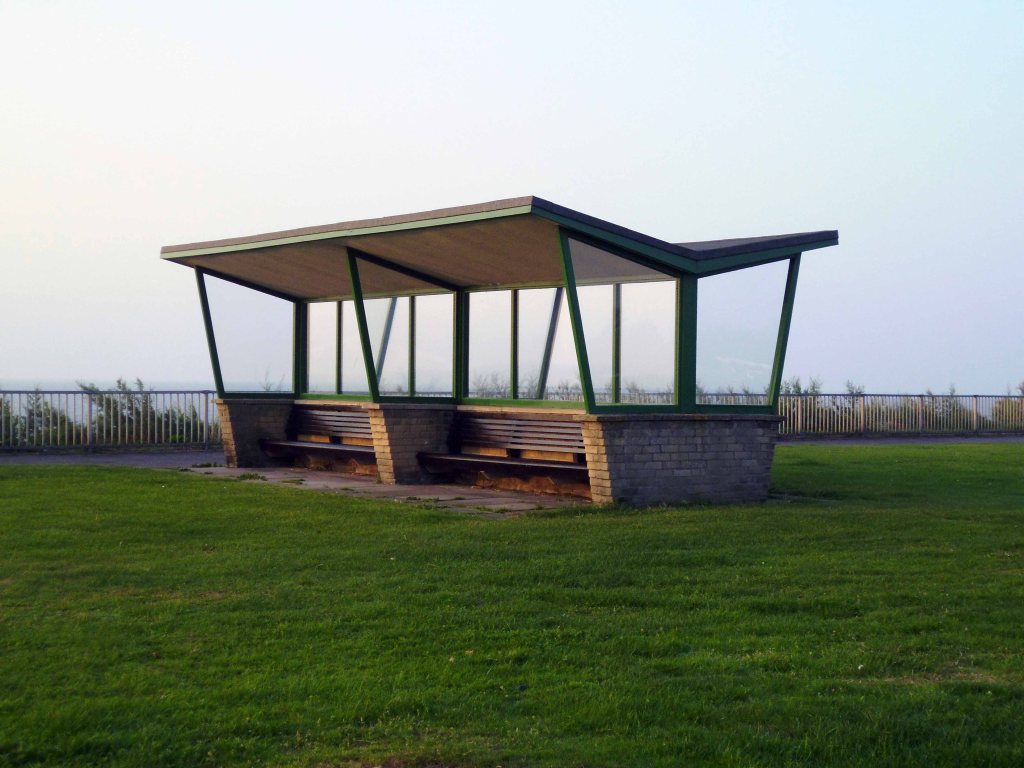
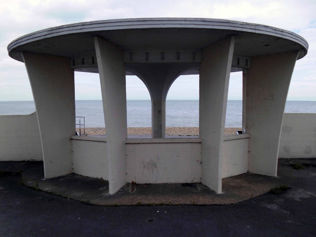
Green sward and restrained modernist shelters adorn the foreshore.
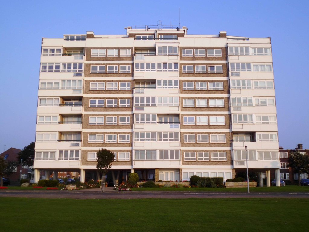
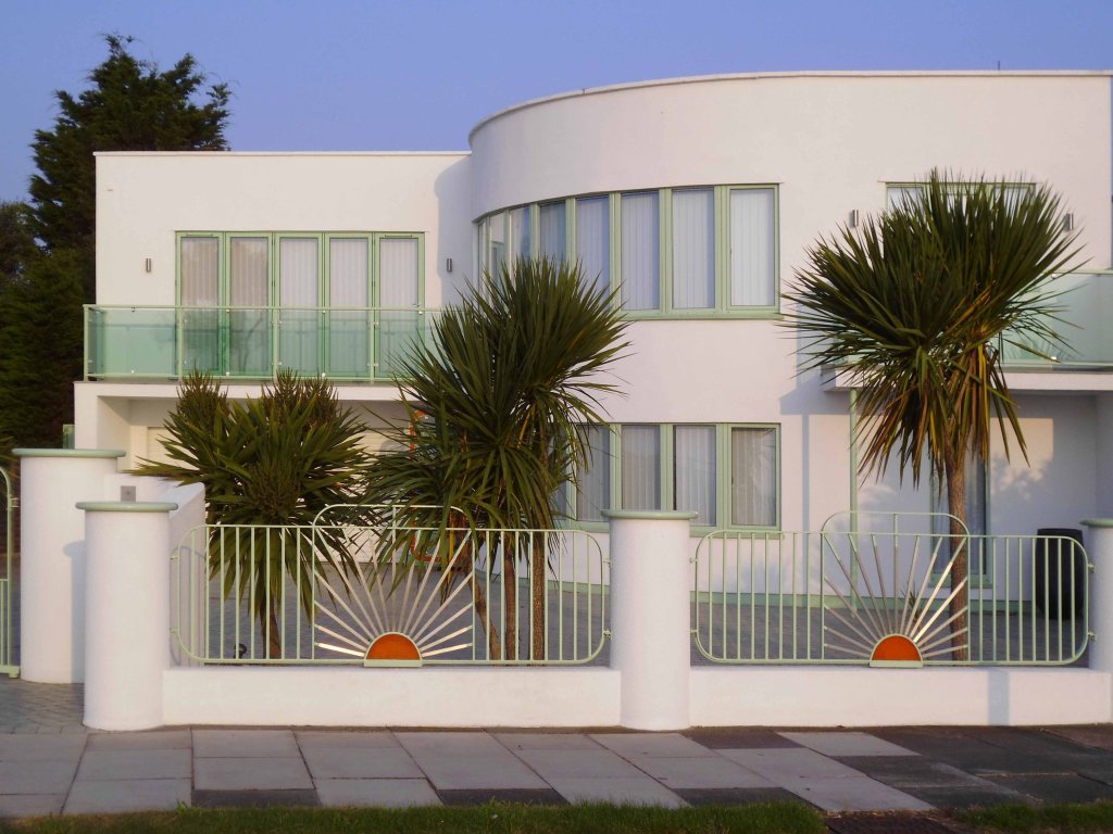
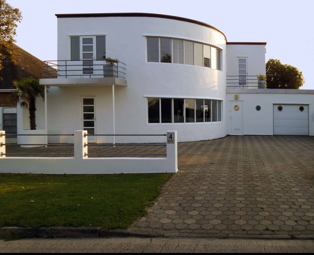
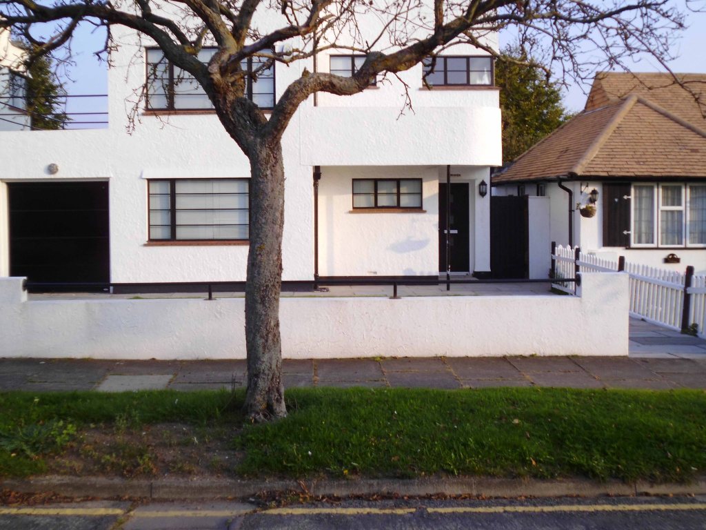
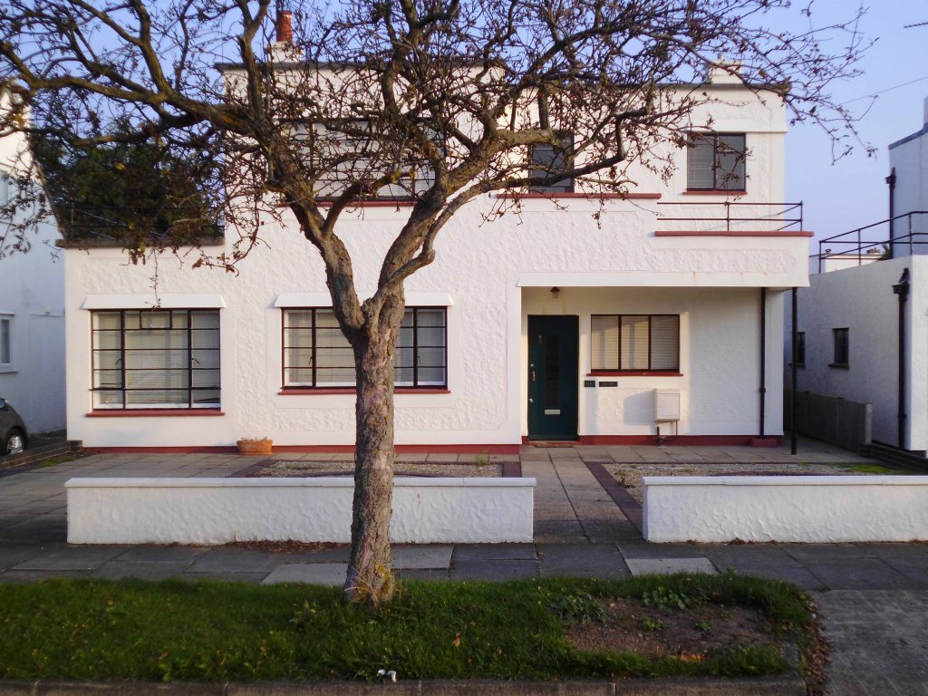
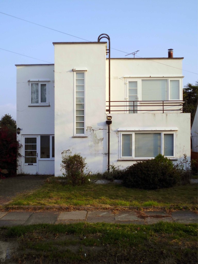
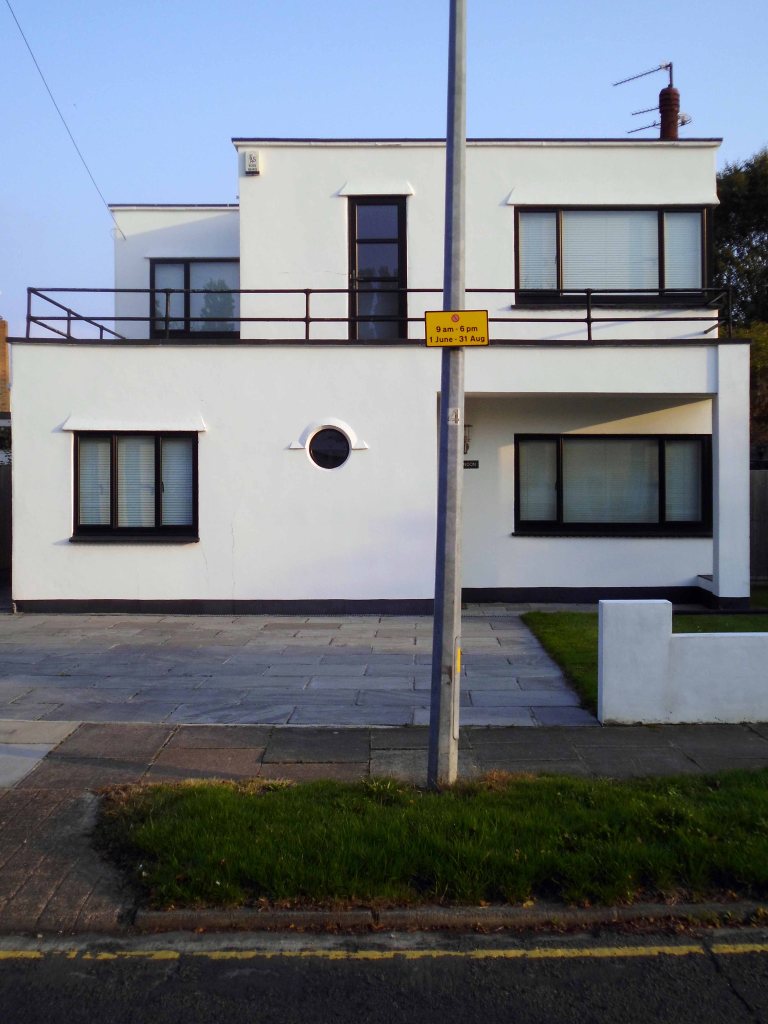
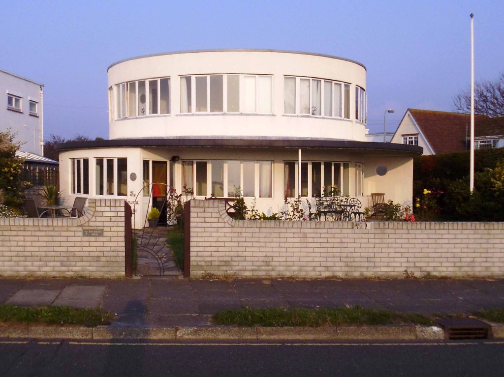
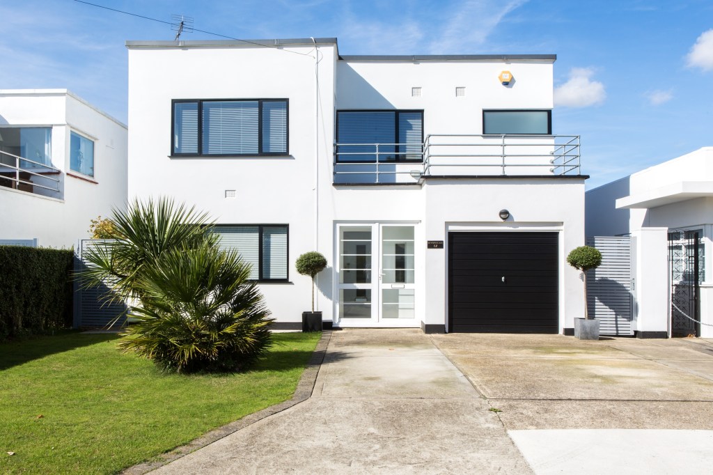
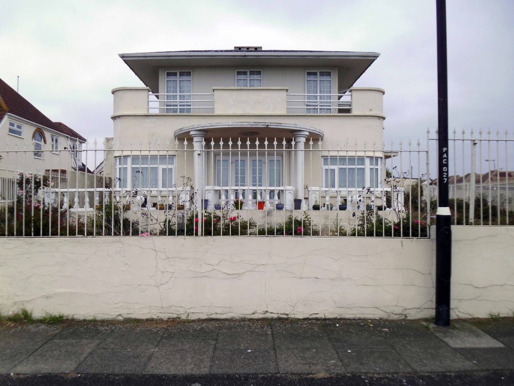
I love the bold optimism of Maritime Moderne – the bright eyed, forward looking window grid of these fine flats.
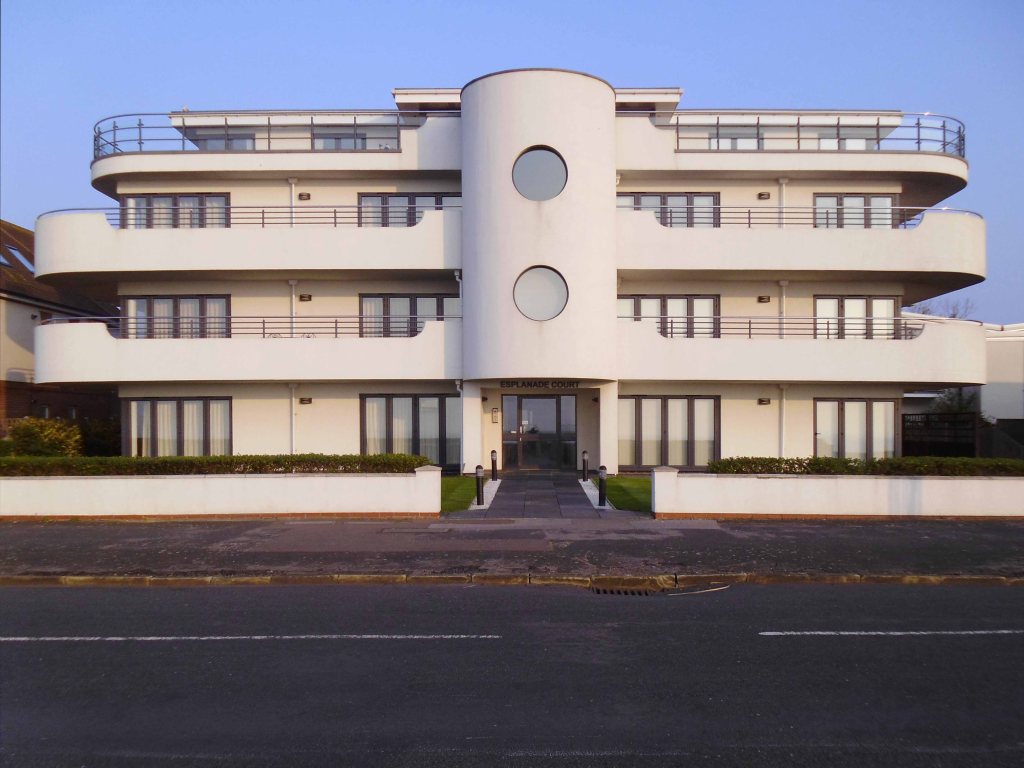
I have a cautious admiration for the faux Deco newcomers.
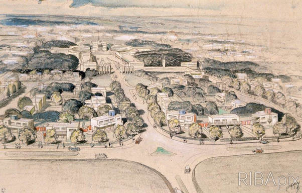
The modernist estate was attempted many times in the interwar years; visions of rows of fashionable white walled, flat roofed houses filled developers eyes. In practice the idea was less popular with potential house buyers. In the Metro-Land suburbs of London, estates were attempted in Ruislip and Stanmore, with a dozen houses at most being built. One estate that produced more modernist houses than most, albeit less than planned, was the Frinton Park estate at Frinton-on-Sea on the Essex coast.
Oliver Hill was known for his house designs, which spanned styles from Arts and Crafts to Modernist. Hill was to draw up a plan for 1100 homes, as well as a shopping centre, luxury hotel and offices. The plan was for prospective buyers to buy a plot and then engage architects to design their new house from a list of designers drawn up by Hill. The list featured some of the best modernist architects working in Britain at the time; Maxwell Fry, Wells Coates, F.R.S. Yorke and Connell, Ward & Lucas.
As wonderful as this sounds today, the buying public of 1935 did not quite agree. The majority of potential buyers were apparently put off by the Estates insistence on flat roofs and modernist designs. Plan B was to build a number of show homes to seduce the public into buying the modernist dream. Of 50 planned show homes, around 25 were built, with about 15 more houses built to order. The majority of these were designed by J.T. Shelton, the estates resident architect, with a number designed by other architects like Hill, Frederick Etchells, RA Duncan and Marshall Sisson.
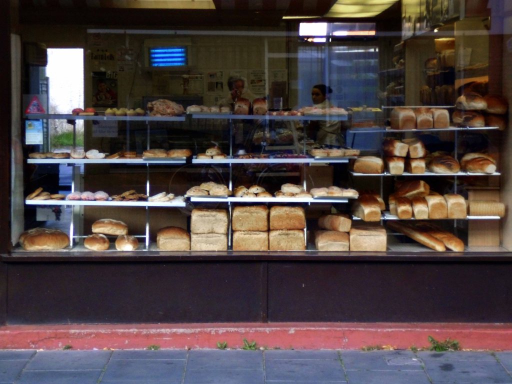
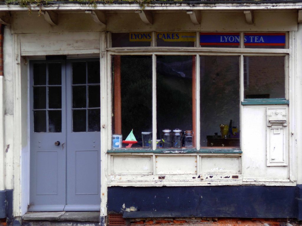
The town is also home to this traditional confectioners – Lilley’s Bakery.
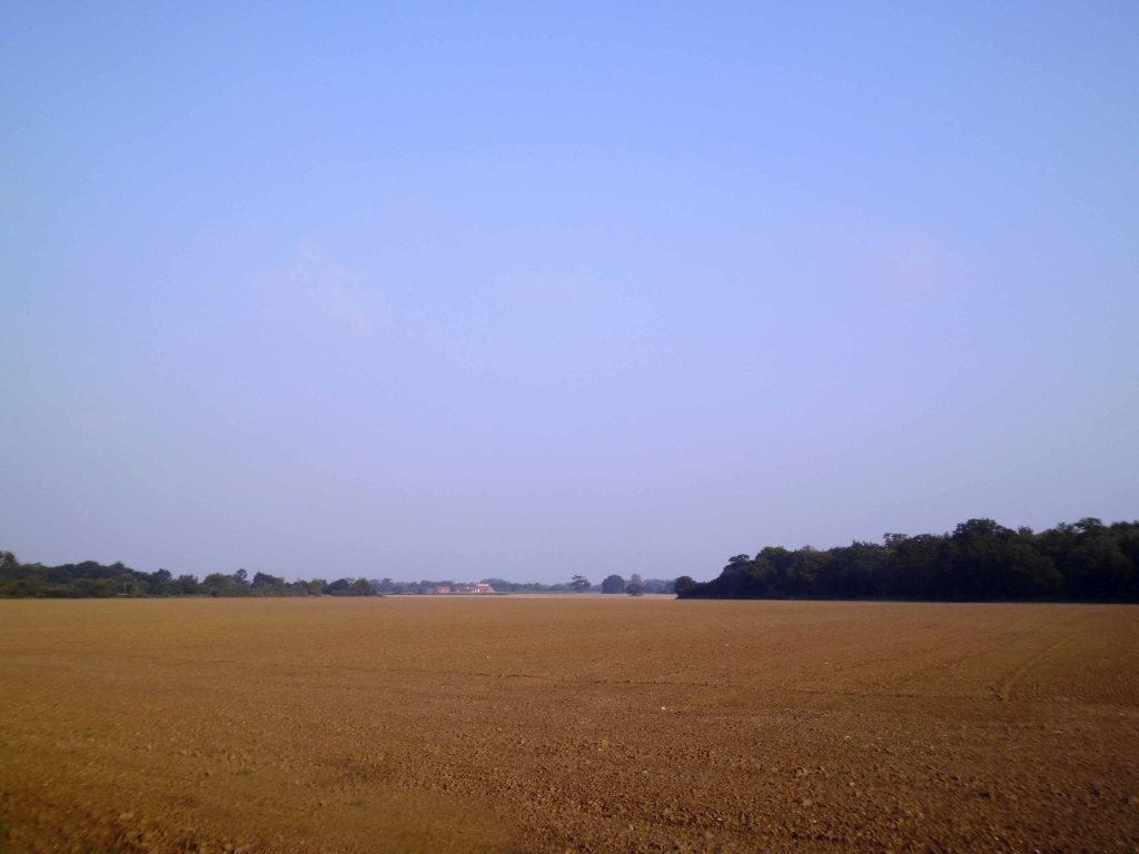
Leaving the coast for pastures new – well, a ploughed field actually.
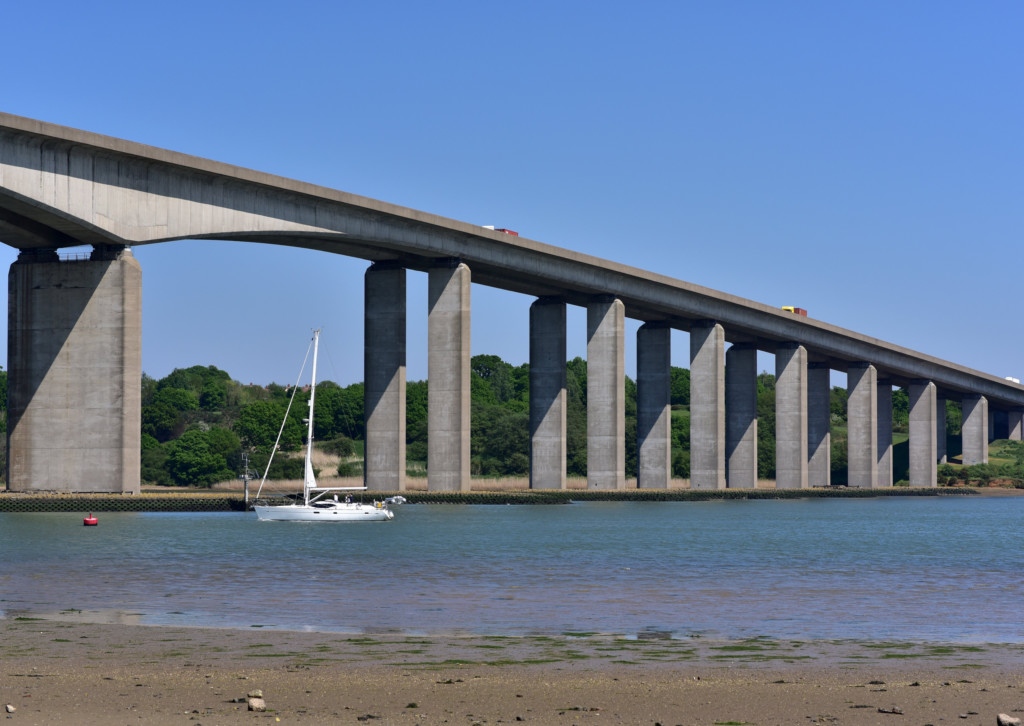
Crossing the River Orwell over the Orwell Bridge on my way to Ipswich.
The main span is 190 metres which, at the time of its construction, was the longest pre-stressed concrete span in use in the UK. The two spans adjacent to the main span are 106m, known as anchor spans. Most of the other spans are 59m. The total length is 1,287 metres from Wherstead to the site of the former Ipswich Airport. The width is 24 metres with an air draft of 43 metres; the bridge had to be at least 41 metres high. The approach roads were designed by CH Dobbie & Partners of Cardiff.
The bridge is constructed of a pair of continuous concrete box girders with expansion joints that allow for expansion and contraction. The girders are hollow, allowing for easier inspection, as well as providing access for services, including telecom, power, and a 711mm water main from the nearby Alton Water reservoir.
The bridge appears in the 1987 Cold War drama The Fourth Protocol, in which two RAF helicopters are shown flying under it, and at the end of the 2013 film The Numbers Station.
Time for a Stymie Bold Italic stop – much to the obvious consternation of an over cautious customer.
It seems to still be extant – but with a tasteful coat of subdued grey paint according to its Facebook page.
Having completed this journey in 2016, then reacquainting myself in 2020, I have little recollection of visiting Ipswich, but I did, yet there are no snaps.
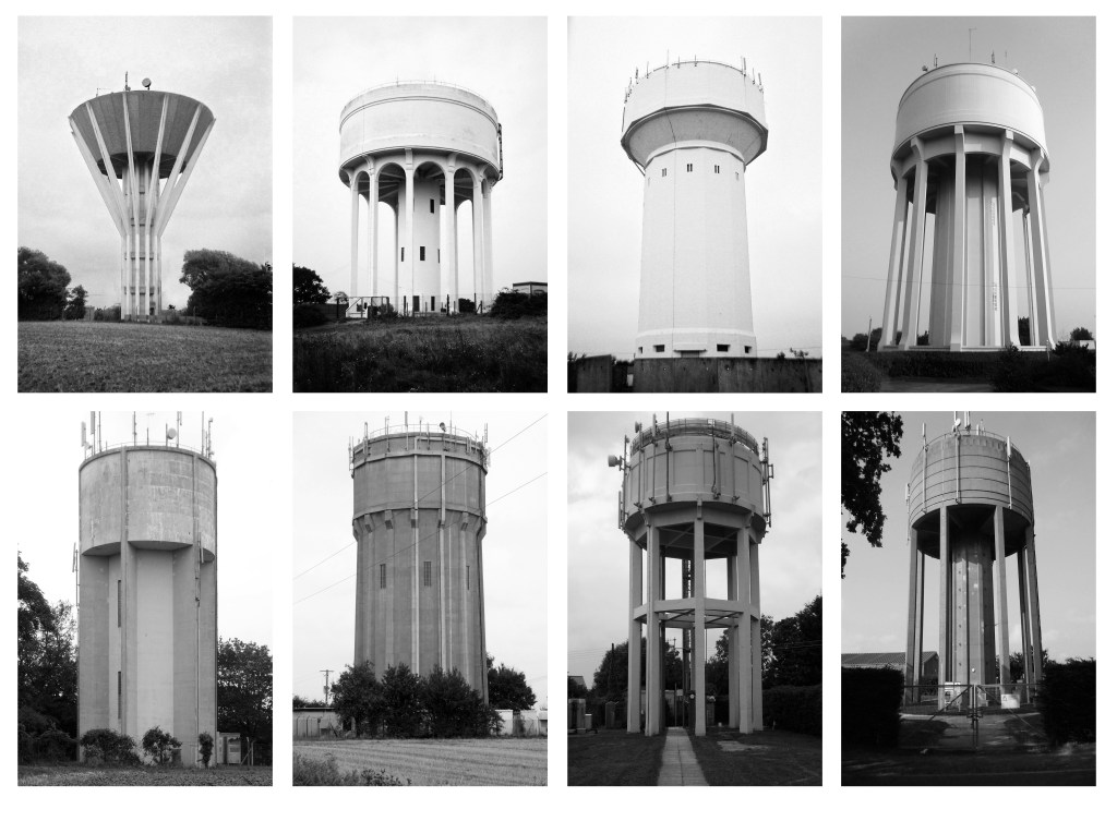
I photographed this and several other water towers, precisely where, I could not honestly say.
Suffice to say that it is somewhere – as is everything else.
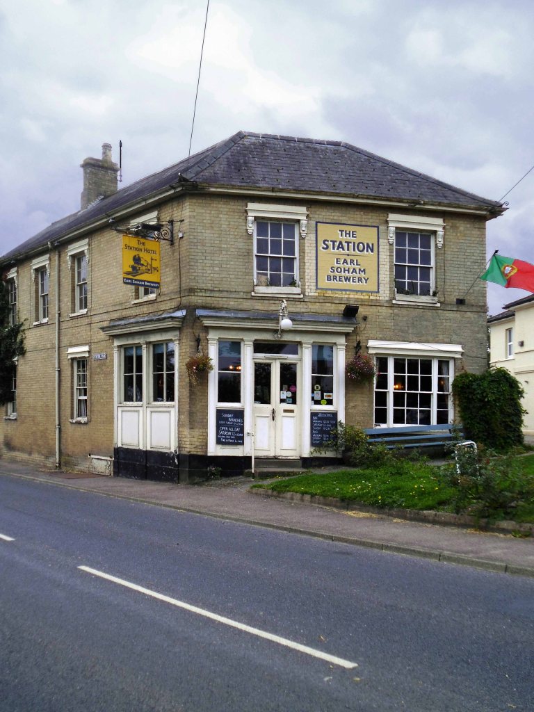
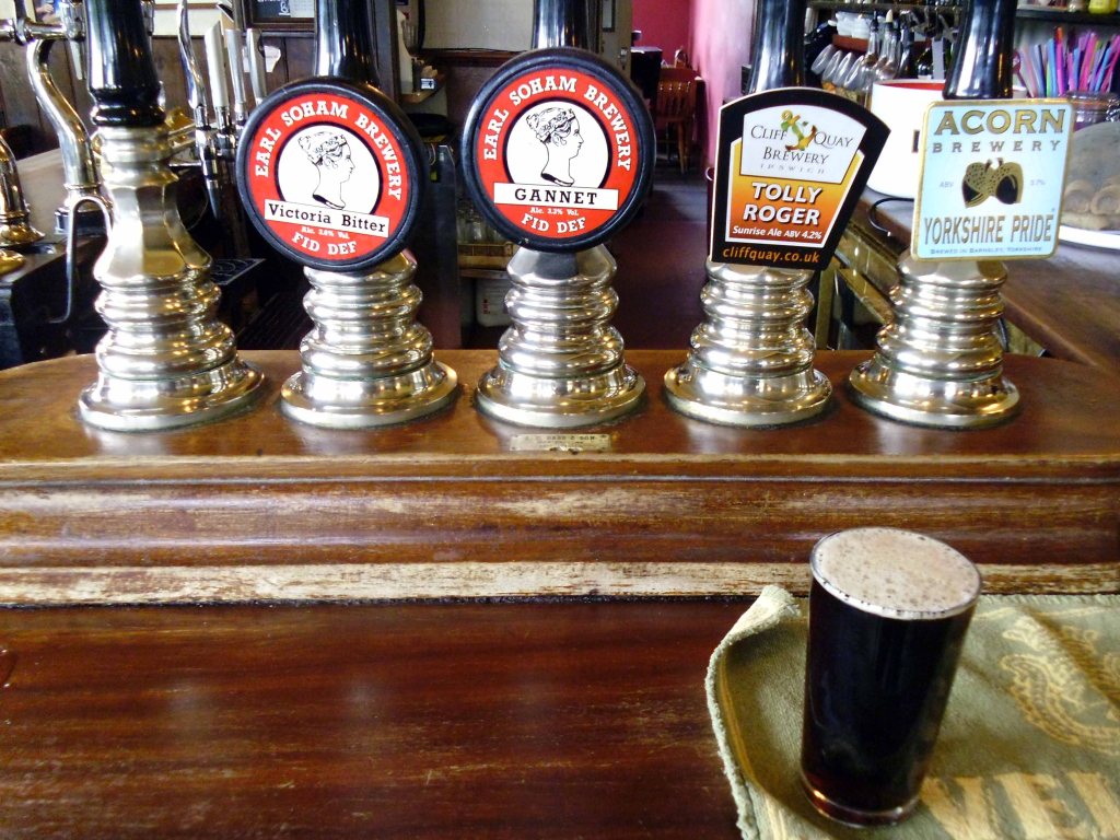
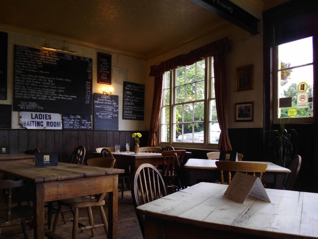
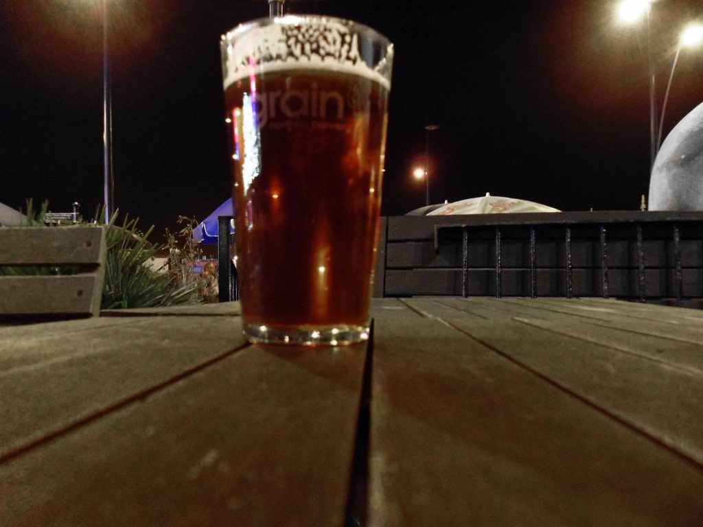
This the only time that I chose to have a glass of beer whilst awheel, normally waiting until the evening – I couldn’t resist this charming looking brew pub in Framlingham.
Earl Soham is a village close by, on the A1120. The Earl Soham Brewery beers started out in life being brewed in local man Maurice’s old chicken shed. You may be pleased to hear they have a slightly more sophisticated set-up now, without forgetting their humble roots.
If you haven’t tasted them before, we think you’ll be as delighted with them as our regulars, and you can be guaranteed of a warm welcome if you come to try them out.
The sort of wayside boozer where I could have easily idled away an hour or two – hopefully I’ll pass by again some time and linger longer.
Another water tower – somewhere.
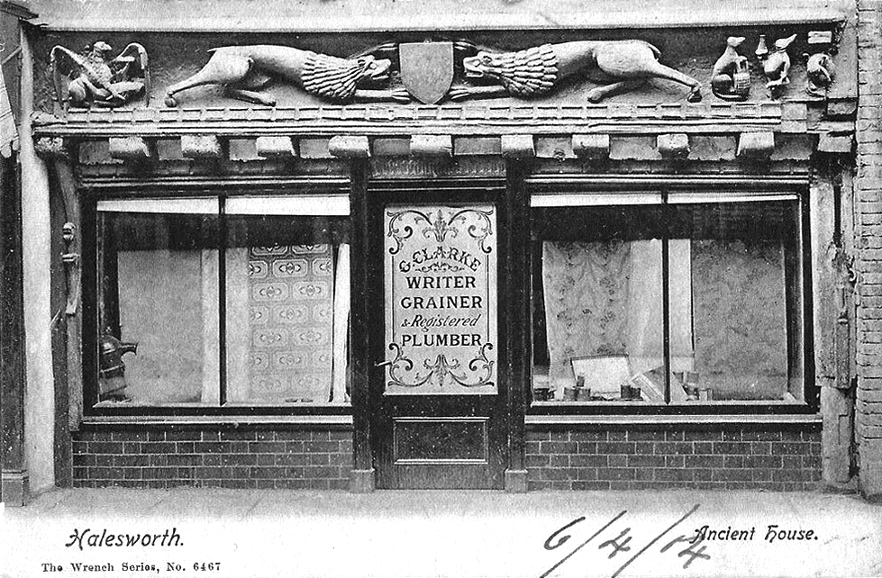
The most enchanting of shop fascias.
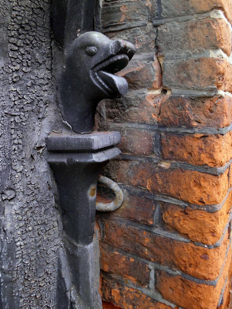
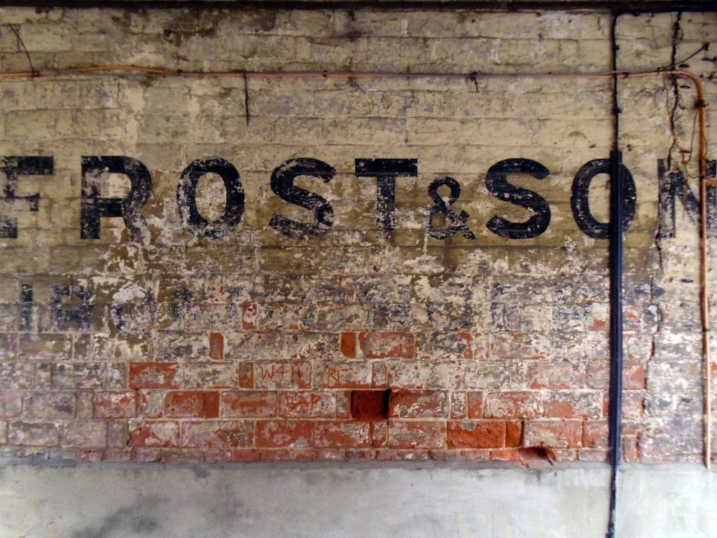
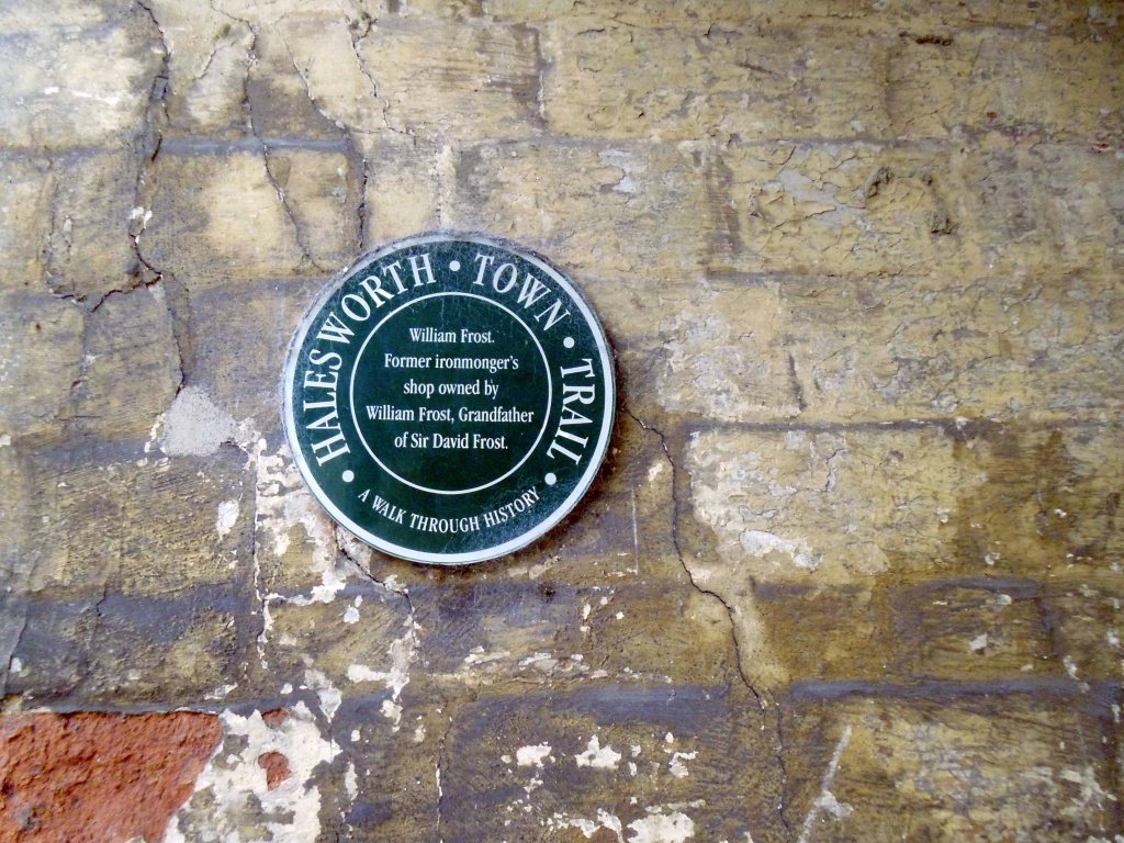
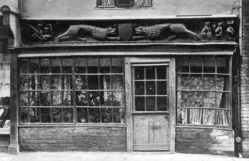
Something of a curiosity – David Frost’s father’s ironmongers in Halesworth – and the Ancient House with its ancient carving.
The bressumer beam at the front of the is linked with Margaret de Argentein in the late 14th and 15th century, it is believed t it could have been a manor or toll house.
Currently trading as a Bistro with paranormal problems;
Things in the window were swaying the other day and when we went to stop them they almost fought back.
I’ve seen two ghosts in the kitchen. One was clearly a man, the other was when I thought my daughter was over my shoulder but when I looked around she wasn’t there, and we were the only two in the building.
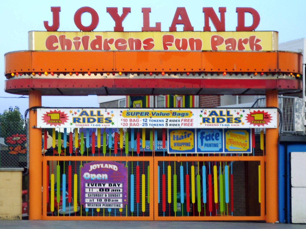
Rides include the world famous Snails and Tyrolean Tub Twist.
A huge toy town mountain incorporates the Spook Express kiddie coaster, Jet Cars and Neptune’s Kingdom undersea fantasy ride, Pirate Ship, Major Orbit, Balloon Wheel and Skydiver complete the rest of the rides.
Hungry – why not grab a bite at the American Diner.
I actually went to the Wetherspoons.
Though the town is full of tiny pubs.
And a chippy.
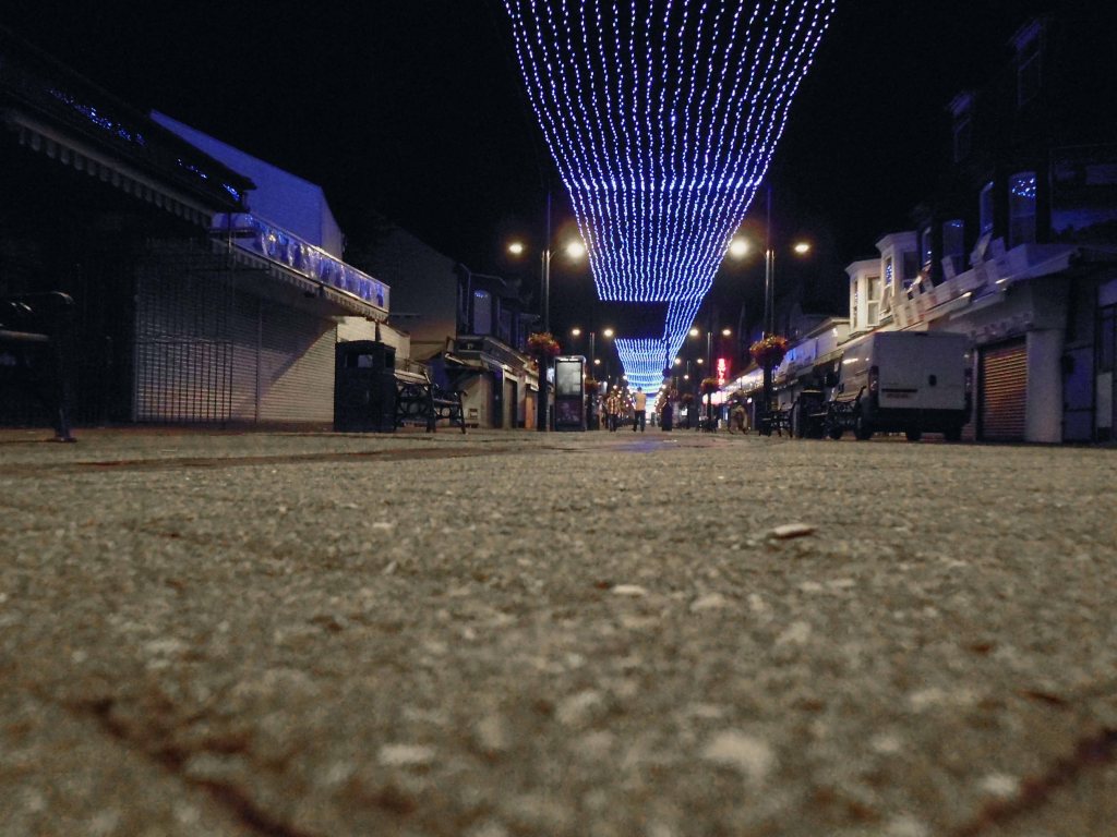
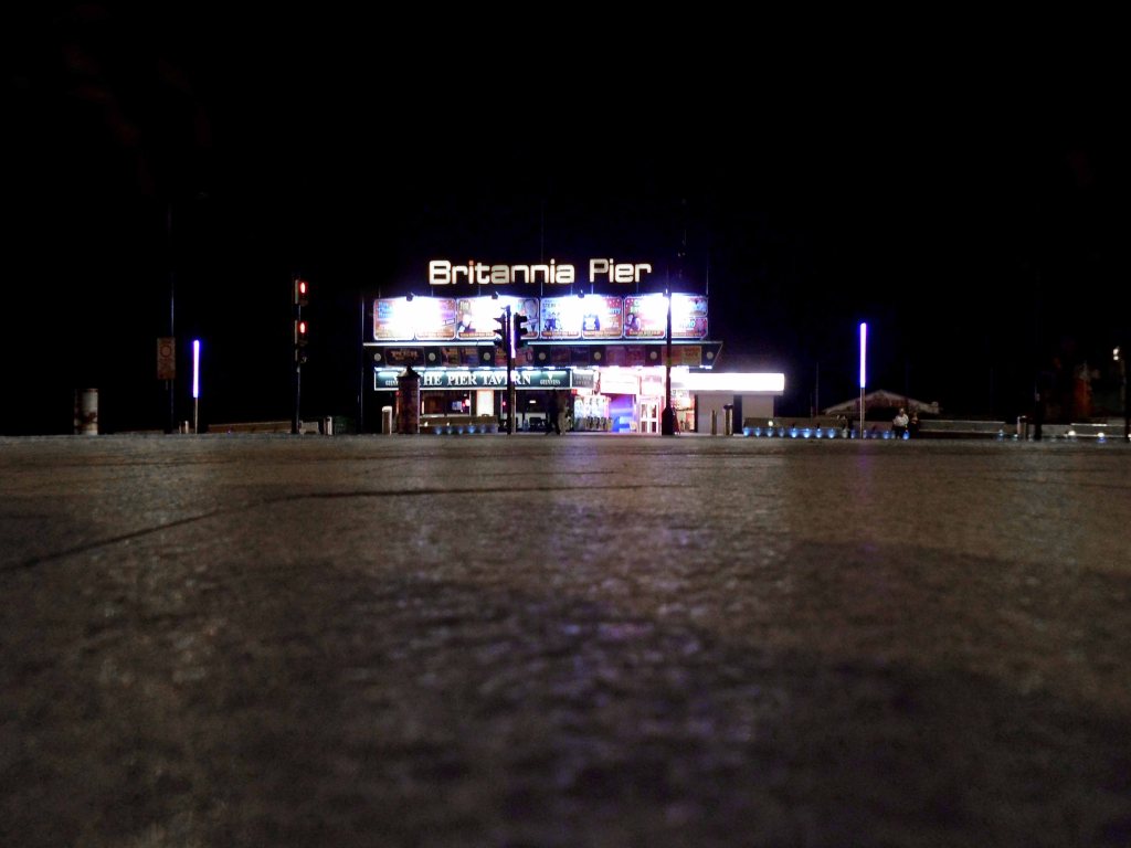
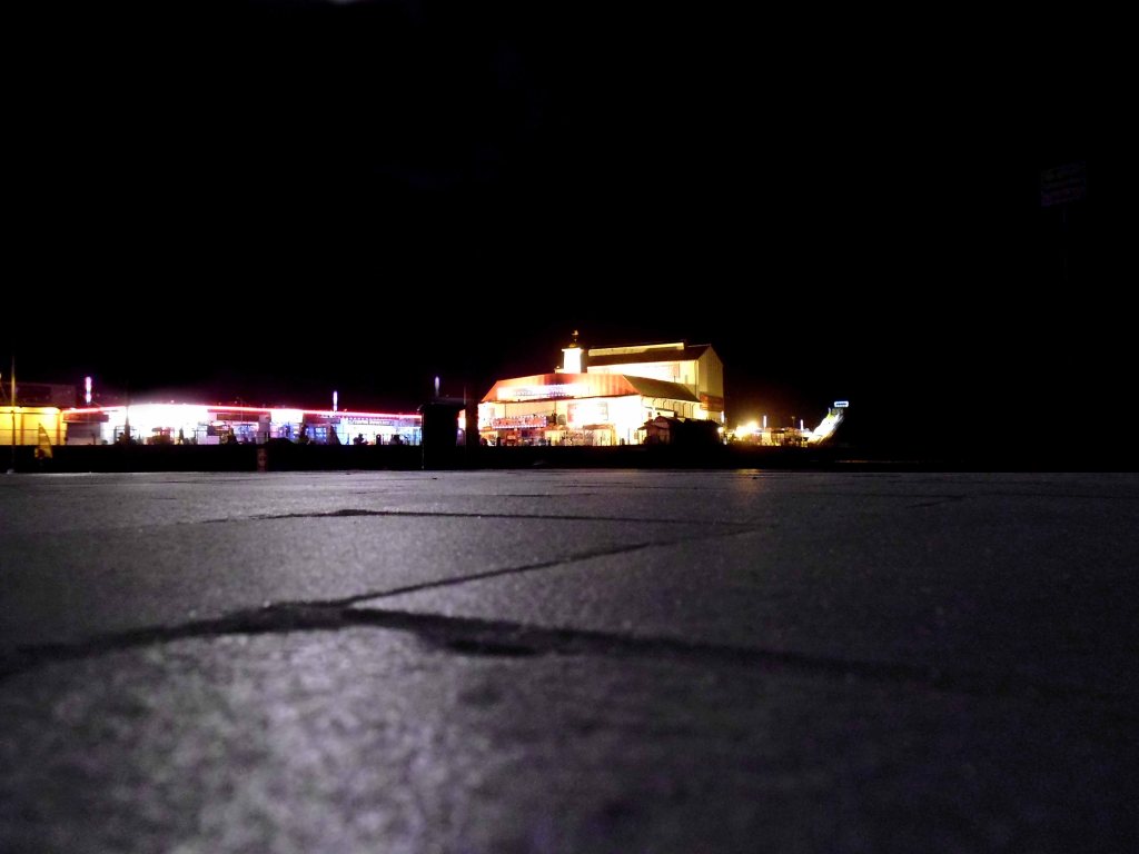
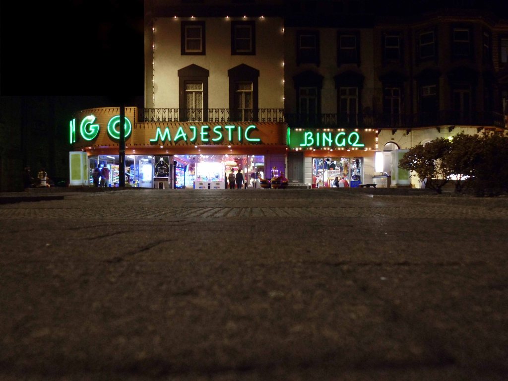
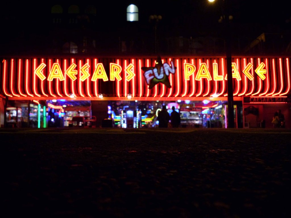
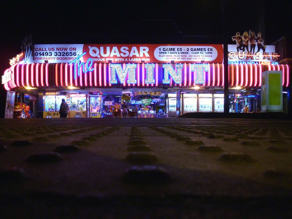
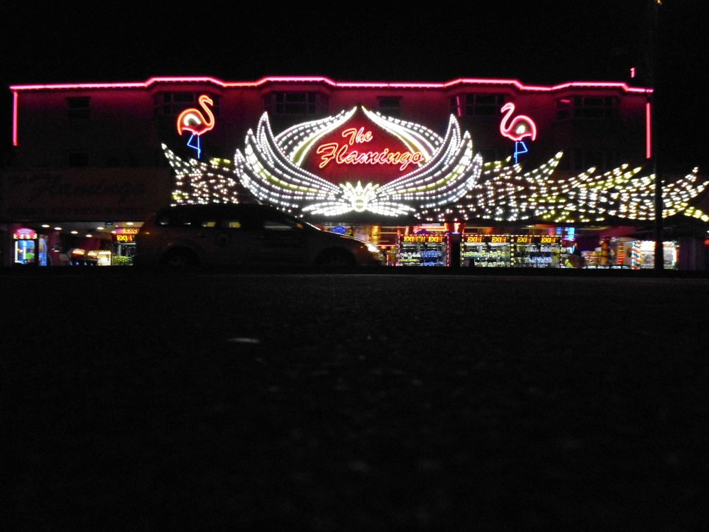
I wandered the highway byways and promenade of Great Yarmouth, all alone in a neon nightmare!
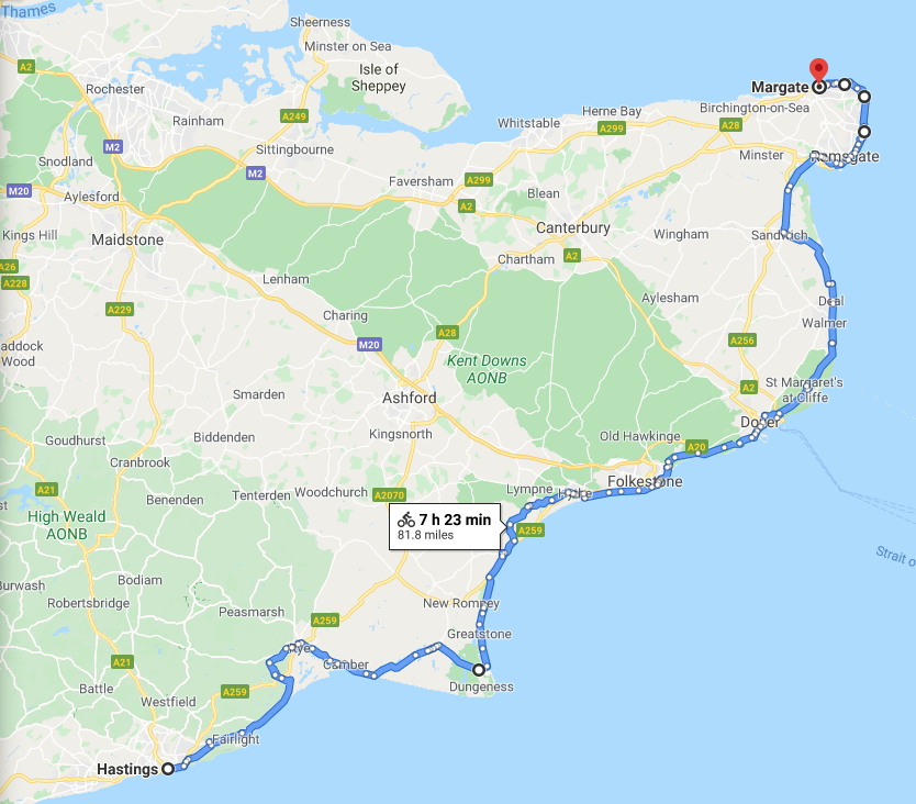
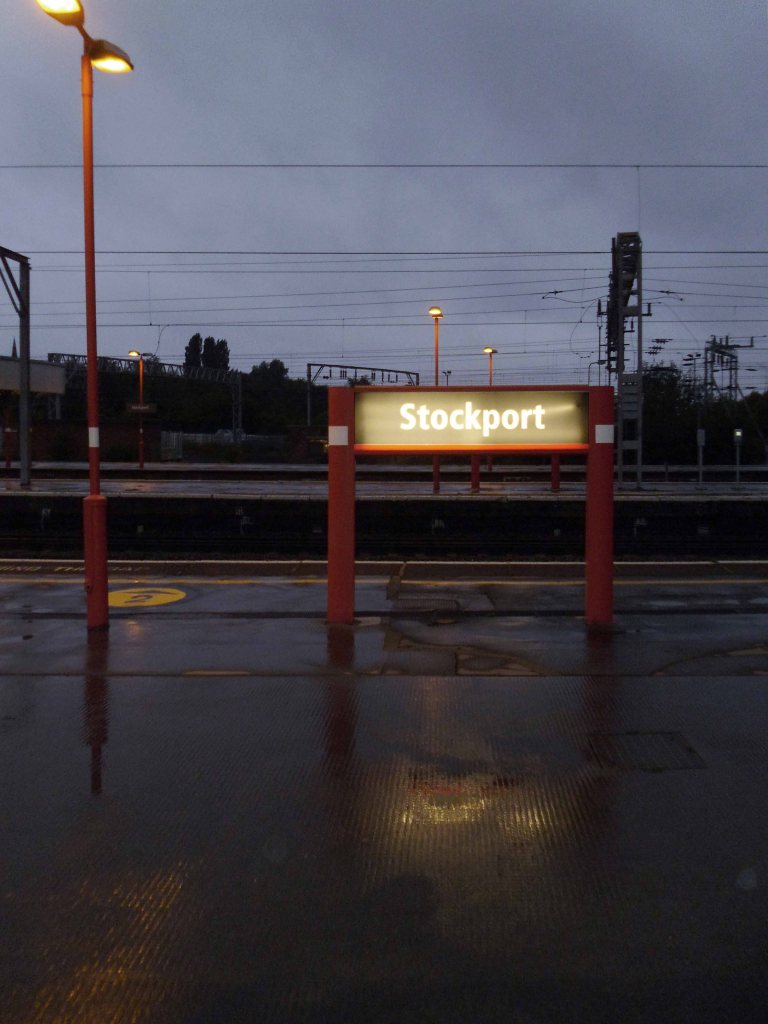
Early one morning, six o’clock on Saturday 30th August 2014 to be precise – I set out on my bike from my humble Stockport home, Pendolino’d to Euston, London Bridged to Hastings.
It was my intention to follow the coast to Cleethorpes, so I did.
Five hundred miles or so in seven highly pleasurable days awheel, largely in bright late summer sun. Into each life however, some rain must fall, so it did.
Kent, Essex, Suffolk, Norfolk and Lincolnshire flashed by slowly in lazy succession, to the right the sea – you can’t get lost, though I did. Following Sustrans signs is relatively easy, as long as they actually exist, when I reached Kings Lynn I decided to buy a map.
I set out at eight o’clock on Monday 1st September – I had taken early retirement in March. I would have normally been enrolling new students and teaching photography in a Manchester Further Education College, as I had done for the previous thirty years.
Not today thanks.
With the wind and my former career behind me, I cycled on with an unsurpassable sense of lightness and elation.
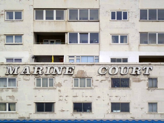
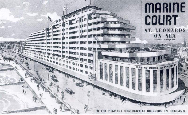
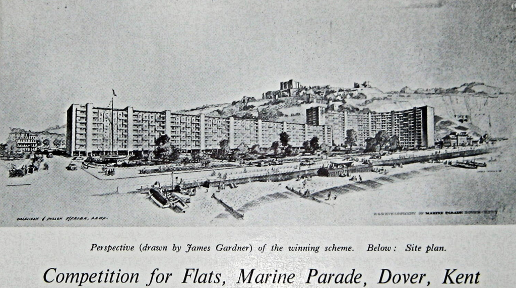
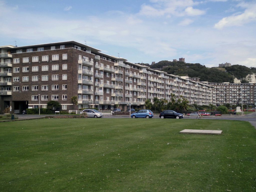
The building was designed by architects Kenneth Dalgleish and Roger K Pullen, with overt references to the Cunard White-Star Line Queen Mary, which had entered commercial transatlantic service in 1936. The east end of Marine Court is shaped to imitate the curved, stacked bridge front of the Queen Mary; the eastern restaurant served to imitate the fo’c’sle deck of the ship.
Heading towards Hythe on the coastal defence path.
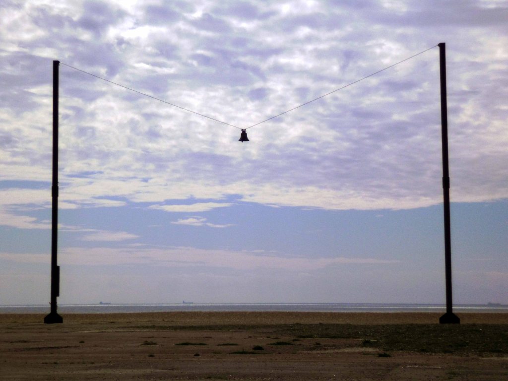
Out of Tune Folkestone Seafront, opposite The Leas Lift – is home to AK Dolven’s installation. It features a 16th-century tenor bell from Scraptoft Church in Leicestershire, which had been removed for not being in tune with the others. It is suspended from a steel cable strung between two 20m high steel beams, placed 30m apart.
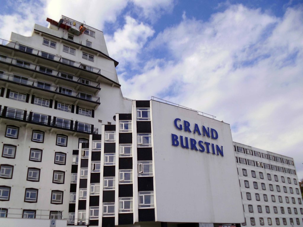
For Folkestone Triennial 2014, Alex Hartley’s response to the title Lookout is inspired by the imposing architecture of the Grand Burstin Hotel, which overlooks the Harbour. For his project Vigil, Hartley will use state of the art climbing technology to make a lookout point suspended from the highest point of the hotel. This climber’s camp will be inhabited for the duration of the Triennial, by the artist and by volunteers, all of whom will keep a log of what they observe.
The current hotel was built in 1984 from the foundations of the Royal Pavilion Hotel, originally built in 1843. Out of the 4,094 reviews currently on TripAdvisor 974 are of the terrible rating which doesn’t inspire much hope.
The most recent review is titled – Dirty Dated Hotel With Clueless Staff.
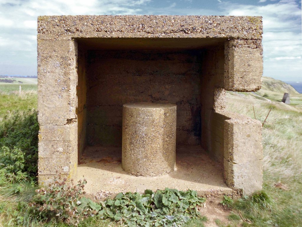
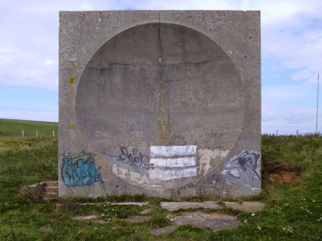
Before the advent of radar, there was an experimental programme during the 1920s and 30s in which a number of concrete sound reflectors, in a variety of shapes, were built at coastal locations in order to provide early warning of approaching enemy aircraft. A microphone, placed at a focal point, was used to detect the sound waves arriving at and concentrated by the acoustic mirror. These concrete structures were in fixed positions and were spherical, rather than paraboloidal, reflectors. This meant that direction finding could be achieved by altering the position of the microphone rather than moving the mirror.
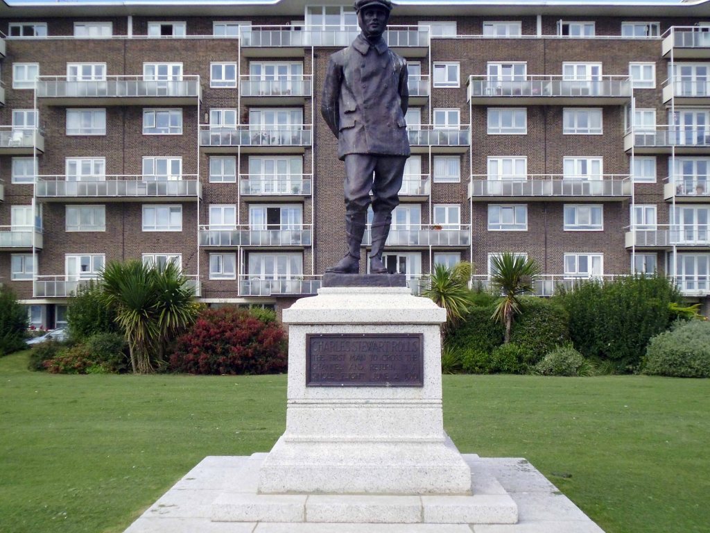
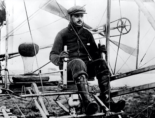
Charles Stewart Rolls was a Welsh motoring and aviation pioneer. With Henry Royce, he co-founded the Rolls-Royce car manufacturing firm. He was the first Briton to be killed in an aeronautical accident with a powered aircraft, when the tail of his Wright Flyer broke off during a flying display in Bournemouth.
In September 1953 it was announced that Roger K Pullen and Kenneth Dalglish had won and were to receive 100 guineas, for a design for the Gateway Flats.
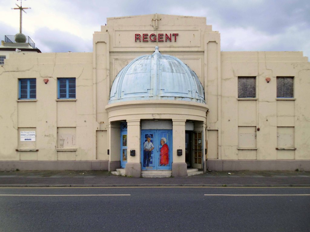
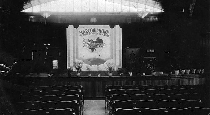
Behind the Art Deco facade of the Regent was once a grand ironwork and glass Pavilion, built to house regular performances by military bands, which the Edwardian holidaymakers loved. The Lord Warden of the Cinque ports, Lord Beauchamp, officially opened the Pavilion Theatre on Deal’s seafront in 1928.
Deal Pier was designed by Eugenius Birch and opened on 8th November 1864, in 1954 work started on Deal’s third and present-day pier. The new pier took three years to build and was formally opened by the Duke of Edinburgh on 19 November 1957. It was the first seaside pleasure pier of any size to be built since 1910. Designed by Sir W Halcrow and Partners, the 1026ft-long structure comprises steel piles surrounded by concrete casings for the main supports. The pier head originally had three levels but, these days, the lower deck normally remains submerged.
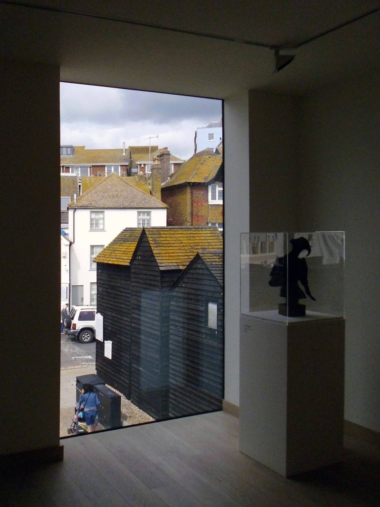
The building was designed by David Chipperfield – It was built on the raised promenade following a flood risk analysis. Construction started in 2008, and was completed for opening in April 2011, at a cost of £17.5 million. The gallery opened on 16 April 2011.
Whilst walking the length of Hessle Road, up and back – taking the air, snaps, the sights and sounds, I came upon a fine Faience tiled frontage.
I began photographing, wandering dangerously into the space between the slip road and the flyover. A shout rang out, emanating from the boozer, the landlord called me over.
“Do you want to take a look inside?”
“Yes”.
A listed interior the new landlord is working hard along with Historic England to restore the capacious rooms to their former glory, including the entrance mosaic and ceiling – images P Hampel
Inheriting a whole heap of issues and a grey parrot called Sparky.
But the boozer is now up and running serving cask ale to throngs of first class thirsty customers.
The Yorkshire Brewhouse 1904 ended mid week when we’re normally closed but we were asked to open for a group of very thirsty sailors. We moved on to Reet, another Yorkshire Brewhouse beer and thanks to the football that one has gone too. It’s back to the YBH Faithful Stout once again. I’d come quick and get it while you can.
Once two pubs the Hessle Road Inn was subsumed by the Alexandra. The area was once home to the city’s Jewish Community – the cemetery survives next door.
There are Star of David motifs incorporated into the windows, sympathetic to this local heritage.
Built around 1895, designed by Smith, Brodrick and Walker, with late C20 alterations – British Listed Buildings.
It’s a fabulous pub which deserves to thrive – pop in for a pint if you’re passing, just watch out for low flying parrots.
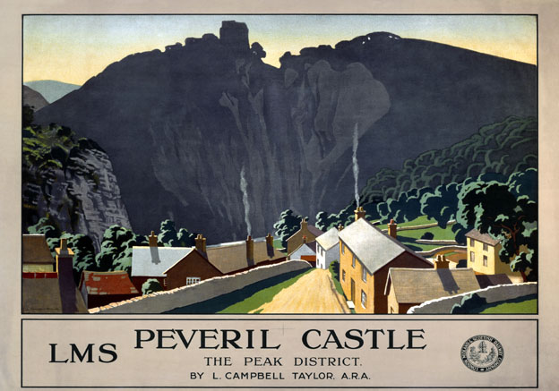
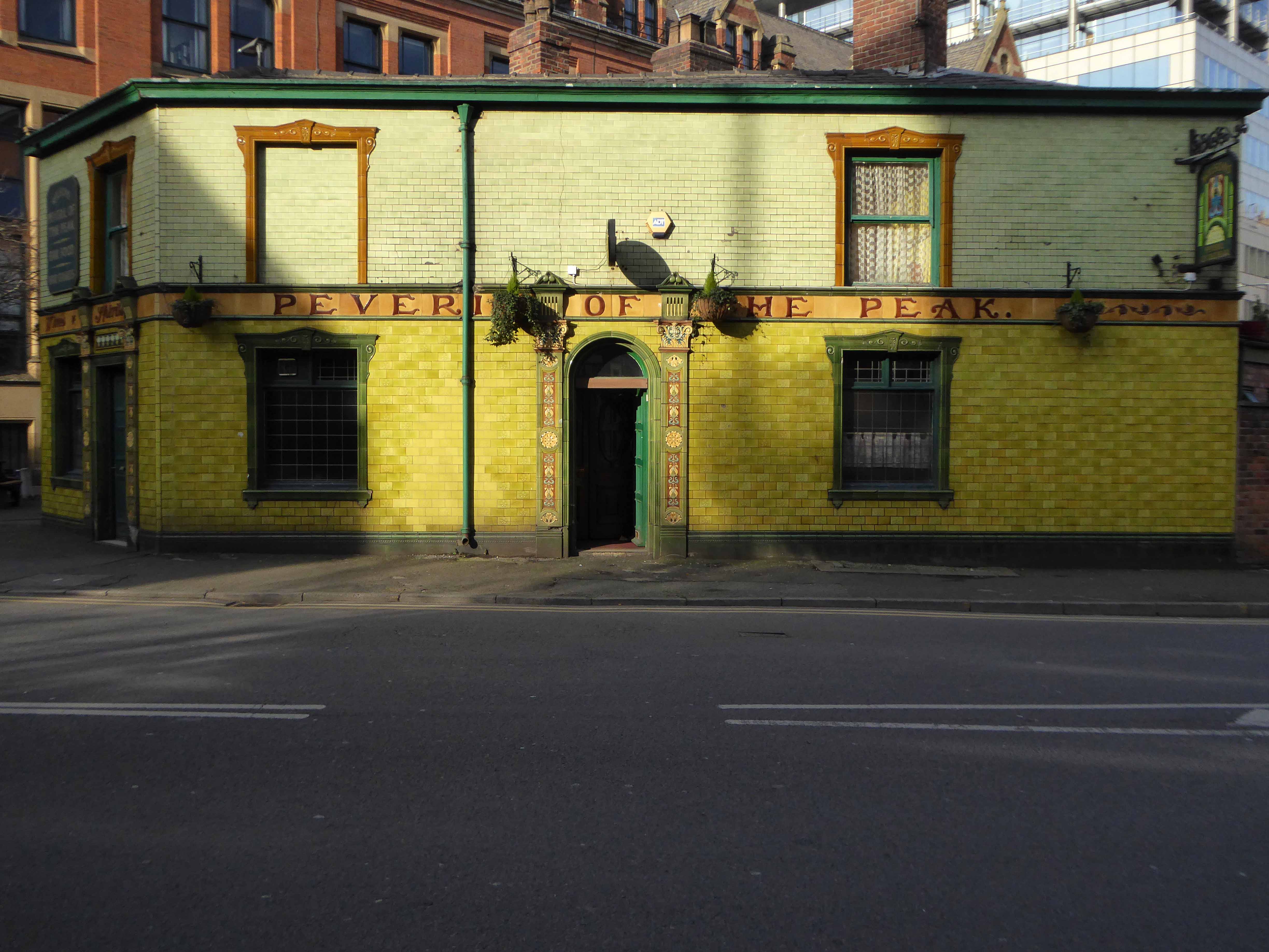
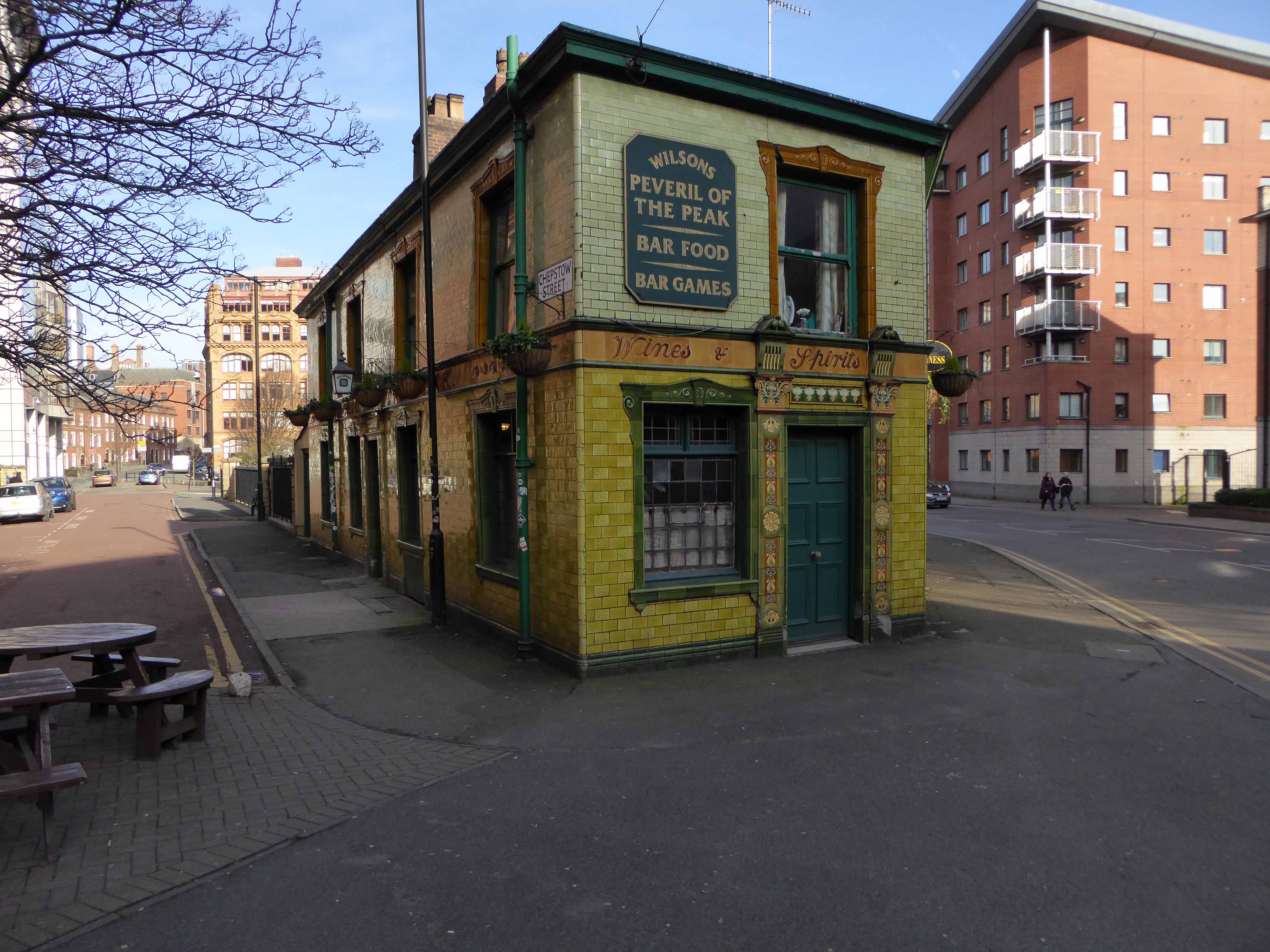
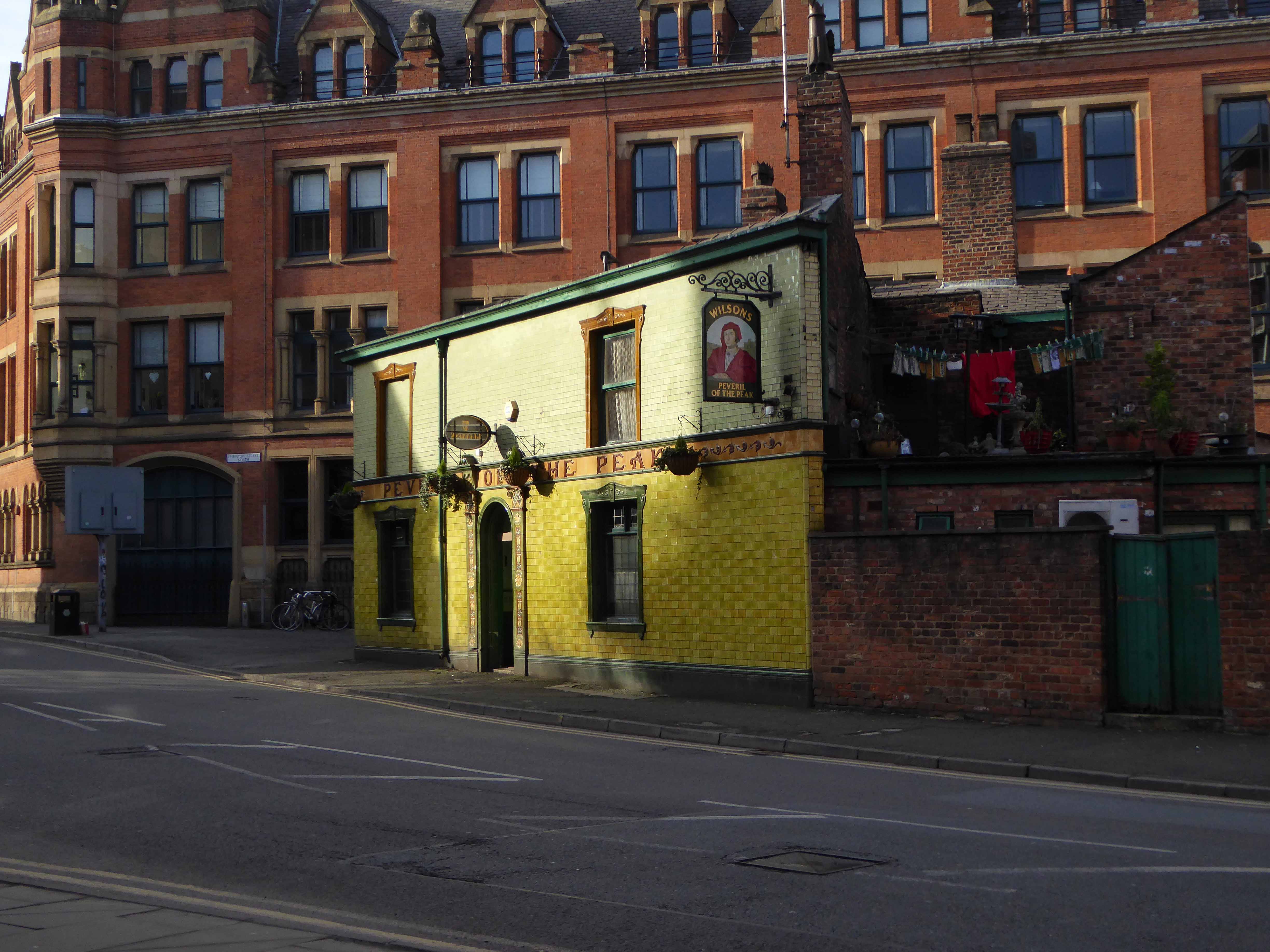
To begin at the beginning or thereabouts, Sir Walter Scott publishes his longest novel Peveril of the Peak in 1823.
Julian Peveril, a Cavalier, is in love with Alice Bridgenorth, a Roundhead’s daughter, but both he and his father are accused of involvement with the Popish Plot of 1678.
Most of the story takes place in Derbyshire, London, and on the Isle of Man. The title refers to Peveril Castle in Castleton, Derbyshire.
Poster produced in 1924 for London Midland & Scottish Railway – artwork by Leonard Campbell Taylor who was born in 1874 in Oxford and went to the Ruskin School of Art.
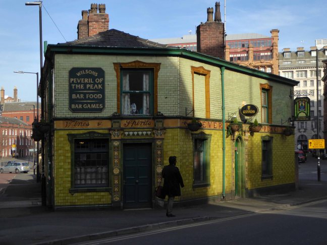
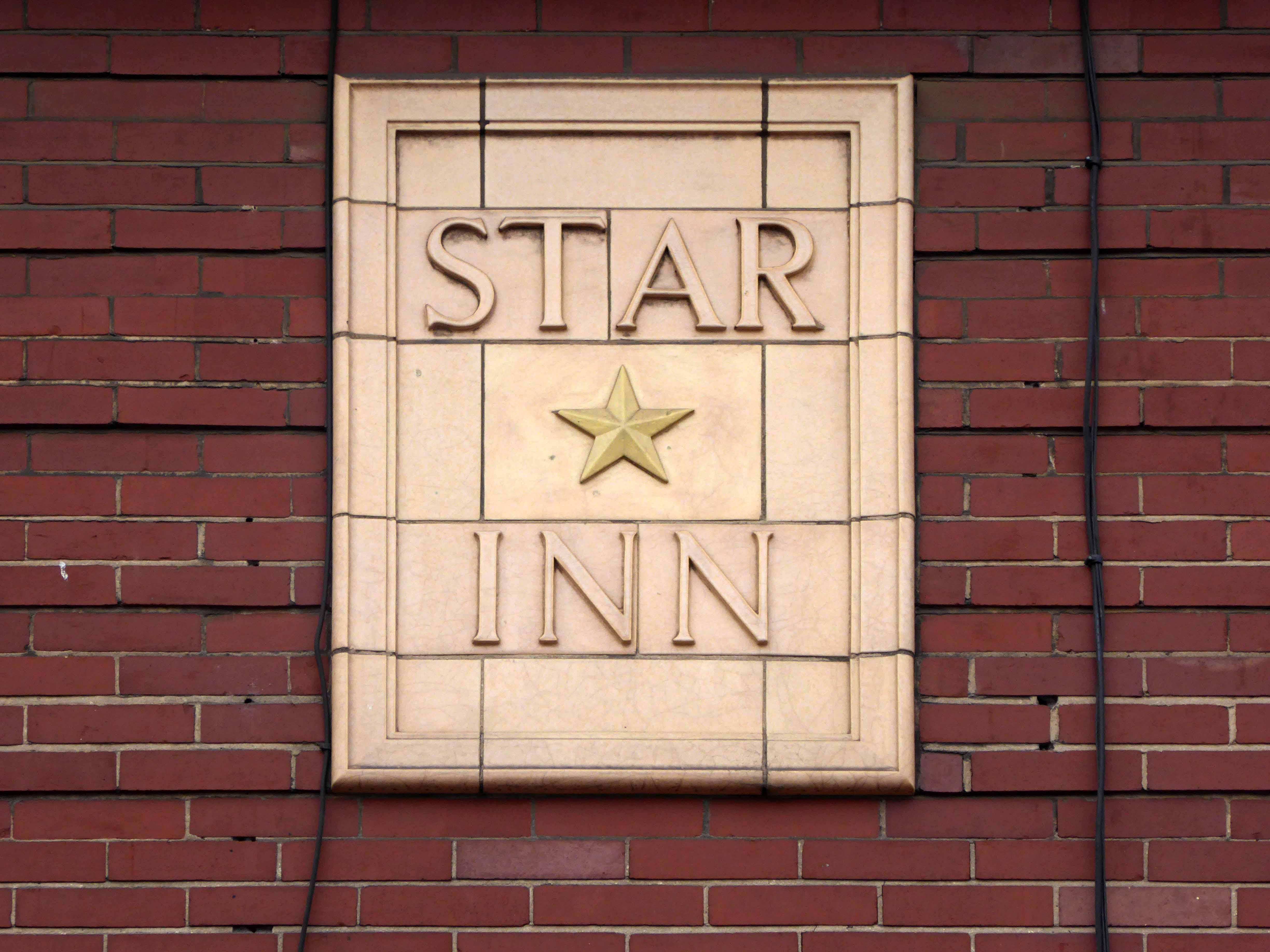
The pub also shares its name with the London to Manchester stagecoach.
Which is all very well as the pub is largely known locals as The Pev – ably run since January 1971 by Nancy Swanick.
Nancy and son Maurice, who runs the cellar, also say they have shared the pub with a paranormal presence over the years.
Customers have seen pint glasses levitate off the bar and fall into the glass-wash,it’s like having our own ghostly helper!
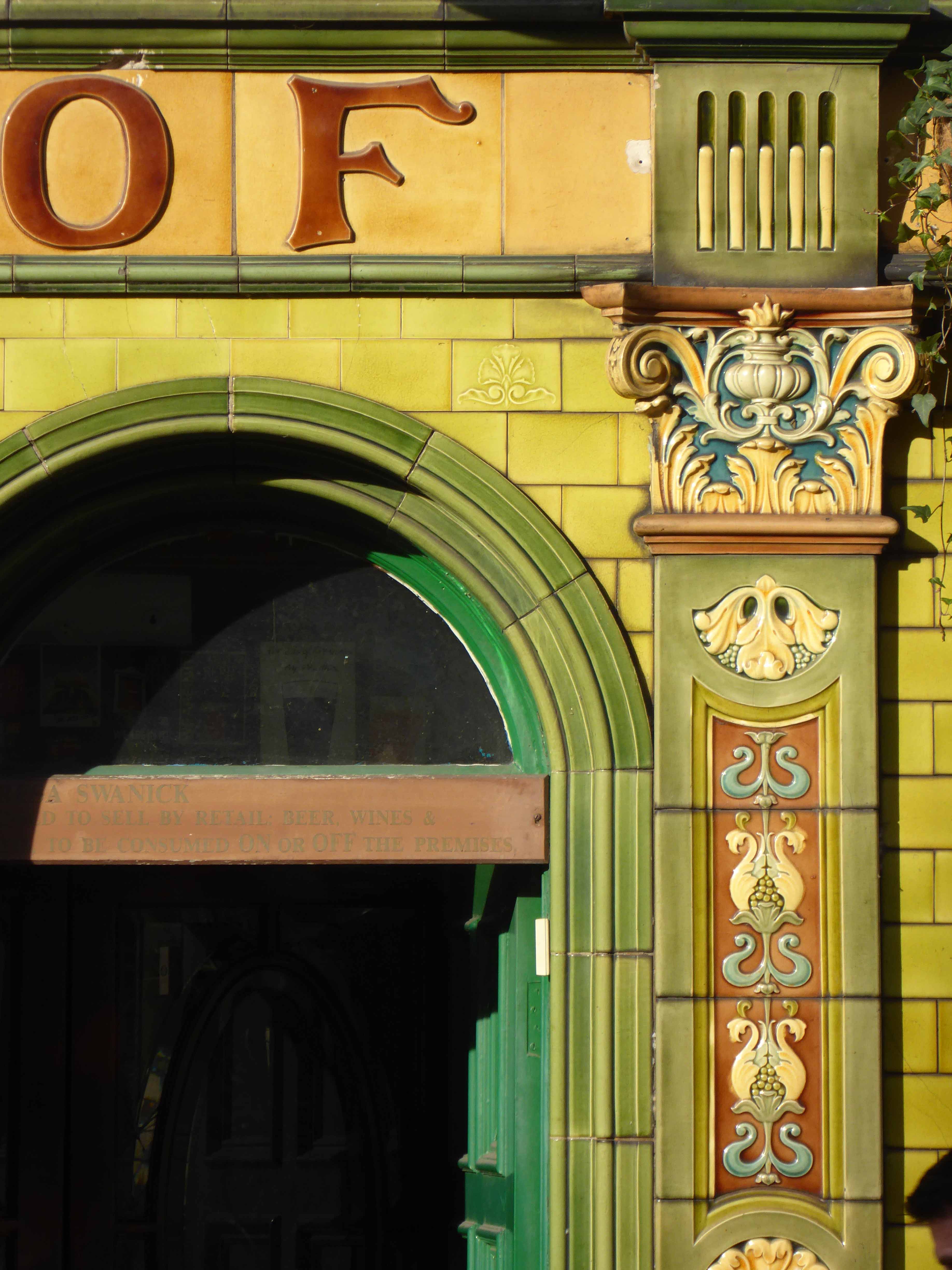
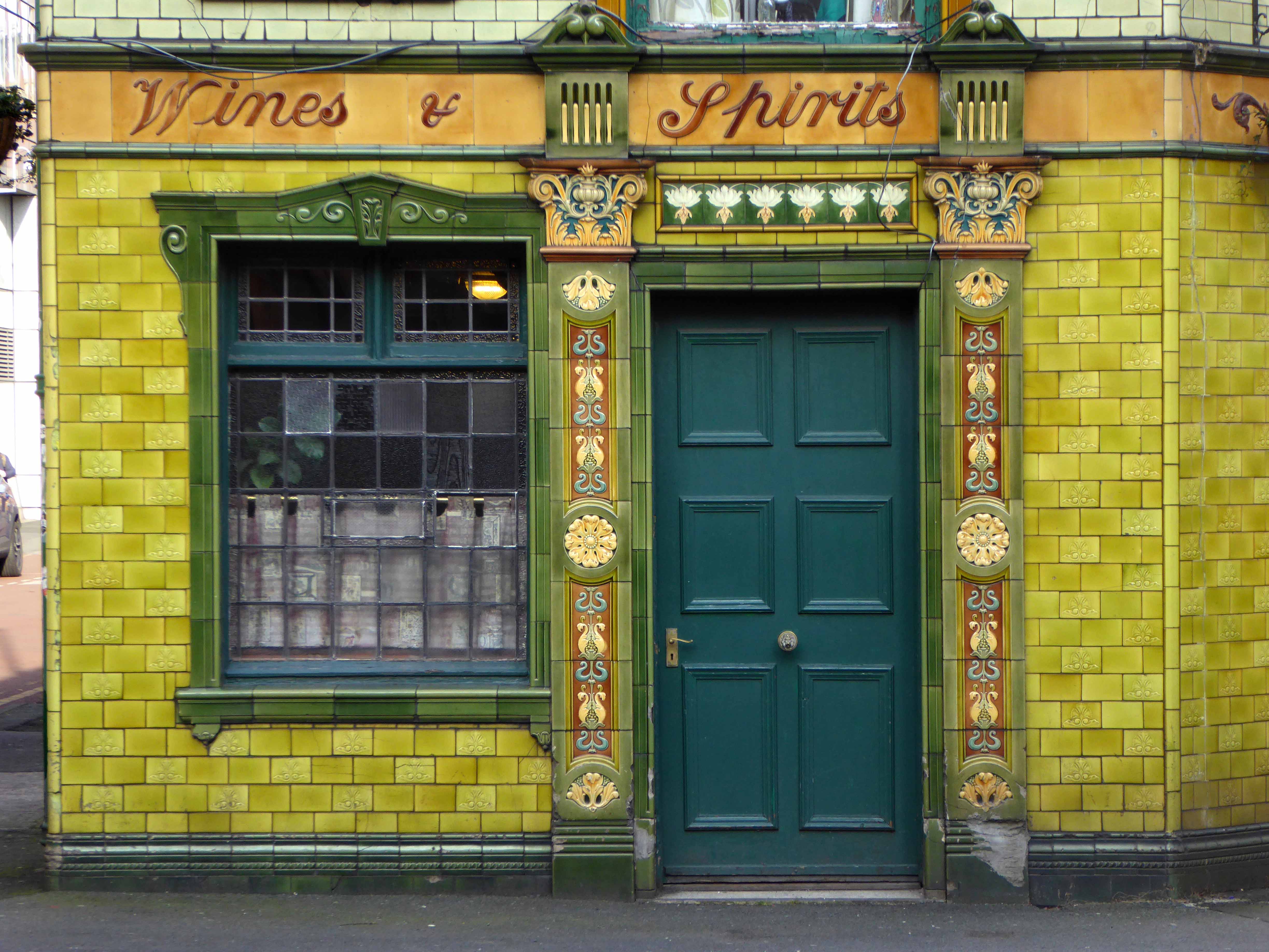
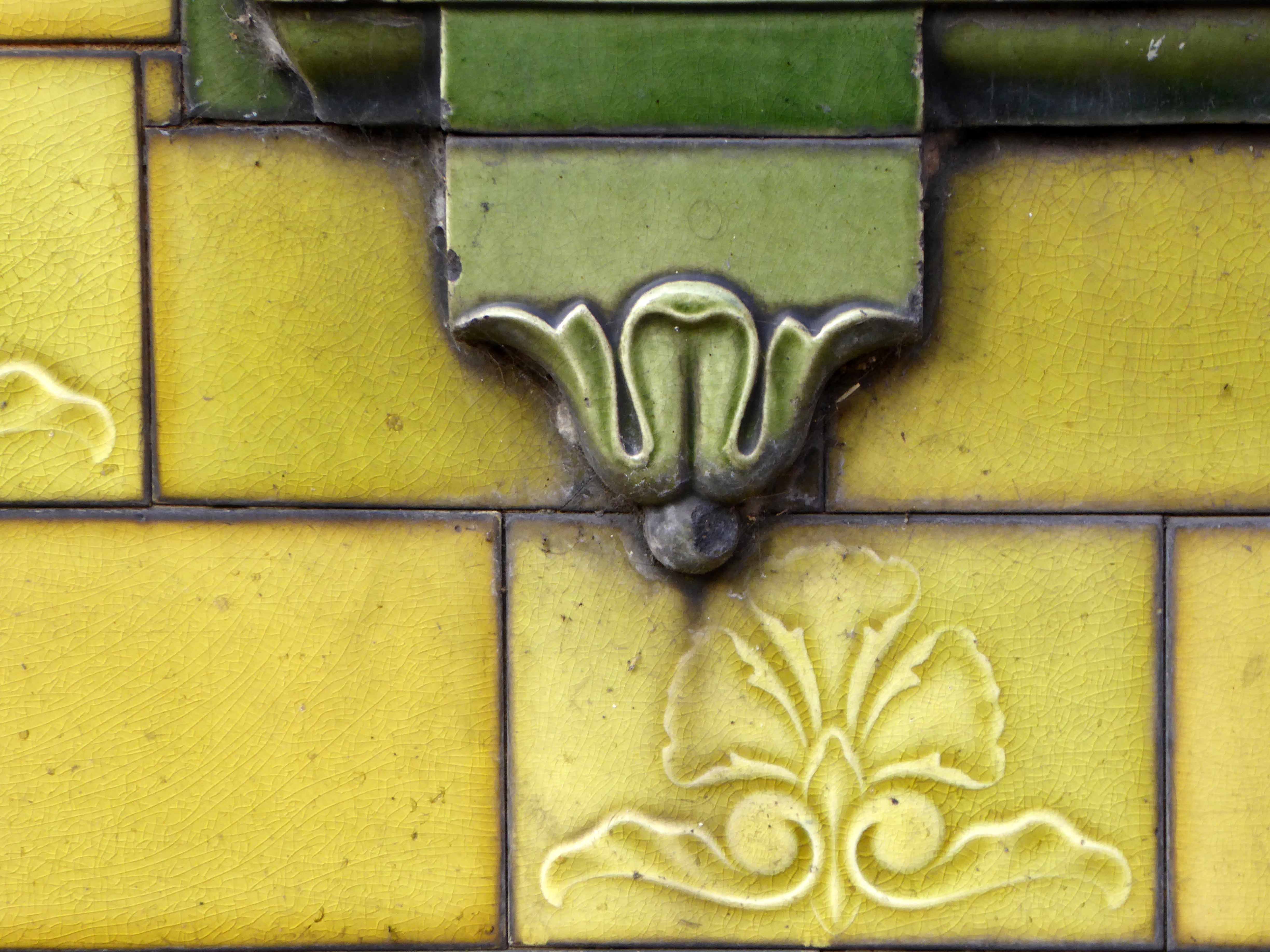
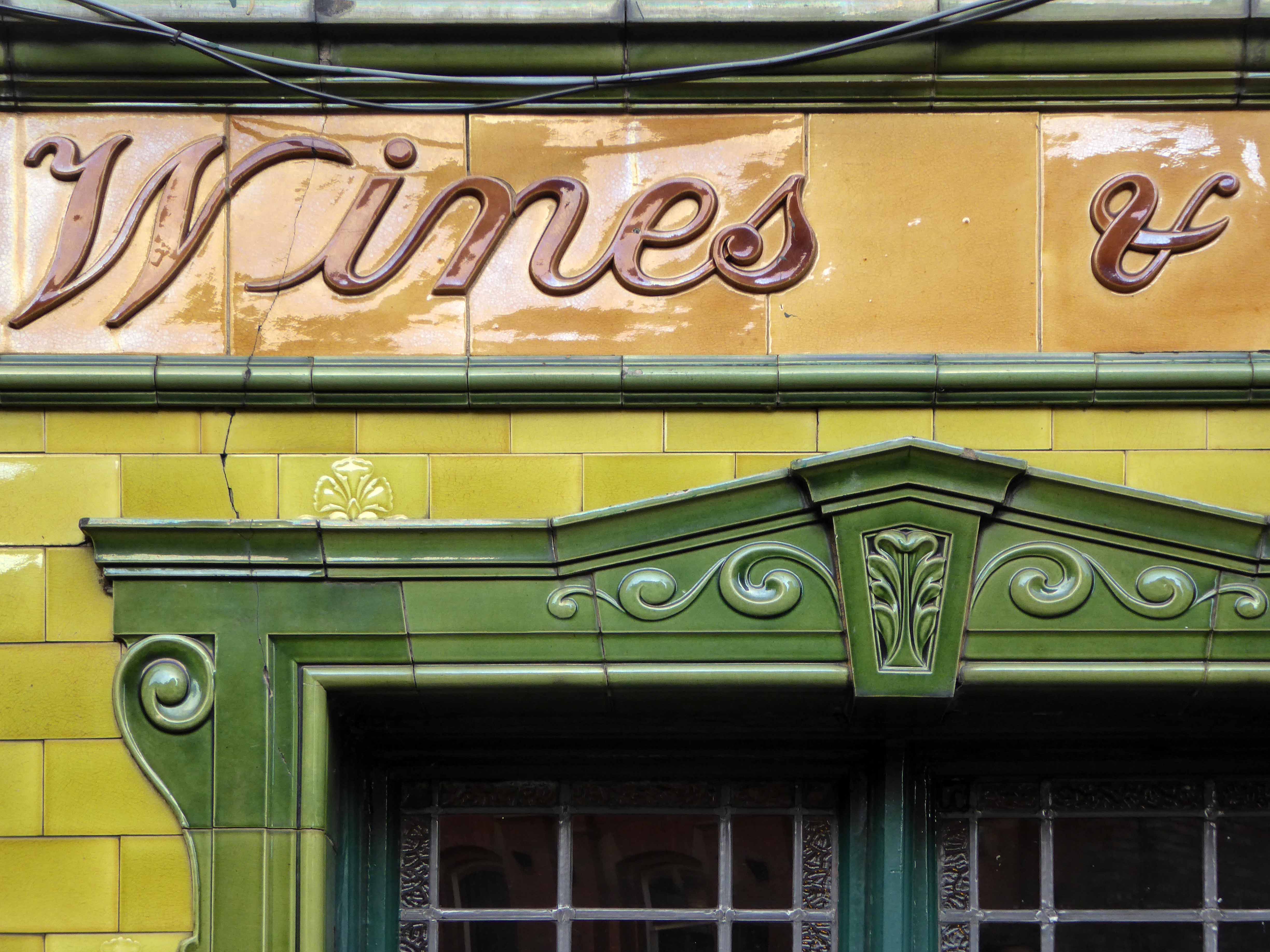
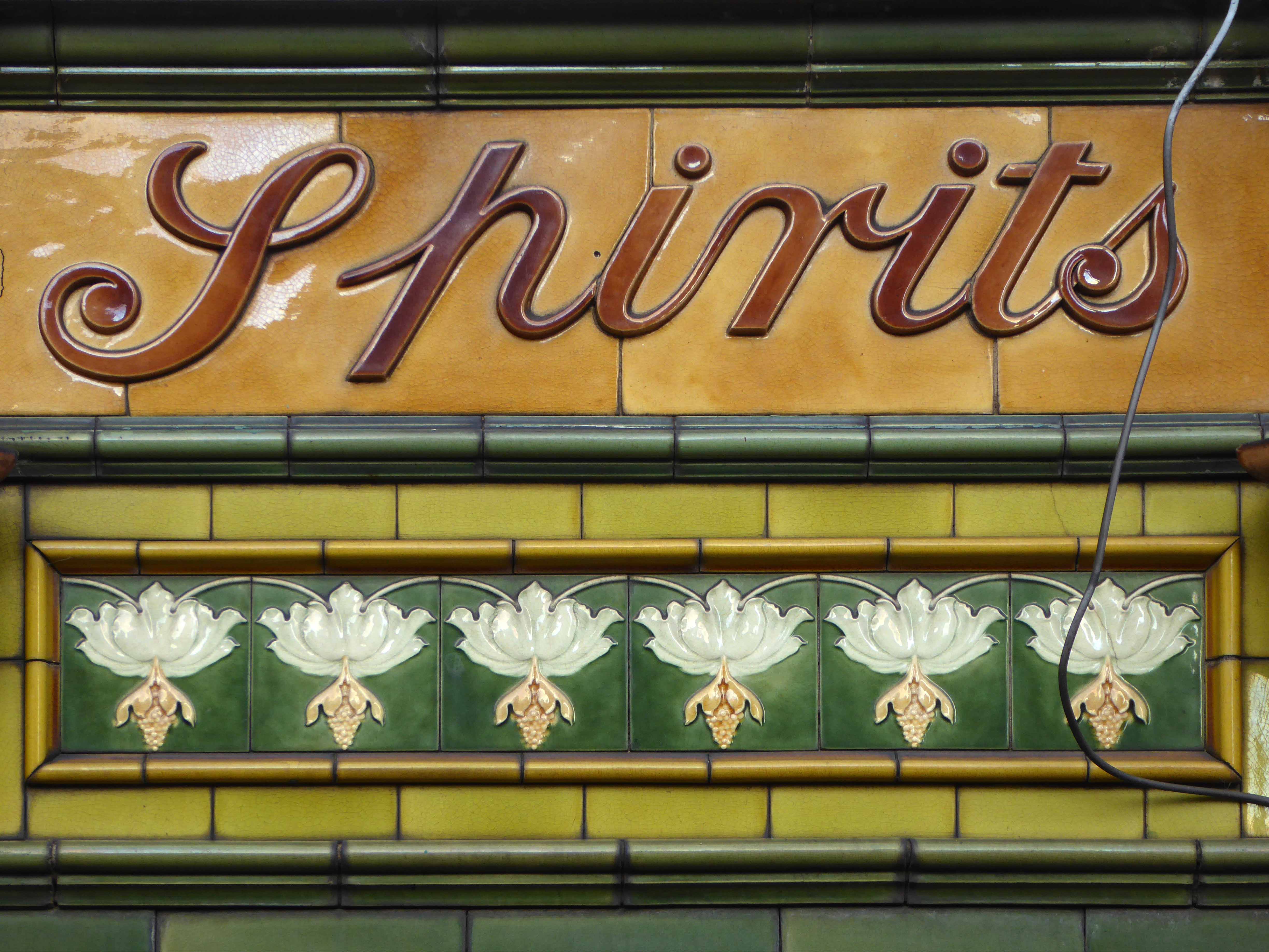
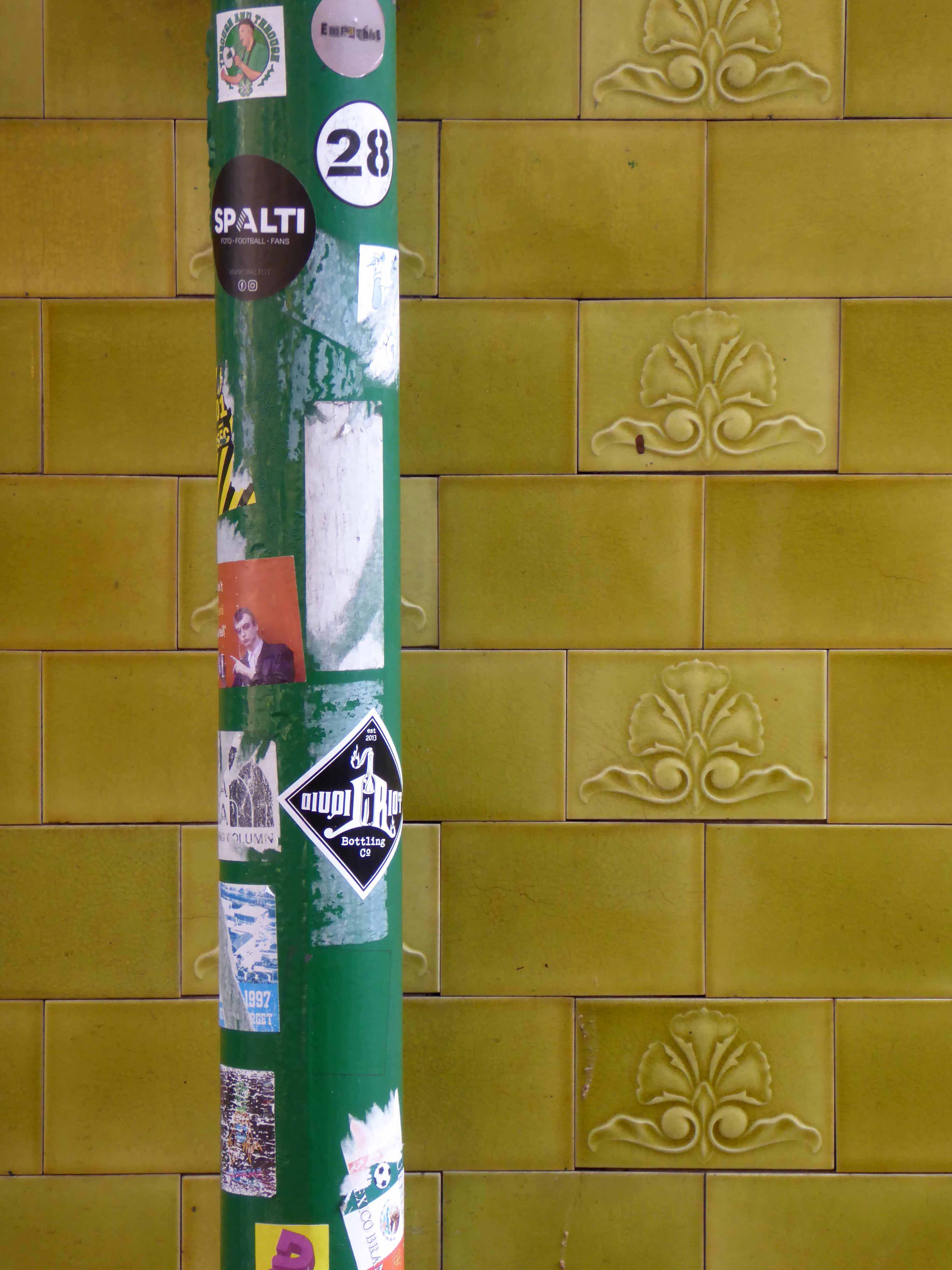
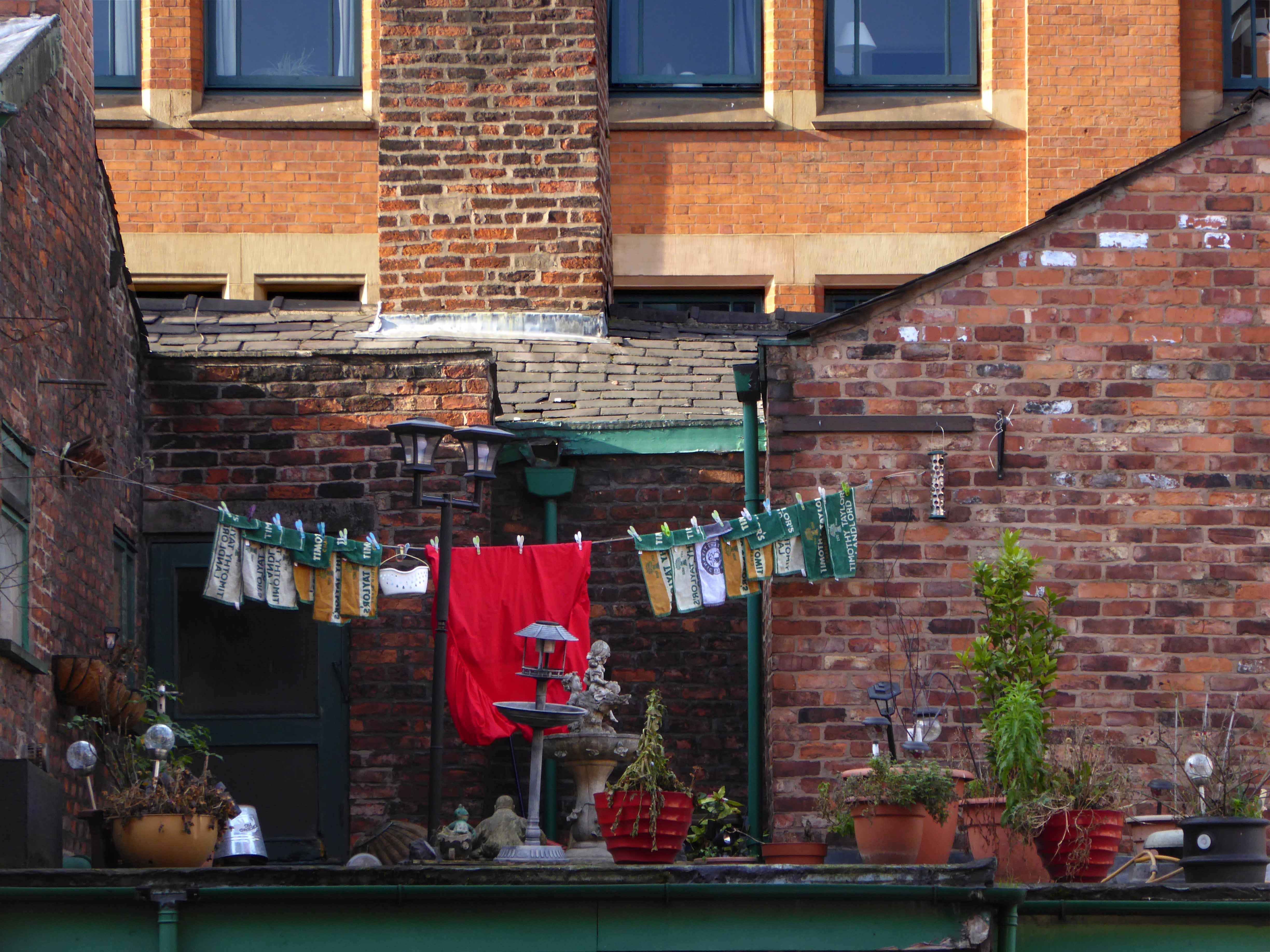
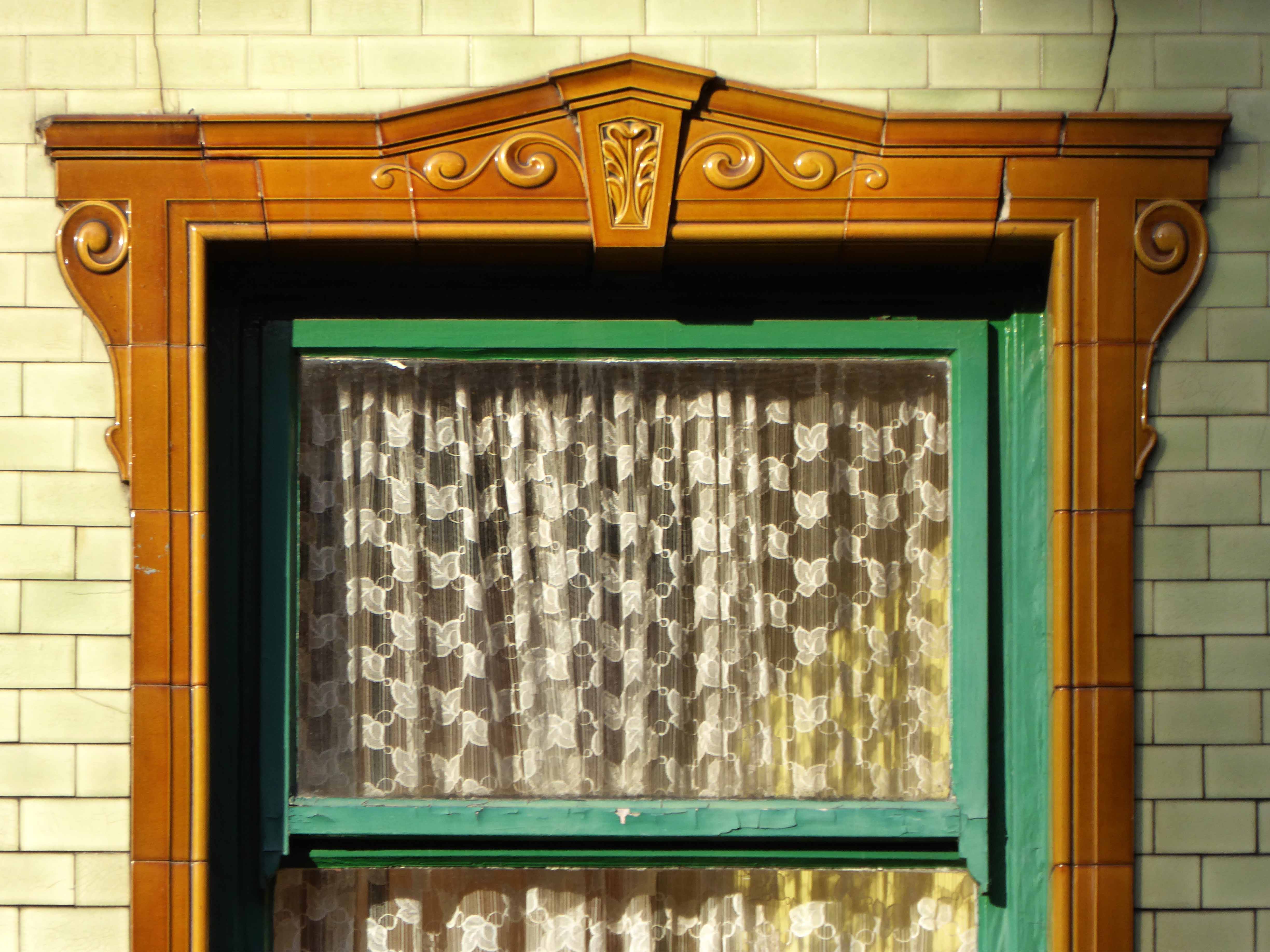
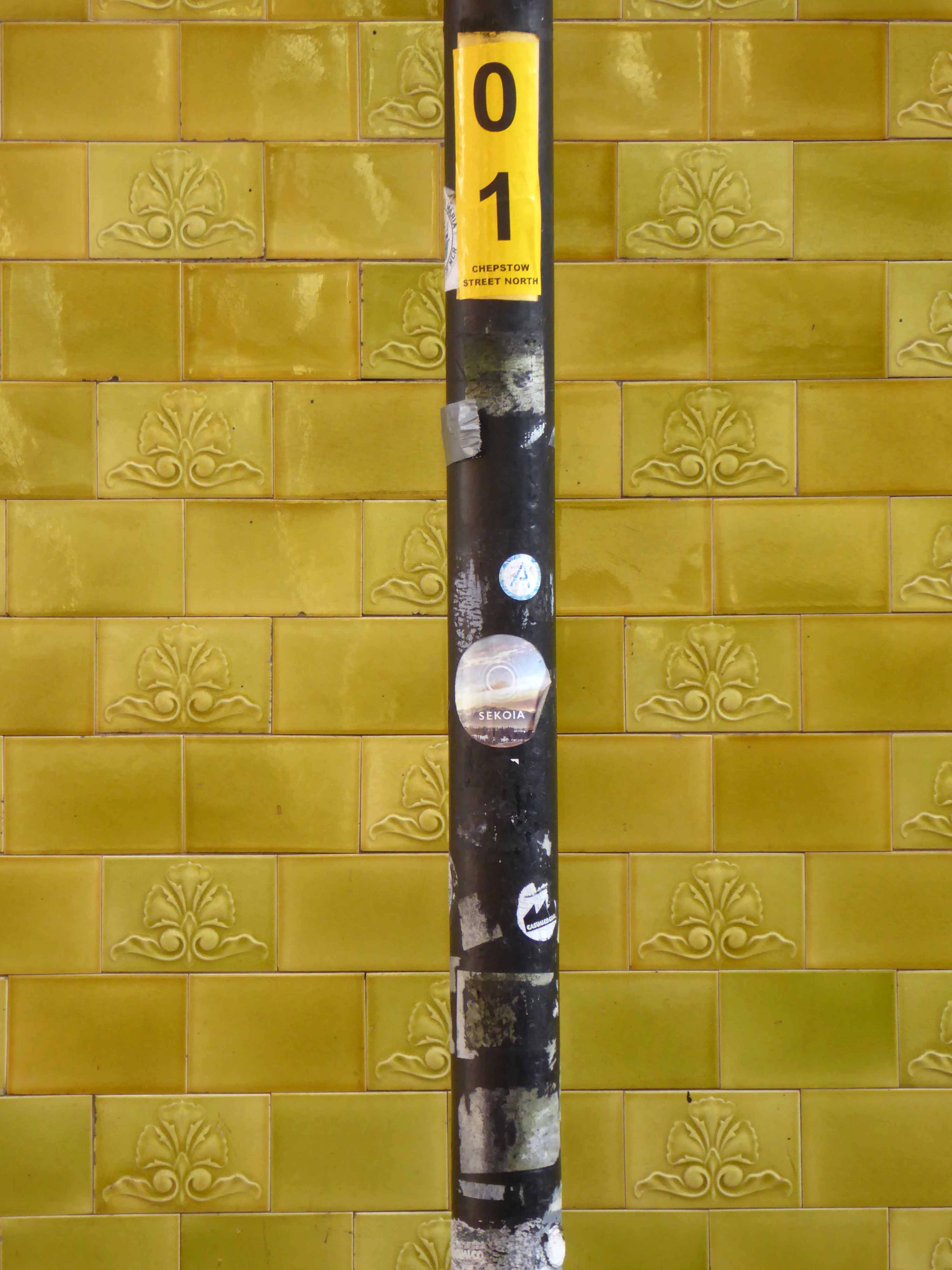
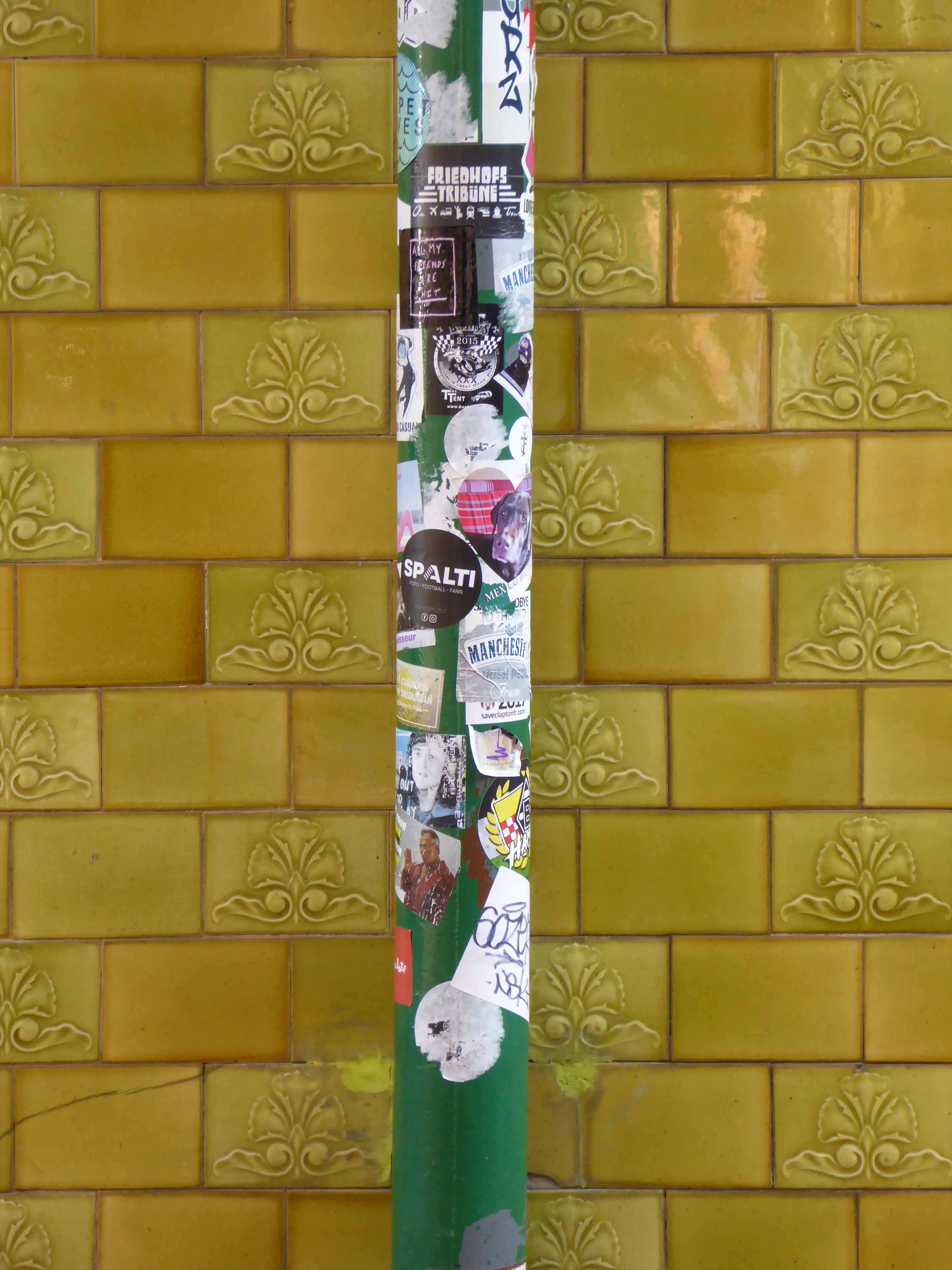
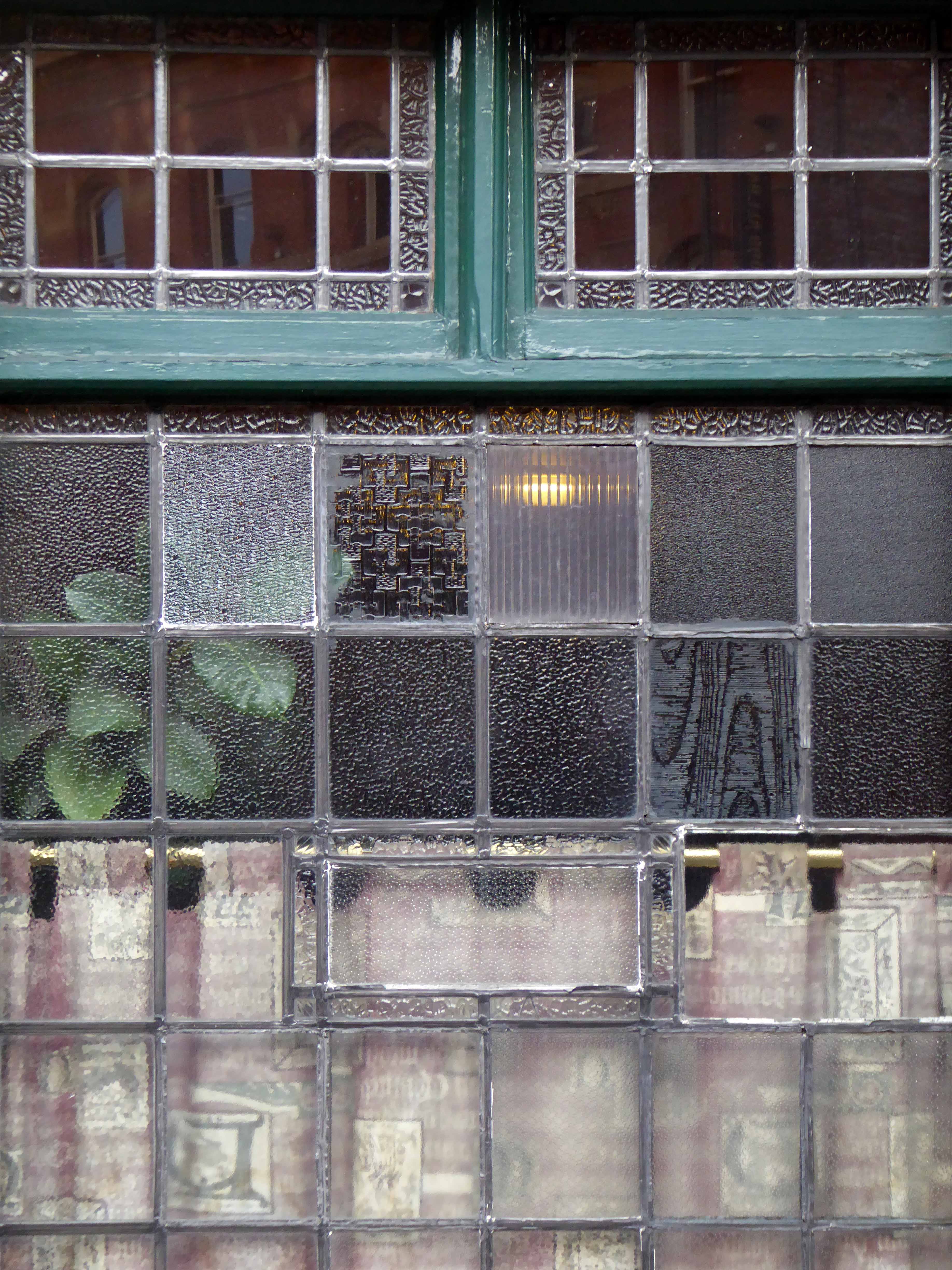
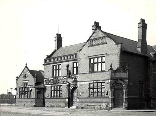
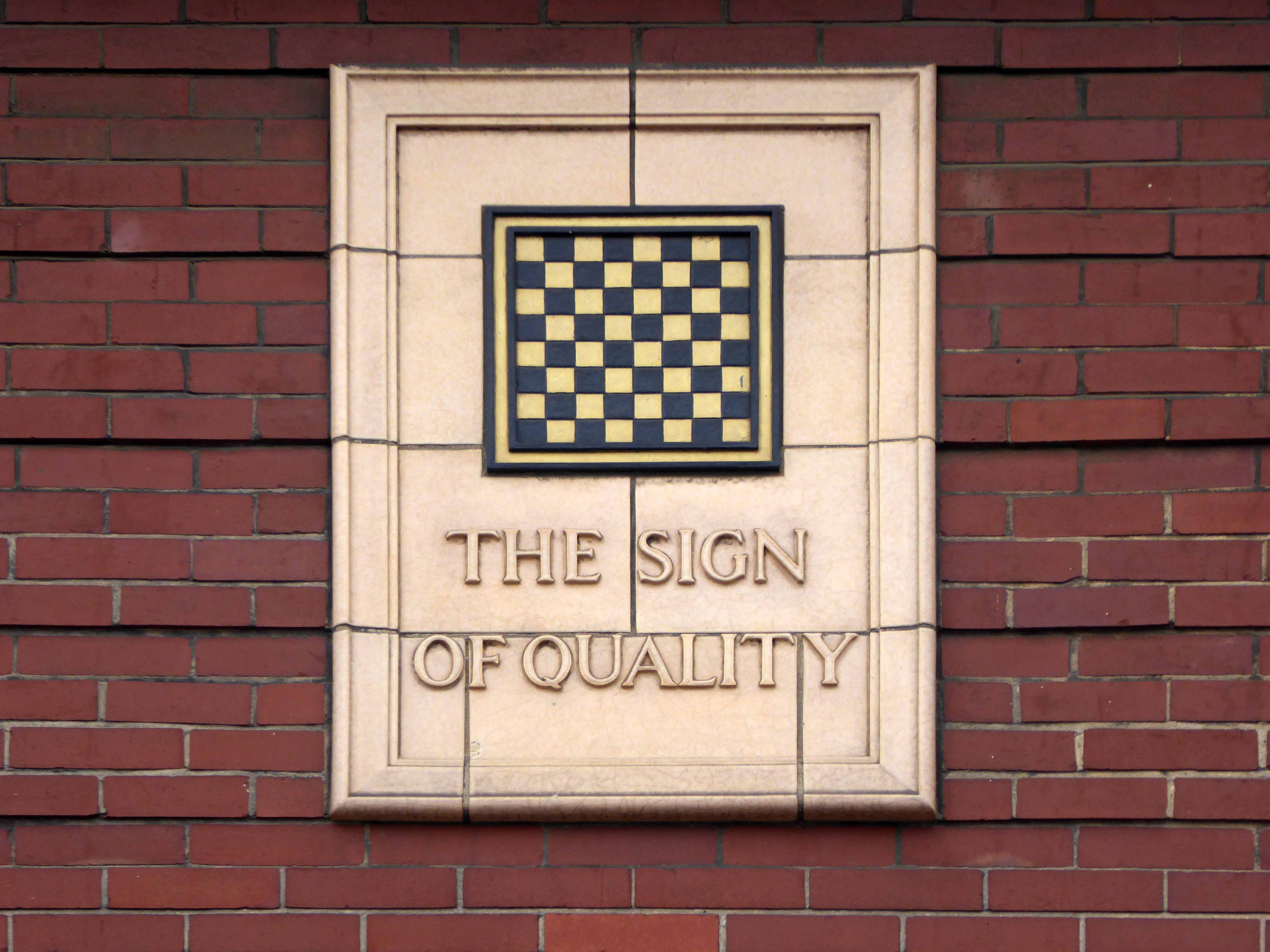
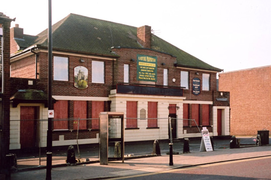
The pub was Grade II listed in June 1988 – a fine tiled exterior and 1920’s interior refit largely untouched, it stands distinctly unattached to anything, decidedly somewhere betwixt and between Chepstow Street and Great Bridgwater Street.
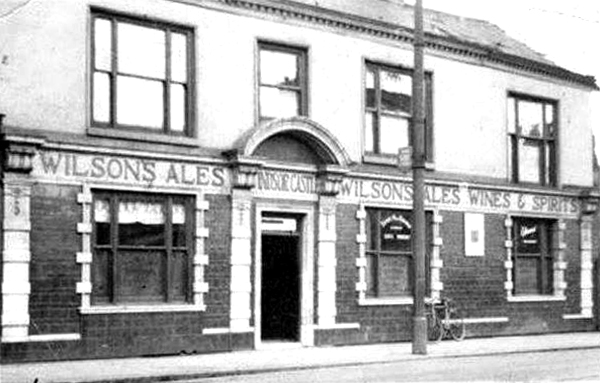
Originally a Wilson’s house – the brewery lantern survives over the door.
I’ve taken a drink or two in here over the past thirty or so years, played pool and table football, watched the half time Hallé musicians swish in and out for a swifty.
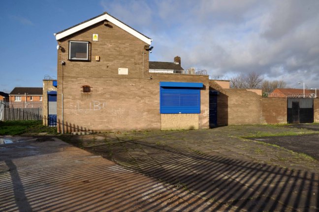
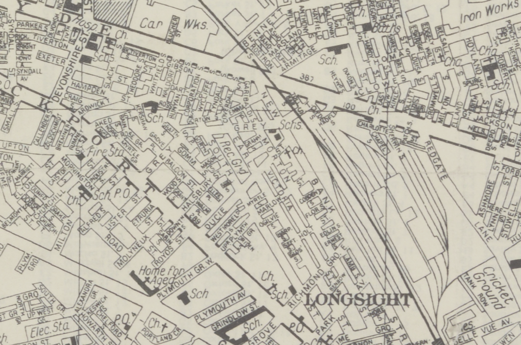
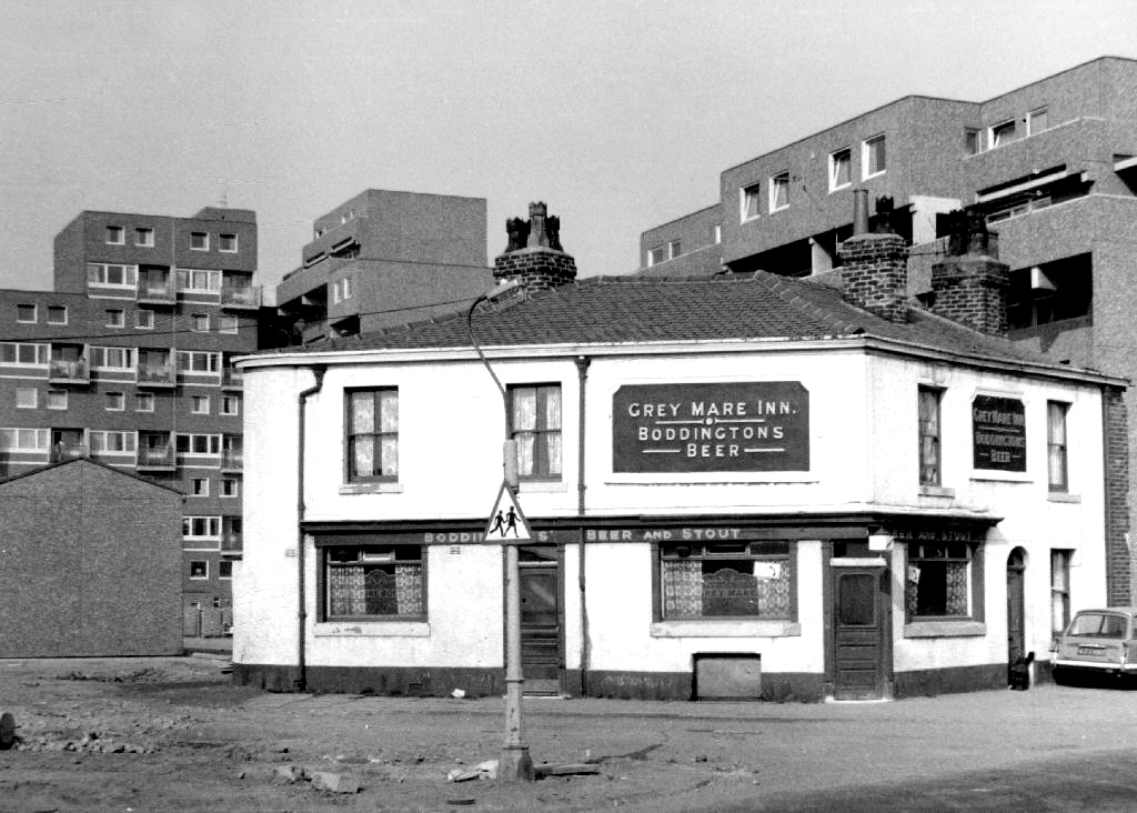
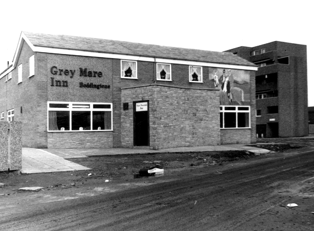
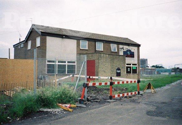
Exeter Close/Warmington Drive Manchester Longsight M12 4AT
Once there was this.
Once there was that.
Then there wasn’t.
That’s just the way of it.
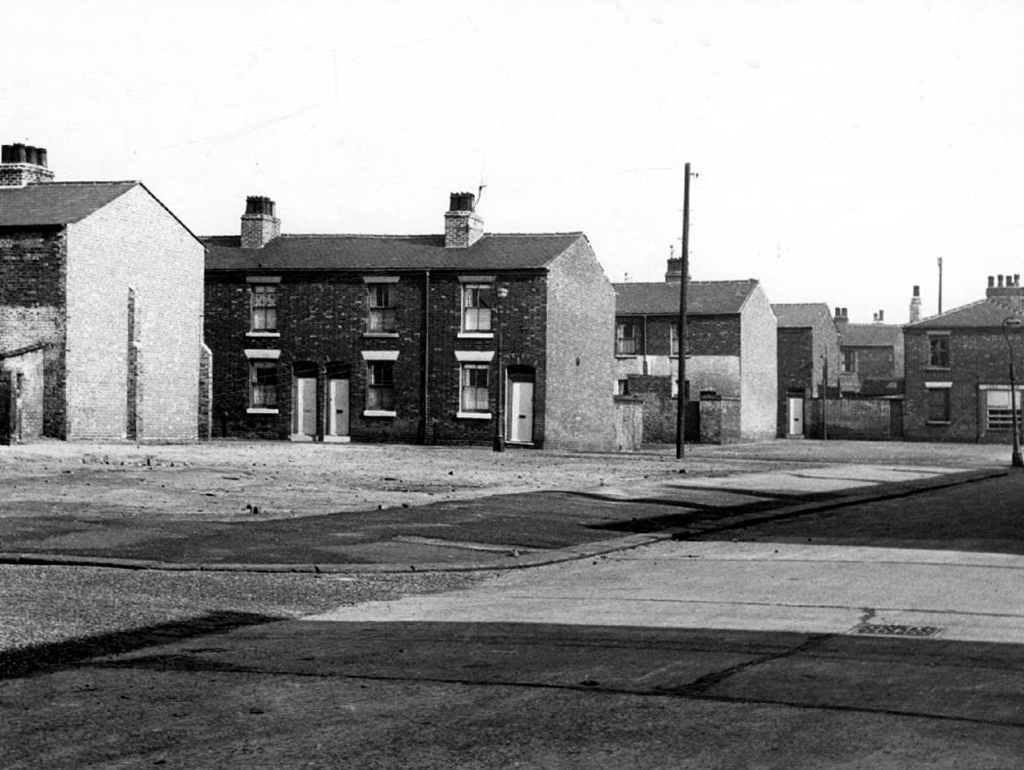
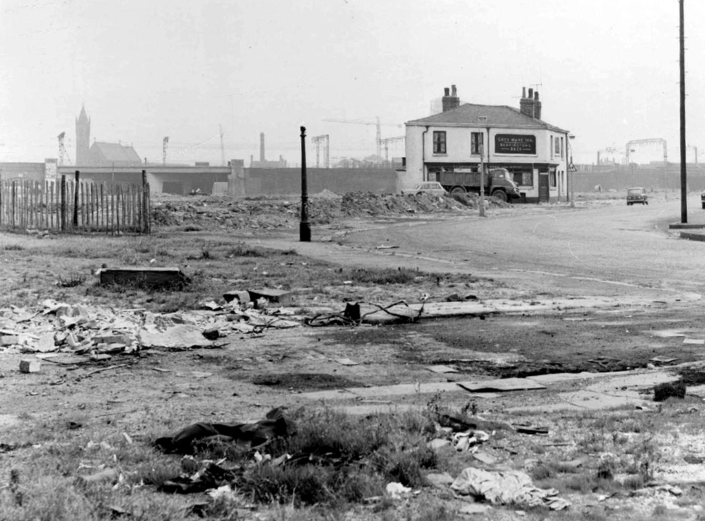
A dense web of streets awash with back to backs, jobs for all – in conditions perceived to be unfit for purpose.
Of a total of 201,627 present dwellings in Manchester, some 54,700, or 27.1 per cent., are estimated to be unfit. A comparison of slum clearance action taken by six major local authorities, Manchester, Leeds, Birmingham, Liverpool, Sheffield and Bristol, shows that for the five years ending 30th June, 1965, Manchester was top of the league, both in compulsory purchase orders confirmed and the number of houses demolished or closed.
Manchester’s figures -13,151 houses demolished or closed .
Whenever mass slum clearance was carried out, the pubs tended to remain, often for just a short time because – the story goes – demolition workers refused to touch them, as they wanted somewhere to drink during and after their shift.
This vision of municipal modernity was short lived, the estate was demolished in the 1980s and the new Coverdale Estate was constructed on the site in 1994.
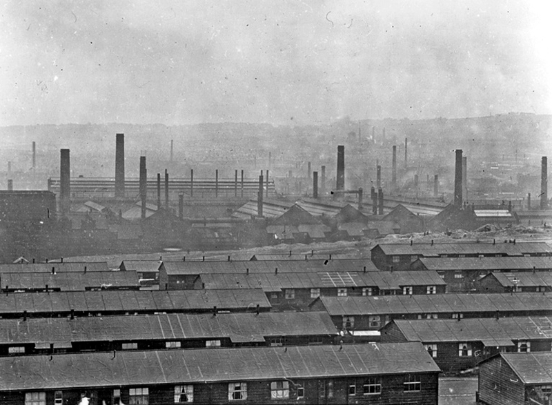
A city once awash with industry and ale – a myriad of pubs slaking the thirst of the thirsty steel workers.
A liquid equilibrium flowing and flowering for over a century.
The Lower Don Valley once home to a wealth of boozers, tells a different tale today.
A fall in production produced a proportionate reduction in consumption.
The clatter of clogs on cobbles, metal on metal is but a distant memory, along with the sound of pints pulled and hastily glugged.
The architecture of ale still prevails – now purveying pleasures and delights of a different stripe, whatever takes your fancy, as long as it’s not too fancy.
And doesn’t involve taking a drink.
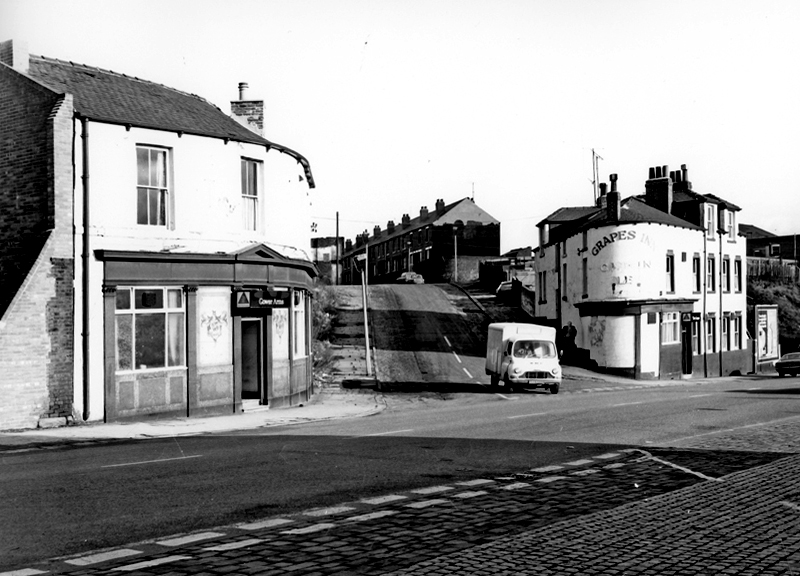
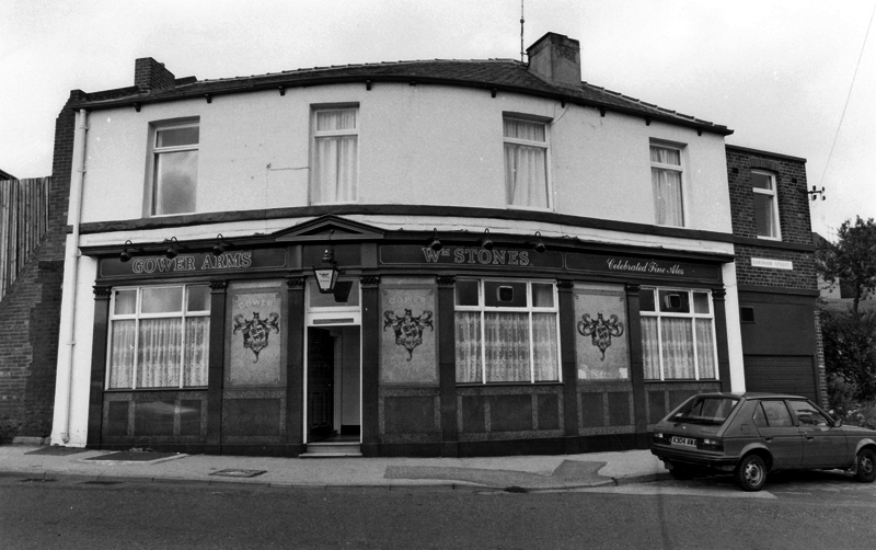
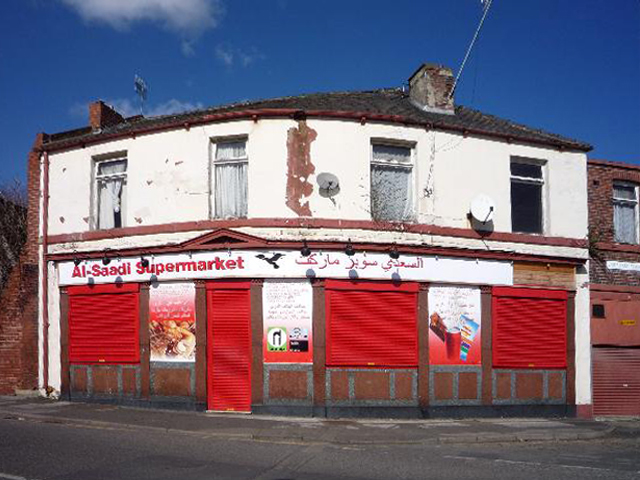
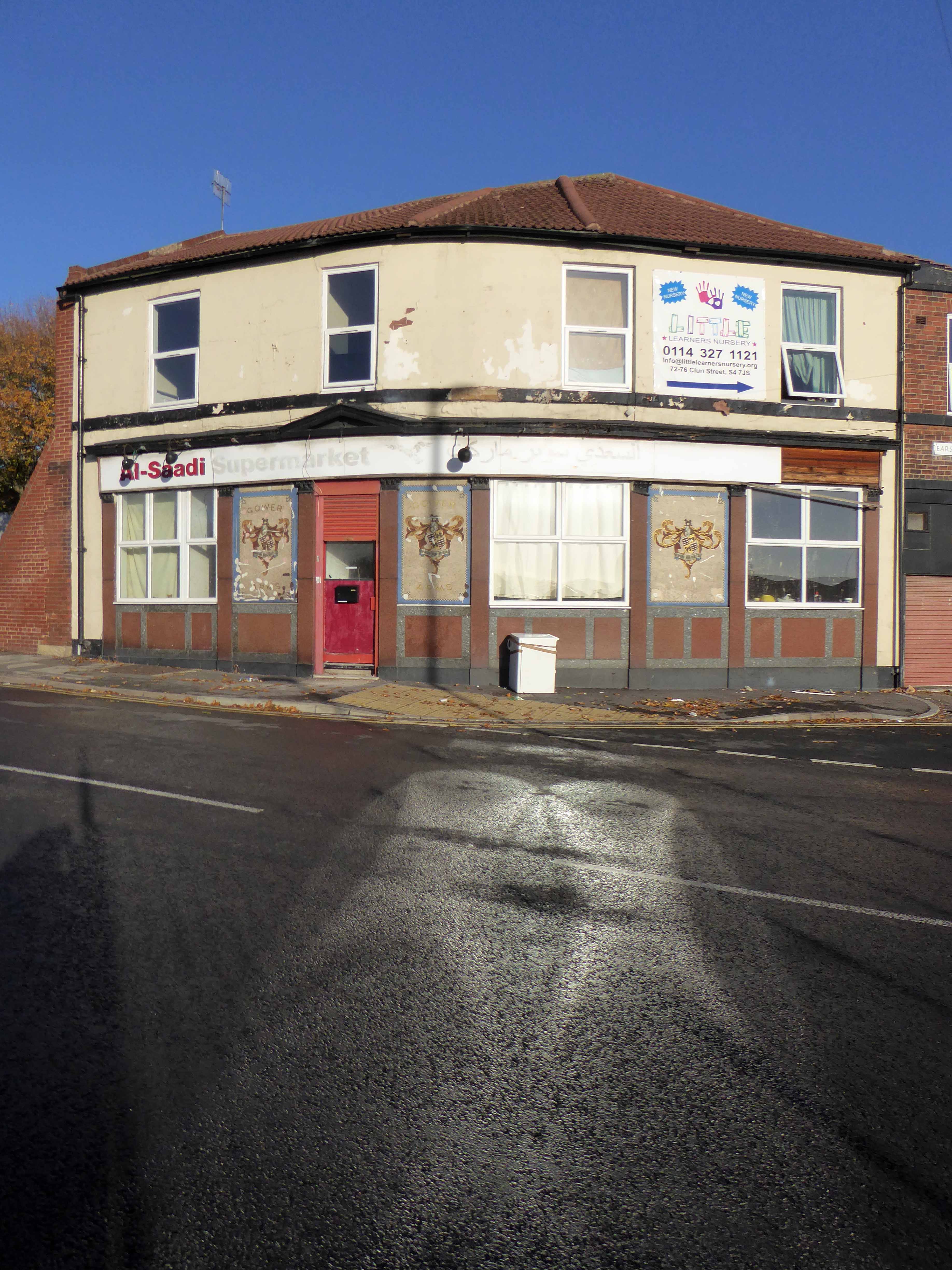
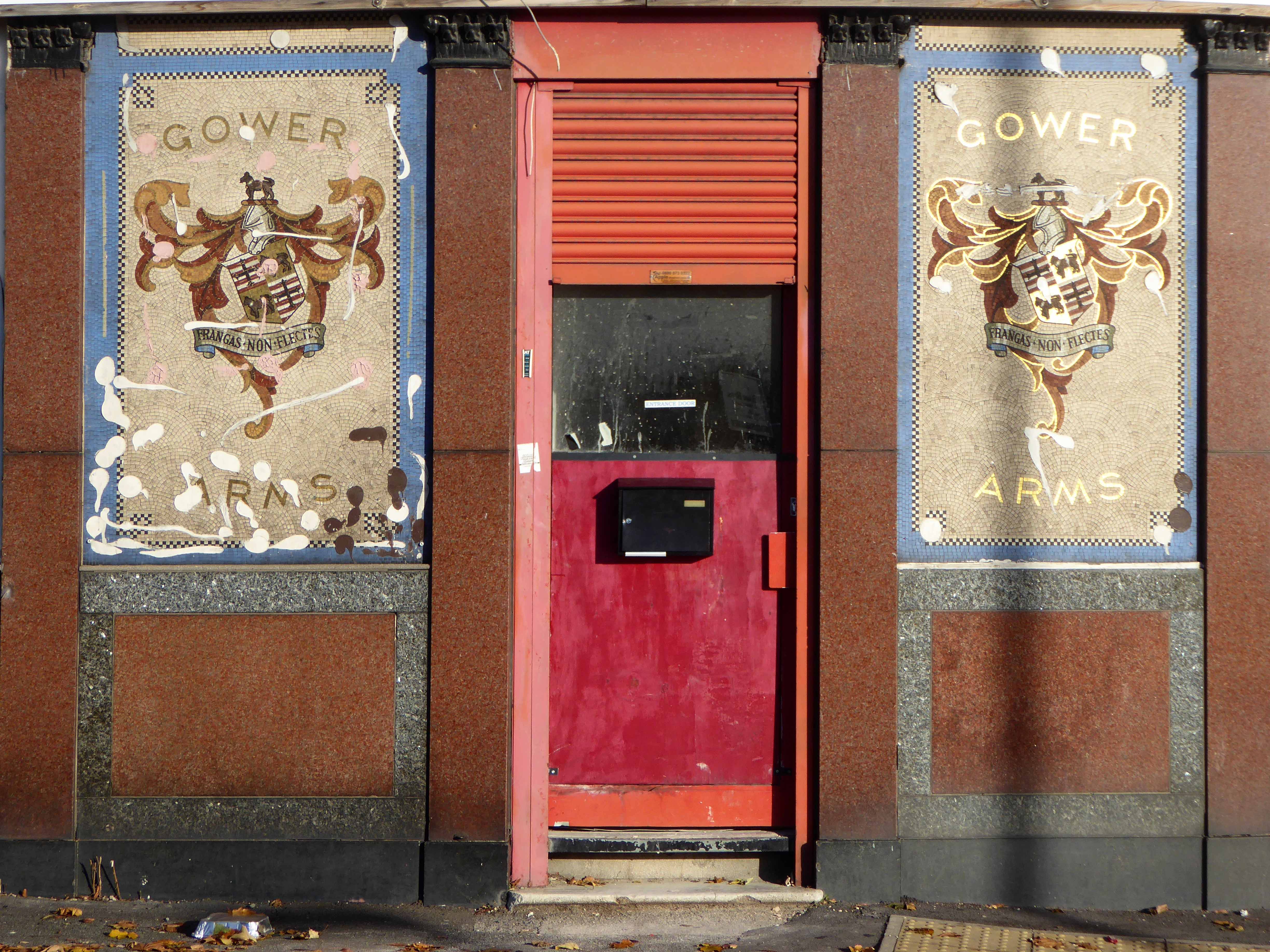
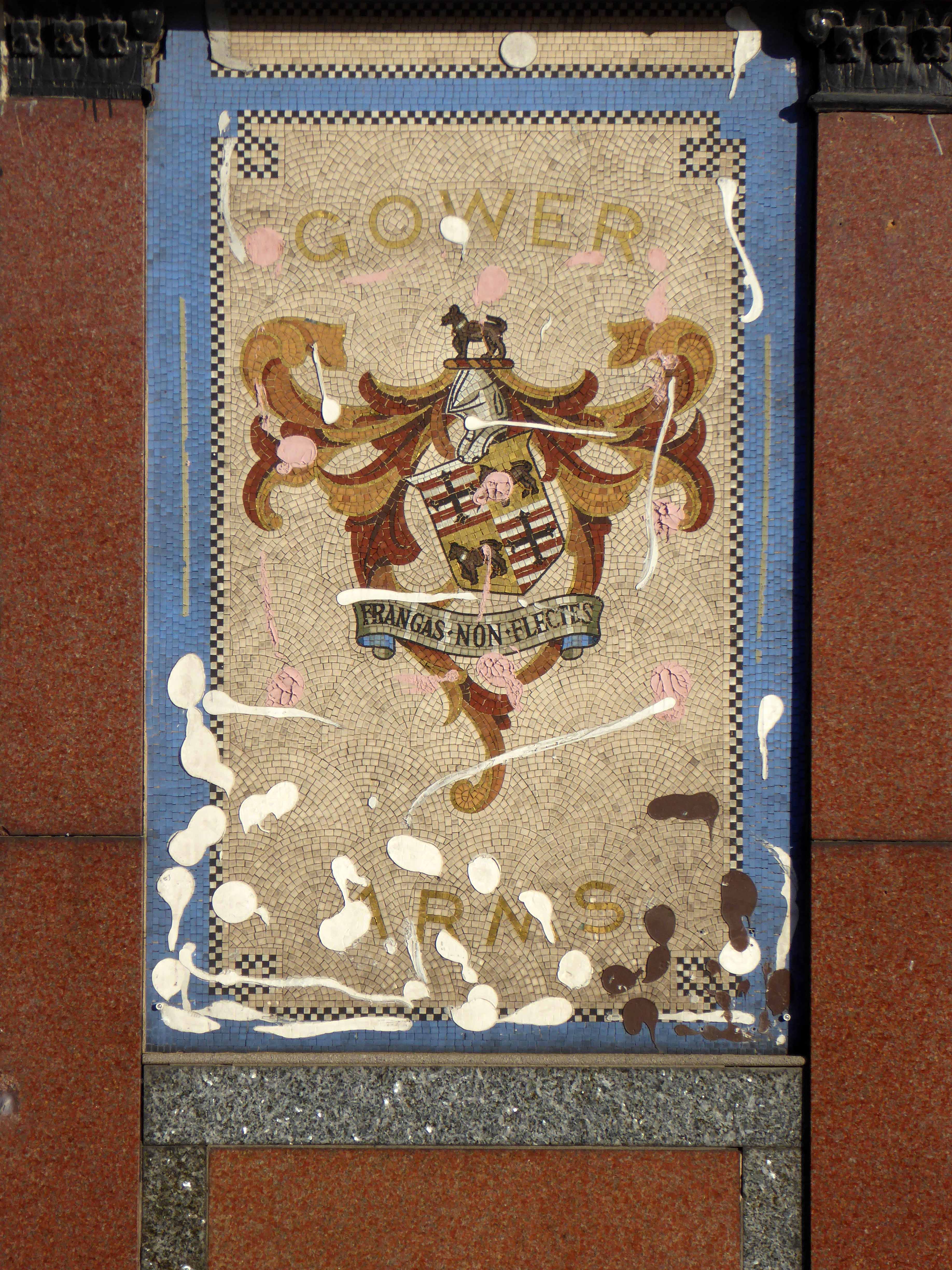
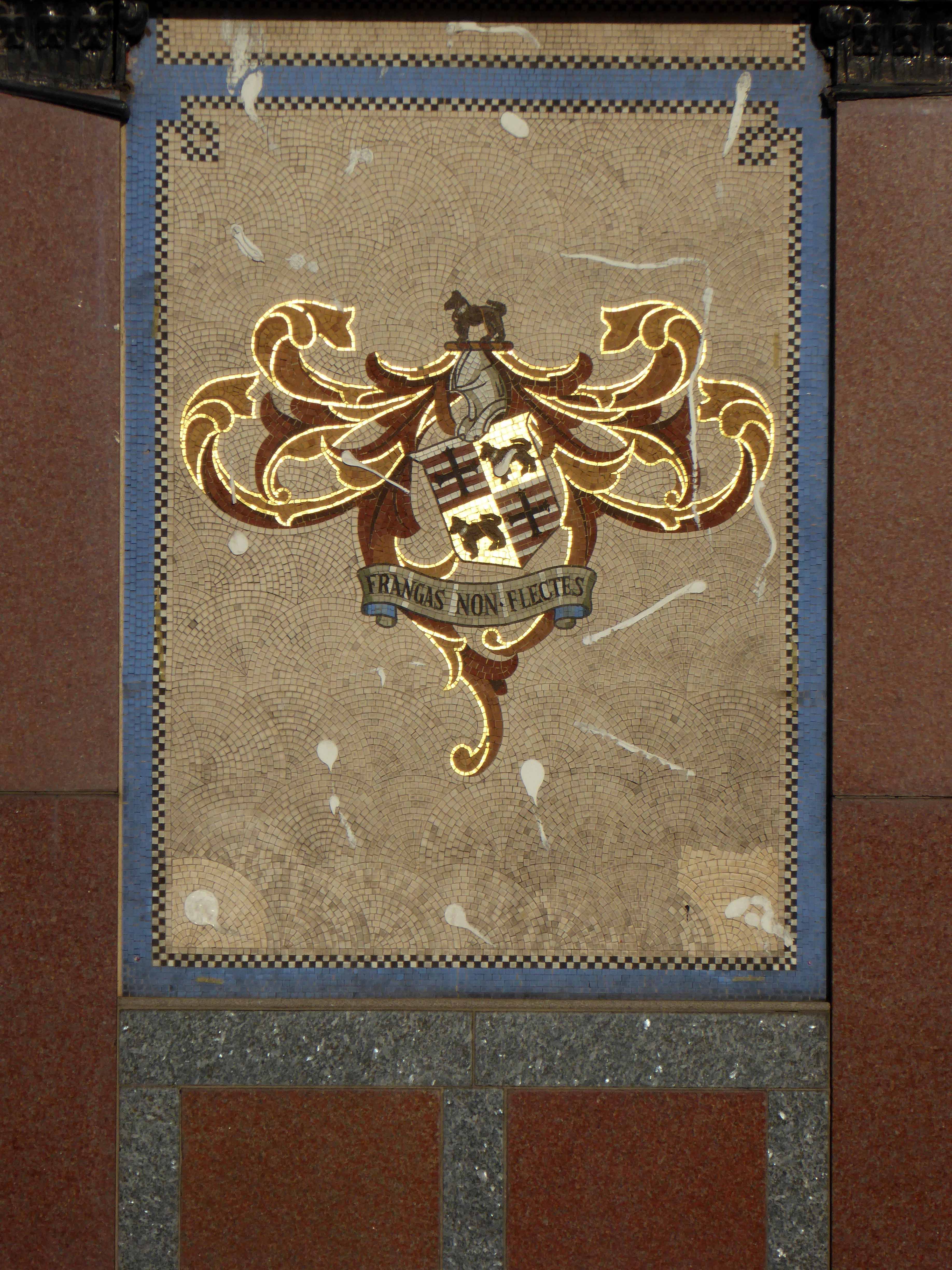
The Gower Arms – 47 Gower Street Burngreave Sheffield S4 7JW
I drink down there – top pubs methinks. They are old fashioned pubs with some real characters. Will be there Friday night in the Staff first, Royal Oak, Gower, Grapes and back to the Staff till I drop.
Blade Bloke 2007
From top pub to closed corner supermarket in two shakes of a monkey’s tale.
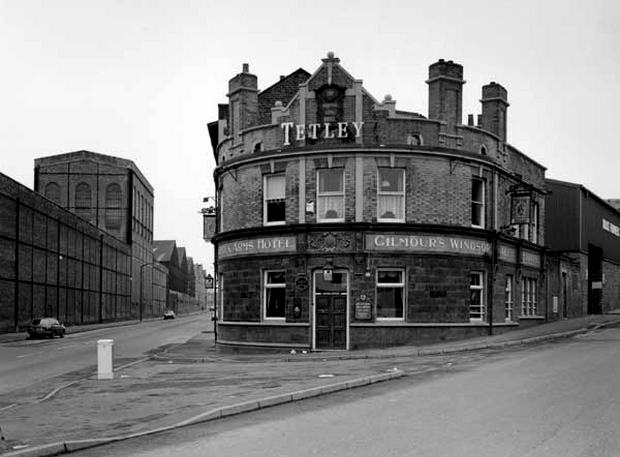
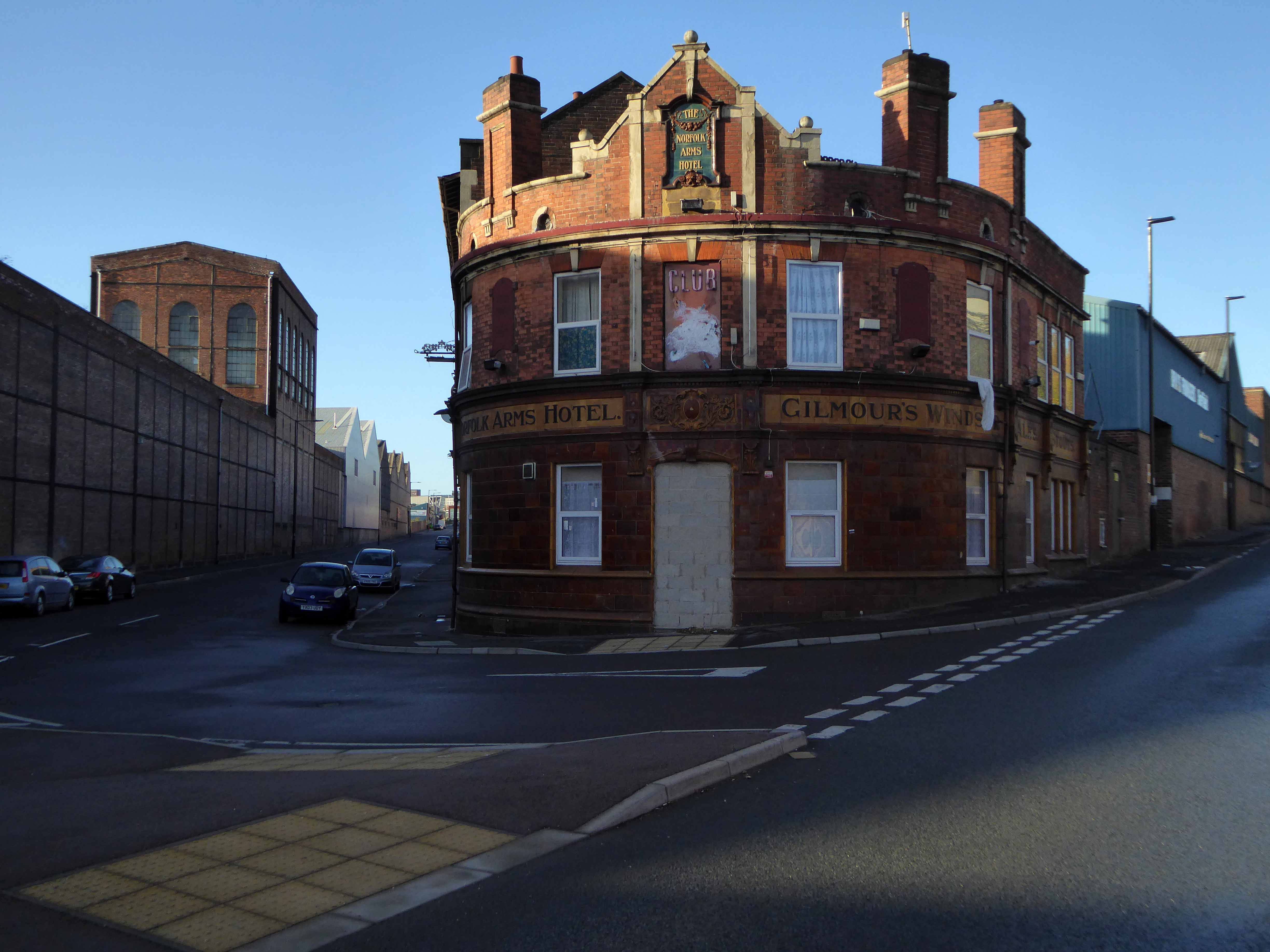
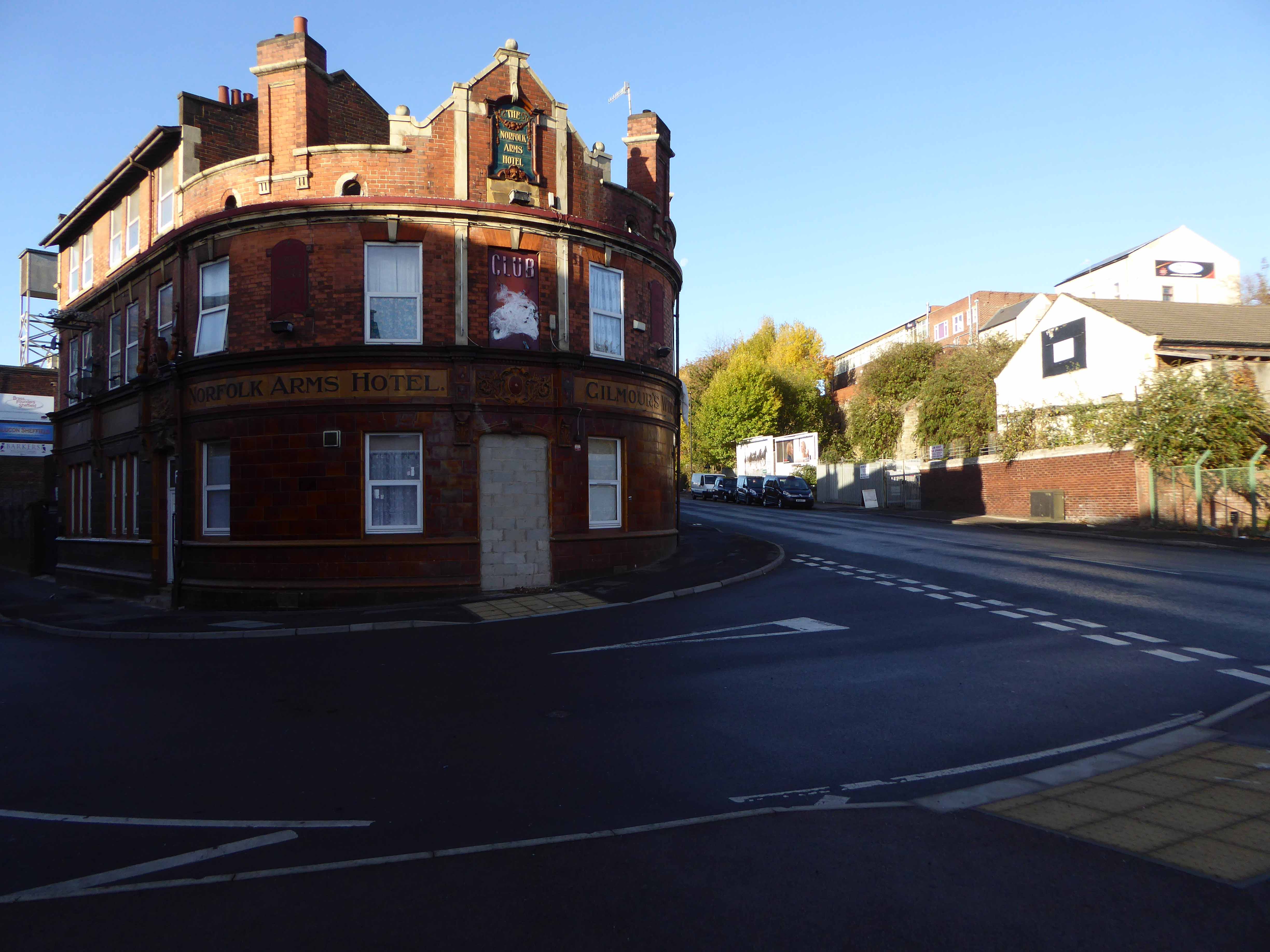
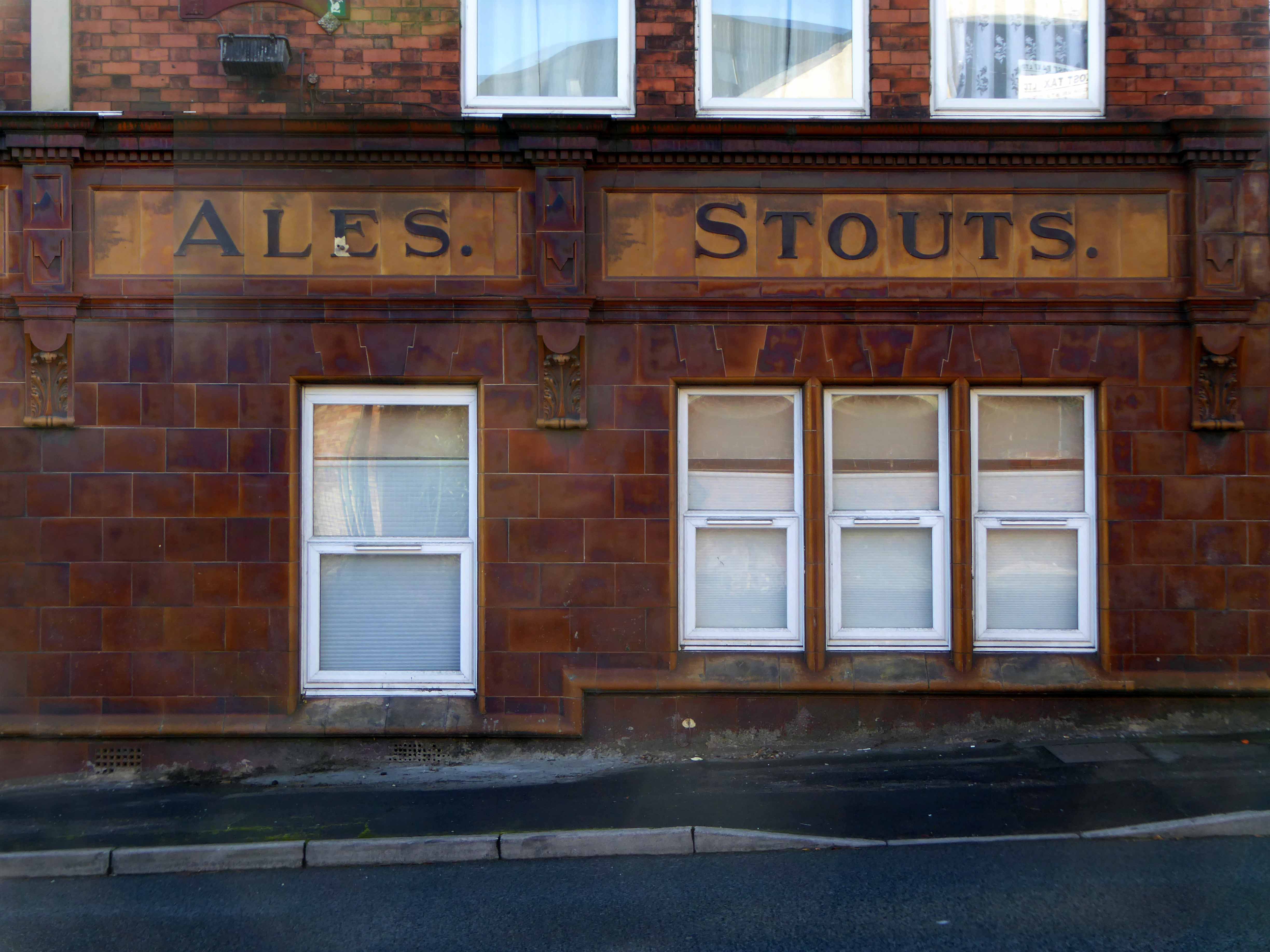
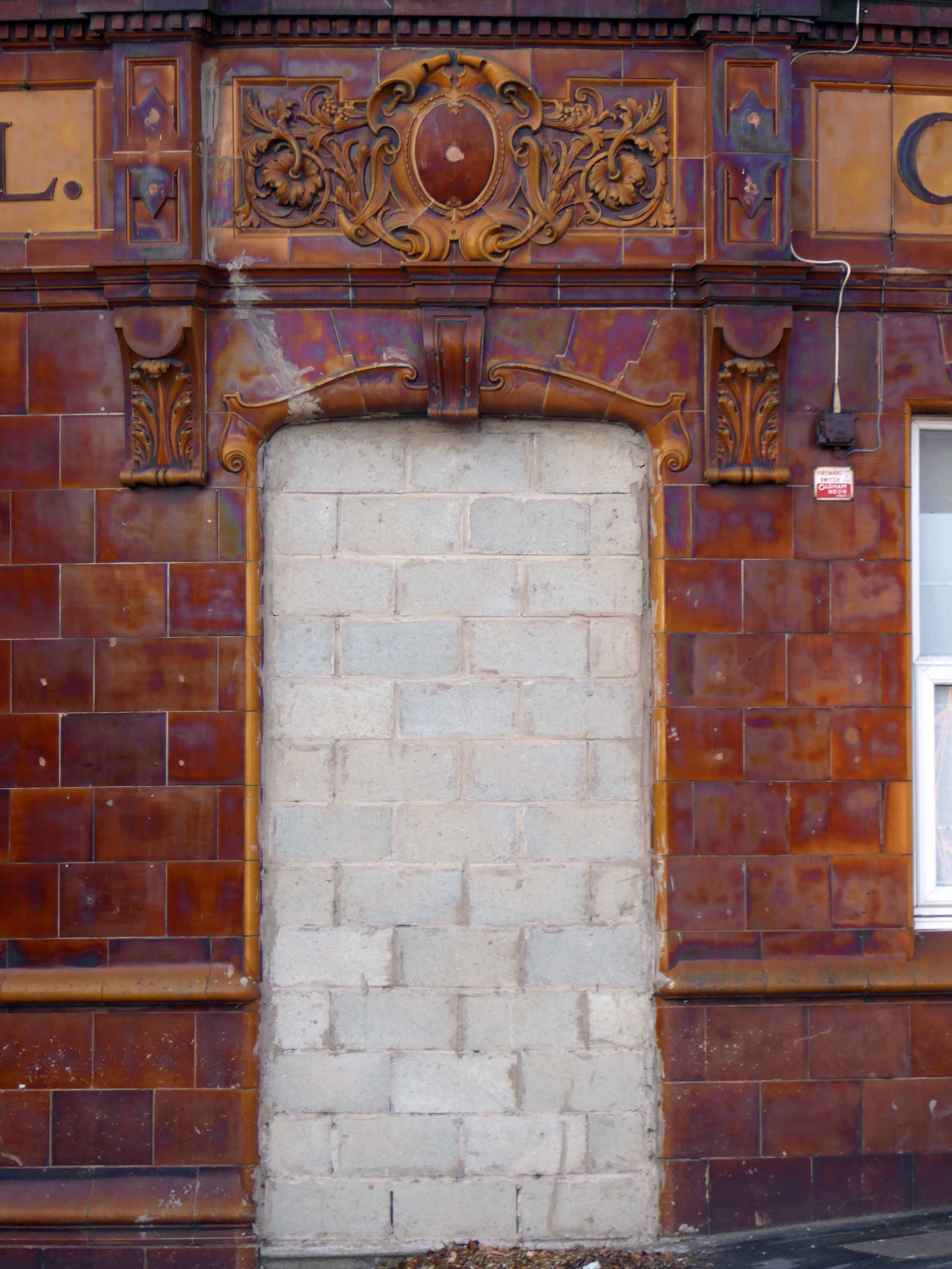
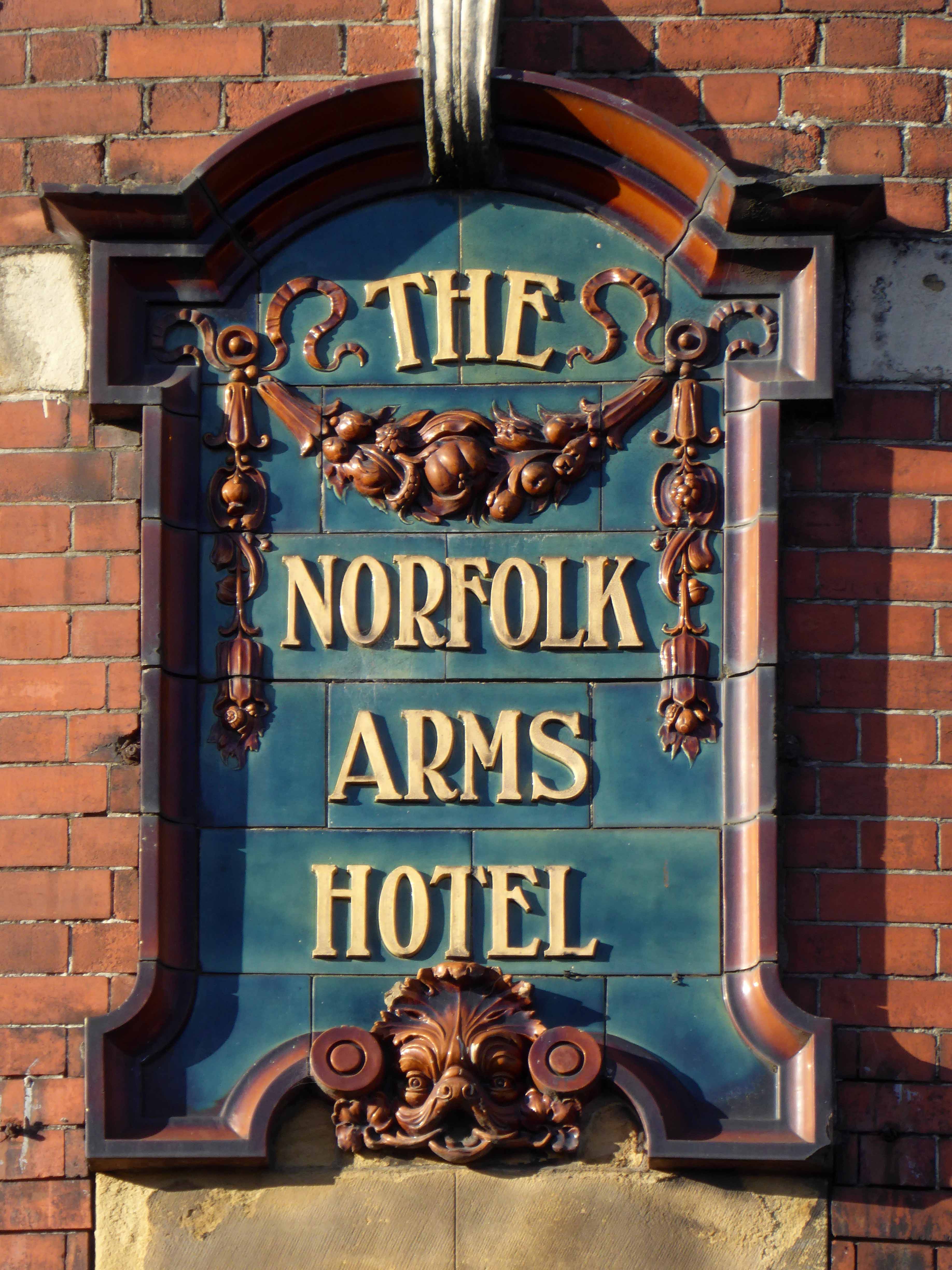
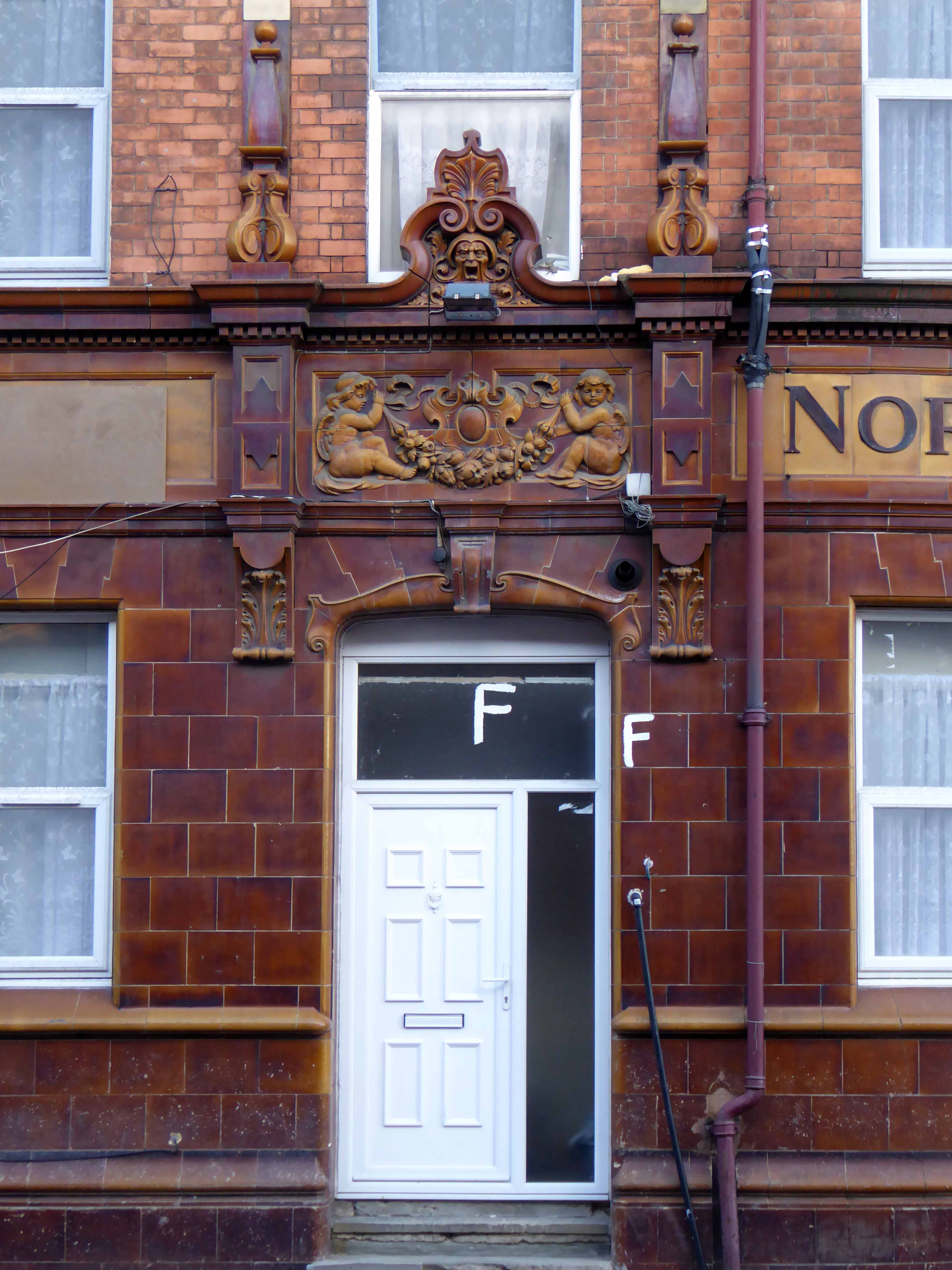
The Norfolk Arms Hotel – 195/199 Carlisle Street Sheffield S4 7LJ
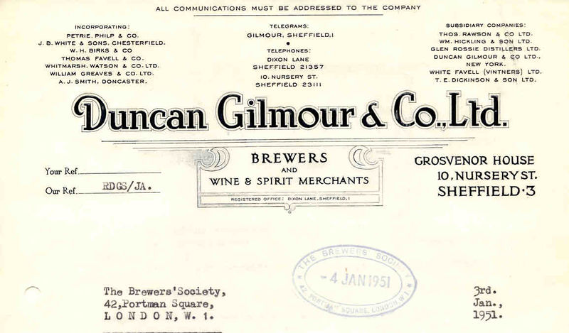
From a Gilmour’s tap, Tetley tavern to a temple of trendy funk.
Club Xes is a nightclub in Sheffield described as a vibrant and thrilling, and full of Sheffield’s young and trendy crowd. The DJs are renowned for providing the newest funkiest records.
Premises Type – This place does not serve real ale.
Premises Description – Gay nightclub.
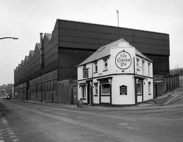
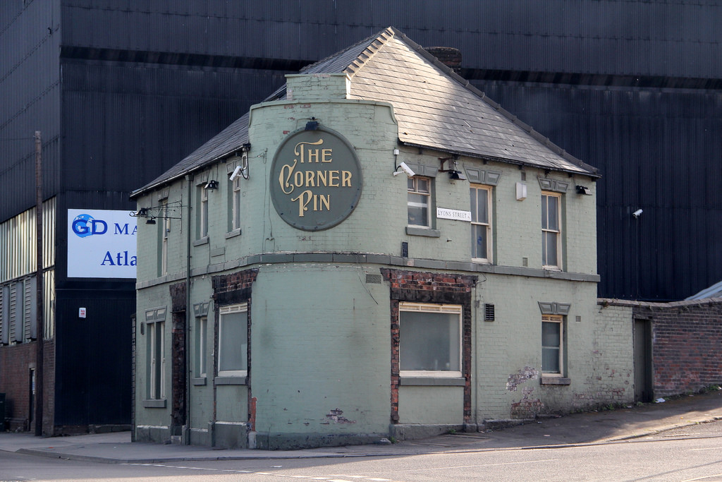
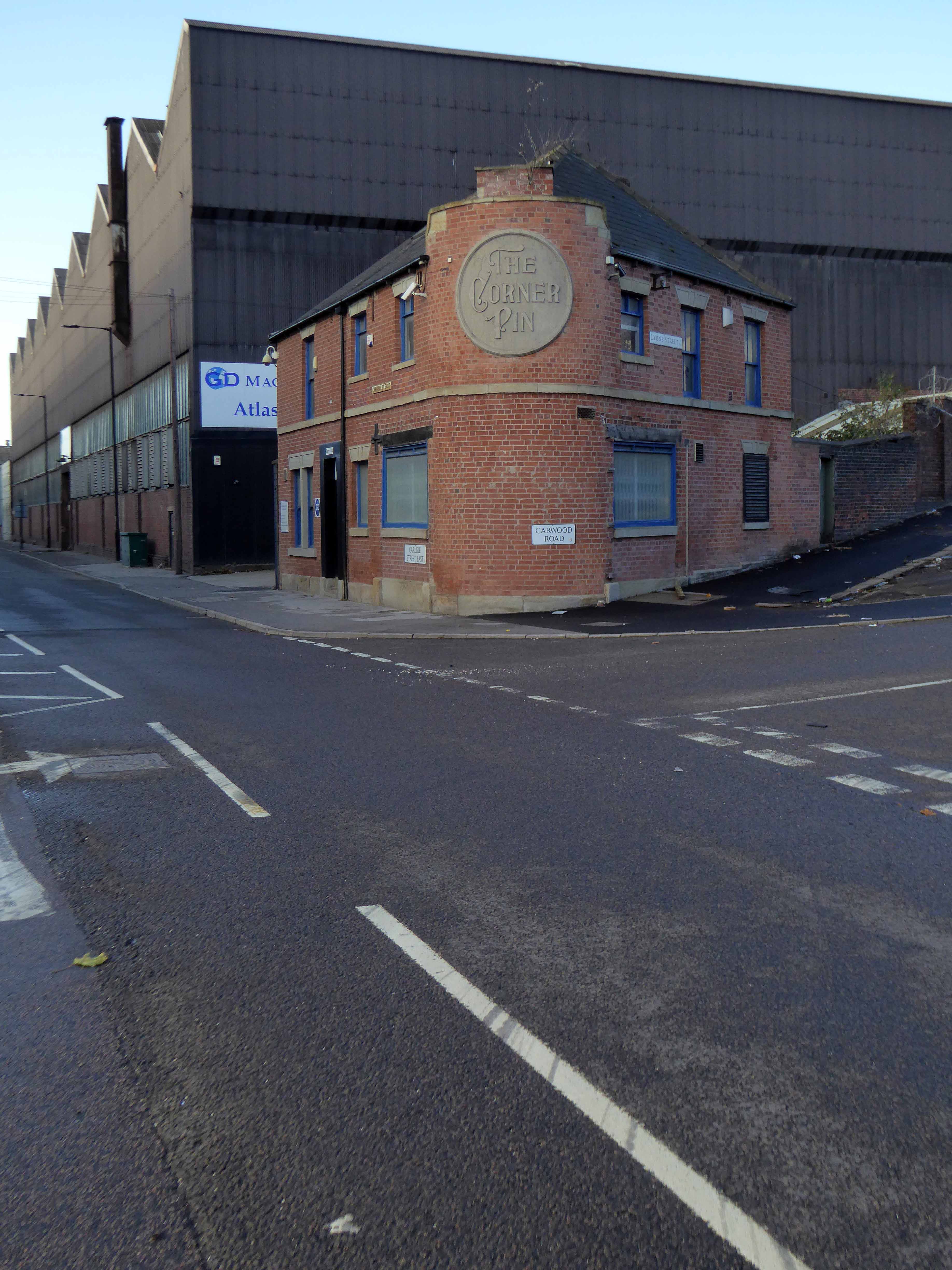
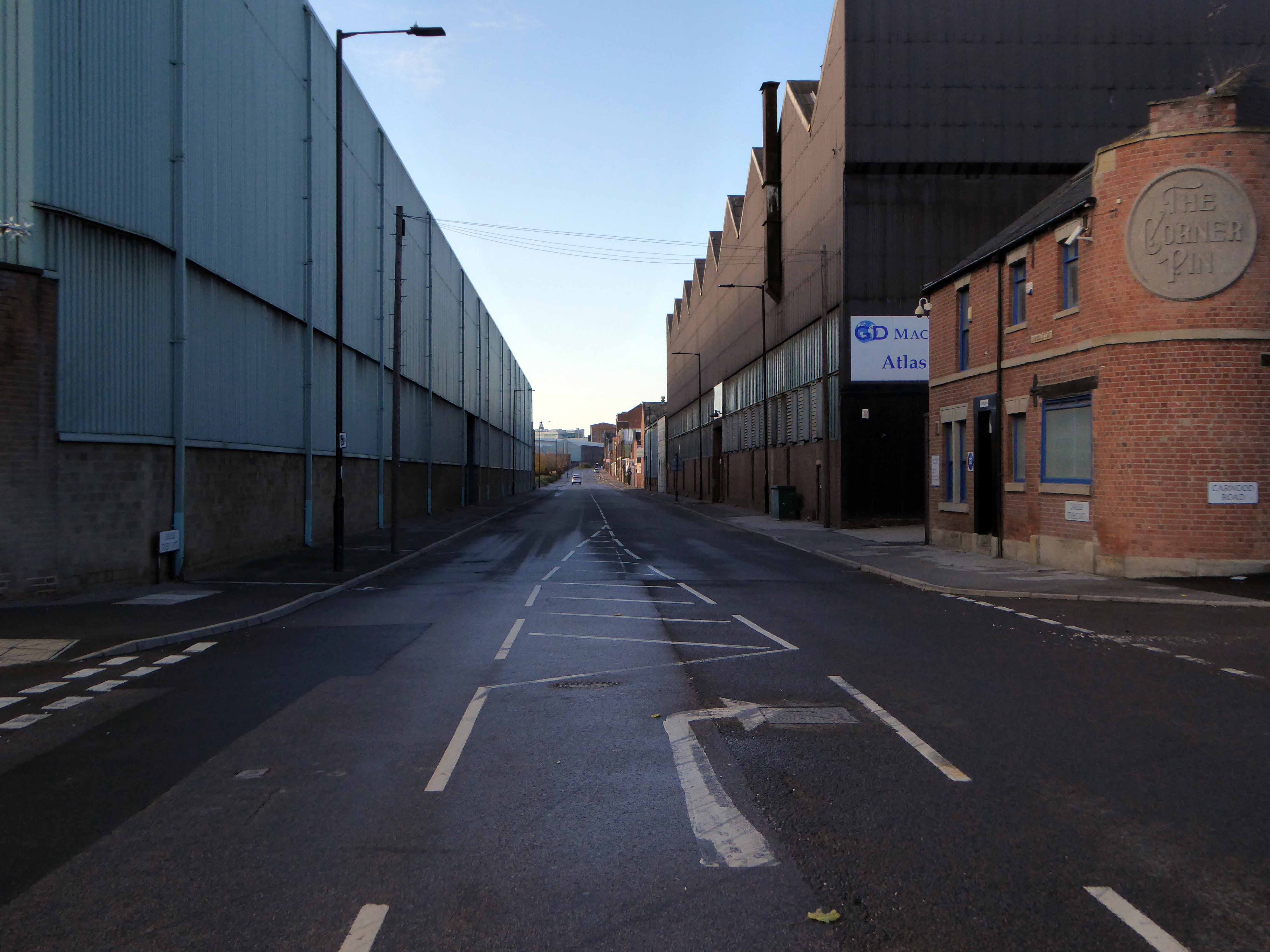
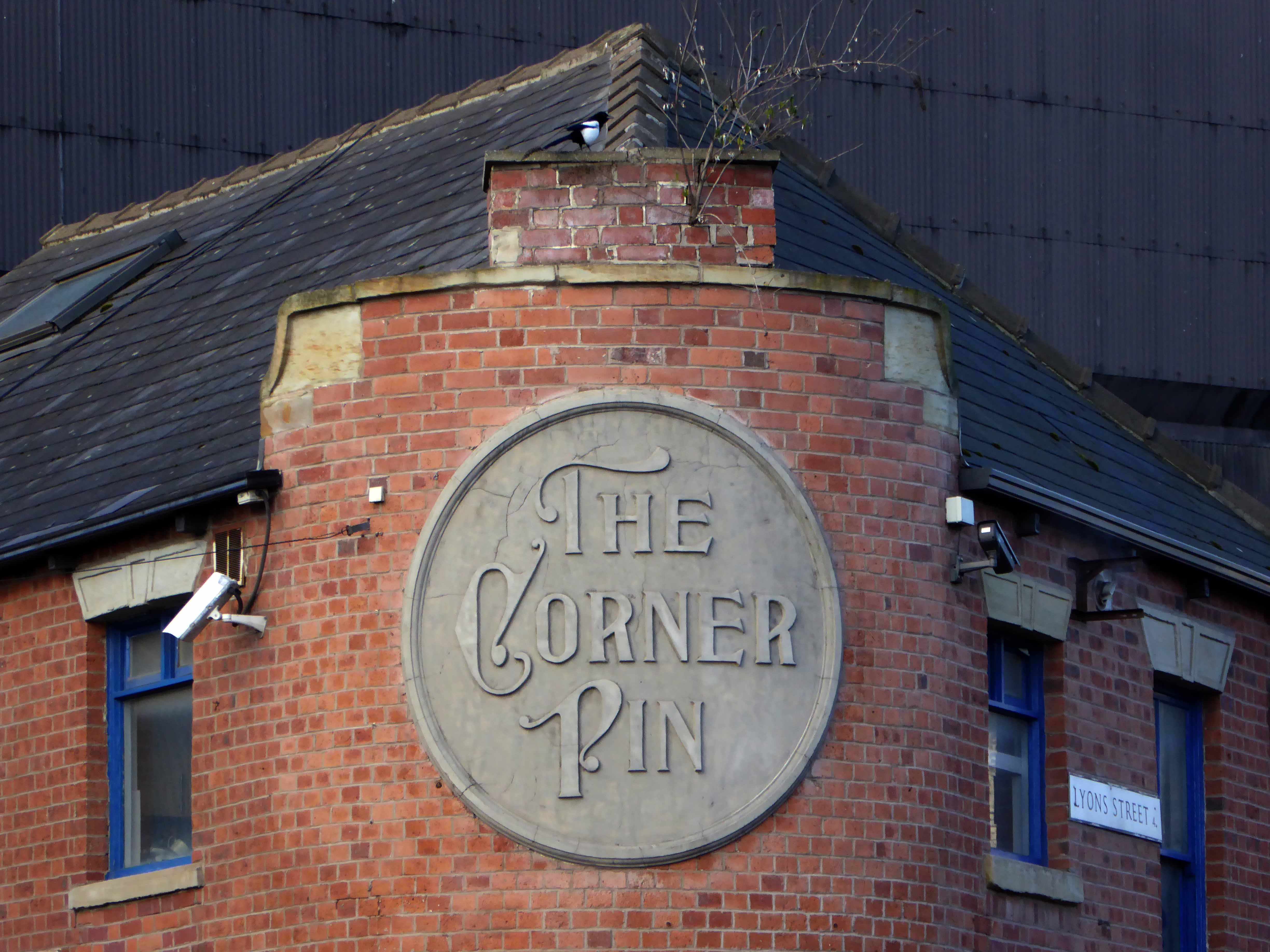
The Corner Pin – 231-233 Carlisle Street East Sheffield S4 7QN
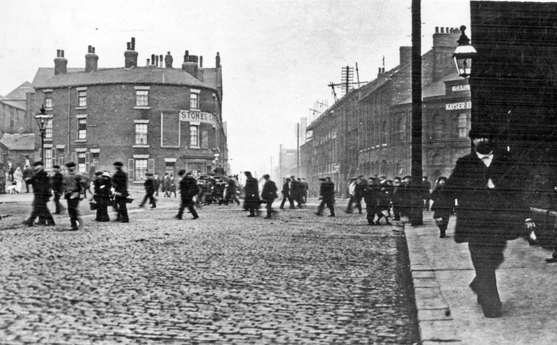
First licensed to sell beer in 1840. One of 26 public houses serving the steel industry along a three- quarter mile stretch of Carlisle Street. It is said to have a ghost who likes to turn the lights on in the middle of the night and footfalls can be heard.
The Corner Pin was the last of the Steelmakers pubs in Sheffield and was one of my favourite places to visit for a real good pint! I would come over from Melbourne once or twice a year, still do, and meet up with Chris Payling and many others still left over from the days of Sheffield Steel, but now all gone.
They even took away your window frames, along with your dignity once a pale green shadow of yourself, stripped back to brick.
Stop dreaming of a foaming pint right now – you’re an office.
Both pubs have survived and the street is home to several relative newcomers, including the Richard Goodall Gallery and celebrated men’s outfitters Oi Polloi.
Also the location of my most favourite shop in the whole wide world.
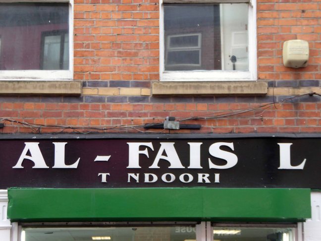
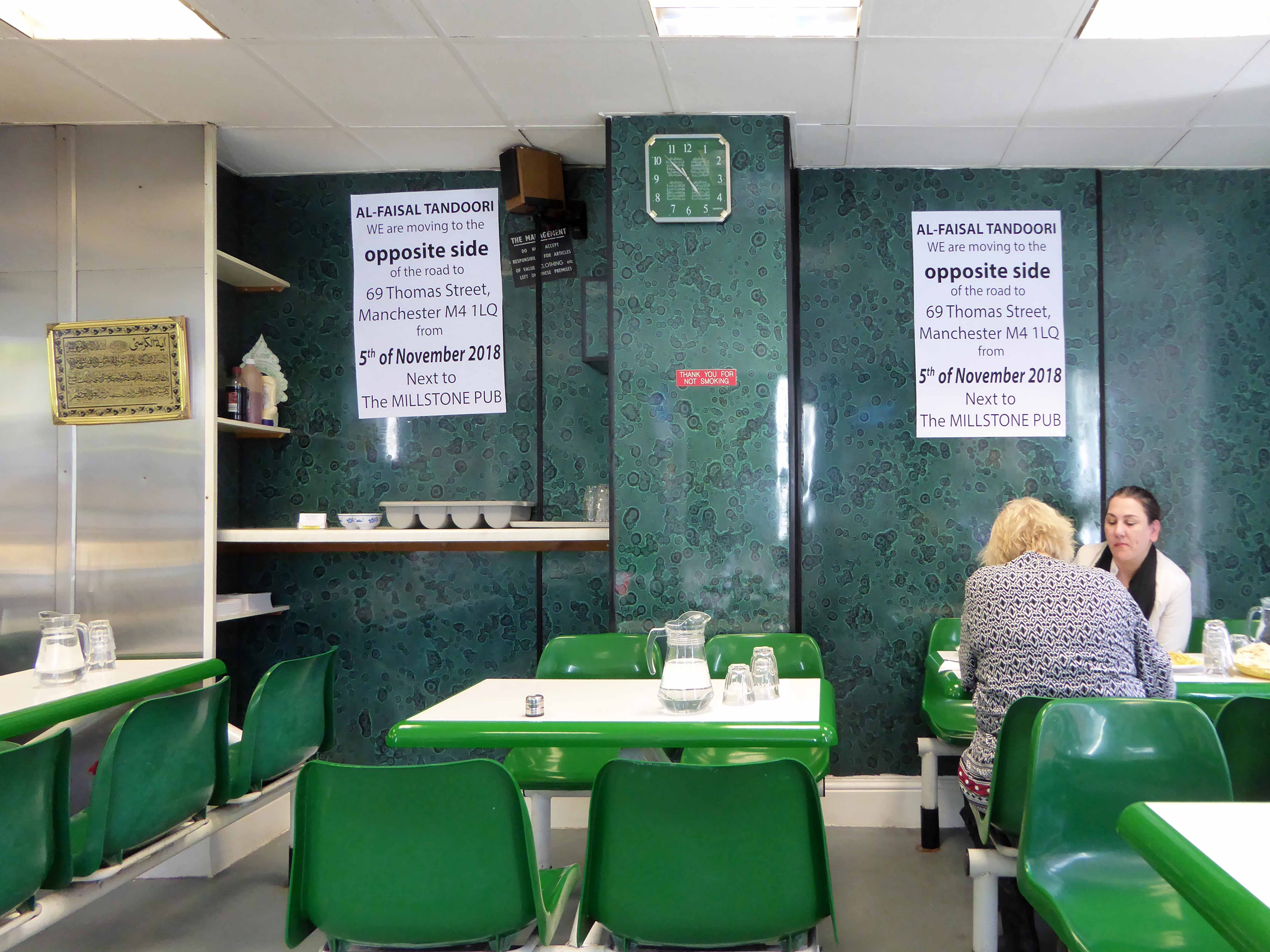
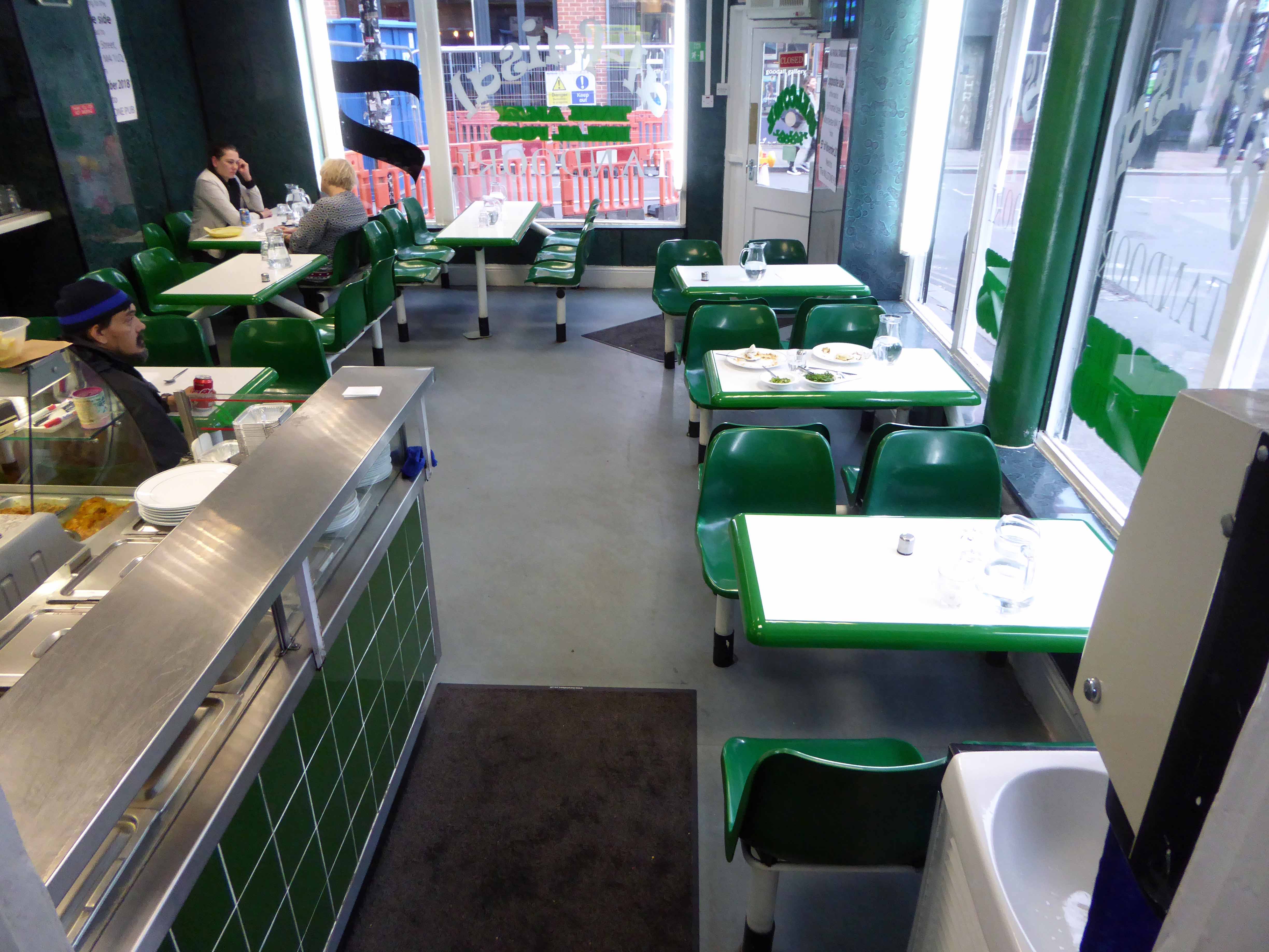
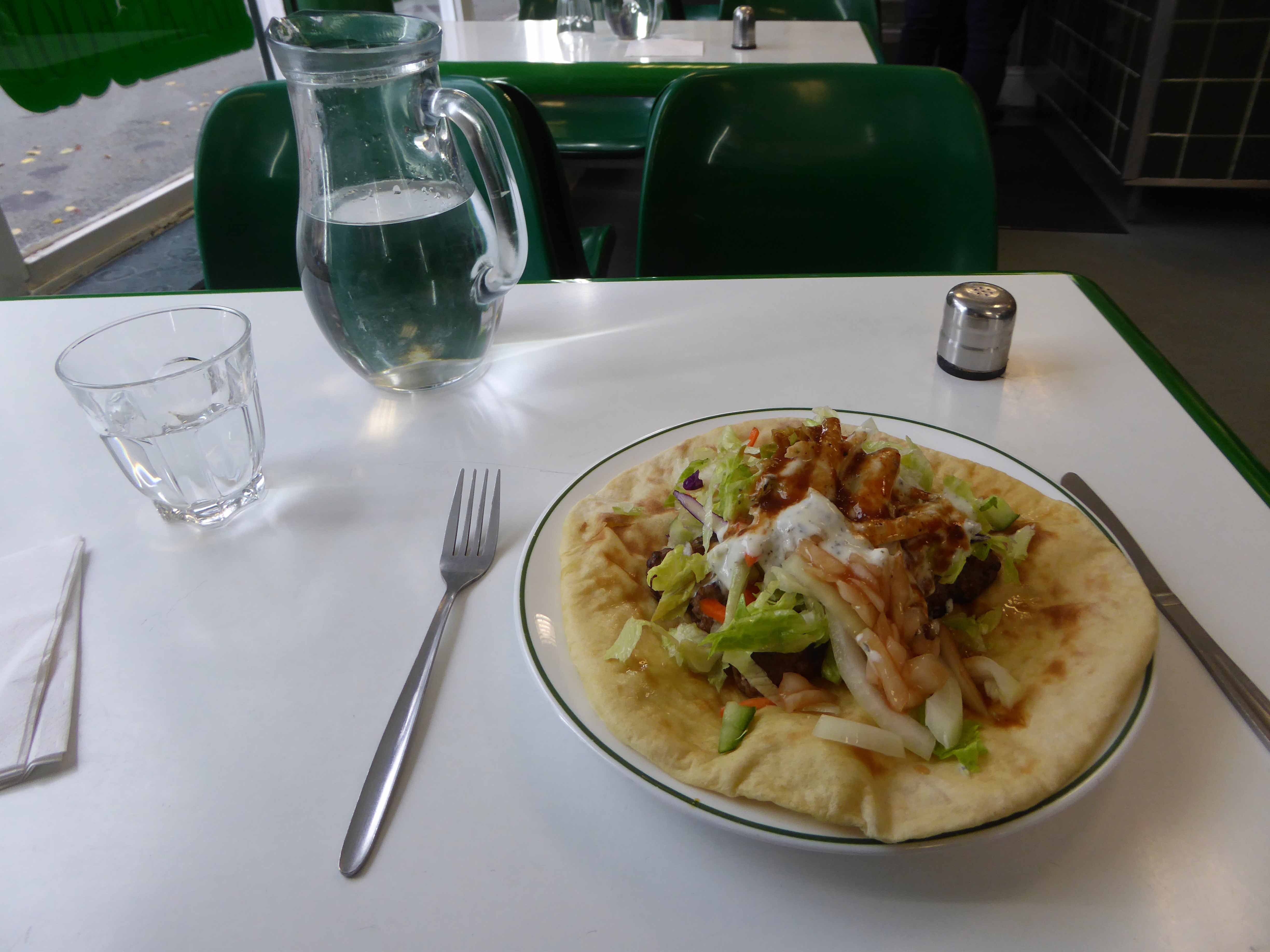
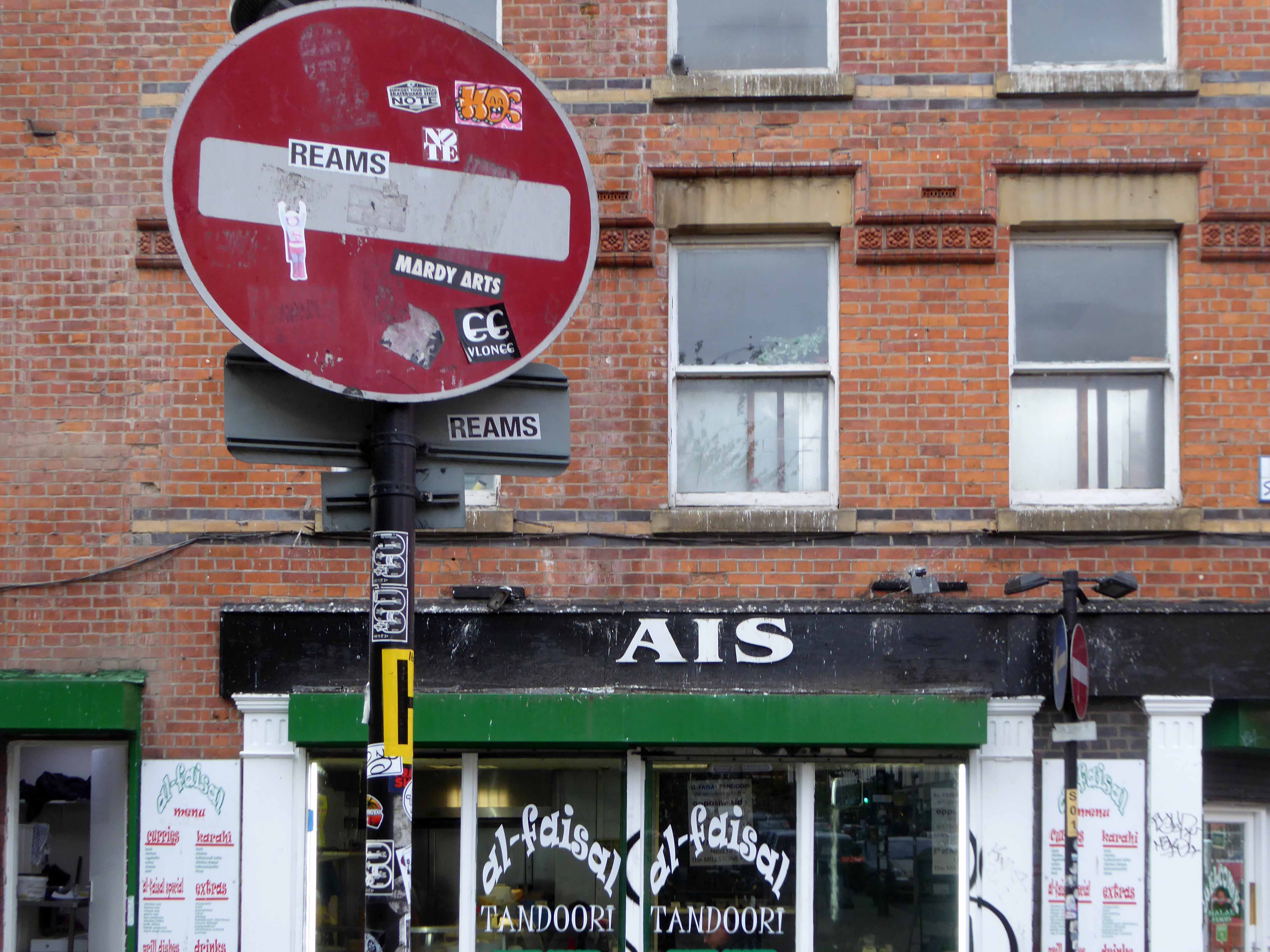
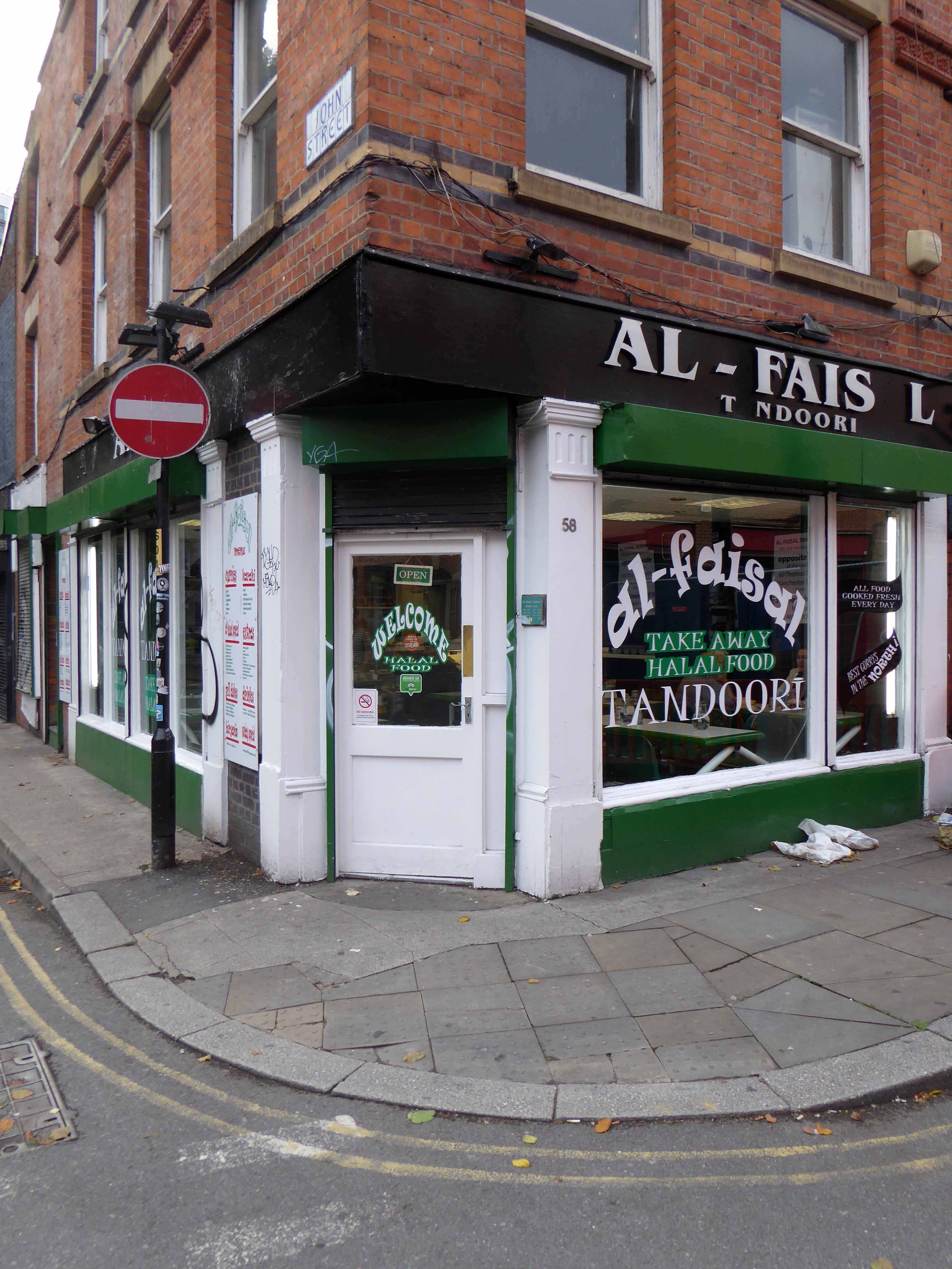
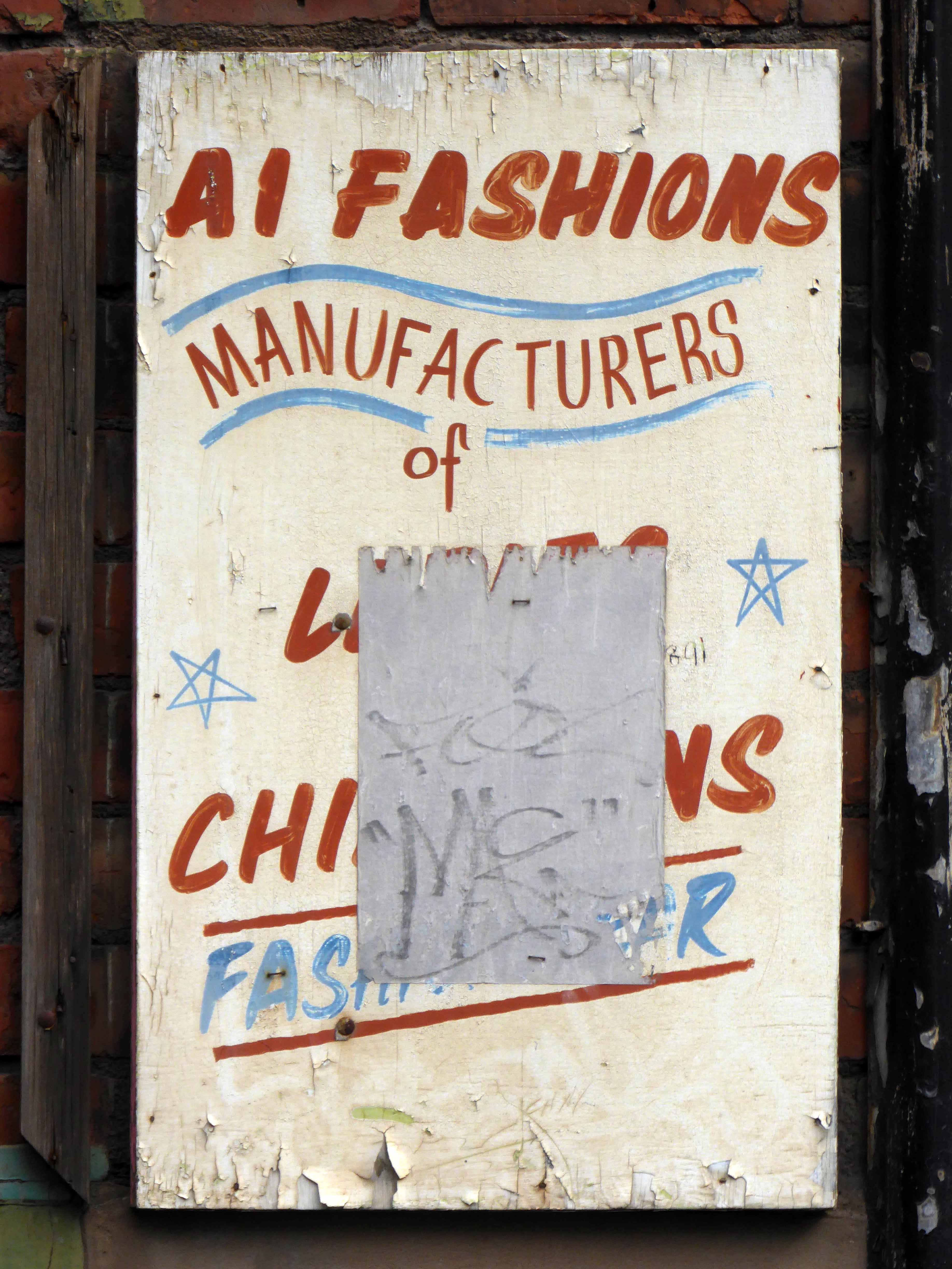
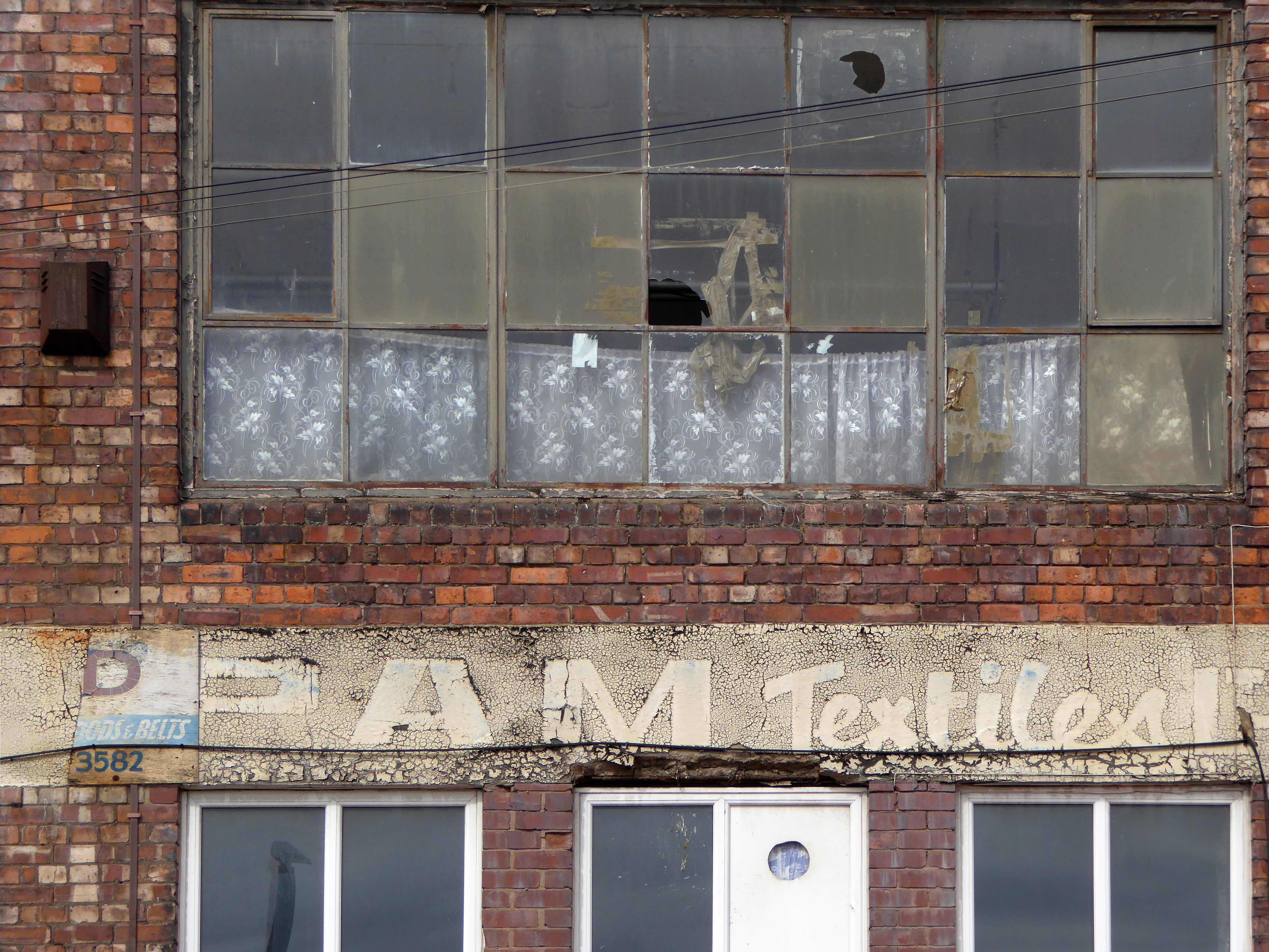
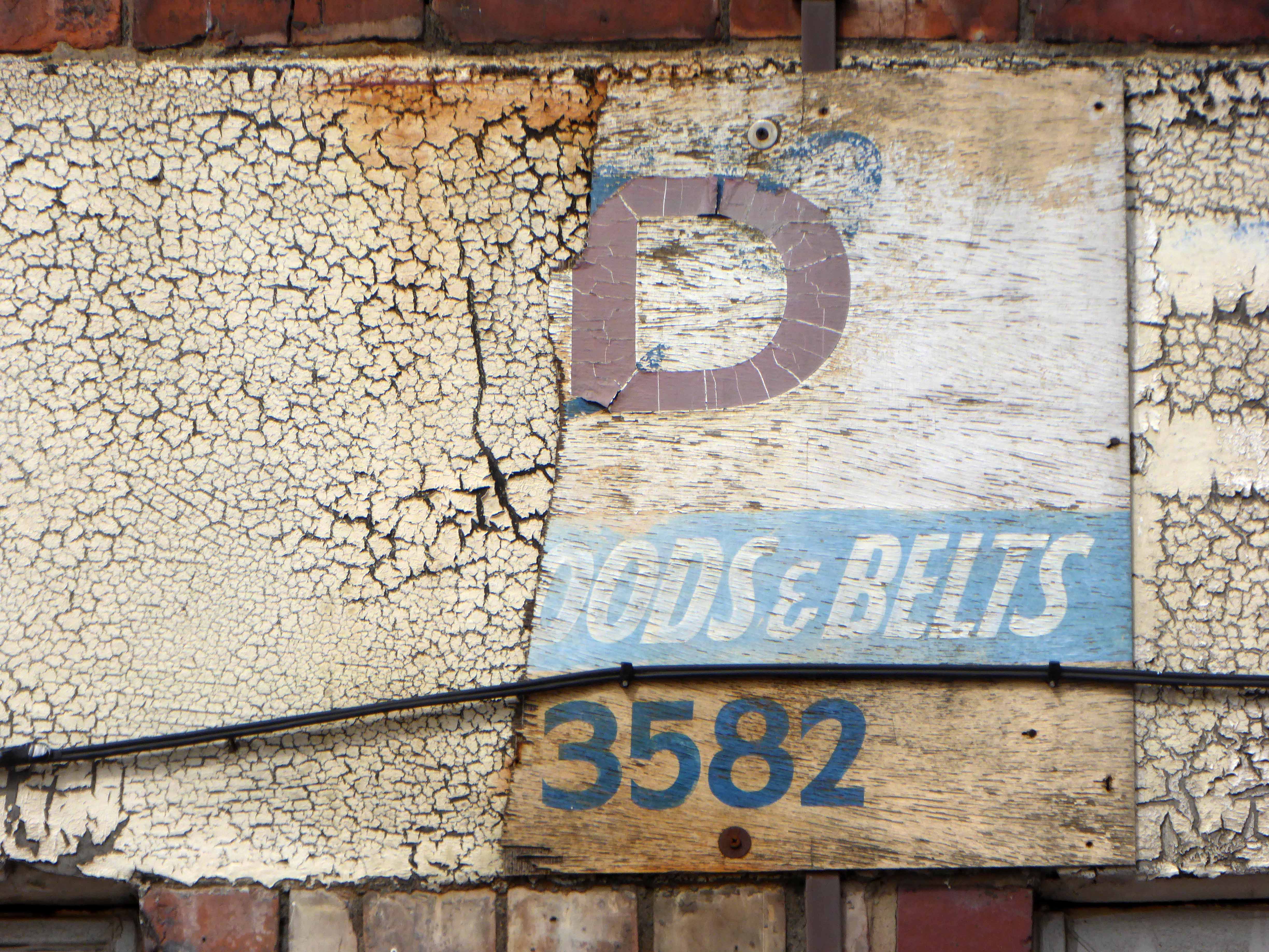
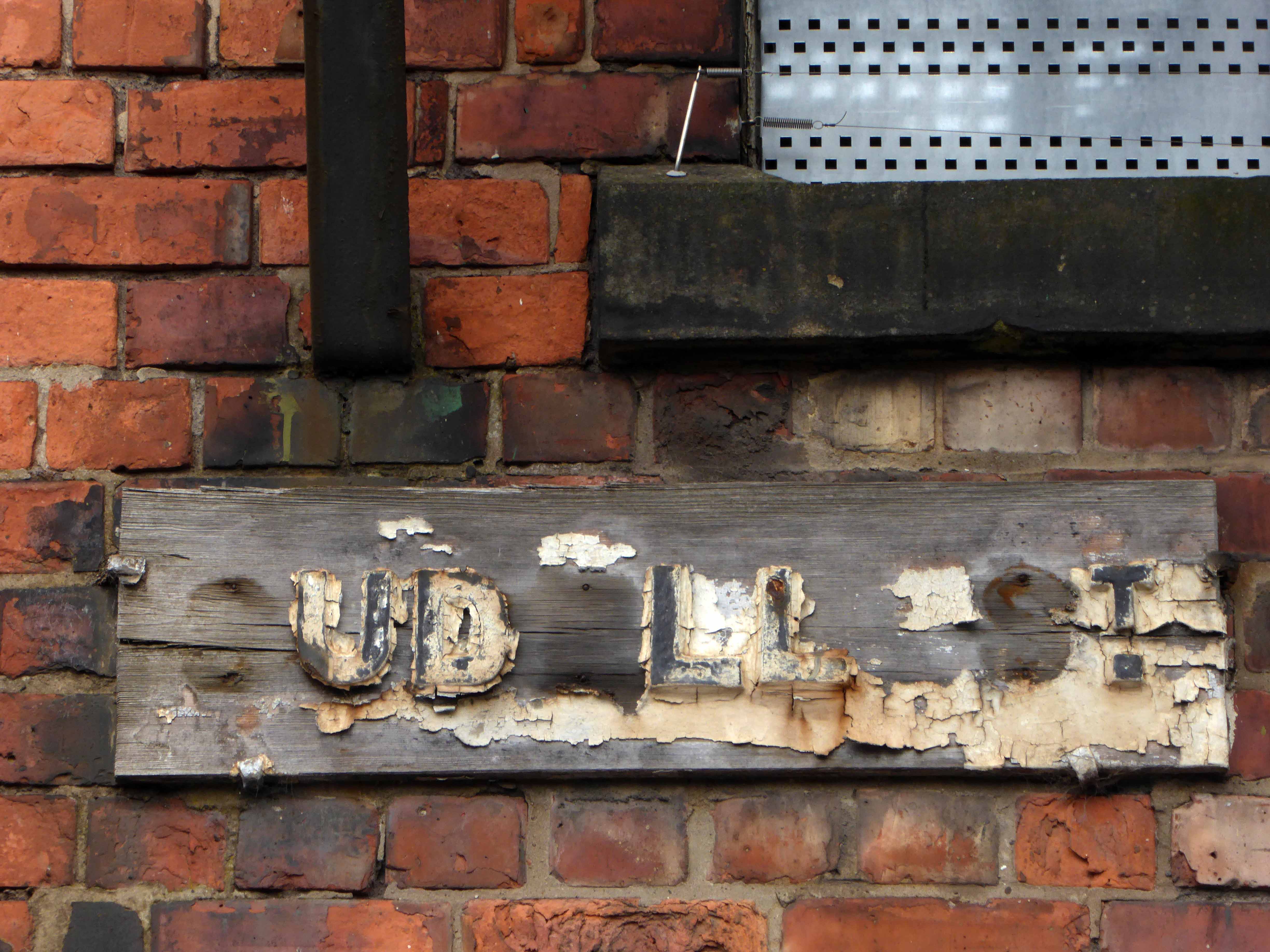
From the 70’s onwards the area had been at the centre of the Asian garment trade – and so it came to pass some 26 years ago the Al Faisal arrived, one of several curry cafés, feeding the faces of the passing parade.
I’ve eaten there for most of that time, fed very well indeed thank you very much, for way less than a king’s ransom.
Yesterday I popped in at teatime, for my tea – posters proclaimed an imminent move.
The whole block is to be demolished and a hotel to be built – there is naturally a suspicious resistance to such change, what was a protected area of historical interest, is fast becoming a deregulated playground for the avaricious developer.
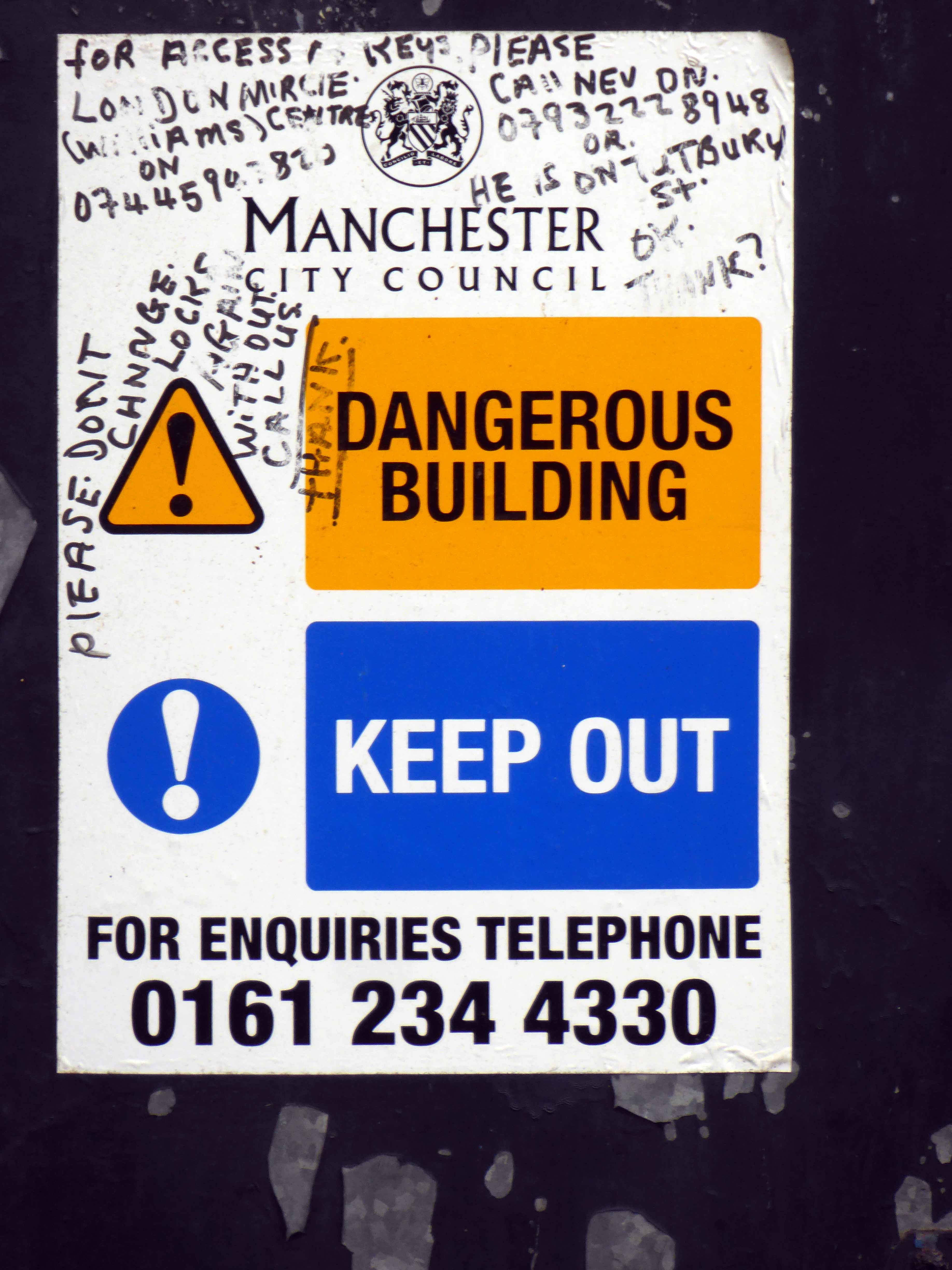
A Manchester council spokesman said:
Our building control officers have been engaged with owner of the property on Thomas Street for some time.
The condition of the building means there is an imminent danger of collapse and a potential threat to pedestrians. Unfortunately, the poor weather has only served to add to our concern over the safety of the building.
A conservation specialist will be on site working closely with the building owner to ensure as much of the fabric of the property can be retained as possible, and only parts that are unsalvageable will be removed to ensure public safety.
Rumours have also been rife concerning the fate of the nearby This & That – an essential part of the heartbeat of the city – the affordable independent trader.
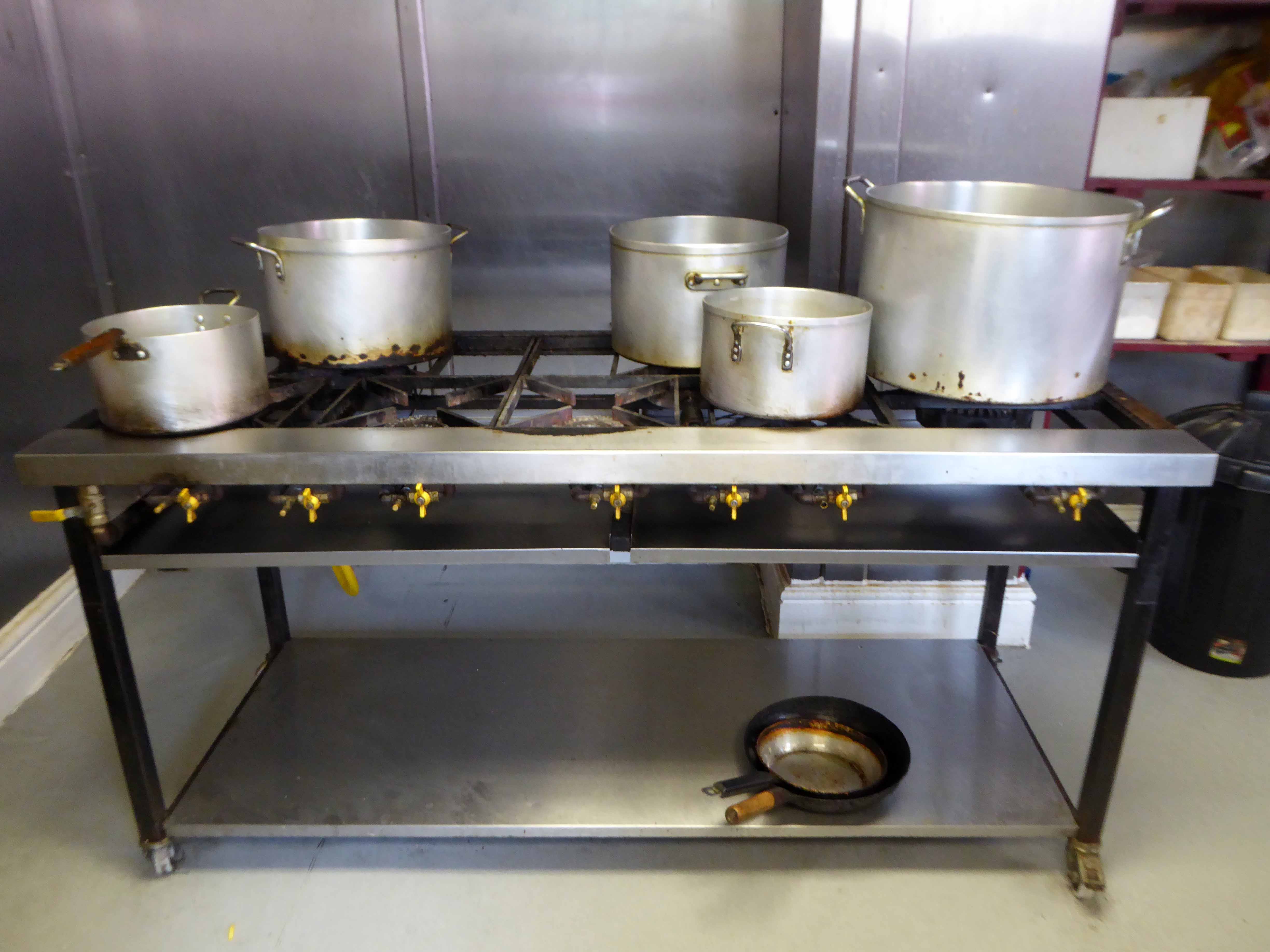
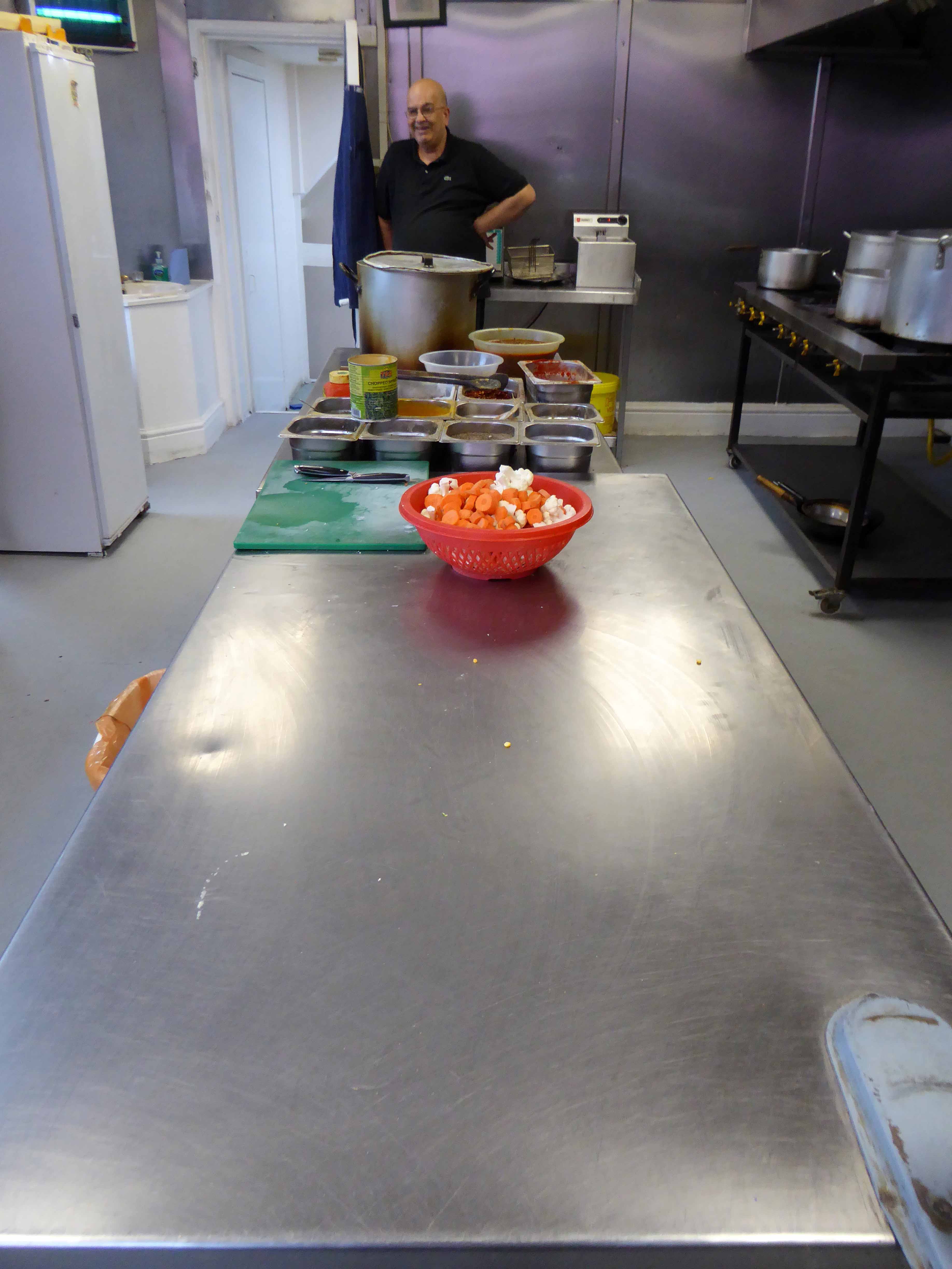
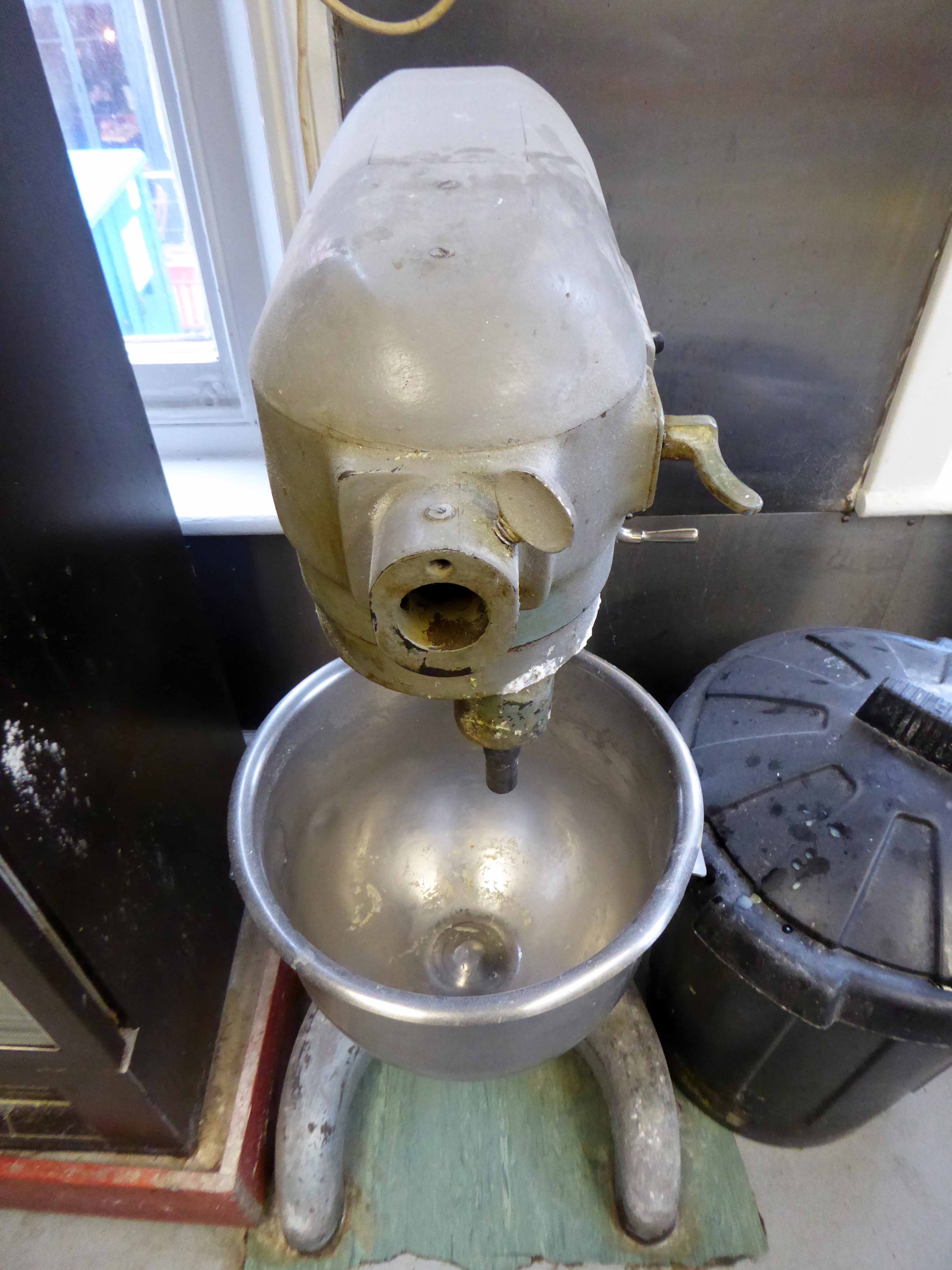
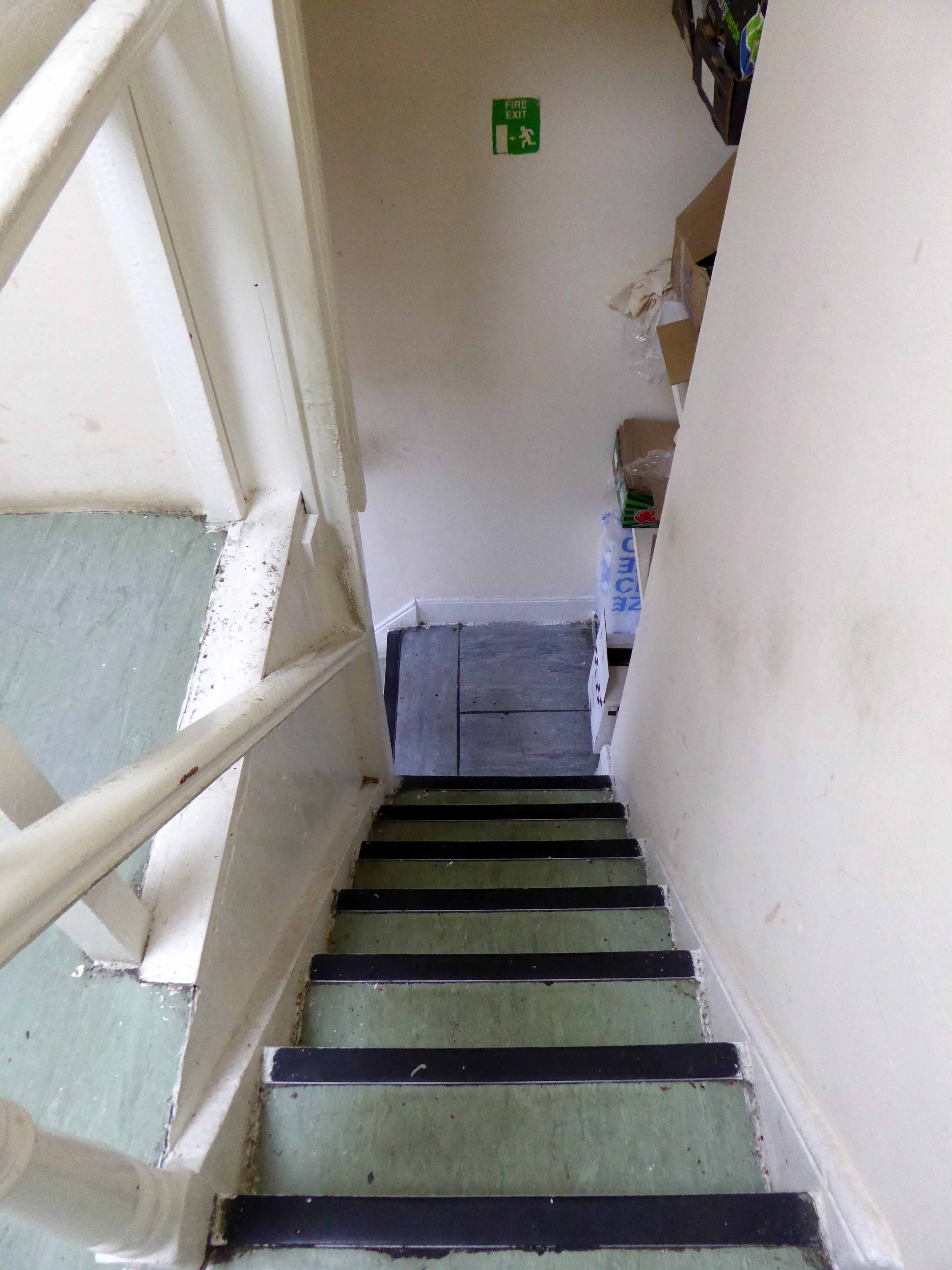
I sat and ate happily, and was privileged to be given a tour of the kitchens by owner Tariq, recording for posterity a site of some culinary and social consequence.
Let’s take a look around and look forward to a meal just across the road real soon.
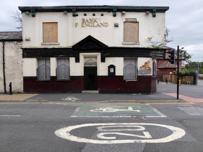
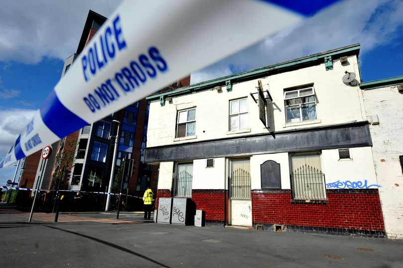
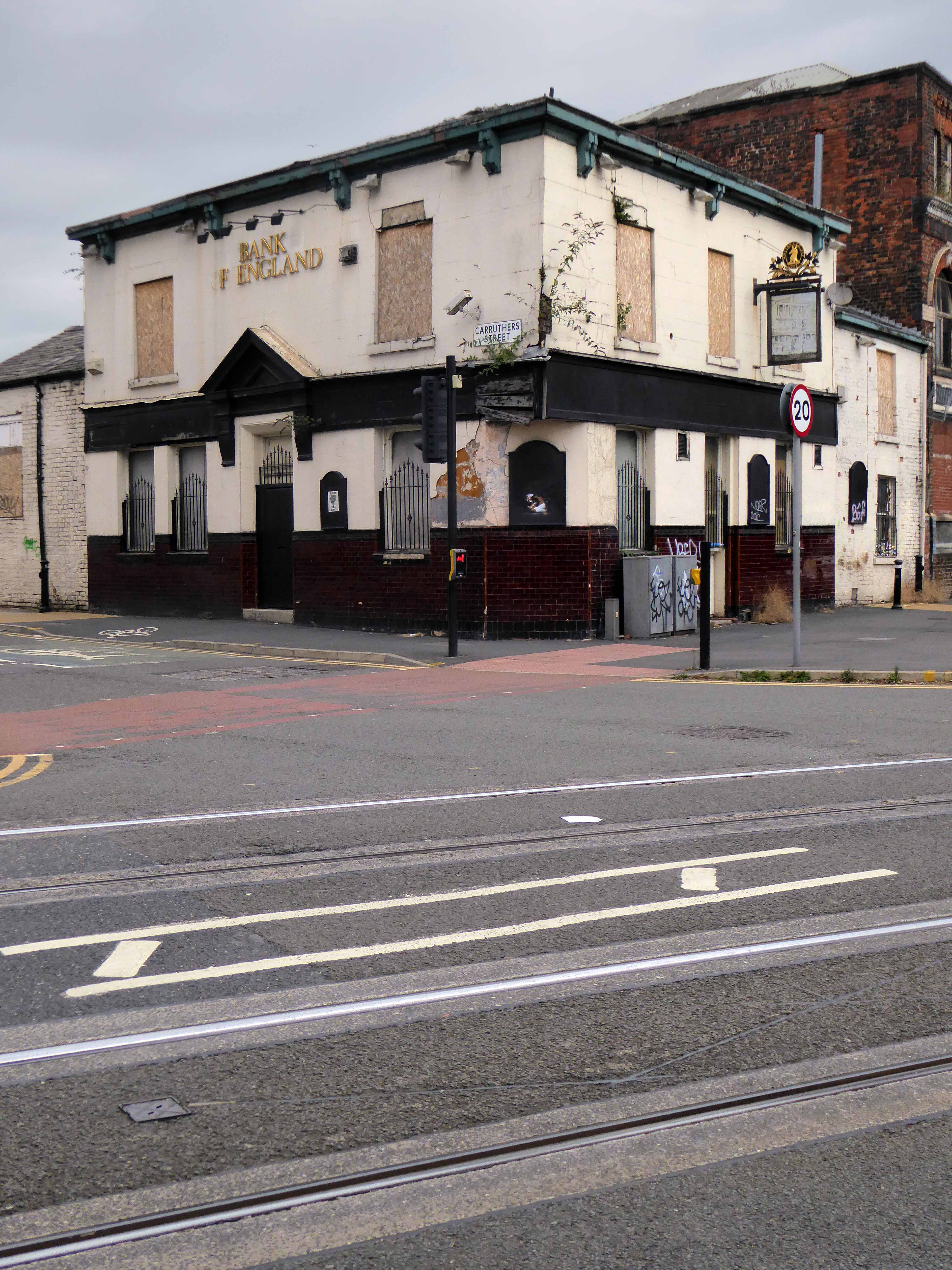
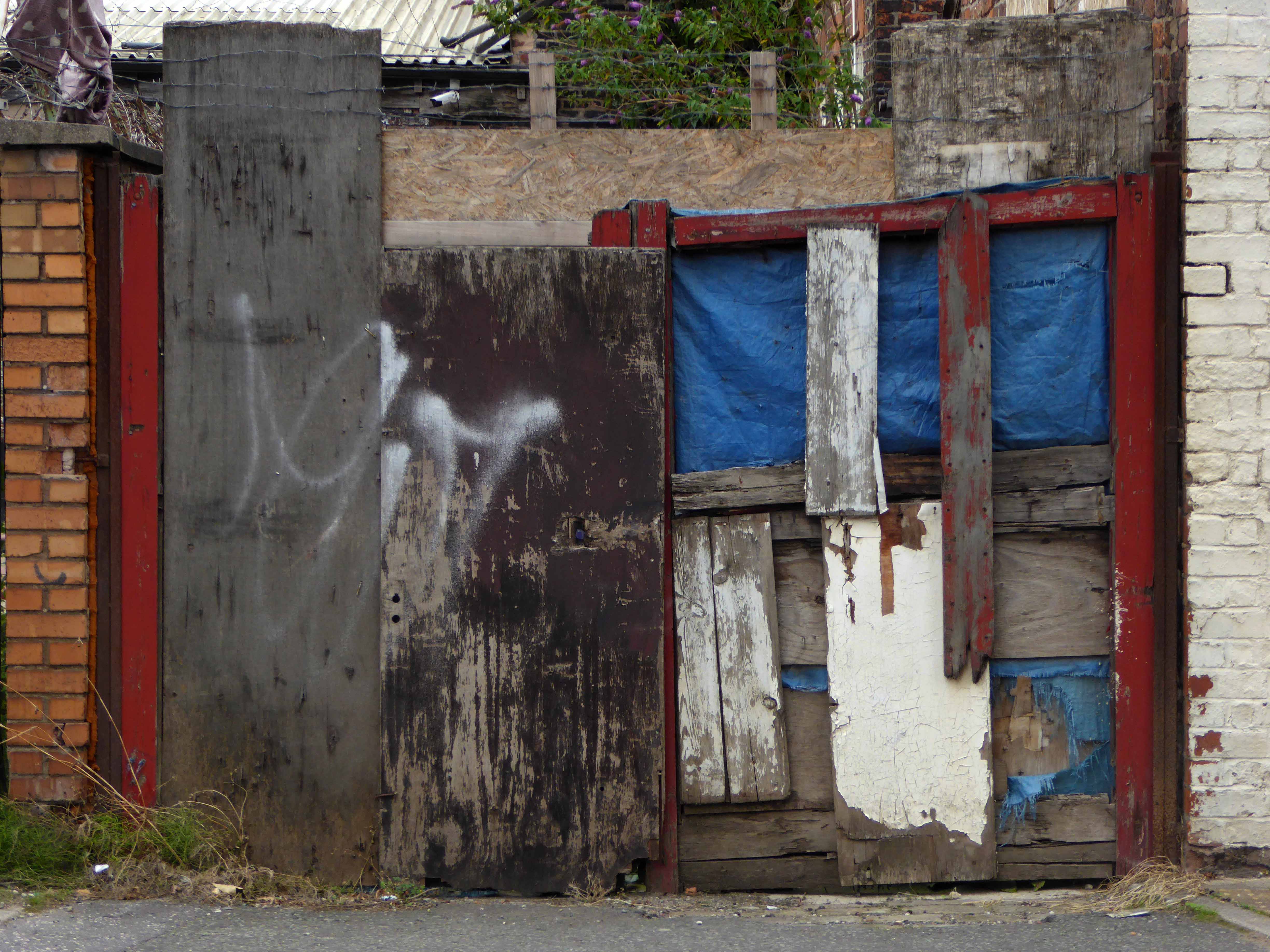
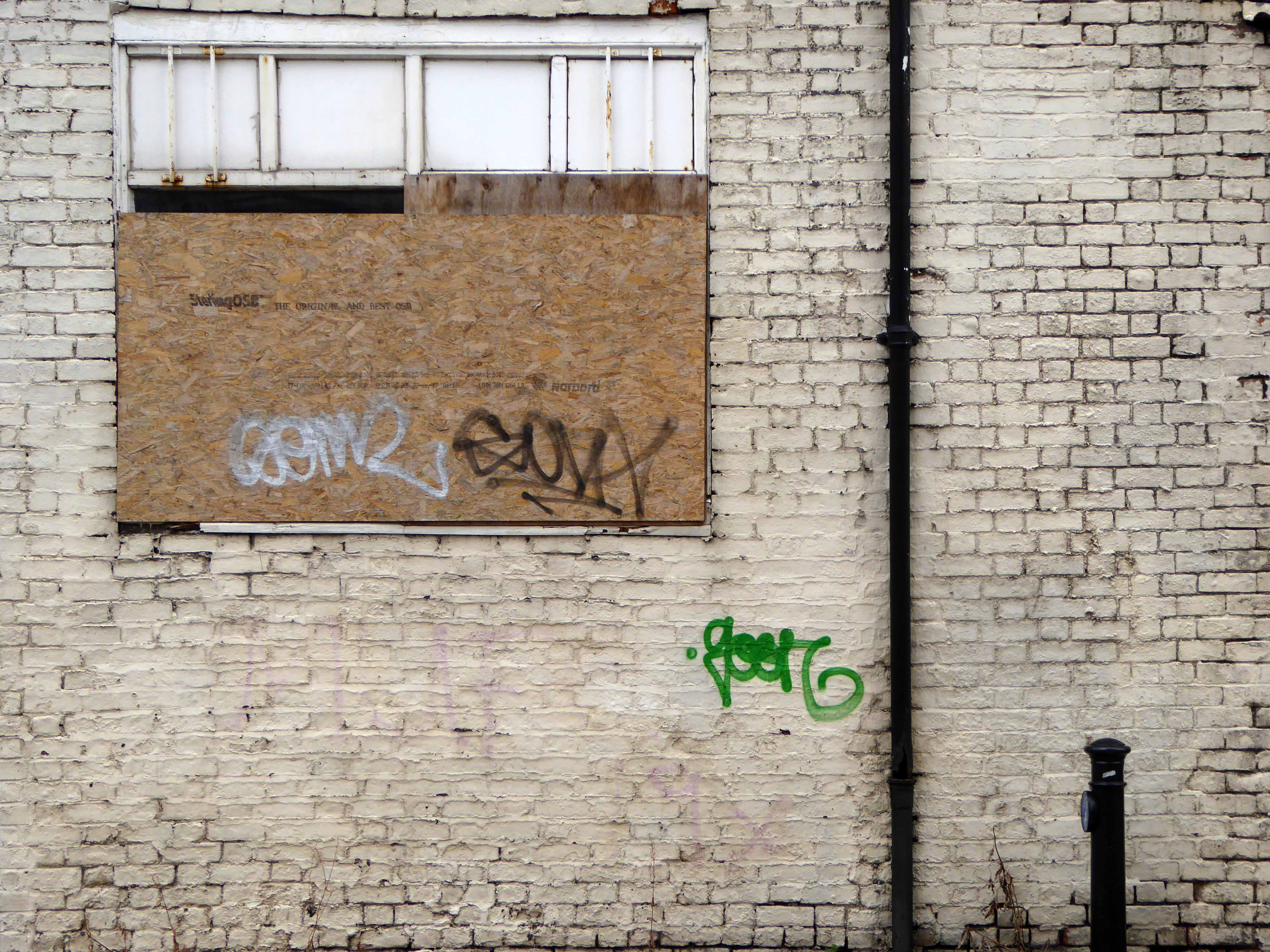
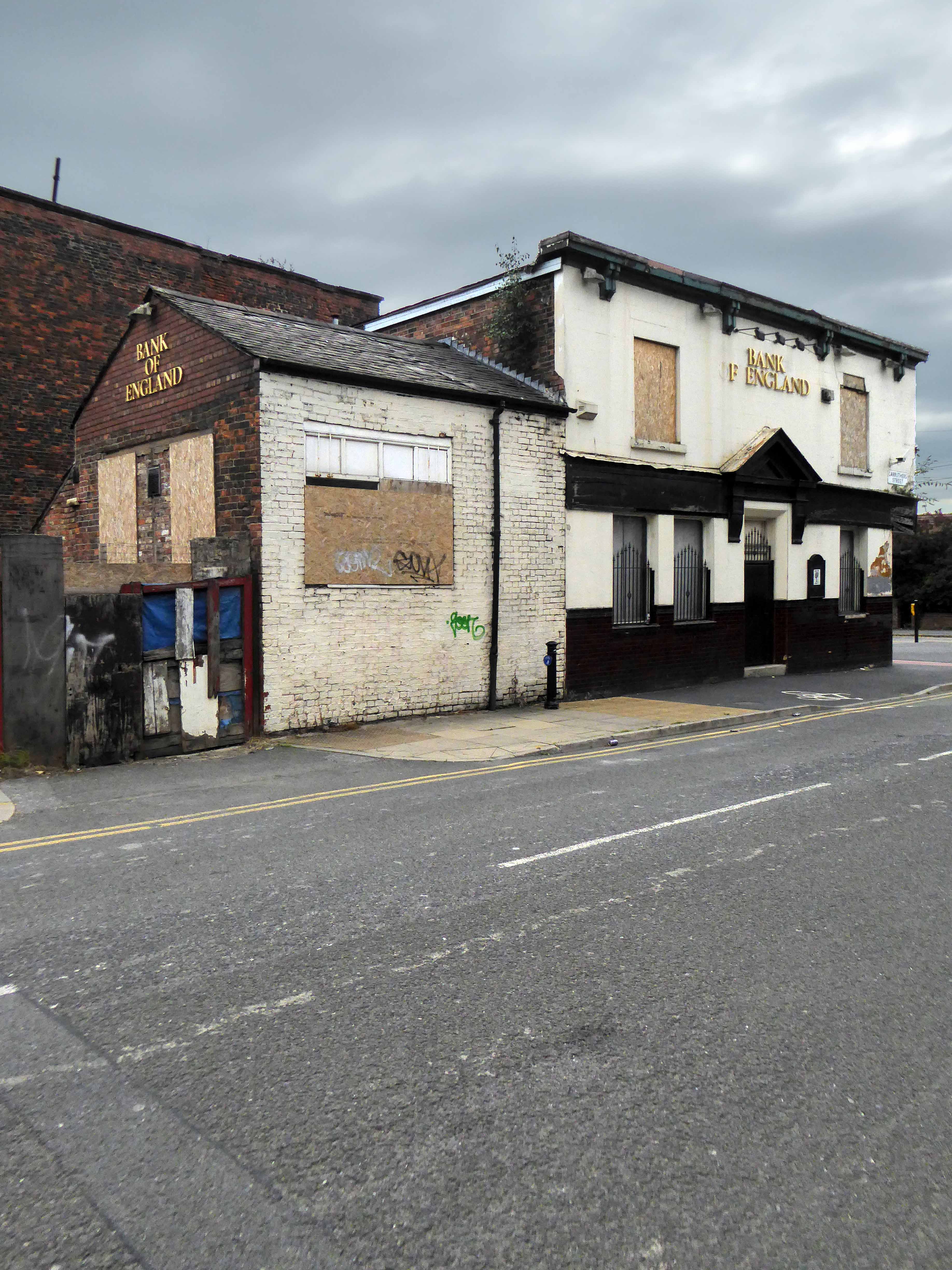
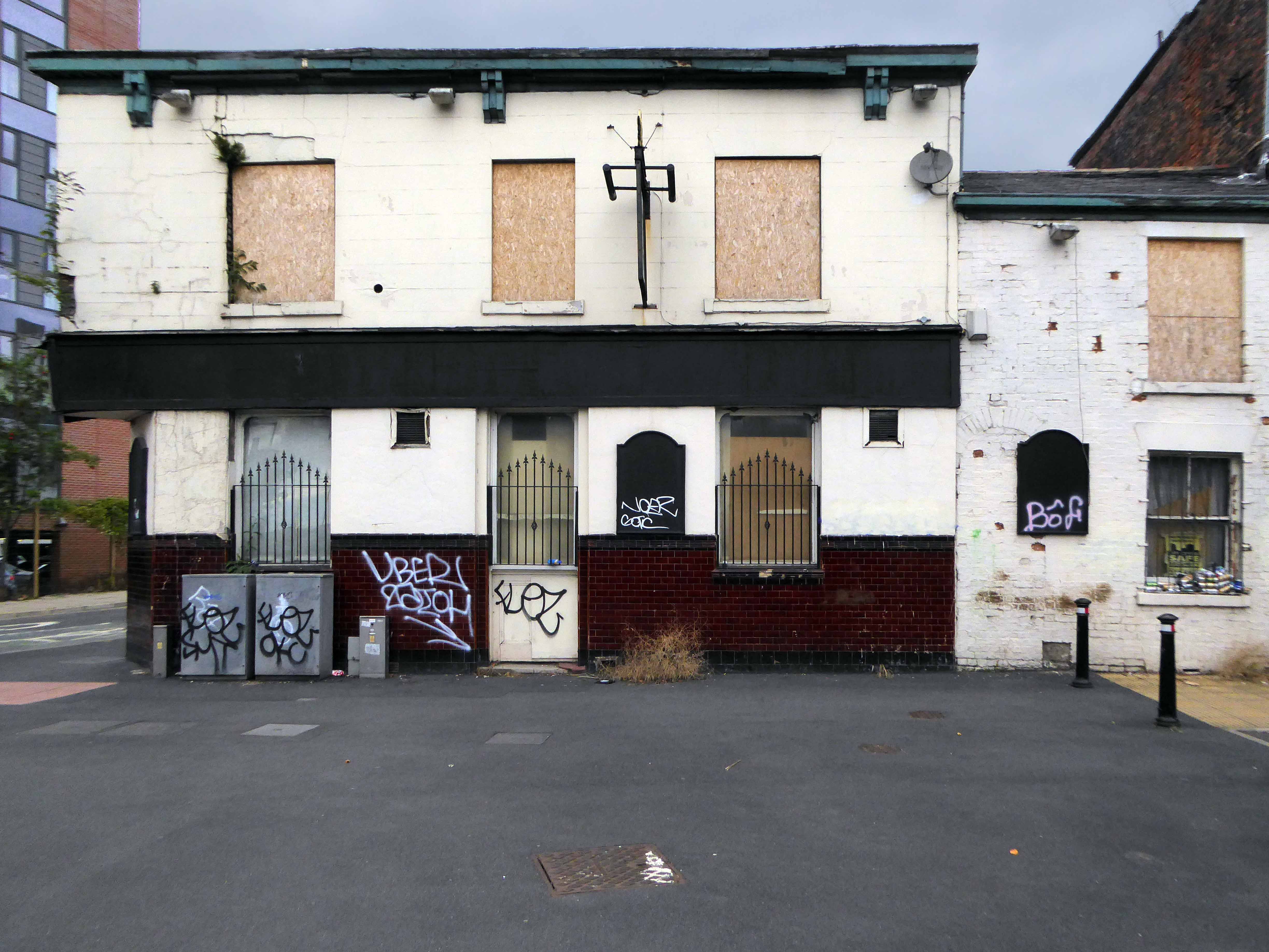
Standing stately on the corner of Carruthers and Pollard Street, safe as houses.
As safe as the houses that are no longer there, along with the other public houses, along with the jobs, along with the punters – all long gone, it’s a long story.
Look out!
Mind that tram, full of the boys and girls in blue, off to shriek at a Sheikh’s shrine.
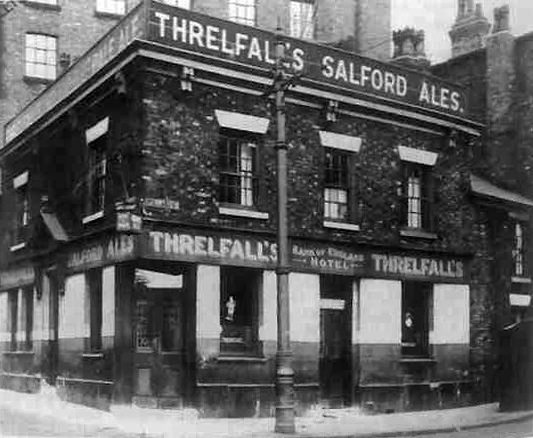
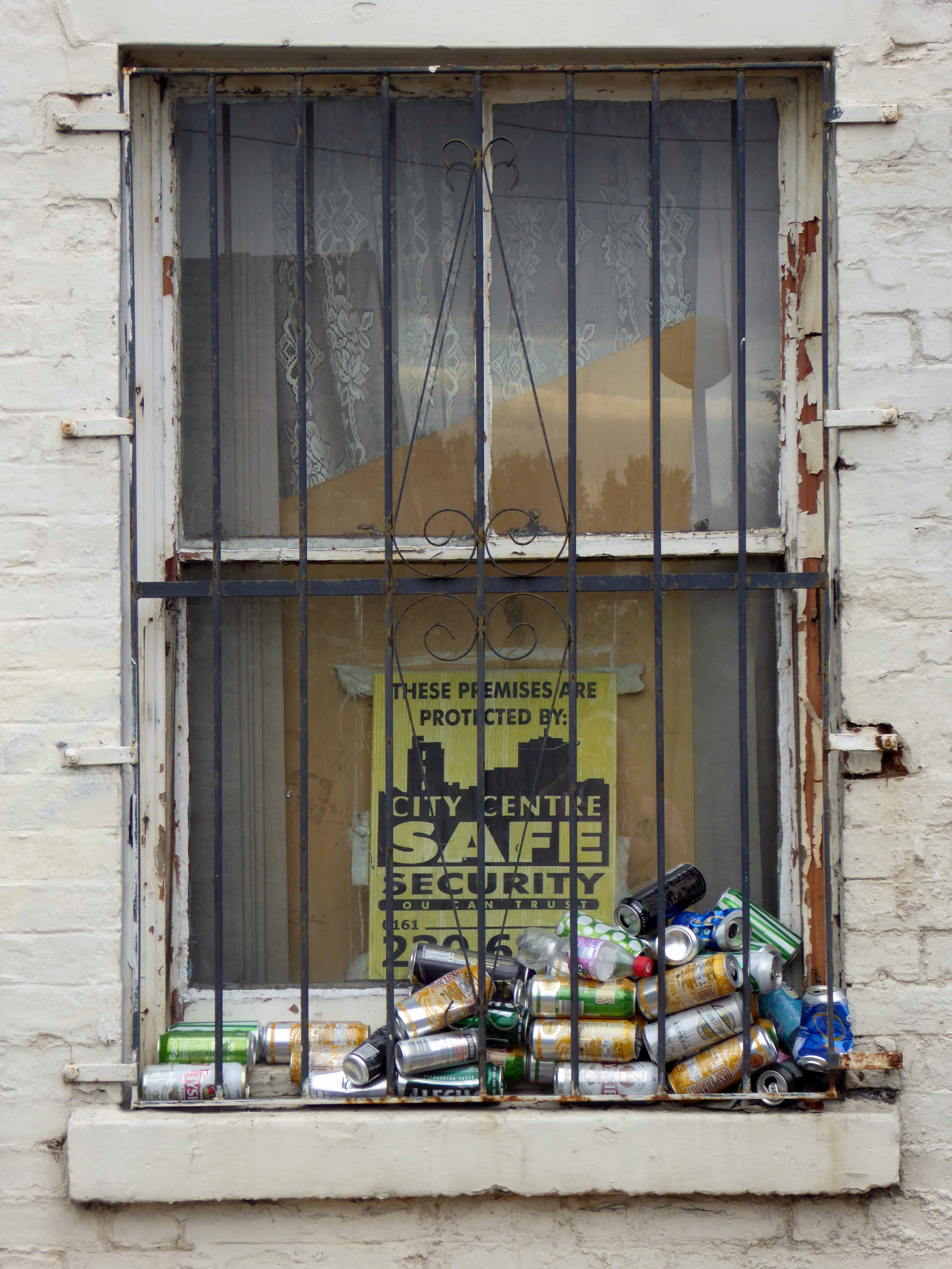
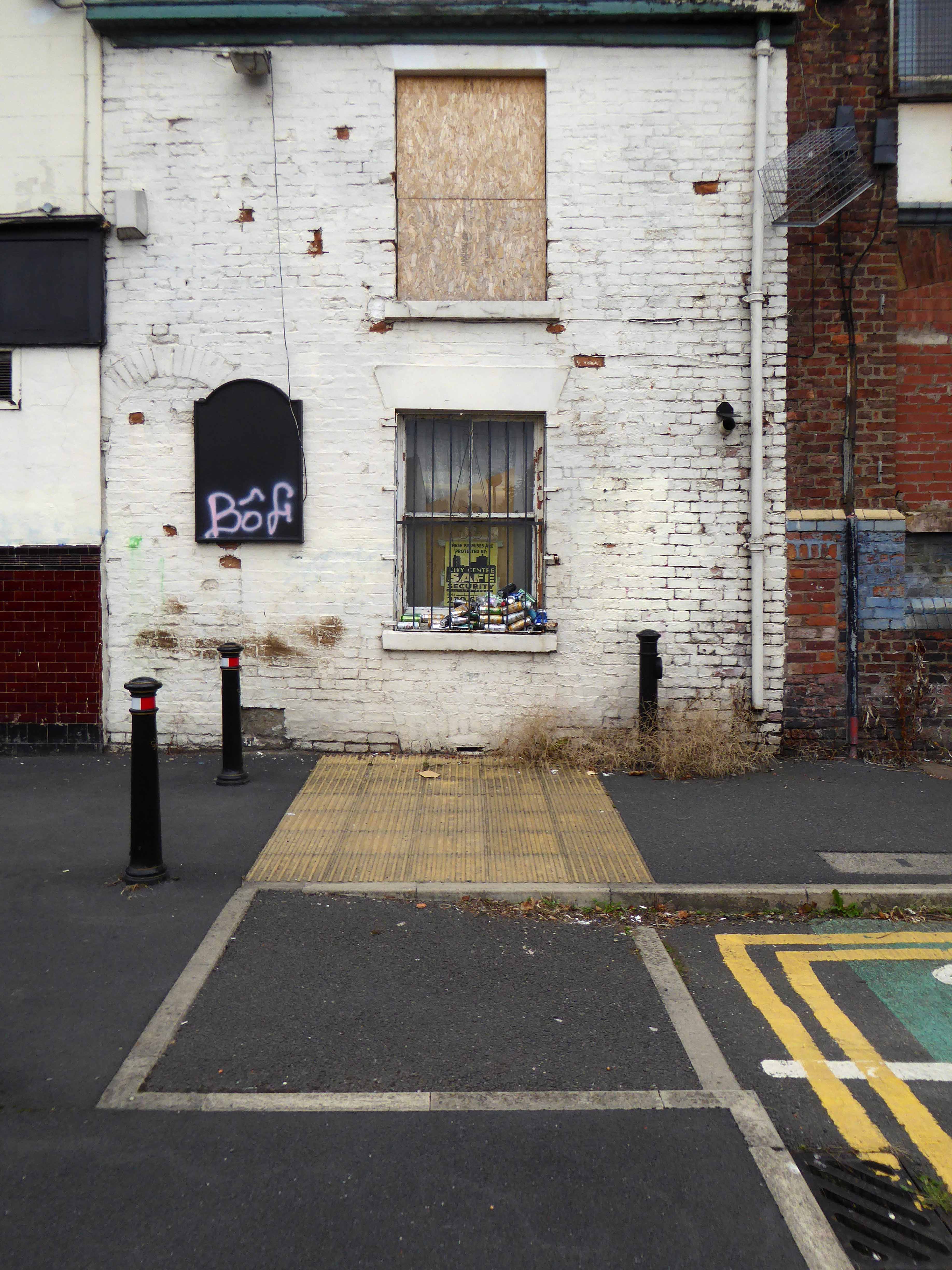
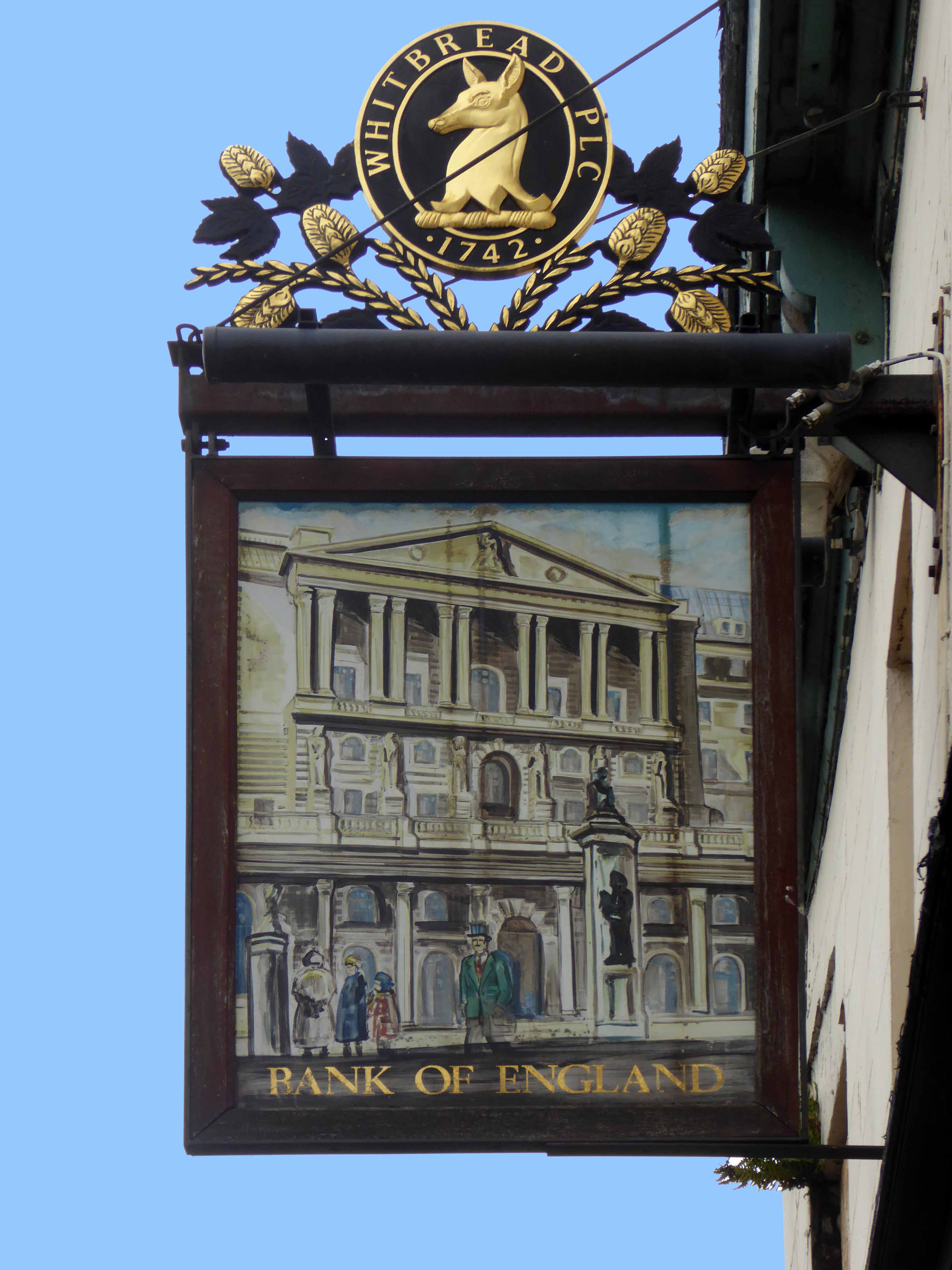
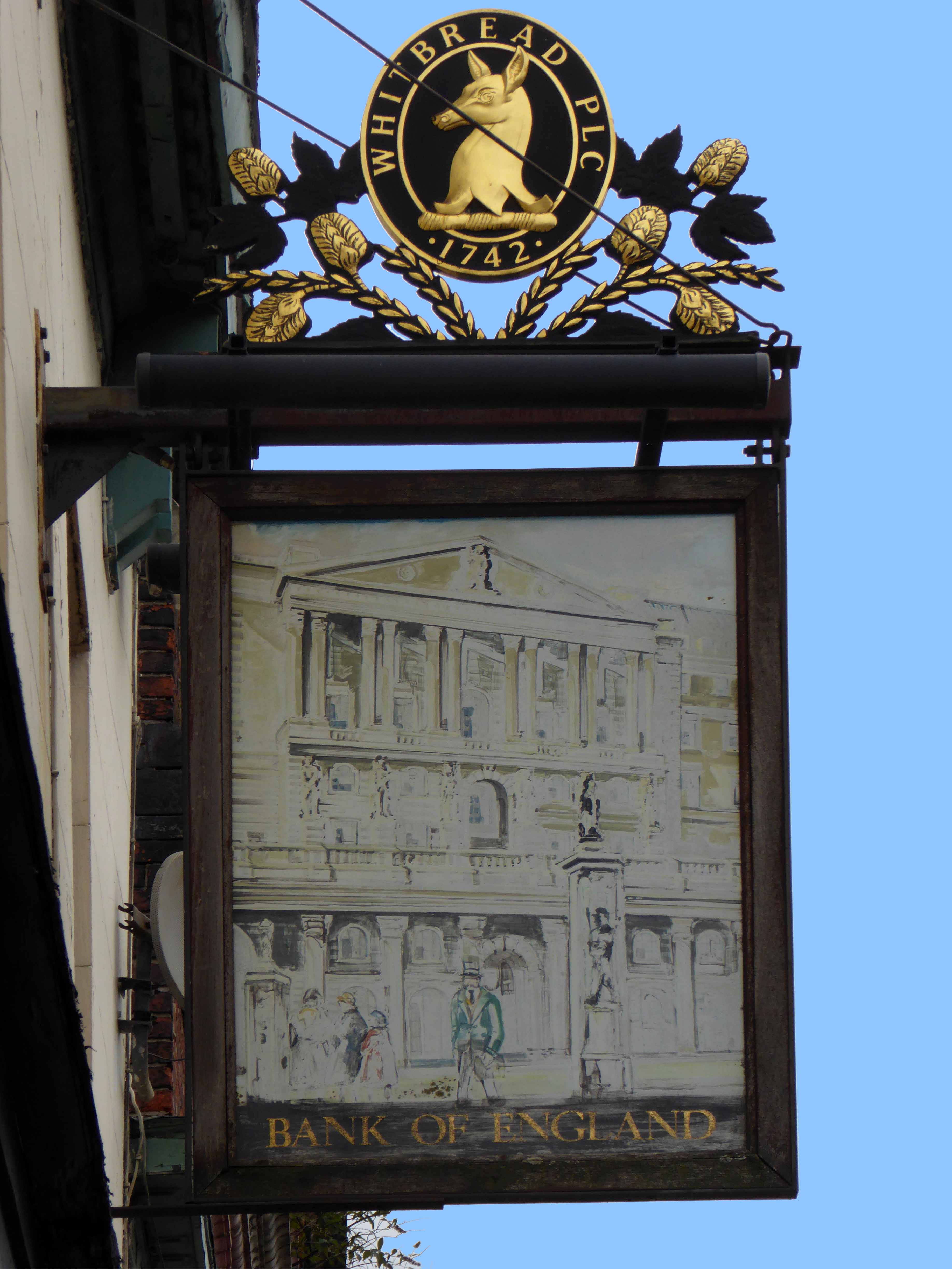
The Bank of England was one of Ancoats’ first beerhouses, licensed from 1830 and ten years later it was fully licensed with attached brewhouse. The brewery did well, in fact it had another tied house, the Kings Arms near Miles Platting station nearby. The brewery was sold off in the 1860s but continued as a separate business for a few years.
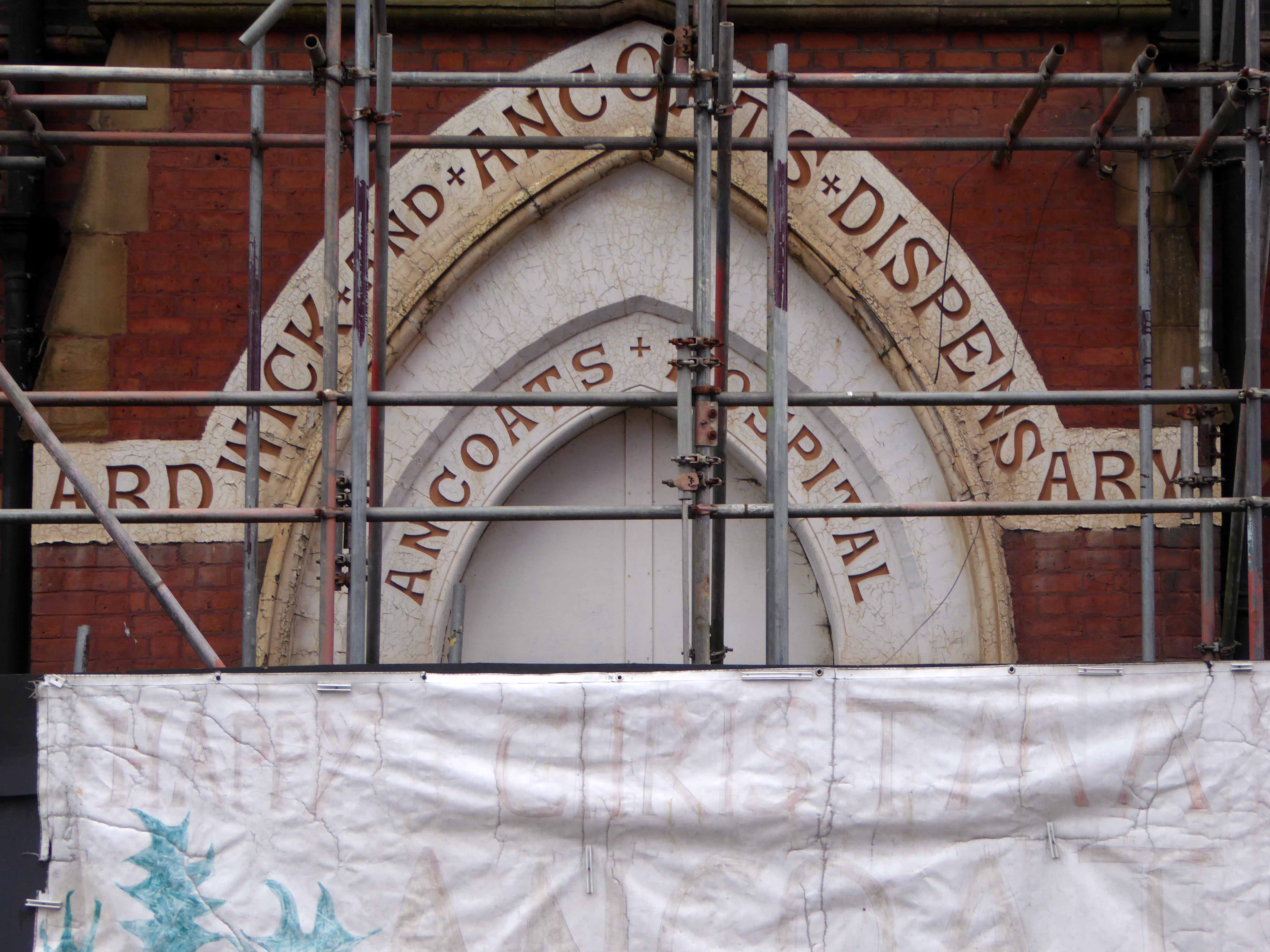
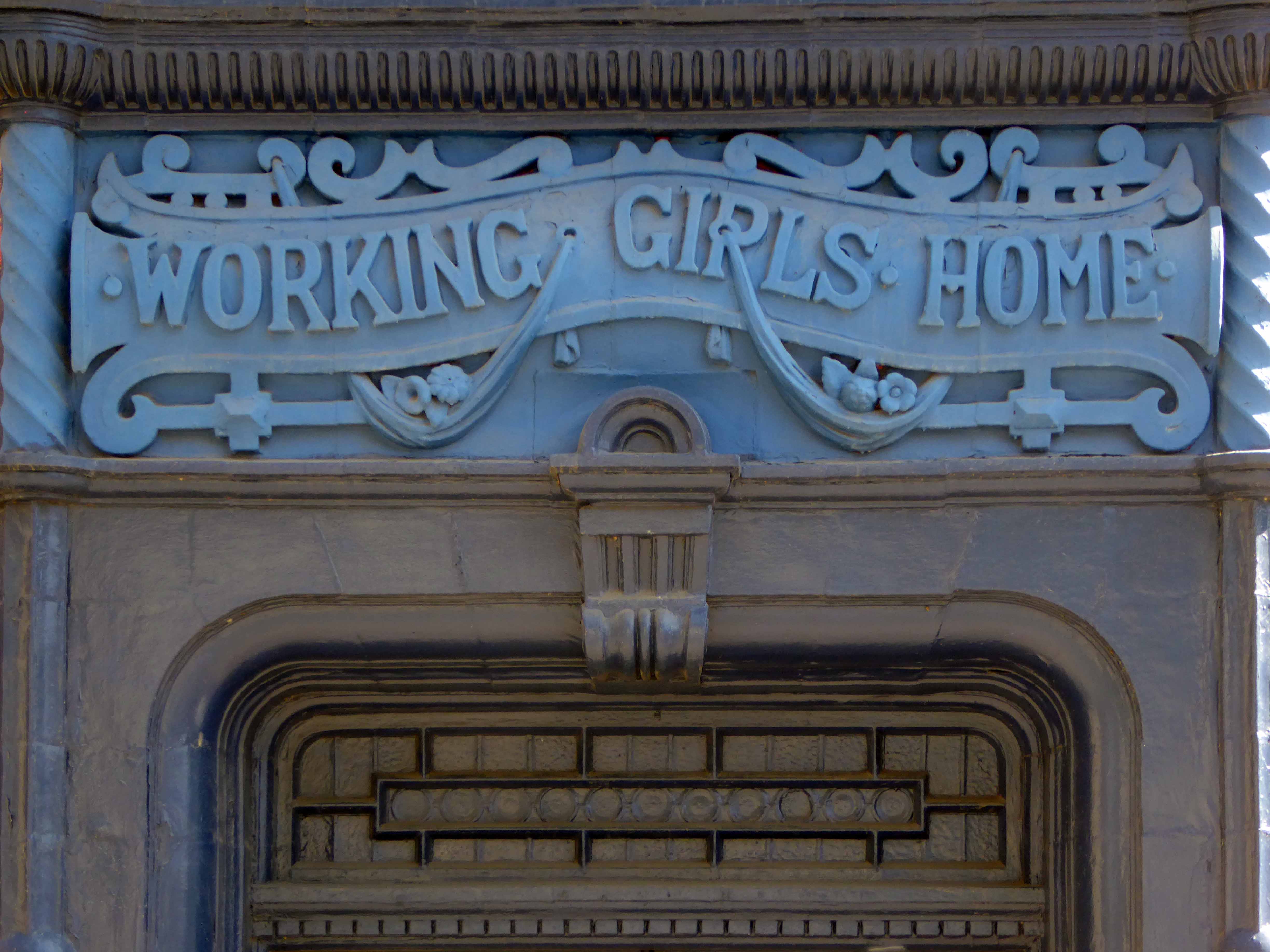
Ancoats, the core of the first industrial city, a dense cornucopia of homes, mills and cholera – its citizens said to find respite from disease, through the consumption of locally brewed beer.
Once home to a plethora of pubs, now something of a dull desert for the thirsty worker, though workers, thirsty or otherwise are something of a rarity in the area.
One worker went missing, some twenty years ago Martin Joyce was last seen on the site, the pub grounds were excavated – nothing was found.
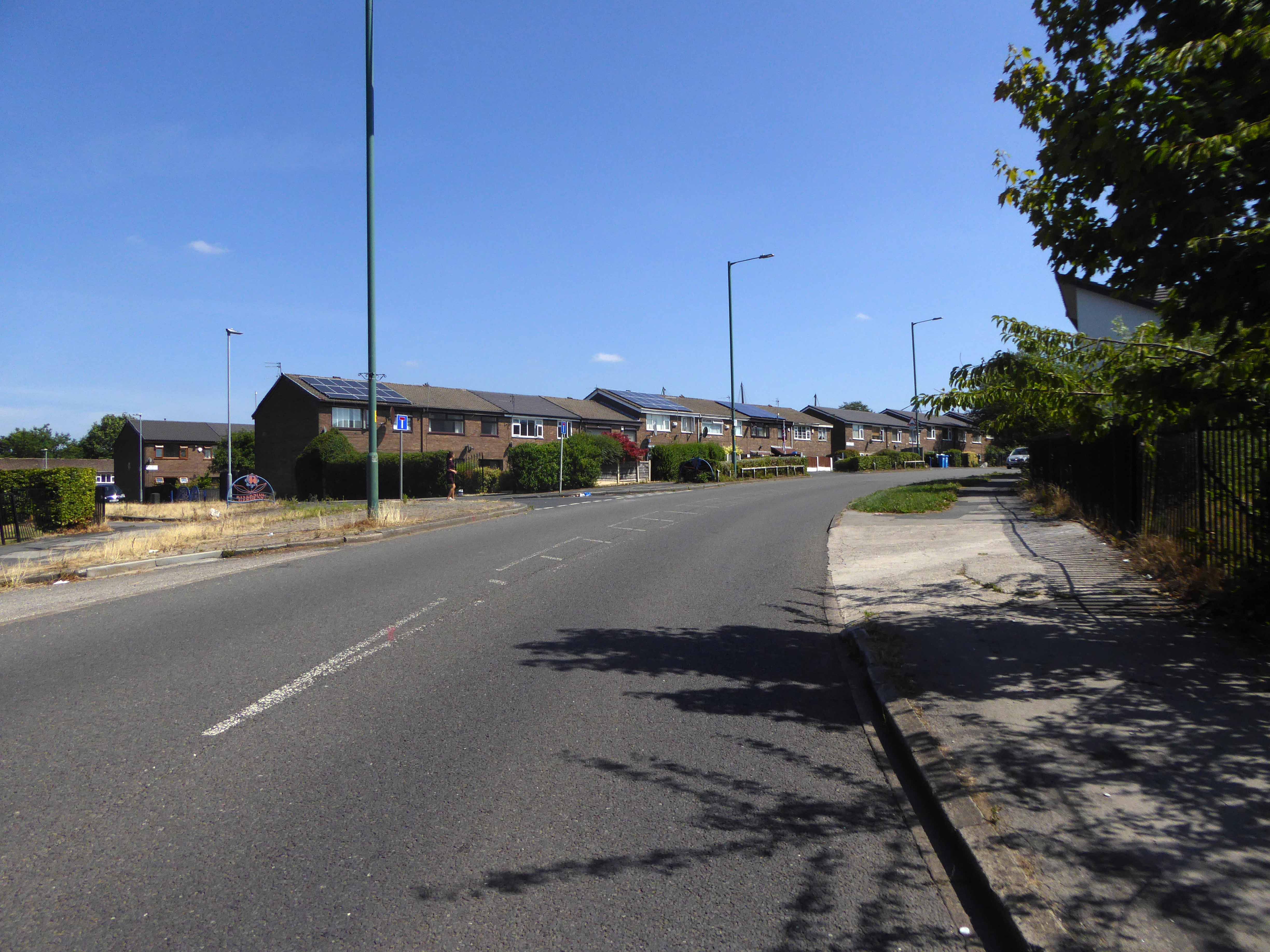
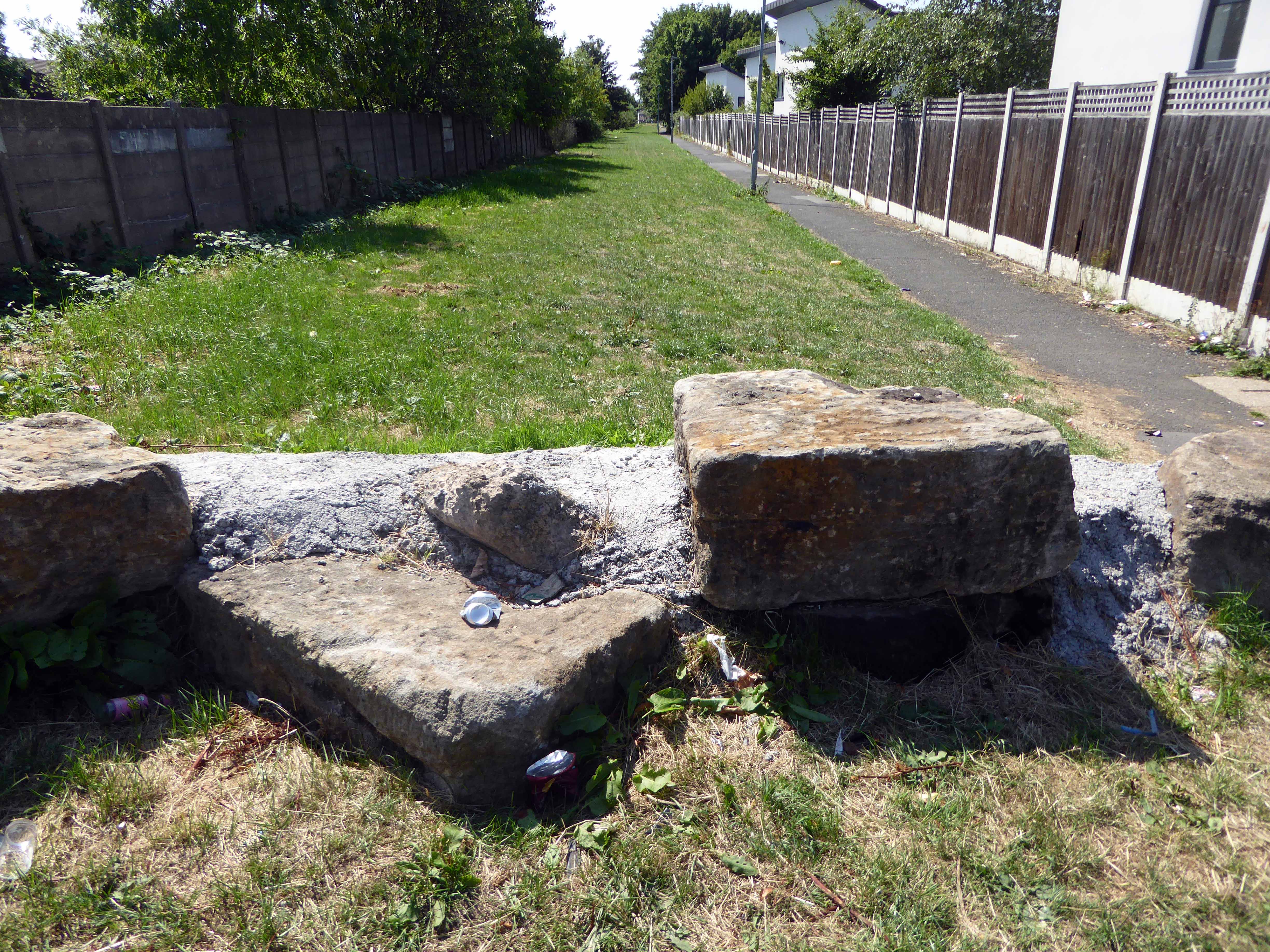
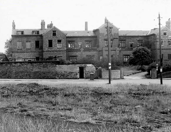
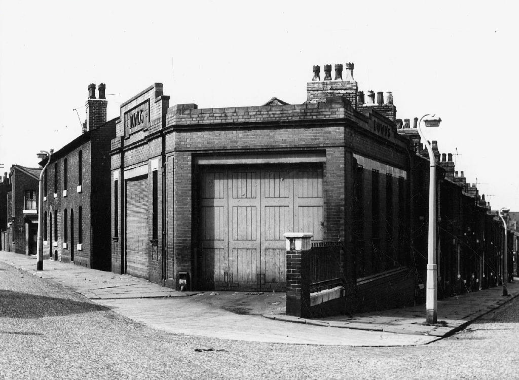
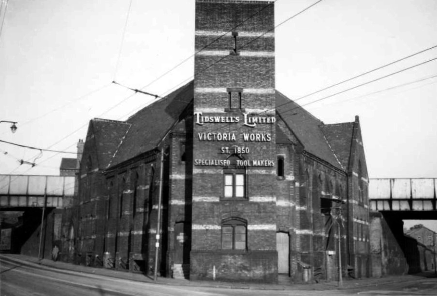
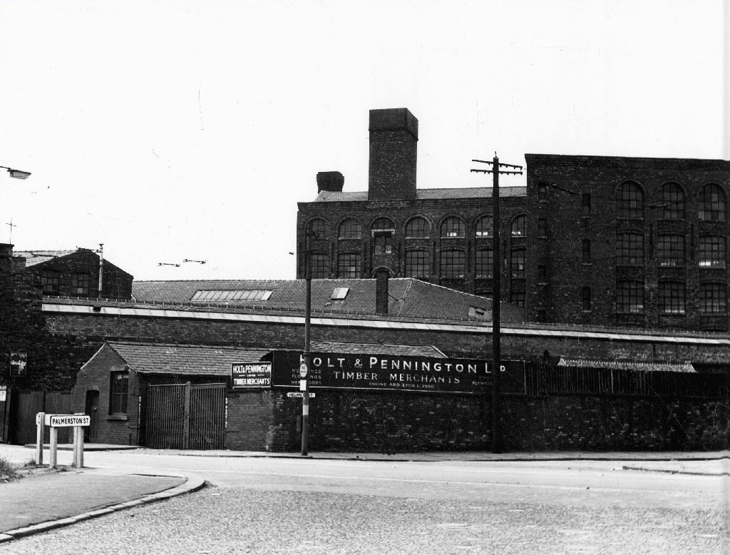
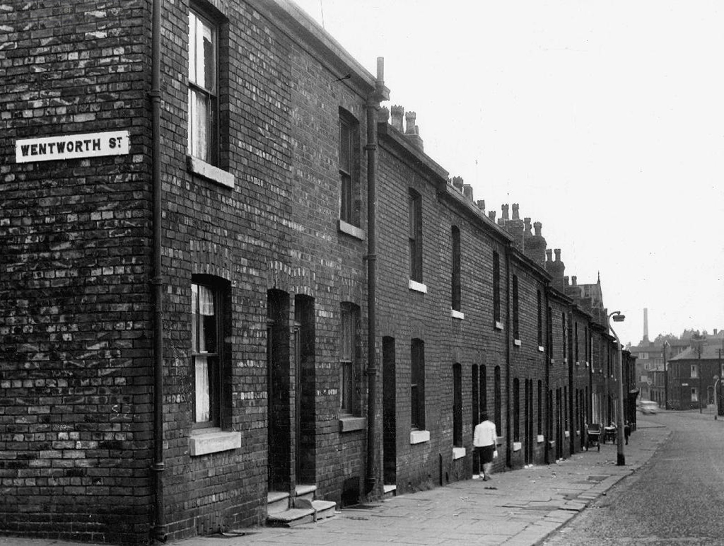
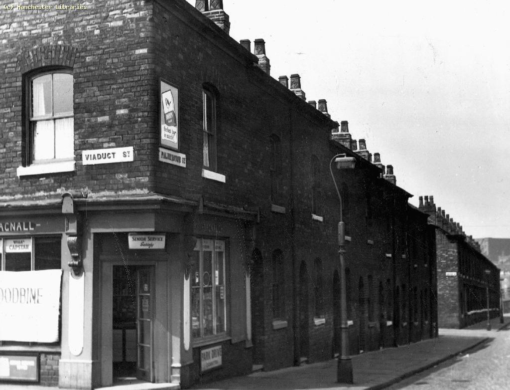
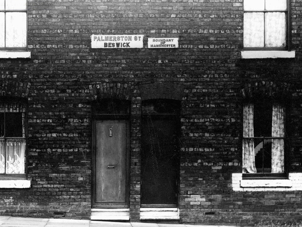
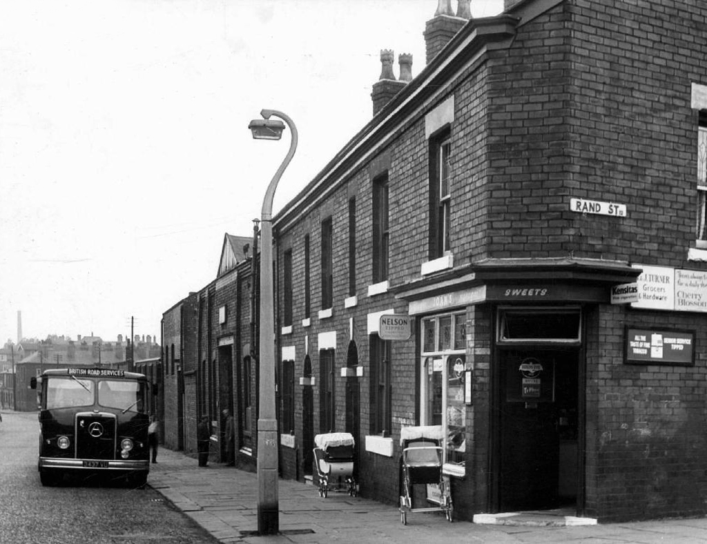
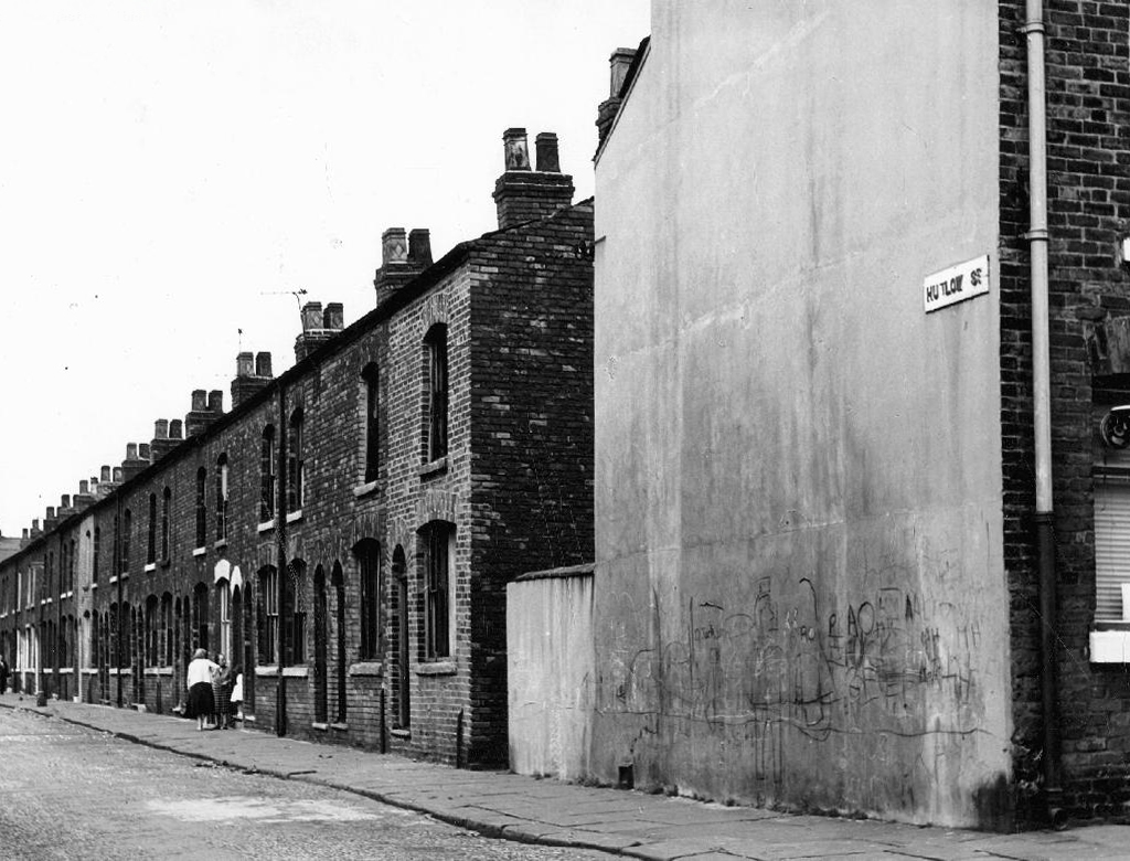
Having traced a lengthy history of the shortish Palmerston Street – I returned to take a snapshot of the current state of affairs.
So much has gone an Art Museum, Lads Club, churches, homes, schools, industry and pubs – much of this now indistinct scrubland, fenced and walled, neither use nor ornament, save as an unofficial wildlife garden for feather, fowl and flower.
There are small groups of more recent housing developments with the promise of more on the way, though this as ever is contentious – the story of conflicted interests betwixt and between developer, local authority and the would be affordable homes and their occupants.
The council says – Manchester’s Affordable Housing Programme will ensure more than 2,200 homes by March 2021 through a £250m programme funded through a variety of sources including Homes England grant funding, Council borrowing and land or property sales and Registered Providers. The Council is also backing the programme through the release of suitable council-owned land.
Which seems barely adequate to meet the needs of those on lower incomes.
The Guardian says – Of the 61 big residential developments granted planning permission by Manchester city council’s planning committee in 2016 and 2017, not one of the 14,667 planned flats or houses met the government’s definition of affordable, being neither for social rent nor offered at 80% of the market rate.
Manchester has changed, constantly changed – often overlooking the needs of its citizens to the north and east of the city. The areas crippled by recession, deindustrialisation and demolition have yet to see the benefits of the city’s recent regeneration.
What was once a community overflowing with rough and tumble, hustle and bustle, now seems to have become a contested area for match day parking and non-existent urban renewal.
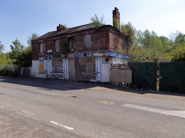
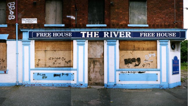
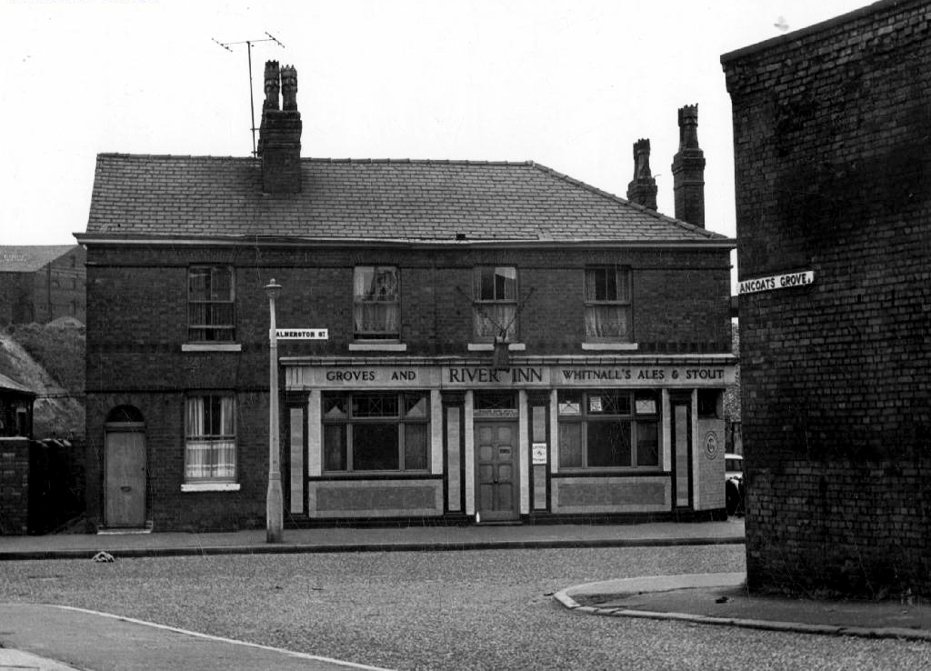
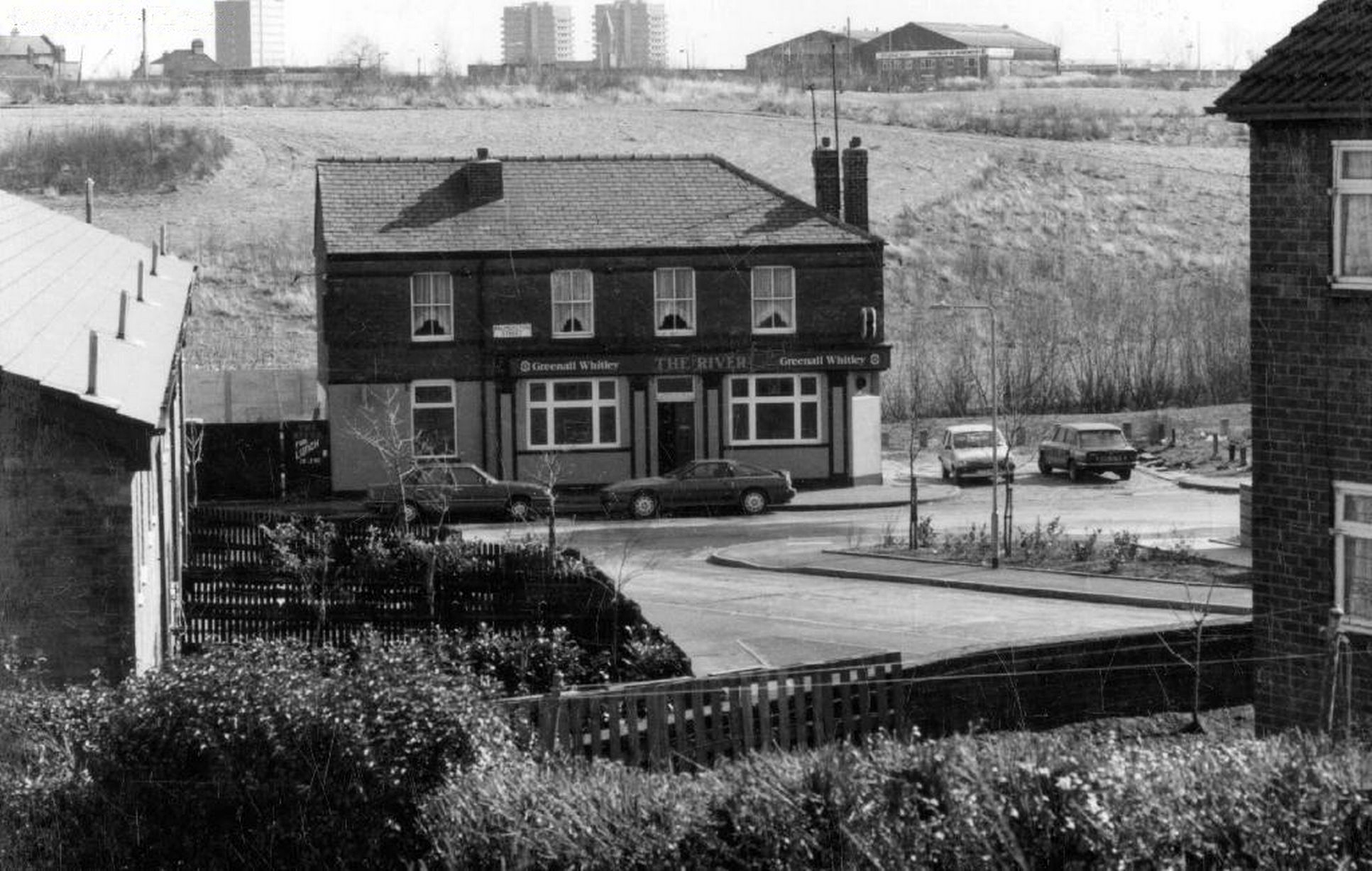
To begin at the beginning – some years ago I traced the route of the River Medlock, I chanced upon a forlorn pub called The River, all alone, desolate and boarded up, presiding over an area that I assumed, would once have supplied ample trade to a busy boozer.
I returned last week in search of some rhyme or reason, for such a seemingly sad and untimely decline.
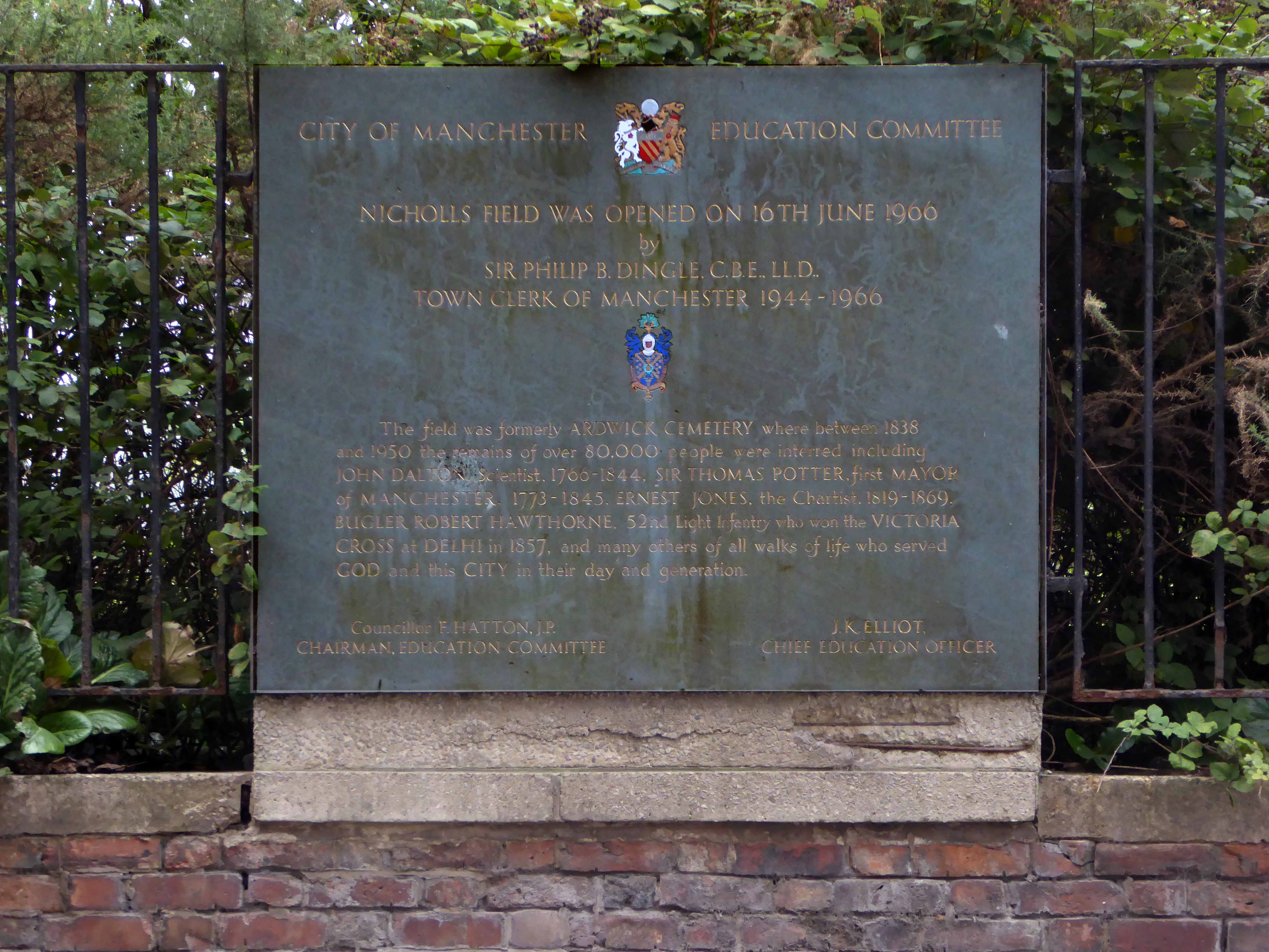
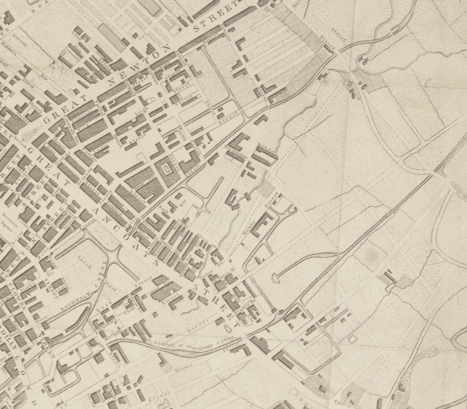
So here we are back at in Manchester 1813, the seeds of the Industrial Revolution sewn in adjacent Ancoats, the fields of Beswick still sewn with seeds, the trace of Palmerston Street nought but a rural track.
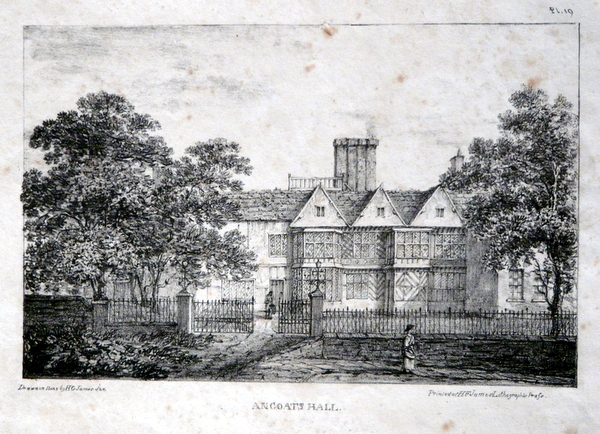
Sited on land between Great Ancoats Street and Every Street was Ancoats Hall, a post-medieval country house built in 1609 by Oswald Mosley, a member of the family who were Lords of the Manor of Manchester. The old timber-framed hall, built in the early 17th century, and demolished in the 1820s was replaced replaced by a brick building in the early neo-Gothic style.
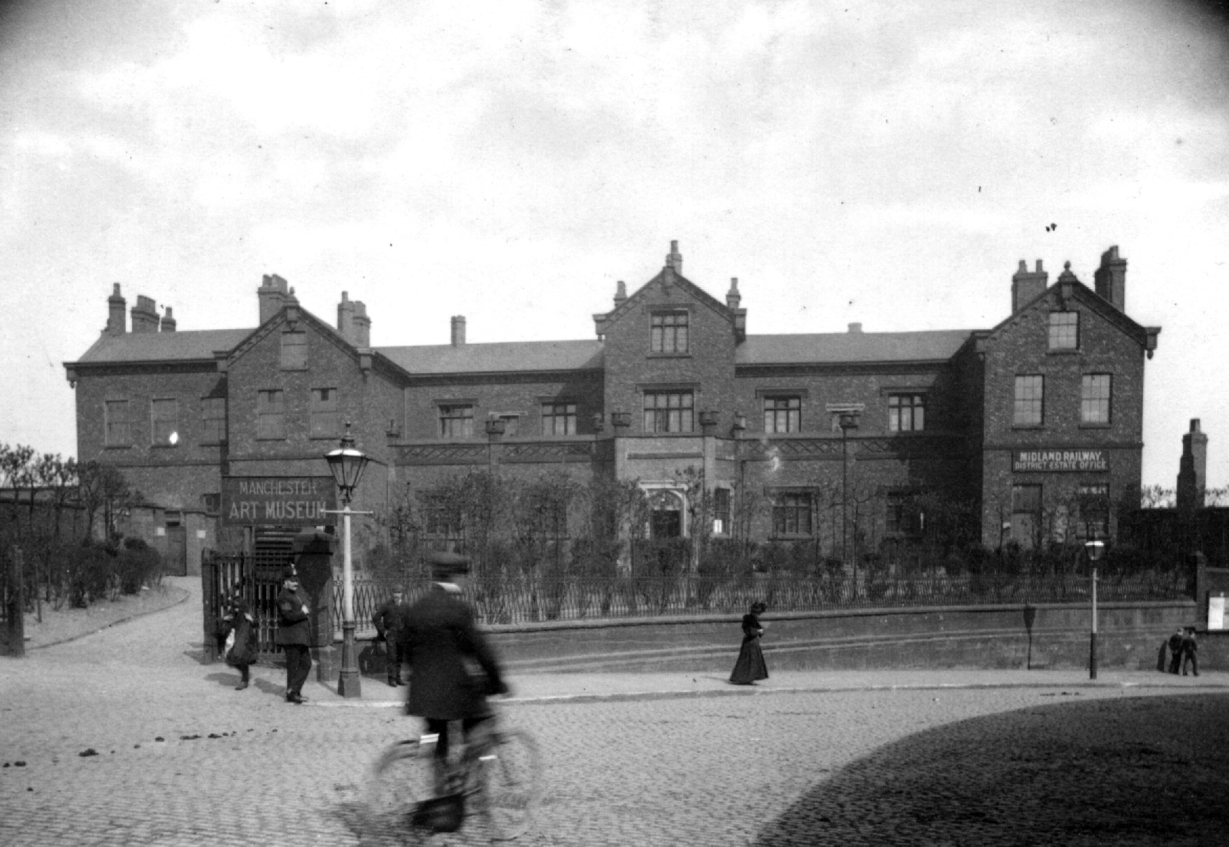
This would become the Manchester Art Museum, and here the worst excesses Victorian Capitalism were moderated by philanthropy and social reform.
When the Art Museum opened, its rooms, variously dedicated to painting, sculpture, architecture and domestic arts, together attempted to provide a chronological narrative of art, with detailed notes, labels and accompanying pamphlets and, not infrequently, personal guidance, all underlining a sense of historical development.
Housing and industry in the area begins to expand, railways, tramways, homes and roads are clearly defined around the winds of the river.
In 1918 the museum was taken over by the city, it closed in 1953 and its contents were absorbed into the collection of Manchester City Art Gallery, as the State increasingly took responsibility for the cultural well being of the common folk.
The building was finally demolished in the 1960’s – just as the area, by now a dense warren of back to back terraces, was to see further change.
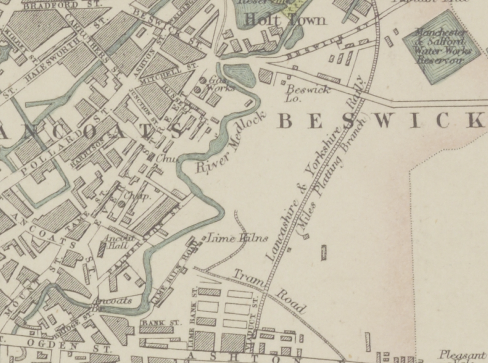
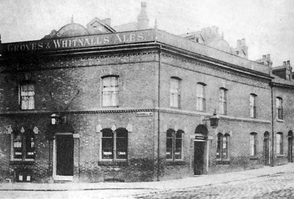
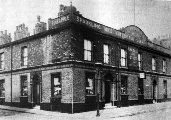
Along the way was the the River Inn, seen here with a fine Groves and Whitnall’s faience tiled frontage.
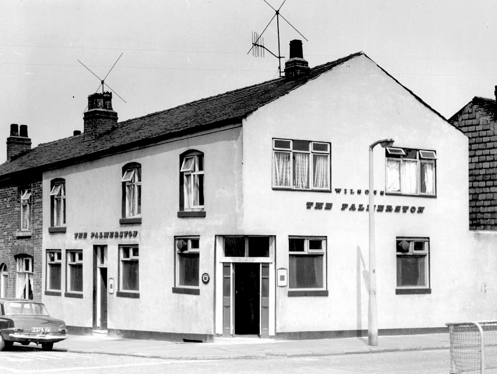
The street also offered rest, relaxation and refreshment through the Church, Pineapple and Palmerston pubs, as recored here on the Pubs of Manchester blog.
The River seen here in the 1970’s struggled on until 2007.
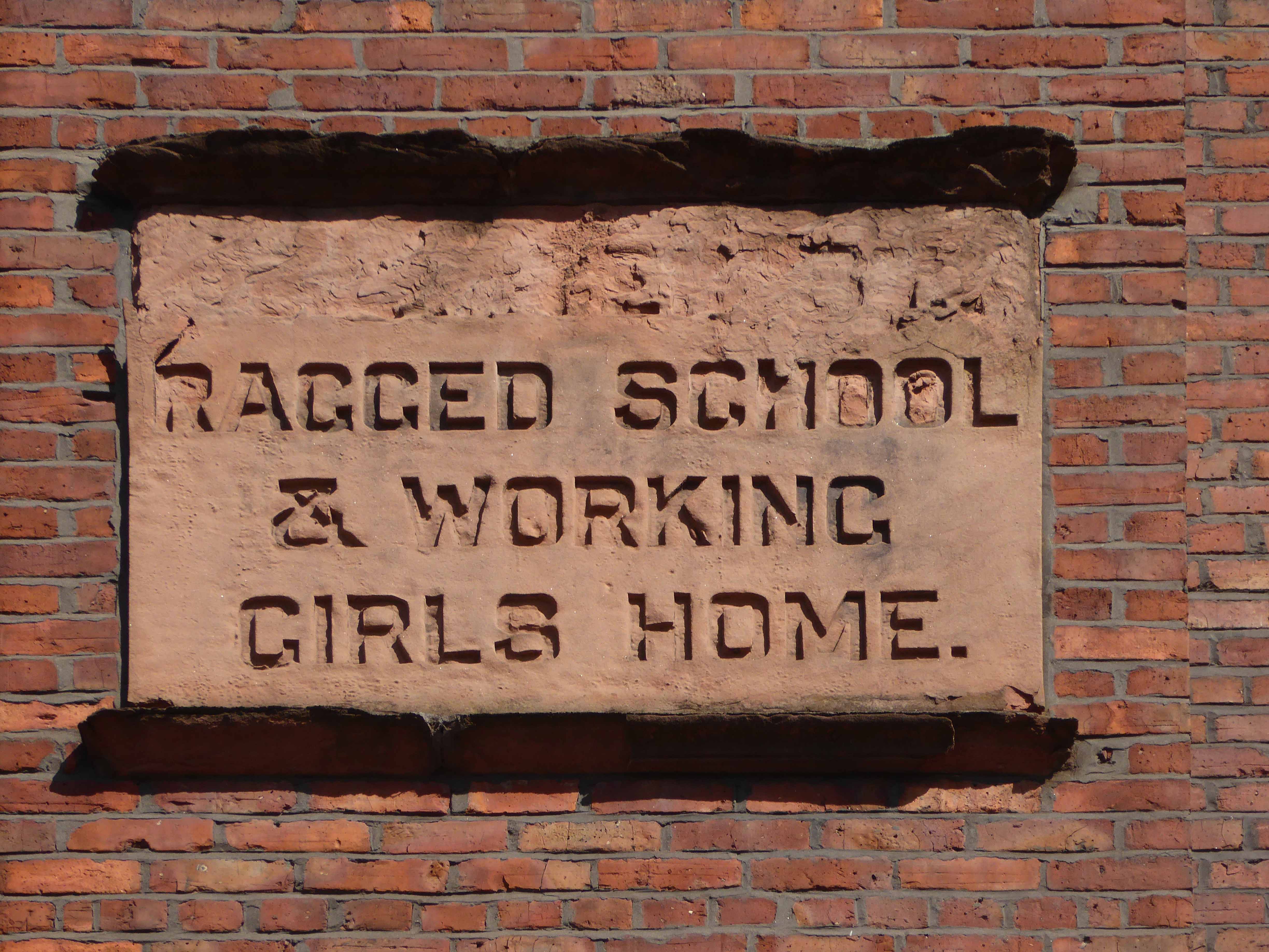
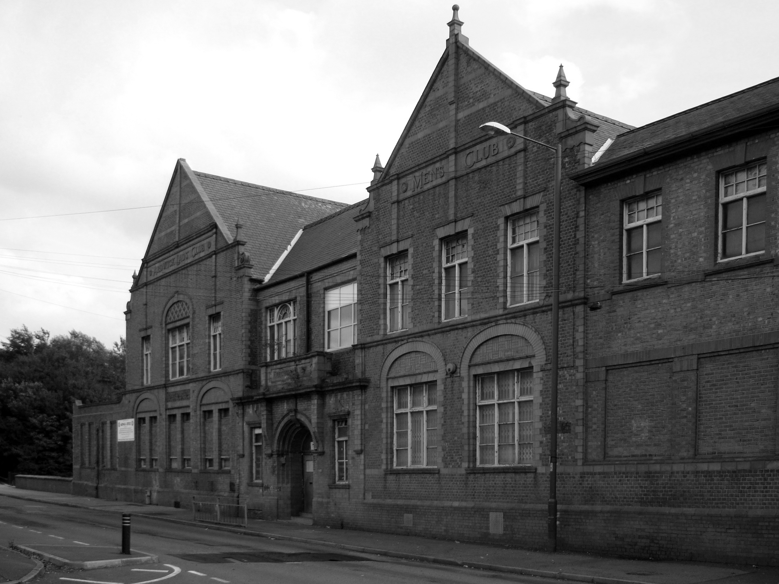
Further along we find the Ardwick Lads Club, further evidence of the forces of social reform, that sadly failed to survive the forces of the free market and the consequent Tory cuts in public spending and wilful Council land-banking.
The Ardwick Lads’ and Mens’ Club, now the Ardwick Youth Centre, opened in 1897 and is believed to be Britain’s oldest purpose-built youth club still in use [and was until earlier in 2012]. Designed by architects W & G Higginbottom, the club, when opened, featured a large gymnasium with viewing gallery – where the 1933 All England Amateur Gymnastics Championships were held – three fives courts, a billiard room and two skittle alleys (later converted to shooting galleries). Boxing, cycling, cricket, swimming and badminton were also organised. At its peak between the two world wars, Ardwick was the Manchester area’s largest club, with 2,000 members.
On the 10th September 2012 an application for prior notification of proposed demolition was submitted on behalf of Manchester City Council to Manchester Planning, for the demolition of Ardwick Lads’ Club of 100 Palmerston Street , citing that there was “no use” for the building in respect to its historic place within the community as providing a refuge and sporting provision to the young of Ancoats.
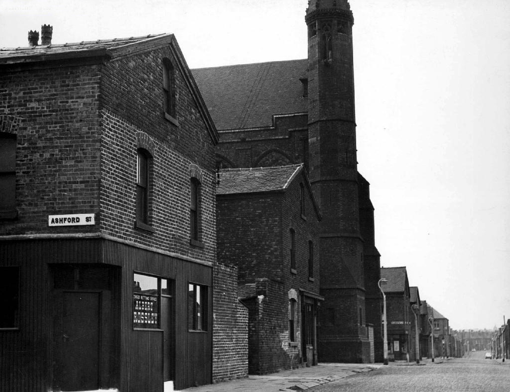
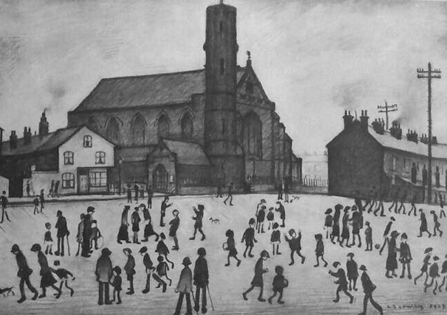
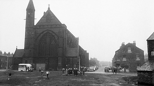
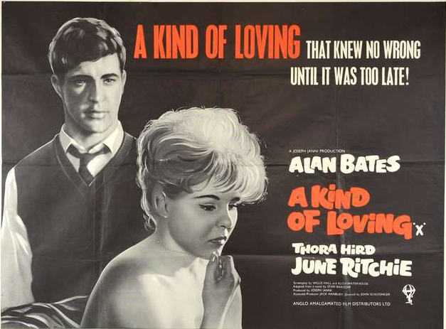
At the top turn of the street stood St Mary’s – the so called Lowry church.
Used as a location for the film adaptation of Stan Barstow’s A Kind Of Loving
The homes and industry attendant schools and pubs were soon to become history, all that you see here is more or less gone. Slum clearance, the post-war will to move communities away from the dense factory smoke, poor housing stock and towards a bright shiny future elsewhere.
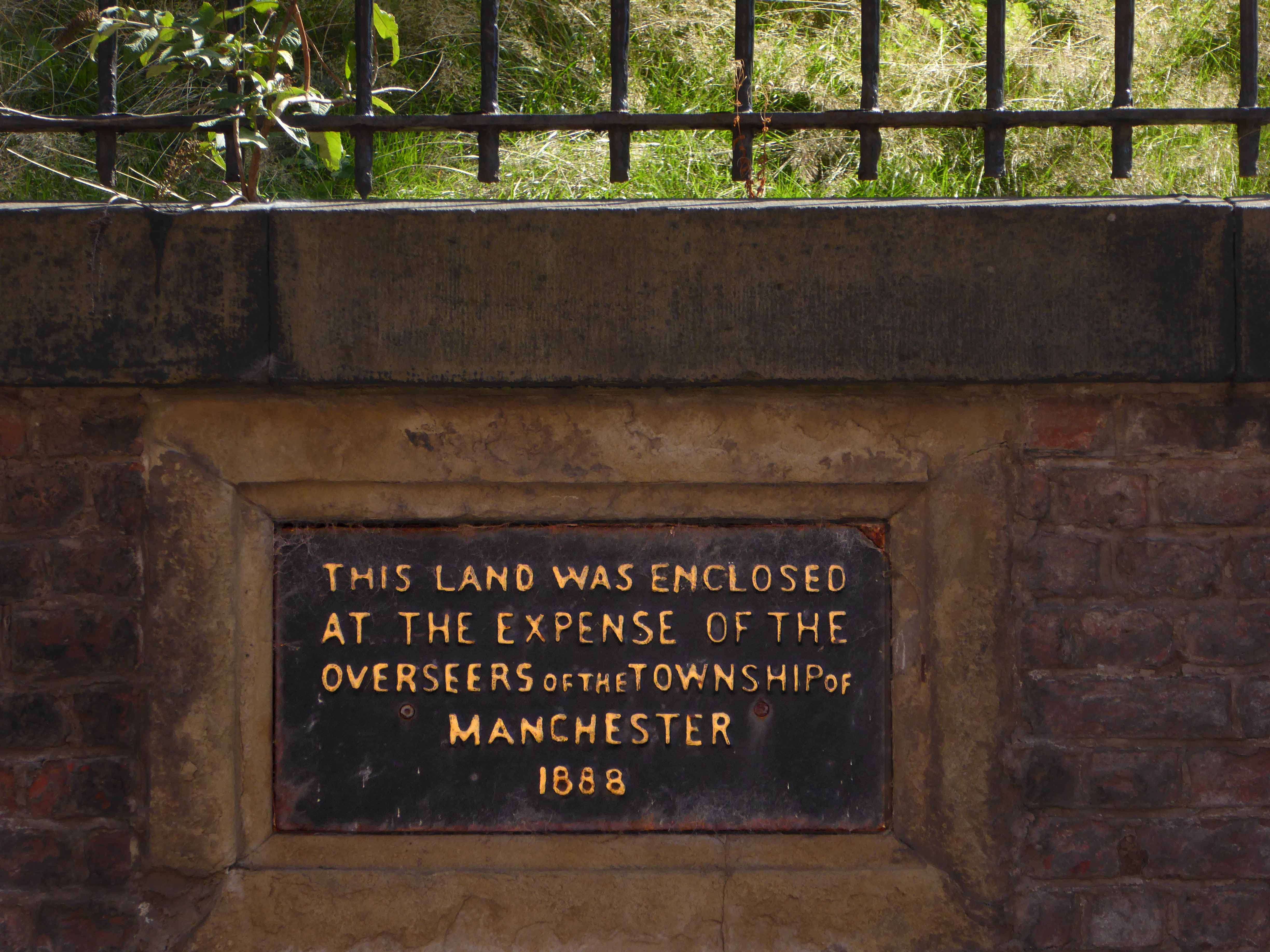
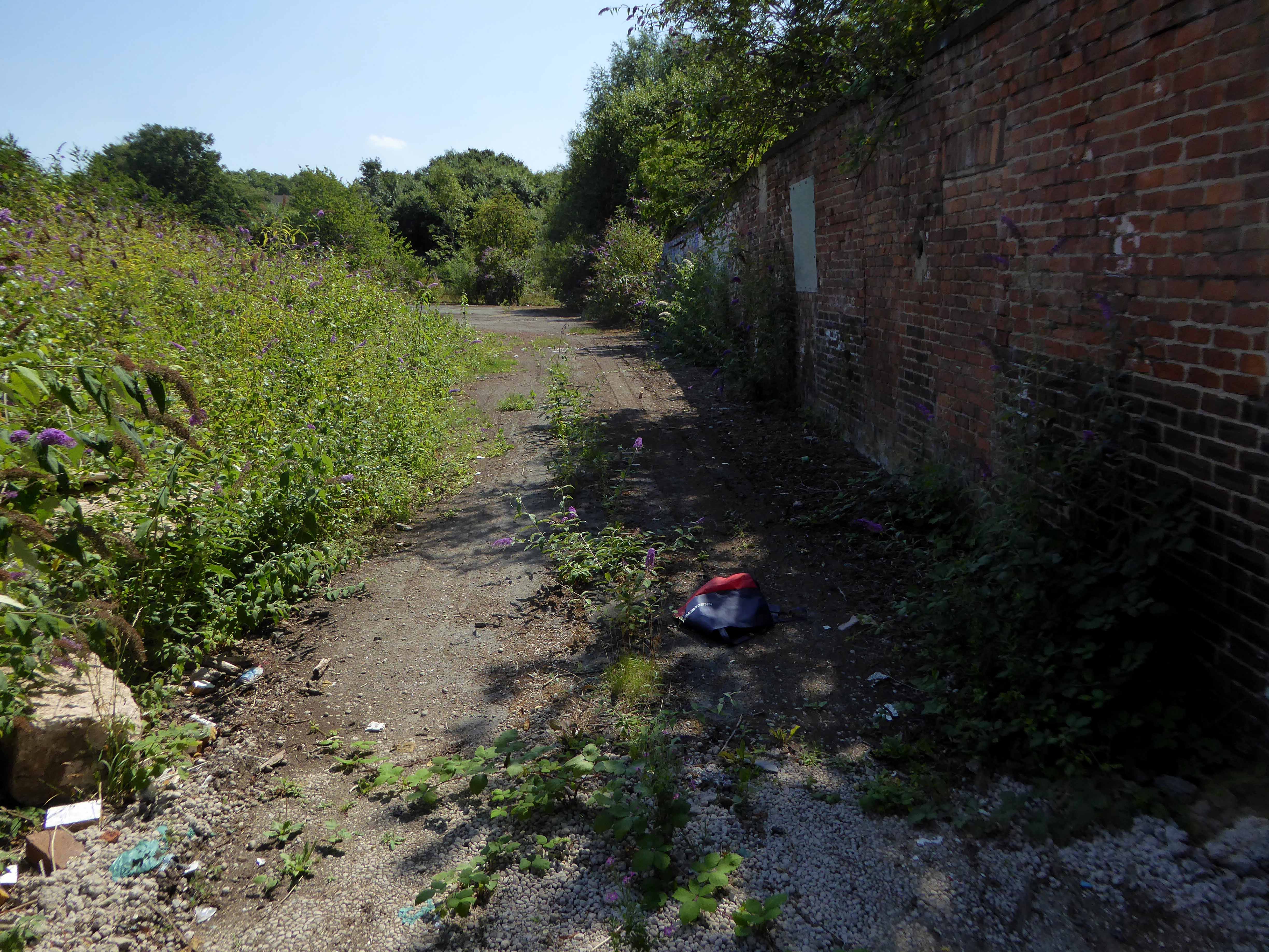
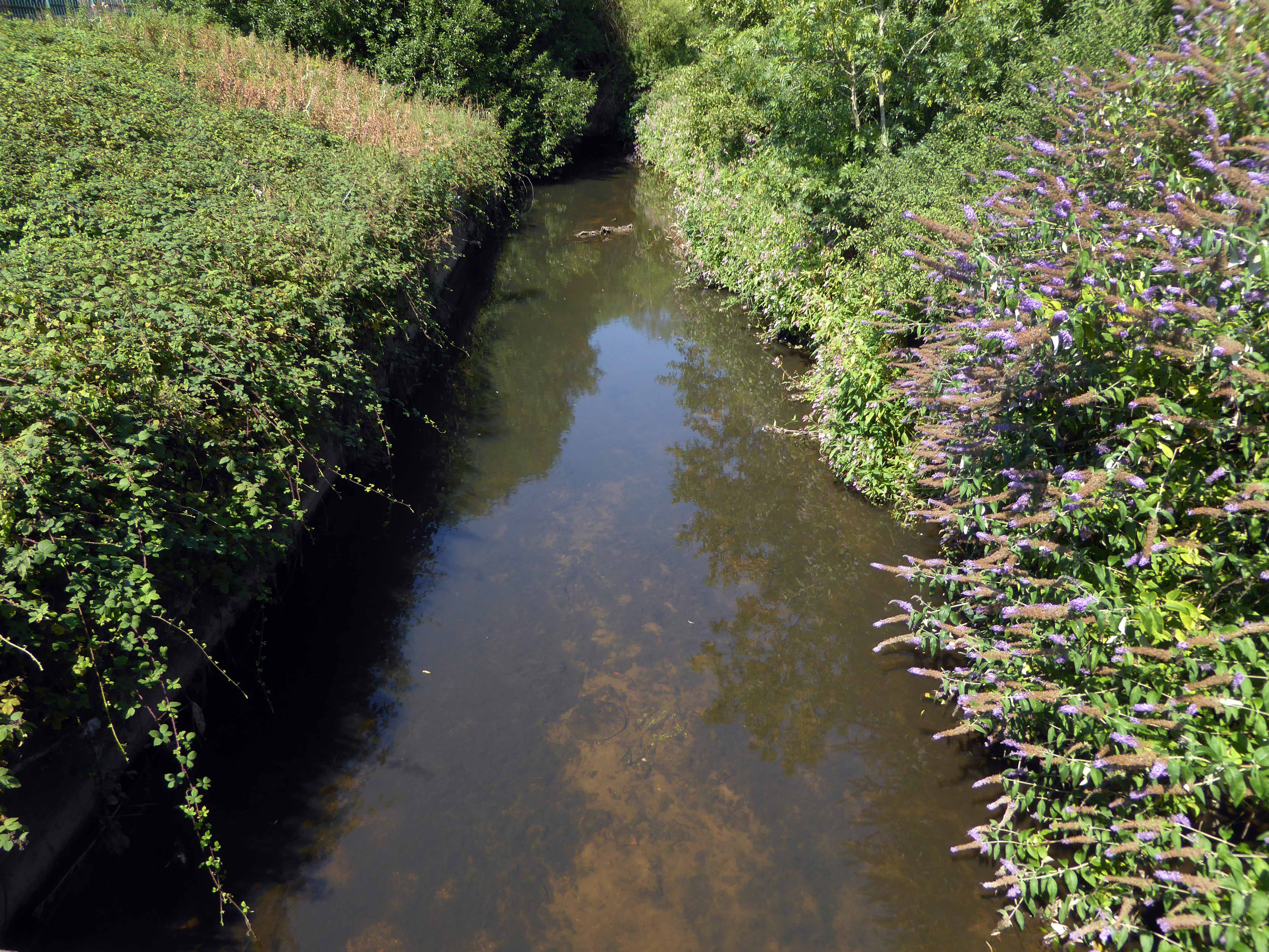
Whole histories have subsequently been subsumed beneath the encroachment of buddleia, bramble, birch and willow.
The land now stands largely unused and overgrown, awaiting who knows what, but that’s another tale for another day.
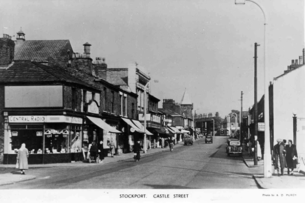
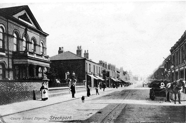
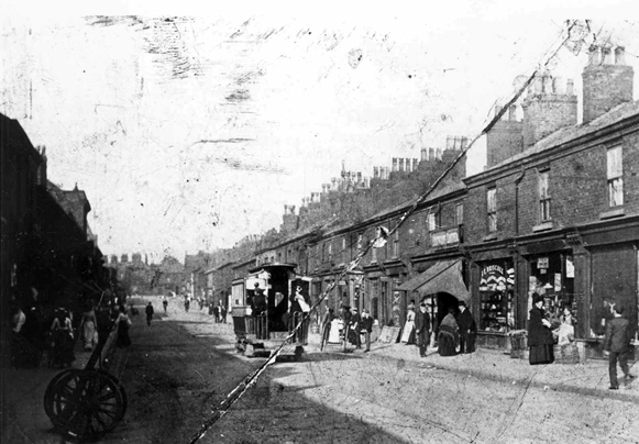
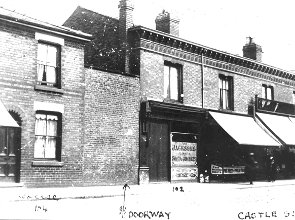
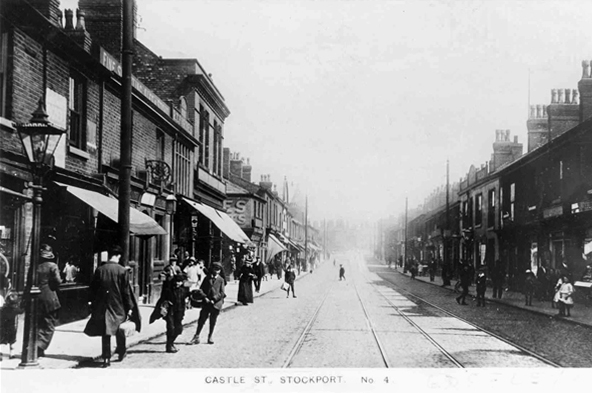
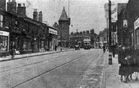
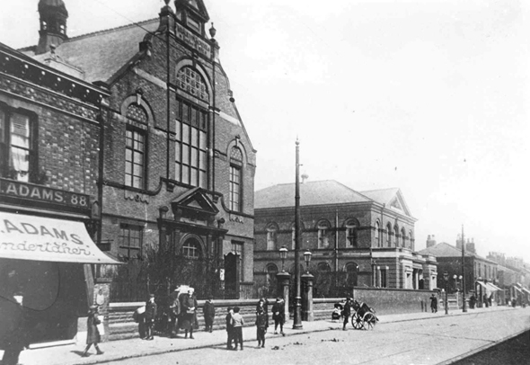
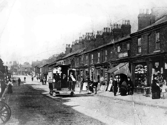
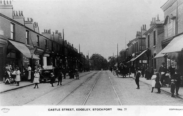
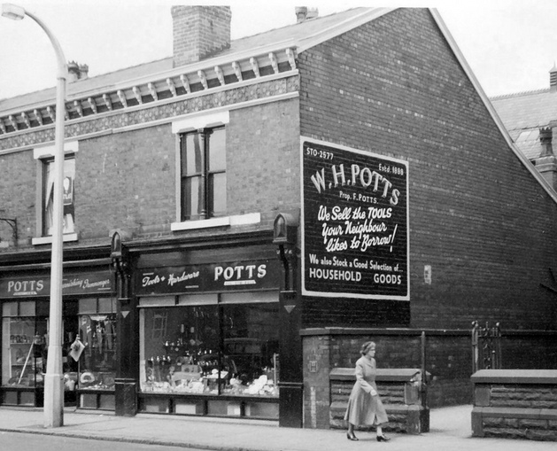
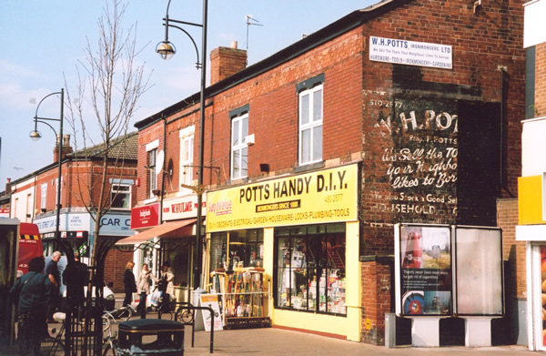
I have shuffled and shopped up and down Castle Street for some forty years or so – things have come and things have gone – and continue to do so. High streets have always been subject to so many external forces, they reshape and reform, in rhythm with the times and tides of history.
Horse drawn carriages and trams are long gone, along with the double-decker bus, people powered people rule in a pedestrianised precinct, charity begins at Barnardo’s, the Co-op has been and gone and returned, just up the way.
Two whole chapels, pubs and cinemas seem to have just disappeared.
So let’s take a short trip through time and space along a short strip of Stockport’s past.
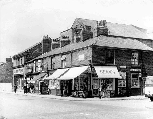
To begin at the beginning or thereabouts, Taylor Street was at the heart of Gorton to the east of Manchester city centre.
A typical street of tightly packed brick terraces, dotted with shops, pubs, people and industry. I worked there as van lad for Mother’s Pride bread back in the 70s and saw those shops, pubs, people and industry slowly disappear.
Beyer Peacock whose immense shed dominated the northern end of the street, simply ceased to be, as steam gave way to diesel.
As full employment gave way to a date with the dole.
Adsega opening on nearby Cross Street heralded the arrival of the super fast, self-service supermarket, and sounded the death knell of the cosy corner cupboard.
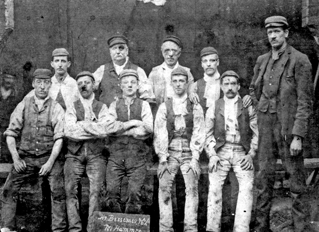
The local pub was The Bessemer – its name forging an unbreakable link with the surrounding steel industry, that eventually broke.
To the left of the pub is the Bishop Greer High School construction site – the first of the new build that would later dominate the area, along with wide open spaces where shops, pubs, people and industry once were.
When the school eventually shut its doors, it became an annex of Openshaw Technical College, and I found myself working there in the 80s at the East Manchester Centre, until its eventual closure.
It’s now sheltered accommodation for the lost and lonely:
Located in a quiet suburb of Manchester with excellent links to the city centre, Gorton Parks has an exceptional range of facilities spread out across five separate houses, each offering a different care option. Melland House offers dementia residential care, Abbey Hey provides nursing dementia care, Debdale is the house for intermediate nursing care and Sunny Brow offers general nursing care.
We sought solace in The Pineapple.
The streets were trimmed and slimmed, much of the past a mere ghostly presence, almost imprinted on the present.
A brave new world of brand new modern housing, with an Estate Pub to match.
A busy bustling boozer – lots of live and local action for the lively locals, latterly seeing out time as a house of House – a real bangin’ Bashment, bass-man bargain basement.
Until time is finally called – no more four to the floor, last one out shut the door.
Nothing lasts forever and a sign of the times is an upended pub sign, lying dormant in the dust.
The Chunky no longer a great big hunk o’funk.
The big screen TV forever failing to deliver all the action, live or otherwise.
Latterly transformed into Dribble Drabble.
And so the beat goes on as successive waves of success and recession, boom and bust free-market economics, wash over the nation and its long suffering folk.
Time changes everything except something within us which is always surprised by change.
A delightful interwar pub on the corner of Heaton Lane and Wellington Road North, I moved to Stockport some forty years ago and was mightily impressed by the restrained exterior Deco design, wrought and hewn from soft pale sandstone. Equally impressive was the wood panelled, open, spacious interior space.
The George was always something of an anomaly, being the only Greater Manchester pub owned by Higson’s Brewery, our almost next door Liverpool neighbour.
Higsons was founded in 1780 – 1974 saw the brewery merge with James Mellor & Sons. In 1978, Higsons acquired the Bent’s Brewery, which was based next to its North Street head office. Boddingtons of Manchester acquired Higsons in 1985 but decided to abandon brewing in 1989 to focus on its pubs.
Boddingtons’ brewing arm was sold to Whitbread in 1990 which then subsequently closed the Higsons Stanhope brewery and then reopened by new owners as the Cains Brewery in 1991. Higsons beer was brewed in Sheffield and Durham for a few years after closure before being discontinued. The beer brand was revived in the current century and reborn in 2017, now served in the swish Baltic Triangle based Higson’s Tap & Still with an interior order that leaps backwards head first, into an imagined future of raw brick, reclaimed wood and industrial flourishes.
The George prospered – a town centre pub surrounded by workers in search of a wet and shoppers shirking their retail duties in favour of draught bitter or Cherry B.
Its interior however did not fair so well, ripped out in the 80s – remade remodelled, in the deeply unattractive, anti-vernacular, sub-disco style de jour.
Renamed The Manhattan, riding the fun-pub wave, closed reopened as The George – there followed thirty year of uncertainty, struggling to find an identity throughout a time of ever-changing moods.
It became a daytime haunt of the hardened, shattered glass, blood on the tracks class of drinker, its reputation in tatters along with yesterday’s fish and chip papers.
The last time I came by you were still open for business.
I bided a wee while, without imbibing, all the better to record your disabused Art Deco details.
I came by yesterday and you were all tinned-up with nowhere to go.
Premises To Let as of 13th May 2018 – on the 2nd April 2018 the licence has lapsed, so this will be a further barrier to it re-opening.
And so your faux nowheresville interior will pass into yet another of somebody’s history, along with your fine Deco detail and disco destruction.
This a tale of our age – of monopoly capitalism, stay at home Bargain Booze tipplers, demographic shifts, de-populated town centres, fashion fads and cheap cladding.
Time changes everything except something within us which is never surprised by change.
And so our journey continues, leaving behind the semi-detached haven of East Didsbury.
Once again graciously greeting Mr Henry Simon and his wondrous footbridge across the Mersey – the greenest of structures on the greyest of days.
No more fords and/or ferries, say goodbye to wet feet.
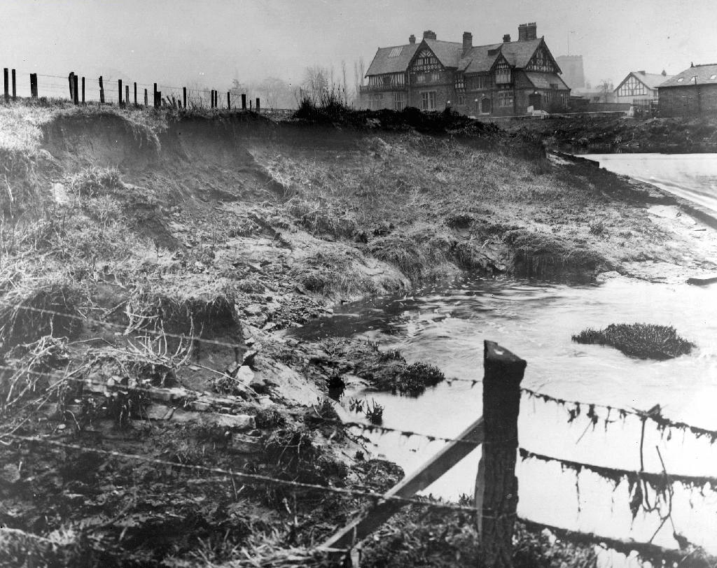
We are down by the river, a place of pleasure and practical workaday goings on – on our way to Northenden.
Northenden was mentioned as Norwordine in the Domesday Book of 1086; its name came from Anglo-Saxon Norþ-worþign – north enclosure. It was then a small farming community with a manor house and woodland.
Northenden is on a major crossing place of the Mersey on the salt road from Cheshire to Manchester. The ford was an important way into and out of and into Manchester, in 1745 Bonnie Prince Charlie’s army built a troop-bridge out of big poplar tree trunks where the B5095 now crosses the Mersey, south of Didsbury, in his abortive attempt to seize the crown of England.
The Northenden ford was unusual because its northern and southern ends were not opposite each other, but people using the ford had to wade about 500 feet along the riverbed. The Simon’s Bridge was built at the ford in 1901 to help access to Poor’s Field, and the rent from this field was used by the church to buy blankets and clothes for the needy.
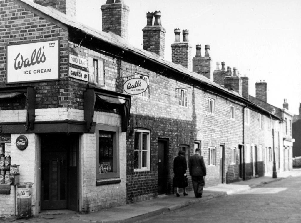
Little is known of Northenden’s Saxon origins other than that it was one of the few disembarkation points on the Mersey flood plain between Stockport and Stretford. A church was recorded here in the Domesday book of 1086. The village has grown in importance since 1641, when a ferry boat for crossing the River Mersey was installed. In 1642 a ford was also constructed, hence the names Boat Lane and Ford Lane. There was a water mill and, it is rumoured, a public house. The plan form of the village was established with properties being built along the two lanes, which intersected near the church.
Little change occurred for the next two centuries until, by the mid 19th century, market gardens in and around the village supplied food for the rapidly expanding population of Manchester. The only routes to the City were via the ferry boat or the ford until, in 1862, Palatine Road was opened and provided a bridge crossing. Northenden was still a rural village and, towards the turn of the century, good quality semi-detached houses were built for clerks and managers who were able to commute to Manchester on the horse-drawn bus and the tram.
In the 1940s the new suburb of Wythenshawe was largely completed, and by then Northenden’s rural character had gone. Palatine Road was developed for shopping and other commercial uses, and slum clearance removed many of the village’s early cottages around the church.
The water mill, which had provided a flour-milling service for a wide area, survived until the 1950s. It was situated on the banks of the Mersey where the weir, to create the change in water level and power the machinery, is still in existence.
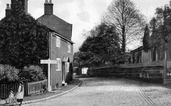
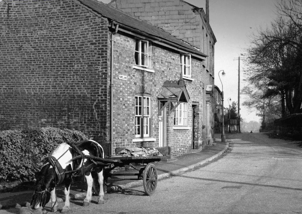
Ford Lane affords a rural route twixt suburban settlements, tree lined and river-run.
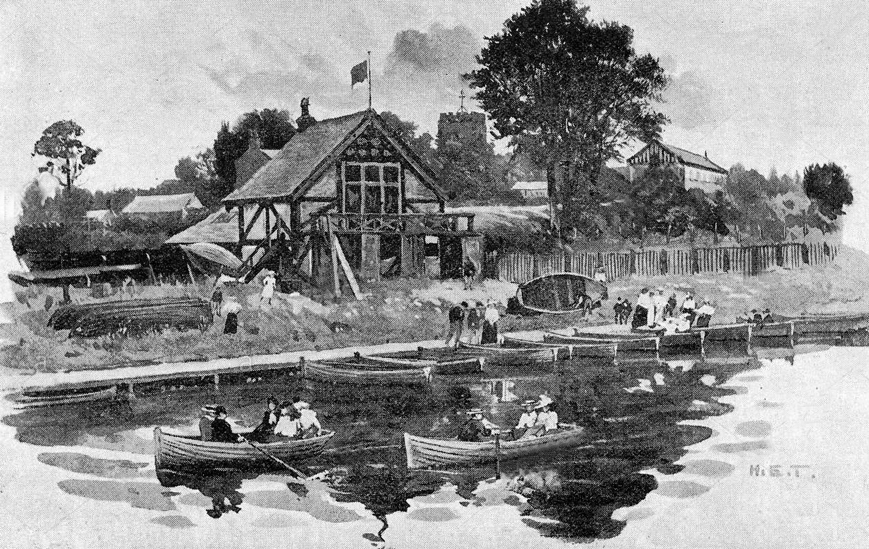
Once the province of pleasure gardens, cruisers, boaters.
And wrestlers.
The lane is home to several listed buildings – the most prominent being St Wilfrids – the oldest part of the church is the tower, the rest having been rebuilt in 1873–76 by J. S. Crowther. The new part of the church is built in sandstone from Alderley Edge, with slate roofs, and is in Perpendicular style.
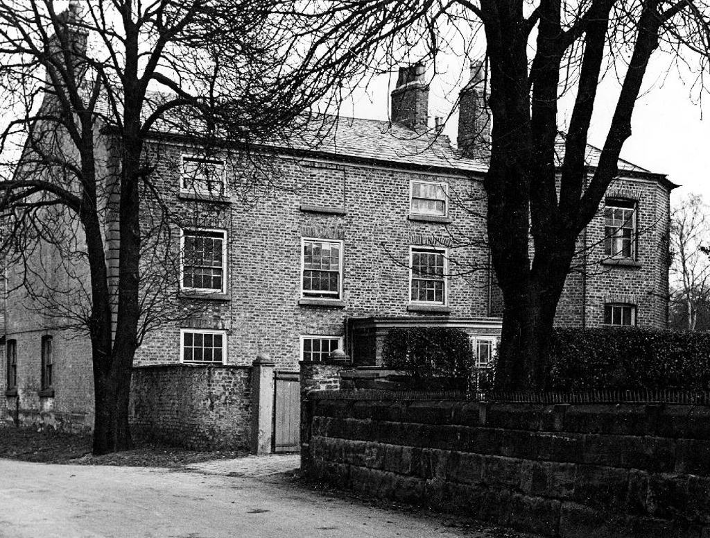
The Old Rectory and Northern House both mid to late 18th century, form a group of notable homes clustered around St Wilfrids.
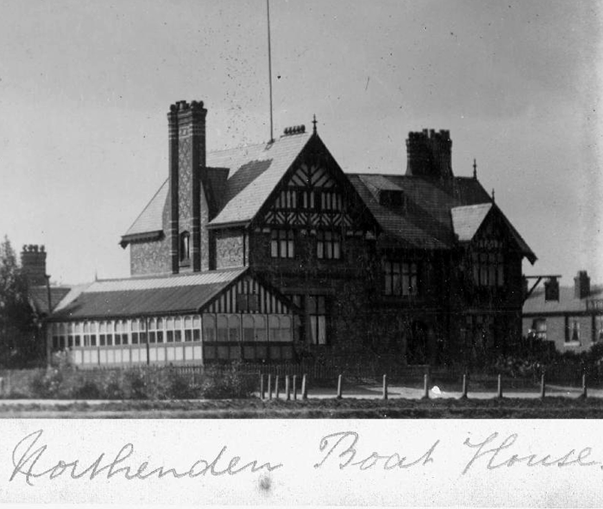
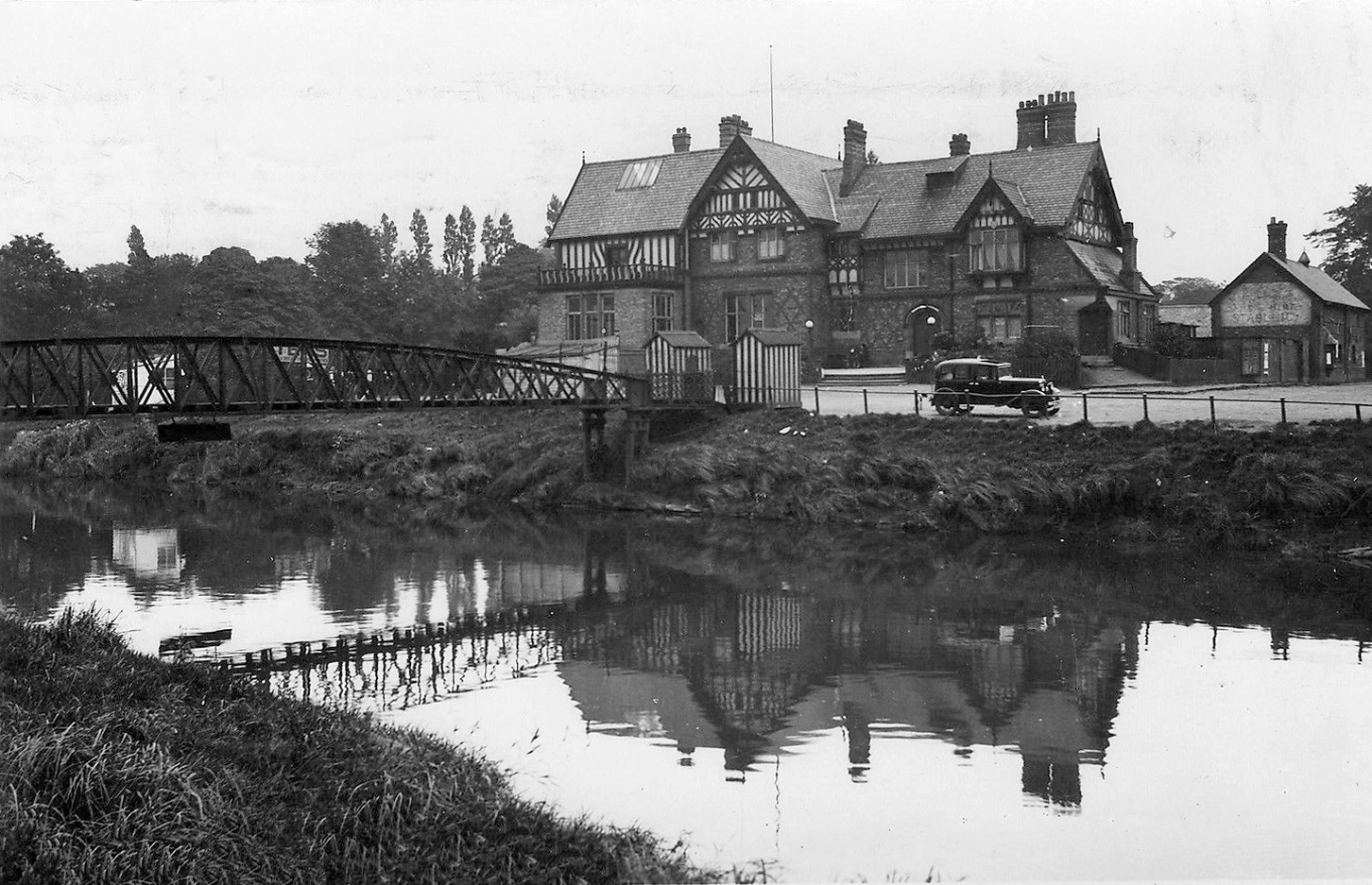
Also in close proximity were a number of public houses – most notably The Tatton Arms.
Built in 1873 by the Tatton family and originally known as The Boat House.
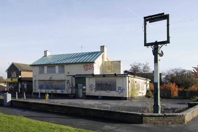
Closed in 2007 and still standing, still awaiting proposed redevelopment into an apartment complex.
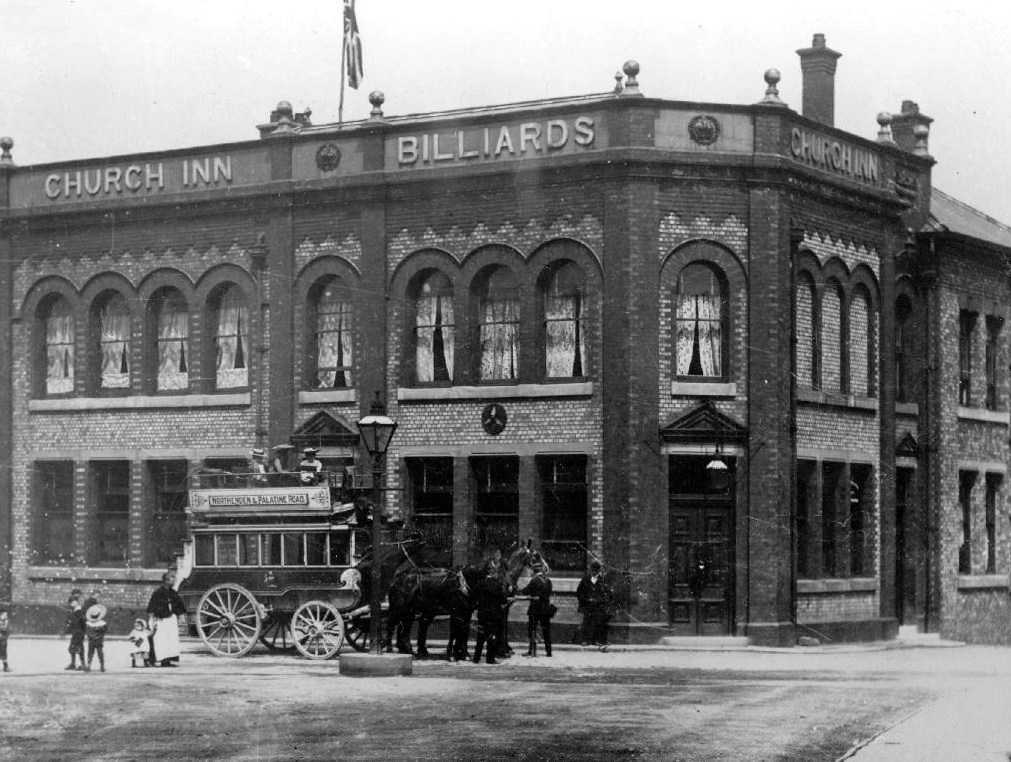
The Church Inn built in 1897 closed in 2006 – burnt out left for dead eventually refurbished into flats.
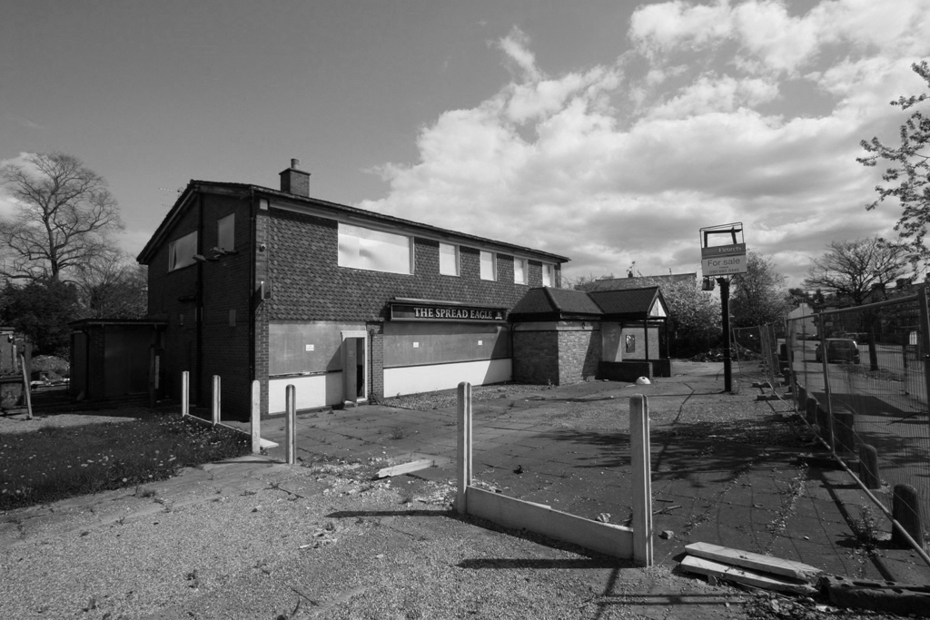
The Spread Eagle built to replace an old pub of the same name, the Spread Eagle was the second estate-style boozer on Royle Green Road, and it outlasted the Jolly Carter by almost a decade – long gone, following a shooting in 2008, the site now developed as housing.
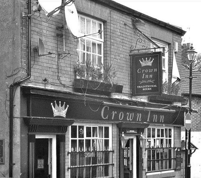
Happily The Crown is still standing and still serving – cyclists and walkers welcome!
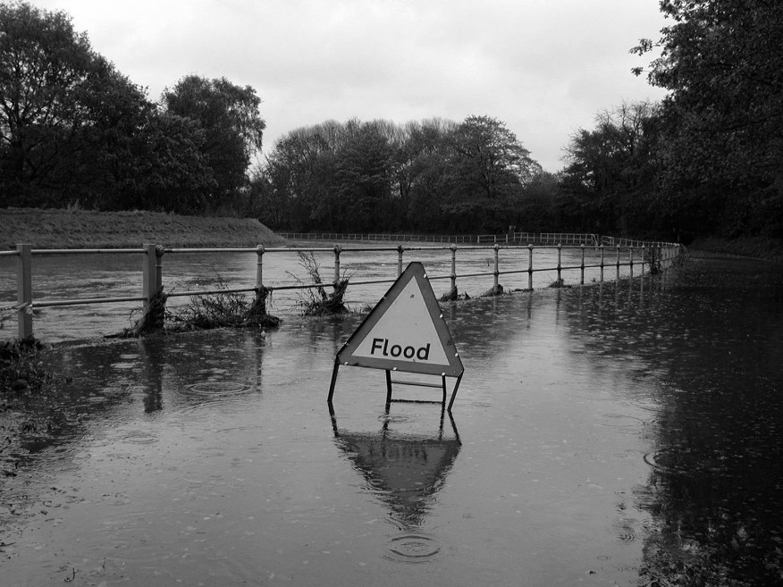
This was once my way to work, Stockport to Northenden each and every day, the river on occasion liable to flood – foolishly I cycled the Mersey in Spate, against the current clinging to the handrail, up to my axles in the raging torrent.
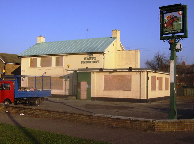
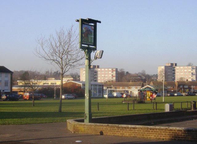
The Happy Prospect, 50 Coronation Square, Reading RG30 3QN
I came here by chance researching Manchester’s Estate Pubs for my blog when up pops The Happy Prospect – what a pleasant surprise!
Having never really visited Reading, this is very much a virtual cut and paste journey through time and space – so apologies in advance for any unforeseen errors.
So let’s see how we got here:
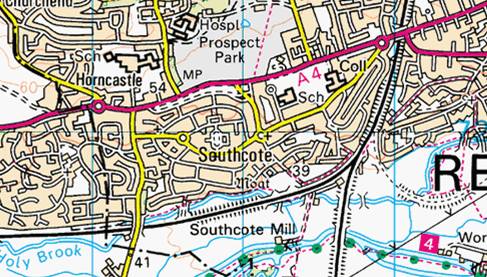
The area was sparsely populated until after the Second World War, though excavations have revealed evidence of Paleolithic and Iron Age activity in Southcote, as well as Roman and Saxon habitation. By the time William the Conqueror undertook the Domesday Survey in 1086, Southcote was sufficiently established to warrant a Lord of the Manor, who at that time was William de Braose. From the 16th century onwards, Southcote Manor was owned by the Blagrave family, who sold the manor house in the 1920s. The area was subsequently developed into housing: much of the land changed from agricultural to residential.
Bucolic scenes of small intimate streets and agrarian activity.
By the advent of World War II, Southcote had begun to experience urban sprawl from Reading and the land bordering the Great Western Railway had begun to be used for housing. Following the war, Denton’s Field on the Bath Road in Southcote was used for celebratory events; Battle of Britain commemorative fêtes were held in September 1949 and 1950, and featured a performance by three Alsatians – Rocky, Lindy and Irma to recognise their work in the war.
Dragged into the ferment of Mid-Century Modernism with the development of new housing, churches and schools.
In the 1950s, a huge building project centred around Coronation Square, named for the 1953 Coronation of Queen Elizabeth II – with hundreds of council houses built to satisfy post-war demand. The residents of many of these had moved from houses in central and East Reading that fell short of sanitation requirements of the Public Health Act 1875, these were compulsorily purchased and later demolished.
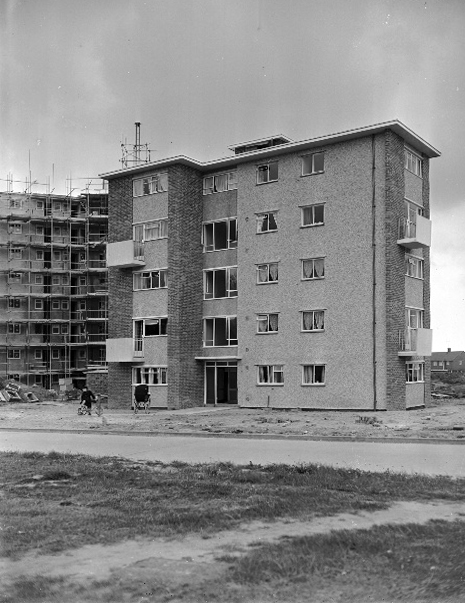
All that was missing was a pub – and so happily the local brewery Simonds built The Happy Prospect.
Architecturally very much in the à la mode manner of the Modernist estate pub, plain well-lit brick, tile and concrete volumes, replete with a low perimeter wall and ample car parking space.
And so for many years the pub prospered – sadly along with so many others of its ilk, the pressures and constraints of social change and economic decline forced closure and demolition despite the protestations of the local community, who fought for its life.
Beverley Doyle, who lives in Southcote, said: “We don’t see the old people anymore because there’s nowhere for them to meet up.They used to be able to come here and play cribbage and cards.There was also Christmas parties and kids’ parties so people could get together and we need something like that again. It was a good pub and we want it back to how it was.”
Campaigner Bobbie Richardson said: “Once you get this place boarded up you wonder what’s going to be next in the community. It starts to look run down and we want to let the owners know Southcote is not a ghetto.”
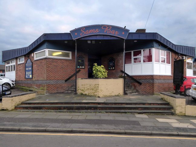
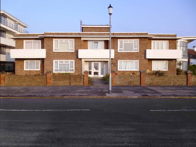
This is the one and only photograph of its former black and white self.
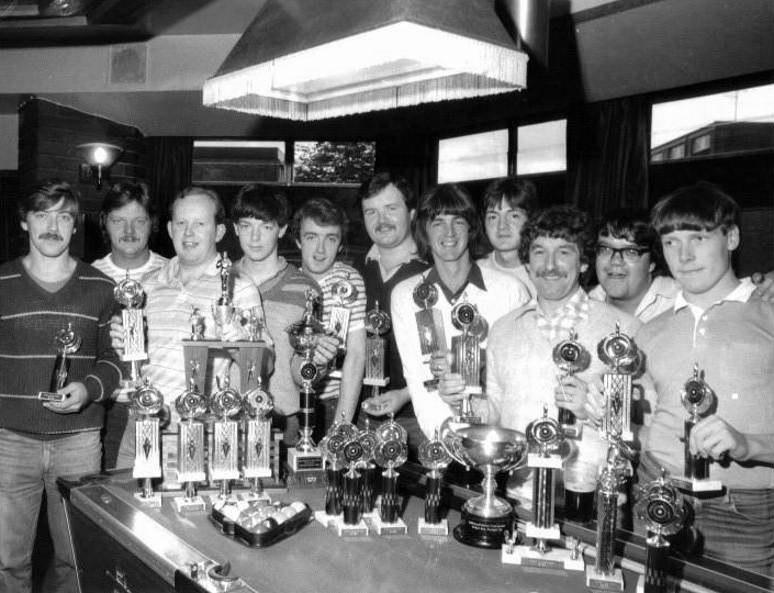
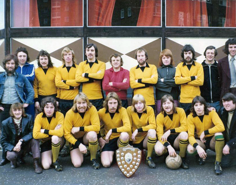
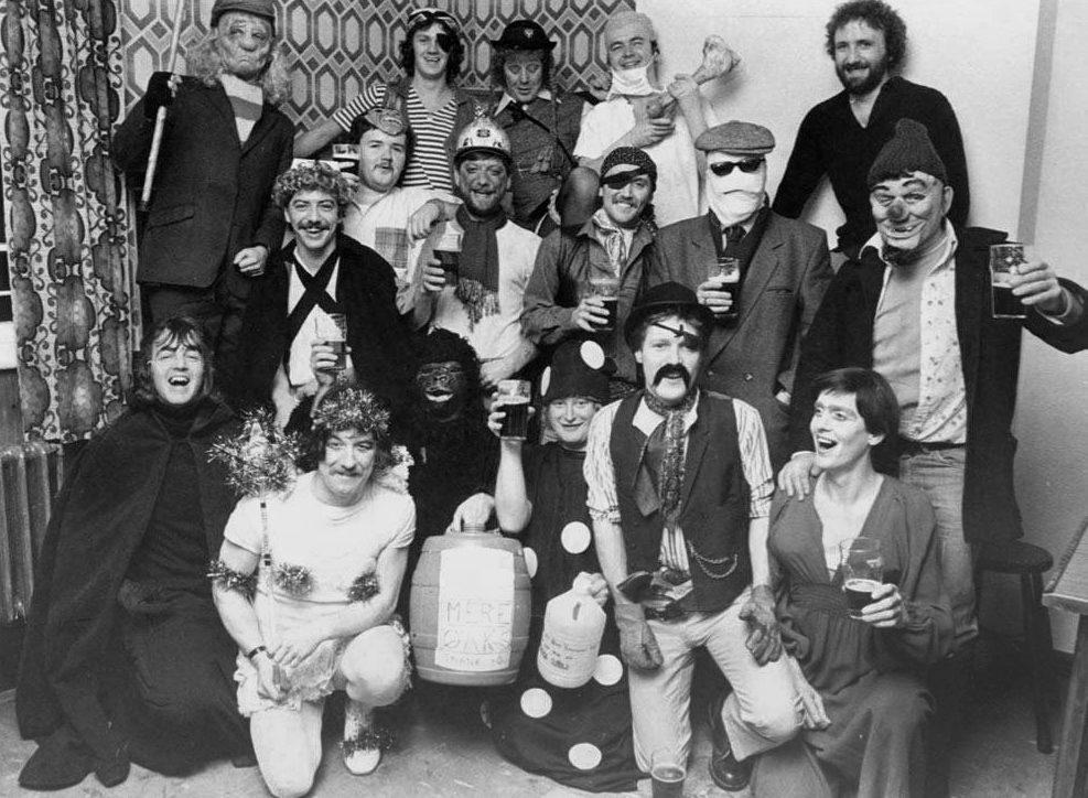
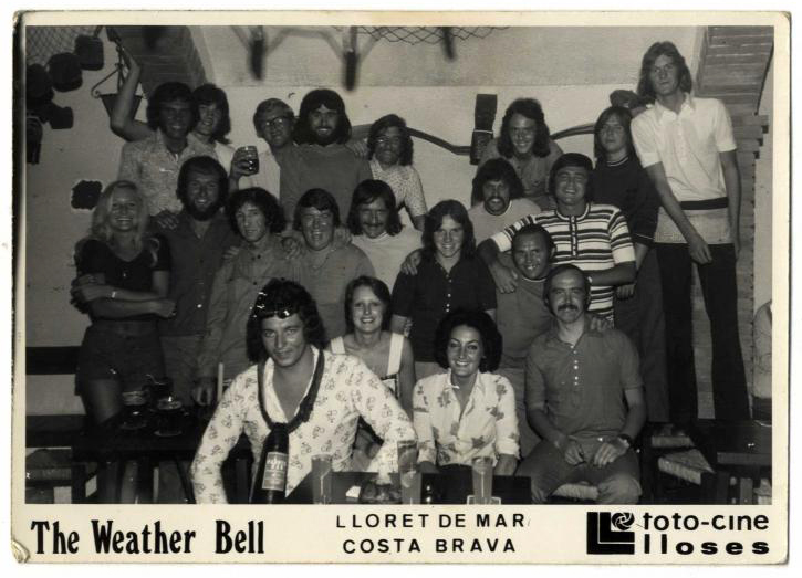
Though an internet search revealed a rich heritage of pool, football, fancy dress and trips to Lloret De Mar, for the lads and lasses of Lower Scholes.
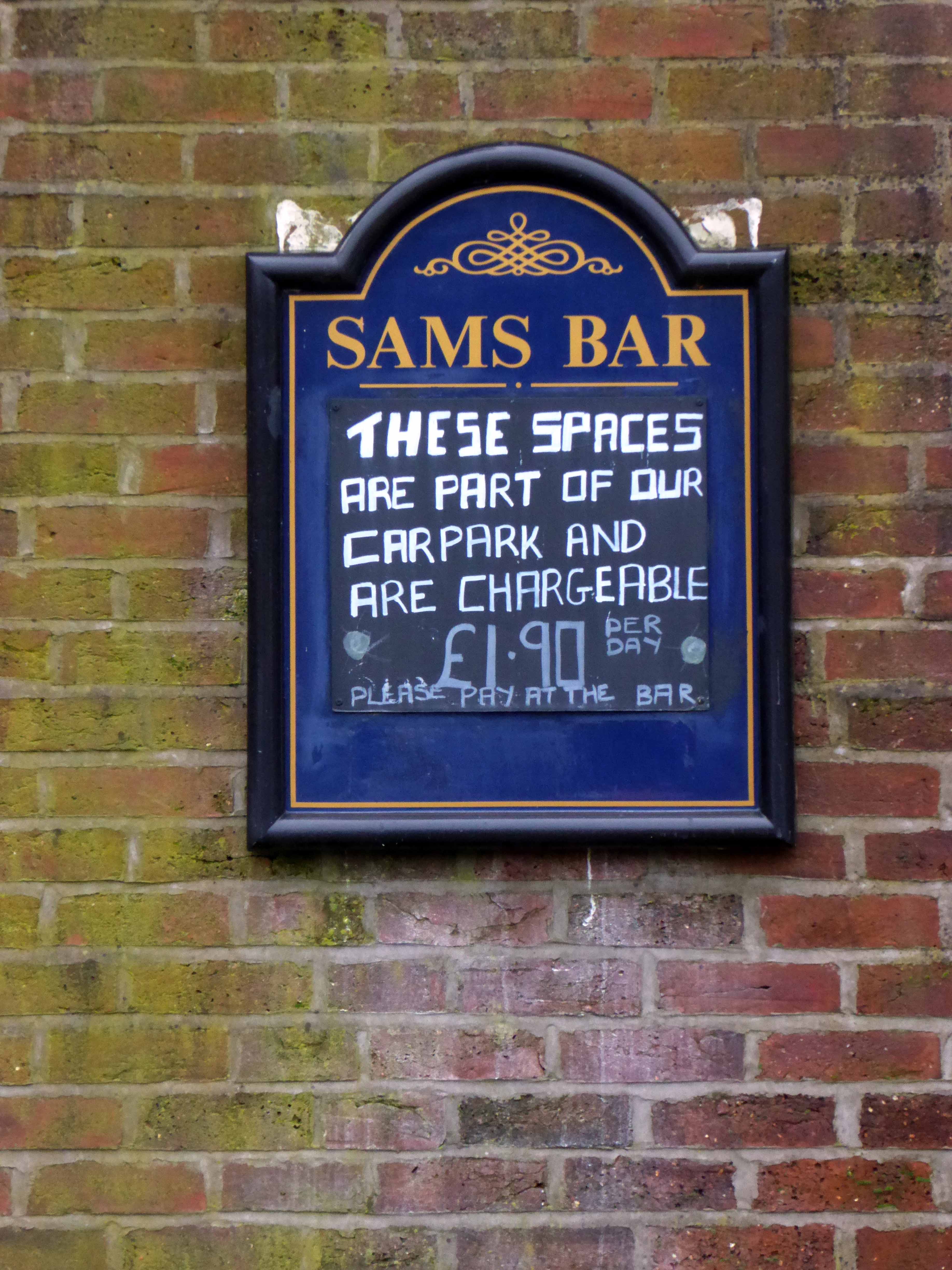
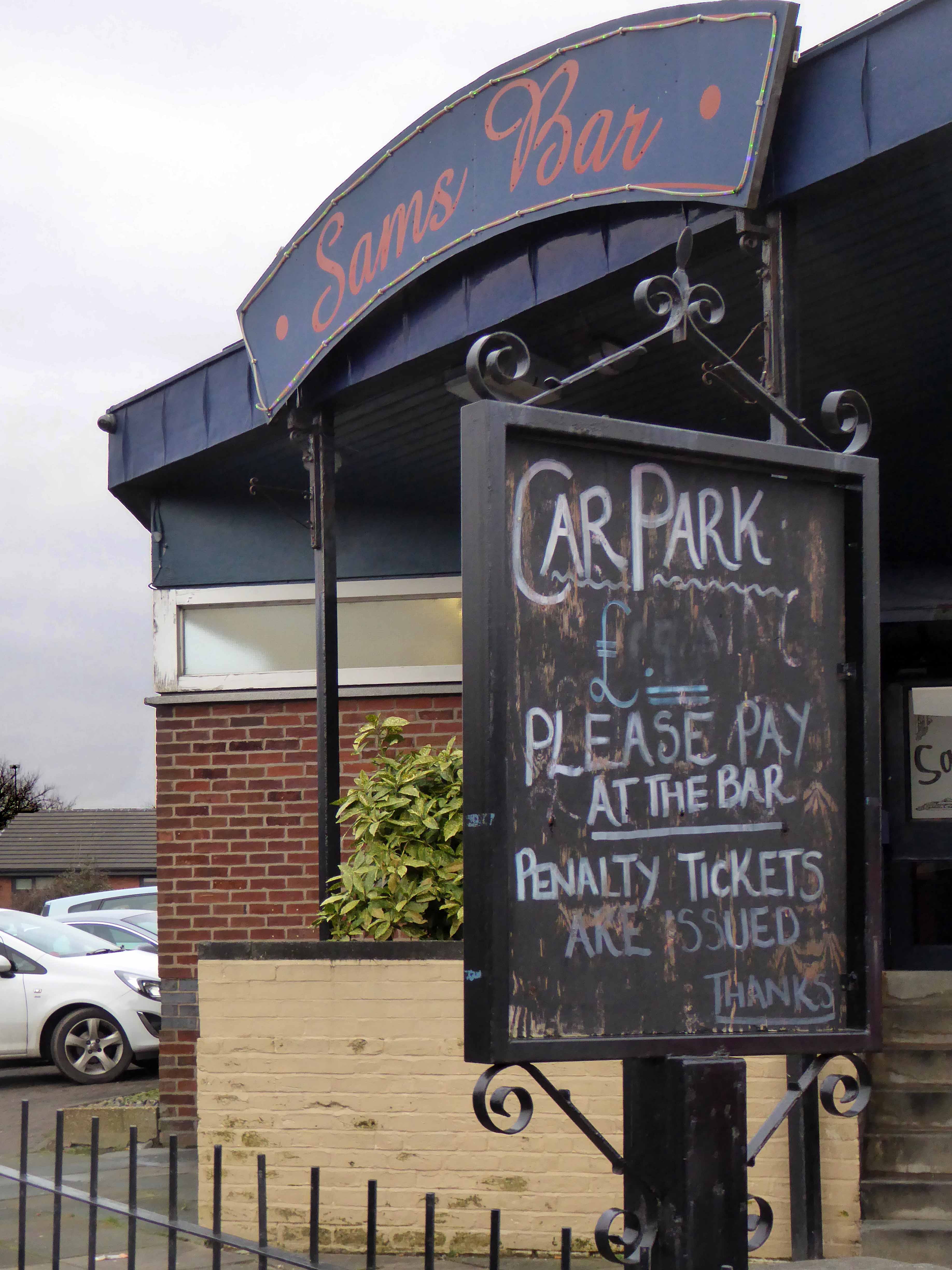
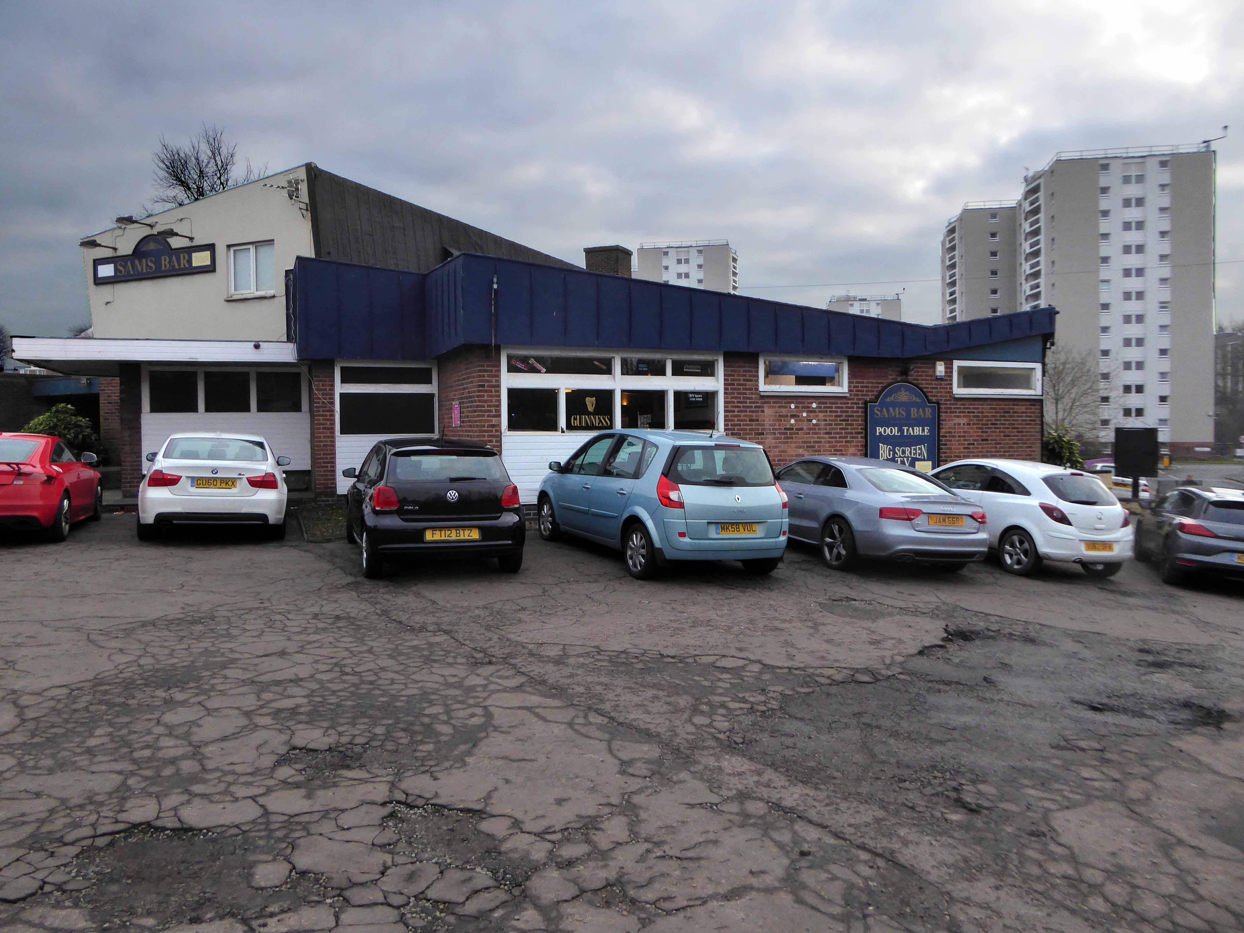
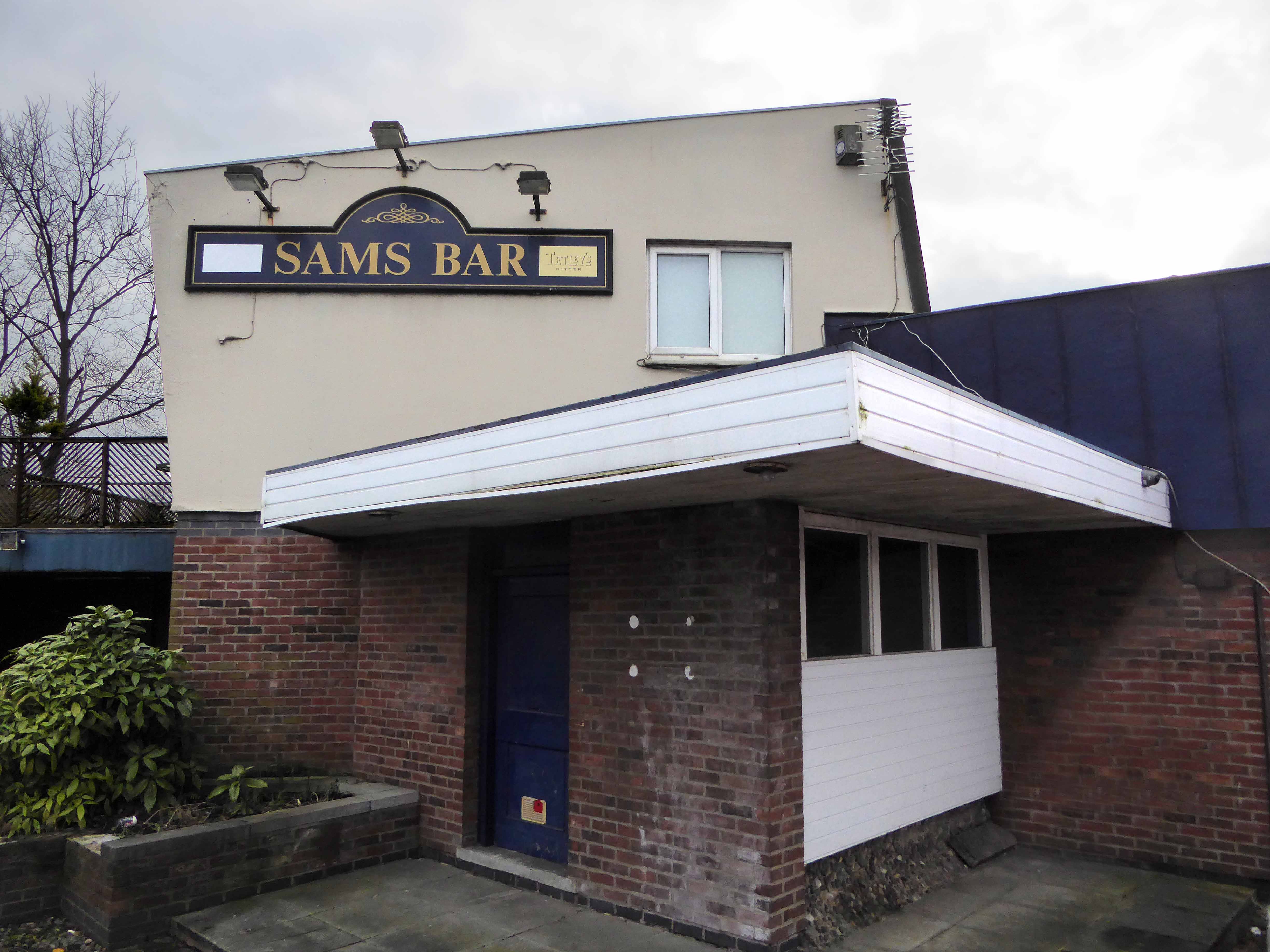
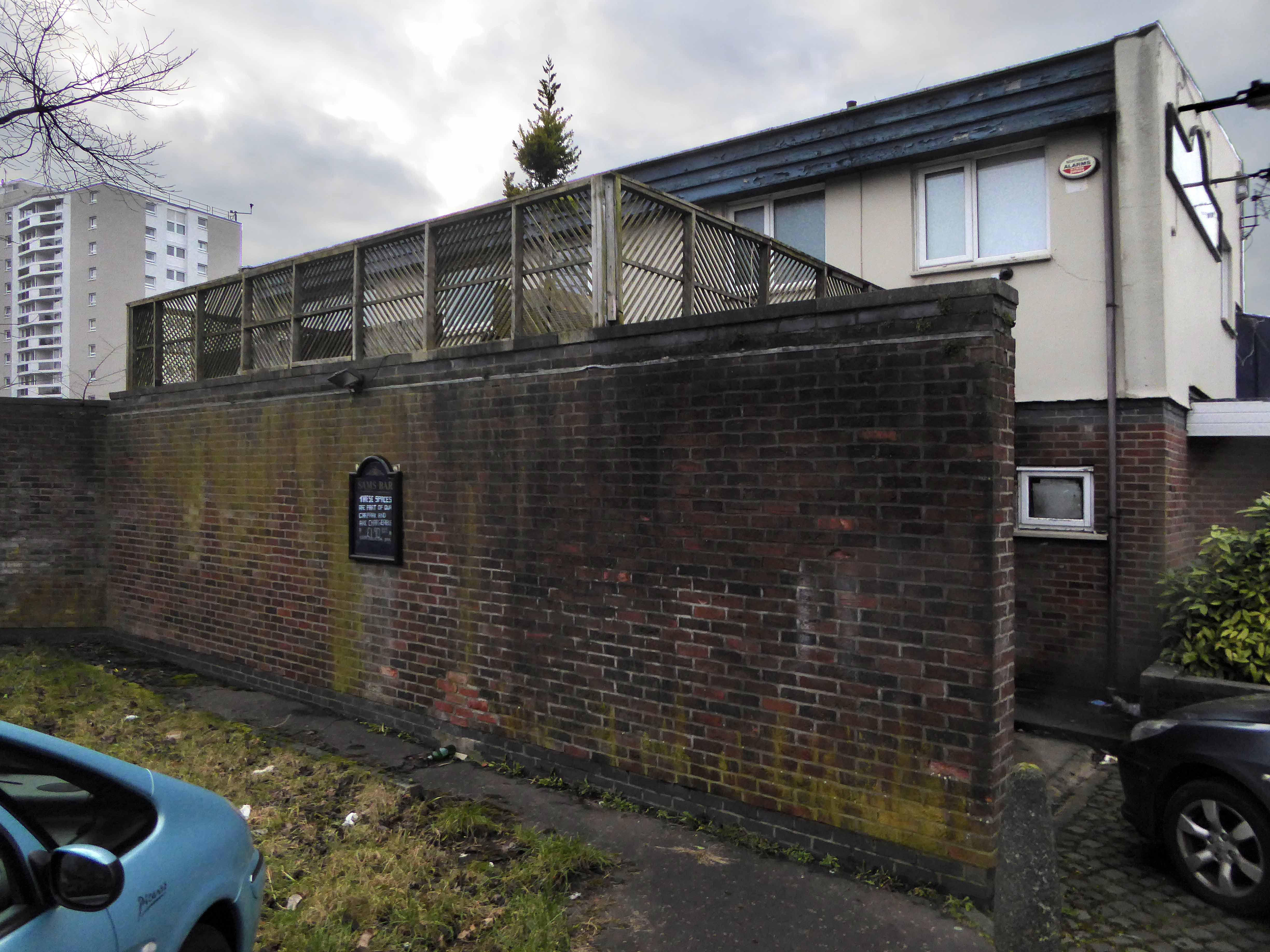
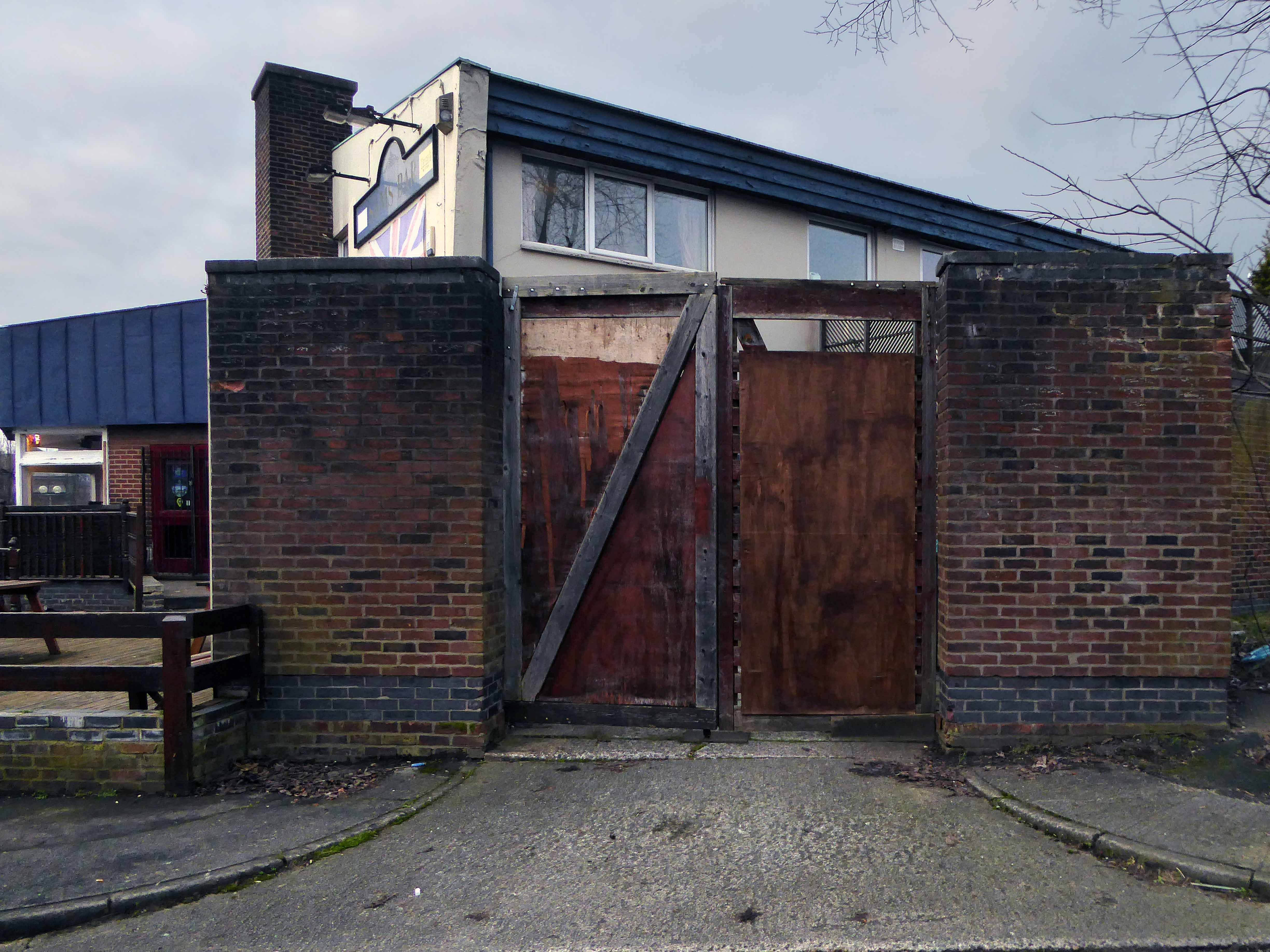
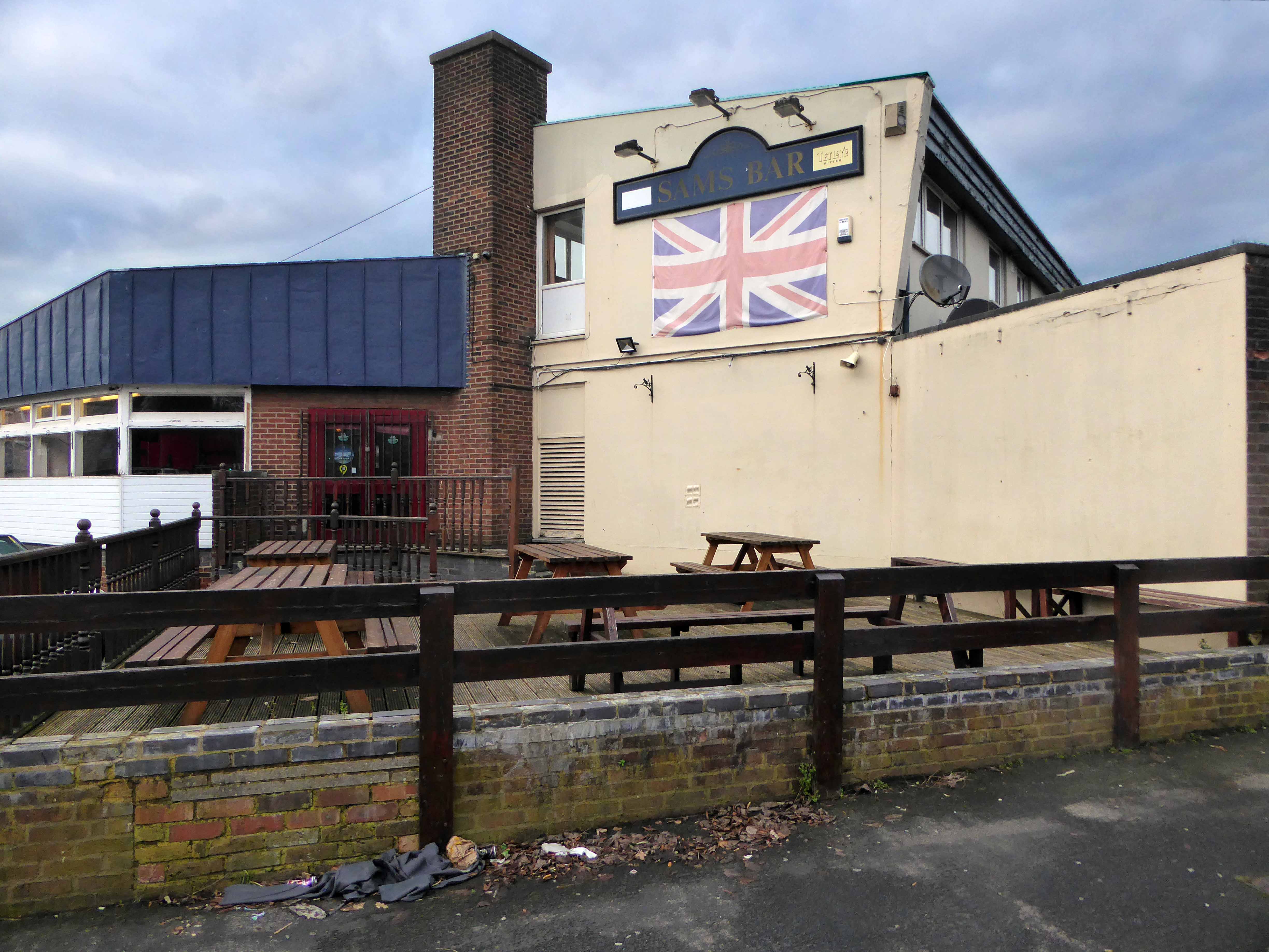
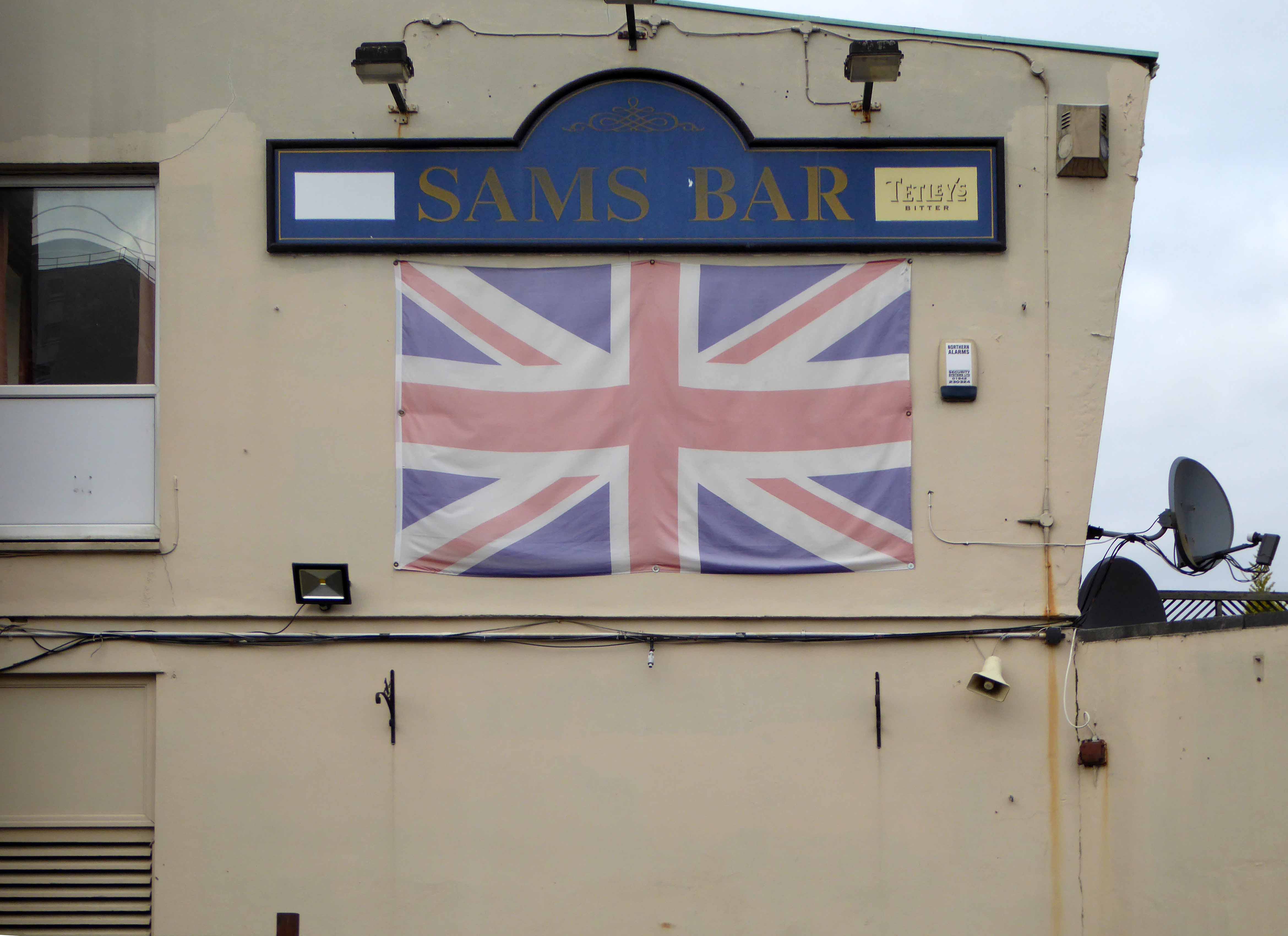
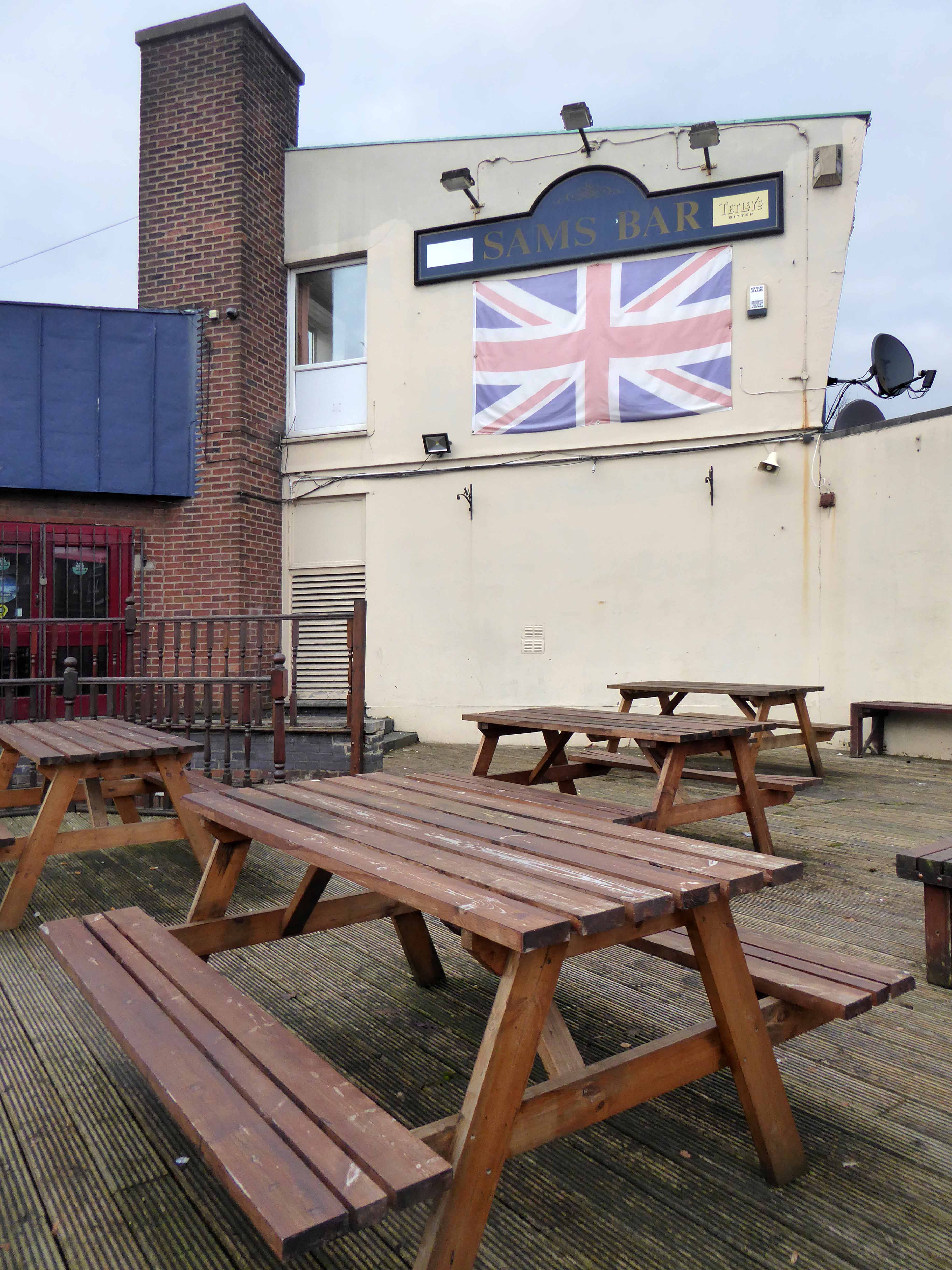
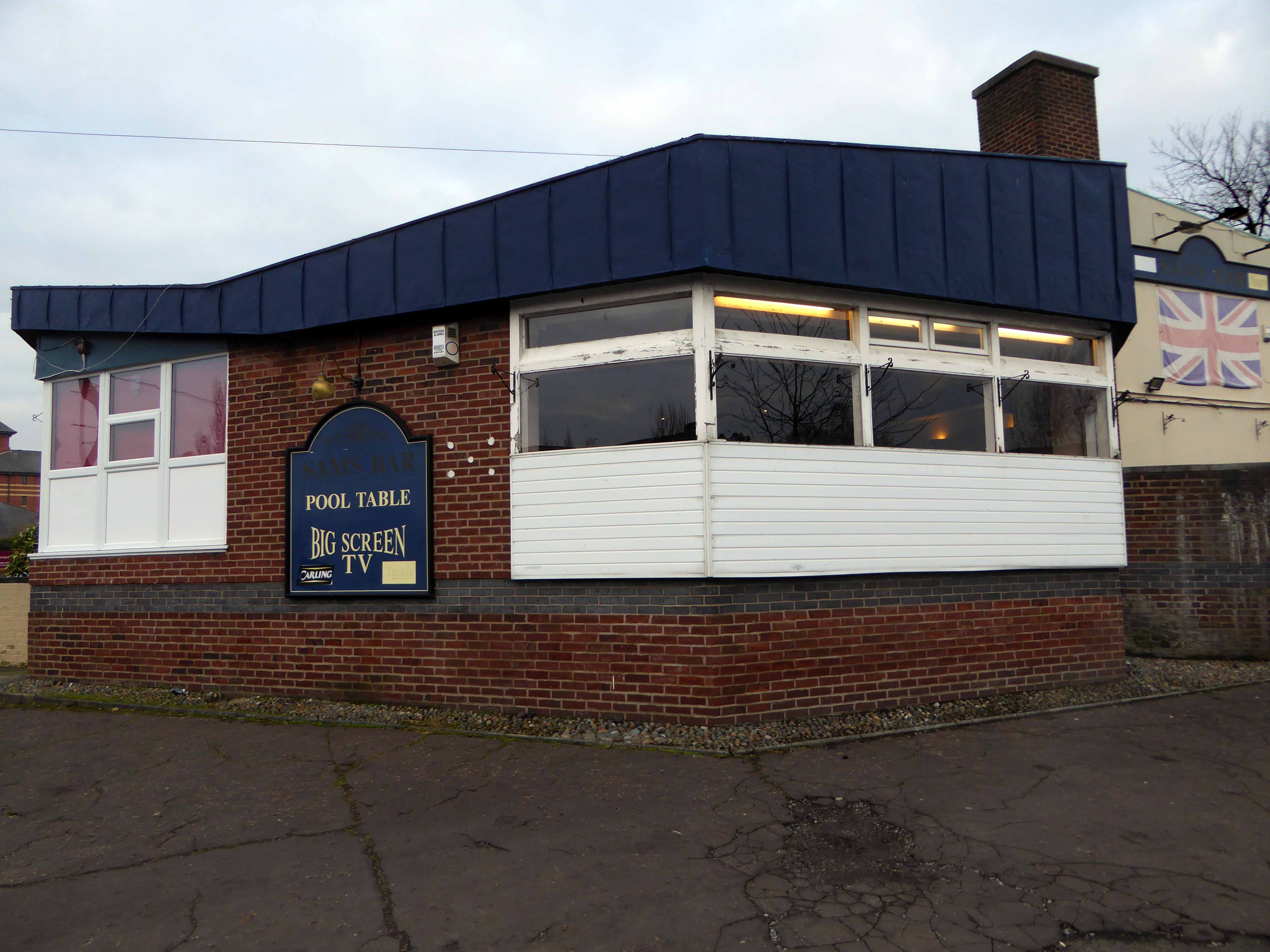
The pub now named Sam’s Bar, has retained its jolly jumble of modernist volumes and angles – though having lost the harlequin panels and off licence. Mid-morning the lights were on and the pub was surrounded by cars taking advantage of the £1.90 a day parking.
The online reviews seem to divide opinion as to the quality of the current provision.
This pub is not a nice place to visit. If your not a regular you get leered at all night, the people and staff are absolutly terrible. You will wait at the bar all night waiting to get served, whilst all the regulars get their drinks. Then and only then will you get yours. You will see a fight at least once a night. Karaoke is only for those of us who are blessed with the ability to sing – they wont let you up again if not. This pub needs knocking down it’s a menace to society, out of 10 a big fat 0.
Solid, dependable and well-run. Friendly bar staff and regulars, local and national newspapers, rugby league memorabilia, jukebox, pool table, and very fair prices. Has been my local for years, ever since I got tired of the landlord turnover at the Cherries. I’ve never seen anyone refused a go at karaoke, including me, and I can’t sing, and rarely pick a song anyone likes. So you carry on spouting tripe, and I’ll carry on drinking at Sam’s Bar Scholes.


![photo[1]](https://modernmooch.com/wp-content/uploads/2018/05/photo1.jpg)