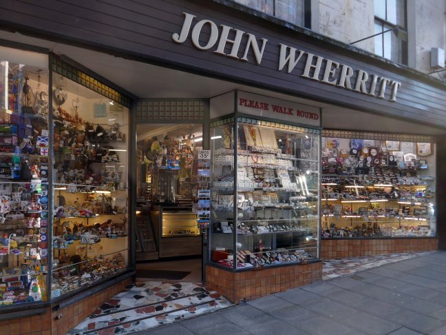
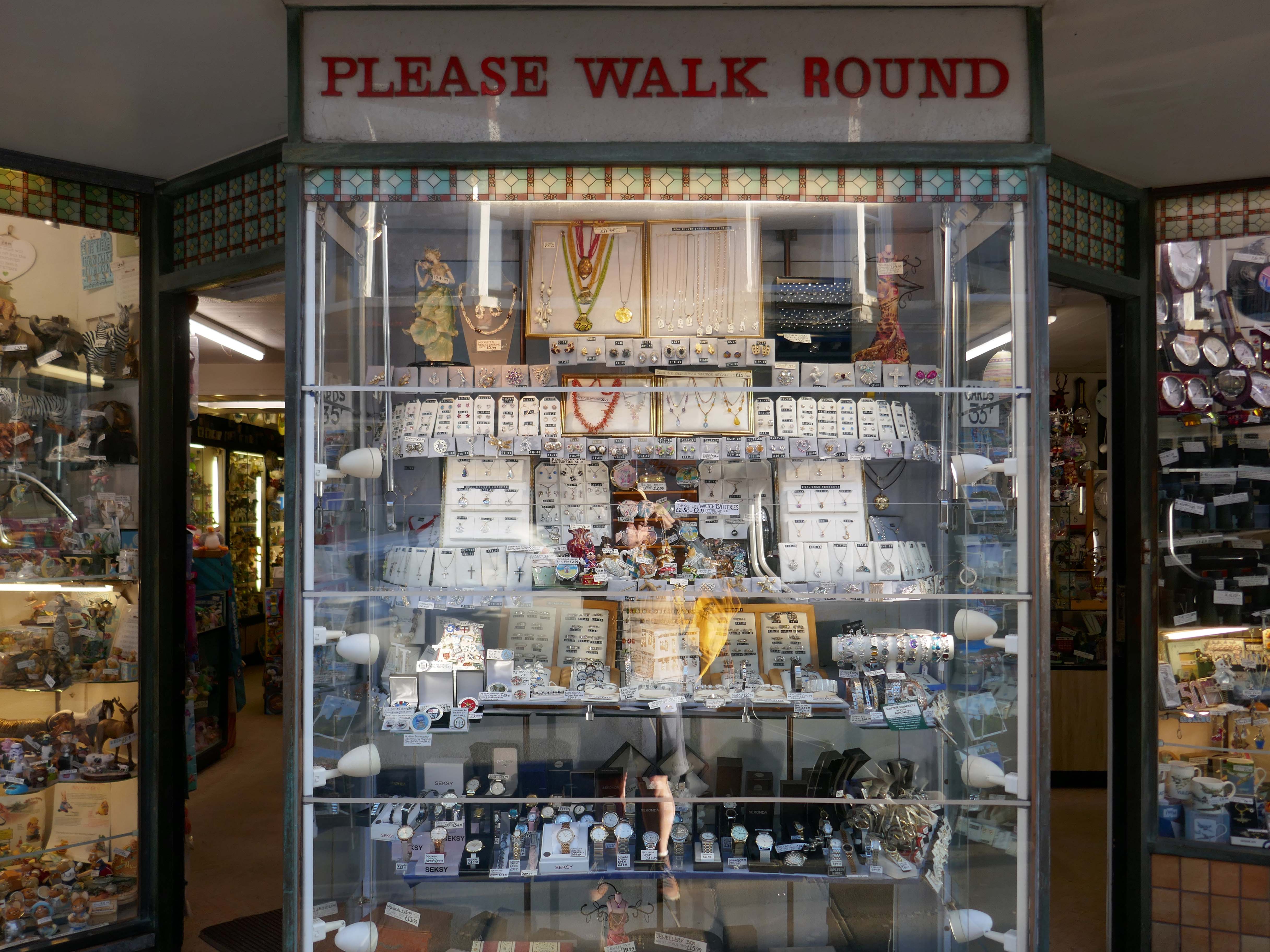
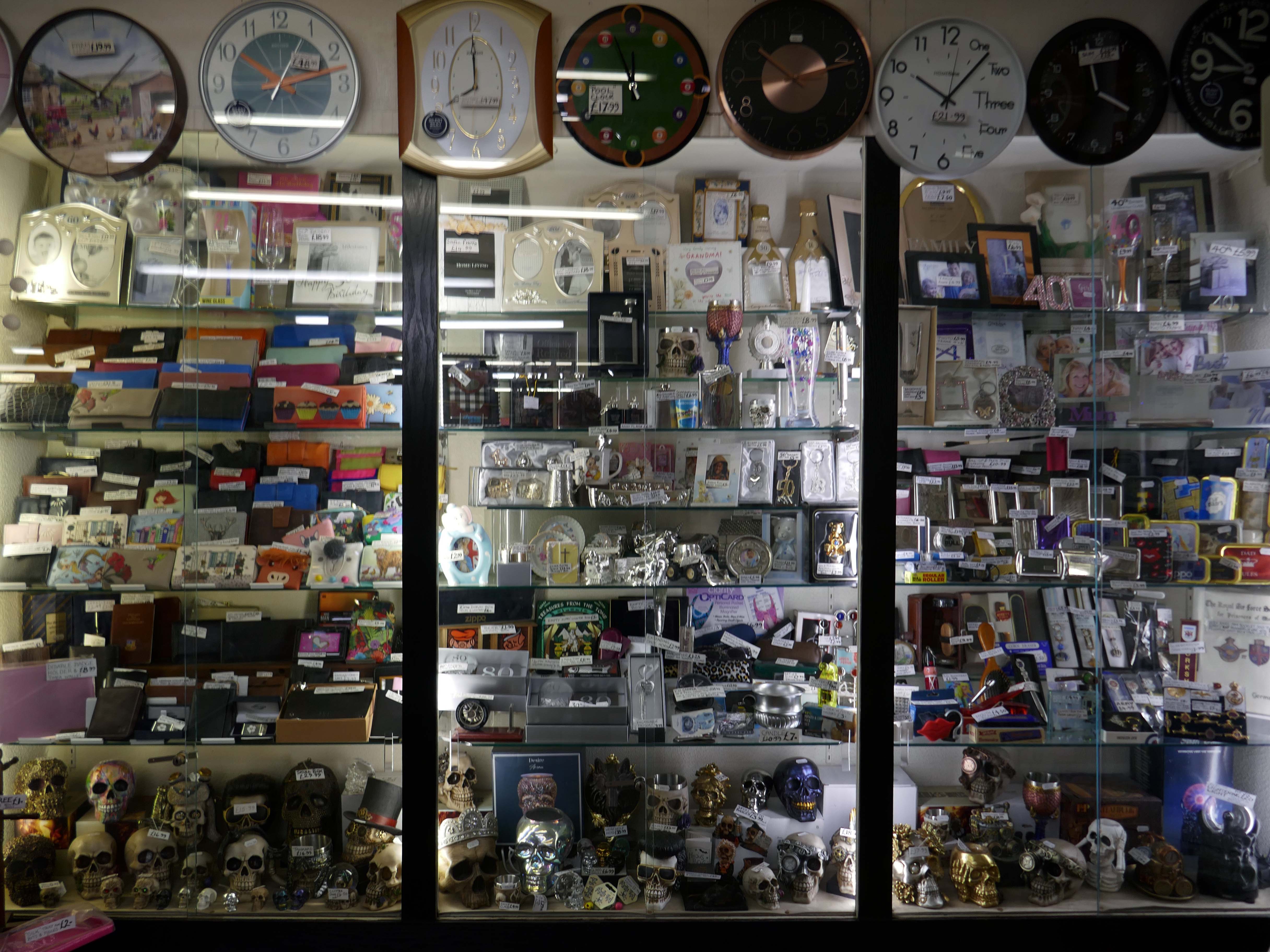
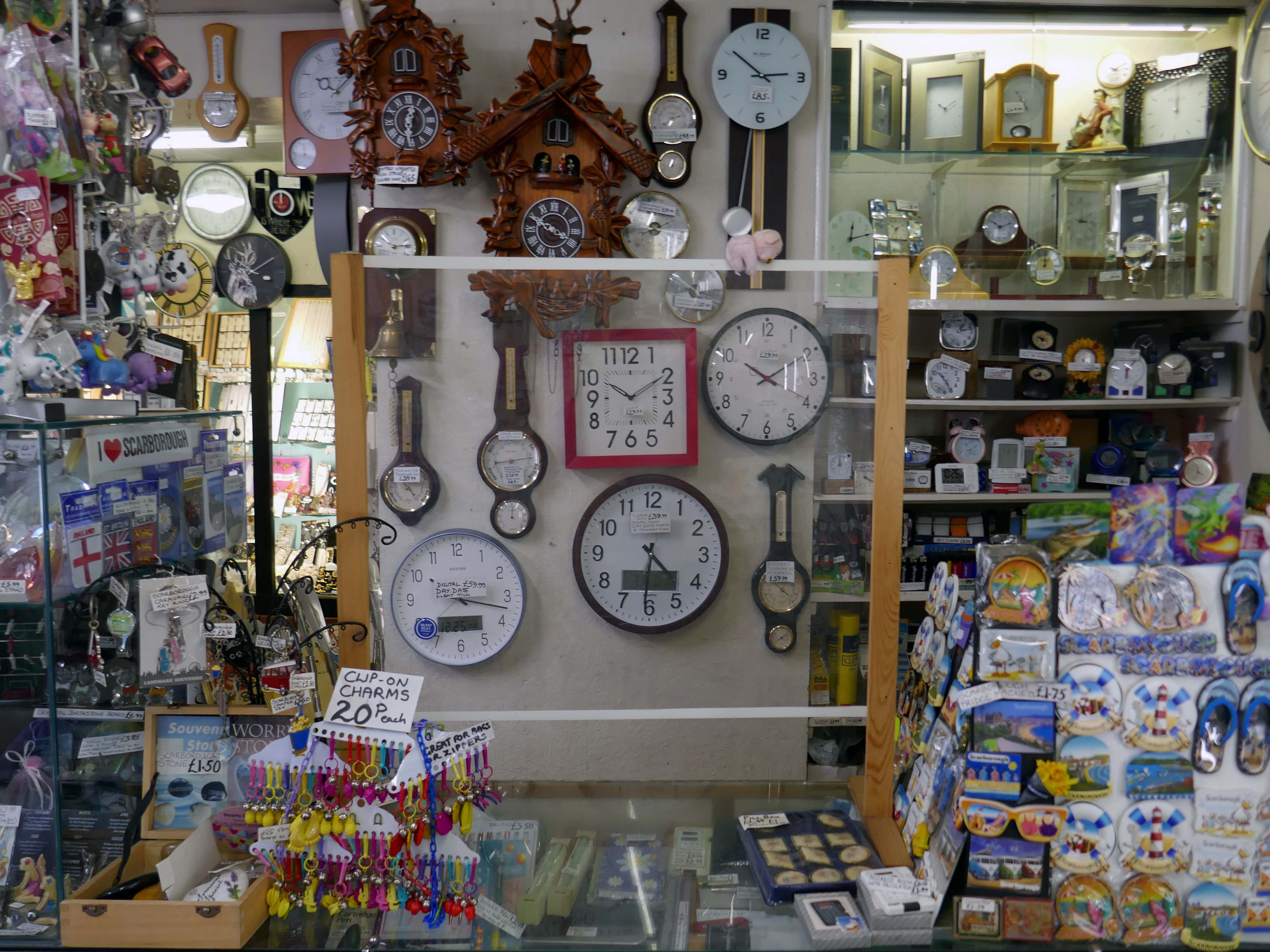
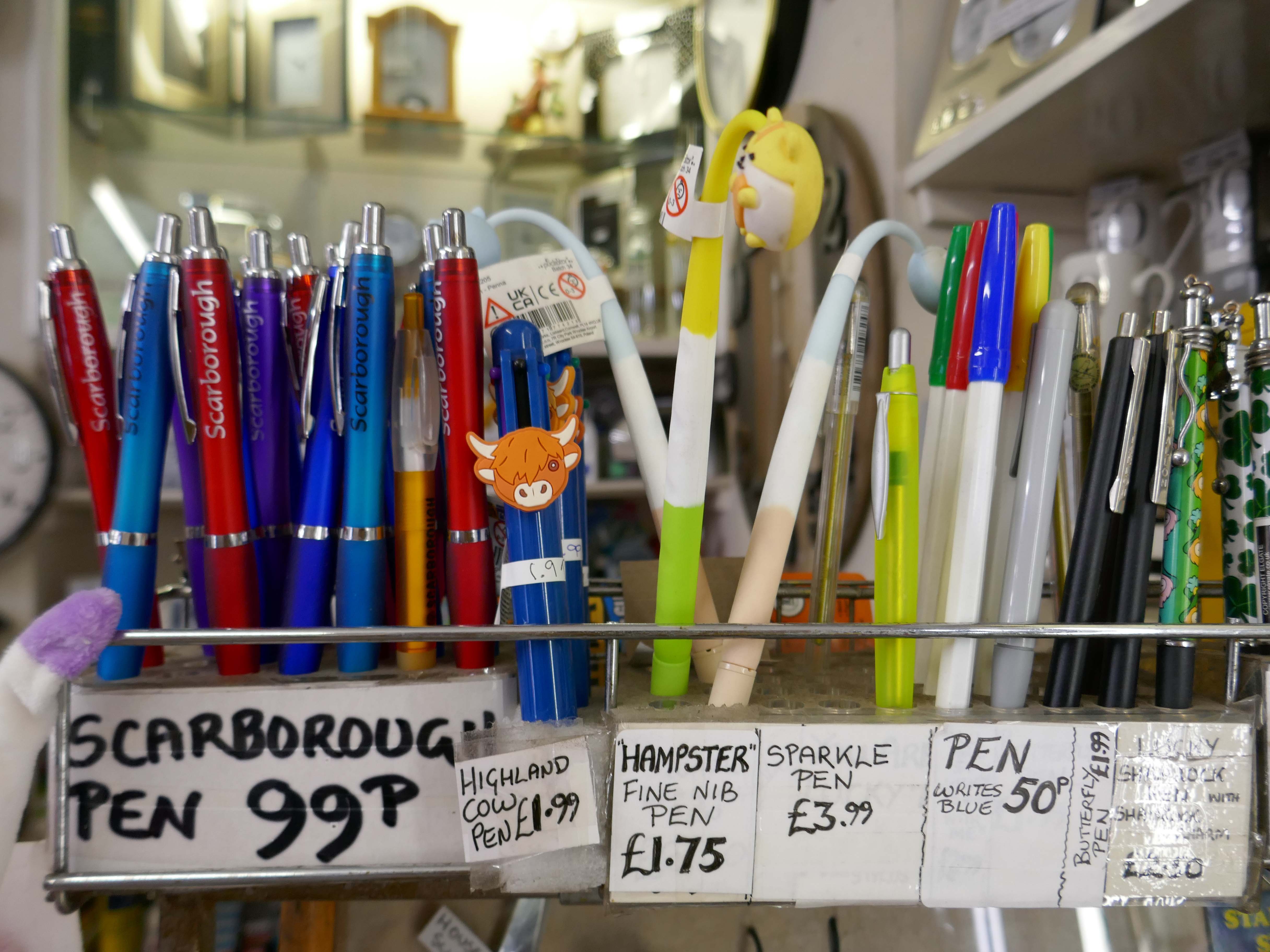
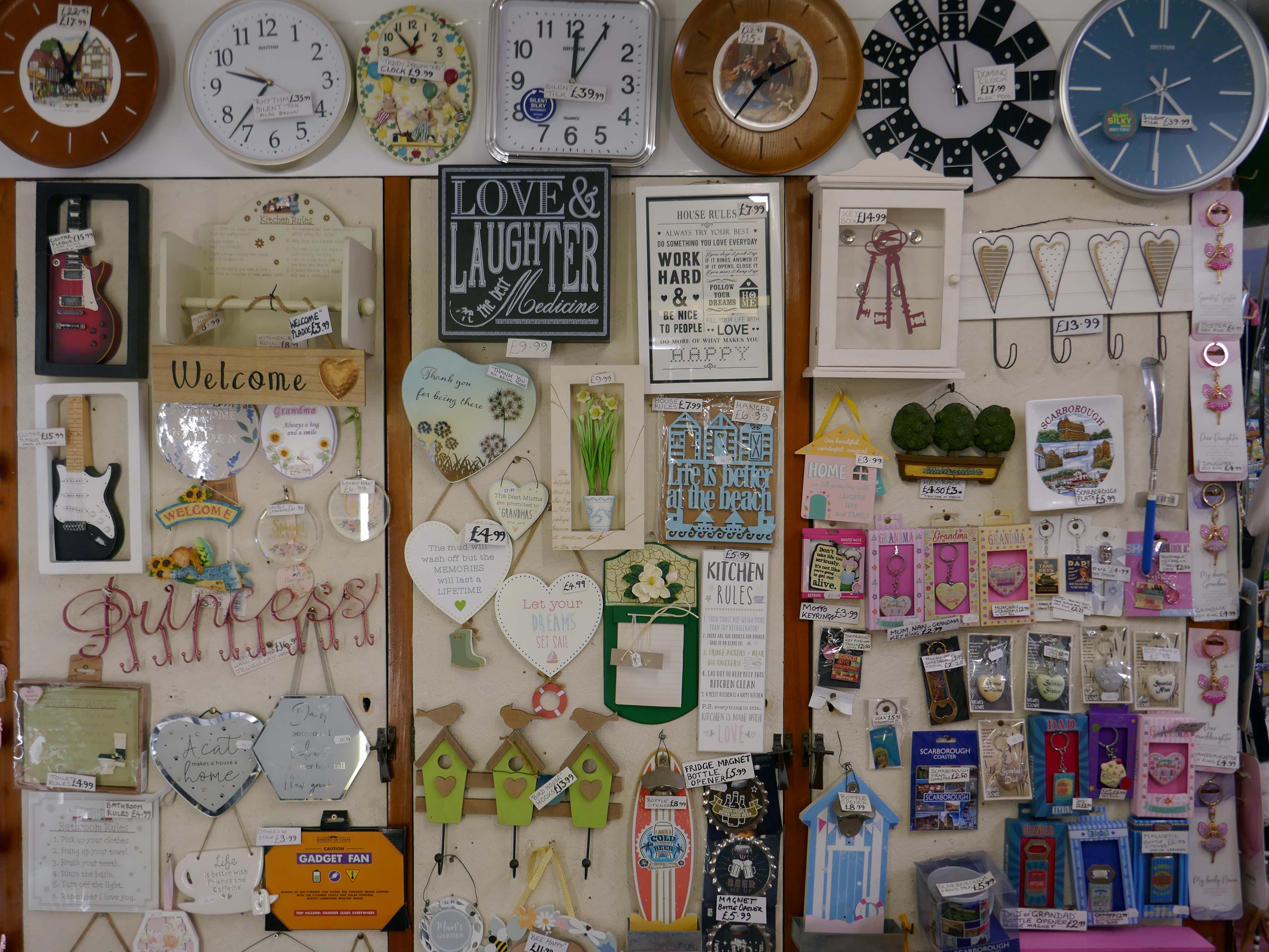
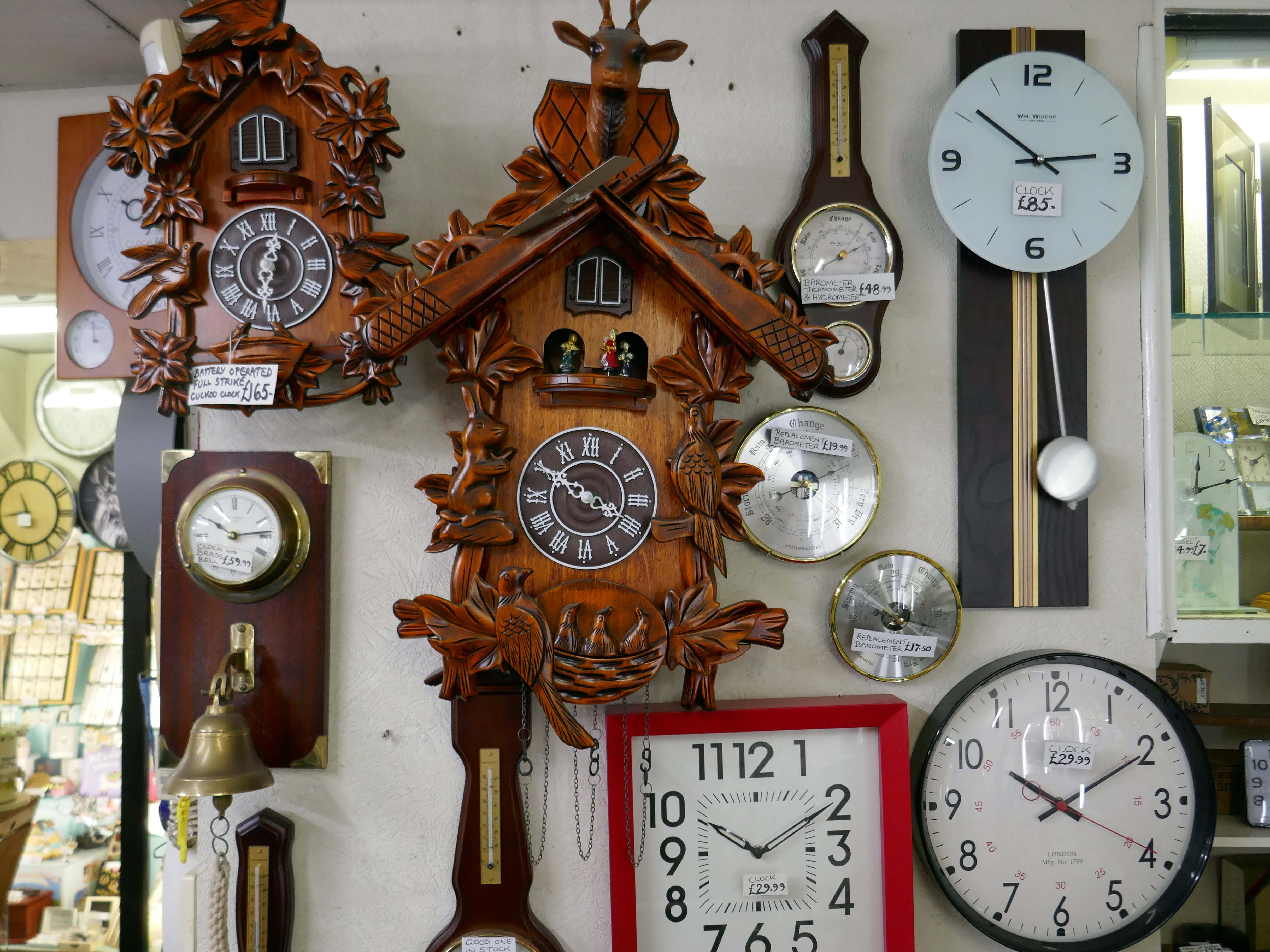
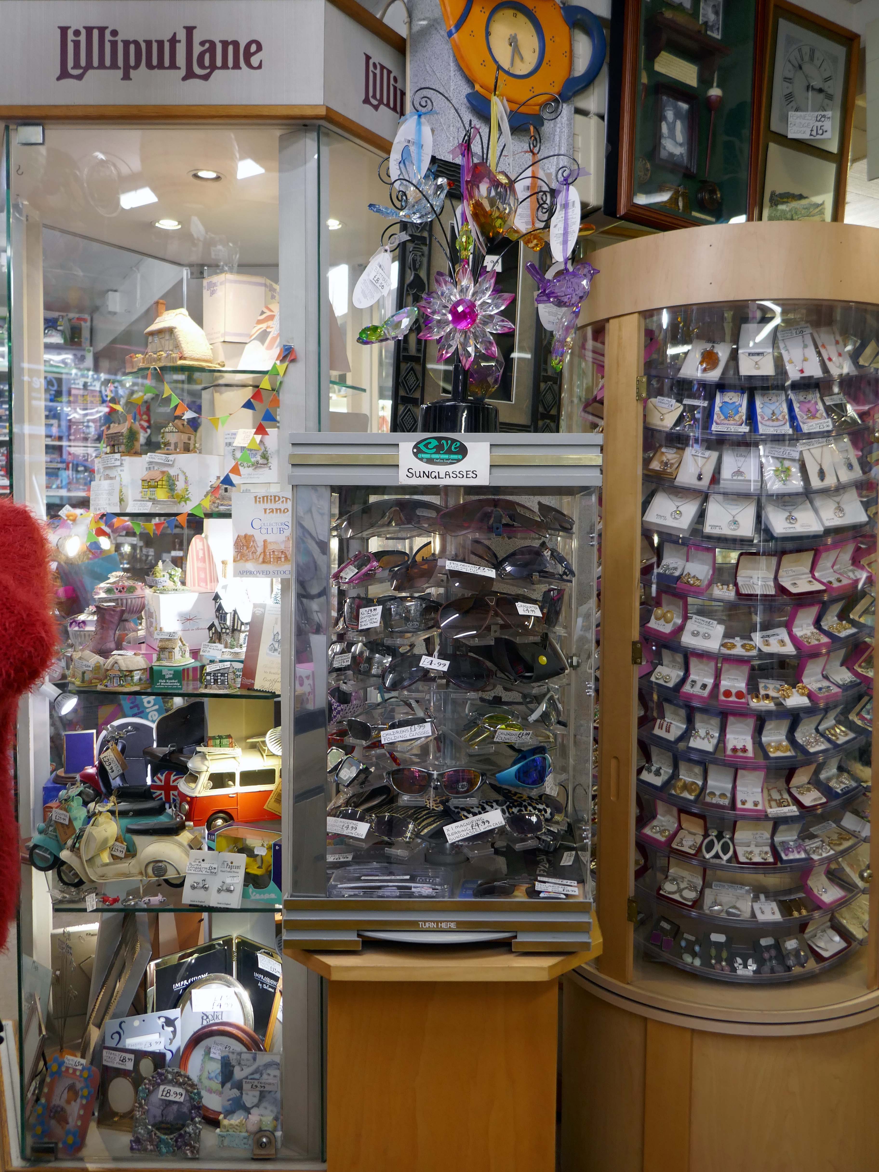
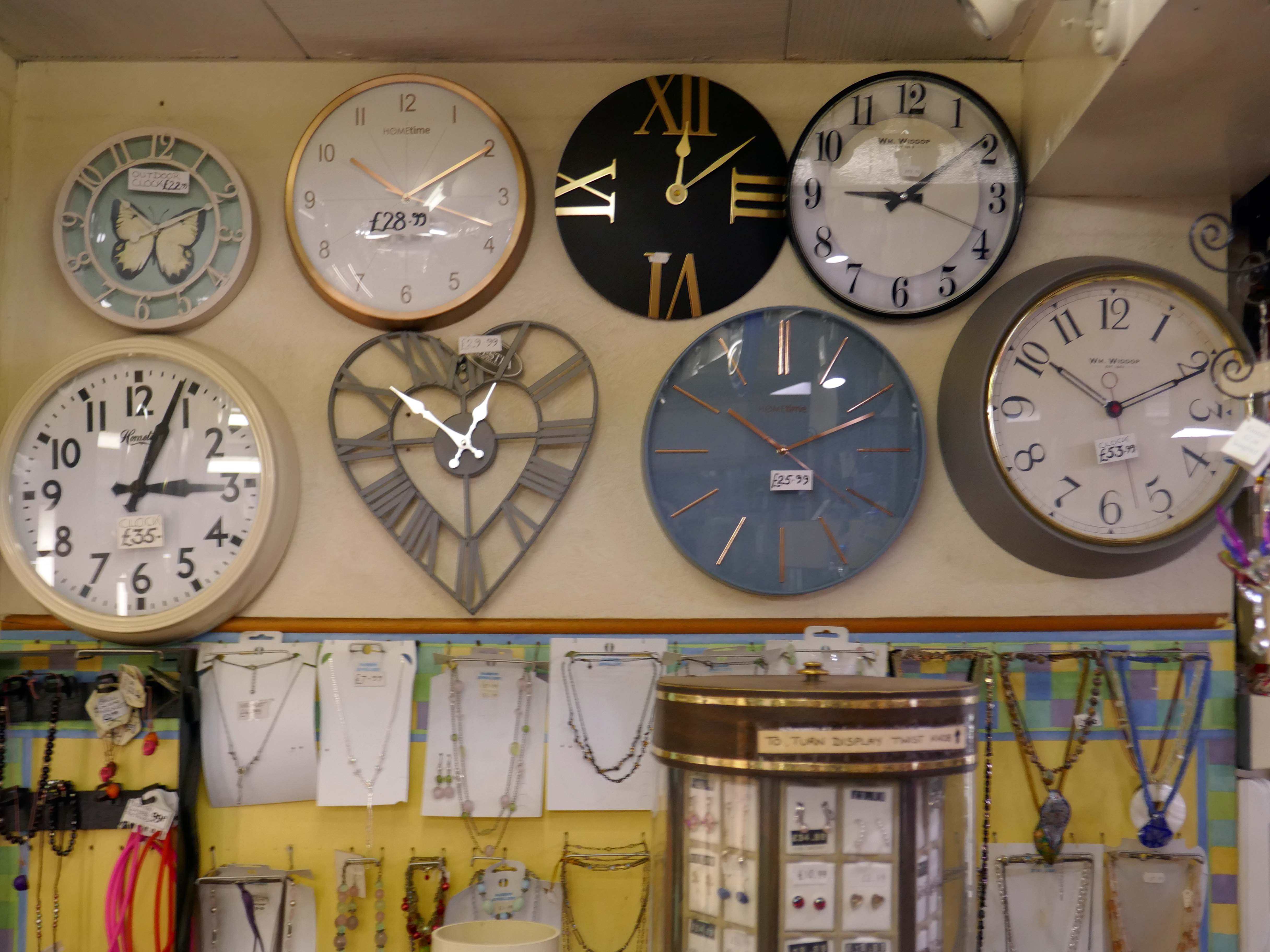
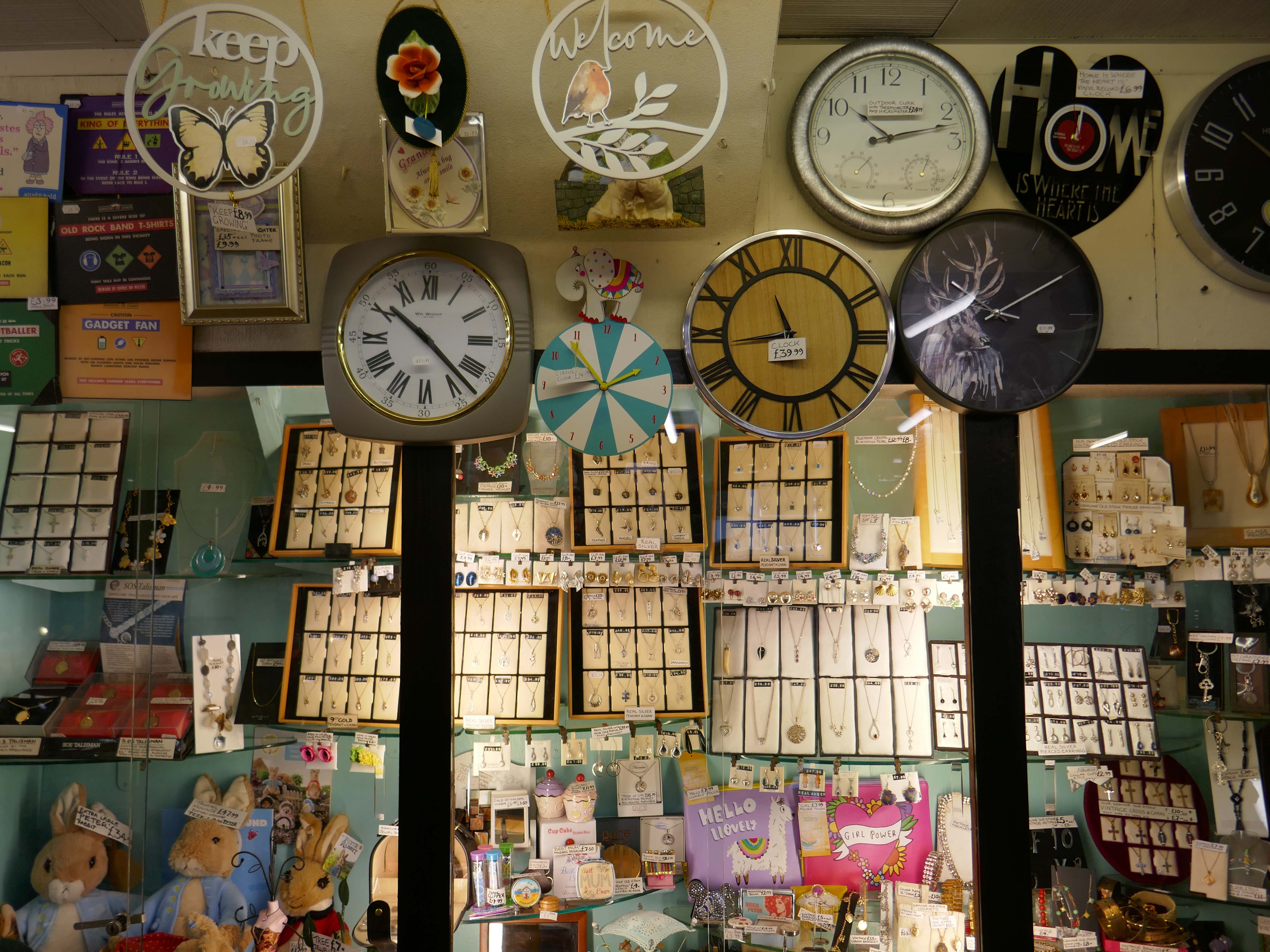
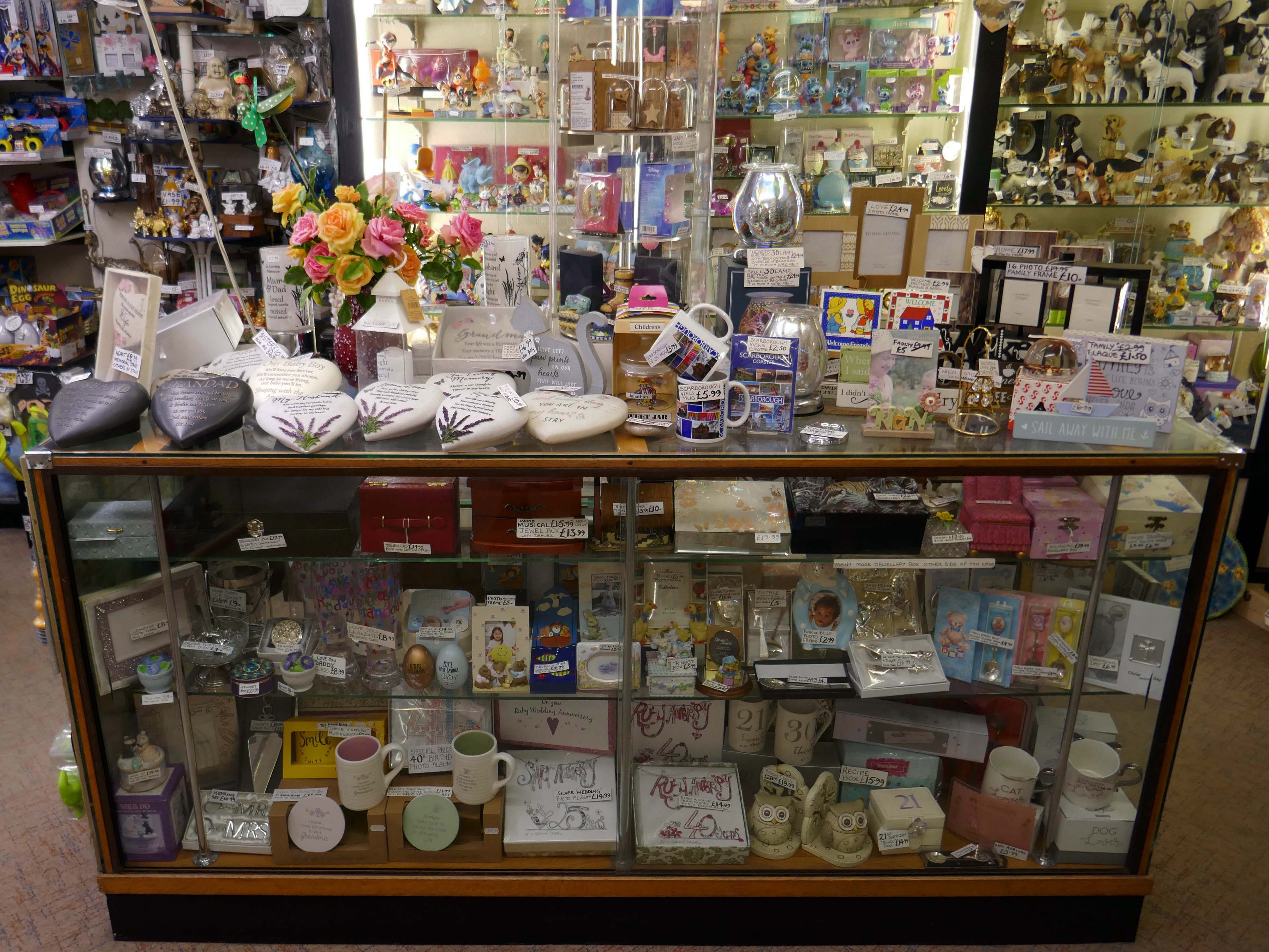
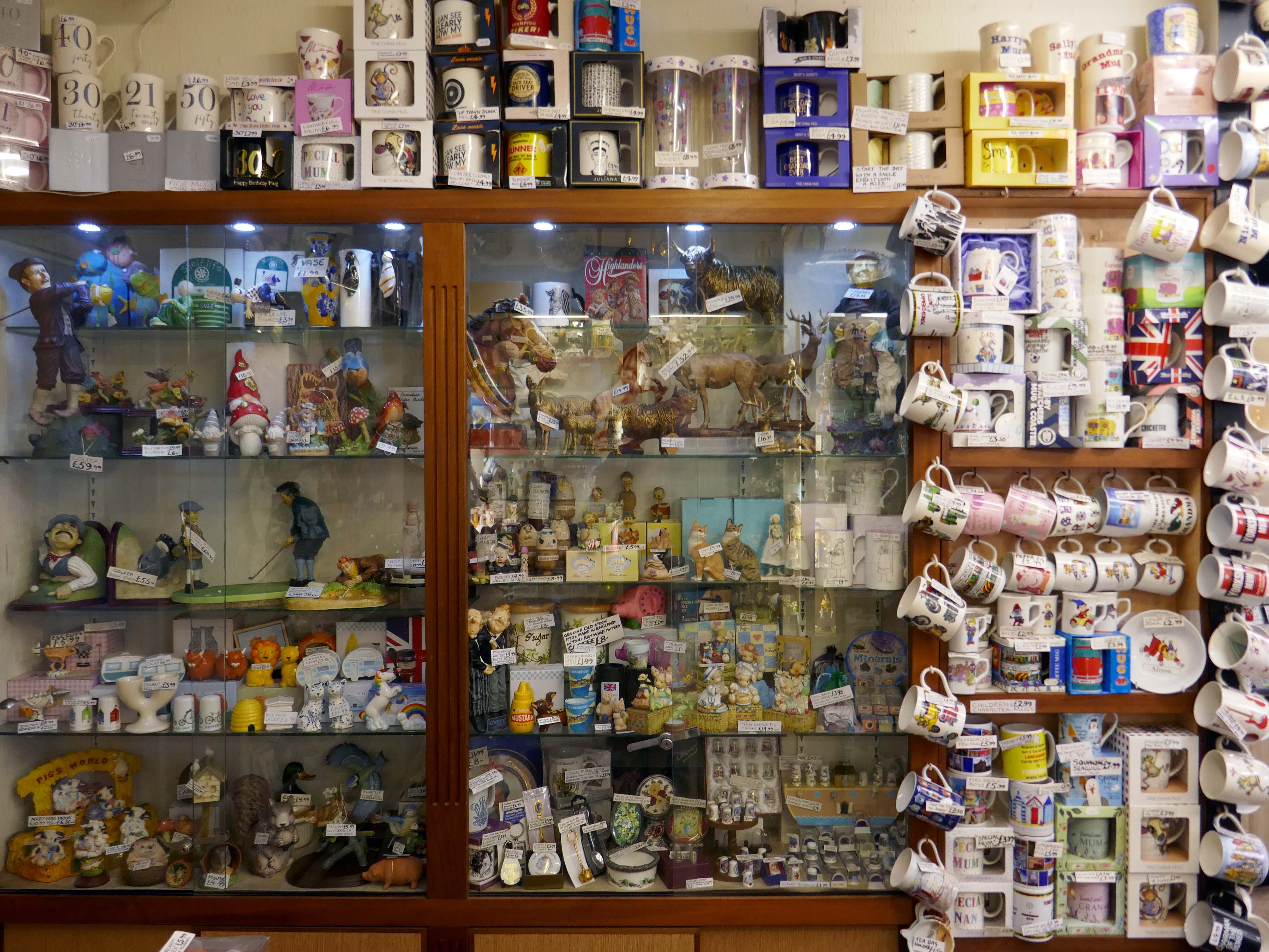
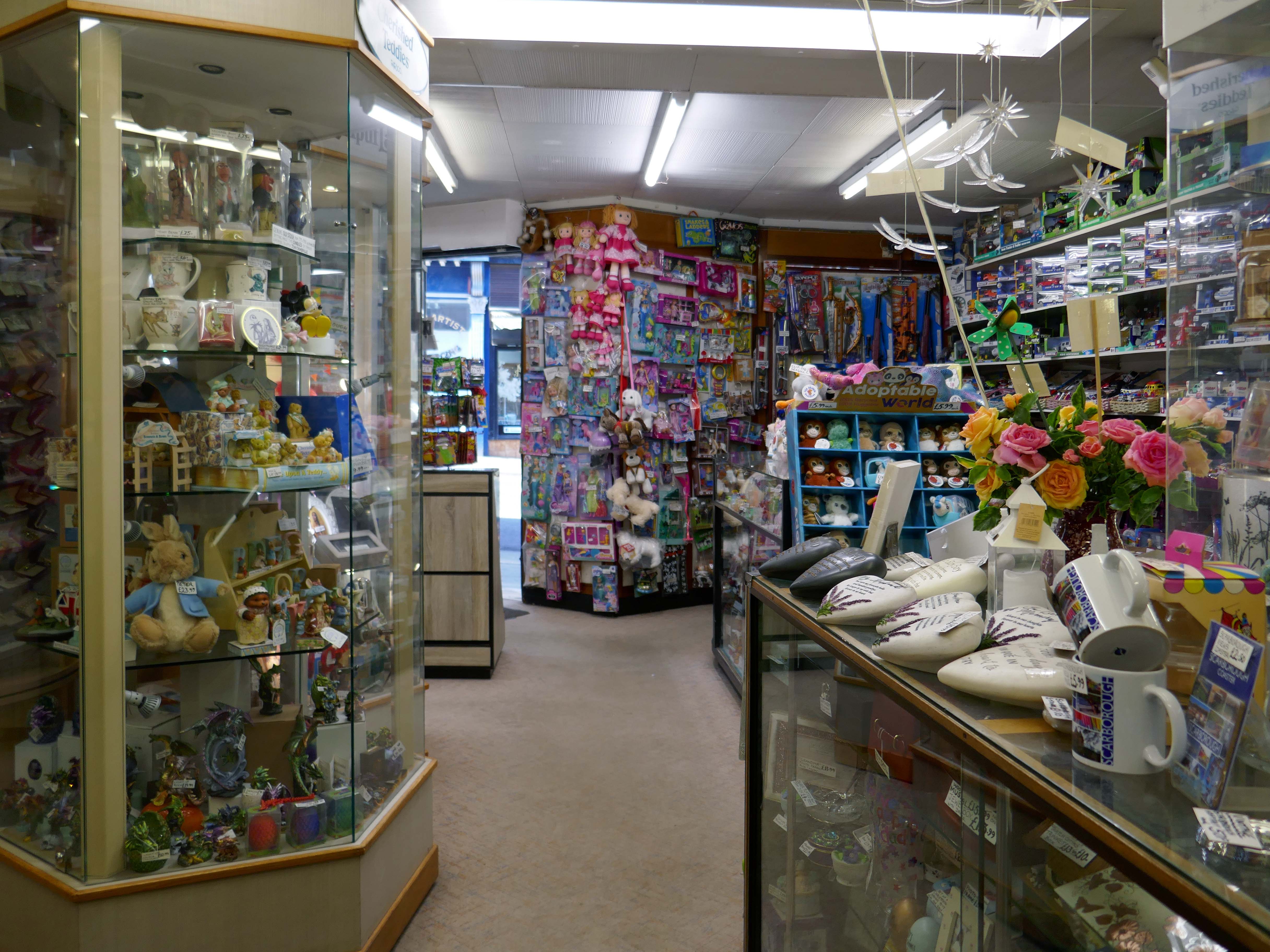
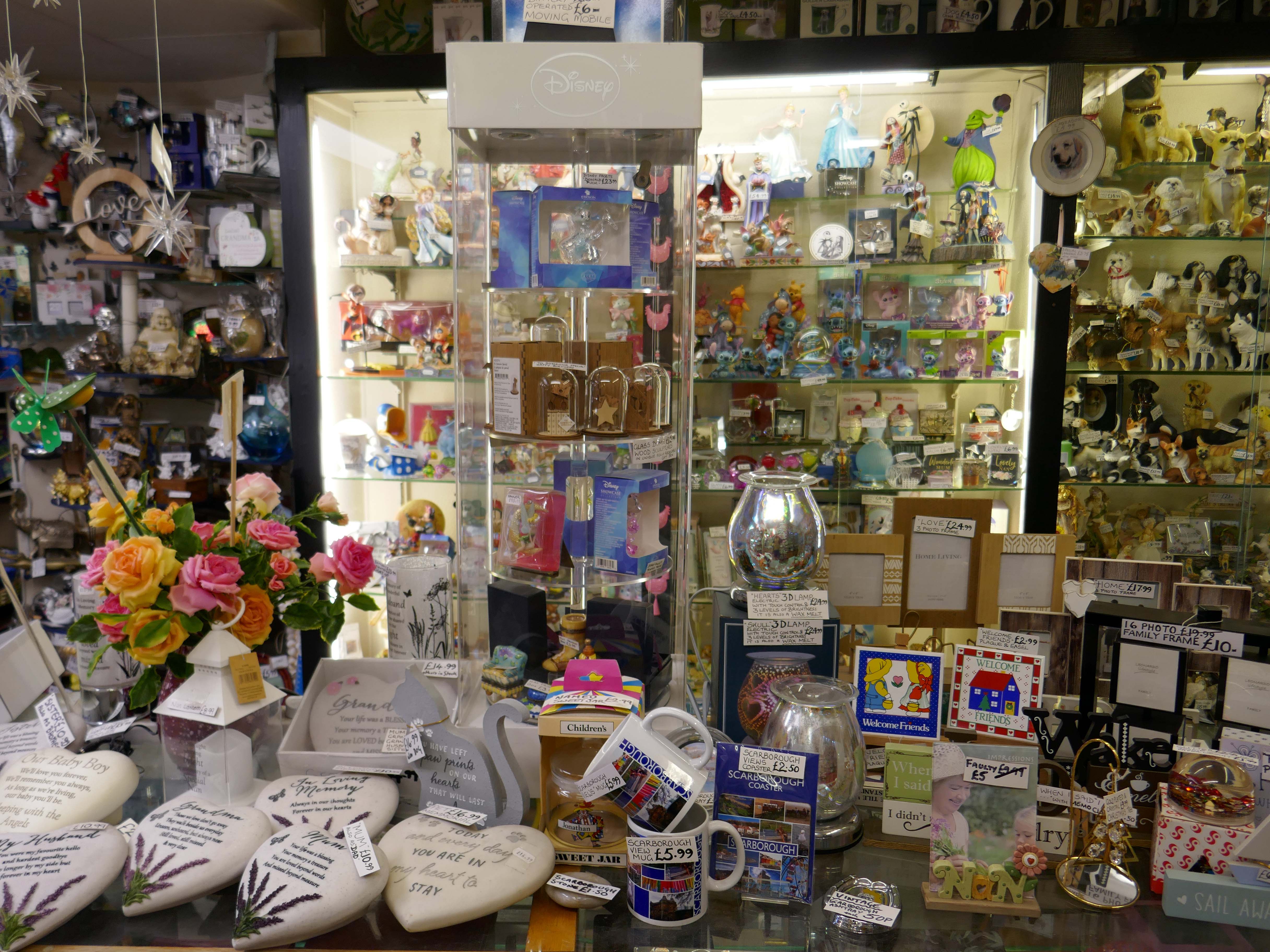
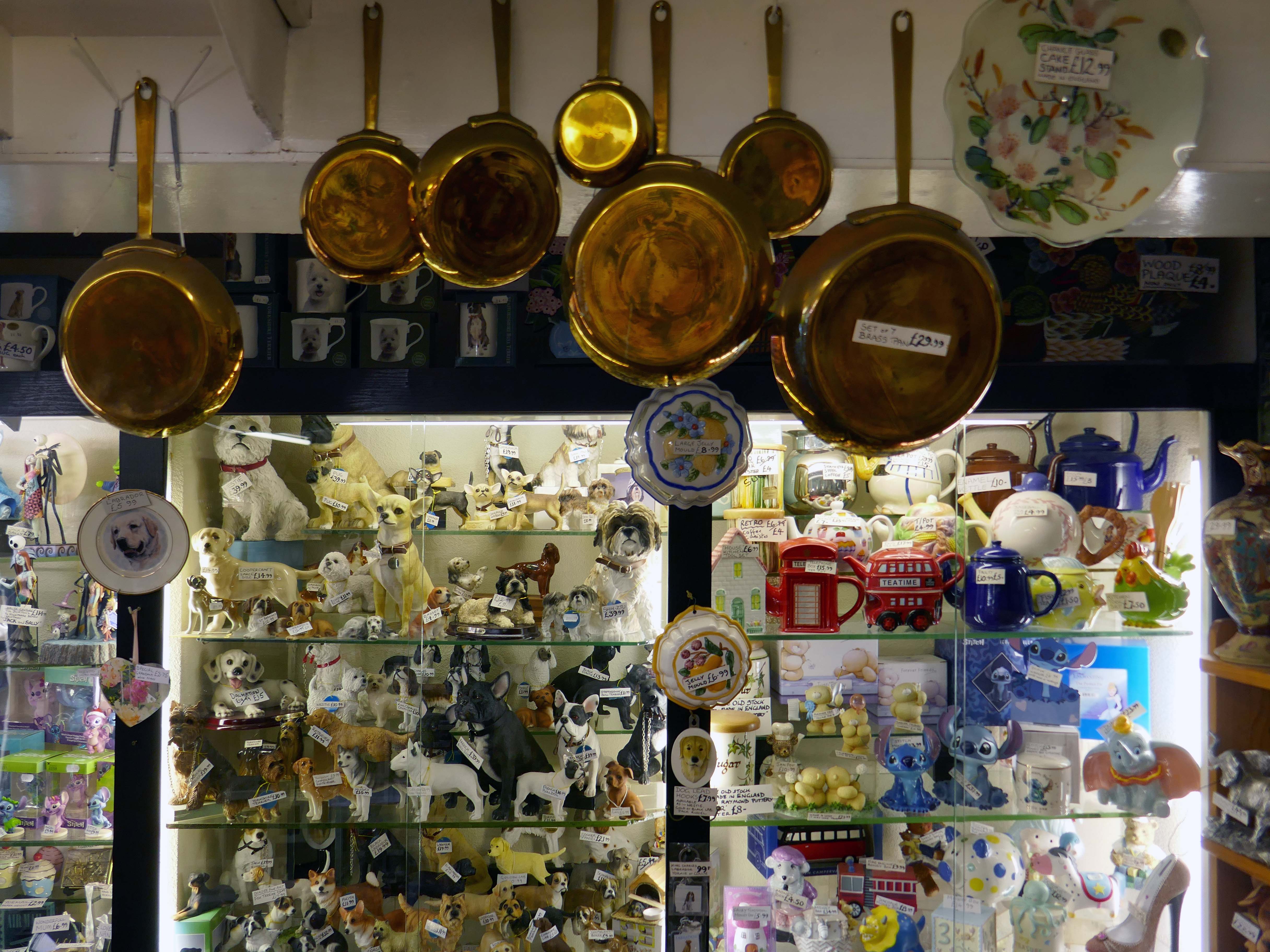
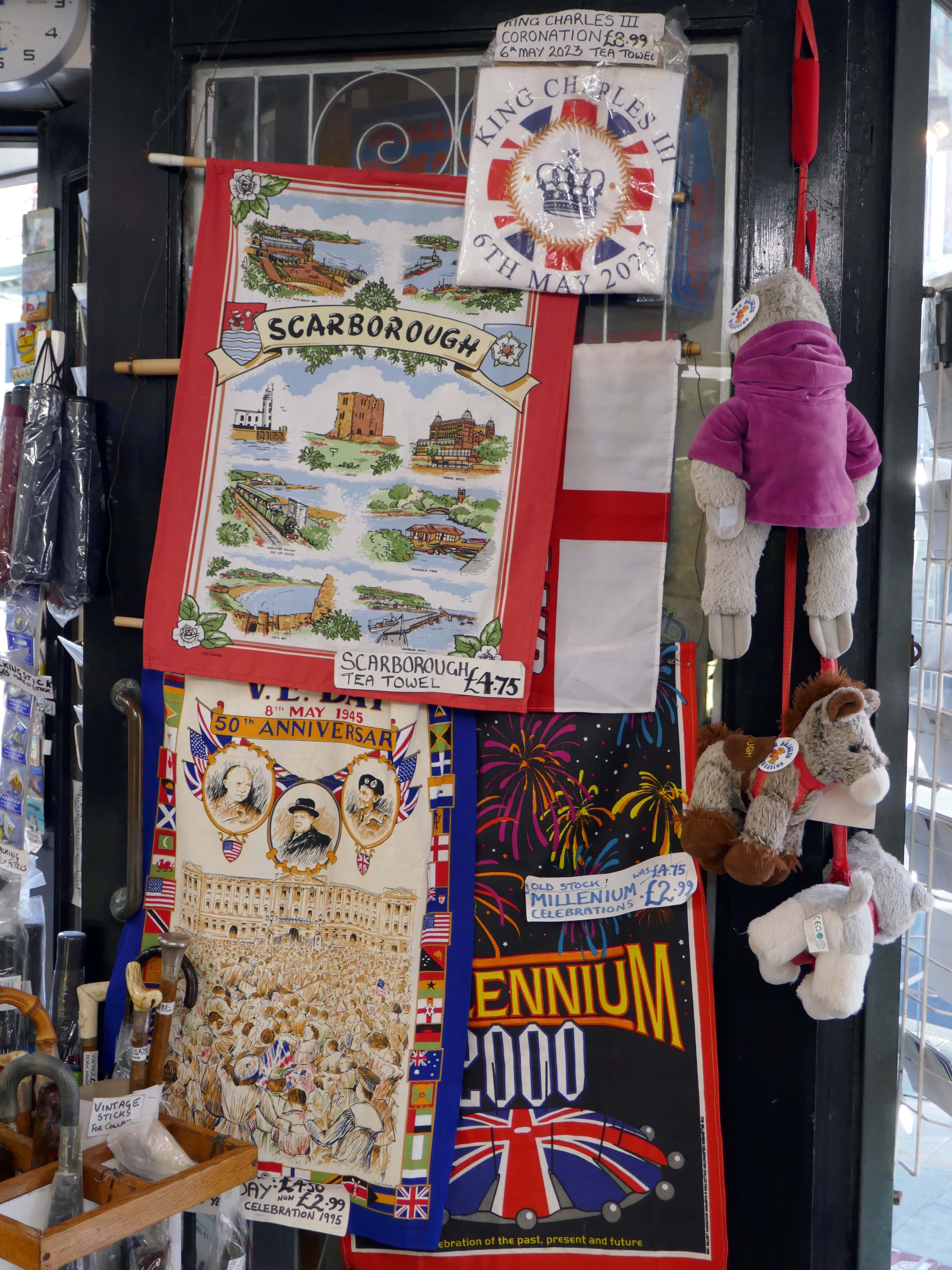
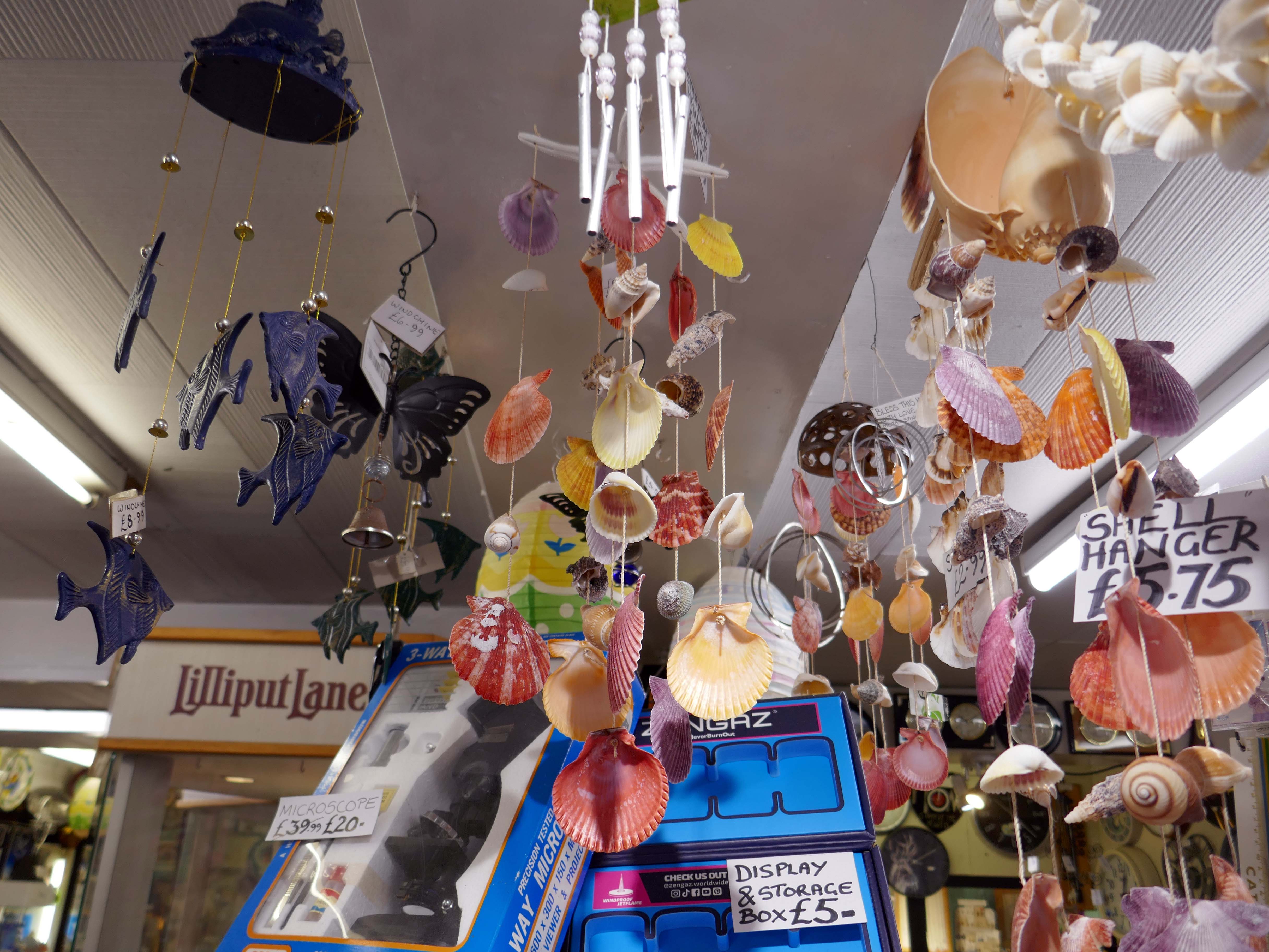
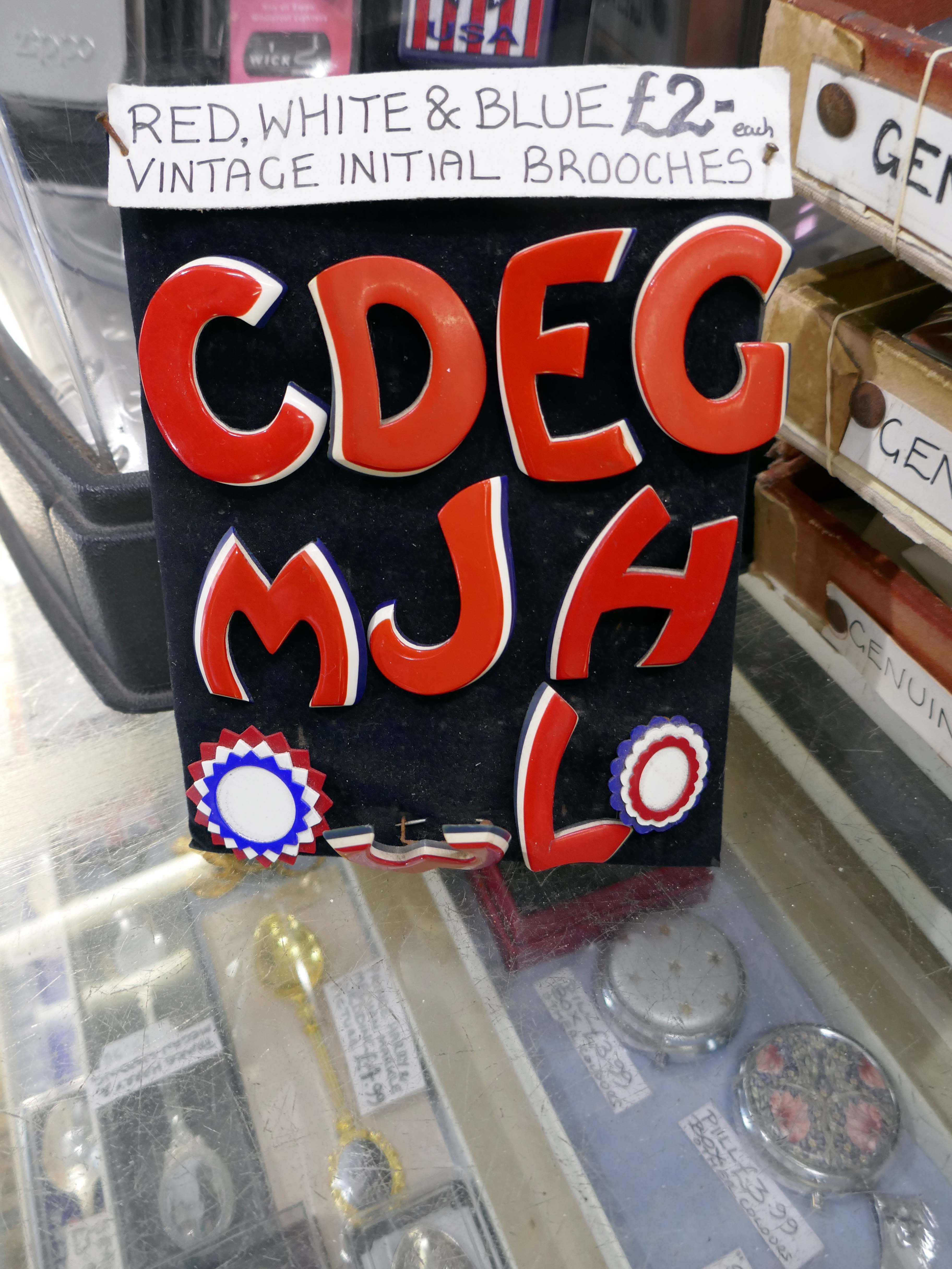
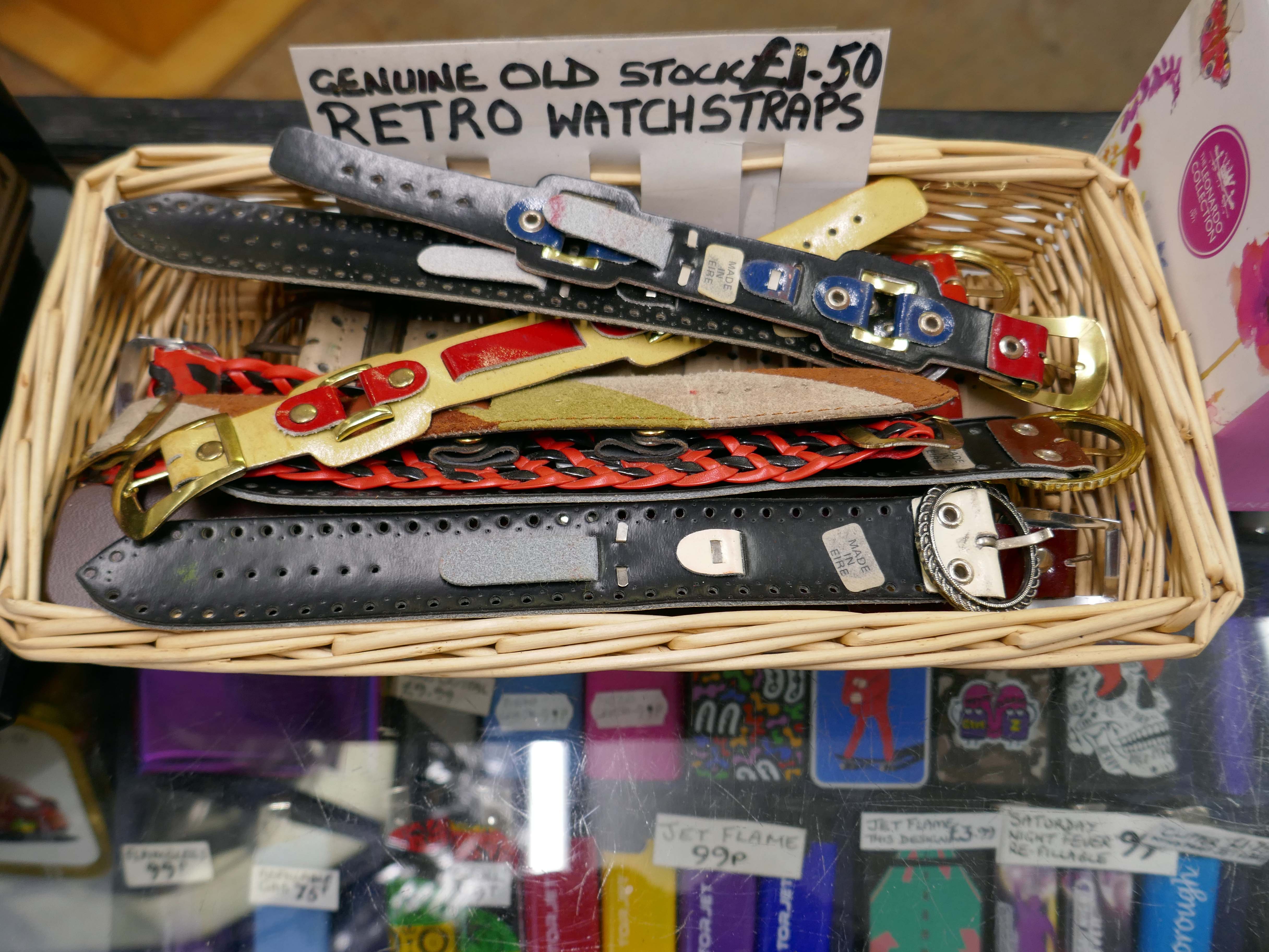
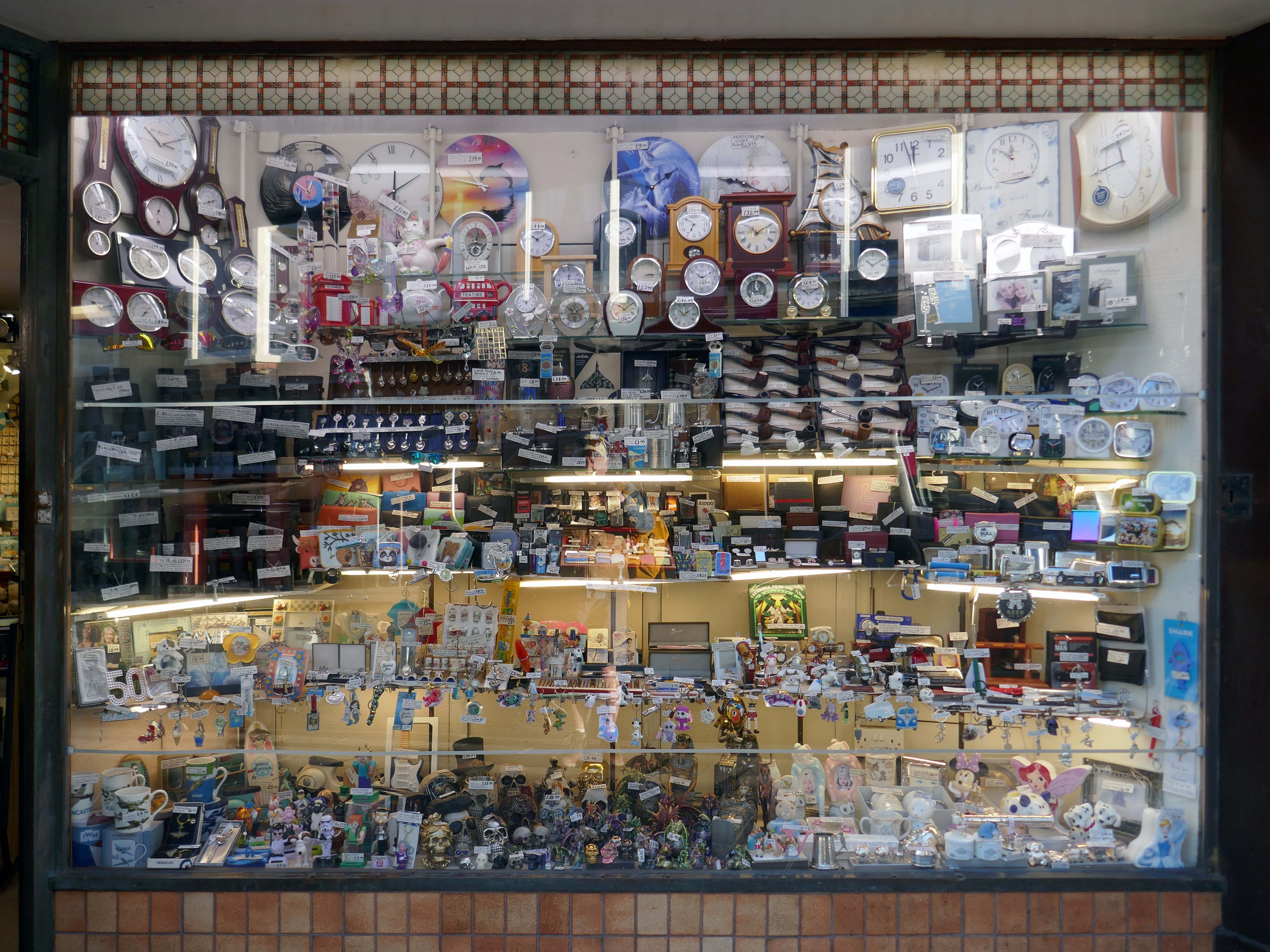
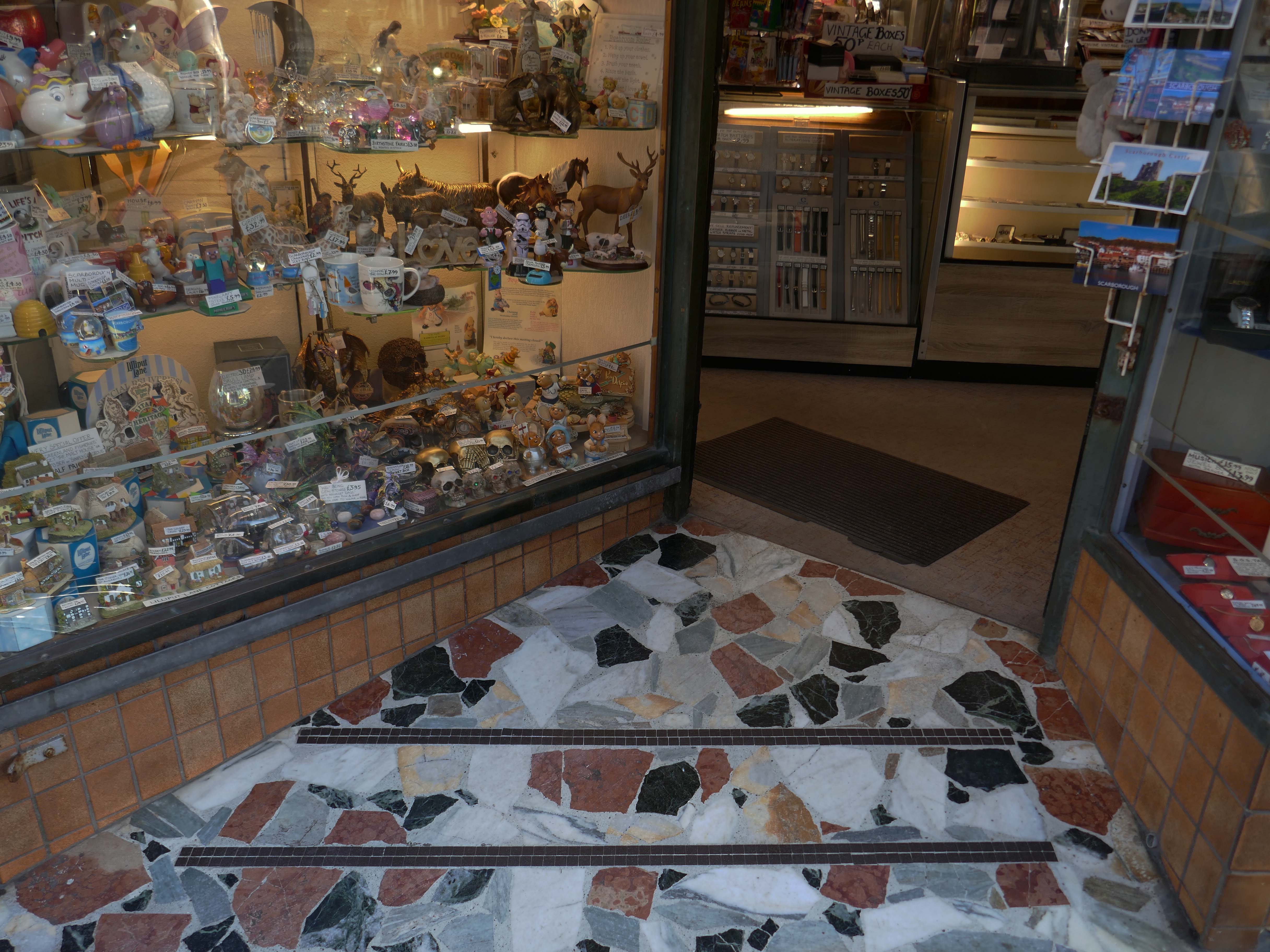
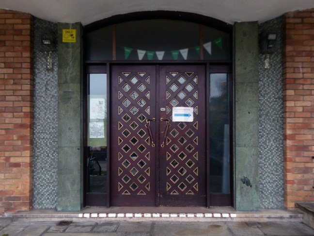
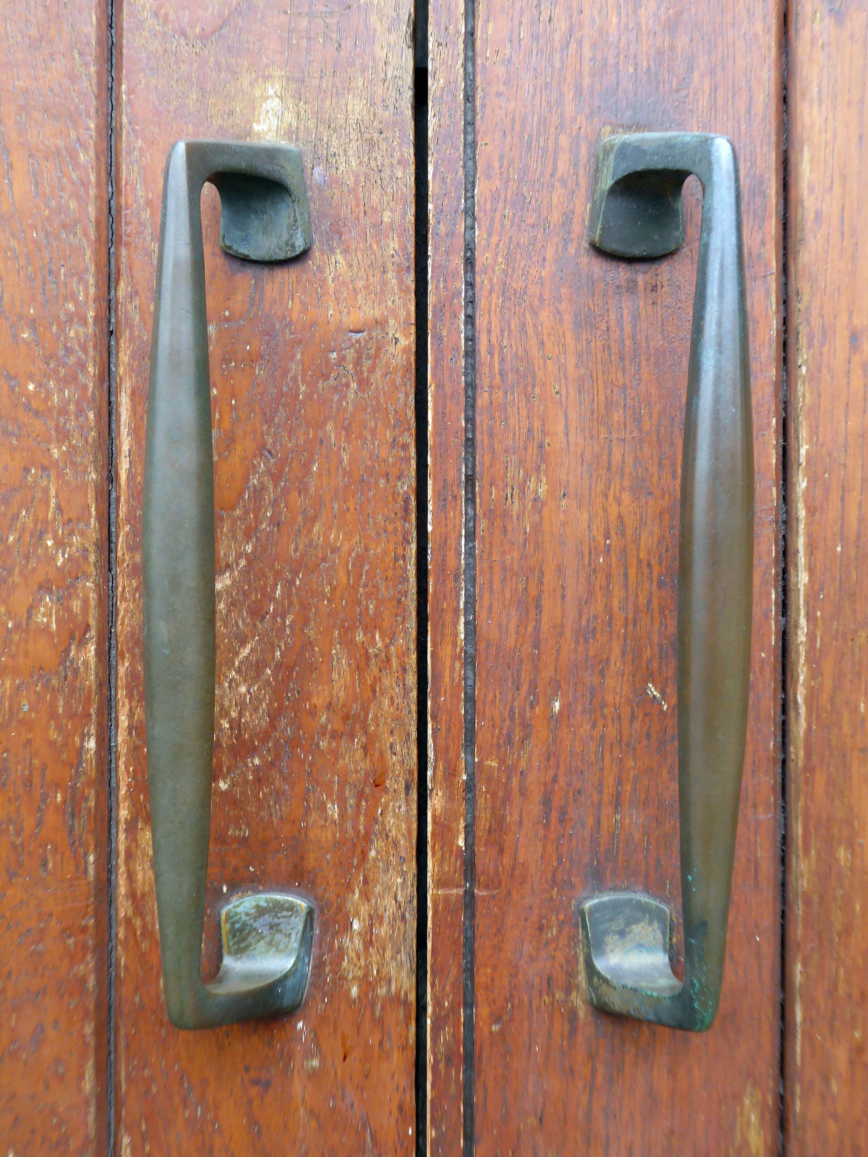
J H Wherritt is a cherished gift shop located at 5-7 Eastborough in the heart of Scarborough. Known as a hidden gem and a fantastic treasure trove by visitors, this highly-rated establishment boasts an impressive 5/5 stars from numerous positive reviews. It’s the perfect place to discover a diverse range of gifts, souvenirs, toys, watches, and clocks, catering to all tastes and ages.
Customers consistently praise the shop for its extensive selection of goods, often finding unique items that are not widely available elsewhere. The dedicated team at J H Wherritt is renowned for being lovely, kind, helpful, and obliging, ensuring a pleasant and satisfying shopping experience for everyone. Visitors frequently highlight the reasonable prices and excellent value offered on all purchases.
Yorkshire.com
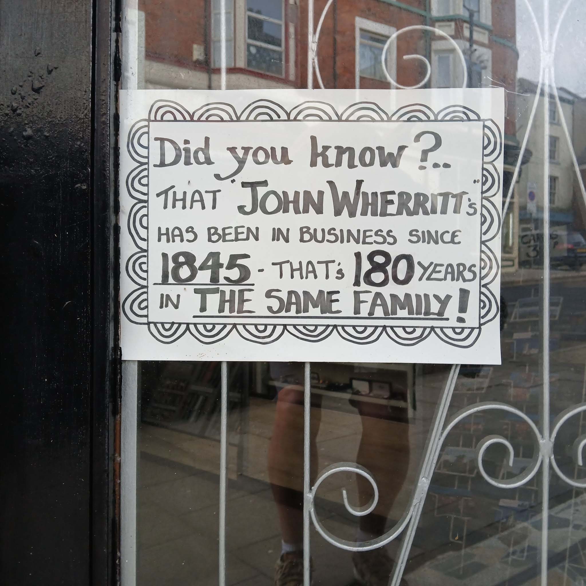
From being a very young youngster I have always adored the seaside souvenir shops. The dazzling array of knick-knacks and gee gaws, and Wherritt’s truly merits the sobriquet Aladdin’s Cave.
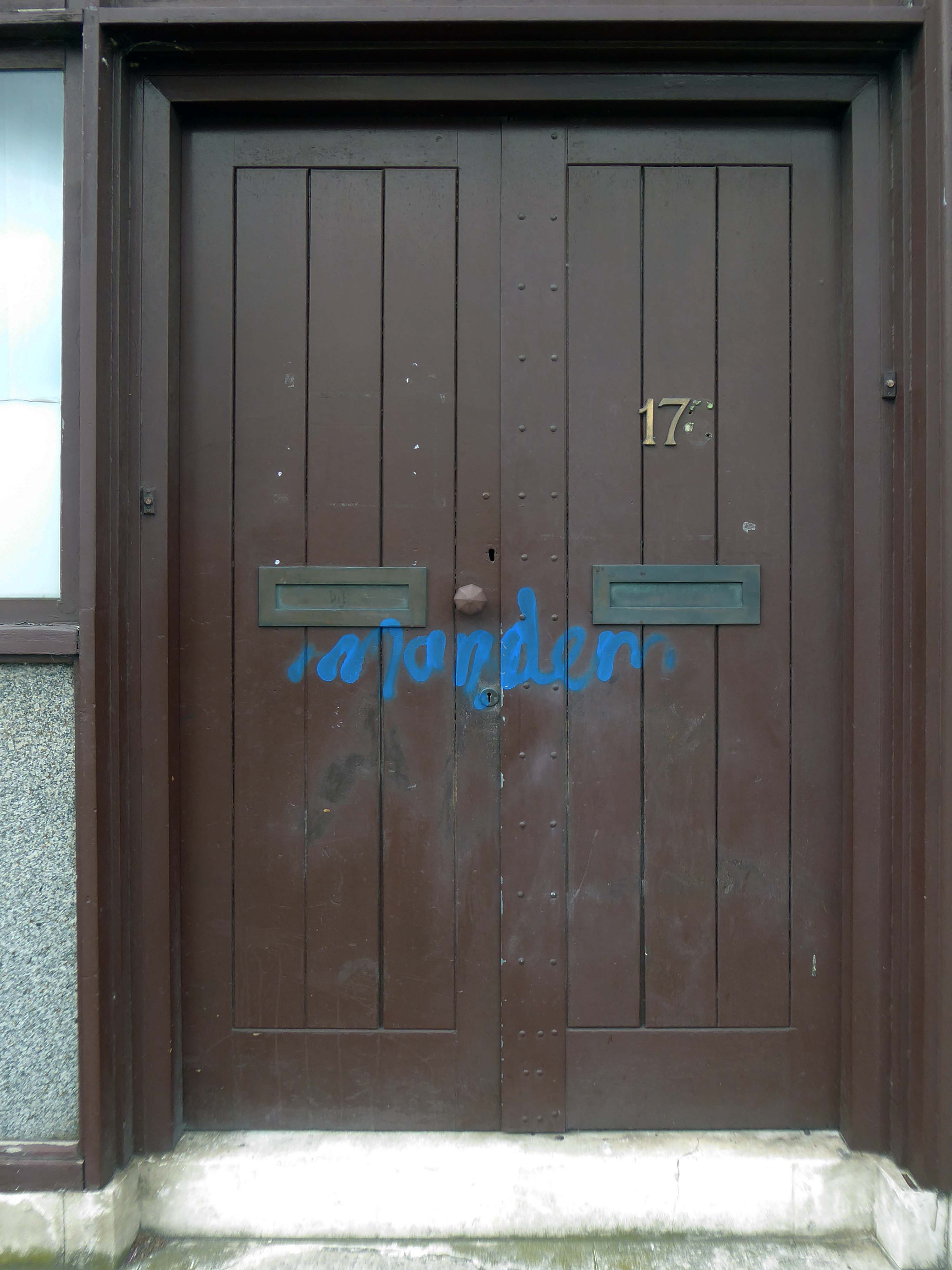
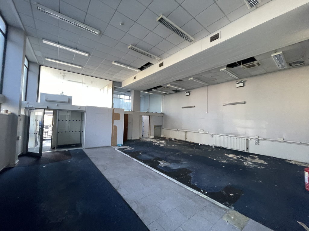
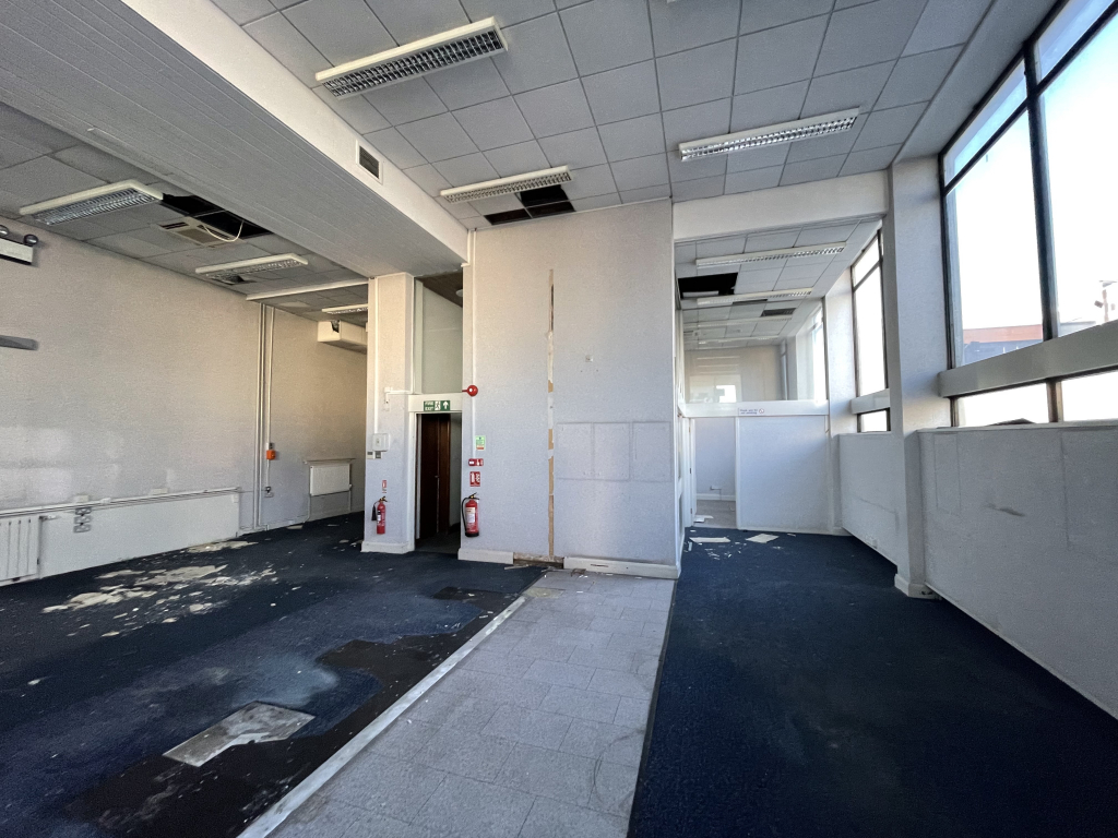
Sadly the shop is now for sale:
•Business & stock available by separate negotiation
•Upper floors in need of major refurbishment
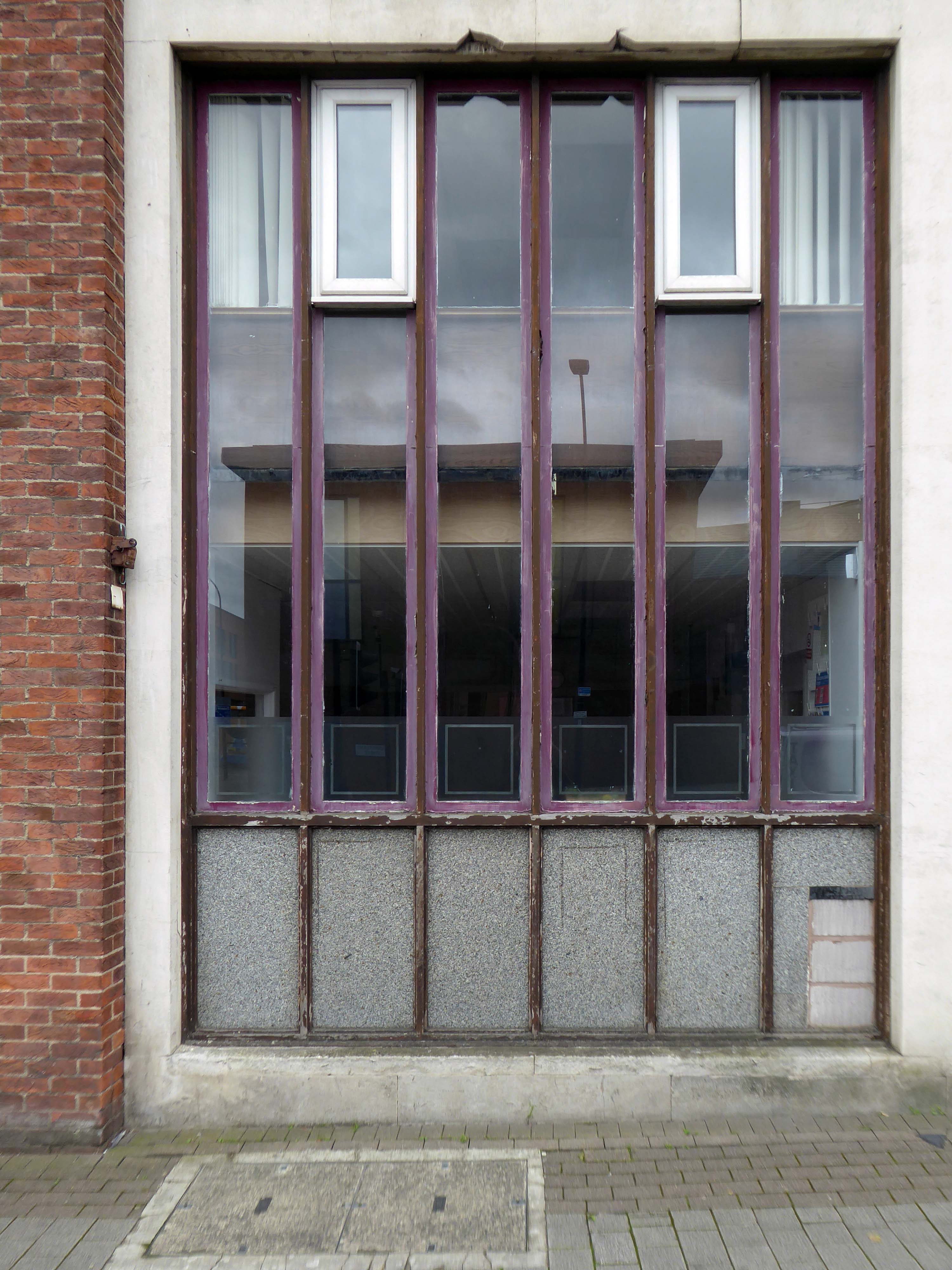
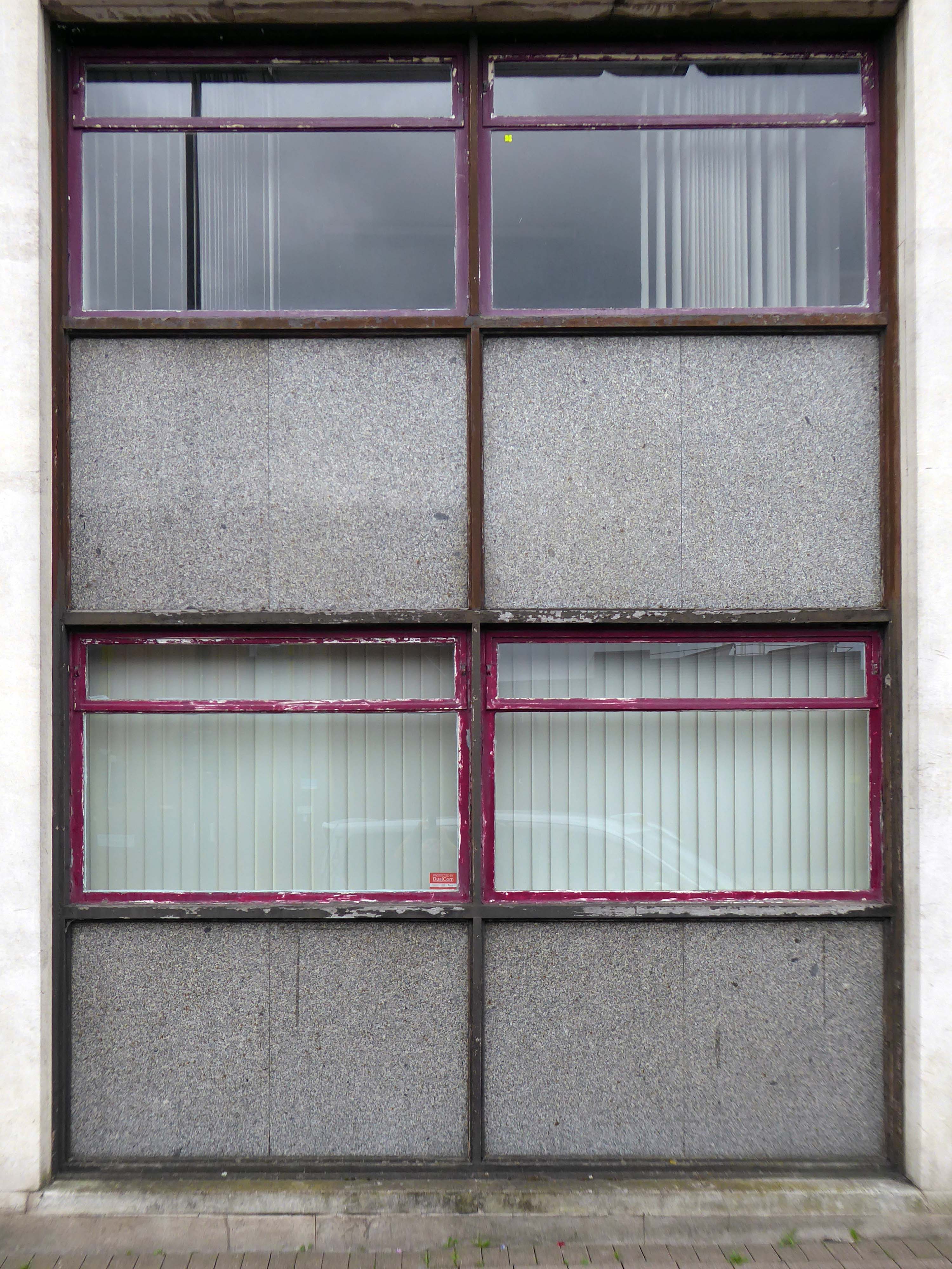
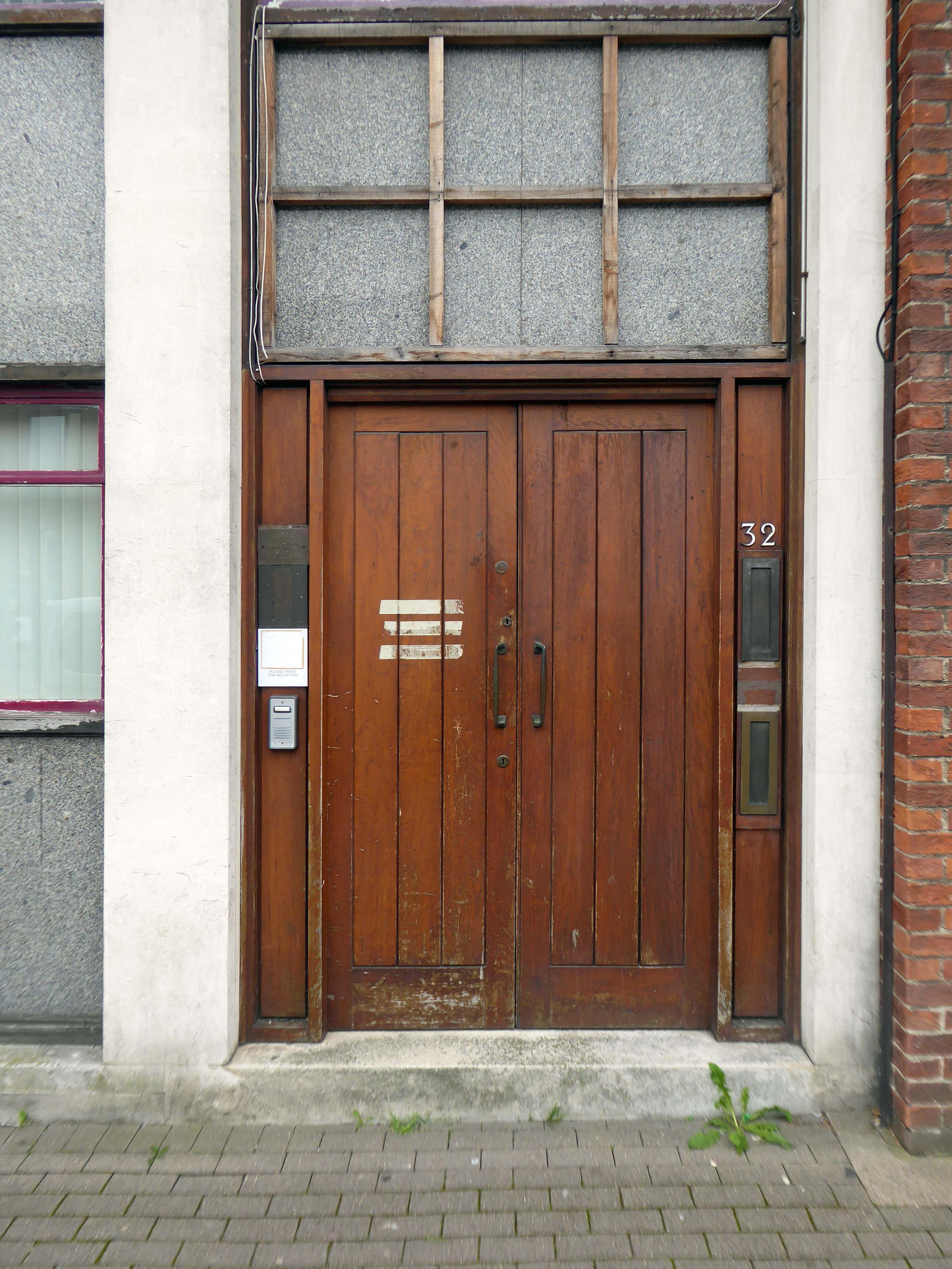
• Very inviting shop frontage with 2 entrance doors
•Shop located on busy tourist route
Guide price £175,000
We can only hope that whosoever takes the business on will maintain the wide range of stock and friendly welcome.
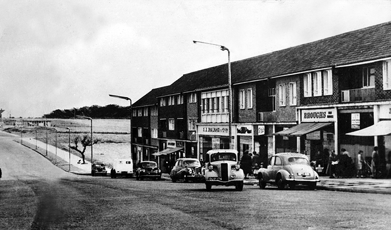
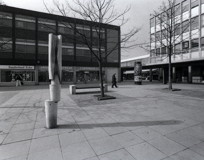
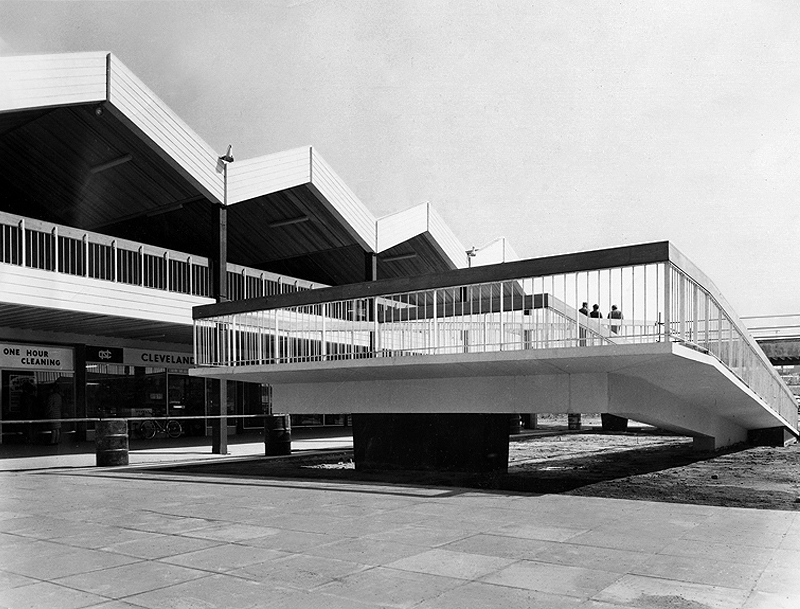
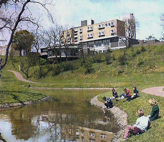
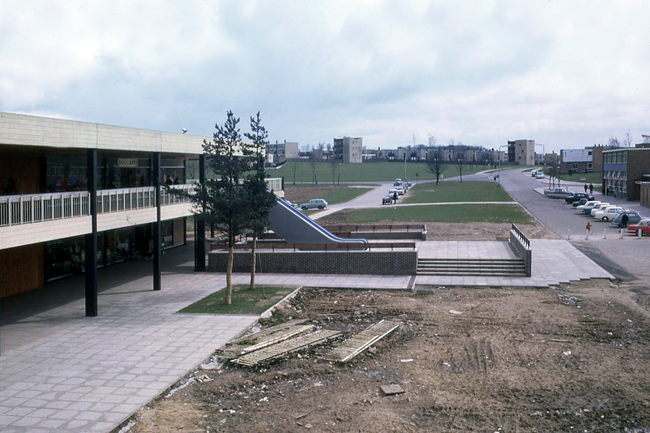
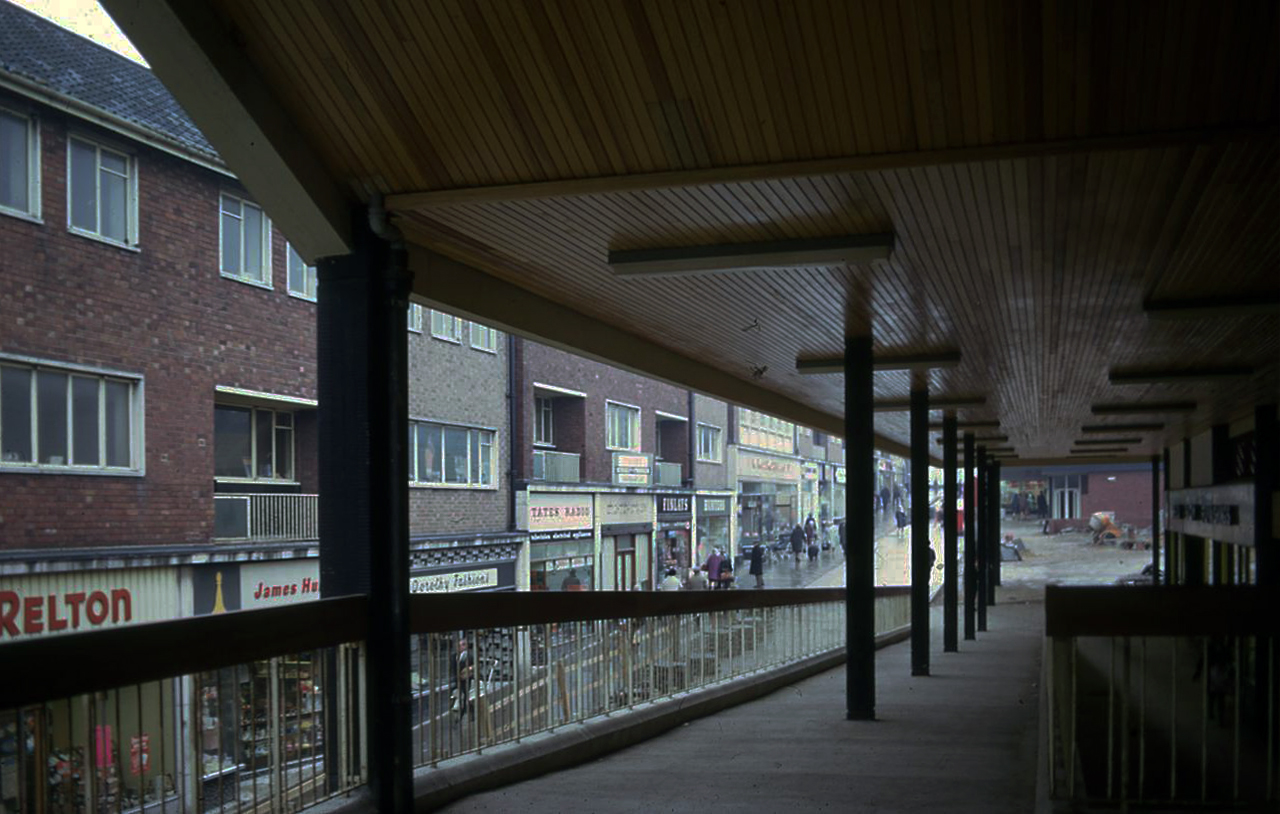
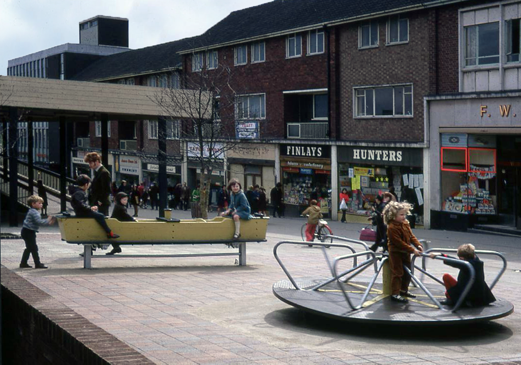
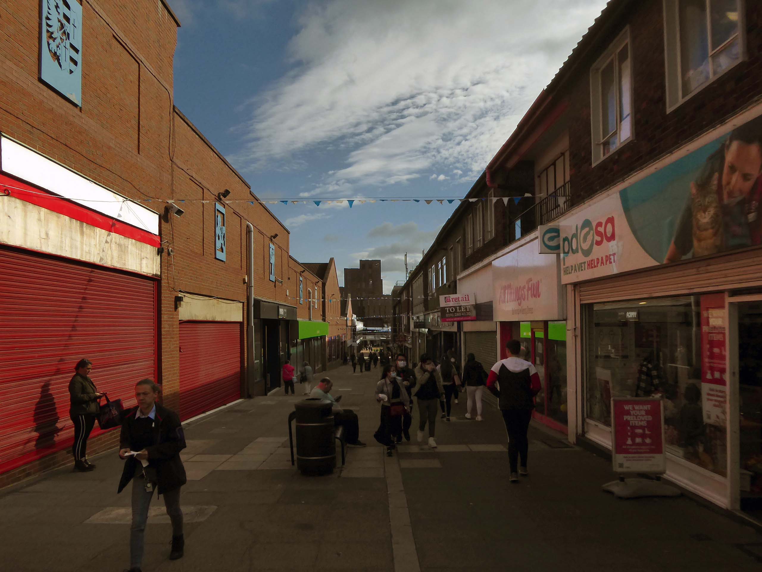
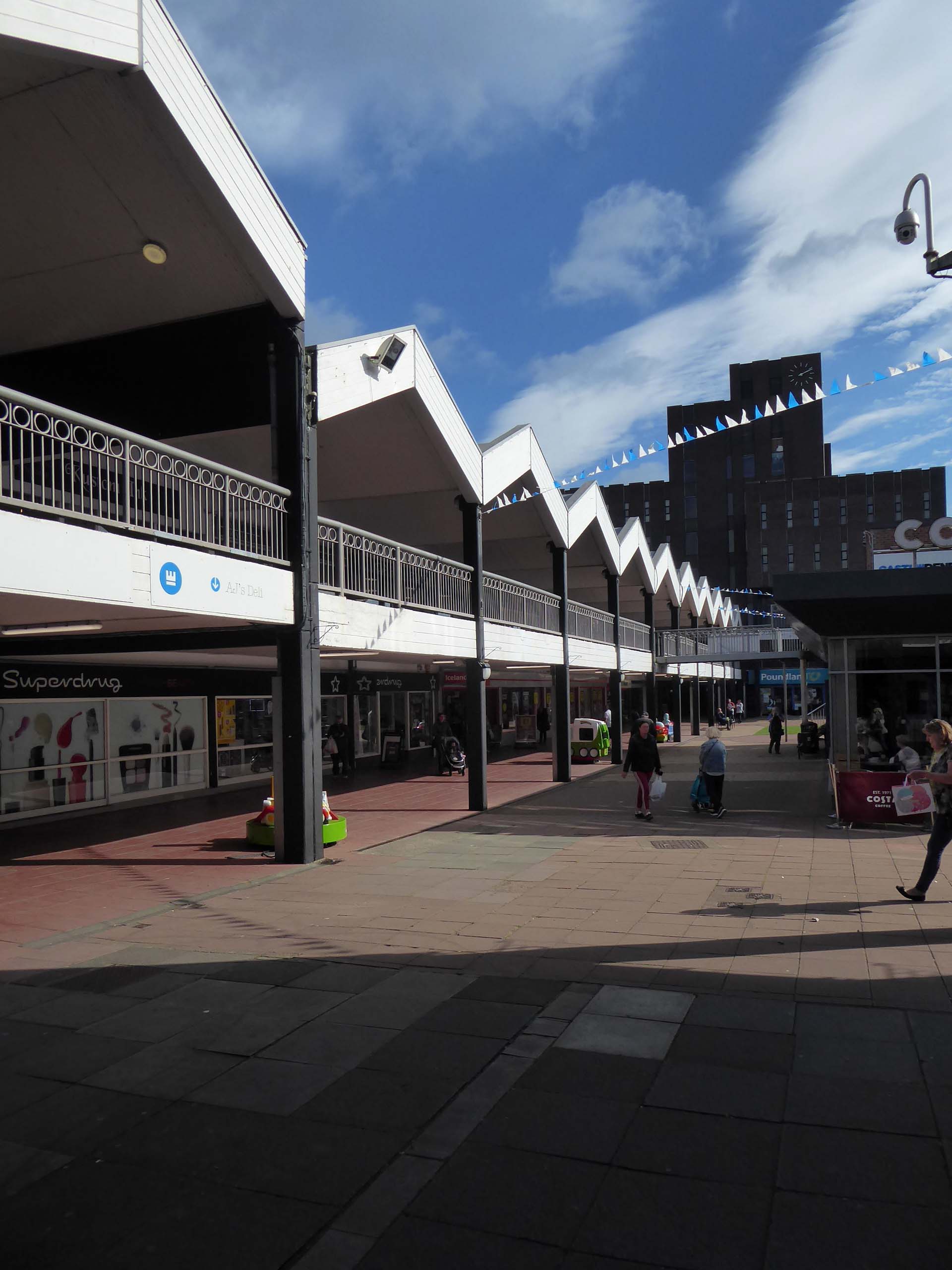
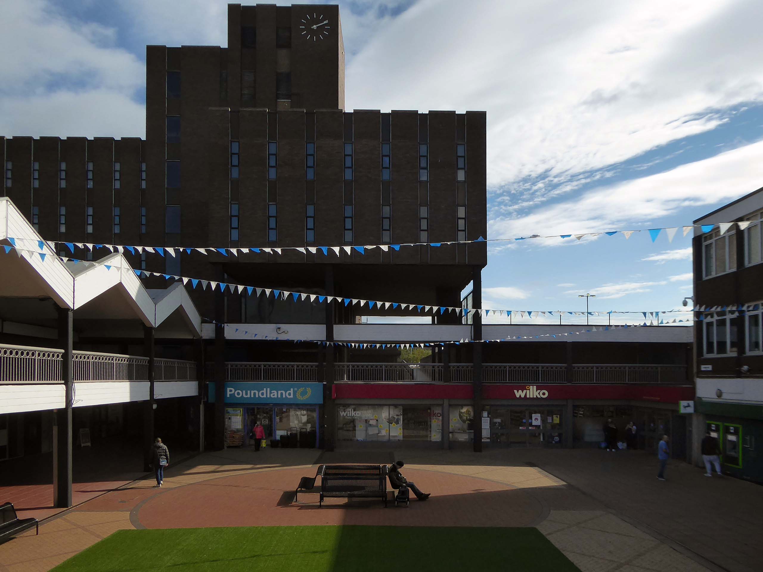
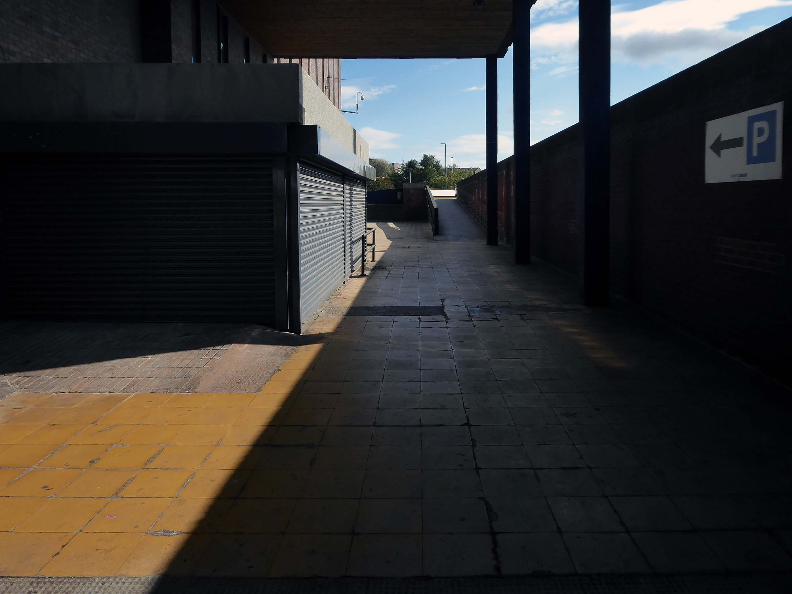
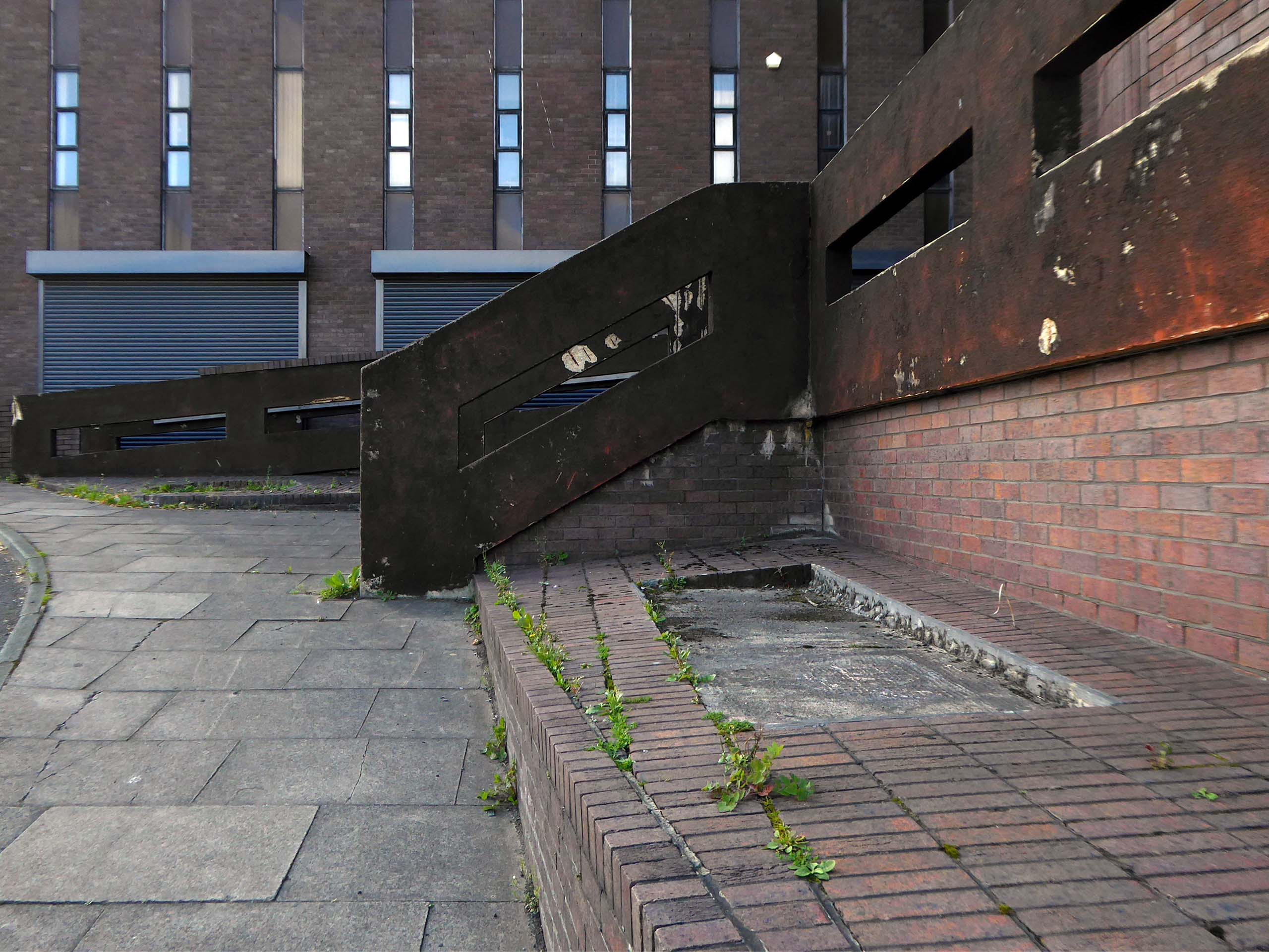
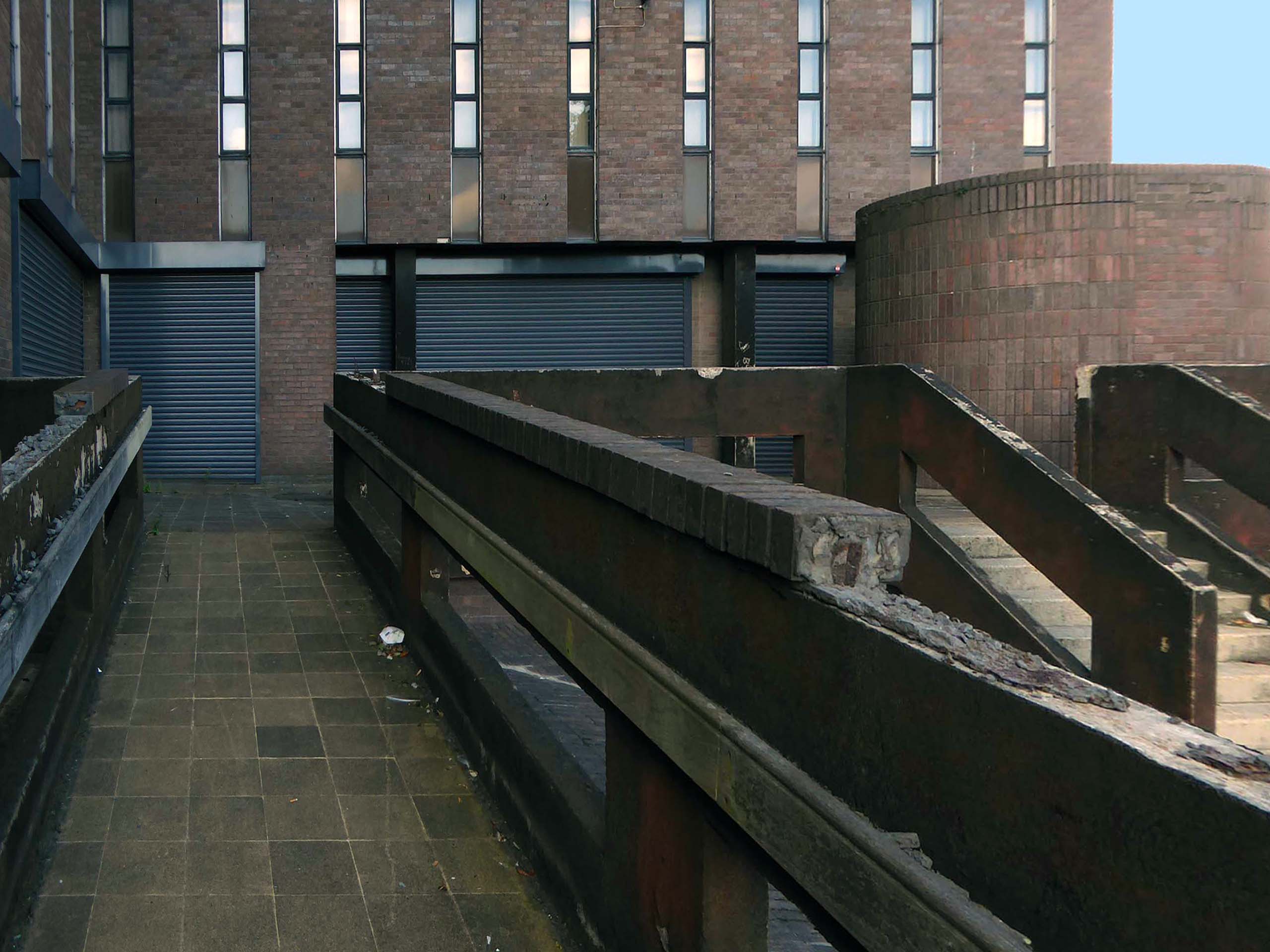
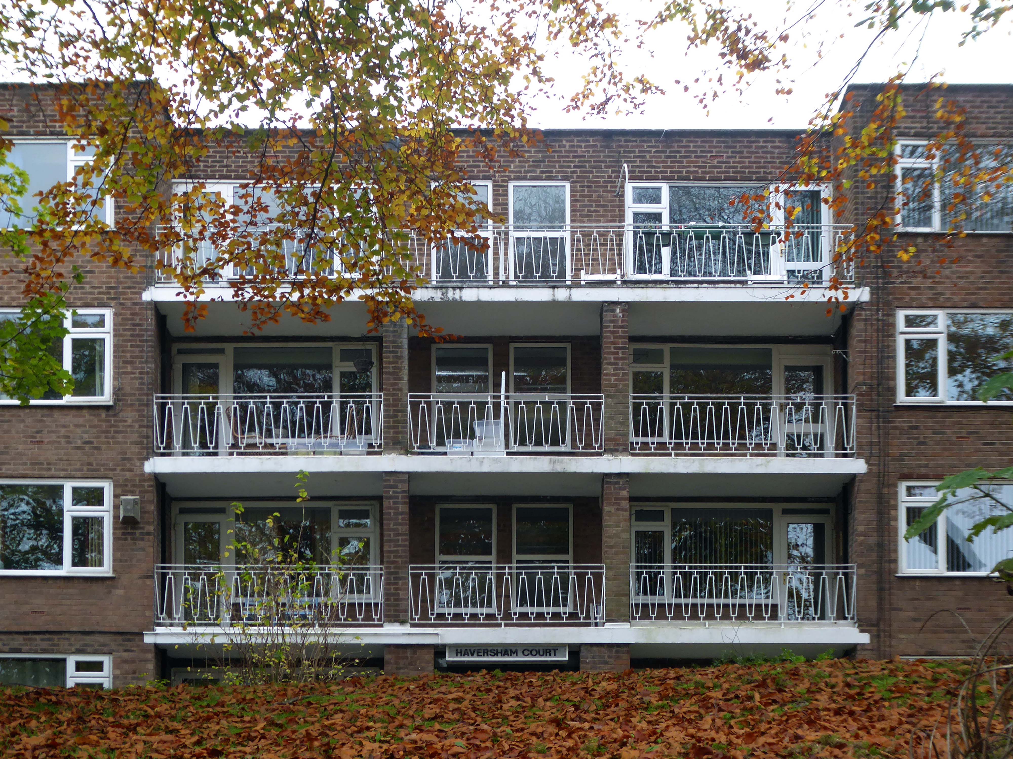
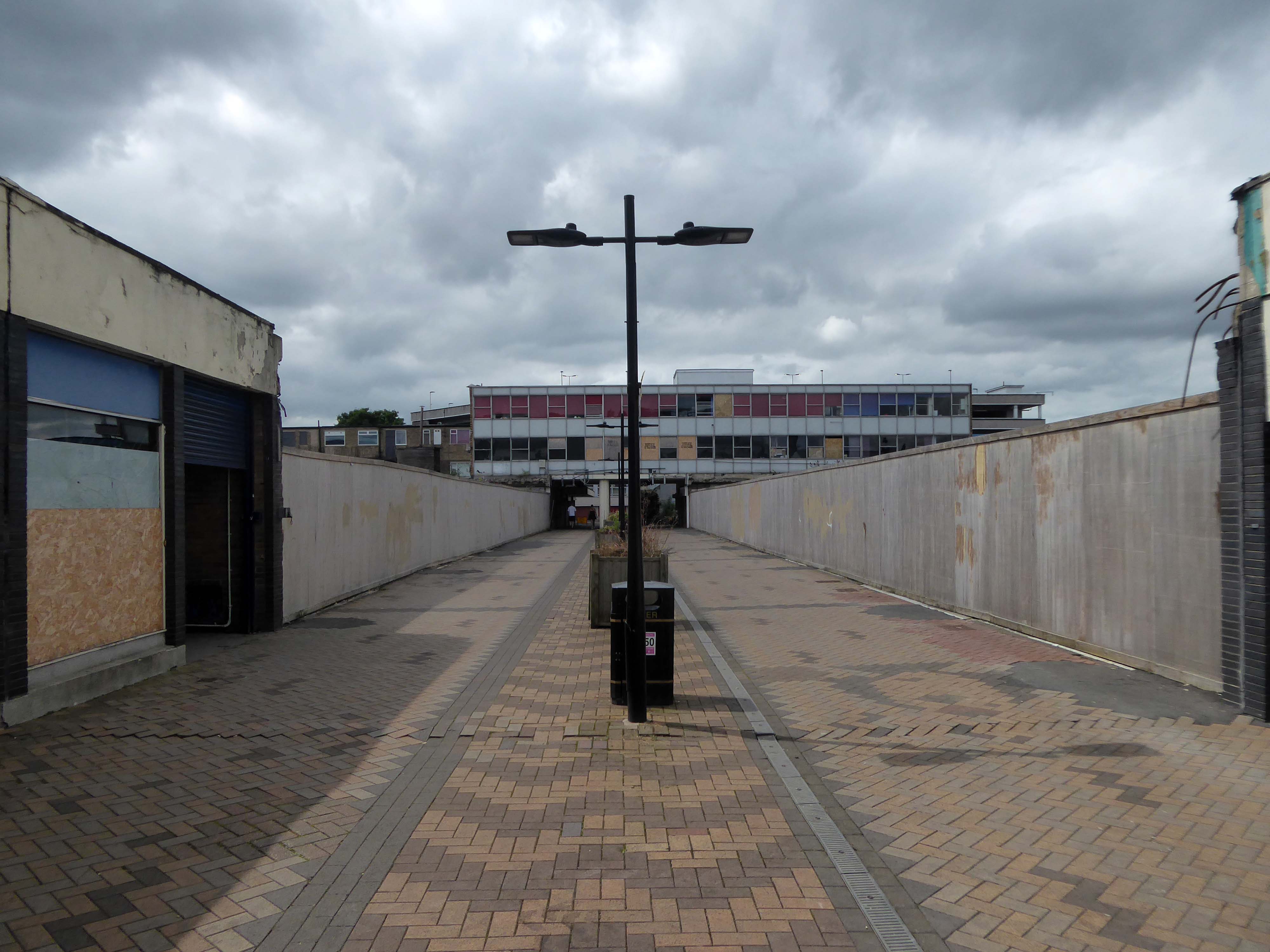
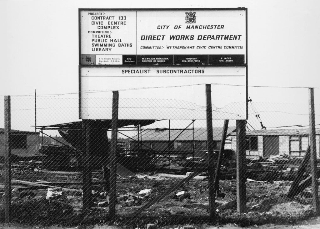
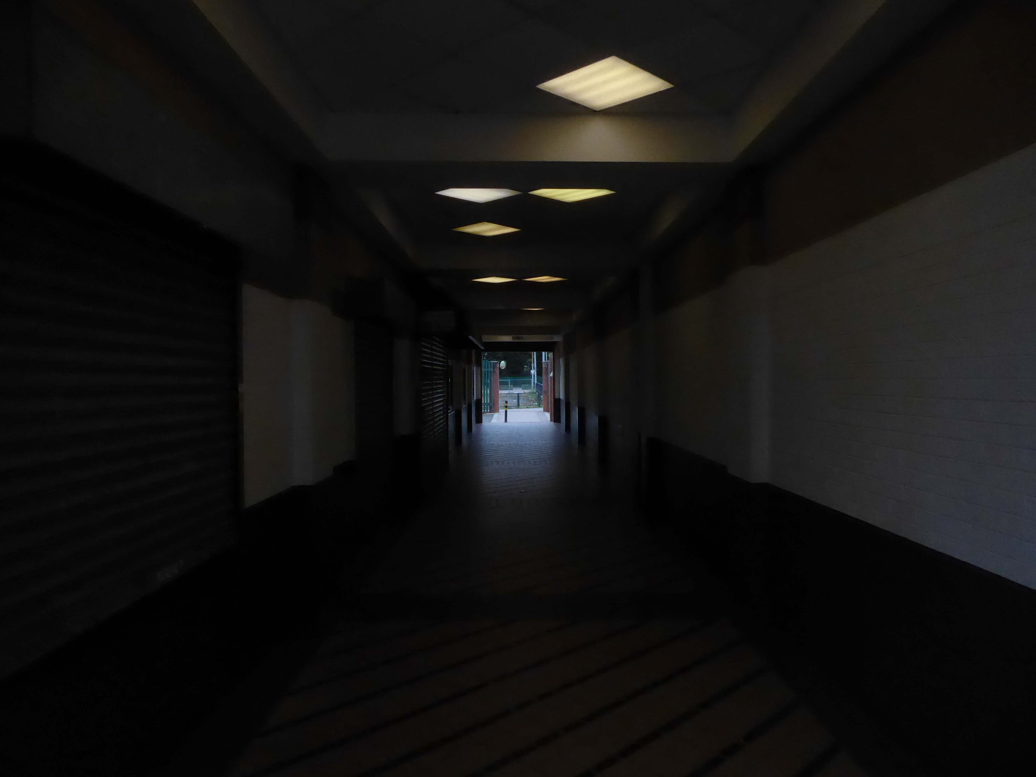
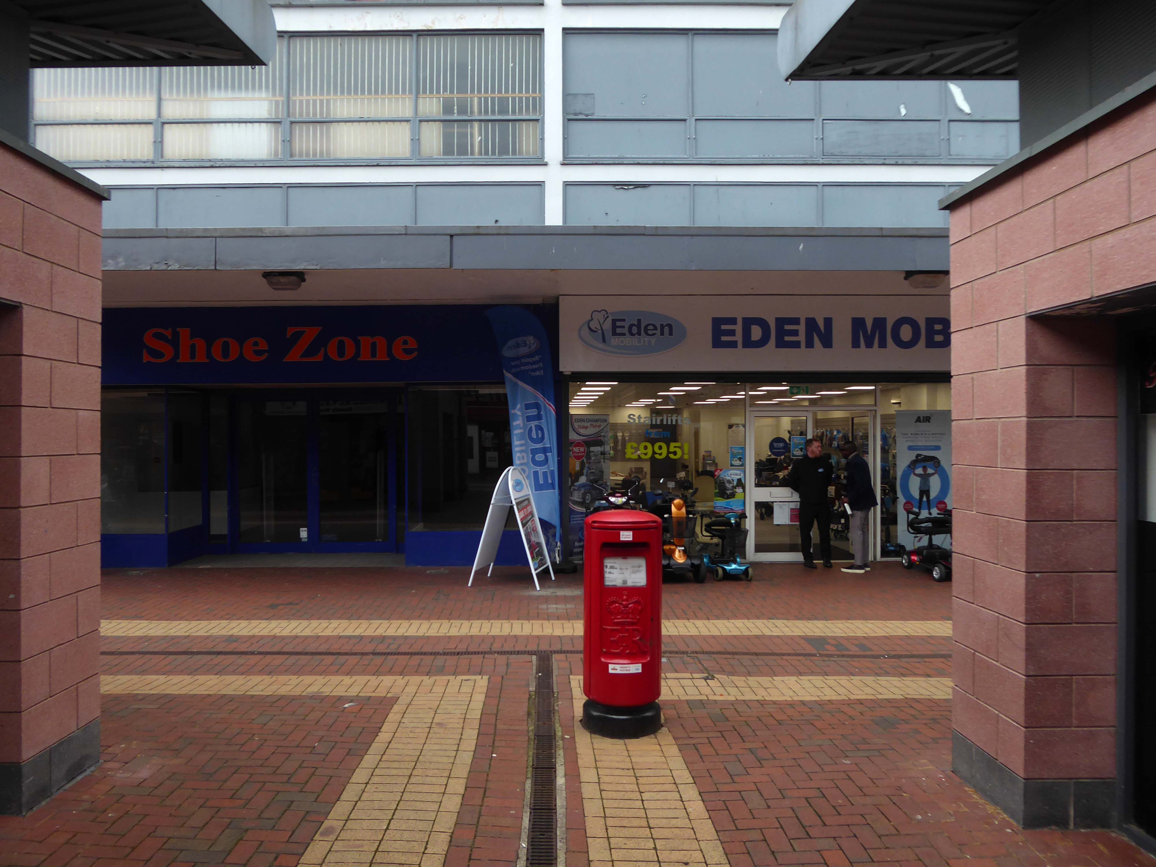
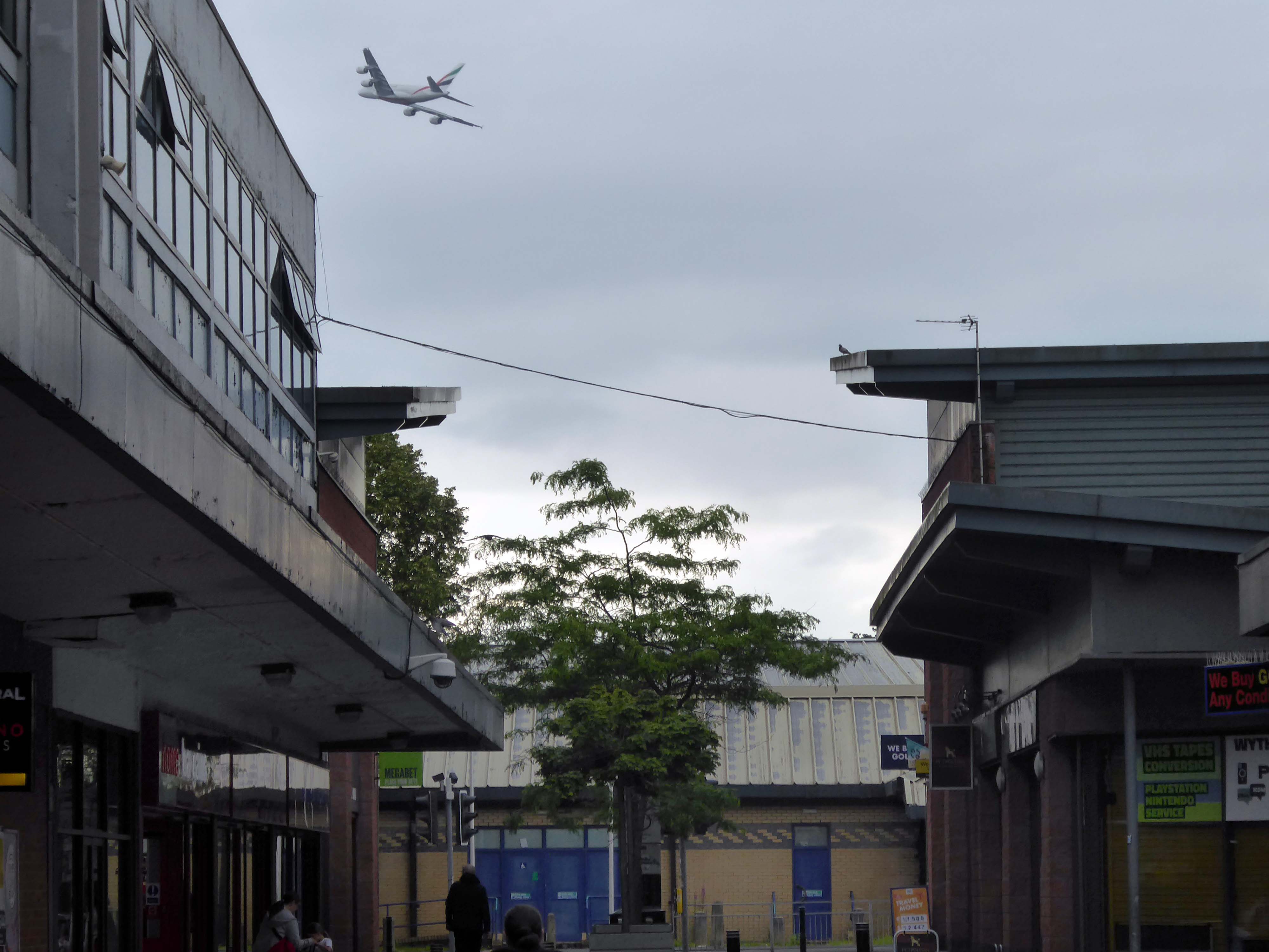
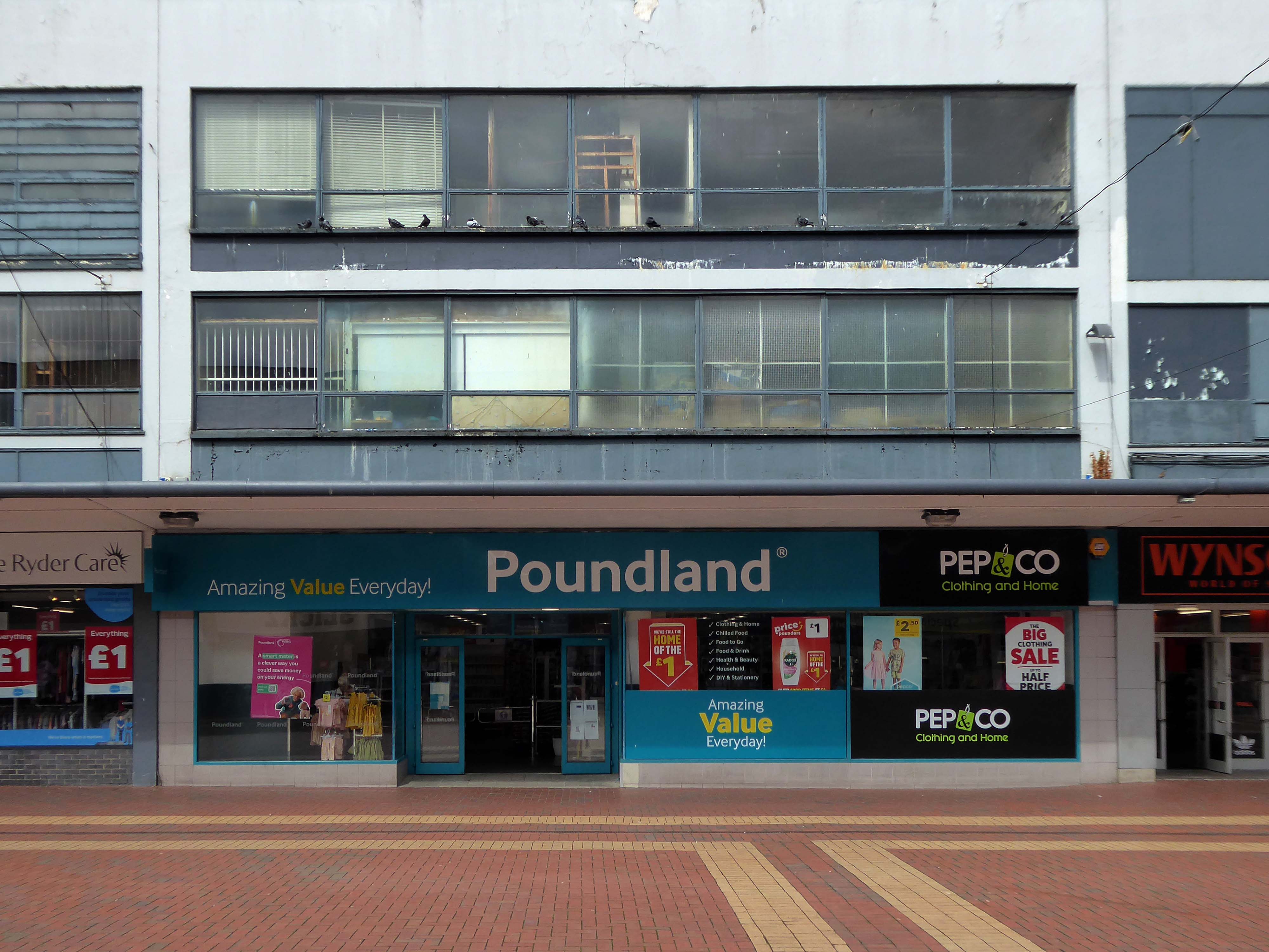
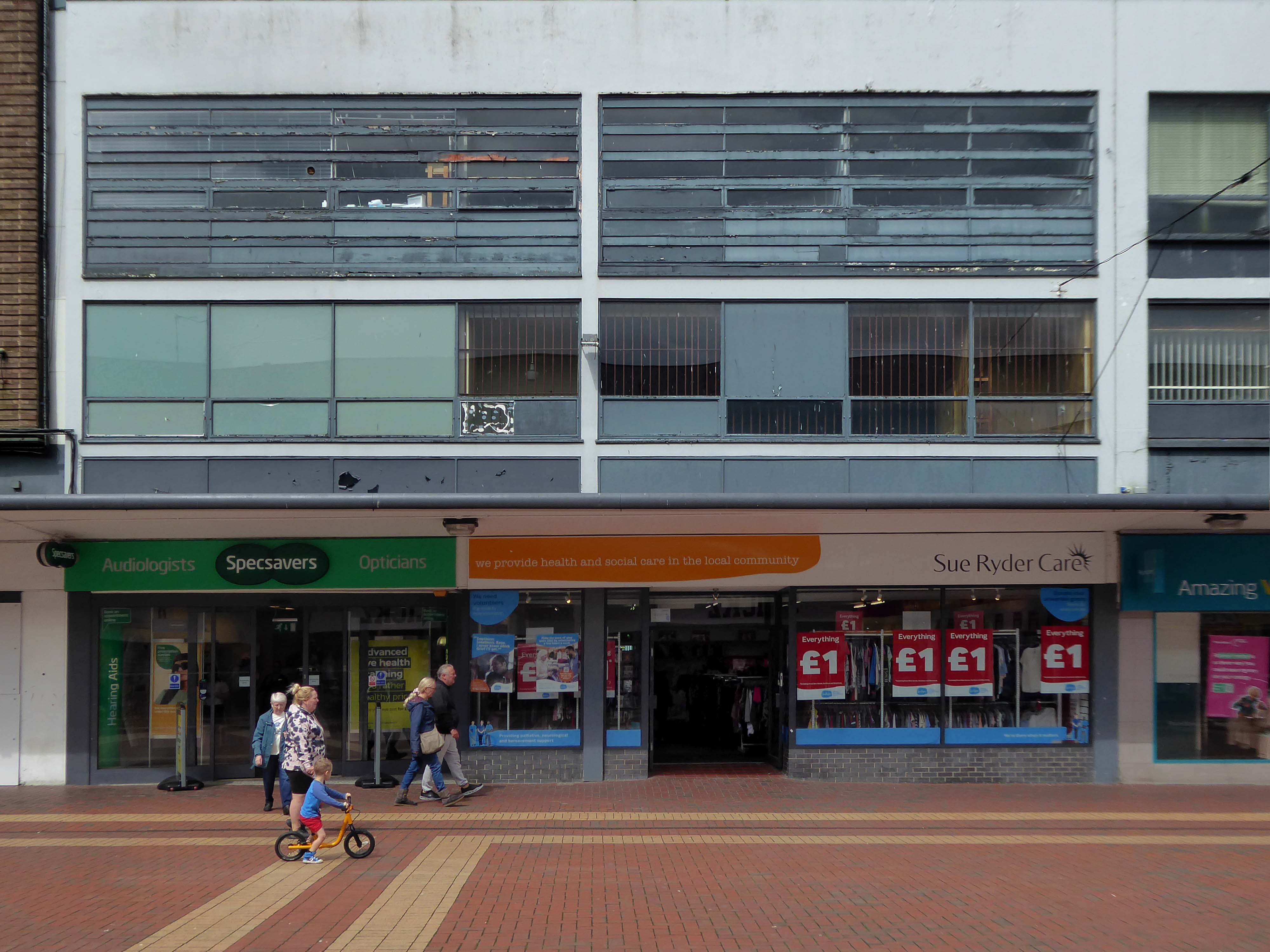
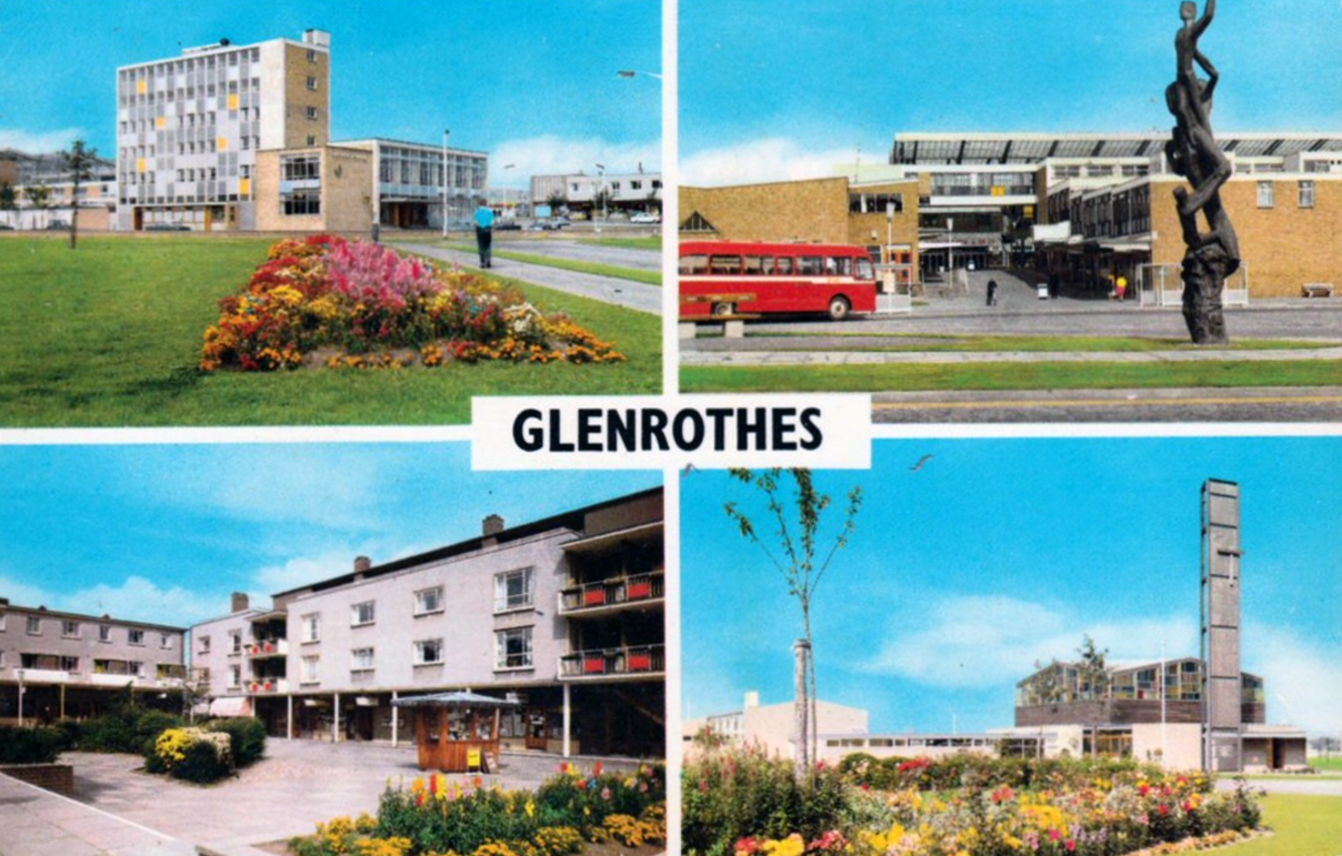
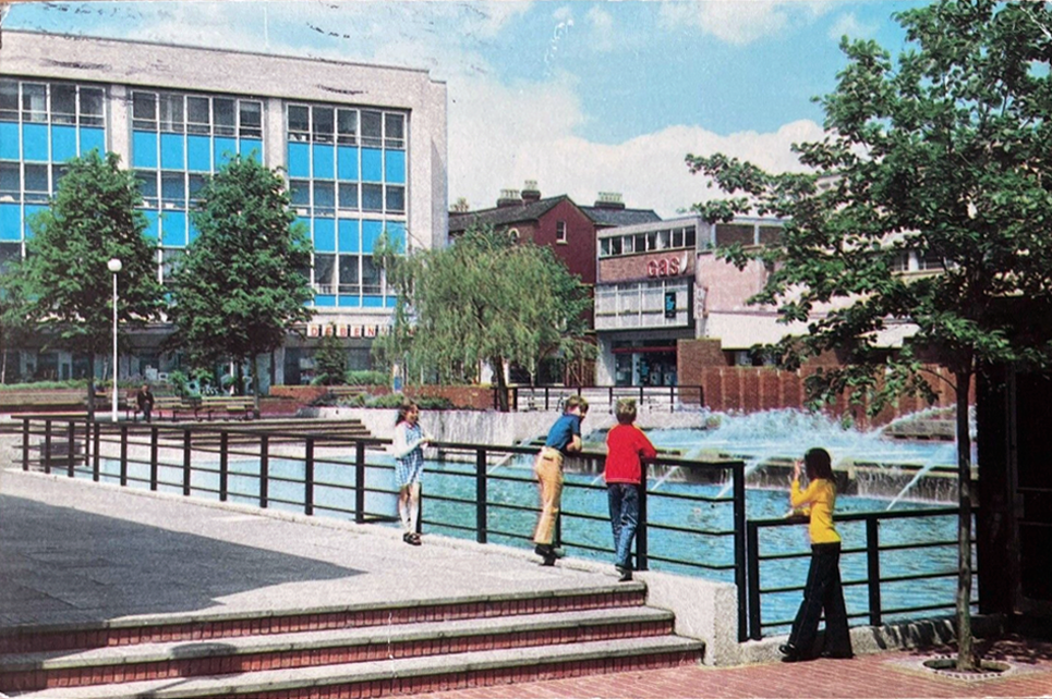
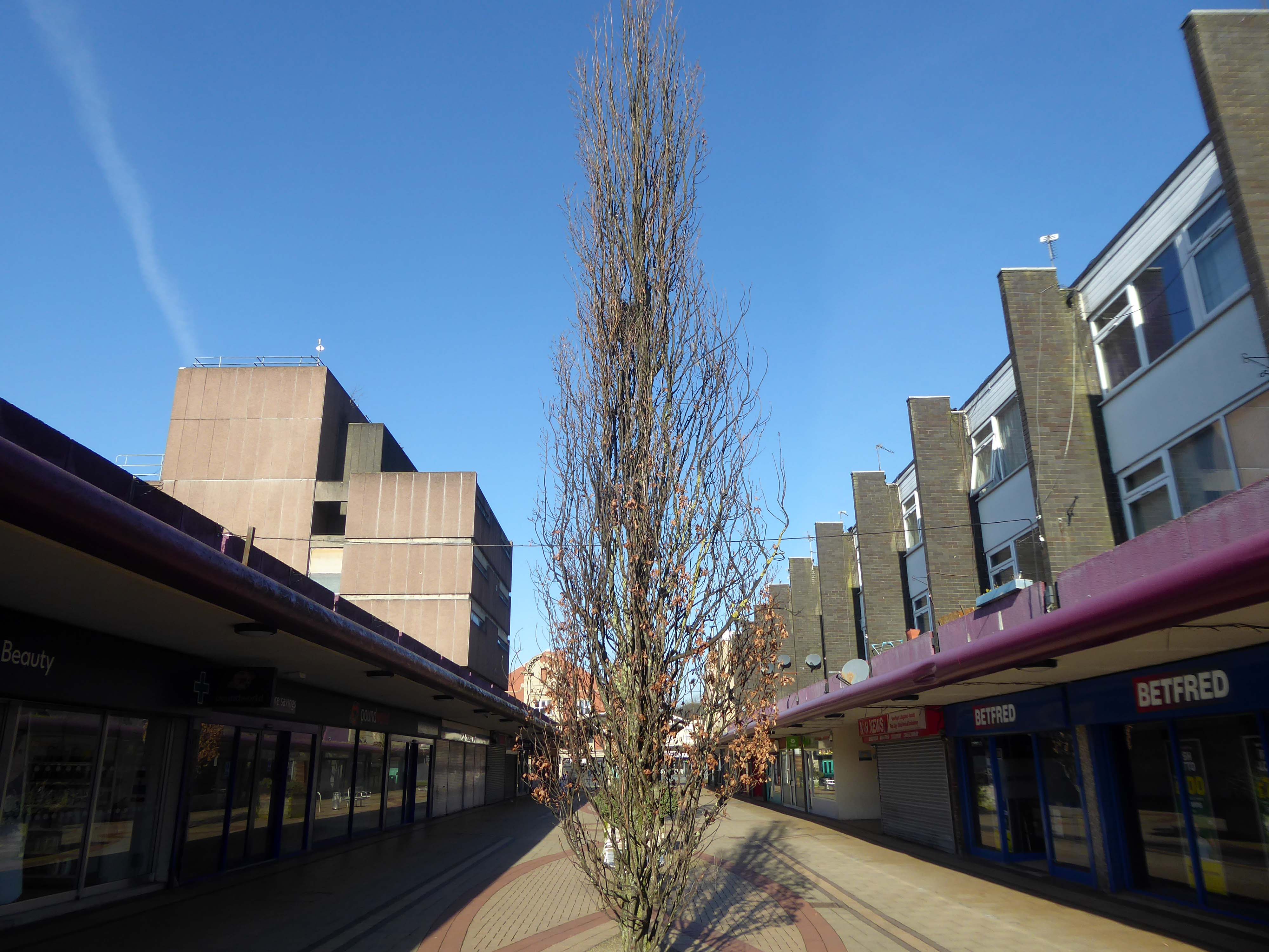
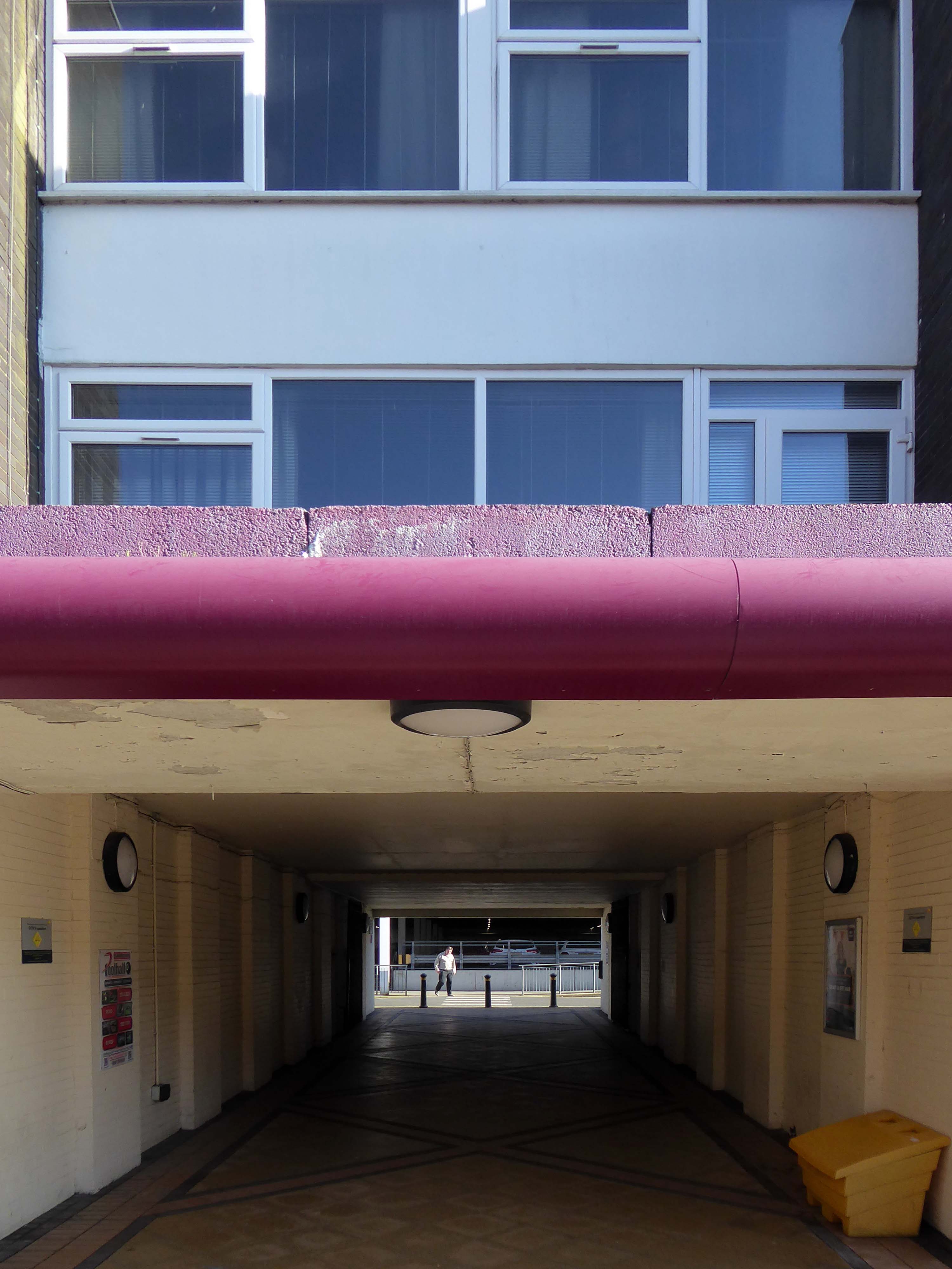
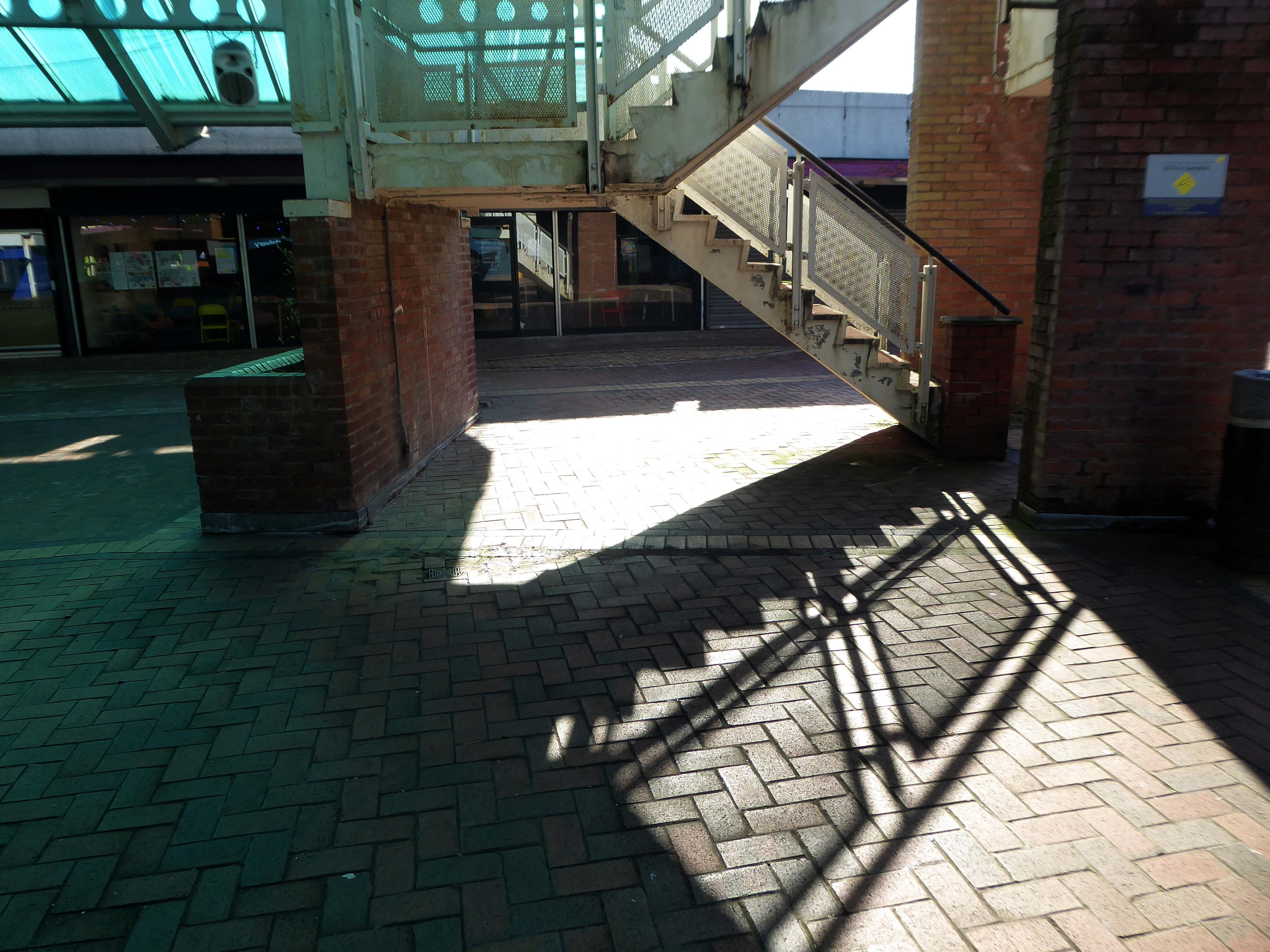
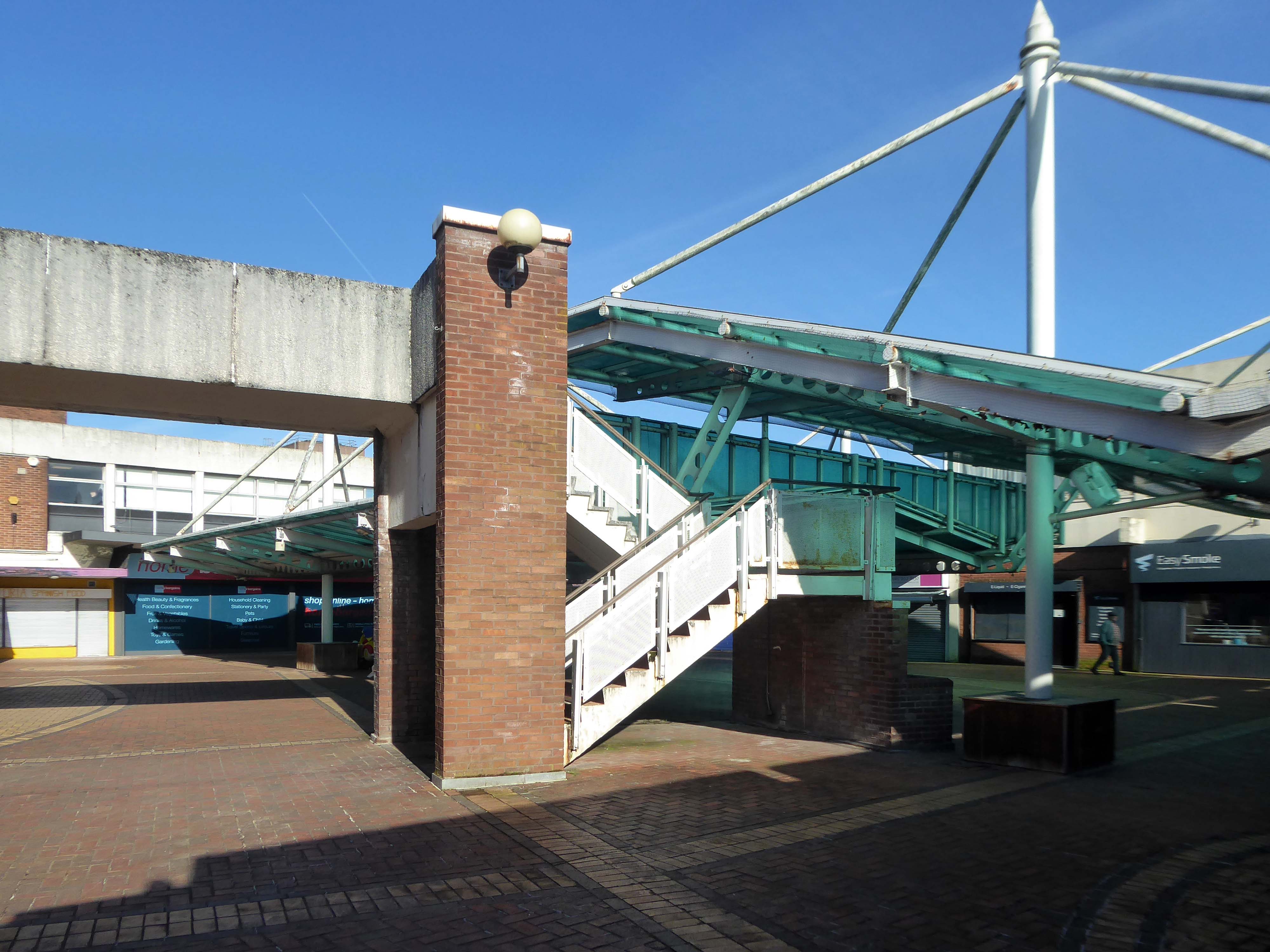
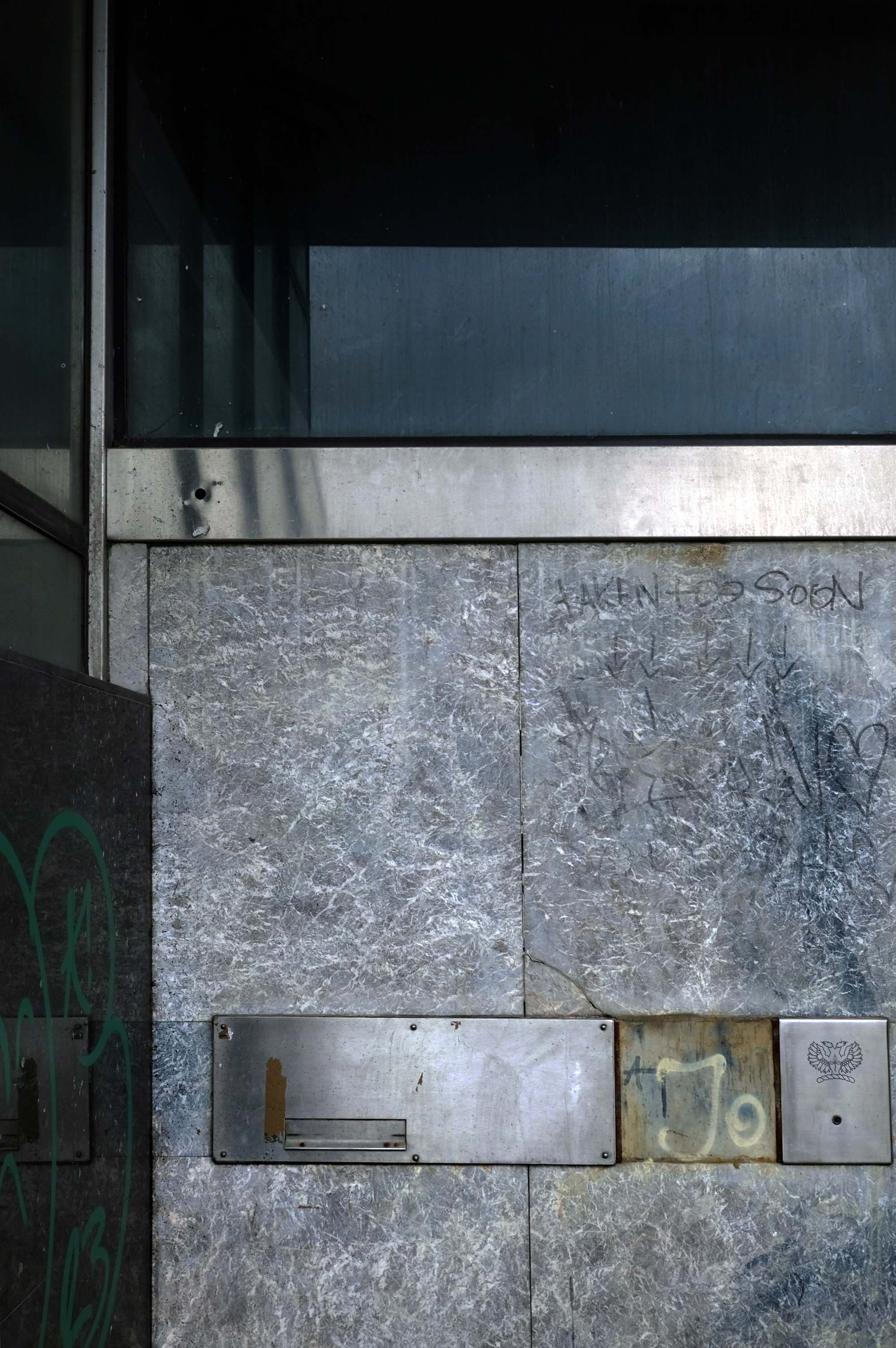
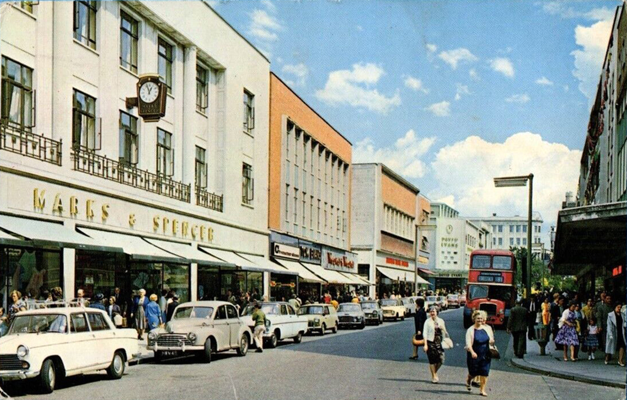
Plans for the new town centre started to be developed in 1960 by Chief Architect Roy Gazzard. The process would go through eight sets of revisions before they were finally approved in 1968. Yoden Way was then pedestrianised, and the small row of shops built in 1950’s was incorporated into the new shopping precinct, forming the north western end of Yoden Way. Like many other town centres across Britain undergoing modernisation, the high-street was split onto two levels, with ramps providing access to raised walkways.
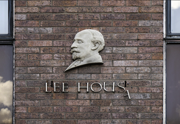
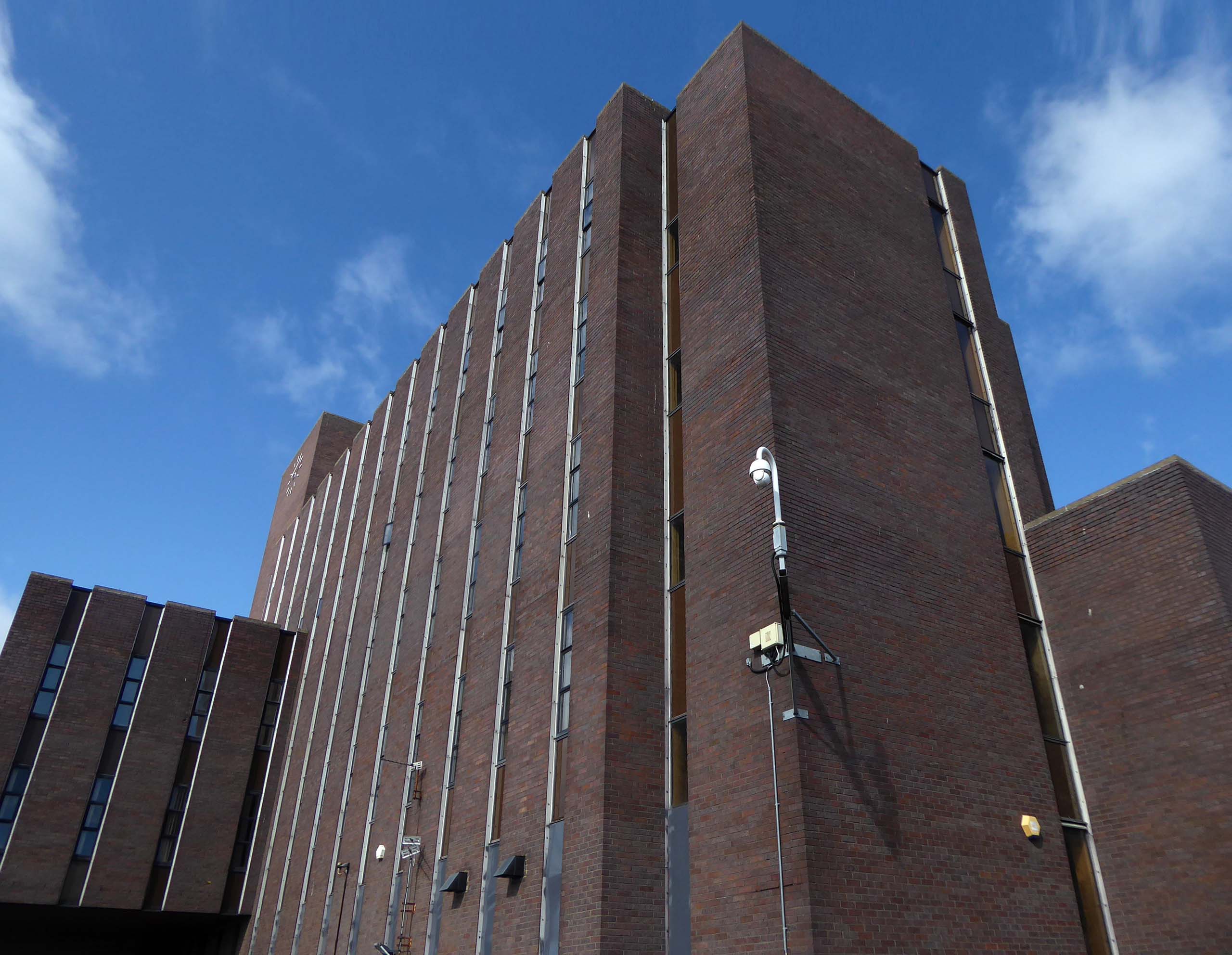
The construction of Lee House – named after Peter Lee, started in 1974. Once completed, the Development Corporation moved its Headquarters from Old Shotton Hall to Lee House in 1976, occupying the building until it was sold in 1984 and remaining staff relocated to Newton Aycliffe.
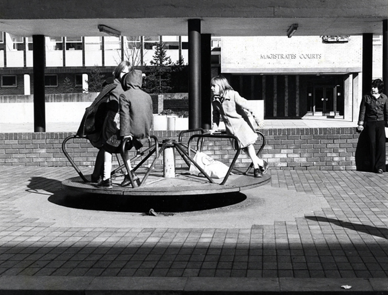
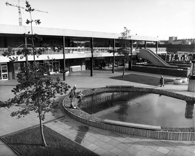
Enhancing the built environment, Peterlee Town Centre was furnished with play equipment, an ornamental pond, open air escalators, and a sculpture by John Pasmore – son of Victor.
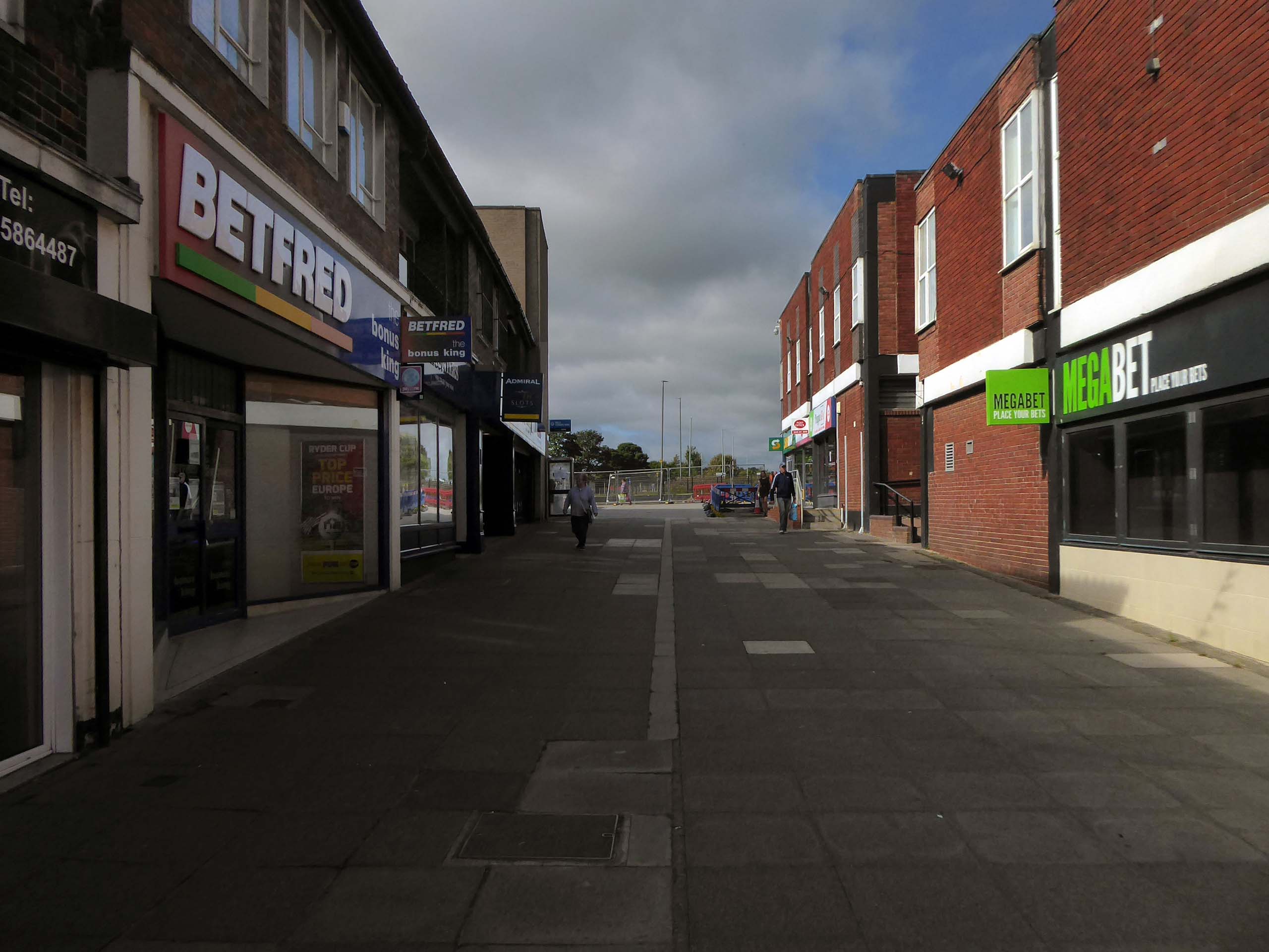
These features were later removed after the town centre was sold to Teesdale Investments – Peterlee Limited in 1985.
Access ramp at the bottom end of Yoden Way, prior to the construction of Lee House in 1973.
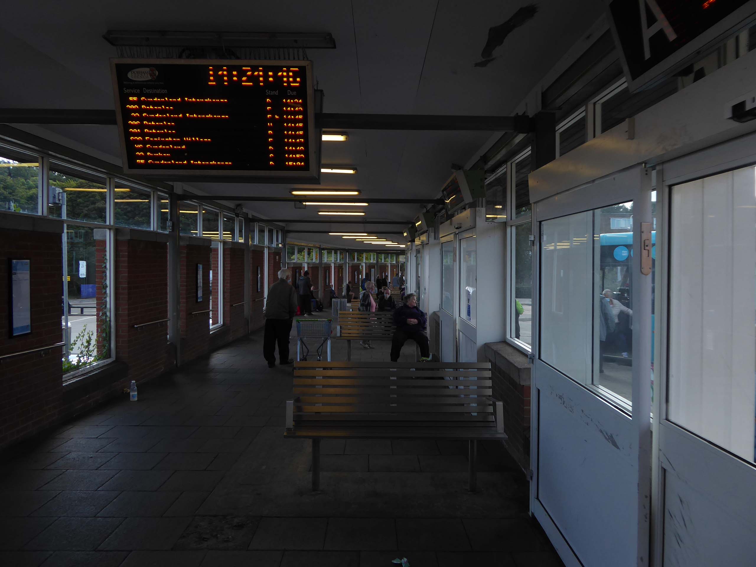
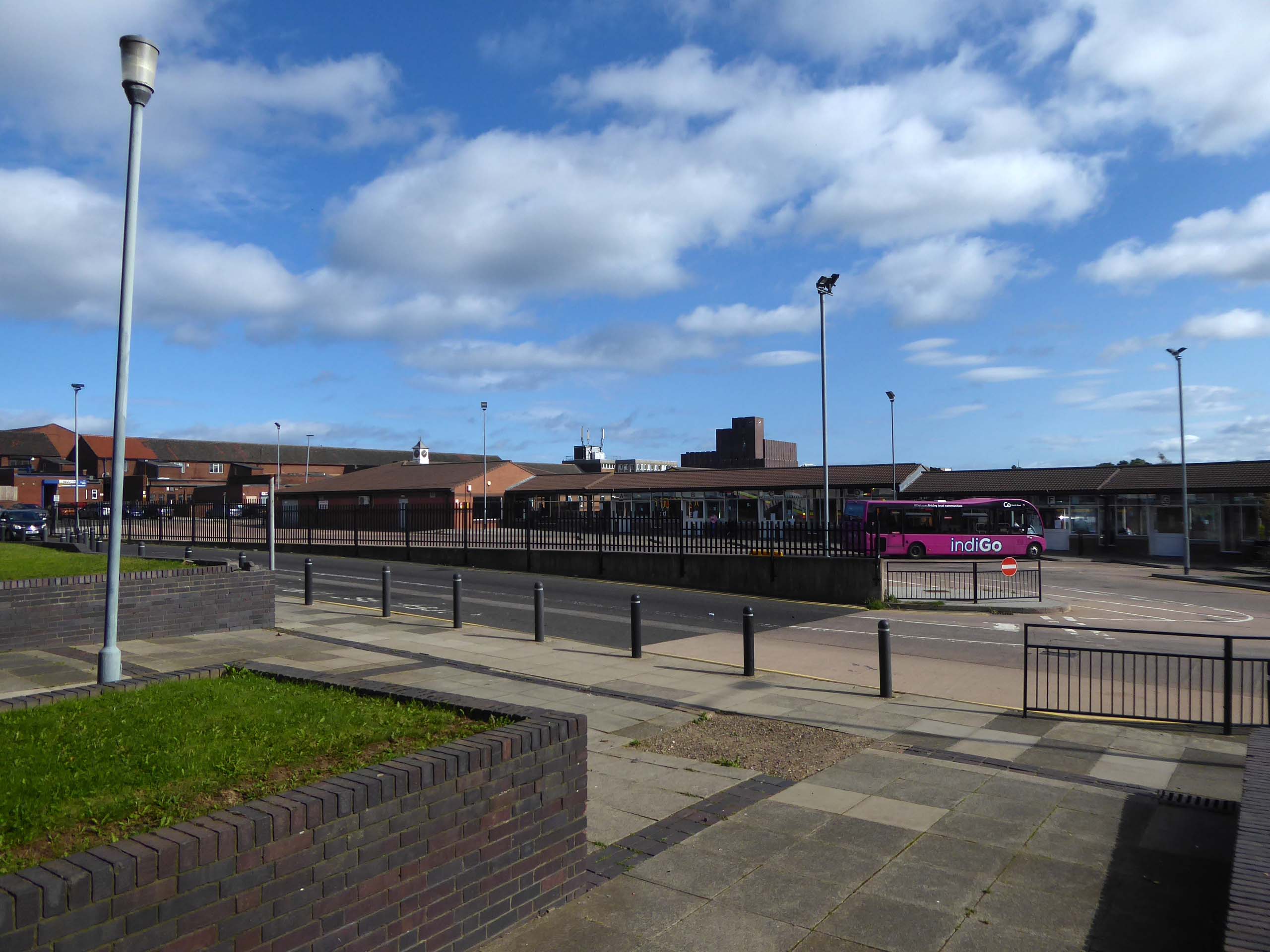
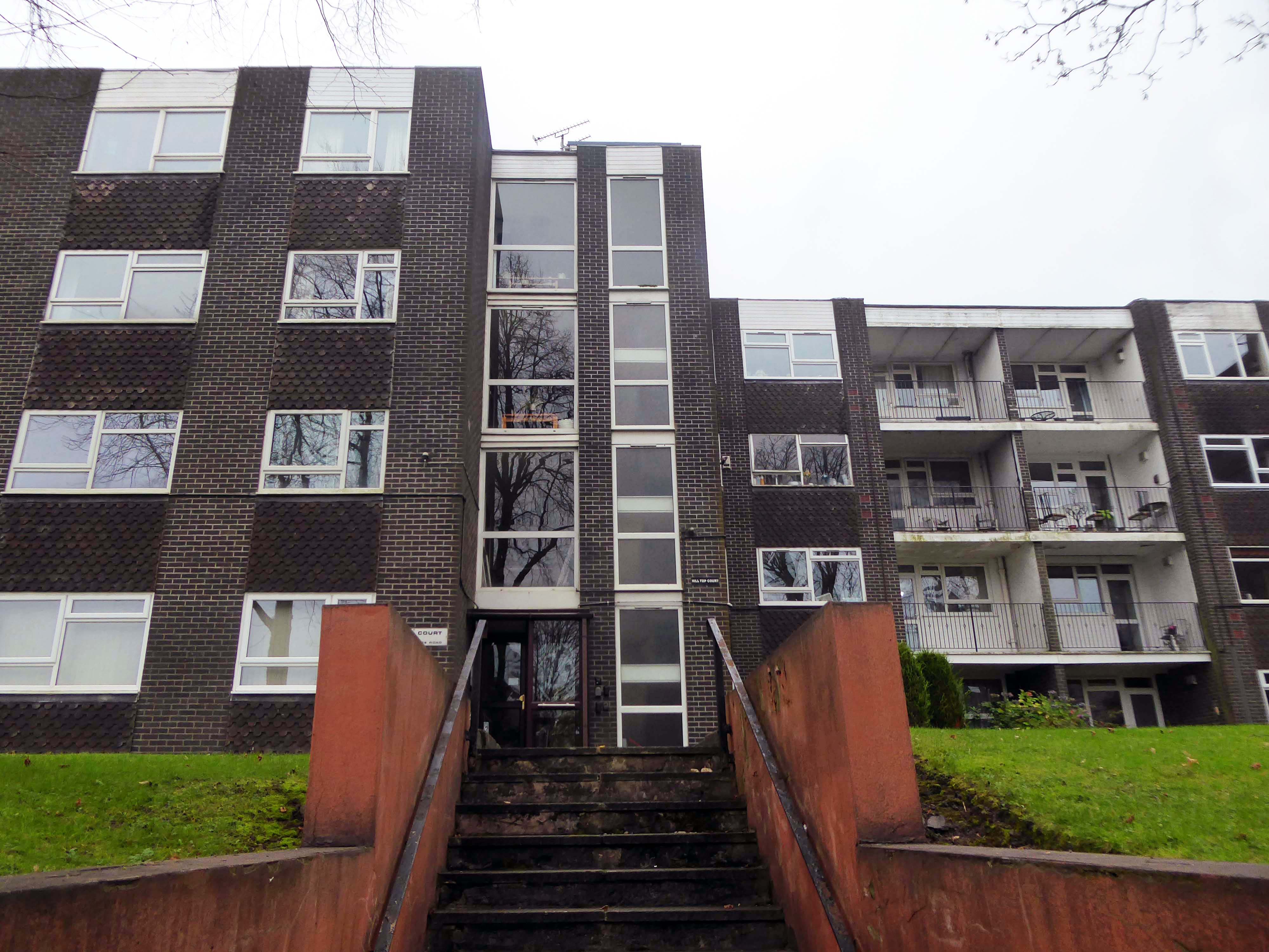
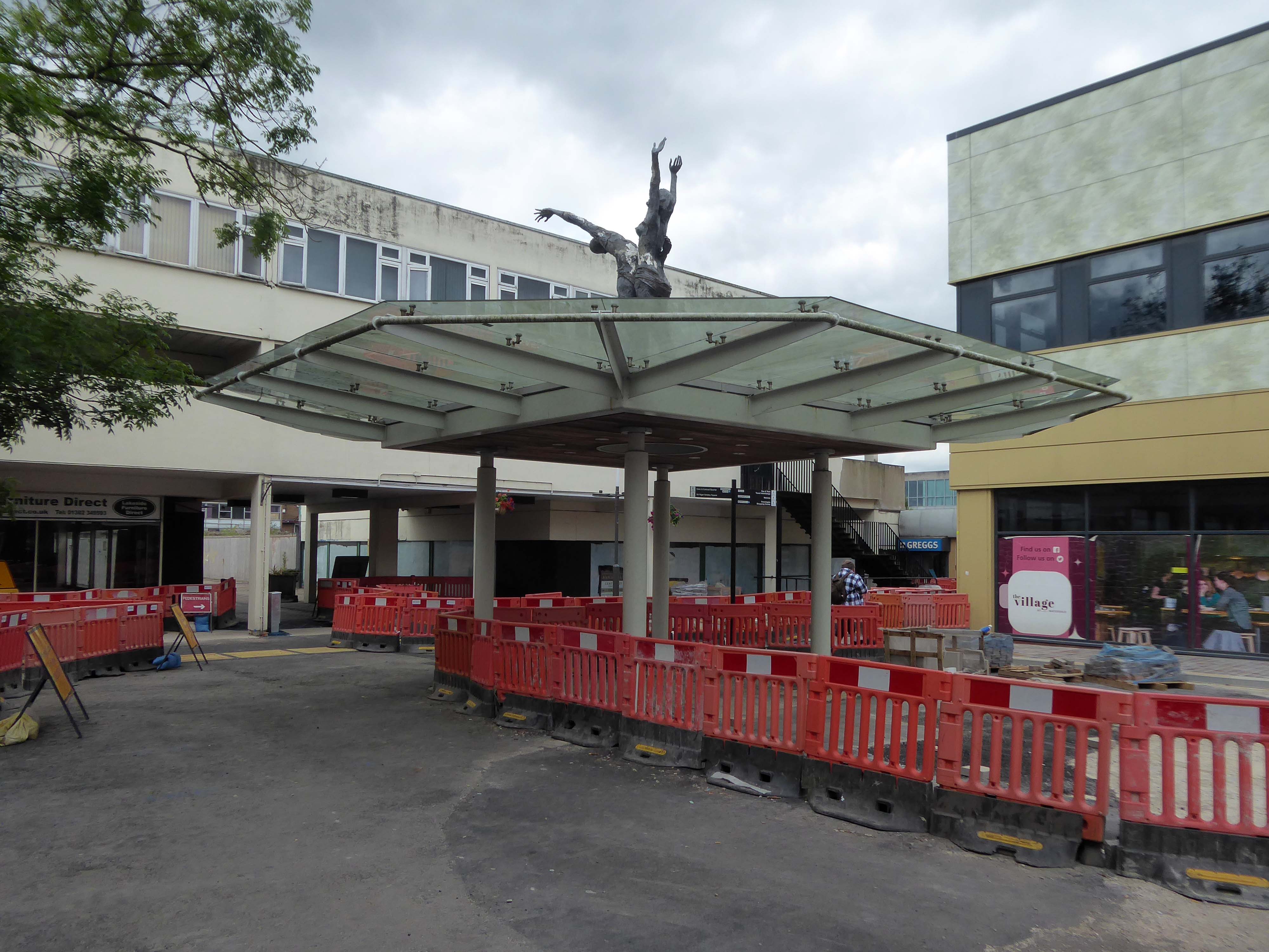
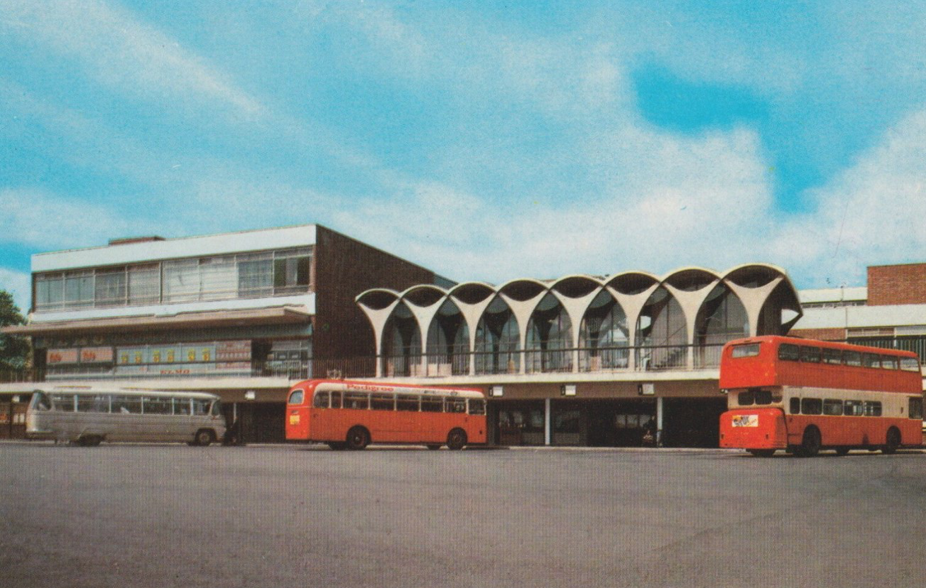
It’s 2021 and I arrive at the Bus Station.
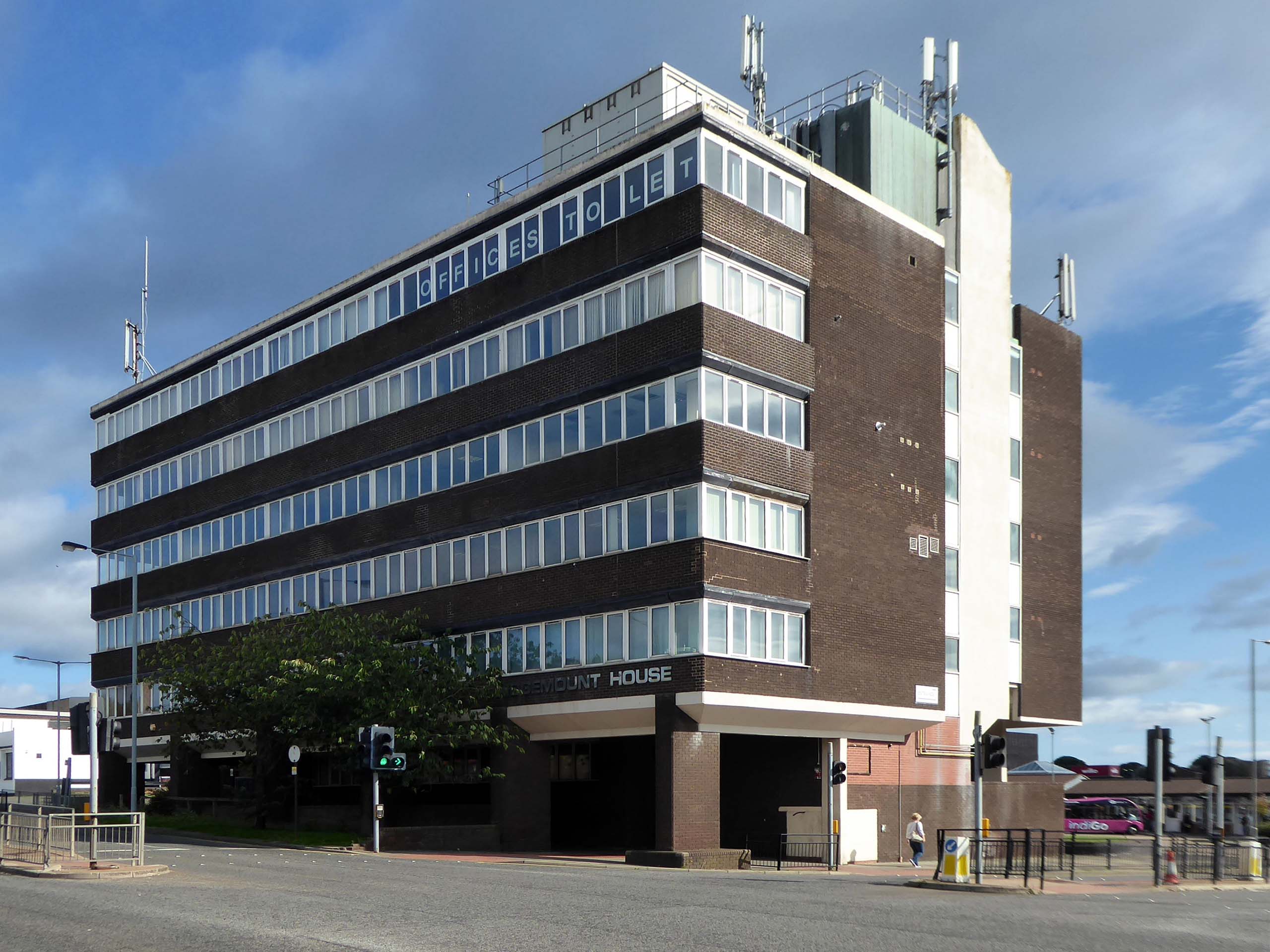
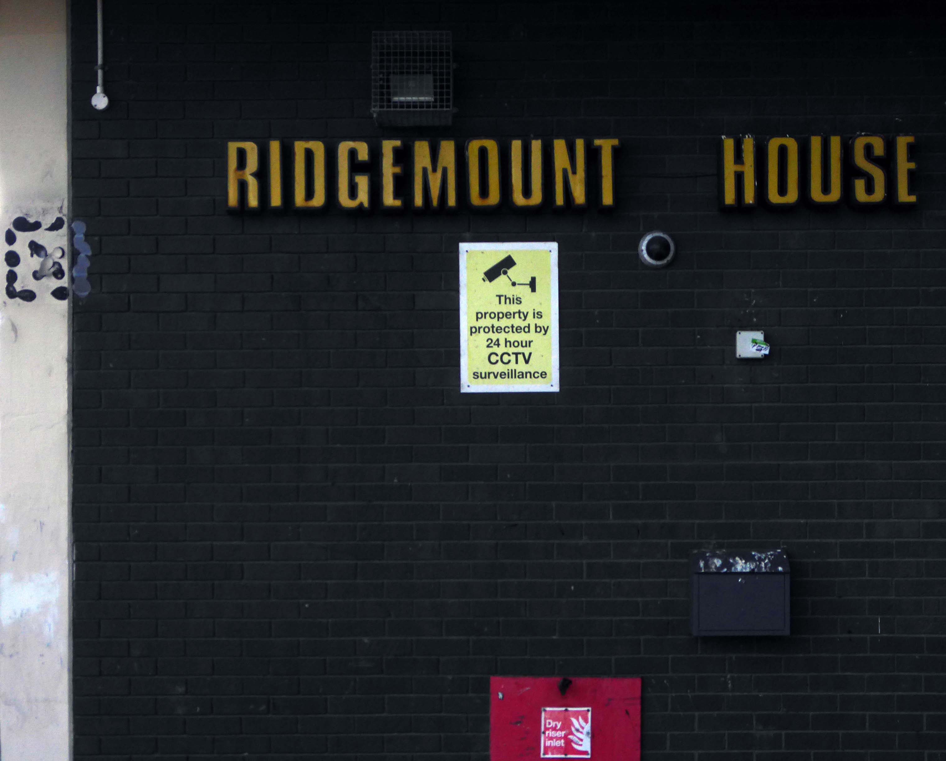
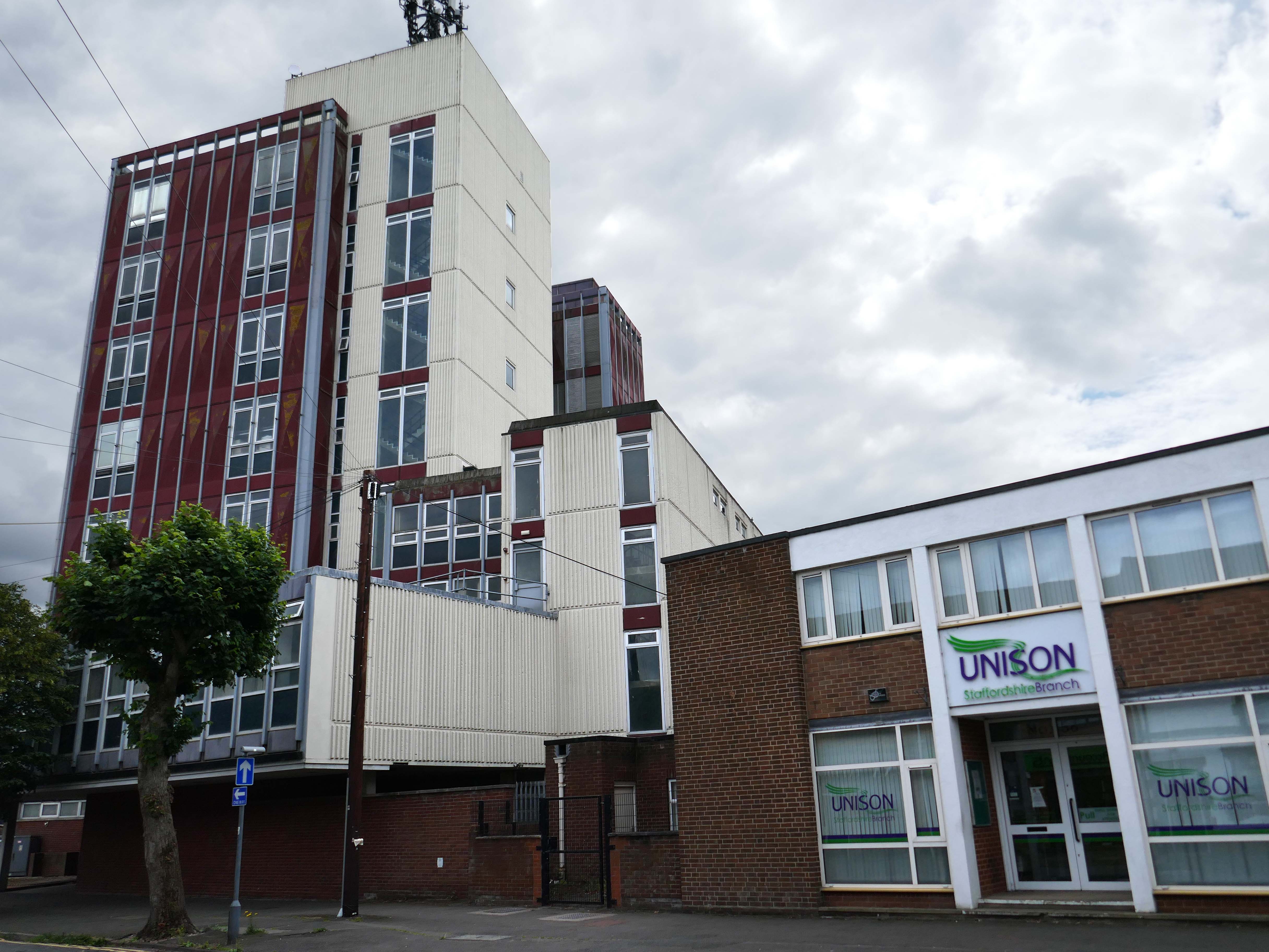
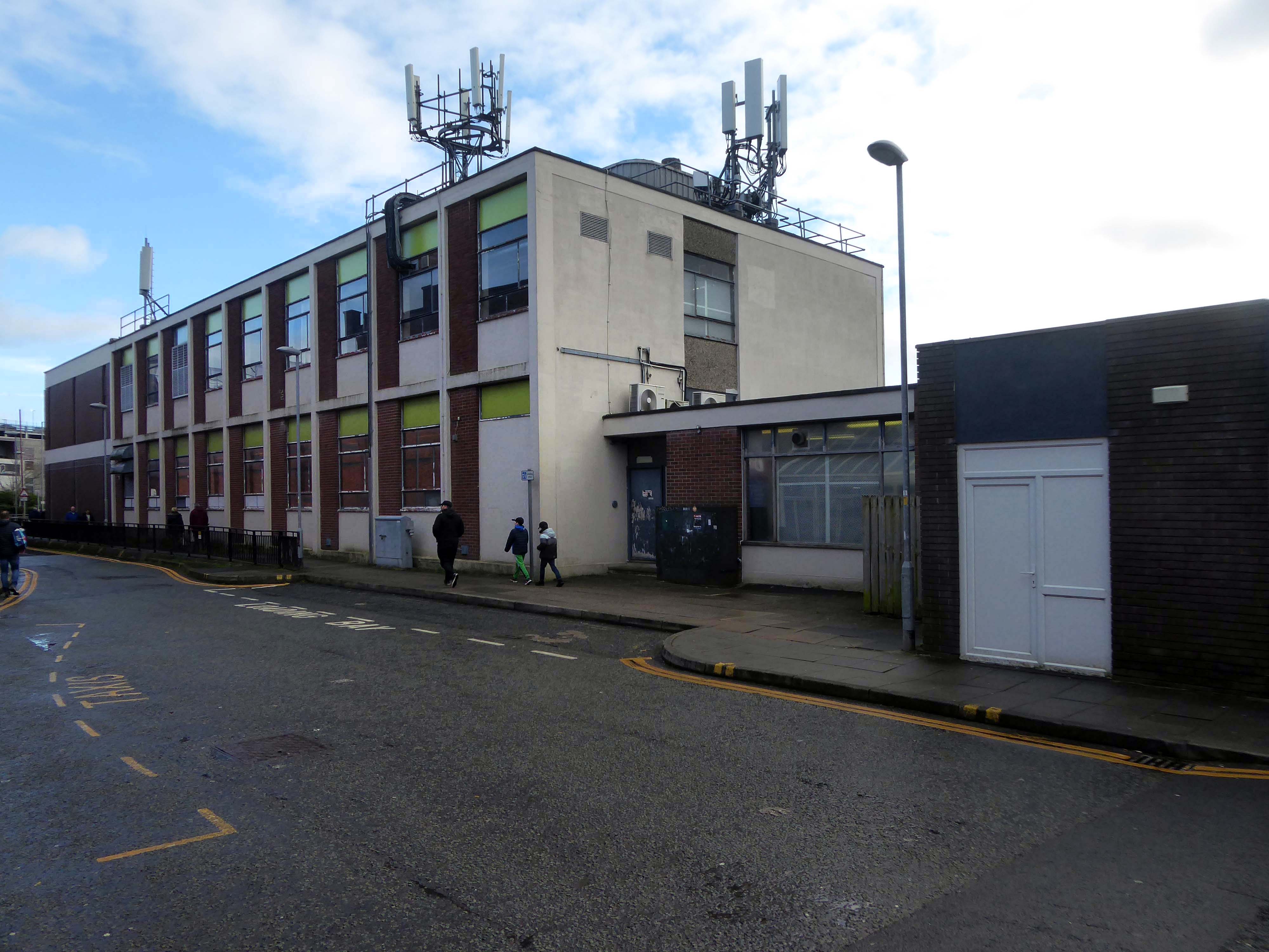
Immediately adjacent is Ridgemount House. – once home to the Job Centre.
Firefighters were called to the disused Ridgemount House on Bede Way in Peterlee on Wednesday August 16th 2023 at about 8.20pm after reports of a blaze.
Crews found a fire had broken out in the first floor of the building, which was found to be the home of thousands of pounds worth of cannabis plants back in 2020, after a man converted two floors for use as a drug farm.
Tarlochan Singh, owner of Ridgemount House, has been prosecuted following the discovery of several serious fire safety breaches at the property.
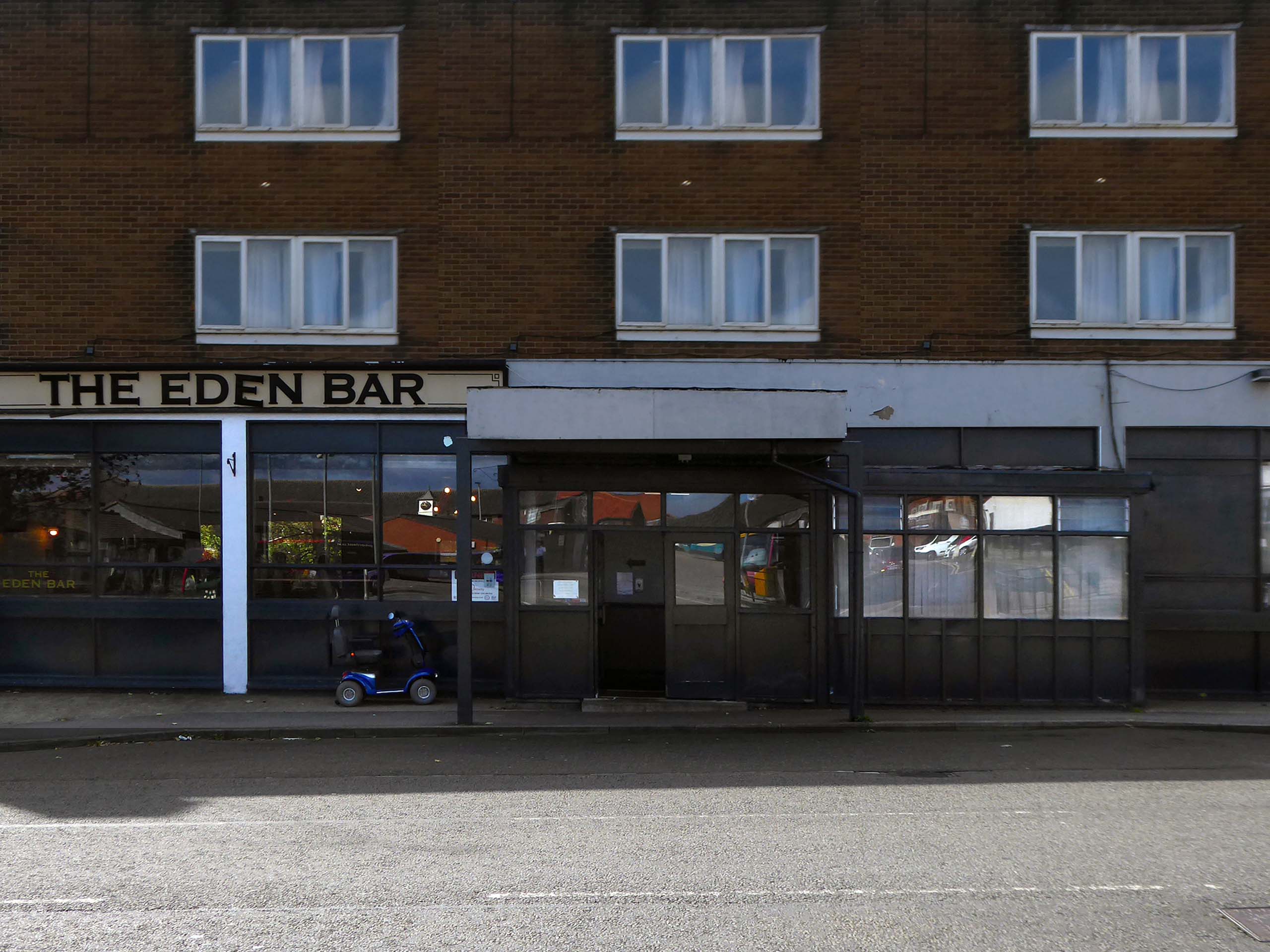
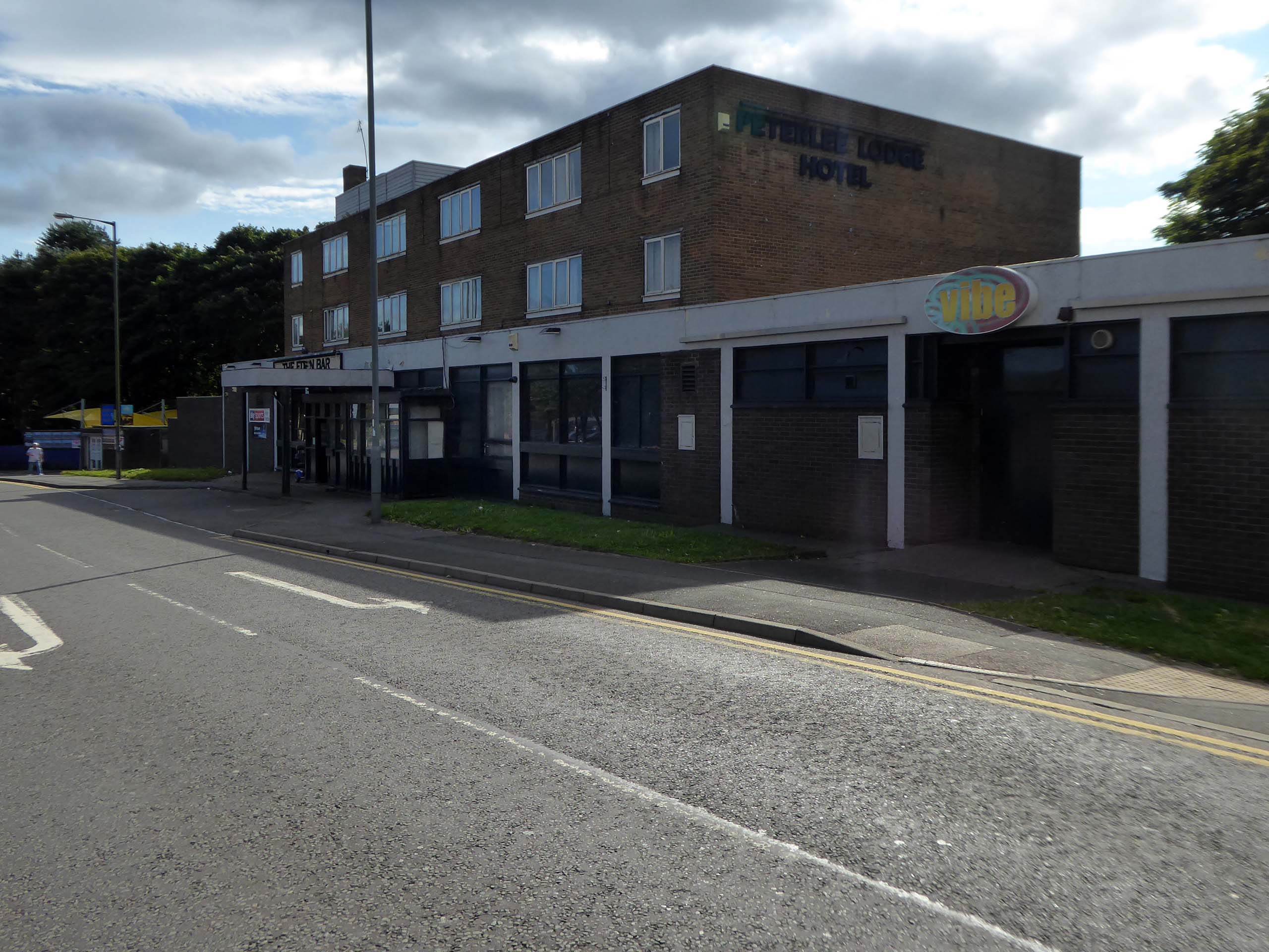
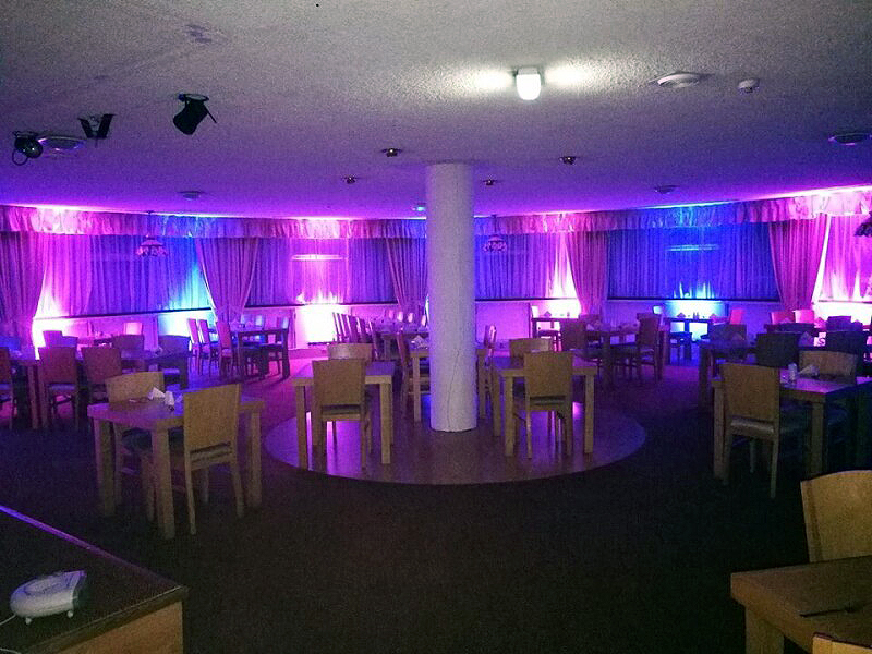
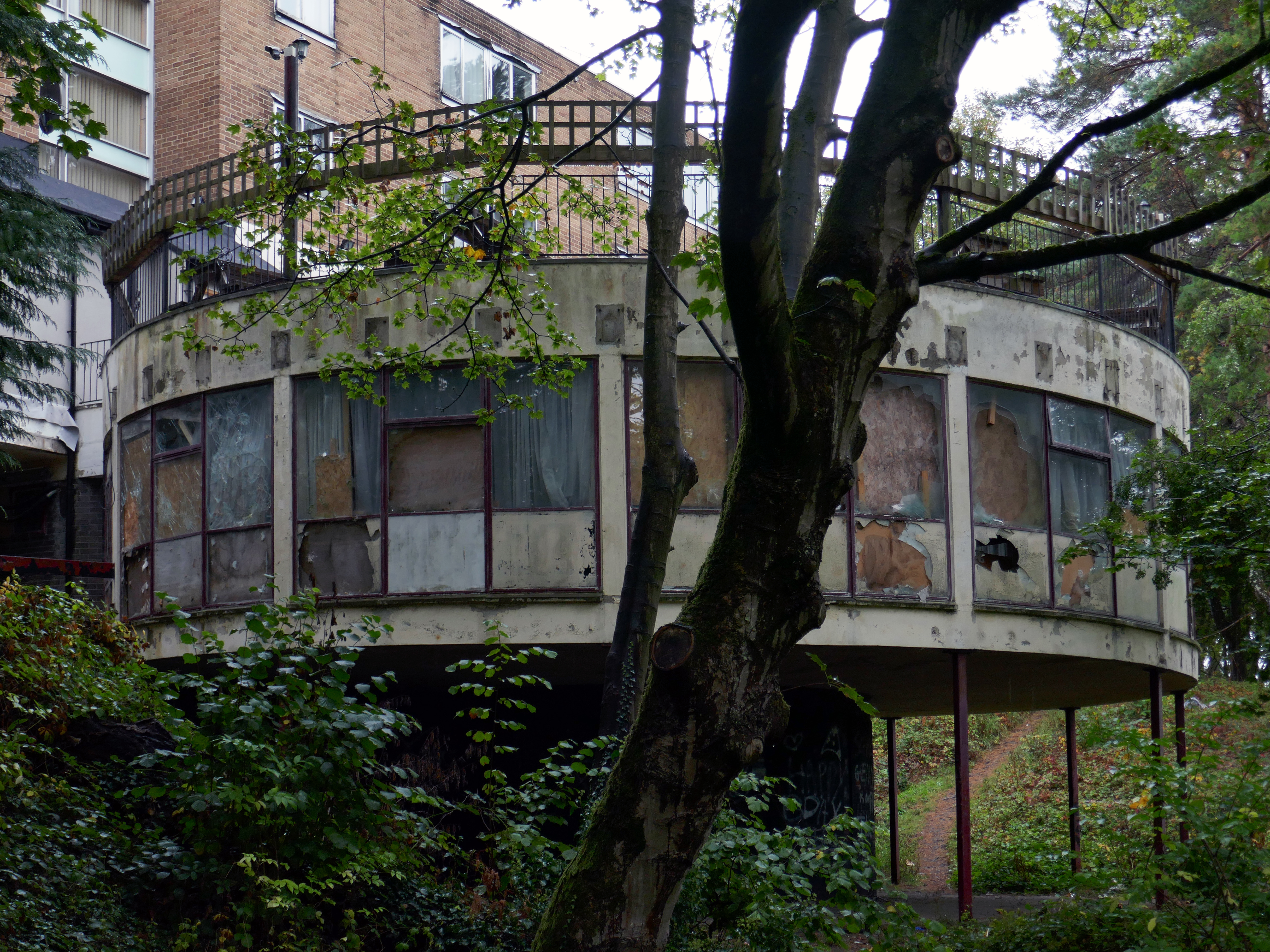
Readers have voted Peterlee nightspot Vibe as the ‘most tragic hometown club’ in the North East
Formerly known as The Dance Factory, Vibe, in Peterlee town centre, is a place famous for it’s almost impossible to get off ‘tramp stamp’ and next door neighbour The Lodge, where many locals will go for pre-drinks and some karaoke before heading to the club.
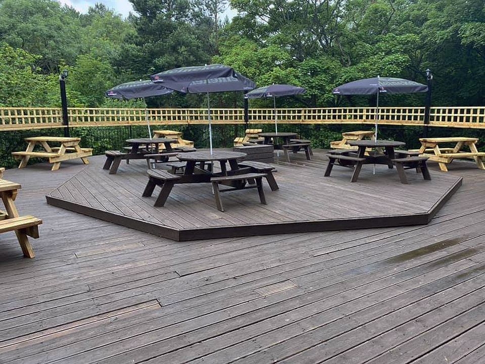
The bar which once boasted a bijou rotunda with an exclusive upper terrace, has now closed.
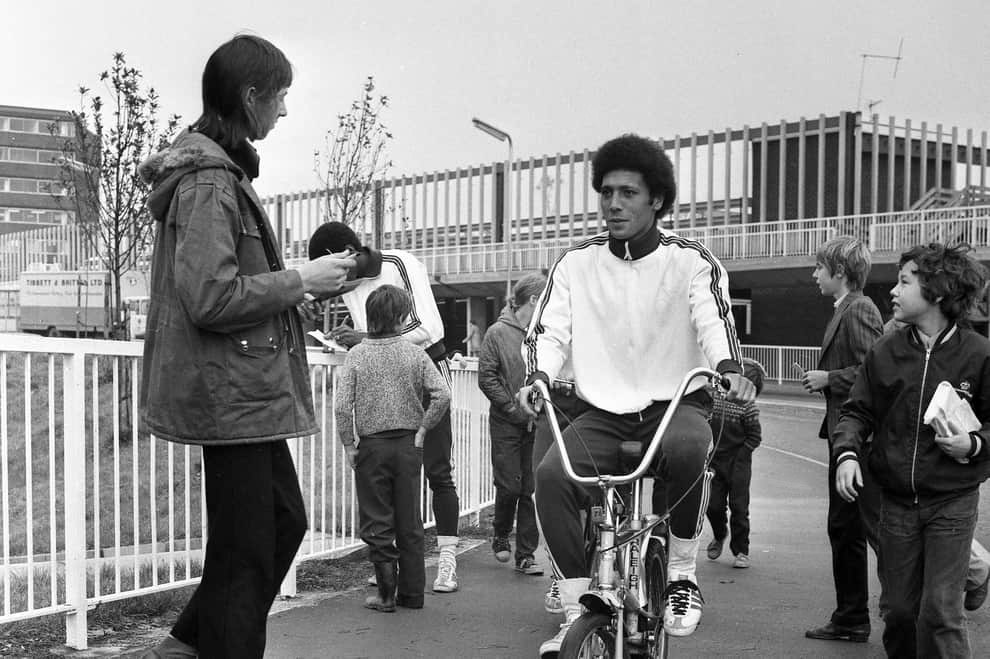
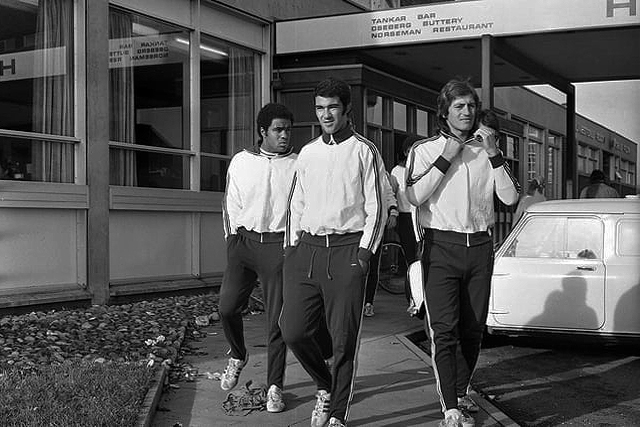
Back in 1973 the hotel was badged as the Norseman.
The giants of Sporting Lisbon faced Sunderland in the European Cup Winners Cup and they spent the build-up to the tie in the Norseman Hotel. They met local children, took a walk in the dene, signed autographs and even tried riding a Chopper bike. The side lost 2-1 at Roker Park to a talented Sunderland team before overcoming the Black Cats 2-0 back in Portugal.
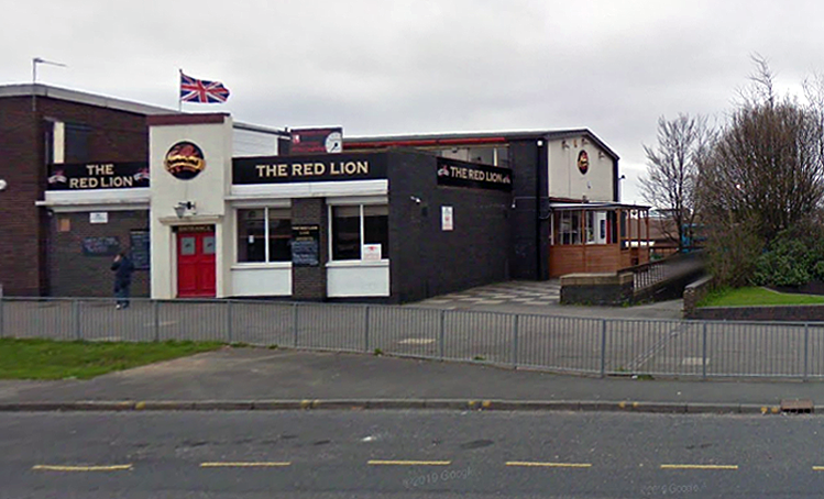
Back in 2021 Sambuca was the other town centre bar – badged with Olde English type.
Formerly the Red Lion a Cameron’s estate pub.
April 20th 2014 – Happy Easter everyone. We are open today all the way to 10pm – £2 bottles VHFs, house spirits only £3 double, buckets £4, Corona £2.50 selected shots 50p, cider cans £1 + £2 Karaoke – from now on everyone who sings gets a free shot Then we have the best in all your favourite dance ‘n’ house tunes to take you into Monday.
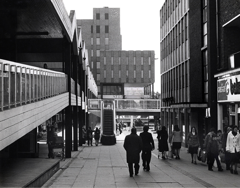
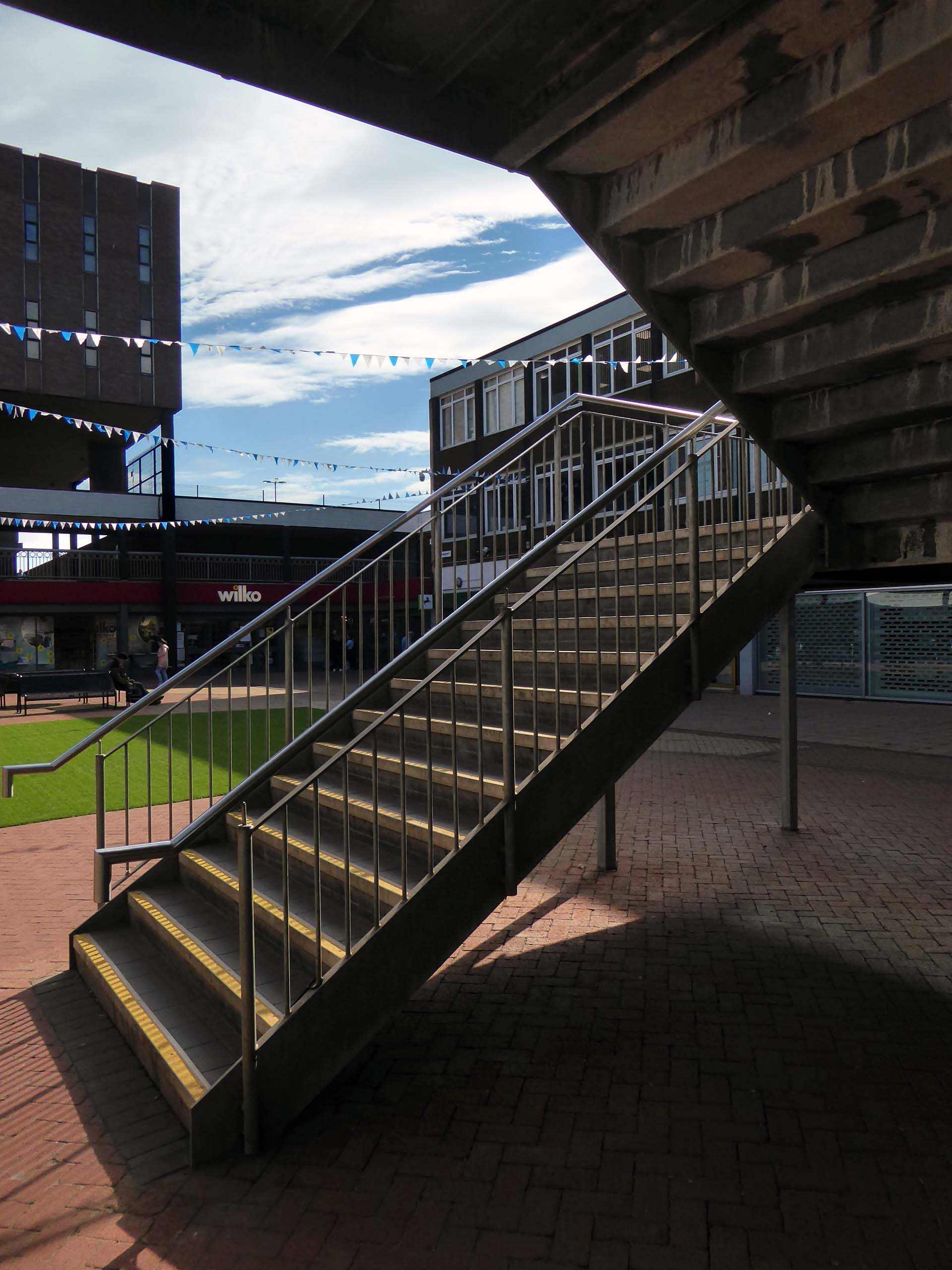
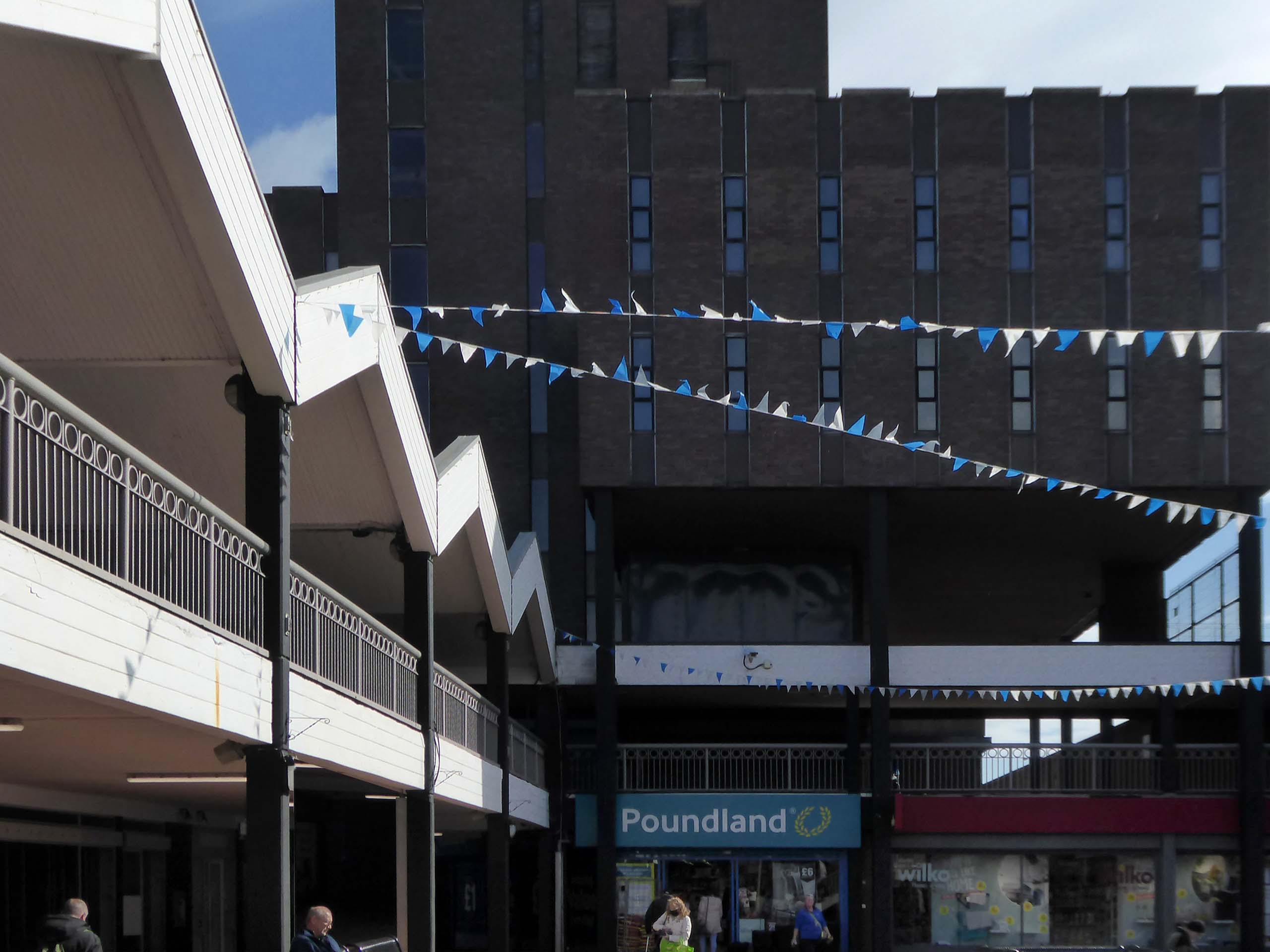
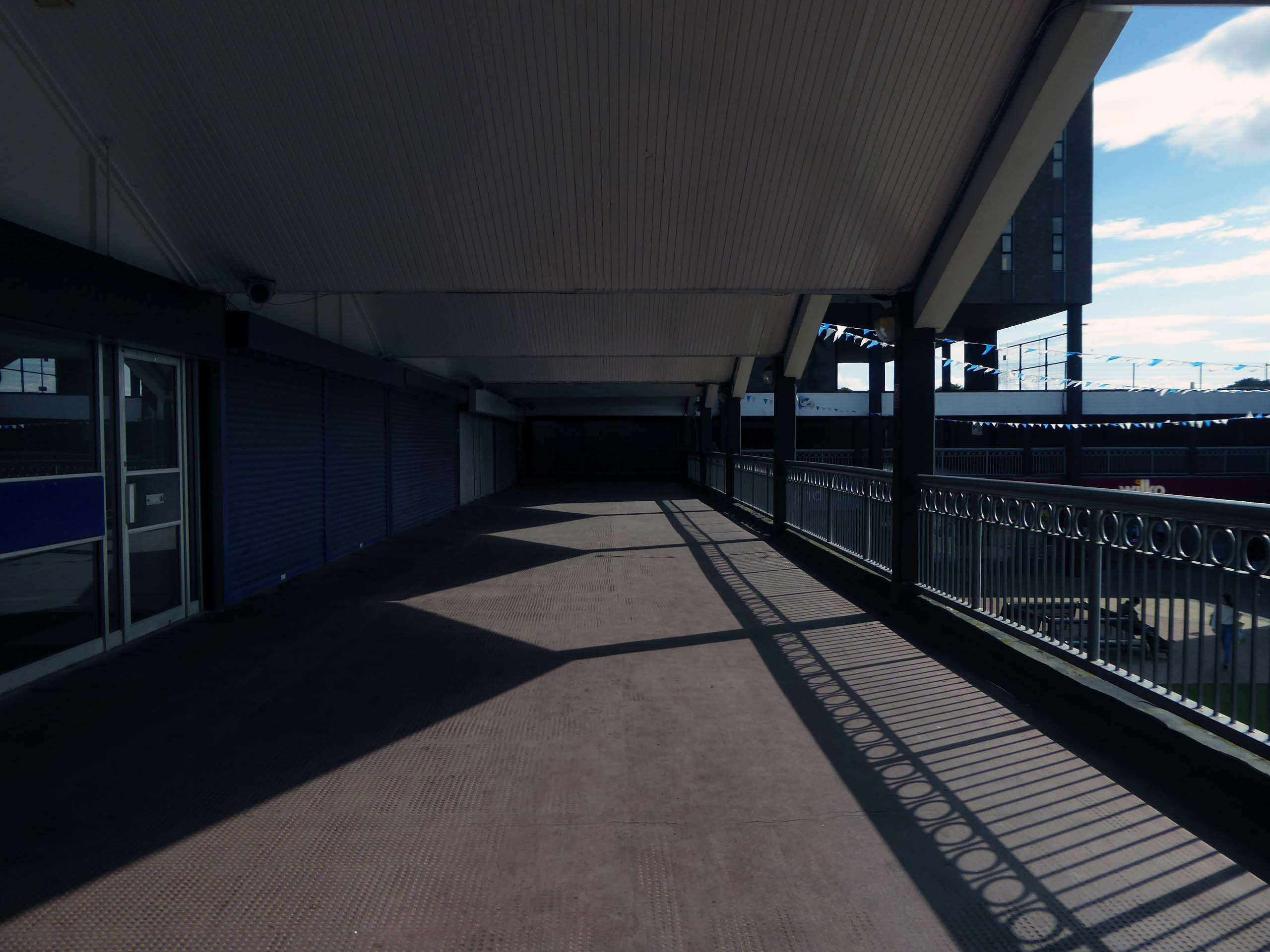
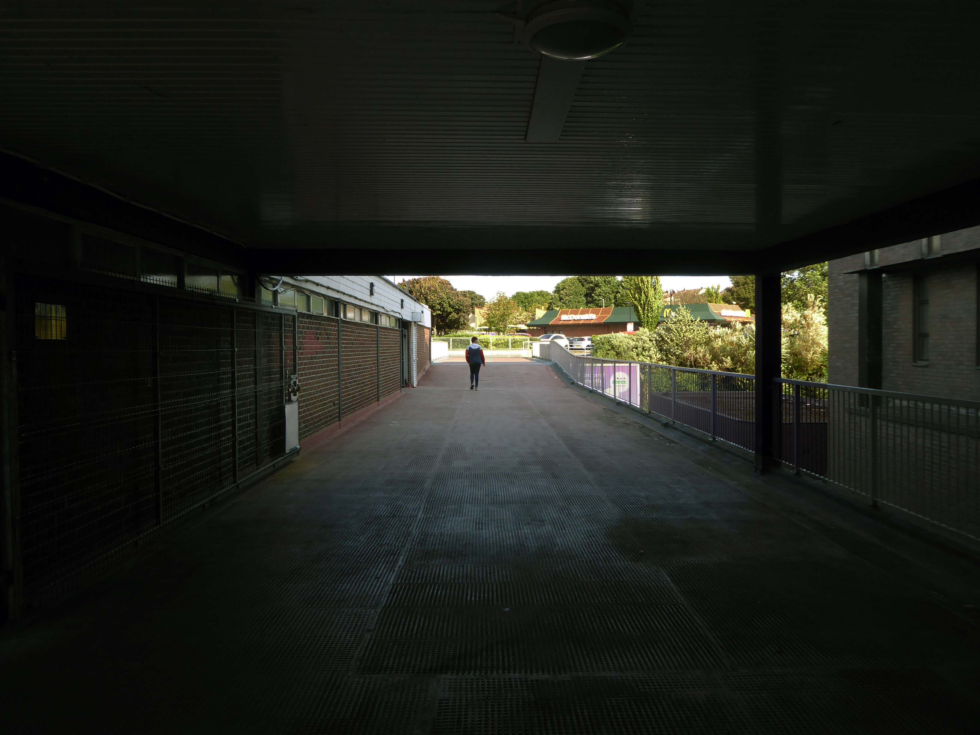
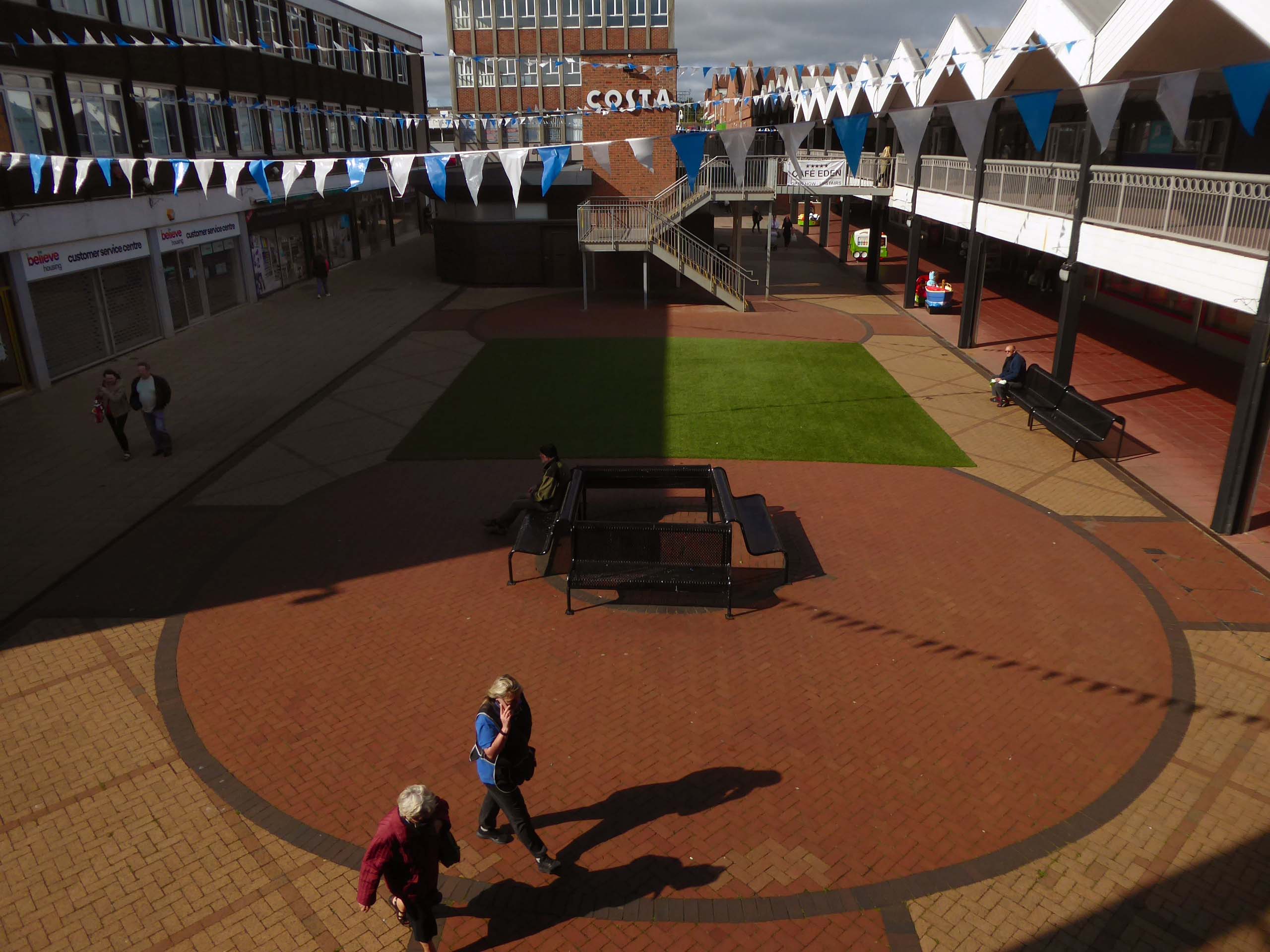
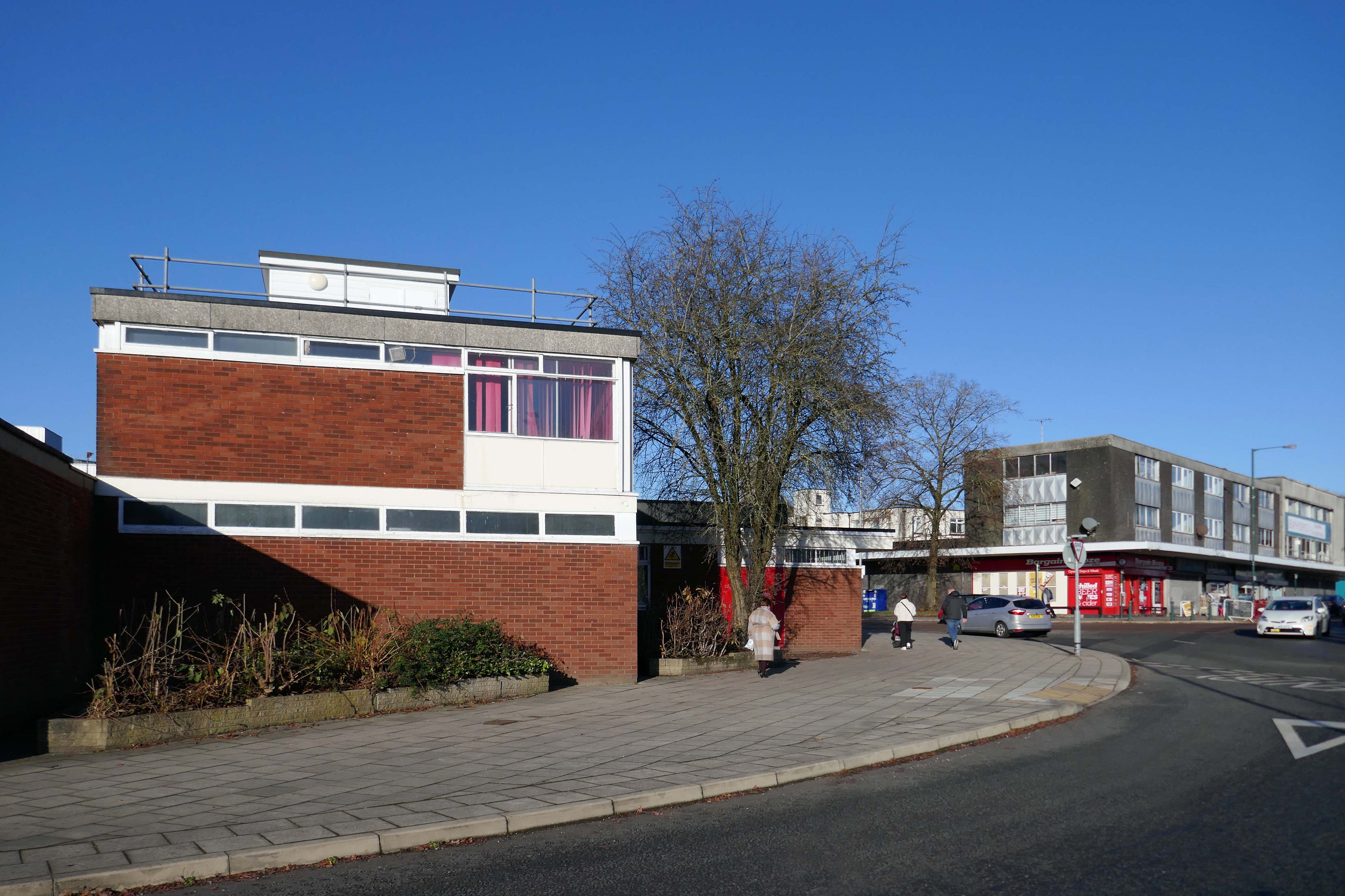
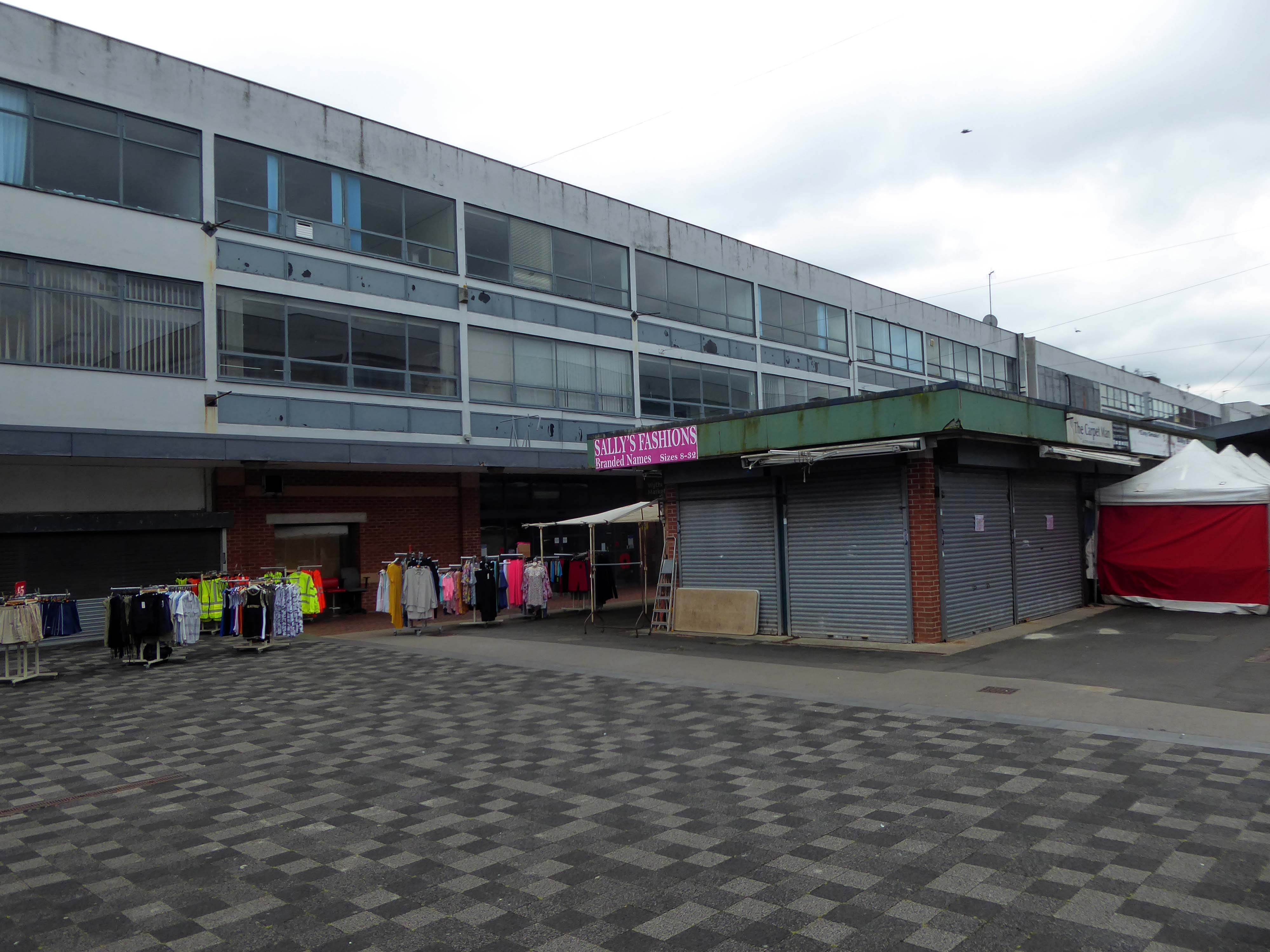
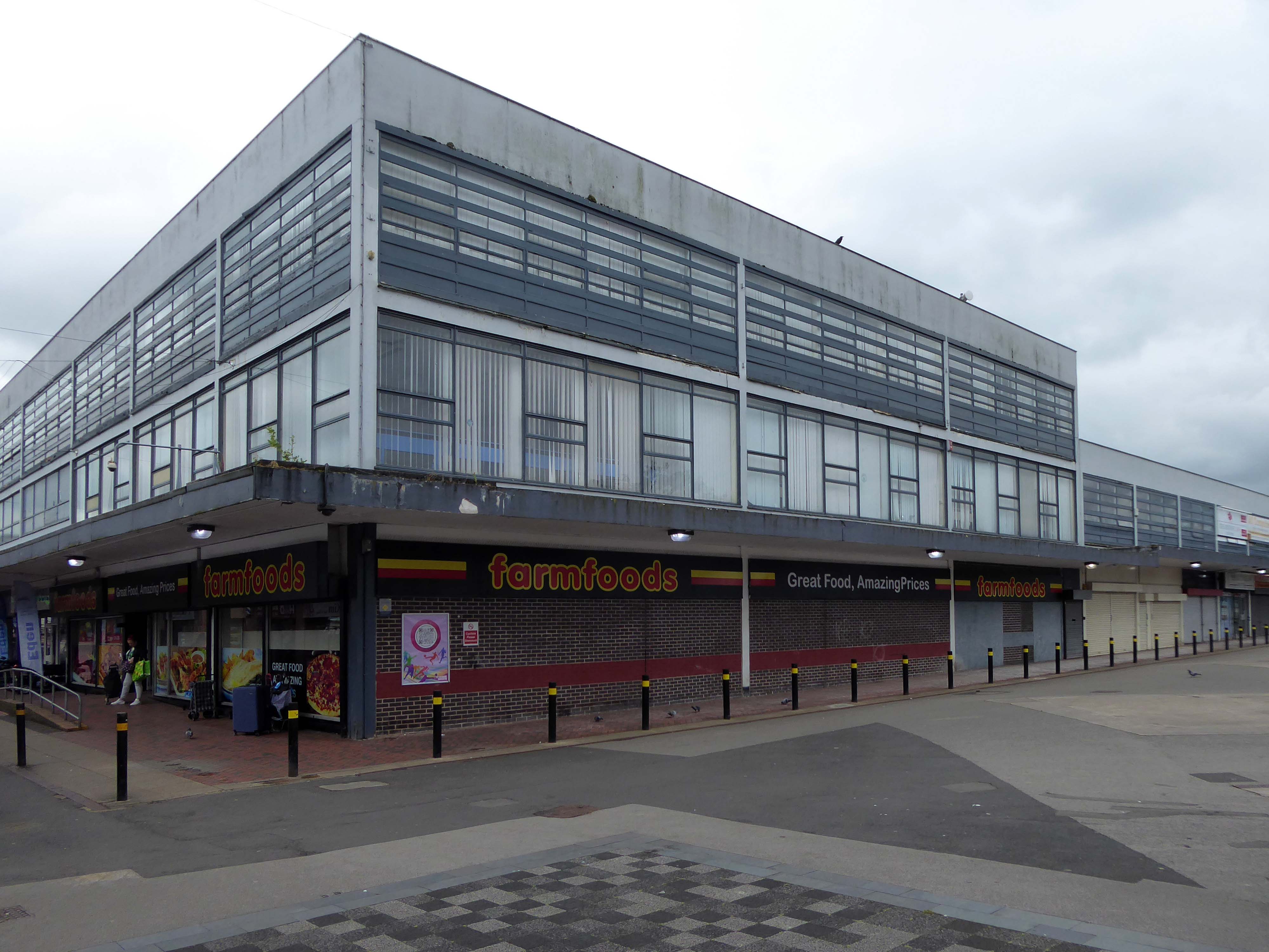
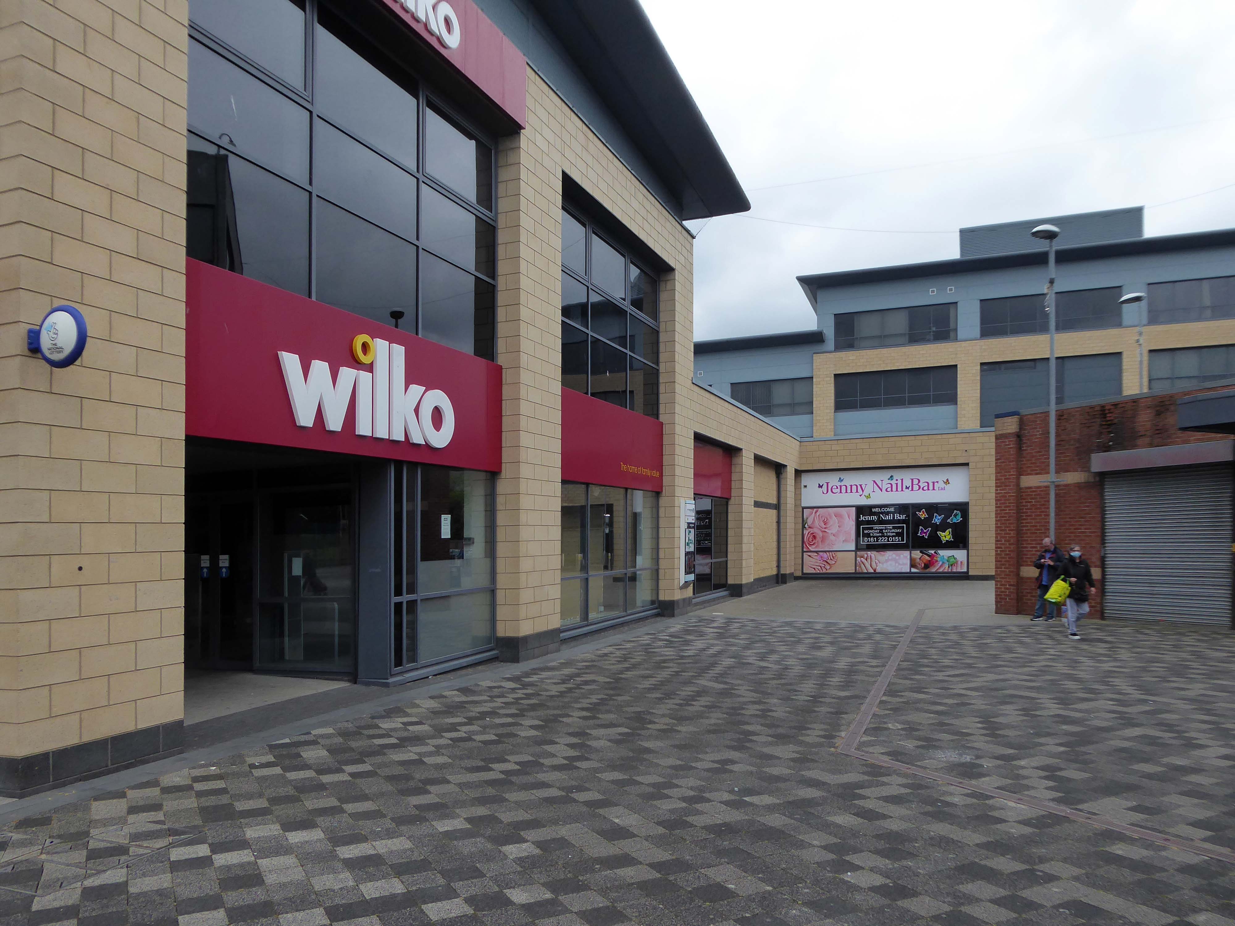
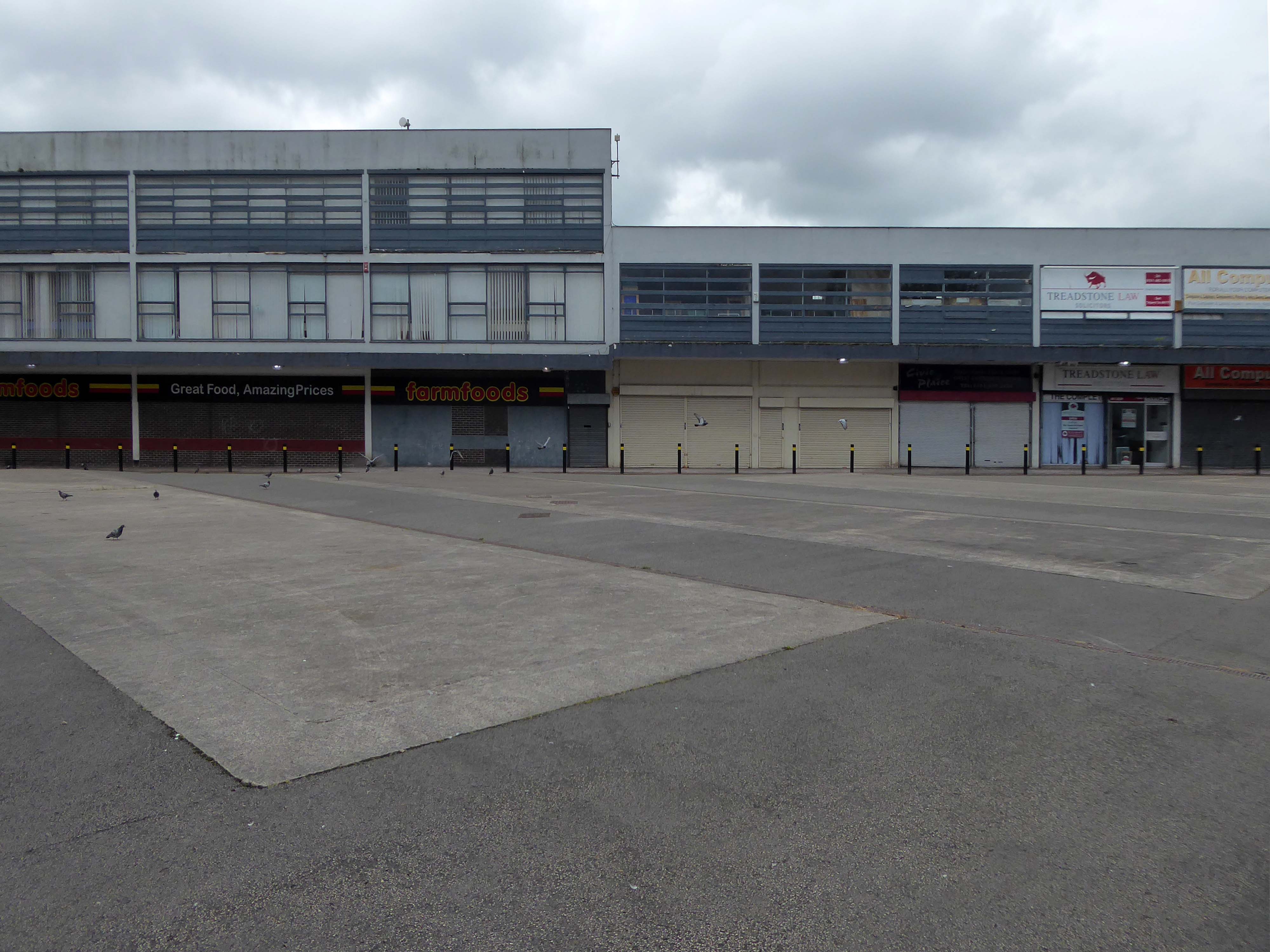
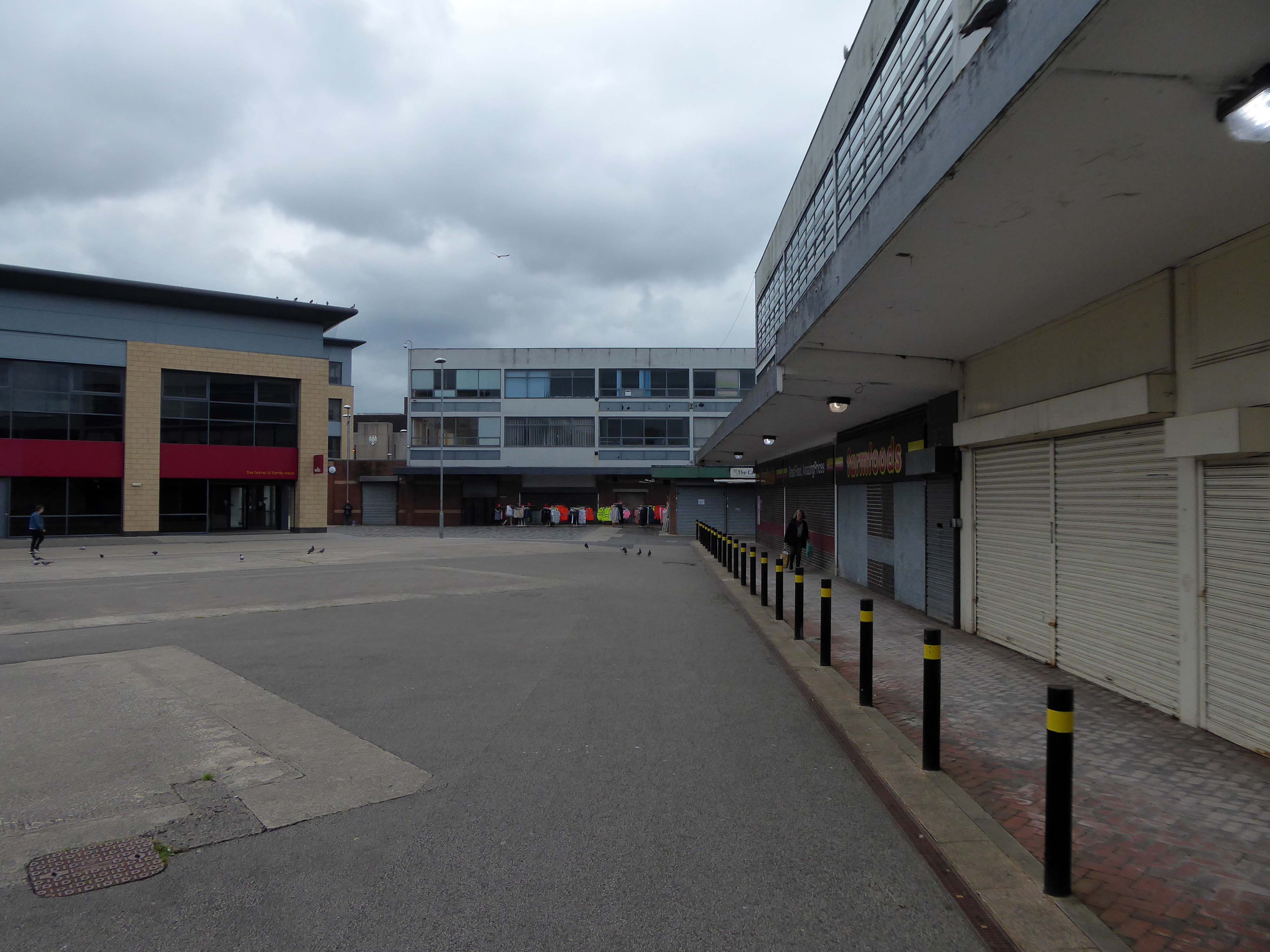
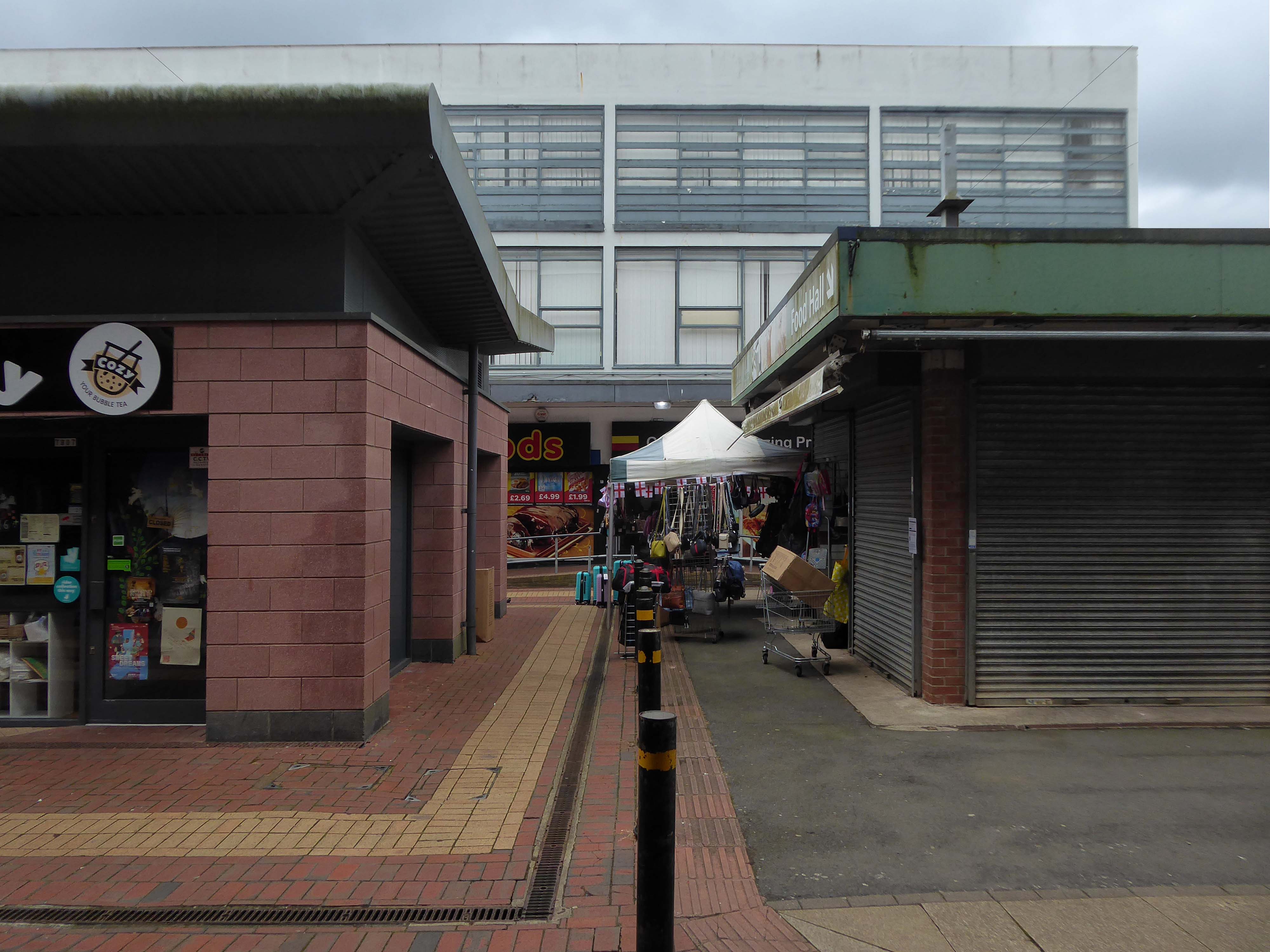
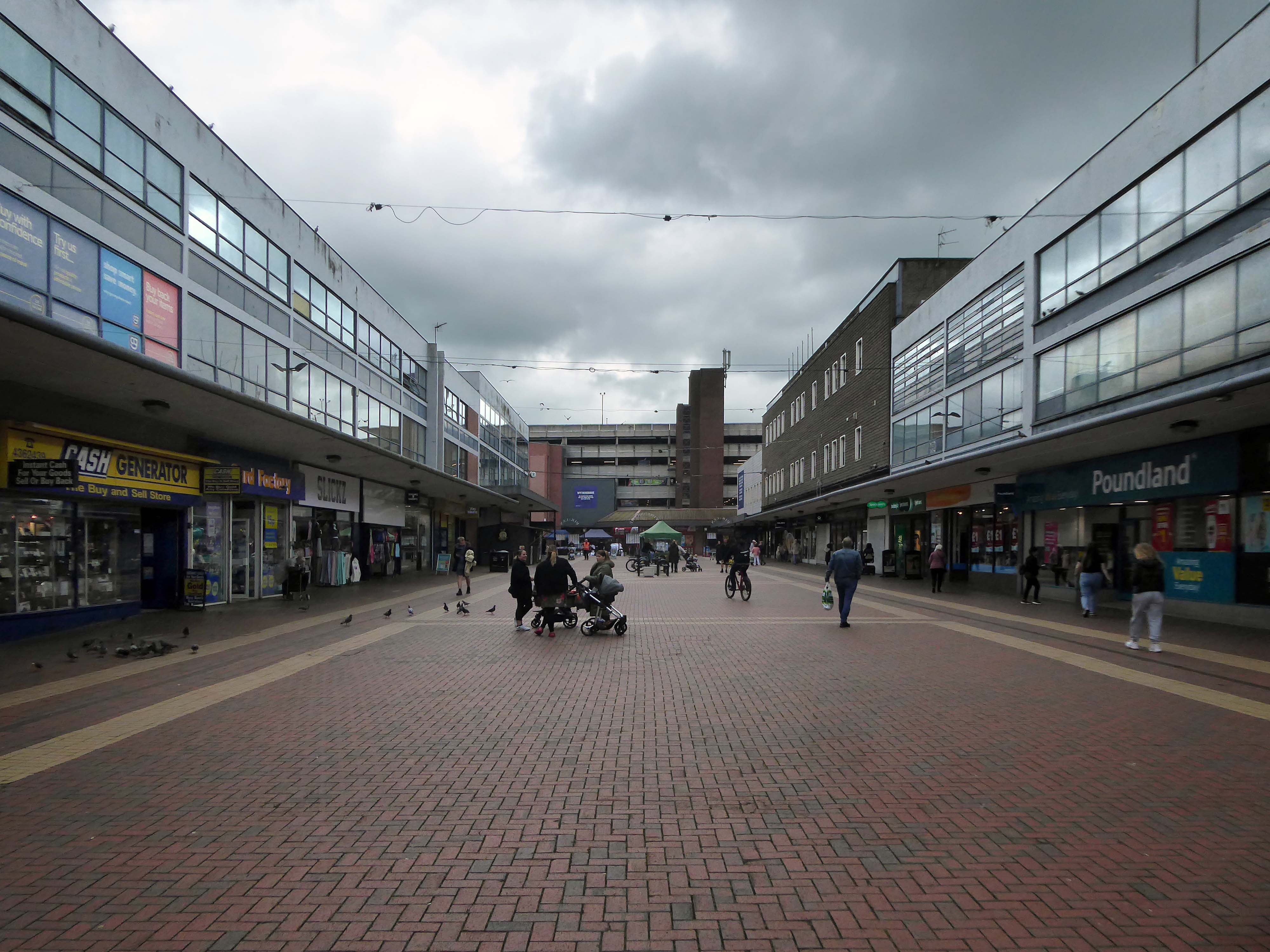
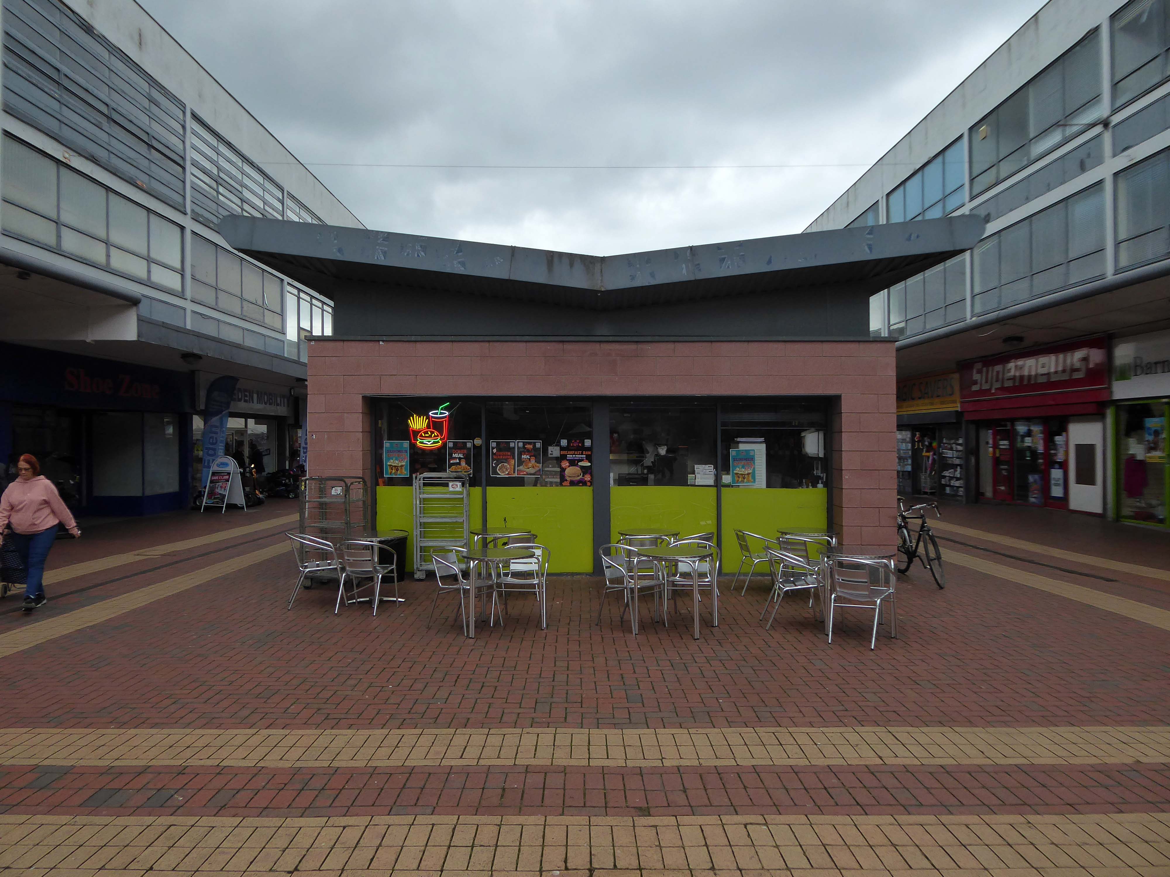
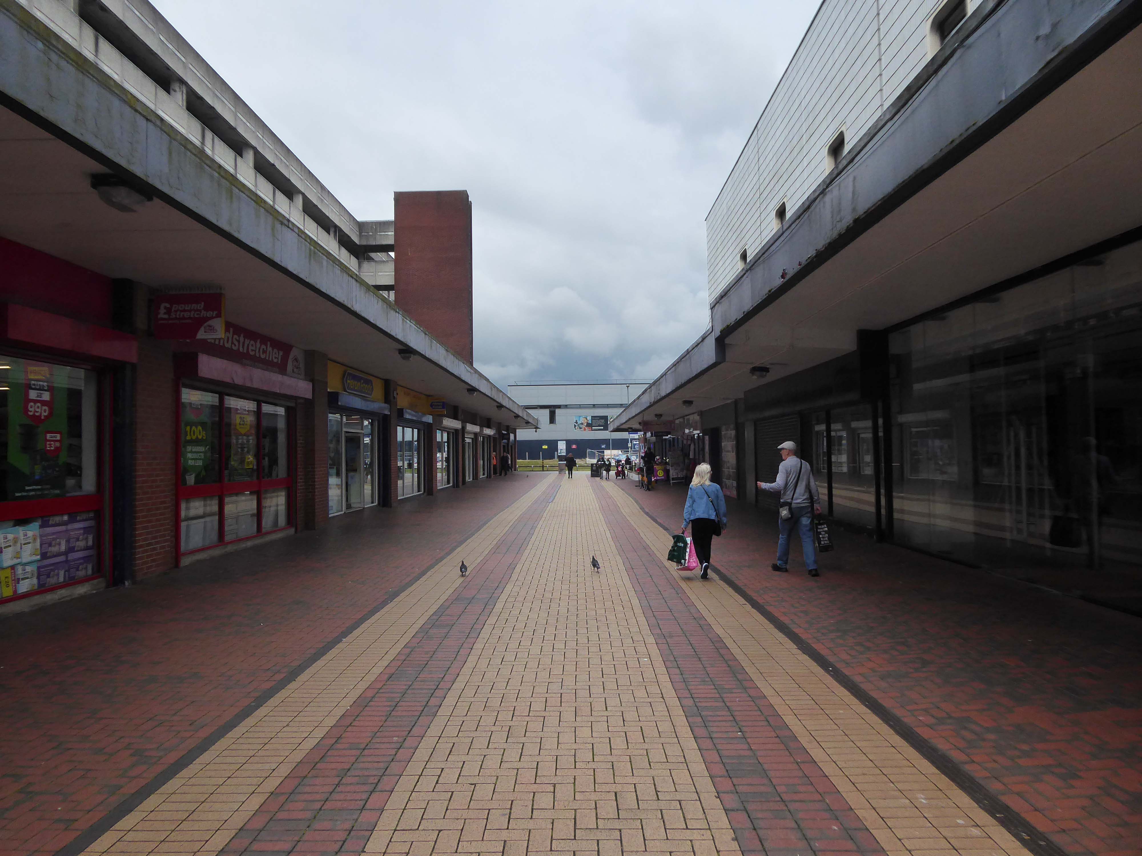
Onward to the Shopping Centre.
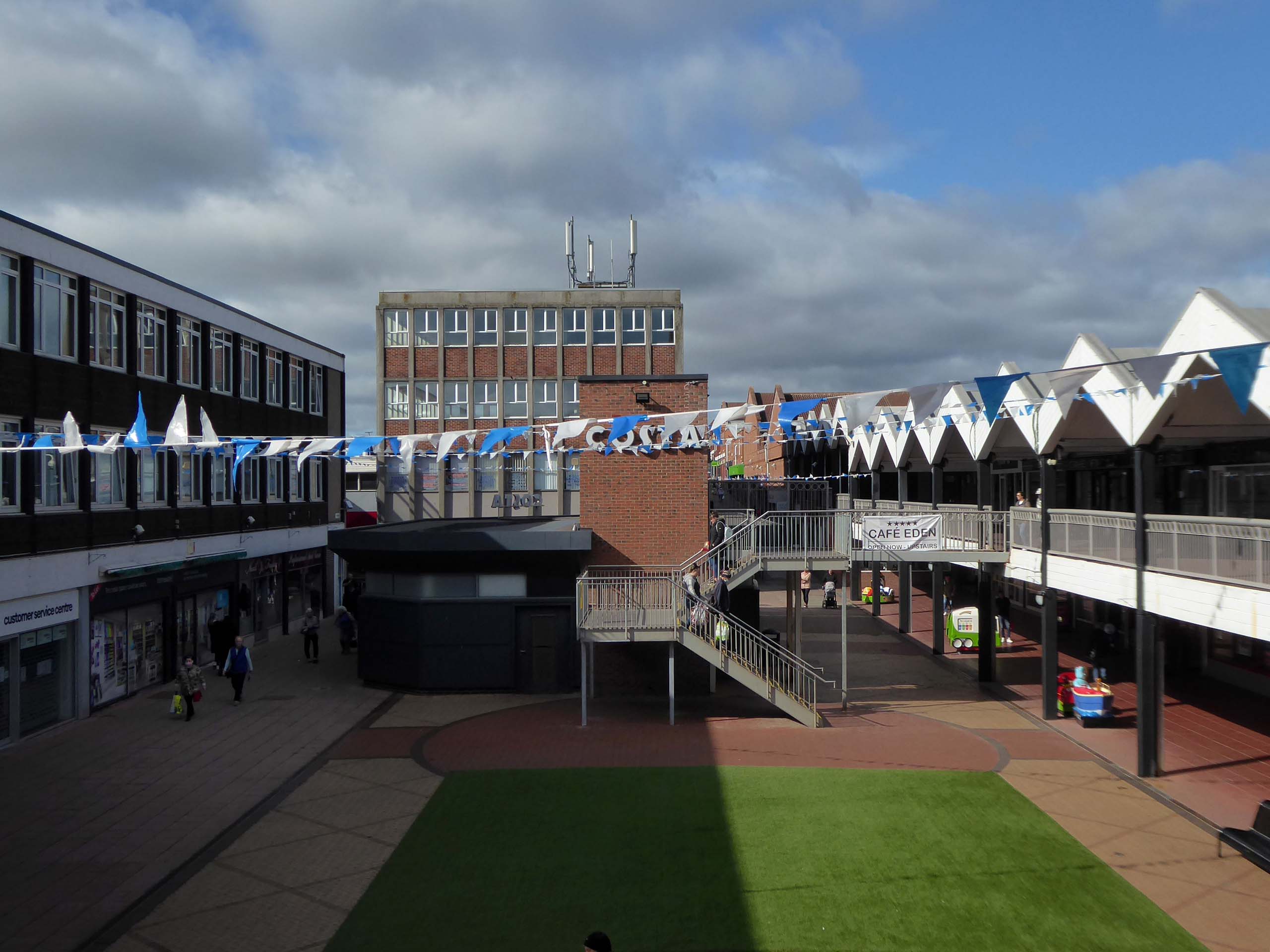
Yoden Way looking towards Lee House in 1977.
Photographs: JR James
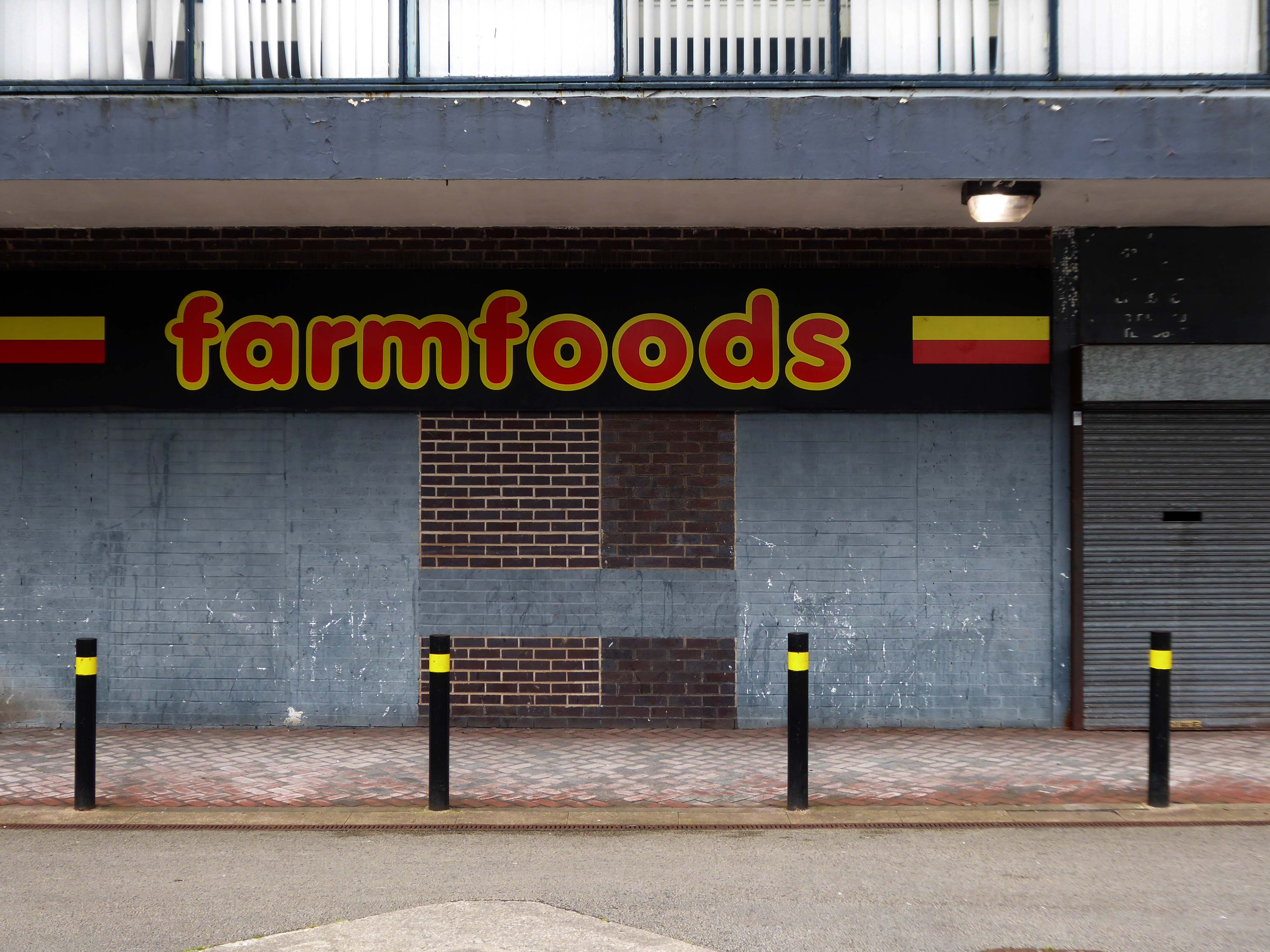
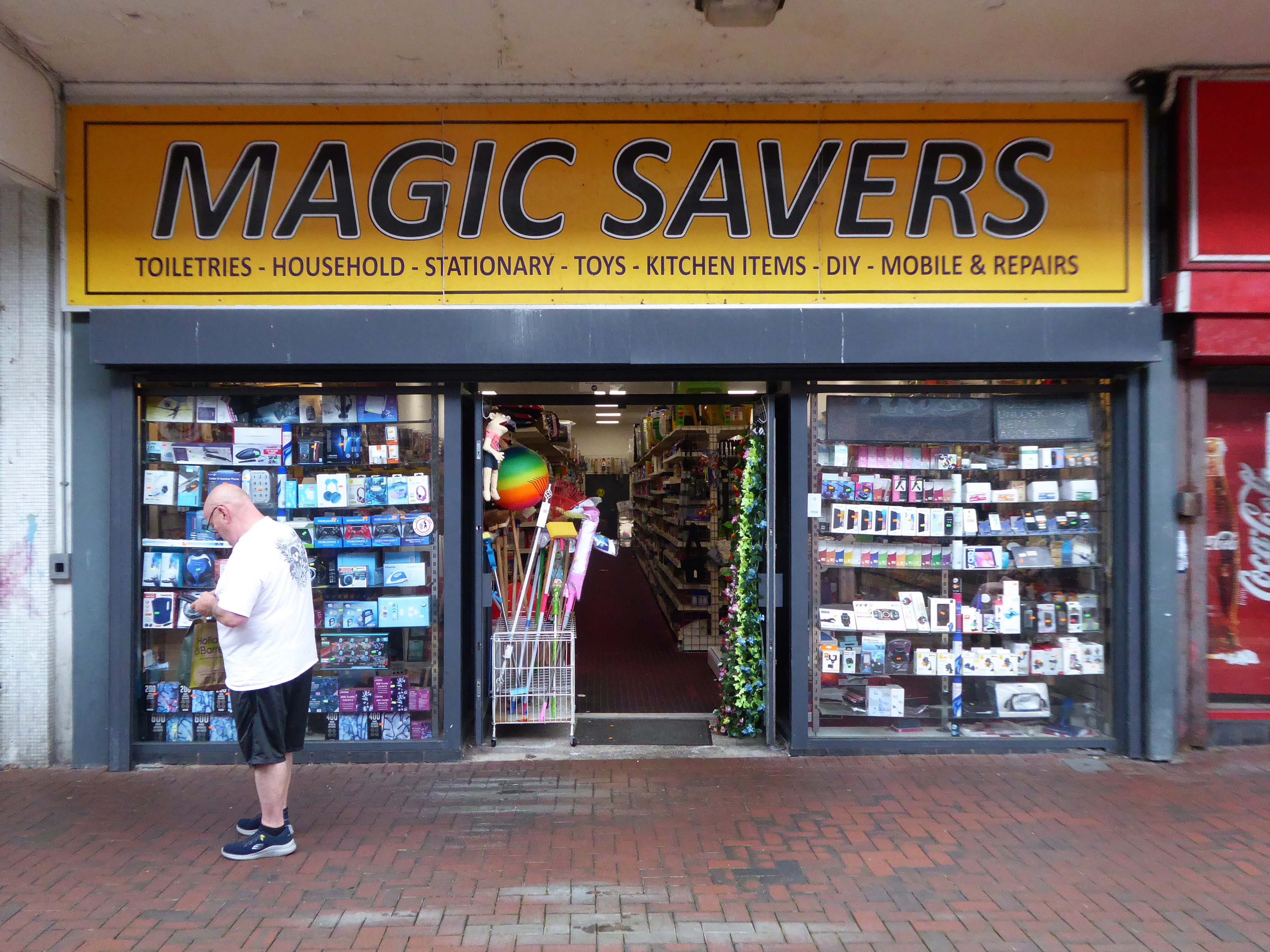
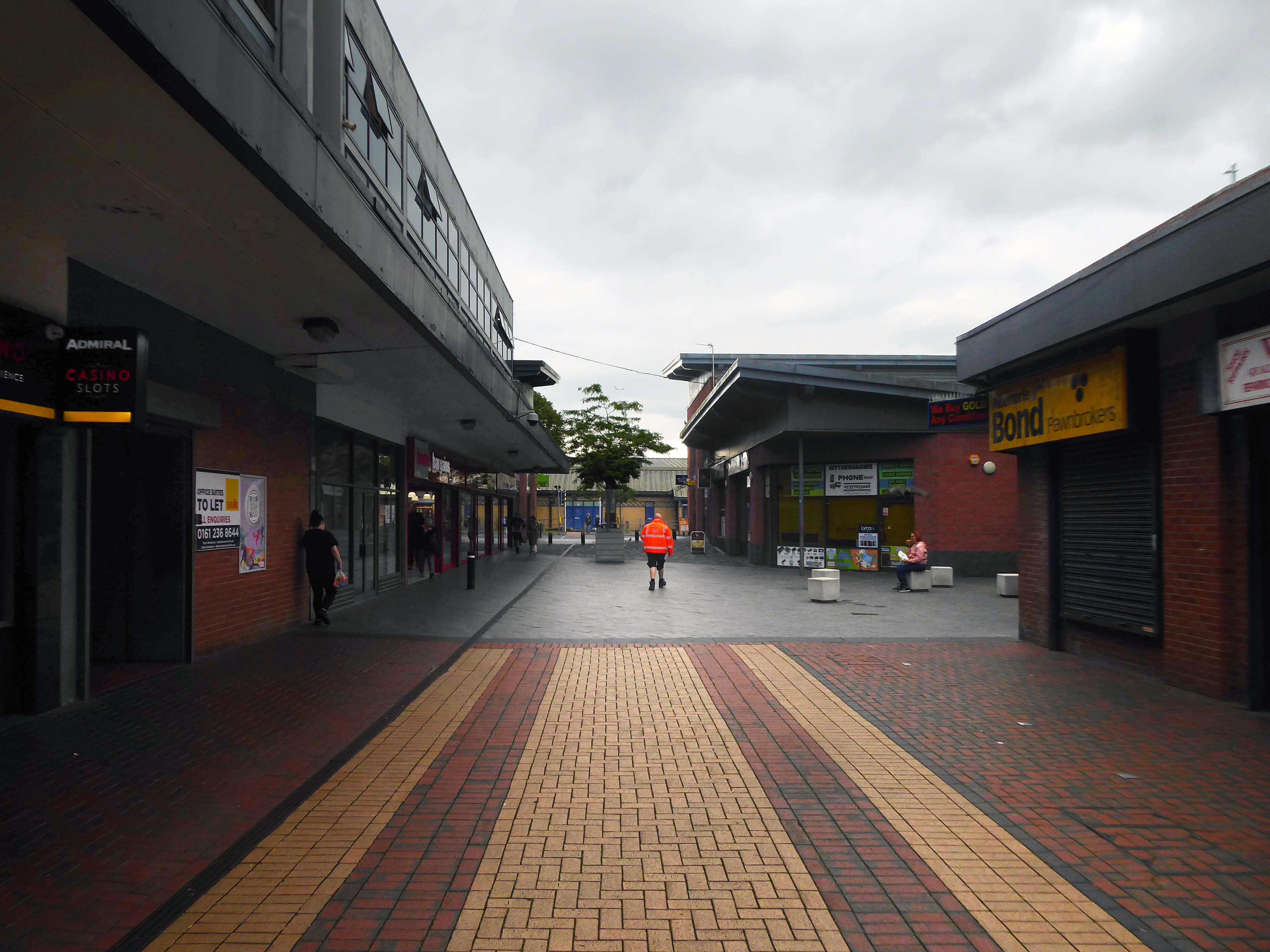
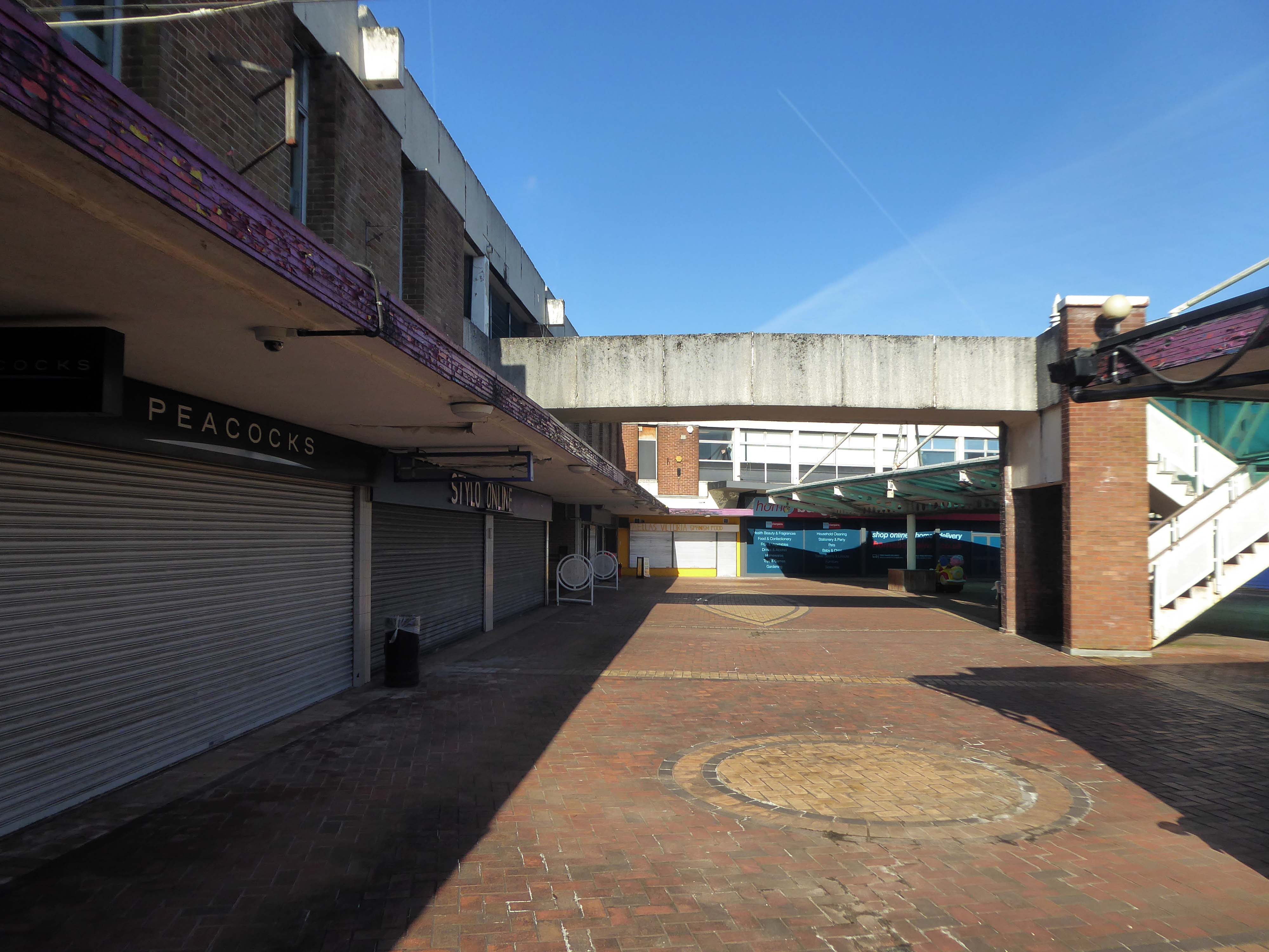
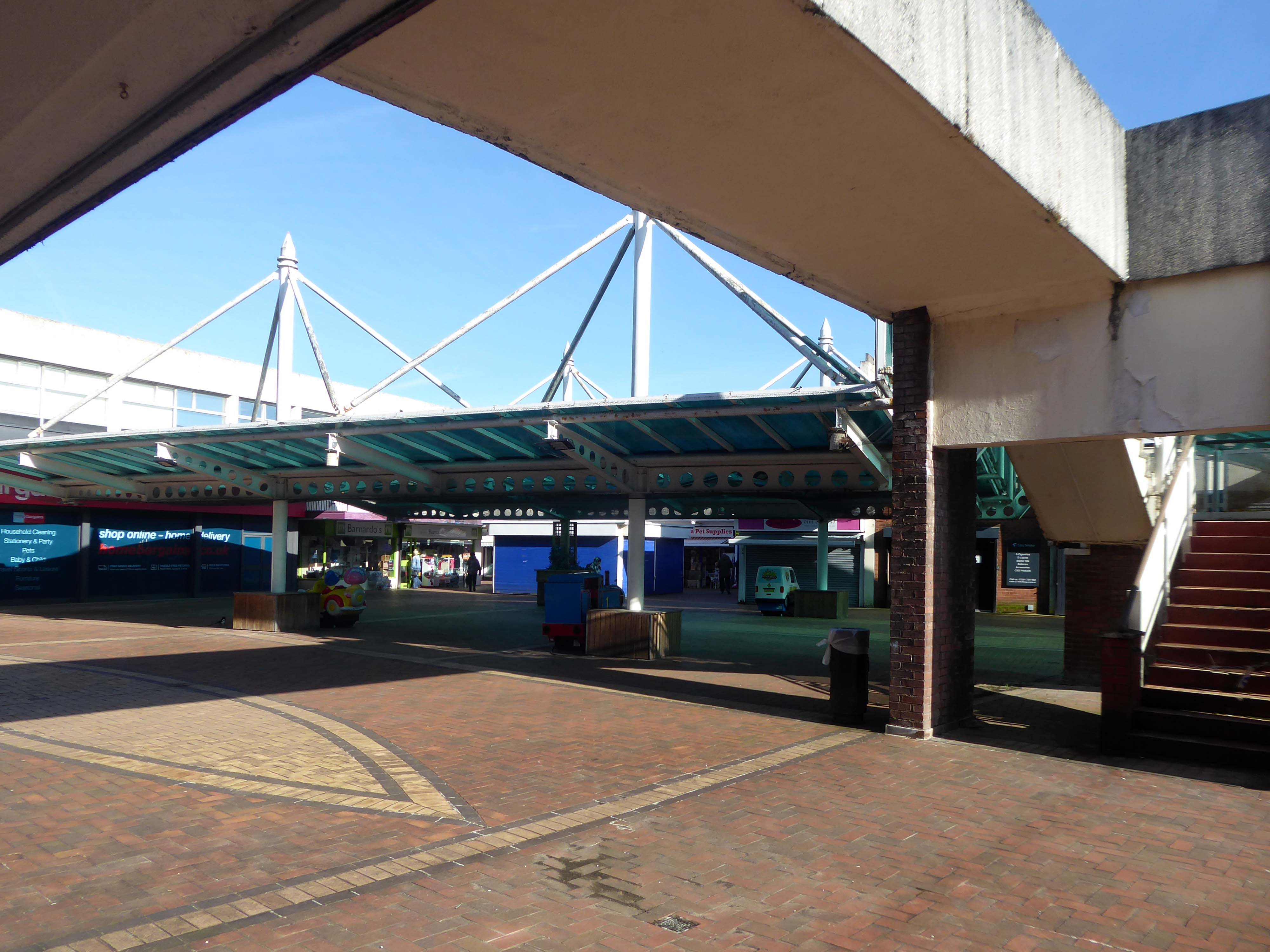
The 1950’s shops are still in situ.
Though some of the original architectural detailing and features are no more.
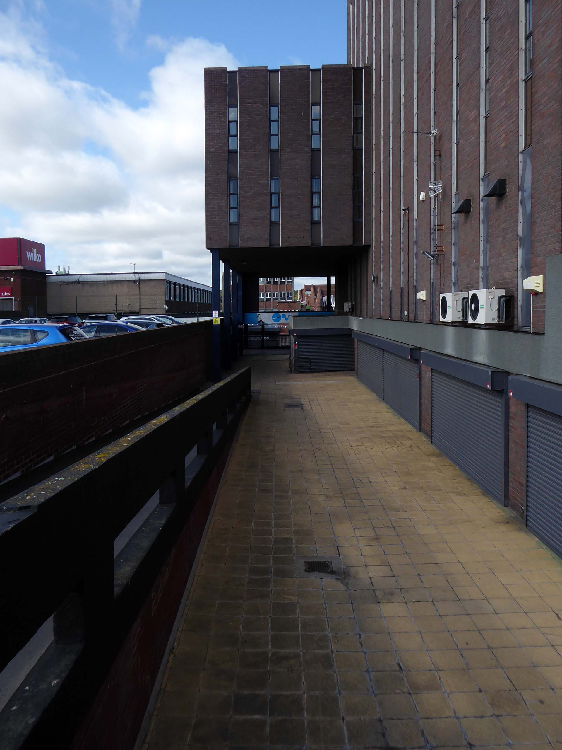
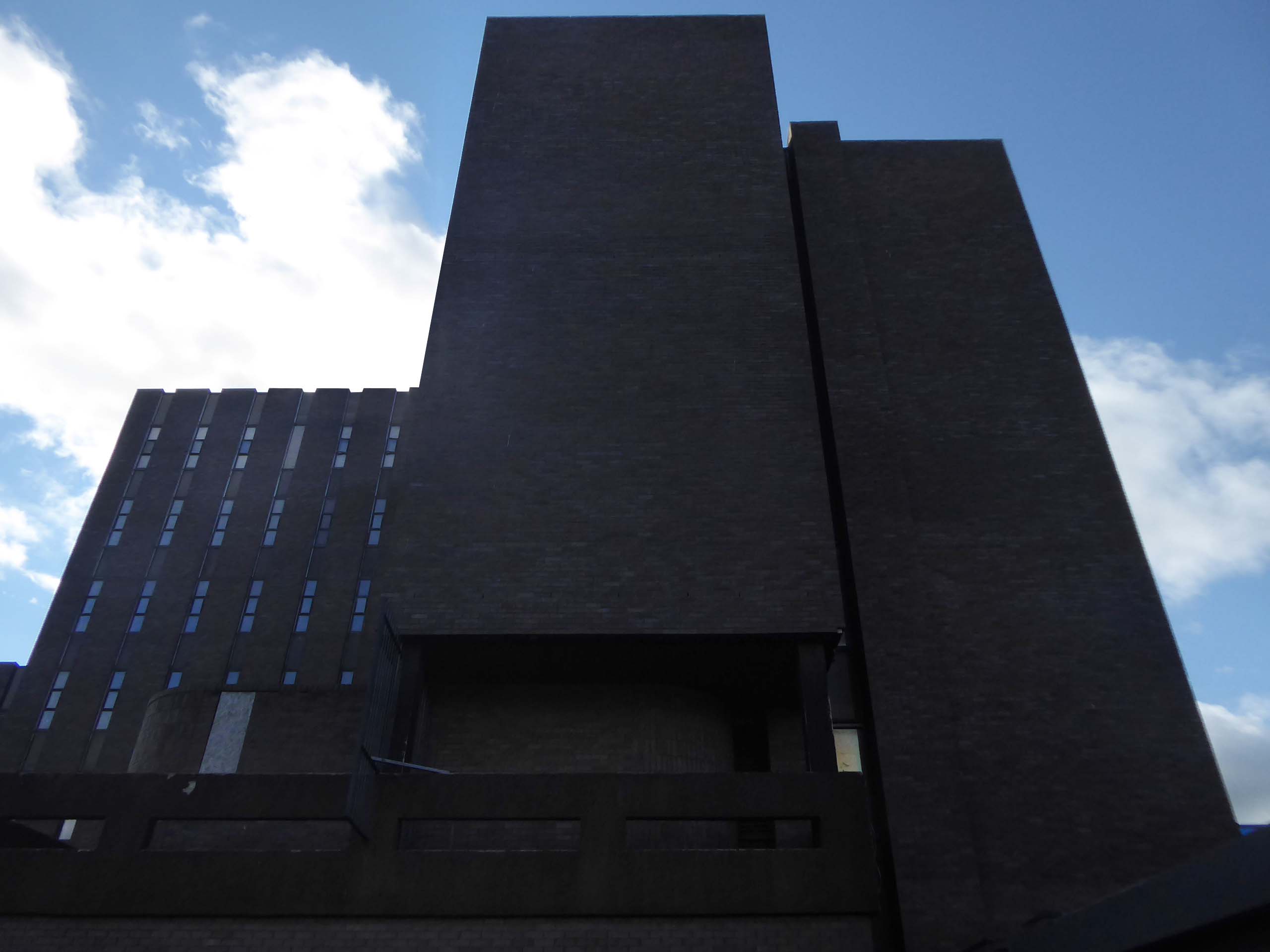
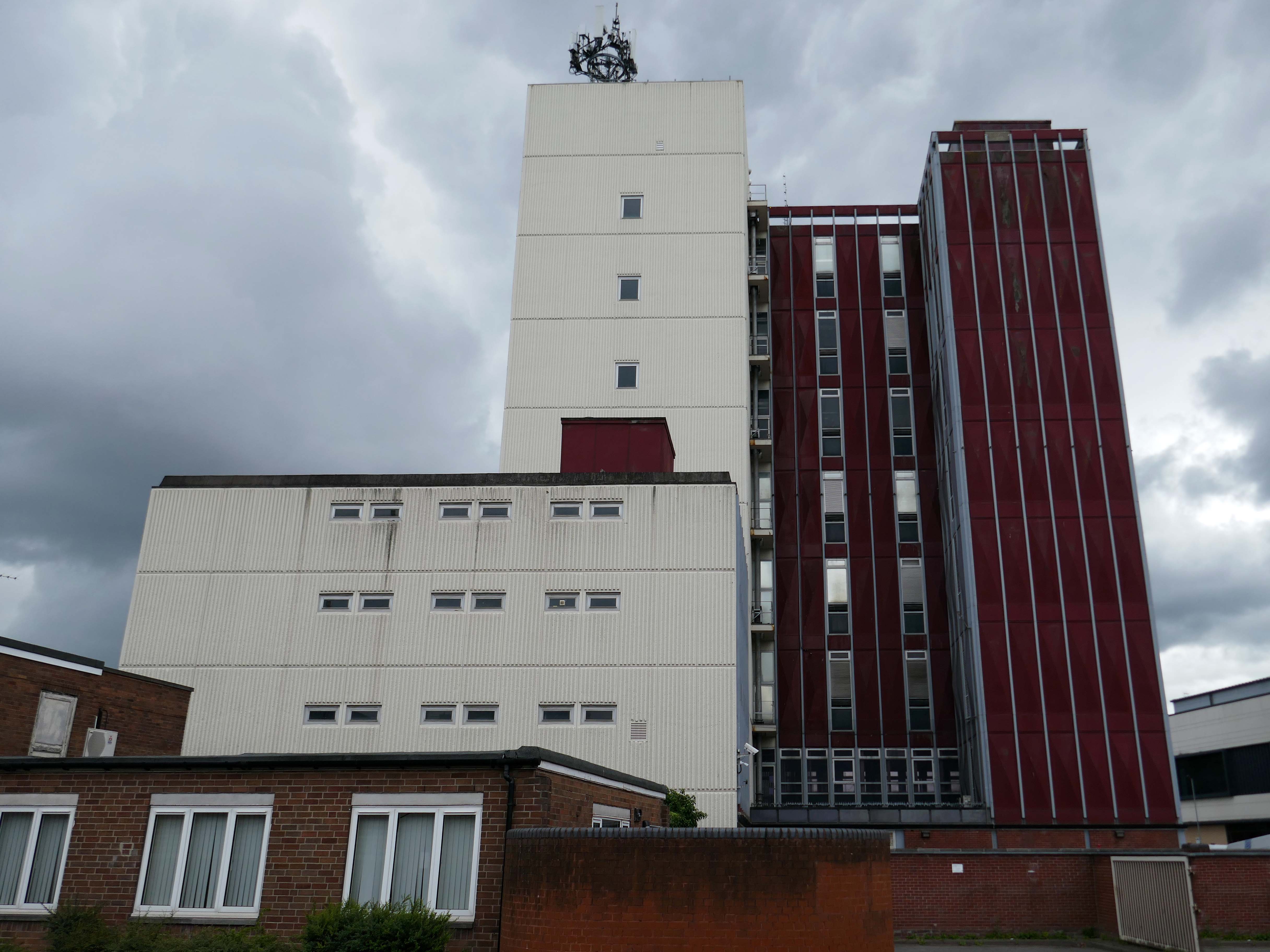
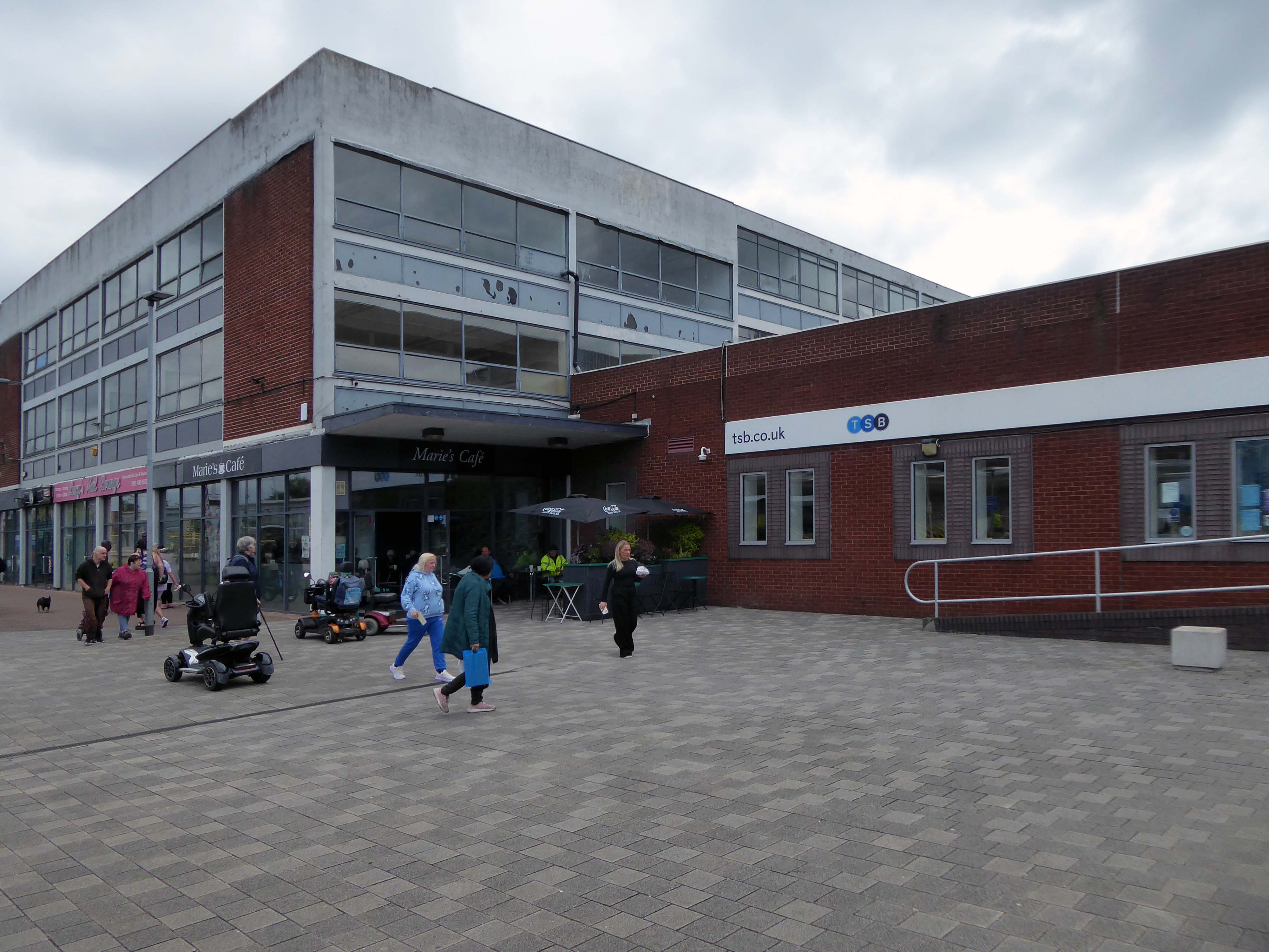
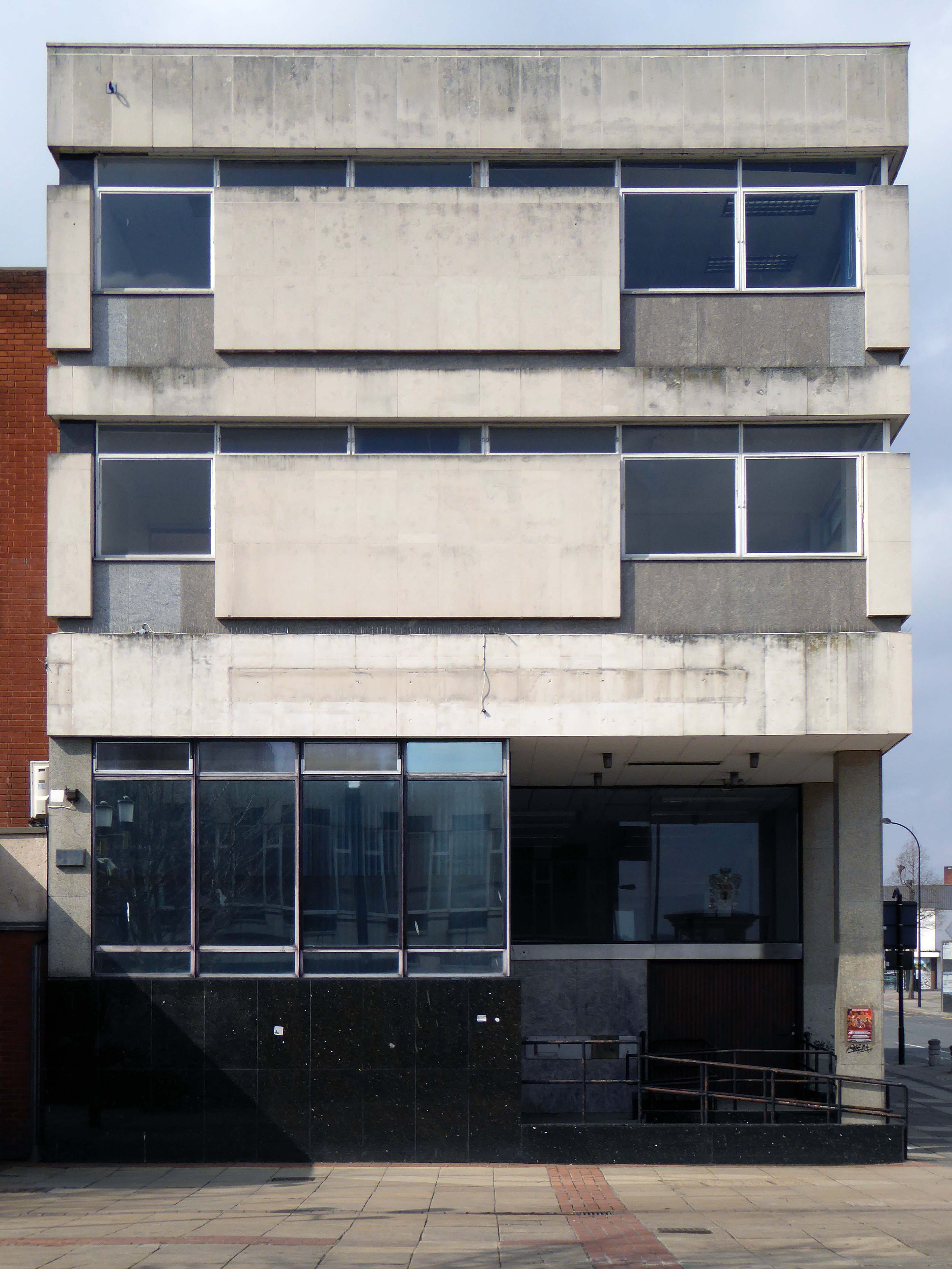
Lee House is still standing but vacant.
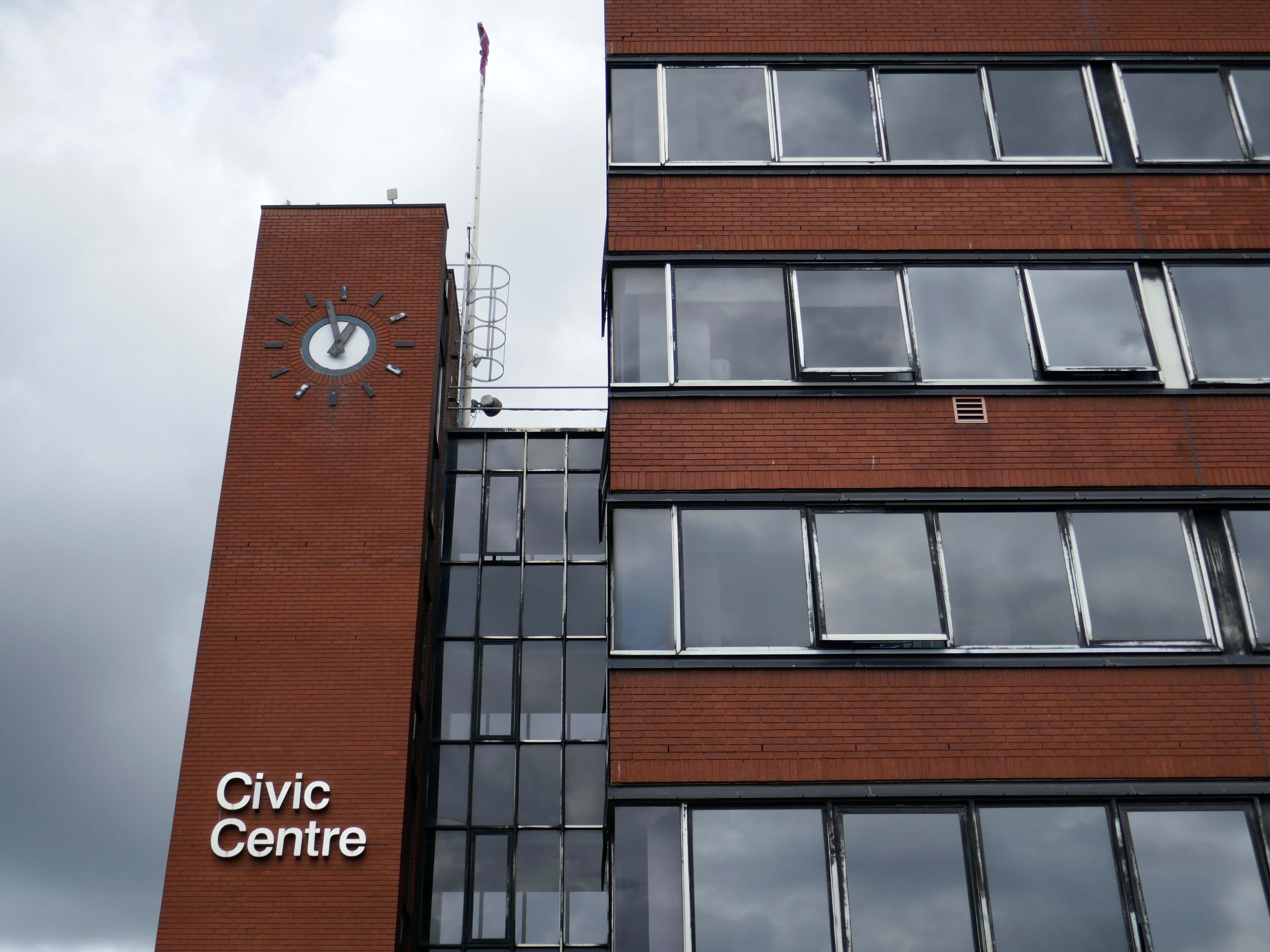
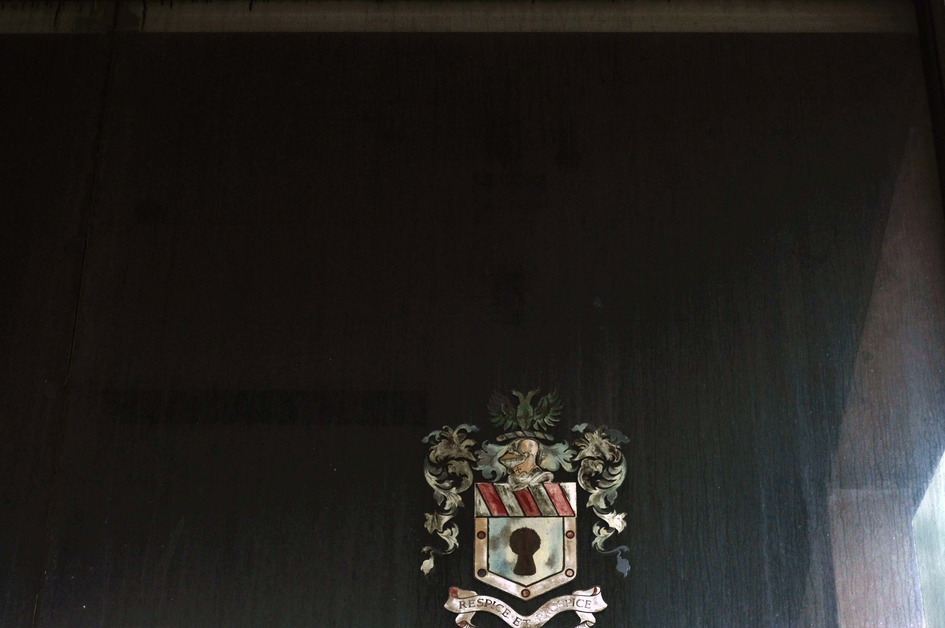
Lee House was once home to charity and community groups, but in 2015 the building owners ordered them to vacate the property.Even the building’s clock has stopped working and has been stuck on the same ten-past-two reading.
However, Durham County Council has now confirmed the building is in new hands. Economic development manager Graham Wood said: “We have worked with the previous owner to try to ensure the building is secured while we await proposals for its long-term future.
Four fire engines rushed to Lee House on Upper Yoden Way in Peterlee on Friday afternoon September 19th 2025 after a fire broke out on the first floor of the seven floor building.
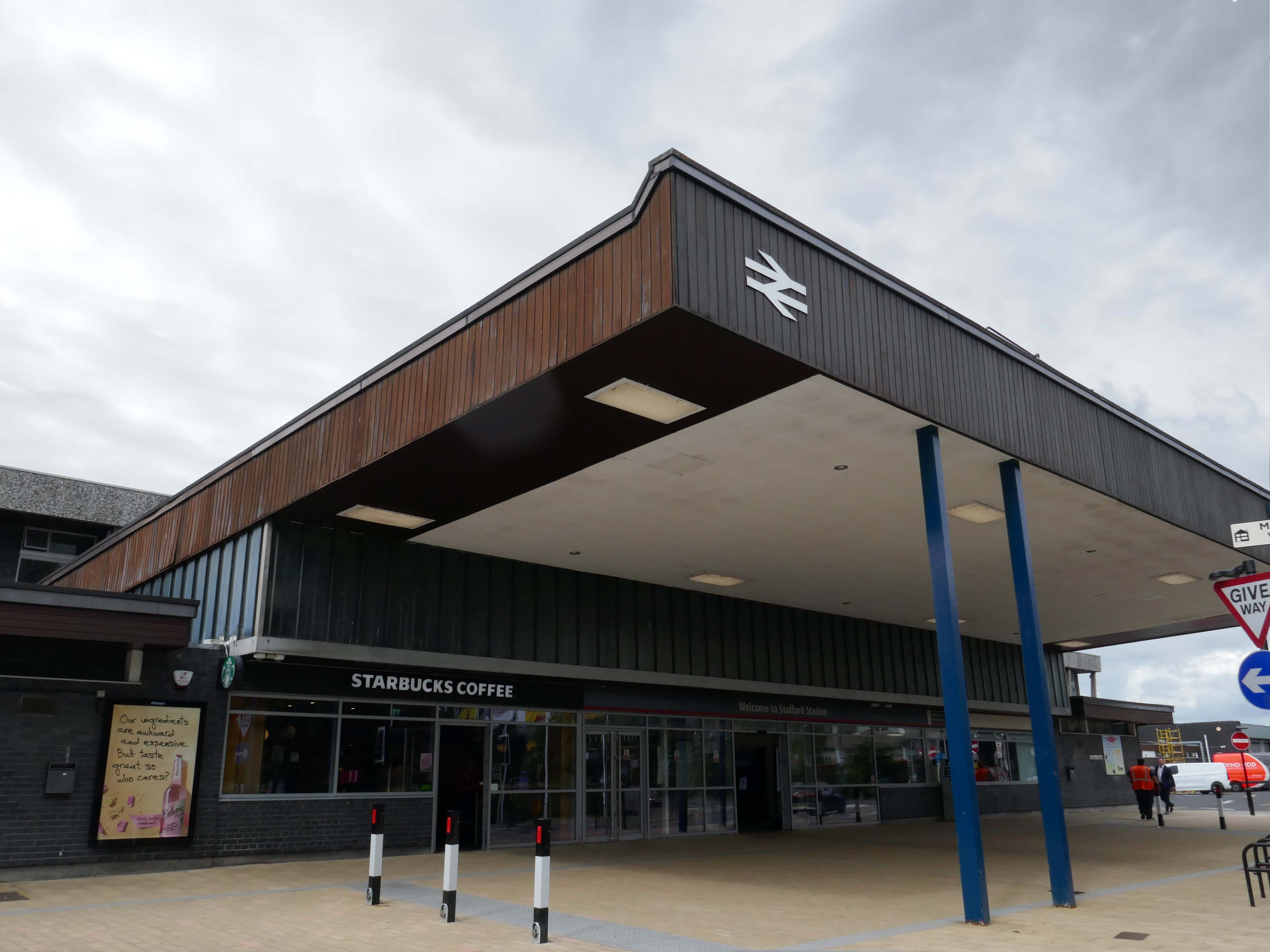
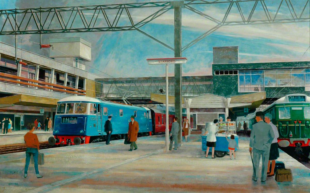
The current station was built in 1962, by the architect William Robert Headley, as part of the modernisation programme which saw the electrification of the West Coast Main Line.
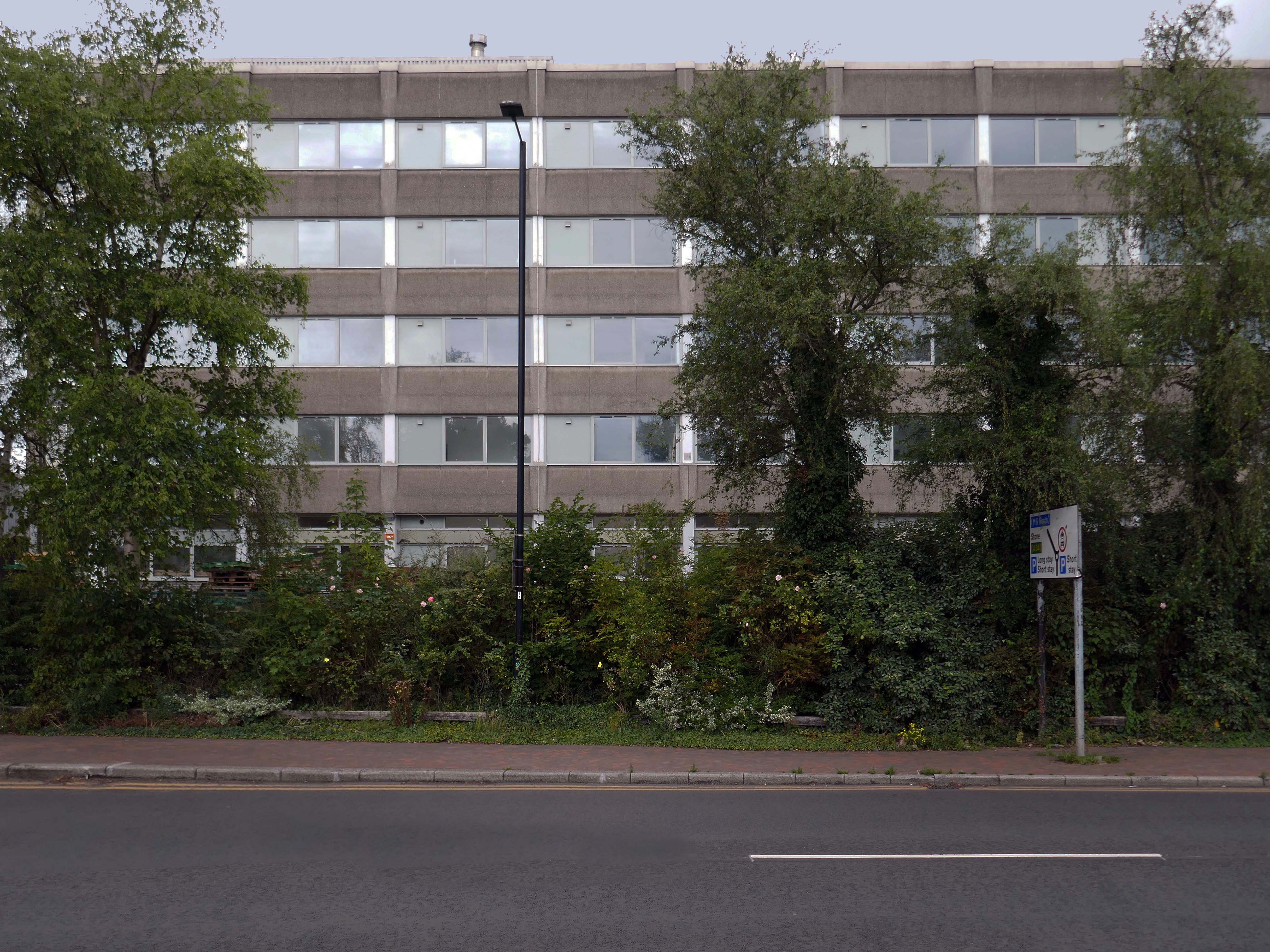
On leaving the station there is an as yet partially un-let Sixties office block to let – Victoria Park House.
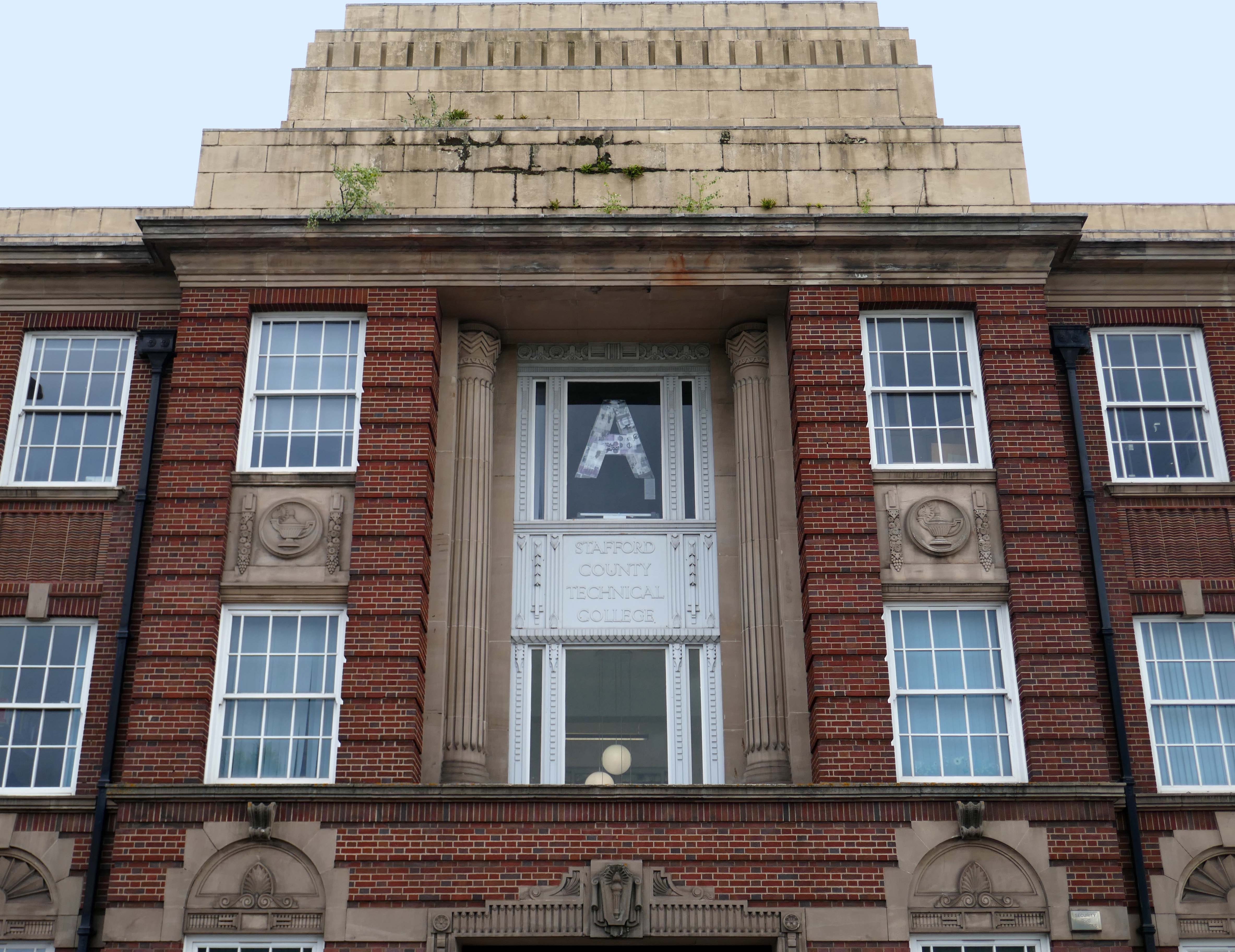
Onward to the County Technical College 1937 Grade II Listed – interior completed 1946.
The shell of the building was completed in 1937, after which it was used as an American army hospital during the war, then completed afterwards.
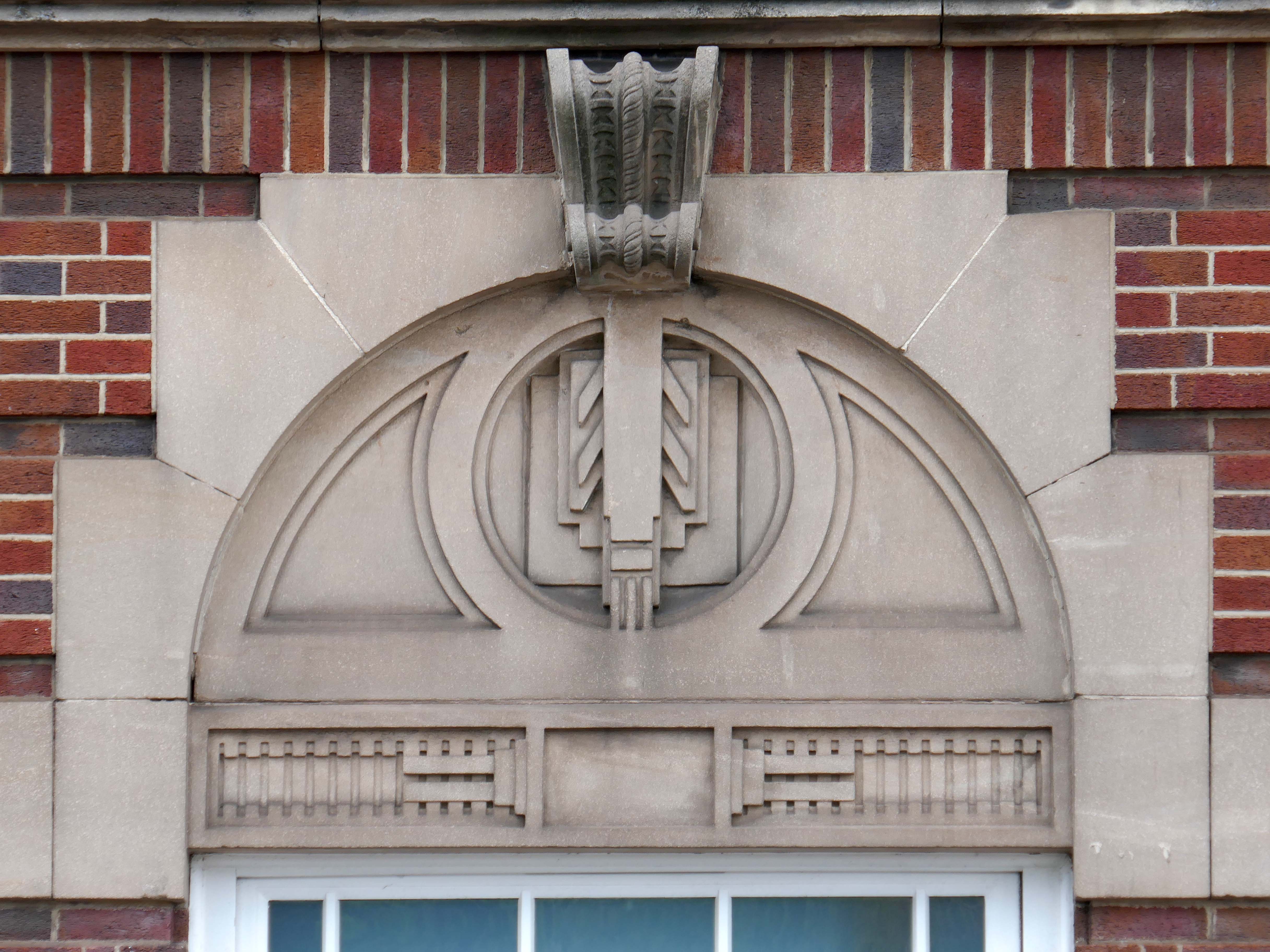
Heavily loaded with Art Deco details.
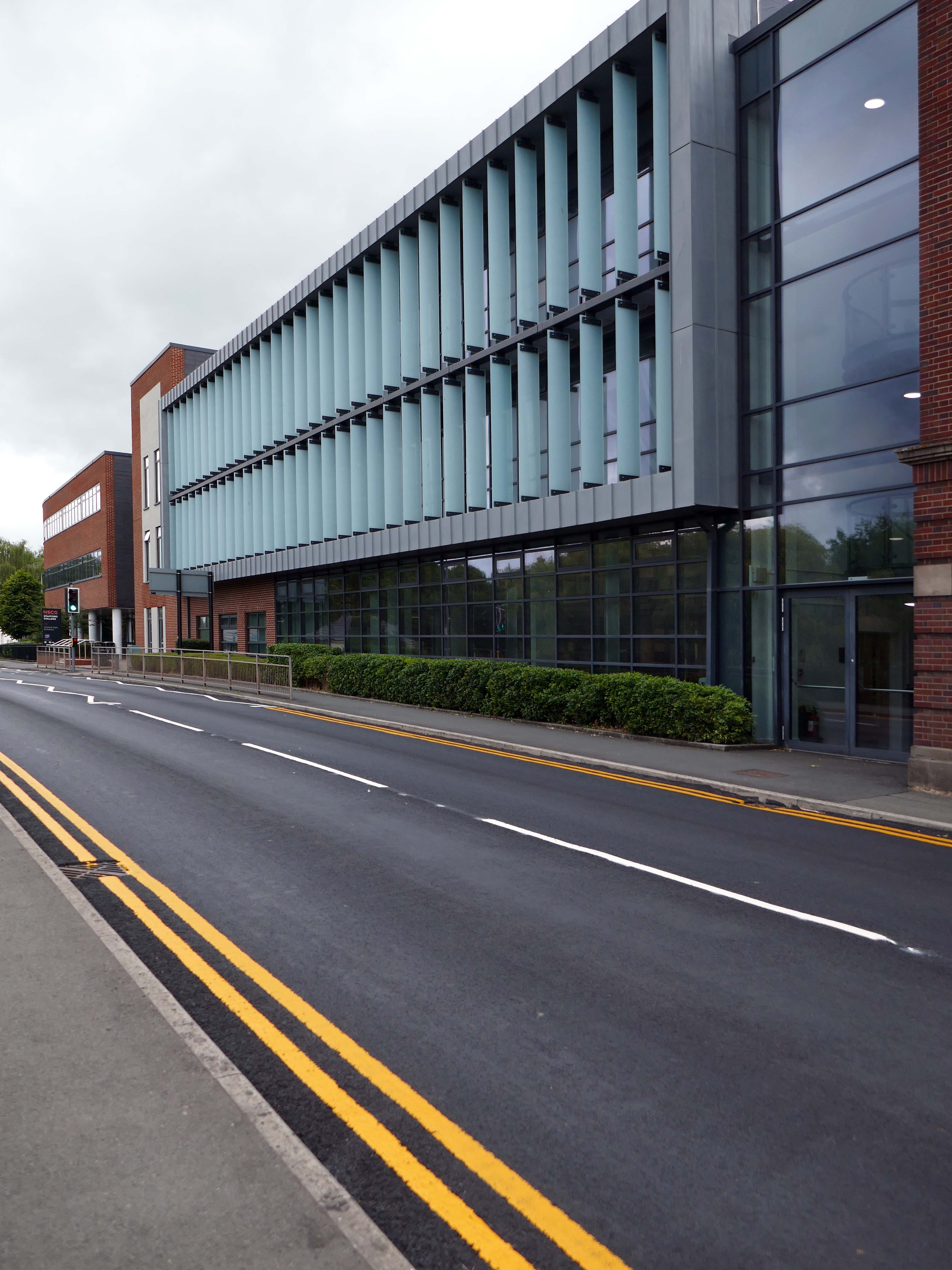
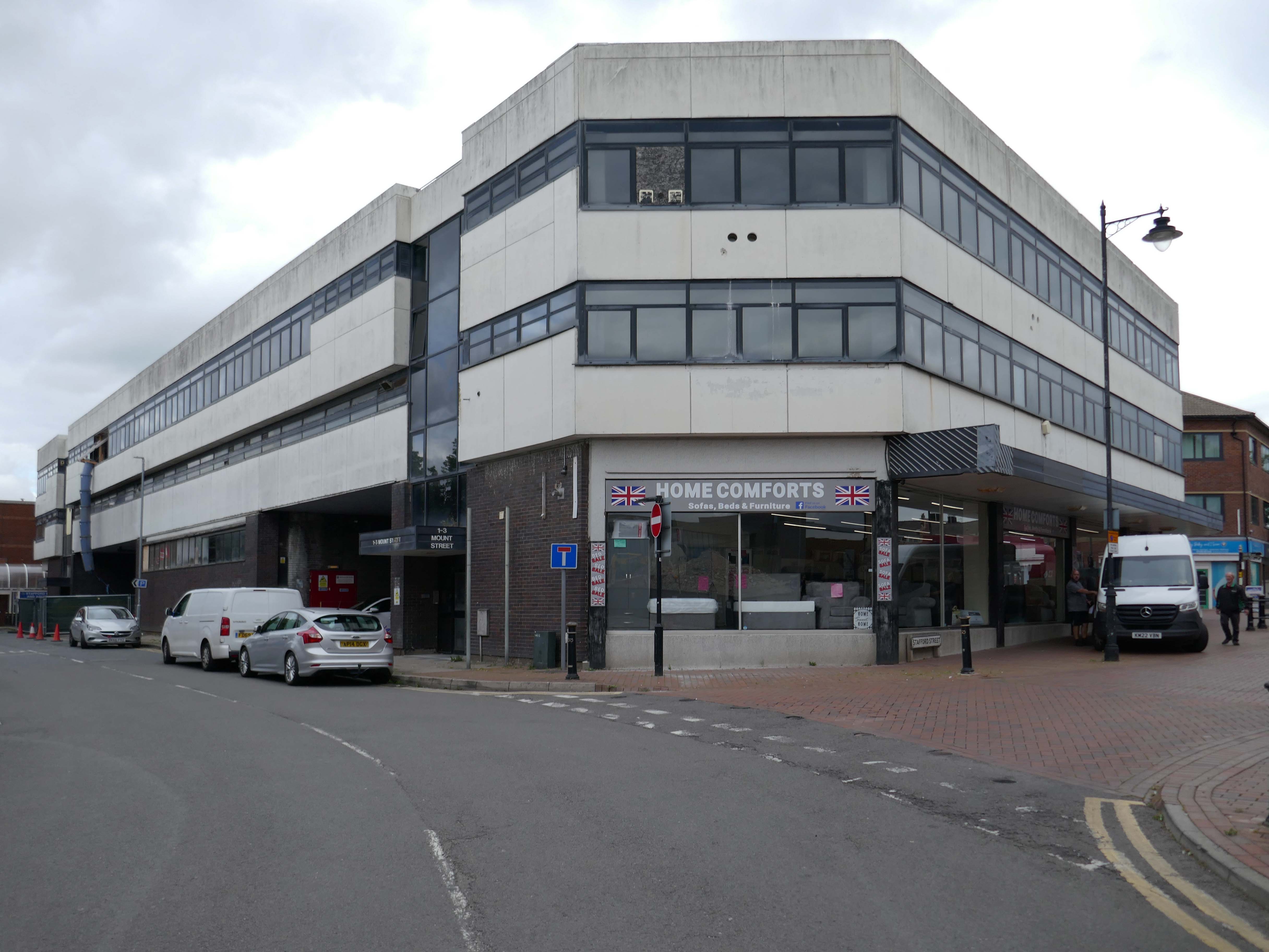
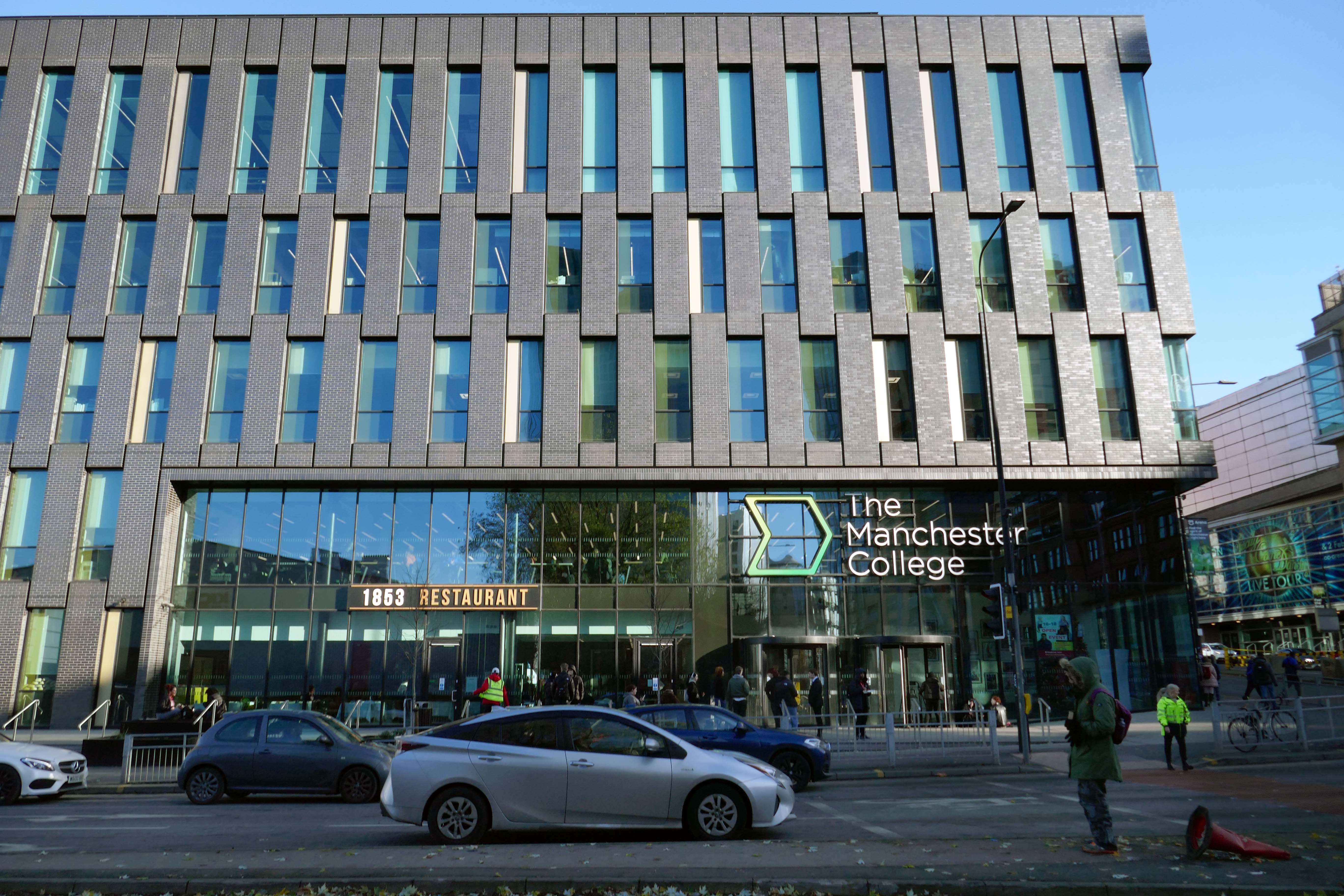
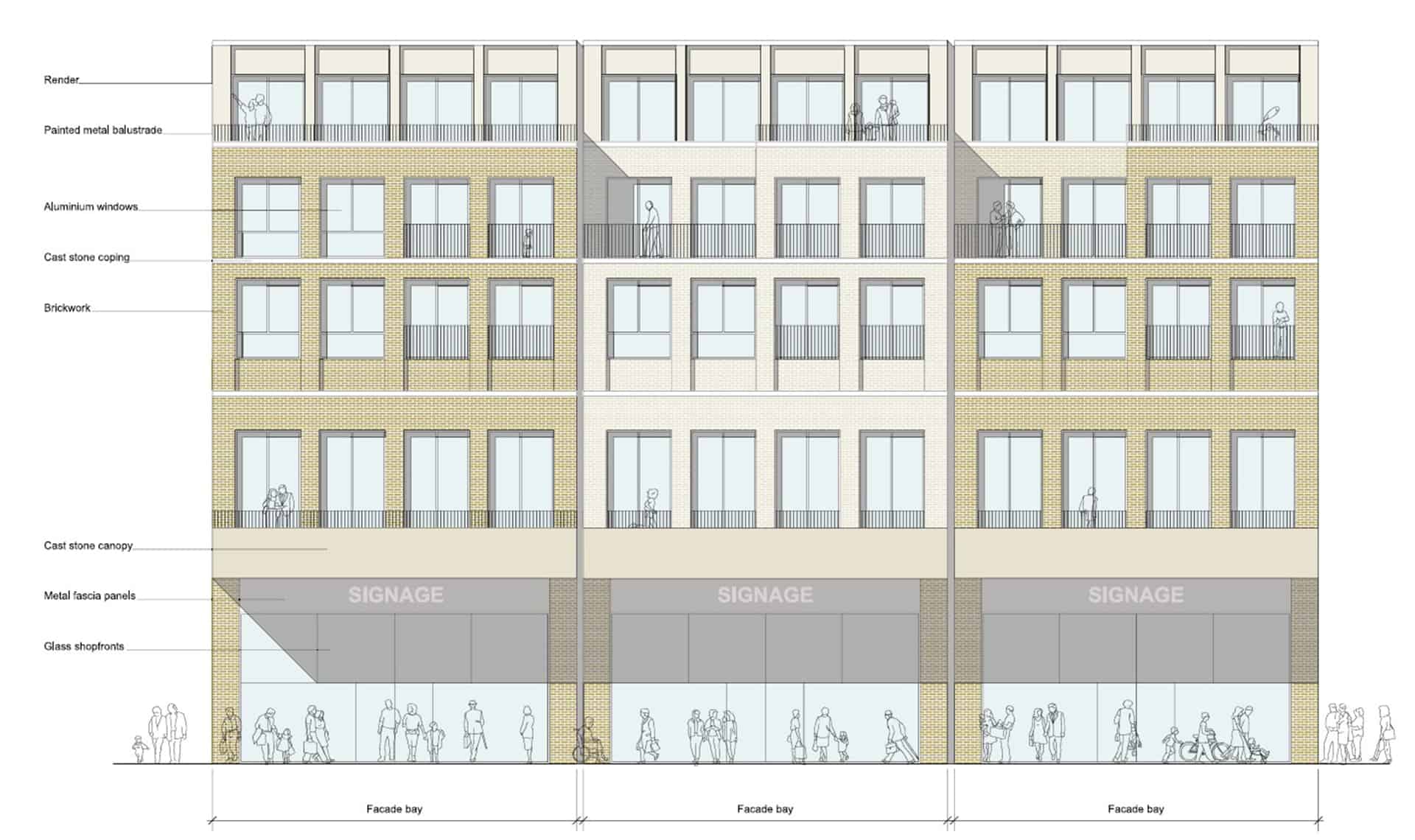
The new £28m three-storey Skills & Innovation Centre at Stafford College, completed in August 2023, was one of the first further education college schemes to be delivered under the DfE framework and a pathfinder scheme for delivery in accordance with the Further Education Output Specification. The new Centre is equipped with cutting-edge equipment and state-of-the-art facilities for construction, engineering and hybrid / electric vehicle maintenance facilities, as well as IT rich seminar suites and open learning break-out spaces along with a 4-court sports hall, a fully-equipped gym and a flexible 300-seat auditorium.
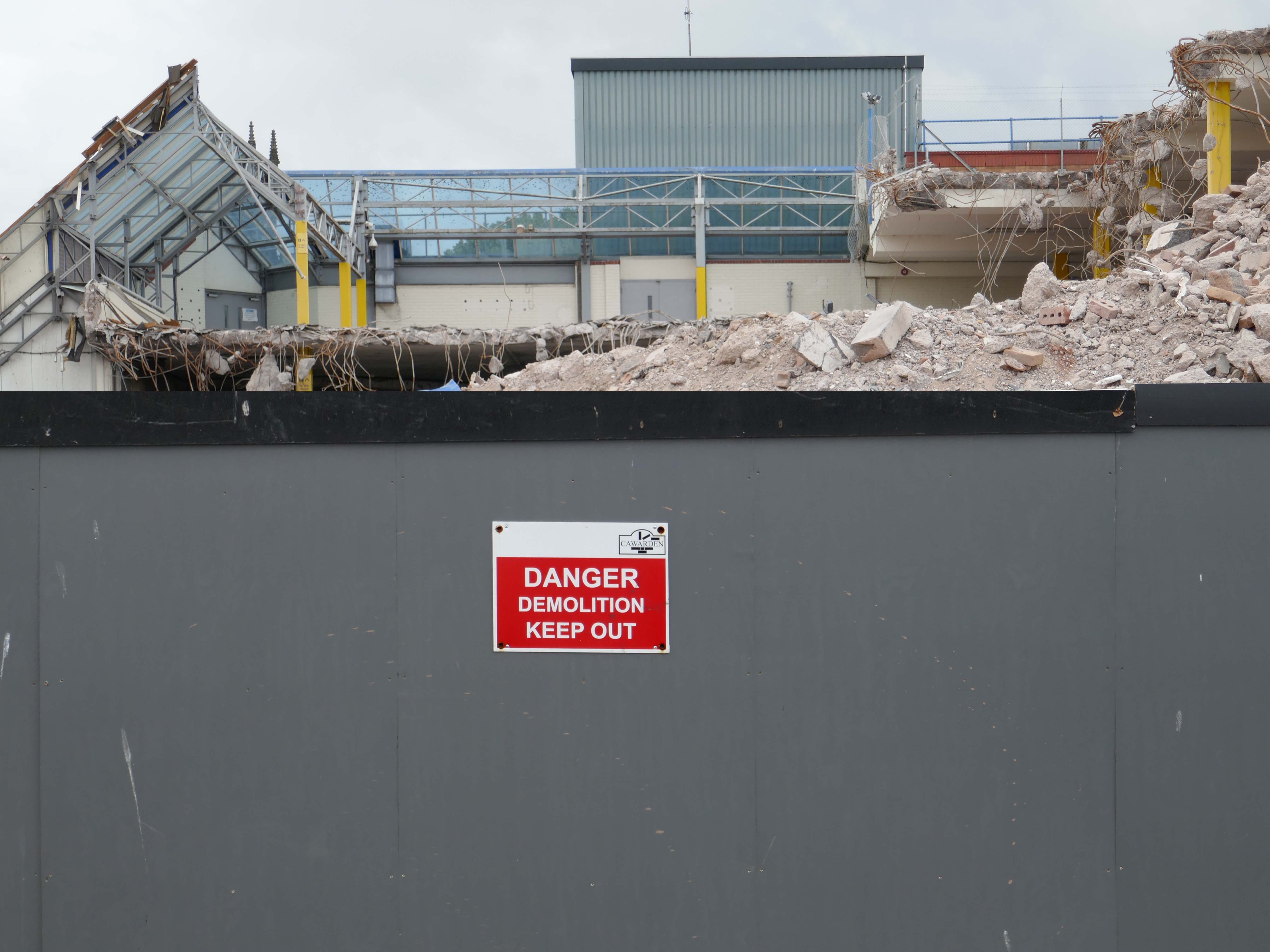
A 1970’s block was demolished to make way for the new development.
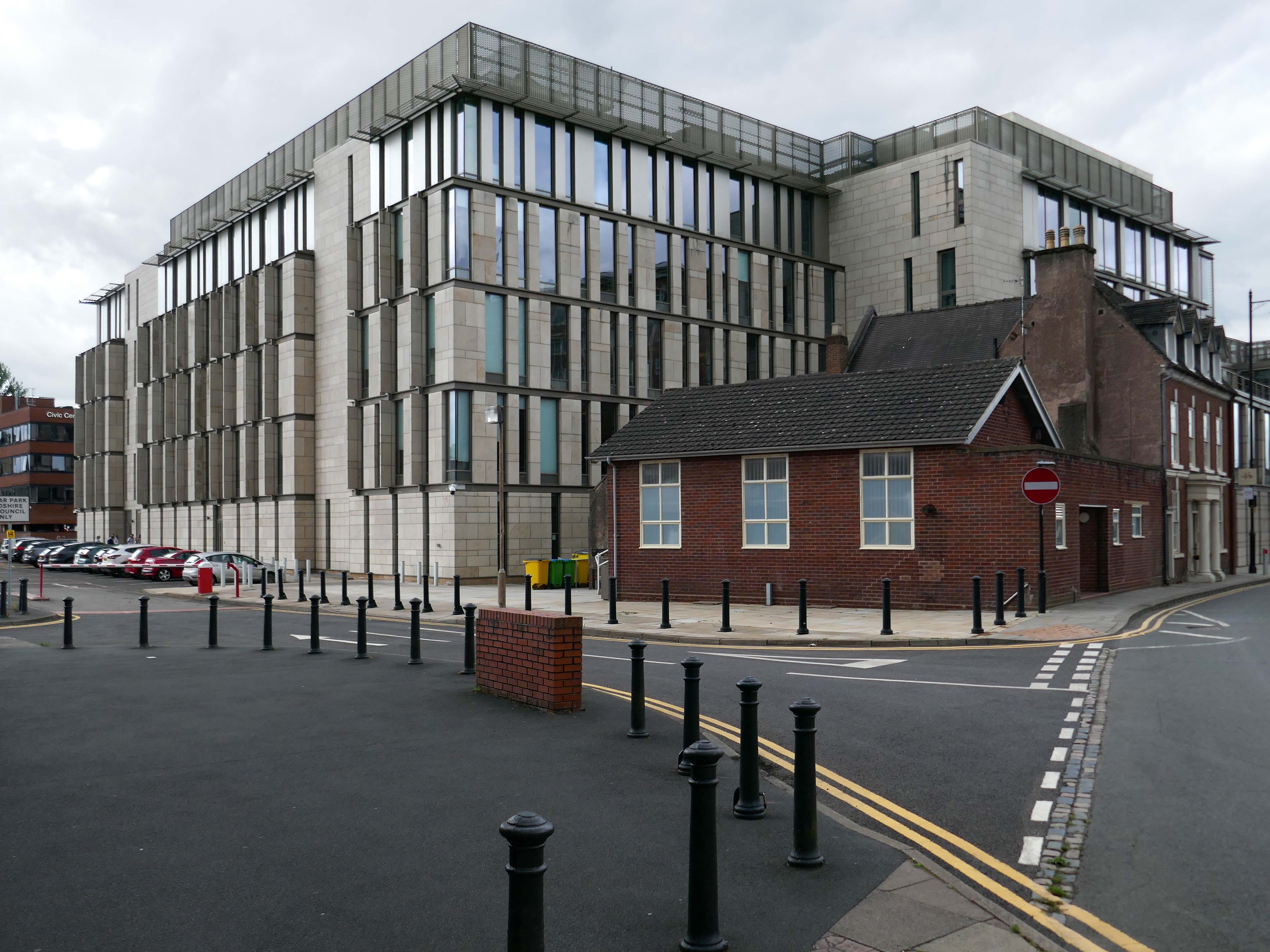
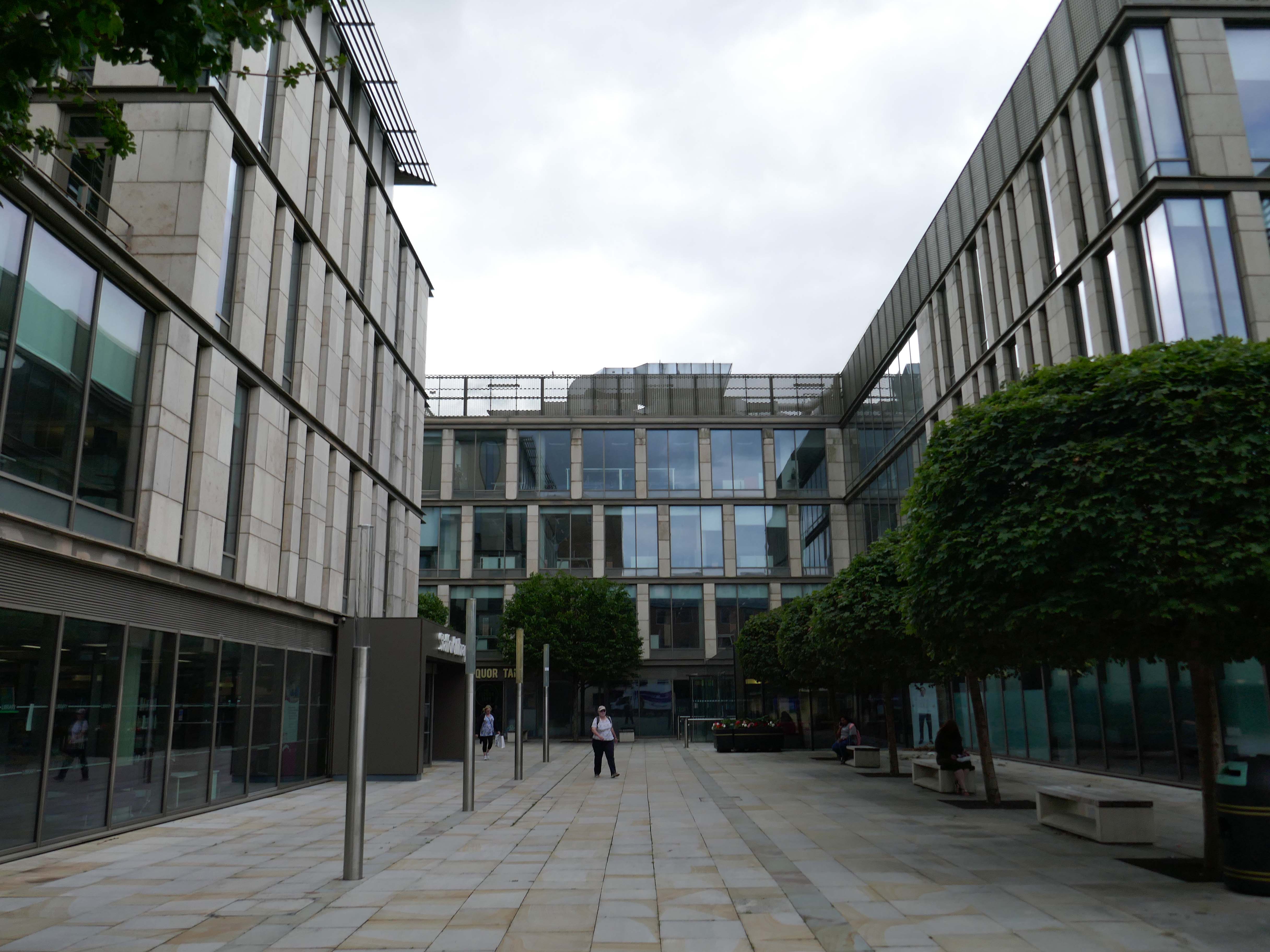
Almost everywhere we go we find a PoMo Crown Courts 1991 – architects: Associated Architects of Birmingham, cost of £10.4 million.
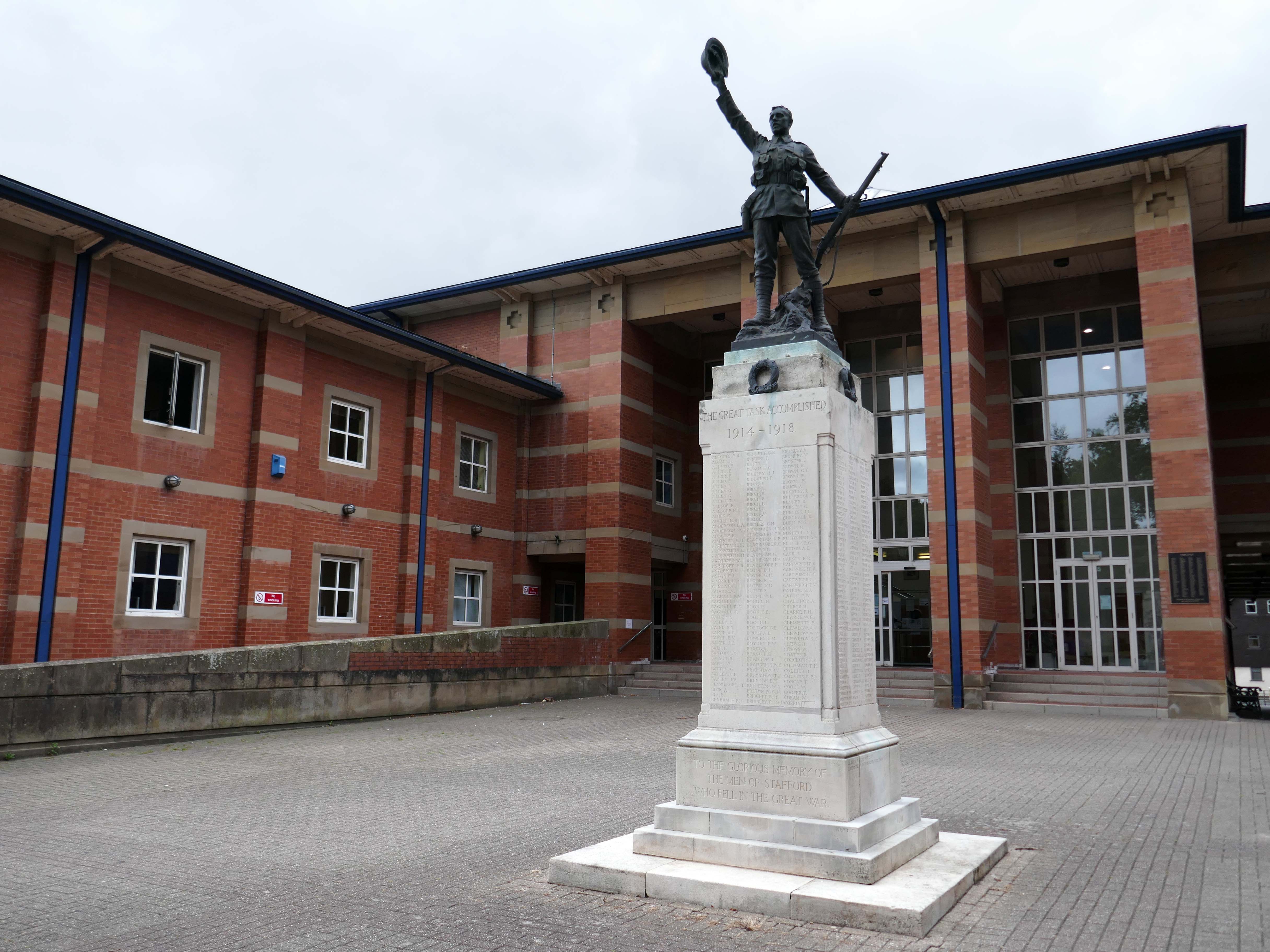
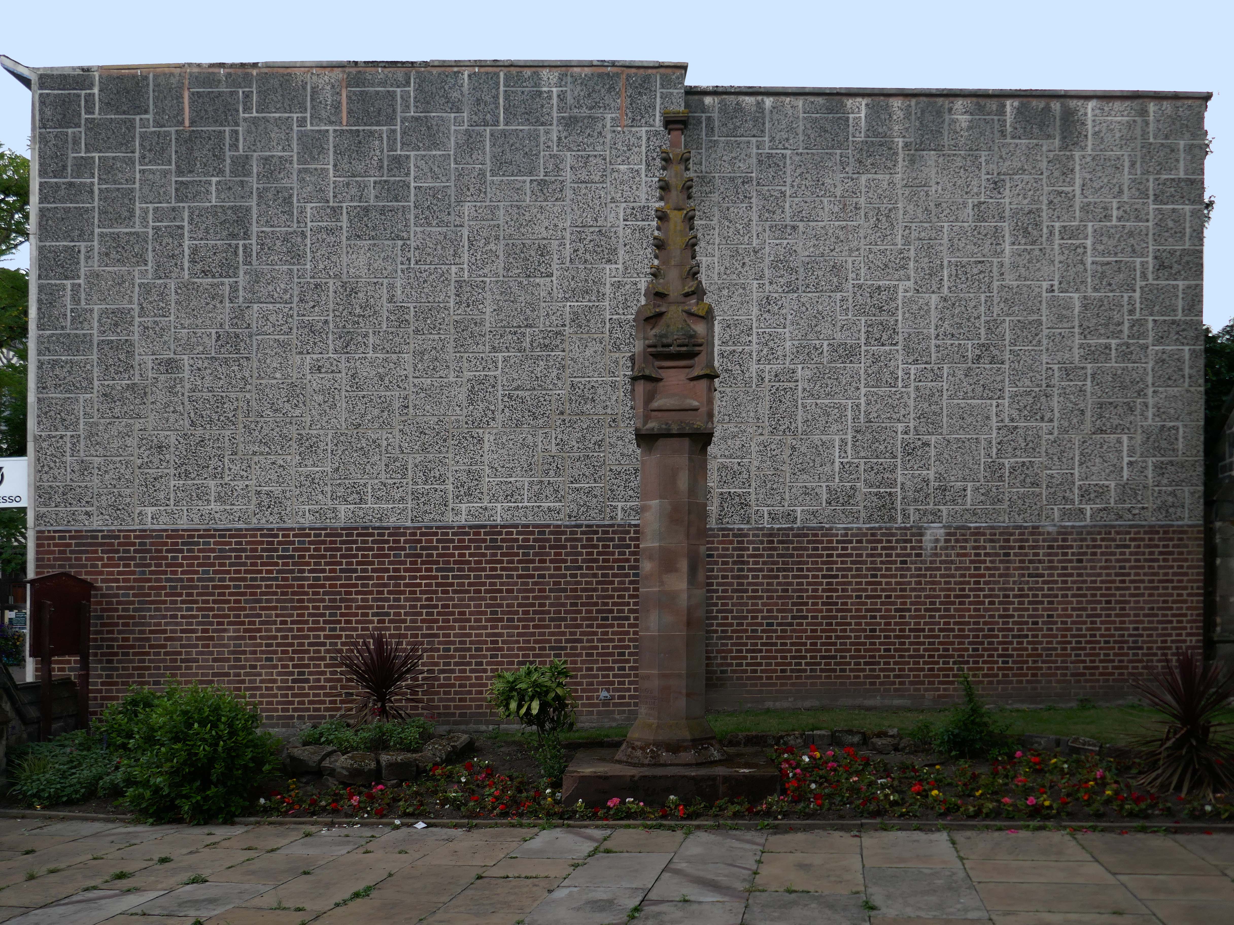
The war memorial of 1922 is by Joseph James Whitehead.
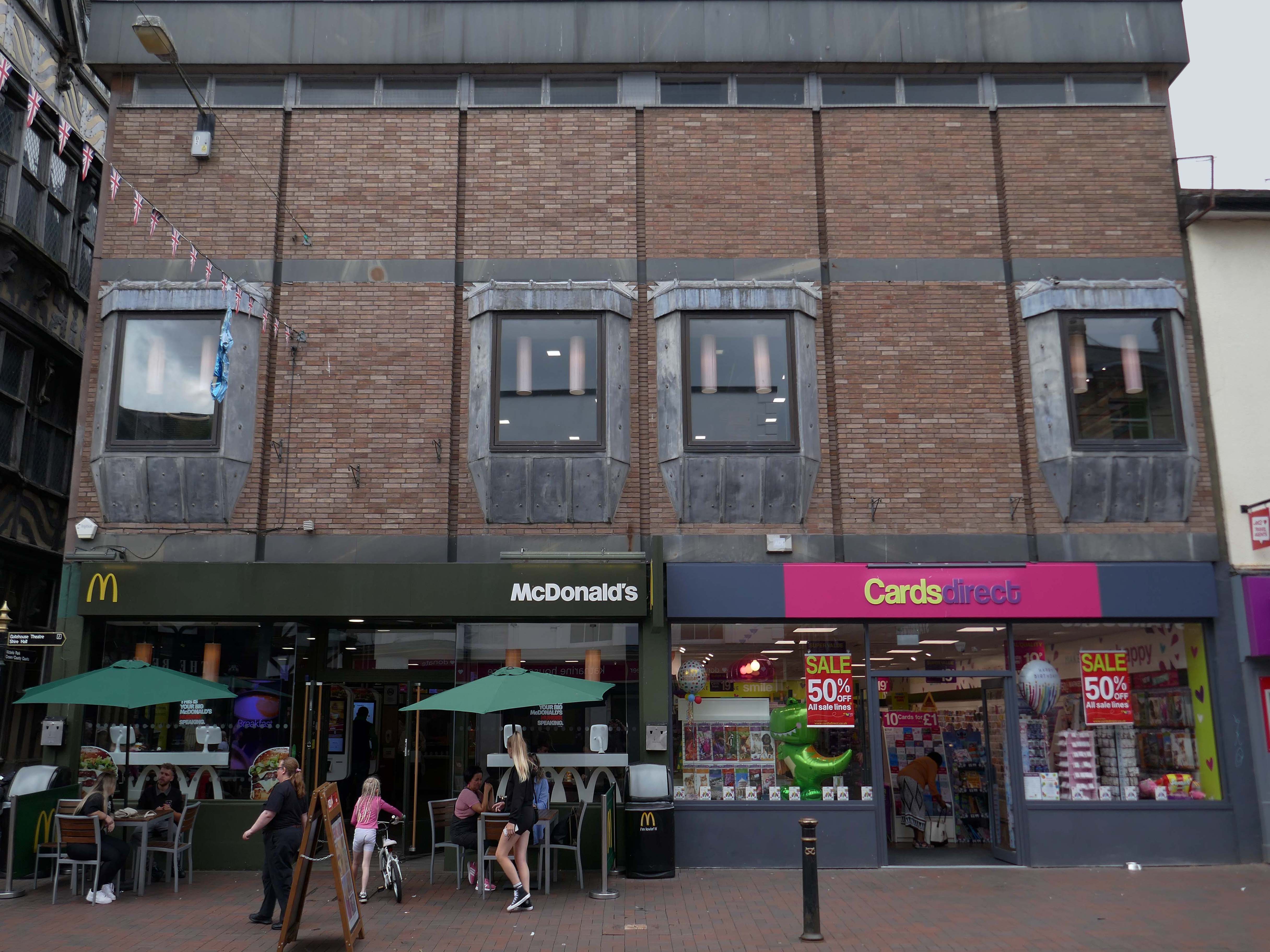
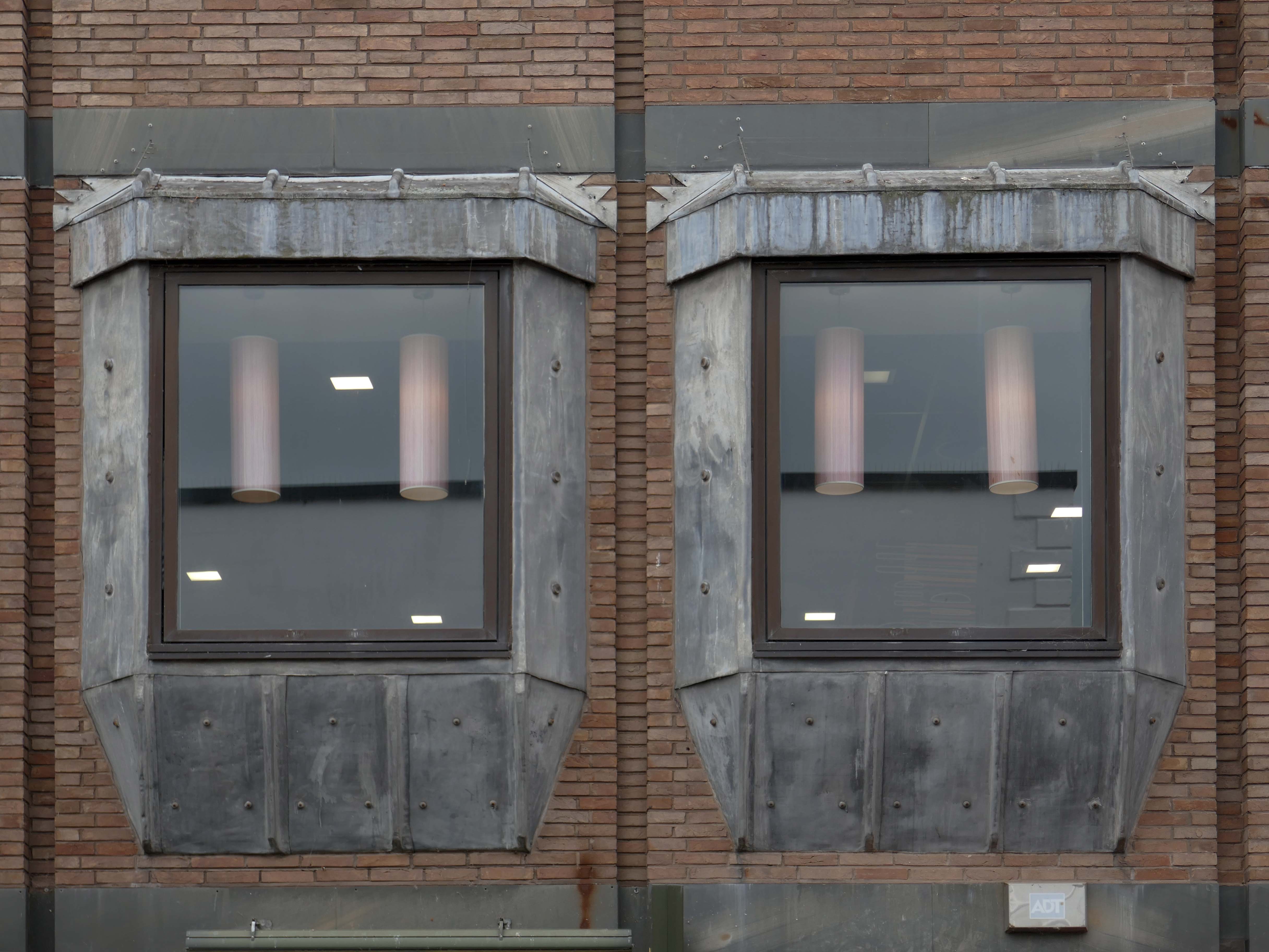
Sneaking through the alley to and before the McDonalds – one many more recent buildings with jetted lead clad bays.
Keeping the town Tudor one bay at a time..
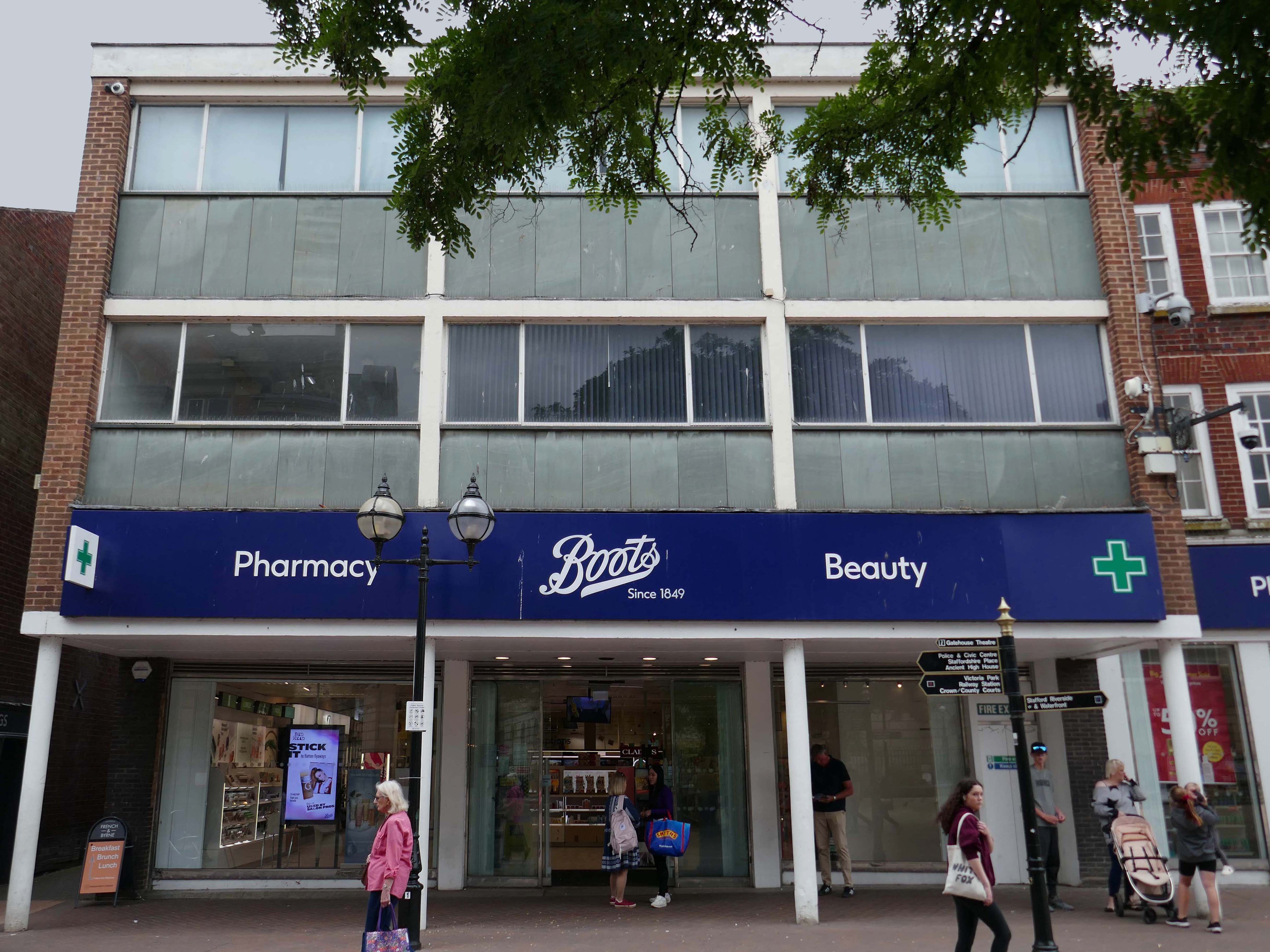
Further along a Sixties Boots.
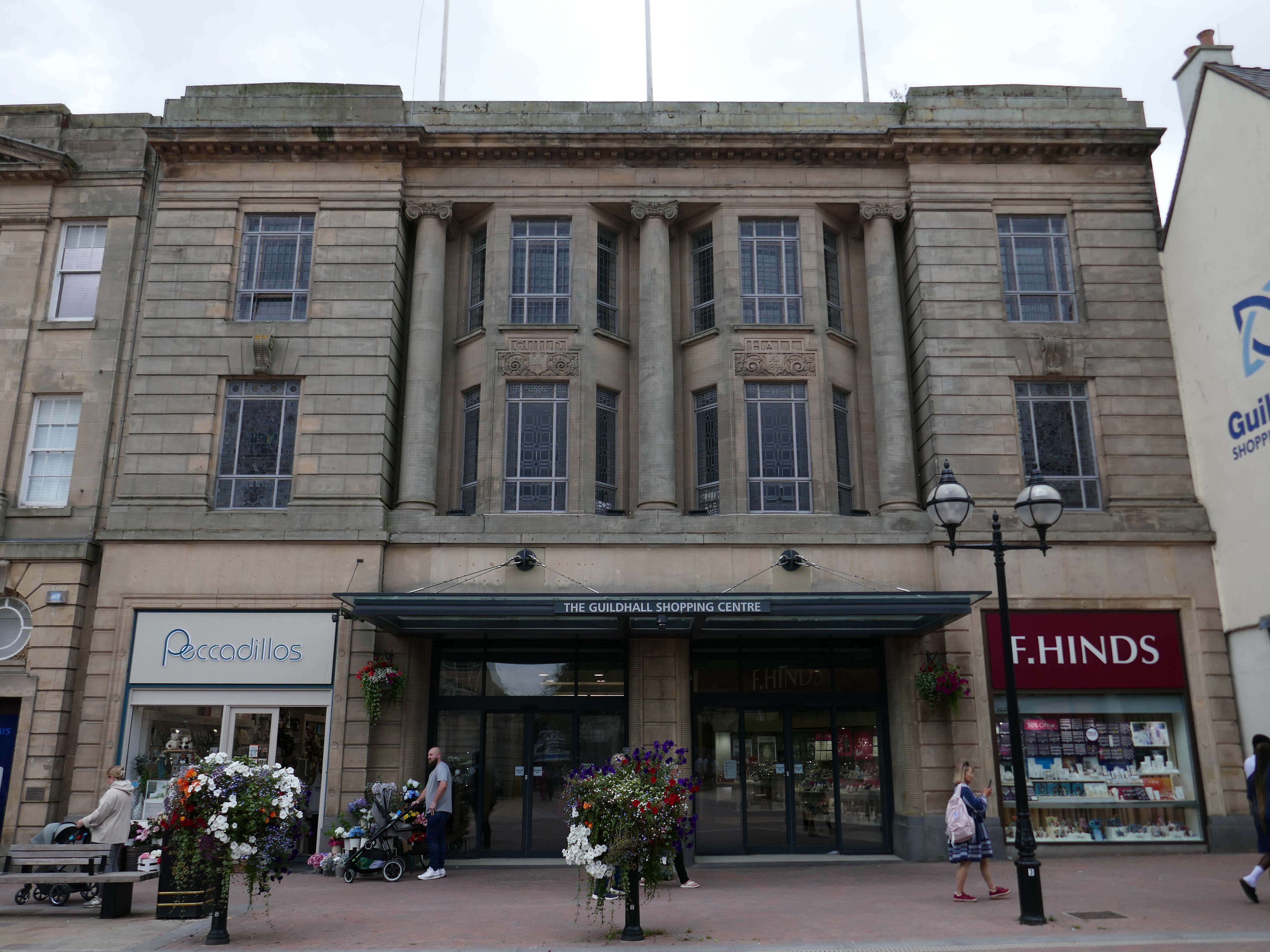
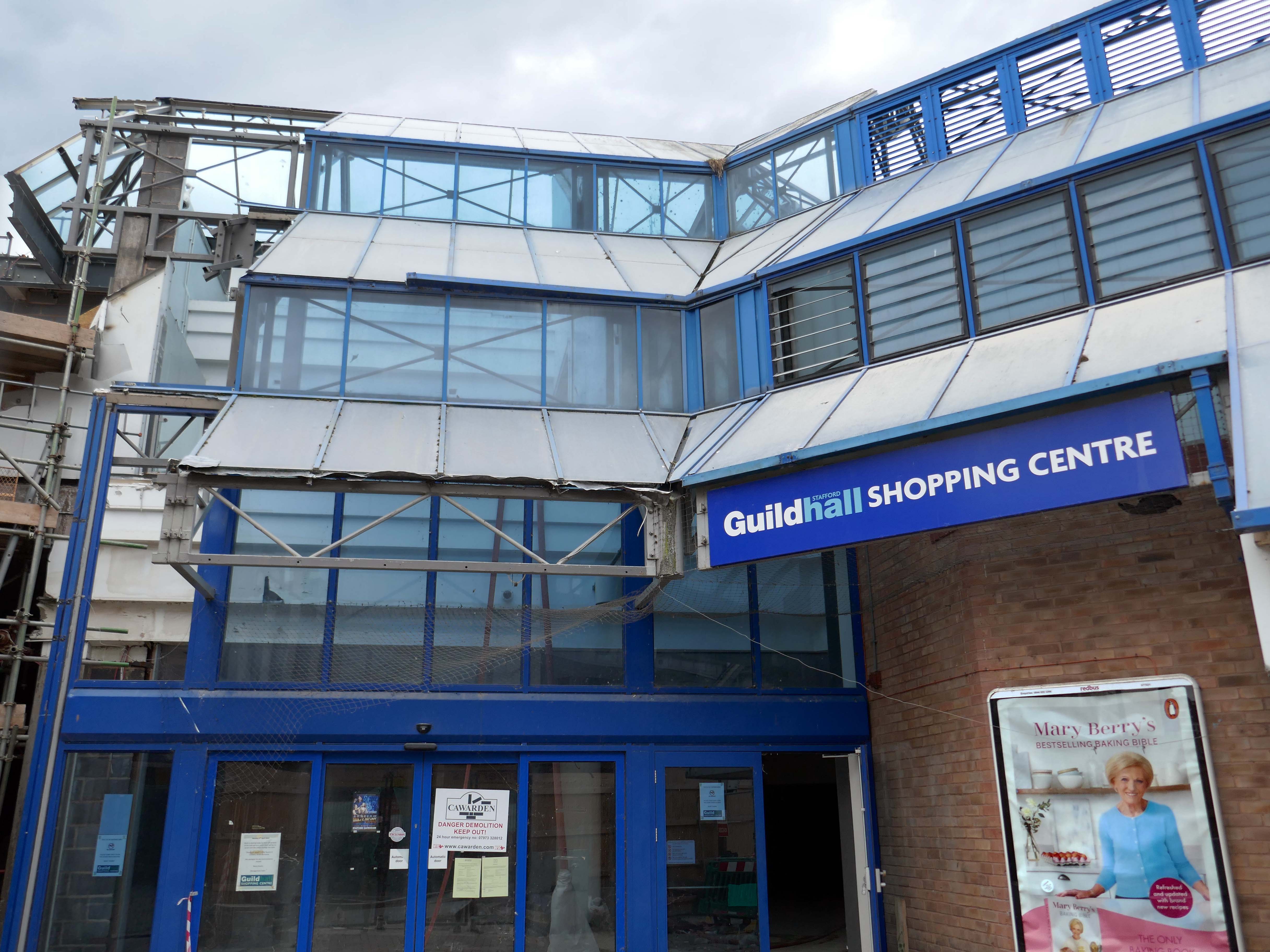
The Classical stone frontage of the Guildhall Shopping Centre.
Working with Mercia Real Estate, Glancy Nicholls Architects have designed a contextual mixed-use scheme in the heart of Stafford Town Centre, within the footprint of a disused shopping centre. This includes the regeneration of the 1930’s Guildhall building that serves as the main entrance to the shopping centre and the listed Market Square building.
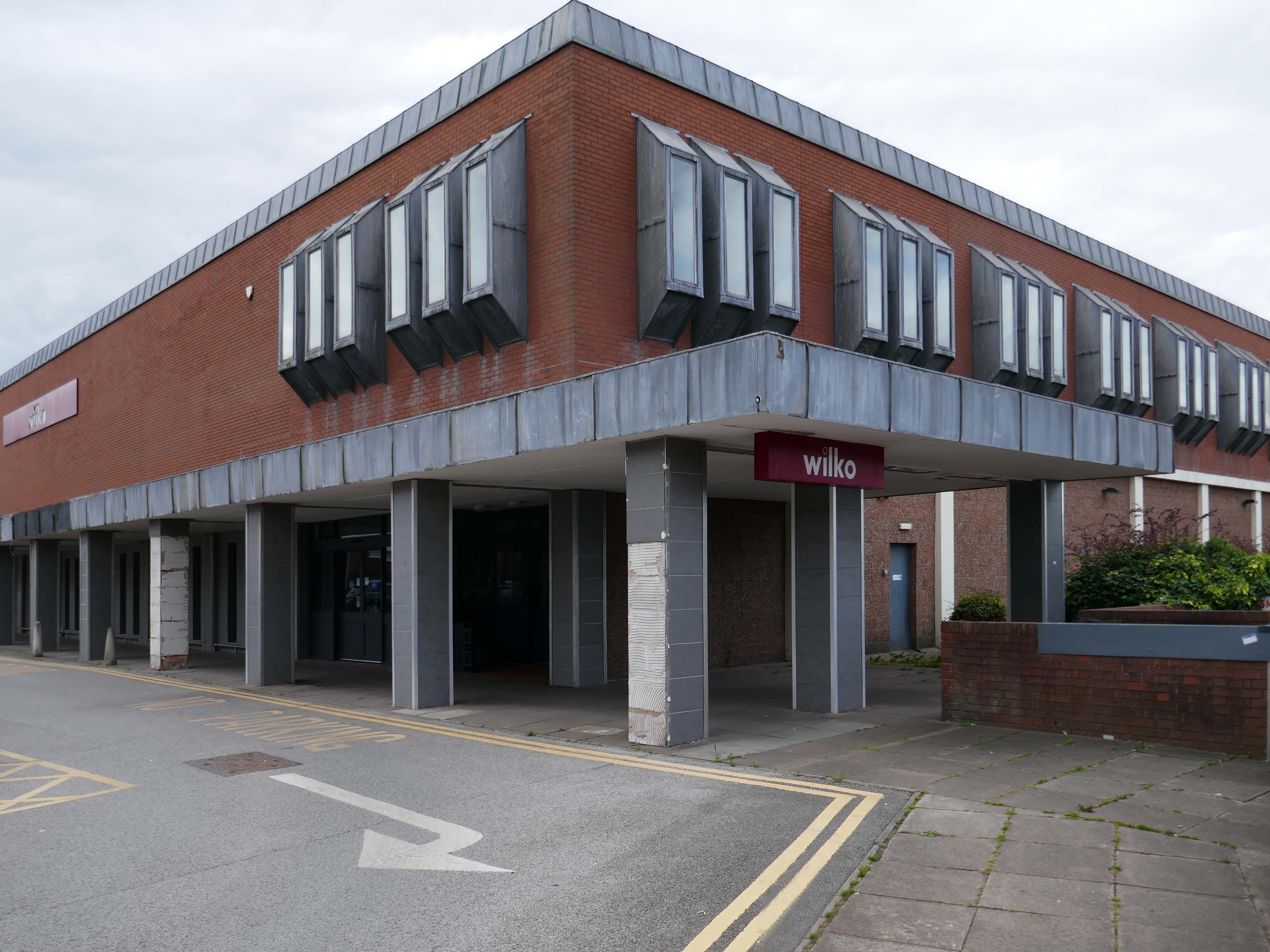
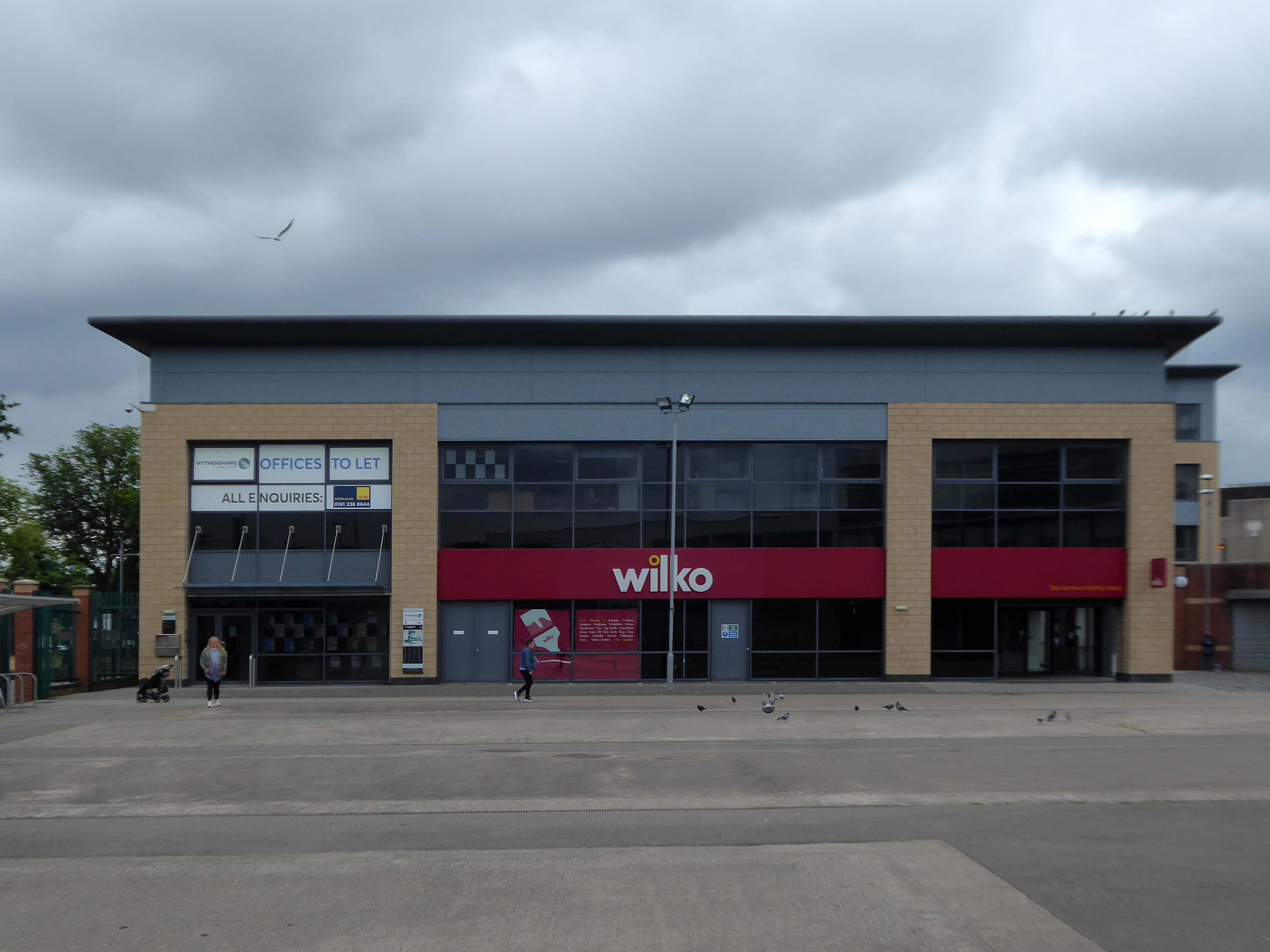
Around the corner a somewhat neglected retail development.
And a long lost Wilko.
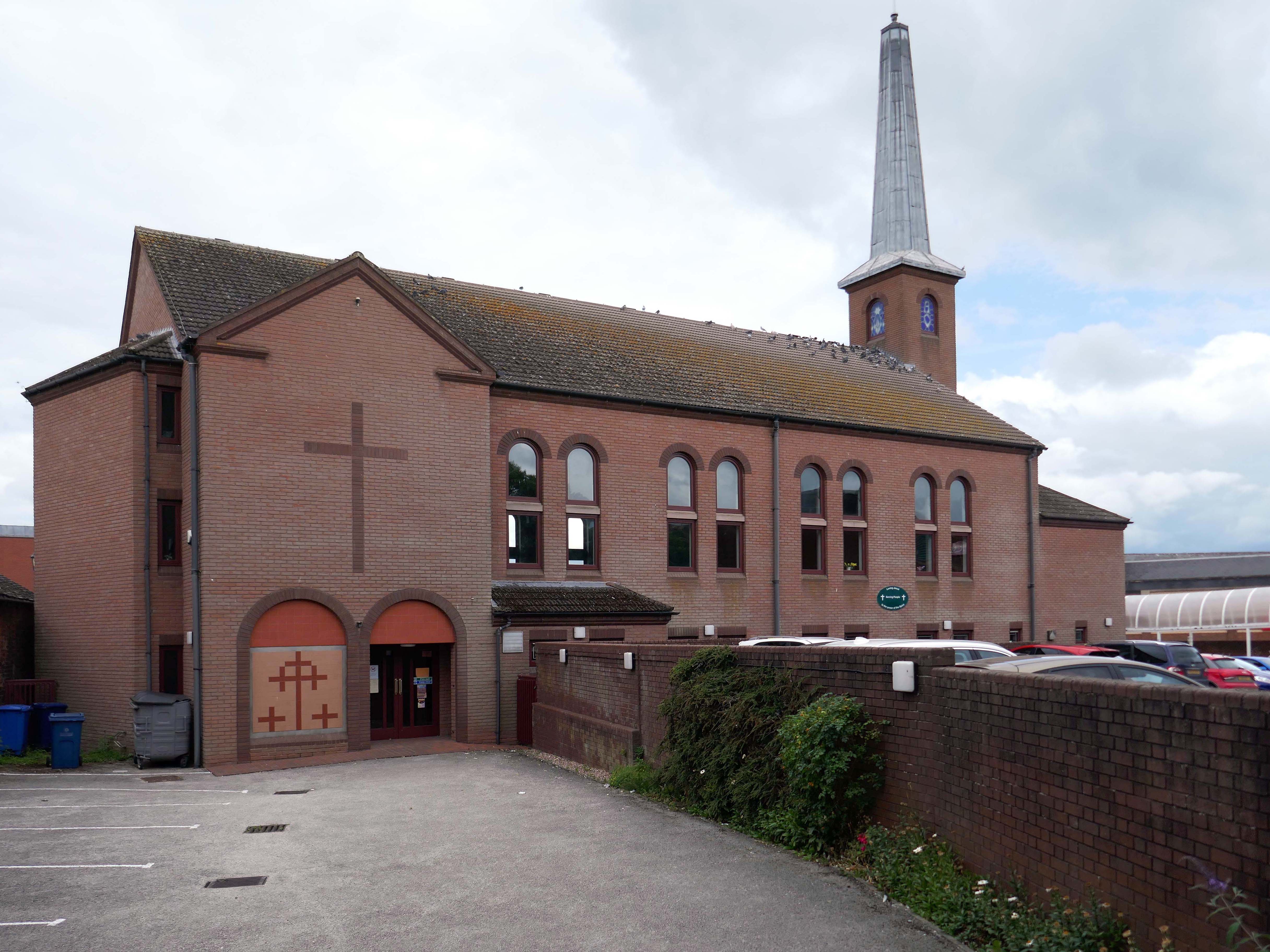
Amidst it all the curious time warp that is Trinity Church 1988.
It is used by Methodist and United Reformed Church congregations.
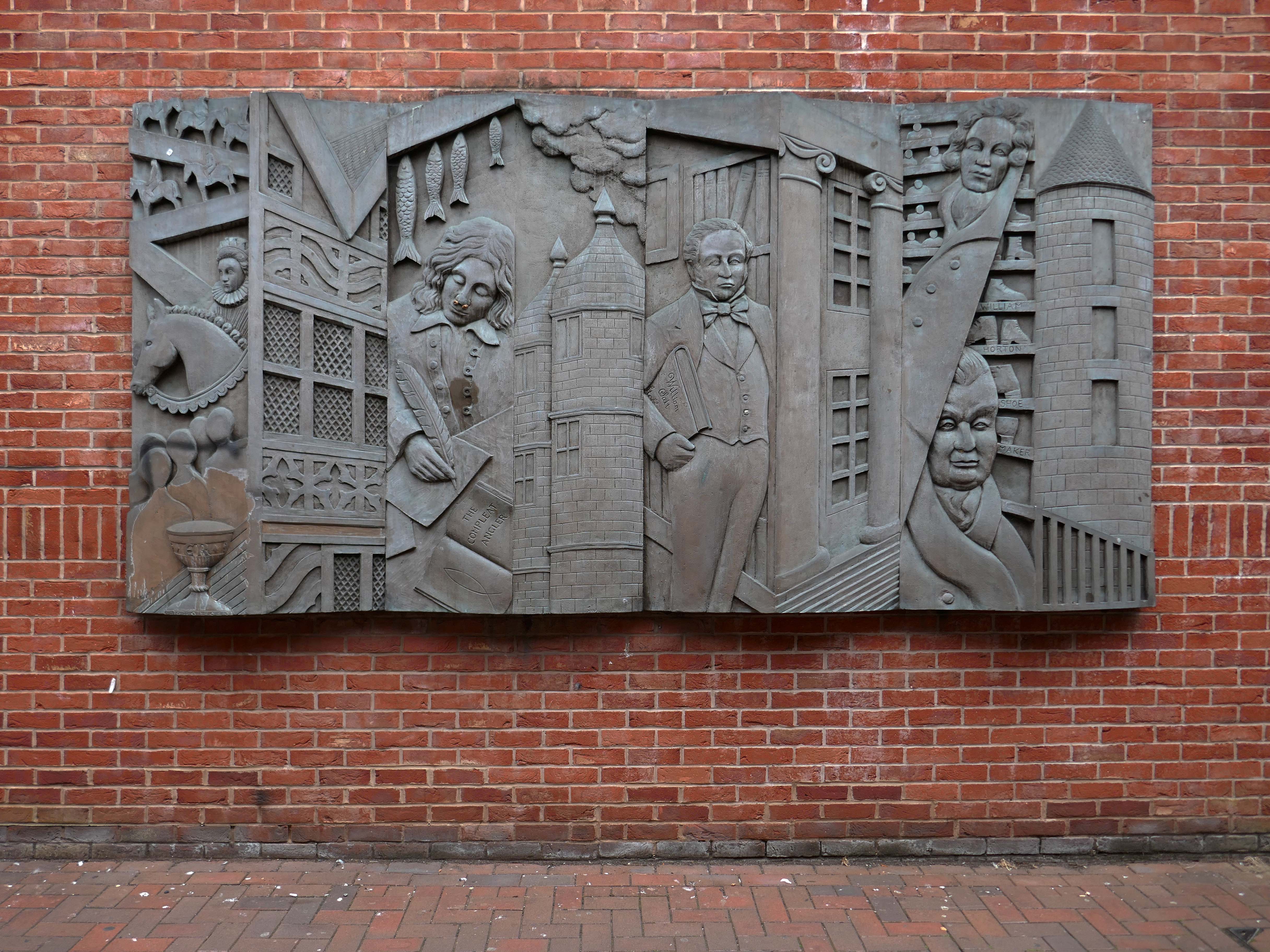
Tucked away in a minor maze of retail a piece of figurative commemorative public art by Glynis Owen Jones, entitled Stafford Faces.
Around the corner a big B&M.
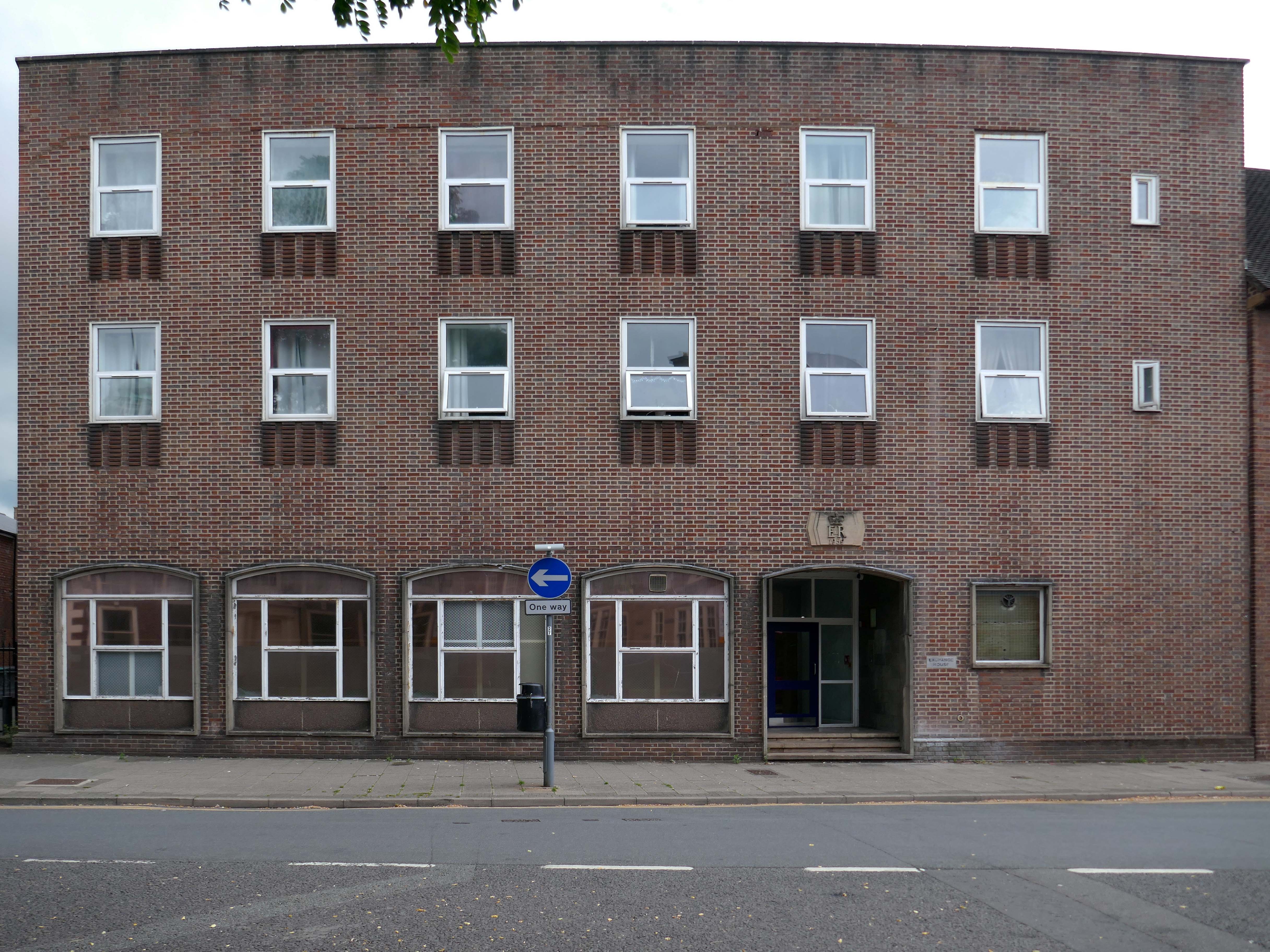
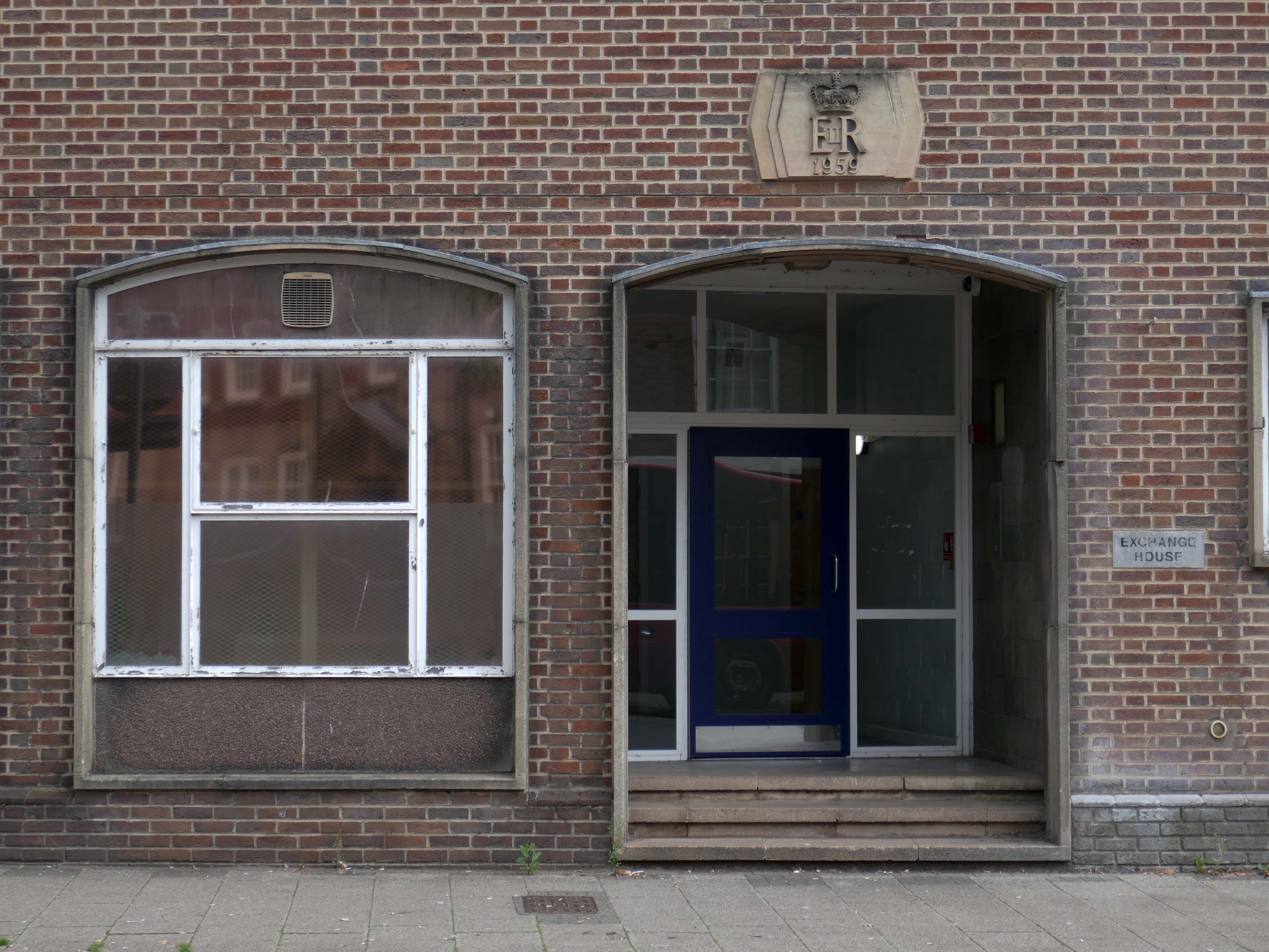
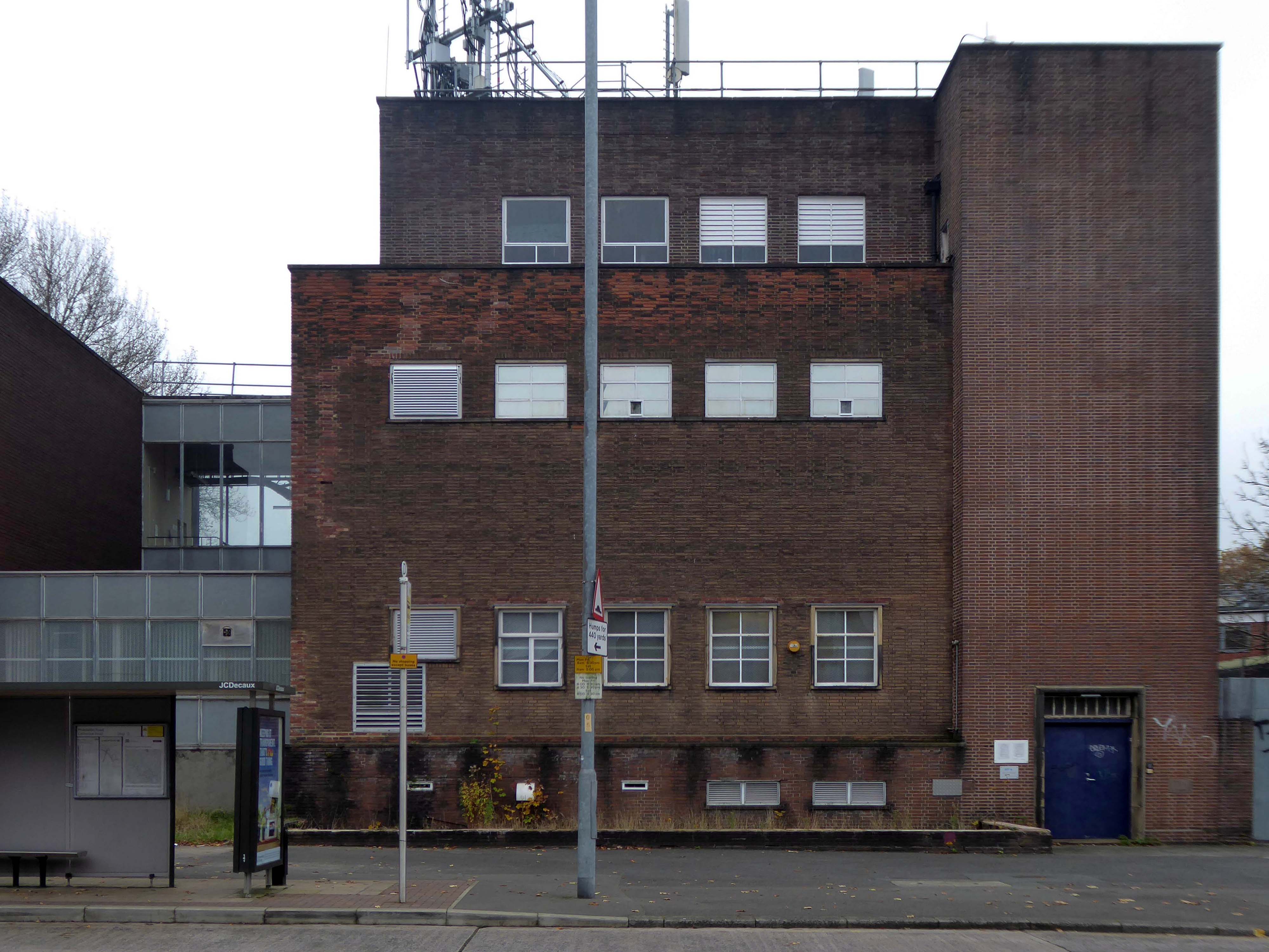
Further along a brick FoB Telephone Exchange of 1959.
Adjoined by the County Records building.
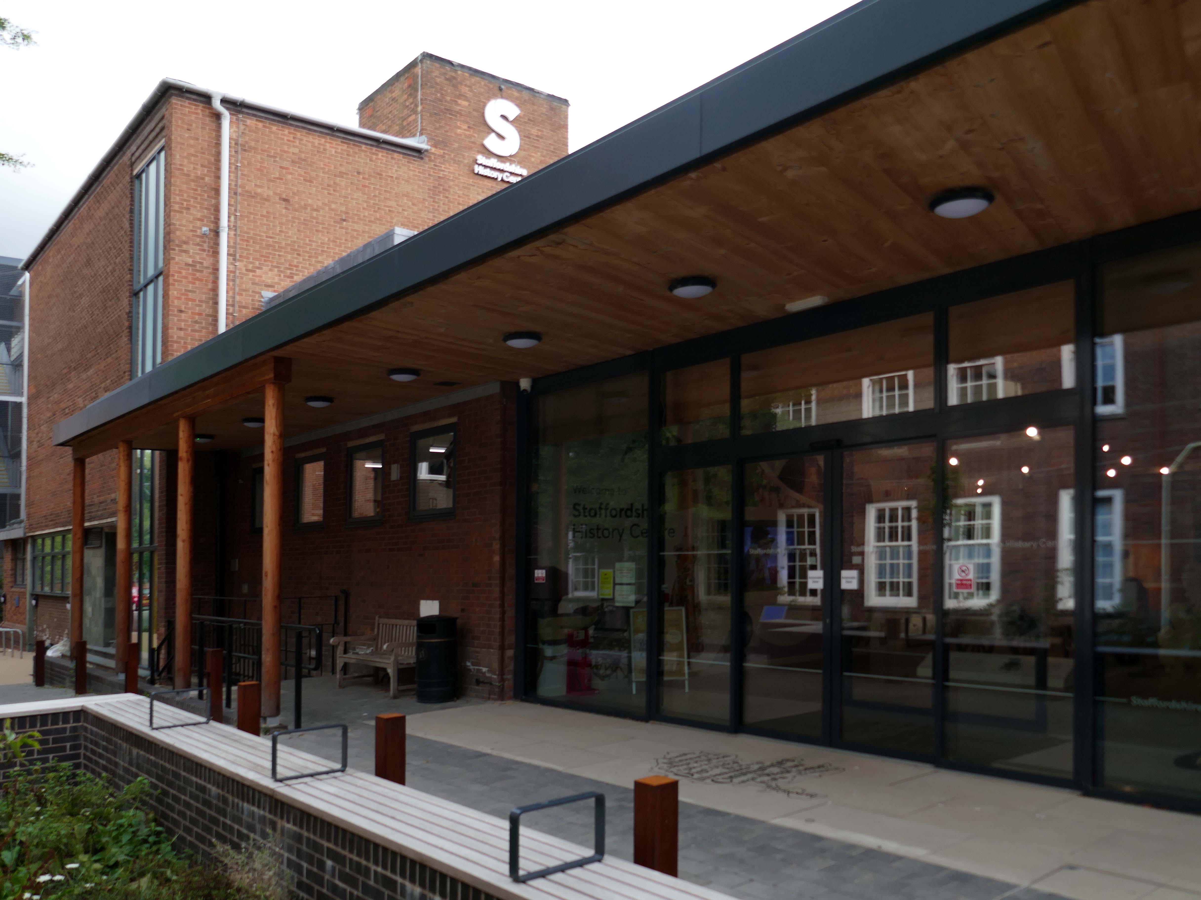
Pringle Richards Sharratt Architects have been appointed by Staffordshire County Council to create a new History Centre for Staffordshire and Stoke on Trent.
The new £4m centre will be located on Eastgate Street in Stafford and will hold historical records and collections up to 1,000 years old.
The scheme will help to provide a rejuvenated service combining the existing Records Office building and William Salt Library, in Stafford and provide a welcoming destination for all of those with an interest in local history. This will include bringing on to the Stafford site the Lichfield Records Office and aspects of the County museum.
Further FoB in the Civic Building.
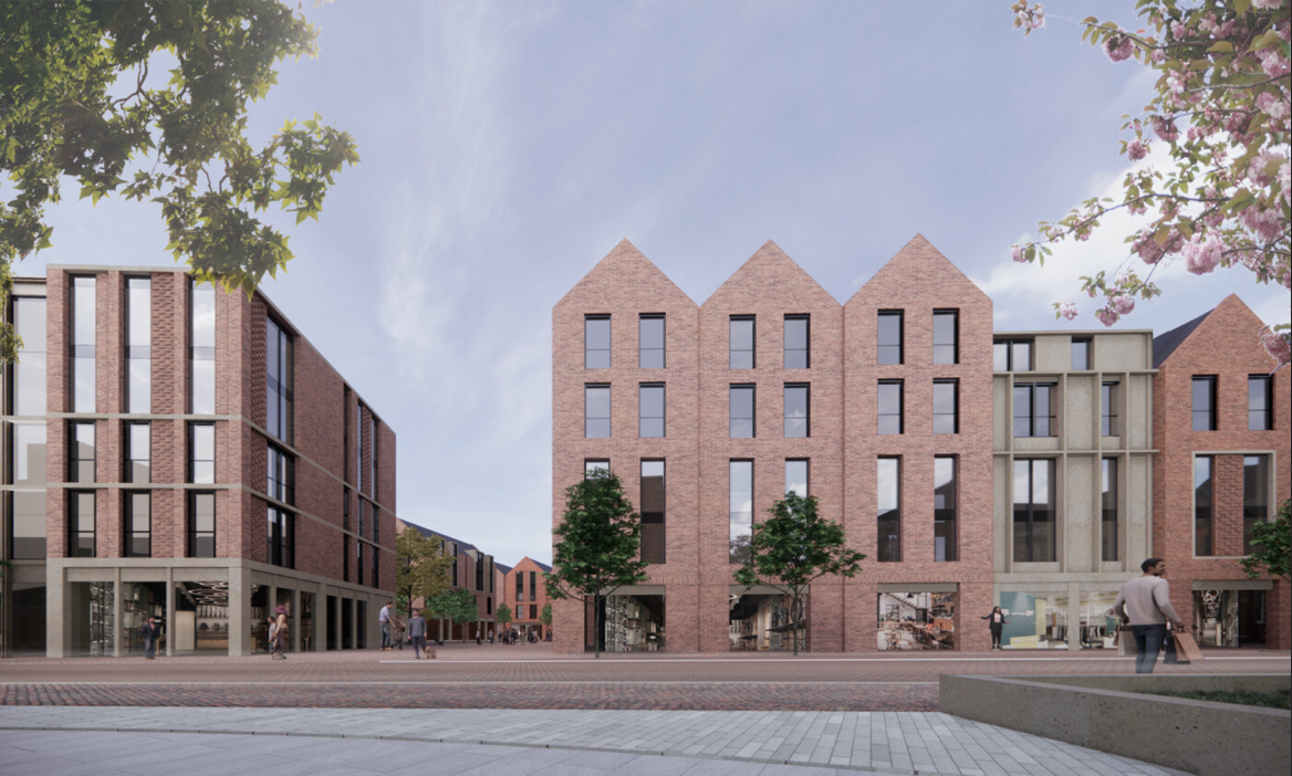
Close by the Staffordshire Place a civic and retail mixed use development.
Our scheme delivers 135,000 ft2 of high quality contemporary office space across two buildings linked by a new town square. The ground floor incorporates a mix of retail and leisure uses around a sequence of smaller public spaces to maximise the amount of visible active frontage and create a natural extension to the town centre.
Sustainability issues fundamentally informed the design approach, from mitigating energy consumption to ‘future proofing’ the finished building. The building achieves a BREEAM ‘Excellent’ rating and a European Energy Performance of Buildings Directive Rating ‘A’.
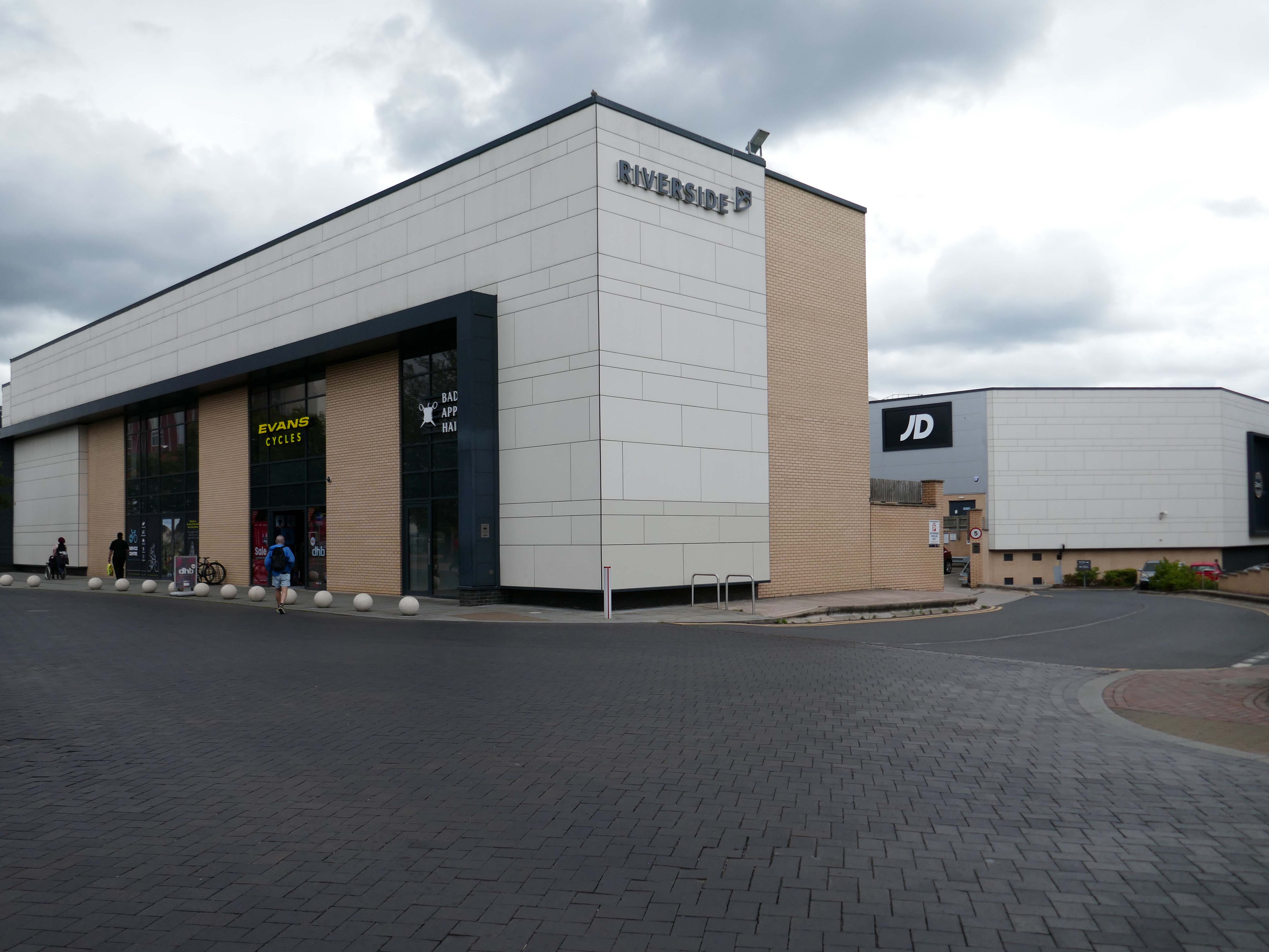
Surprise surprise another retail development Riverside.
£70m riverside town centre retail and leisure development in the heart of Stafford. The 230,000 sq. ft. scheme anchored by M&S will deliver 18 retail units arranged over ground and first floors, five leisure units and a six-screen cinema to complement and strengthen the town centre economy and create new businesses and jobs.
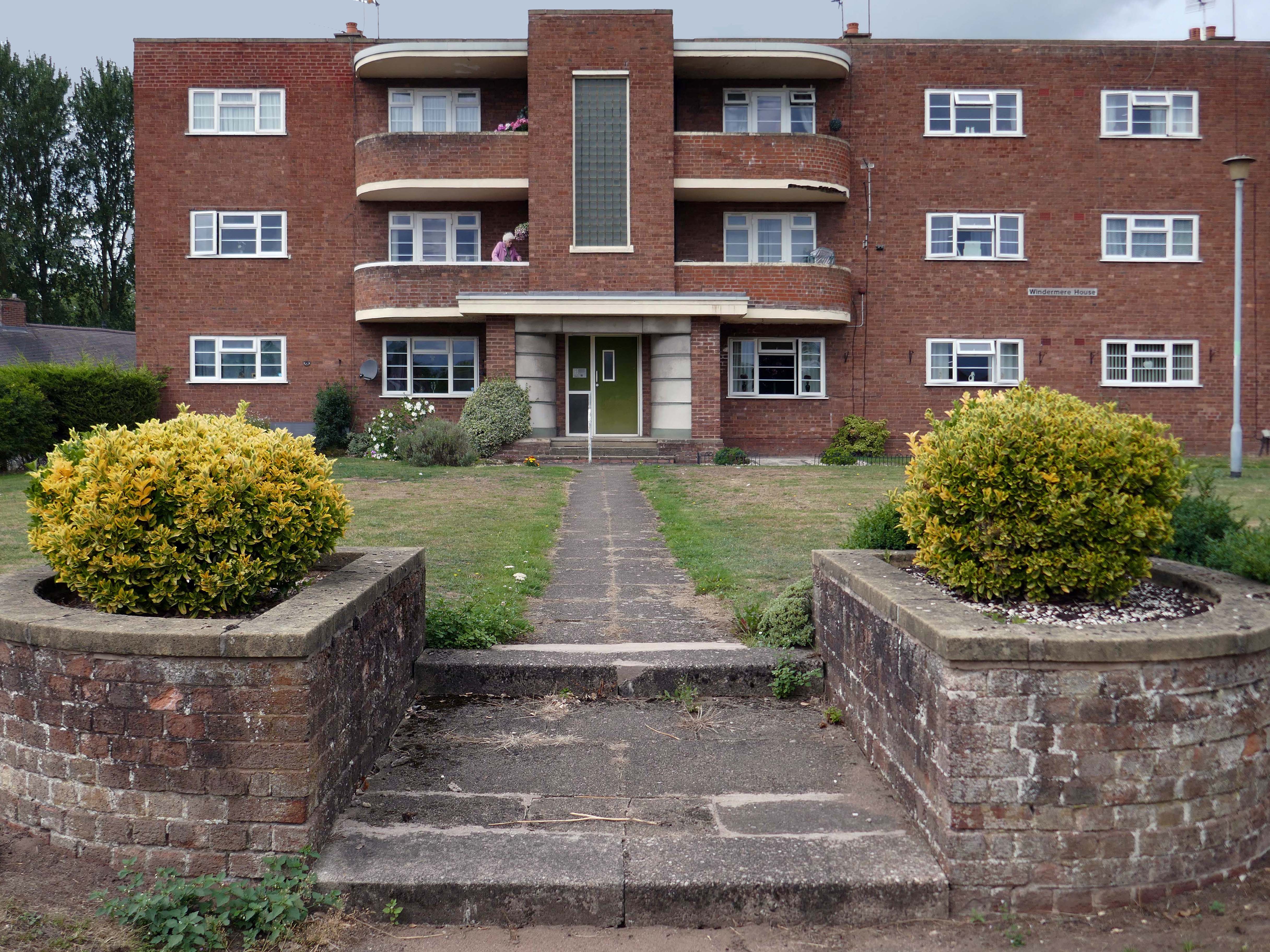
Coniston, Windemere and Rydal were among the first council homes to be built in Stafford, between 1951-52, under the direction of County Architect CM Coombes.
The flats were built as a result of The Housing – Financial and Miscellaneous Provisions Act 1946, which gave subsidies to local authorities to provide social housing. The expansion of the Borough Council’s civic duties included the employment of County Architects, in this case CM Coombes FRIBA, to whom these flats are attributed.
54 flats were built in total, to a distinctly Modernist design, and their appearance and setting are very well preserved.
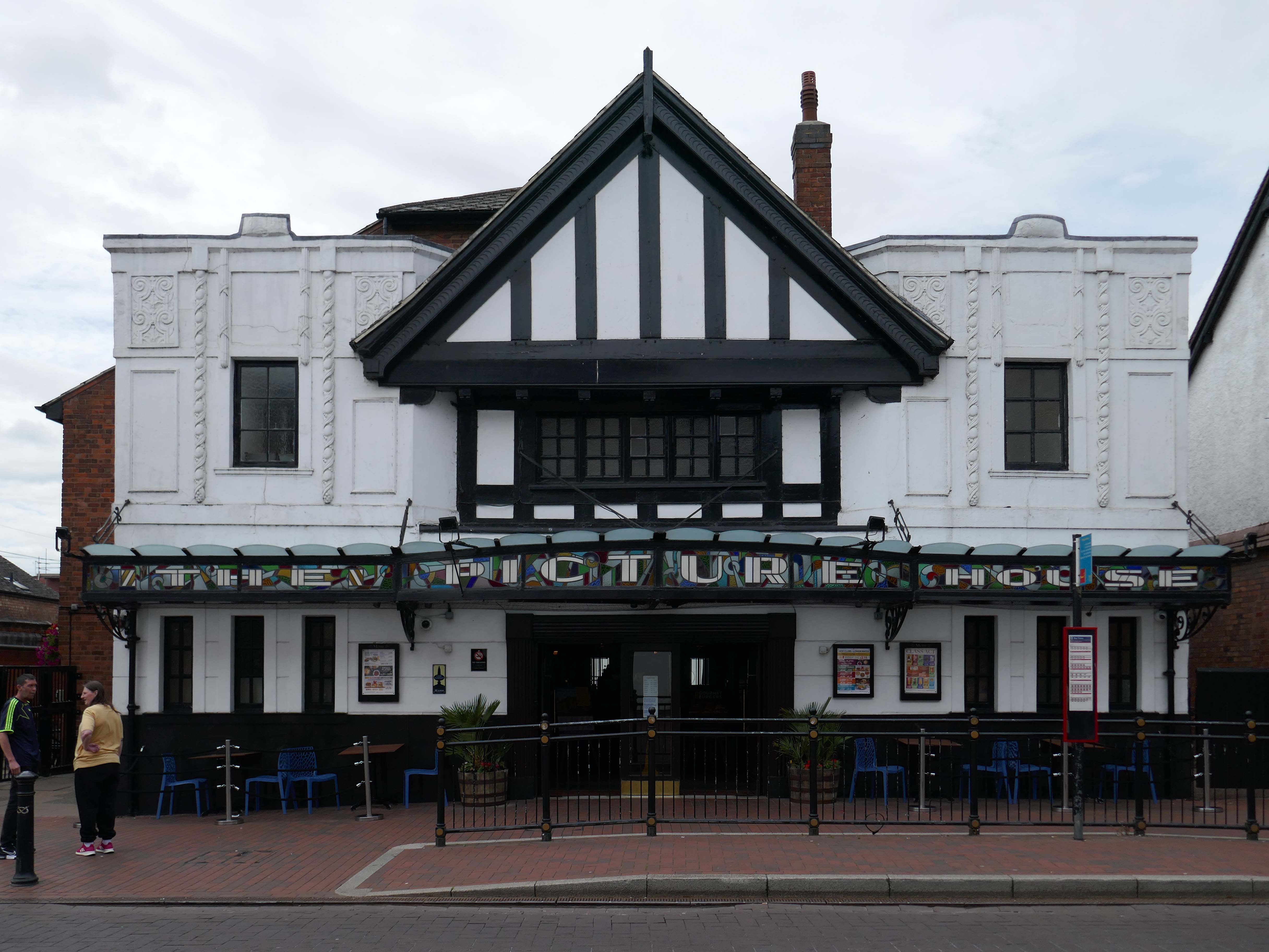
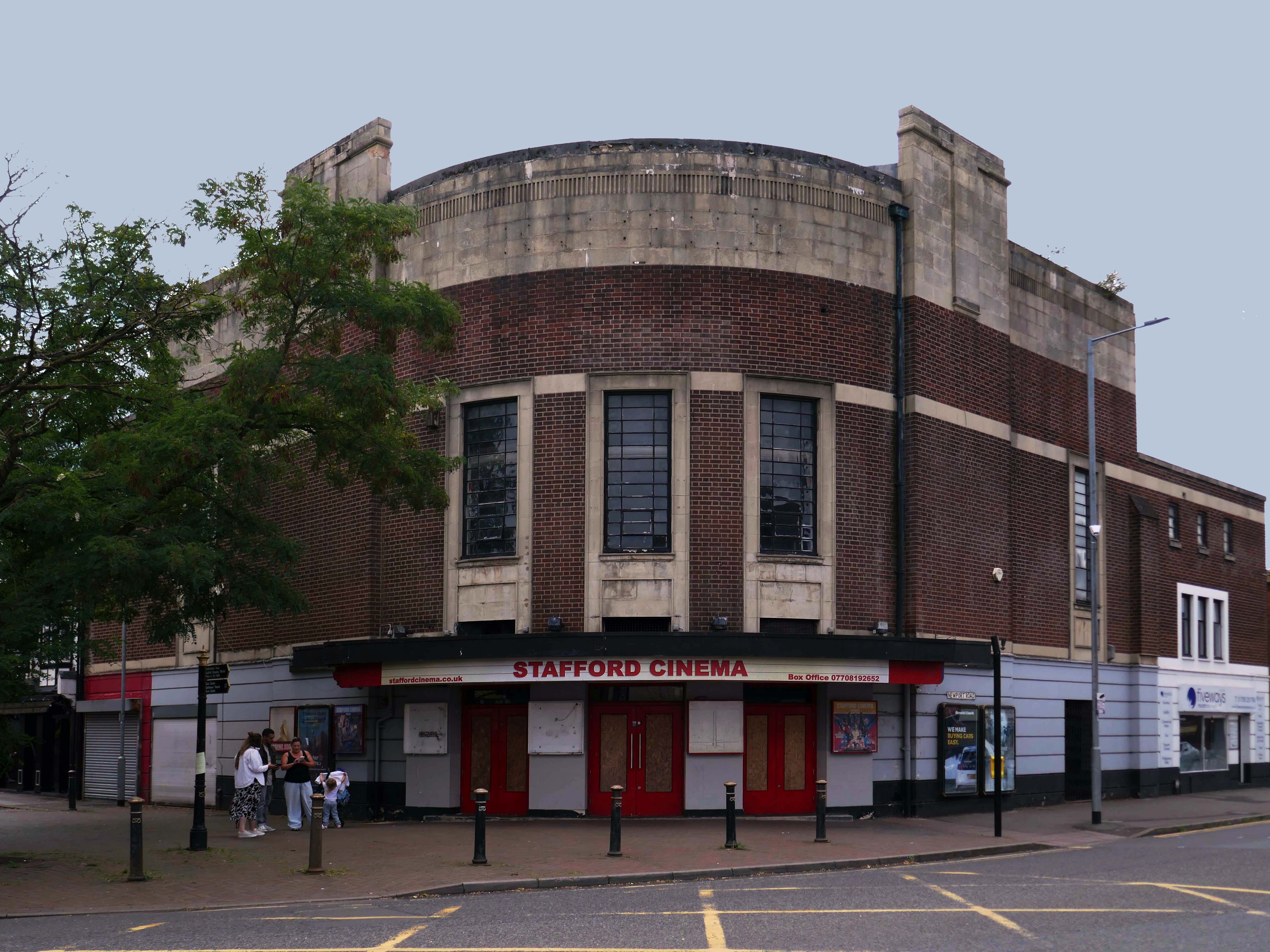
Let’s head back into the town centre – to the Grade II ListedPicture House 1914
The Picture House was closed on 30th March 1995 after a three week run of Disclosure starring Michael Douglas, there were seventy eight attending the final performance.
It was disposed of by the Rank Organisation in July 1981 and was taken over by the Hutchinson Leisure Group who re-named it Astra Cinema. In December 1981 it was tripled with 435 seats in the former stalls and two mini cinemas in the former circle seating 170 and 168.
In 1988 it was taken over by Apollo Cinemas and re-named Apollo Cinema. The downstairs cinema was closed and became a bingo club for a couple of years, during which time the two mini cinemas in the former circle remained open. The bingo operation gave way to films again in 1990 and all three screens were again open, with seating for 305, 170 and 164. In January 2014 it was taken over by the Curzon Cinemas chain and renamed Stafford Cinema.
It was closed on 18th December 2017 with Star Wars:The Last Jedi.
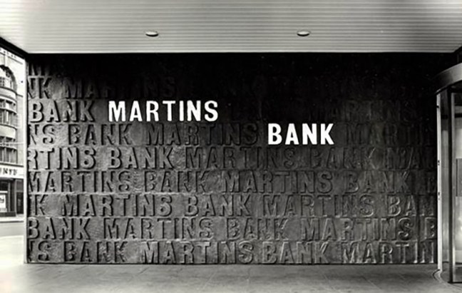
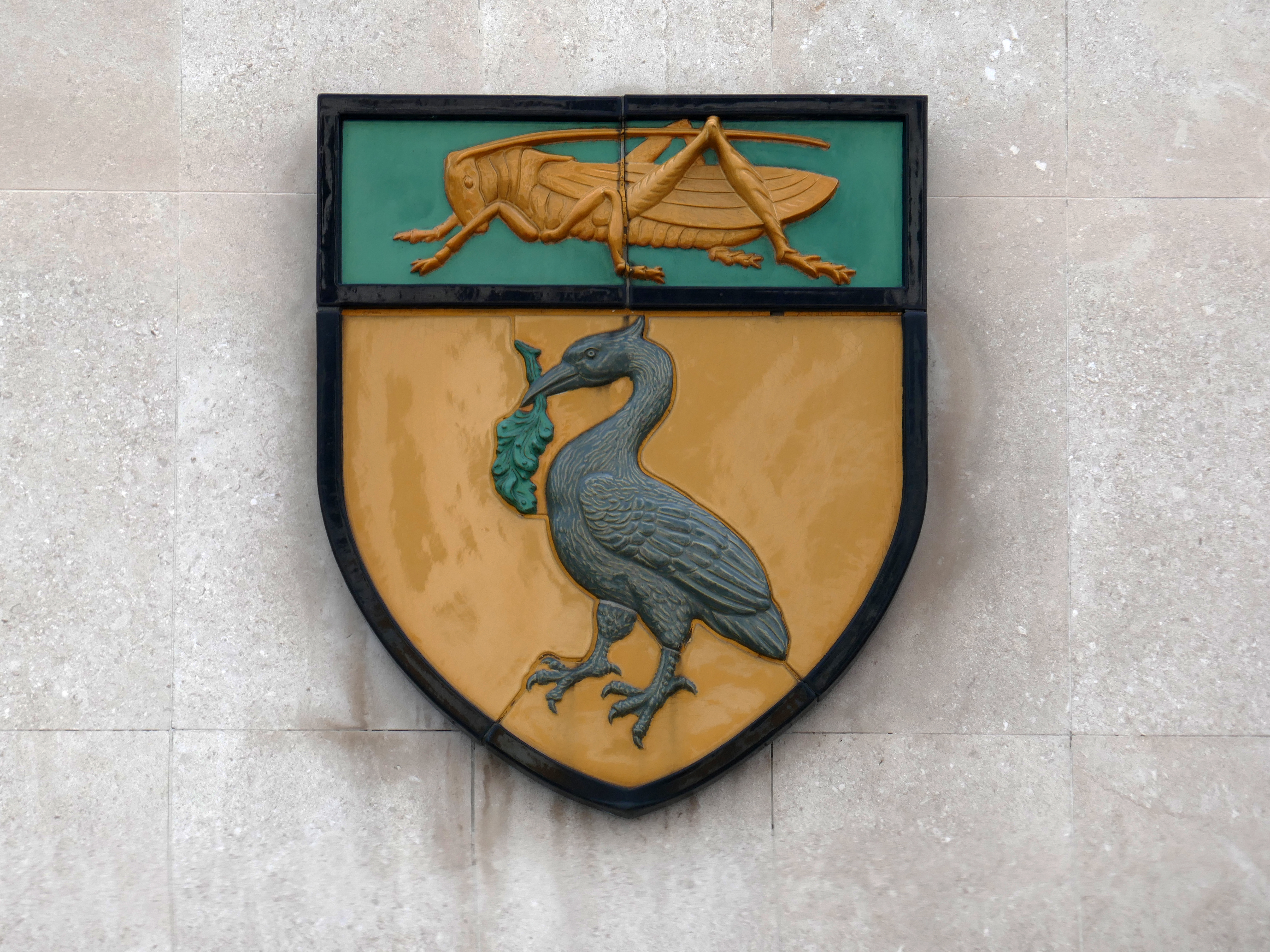
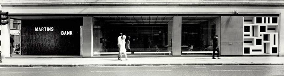
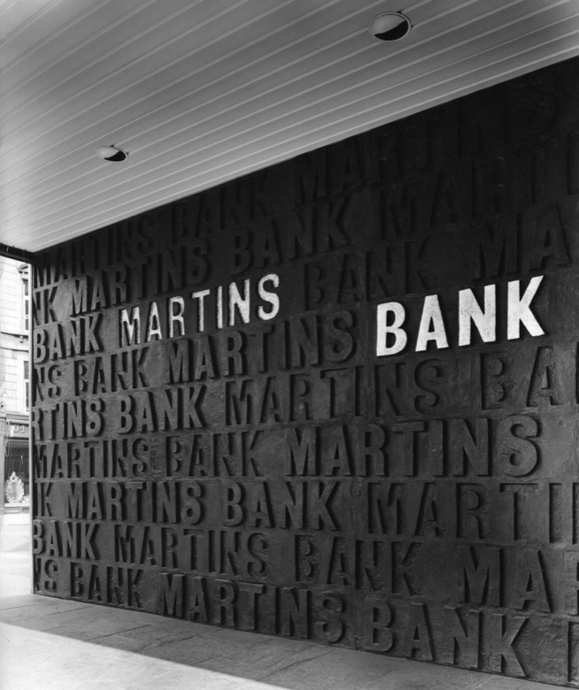
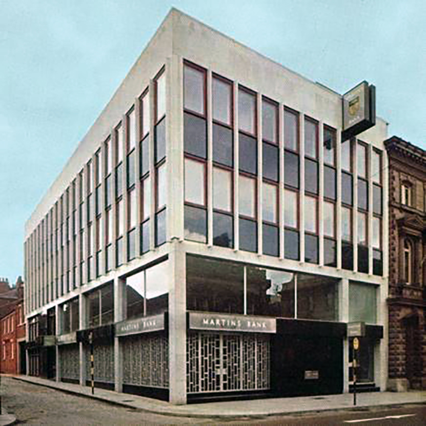
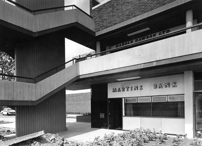
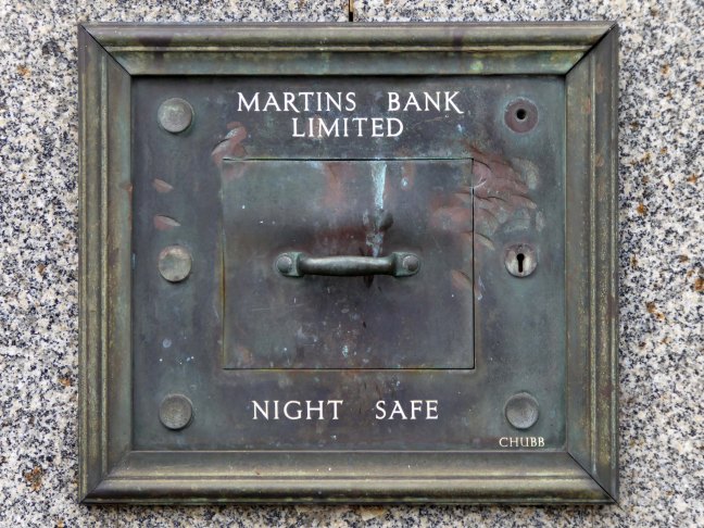
Martins Bank was a London private bank, trading for much of its time under the symbol of The Grasshopper, that could trace its origins back to Thomas Gresham and the London goldsmiths, from which it developed into a bank known as Martin’s Bank from 1890.[1] That bank was acquired in 1918 by the Bank of Liverpool, which wanted Martins to give it a London presence and a seat on the London Bankers’ Clearing House. The Martin name was retained in the title of the enlarged bank which was known as the Bank of Liverpool and Martins Limited. The title was shortened to Martins Bank Limited, without an apostrophe – in 1928, at the insistence of the directors of the Lancashire and Yorkshire Bank when it was bought by the Bank of Liverpool and Martins. The head office and managerial control remained firmly in Liverpool, cementing Martins’ place as the only English national bank to have its head office outside London.
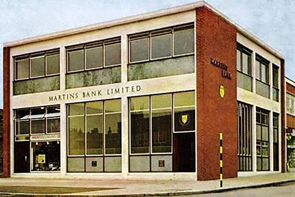
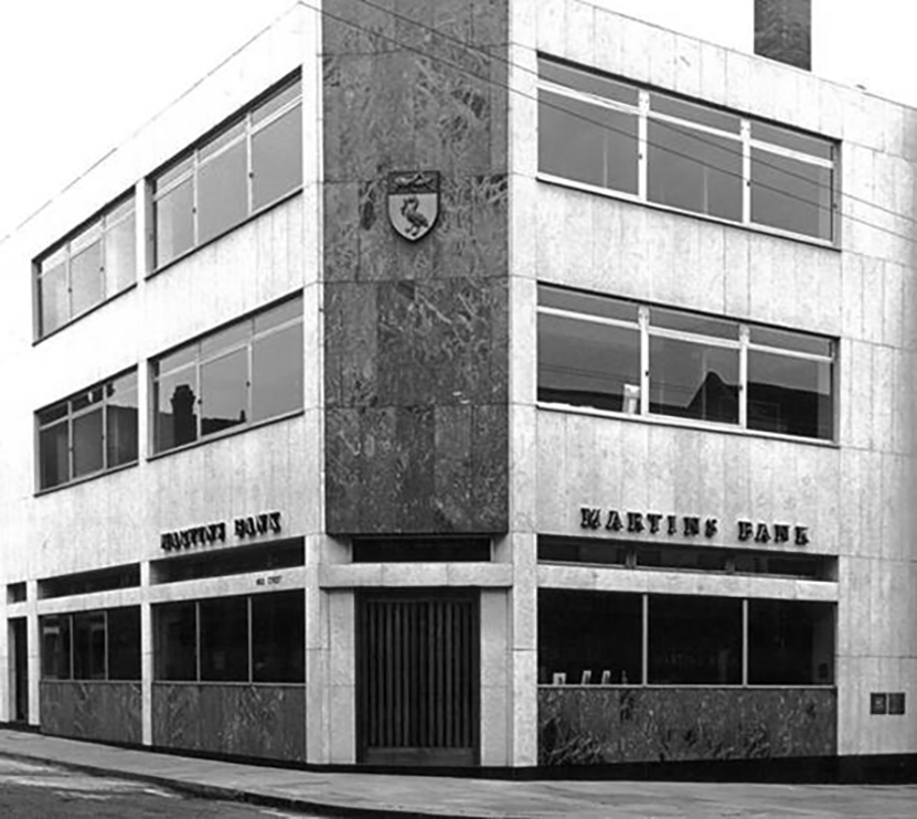
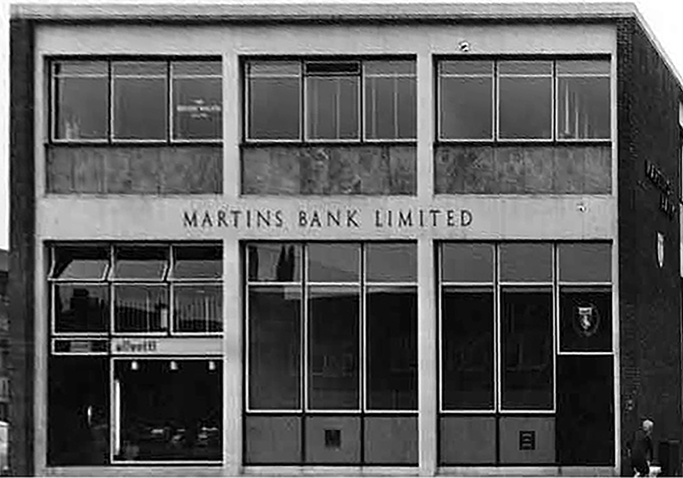
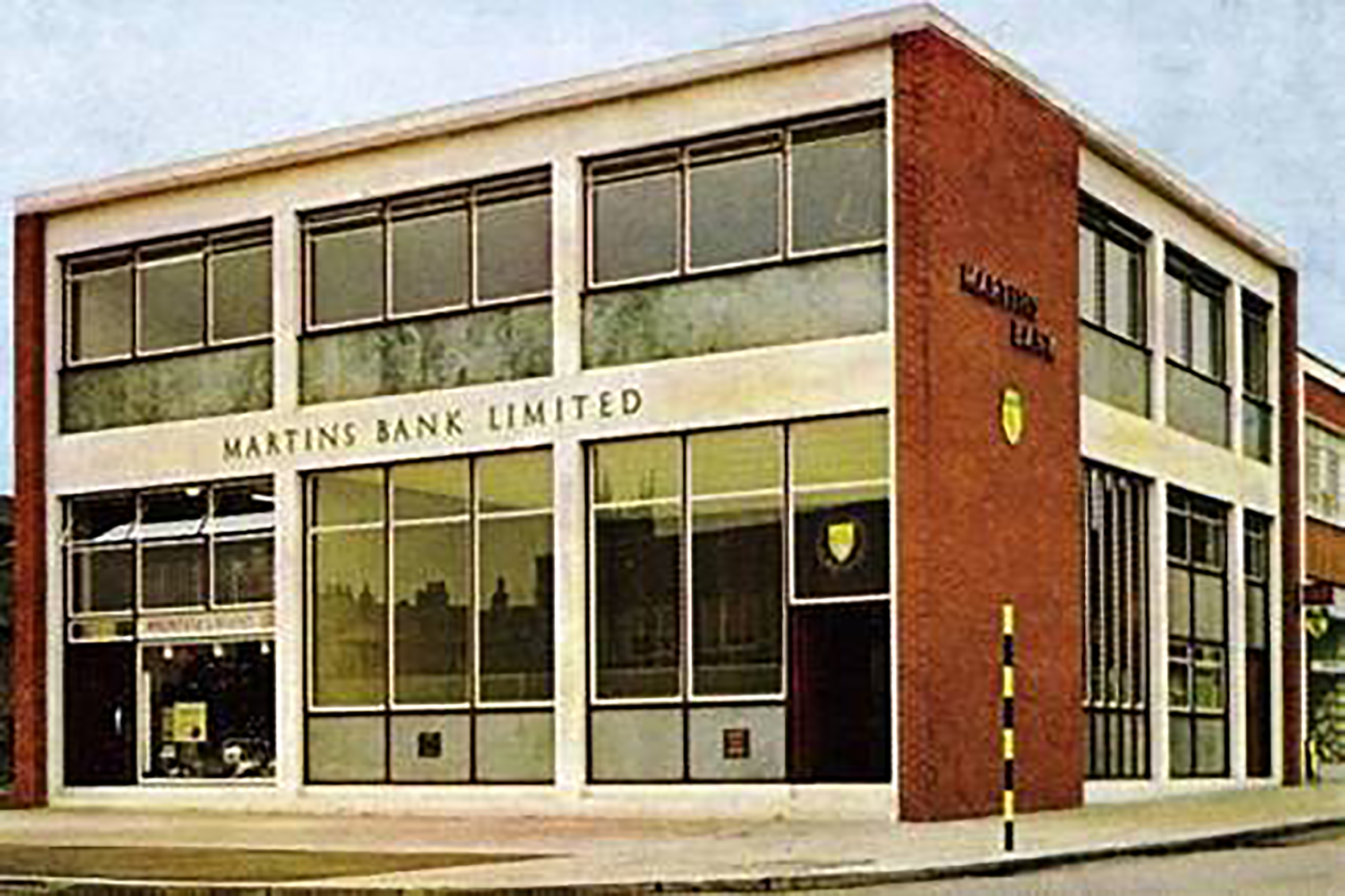
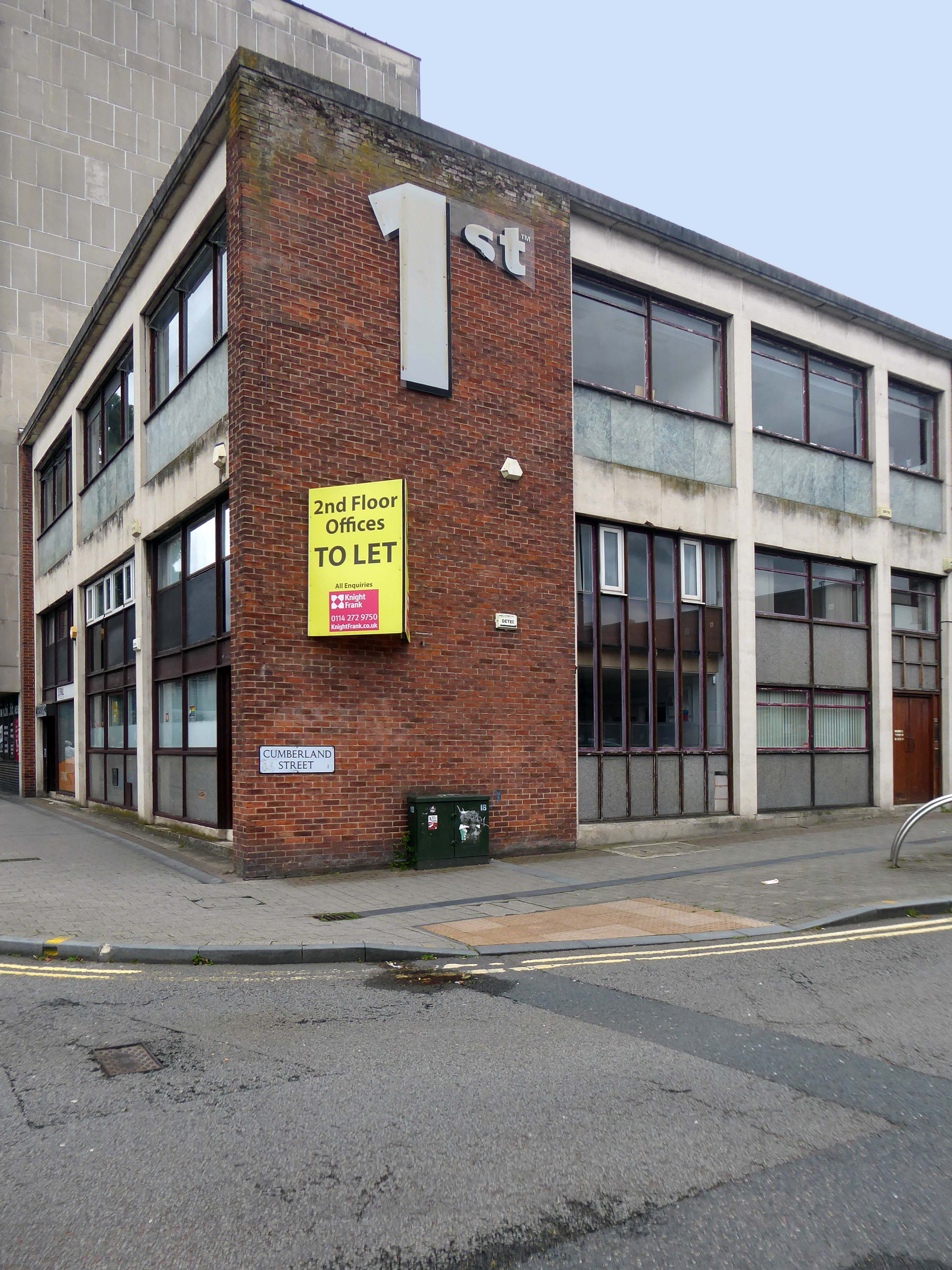
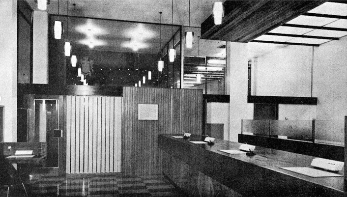
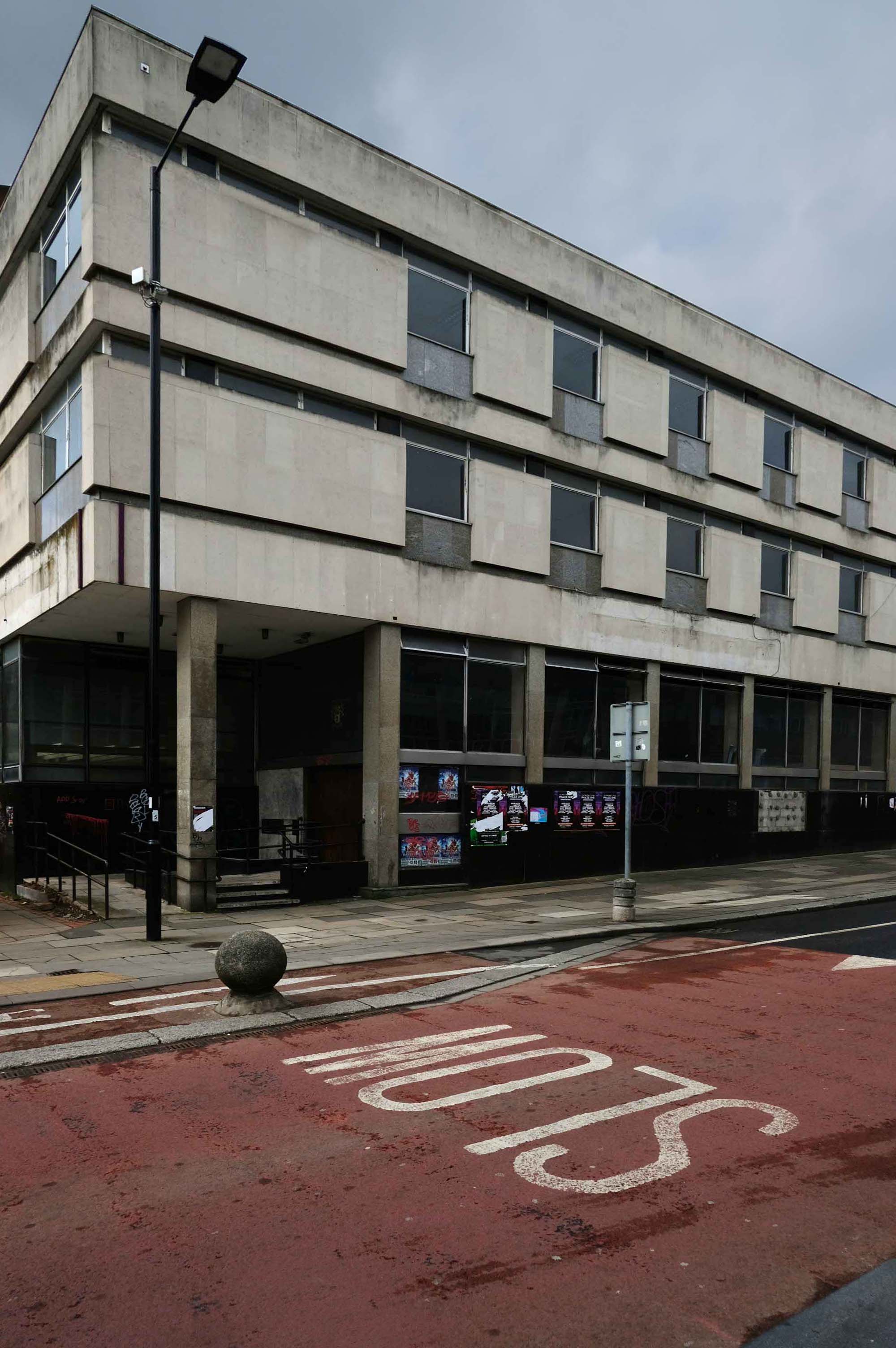
Opened in 1961, Martins Bank’s branch at Sheffield Moor is new and purpose built, occupying space left in the Sheffield Moor area by the bombing of the second world war. Time flies however, and more than fifty years on, the building is empty and awaiting the next chapter of its life.
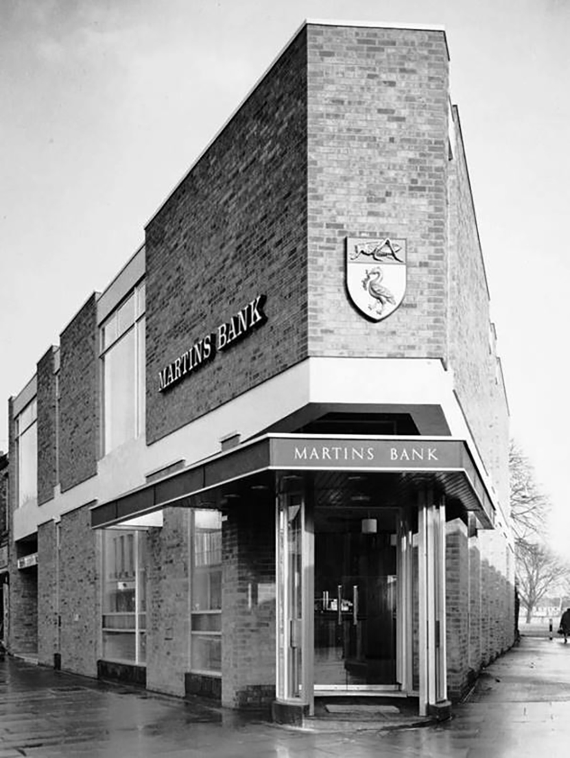
Onwards to 38 Market Street Hyde – photographed as part of my Tameside Moderne book.
Seen here in 1963 – the year of its opening.
The rebuilt branch at 38 Market Street Hyde is typical of the clean lines and minimal fuss of Martins’ 60s rebuilds. After a year or so in temporary premises at 25 Market street it re-opens in 1965, and a year later a smaller but remarkably similar looking branch is completed at Peterborough.
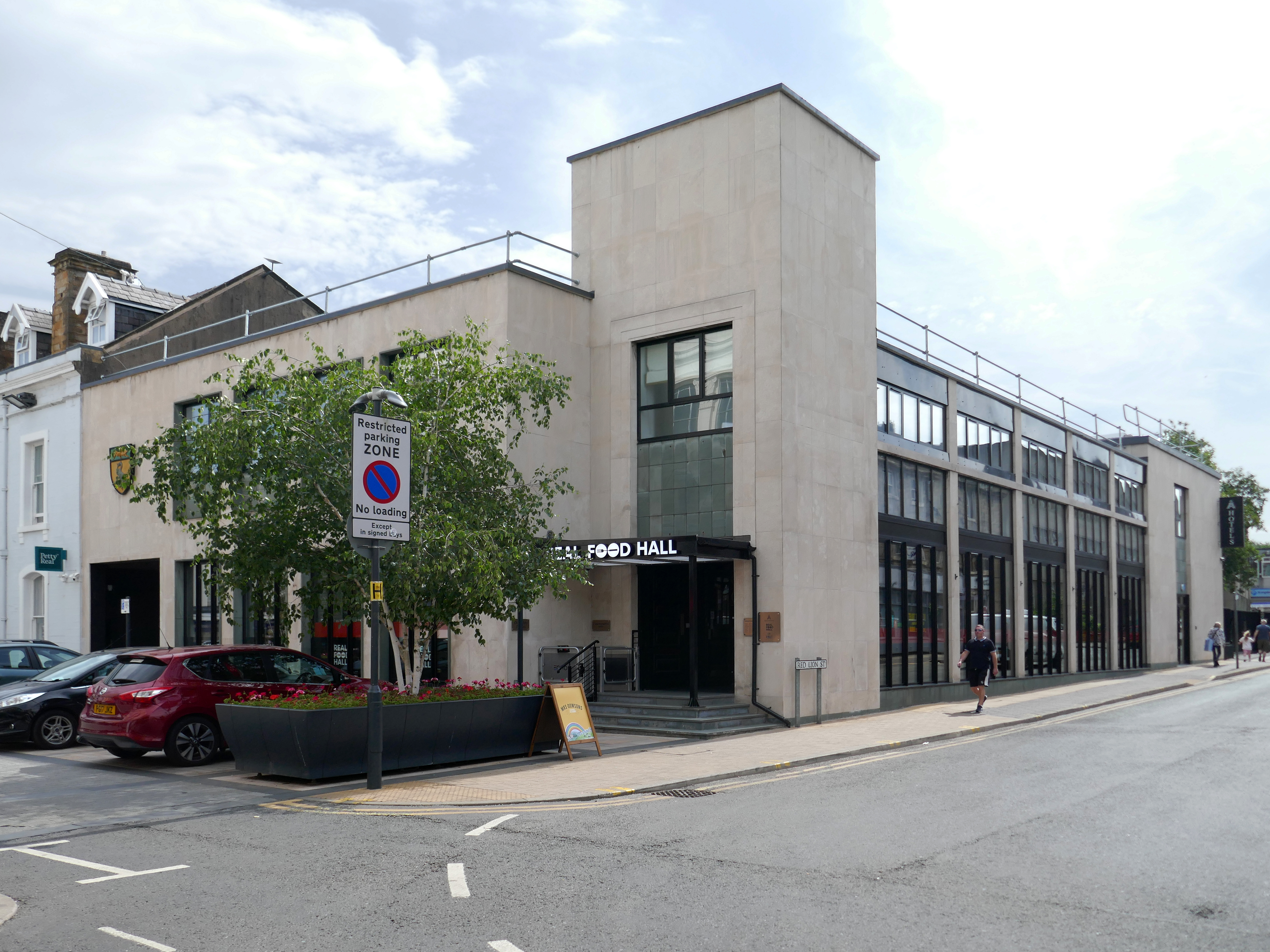
Then last week in Burnley, I stumbled across another former branch, whilst on my Burnley walk – it is currently trading as the Real Food Hall, VaultCinemaandAboveboutique hotel, having previously hosted a variety of retail outlets.
Architect: Mr J E Wadsworth of Samuel Taylor Son & Platt.
Discover Burnley’s premier destination for culinary delights. Nestled on Manchester Road, Real Food Hall offers a vibrant and diverse food experience that tantalizes every taste bud. Whether you’re craving gourmet burgers, delectable street food, or indulgent desserts, we’ve got something for everyone.
Enjoy top movies in a luxurious former bank vault, featuring high-end design, ultimate comfort, and a selection of premium snacks and beverages.
Indulge in next-level hospitality with Burnley’s largest, most intelligent hotel rooms — tailored for football fans, couples, and business travellers seeking a seamless, stylish stay.
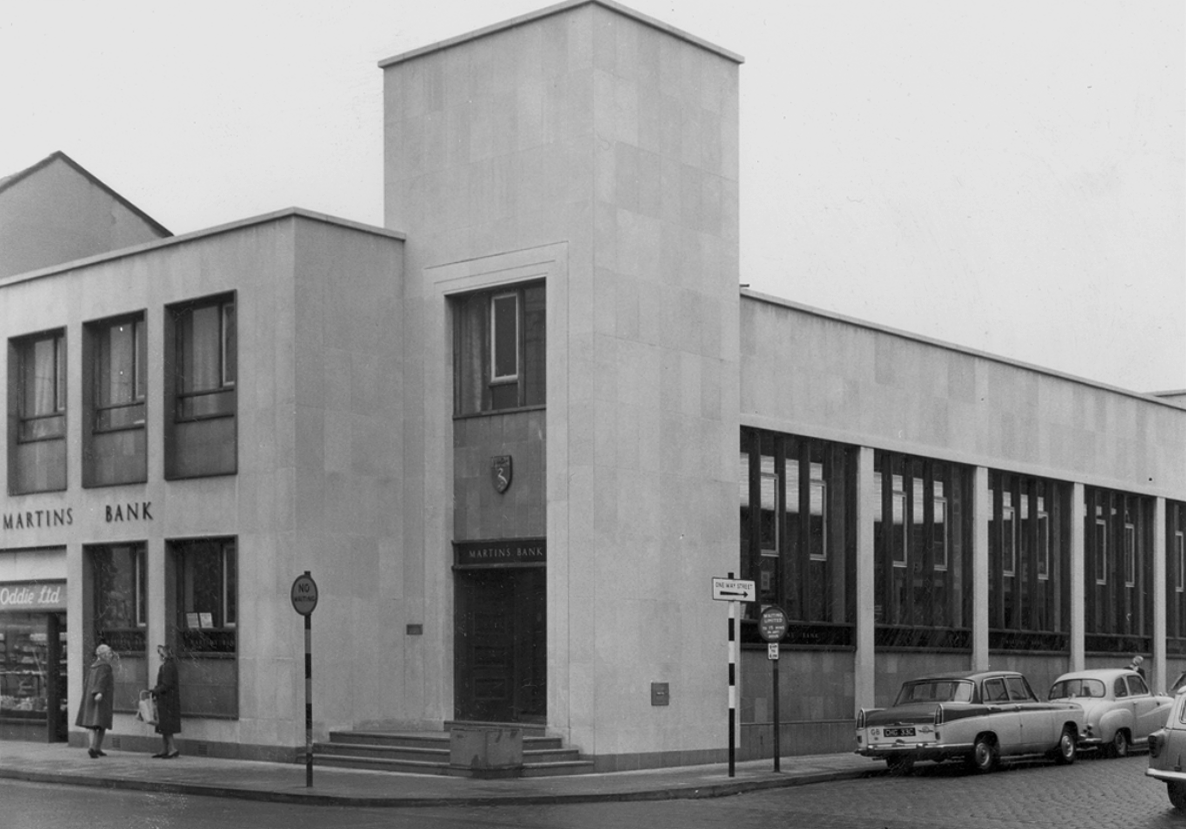
Most people will remember Whitsuntide, 1963 as a weekend of blazing sunshine spent by the sea, or on the hills, or golfing, or just sitting in the sun. The staff of the two Burnley branches will remember it as a week-end of evacuation and invasion, Dunkirk and D-Day rolled into a lost weekend, the evacuation of Hargreaves Street and St James Street into the new Manchester Road premises.
Mr Jobling, who had controlled operations throughout, created a record that can never be beaten in working twenty-four hours’ overtime in one day! We welcomed our first customers at 10 o’clock next morning and a civic visit at 11 a.m., not only proud of our lovely building but very proud of and grateful to so many who had never spared themselves to achieve what at one time seemed the impossible.
In service from 3rd June 1963 until 19th June 1991.
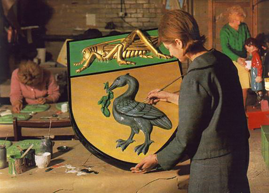
Since the last war the uses of fibreglass have developed to such an extent, that there are now companies engaged solely in the manufacture of fibreglass products. Such a company is Carleton Russell Limited whose works at Loughborough. The company makes fibreglass signs and displays and has produced several of our Bank signs. At the time of our visit the finishing touches were being made to the huge sign, seen in the colour photograph below, which now gleams upon customers entering our branch at Digbeth, Birmingham.
Why fibreglass – two of its advantages, lightness and flexibility, have much to recommend it as the material for a wall sign, either inside or outside a building. The Coats of Arms carved in stone which once surmounted the two entrances to our Leeds office, have now given way to fibre-glass reproductions. Weather resistance is another valuable property of these signs and Hove branch, for example, exposed to coastal weather, is saved frequent cleaning and retouching costs by having its external sign made from fibreglass.
In addition to innovative materials, Martins began to employ Modernist Architecture, interiors and design to attract a younger customer base.
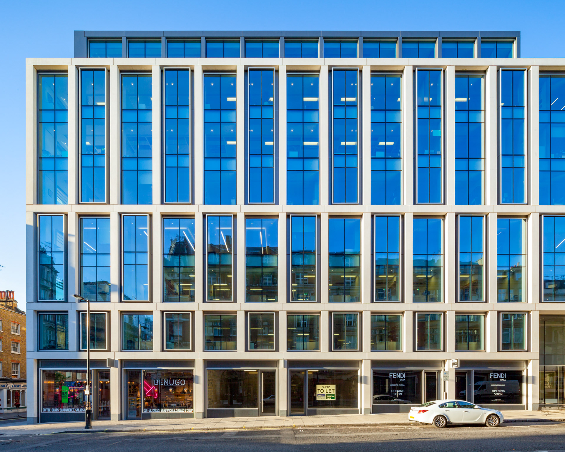
Particularly at their branch on 95 Wigmore Street London, where Ernö Goldfinger was commissioned to do away with the old and bring in only the newest of the new.
New office development for Great Portland Estates on Wigmore St. Designed by architects ORMS, 95 Wigmore Street is a new office and retail development by the Great Wigmore Partnership, completed in 2013. The building occupies a prominent site in the West End, between the thriving restaurants and bars on James Street and yards from Selfridges on Duke Street.
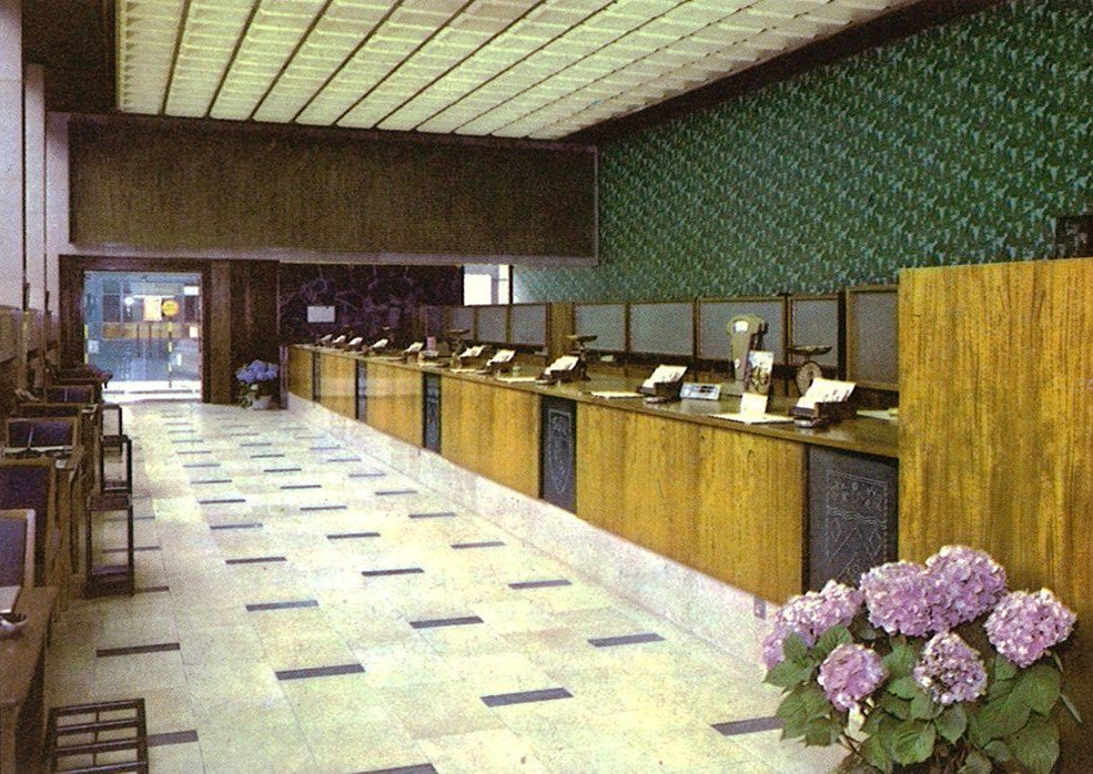
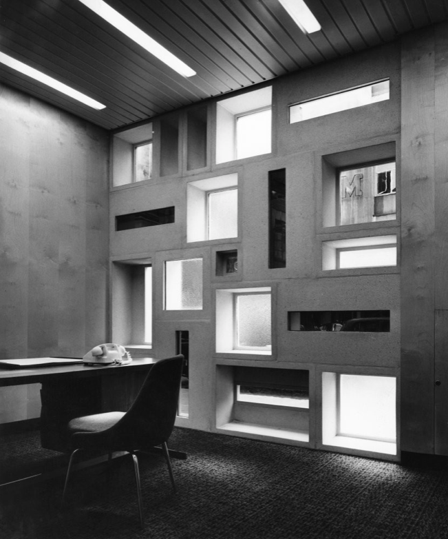
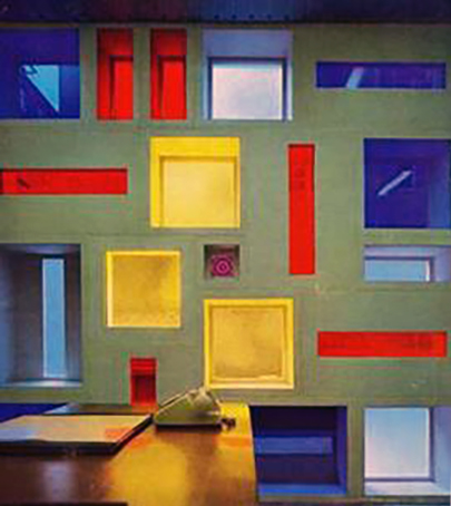
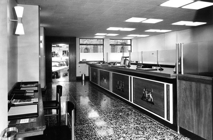
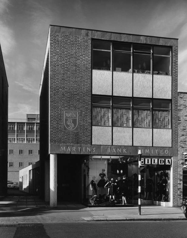
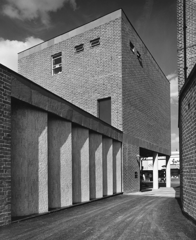
Closer to home this is the Fishergate Branch in Preston, opened in August 1965.
Preston branch today is not merely impressive; it is handsome. The entrance porch is of clear glass but the windows are of hand-made tinted glass set in aluminium frames, the counter is of teak, faced with Sicilian marble, and the walls of the main banking office are of wide elm boarding with one large panel of silver grey marble.
The management rooms are lined with cedar of Lebanon against a maple background and hot water coils in the ceilings warm all the office areas. Clearly the transformation has cost a lot of money and even the more humble rooms would not disgrace the London Hilton. Does the Hilton staff kitchen, for example, have built-in teak wall cupboards with magnetised catches?
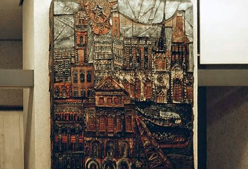
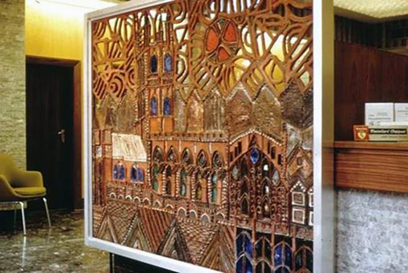
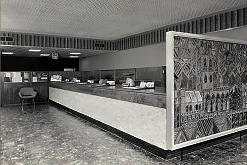
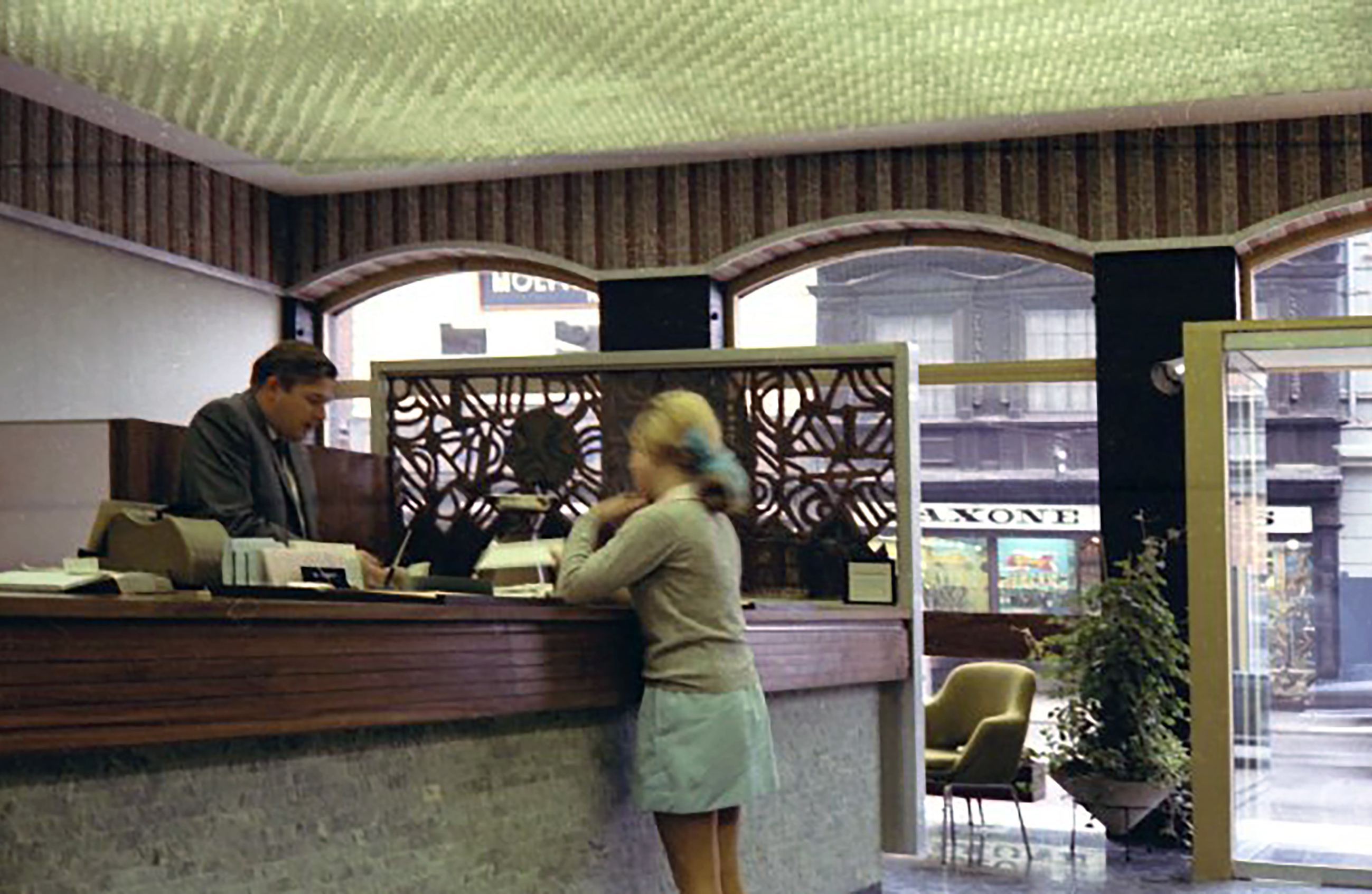
In the late 1950s, Martins begins to commission works of art that can take pride of place in new branches, and in most cases reflect something of the local area – a kind of giving back to the people. To begin with, this is neither a grand nor hollow gesture, and the character of many a branch is decided by its own unique internal décor and its artwork.
Such as the four elaborate carvings from Newbury Branch, depicting four local activities – Brewing, Weaving, Chasing and Farming.
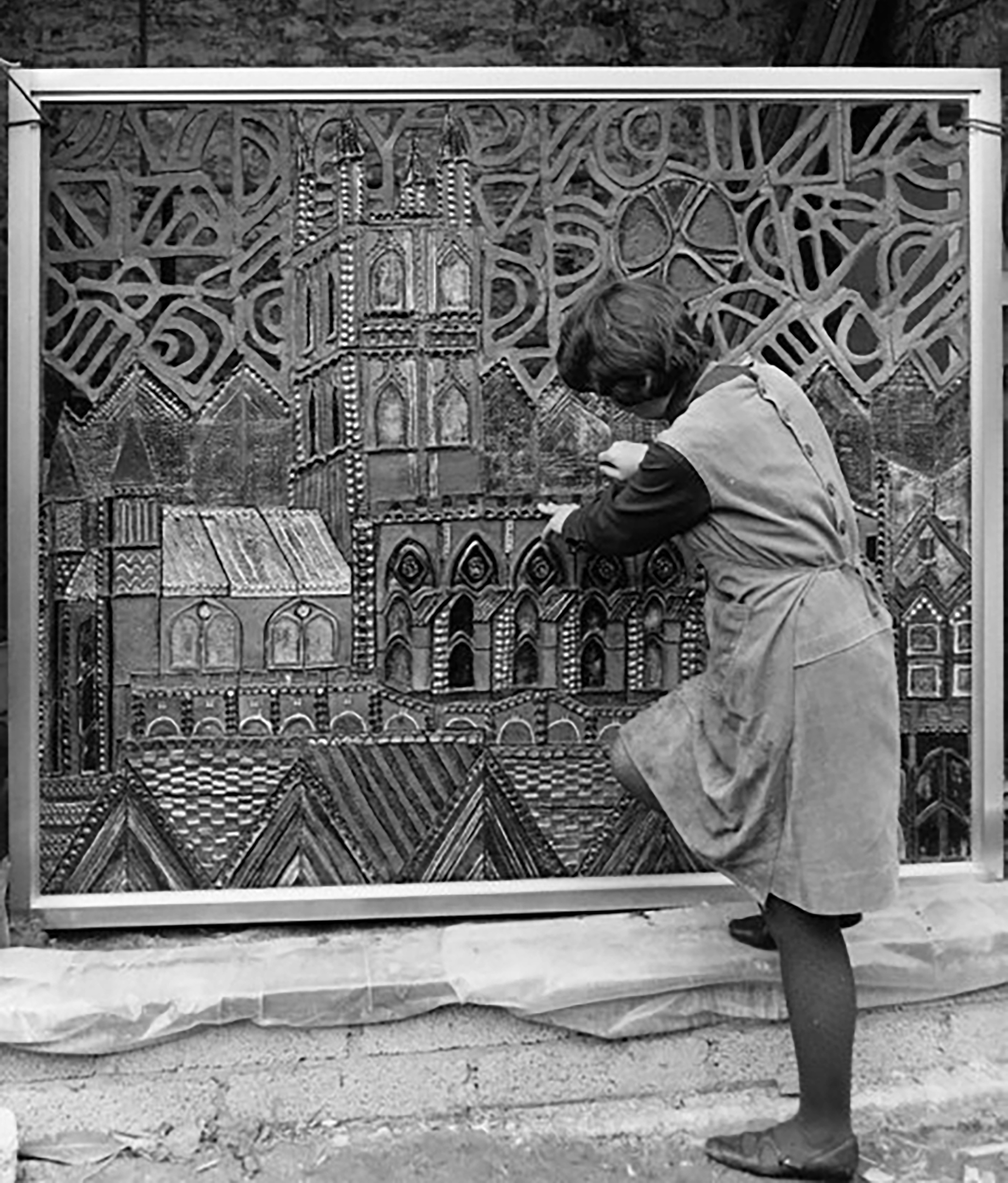
Bristol Clifton 9a Whiteladies Road – the design depicts various buildings and landmarks in Bristol.
Philippa Threlfall has been making relief murals in ceramic since the 1960s. Together with her husband and partner Kennedy Collings she has completed over one hundred major works on sites all over the United Kingdom and overseas. Some of these were made for private clients, but most were commissioned for display in public situations – shopping precincts, banks, building societies, an airport, hospital and office developments.
Philippa studied Illustration and Ceramics at Cardiff College of Art and went on to qualify as an art teacher at Goldsmiths College London. She taught ceramics and painting part time for six years at North London Collegiate School in Edgware, and during this time began to receive commissions for mural work.
Bournemouth 39 Old Christchurch Road, where sculptor Paul Fletcher’s creation exudes locality and security at the doors of the branch.
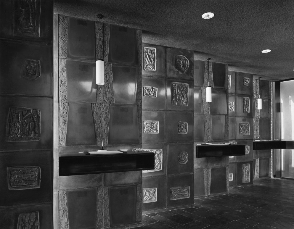
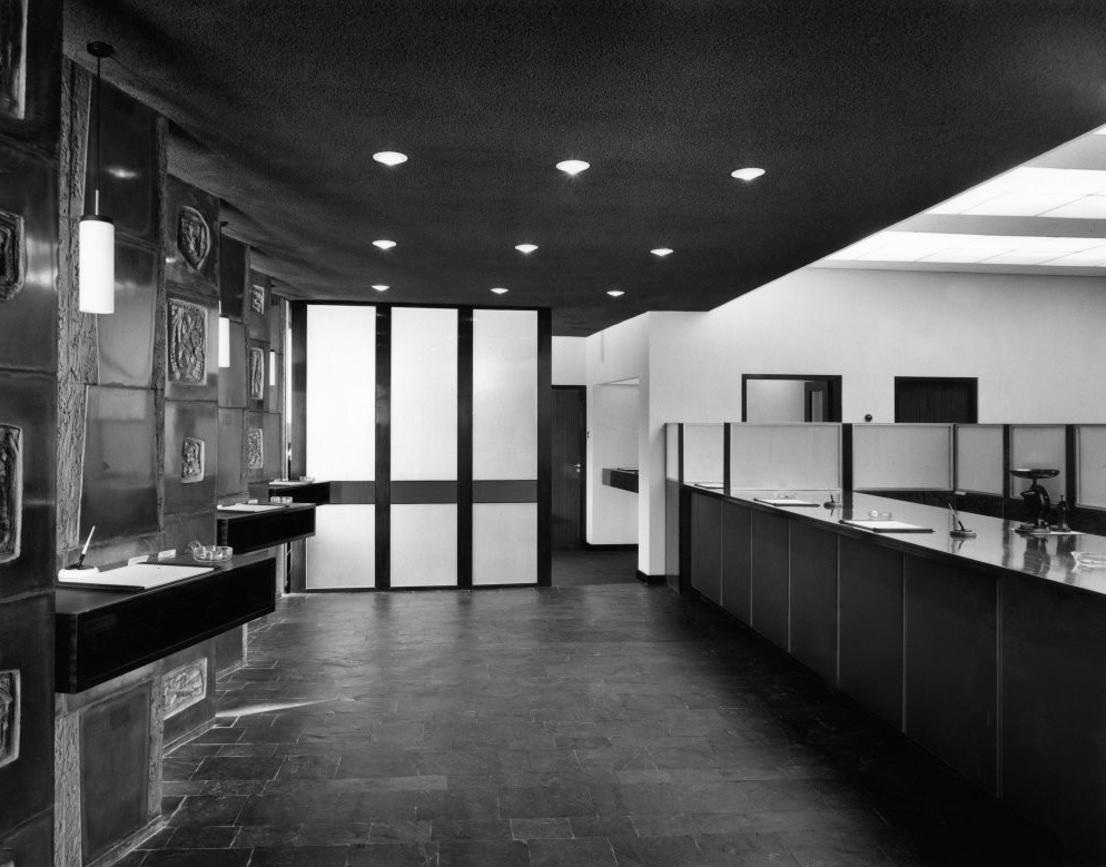
Where in the universe have we landed? Is this one of the wobbly sets from the 1960s episodes of Dr Who? Even worse – no need for LSD when paying in your £SD at the new Watford Branch – Bryan & Norman Westwood & Partners, architects 1962.
Ribapix – rear elevation.
The uneven cobbled effect on the floor, clashing with walls that look as if they might close in on you at any minute, must have made for an interesting visit to Watford.
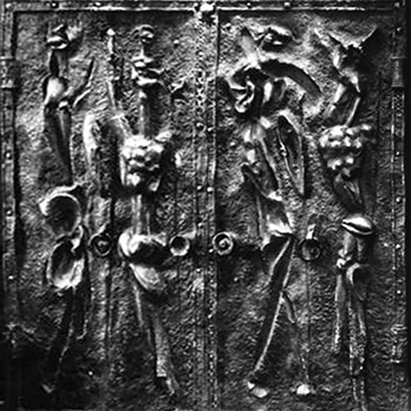
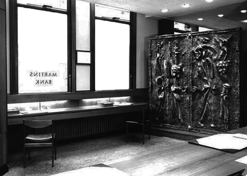
The public space is comparatively dimly lit, with a black ceiling, slate floor and dark-coloured sculptural panels by Eric Peskett placed in echelon so that as you go into the bank the wall appears to be quite solid, but on leaving you see the street through the windows set between the slabs.
The counter top is a solid piece of Afromosia. The floor is of riven Delabole slate. The sculptured slabs between the writing desks have in parts a very smooth shining surface obtained by casting against glass and the insets are rough and dark, they were cast in rubber moulds. The ceiling is roughly textured Pyrok, dark grey in colour and intensely sound-absorbing.
The Architect and Building News – 5 September 1962
Ribapix
And finally – welcome to dystopia 1967 – or Thornaby on TeesBranch, as it is known, an office drowned in its own grey drabness, a real nightmare in concrete. How many people were subject to trudging those awkward walkways with a pram, we can only guess.
The in-house Martins’ magazine and archive may at times, have an ambivalent attitude towards Modernism, I myself, can only admire the optimism and originality, embodied in the work that the bank commissioned.
Many thanks Modern Martins, from thoroughly Modern Mooch.
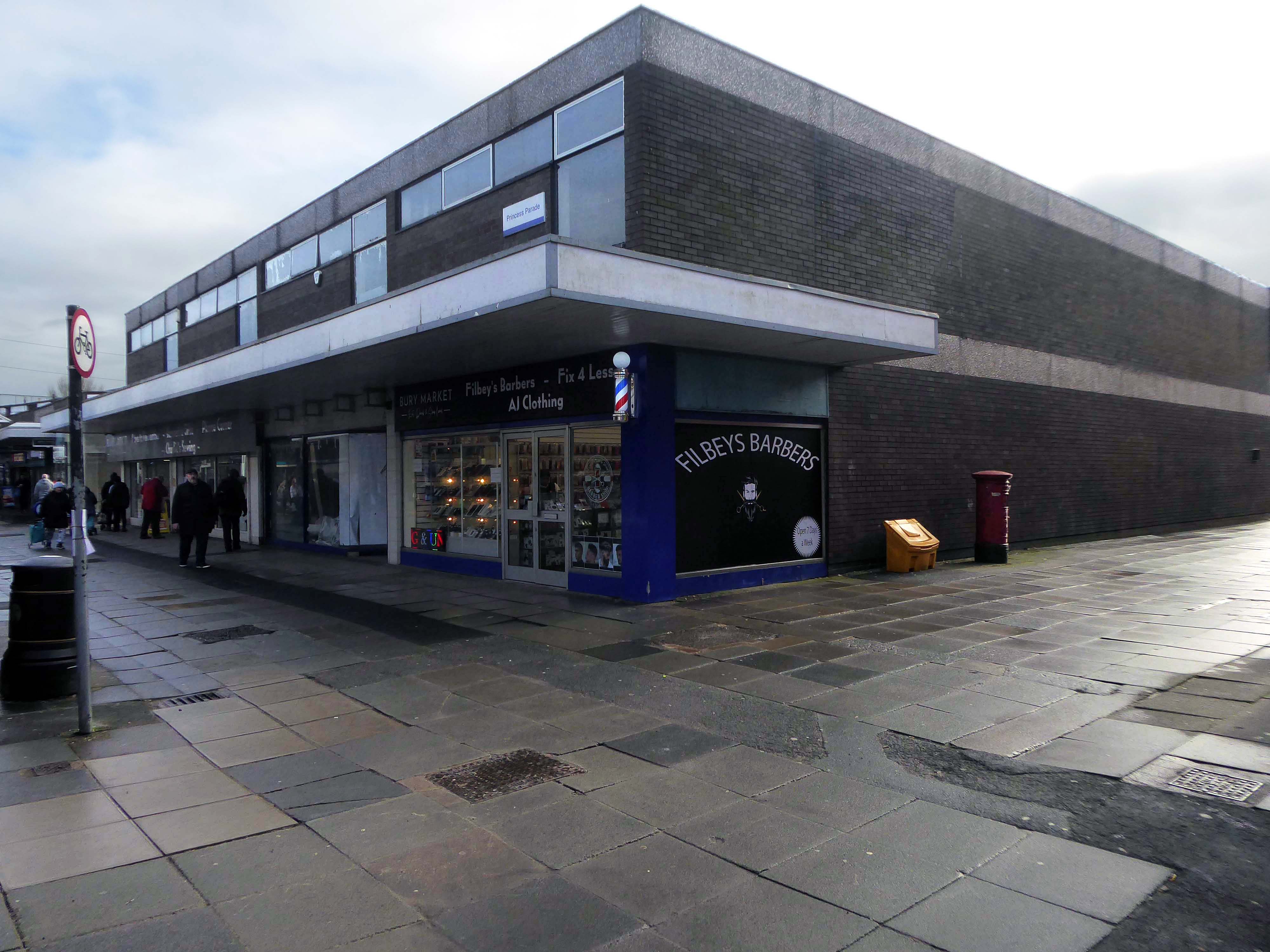
I was cordially requested to produce tram based walk, by the good folk at the modernist – travelling from Victoria Station to Bury. Alighting at each stop and seeing what could be seen, by way of modern buildings along the byways.
By the way, I do have previous experience, having undertaken a similar task travelling to Ashton.
So I set off as instructed, clutching my GMPTE senior concessionary travel pass.
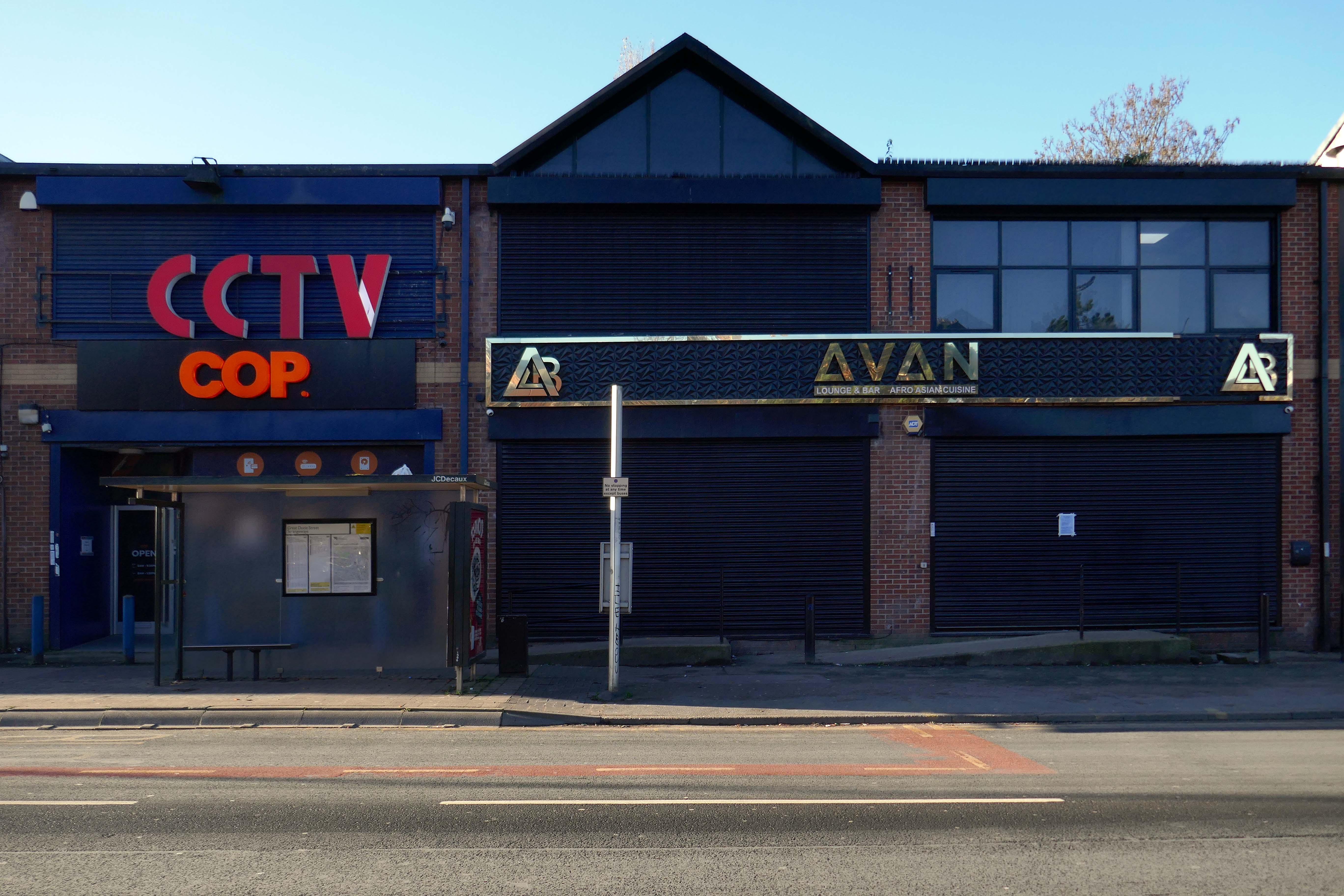
Queens Road
Turn right on leaving the station, right then left – you have reached The Vine.
Glendower Dr, Manchester, Greater Manchester M40 7TD.
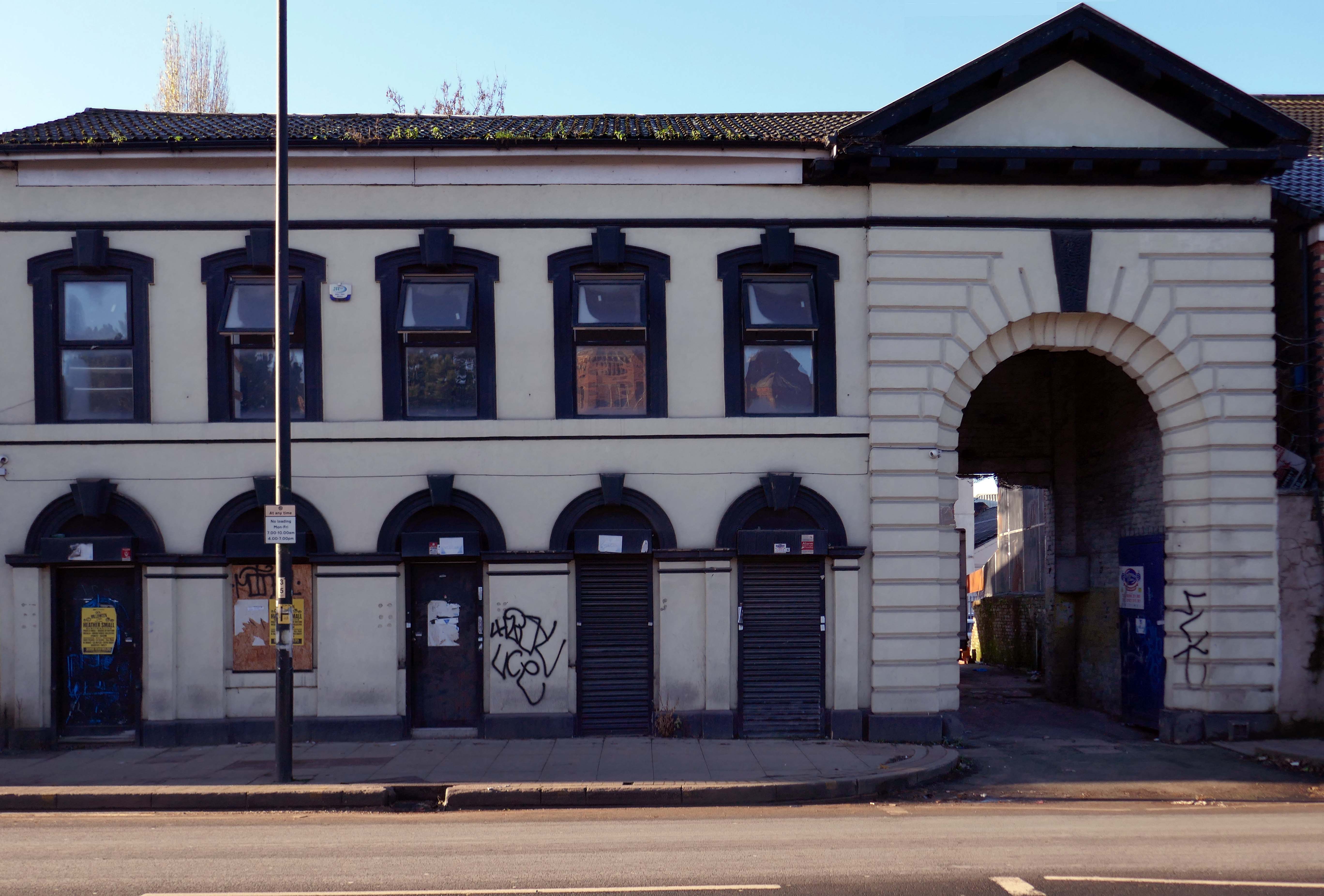
Head for Rochdale Road and turn right back toward the city centre, you have reached Eastford Square.
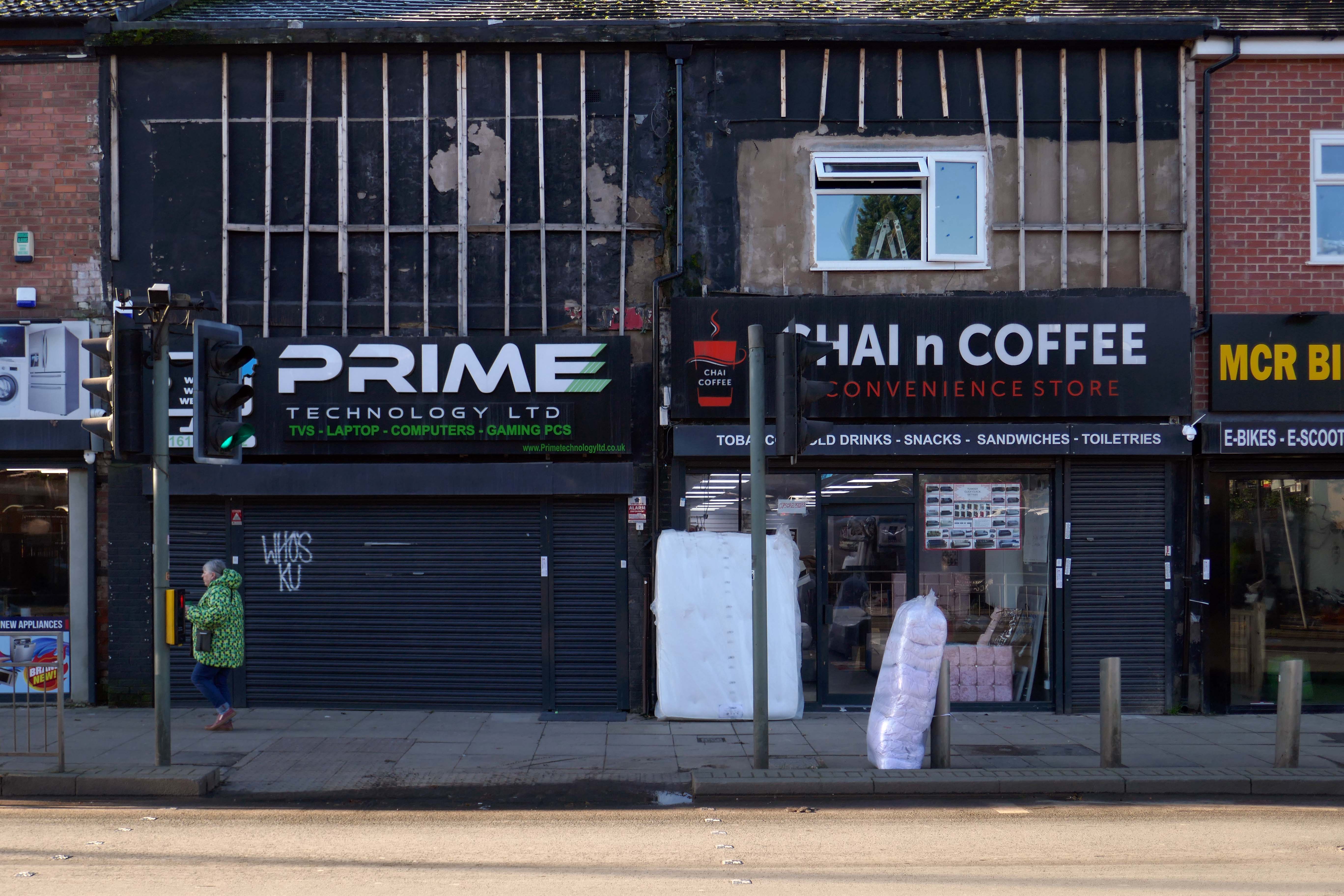
Turn left from the station along Bury Old Road until you reach Heywood Road on your right.
Heywood Road, Prestwich, Manchester M25 2GT
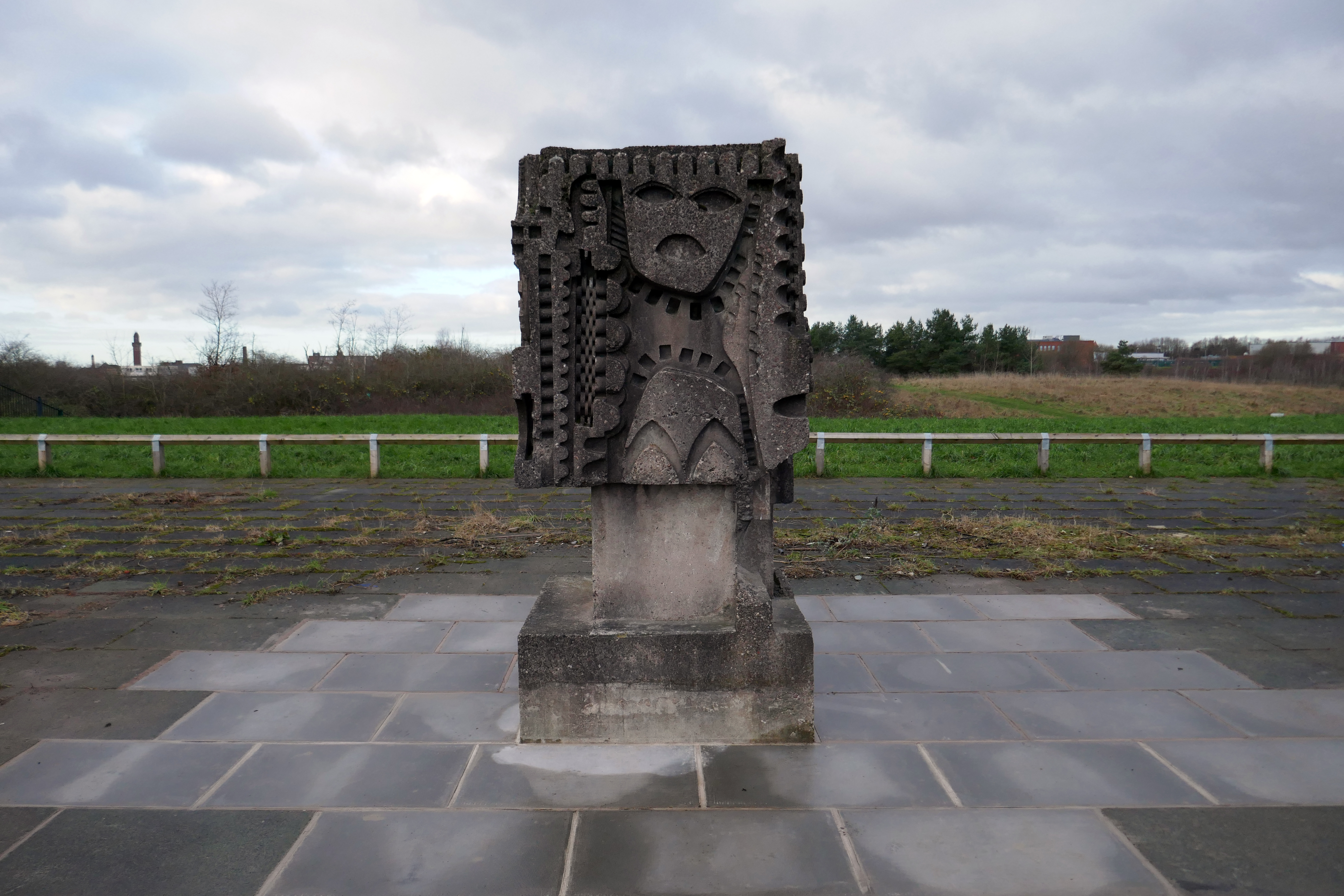
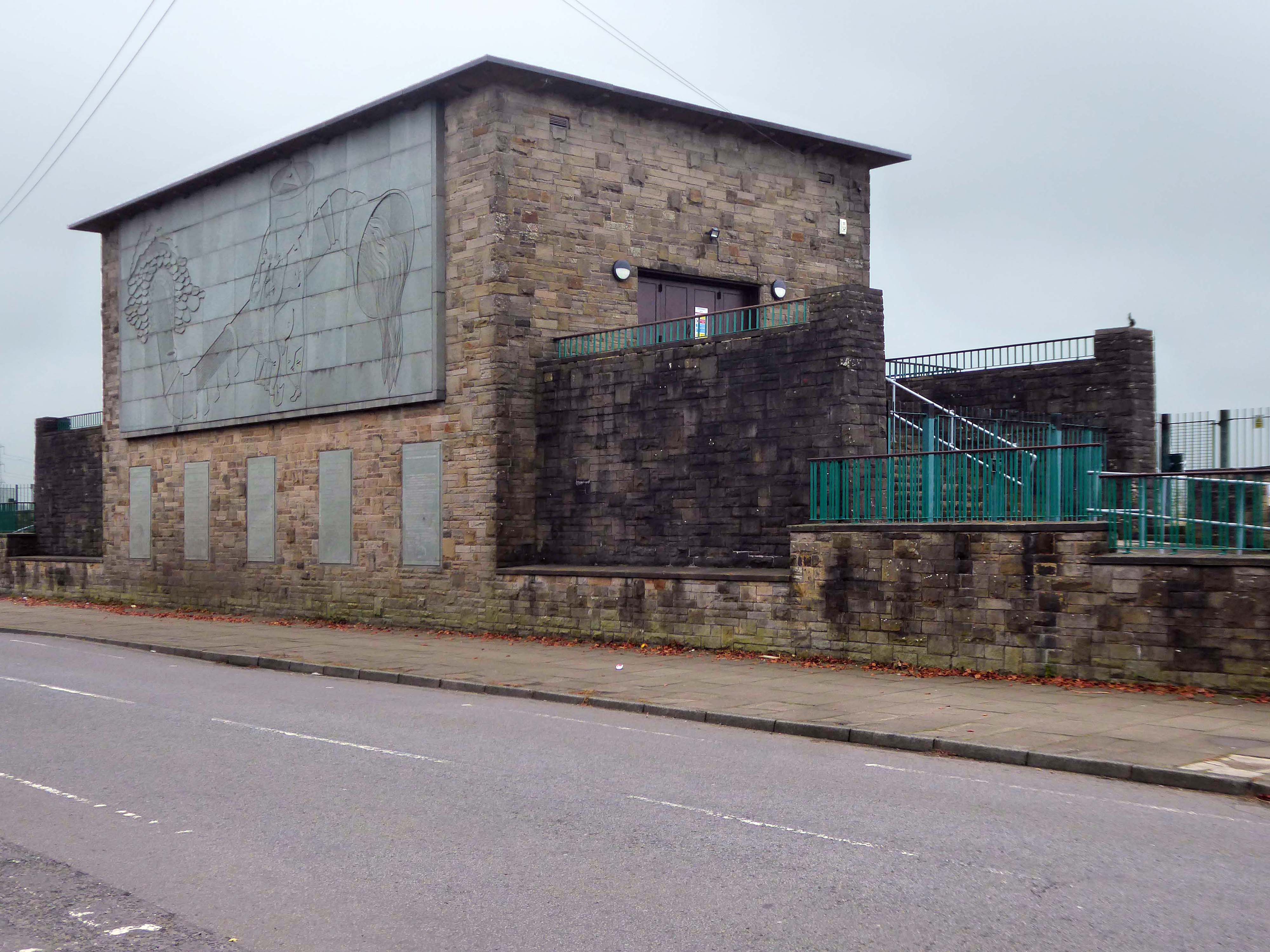
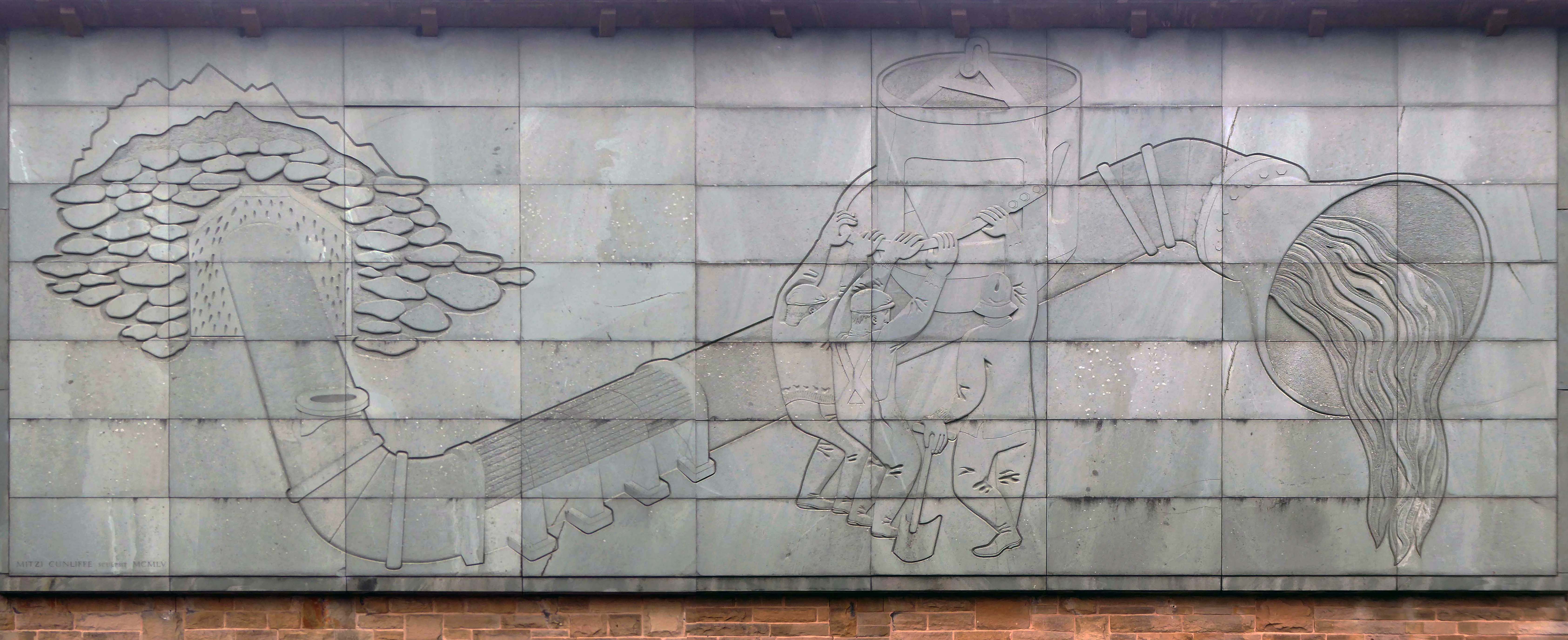
1954-5 by the Manchester City Architect’s Department, Chief Architect Leonard C Howitt, for the Manchester Corporation Waterworks. Alan Atkinson, engineer. Incorporates large relief by Mitzi Cunliffe, signed and dated 1955.
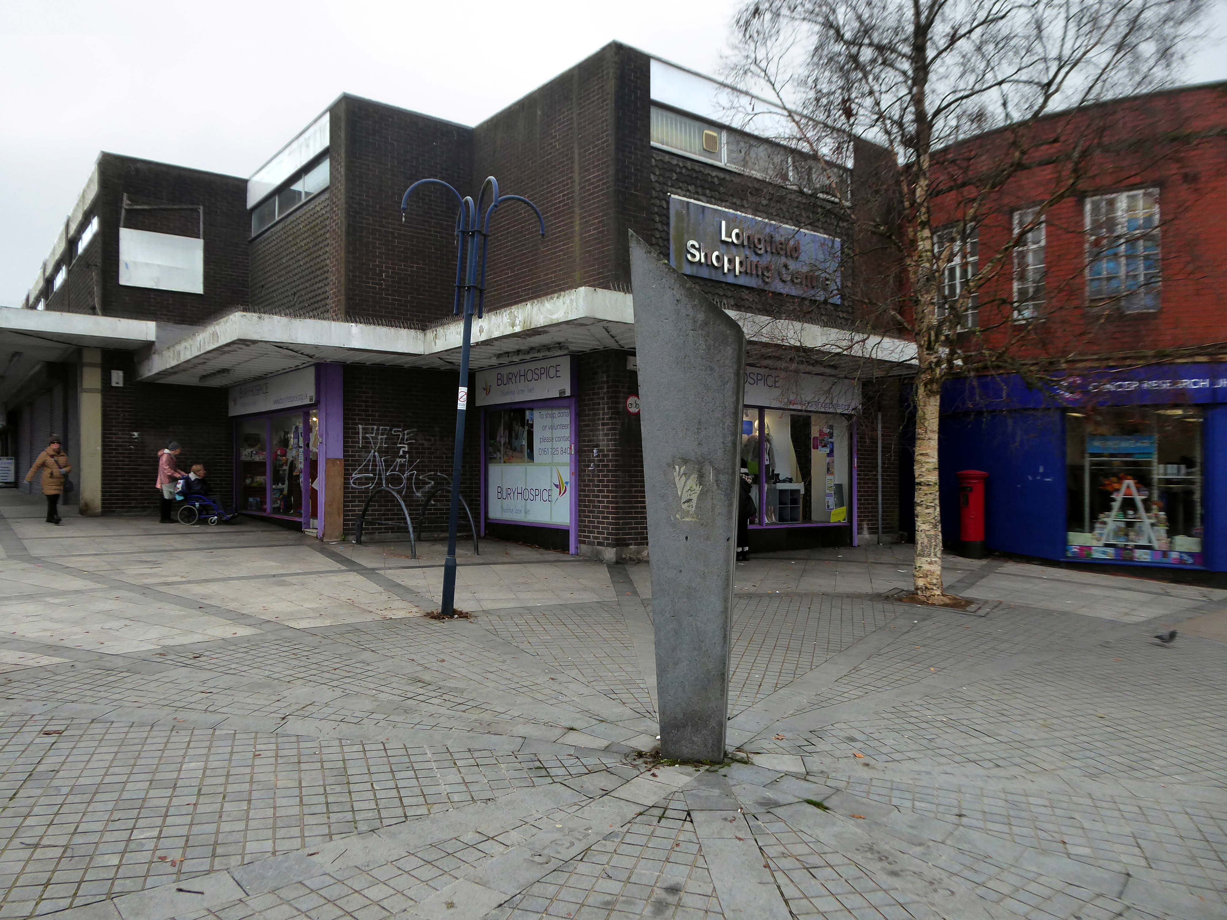
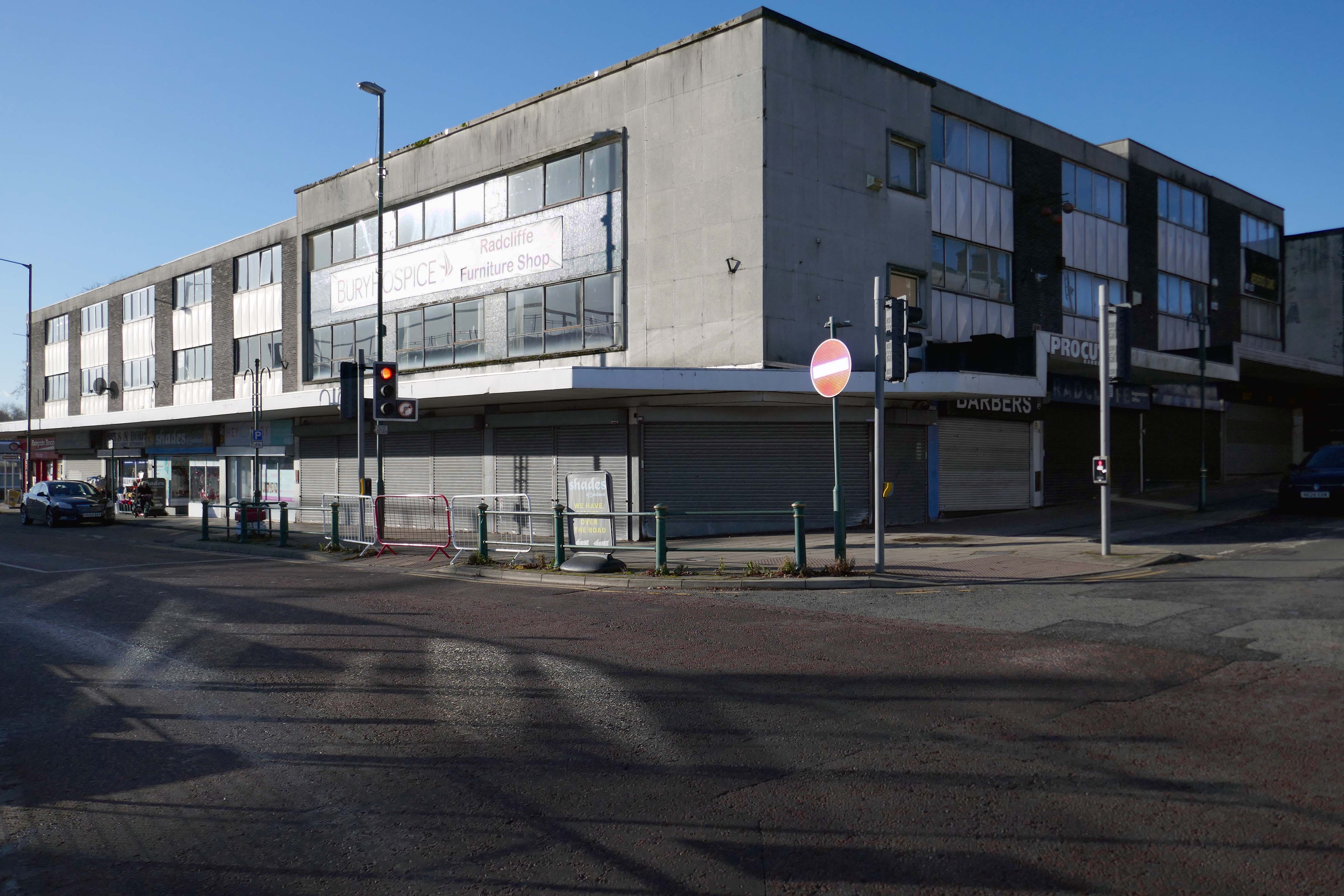
After months of public consultation, the joint venture has firmed up its proposals for the redevelopment of the Longfield Centre and is aiming to be on site before the end of the year.
Muse and Bury Council have submitted a hybrid application to transform six acres of Prestwich town centre.
The Strategic Regeneration Framework is the guide that is shaping the direction of Radcliffe’s growth over the next 15 years with a series of realistic short, medium, and longer-term actions. It is also shaping the direction of future council investment, supporting bids for central governmental funding and providing certainty for third parties wanting to invest in town.
Work has begun on Strategic Regeneration Framework’s priority projects, these include:
A new civic hub in central Radcliffe, which will bring together a mix of functions at the heart of the town
Refurbishment of the market basement and the revamping of market chambers
New leisure facilities
A secondary school on the Coney Green site
A “whole town approach” to housing, bringing forward a comprehensive approach to residential development in Radcliffe
A transportation strategy, which will consider matters such as active travel and car parking
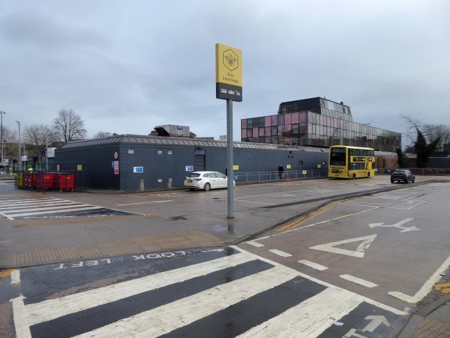
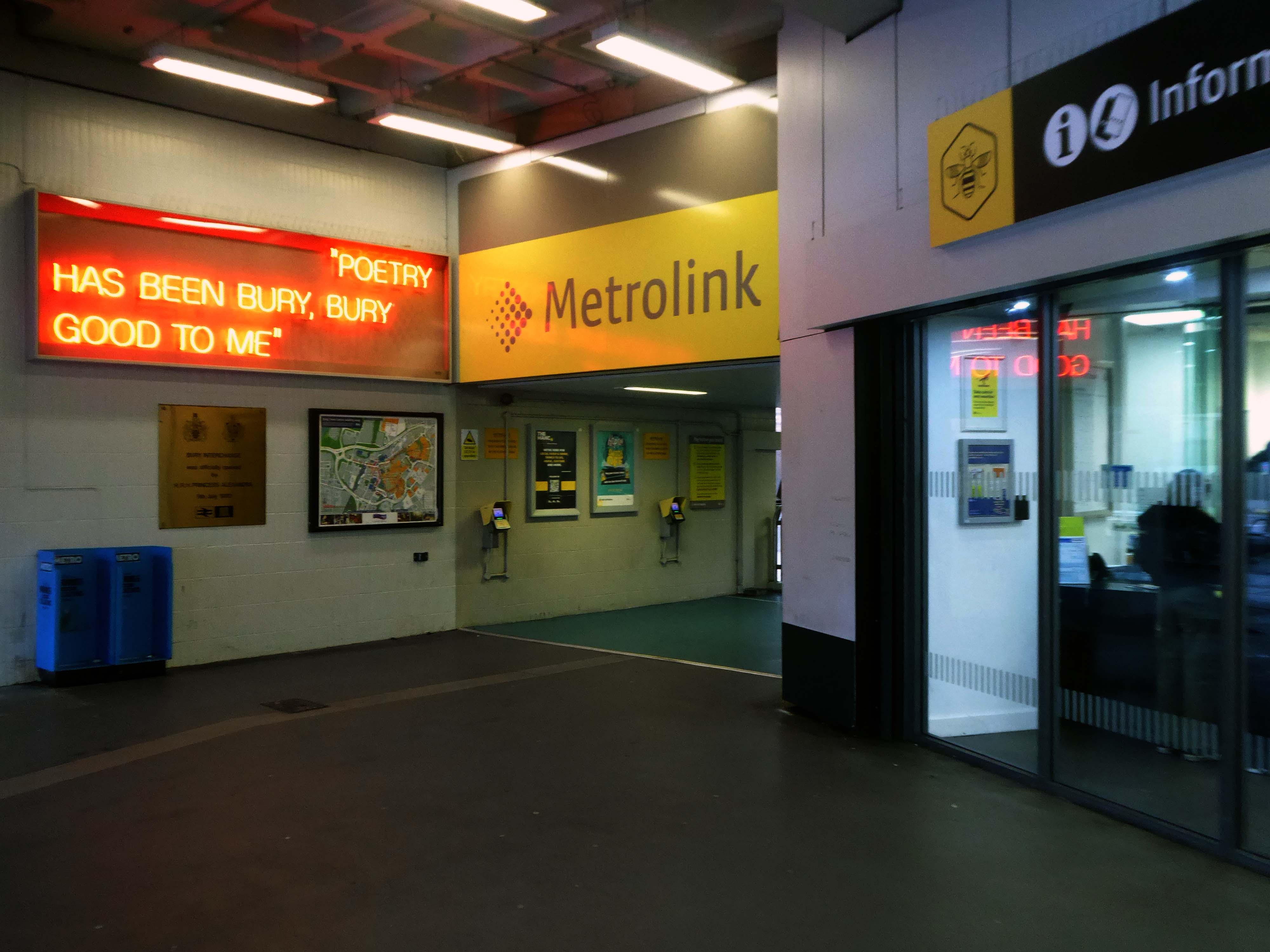
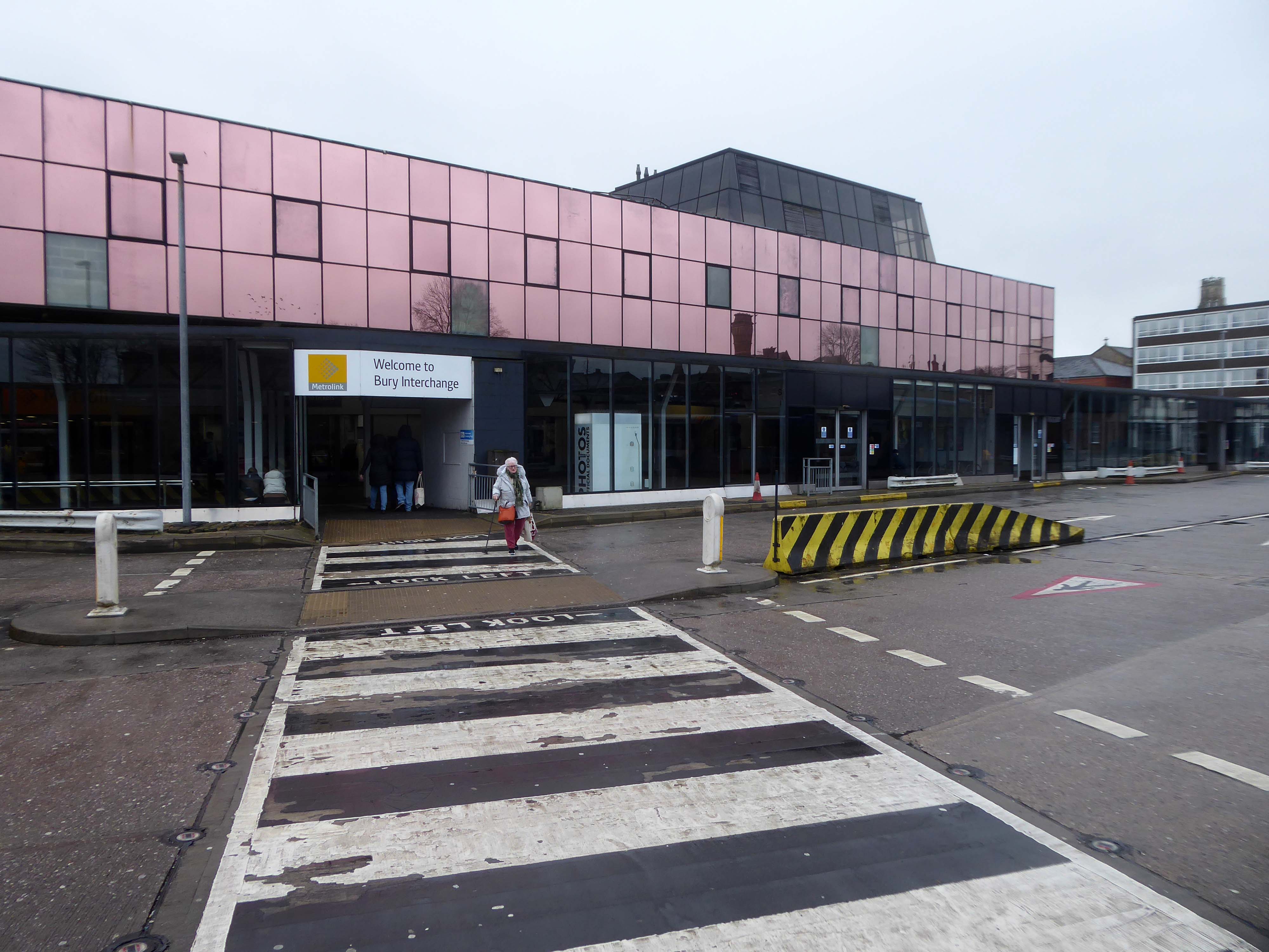
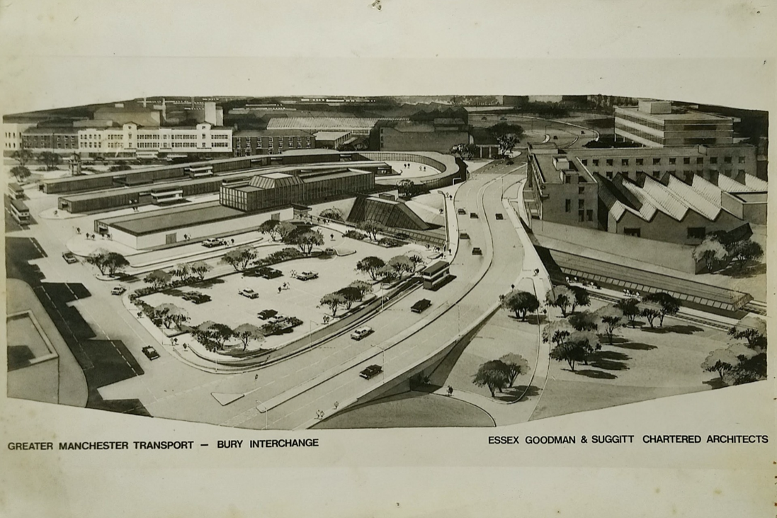
Arriving at and looking around the Interchange – 1980 architects: Essex Goodman & Suggitt
It is the northern terminus of the Manchester Metrolink’s Bury Line, which prior to 1992 was a heavy-rail line.
A new short spur line was constructed to connect the new station. The railway had originally run into Bury Bolton Street which was further away from the town centre, and was closed by British Rail on the same day that Bury Interchange opened.
It also incorporates a bus station.
Bury Interchange replaced the bus termini scattered around Bury town centre, notably around Kay Gardens.
An £80m transformation is coming to the Bury Interchange, which will see step-free access at the Metrolink, a “vertical circulation core” to better connect the Metrolink with the bus facility, and an integrated travel hub with spaces for cycle storage.
The work is much-needed, explained Transport for Greater Manchester’s Alan Lowe, he said that the interchange was built in the 1980s and very much is of its time.
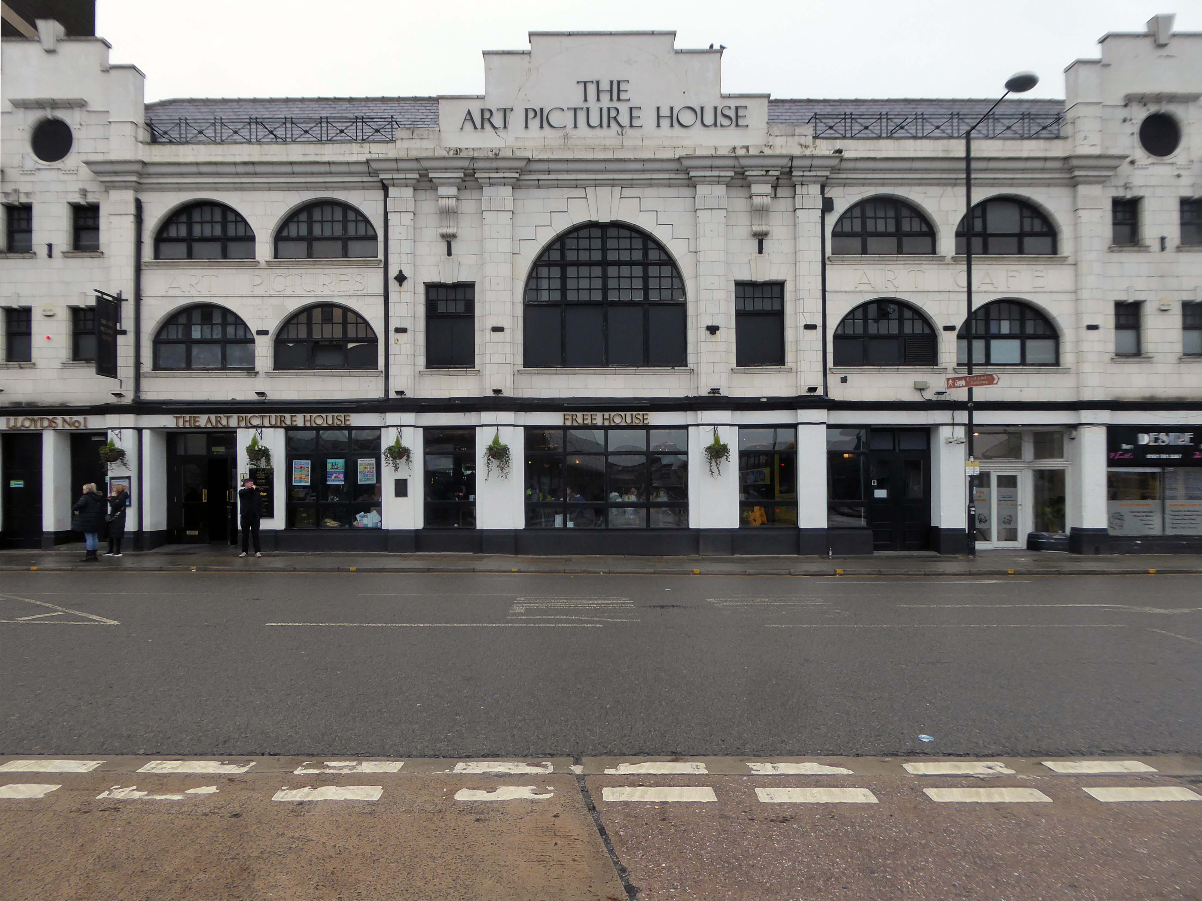
The Art Picture Palace was a 1923 rebuild of the earlier Art Picture Hall both designed by architect Albert Winstanley. The Art Picture Palace was opened on 26th January 1923. A remarkably complete survivor of a 1920’s cine-variety house executed in an elaborate style.
Films ceased in February 1965 and it became a bingo club. Later converted into a billiard hall until 19th May 1991 when it became a bingo club again, it later became a Chicago Rock Cafe.
Cinema Treasures
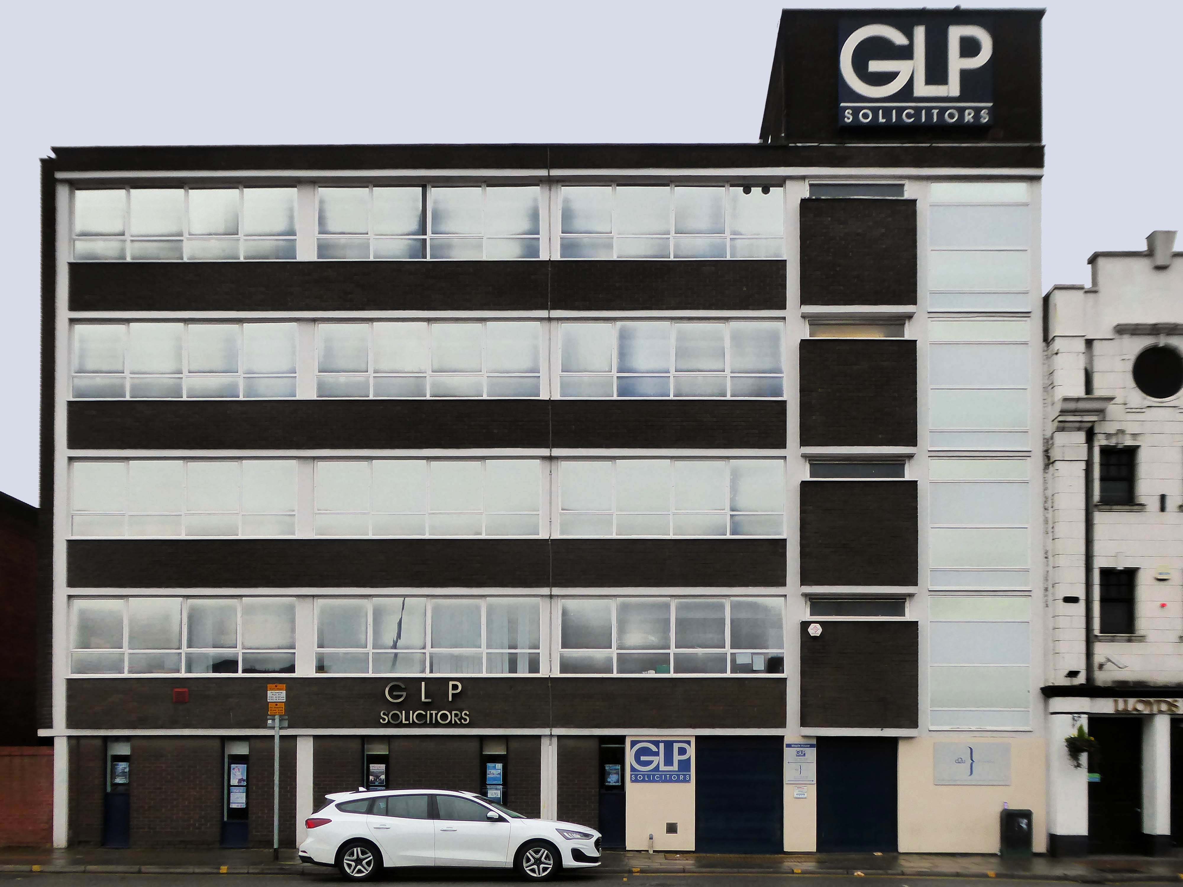
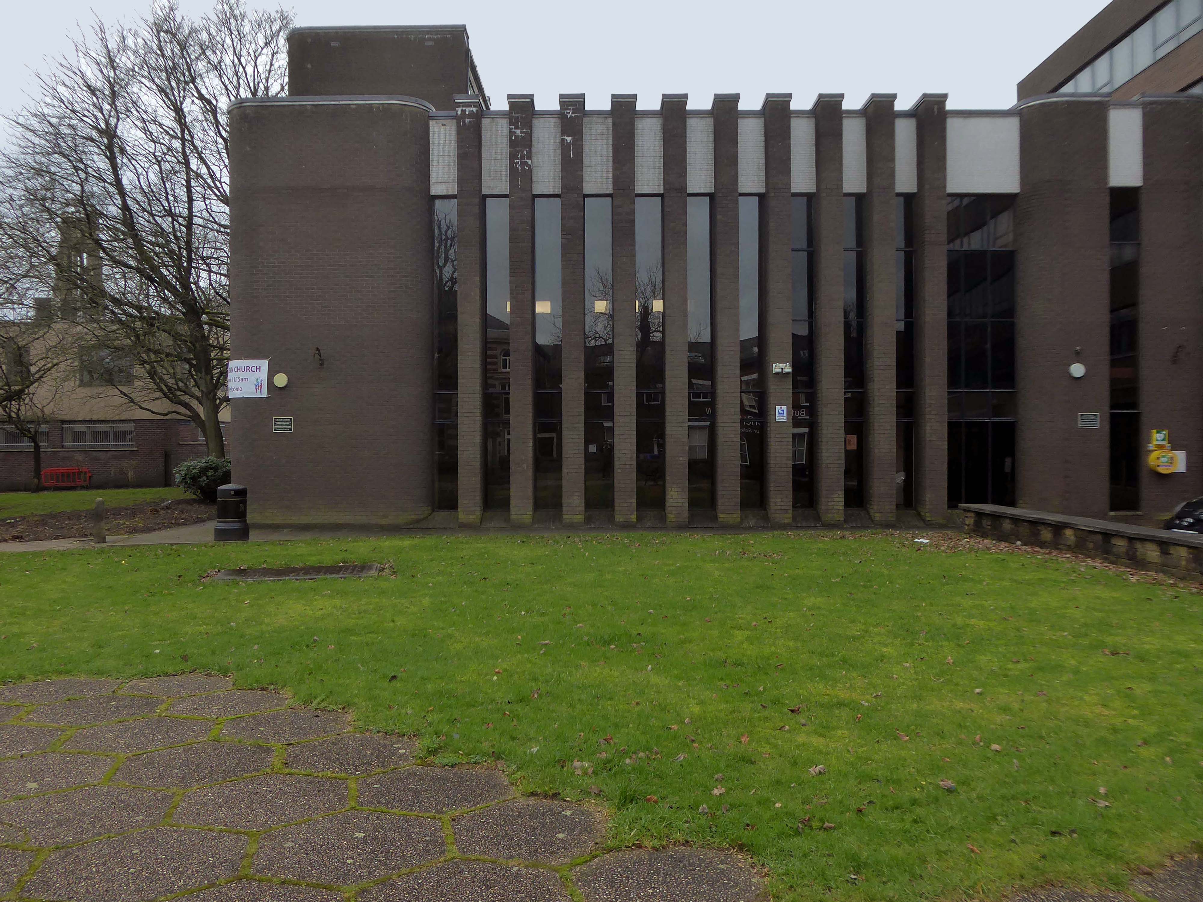
Next door a typical steel glass and brick banded office block Maple House.
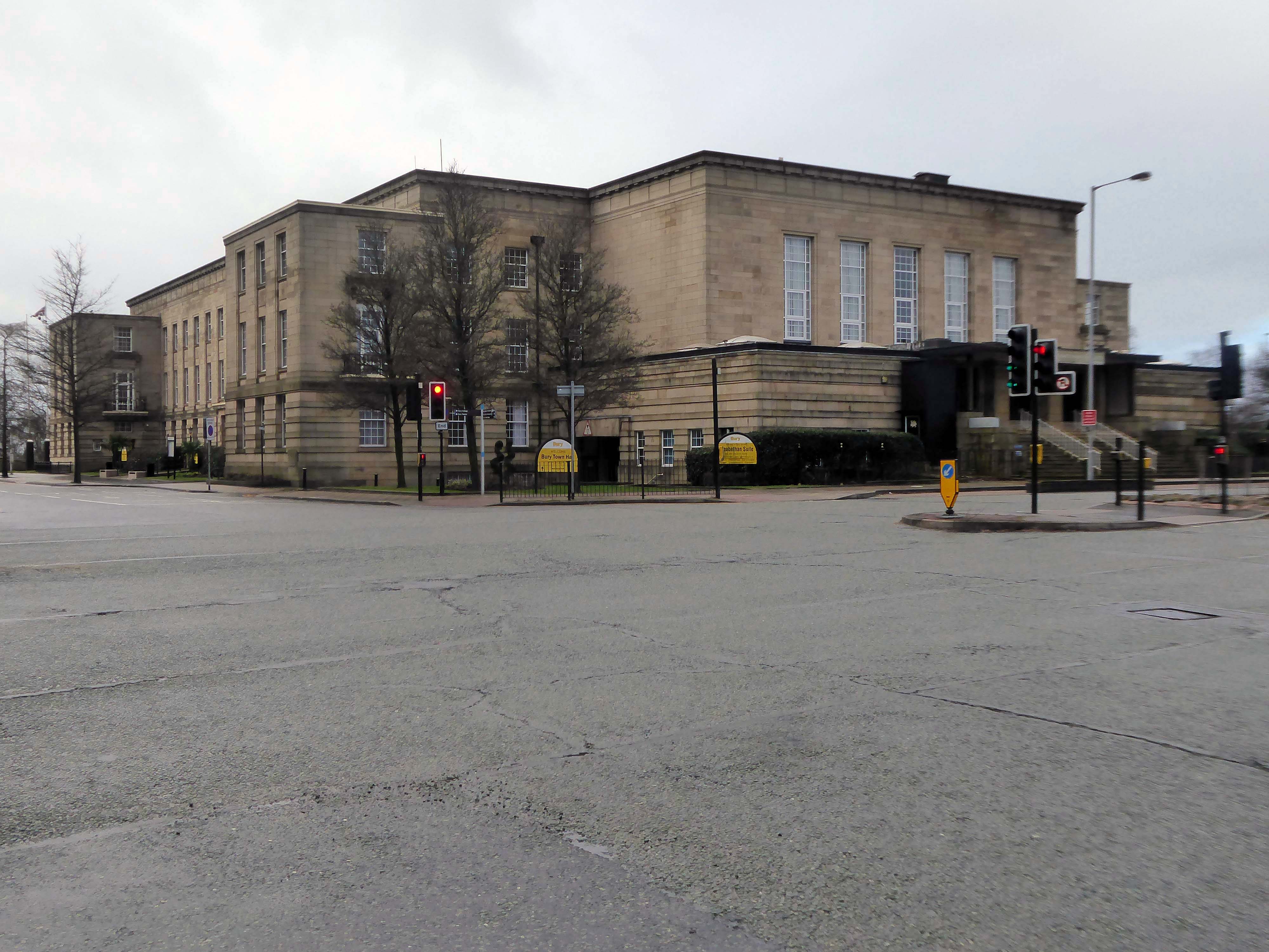
Around the corner and over the road to the Town Hall 1939-40 architects: Reginald Edmonds of Jackson & Edmonds then 1947-54.
Large and Dull – Niklaus Pevsner.
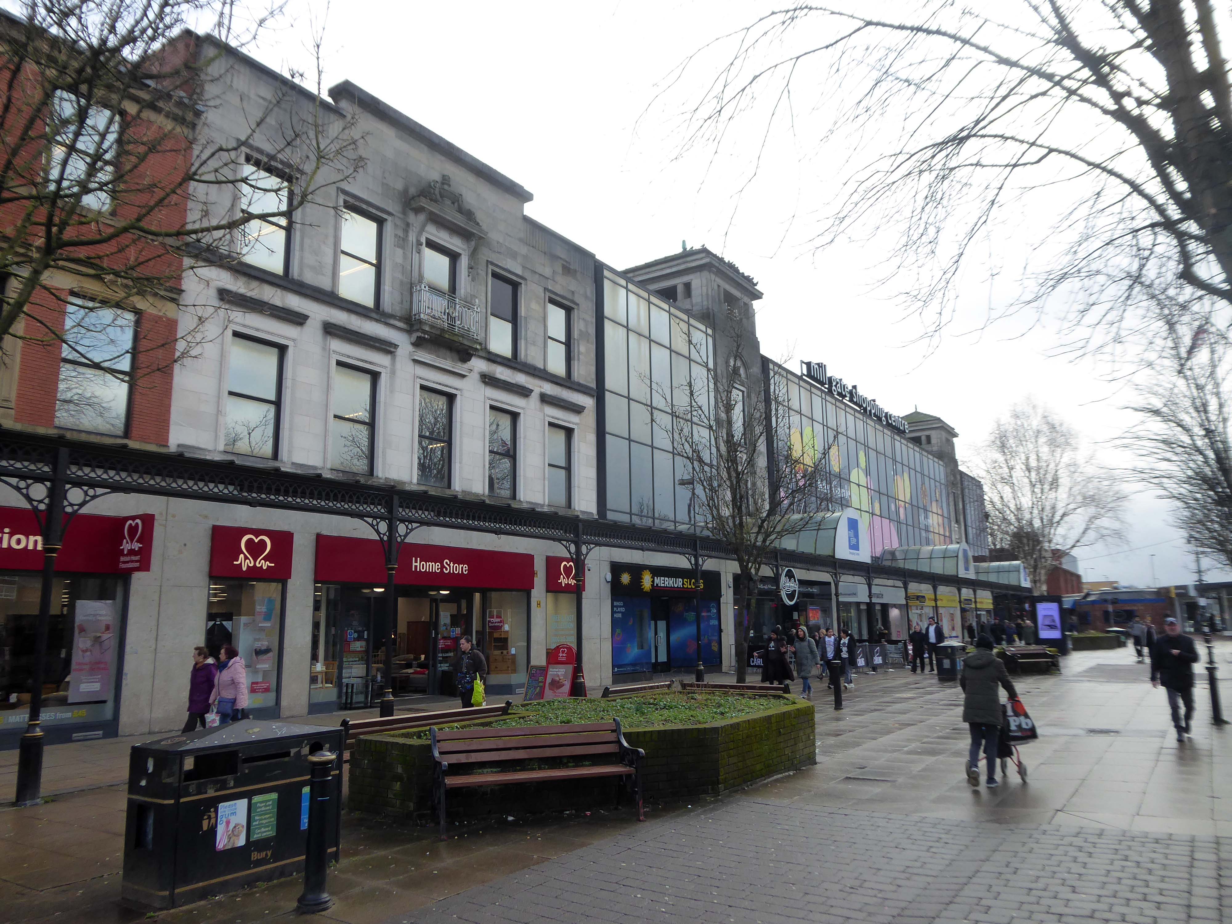
Back through the Interchange to the former Cooperative Store of the 1930’s.
The Portland Stone towers still visible – the elevation largely retro-clad in glass.
Passing through the Millgate Shopping Centre of the 1980’s.
Unambitious but successful, the floors cheerfully tiled – Niklaus Pevsner.
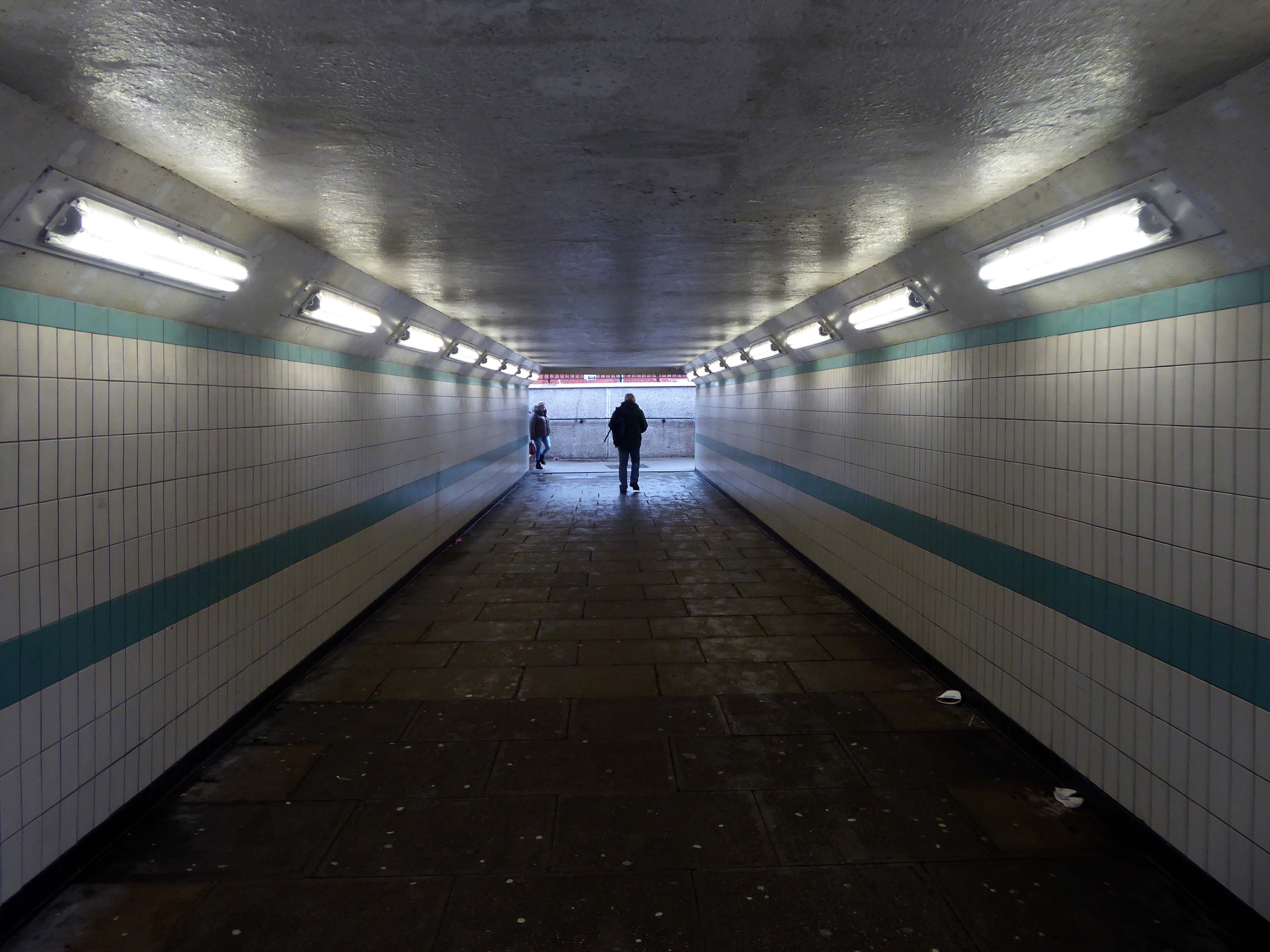
Down in the subway at midday.
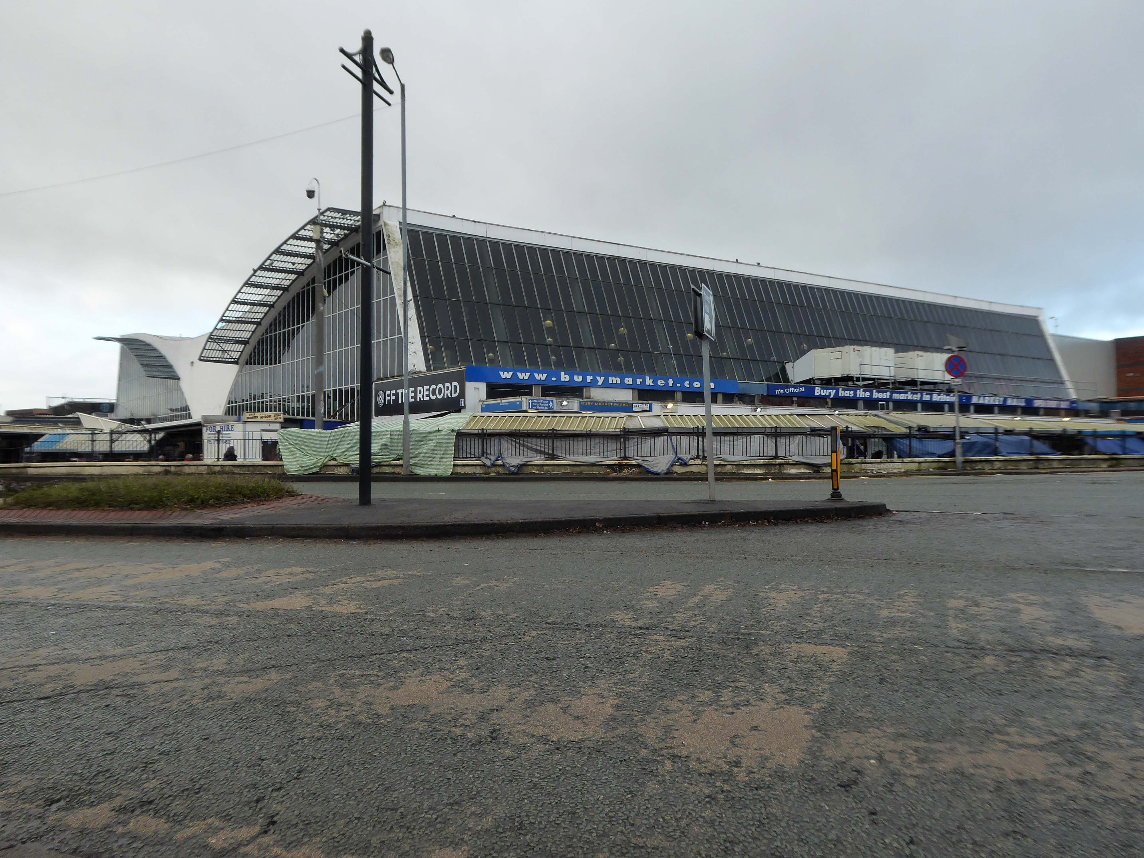
The better to get a view of the Market Hall 1971 – architects: Harry S Fairhurst.
The Indoor Market Hall is currently closed due to the discovery of Reinforced Autoclaved Aerated Concrete – within the building structure. RAAC is a lightweight type of building material that was used between the 1950s and 1990s.
Back under the road – where we find a delightful Telephone Exchange.
The Rock is a vibrant retail and leisure centre which is home to a range of high street fashion brands, independent retailers, tantalising eateries and fantastic entertainment – it’s the perfect place to visit any day of the week.
It is the work of architects BDP – completed in 2010 at a cost of £350 million.
Our masterplan for The Rock took into account the historical street pattern and public realm context to give the scheme its own identity, and make visual connections to local landmarks.
The retail and leisure scheme brings many exciting brands to Bury for the first time.
New pedestrian streets rejuvenate and improve connections to adjacent areas stitching the town back together.
The development will also contain 408 one and two-bedroom apartments.
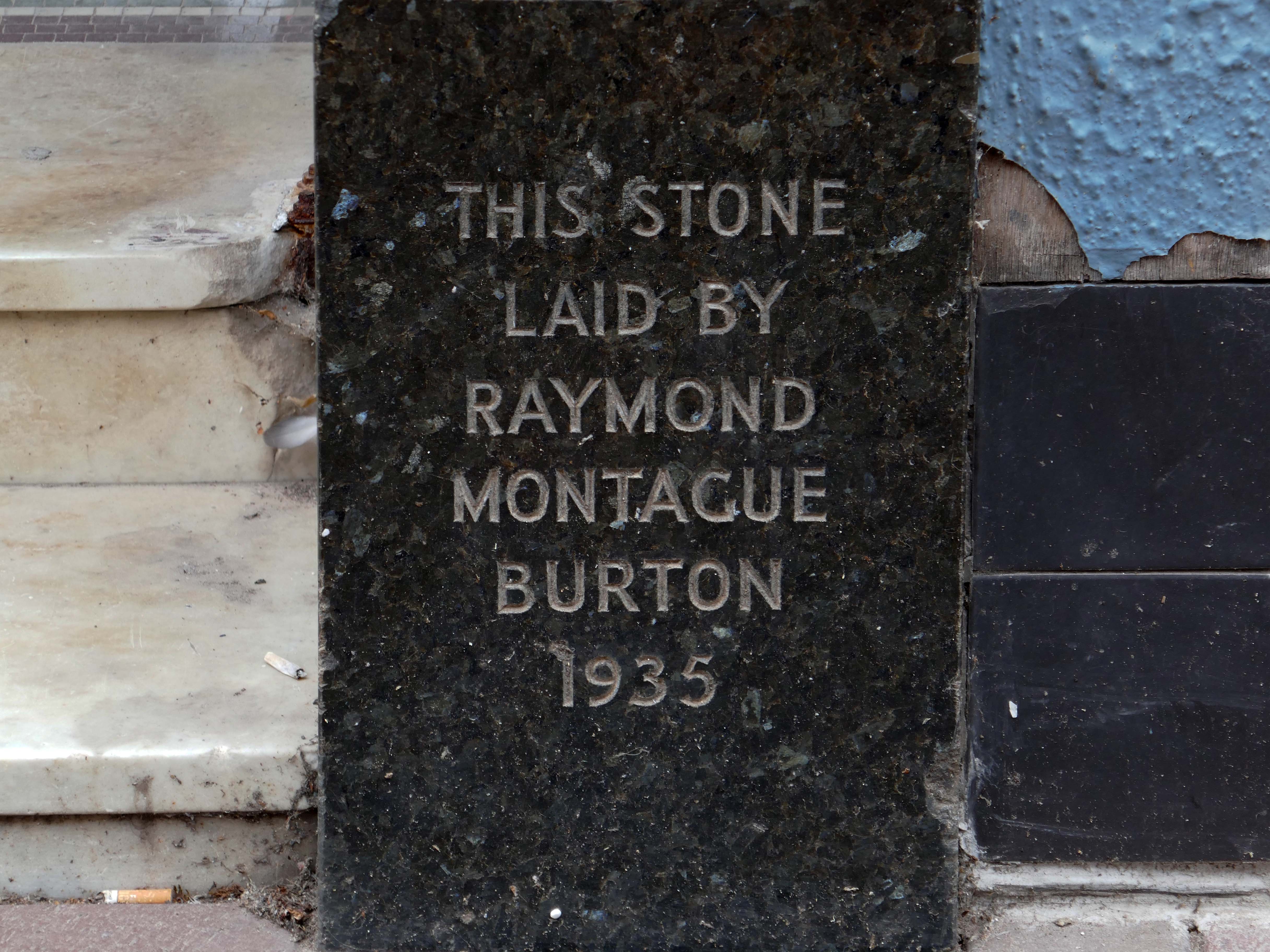
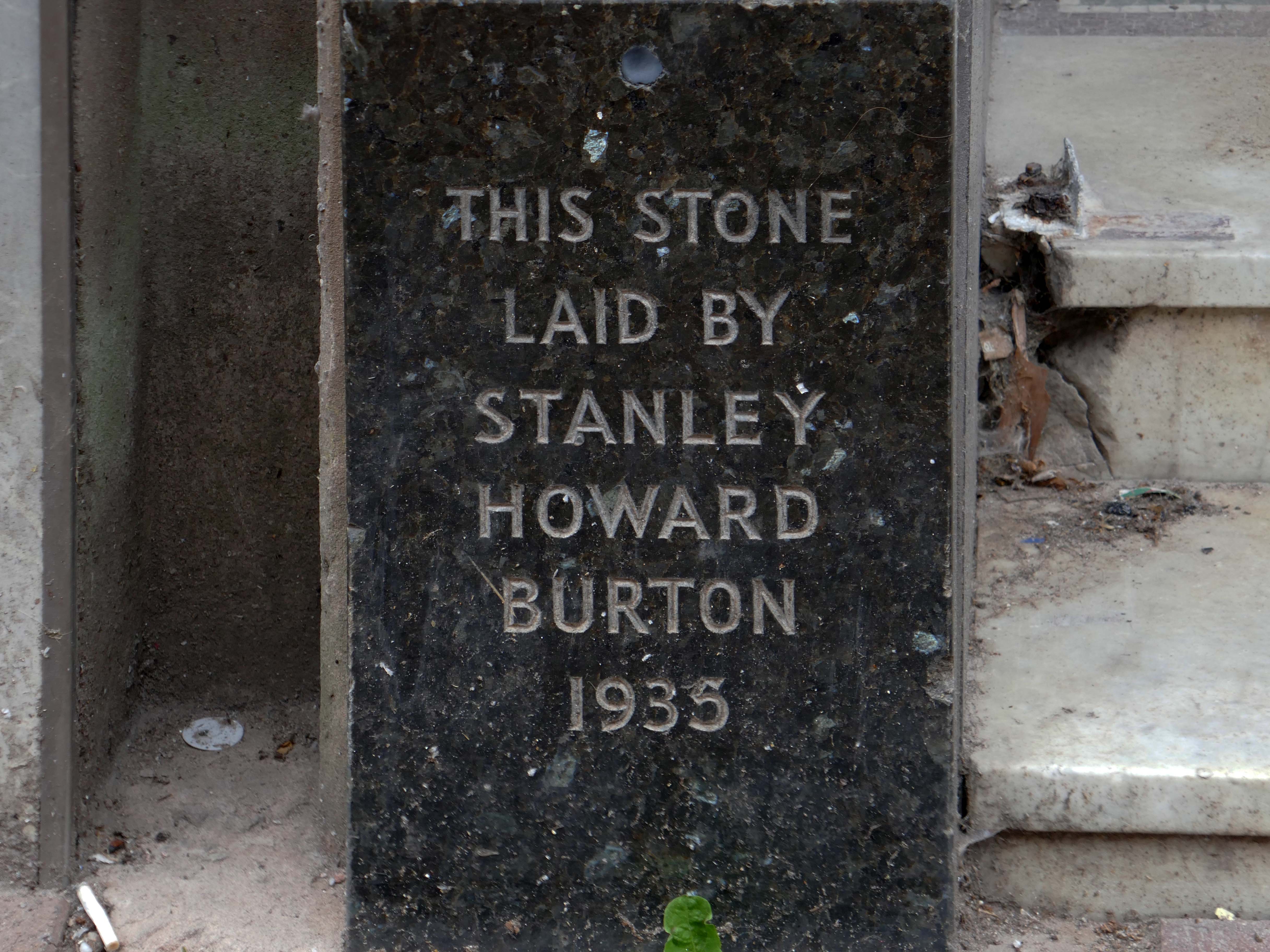
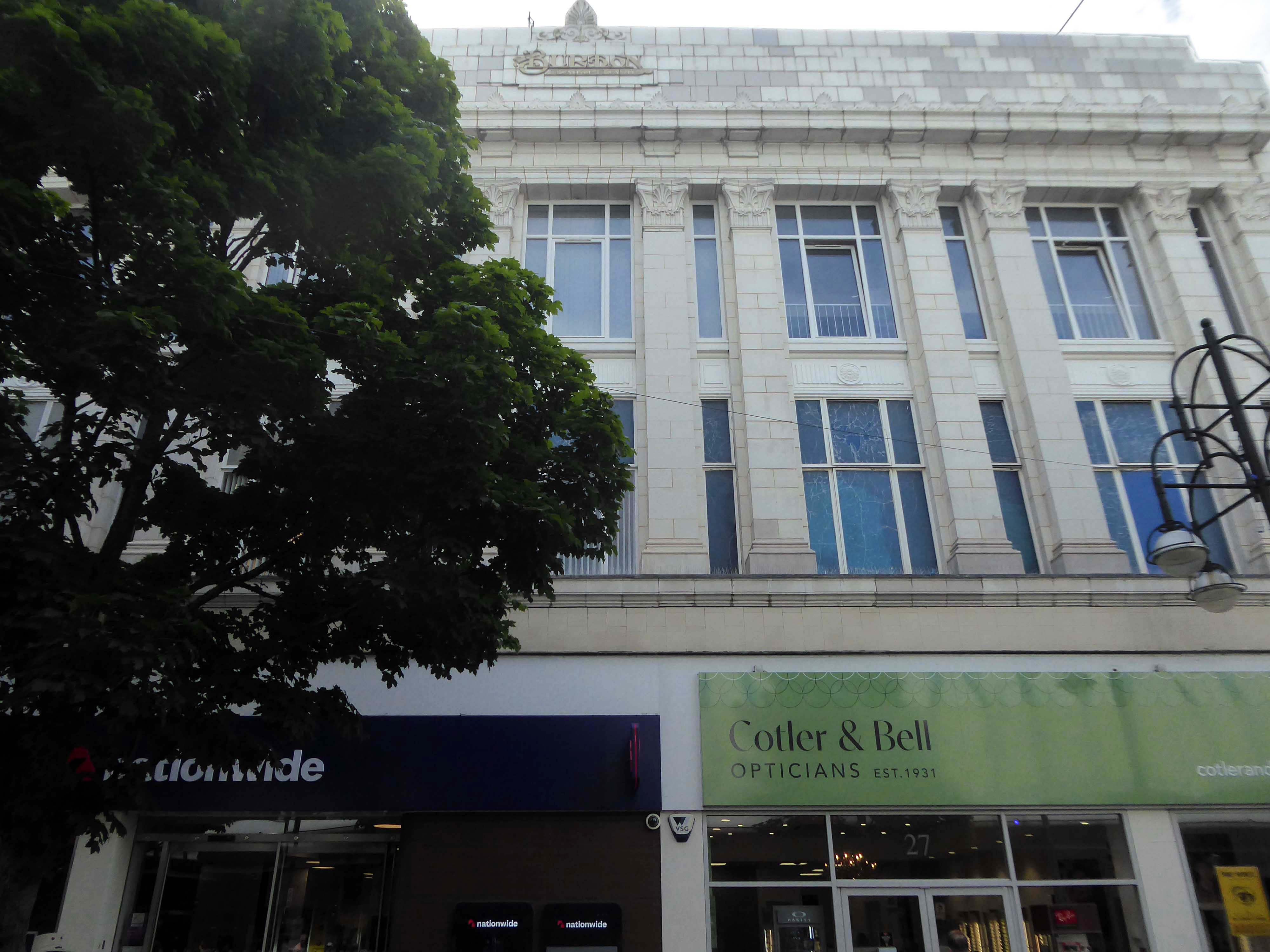
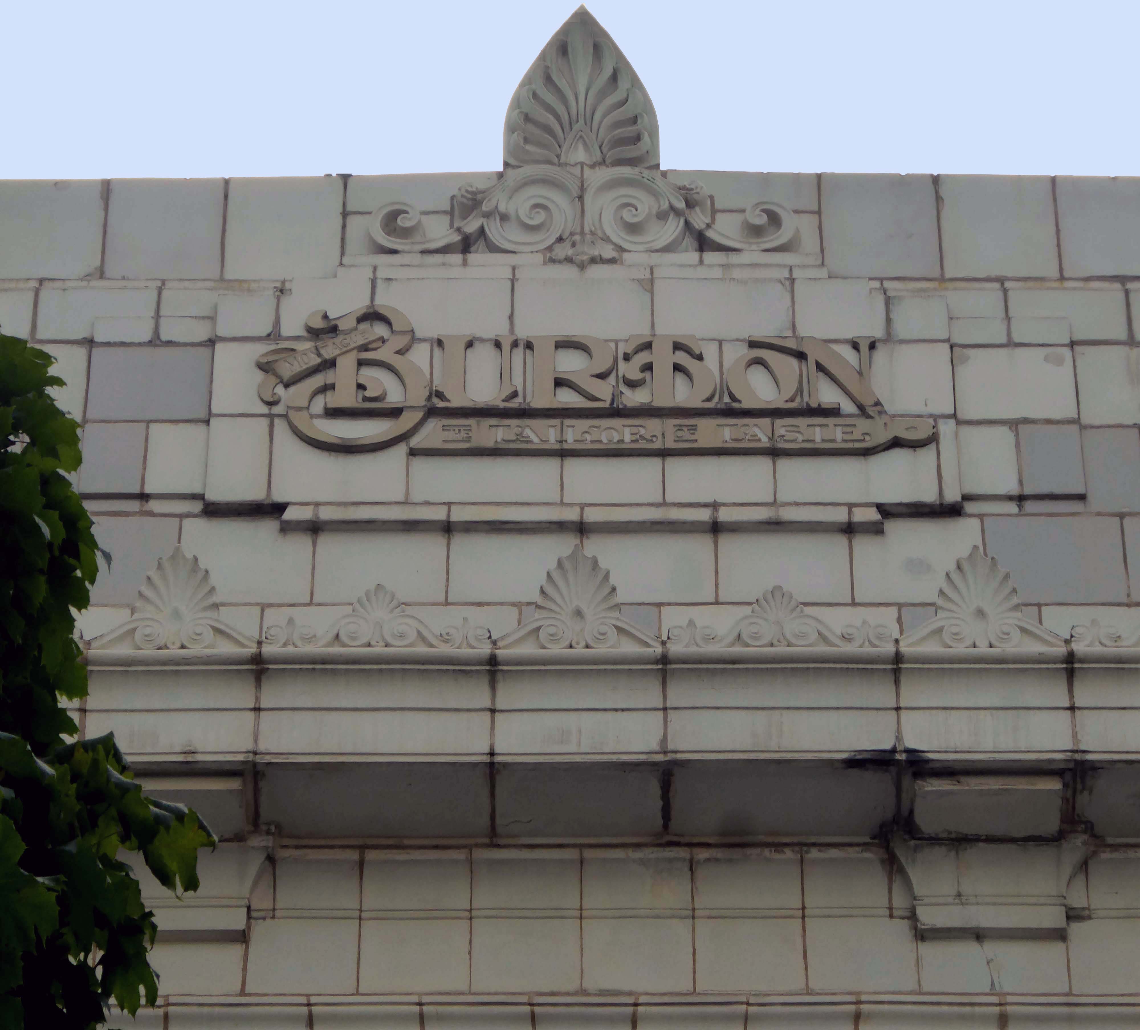
Back to basics at a former Burton’s hiding its faience facade.
Typical inter-war infill on our crazy mixed up mongrel high streets.
Ribblesdale House
Application by Shop and Store Developments Ltd submitted August 1965. Architect on application was Samuel Jackson and Son of Ocean Chambers in Bradford but during the application process this changed to John Brunton & Partners – Brunton was a partner in Jackson’s firm, at the same address. It had a restaurant and shops on the first floor.
The street level buildings were destroyed by fire on 14 May 1947 and were replaced with a new brick and concrete entrance and footbridge in 1952.
British Rail closed the station on 17 March 1980, when it was replaced by a new bus/rail interchange station further east into the town centre. Bury Interchange railway station served up until 1991 before the entire Bury Line was converted to light rail operation. It reopened in 1992 for Metrolink operation.
Bury was once the centre of multiple train links and the lost station of Knowsley Street.
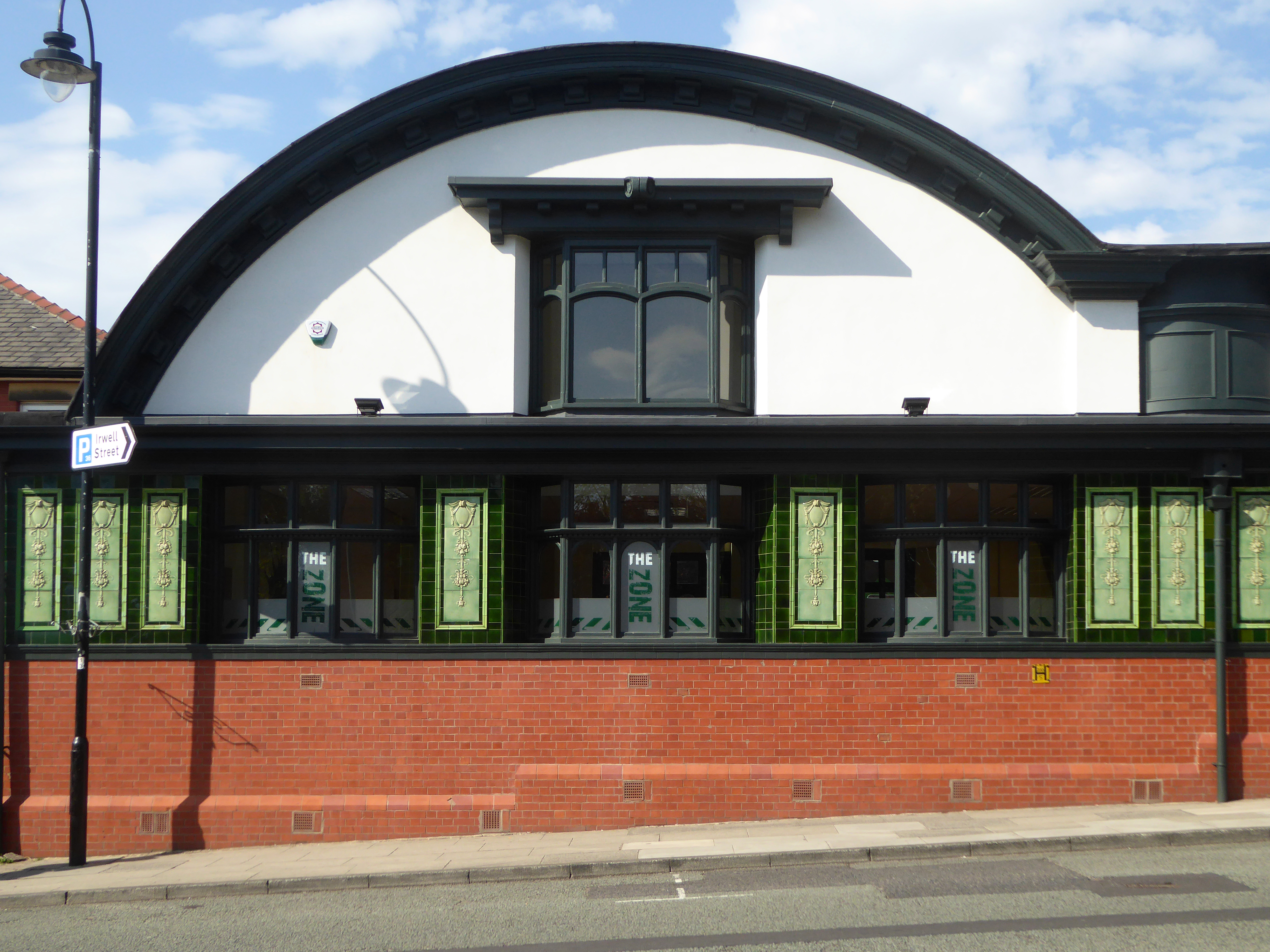
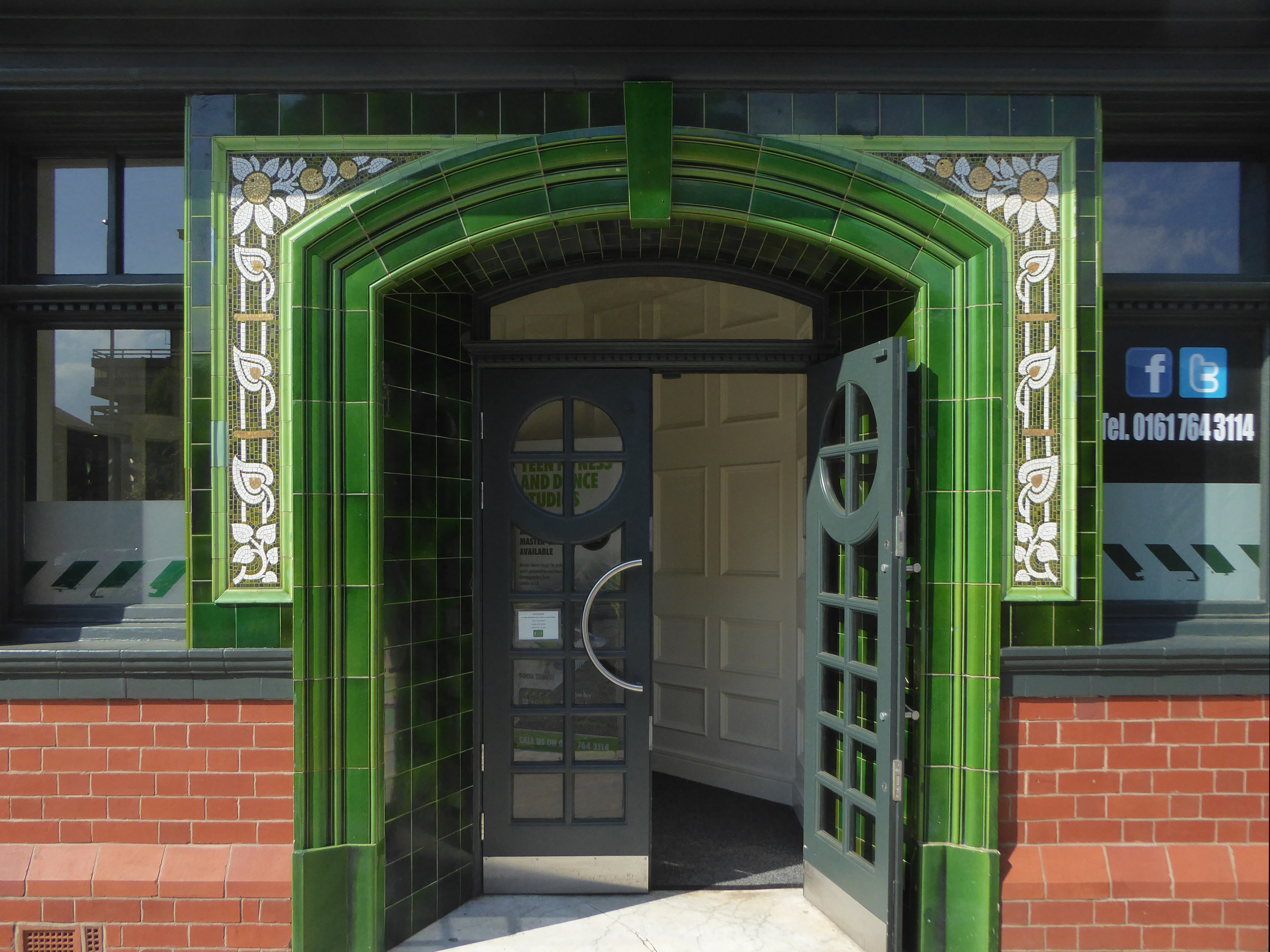
Over the road the former Temperance Billiard Hall 1910 architect Norman Evans.
Planning application January 1965 – work started in June 1965. The architectural firm was Richard Byrom, Hill and partners. Richard Byrom was submitting building applications in the 1930s in Bury and locally.
The rendering on the building is original but the windows have been changed. The Job Centre took over the building in 1993. It is in a conservation area and the Civic Trust had some concerns!
Many thanks to David French for the above information.
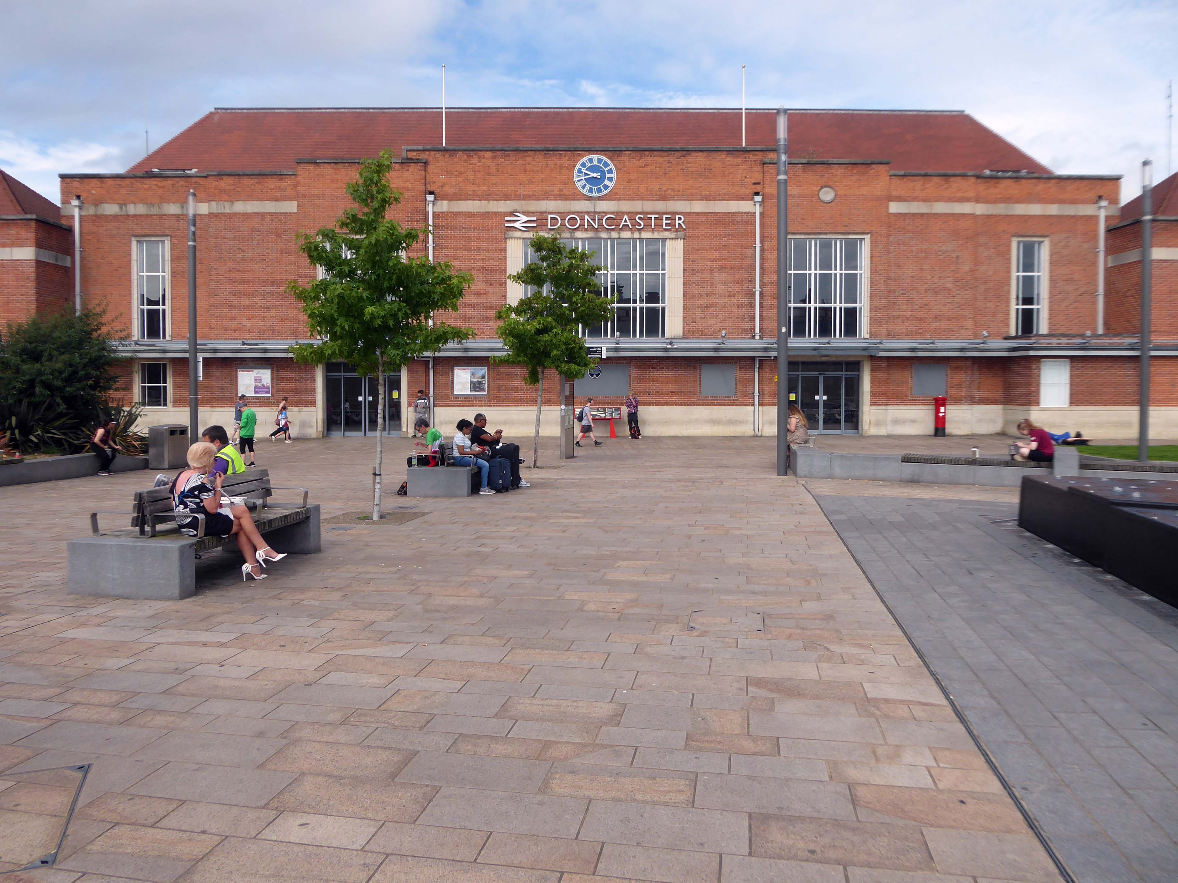
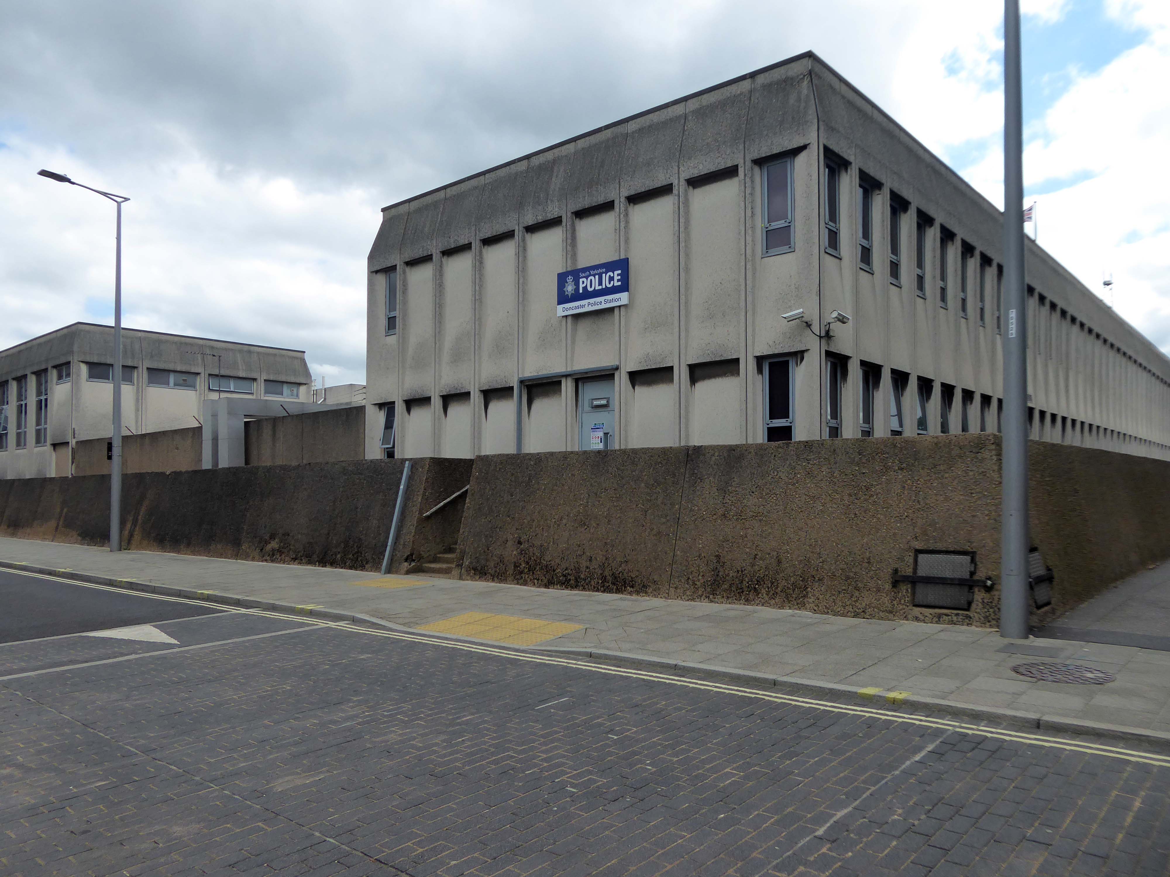
Arriving by train and ascending into the light – here’s the station lights.
The railway station has sharpened up its apron and facade.
We have transformed the station forecourt. It has become a quality gateway which delivers a great first impression for visitors arriving in Doncaster by train. This will help stimulate interest from investors and developers, helping to attract new investment and create jobs for the borough and wider region.
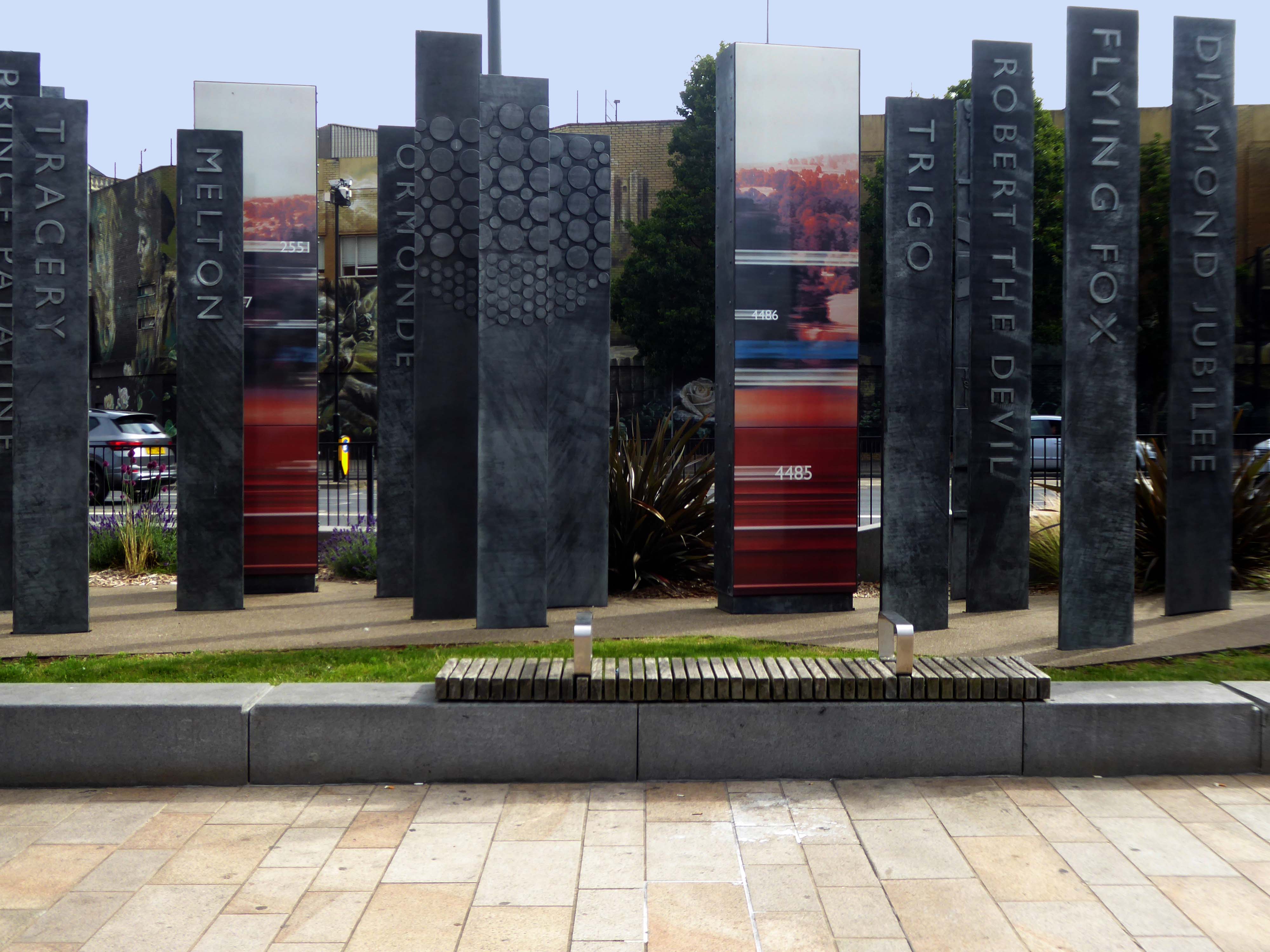
Celebrating engineering, speed and connectivity and stretching forty metres in length the public art at Doncaster Station consists of forty seven monoliths which are a nod to Doncaster’s past, present and future. With a fountain and three impressive water walls, the art takes centre stage in the new public space as you step out of the train station and head into the town centre.
The concept was devised by Doncaster Council and further developed by Chris Brammall.
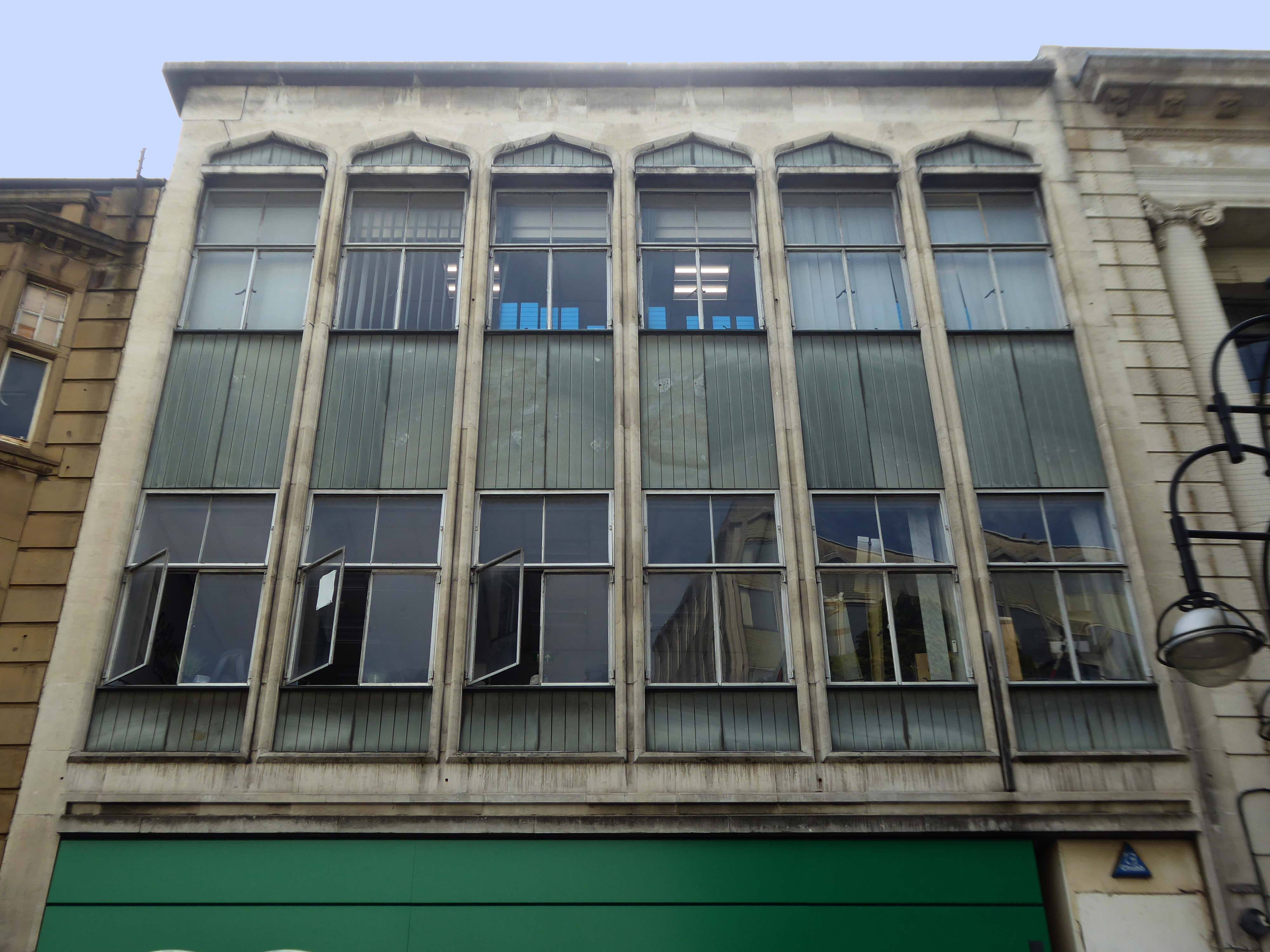
Typically the high and low streets of Britain’s industrial towns and cities, are an amalgam of architectural style and fashion, spanning at least two or three centuries.
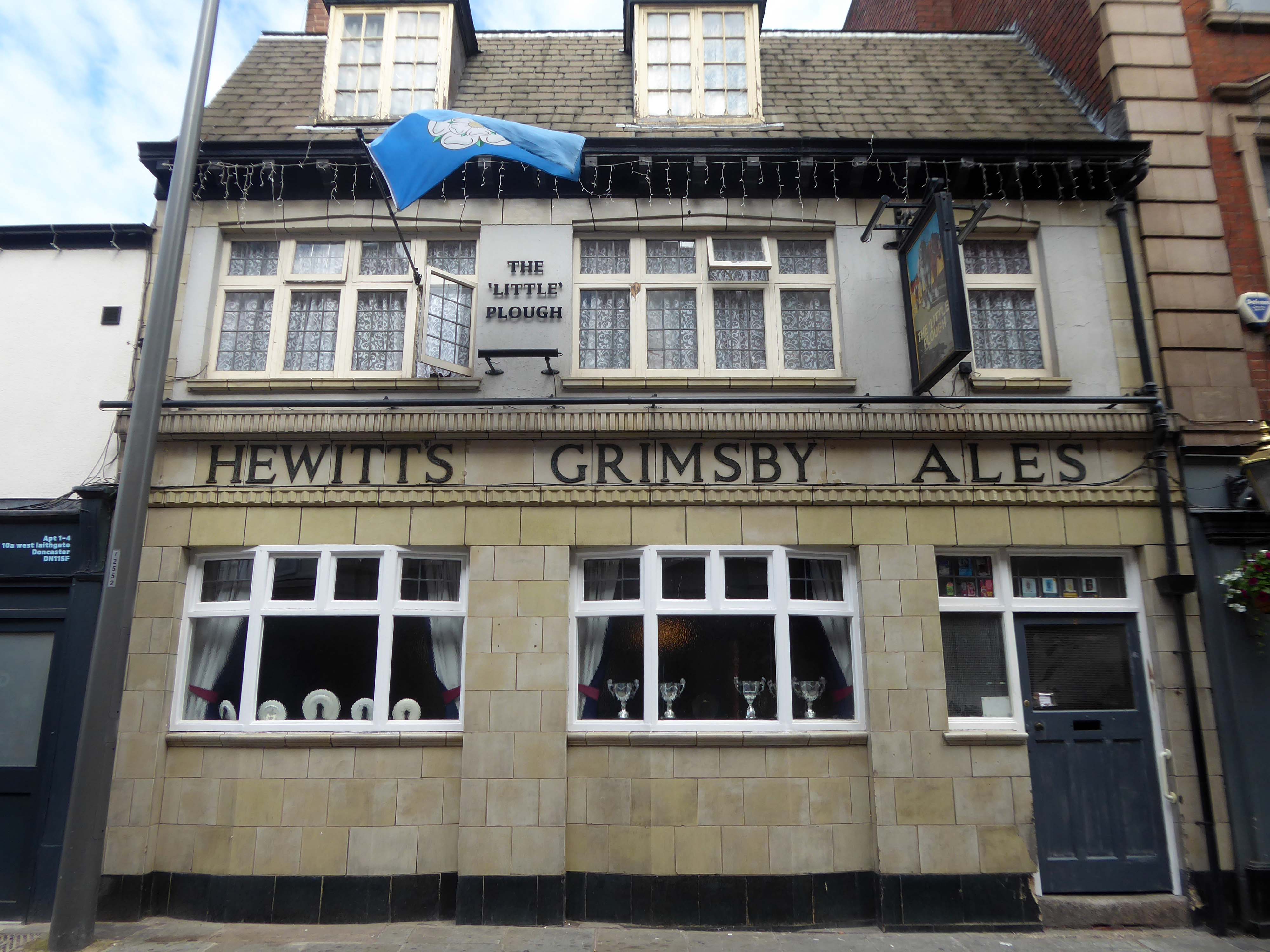
Behind the buff faience frontage is a lovely, small two-room pub with a well preserved interior created under plans of 1934. It was remodelled by the Grimsby brewers Hewitt Brothers Ltd who were Doncaster’s biggest pub owners for many years.
Of course, every town had a Burton’s – the tailor of taste.
This post war infill has that distinctive Festival of Britain feel, original metal window frames, Portland stone and blueish slate like panels.
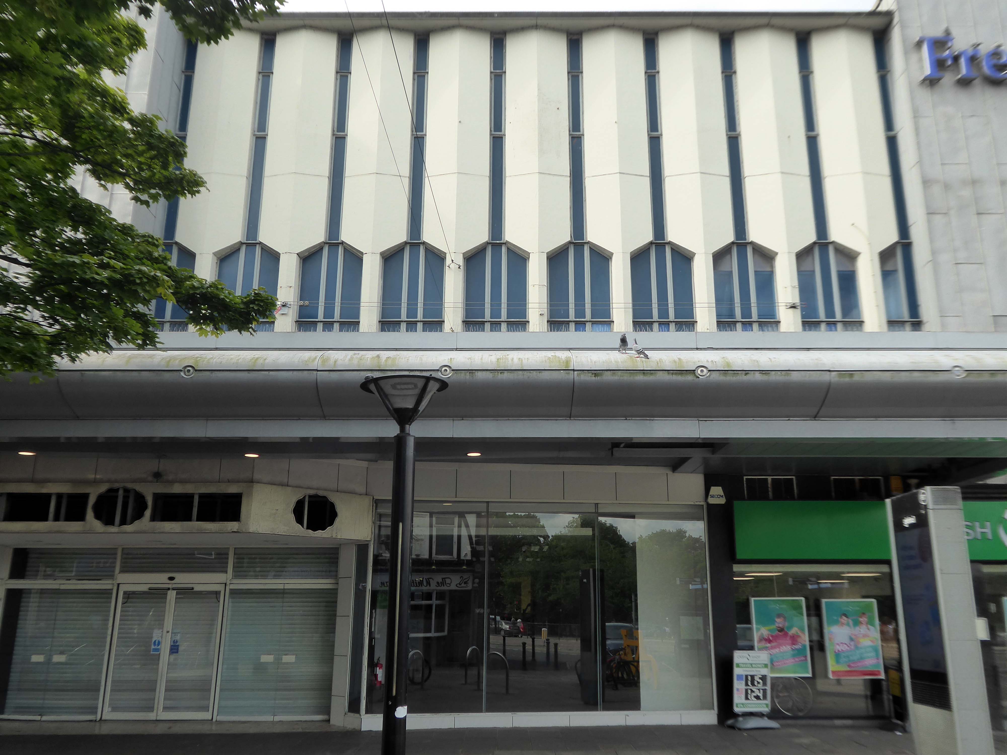
The revamped Frenchgate Shopping Centre, officially opened on October 4th 1968, has in places an upper tier, resistant to zinc over cladding.
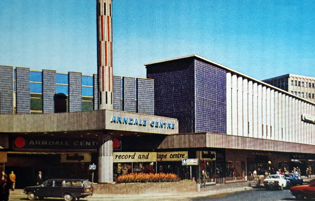
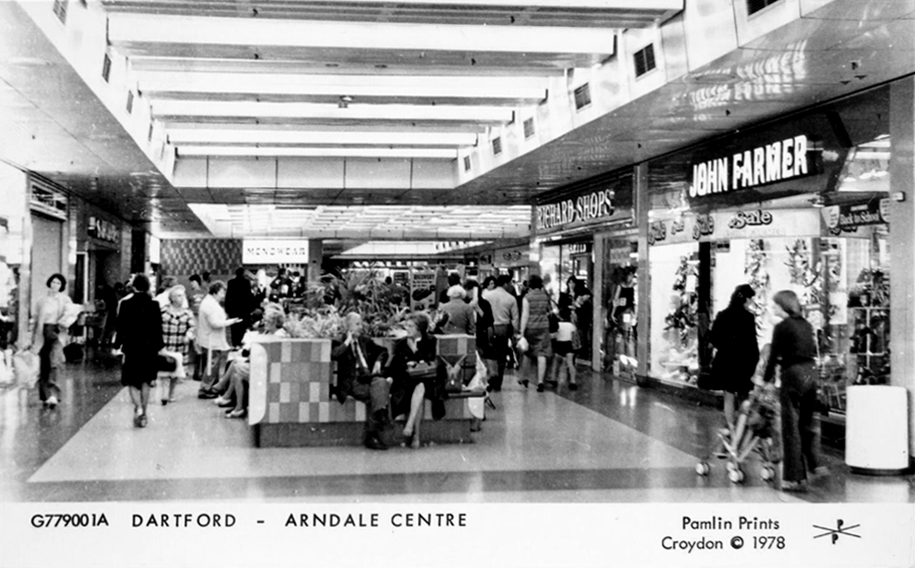
The centre has been the heart of the city for over 40 years and was originally called the Arndale Centre because it was built, owned and managed by the Arndale Group. It was renamed in 1988 after a change of ownership, with the new name reflecting the name of the street which passes to the east of the centre and which is one of Doncaster’s main shopping streets.
The sale of the centre came just a year after Frenchgate had undergone a £200 million facelift to transform it into the country’s first shopping centre with integrated public transport and retail interchange.
We propose this is fundamentally transformed though the addition of apartments that wrap along the back of the first-floor retail with a further 2.5 new storeys placed on top. We also feel additional height -up to seven or eight storeys, is justifiable to the corner of Frenchgate and Trafford Way.
The Lovers were once located in the Arndale, removed to a local garden, unloved – then later reinstated in the Waterdale Centre, where we will embrace them a little later.
Turn right to take in the 1920s mosaic remake remodel of the Grade II listed Blue Building.
The Blue Building which used to be the Doncaster Design Centre and Tourist Information Centre was originally the home of John Whitaker, a wine merchant, and son of James Whitaker who was Mayor of Doncaster in 1758.
In 1925 the complete building was demolished apart from the facade which was retained and given a facing of decorative blue tiles. The intention was to build a shopping arcade from High Street to Printing Office Street. Only part of the arcade, known as the Westminster Arcade was built. It had a number of shops, the largest being that of Woodhouse & Co Furnishers.
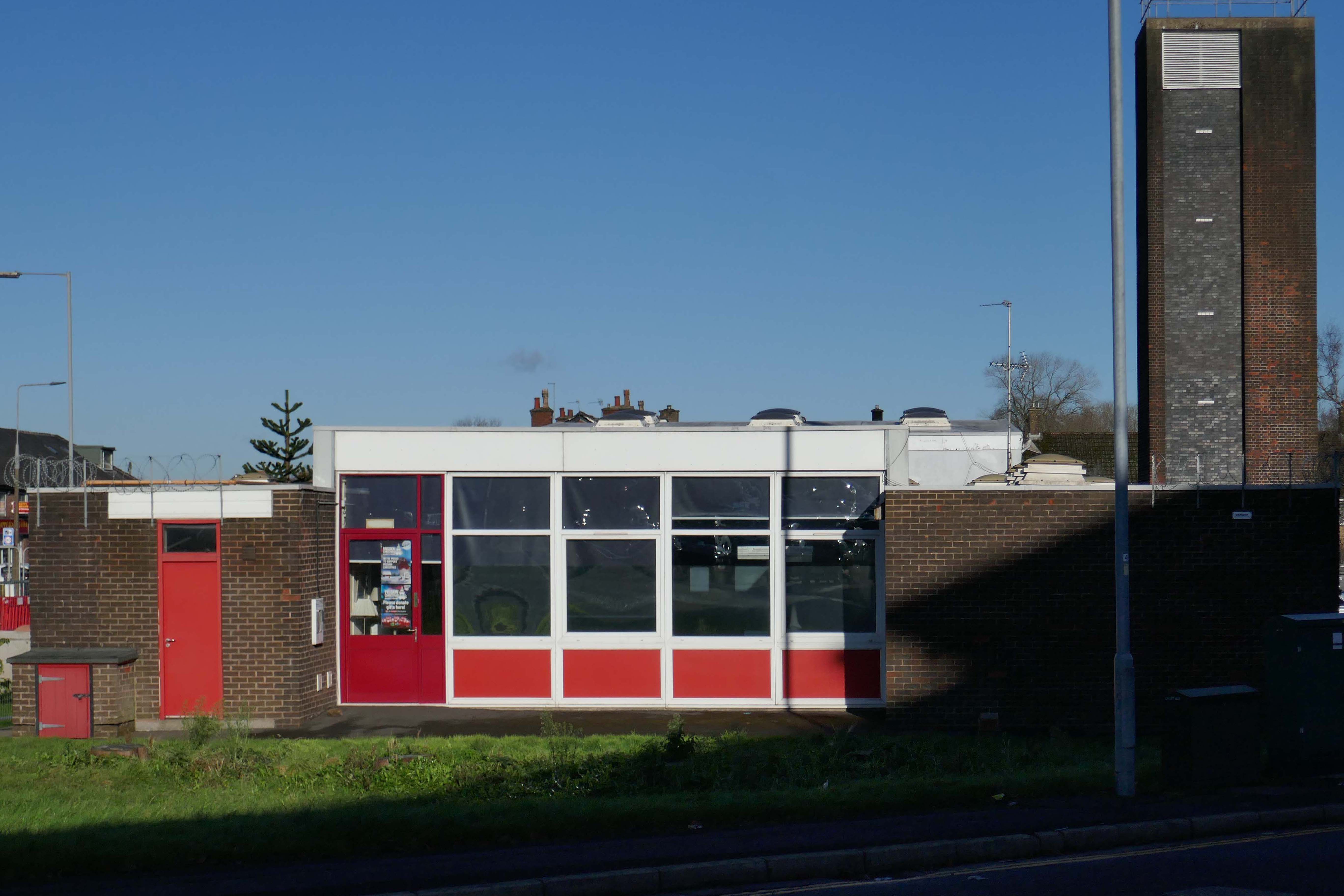
Two adjacent 60s extensions – to the right a redundant post office to the left an almost redundant telephone exchange, with the earlier brick built exchange in smack dab the middle.
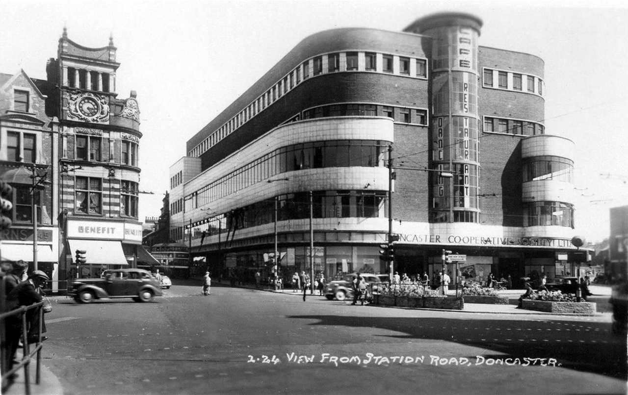
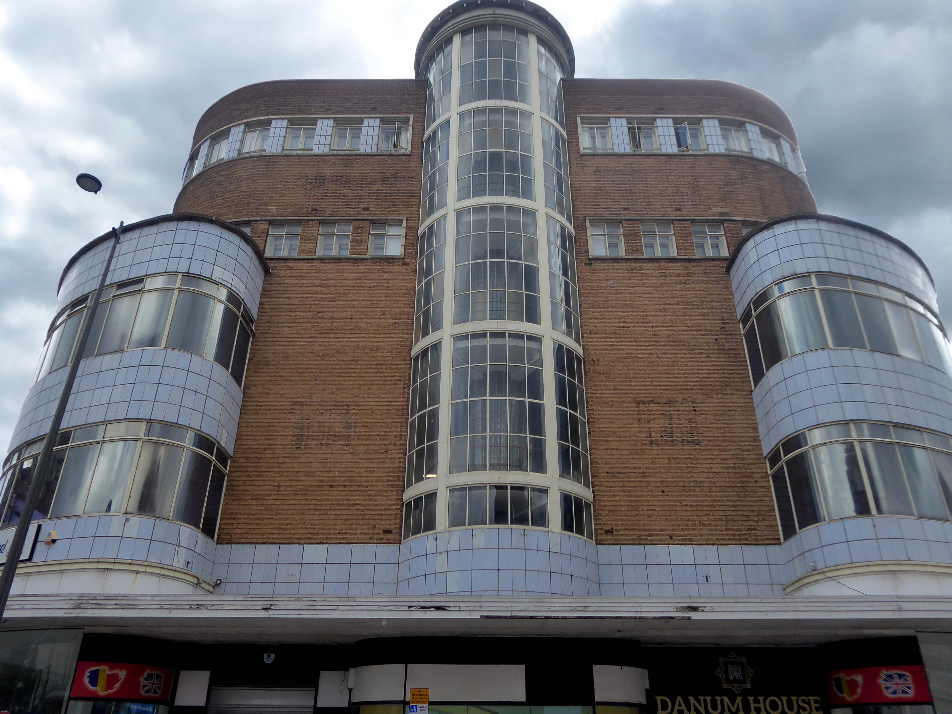
Turn another corner and it’s all at the Co-op now – the Grade II listed Danum Co-operativeBuilding, department store and offices: 1938-40 designed by T H Johnson & Son for the Doncaster Co-operative Society Ltd.
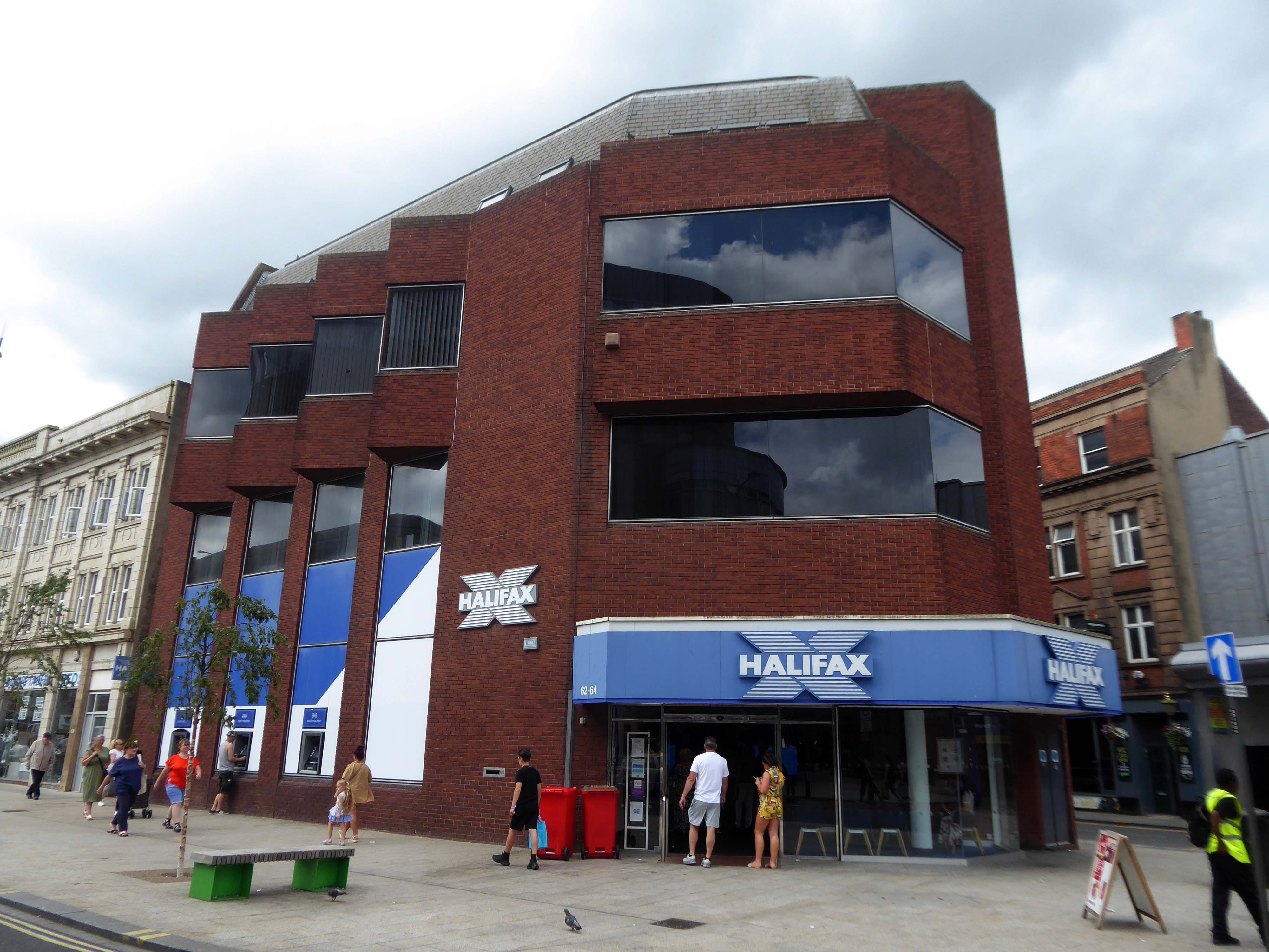
Over the road a zig-zag Halifax Building Society branch, tightly contorted by its corner footprint.
To the right of the Danum, this former Boyes store, having relocated to the Wilko site, the building is ripe for residential conversion.
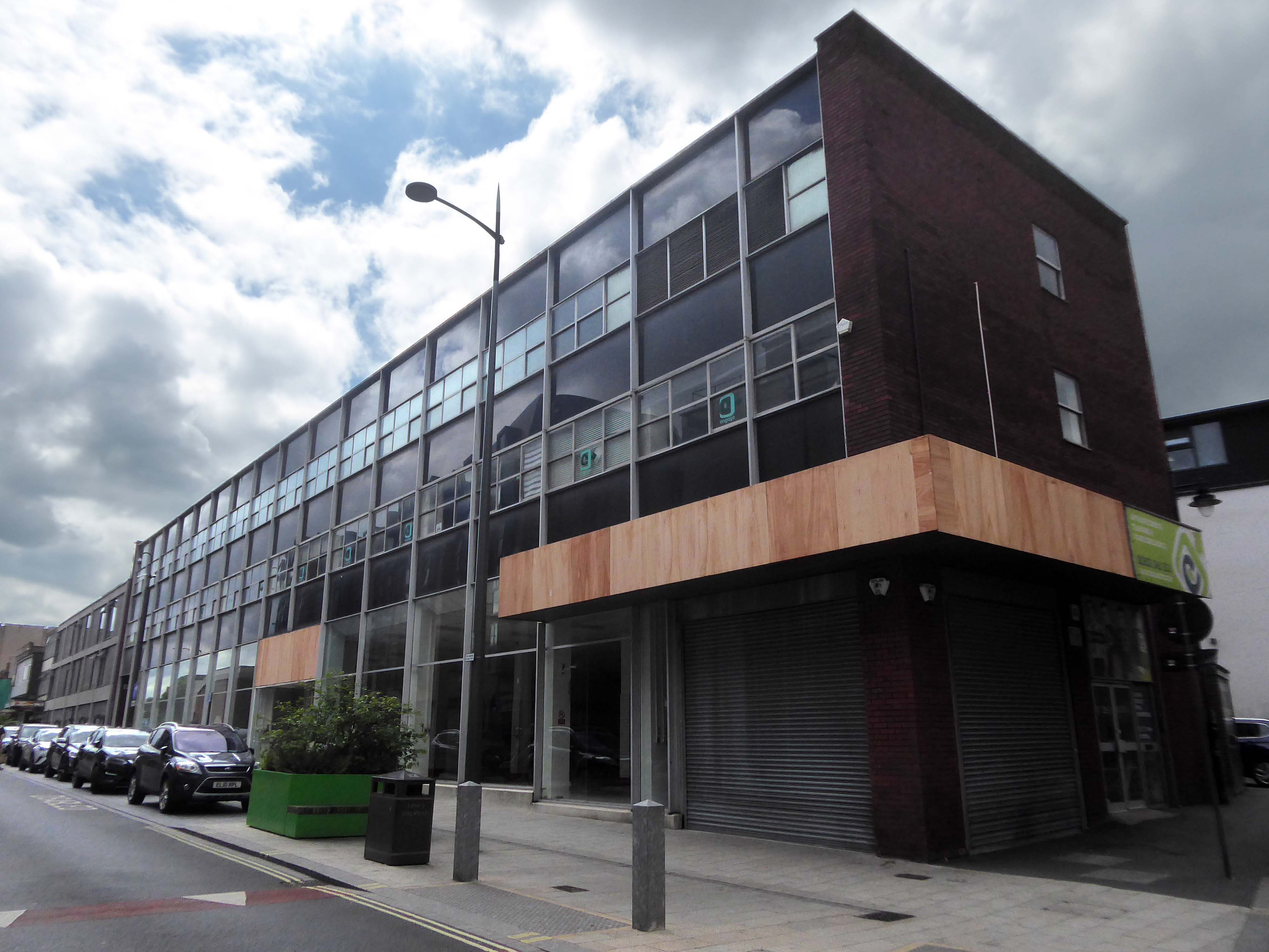
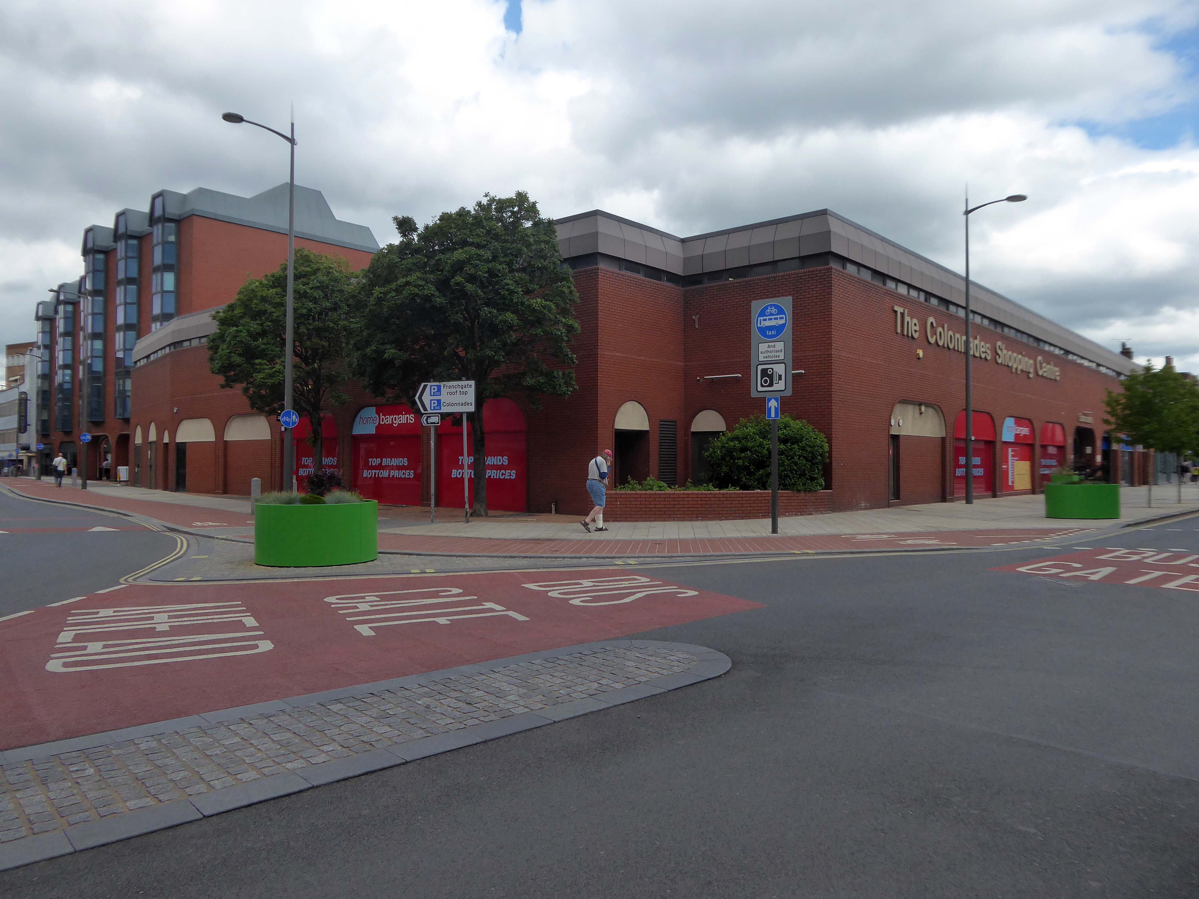
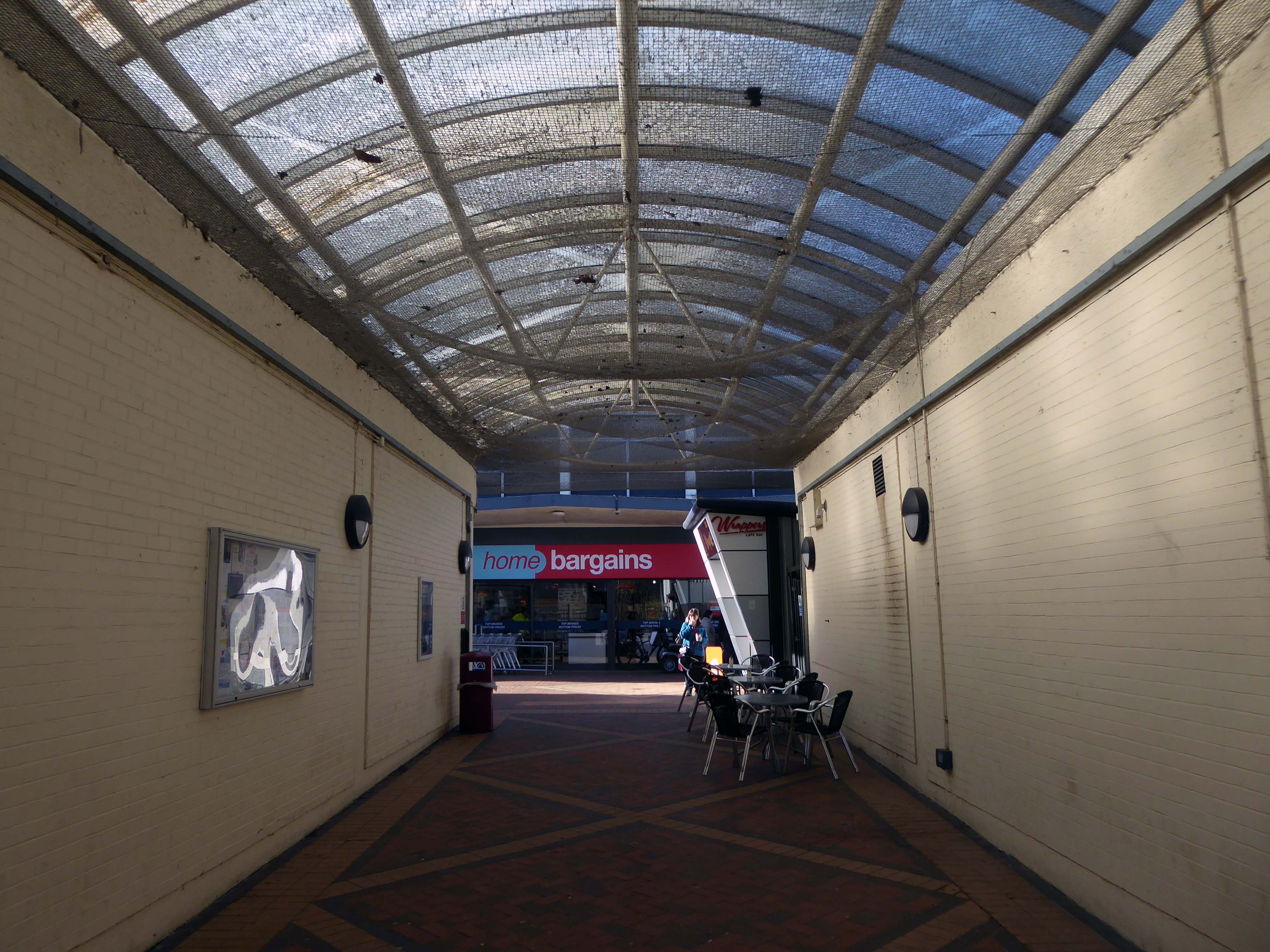
To the left the Colonnades Shopping Centre a fierce angular glass and brick bunker of mixed office and retail space – the sole occupant seeming to be Home Bargains.
A £3.3m makeover of the Colonnades shopping mall in Doncaster town centre was completed in 2019.
The scheme of works was co-ordinated by Doncaster Council and funded by the Sheffield City Region Local Growth Fund.
Built in the 1980s, the brick built building received a major overhaul. The investment saw the visual appearance enhanced inside and out. The five floors were transformed into the prime office space needed in the town centre and the enhancements to the retail area were also finished.
The shift in the town’s axis to the Frenchgate and Market areas, seems to have taken the wind out of its sails.
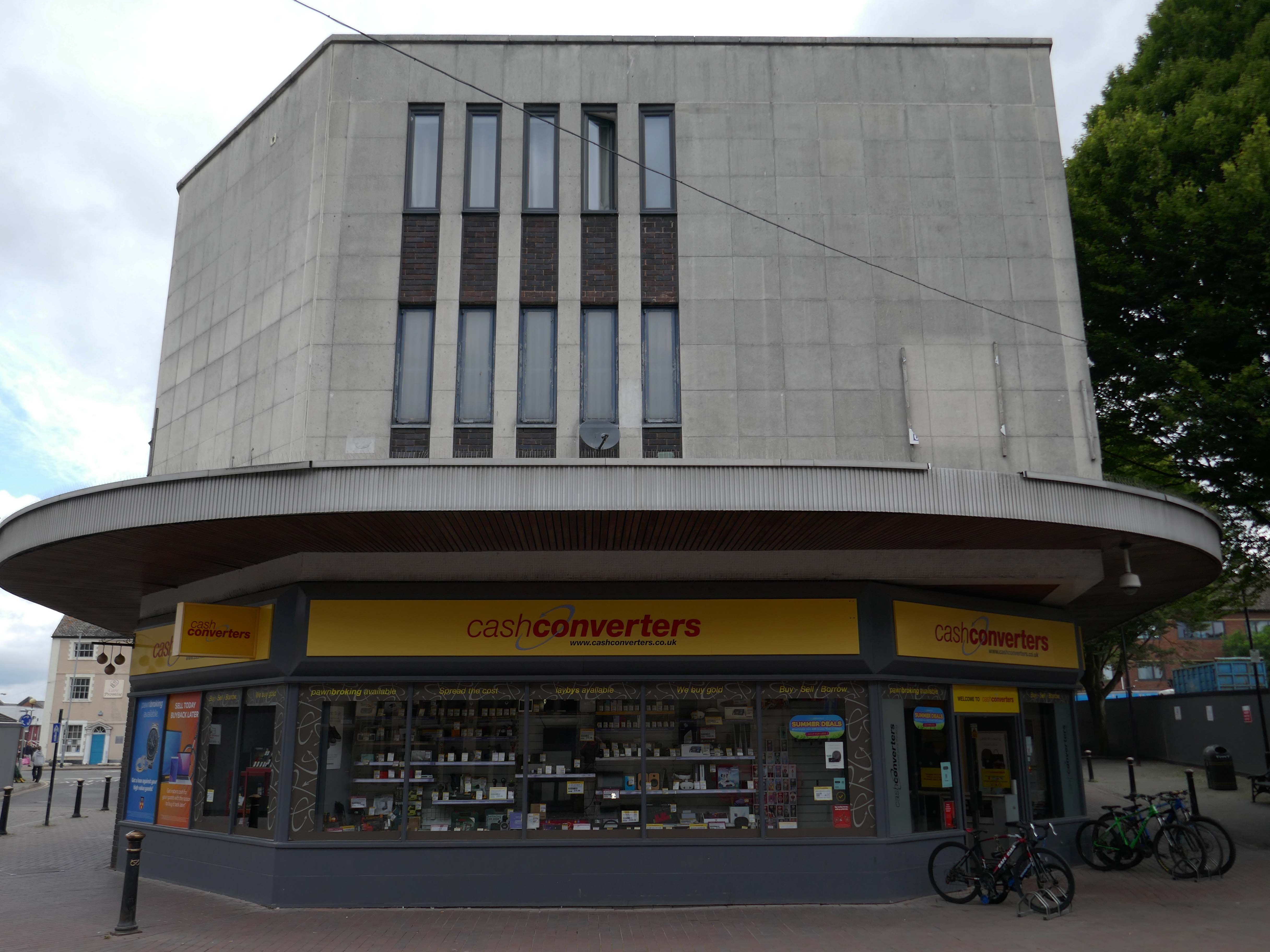
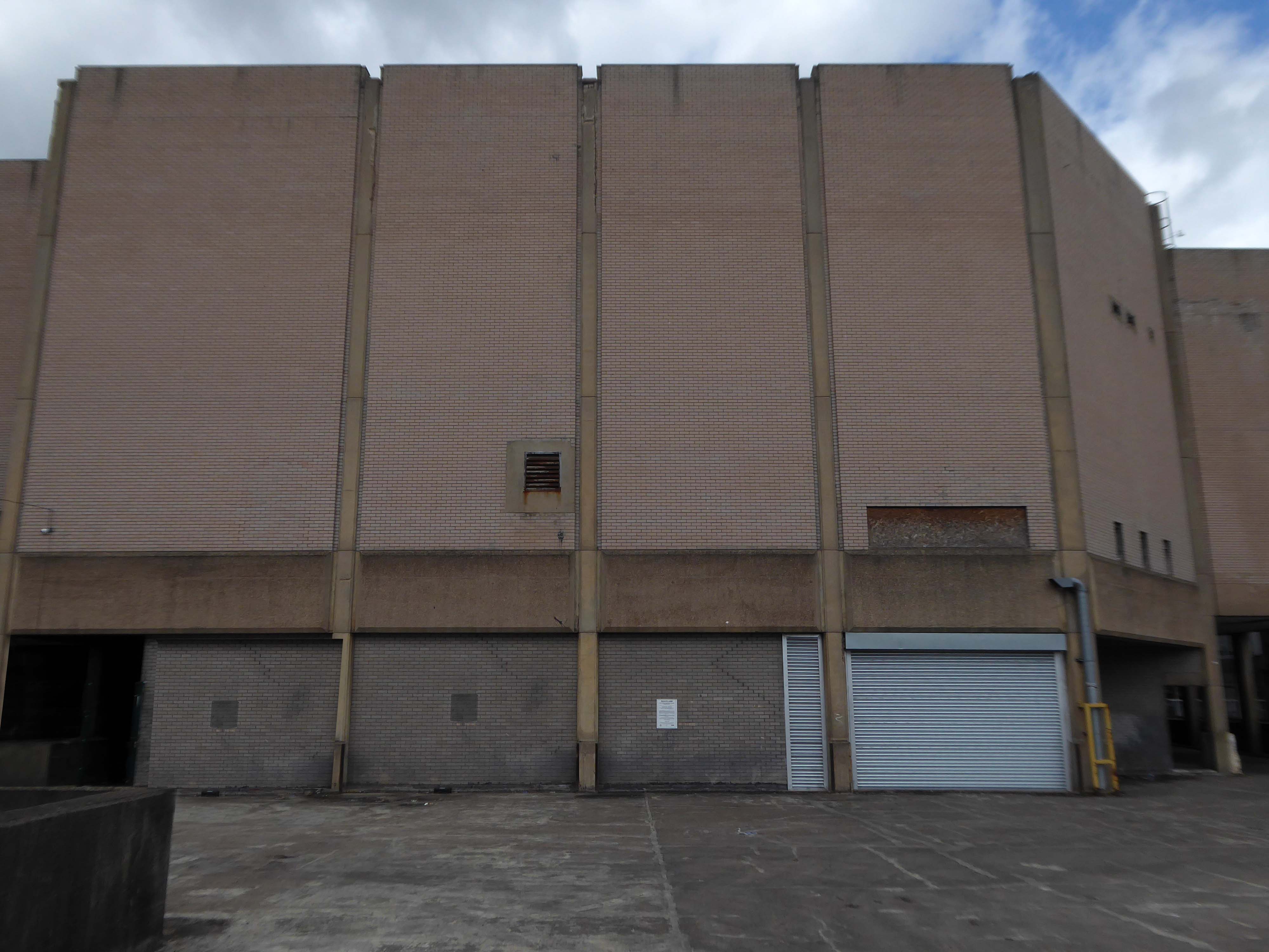
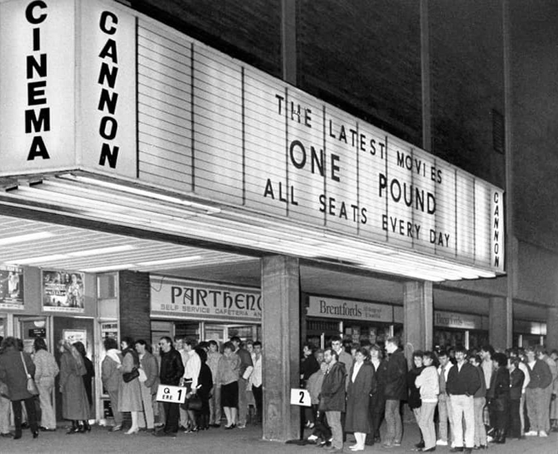
The former flicks now a redundant pale brick behemoth – no more and ABC.
Doncaster’s new £250,000 ABC cinema, part of the Golden Acres development near the town centre, was opened on May 18th 1967.
Closed in January 1981 for conversion into a triple screen it re-opened on 9th April 1981 with seating in the three screens for 477, 201 and 135.
The Cannon Group took control in the mid-1980’s and it was re-named Cannon and it closed on 18th June 1992, screening its opening film Doctor Zhivago.
Cinema Treasures
The Golden Acres development seemed to have morphed into the Waterdale Centre.
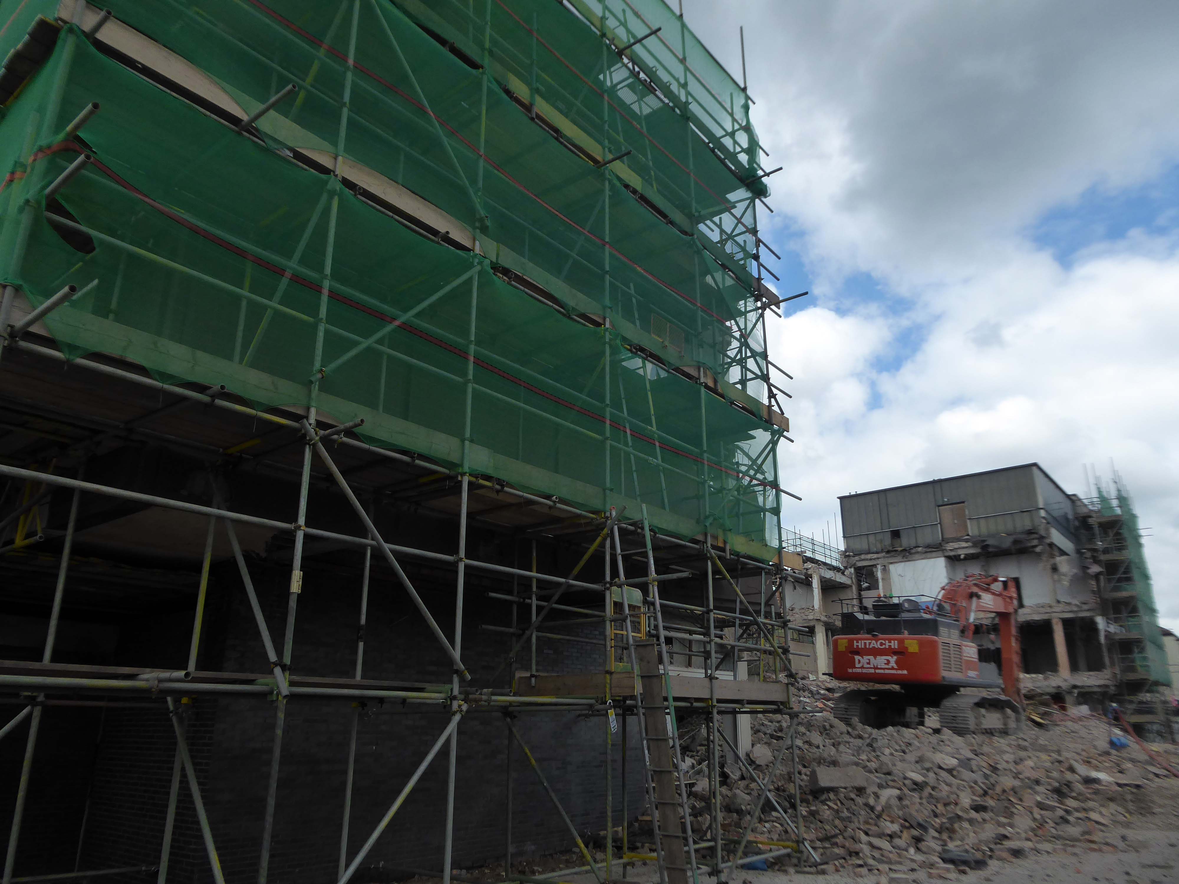
It is currently being reshaped to provide a line of desire twixt the Civic and Cultural areas, from the town centre. There are still the remnants of homes, shops and a pub amongst the demolition – almost inevitably there is new paving.
Waterdale is a well-known part of Doncaster’s town centre. During its heyday it was a bustling area with people flocking to shops and the like – it was a place you had to visit while you were in town. However, it had suffered a steady decline which continued when the southern bus station closed – Frenchgate Interchange opening, and Doncaster College moved to the Hub at the Waterfront. With limited public transport entering the area and no student population on its doorstep, less people had reason to pass through.
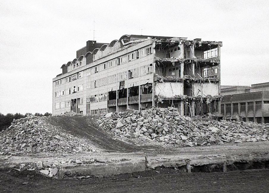
Demolition of the College.
The Civic and Cultural Quarter is transforming Waterdale reconnecting it to the town centre. The quality and content of the plans is raising the profile of this part of town to new levels. The carefully thought out layout and consistent building design is giving the area a clear identity. It is already becoming a big attraction that draws people in and encourages redevelopment in the neighbouring areas.
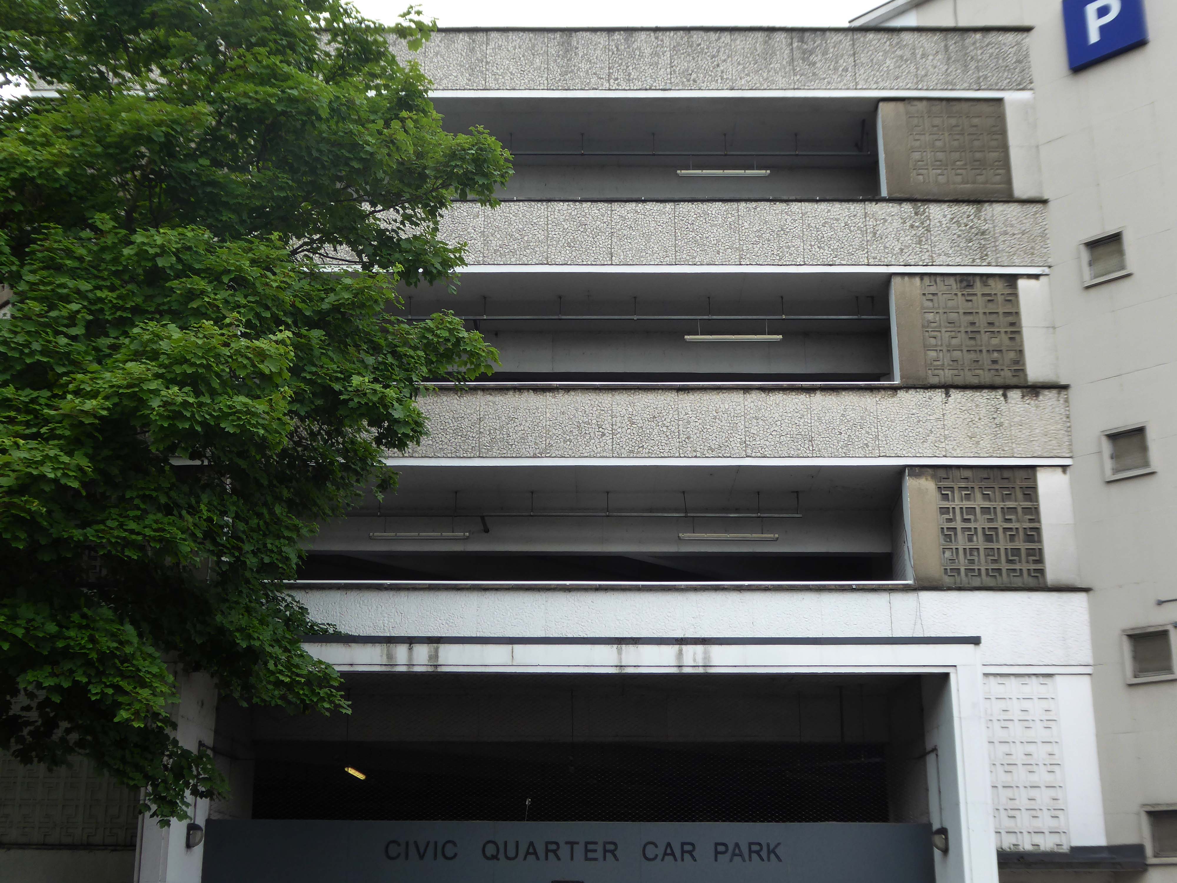
The weary walker is diverted toward the Civic Quarter Car Park.
The former Civic Offices are to be demolished.
Demolition of the Central Library is well under way.
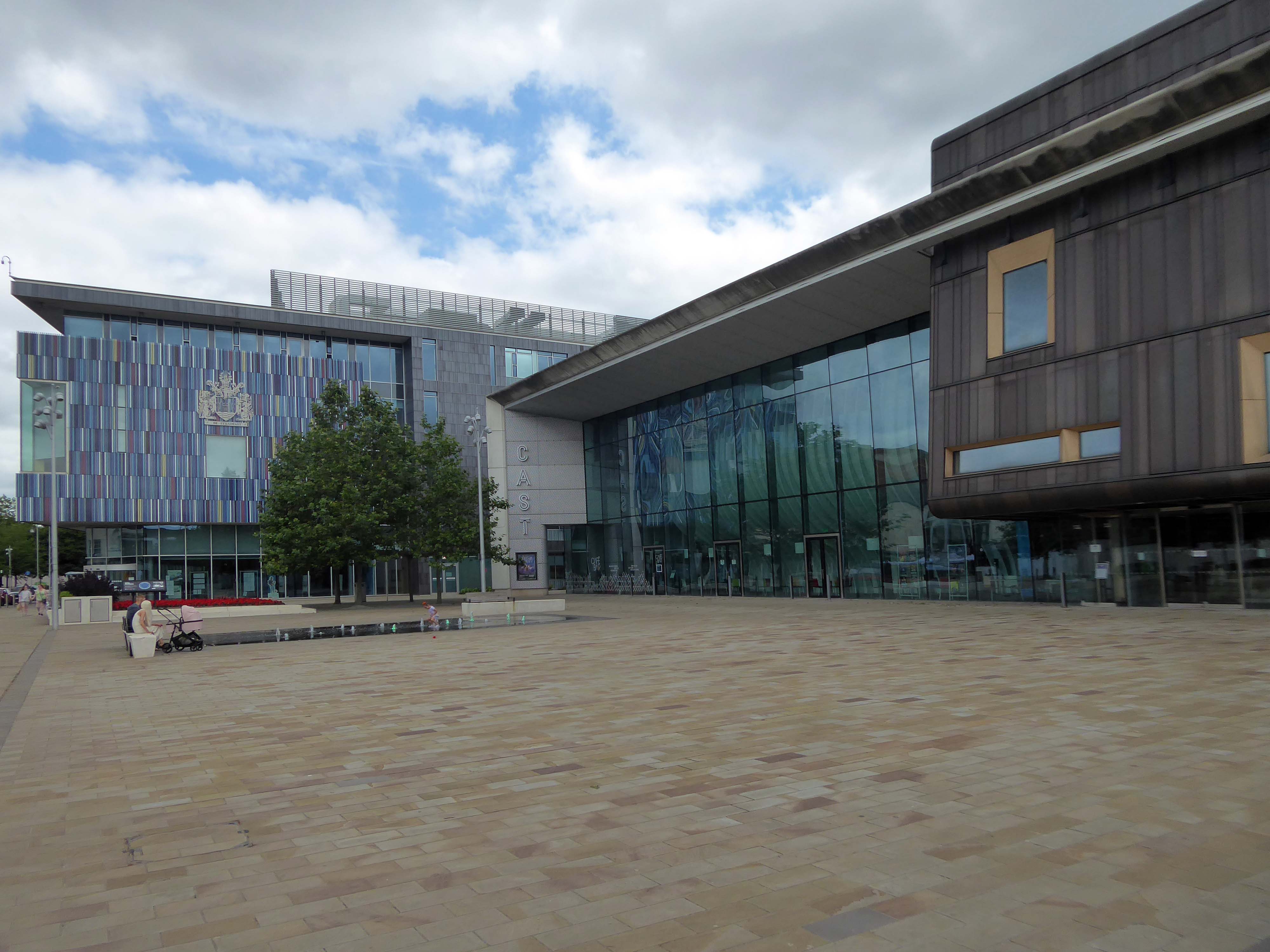
Facing the former library we find the CAST Theatre, Civic Buildings and Savoy Cinema, grouped around Sir Nigel Gresley Square.
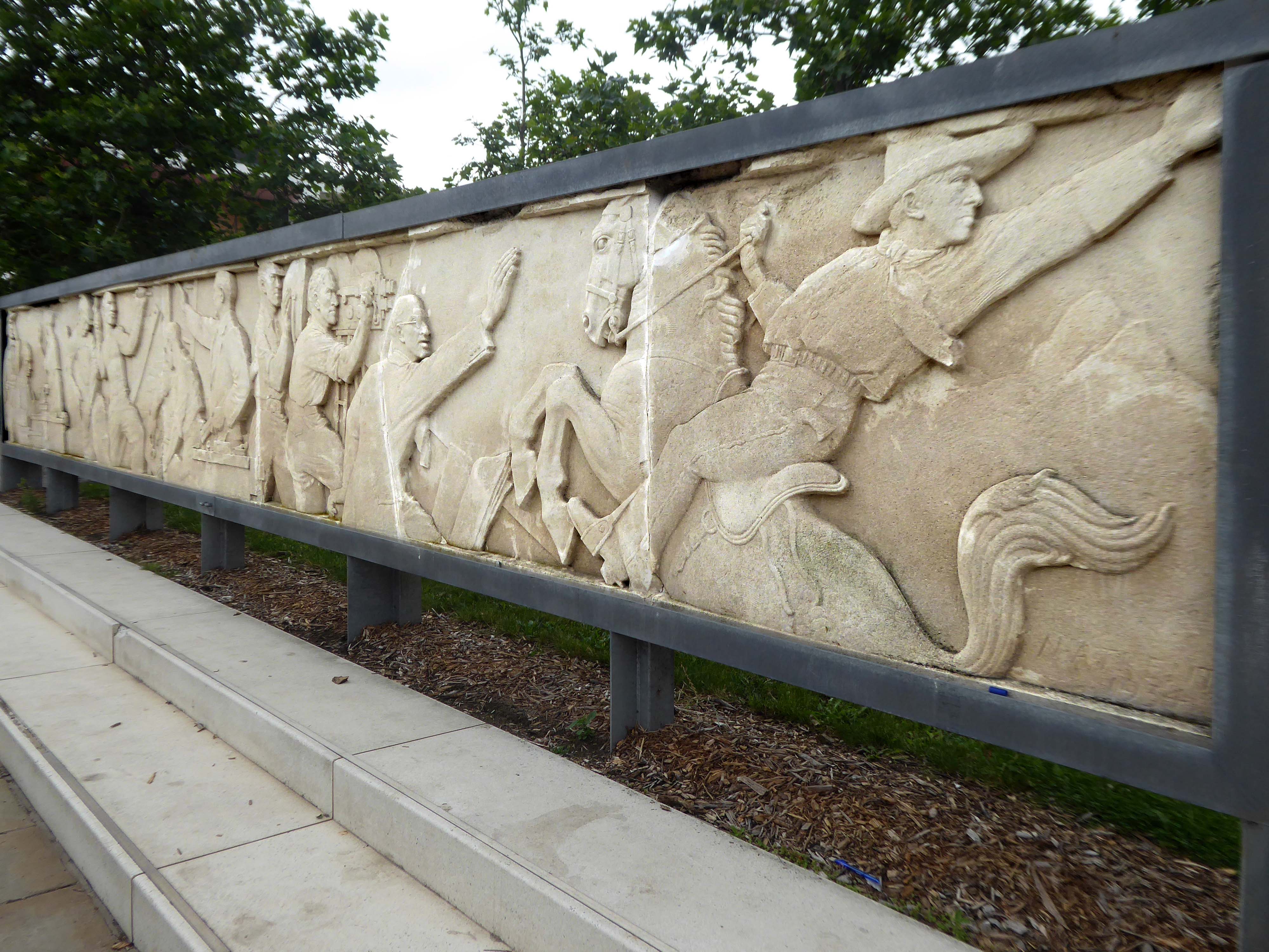
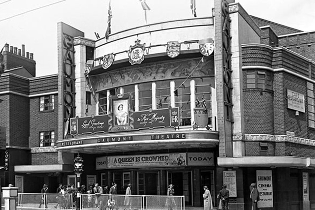
Within the square is a frieze, salvaged from the former Gaumont Cinema, the work of sculptor Newbury Abbot Trent.
The Gaumont Palace Theatre in Hall Gate at the corner of Thorne Road, Doncaster opened on 3rd September 1934 with Jesse Matthews in Evergreen.
It was designed by architects WE Trent and W Sydney Trent.
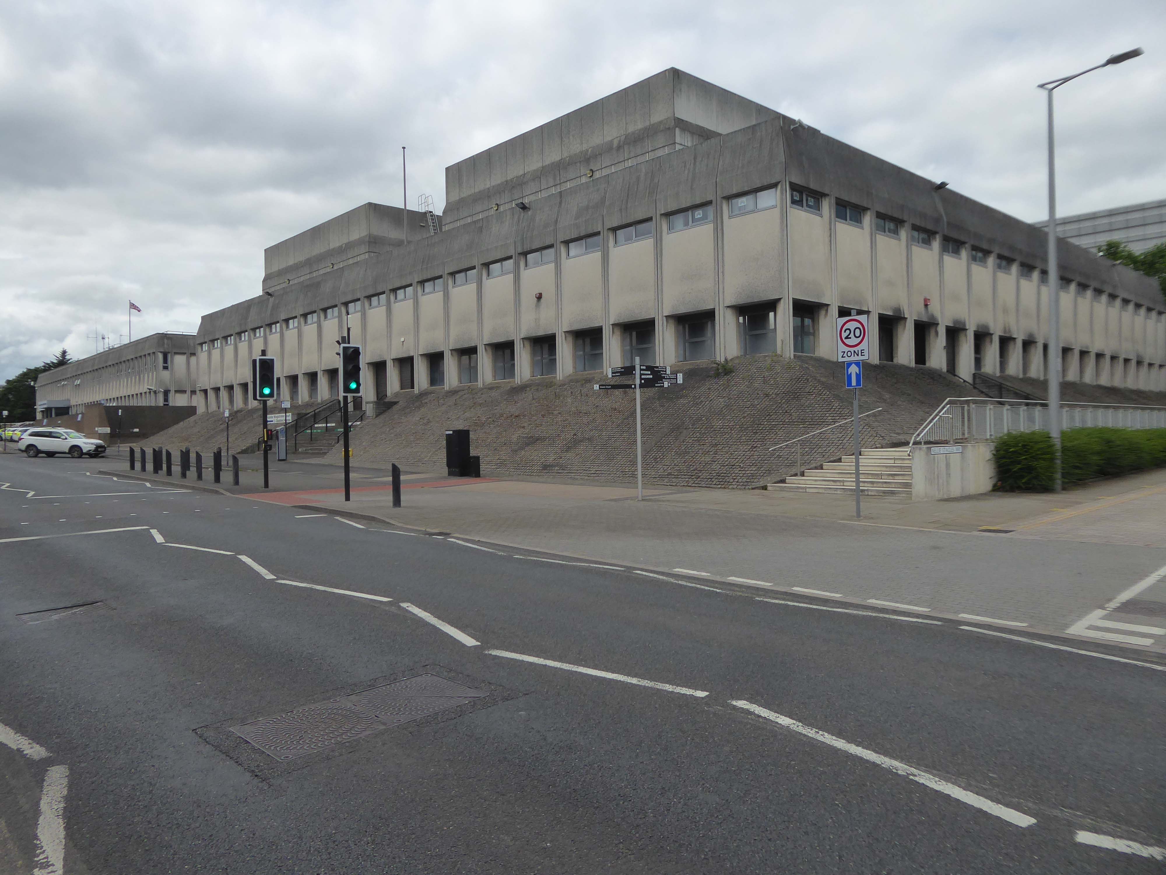
In 1949 WH Price the Borough Surveyor produced an outline plan for the area, with a green space at its heart, it was never realised. In 1955 Frederick Gibberd produced his plan to include a ten storey Town Hall, Art School, Technical College and Civic Theatre, revised and reduced in 1963 – eventually his Police Station and Law Courts were completed in 1969.
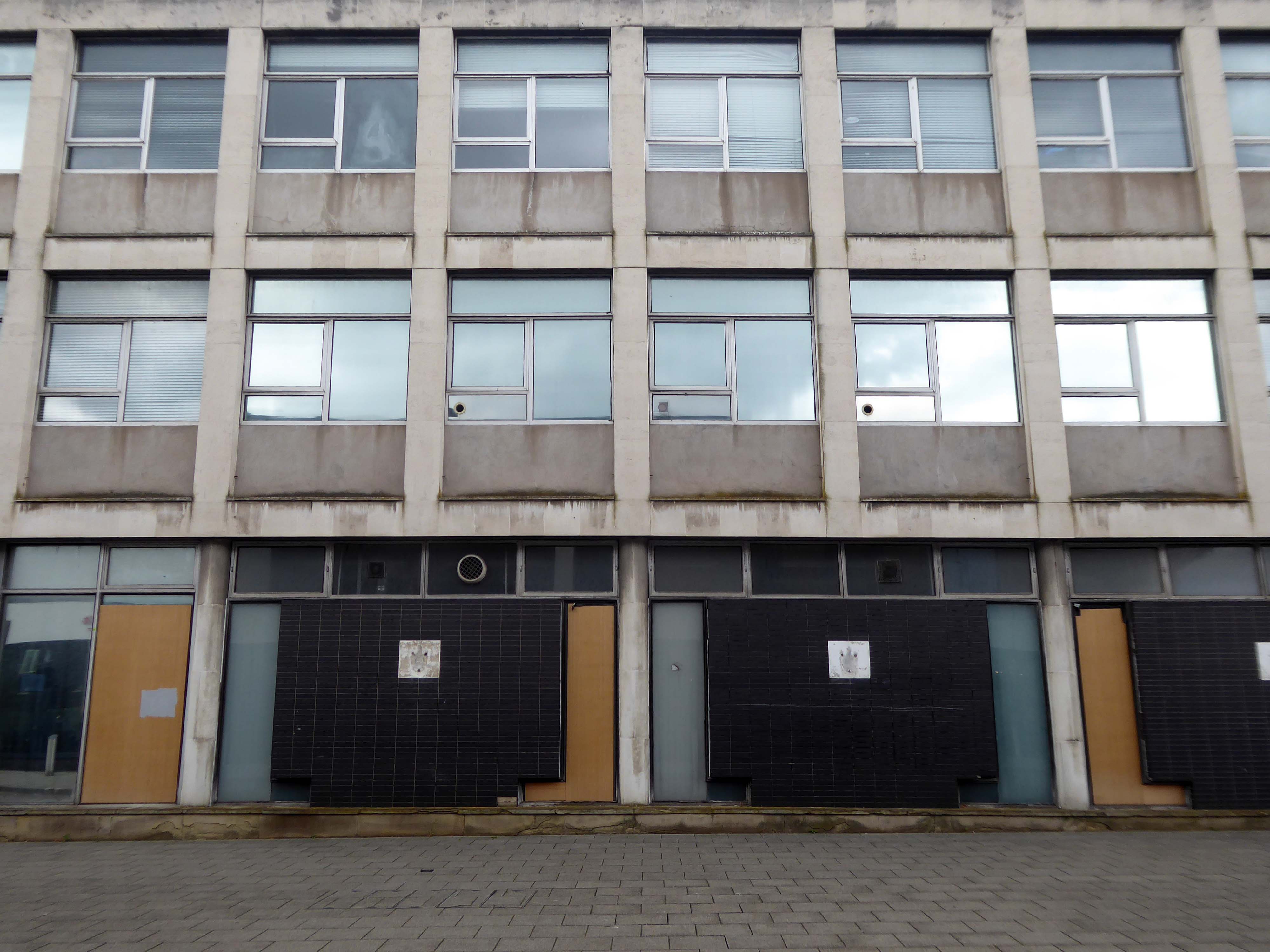
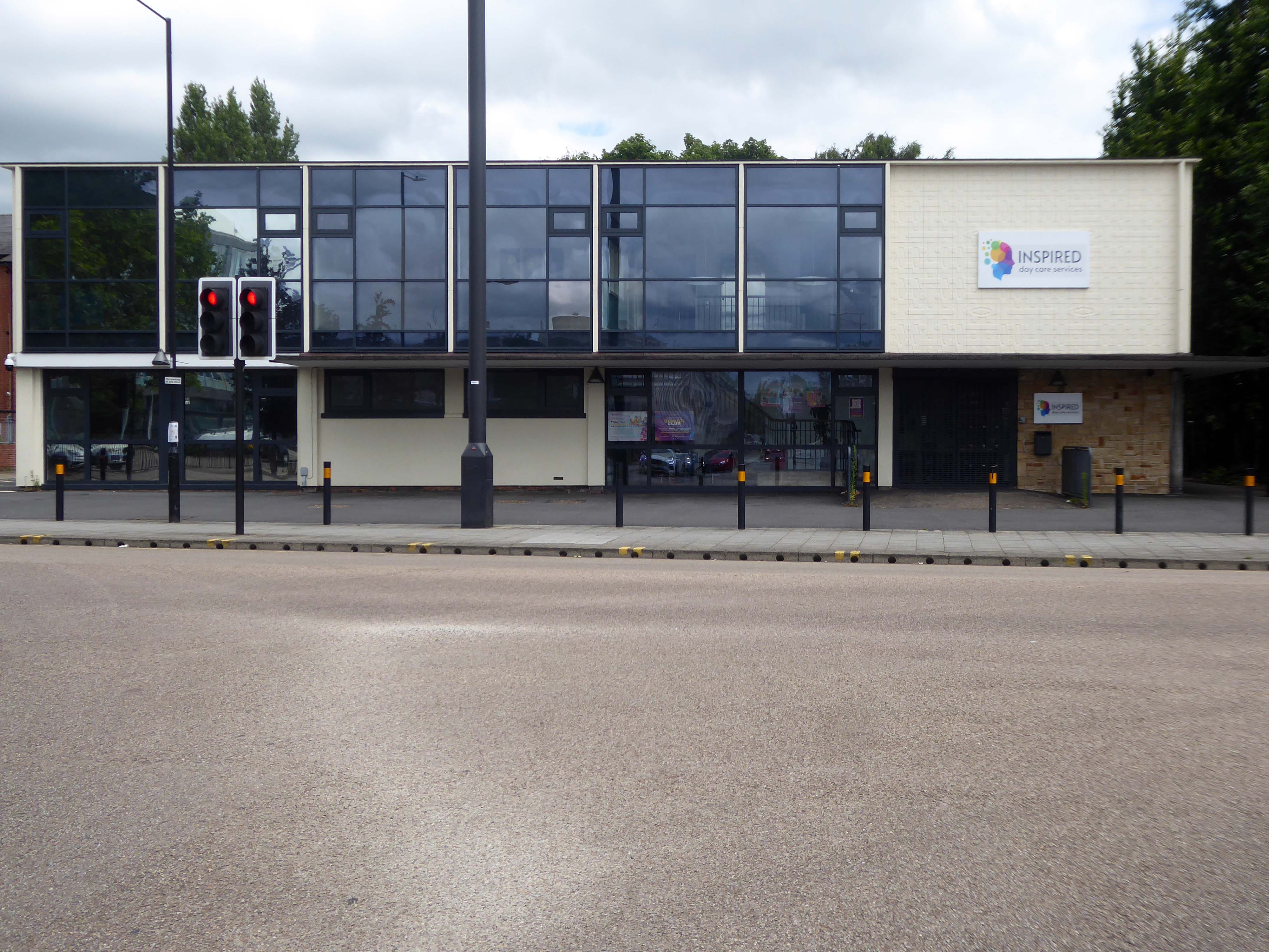
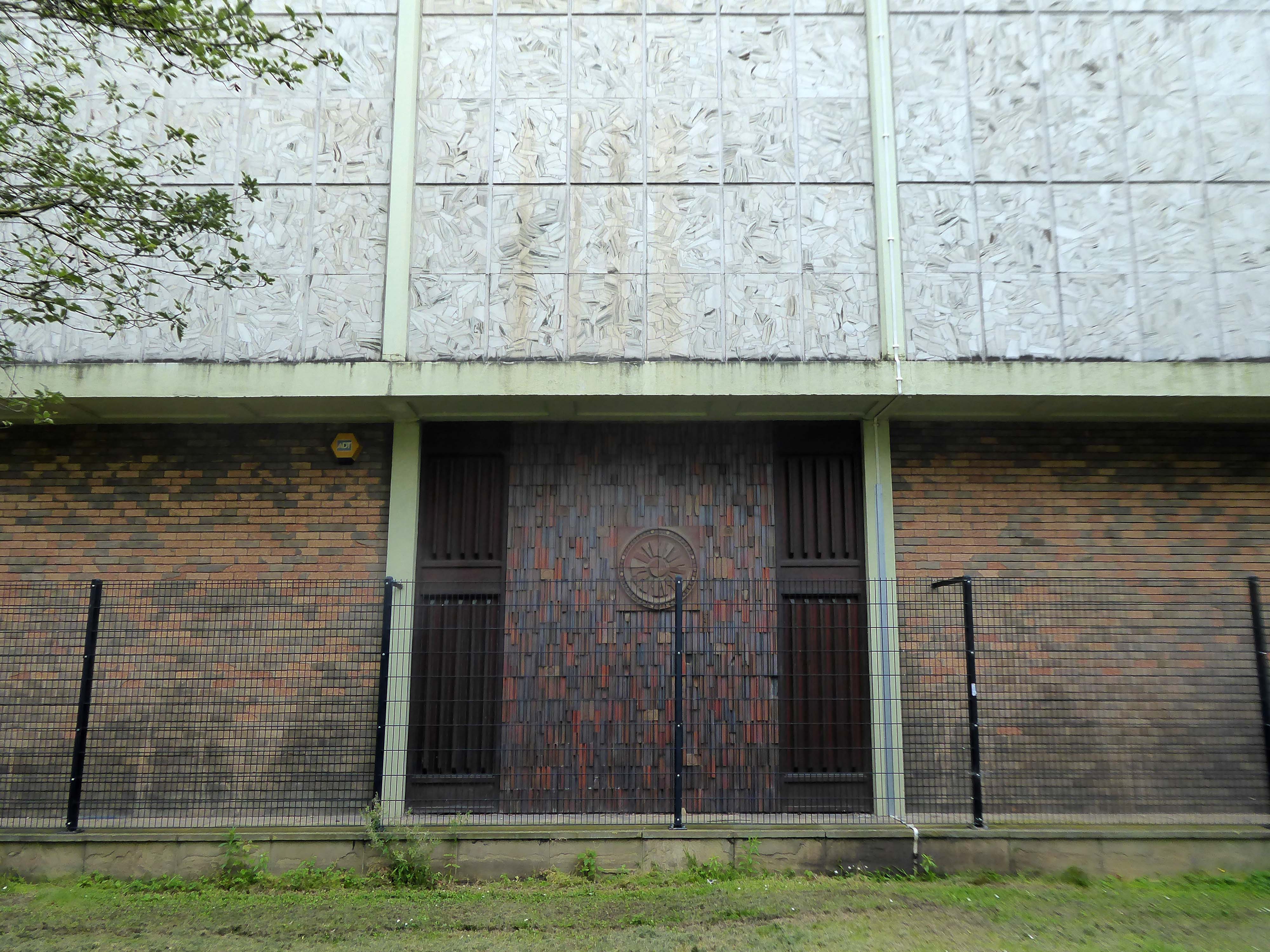
The former NHS Clinic at the ‘T Junction’ is transformed into a day care service.
The building was designed in the office of the Doncaster Borough Architect’s Department in a team led by borough architect Mr LJ Tucker.
The ceramic designs were a later addition when it was discovered that the large open areas of glass overheated almost everything inside, the work was undertaken by LJ Tucker and family.
The sculptural work by Franta Belsky, now has a skip for company.
As a footnote the work by Fabio Barraclough reveals a murky past.
Barraclough was born in Madrid in 1923, to a Spanish mother and Yorkshire father who founded Madrid’s Chamber of Commerce. He moved to London with his family in the 1930s as a refugee from Francoist Spain. He taught fine art and sculpture at Rugby School, where colleagues considered him “highly entertaining, a most unorthodox and highly gifted” teacher. He established himself during the 1960s and early 1970s as an authority on sculpture, publishing in academic journals and becoming a member of the Royal British Society of Sculptors.
In 2000, it was revealed that Barraclough, while outwardly living the life of anti-apartheid activist since the 1970s, had been a paid informant of the South African state security police. The media was used to promote his image as a “brilliant, liberal artist with apparently impeccable credentials” in order to gain public trust, while he was funnelling money from anti-apartheid groups to the police. He died on 6th January 2019.
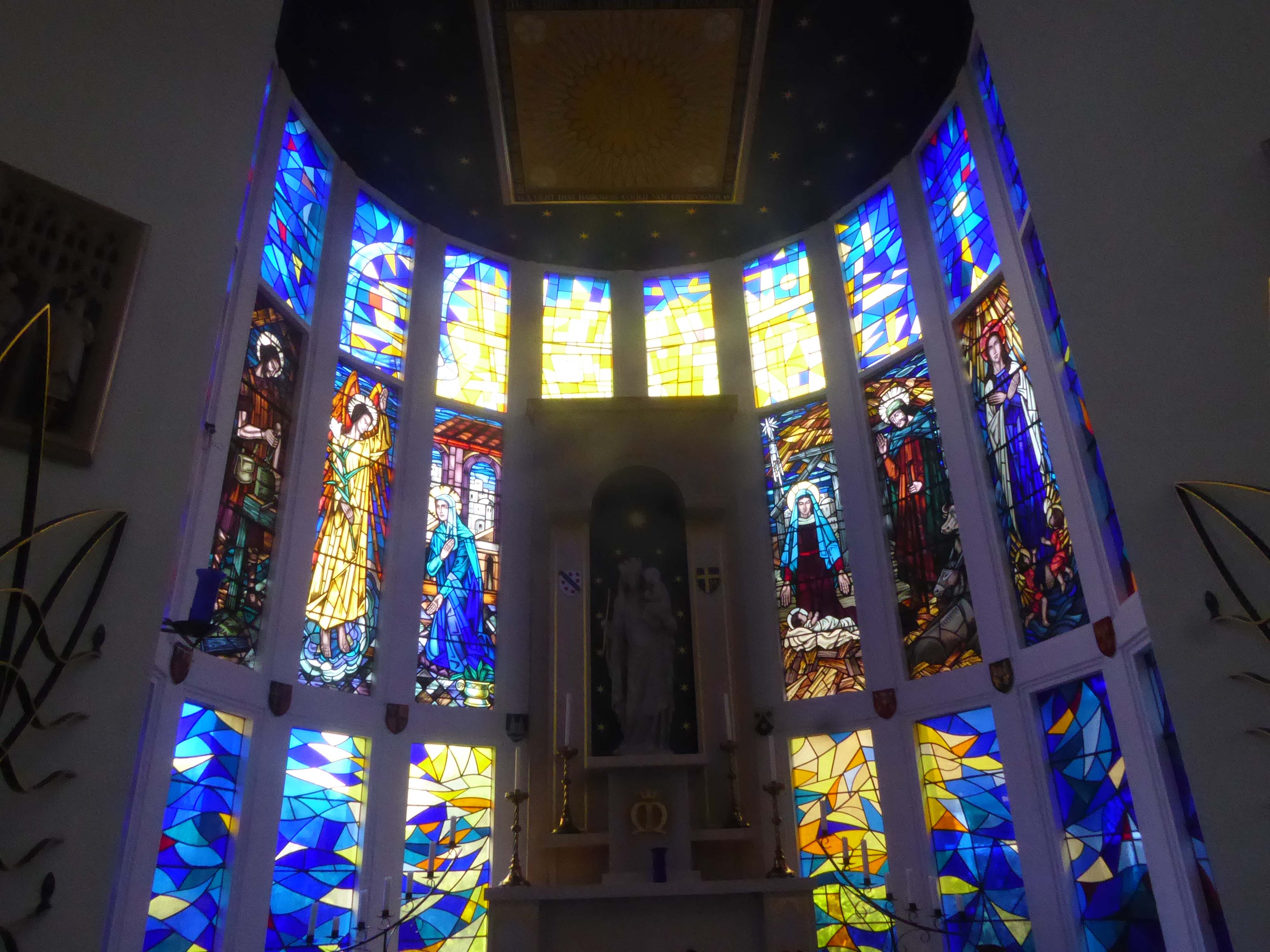
Over the way faros the green sward is St Peter in Chains RC – A large and striking design by JH Langtry-Langton, incorporating important furnishings by J F Bentley from the predecessor church, along with good furnishings of the 1970s. The churches houses the modern successor to the medieval shrine of Our Lady of Doncaster.
Figurative stained glass by Patrick Feeny for Hardman in 1973 and abstract glass fitted in 2000 as part of reordering and revival of the shrine.
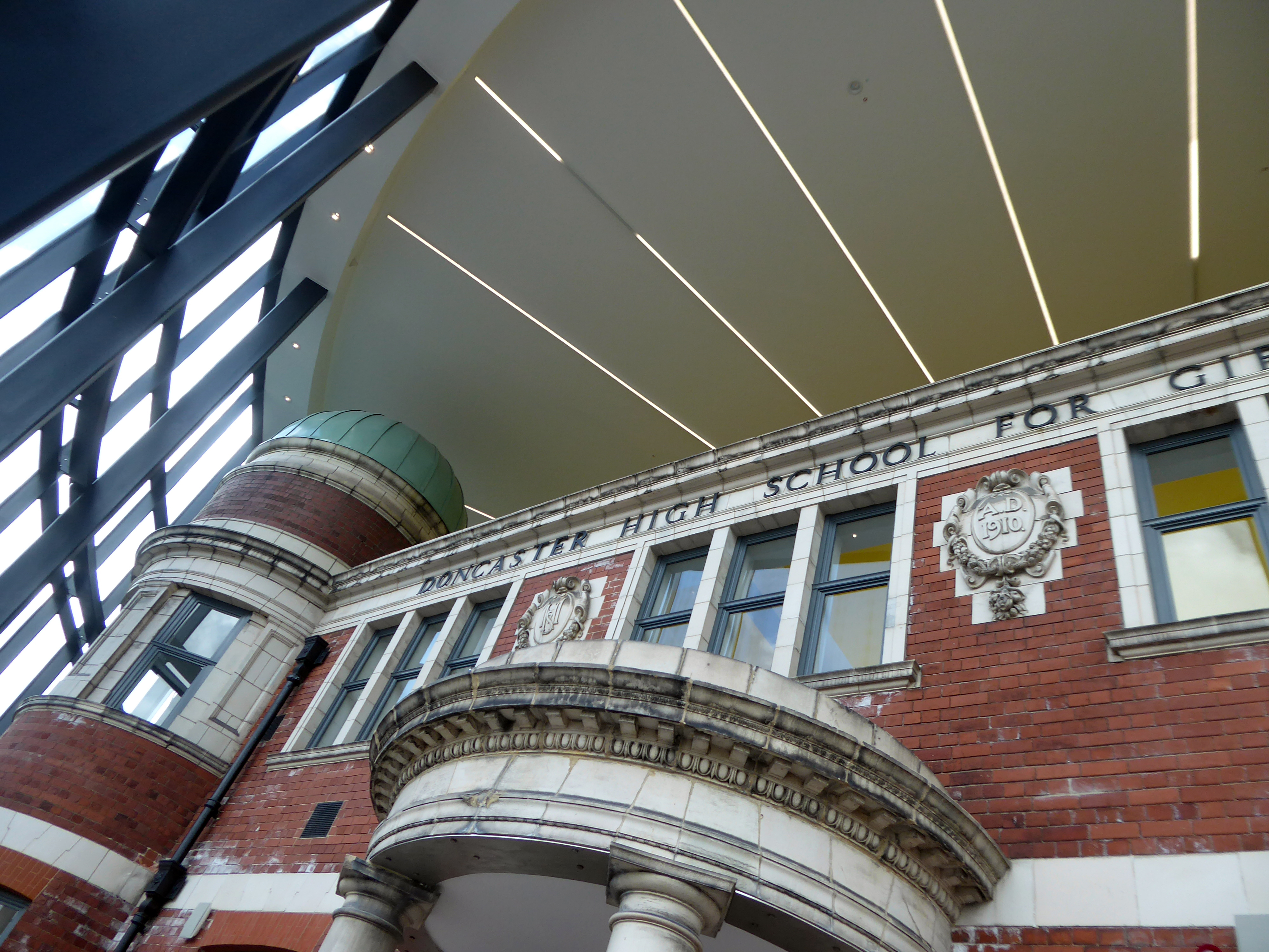
Designed by architects Bond Bryan and built by main contractor Willmott Dixon, the new cultural and learning hub has been created following the restoration of four existing buildings.
A key focal point of the scheme is the restored frontage of the Edwardian former Doncaster High School for Girls, which has been framed by Senior’s slimline SF52 aluminium curtain wall and showcased within a new steel-frame building. The glazed facade, which was fabricated and installed by Senior’s supply chain partner Chemplas, also features Senior’s aluminium commercial doors.
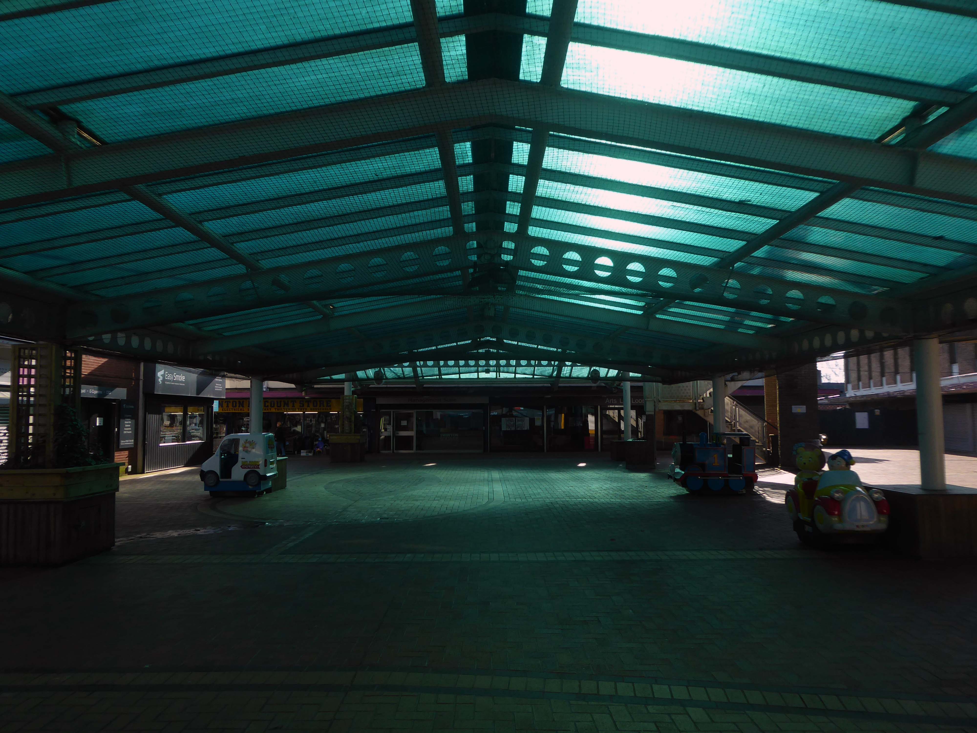
Work began in the interwar years, and continued following the hiatus of 1939-45. The shopping centre named the Civic Centre was open in 1963, the actual Civic Centre containing a swimming pool, theatre, public hall and library in 1971.
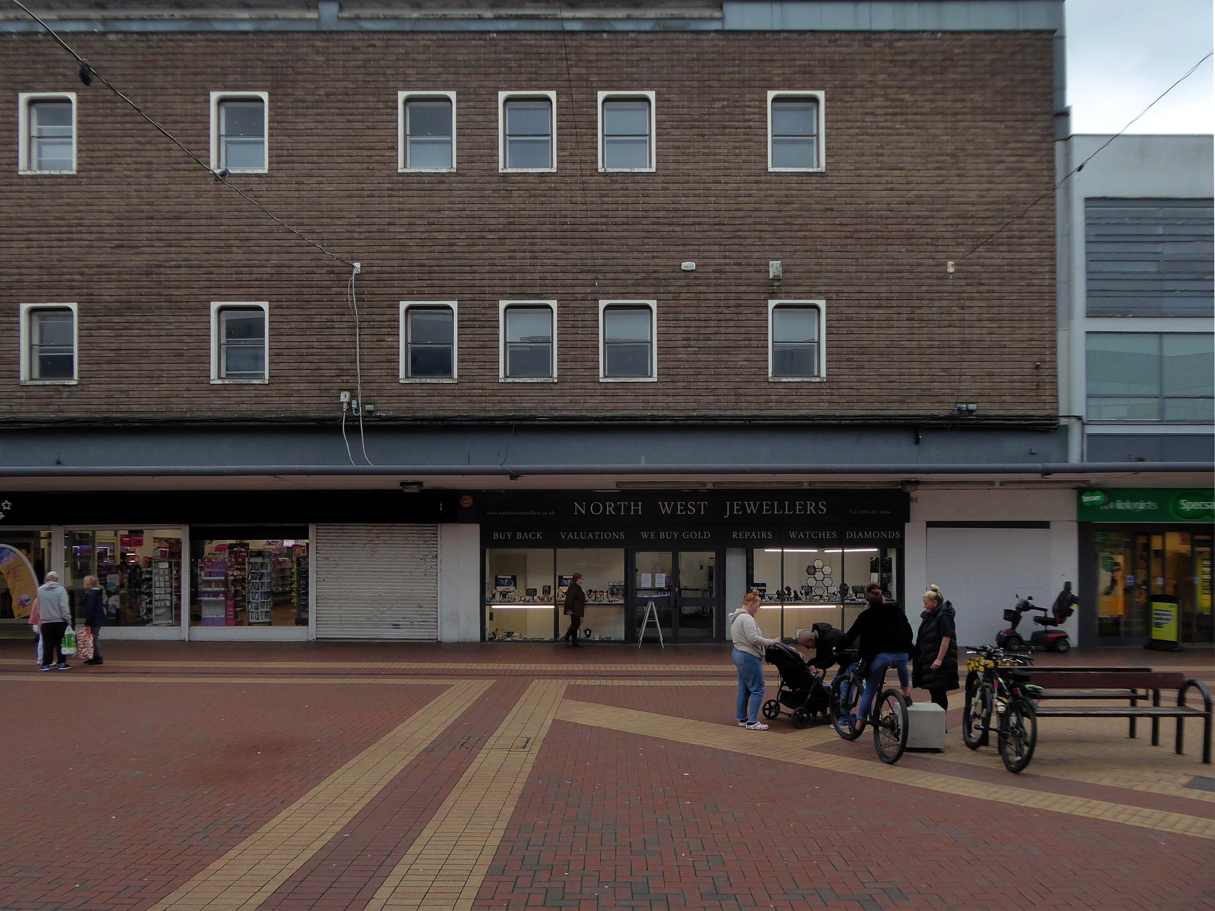
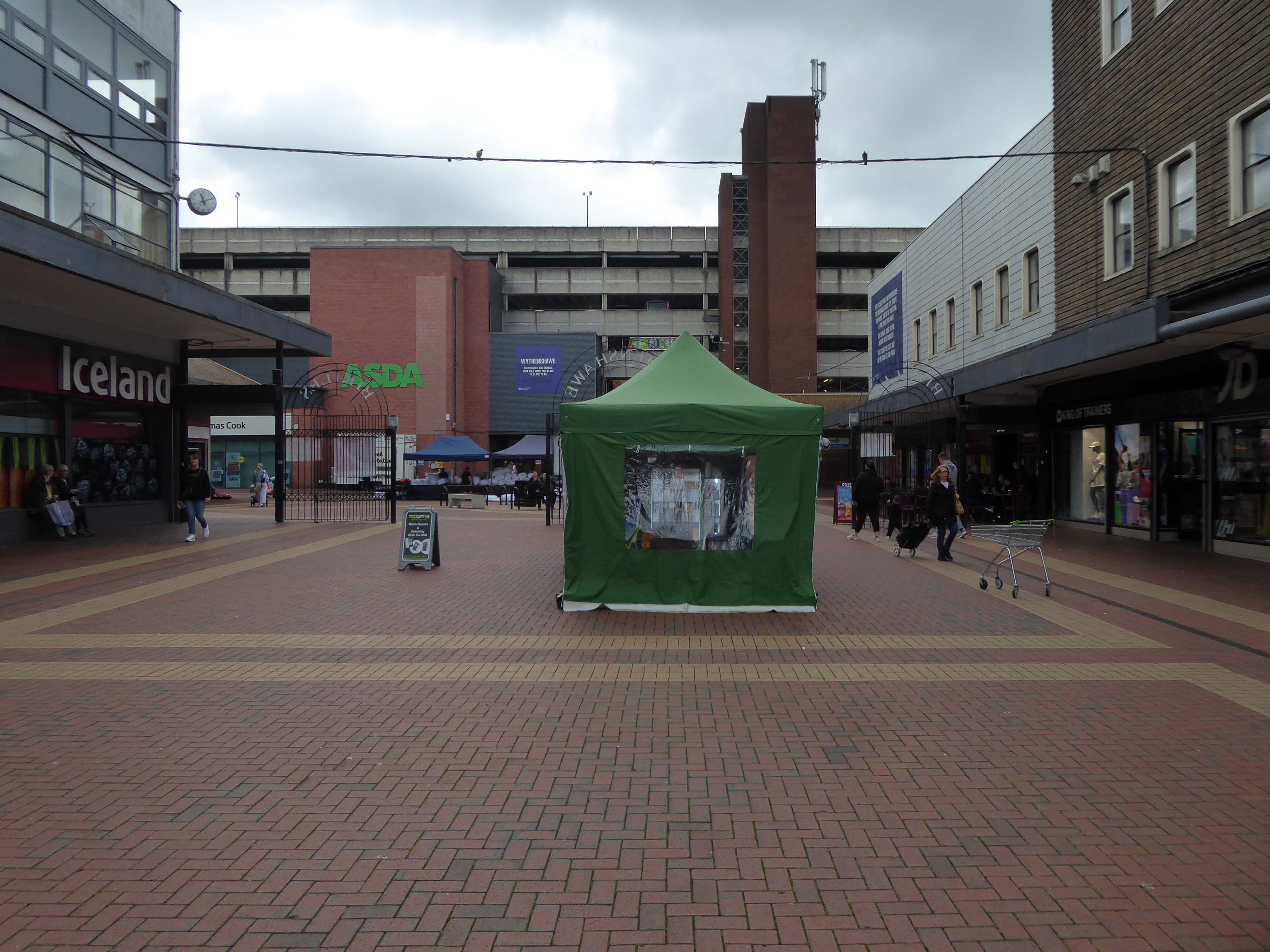
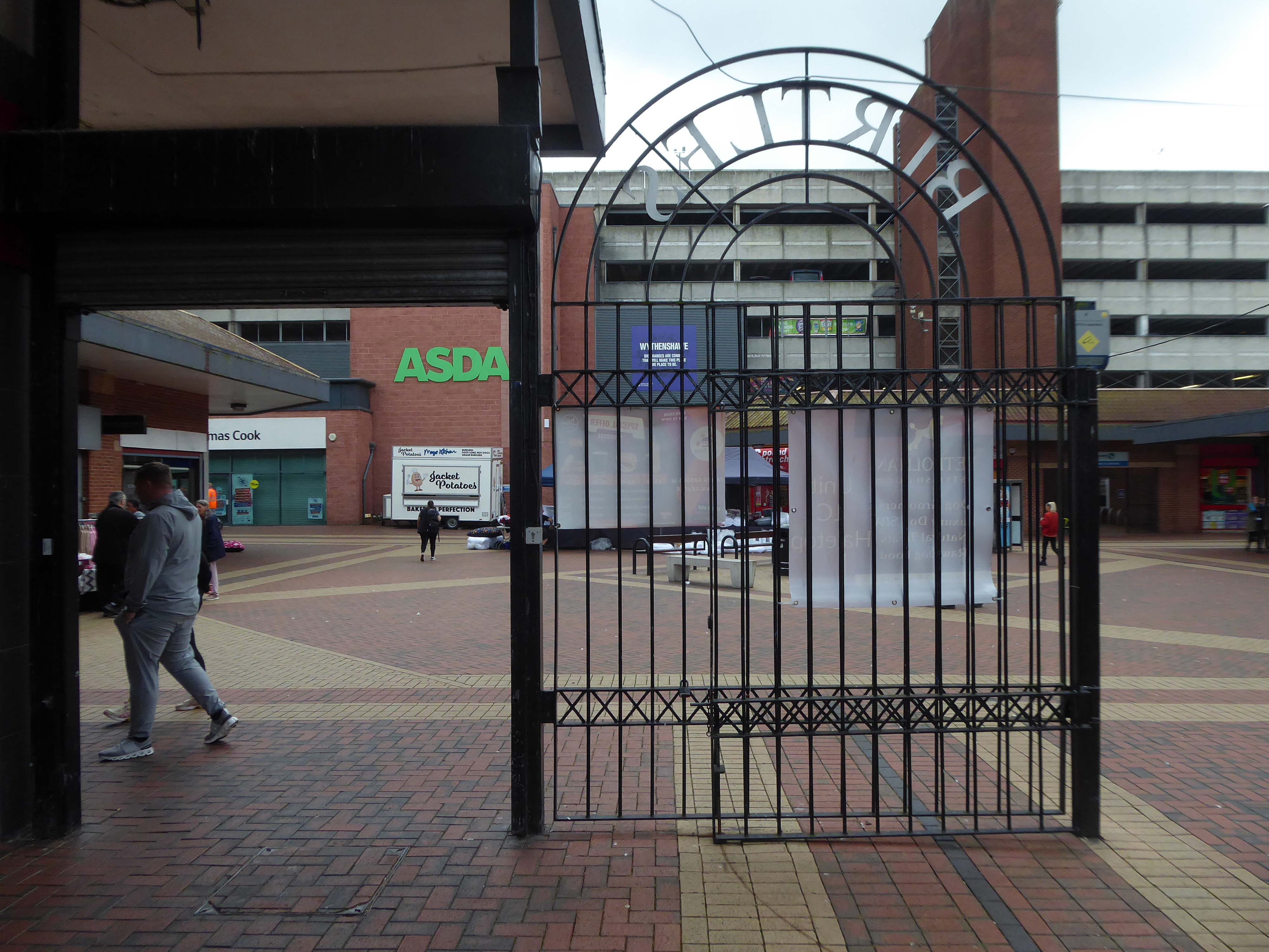
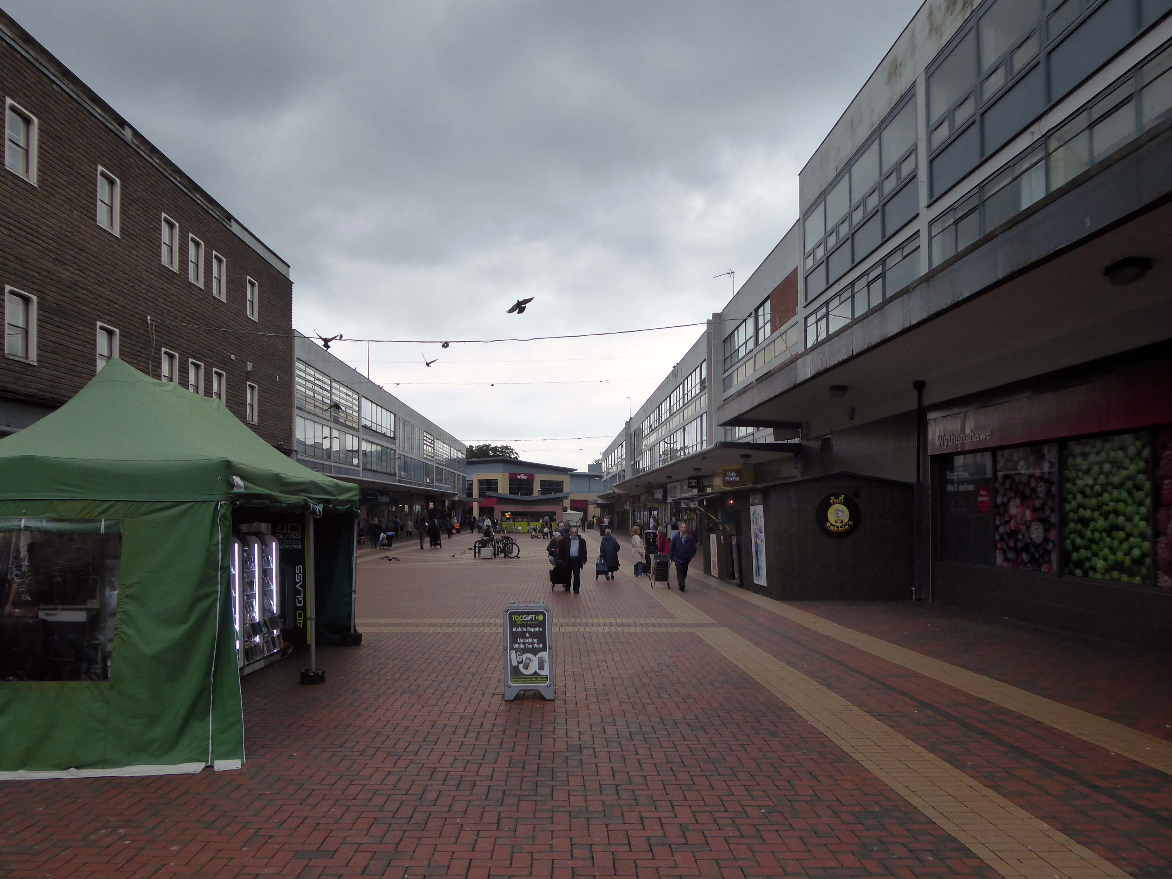
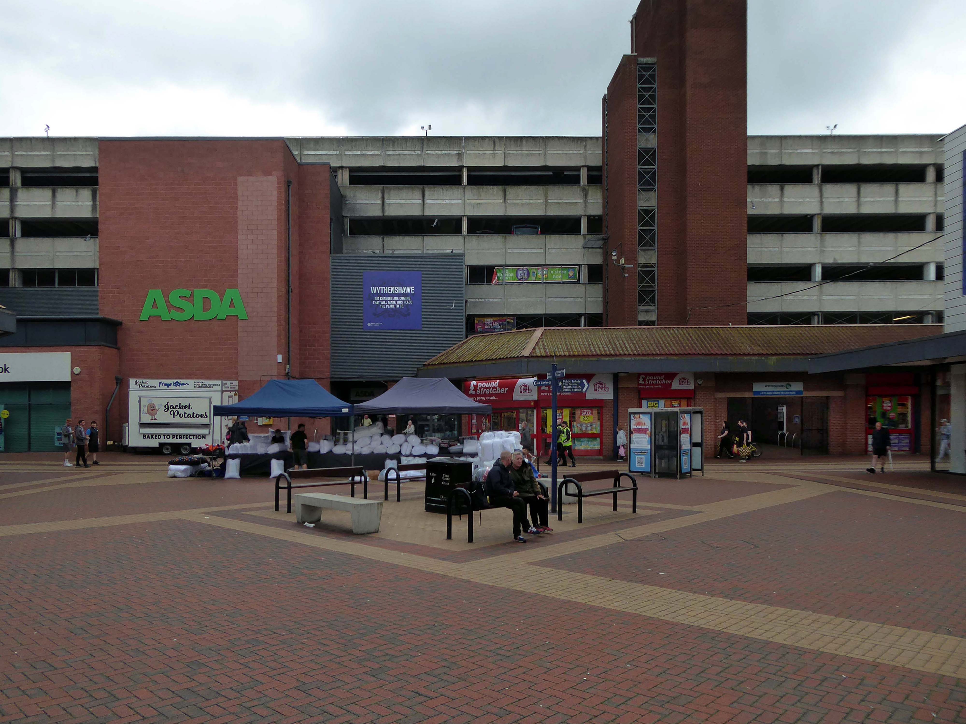
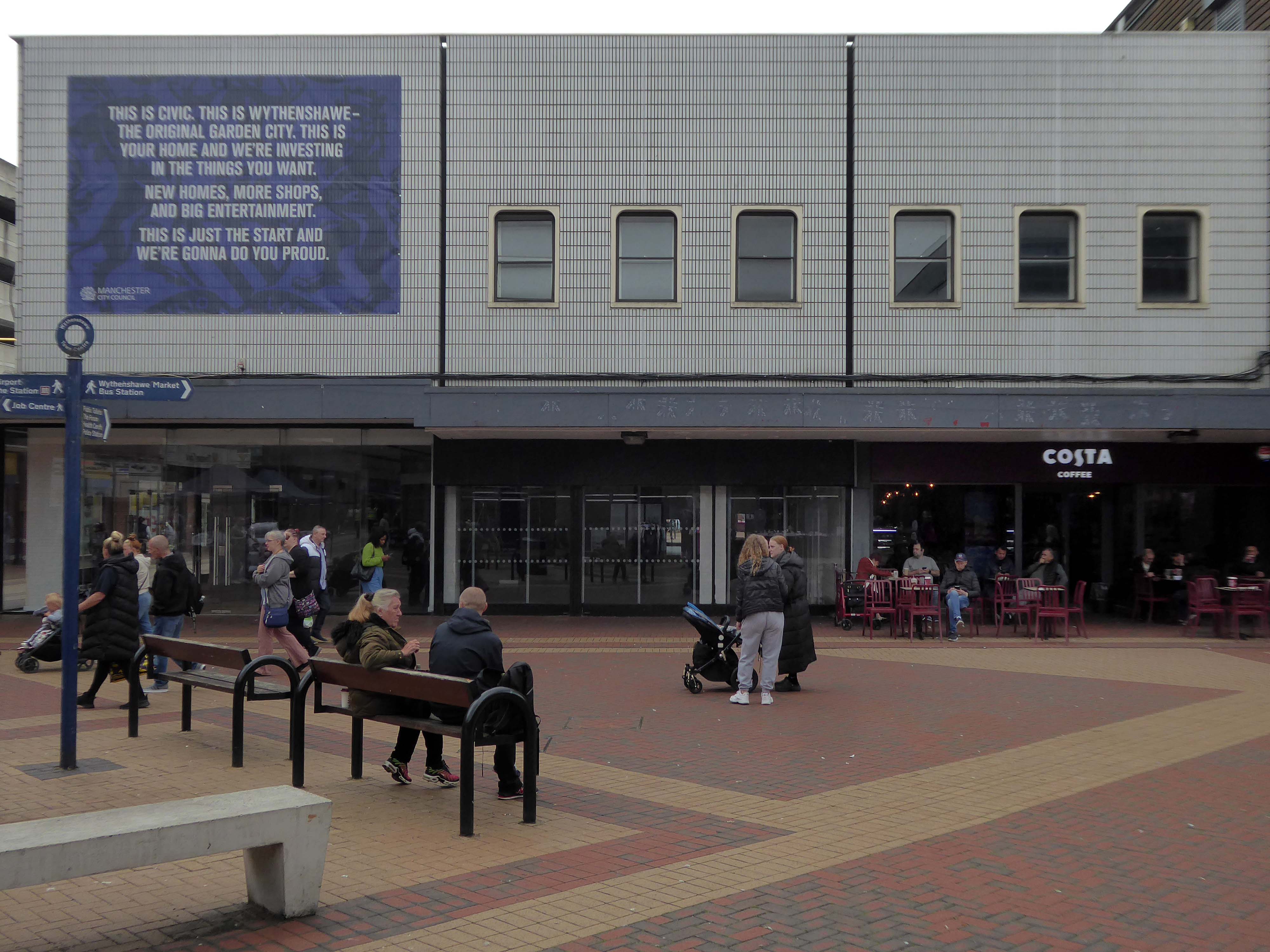
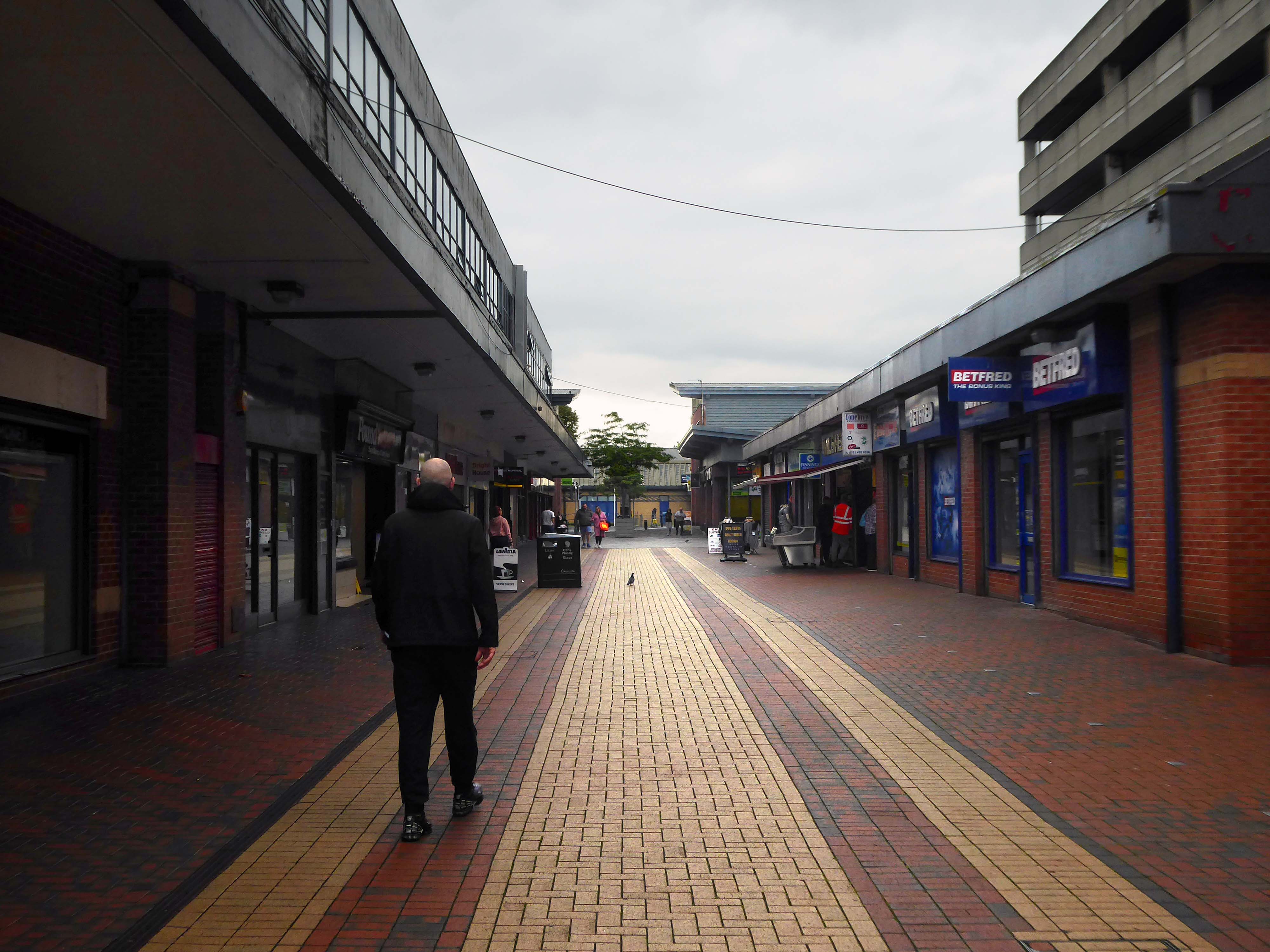
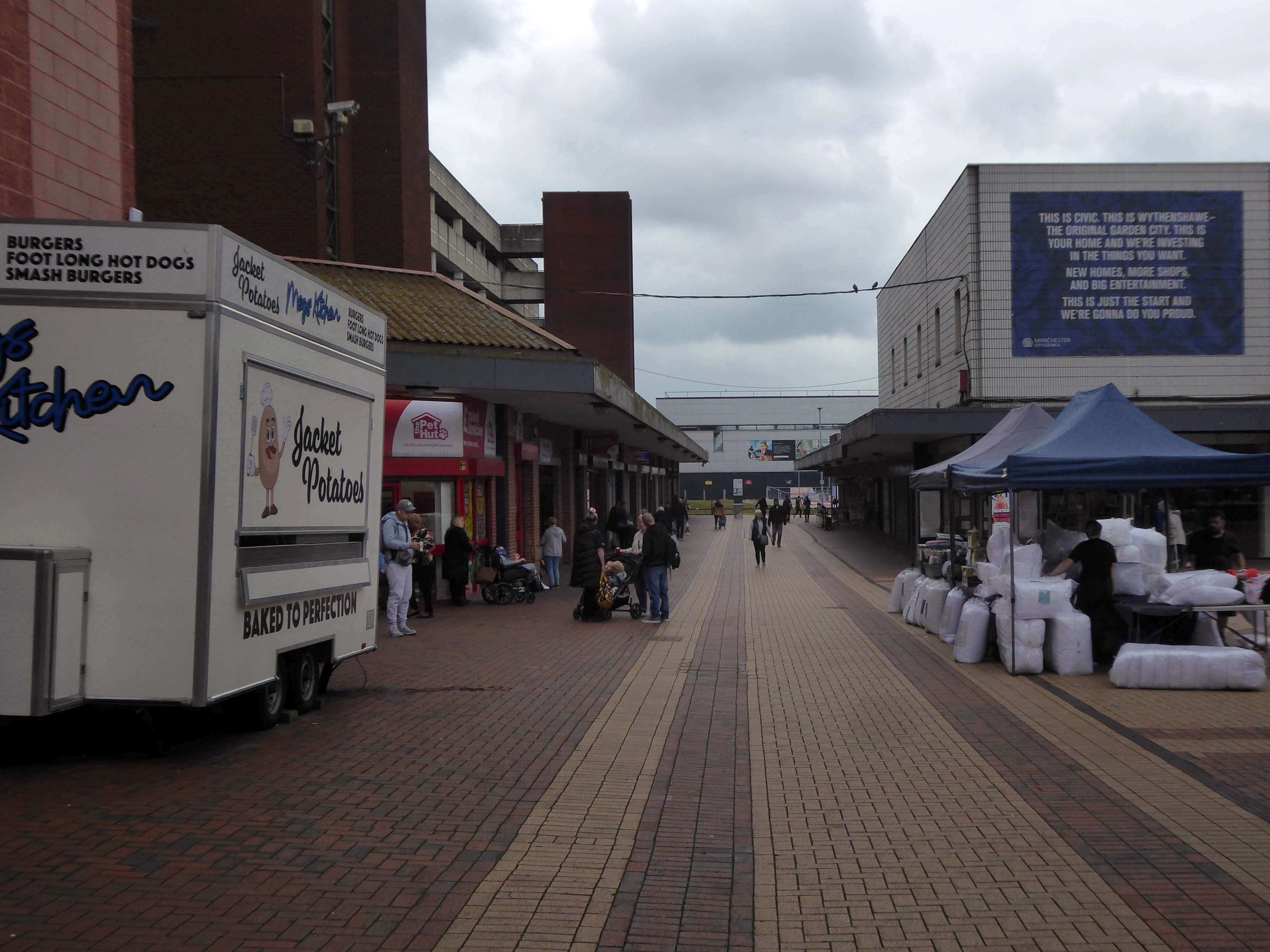
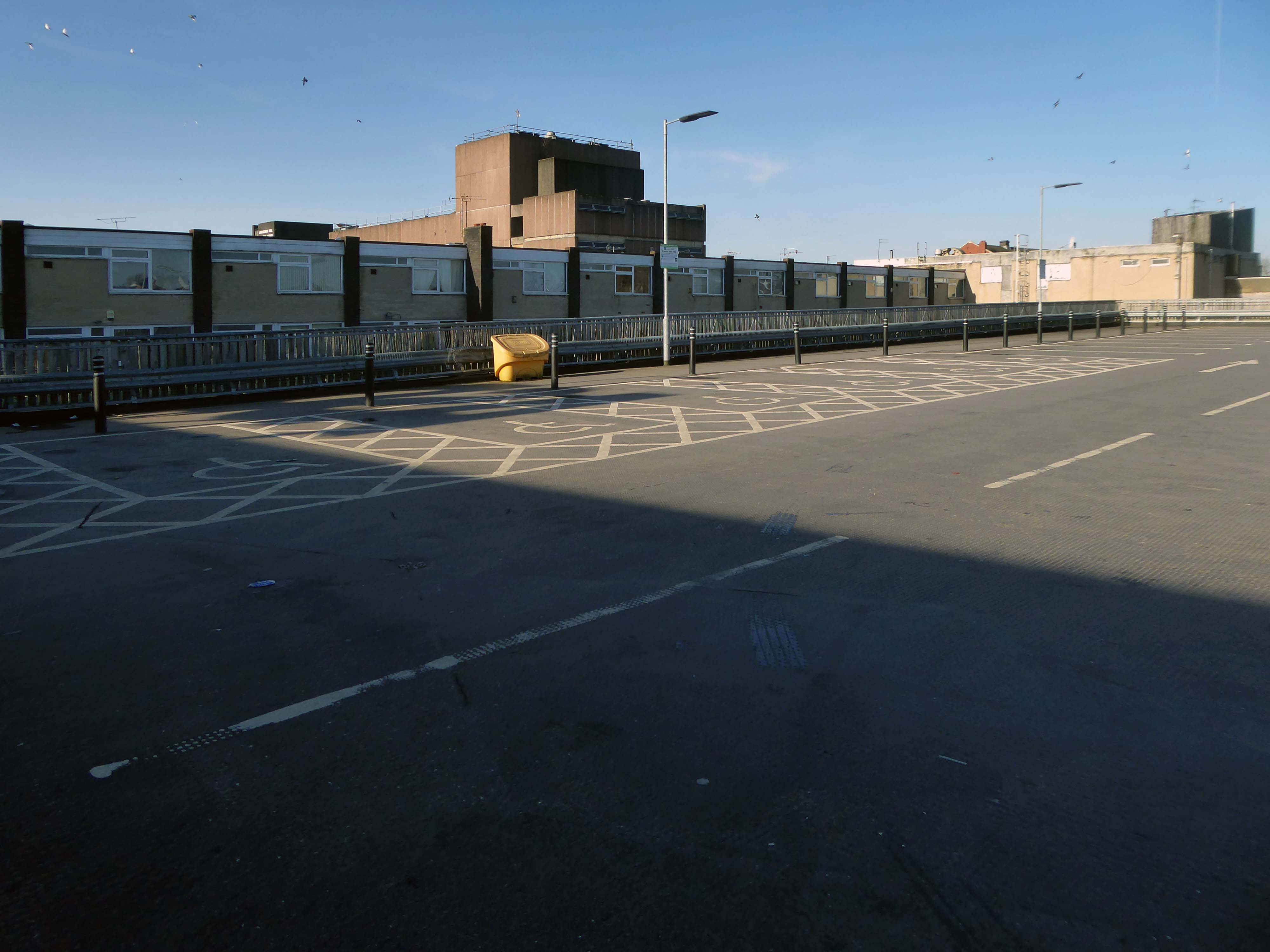
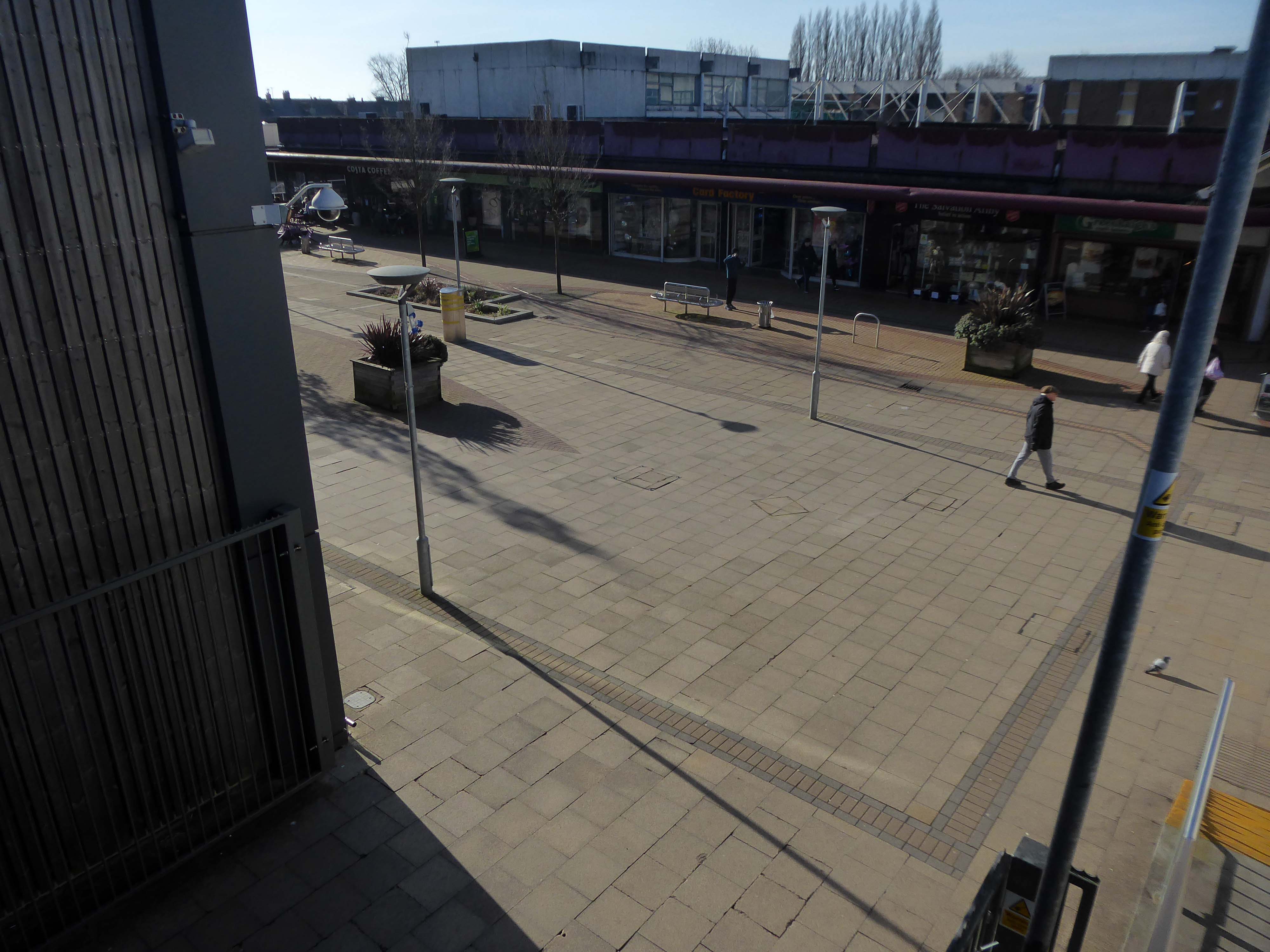
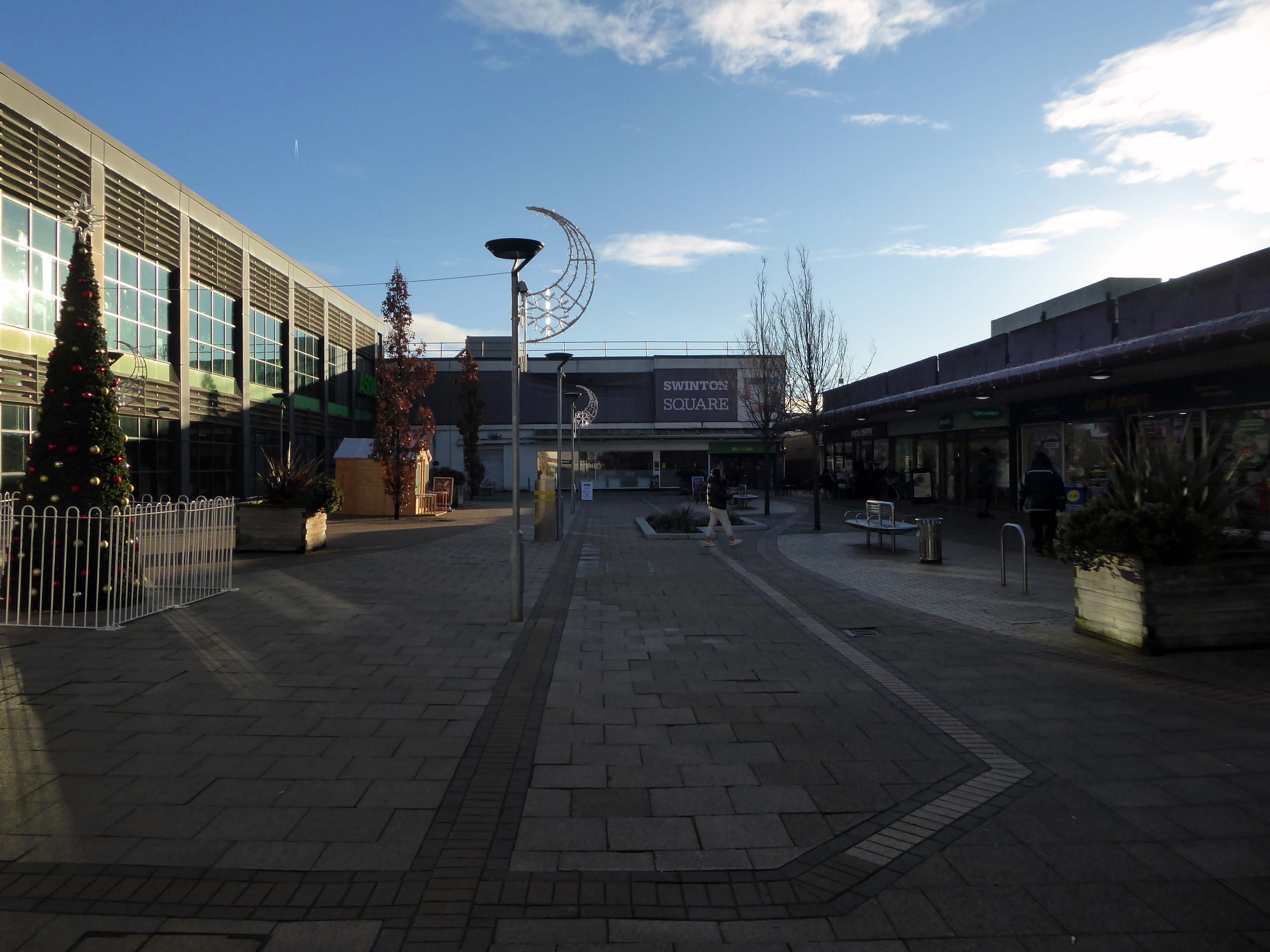
Here I am again four years later, taking a look at how it looks today.
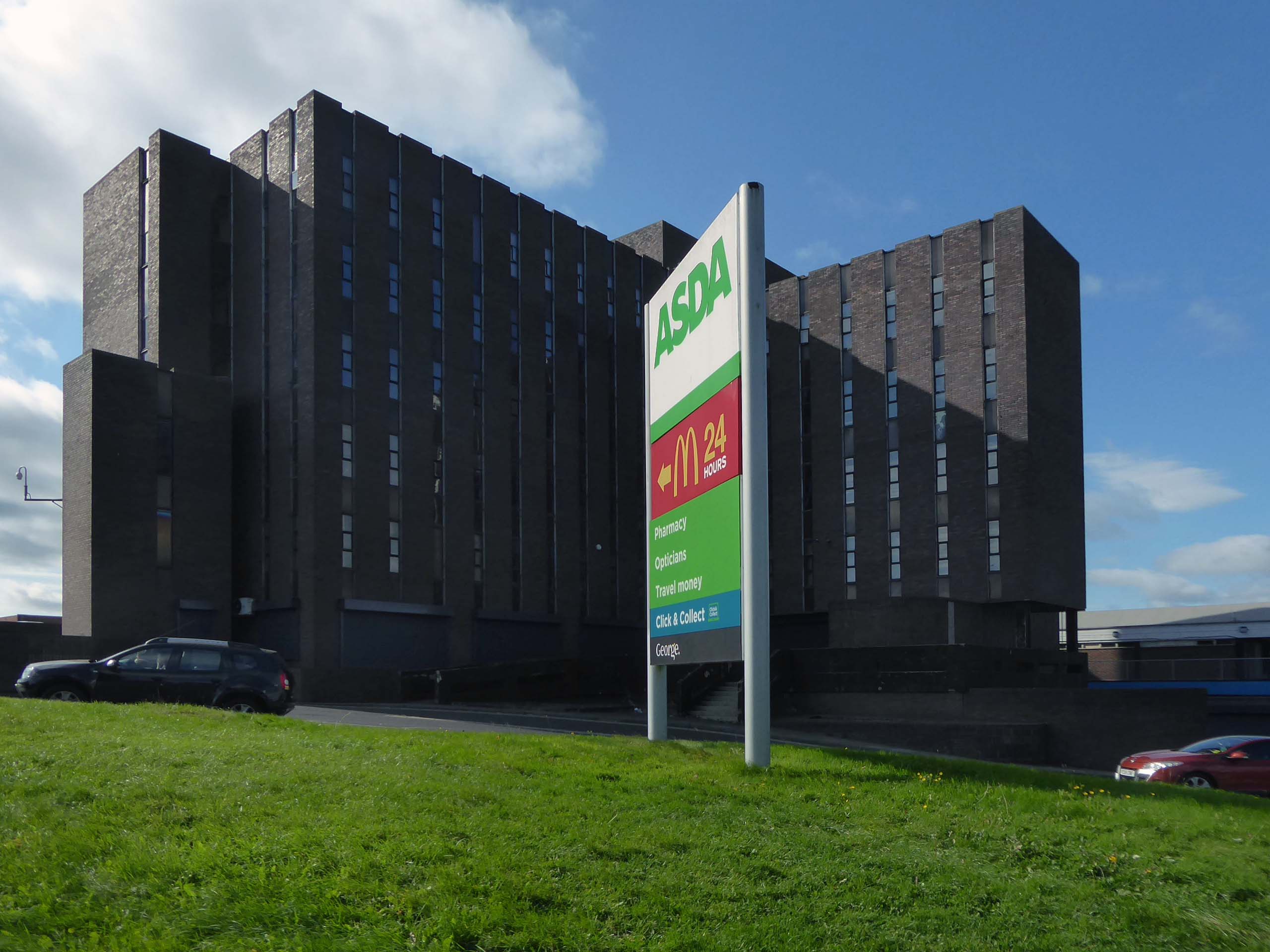
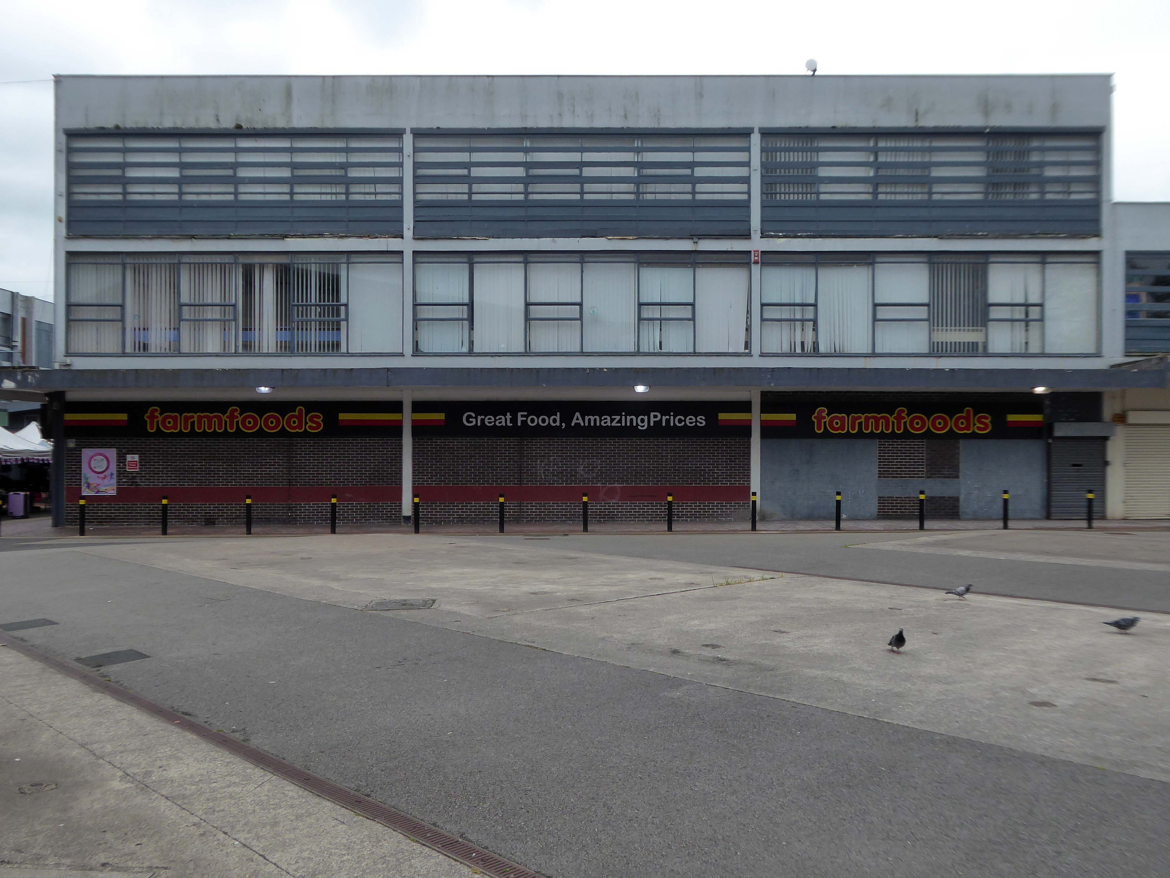
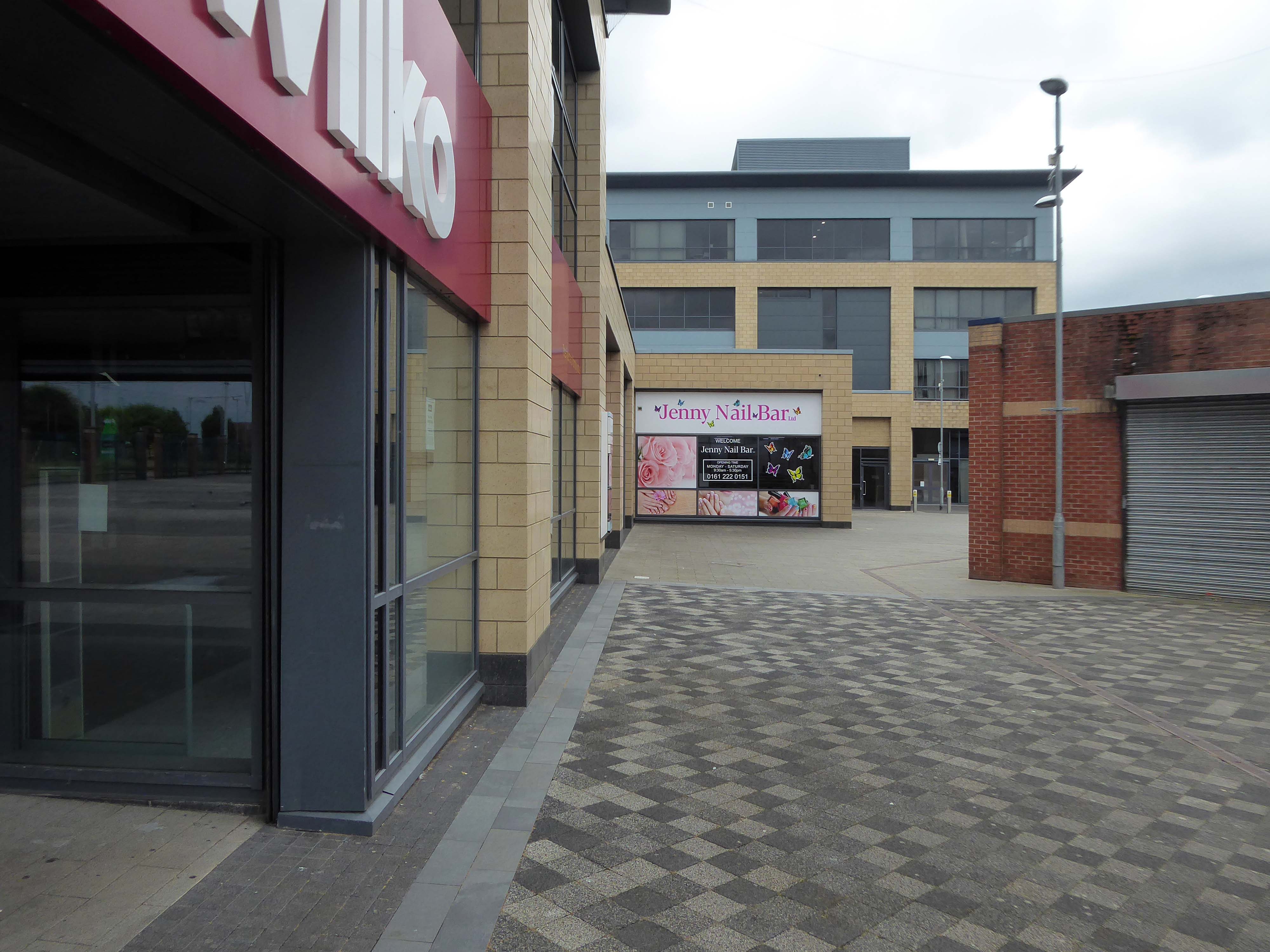
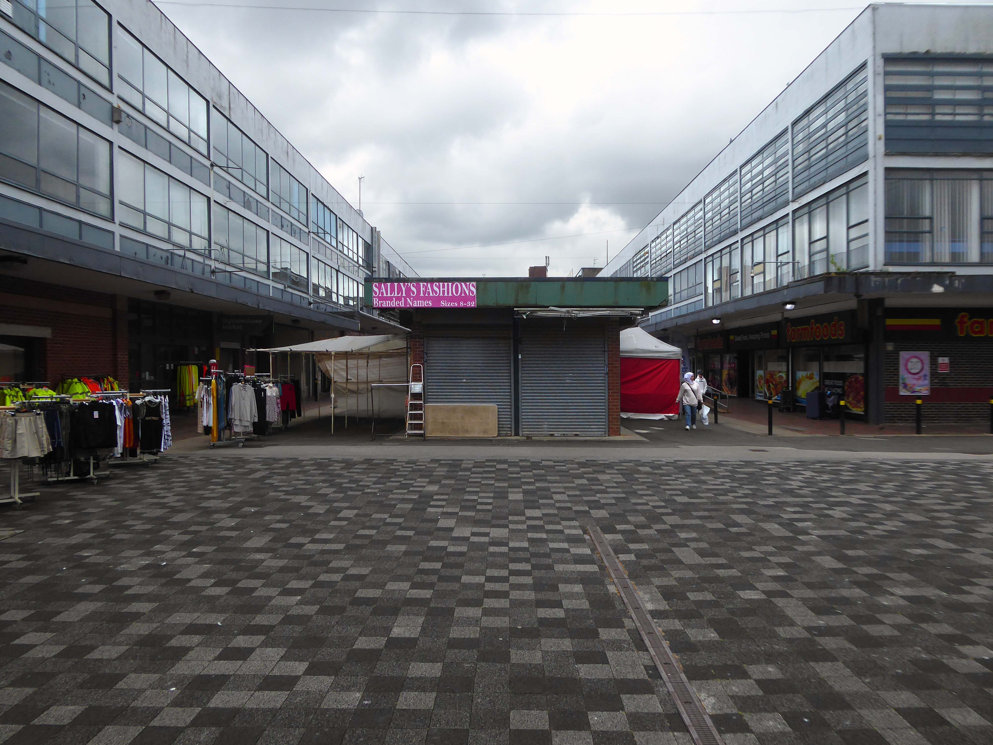
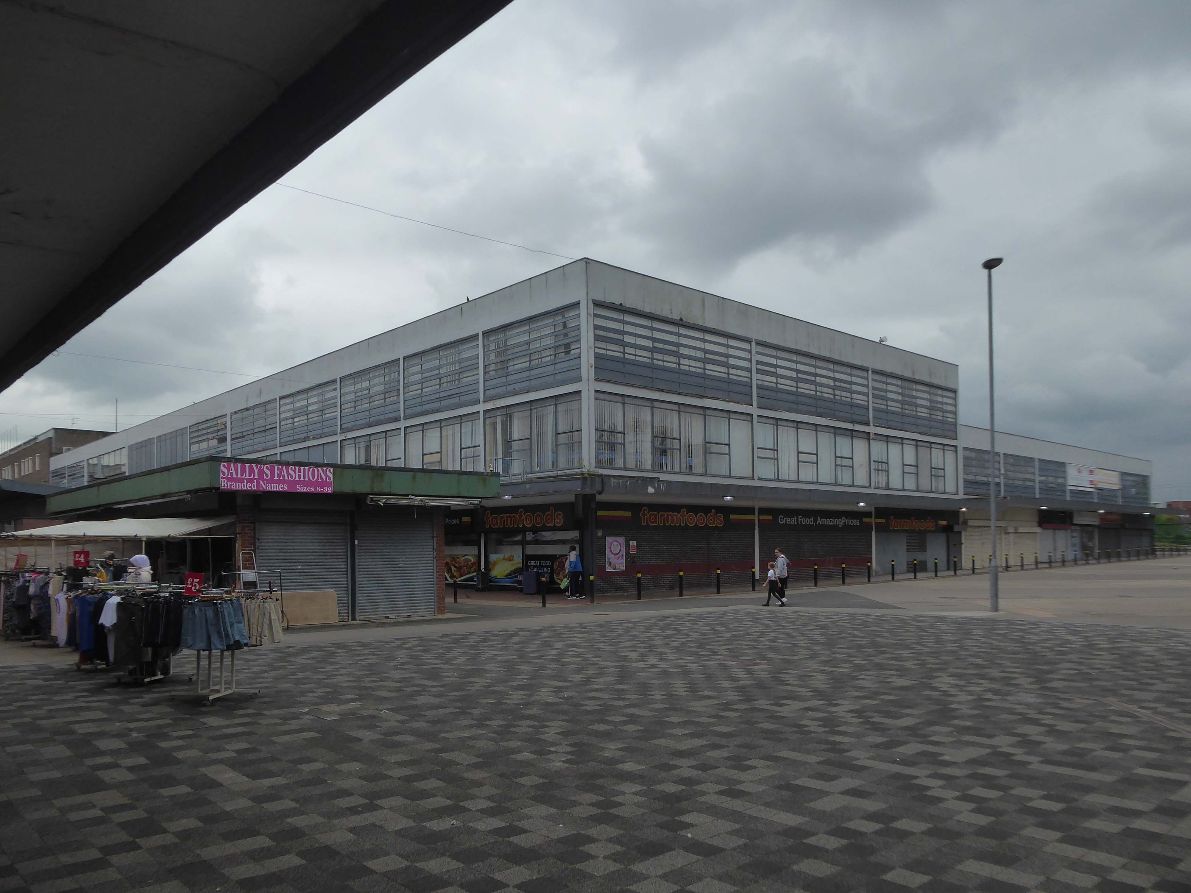
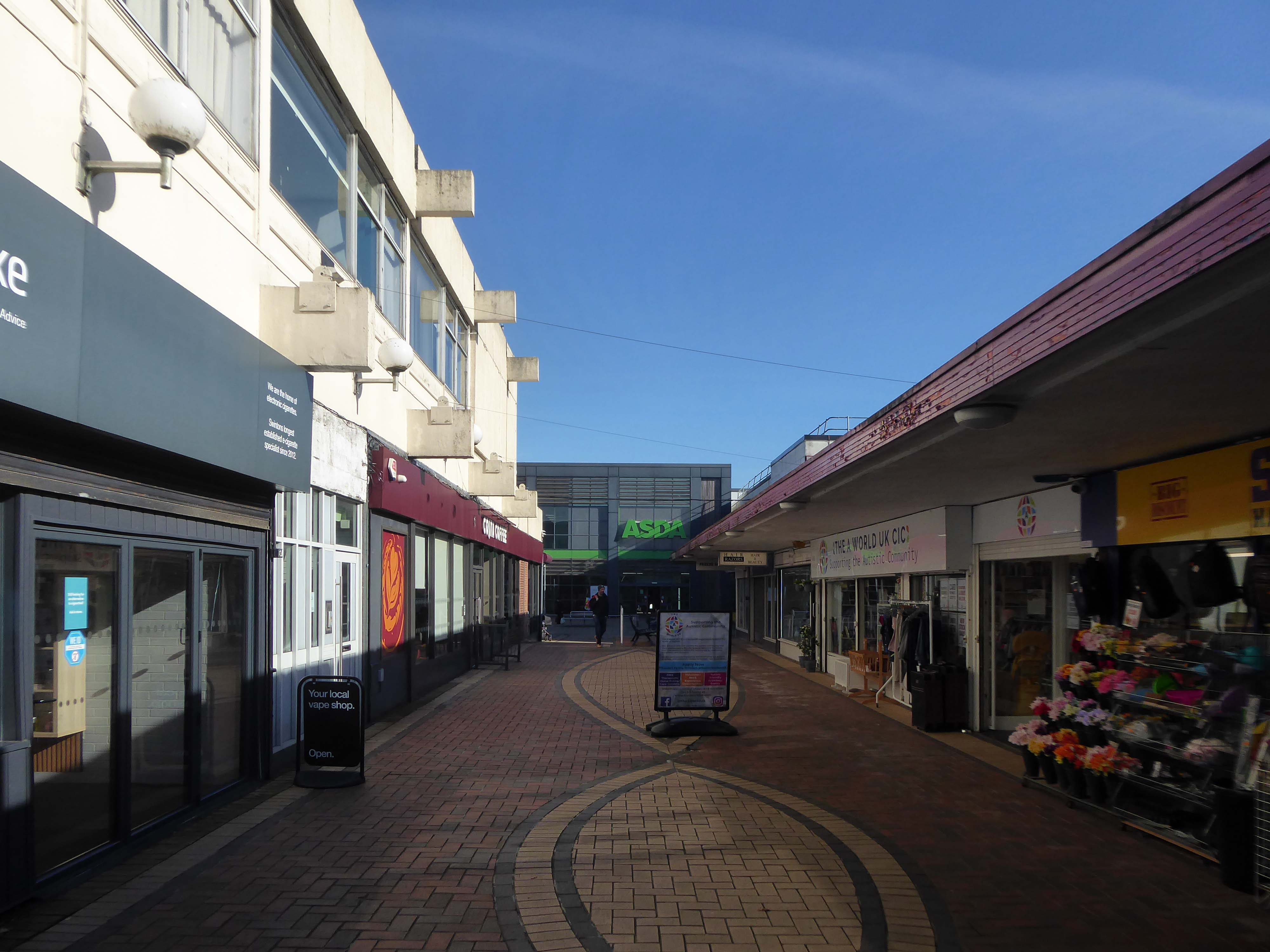
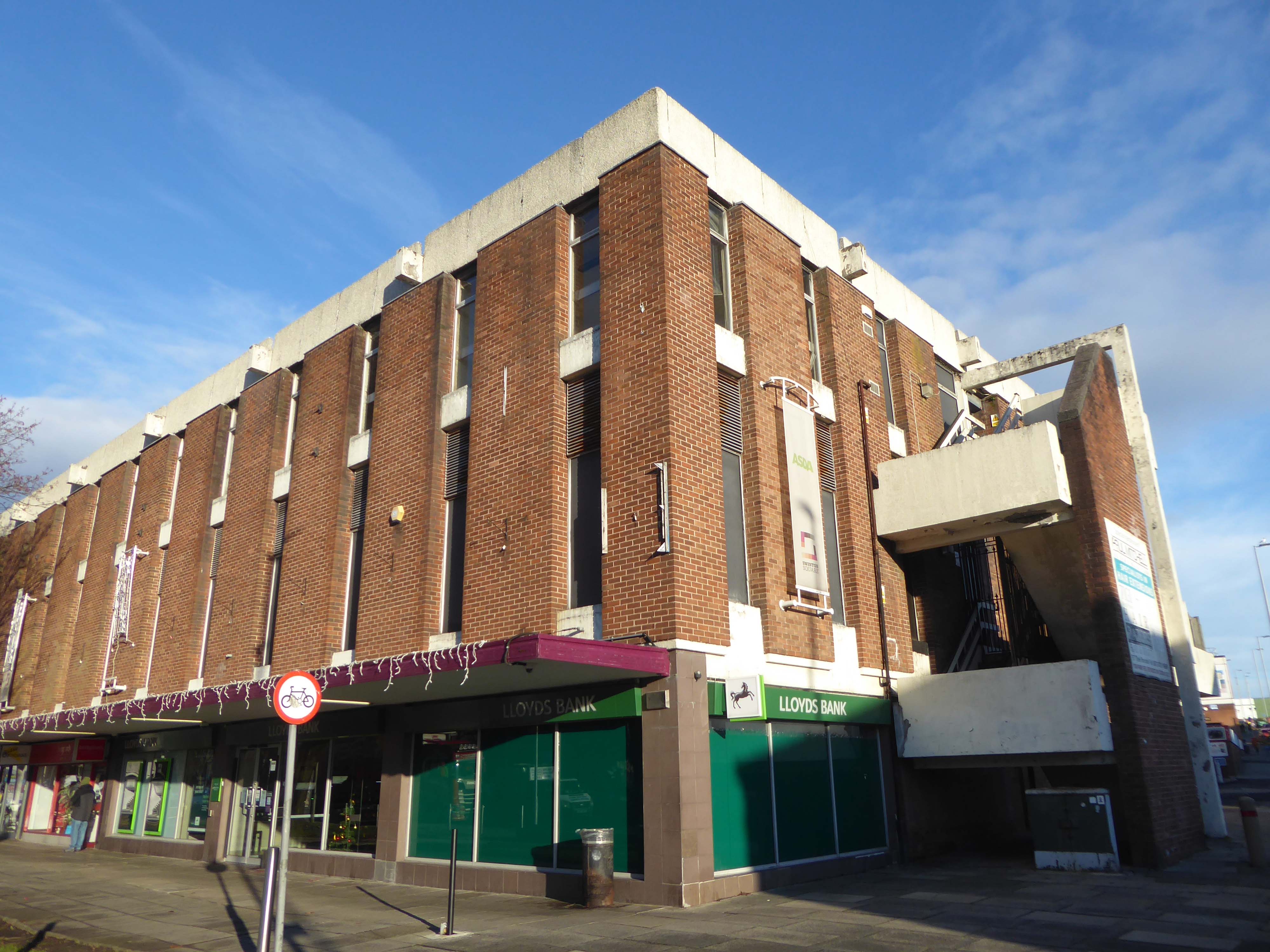
ASDA remains the anchor store, Wilko having left a Wilko sized hole in the precinct. On an overcast Friday morning there was sufficient footfall to sustain the wide variety of smaller shops and larger retail chains. As with many other towns within the central Manchester orbit, the easy proximity fills those busy trams and buses, which are leaving the area.
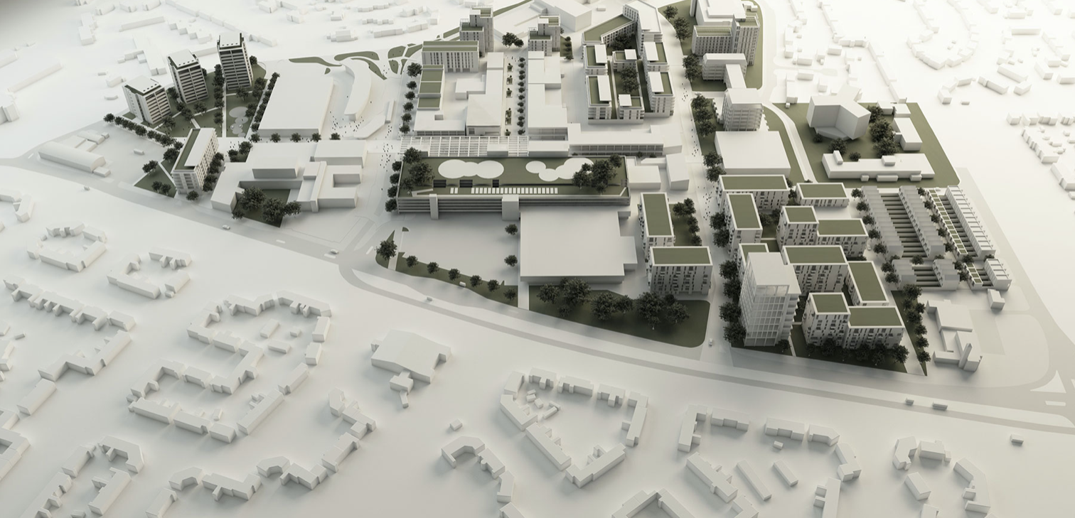
There are plans in place to regenerate the area, in the form of a Masterplan – which can be downloaded here.
Between 1991-2002 there have been some architectural changes, including new stores and office developments. Some of the interventions included significant adaptions which further increased retail into the existing buildings high street.
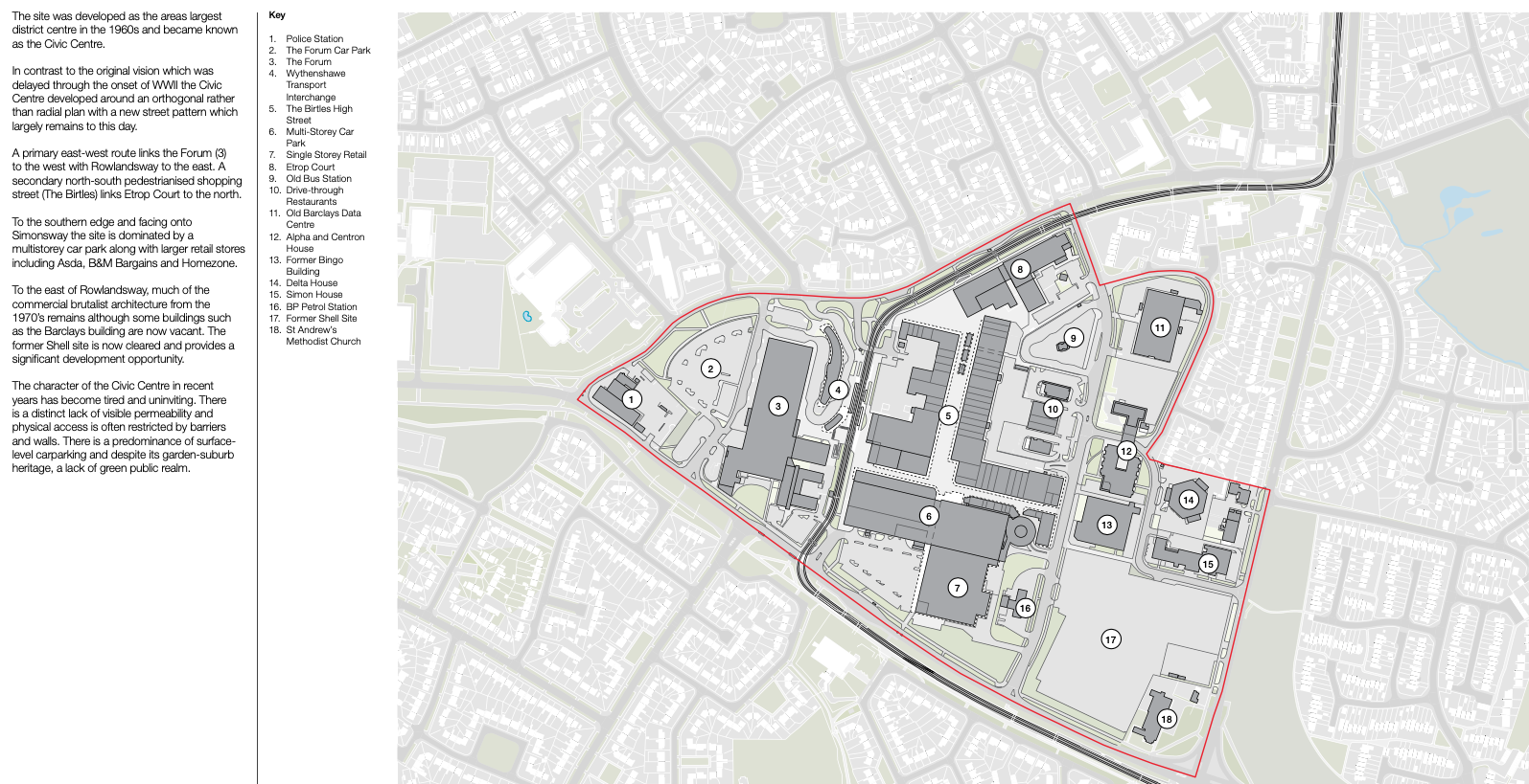
The interventions included significant adjustments to the multi-storey car park with the aim of reducing parking numbers whilst providing additional lettable space. Further Transport Hub Arrival commercial development was created to the north of the site with the construction of Etrop Court, despite there being significant commercial vacancy across other parts of the estate.
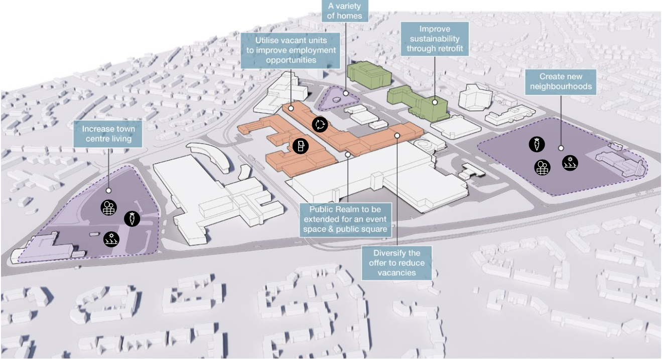
Whilst there has been significant incremental intervention, the character of the area has not fundamentally changed from its founding concept. However the cumulative impact of the various changes have had a negative impact on the functionality and suitability of place, so much so that the centre is in many ways no longer fit- for purpose.
The site today is surrounded by surface car parks, with a total of around 2,500 car parking spaces, 1,700 of which are contained within the multi-storey car park. Many of the retail units, the upper floor office spaces along the Birtles and Hale Top, and buildings to the east are vacant.
Typically, the levels of vacancy are consistent with the changing demands of the high street, where typically modern and successful retail centres are now more diversified and focussed on creating a visitor or destination-based experience. In this sense, we anticipate a need to diversify the high street and to promote a smaller more concentrated retail core, whilst supplementing the offer with more meanwhile and permanent uses and activities based on culture, food and creative workplace.
The gateway to the Civic Centre on arrival from the Transport Interchange is very poor. Access to the high street isn’t obvious and the route through to the high street isn’t clear. Much of the site is surrounded by fencing, barrier and gates and whilst they are open during the day, they are locked at night to prevent vandalism. This barricaded aesthetic does nothing to promote an easily accessible and family friendly environment as well as preventing any opportunity to promote a much needed night- time economy.
Currently, the Civic Centre appears to only cater for those with a need to visit for a particular purpose, rather than capitalising on an opportunity to create a place to visit and dwell.
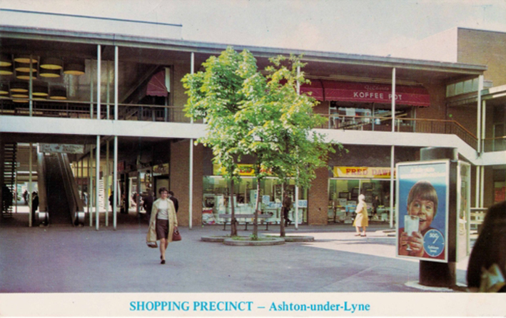
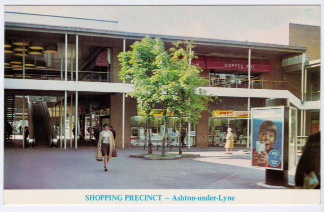
It all began way back when I was a raw youth living in Ashton under Lyne – the precinct was our playground, cycling and running, often against the grain, up and down the travelator.
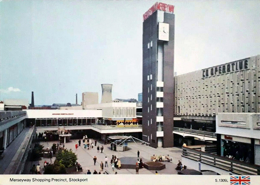
Some sixty years later I am still enthralled by the nation’s shopping precincts – including the very local Merseyway.
So on a light bright sunny day, I took another look around.
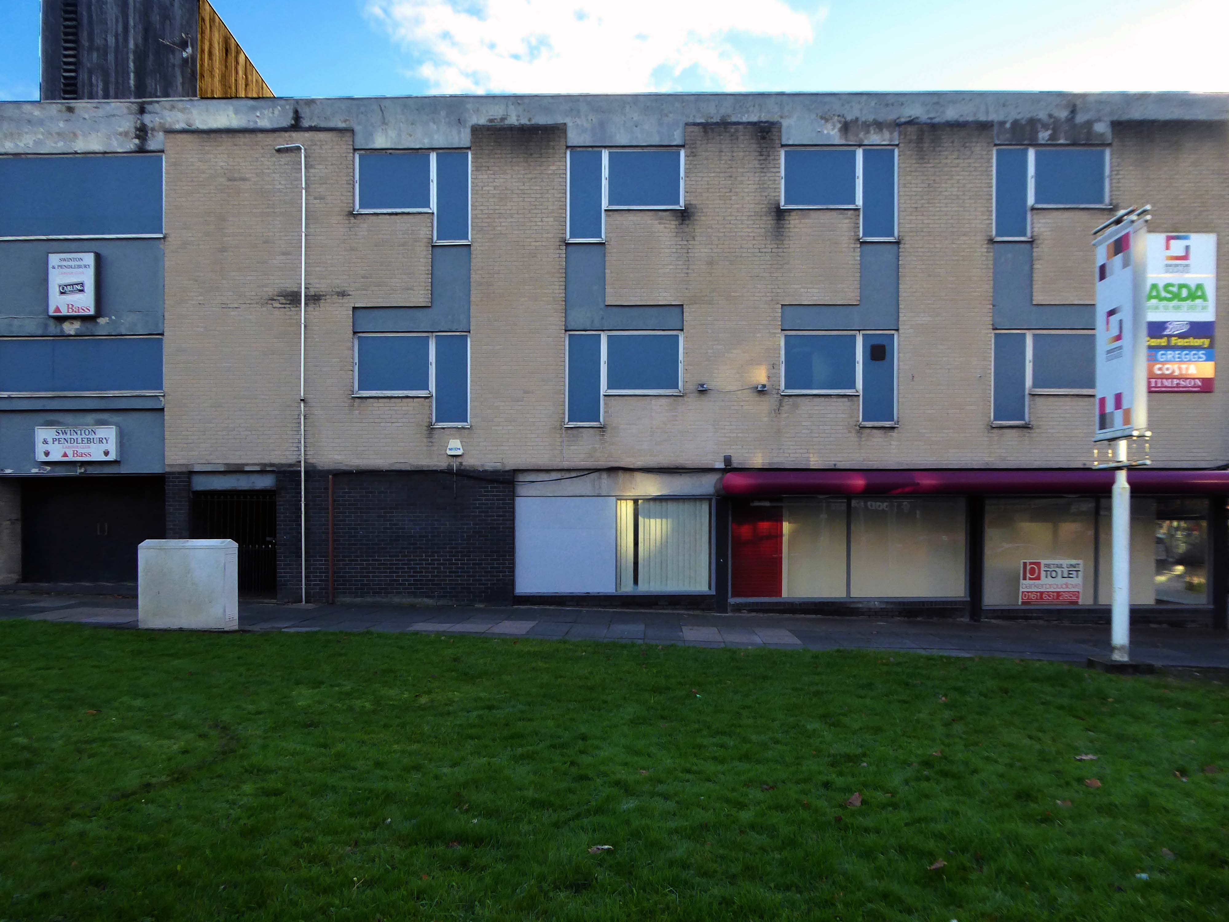
Salford’s town centres are important to the city’s future. They provide employment for local people, retail and leisure opportunities, homes, a sense of community, and a place for local people to interact. However, it is well known that town centres are changing and that they need to adapt and reposition themselves so that they can thrive and meet the needs of the local communities.
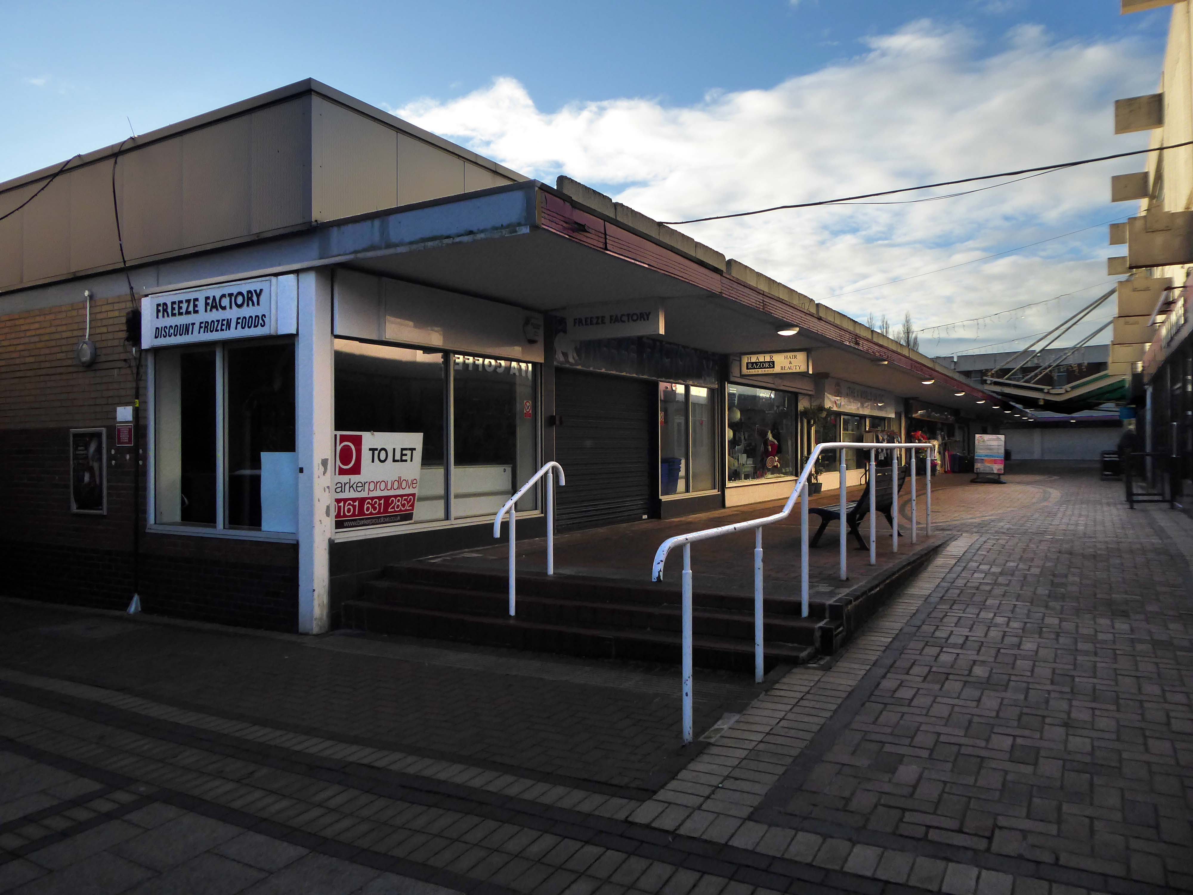
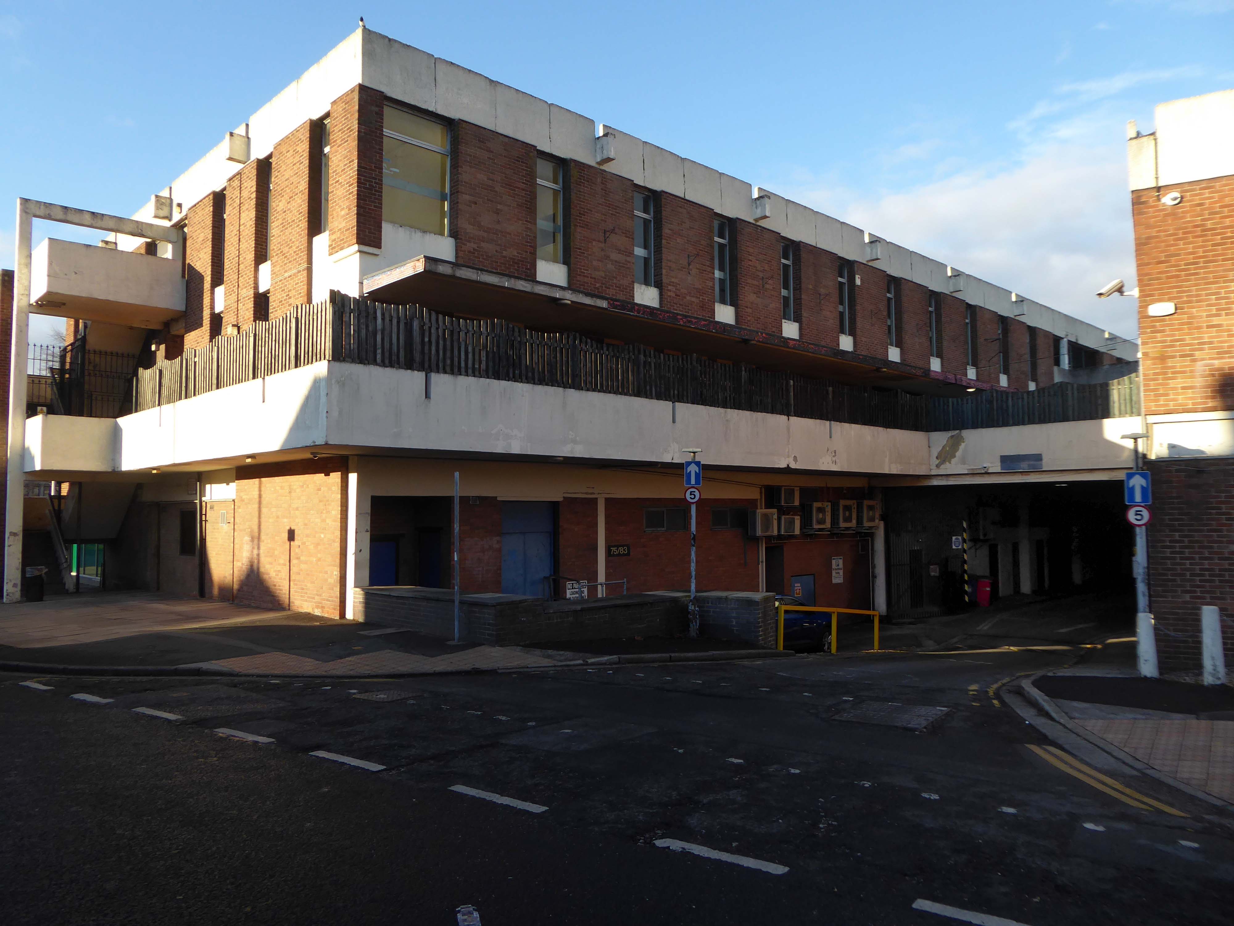
Despite Swinton’s many strengths, it faces similar challenges to other towns. The shopping centre and other buildings in the town centre are dated and in need of investment. Demand for local housing has grown by 23% in the last five years, but there is a lack of high-quality family and affordable housing in the right locations in the area.
The city council has identified Swinton town centre – along with Eccles, as a priority area for regeneration. On that basis, the council has engaged with the community and local stakeholders to establish a clear vision for the town that will help to guide change and future investment, whilst protecting what local people consider important for Swinton.
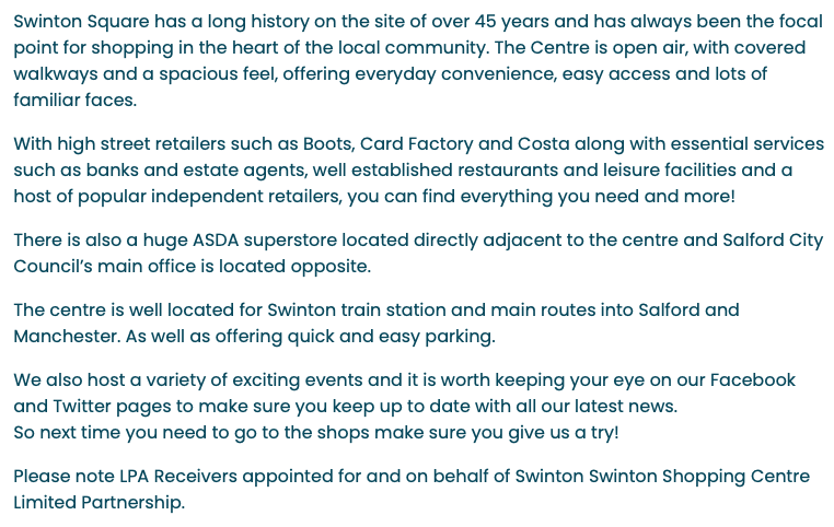
Swinton Square is in private ownership and therefore not something that the council has any direct control over. It is also important to acknowledge that the issues facing Swinton precinct are not unique to Swinton and those challenges are varied but linked to changing shopping habits, decline in the retail offer, competition from out-of-town centres as well as changes in the wider economy.
We do have an open dialogue with the owners of Swinton Square, the West Bromwich Building Society, who are aware of the vision and aspiration for Swinton.
One of the aims of the council’s events and animation programme is to encourage additional footfall and dwell time within the town centre.
The A5103 is a major thoroughfare running south from Piccadilly Gardens in Manchester city centre to the M56 in Northenden. The road is two-lane dual carriageway with a few grade-separated junctions. It is used by many as a link to the airport and to the motorway network south.
The road starts at Piccadilly Gardens where it meets the A6. It heads along Portland Street – at one time it ran along the parallel Mosley Street, past fast-food outlets and off-licences and then meets the A34 Oxford Street. It multiplexes with that road north for 200 yards into St Peter’s Square and then turns left into Lower Mosley Street, initially alongside the tramlines and then past the former Manchester Central station, now a conference centre with the same name. The road becomes Albion Street and goes over the Bridgewater Canal and under the railway line east of Deansgate station. The road then meets the A57(M) Mancunian Way at a roundabout interchange. This is where most of the traffic joins and leaves.
The road is now 2×2 dual carriageway with the name Princess Road. It passes under the Hulme Arch, a grade-separated junction with the A5067, with an unusually large central reservation. This is presumably because of the proposed plans from the 1960s of a motorway. However, after passing under the junction, there are innumerate sets of traffic lights, with the B5219, the A6010 and the A5145, as well as many other unsigned roads. There are also many speed cameras set at 30 mph.
The road picks up pace as we exit the sprawl of South Manchester and the road becomes Princess Parkway, with a 50 mph speed limit. We cross the River Mersey and almost immediately hit the M60 at J5.
Except for the Manchester City Centre section – which was numbered A5068, this road did not exist on classification in 1922. Princess Road was built in 1932 to serve the new southwestern suburbs; initially it ran between the B5219 and A560 and was numbered B5290, with the road later extended north into the A5068 on the southern edge of the city centre and renumbered A5103.
The northern extension through Hulme initially followed previously existing roads, so followed a zigzag route. As part of the road’s upgrade and the reconstruction of Hulme in the 1970s the road was straightened and the original route can no longer be seen. The A5068 was severed around this time with the construction of the A57(M) and the A5103 took on its city-centre section, taking it to the A6.
The A6 is Britain’s fourth longest road. Its route varies greatly from the lower lands of the South East, though the Peak District, right though the heart of Manchester city centre, then onwards towards Preston. It then goes though the historic city of Lancaster before skirting the Eastern fringe of the Lake District before ending in Carlisle, bang on the start of the A7.
North from Stockport towards Manchester, the A6 was a wide, four lane road, but still 30 mph, which usually flowed pretty well. According to Mudge, it looks like it has now been massacred by bus lanes and red paint. Shame. We meet the A57 from the east, just south of the city centre, and multiplex until we reach Mancunian Way, the A57 heading off as a short urban motorway, the A6 heading into the city centre via London Road/Piccadily, where it loses its number and vanishes. It would have gone straight down Piccadily/Market Street to meet Deansgate, and then across the River Irwell into Salford, and up Chapel Street, where the number reappears. Market Street has been pedestrianised for years, so the A6 has long ceased to be a through route.
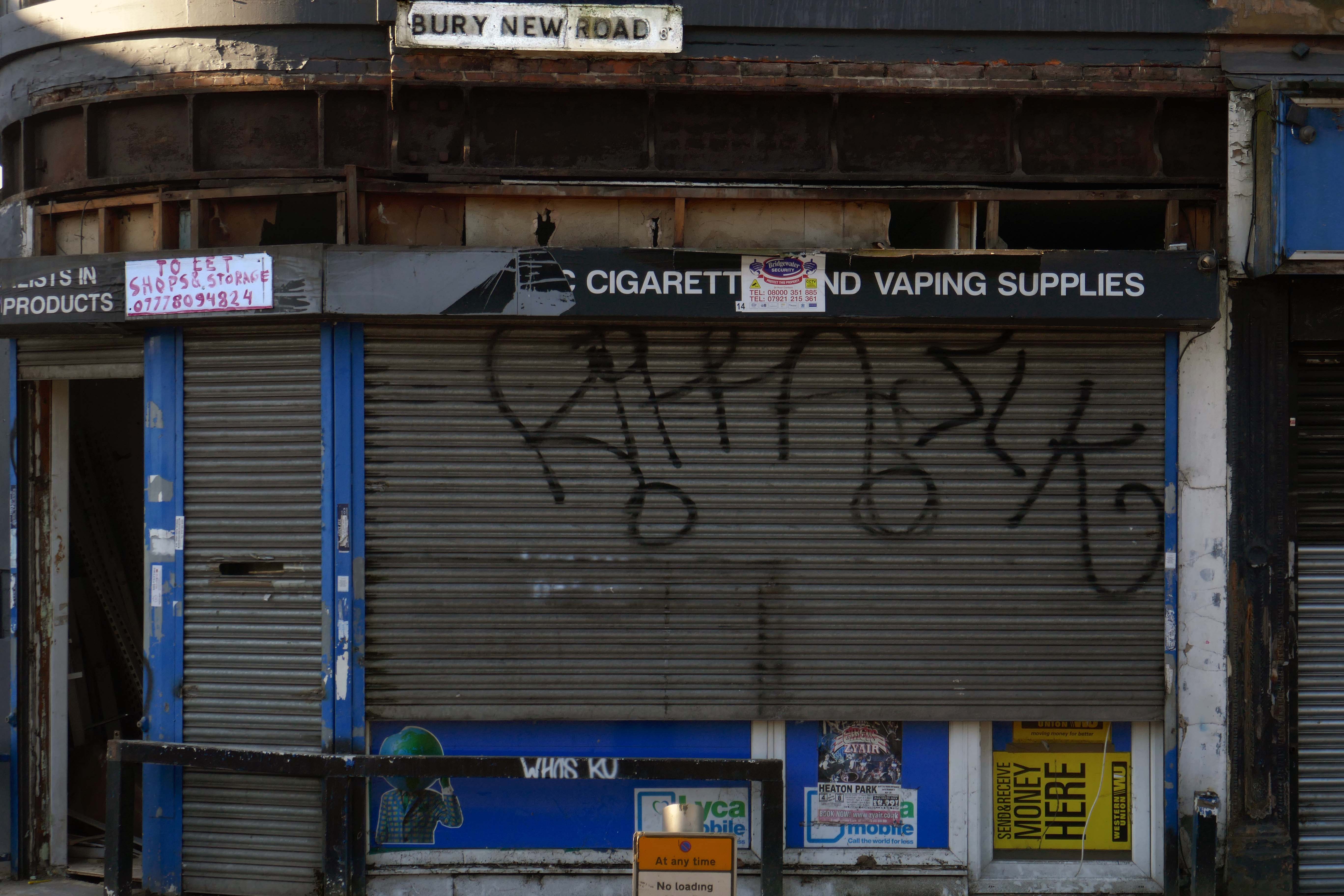
Cheetham Hill Road is part of the designated A665. Cheetham Hill Road starts at the junction of the A6042 Corporation Street and the A665 Miller Street. It crosses the culverted River Irk to the east of Victoria Station. At its junction with New Bridge Street, it turns north-northeast and is straight for 1 km, to the A6010 Queen’s Road . This stretch was called York Street until about 1900. Cheetham Hill Road leads from here to the community of Cheetham Hill, where at Bourget Street and Crescent Road – formerly Sandy Lane, Cheetham Hill Road becomes Bury Old Road.
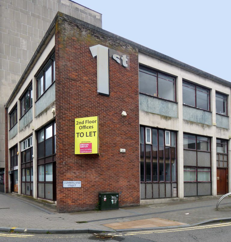
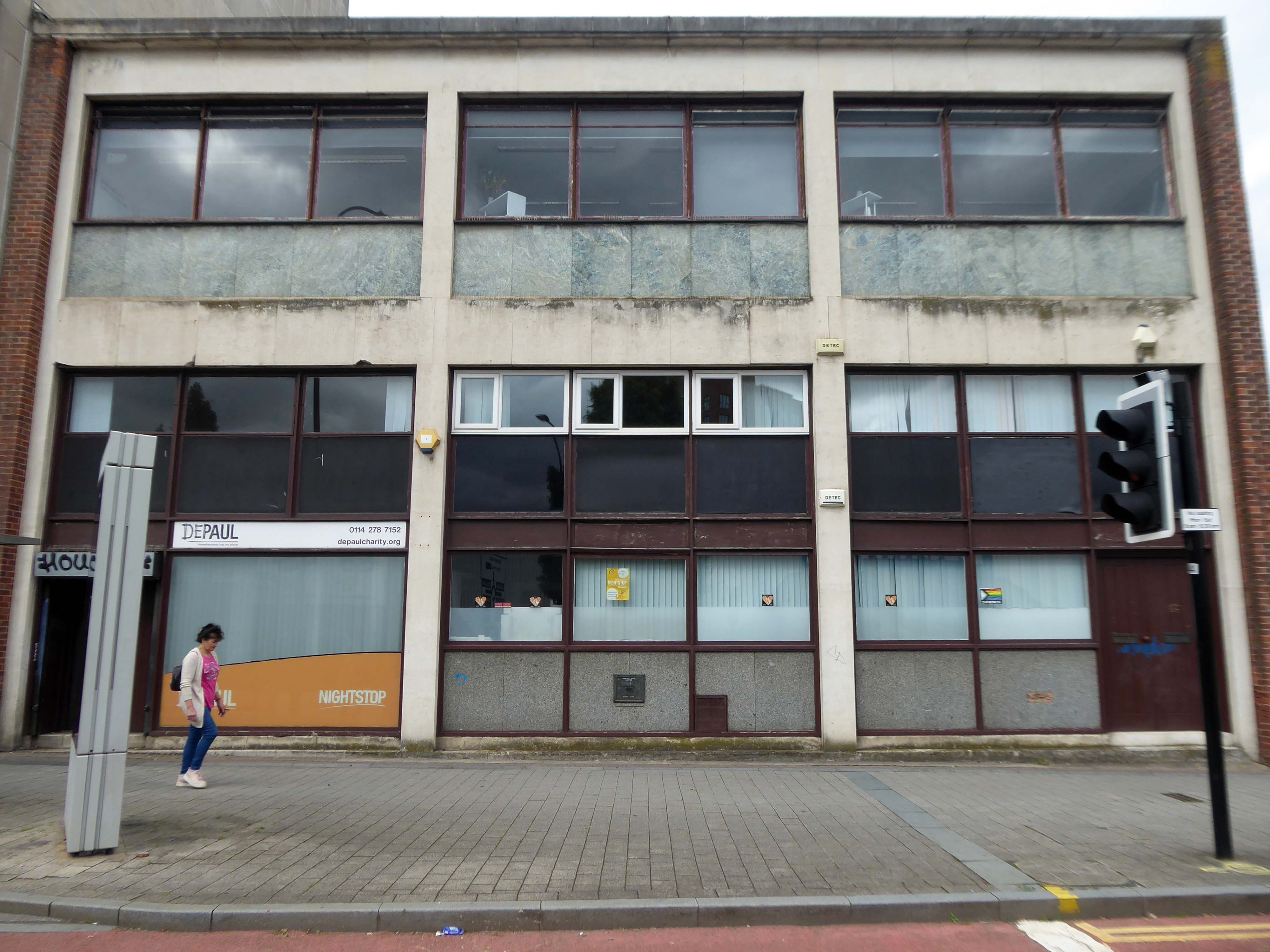
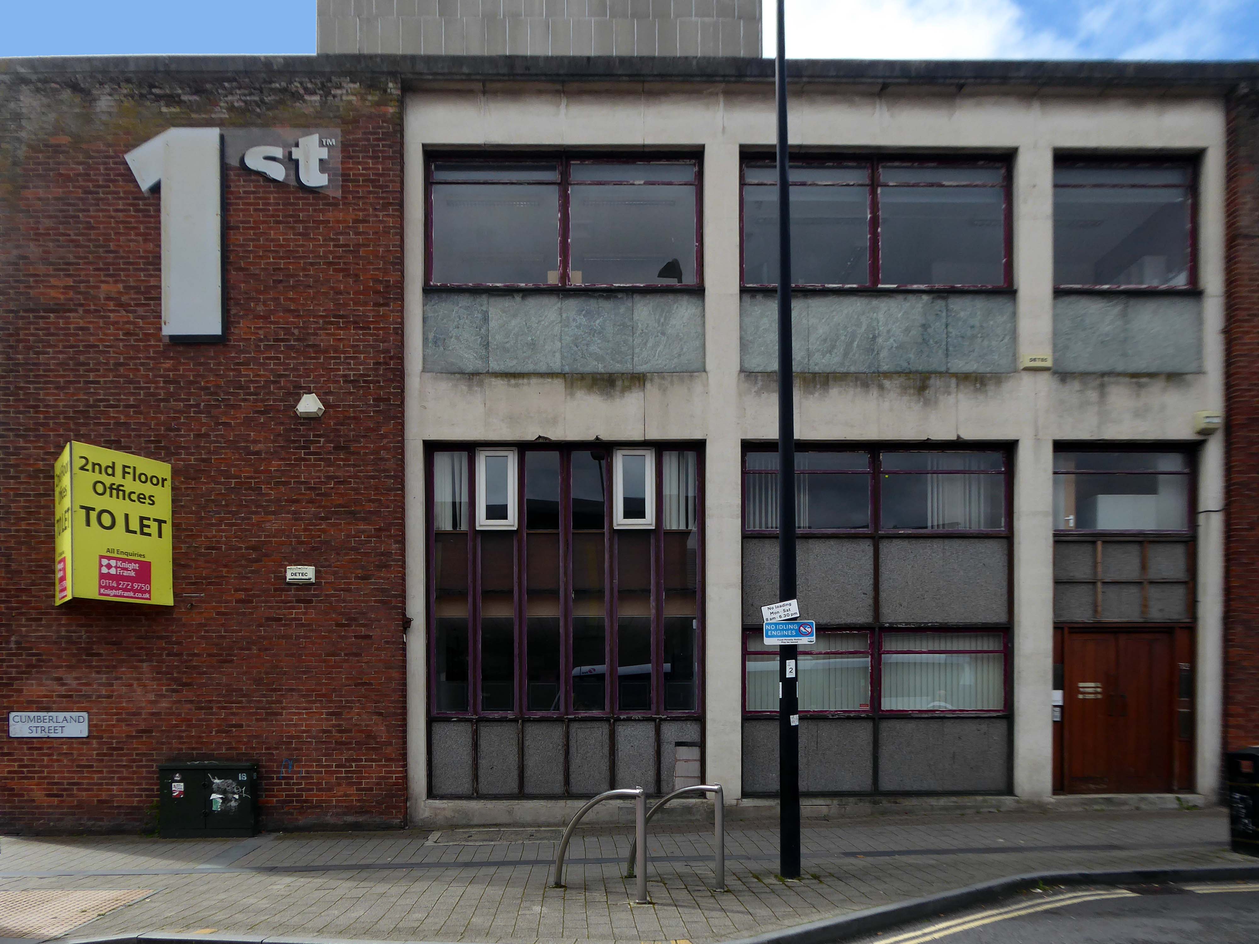
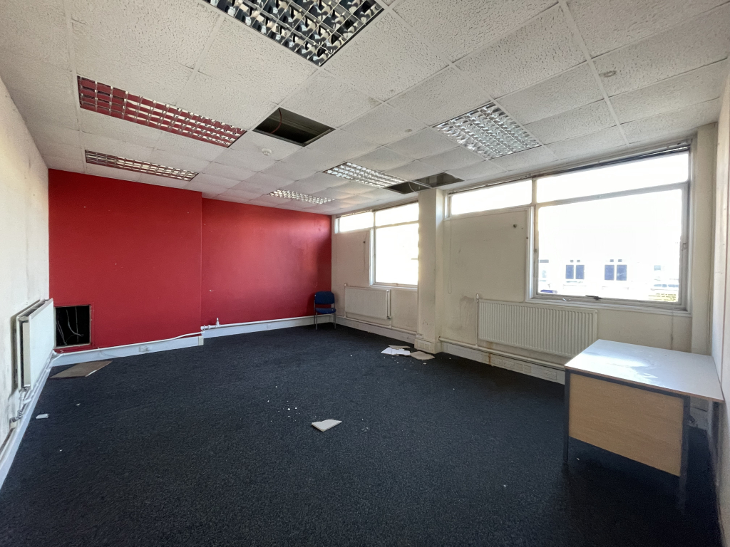
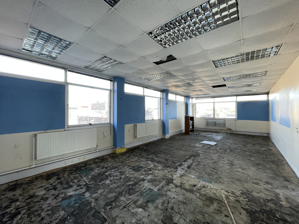
Opened in 1961, Martins Bank’s branch at Sheffield Moor is new and purpose built, occupying space left in the Sheffield Moor area by the bombing of the second world war. Time flies however, and more than fifty years on, the building is empty and awaiting the next chapter of its life.
Note the olivetti shop incorporated into the bank building.
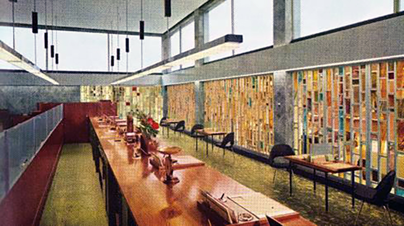
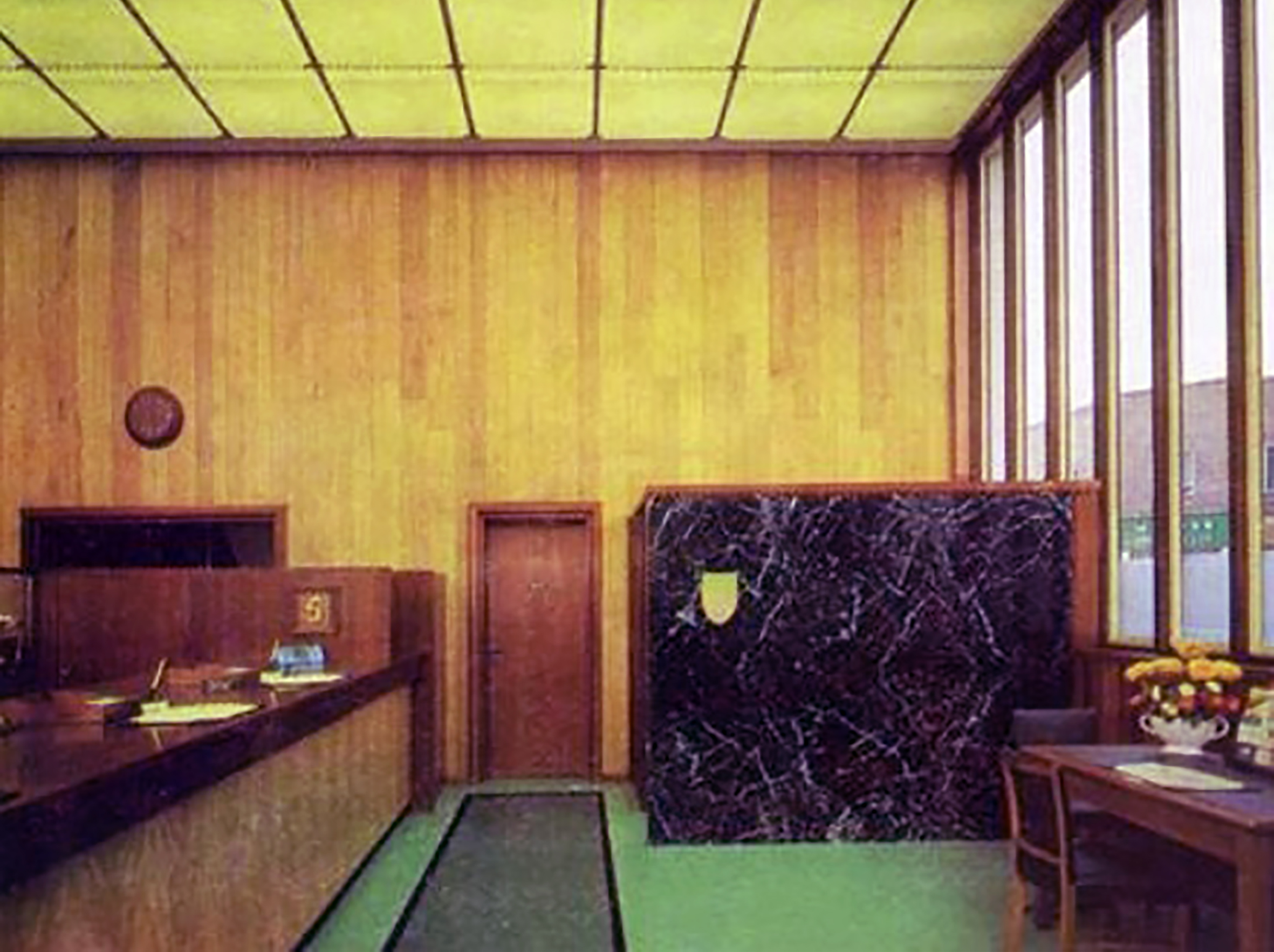
Our New Branch at Sheffield Moor owes its existence to the extensive replanning of this area of Sheffield. Part of it was destroyed during the war and the remainder has been or is in course of being pulled down as the plan unfolds for the creation of a brand new shopping area.
It is really too far from the old commercial quarter to be effectively served by our branch at West Street and so the banks are moving in. It is a beautiful modern building with interior decor which responds to the full blaze of sunshine most cheerfully, or, on a dark day when the illuminated ceiling has to be switched on, creates an oasis of light, warmth and welcome which makes it a pleasure to step inside.
This joint-stock bank was established in Manchester in 1836 as Manchester & Salford Bank by a group of promoters keen to take advantage of recent legislation allowing the formation of joint-stock banks outside London. The bank had up to 15 directors and the issued capital was £1m, of which £252,100 was paid up by December 1836.
RIBA Pix: Headquarters building for William Deacon’s Bank Limited – Mosley Street Manchester: the garden at podium level.
Harry S Fairhurst & Son 1965
The first shareholders’ meeting, in May 1836, took place in temporary premises, but in August 1836 a banking house was rented in King Street. Land off Mosley Street was later acquired and a new banking house completed in 1838.
In 1969 The Royal Bank of Scotland was restructured and Williams Deacon’s became a direct subsidiary of a new holding company, National & Commercial Banking Group. The following year the holding company’s subsidiaries in England and Wales – Williams Deacon’s Bank, Glyn, Mills & Co and the English and Welsh branches of The National Bank – merged to form Williams & Glyn’s Bank.
In 1972 Williams & Glyn’s Bank joined with five other European banks to form the Inter Alpha Banks Group to exploit opportunities in the European Economic Community. In 1985 The Royal Bank of Scotland Group’s two major subsidiary holdings, Williams & Glyn’s Bank and The Royal Bank of Scotland, were fully merged as The Royal Bank of Scotland plc.
The very merry monopolies and mergers merry dance – consequently this perfectly formed Modernist bank stands alone and forlorn.
In his postcard, Phyl writes that the weather is nice, he has a self-catering apartment near a pond, but complains about the expensive cost of Spanish bread at £1 a loaf.
Although it was delivered to the right address on the card, Mr Davies said he has no clue who either Phyl or Mrs Leon could be.
I’ve been baffled by it really.
I suppose Mrs Leon once lived in my flat, but I’ve asked around neighbours who have lived here twenty or thirty years, and none of them have ever heard of her.
The Post Office say they have no idea what could have happened to the postcard for twenty nine years, may be it got stuck in a sorting machine, may be given that it’s got both British and Spanish stamps on it, someone found it and posted it on.
Really I’d just like to find out who either Phyl or Mrs Leon are, so I could finally give it to them after all this time.
Curiously the story does not reproduce the picture of the picture postcard.
Dear Eddie, this is a very pleasant place and the weather is just right. The food is very expensive though over £1 for a loaf of bread! We have a self catering little apartment by the side of a pond complete with ducks.
There is something very poignant about the handwritten reportage of holidays past and also a sadness attached to the blank other side -sentiments forever unsent.
I’ve looked at life from both sides now From win and lose and still somehow It’s life’s illusions I recall I really don’t know life at all
We are all going somewhere or nowhere or other – we report back.
Having a nice relaxing holiday. Not had good weather. Got caught in rain on Friday have lost my voice. Uncle Jim laughing
Auntie Ethel & Jim
Hope Leslies finger is coming on alright
20th August 1968
Hello Sharon, hope you are as happy as can be. Sorry I can’t tell you anything about your country, as I’ve never been; not yet anyway.
Bye Don
23rd April 1979
Dear Rita, here we are enjoying our holiday with Frank, Jacky & Stuart. The weather has been very poor, but there is an improvement today. Hope all is well with you. Lynn her husband and the little ones are visiting on thursday, so we shall have a real tea-party.
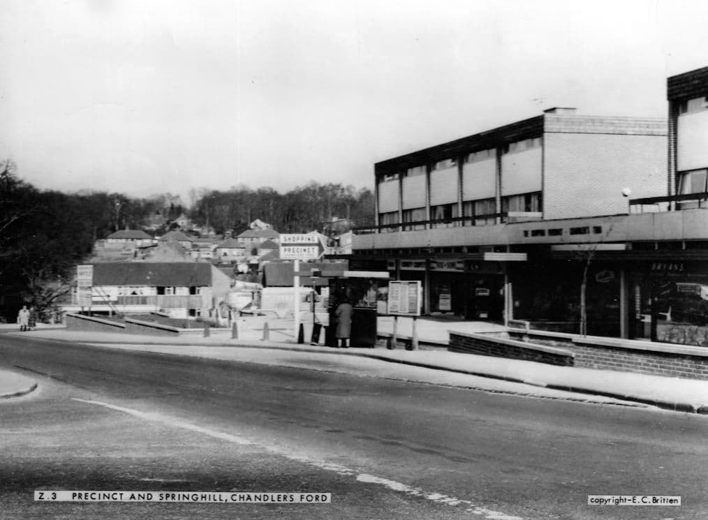
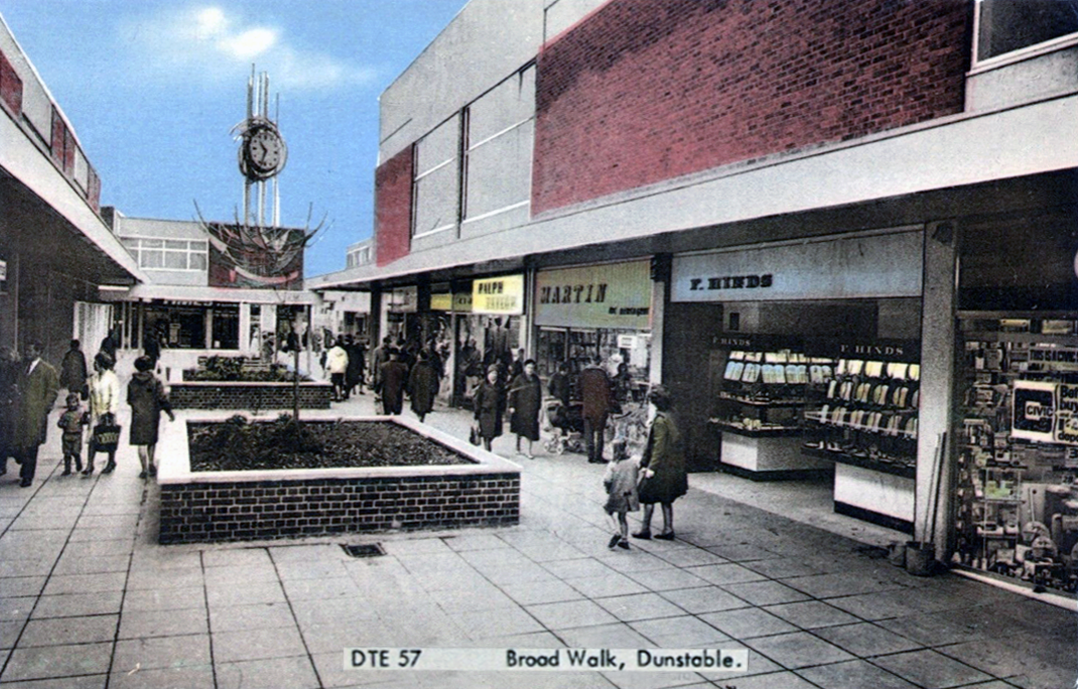
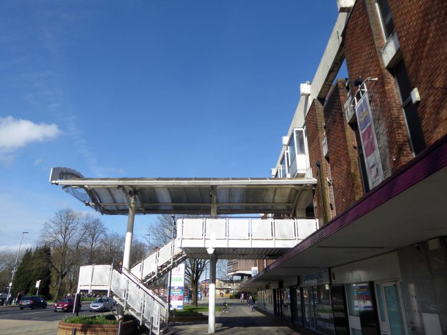
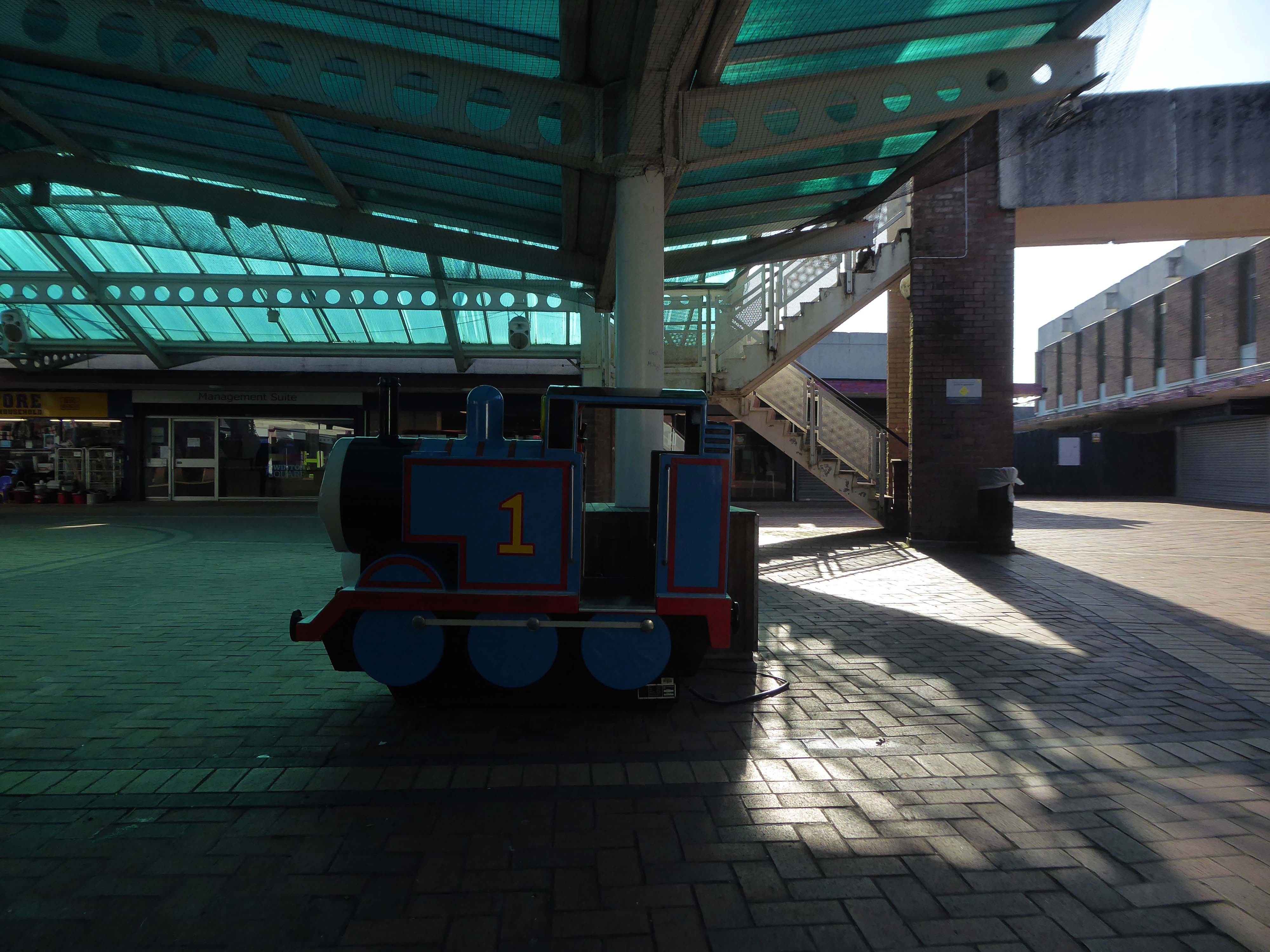
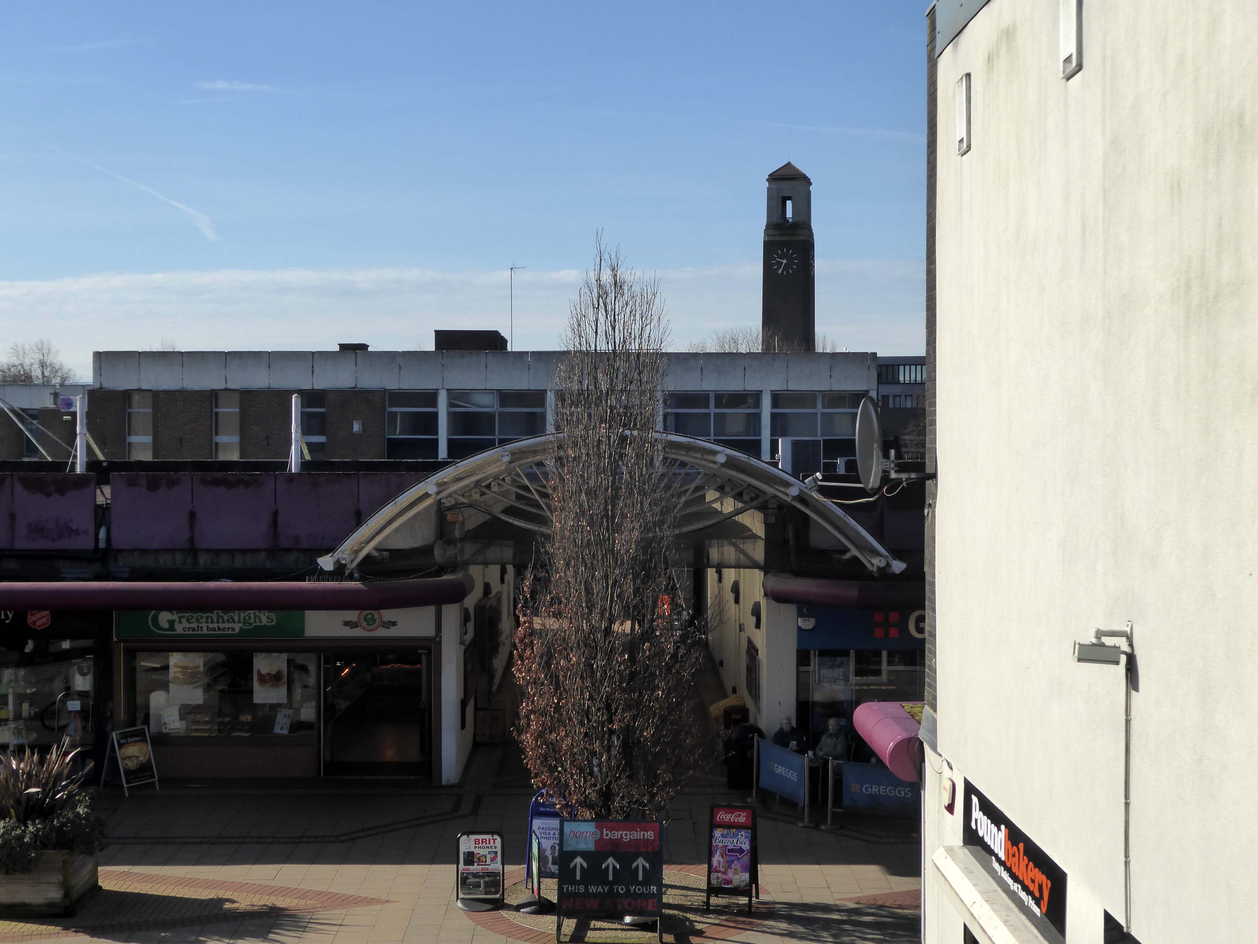
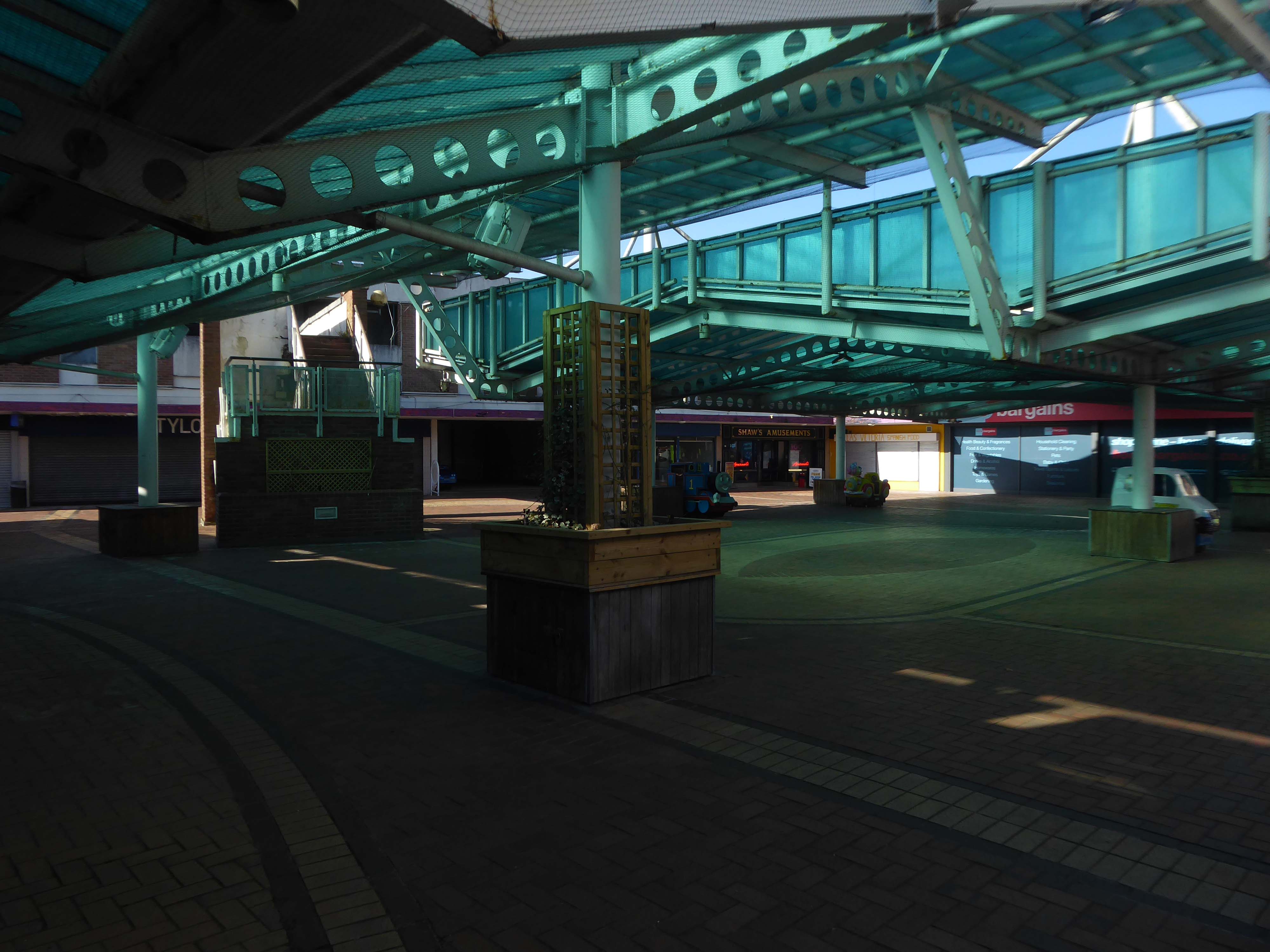
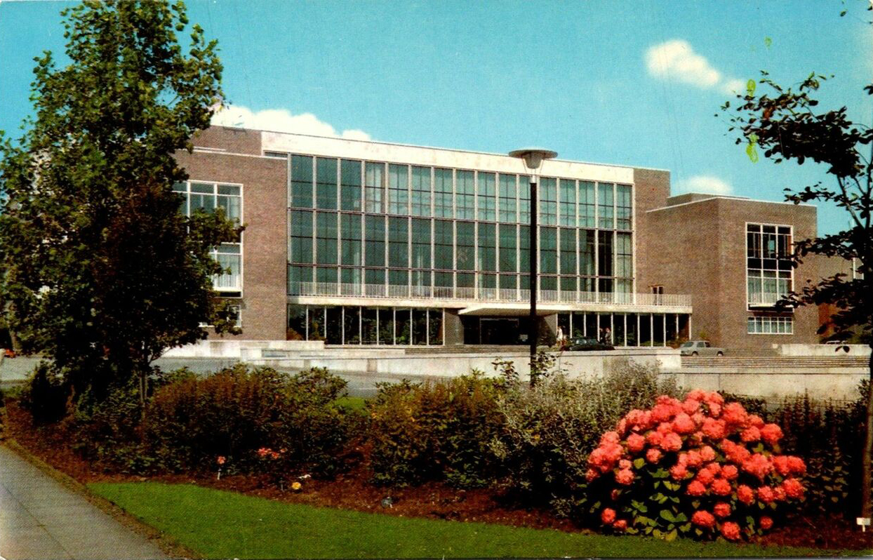
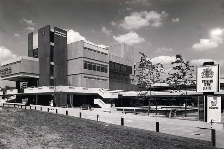
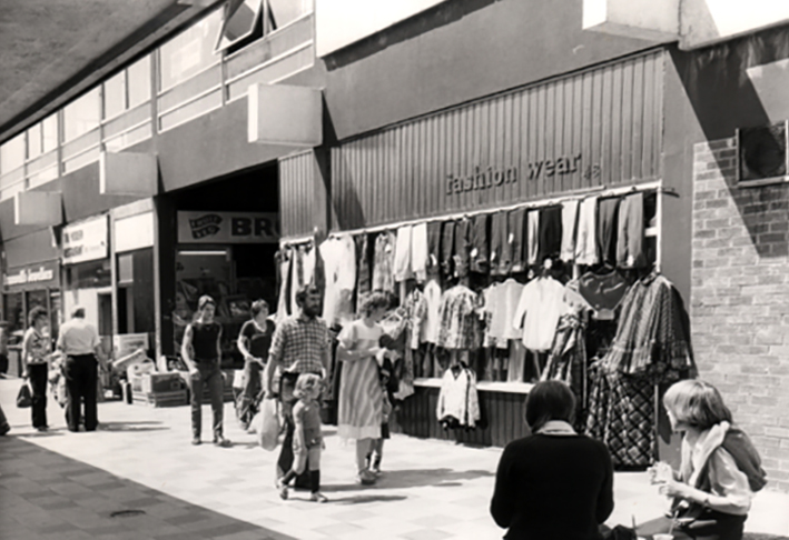
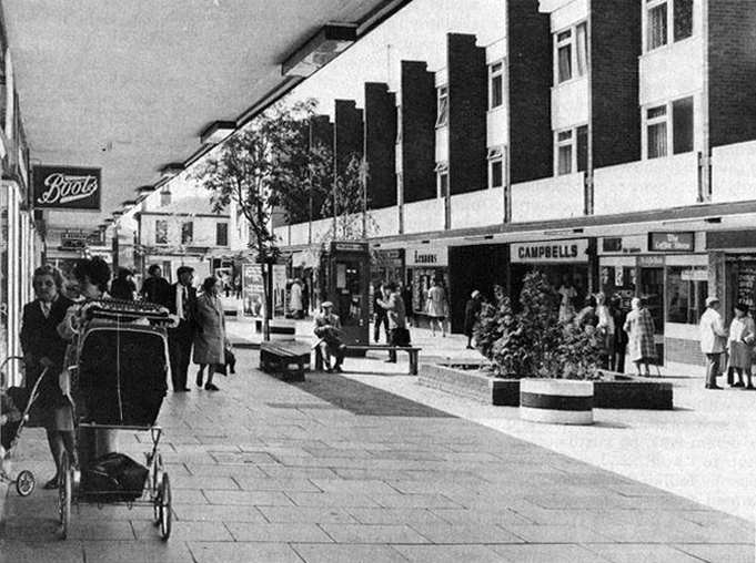
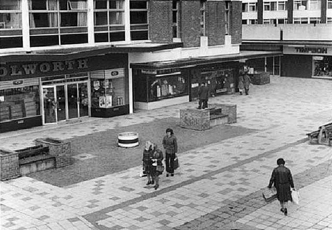
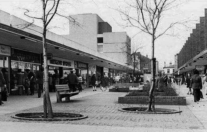
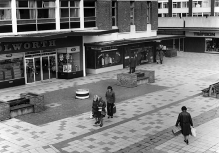
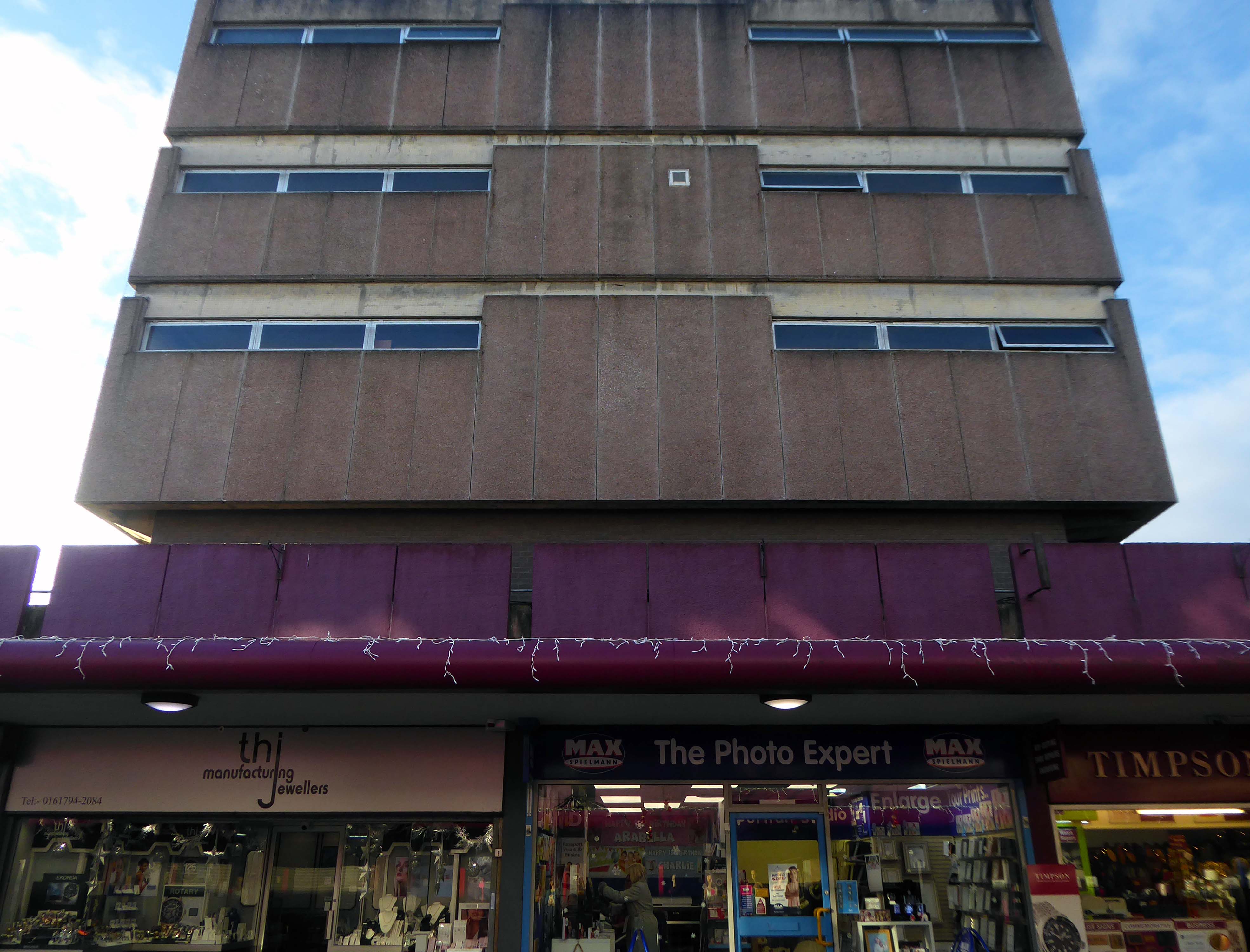
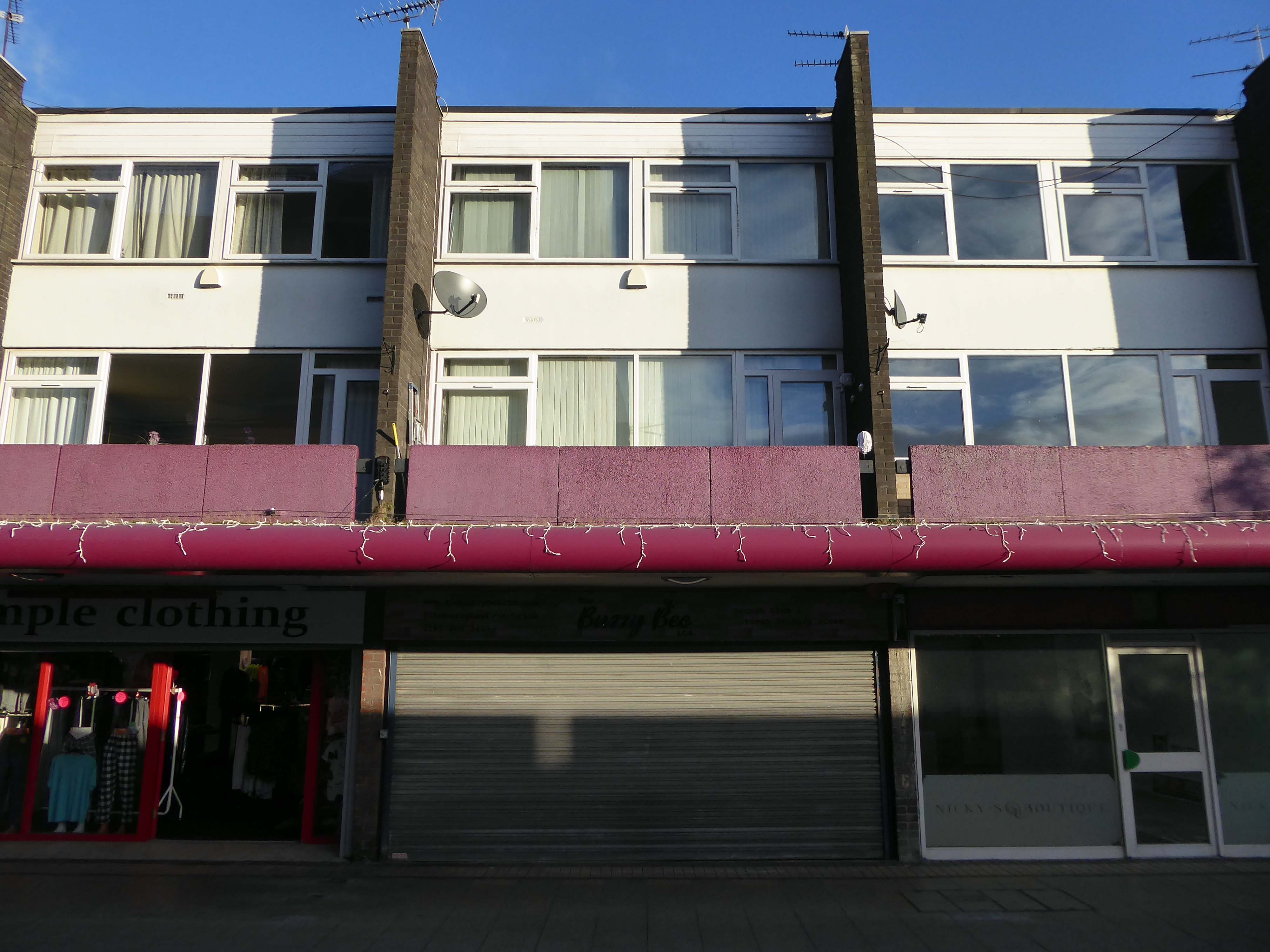
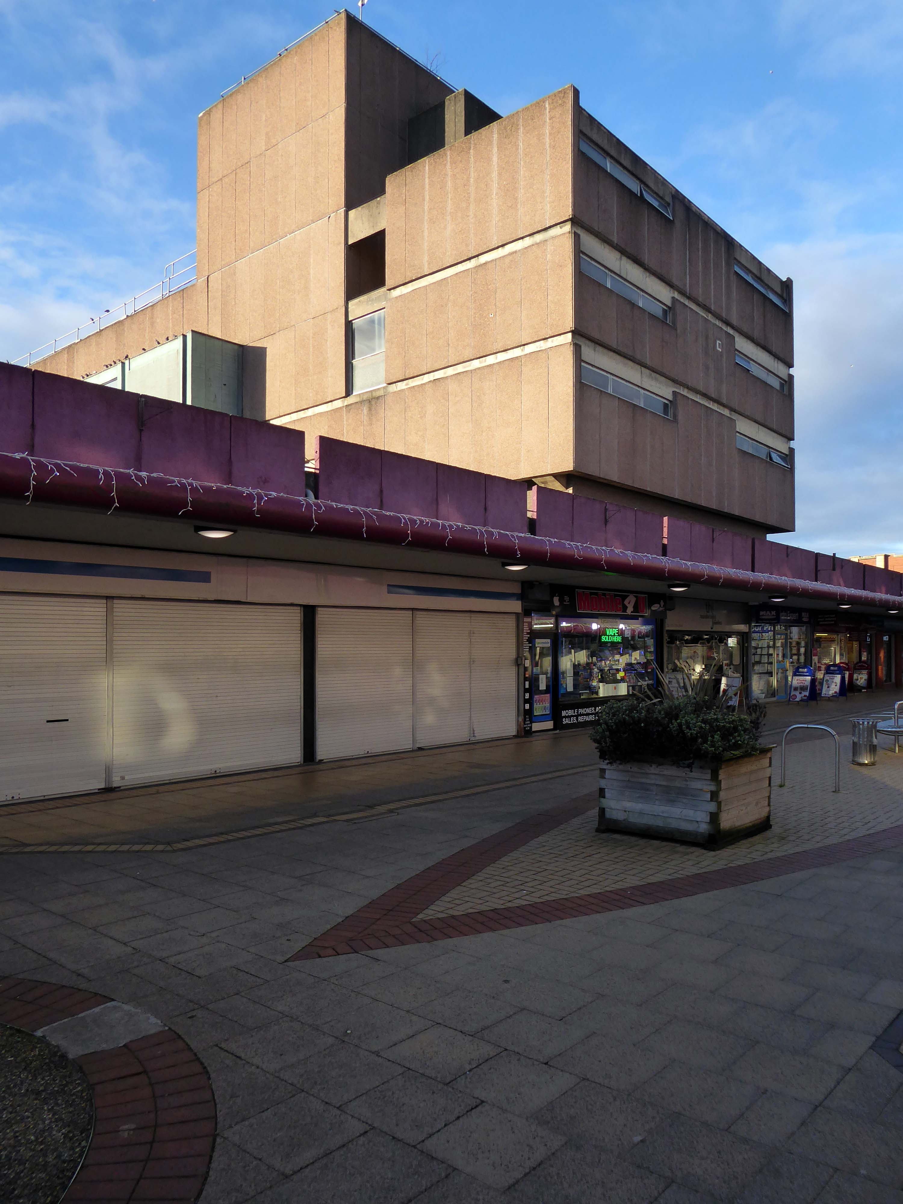
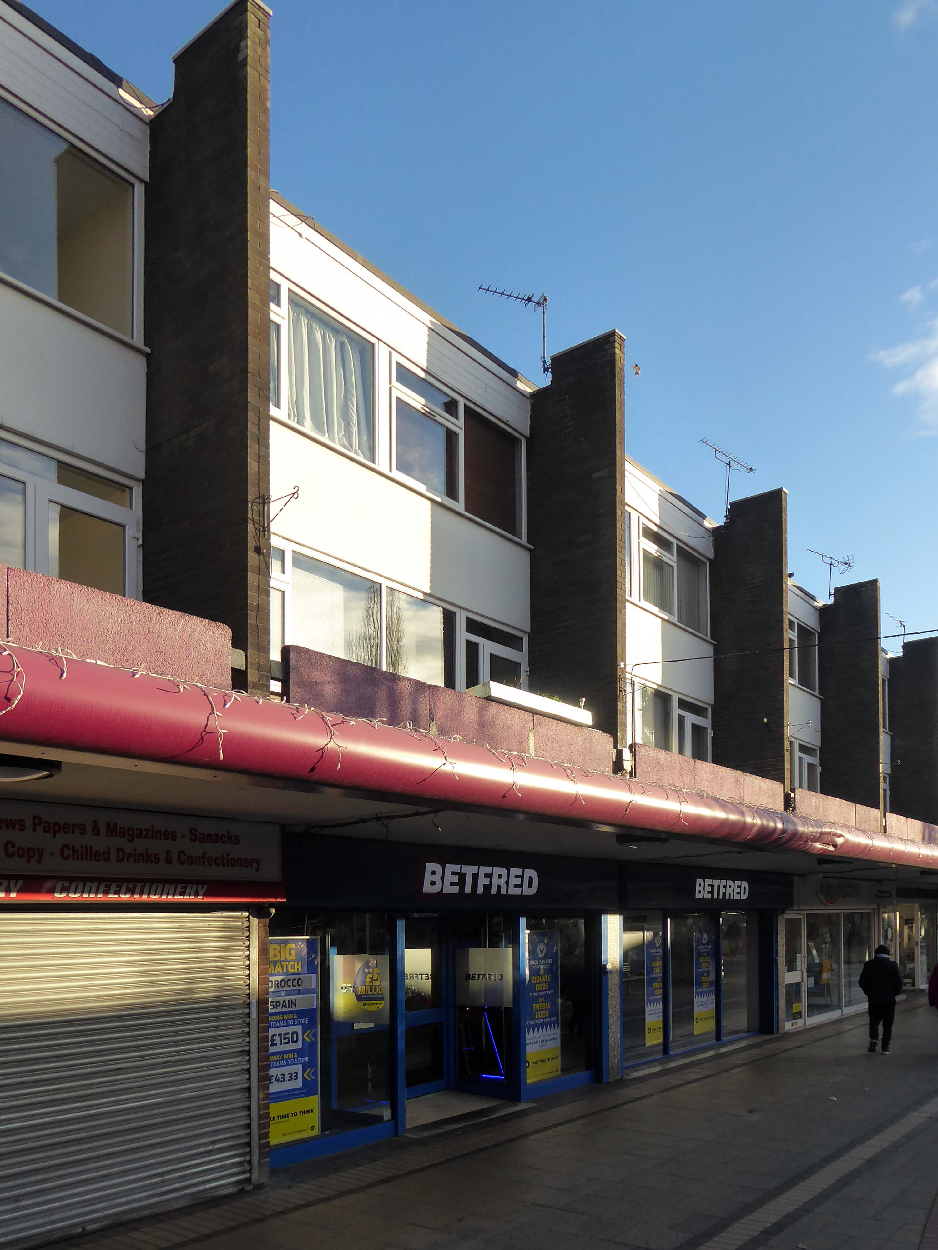
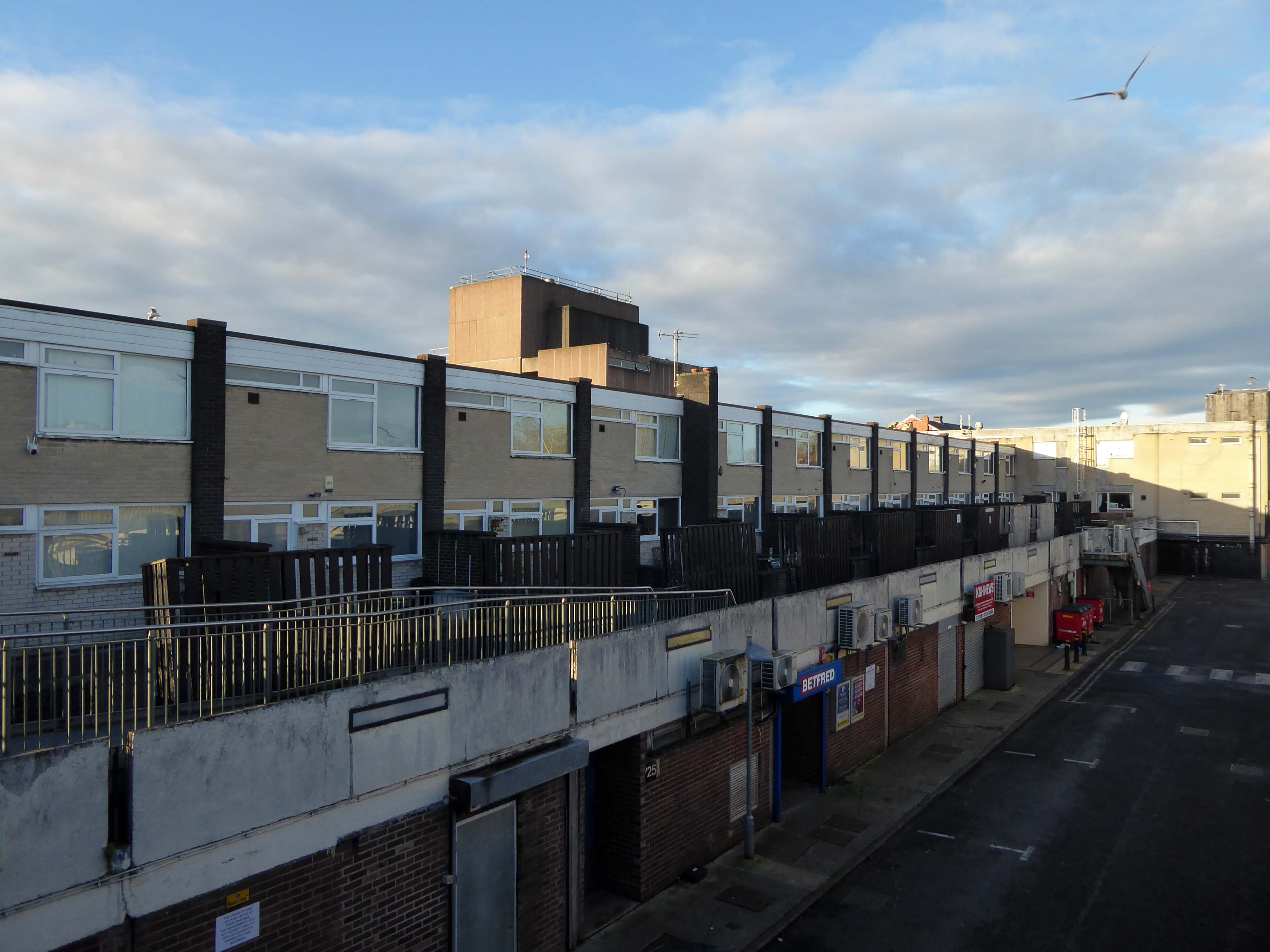
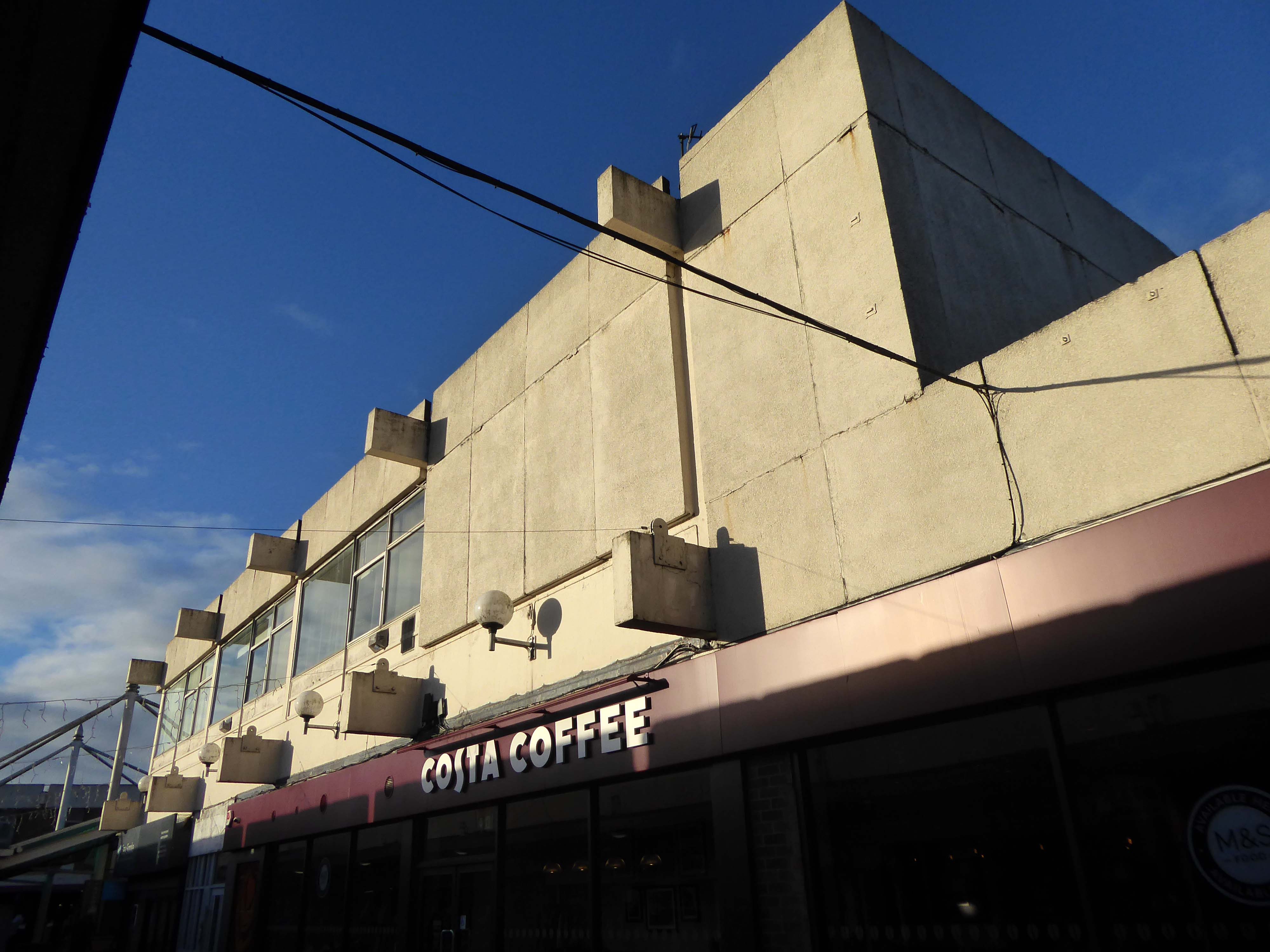
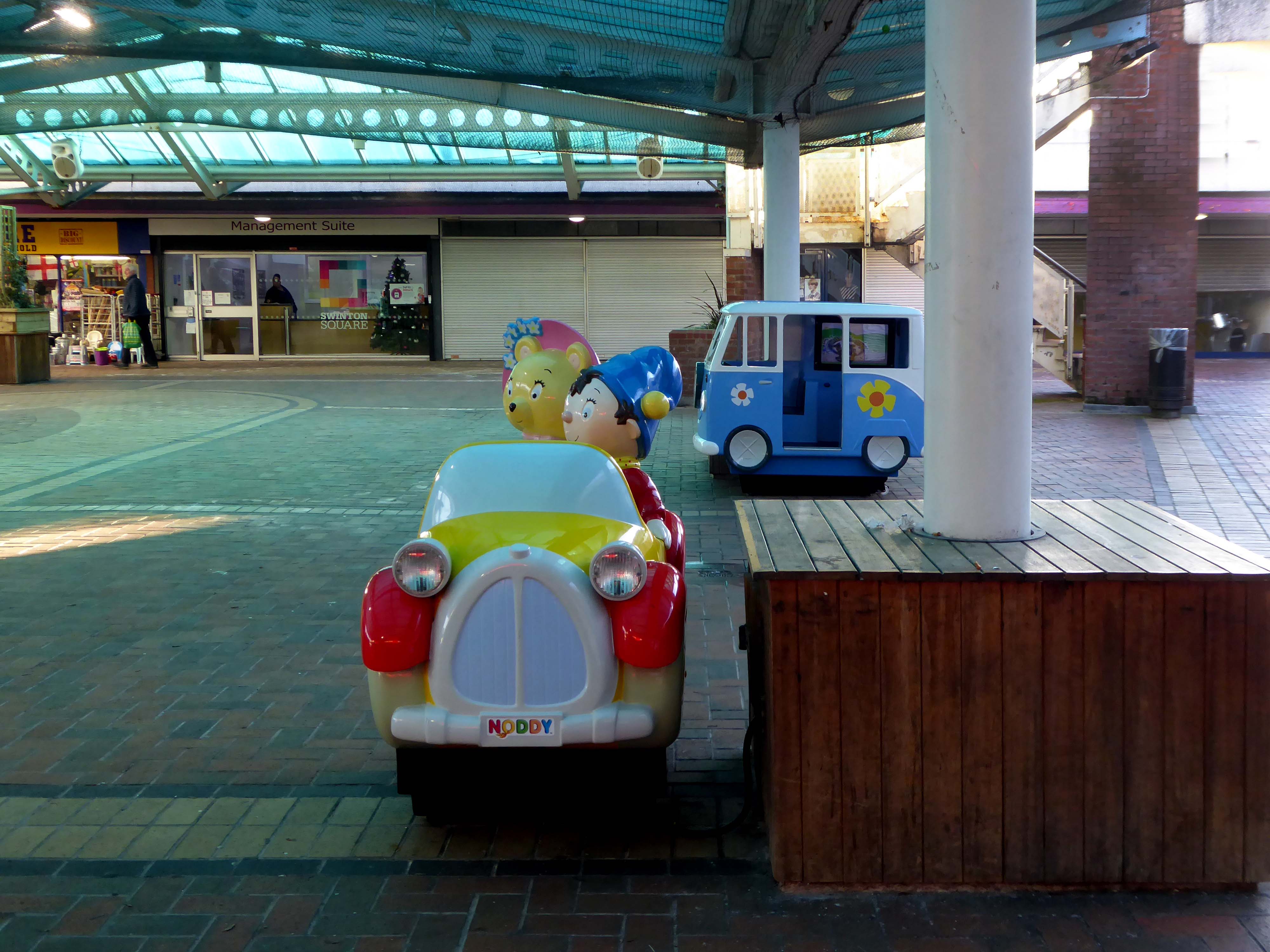
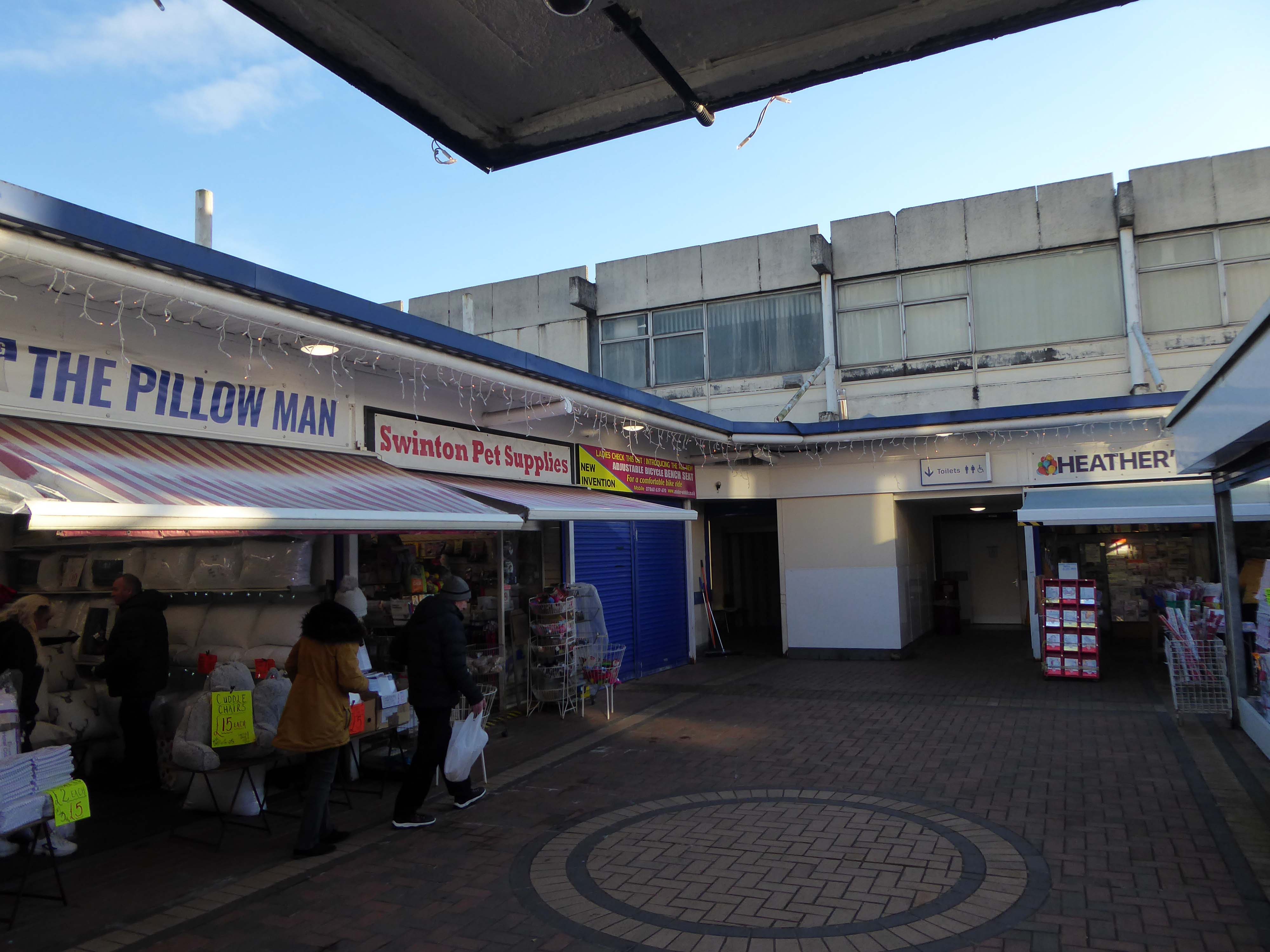
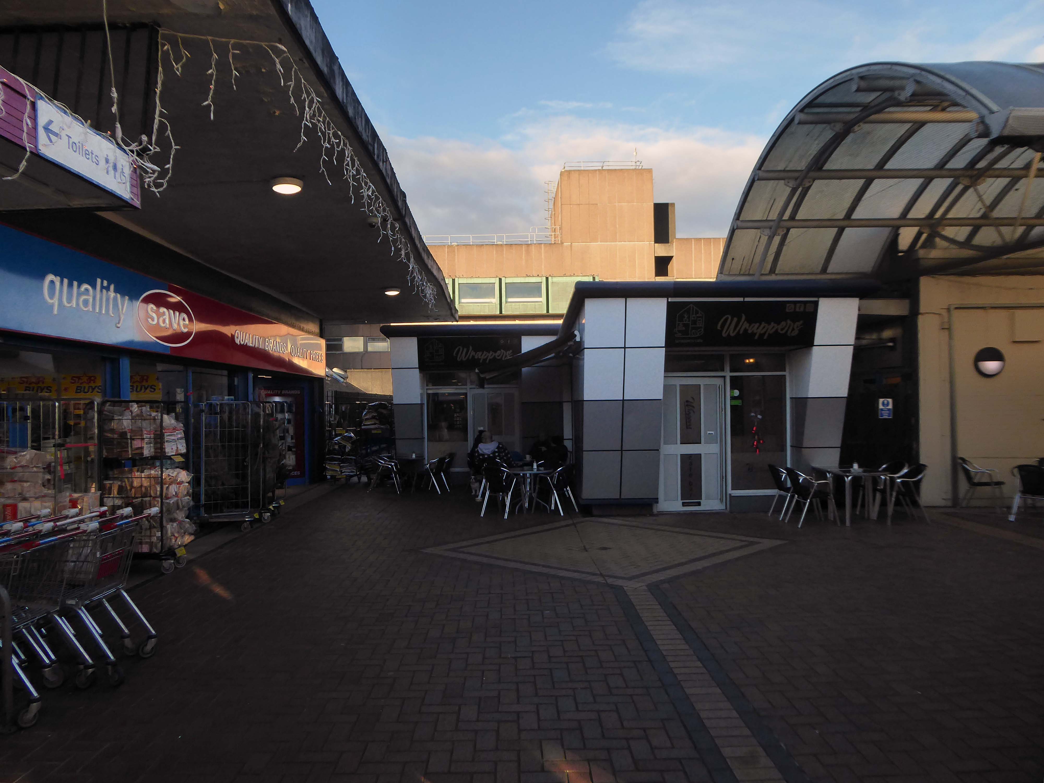
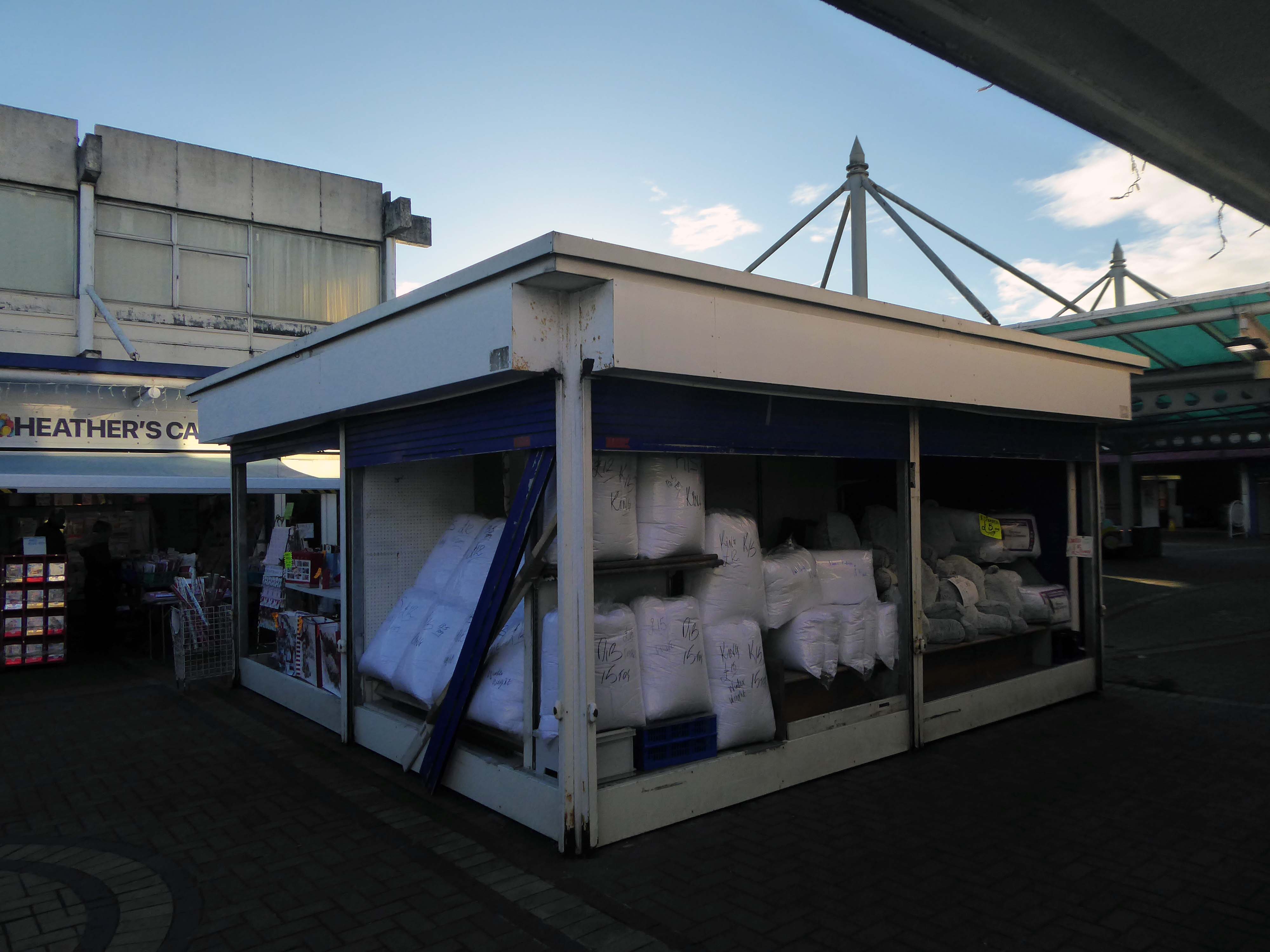
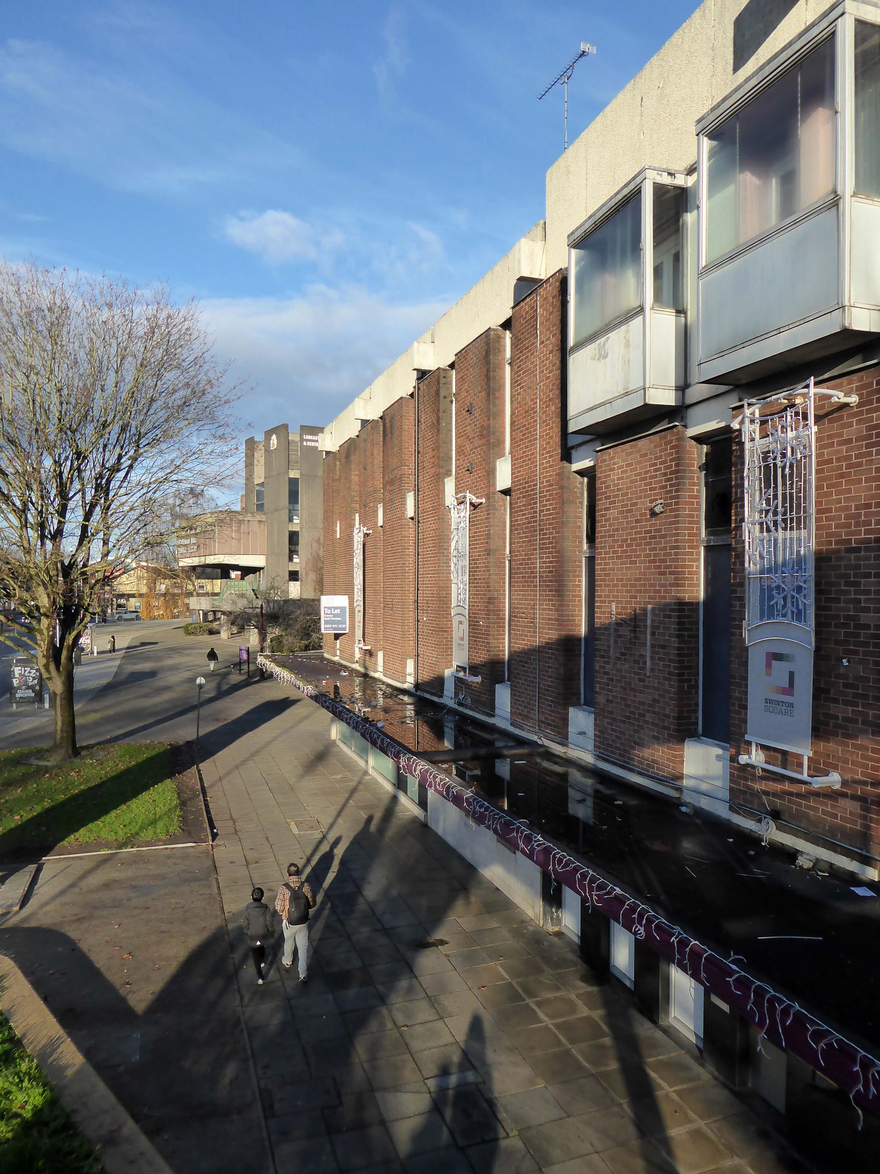
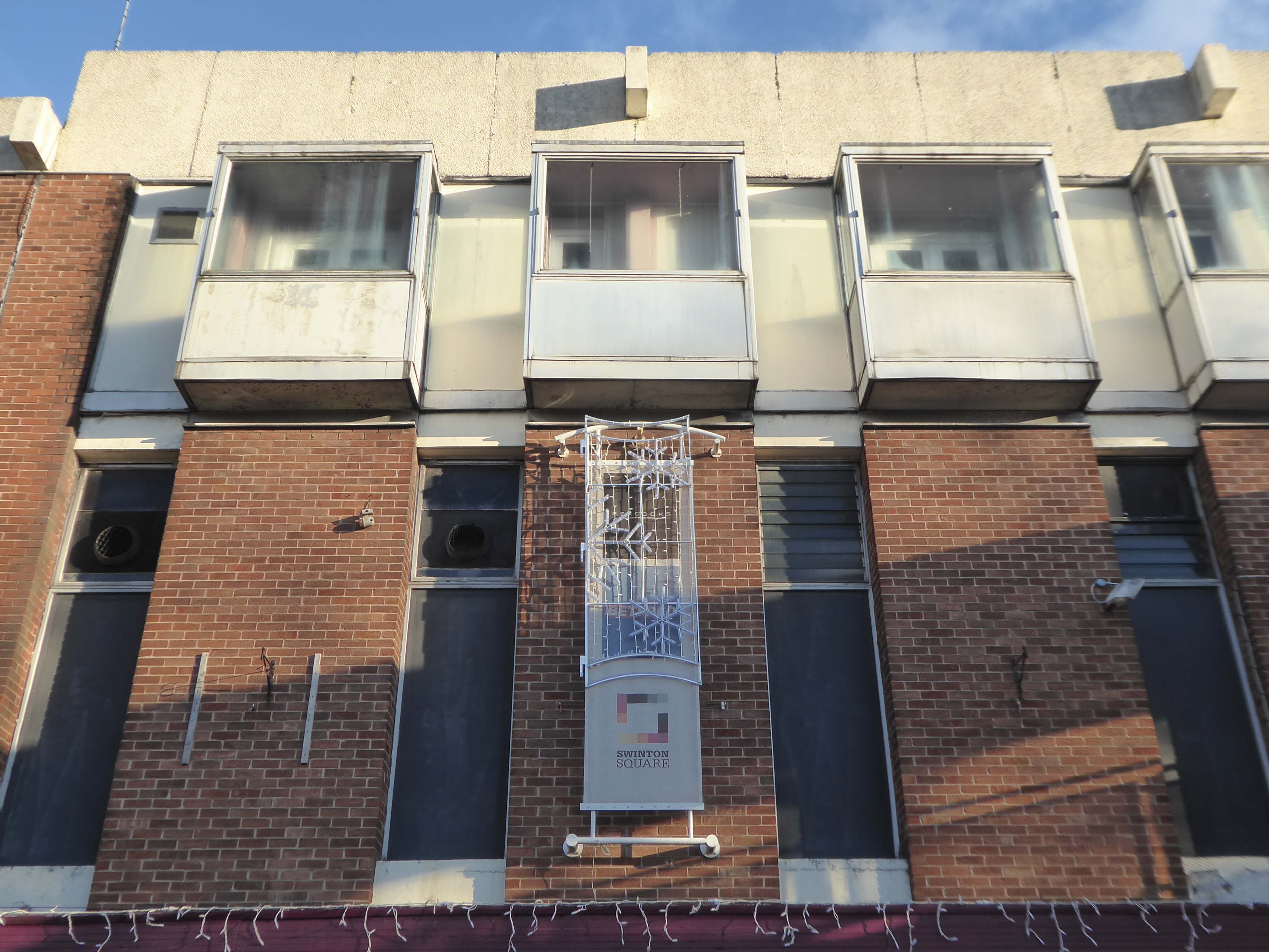
Opened in 1966 along with the slightly later Lancastrian Hall and Library, the Swinton Square shopping precinct provided an integrated modern setting for shopping, living, learning and entertainment.
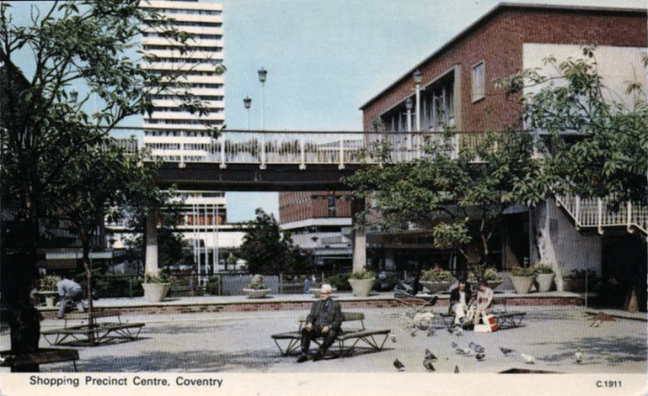
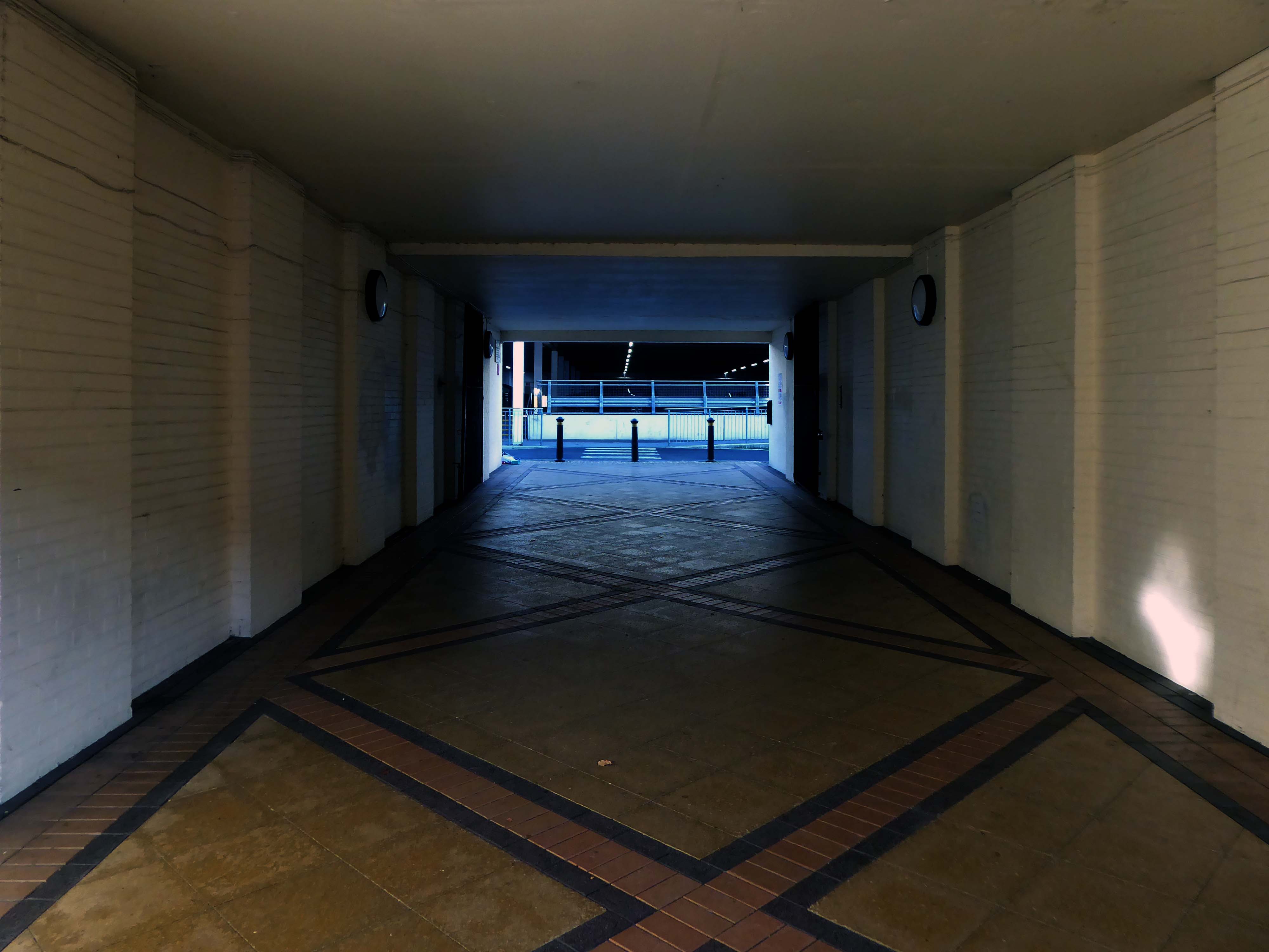
The late 60s and early 70s was a time of general prosperity – and the hard landscaping offered a soft option for the local folk.
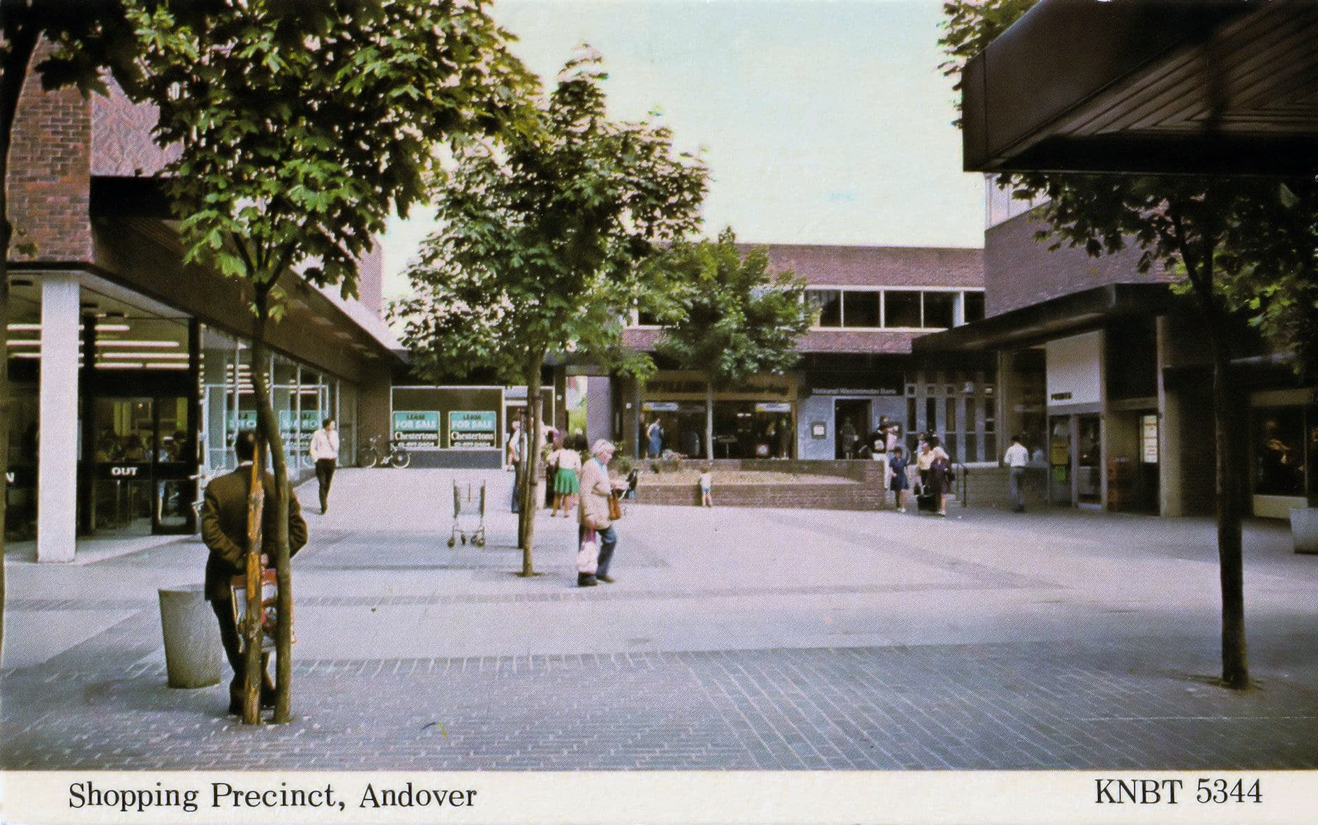
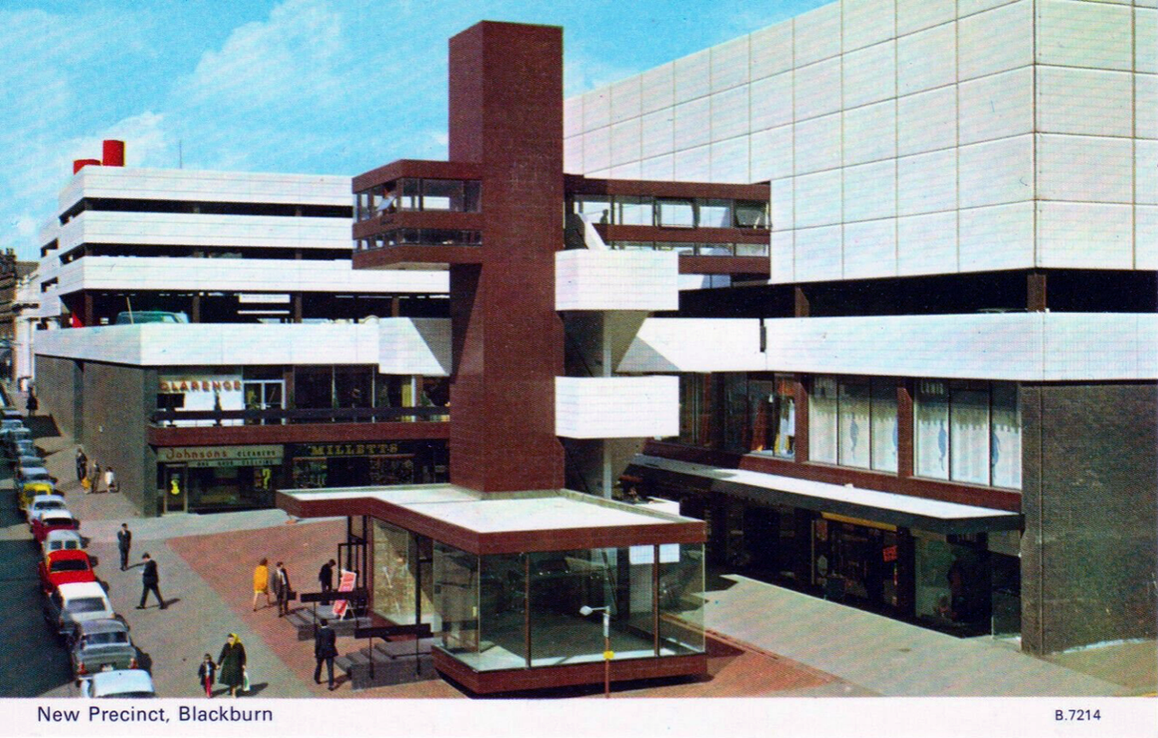
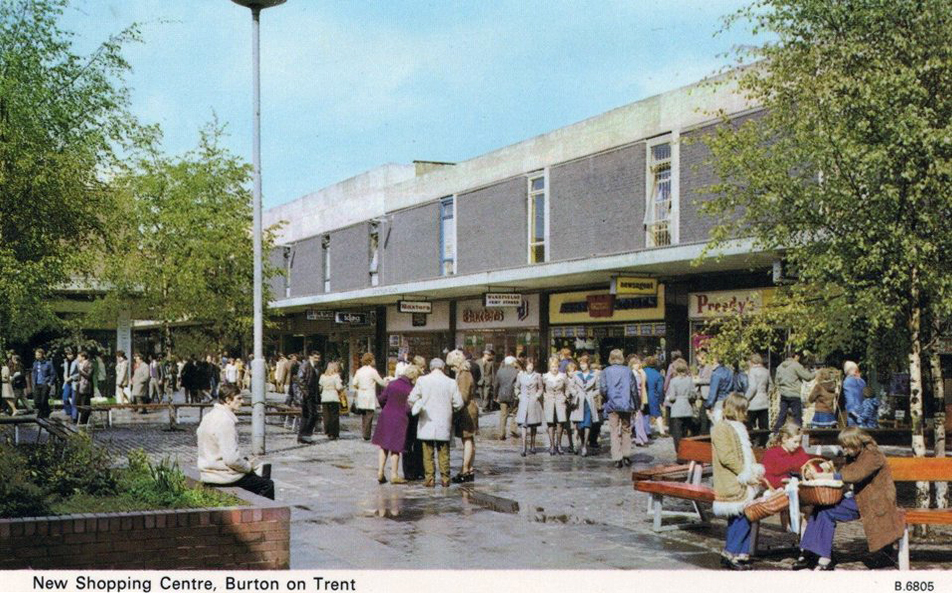
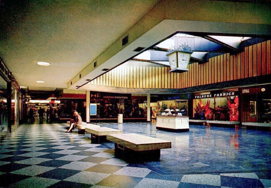
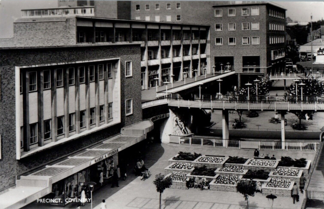
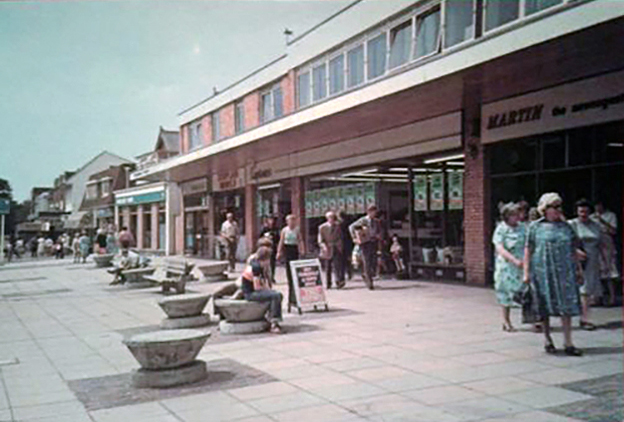
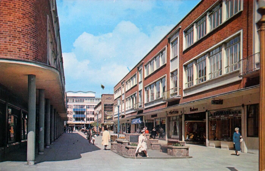
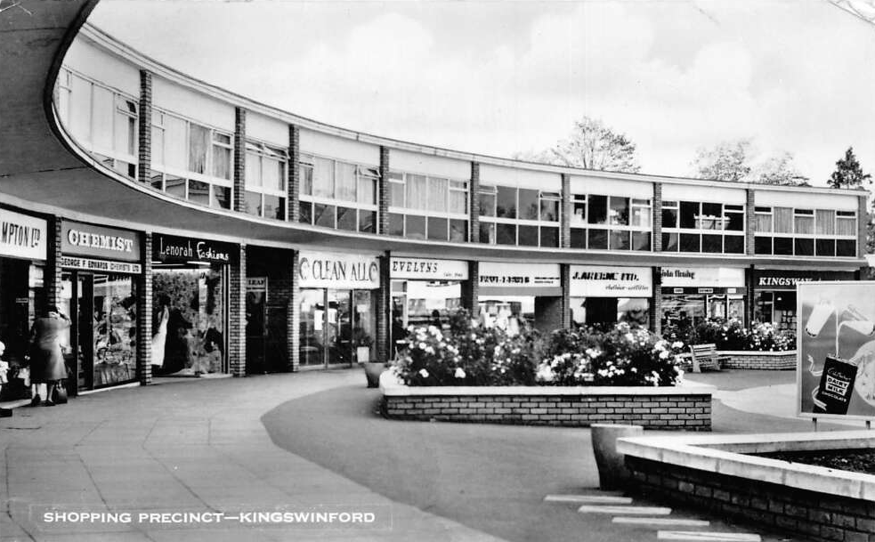
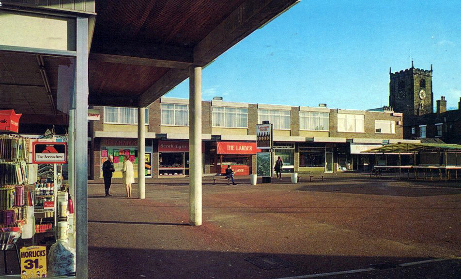
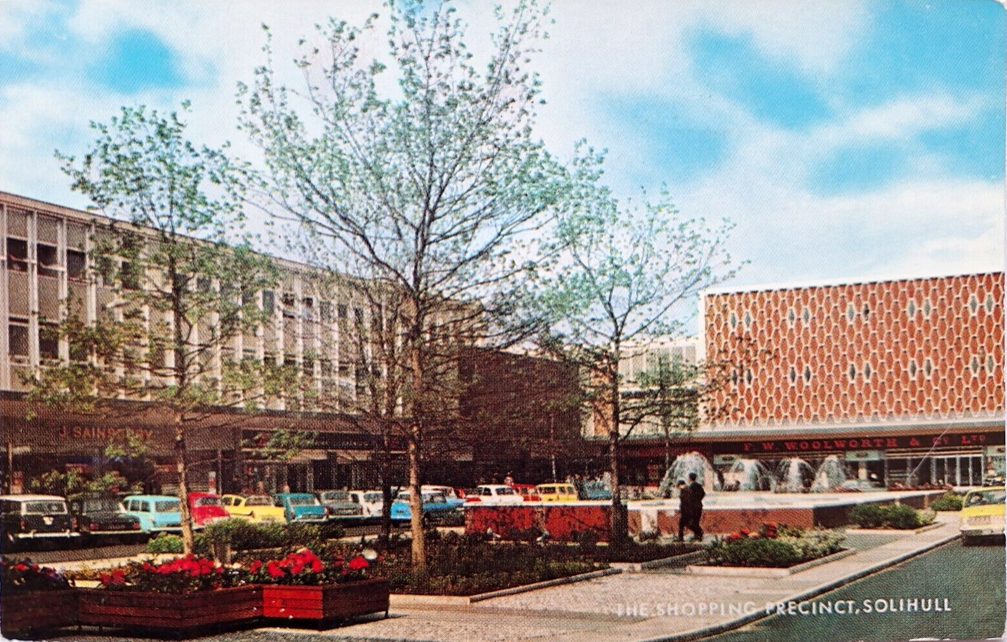
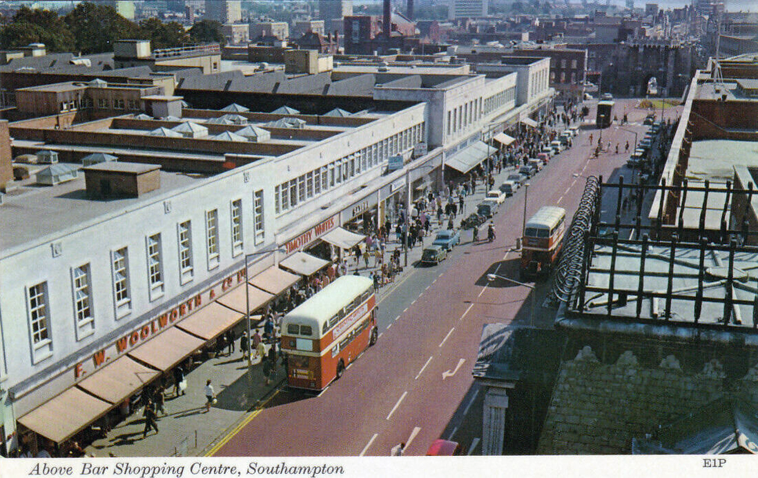
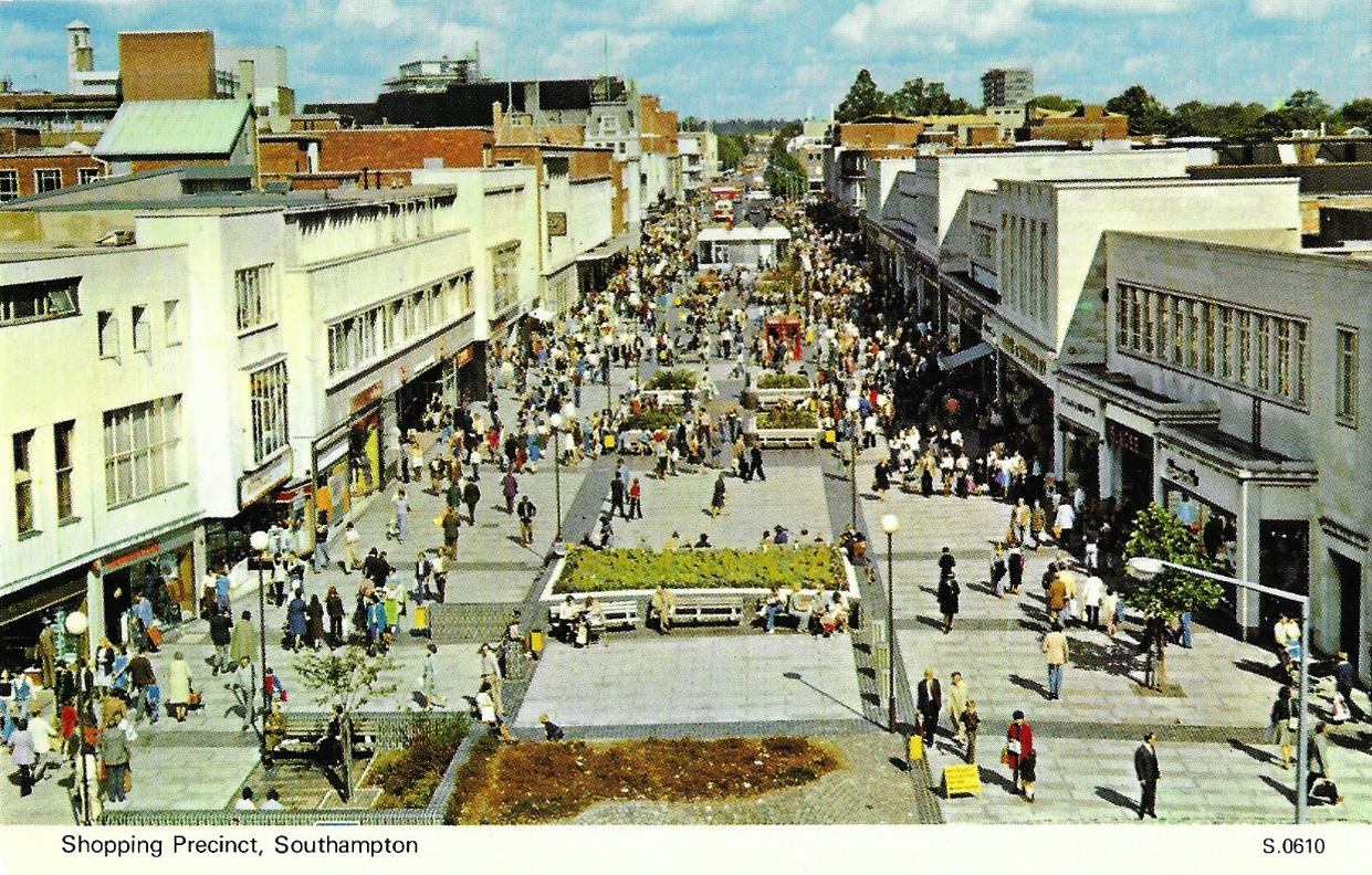
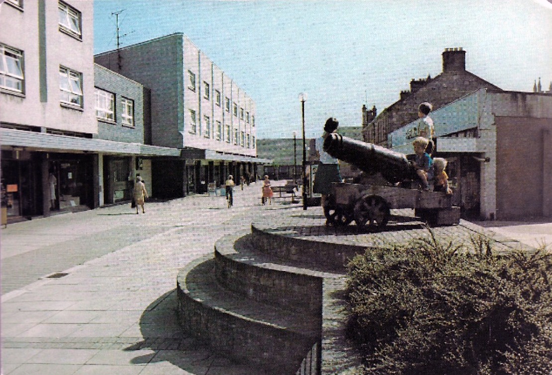
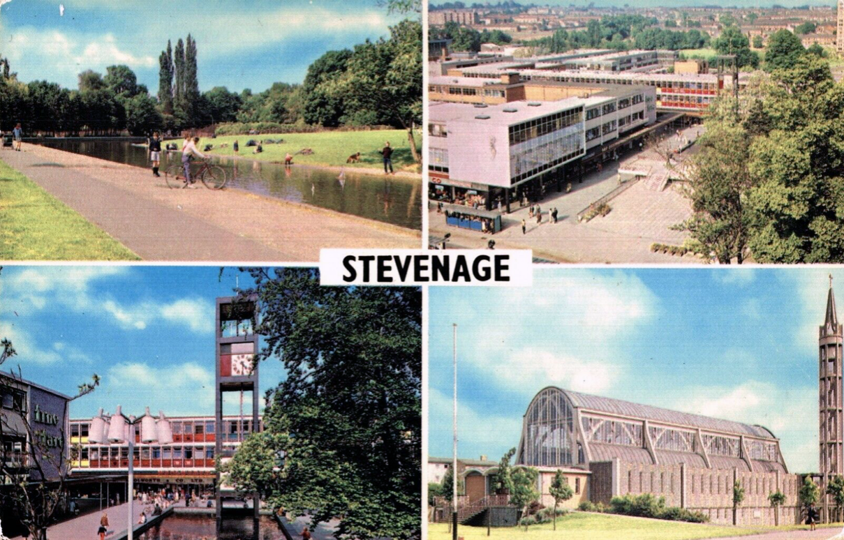
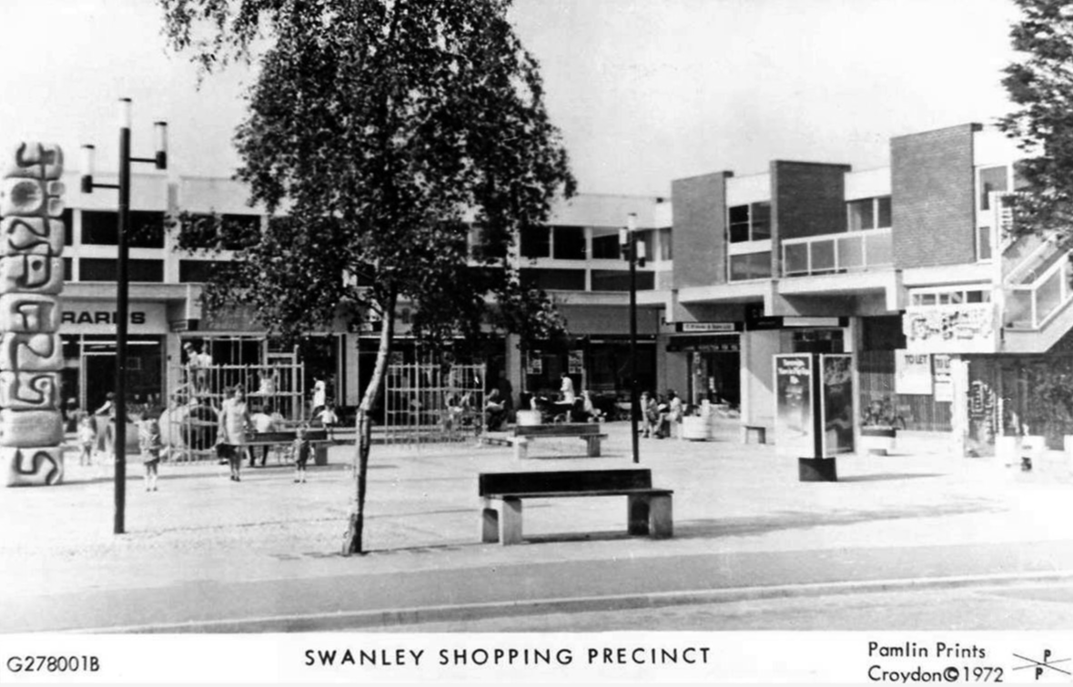
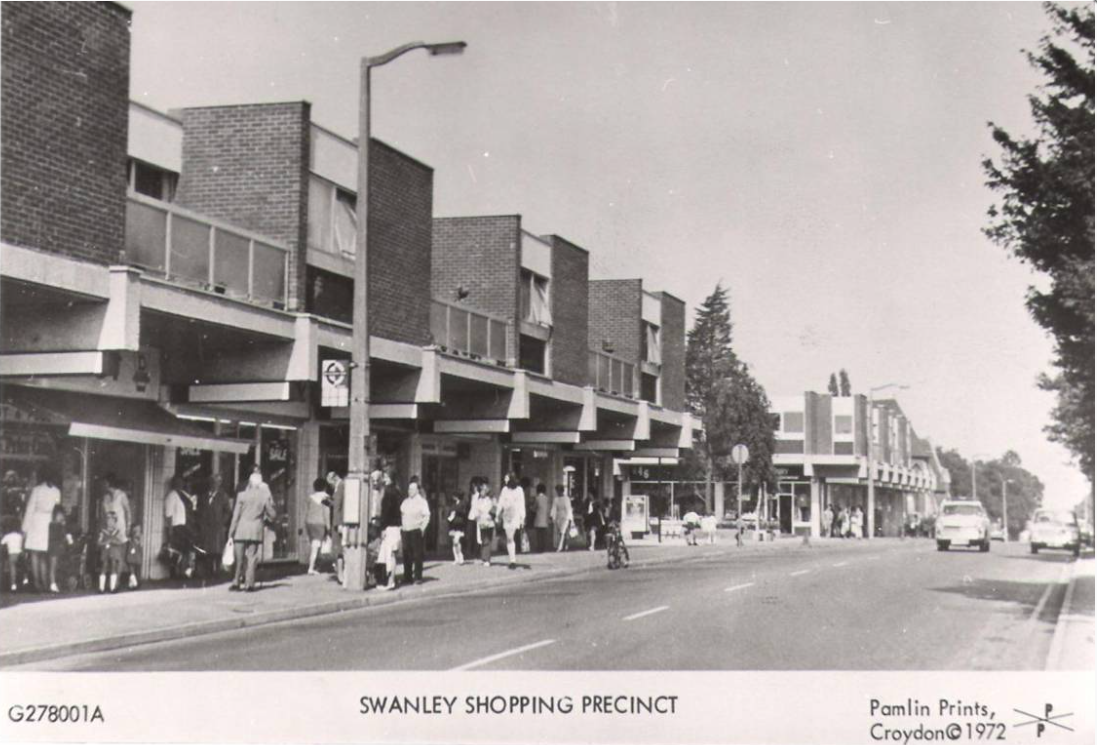
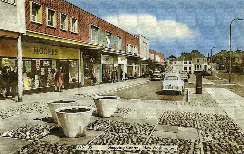
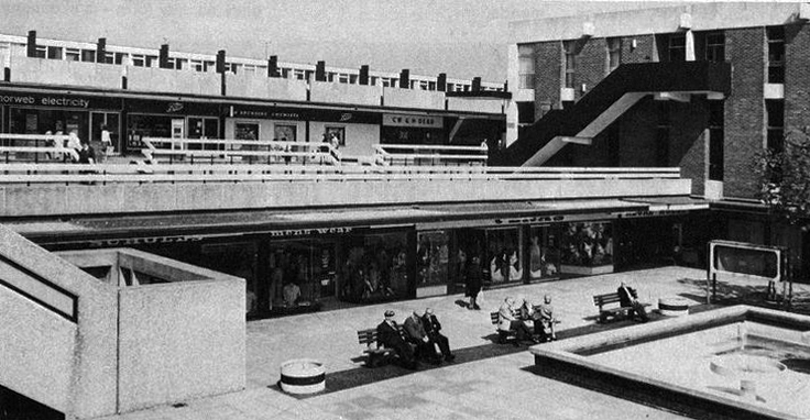
This was the age of the Precinct, celebrated nationally with postcard after postcard.
My local haunt in Ashton under Lyne.
Local traders and national chains rubbed shoulders.
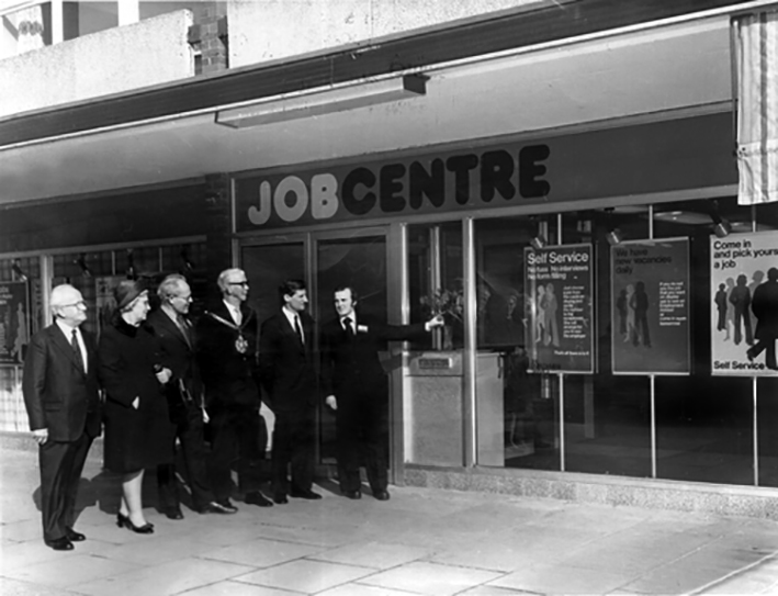
There was even a Job Centre opening- there was even a wide range of vacancies.
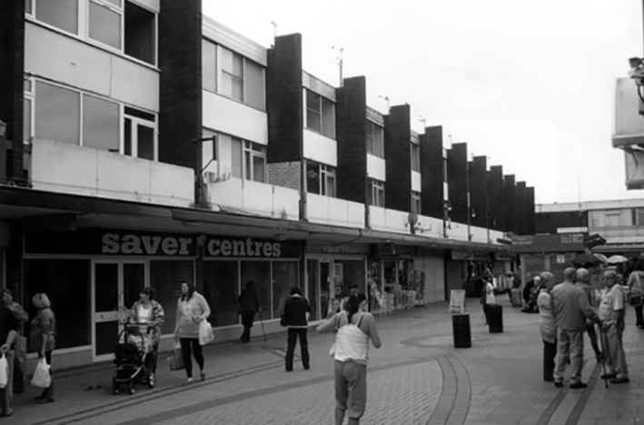
Following a challenging year, the letting reinforces Swinton Square as a pillar in the local community. Whilst retail has been heavily affected throughout the Covid-19 pandemic, footfall at the scheme has remained buoyant, with shoppers staying local, favouring the convenience and independent retailers of Swinton Square. Renovations began on the site of the new, temporary job centre at the beginning of the year and is due to be completed in May. The centre is expected to boost footfall and support for local, independent businesses.
Despite Swinton’s many strengths, it faces similar challenges to other towns. The shopping centre and other buildings in the town centre are dated and in need of investment. Demand for local housing has grown by 23% in the last five years, but there is a lack of high-quality family and affordable housing in the right locations in the area.
The vision is just the first step of the journey, the next is to appoint a developer partner who can take this vision and help shape it, through ongoing consultation and engagement with the community, into a framework and plan for Swinton that will guide future investment.