The Cheshire Lines Committee CLC operated Stockport, Timperley and Altrincham Junction Railway line from Portwood to Skelton Junction, a section of what became the Woodley to Glazebrook line.
It remained a part of the CLC, which was jointly owned from 1923 by the London and North Eastern Railway and the London Midland and Scottish Railway , until 1948 when it became part of the British Railways London Midland Region.
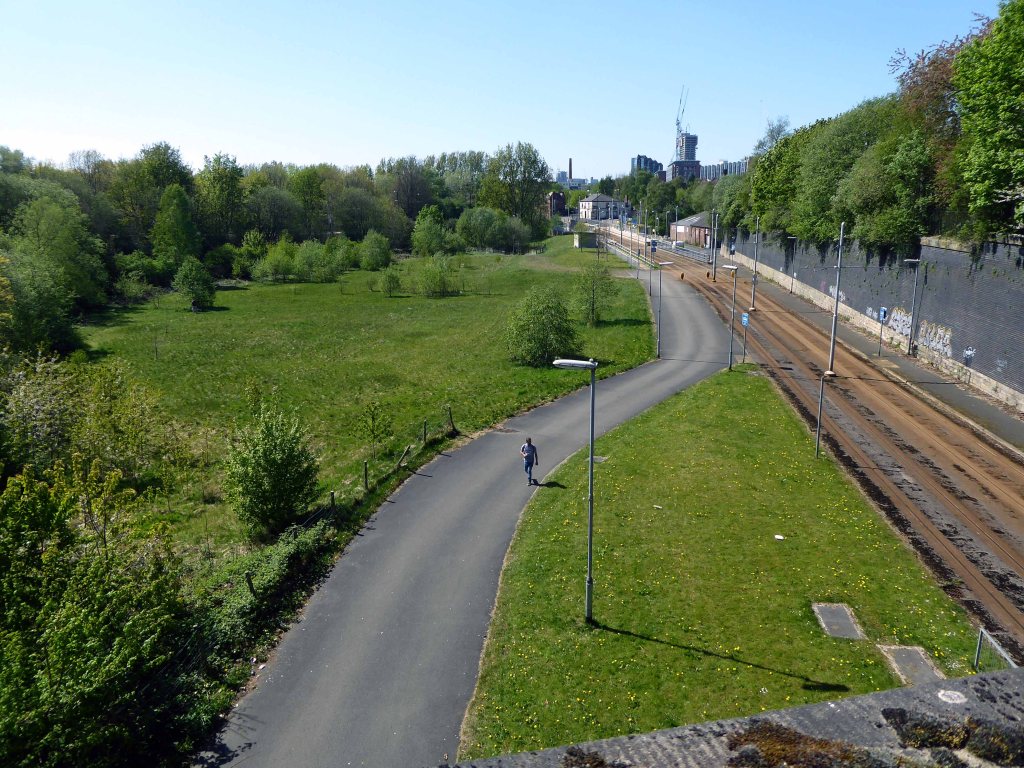
Closed in 1982, following the demise of the Woodhead route; the track was subsequently lifted in 1986.
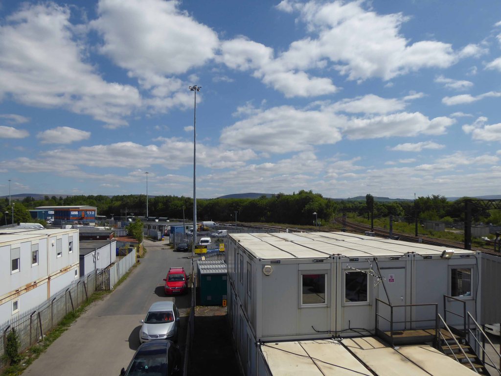
in the age of steam mainline St Pancras trains and local stoppers flew by.
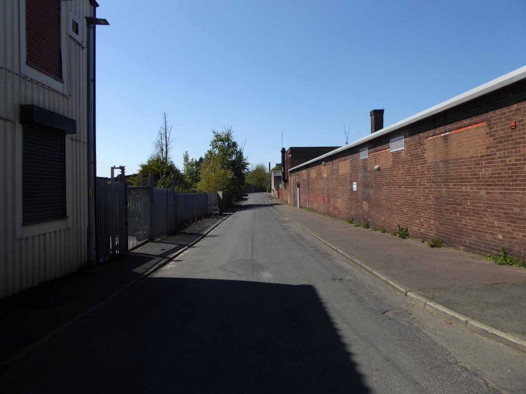
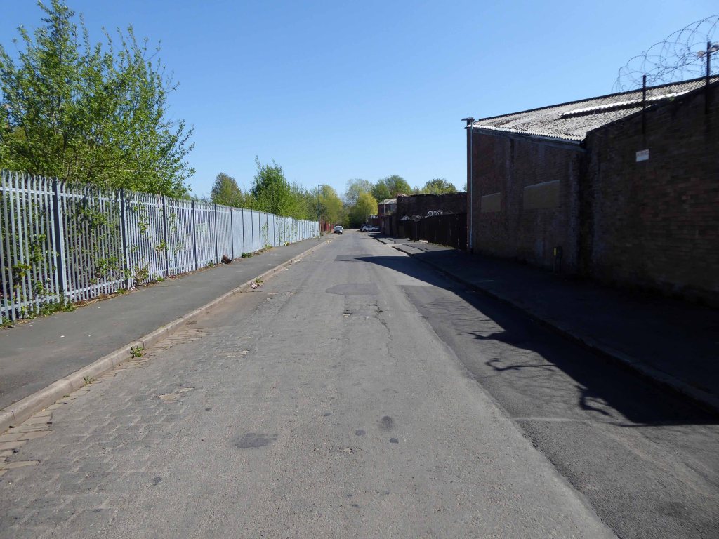
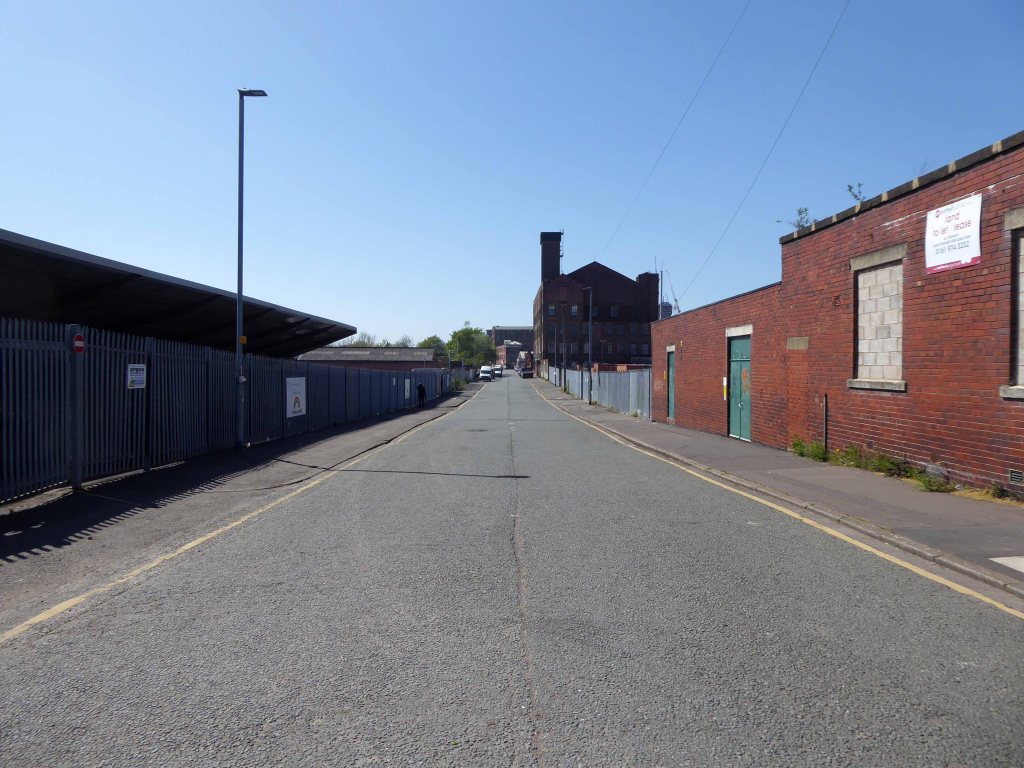
My interest lies in the small portion of track at the end of Georges Road – I worked as a Guide Bridge goods guard in and out of the scrap yard there, in the Seventies.
Now I walk past almost every day and it’s almost all gone.
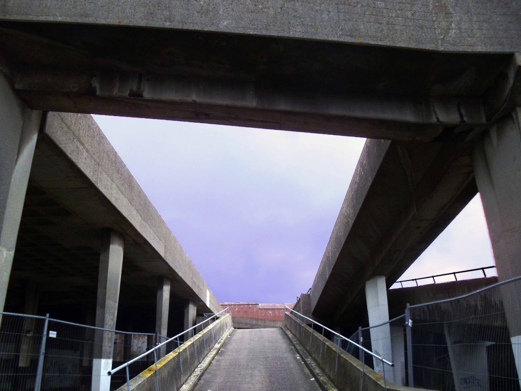
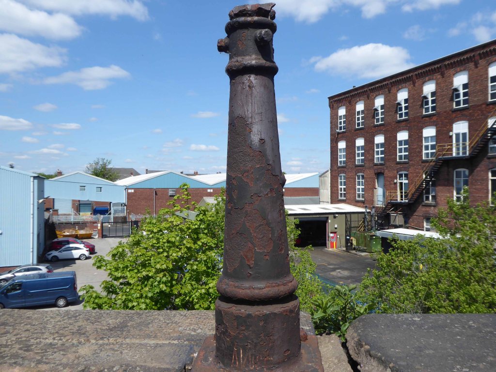
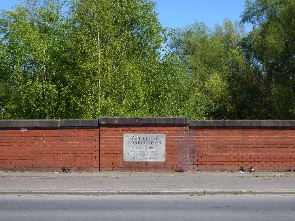
The bridge which it supported now demolished, time called long ago in the long lost Gardeners Arms – originally a Bell’s Brewery pub latterly a Robinsons house.
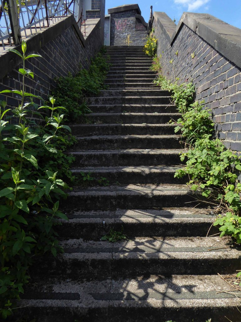
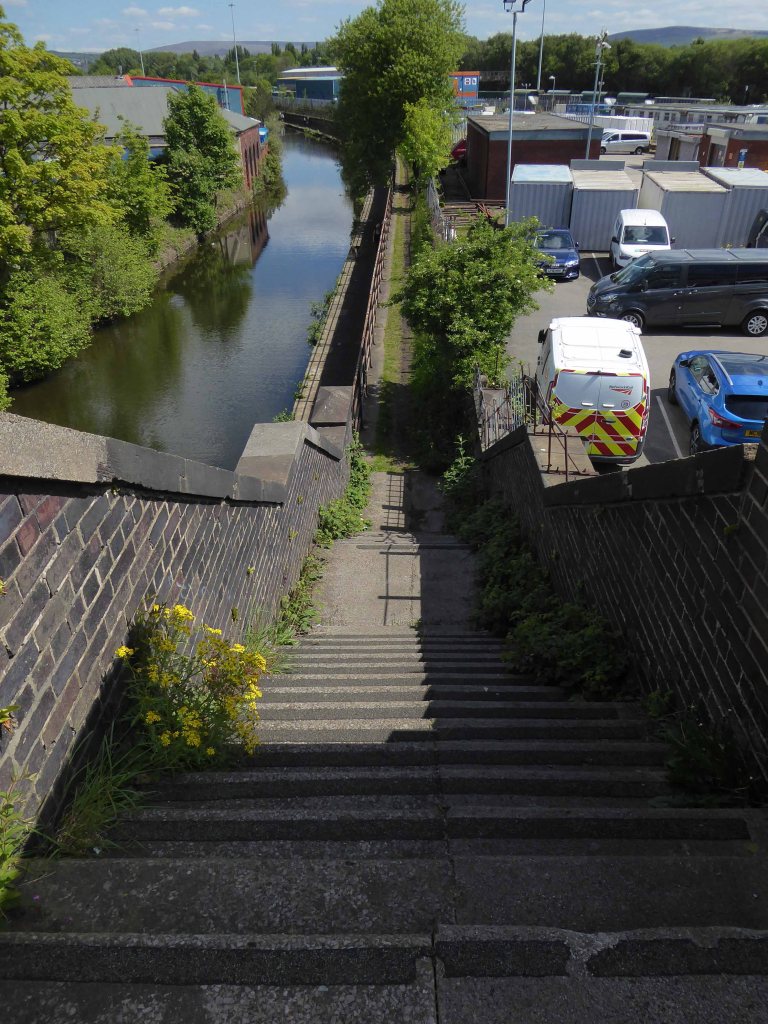
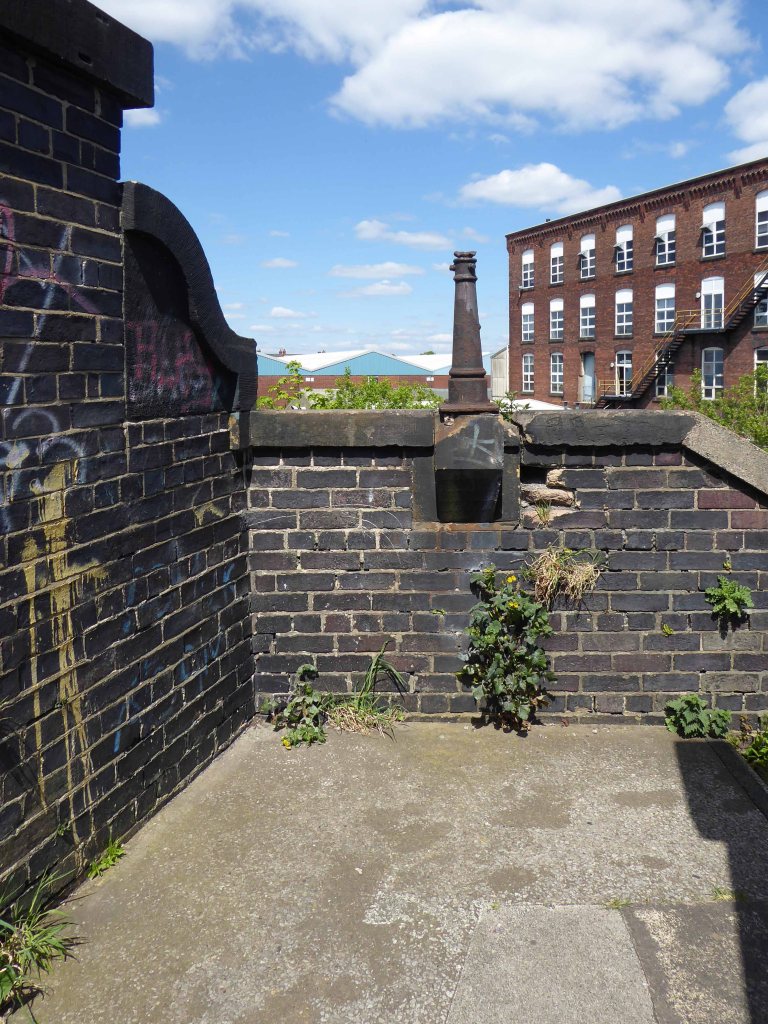
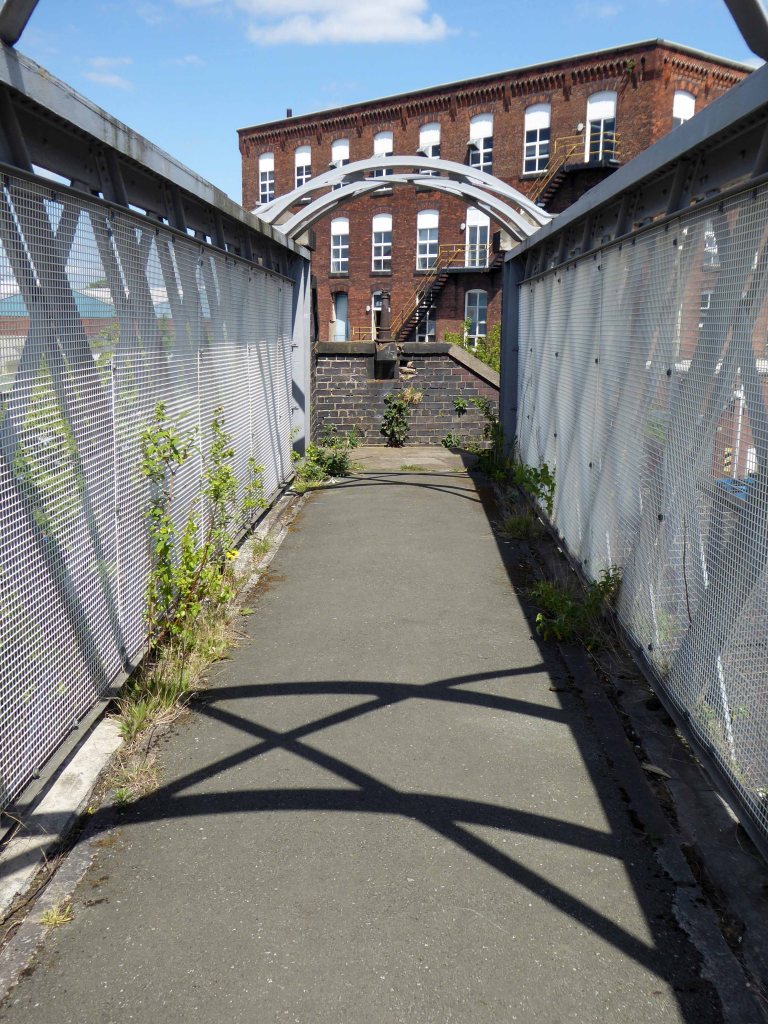
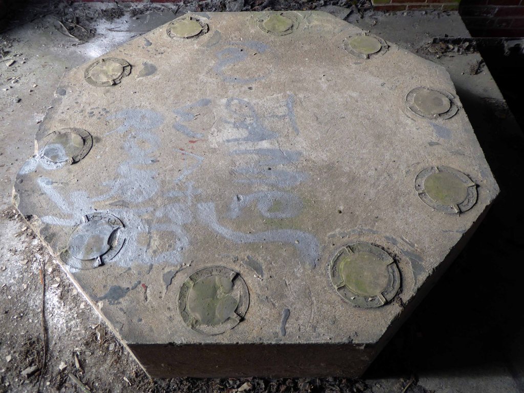
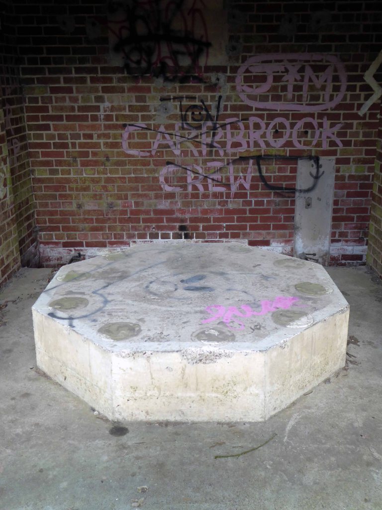
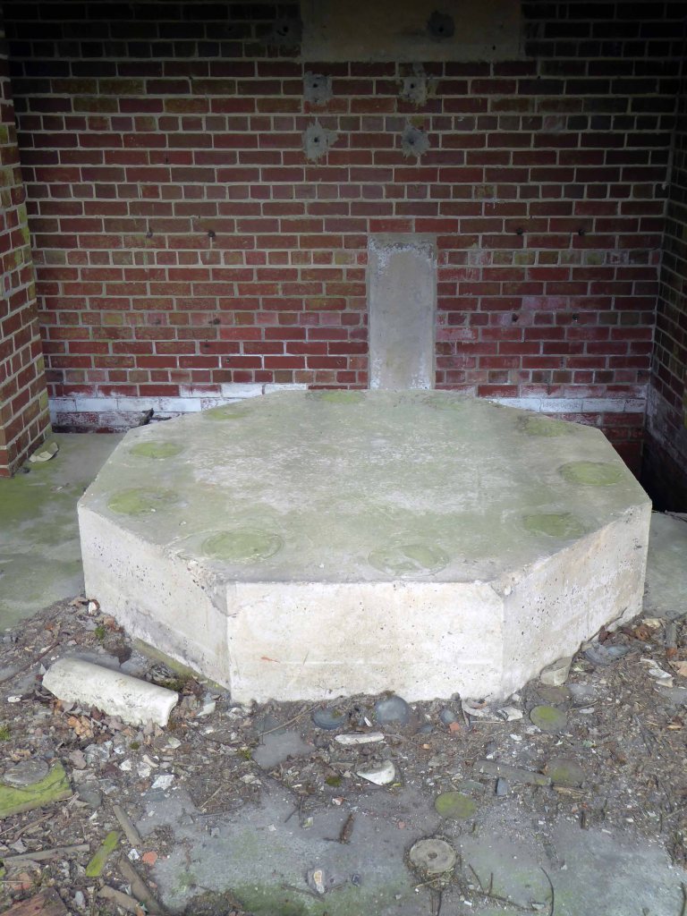
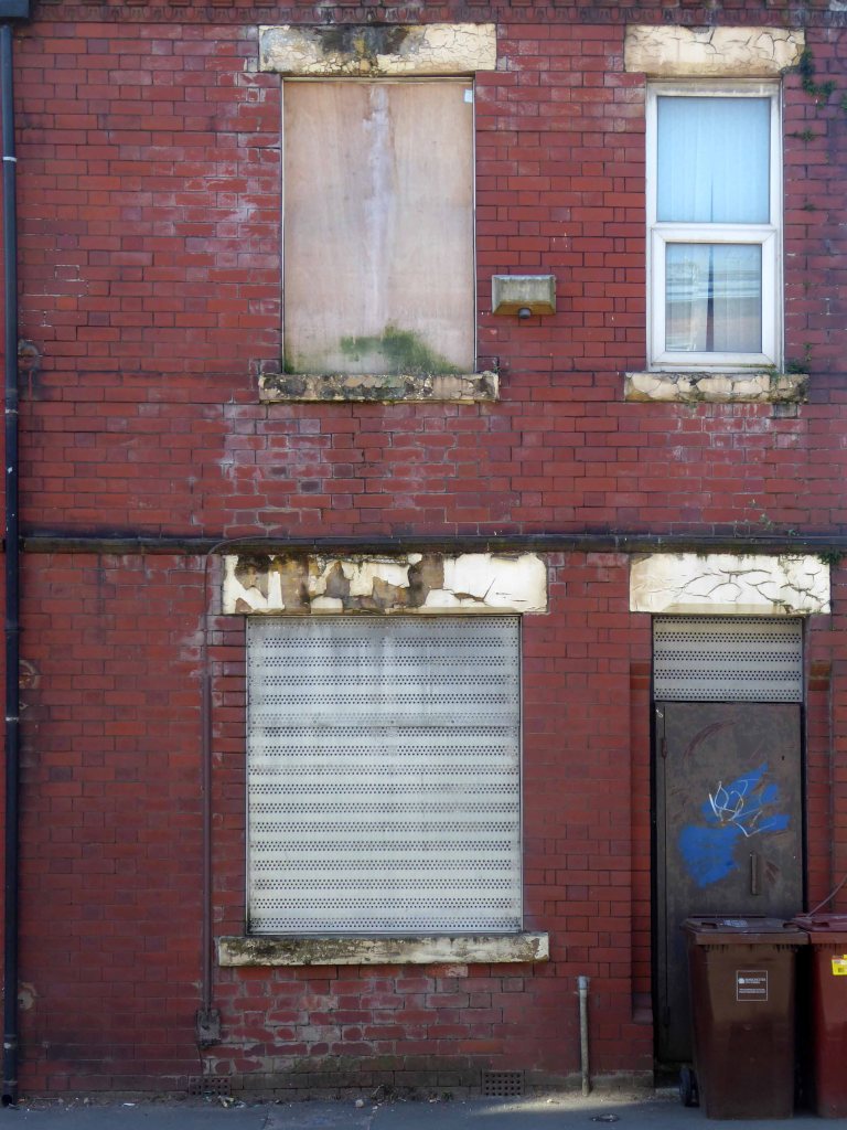
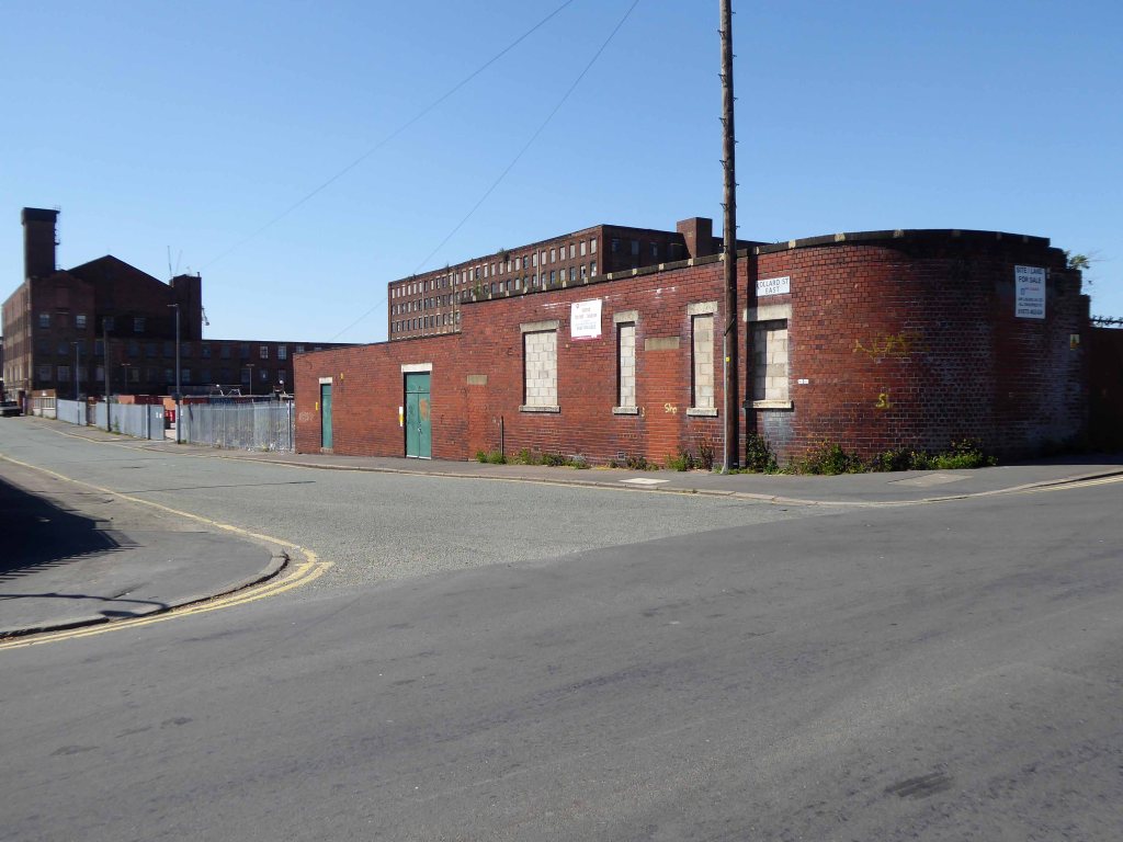
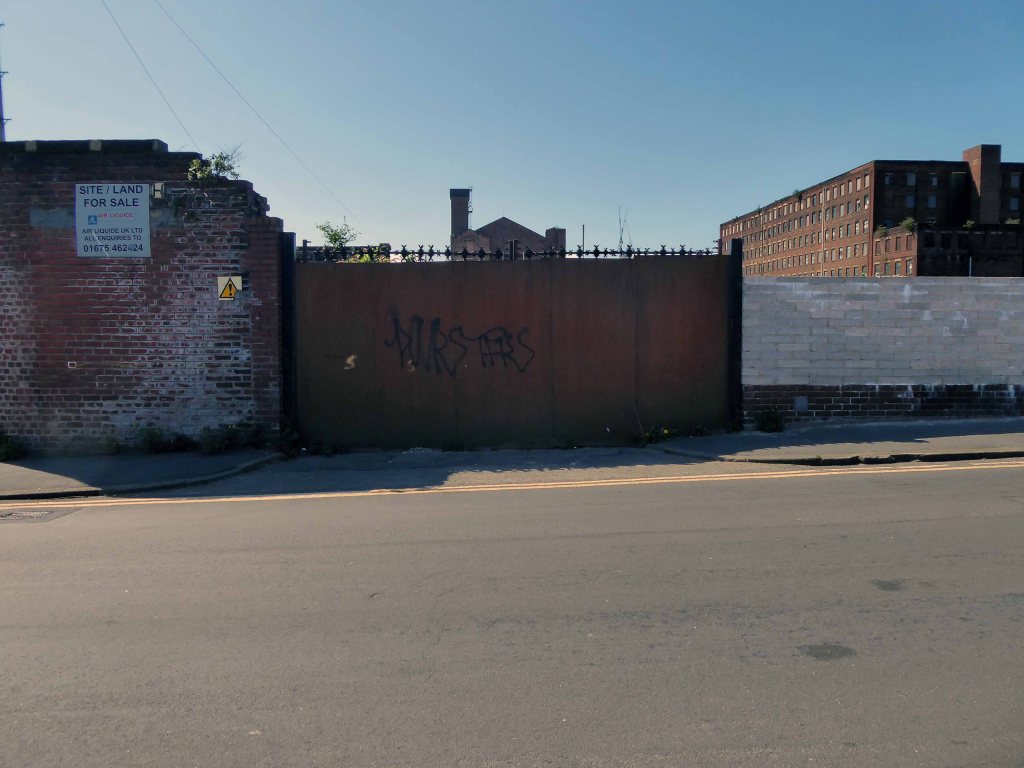
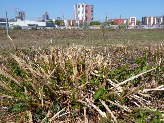
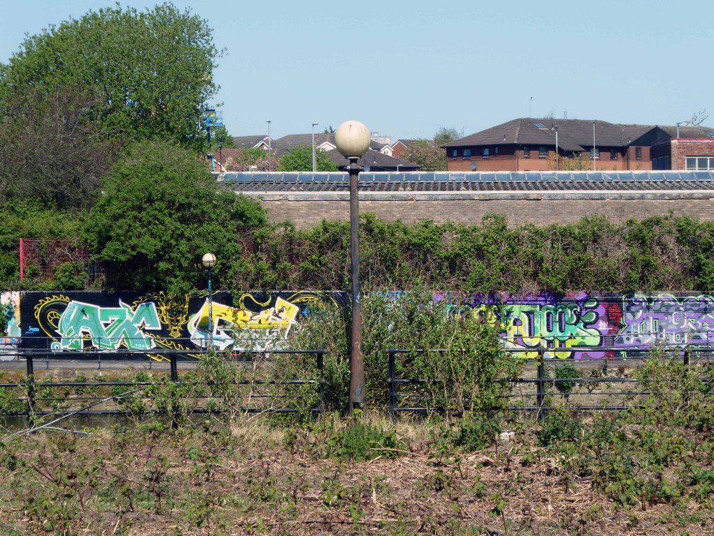
What remains is a triangular island faced in glazed and blue engineer’s brick, topped out with trees.
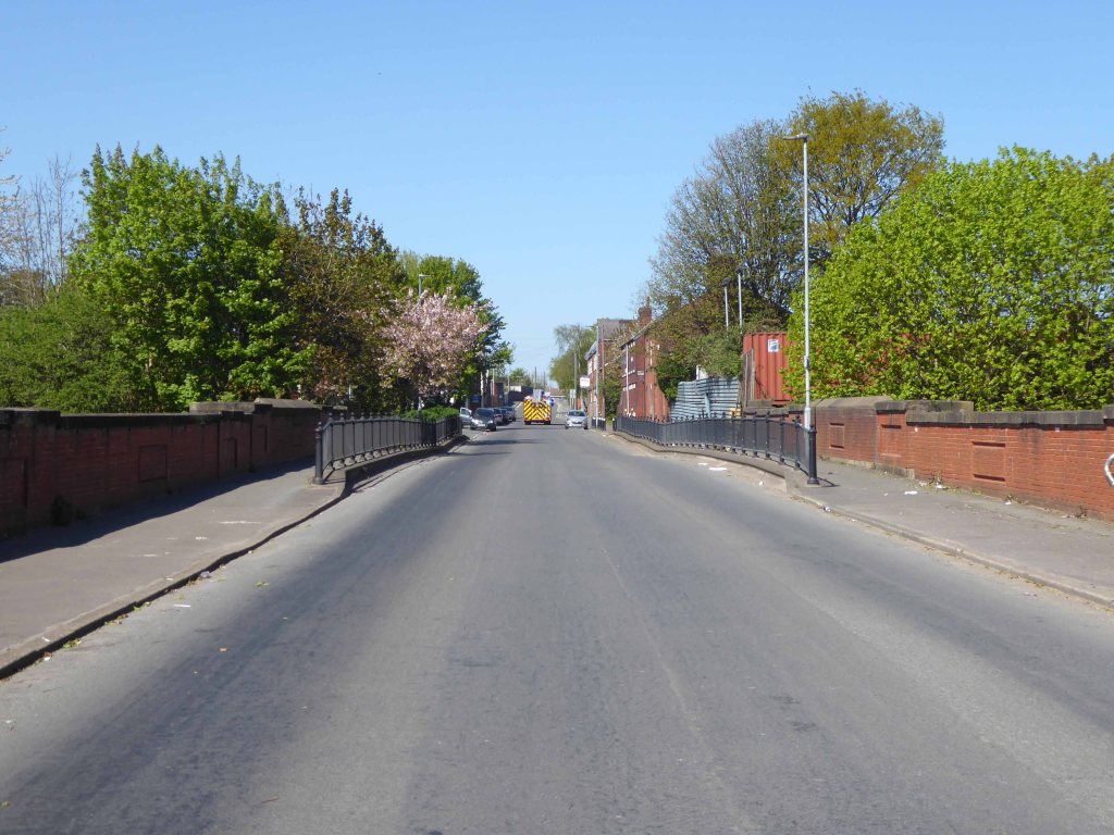
I have entertained the idea of accessing the area by ladder, exploring and possibly setting up camp – though I think the proximity to an almost constant flow of traffic, would prove less than commodious.
It evokes for me an elevated affinity with Ballard’s Concrete Island.
He reached the foot of the embankment, and waved with one arm, shouting at the few cars moving along the westbound carriageway. None of the drivers could see him, let alone hear his dry-throated croak, and Maitland stopped, conserving his strength. He tried to climb the embankment, but within a few steps collapsed in a heap on the muddy slope.
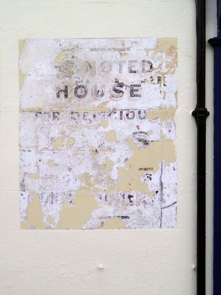
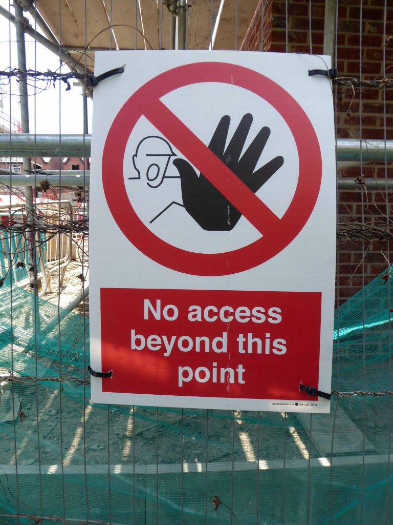
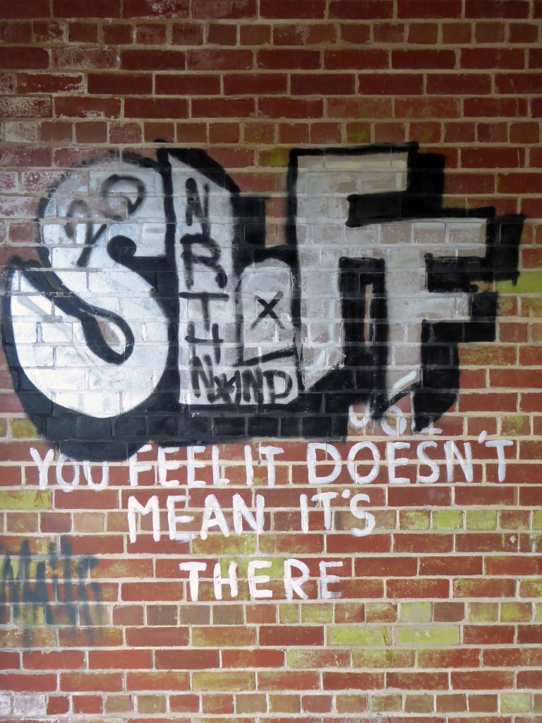
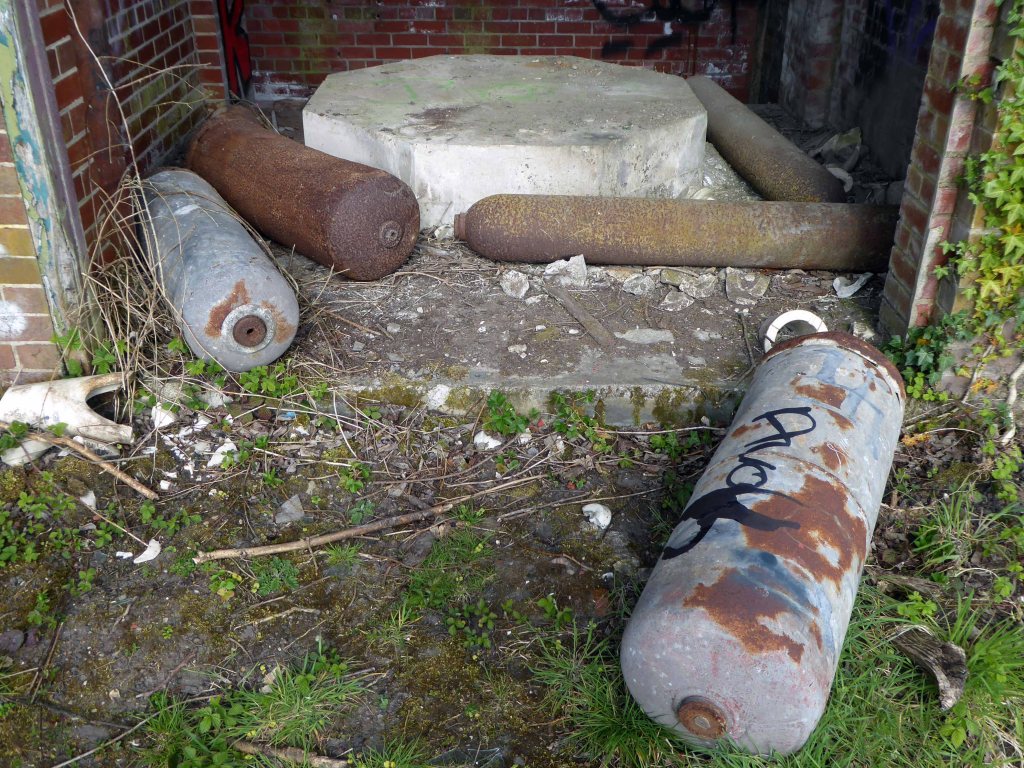
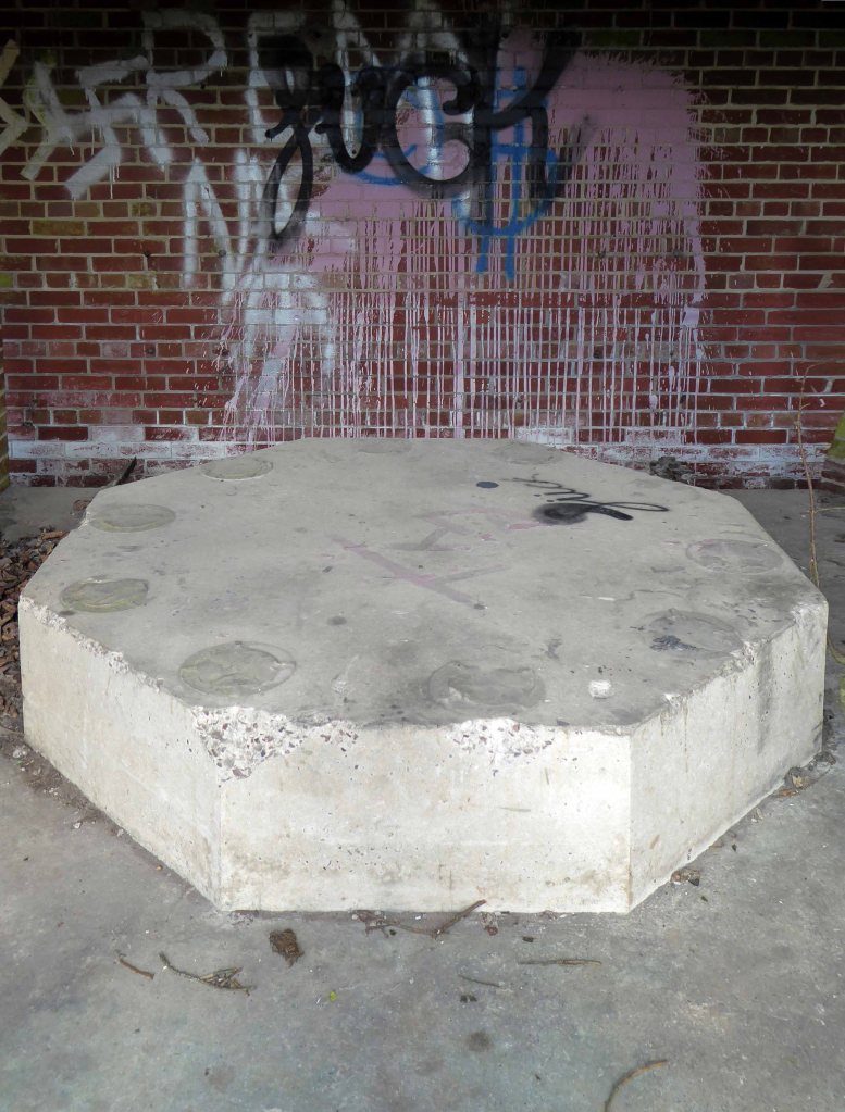
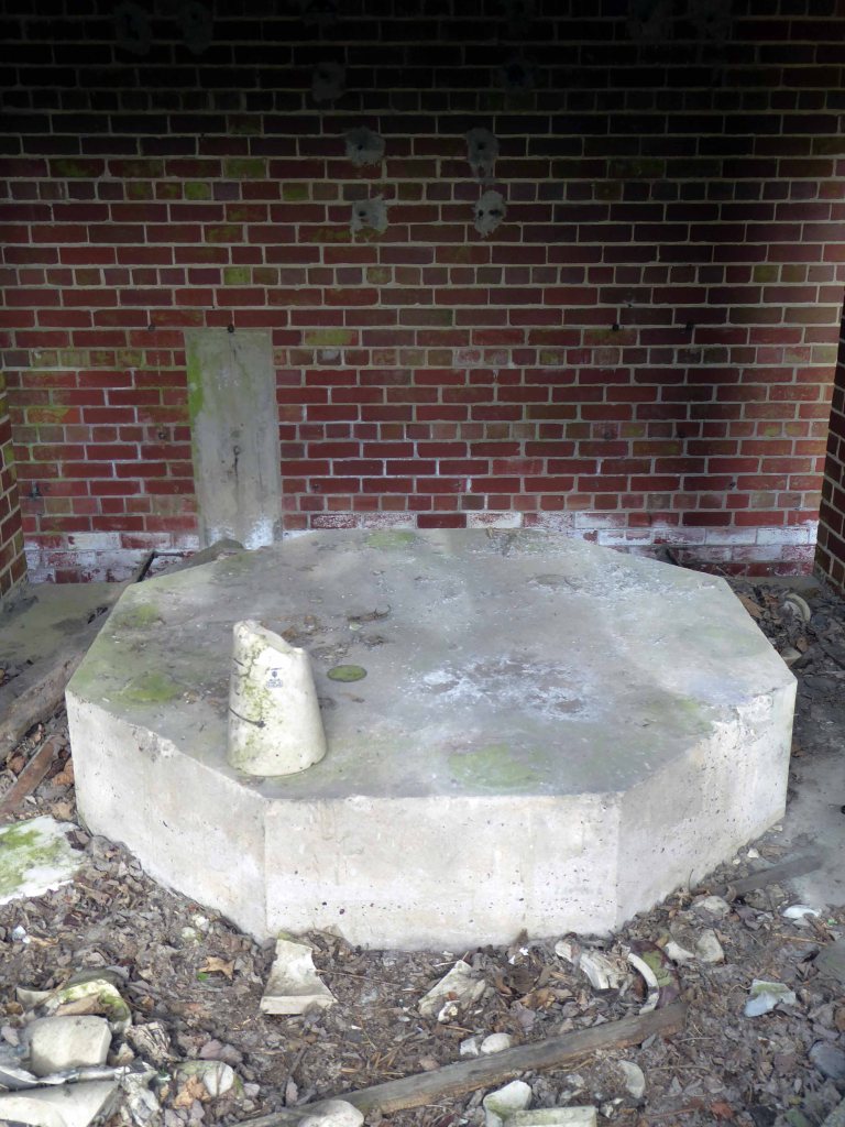
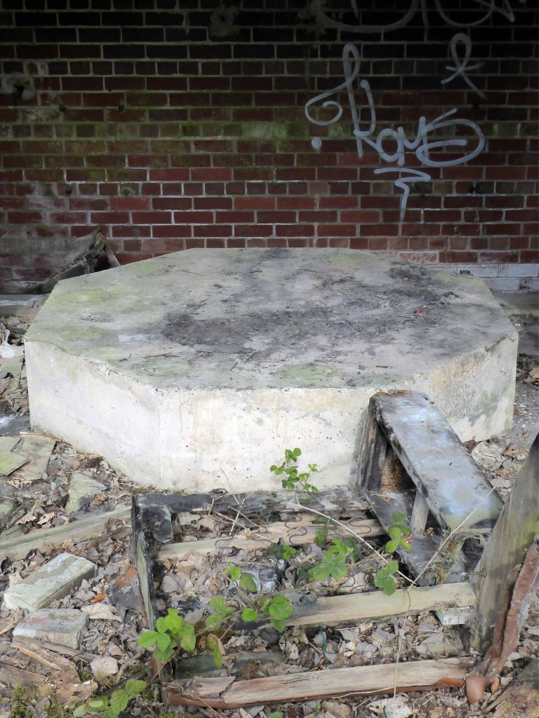
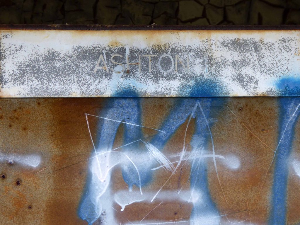
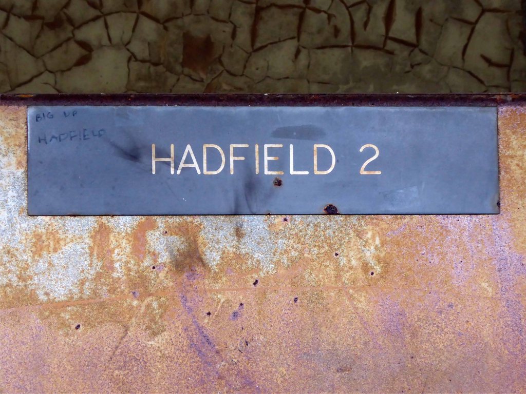
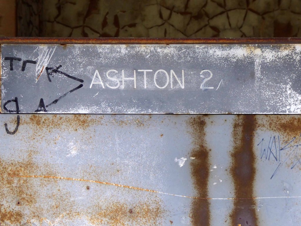
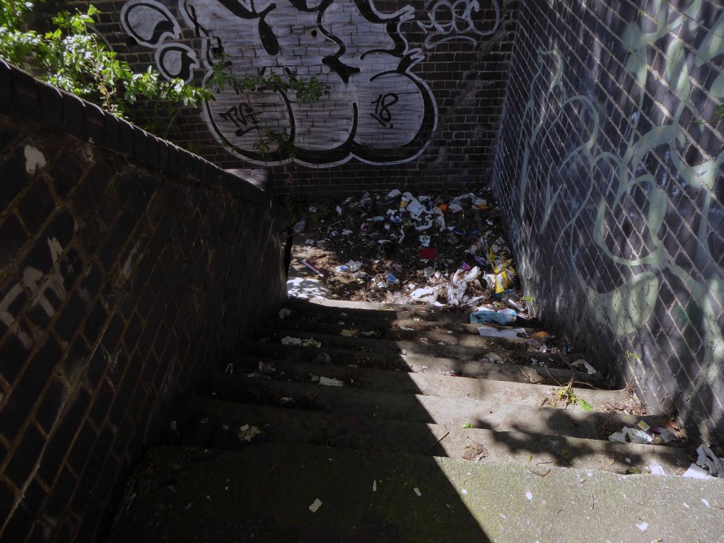
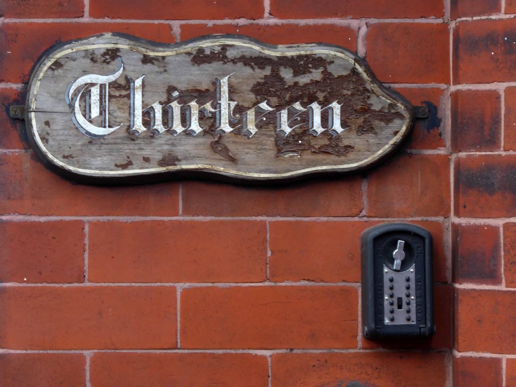
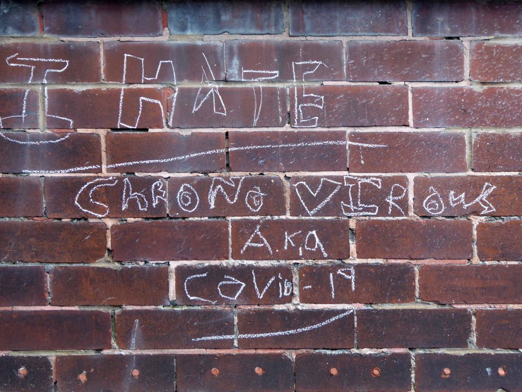
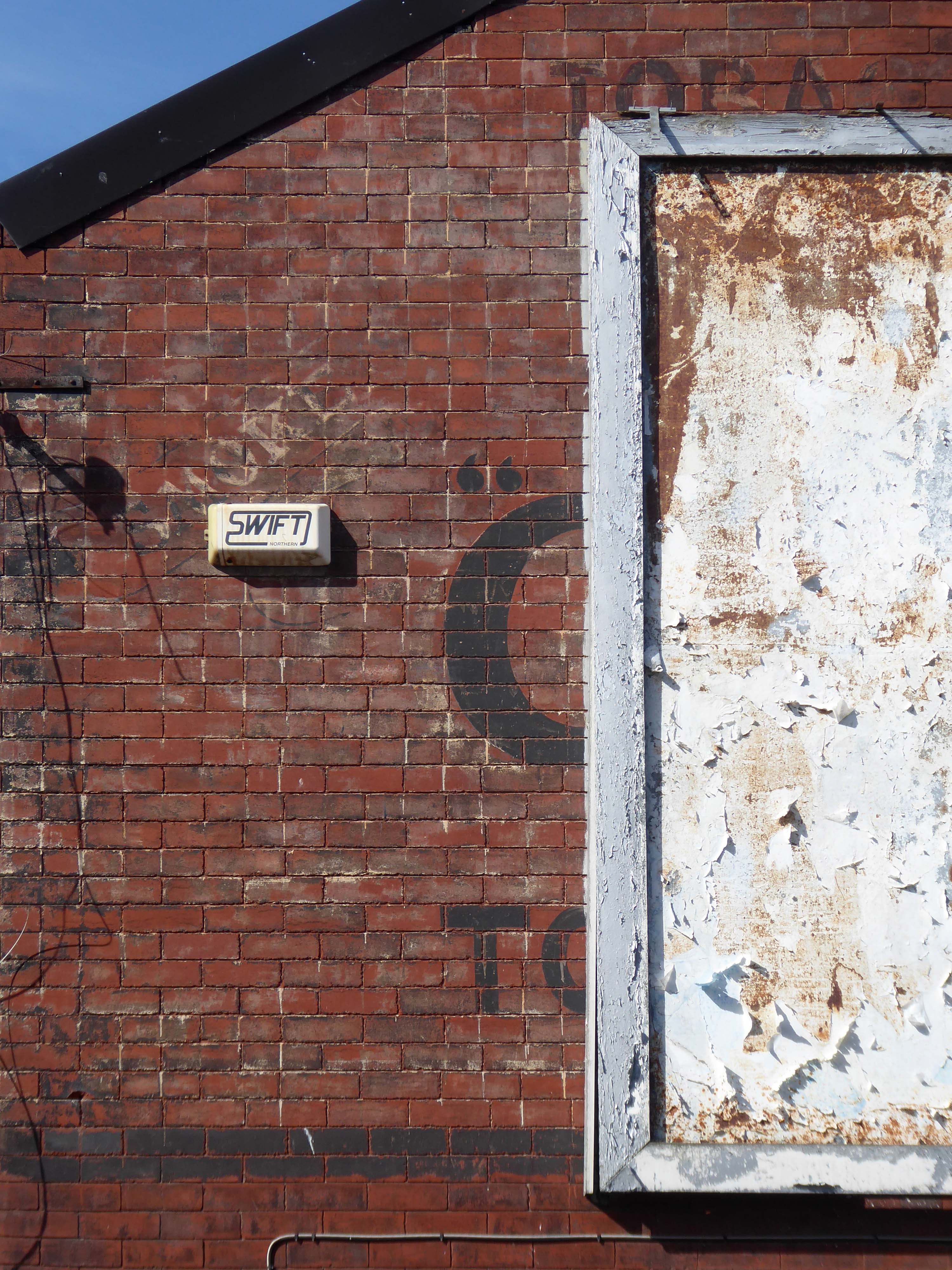
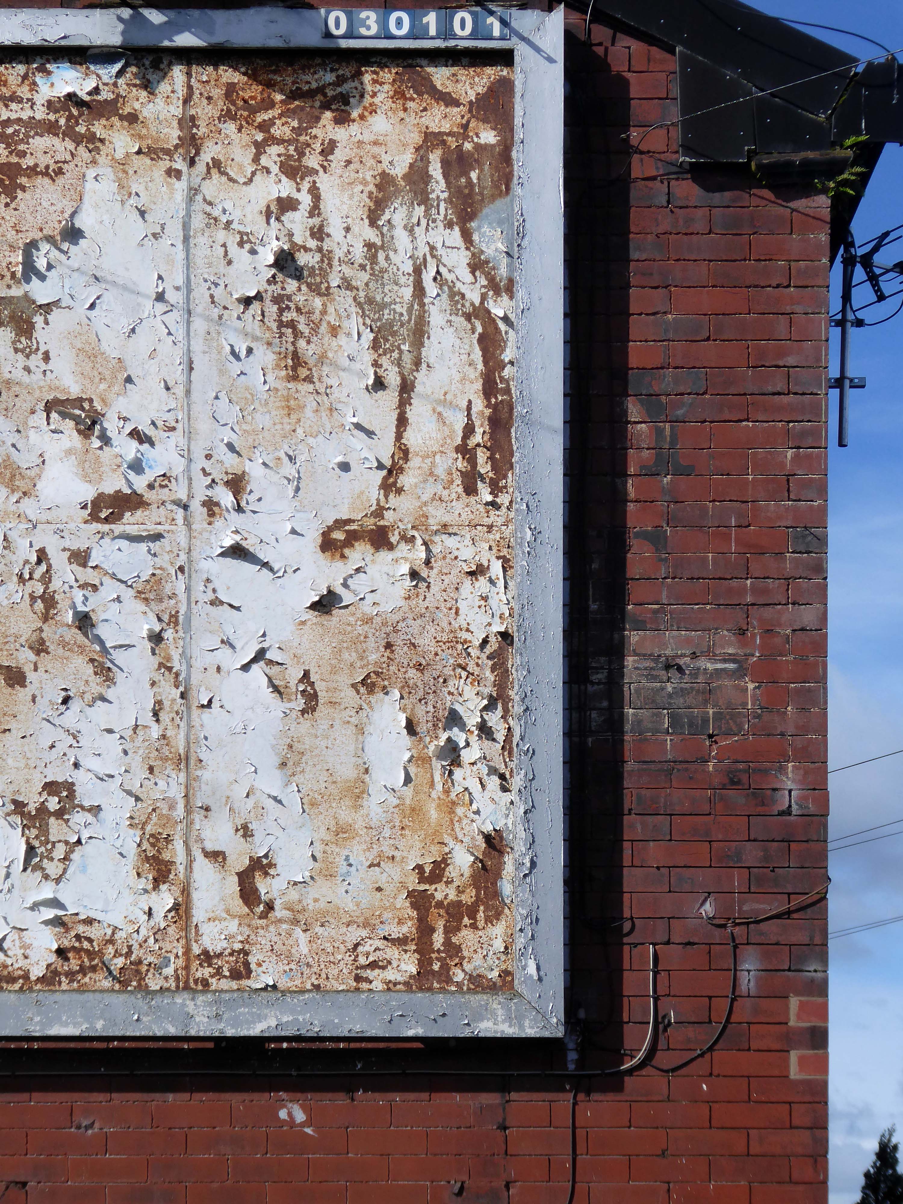
So here it is as is complete with tags, signs, cracks and all.
It remains as a monument to those who built and worked on the railway.
Leaving the compact anonymity of my B&B for the open road!
Having been unable to sample the joys of the Quality Hotel.
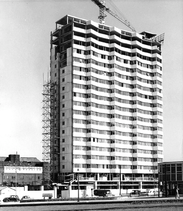
The Quality Hotel closed in 2014 and was demolished two years later after the site was bought by the city council following vandalism and fires.
The ten-storey concrete block was built in 1970 in the 350th anniversary year of The Mayflower ship setting sail from Plymouth for North America.
Gilpin Demolition
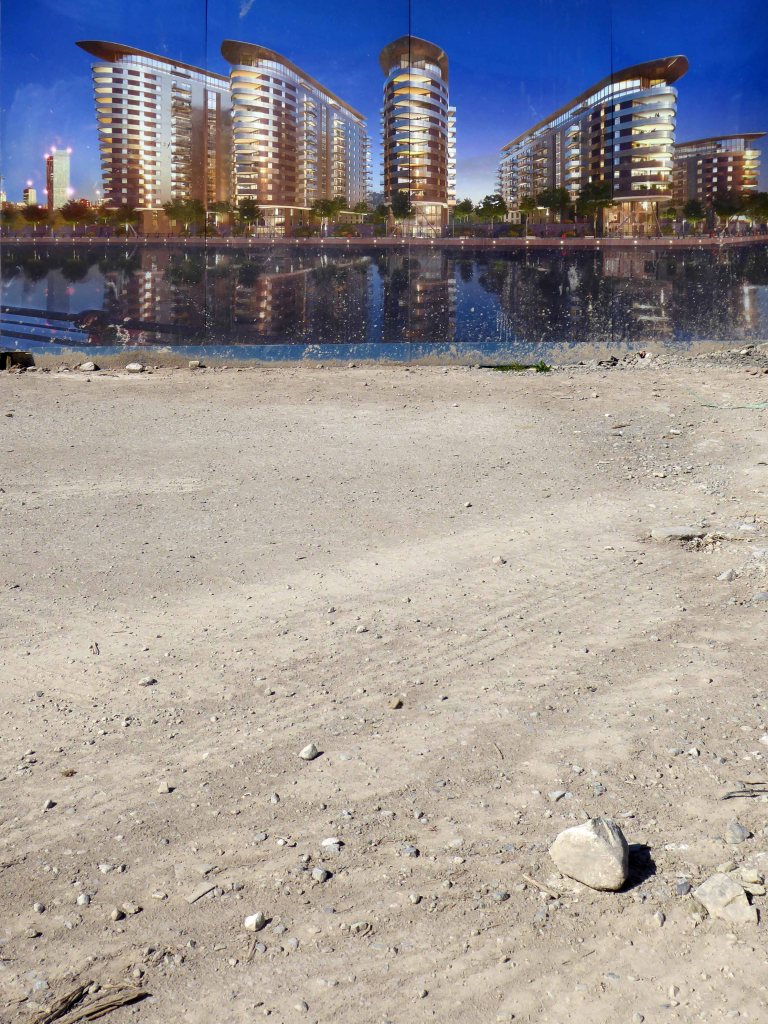
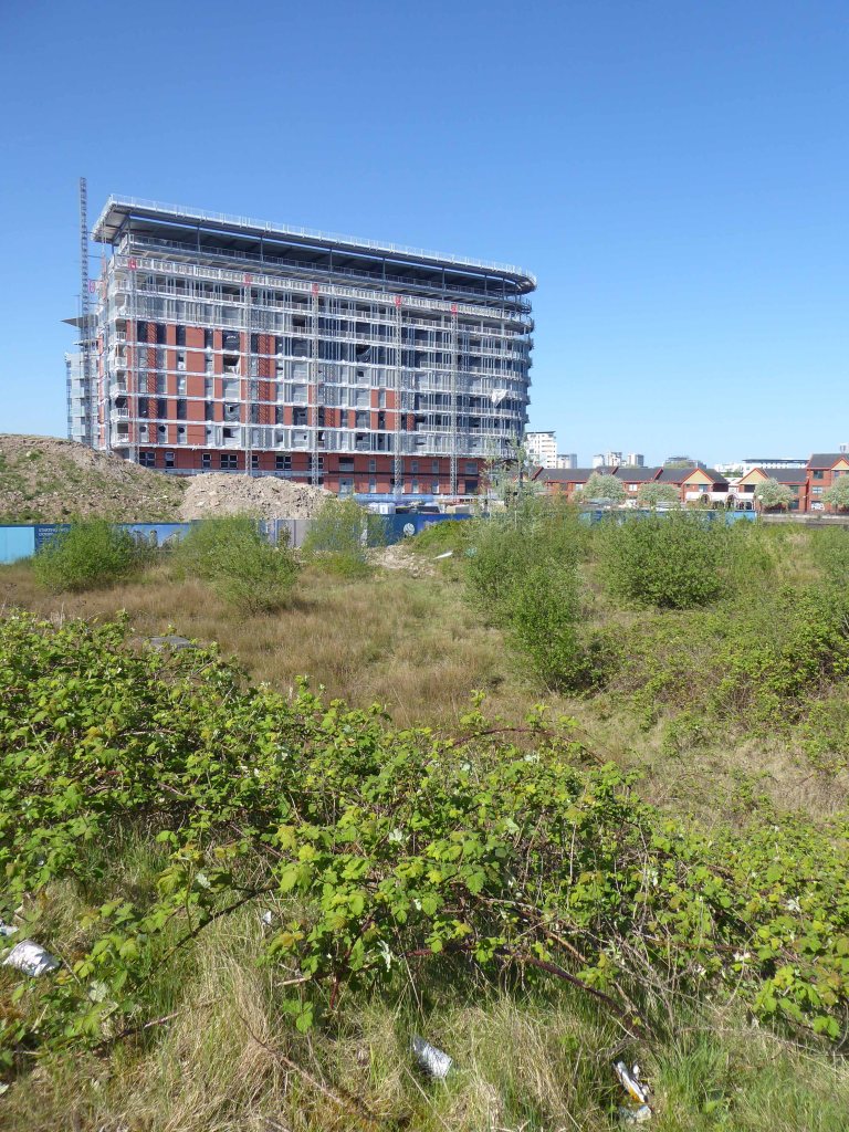
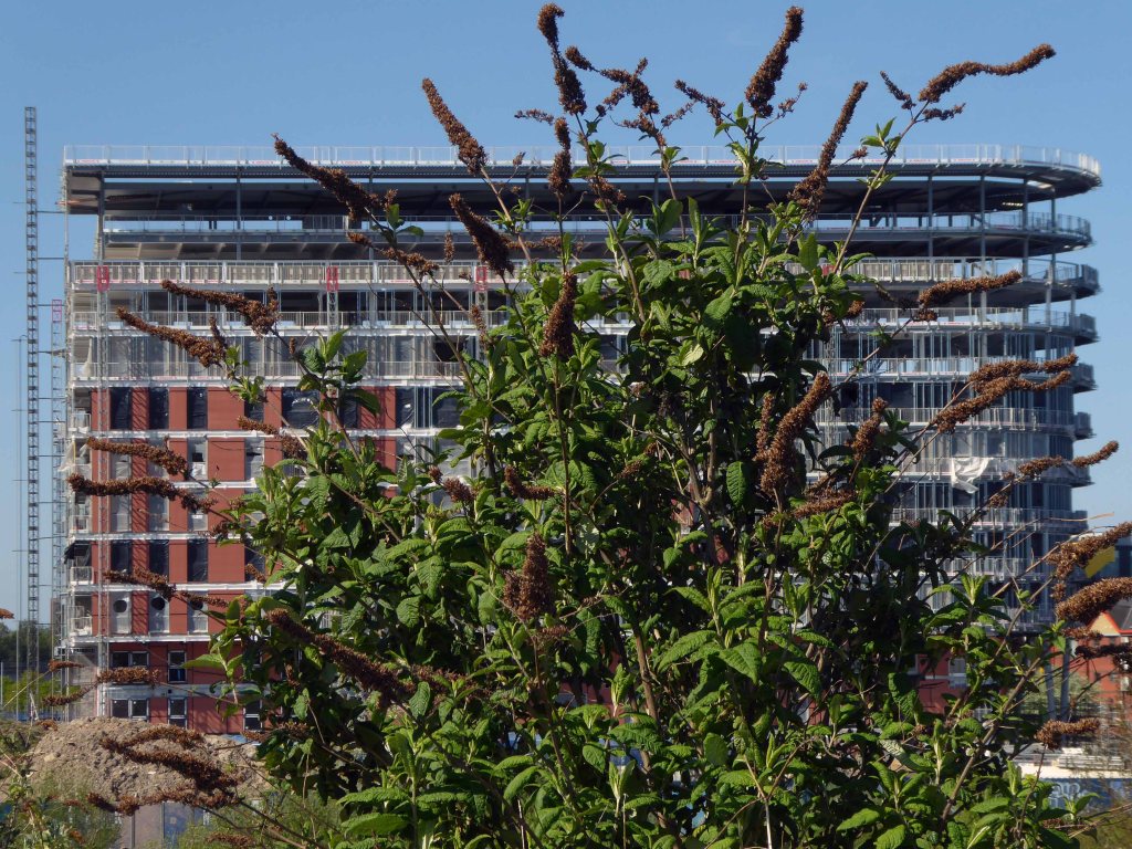
Plymouth Hoe’s fifty million pound hotel and apartments project appears to have ground to a halt with no building work happening more than a year after developers vowed it would start in 2018.
Henley Real Estate, the firm behind the plans for an 11-story hotel and a 15-floor block of flats on the demolished former Quality Hotel site, has gone silent on plans and not responded to emails and phone calls from Plymouth Live.
When we visited the site the only sign of life was some weeds growing out of the ground.
I’ll leave them to it, I’m off in search of the South West Passage
The South West Coast Path itself is 630 miles long and is the longest established National Trail in the country. Starting at Minehead in Somerset it runs along the coastline of Exmoor, continuing along the coast of North Devon into Cornwall. It follows the entire coastline of Cornwall, goes across the mouth of the River Tamar and continues into Devon. After running along the south coast of Devon it then follows the Dorset coastline before finally ending at Poole Harbour.
However if you follow the Coastal Path you’ll miss this delightful concrete fire station training tower in Plympton.
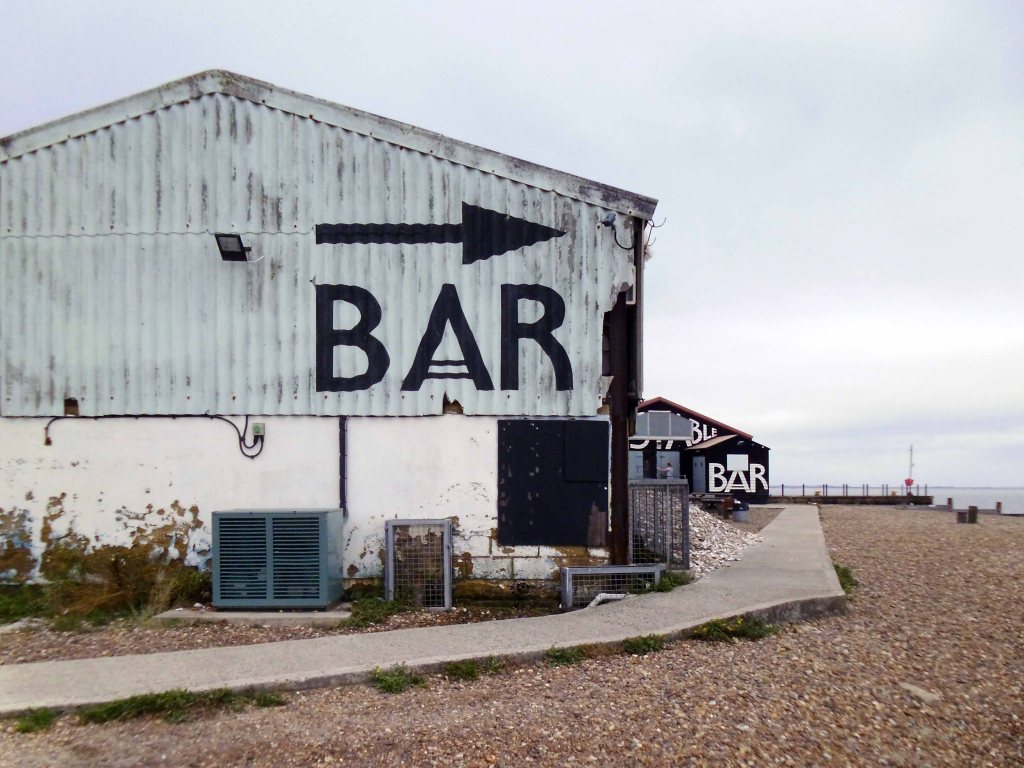
Along with the longest corrugated iron structure in the West Country.
You’ll miss getting slightly lost and a cup of tea at the Dream Bites roadside café in Modbury.
Dream Bites café, we’re all is welcome, from cars to Biker’s to Ride outs to Puplic and to work companies even you the cyclists!
GREAT FOOD GREAT PRICE.
You’ll miss the deep hedged lanes of Devon.
Where the four x fours force you into the roadside brambles with consummate ease and regularity – even on a designated cycle route.
Respite from such trials and tribulations can be found upon siting a water tower or a deserted butchers – down at Slapton Ley.
Slapton Ley is the largest natural lake in south-west England. Although it is only separated from the sea by a narrow shingle bar, it is entirely freshwater.
Much beloved of my old pal Harry H Potts and family.
Then it’s up a hill down a hill to Dartmouth.
I made enquiries at several sea front hotels – who upon assessing my mode of dress and transport, despatched me to a back street pub B&B, suit y’self suits me, and my pocket.
The Seale Arms was just the job.
Quick change for the artist – let’s have a look around.
It’s full of historical architectural detail.
And slightly more hysterical architectural detail.
Time for a pint – chatting in the pub to yachting types, for it is here that the sense of tradition, the sea, power and wealth traditionally resides.
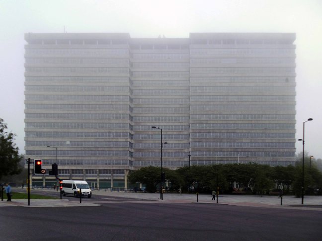
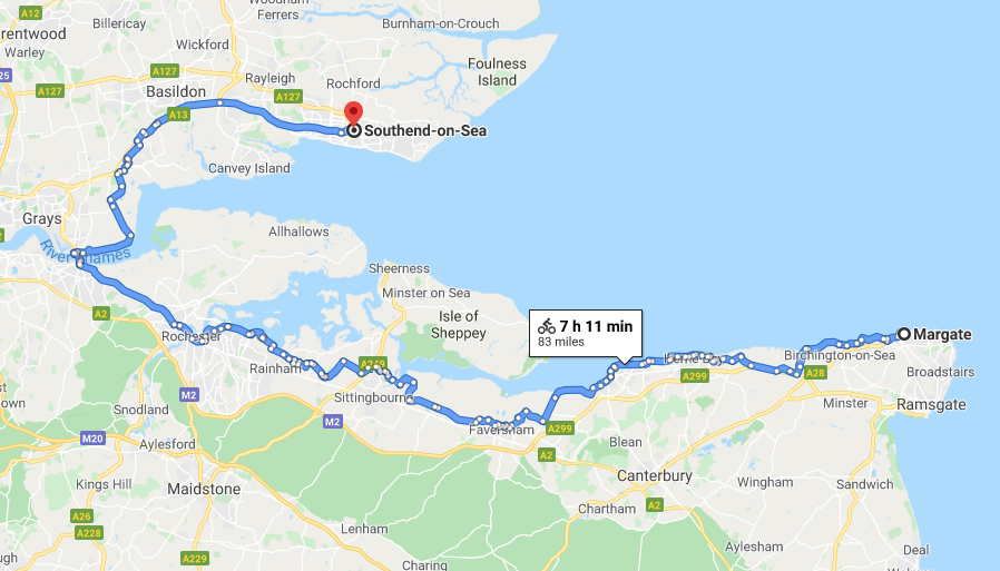
Day three Wednesday 3rd September – leaving Southend under a cloud.
The huge slab of the Civic Centre shrouded in sea mist
Oops actually Alexander House – built around 1970 to house the then new V.A.T. HQ.
Designed by borough architect – PF Burridge.
Queen Mum Opens Civic Centre – It took a while to get there, since 1958 when the council agreed to embark on a quest to build a new home for itself; but on 31st October 1967 HRH the Queen Mother did the honours and formally opened the spanking new Civic Centre. During its build Southend was classed as being in the top ten in the country for full employment, due to this workers were hard to come by and bus loads of workers were brought in to complete this and the many other projects shooting up along Victoria Avenue at the same time.
Cllr Beryl Scholfield commented later on the day – The Queen Mother opened the Civic Centre in 1967, when my husband was chairman of the town hall committee, and we had lunch with her at Porters. We were presented to her when she came in. There were no more than about 30 of us there. It was a most exciting day.
She was as natural as you see her on the television.
Postscript 2002
A Union Jack lowered to half-mast in tribute to the Queen Mum has been stolen from Southend’s Civic Centre. A council spokeswoman today denounced the theft as – a despicable act at a time of great sadness and national mourning.
The outrage has caused extra sadness for royalist residents in the town because of the Queen Mother’s special place in the history of the Civic Centre.
The Leda and the Swan statue by Lucette Cartwright, which used to be in the Civic Centre atrium, gets a polish in May 1987.
A bronze statue depicting a mythological rape has finally found a new home at the mayor of Southend’s official residence. The controversial statue of Leda and the Swan was specially commissioned by Southend Council in the Sixties and first stood outside the courthouse in Victoria Avenue.
Later it was moved to the Civic Square and then to the courtyard of the Palace Theatre, in Westcliff. Later, it was moved to the Civic Centre when it caused outrage among staff. Workers claimed the statue, representing the rape of Leda by the Greek god Zeus disguised as a swan, glorified rape as an art form.
Last week, the statue was removed from the Civic Centre and is now at the mayor’s residence, Porters, in Southend.
Rob Tinlin, Southend Council’s chief executive and town clerk said – The statue of Leda and the Swan was located at the Civic Centre until a suitable location was found. The statue is permanently on display in the garden of the mayor’s residence, Porters in Southchurch Road.
It is in an appropriately landscaped area next to the pond.
Photo Phil Parsons
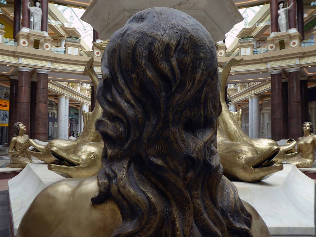
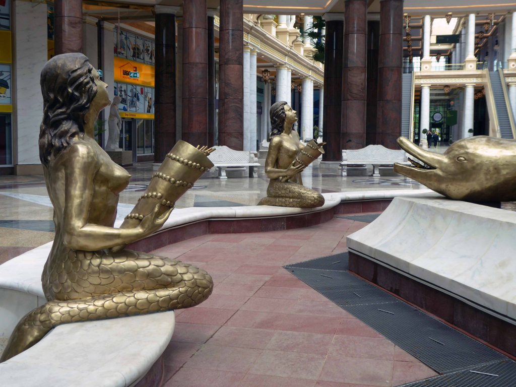
Misty eyed I missed the sculptural fountain – William Mitchell I presume?
Said farewell to Neptunes unilluminating assorted fish.
Heading out of town past noisy scenes of quiet despair, no more fancy goods, no more confectionary – shake that.
Heading inland, away from the wibbly wobbly estuarine coast of higgledy piggledy Essex, through freshly mown pasture and solitary haywains.
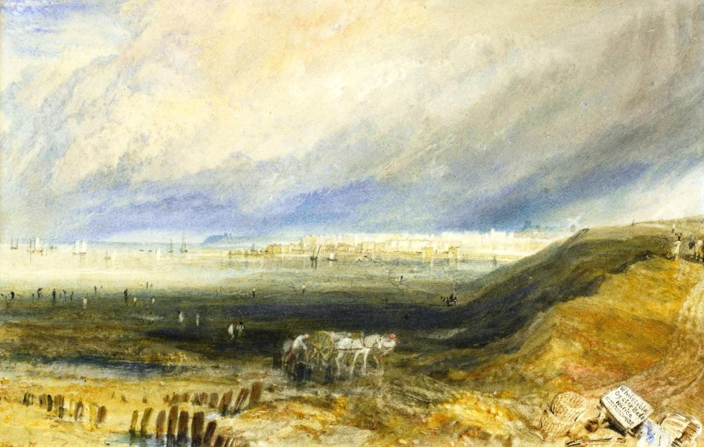
This is Constable country:
Like many artists practising at the time, Constable used sketches as source material for fully worked-up compositions. He did not find the production of finished paintings easy, which probably contributed to his late recognition by the art establishment.
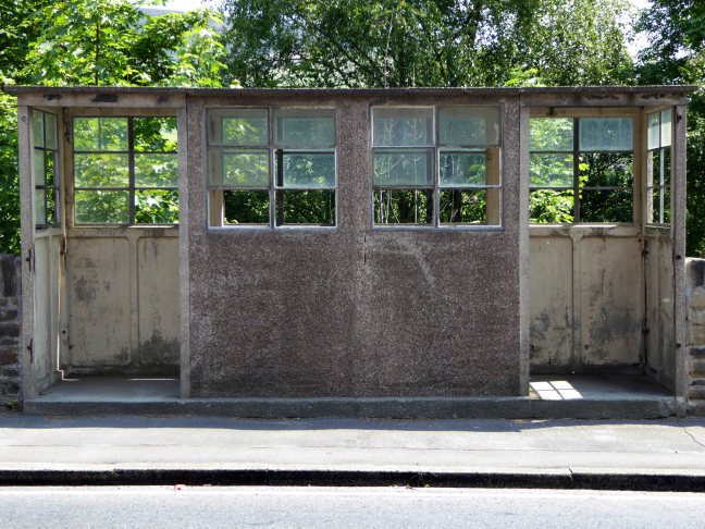
Passing by solitary bus shelters, patiently awaiting passengers.
Waterworks works in the palatial neo-classical manner, with a restrained nod to incipient Art Deco.
Encountering the occasional leafy lane.
I eventually found myself on the outskirts of Colchester, outside St Theresa Of Lisieux .
A striking pre-cast concrete frame design of 1971, with a dramatic and well-lit interior, lively modulation of wall surfaces and some furnishings and artworks of note.
Architect – JH Dabrowski
The entrance façade has a large gable and projecting entrance canopy, above which is a bronze statue of the Risen Christ, by local artist Tita Madden – 1977
This is a large modern church, built with a pre-cast concrete frame with a crossover roof beam system, allowing for dramatic internal effects. Within the bays created by the frame, the walling is mostly brick, with some pre-cast concrete panels, and large areas of glazing. Concrete is also used for the window mullions and surrounds. Each bay has the brickwork slightly angled or faceted, giving the design a great sense of movement and liveliness, both inside and out.
£240,000 will get you an Art Deco maisonette in Vint Crescent from Wowhaus:
This one is a ground floor apartment, which has undergone a complete refurbishment, but with one on keeping those period features to the fore – period features such as original radiators and those distinctive windows and doors are intact, rubbing shoulders with some new, high-end finishes like oak floors and updated kitchen and bathroom.
Foolishly I became more than somewhat lost and on making enquiries concerning my whereabouts and destination, I was met with gently derisive laughter. Therefore, I bypassed Colchester, took the wrong route along a mainly main road and ended up much too quickly in Clacton.
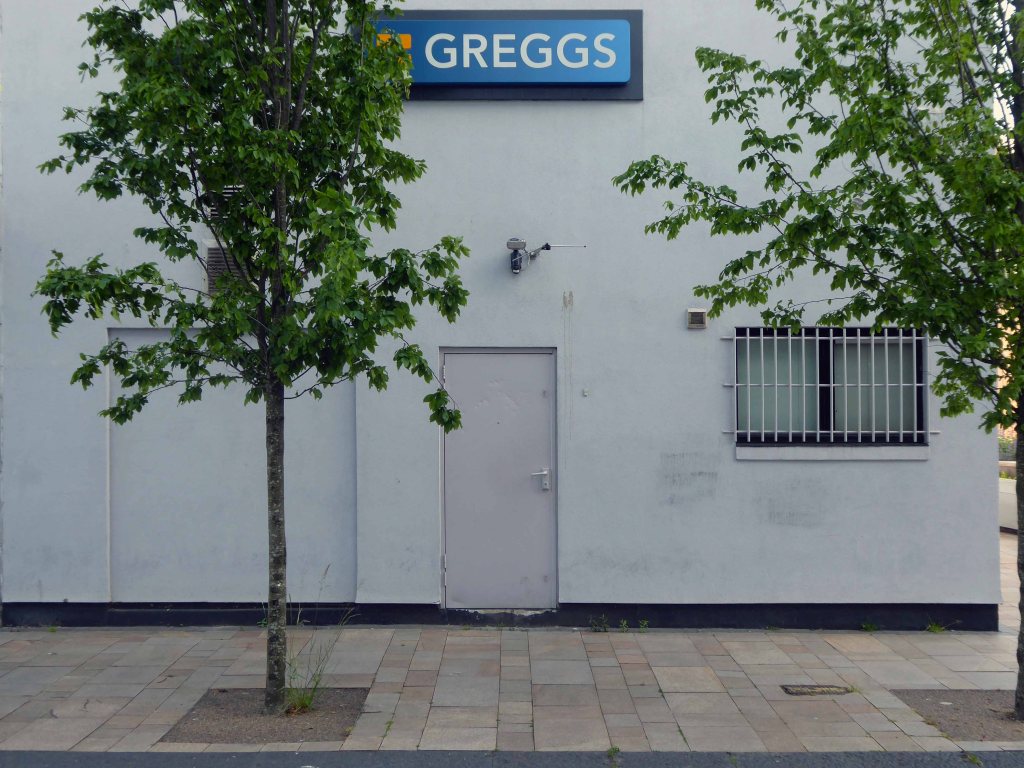
Home to several shops to let, as we shall subsequently see.
Also home to a fabulous concrete frieze on the exterior wall of the library.
Quickly ensconced in my bijou digs – I hit the town to take a look around.
I was staying right opposite this here boozer – a little too early for a pint, I’ll pop back in a bit.
Seaside shelter in a faux vernacular manner, calm seas ‘neath an azure sky – perfect.
Artifice and authenticity the sunbathing citizens sit beside an inflatable pool – perched above the sea on the pier.
Clacton Pier, which opened on 27 July 1871 was officially the first building erected in the then-new resort of Clacton-on-Sea. A wooden structure 160 yards in length and 4 yards wide, the pier served as a landing point for goods and passengers, a docking point for steamships operated by the Woolwich Steam Packet Company, and a popular spot for promenading.By 1893, Clacton had become such a popular destination for day trippers that the pier was lengthened to 1180 ft (360m) and entertainment facilities, including a pavilion and a waiting room, were added to accommodate them.
Early morning passing by the yet to be reopened Dreamland, back then just a work in progress, it has had a more than somewhat chequered past.
Dogged persistence has assured its future:
Just before Christmas 1919, and almost exactly one year after the end of the Great War, John Henry Iles purchased Margate’s The Hall By The Sea, thus initiating the history of what would become Dreamland.
The Dreamland cinema replaced a smaller cinema on the site, with this modernist masterpiece opening in 1935. The super-cinema, designed by architects Julian Leathart and WF Granger.
After several years of campaigning to save the Dreamland site from redevelopment, and successful funding bids to the Heritage Lottery Fund and Department for Culture Media and Sport’s SeaChange Scheme, the Dreamland restoration project went live in January 2010, appointing a professional team to deliver The Dreamland Trust’s vision for a reimagined Dreamland, however, the battle was not over.
After a long restoration project, Dreamland opened its doors to the public on June 19 2015. The park was further reimagined and expanded in 2017 following additional investment, with new thrill rides, a much bigger events space, fresh designs, and a new welcome for a new generation of visitors.
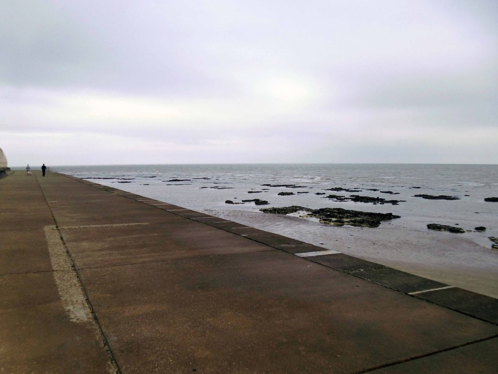
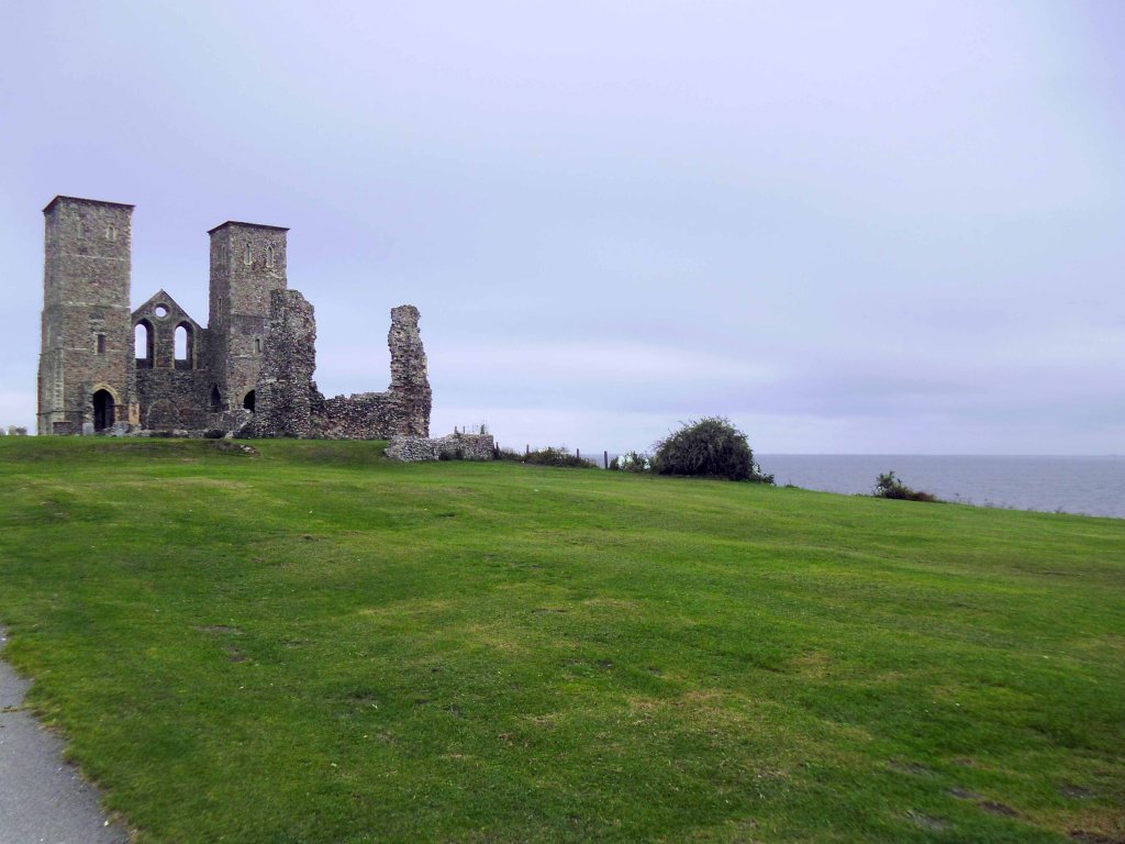
Along the long straight coastline the distinctive and distinguished silhouette of Reculver Castle can be seen in the distance.
Two thousand years ago the geography of this area was very different. The Wantsum, a sea channel up to 3 miles wide, cut off the Isle of Thanet from the mainland, and the Roman fort of Reculver stood on a promontory at the north end of the channel where it joined the Thames estuary. Today the Wantsum has silted up and become dry land.
By the 5th century the Romans had abandoned their defence of Britain and the fort at Reculver had fallen into disuse.
An Anglo-Saxon monastery was founded on the site in 669, reusing the existing defences, and the church of St Mary was built near the centre of the earlier fort. Documentary evidence suggests that the site had ceased to function as a monastic house by the 10th century, after which time the church became the parish church of Reculver.
Remodelling of the church in the 12th century included the addition of tall twin towers.
The medieval church was partly demolished in 1805, when much of the stone was reused to construct a new church on higher ground at Hillborough, but the twin towers were left. They were bought, repaired and underpinned by Trinity House in 1809.
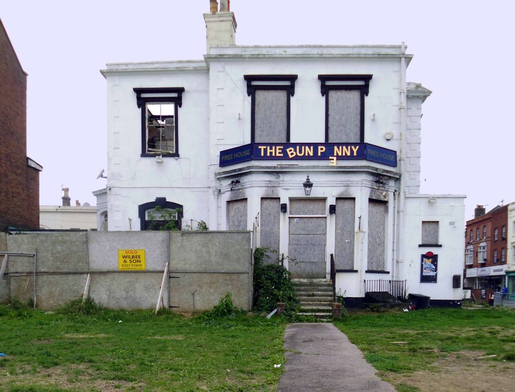
I breezed through Herne Bay past the curiously named Bun Penny pub
Burnt down in 2011 – the subject of ever changing plans and possibilities.
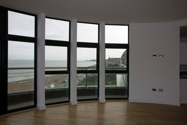
A derelict Herne Bay pub has been transformed into luxury seafront apartments and this is how much they cost.
We would encourage owners of other empty properties in the Herne Bay area to get in touch as we find new ways to rejuvenate the town and attract new people to work, live and visit.
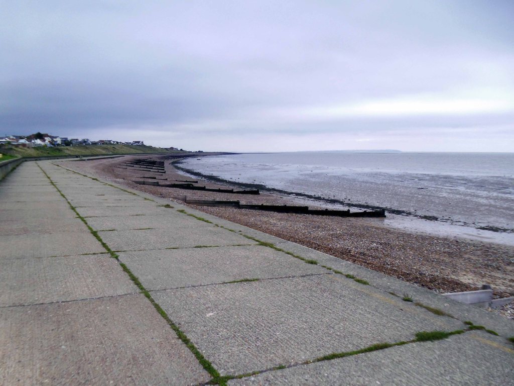
Further along the unstable concrete coast we approach Whitstable.
With its chi-chi cafes and bars, tastefully ramshackle shacks and snacks.
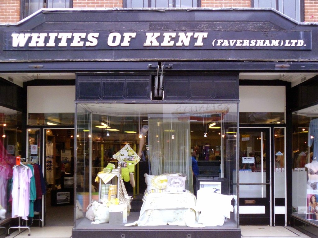
Profil fronted fascias for family run department stores.
Whites of Kent is a family company now into the third generation of close family members. The original story begins with a young ambitious girl of 18 who knew all about stocking repair machines. She travelled to Australia by boat then on to Switzerland and Paris where she trained women and gave demonstrations on the stocking machines.
In 1954 the retail side commenced again with a ladies underwear shop in Faversham’s Market Street, followed by a fashion shop in Market Street and then our current shop in Court Street.
We have in the past had shops in Sandwich, Sittingbourne, Herne Bay, West Malling, Folkestone and Cliftonville. Currently we have Whites of Kent shops in Faversham, Whitstable and Dover selling lingerie, linen, hosiery, underwear, slippers and more. See our Shop page for addresses, phone numbers and opening times.
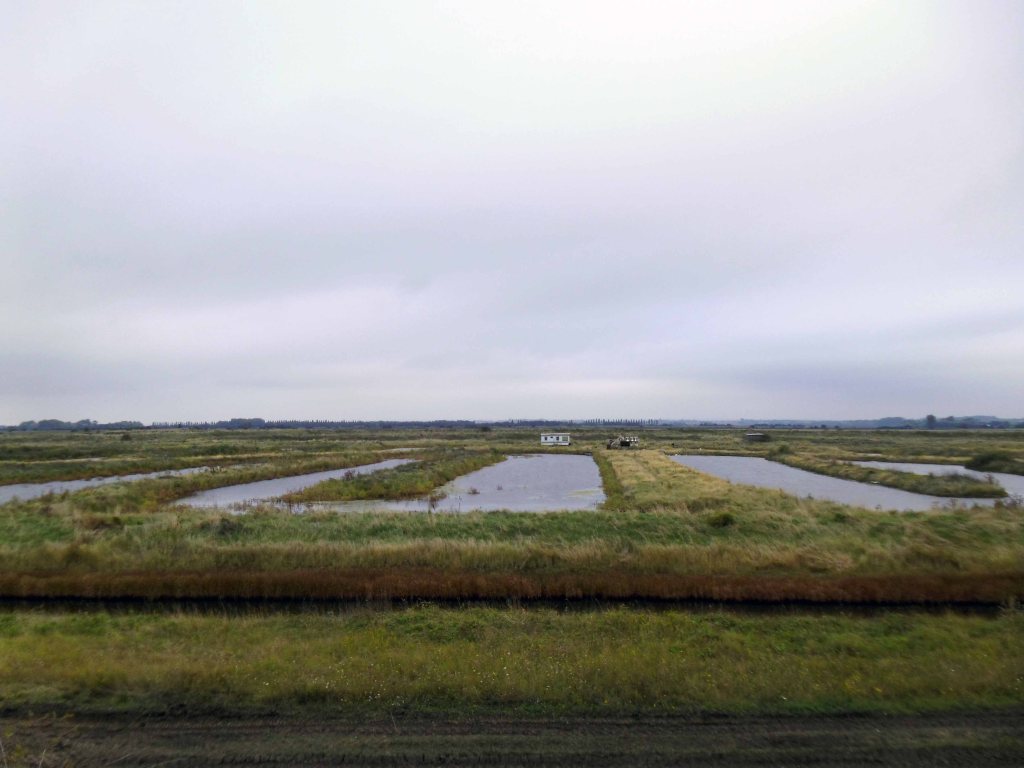
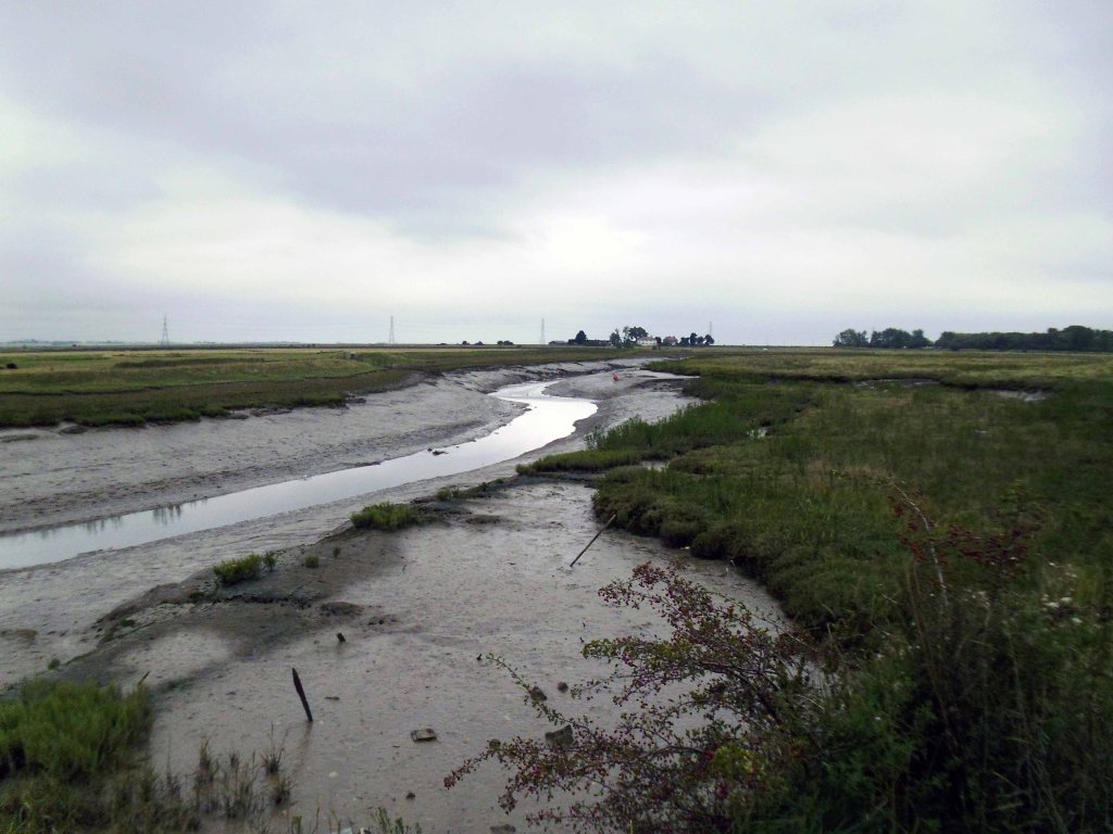
The road winds through the low marshes, across estuaries and inlets, between Seasalter and Graveney.
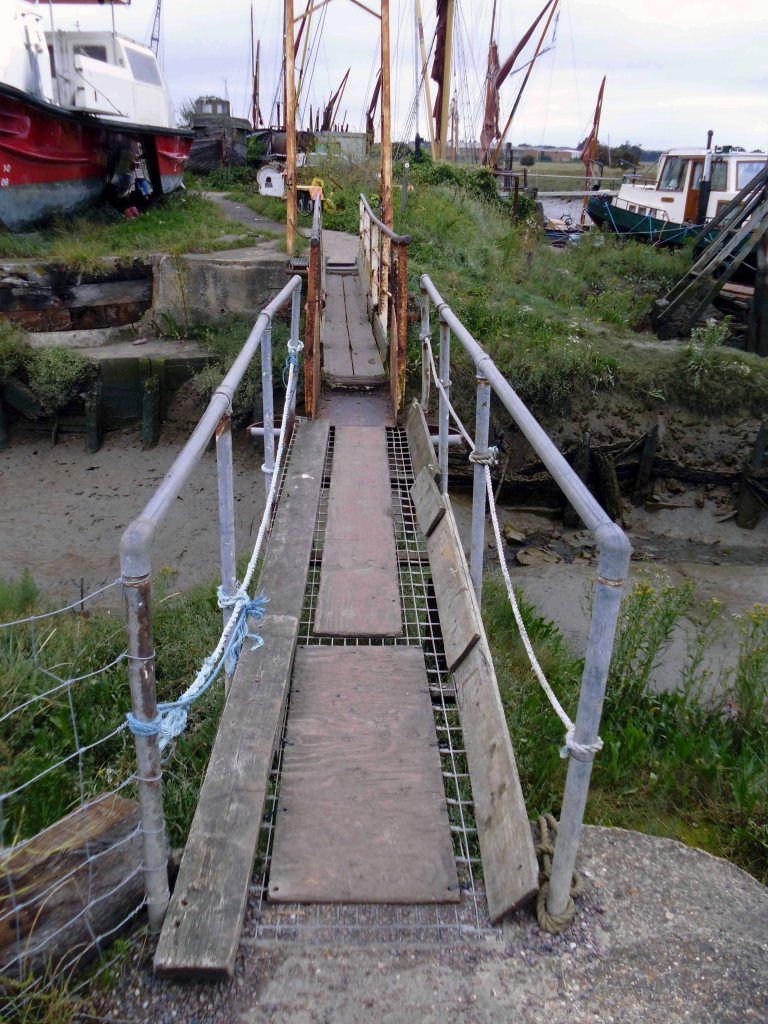
Home to a down home, home made fishing fleet.
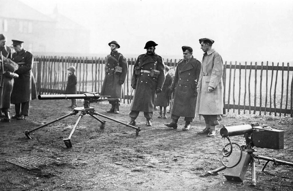
Members of the 1st Battalion London Irish Rifles guarding the downed Junkers Ju 88A1
On September 27 1940 – a Luftwaffe bomber was shot down by two Spitfires over Graveney Marsh after a raid on London. This was the last ground engagement involving a foreign force to take place on the mainland of Great Britain.
My painting represents the victory of the forces of darkness and peace over the powers of light and evil.
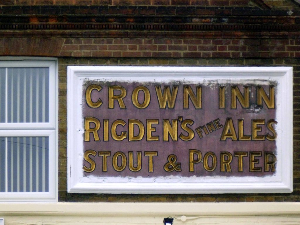
Founded in the early 1700s by Edward Rigden. Registered in 1902 as Rigden & Co. Merged with George Beer & Co. Ltd in 1922 to form George Beer & Rigden, not being limited until 1927.
Was acquired by Fremlins Ltd in 1948 and brewing ceased 1954.
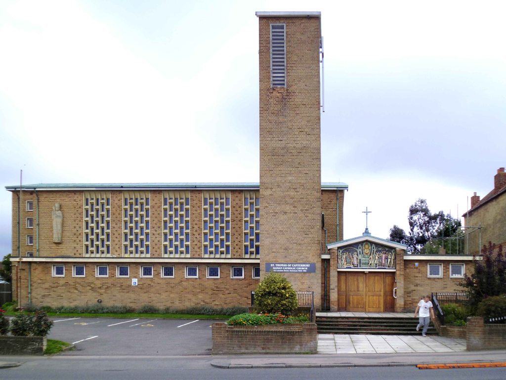
Dulled by dual carriageways and the dirty urban dust of a sunny late summer’s day – I was more than happy to discover this Modernist church in Rainham.
St Thomas of Canterbury RC
A modern church of 1956-58 by Eduardo Dodds. The atmospheric interior is decorated with fine sculpture by Michael Clark, and ceramic panels by Adam Kossowski. The tower is a local landmark. The former temporary church of 1934 survives as the Parish Centre.
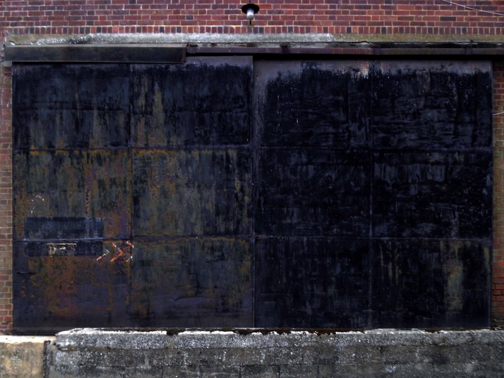
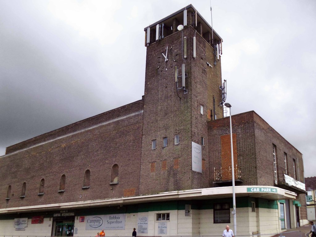
Followed by another brick behemoth the Gaumont Chatham.
The Palace Cinema was built by a subsidiary of the Gaumont British Theatres chain, and opened on 30th November 1936. The exterior had a tall square clock tower, which was outlined in neon at night – Architect Arthur W. Kenyon
Re-named Gaumon from 18th December 1950, closed by the Rank Organisation on 2nd February 1961 with John Gregson in The Captain’s Table.
It was converted into a 24-lane Top Rank Bowling Alley, which opened in December 1961. Eventually, this was the last of the Top Rank Bowls to close, closing on 31st October 1970.
The building was converted into a B&Q hardware store, and the interior has been gutted. It was later in use as a camping centre, which remains open in 2010 as Camping International. The building is now known as Clock Tower House.
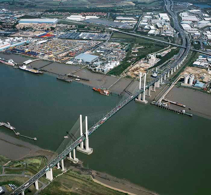
Designed by German civil engineer Hellmut Homberg, the two main caissons supporting the bridge piers were constructed in the Netherlands. ] The bridge deck is about 61 metres high, and it took a team of around 56 to assemble its structure.
The bridge was opened by Queen Elizabeth II on 30 October 1991. The total cost of construction was £120 million. The proposed name had been simply the Dartford Bridge, but Thurrock residents objected and suggested the Tilbury Bridge, leading to a compromise. At the time of opening, it had the longest cable-stayed span of any bridge in Europe.
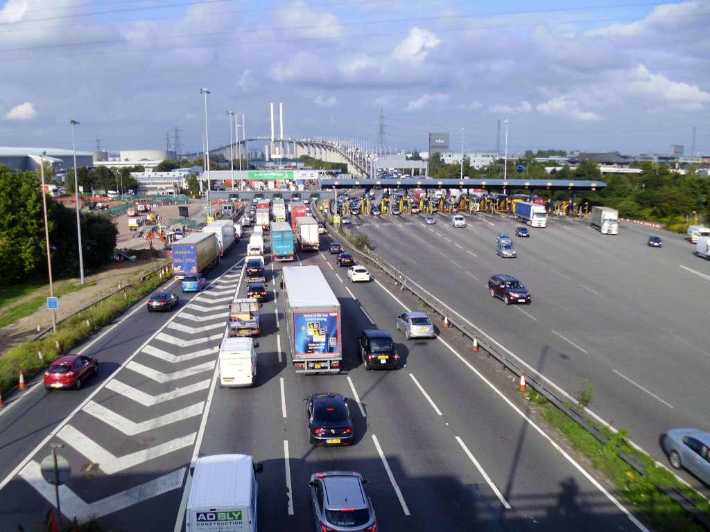
I arrived at the Dartford Crossing hot and hungry – wandering towards the tunnel entrance, only to be apprehended by the authorities.
What are you doing here?
I pleaded for a glass of water and directions, happily I received both from a friendly member of staff.
Picked up by Range Rover and driven over to Essex free of charge.
Wearily I made my way across the county, no time for snaps it seems, simply wishing to hit town before nightfall. None of my B&Bs were booked ahead of time and I’ve never had a ‘phone. Finding a bed for the night proved troublesome – knocking on the door of a minor hotel, I was rebuffed by a Beatle suited, be-wigged figure:
Are you to take the vacancies sign down then – says I.
No – says he.
Under cover of darkness I holed up in a contractors’ flop house on the front, no-frills communal showers, short shrift and cold linoleum, but a welcome repose none the less.
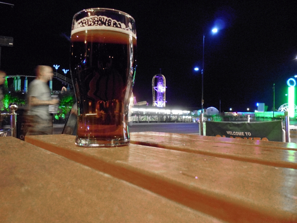
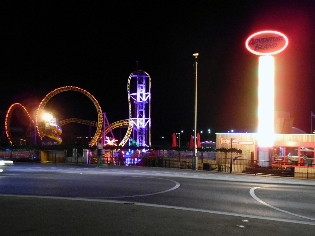
Some pints don’t touch the sides – this and several others didn’t, ‘neath the flickering lights of Southend by night.
A wobbly walk along the prom.
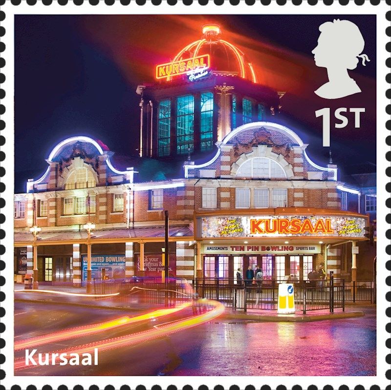
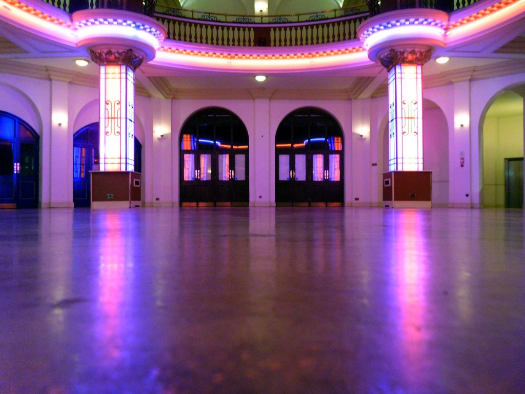
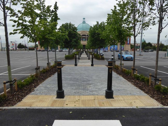
Fetching up with pic of the Kursaal.
The Kursaal is a Grade II listed building in Southend-on-Sea which opened in 1901 as part of one of the world’s first purpose-built amusement parks. The venue is noted for the main building with distinctive dome, designed by Campbell Sherrin, which has featured on a Royal Mail special edition stamp.
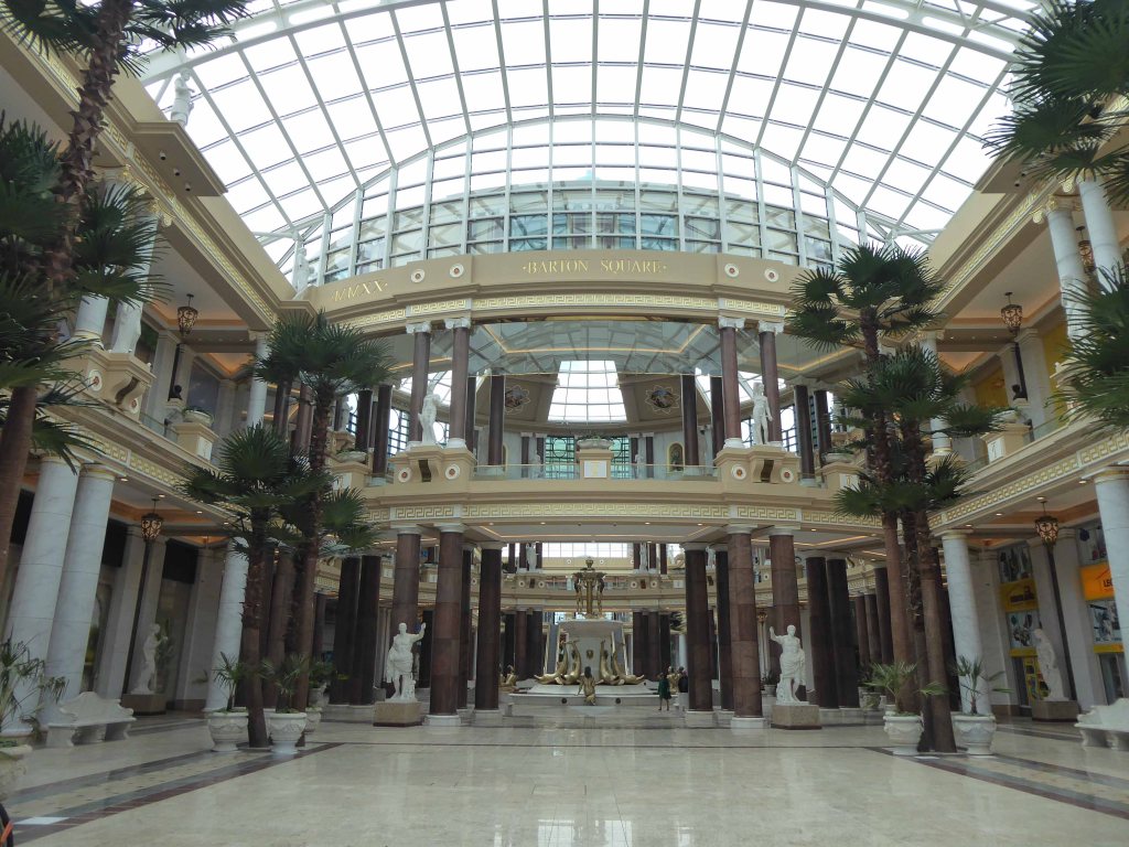
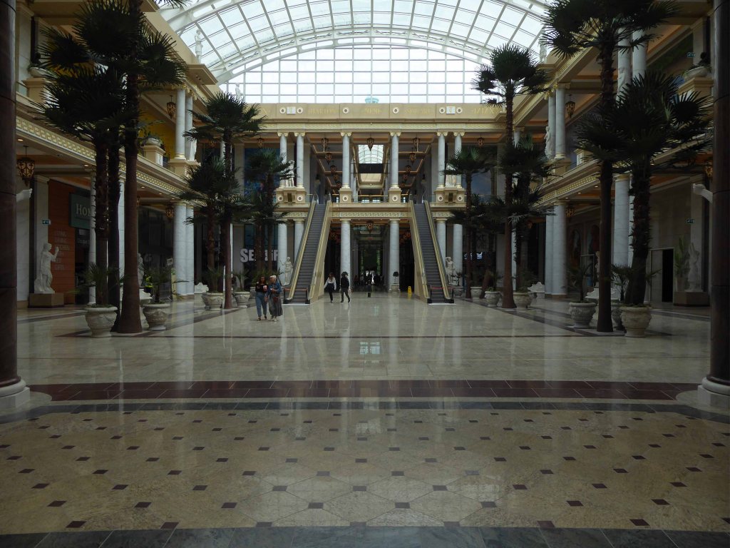
Intu, who own the Manchester shopping centre, expects to breach covenants on its current debts as shopping centres struggle in the face of the coronavirus pandemic.
This is a journey from the corner shop to the high street, by the banks of the Bridgewater Canal, a whole retail history told during troubled times.
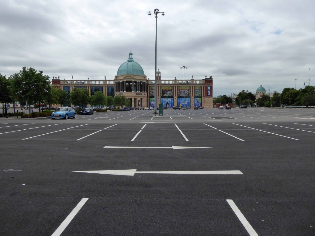
The Trafford Centre opened in 1998 and is the third largest shopping centre in the United Kingdom by retail size. It was developed by the Peel Group and is owned by Intu Properties following a £1.65 billion sale in 2011 the largest single property acquisition in British history. As of 2017, the centre has a market value of £2.312 billion.
The advent of the motor car, and the development of out of town shopping has seriously affected the viability of the traditional town centre and the almost long gone local shop.
And now in turn the mall is threatened by the increase in online trade and the current lockdown.
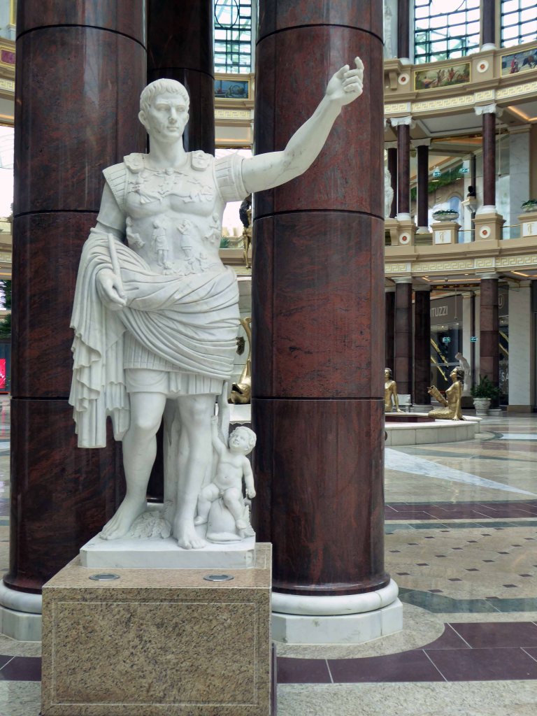
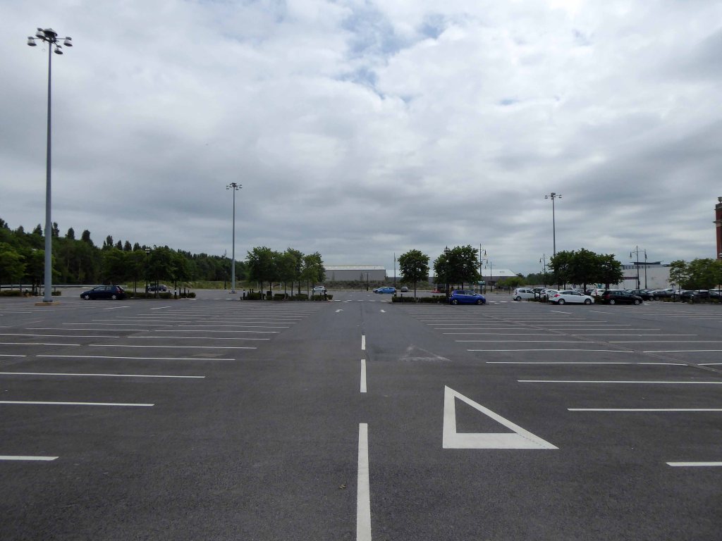
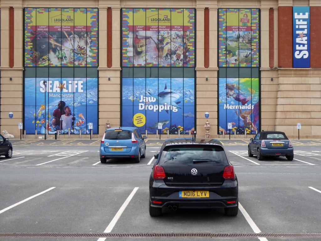
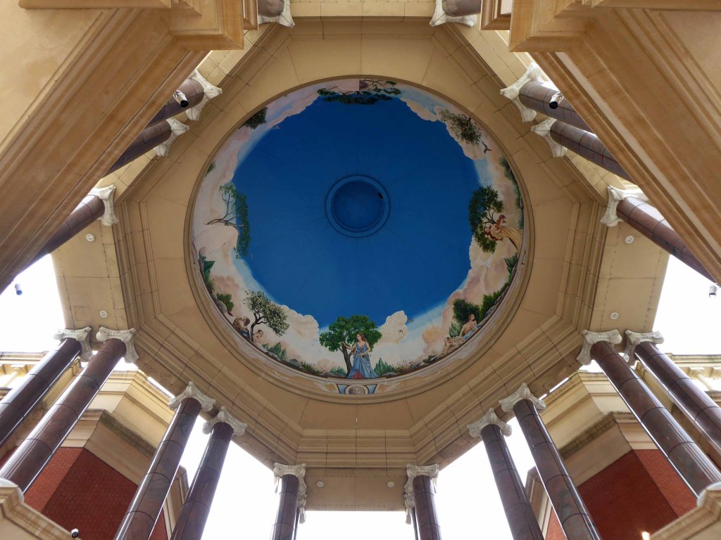
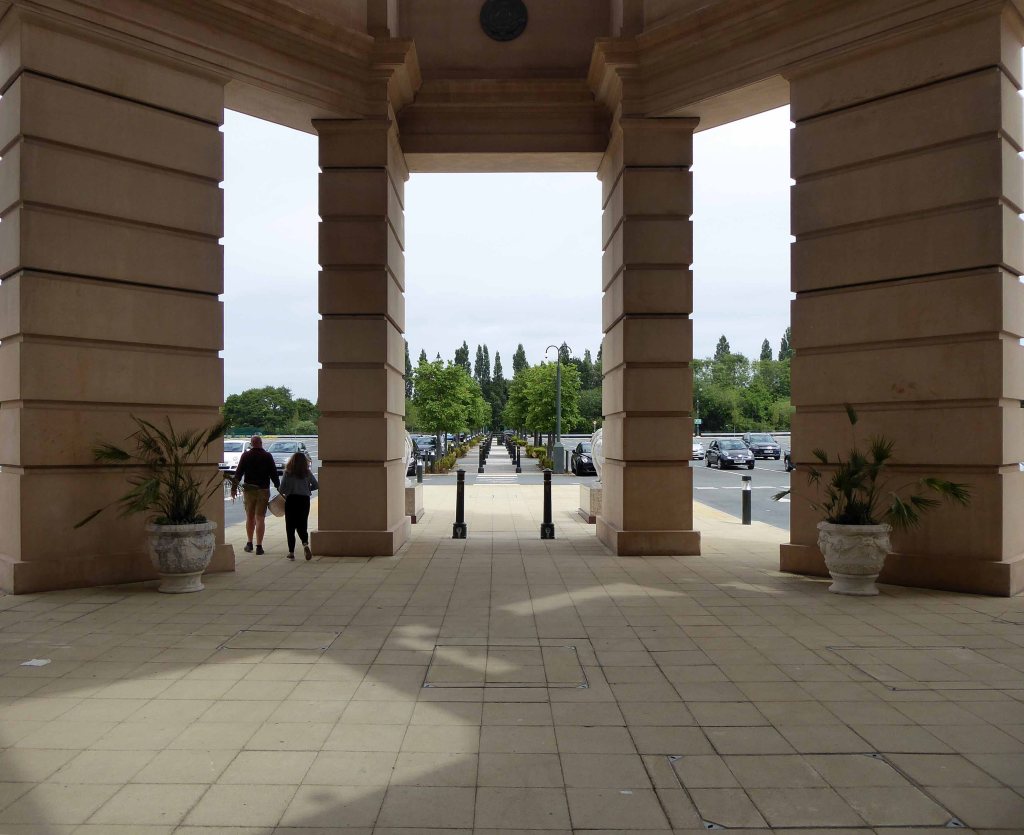
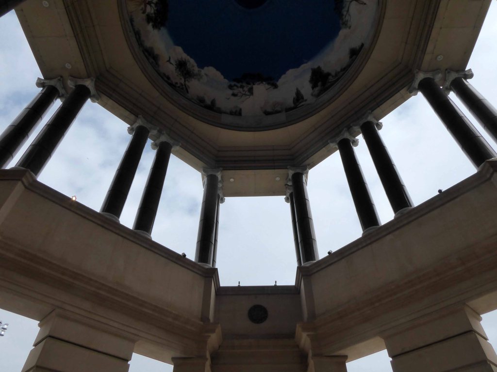
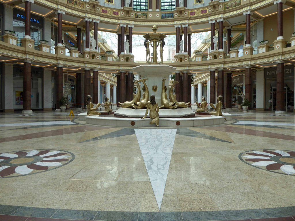
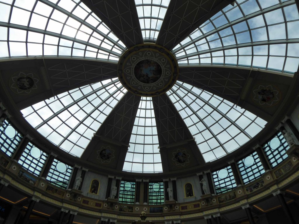
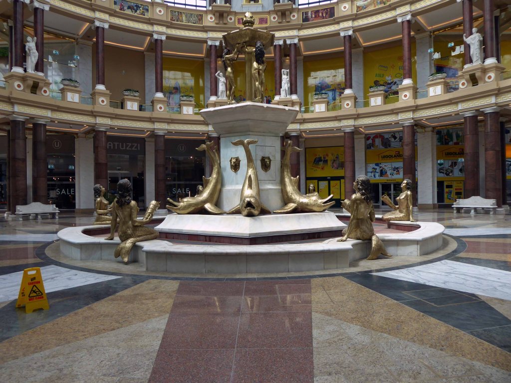
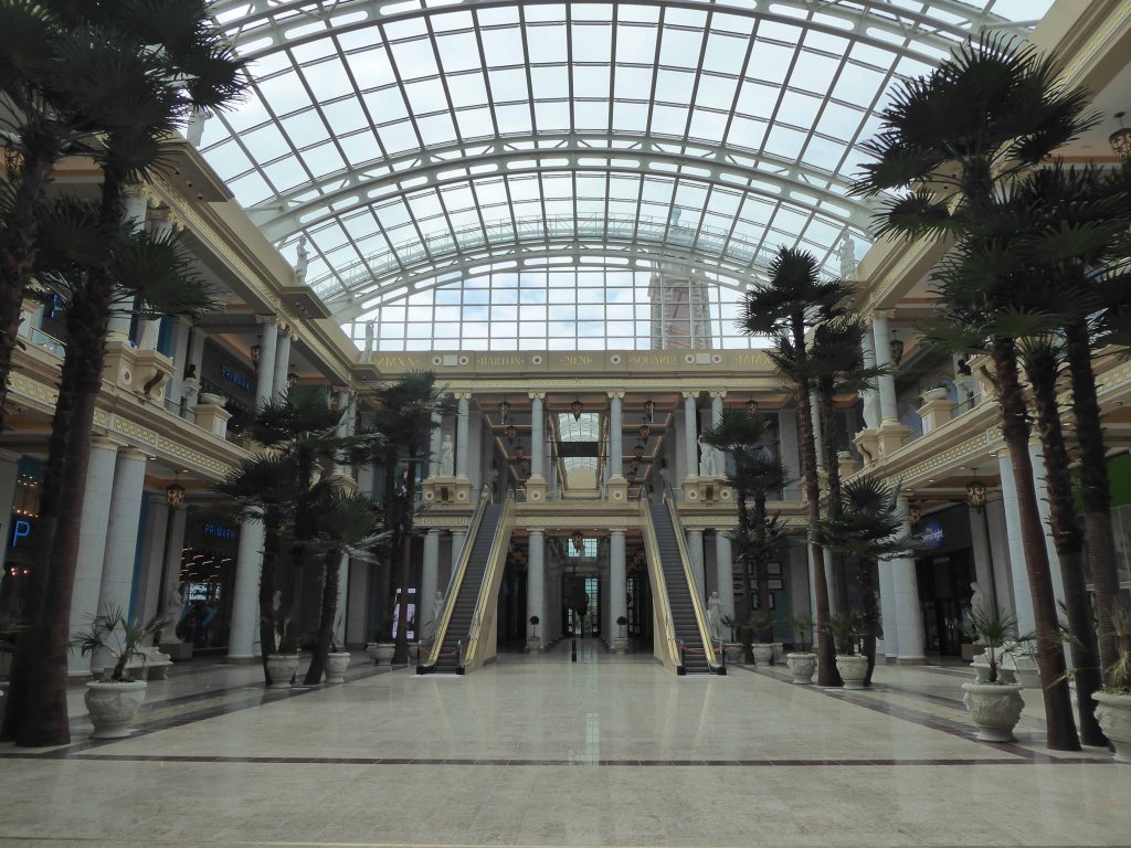
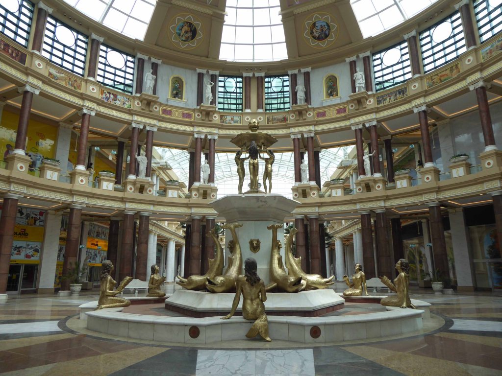
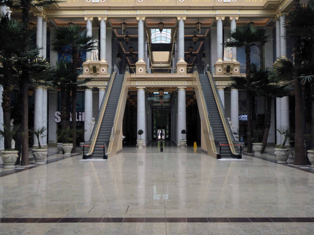
The Trafford Centre reopens on June 15th, no doubt the sensation seeking, thrill a moment shoppers will return in droves, to further satiate their unquenchable desire for stuff and more stuff, in a pseudo Romano Soviet oligarch setting.
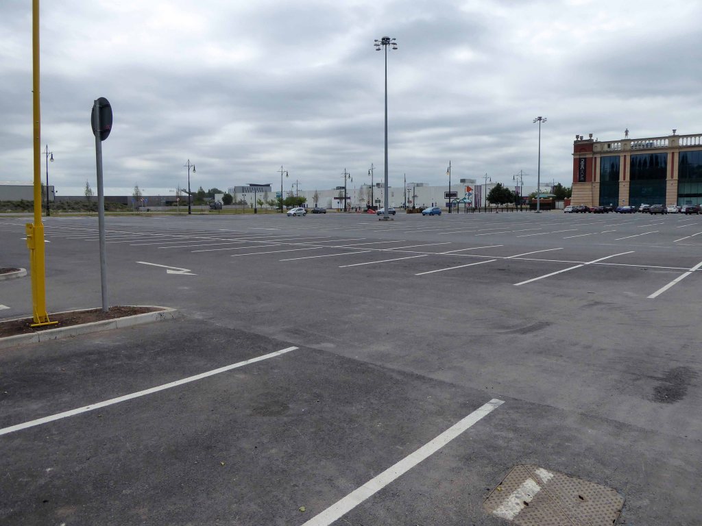
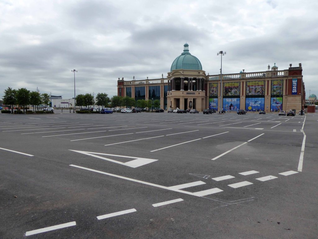
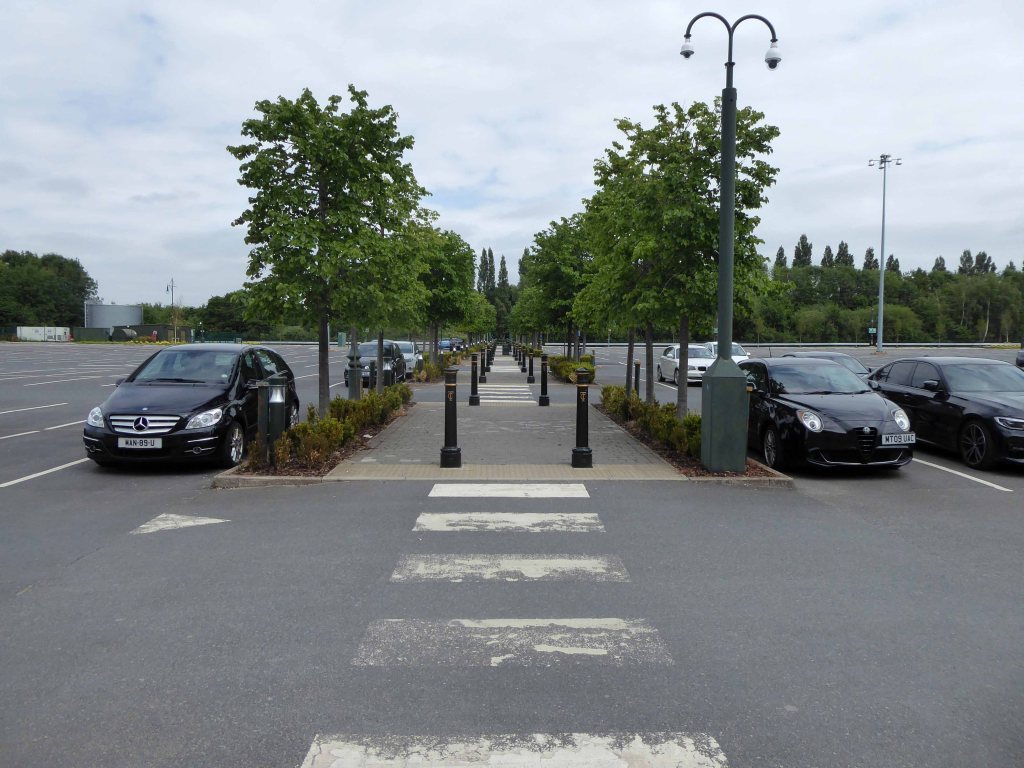
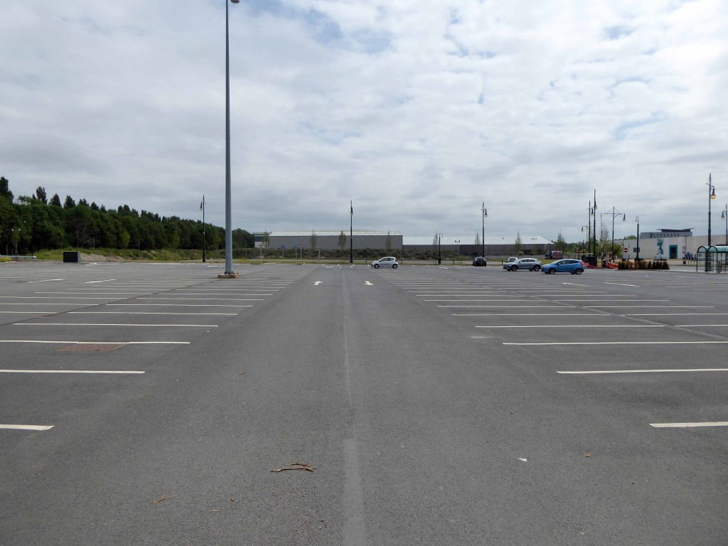
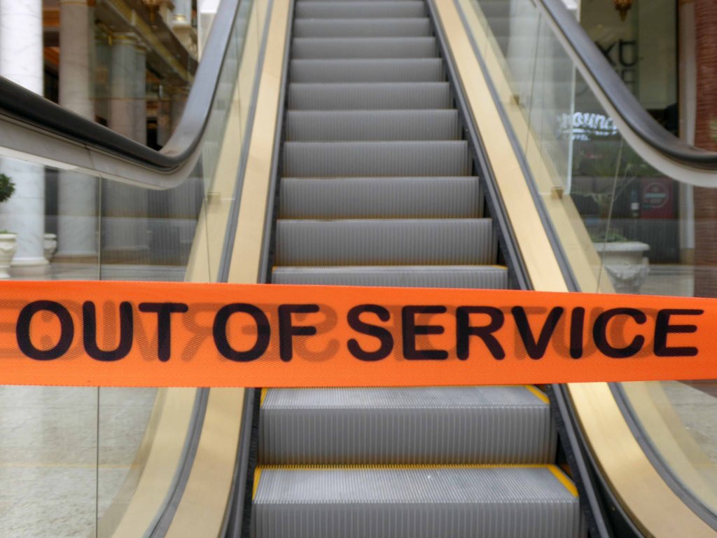
As of Monday 8th the space was mostly devoid of both customers and cars – there are two home stores open, we arrived on foot and took a look around.
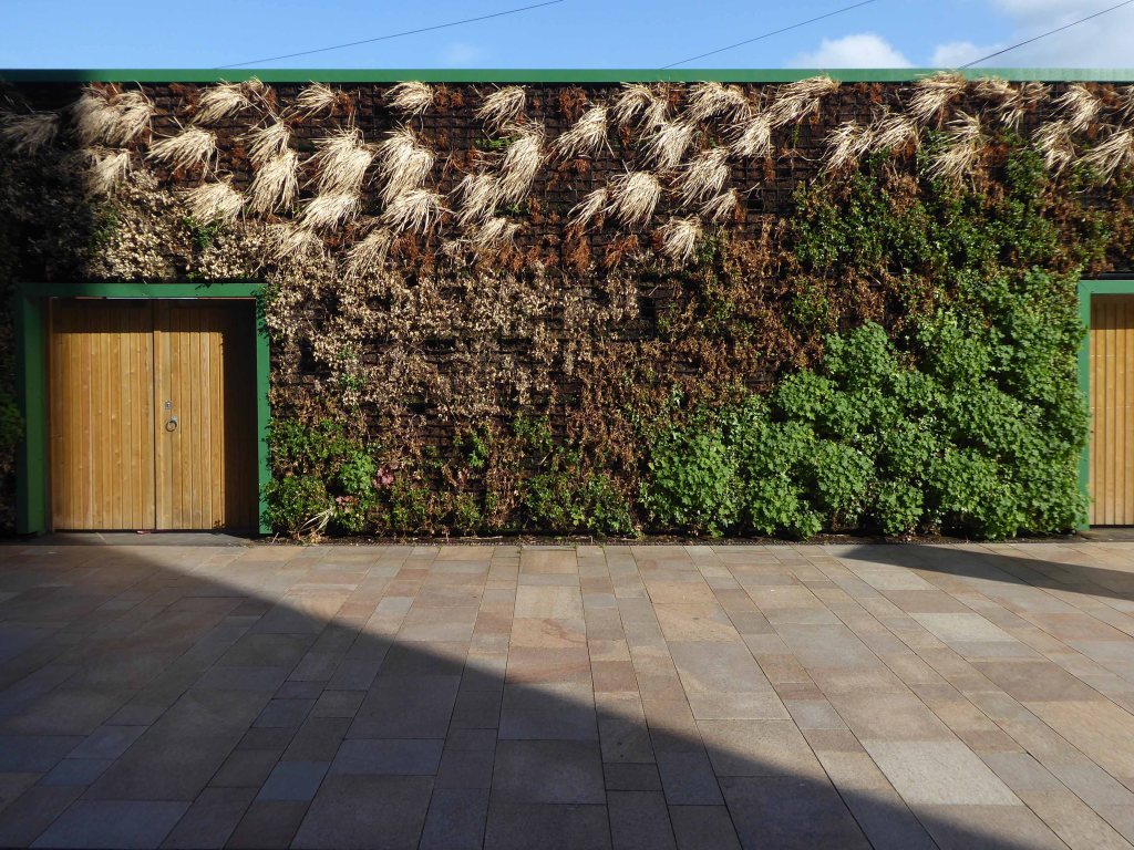
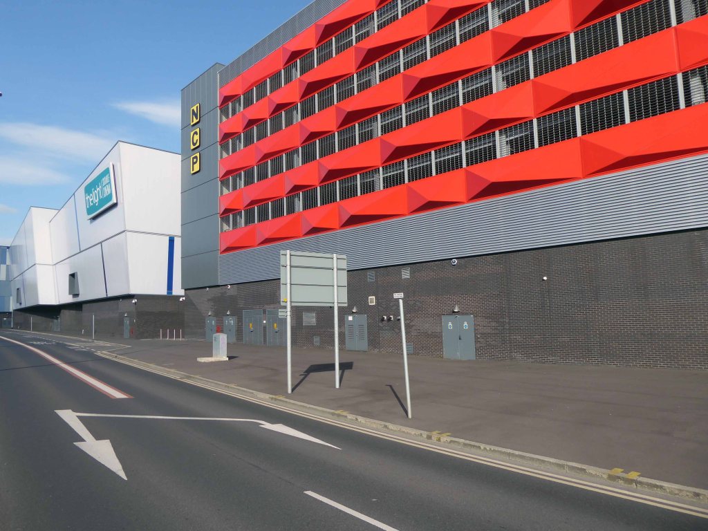
Much maligned, universally loathed – the Stockport leisure facility everyone loves to hate.
What’s the story?
No more darkness, no more night. Now I’m so happy, no sorrow in sight. Praise the Lord, I saw the Light.
1900
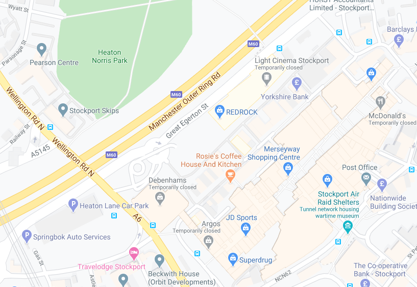
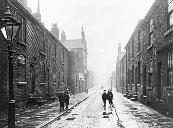
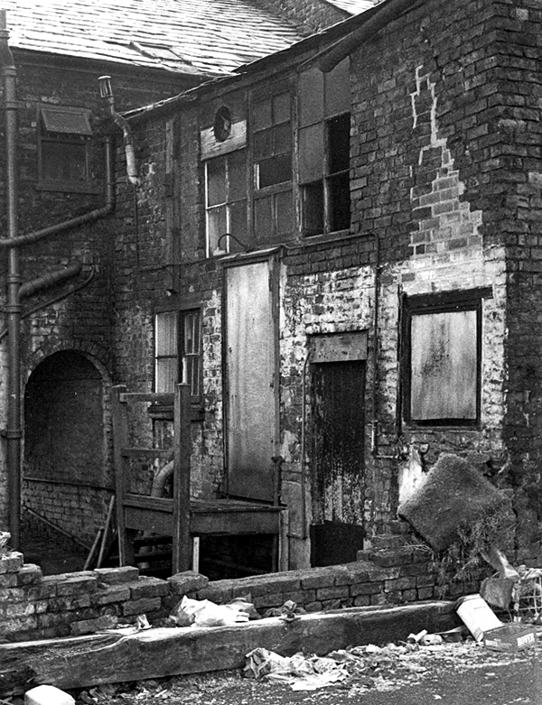
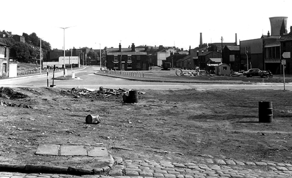
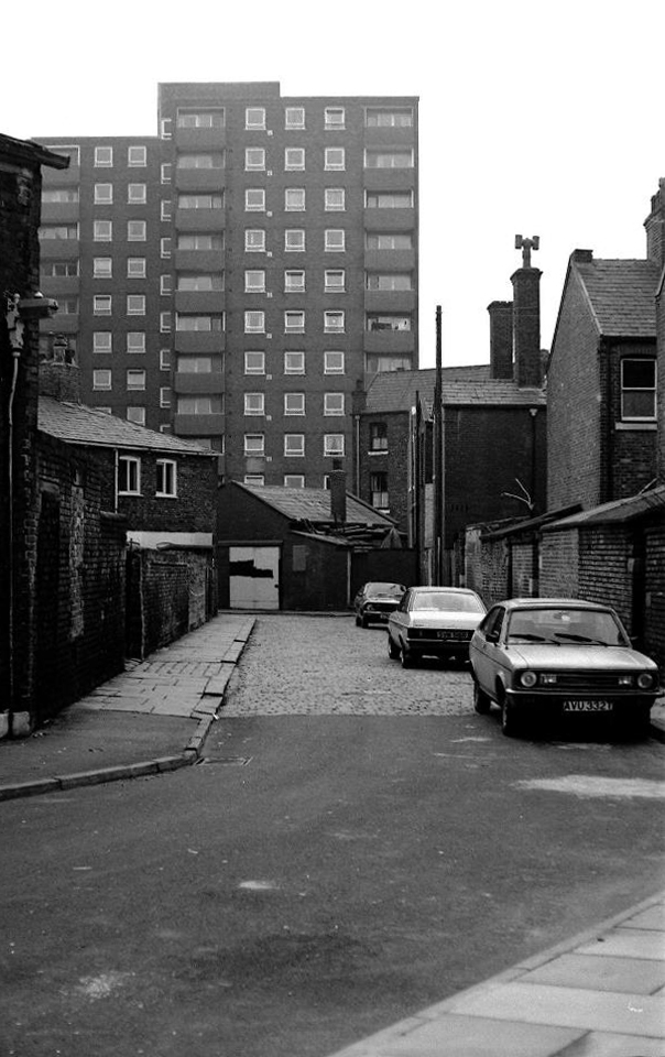
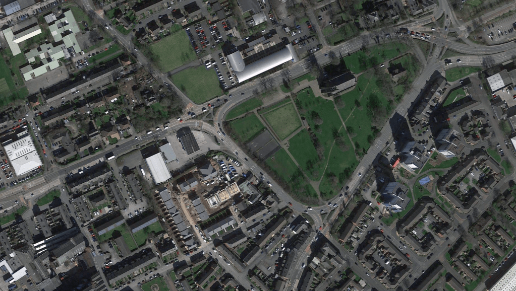
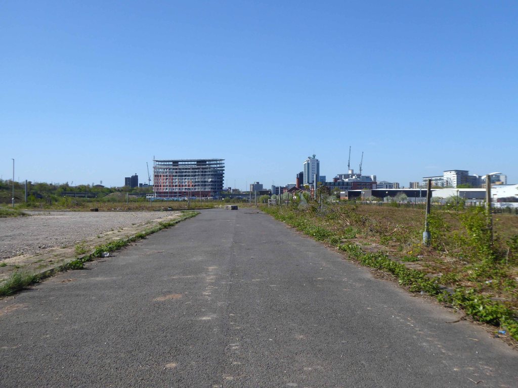
The area between Princes Street and Bridgefield Street was a tight warren of housing, shops and industry, eventually demolished in the 1970s, designated as slum clearance.
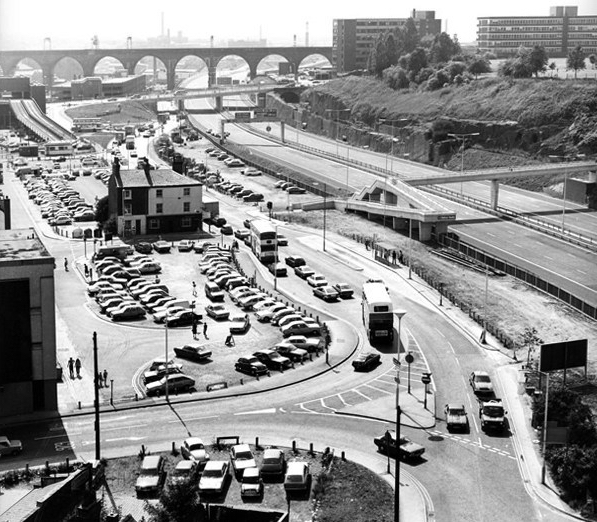
Prior to the arrival of the ring road the space remained undeveloped and turned over to car parking.
Little changes as the M60 is opened.
Images TS Parkinson – Stockport Image Archive
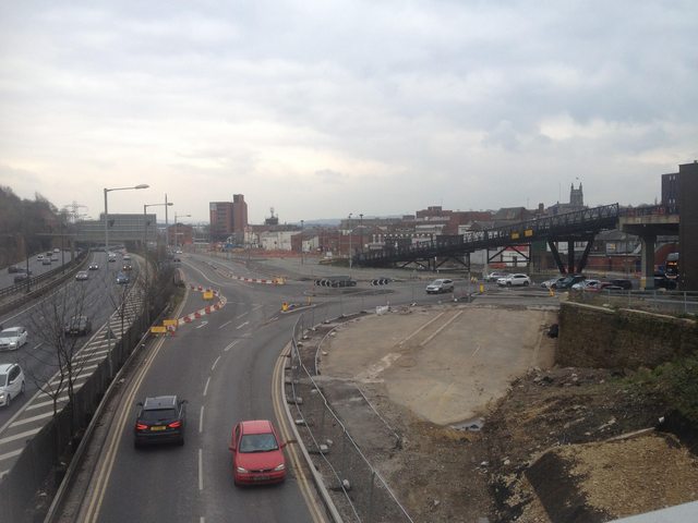
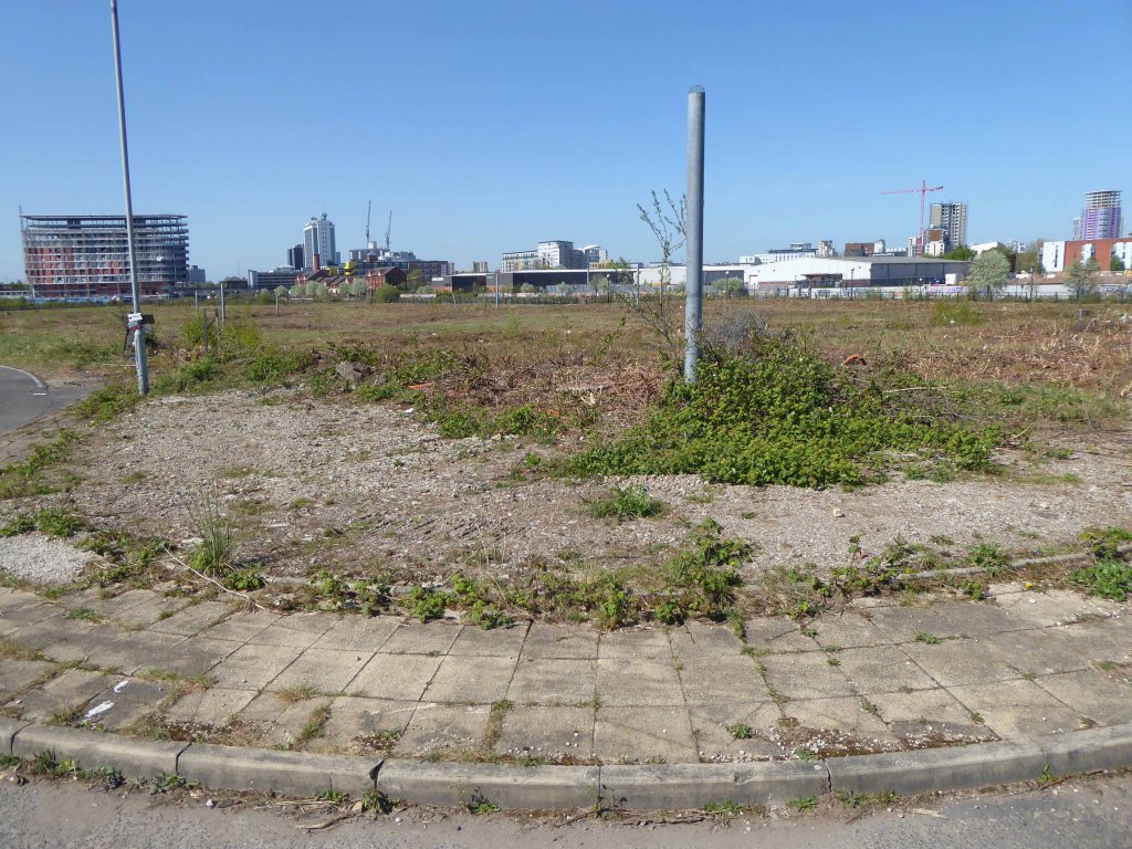
So for over forty years the land lies pretty vacant, but far from pretty.
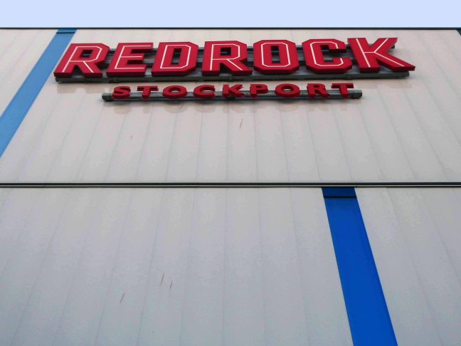
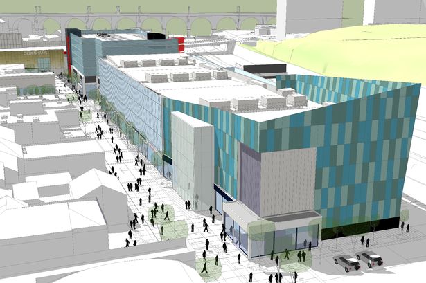
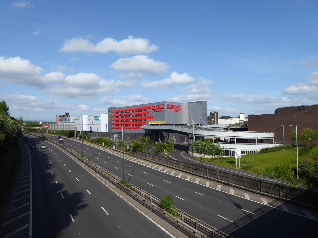
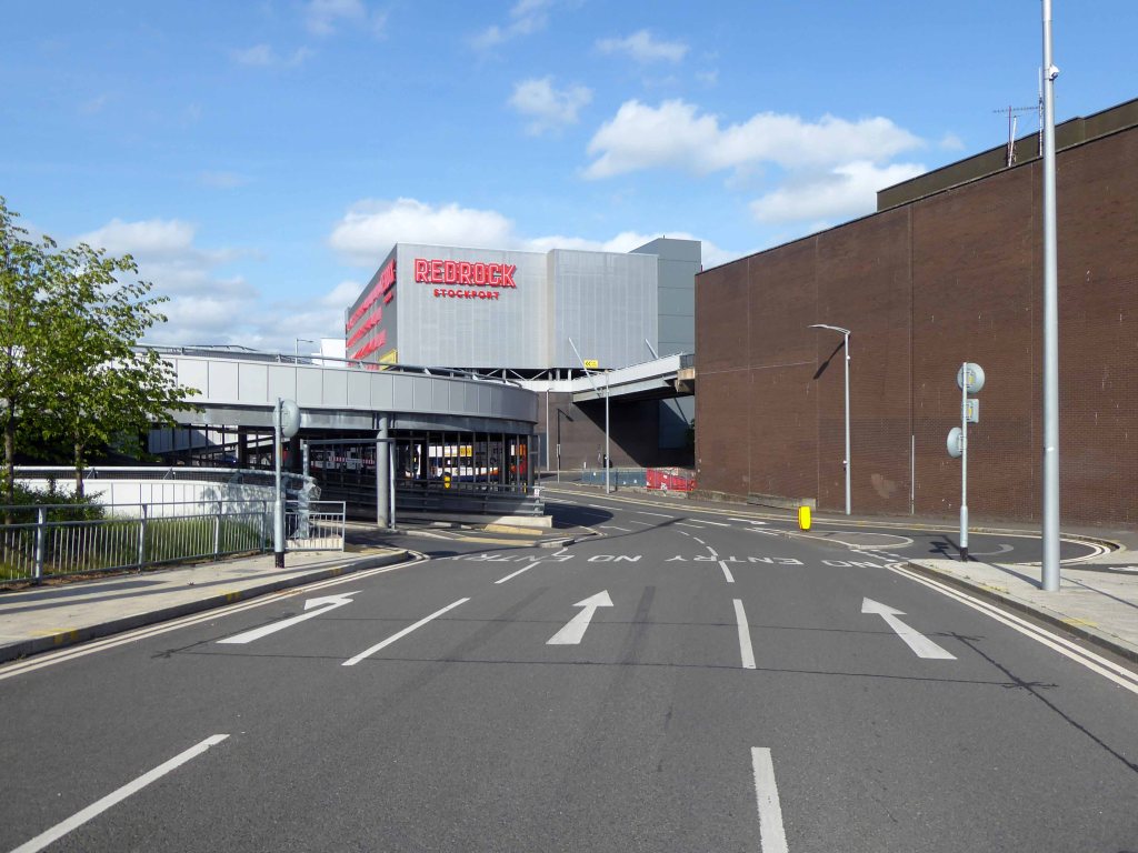
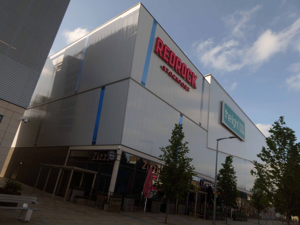
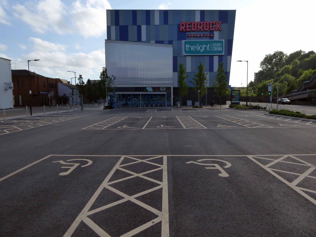
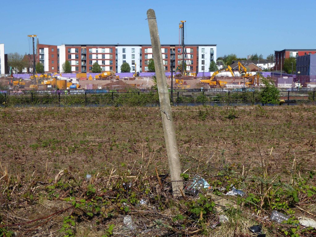
Until 2015 when planning permission is granted for the £45m Redrock leisure scheme, which includes a 10-screen cinema, restaurants and shops.
Councillor Patrick McAuley, the council’s executive member for economic development and regeneration, said:
This is a very exciting time for Stockport. Developments such as these help our ambition of putting Stockport on the map to bring more people to work, shop and socialise here. We have been keen to involve the public in plans for both developments, by holding various consultation exercises.
We look forward to an exciting few years improving Stockport’s offer.
So good bye to all this, the local authority is making serious progress, developing Stockport’s future, against a background of structural decline and the dominance of Manchester city centre.
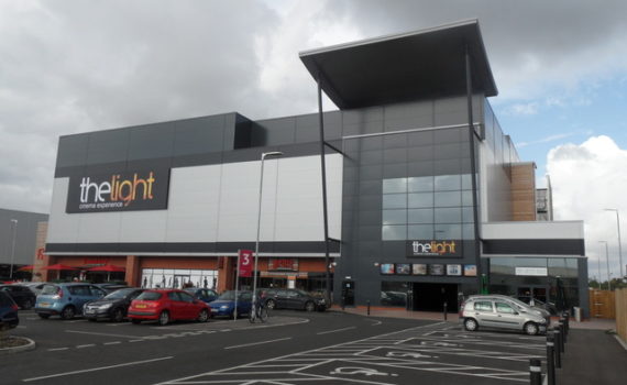
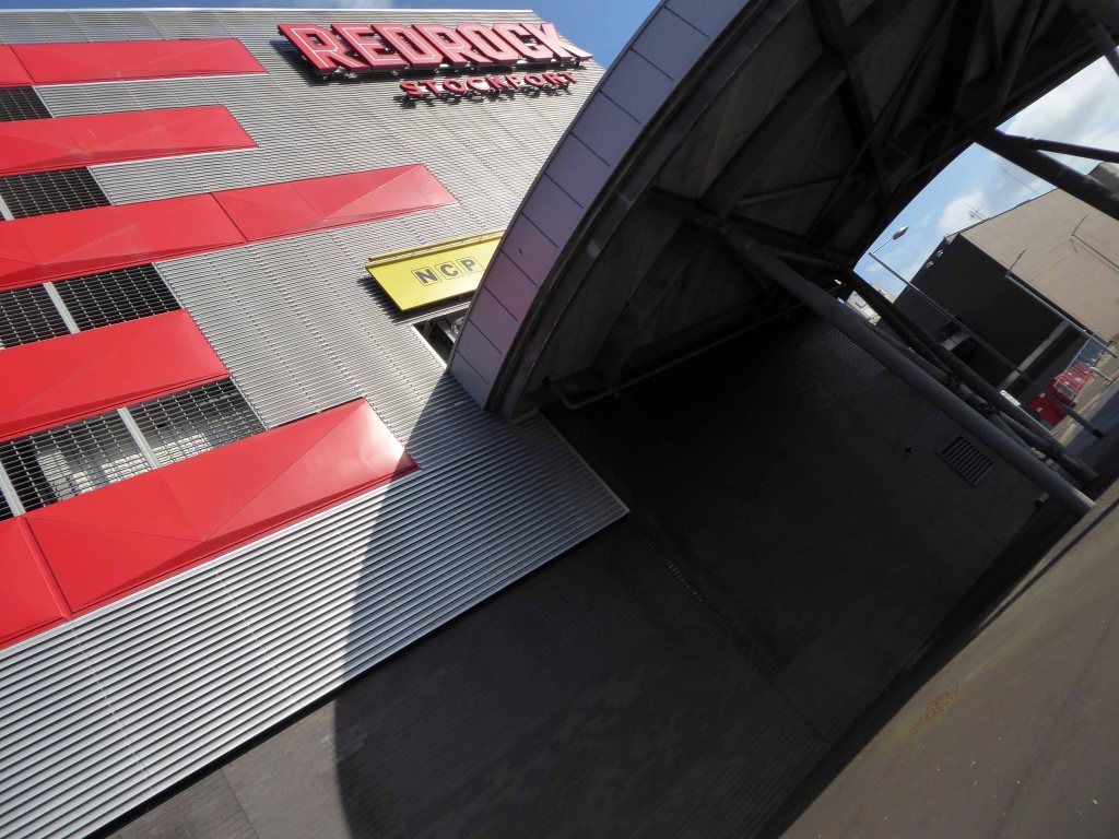
The architects for the scheme are BDP – the building was not well received as it was awarded the Carbuncle of the Year 2018.
Judges were left unimpressed by the – awkward form, disjointed massing and superficial decoration, while readers called it an absolute monstrosity.
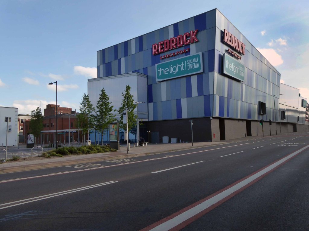
Though to be fair The Light has a house style that leans heavily towards the anonymous industrial shed.
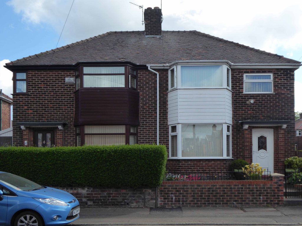
Sittingbourne
The development has however become a commercial success – once inside customers seem more than happy with the facilities.
The people of Stockport have welcomed us with open arms since opening in 2017. We’ve now had over one million guests join us for everything from the latest blockbusters to opera, theatre and concerts.
It’s been that busy that we’ve just added two additional screens and now offer freshly made pizzas, burgers and sliders. We’ve got plenty more exciting additions up our sleeve for next yeartoo!
Yet it continues to attract wave after wave of criticism on local Facebook groups, perhaps the former car parking area should be reinstated, or the Victorian slums rebuilt?
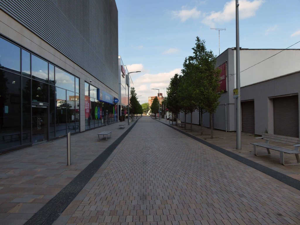
I went to take a look for myself during lockdown – see what you think.
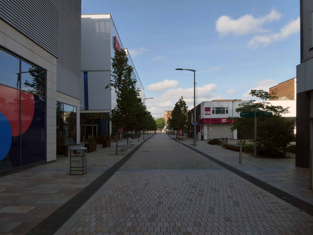
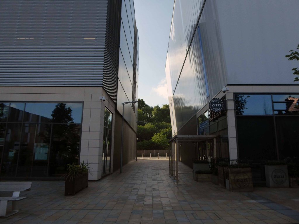
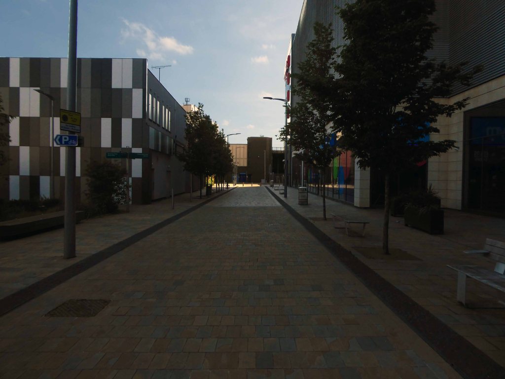
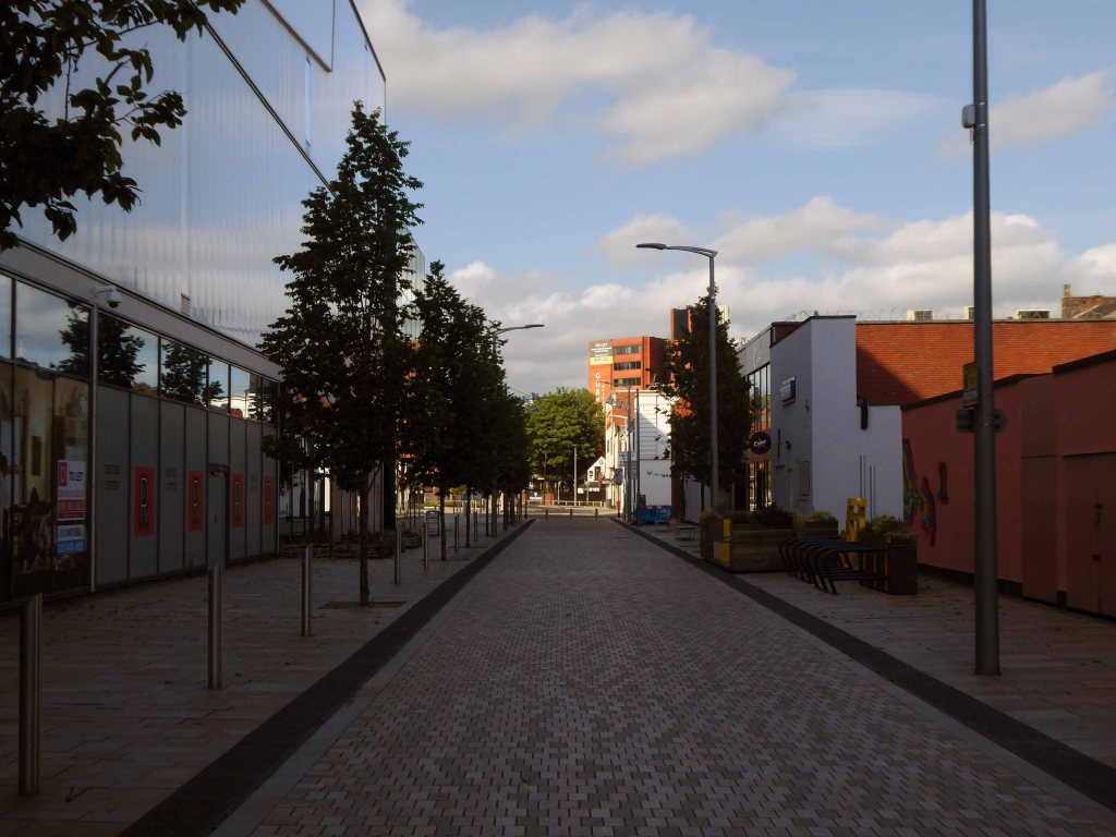
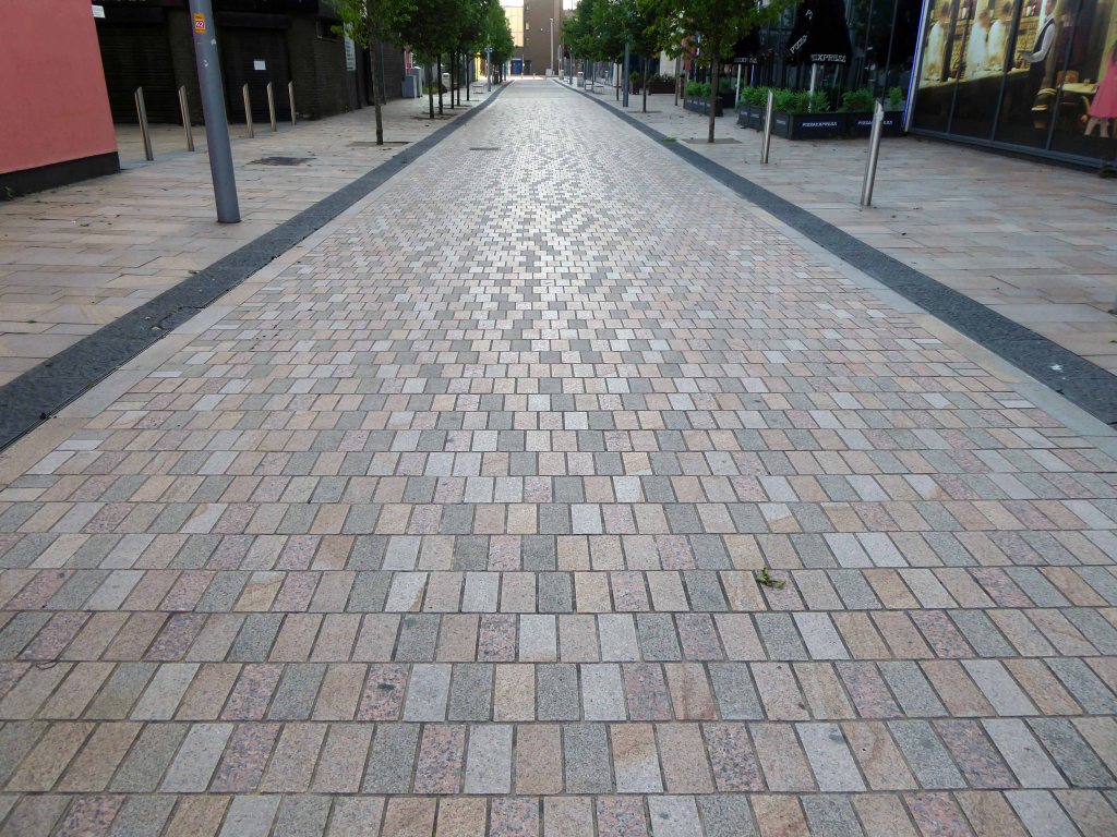
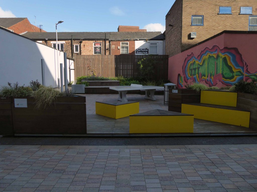
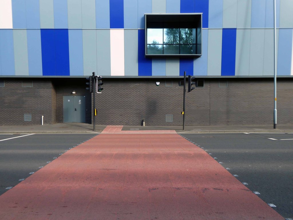
Real attempts have been made to make the landscaping and street view amenable to pedestrians, it feels like an attractive and safe urban space.
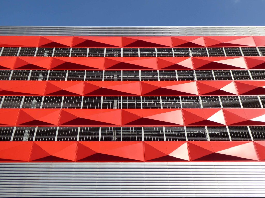
The view from the north is less successful, the scale and decorative work looks over ostentatious and confused.
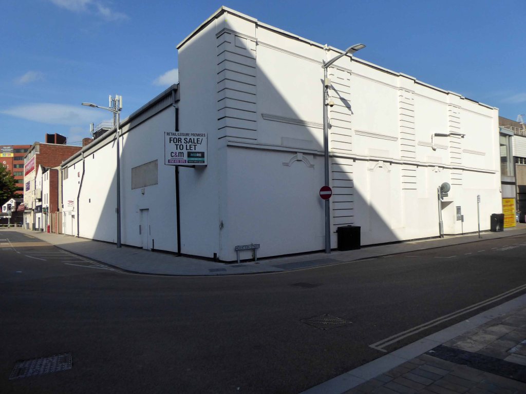
Look away if you wish, it won’t be here forever – and if you fancy something different try The Plaza or The Savoy.
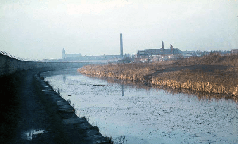
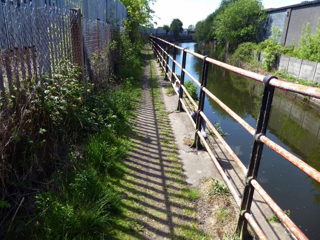
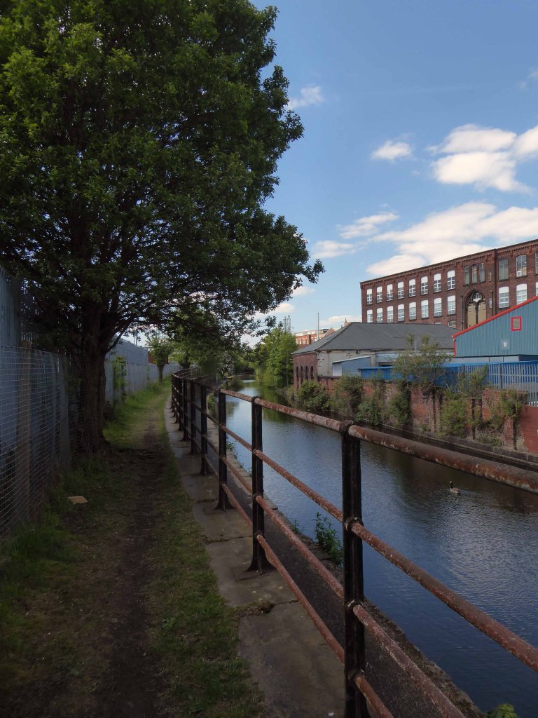
The canal received its Act of Parliament in 1792. It was built to supply coal from Oldham and Ashton under Lyne to Manchester. The first section between Ancoats Lane to Ashton-under-Lyne and Hollinwood was completed in 1796.
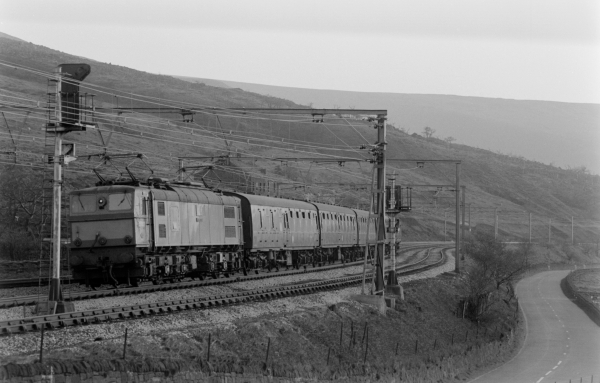
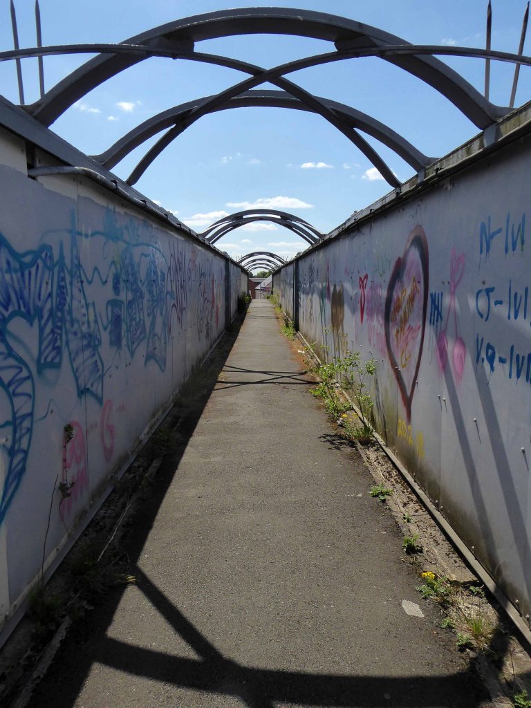
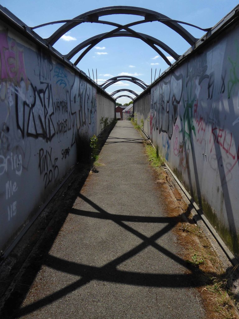
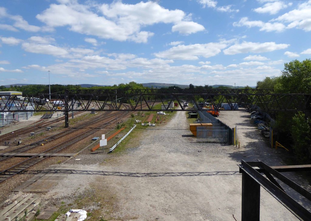
The Great Central Railway in England came into being when the Manchester, Sheffield and Lincolnshire Railway changed its name in 1897, anticipating the opening in 1899 of its London Extension. On 1 January 1923, the company was grouped into the London and North Eastern Railway.
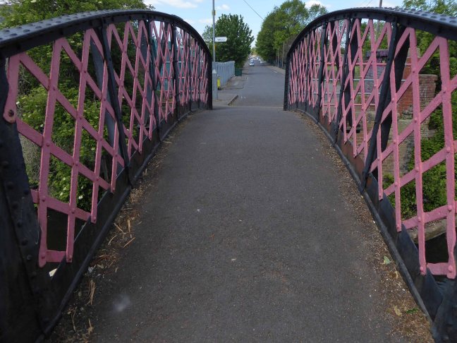
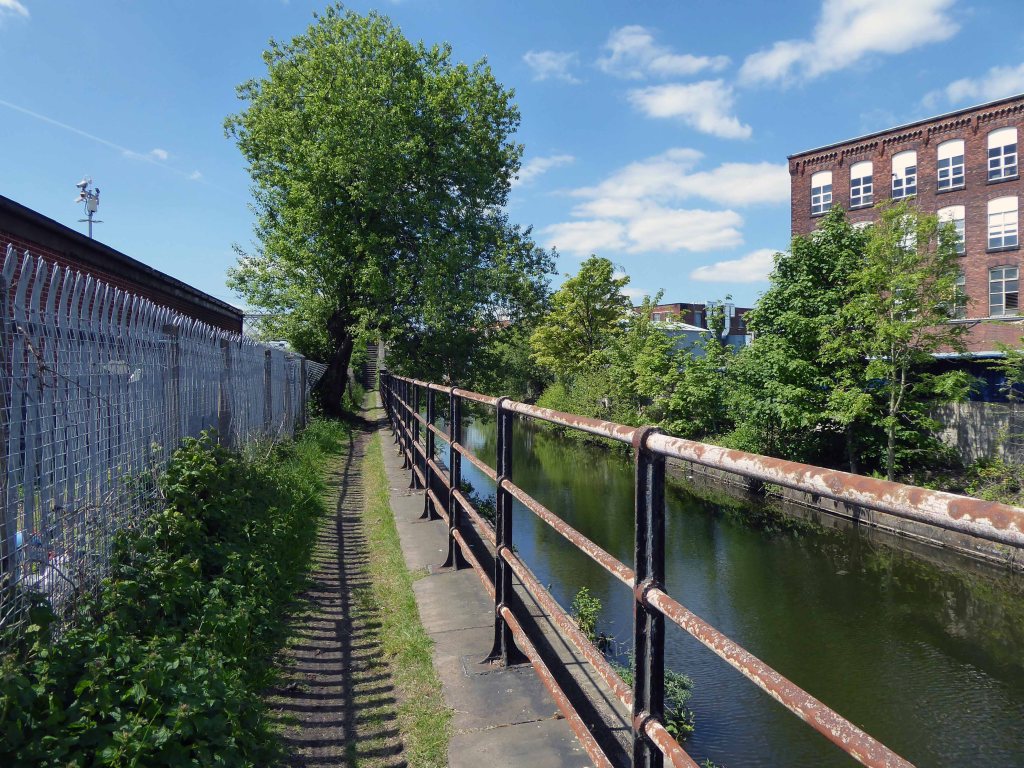
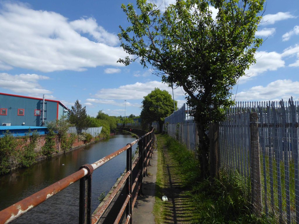
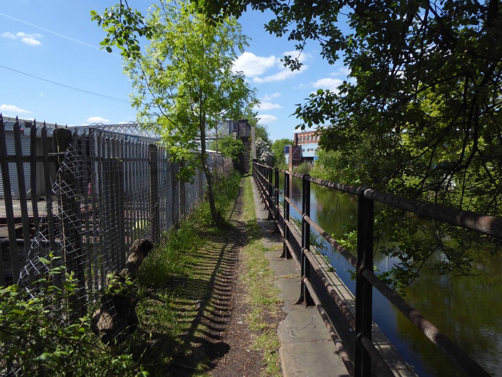
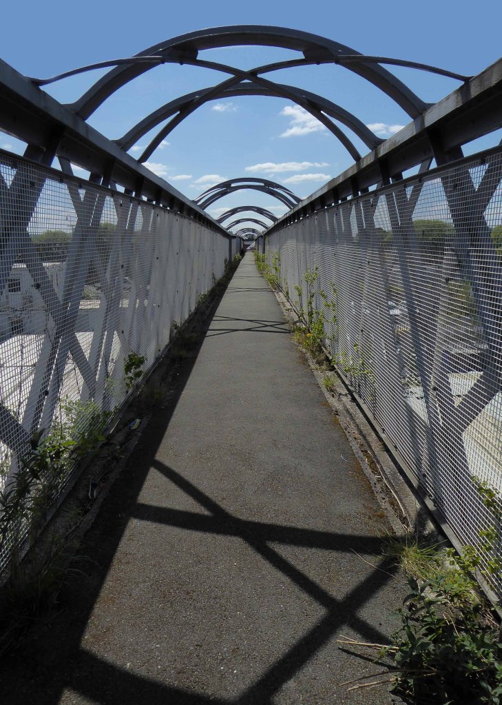
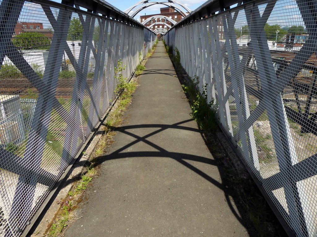
I had walked beside the elevated path, alongside the canal coming home from school, rode by it whilst working as a Guide Bridge goods guard.
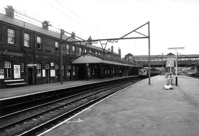
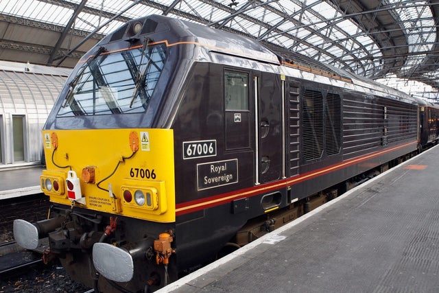
This was busy railway, steel coal, oil and people hurtling back and forth across the Pennines, under the DC wires of the Woodhead Line.
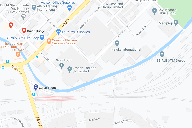
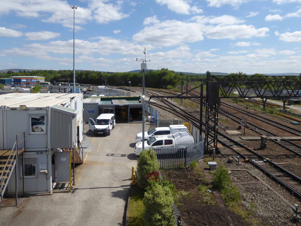
One memorable night the Royal Train stayed overnight, in what are now the SB Rail OTM sidings.
Toffs in dinner jackets were leaning from the windows, as we gazed in awe from the platform.
Swietelsky is one of Austria’s leading construction companies with international contracts encompassing highways, tunnelling, residential and commercial developments, alpine construction and railways.
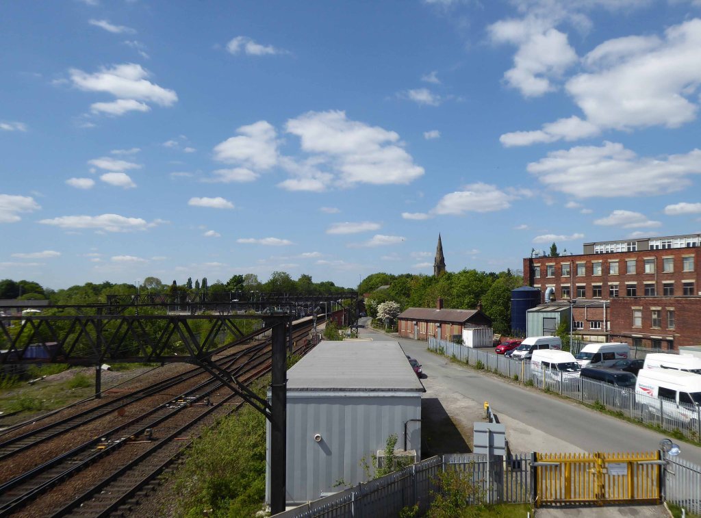
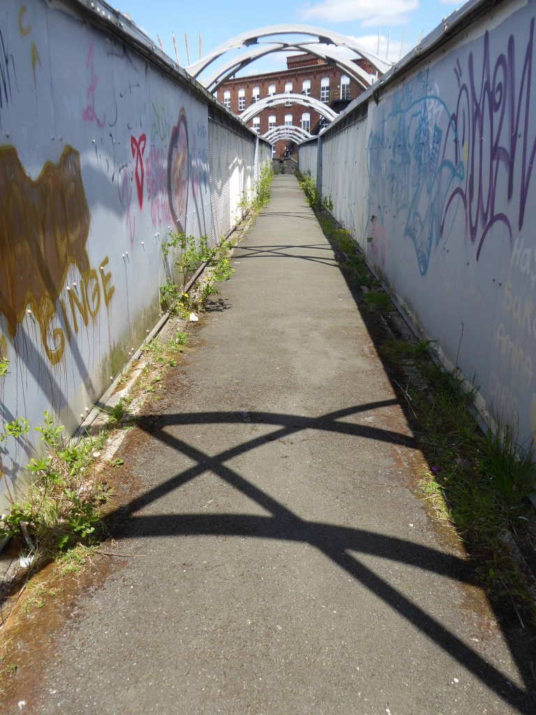
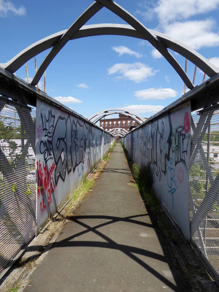
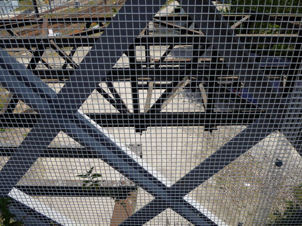
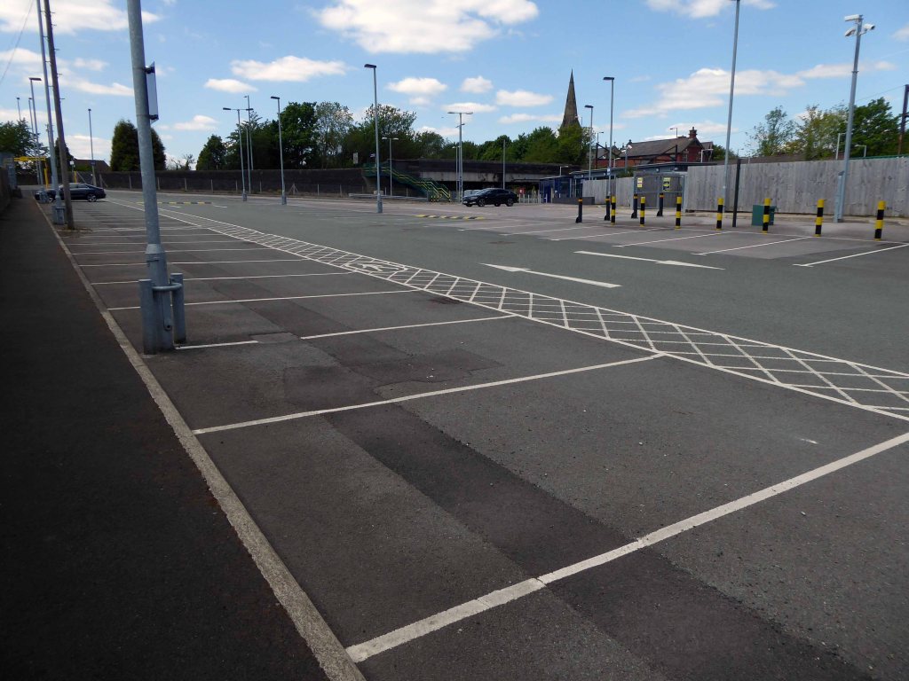
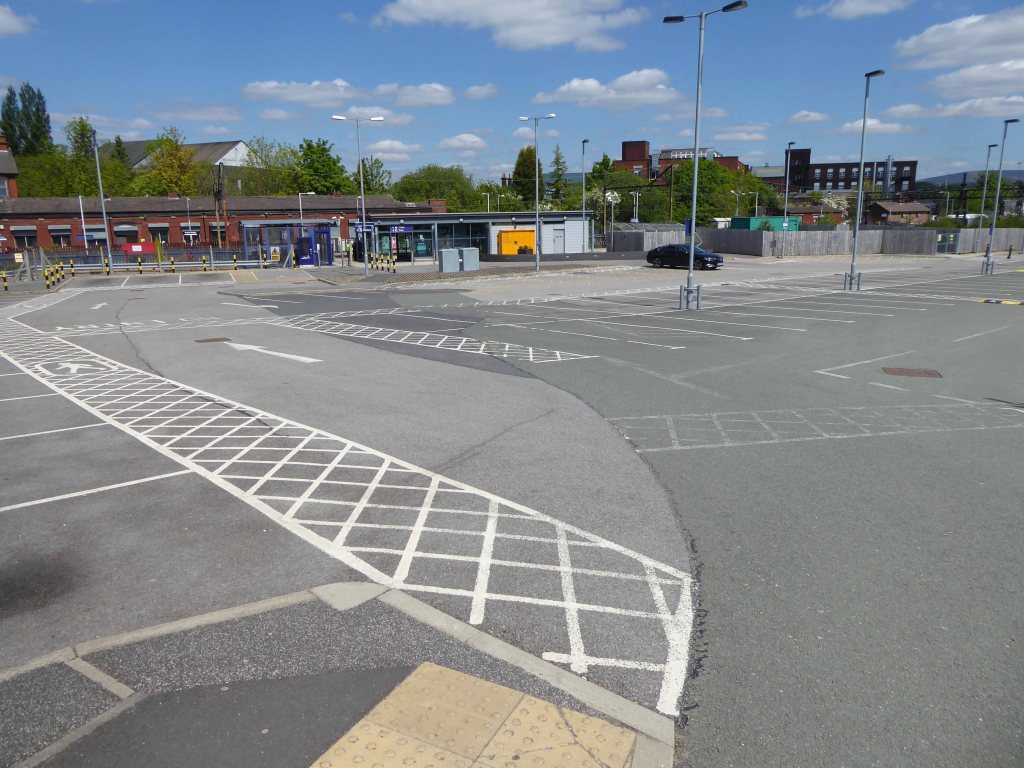
The journey ends by the seriously depleted station buildings, the buffet bar, depot and engine shed long gone.
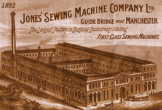
Thomas Chadwick later joined Bradbury & Co. William Jones opened a factory in Guide Bridge, Manchester in 1869. In 1893 a Jones advertising sheet claimed that this factory was the – Largest Factory in England Exclusively Making First Class Sewing Machines. The firm was renamed as the Jones Sewing Machine Co. Ltd and was later acquired by Brother Industries of Japan, in 1968. The Jones name still appeared on the machines till the late 1980s.
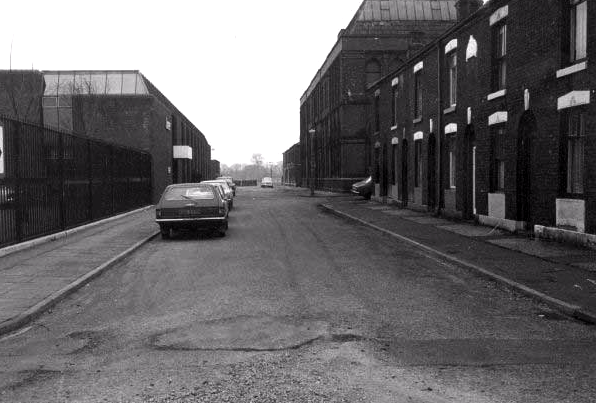
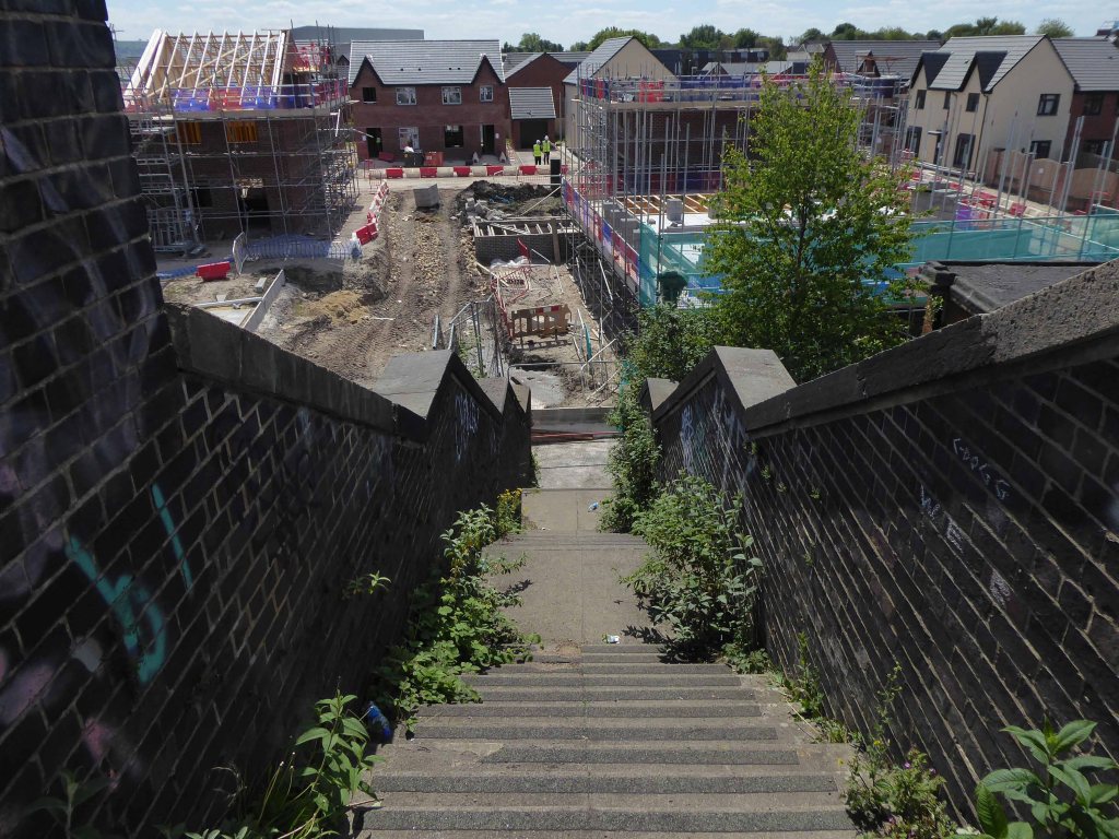
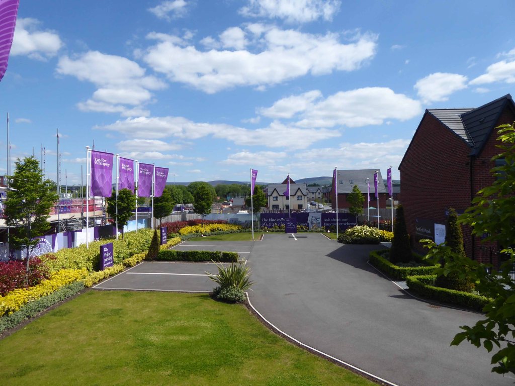
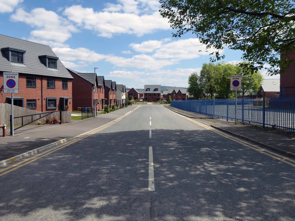
The site is now home to new homes and homeowners, as the area seeks to capitalise on the spread of wealth from Central Manchester.
Arnfield Woods is an exclusive development offering two, three and four bedroom homes, located adjacent to the Guide Bridge train station, which provides direct access into Manchester City Centre and direct access into Glossop.
The world turns:
Time changes everything except something within us which is always surprised by change.
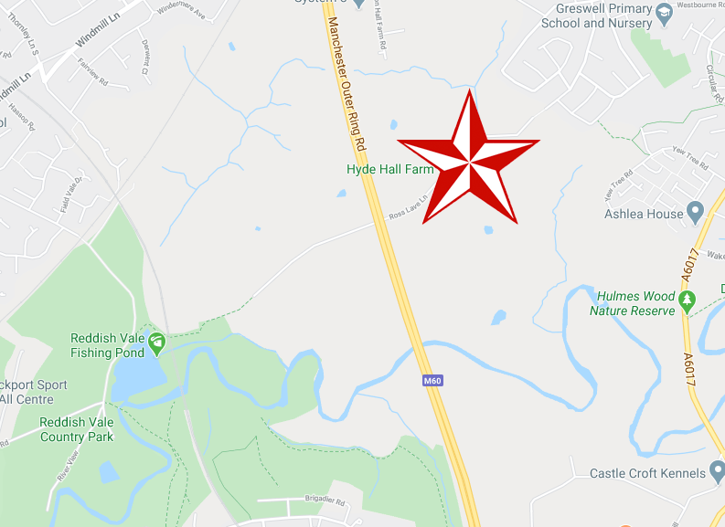
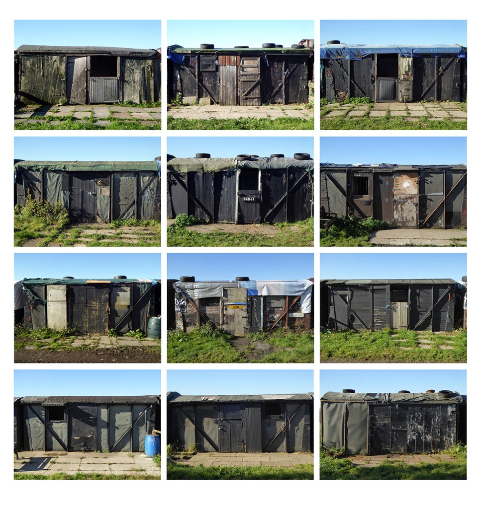
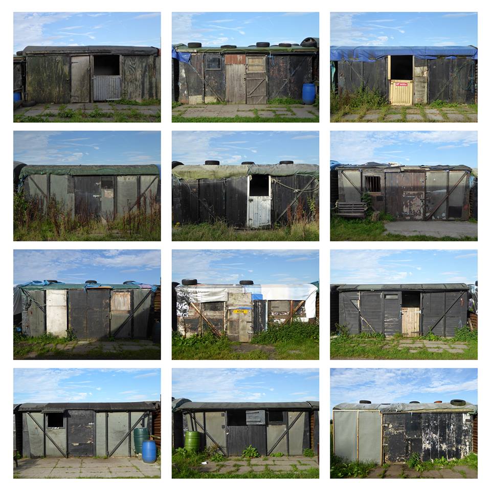
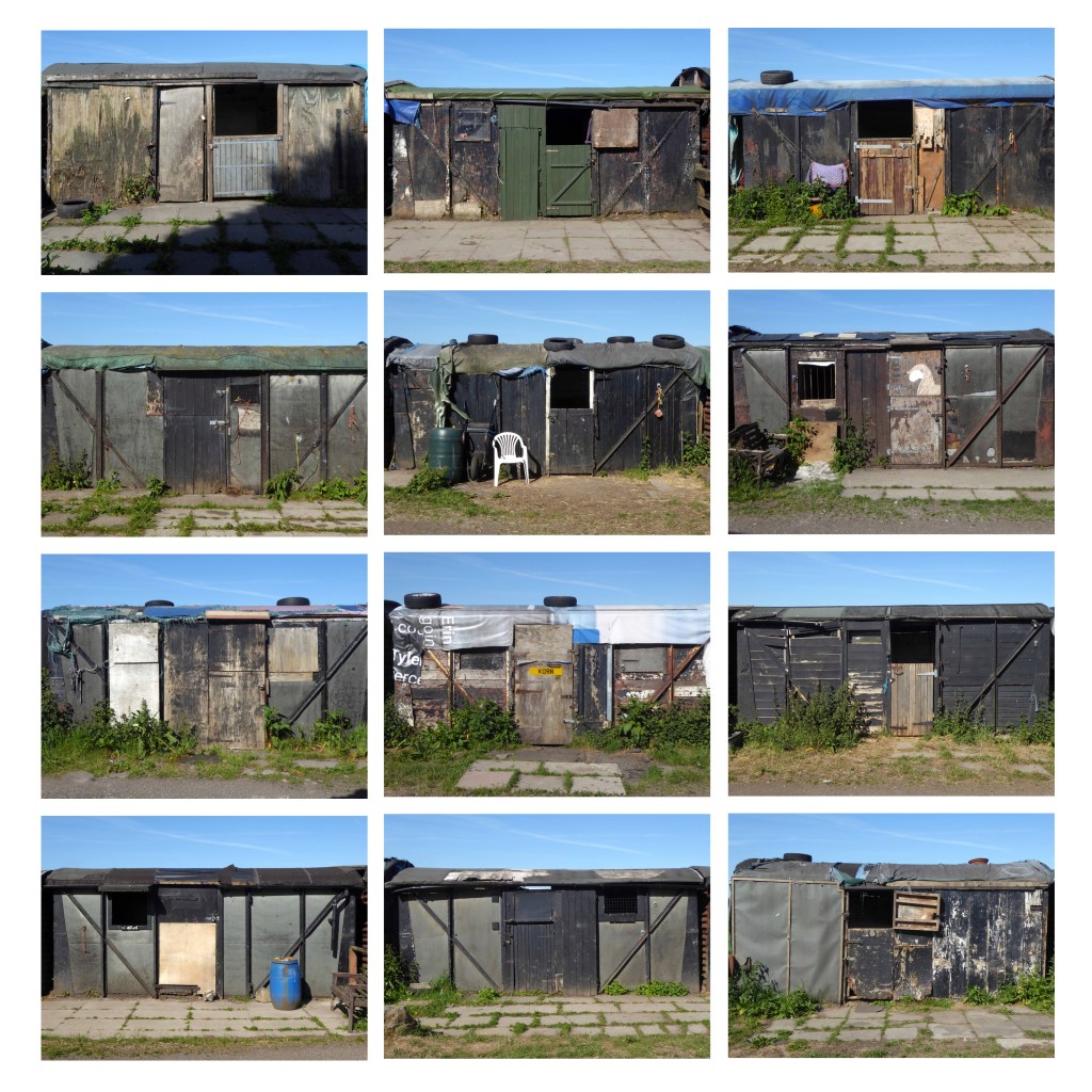
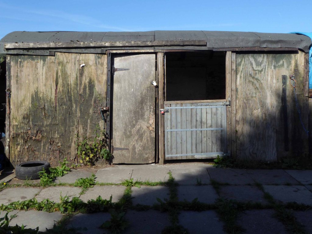
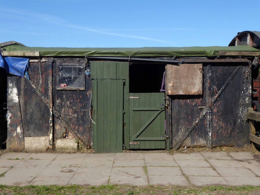
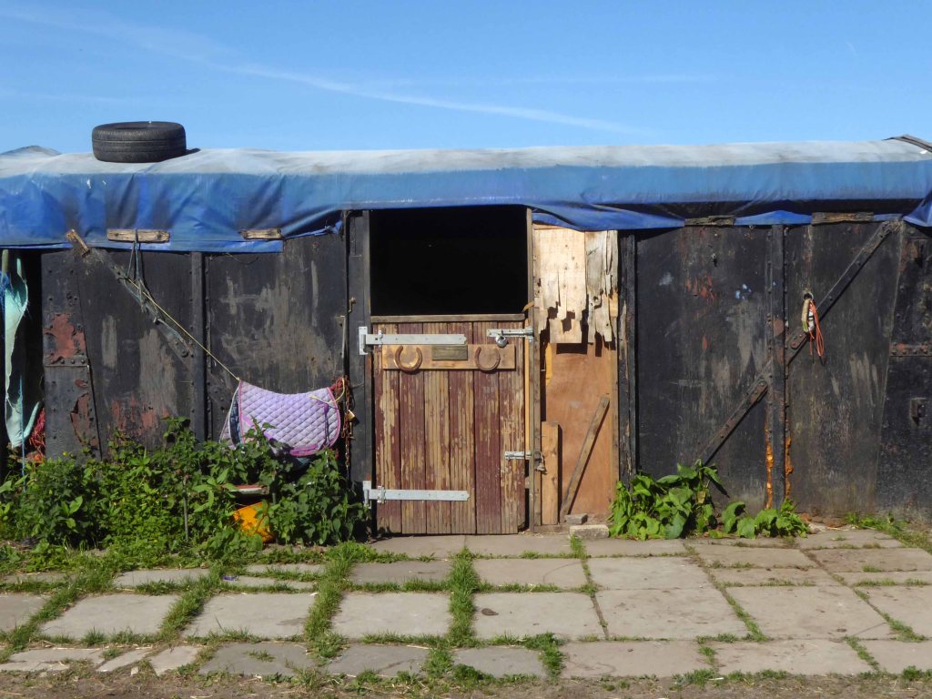
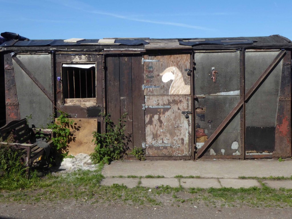
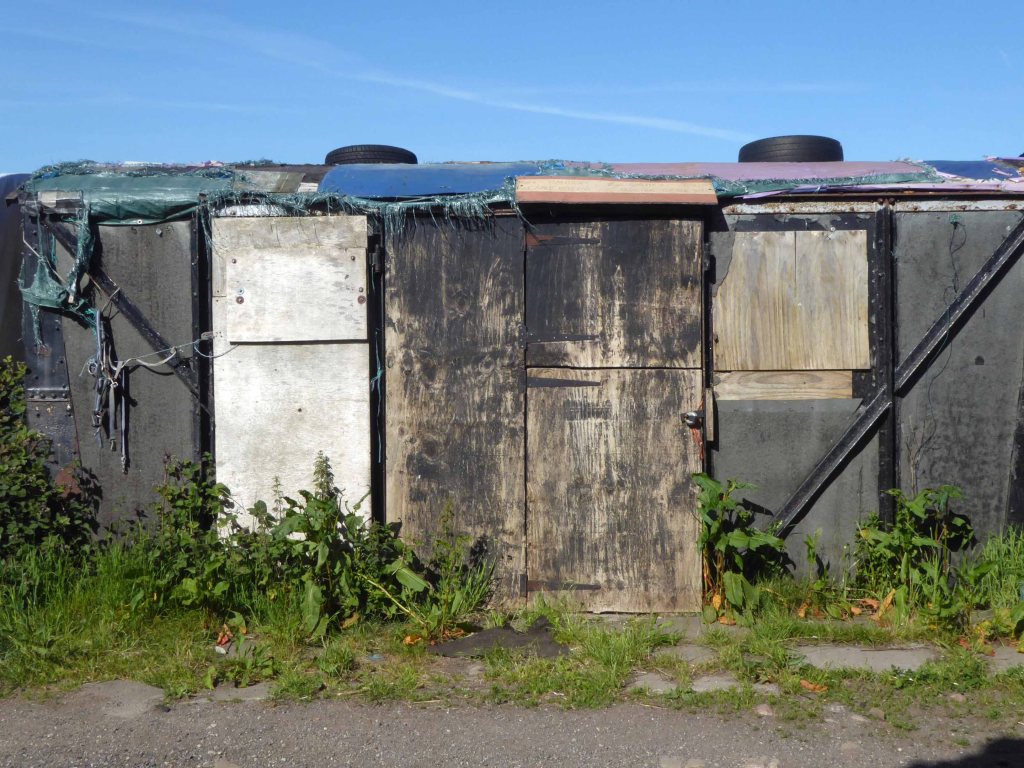
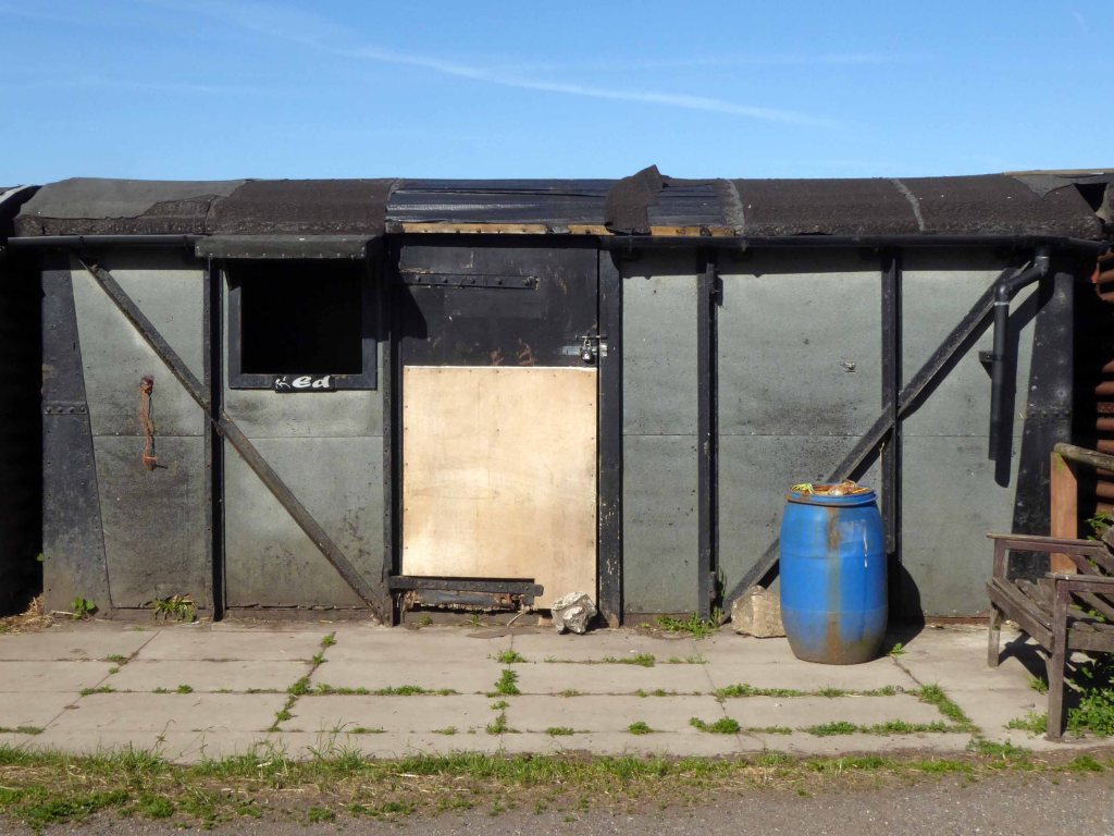
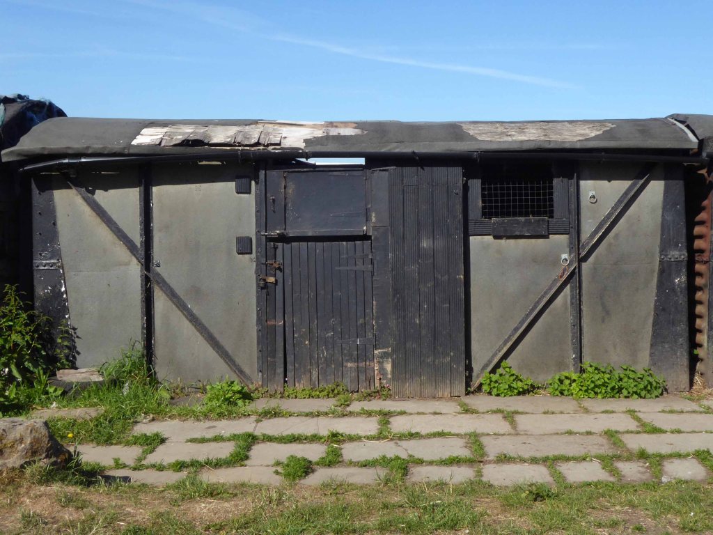
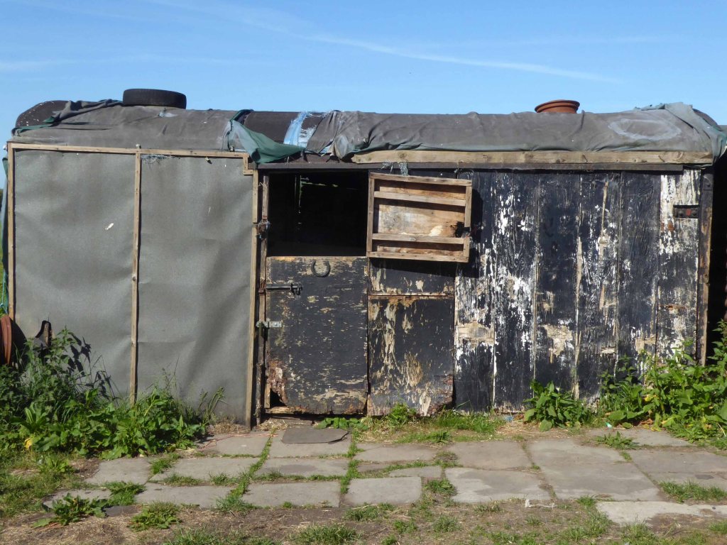
Hyde Hall Farm is Grade II Listed one of the few Tudor model farms in the region, a building of immense importance.
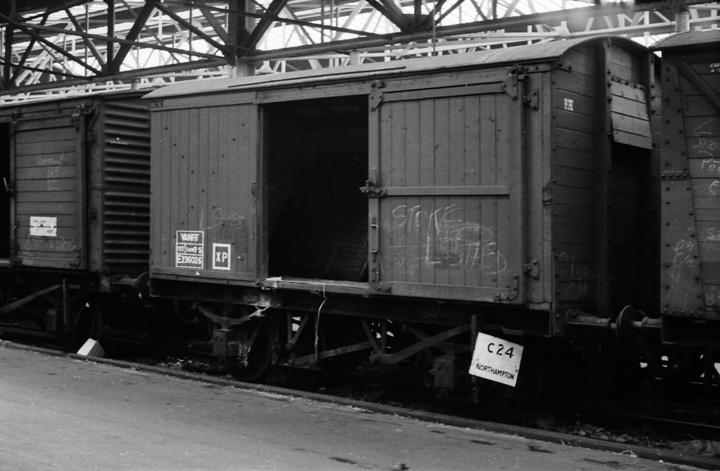
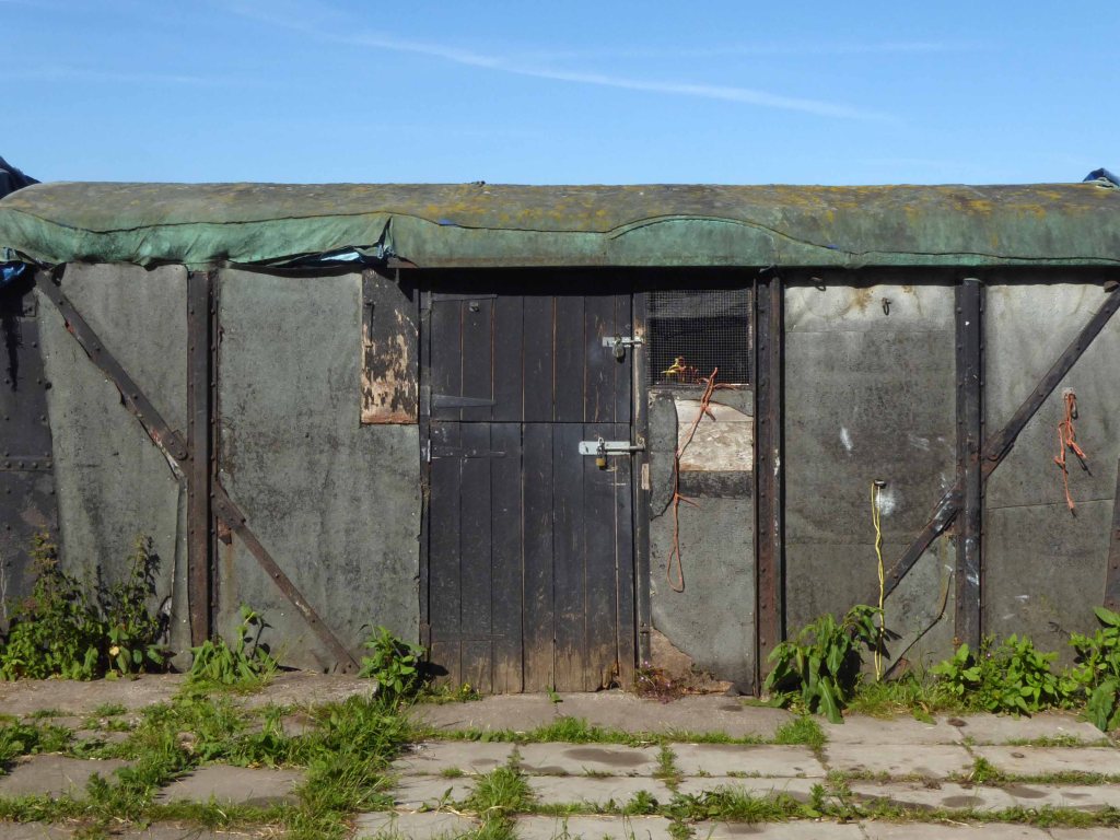
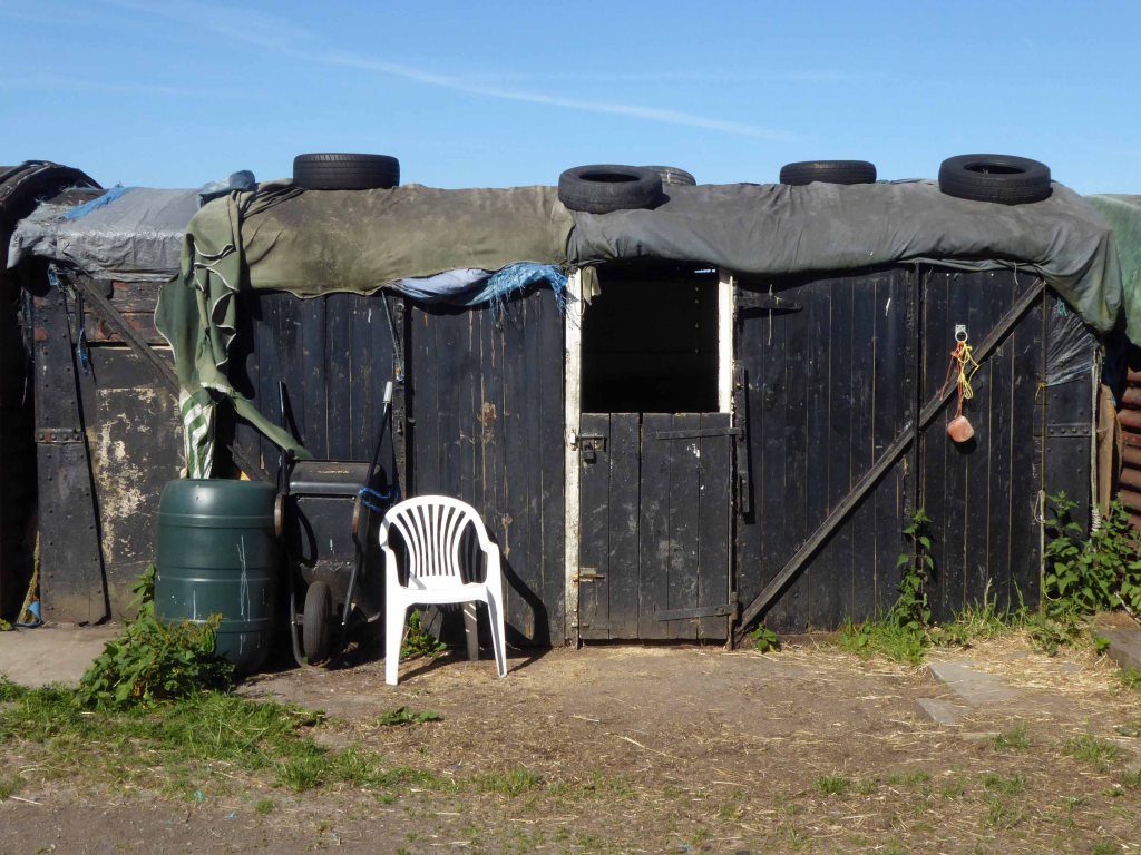
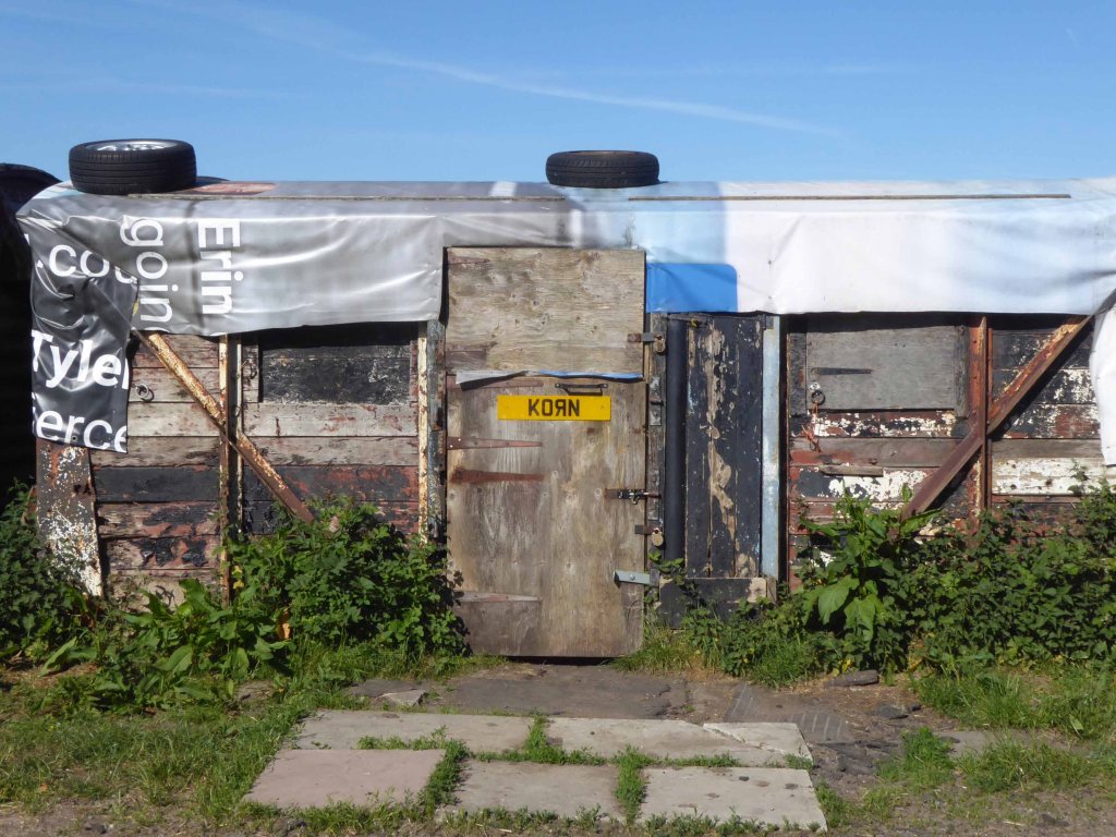
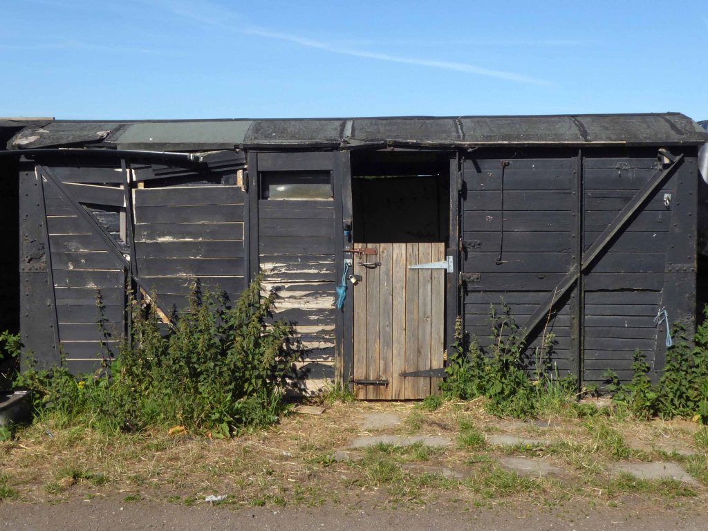
Alongside the farm are twelve stable blocks, formed from former British Rail Vanfit rolling stock.
Derby Works
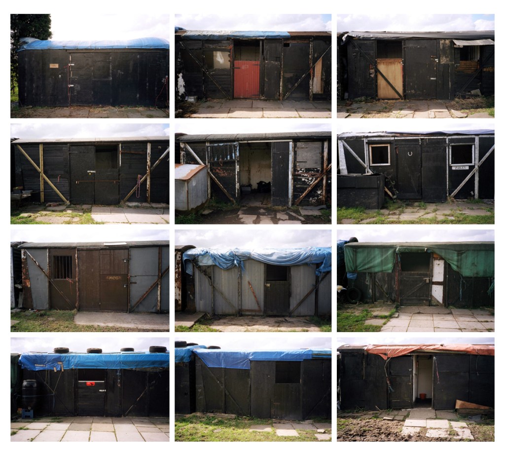
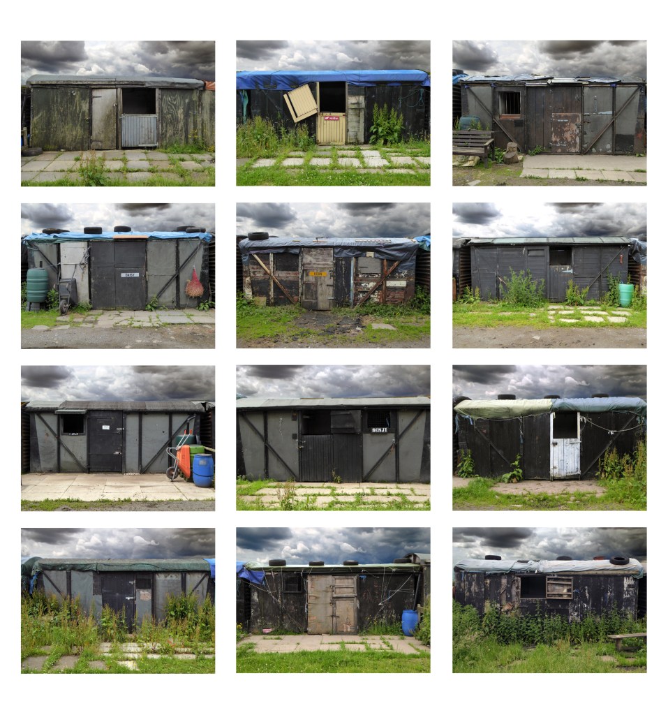
I have cycled by here for some fifty years ago man and boy, sadly observing a slow decline, as the structures are kept in service with the addition of sheeting, rope, tyres and will power.
In recent years I have stopped to take photographs:
20082016201720182020
They have survived wind, rain and hail, just about intact, providing adequate shelter for their equine inhabitants.
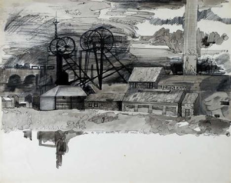
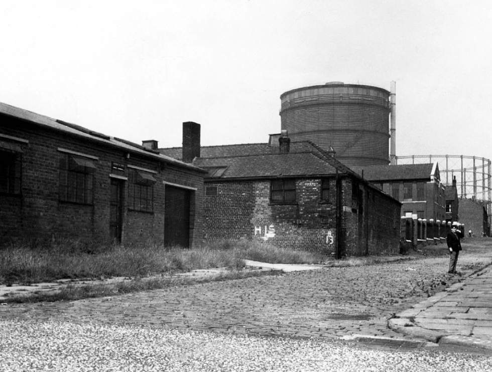
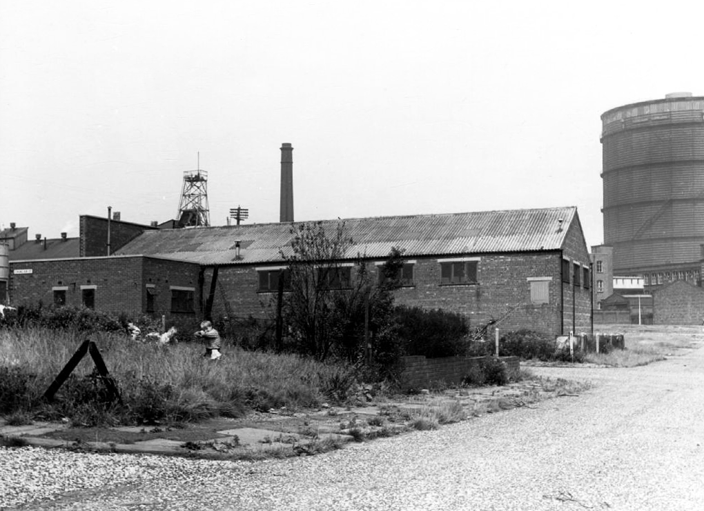
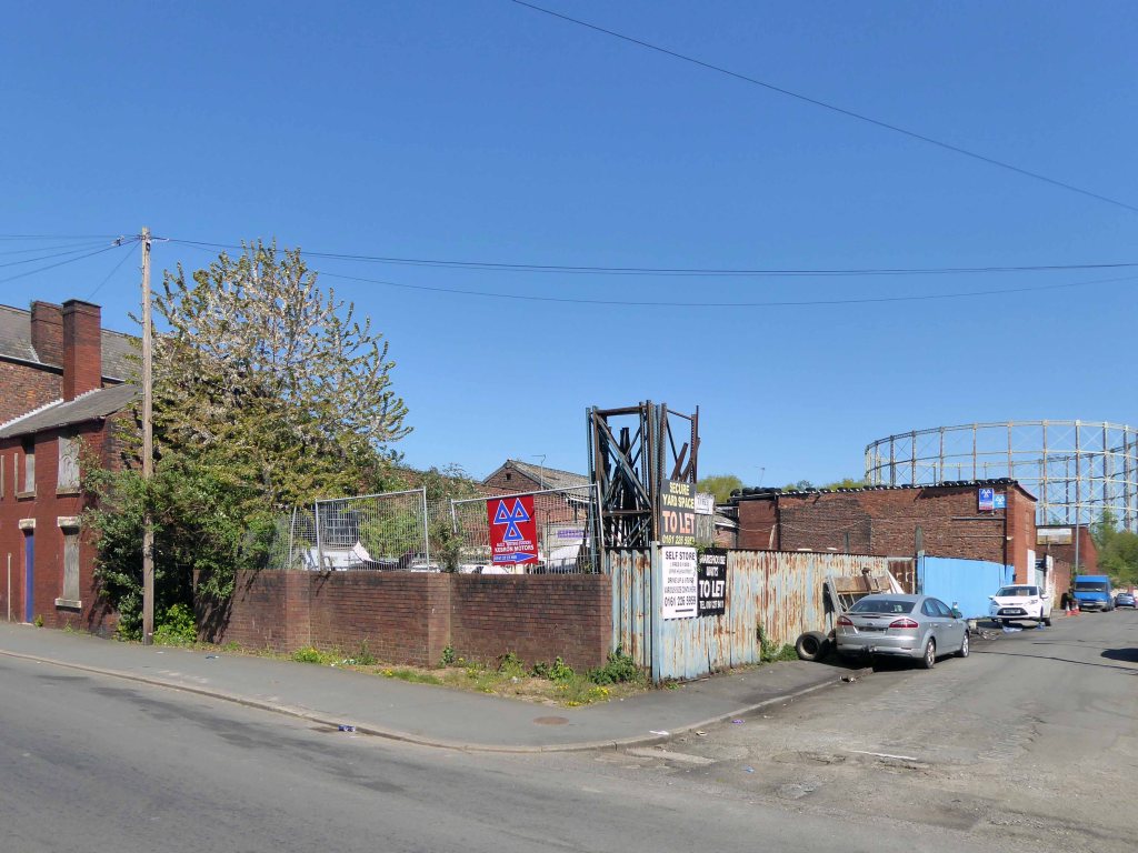
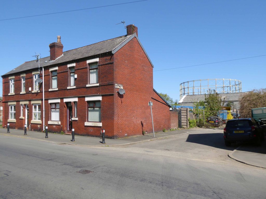
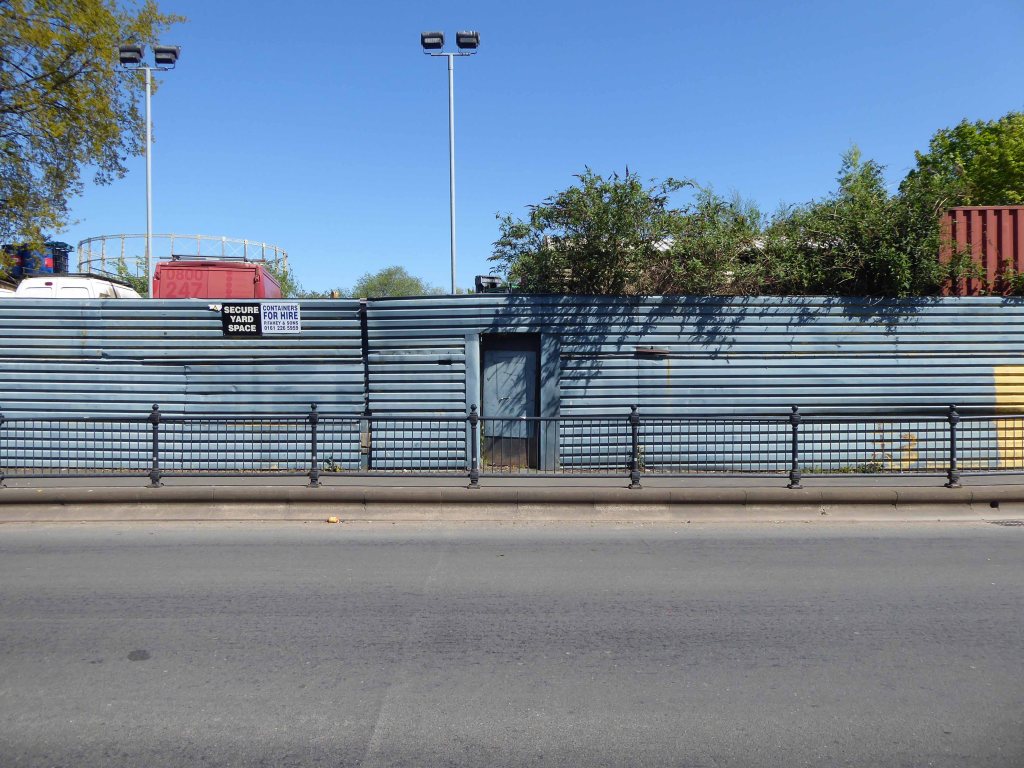
The area was formerly a dense web of housing and industry.
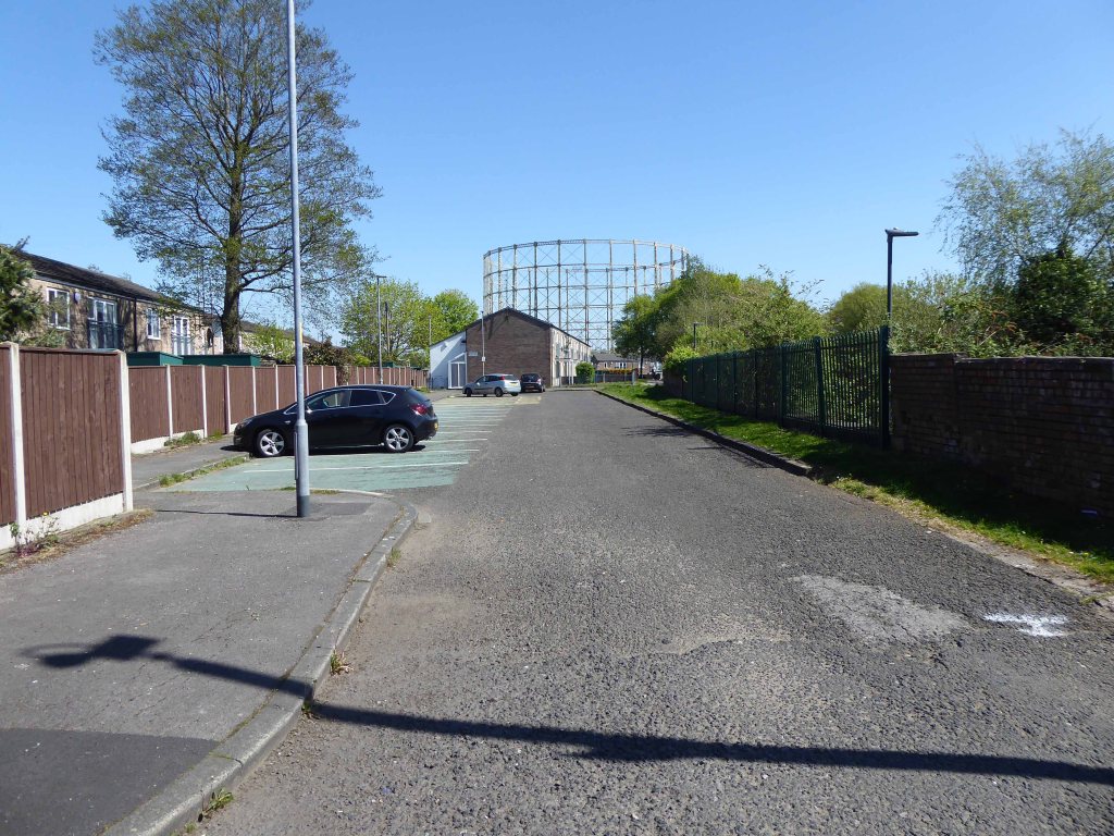
With the gas works at its heart .
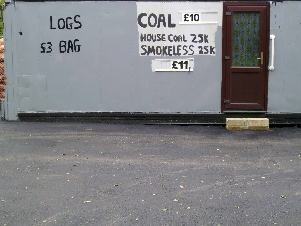
High speed gas once the fuel of the future is almost a thing of the past. Coal Gas produced in coke retorts long gone, North Sea Gas hissed off.
Low carbon heating will replace domestic boilers from 2025, the need for gas storage holders is minimal.
Goodnight Mr Therm.
There are currently 53 listed holders on the Historic England site.
Some have been repurposed – WilkinsonEyre has completed work on Gasholders London; a development of 145 apartments within a triplet of listed gasholder guide frames.
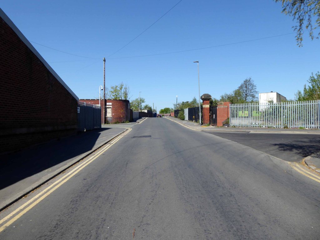
Little now remains of the Portwood Gas Works.
These are the rearranged remnants re-sited by Dunelm Mill – it’s curtains for our industrial heritage.
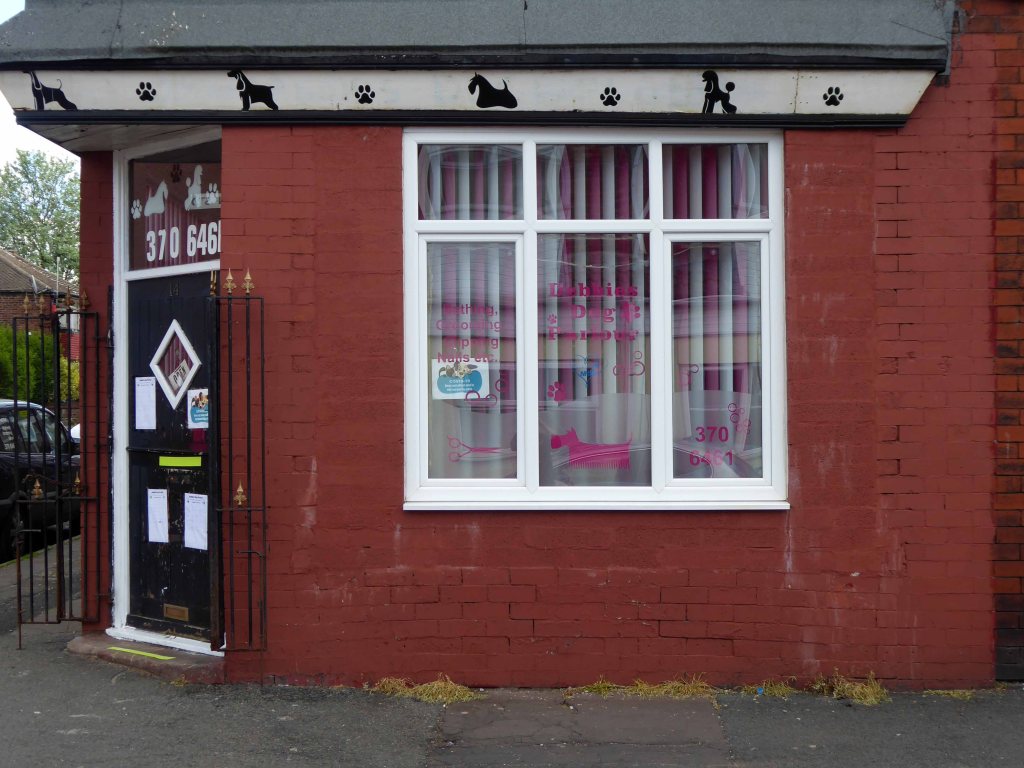
Your business is unique, so we don’t offer a one-size-fits-all.
Instead, we layer six Protective Services for your complete security.
Unlock six Protective Services
One of the UK’s largest retail parks, Stockport Retail Park benefits from a strategic location on the M60 Manchester orbital motorway making it one of the city’s most accessible parks. The park forms a natural extension to the town centre, offering a wide range of uses from value convenience to fashion and home as well as a number of cafés and restaurants.
This is the post industrial landscape of consumption and its infrastructure that faces the defunct and mothballed site, whatever next?
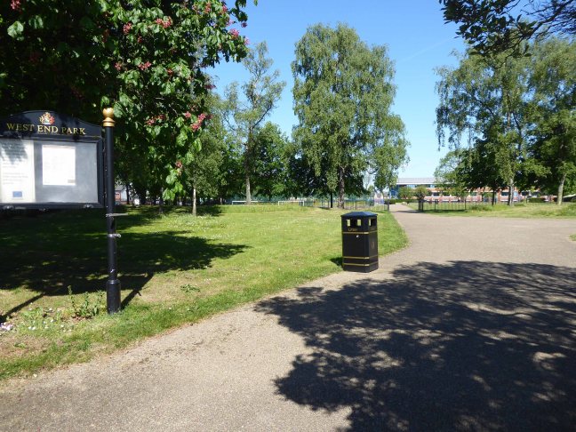
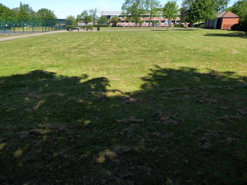
This is a short history of a park, a short history of my family and me.
The movement of earth and people, a tale until now untold now told.
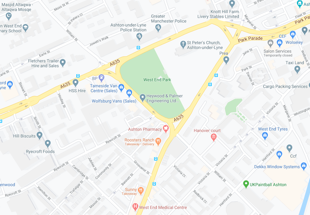
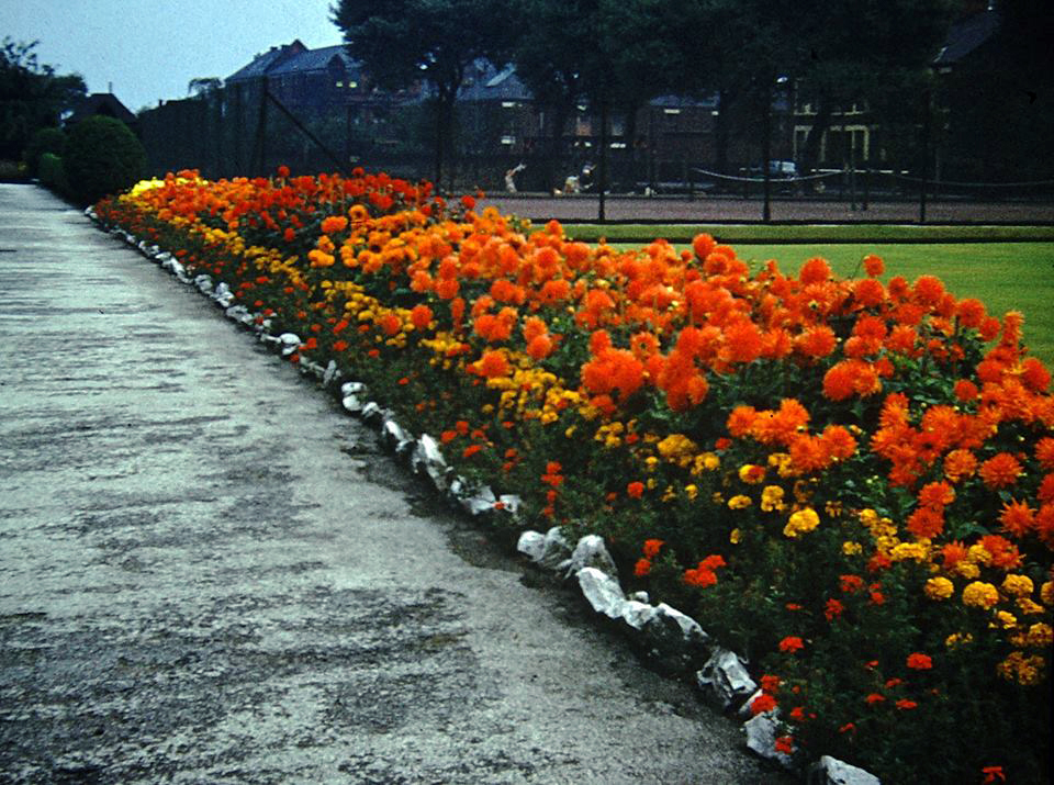
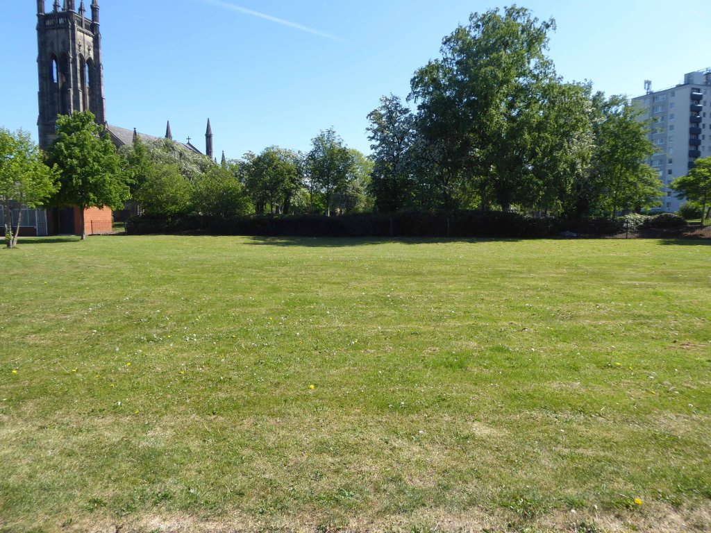
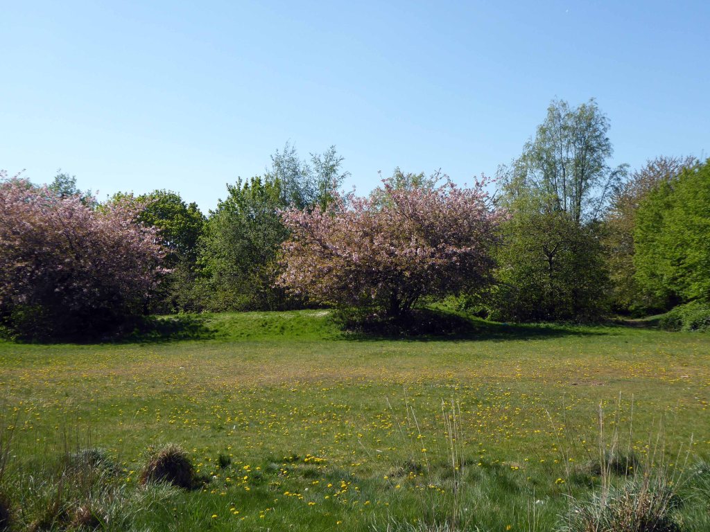
West End Park is a public park, opened in 1893. The site is bounded by Stockport Road, Manchester Road and William Lane. It was developed on land associated with St Peter’s Church.
St Peter’s was built between 1821 and 1824, and was designed by Francis Goodwin. A grant of £13,191 was given towards its construction by the Church Building Commission. The land for the church was given by the patronage of George 6th Earl of Stamford and Warrington, whose cousin, Revd Sir George Booth, had been Rector of Ashton from 1758 until 1797
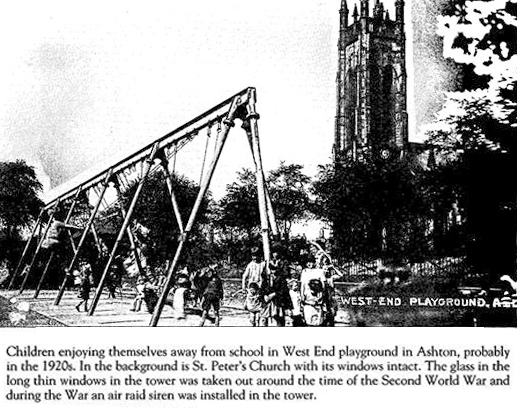
The benevolent Victorian landowners thought it politic to provide parks for the working folk, fresh air, exercise and perambulation being preferable to the demon drink.
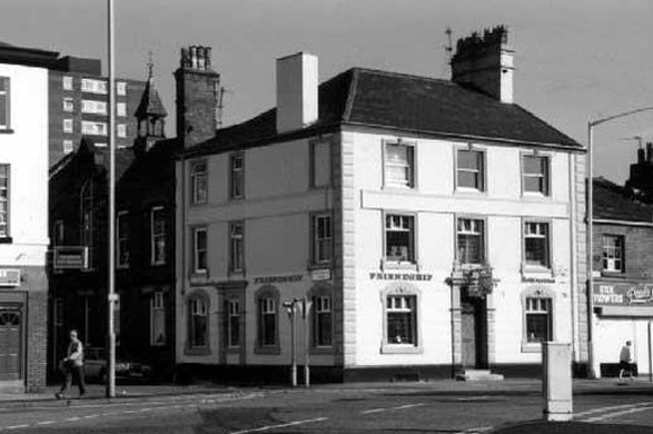
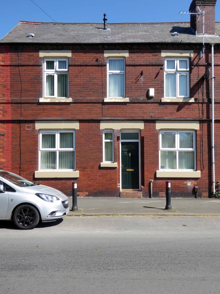
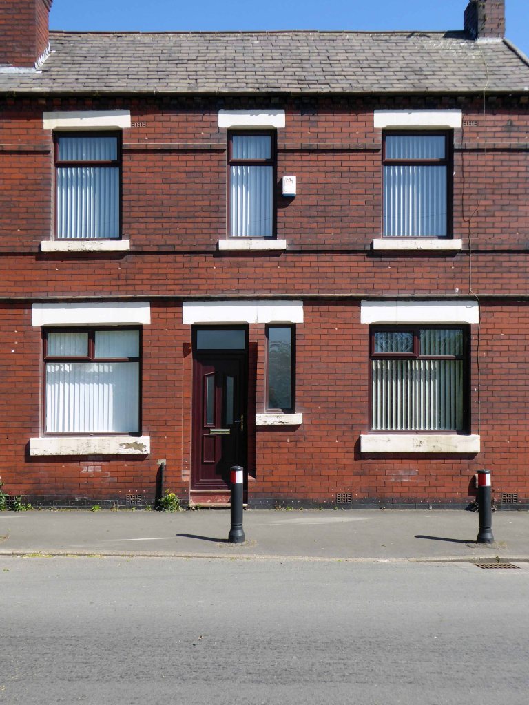
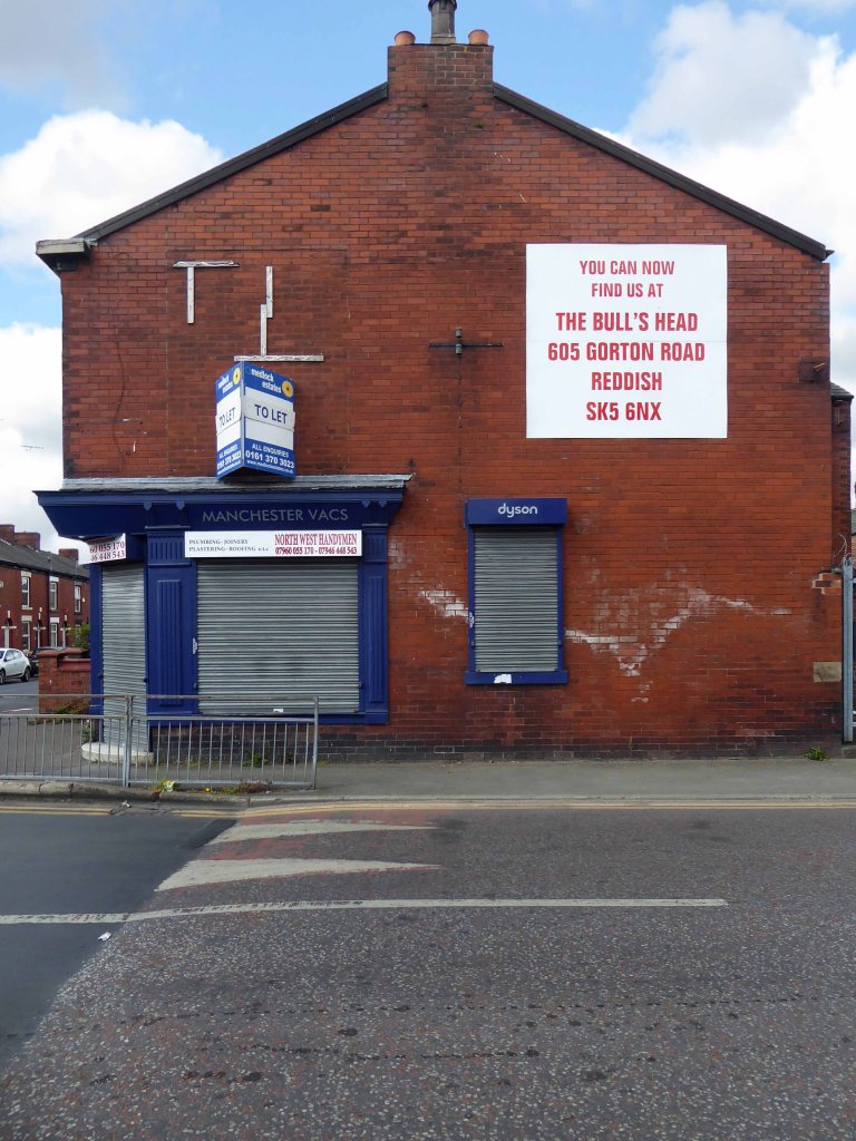
Friendship Old Street – now a solicitor’s office
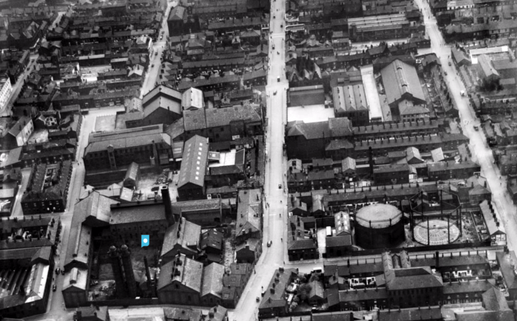
The area around the park was a dense warren of housing and industry.
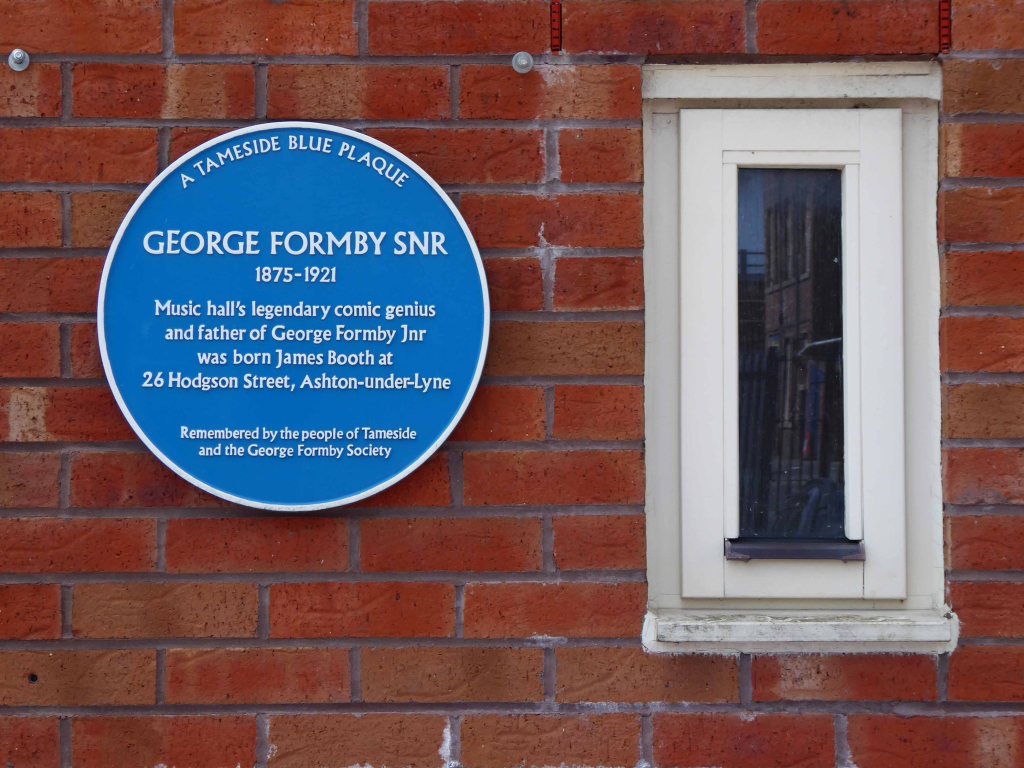
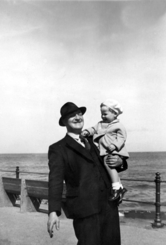
There’s a plaque for George – there isn’t one for Sam.
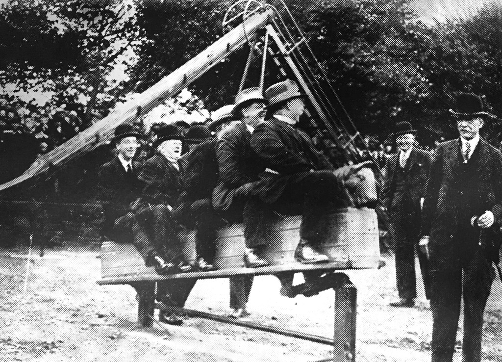
During the Great Depression men were required to work for the Dole – Sam was required to dig out a sunken garden in the park – he was a collier by trade, a good man with a shovel, built for back breaking work on Ashton Moss.
Thirty yards wide, forty yards long and three yards deep, shifted by hand.
Three thousand six hundred cubic yards of earth.
One cubic yard of topsoil weighs about two thousand pounds on average.
Seven million two hundred thousand pounds of earth.
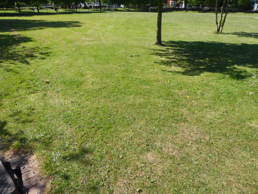
I worked there in the 1970s along with Alec and Danny bedding out the sunken garden, maintaining the bowling green, tennis courts and playground.
Keith Ingham
There were two permanent gardeners in the park, and a keeper in the summer – plus Danny Byrne and me brought in to help at busy times.
Throughout the 70s and onwards, economic decline hit the area hard, the closure of the cotton mills and little hope for the future. Rising unemployment and severe cuts to public spending did little to assure a rosy future for West End Park, or anything or anyone else for that matter.
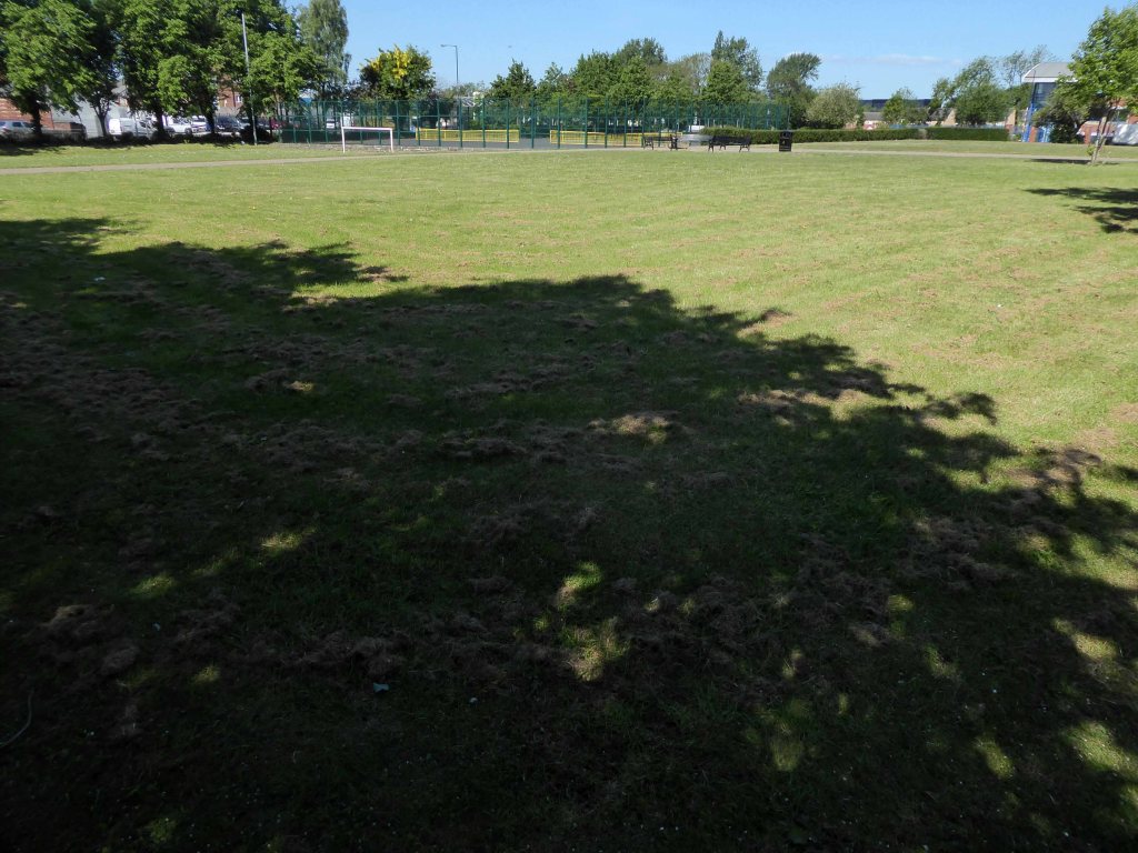
Help was at hand – one of many public projects funded by our old friends the EU. Changes in the way that parks were used and further spending cuts sounded the death knell for the flowers and bowling. Large open grassed areas were cheaper and easier to maintain.
And so the sunken garden was filled in, this time by mechanical means – all in a days work for a bloke with a JCB.
So I sit and reflect on the labour and conditions that created this and many of our public parks, our legacy is a much impoverished version of the original vision.
I think of my grandad Sam and his comrades, the sweat of their collective brows buried forever.
Our legacy the small state, a bring and buy your own world economy.
All that is solid melts into air as Marx and Marshall Berman told us.
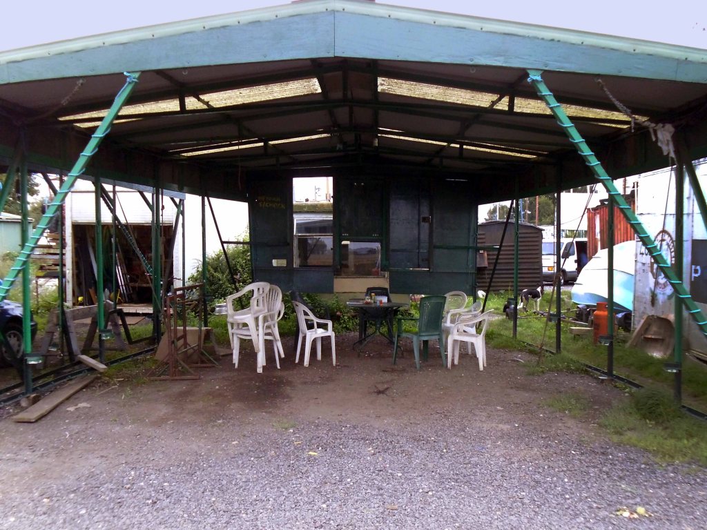
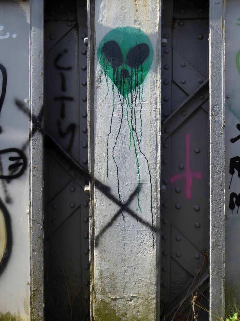
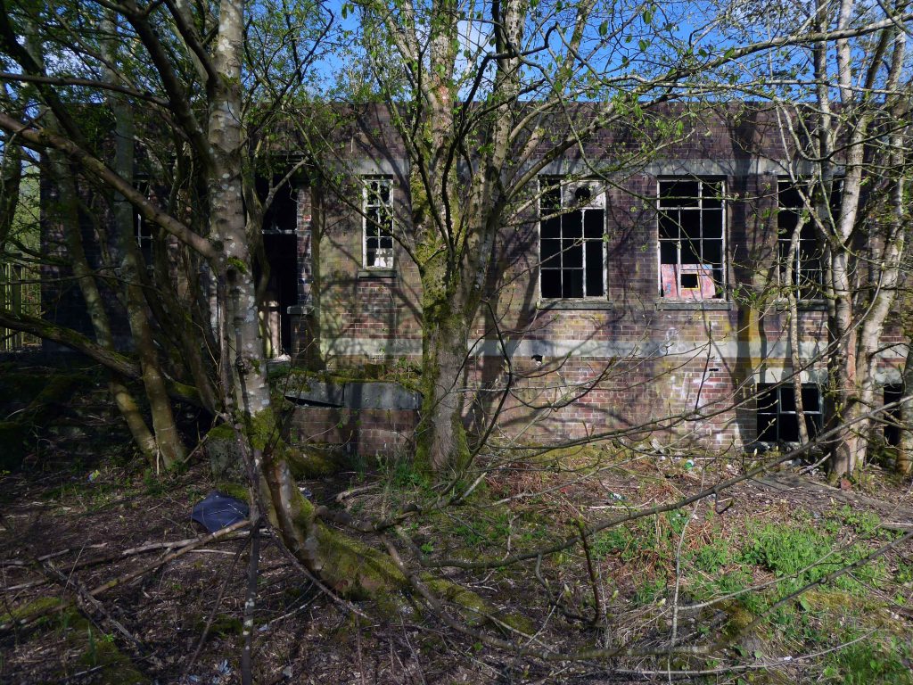
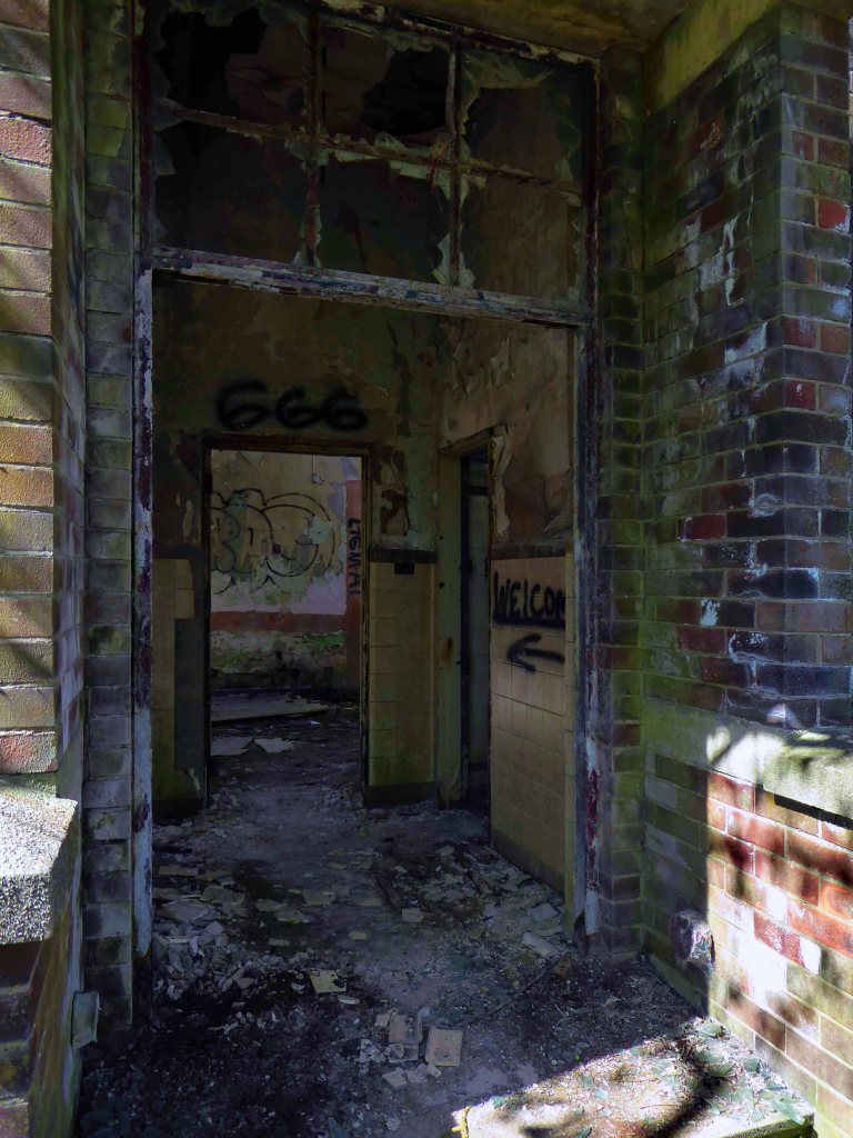
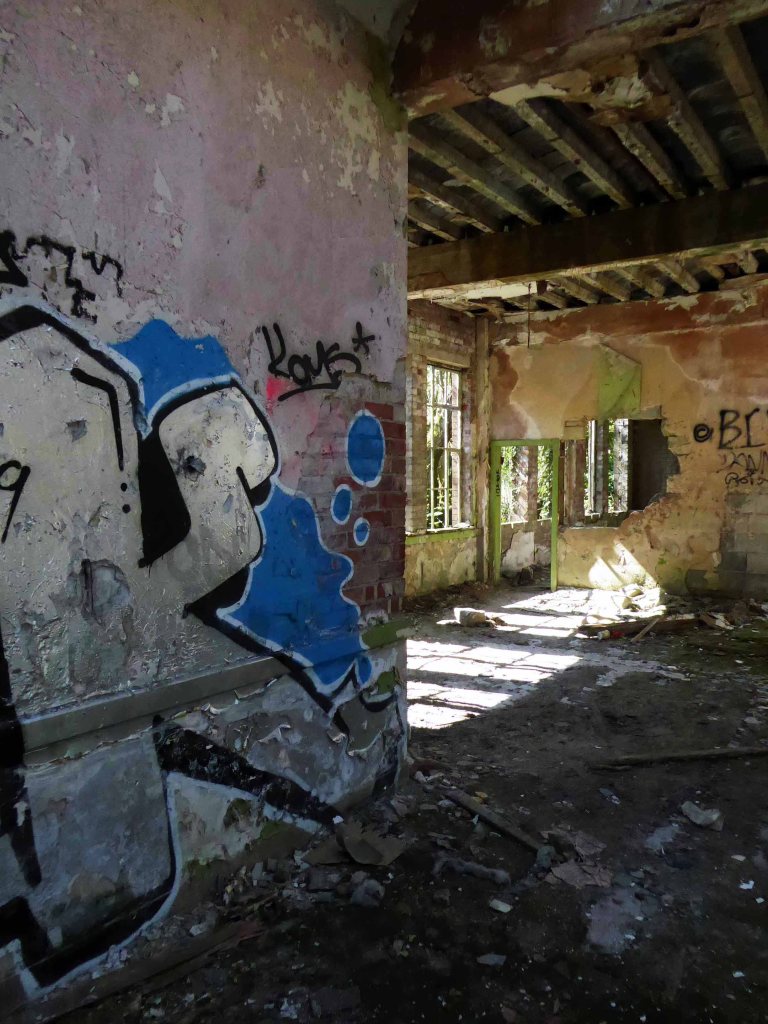
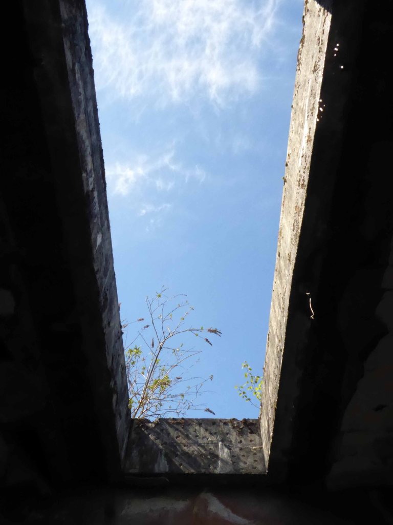
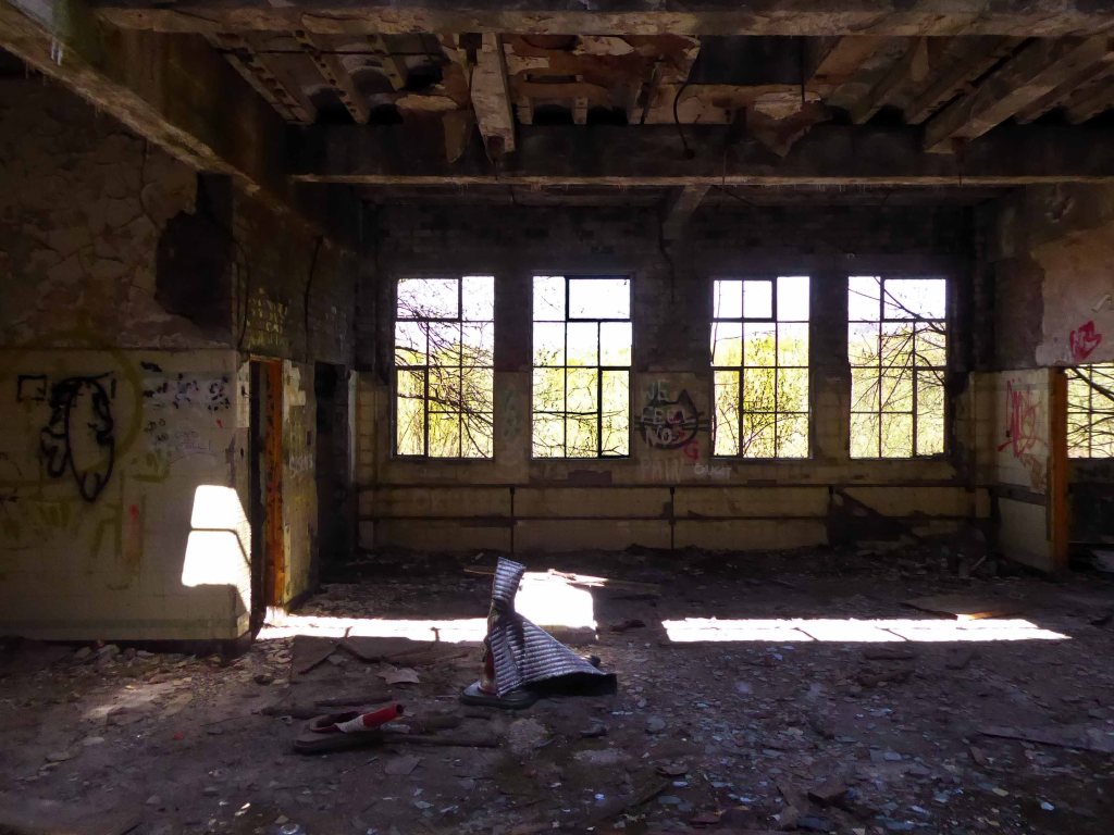
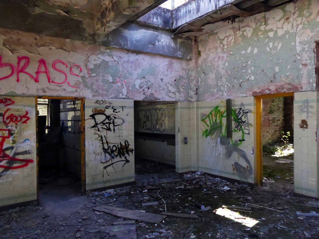
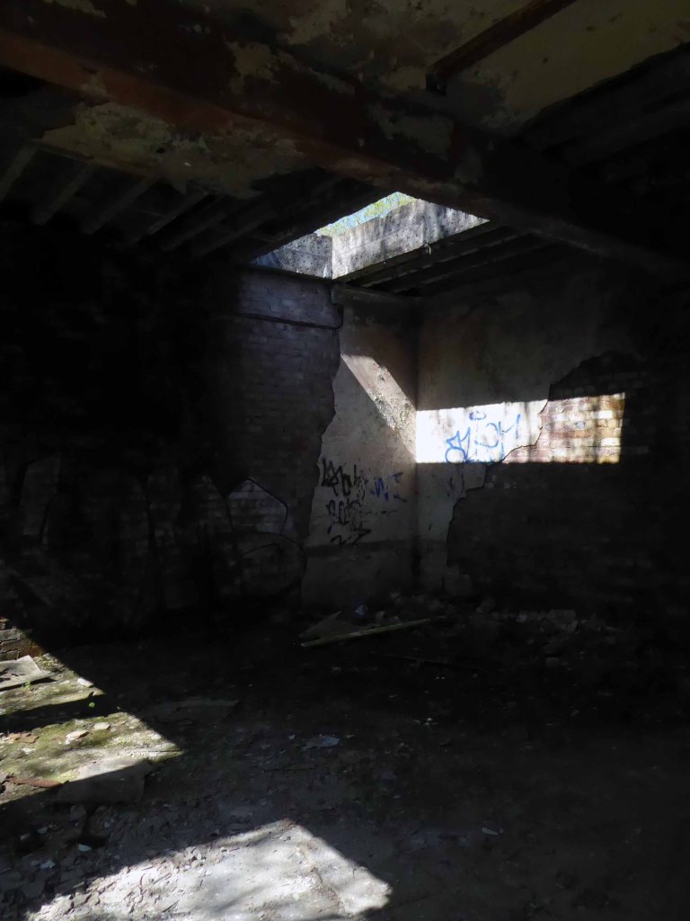
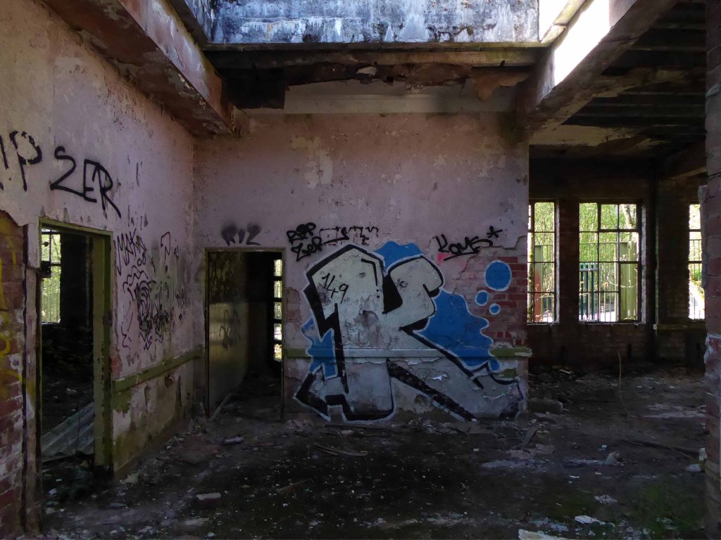
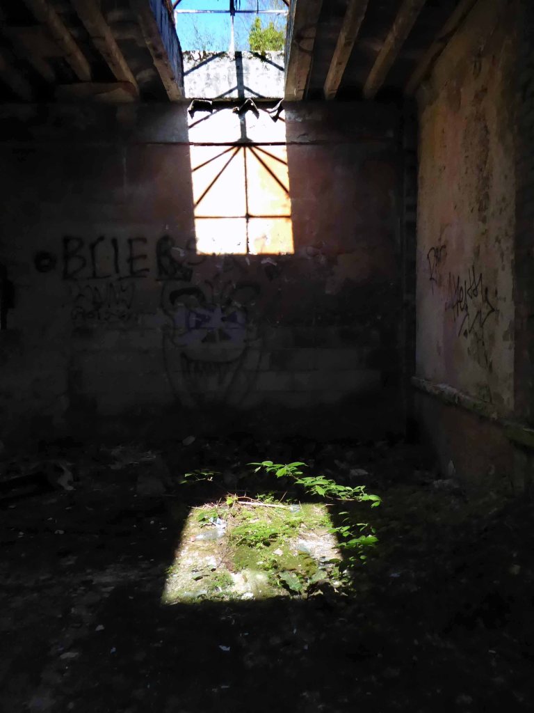
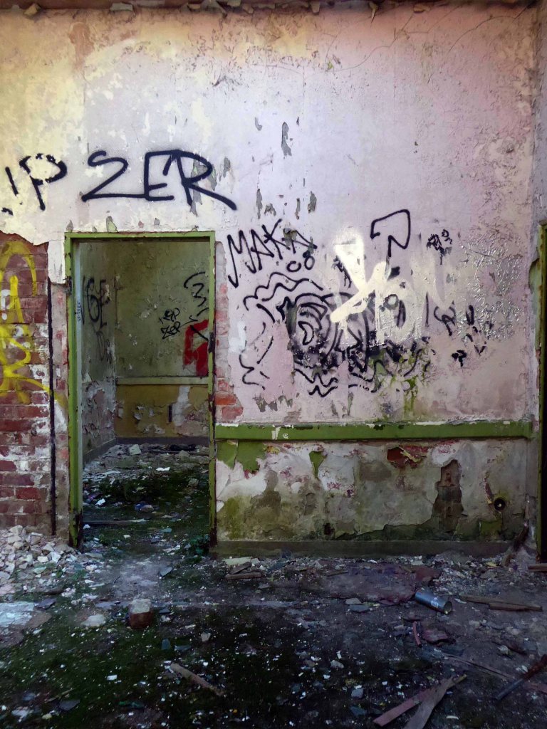
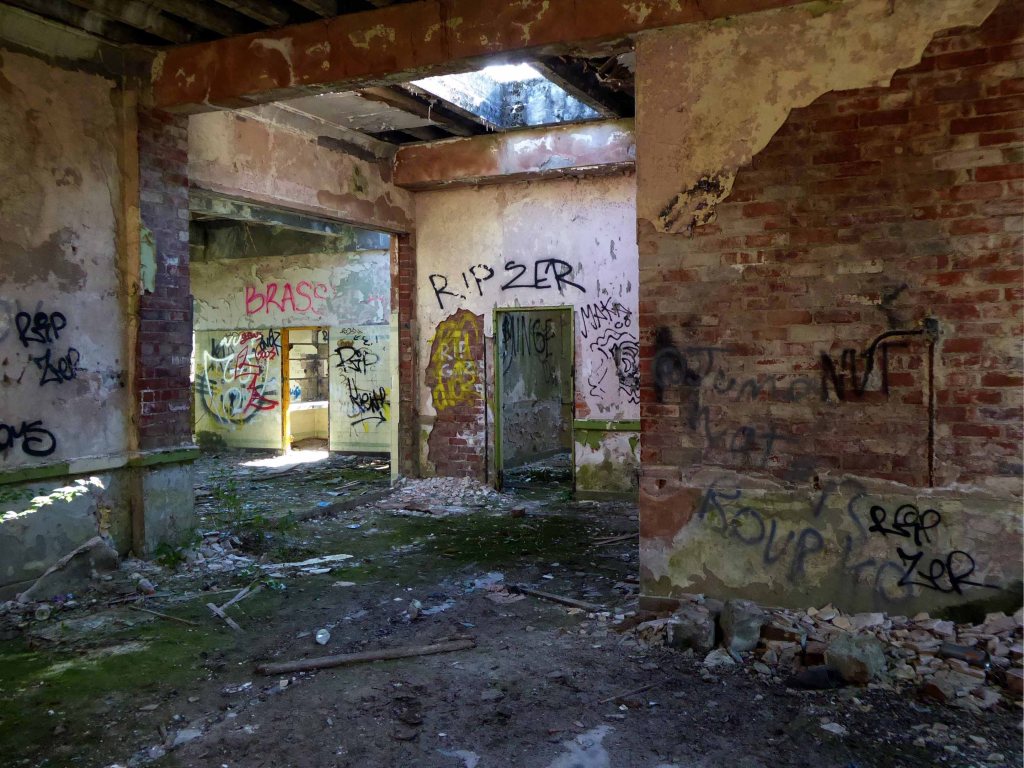
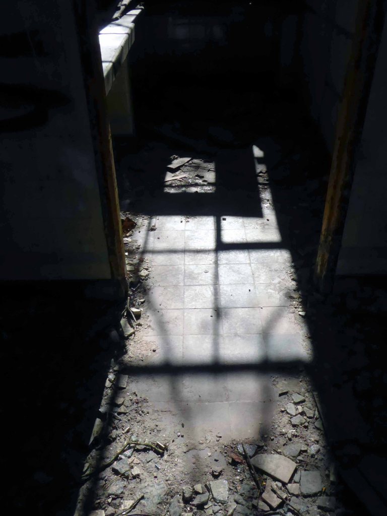
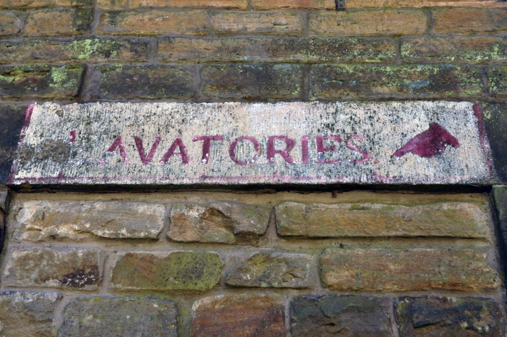
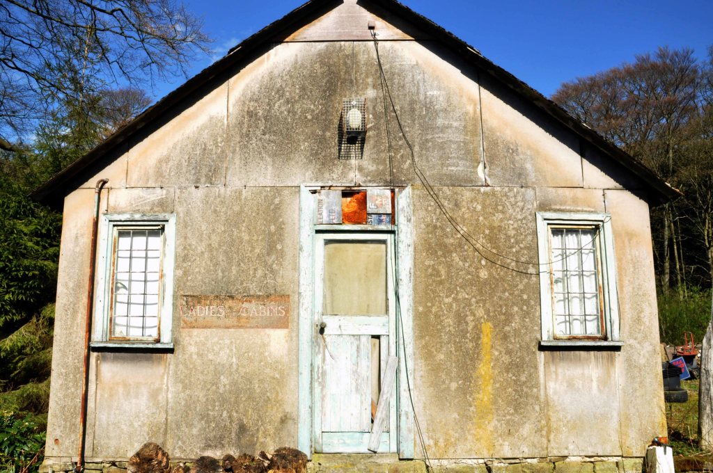
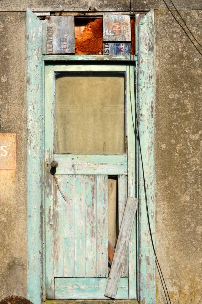
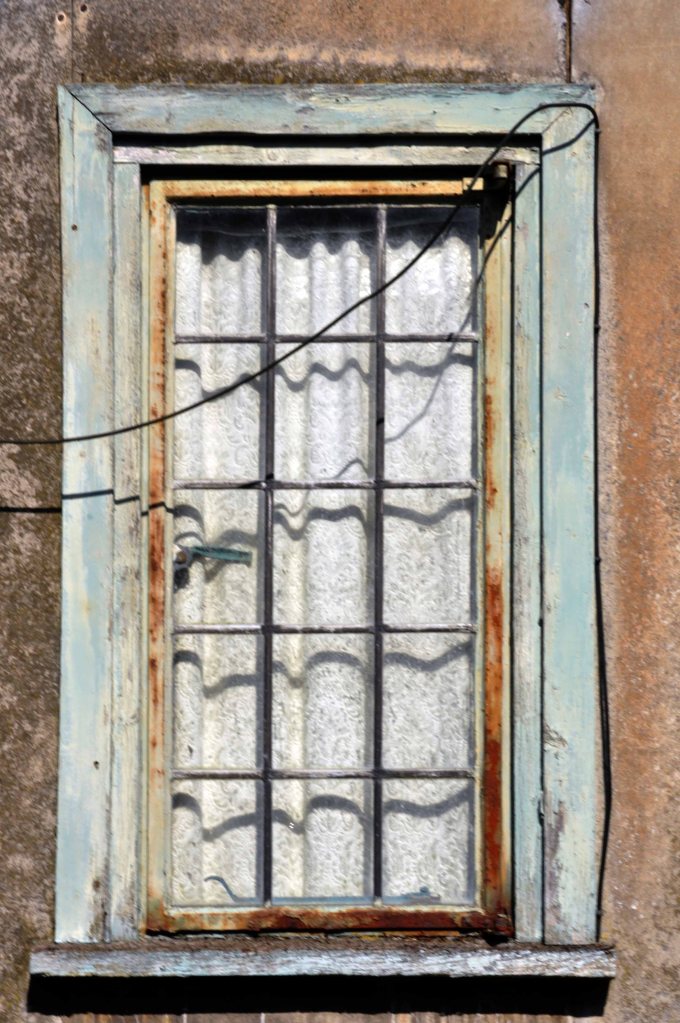
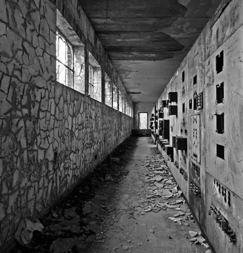
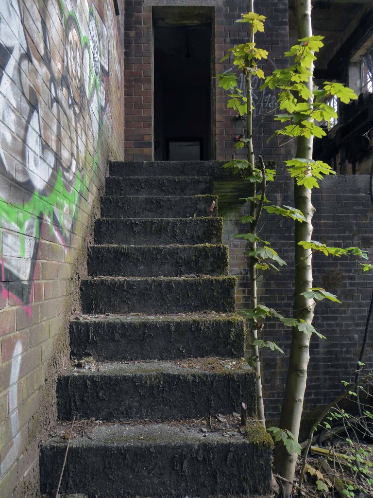
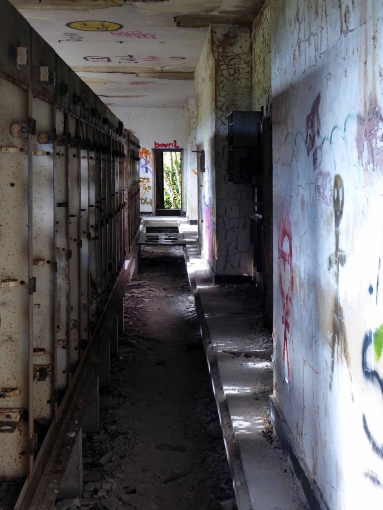
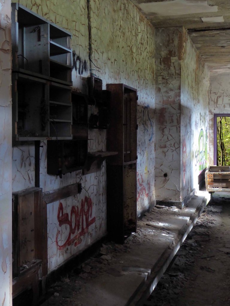
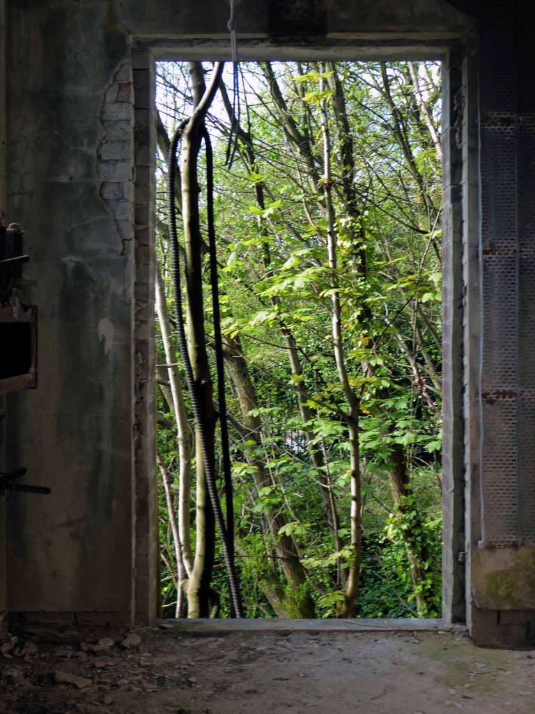
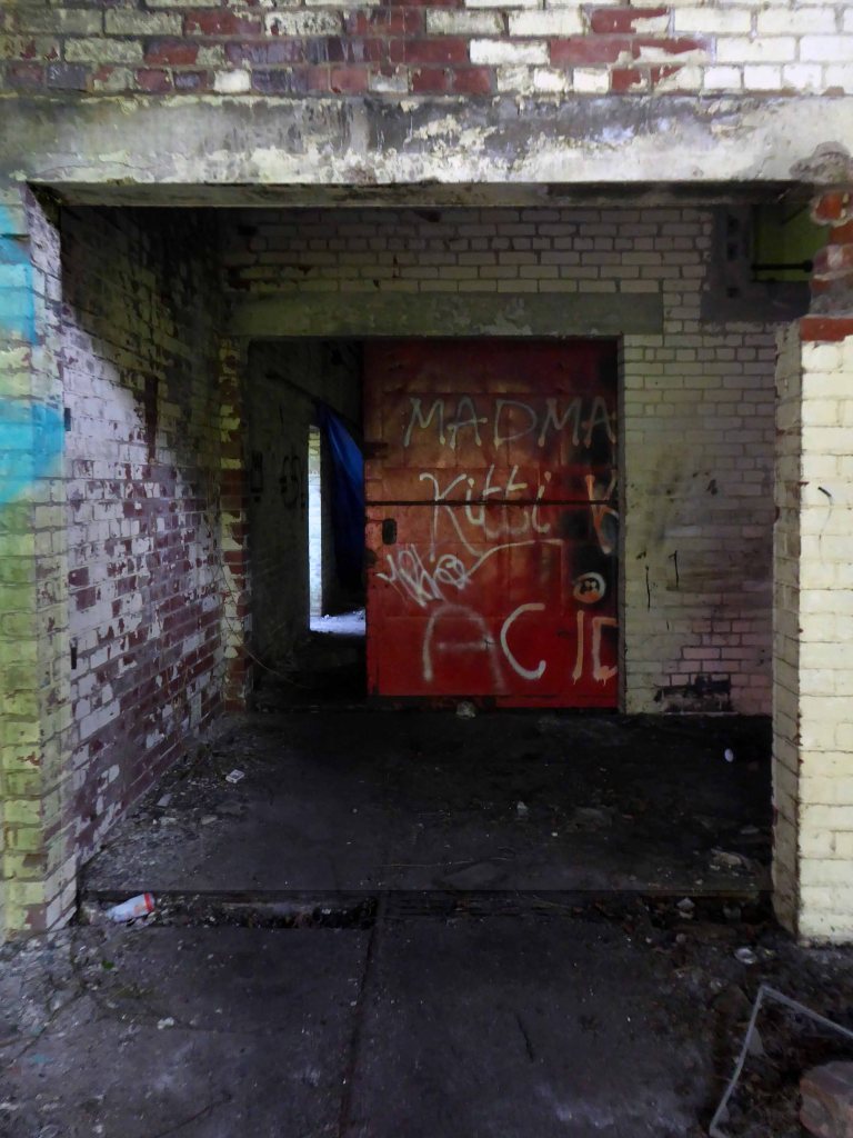
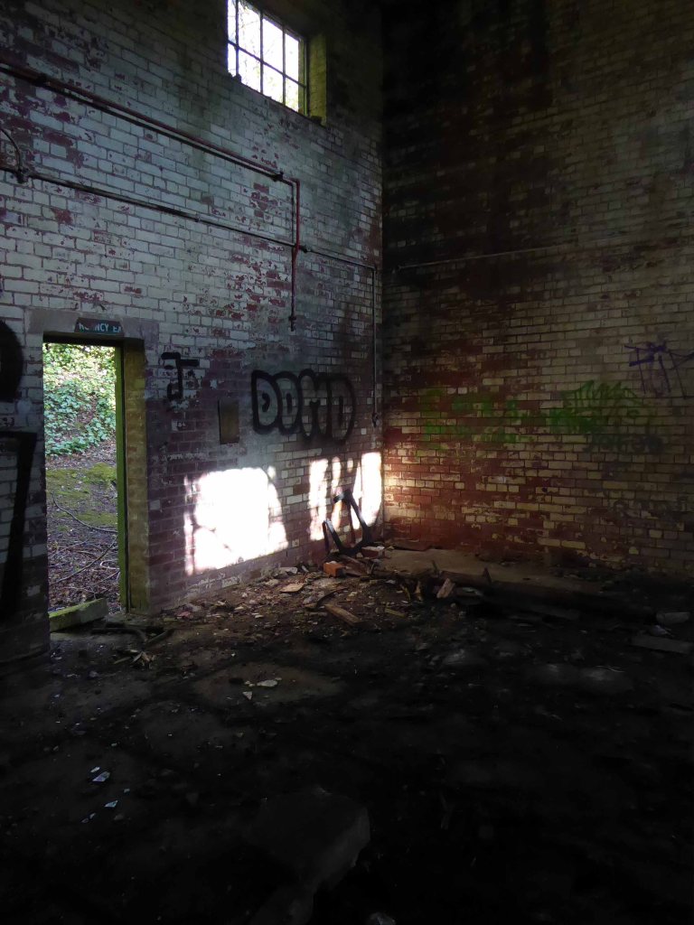
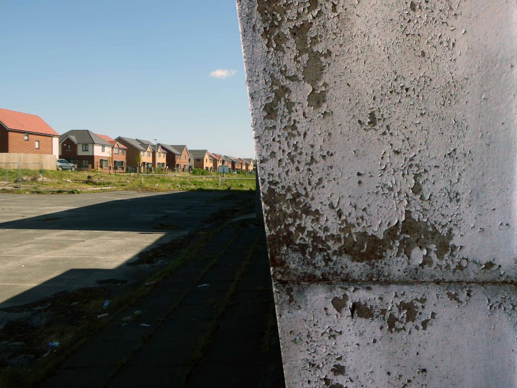
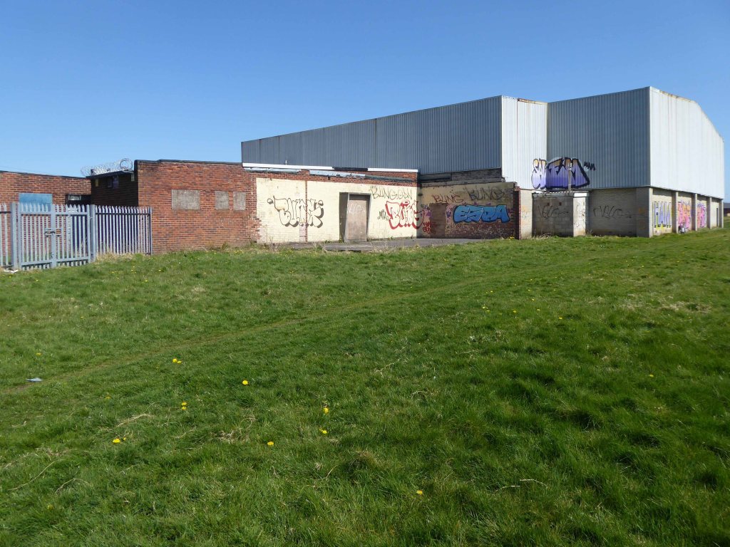
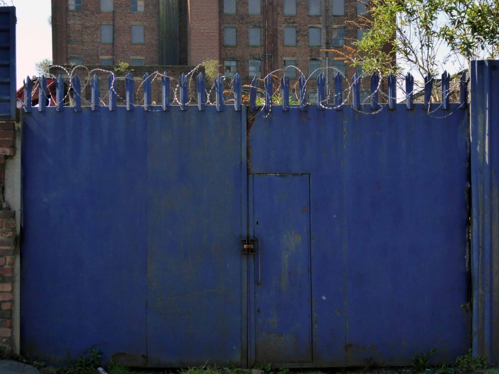
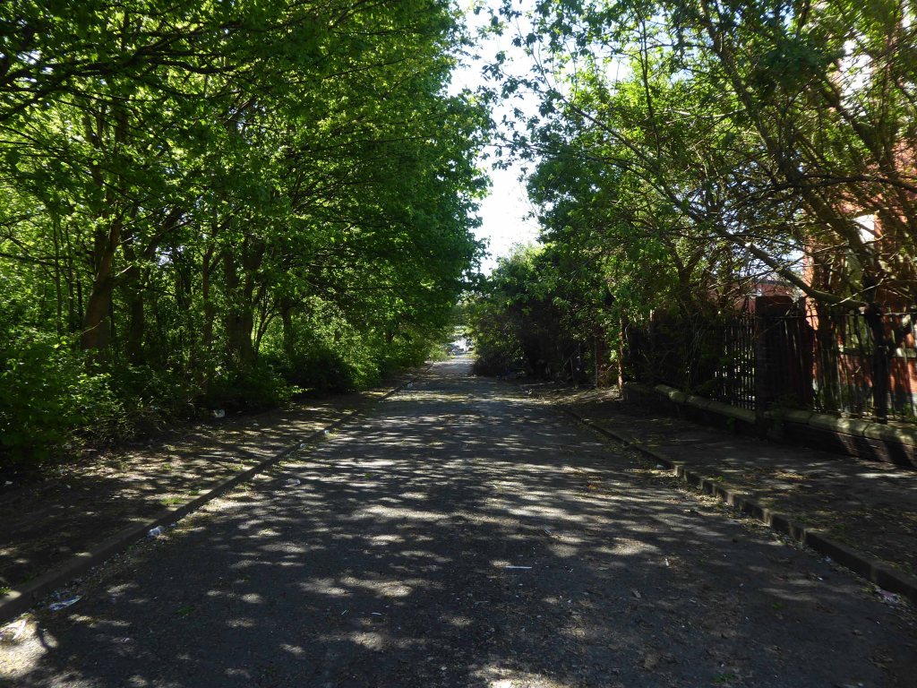
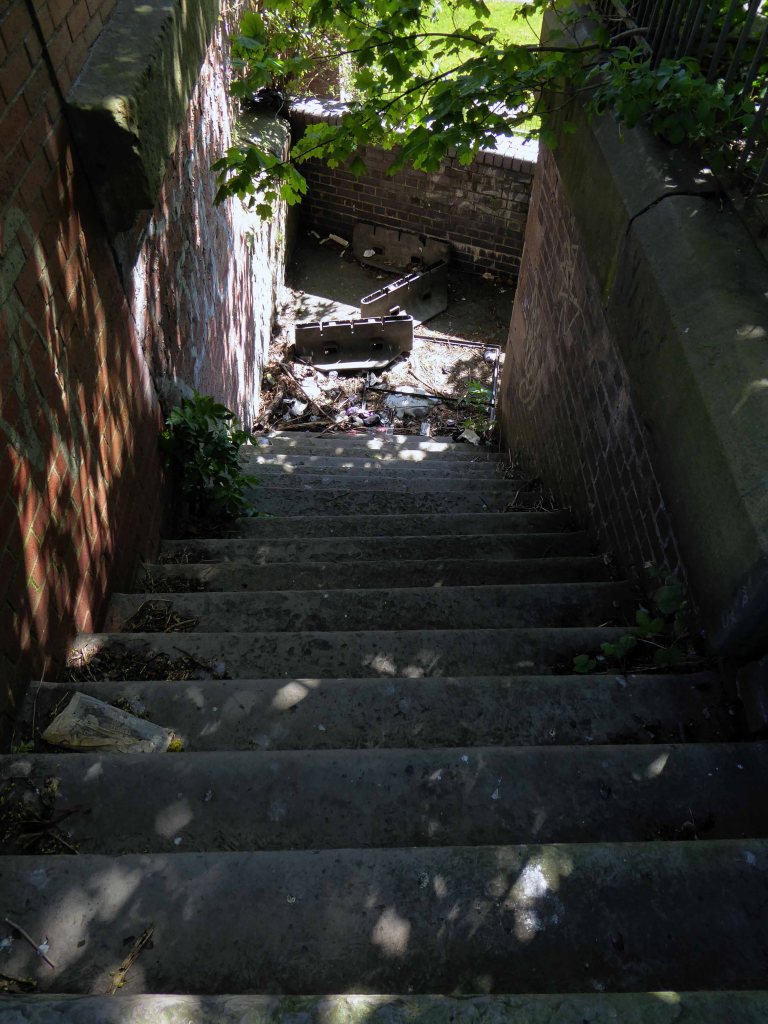
Though remnants remain – this is a short journey through a hole in fence, down into the warren of power station offices past.
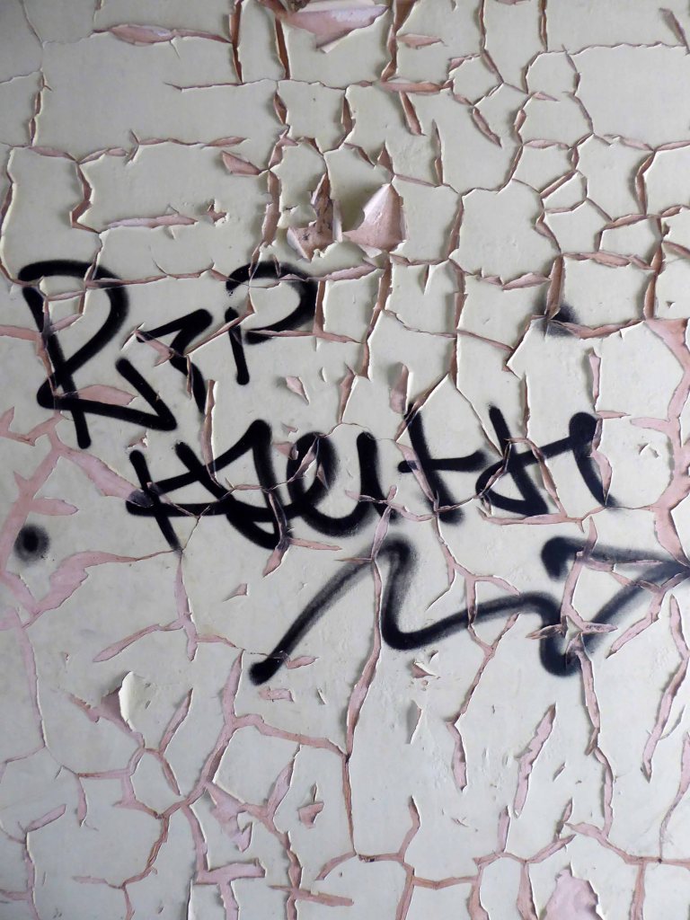
They have been stripped of their former use and meaning, transformed into a transitory art performance space, paint and plaster now peeling, appealing to the passing painter, partially reclaimed by nature.
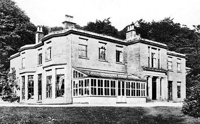
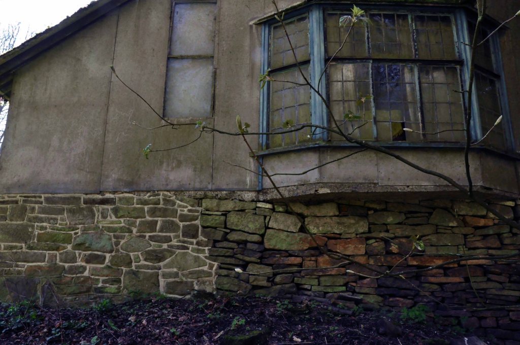
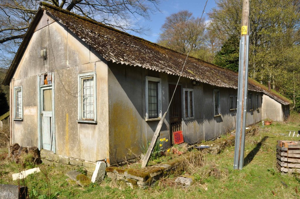
A Grade II listed country house, now divided into two dwellings. c1812. Ashlar gritstone. Hipped slate roof with leaded ridges. Various ashlar triple stacks with moulded tops. Moulded cornice and low parapet. Two storeys, central block with recessed long wing to east, orangery to west.
This Grade II listed manor house is set within 14 acres of natural grounds, together with the occupied adjoining servants’ wing, and has been sympathetically converted, retaining many original features to provide comfortable accommodation for families wishing to meet up for that special family occasion, and wi-fi is available in the living room.
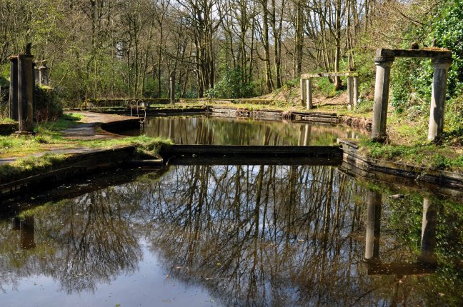
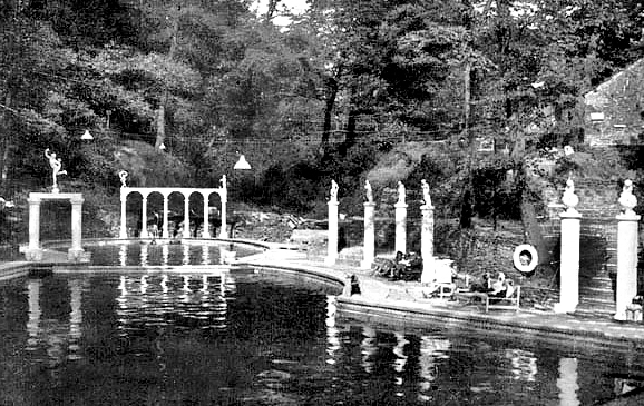
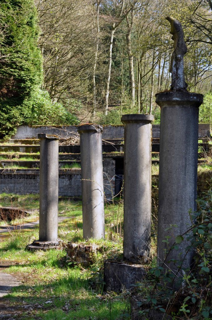
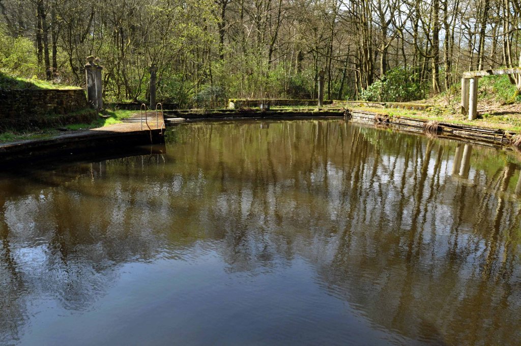
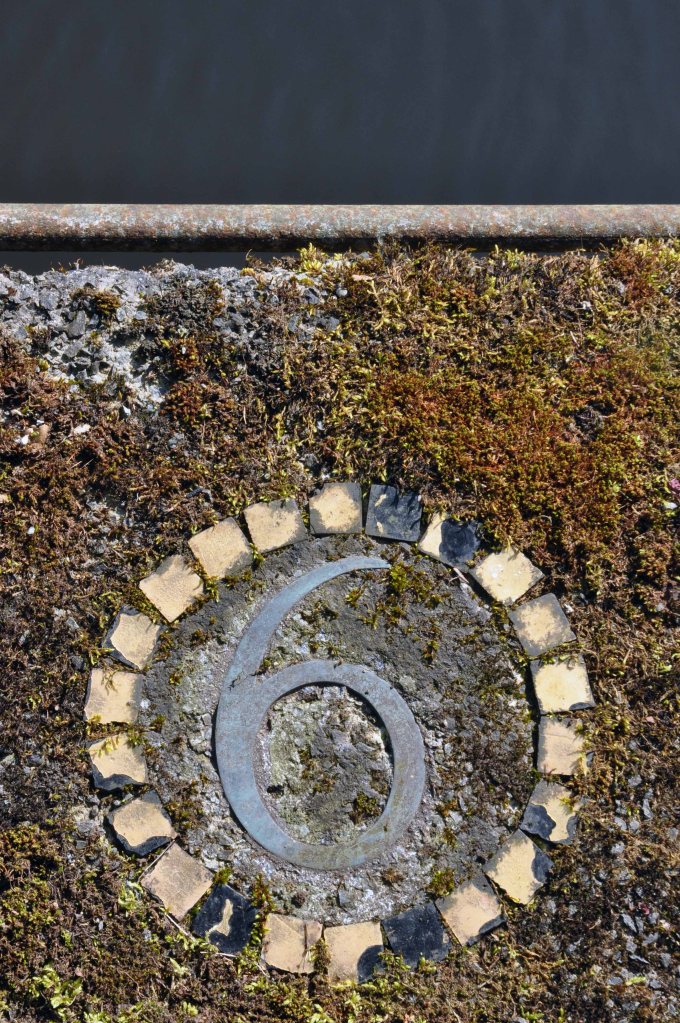
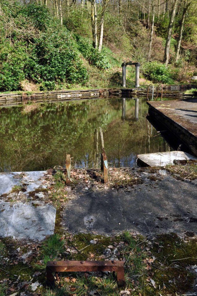
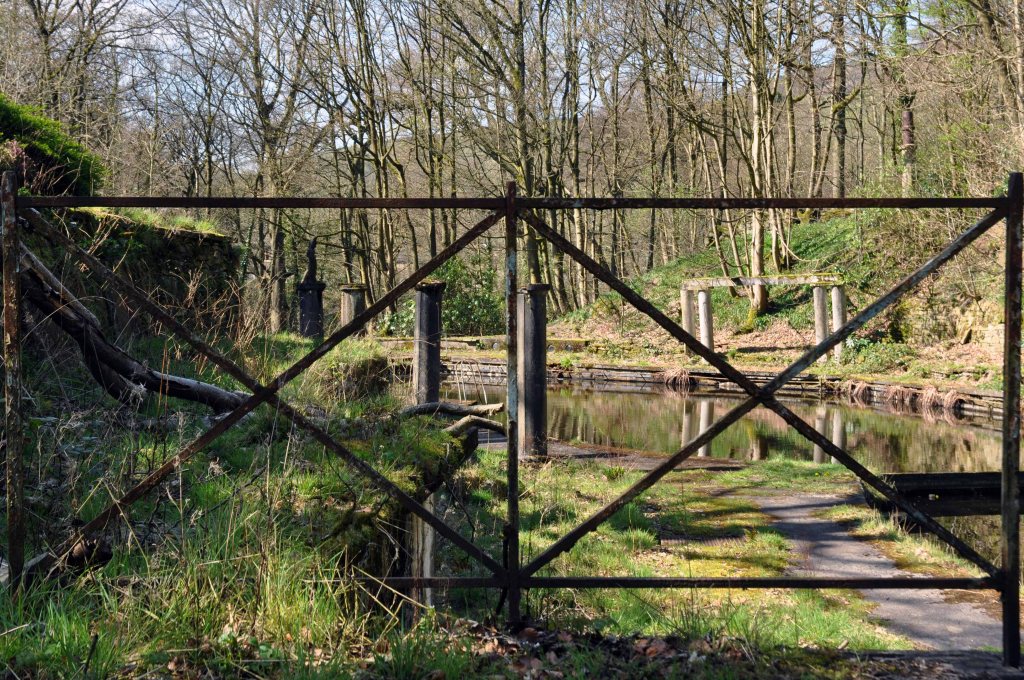
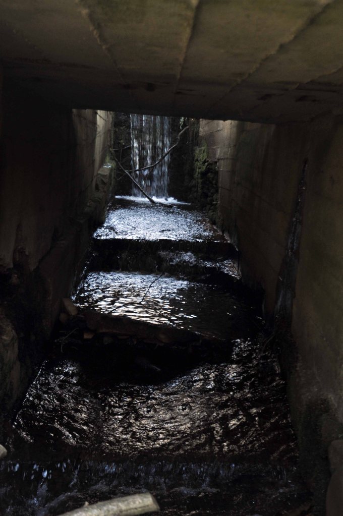
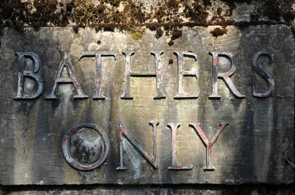
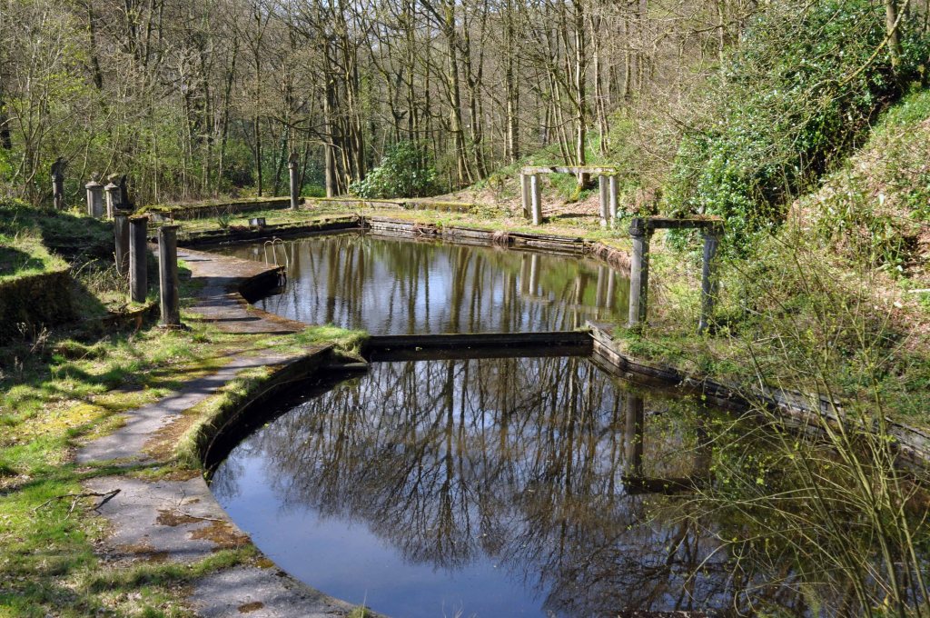
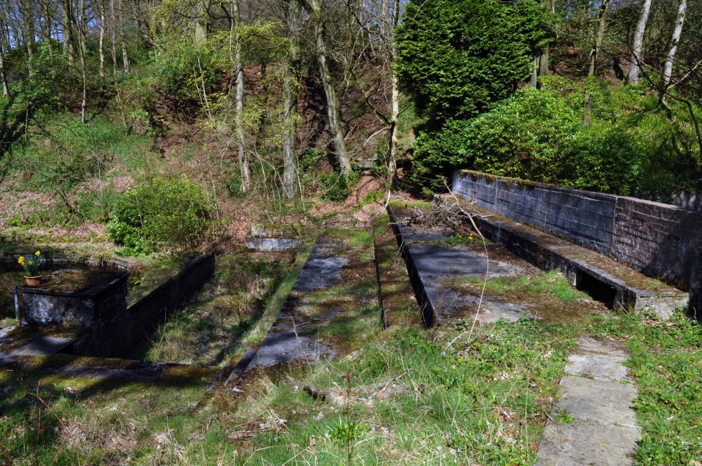
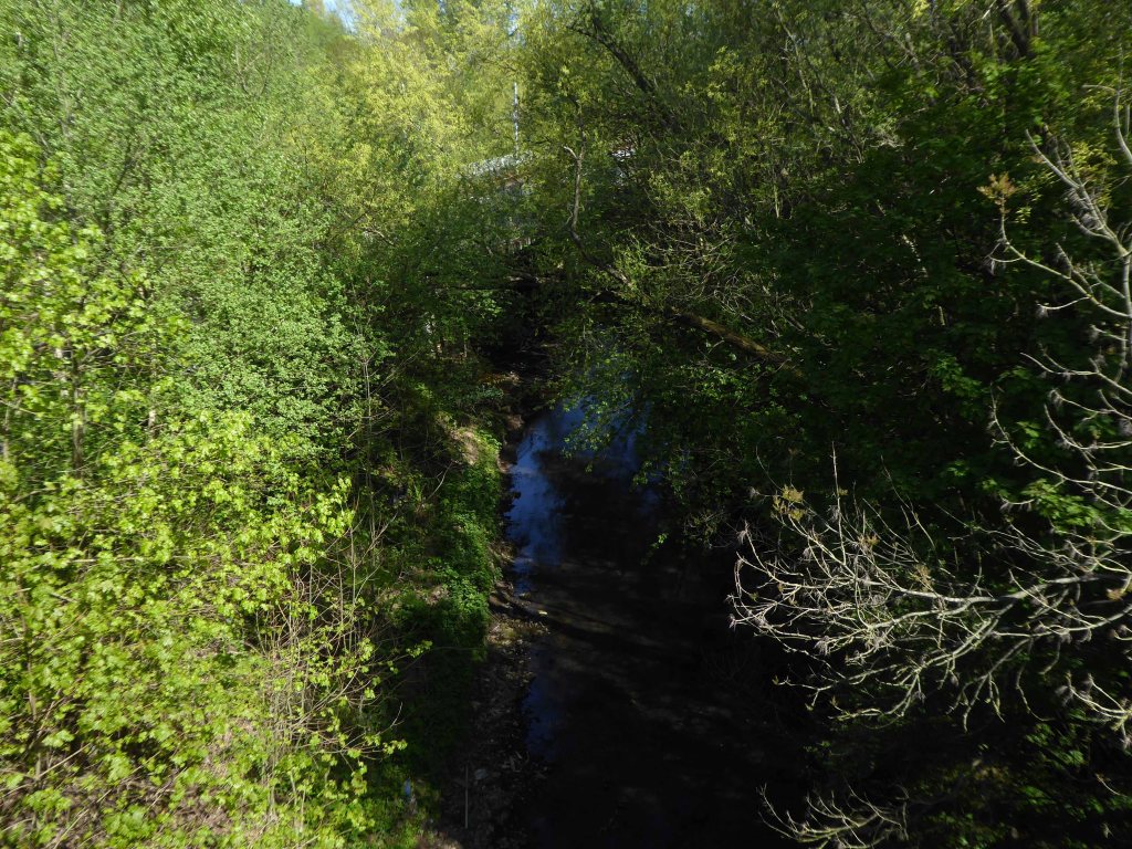
Then came a pool:
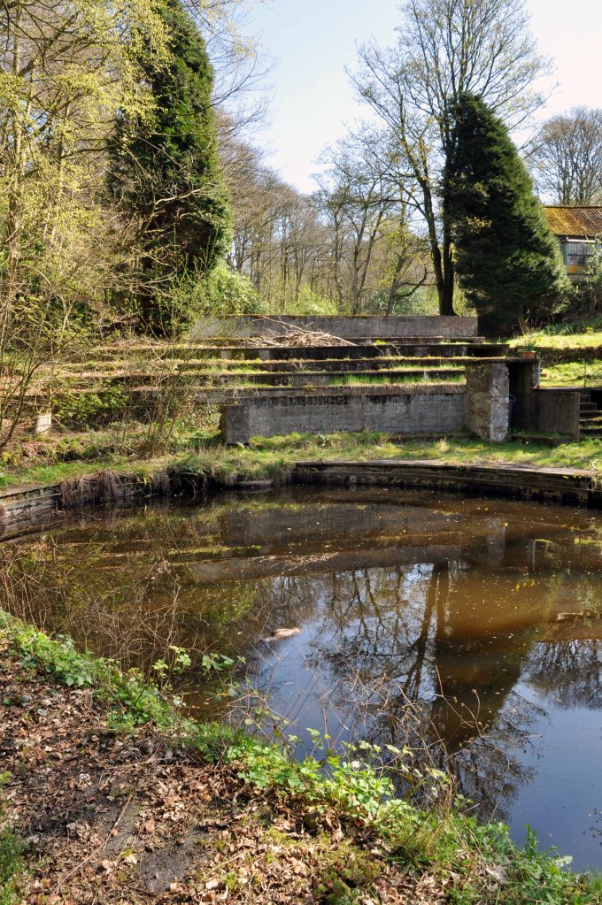
Previously a private pool belonging to a country club in the 1930’s it later opened to members around 1938 who paid a small fee for its use. The pool is fed by a mountain stream and the water is reported to remain cool throughout the year. In the 1940’s/50’s locals recall the pool being open to the public where it cost a ‘shilling for children and half a crown for adults’ entry. During storms in 1947 the pool was badly damaged and reportedly ‘never the same again’ but postcards in circulation in the 1960’s provide evidence that the pool remained open at least until then.
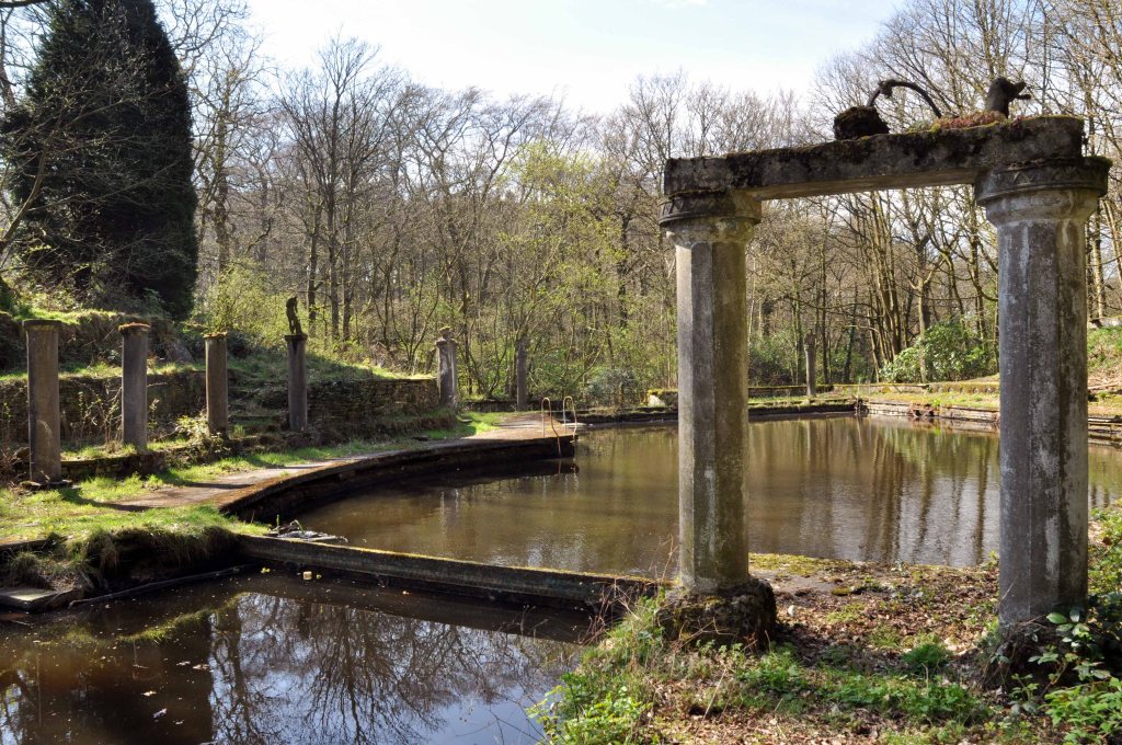
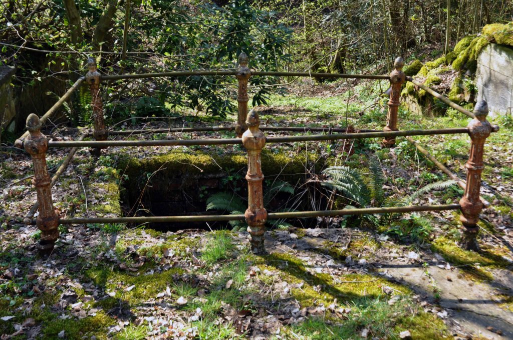
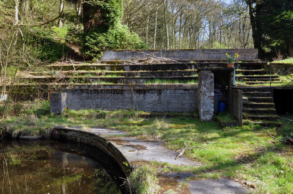
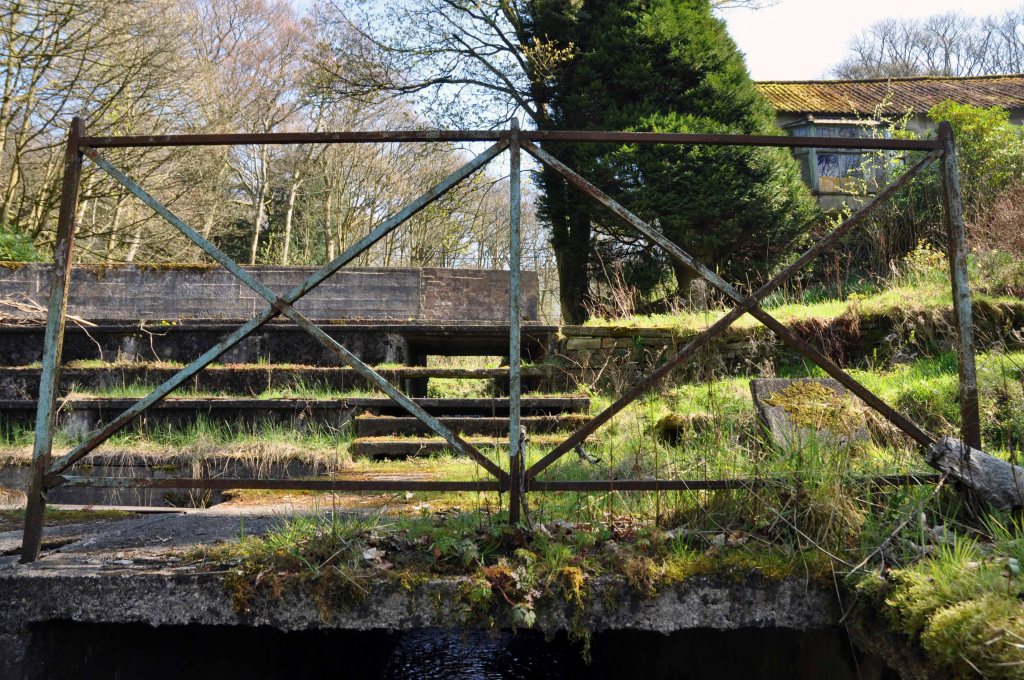
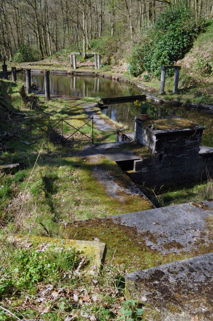
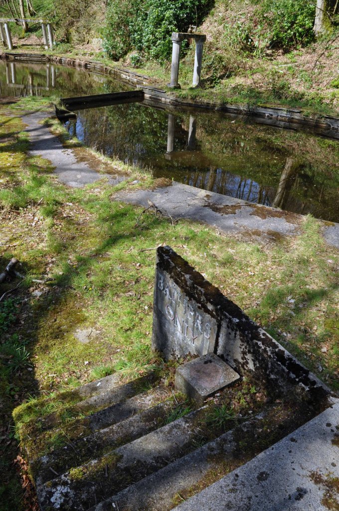
Now it sits abandoned and hidden in the woods.
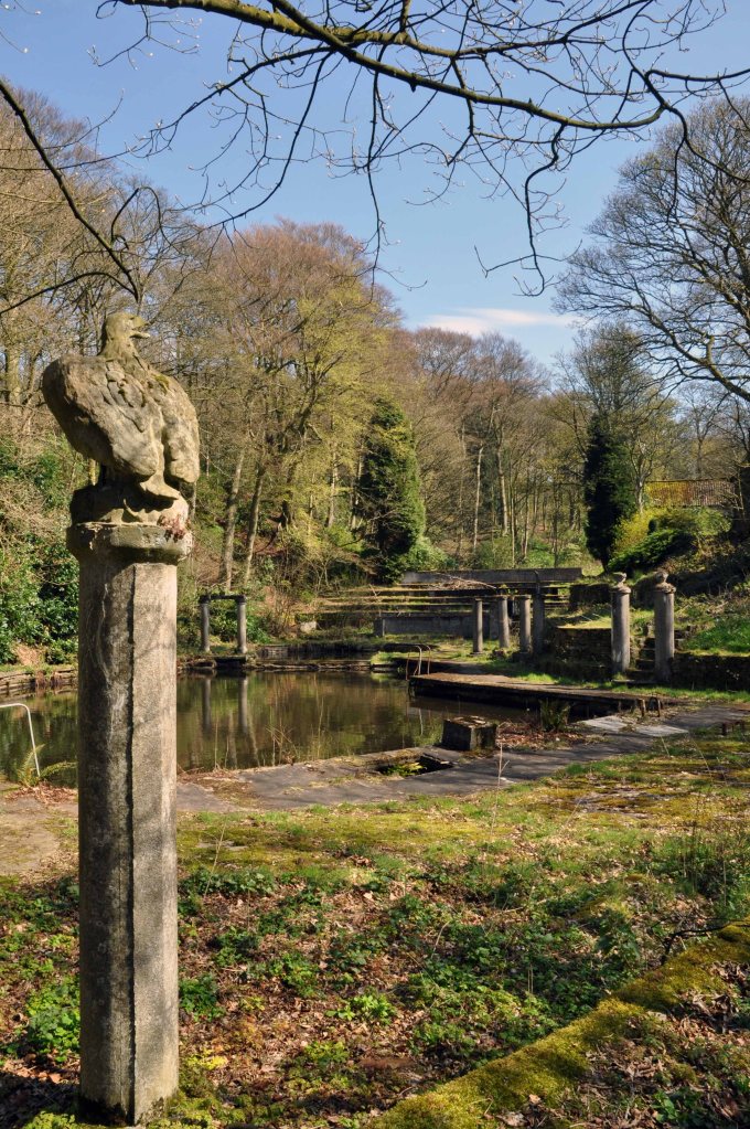
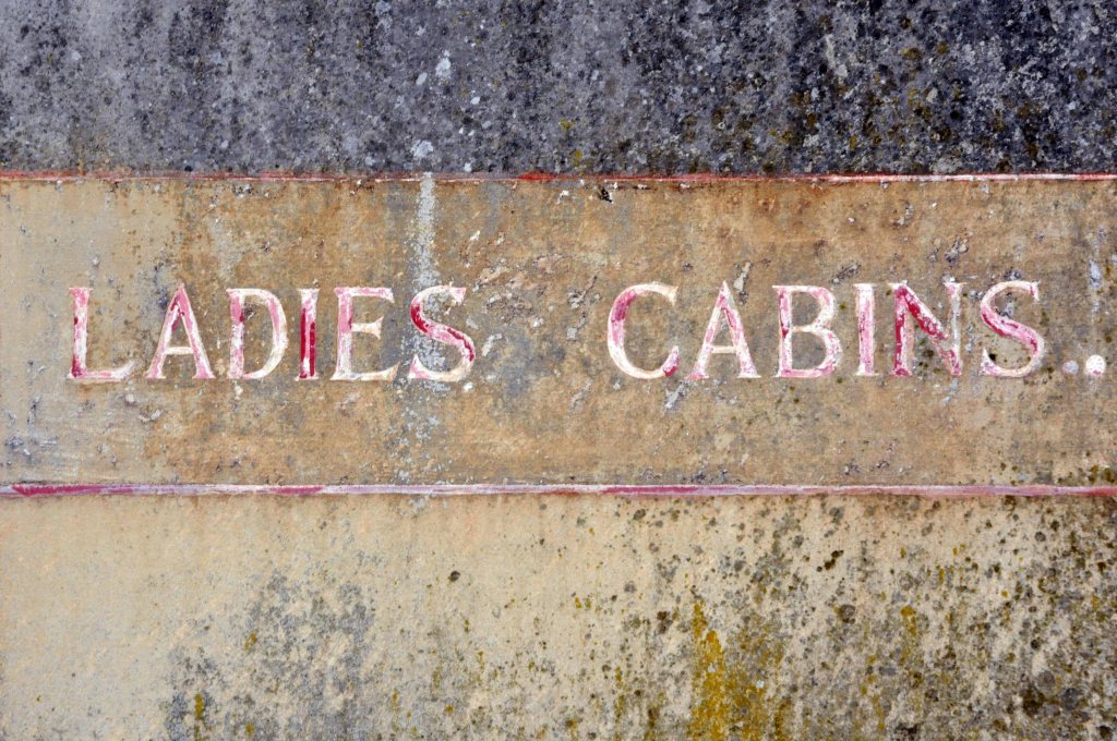
I went there in my early teens late 60’s the pool was still intact, well used and well cold. I remember chilly changing rooms with duckboards on concrete floors, a small café with pop and crisp if you had the pennies.
Most of all the simple joy of emersion in clear moorland water, on long hot summer days long gone.
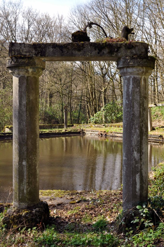
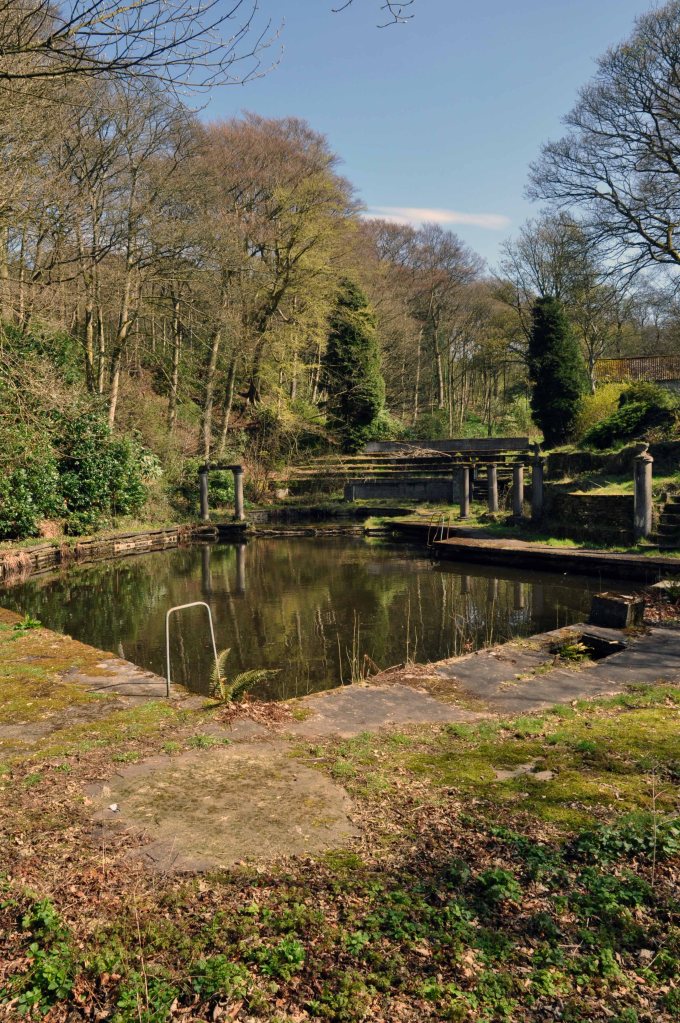
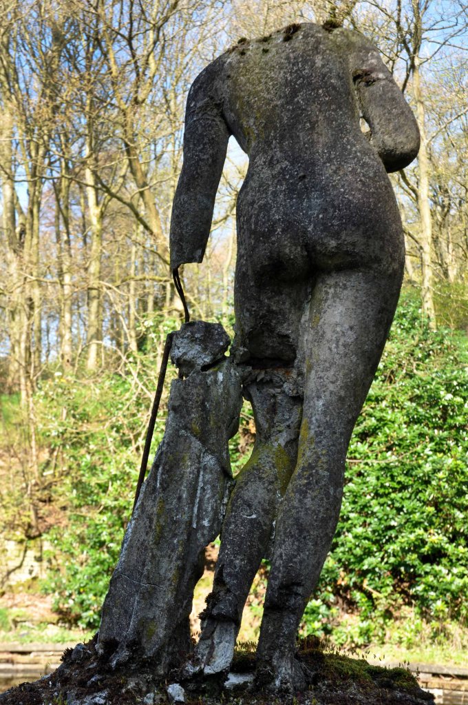
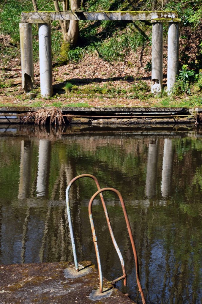
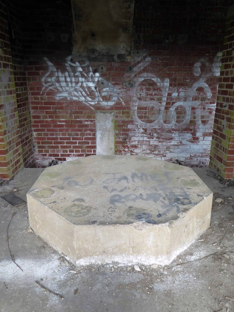
Revisiting in April 2014, following a misguided scramble through brambles, it was a poignant reunion. The concrete shells of the pillars and statuary crumbling and moss covered, the waters still and occluded.
It sure it has subsequently been the scene of impromptu fashion shoots and pop promo videos, possibly a little guerrilla swimming. Though sadly it largely sits unused and unloved – let’s take a look around:
Charles Dreyfus was a French emigrant chemist and entrepreneur, who founded the Clayton Aniline Company on 29 May 1876. The company obtained a lease on a parcel of land in Clayton, Manchester, sandwiched between the Manchester and Ashton Canal and Chatham Street – later known as Clipstone Street.
1904
At its peak in the 1970s, the site occupied over 57 acres and employed over 2,000 people. However, due to the gradual demise of the British textile industry, most textile production shifted to countries such as China and India with the textile dye industry following.
1960
In 2002, the company made 70 members of staff redundant and in 2004 the announcement was made that the site would be closing with the loss of over 300 jobs. A small number of staff were retained to assist in the decommissioning of the plant. The last workers left the site in 2007 and the remainder of the buildings were demolished shortly afterwards.
Like much of the industry of east Manchester its tenure was relatively short – money was made and the owners departed, without wiping their dirty feet.
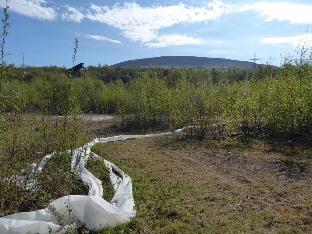
The site remained derelict until demolition, followed by extensive site cleansing – to remove the dangerous detritus of 200 years of hazardous chemical production.
Vincent Kompany had just completed his £6million move from Hamburg when he realised that Mark Hughes’ sales pitch about the direction the club was going was not entirely accurate.
They took me for a look around the training ground at Carrington – it wasn’t fit for purpose, it was a dump.
I remember there was a punch bag in the gym – and only one boxing glove. And even that had a big split in it!
Then in 2008 the corrupt boss Thai PM Thaksin Shinawatra is bought out by Sheik Mansour – the rest is history/mystery.
Mr Peter Swales makes no comment.
My interest lies in the company’s Ashton New Road offices – seen here in 1960.
Demolished and replaced by a distinctly Modernist block by 1964.
A flank was added on Bank Street along with a bank.
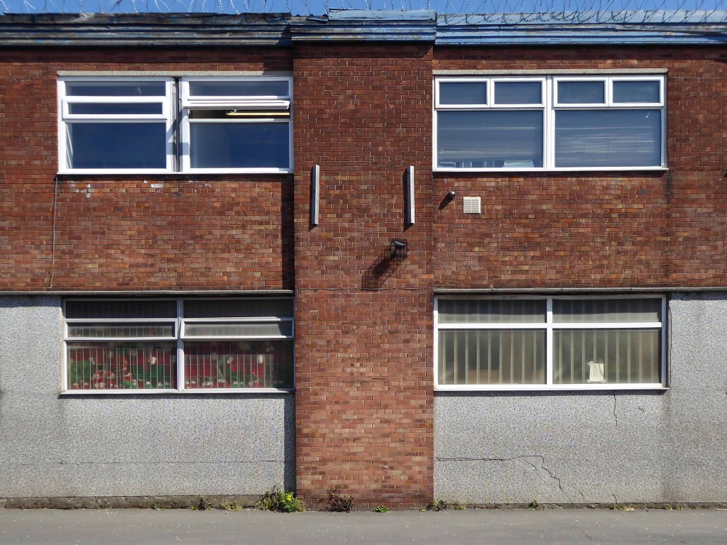
The office complex is still standing, now home to Manchester Police, I risked arrest and incarceration, in order to record the distinctive tile work, rectilinear grid and concrete facades.
Attracting several suspicious stares from the open glazed stairwells.
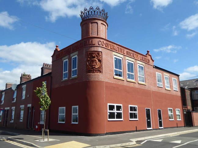
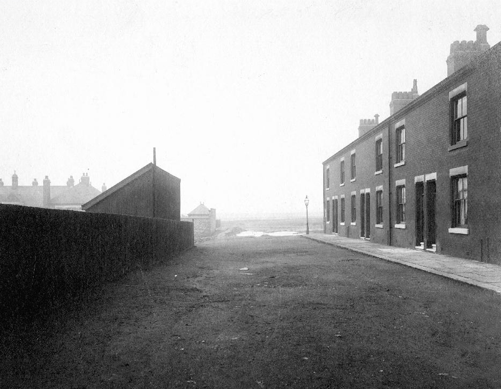
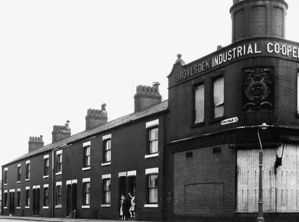
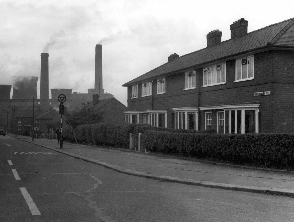
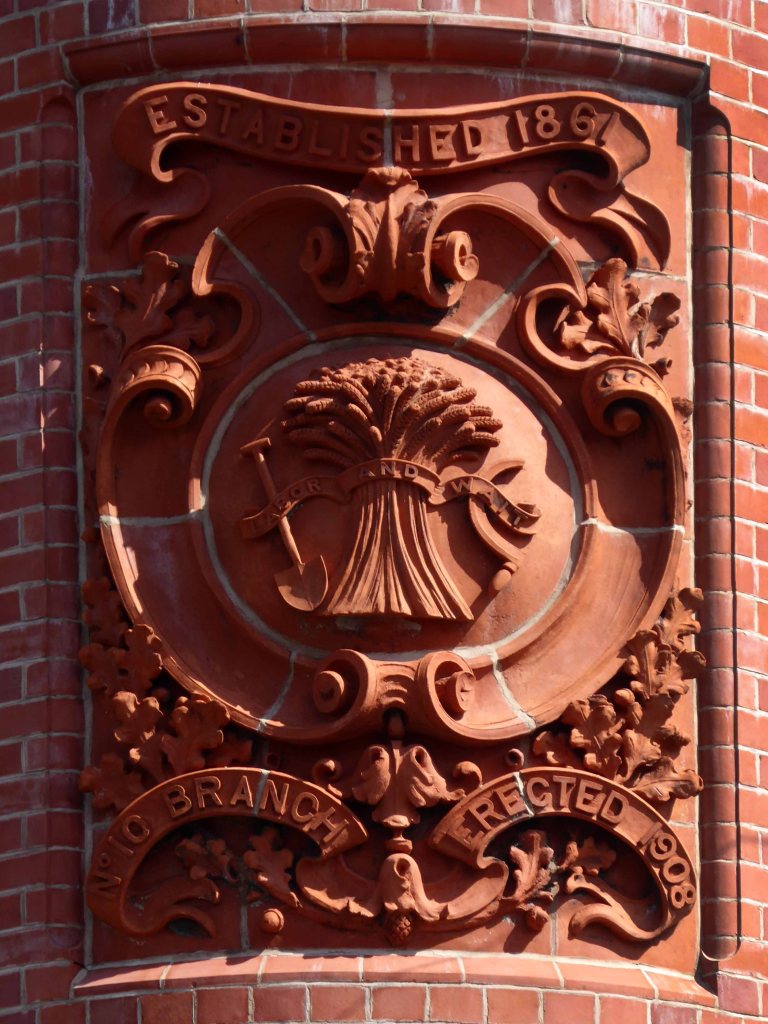
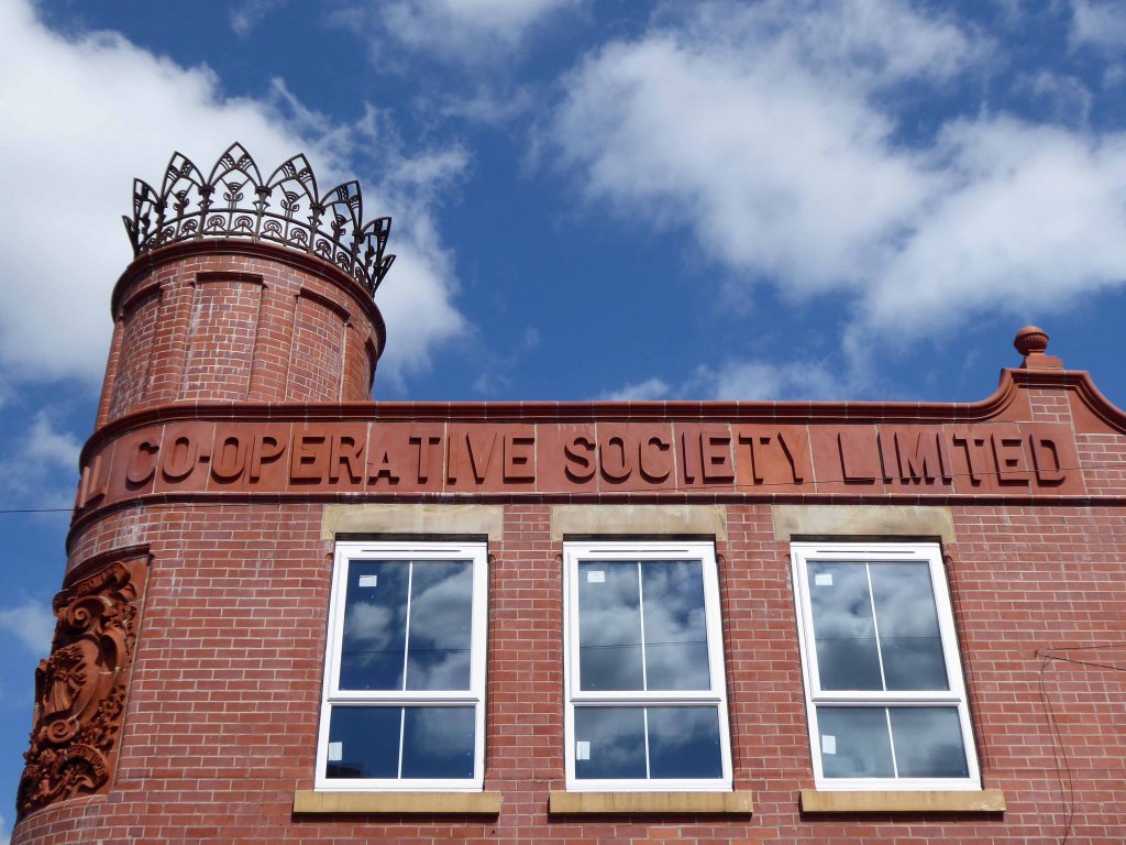
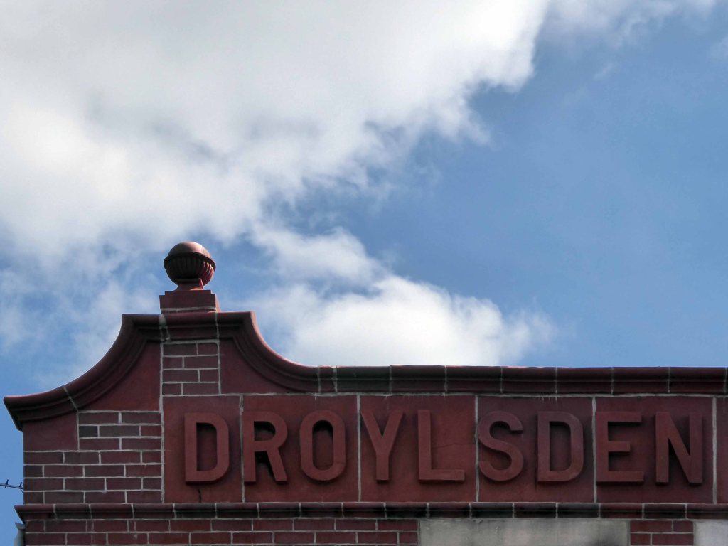
On the corner of Ravensbury and Stockholm Street Clayton Manchester there stands a Cooperative Shop of 1908.
We have previously visited another fine example on Northmoor Road.
In 1902 the area is still set to open ground.
This Manchester Local Image Collection photograph of 1912 shows new terraced homes emerging to meet the housing needs of the world’s first industrial city.
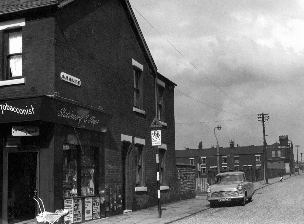
Changing patterns in shoppers habits sealed the fate of many local and corner shops, as larger supermarkets opened, increased mobility and car ownership became more common.
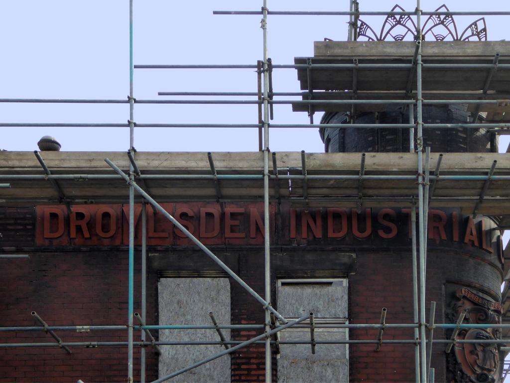
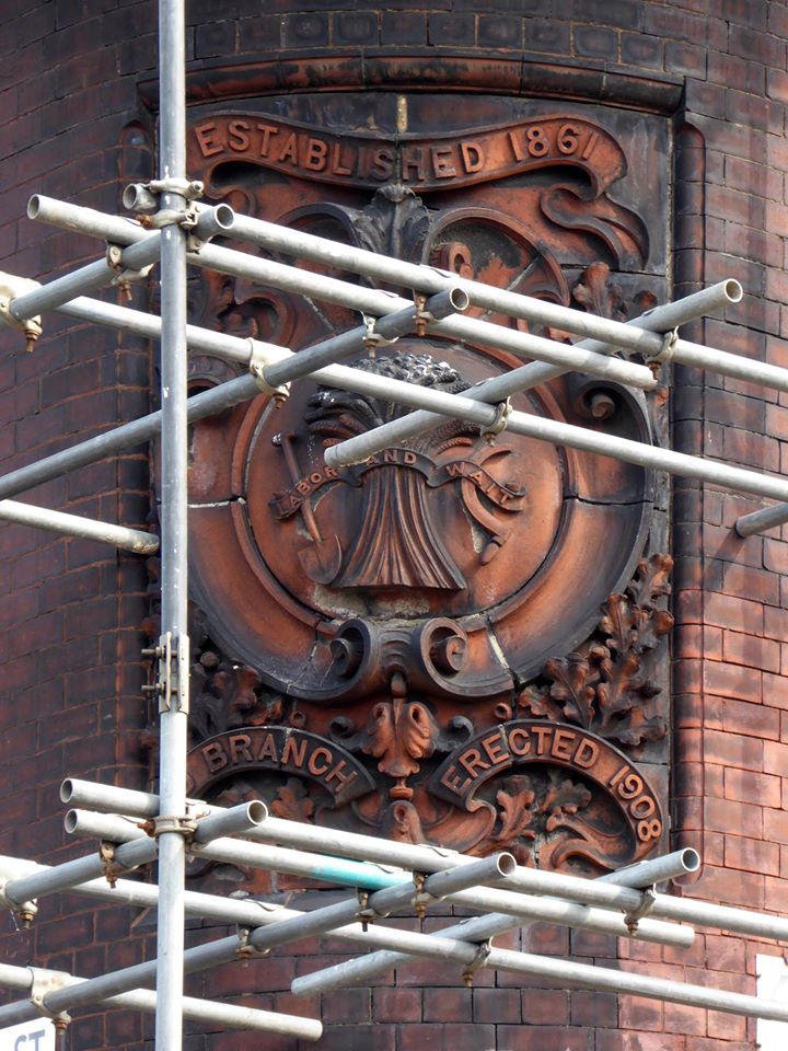
When I first visited the building was undergoing renovation work.
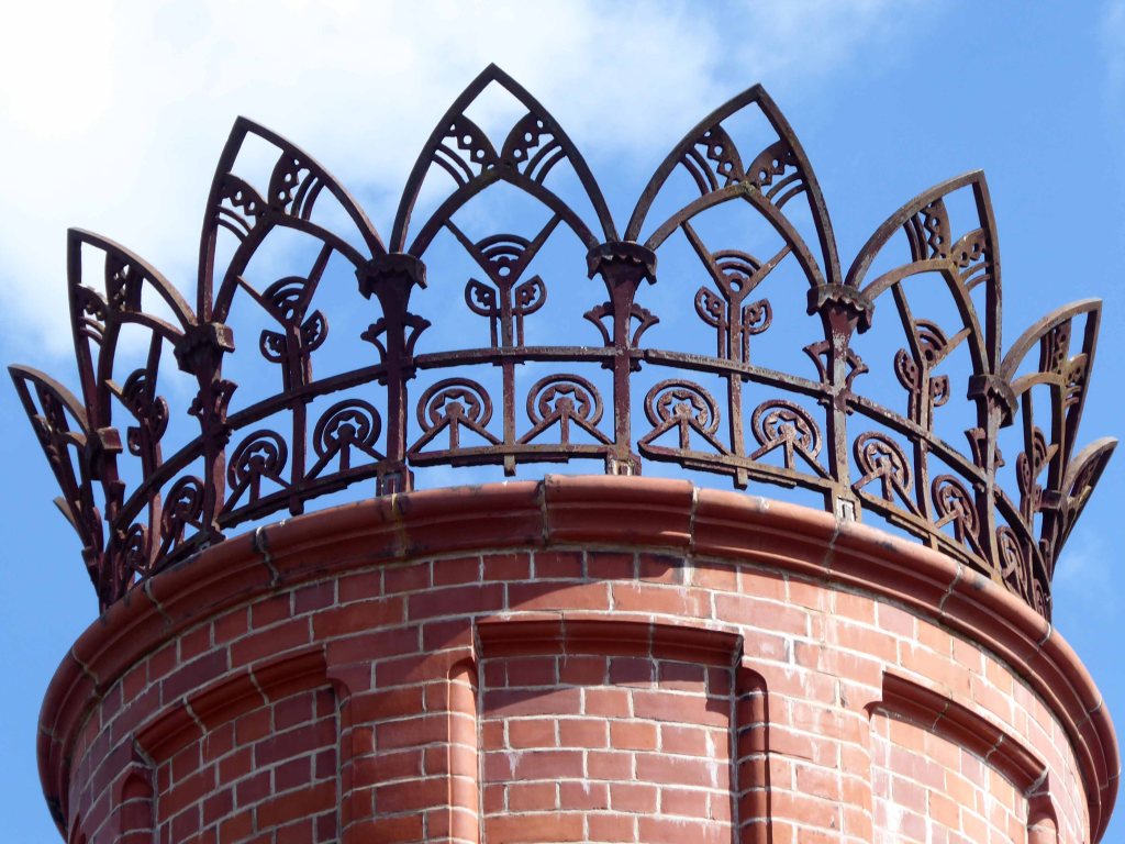
The beautiful terracotta tile work and corona obscured by scaffolding .
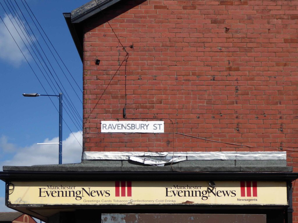
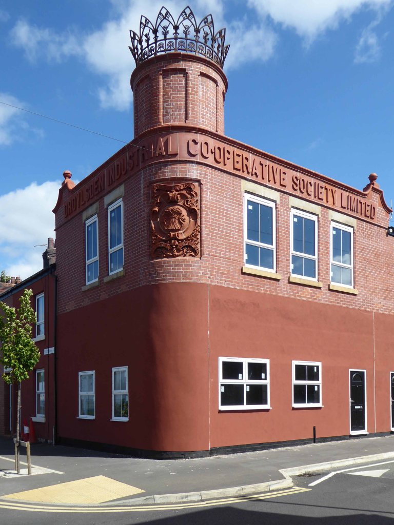
I returned last week to find the job almost done – converted to flats, in an area which has seen a great deal of improvement to the general housing stock, paving and street furniture.
A joy to see a fine building almost returned to its former glory, with a much needed social purpose, reviving the city’s western edge.
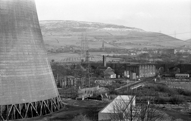
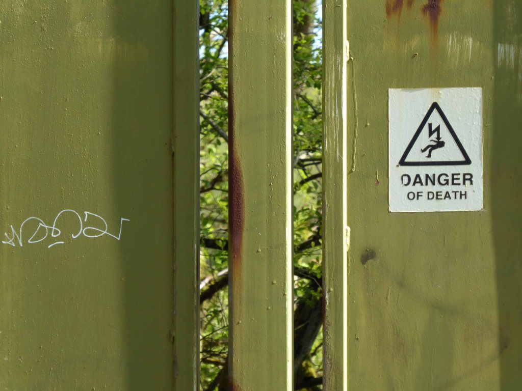
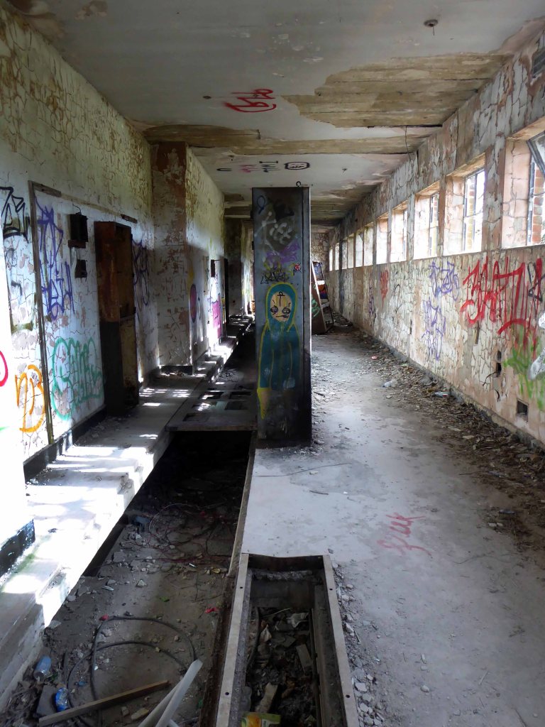
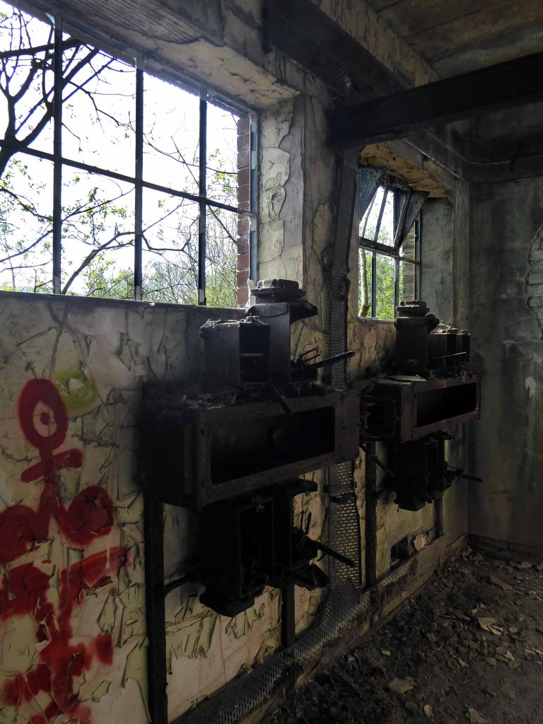
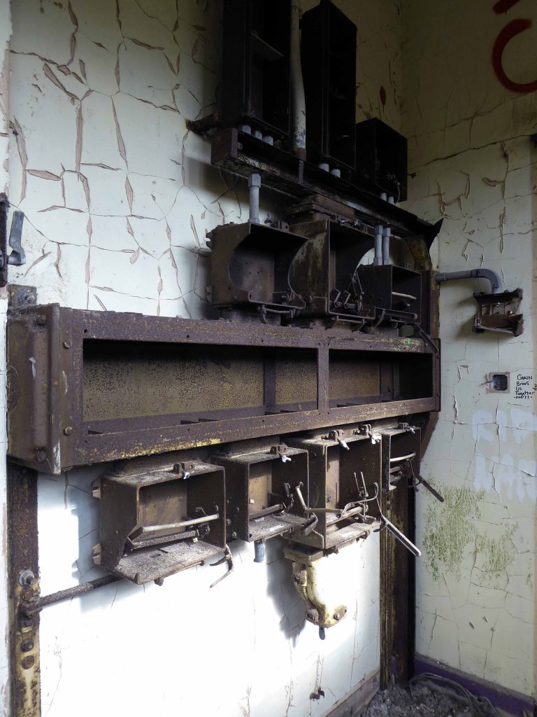
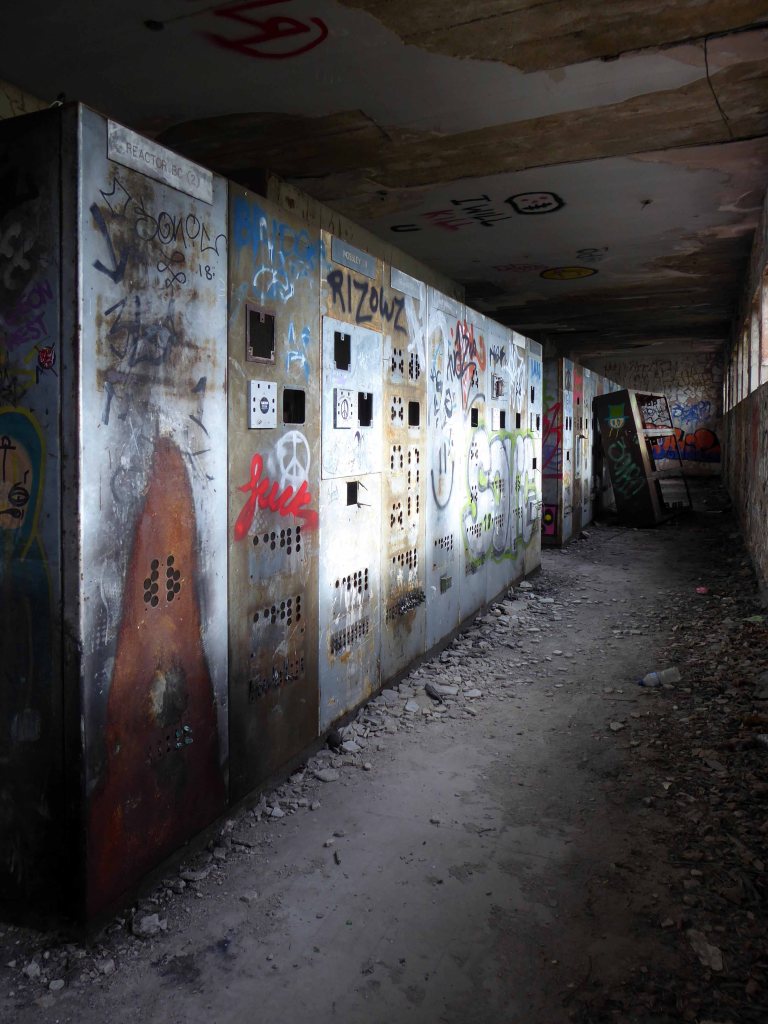
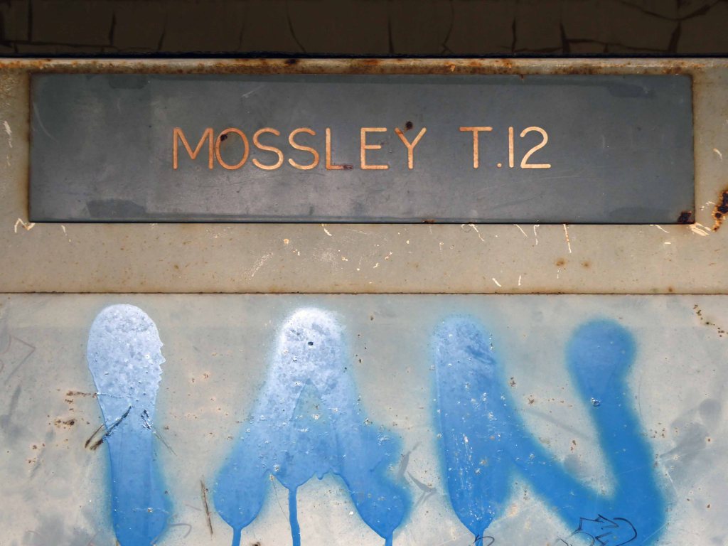
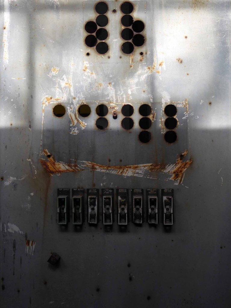
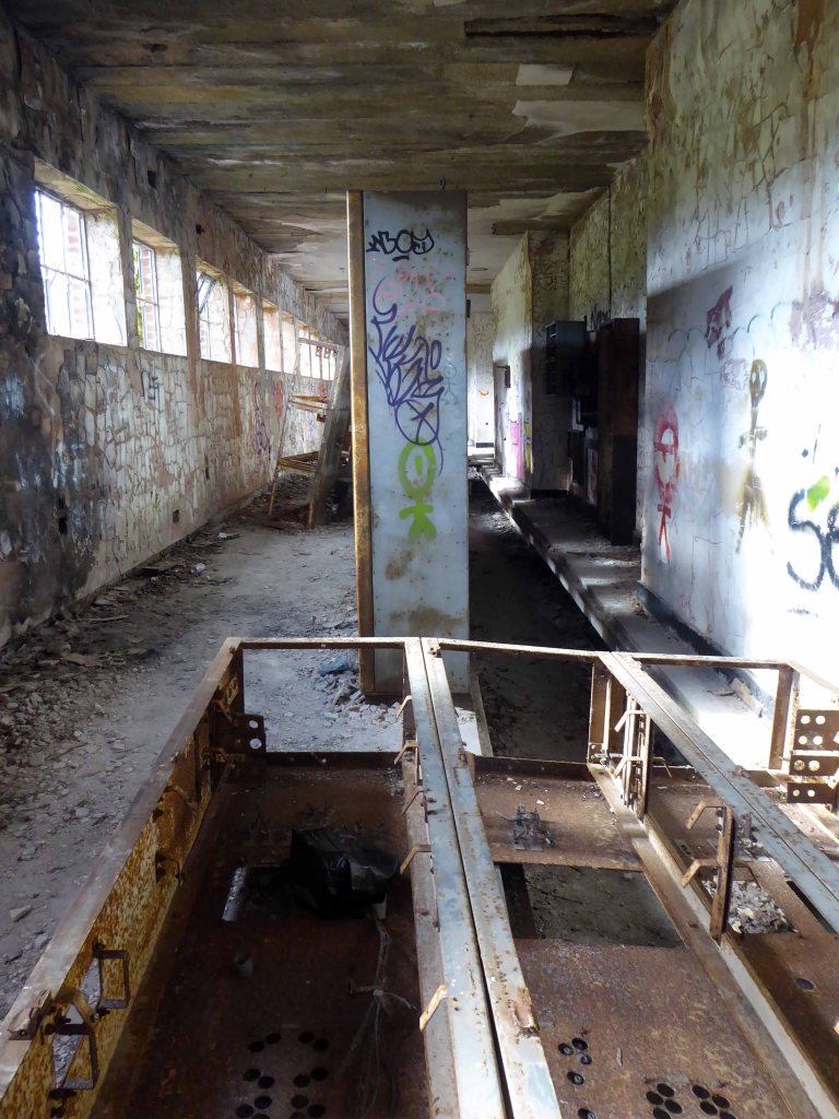
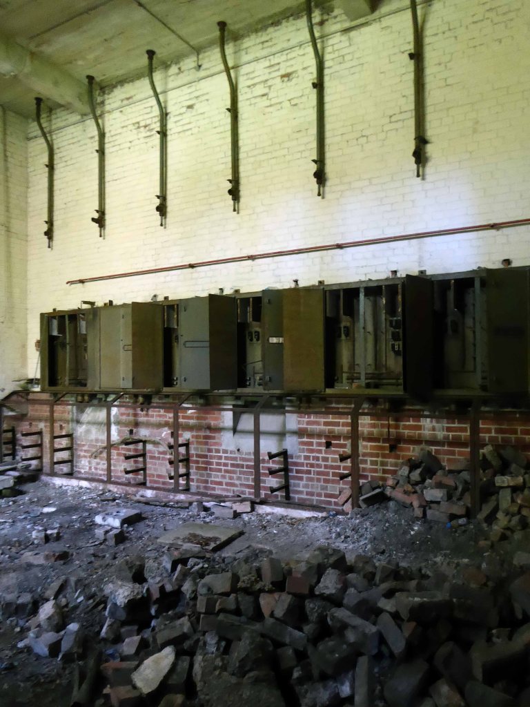
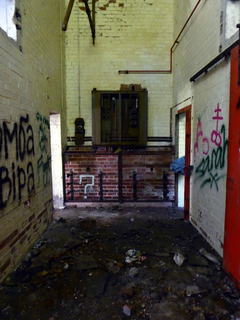
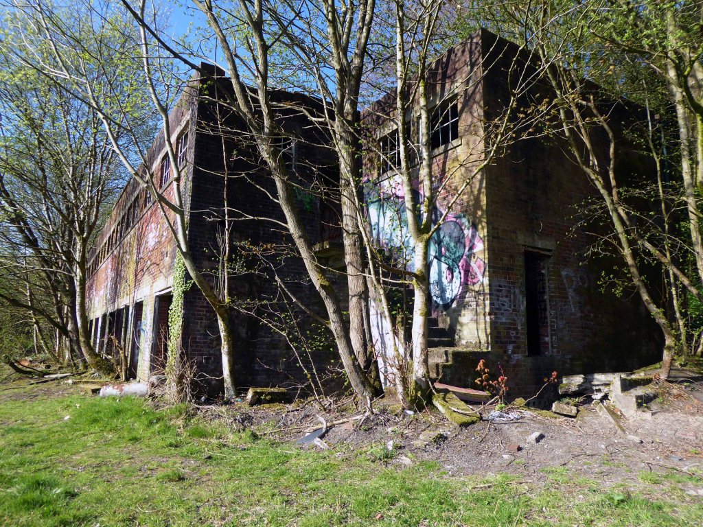
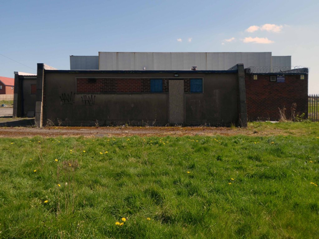
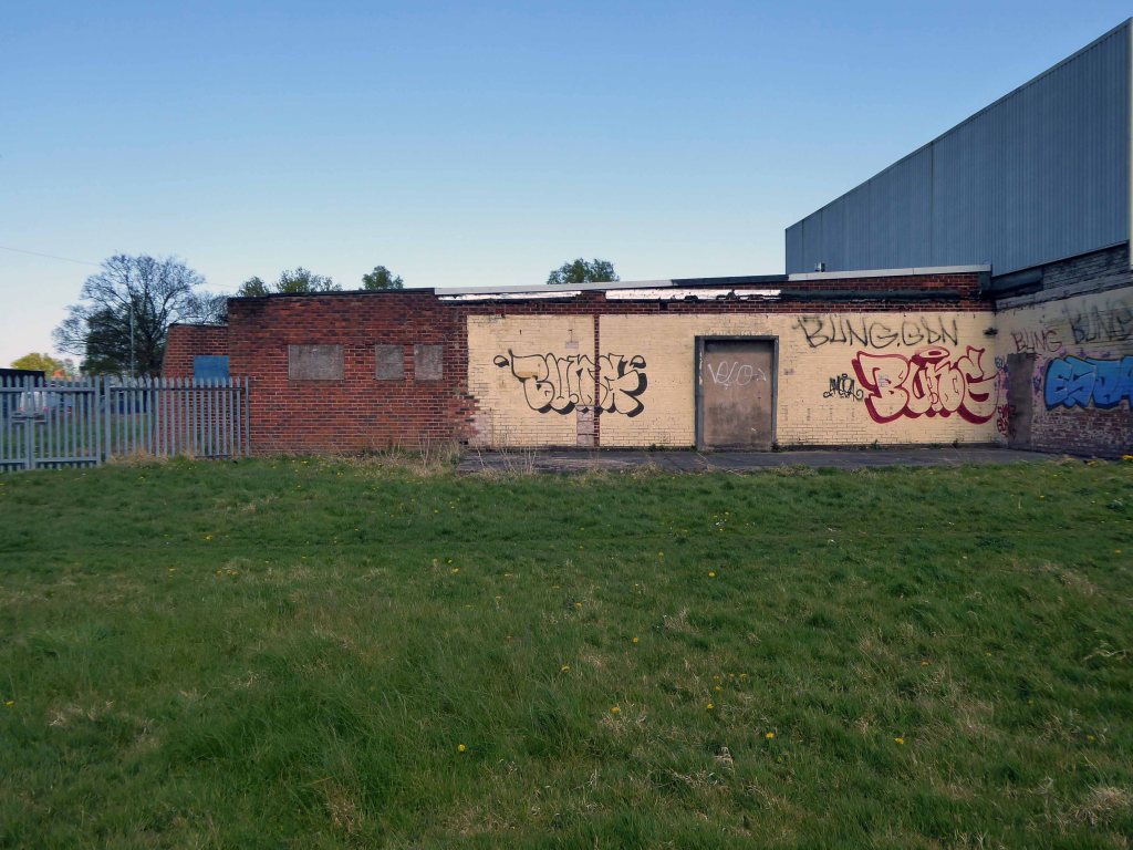
I’m back here to day in search of an abandoned control centre at the long gone Hartshead Power Station.
The station was opened in 1926 by the Stalybridge, Hyde, Mossley and Dukinfield Transport and Electricity Board.
The station was closed on 29 October 1979 with a generating capacity of 64 megawatts. It was demolished during the late 1980s, although part of the site is still used as an electrical substation.
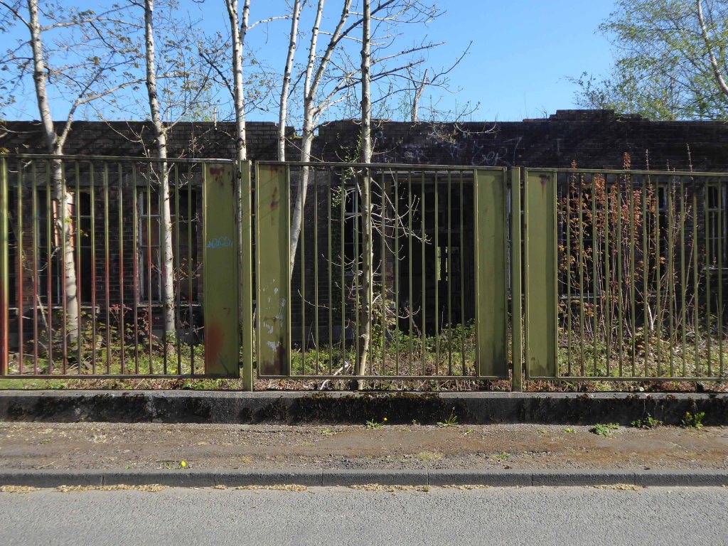
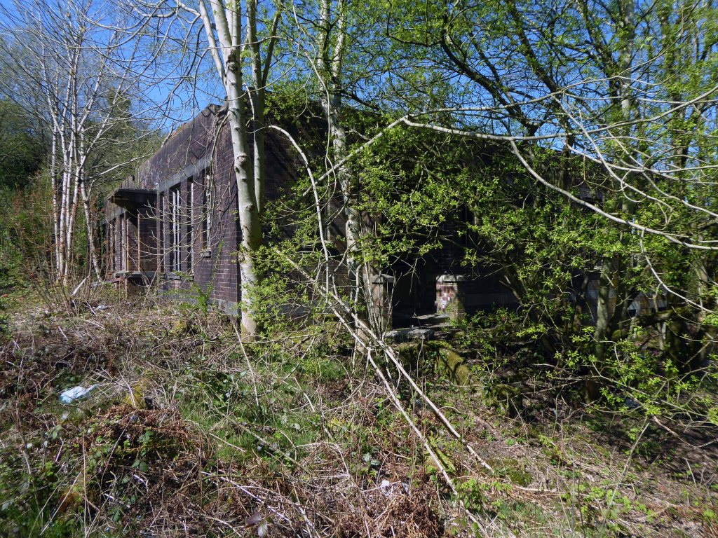
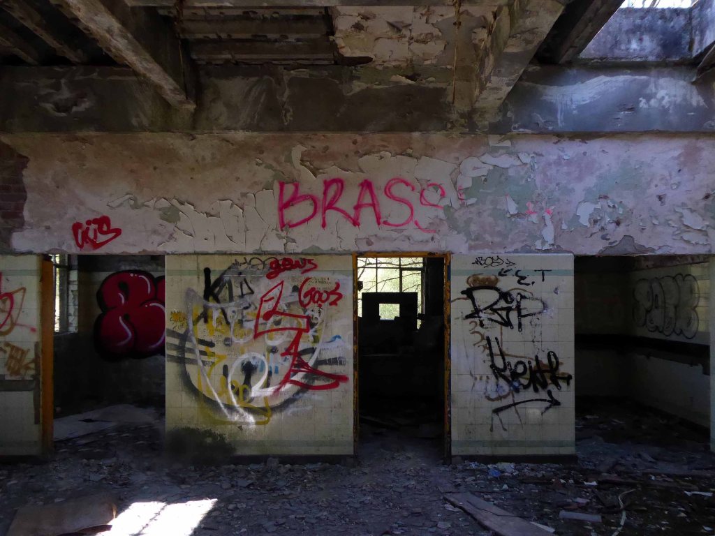
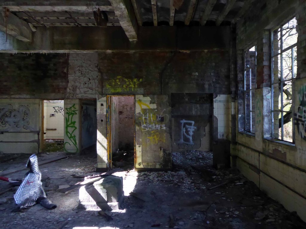
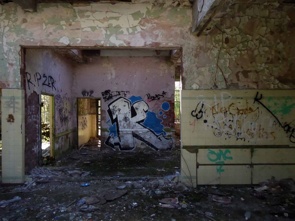
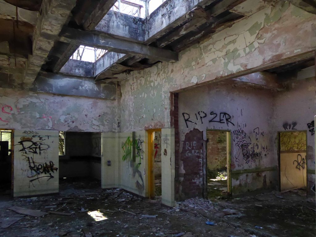
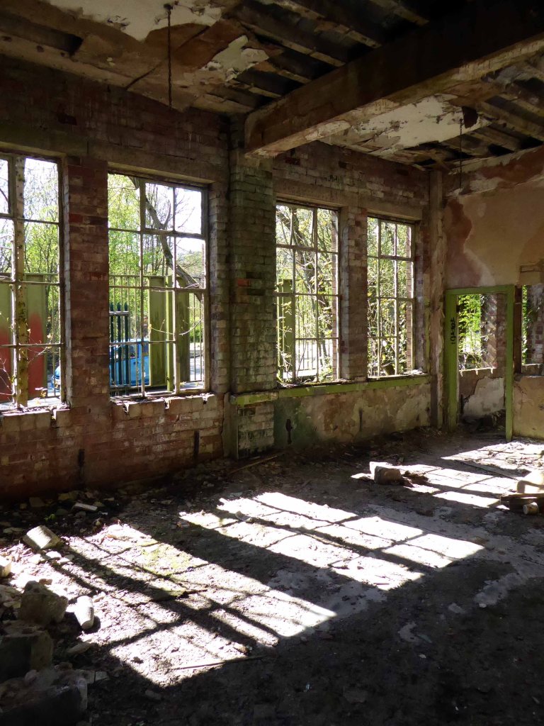
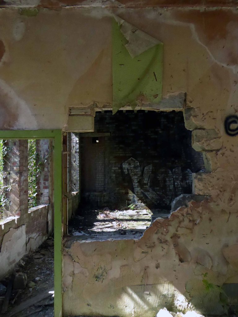
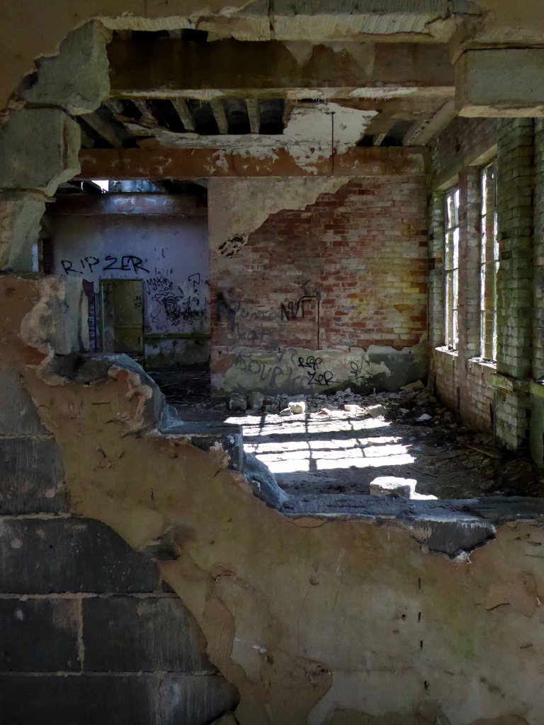
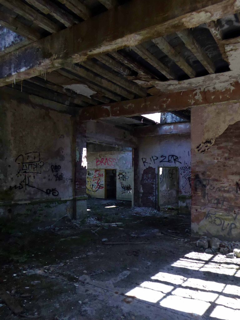
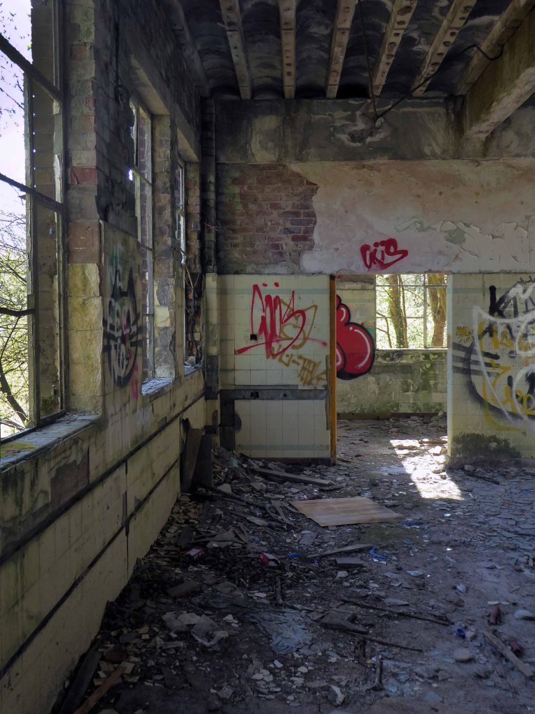
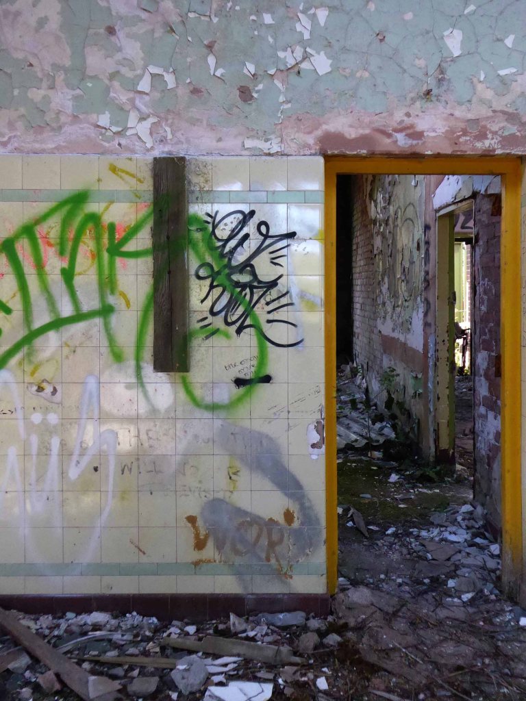
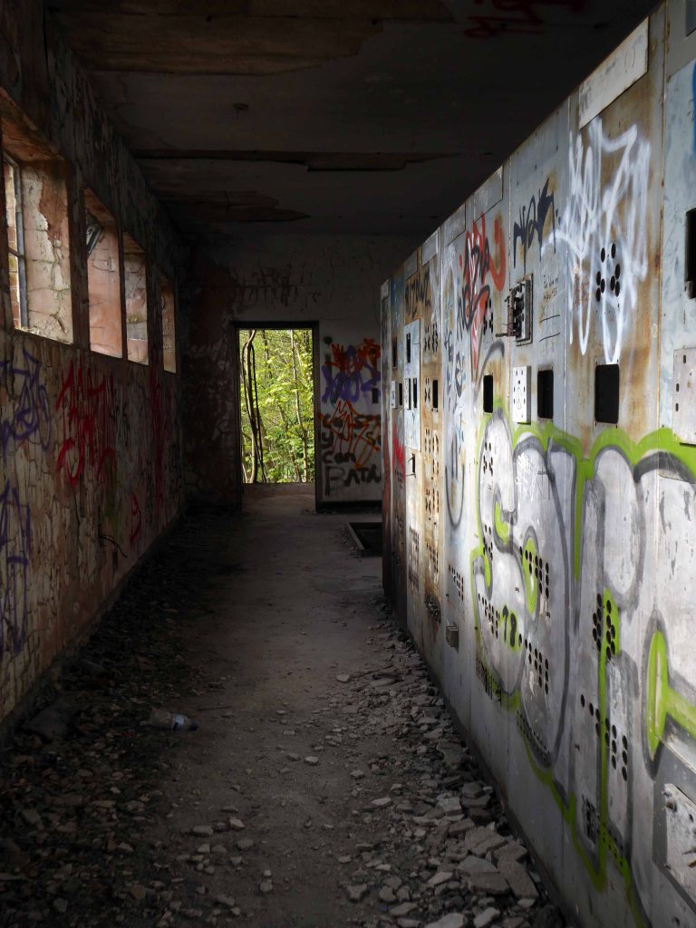
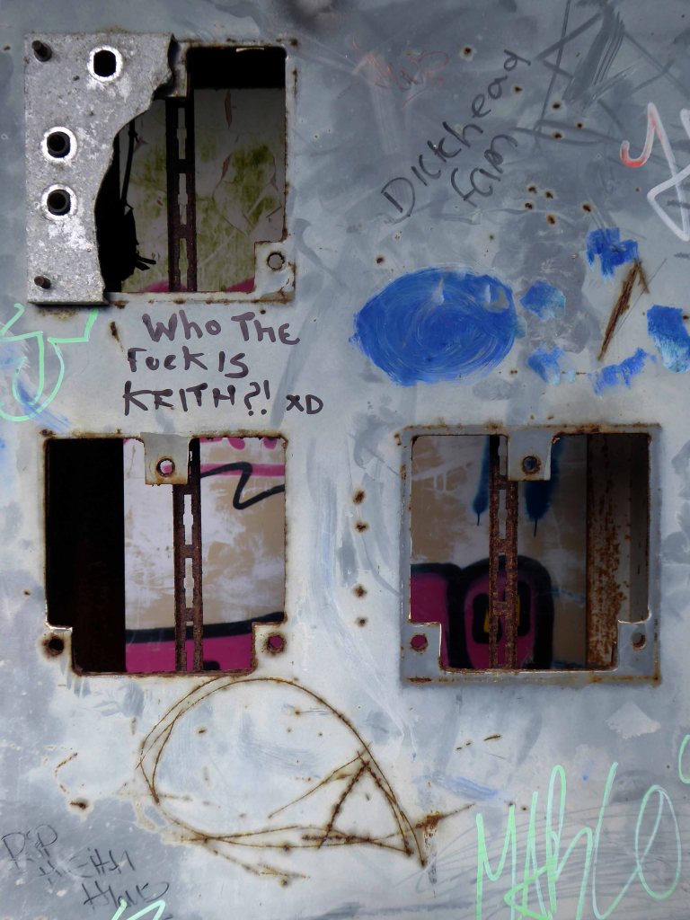
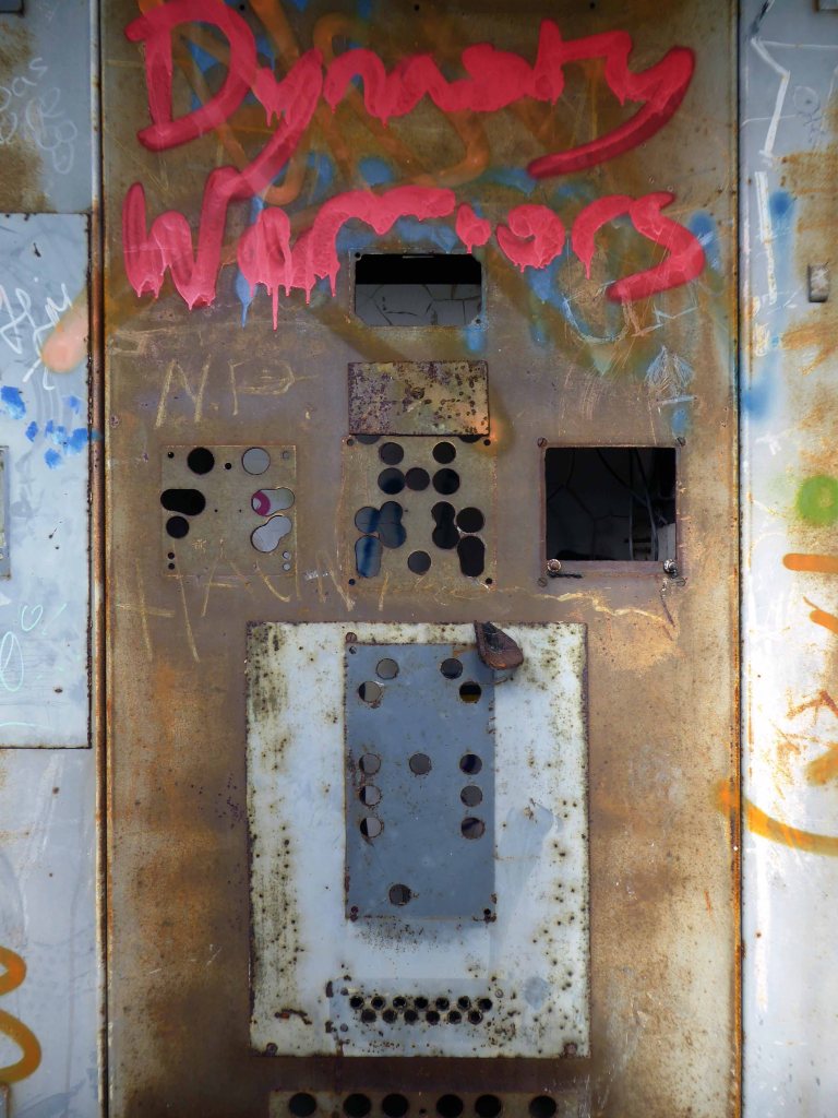
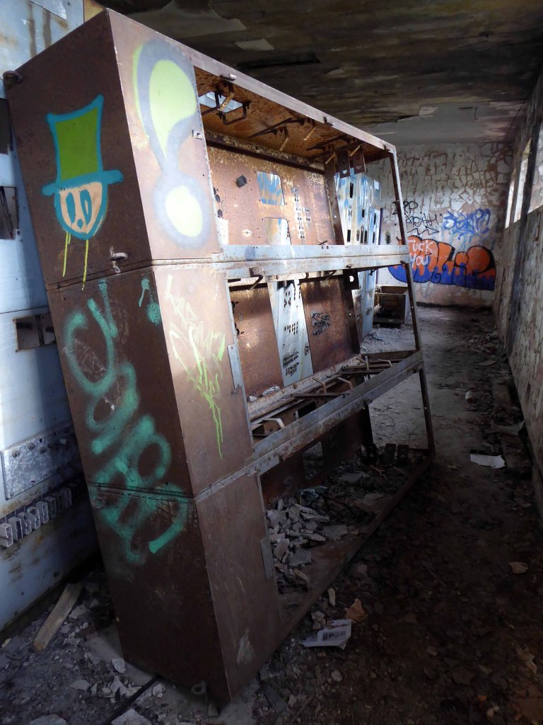
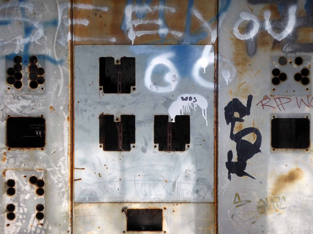
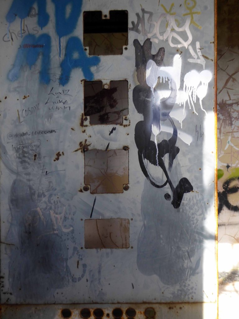
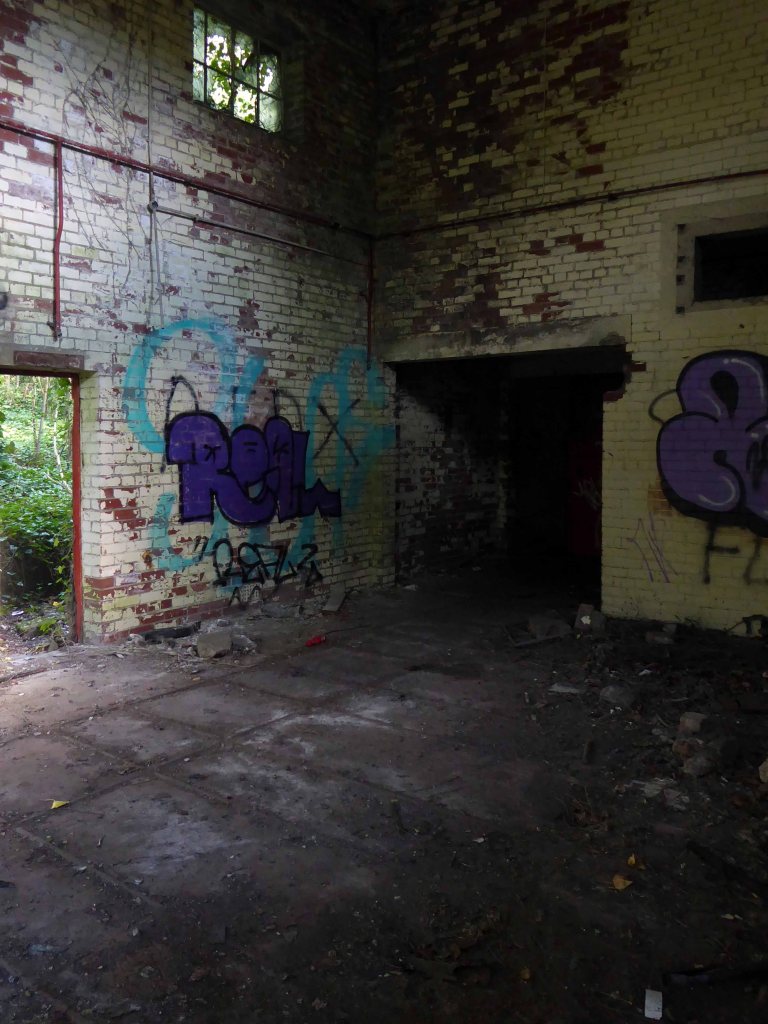
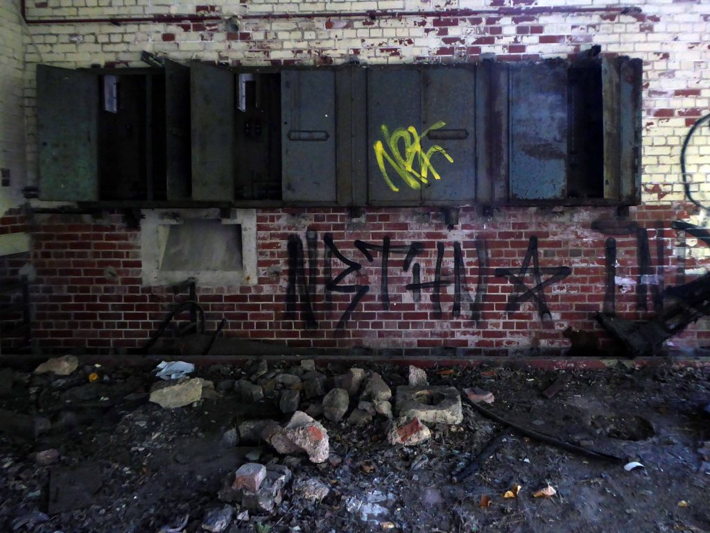
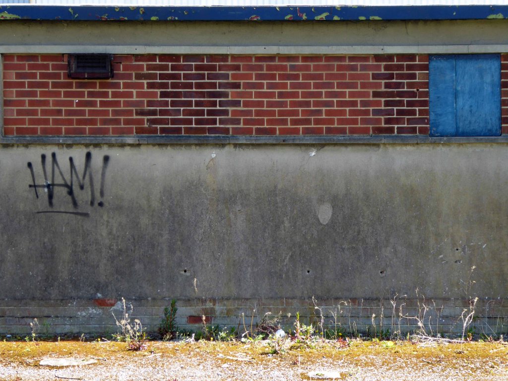
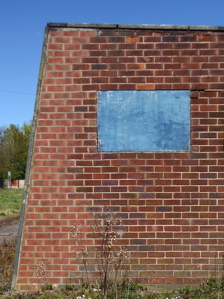
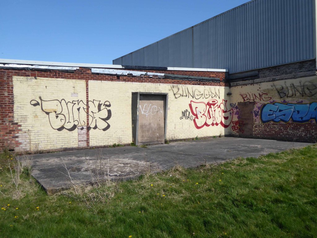
First glimpsed on an urban exploration site, I had awaited an opportunity to slip through the fence and take a look around – here’s what I found.
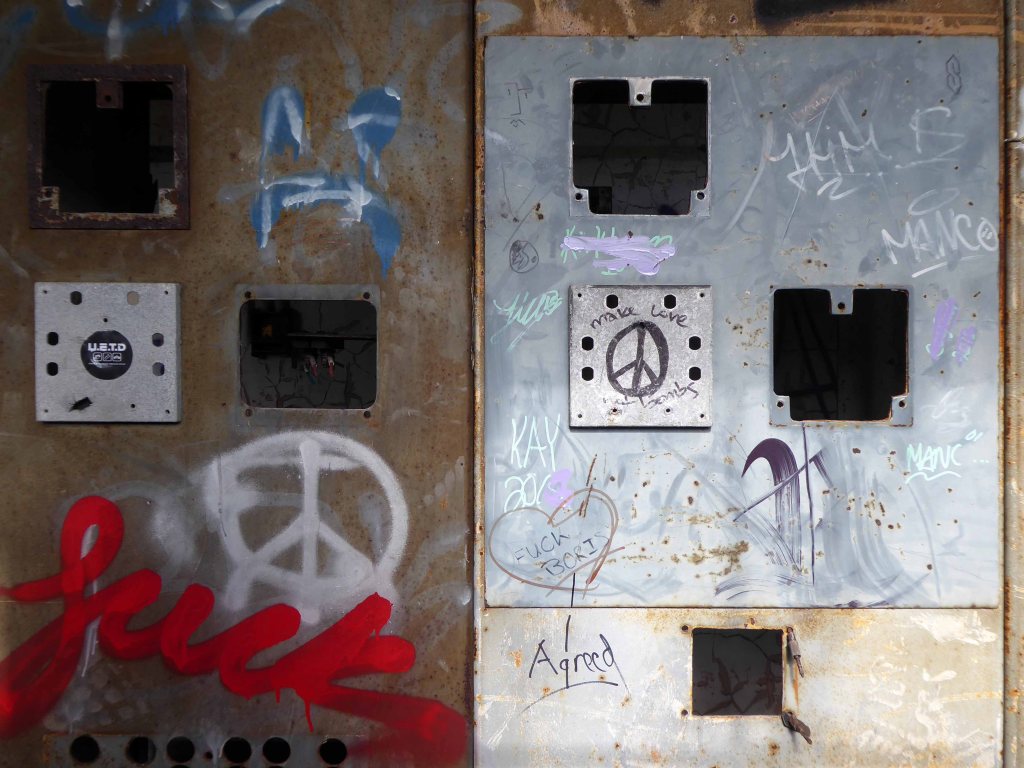
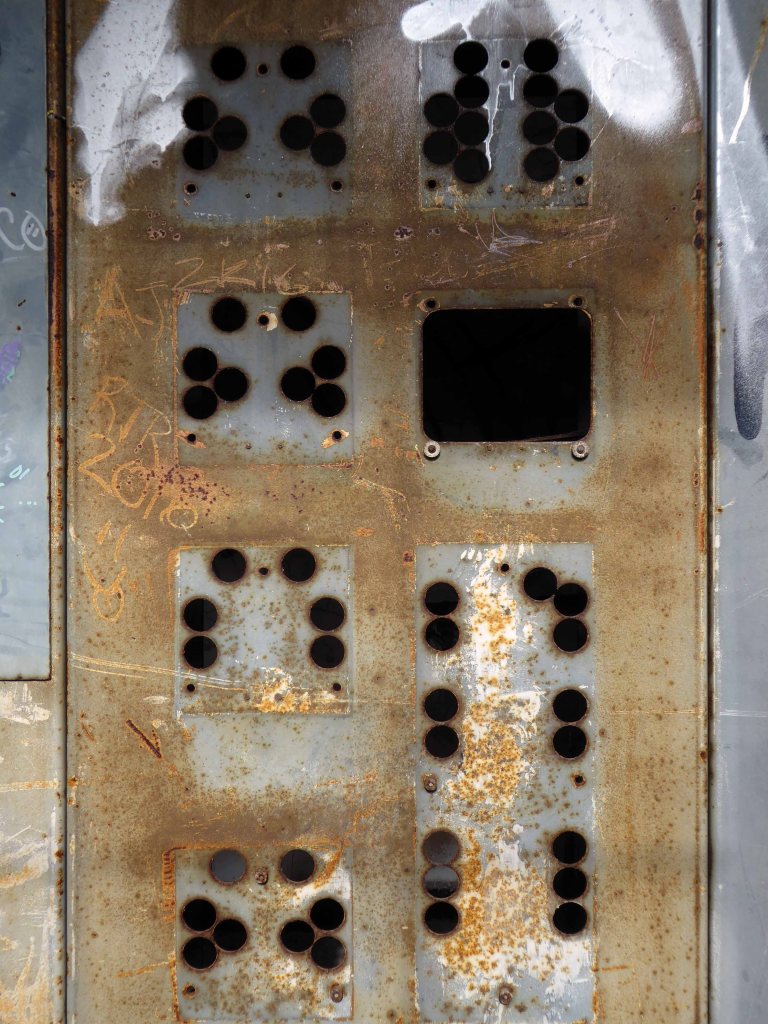
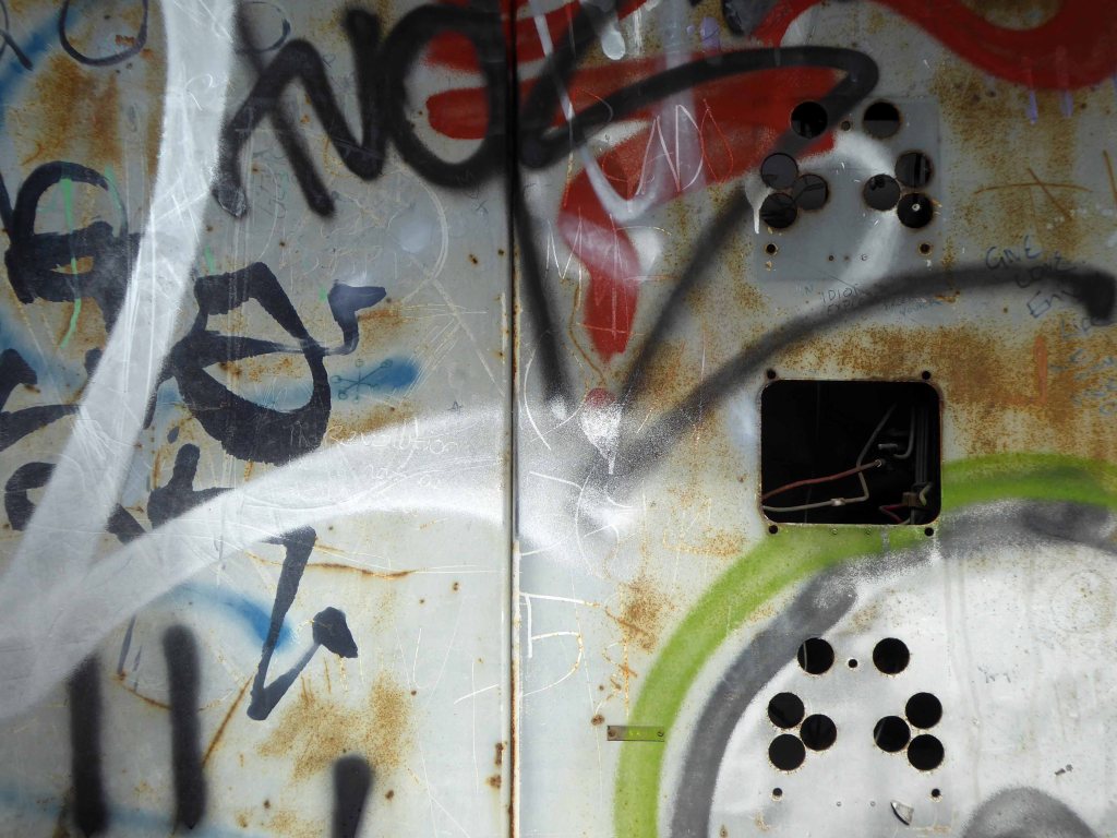
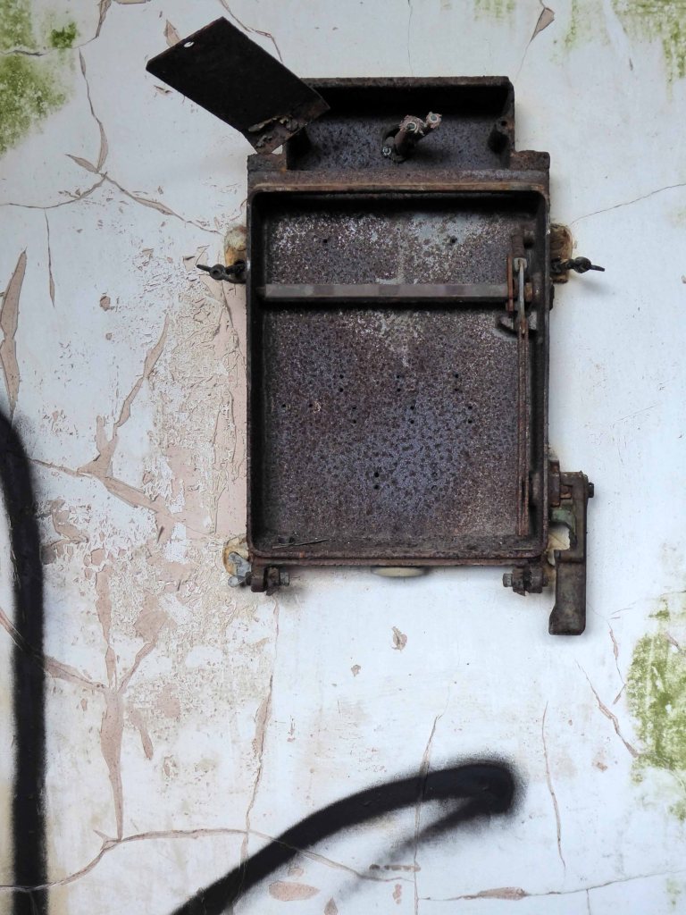
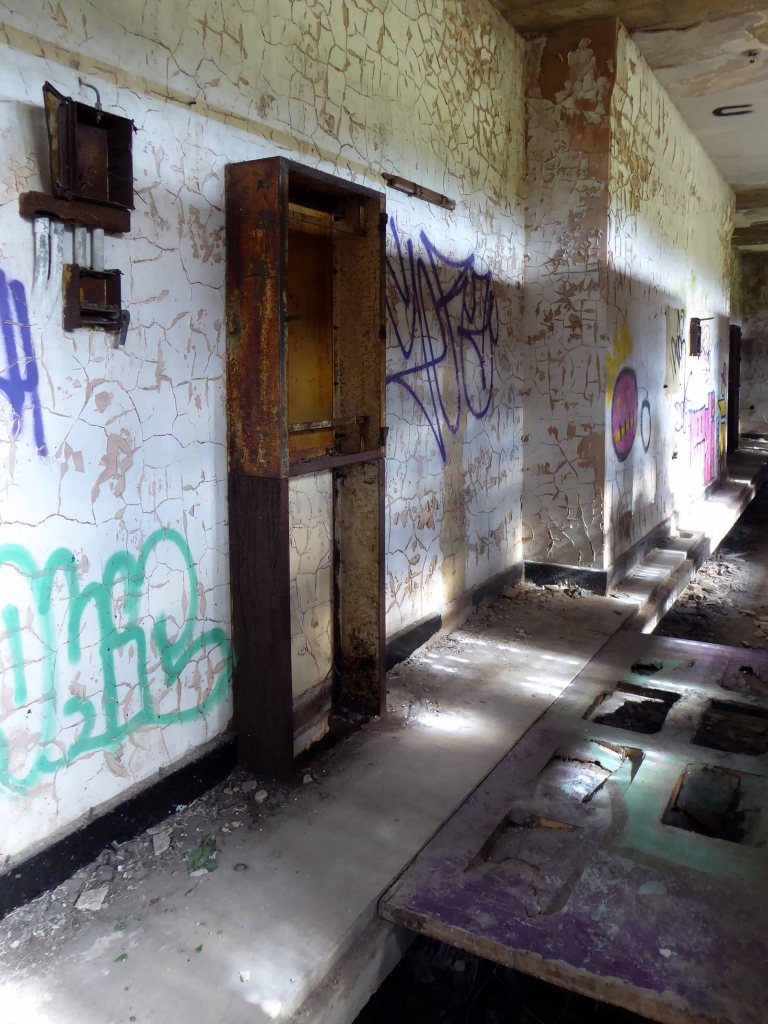
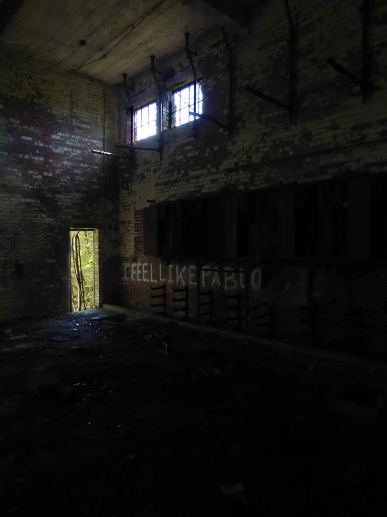
Most of the valuable equipment stripped out leaving and empty shell, covered in layers of the taggers’ interventions.
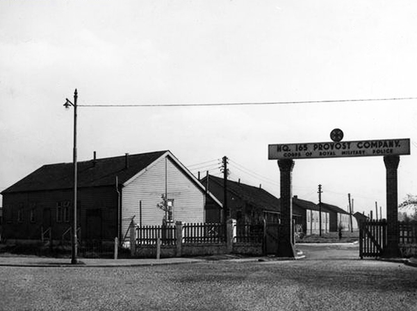
As a Military Police and POW CampThe 48th Battalion Manchester Home Guard used the facilities
Photograph Brian Wood
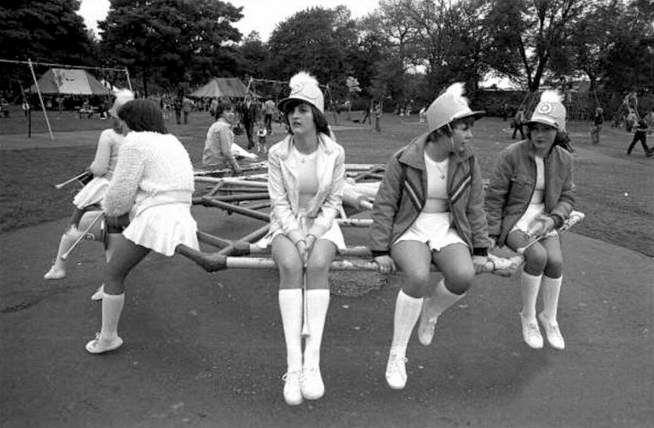
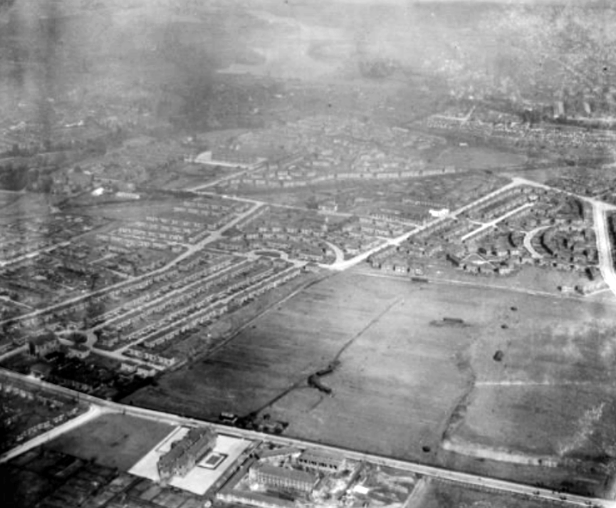
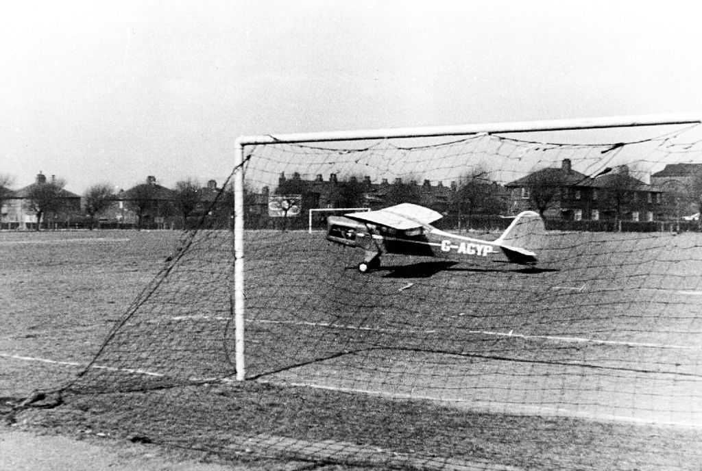
I remember from the 60’s onwards the fields in use for amateur football – pubs, clubs, schools and works all supplying teams to the plethora of leagues across the city.
Auster Aircraft of Airliners forced to land at Melland Playing Fields whilst towing banner 19611963
Gorton has received significant regeneration and investment over recent years as have nearby areas including Levenshulme. This is an aspirational, exciting new development and Arkwright Place has something for everyone – from first time buyers to growing families and downsizers – with a huge range of beautiful homes on offer.
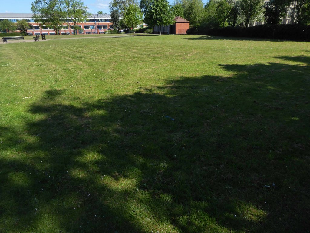
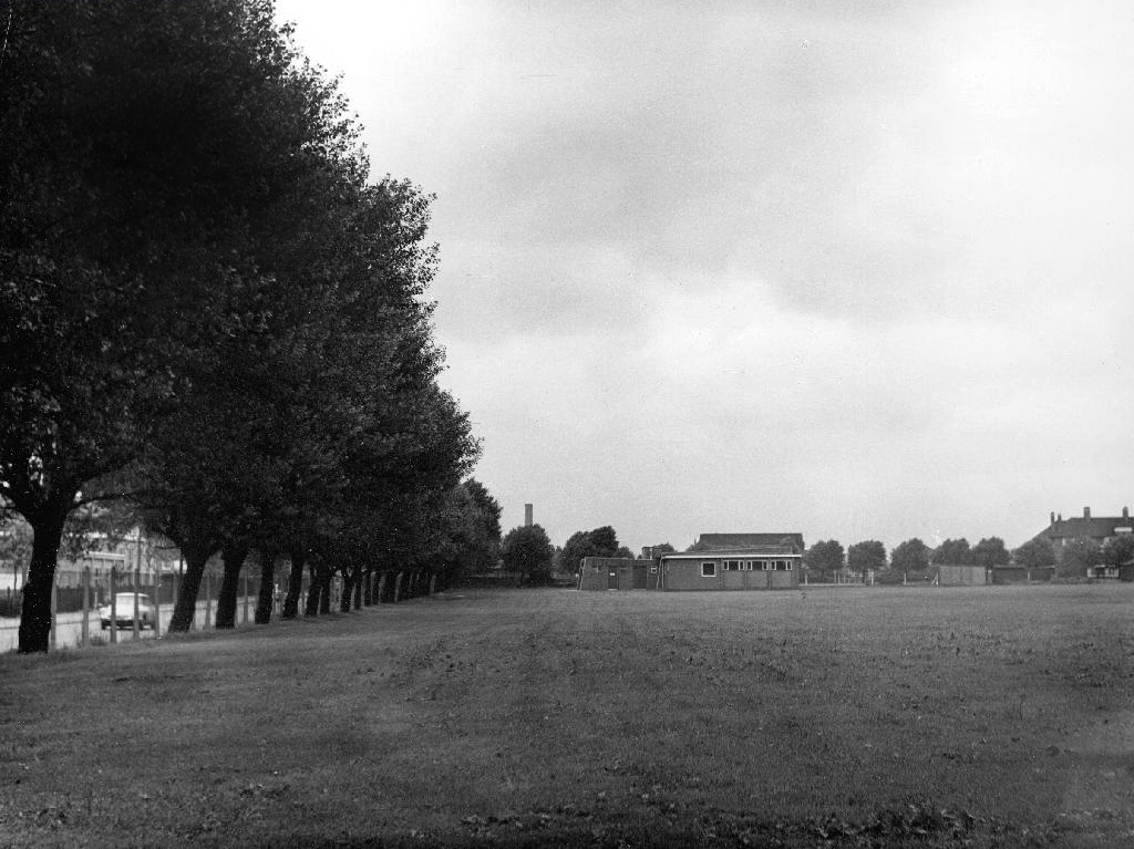
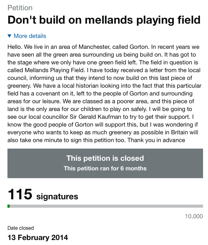
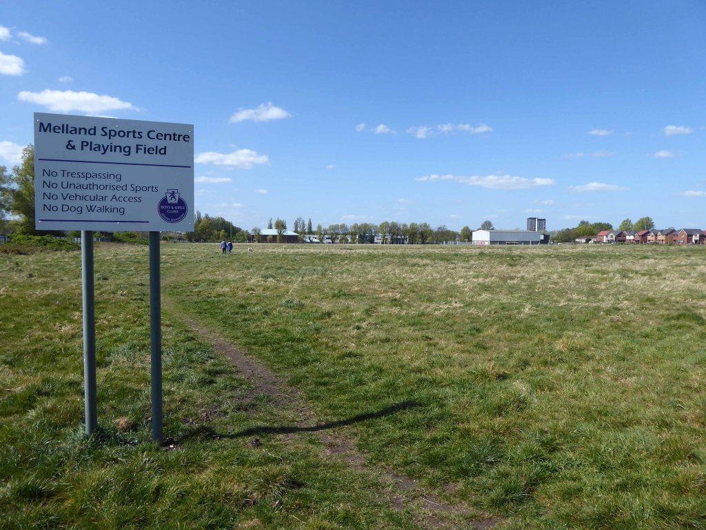
A local campaign was organised to preserve the open space:
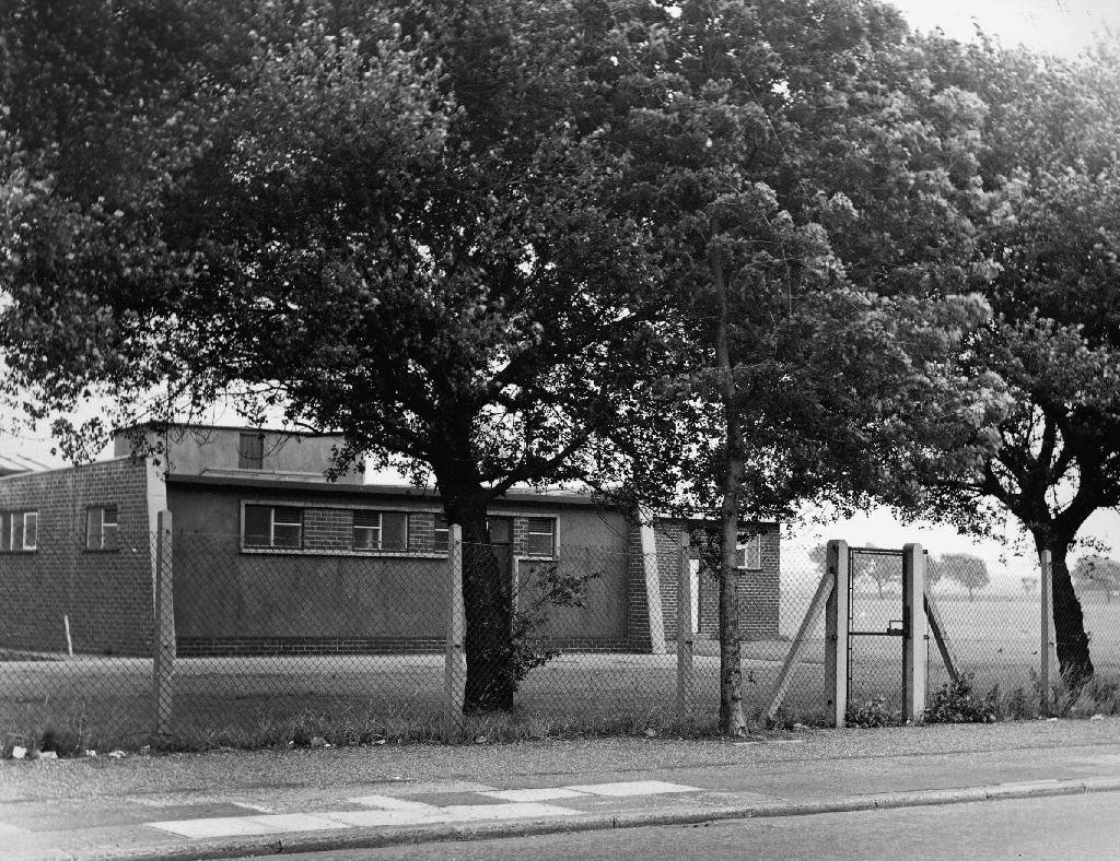
At present the fields are fenced and secured – though gaps have been made to allow access for strollers.
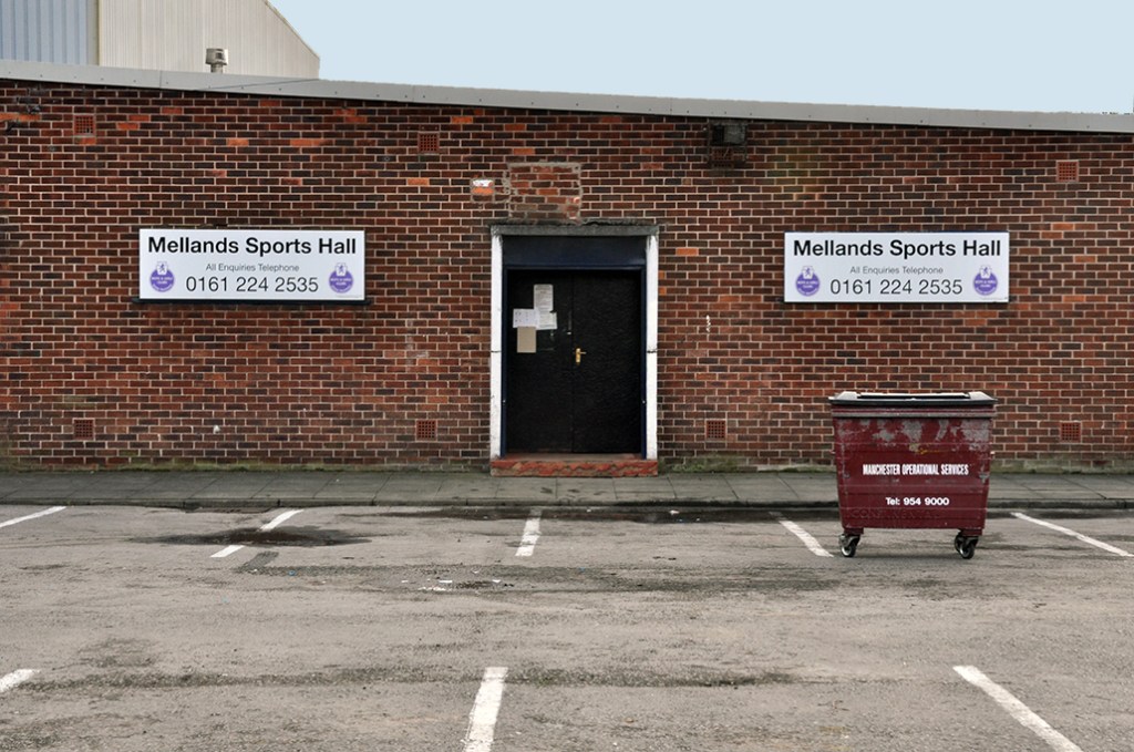
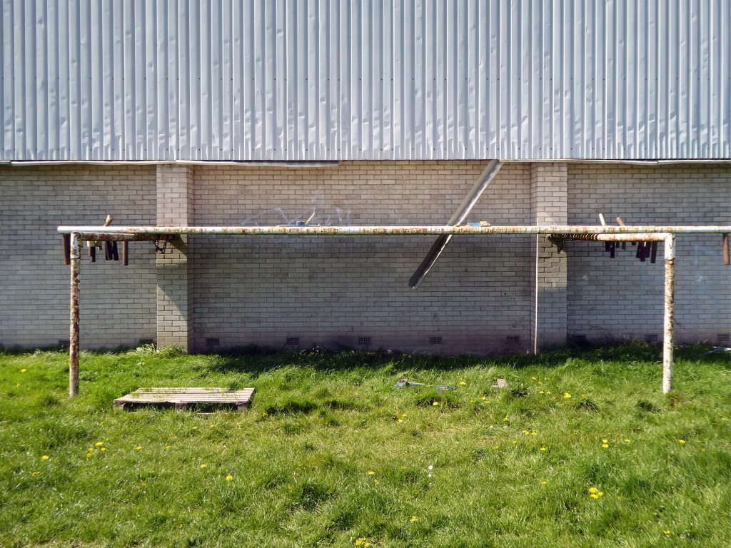
The goalposts still stand though currently without crossbars.
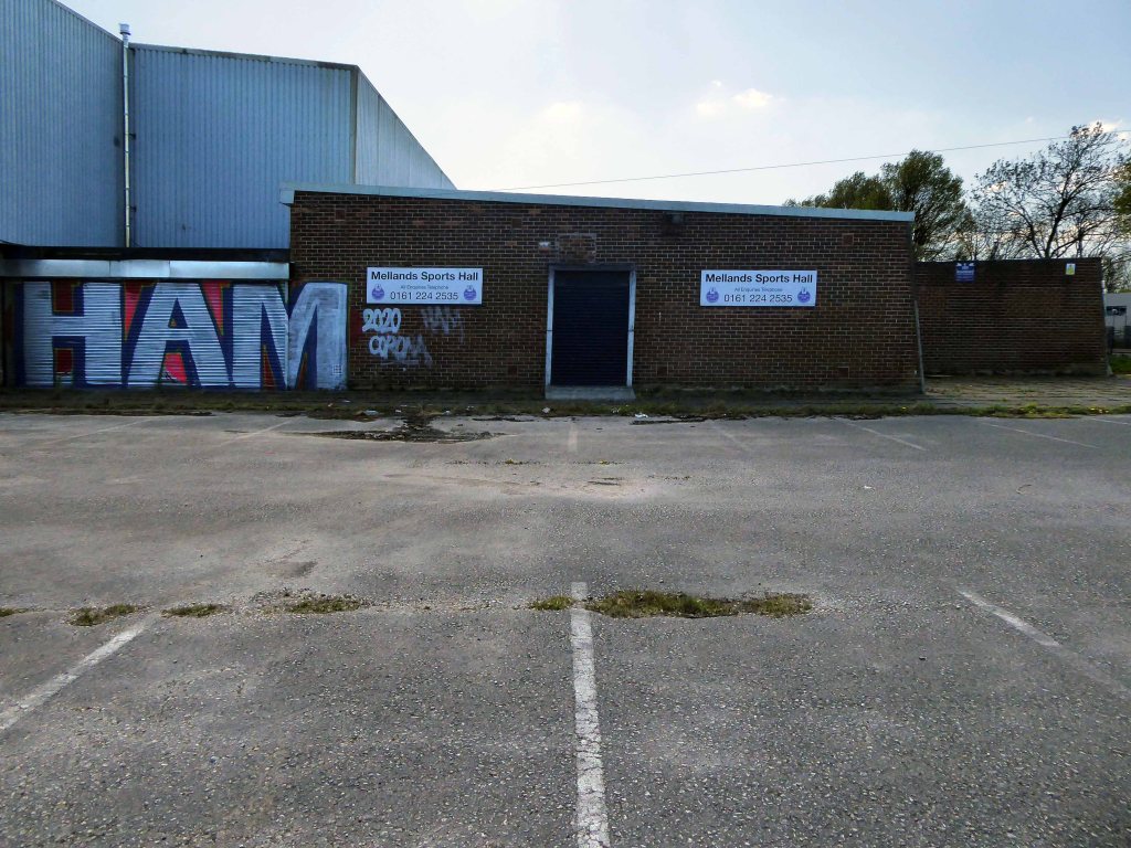
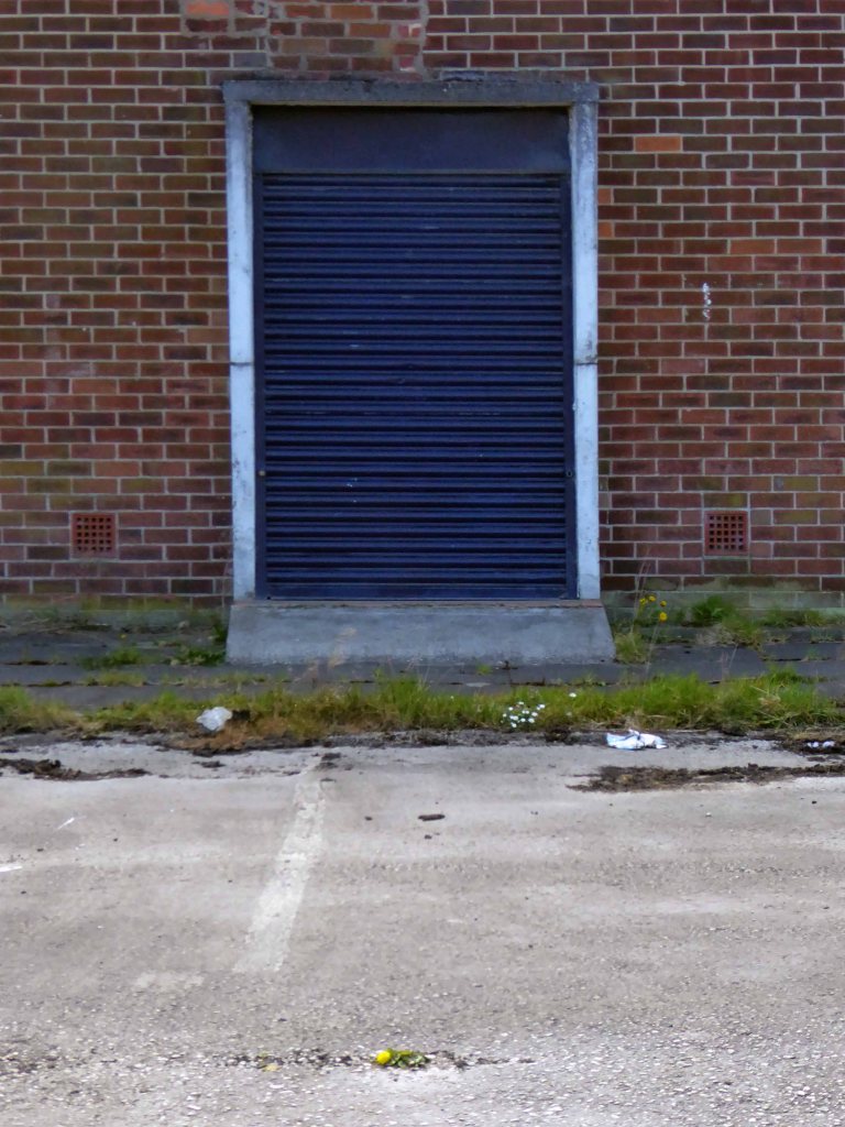
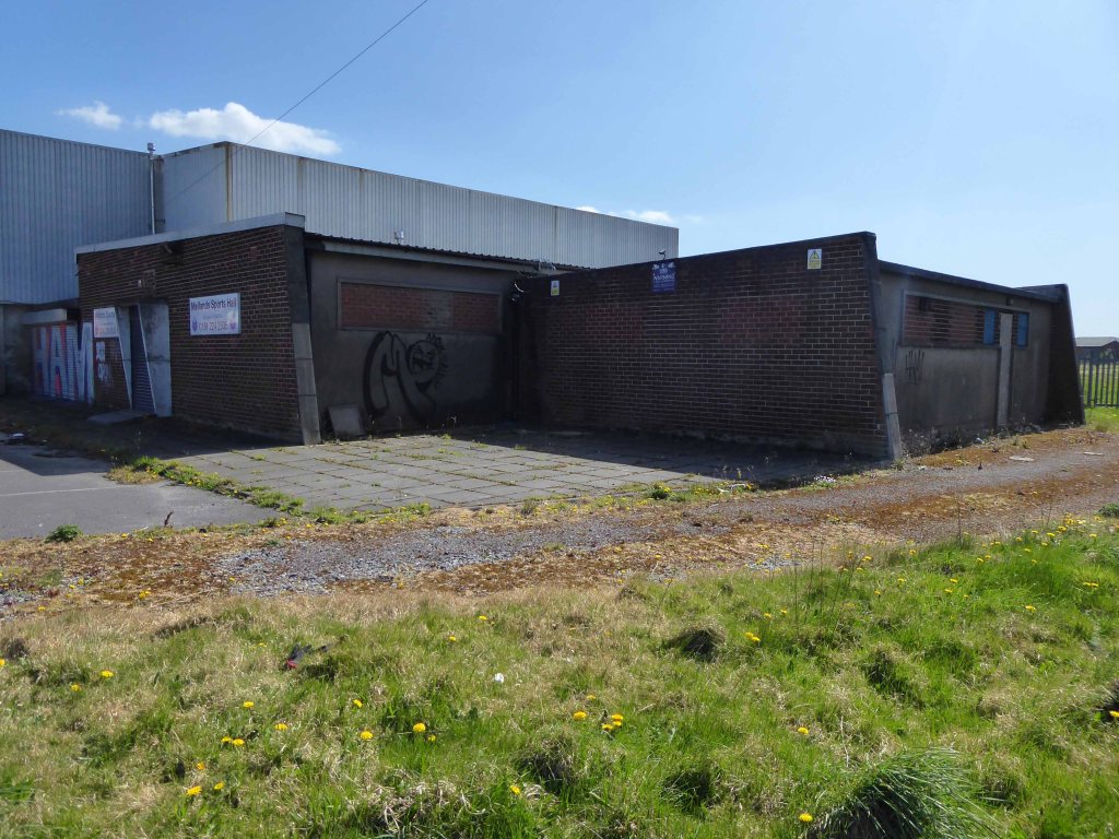
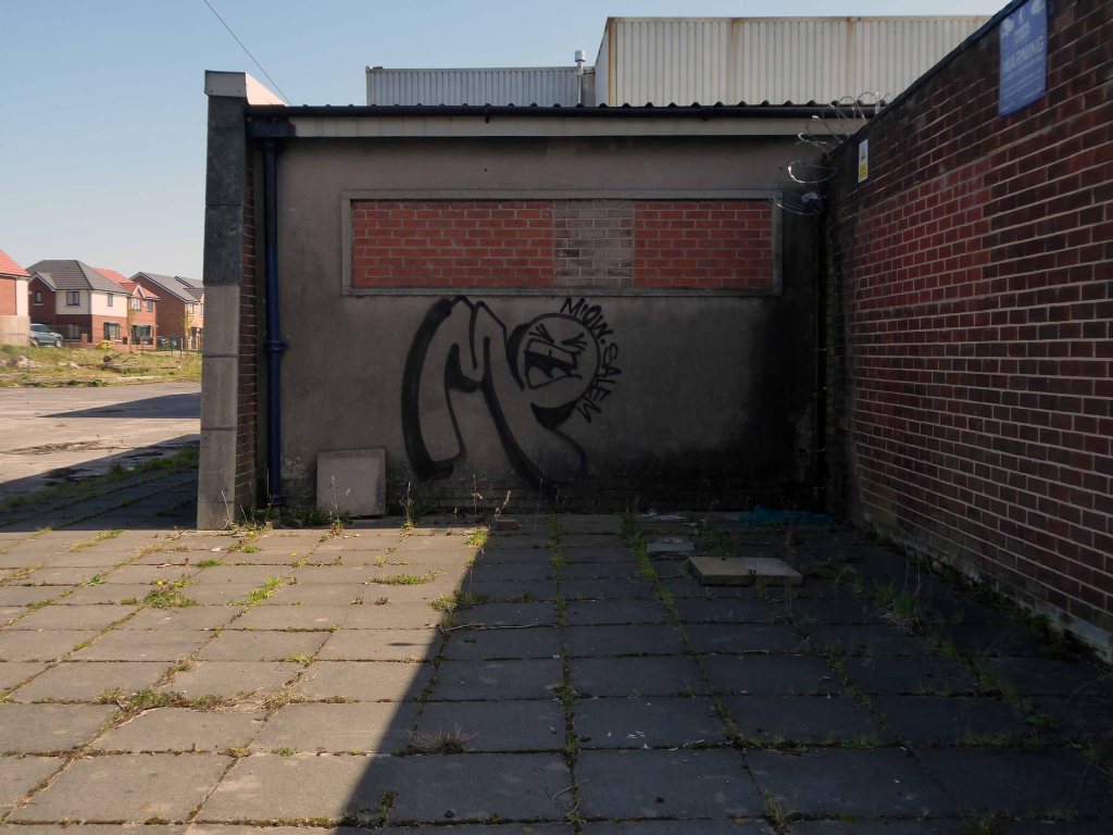
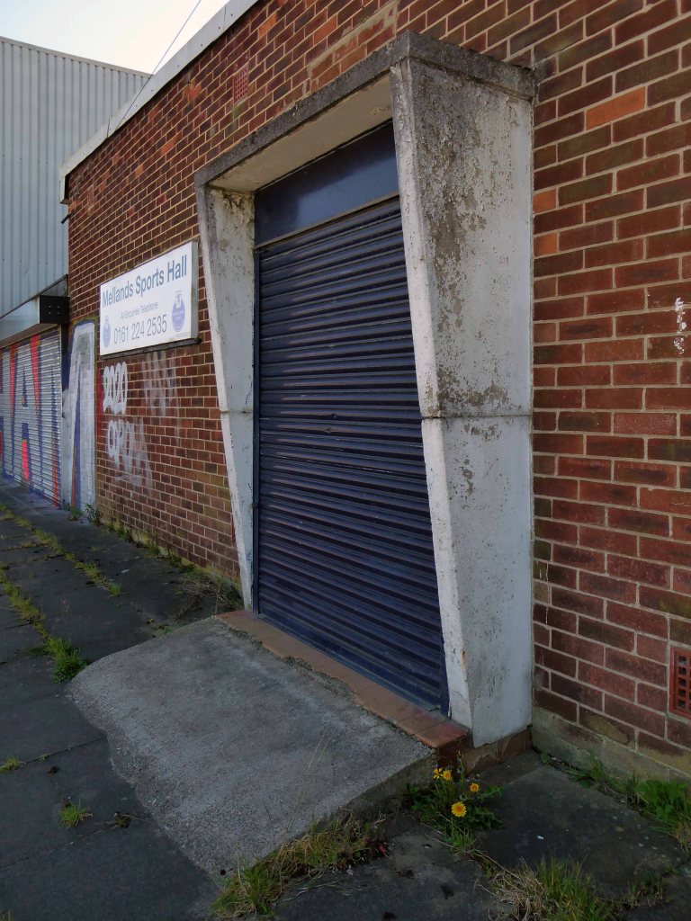
Which are stored by the Sports Hall.
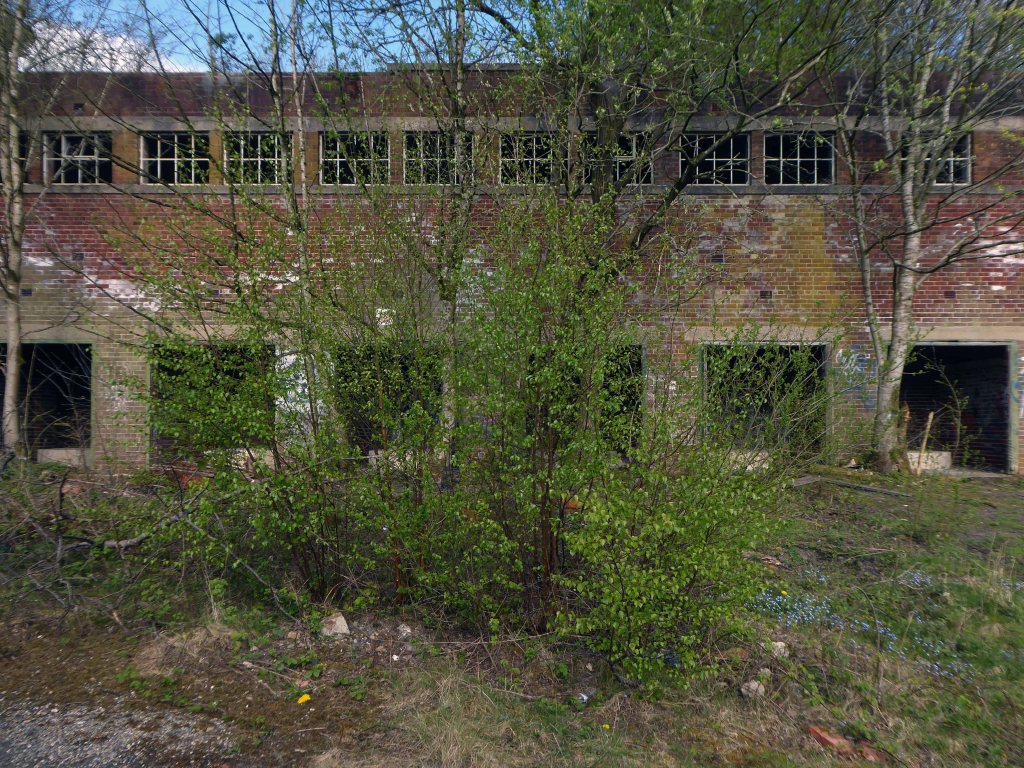
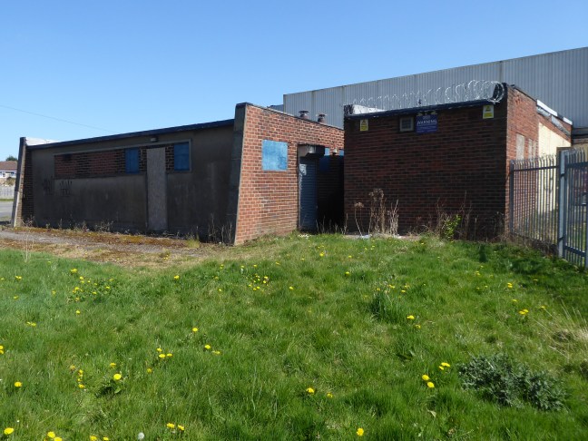
The buildings are mothballed – awaiting what?
For me the concrete and brick functionalist changing rooms are a thing of beauty and seem to have been a part of my life for quite some time, as I cycled back and to – on my way to work.
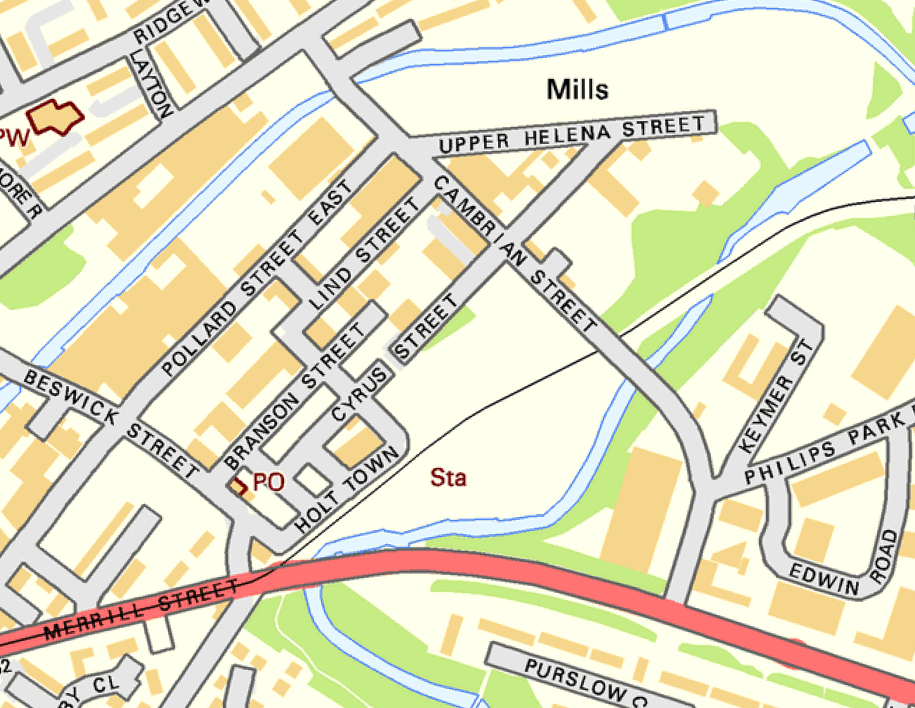
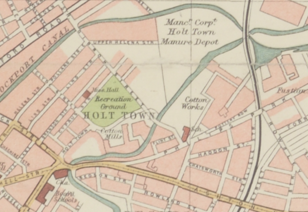
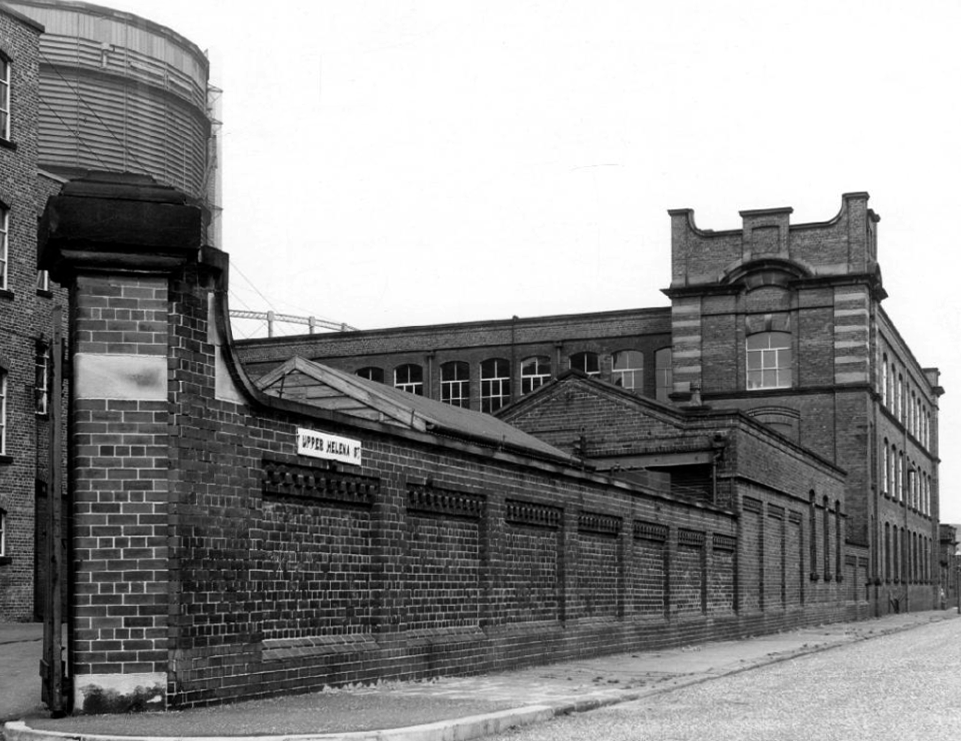
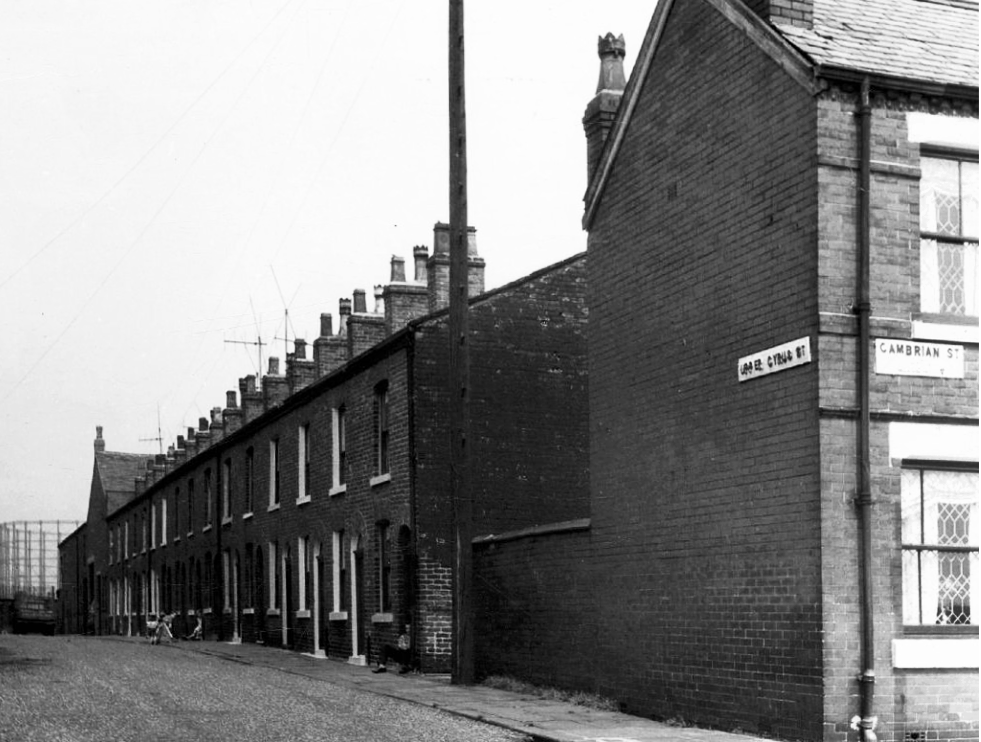
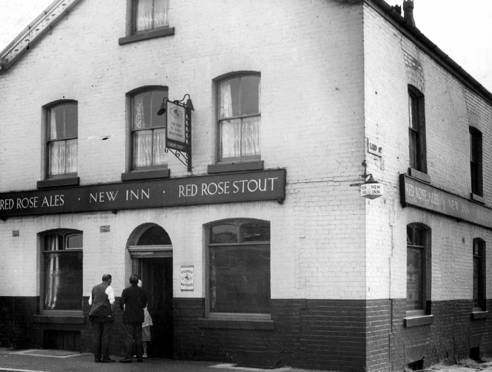
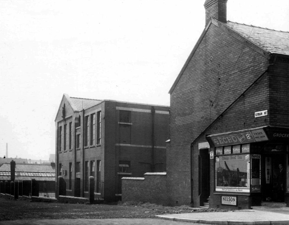
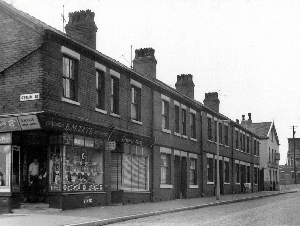
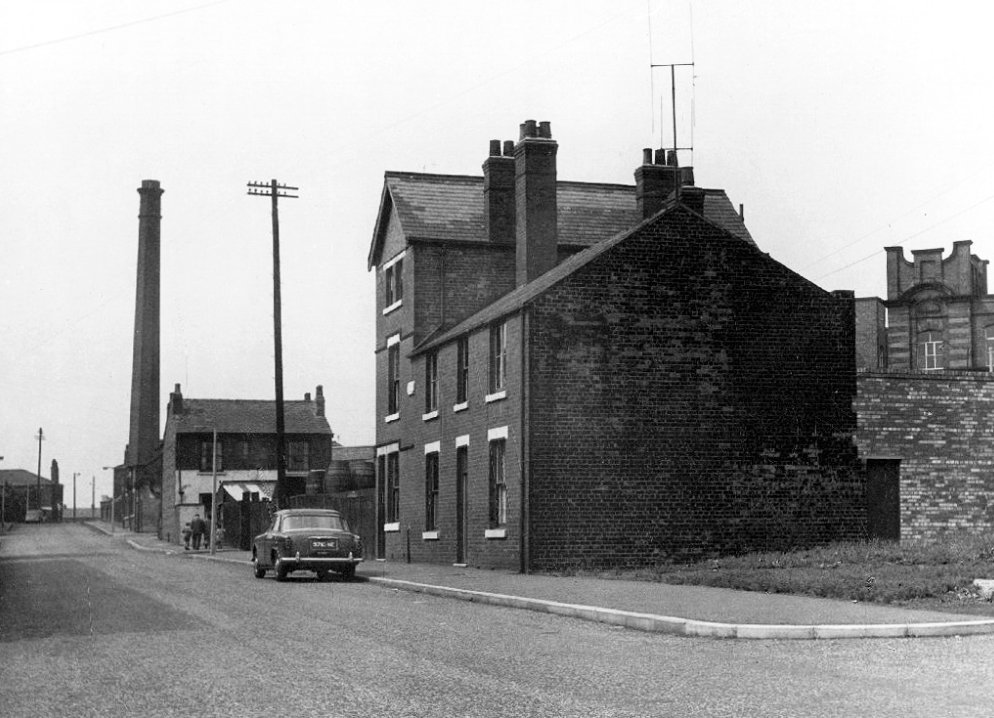
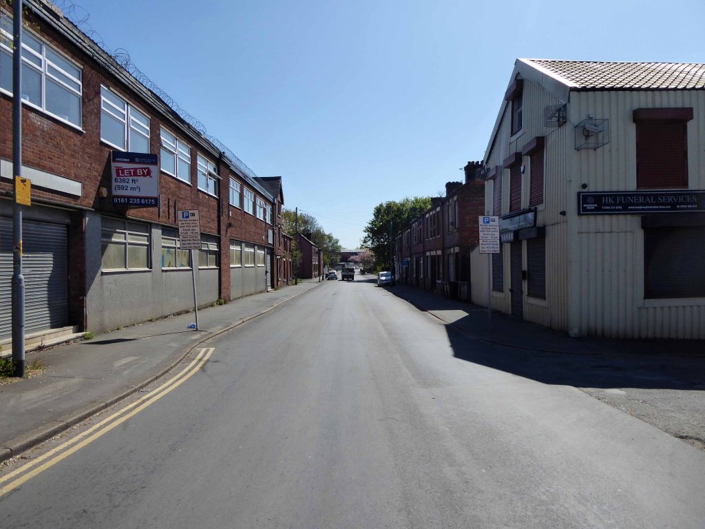
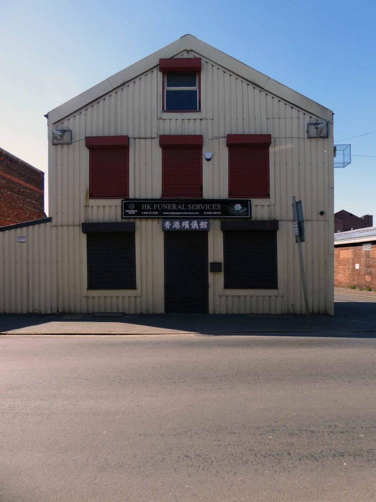
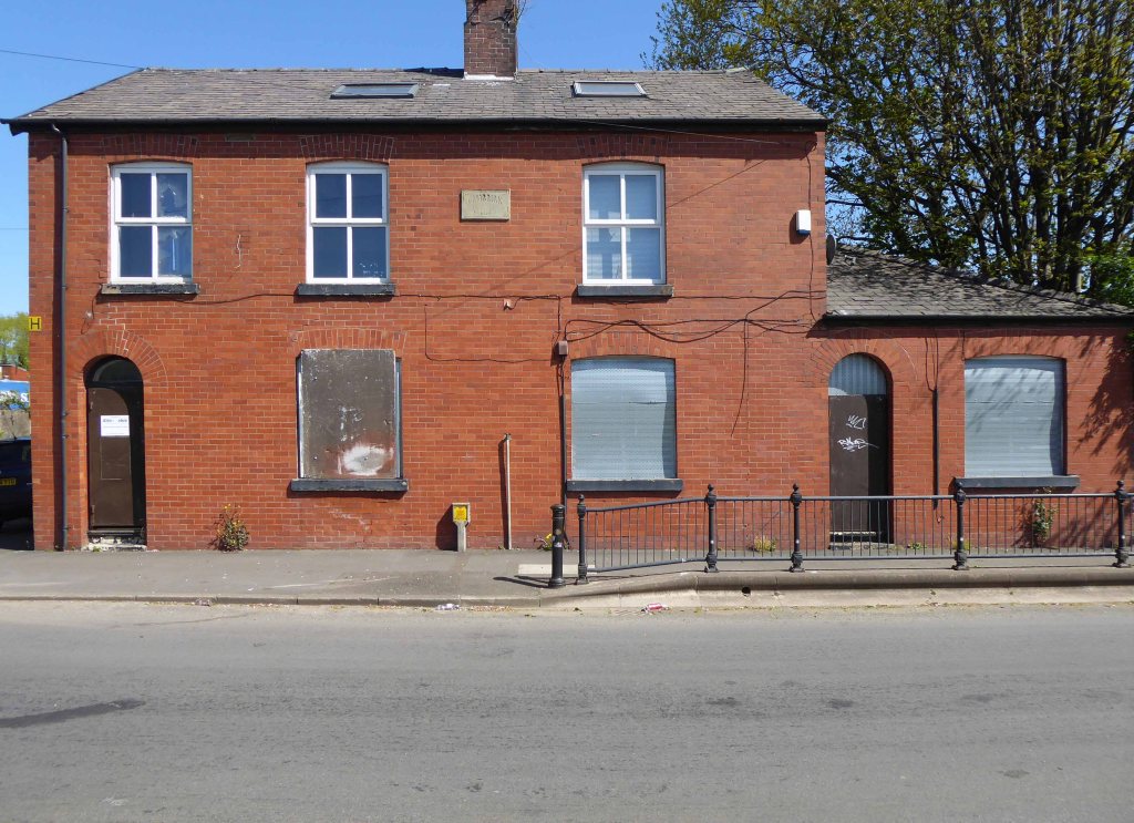
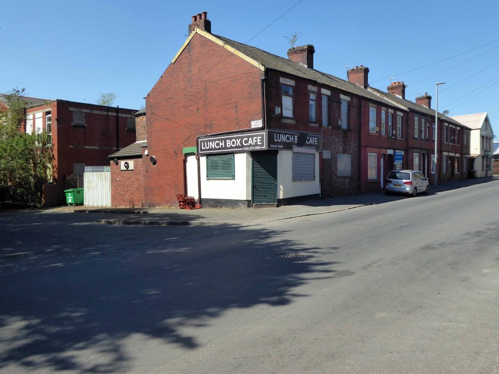
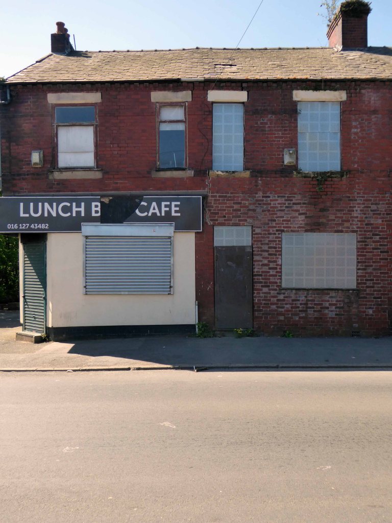
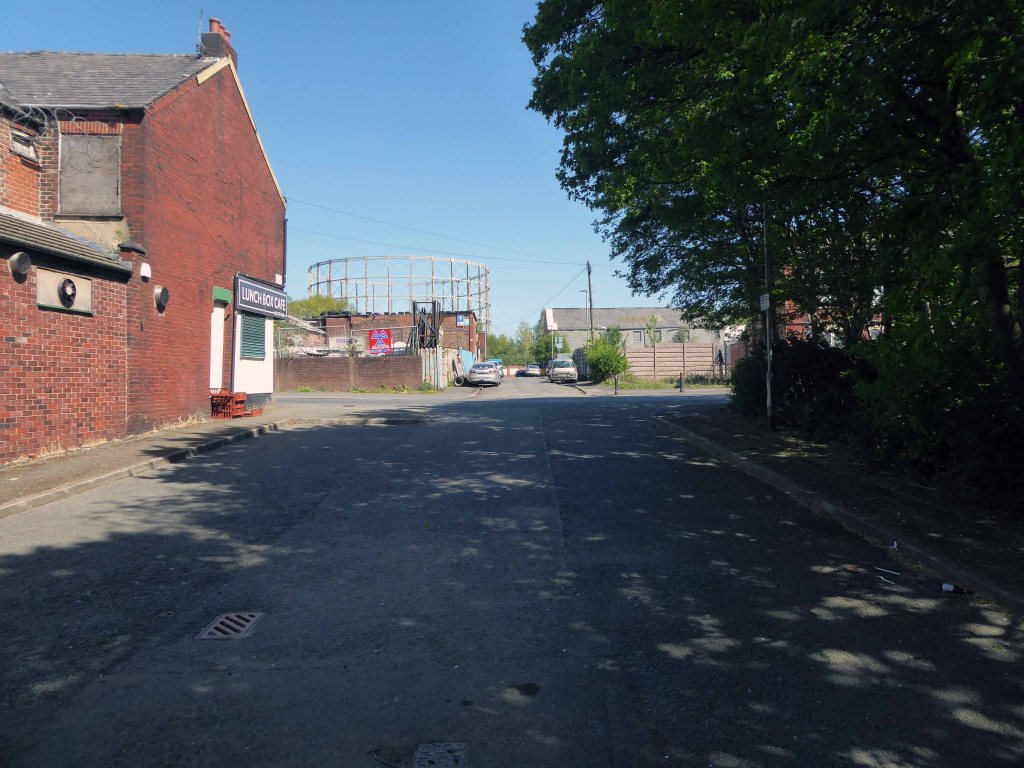
Nothing now remains of this mill complex on Upper Helena StreetThe homes on Upper Cyrus Street are long goneCyrus Street now over grown and Big Bertha demolishedThe New Inn now the Hong Kong Funeral HomeSt Annes School and the shop now closedIt had become the Luchbox Café now also closedStill standing
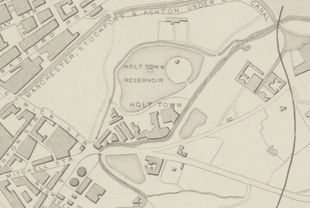
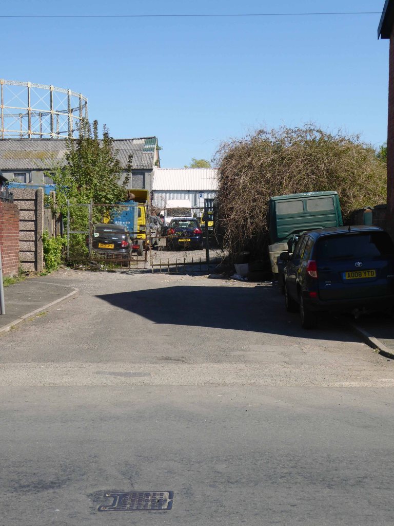
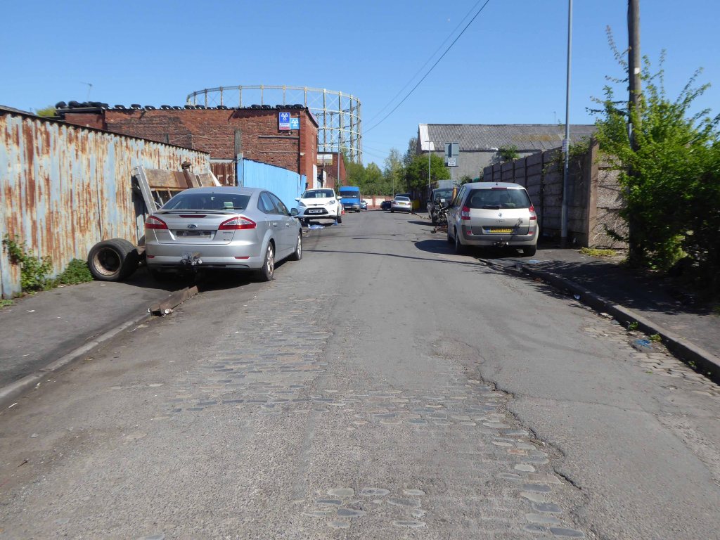
The area was my playground. Holt Town was always a but scary, there were old factories along the opposite side with wartime helmets in. A scrap yard under the arch. I remember sucking up mercury off the floor with a straw obviously from a spillage, no thoughts of danger, I’m alright now. The Seven Wonders, as we knew it, River, canal, railway, road, waterfall all crossing each other, not sure why? A fantastic industrial area to grow up in. The Don Cinema at the top corner at Mitchell Street and Ashton New Road.
I could go on.
Philip Gregson
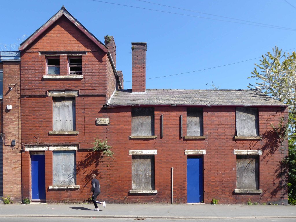
Time’s up for the tiny urban cowboys.
Let’s see what’s going on.
Former football fieldUpper Cyrus StreetLind StreetUpper Helena StreetPollard StreetLanstead DriveCyrus StreetSt Annes SchoolCyrus StreetDevil’s StepsRiver Medlock
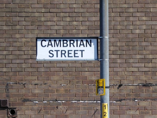
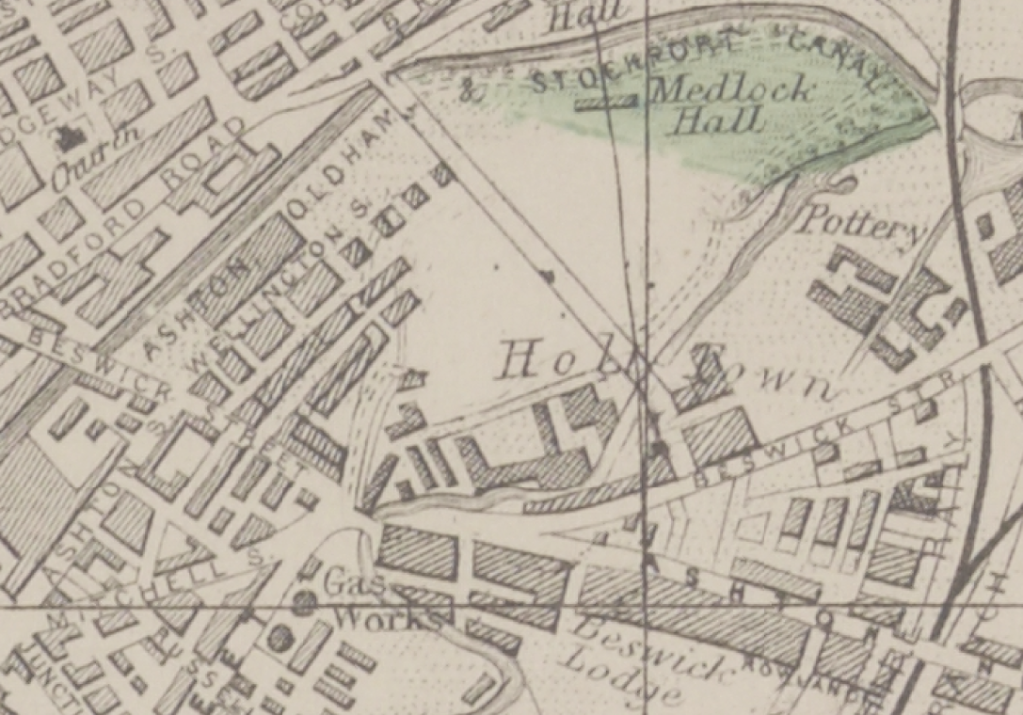
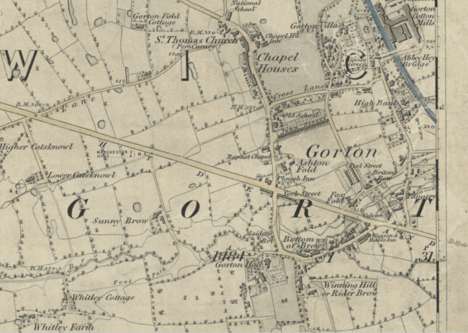
We are travelling backwards and forwards in time – firstly back to 1845 when the street was yet to be built, before the Industrial Revolution created the need for workers’ homes, to house the workers from the newly built workplaces, which also did not yet exist.
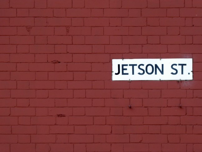
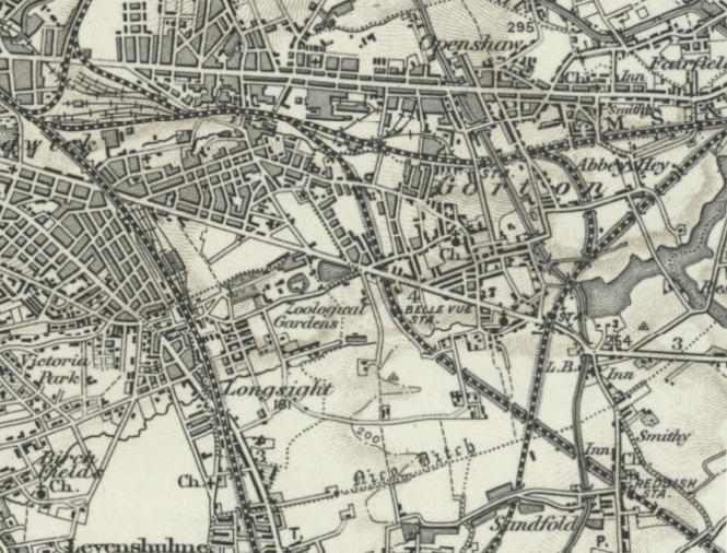
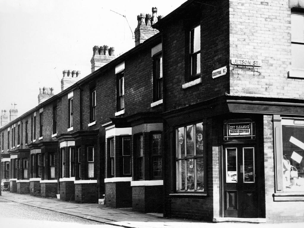
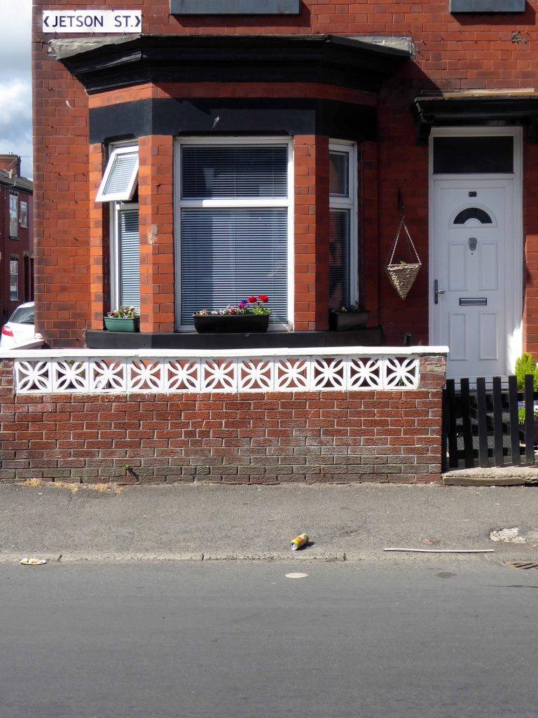
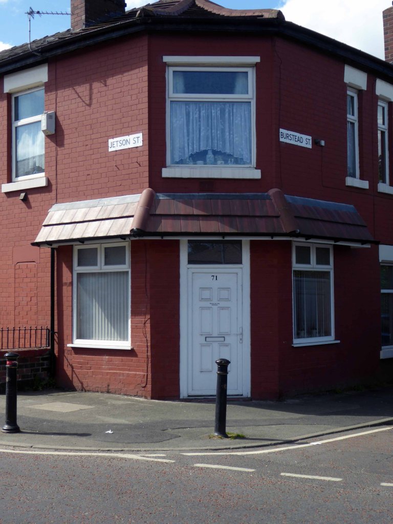
A little further forward to 1896 when Jetson Street has emerged fully formed from the fields, along with rail, road, amusement and industry.
1896
Fast forward to today and it’s all almost still there – though most of the work and the majority of the amusement has evaporated into a cloud of post-industrial, Neo-Liberal economic stagflation.
So why am I here – fast forward to the fictional future!
As a kid I watched as the Jet Age emerged before my very square eyes, giving the street a certain cosmic charm – I was curious.
I have searched online – this seems to be the one and only Jetson Street in the whole wide world – I searched online for its origins.
The name Jetson means Son Of Jet and is of American origin.
Which quite frankly seems unreasonably glib.
The name Jetson is from the ancient Anglo-Saxon culture of the Britain and comes from the names Judd and Jutt, which are pet forms of the personal name Jordan. These names are derived from Jurd, a common abbreviation of Jordan, and feature the common interchange of voiced and voiceless final consonants.
The surname Jetson was first found in Hertfordshire where they held a family seat from very ancient times, some say well before the Norman Conquest and the arrival of Duke William at Hastings in 1066 A.D.
Which quite frankly seems unreasonably obscure.
Let’s jet back to 1964.
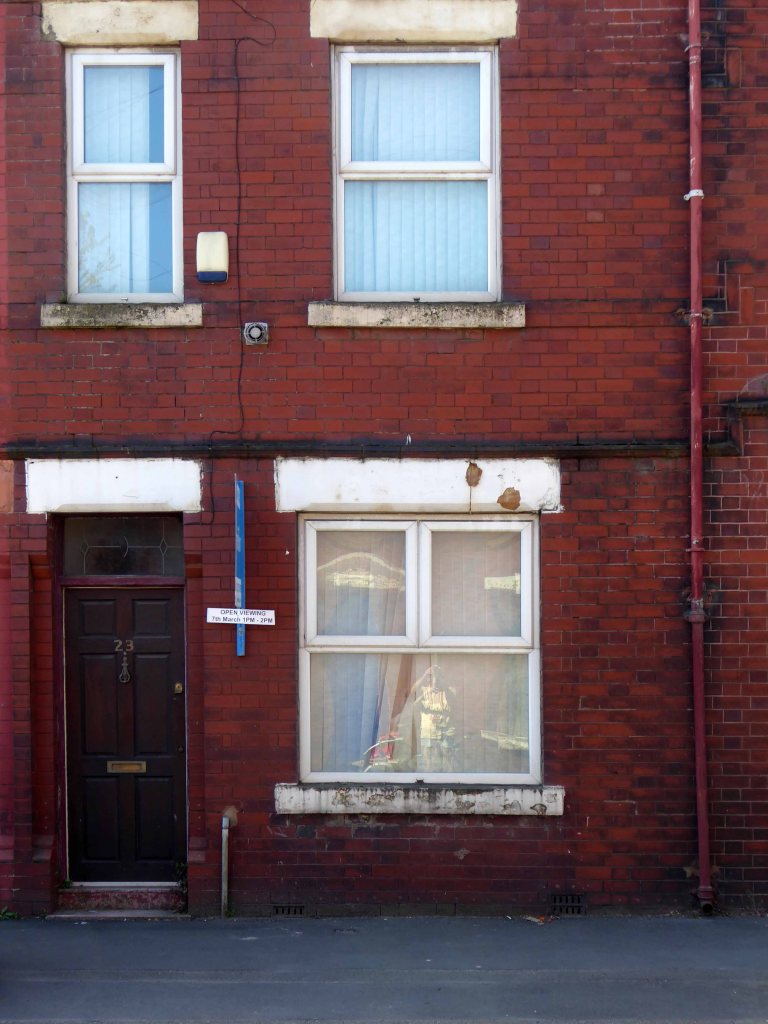
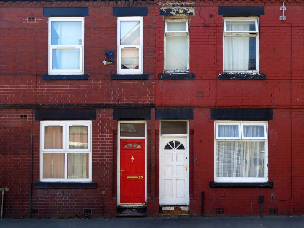
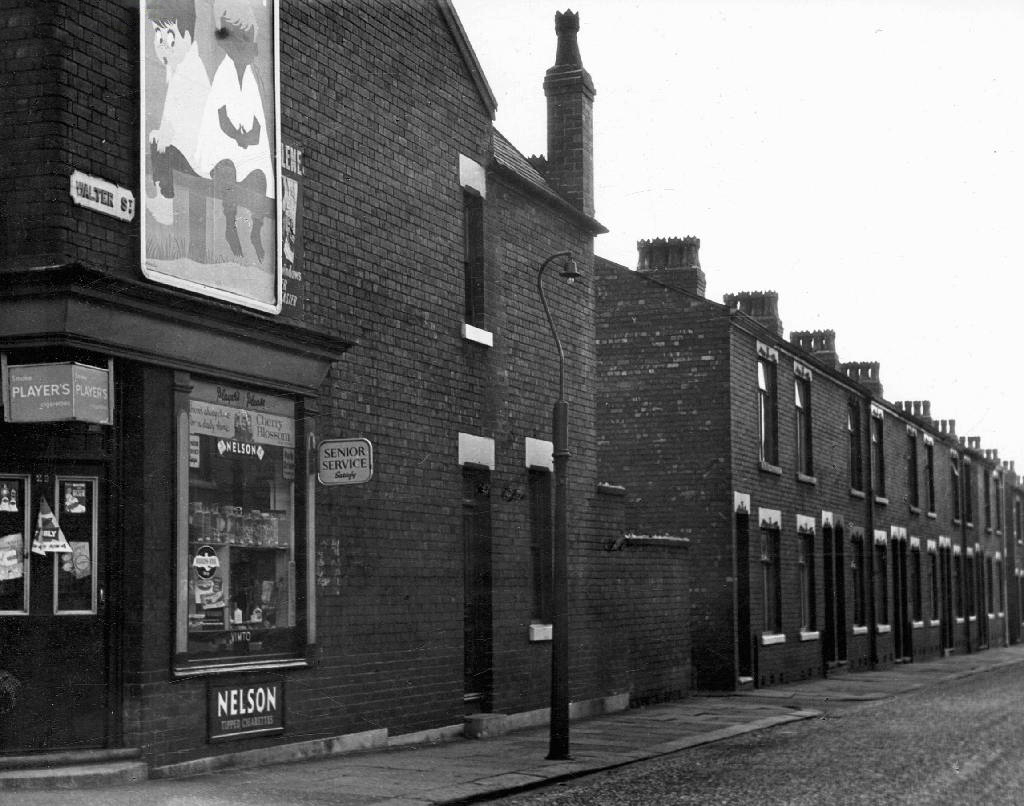
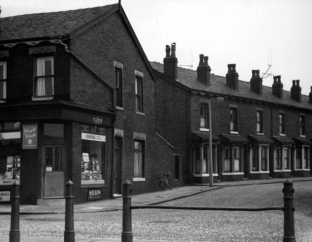
T Brooks wandered these streets taking thousands of photographs for the Manchester Corporation, possibly the housing or highways departments – they all still exist here on the Local Image Collection.
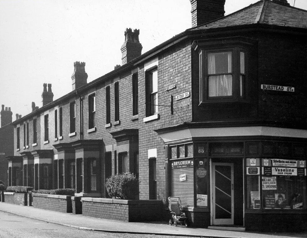
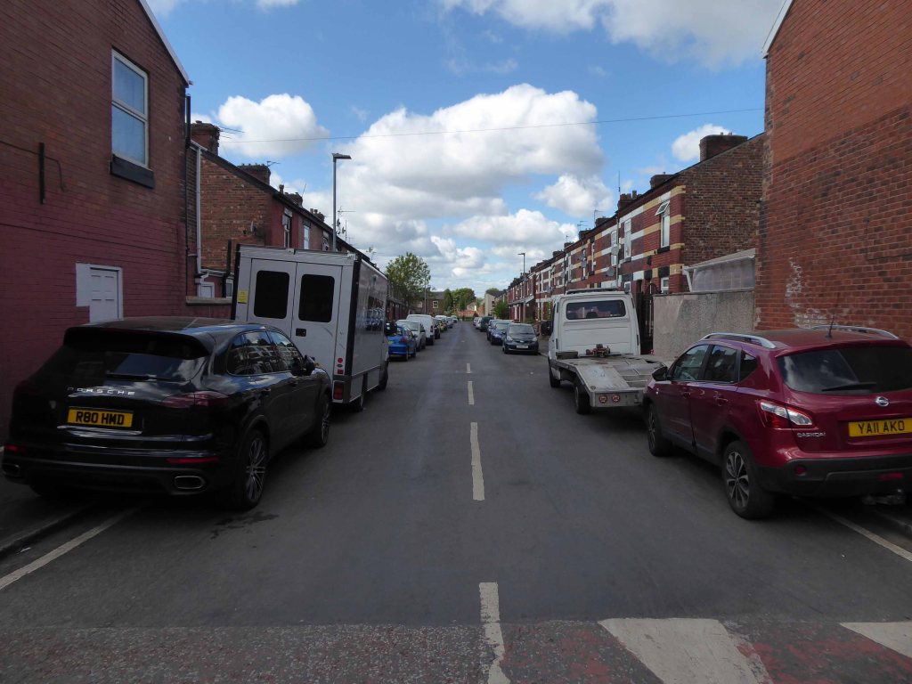
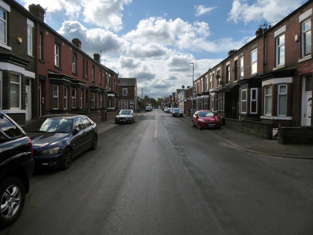
This was a world of corner shops on ever corner, settled communities full-employment, neatly ordered rows of sturdy brick-built homes.
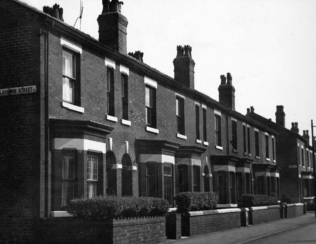
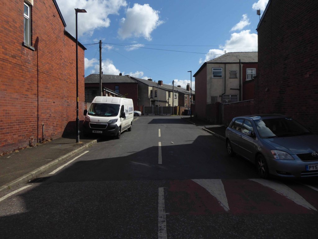
I follow in his hallowed footsteps, what if anything remains of this world – fast forward to 2015 my first fleeting visit.
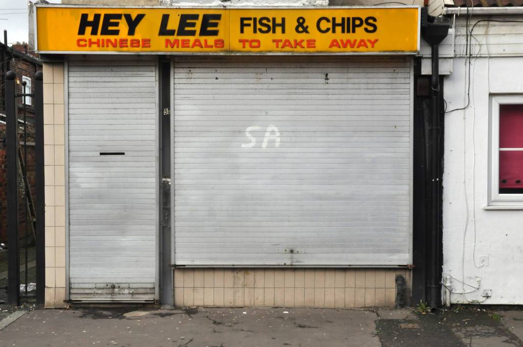
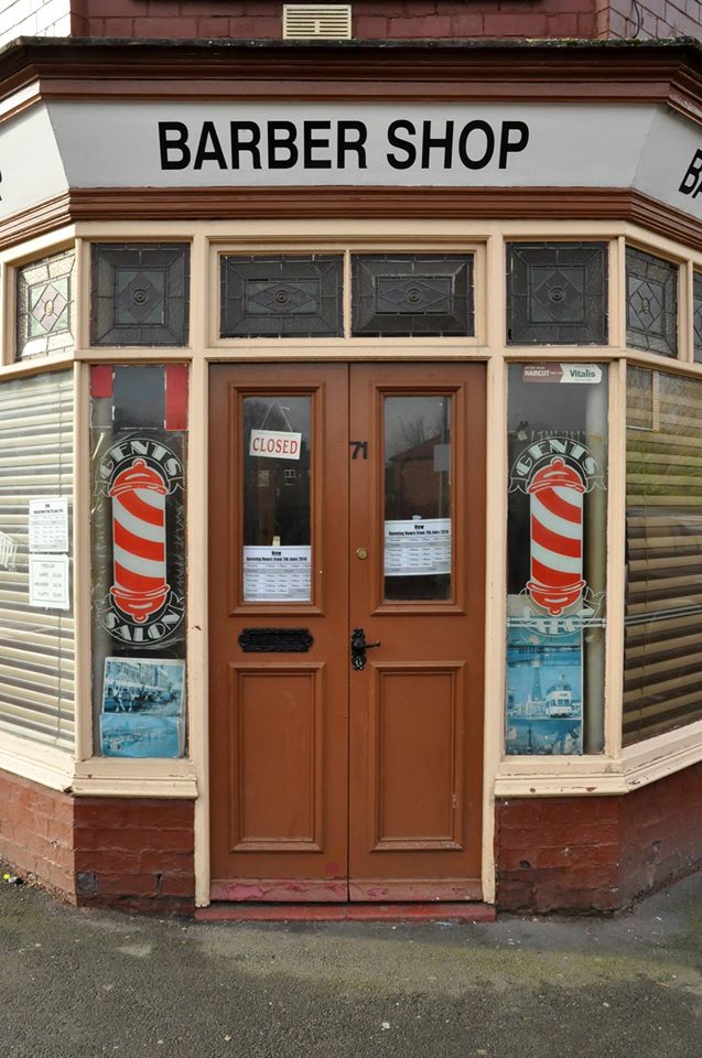
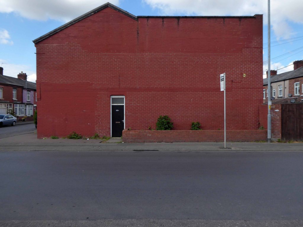
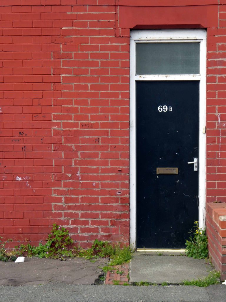
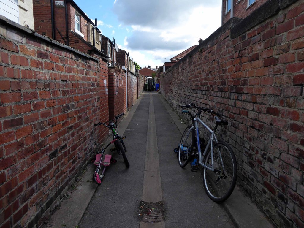
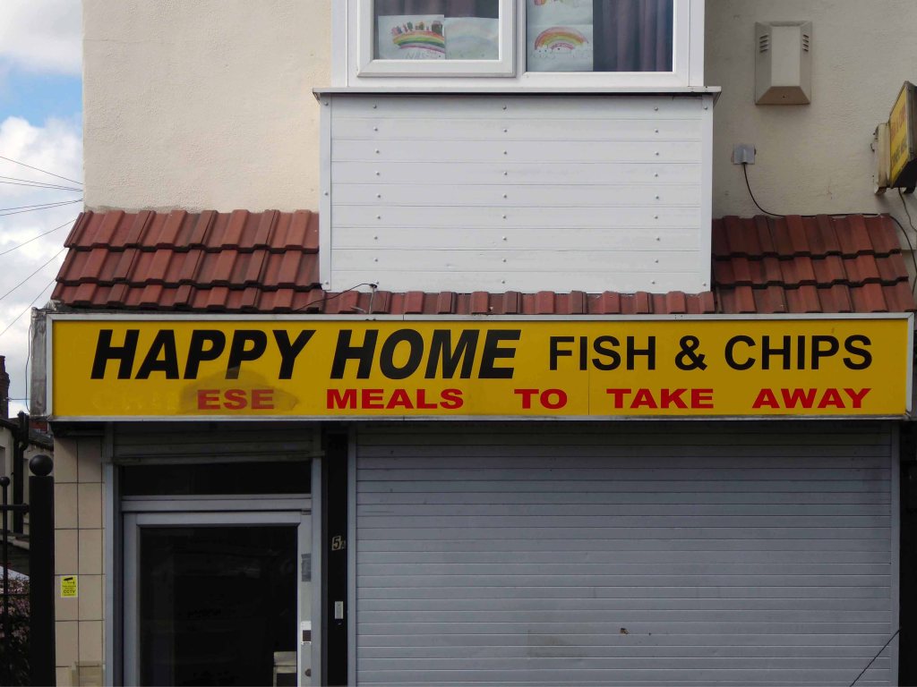
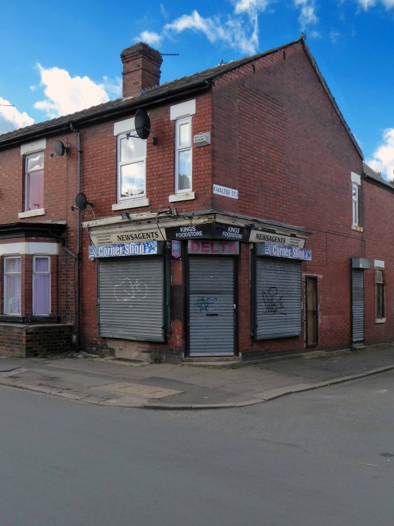
Now trading as Happy HomeA barber shop no more
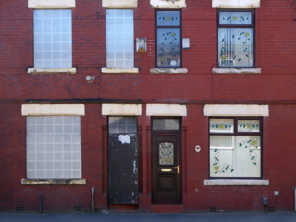
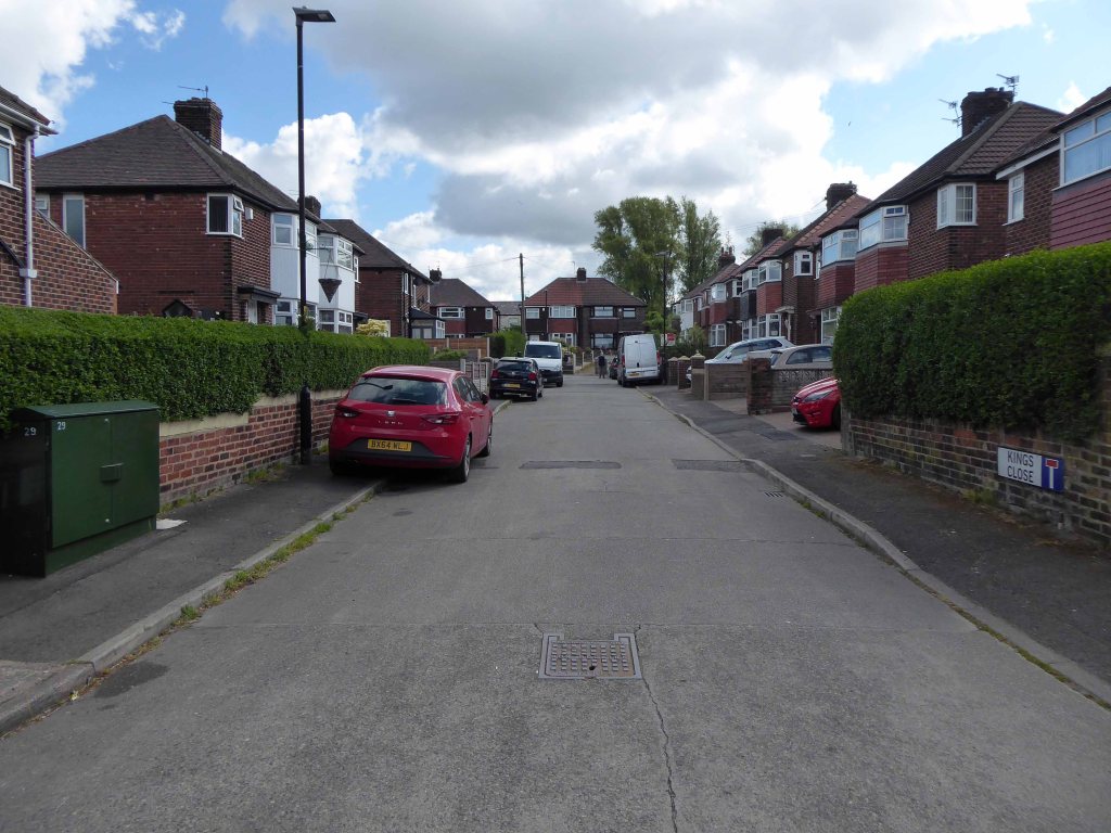
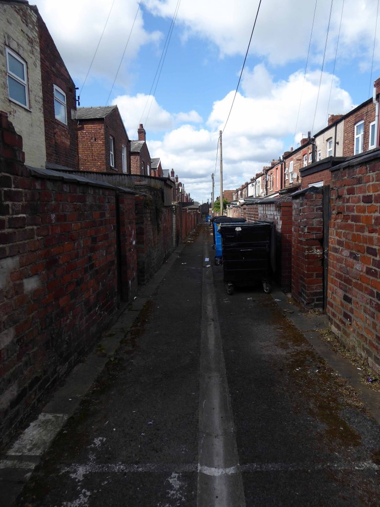
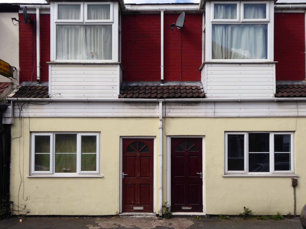
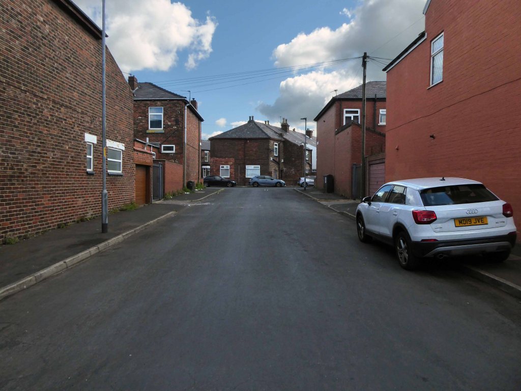
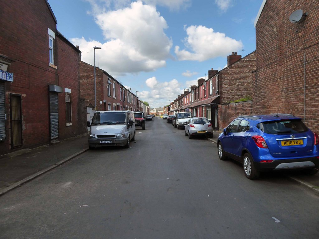
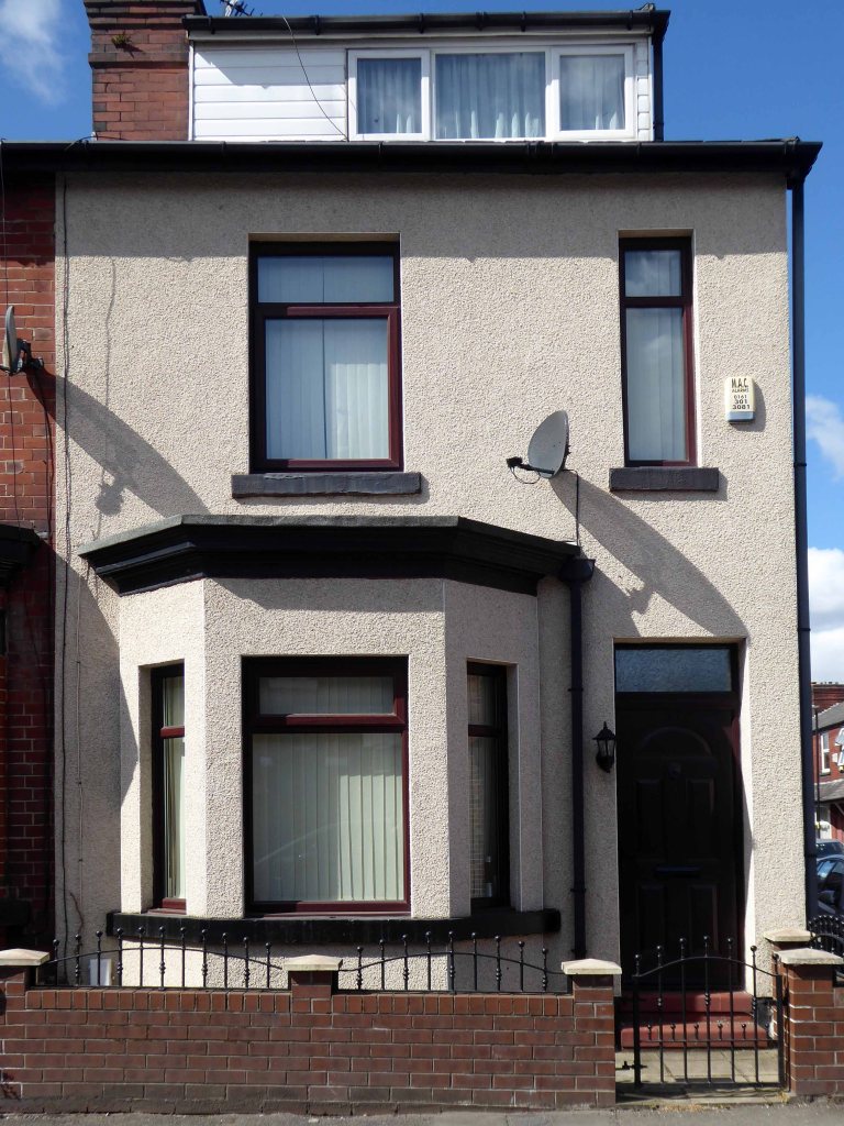
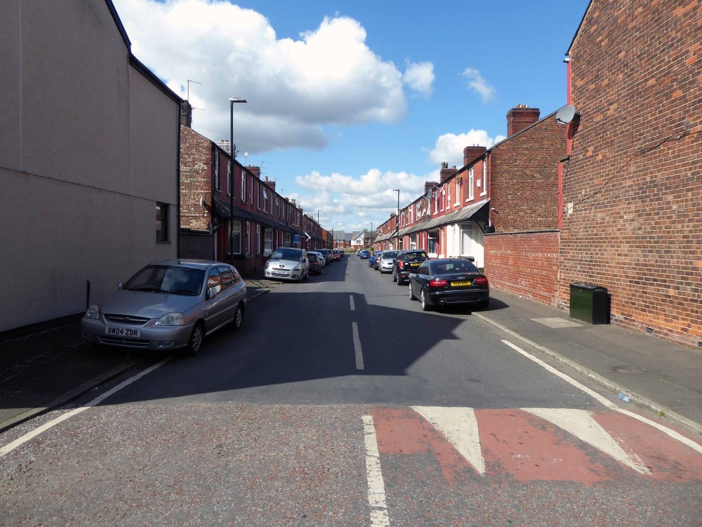
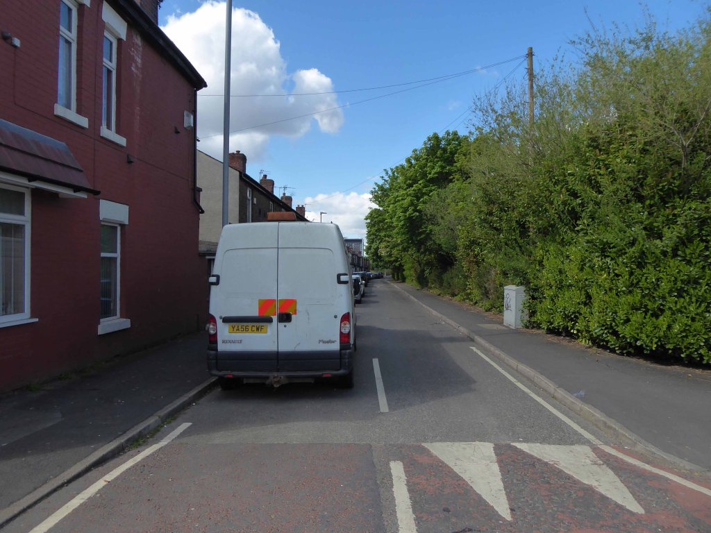
The area now has a richer racial mix – having recently become home to many African and Eastern European families. The architectural consistency of the houses has been swamped by render, window frame replacement, addition and extension, and the arrival of a plethora of motor cars. The majority of shops now long gone, as the once pedestrian community spread their retail wings and wheels elsewhere.
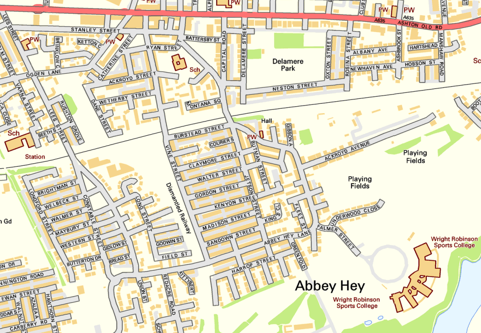
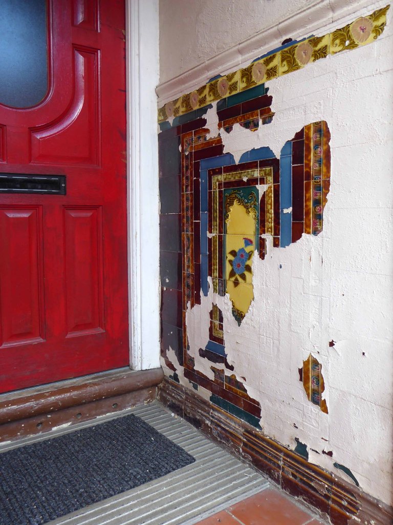
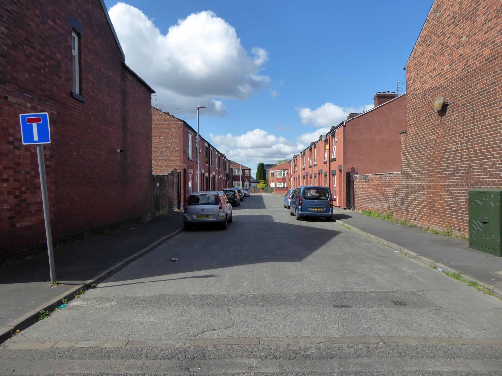
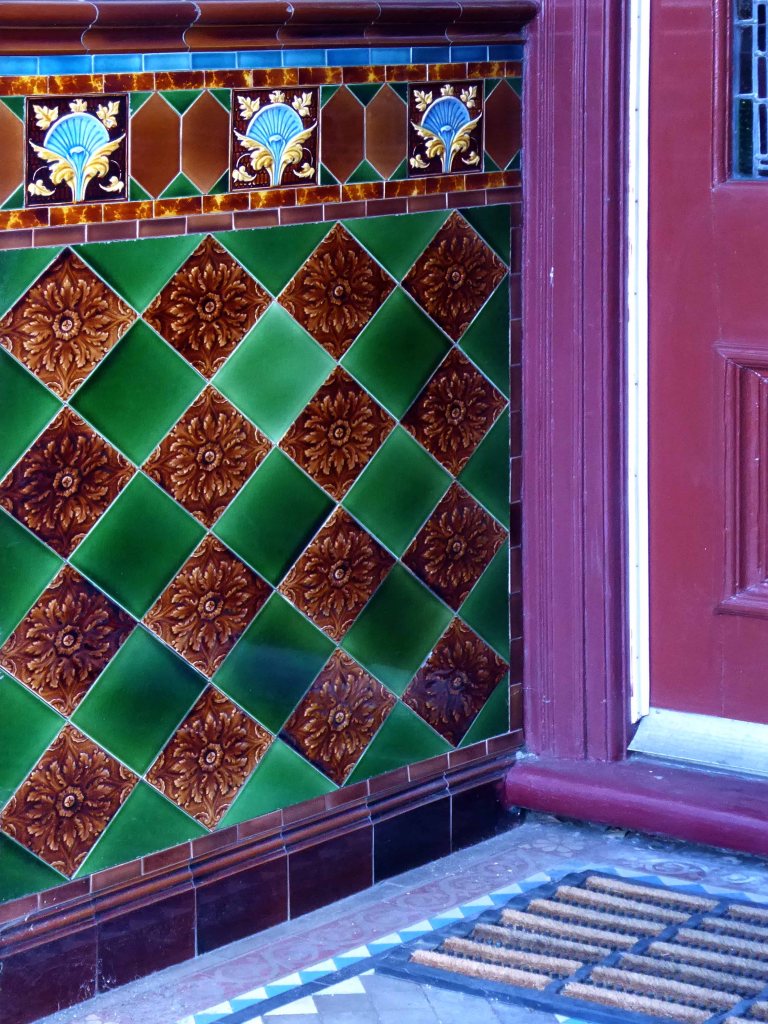
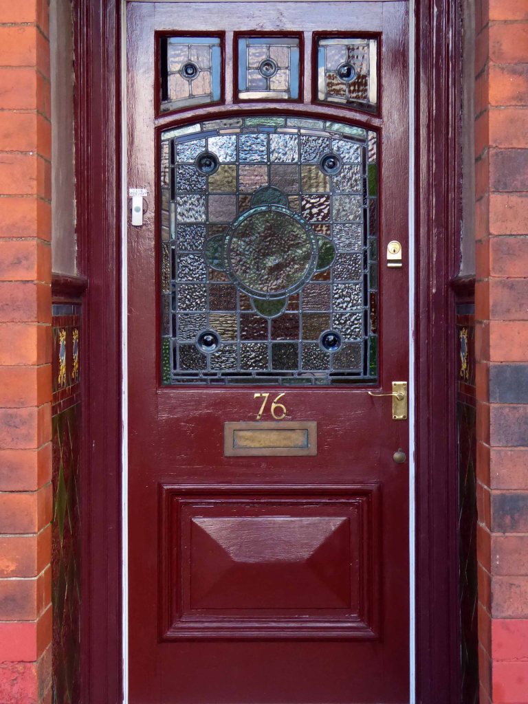
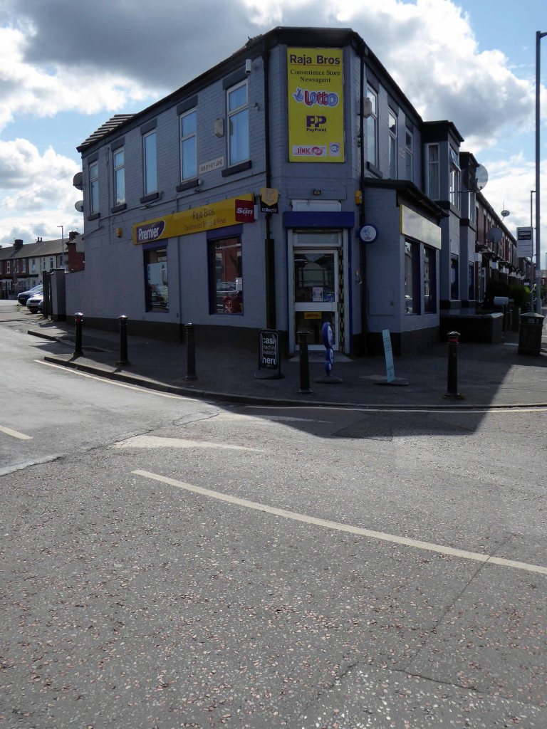
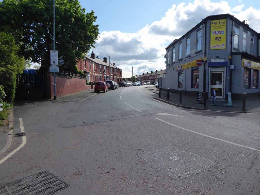
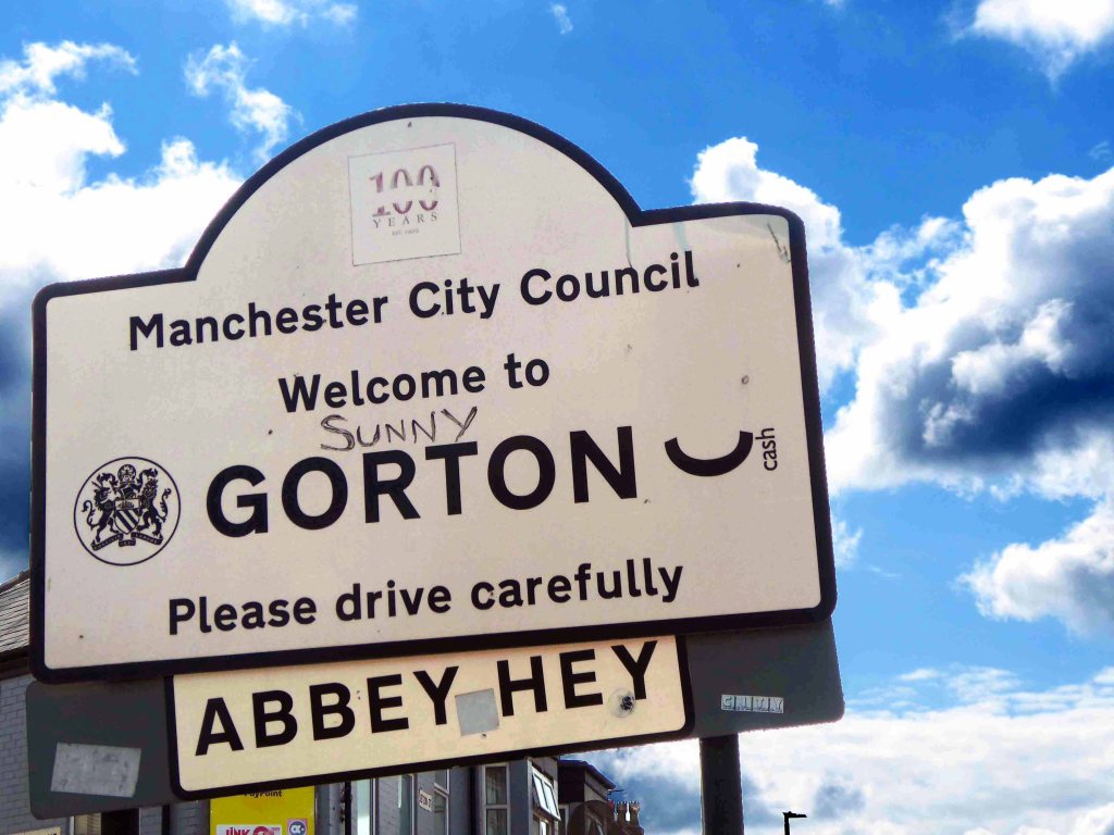
Jetson Street – NorthSandown StreetKings CloseMadison StreetKenyon StreetKenyon StreetSign of the timesGordon StreetJetson Street – NorthJetson Street – SouthWalter StreetWalter StreetClaymore StreetClaymore StreetCourier StreetThe only remaining front doors and tiled porch every other having been given over to the allure of uPVC and the enclosed doorwayMy on street correspondent congratulated the Raja Brothers on the sound service they had provided during these difficult times.Where the barbers wasBurstead StreetAbbey Hey Lane
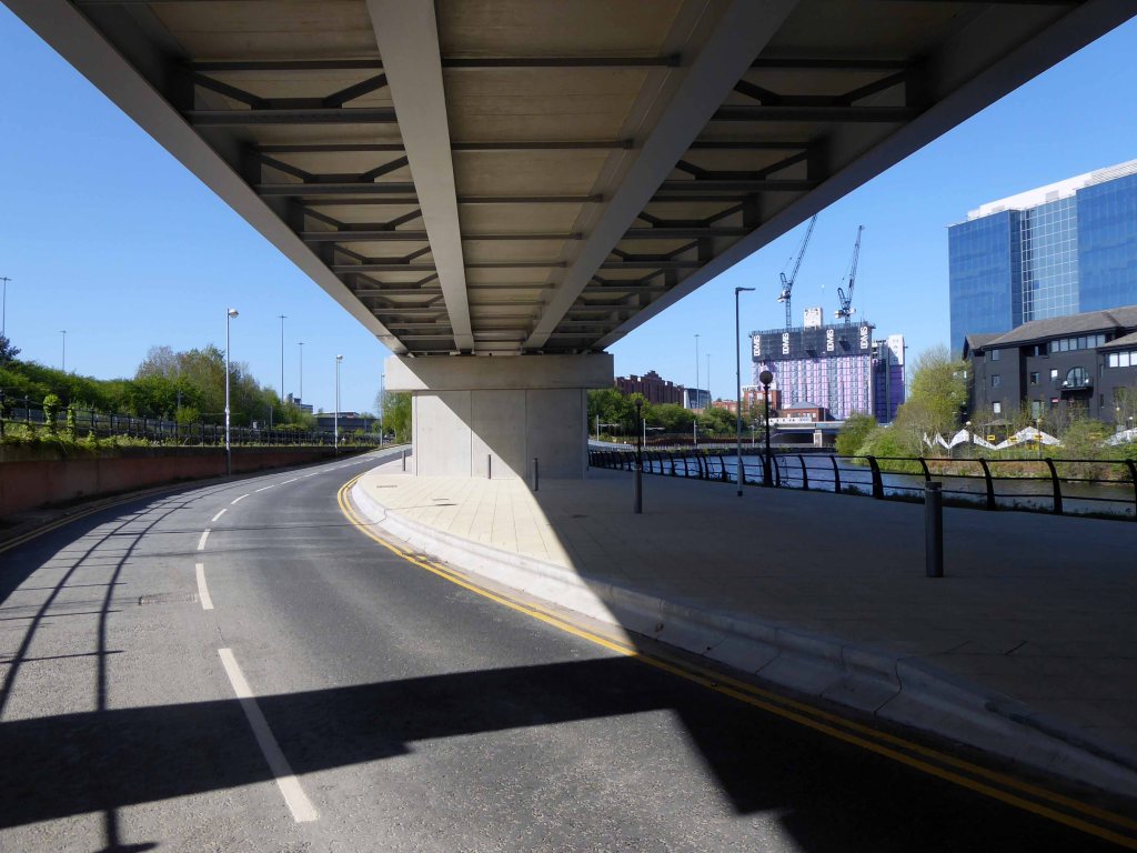
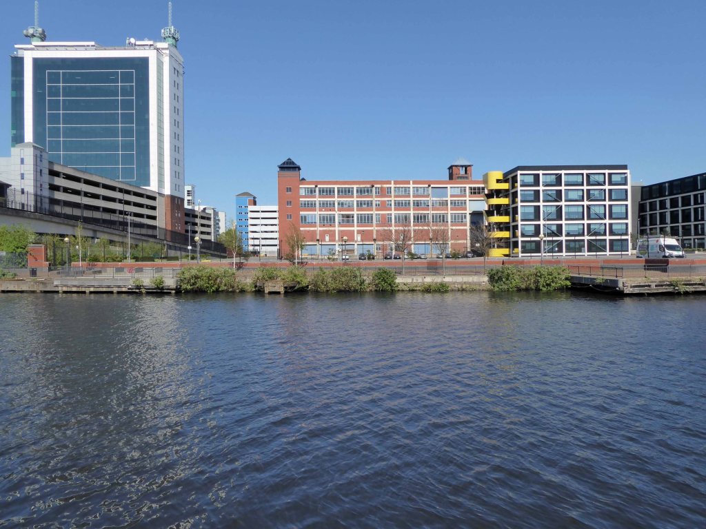
The River Irwell bisects Salford and Manchester, joining the rivers Irk and Medlock, and then turns west toward Irlam, as part of the Manchester Ship Canal. Its course ends just east of Irlam, where it empties into the Mersey.
Urban development is ever so often dependent upon rivers – for sustenance, commerce and amusement. The Irwell and latterly the developments of the canal system has provided all of these in superabundance.
By 1870 the Pomona Gardens is thriving , boasting a concert hall and banqueting suite – further details here from Skyliner.
In the summer of 1887, a nearby chemicals factory exploded, damaging the palace – the area was under threat and destined to rot away to obscurity: the following year the gardens closed forever.
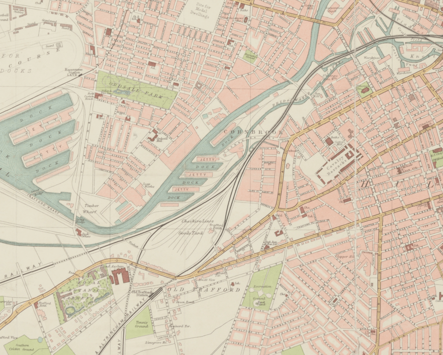
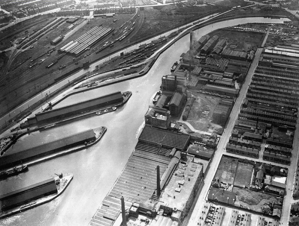
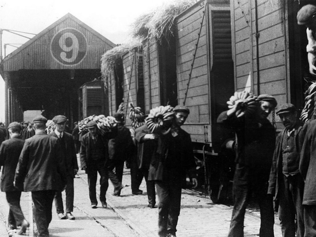
By 1900 the Ship Canal, docks and railways had arrived – Manchester and Salford are at the centre of an unprecedented growth in manufacture and trade.
189119231950
During the 1970’s the docks began a rapid decline, largely due to containerisation. The increasing size of freight-carrying ships meant they could no longer navigate the ship canal and this, combined with increased trading with Europe and the east, saw use of Manchester Docks decrease. In 1982 the remaining docks closed and the area became derelict. Recognising the need to redevelop the area, Salford City Council purchased the docks in 1984 using a derelict land grant. The Salford Quays Development Plan was adopted in May 1985, proposing complete reclamation and development of the area for commercial, residential and leisure use.
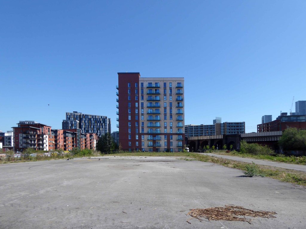
Manchester and Salford begin the long haul from post industrial decline to service centred cities – there were even seeds sewn for the development of a luxury marina. When I first visited Pomona the area was seriously overgrown and the underground wiring stripped out.
201020102020
Remnant of the initial scheme – pedestrian access, balustrade and lighting.
What would poor old Pomona make of all this?
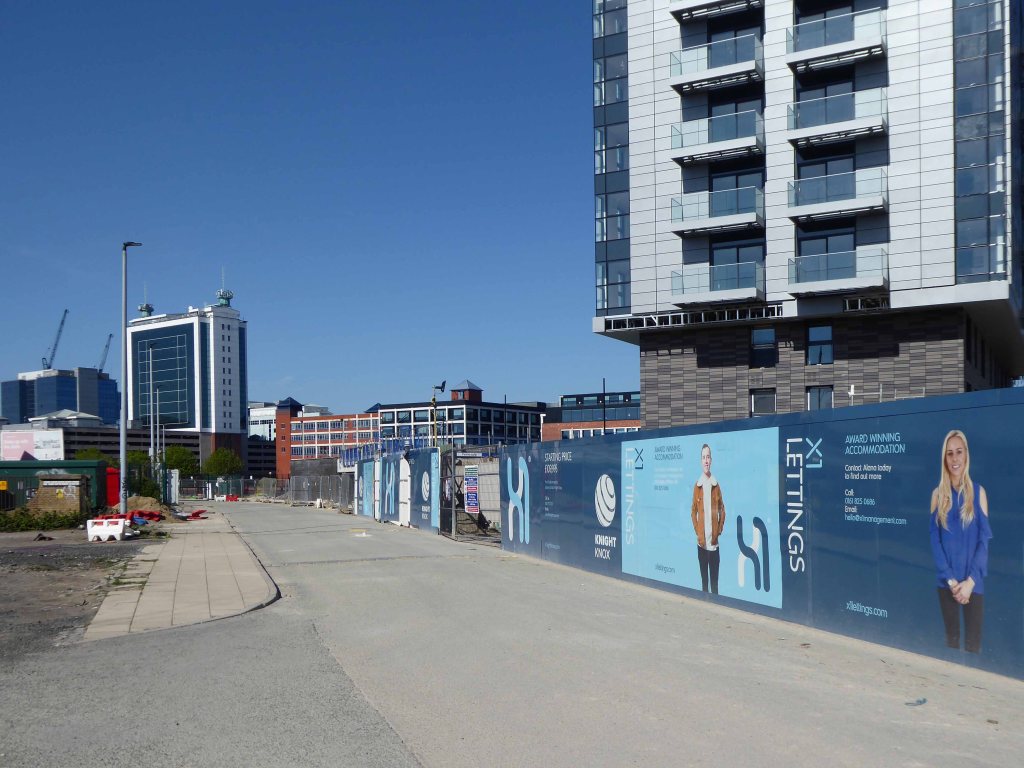
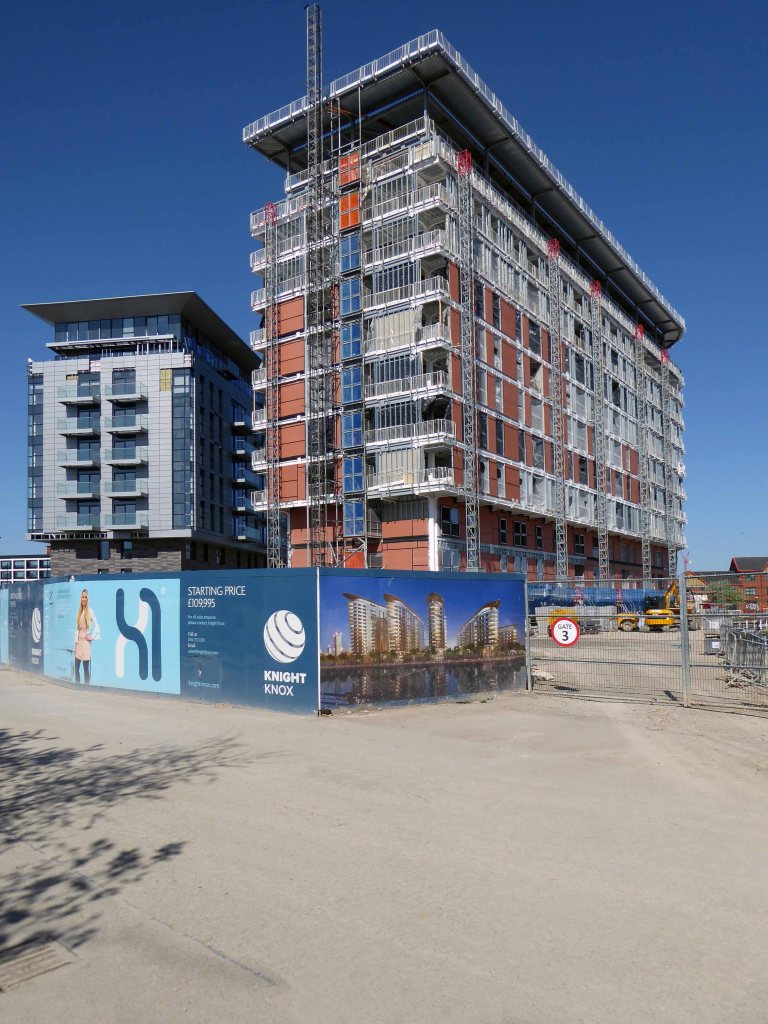
There was a failed attempt to prevent further development and return the area to nature. Peel Holdings prevailed and pressed on relentlessly with their programme of urbanisation.
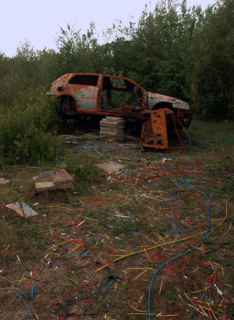
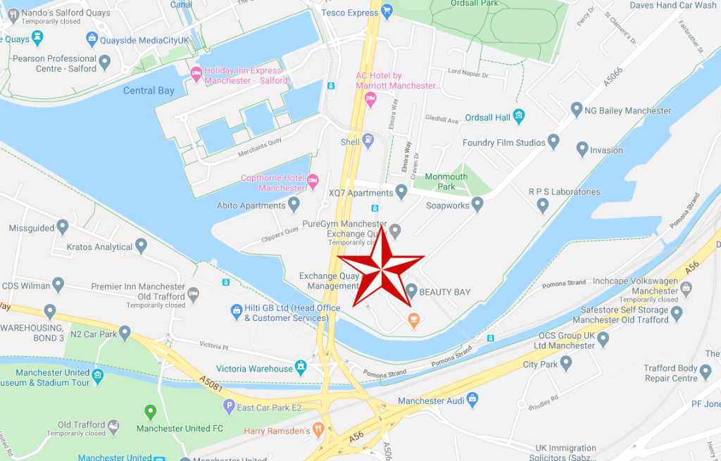
So it’s April 2020 – I’m on my way from somewhere else to somewhere else, I’ll cut across Pomona Island – the building site is in lockdown – ain’t nobody home.
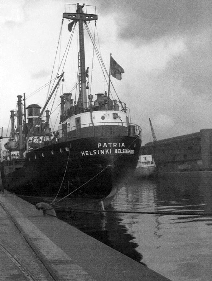
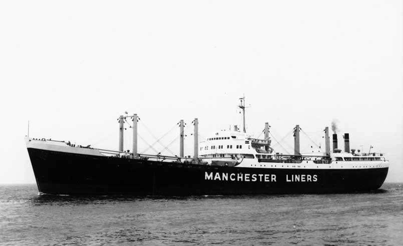
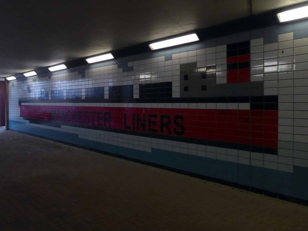
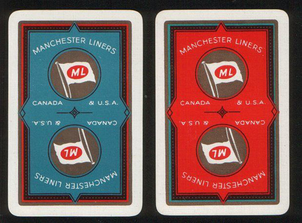
In 1898 Manchester Liners Ltd was launched, four second hand ships were purchased and the company naming policy of applying the prefix Manchester was established.
The company began to operate services to Canada and the USA. Manchester Liners started WW1 with 15 ships in its fleet. During the war 10 ships were lost to enemy action, but because of the purchase of replacements the fleet was at 12 in 1918.At the outbreak of WW2, Manchester Liners had 10 ships in service. War losses were 7 ships, but the delivery of war-standard ships maintained the fleet at 8, which was sufficient to resume a weekly service to Canada.
The Manchester dockworkers strike record became so bad, that in 1973 the company decided to move half of its container services to Felixstowe. Furthermore, to obtain lower costs per unit, container ships were becoming bigger than the Canal limits.
This was a history of economic growth and prosperity, for some. Tangible commerce, the wealth of a nation built on making things, moving things. Cranes, ships, stevedores and sailors, the world and his wife converging at the base of the Manchester Ship Canal.
All this is long gone, containerisation, recession and state engineered shifts in global manufacture and trade.
They took away the cranes.
The area is now awash with intangible activity – what goes on behind the smoked and mirrored glass?
Just who is moving what around, how, where and why?
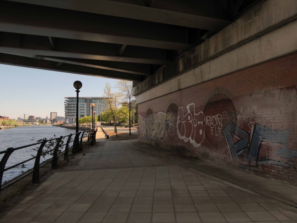
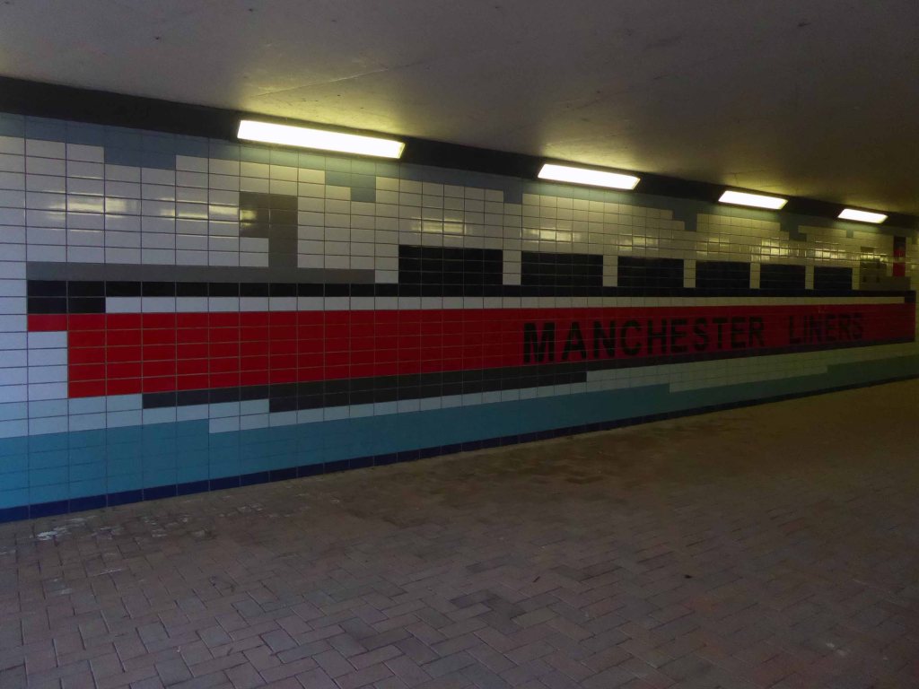
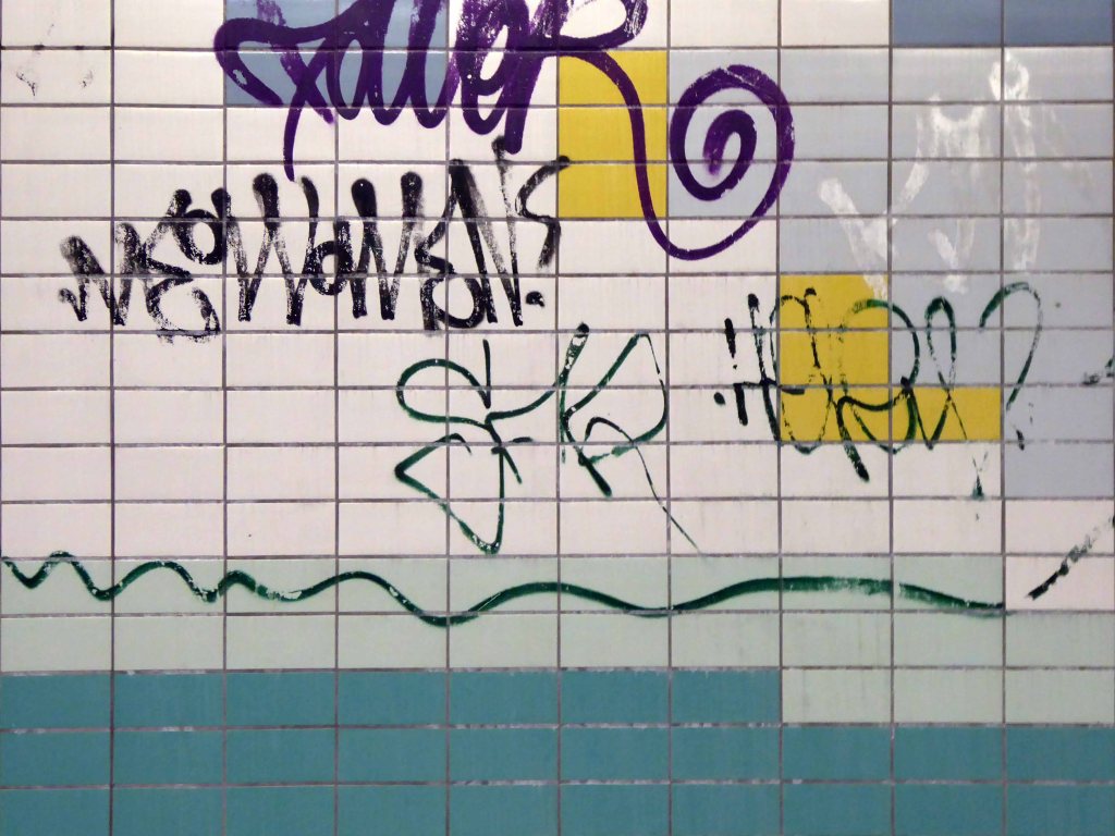
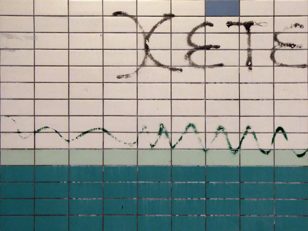
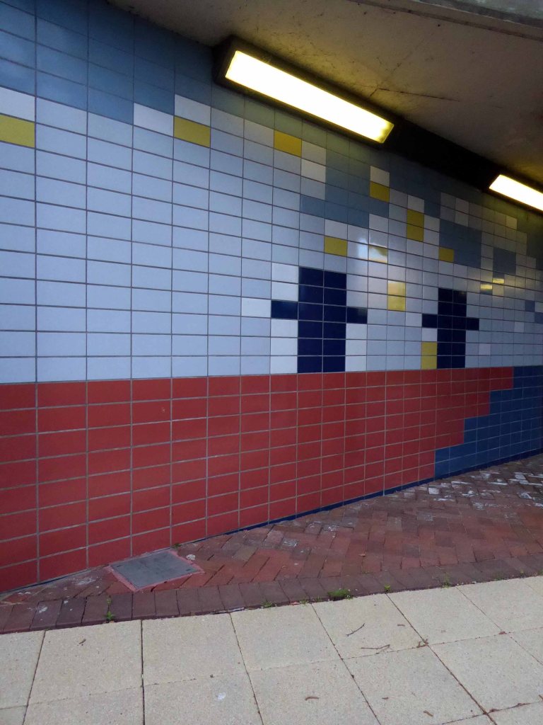
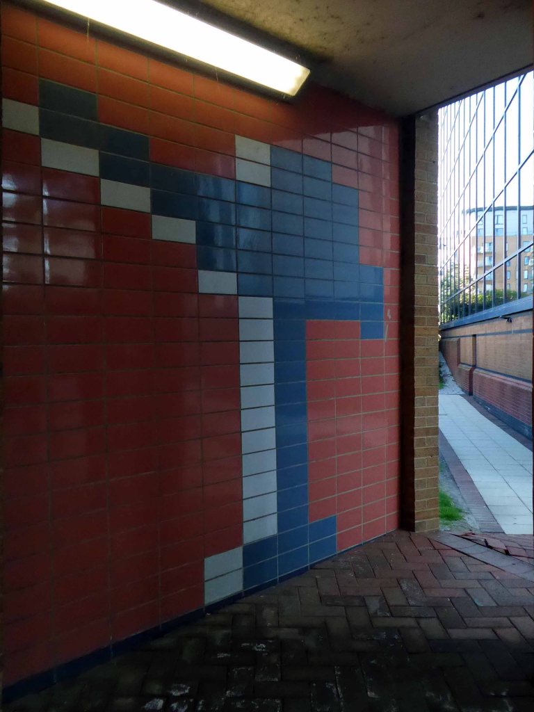
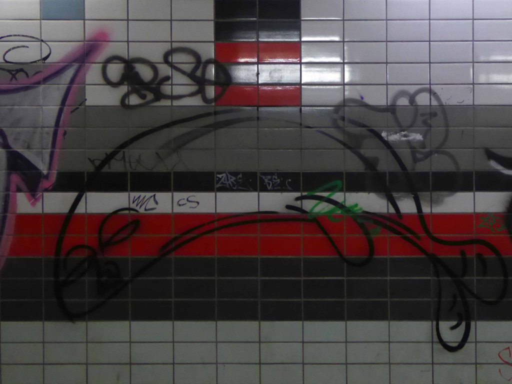
But hidden away between here and there is a tiled underpass.
A permissive path.
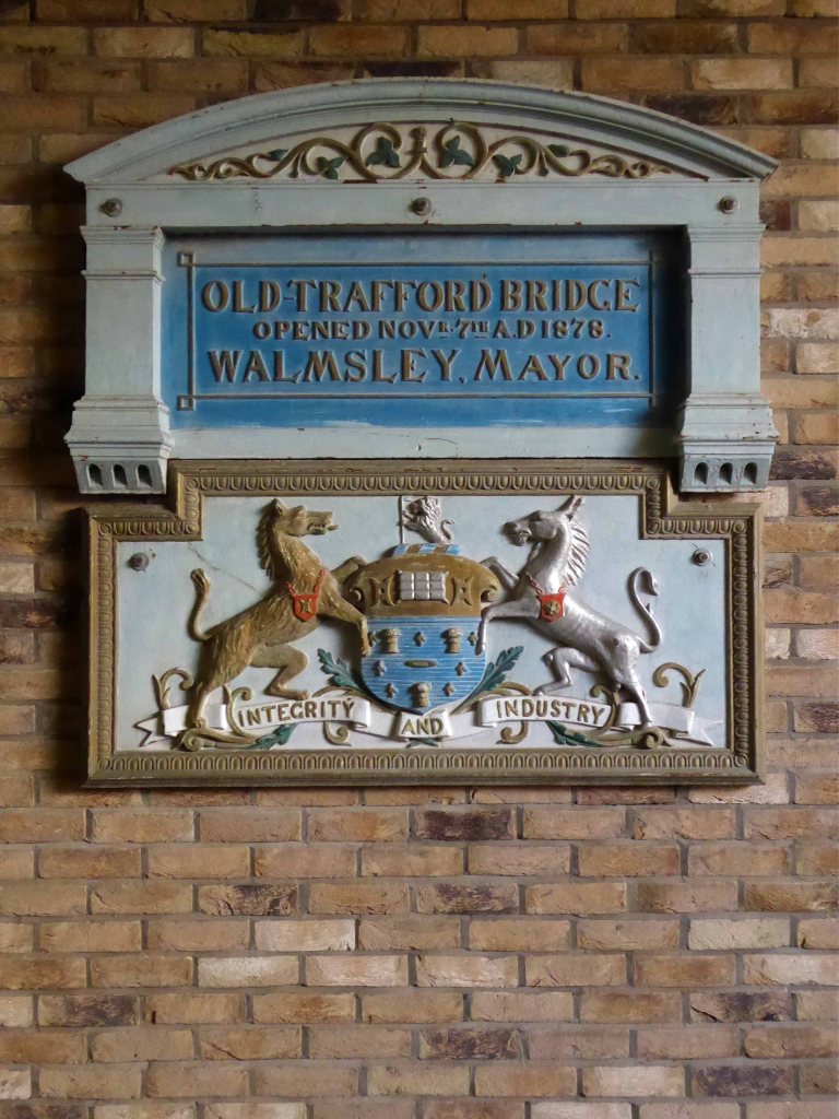
Where once there was a bridge – before the Manchester Ship Canal was built, the course of the River Irwell was approx. 50-100 yards further north of where the Ship Canal now passes under Trafford Road. This plaque is next to a pedestrian tunnel under Trafford Road, roughly on the line of the old navigation.
So here it is a hidden, harshly lit, slightly disabused tribute to the brave souls who sailed the seven seas, stayed ashore, weighed, loaded and shifted stuff.