Time for the train home to Stockport – but you can bet I’ll be back.
And true to my word I have been back, several times – on this occasion alone and on foot.
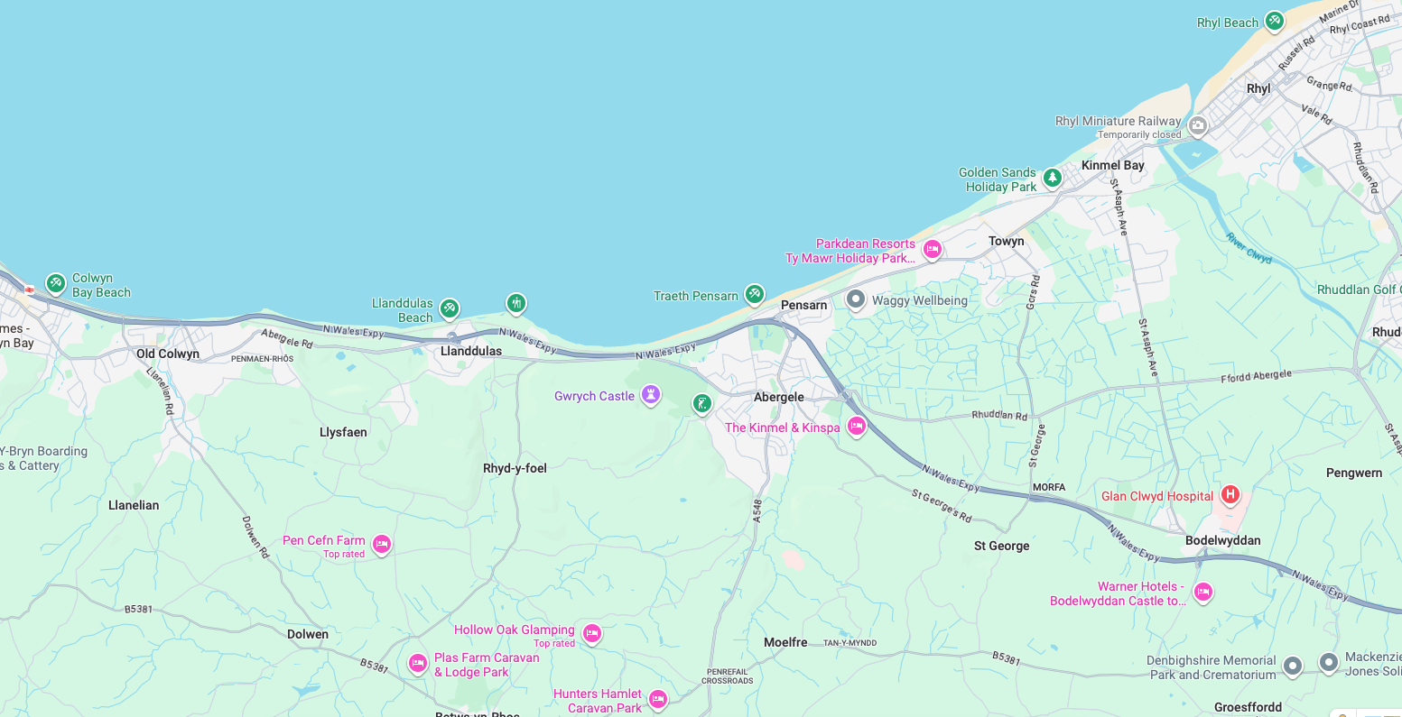
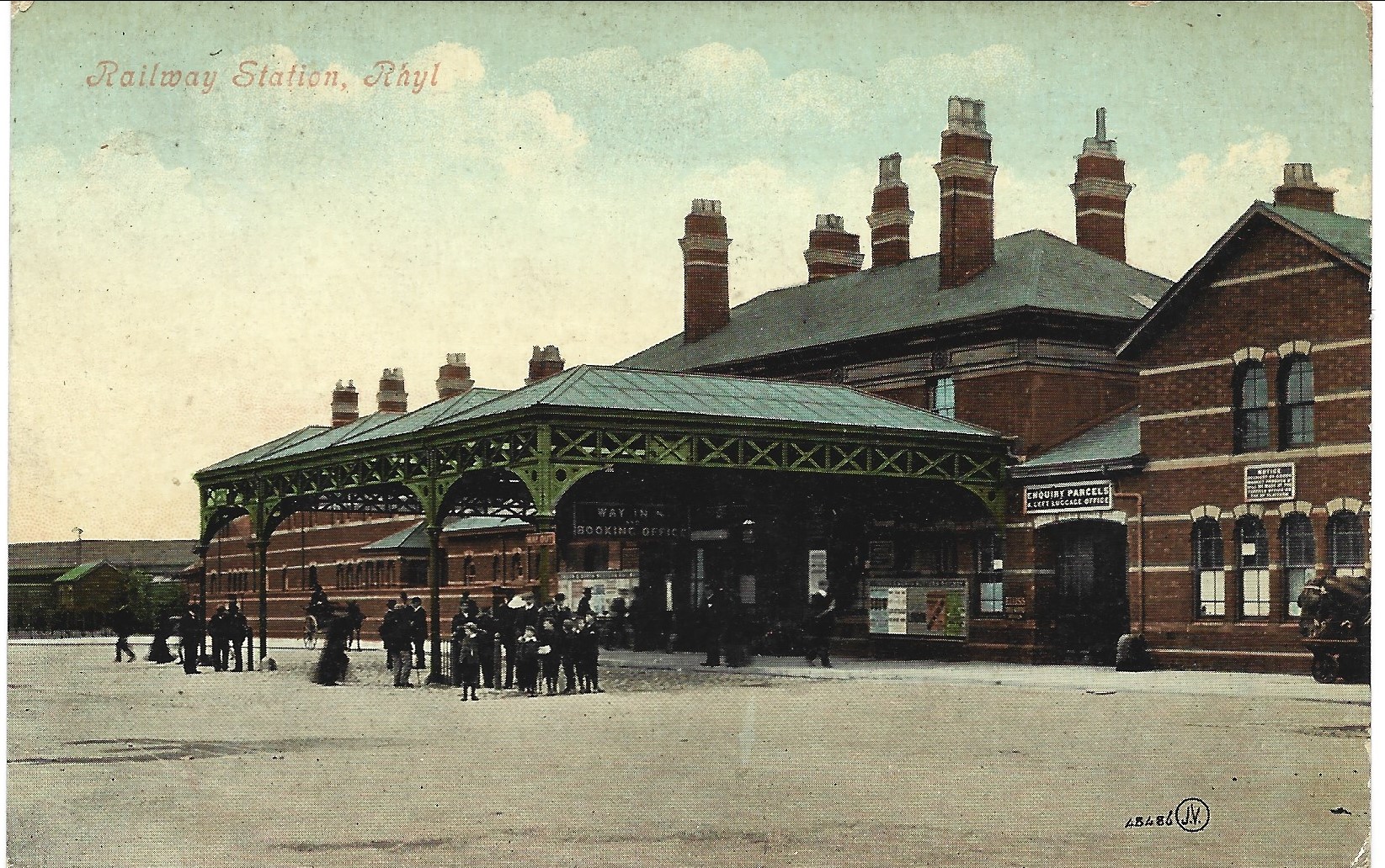
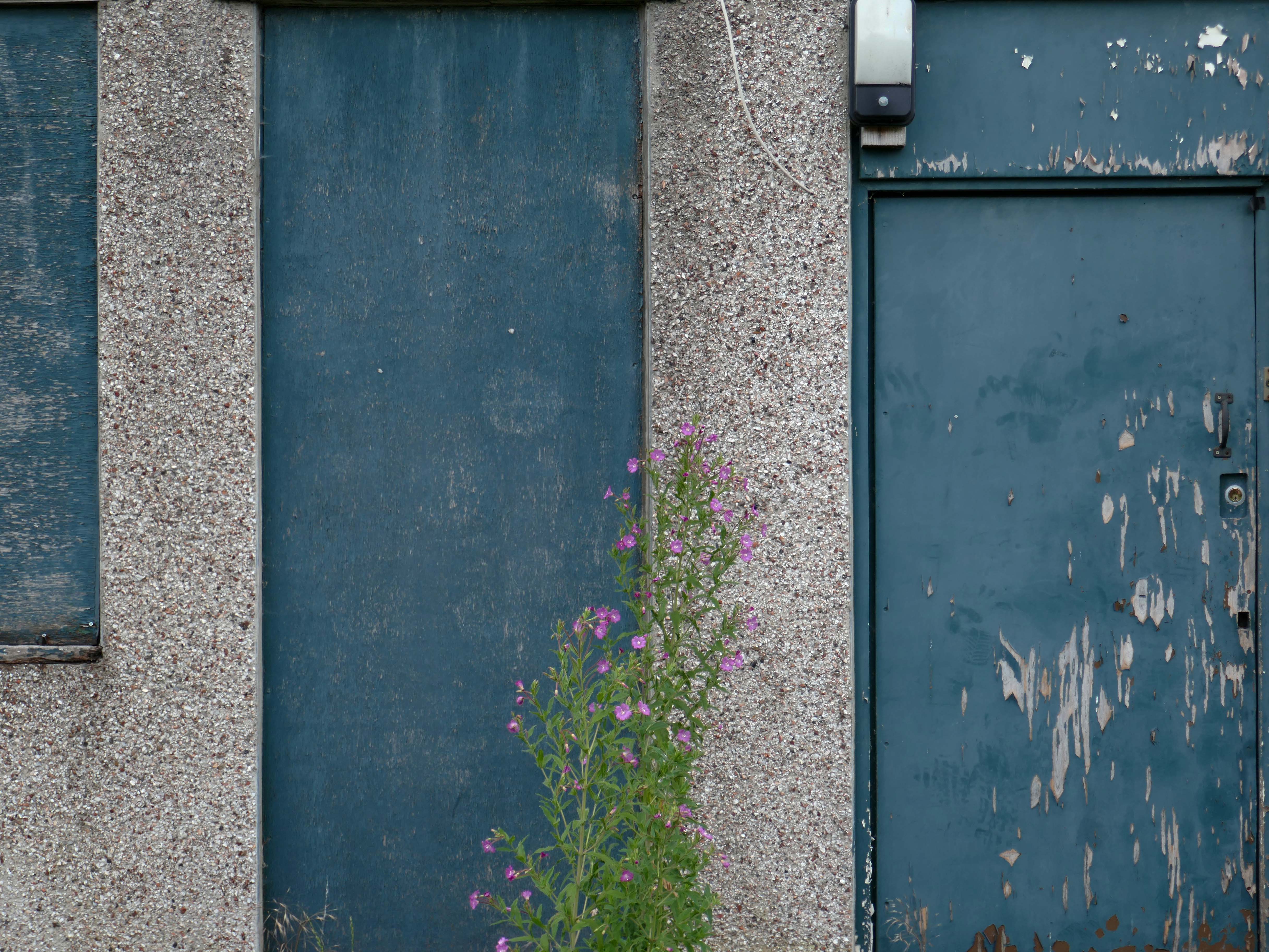
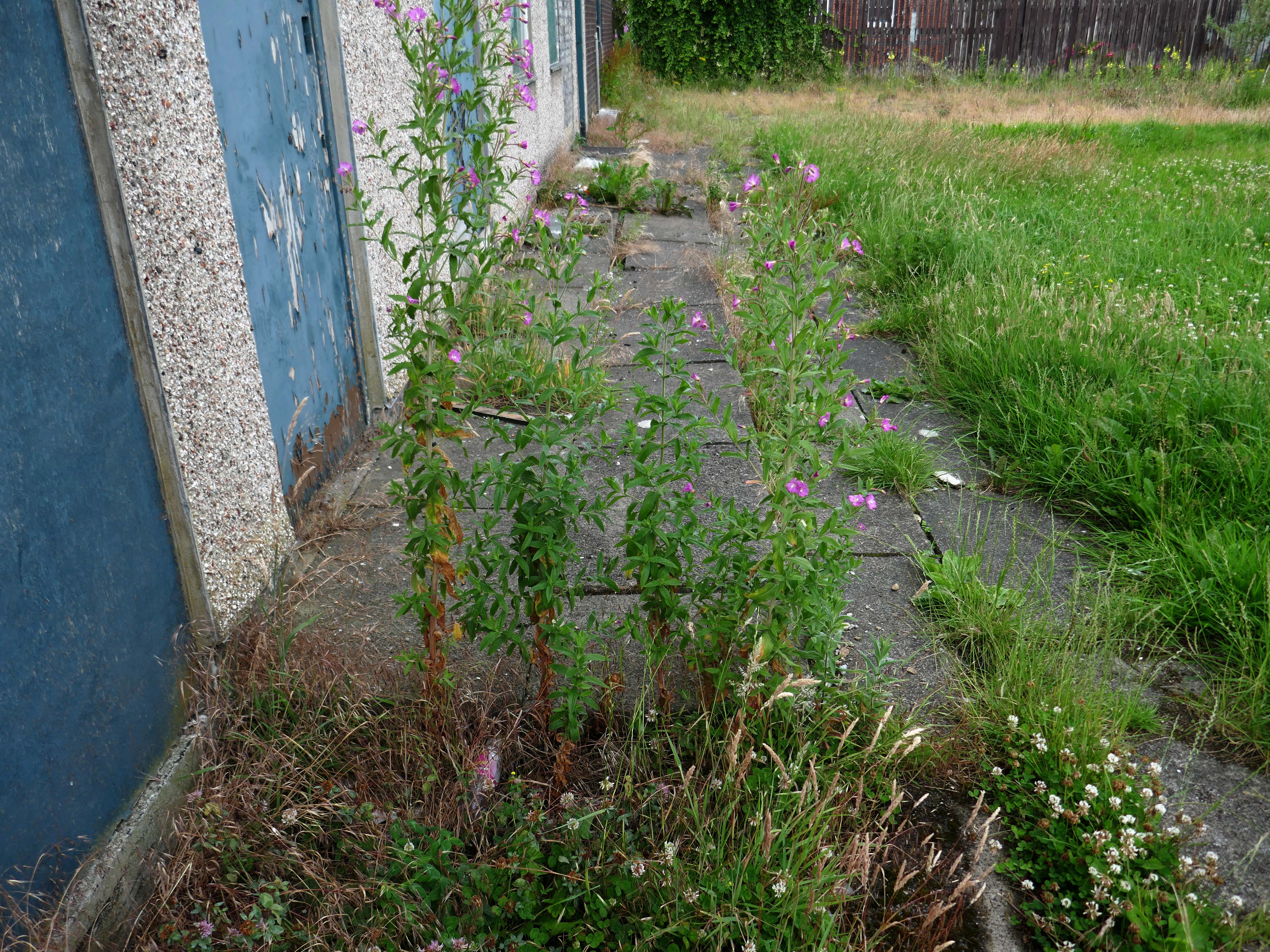
An almost overcast mid-grey day in November, alighting at Rhyl Station and loafing along to Colwyn Bay – this what I done seen.
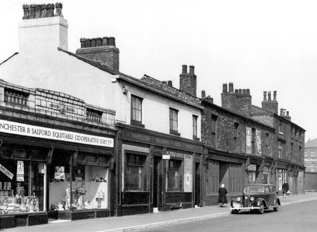
1907
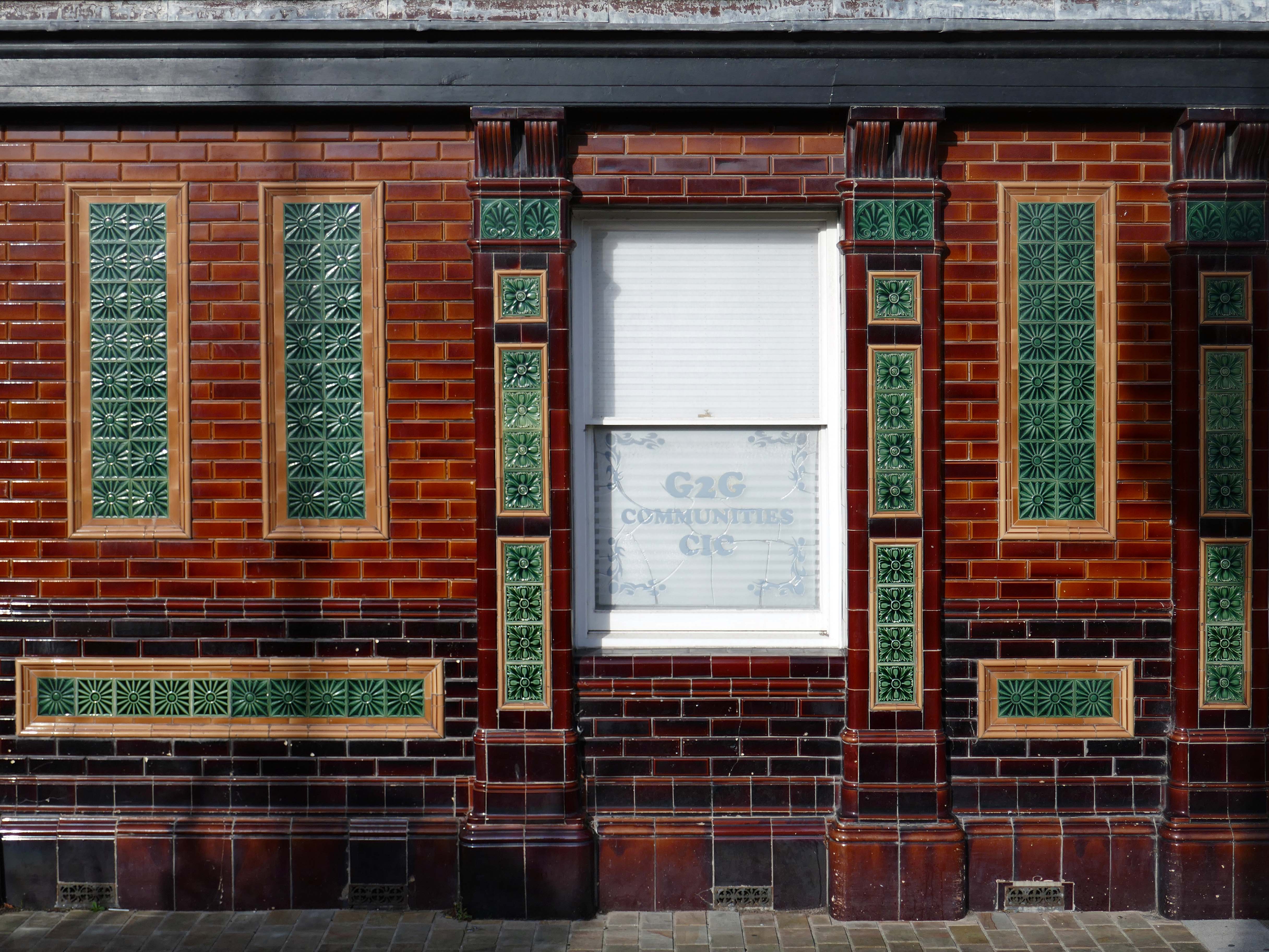
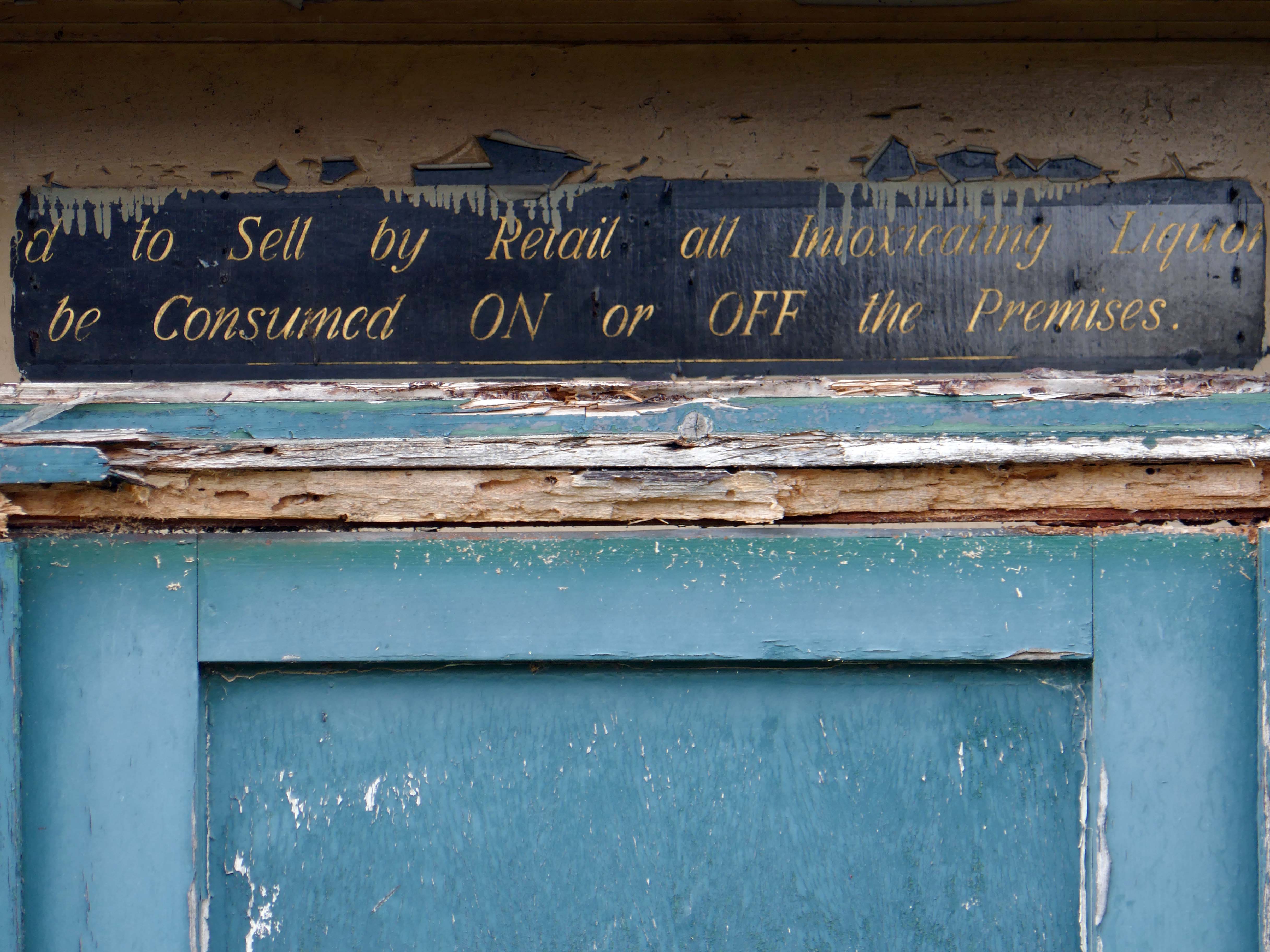
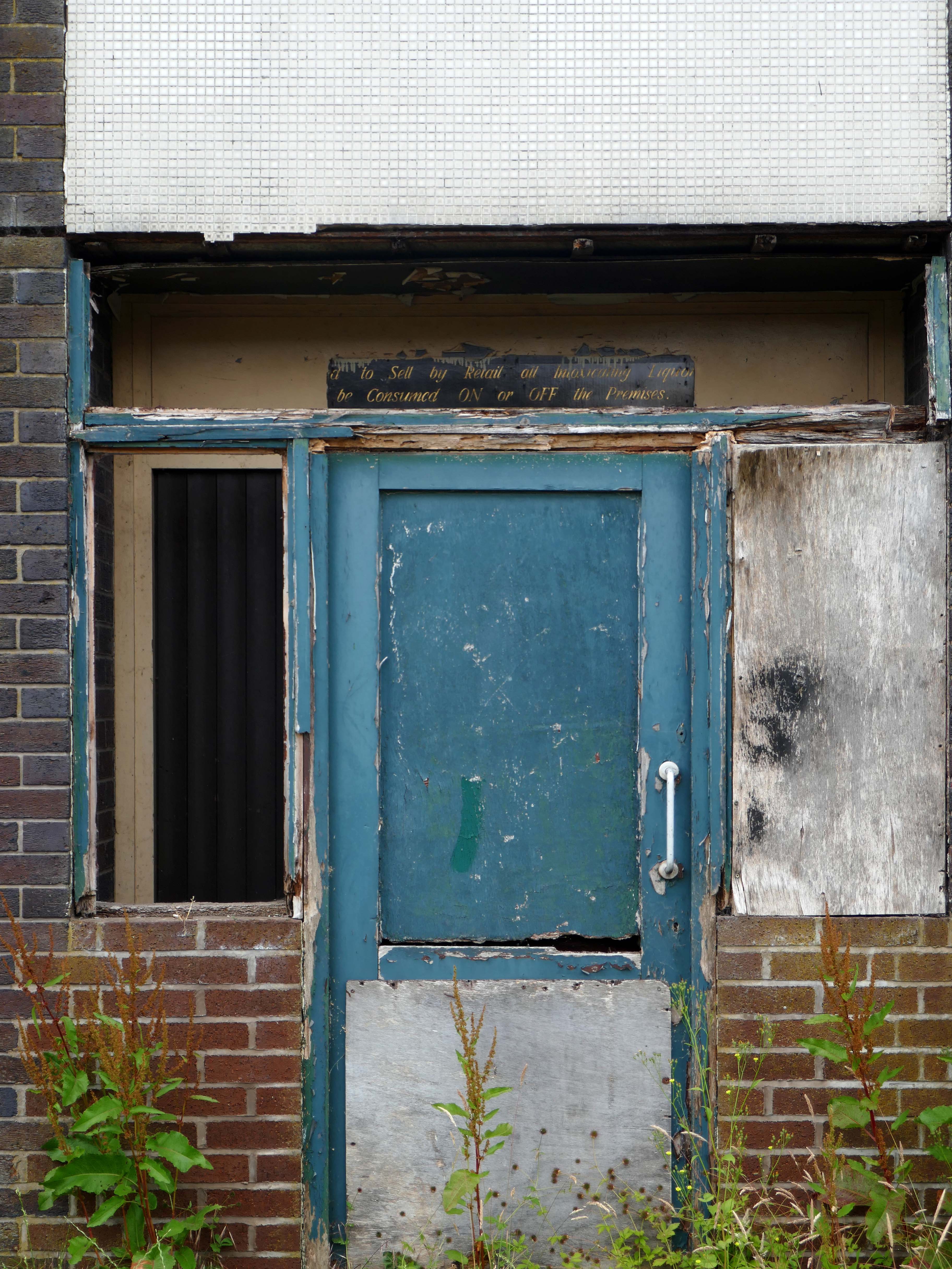
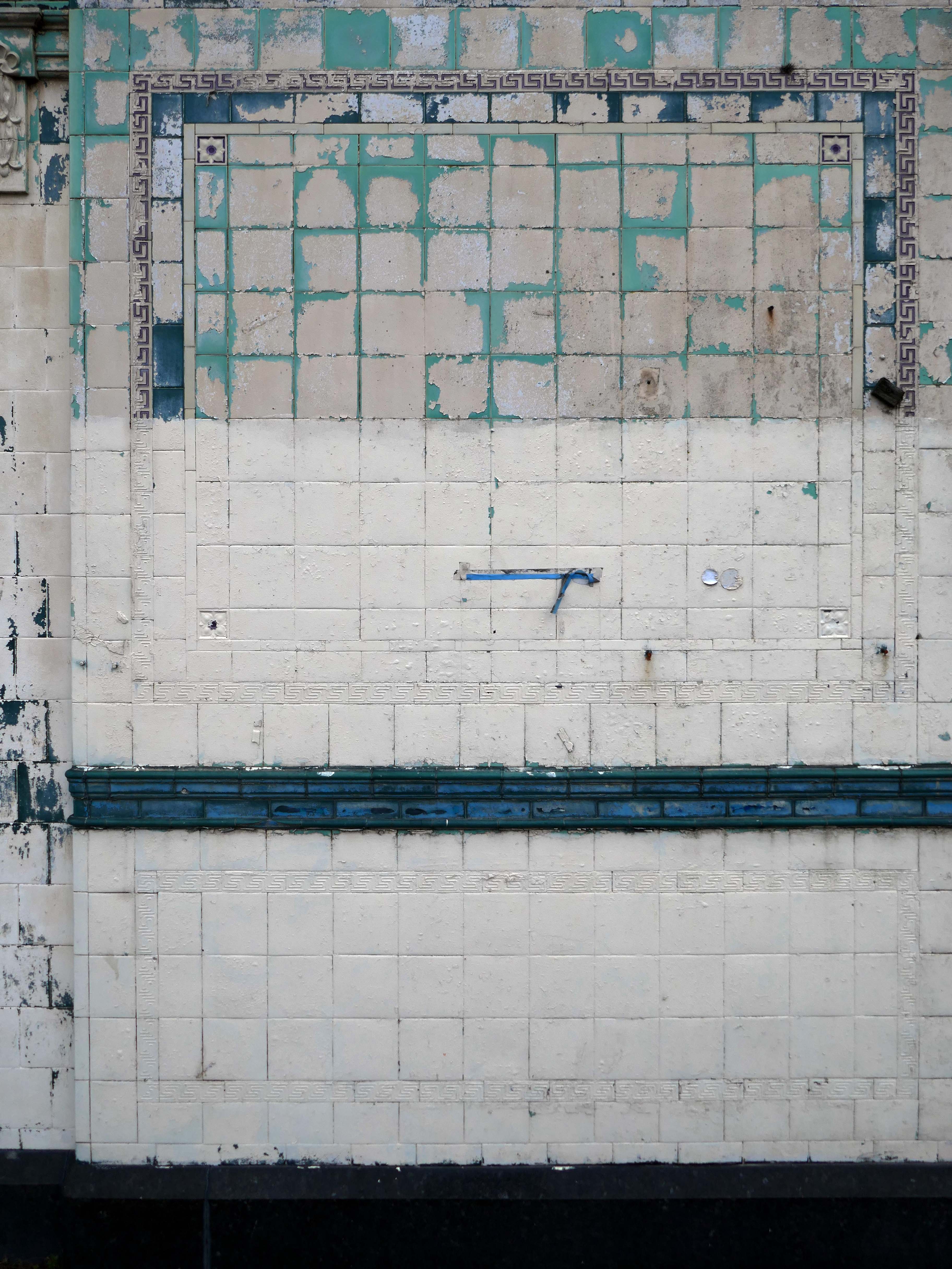
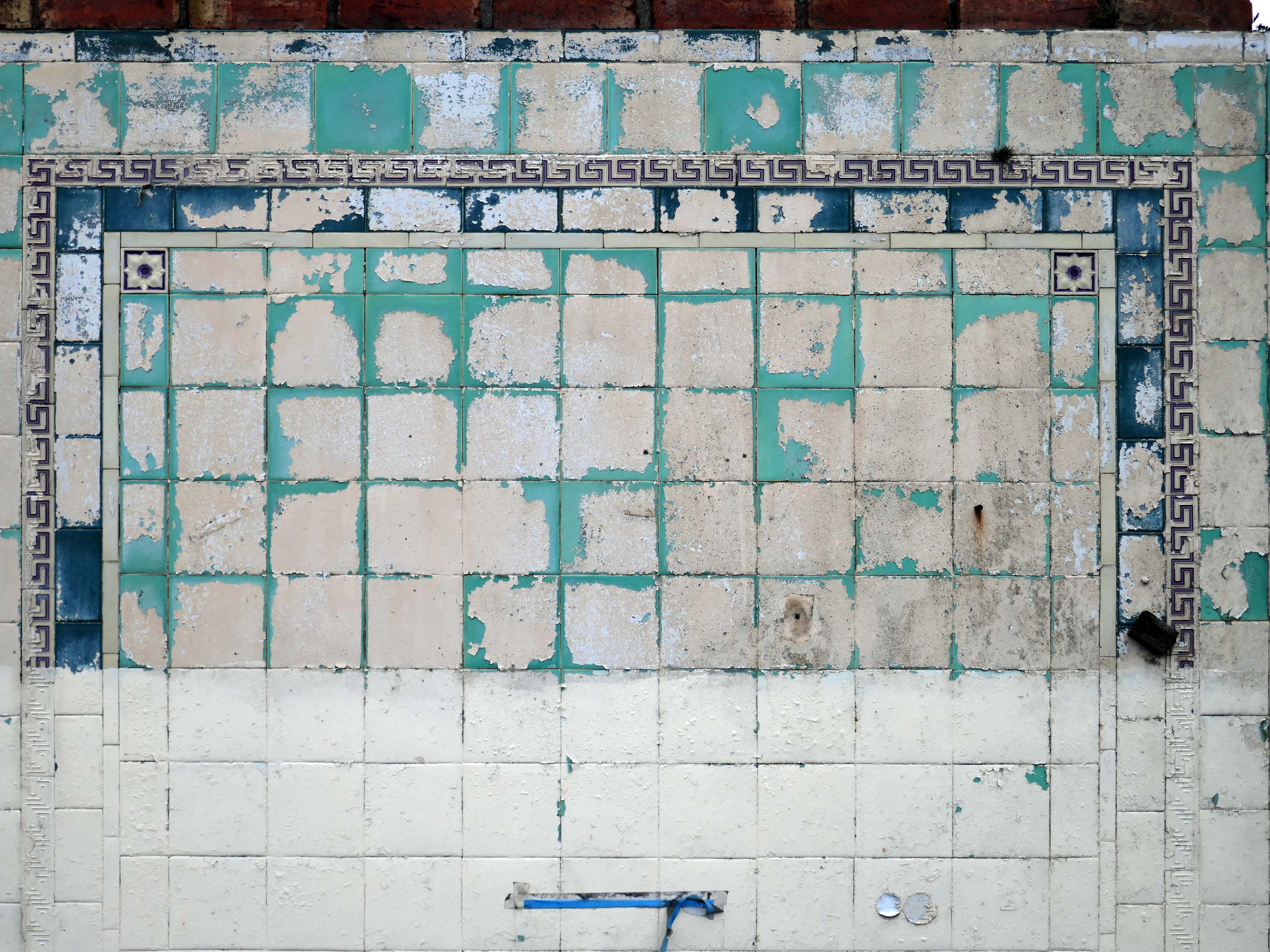
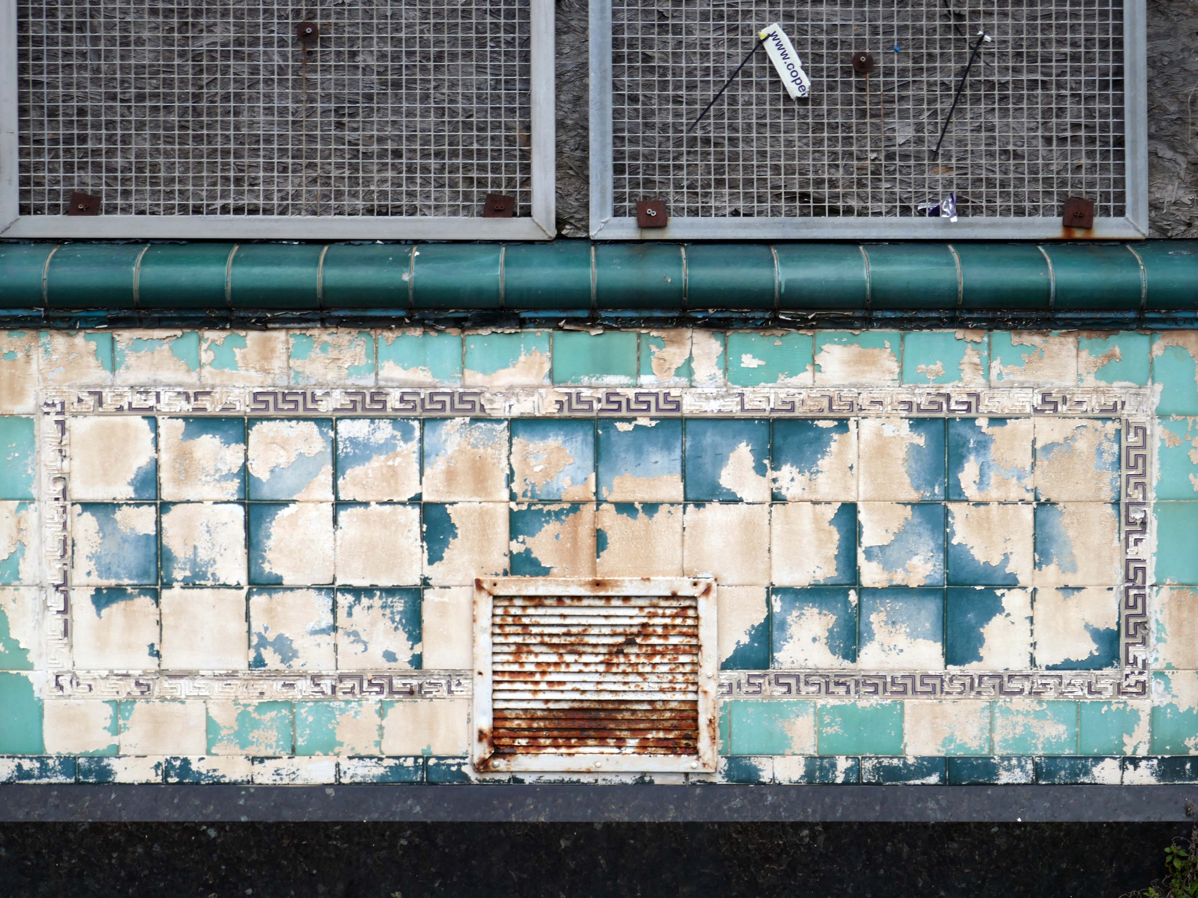
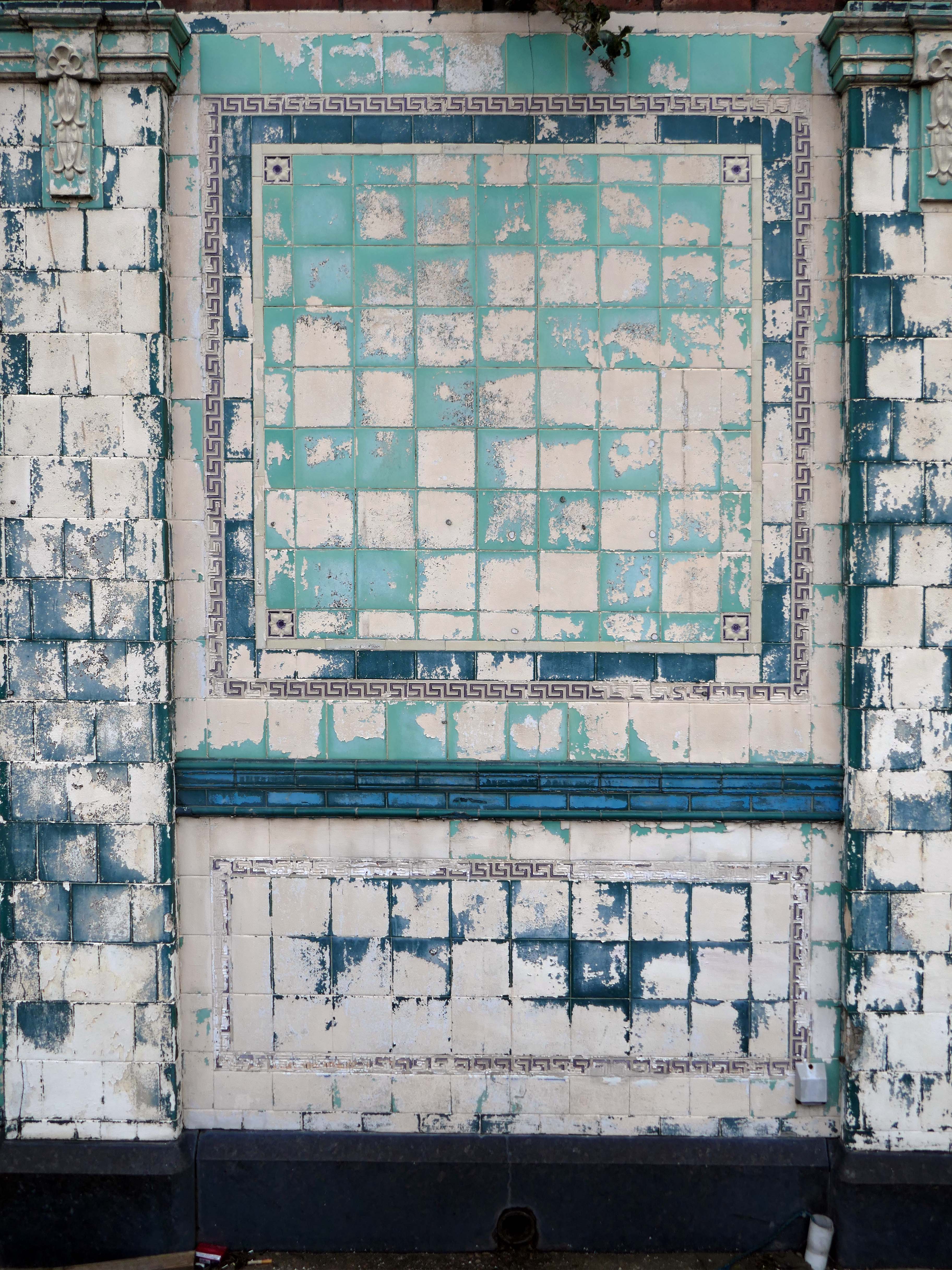
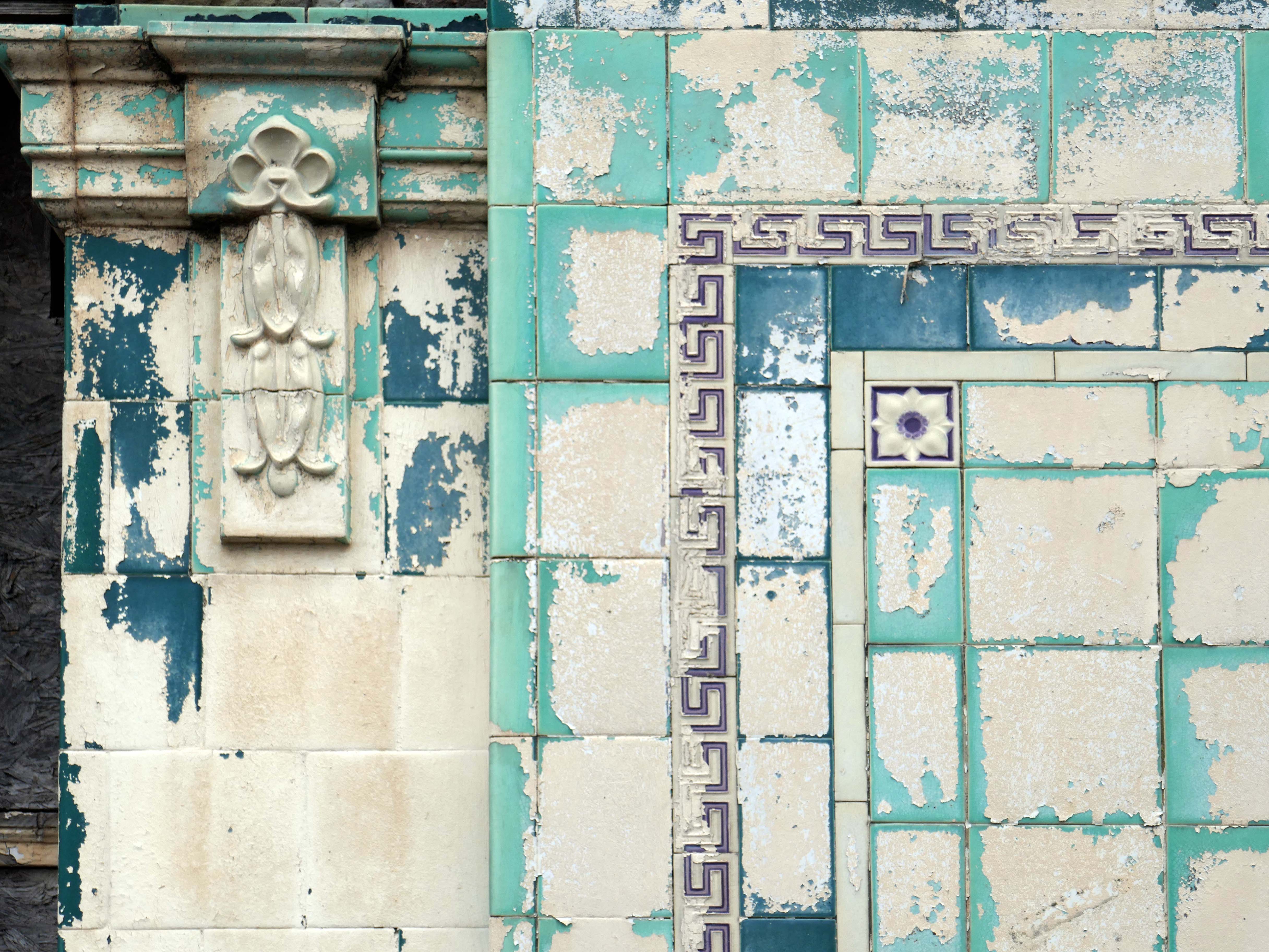
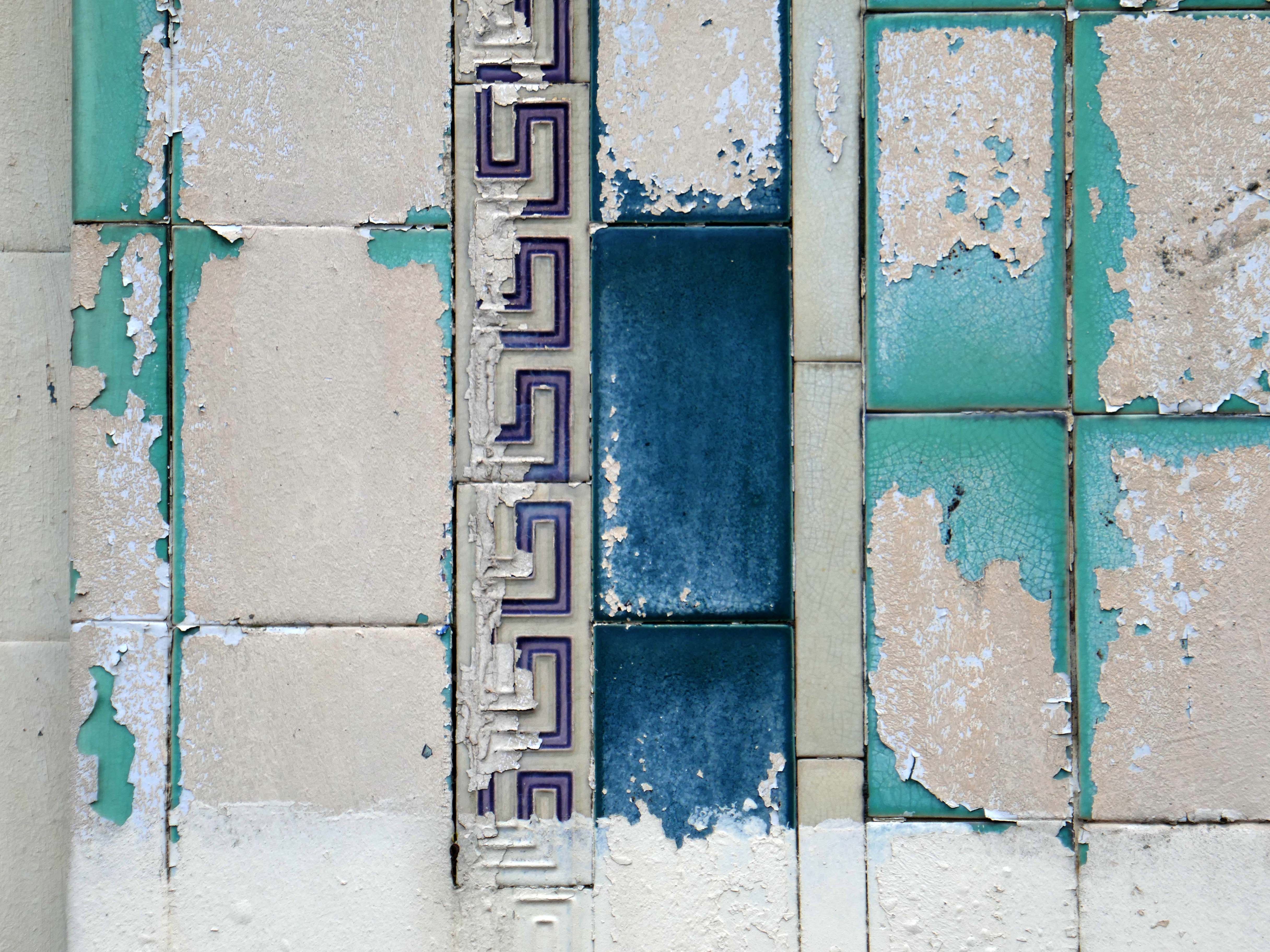
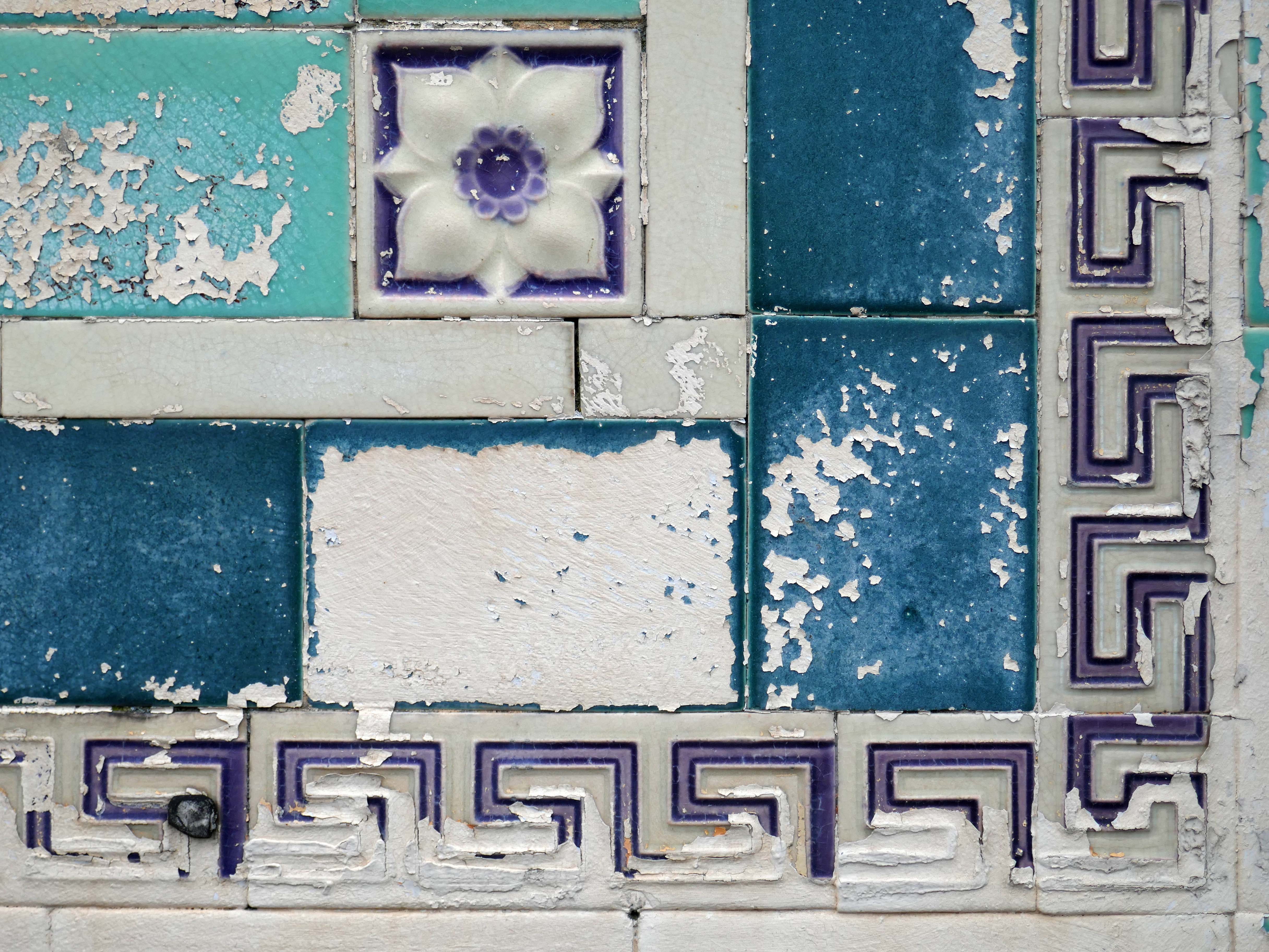
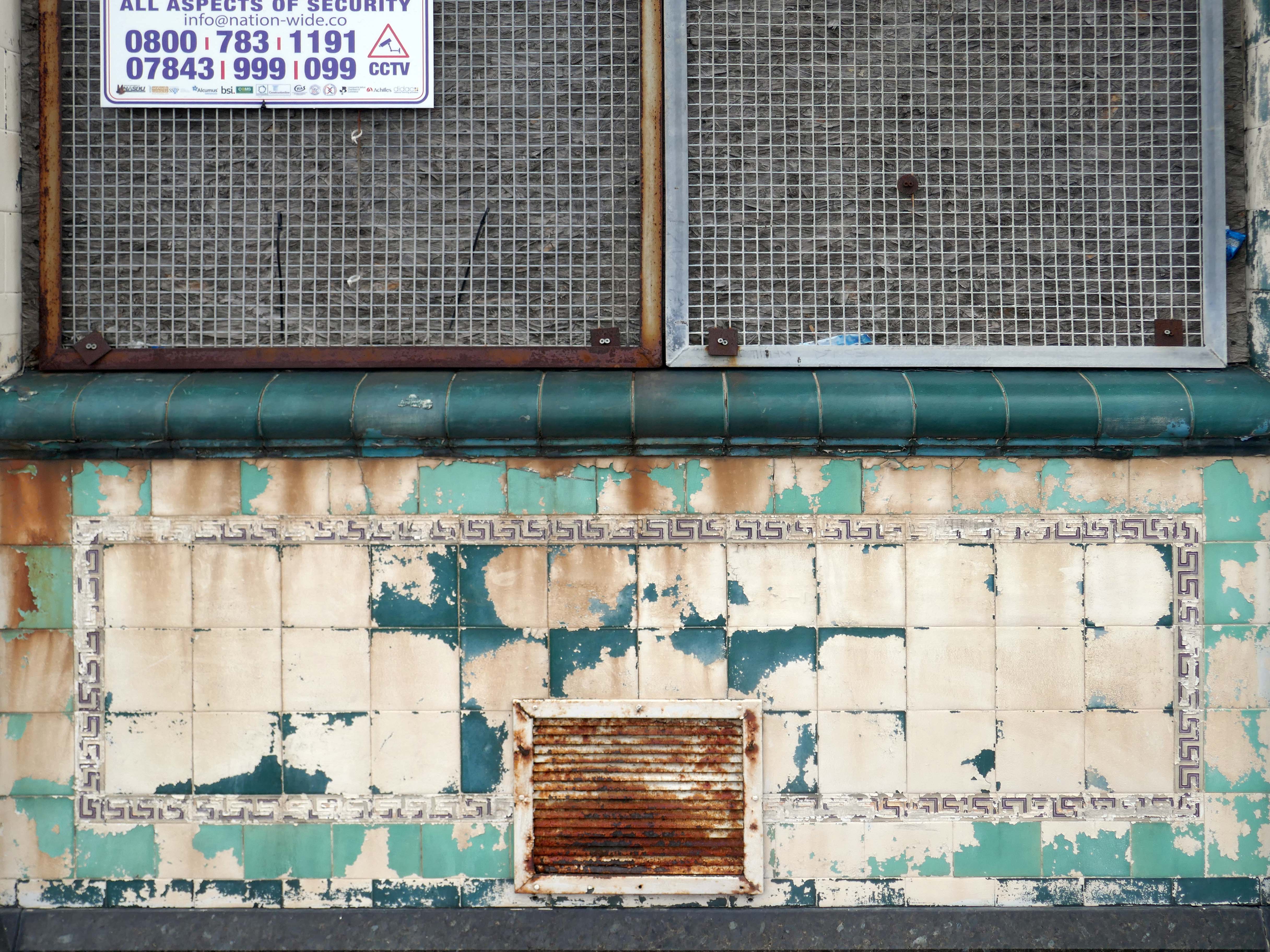
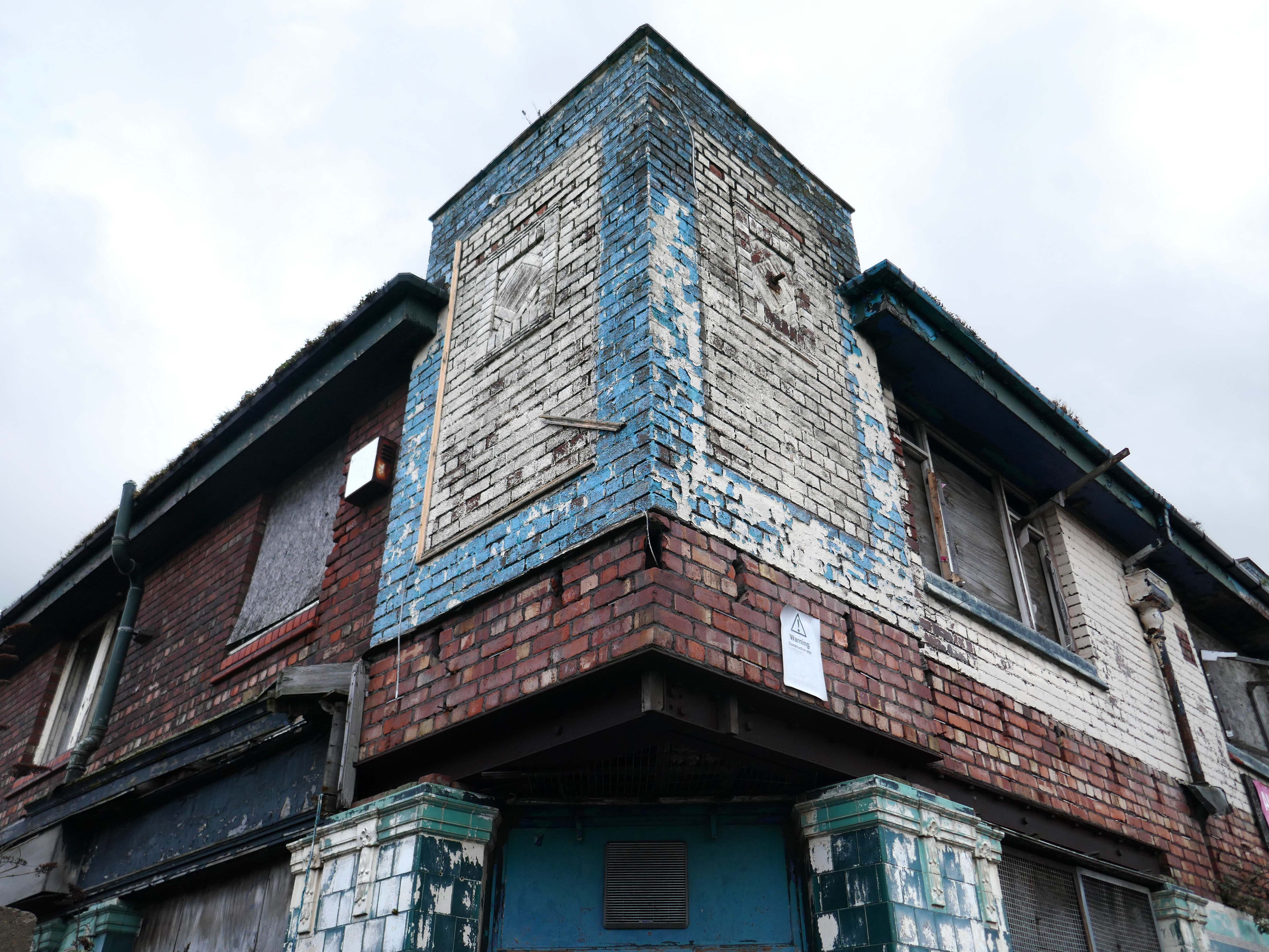
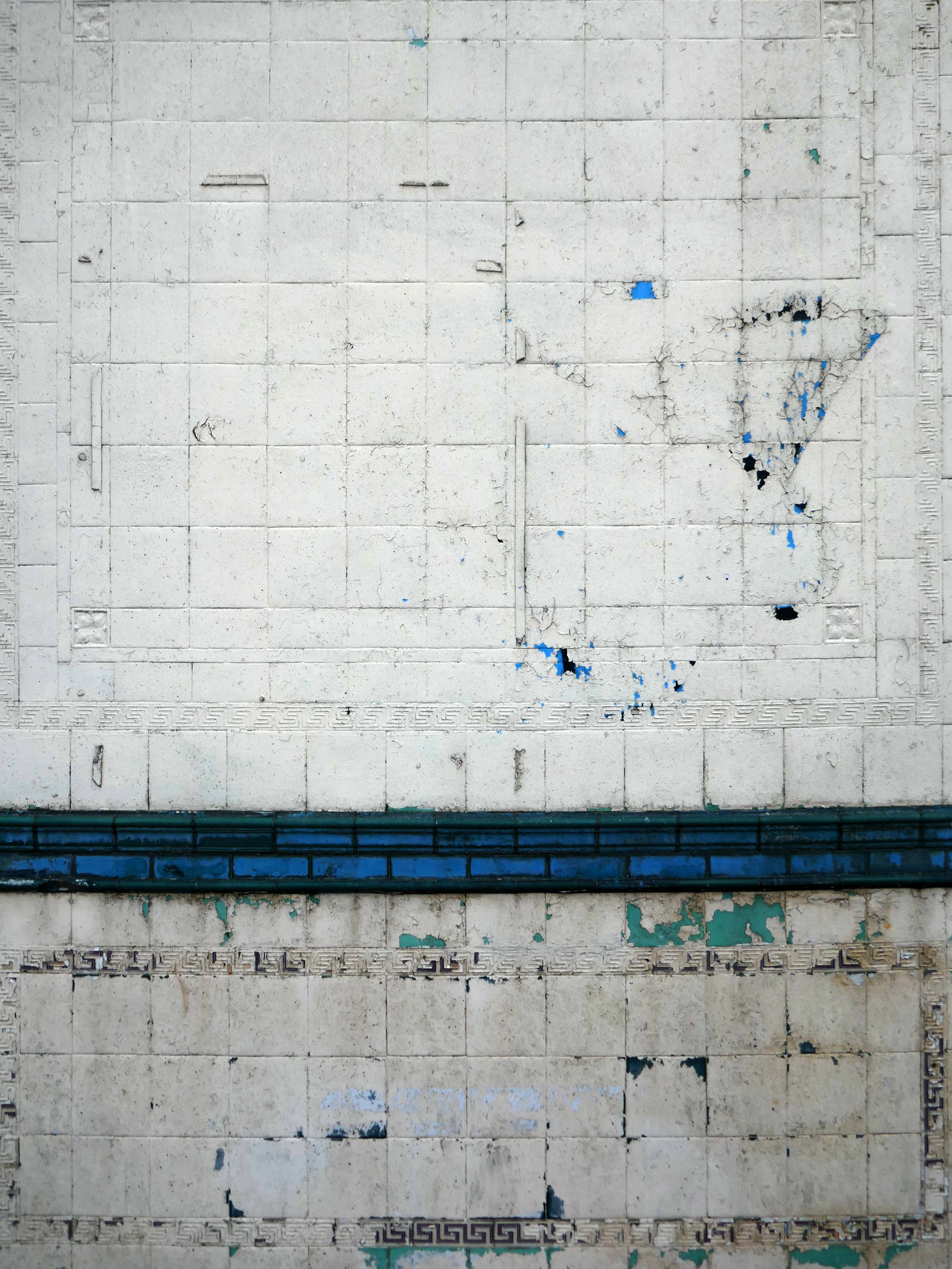
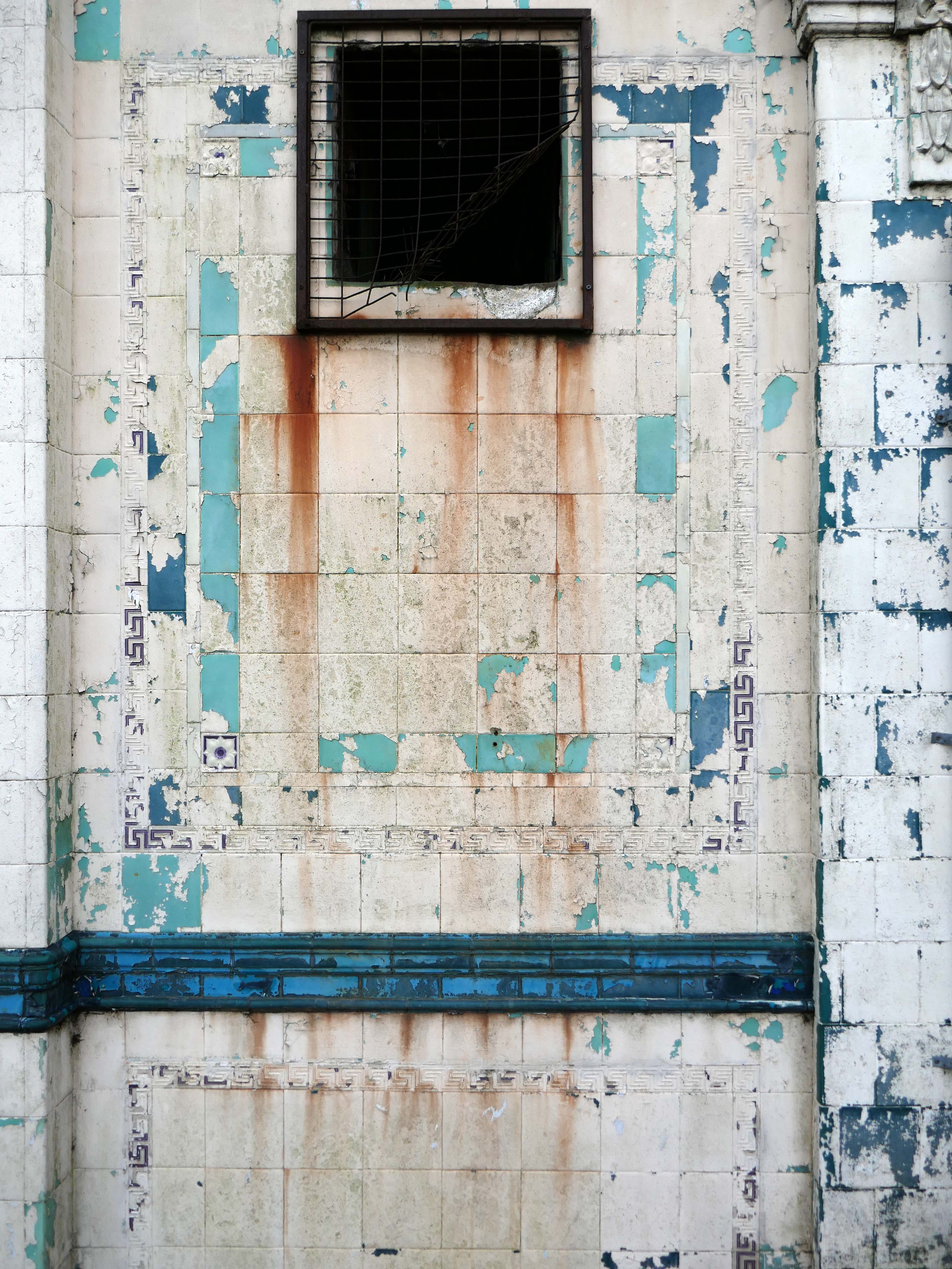
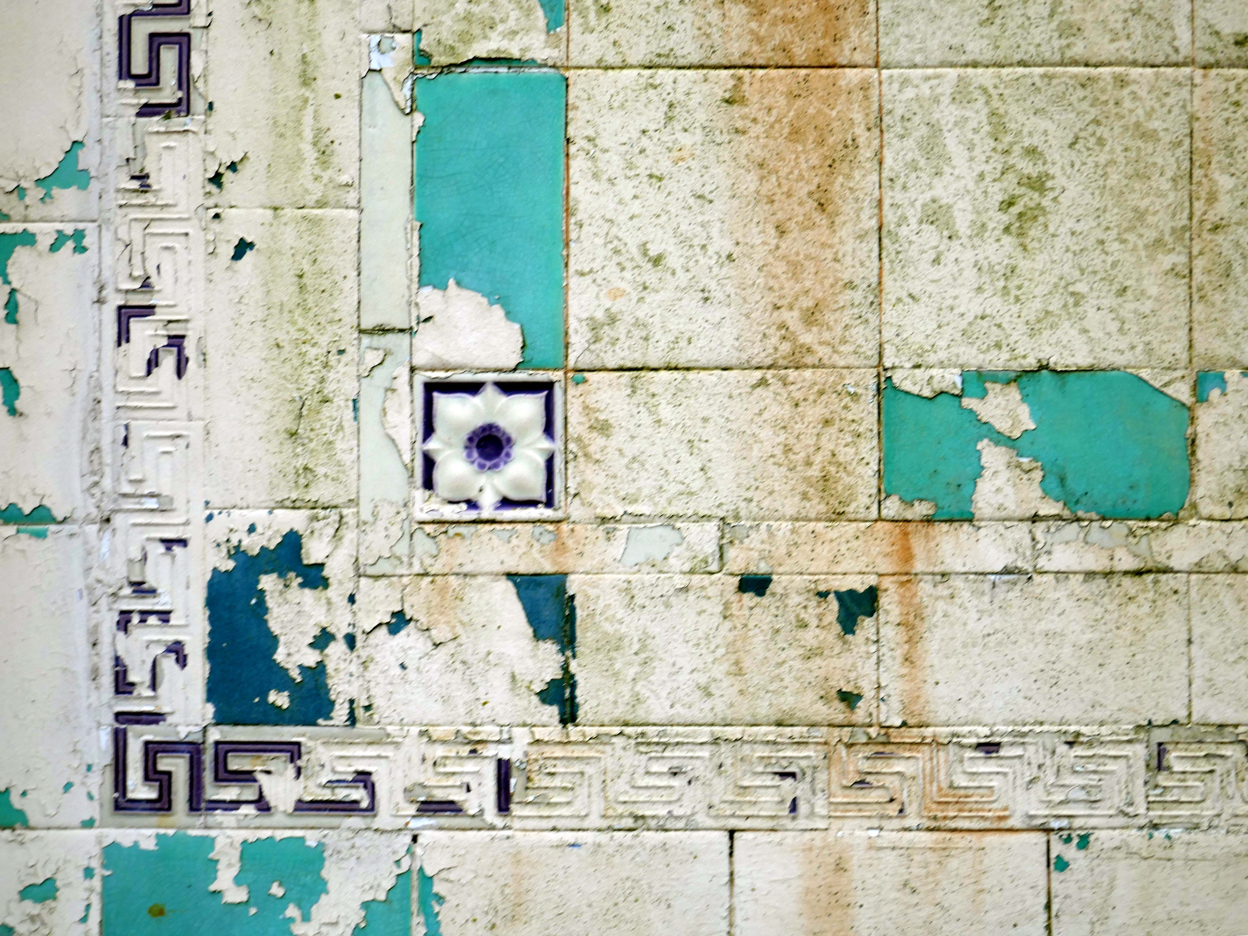
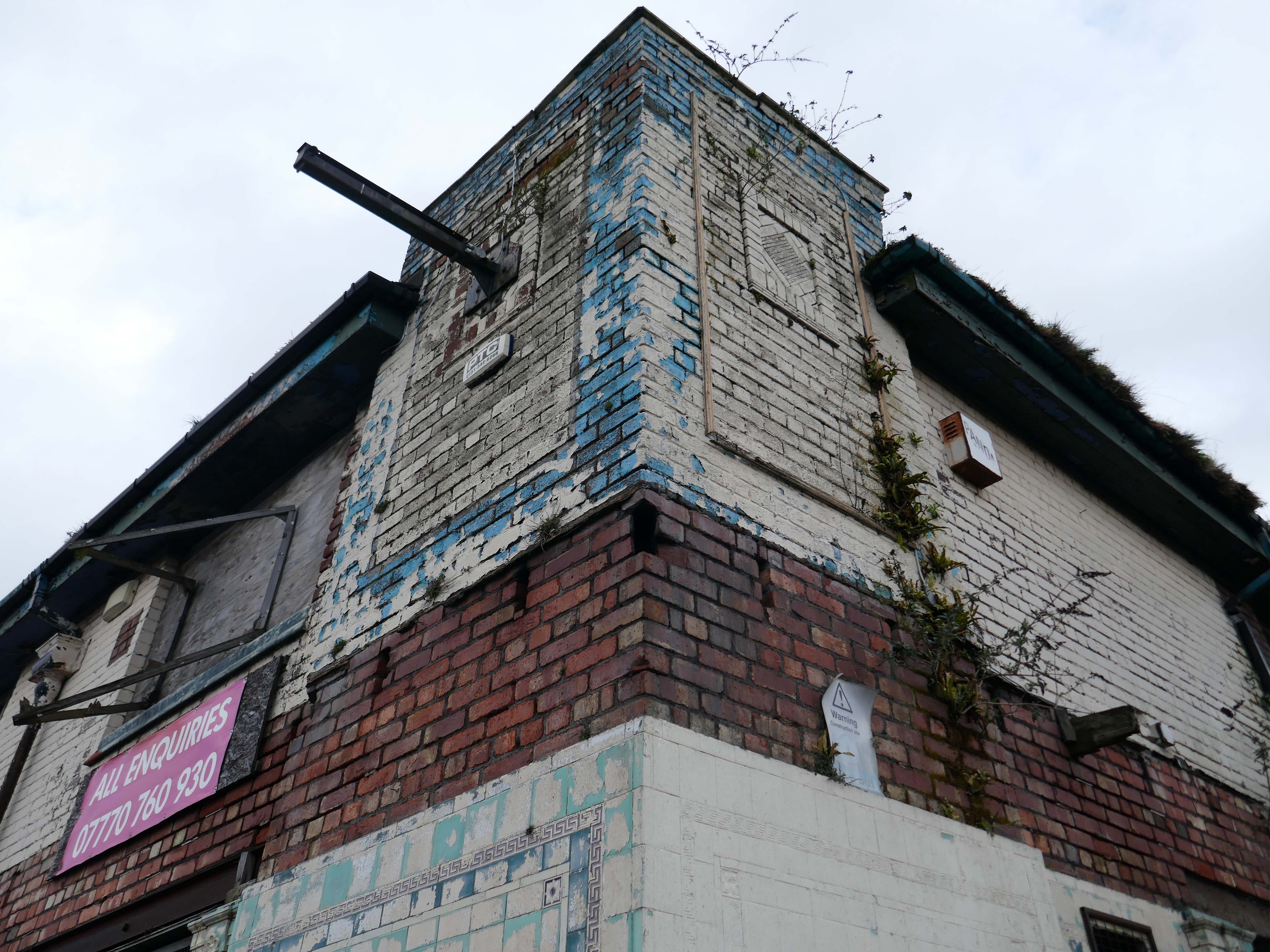
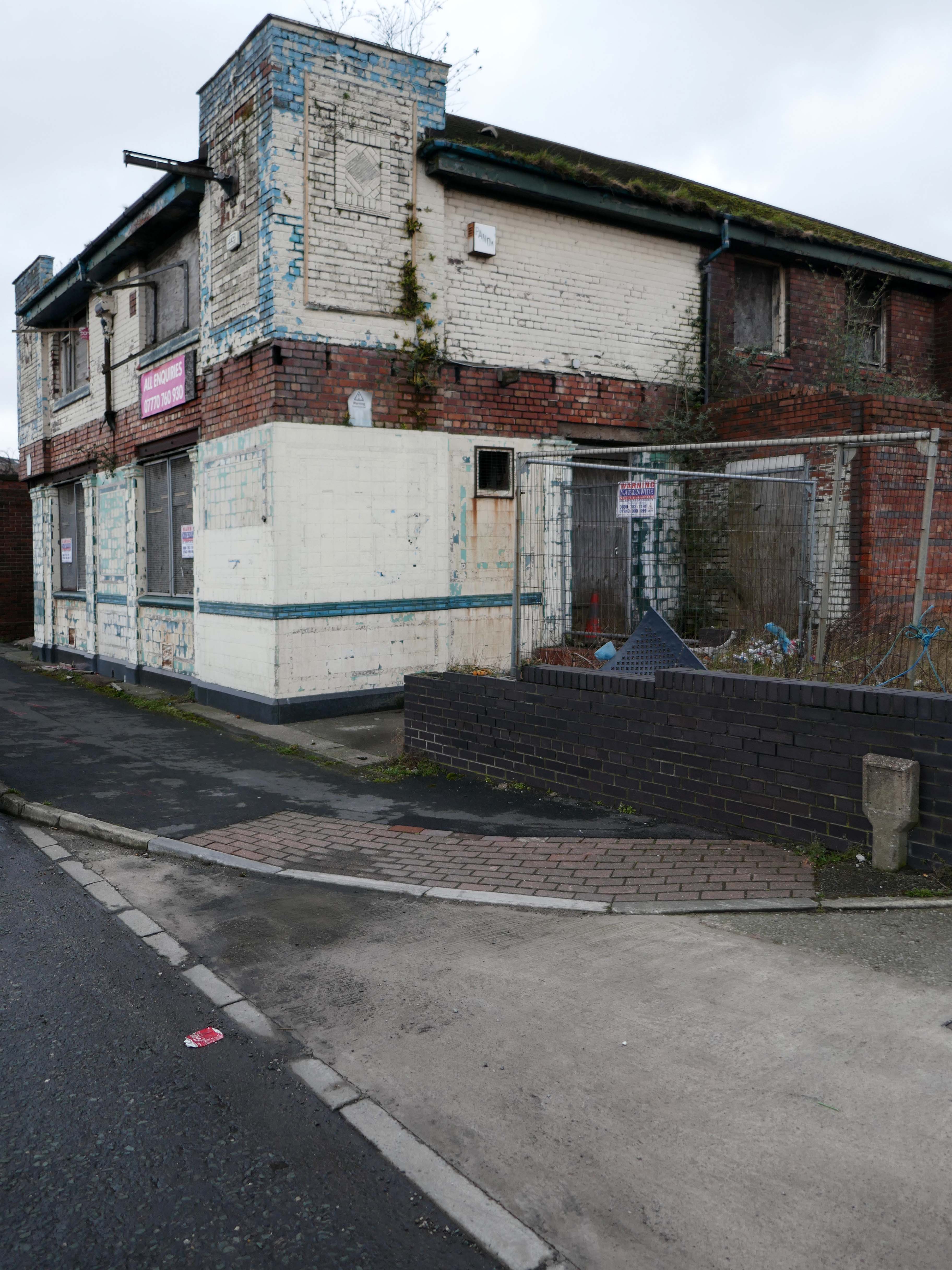
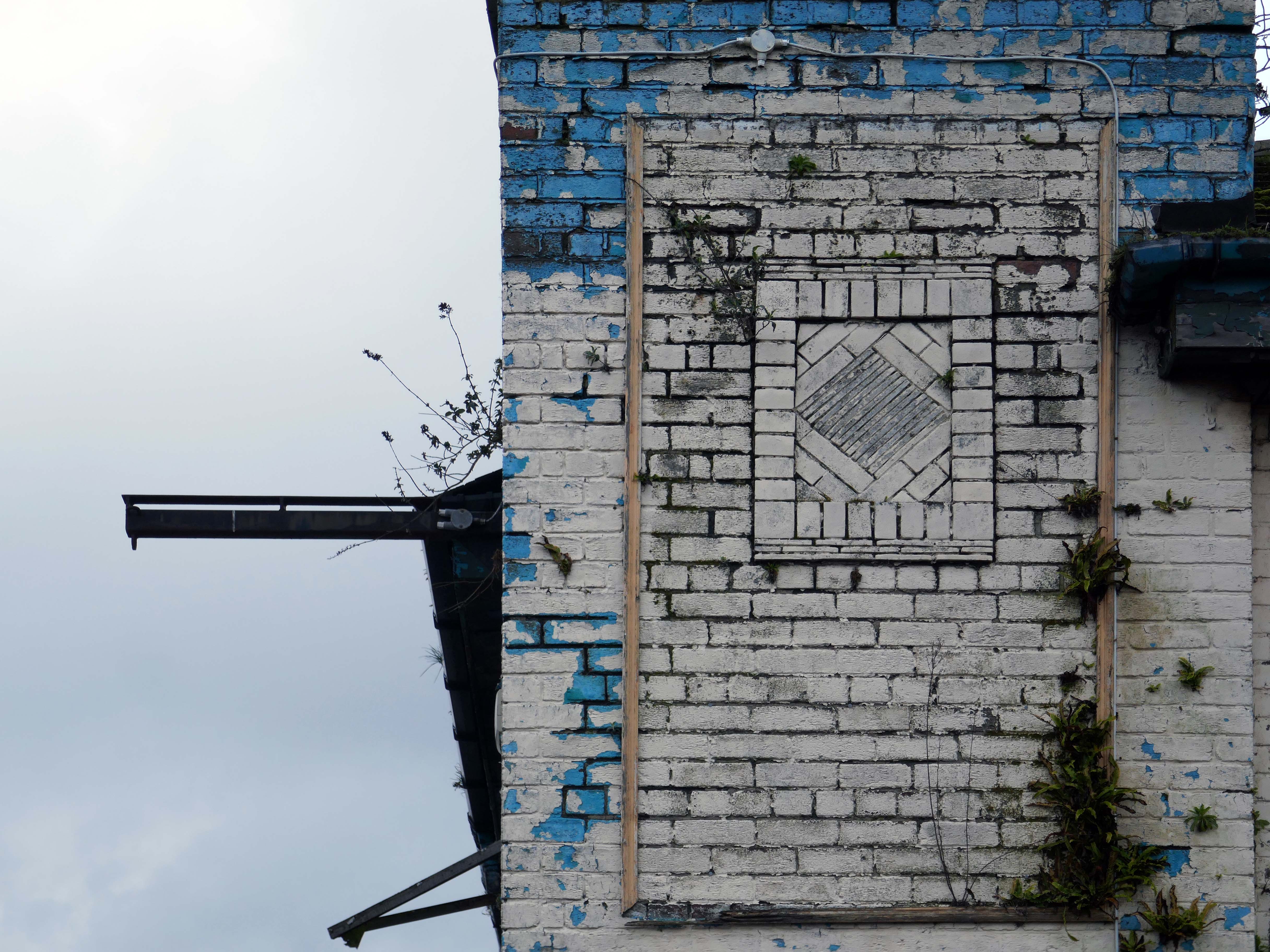
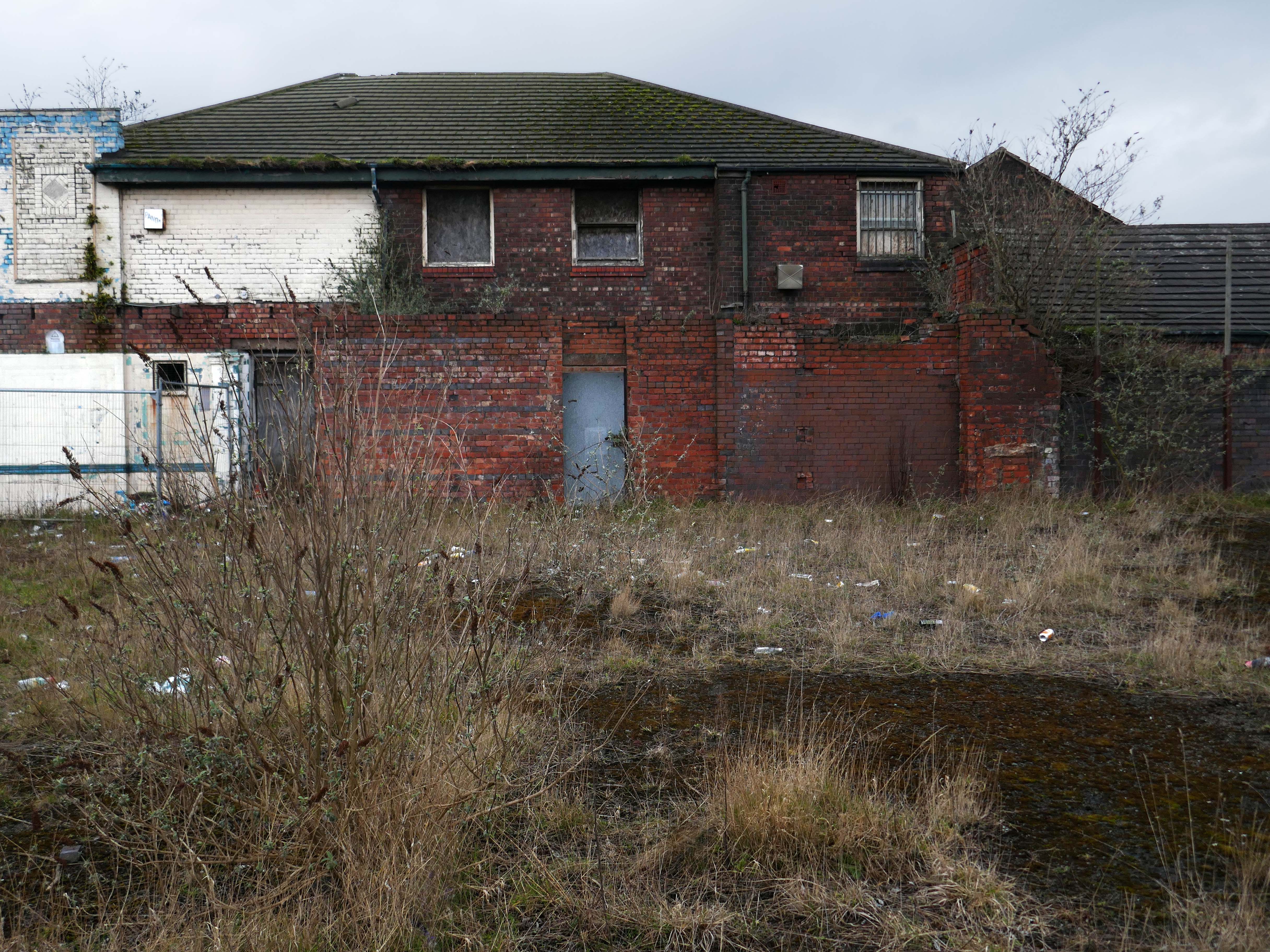
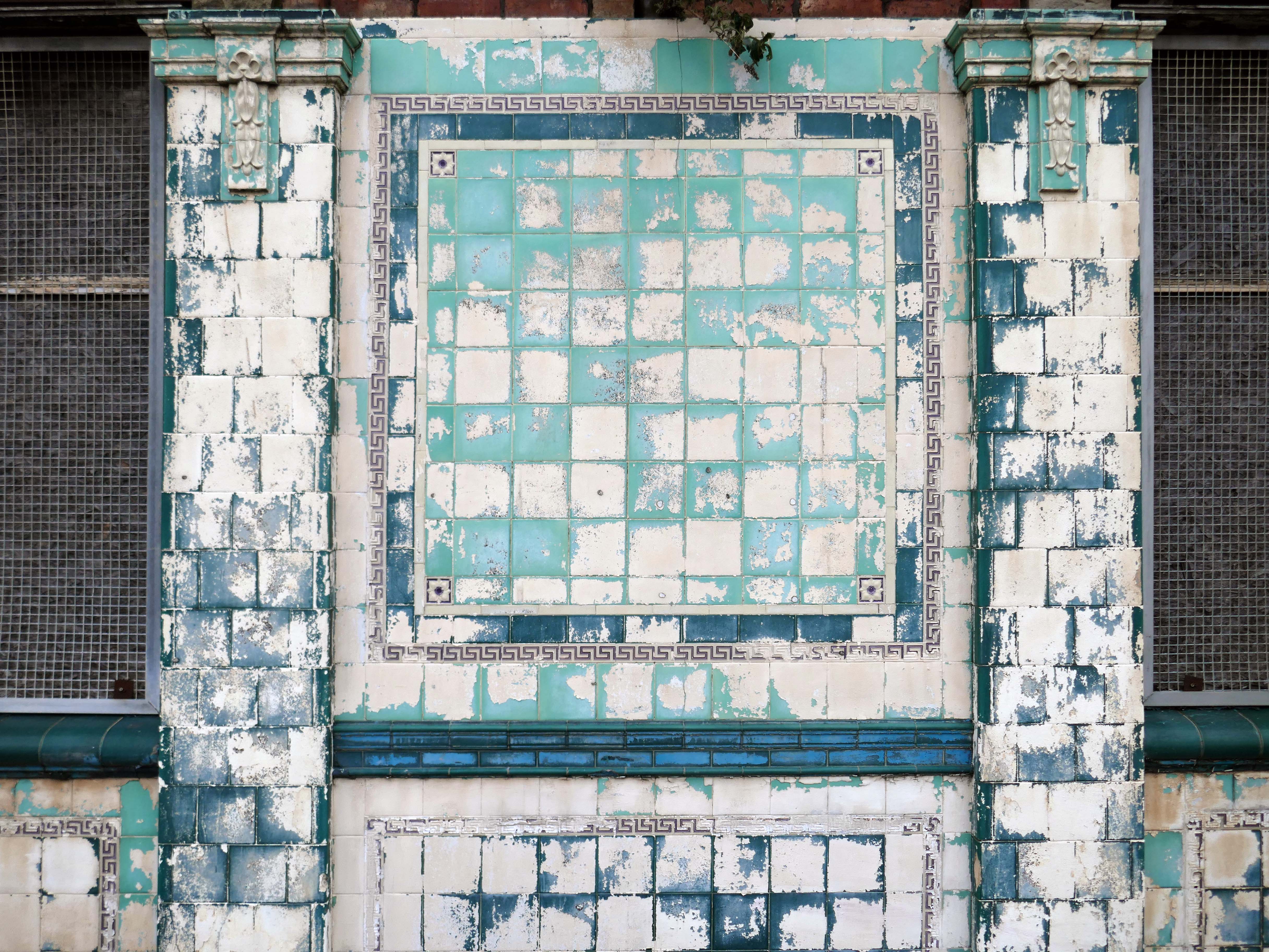
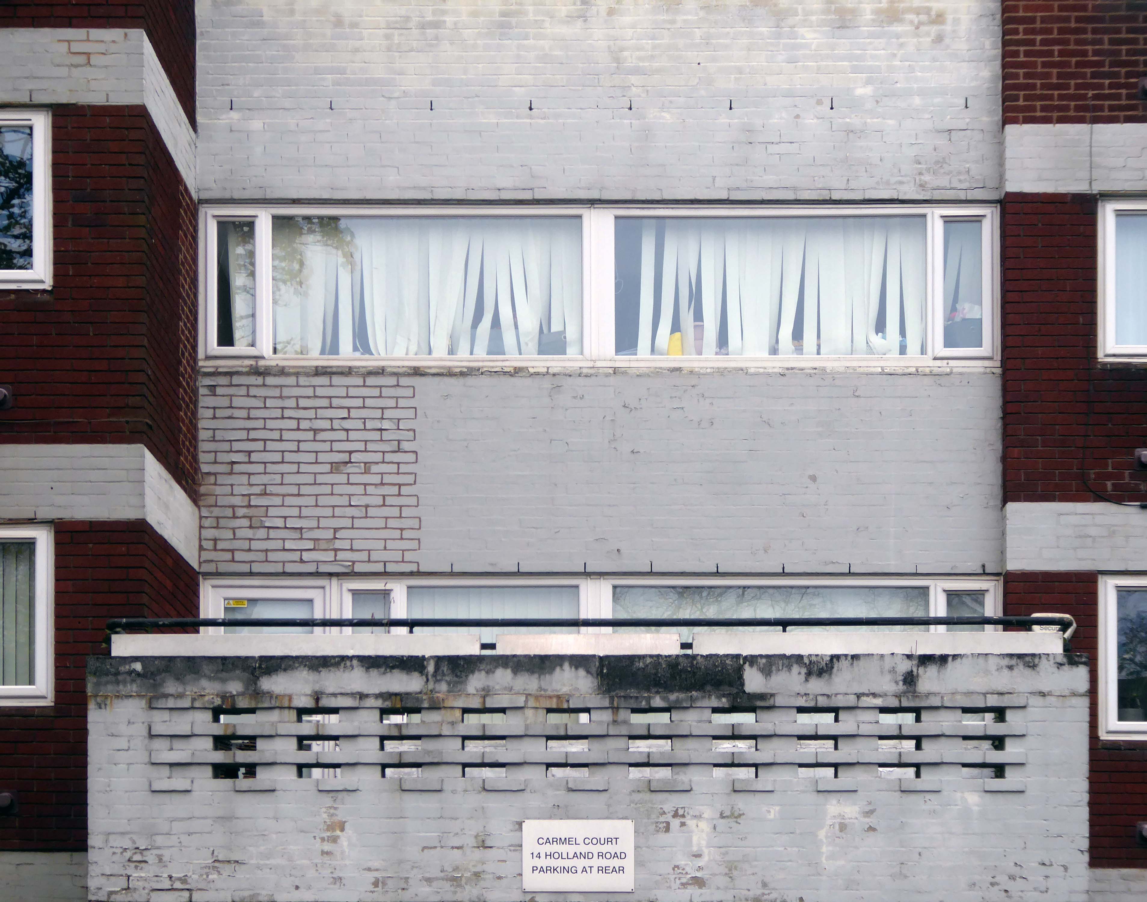
Former Bee and Station Hotel immediately opposite the Station.
The Bee and Station Hotel was built in the 1860s. The decorative tile work of the exterior was probably added during remodelling c.1890. Inside, the lobby is also richly decorated with brightly coloured tiling. The building was listed in 1991 as an excellent example of pub of the late 19th century with a complete tiled frontage and a rare surviving internal layout throughout.
The pub closed in 2005. The building reopened in 2013 after being refurbished and given a modern extension by Denbighshire County Council, under the Townscape Heritage Initiative, to provide new offices for small businesses
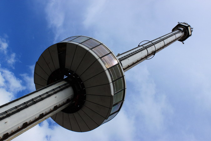
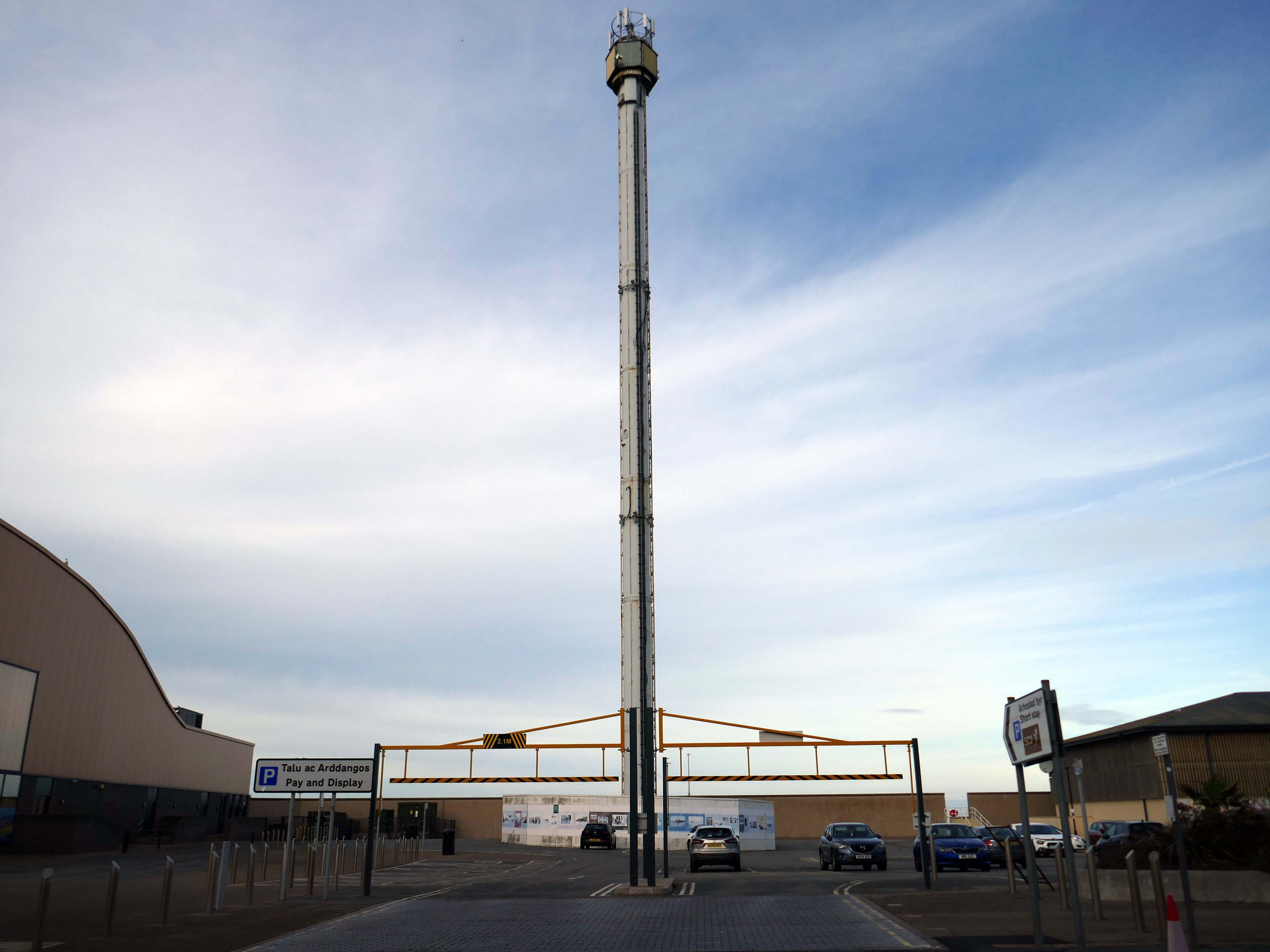
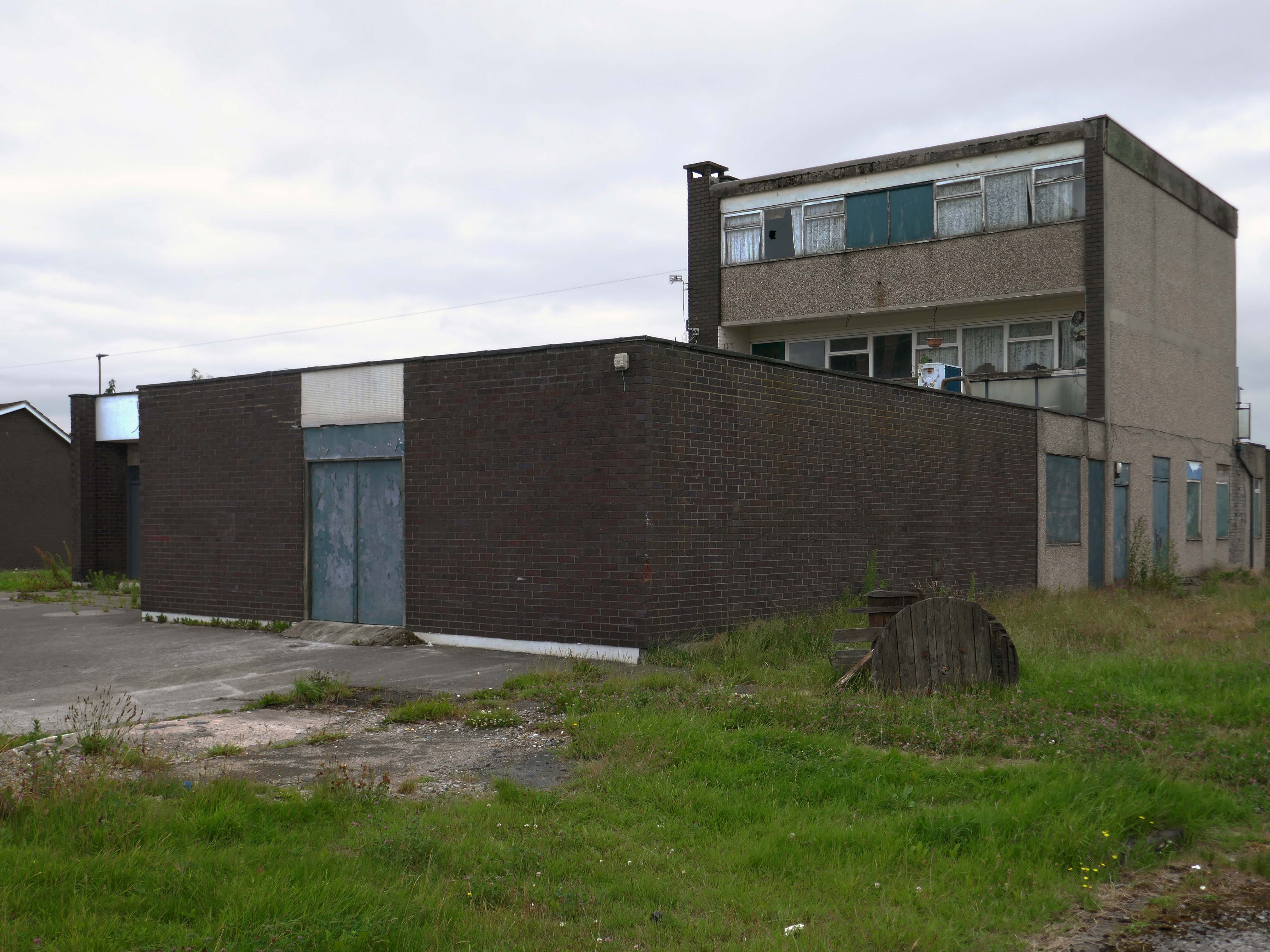
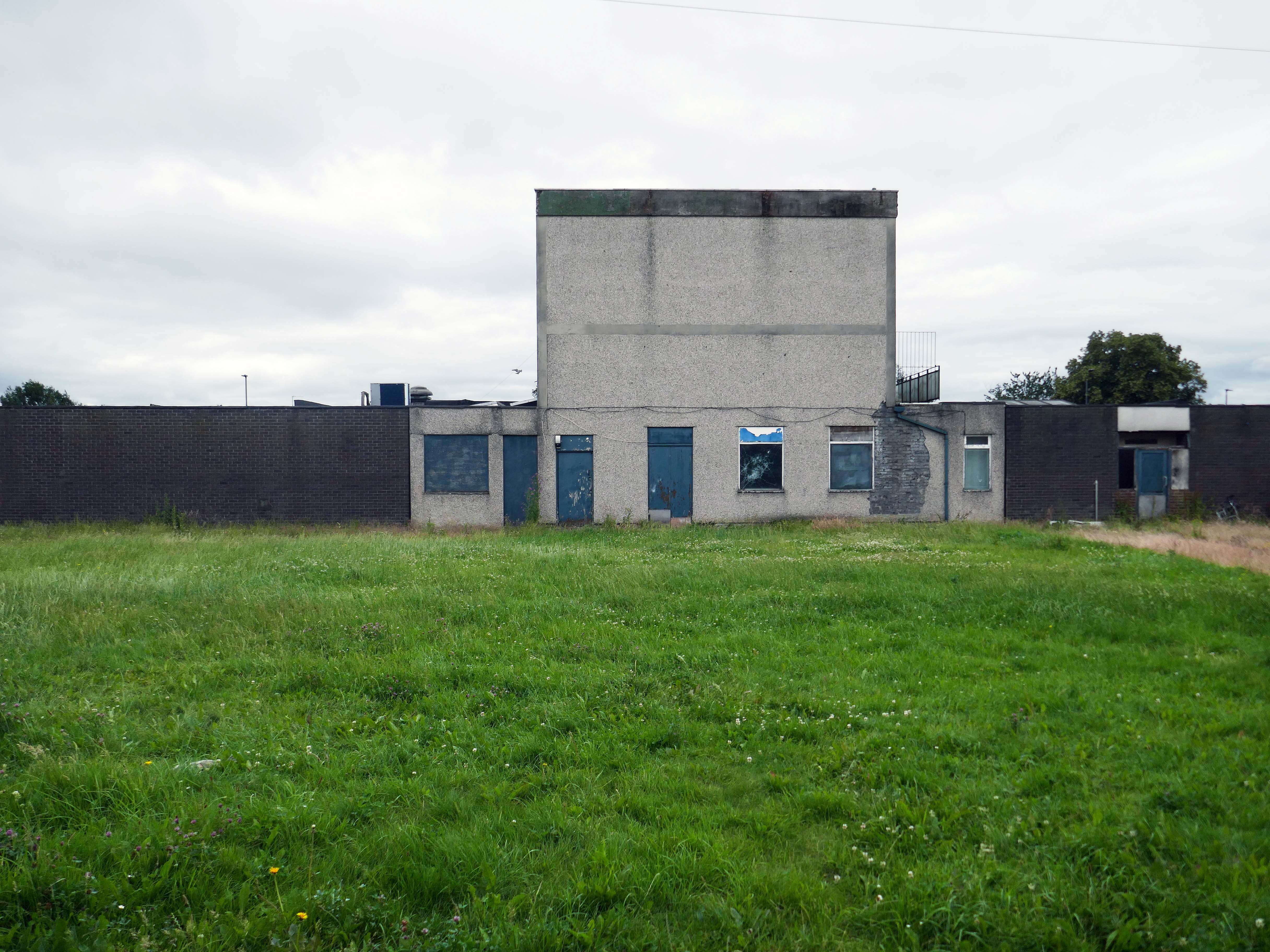
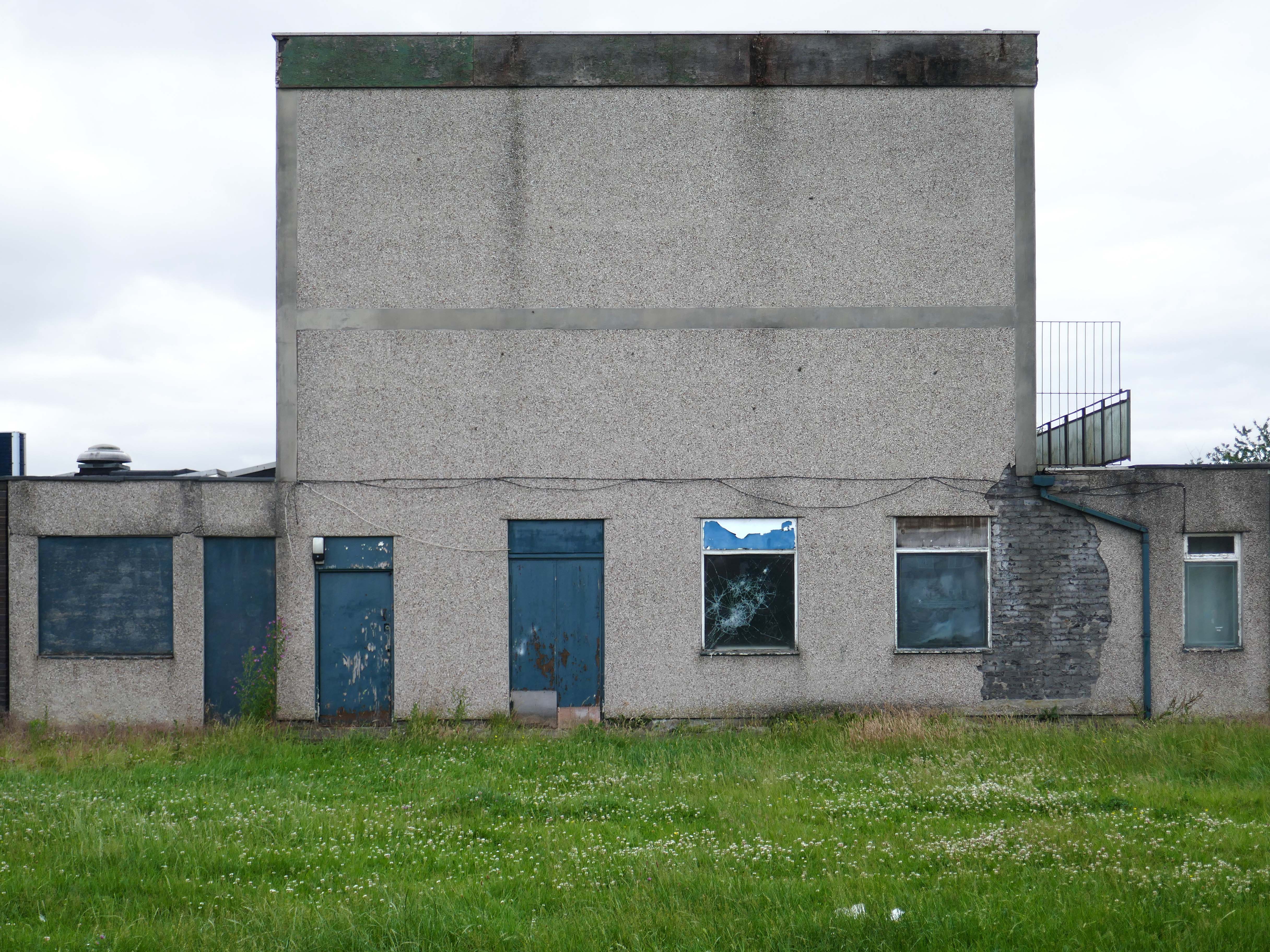
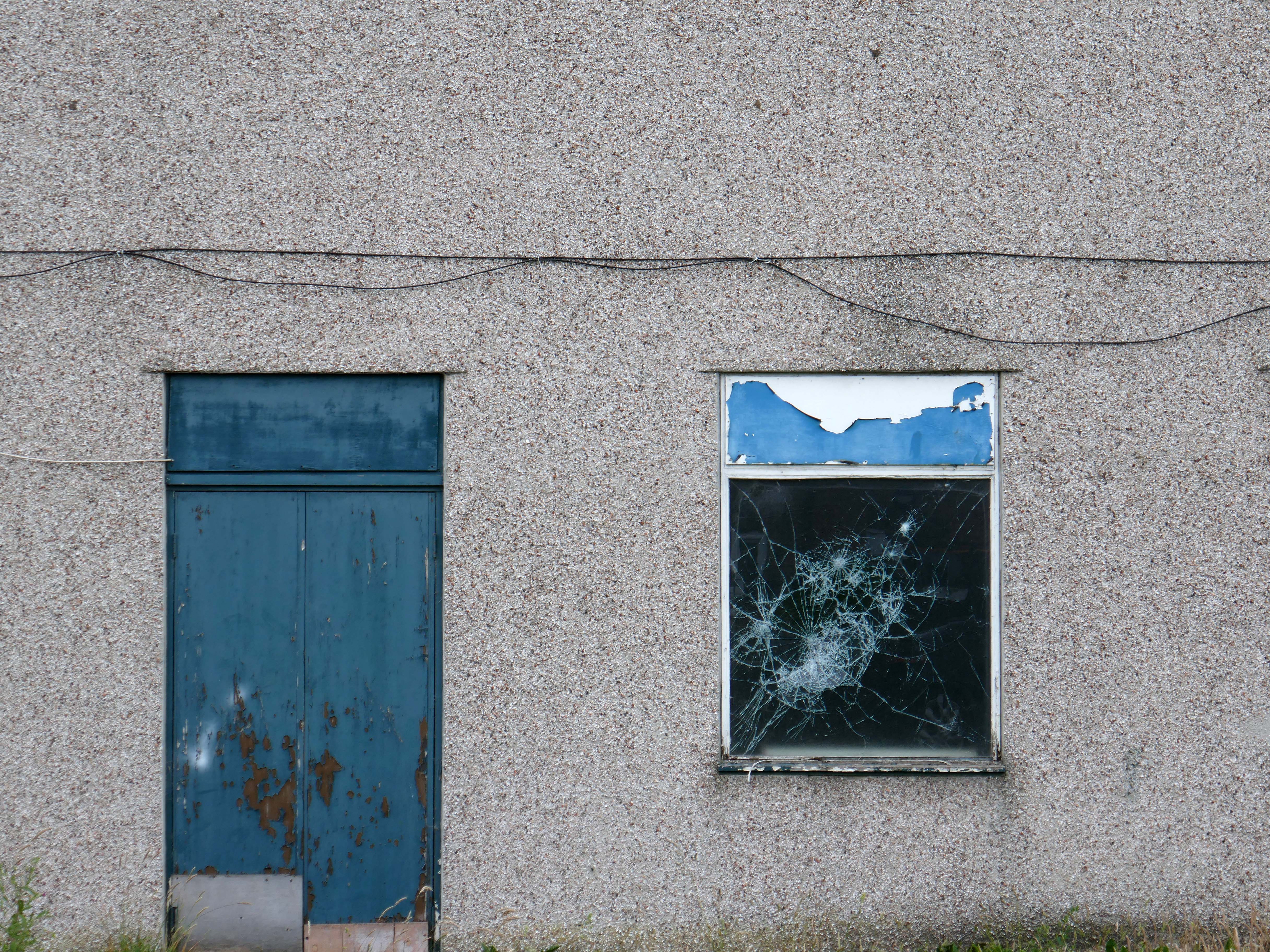
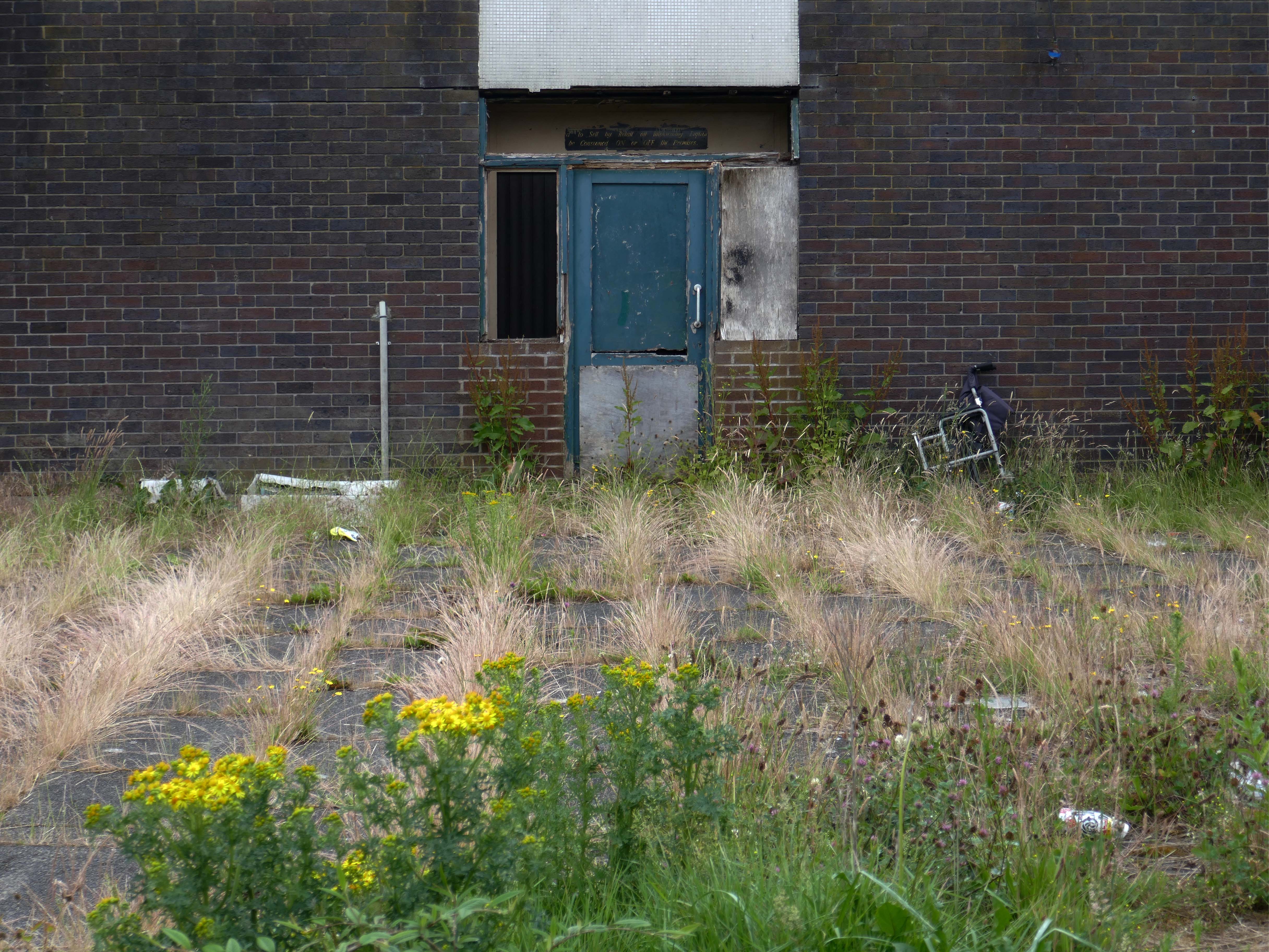
Onward to the seafront, home to the defunct Skytower.
The tower first operated at the 1988 Glasgow Garden Festival, where it was known as the Clydesdale Bank Tower and was opened by Prince Charles and Princess Diana. Following the festival, it was dismantled and reassembled on the Rhyl seafront.
The tower last operated in 2010. The following year, a safety report found that £400,000 worth of repairs were required to keep the ride operational. After standing but not operating for seven years, in 2017 work was carried out to turn the tower into a beacon.
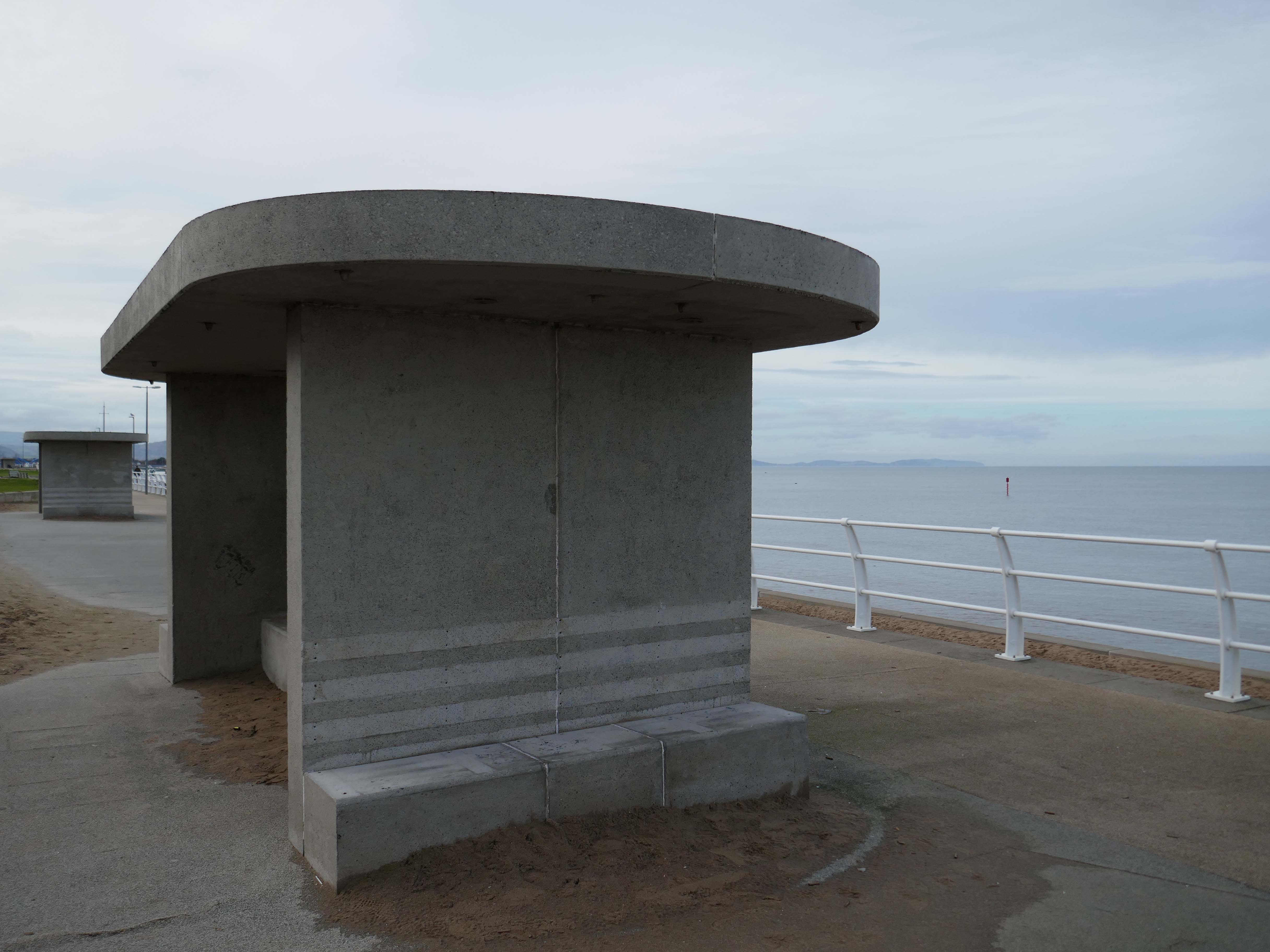
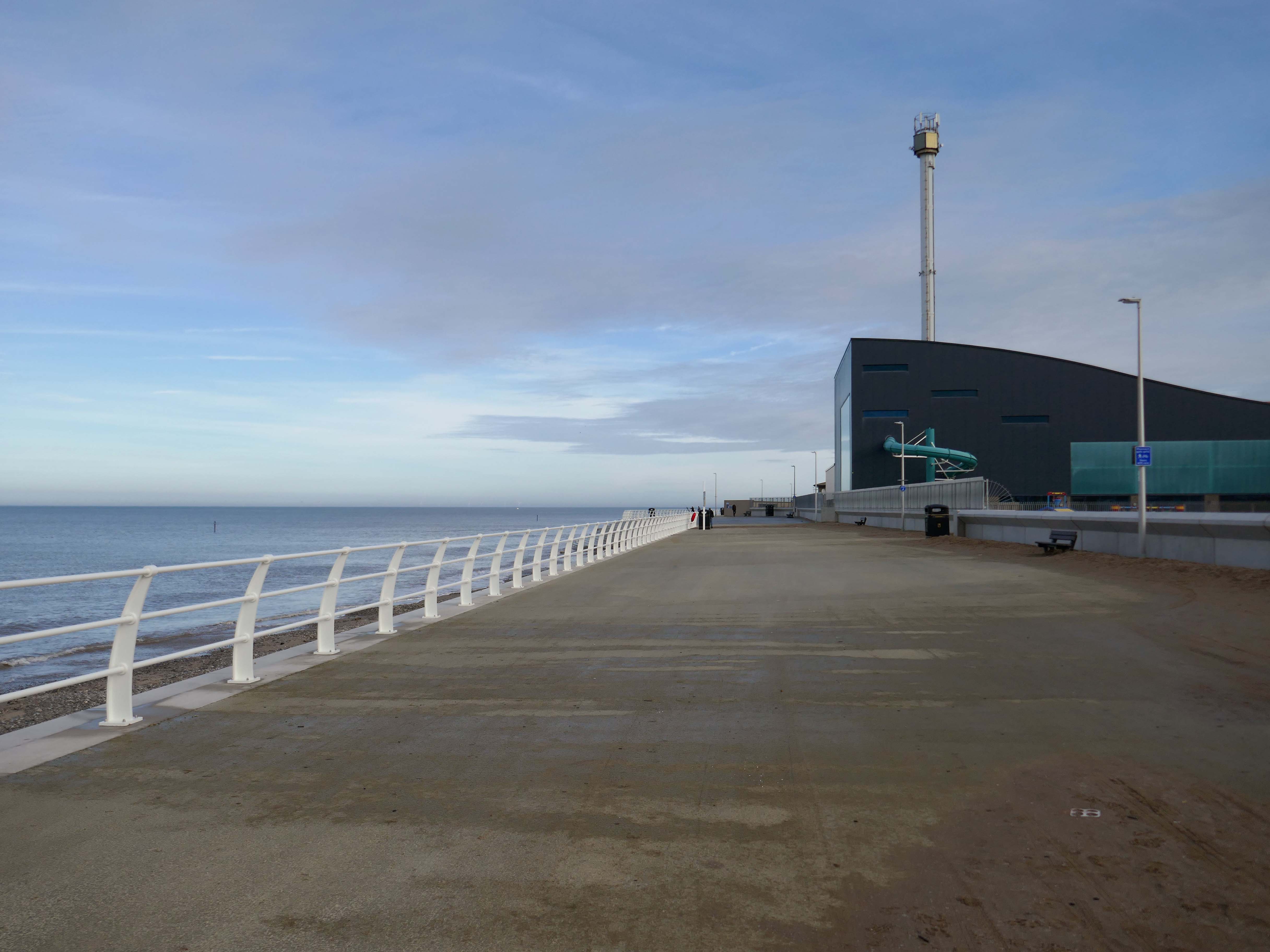
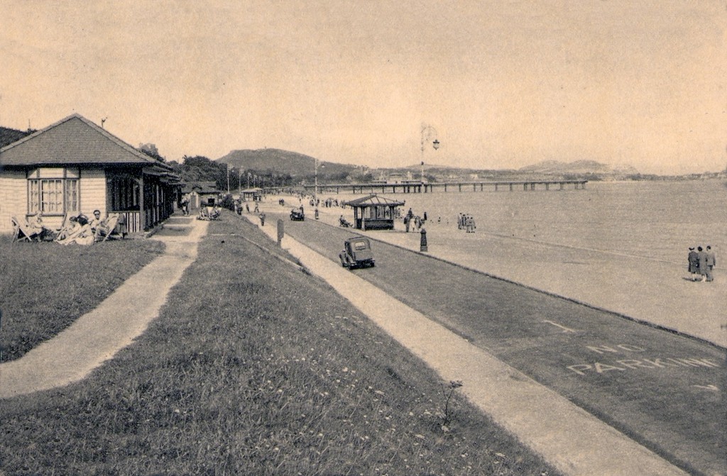
Much has been done to improve the promenade, with sumptuous hard landscaping, coastal defences and seafront shelters.
The £66m Central Rhyl Coastal Defences Scheme will protect almost 600 properties in Rhyl from flooding and coastal erosion for decades to come.
85% of the construction costs have been funded by the Welsh Government, with the Deputy First Minister labelling the project a ‘significant milestone’ in efforts to protect Welsh communities from the growing threats of climate change. Denbighshire County Council contributed the remaining 15%.
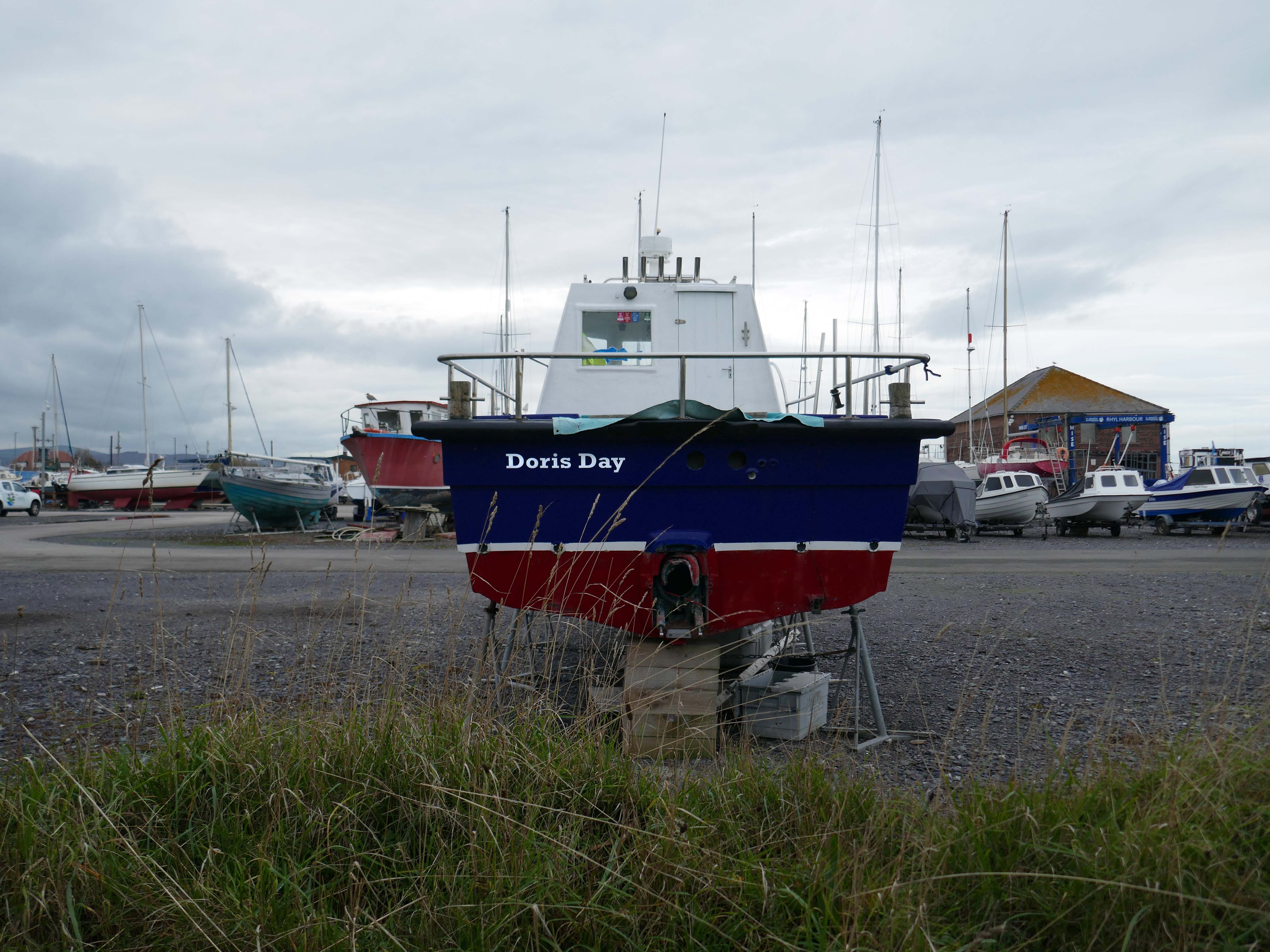
Over the estuary to Rhyl Harbour home to Doris Day.
Rhyl Harbour is located on the spectacular North Wales Coast and has undergone a dramatic refurbishment which has hugely improved the facilities on offer. The original timber yard which was used by sailing ships up until the Second World War, has been redeveloped and now offers storage for over 150 boats.
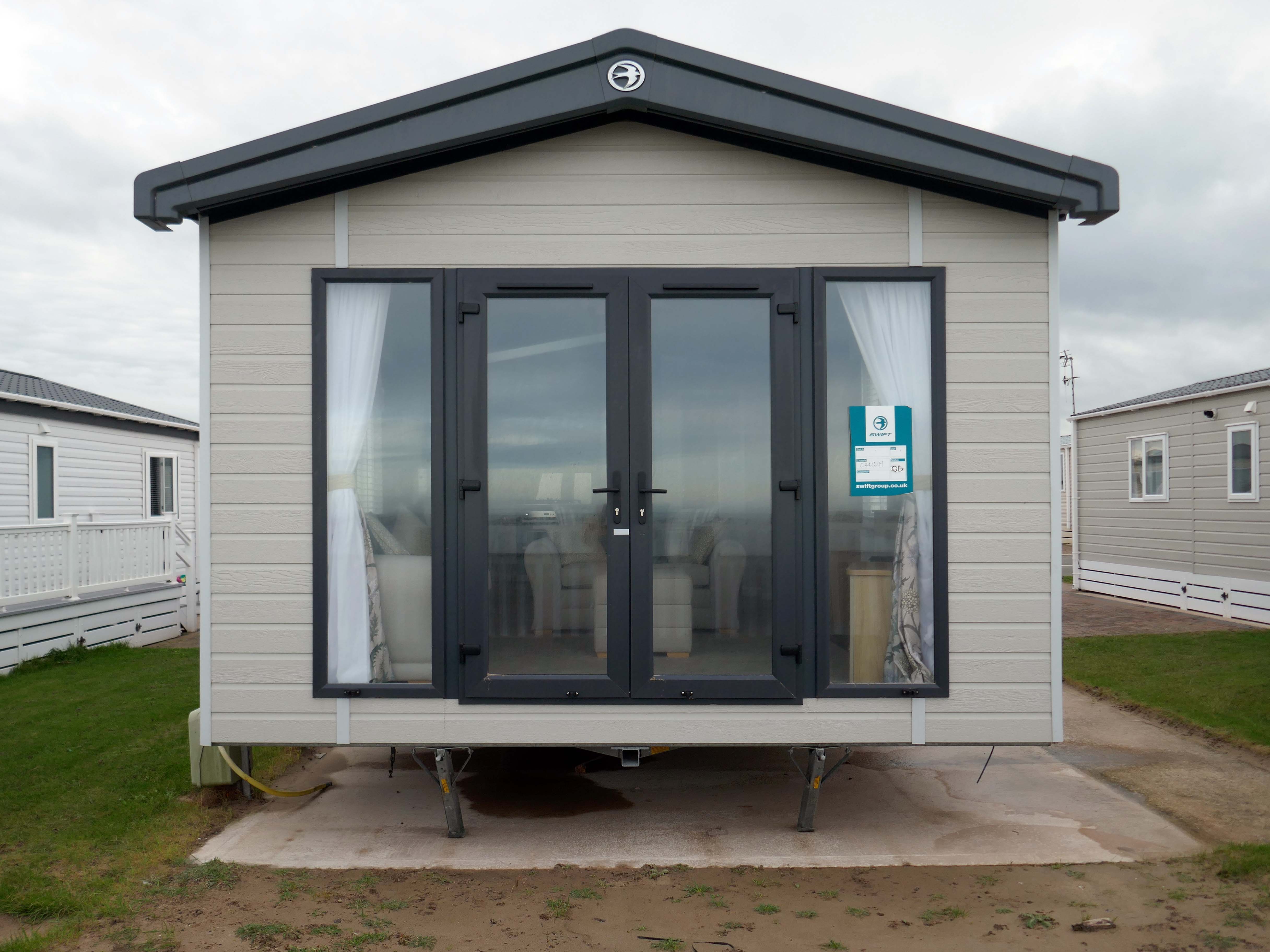
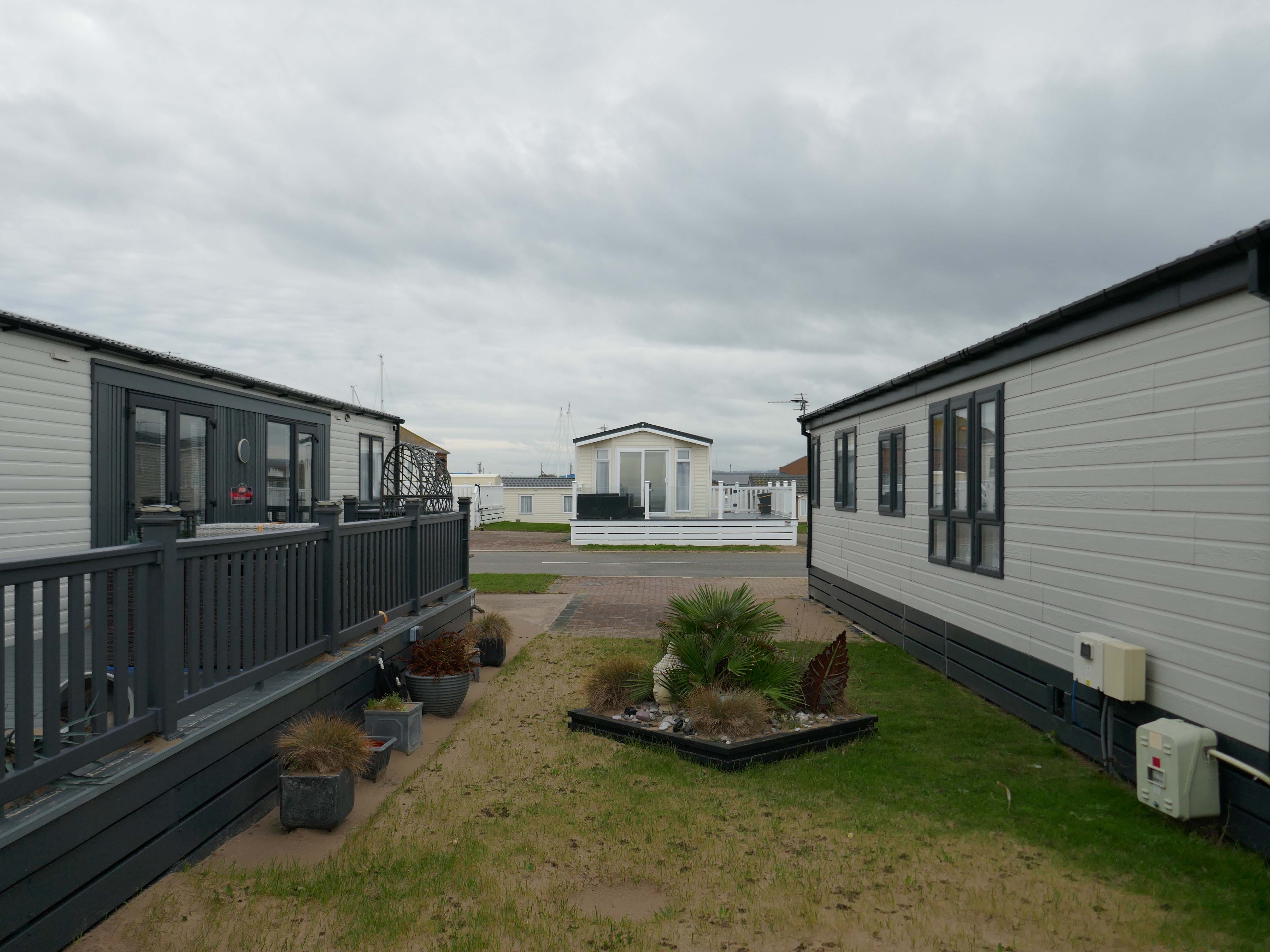
The foreshore home from home for thousands of caravan dwellers.
Golden Sands Holiday Park Rhyl has over 85 years history of fun filled holidays. Wonderfully located right next to the beach in Kinmel Bay in North Wales, it’s the perfect place for a family seaside holiday. It’s also an excellent base for exploring the beauty of North Wales. The town of Rhyl is closest, though also nearby are Prestatyn, Colwyn Bay and Llandudno – with the Great Orme. Blue Flag beaches offering wonderful seaside holiday traditions along with stunning Snowdonia National Park are within an easy drive.
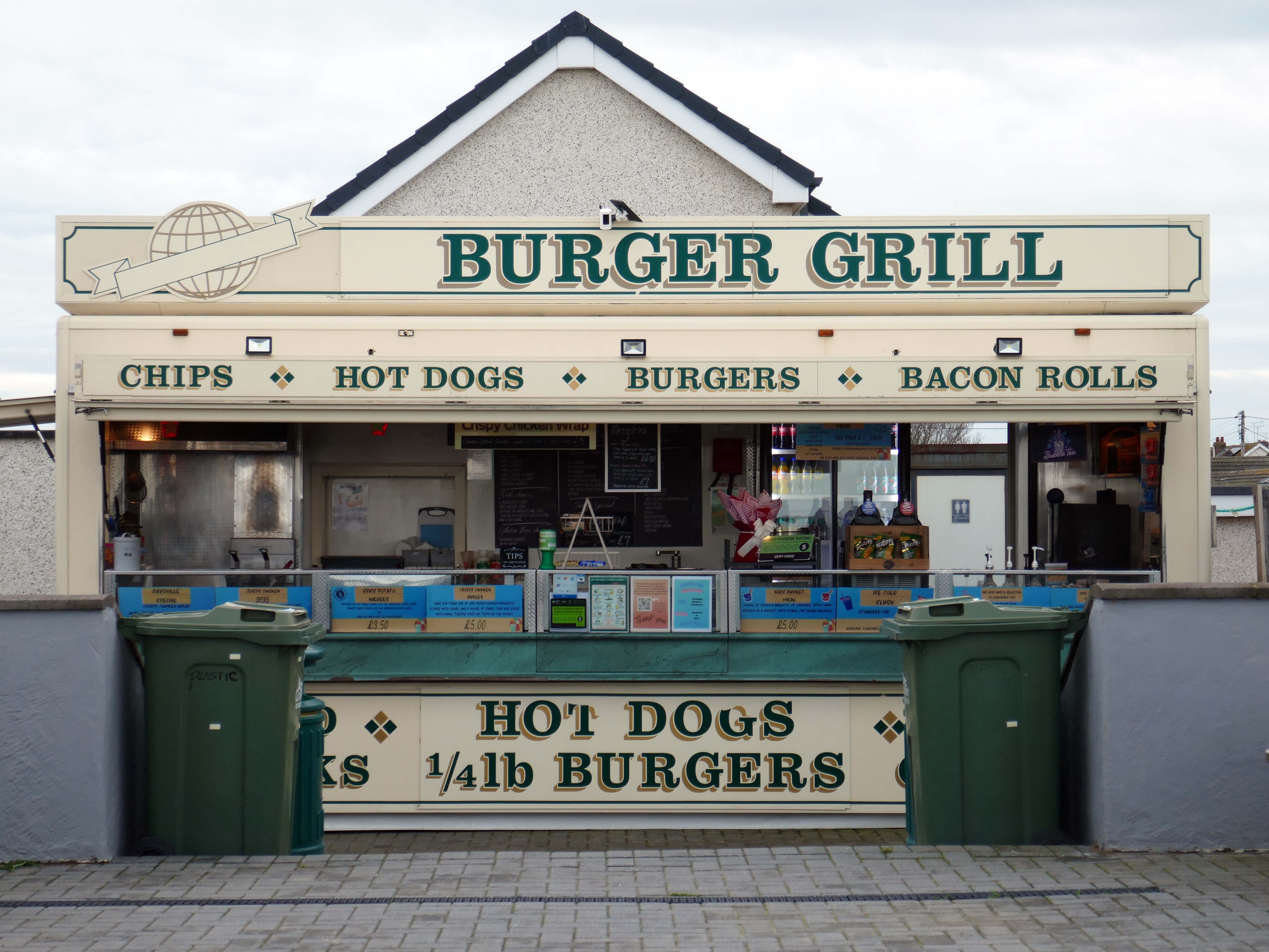
Fast food is often nutritionally poor and high in calories. Evidence demonstrates that overeating commercial fast food products can negatively impact health in both the short and long term.
However:
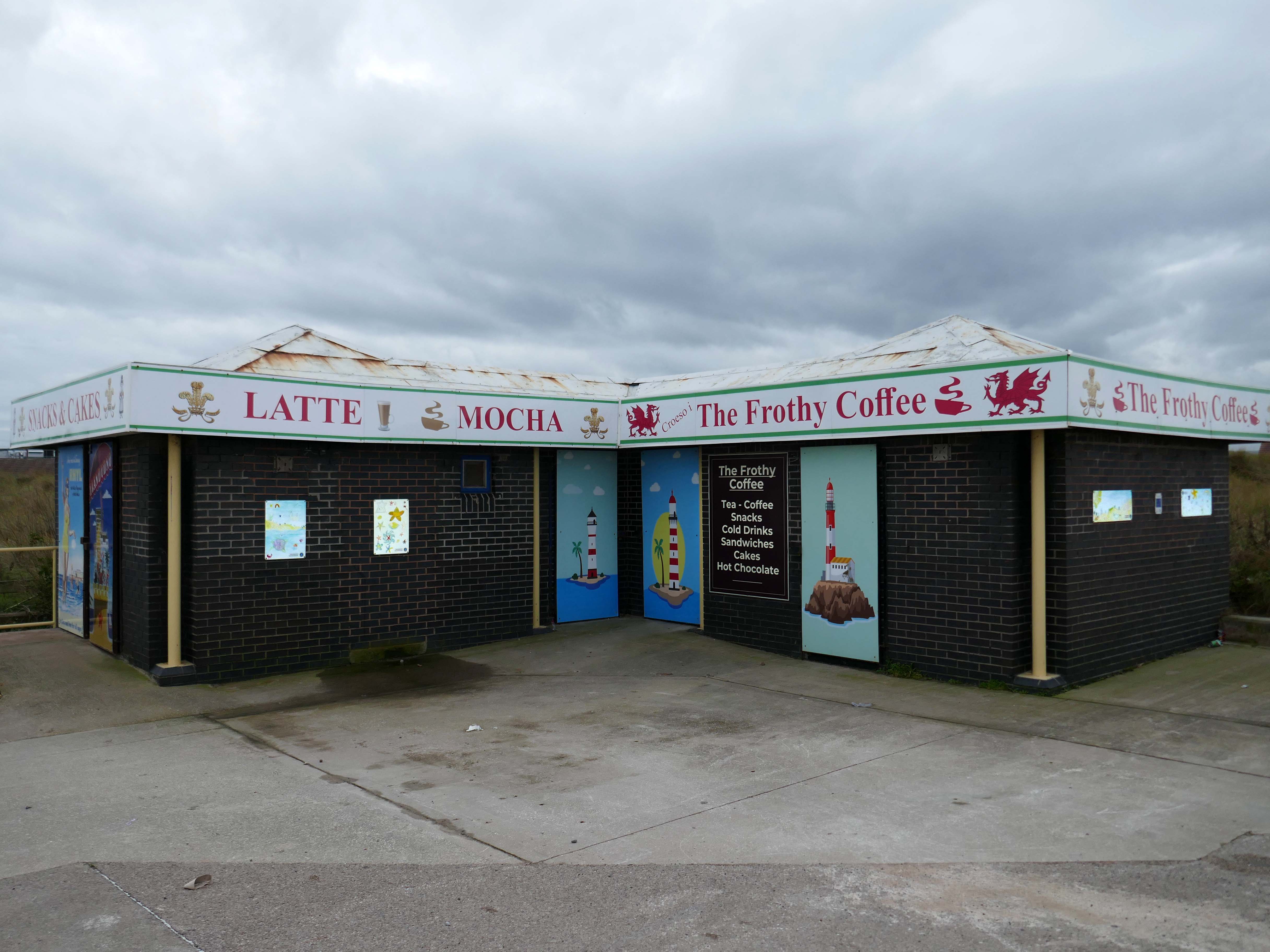
Baysville is lovely and clean, lots of tables and a good choice of foods from ice cream, donuts, burgers, hot and cold drinks and a bar. The staff are pleasant and welcoming.
Researchers have found people who drink up to three cups of coffee a day could have a healthier heart and a lower risk of dying of any cause.
But too much caffeine can produce anxiety, sleeplessness, agitation, palpitations, diarrhoea and restlessness. In individuals with a mental health condition caffeine can worsen psychosis and result in the need for higher amounts of medication.
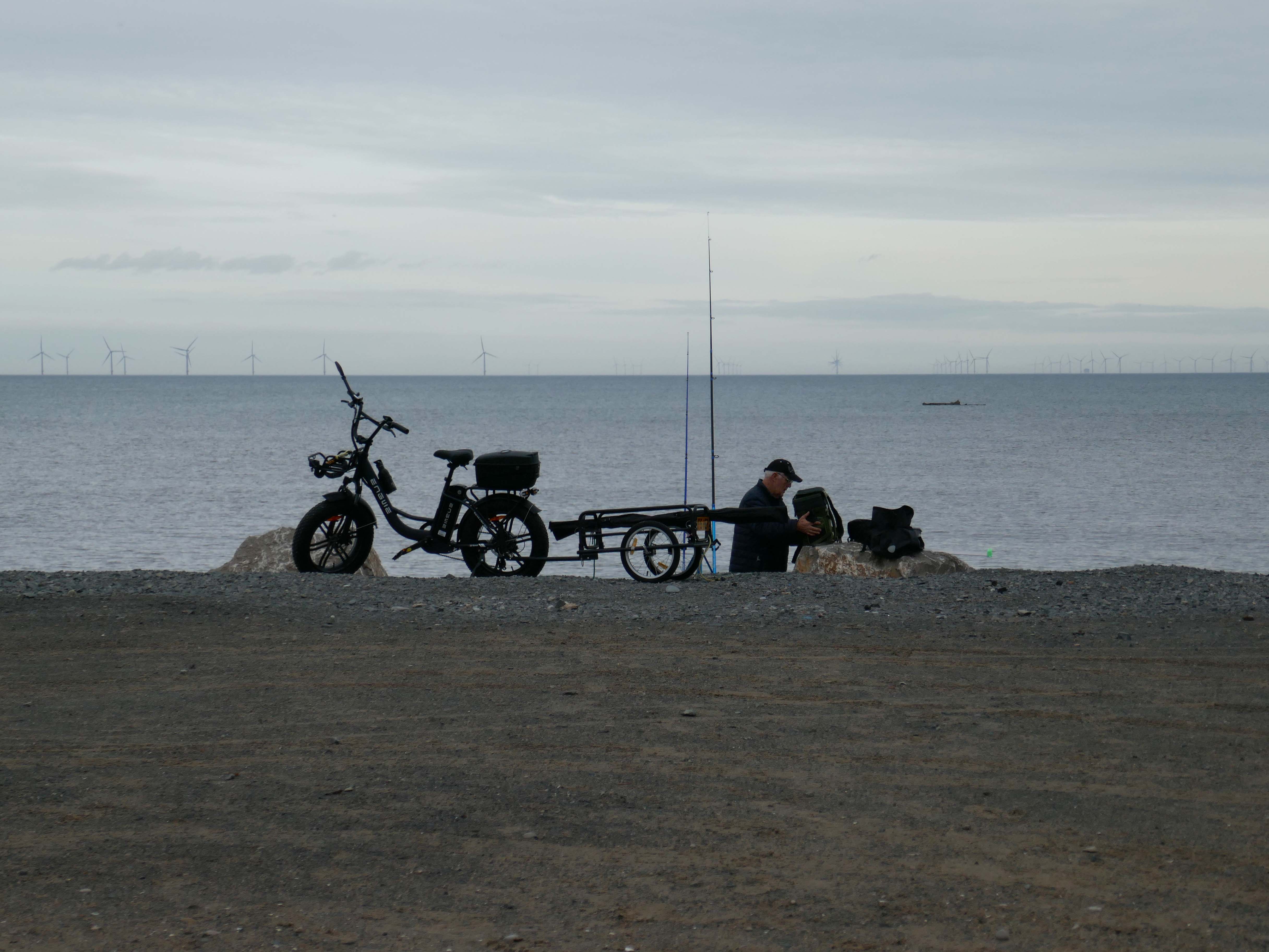
Possibly wiser to take a leisurely ride on your electric bicycle, followed by an hour or two of beach casting .
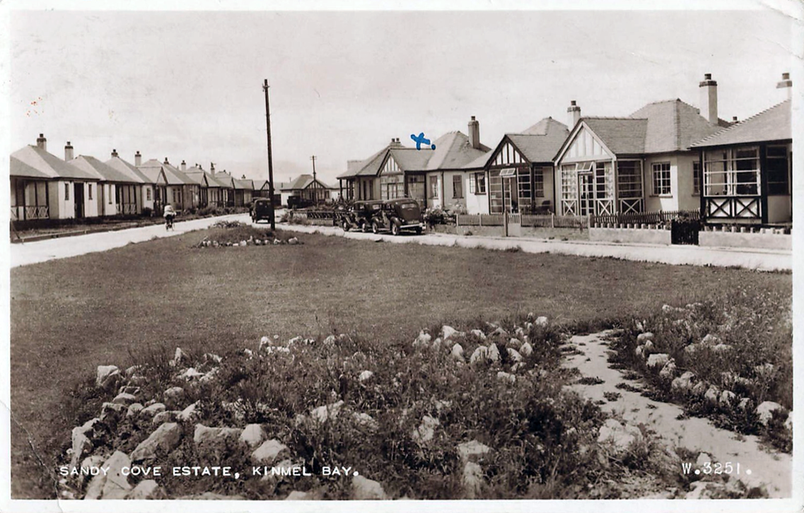
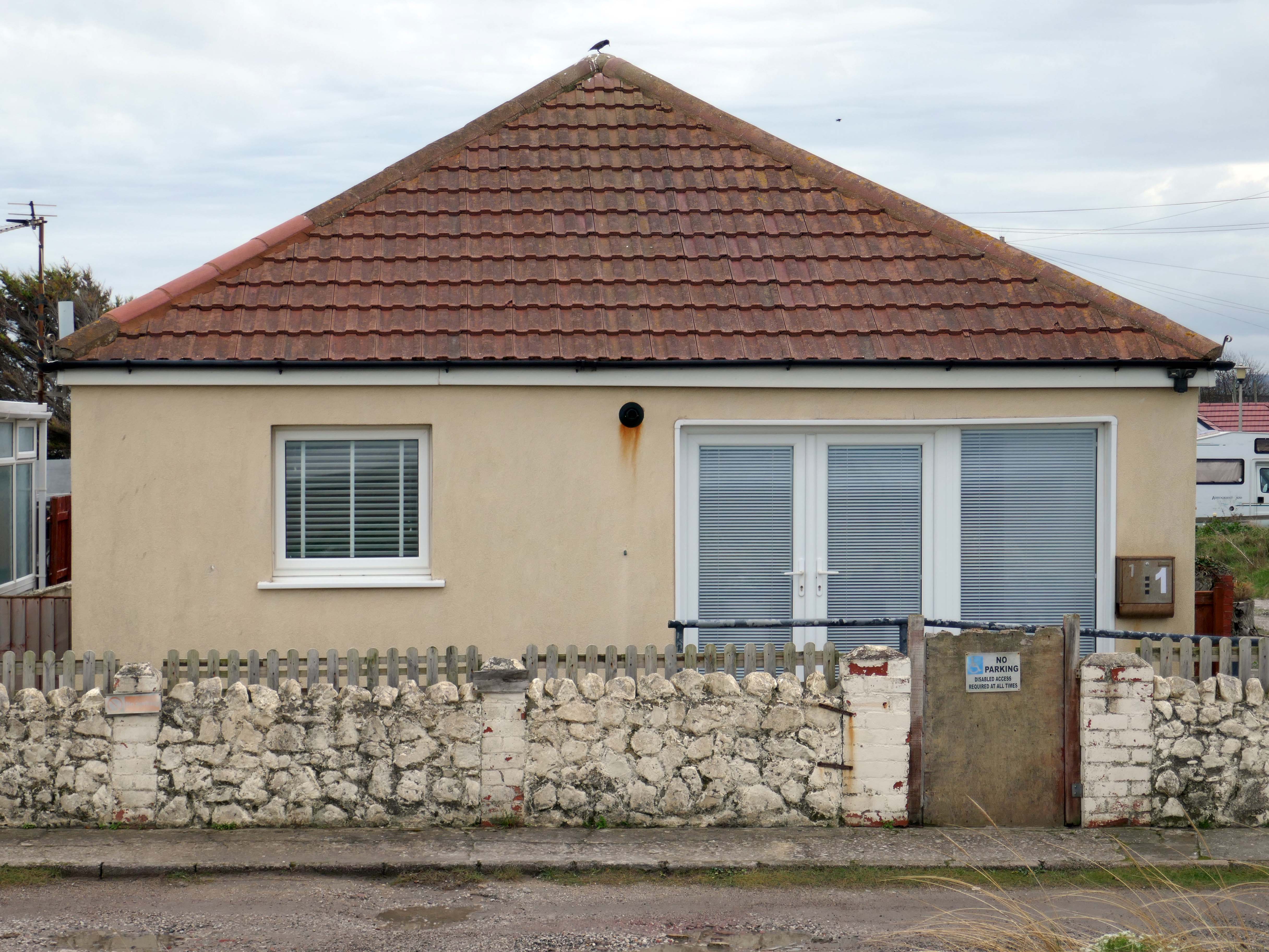
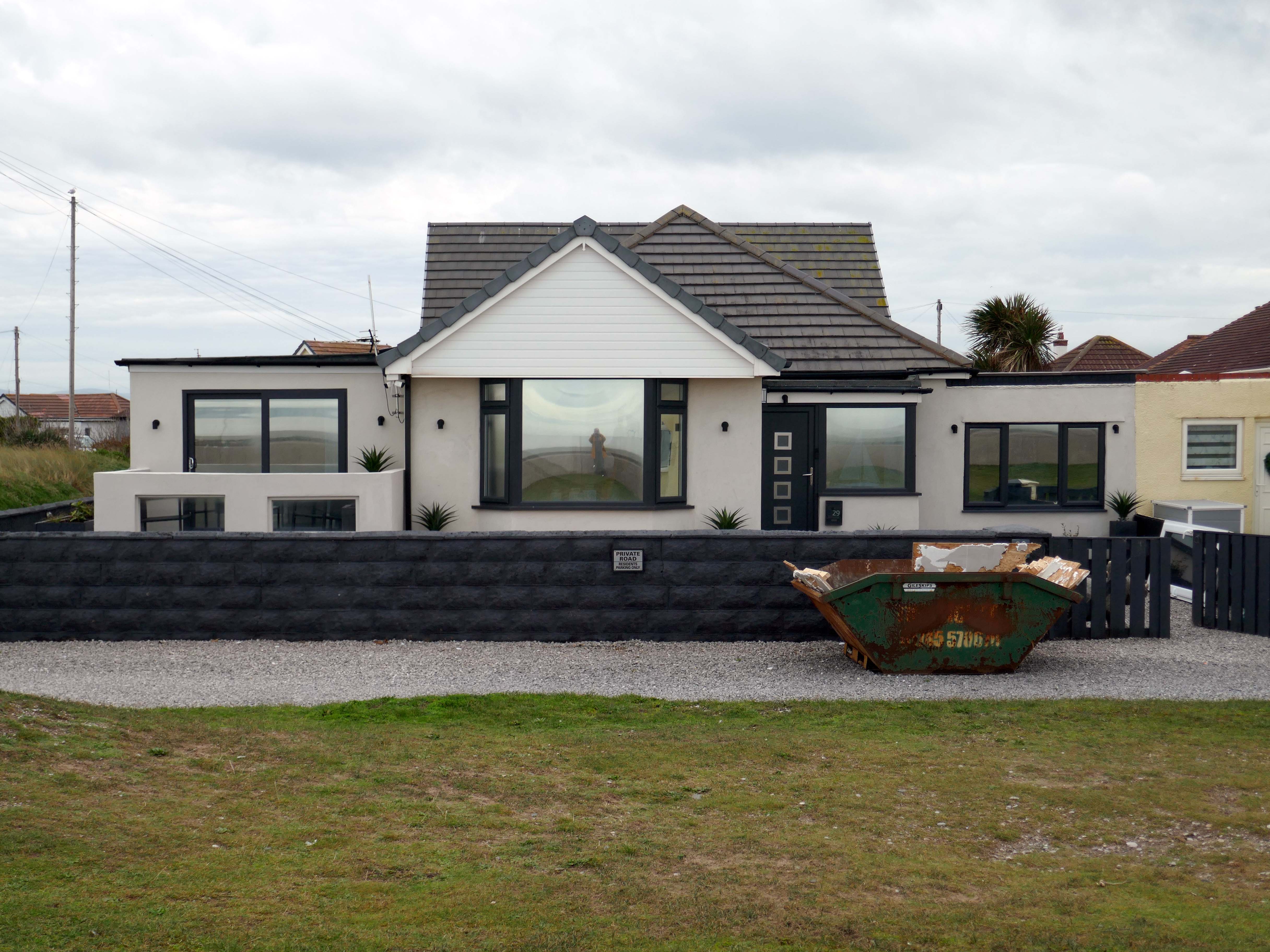
The coastal housing at Kinmel bay is undergoing a cosmetic upheaval, the determinedly down home bungalow swamped by the relentless monotone tide of home improvements.
The Sandy Cove Estate consists of 250 bungalows that were built in the 1930s by the Kinmel Estates Ltd, who sadly went into liquidation around 1947, before the estate was completed. This left the estate with only dirt tracks for roads with no sidewalks or pavements, no drainage for surface water or any adequate street lighting. After the liquidation of the company the roads and communal greens were escheated to the Crown who then offered the land free of charge to successive Councils for the to incorperate into the towns that were developing. This was refused by the Councils.
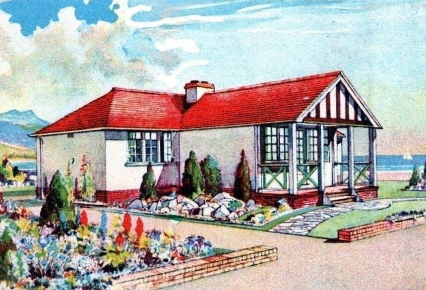
Fifty or more homes are ready for you to choose from, gardens and tennis courts have been provided for the sole use, in perpetuity of residents.
Onward now to Towyn.
The town made national headlines in 1990 when a combination of gale-force winds, a high tide and rough seas caused Towyn’s flood defences to be breached at about 11.00am on 26 February. 4 square miles of land was flooded, affecting 2,800 properties and causing areas of the resort to be evacuated. Further flooding occurred later the same week, on 1 March, shortly after the site of the disaster was visited by Prince Charles and Princess Diana.
Scientific experts also believe that the silt left behind from the flooding had left the town with a higher concentration of radioactivity, over ten times the governmental safety limits, most likely originating from the nuclear processing plant at Sellafield which had been dispersed into the Irish Sea over many years since its construction. The National Radiological Protection Board stated that there was a “small risk” to the people there, while the Welsh Office claimed there was no danger to the public. The coastal defences have since been reconstructed and significantly enhanced.
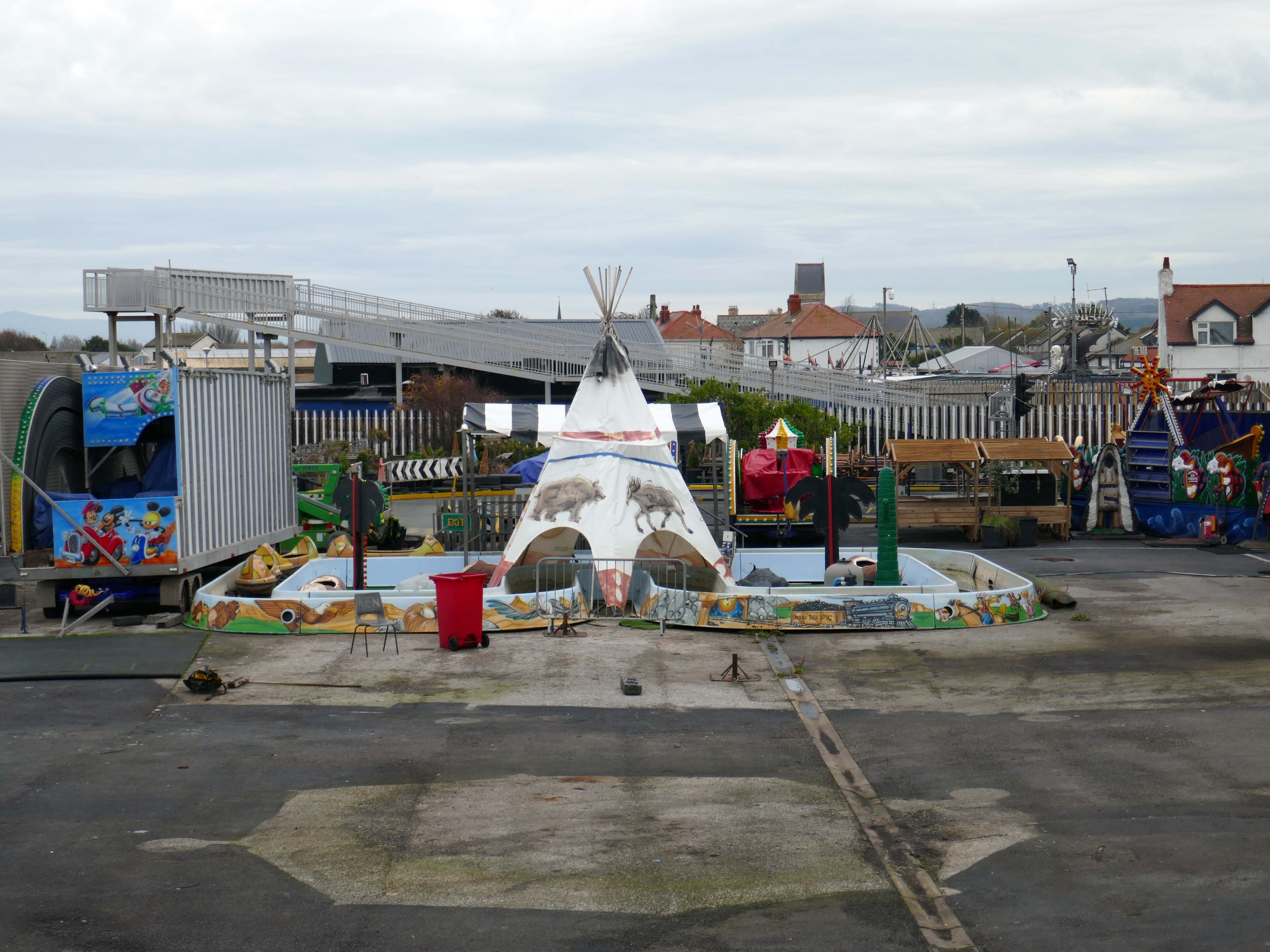
The People of the First Nation here at Knightly’s Fun Park are now safe from the threat of flood.
Knightly’s Funfair has a fantastic range of rides for the whole family! Experience high speed thrills and heart pumping excitement! We’ve got rides for the little ones too as well as games and food stalls to keep the whole family entertained all day!
We also welcome dogs, so you don’t have to leave your furry friends behind!
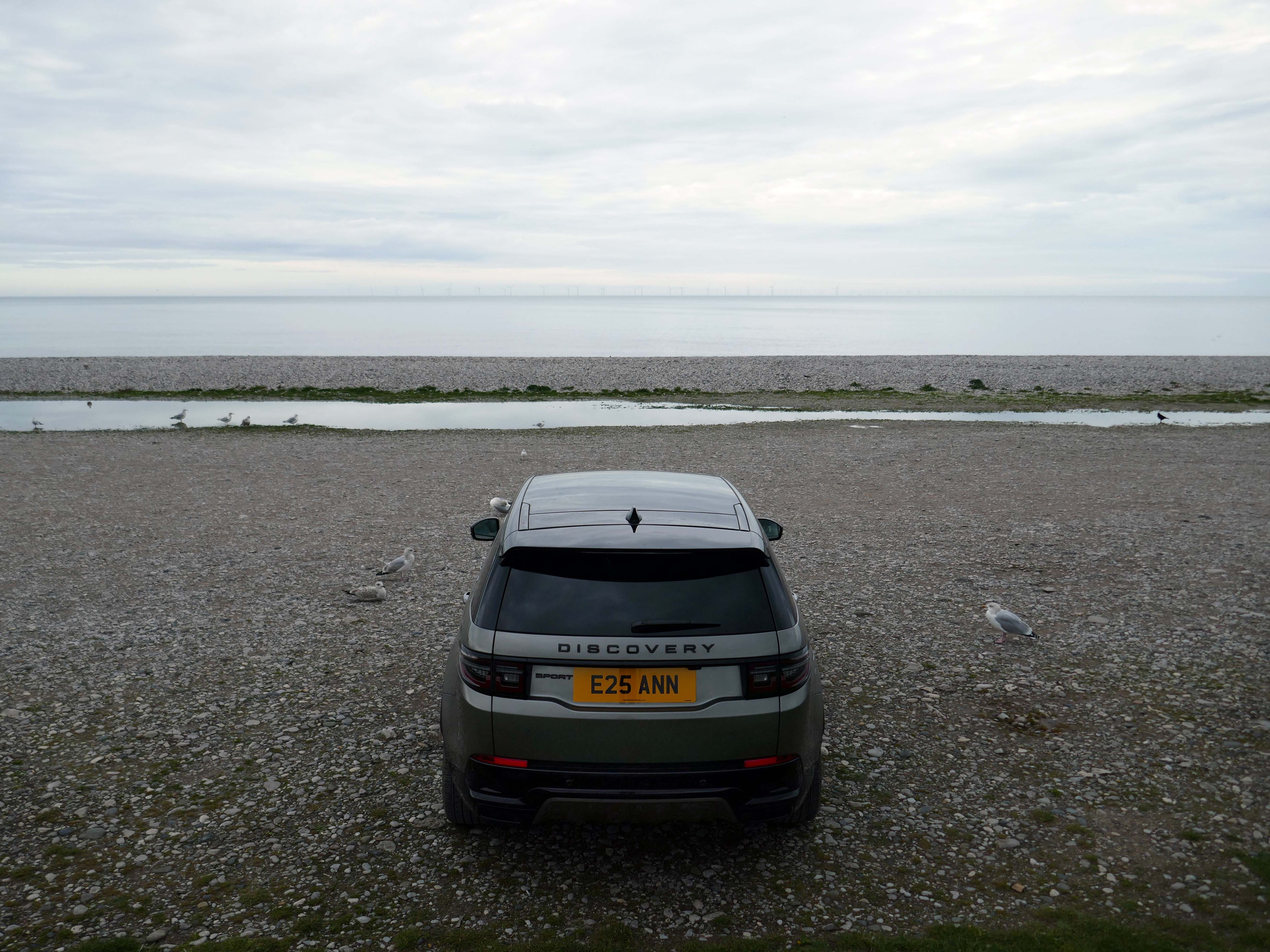
The monotone gentrified home is accompanied by the monotone SUV – the Land Rover Discovery Sport.
The joy of Discovery Sport is in finding that no adventure is out of reach. Offering the ultimate in comfort, while having the toughness to cope with family life.
According to a Europe-wide study, which included the UK, when vehicles are 300kg heavier, the risk of fatal injuries is 30% higher for vulnerable road users.
Pedestrians and cyclists are also 30% more likely to be killed if they’re hit by a car with a bonnet that’s 10cm higher than average.
E25 is Spirulina Extract Phycocyanin, when taken as directed, Spirulina generally doesn’t cause side effects. In some people, it may cause mild side effects, including headaches, diarrhoea, bloating and gas.
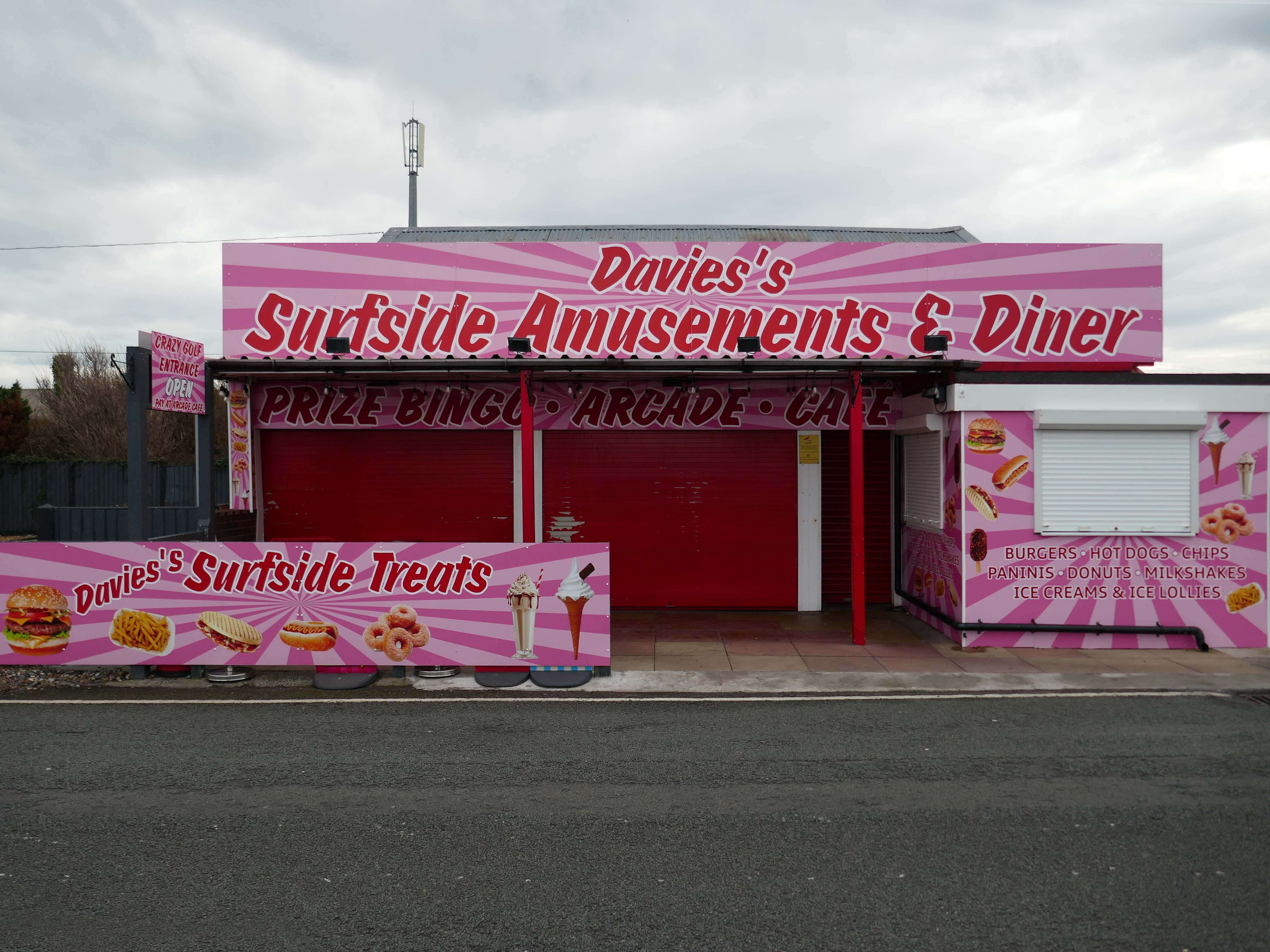
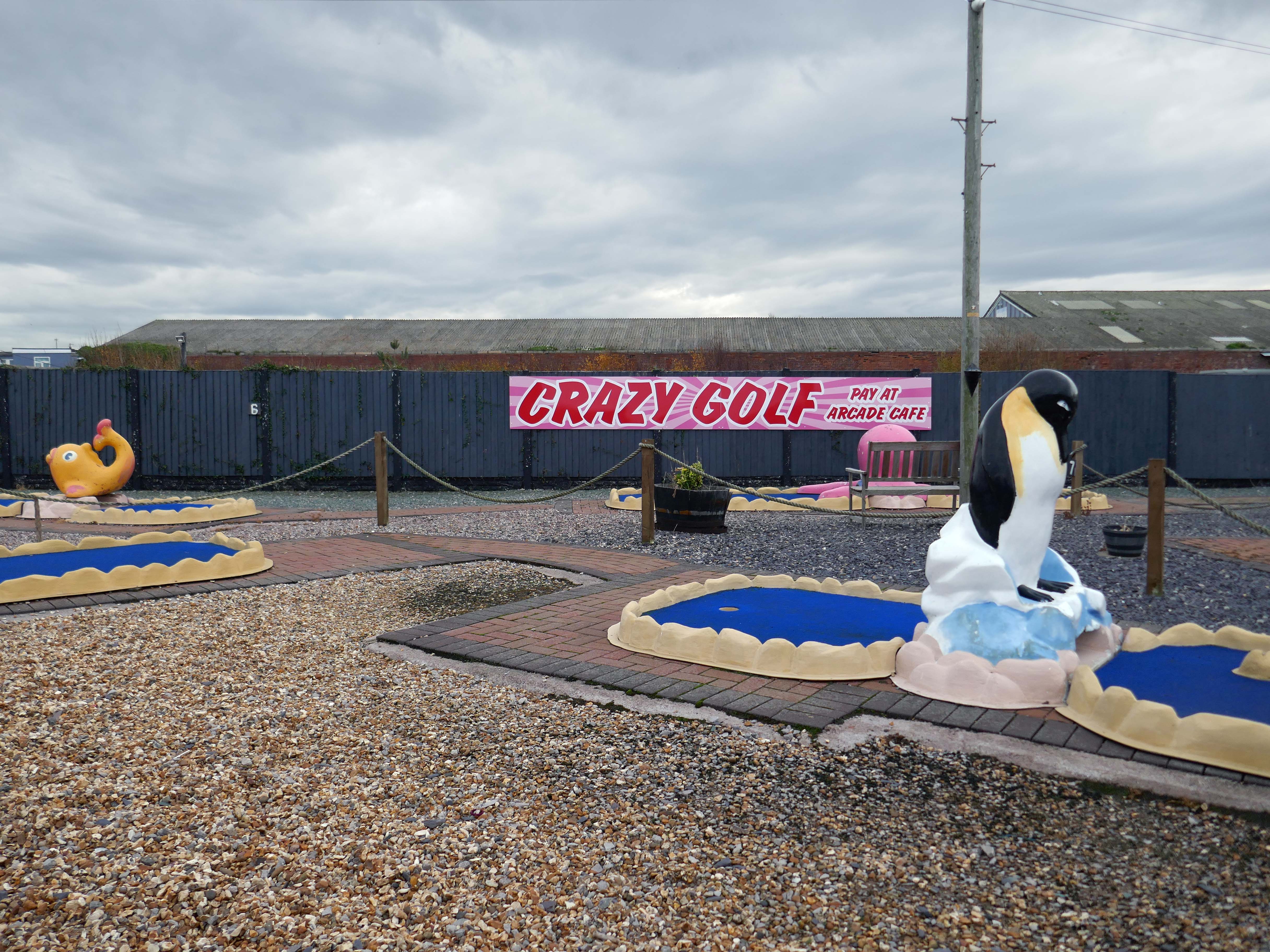
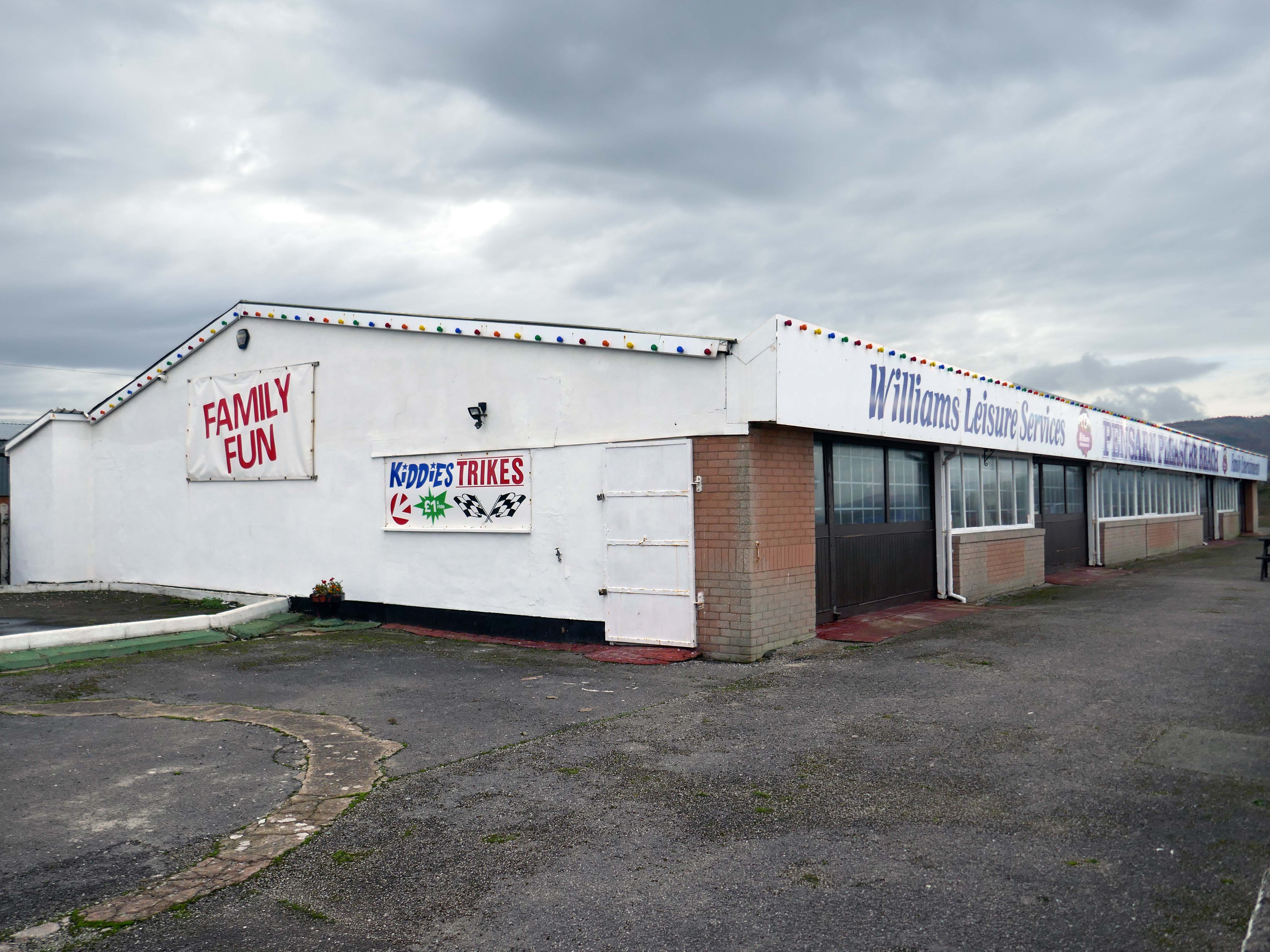
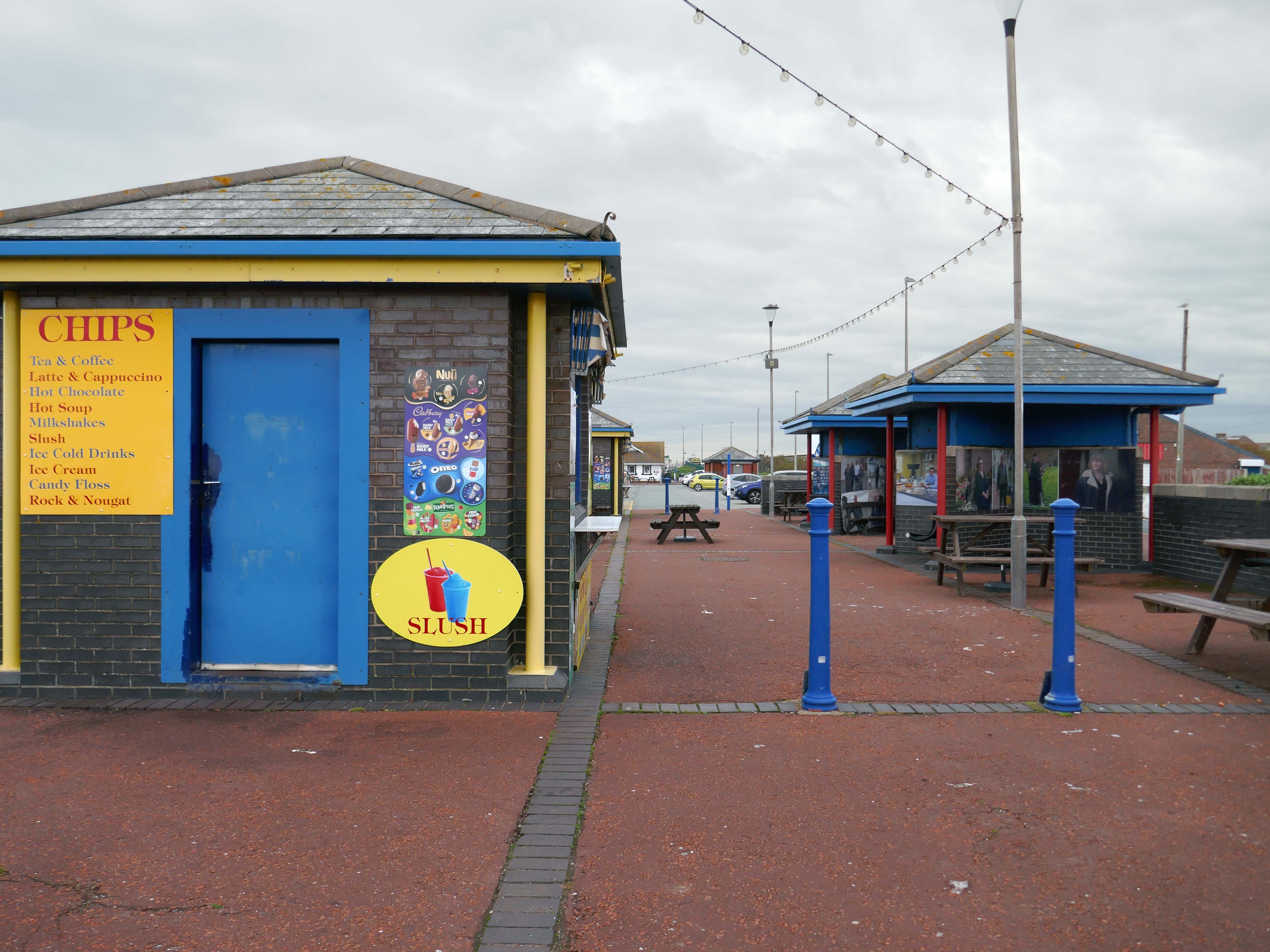
Here we are now at Abergele and Pensarn which have quiet sandy beaches close to historic sites and wooded hills. From here, you can escape the stresses of everyday life. Enjoy sea views, historic places such as Gwrych Castle – home to ITV’s I’m a Celebrity 2020 and 2021 TV series, and a range of things to do providing fun for all the family.
Pensarn Pleasure Beach Amusement Arcade, operated by Laurence Williams Amusements, offers a charming family-friendly experience. Visitors often highlight its nostalgic appeal with fun penny machines and small shops selling drinks and handmade goods.
While many appreciate the charm of the arcade, some mention that certain machines are quite dated and do not work properly, this aspect may affect overall enjoyment for some users.
The reviews indicate a good variety of activities including classic penny slots and local shops offering food and unique handmade items like dog harnesses, catering to diverse interests.
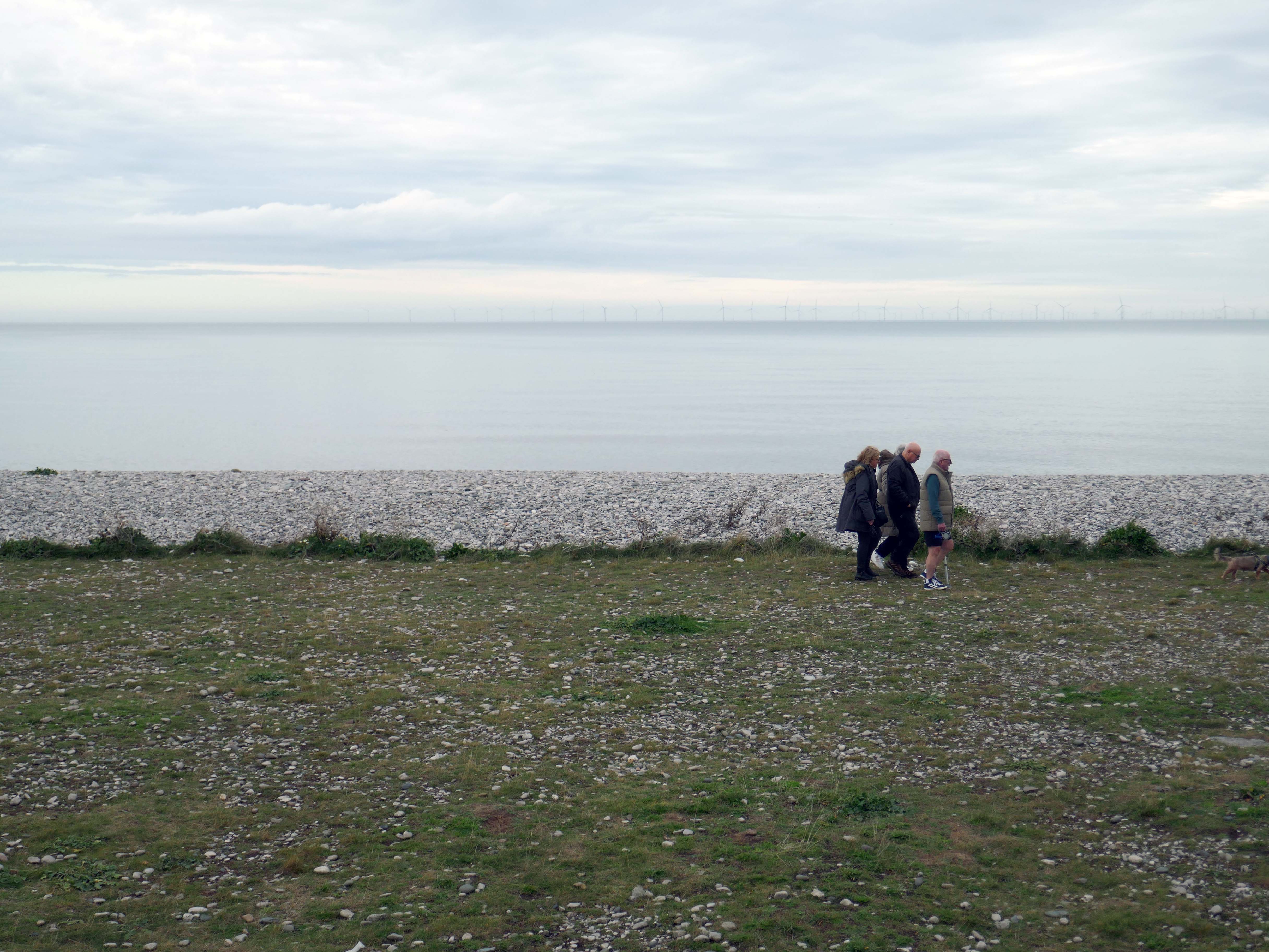
Such a pleasant stretch of coast to stretch your legs along.
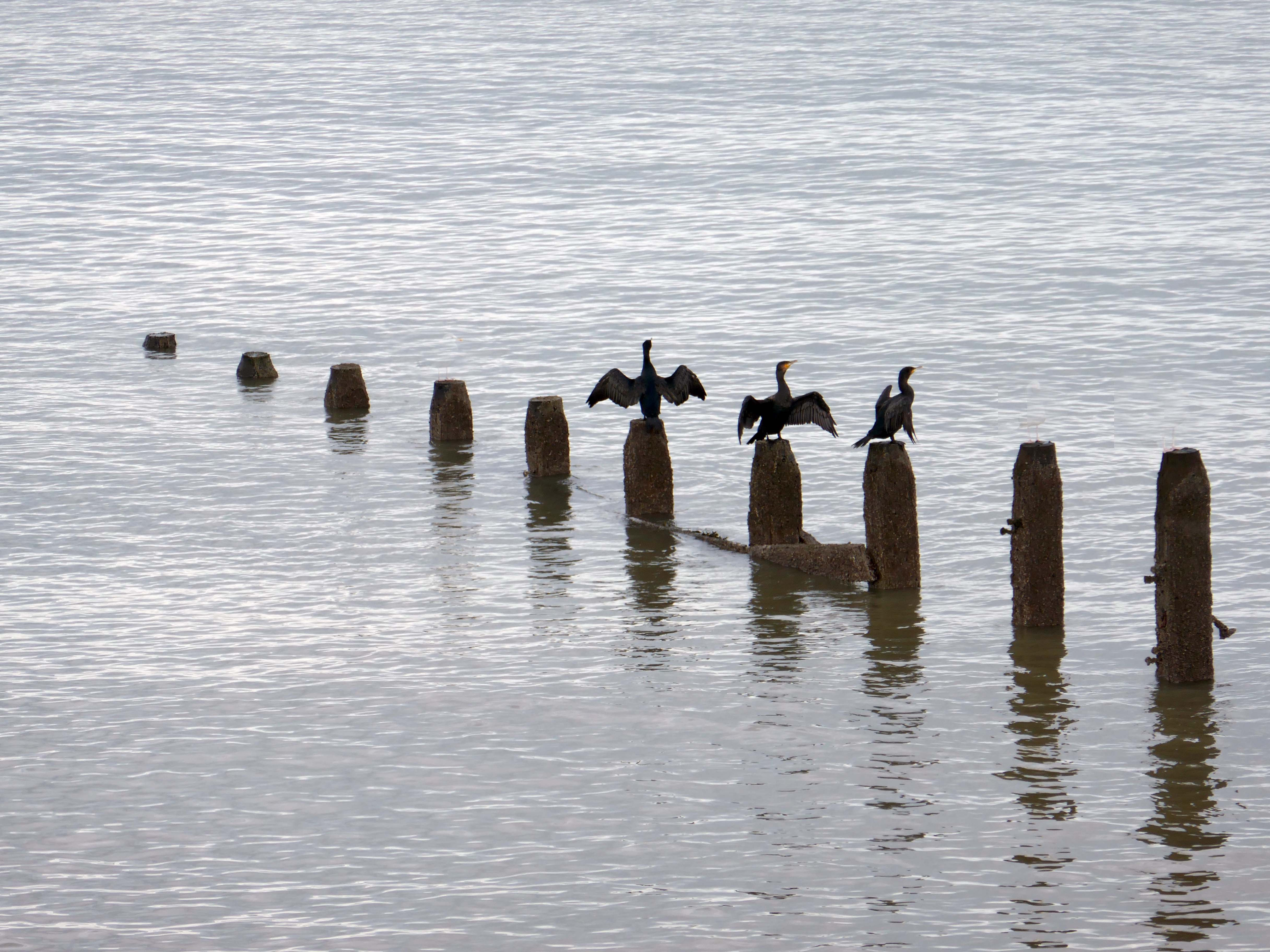
Or to stretch your wings for that matter, should you happen to be a cormorant.
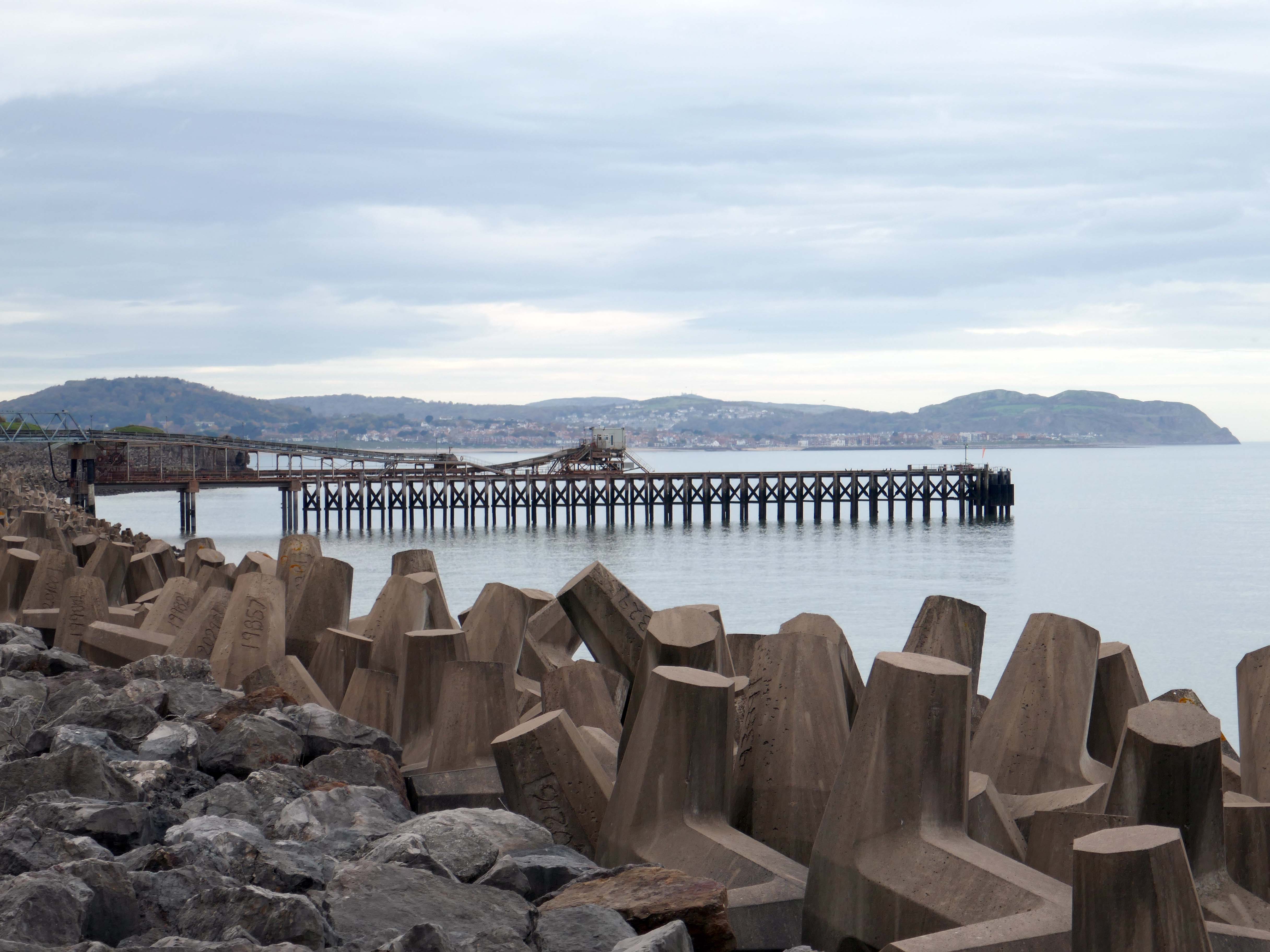
Coastal defences from the giant concrete bobbers and jacks.
A tetrapod is a form of wave-dissipating concrete block used to prevent erosion caused by weather and longshore drift, primarily to enforce coastal structures such as seawalls and breakwaters. Tetrapods are made of concrete, and use a tetrahedral shape to dissipate the force of incoming waves by allowing water to flow around rather than against them, and to reduce displacement by interlocking.
Tetrapods were originally developed in 1950 by Pierre Danel and Paul Anglès d’Auriac of Laboratoire Dauphinois d’Hydraulique in Grenoble,who received a patent for the design. The French invention was named tétrapode, derived from Greek tetra ‘four’ and pode ‘foot’.
Tetrapods were first used at the thermal power station in Roches Noires in Casablanca, to protect the sea water intake.
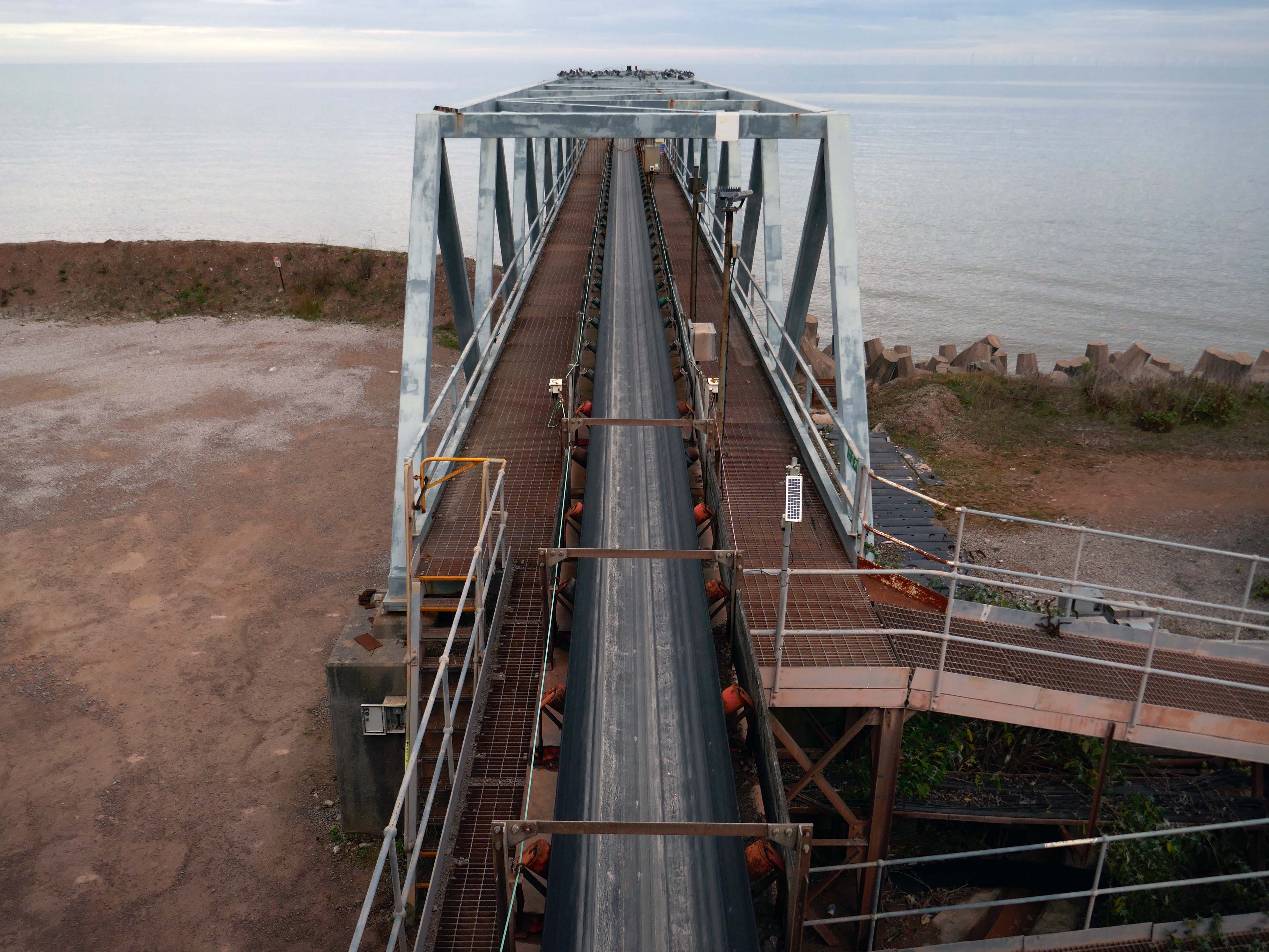
Next we pass Raynes Jetty the quarry conveyor belt – shifting and shipping limestone out to sea.
Limestone from Raynes quarry, to the south, is transported by conveyor belts to the jetty, crossing the A55 Expressway and railway. From the jetty it is loaded into coastal freighters which take it to other parts of the British Isles. Limestone from this quarry is a pure form of the rock, making it ideal for the chemical and cement industries.
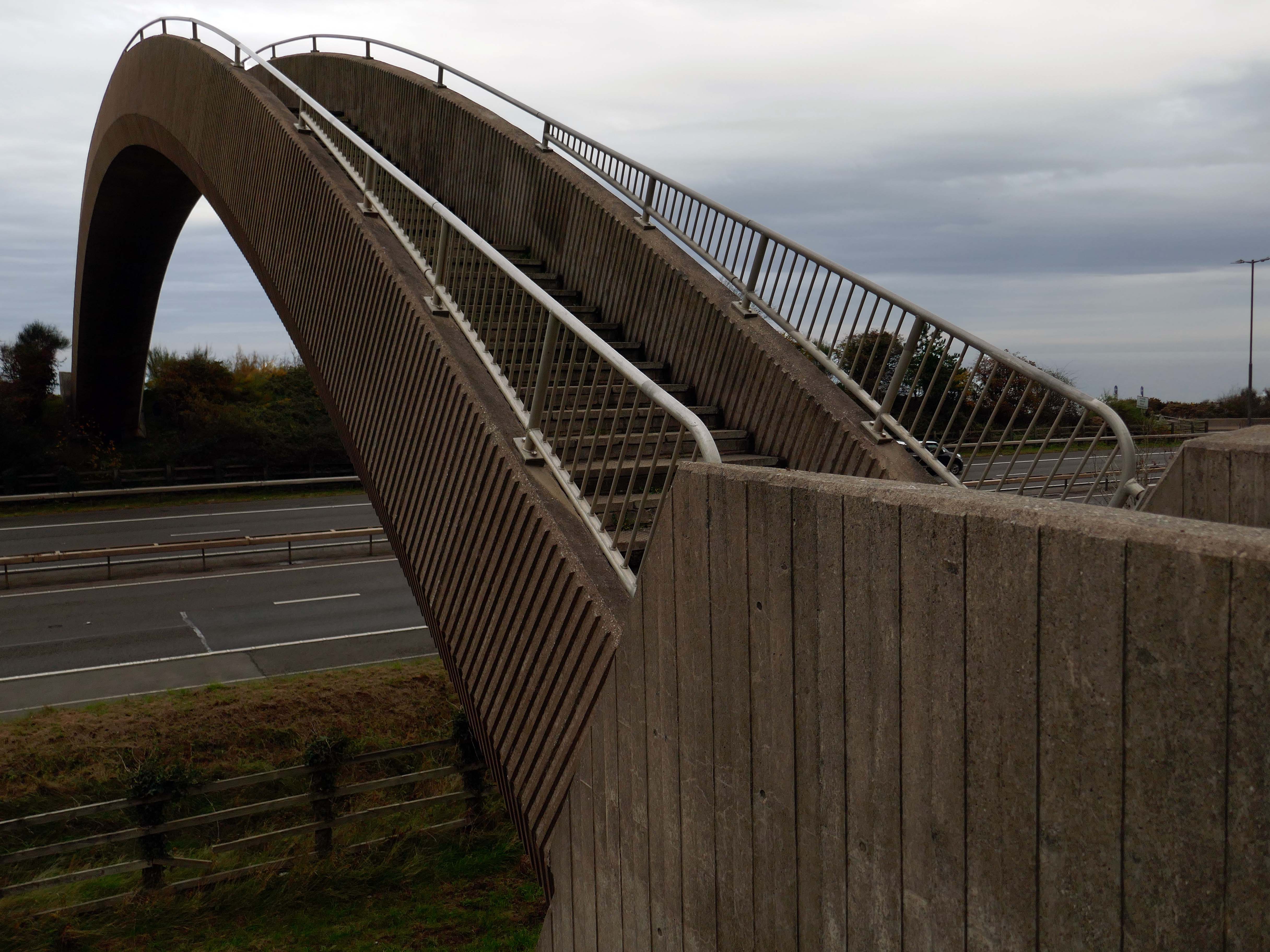
Limestone forming an important constituent part of the nearby concrete Rainbow Bridge – linking Old Colwyn’s pedestrians to the shore.
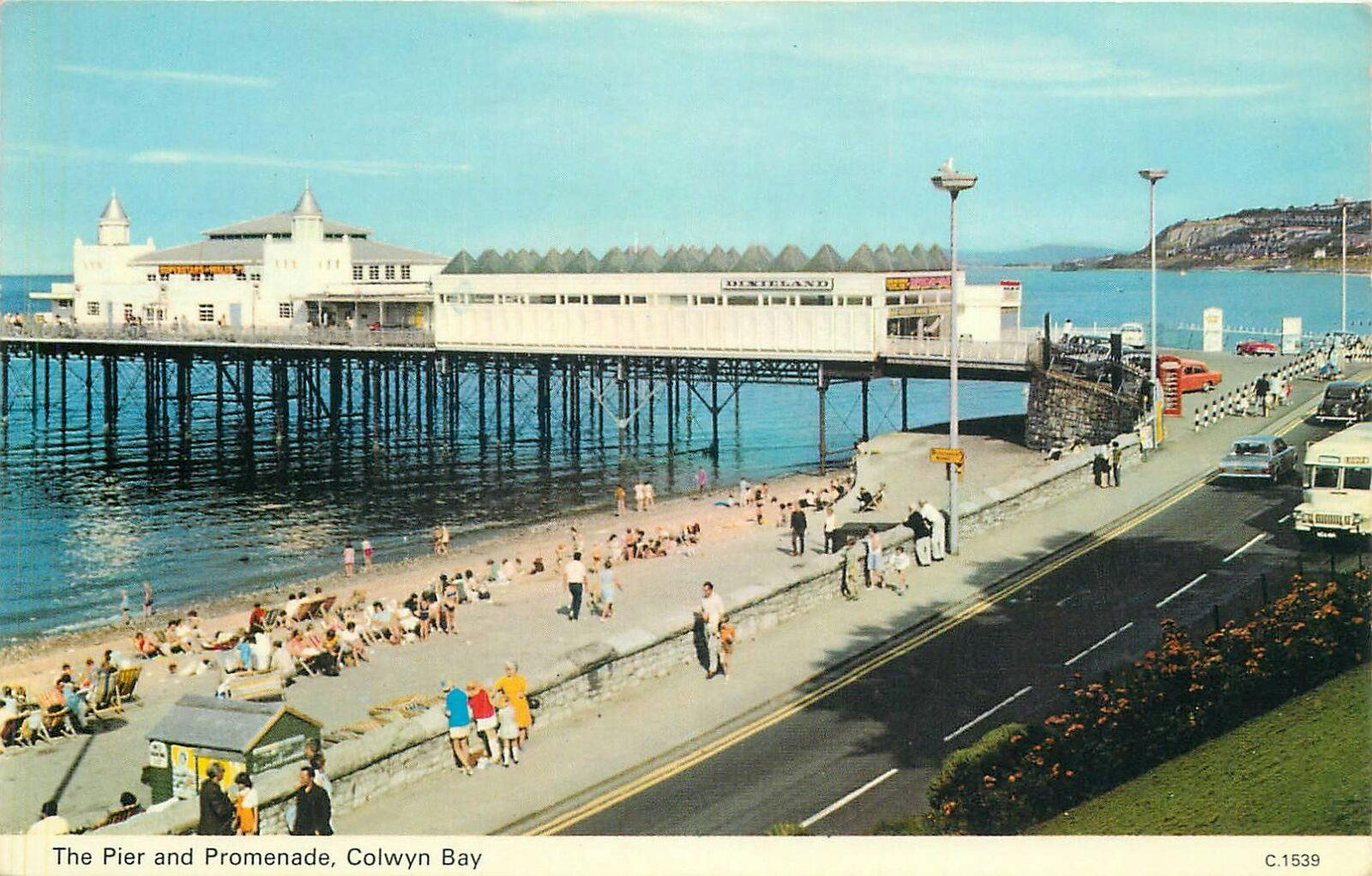
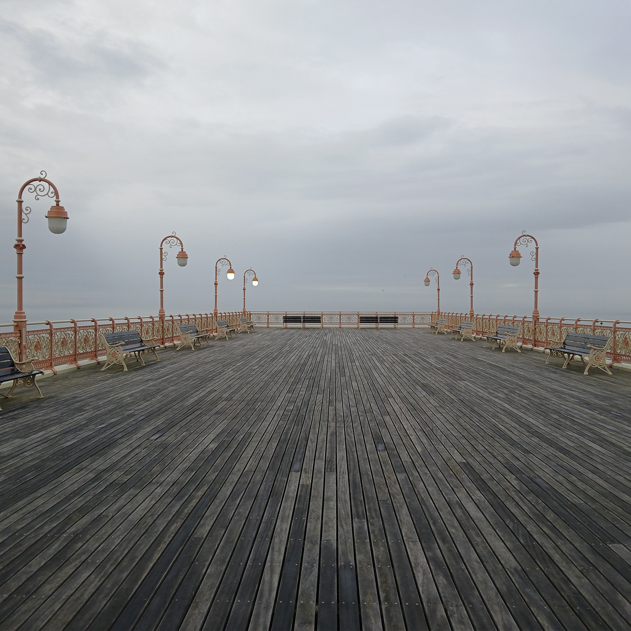
On the site of Colwyn Bay Pier is a seriously truncated pier.
It was conceived in the late 19th century, when Colwyn Bay wanted to catch up with other towns which had piers where steamers deposited and collected passengers. However, it was found that the proposed pier would have to extend almost half a mile to reach the area where the water was deep enough for ships. This was too costly, so the pier was built purely for entertainments. The councillors saved face by saying this would avoid day trippers arriving by steamer and lowering the tone of Colwyn Bay!
The pier was less than 100 metres long when it opened in 1900. The pavilion had a 2,500-seat theatre, shops and a restaurant. The opening performance featured Adelina Patti, one of the world’s most renowned operatic sopranos in her day.
The final pavilion, opened in 1934, incorporated Art Deco features and murals by Eric Ravilious and Mary Adshead.
Both walls of the last remaining Eric Ravilious mural have been successfully removed, and were placed safely in storage. But with CCBC staff set to relocate to new Colwyn Bay offices a more permanent home is needed for the murals.
Many of those features were destroyed or obscured in post-war refurbishments. Entertainers who performed at the pier in this period included comedians Ken Dodd and Morecambe and Wise, and singers Harry Secombe and Elvis Costello.
The new promenade, measuring 2.3 miles long, has been designed to protect the town and its infrastructure from the effects of the sea. The project was split into two phases; the first, to remove what was originally there and to construct the new raised promenade including a road, cycleway and car parking. The second phase was to transform the promenade with further development as well as reinforce the defence structures.
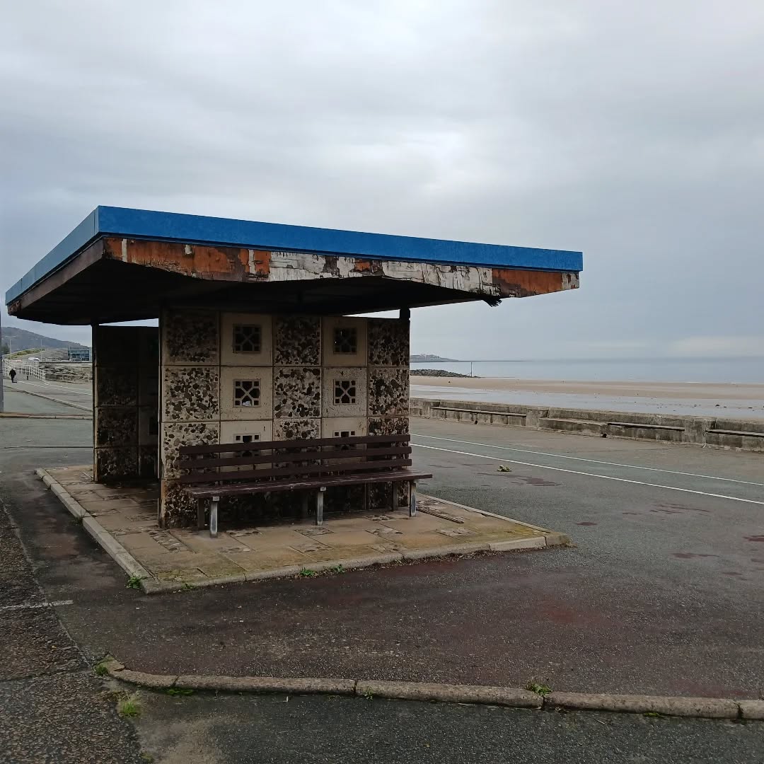
This is the last of the Sixties concrete shelters – which once stretched all the way to Rhos on Sea.
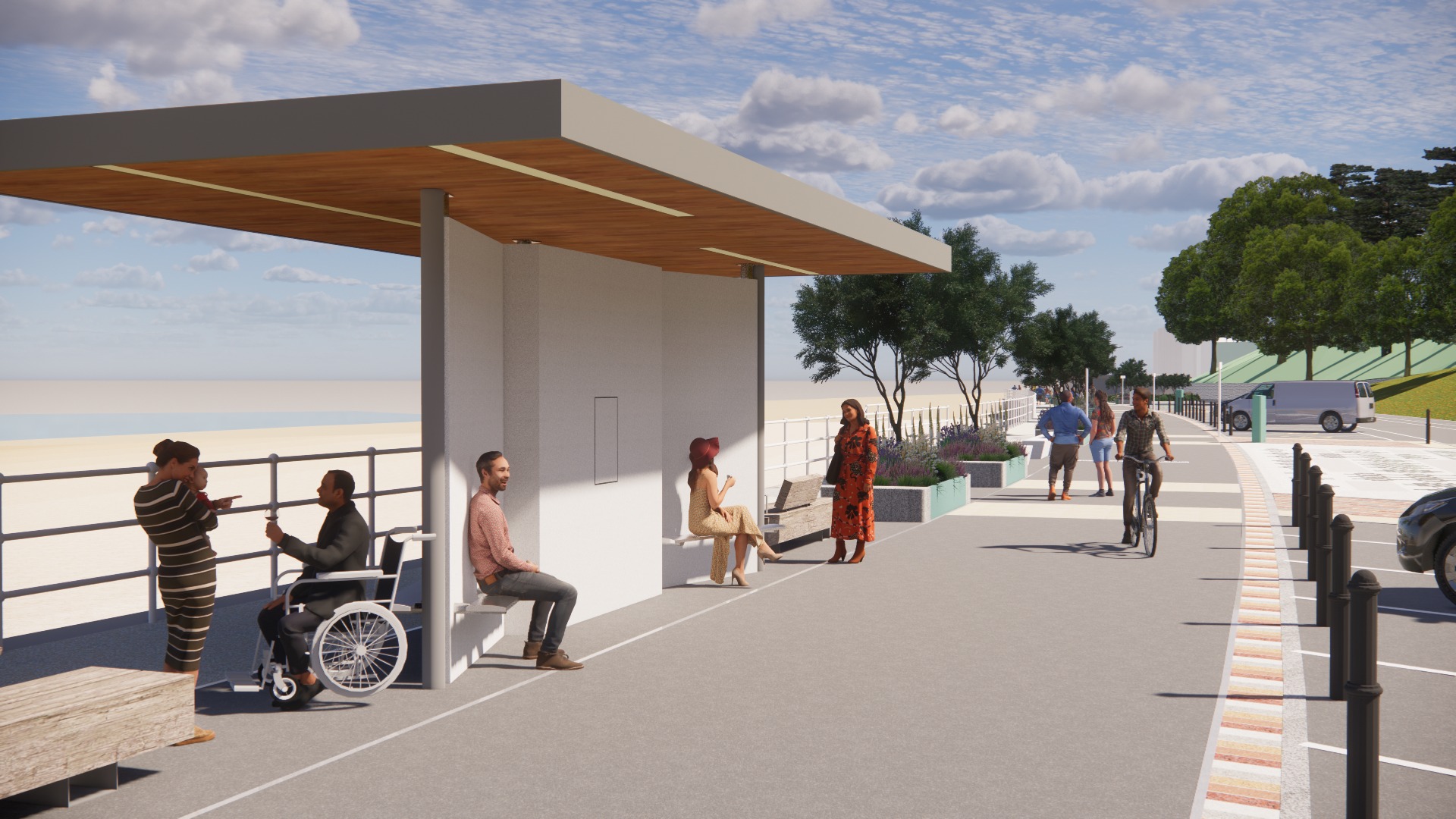
New shelters have appeared
A Conwy County Borough Council spokesperson said:
The shelters include new features such as solar power lighting and are designed to be accessible for wheelchair and mobility scooter users.
The closed design of the old shelters made anti-social behaviour easier and led to their condition deteriorating.
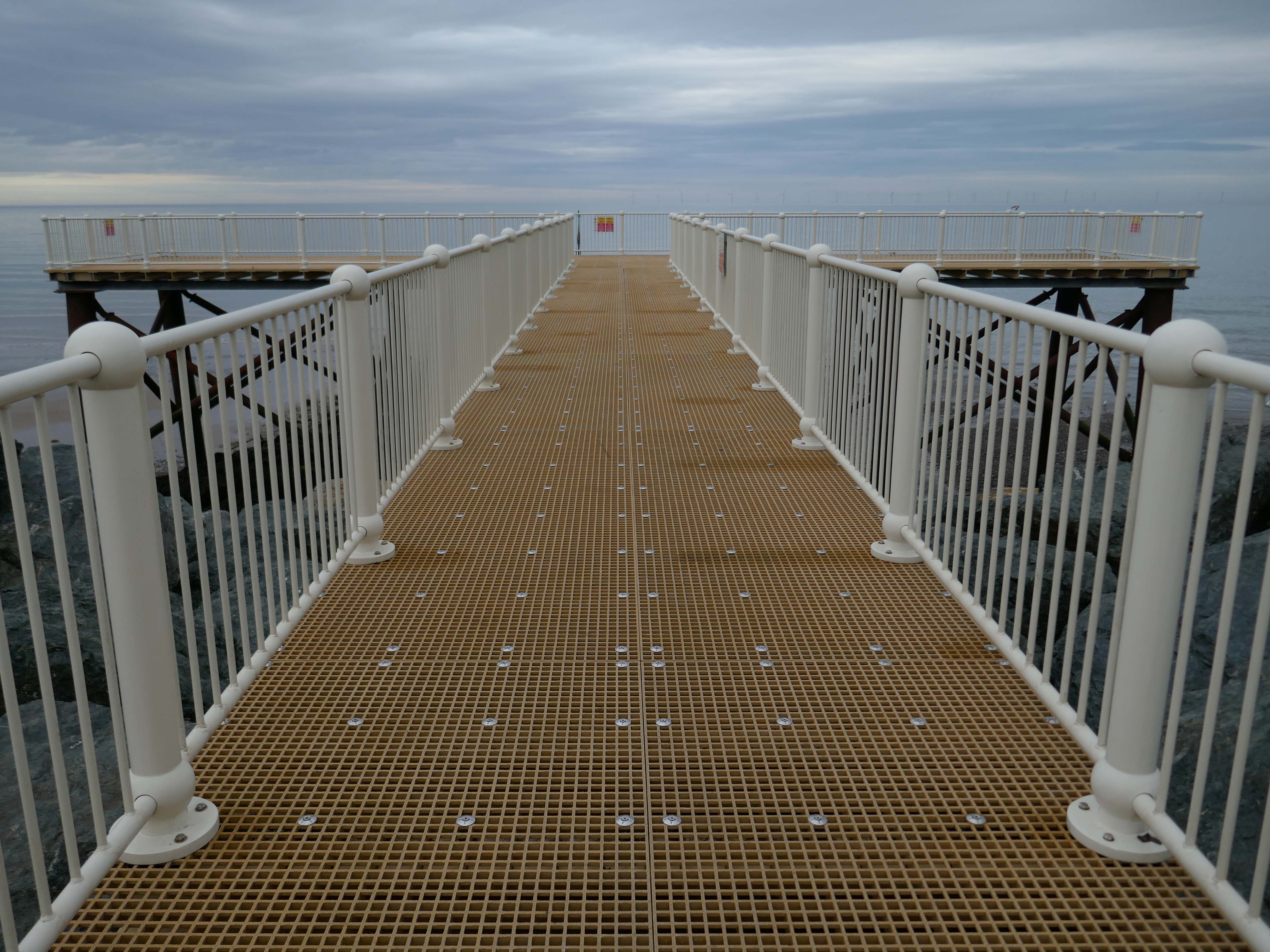
And a new pier has appeared.
Construction on the new Pier at Colwyn Bay commenced in July 2020. Despite being initially slated for completion in the summer, the erection of scaffolding and subsequent work on the 45-meter truncated Colwyn Bay pier were delayed. However, the project timeline was expedited, and the construction was successfully finished in July 2021.
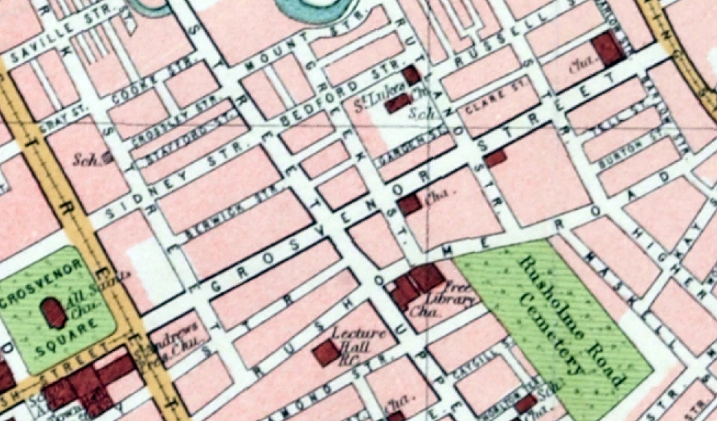
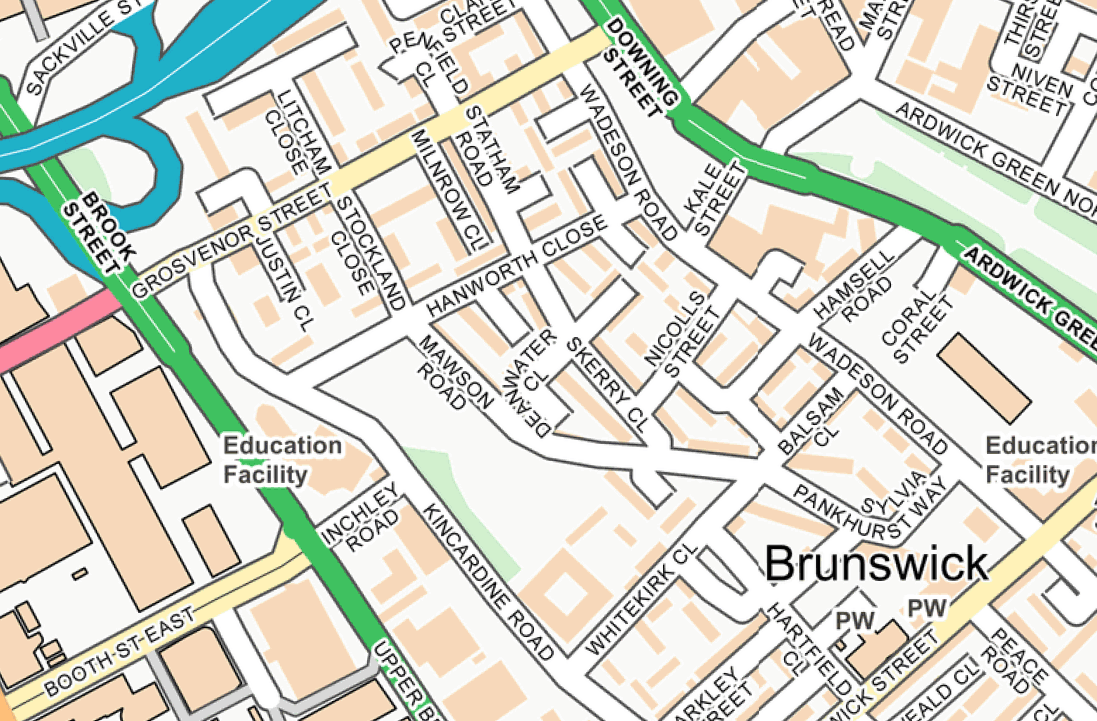
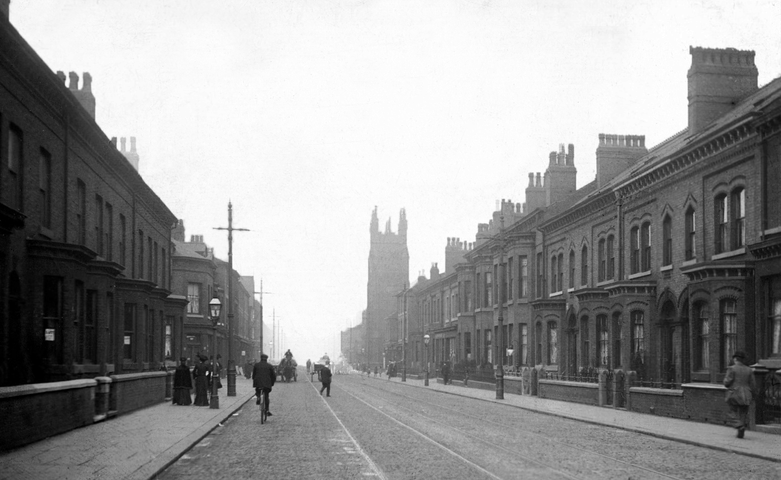
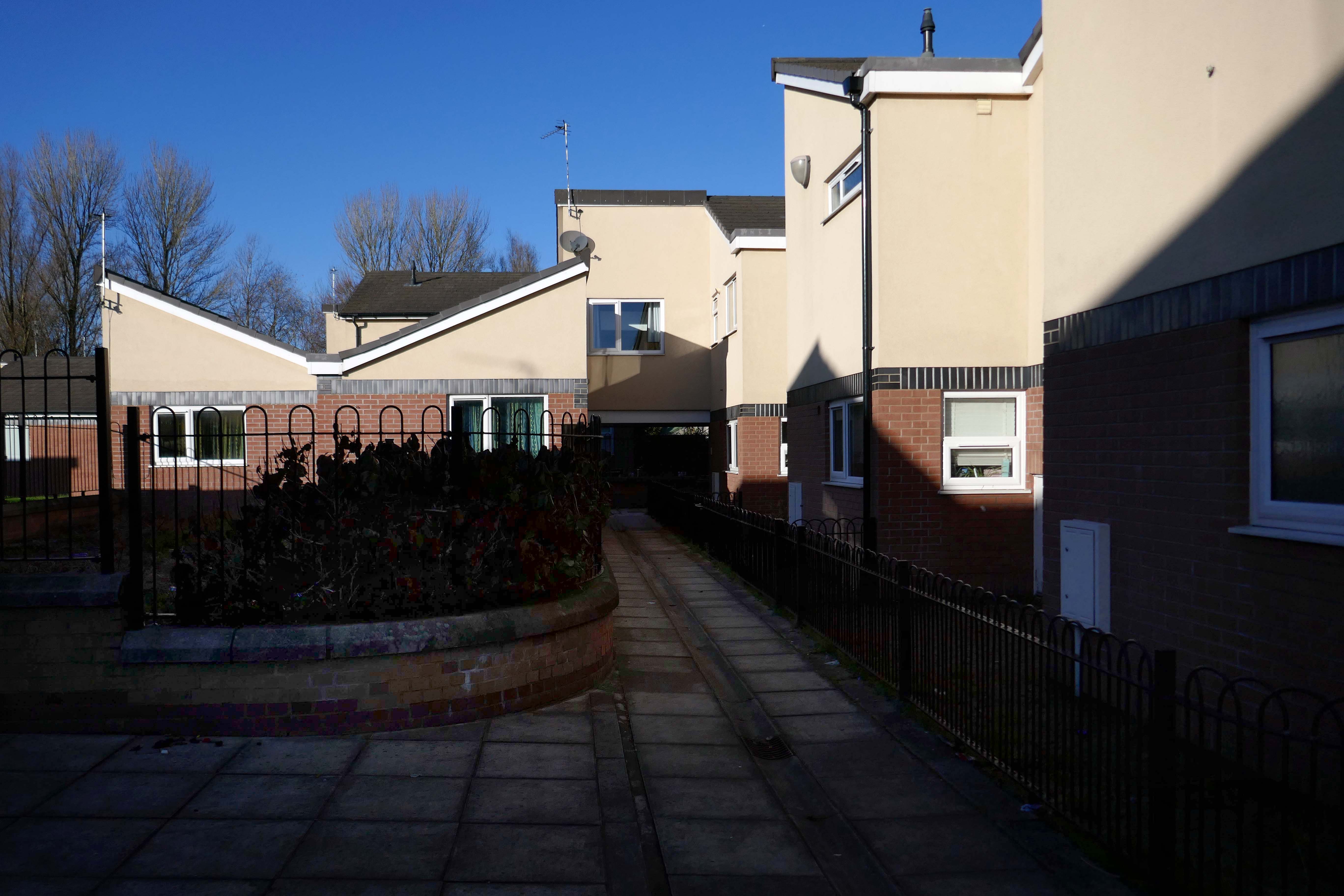
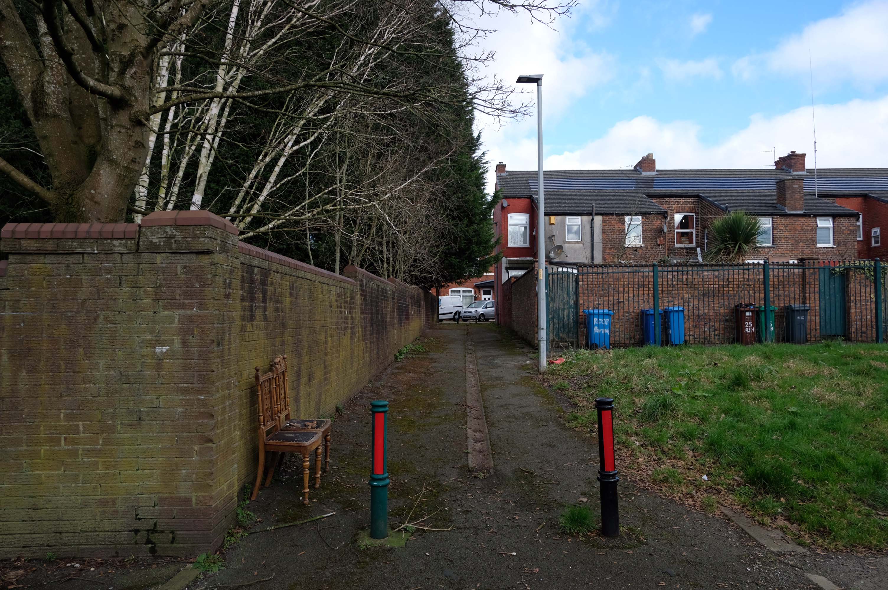
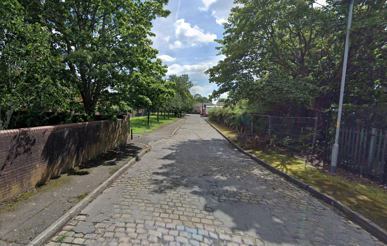
I was walking around town, with a view to updating my Ardwick Walk.
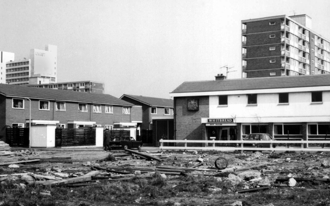
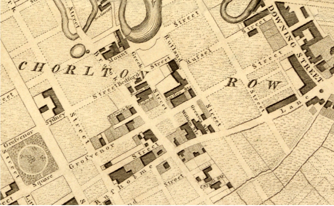
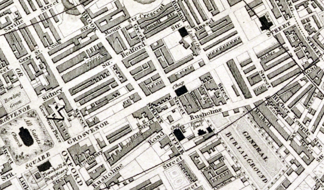
Idle curiosity took me toward the Brunswick Estate – that pocket of housing nestle twixt the Mancunian Way/River Medlock, Ardwick Green, Brunswick Street and Upper Brook Street.
Back in 1813, a web of streets and enclosed fields, and more fields, along with small groups of higher status housing, but by the early 20th century it was very much a working class district, within which industry began to grow.
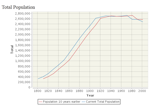
The population of Manchester expanded unstoppably throughout the nineteenth century.
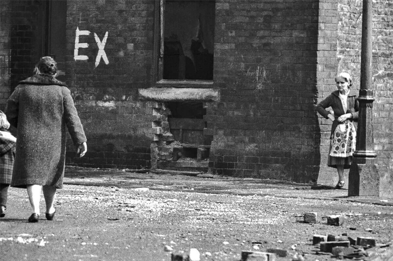
Extensive slum clearance in the nineteen sixties saw the area and its street names change, some erased forever in the new build.
In Manchester, in a vast belt immediately outside the central area of the city, there still exist all too many remnants of a planless, knotted chaos of dark, dismal and crumbling homes. Many of these crossed the verge of uninhabit-ableness long before their most elderly inhabitants were born.
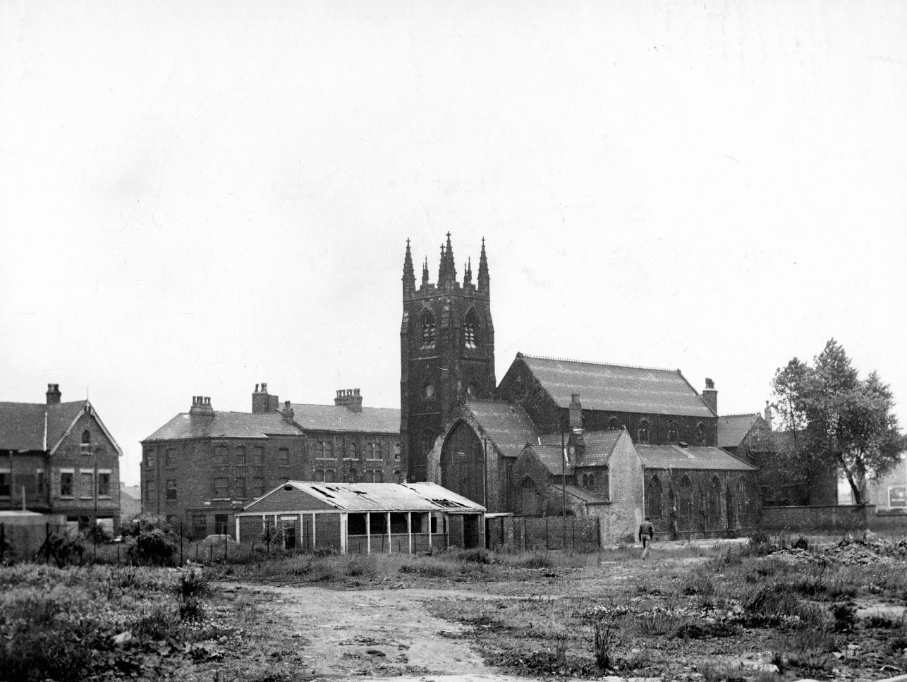
St Paul’s and St Luke’s Brunswick Street W Higham 1970
Lamport Court W Higham 1970
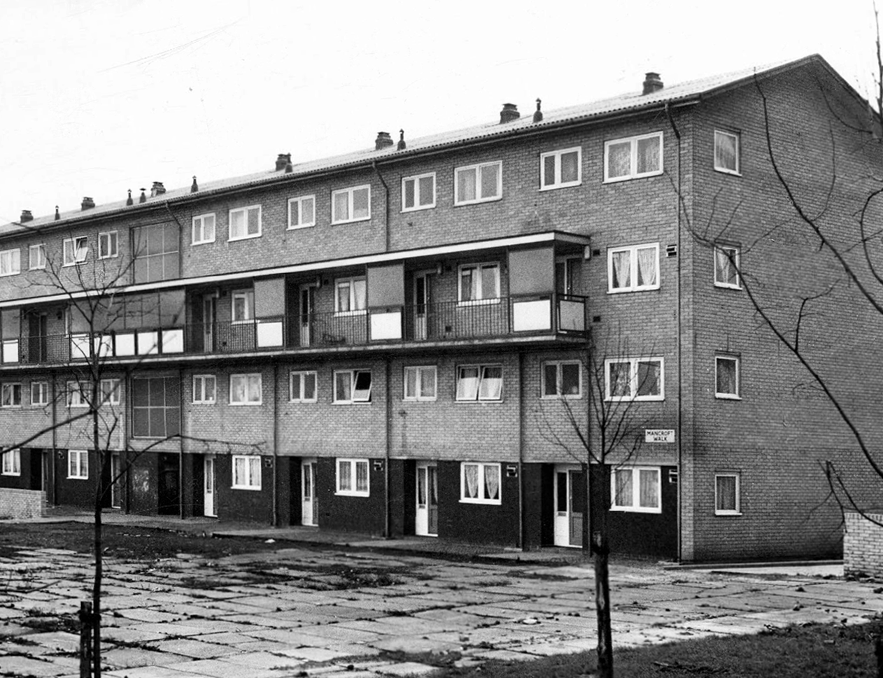
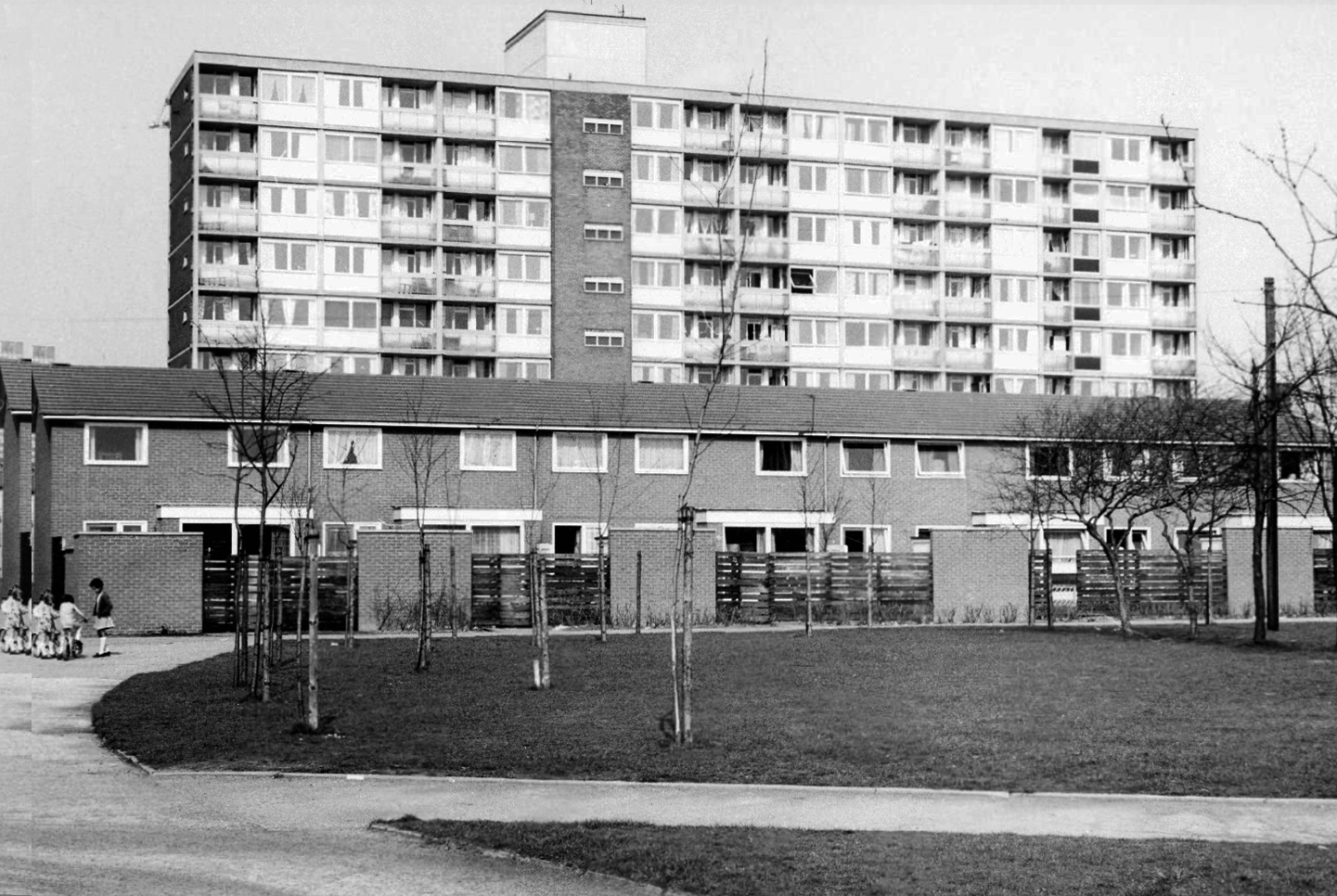
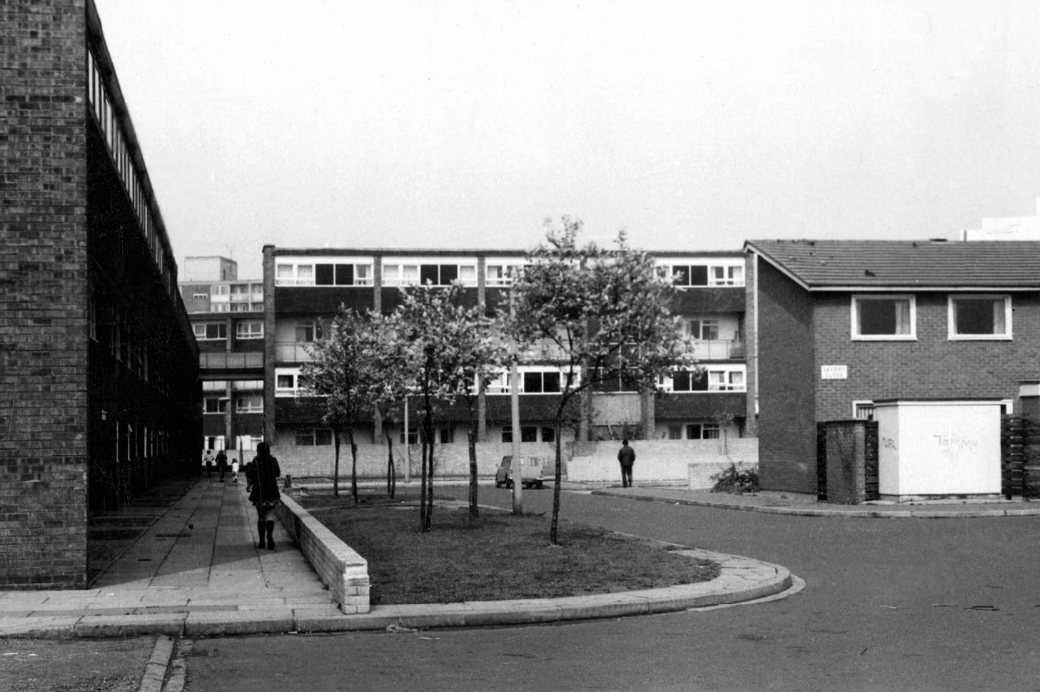
One of three nine-storey blocks, containing two hundred and nineteen dwellings; also including SilkinCourt and Lockton Court.
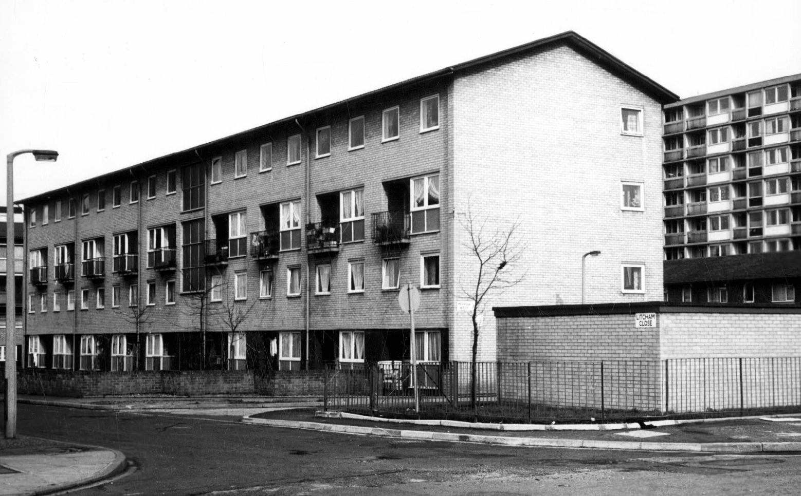
Litcham Close W Higham 1970
Harry Milligan 1903 – 1986 worked as the photographer at Manchester Central Library until his retirement in around 1968. He was instrumental in setting up the Manchester Region Industrial Archaeology Society in 1965. He volunteered at the North Western Museum of Science and Industry from 1968, assisting with reprographics requests. His knowledge of the history of photography in Manchester and the UK led to him taking on the role of Honorary Curator of Photography at the museum.
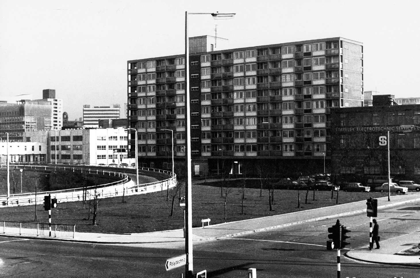
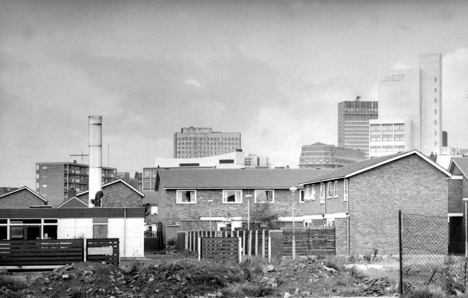
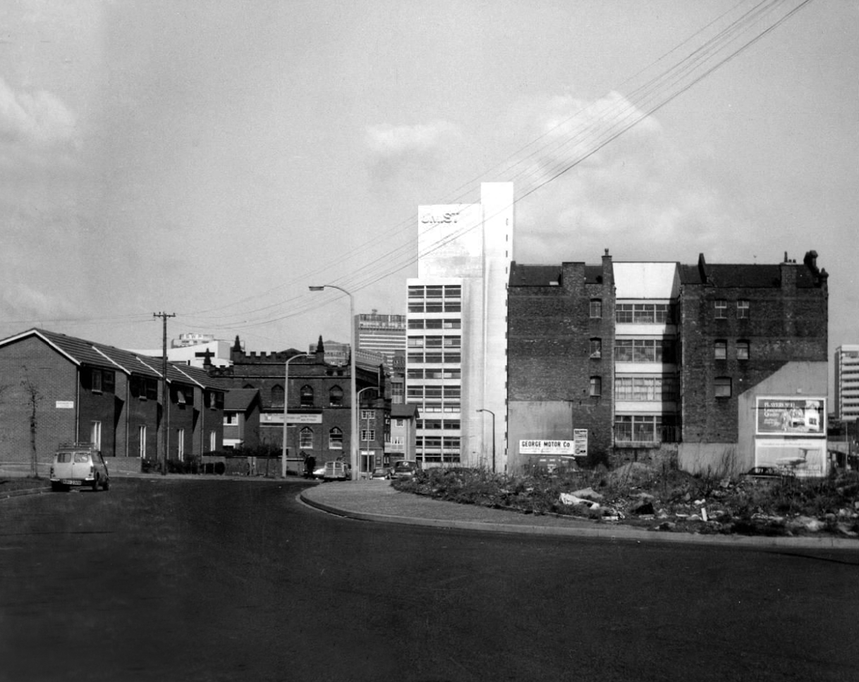
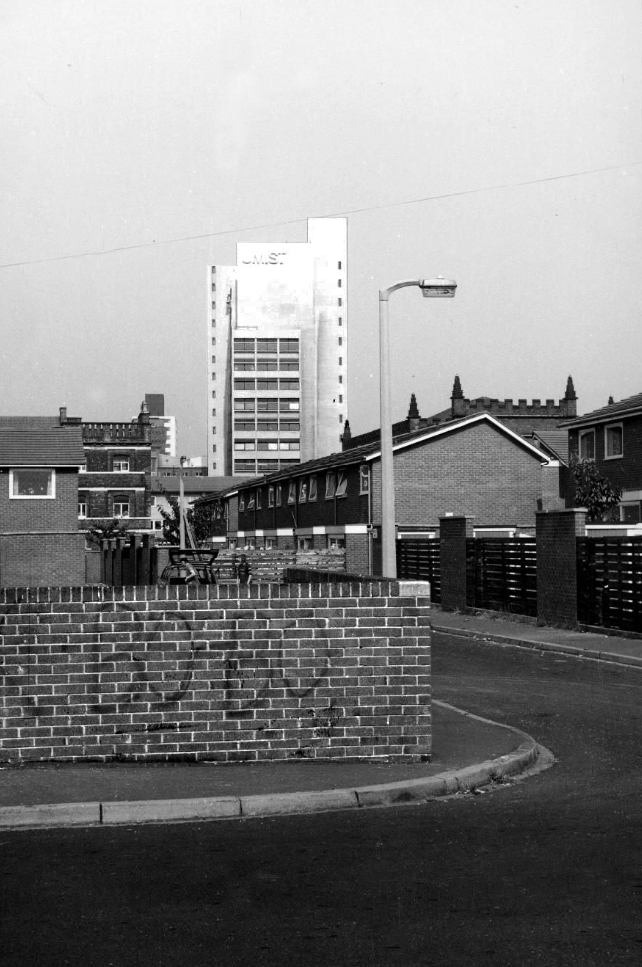
Panorama of Brunswick with UMIST in the background.
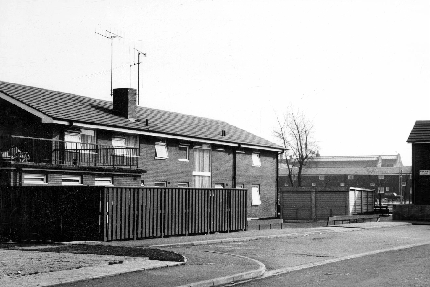
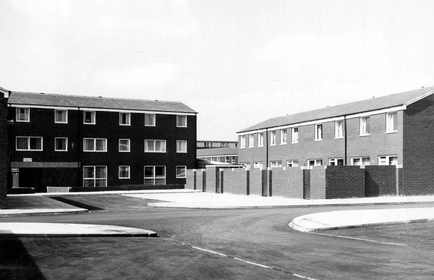
Hanworth Close area terraced housing and flats 1972.
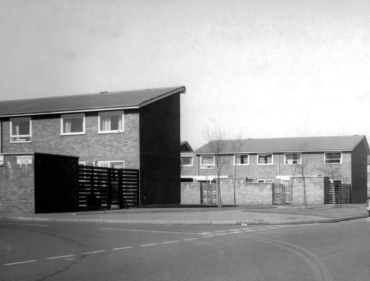
Staverton Close
Melcroft Close
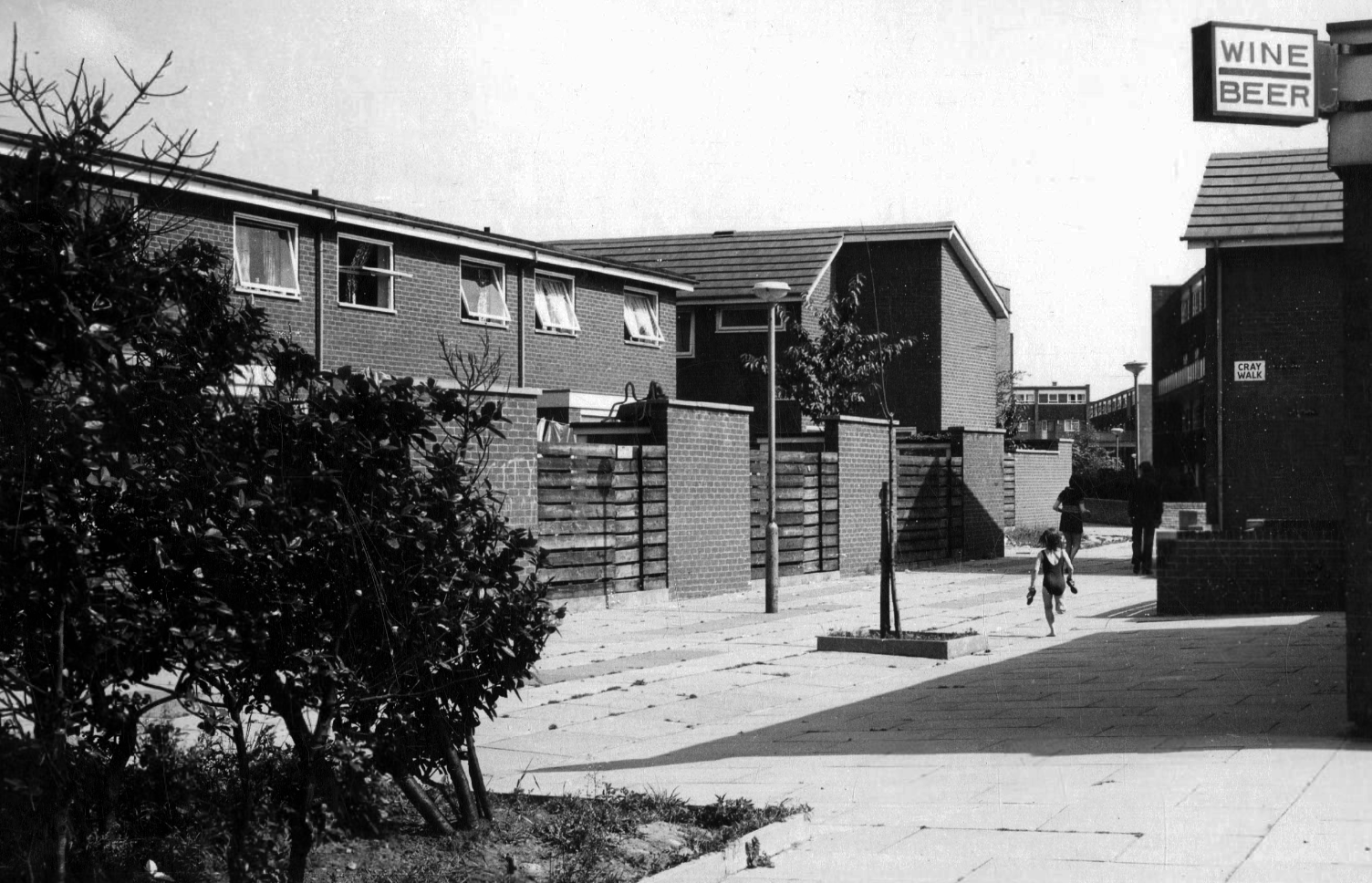
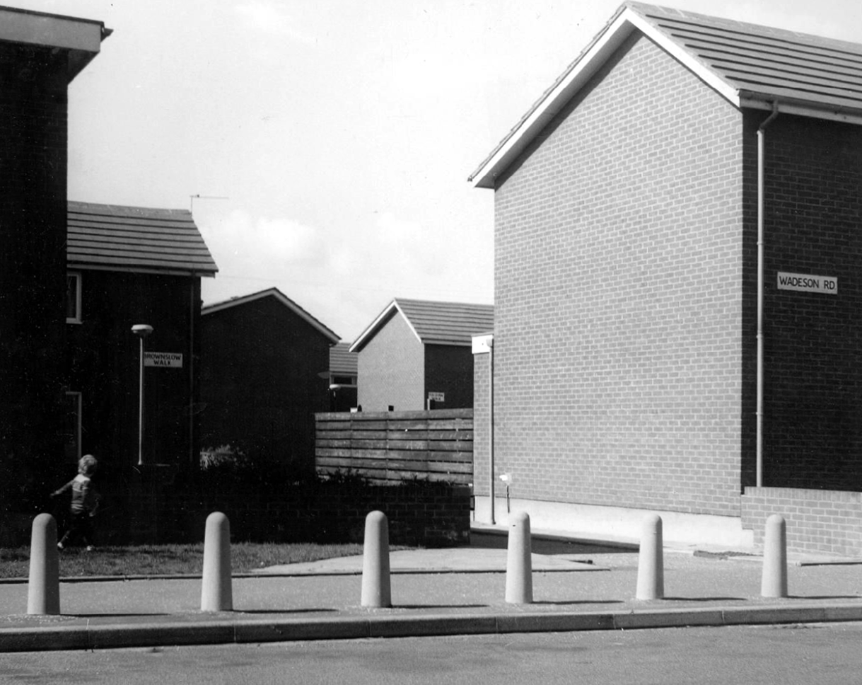
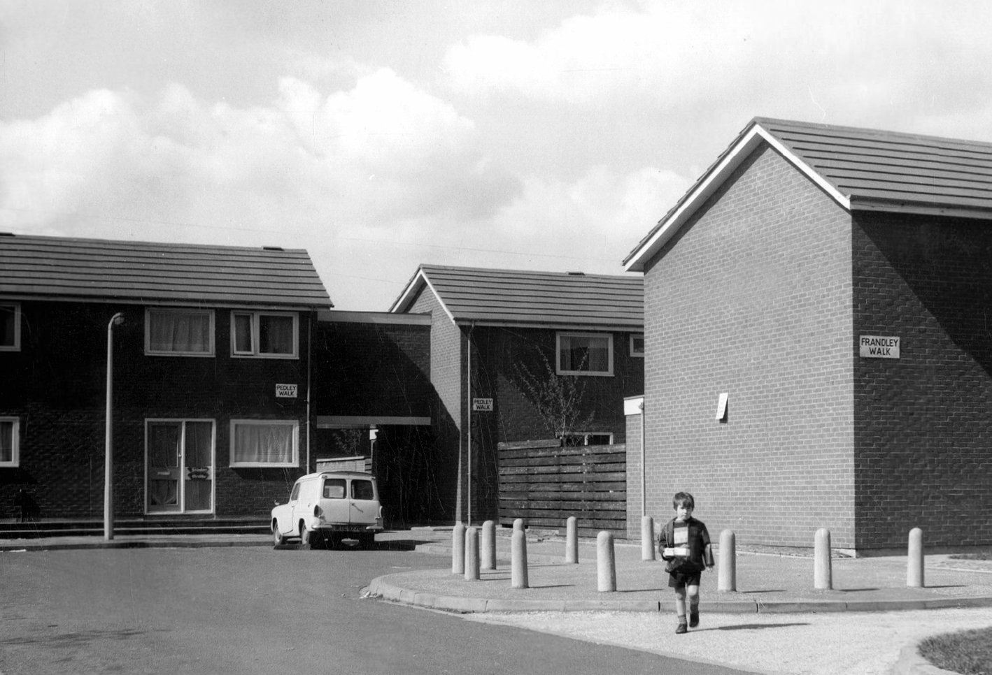
Wadeson Road
Helmshore Walk – Skerry Close
Cherryton Walk
Cray Walk
Wadeson Road
Hanworth Close
Pedley Walk
Cray Walk – note the decorative brick relief
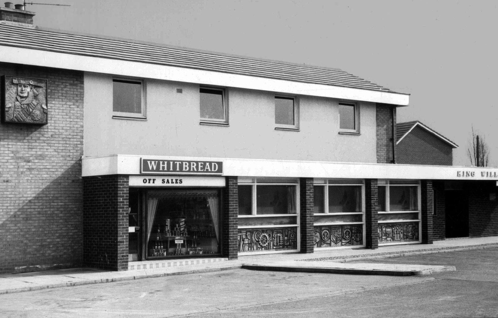
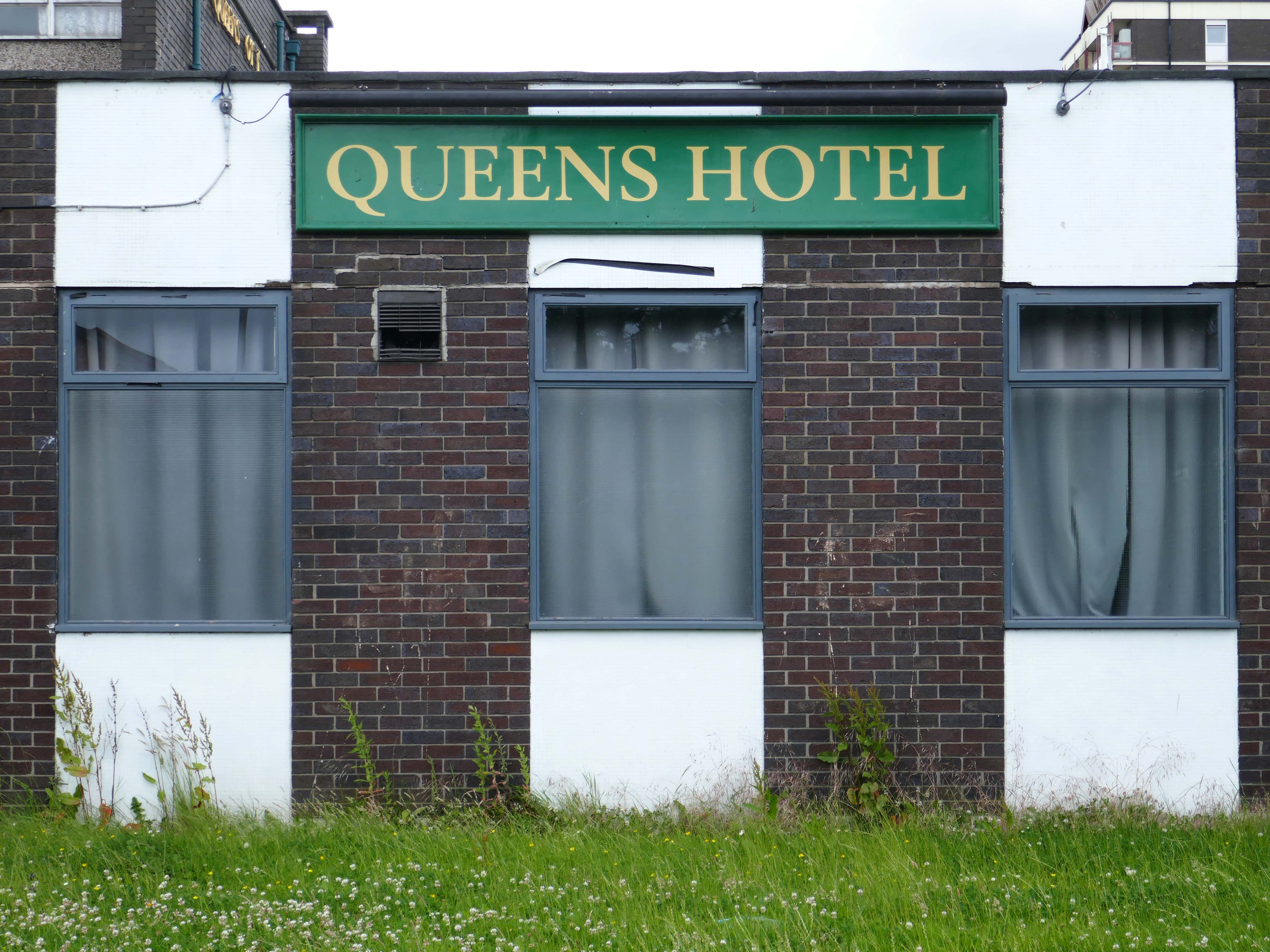
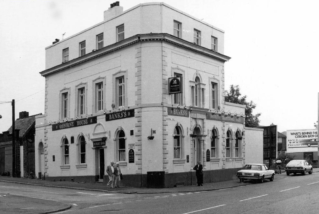
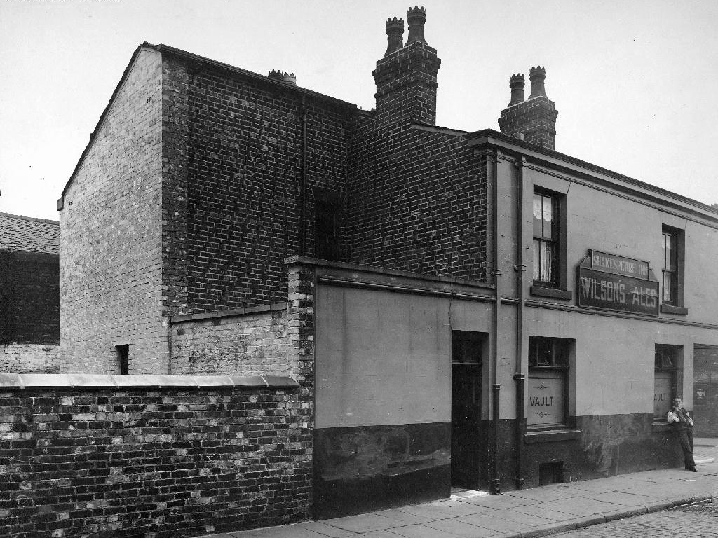
King William IV
Former Chesters then Whitbread estate pub was built in 1967. Closed in 1996 when it was converted to residential property. It had a brief spell 1991 to 1995 as brewery premises for the Dobbin’s West Coast Brewery, during this period the interior was stripped out to accommodate the brewery paraphernalia.
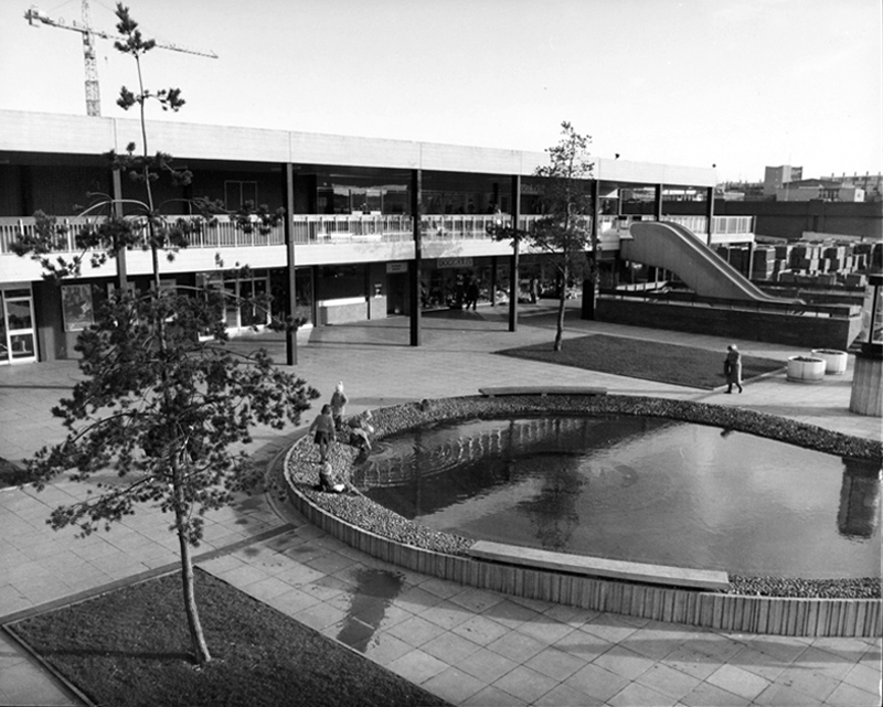
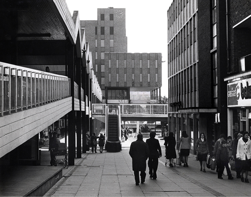
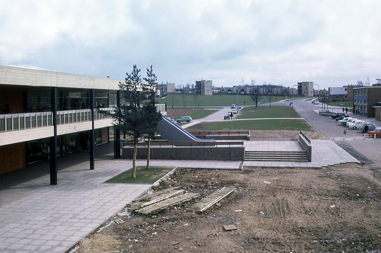
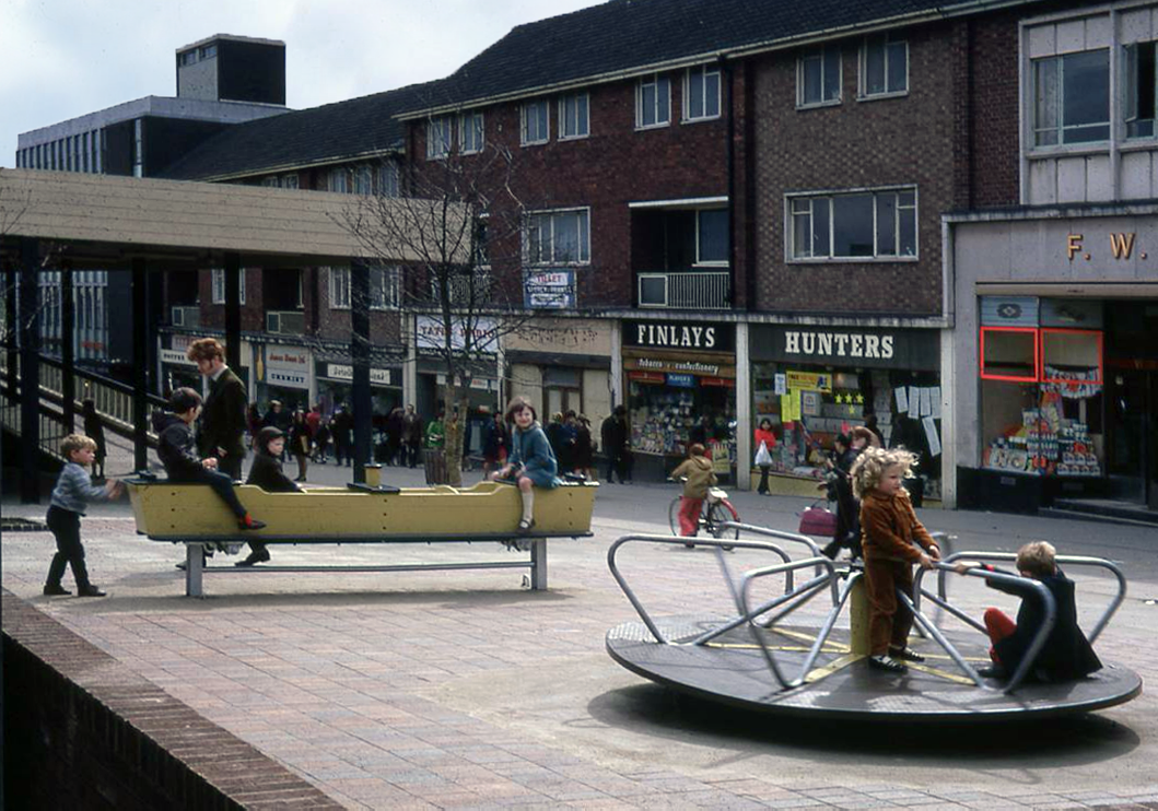
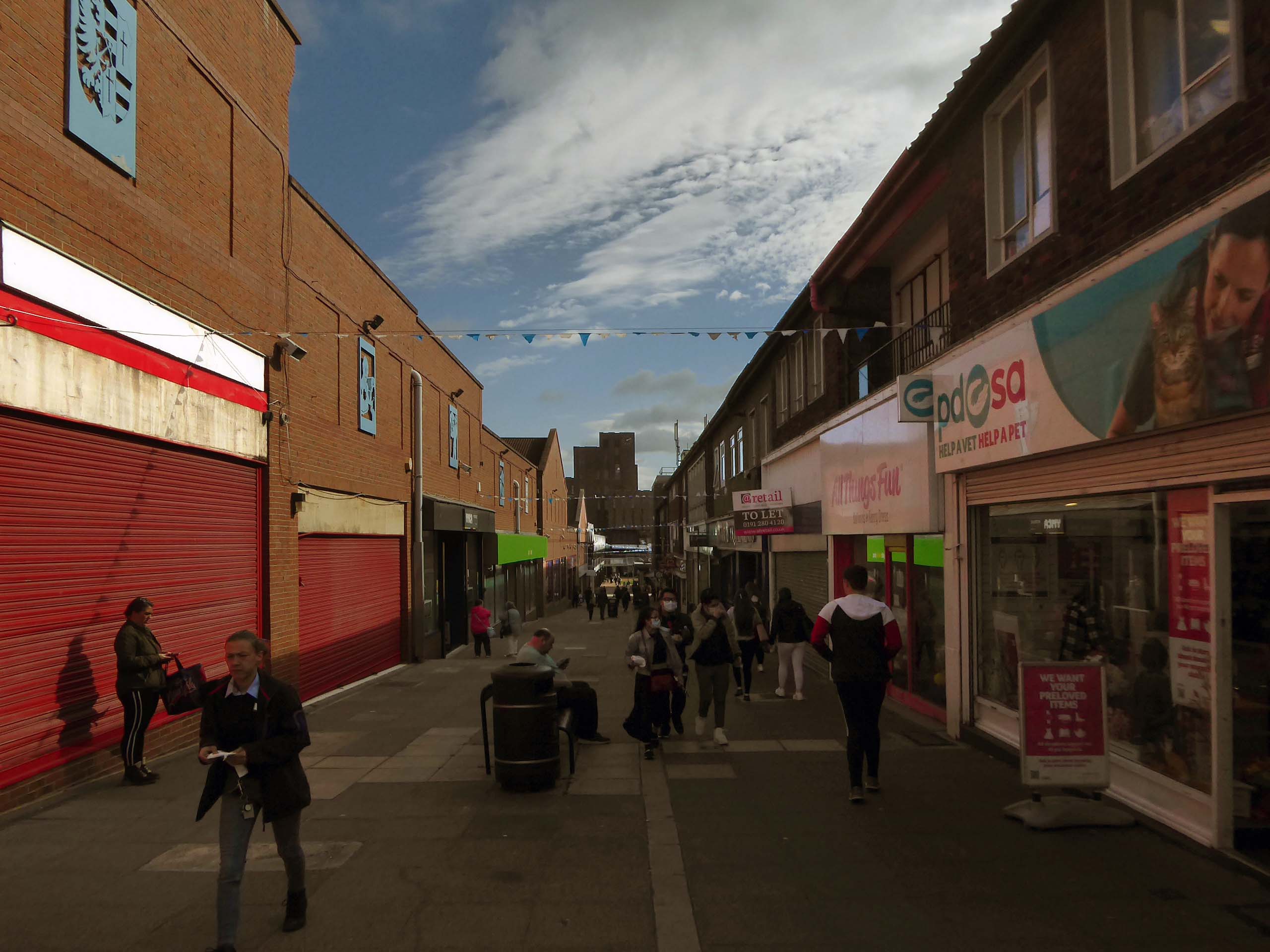
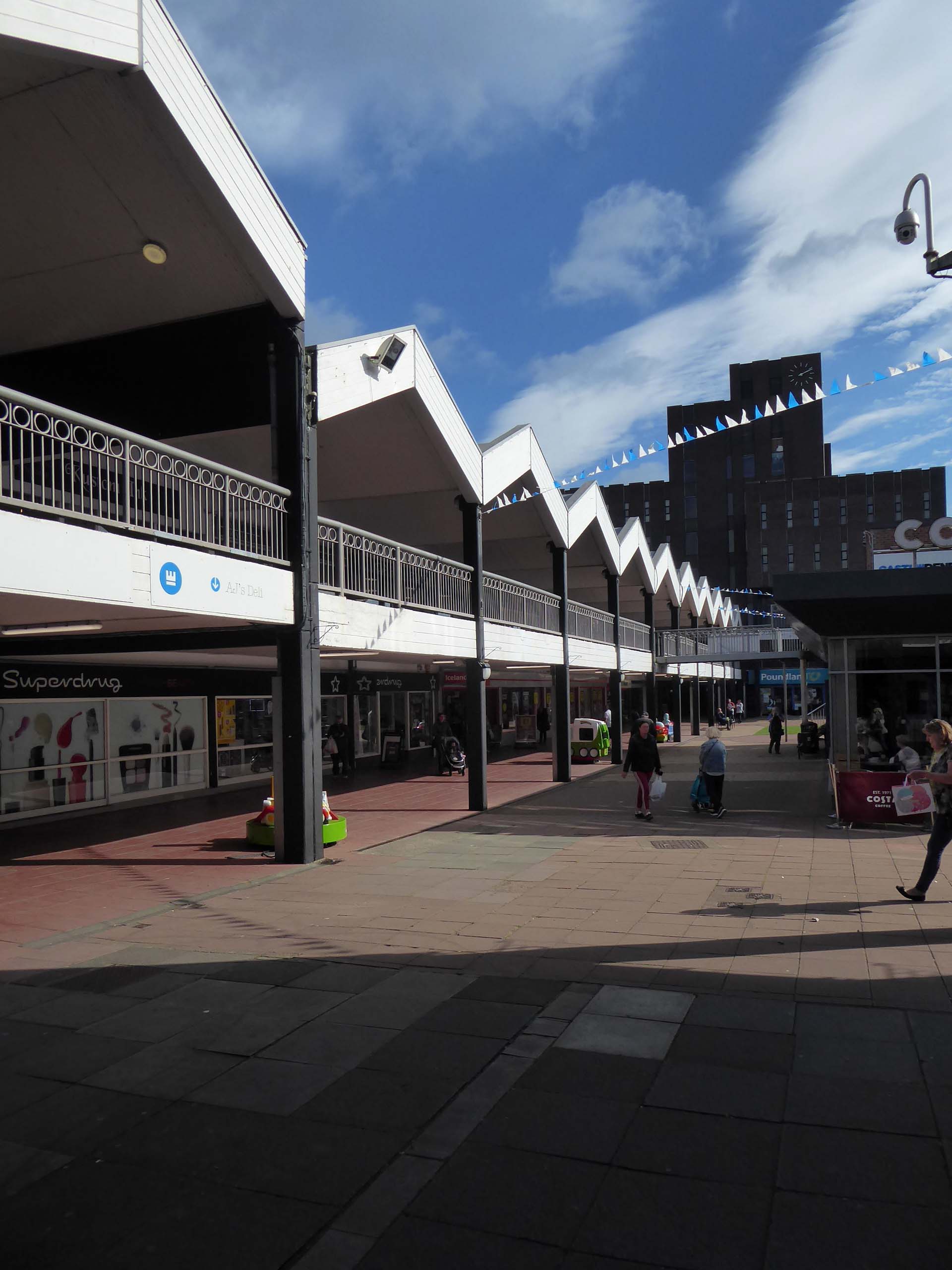
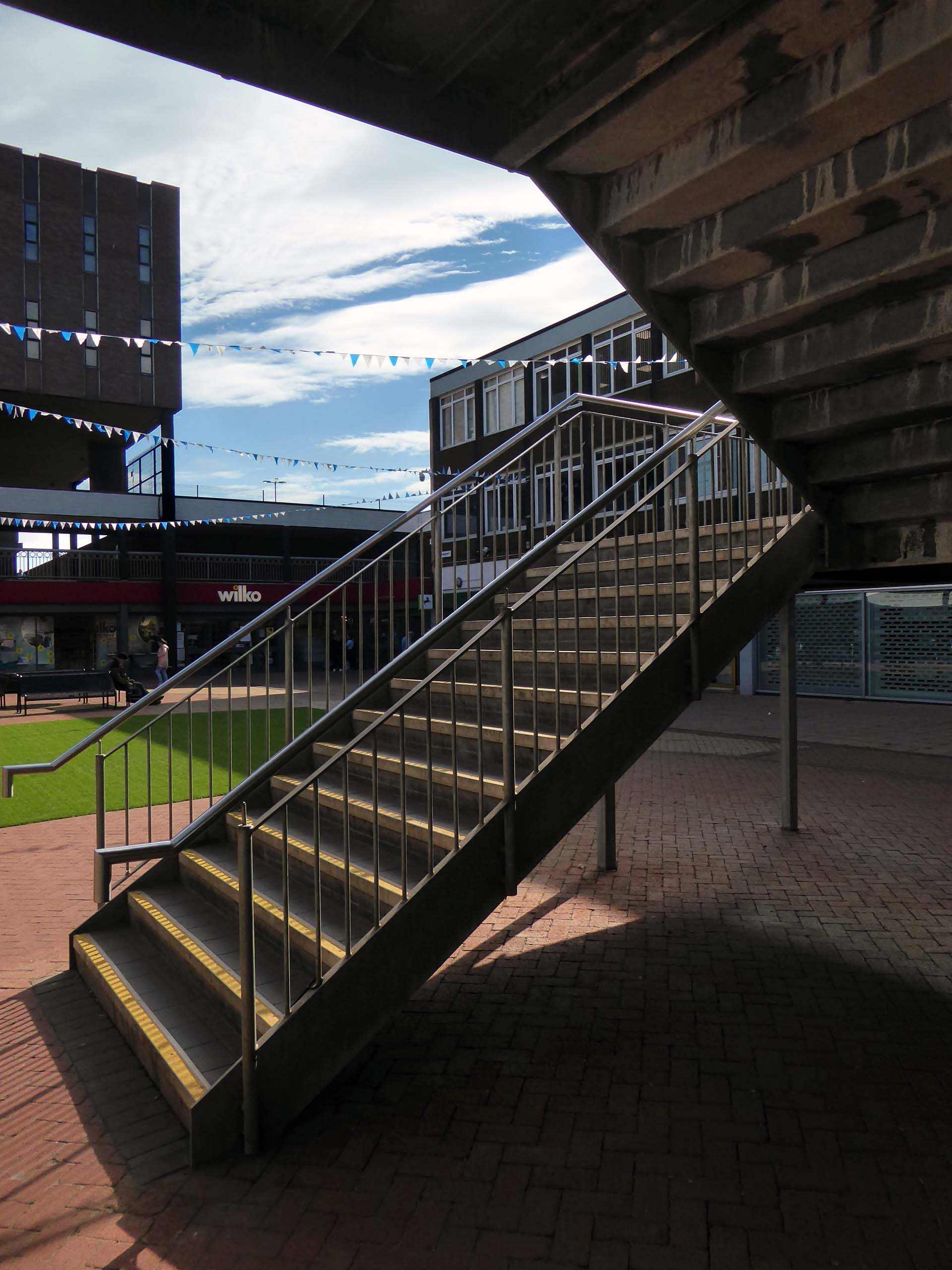
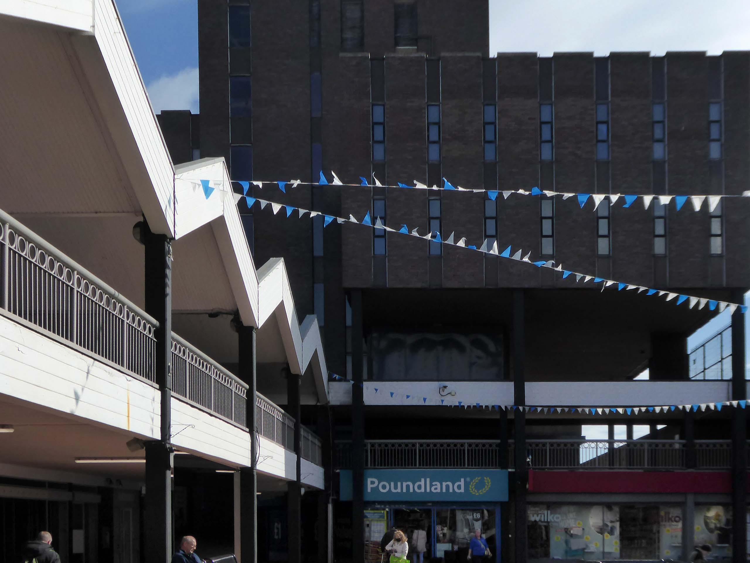
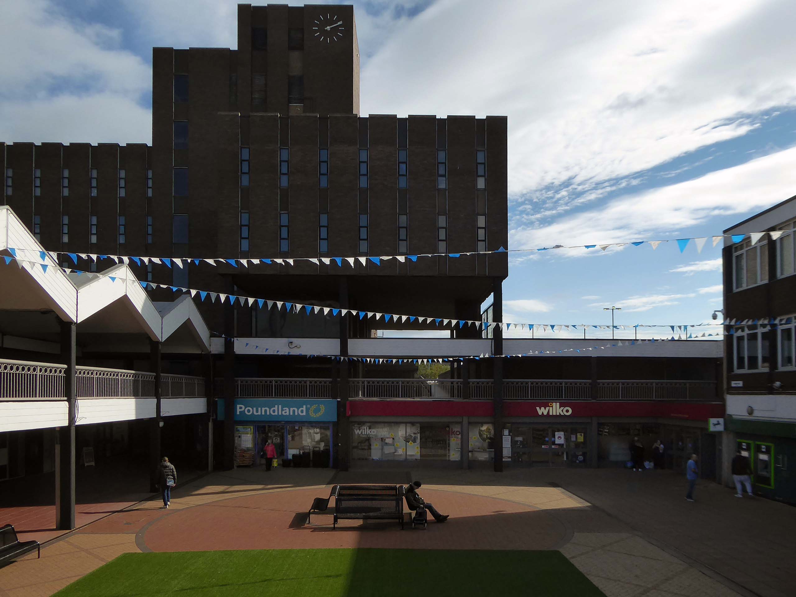
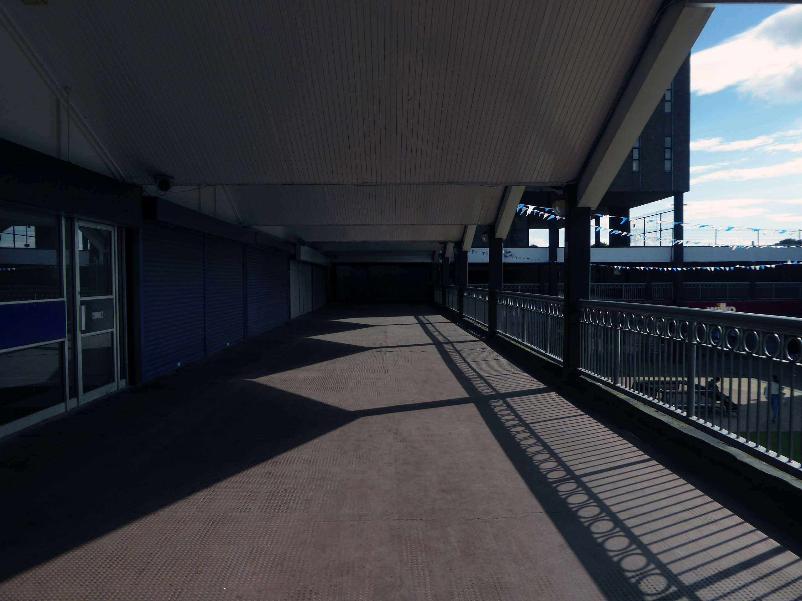
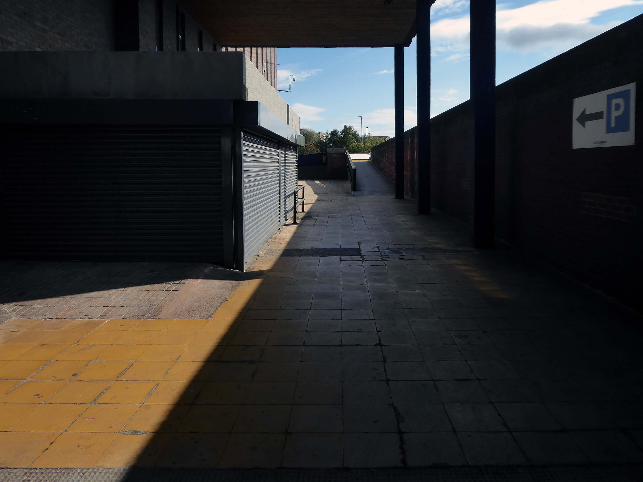
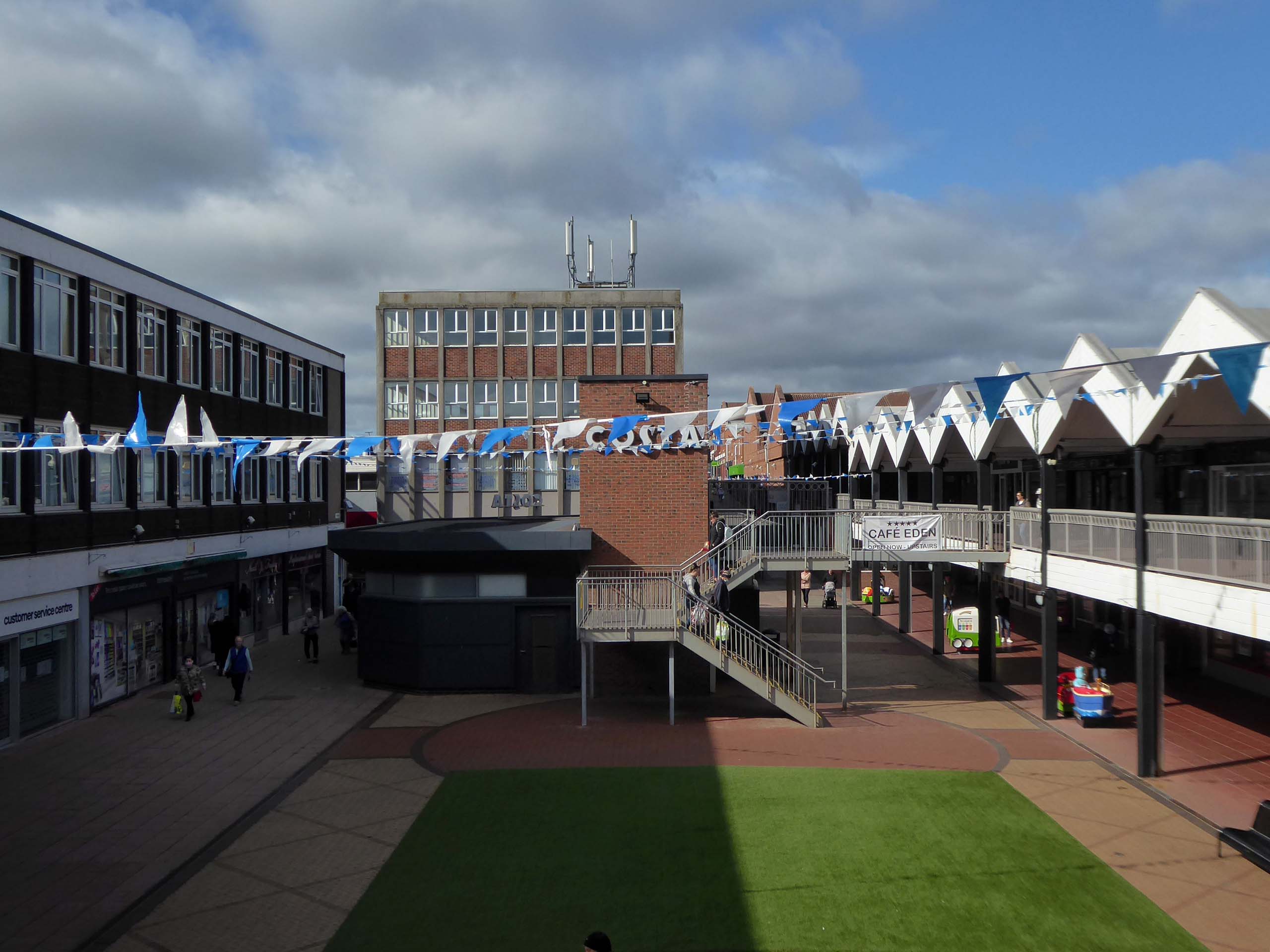
Plans for the new town centre started to be developed in 1960 by Chief Architect Roy Gazzard. The process would go through eight sets of revisions before they were finally approved in 1968. Yoden Way was then pedestrianised, and the small row of shops built in 1950’s was incorporated into the new shopping precinct, forming the north western end of Yoden Way. Like many other town centres across Britain undergoing modernisation, the high-street was split onto two levels, with ramps providing access to raised walkways.
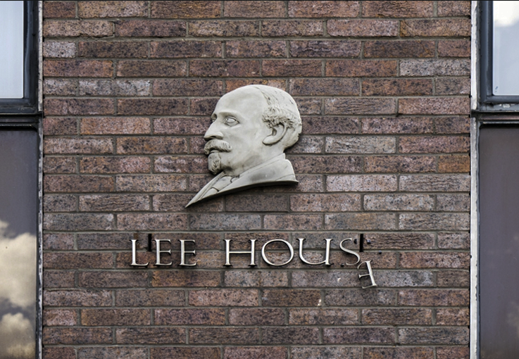
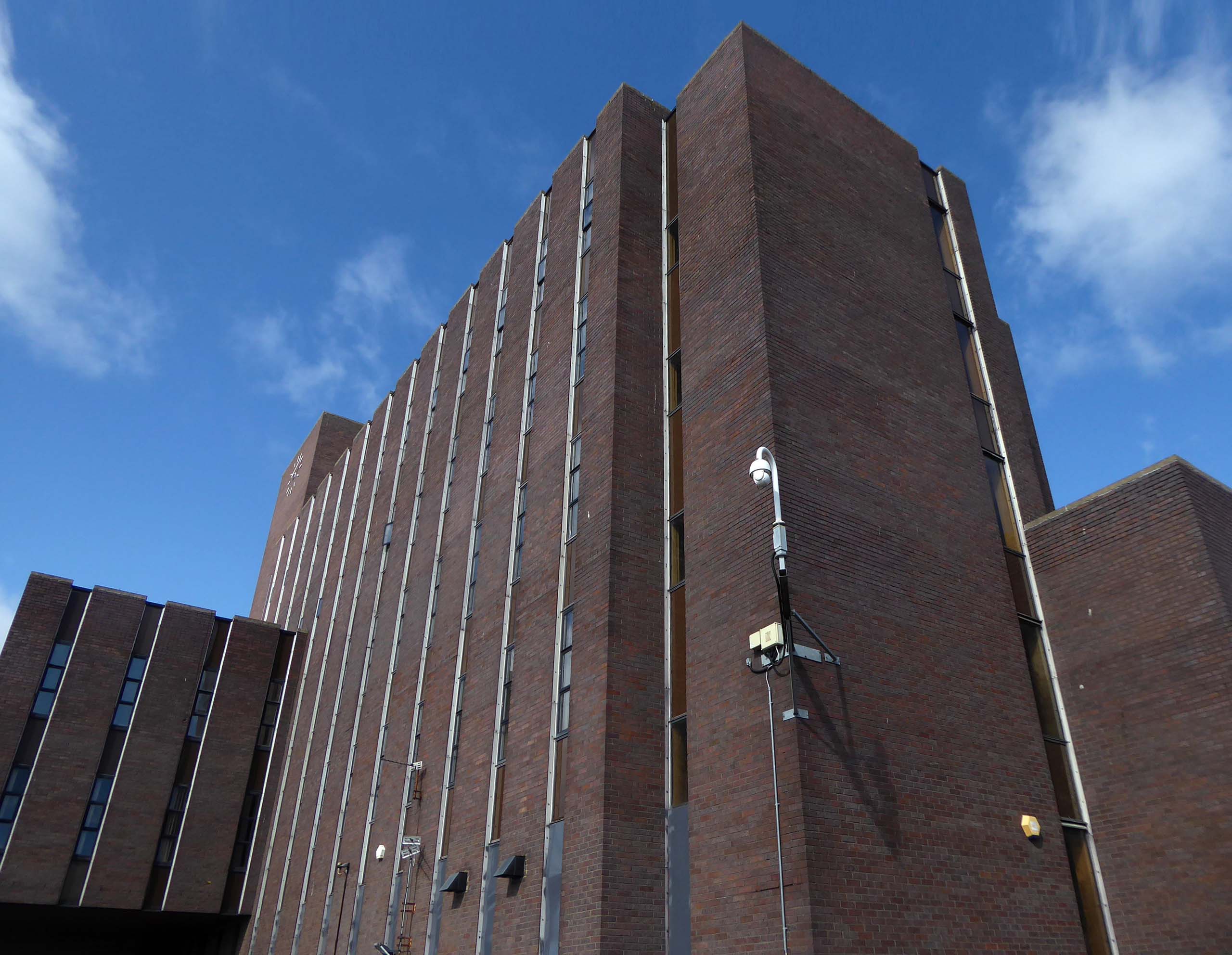
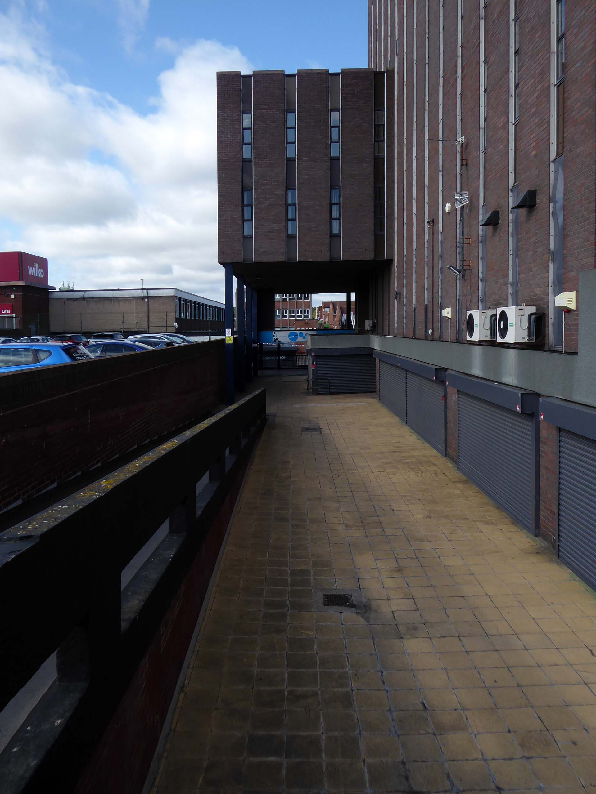
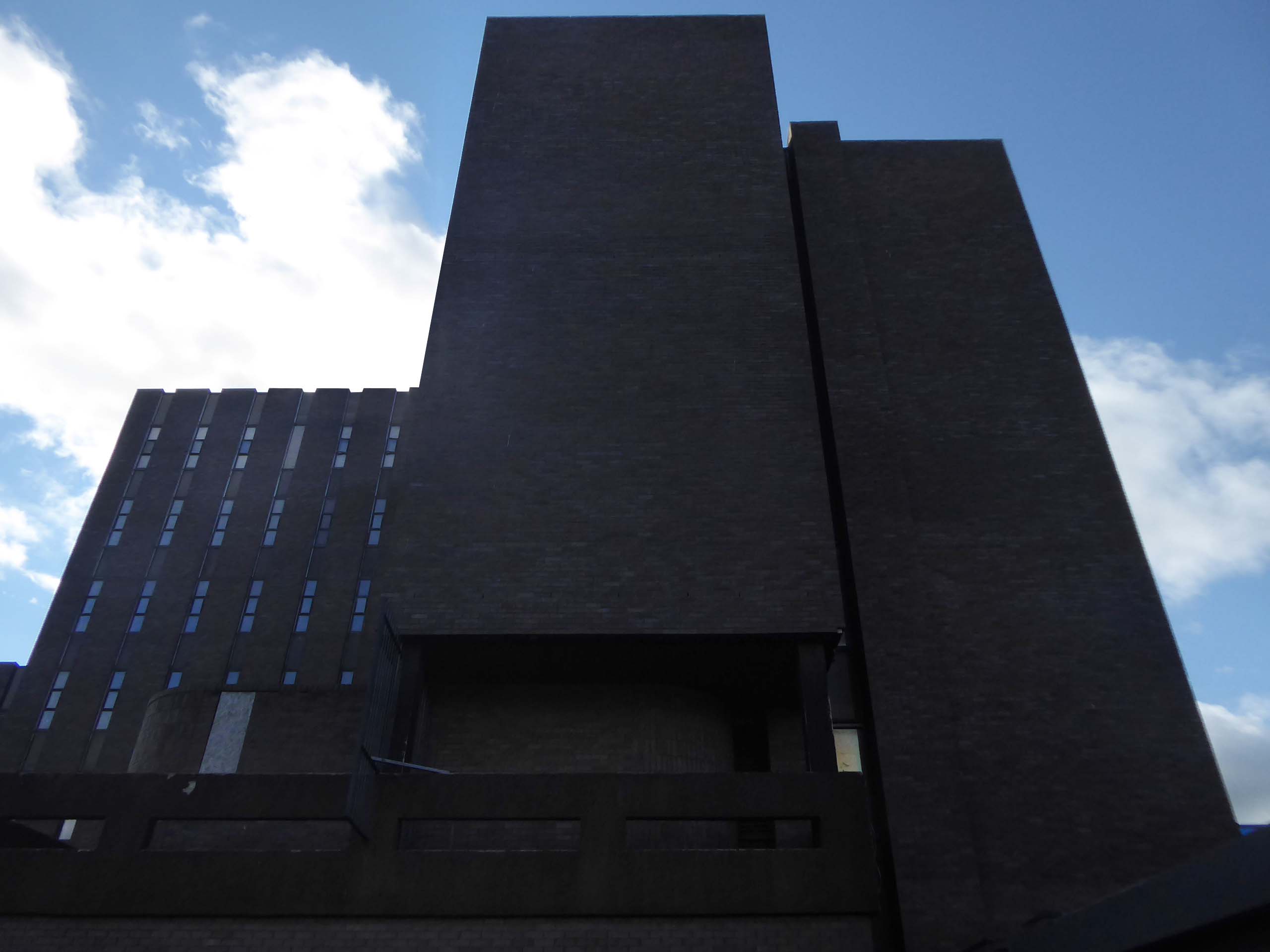
The construction of Lee House – named after Peter Lee, started in 1974. Once completed, the Development Corporation moved its Headquarters from Old Shotton Hall to Lee House in 1976, occupying the building until it was sold in 1984 and remaining staff relocated to Newton Aycliffe.
Enhancing the built environment, Peterlee Town Centre was furnished with play equipment, an ornamental pond, open air escalators, and a sculpture by John Pasmore – son of Victor.
These features were later removed after the town centre was sold to Teesdale Investments – Peterlee Limited in 1985.
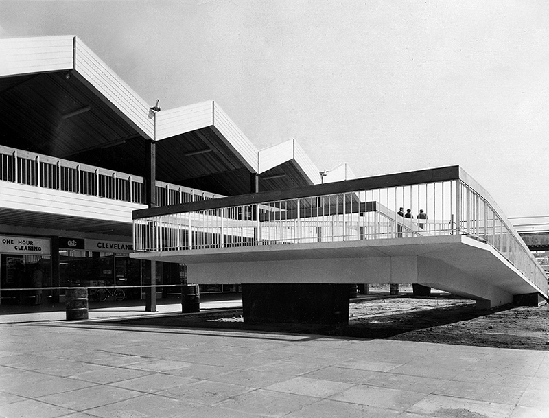
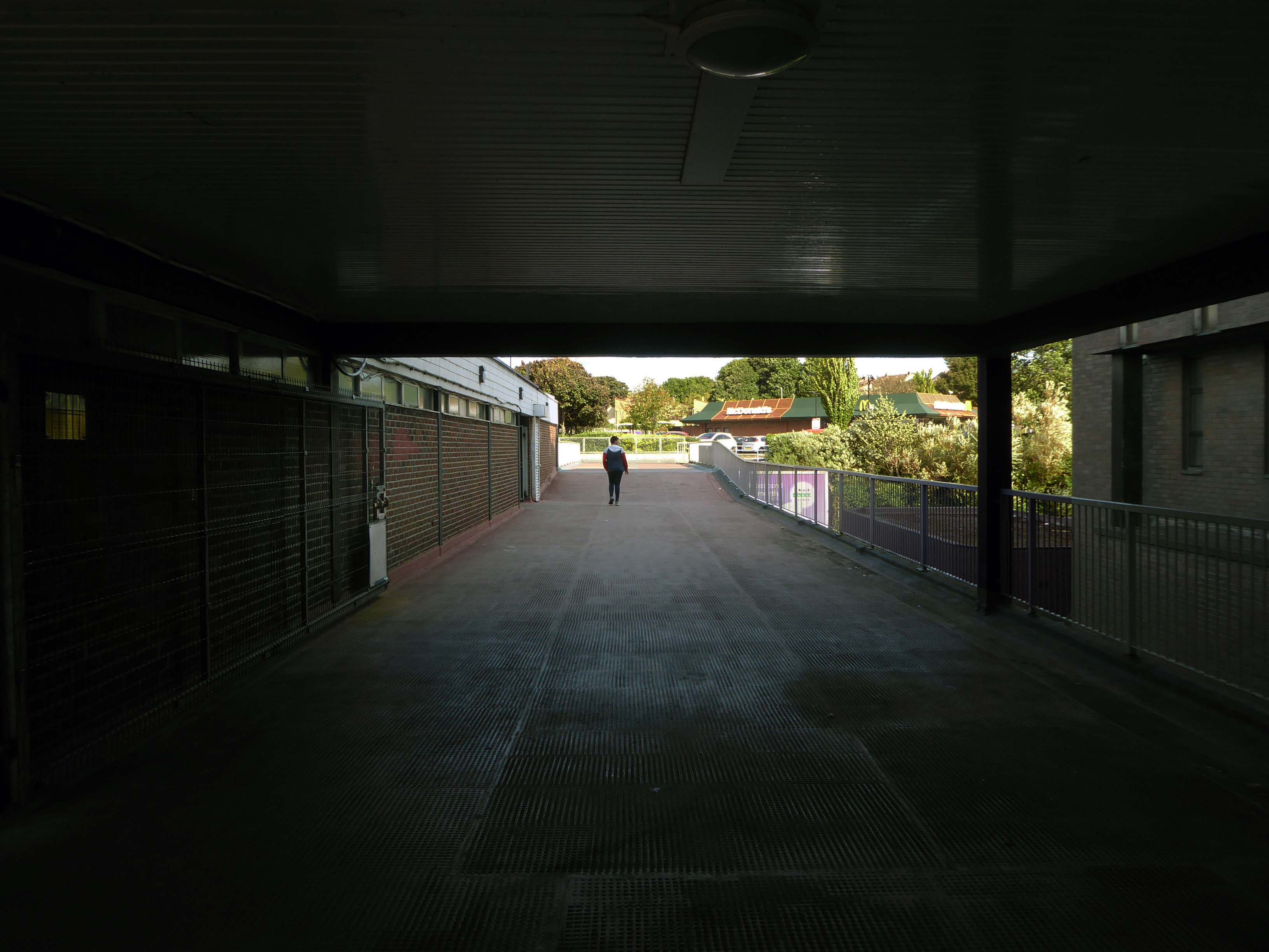
Access ramp at the bottom end of Yoden Way, prior to the construction of Lee House in 1973.
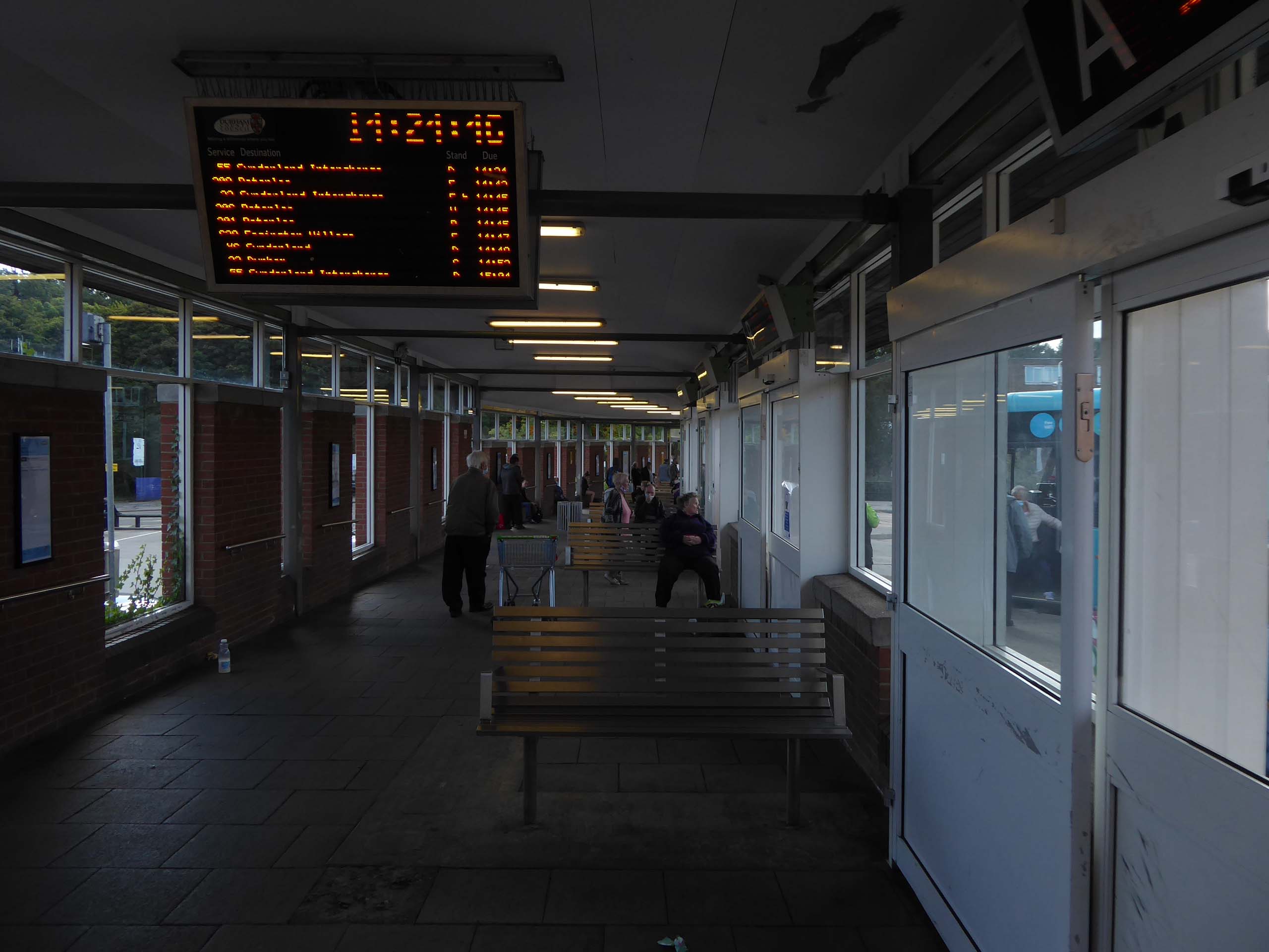
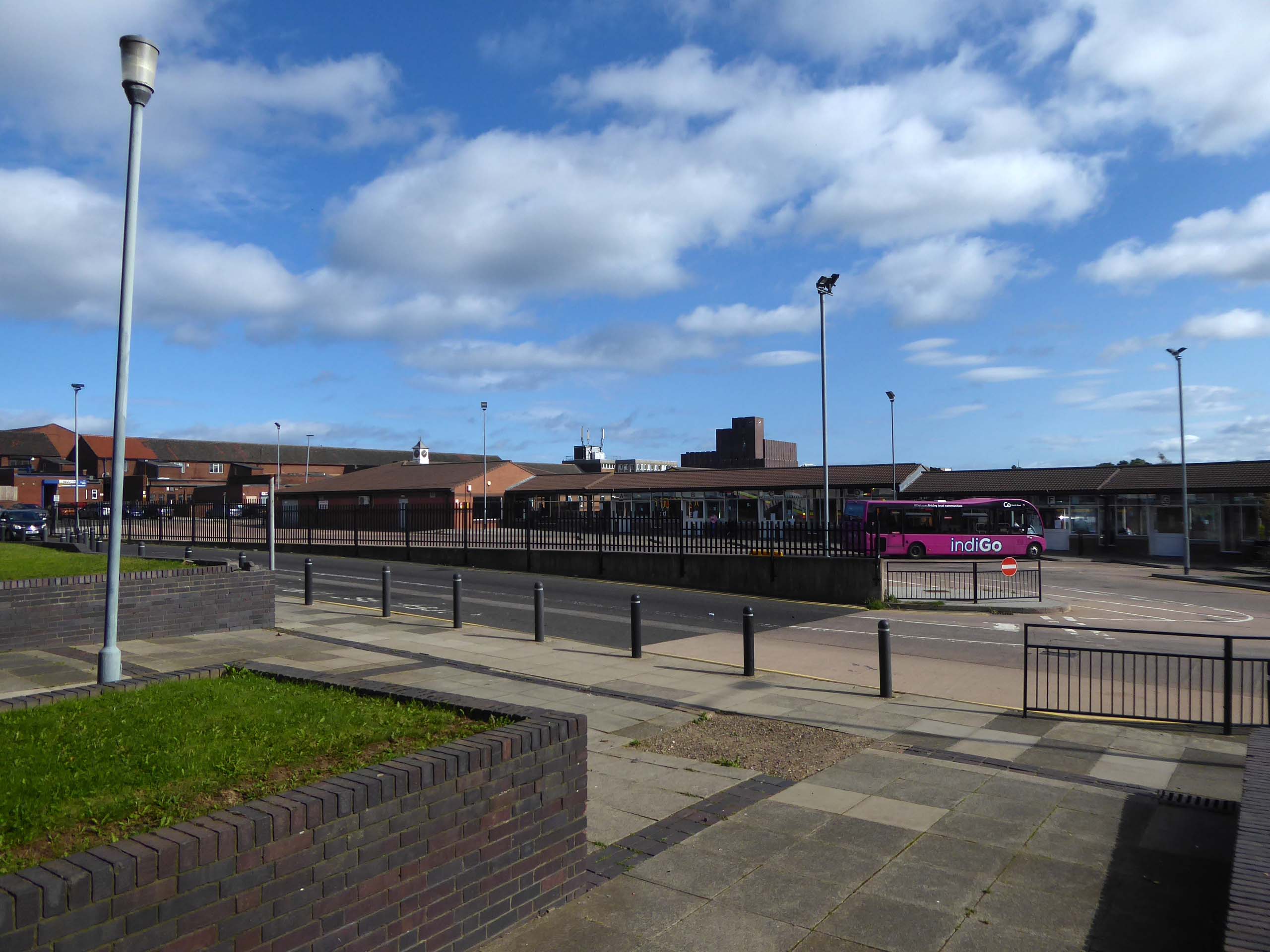
It’s 2021 and I arrive at the Bus Station.
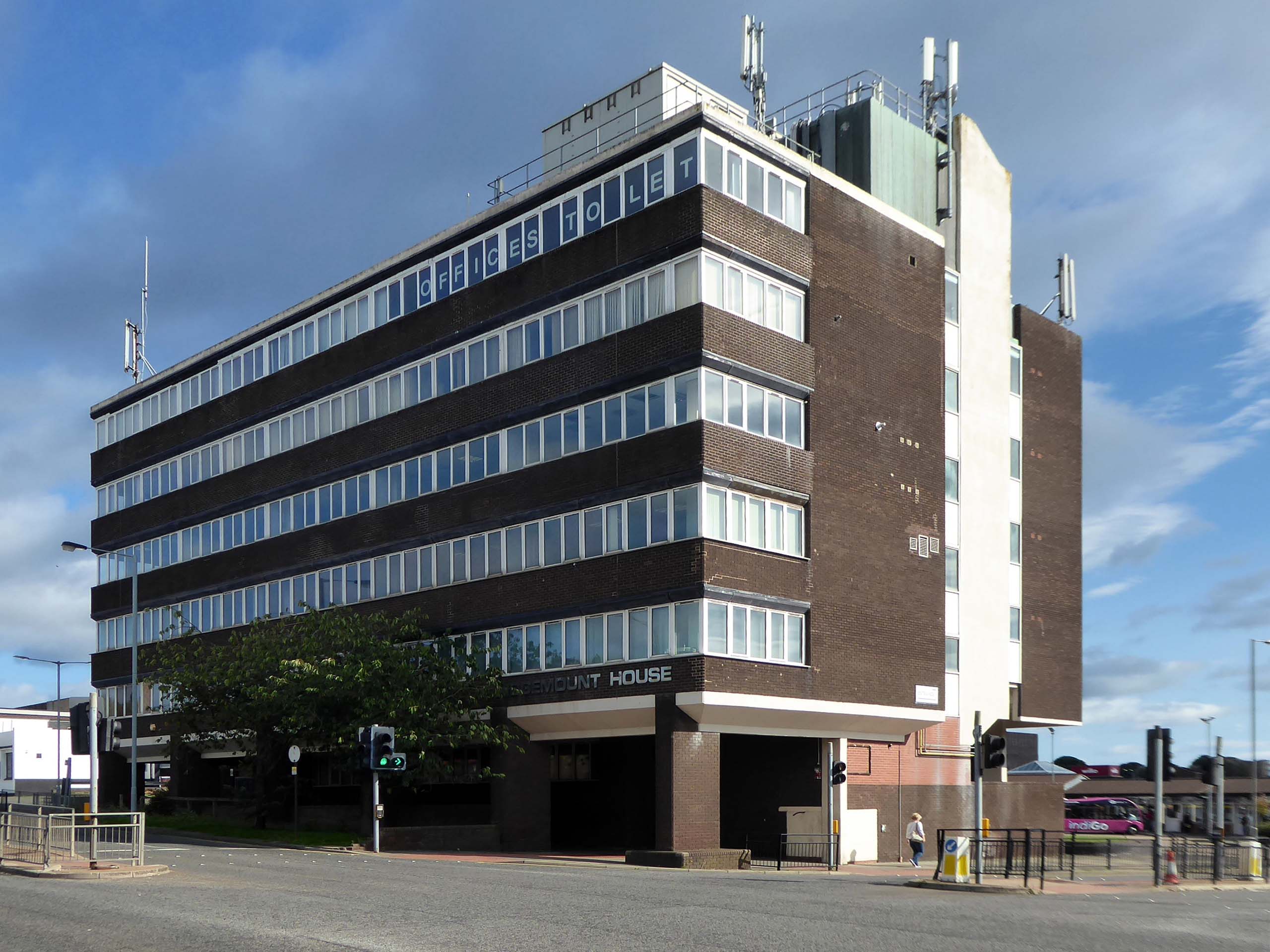
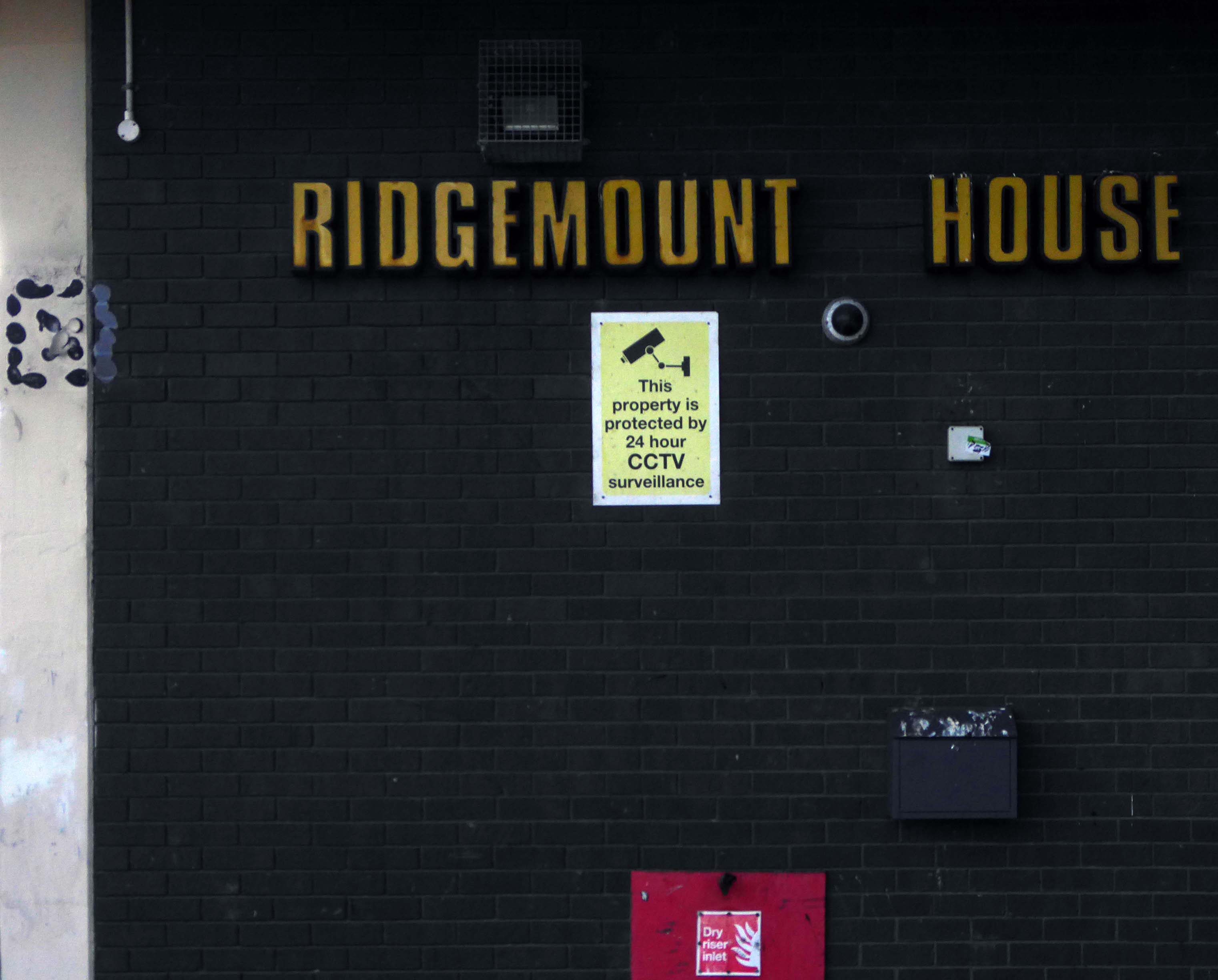
Immediately adjacent is Ridgemount House. – once home to the Job Centre.
Firefighters were called to the disused Ridgemount House on Bede Way in Peterlee on Wednesday August 16th 2023 at about 8.20pm after reports of a blaze.
Crews found a fire had broken out in the first floor of the building, which was found to be the home of thousands of pounds worth of cannabis plants back in 2020, after a man converted two floors for use as a drug farm.
Tarlochan Singh, owner of Ridgemount House, has been prosecuted following the discovery of several serious fire safety breaches at the property.
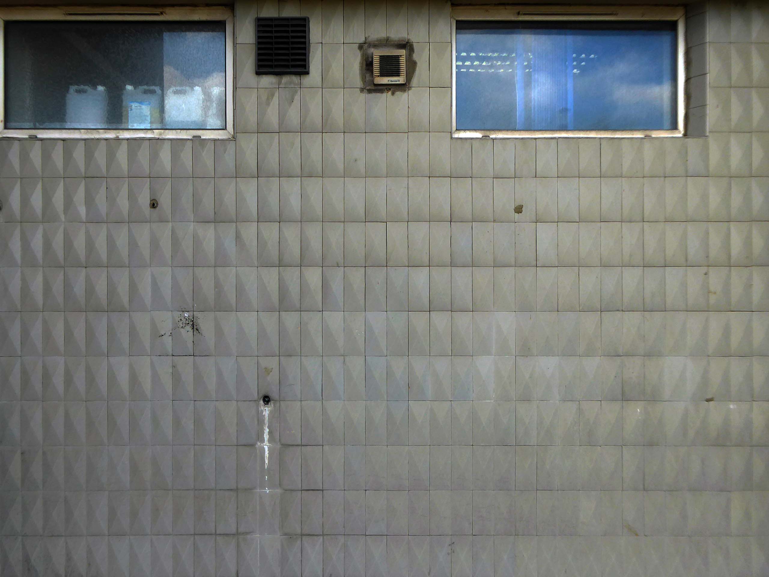
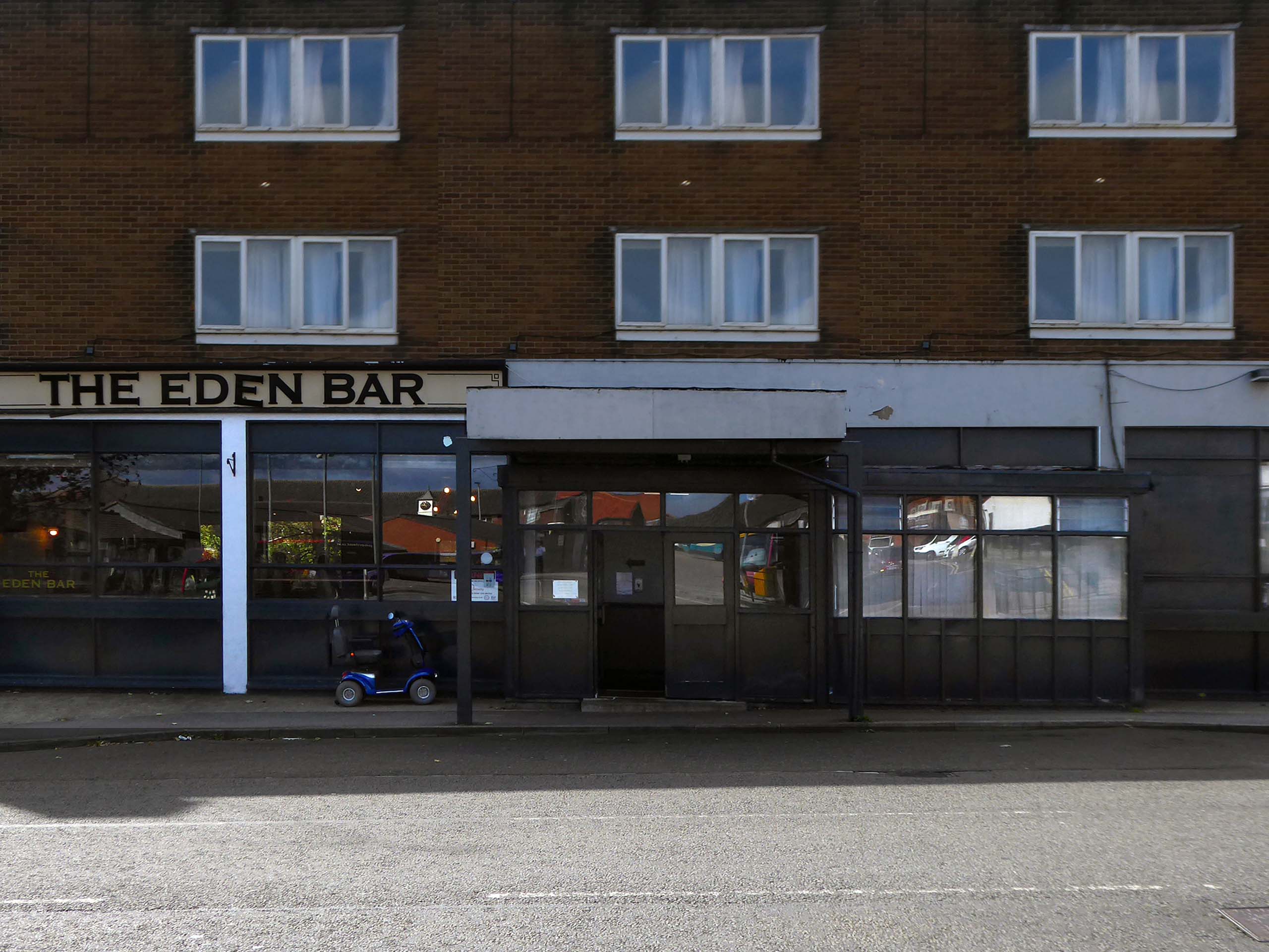
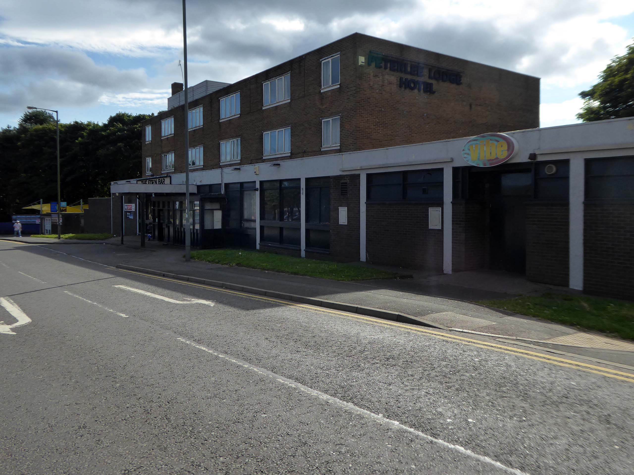
Readers have voted Peterlee nightspot Vibe as the ‘most tragic hometown club’ in the North East
Formerly known as The Dance Factory, Vibe, in Peterlee town centre, is a place famous for it’s almost impossible to get off ‘tramp stamp’ and next door neighbour The Lodge, where many locals will go for pre-drinks and some karaoke before heading to the club.
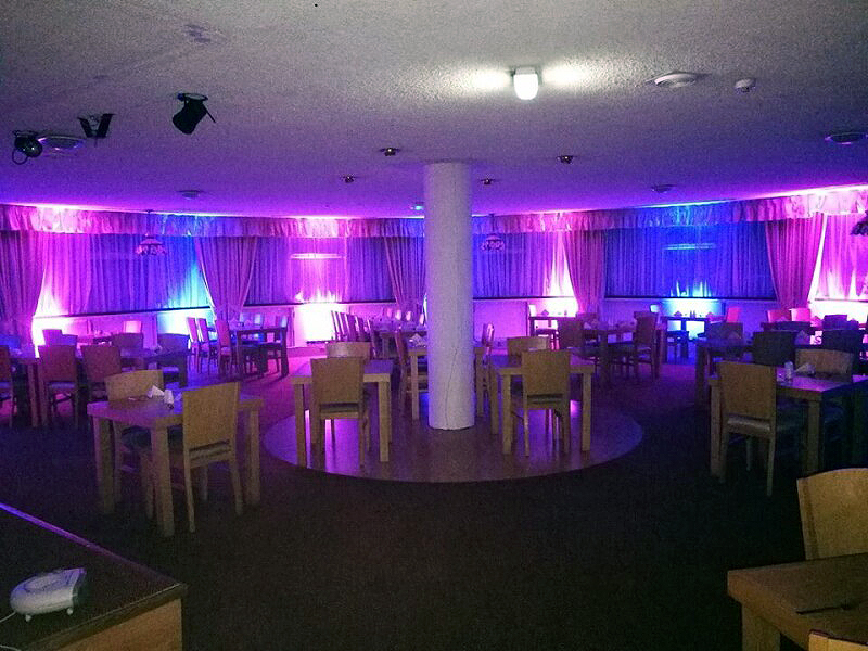
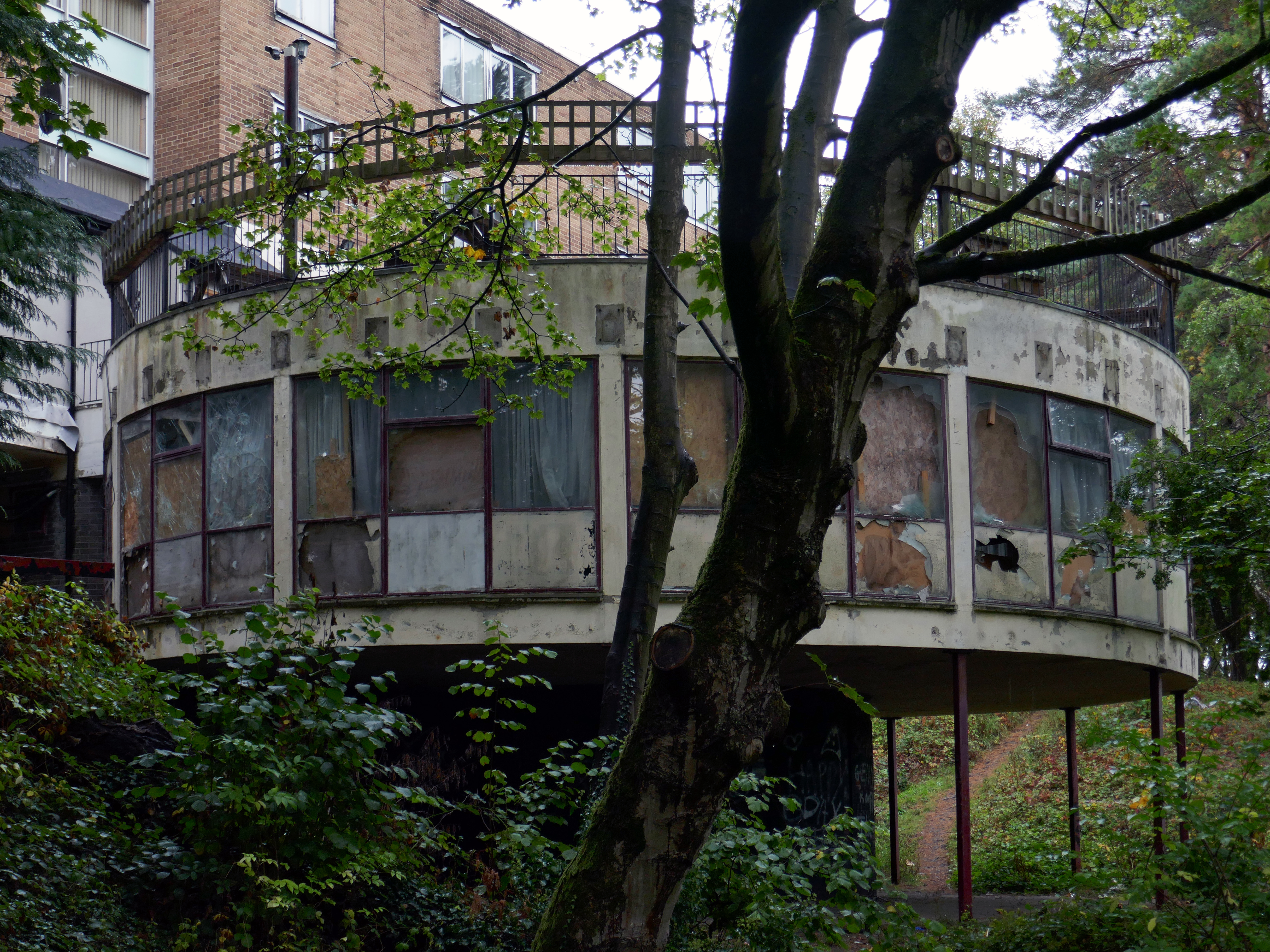
The bar which once boasted a bijou rotunda with an exclusive upper terrace, has now closed.
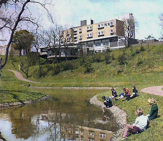
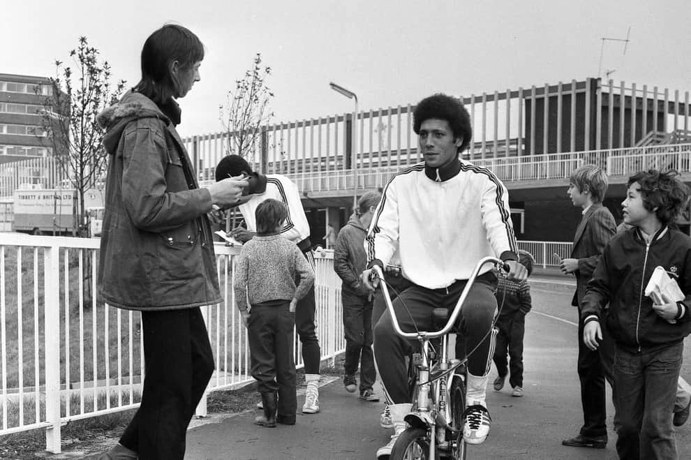
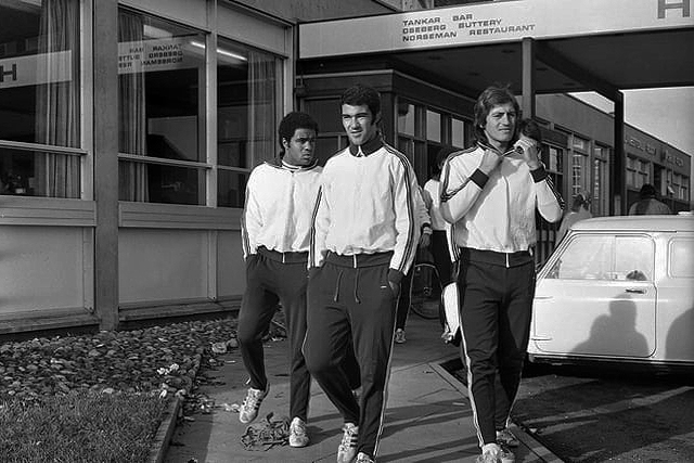
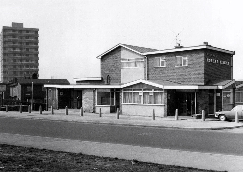
Back in 1973 the hotel was badged as the Norseman.
The giants of Sporting Lisbon faced Sunderland in the European Cup Winners Cup and they spent the build-up to the tie in the Norseman Hotel. They met local children, took a walk in the dene, signed autographs and even tried riding a Chopper bike. The side lost 2-1 at Roker Park to a talented Sunderland team before overcoming the Black Cats 2-0 back in Portugal.
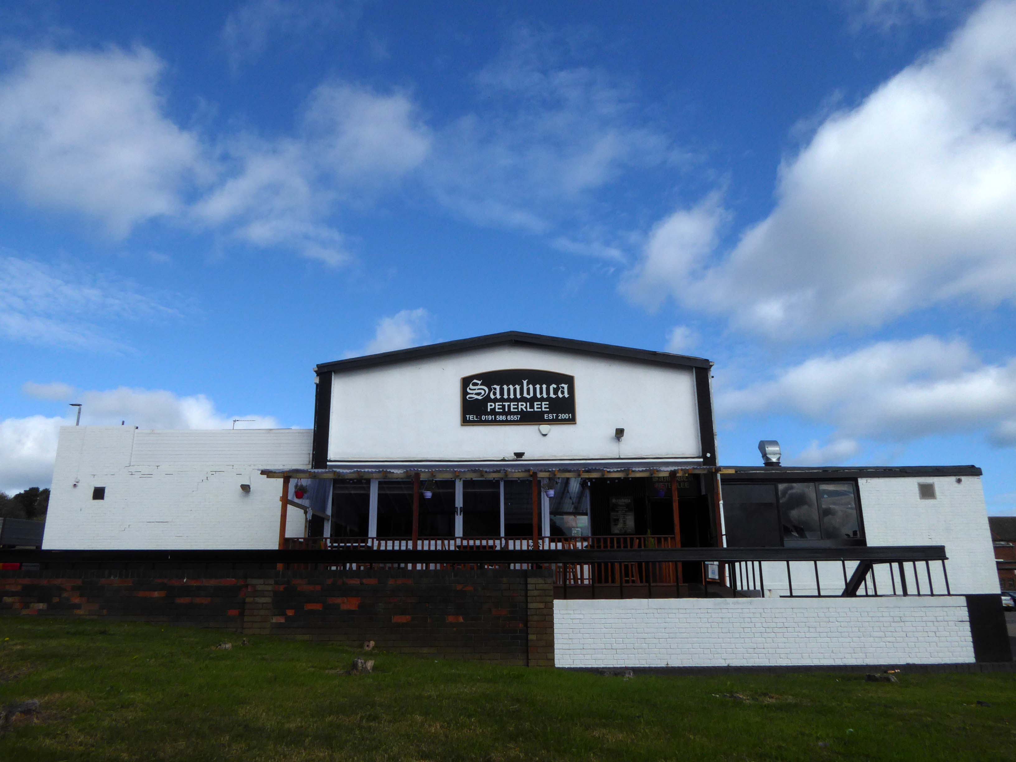
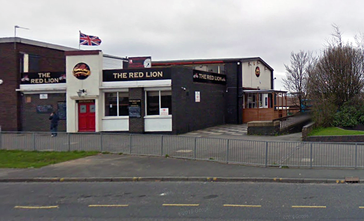
Back in 2021 Sambuca was the other town centre bar – badged with Olde English type.
Formerly the Red Lion a Cameron’s estate pub.
April 20th 2014 – Happy Easter everyone. We are open today all the way to 10pm – £2 bottles VHFs, house spirits only £3 double, buckets £4, Corona £2.50 selected shots 50p, cider cans £1 + £2 Karaoke – from now on everyone who sings gets a free shot Then we have the best in all your favourite dance ‘n’ house tunes to take you into Monday.
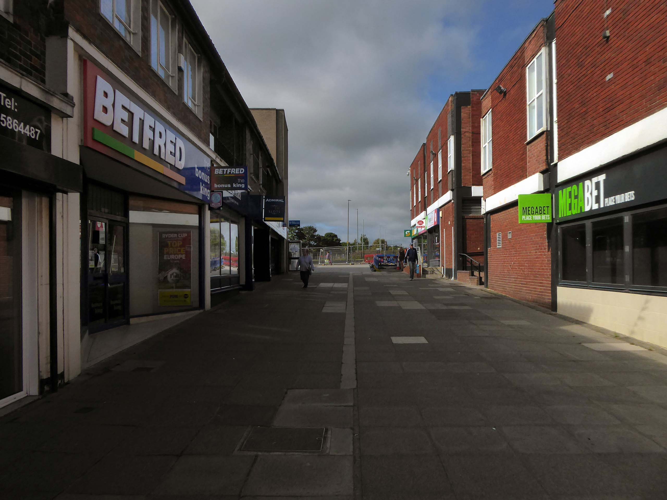
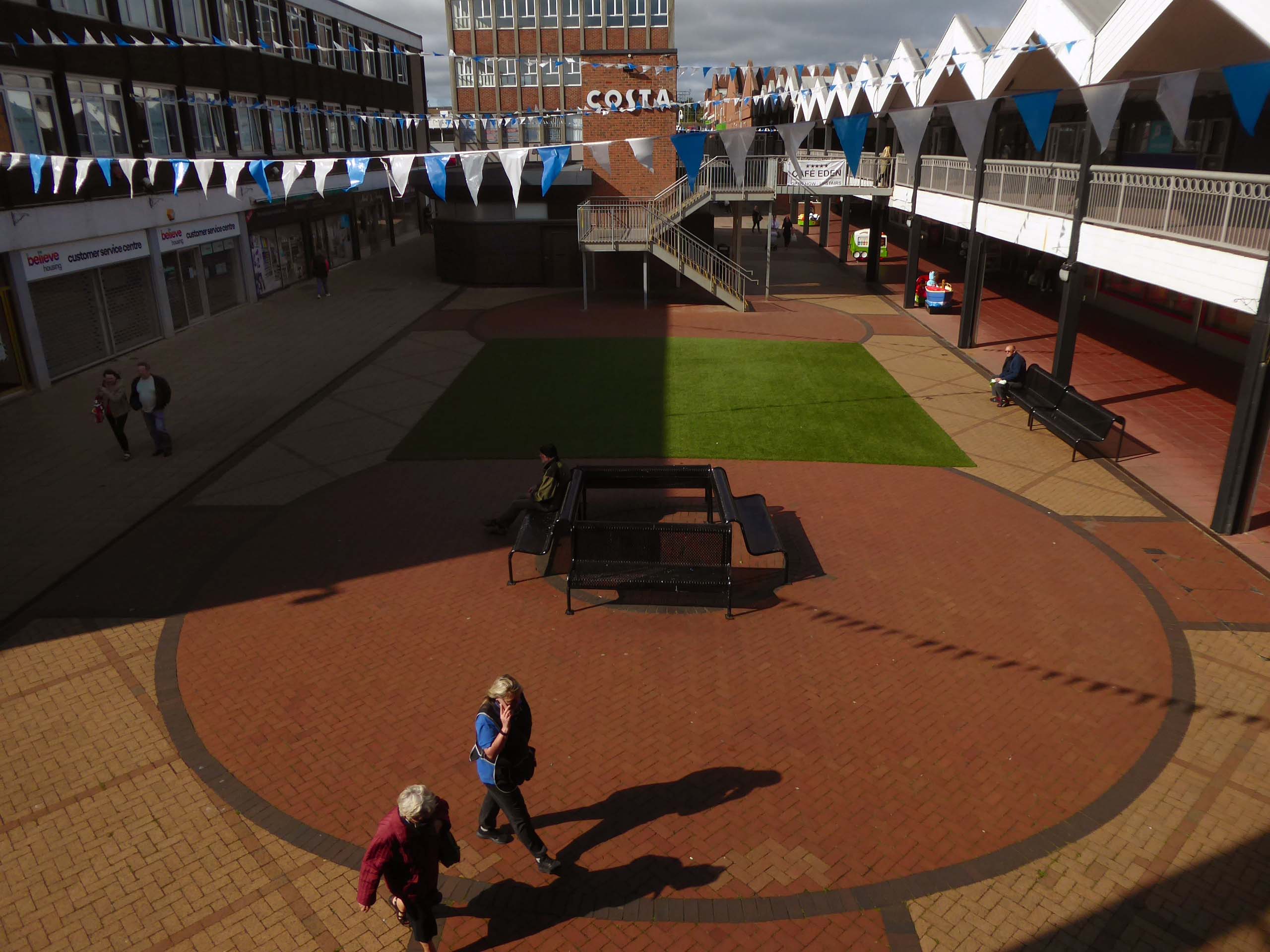
Onward to the Shopping Centre.
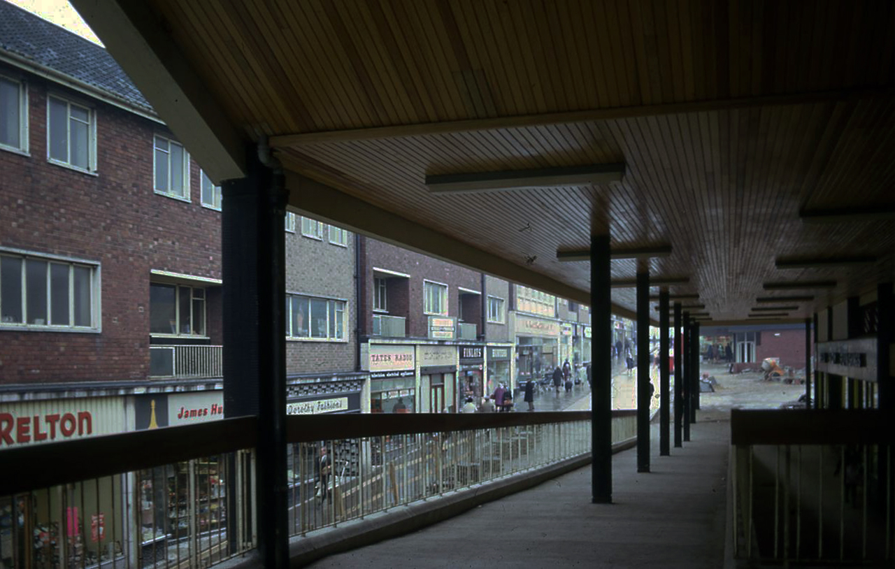
Yoden Way looking towards Lee House in 1977.
Photographs: JR James
The 1950’s shops are still in situ.
Though some of the original architectural detailing and features are no more.
Lee House is still standing but vacant.
Lee House was once home to charity and community groups, but in 2015 the building owners ordered them to vacate the property.Even the building’s clock has stopped working and has been stuck on the same ten-past-two reading.
However, Durham County Council has now confirmed the building is in new hands. Economic development manager Graham Wood said: “We have worked with the previous owner to try to ensure the building is secured while we await proposals for its long-term future.
Four fire engines rushed to Lee House on Upper Yoden Way in Peterlee on Friday afternoon September 19th 2025 after a fire broke out on the first floor of the seven floor building.
The pub was open, but the Alan Boyson mural was in need of repair.
The missing panel, stored in the pub’s cellar was subsequently reinstated.
Then, following a Modernist crowdfunding project instigated by Richard Brook and Christopher Marsden, Alice Vincent-Barwood restored the work, during July 2022.
Sadly in August 2023 the pub lost its licence and remains closed.
Wandering from Town to Moston yesterday, I happened to pass by, so I took some photos, here they are:
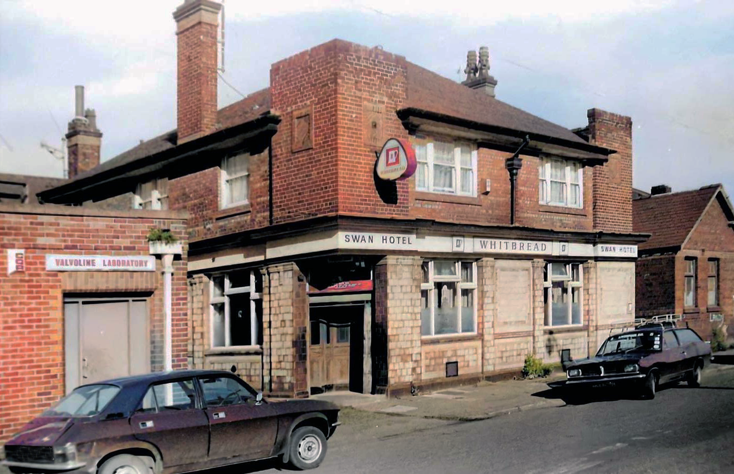
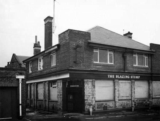
At one time named the Royal Swan, in the later years its name was changed to the Blazing Stump and before closure became a night club known as Bonkers.
A lost venue once loved for being the “wackiest fun pub” in the 1980s.
Date of closure unknown but thought to be late 1980s or early 1990s.
On the Dock Road was the ‘Swan Hotel which also opened in 1878. The nickname of the Swan Hotel was ‘The Blazing Stump’ and the story goes that an old seadog with a wooden leg used it to poke the fire. In those days pitch was used as a wood preservative, which is probably why his wooden leg caught fire when poking the fire one time too many – hence ‘The Blazing Stump.’
Due to its location near the Wallasey Docks majority of the customers who visited the pub came off the grain or ore boats. The pub would be thronged with Norwegians, Greeks, Germans, Swedes and Arabs and local people. When the pub was full the place had an unusual and interesting flavour because of this rare variety of people.
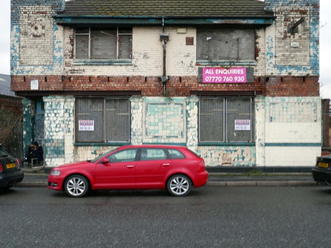
The ‘Stump’s’ days were numbered when less and less ships visited the Wallasey docks. The building still stands but remains unused, with the owner looking for a big payout sale. Or who knows, the doors may just open once more.
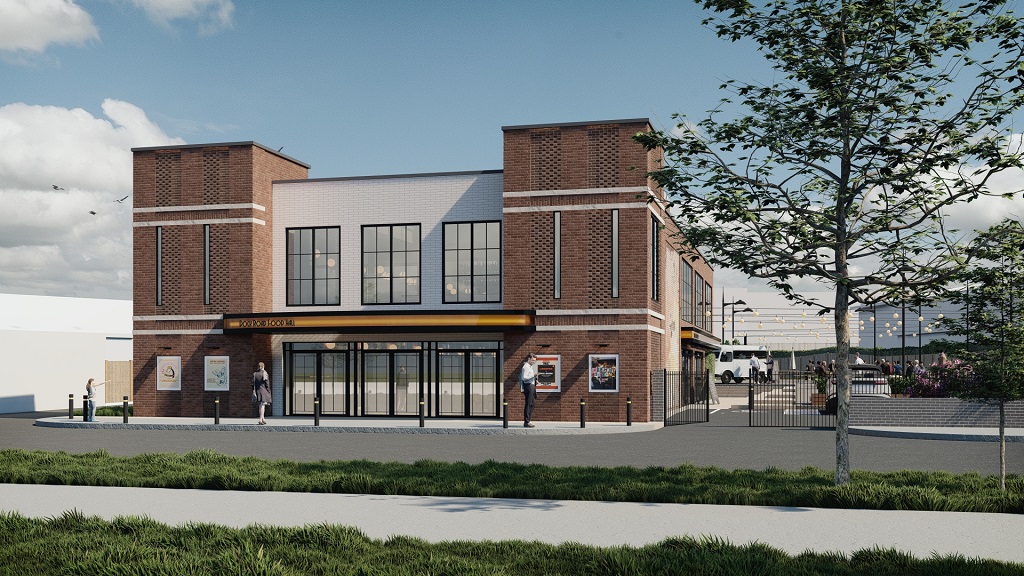
Now construction company AP Mitchell and Evoke Architecture have submitted plans to Wirral Council to completely turn the site around.
The plans include outdoor seating areas with benches, an outdoor event space, food and drinks vendors, and a large bar. A private function space will sit inside the new building which will be called the Dock Road Food Hall.
The design works carefully to balance modern design with reminiscent character features, sympathetic to the original building and surrounding historic buildings of similar style. The result is a contemporary structure that aligns with the evolving character of Dock Road and the Wirral Waters masterplan.
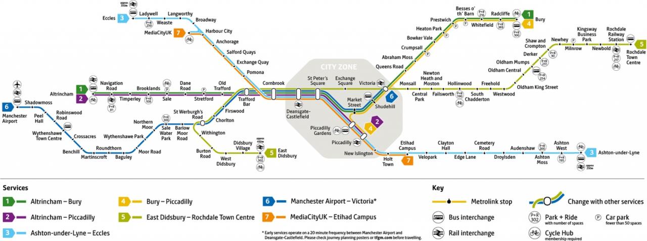
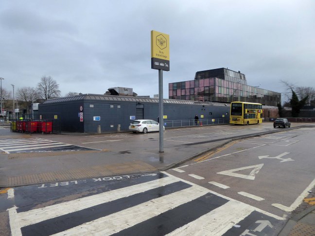
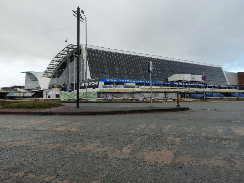
I was cordially requested to produce tram based walk, by the good folk at the modernist – travelling from Victoria Station to Bury. Alighting at each stop and seeing what could be seen, by way of modern buildings along the byways.
By the way, I do have previous experience, having undertaken a similar task travelling to Ashton.
So I set off as instructed, clutching my GMPTE senior concessionary travel pass.
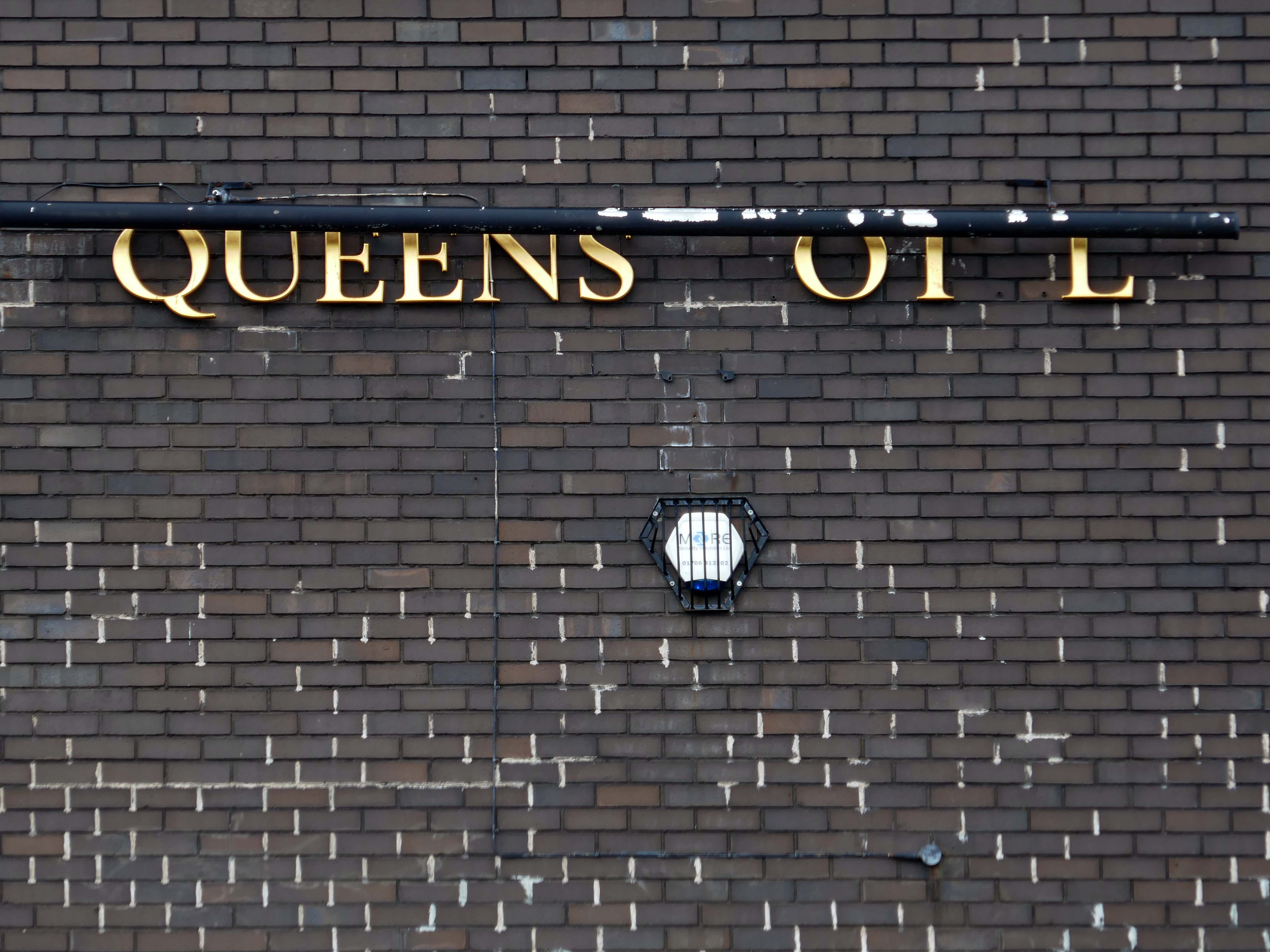
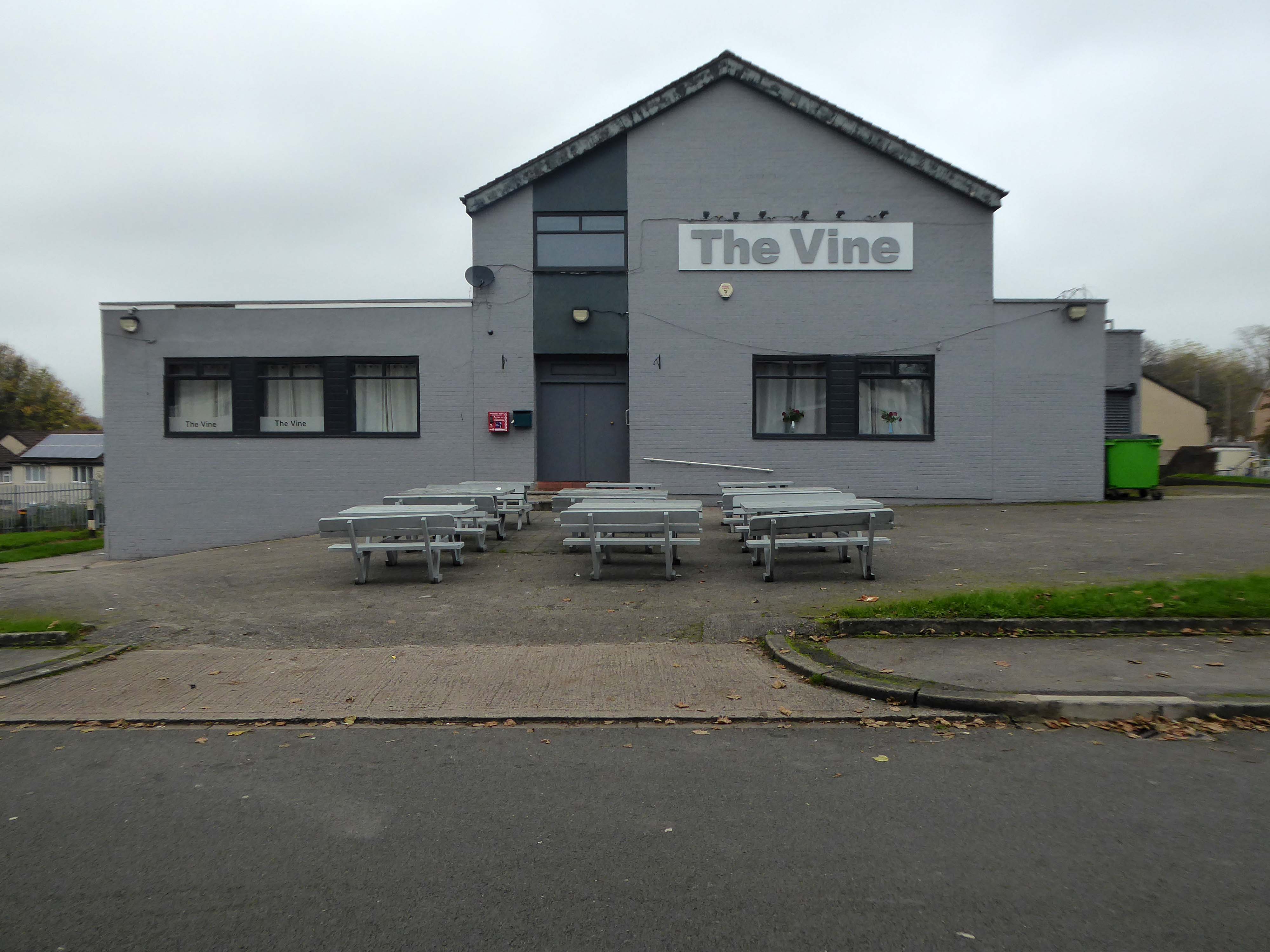
Queens Road
Turn right on leaving the station, right then left – you have reached The Vine.
Glendower Dr, Manchester, Greater Manchester M40 7TD.
Head for Rochdale Road and turn right back toward the city centre, you have reached Eastford Square.
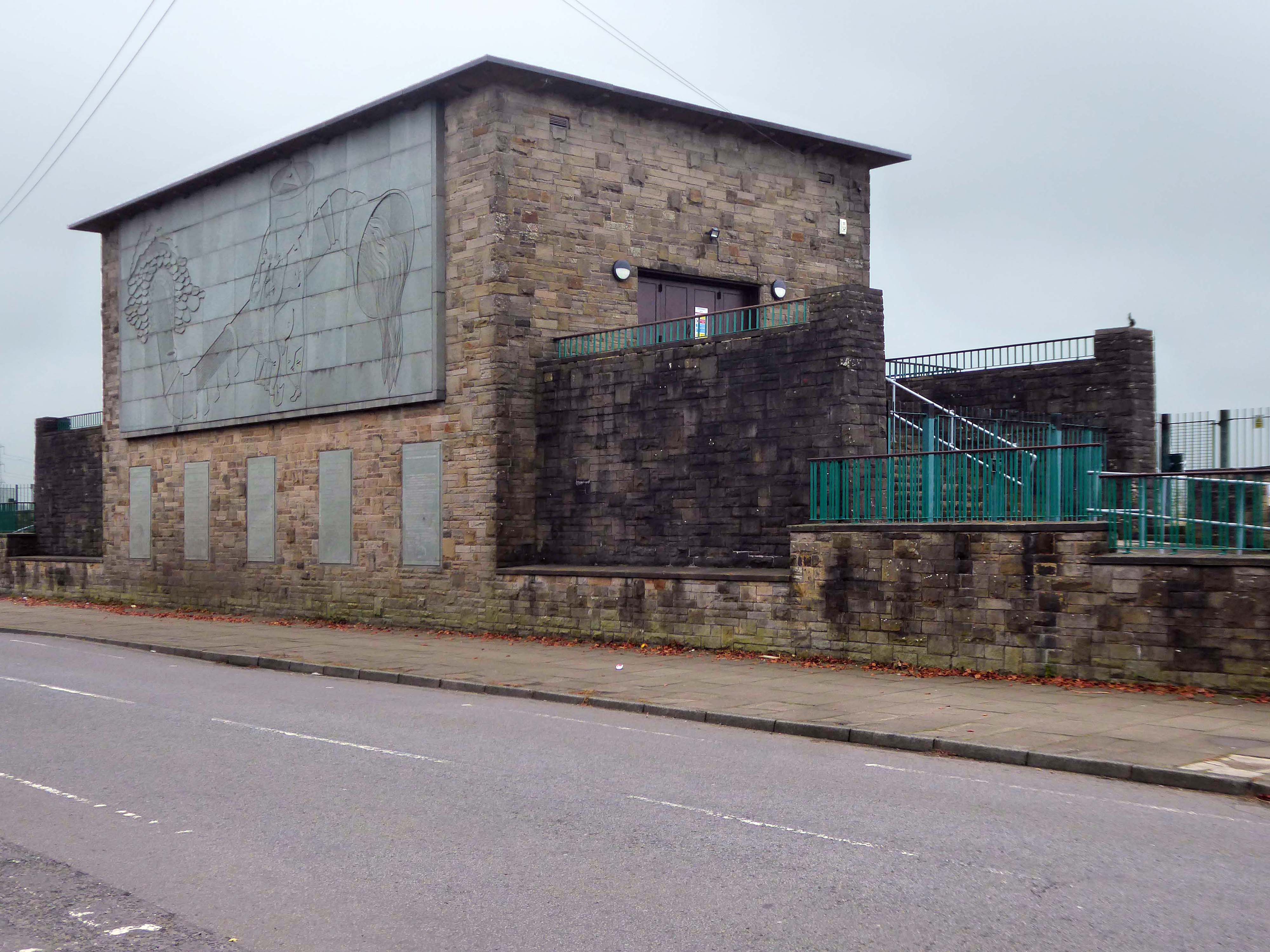
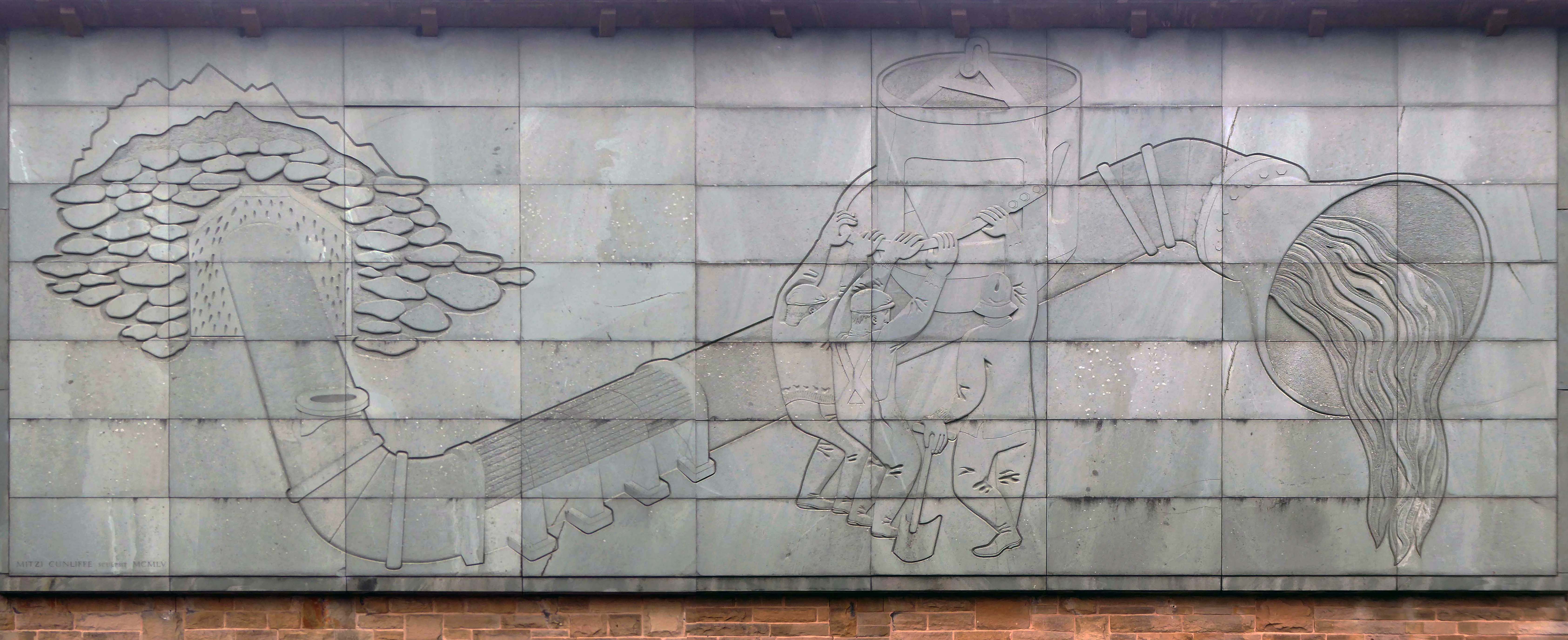
Turn left from the station along Bury Old Road until you reach Heywood Road on your right.
Heywood Road, Prestwich, Manchester M25 2GT
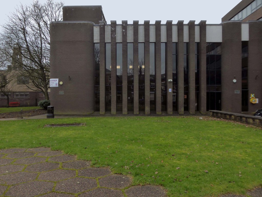
1954-5 by the Manchester City Architect’s Department, Chief Architect Leonard C Howitt, for the Manchester Corporation Waterworks. Alan Atkinson, engineer. Incorporates large relief by Mitzi Cunliffe, signed and dated 1955.
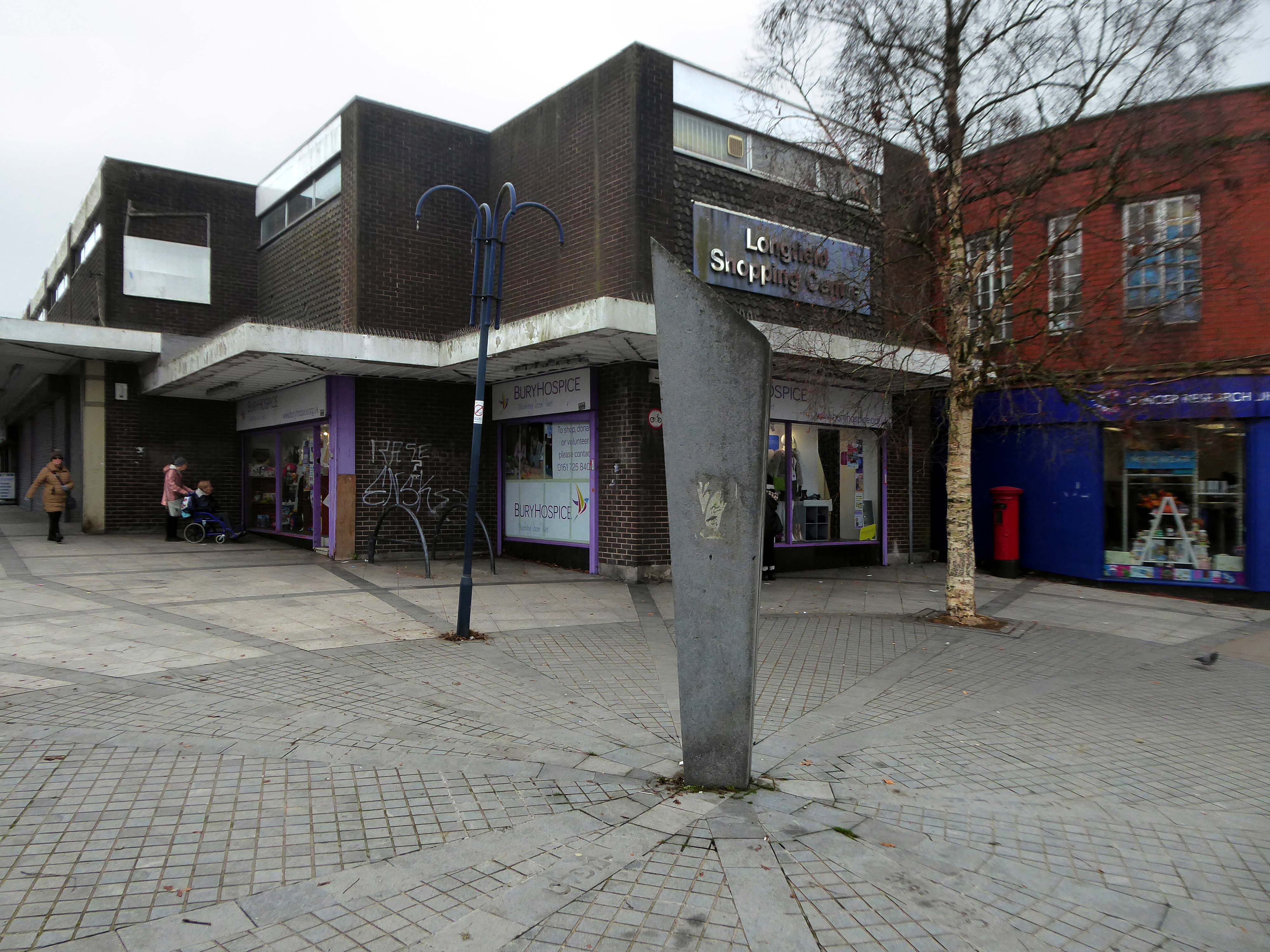
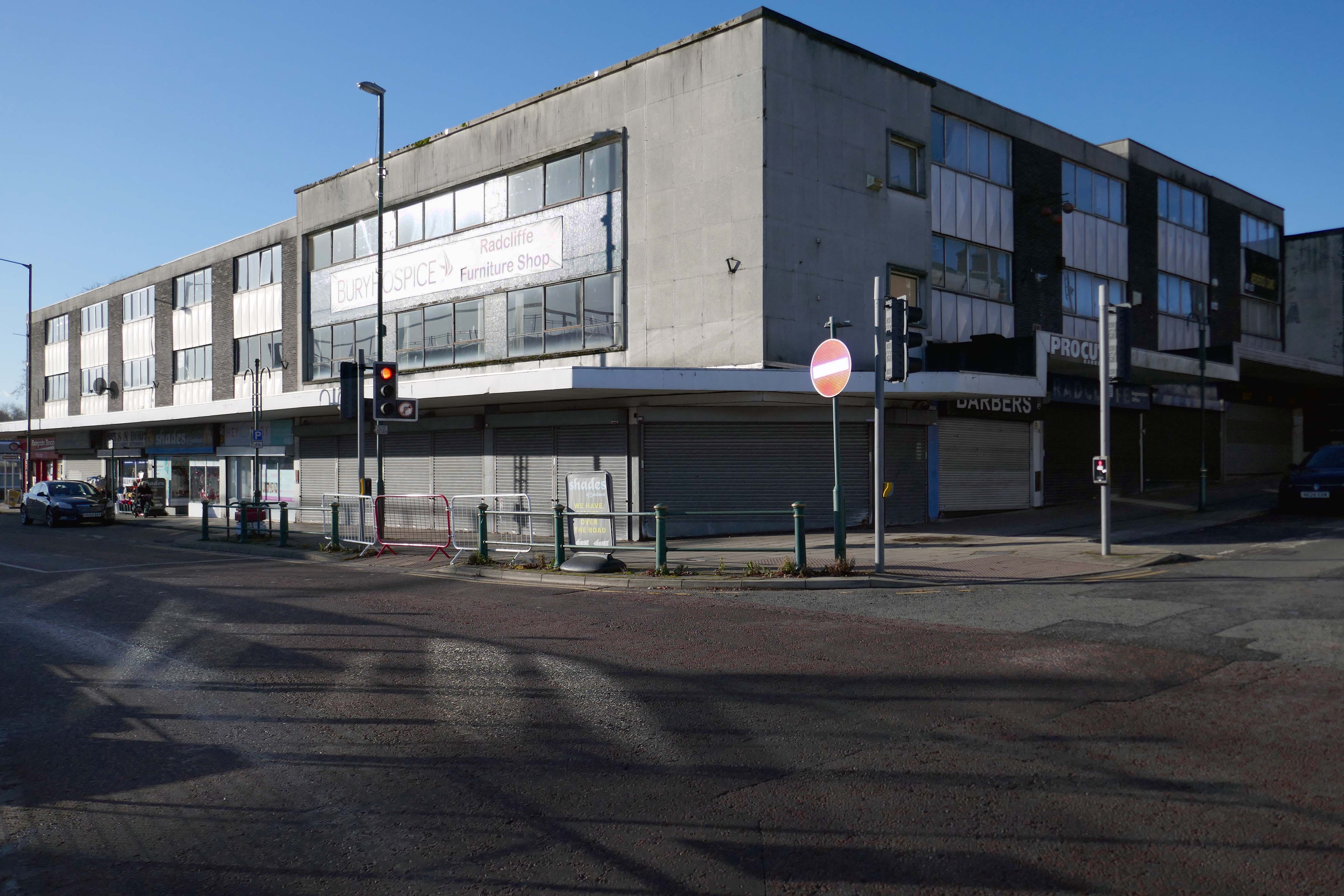
After months of public consultation, the joint venture has firmed up its proposals for the redevelopment of the Longfield Centre and is aiming to be on site before the end of the year.
Muse and Bury Council have submitted a hybrid application to transform six acres of Prestwich town centre.
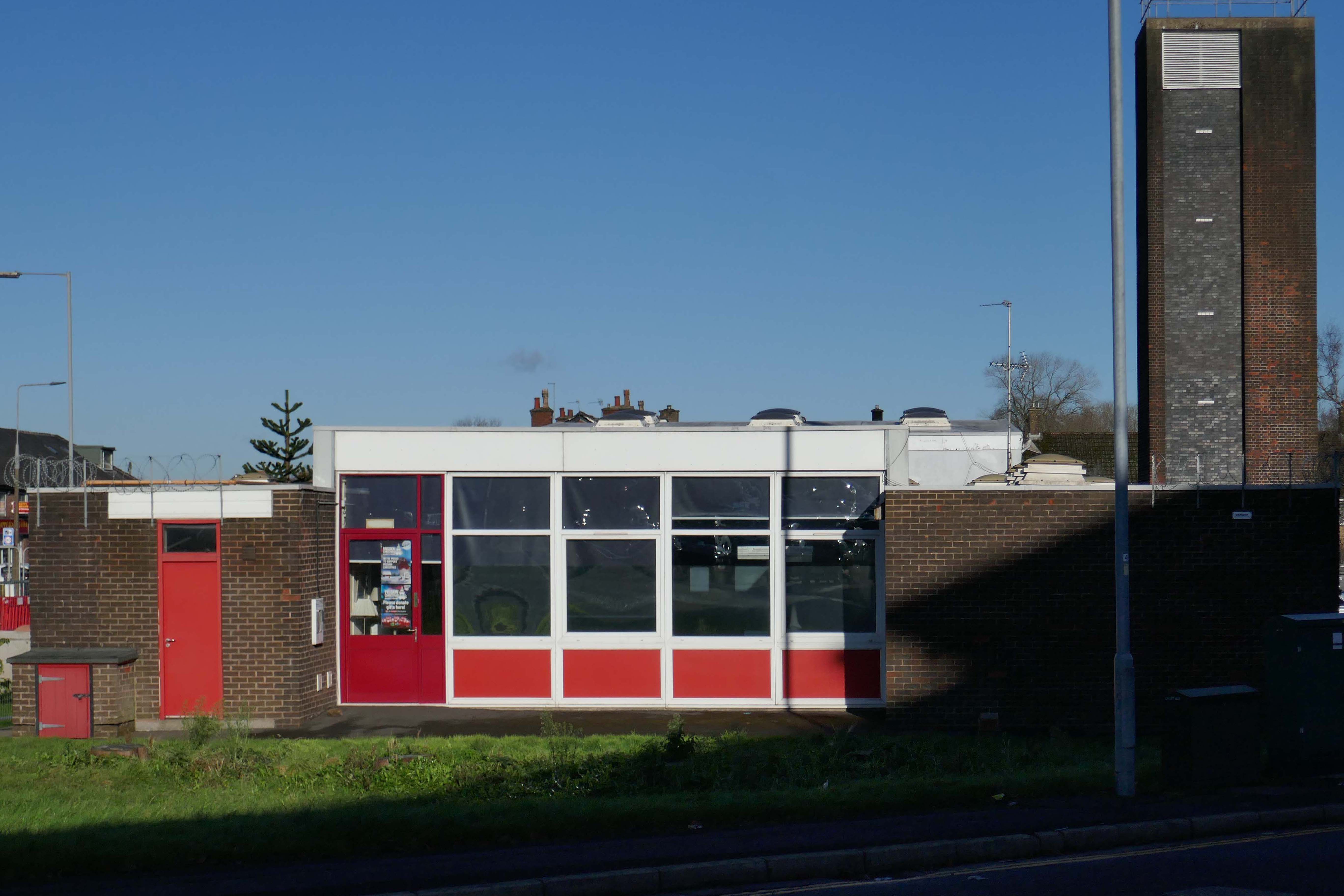
The Strategic Regeneration Framework is the guide that is shaping the direction of Radcliffe’s growth over the next 15 years with a series of realistic short, medium, and longer-term actions. It is also shaping the direction of future council investment, supporting bids for central governmental funding and providing certainty for third parties wanting to invest in town.
Work has begun on Strategic Regeneration Framework’s priority projects, these include:
A new civic hub in central Radcliffe, which will bring together a mix of functions at the heart of the town
Refurbishment of the market basement and the revamping of market chambers
New leisure facilities
A secondary school on the Coney Green site
A “whole town approach” to housing, bringing forward a comprehensive approach to residential development in Radcliffe
A transportation strategy, which will consider matters such as active travel and car parking
I began walking when quite young, then like Felix, I kept on walking, walking still.
The photograph was taking during the Whit Walks in 1958 – aged three, I was engaged in religious pilgrimage, as we know there are many reasons for walking, this is but one.
I was fortunate to grow up at a time when youngsters were permitted to roam freely, less traffic, less anxiety, gave me access to a wider axis of exploration.
The photograph would have been taken I assume, by my mam, on the Brownie 127. When aged nine I wandered alone through the local woods and exposed twelve frames of 44mm 127 film, the prints are long gone, yet I remember each of the photographs and locations clearly.
I went to school, then I didn’t, then I went to Art School, eventually becoming a teenage Constructivist, tutored by Jeffrey Steele, a leading light in the British Systems movement.
The rigidity of the grid, symmetry and orthogonal framing have stayed with me.
Then I went to work for a very long time indeed, then all of a sudden I didn’t. Taking early retirement aged 59 some ten years ago, subsequently taking to the roads, streets and hills of Britain in search of nothing in particular.
In recent years there has been a rapid development in the culture of walking, theories, films, guides, songs and literature. I am fully cognisant of such, yet believe at heart that walking can be free of such baggage, we can stride unhindered, atavistic and carefree/less.
Walk tall, walk straight and look the world right in the eye.
Getting lost is about the unfamiliar appearing.
In my own small way, I have become part of that baggage, having been asked to lead a walk around Stockport by the the modernist neé Manchester Modernist Society.
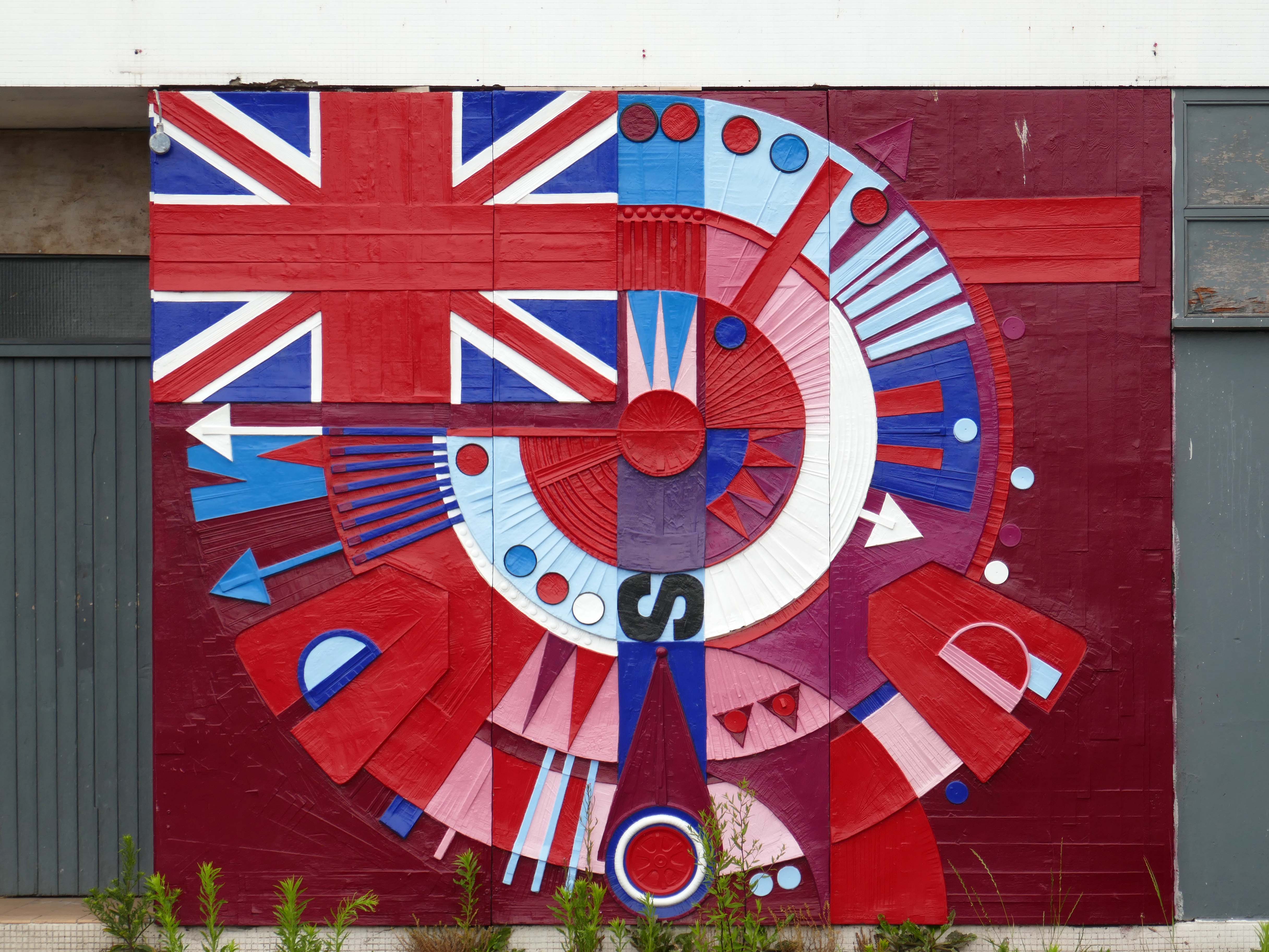
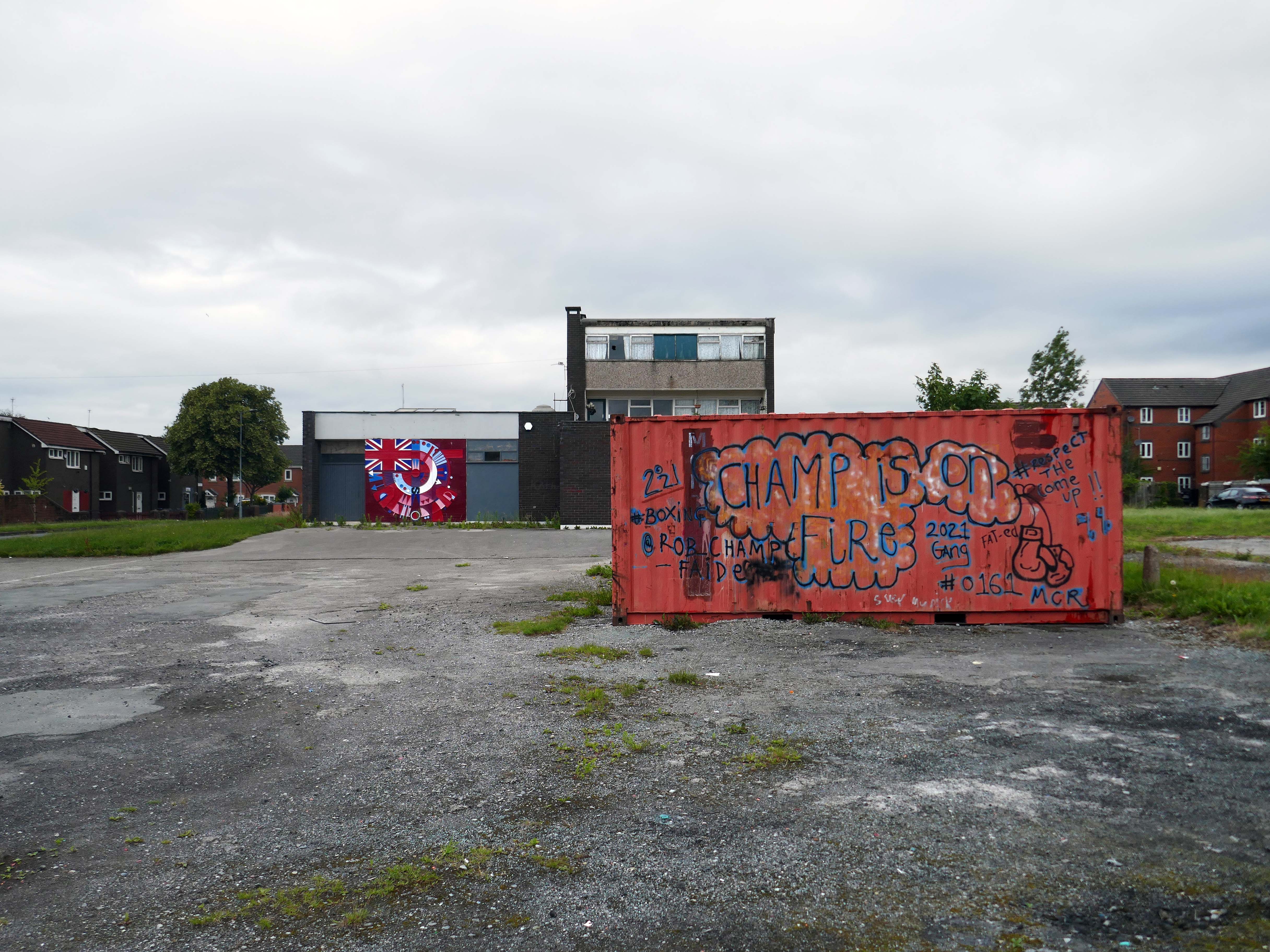
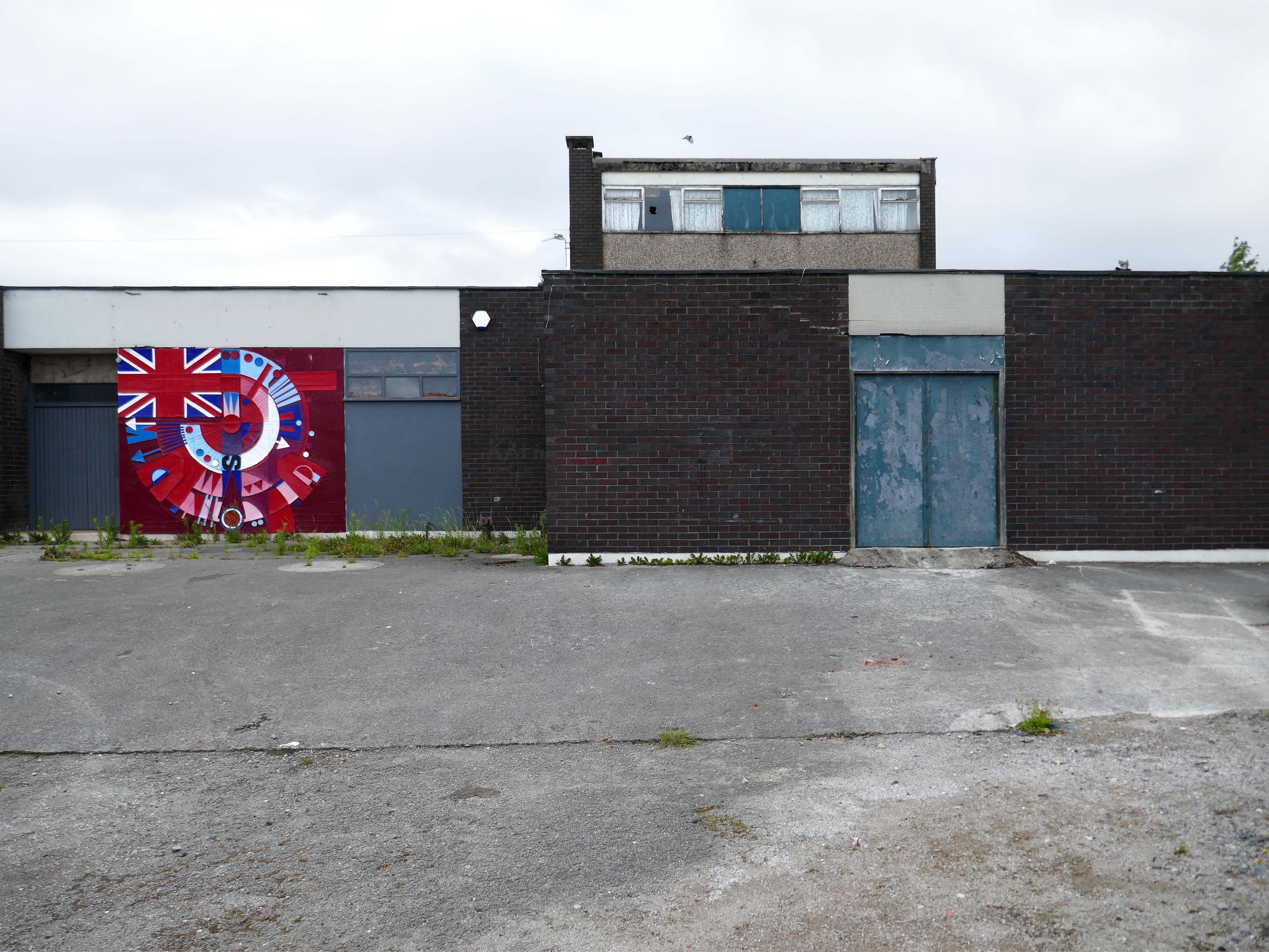
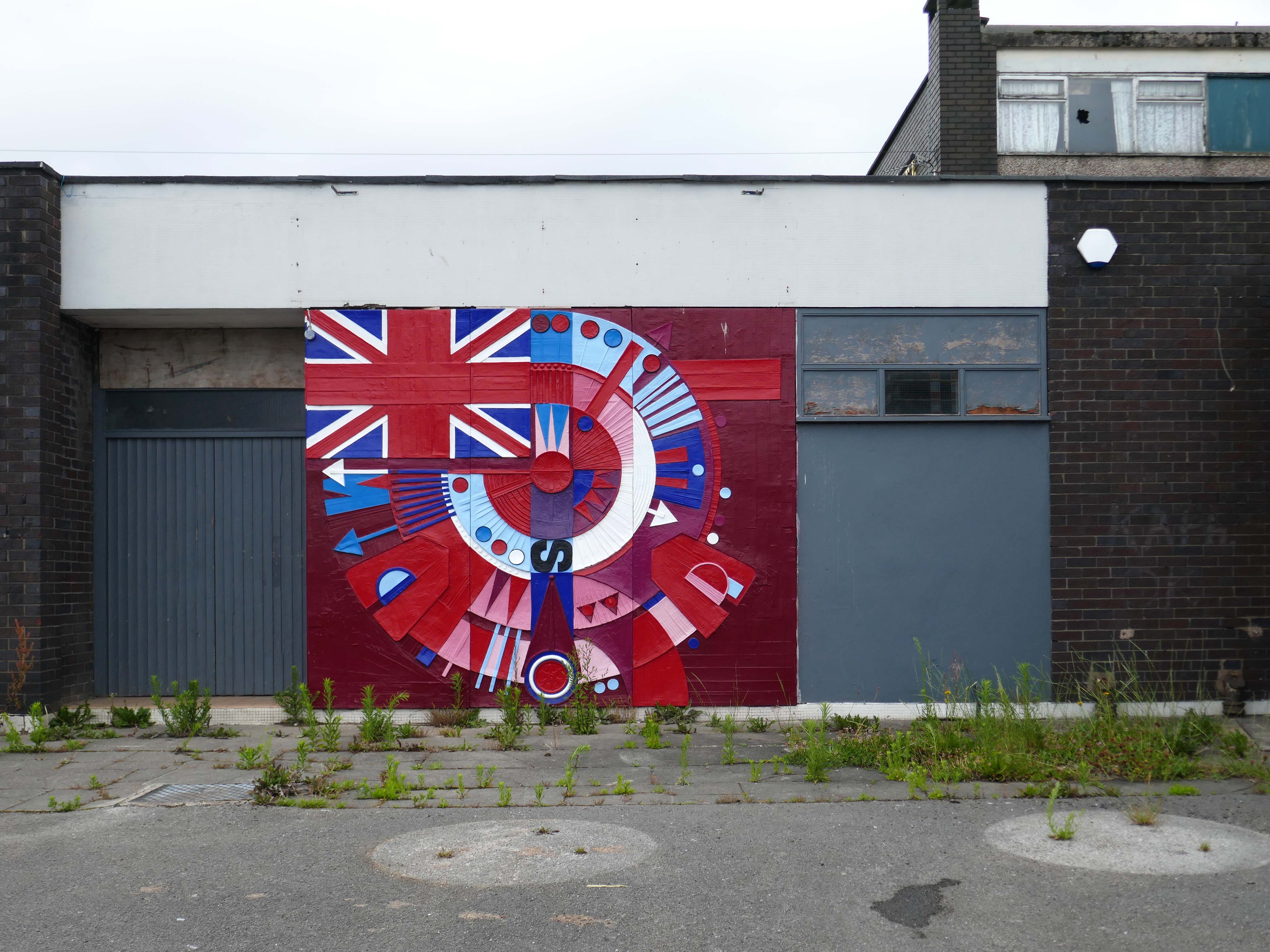
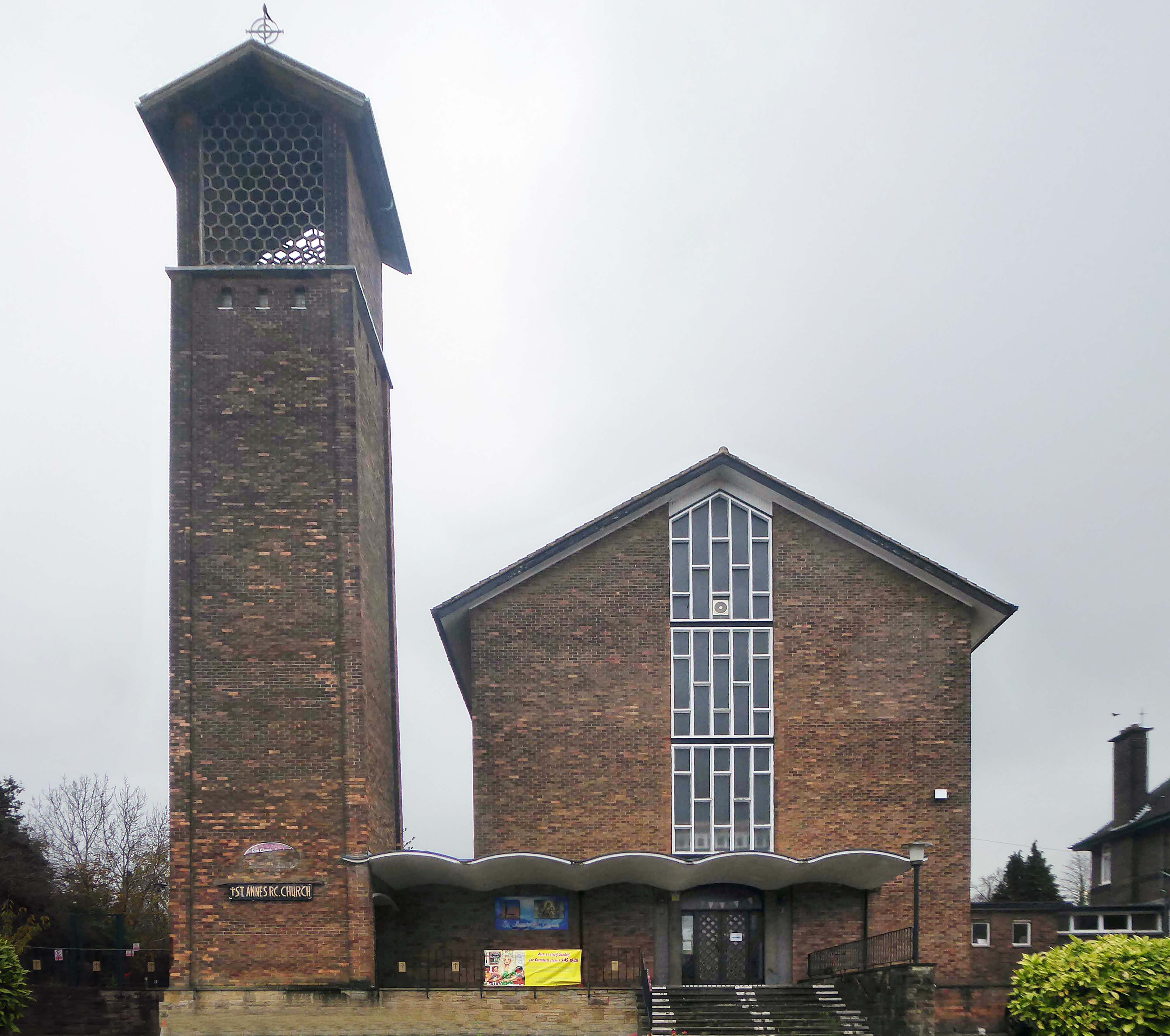
The photograph depicts Alan Boyson’s concrete screen wall, attached to the former Cooperative super store designed by Philip Andrew. The two worked to gather on the Hull Cooperative store, which is adorned by Alan’s huge Three Ships mosaic.
Philip was a childhood friend of Alan Boyson and it was Alan’s father, manager of the Marple Co-operative Society, that recommended Philip for an apprenticeship job in 1951 to the chief architect at the CWS in Manchester HQ.
In preparation for the tour, I visited the town’s Local Heritage Library and read extensively from serendipitous charity shop finds.
The two hour route was designed around an economy of distance and elevation, allowing time for others to take in, what may be for them unfamiliar surroundings. A group of around twenty or so folk became sociable and engaged, with a suitably concise and apposite contribution from myself. There are those who busied themselves taking snaps along the way, chatting amiably or simply gazing in amazement.
The service building above the former Debenham’s store.
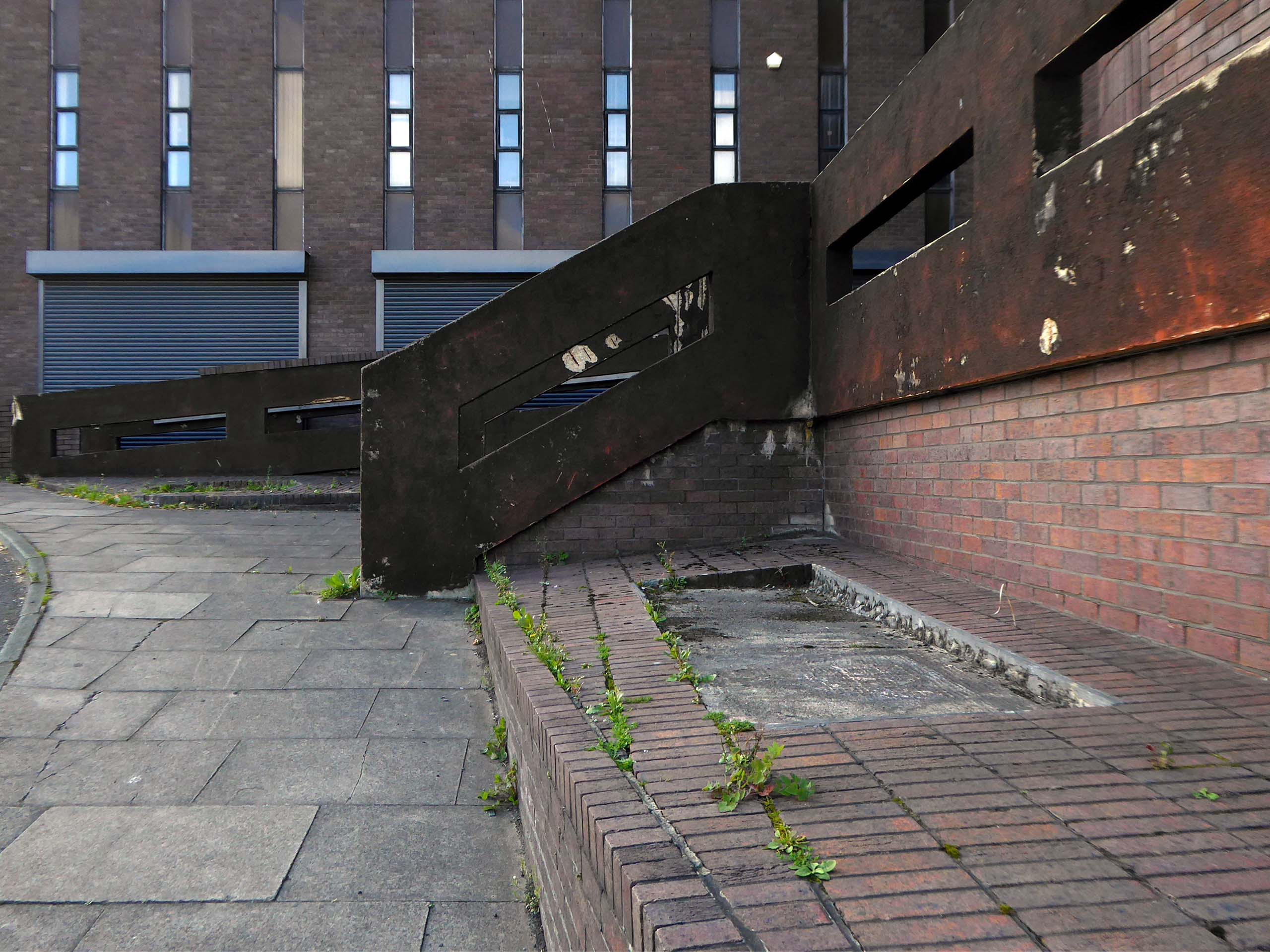
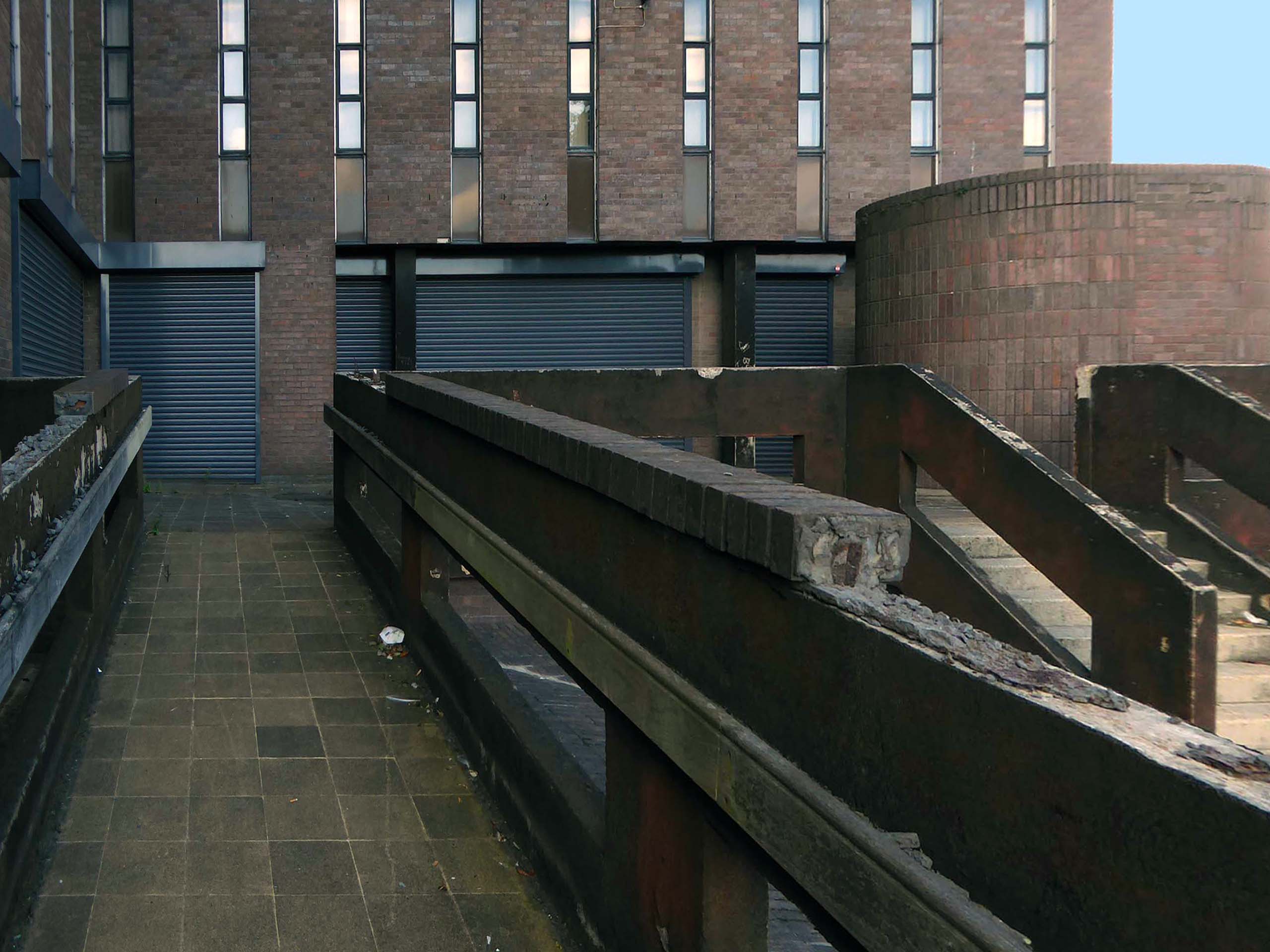
Famed as an imaginary TV police station, this civic building is a civic building I simply can’t resist. I return on a regular basis to wander and snap. This is an open public space that seems little loved and has few visitors.
From then onwards I have been taking folks on Modernist Mooches on a regular basis, two or so a month, during the less inclement times of year.
At about the same time I was asked to exhibit my photographs in Stockport, I chose to mooch about at night. Walking around an almost deserted town, avoiding the glare of streetlights, there is a mild frisson to be about when nobody else is about. The air feels different, exposures are longer, the almost waking world feels arrested, by the low available light.
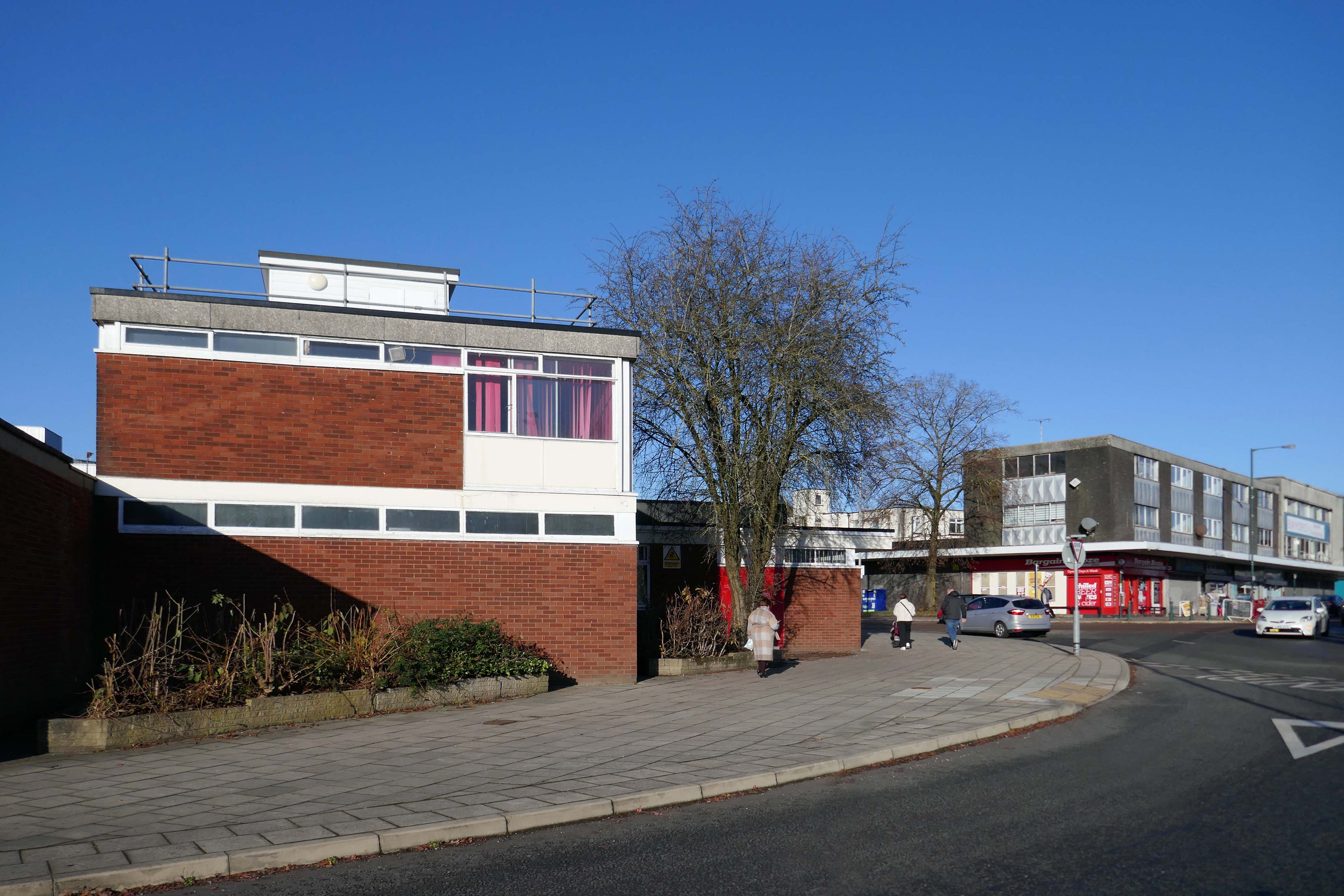
My local shopping centre and as such part of my weekly walking and shopping life.
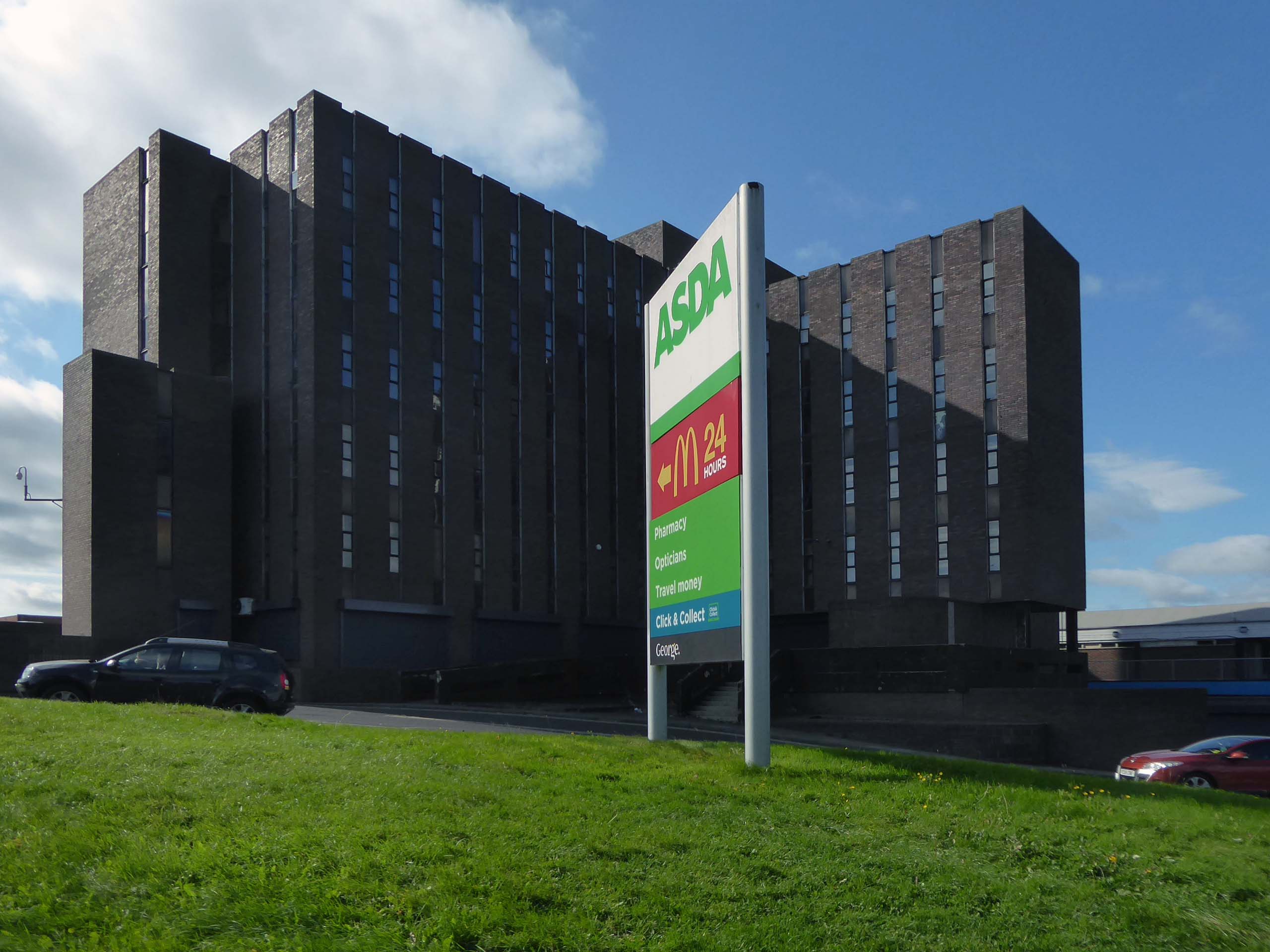
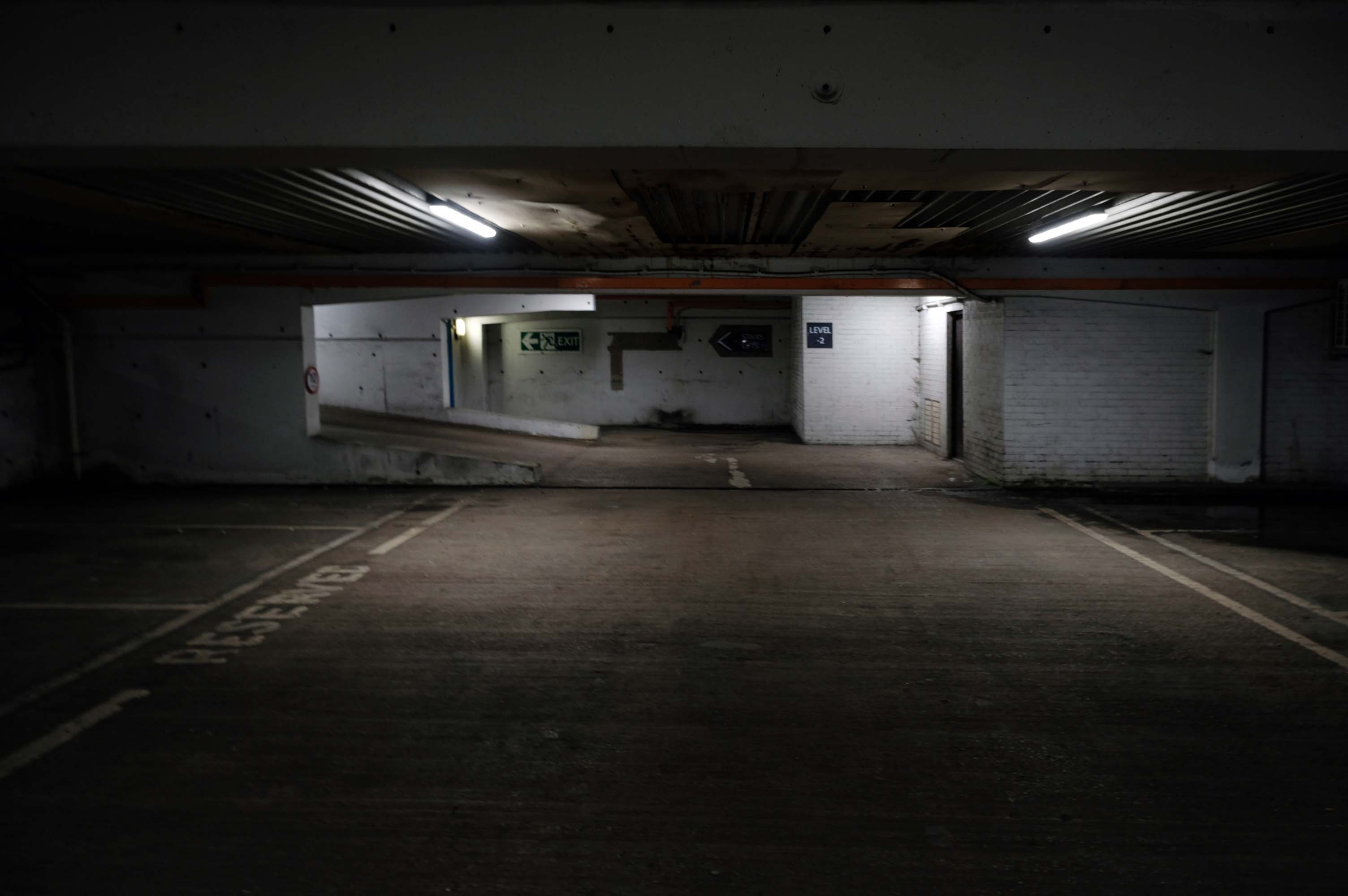
NCP Car Park located on Stockport Station approach.
Regent House
Asda superstore
I found a copy of Charlie Meecham’s book Oldham Road in a charity shop.
Inspiring me in 2014, to walk in mostly straight lines, though often as not zig zagging along the main arterial roads of Manchester.
Taking pictures on Sunday mornings, in order to avoid traffic, mildly amused to be ignoring the primary function of the routes.
This is one of the more familiar roads, having walked up and down several times over several years. It was to have been an extension of the Mancunian Way, forming a trans-pennine motorway. Much of the property lining the route was cleared in preparation, it was never built, and for years a strange semi-deserted ambience hung over the A57.
Bus Depot
Railway Bridge
The car showrooms which later became an African Evangalist church.
Having cleared away both Victorian and Sixties housing, new architectural forms arose in West Gorton.
Now, everywhere I go, I see launderettes – so arriving in Hanley with time on my hands, wandering around I found this exemplary example.
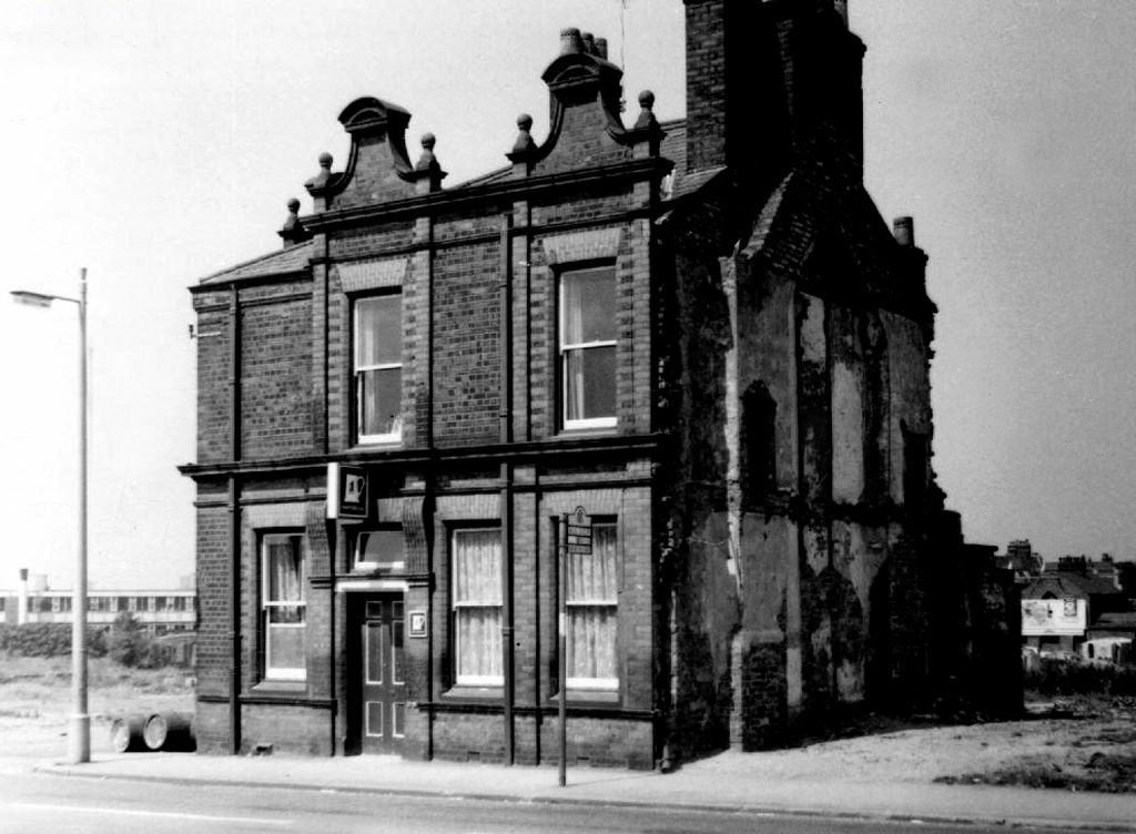
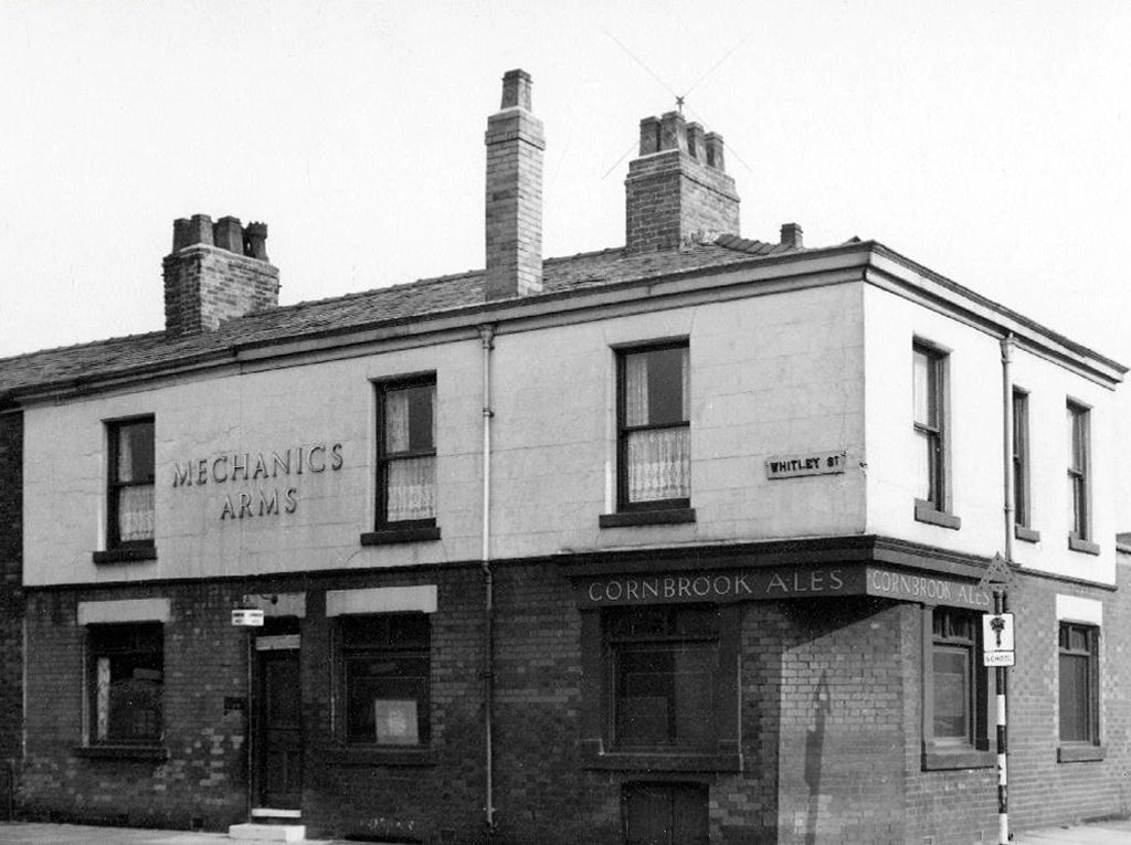
Having a blog entitled Manchester Estate Pubs, the national media became interested in my photographs. I had spent quite some time, wandering around in search of this endangered architectural typology.
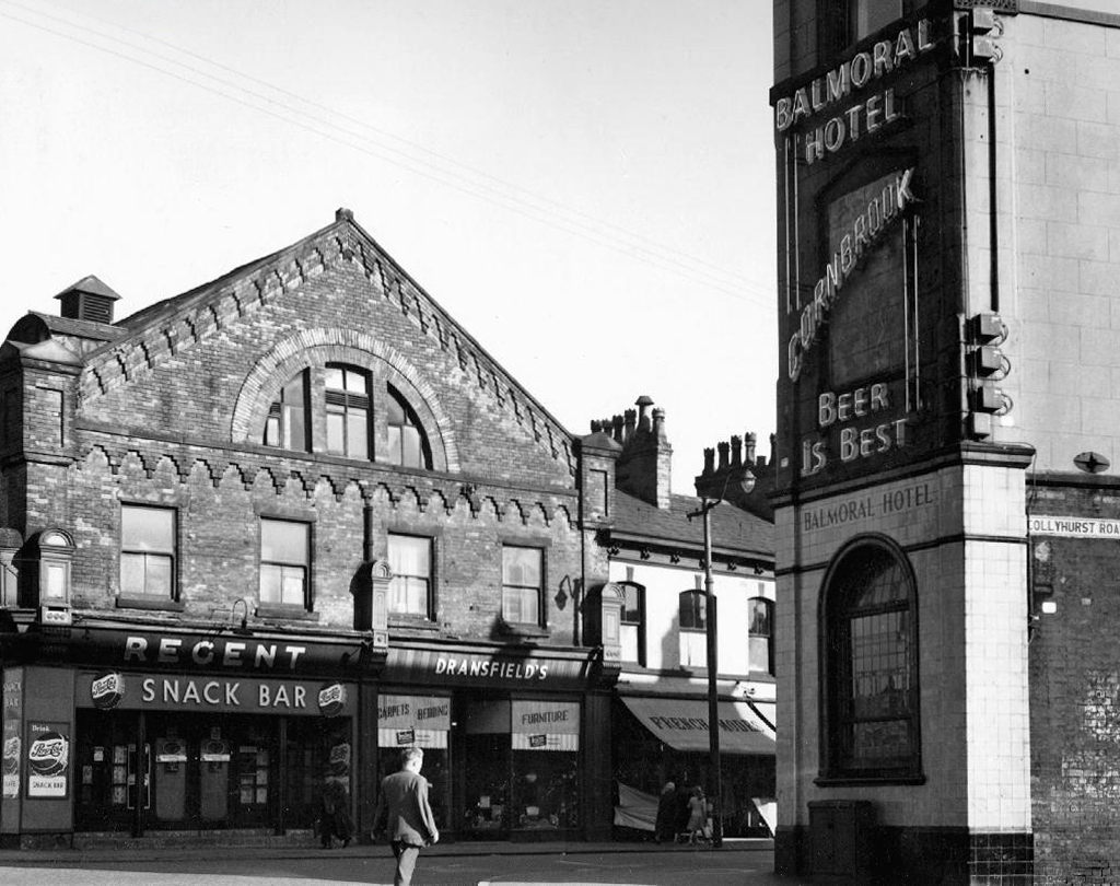
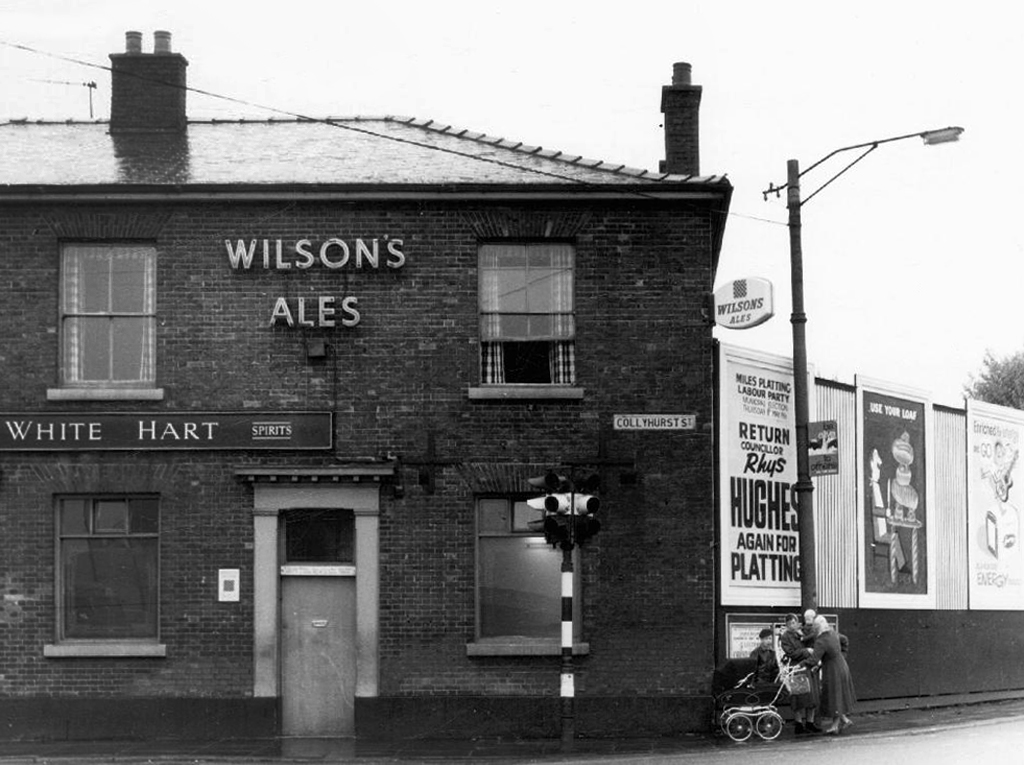
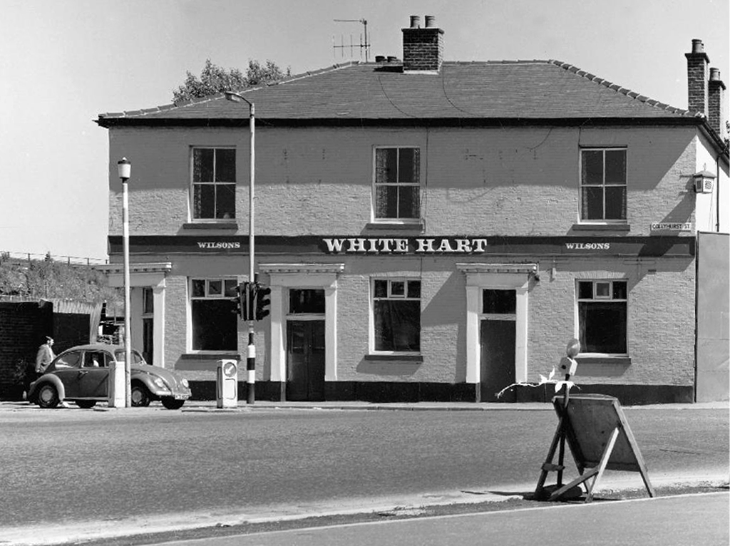
This was Billy Greens in Collyhurst, named for a local boxer, now demolished.
Which in turn became the second modernist calendar.
Followed the following year by fish and chip shops.
So building a vocabulary for my mooching, discovering yet another chippy, laundry, pub, Burton’s, telephone exchange, glazed stairway or underpass.
These things find you, yearning for some small amount of attention and affection.
The Trawl – my favourite peg board menu, my favourite Bridlington chippy.
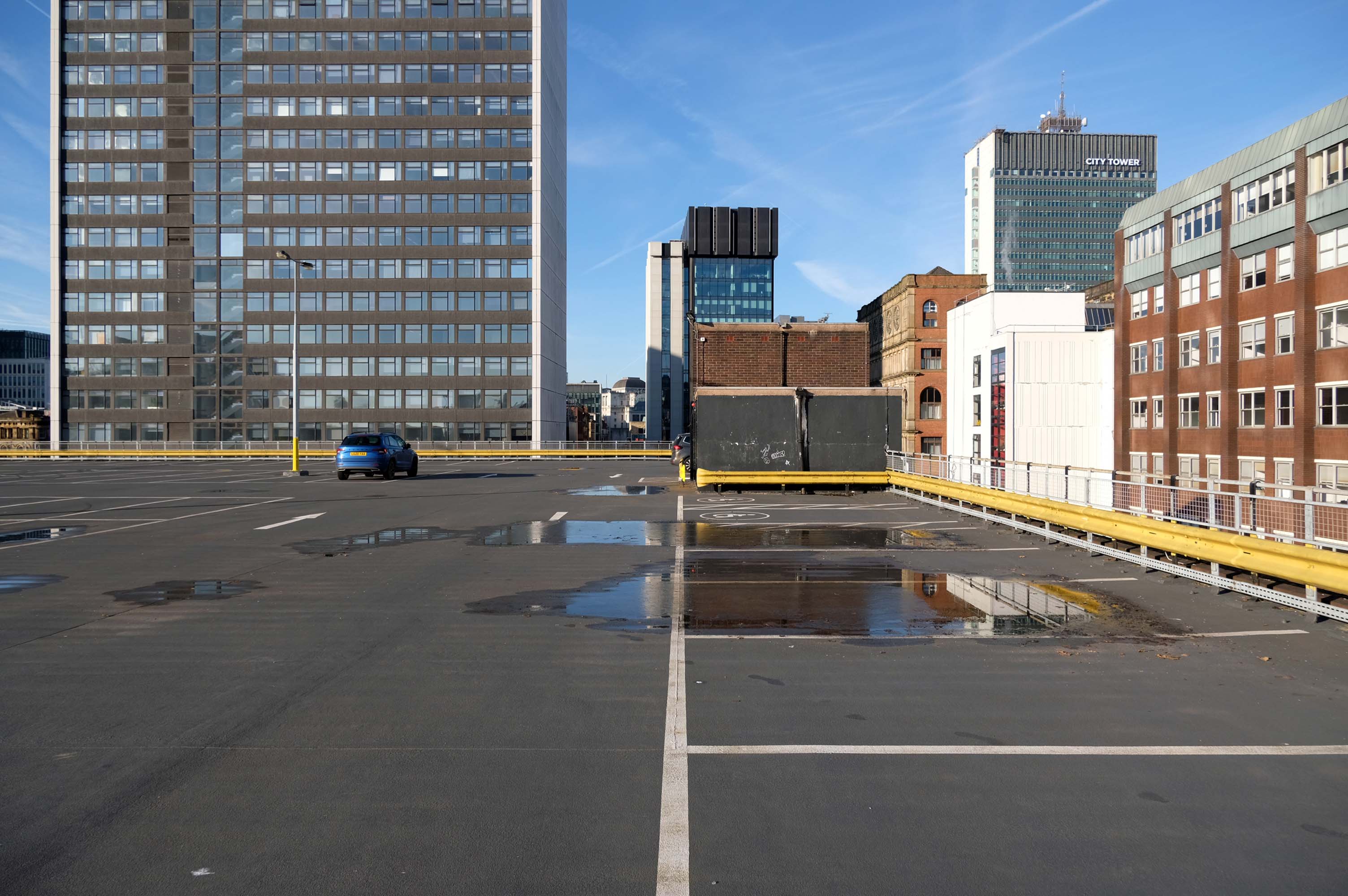
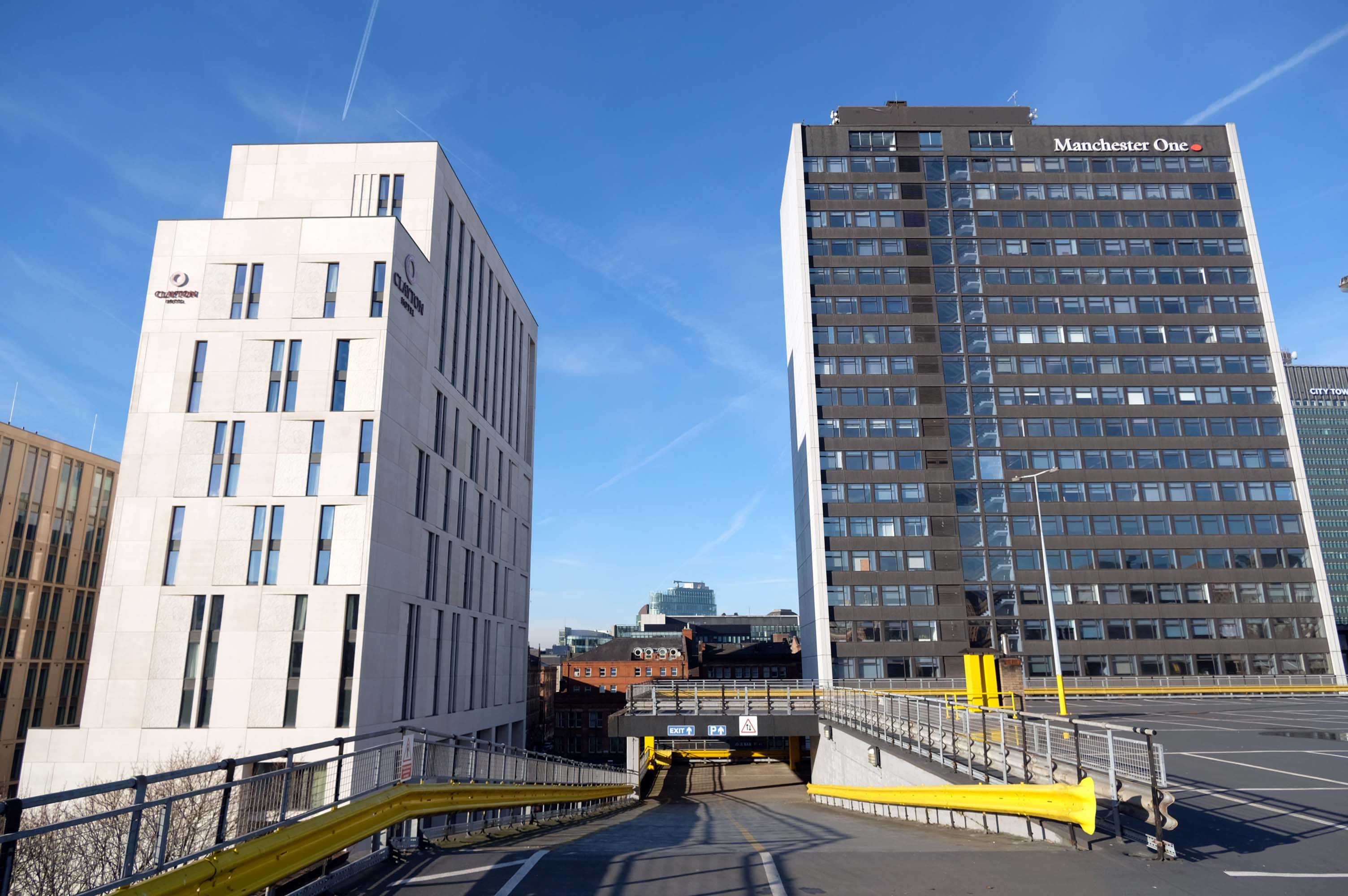
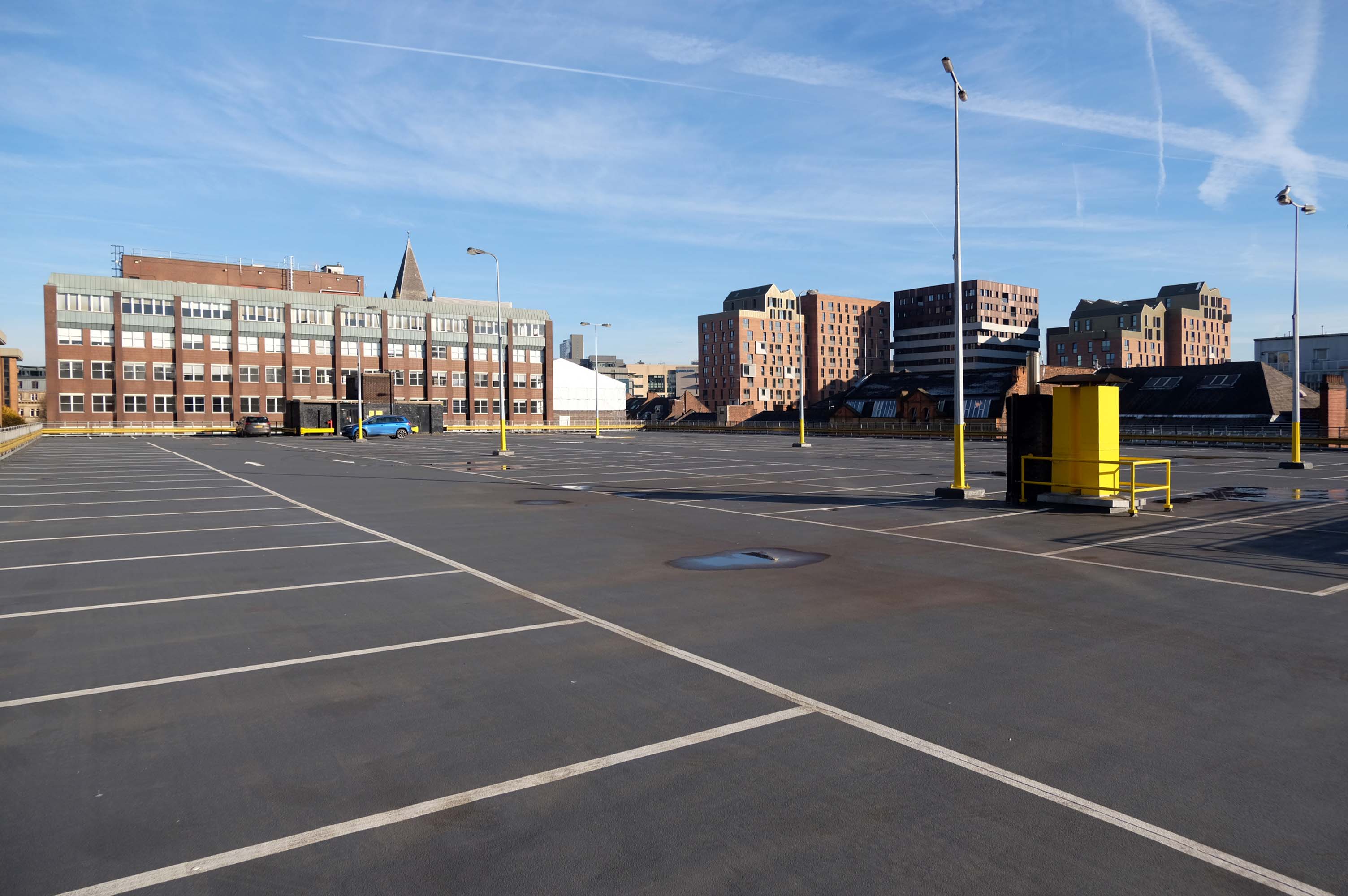
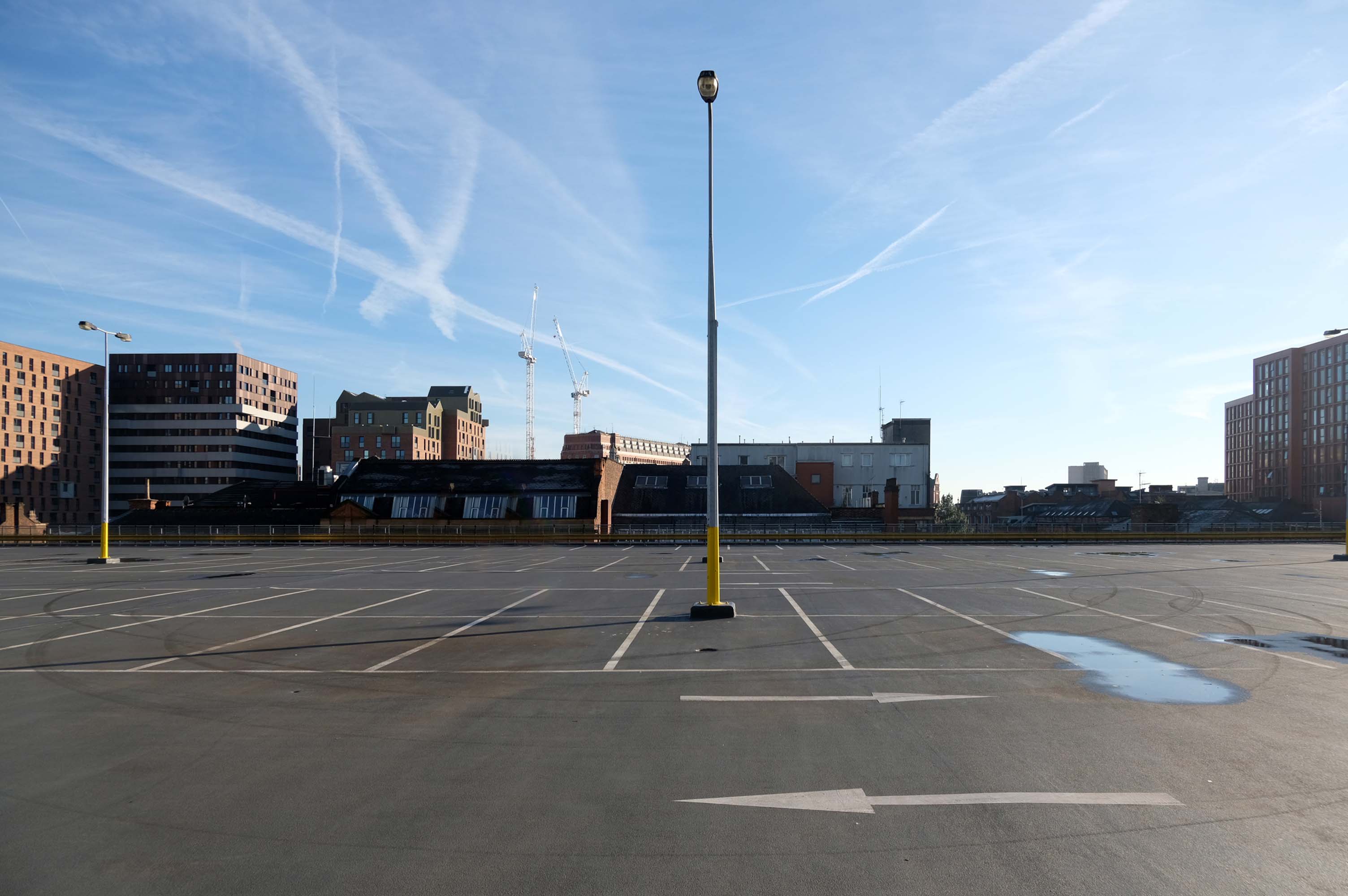
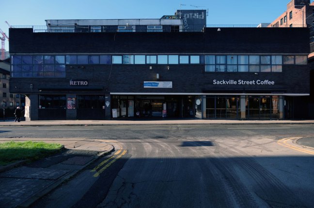
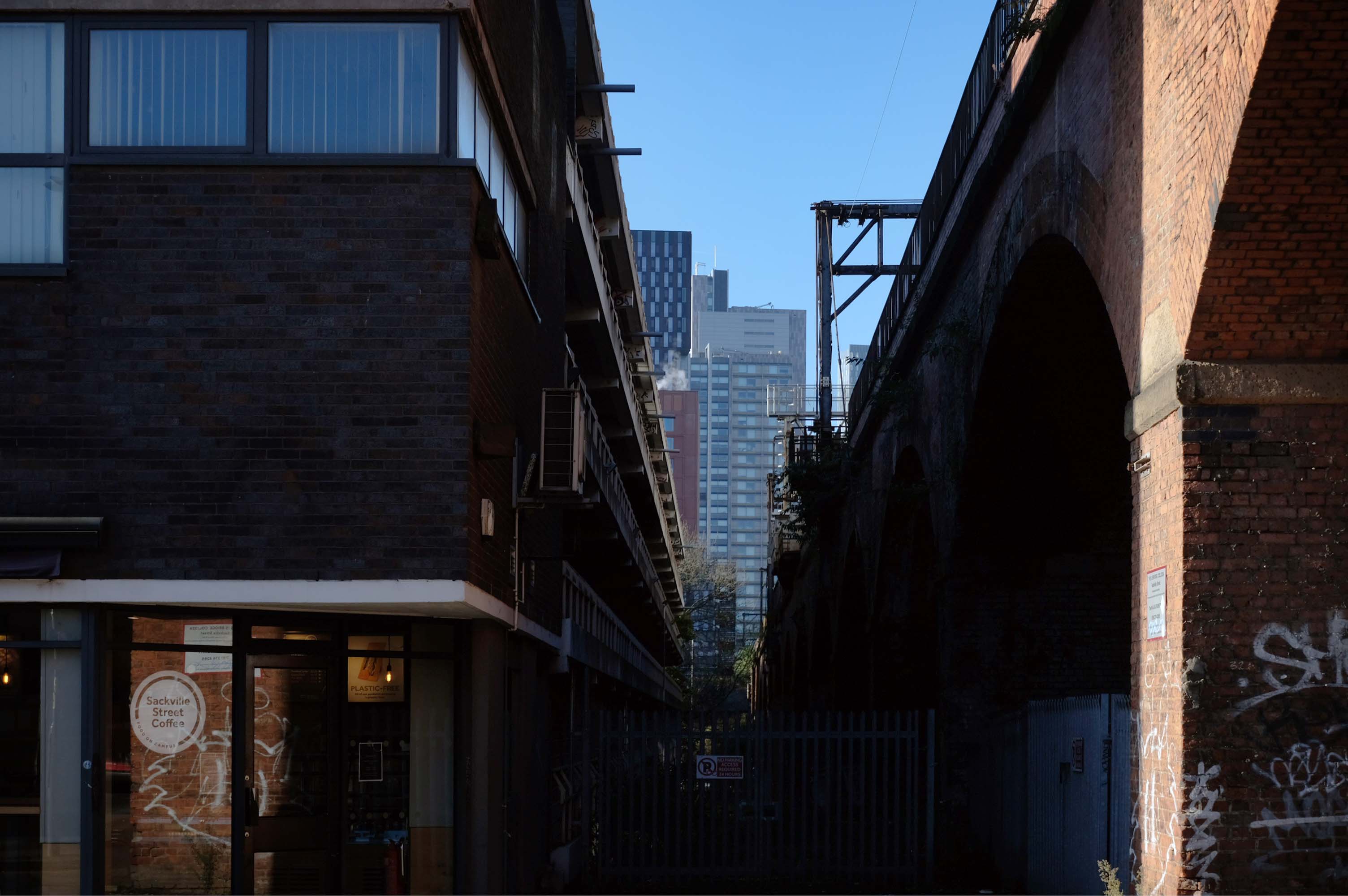
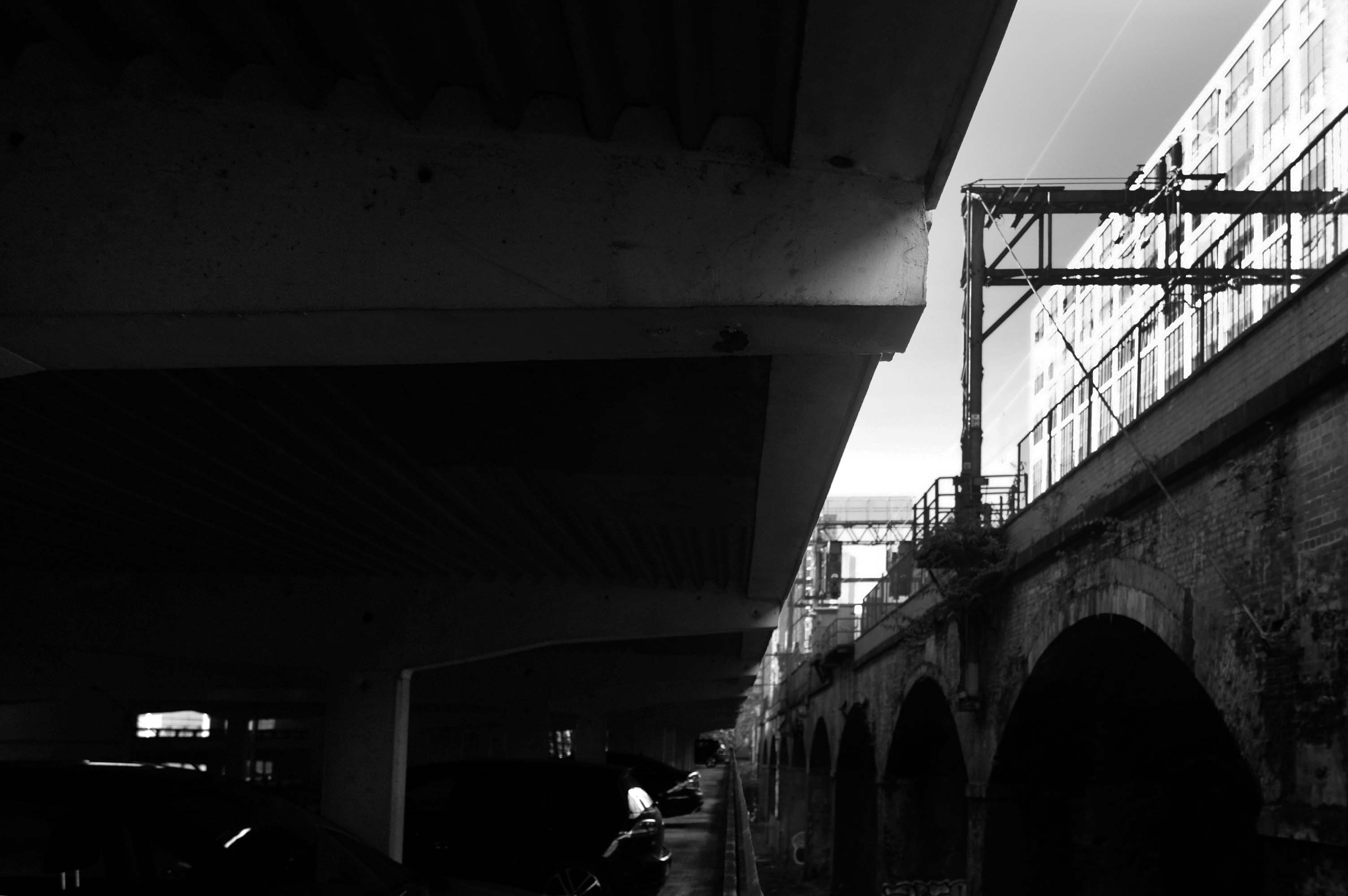
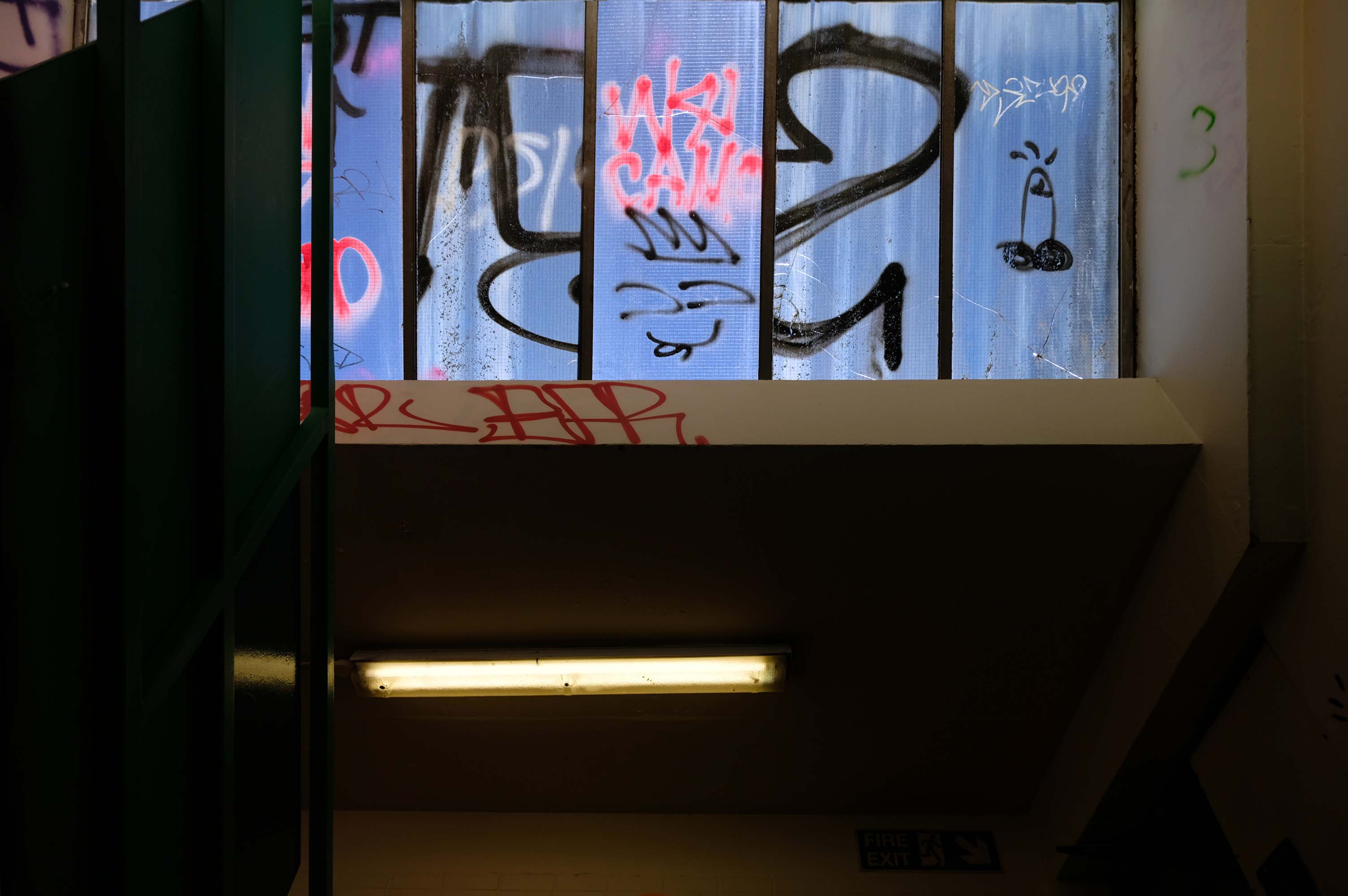
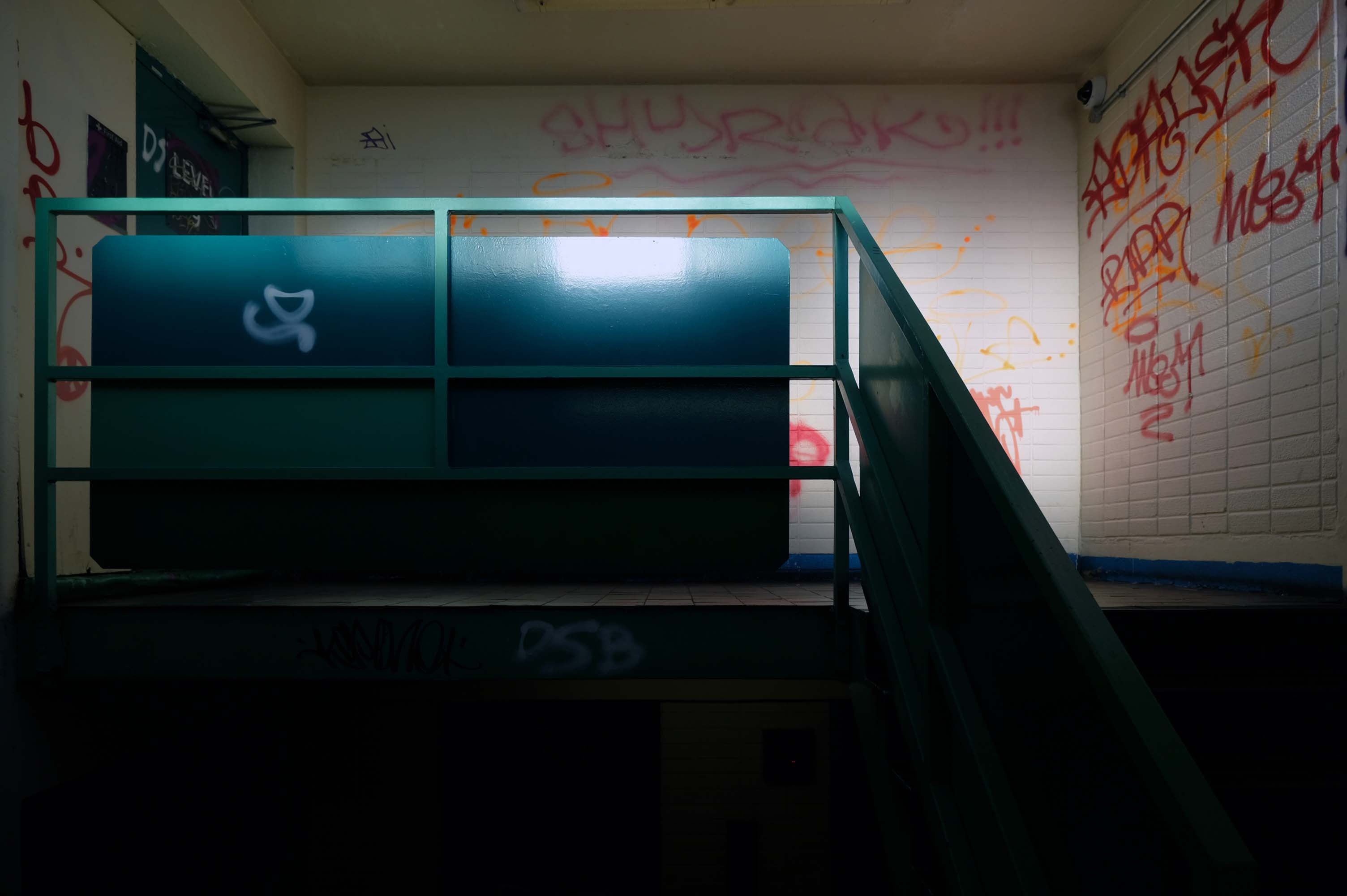
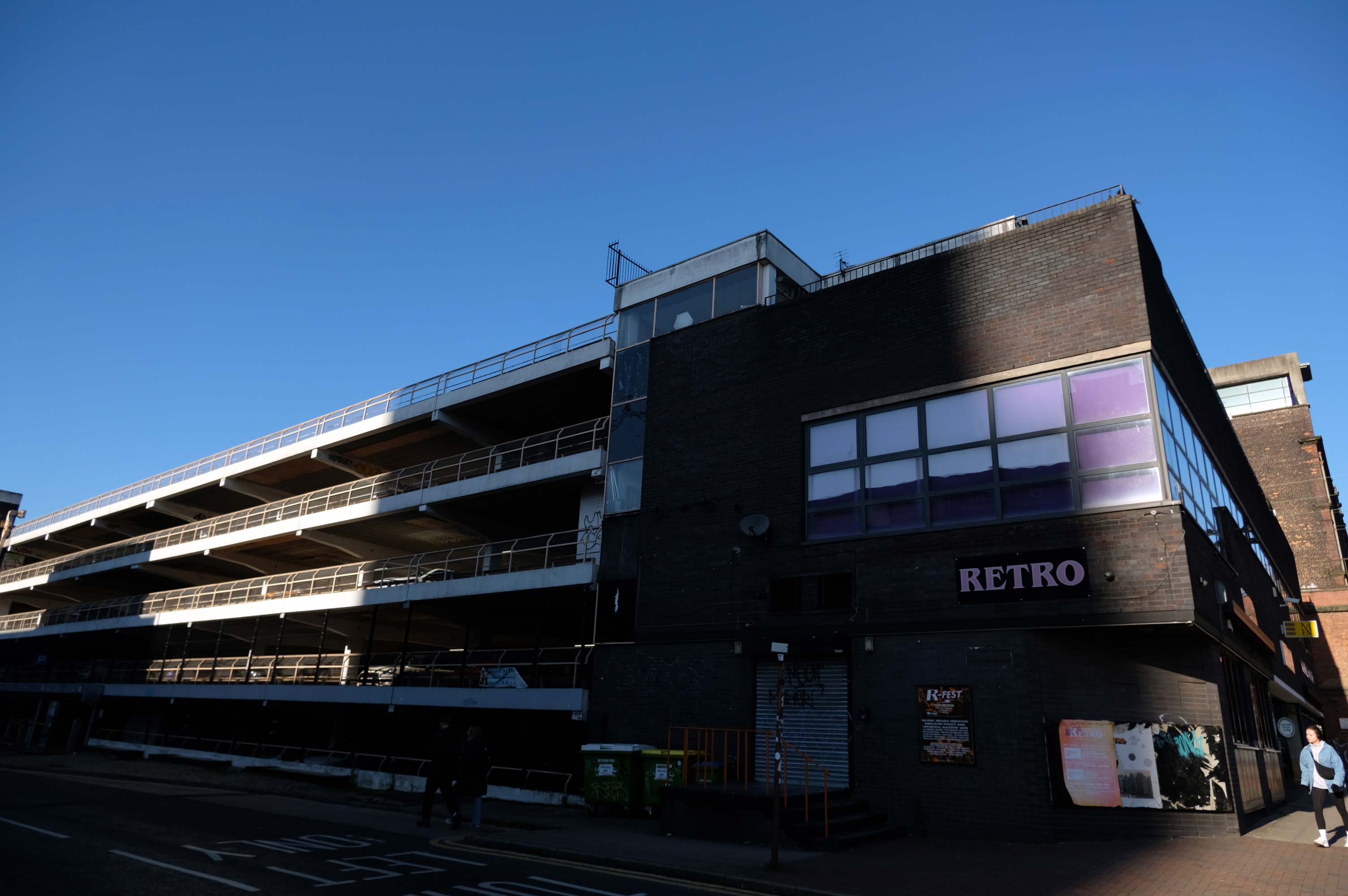
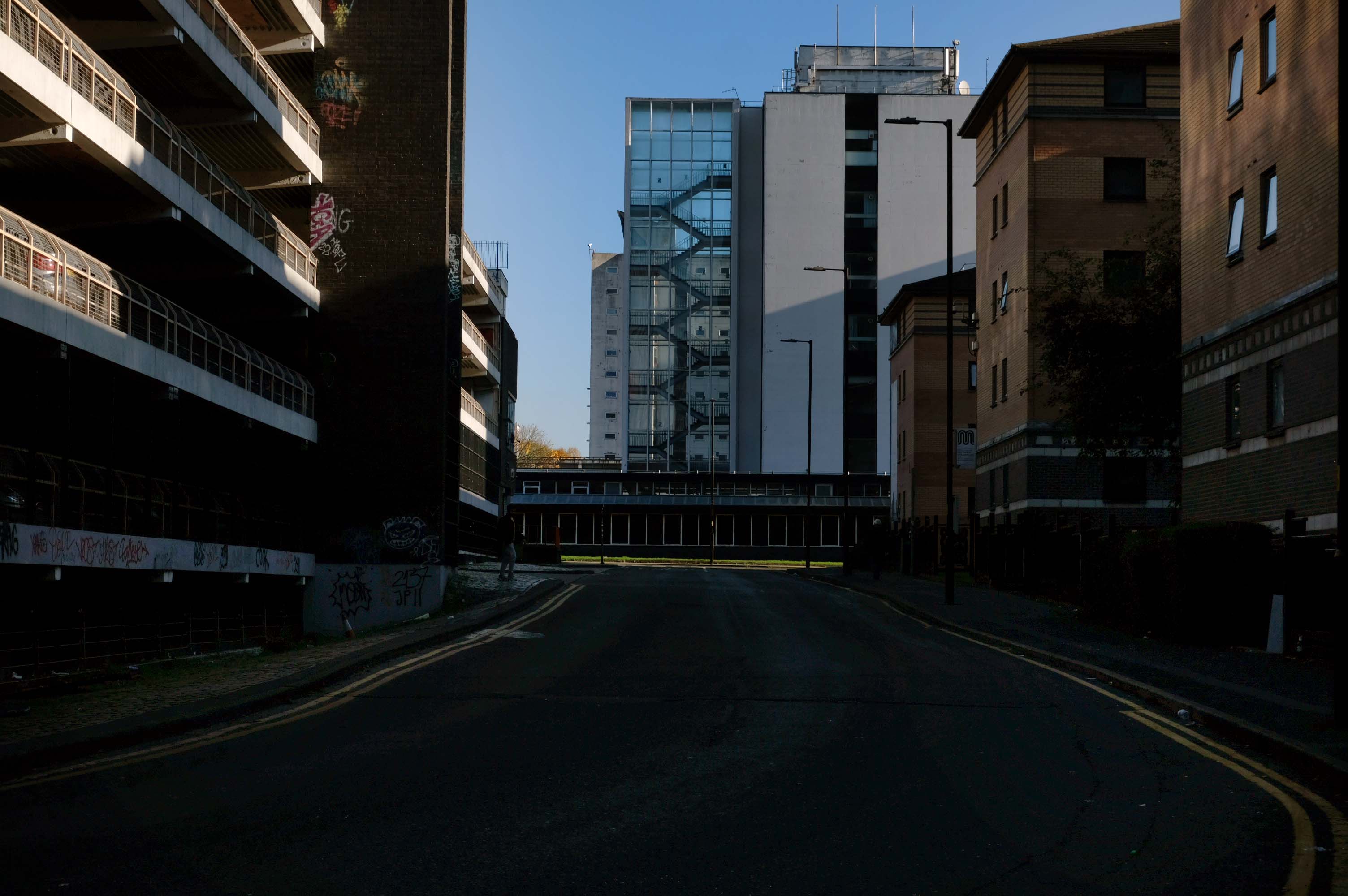
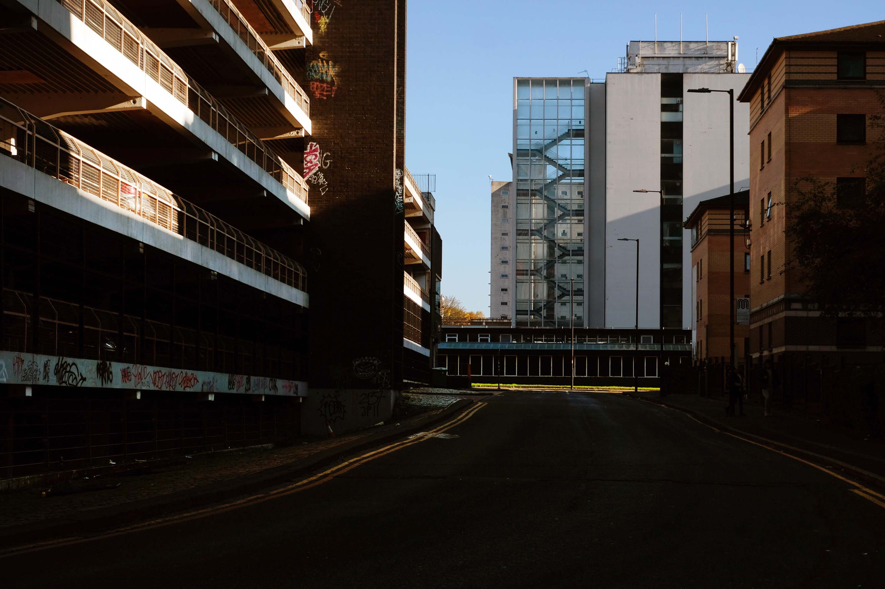
We are now coming to the end of the car park year – seen here on the wall of my command centre.
Home to William Mitchell’s Totem, the homes long gone and the Council pledged to move the totem too.
The state of play this week, the detritus removed and the base filled in, repaved and safe for a while.
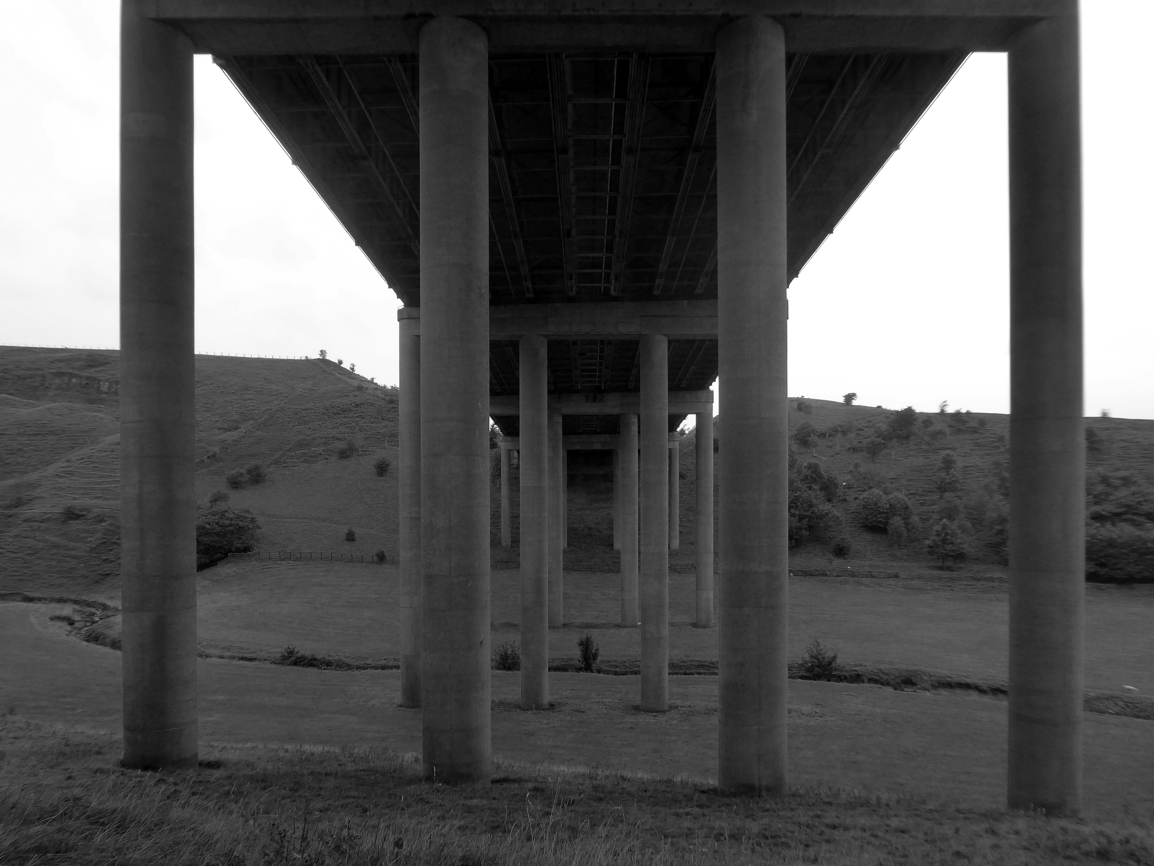
Off now to the Weaver Valley another day another river, passing under Weaver Viaduct
The looking toward KouraGlobal – leader in the development, manufacture, and supply of fluoro products and technologies, opened a new HFA 152a production facility at their Runcorn site in the UK.
Further rural Modernism as we pass under and traverse the M62, whilst walking around the Piethorn Valley
The newest of the Modernist Mooches was to Burnley where we visited the Keirby Hotel.
The former GUS Offices with a mural by Diane and William Morris.
Plus the Charles Anderson concrete relief at the Crow Wood Hotel.
Finally a little light relief – a visit to the Boots factory in Nottingham.
Having innocently board a bus outside the station with a Boots head code , I alighted within the factory gates. Then innocently walking around taking snaps, unheeded until the men in the van stopped me in my tracks.
Who are you, what are you doing?
I am the Modern Moocher going about my business – well it turns out this was not permitted and I was red carded by the earnest security guards and asked to leave forthwith. Suitably rebuked, I politely bade them farewell and headed for the gates.
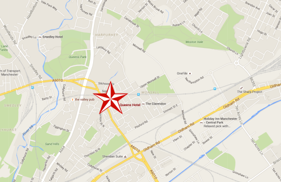
Walking along Rochdale Road yesterday, I was suddenly arrested by the Pleasant Street street sign.
Having already been suddenly arrested last week, by the Bland Close street sign.
With my expectations defined by the above definition, I ventured along the street in search of happy satisfaction.
Coincidentally – The 18th century entrepreneur Josiah Wedgwood pioneered many of the marketing strategies used today, including the satisfaction or you money back guarantee, on the entire range of his pottery products. The money-back guarantee was also a major tool of early US mail order sales pioneers in the United States such as Richard Sears and Powel Crosley Jr. to win the confidence of consumers.
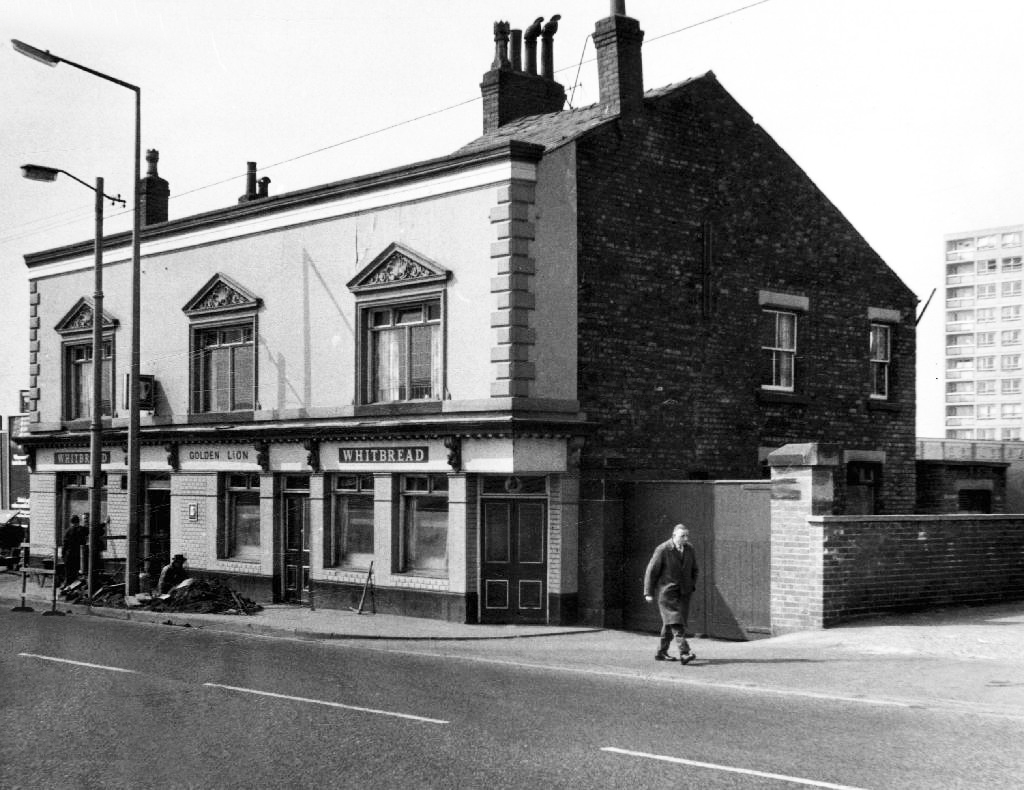
However at someone between 1968 and 2024 the housing had been cleared away – also missing in action is the Golden Lion pub adjoining Pleasant Street on Rochdale Road.
The Golden Lion was a proper old pub on the very busy rochdale road in the Harpurhey area of Manchester. Once inside there was a decent lounge and a basic bar i had a drink in the lounge and this was quite a comfy room.
This pub was a Whitbread tied house and there were two real ales on the bar I had a drink of Chesters bitter and this was a nice drink the other beer was Chesters mild. I thought this was quite a nice pub but sadly this pub has now been pulled down in the name of progress.
So here we are here today – yesterday has long gone and tomorrow never knows no how.
What’s left to see?
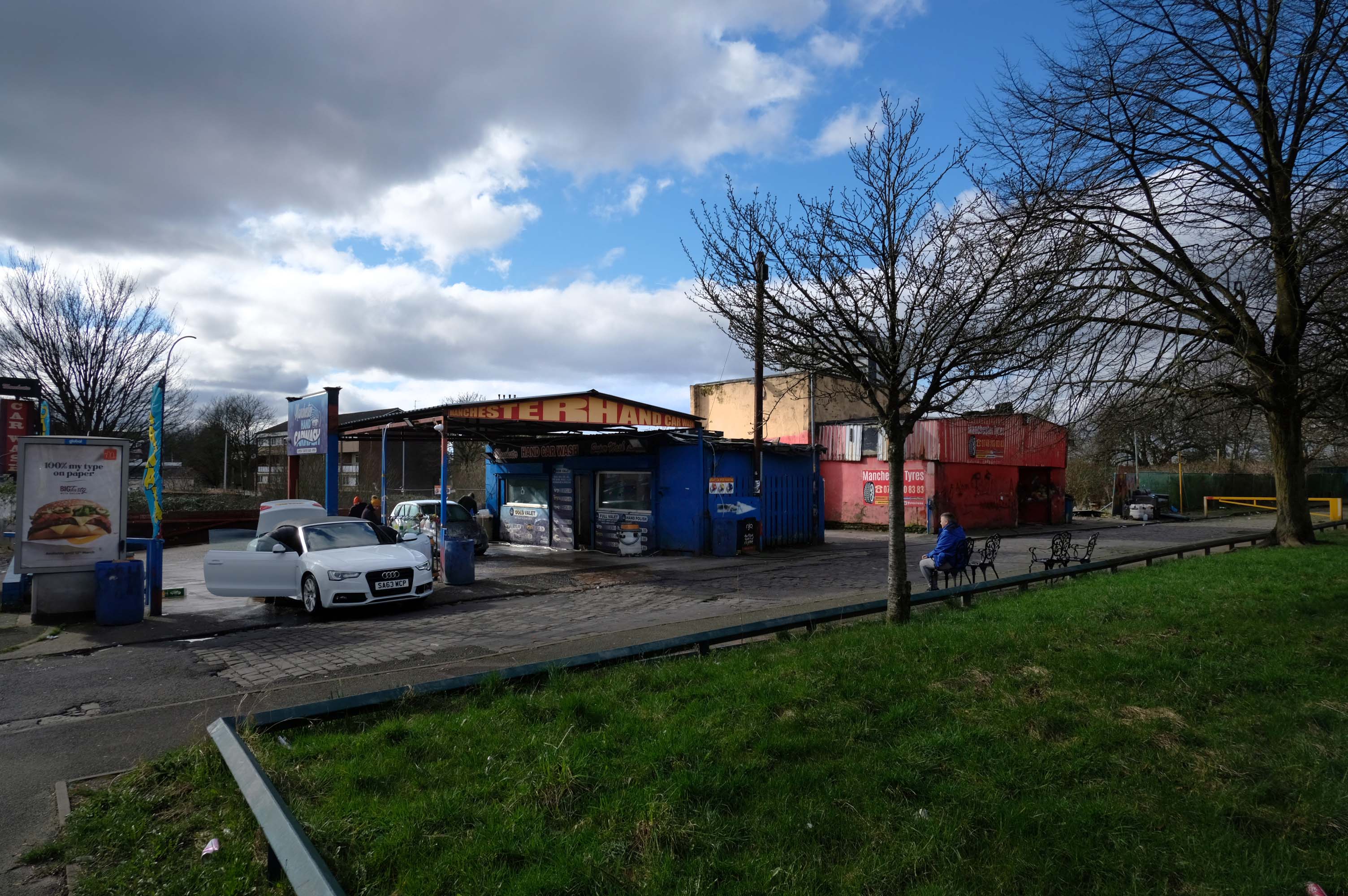
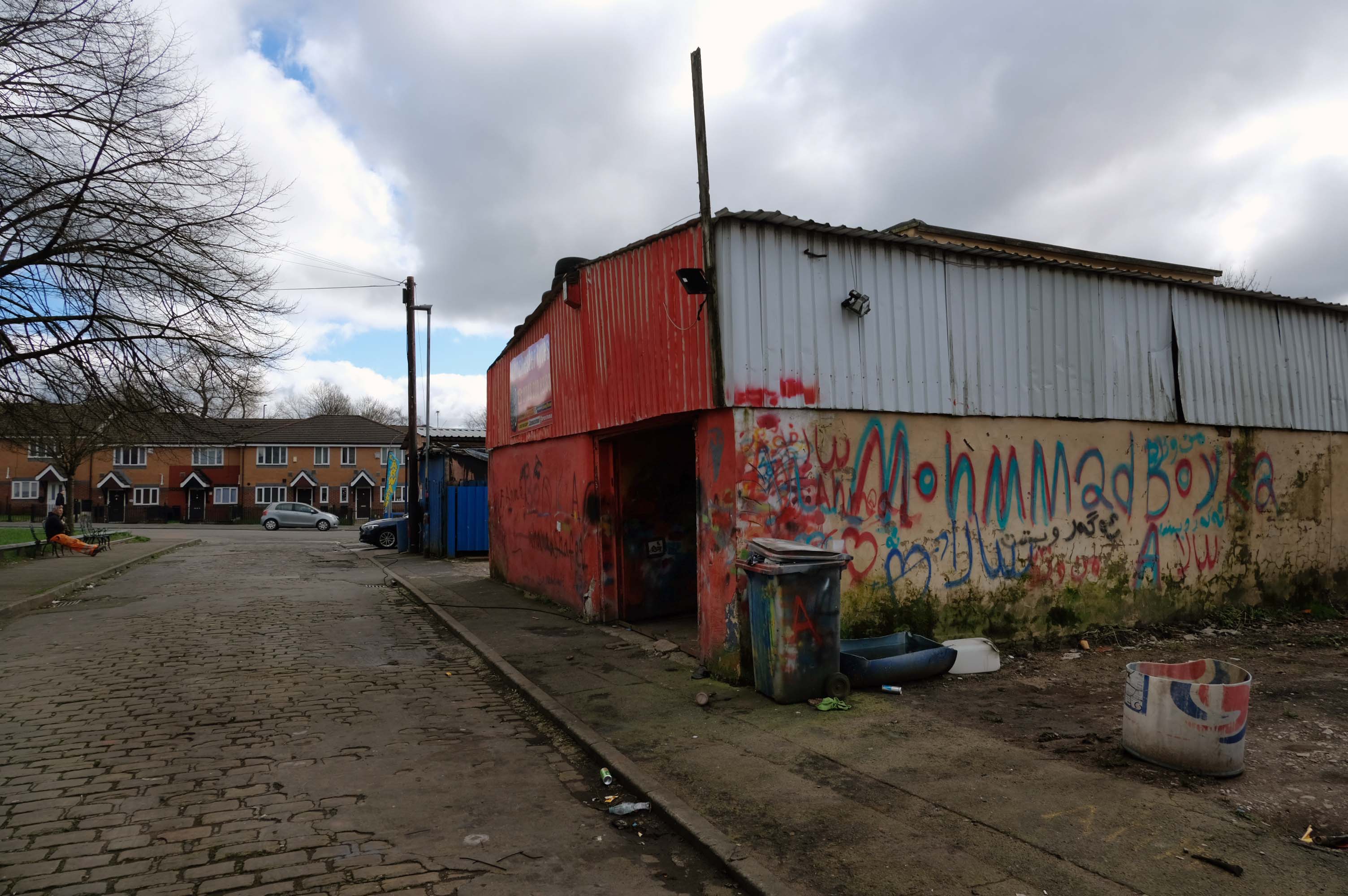
Manchester Hand Car Wash
Manchester Tyres
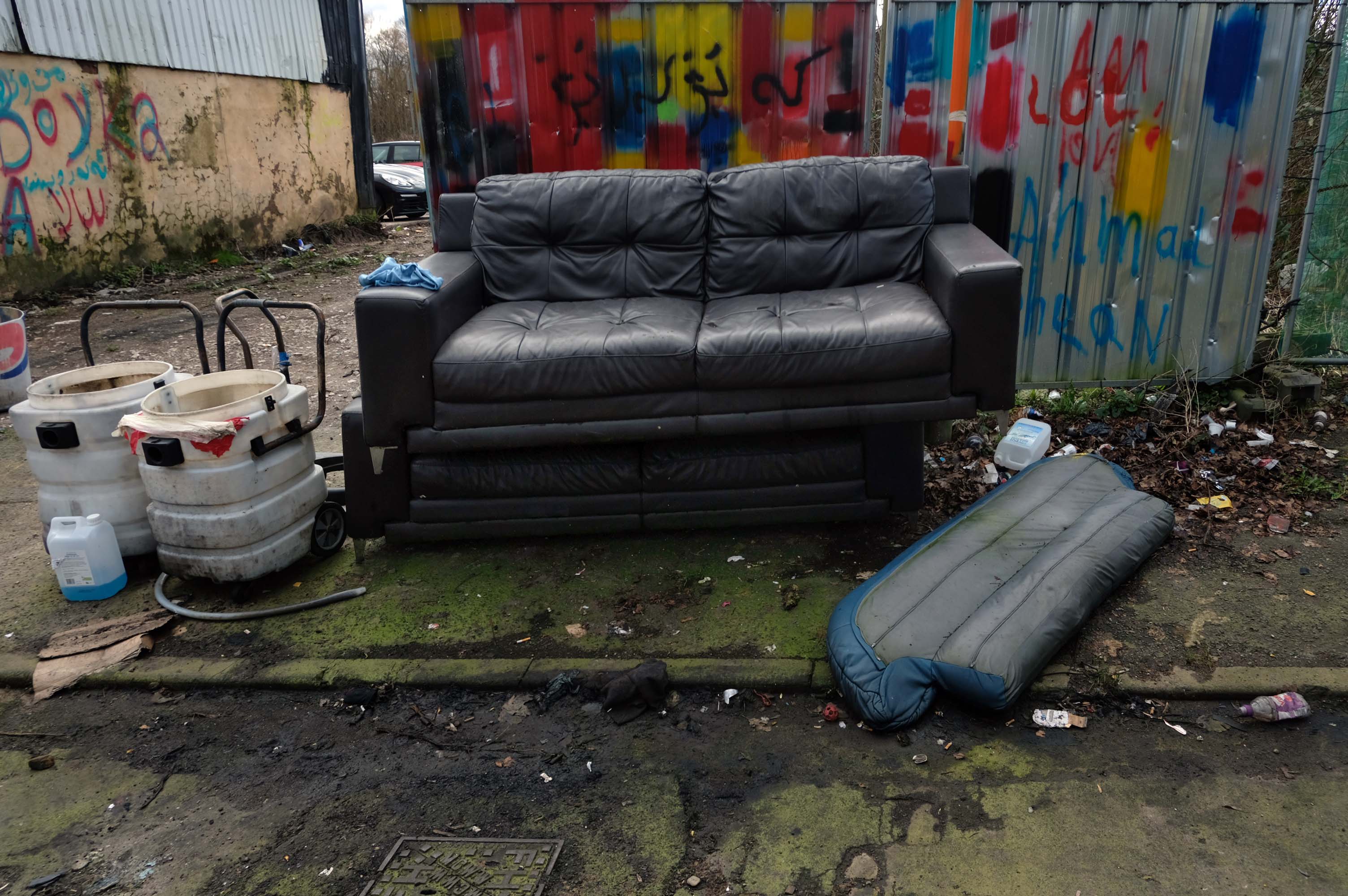
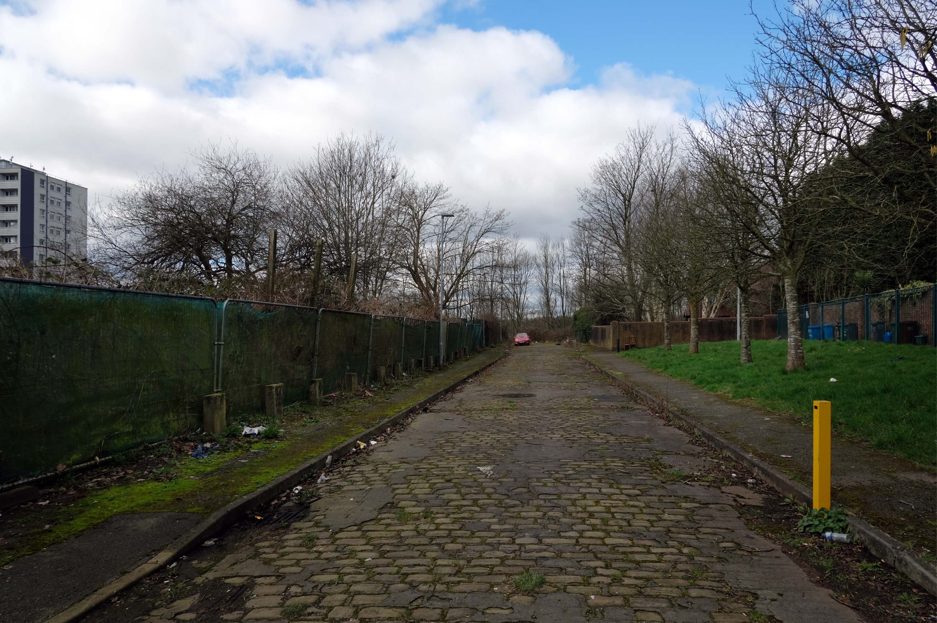
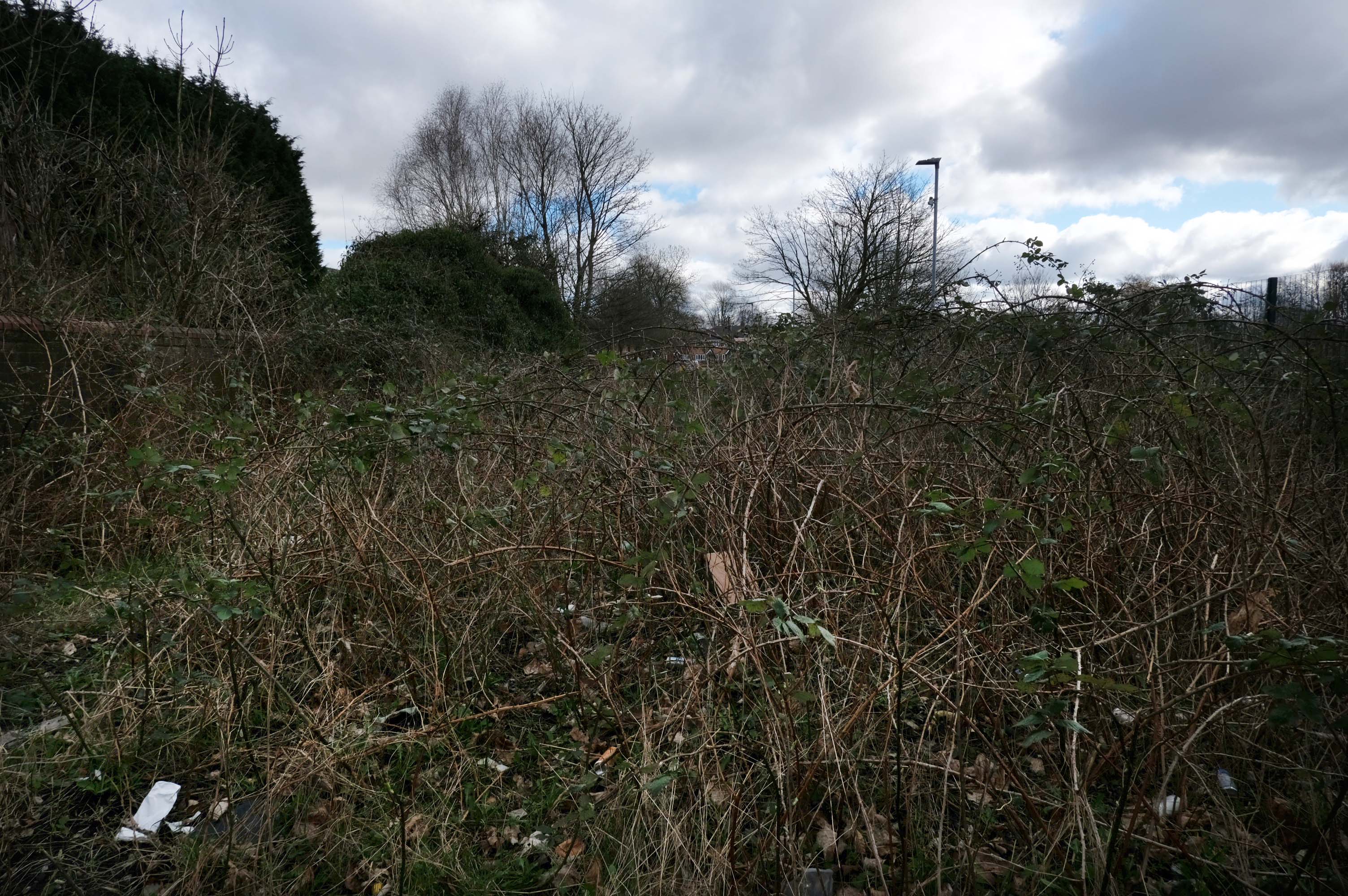
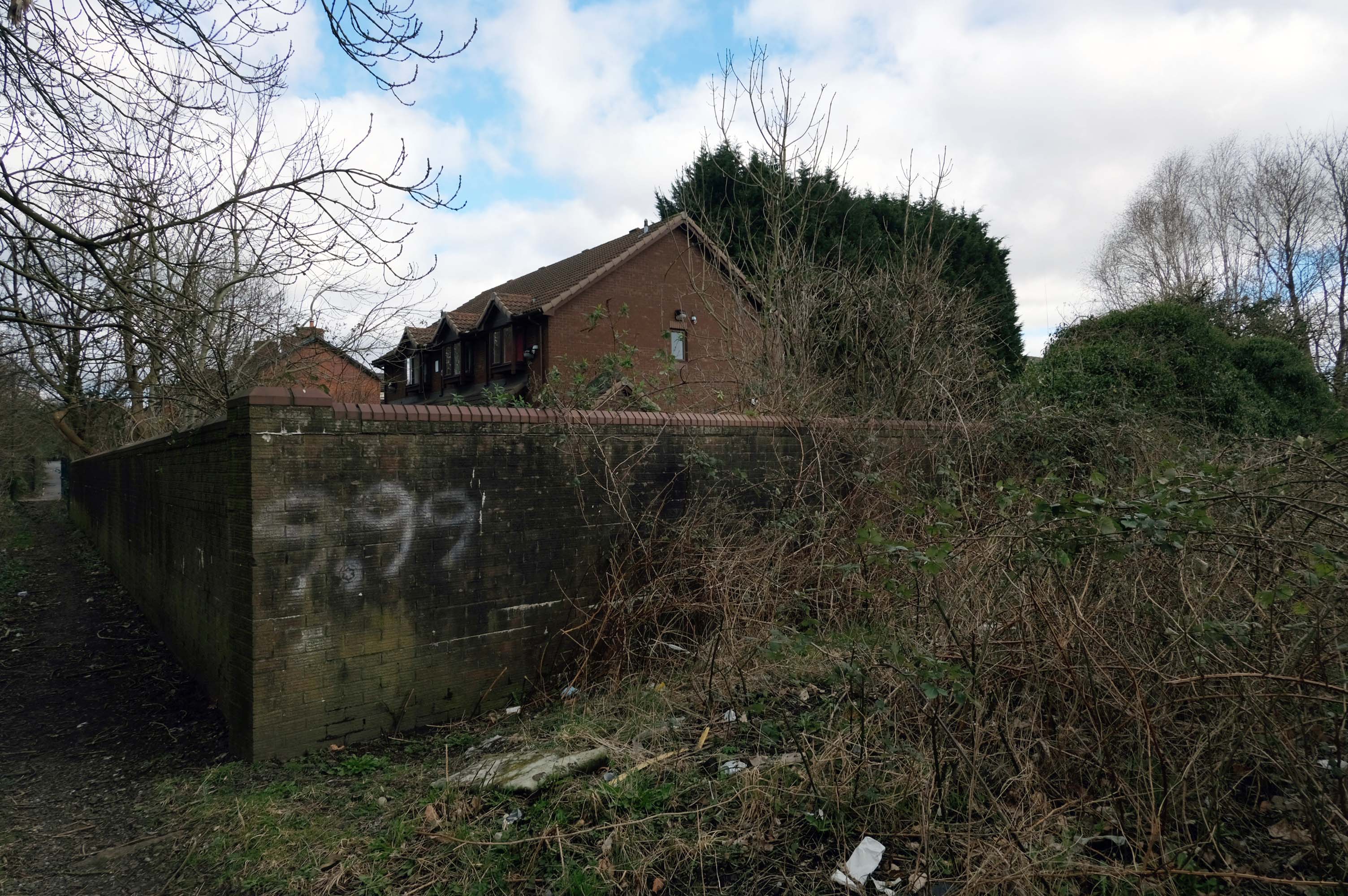
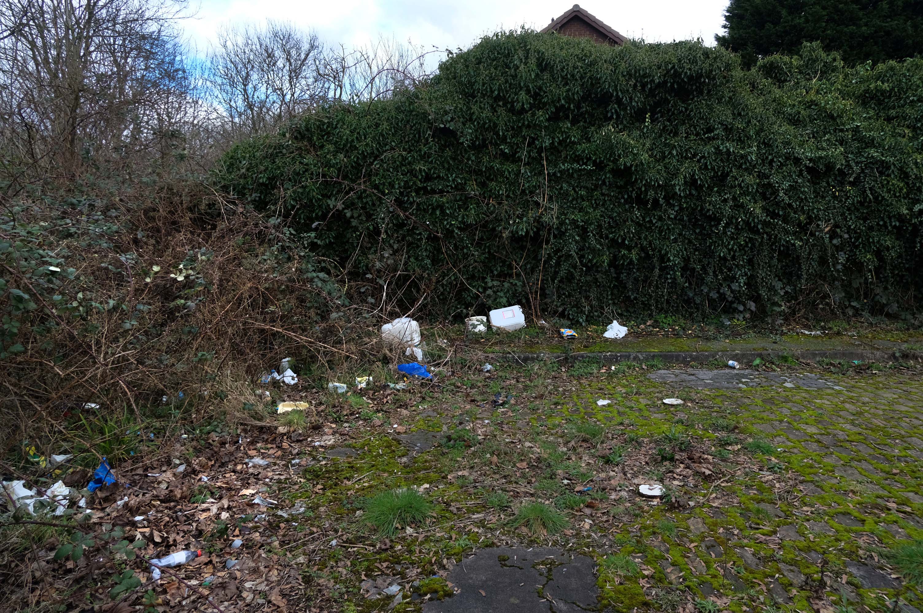
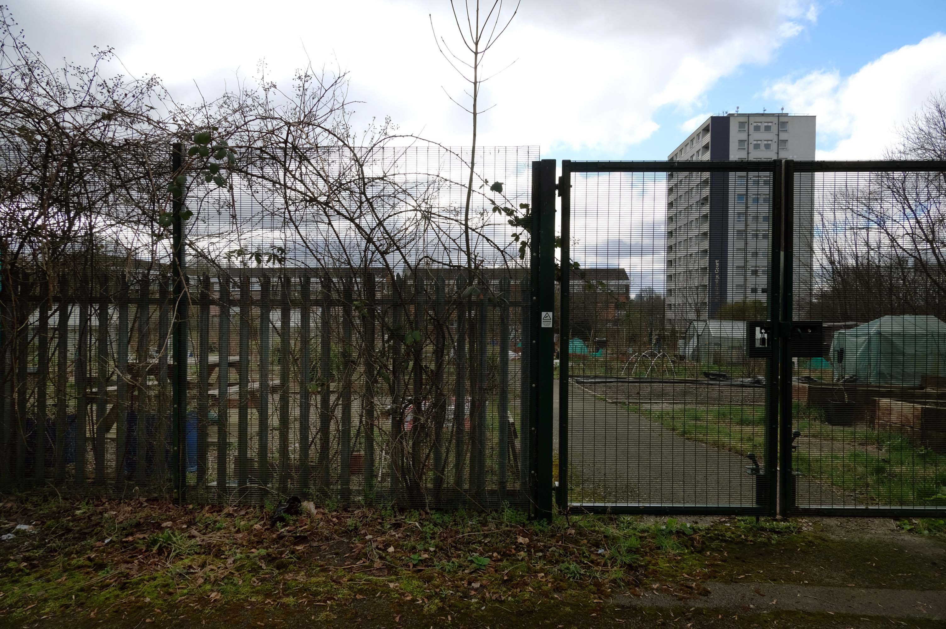
Pleasant Street Allotments
The allotments have had issues with fly tipping back in 2021.
There is now a lockable barrier in place on the cobbled cul-de-sac.
Photo – Howard Bristol
It is understood that the heaps of rubbish, including bin bags full of waste and unwanted wood and cardboard, have been growing in recent weeks.
Howard Bristol, the Secretary of the Pleasant Street allotments committee, said the situation has been ongoing for some time but has worsened since the removal of nearby CCTV cameras.
He told the Evening News that the road has been – piling high with rubbish, and that the area also had issues with the woodland behind the allotments being used for drug dealing during summer.
Pat Karney, councillor for Harpurhey tweeted about the flytipping on Sunday, calling it – unbelievable and disgraceful.
He added that those responsible should be – locked up in Strangeways for a long time, before adding that the council will – get it cleared.
The A34 is a major route from the ports on the South Coast of England to the Midlands and the North West, with the standard varying from rural dual carriageway sections in the south to urban single carriageway in the north, and everything else in between.
Slade Lane junction, Rushford Park to Parr’s Wood, East Didsbury – to connect to Manchester Road to Cheadle. It continued on to Laneside Road as a residential road. Opened on 11 April 1923 by Mary Cundiff, Lady Mayoress, and Margaret Turnbull, daughter of Alderman Turnbull, Chairman of Manchester Town Planning Committee. Width was 100 feet and it was designed for tram tracks in the central reservation. The dual road carriageways were 20 feet wide. Manchester’s tram system was closed in 1949. The carriageways were widened and central reservation grassed over. Originally opened as A5079.
Laneside Road, East Didsbury to Schools Hill/ Wilmslow Road junction, Cheadle. Opened on 12 October 1959. The official opening was on 15 October 1959. Planning for the bypass had been halted by the war. In December 1949 Manchester Corporation stated that it was not a priority since the Corporation was only responsible for the 200 yards to the proposed bridge over the River Mersey and Cheshire County Council had not asked for a joint approach to Ministry of Transport to build it. Work was finally authorised in January 1957 and started in the June. Width was 90 feet with dual 24 foot carriageways. Expected cost was £600,000 to £700,000.
The A6 is Britain’s fourth longest road. Its route varies greatly from the lower lands of the South East, though the Peak District, right though the heart of Manchester city centre, then onwards towards Preston. It then goes though the historic city of Lancaster before skirting the Eastern fringe of the Lake District before ending in Carlisle, bang on the start of the A7.
North from Stockport towards Manchester, the A6 was a wide, four lane road, but still 30 mph, which usually flowed pretty well. According to Mudge, it looks like it has now been massacred by bus lanes and red paint. Shame. We meet the A57 from the east, just south of the city centre, and multiplex until we reach Mancunian Way, the A57 heading off as a short urban motorway, the A6 heading into the city centre via London Road/Piccadily, where it loses its number and vanishes. It would have gone straight down Piccadily/Market Street to meet Deansgate, and then across the River Irwell into Salford, and up Chapel Street, where the number reappears. Market Street has been pedestrianised for years, so the A6 has long ceased to be a through route.
The A57 was nearly a coast to coast route. It passes through three major city centres (Liverpool, Manchester, and Sheffield – with elevated sections in each) and several smaller ones, multiplexes with the A6 and the A1, follows the banks of two canals and negotiates the remotest part of the Peak District. In one city it part of it is a tram route, whilst in another its former route is also a tram route. After all these adventures, it sadly gives up just 40 miles short of the east coast, Lincoln apparently proving too big an obstacle.
The A57 crosses the River Irwell at Regent Bridge before entering its moment of motorway glory as the A57(M) Mancunian Way skirting the south of Manchester’s city centre on an elevated section and crossing the A56 and A34. This includes a half-completed exit that goes the wrong way up Brook Street – a one way street. The original A57 ran further north through the city centre along Liverpool Road (now the A6143) and Whitworth Street – B6469 as far as the A6 London Road which marked the start of a multiplex.
At the end of Mancunian Way, we reach a TOTSO, straight on being the short unsigned A635(M) and thence the A635 – for Saddleworth Moor, Barnsley and Doncaster whilst the A57 turns south, briefly multiplexing with the A6, and then branching off along Hyde Road. This section of road was extensively cleared for the westward extension for the M67, and consequently has seen a lot of redevelopment.
The road now begins slightly further south than it used to. Instead of starting on Fairfield Street in Manchester city centre, it begins immediately as the Mancunian Way ends, which at this point is the unsigned A635(M). The motorway flows directly into our route. There’s a TOTSO right at a set of lights, and we pick up the old alignment, which now starts as the B6469.
We can see the new City of Manchester Stadium on the left, site of the 2002 Commonwealth Games and now home to Manchester City FC. The road switches between S2 and S4 as it passes through the rather run-down urban areas of Ardwick and Gorton. A short one-way system at a triangular-shaped junction with the A662 leads onto a wider stretch as we near the M60 junction. This area is set to see significant industrial growth, with whole swathes of land either side of the now D3 road cleared and ready for development.
The obvious place for the A664 to start is on the A665 Manchester & Salford Inner Relief Route, which at this point is actually two parallel one-way streets. However, many maps show the road continuing a short distance into the city centre to end at traffic lights by the Shudehill Interchange – this is presumably for historic reasons: the road originally continued along the High Street to its terminus on the A6 Market Street.
The road heads northeastwards through the suburbs, the street name Rochdale Road, already emphasising its destination. Initially dual, the road narrows just before crossing the bridge over the railway line east of Victoria station. It continues through Collyhurst and widens again just before crossing the A6010 Intermediate Ring Road, which here is made up of two parallel one-way streets, requiring two separate sets of traffic lights to cross.
Now non-primary – but still dual for a short distance more, the road runs in a more northerly direction through Blackley, where it becomes wooded for a short distance as it passes the Boggart Hole Clough park. Slightly further on the road has been straightened, after which it bears right to widen considerably and cross the A6104 at traffic lights just before M60 J20, which only has west-facing sliproads. The road narrows again on the far side of the motorway and leaves Manchester for Rochdale at the same point.
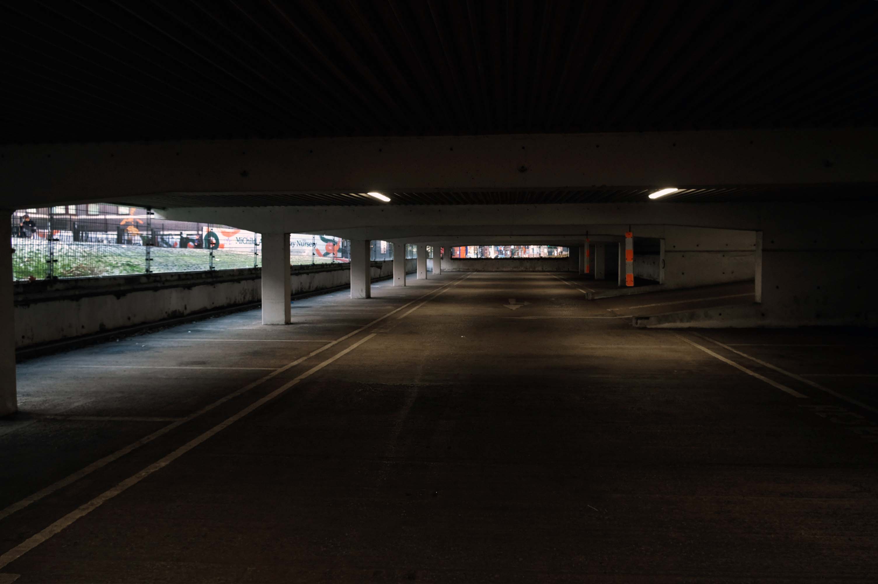
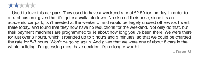
Secure and easy to find while driving, struggled to get back in through side door, had to walk up the ramp.
Expensive.
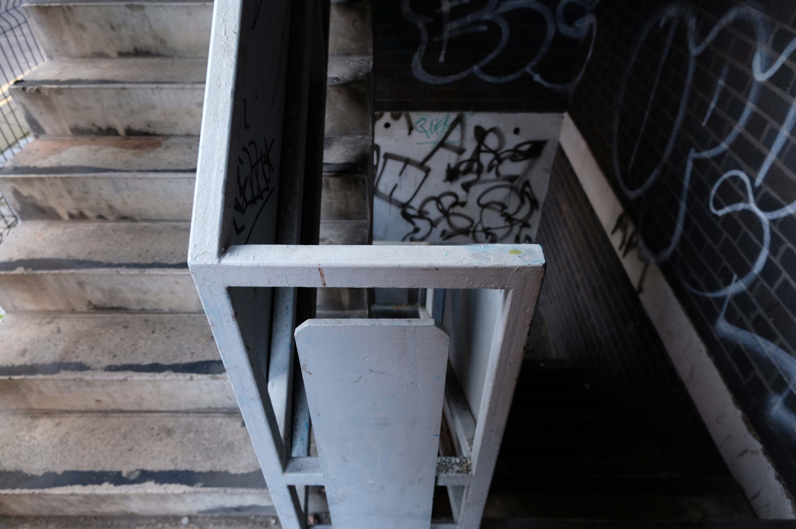
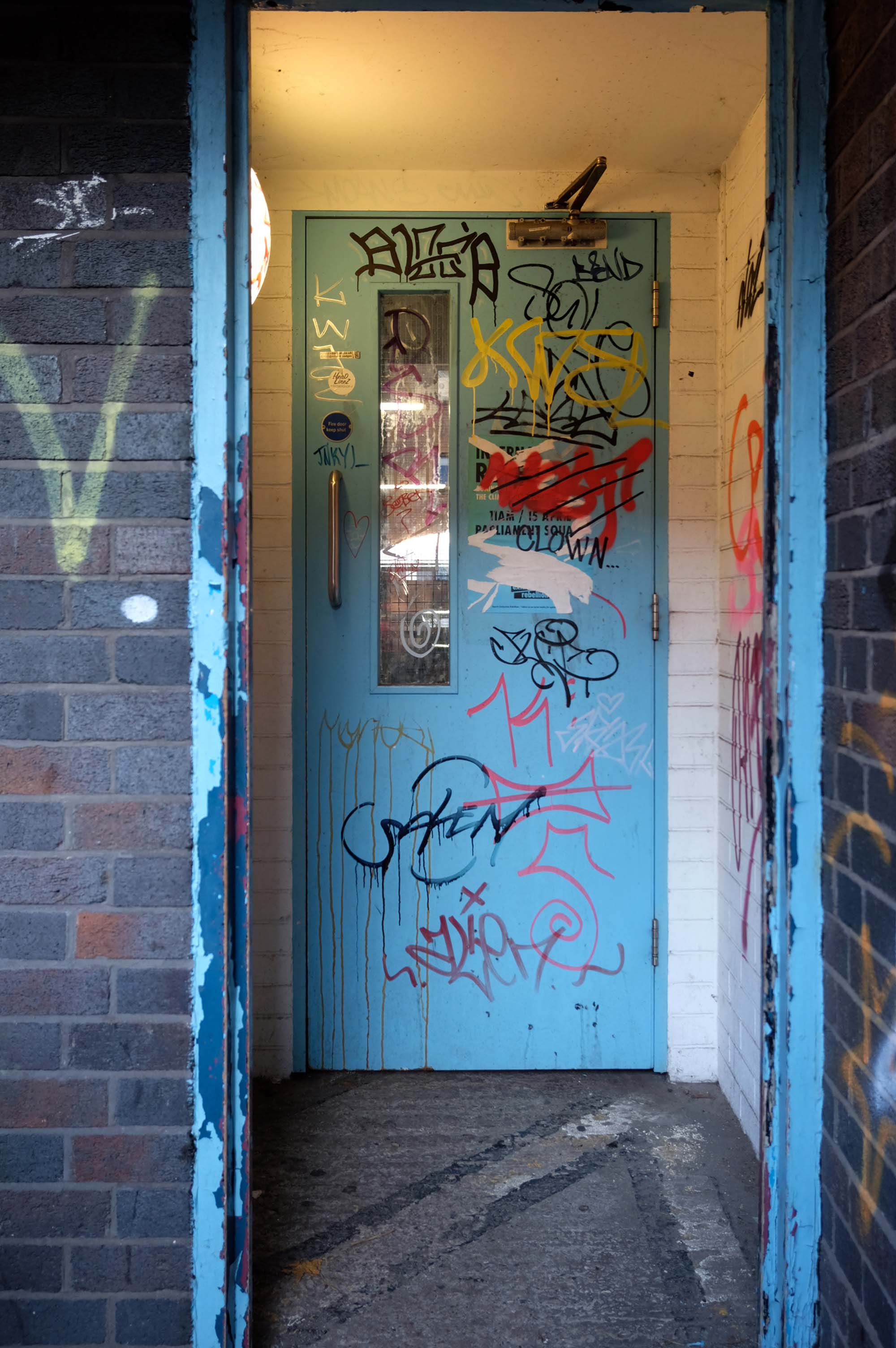
Stairwell stinks like piss and I’ve seen homeless people sitting in there, doesn’t feel safe.
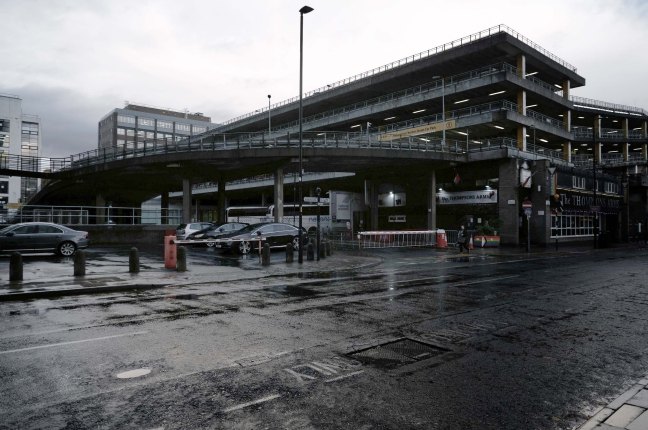
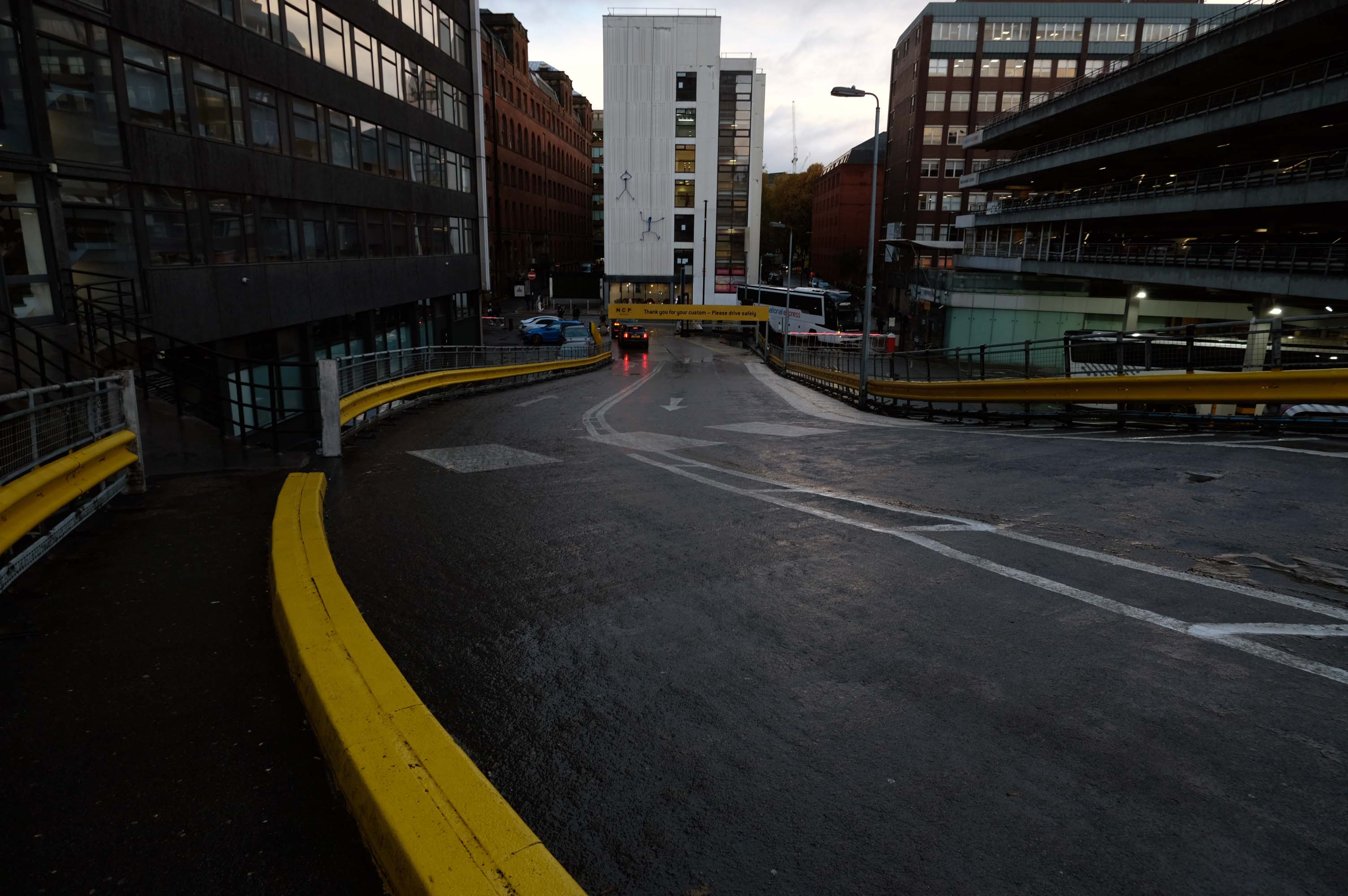
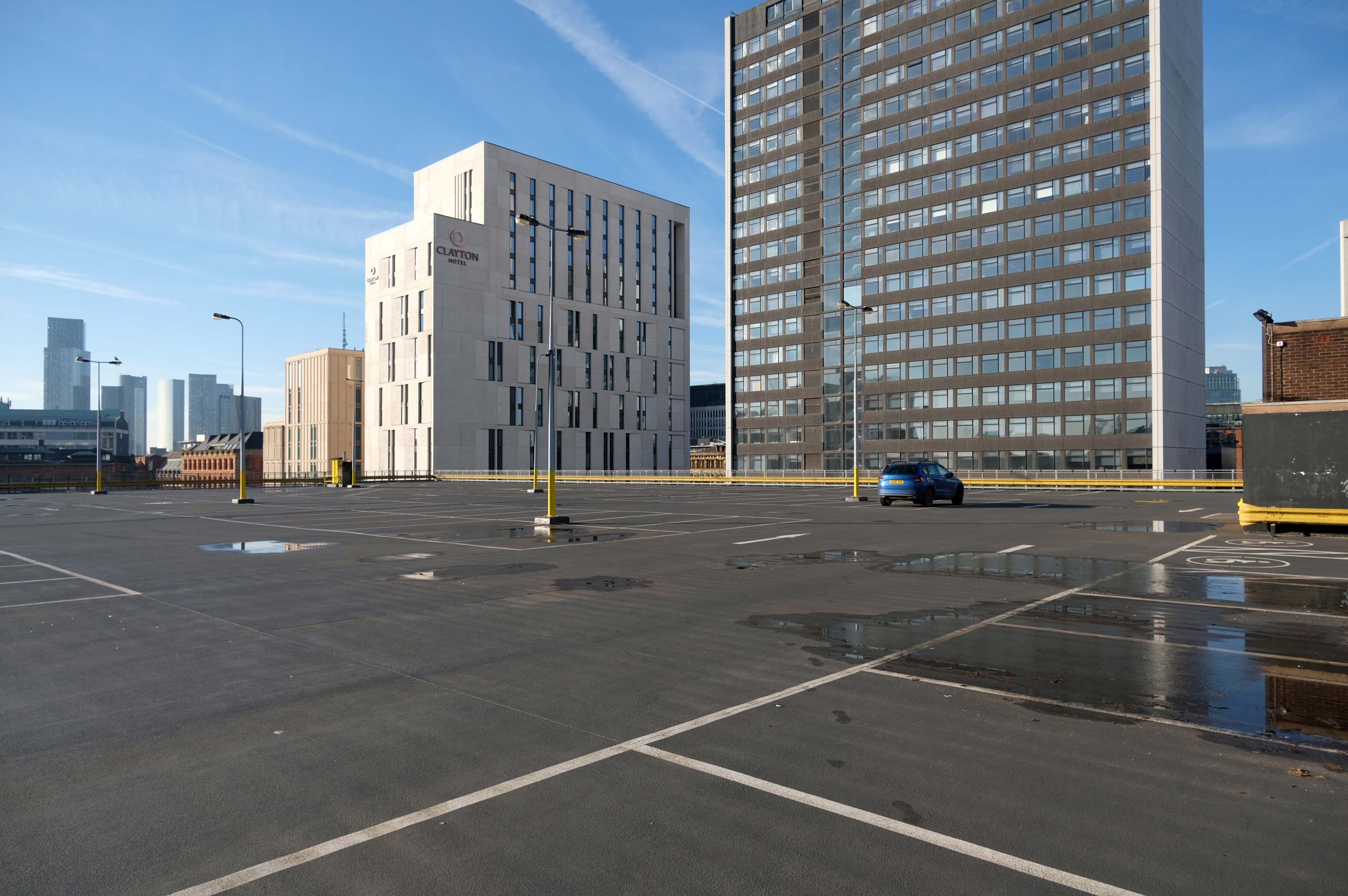
Great car park, security is great, right in the city centre, above the bus station that goes Scotland to Cornwall, Wales to Norwich and many more, Manchester city centre literally, with Piccadilly Gardens, around the corner.
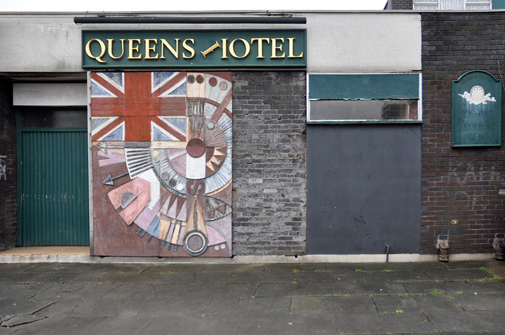
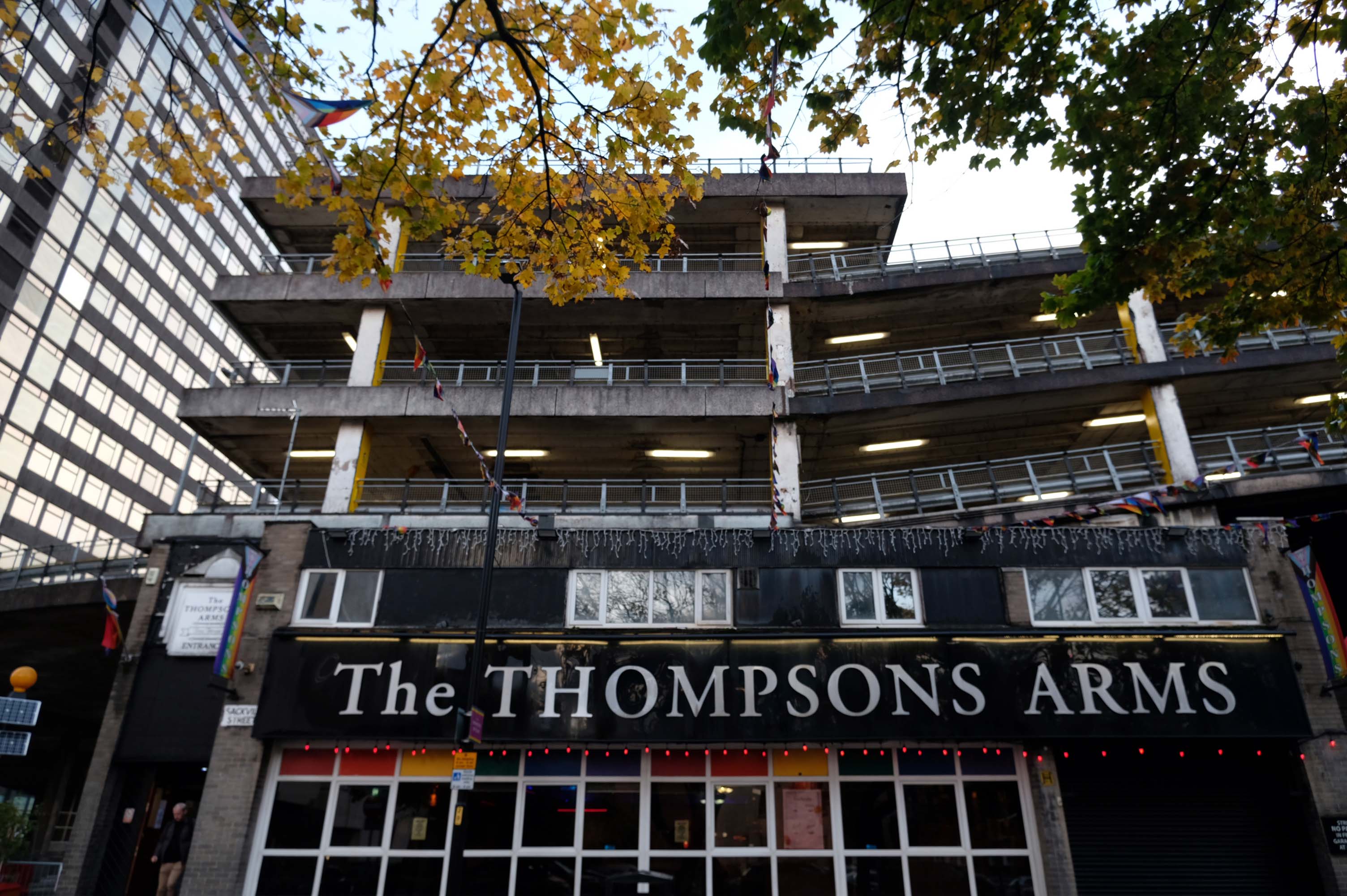
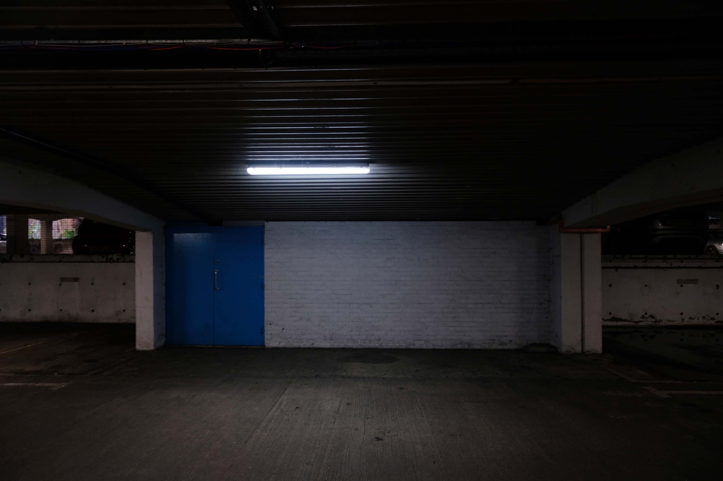
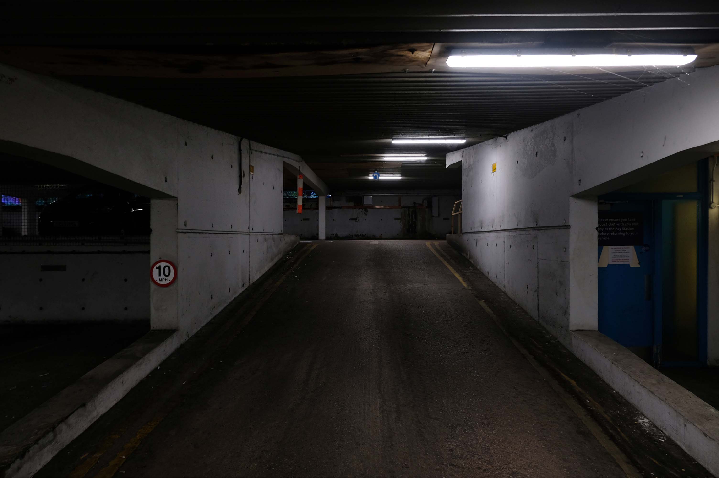
We have been snapping here afore in the guise of Mr Estate Pubs – checking out the Thompsons Arms.
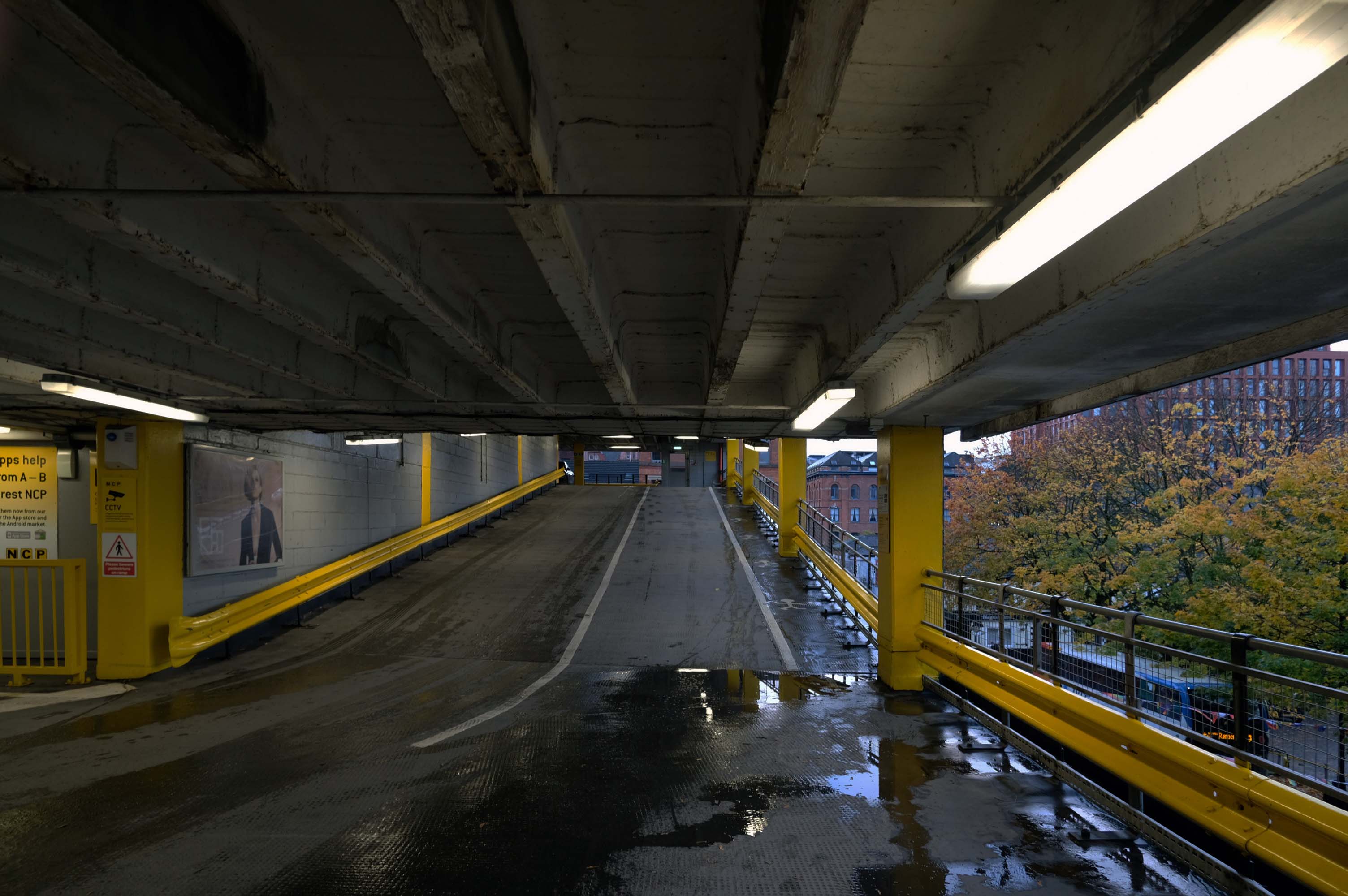
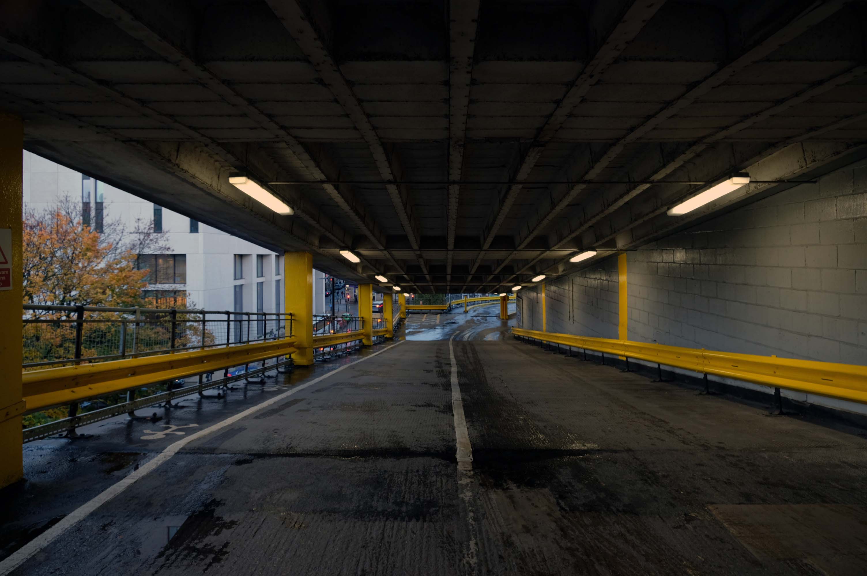
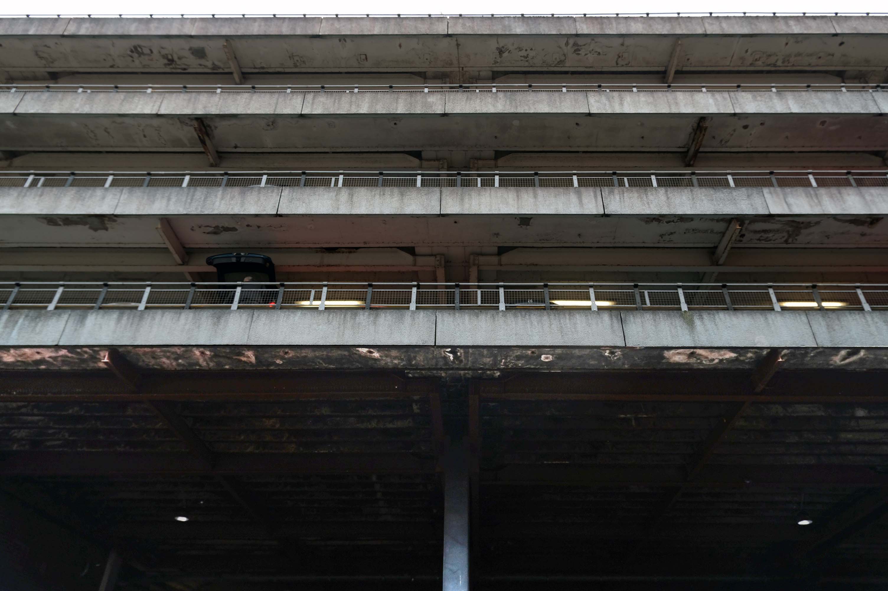
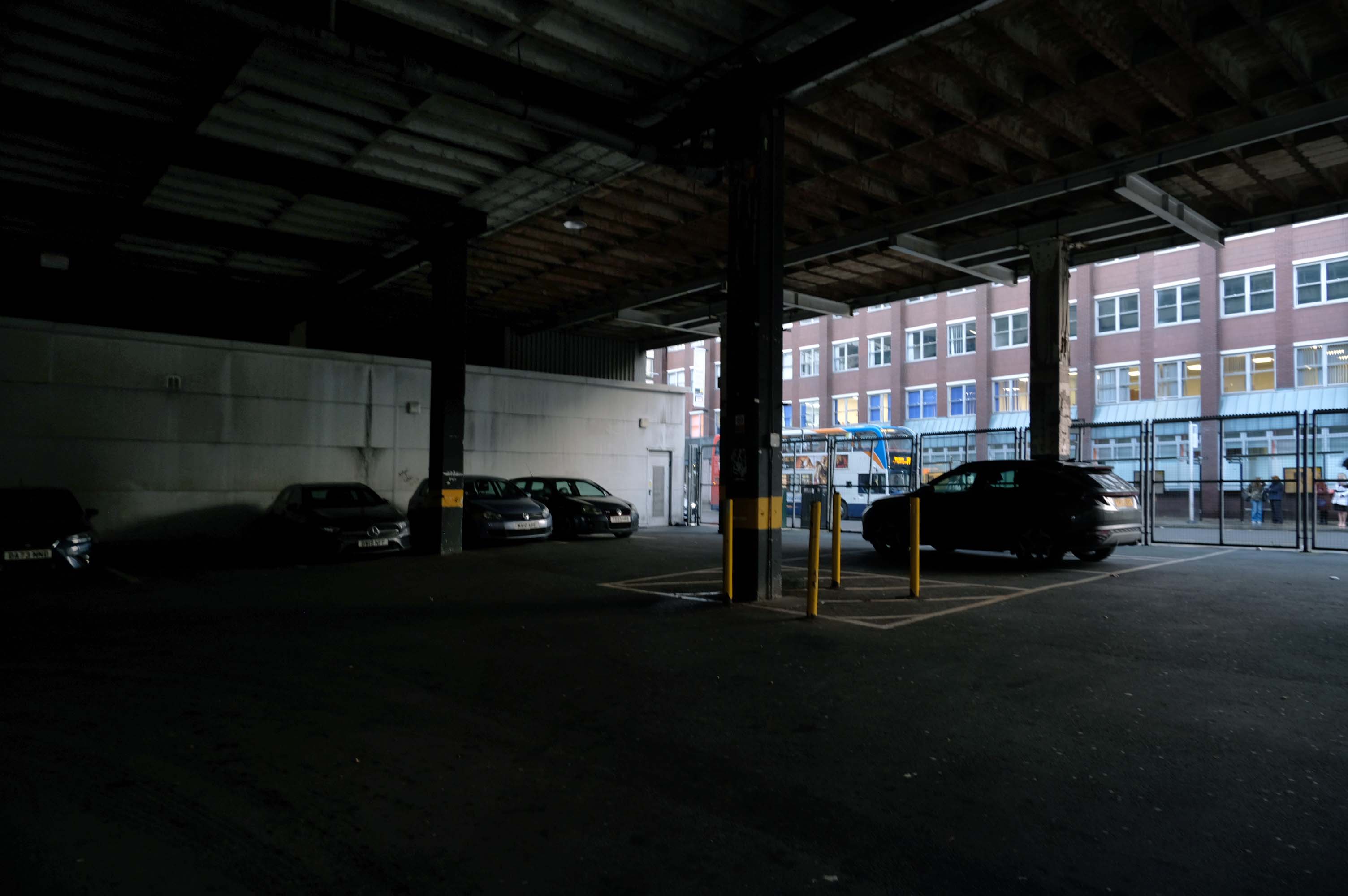
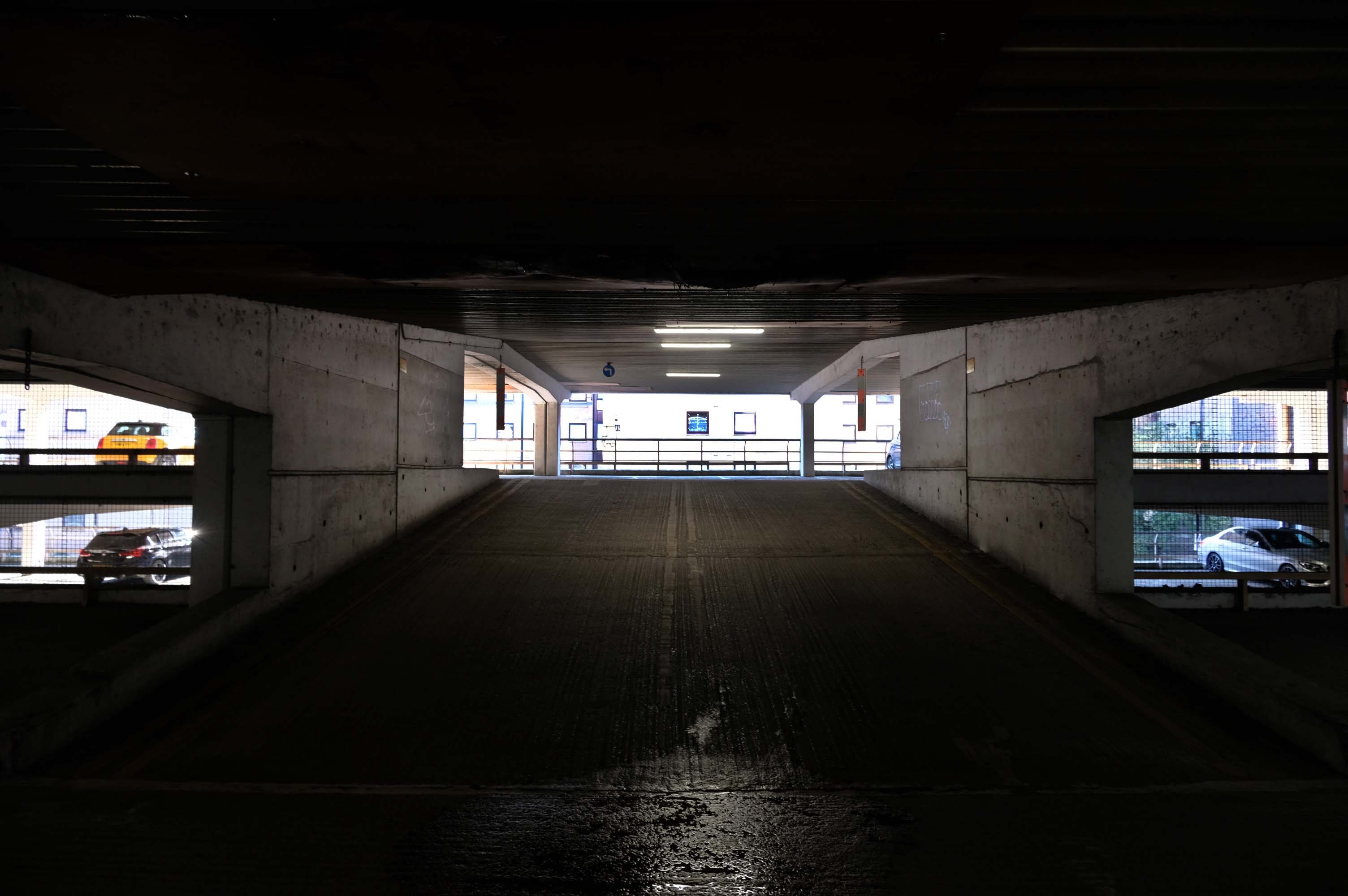
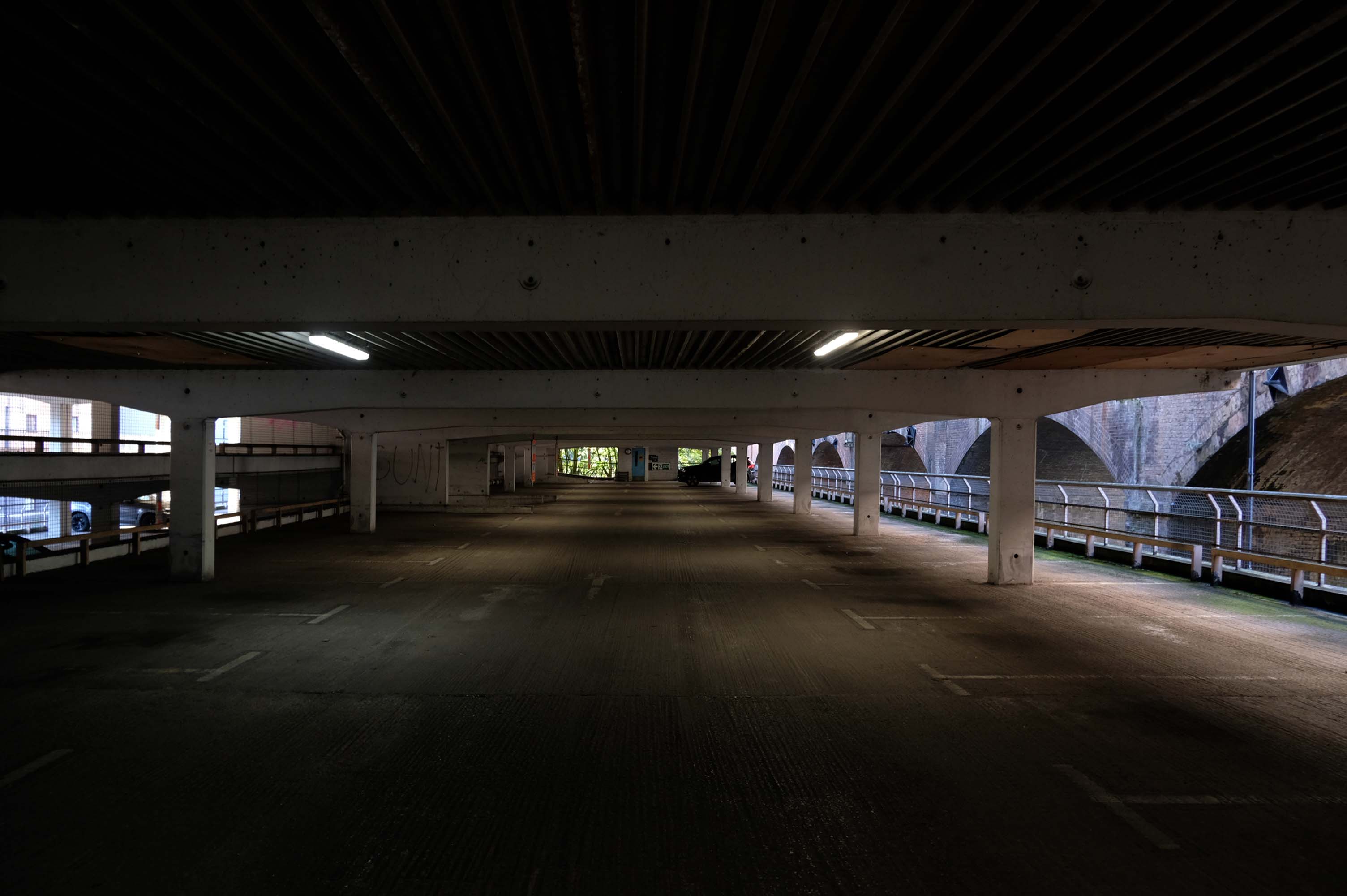
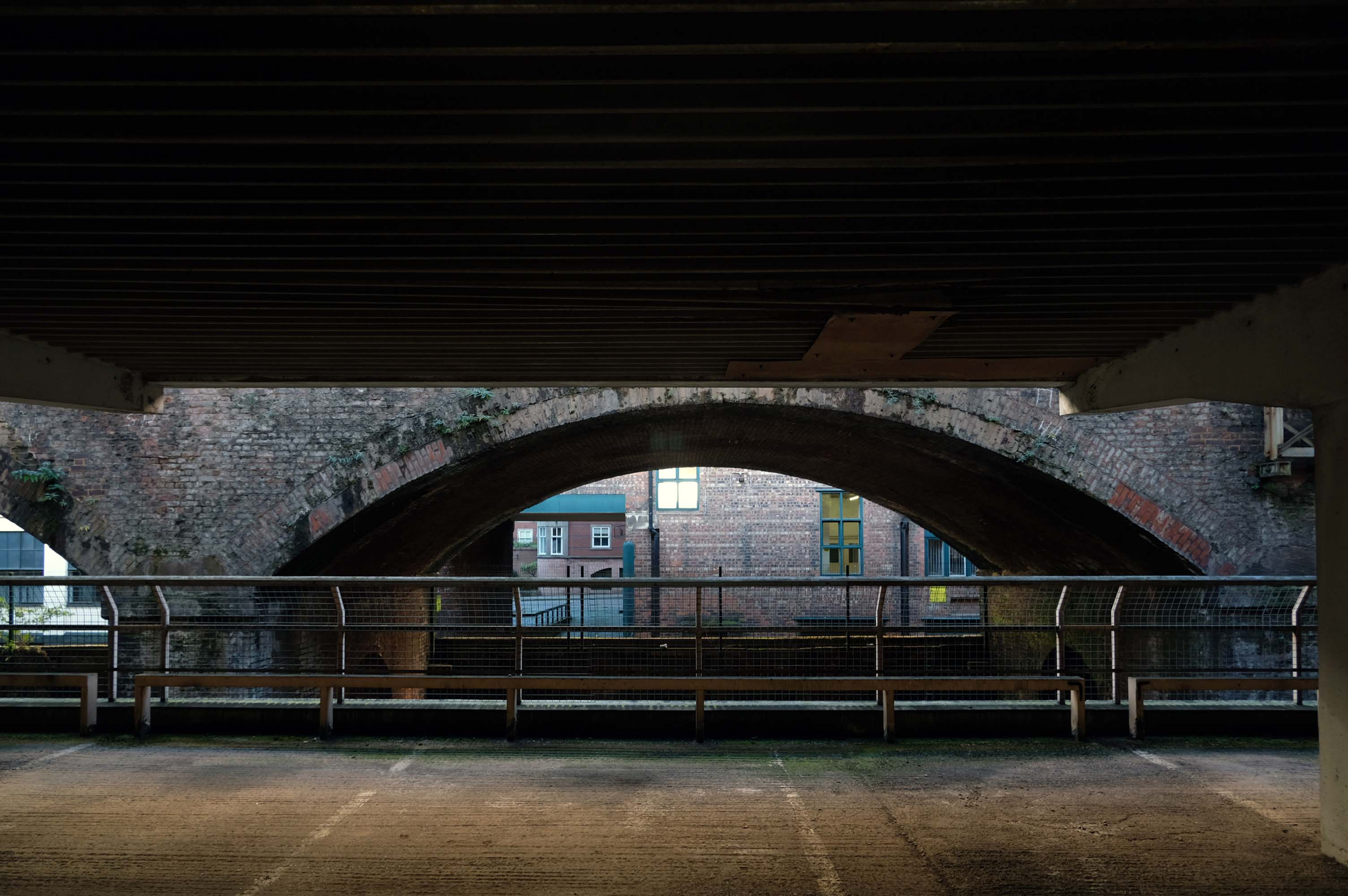
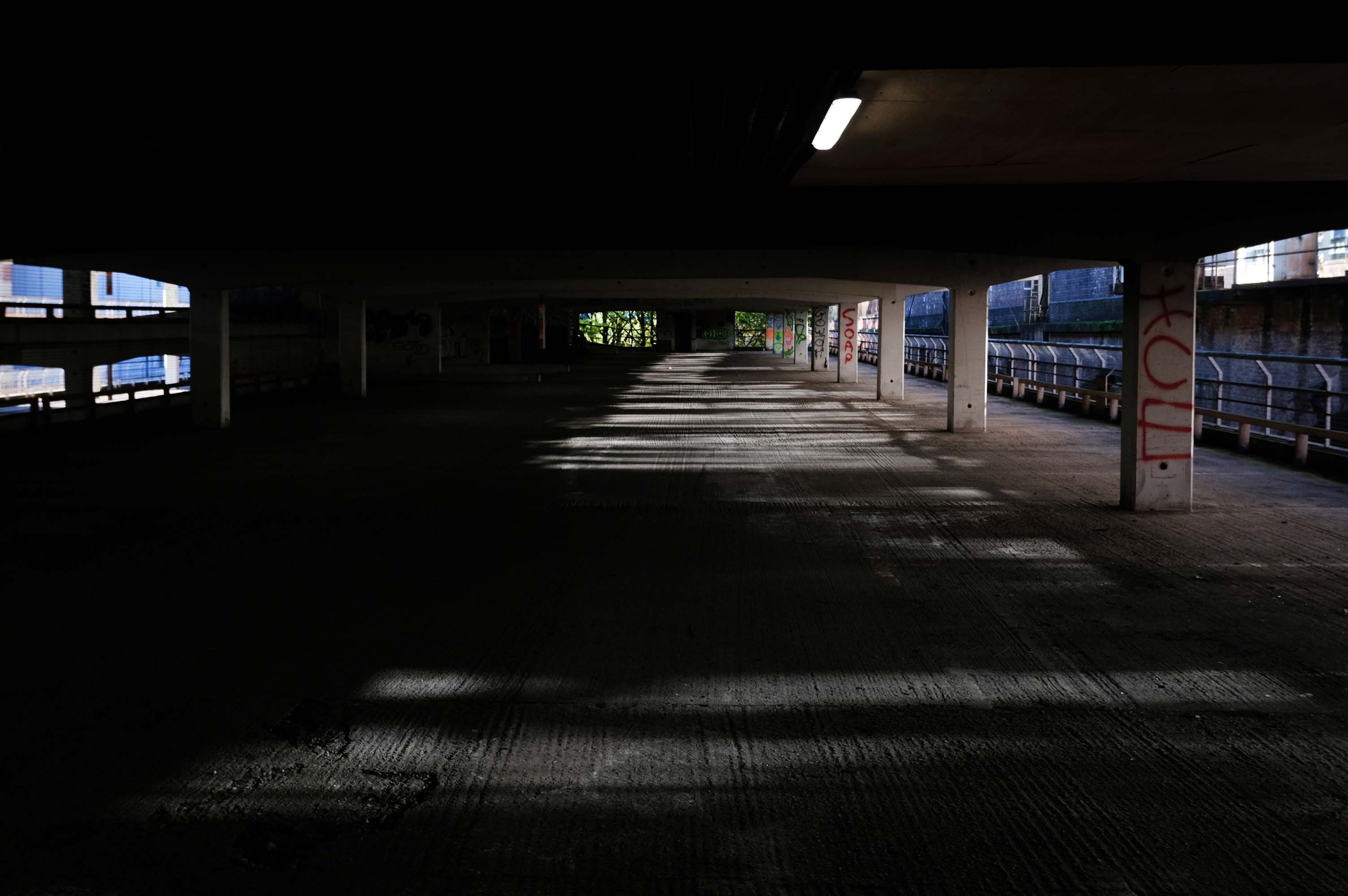
For this is a car park with coach station and boozer attached.
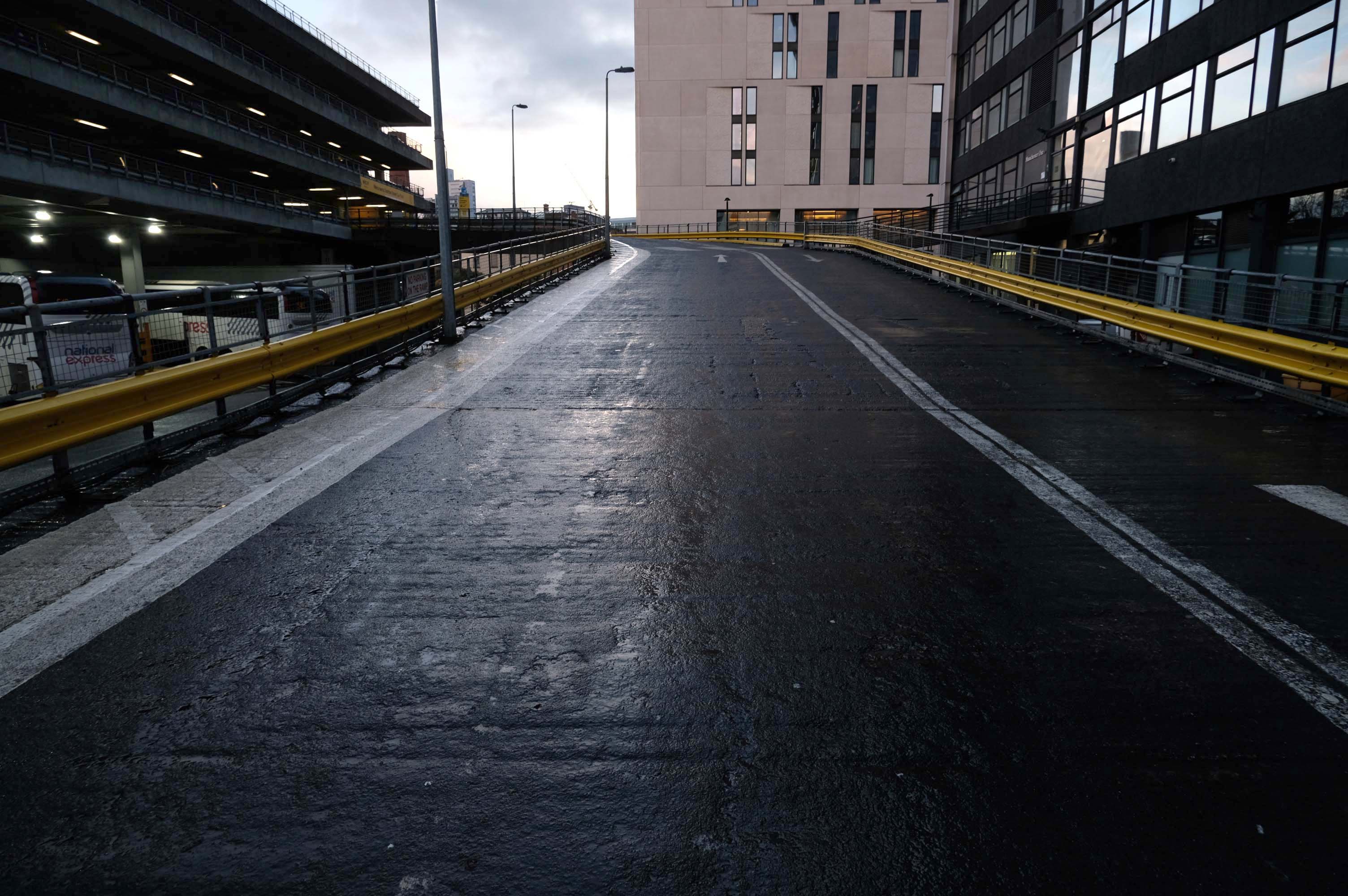
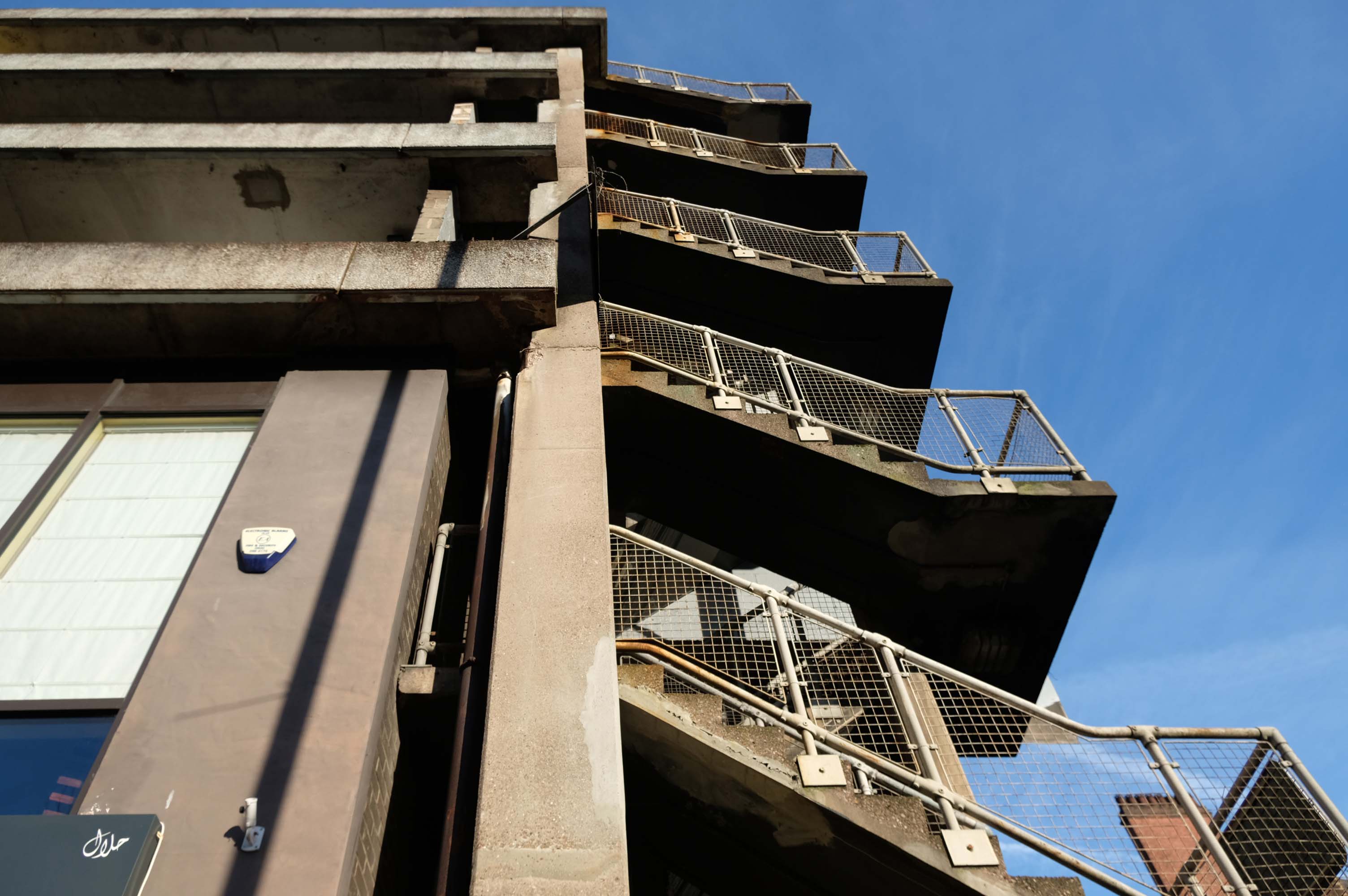
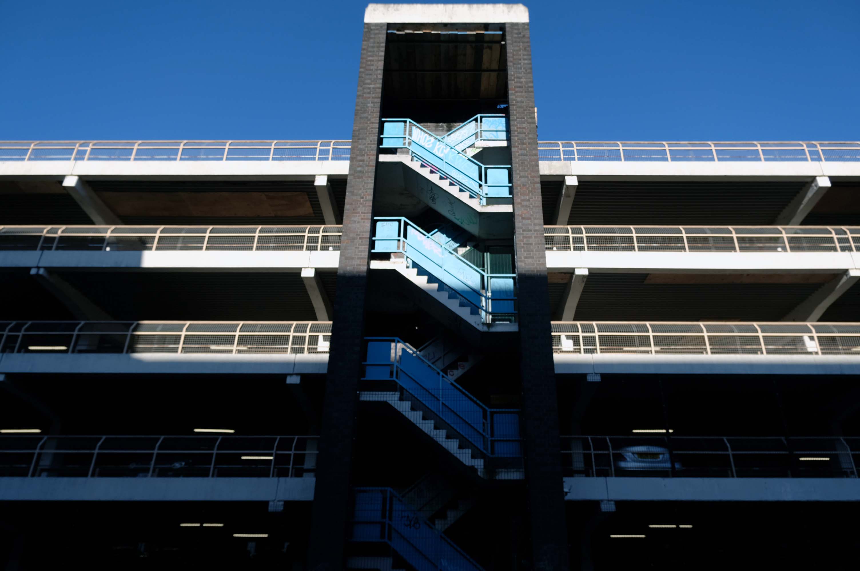
The pedestrian in a car park approaches cautiously – along the ramp.
Retreating the better to circumnavigate the site.
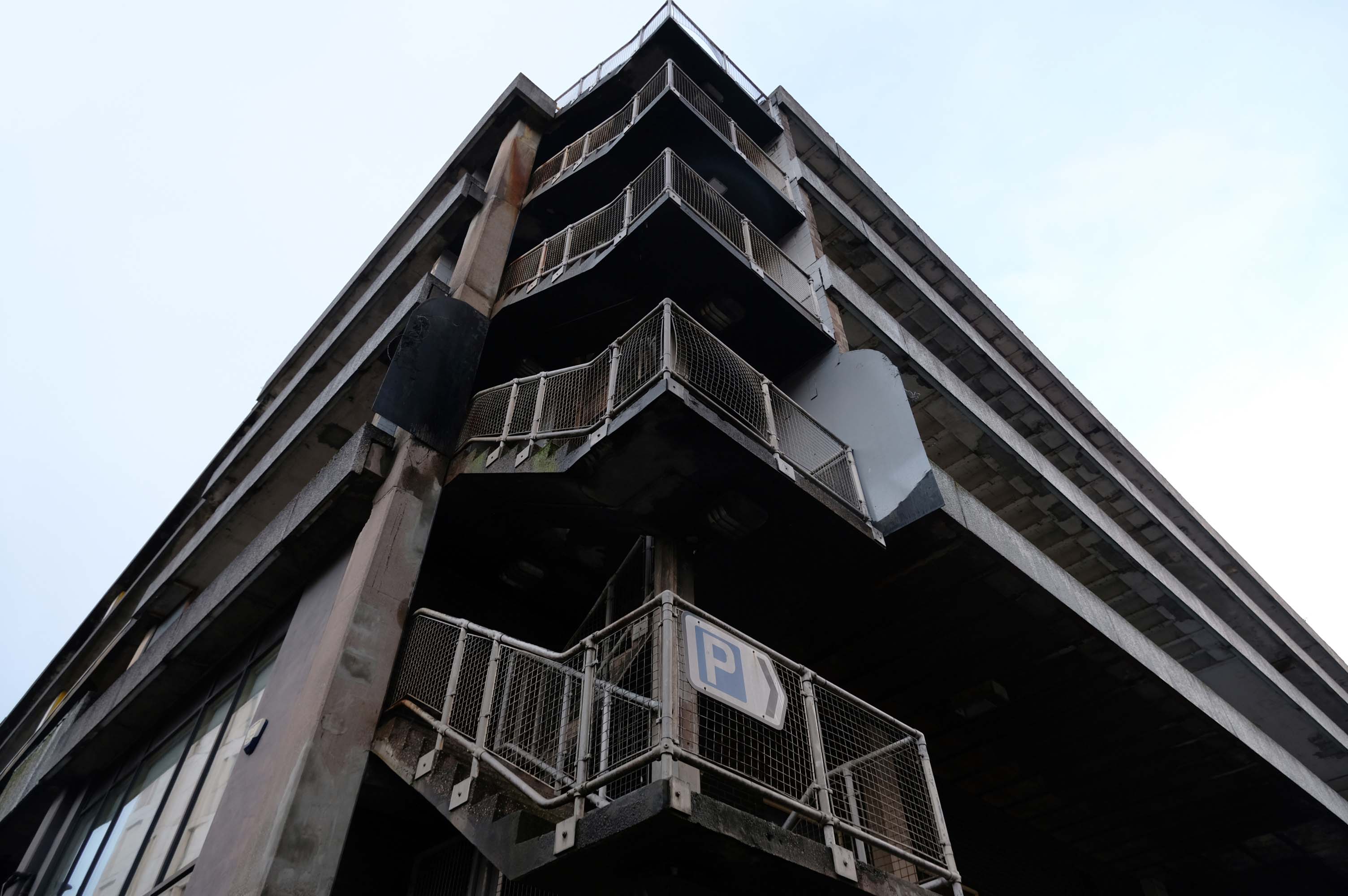
I was quickly losing light – so I called it a day.