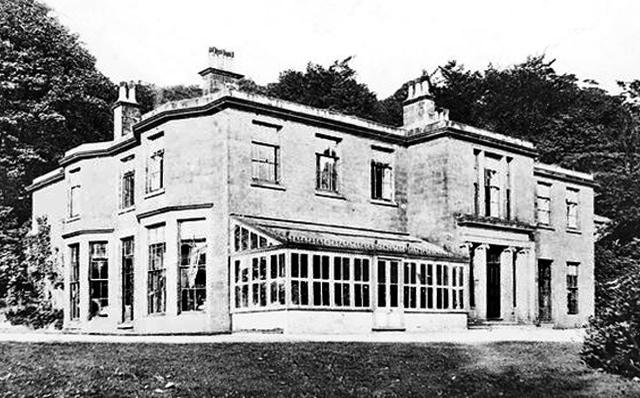
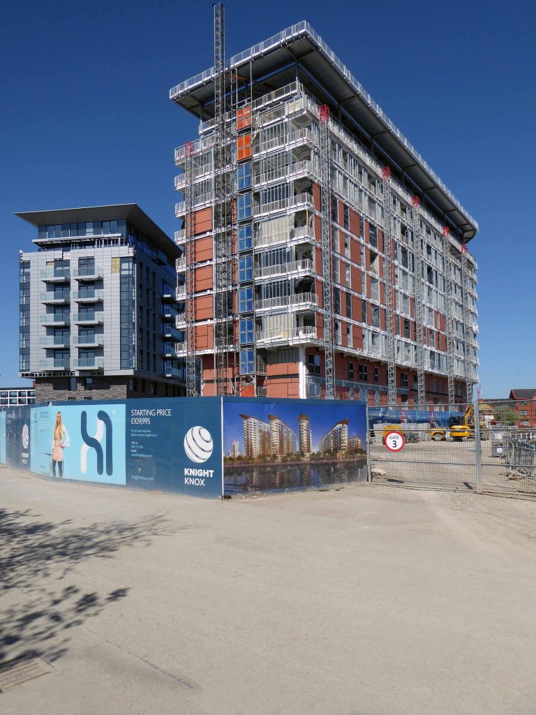
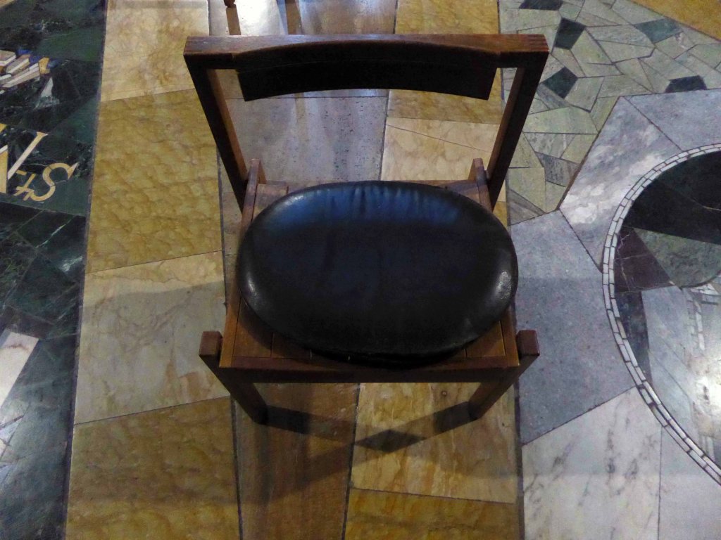
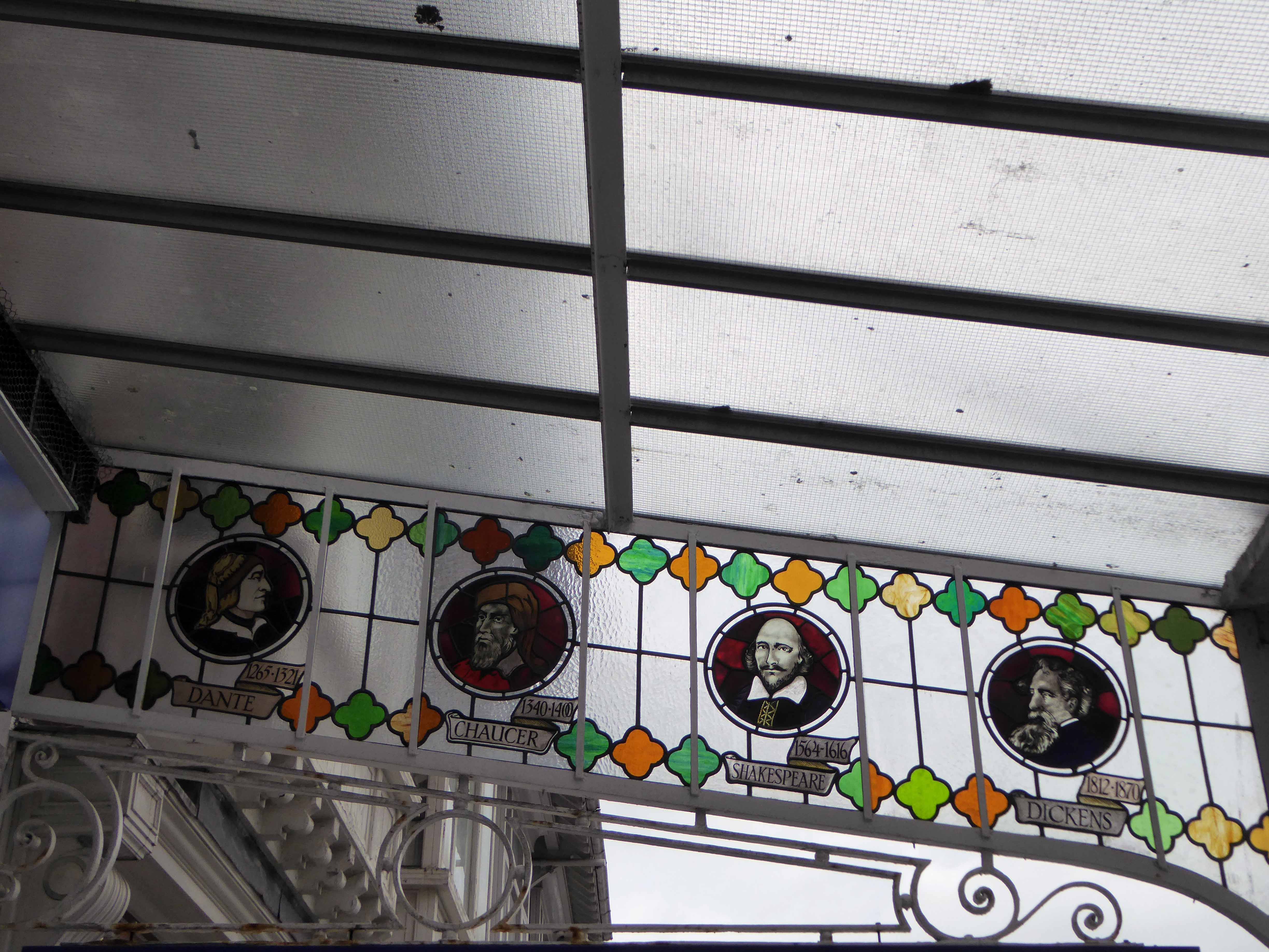
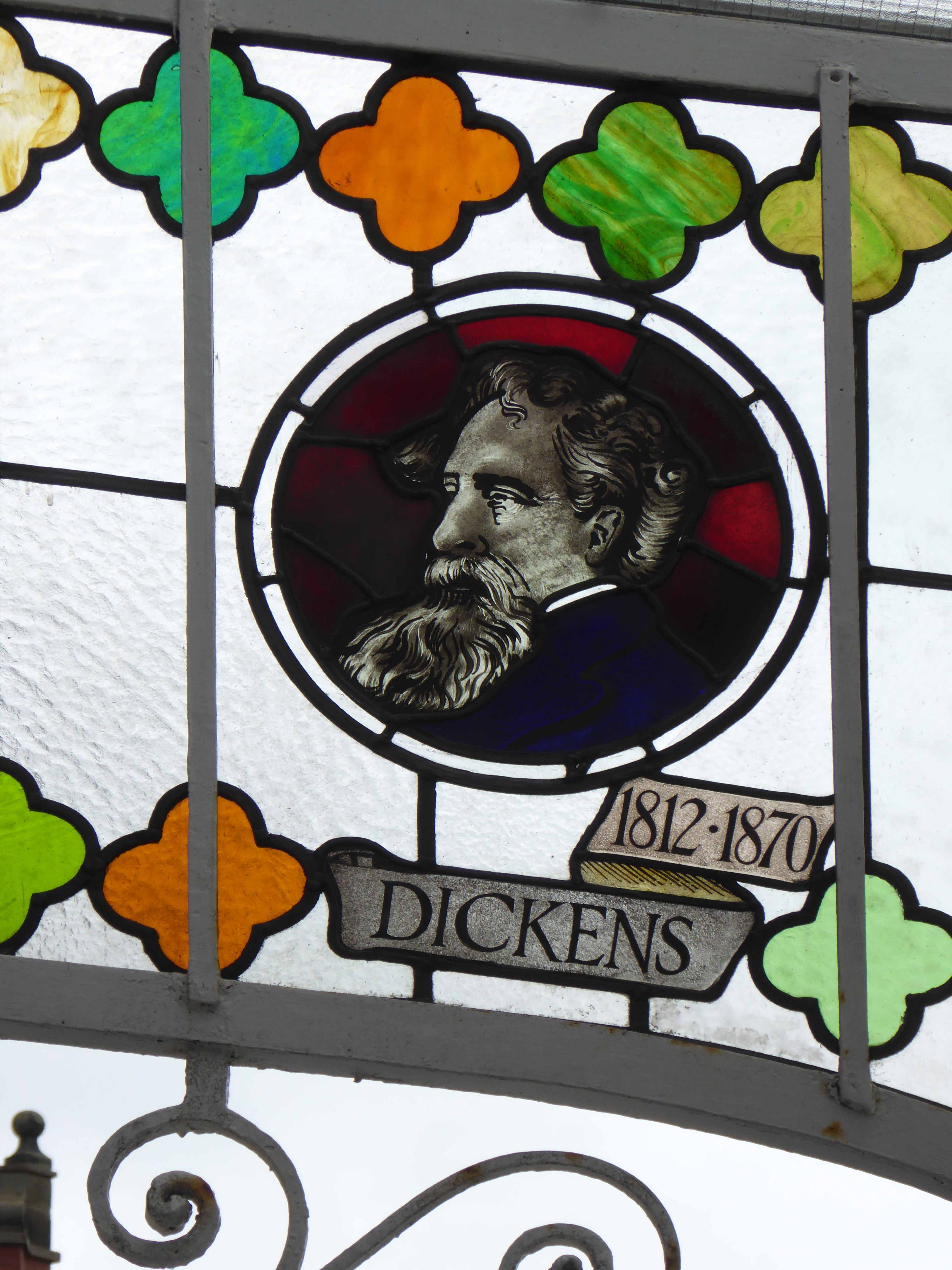
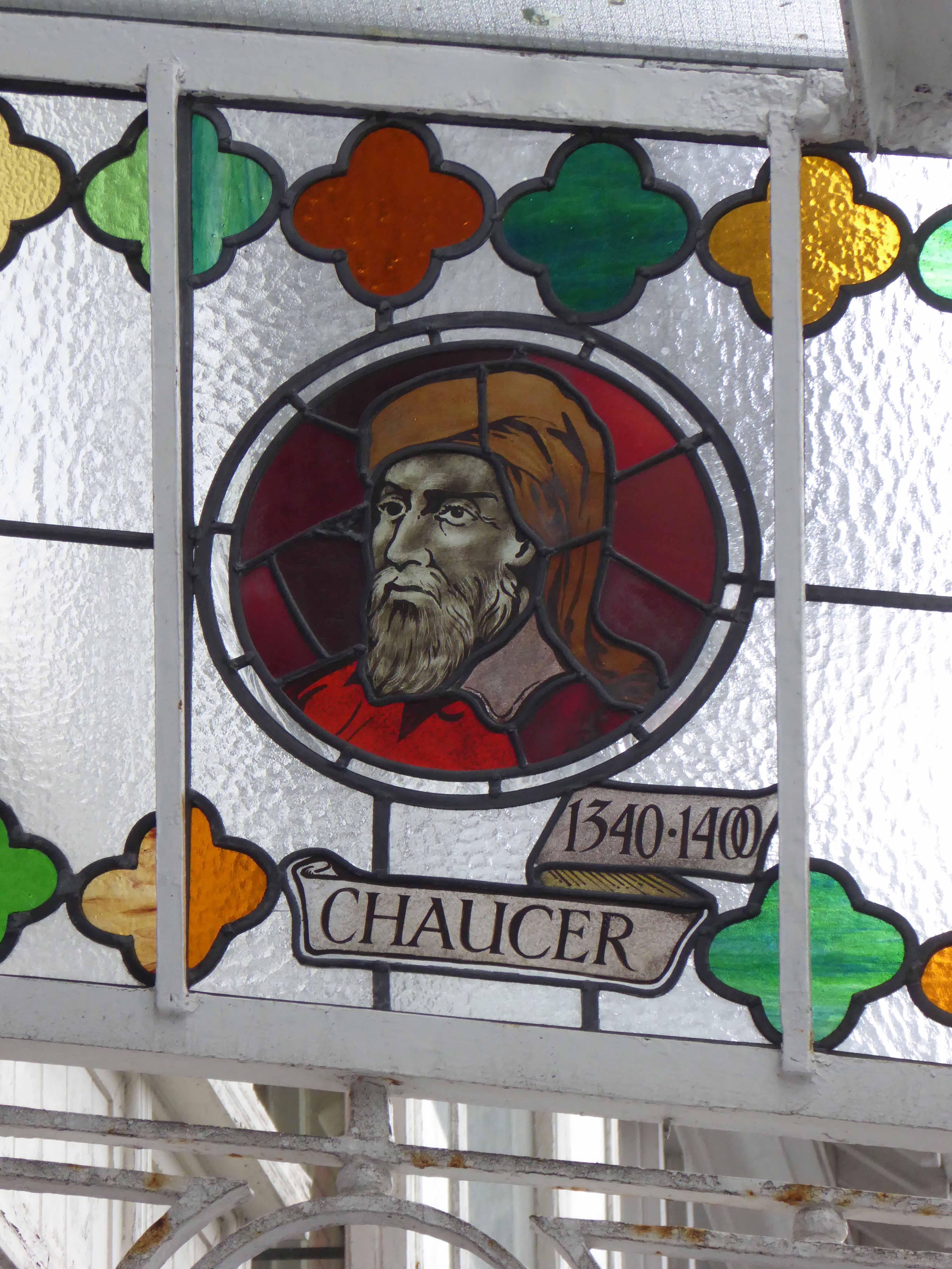
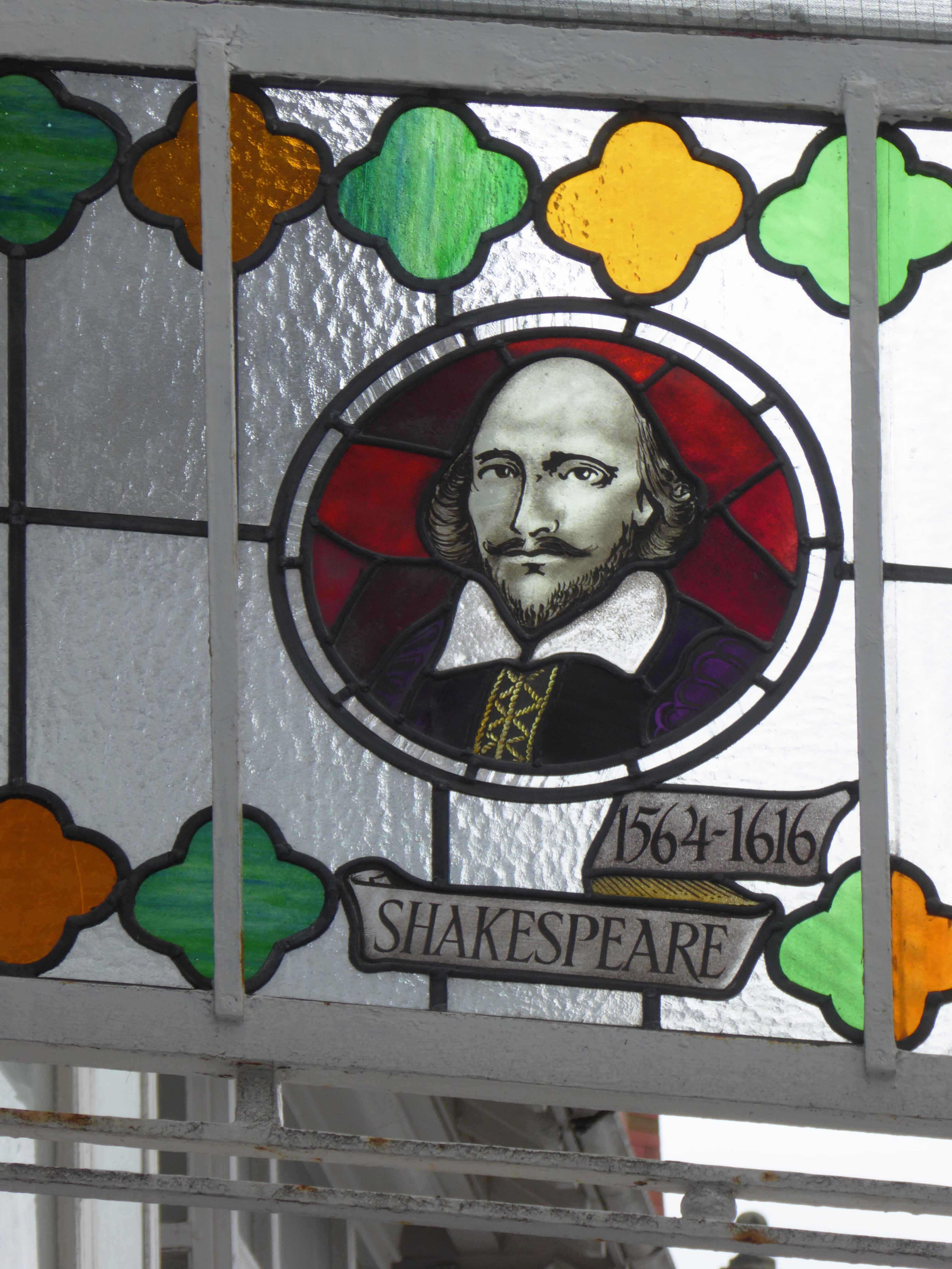
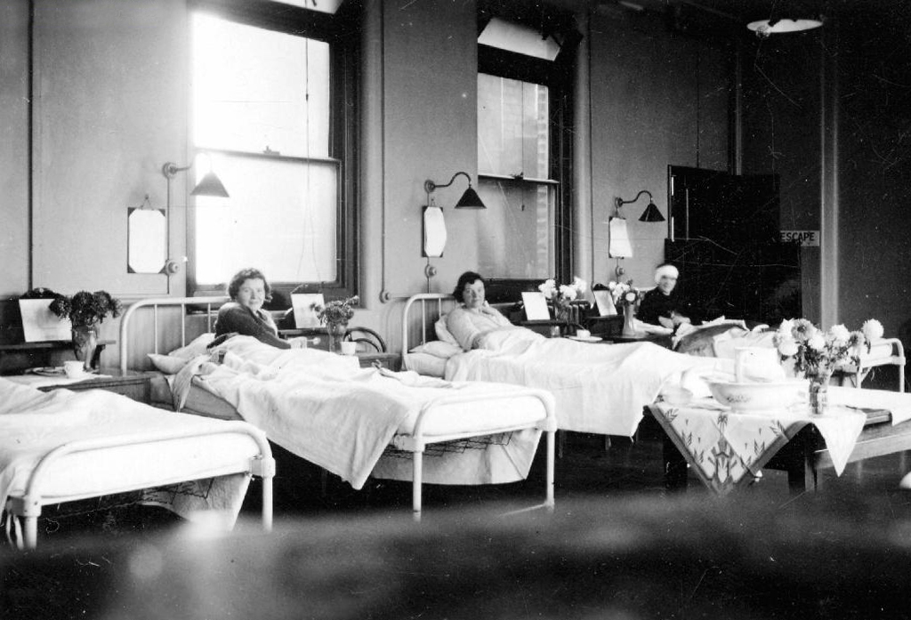
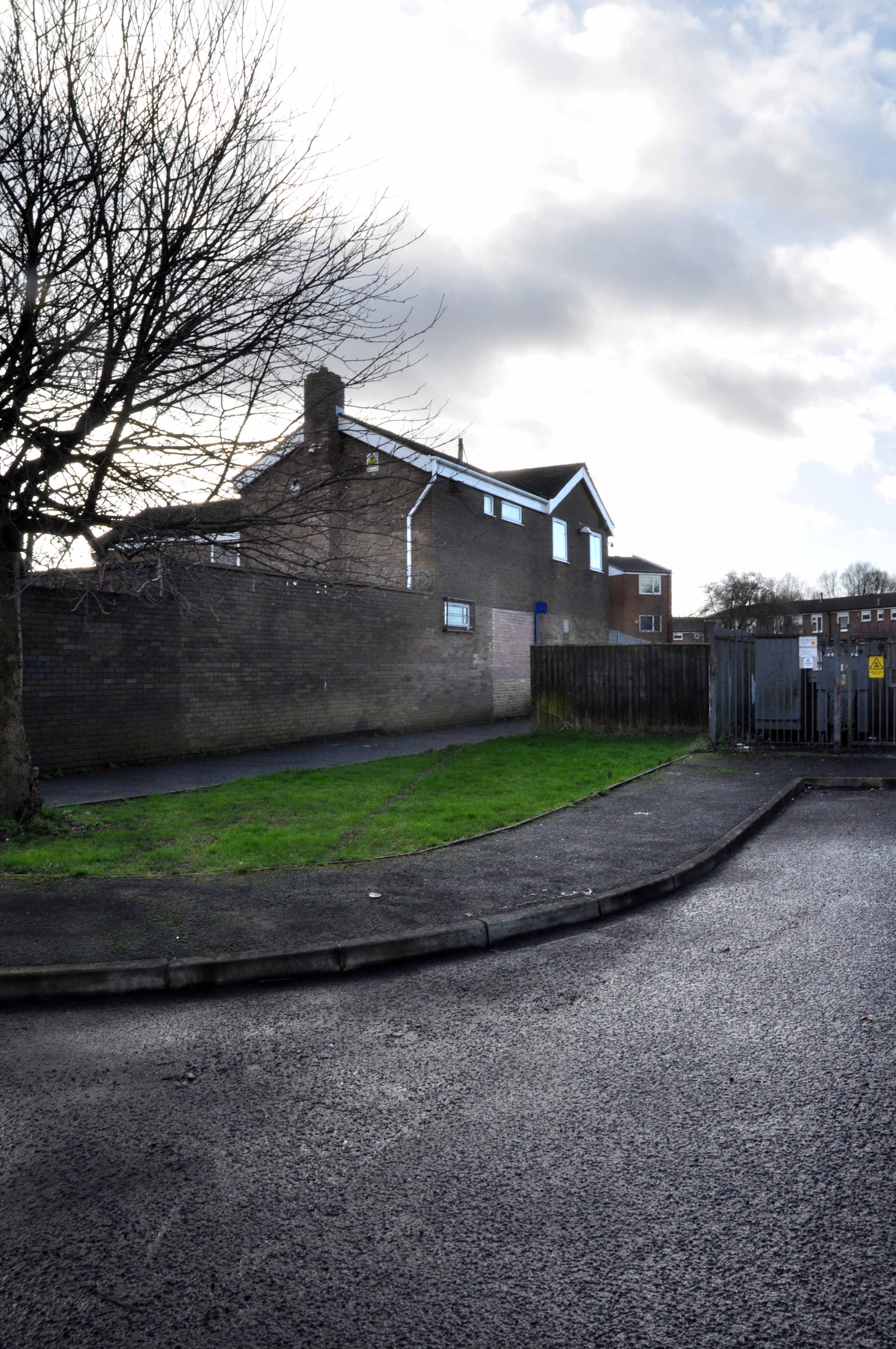
A Grade II listed country house, now divided into two dwellings. c1812. Ashlar gritstone. Hipped slate roof with leaded ridges. Various ashlar triple stacks with moulded tops. Moulded cornice and low parapet. Two storeys, central block with recessed long wing to east, orangery to west.
This Grade II listed manor house is set within 14 acres of natural grounds, together with the occupied adjoining servants’ wing, and has been sympathetically converted, retaining many original features to provide comfortable accommodation for families wishing to meet up for that special family occasion, and wi-fi is available in the living room.
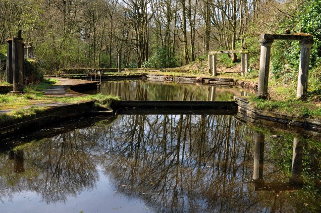
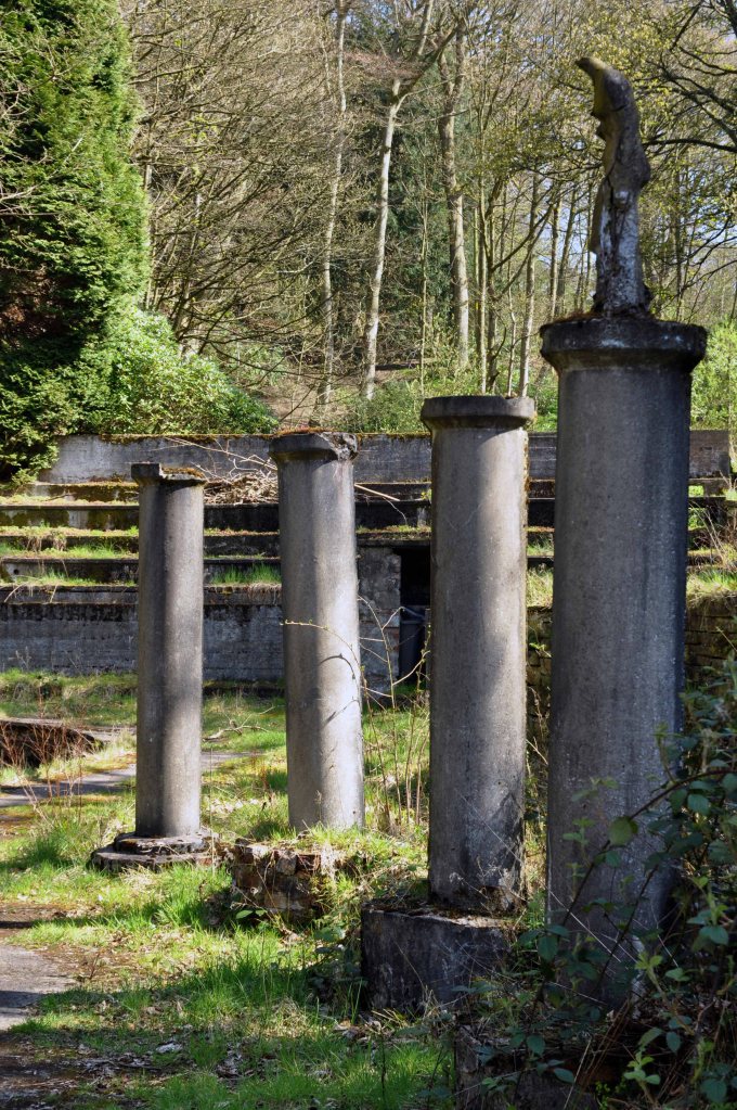
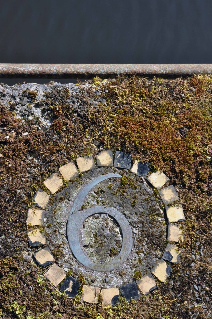
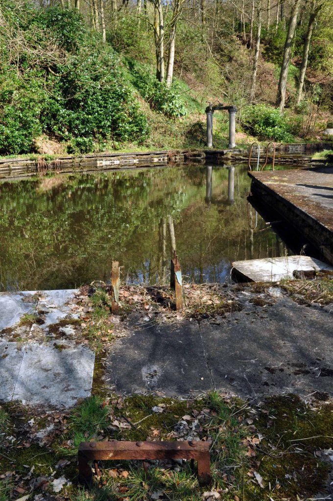
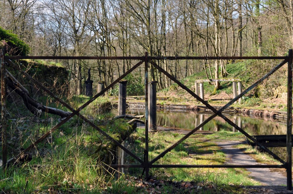
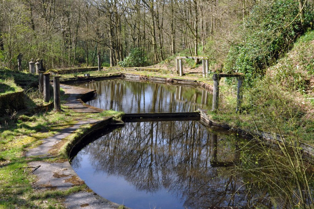
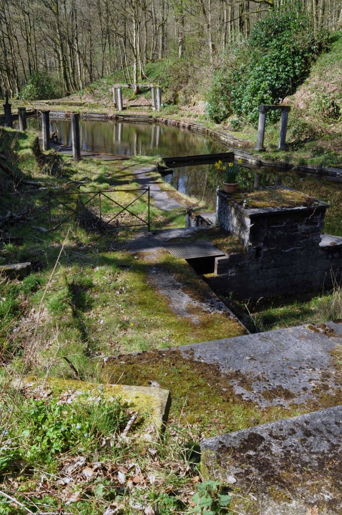
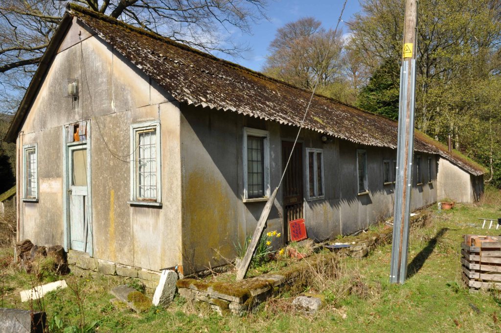
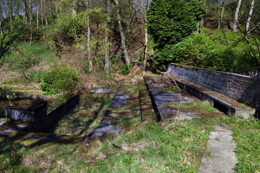
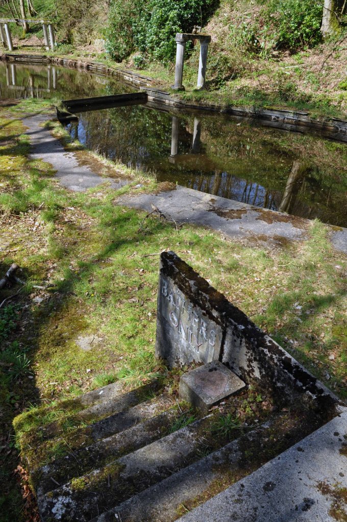
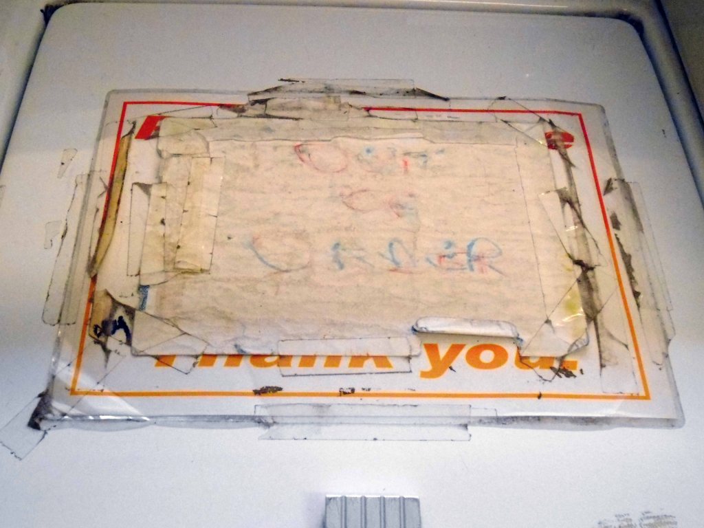
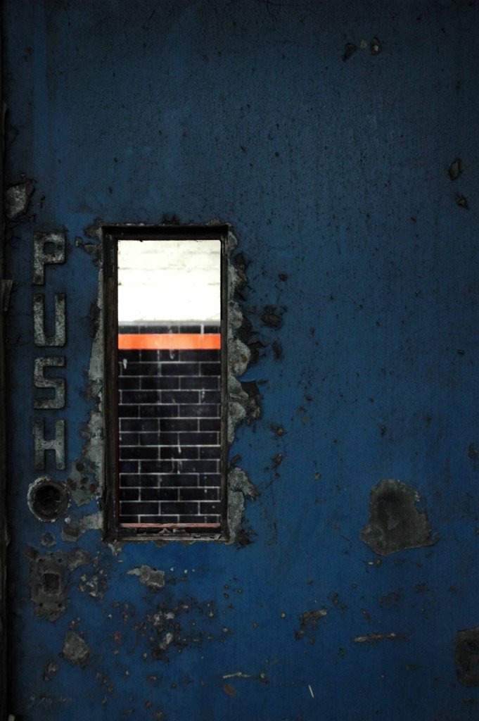
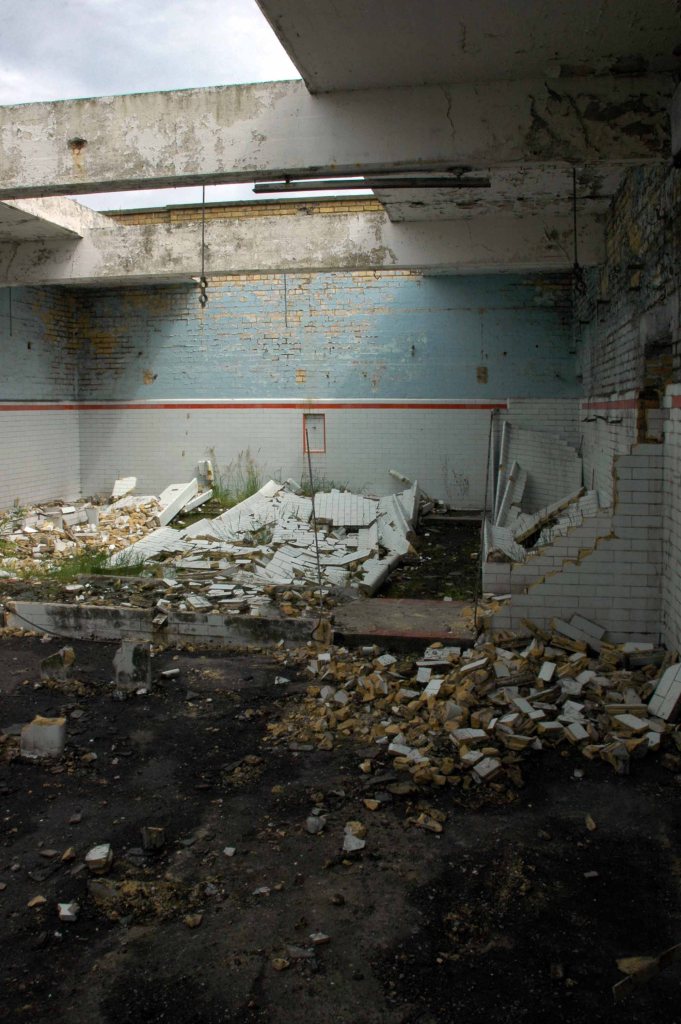
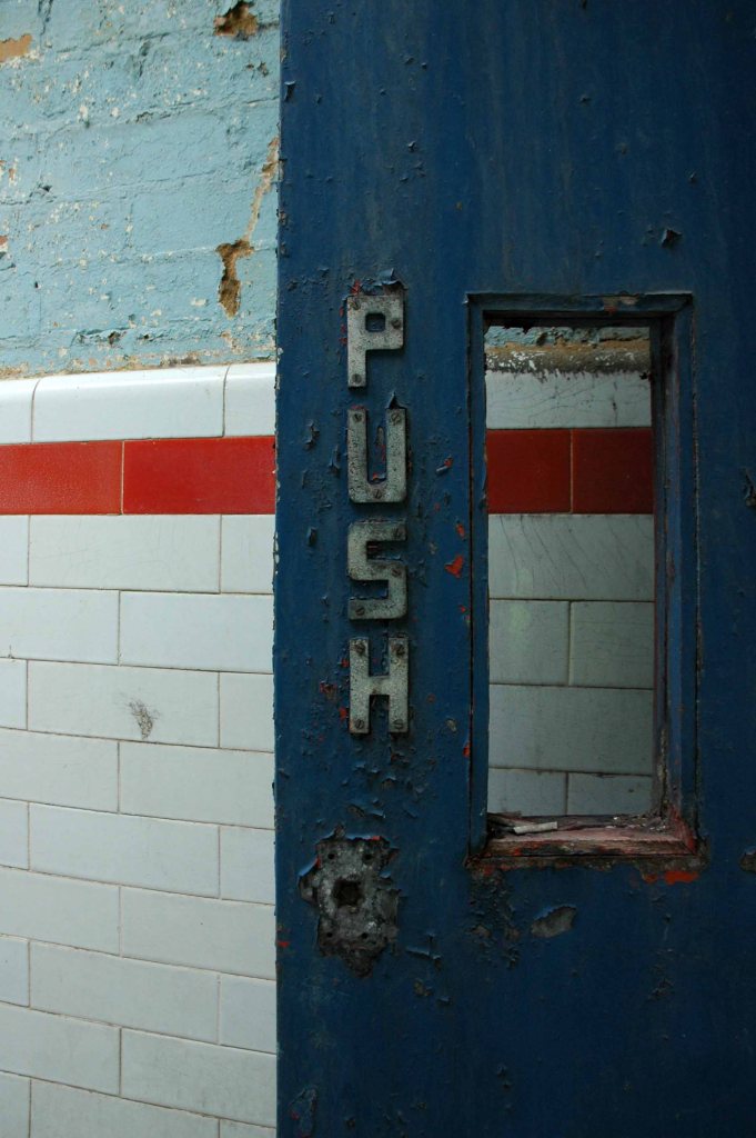
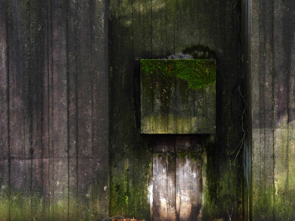
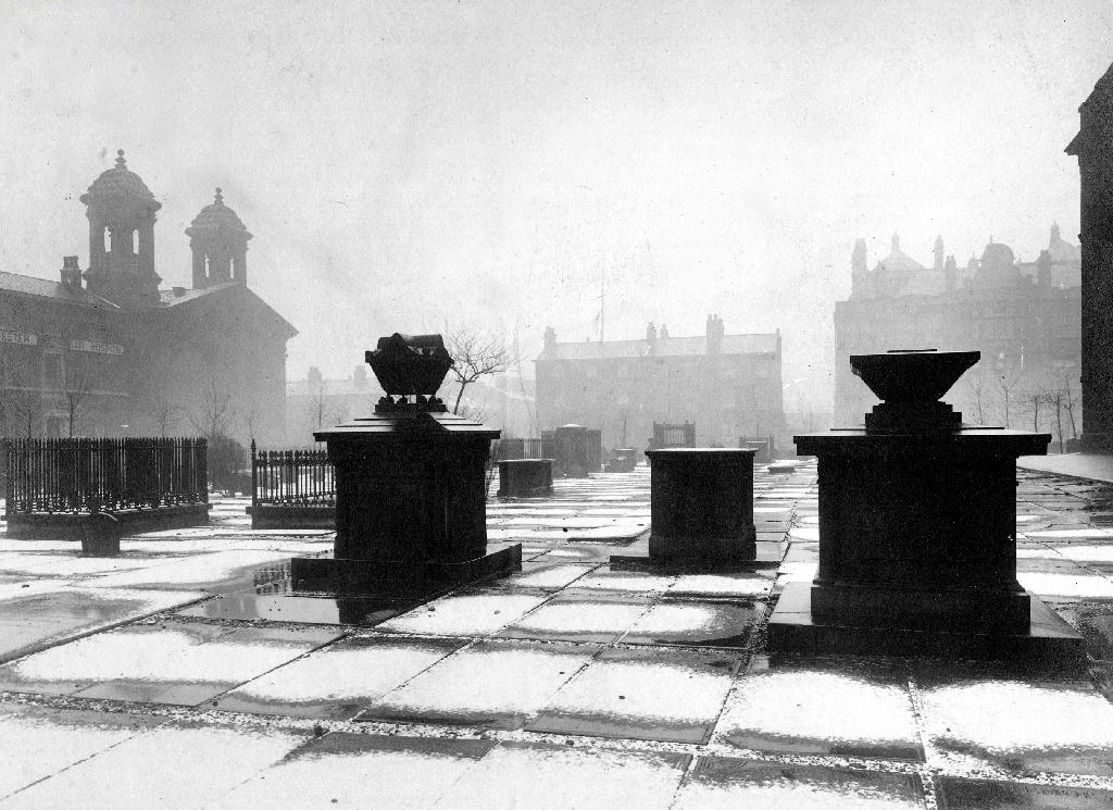
Then came a pool:
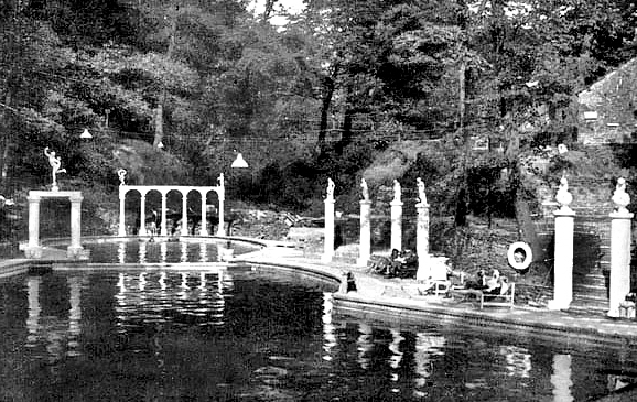
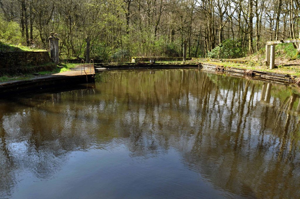
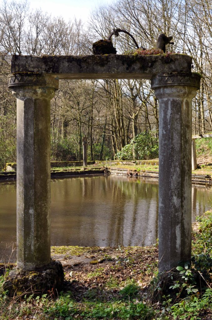
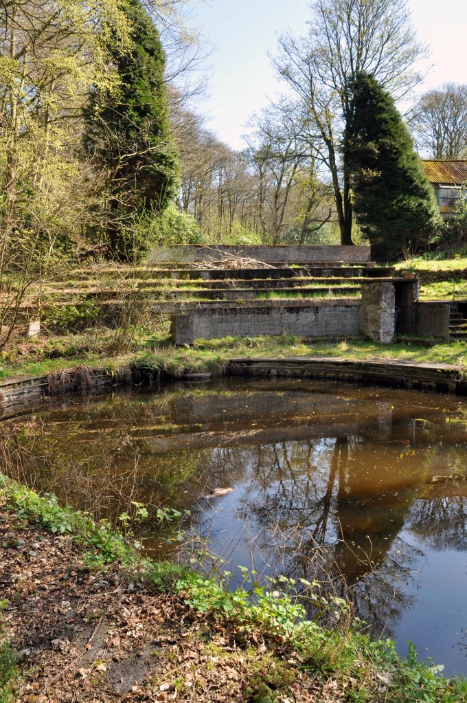
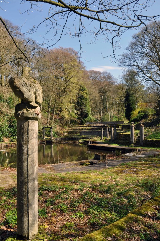
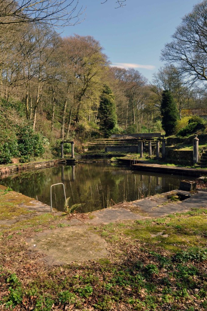
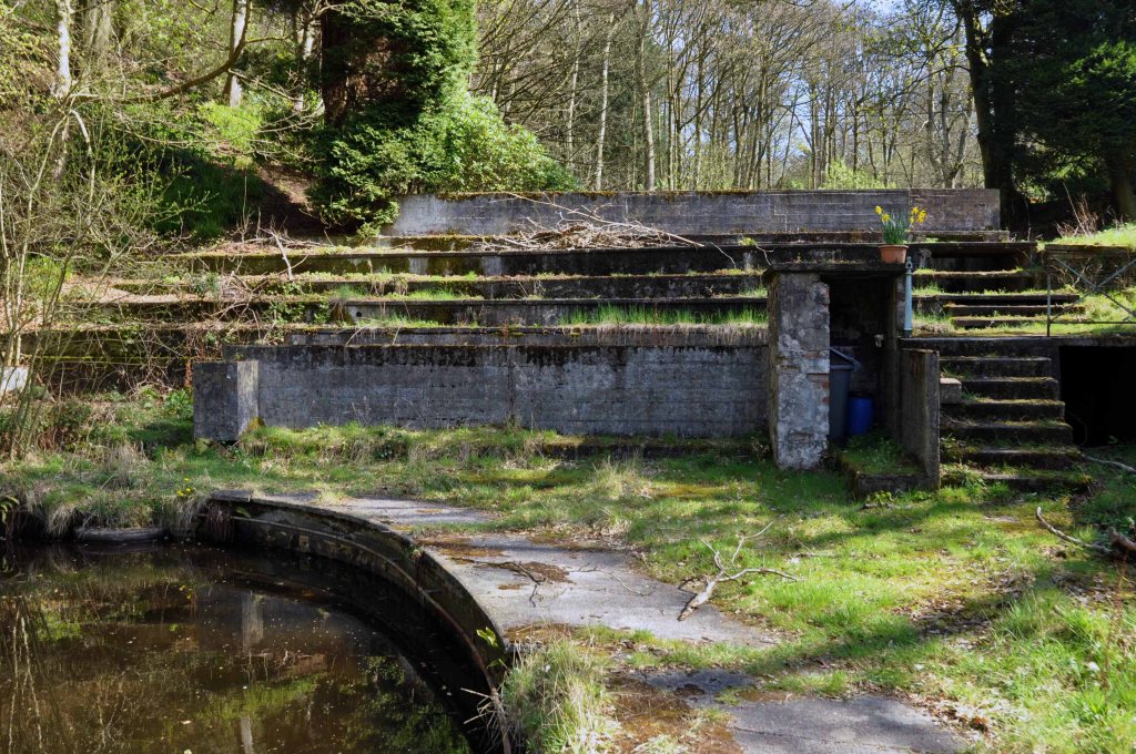
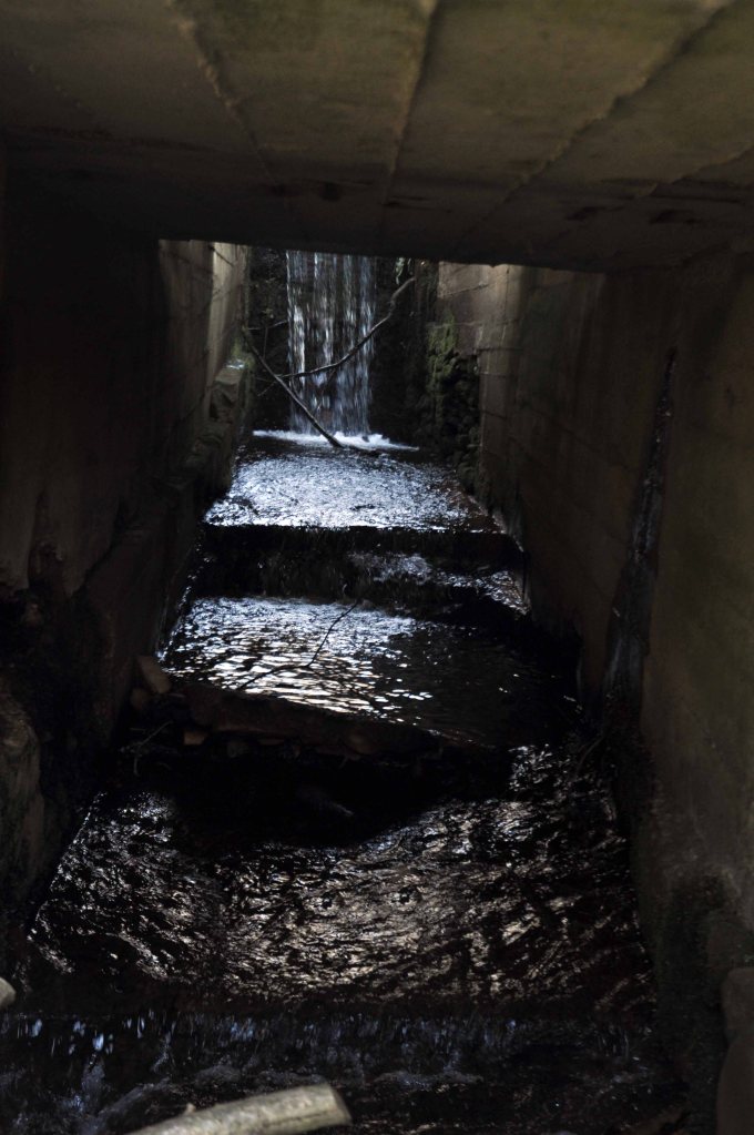
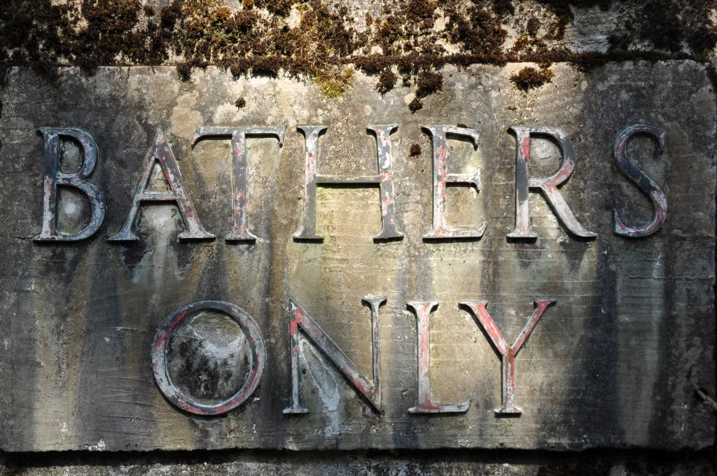
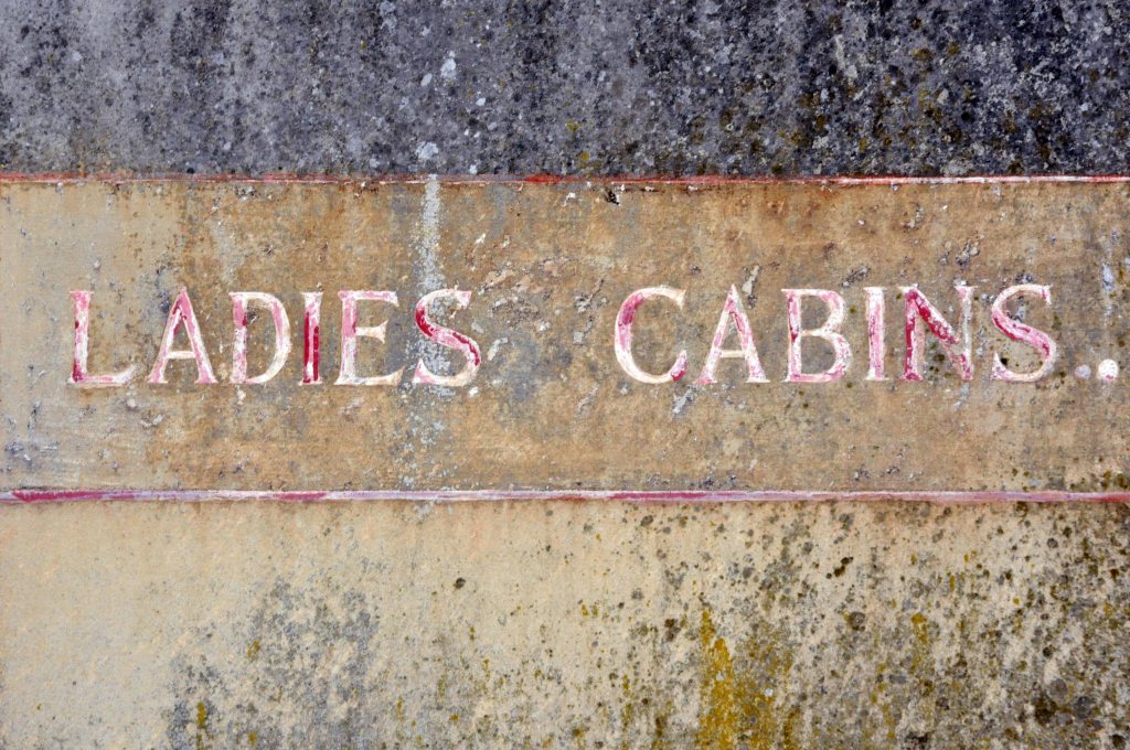
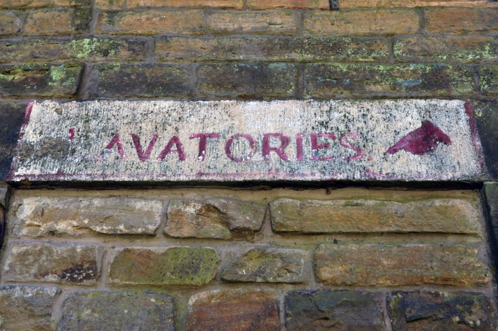
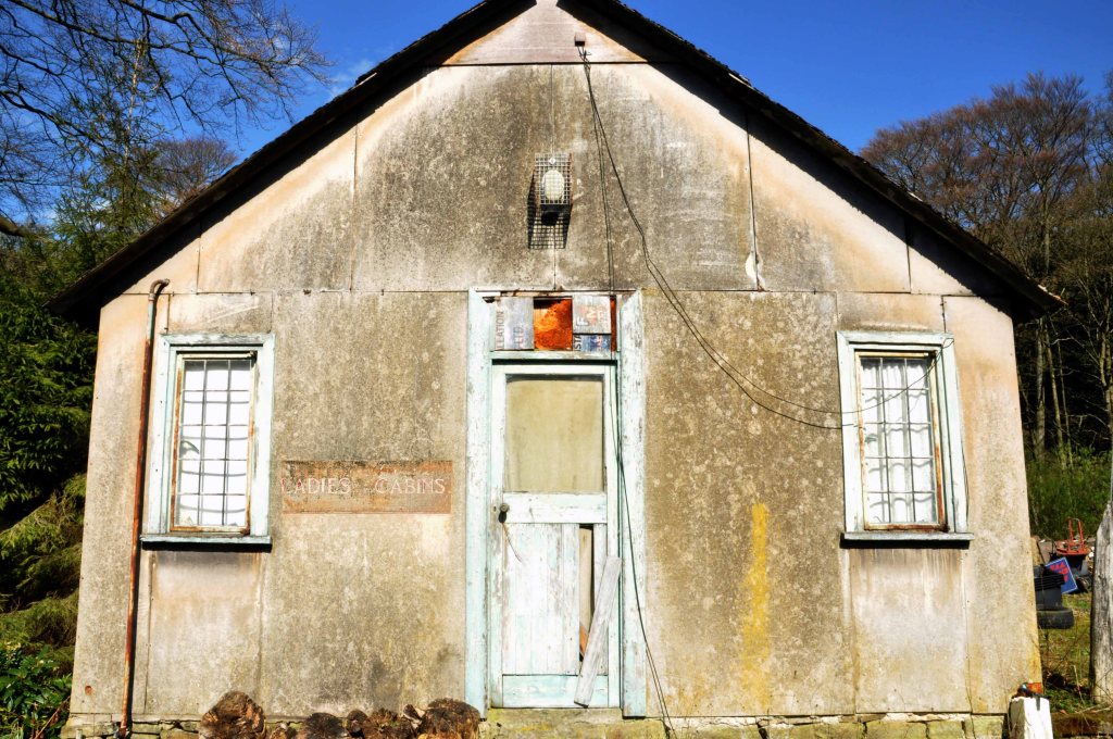
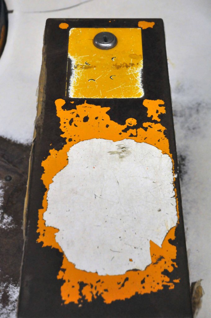
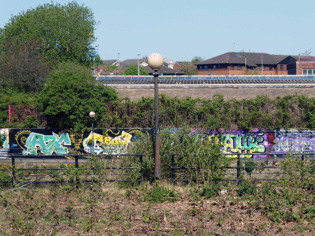
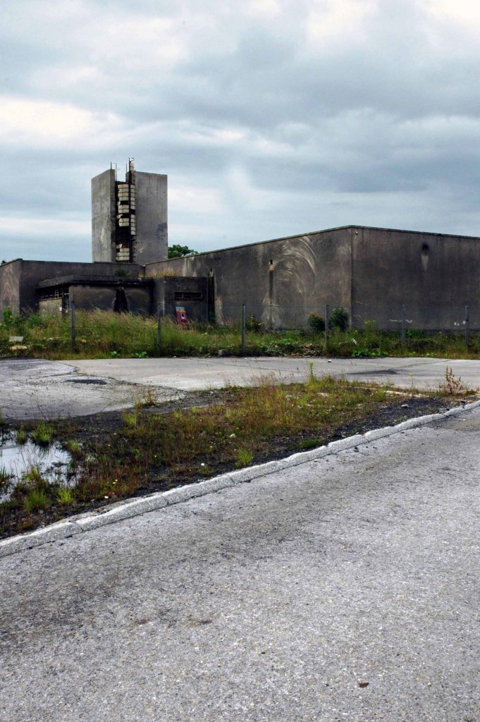
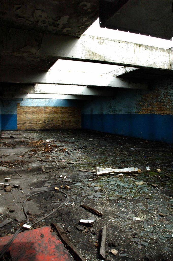
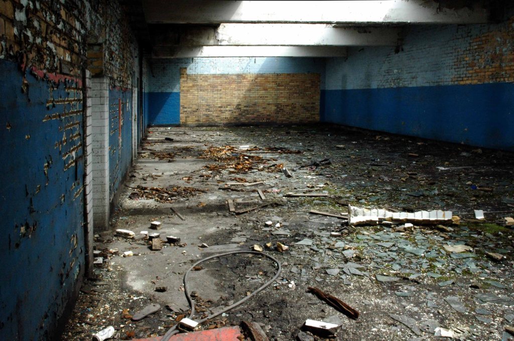
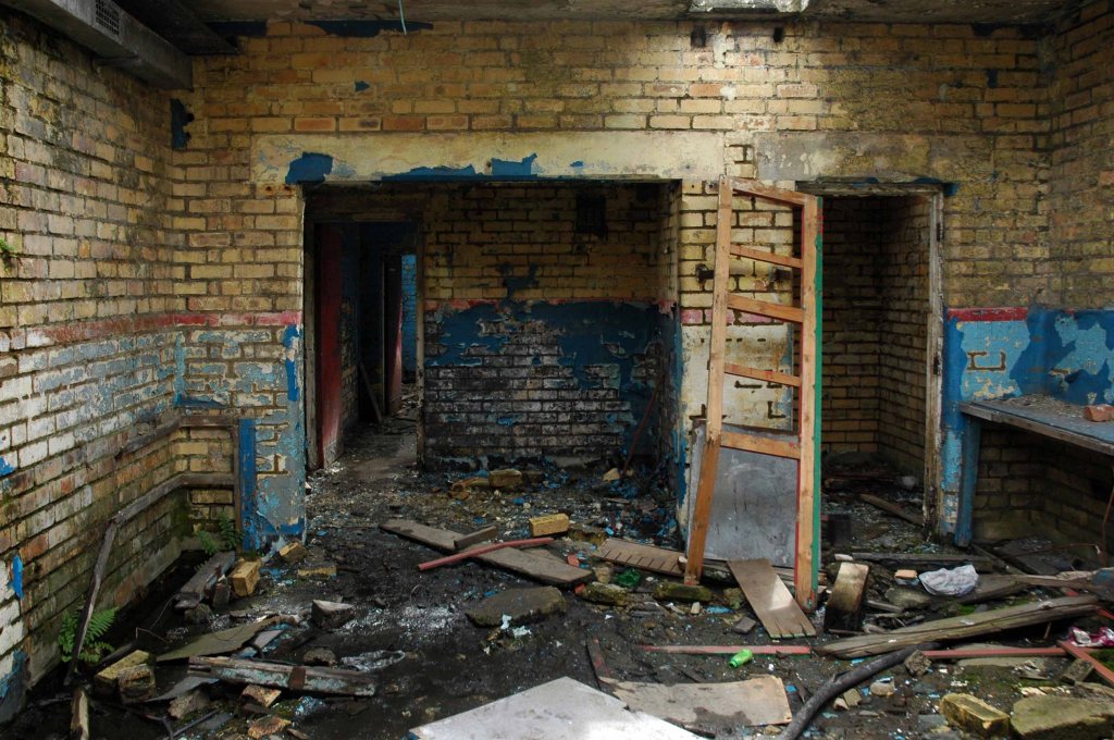
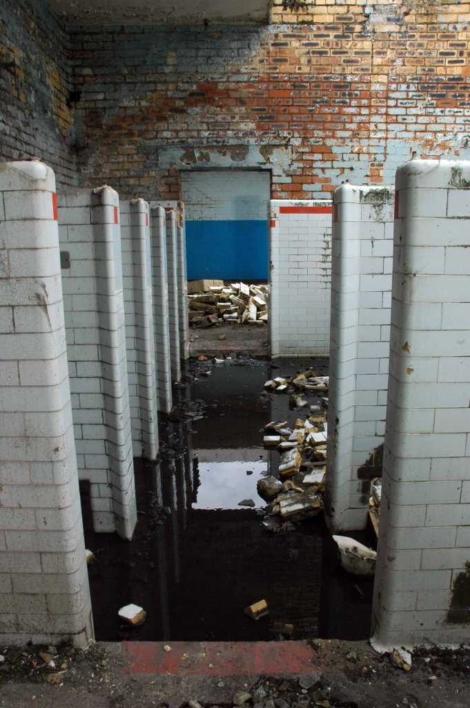
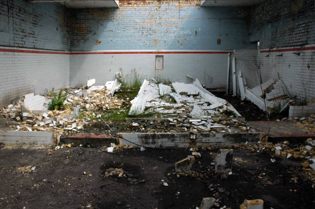
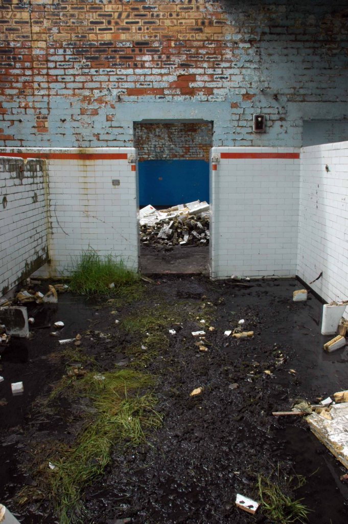
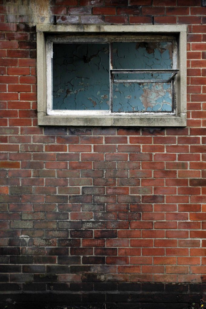
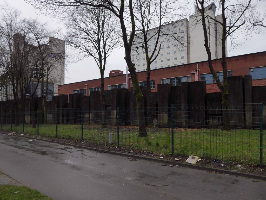
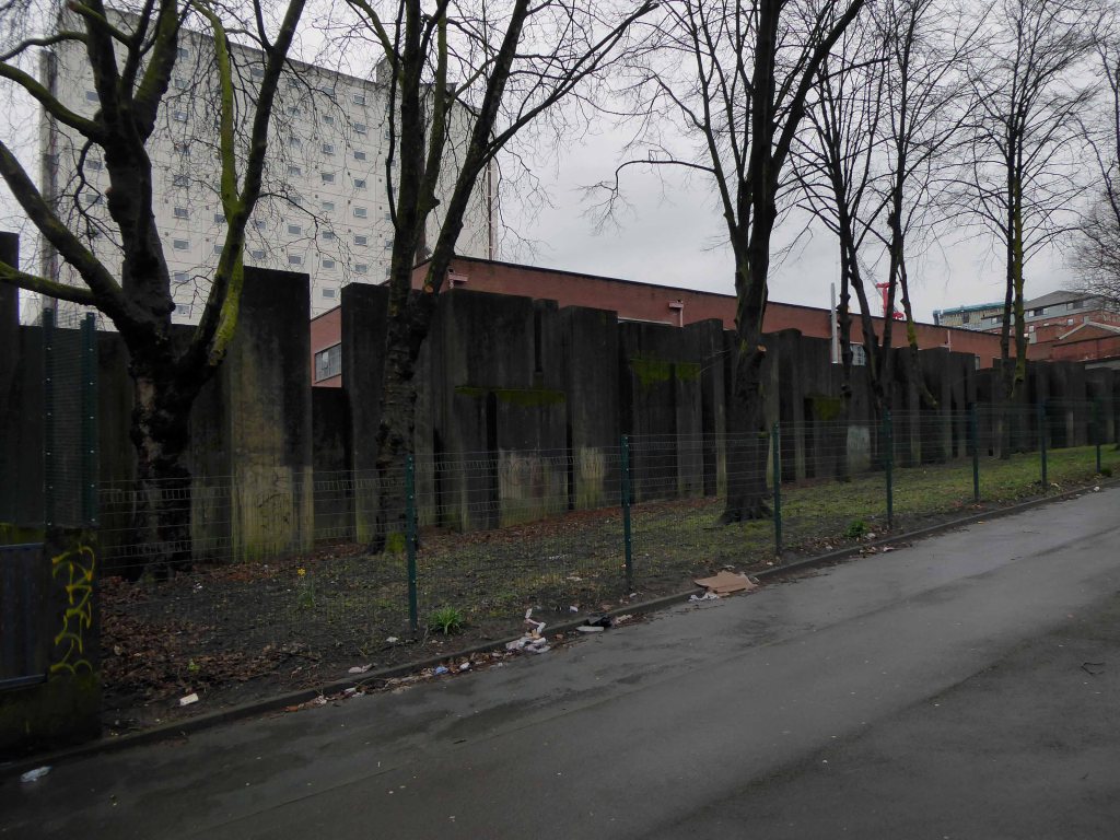
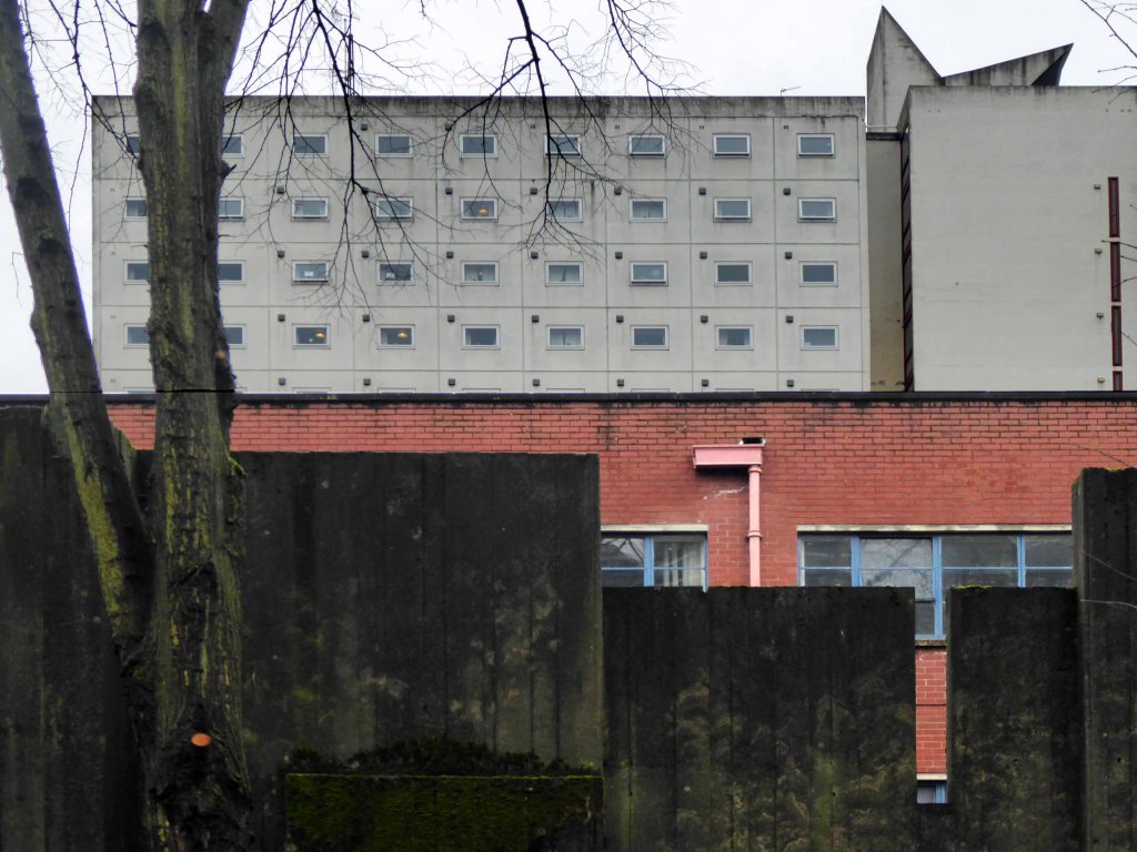
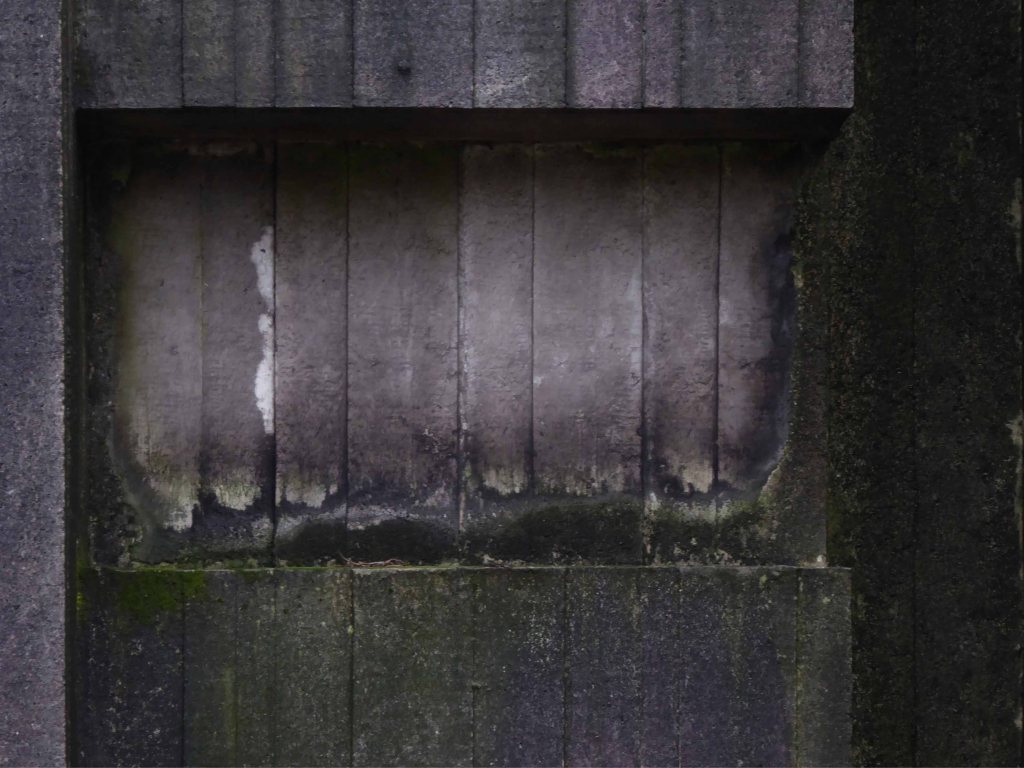
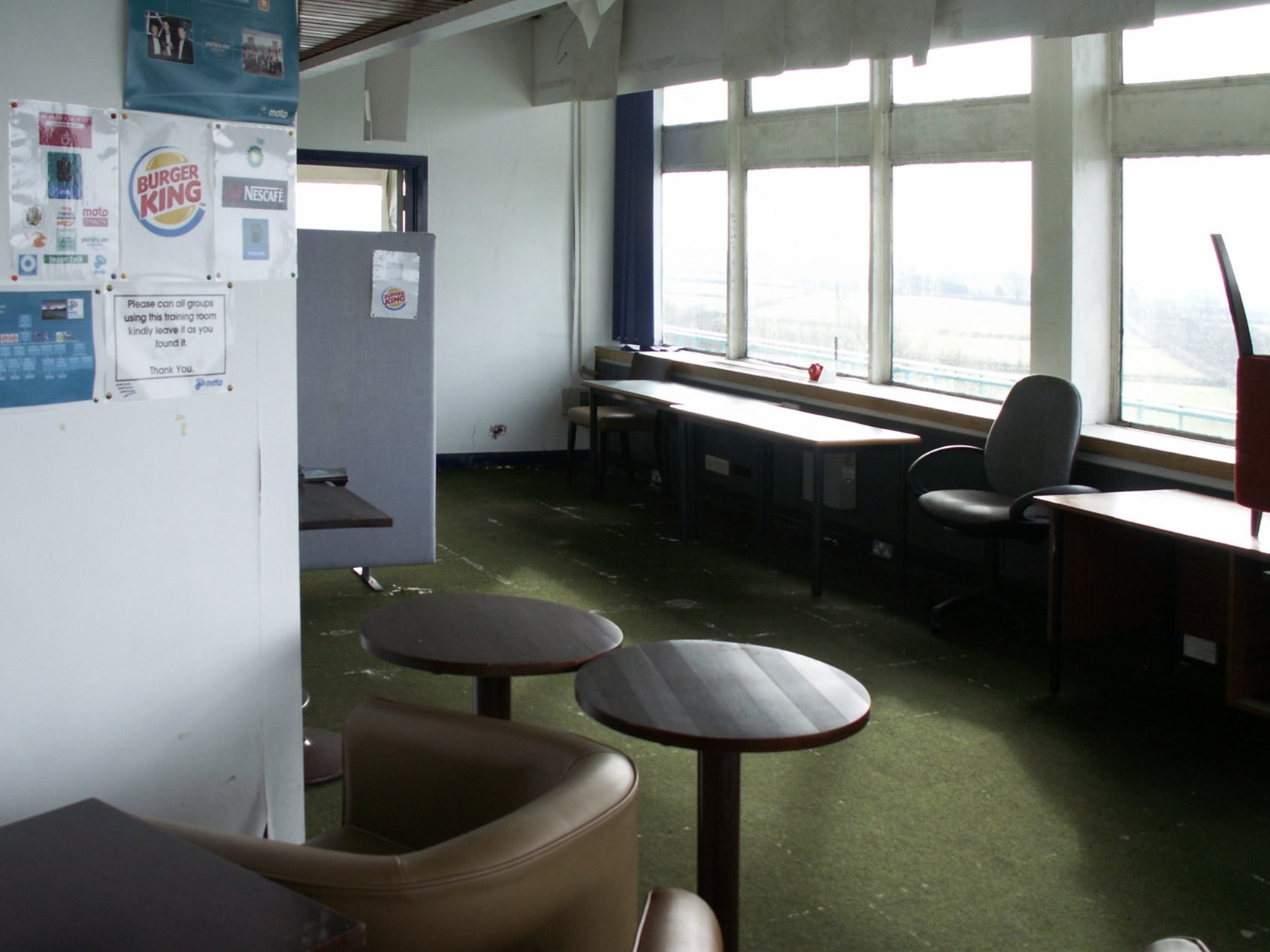
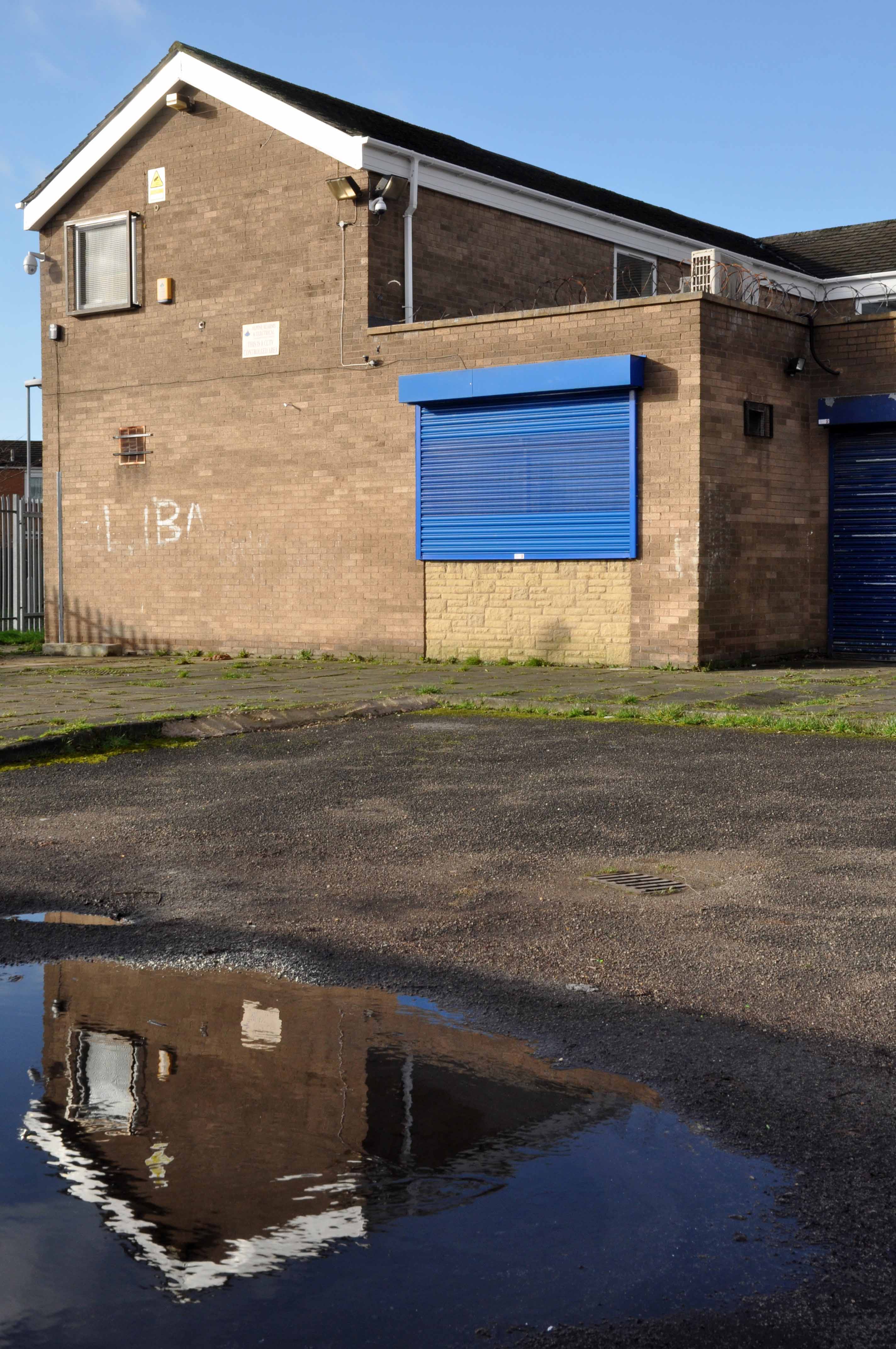
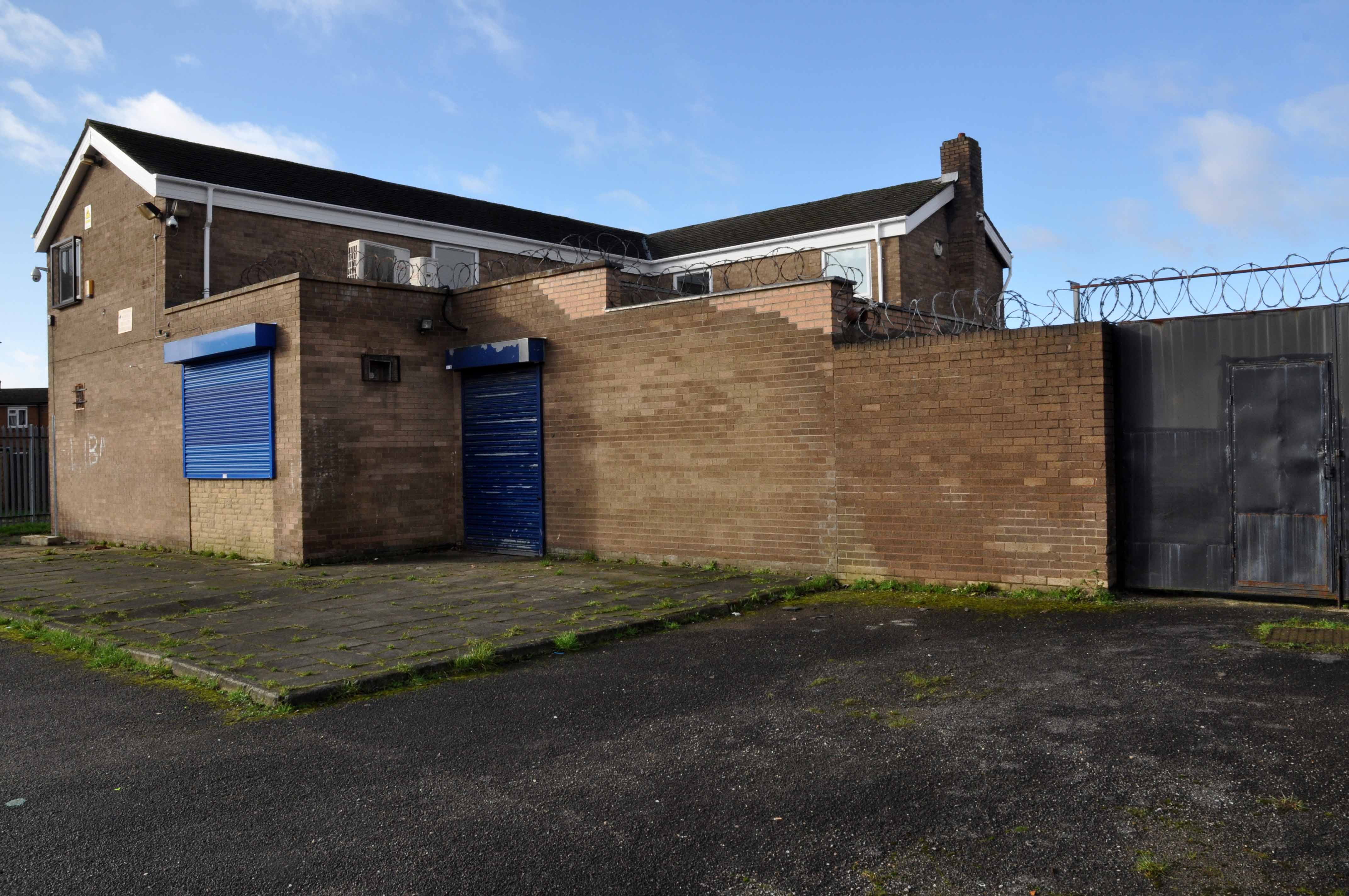
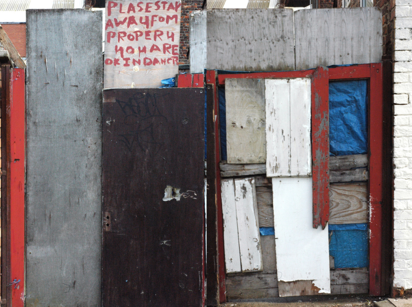
Previously a private pool belonging to a country club in the 1930’s it later opened to members around 1938 who paid a small fee for its use. The pool is fed by a mountain stream and the water is reported to remain cool throughout the year. In the 1940’s/50’s locals recall the pool being open to the public where it cost a ‘shilling for children and half a crown for adults’ entry. During storms in 1947 the pool was badly damaged and reportedly ‘never the same again’ but postcards in circulation in the 1960’s provide evidence that the pool remained open at least until then.
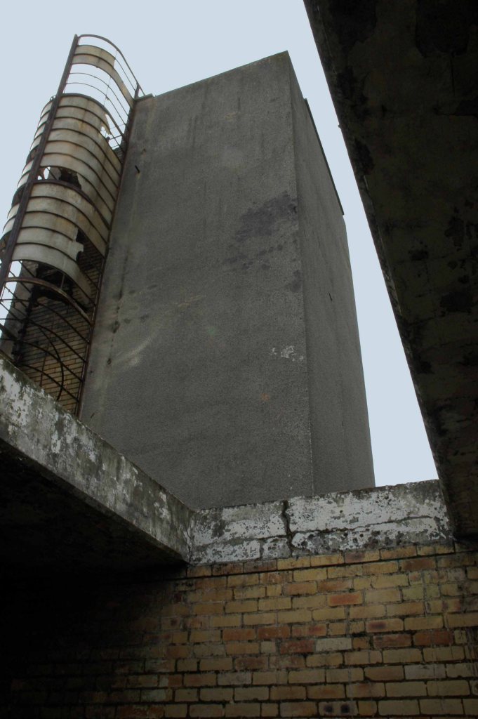
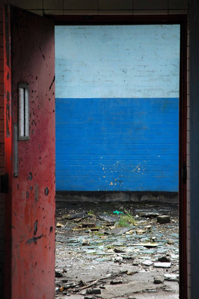
Now it sits abandoned and hidden in the woods.
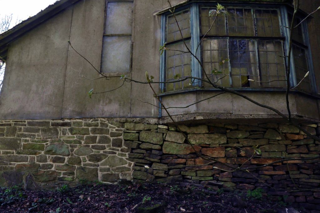
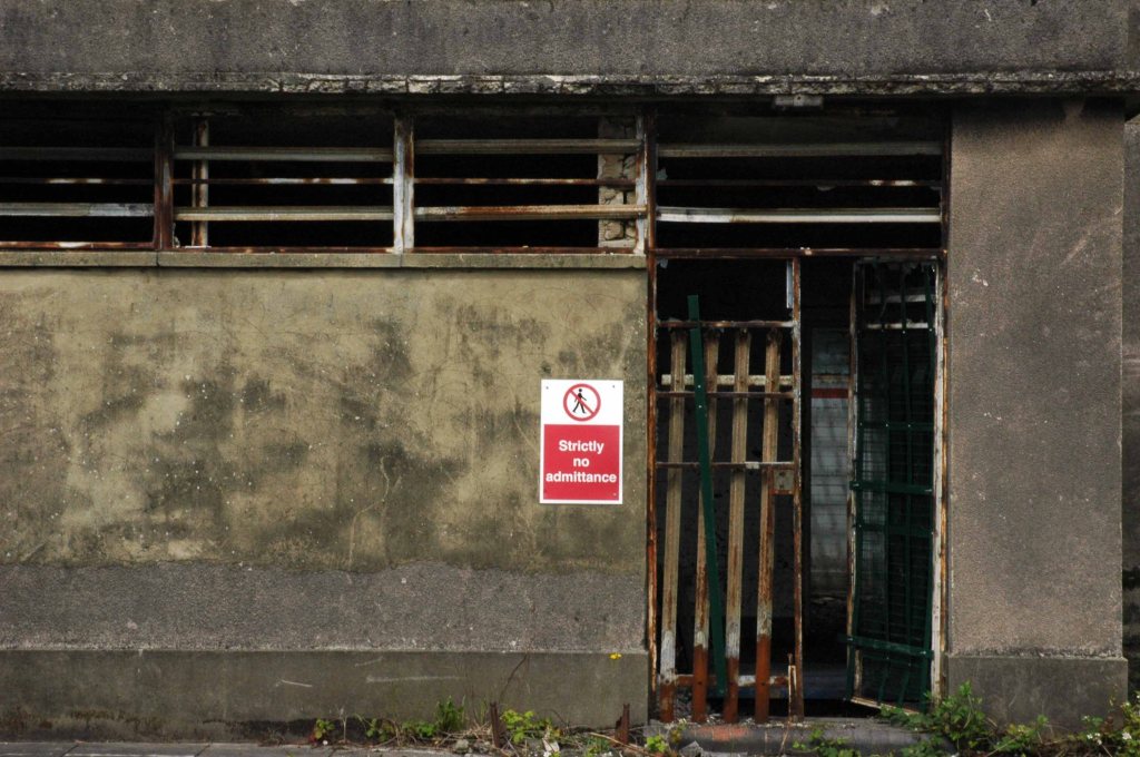
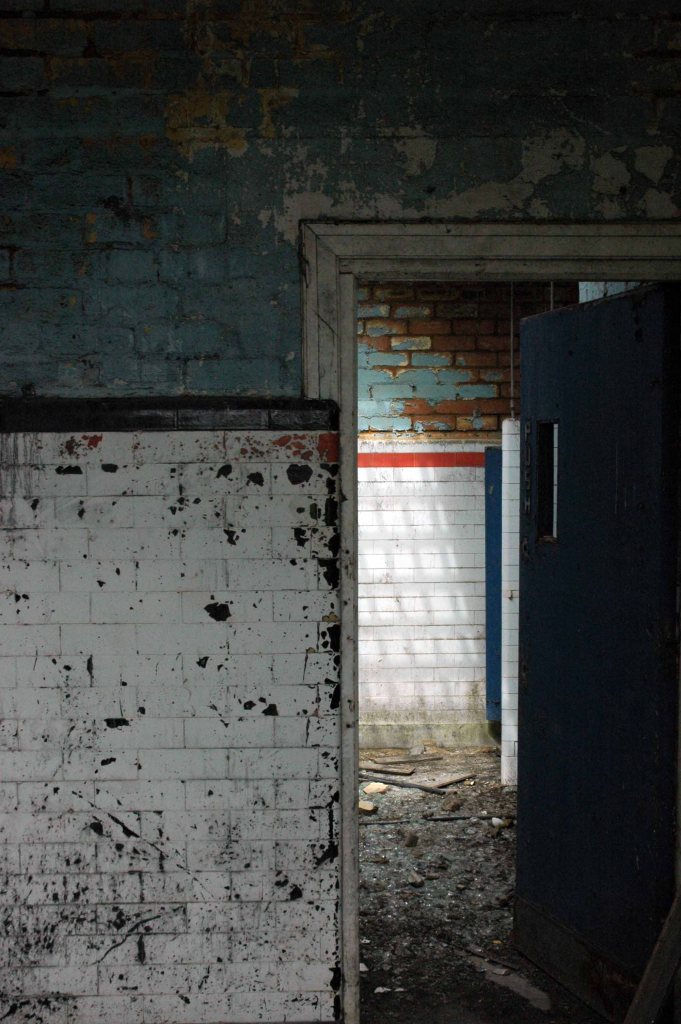
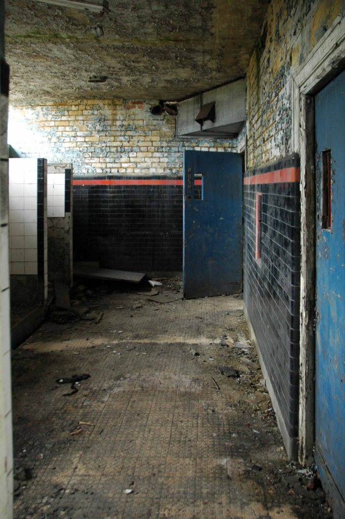
I went there in my early teens late 60’s the pool was still intact, well used and well cold. I remember chilly changing rooms with duckboards on concrete floors, a small café with pop and crisp if you had the pennies.
Most of all the simple joy of emersion in clear moorland water, on long hot summer days long gone.
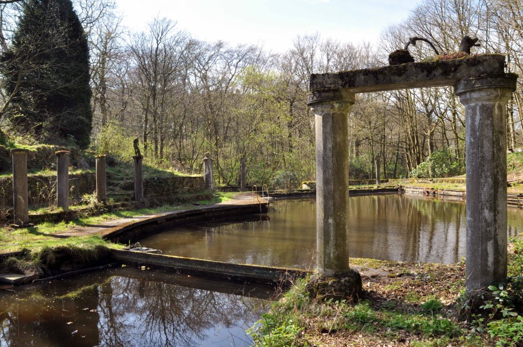
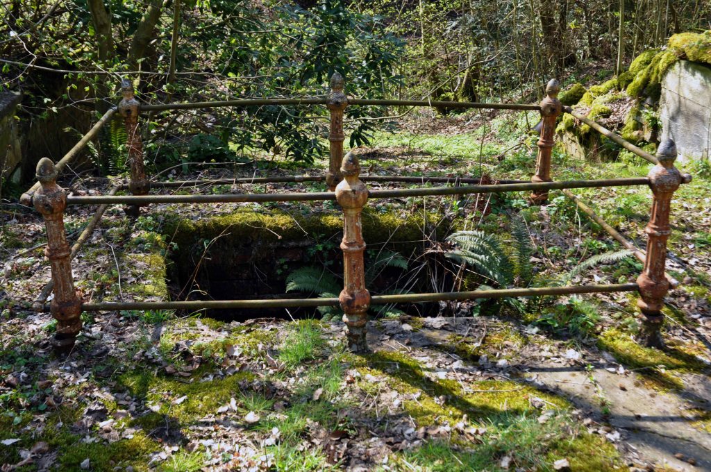
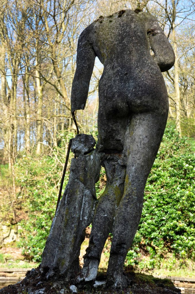
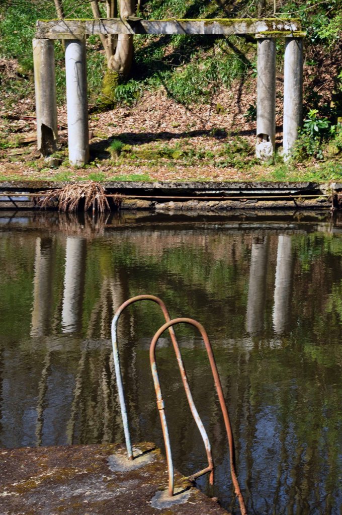
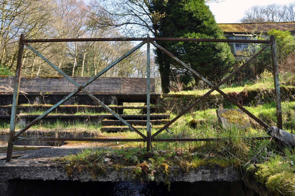
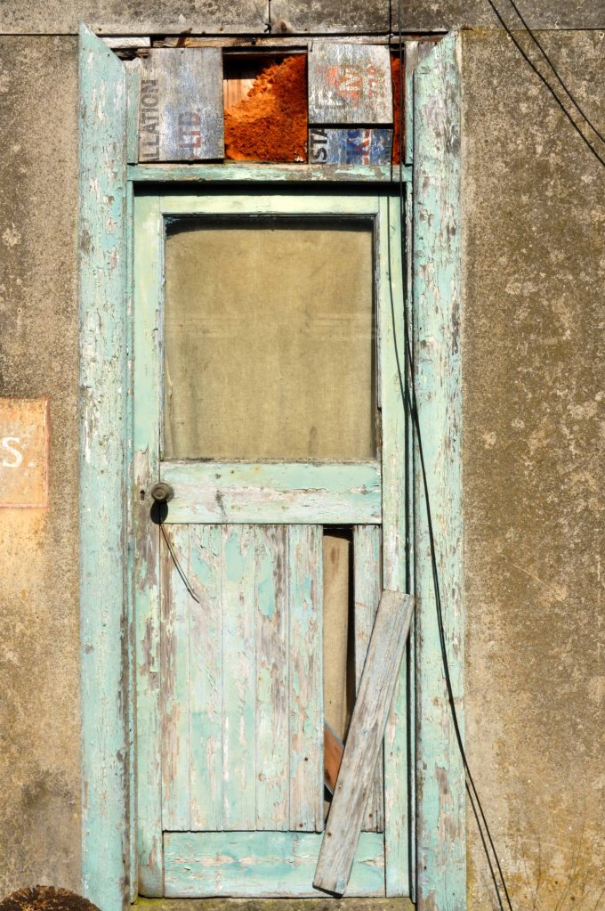
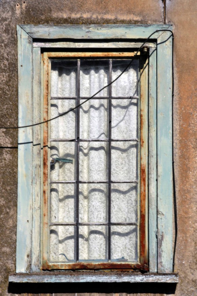
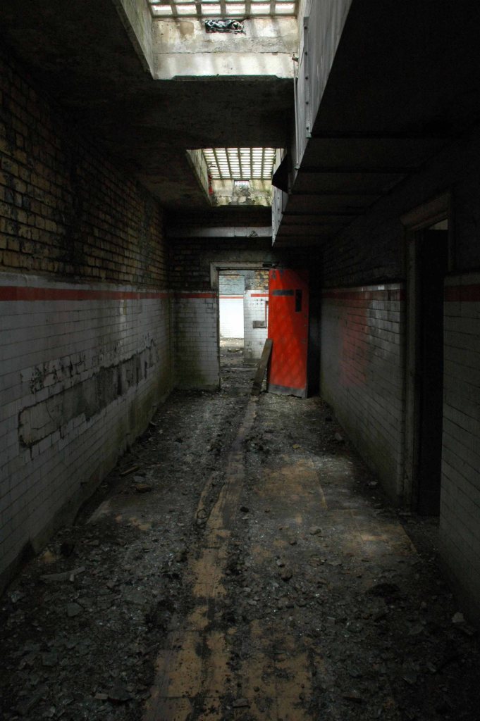
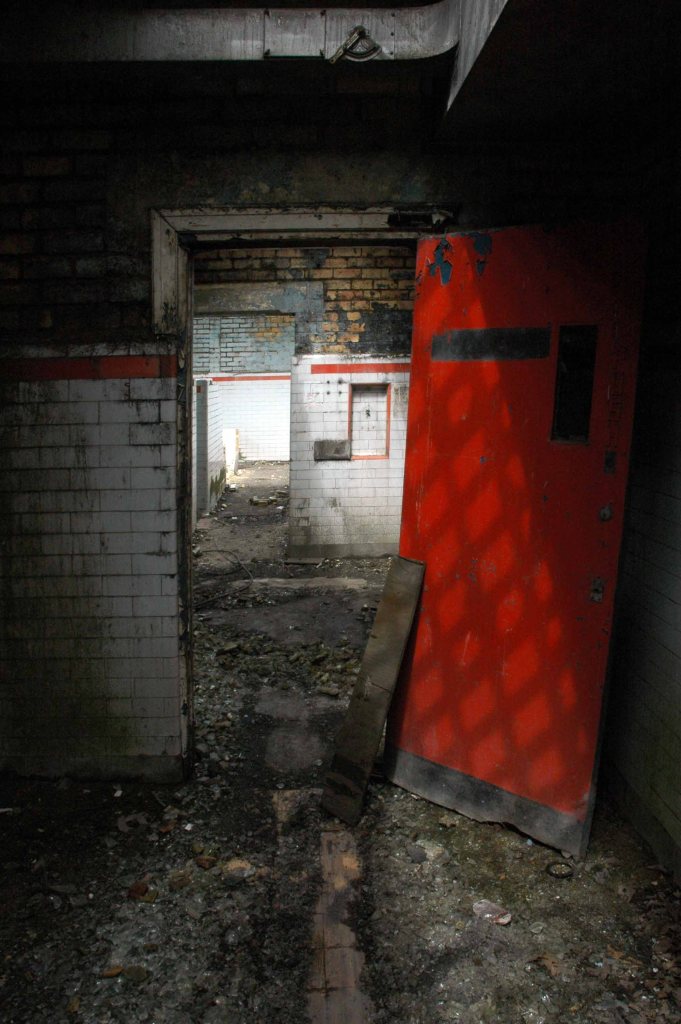
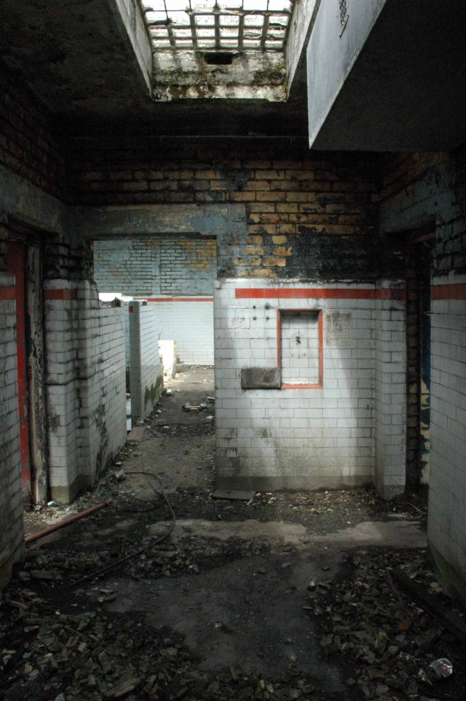
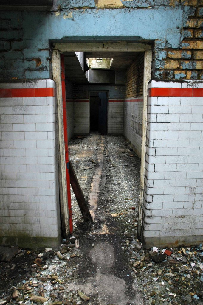
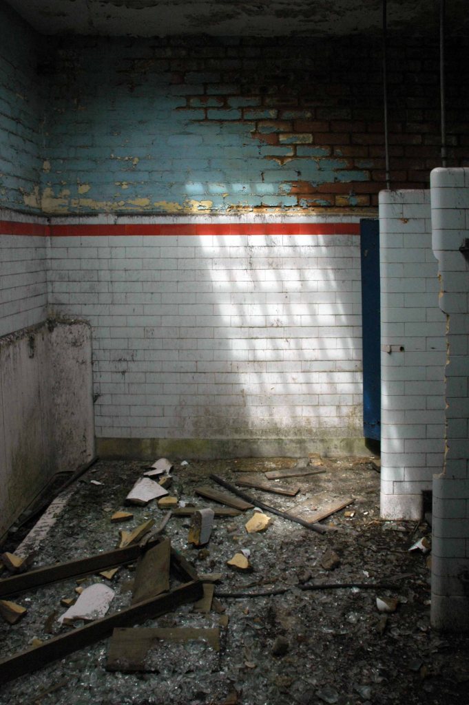
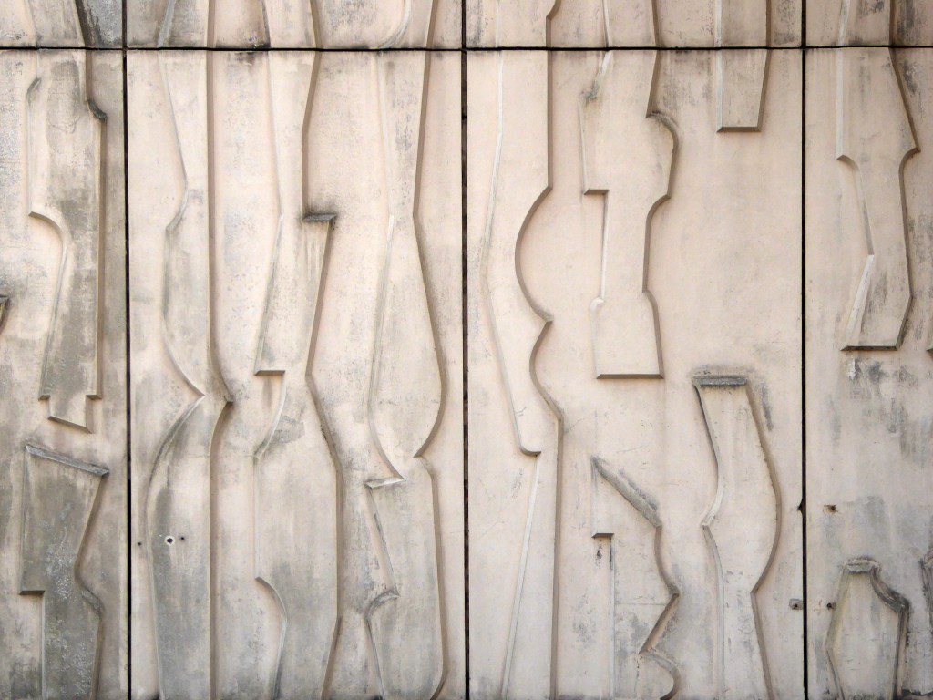
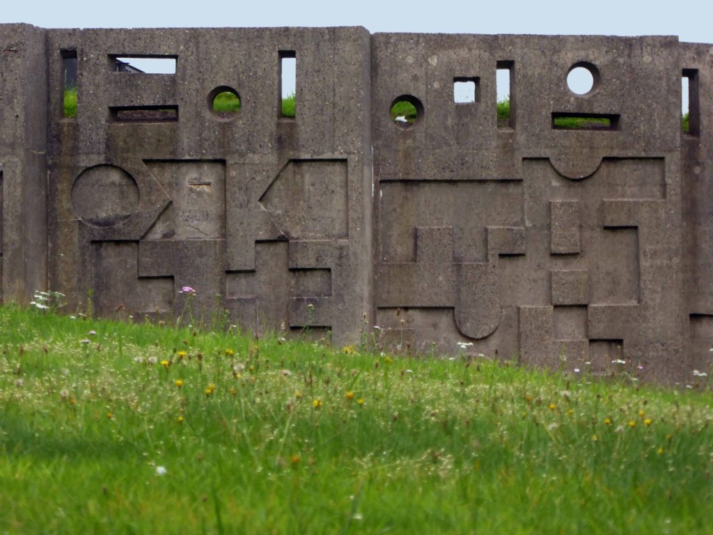
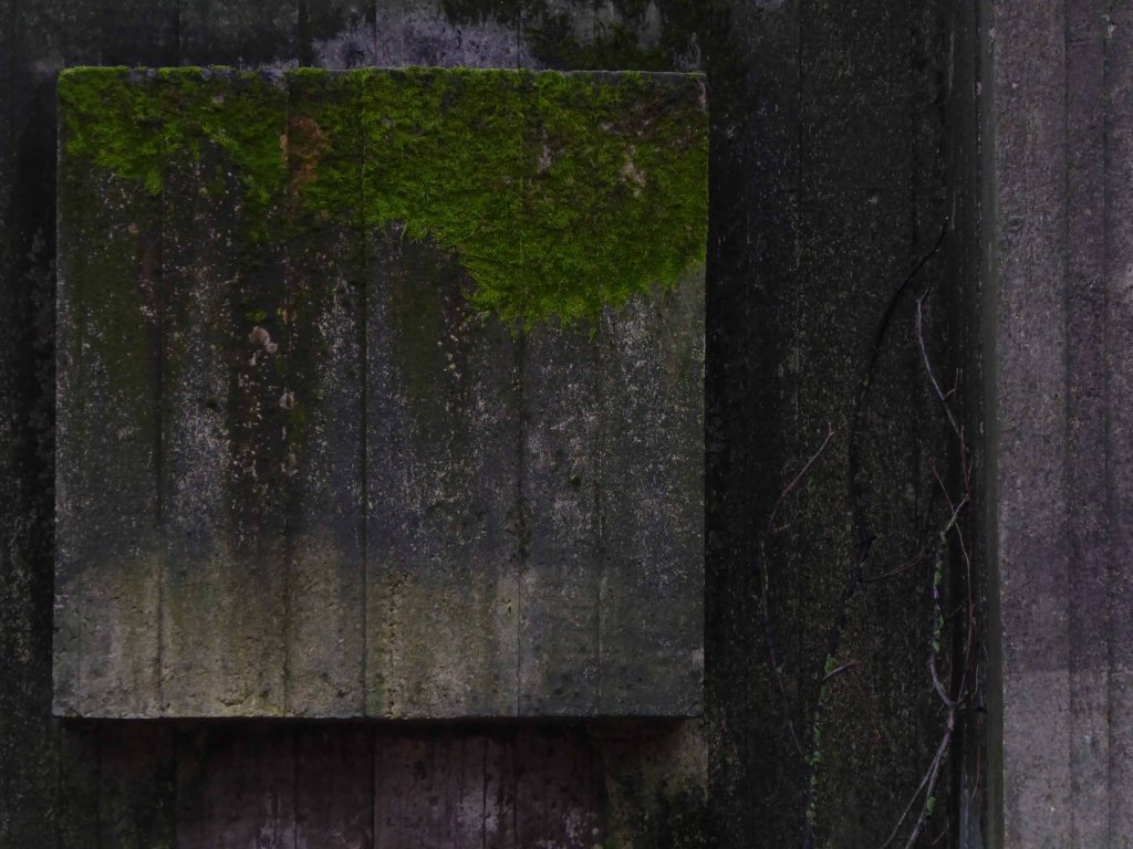
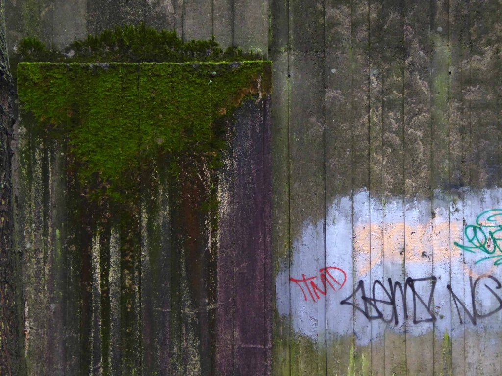
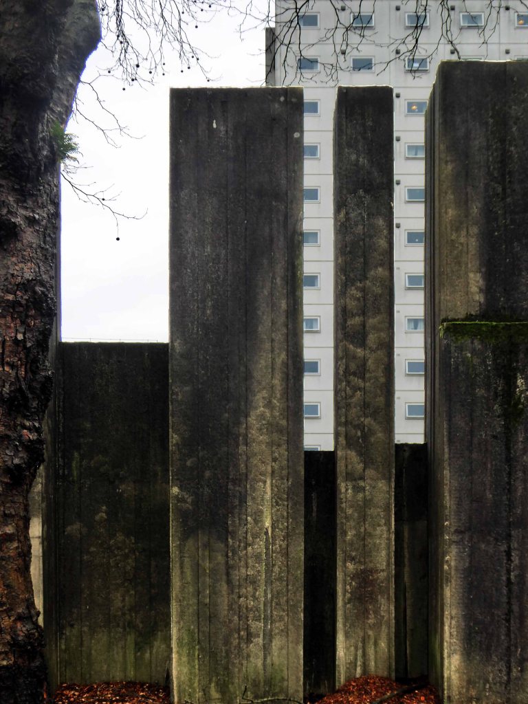
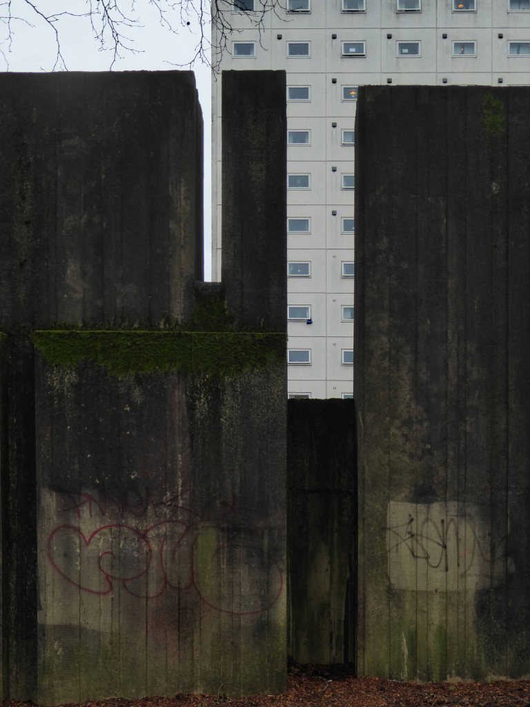
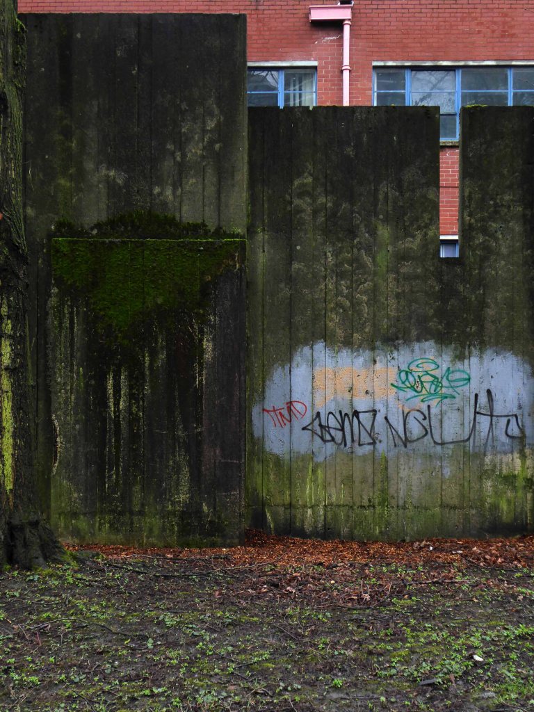
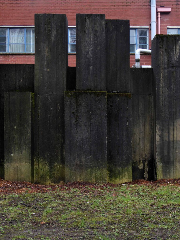
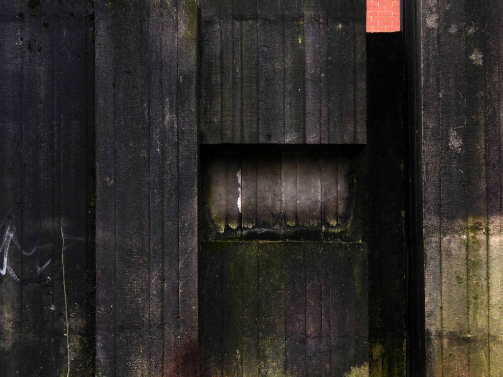
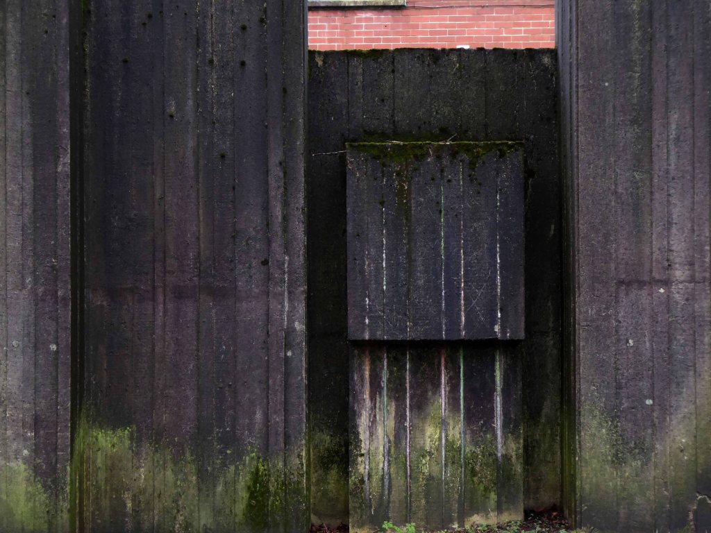
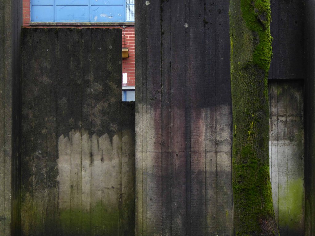
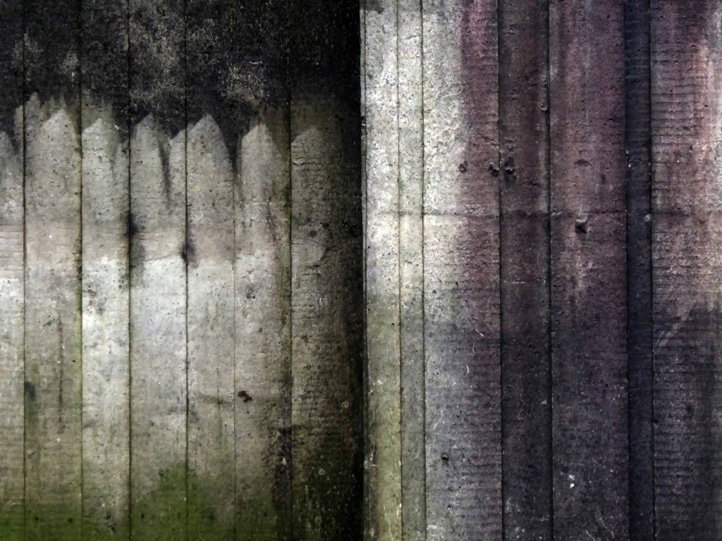
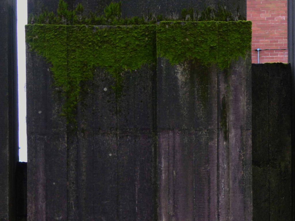
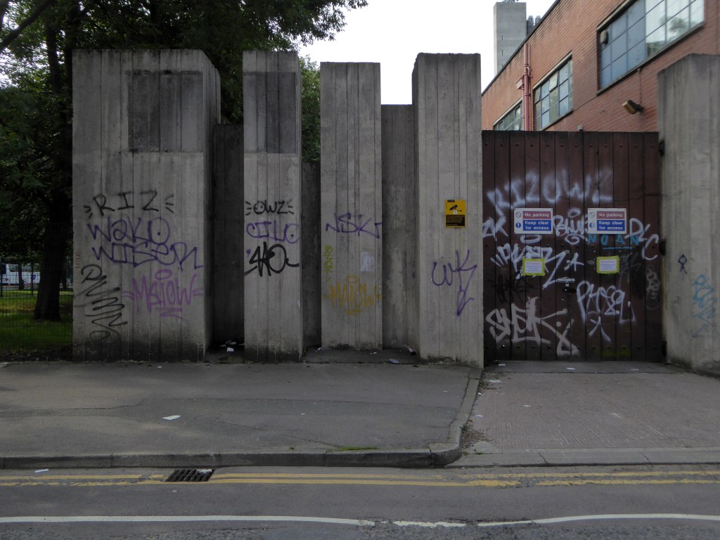
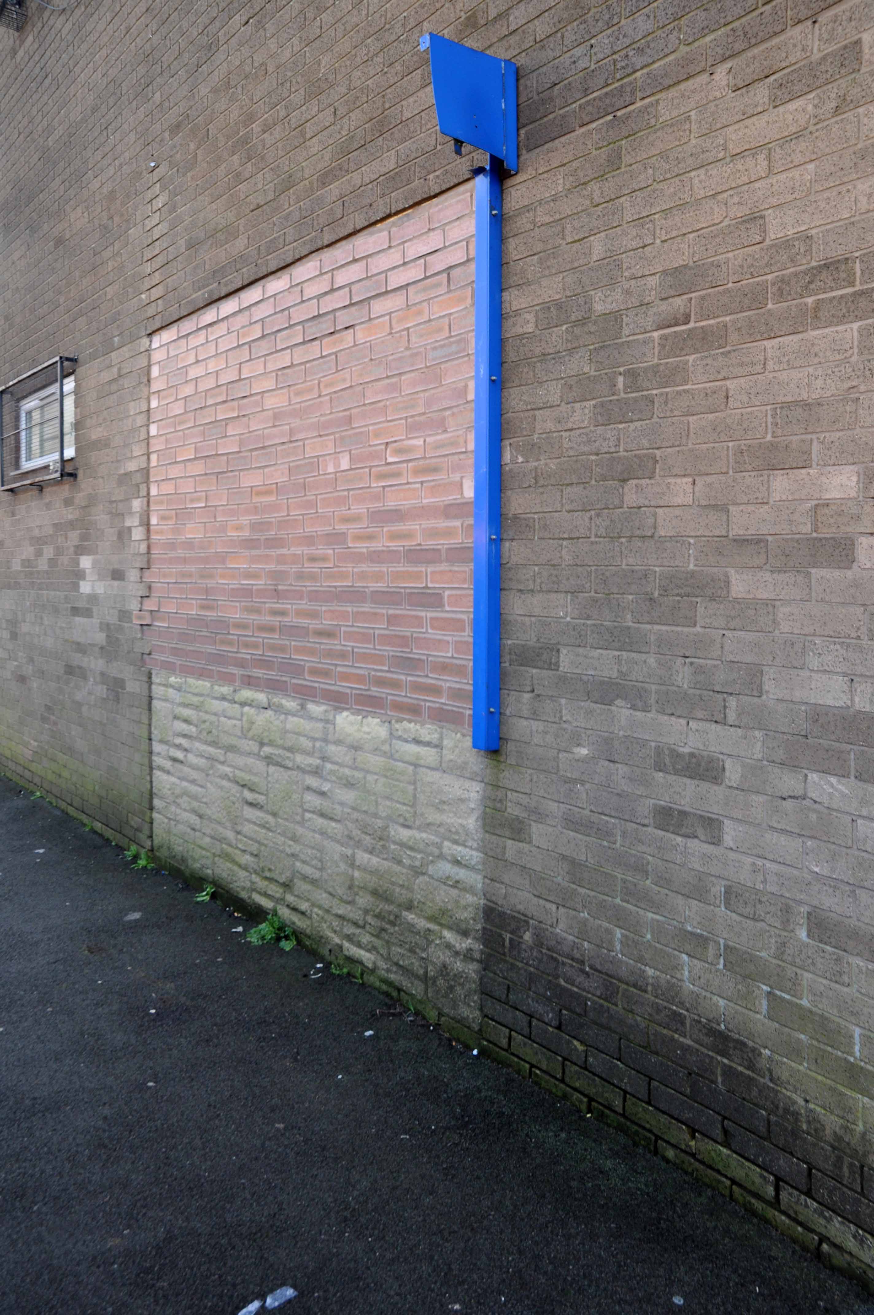
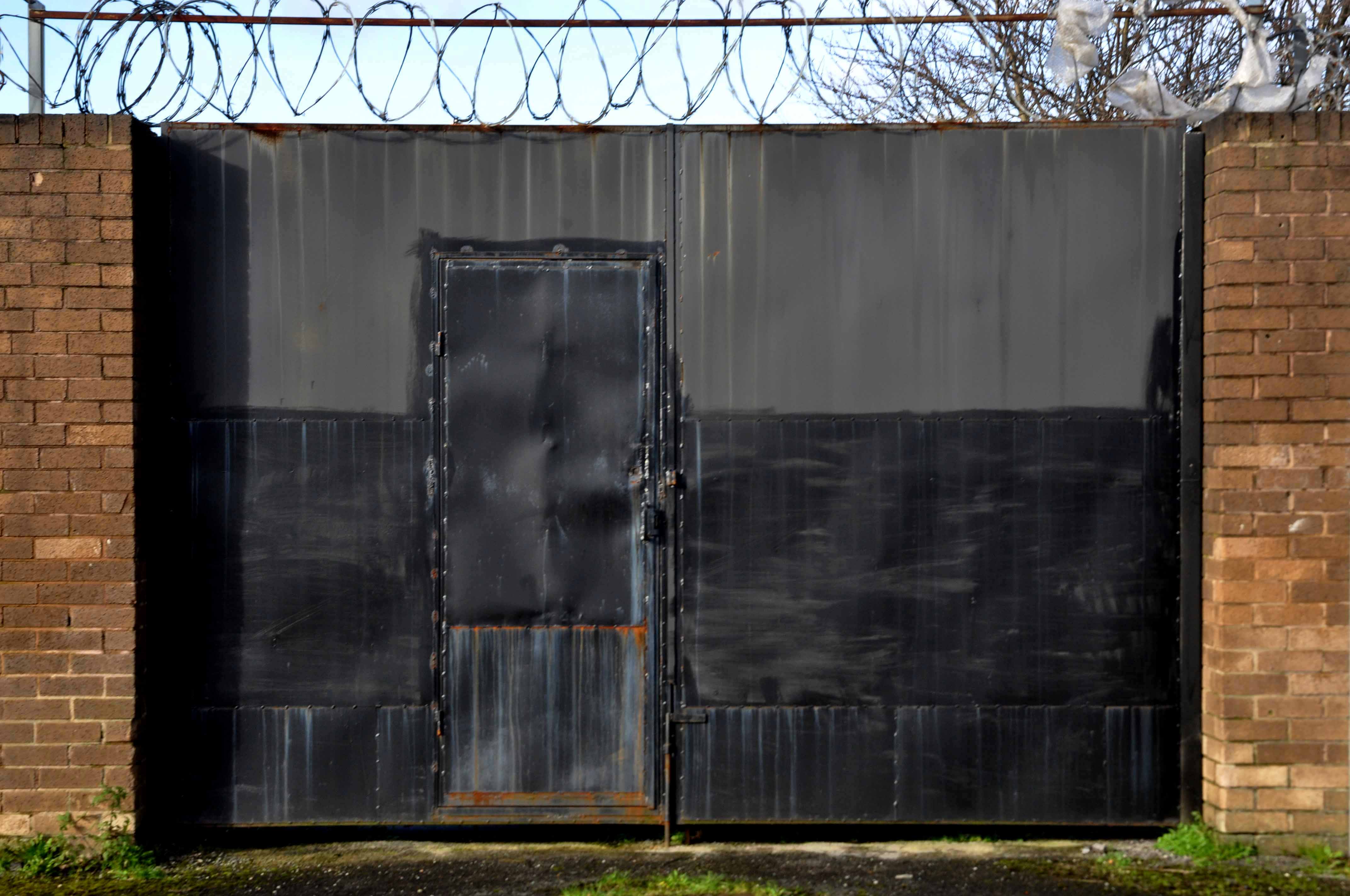
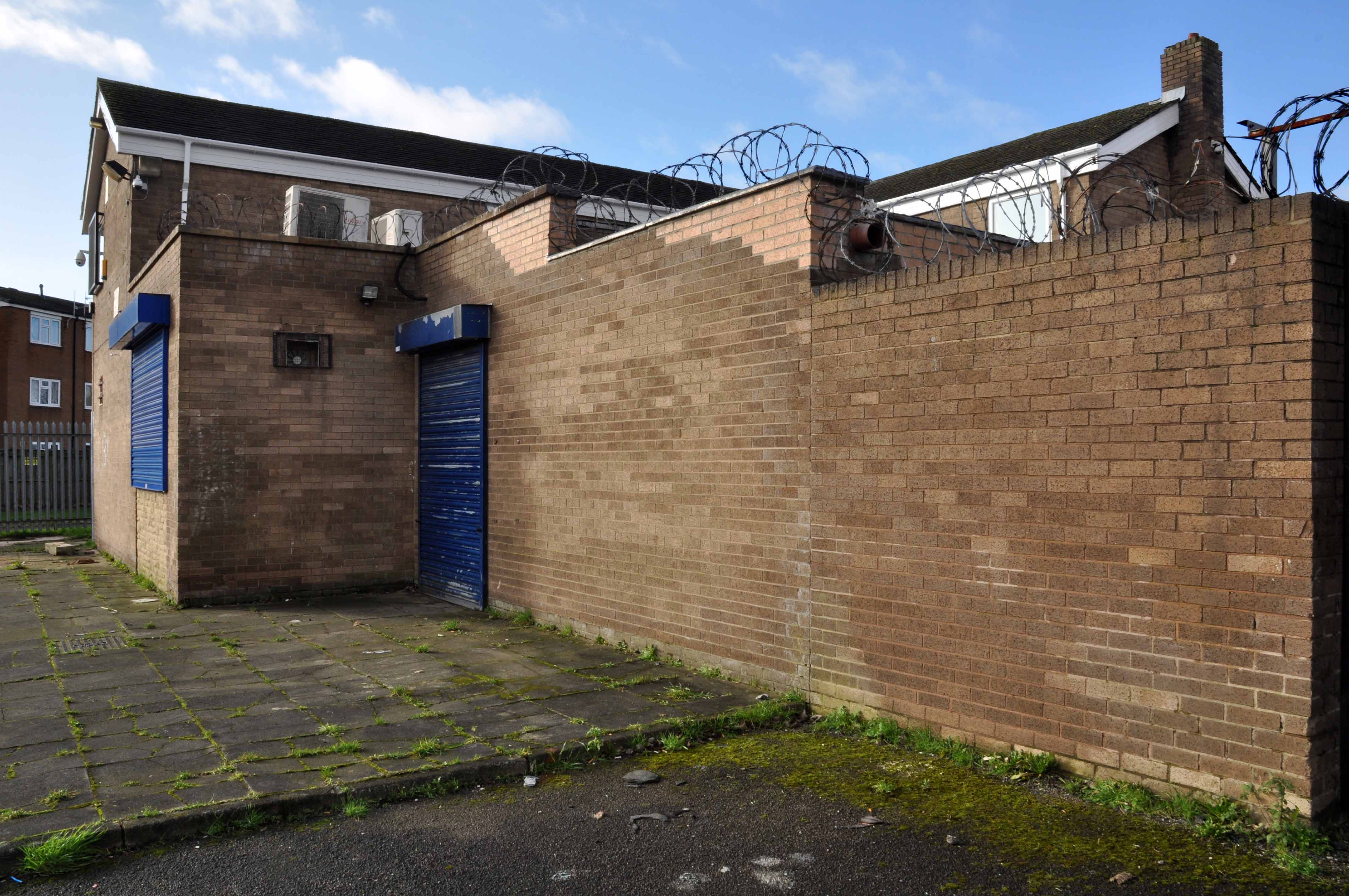
Revisiting in April 2014, following a misguided scramble through brambles, it was a poignant reunion. The concrete shells of the pillars and statuary crumbling and moss covered, the waters still and occluded.
It sure it has subsequently been the scene of impromptu fashion shoots and pop promo videos, possibly a little guerrilla swimming. Though sadly it largely sits unused and unloved – let’s take a look around:
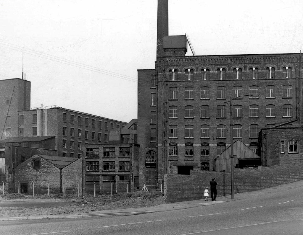
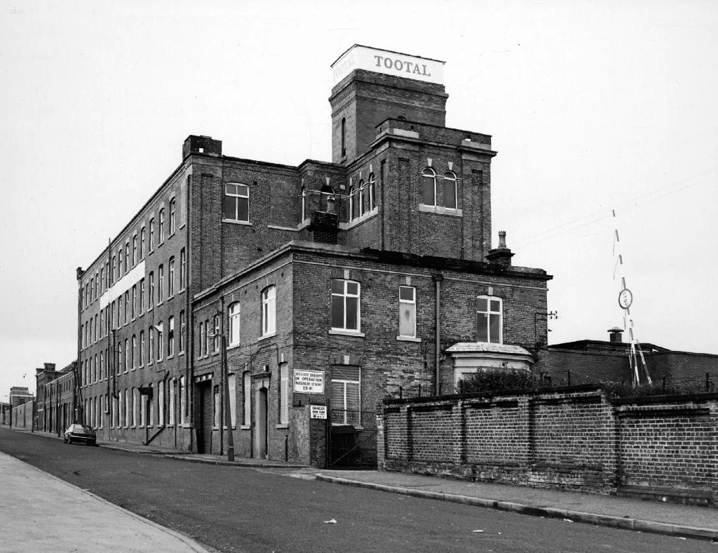
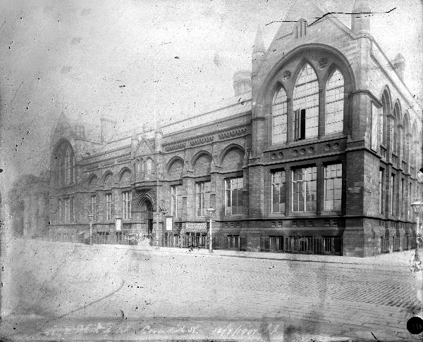
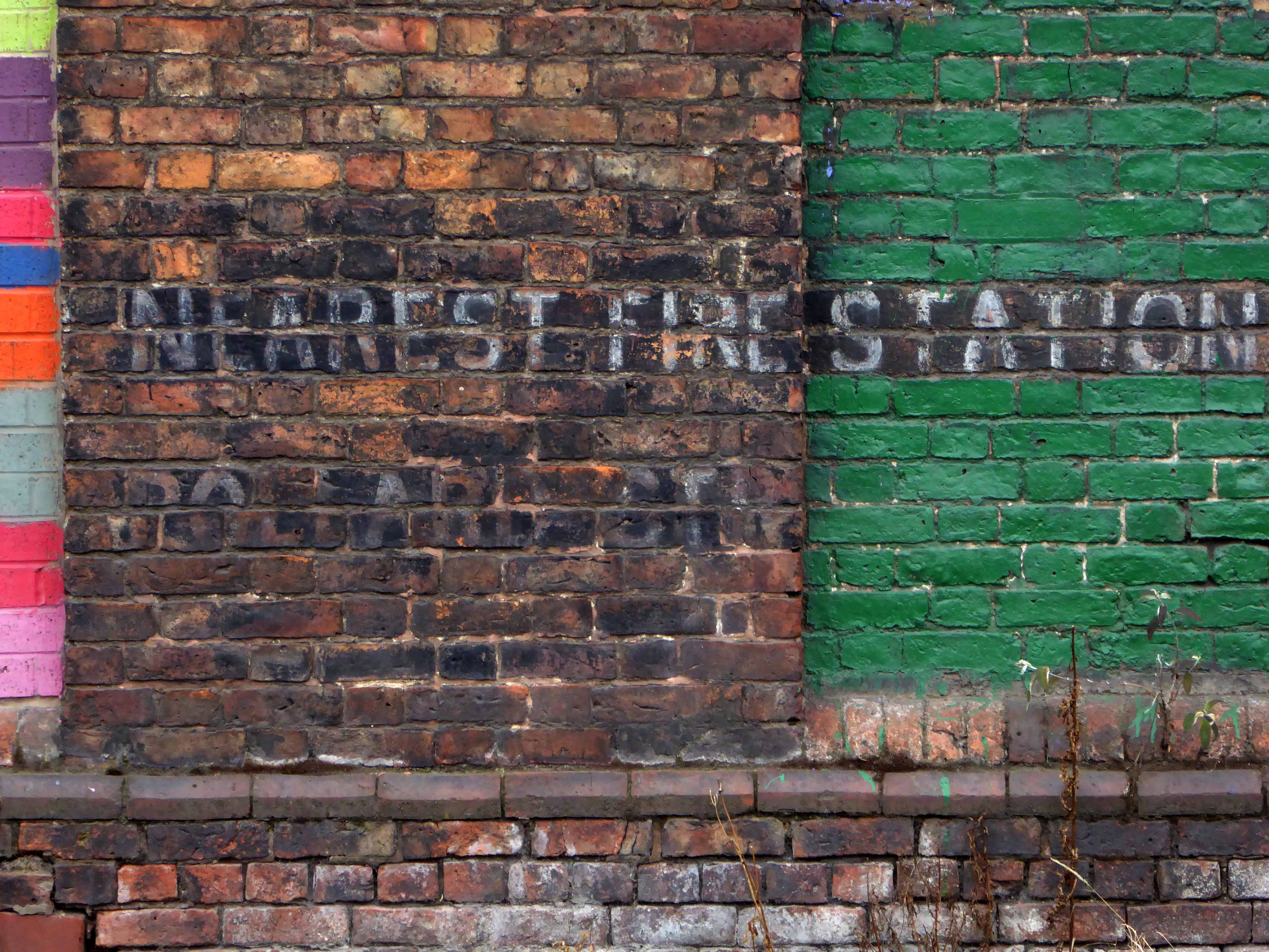
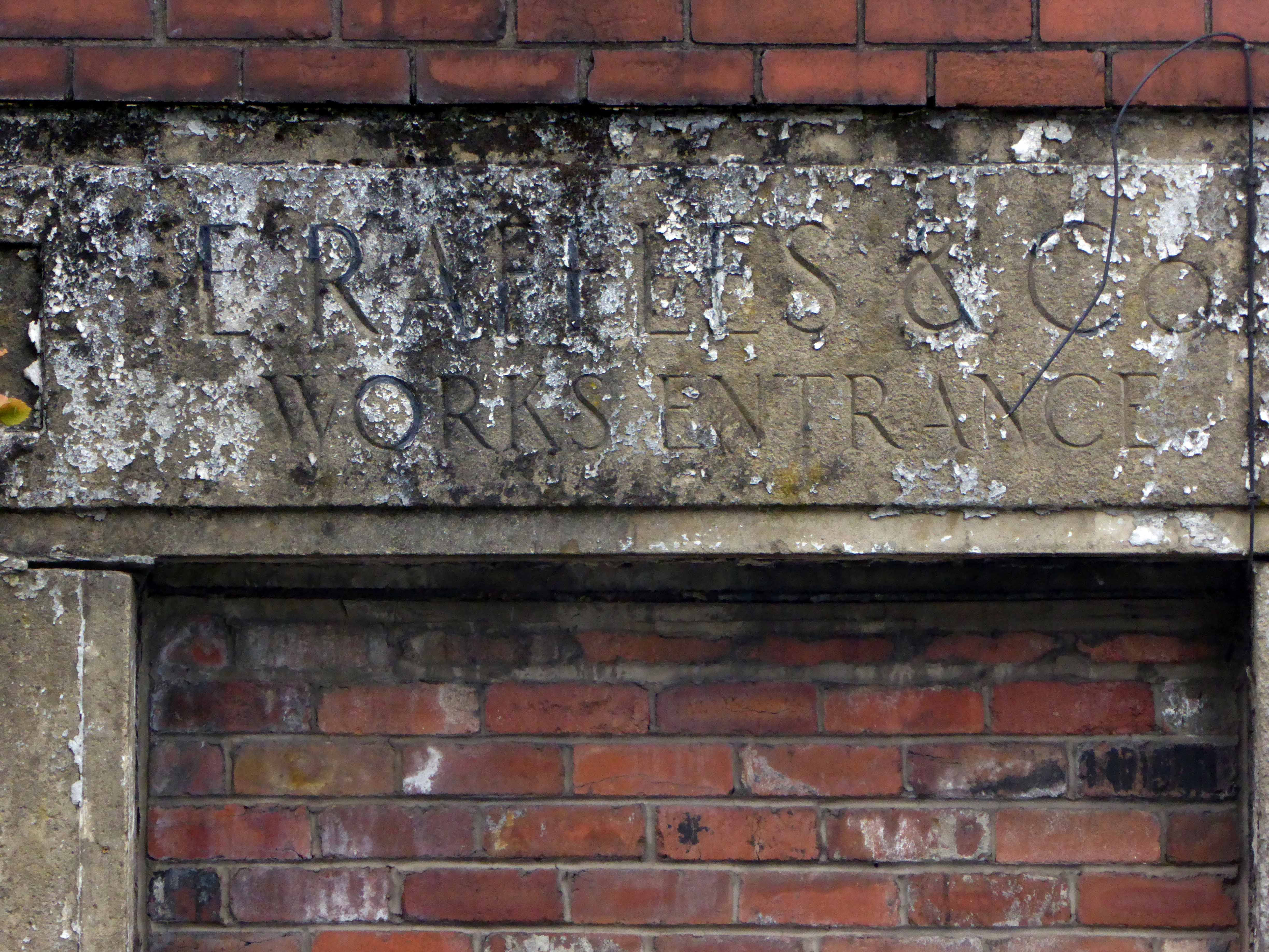
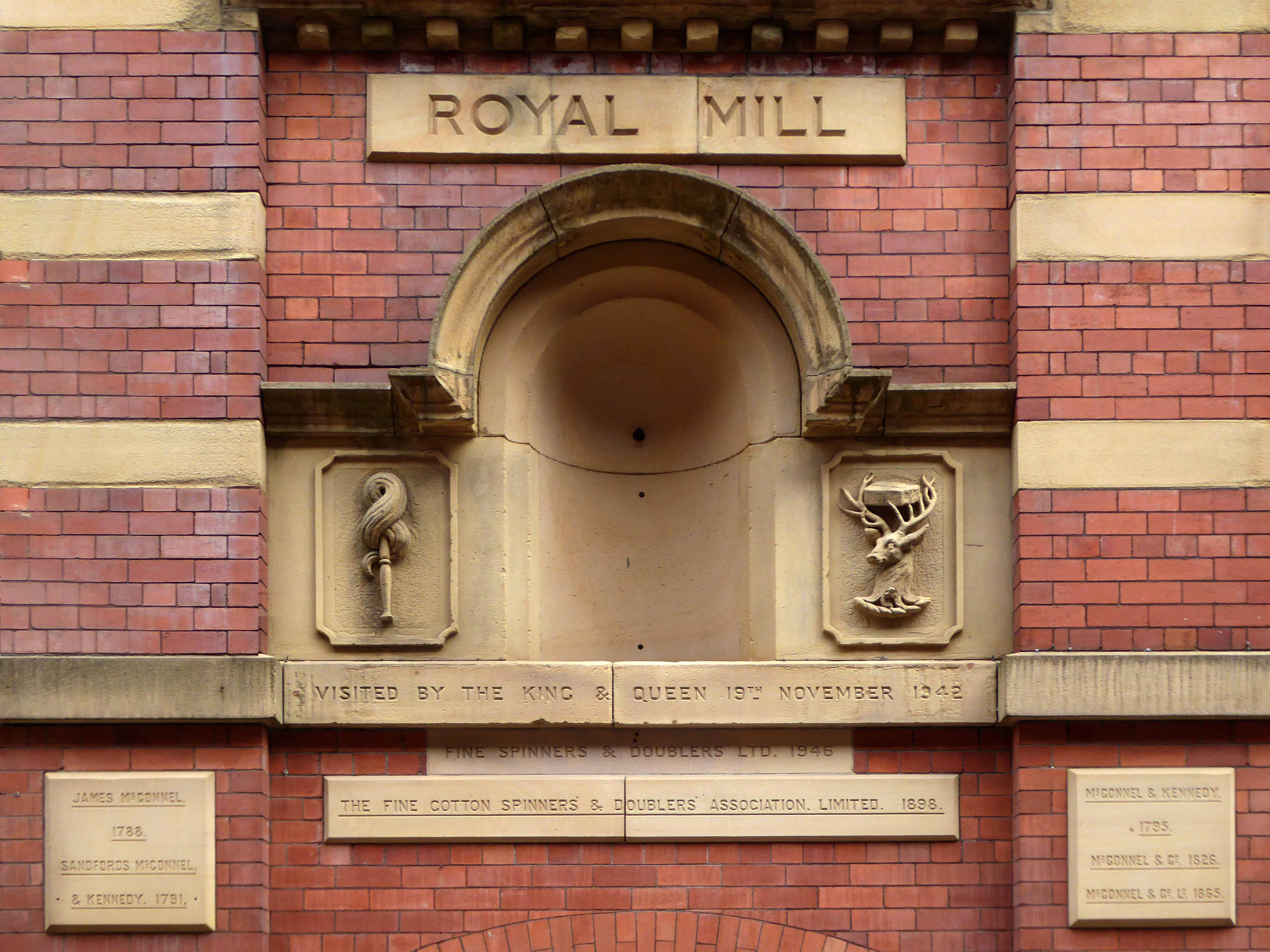
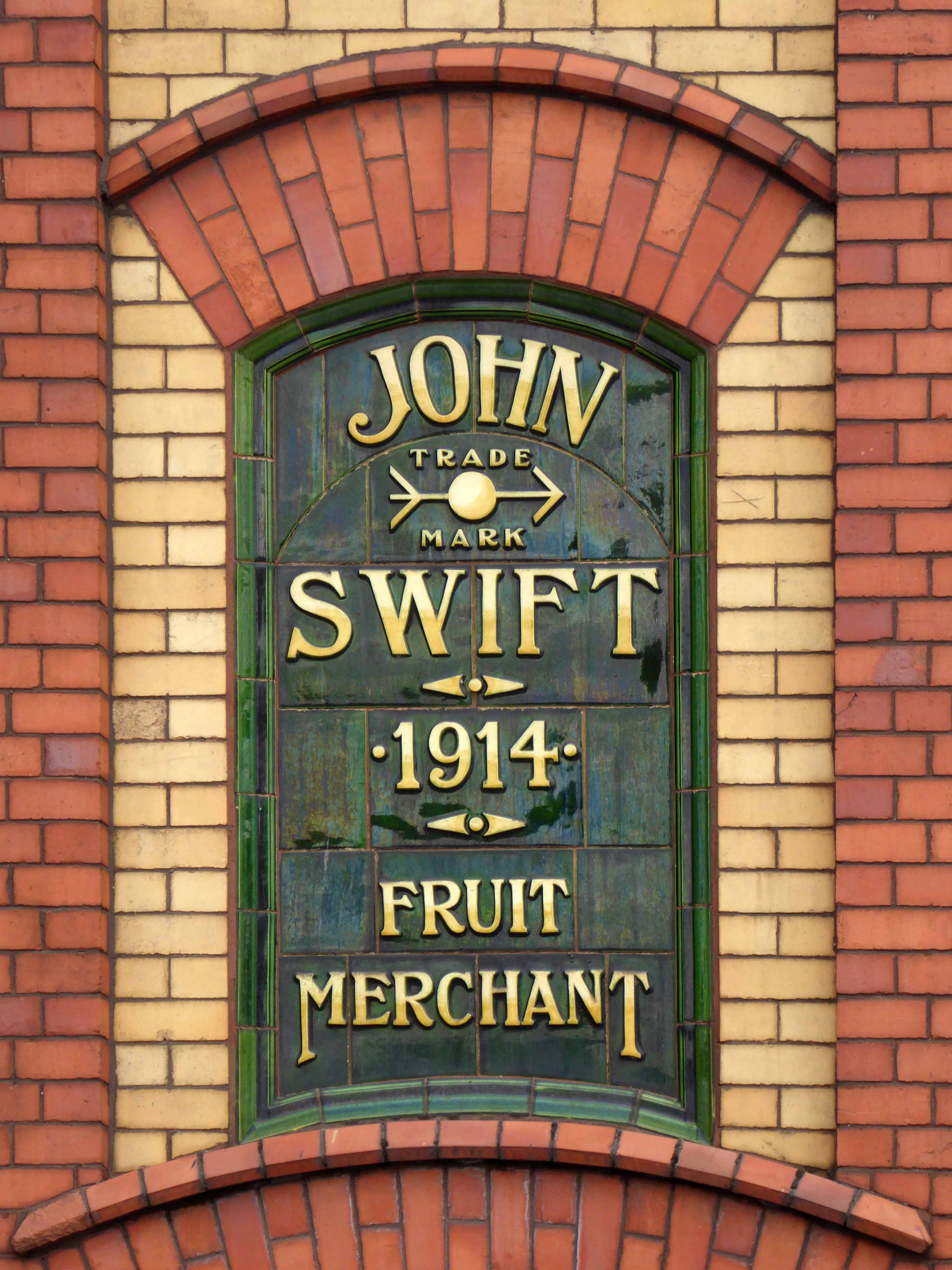
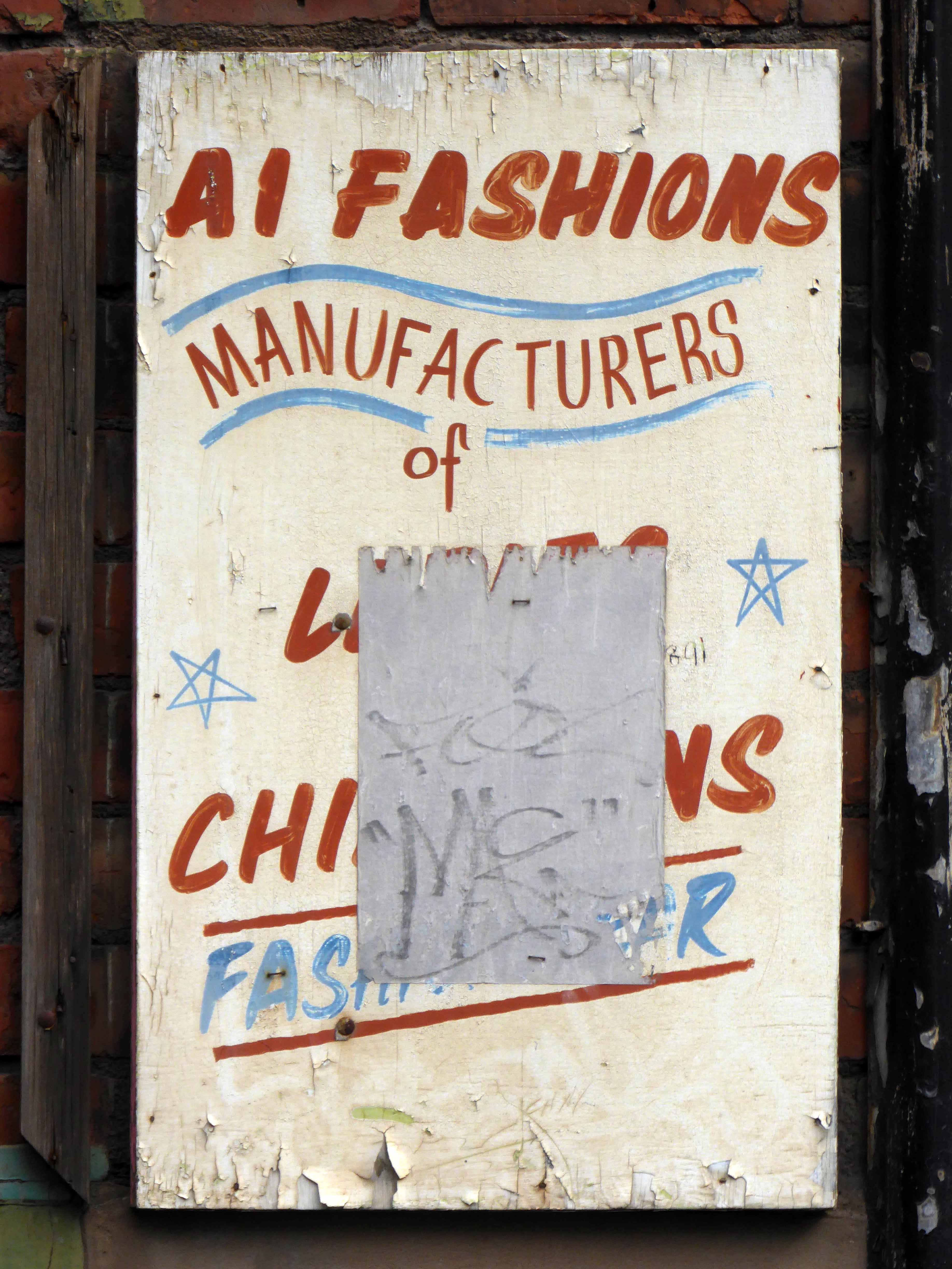
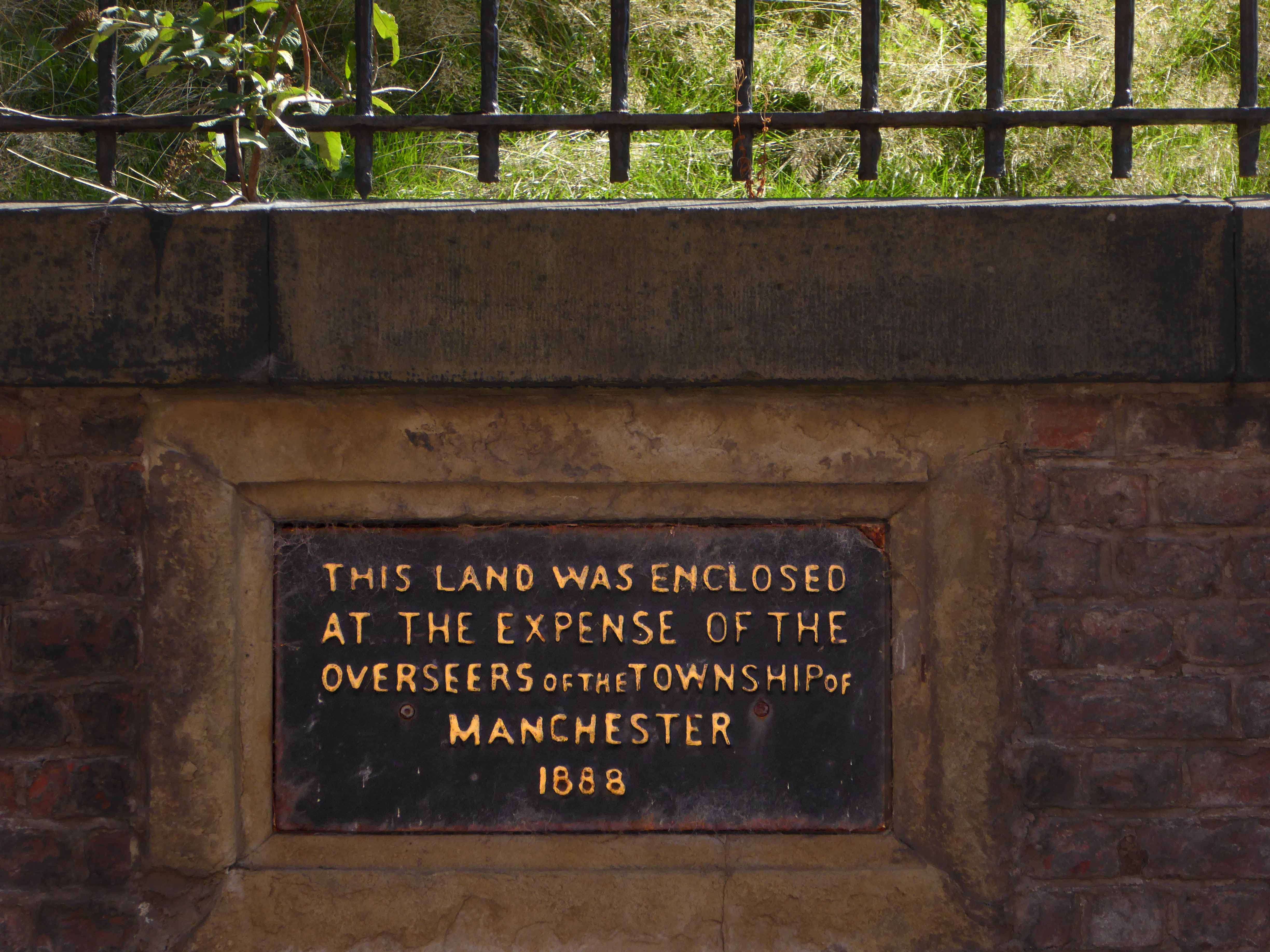
Charles Dreyfus was a French emigrant chemist and entrepreneur, who founded the Clayton Aniline Company on 29 May 1876. The company obtained a lease on a parcel of land in Clayton, Manchester, sandwiched between the Manchester and Ashton Canal and Chatham Street – later known as Clipstone Street.
1904
At its peak in the 1970s, the site occupied over 57 acres and employed over 2,000 people. However, due to the gradual demise of the British textile industry, most textile production shifted to countries such as China and India with the textile dye industry following.
1960
In 2002, the company made 70 members of staff redundant and in 2004 the announcement was made that the site would be closing with the loss of over 300 jobs. A small number of staff were retained to assist in the decommissioning of the plant. The last workers left the site in 2007 and the remainder of the buildings were demolished shortly afterwards.
Like much of the industry of east Manchester its tenure was relatively short – money was made and the owners departed, without wiping their dirty feet.
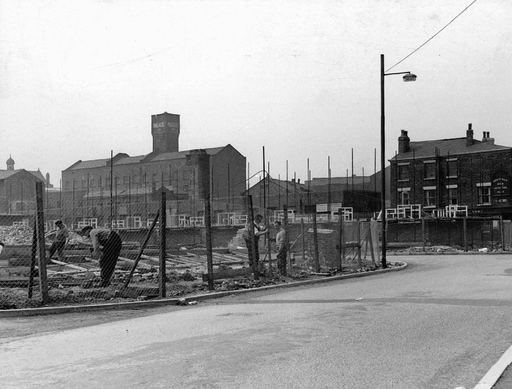
The site remained derelict until demolition, followed by extensive site cleansing – to remove the dangerous detritus of 200 years of hazardous chemical production.
Vincent Kompany had just completed his £6million move from Hamburg when he realised that Mark Hughes’ sales pitch about the direction the club was going was not entirely accurate.
They took me for a look around the training ground at Carrington – it wasn’t fit for purpose, it was a dump.
I remember there was a punch bag in the gym – and only one boxing glove. And even that had a big split in it!
Then in 2008 the corrupt boss Thai PM Thaksin Shinawatra is bought out by Sheik Mansour – the rest is history/mystery.
Mr Peter Swales makes no comment.
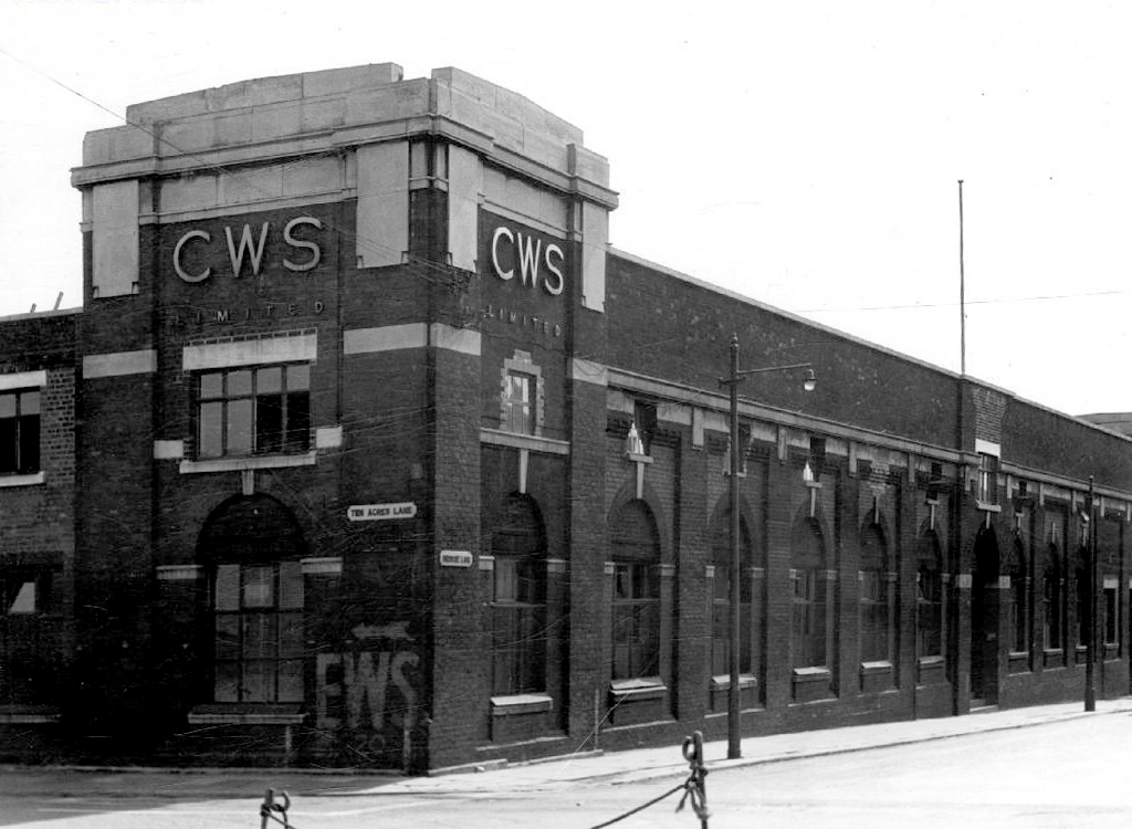
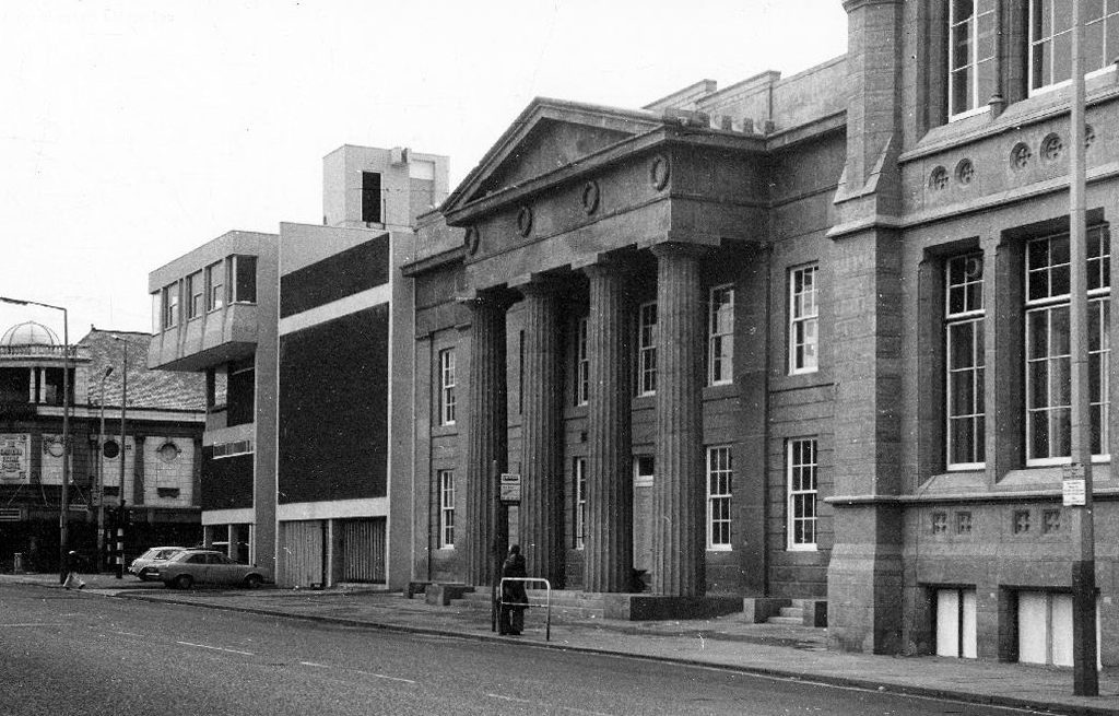
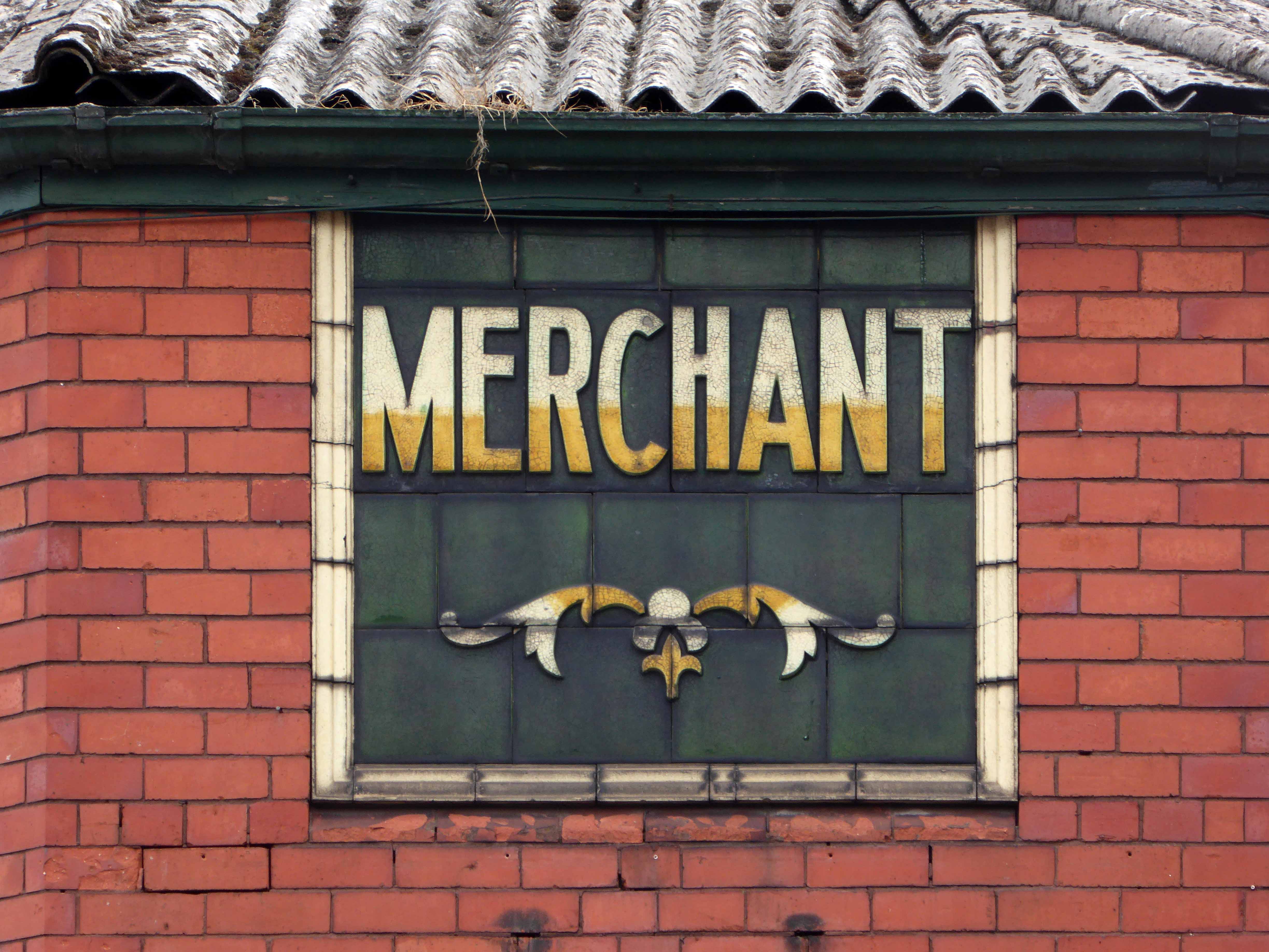
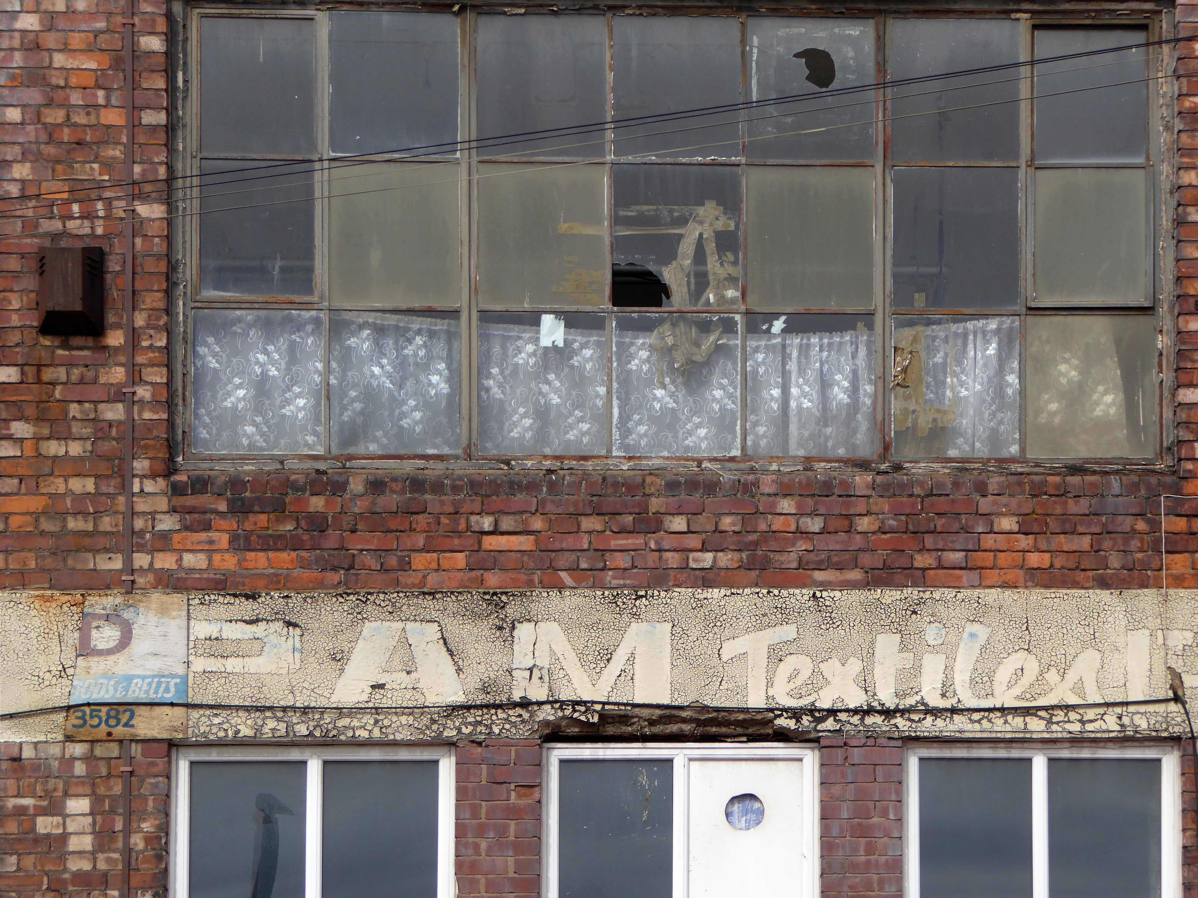
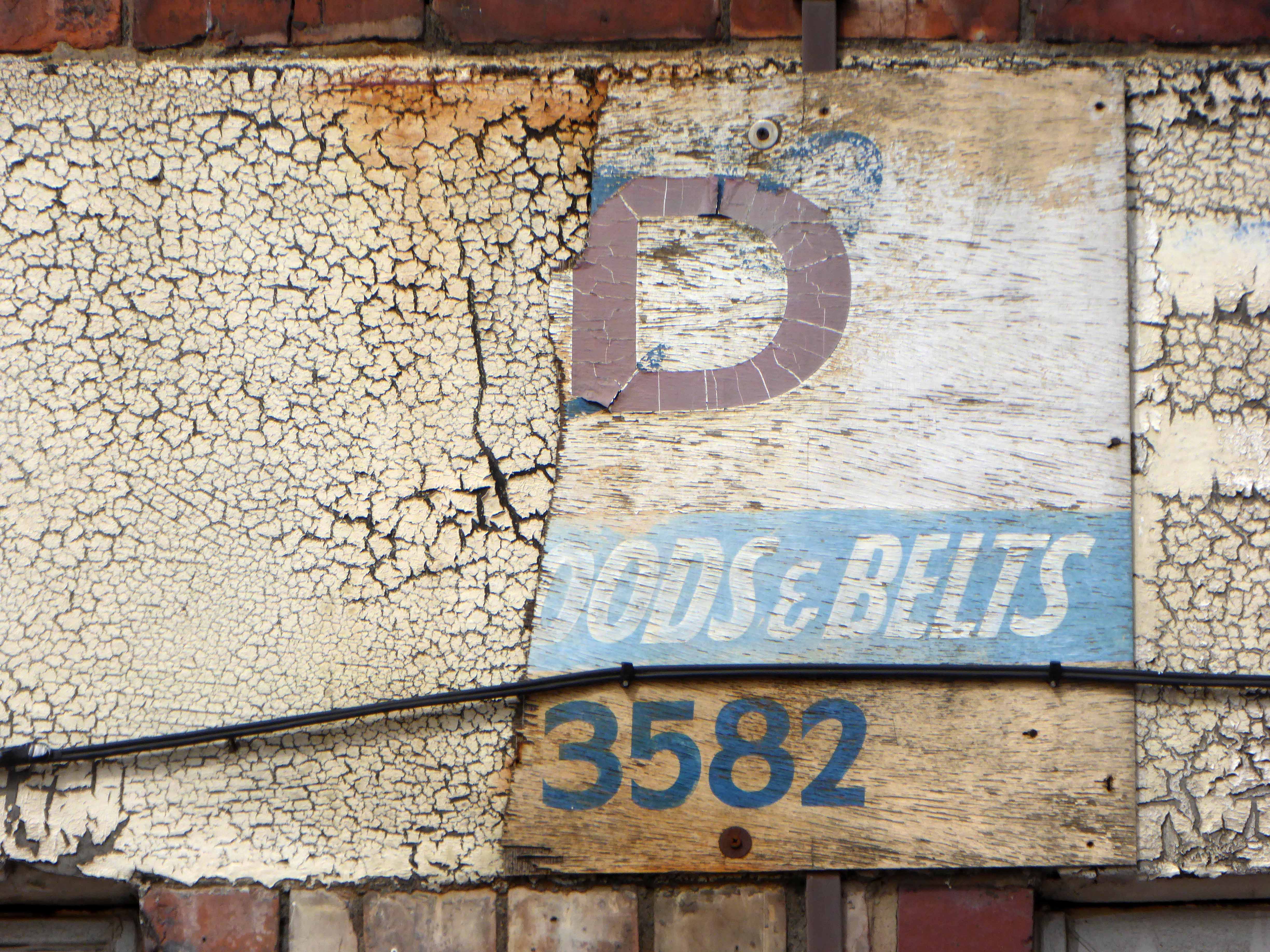
My interest lies in the company’s Ashton New Road offices – seen here in 1960.
Demolished and replaced by a distinctly Modernist block by 1964.
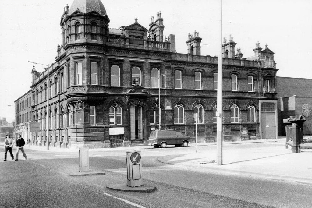
A flank was added on Bank Street along with a bank.
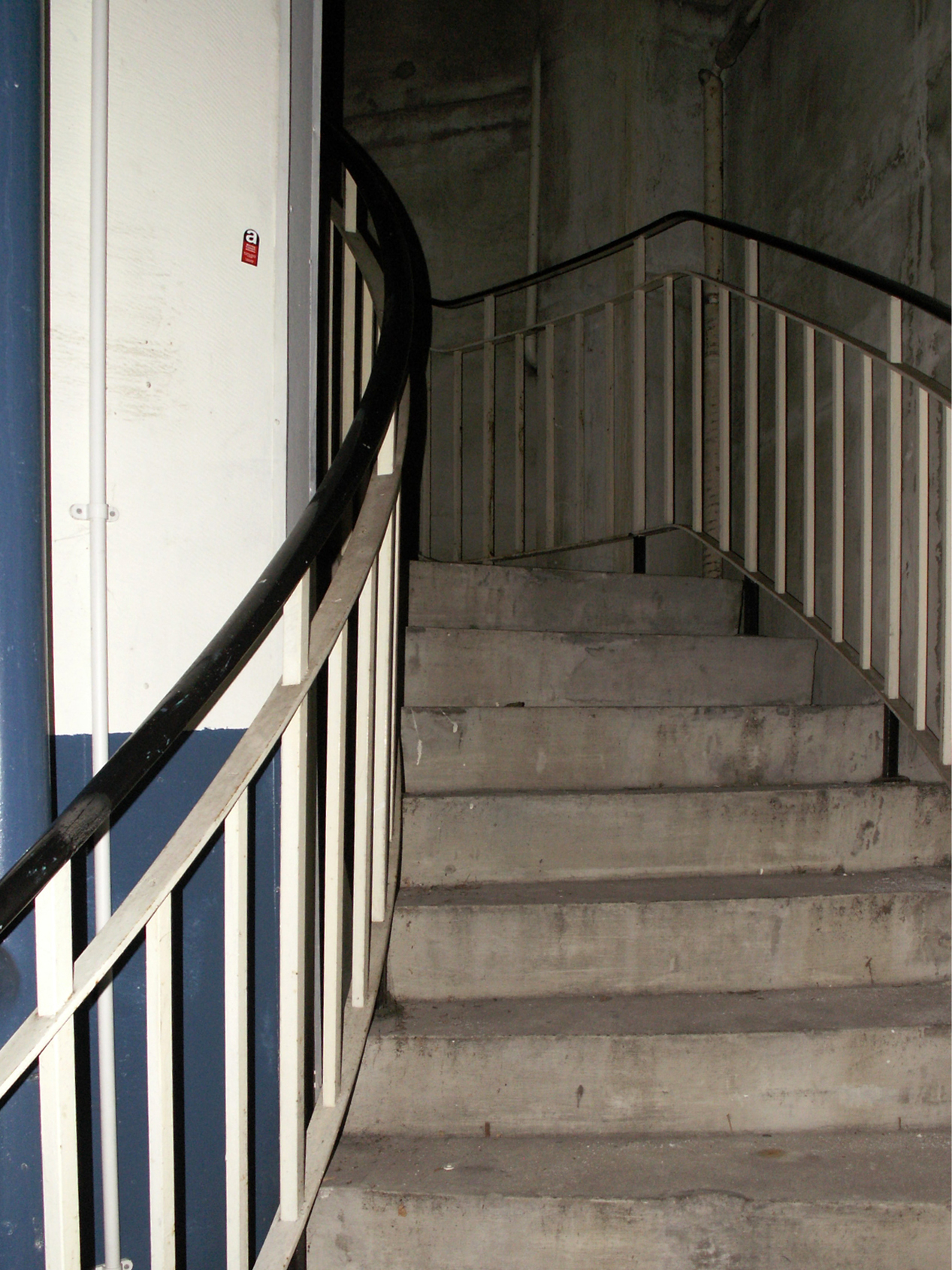
The office complex is still standing, now home to Manchester Police, I risked arrest and incarceration, in order to record the distinctive tile work, rectilinear grid and concrete facades.
Attracting several suspicious stares from the open glazed stairwells.
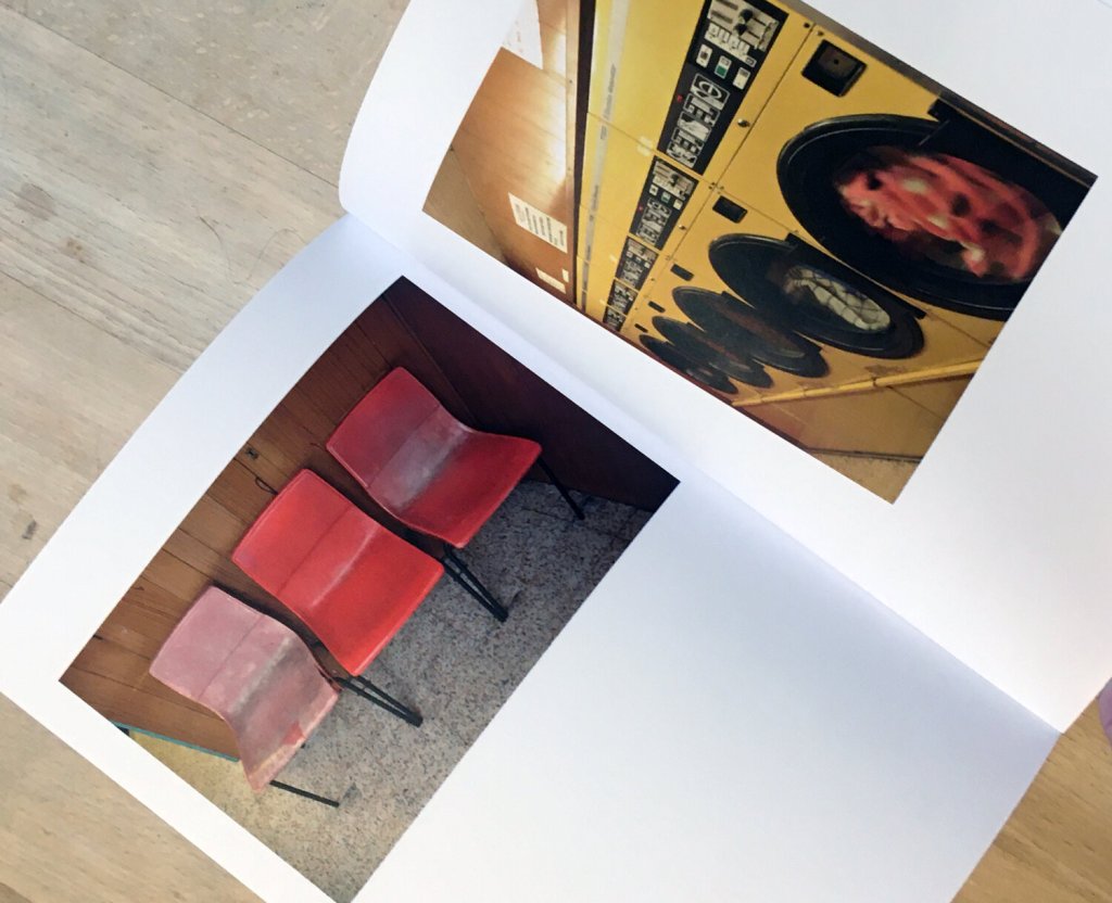
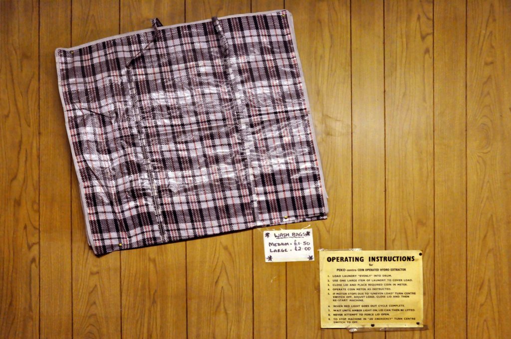
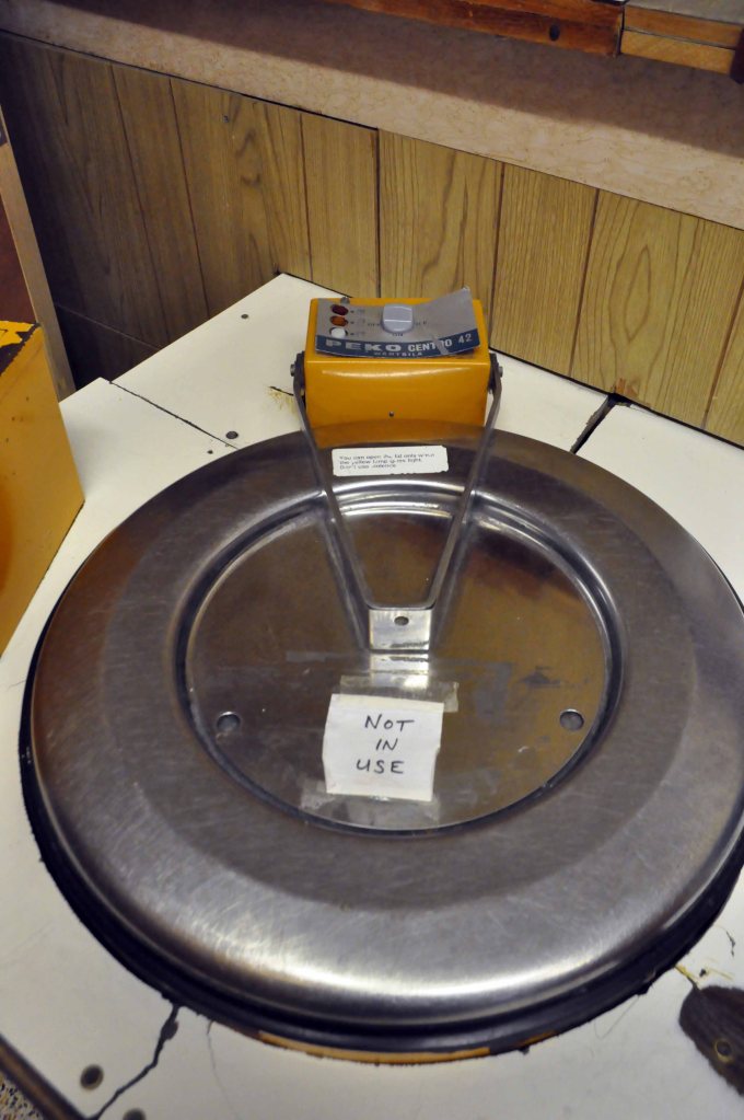
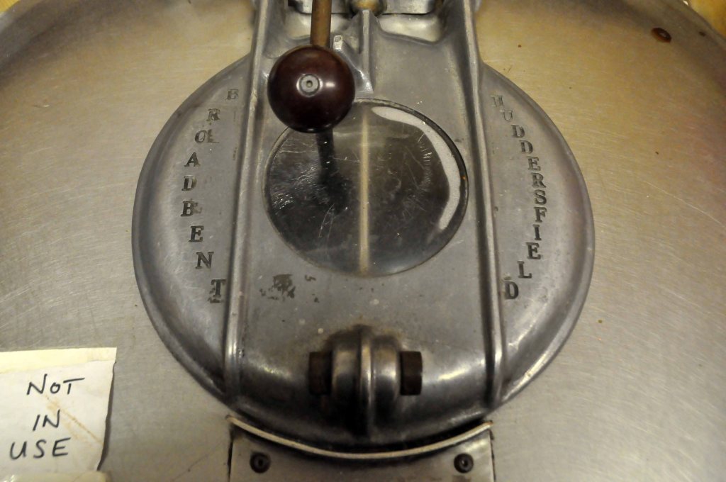
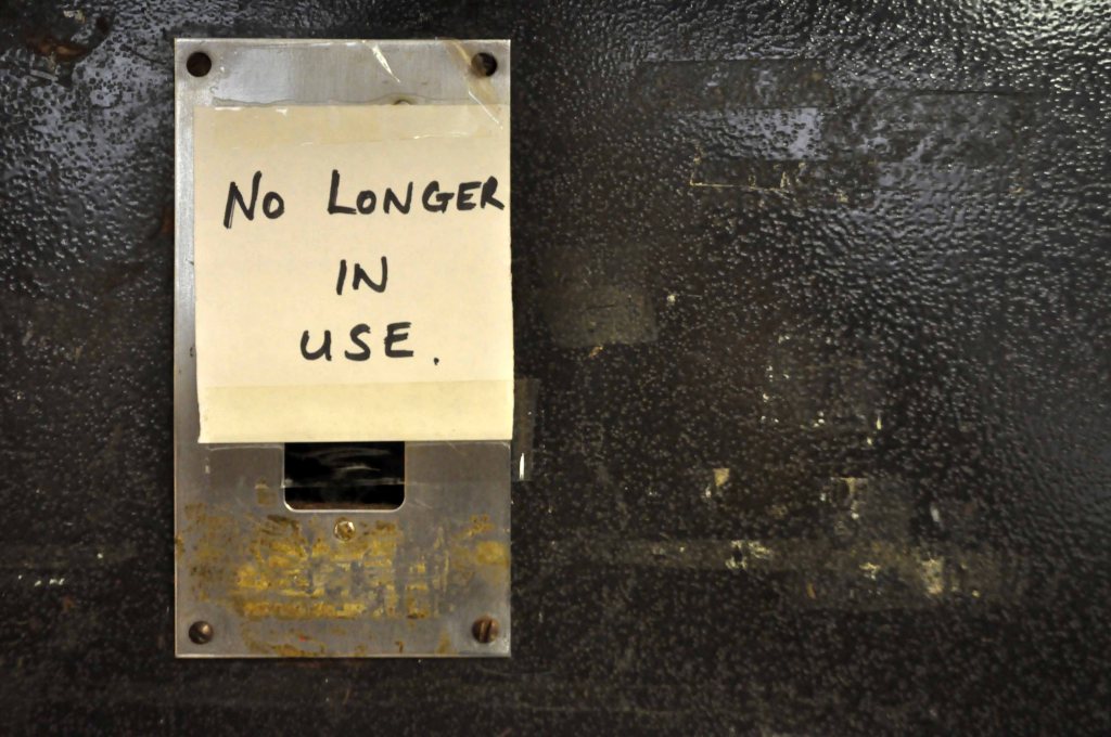
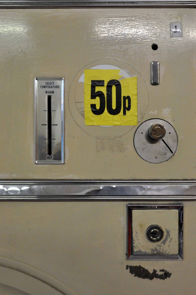
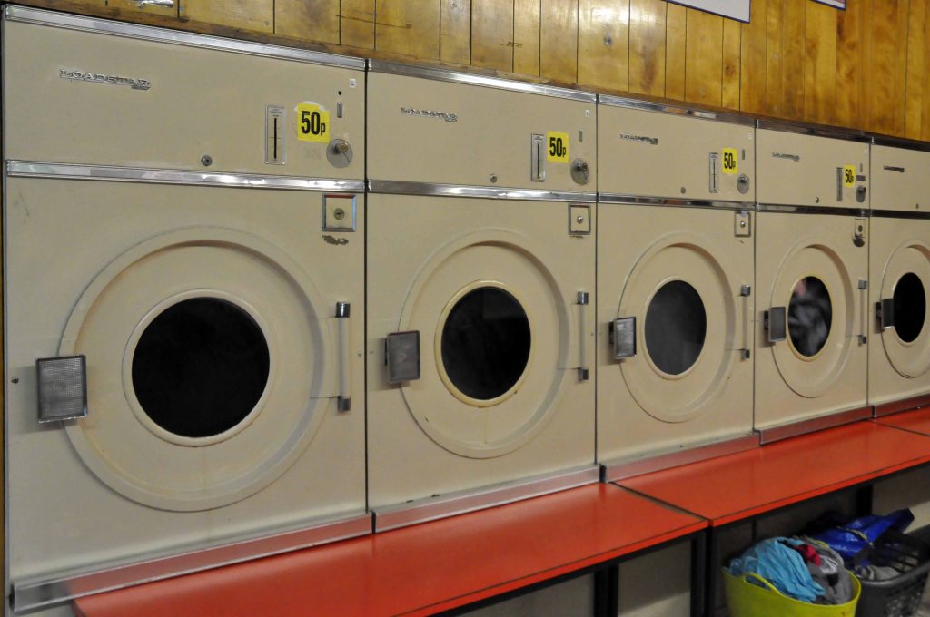
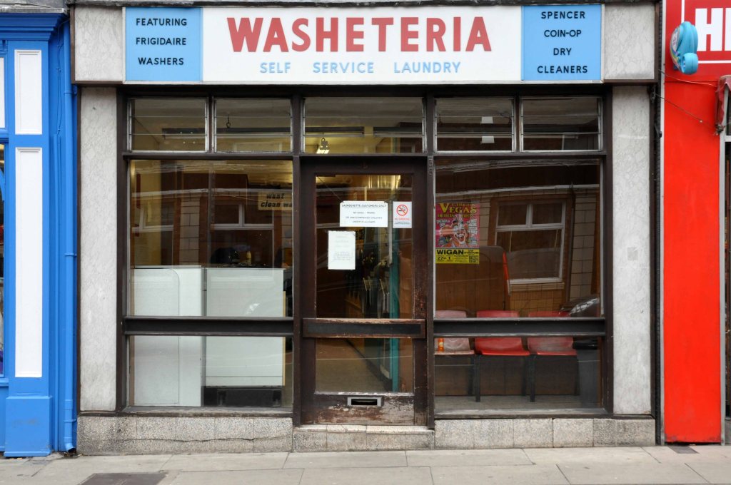
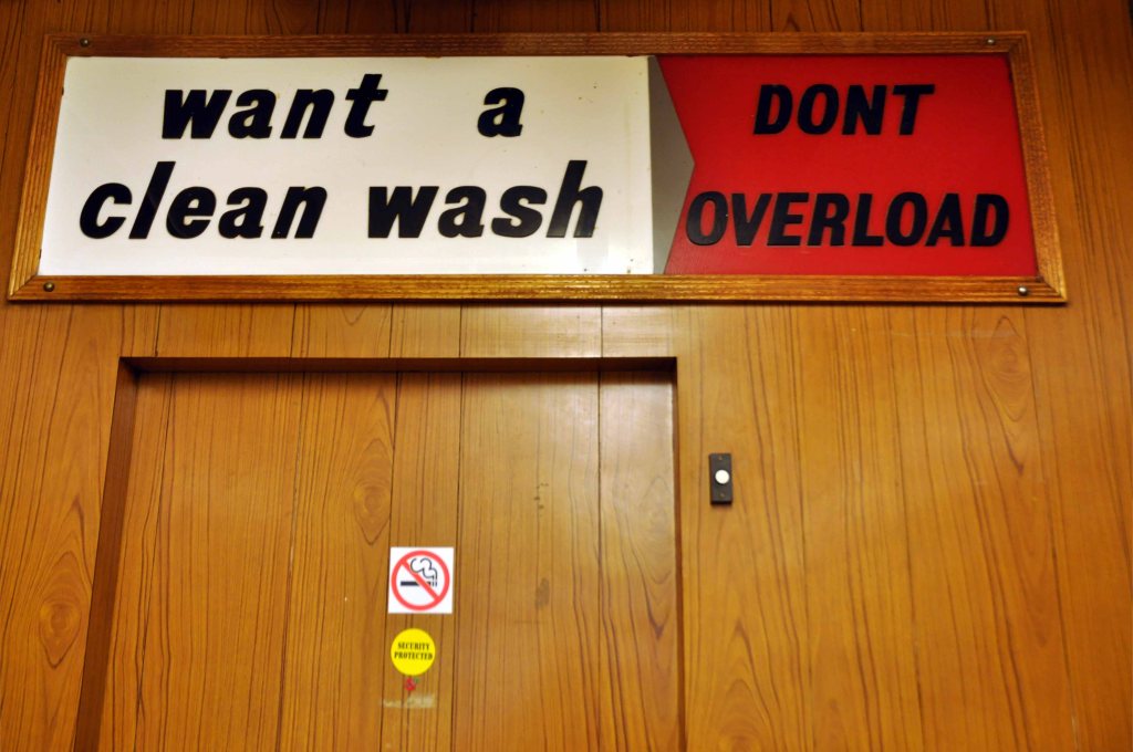
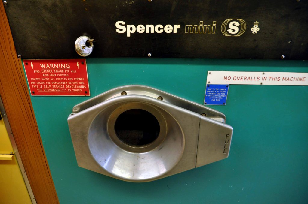
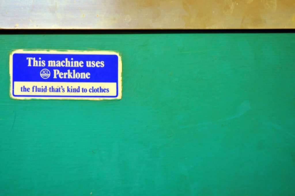
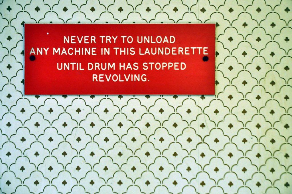
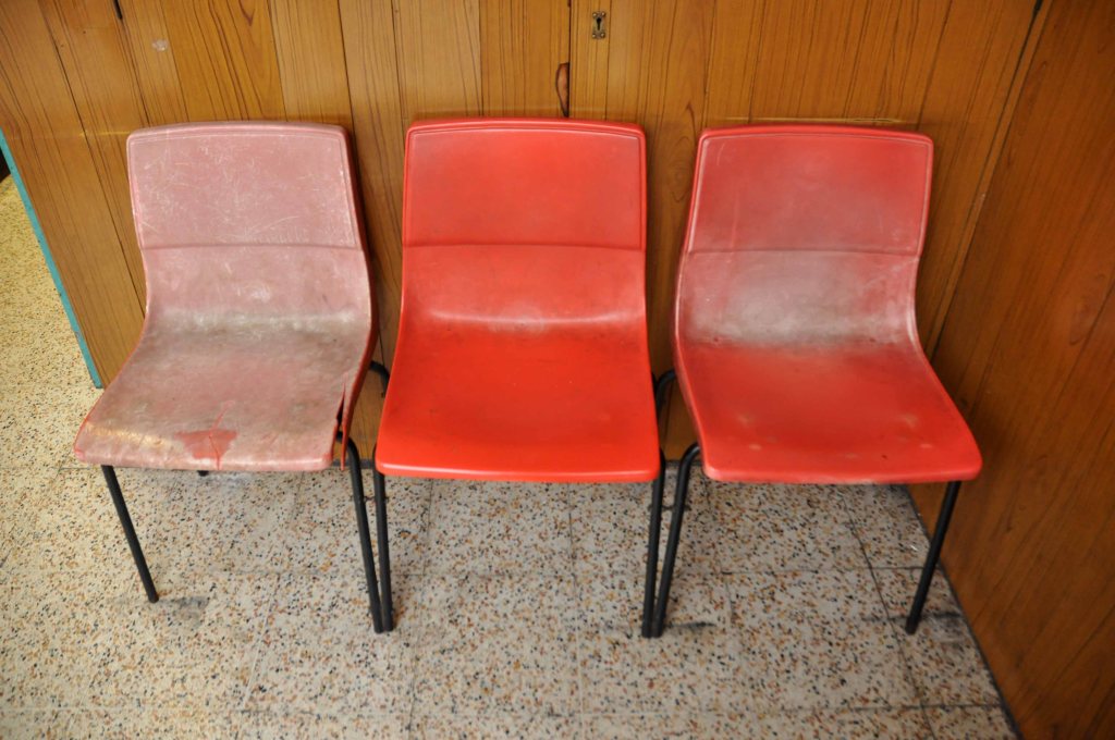
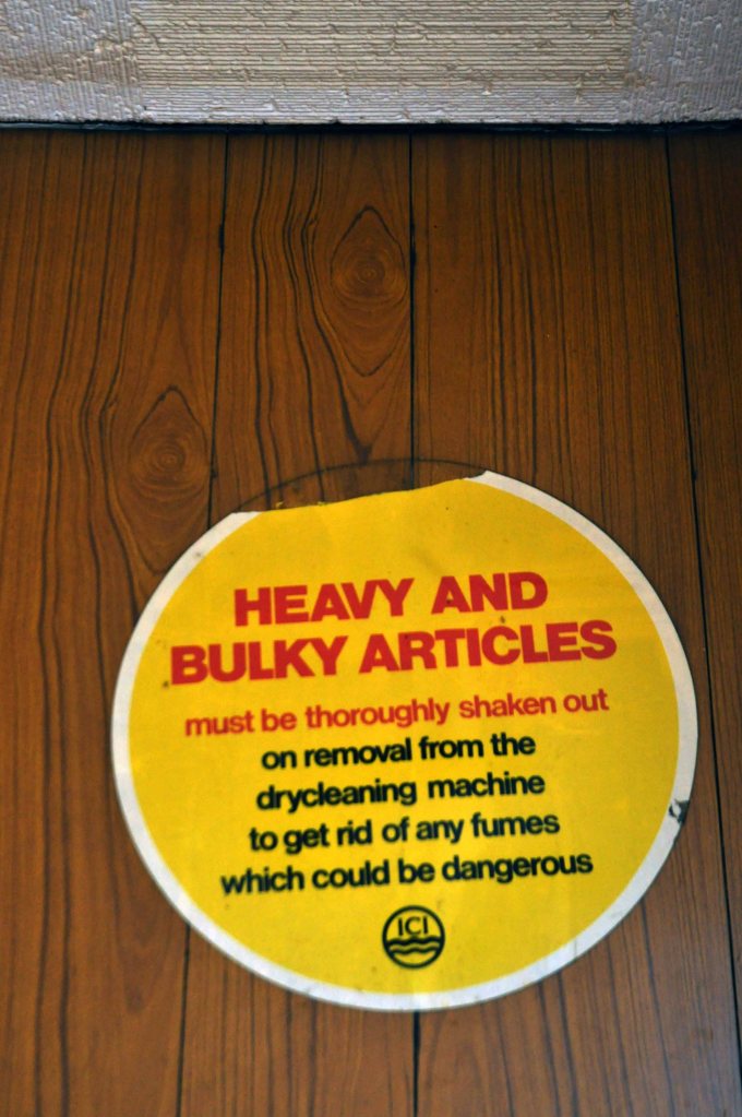
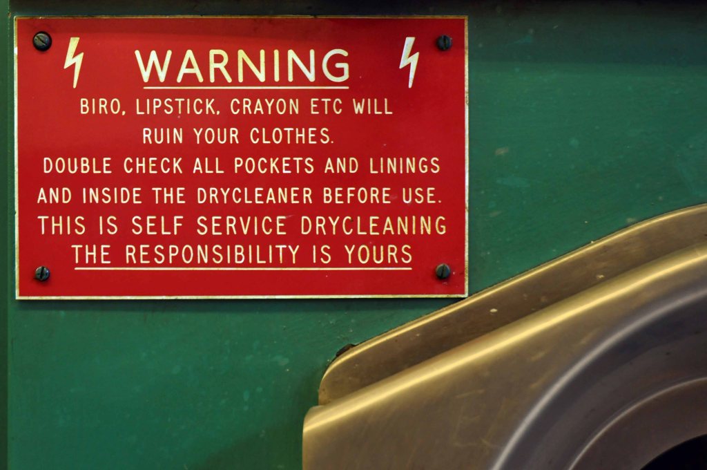
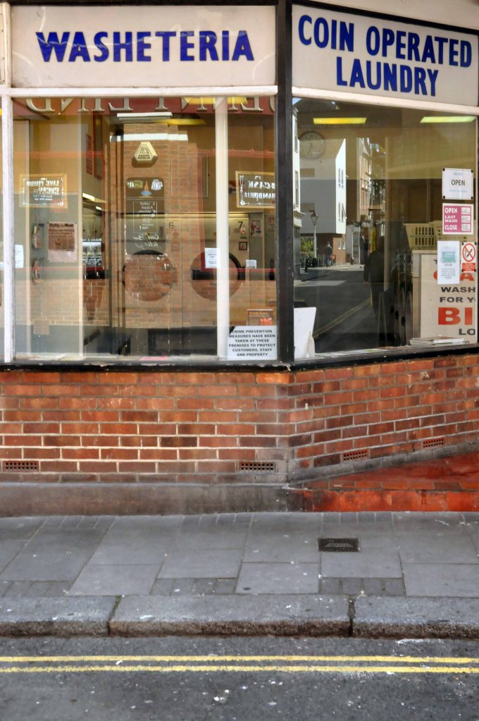
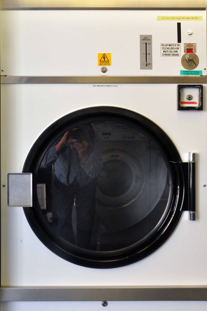
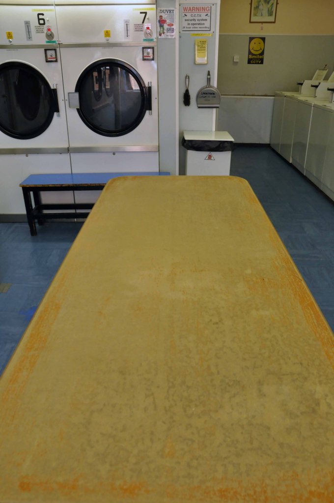
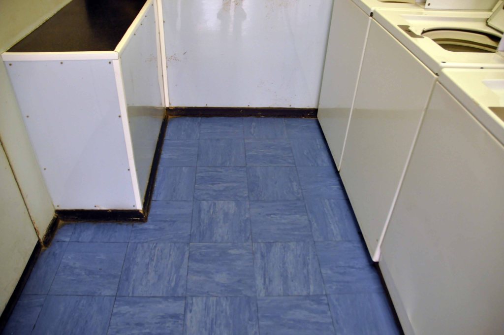
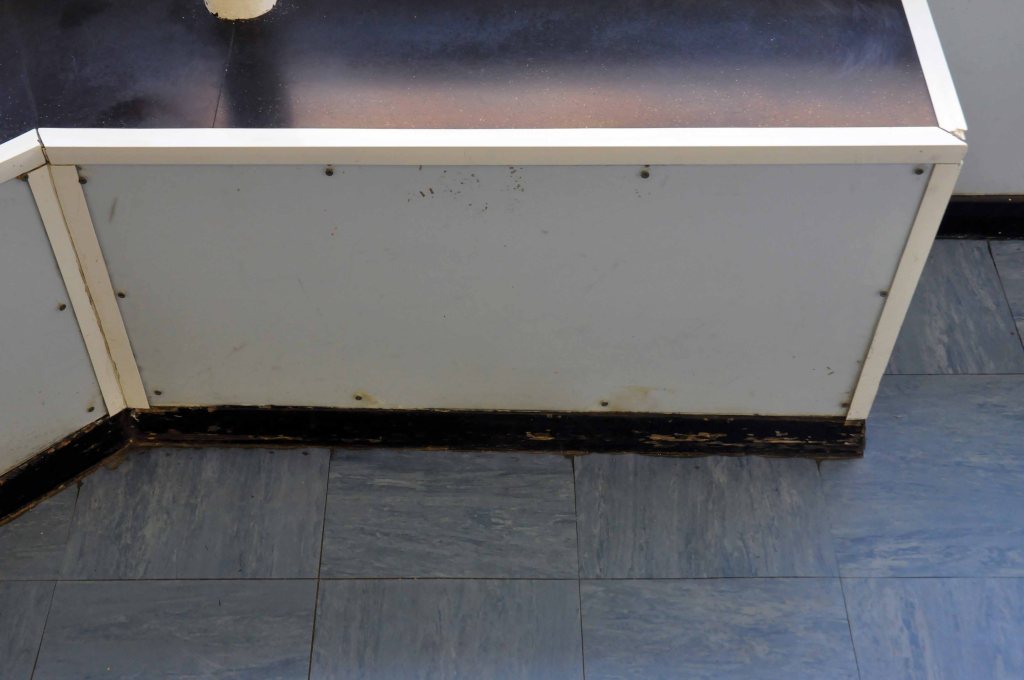
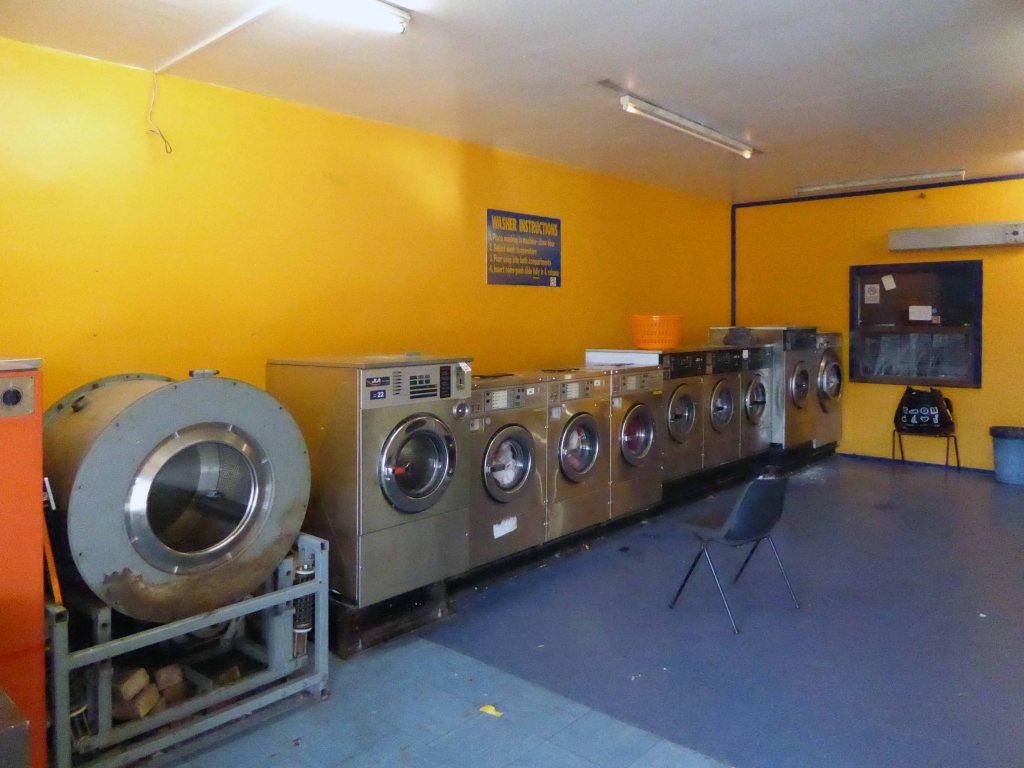
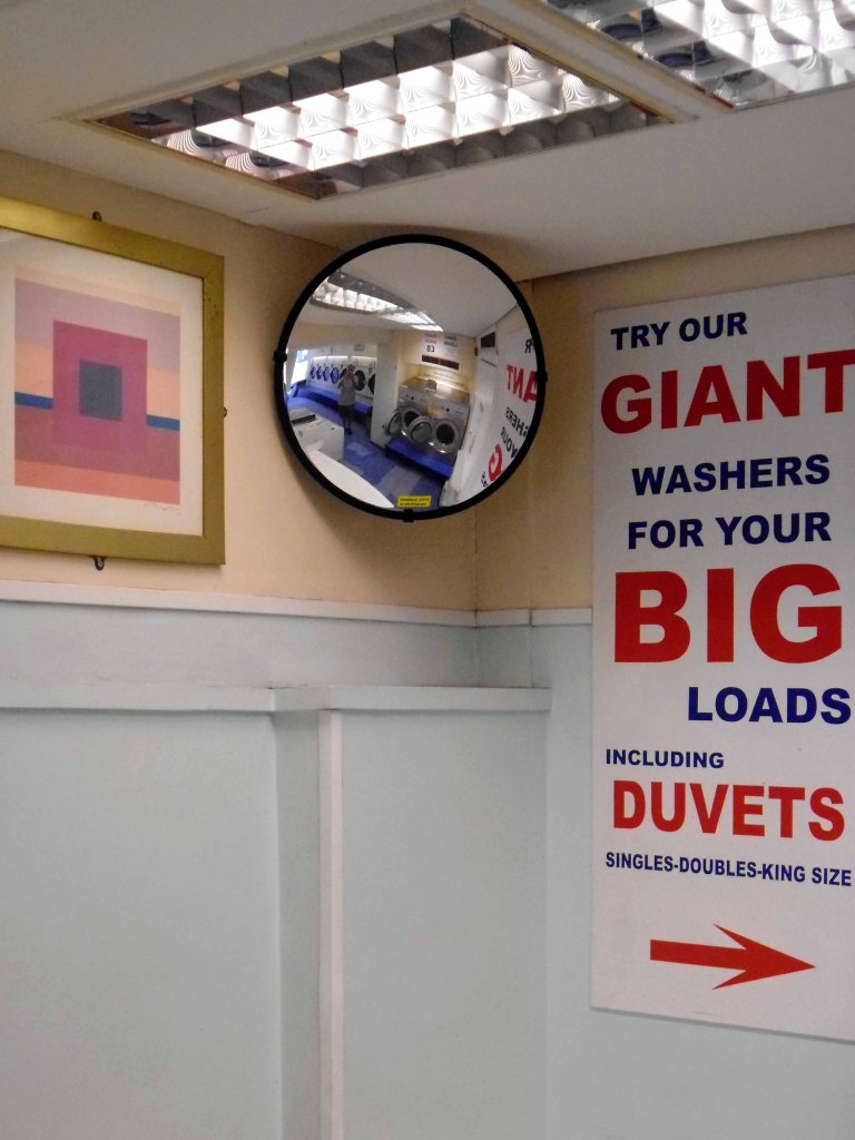
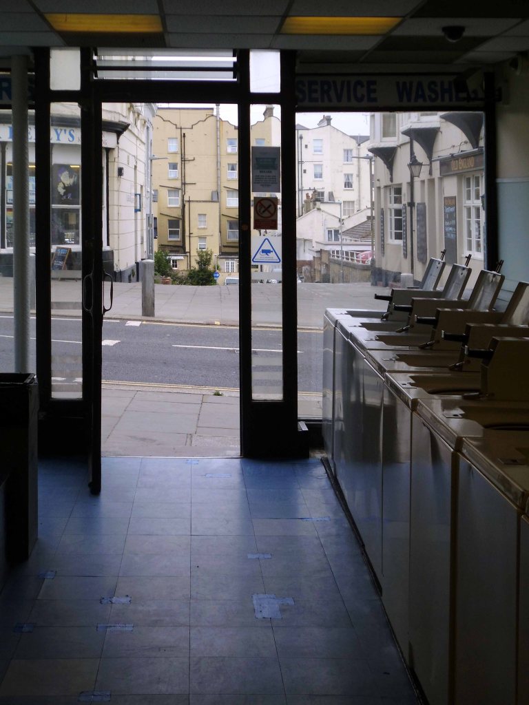
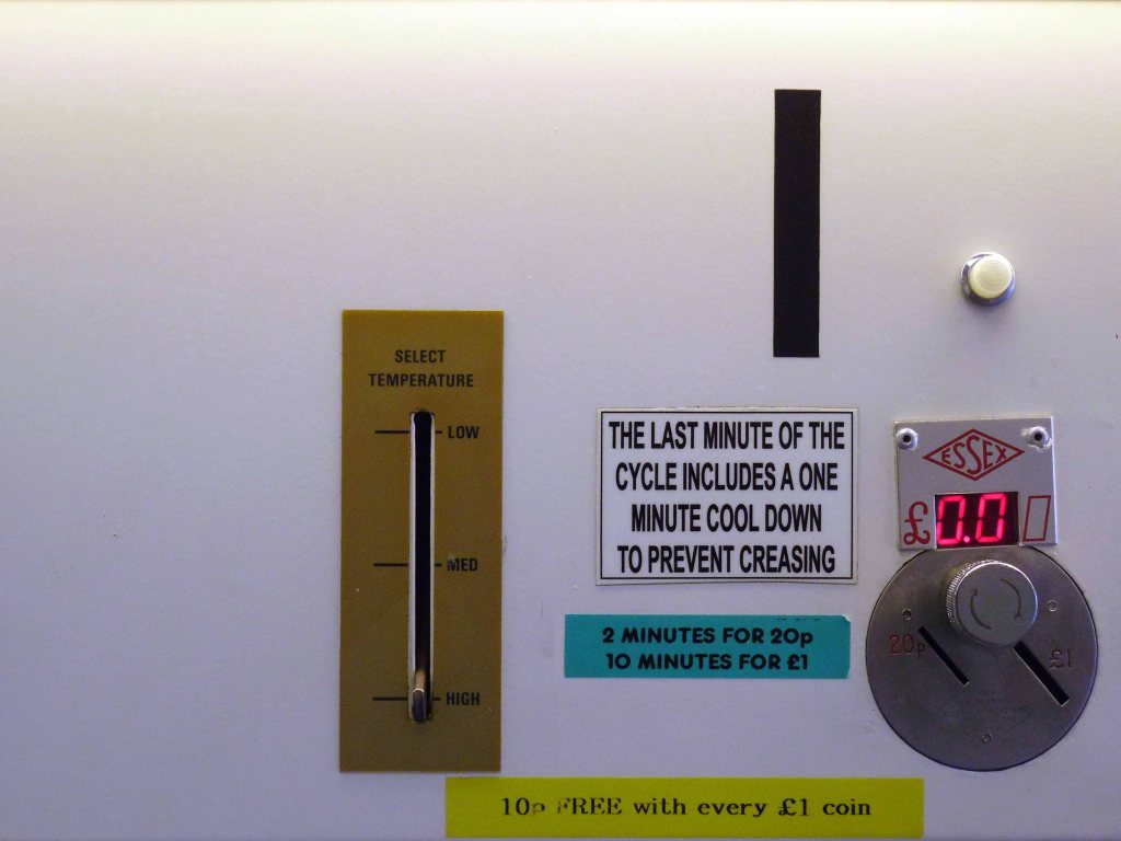
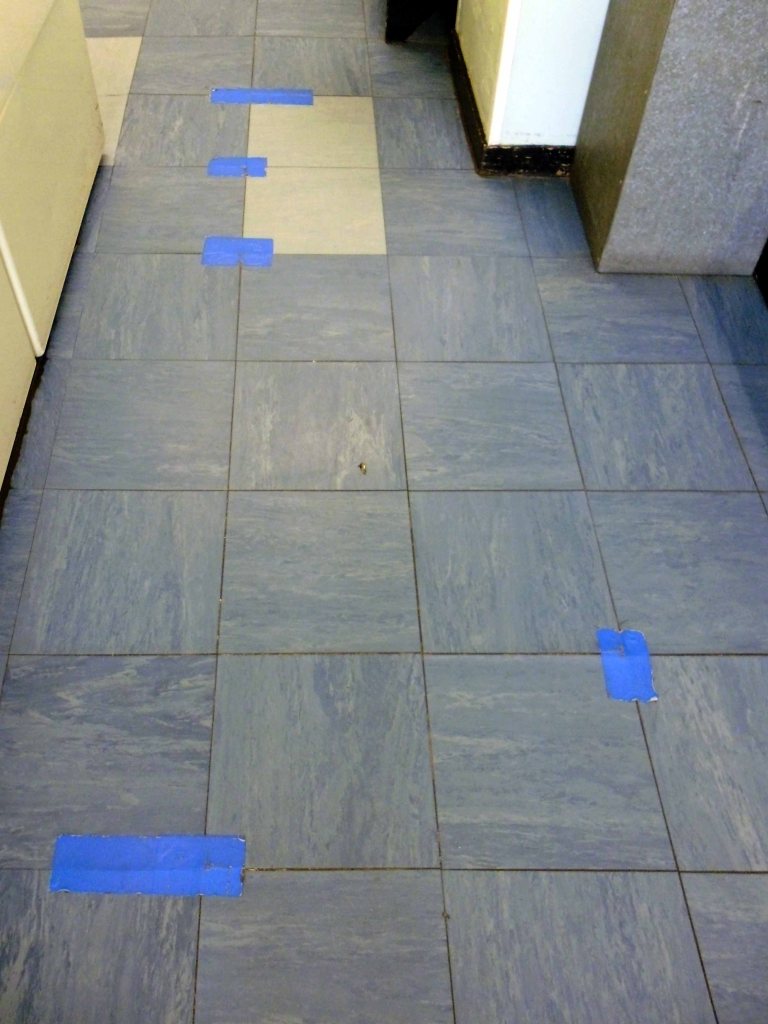
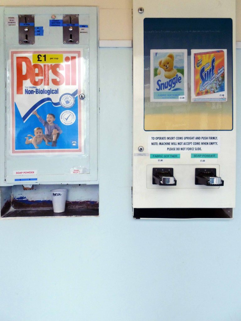
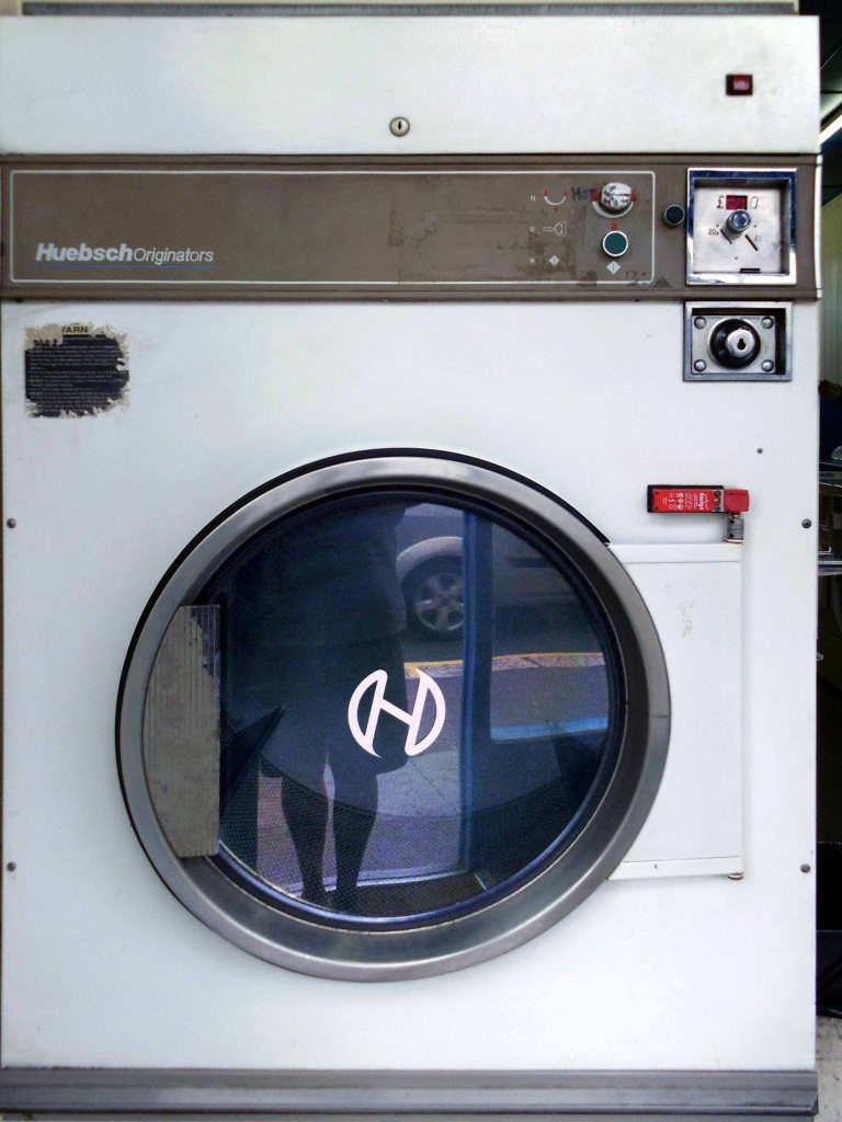
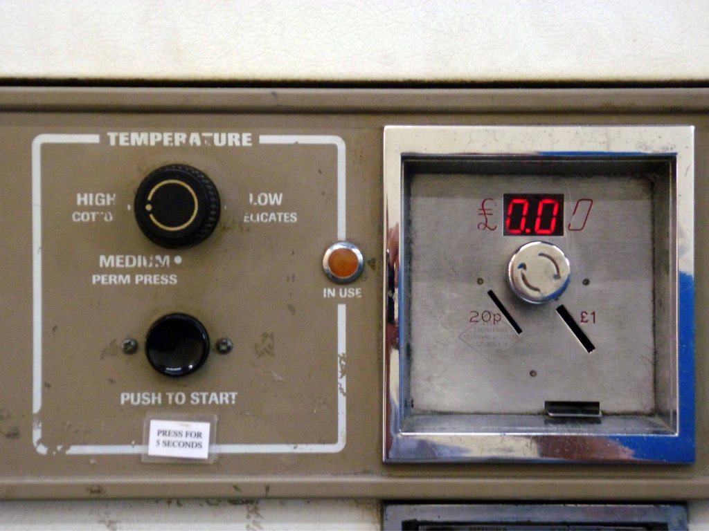
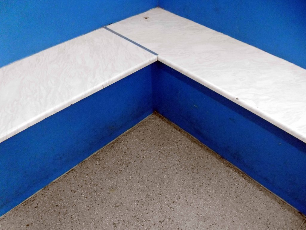
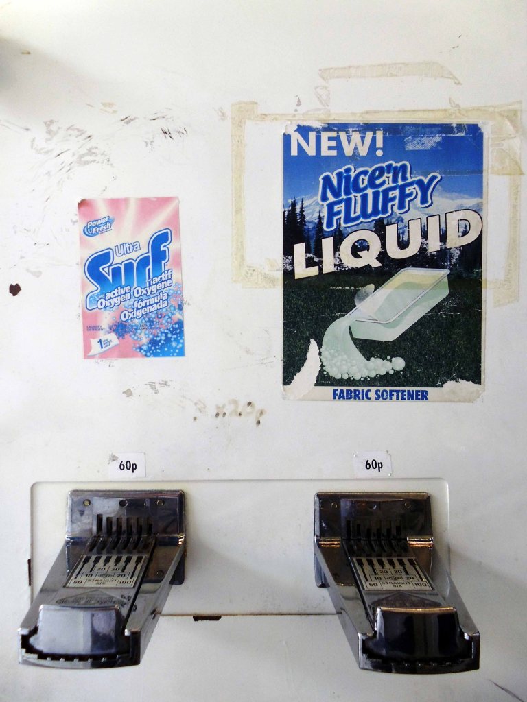
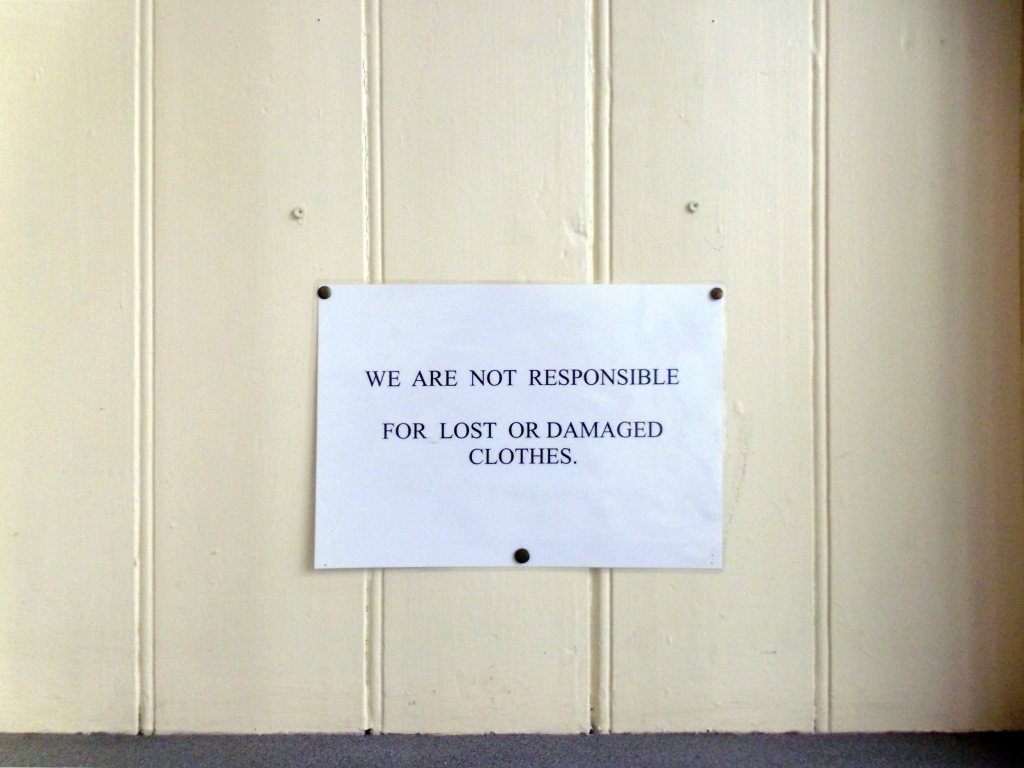
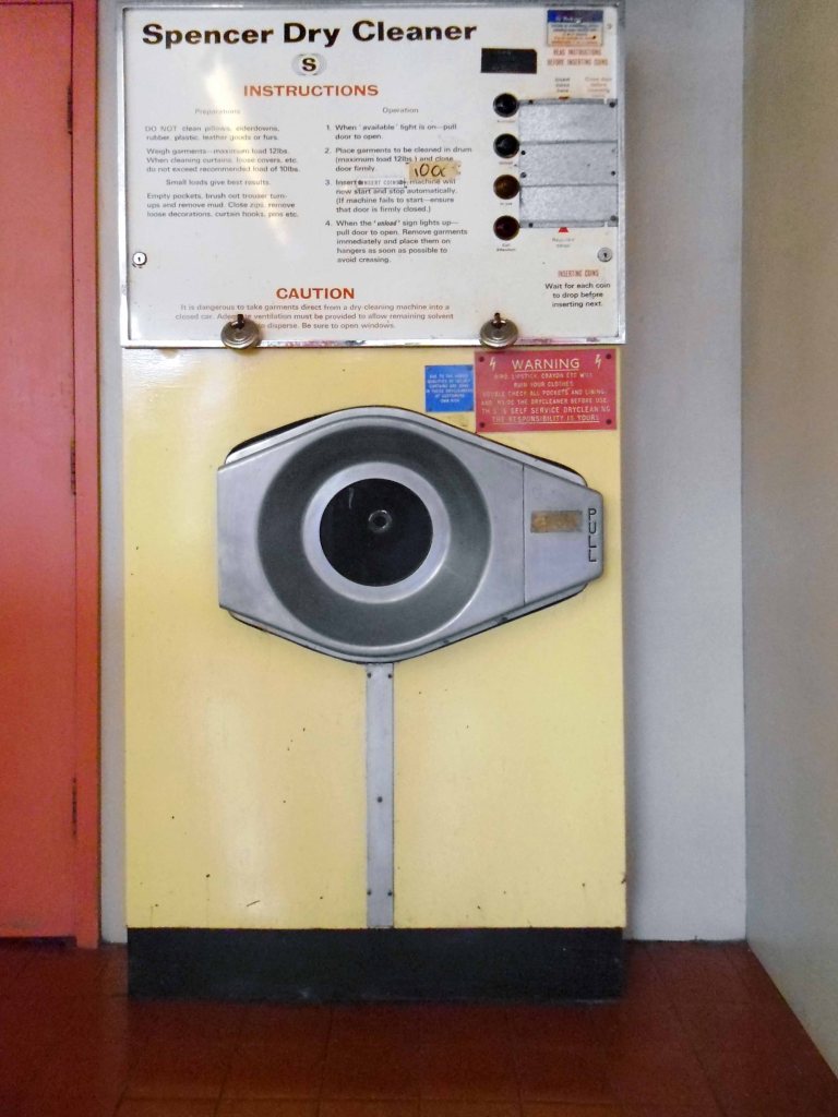
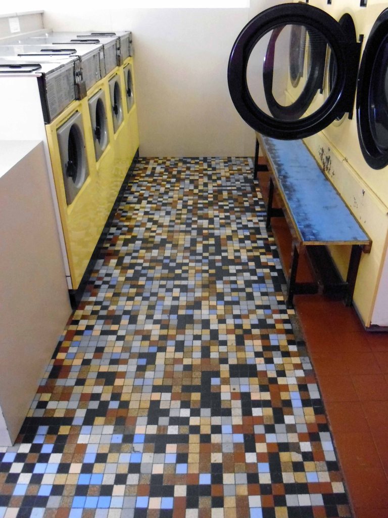
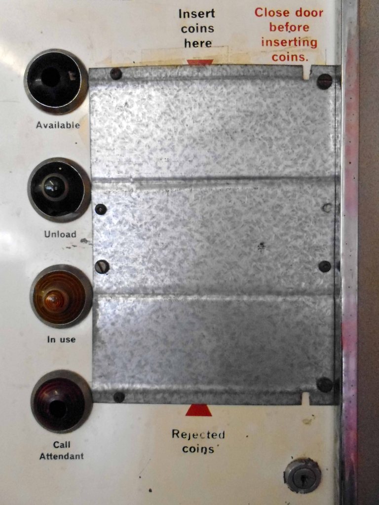
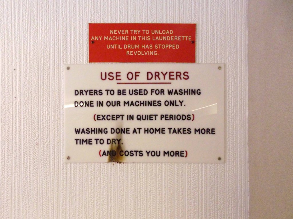
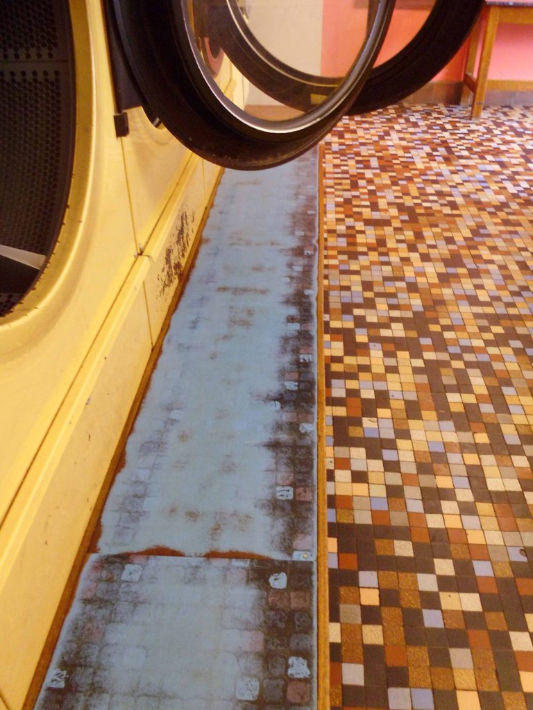
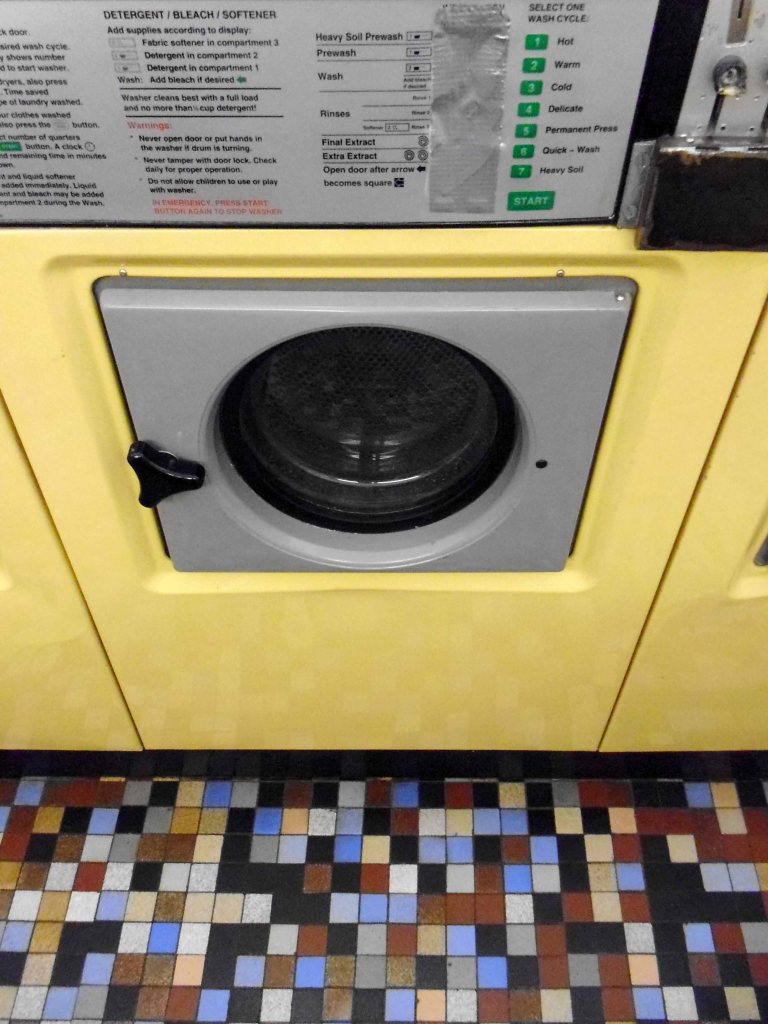
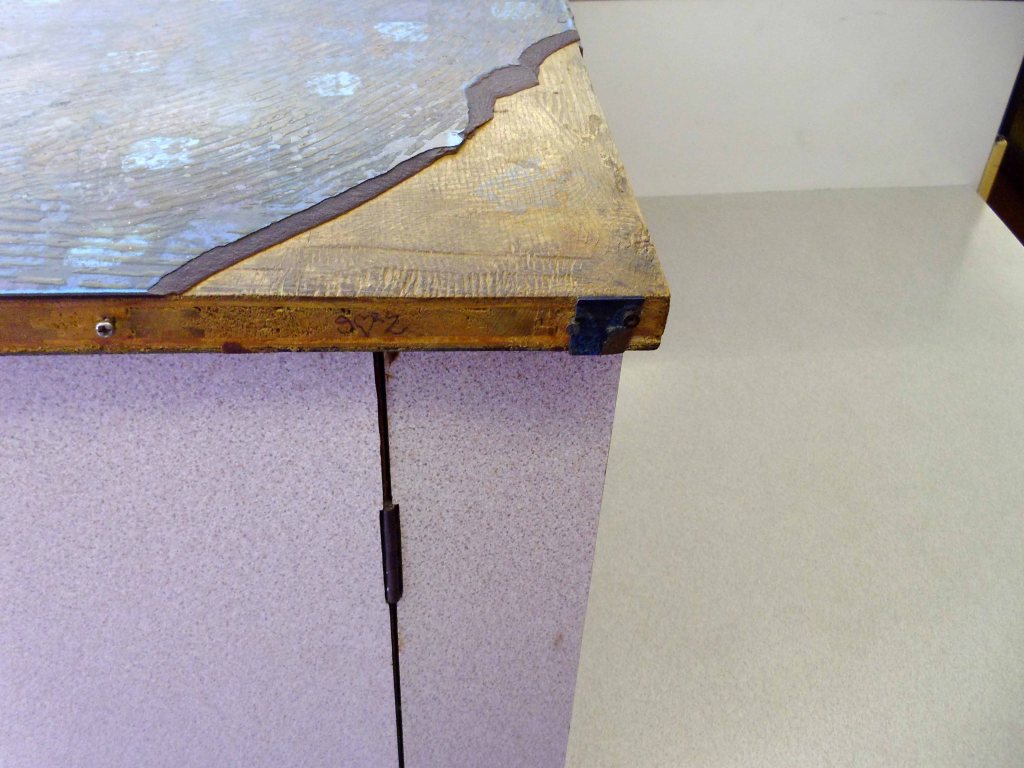
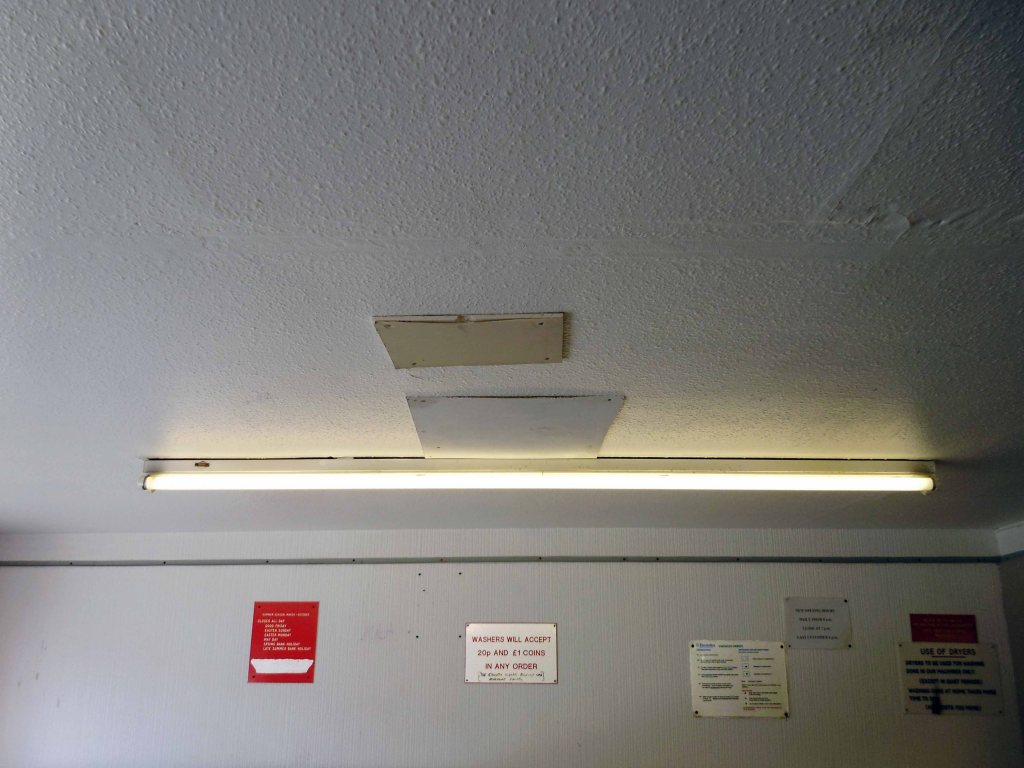
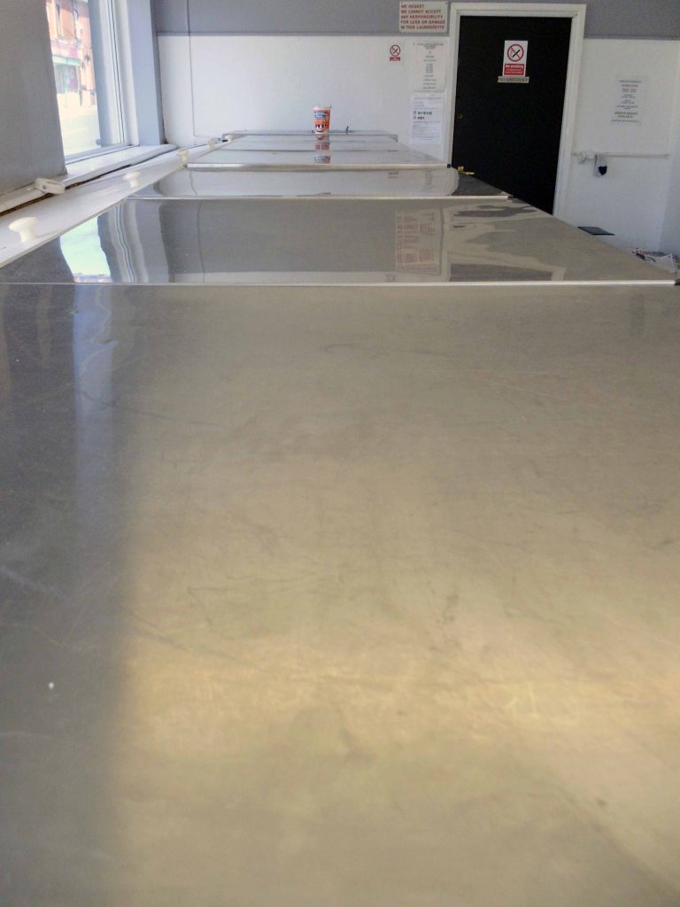
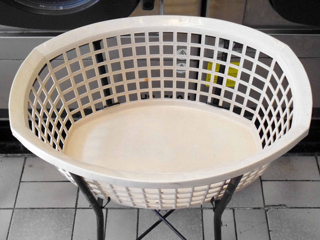
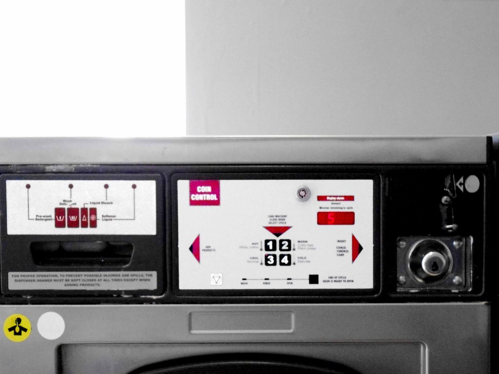
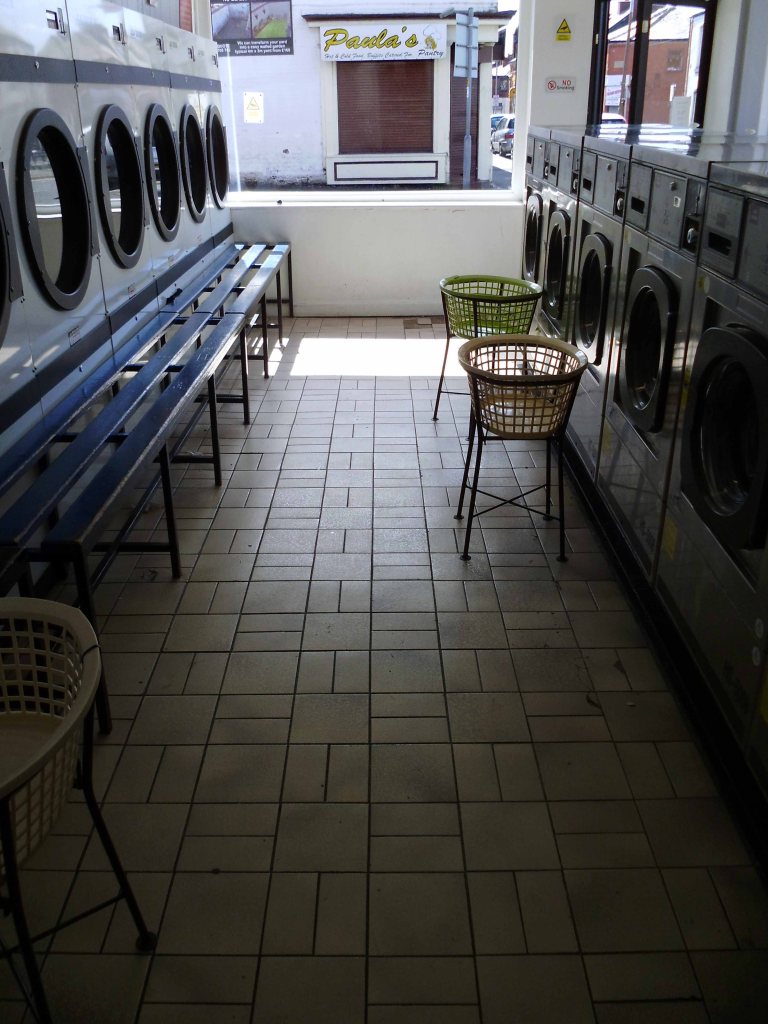
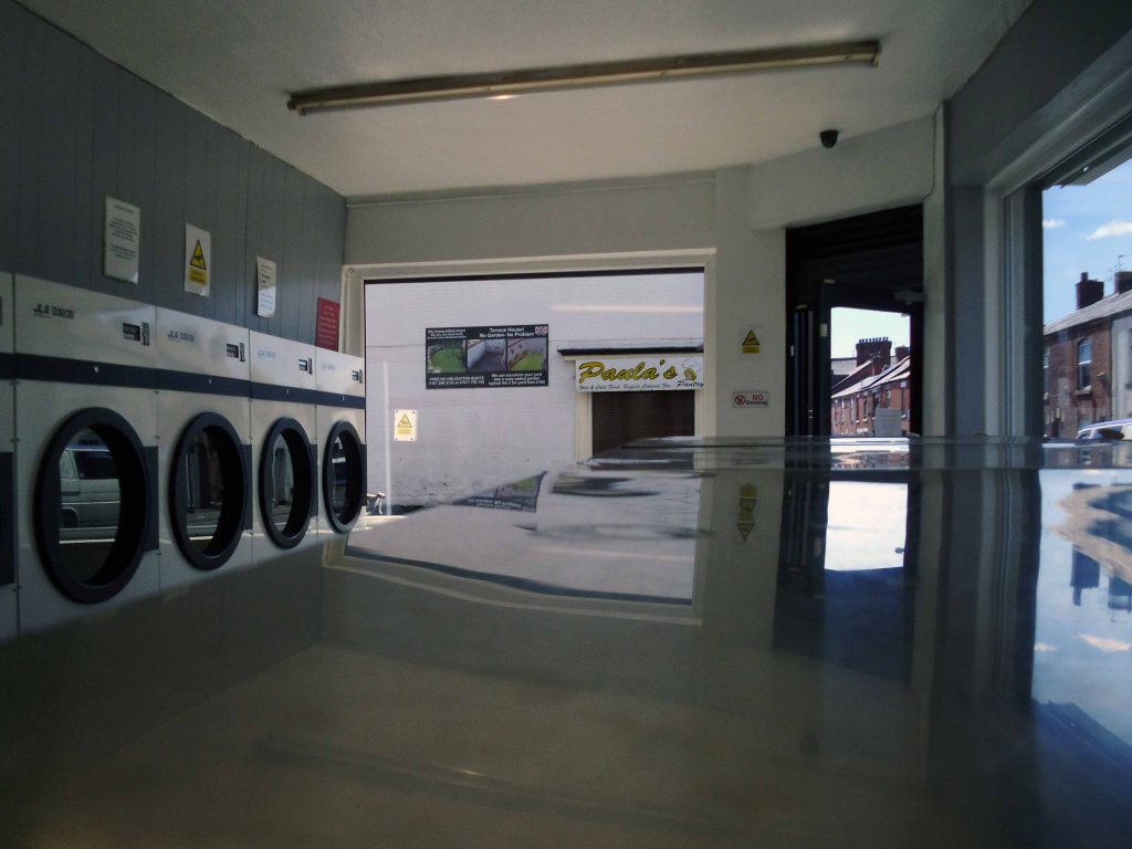
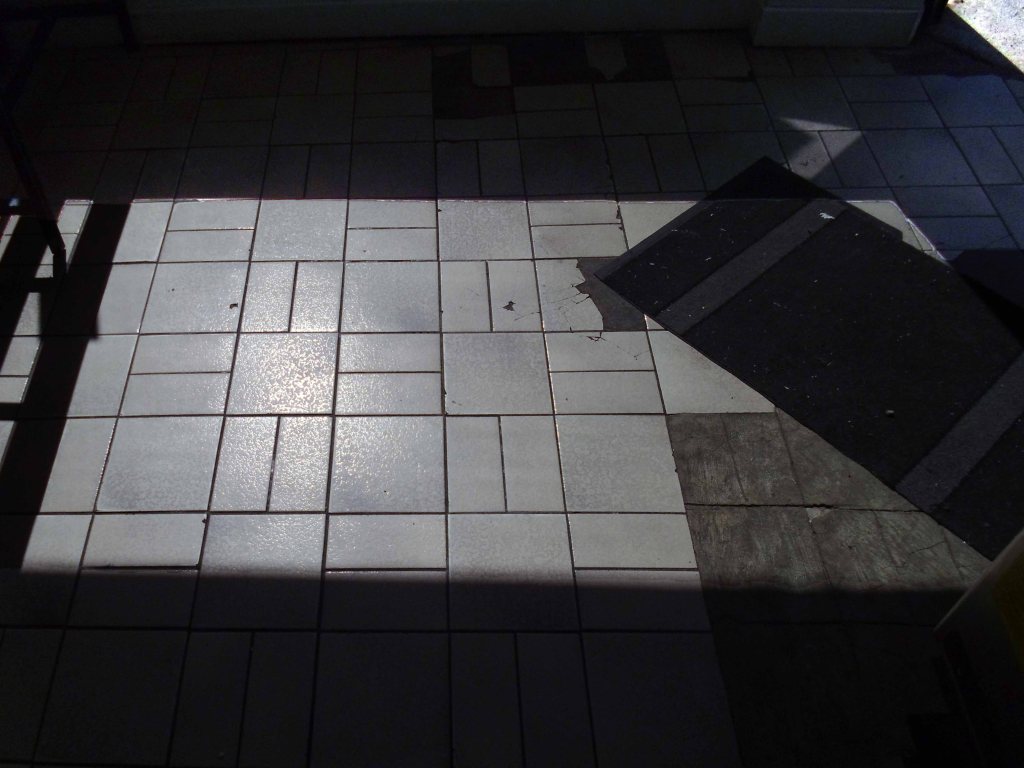
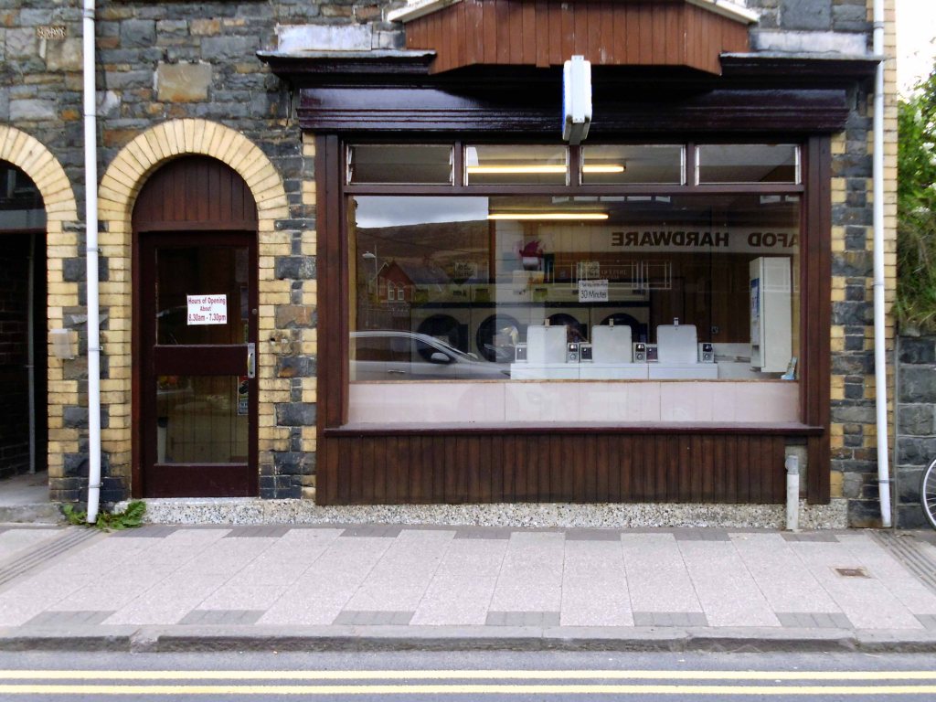
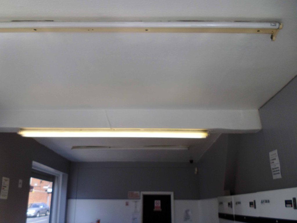
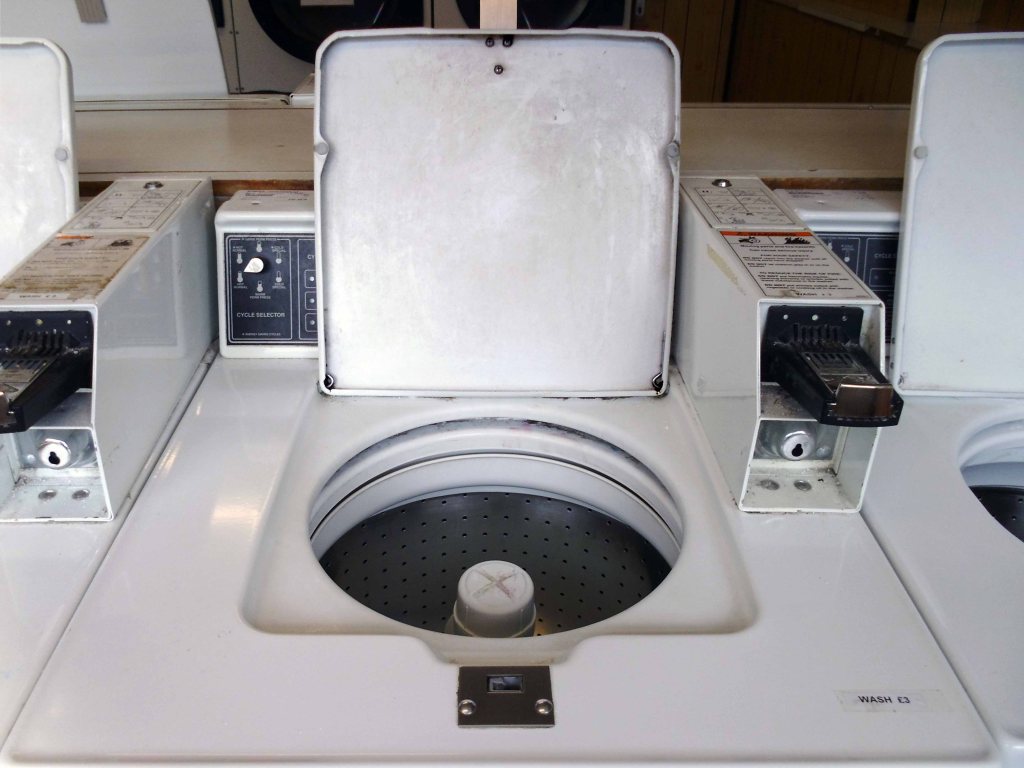
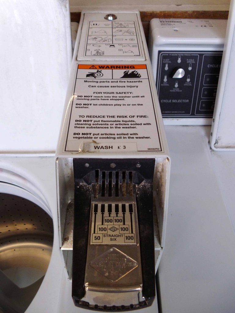
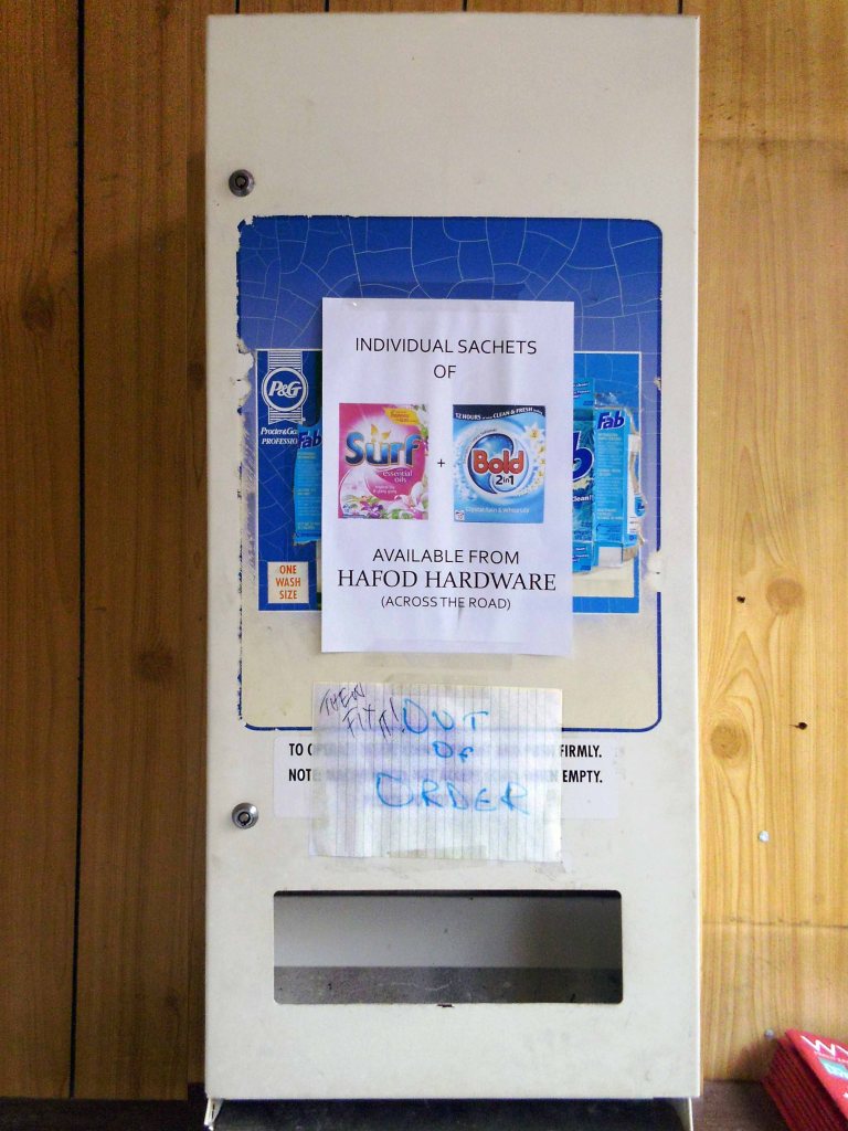
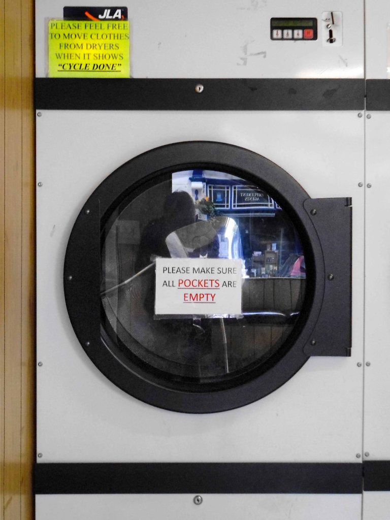
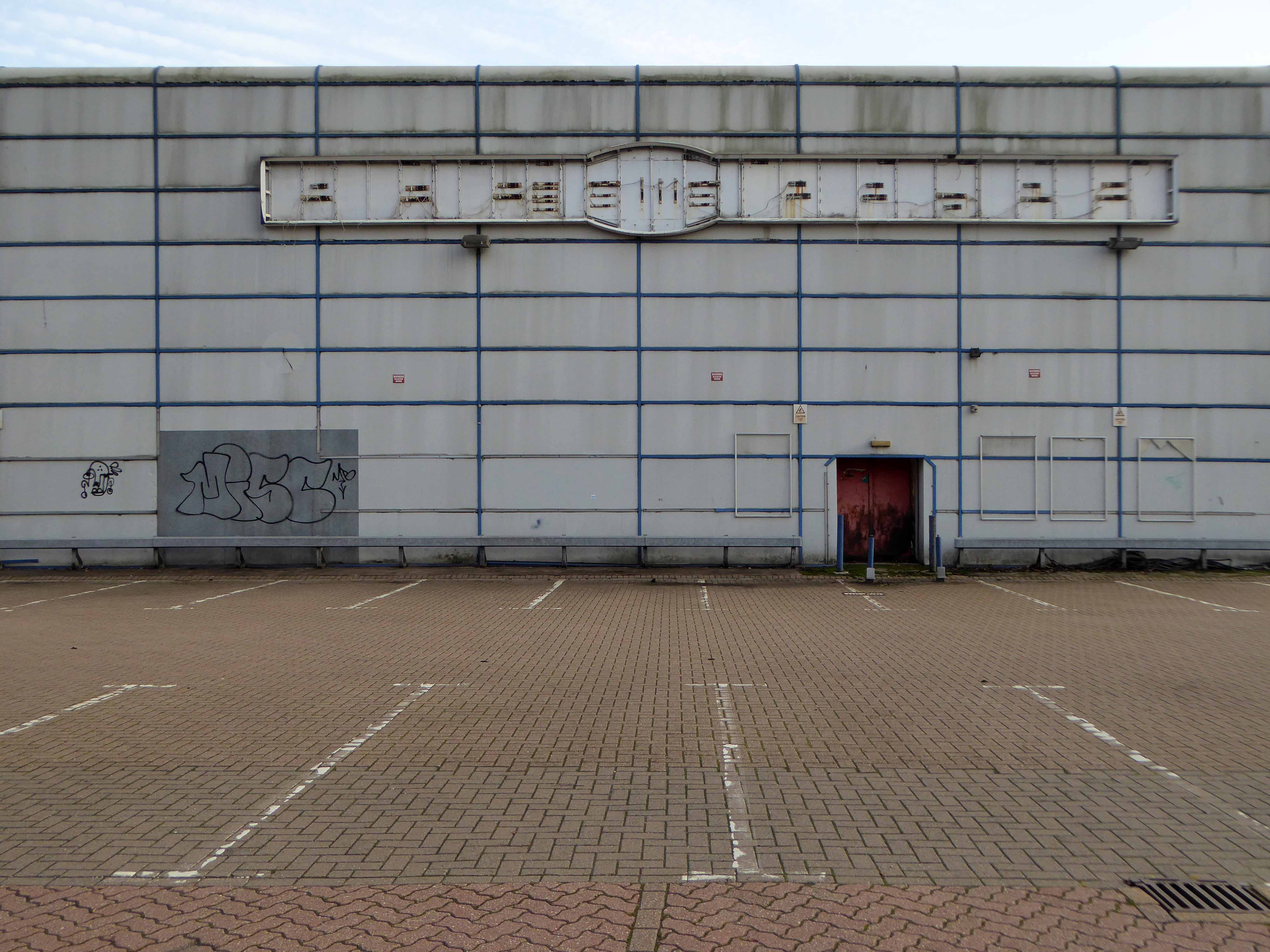
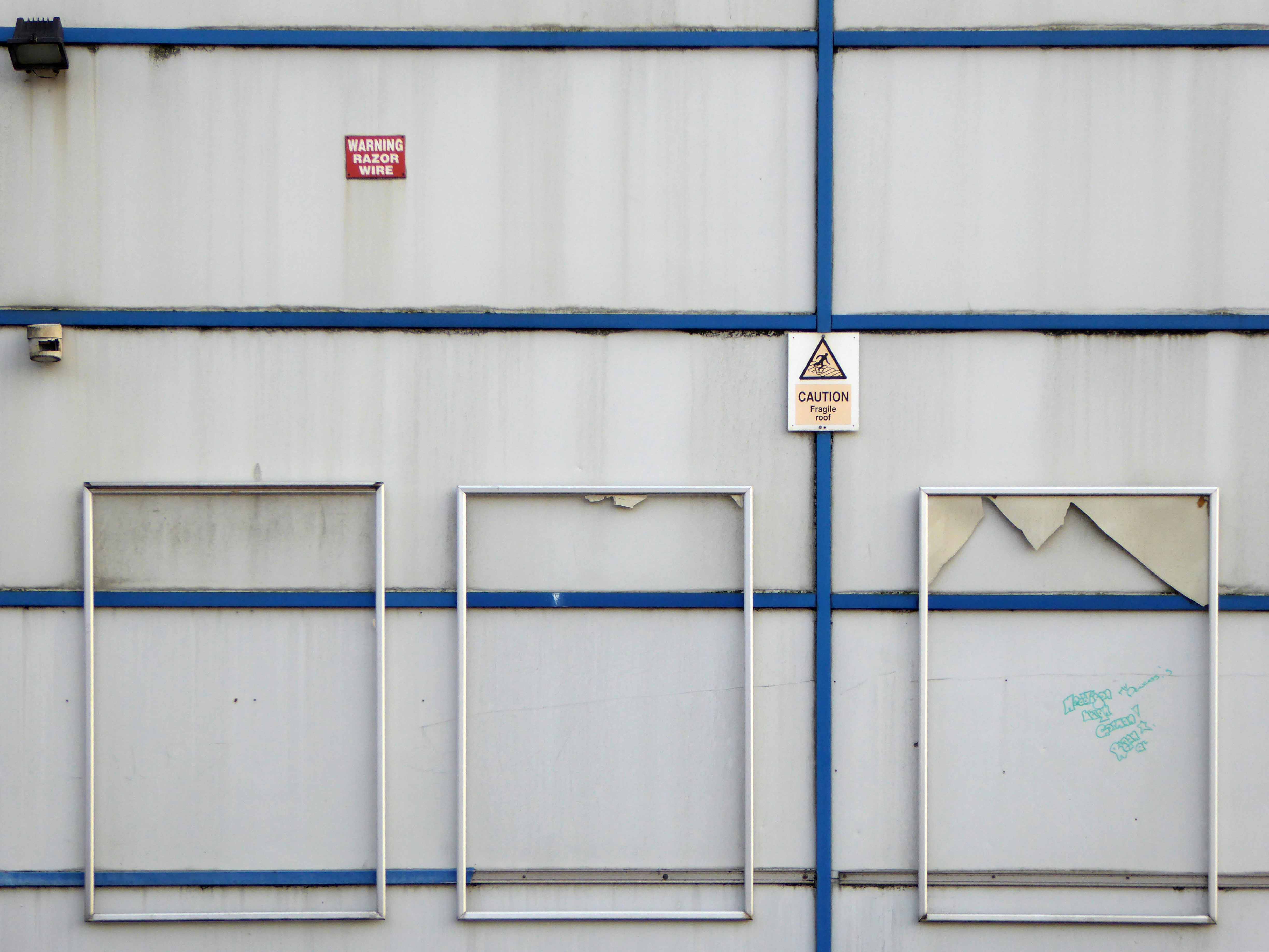
It began on an aimless walk out of Wigan on through Frimley, I found heaven on earth in the warm enfolding arms of the Washeteria. A perfectly preserved fascia, interior and machines, more by diffident neglect than good management. Signature wood effect and patterned Formica panelling, over earnest signs demanding the highest standards of personal conduct, etched in thick discoloured coloured plastic, abound on every surface. Stuttering strip lighting and a stone cold linoleum floor. A dull white ceiling, with a surface texture formed from deep frozen ennui.
Three years later I had visited and snapped several examples, all with their own uniques characteristics though all contributing to a typology.
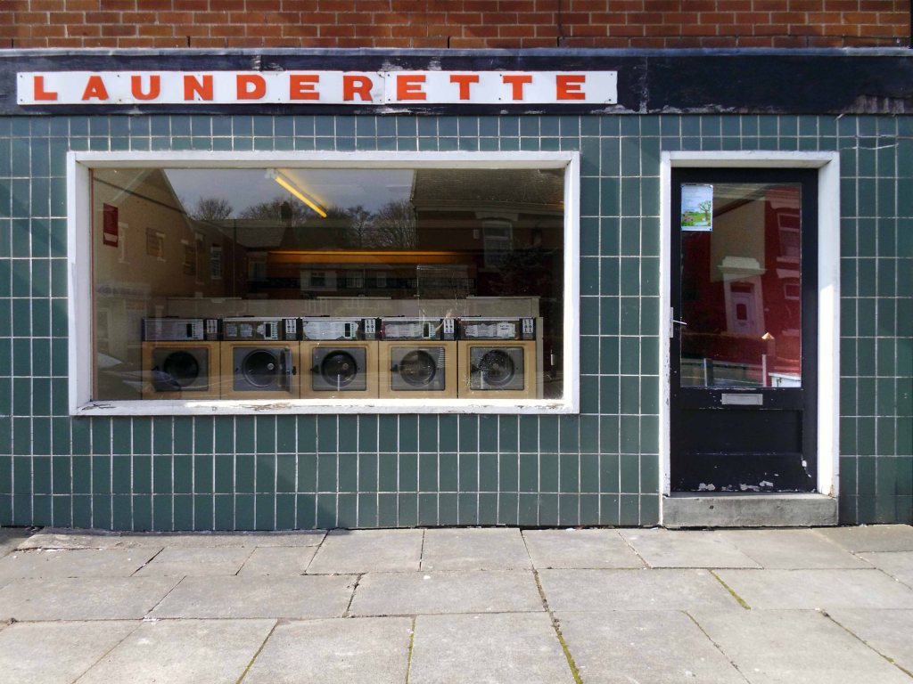
In the United Kingdom known as launderettes or laundrettes, and in the United States, Canada, Australia, New Zealand as laundromatsor washeterias.
George Edward Penury created the word laundromat for Westinghouse.
According to NALI – the National Association of the Launderette industry, numbers peaked at12,500 in the early 80s but have since dwindled to just 3,000.
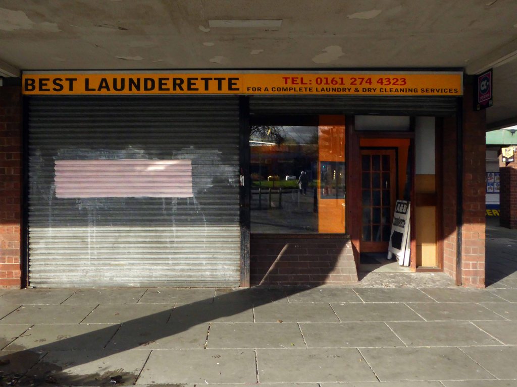
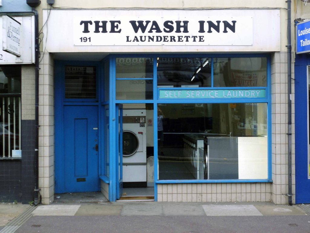
The first UK launderette – alternative spelling: laundrette. was opened on May 9th 1949 in Queensway London.
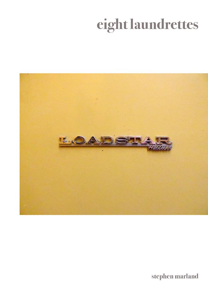
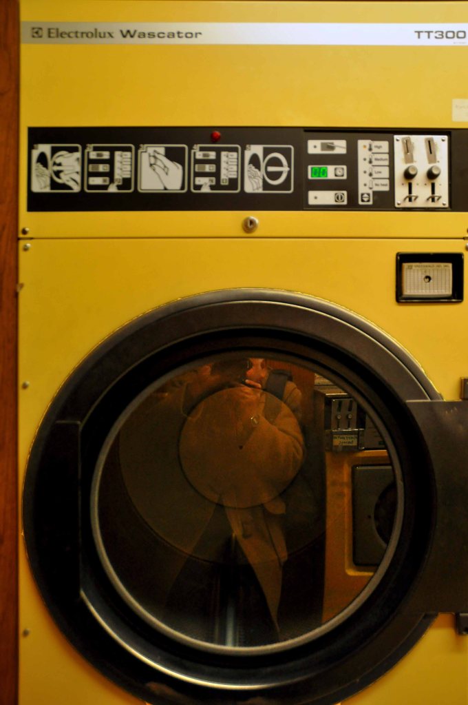
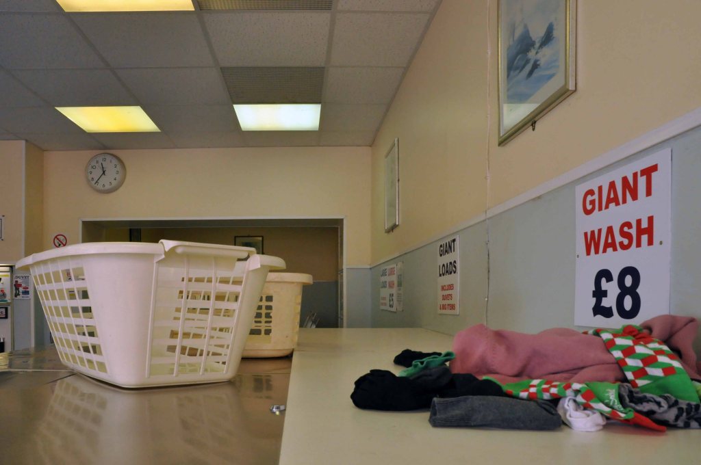
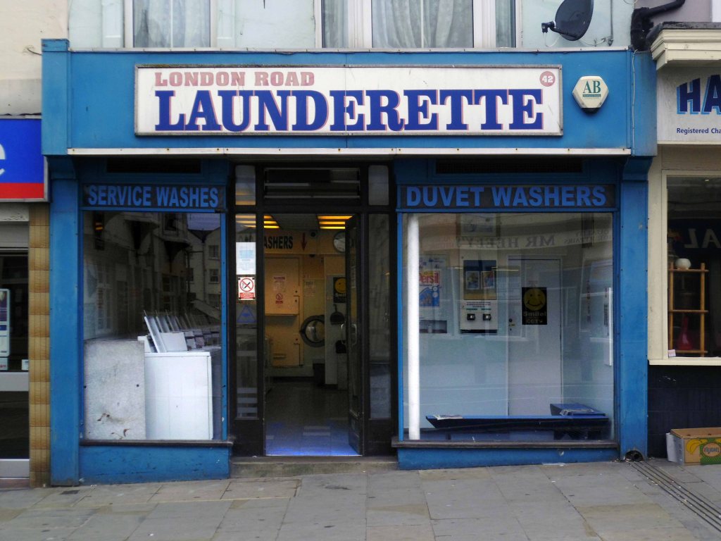
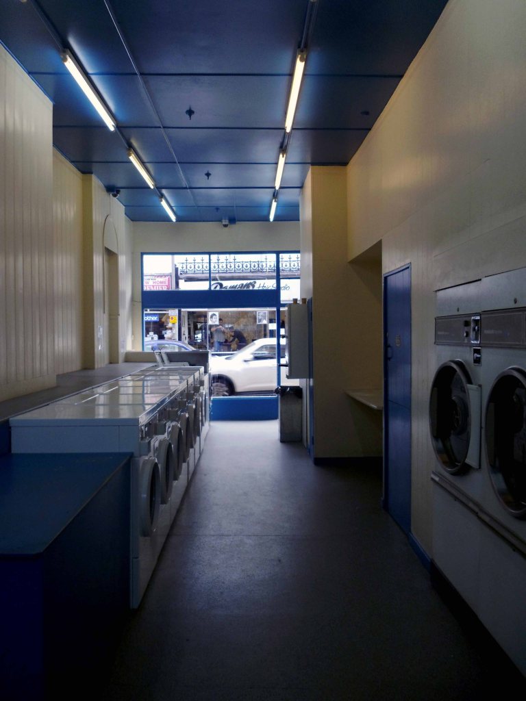
Come with me now and relive those warm damp languorous moments as we visit eight laundrettes.
All the books sold out in three hours – so here’s your chance to flick through the virtual pages as the prewash finishes.
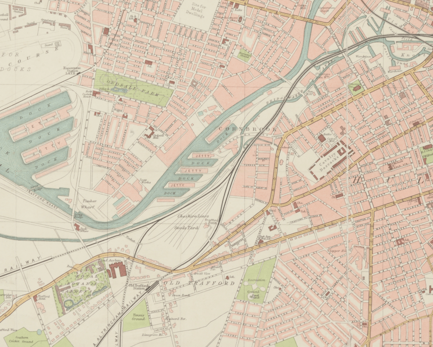
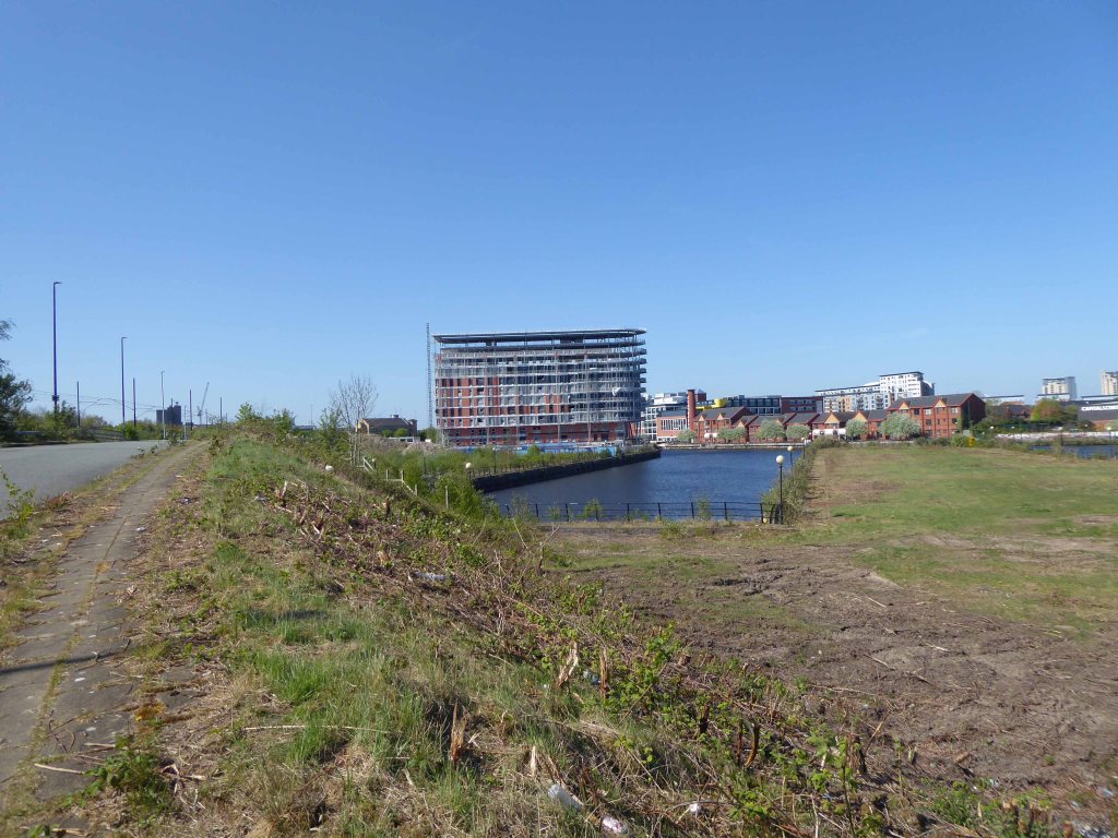
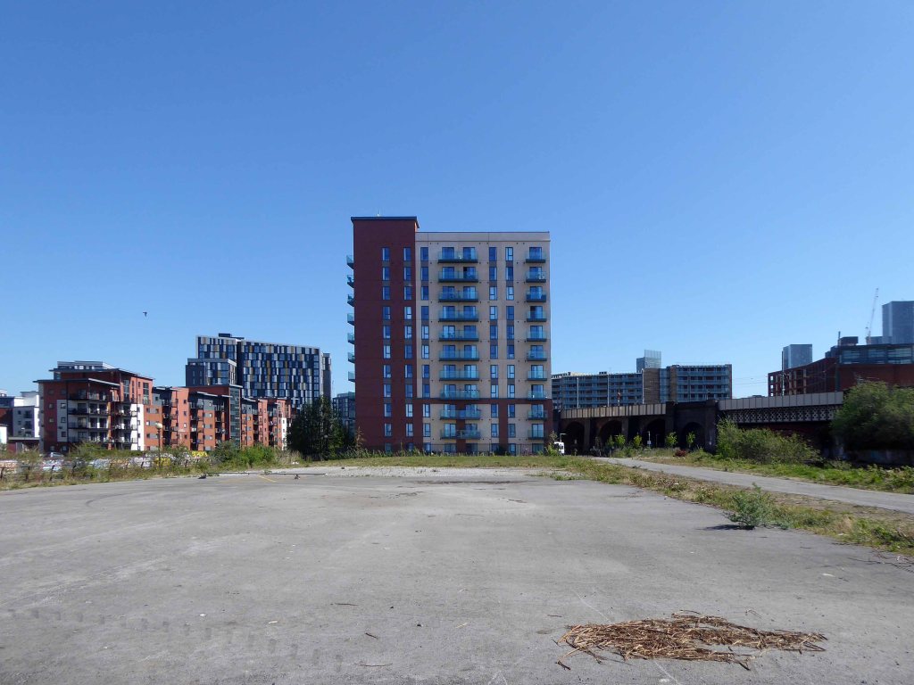
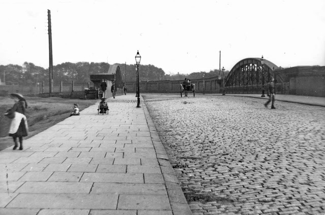
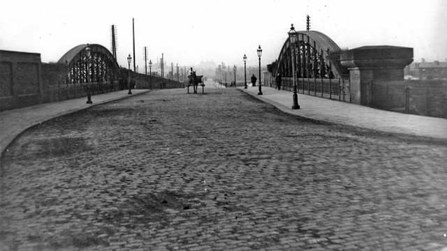
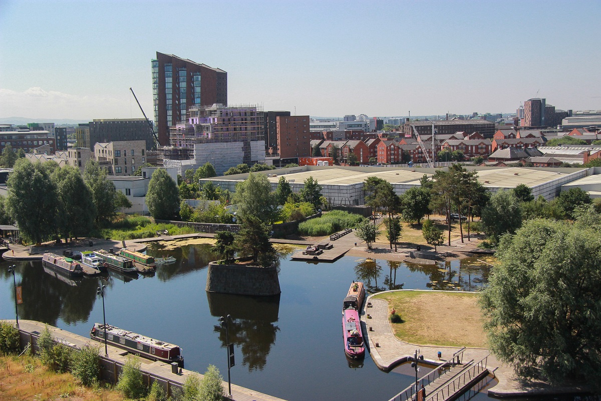
The River Irwell bisects Salford and Manchester, joining the rivers Irk and Medlock, and then turns west toward Irlam, as part of the Manchester Ship Canal. Its course ends just east of Irlam, where it empties into the Mersey.
Urban development is ever so often dependent upon rivers – for sustenance, commerce and amusement. The Irwell and latterly the developments of the canal system has provided all of these in superabundance.
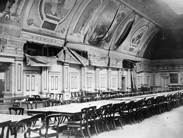
By 1870 the Pomona Gardens is thriving , boasting a concert hall and banqueting suite – further details here from Skyliner.
In the summer of 1887, a nearby chemicals factory exploded, damaging the palace – the area was under threat and destined to rot away to obscurity: the following year the gardens closed forever.
By 1900 the Ship Canal, docks and railways had arrived – Manchester and Salford are at the centre of an unprecedented growth in manufacture and trade.
189119231950
During the 1970’s the docks began a rapid decline, largely due to containerisation. The increasing size of freight-carrying ships meant they could no longer navigate the ship canal and this, combined with increased trading with Europe and the east, saw use of Manchester Docks decrease. In 1982 the remaining docks closed and the area became derelict. Recognising the need to redevelop the area, Salford City Council purchased the docks in 1984 using a derelict land grant. The Salford Quays Development Plan was adopted in May 1985, proposing complete reclamation and development of the area for commercial, residential and leisure use.
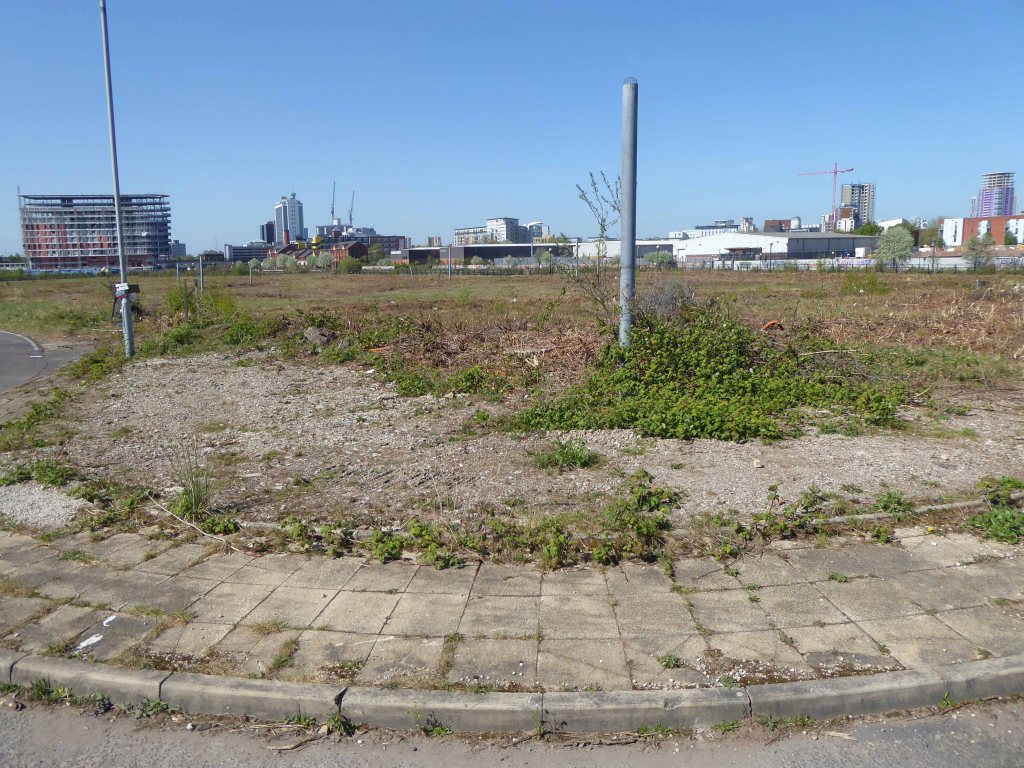
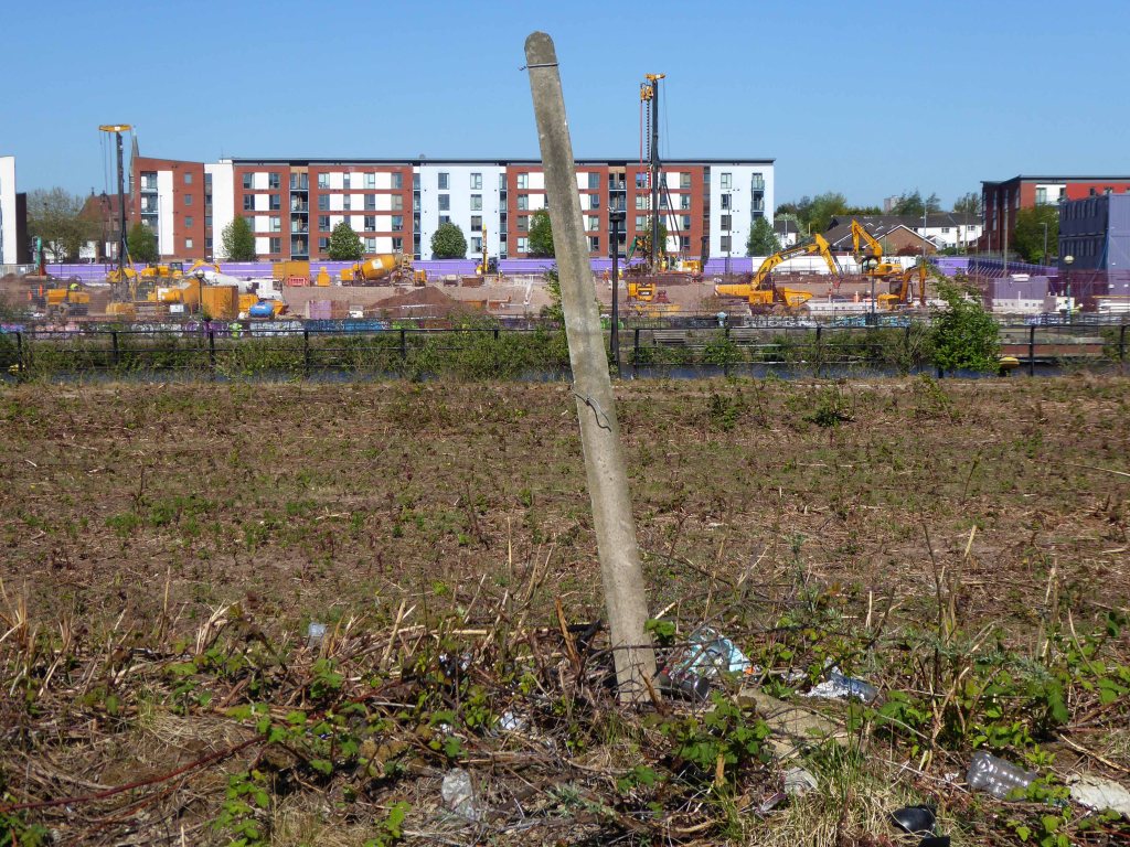
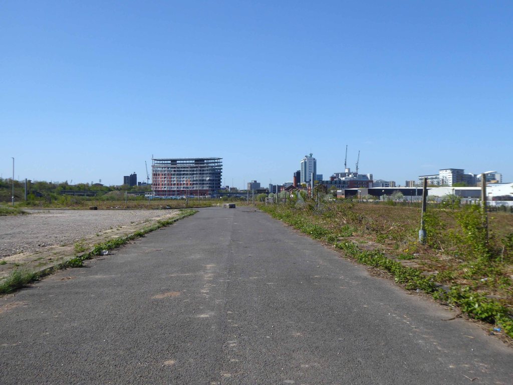
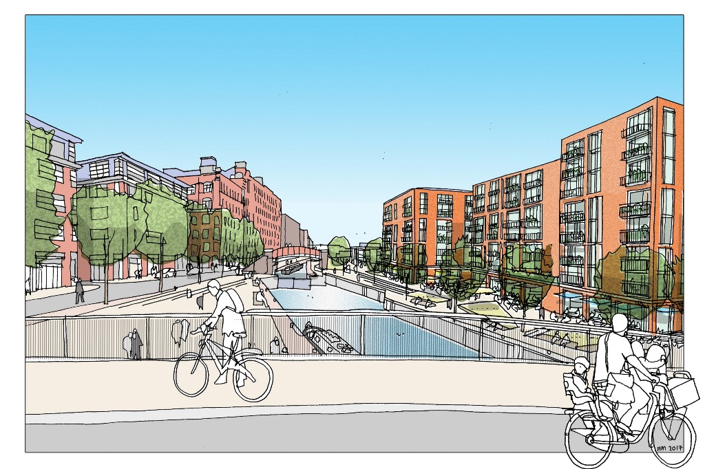
Manchester and Salford begin the long haul from post industrial decline to service centred cities – there were even seeds sewn for the development of a luxury marina. When I first visited Pomona the area was seriously overgrown and the underground wiring stripped out.
201020102020
Remnant of the initial scheme – pedestrian access, balustrade and lighting.
What would poor old Pomona make of all this?
There was a failed attempt to prevent further development and return the area to nature. Peel Holdings prevailed and pressed on relentlessly with their programme of urbanisation.
So it’s April 2020 – I’m on my way from somewhere else to somewhere else, I’ll cut across Pomona Island – the building site is in lockdown – ain’t nobody home.
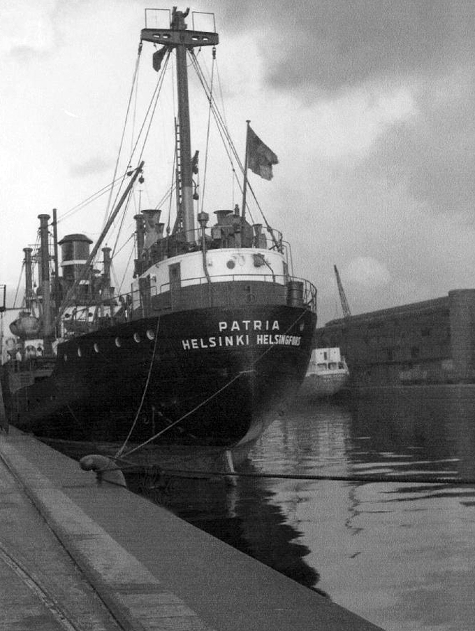
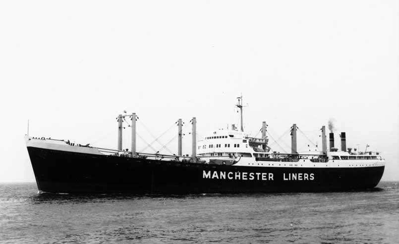
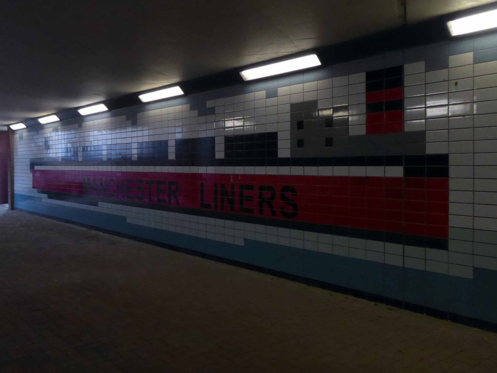
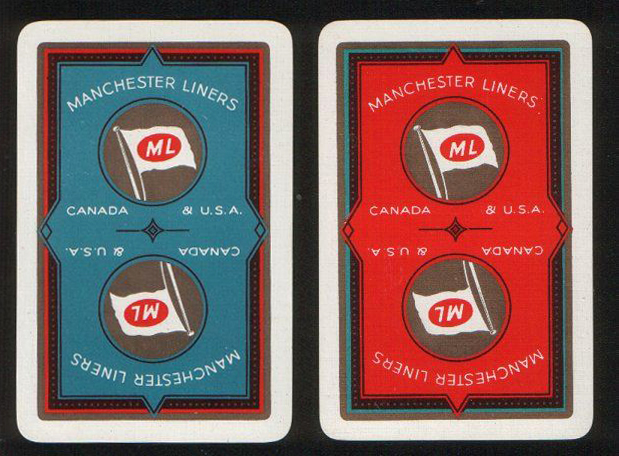
In 1898 Manchester Liners Ltd was launched, four second hand ships were purchased and the company naming policy of applying the prefix Manchester was established.
The company began to operate services to Canada and the USA. Manchester Liners started WW1 with 15 ships in its fleet. During the war 10 ships were lost to enemy action, but because of the purchase of replacements the fleet was at 12 in 1918.At the outbreak of WW2, Manchester Liners had 10 ships in service. War losses were 7 ships, but the delivery of war-standard ships maintained the fleet at 8, which was sufficient to resume a weekly service to Canada.
The Manchester dockworkers strike record became so bad, that in 1973 the company decided to move half of its container services to Felixstowe. Furthermore, to obtain lower costs per unit, container ships were becoming bigger than the Canal limits.
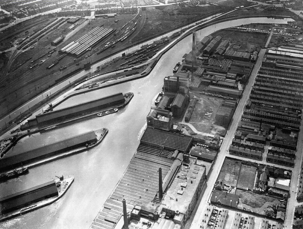
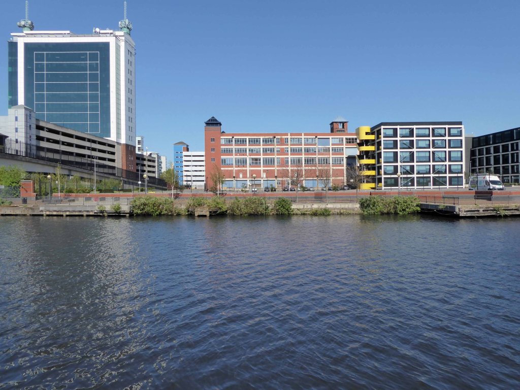
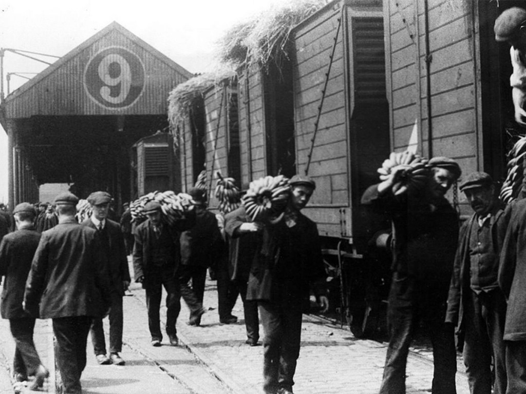
This was a history of economic growth and prosperity, for some. Tangible commerce, the wealth of a nation built on making things, moving things. Cranes, ships, stevedores and sailors, the world and his wife converging at the base of the Manchester Ship Canal.
All this is long gone, containerisation, recession and state engineered shifts in global manufacture and trade.
They took away the cranes.
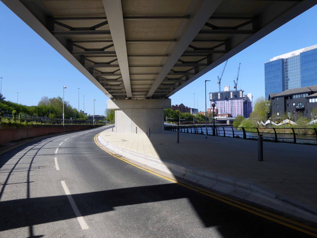
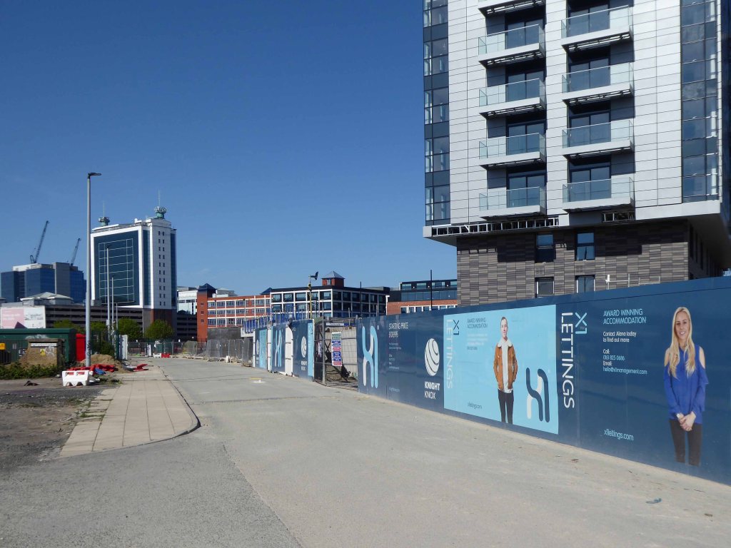
The area is now awash with intangible activity – what goes on behind the smoked and mirrored glass?
Just who is moving what around, how, where and why?
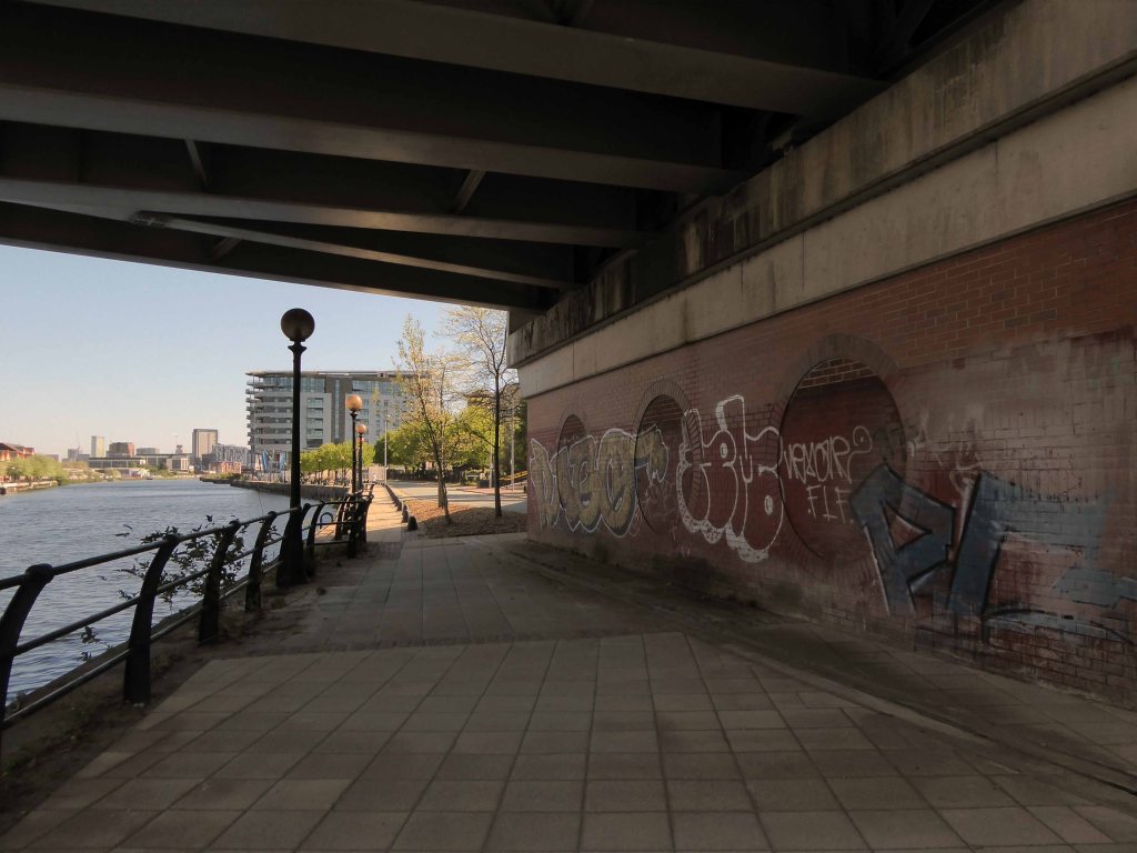
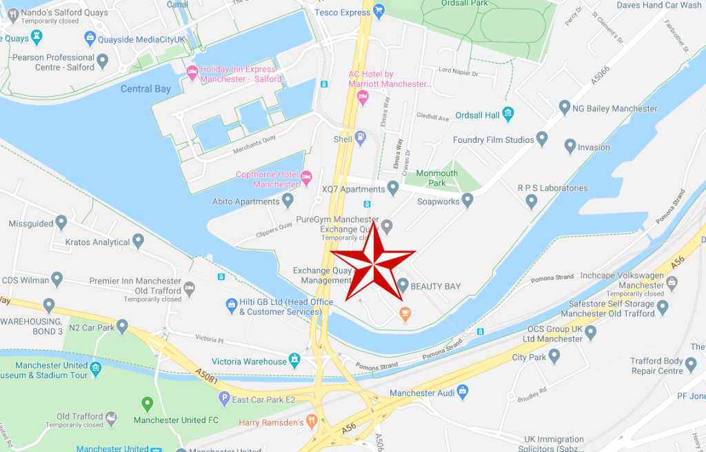
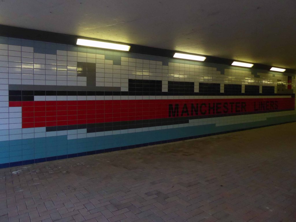
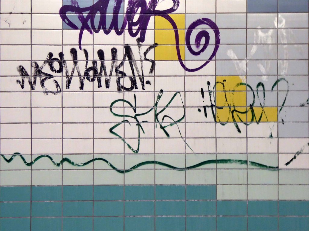
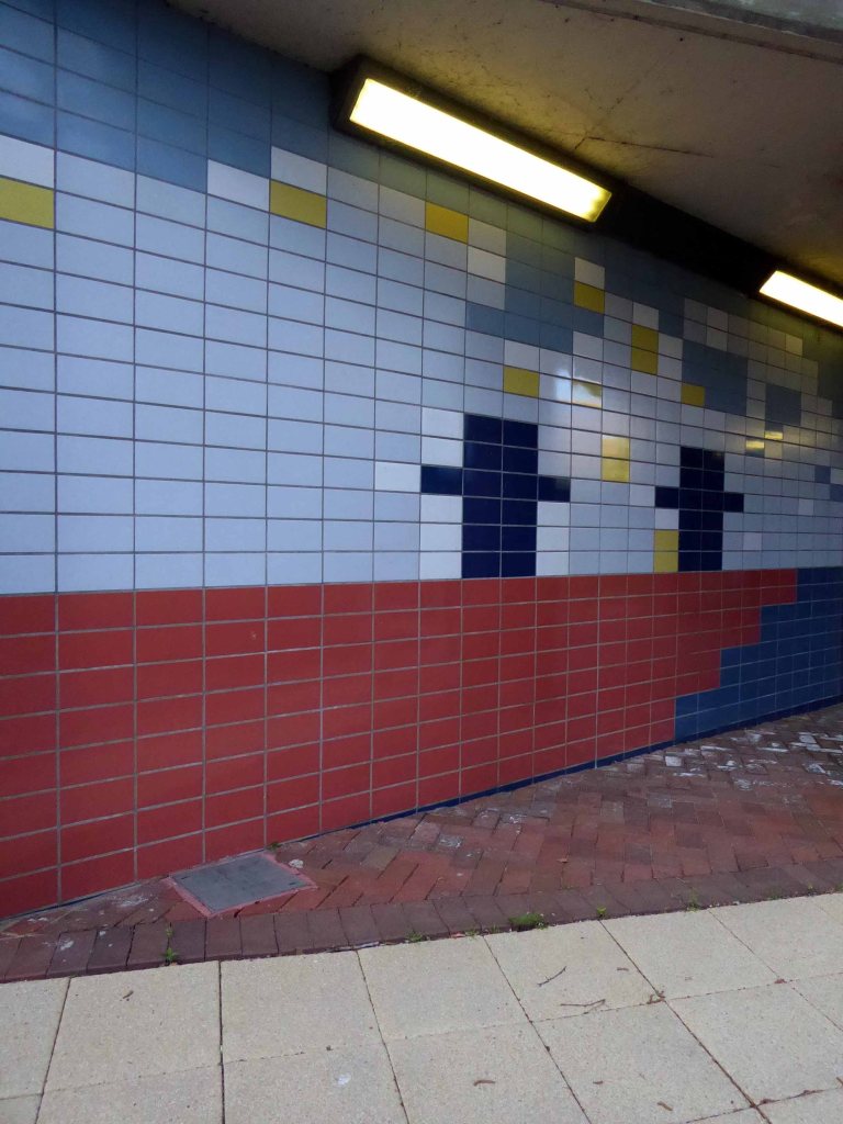
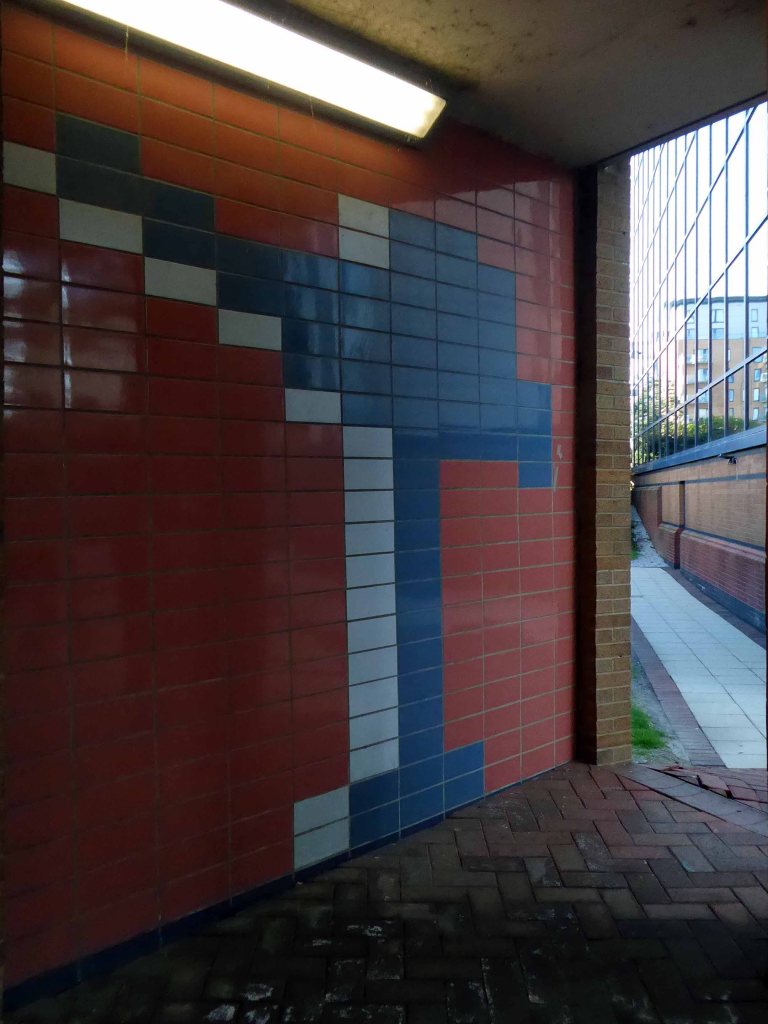
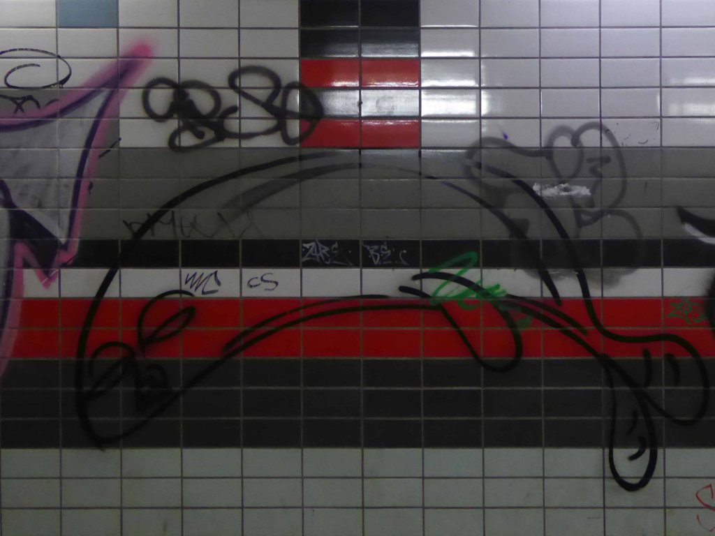
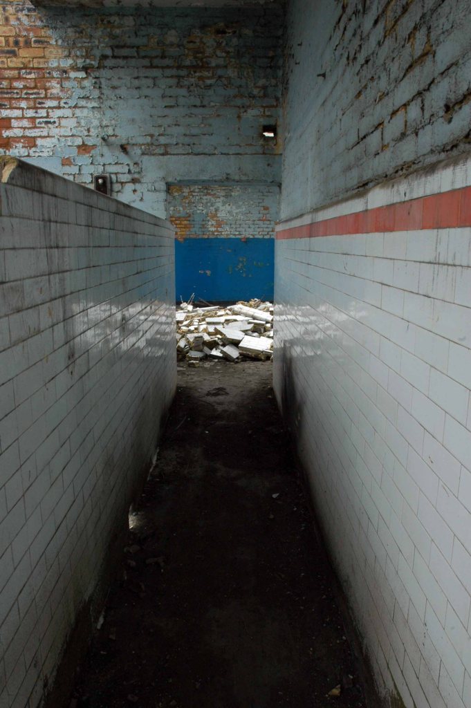
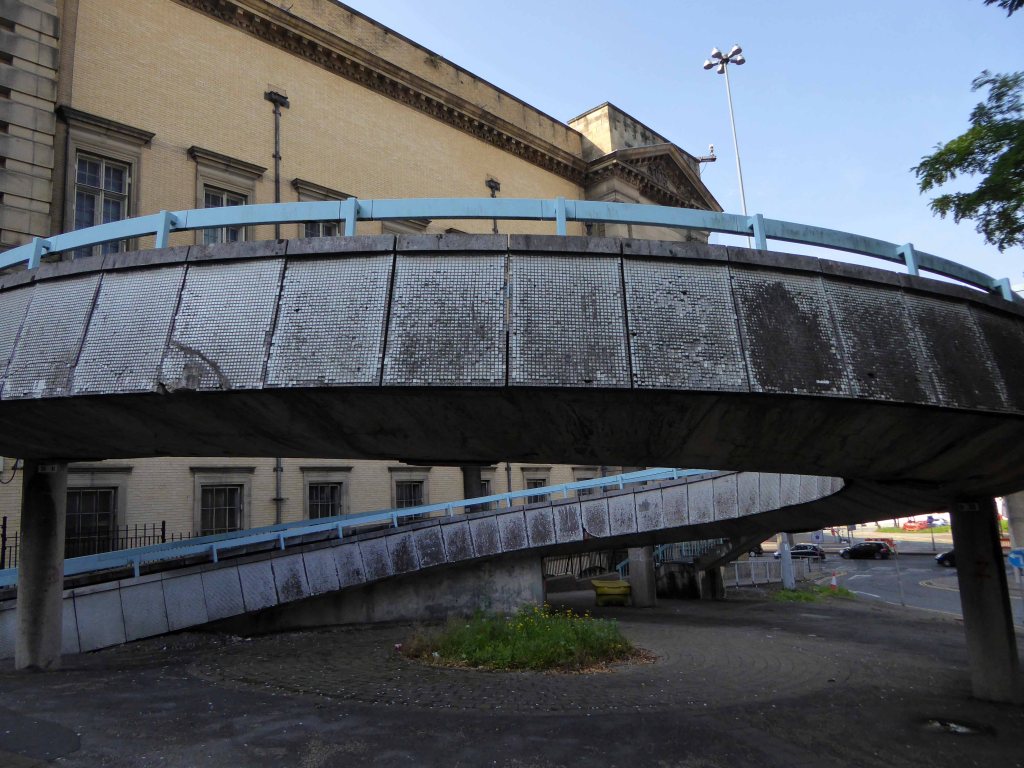
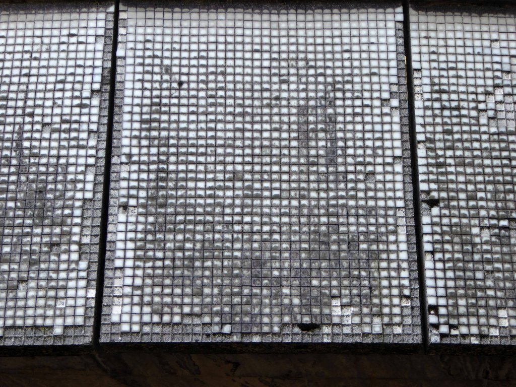
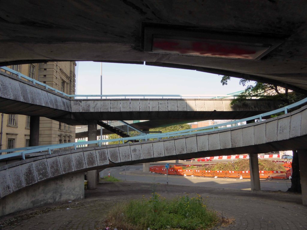
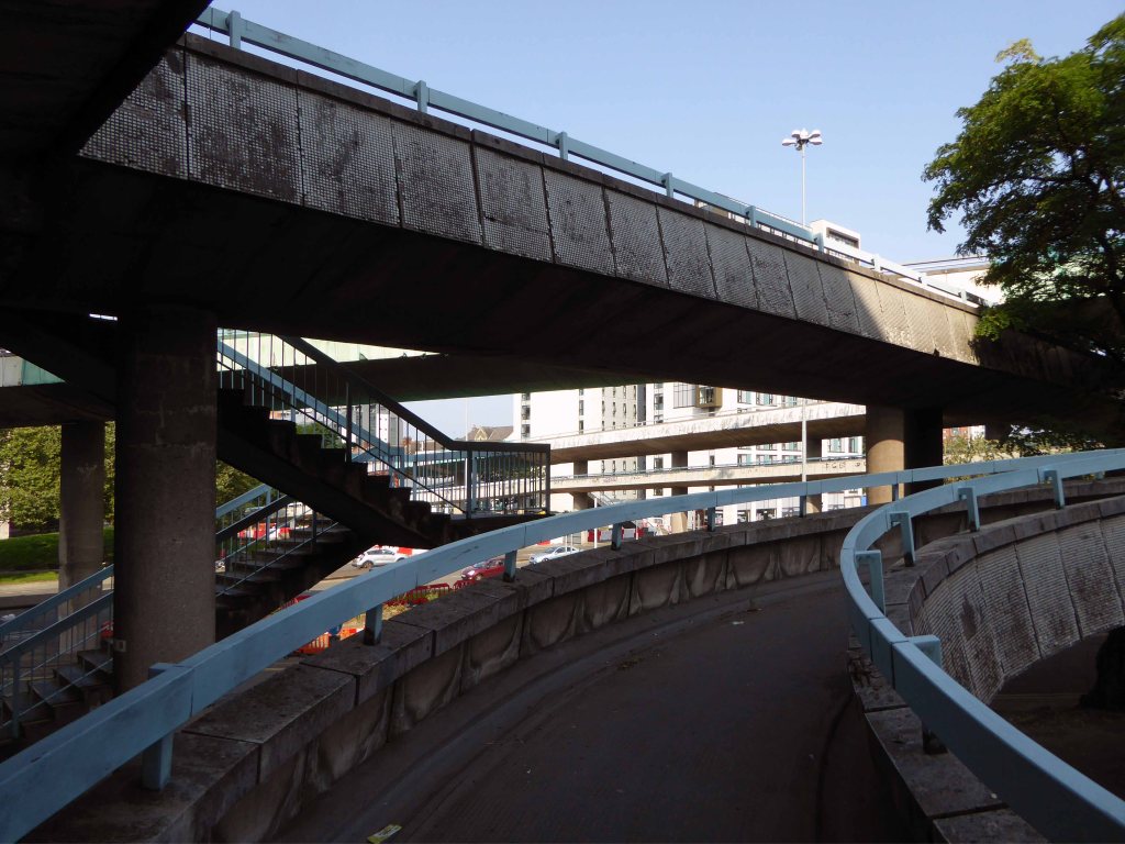
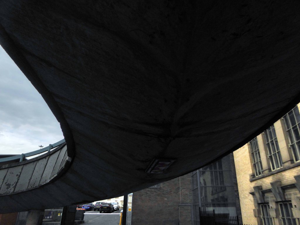
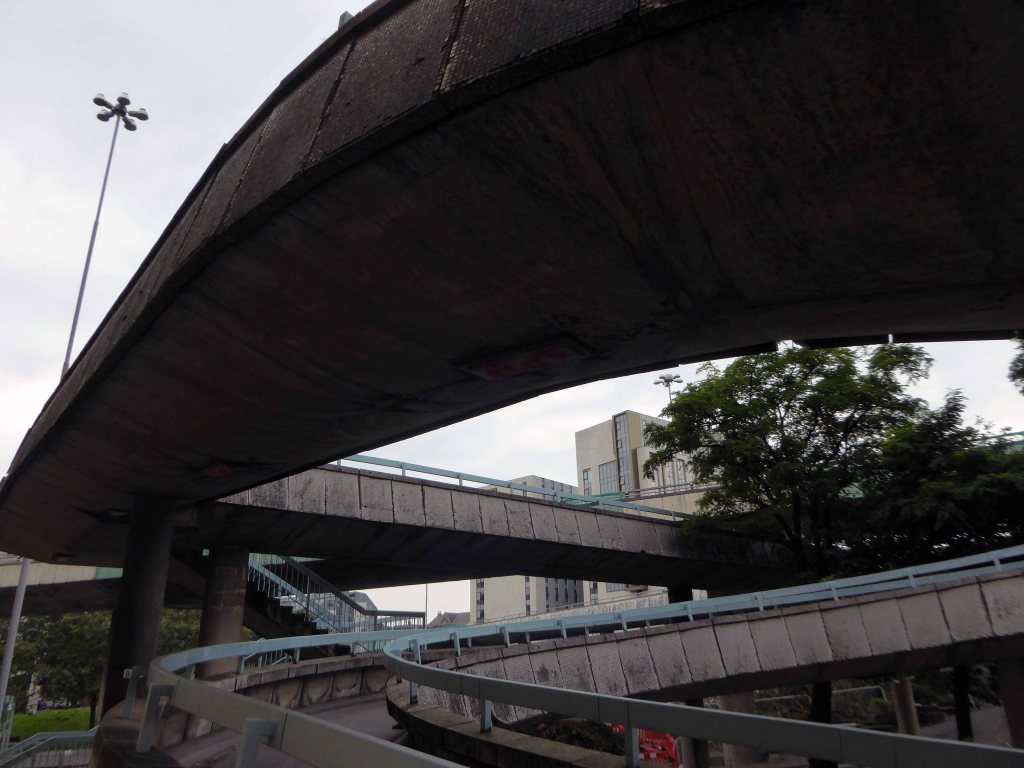
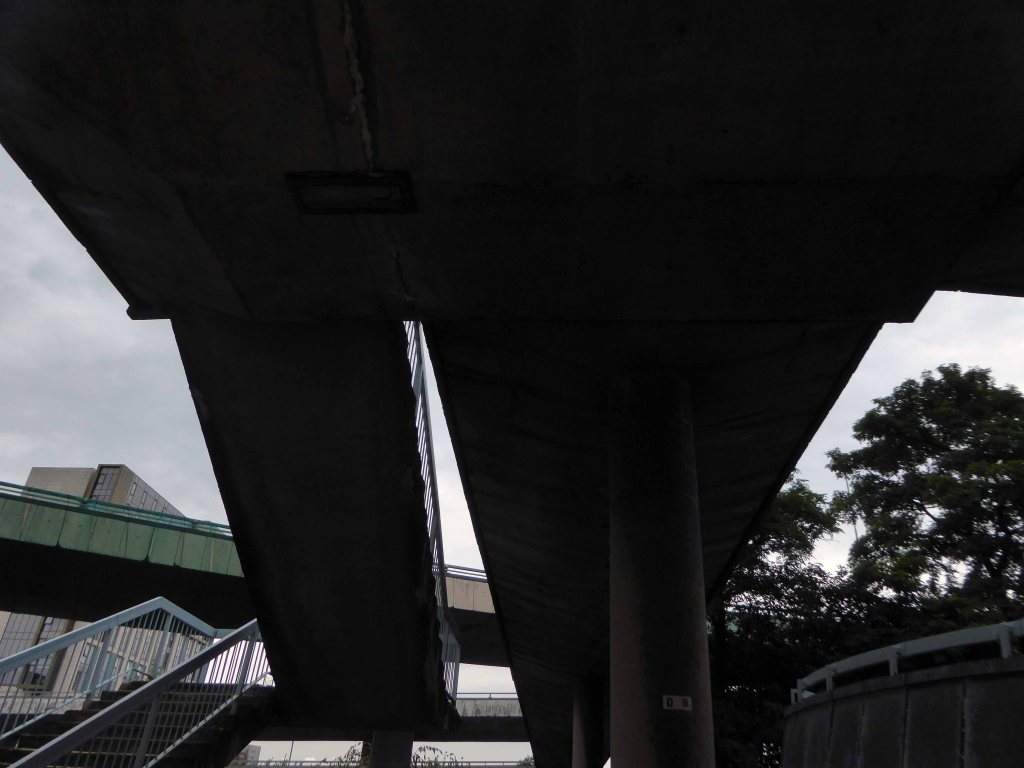
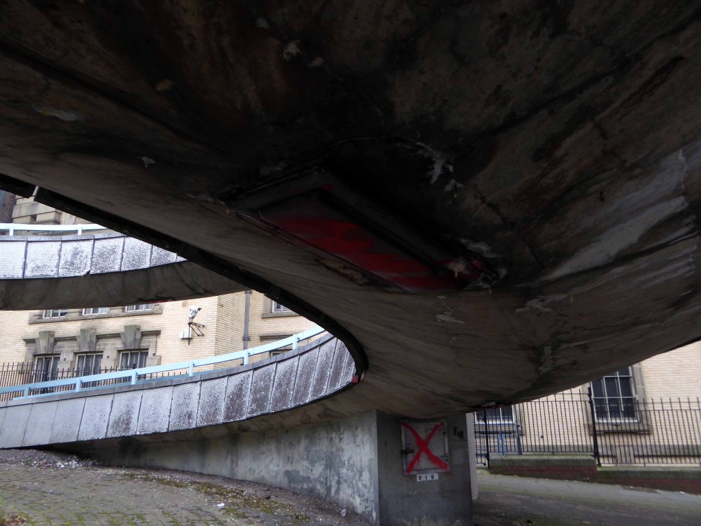
But hidden away between here and there is a tiled underpass.
A permissive path.
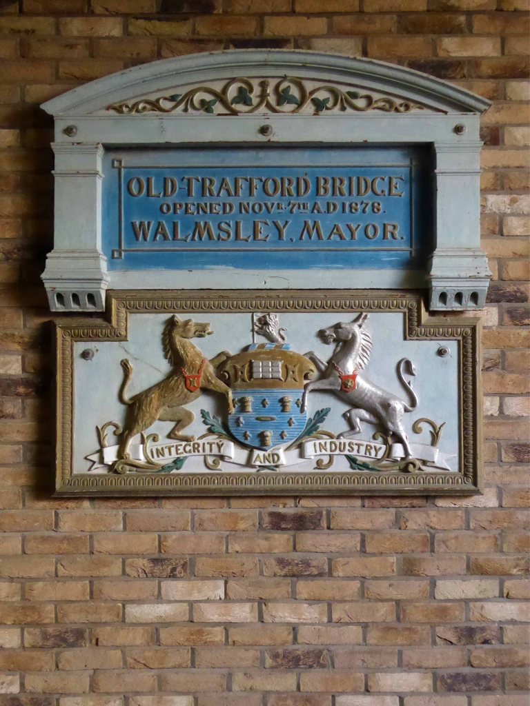
Where once there was a bridge – before the Manchester Ship Canal was built, the course of the River Irwell was approx. 50-100 yards further north of where the Ship Canal now passes under Trafford Road. This plaque is next to a pedestrian tunnel under Trafford Road, roughly on the line of the old navigation.
So here it is a hidden, harshly lit, slightly disabused tribute to the brave souls who sailed the seven seas, stayed ashore, weighed, loaded and shifted stuff.
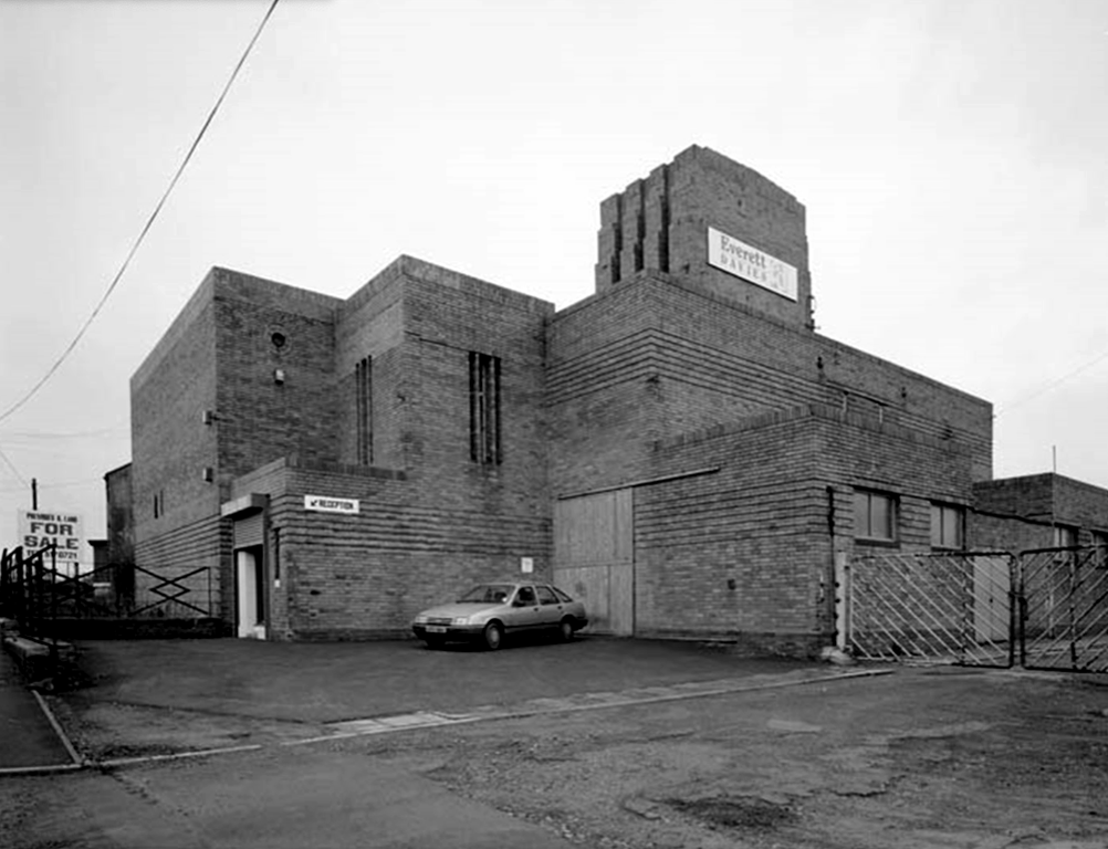
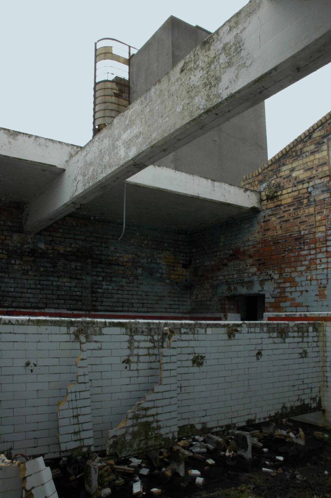
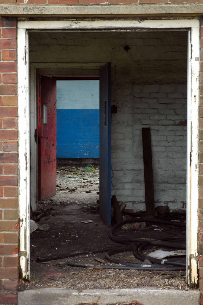
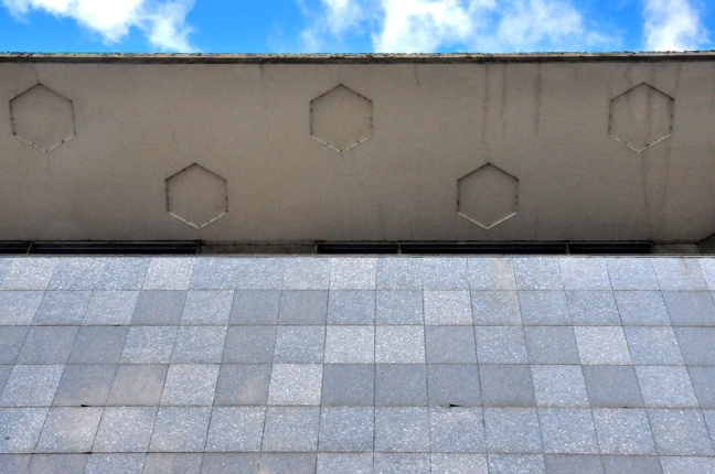
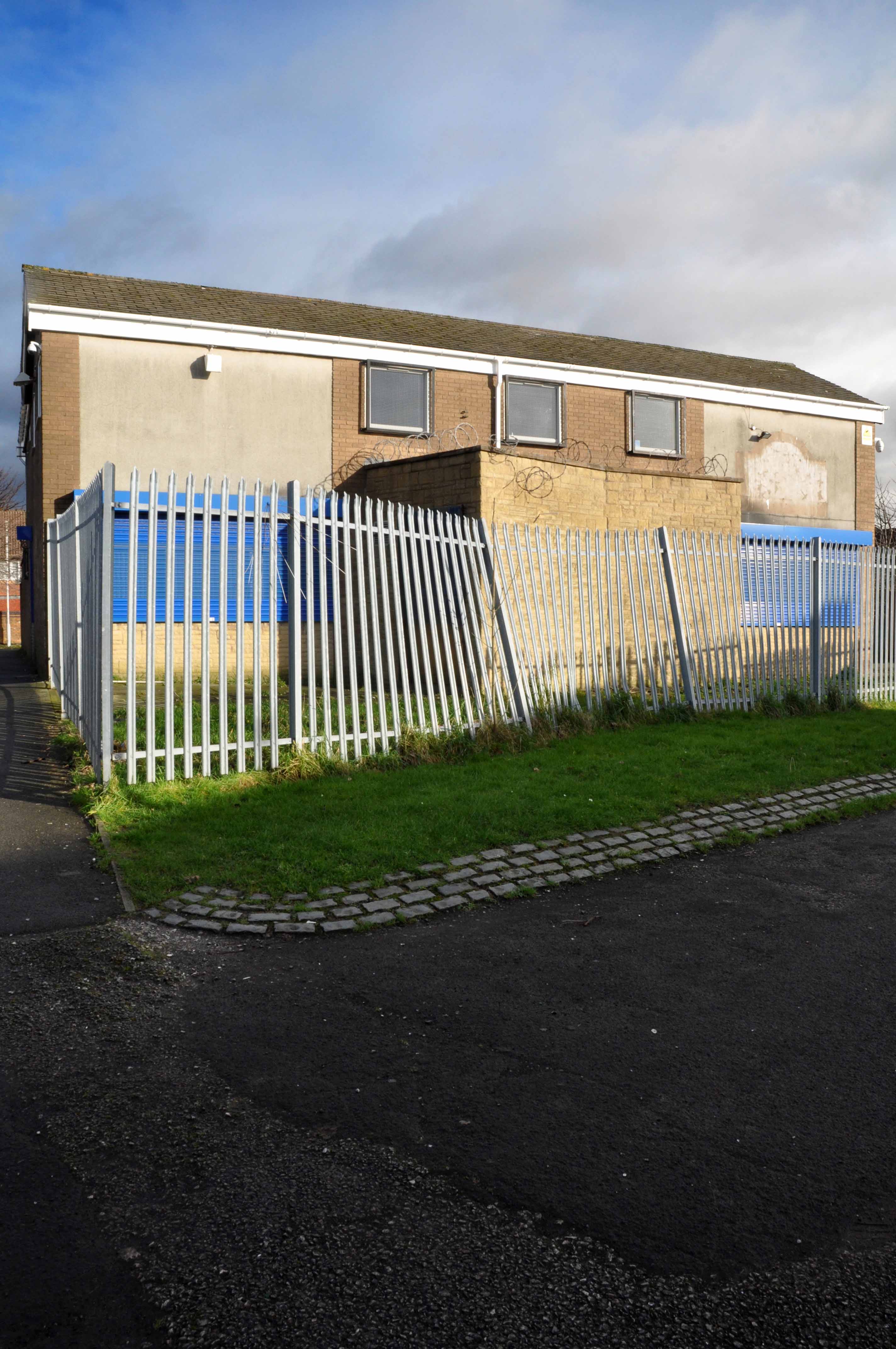
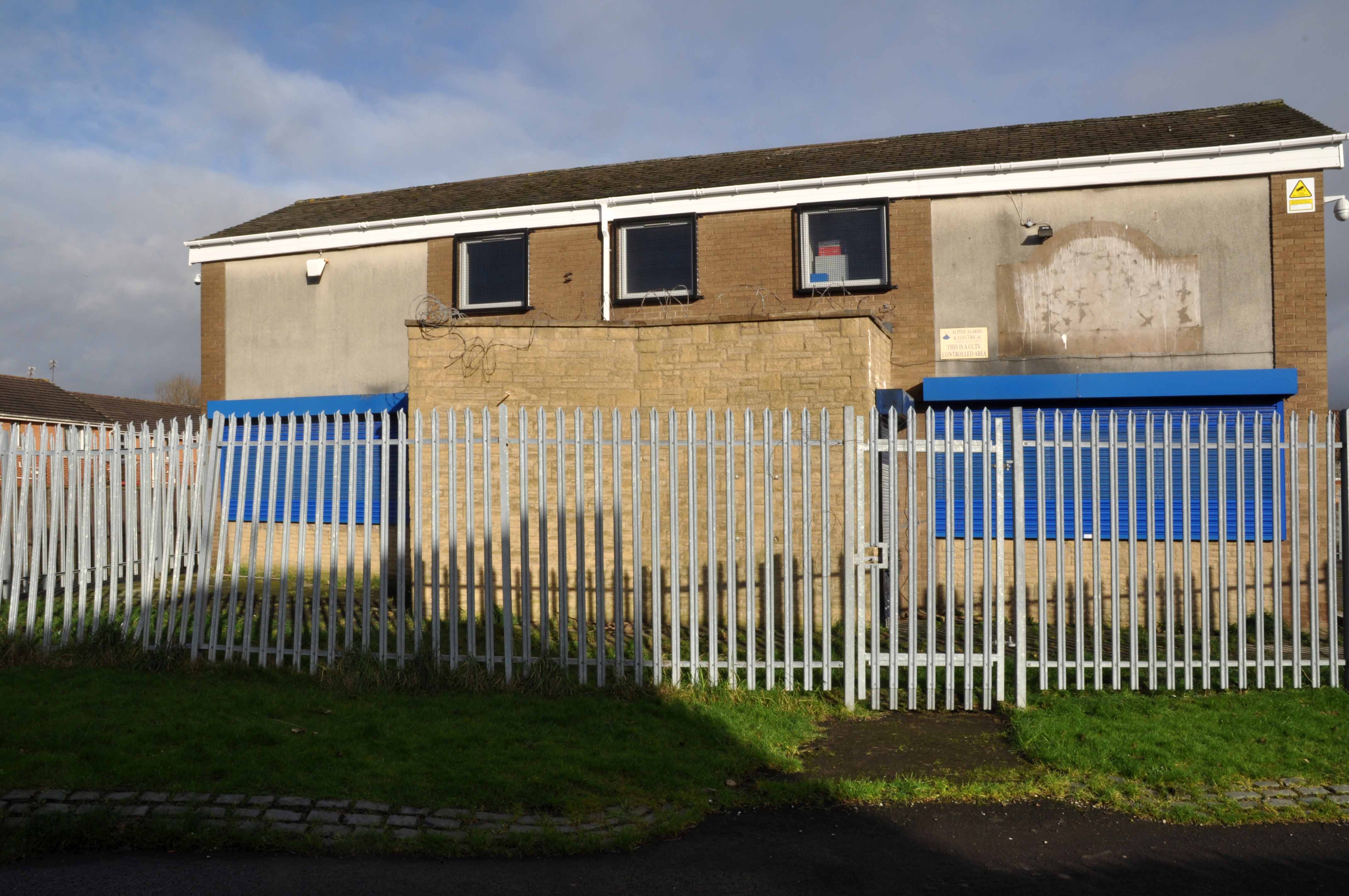
Pebbledashed over white brick. Roofs part concrete slab, part glazed behind parapet. Irregular plan, Modern Movement style. Group of blocks of varying height round tall central tower with rounded, glazed stair turret. Walls mainly sheer, with plinth and slight roof projection.
Long block on east of tower has central south projection with glazed, banded steel double door under high strip of windows beneath eaves overhang. Taller storeroom to west has similar doors in 2 recessed banded glazed bays; and abuts on south-east corner of tower. Similar double doors in base of tower. Large lower south-western canteen wing abuts on west side of tower and has banded glazing around two sides above a projecting sill. Slightly-projecting 3-bay office section to north has steel cross casements; on its return another casement and a door with hollow-chamfered jambs and flat hood. Taller bath block behind. Wave pattern on rainwater heads.
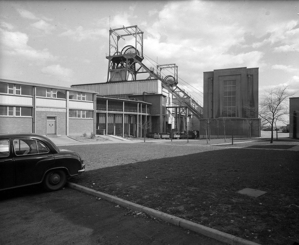
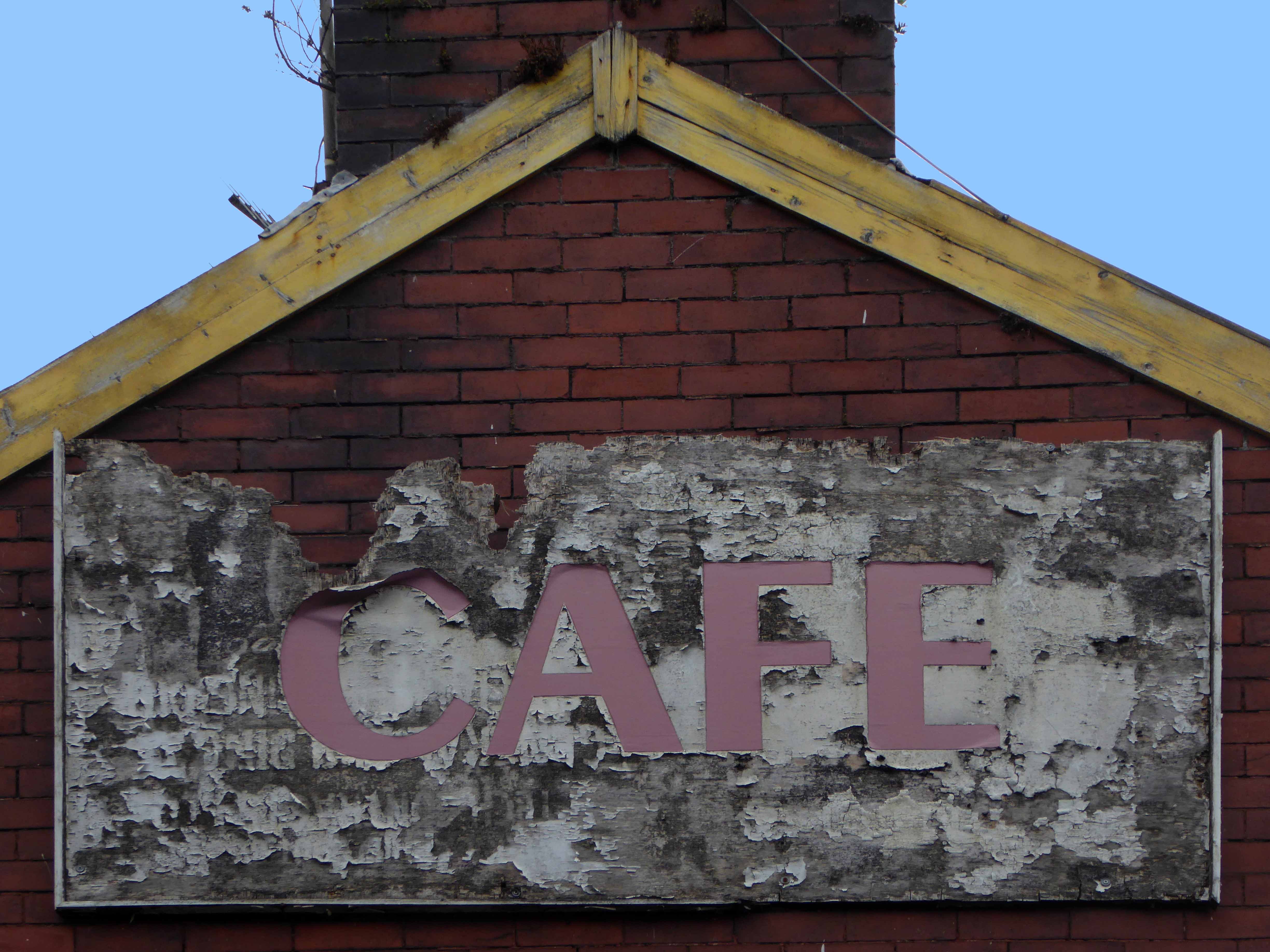
This is the youngest colliery in the neighbourhood, having commenced operations for the Ashington Coal Co Lt. in 1934. The shafts, which are situated comparatively near to the coast, are two in number, and both were sunk to the High Main seam level, which is 486 ft from the surface. The downcast No. 1 is 18 ft in diameter and is used for coal-raising on two shifts per day, and the upcast, which has a diameter of 15 ft, is used for ventilation and emergency man riding only.
The seams being worked are the High Main, the Diamond, the Main, and the Yard. Each of these seams shows practically the same nature of roof and floor as throughout the two neighbouring collieries and the distance between the seams is also comparable. They are, of course, found at slightly greater depths at Lynemouth, the Yard seam, for example, being 660 ft. below the surface near to the shafts, as compared with some 300 ft. at Ellington.
It was one of Britain’s largest collieries until it was closed in 1994.
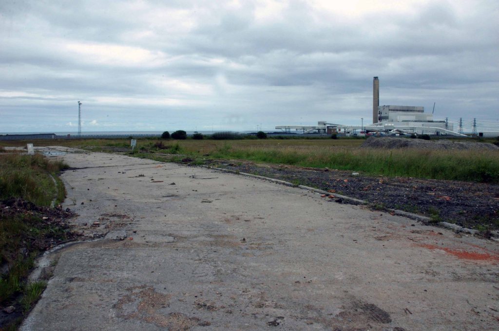
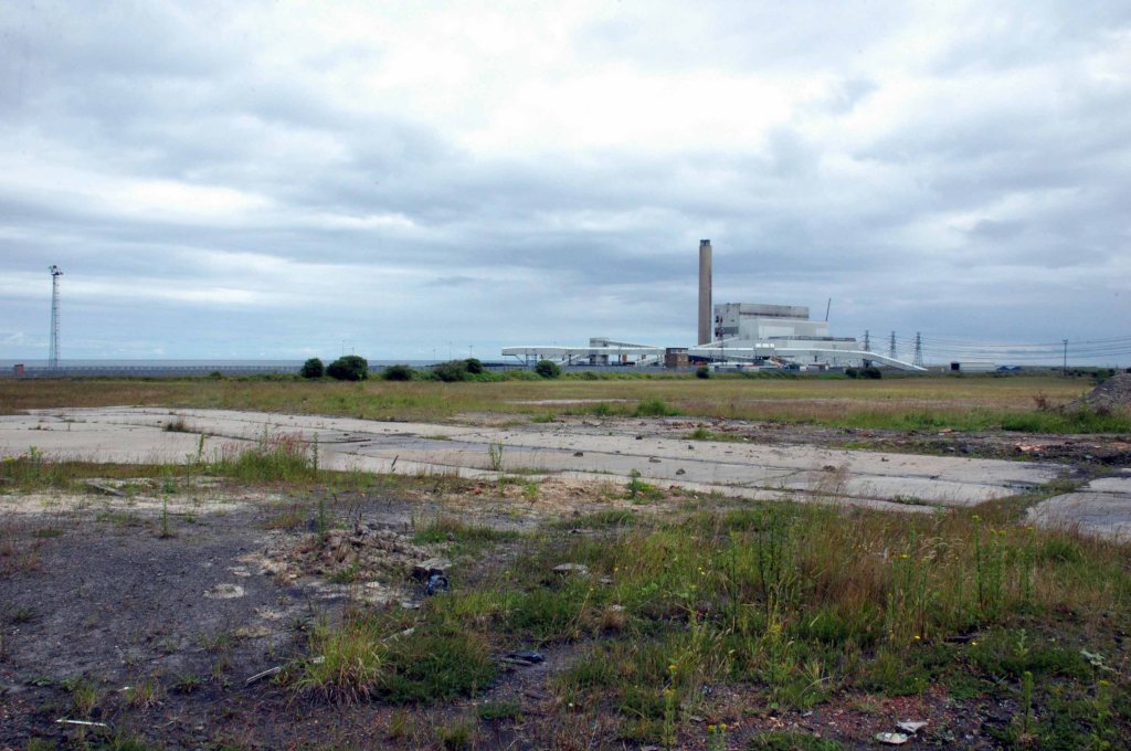
I was cycling the coast in July 2012 and happened by, seeing the tower of the baths from an adjacent path, passing by the faded signage.
Into the raw expanse of a now empty post-industrial landscape.
And on towards the bath house.
I am not by nature an urbex urban explorer, simply an explorer.
Entering the open site, I was well aware of the significance of the building and its history – working lives that had constructed the baths, entered and left through those very same doors.
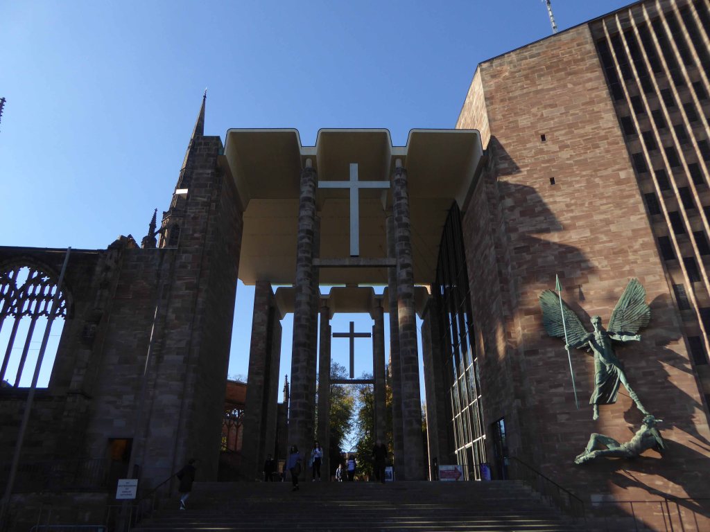
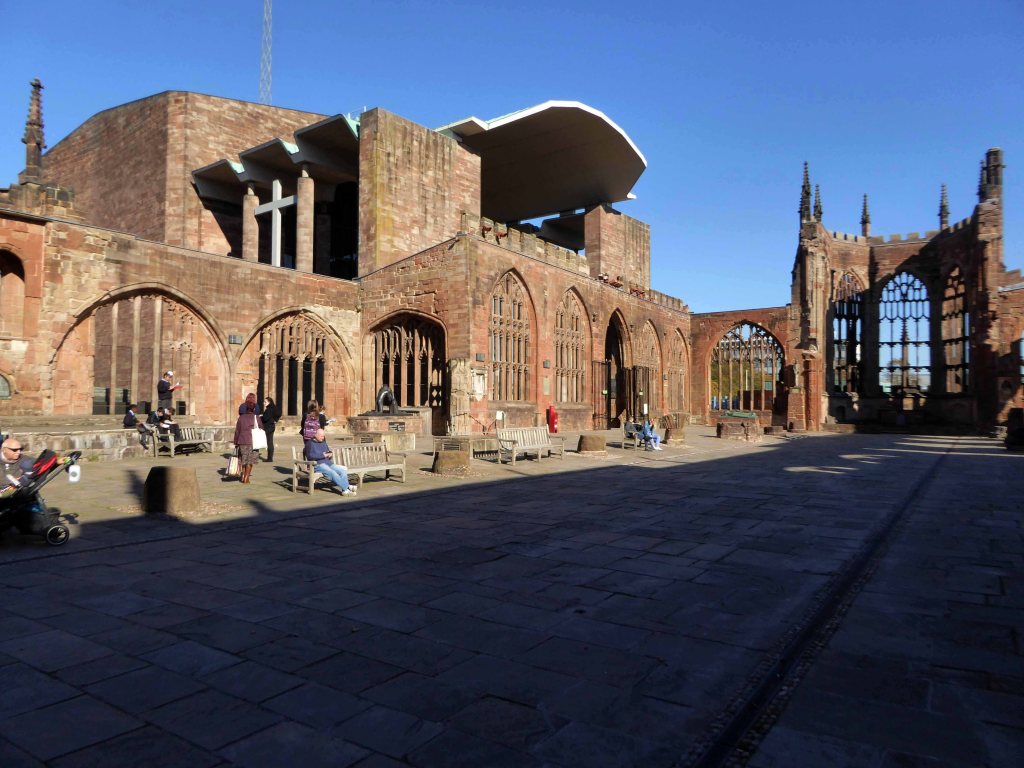
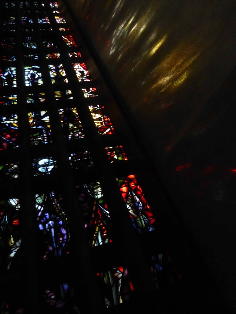
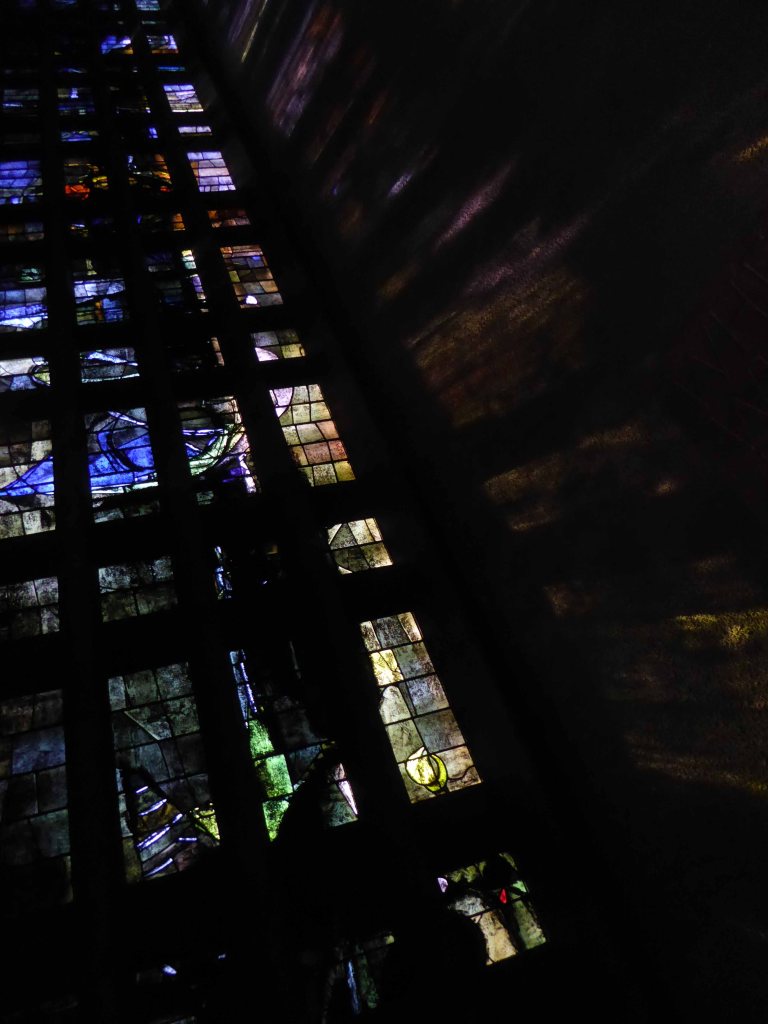
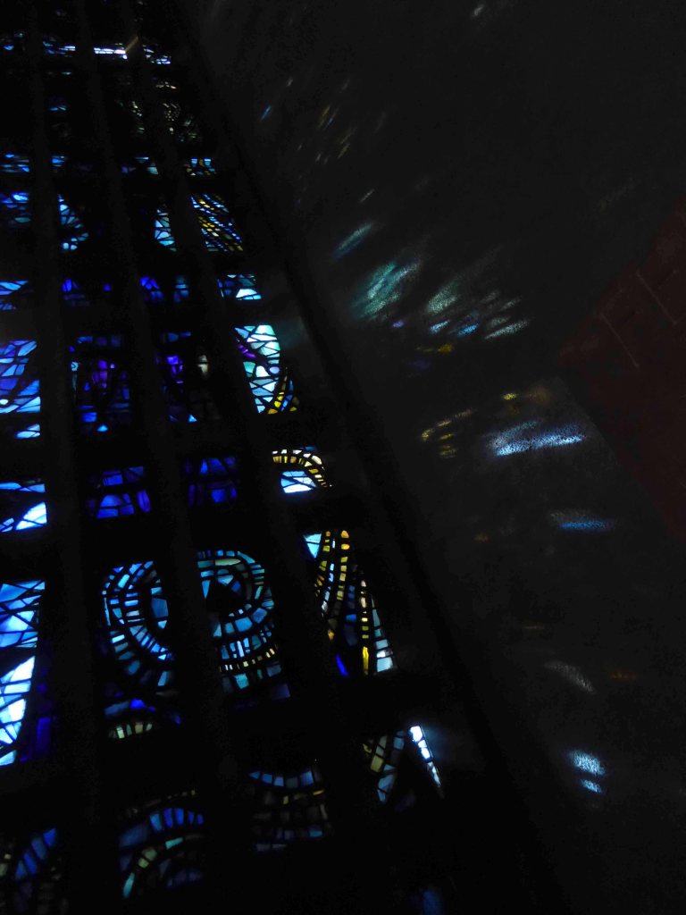
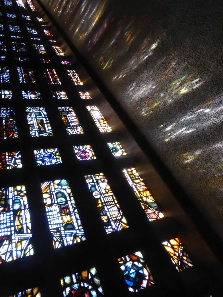
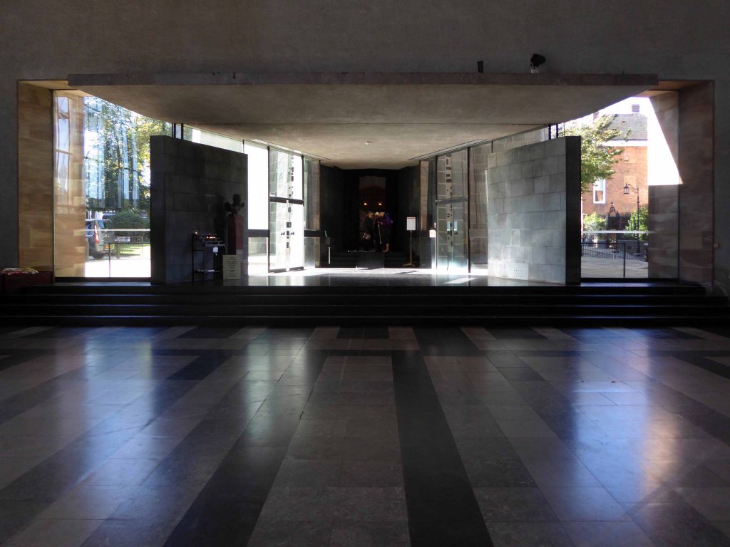
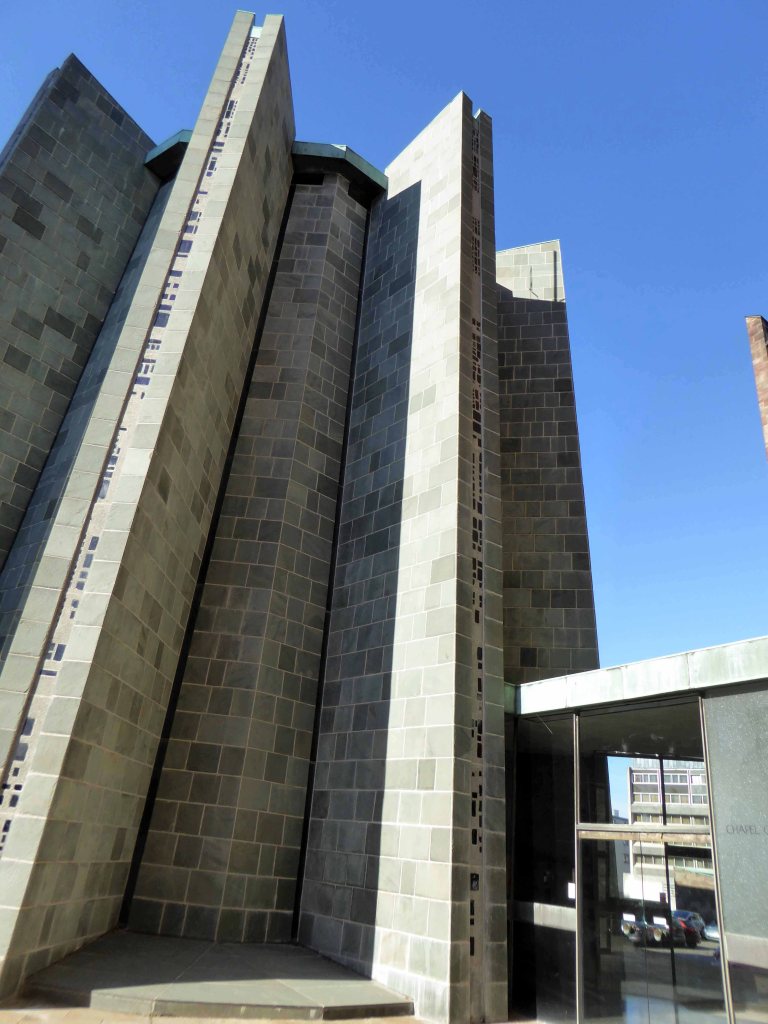
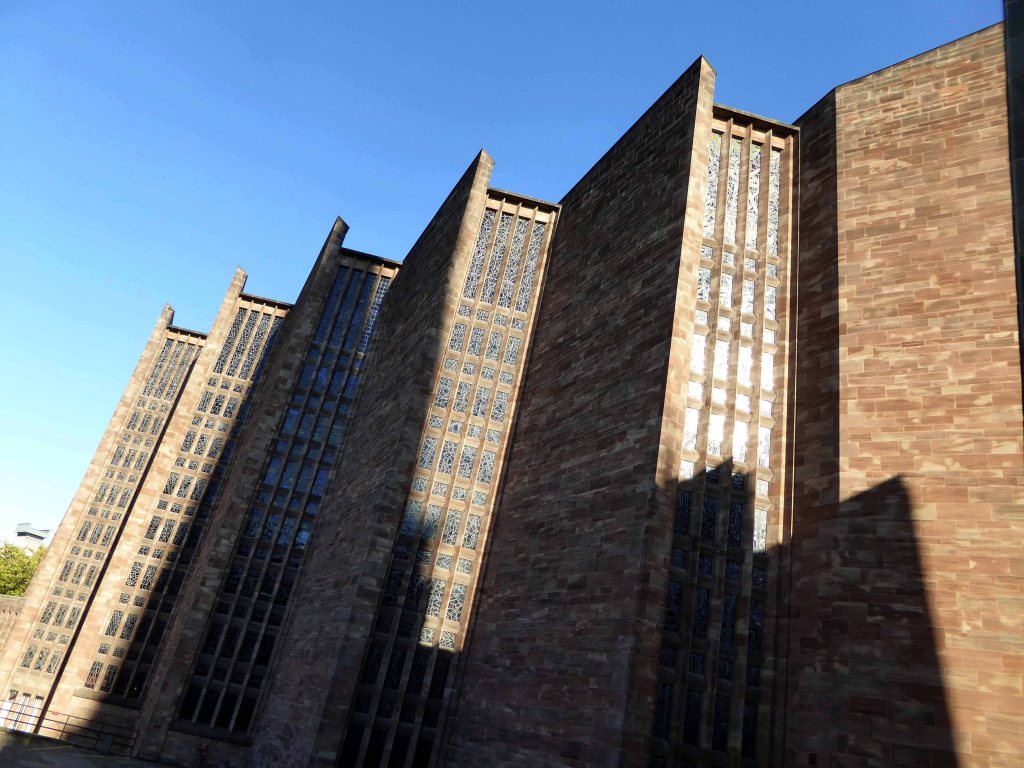
On the night of 14 November 1940, the city of Coventry was devastated by bombs dropped by the Luftwaffe. The Cathedral burned with the city, having been hit by several incendiary devices.
The decision to rebuild the cathedral was taken the morning after its destruction. Rebuilding would not be an act of defiance, but rather a sign of faith, trust and hope for the future of the world. It was the vision of the Provost at the time, Richard Howard, which led the people of Coventry away from feelings of bitterness and hatred. This has led to the cathedral’s Ministry of Peace and Reconciliation, which has provided spiritual and practical support, in areas of conflict throughout the world.
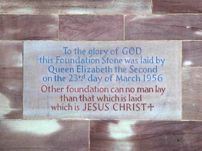
Her Majesty the Queen laid the foundation stone on 23 March 1956 and the building was consecrated on 25 May 1962, in her presence. The ruins remain hallowed ground and together the two create one living Cathedral.
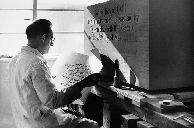
Ralph Beyer carving the foundation stone for Coventry Cathedral.
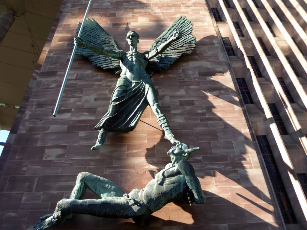
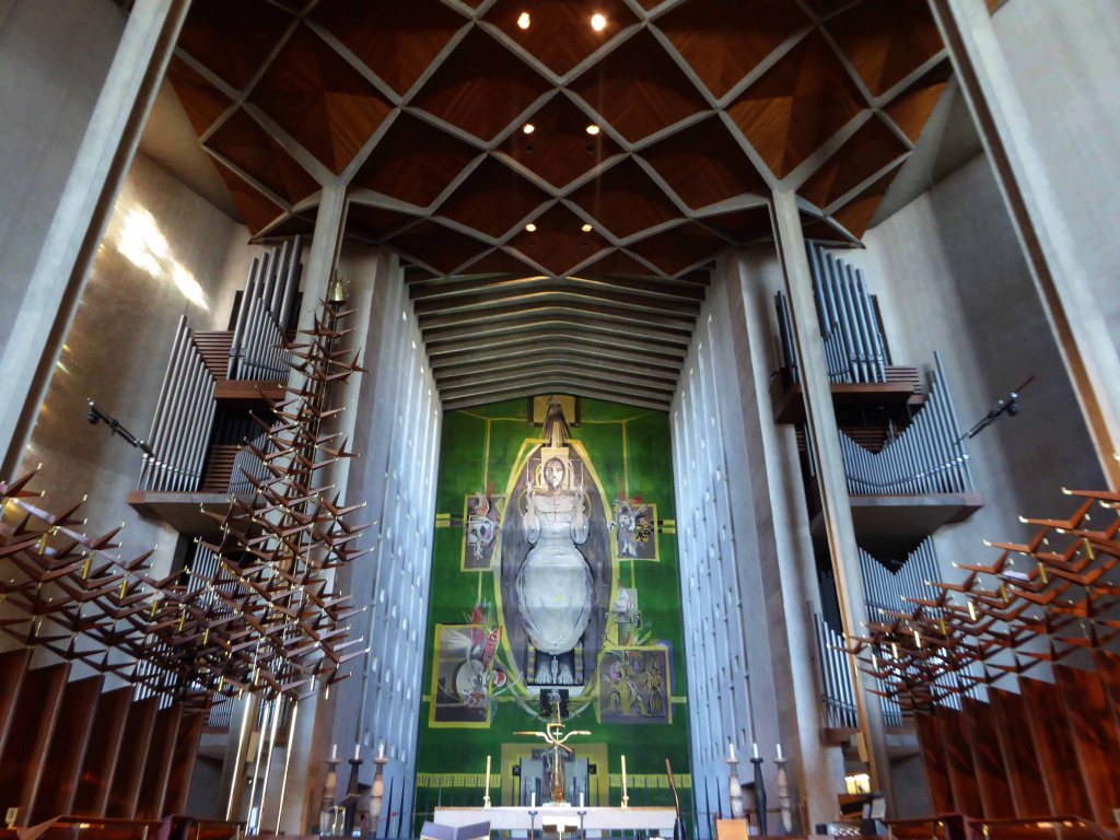
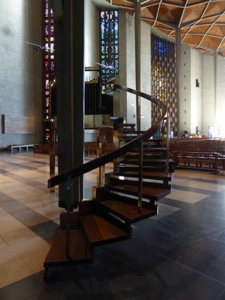
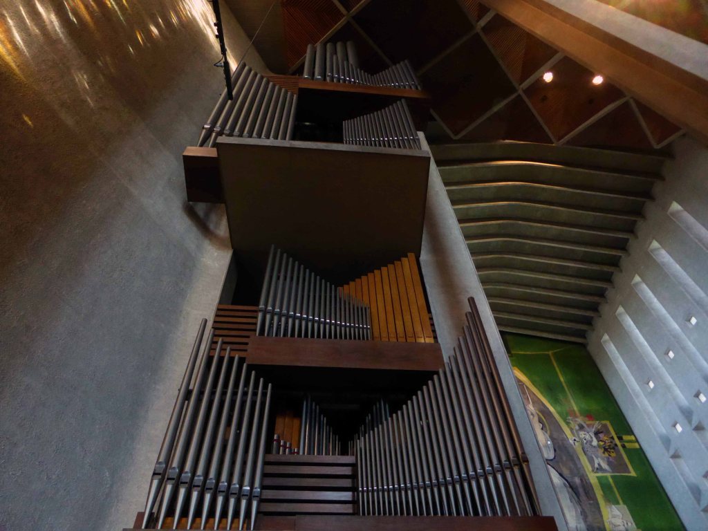
The new Cathedral was itself an inspiration to many fine artists of the post-war era. The architect, Sir Basil Spence, commissioned work from Graham Sutherland, John Piper, Ralph Beyer, John Hutton, Jacob Epstein, Elisabeth Frink and others – most still to reach the peak of their artistic careers.
St. Michael and the Devil on the southern end of the east wall. It was sculpted by Sir Jacob Epstein, who, sadly, died in 1959, and therefore didn’t live to see his masterpiece mounted on the cathedral wall a year later.
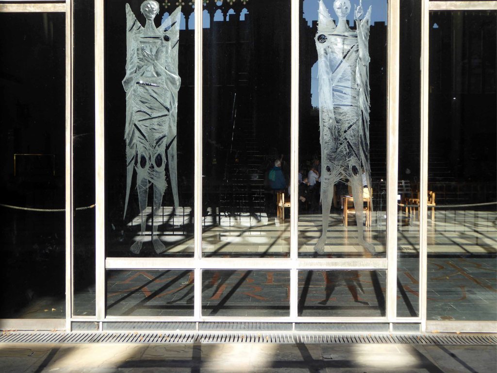
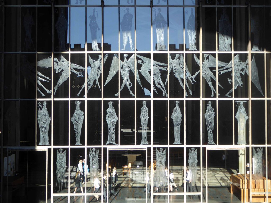
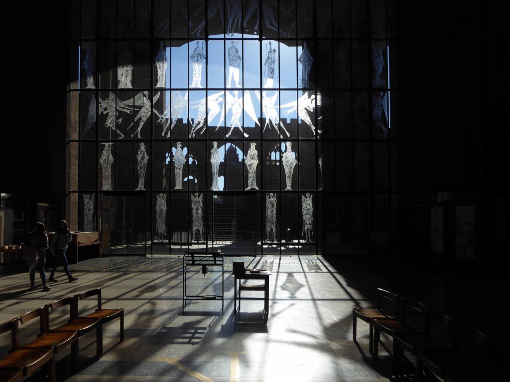
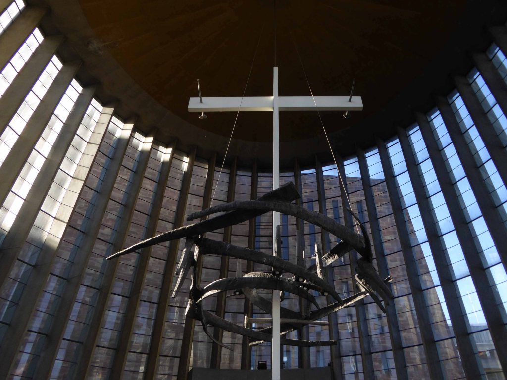
Entrance to the cathedral is through the Screen of Saints and Angels – it is seventy feet high and forty five feet wide and is supported by a bronze framework hung by wires from the roof for added strength.
This unique screen formed part of Sir Basil Spence’s first vision for the new cathedral. As he stared out from the ruins of the bombed cathedral, he saw the shape for the new church through a screen of saints. This transparent wall would link the old and new – making each mutually visible from within each other. Provost Howard set out to draw up a scheme consisting of all the saints who were responsible for the bringing of Christianity to Britain. As John Hutton began to make initial designs, he soon realised that row upon row of saints would need to be broken up in some way, and suggested that angels be inserted between the saints.
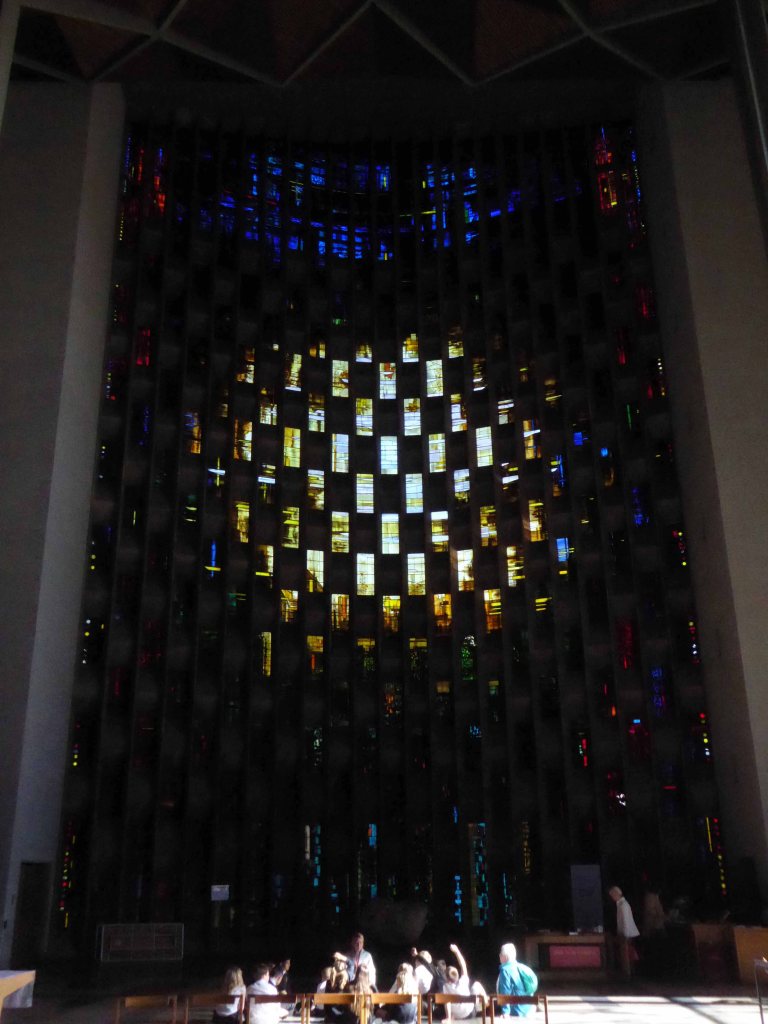
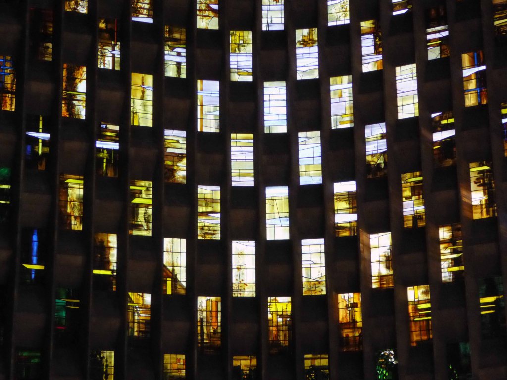
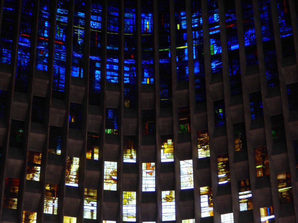
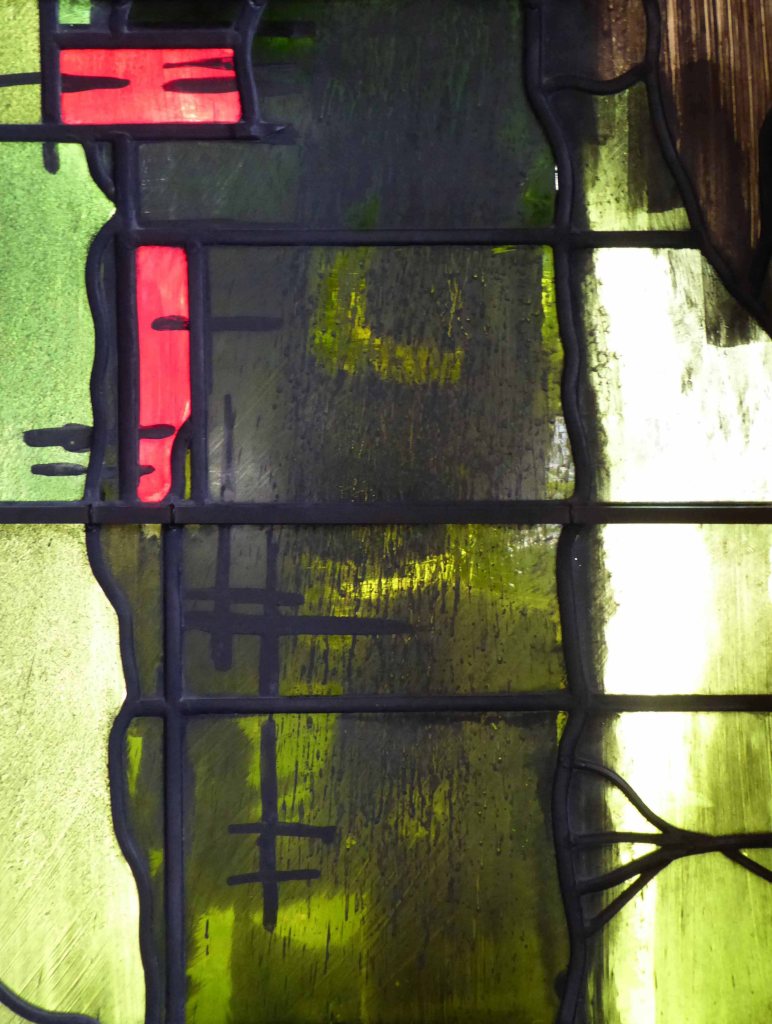
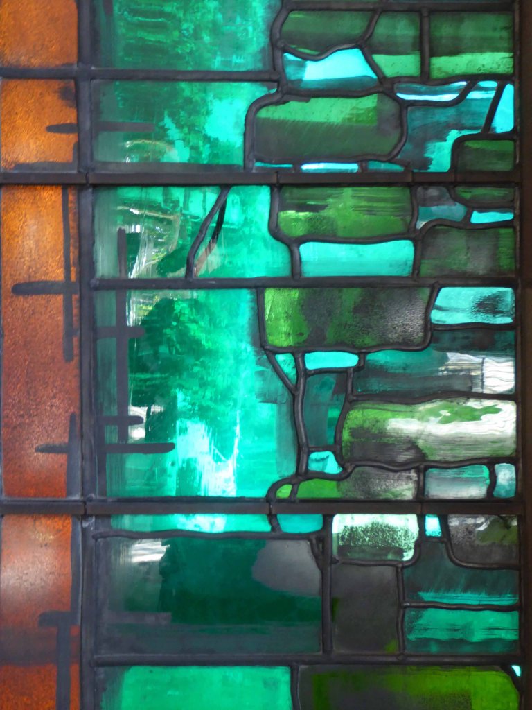
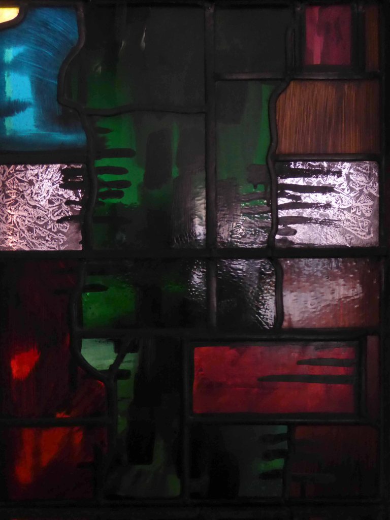
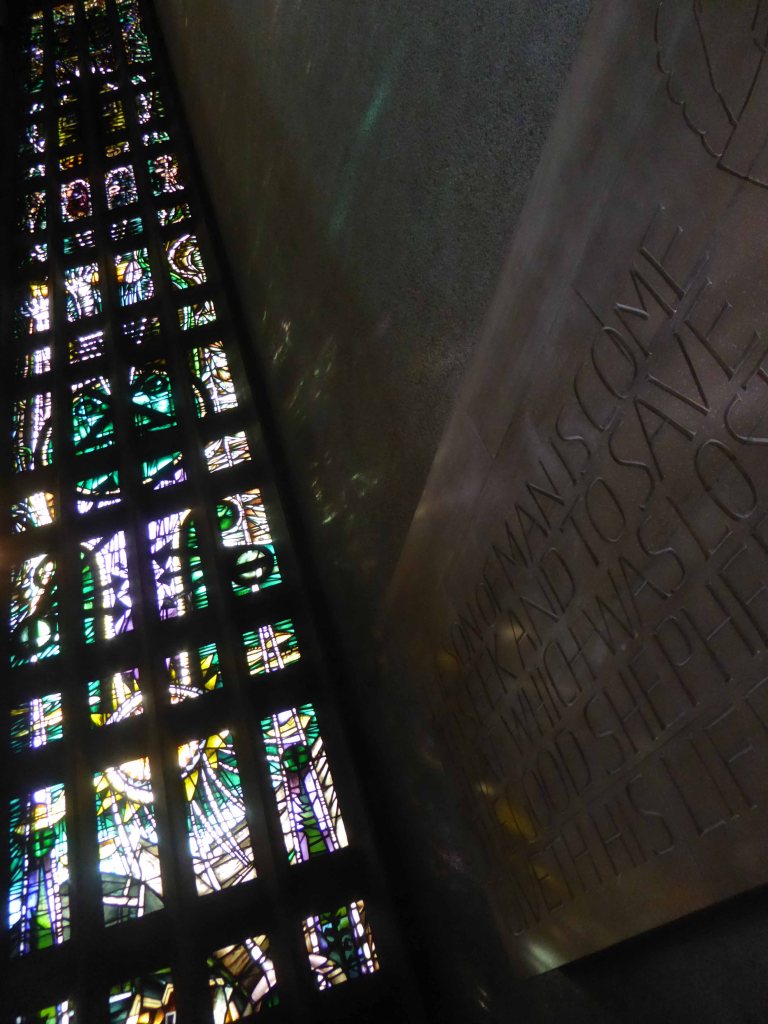
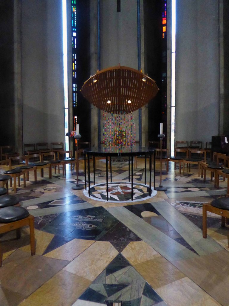
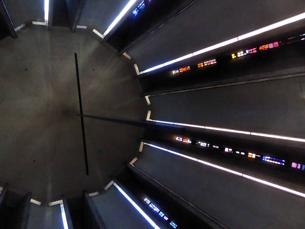
The eighty one foot high Baptistery Window containing a total of one hundred and ninety five lights of stained glass in bright primary colours designed by John Piper and Patrick Reyntiens, with the Stone of Bethlehem for a font just in front. Each individual window contains an abstract design, but the overall effect is breathtaking. Basil Spence himself designed the stone containing the glass.
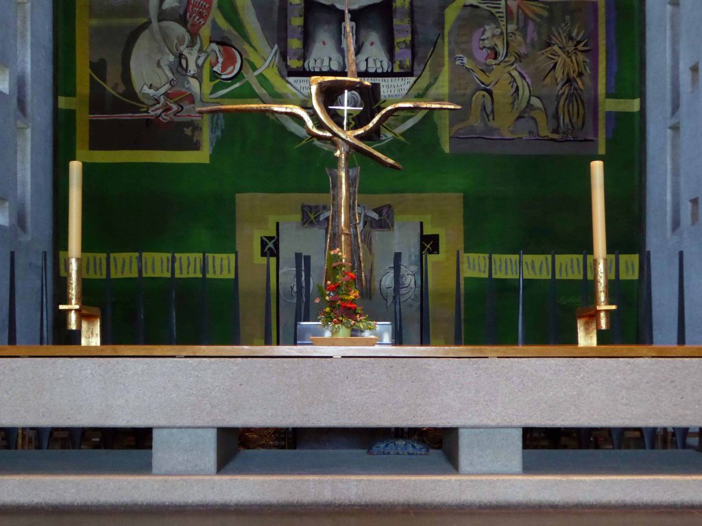
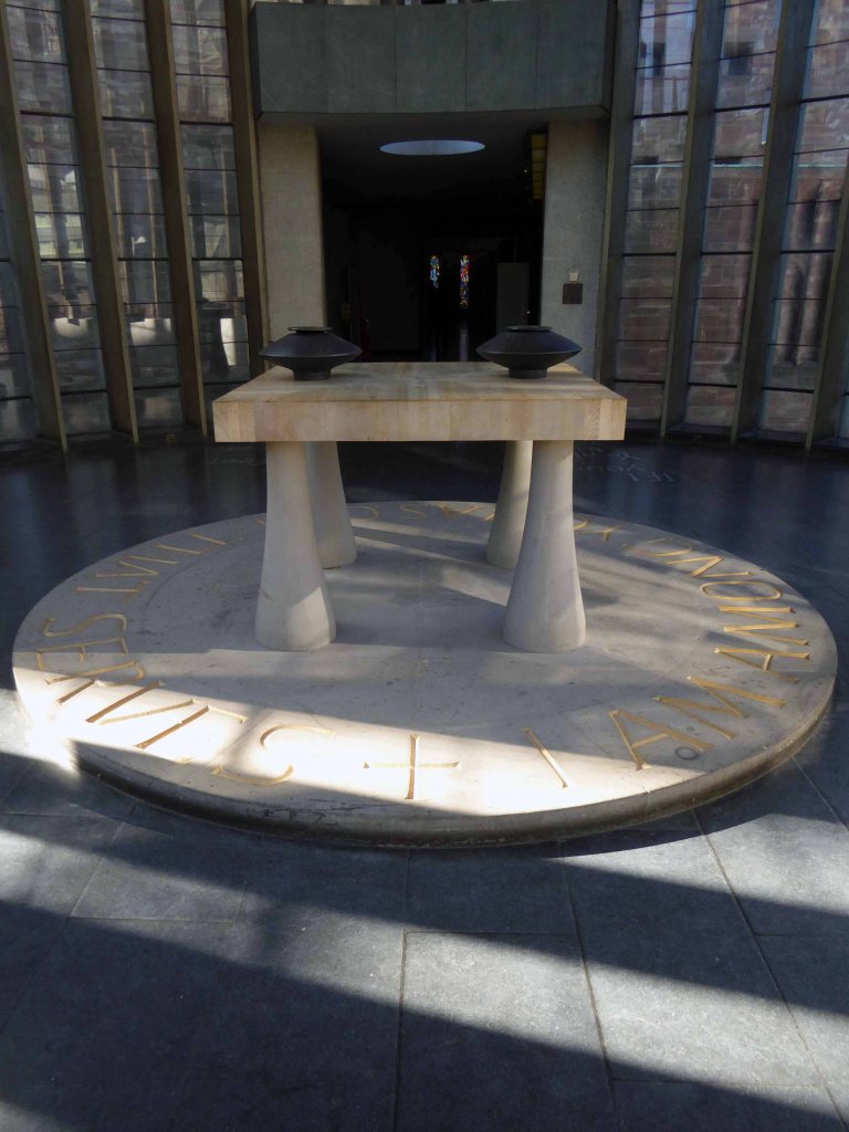
The great tapestry was another example of a re-think in design. Basil Spence’s original intention was to depict the Crucifixion but Provost Howard suggested that the subject be Christ in Majesty and from there on, this idea prevailed
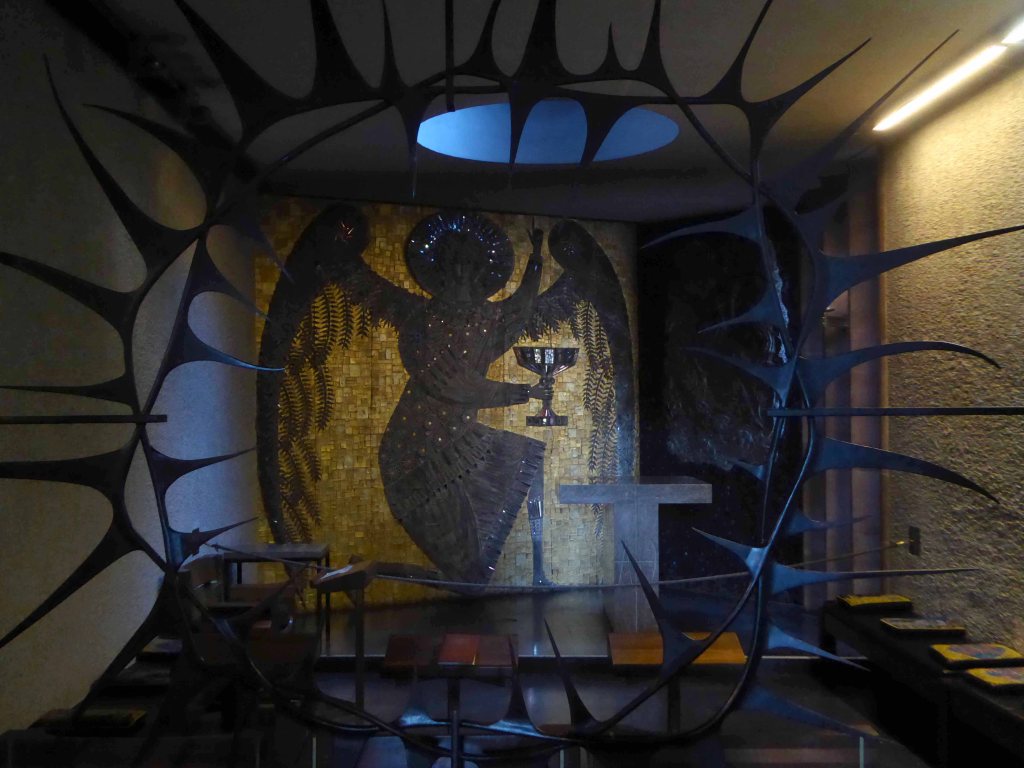
The Chapel of Christ in Gethsemane is approached by following the aisle from the Baptistery window towards the altar which is at the north end. The mosaic depicts the Angel of Agony by Steven Sykes and becomes more impressive when seen from a distance through the wrought iron crown of thorns designed by Basil Spence.
A short passageway takes you through to the Chapel of Christ the Servant – also known as the Chapel of Industry due to the view of Coventry workplaces from its narrow windows.
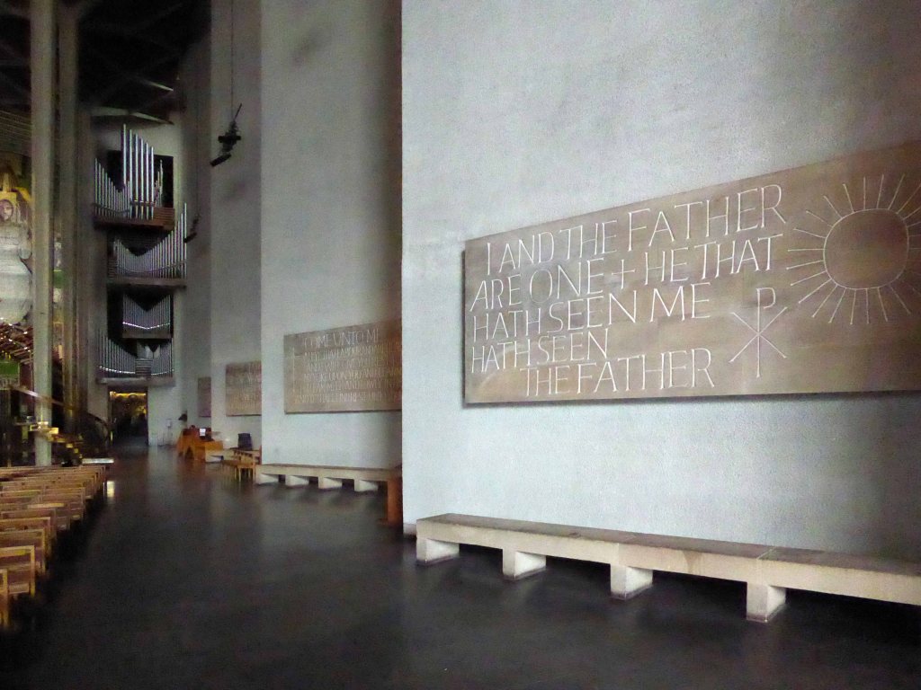
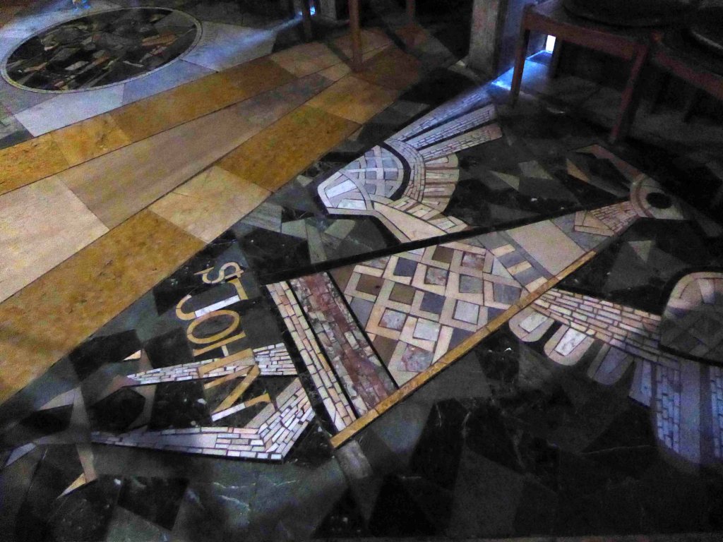
Monumental inscriptions to walls and floor by Ralph Beyer
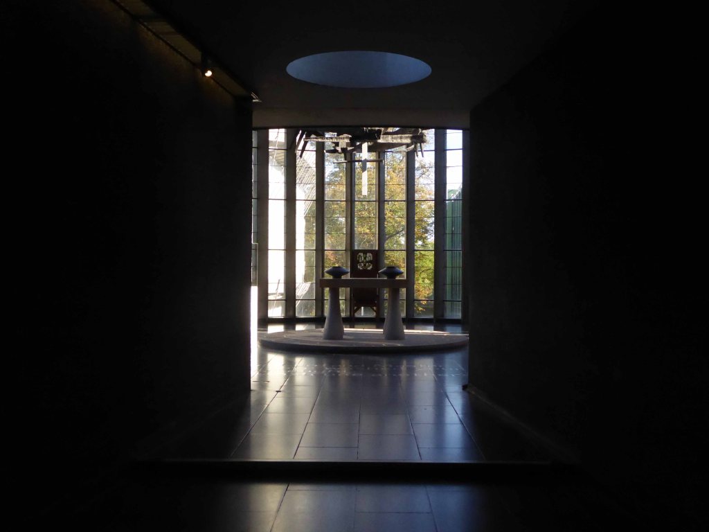
At the far end of the aisle, opposite the Baptistery Window is the Chapel of Unity, with its detailed mosaic floor, donated by the people of Sweden, representing the nations of the world and lit by shafts of light from the narrow stained glass windows around the circumference of the star shaped chapel.
This design was Basil Spence’s vision of a chapel representing the star which began the story of Christ – from the outside it appears shaped similarly to a Crusader’s tent.
The chapel is intended for prayer by all denominations, not just Anglican, and for this reason was purposely built with no view of the great altar.
I have even ventured as far afield as Huyton in search of other exemplars.
This is work of the highest order and importance.
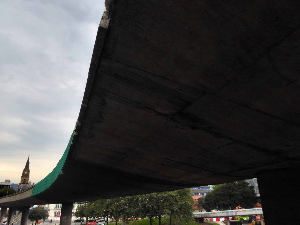
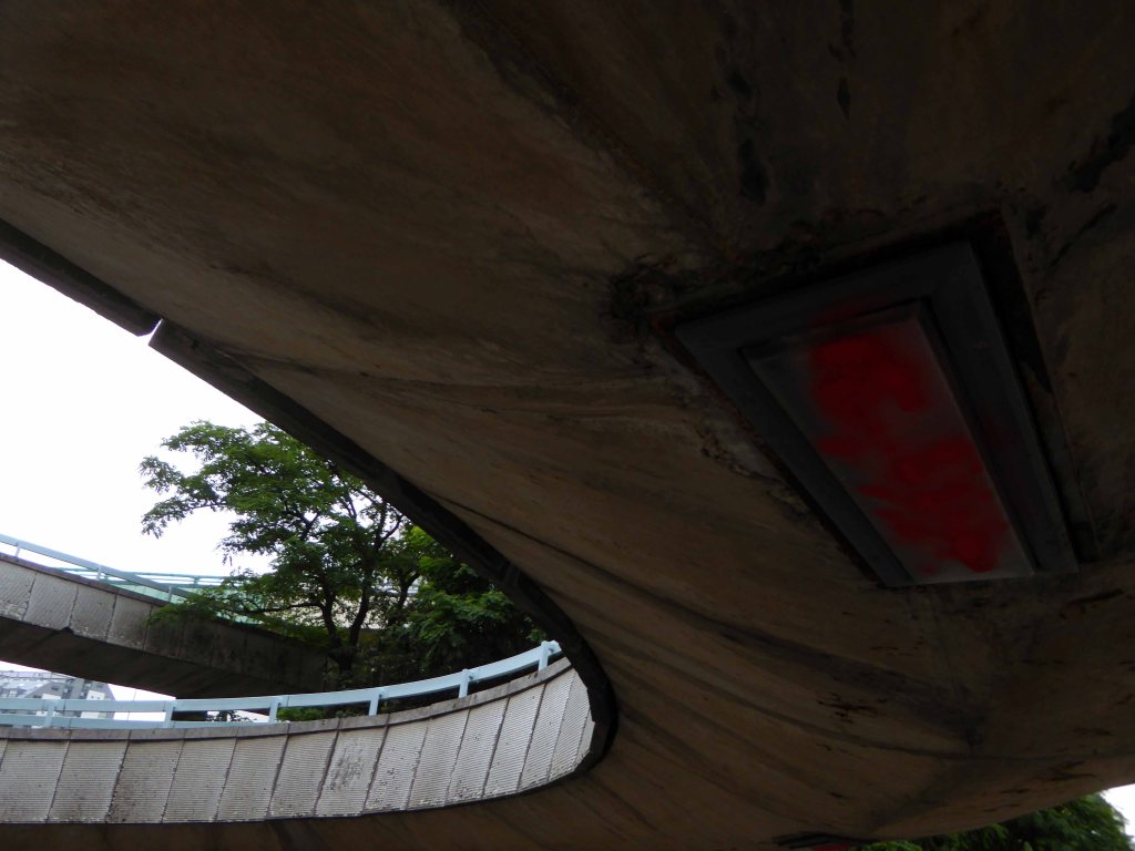
It sits by a busy London Road, behind an intrusive green steel fence, slowly acquiring a green patina – as moss and lichen attach themselves to the well weathered concrete.
Receiving occasional visits from the errant urban tagger.
It deserves much better – a lush grassed apron, discrete public seating, regular tree maintenance – respect.
We do not suffer from a surfeit of significant mid-century public art – its guardians should straighten up and fly right.
Whilst walking the length of Hessle Road, up and back – taking the air, snaps, the sights and sounds, I came upon a fine Faience tiled frontage.
I began photographing, wandering dangerously into the space between the slip road and the flyover. A shout rang out, emanating from the boozer, the landlord called me over.
“Do you want to take a look inside?”
“Yes”.
A listed interior the new landlord is working hard along with Historic England to restore the capacious rooms to their former glory, including the entrance mosaic and ceiling – images P Hampel
Inheriting a whole heap of issues and a grey parrot called Sparky.
But the boozer is now up and running serving cask ale to throngs of first class thirsty customers.
The Yorkshire Brewhouse 1904 ended mid week when we’re normally closed but we were asked to open for a group of very thirsty sailors. We moved on to Reet, another Yorkshire Brewhouse beer and thanks to the football that one has gone too. It’s back to the YBH Faithful Stout once again. I’d come quick and get it while you can.
Once two pubs the Hessle Road Inn was subsumed by the Alexandra. The area was once home to the city’s Jewish Community – the cemetery survives next door.
There are Star of David motifs incorporated into the windows, sympathetic to this local heritage.
Built around 1895, designed by Smith, Brodrick and Walker, with late C20 alterations – British Listed Buildings.
It’s a fabulous pub which deserves to thrive – pop in for a pint if you’re passing, just watch out for low flying parrots.
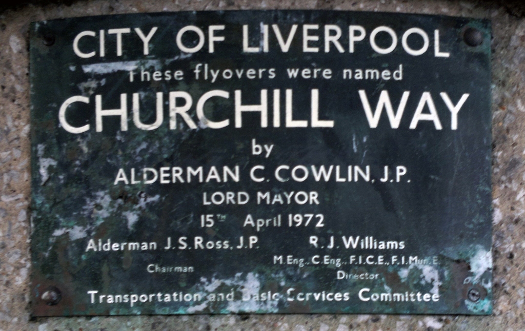
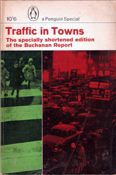
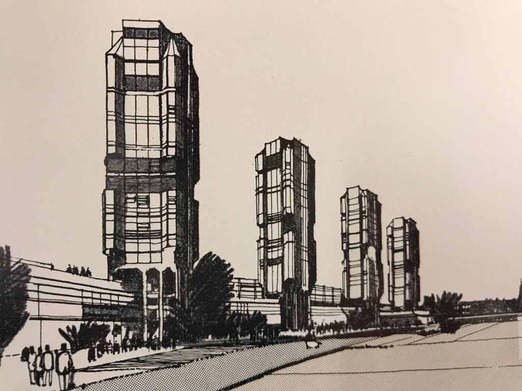
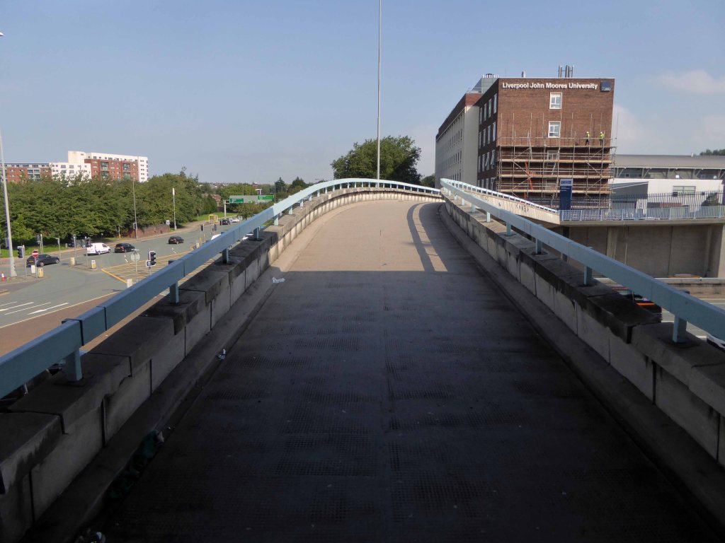
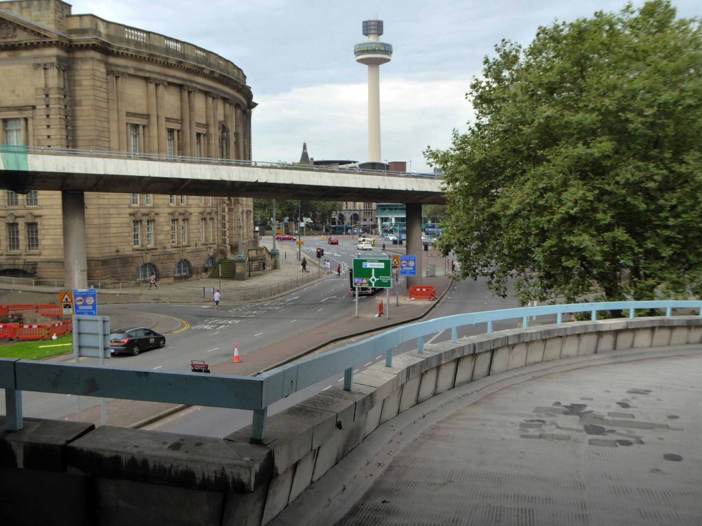
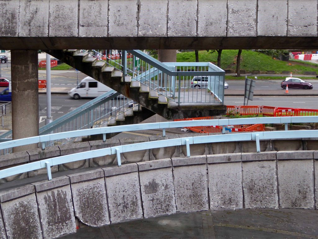
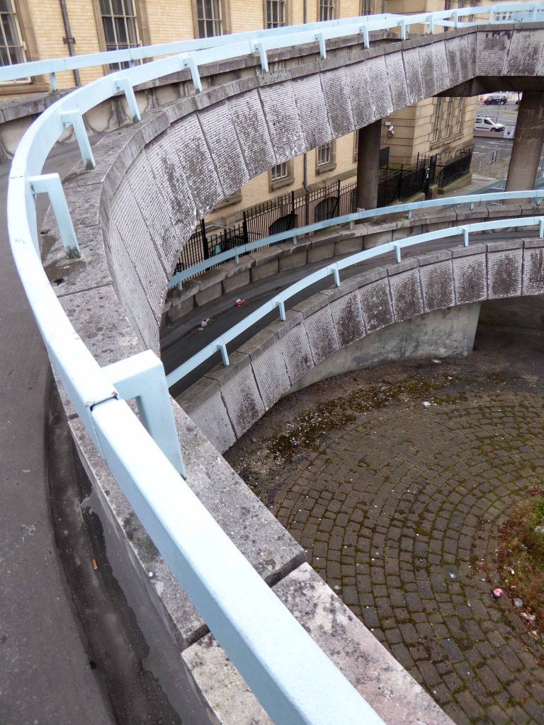
Opened in 1972 as an almost belated response to George Buchanan’s 1963 Traffic in Towns which had informed the Liverpool City Centre Plan of 1965.
The report warned of the potential damage caused by the motor car, while offering ways to mitigate it. It gave planners a set of policy blueprints to deal with its effects on the urban environment, including traffic containment and segregation, which could be balanced against urban redevelopment, new corridor and distribution roads and precincts.
These policies shaped the development of the urban landscape in the UK and some other countries for two or three decades. Unusually for a technical policy report, it was so much in demand that Penguin abridged it and republished it as a book in 1964.
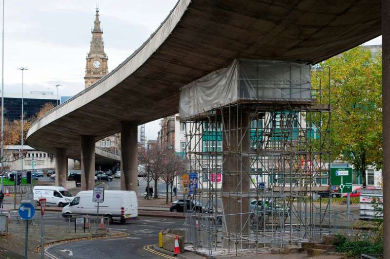
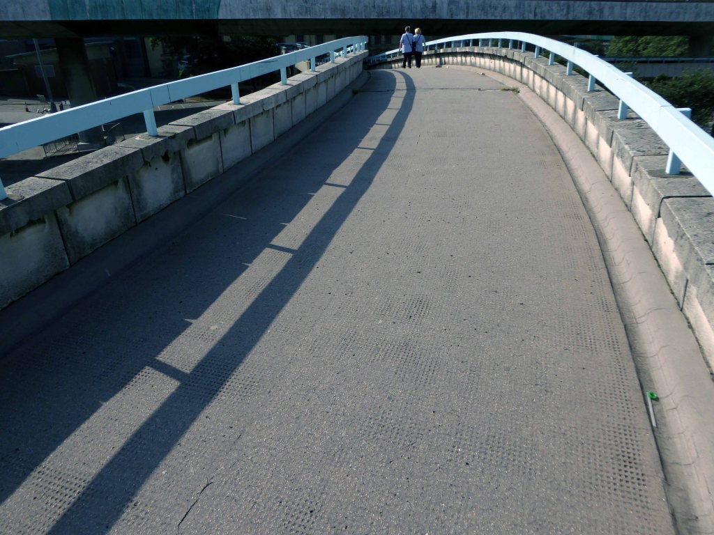
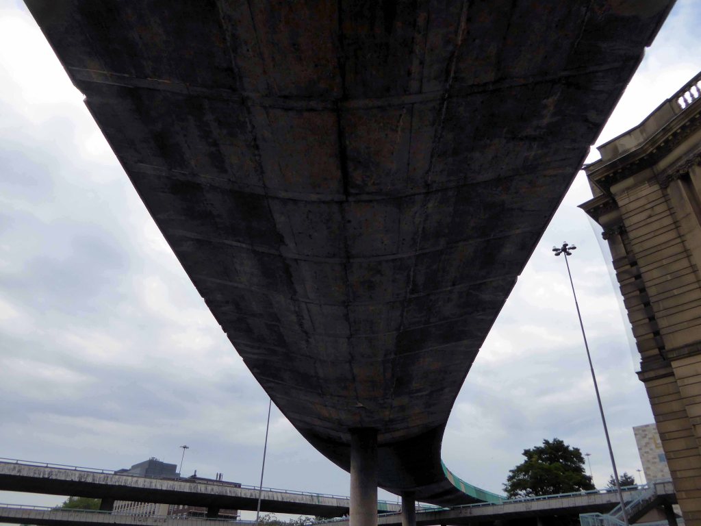
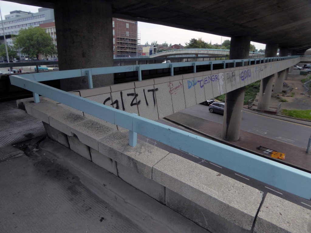
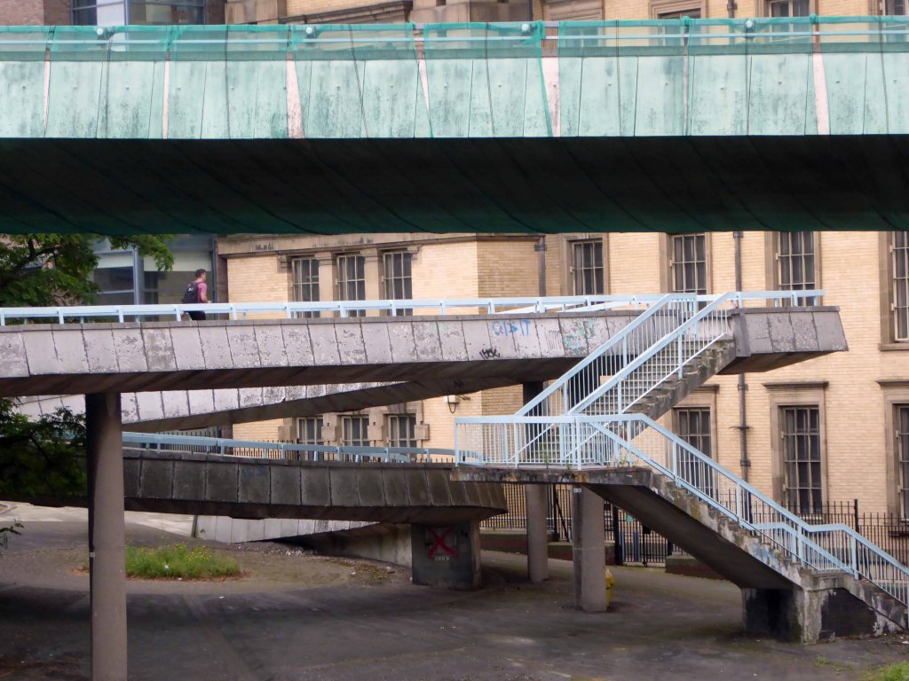
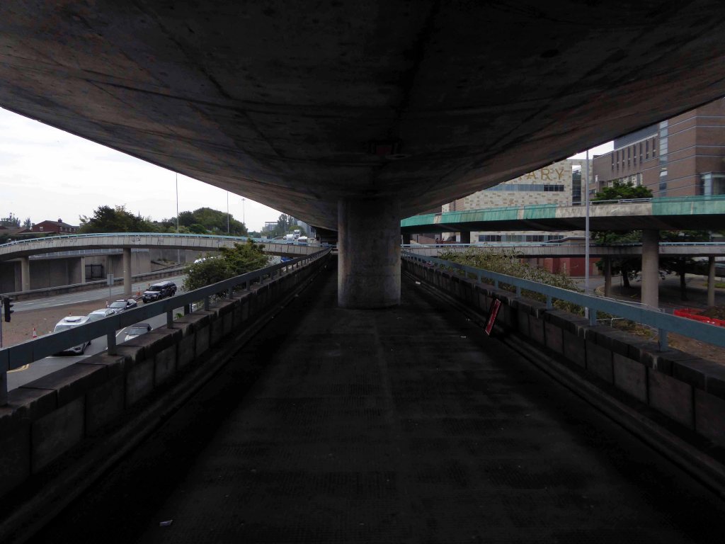
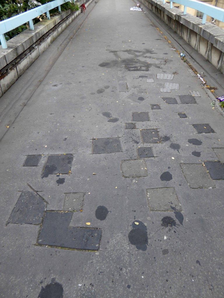
The Churchill Way was realised and remained in use until September 2nd 2019 – closed and facing a £10 million demolition programme, following a maintenance report which found them to be unsafe – and presumably beyond economic repair.
And so I took one last look around taking snaps, an epitaph to the end of an era, and the end of an idea that was once once rendered concrete.
So here we are outside, you and I in 2015 – it seems like yesterday.
Whereas yesterday I was inside not outside, but more of that in a moment.
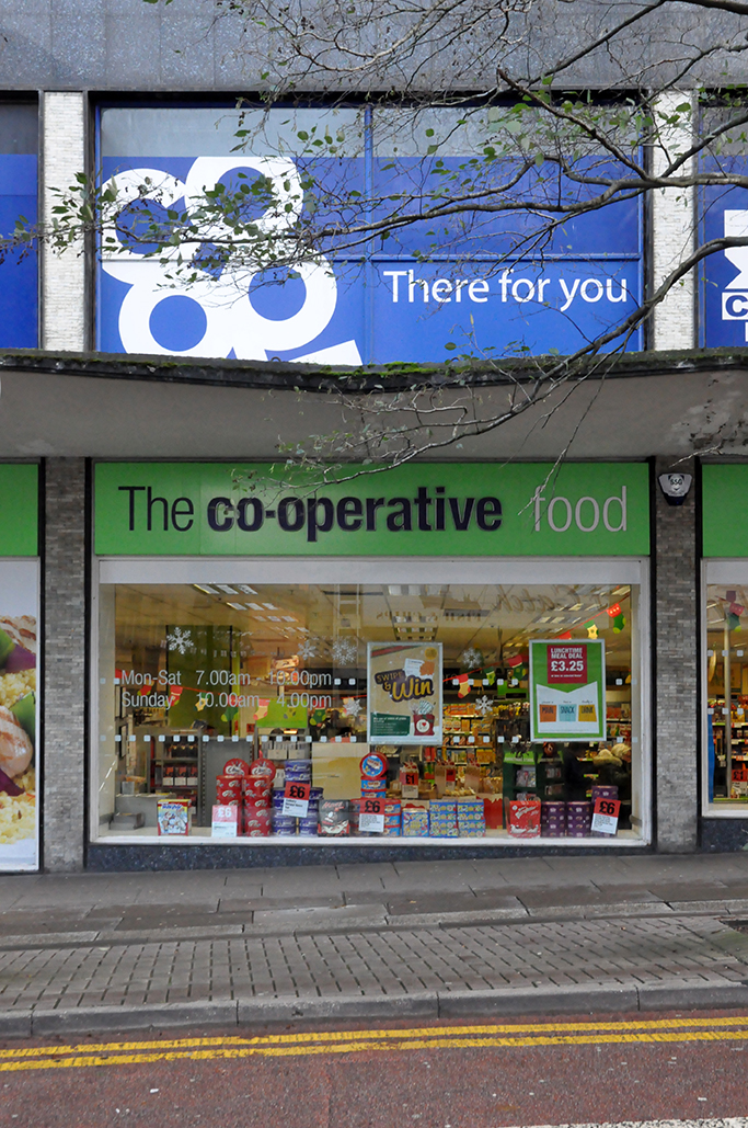
It seems that you were listed in 2009 and deservedly so.
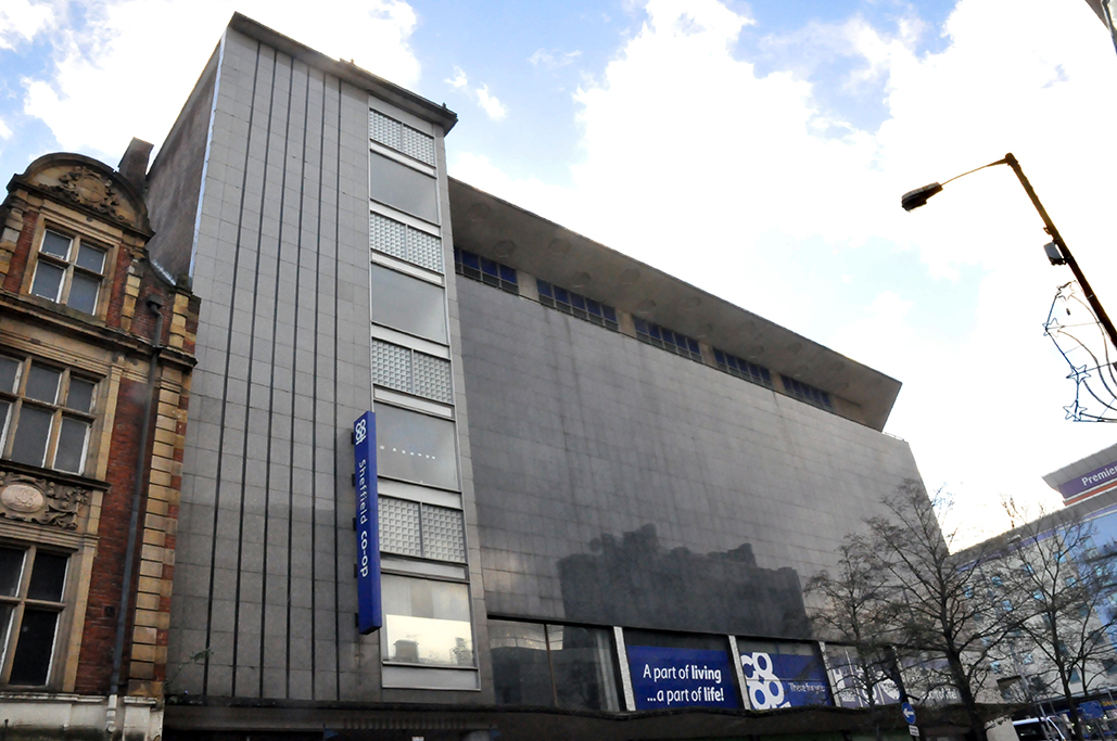
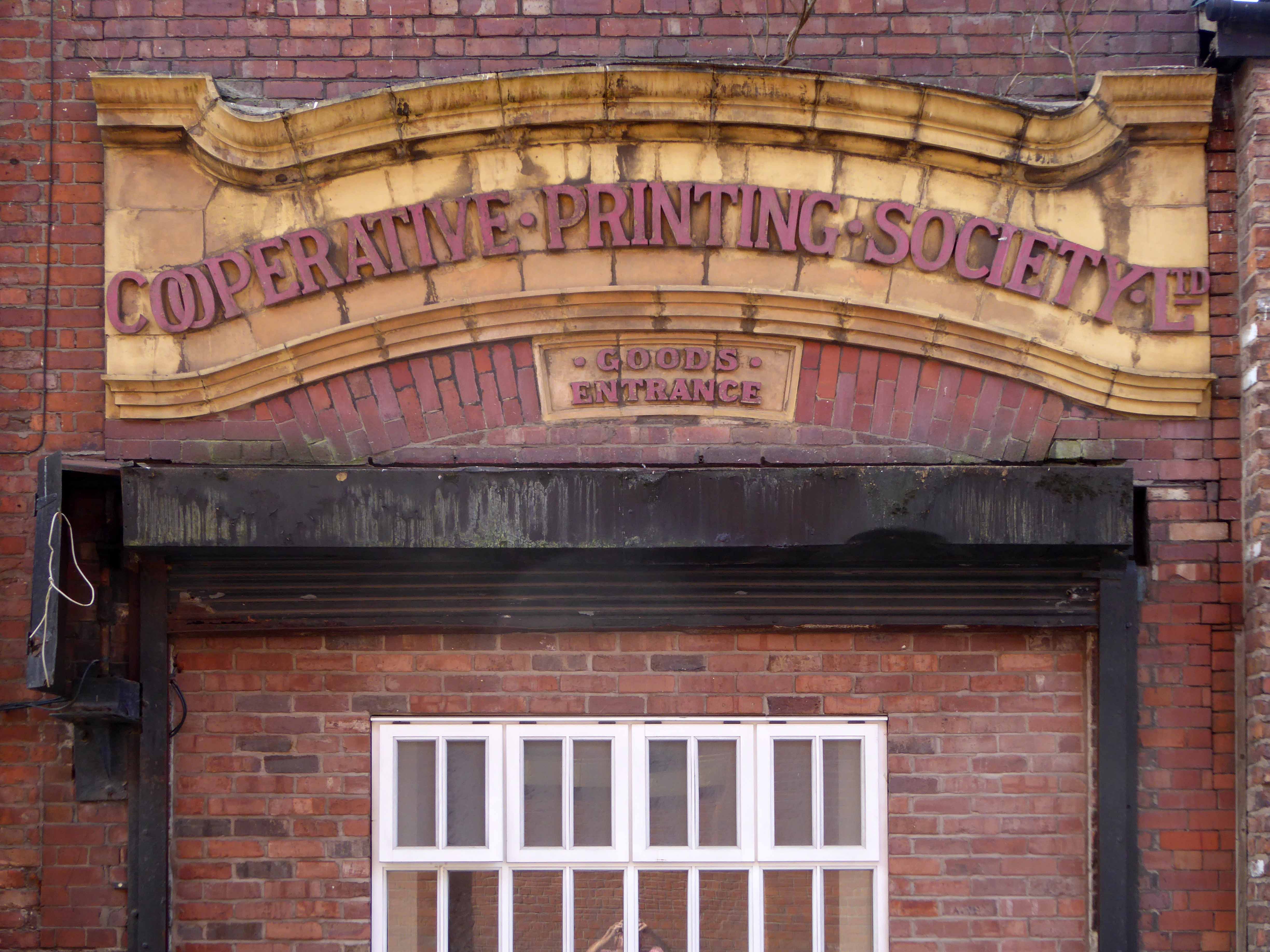
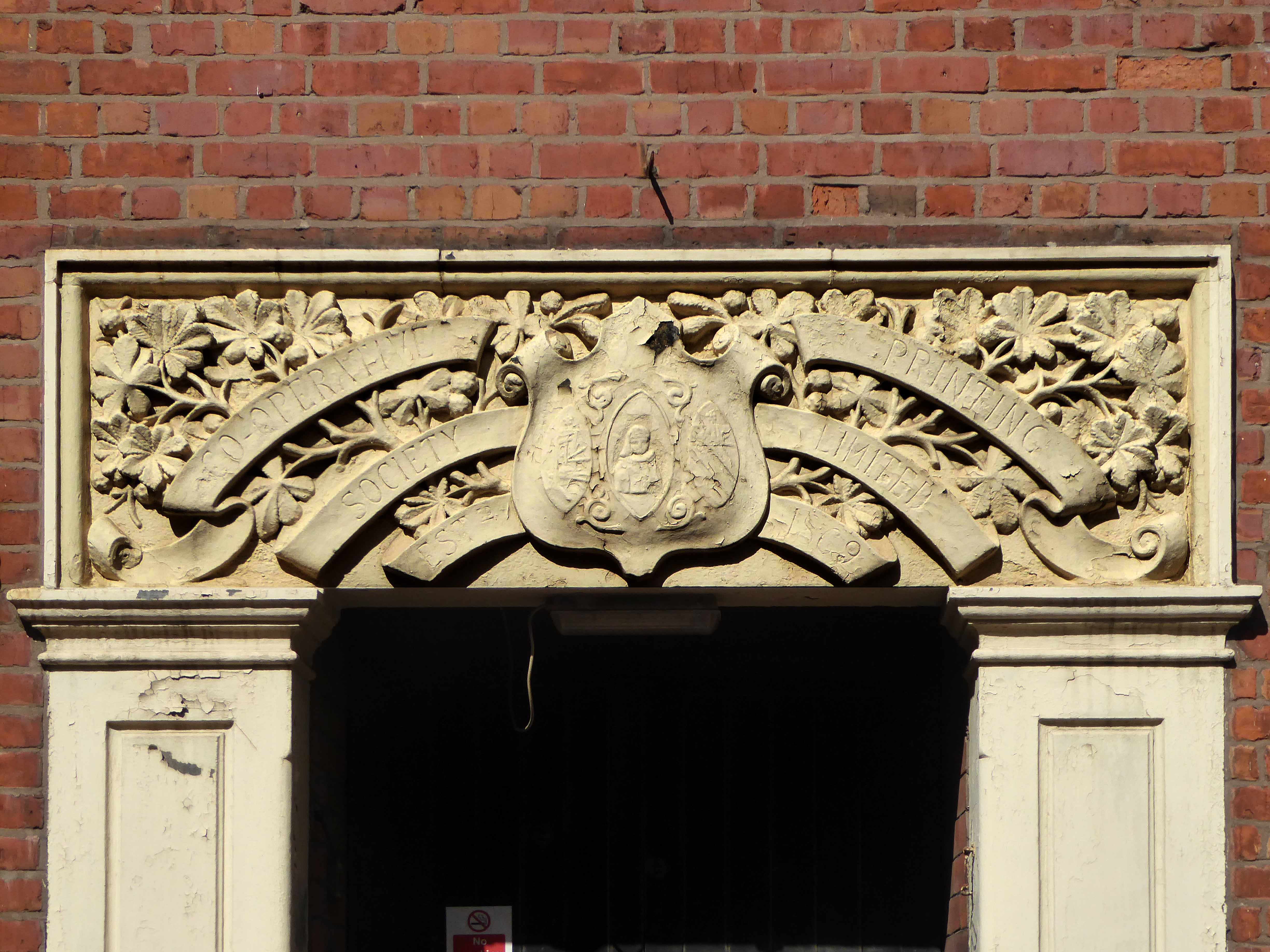
1964 by George S Hay, Chief Architect for CWS, with interior design by Stanley Layland, interior designer for CWS. Reinforced concrete with Blue Pearl granite tiles and veneers, grey granite tiles and veneers, buff granite blocks, glass, and brick.
There’s just so much to stand and stare and marvel at.
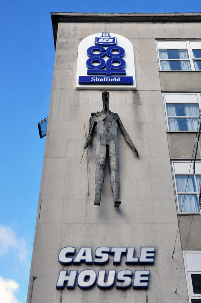
Vulcan by Boris Tietze commisioned by Horne Brothers 1961 for their head office building No. 1 King Street. Glass fibre on a metal armature the 8 foot high figure holding a bundle of metal rods.
You were just about still open then, then you weren’t, then you were again – but a Co-op no more alas.
Work is underway on plans for a tech hub in Sheffield after a funding package was agreed.
Followed by a casual stroll towards 2019 where we are talking a peep inside courtesy of owners Kollider and book shop La Biblioteka.
I’d never ever seen the interior, save through the photographs of Sean Madner who captured the key features in 2014, prior to refurbishment.
So the Modernists and I pitched up this Sunday afternoon, the conclusion of our Sheffield Walk.
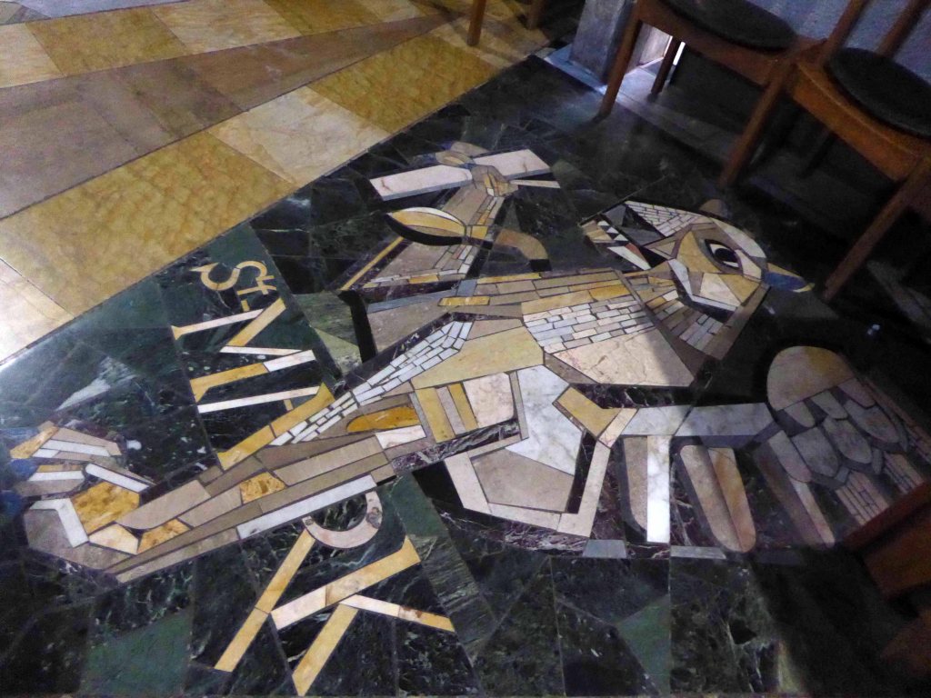
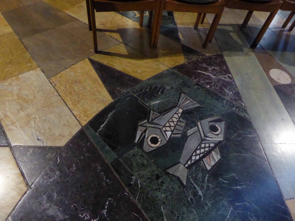
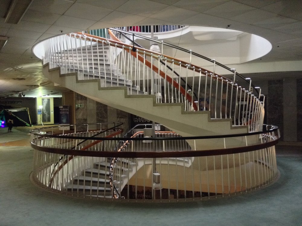
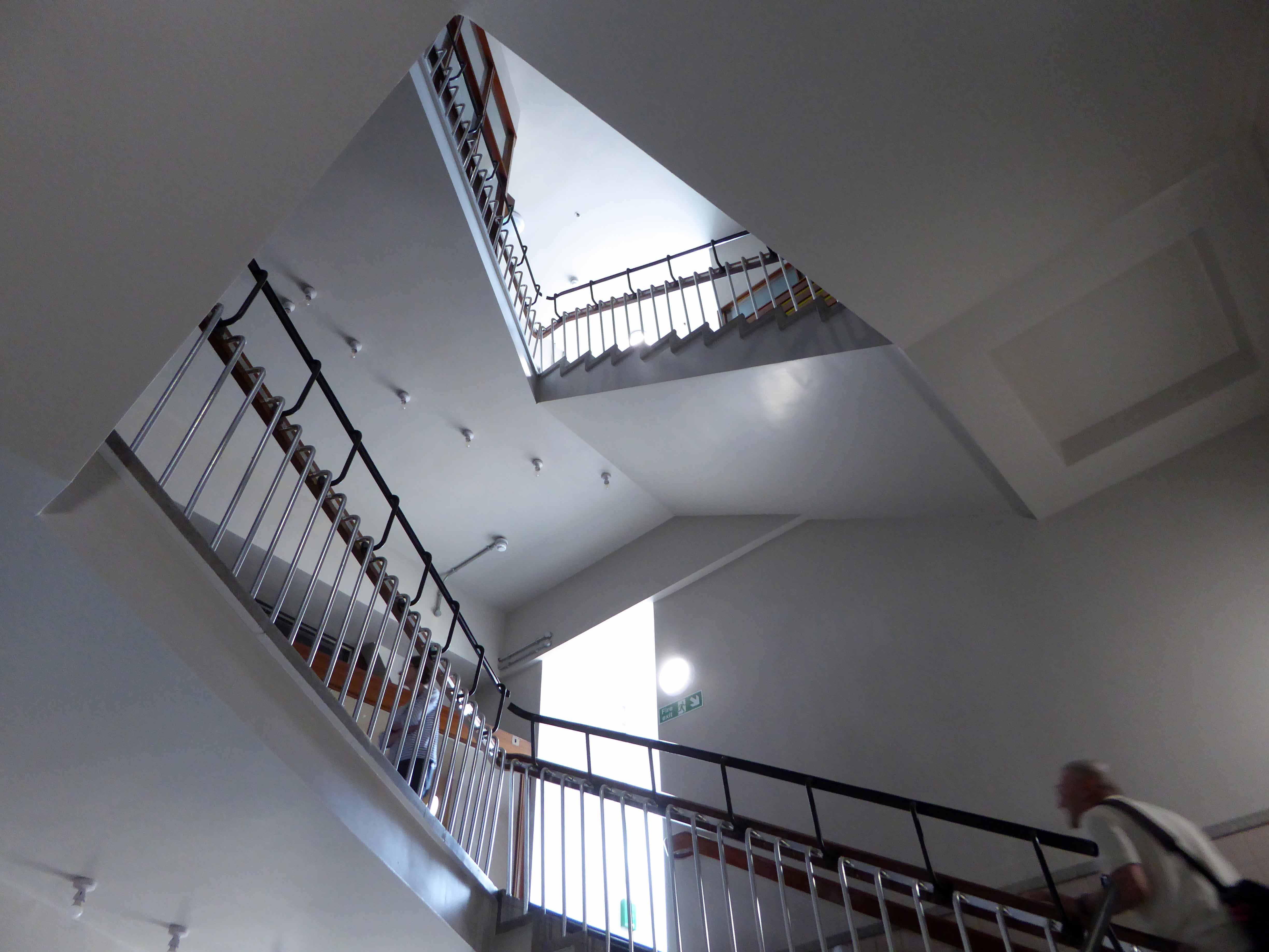
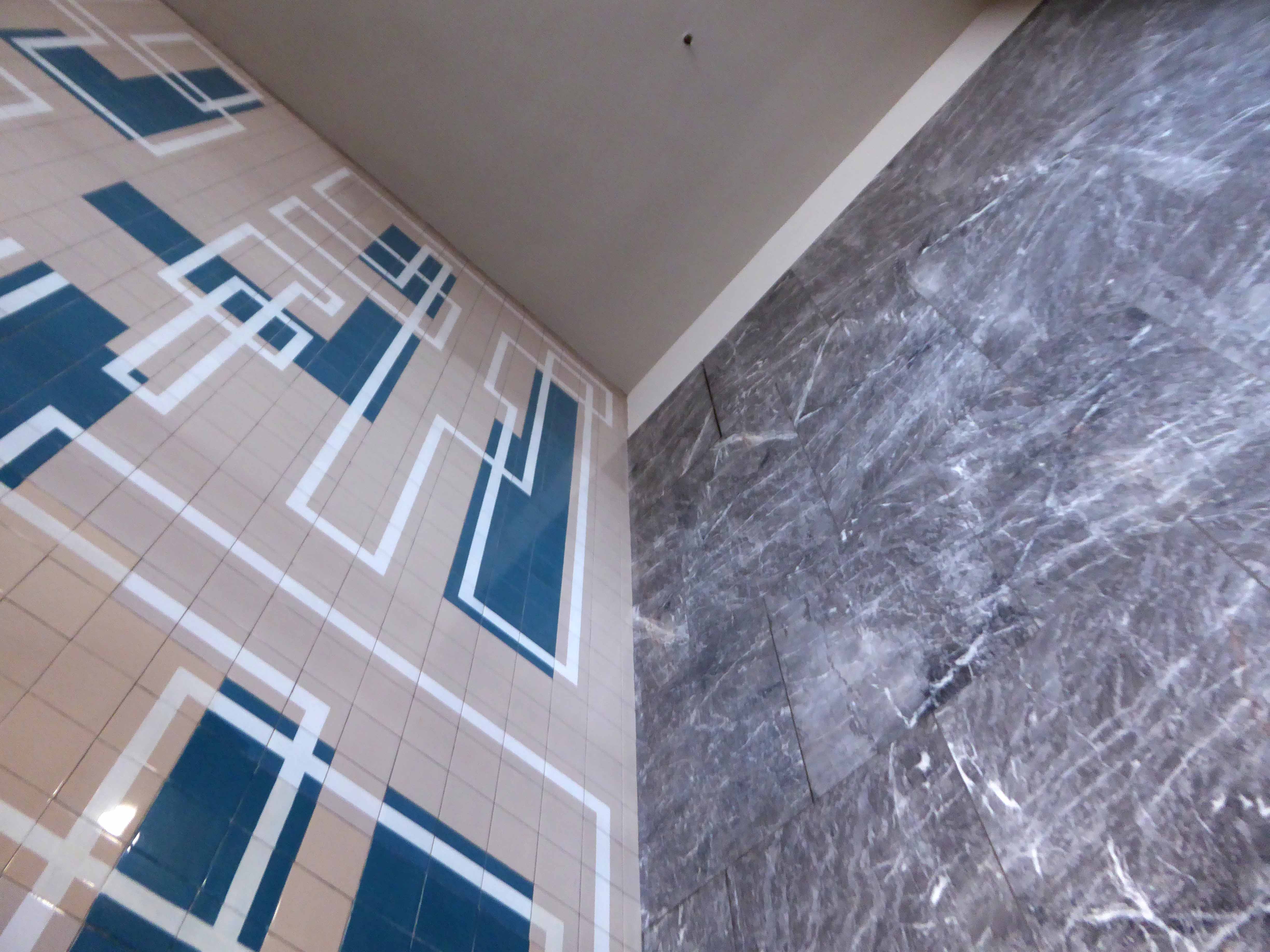
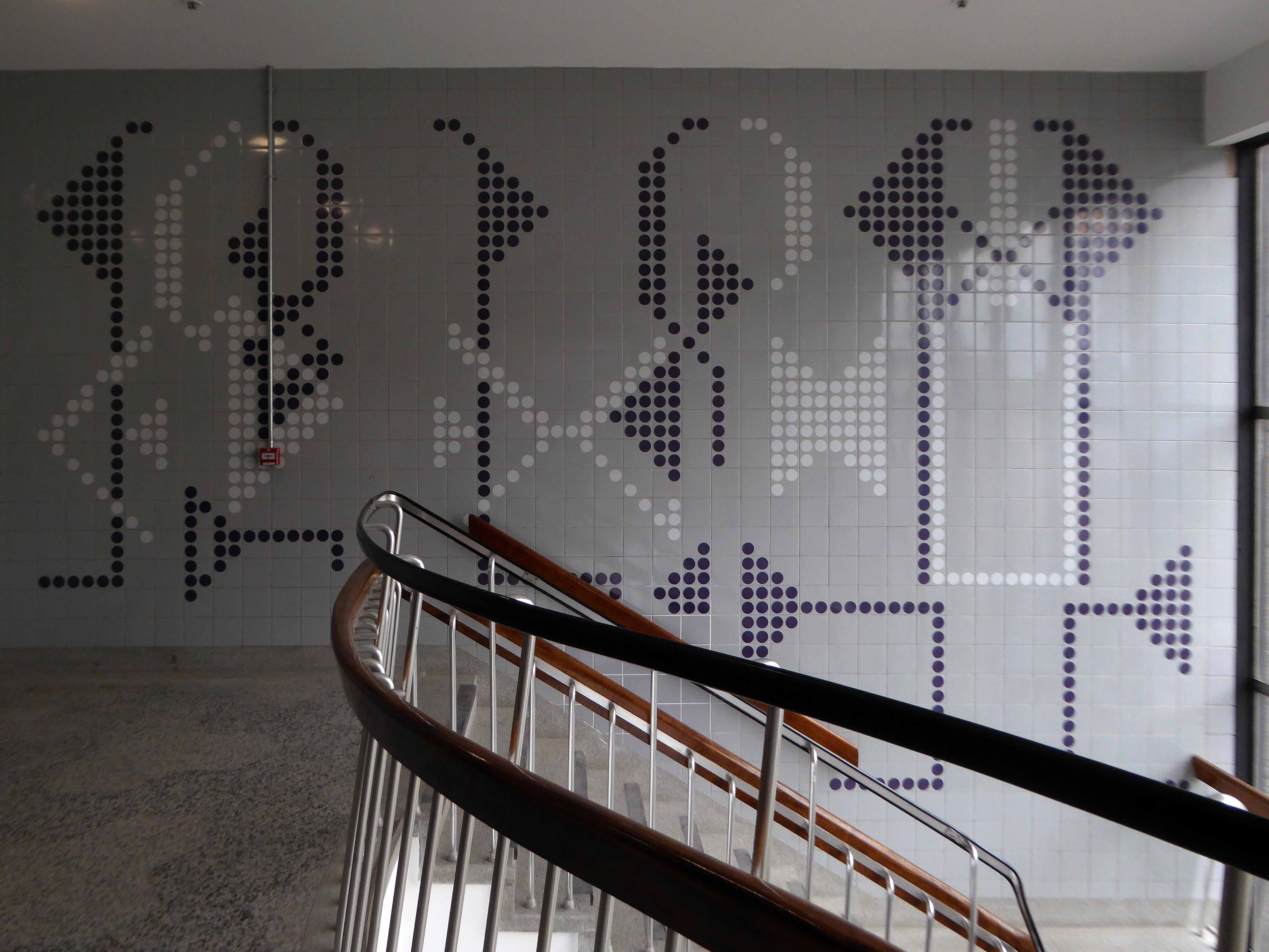
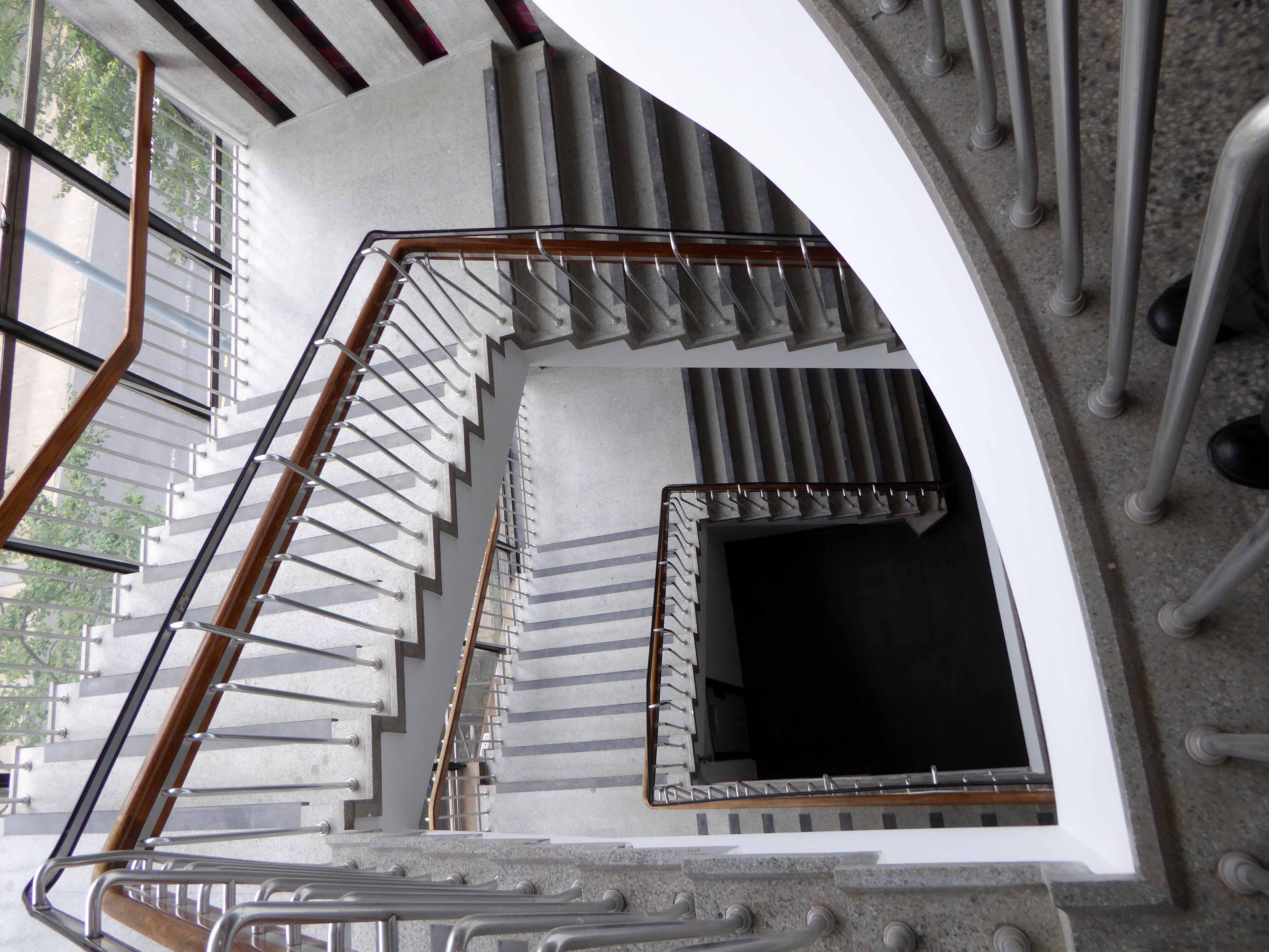
Lets take a look at the end stairwells, two very distinct designs one dotty one linear, both using Carter’s Tiles.
Configured from combinations and rotations of these nine modular units and two plain tiles.
Configured from combinations and rotations of these twelve modular units and two plain tiles.
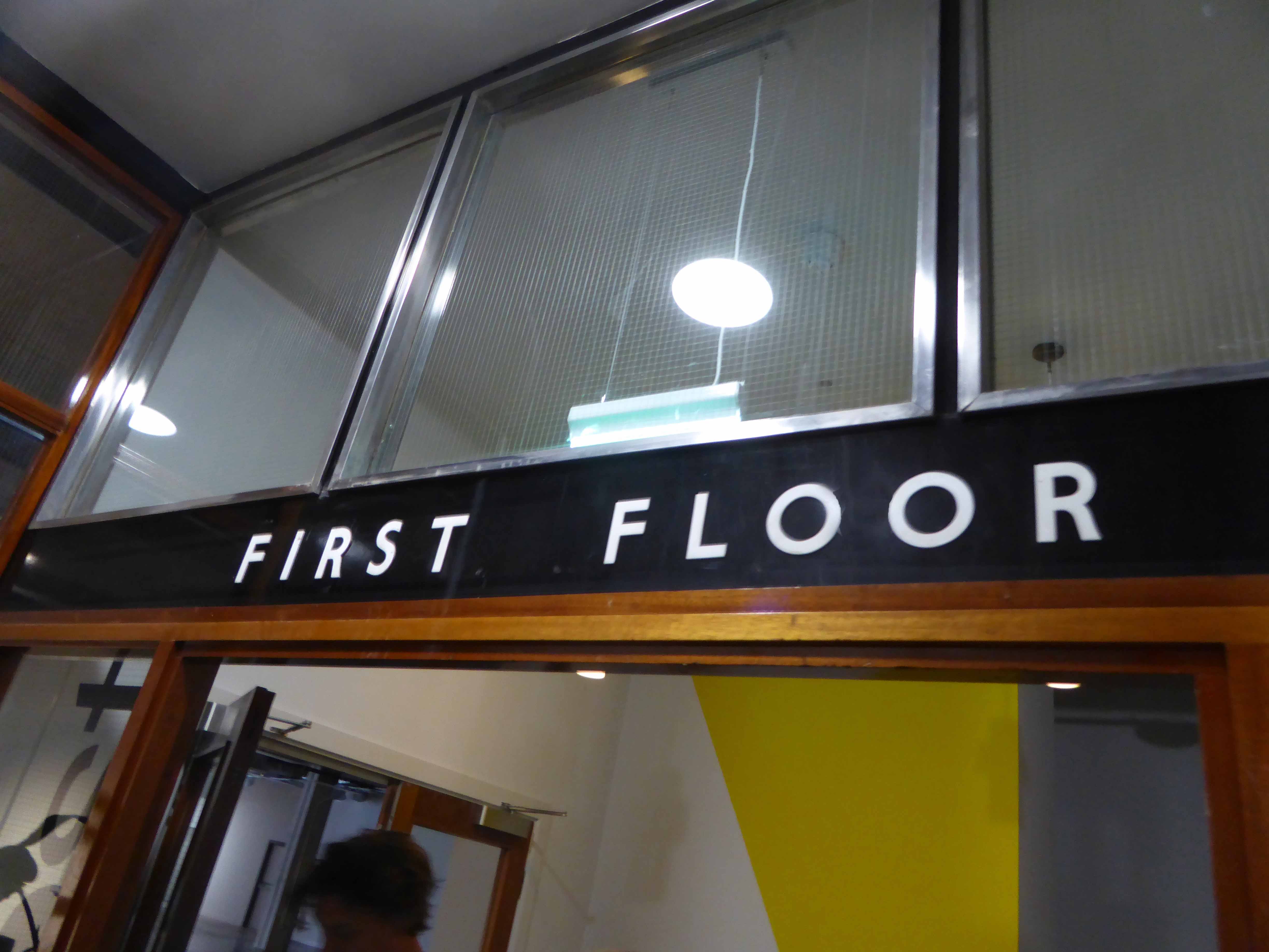
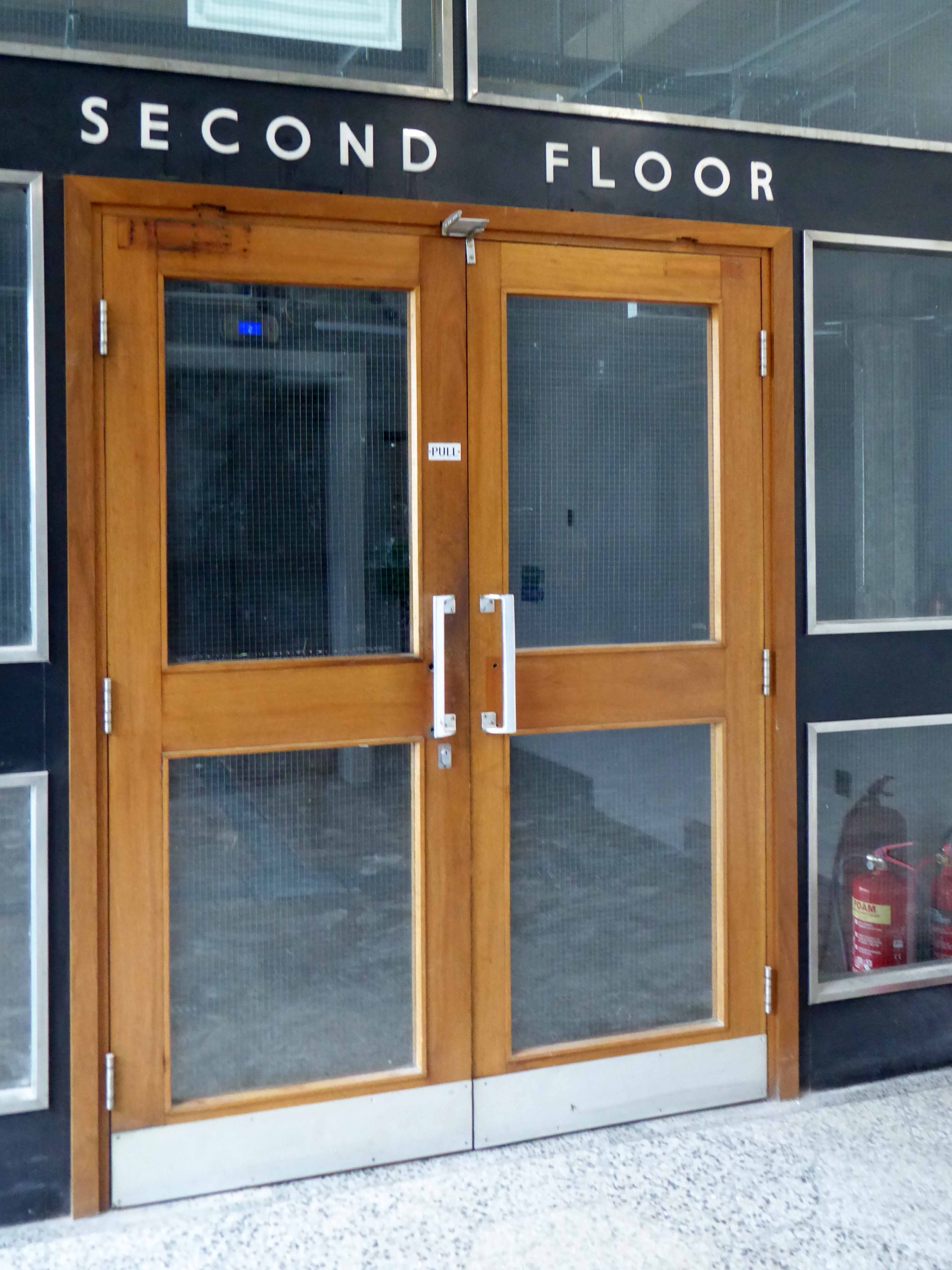
The site has retained some of its original architectural typography.
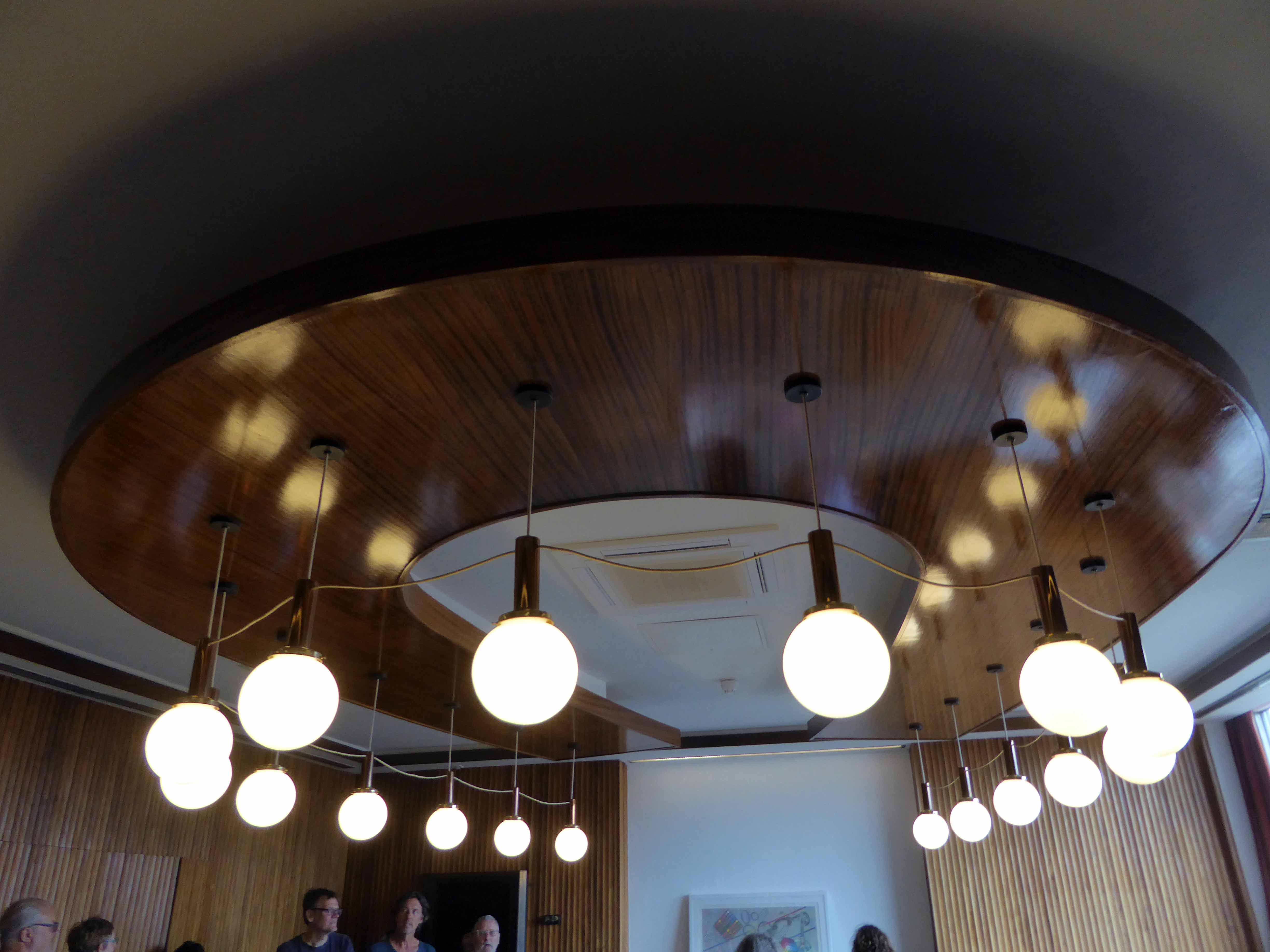
The former top floor restaurant has a suspended geometric ceiling with recently fitted custom made lighting.
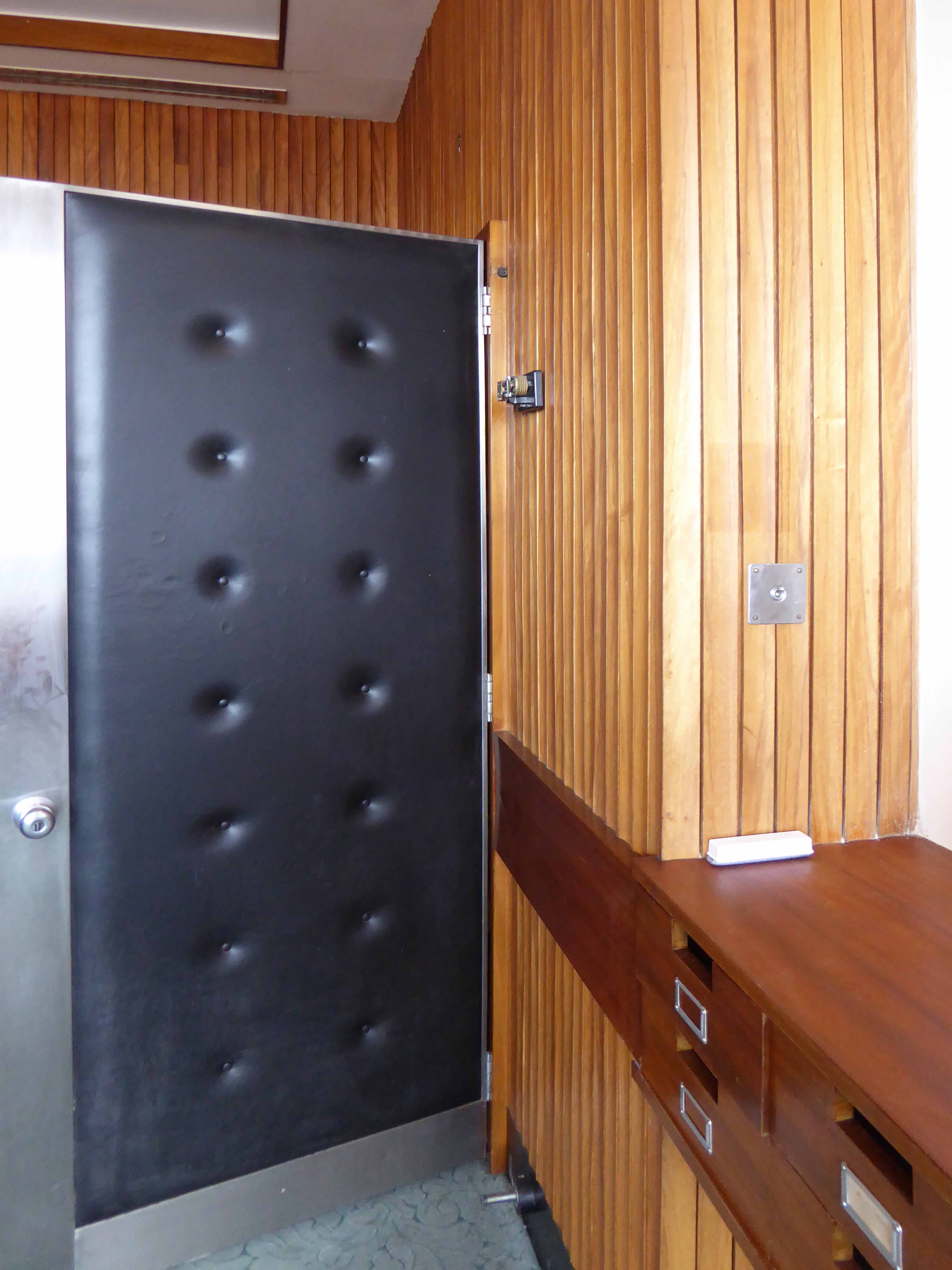
The timber-lined boardroom has a distinctive horseshoe of lighting, augmenting the board room table – which is currently away for repair, oh yes and a delightful door.
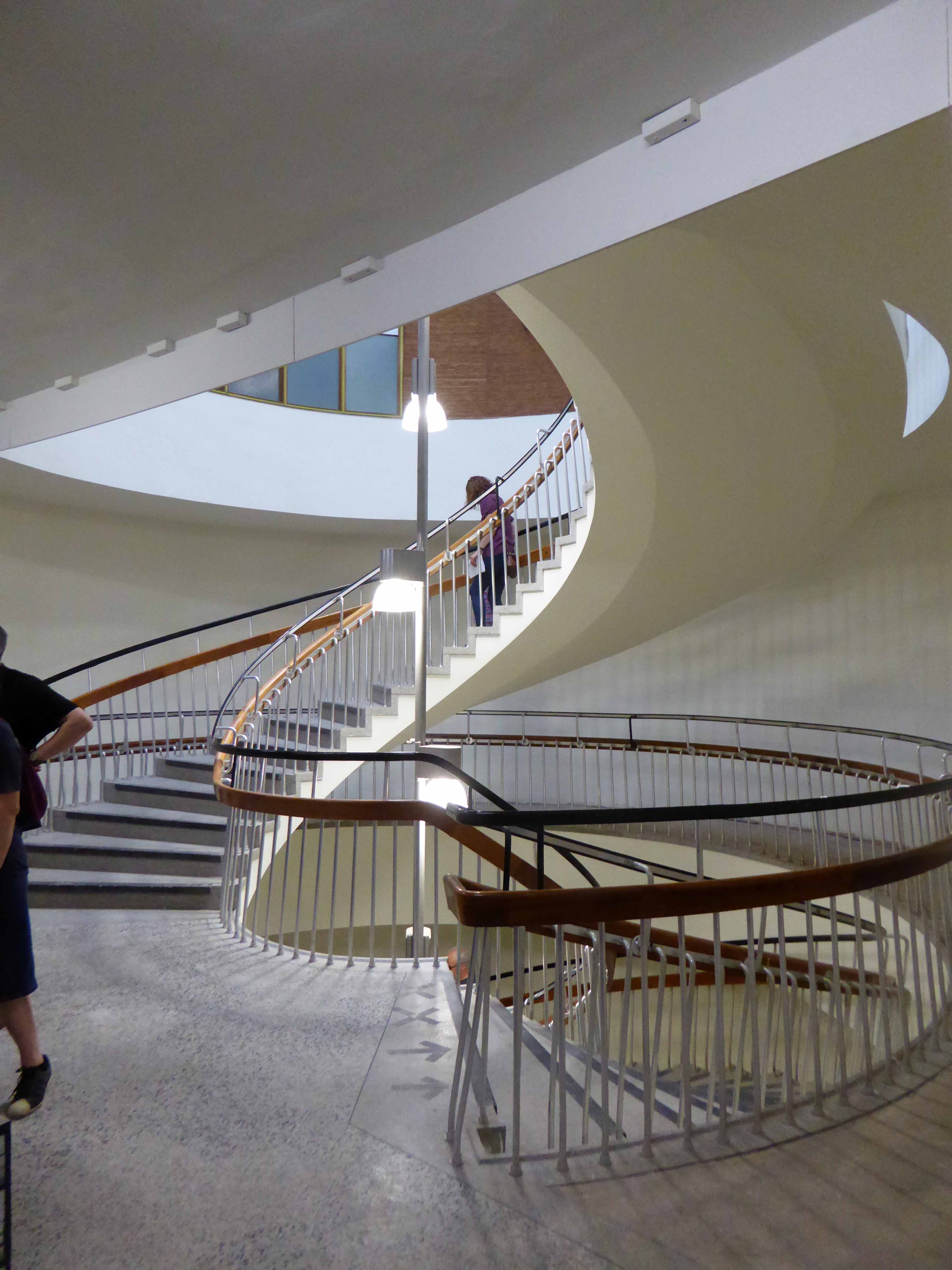
High atop the intoxicating vertiginous swirl of the central spiral stairway is the relief mural representing a cockerel and fish made of aluminium, copper and metal rod, with red French glass for the fish’s eye and cockerel’s comb.
Illuminated from above by this pierced concrete and glass skylight.
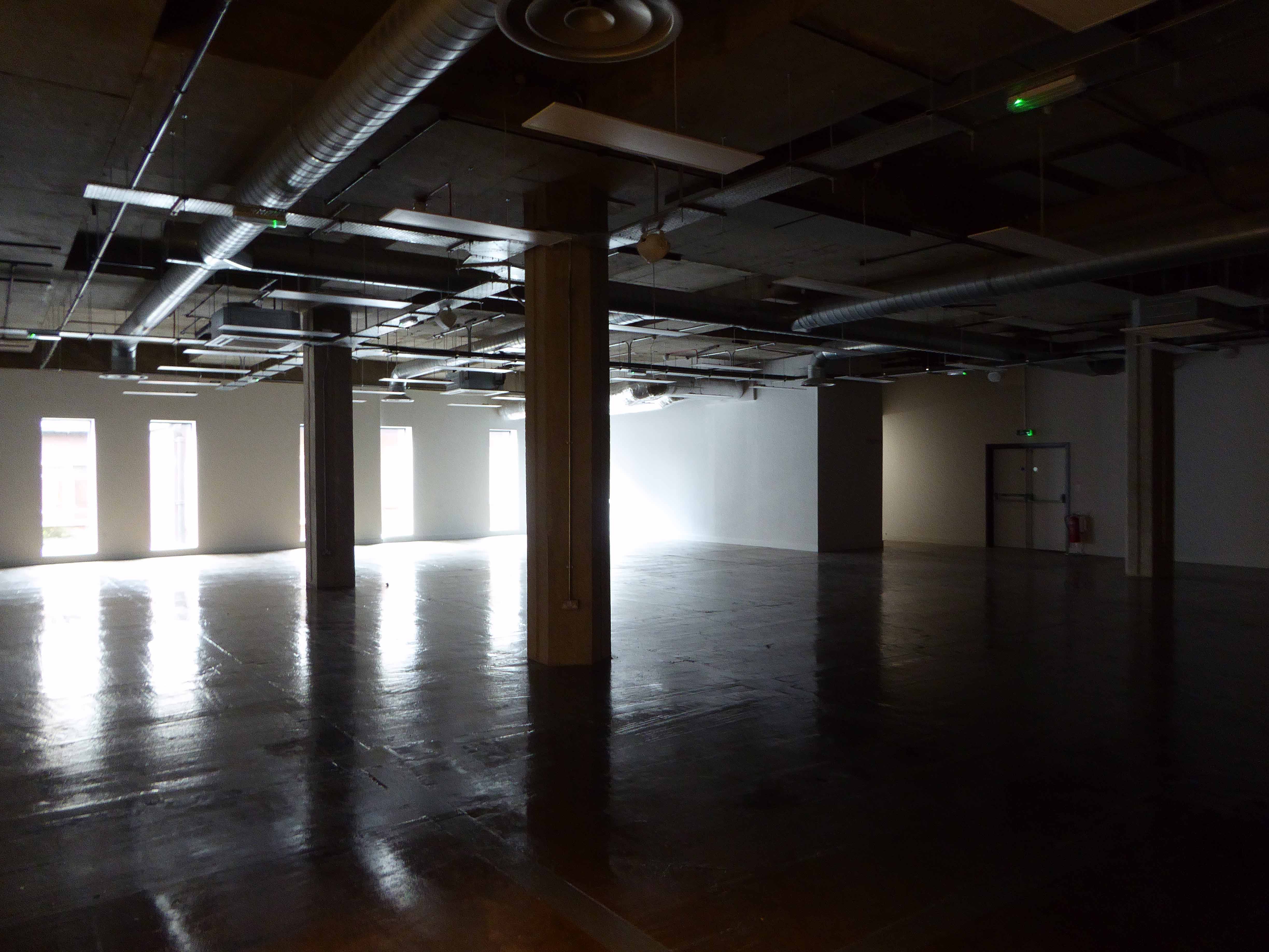
Many of the internal spaces have been ready for their new tenants.
This is a fine example of Modernist retail architecture saved from decay and degradation by the timely intervention of a sympathetic tenant.
Long may they and Castle House prosper – Sheffield we salute you!
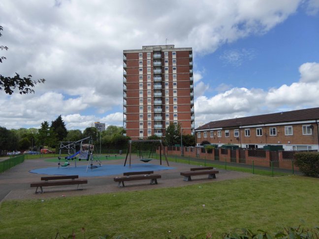
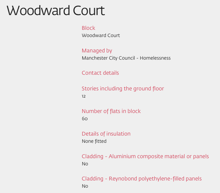
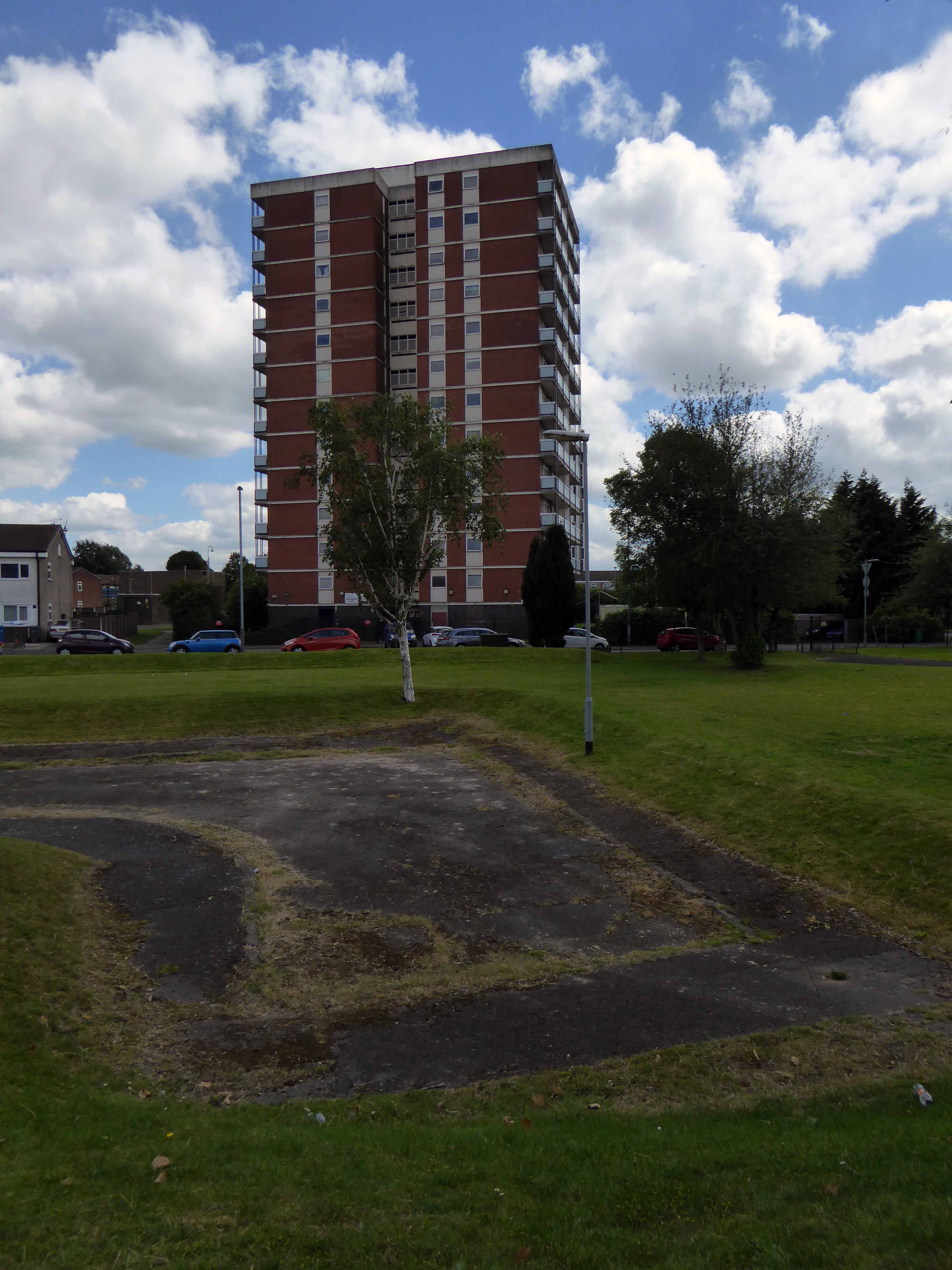
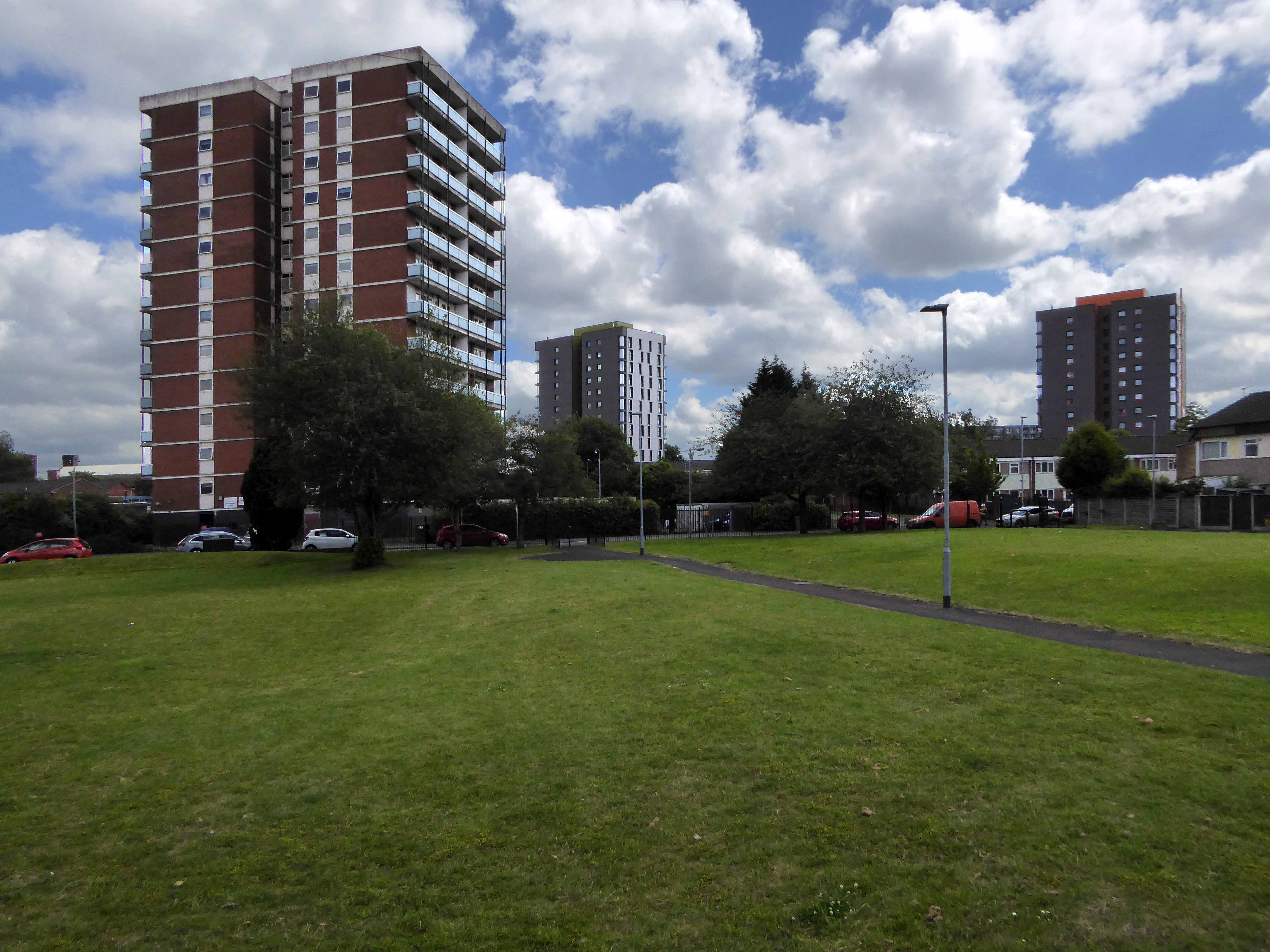
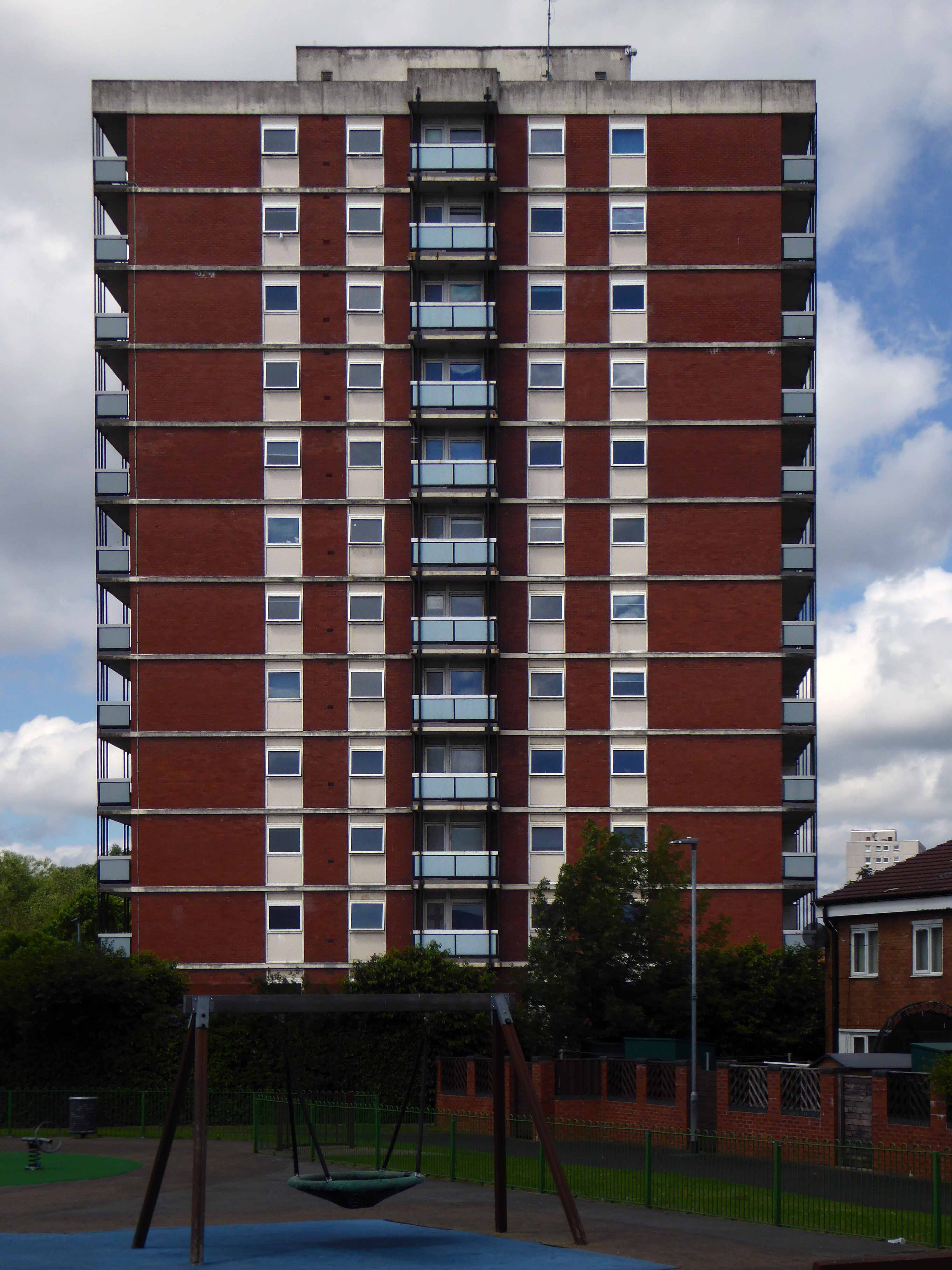
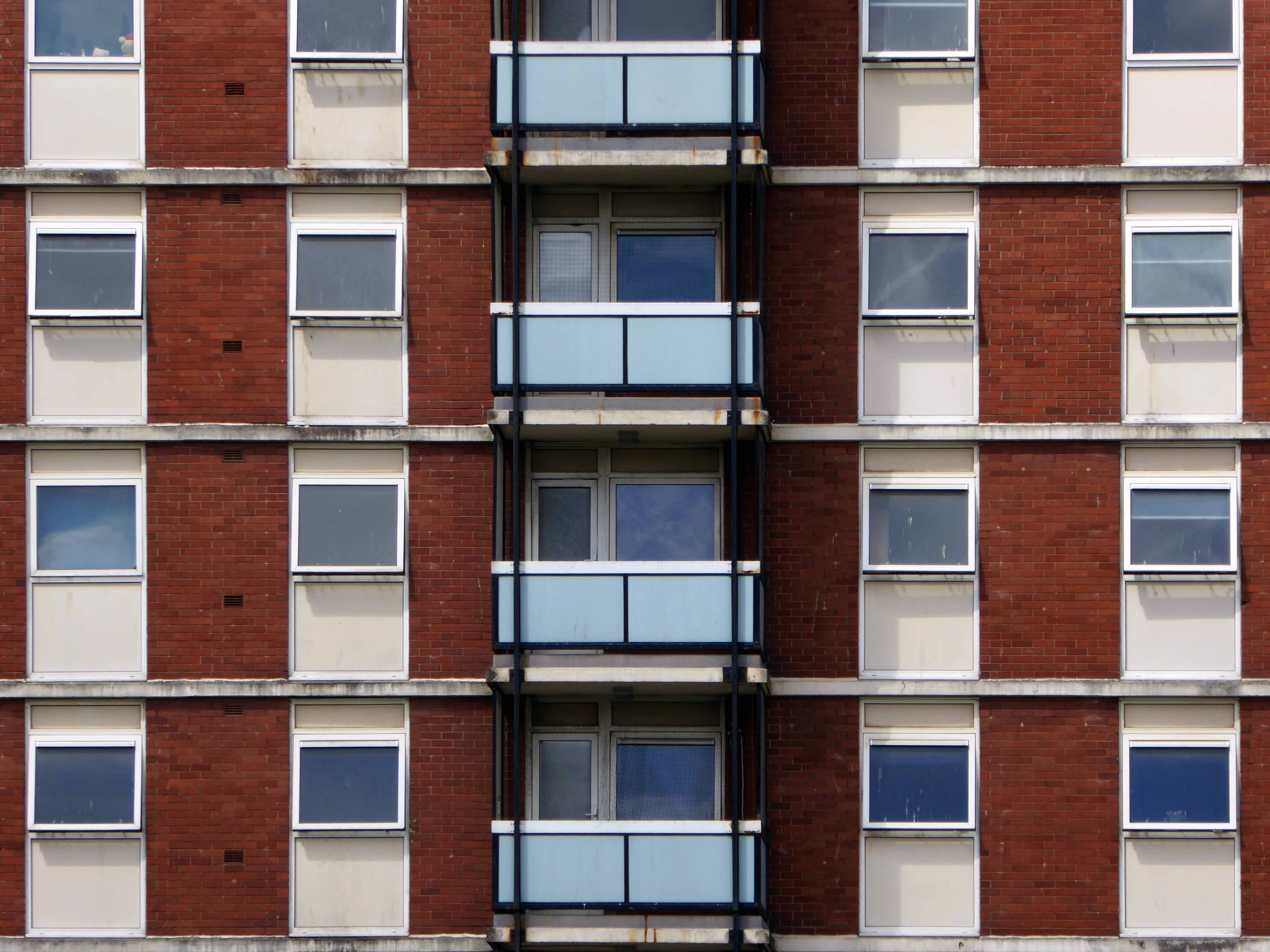
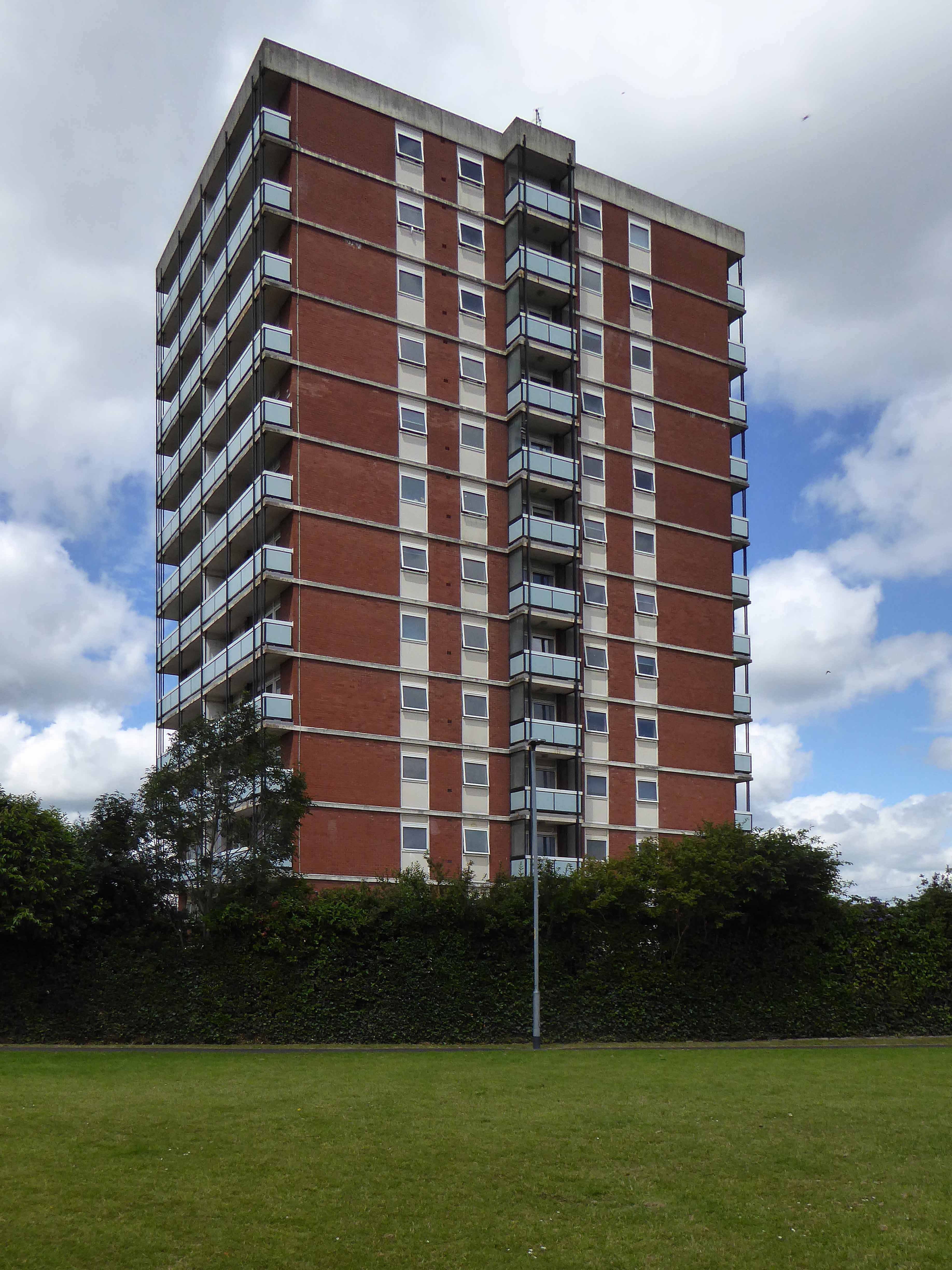
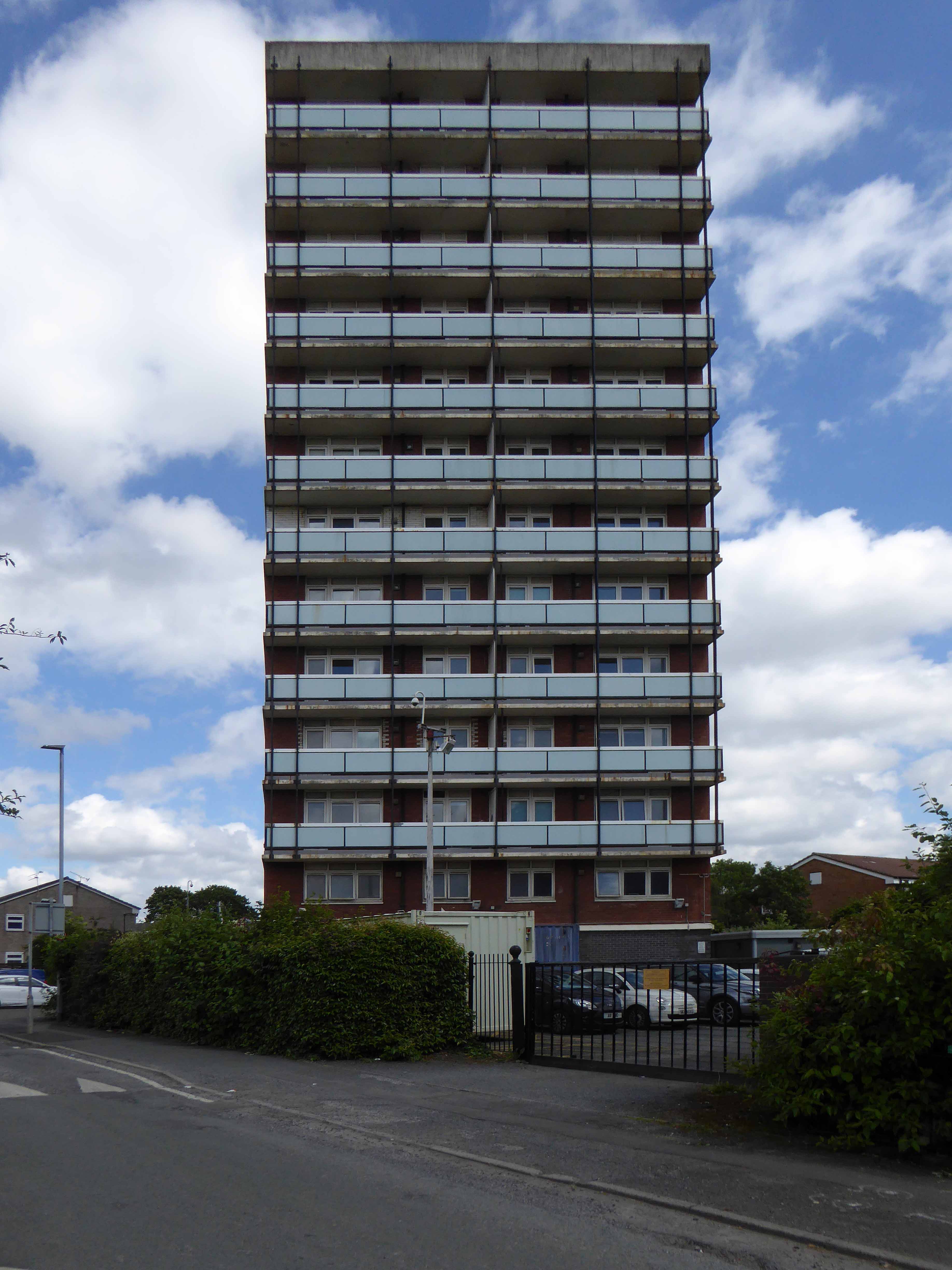
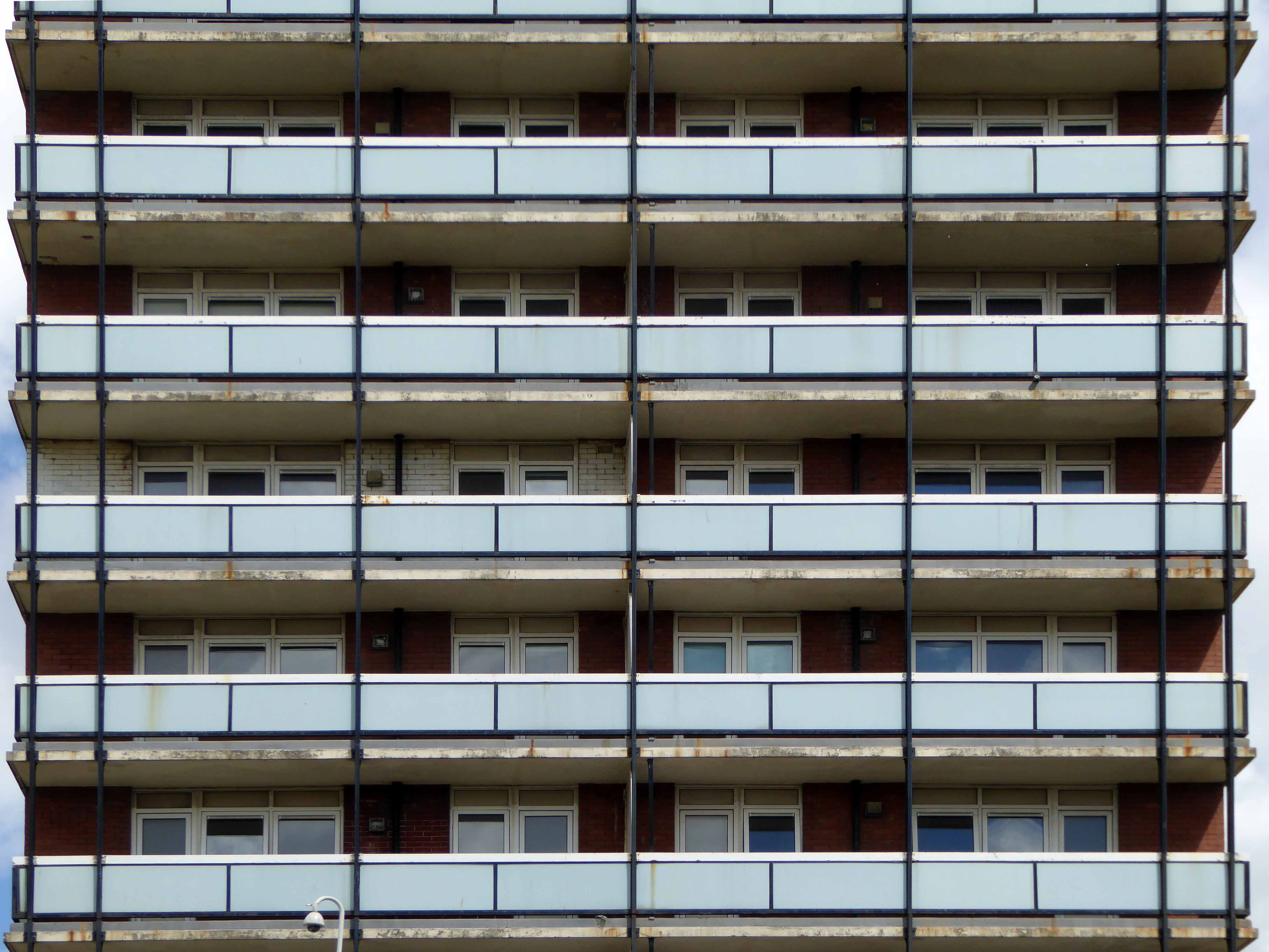
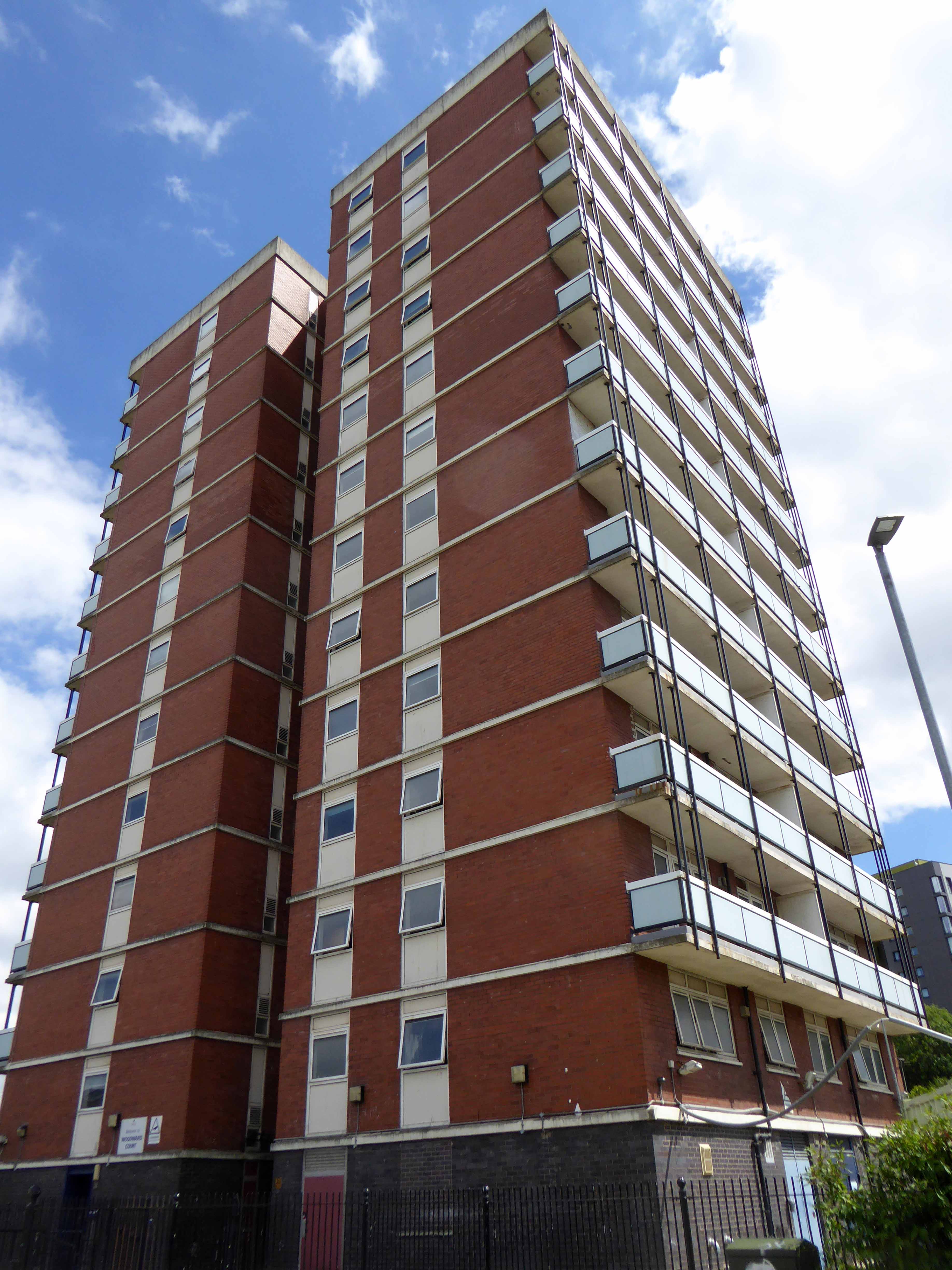
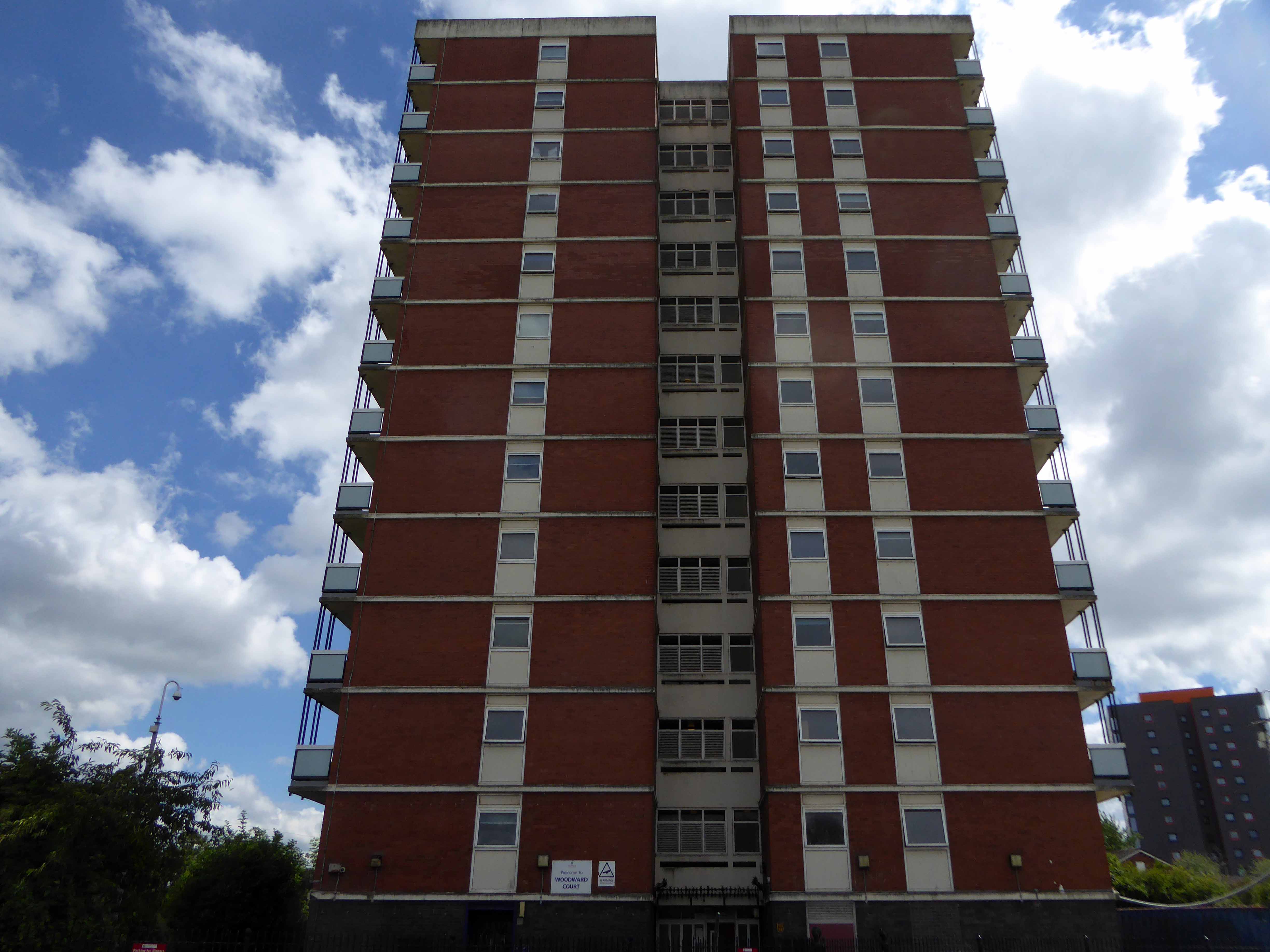
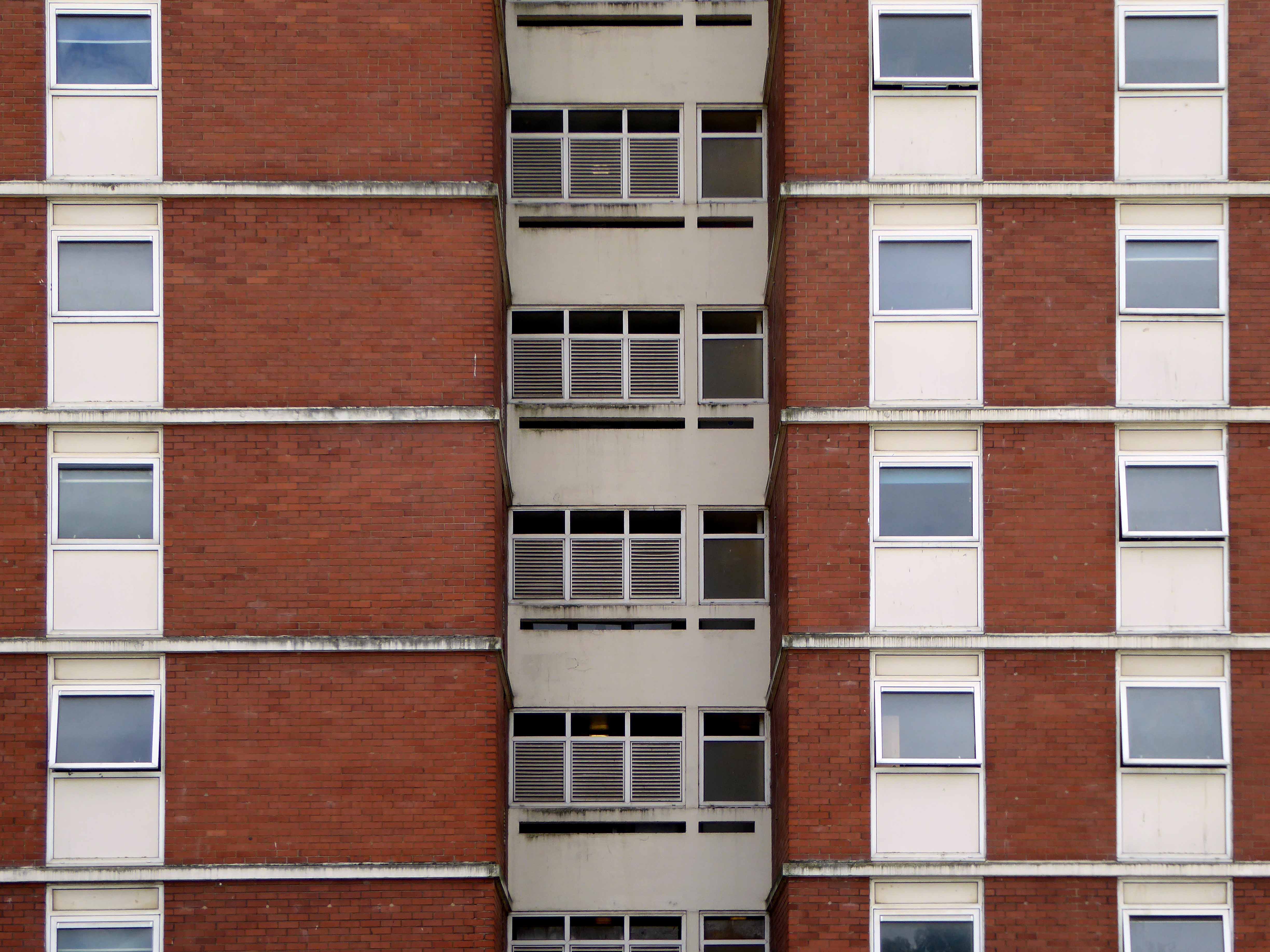
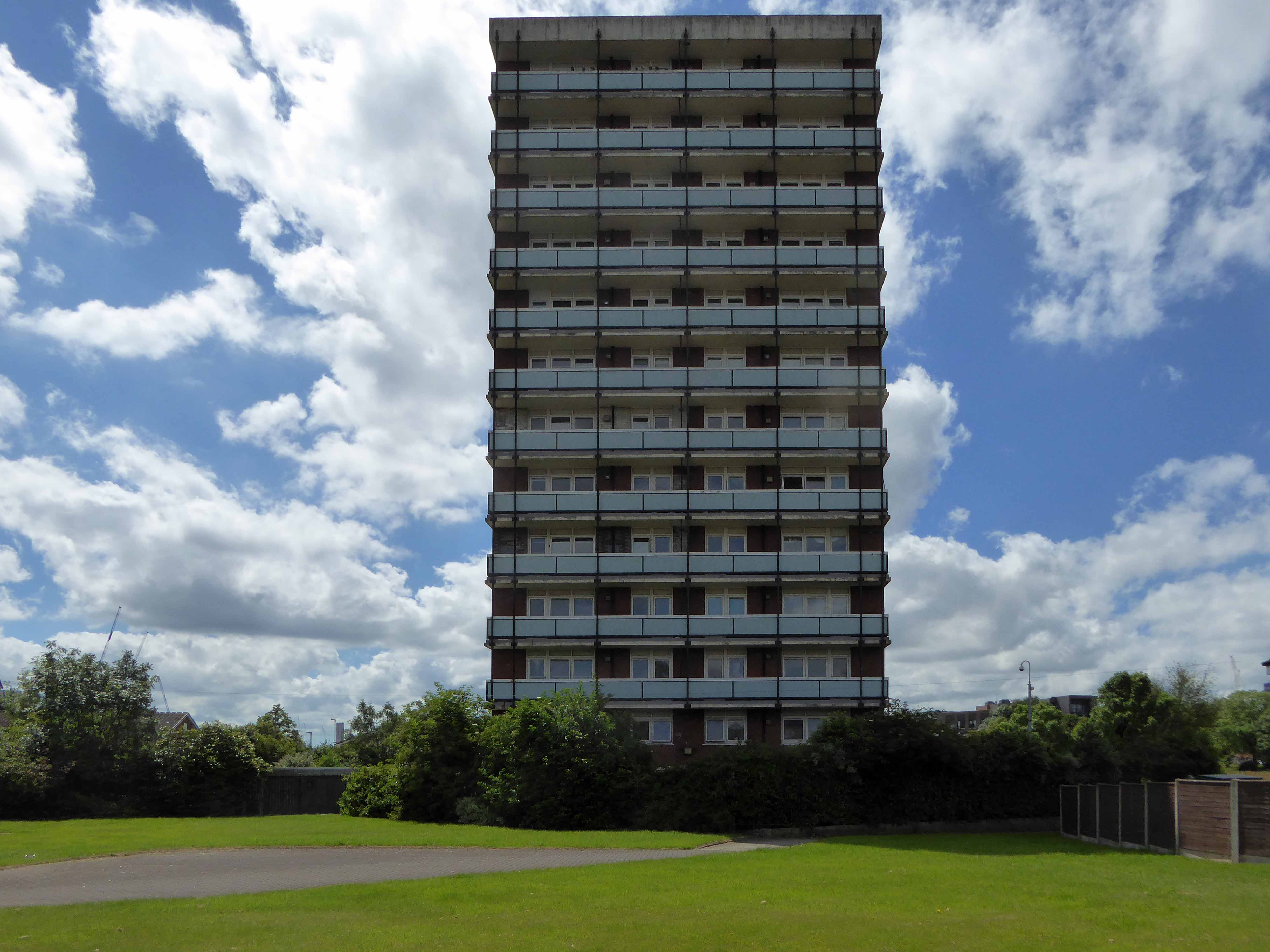
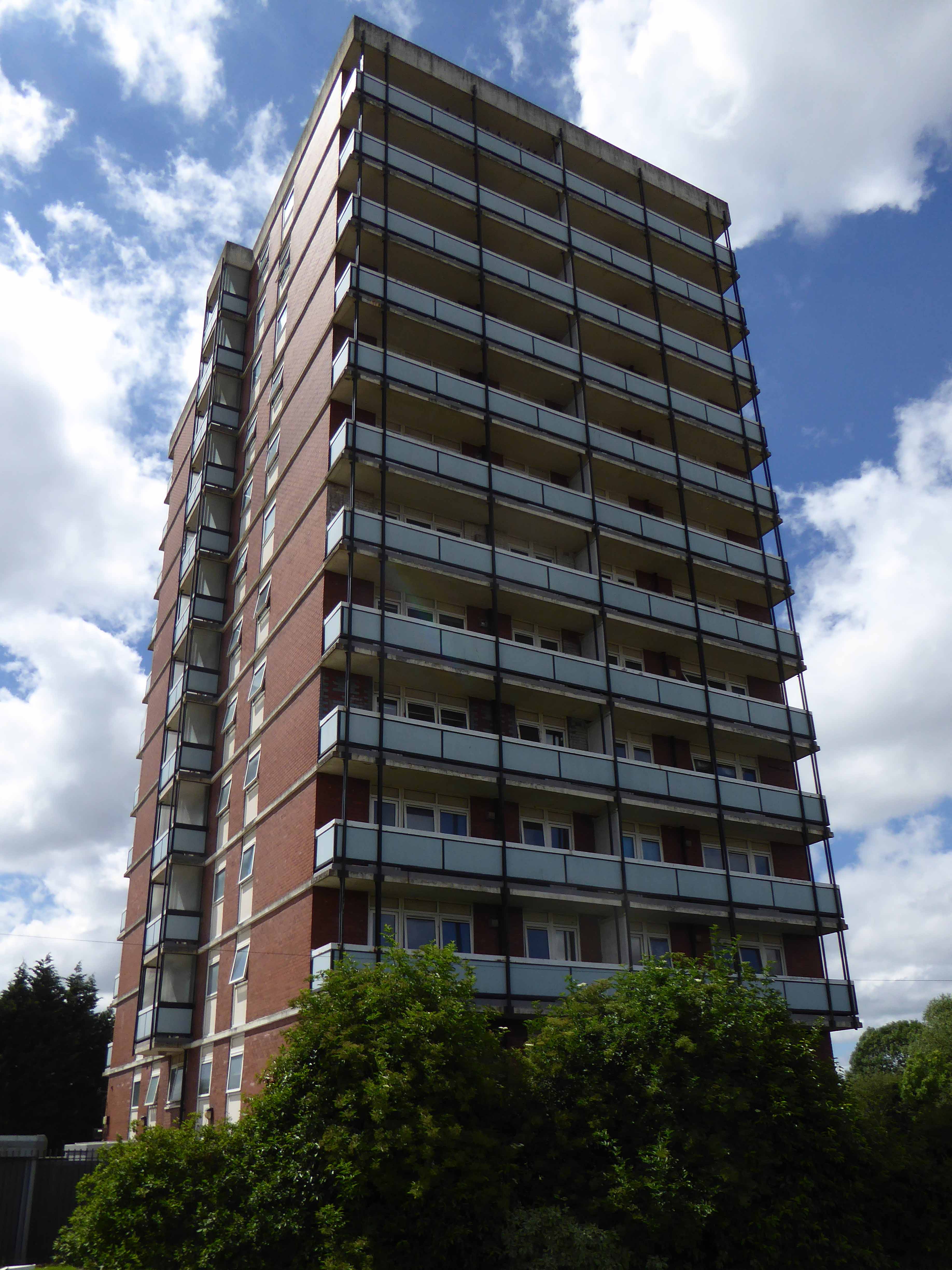
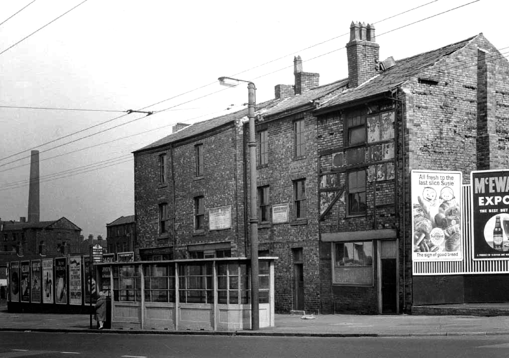
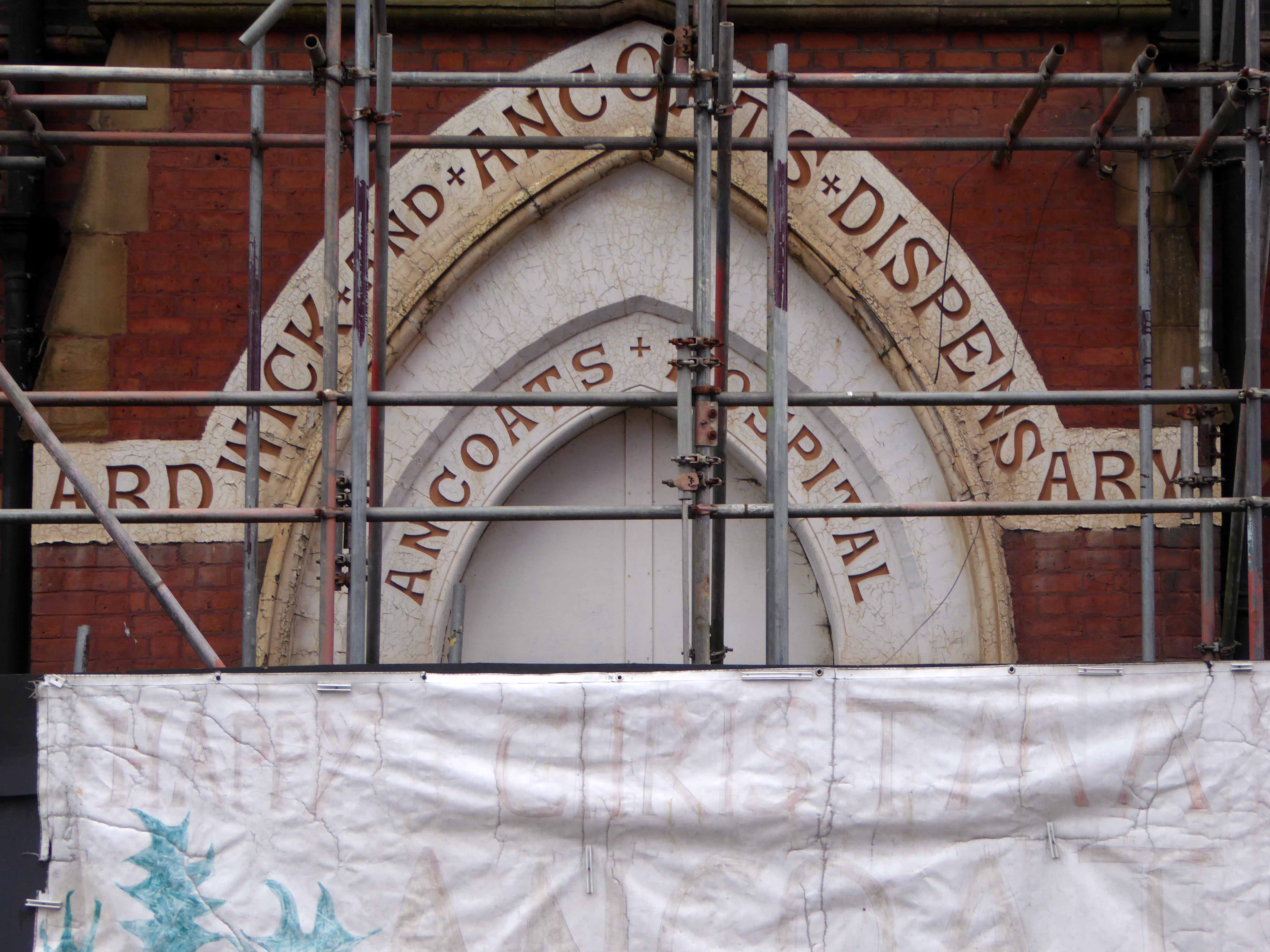
Why is there just one remaining tower block dancing unclad around Ancoats?
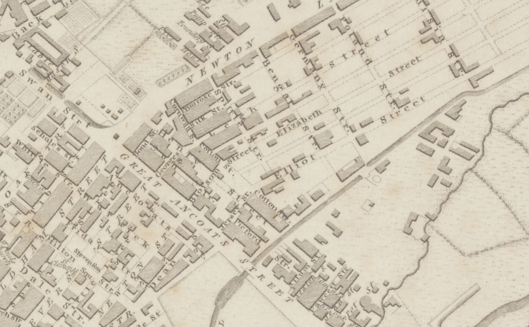
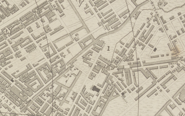
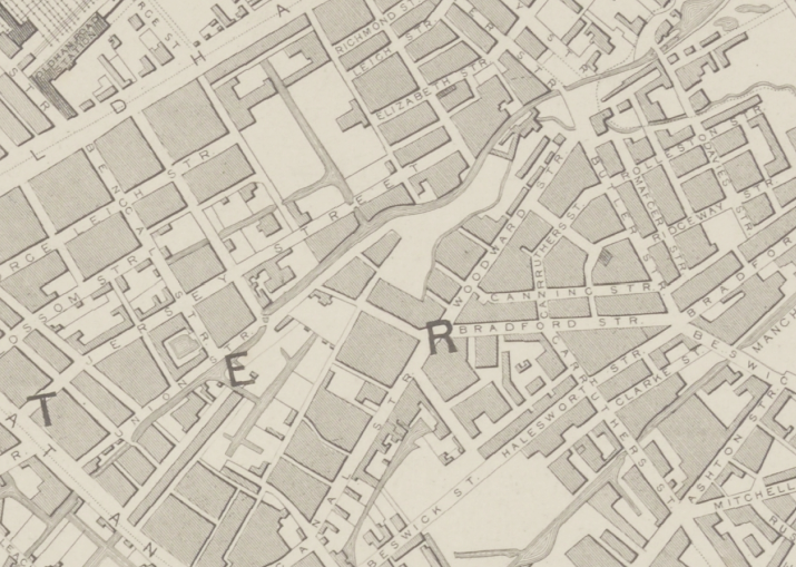
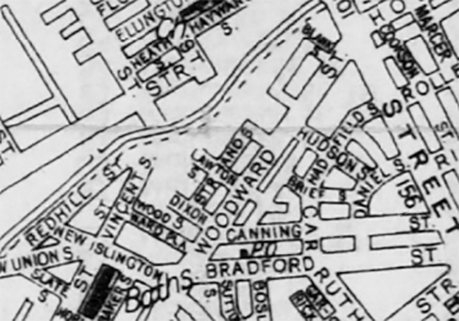
Let’s go back in time and see if we can find out – it seems that back in 1807 there wasn’t a Woodward Street to be found, the ever expanding industrial might of Manchester had not yet reached these particular green fields of Ancoats.
By 1824 it shows a fresh face to the world christened Woodworth Street, sparsely dotted with new development.
Almost fully formed in 1836 and renamed as Woodward Street, the area begins to accumulate the familiar domestic and industrial clutter of a burgeoning Victorian City.
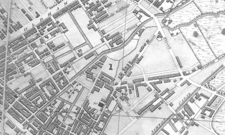
By 1860 the street is fully formed and open for business.
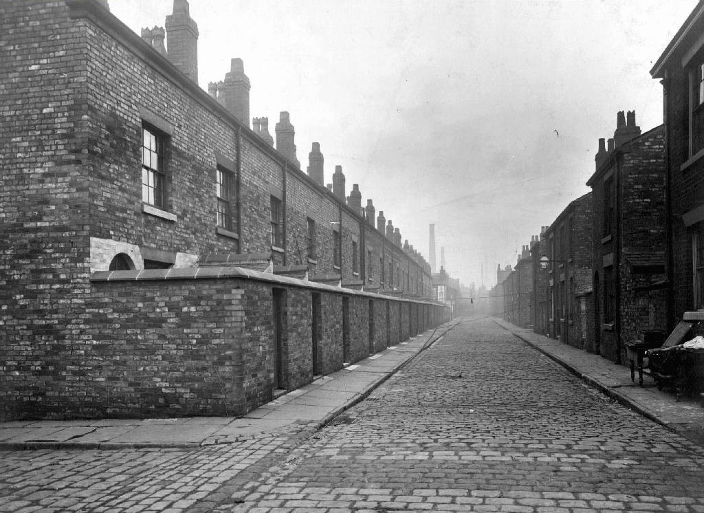
Workers finding homes in austere and functional brick back to backs, typical of the period’s housing.
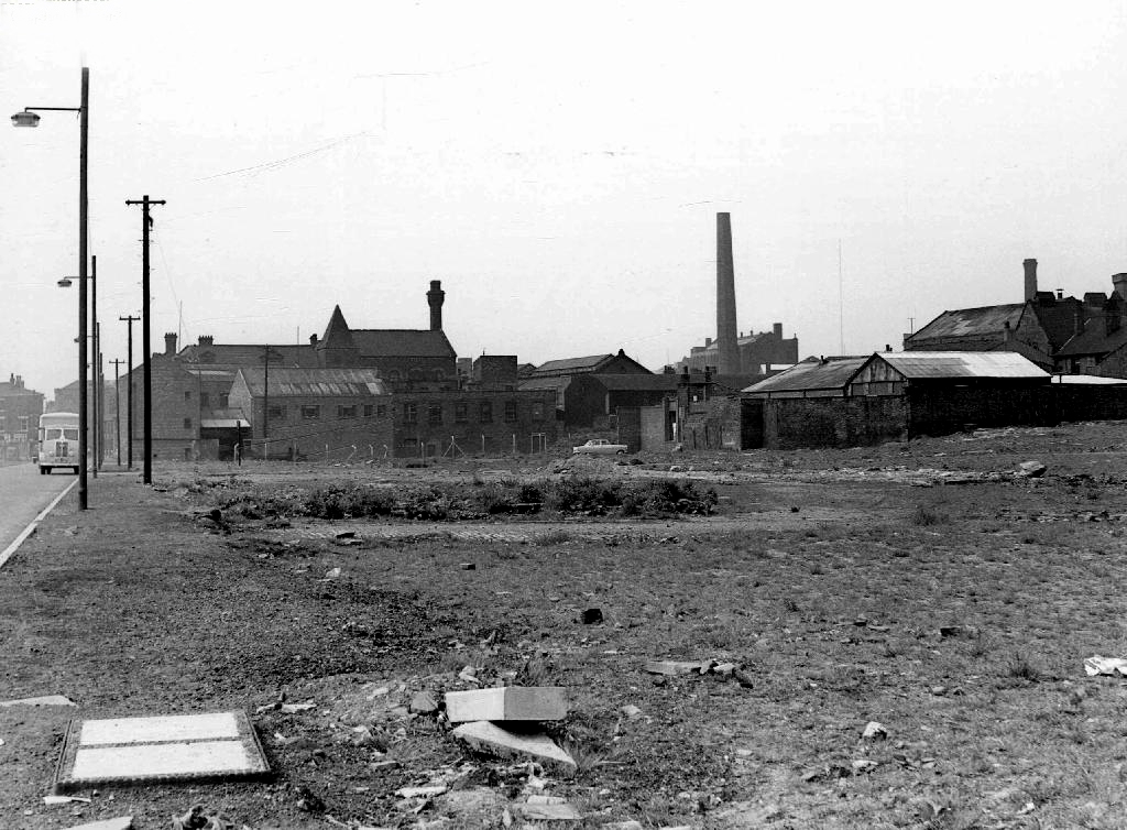
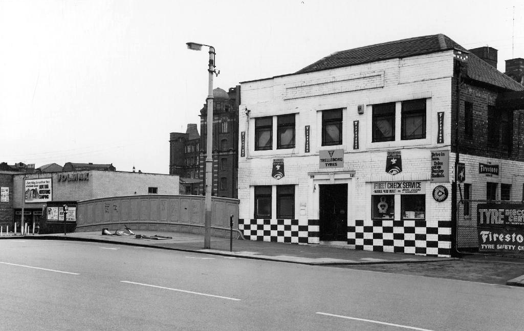
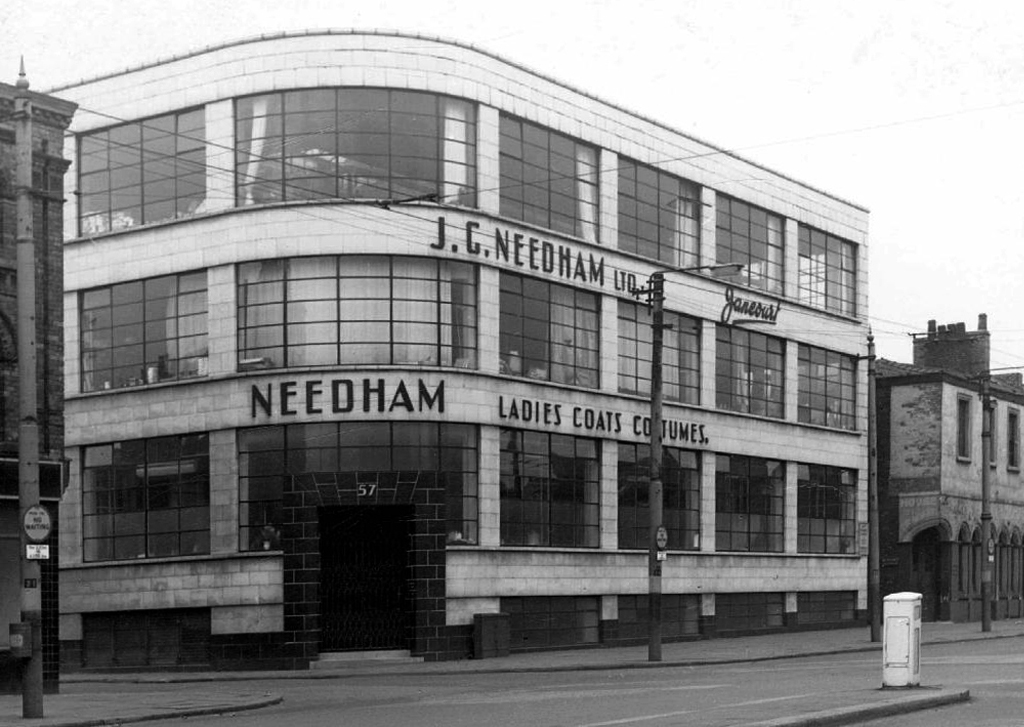
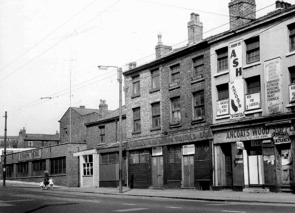
Fast forward to the early Sixties and the street is showing signs of age – the century old industries are already in decline, steady jobs, mills and factories gone west and east, well-worn housing looking terminally tired and in need of a little care and attention.
But wait what’s this coming around the bend?
The first wave of urban regeneration, post war optimism incarnate, a bright new shiny future – out with the old and in with the new, as Municipal Modernism stamps its big broad architectural feet all over Woodward Street.
Our story is far from over, this optimism is short-lived the homes, houses and industry are swept away yet again, replaced with two story modern terraced housing and an all too obvious absence of regular employment – yet the tower blocks prevailed.
Former streets were over written and remain as poignant vestigial marks in the landscape.
Though their future was built on more than somewhat shifting and uncertain sands.
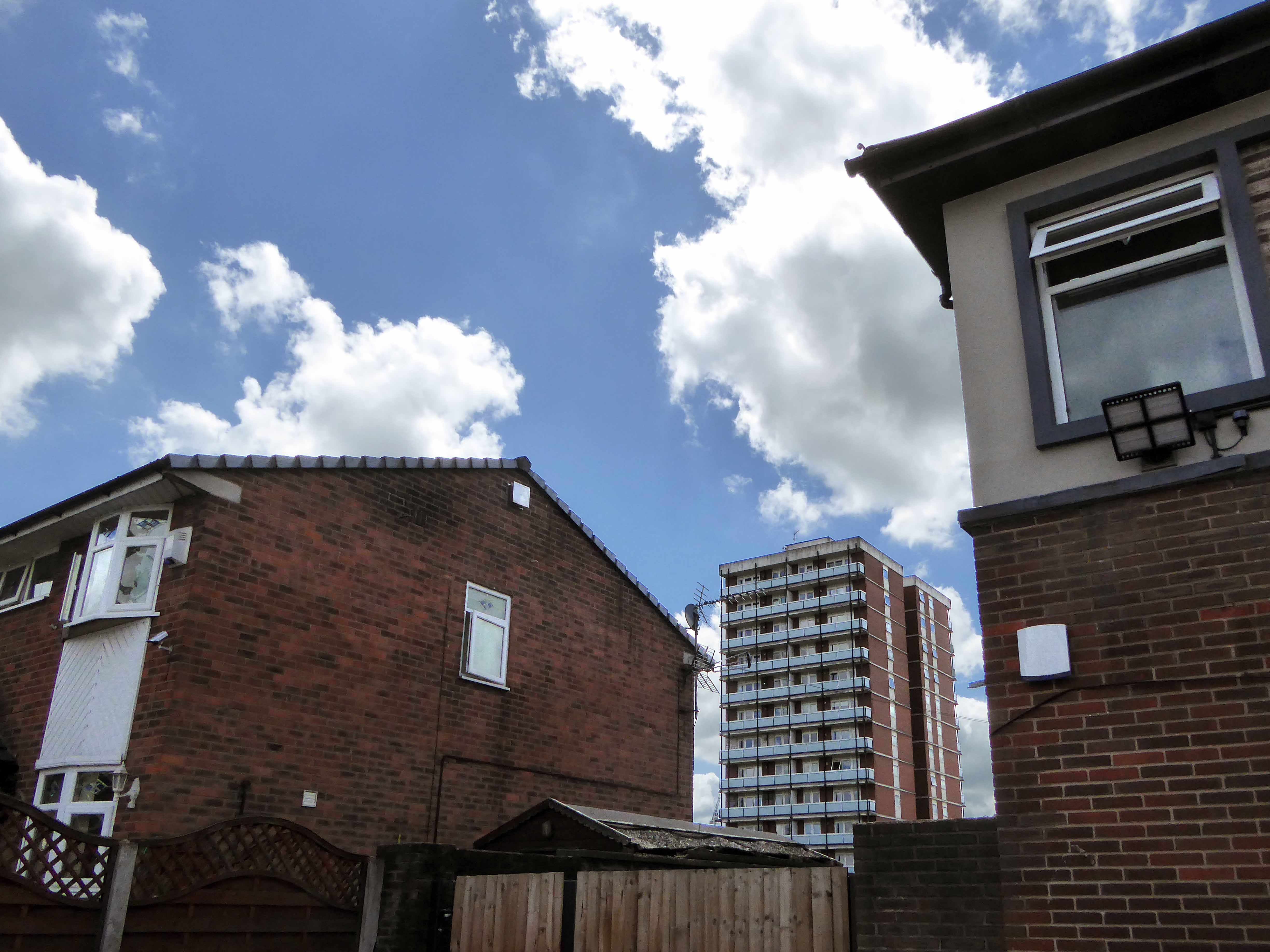
A tower block has been left lying empty for a whopping 18 years. The 13-storey building at Saltford Court in Ancoats has been unoccupied since Manchester council closed it in the 1990s. It was bought by top developers Urban Splash six years ago but residents have now hit out about it still being empty. Neighbours of Saltford Court say it has become an ‘eyesore’ and magnet for vermin since the firm bought it.
A large group of blocks stood tinned up and unloved, yet owned, for a number of years, victims one supposes of land-bankers, developers speculating on an even better return, as the warm waves of gentrification washed slowly over them, from nearby New Islington.
All but one was refurbished, clad and re-let.
Woodward Court was spared – set aside for the homeless.
A period piece surrounded by Post Modern and Revivalist pretenders.
I ride a bicycle, which seriously restricts my access to the world of the M – one and six or otherwise. Having a more than somewhat ambivalent outlook on motor cars and their ways I have nevertheless written a short history.
So to satisfy my idle curiosity, and fill the damp wasteland of a Bank Holiday Sunday afternoon, let’s go on a little trip back in time by means of archival images.
What of your history?
Tendering documents were sent out in 1962 describing it as a 17.7 acre site, requiring at least a £250,000 investment, including an eastern corner reserved for a picnic area, and an emphasis that the views to the west must be considered in the design, and facilities must be provided on both sides. Replies were received – from Telefusion Ltd, J Lyons, Banquets Catering Ltd, Granada and Rank
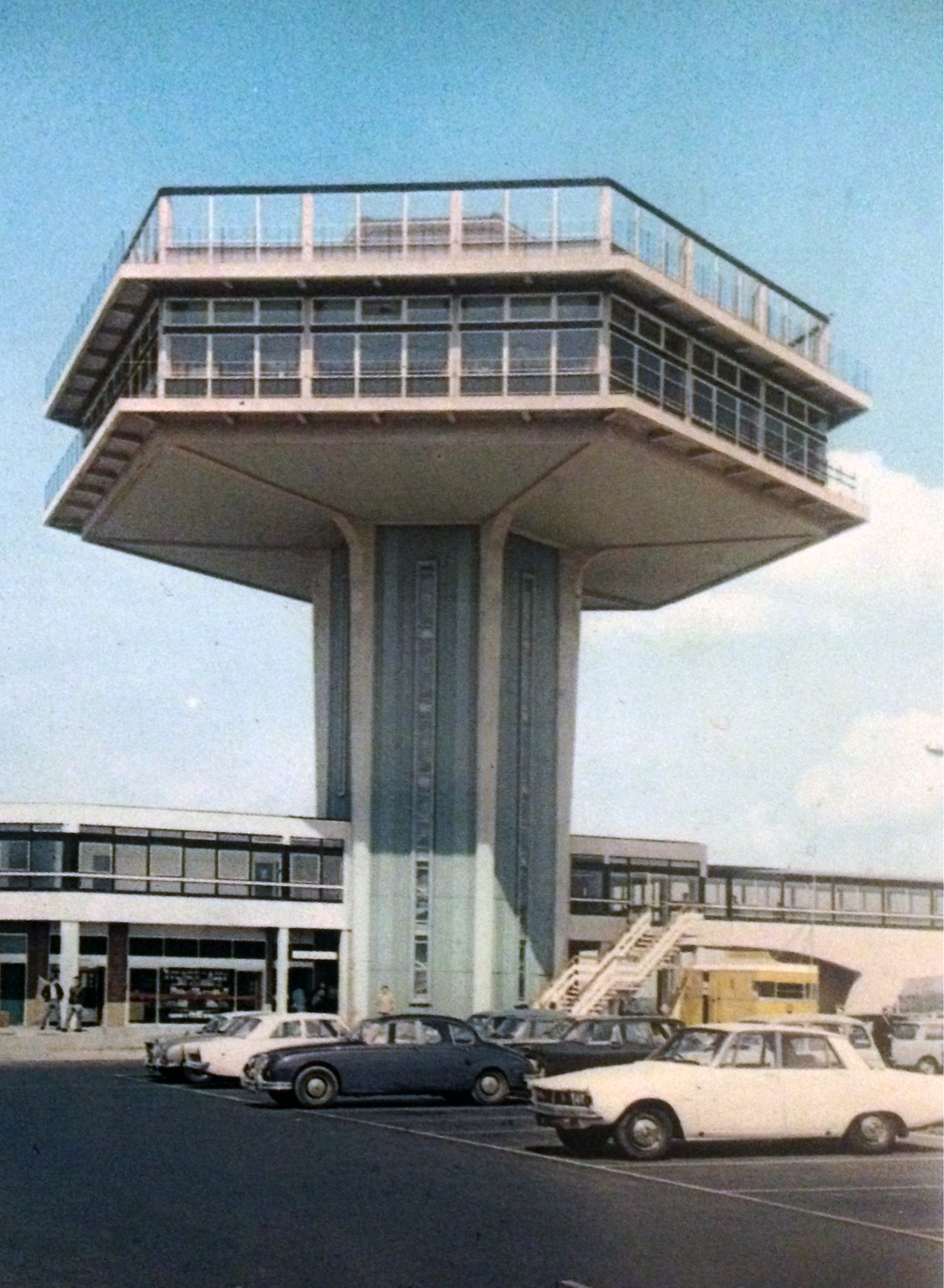
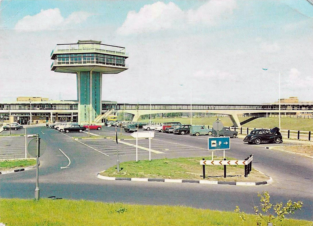
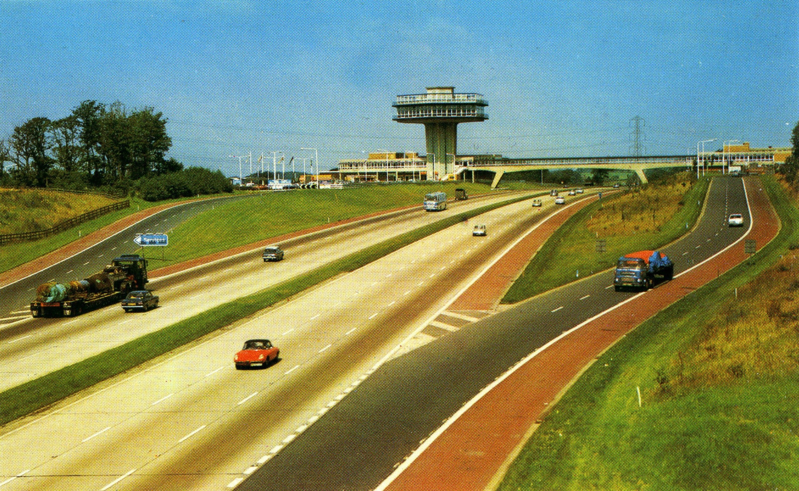
Top Rank’s plan came consistently highly rated by all the experts it was passed between. It showed a restaurant and a self-service café on the west side, the restaurant being at the top of a 96ft (29m) tower. At the top of the tower was a sun terrace – a roof with glass walls, which they had described but hadn’t included any suggestions for how it could be used, adding that maybe it could form an observation platform, serve teas, or be reserved for an additional storey to the restaurant.
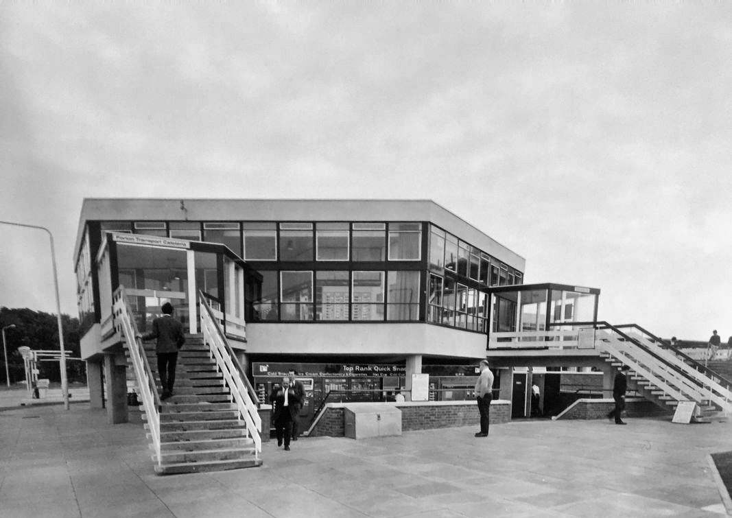
Including a transport café on each site, seating was provided for 700 people, with 101 toilets and 403 parking spaces. A kiosk and toilets were provided in the picnic area.
“The winning design looks first class. Congratulations.”
Architects T P Bennett & Sons had been commissioned to design the services, along with the similar Hilton Park. At £885,000, it was the most expensive service station Rank built, and was considerably more than what had been asked of them.They won the contract, but on a condition imposed by the Landscape Advisory Committee that the height of the tower was reduced to something less striking.
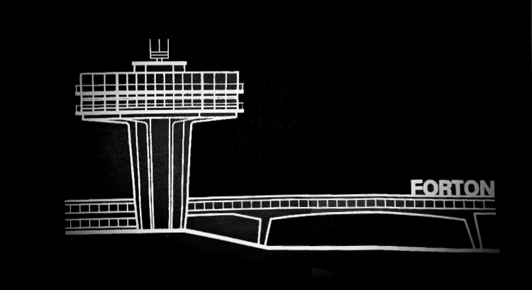
Lancaster was opened in 1965 by Rank under the name ‘Forton’. The petrol station opened early in January, with some additional southbound facilities opening that Spring.
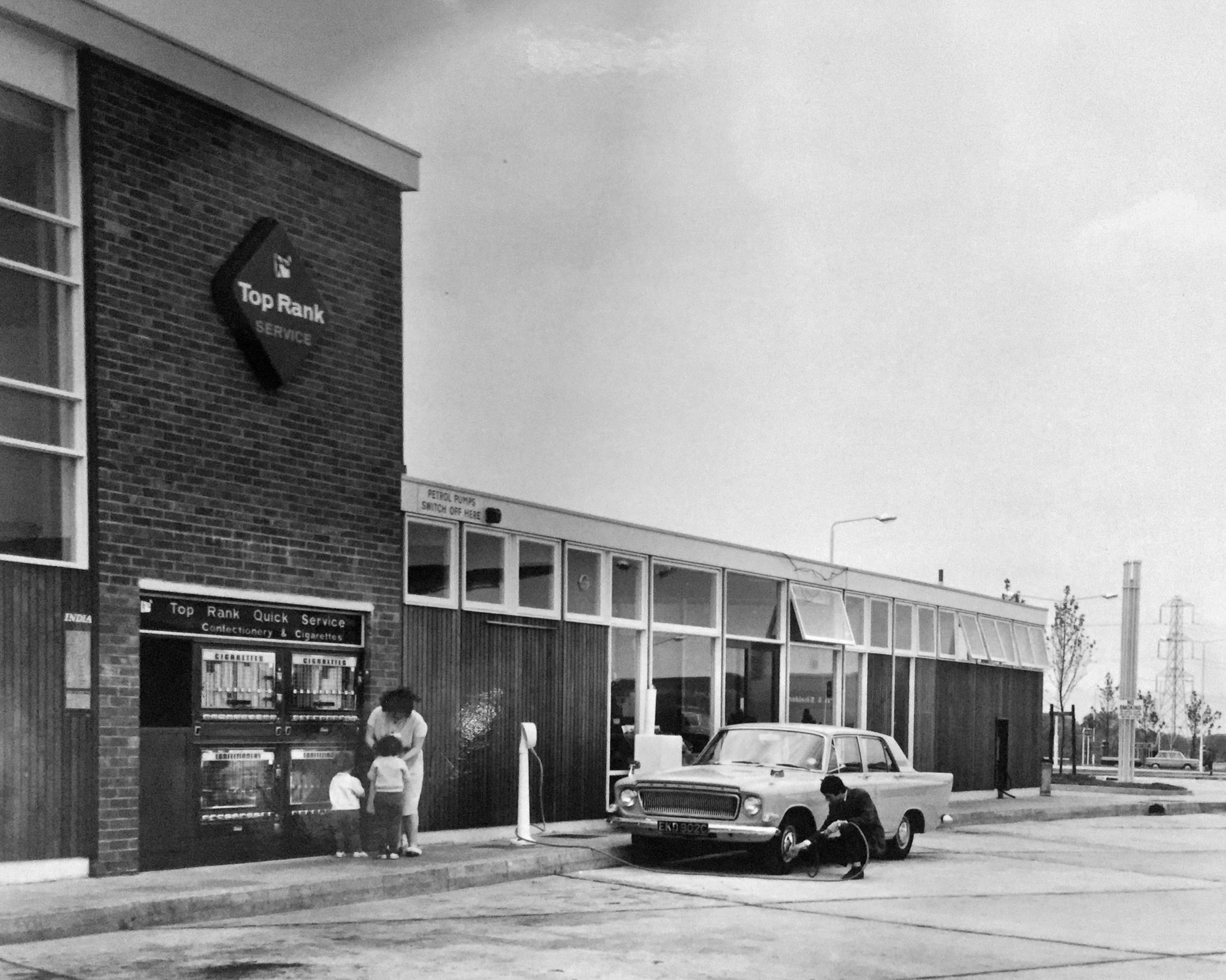
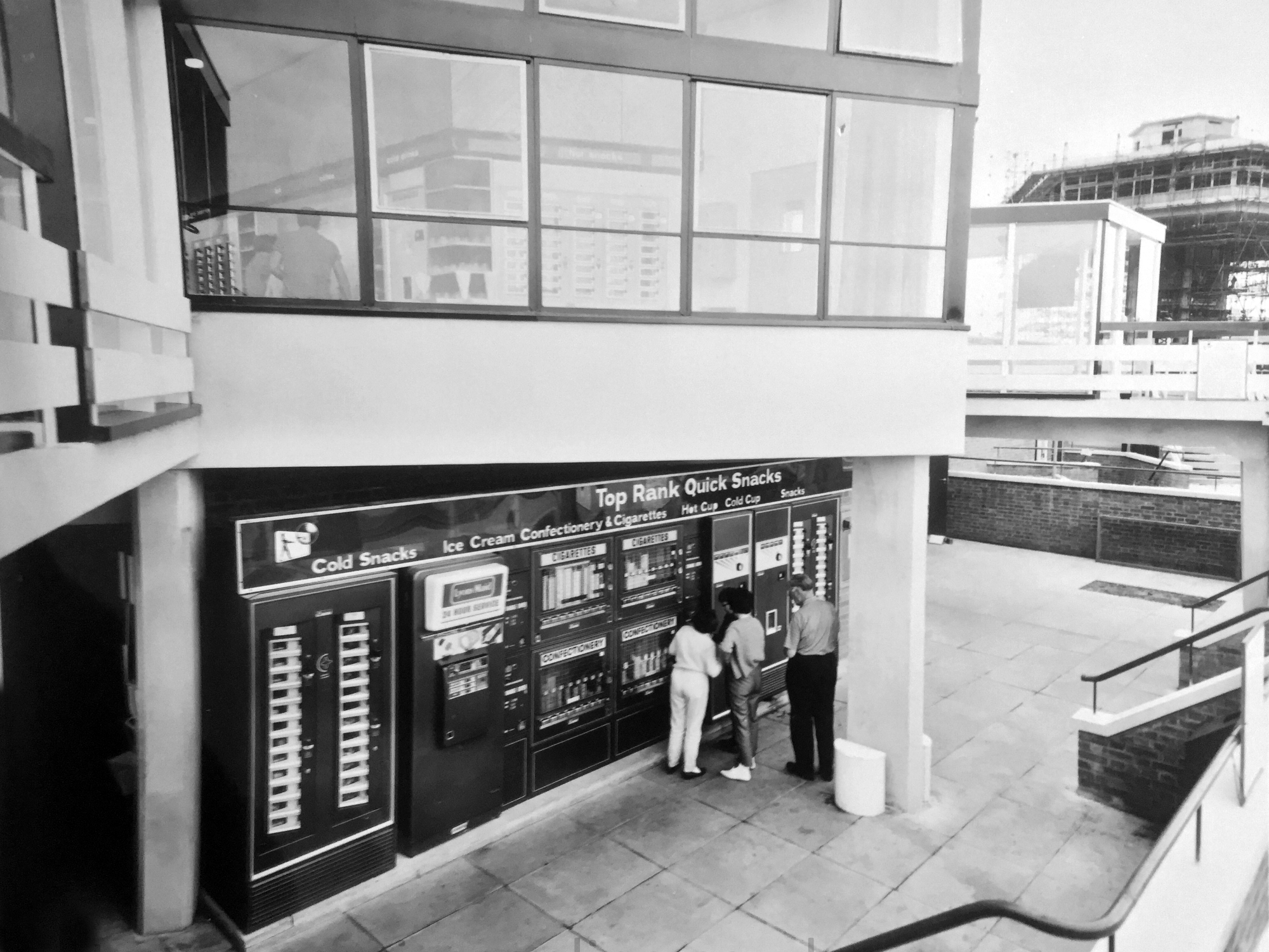
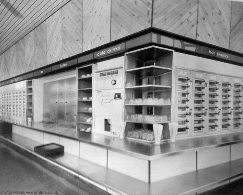
The southbound amenity building had a lowered section with a Quick Snacks machine and the toilets. Above it was the transport café which had only an Autosnacks machine, where staff loaded hot meals into the back and customers paid to release them. These were the motorway network’s first catering vending machines, and the Ministry of Transport were won round by the idea, but Rank weren’t – they removed them due to low demand.
In 1977, Egon Ronay rated the services as appalling. The steak and kidney pie was an insult to one’s taste buds while the apple pie was an absolute disgrace. He said everywhere needed maintenance and a coat of paint, the toilets were smelly and dirty, and the food on display was most unattractive.
A 1978 government review described the services as a soulless fairground.
The Forton Services and the typology generally have had a chequered career, rising and falling in public favour and perception. Purveying food and facilities of varying quality, changing style and vendors with depressing regularity – knowing the value of nothing yet, the Costas of everything.
Ironically the prematurely diminished tower has taken on iconic status in the Modernist canon – listed in 2012 yet closed to the public, admired from afar – in a car.
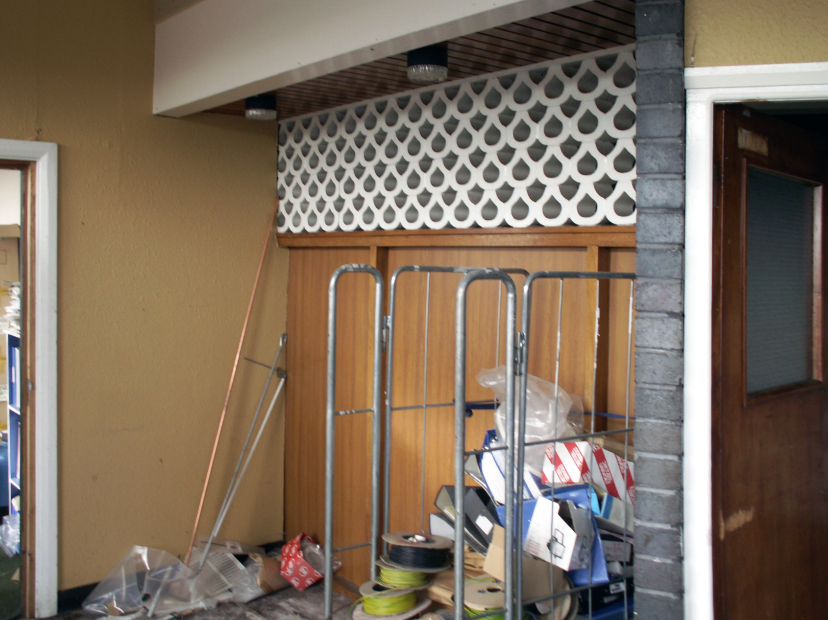
The Pennine Tower was designed to make the services clearly visible – the ban on advertising had always been an issue, and the previous technique of having a restaurant on a bridge, like down the road at Charnock Richard, was proving expensive and impractical. Rank commissioned architects T P Bennett & Sons to capitalise on the benefits of exciting design while trialling something different. The tower resembles that used by air traffic control, summarising the dreams of the ’60s.
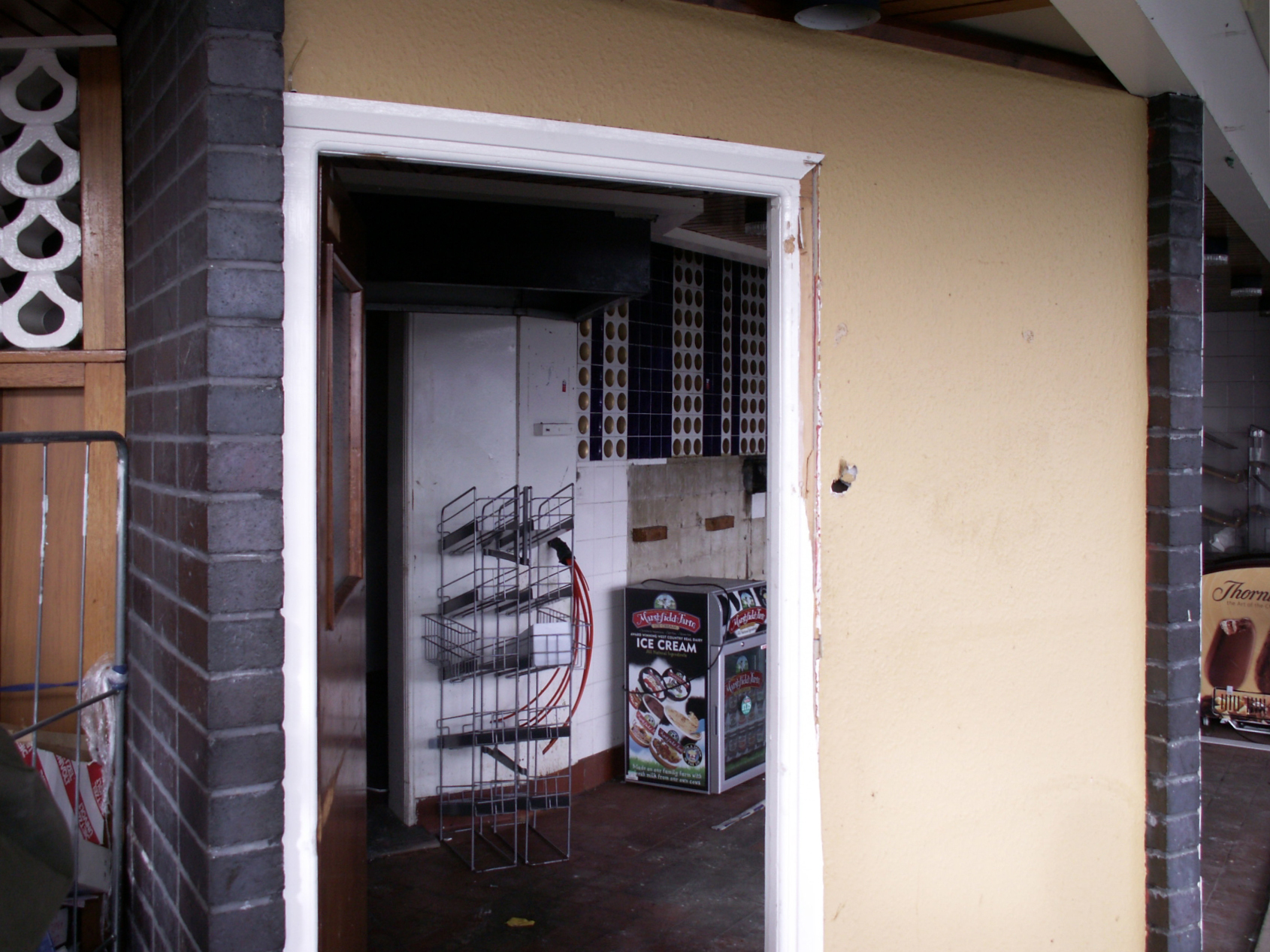
The central shaft consists of two lifts, which were originally a pentagonal design until they were replaced in 2017. They’re still in use to access the first floor, but with the buttons to higher floors disabled. There are then three service lifts, and one spiral staircase – satisfying typical health and safety regulations.
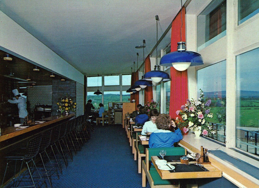
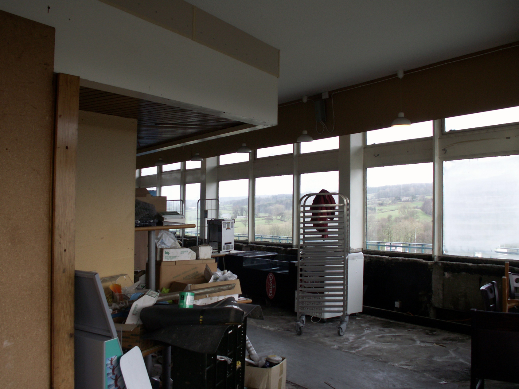
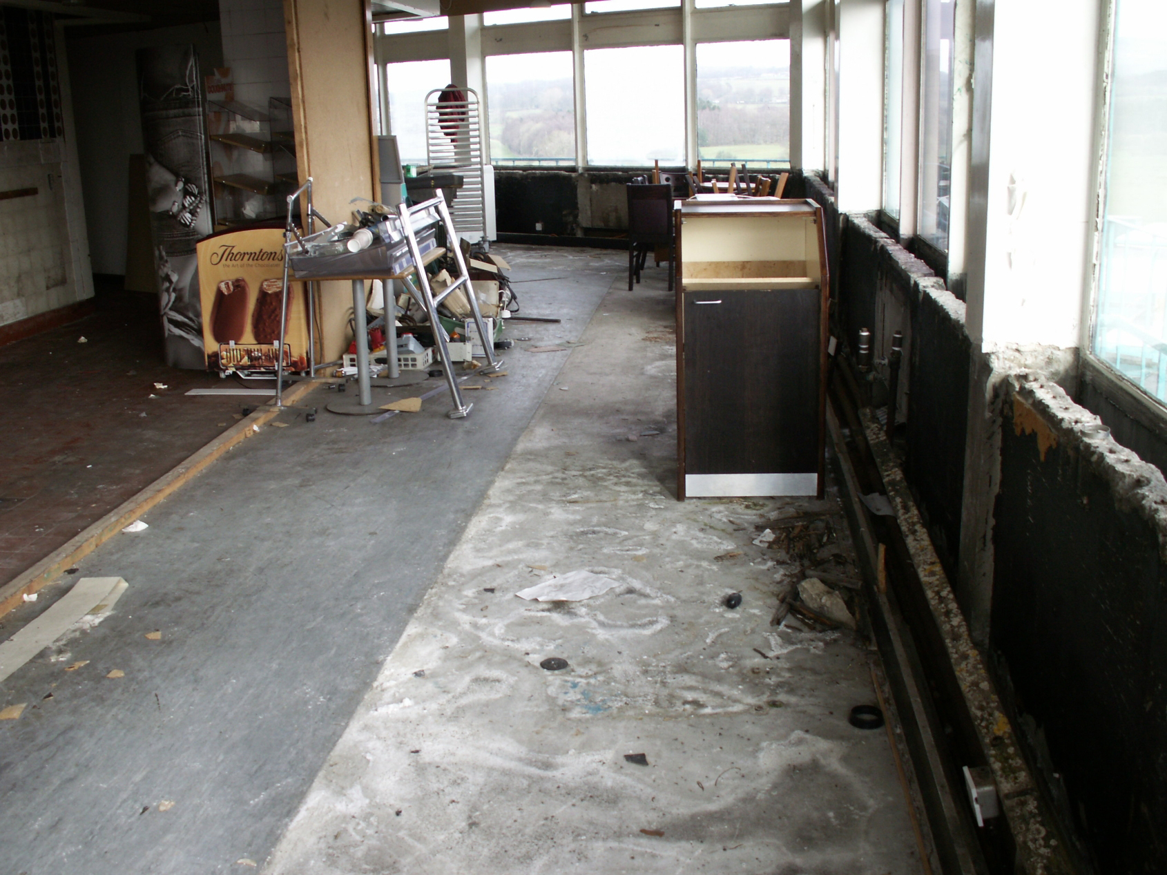
At the top of the tower stood a fine-dining waitress service restaurant, offering views over the road below and across Lancashire. Above the restaurant the lift extended to roof-level, to allow the roof to serve as a sun terrace – although Rank admitted they weren’t sure what this could be used for, suggesting serving tea or eventually building another level.
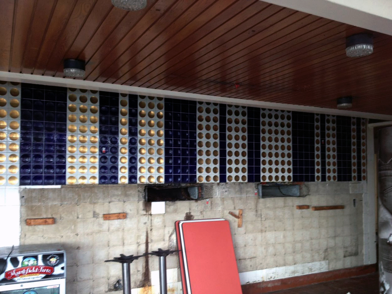
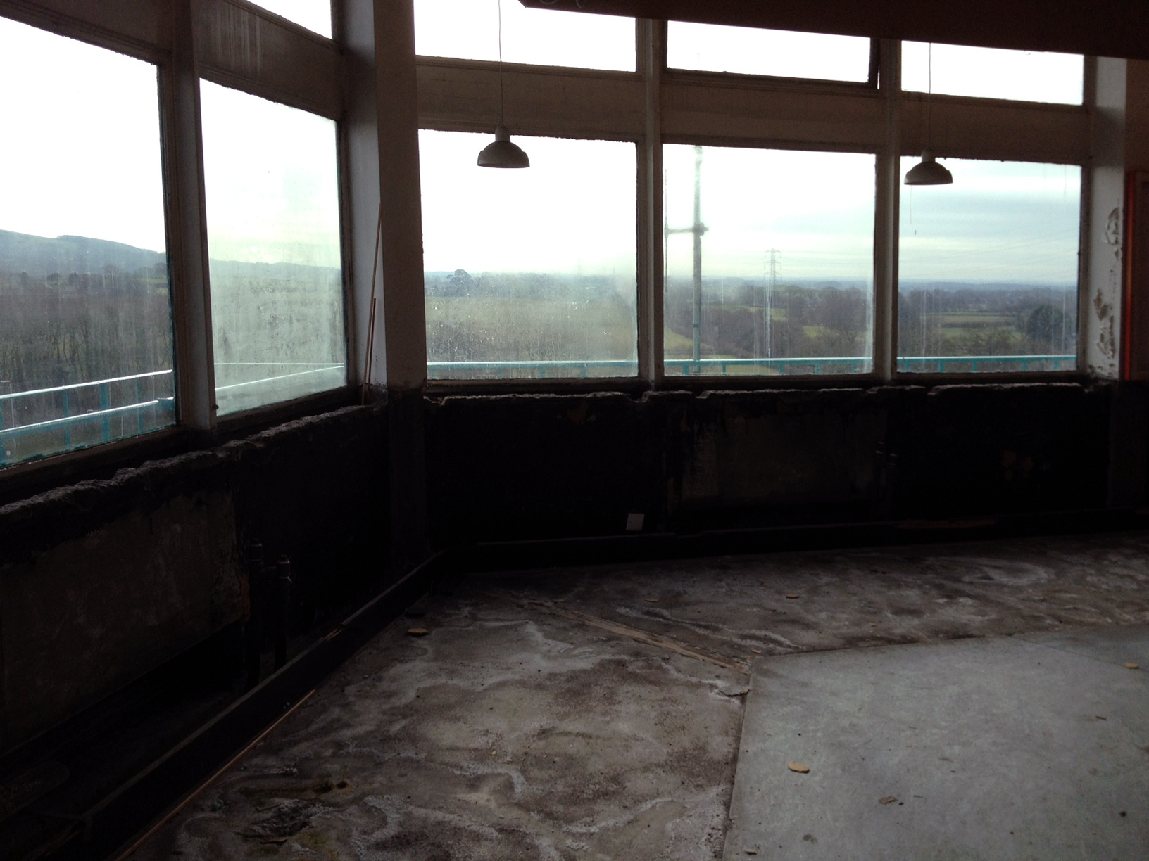
In reality social changes and cost-cutting limited the desirability of a sit-down meal, and this coupled with high maintenance costs made the tower fall out of favour. The ‘fine dining’ restaurant became the trucking lounge that had been on the first floor, before closing to the public in 1989. It then soldiered on for another 15 years, partially re-fitted, as a head office, then staff training and storage, but even this became too impractical, and the tower is now not used at all.
Although the tower is unique to these services, the concept of large high-level floors can be seen in many Rank services of the era, the idea of each one being to have a visible landmark and a good view of the surrounding area, such as at Hilton Park. The lower-level restaurant at Forton sticks out over the first floor, and partially in to the road, to give an optimum view. Toilets and offices were in the ground floor buildings below.
There are lots of myths flying around that the tower was forced to close by safety regulations, and that it is about to fall down. Like any building which hasn’t been used for 30 years it would take a lot of investment to get it open again, and with roadside restaurants across the country closing due to a lack of trade, nobody has come up with an convincing plan to justify investing in the Pennine Tower.
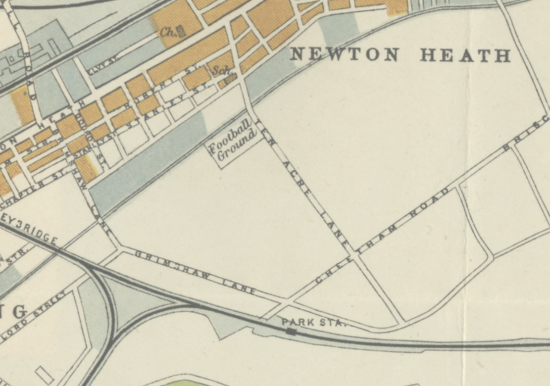
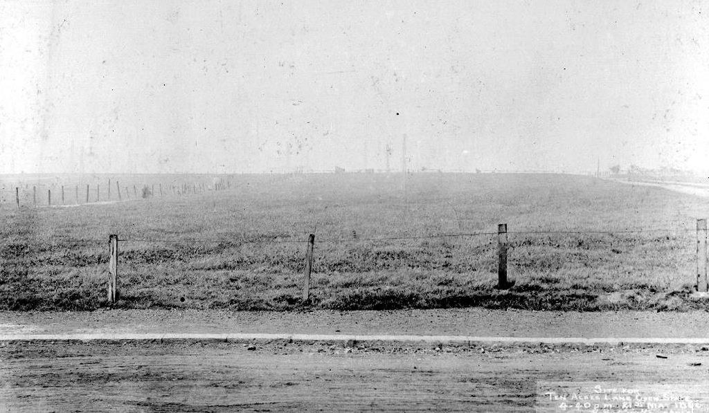
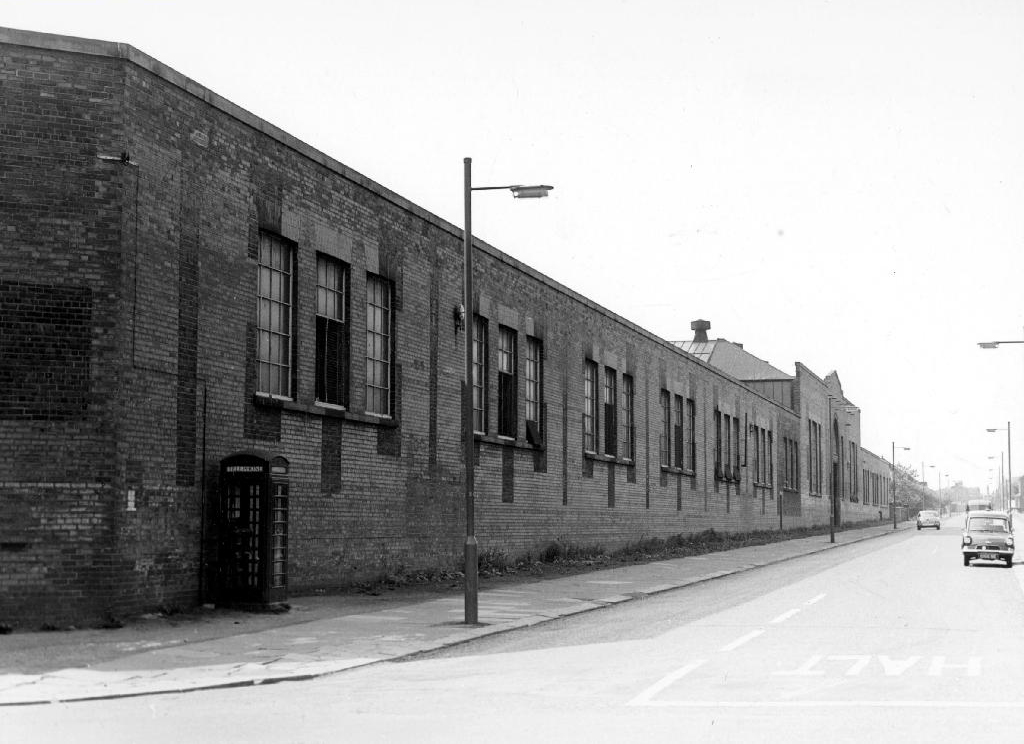
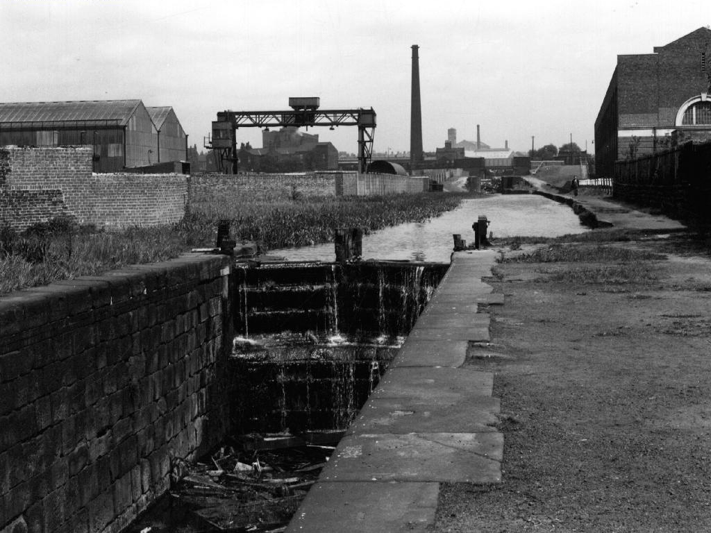
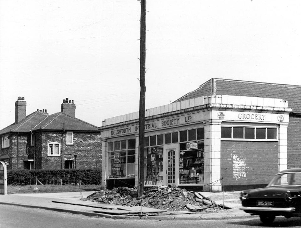
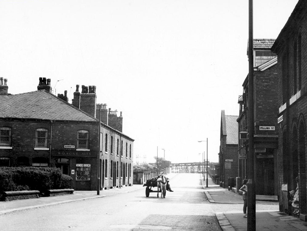
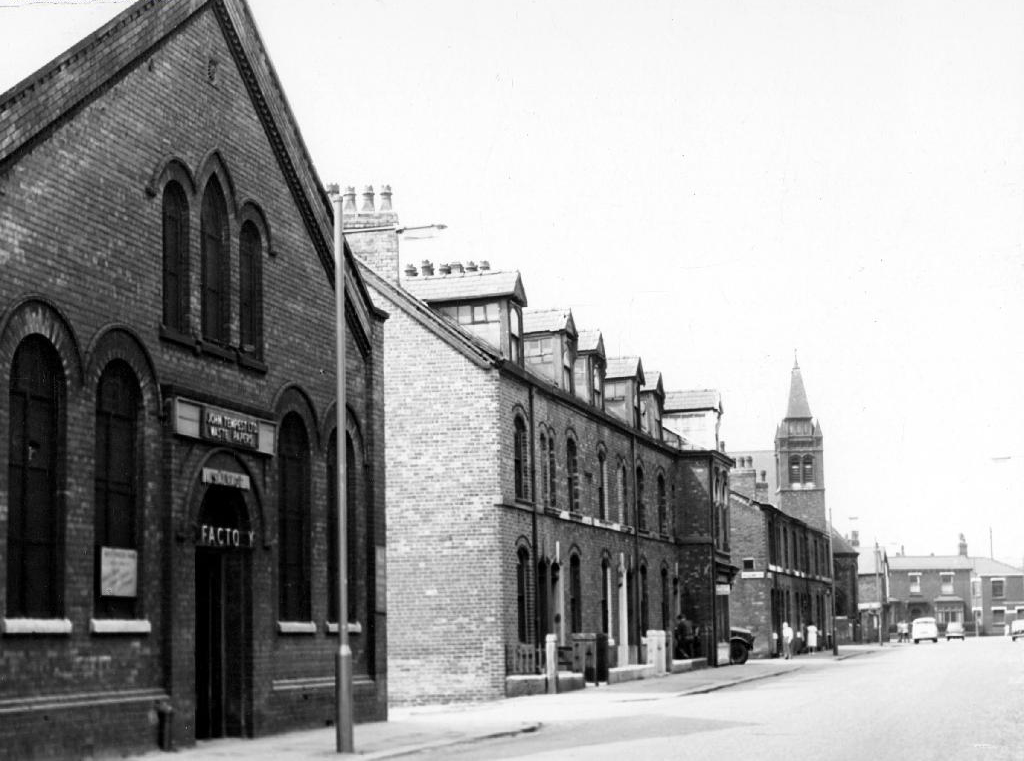
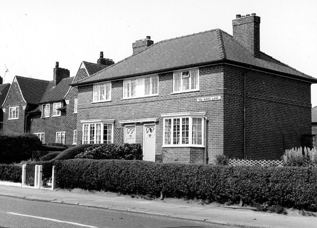
Ten Acres Lane 1904 running south from Oldham Road – not quite crossing under the Ashton and Stalybridge Railway.
I was propelled by the vague memory of an Ashton Lads football match way back in the 1970s – my dad Eddie Marland managed the team in the Moston and Rusholme League.
There was land given over to recreation from 1900, the area is famed for its links to the inception of Manchester United and almost but not quite became home to FC United.
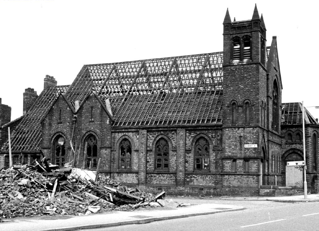
Going going gone St Paul’s Church seen here in 1972.
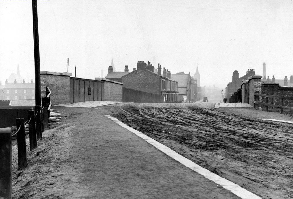
Victorian terraces and inter-war social housing – homes for a large industrial work force.
Many of the sights and sites above are still extant though their appearance and uses have changed along with the times. Manchester inevitably continues to from and reform for good or ill.
Sadly the old Rec the Moston and Rusholme League and my dad are all long gone – though it’s just as well to remember them all fondly, as we travel through our familiar unfamiliar city.
Now here I am in Colwyn Bay generally minding my own and everybody else’s business, when all of a sudden I noticed a cast iron glazed awning.
Proudly announcing the proprietors – sadly supported by a distressing modern addition – now I’m not one to decry and debunk the rising tide of modernity, I’m all in favour of unisex clothing and central heating.
But the unchecked encroachment of vacuous vinyl really is the limit.
Businesses displayed a degree of dignified permanence unknown to the current high street trader. So here it is writ larger than life in stained glass and Carter’s Tiles.
Loud and proud.
And as an addendum here are the delightful tiles from the Llandudno branch, snapped two years previously.
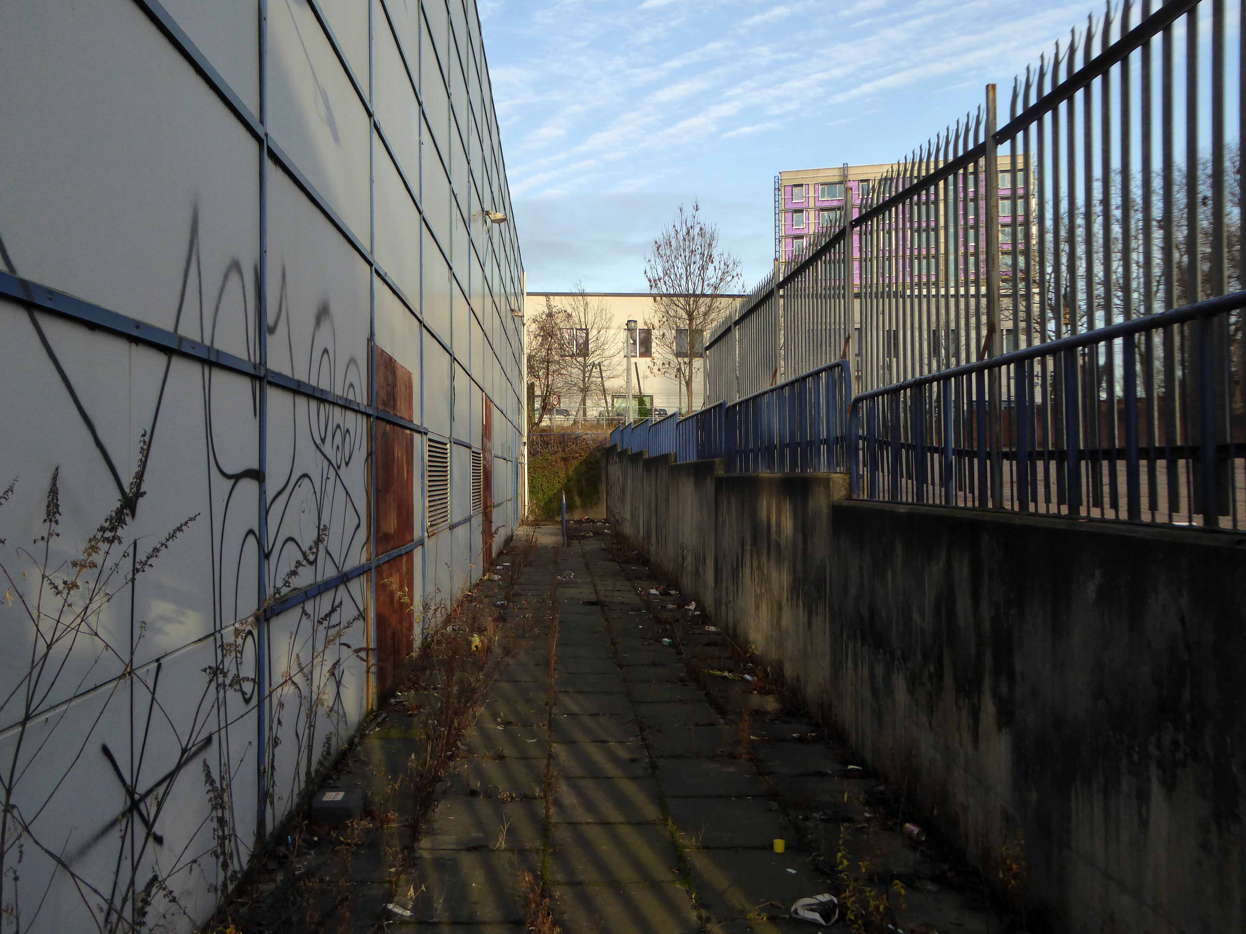
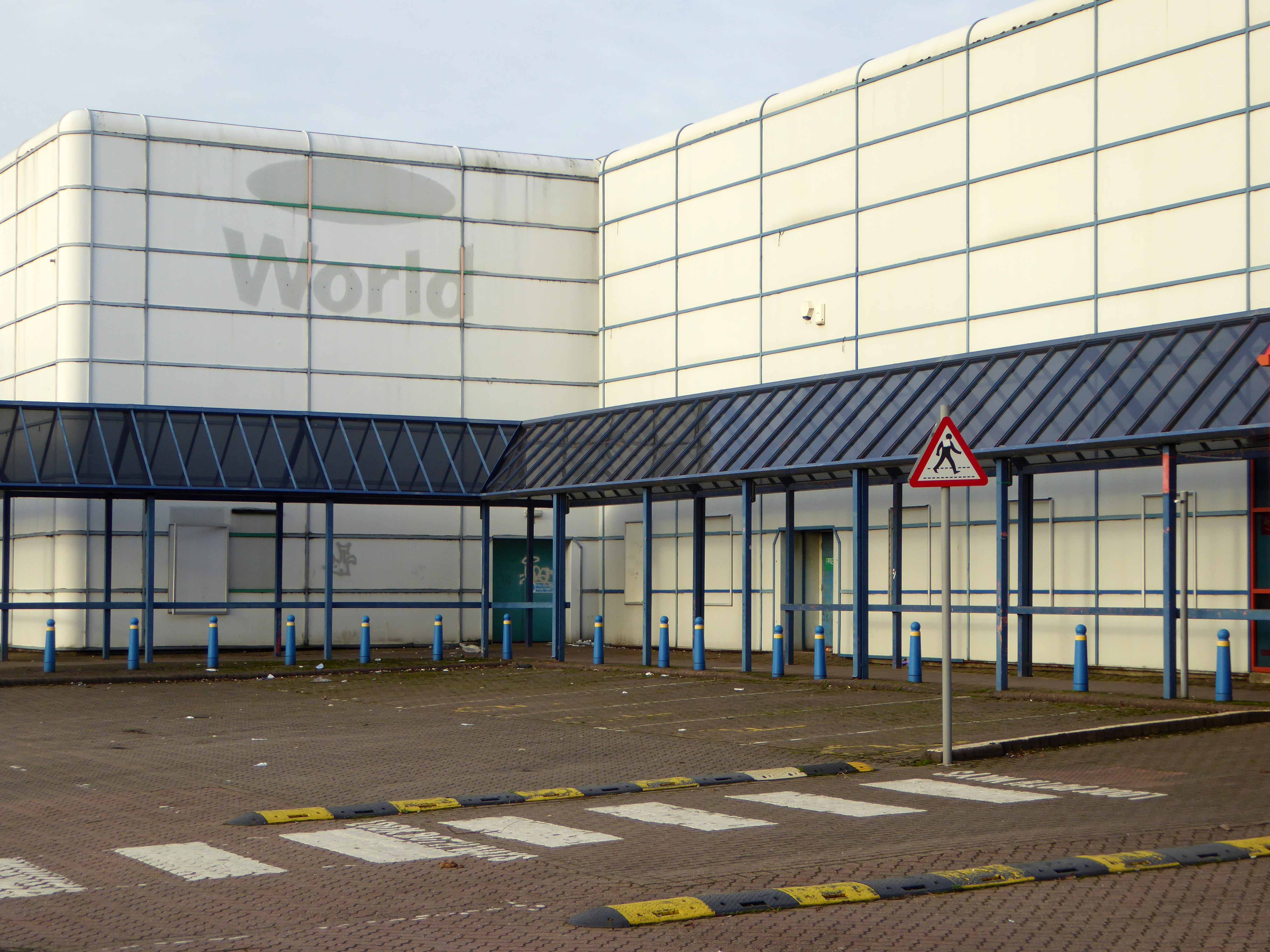
However the process of clearance and redevelopment radically changed and reduced the population and appearance of Great Ancoats Street and its environs.
The back to backs aren’t coming back and their occupants shifted from pillar to post along with the businesses that served them. Following years of decline Manchester takes a long hard look at itself and decides to modernise.
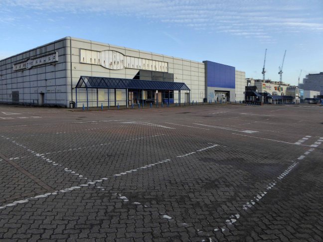
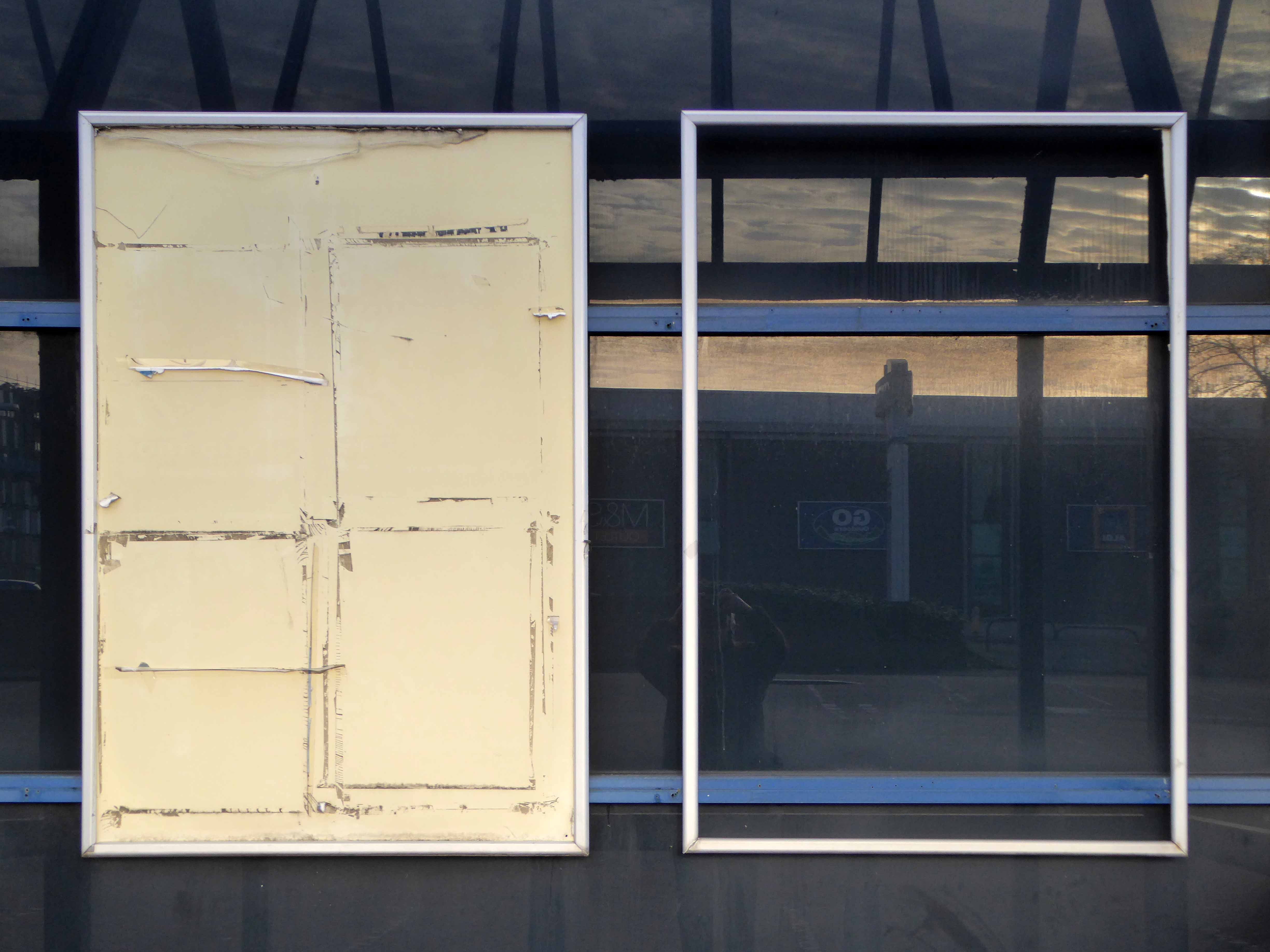
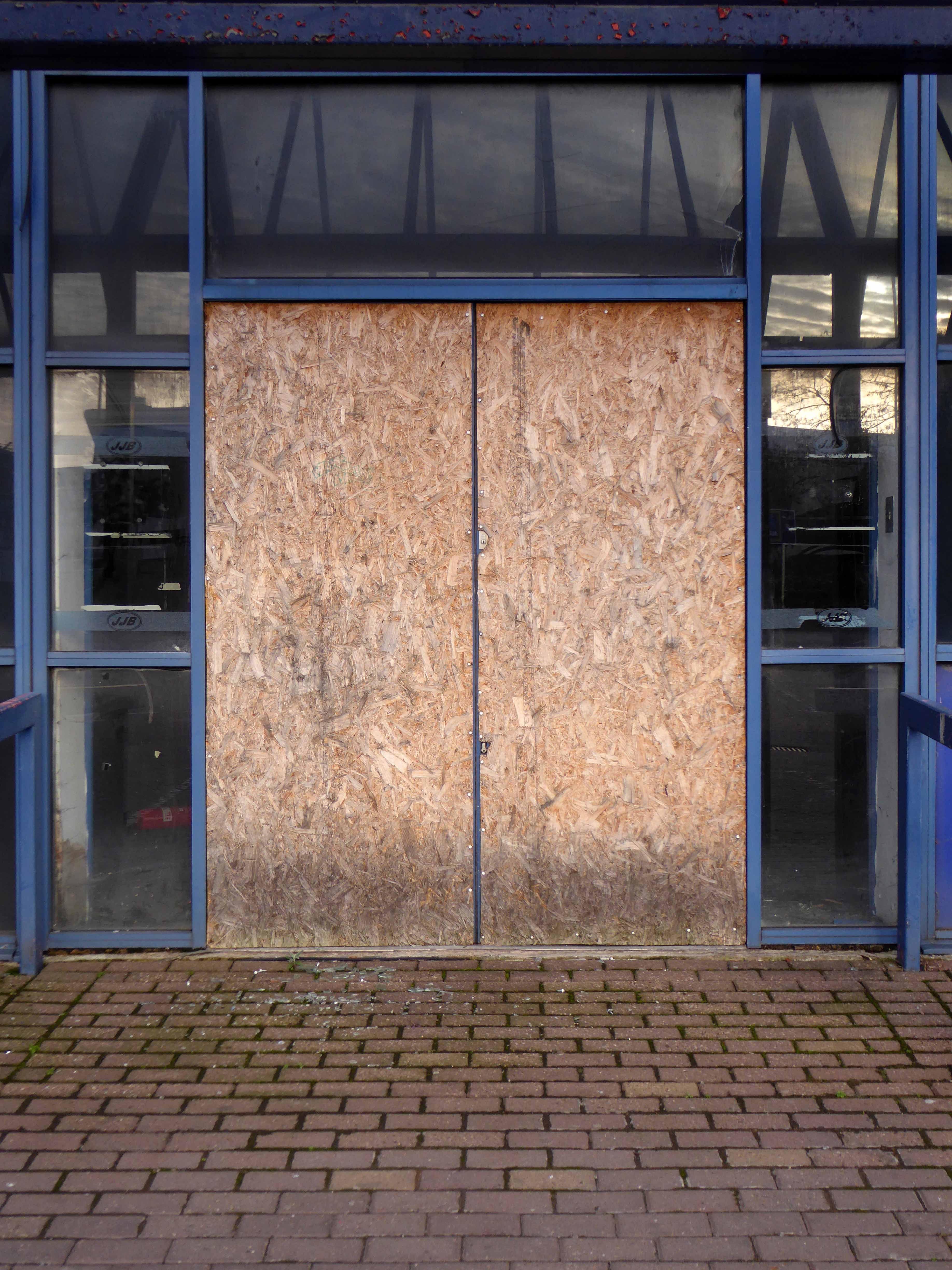
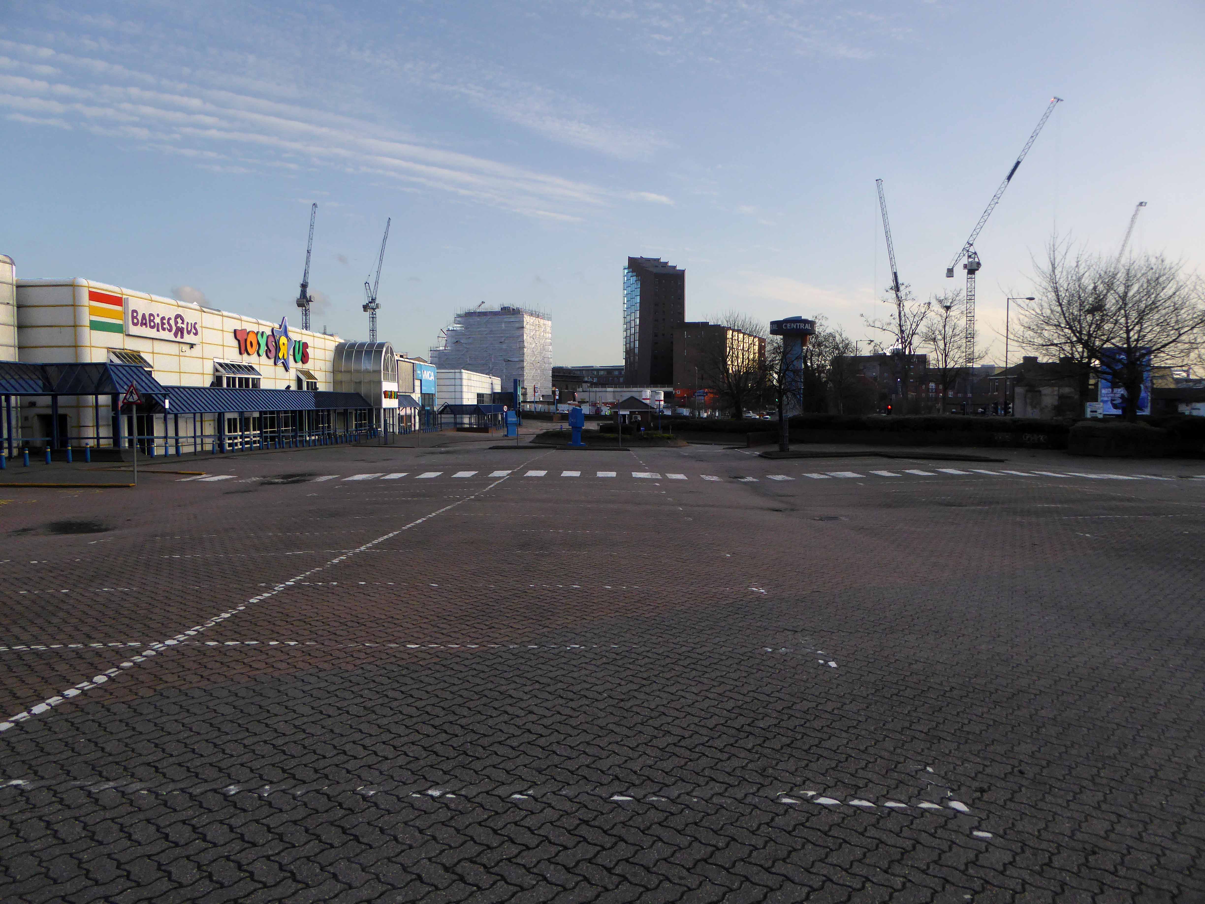
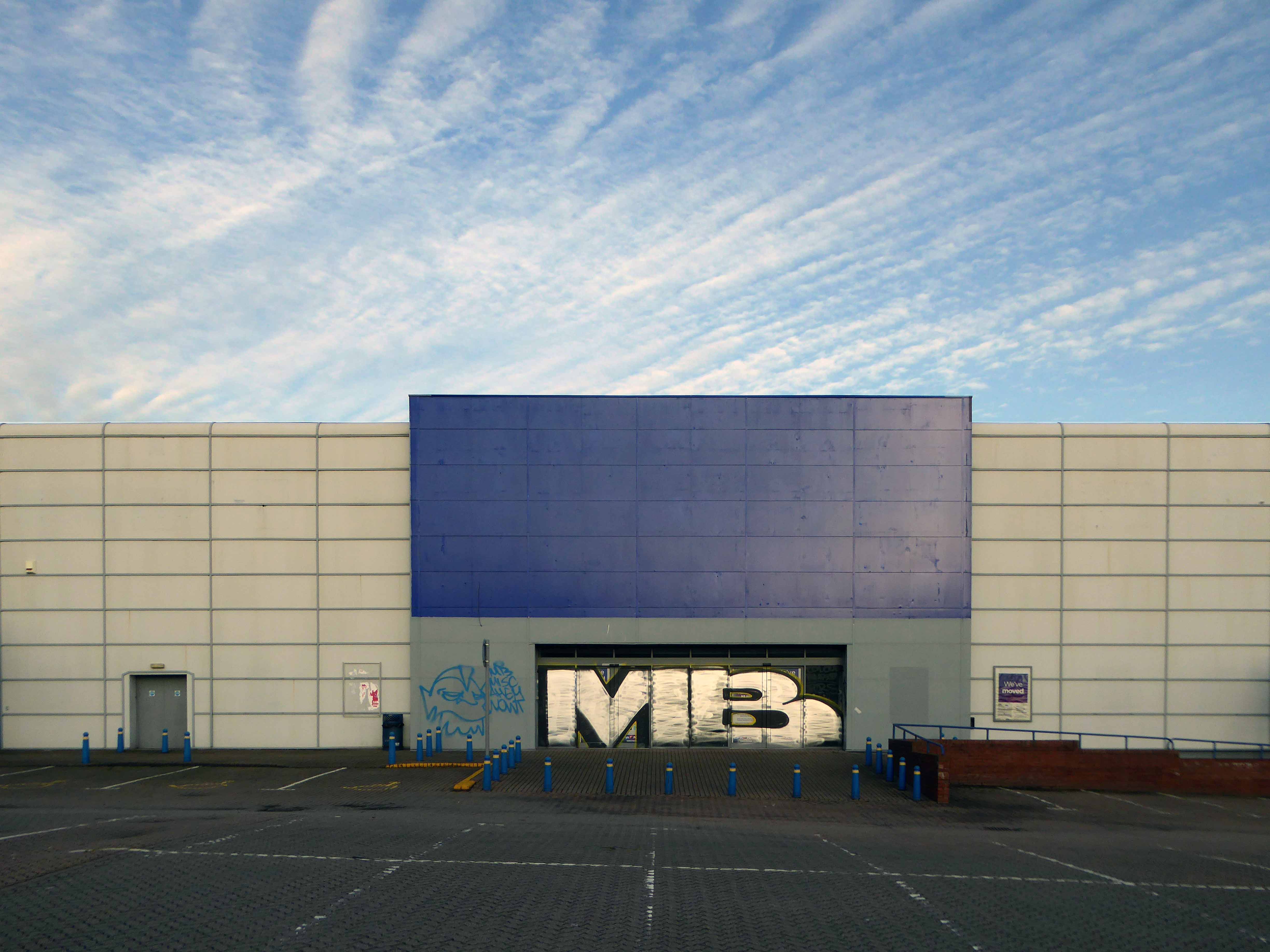
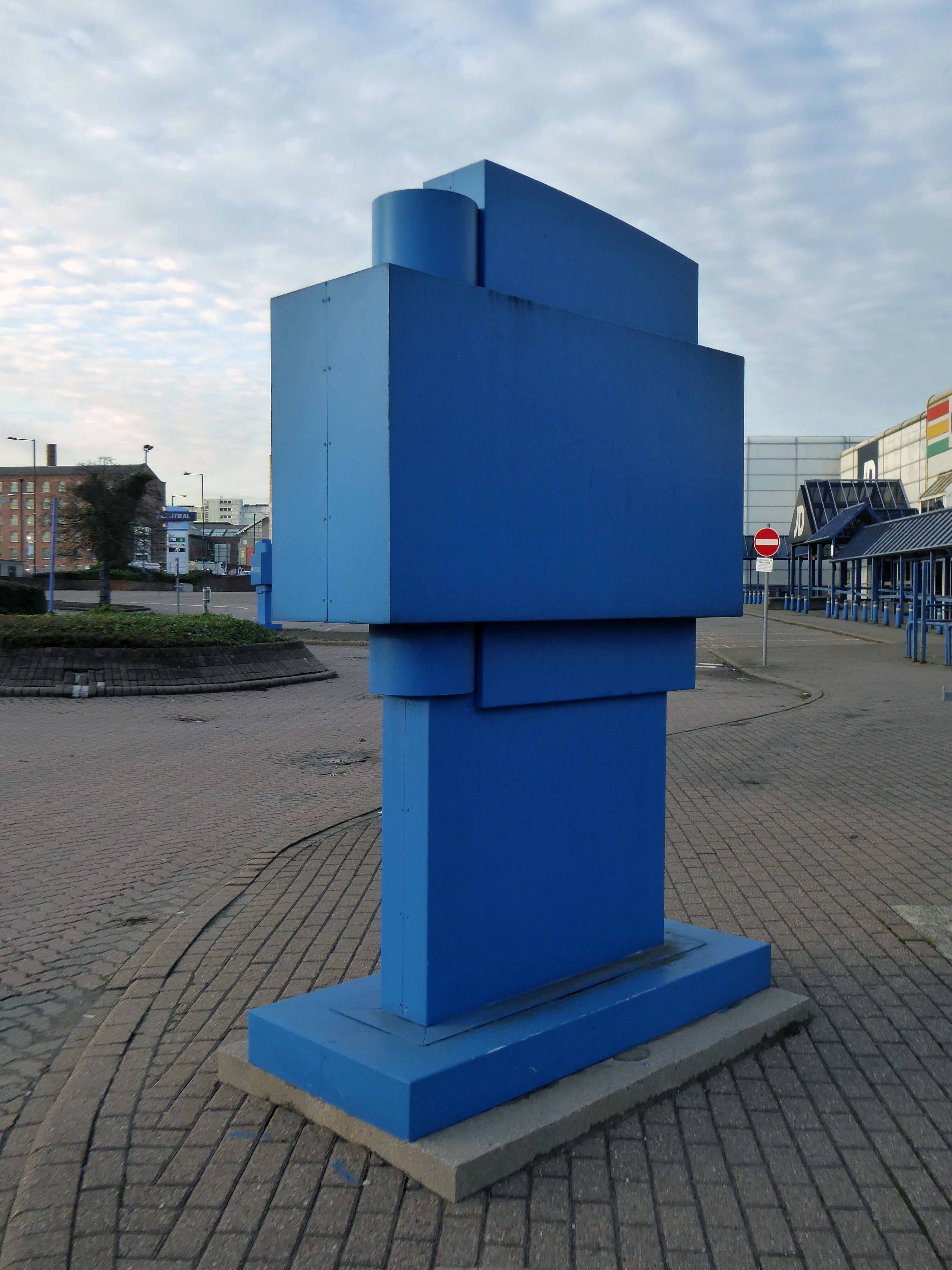
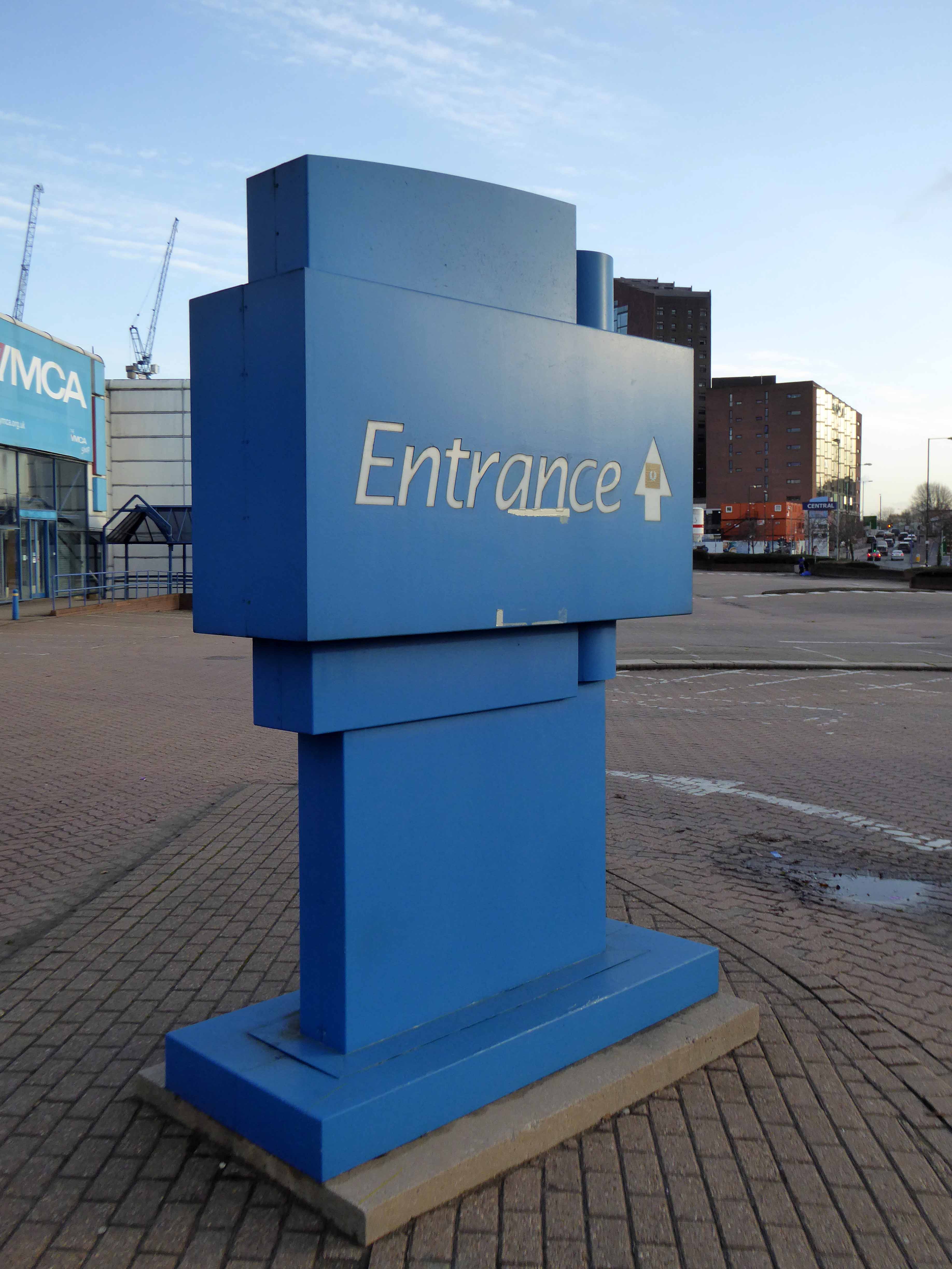
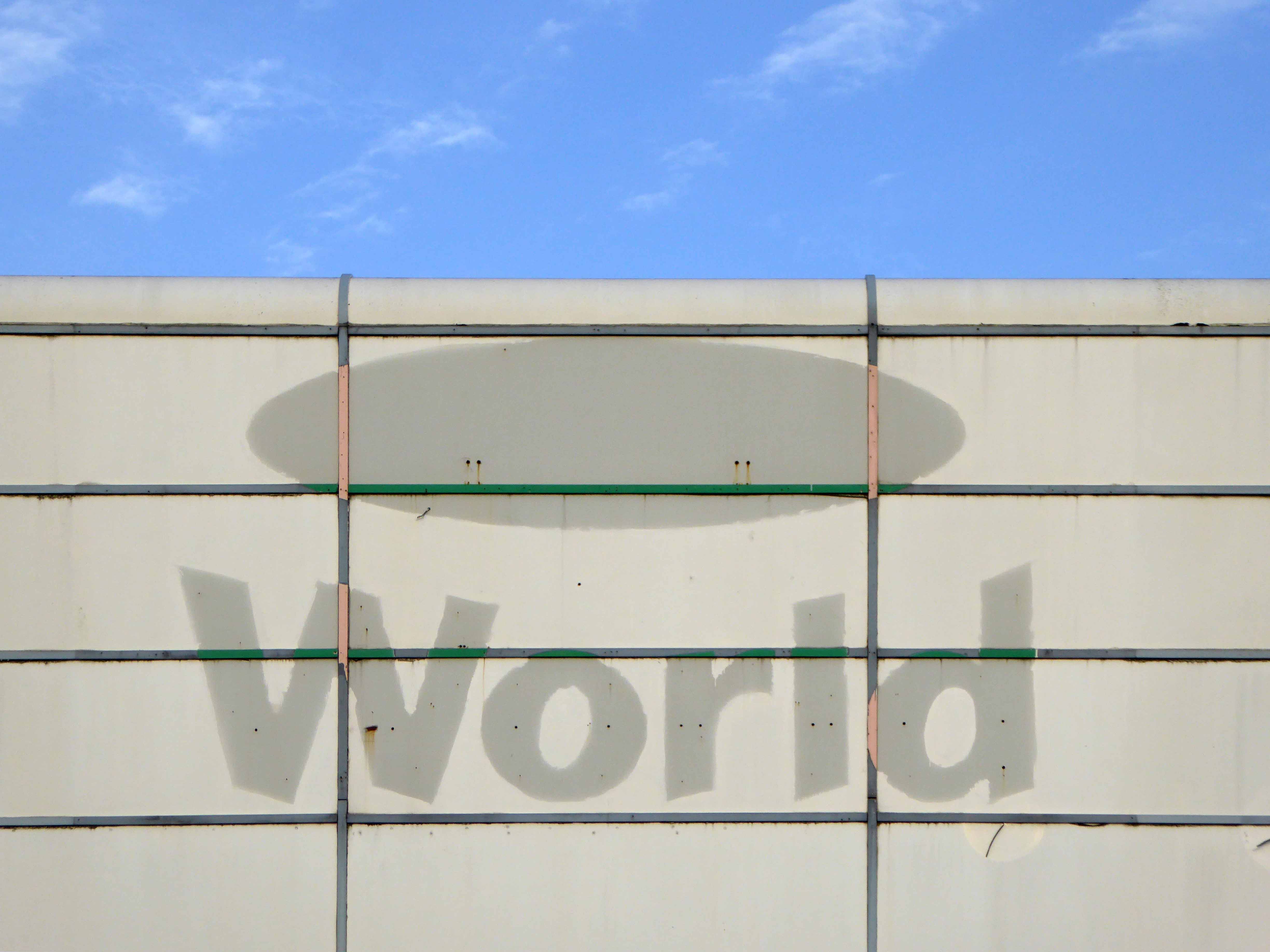
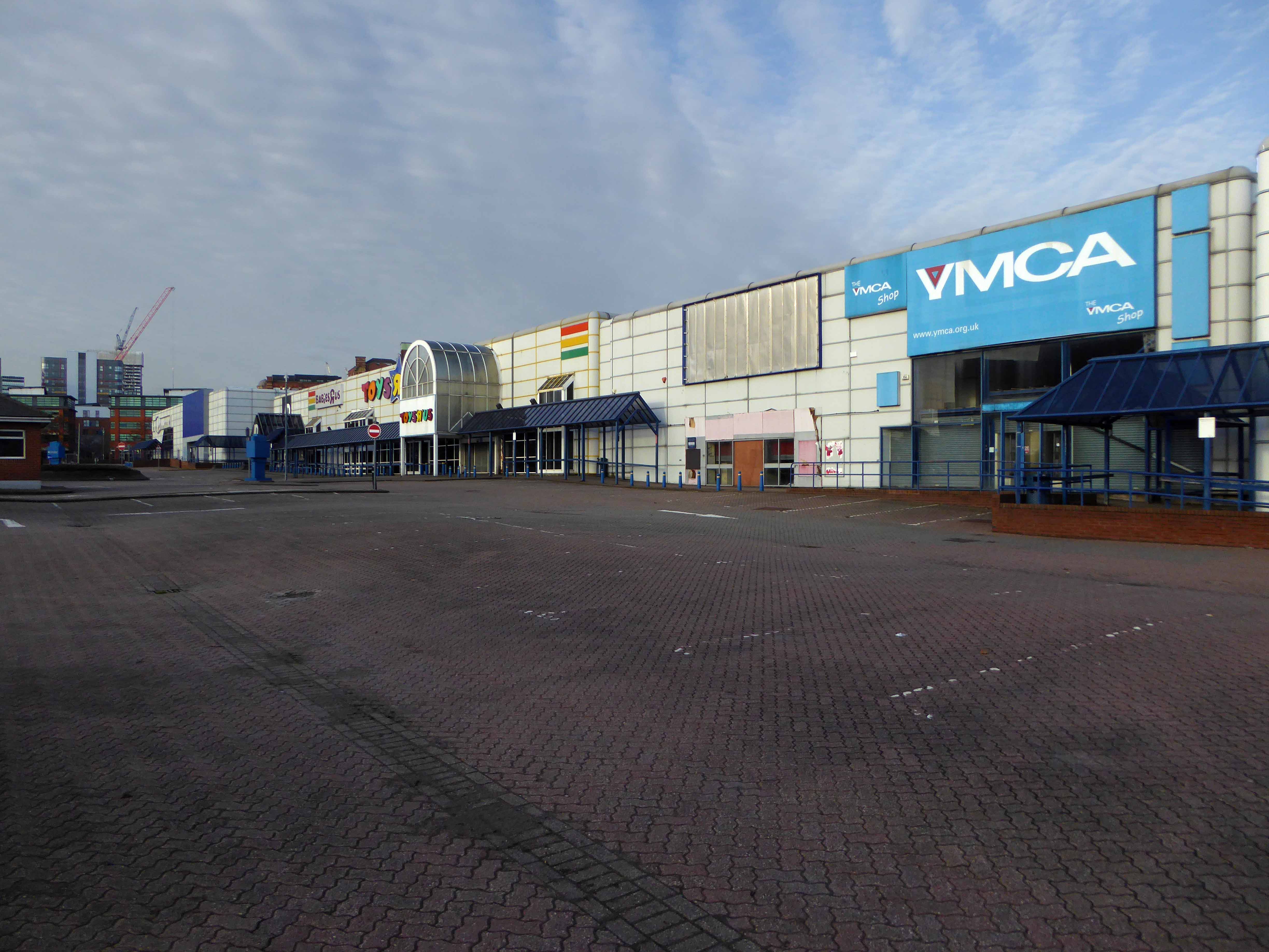
In 1989 an out of town inner ring road shopping centre in the architectural style de jour is built – the anonymous industrial retail hangar appears.
2018 and the nexus of the city has shifted yet again – Ancoats is designated as the hippest place on earth and has no time for an outmoded shopping experience.
All these developers have a certain sensitivity towards this history of the area without neglecting modern tastes.
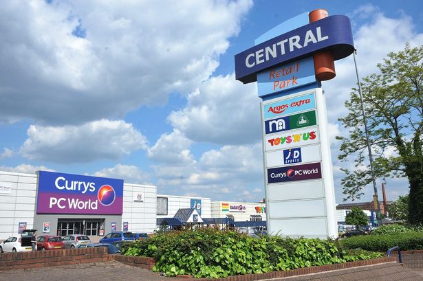
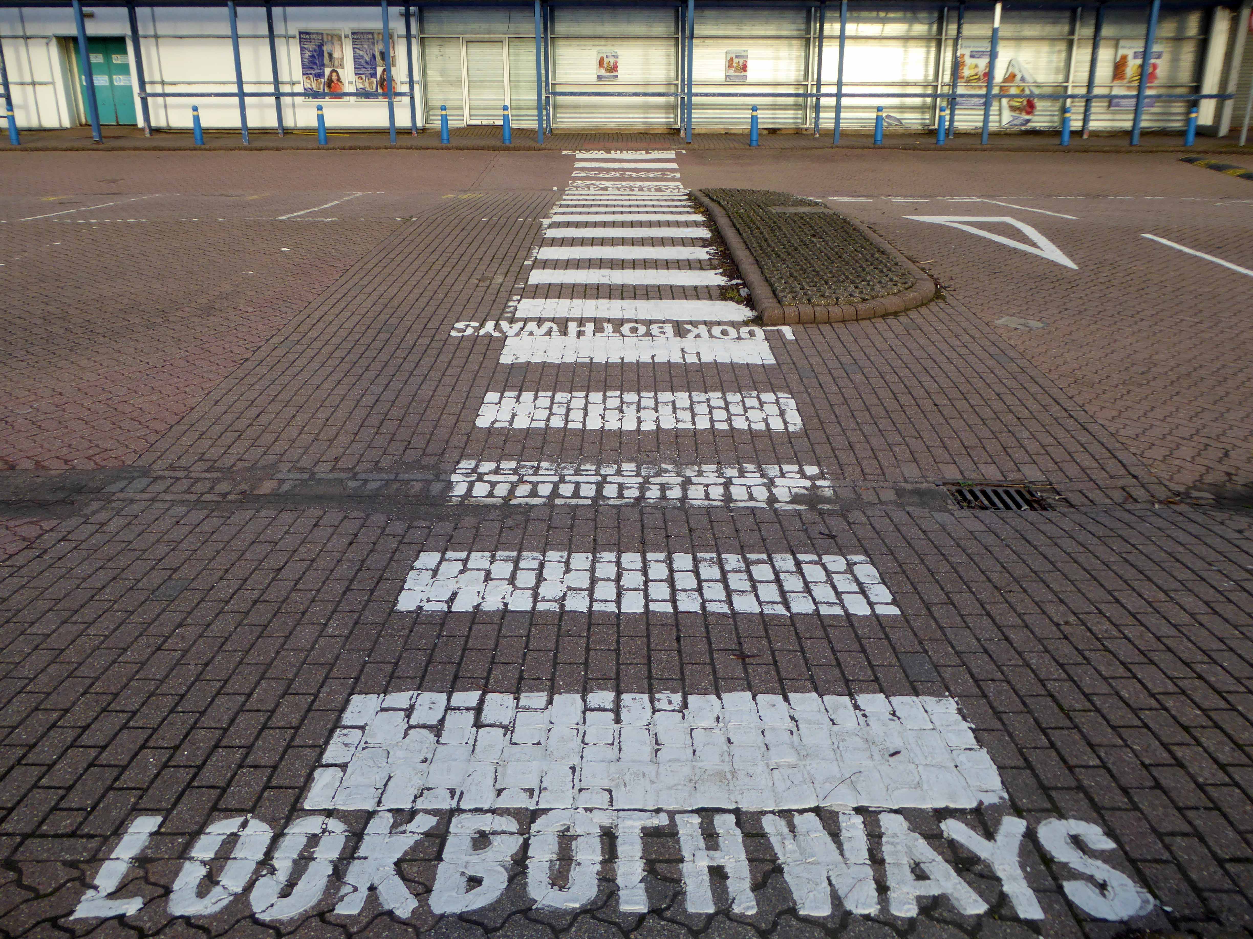
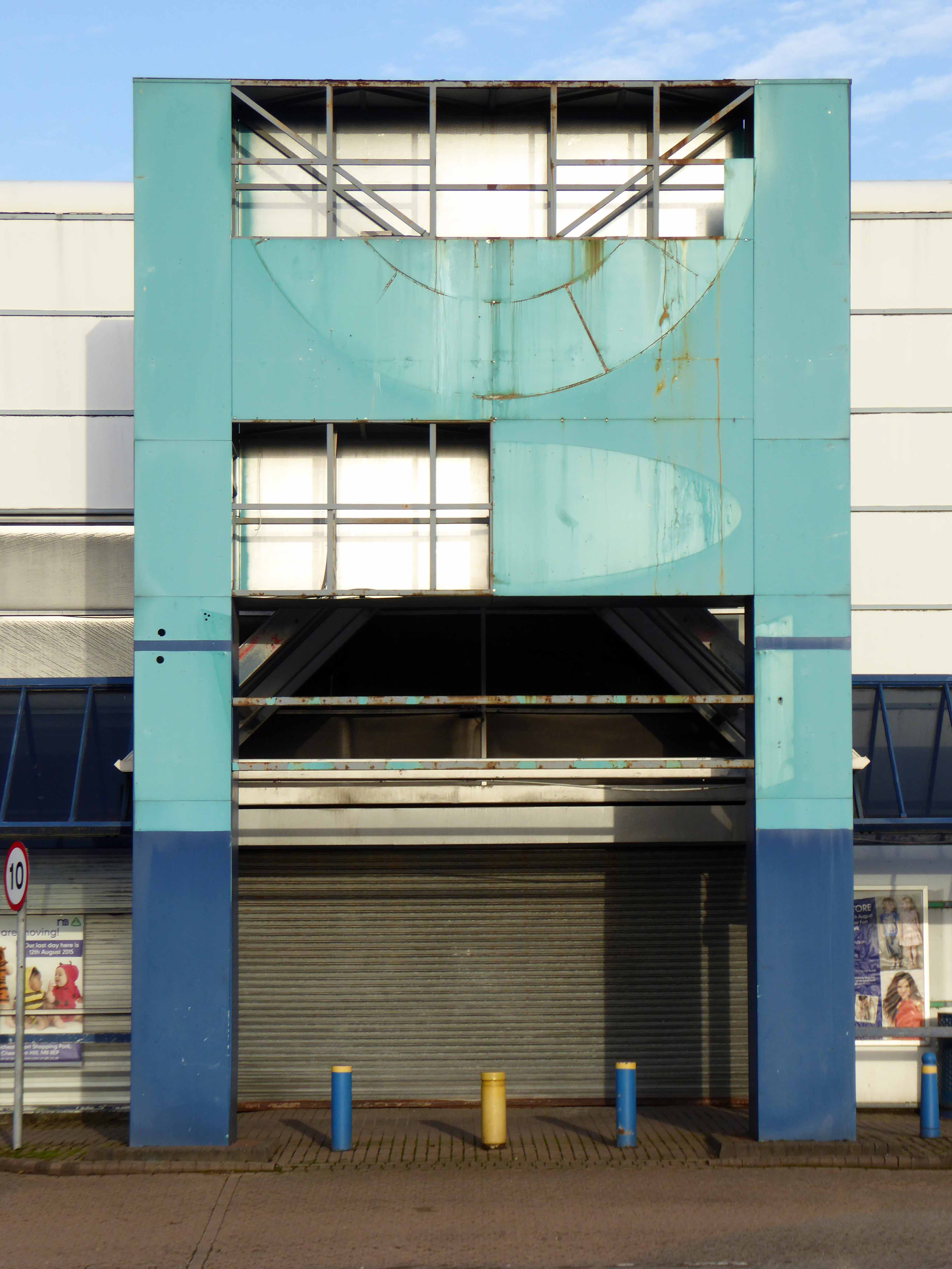
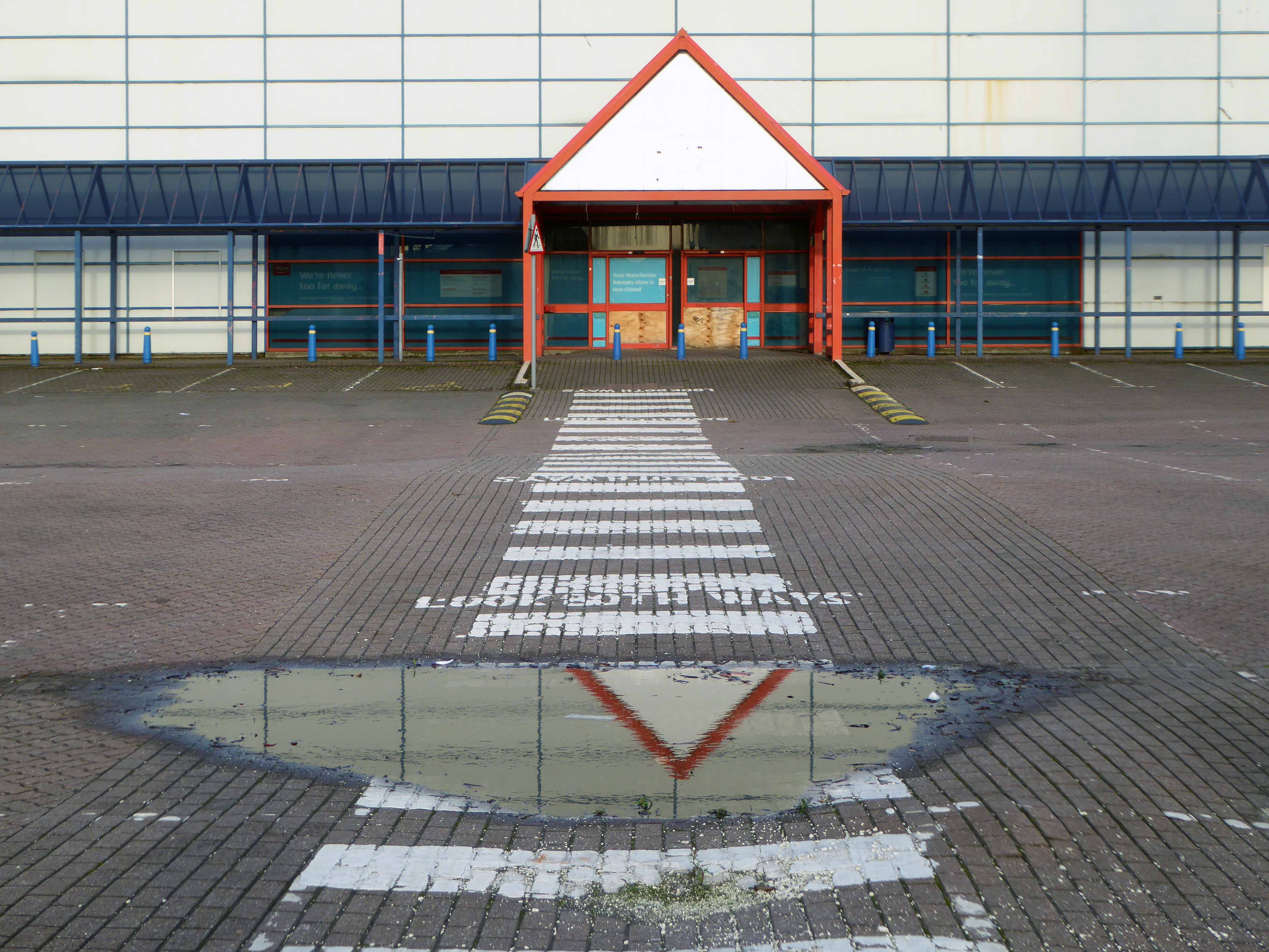
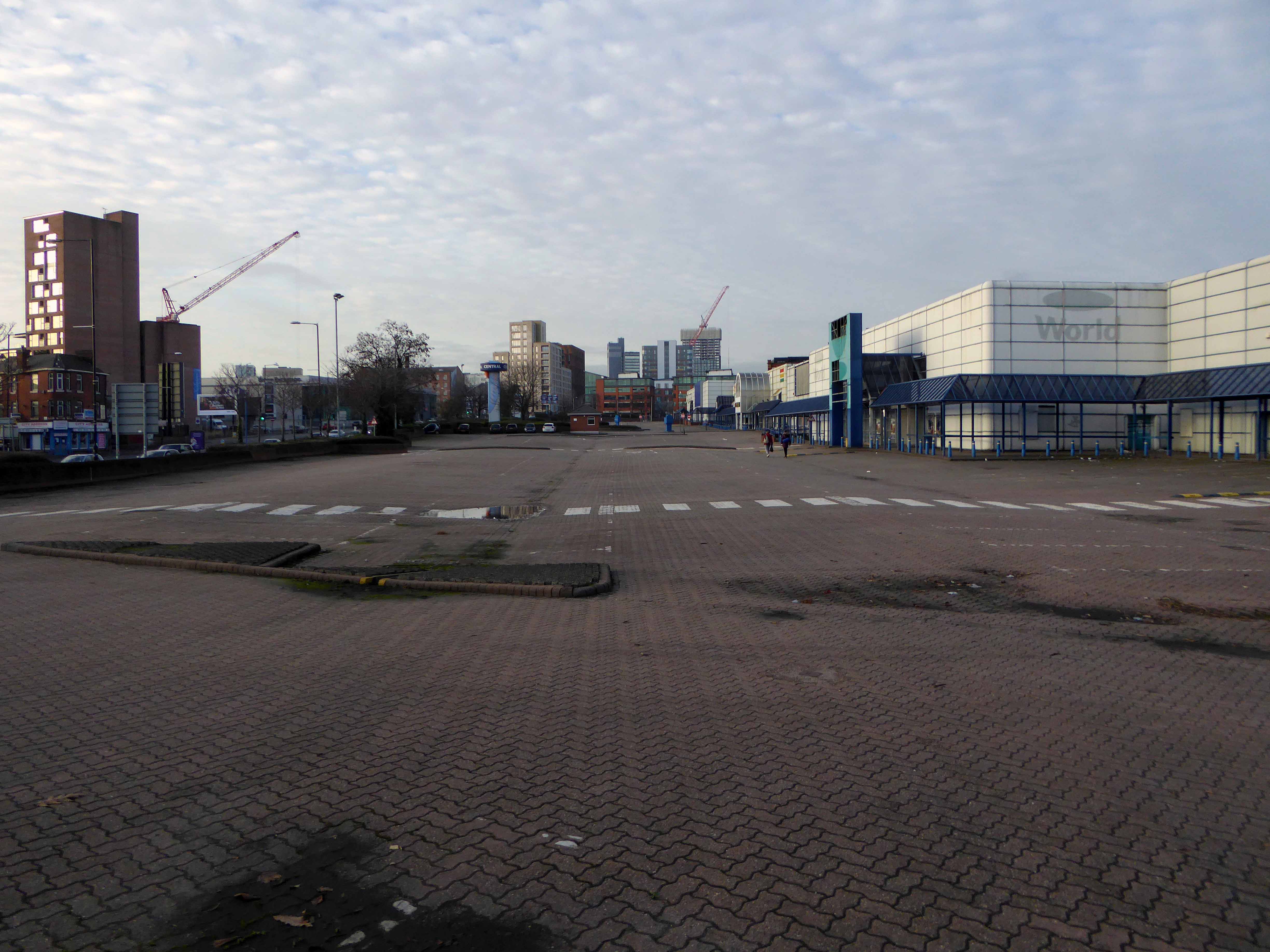
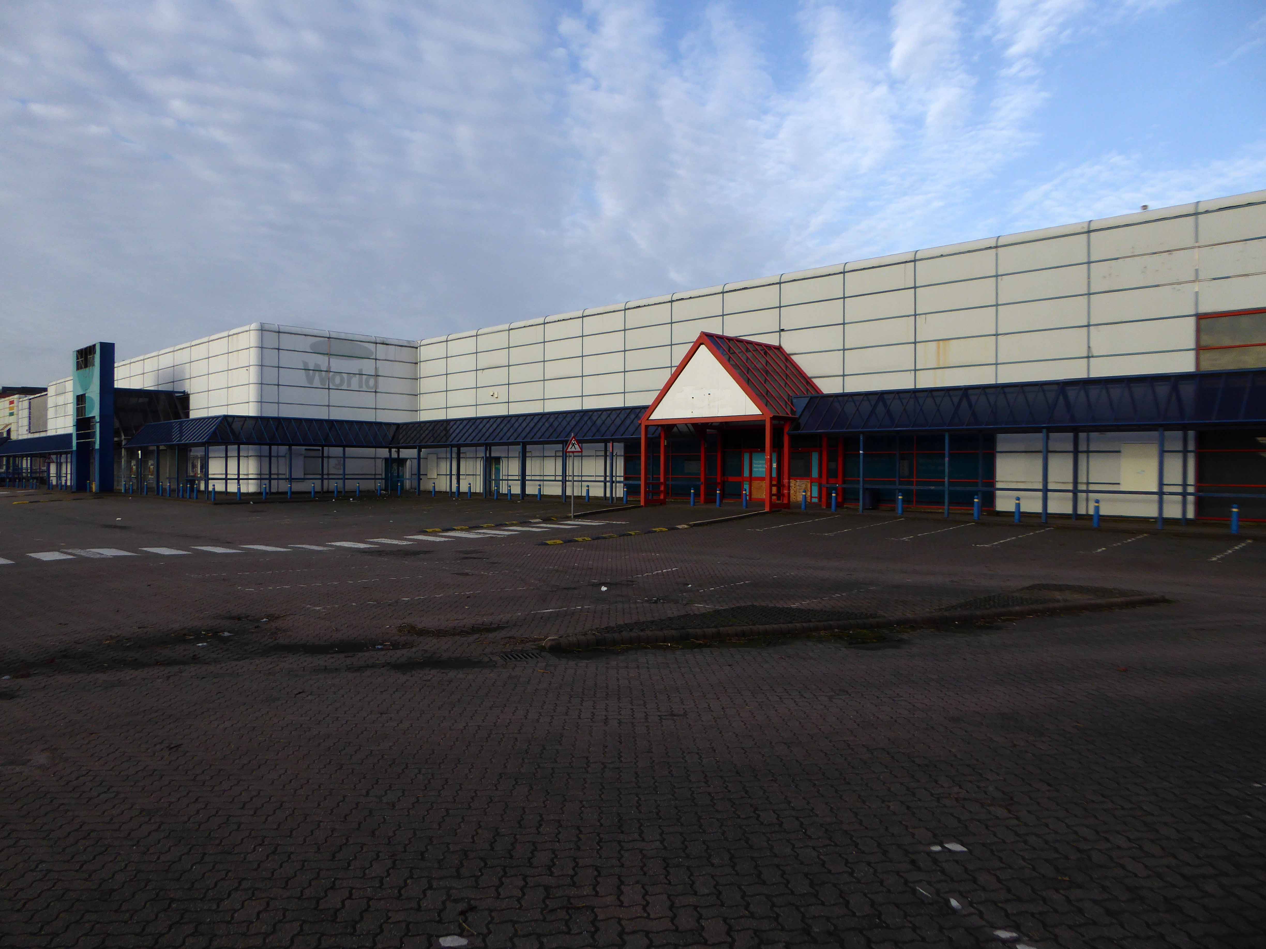
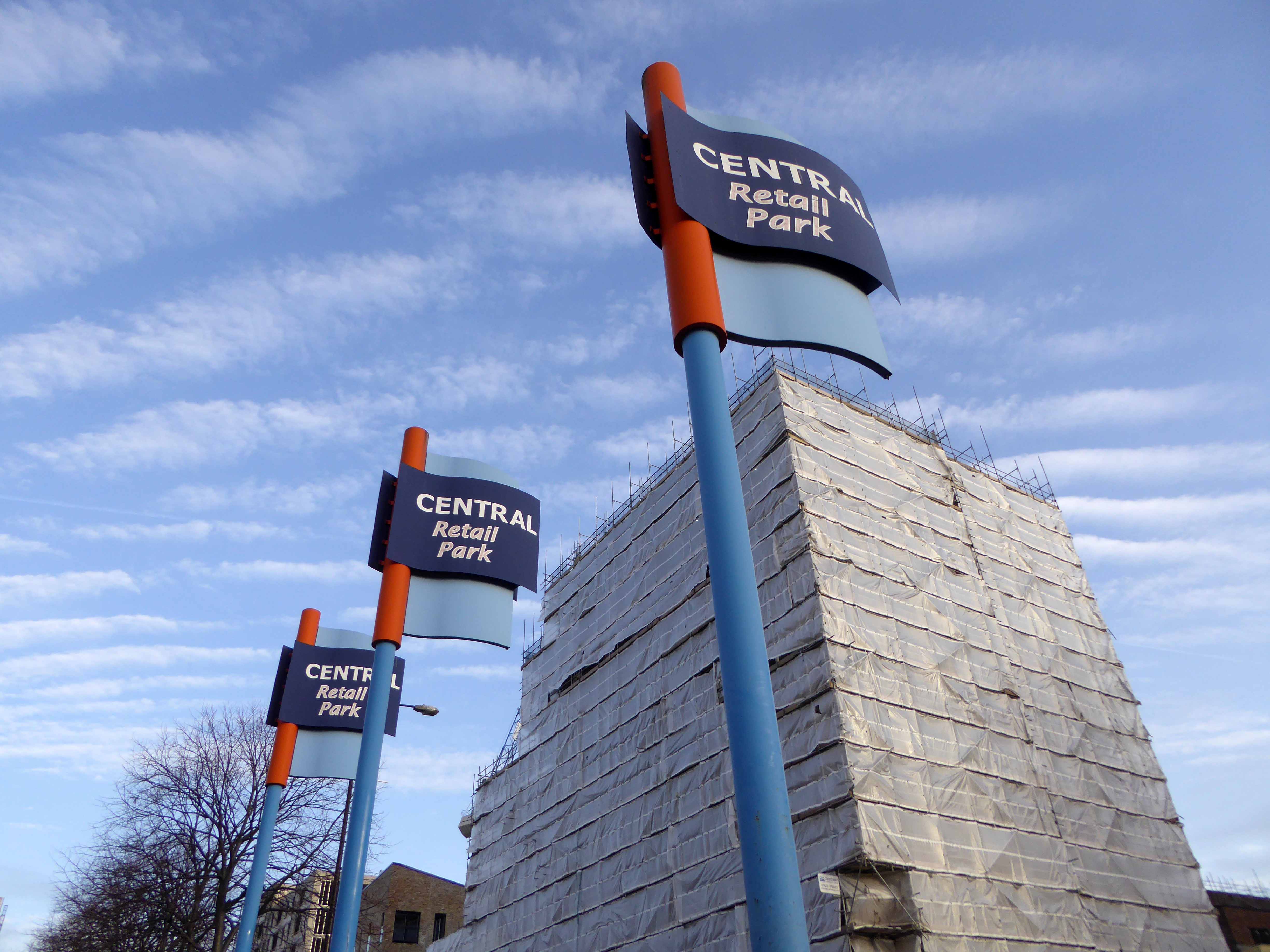
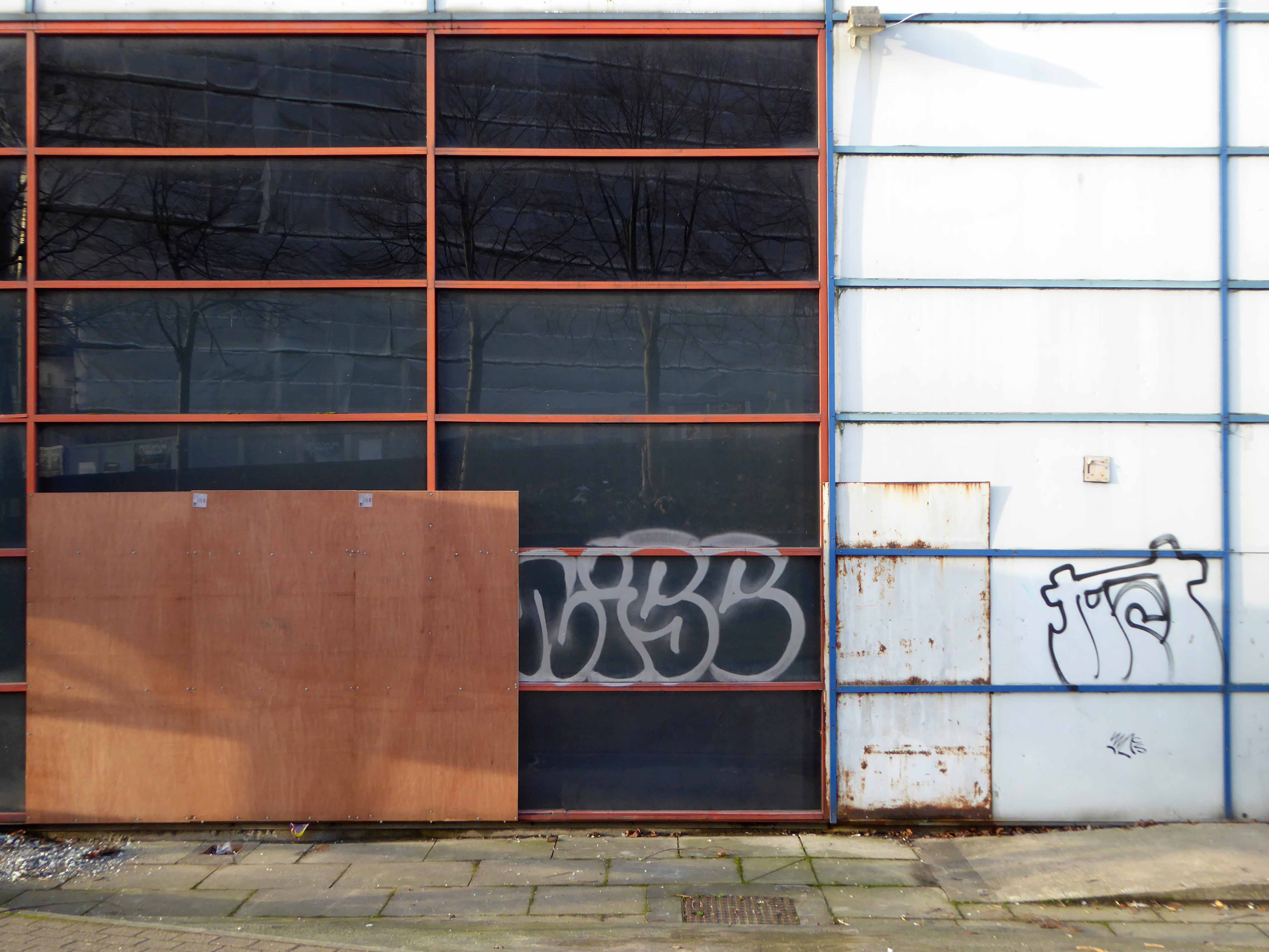
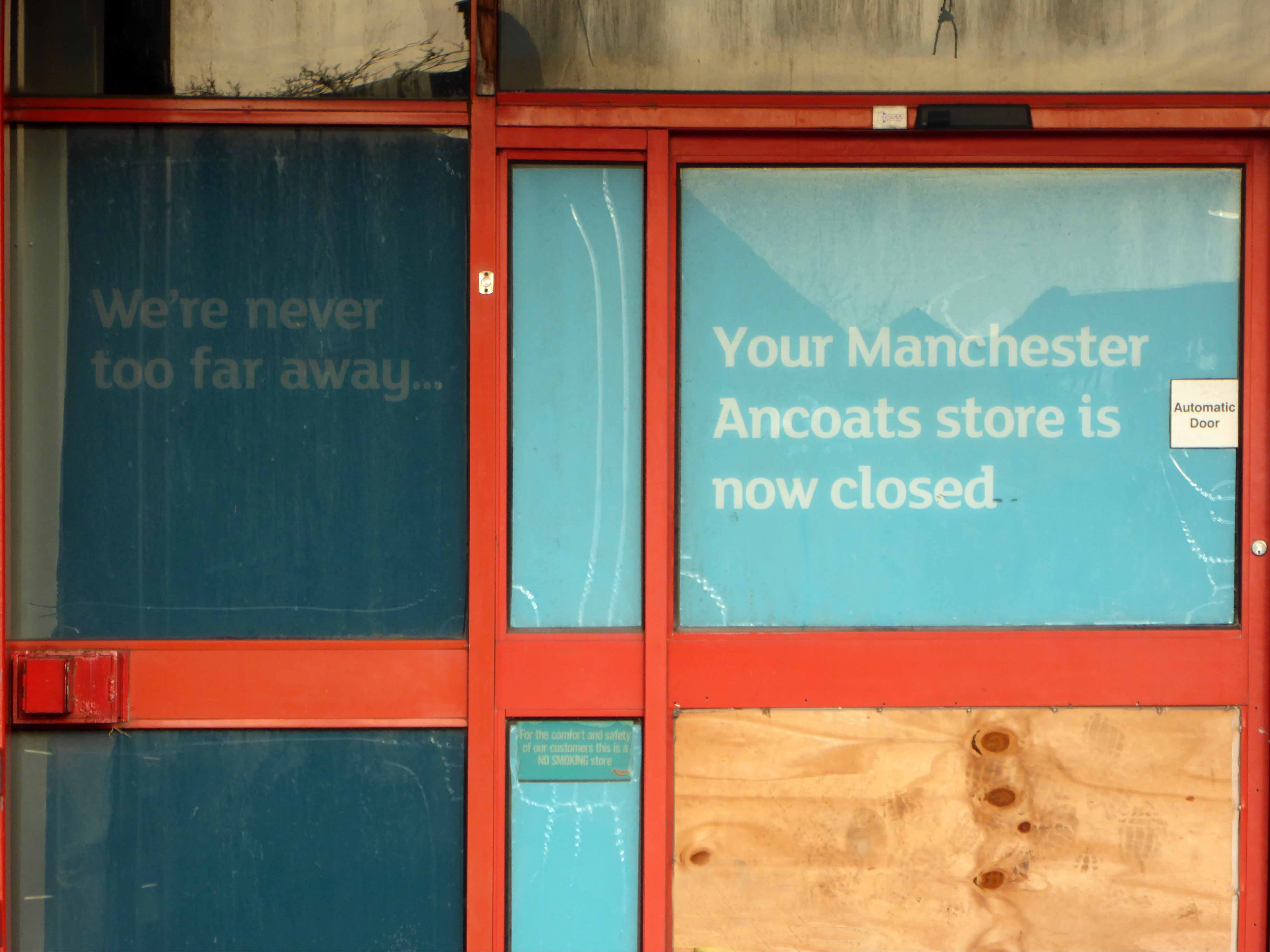
So the Central Retail park awaits its fate.
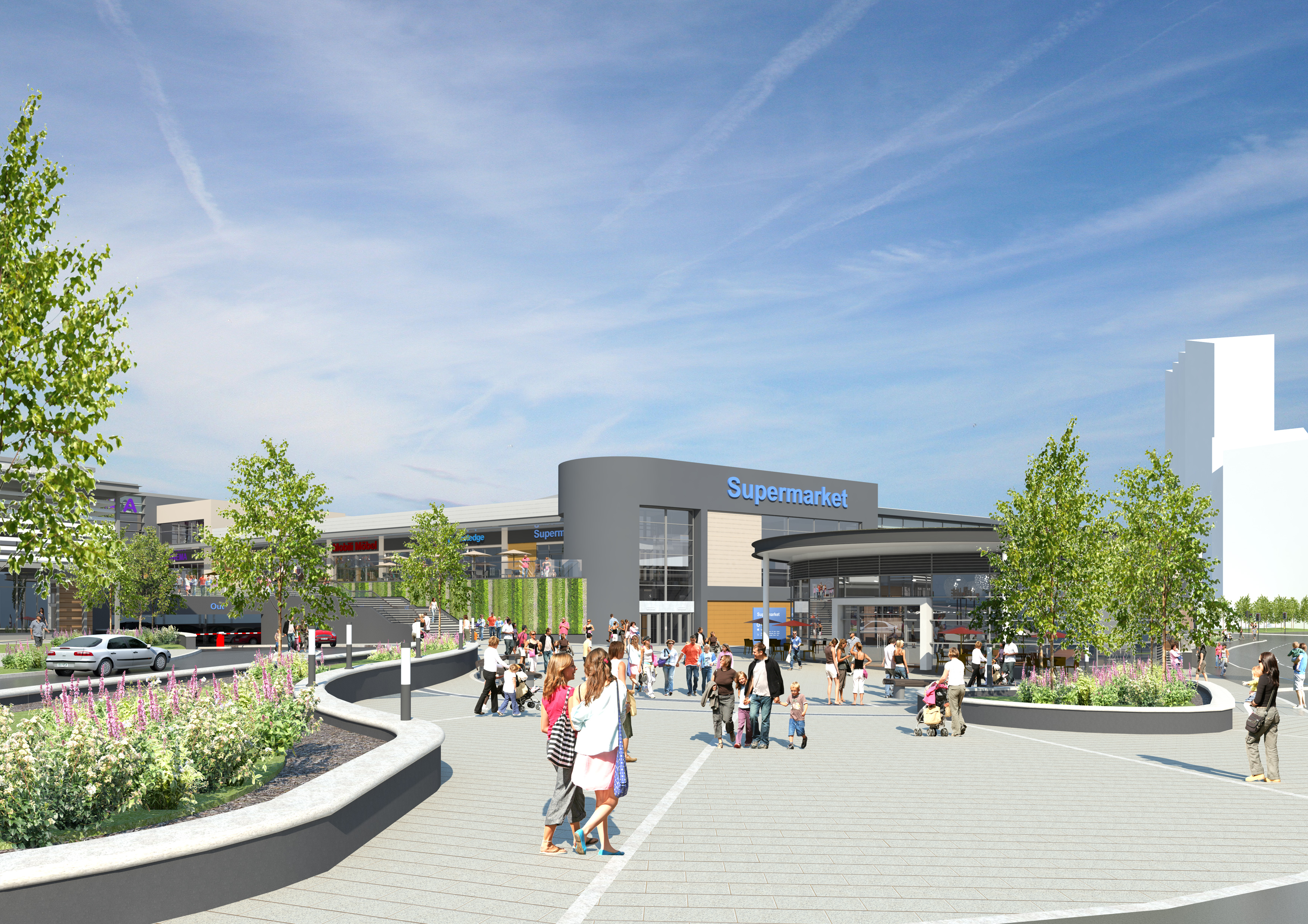
There was to have been another retail complex.
Henderson Global Investors, on behalf of its flagships £1 billion Retail Warehouse Fund, has received detailed planning permission for a food store led regeneration at Central Retail Park, Manchester, investing £40 million in the scheme.
Though nothing lasts forever and the scheme came to nothing.
The latest proposal according to Place North West is for housing – with the attendant heated debate regarding affordable homes.
Of the 61 big residential developments granted planning permission by Manchester city council’s planning committee in 2016 and 2017, not one of the 14,667 planned flats or housesmet the government’s definition of affordable, being neither for social rent nor offered at 80% of the market rate.
Demolition of the former retail units would enable the development of the site by Manchester Life, the city’s joint venture with Abu Dhabi United Group. Previous site owner TH Real Estate, was unable to deliver the project, finally sold the Central Park site to the city council in November 2017.
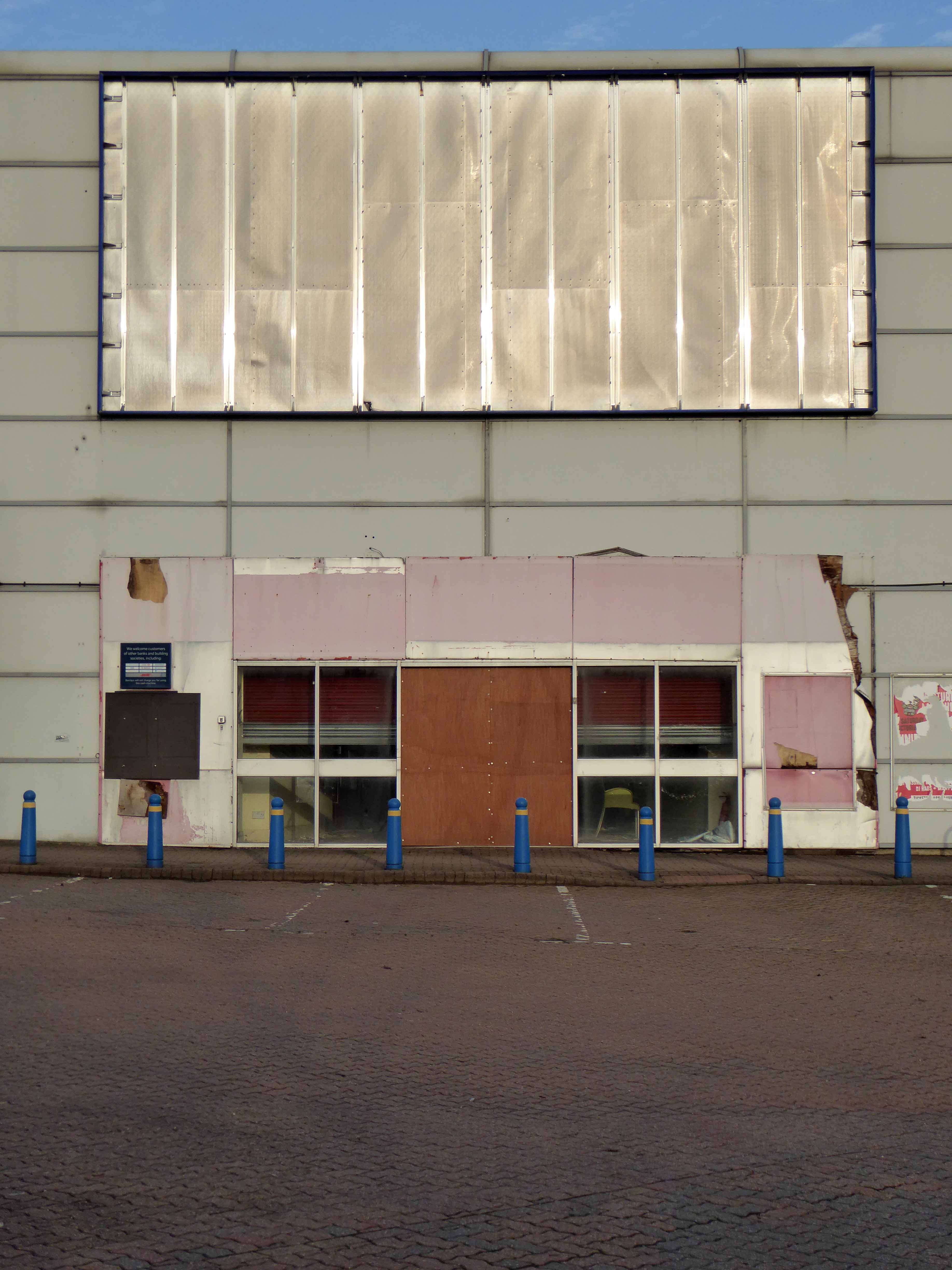
The long awaited development of the site on Manchester’s inner ring road has edged closer, with site notices posted declaring that demolition is to start on 20 August.
As of last week the lone security guard at home in his brick cabin informs me that demolition has been delayed by the discovery of asbestos on the site.
Once upon a time there was almost nothing, as there often is.
Green fields, sylvan glades and a pleasant park in Grosvenor Square.
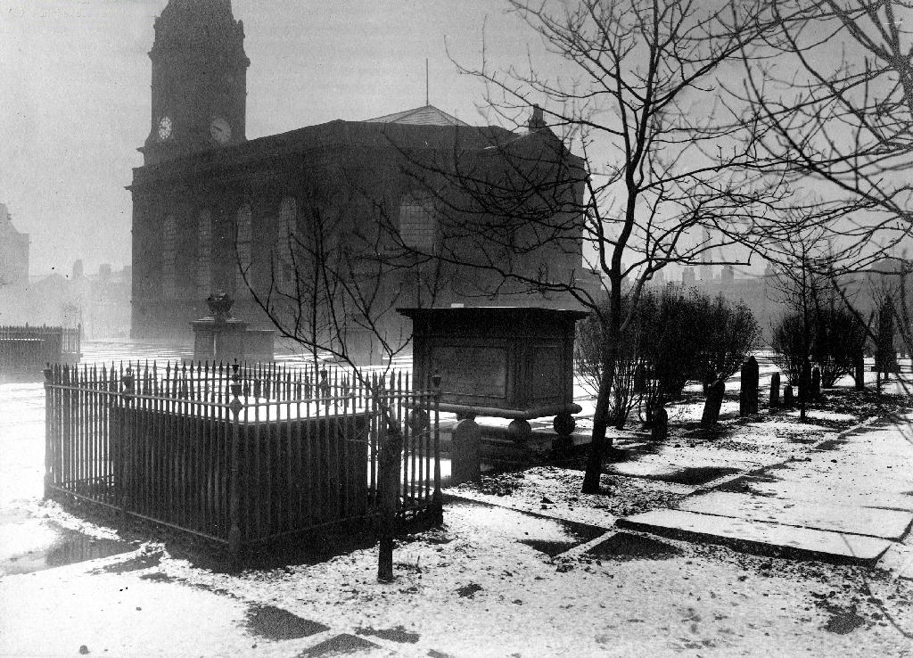
Then all of a sudden, at the heart of the Square sat All Saints Church.
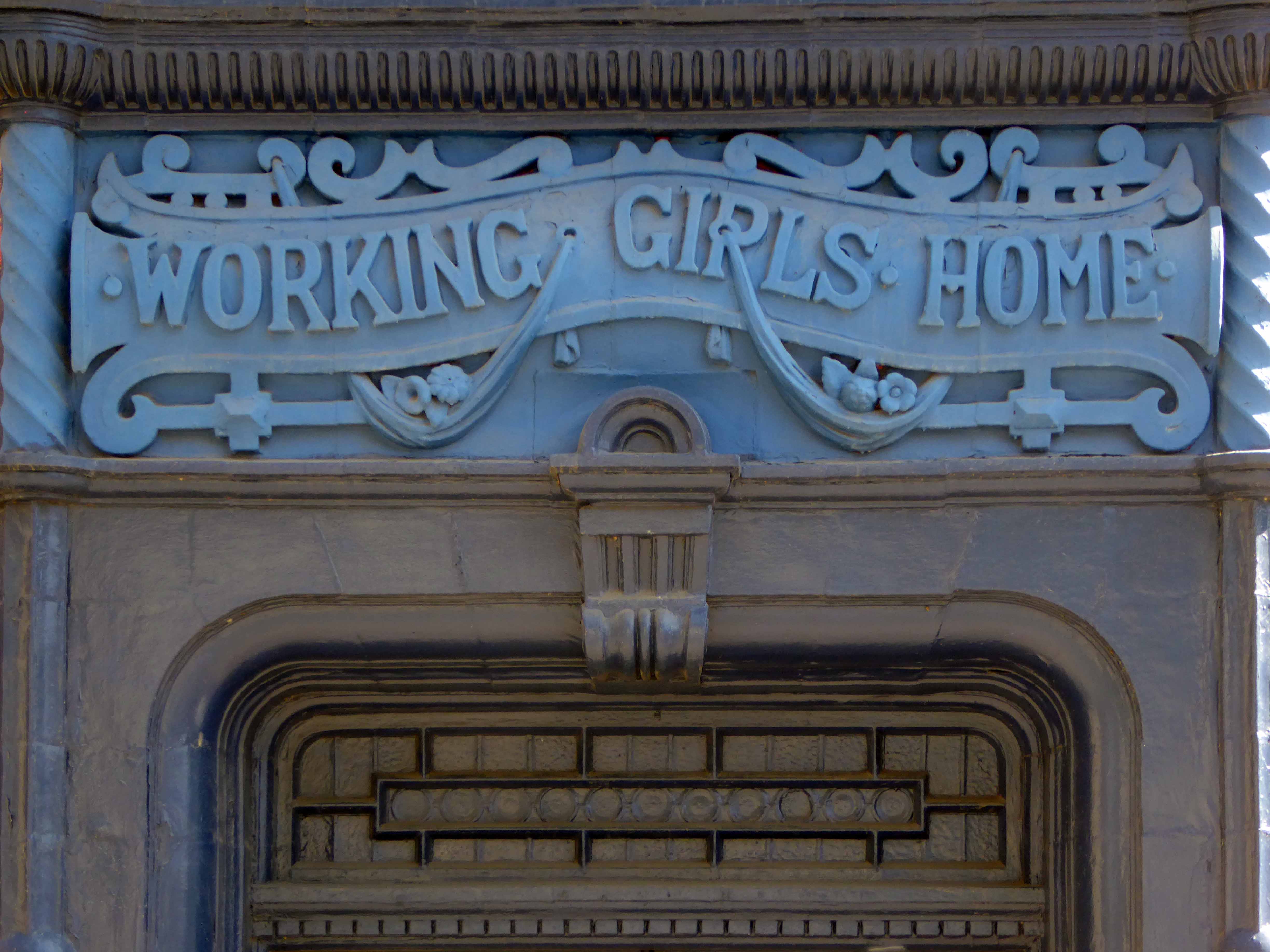
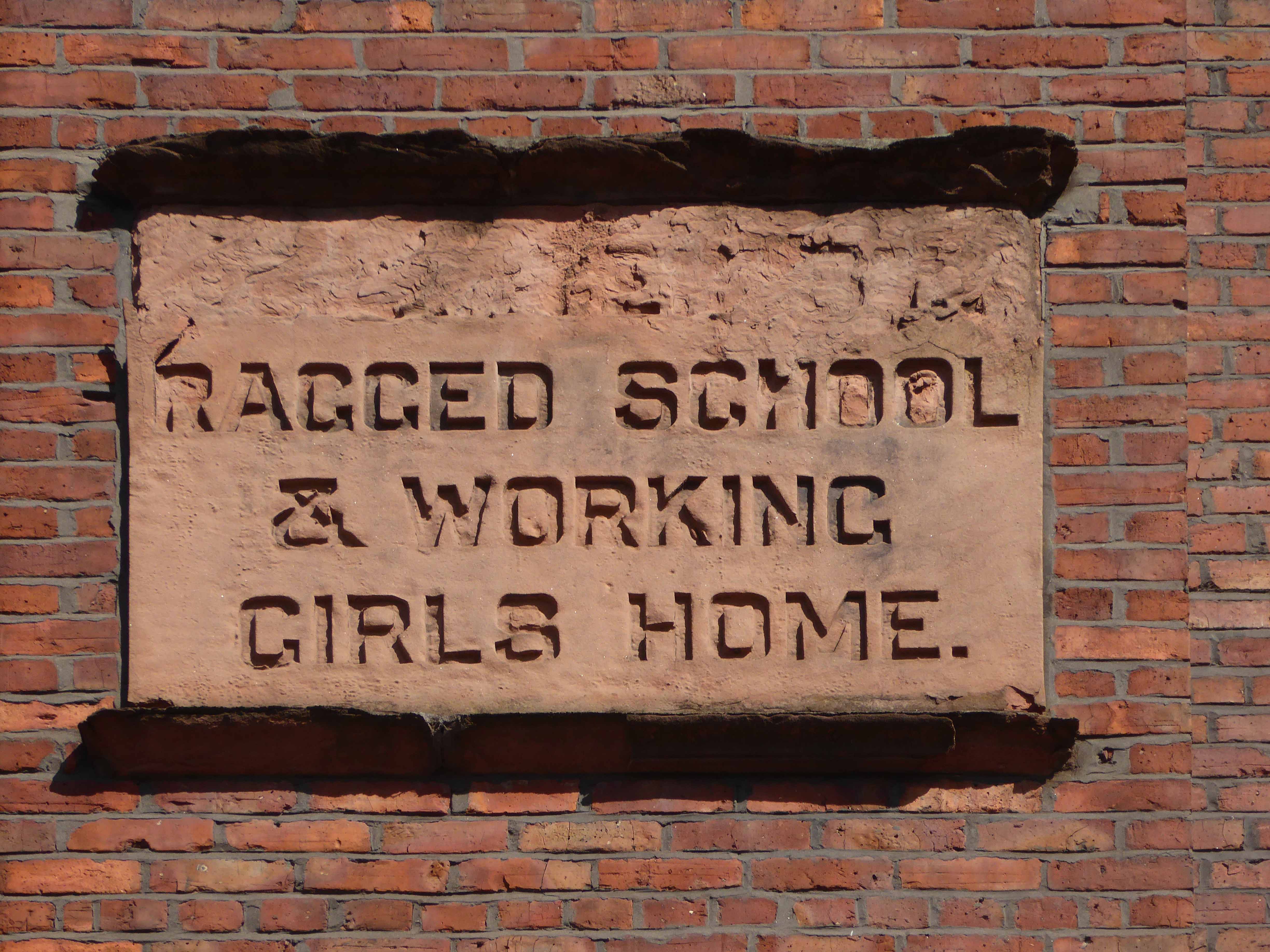
Underneath Manchester’s All Saints Park is a hidden history – an estimated 16,000 bodies. For this was the site of a former Victorian Cemetery, set up to cater for the parishioners of All Saints.
All Saints Burial Ground officially opened on Wednesday 19 April 1820. The first interment was that of twenty-one-year-old Fanny Knowles, who lived on London Road. Her funeral was conducted by the founder himself, Charles Burton. It would be another month before the next interment took place. In the first year burials were slow with only 55 interments, however, by 1851 the number had increased to over 600 per annum.
The whole area having been a centre of housing, education, entertainment, commerce, public services and worship, was becoming the fiefdom of first the Polytechnic and subsequently the Manchester Metropolitan University.
But formerly there were peoples’ homes here.
Then the 1960s saw a huge programme of slum clearance in Manchester and whole communities across the Square and nearby Hulme were moved, rehoused in a thoroughly modern milieu.
Shops came and went.
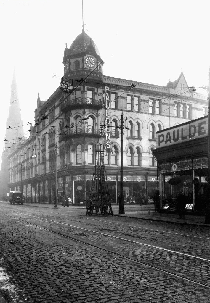
Paulden’s magnificent store was destroyed by fire in 1957
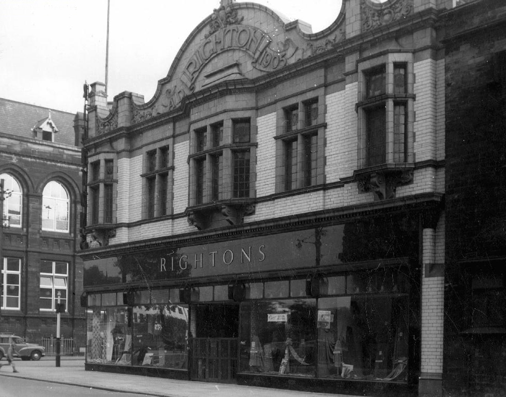
Rightons haberdashers has survived though no longer haberdashing, having been amalgamated into MMU.
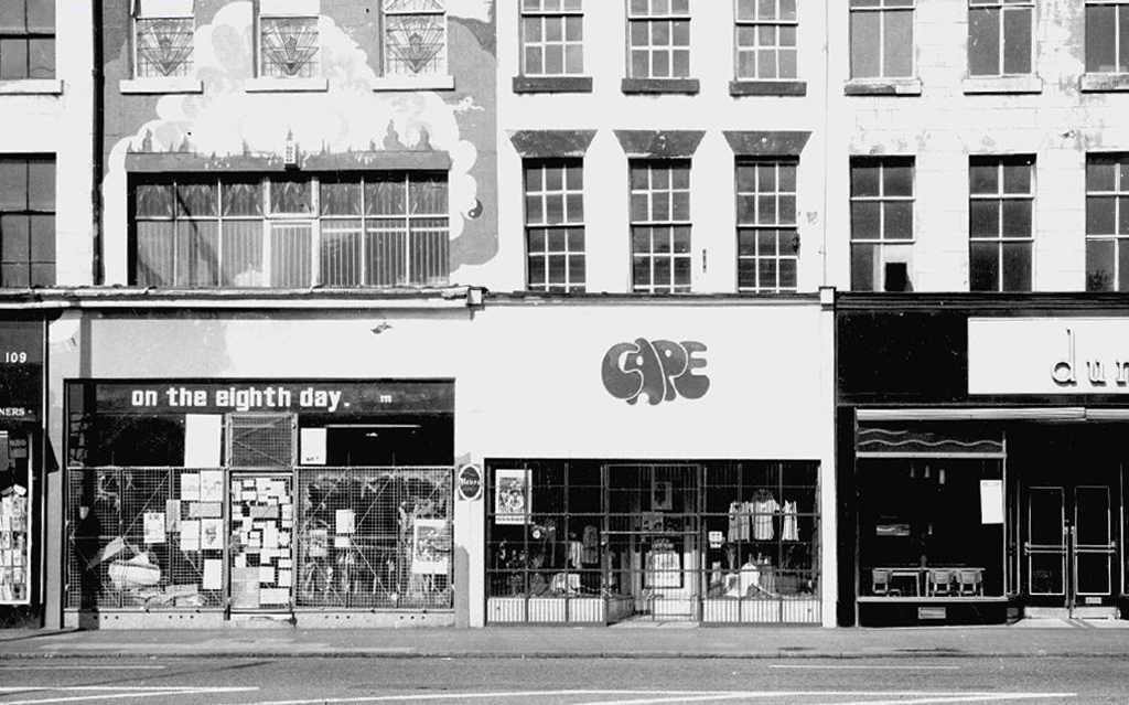
One day On The Eight day moved a little to the left
The fascia has been retained but the name has not been changed to protect the innocent.
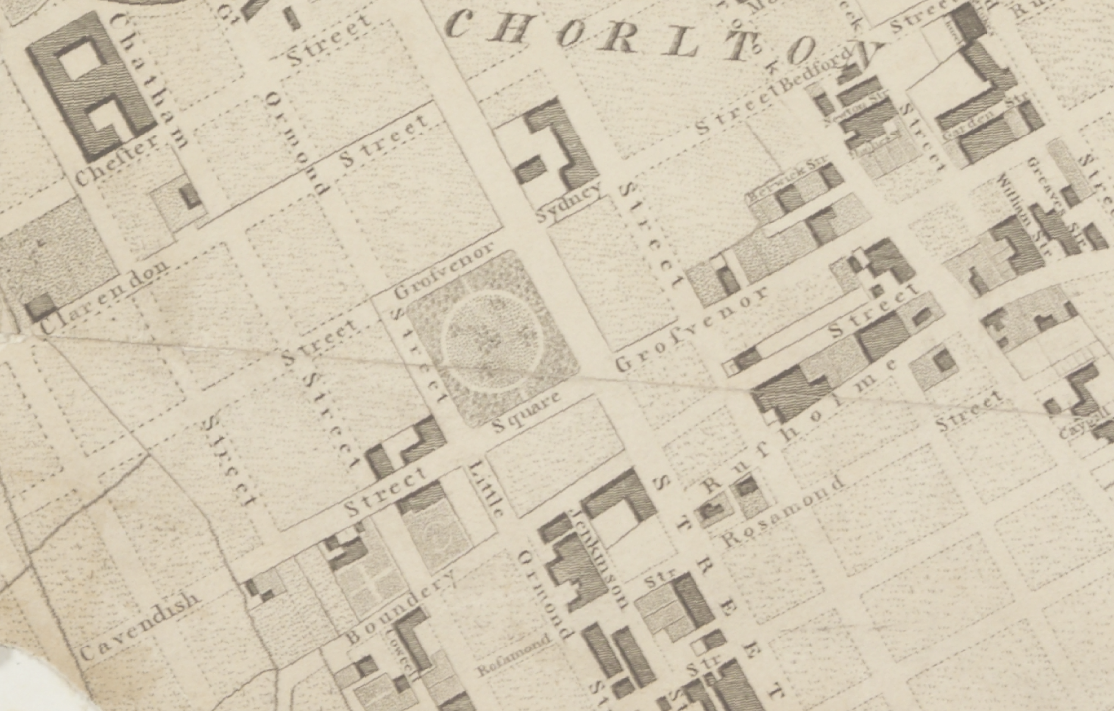
Next door the Chorlton on Medlock town hall still has its portico in place, the adjacent Adult Education building has been surgically removed.
Richard Lane, the architect of the Friend’s Meeting House on Mount Street, designed the Chorlton-on-Medlock Town Hall on Grosvenor Street. It continued in that role from 1831 until 1838 when Chorlton-on-Medlock became part of the city of Manchester. In the years that followed it was used by the local community for a variety of functions but the redevelopment of the area meant that the local population diminshed and the building became redundant. In 1970, the interior was removed, a new structure added to the rear and it became part of the Polytechnic which became the Manchester Metropolitan University.
The Fifth Pan African Conference was held there between October 15th and 21st in 1945.Ninety delegates from across Africa, Europe and the Caribbean, attended the meeting and among the delegates were a number of men who went on to become political leaders in their countries including: Hastings Banda, Dr Kwame Nkrumah, Obafemi Awolowo and Jomo Kenyatta.
Former Chorlton Poor Law Guardian’s HQ then Registry Office, now the Ormond Building of Metropolitan University – and at the far right edge St Augustine RC.
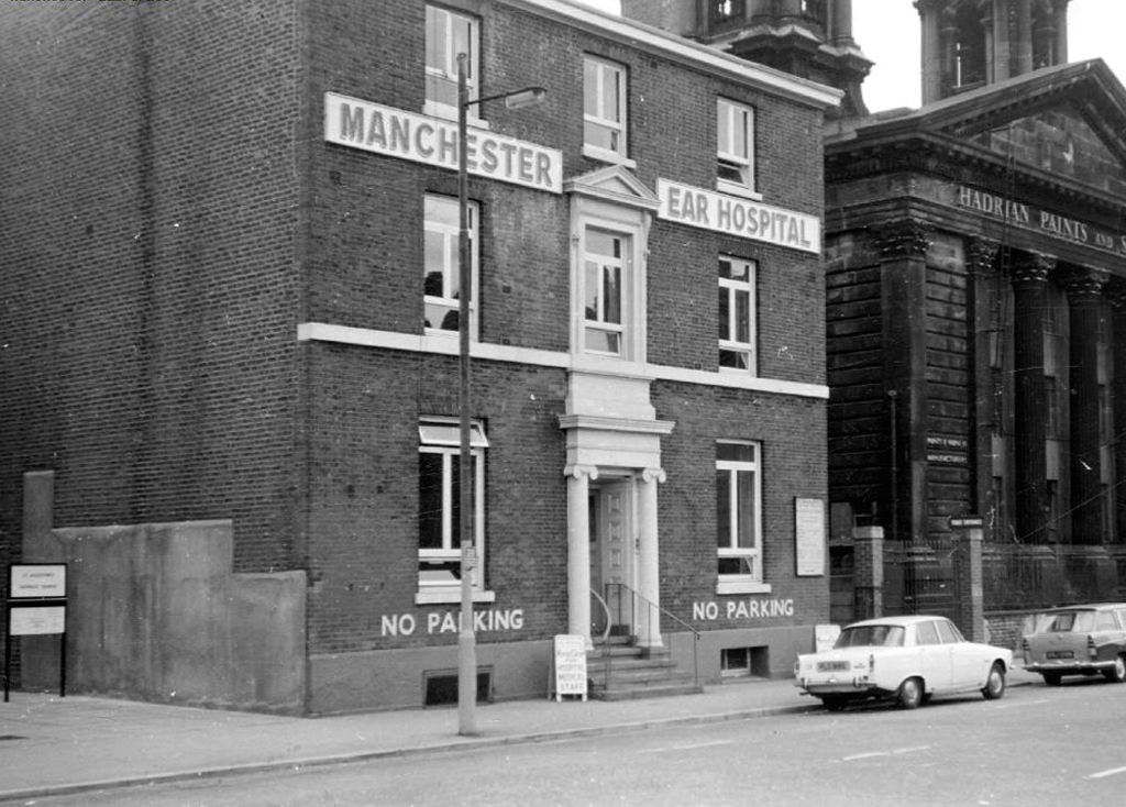
The Manchester Ear Hospital on Lower Ormond Street, shortly before being transferred to Manchester Royal Infirmary. Most of the building was demolished, but the facade retained as part of MMU’s Bellhouse Building.
To the right the Presbyterian Church.
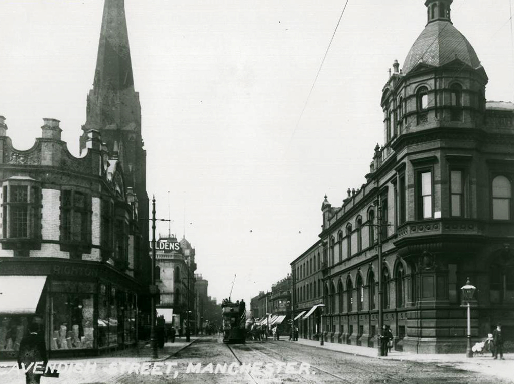
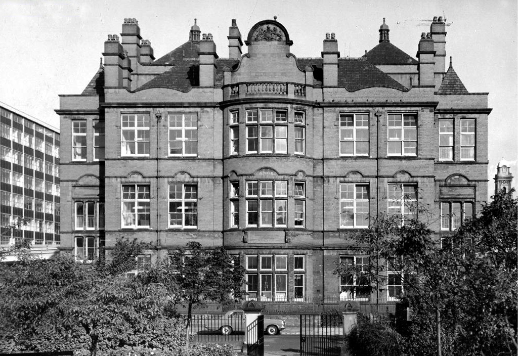
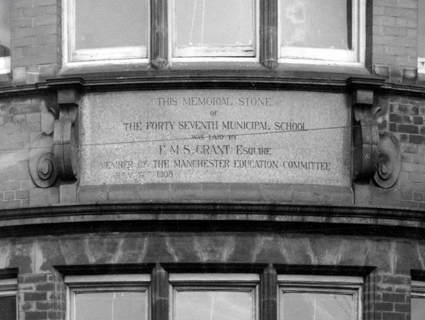
Cavendish Street School
The memorial stone on the front of the school, laid on June 17th, 1908, declared that it was the Forty Seventh Municipal School. Strangely, it seems that it was called the Cavendish Street School despite the fact that it wasn’t on Cavendish Street.
Manchester History
It was subsequently utilised by the Polytechnic sculpture department – then demolished to make way for something else of an educational nature.
Some or all of our social and architectural history has been overwritten, lost or swept aside by the tide of history.
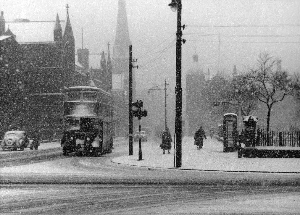
Though on a dark snowy night you can still make out the bright red corporation buses, passing by in a dark cloud of diesel.
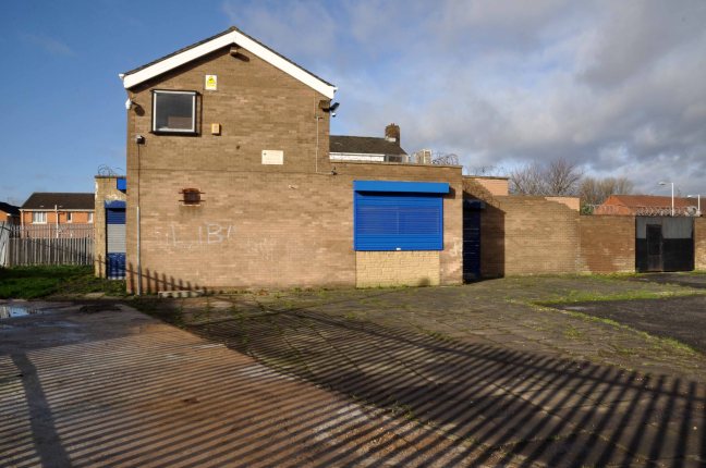
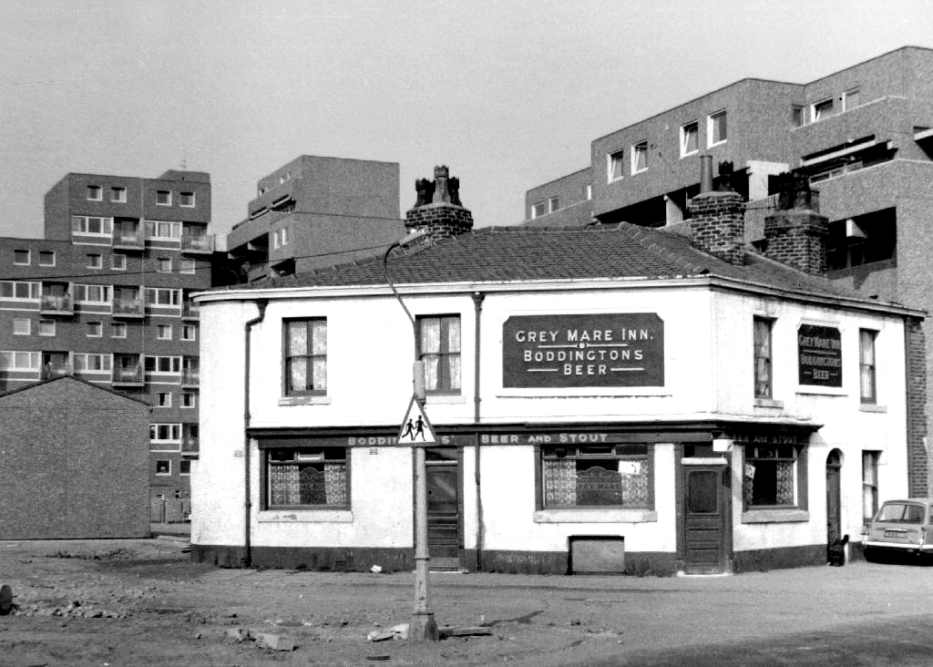
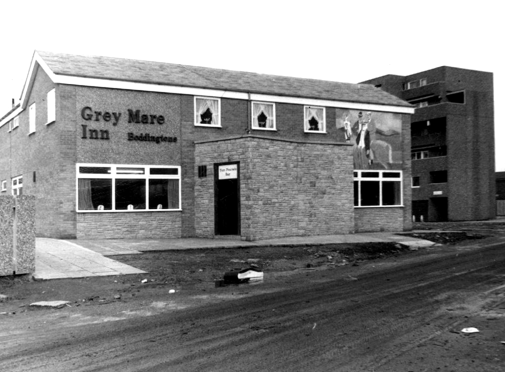
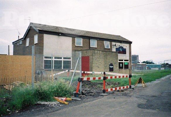
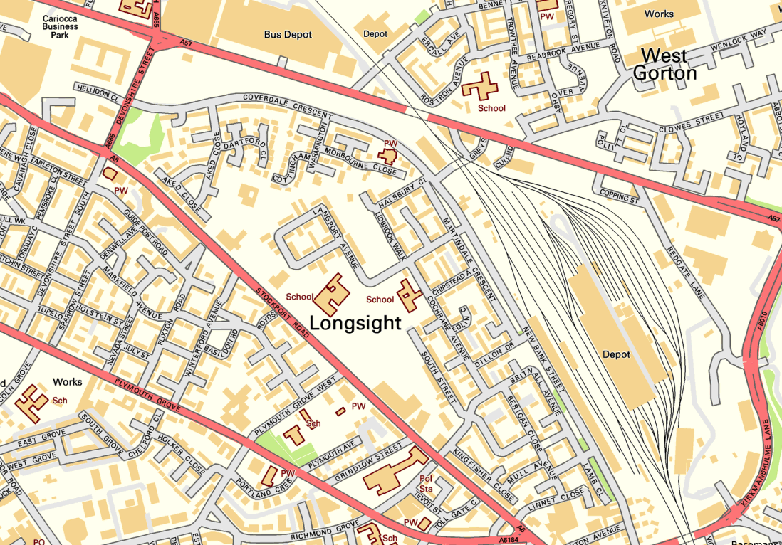
Exeter Close/Warmington Drive Manchester Longsight M12 4AT
Once there was this.
Once there was that.
Then there wasn’t.
That’s just the way of it.
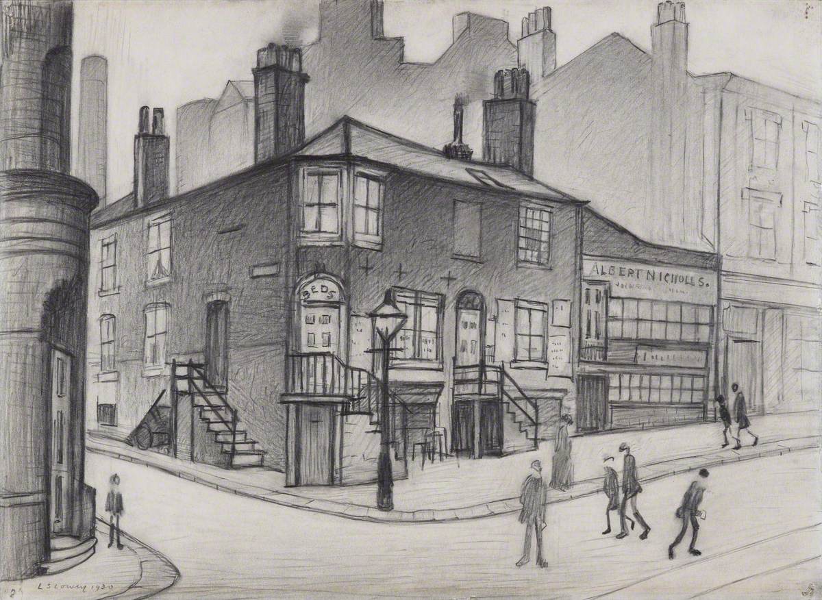
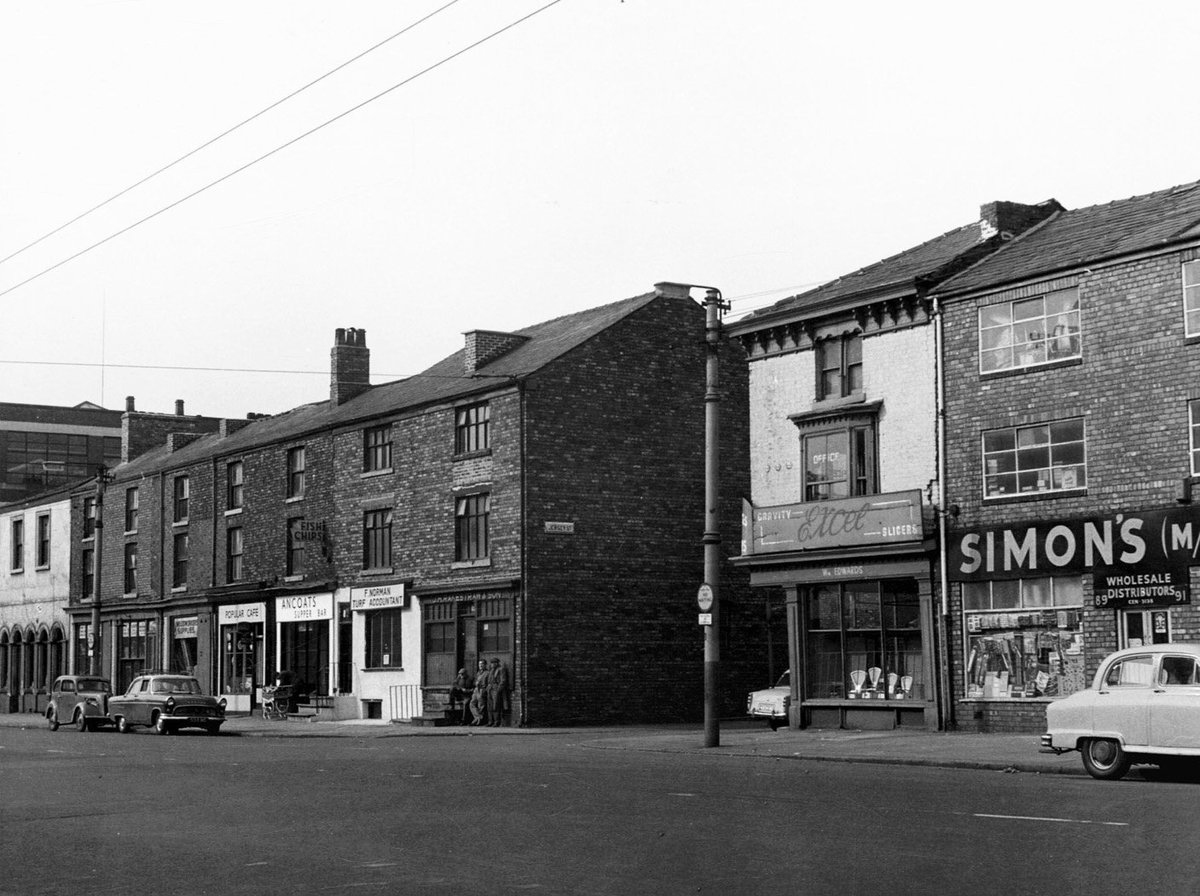
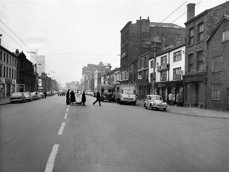
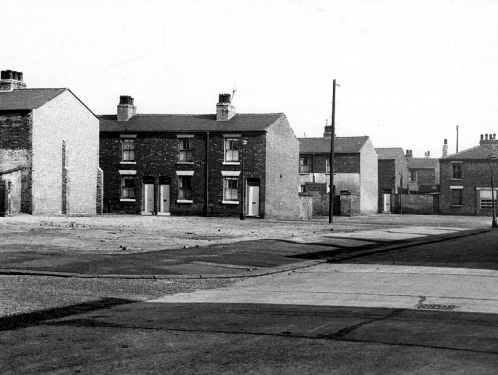
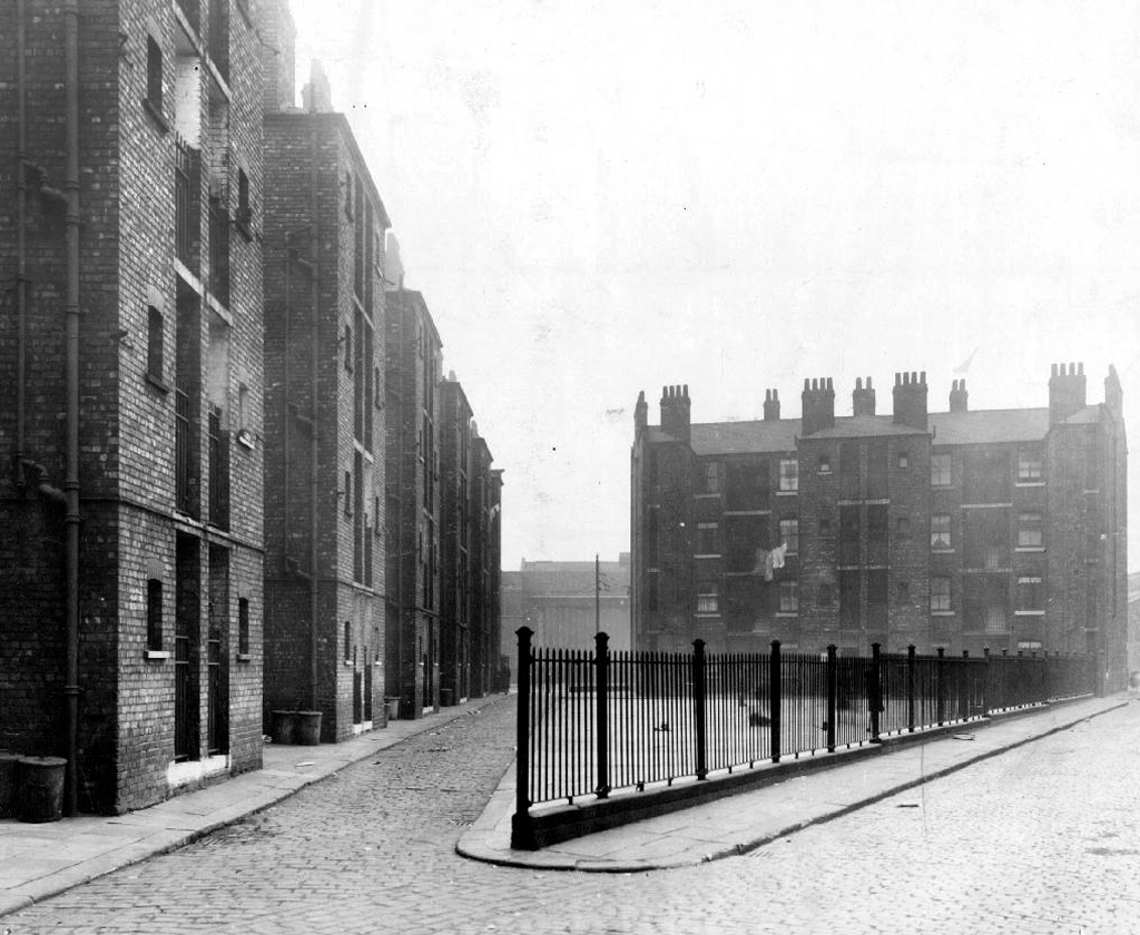
A dense web of streets awash with back to backs, jobs for all – in conditions perceived to be unfit for purpose.
Of a total of 201,627 present dwellings in Manchester, some 54,700, or 27.1 per cent., are estimated to be unfit. A comparison of slum clearance action taken by six major local authorities, Manchester, Leeds, Birmingham, Liverpool, Sheffield and Bristol, shows that for the five years ending 30th June, 1965, Manchester was top of the league, both in compulsory purchase orders confirmed and the number of houses demolished or closed.
Manchester’s figures -13,151 houses demolished or closed .
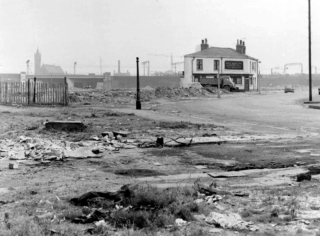
Whenever mass slum clearance was carried out, the pubs tended to remain, often for just a short time because – the story goes – demolition workers refused to touch them, as they wanted somewhere to drink during and after their shift.
This vision of municipal modernity was short lived, the estate was demolished in the 1980s and the new Coverdale Estate was constructed on the site in 1994.
The whys and wherefores of your seemingly unknowable comings and goings.
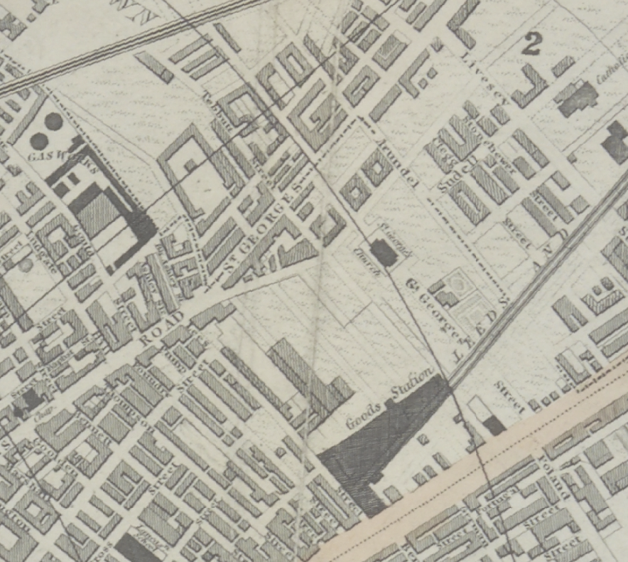
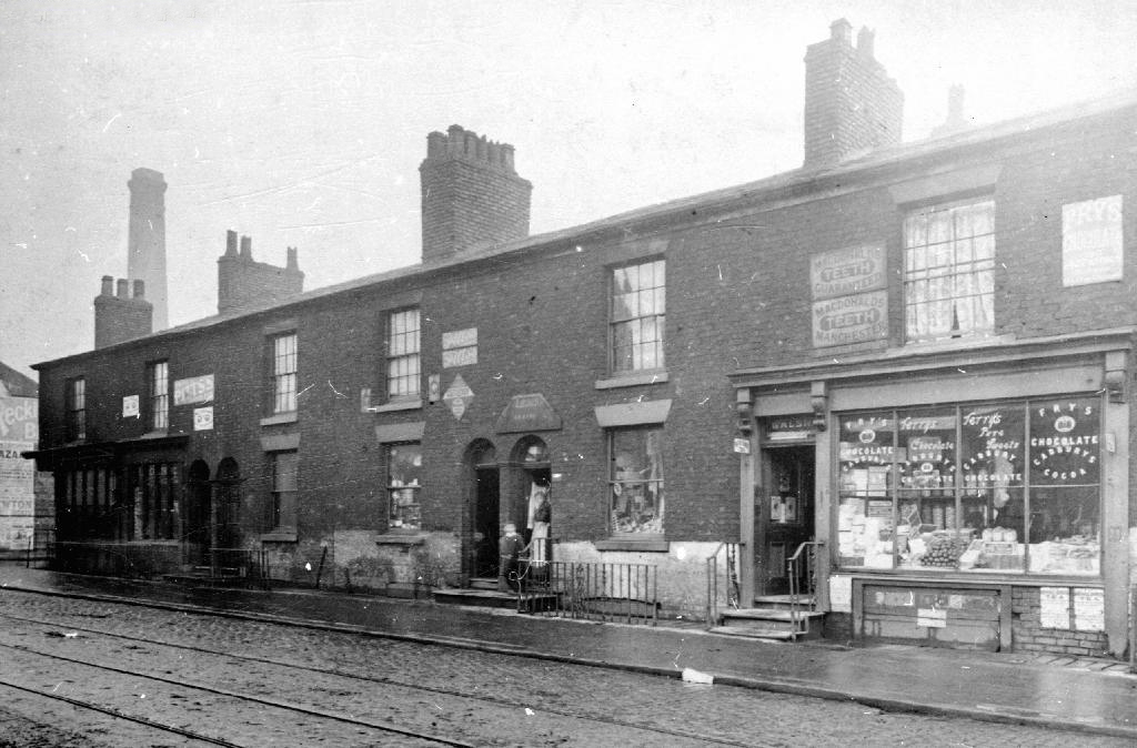
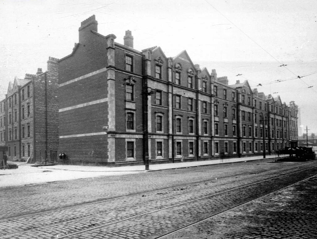
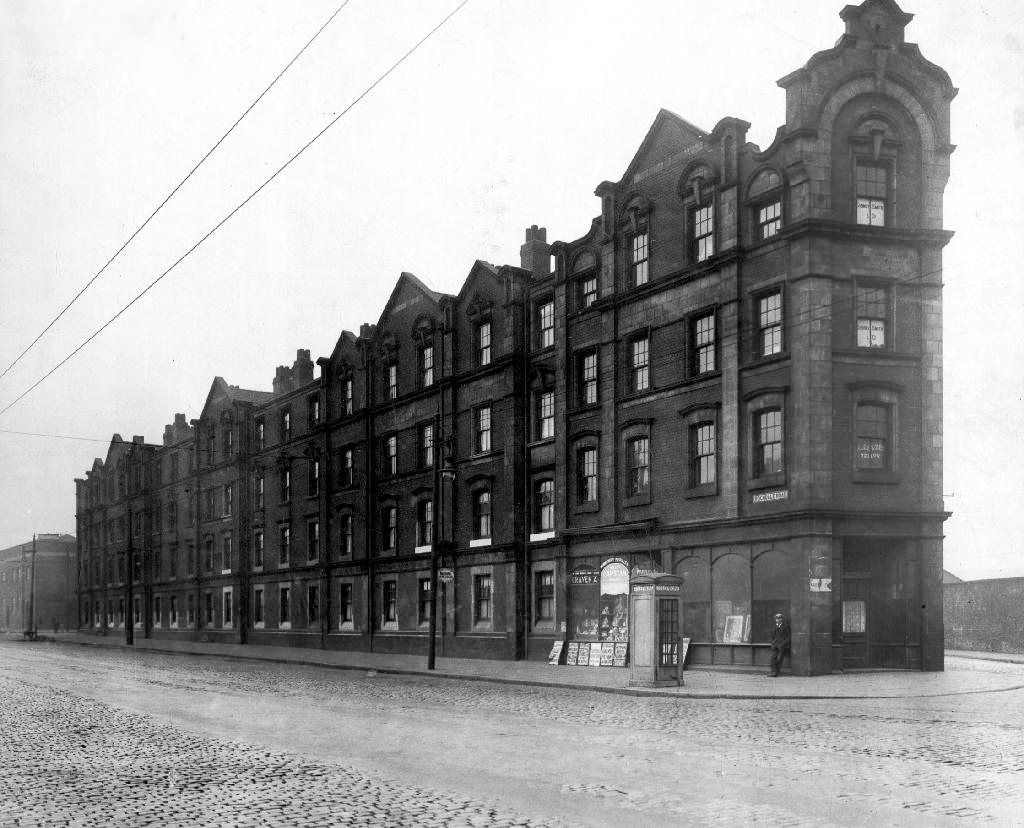
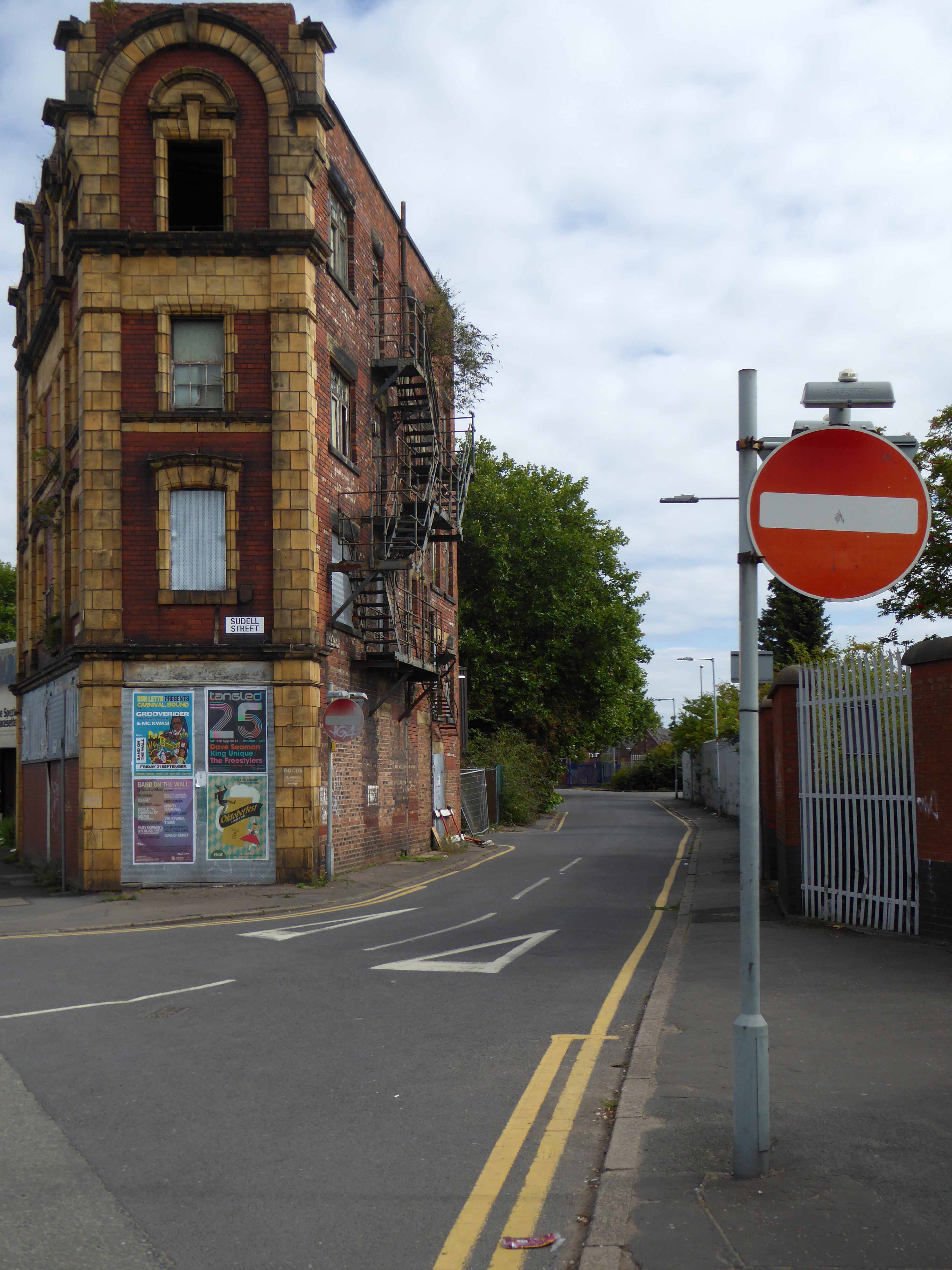
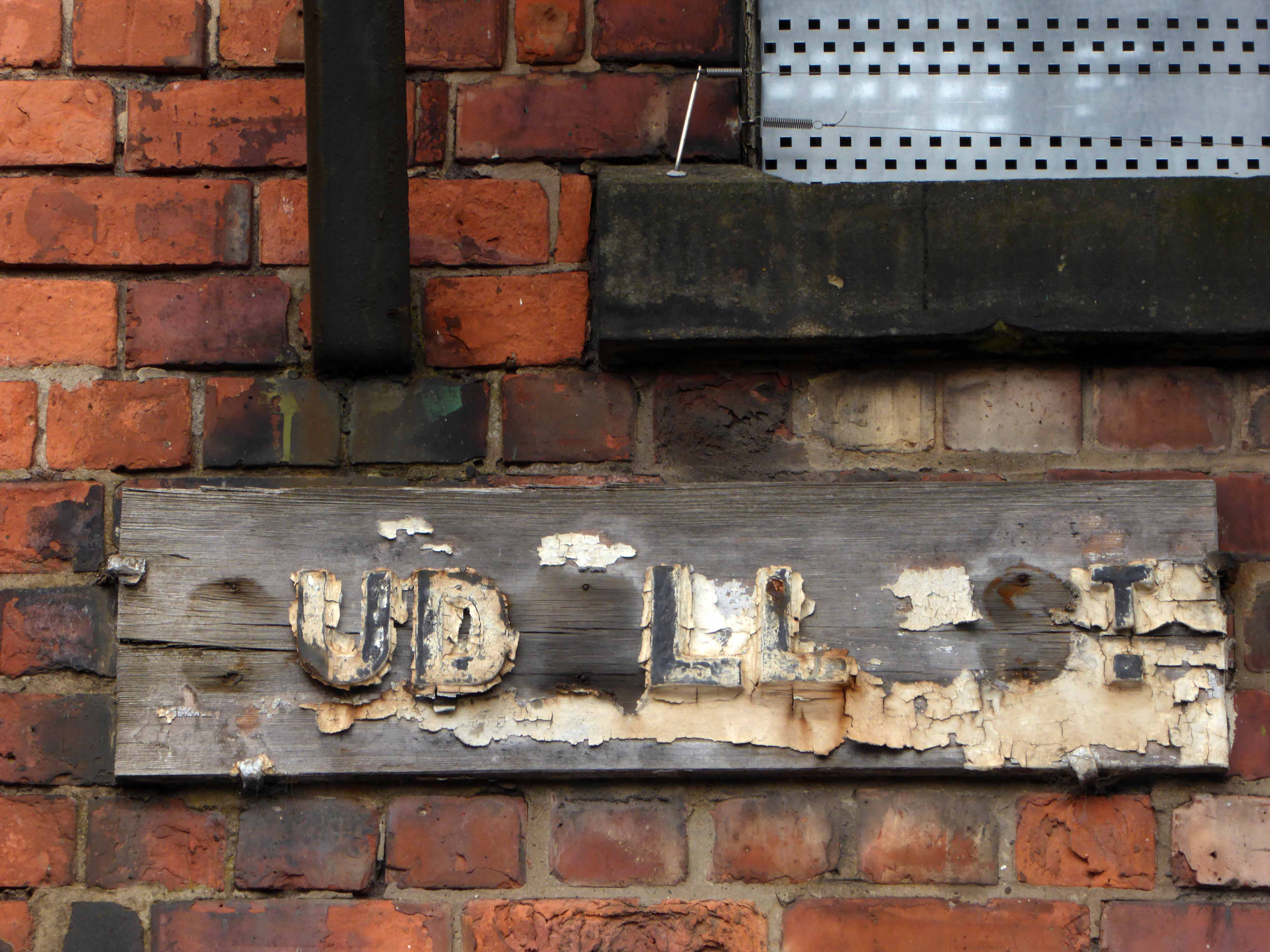
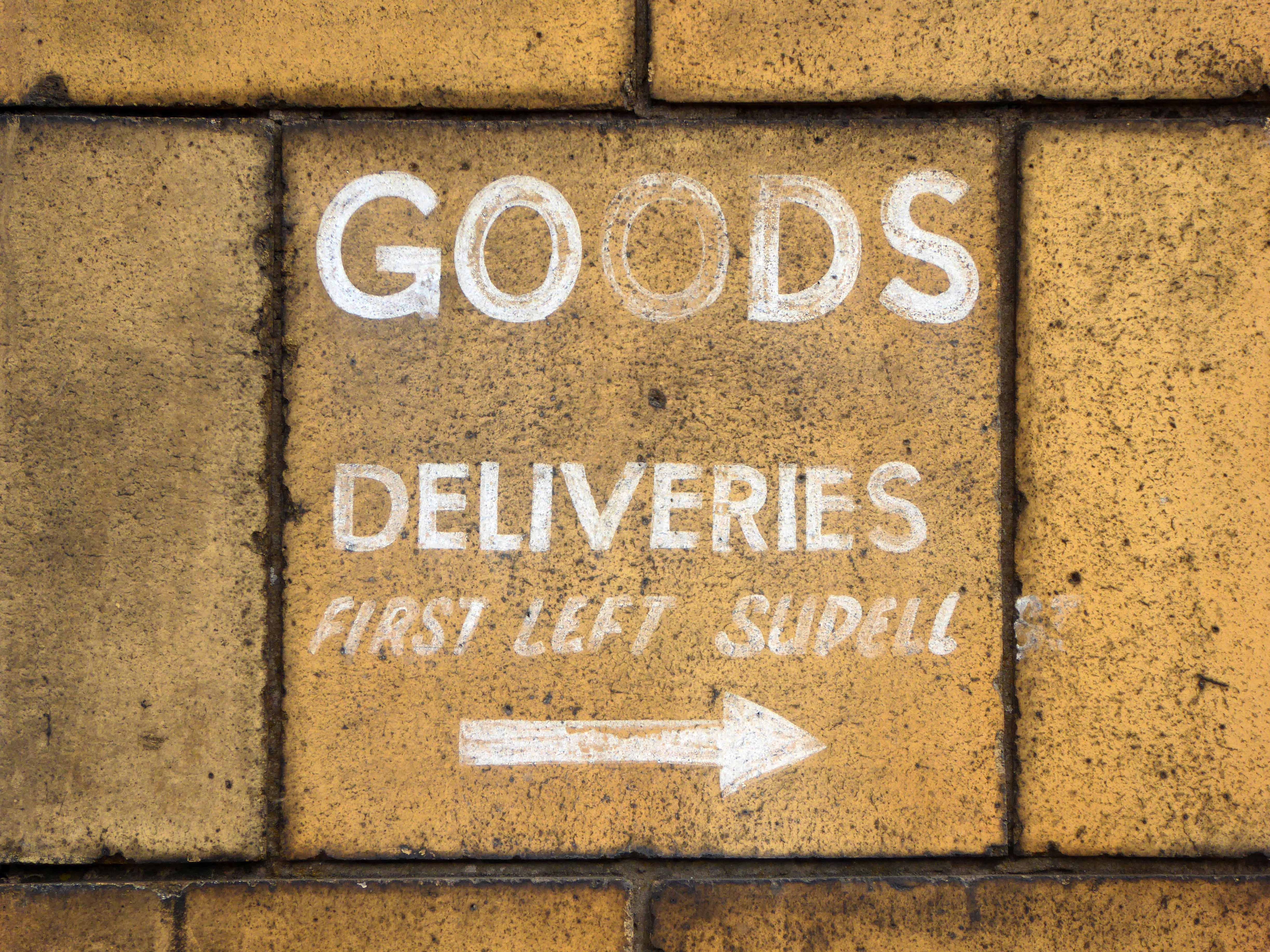
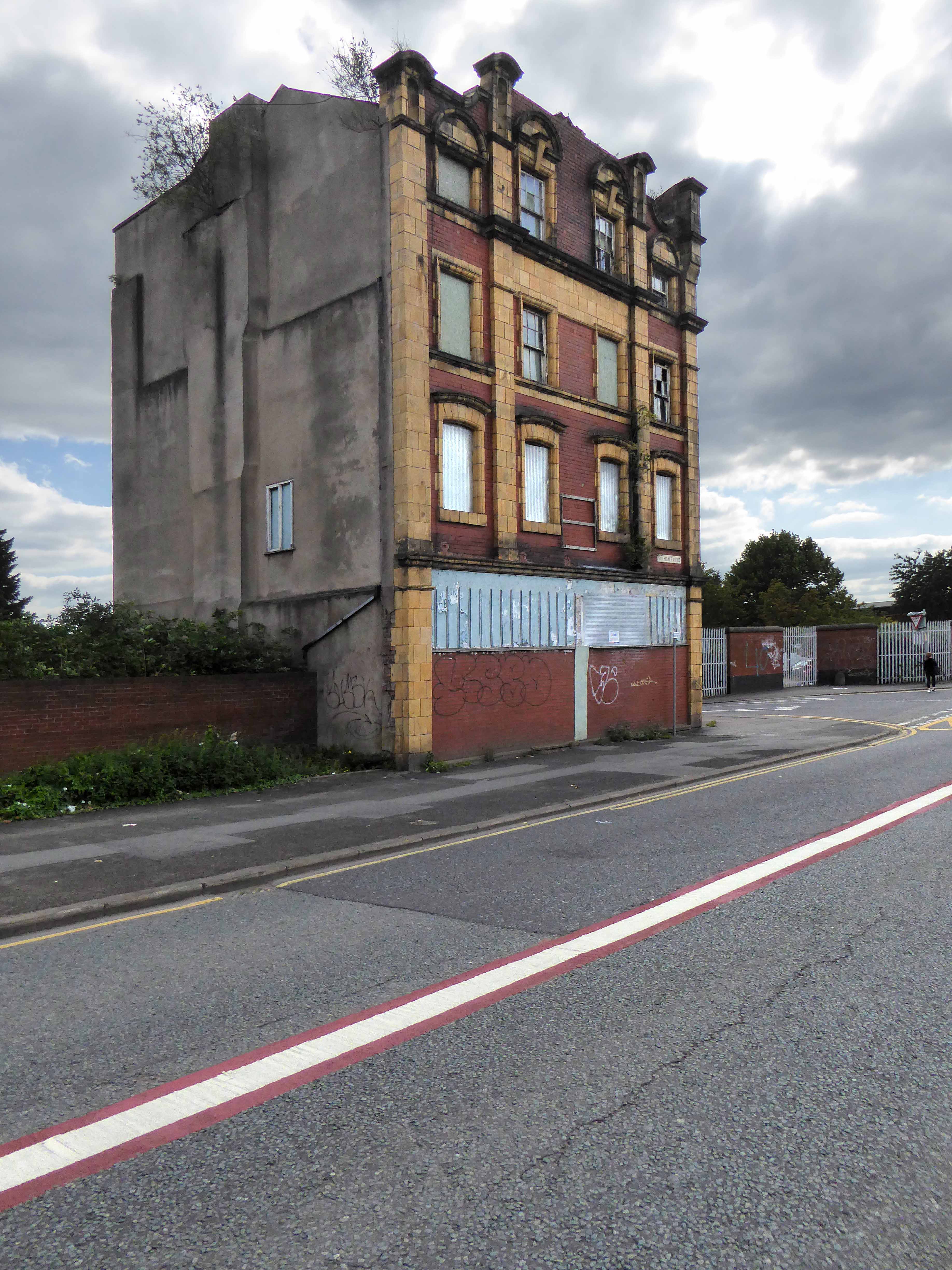
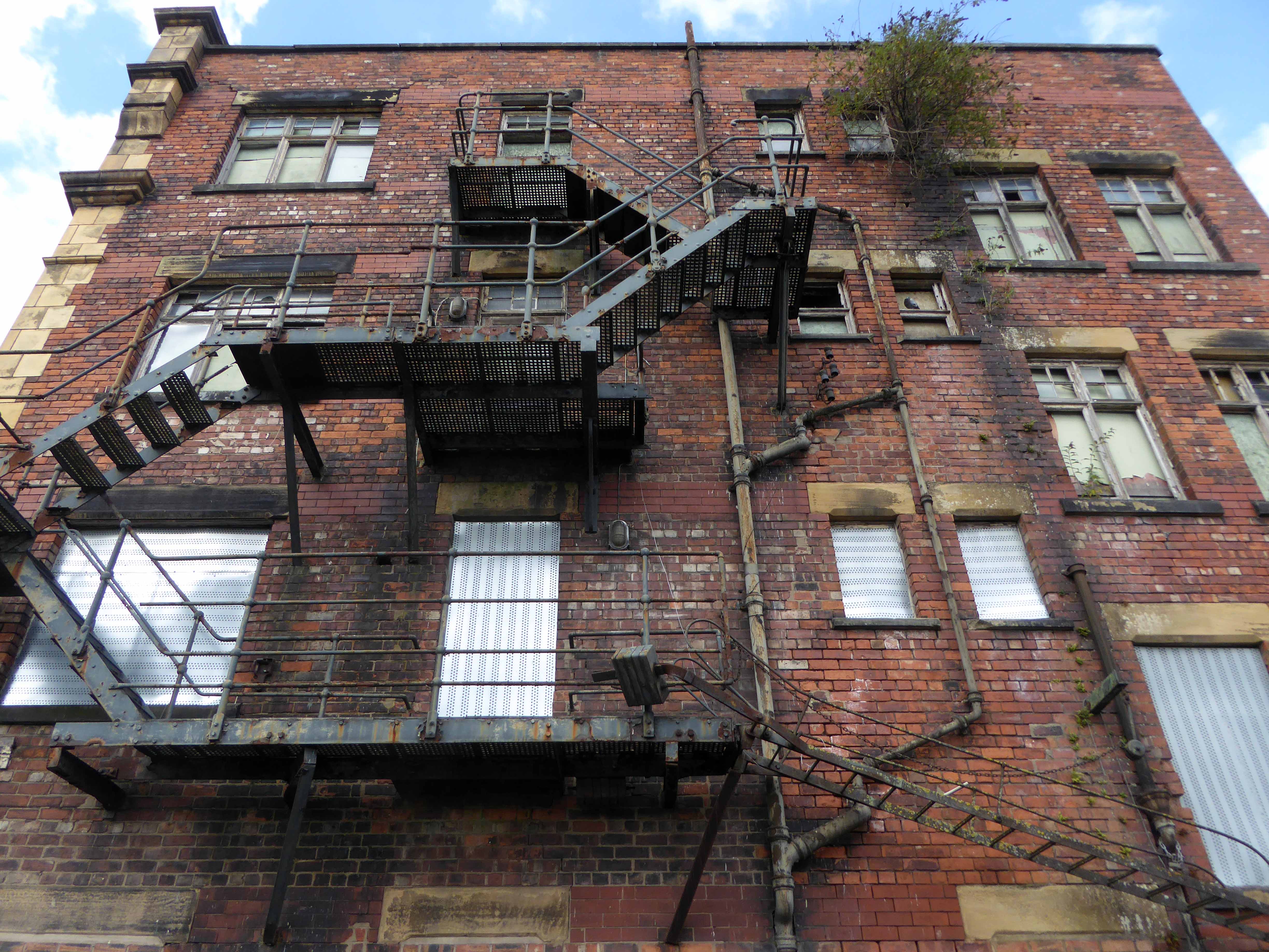
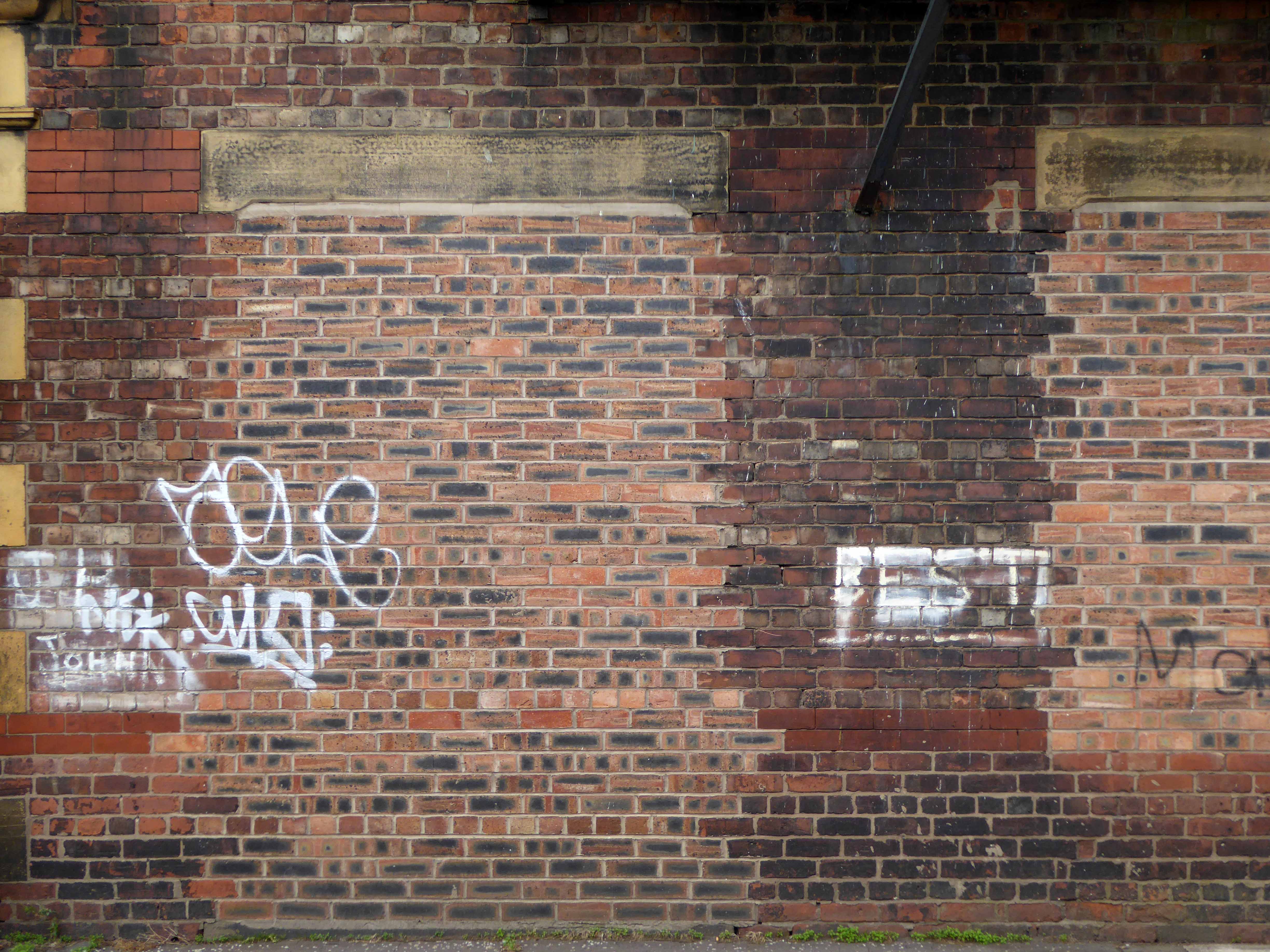
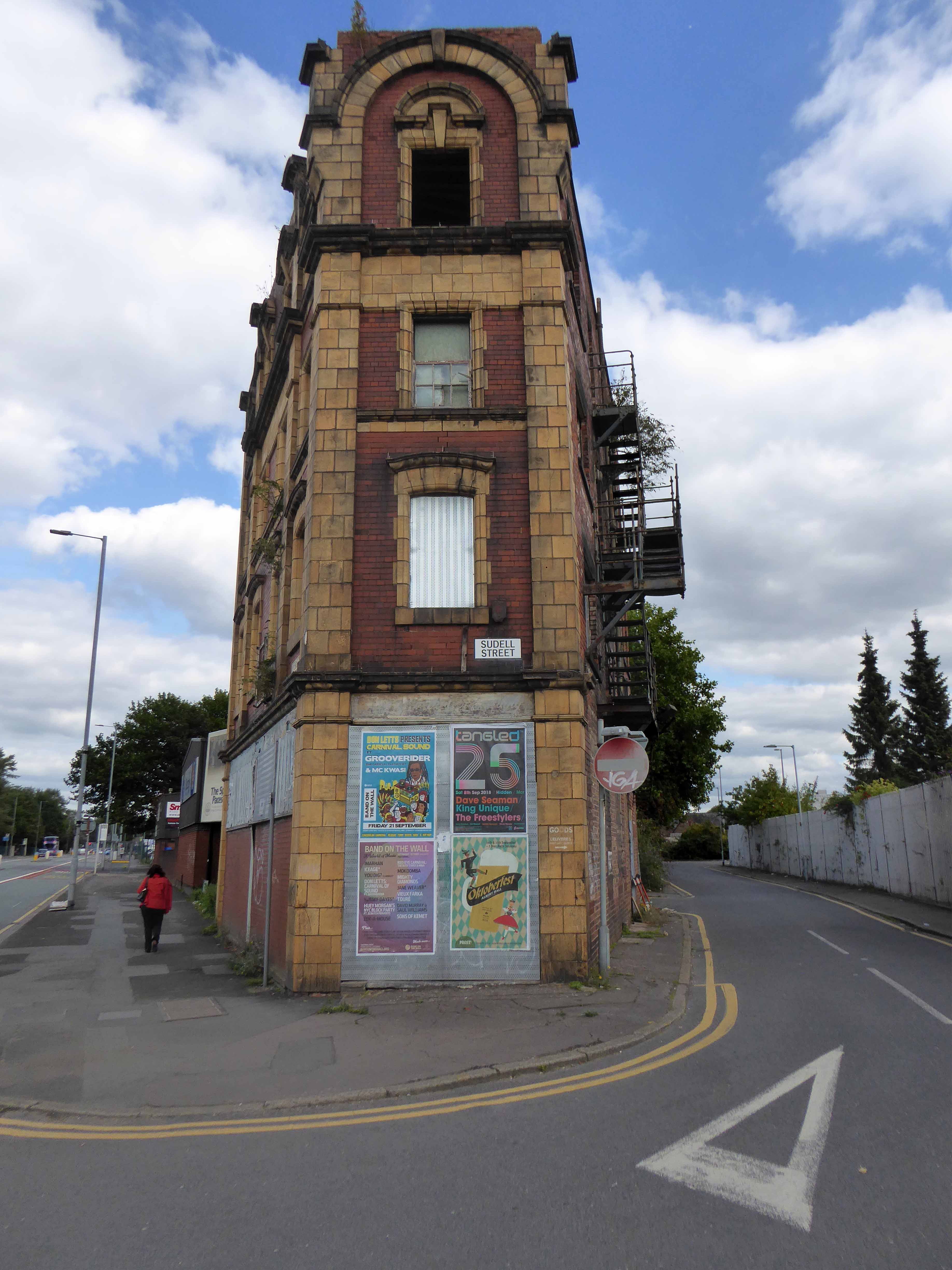
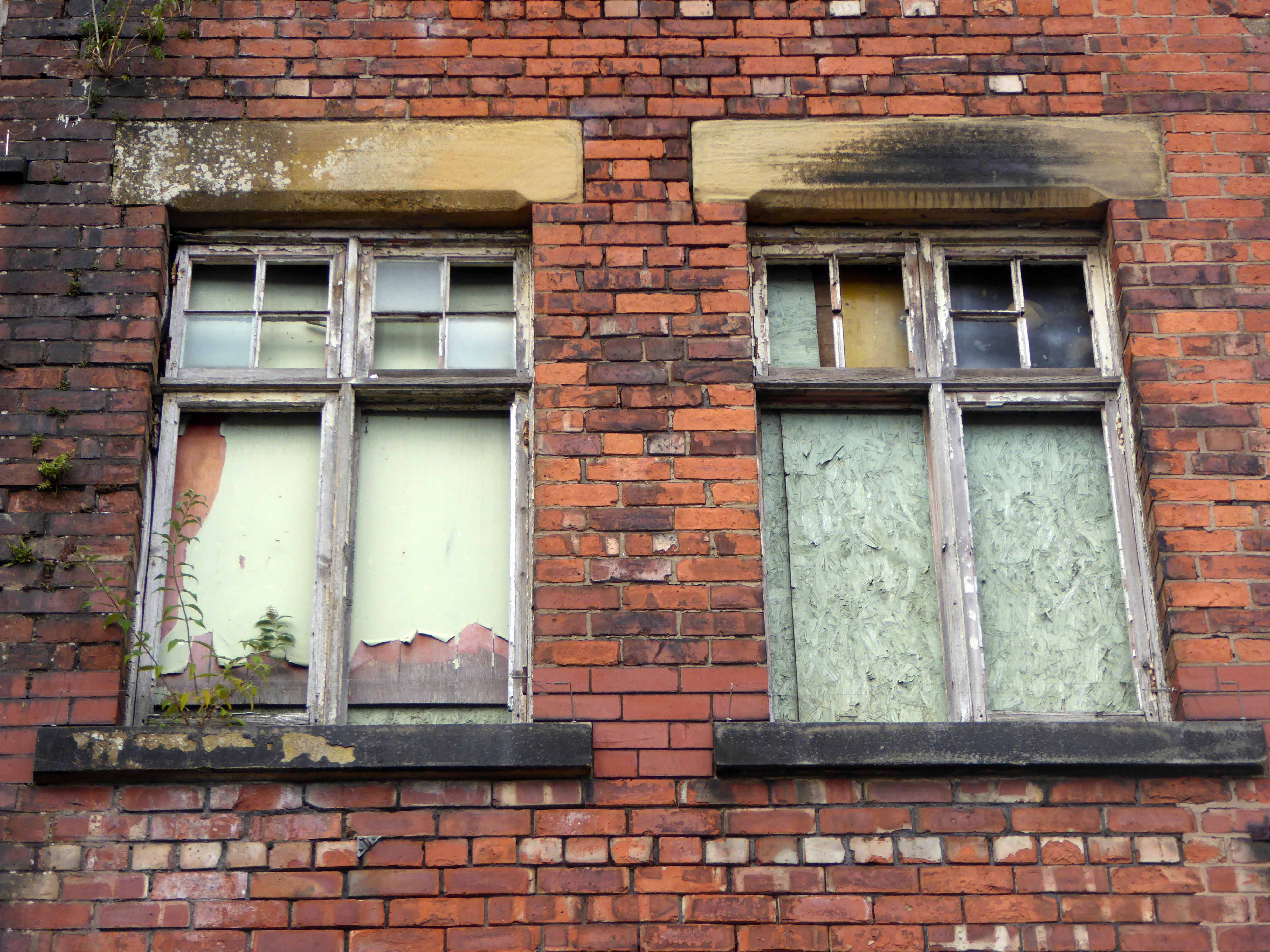
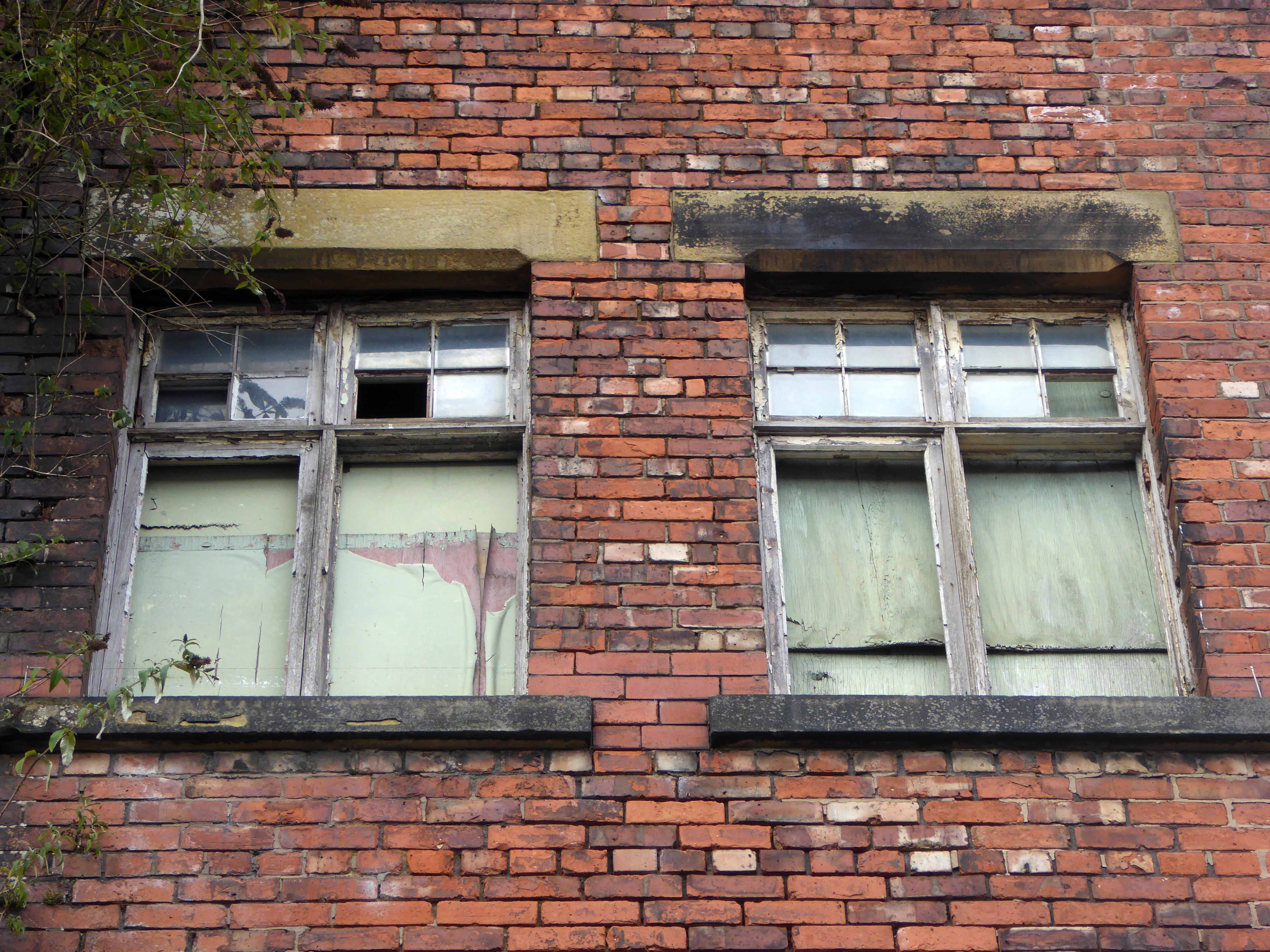
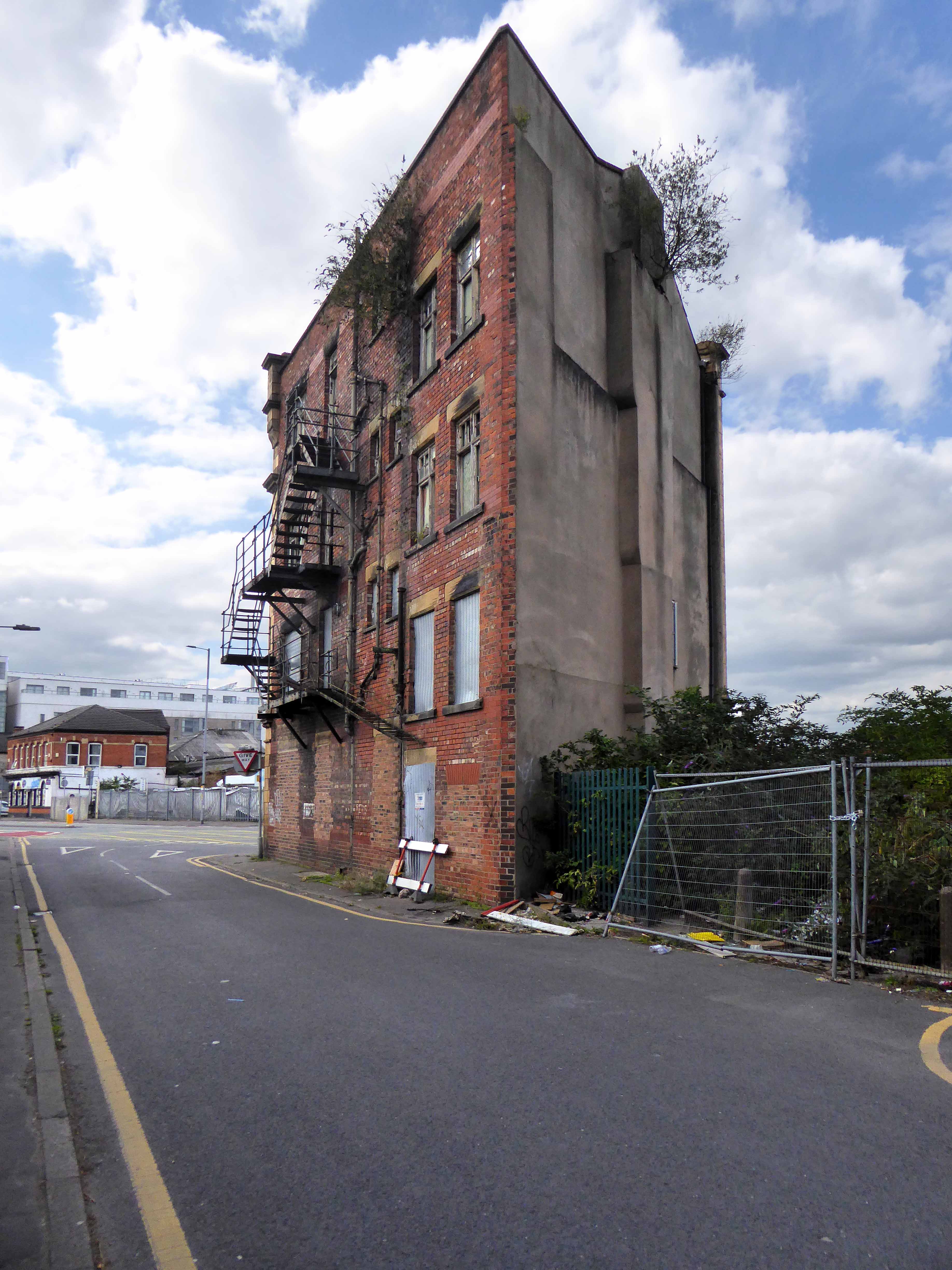
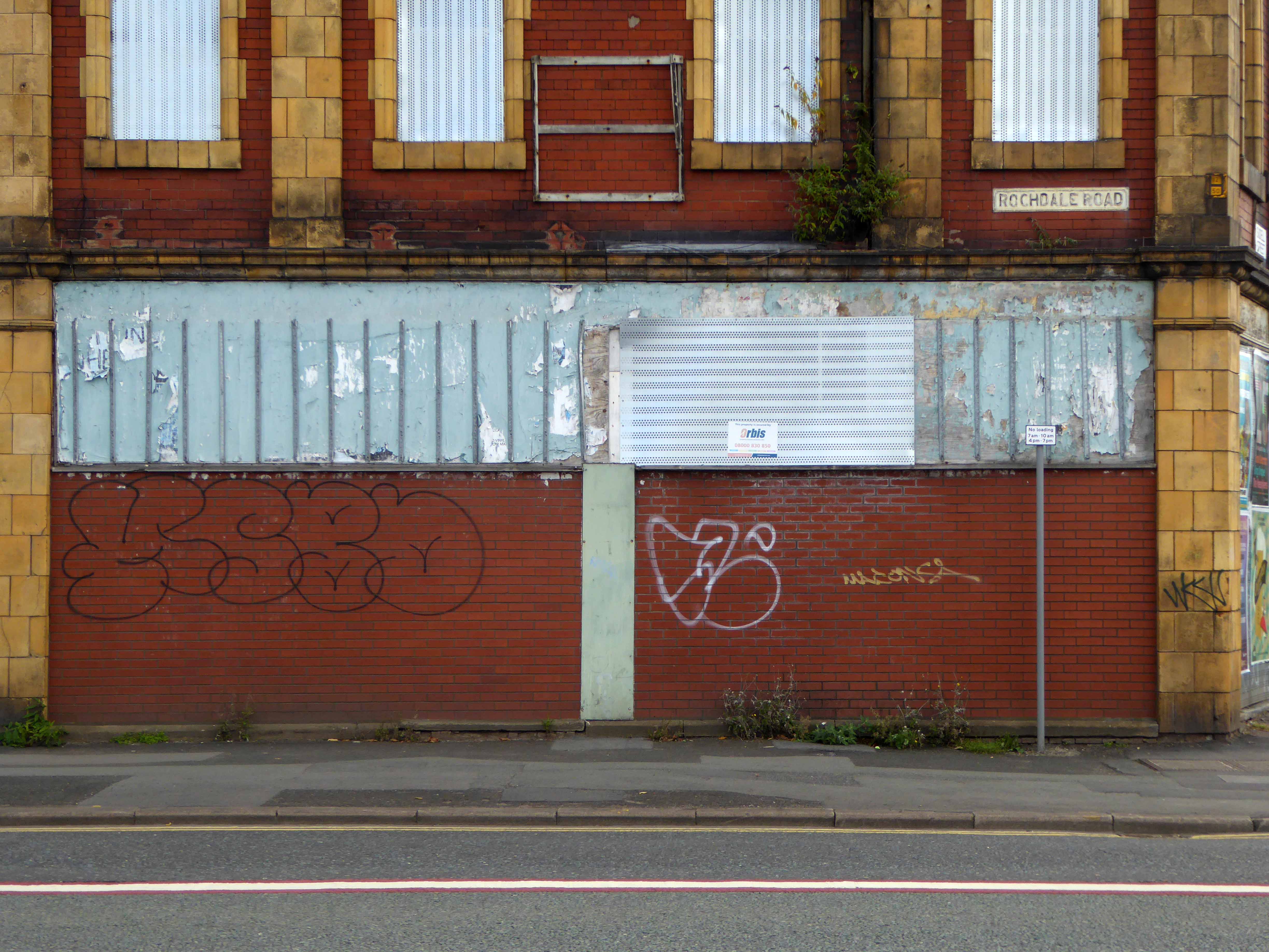
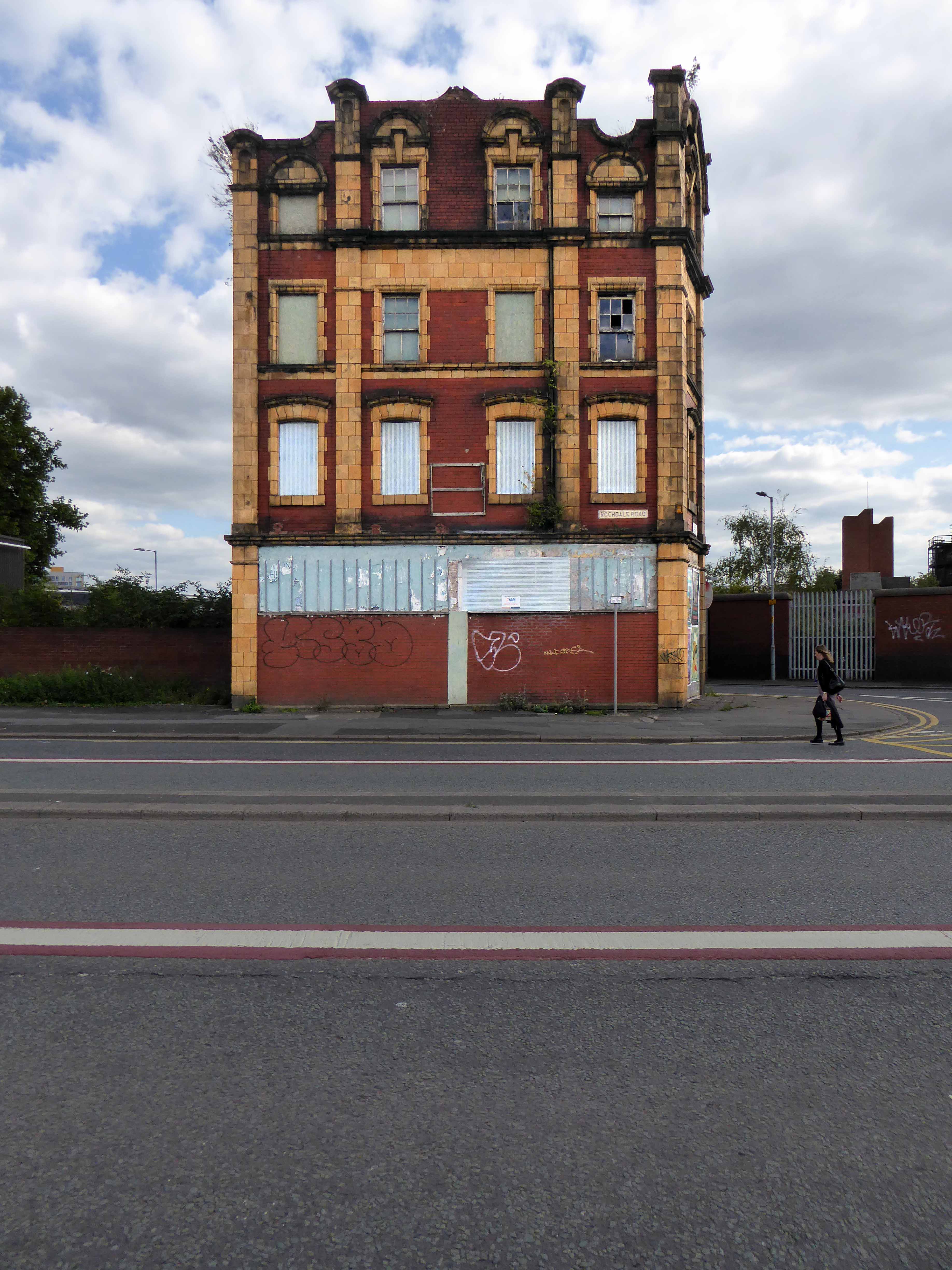
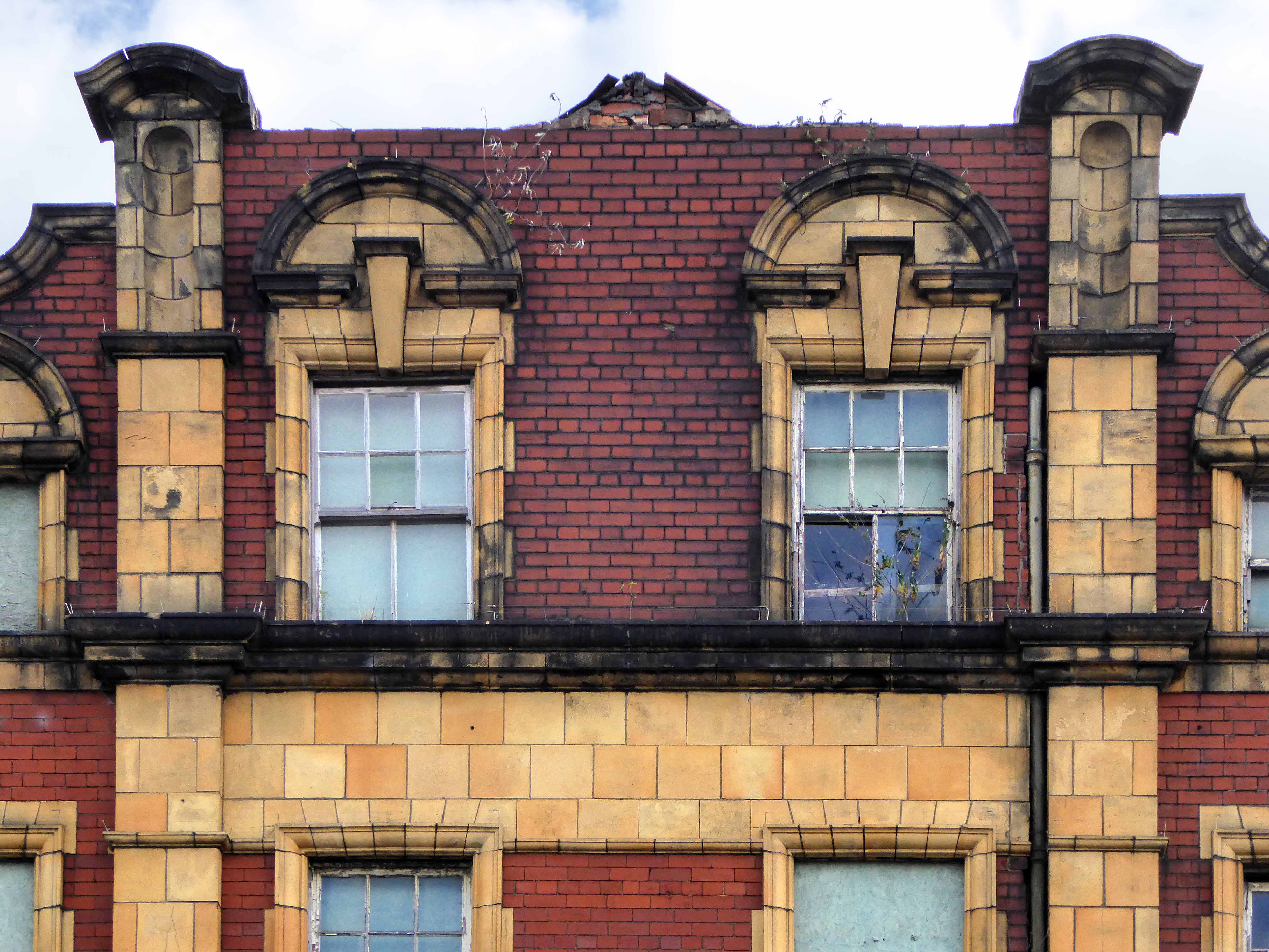
Standing alone, aloof and unloved on the corner of Rochdale Road and Sudell Street.
Something was missing.
I was missing something.
In 1813 there’s a field
In 1836 something’s there, but not it’s you.
Yet.
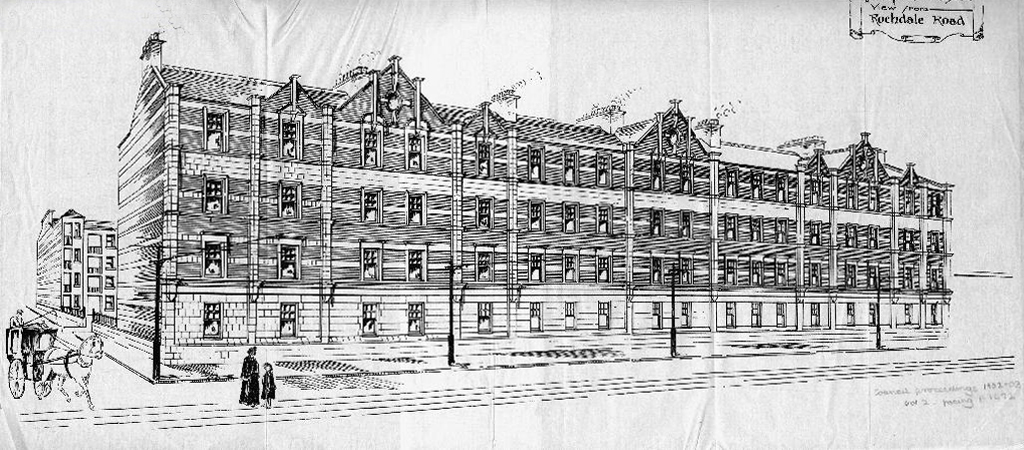
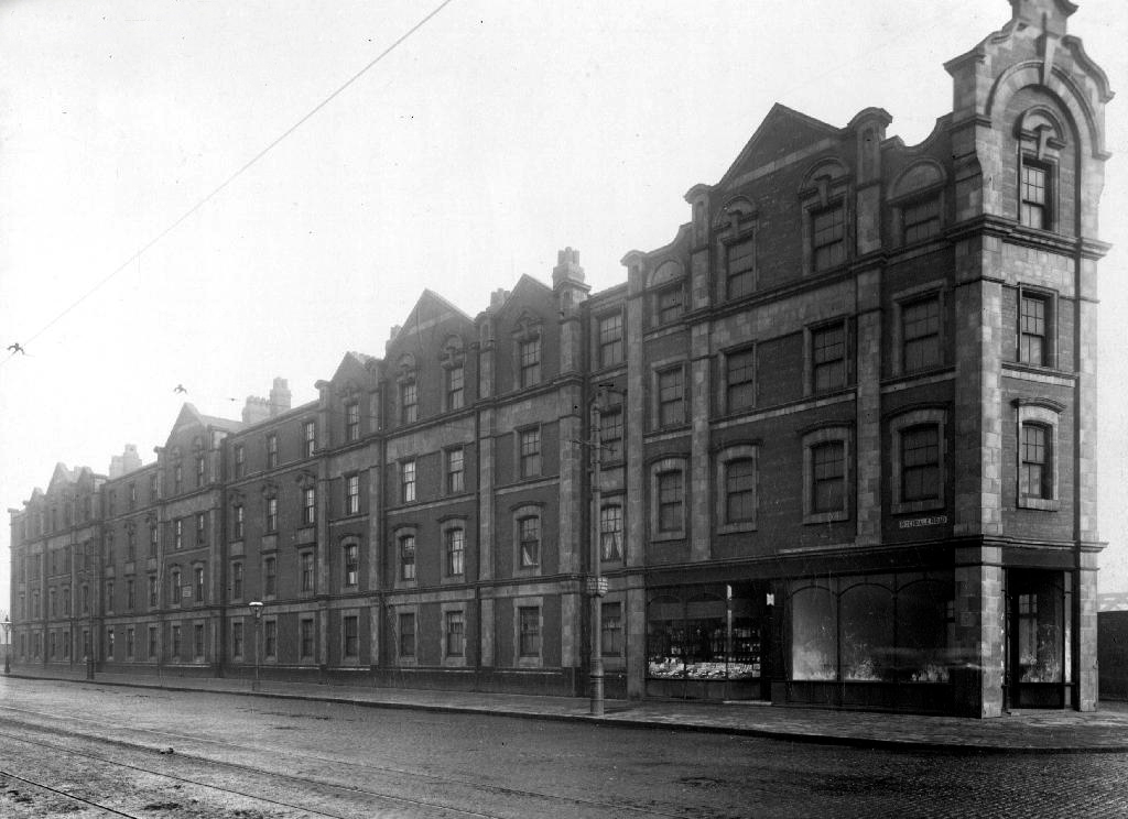
By 1900 the days of the two up, two downs are numbered – sanitary dwellings are the order of the day, plans are drawn up, the local council have decreed that workers dwellings are to be built.