Opened on 9th September 1928 with the silent film Lonesome Ladies.
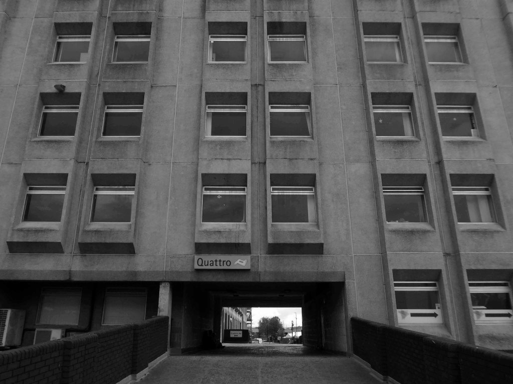
The Carlton Picture Theatre in Anlaby Road was designed by the firm of Blackmore & Sykes and was built by Messrs. Greenwood and Sons.
It was run by Hull Picture Playhouse Ltd.
This was a lavish suburban cinema, with an elaborate green and gold sliding dome utilising Venetian glass and housing hundreds of concealled lights. Roman marble mosaics and painted plaster panels on the walls added to the sense of occasion engendered by a trip to the flicks.
A Fitton & Haley organ was installed, but this was later removed to the more central Cecil Theatre and was destroyed when that theatre was bombed during WW II.
The cinema had two entrances, one in each of the two towers on the front corners of the building. Above the proscenium was the inscription, rather inapt given how soon talkies arrived :
“A Picture is a poem without words”.
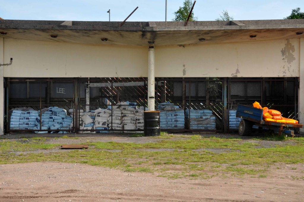
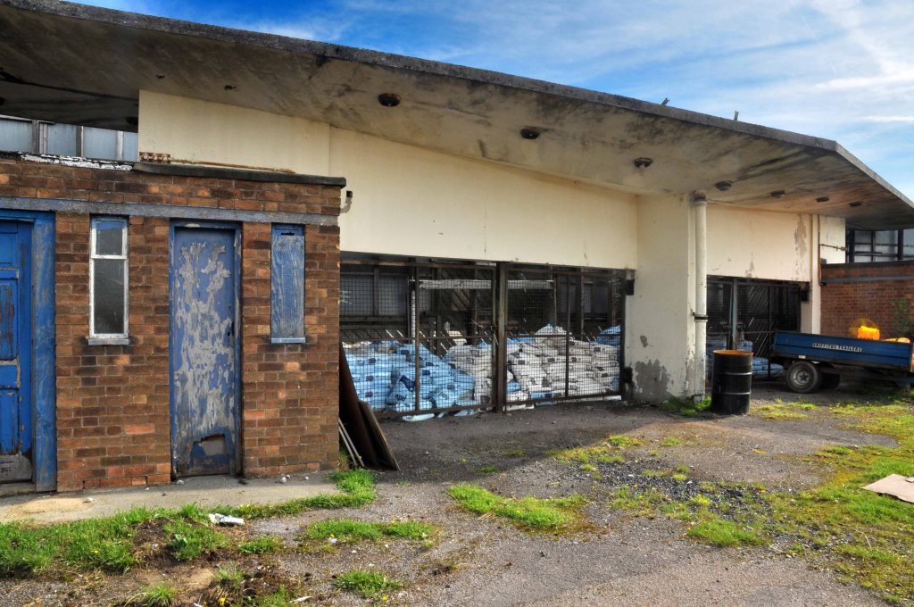
There was a single balcony and, for its date, a surprisingly large car park.
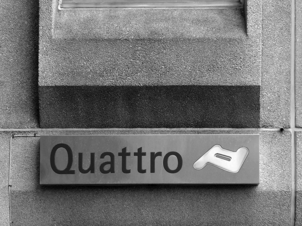
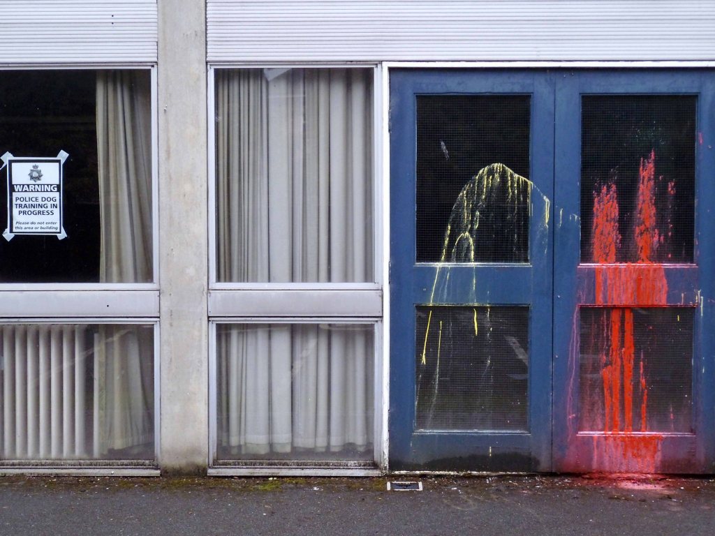
It continued unaltered, save for minor war damage, until its closure in April 1967, after which it was simply converted to bingo usage which continued as a Mecca Bingo Club until 2008.
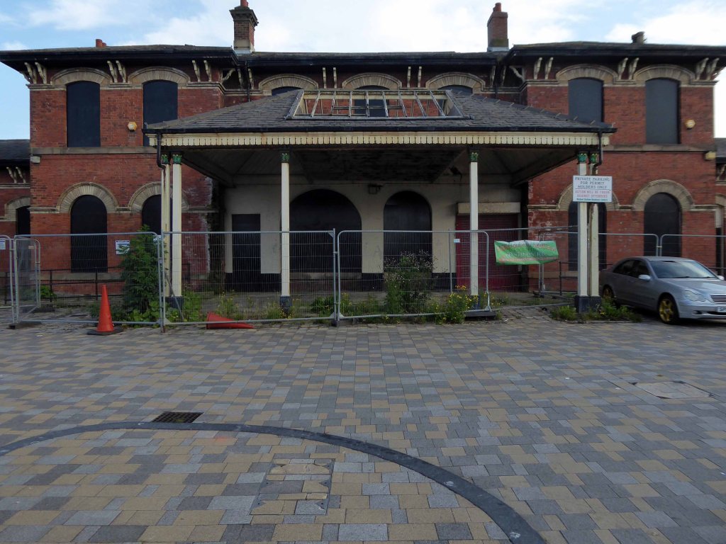
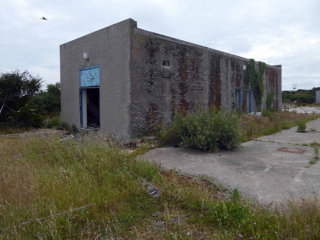
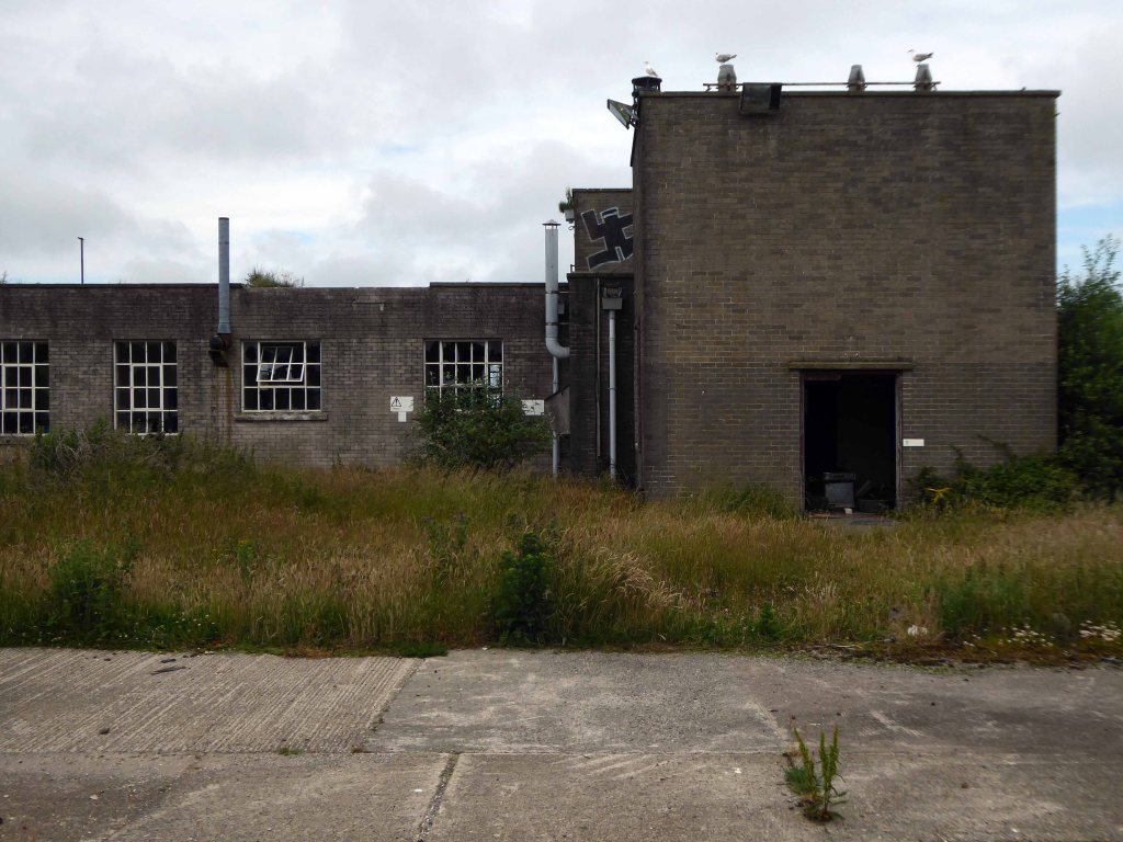
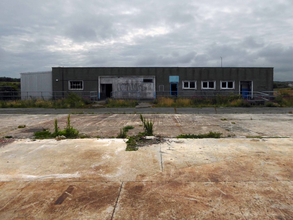
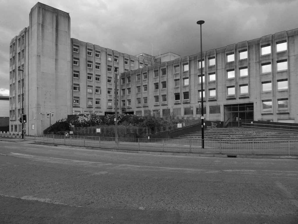
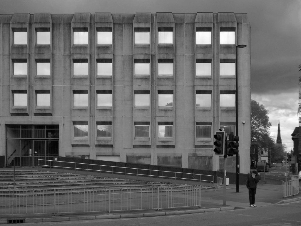
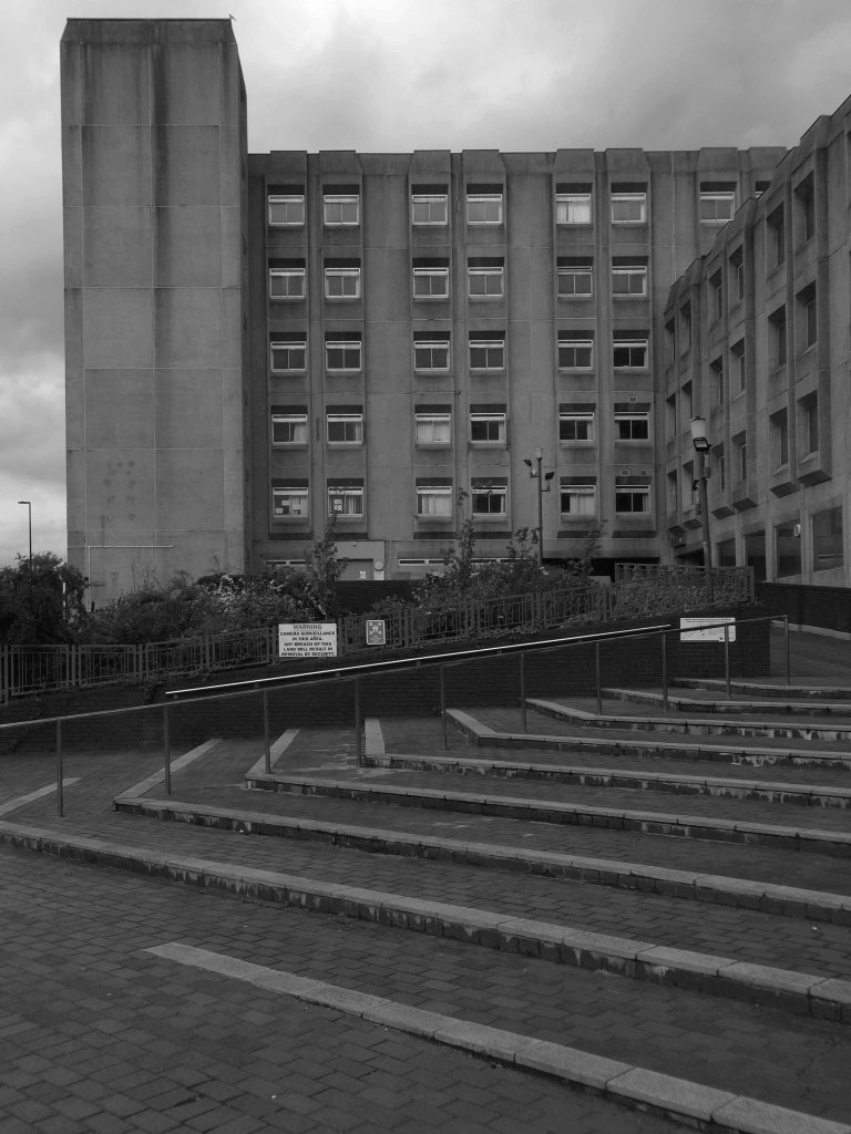
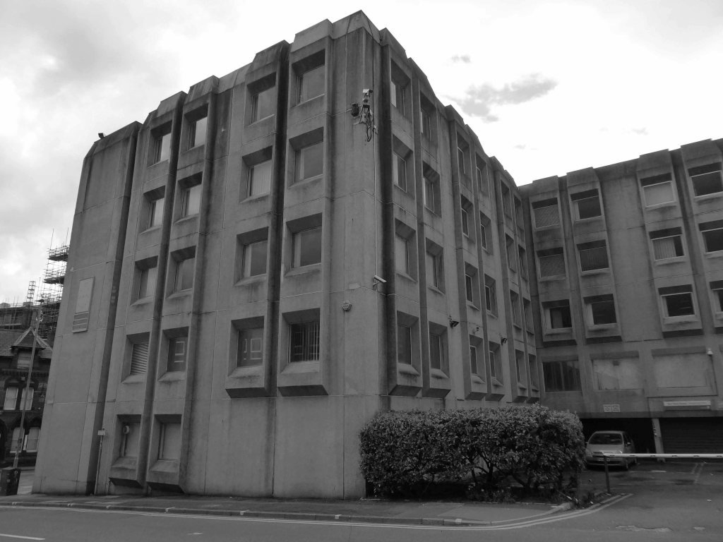
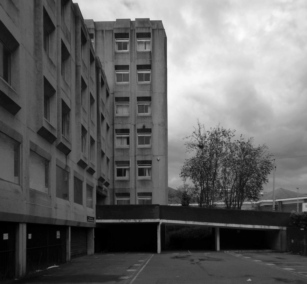
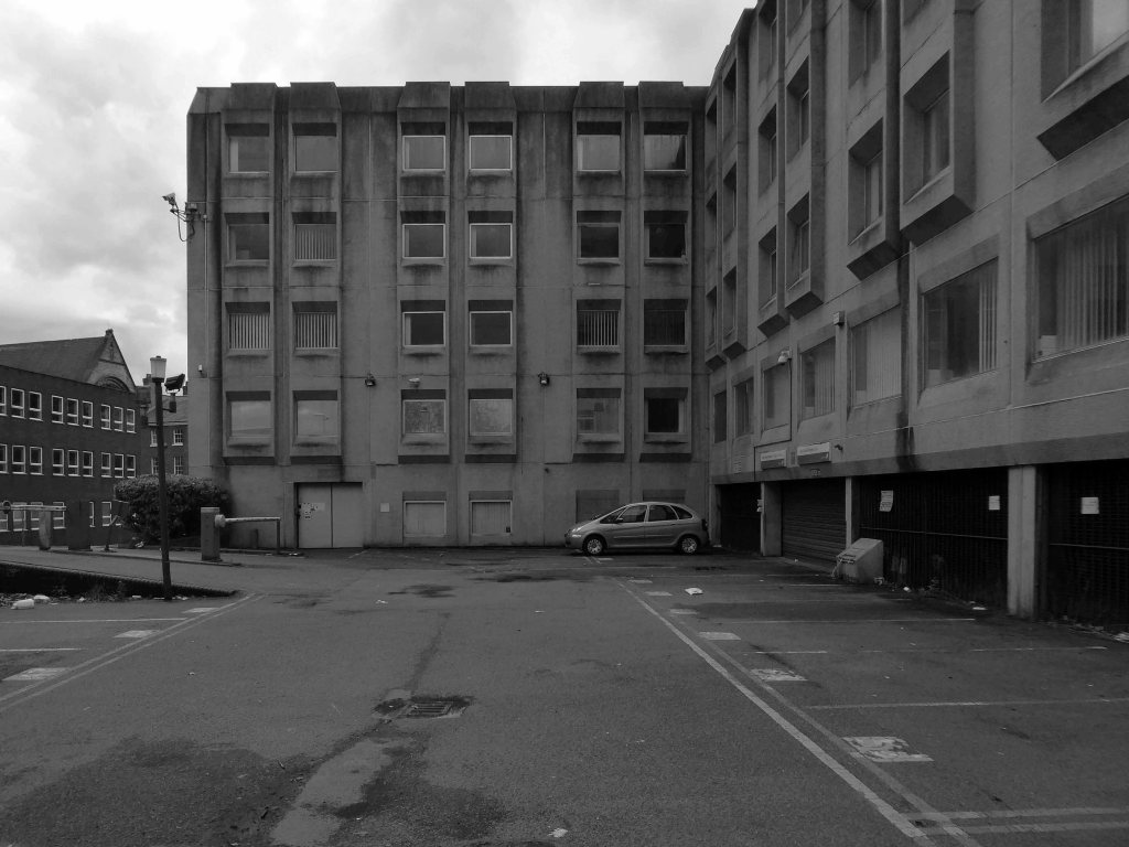
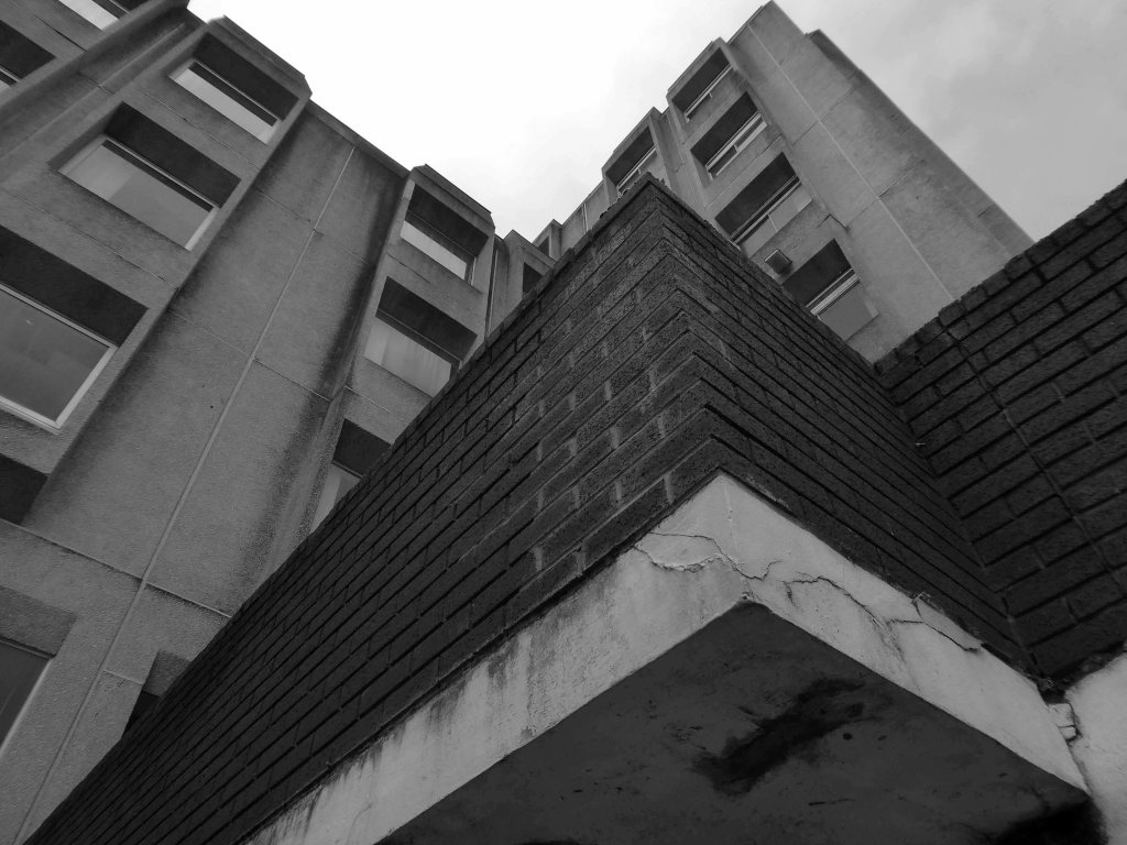
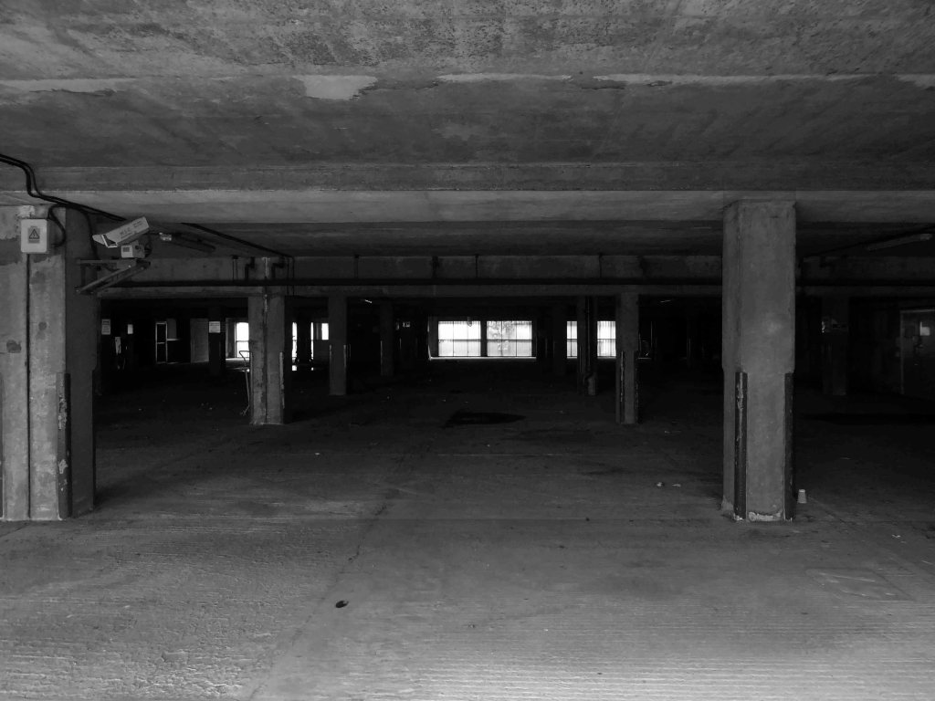
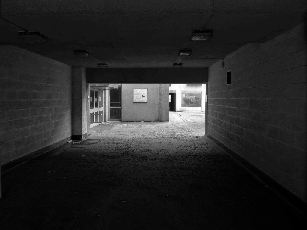
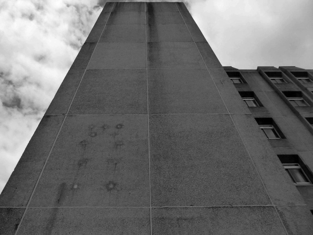
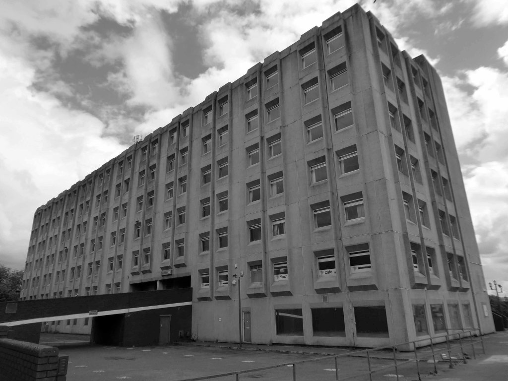
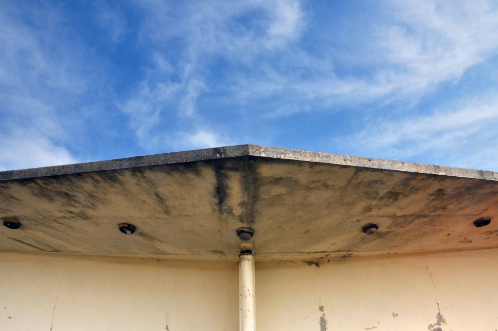
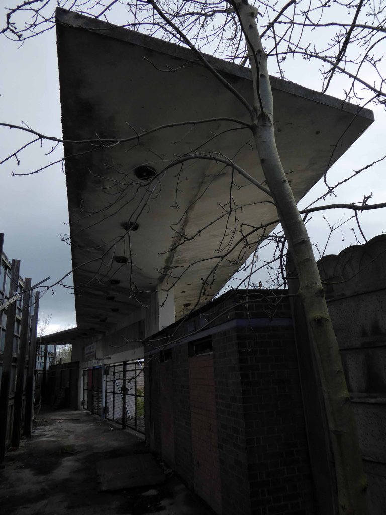
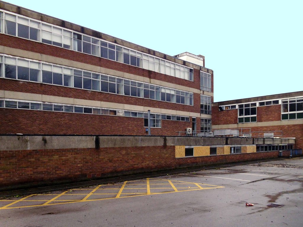
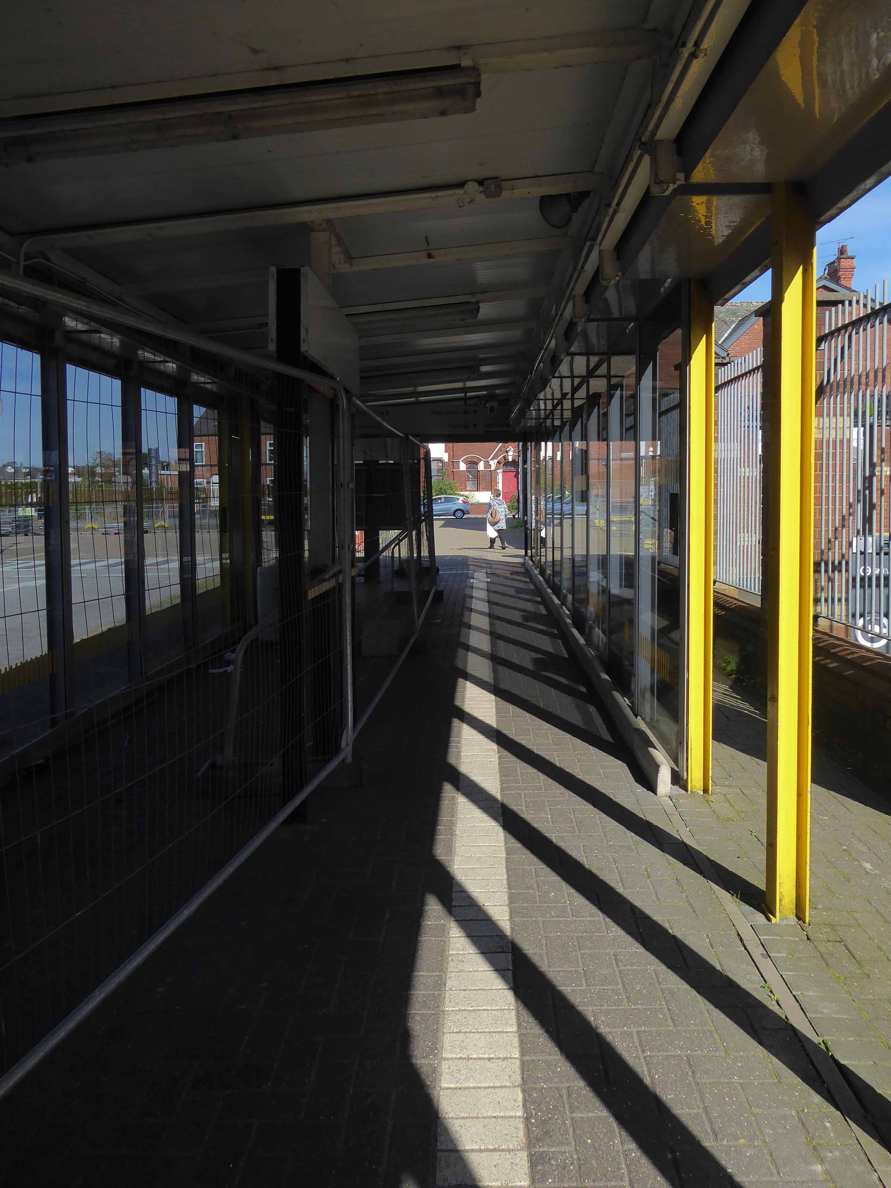
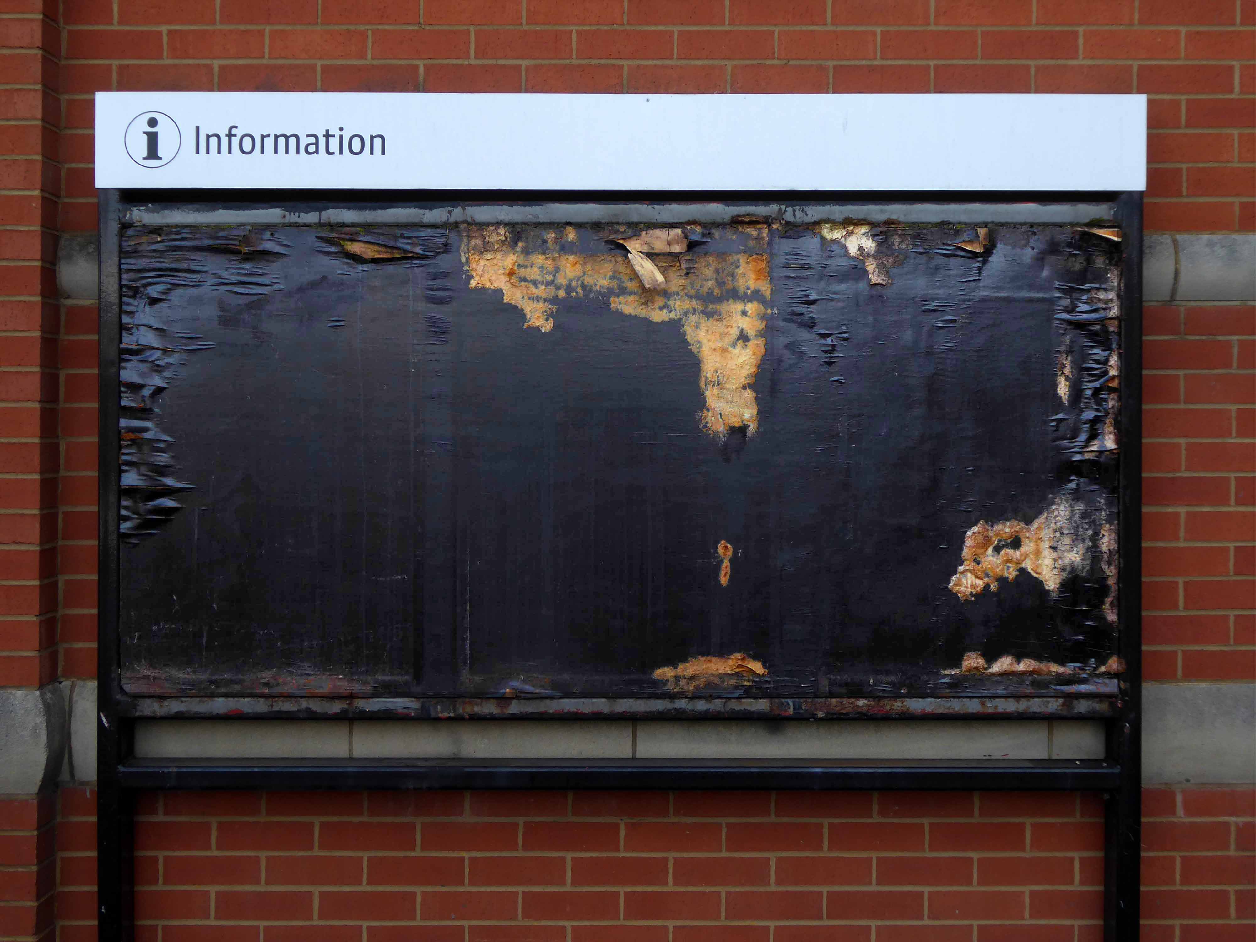
This is an immense and noble building, a once great single screen cinema.
Unluckily closed for some thirteen years, now looking neglected and forlorn.
Tinned up and awaiting an uncertain future, planning was applied for conversion to apartments, it was refused.
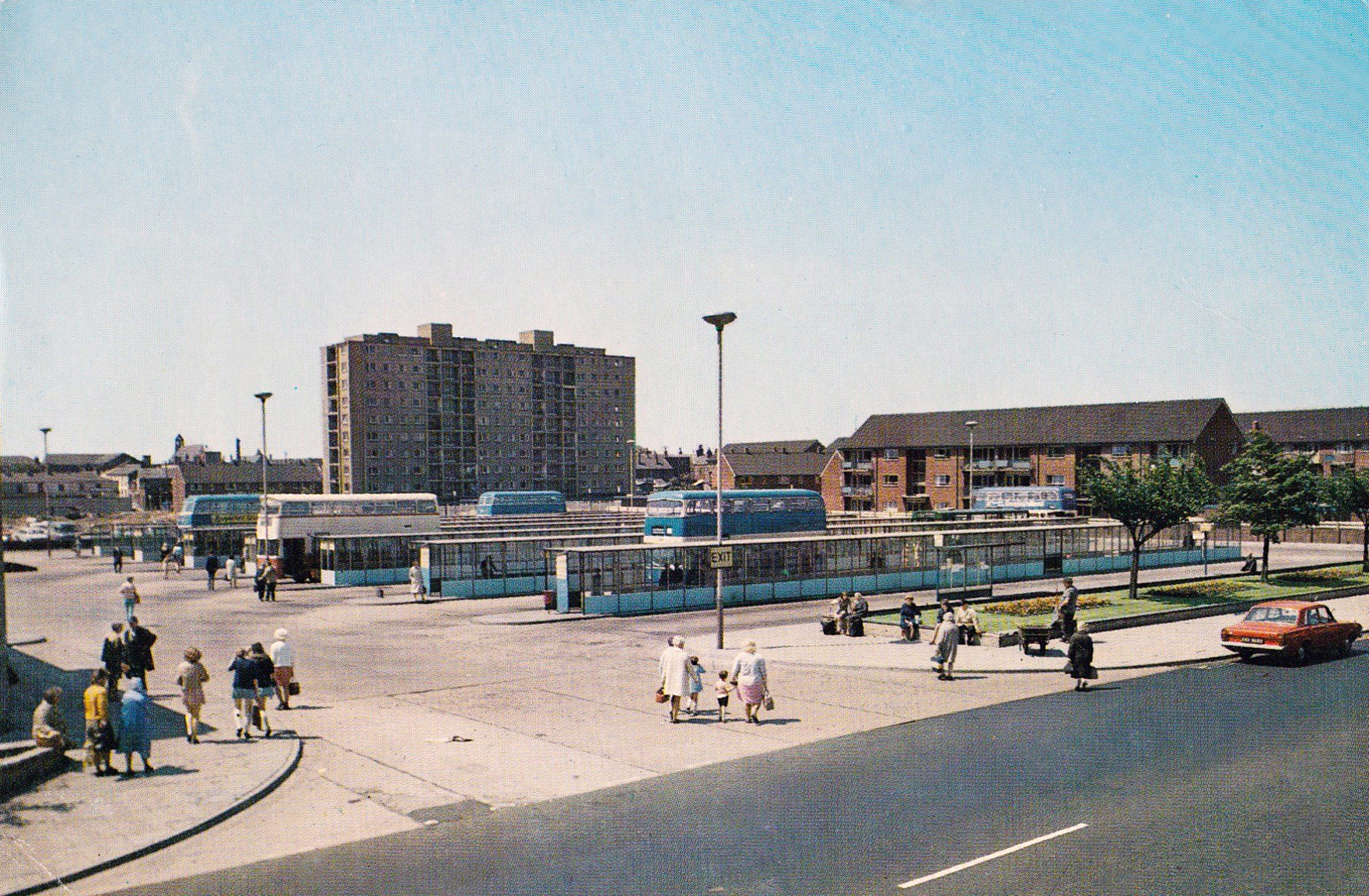
It is unlisted and unloved in need of friends and funds, who could operate a cinema and theatre in the manner of The Plaza in my hometown of Stockport.
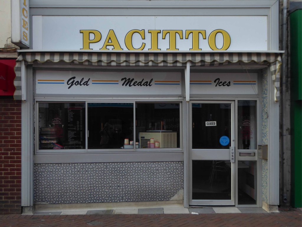
The number of cinemas in Hull peaked at thirty six in 1938.
British film making flourished during the war years and cinema attendances were much higher, but by the end of the Second World War there were only twenty five – several had been bombed.
In 1964 competition from radio and television, and latterly bingo, reduced the number of cinemas to ten.
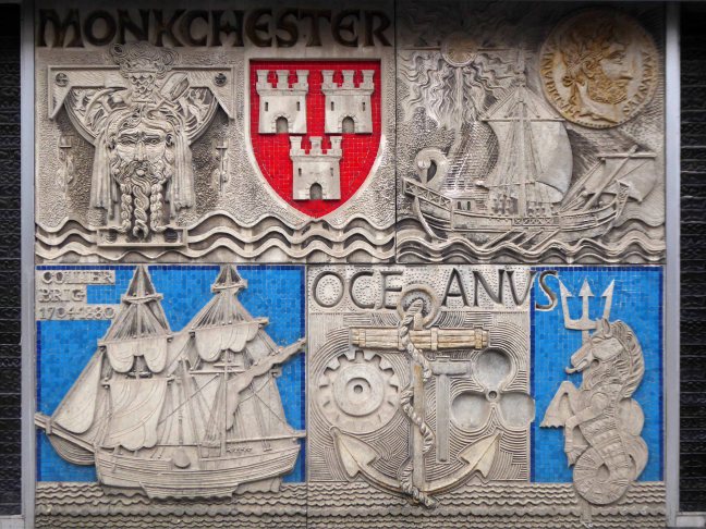
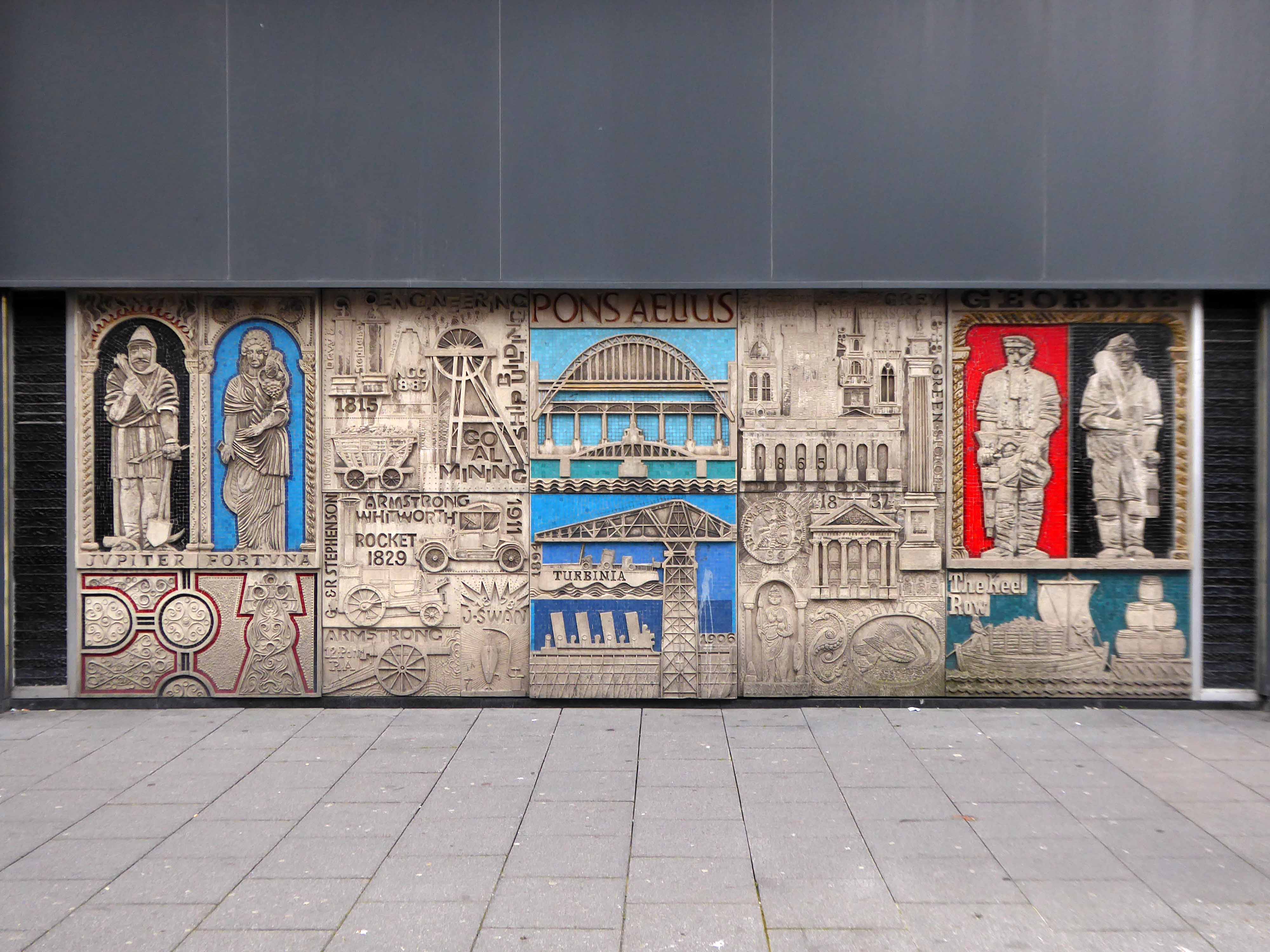
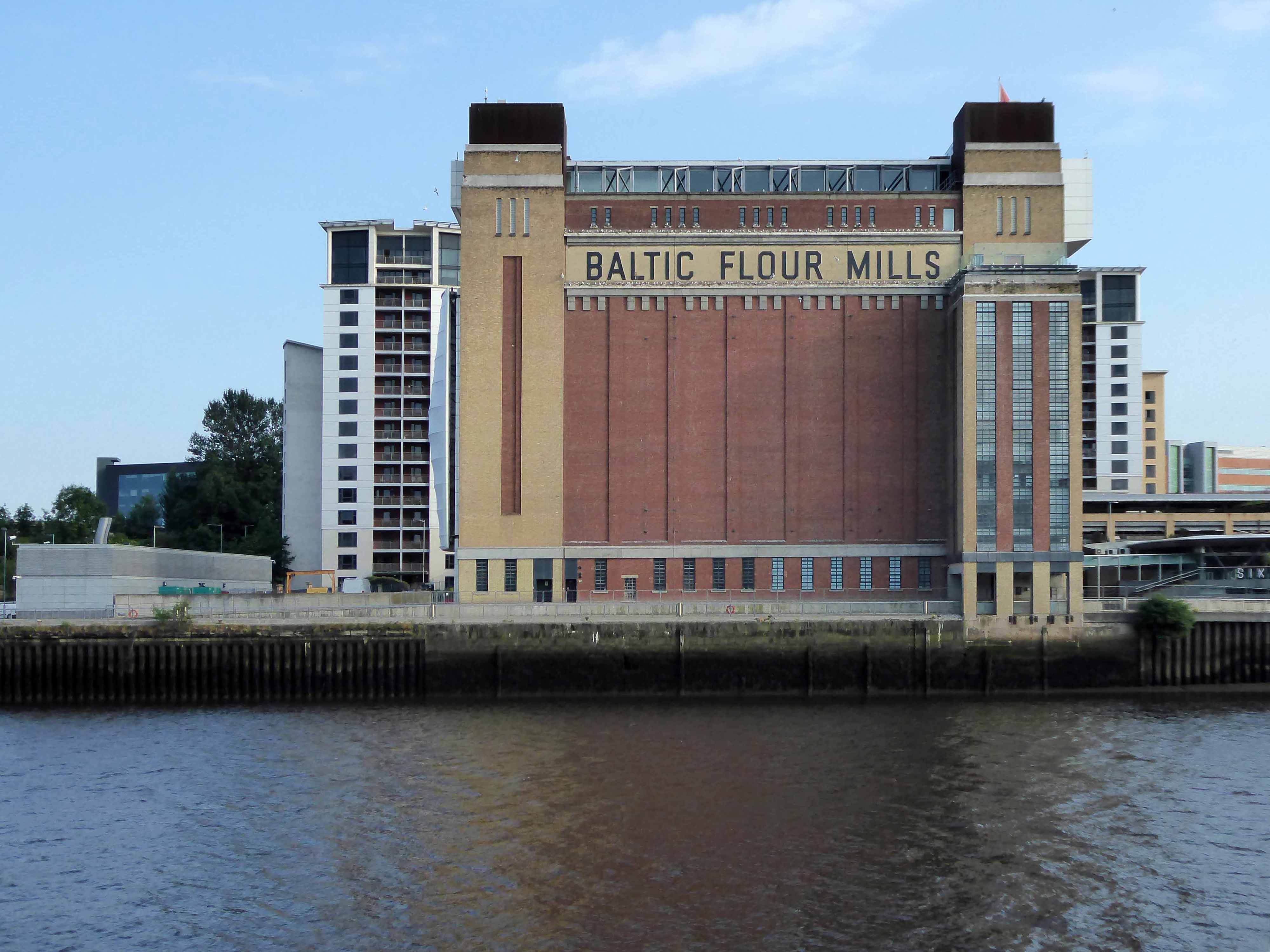
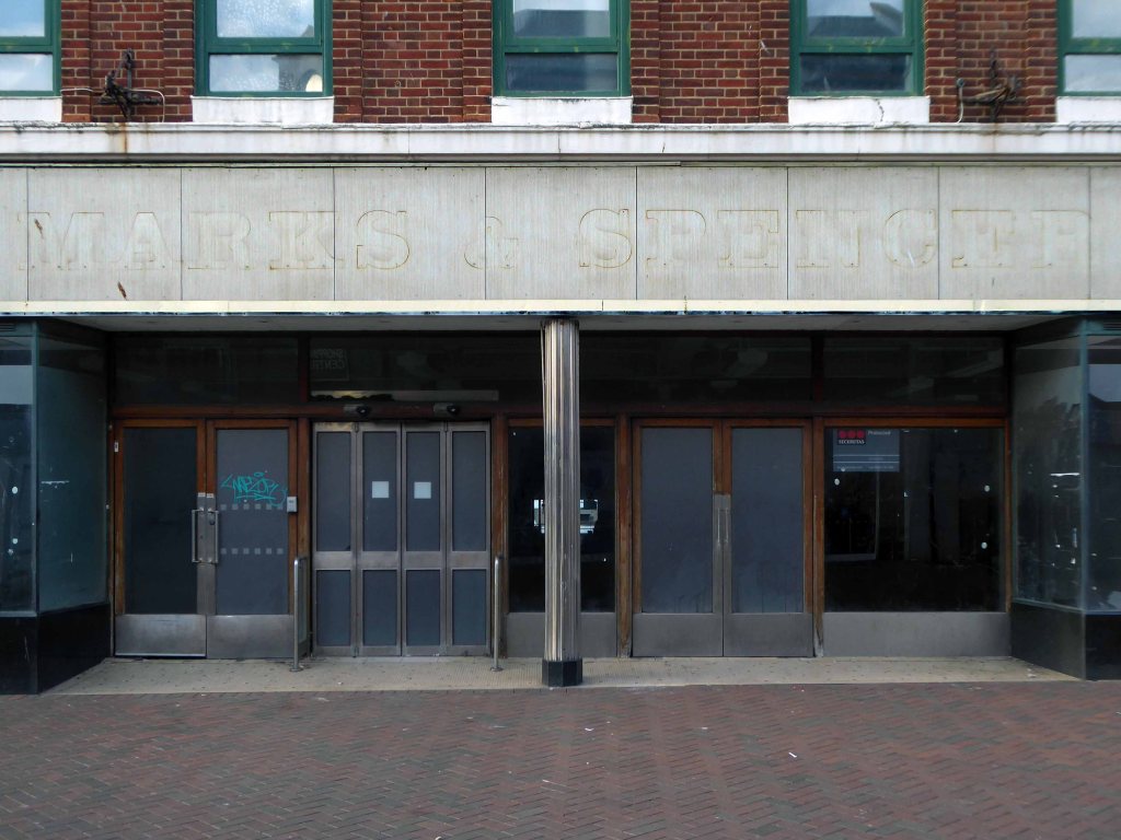
The building was originally developed by C&A and it is thought that funding for the reliefs might have been provided by the store and/or Northern Arts. It became BHS which subsequently closed, the building is now occupied by Primark, C&A estates still own the site.
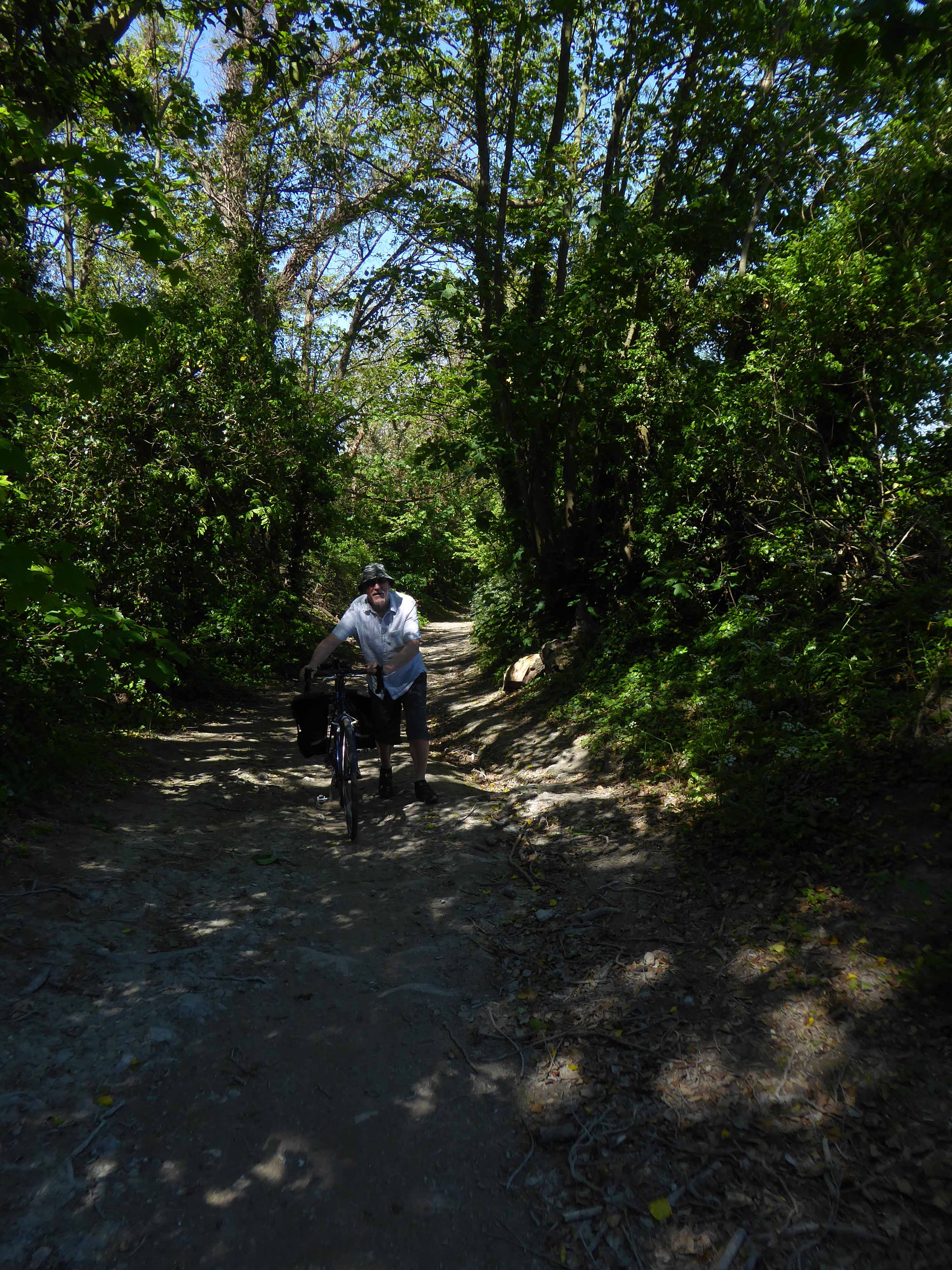
Taking a bold leap into the unknown I left the city centre, unwisely following unfamiliar roads, predictably becoming very lost.
I sought assistance from a passing fellow cyclist, very kindly he guided me to Tynemouth, following a mysterious and circuitous course across the undulating terrain – thanks.
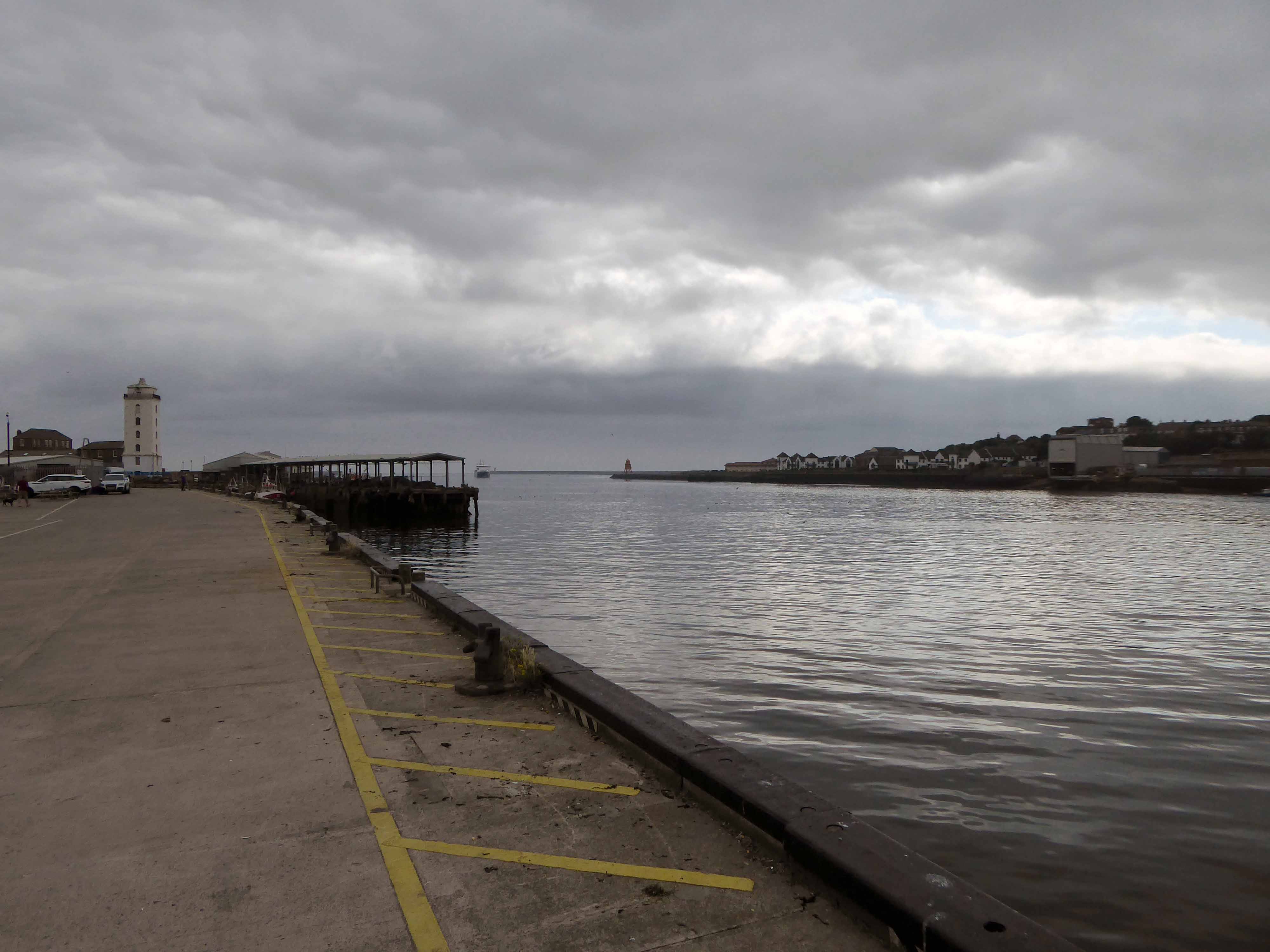
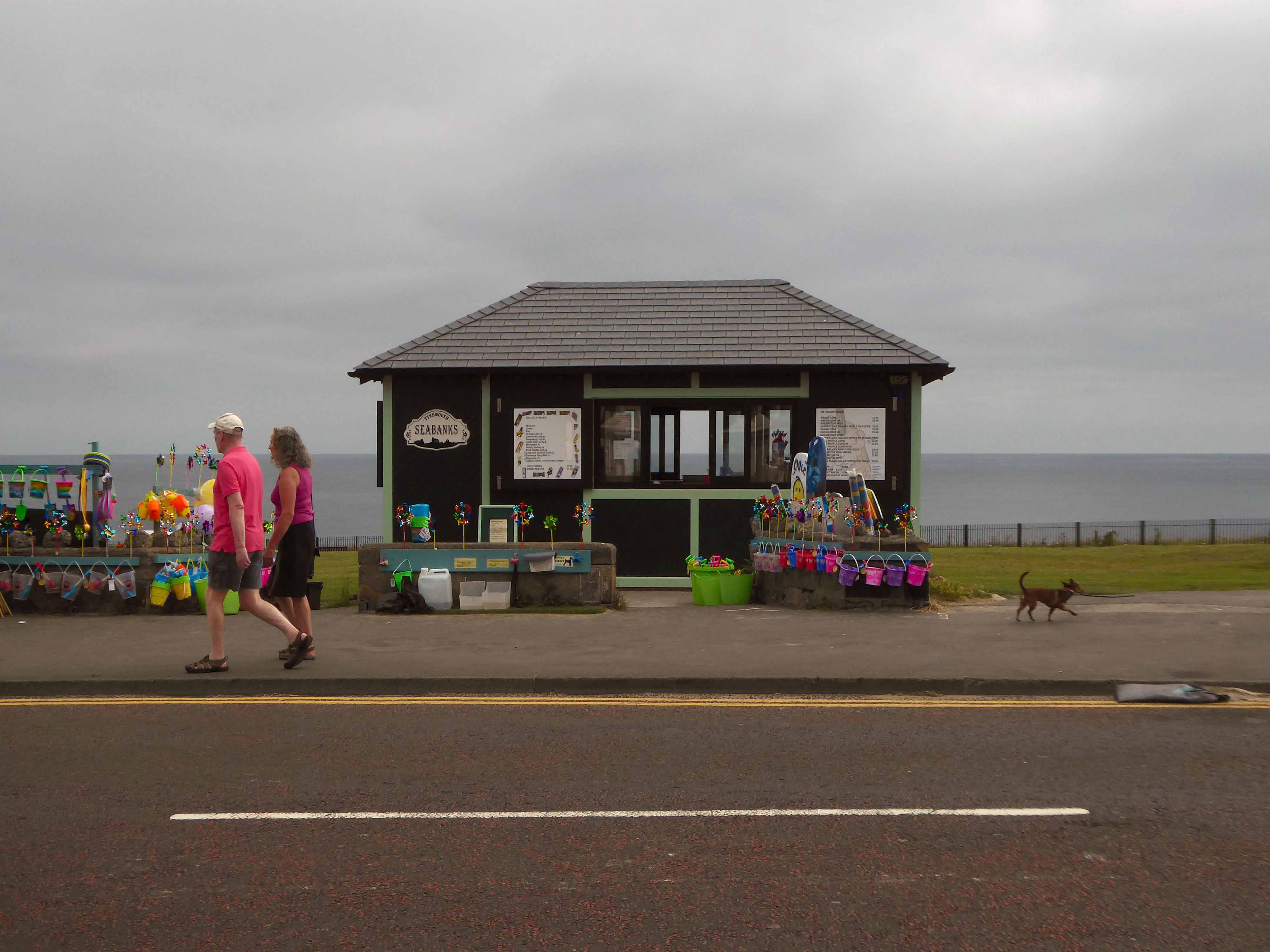
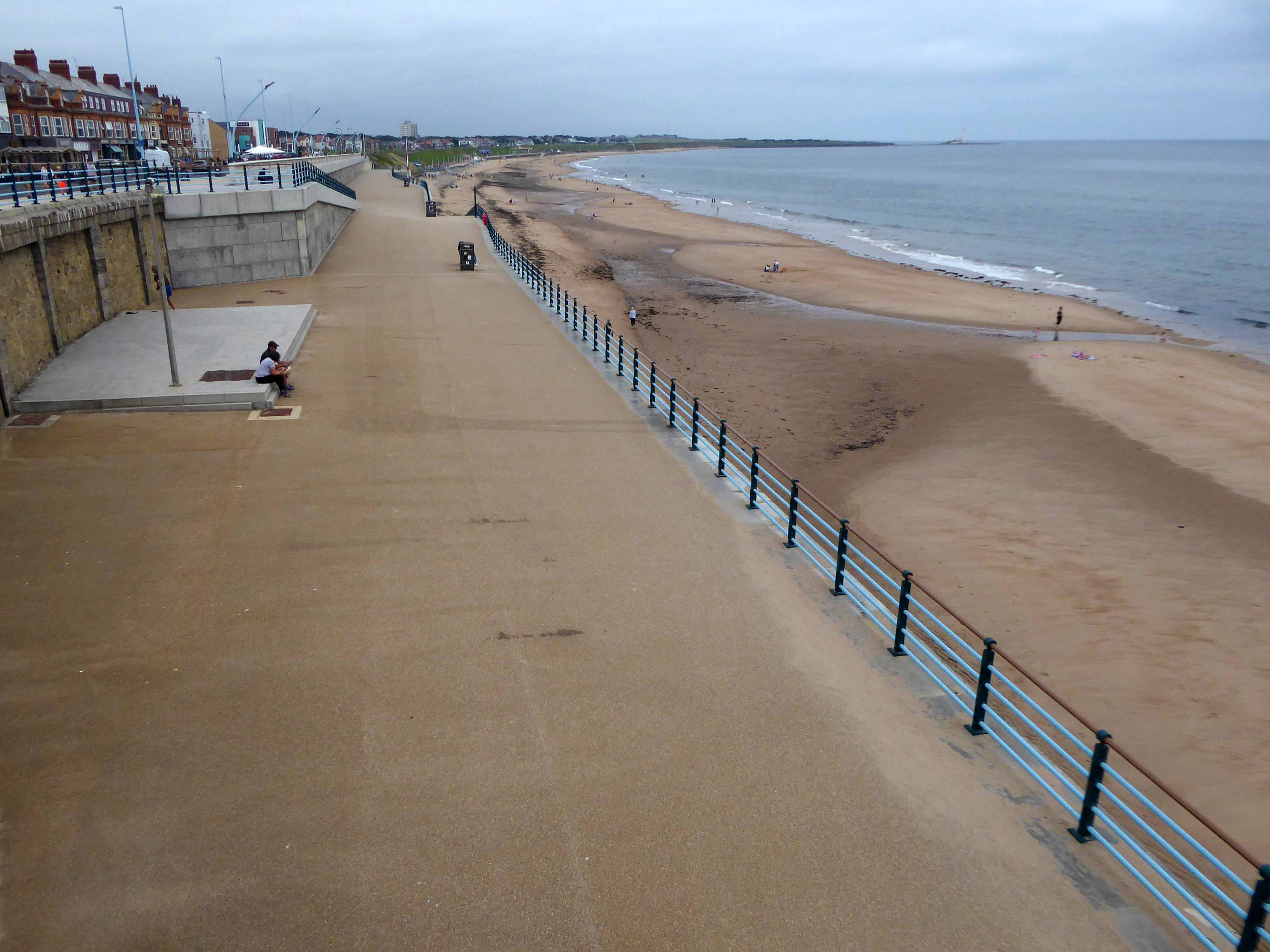
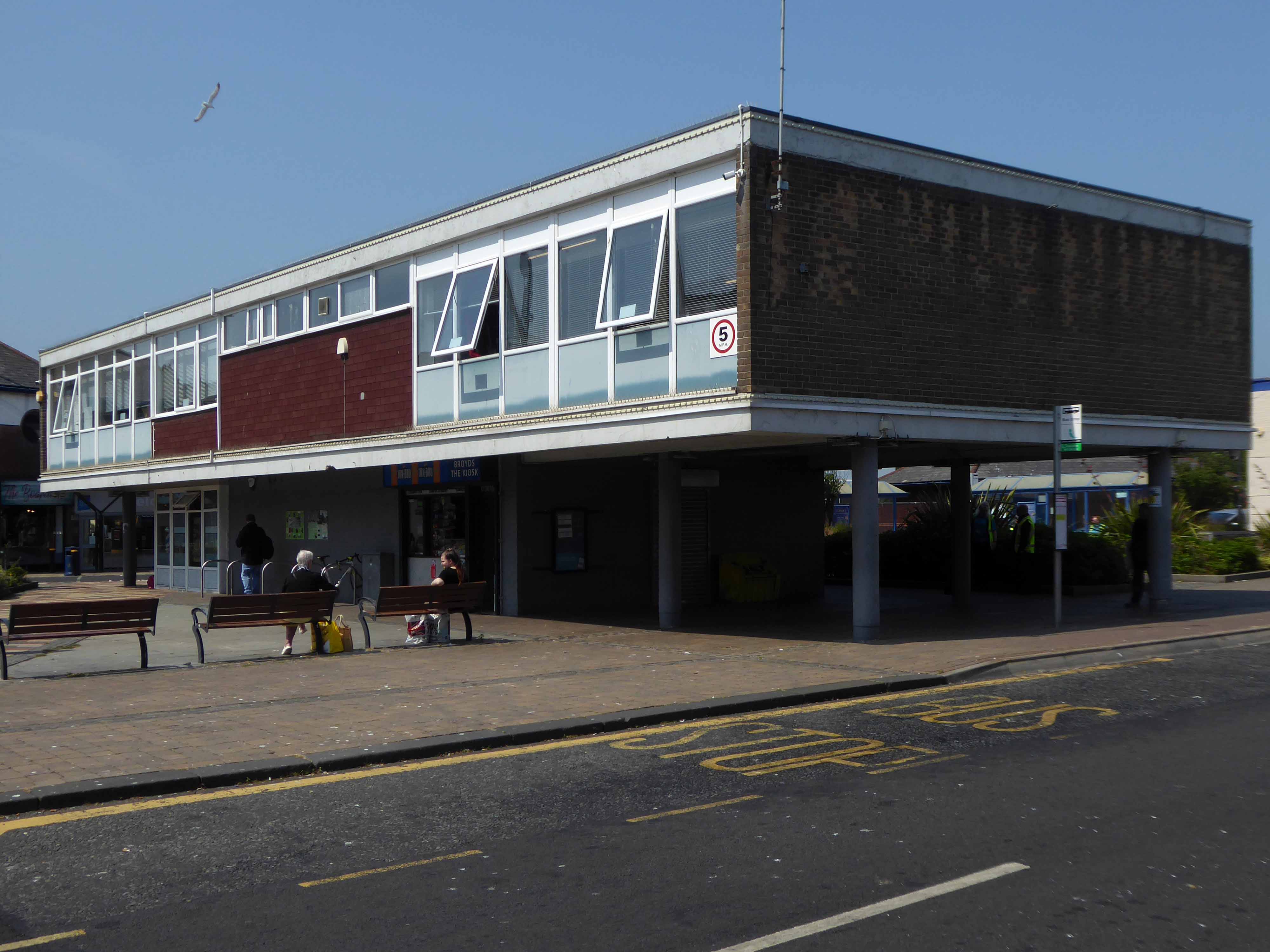
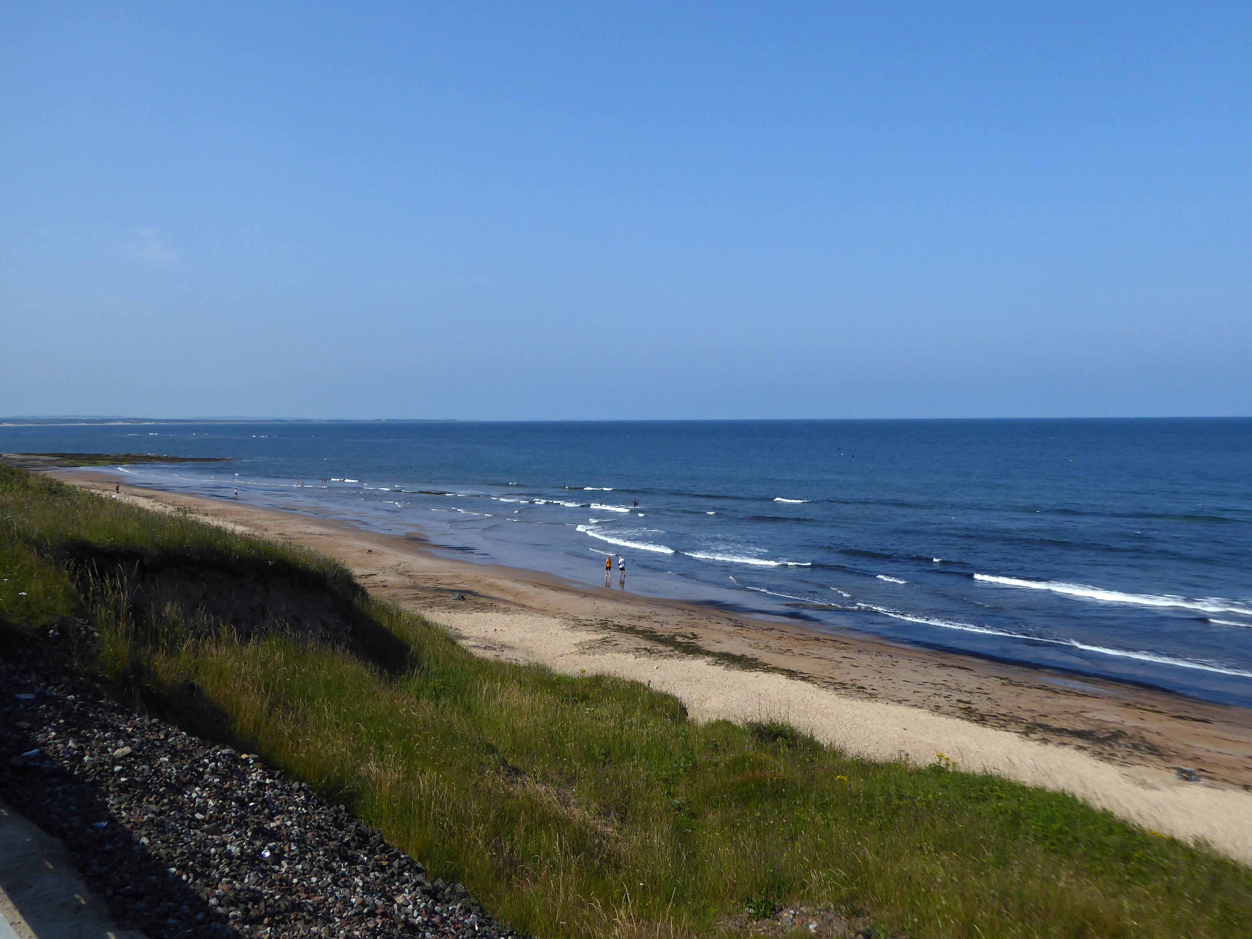
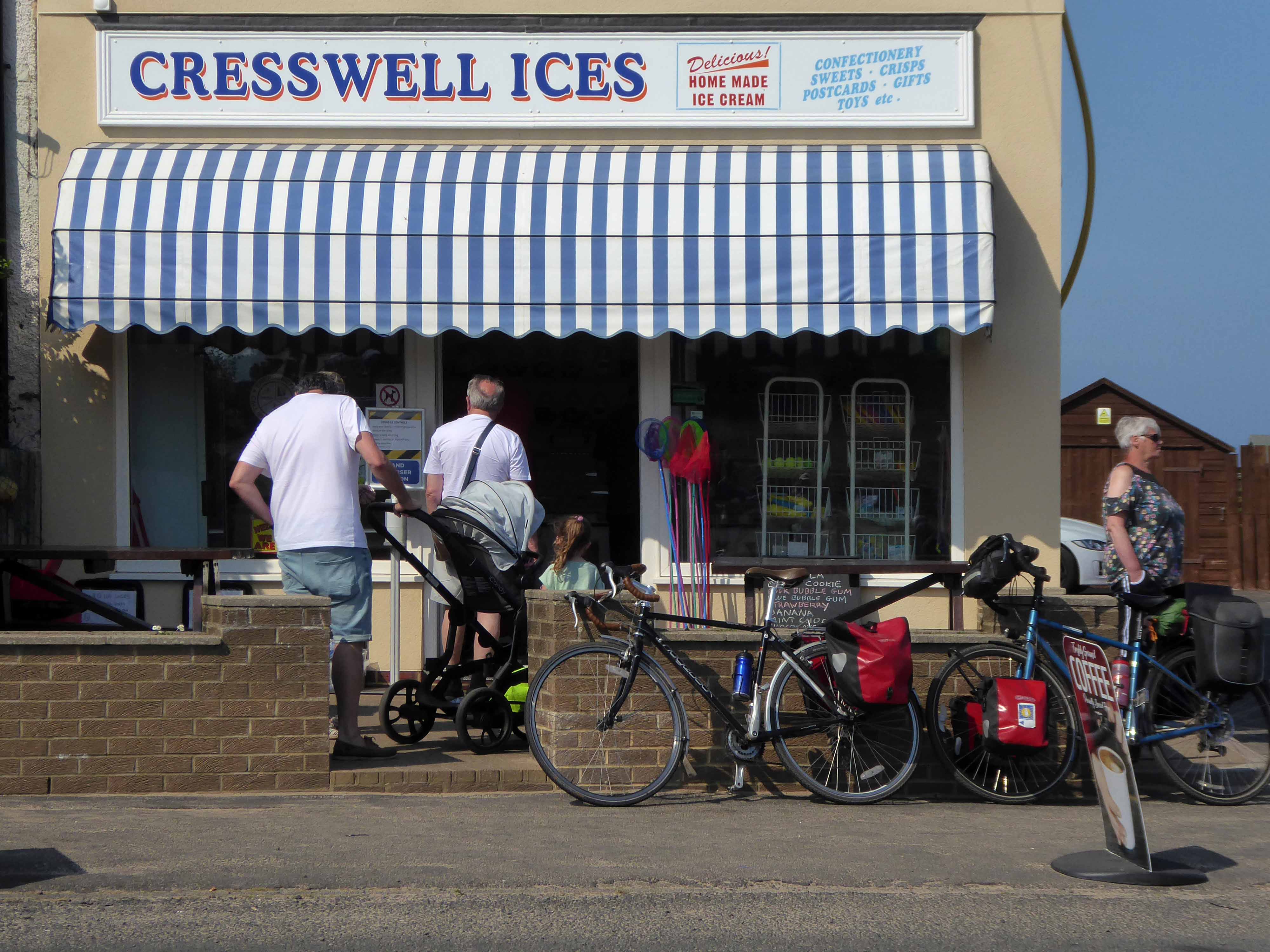
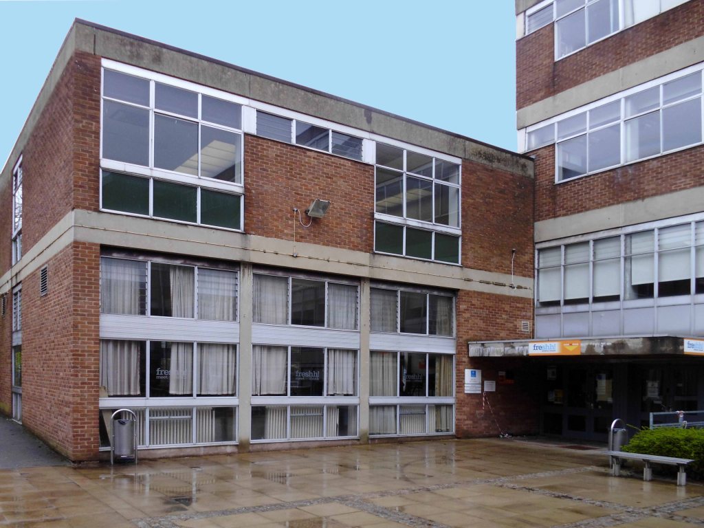
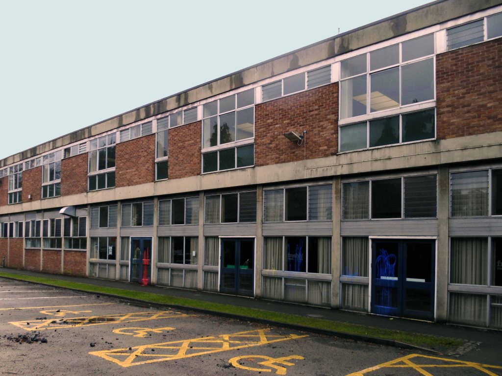
The city quickly becomes the seaside with its attendant retail bricolage.
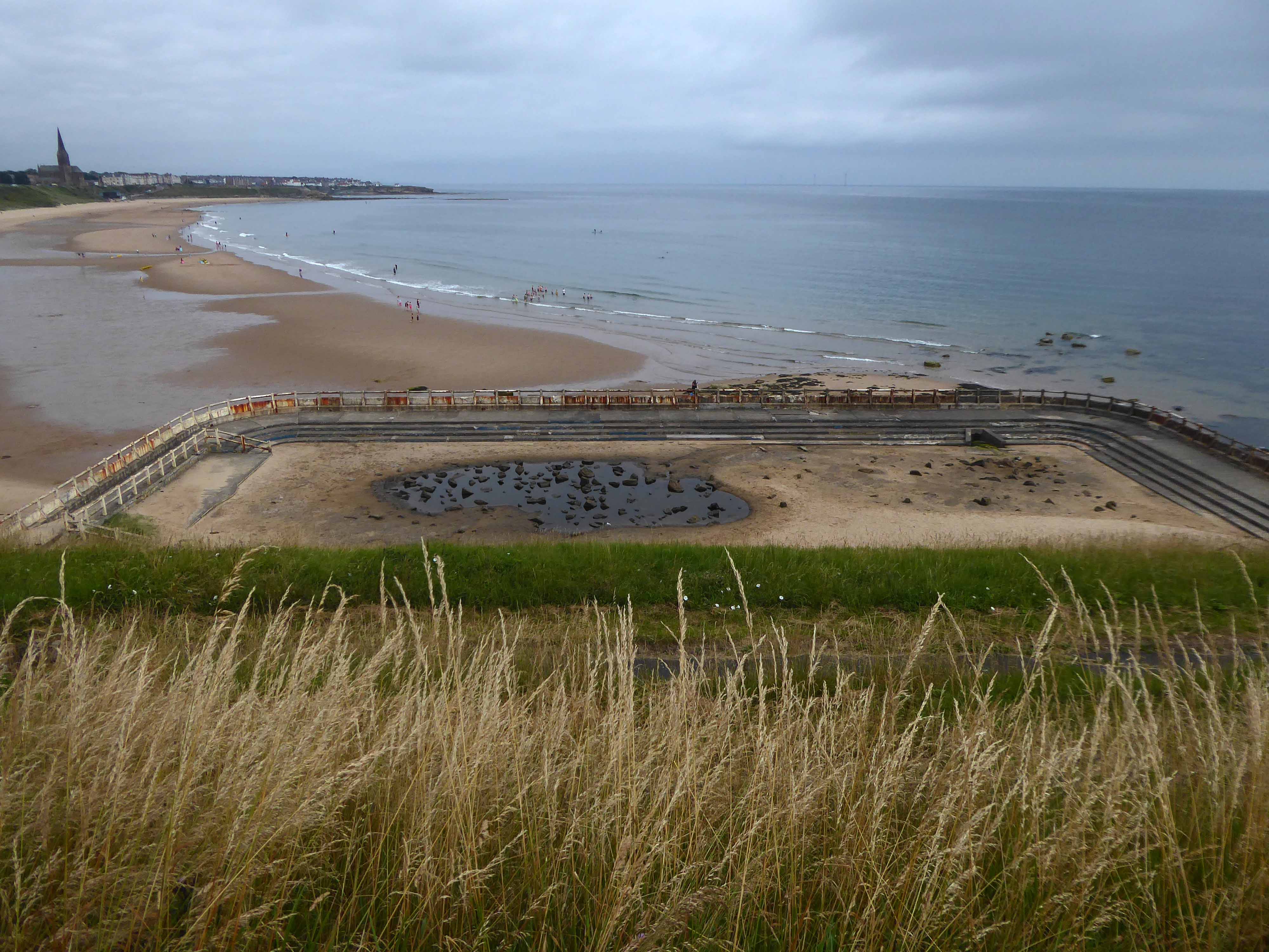
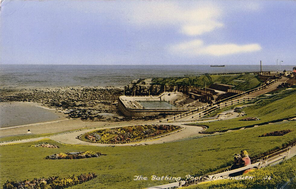
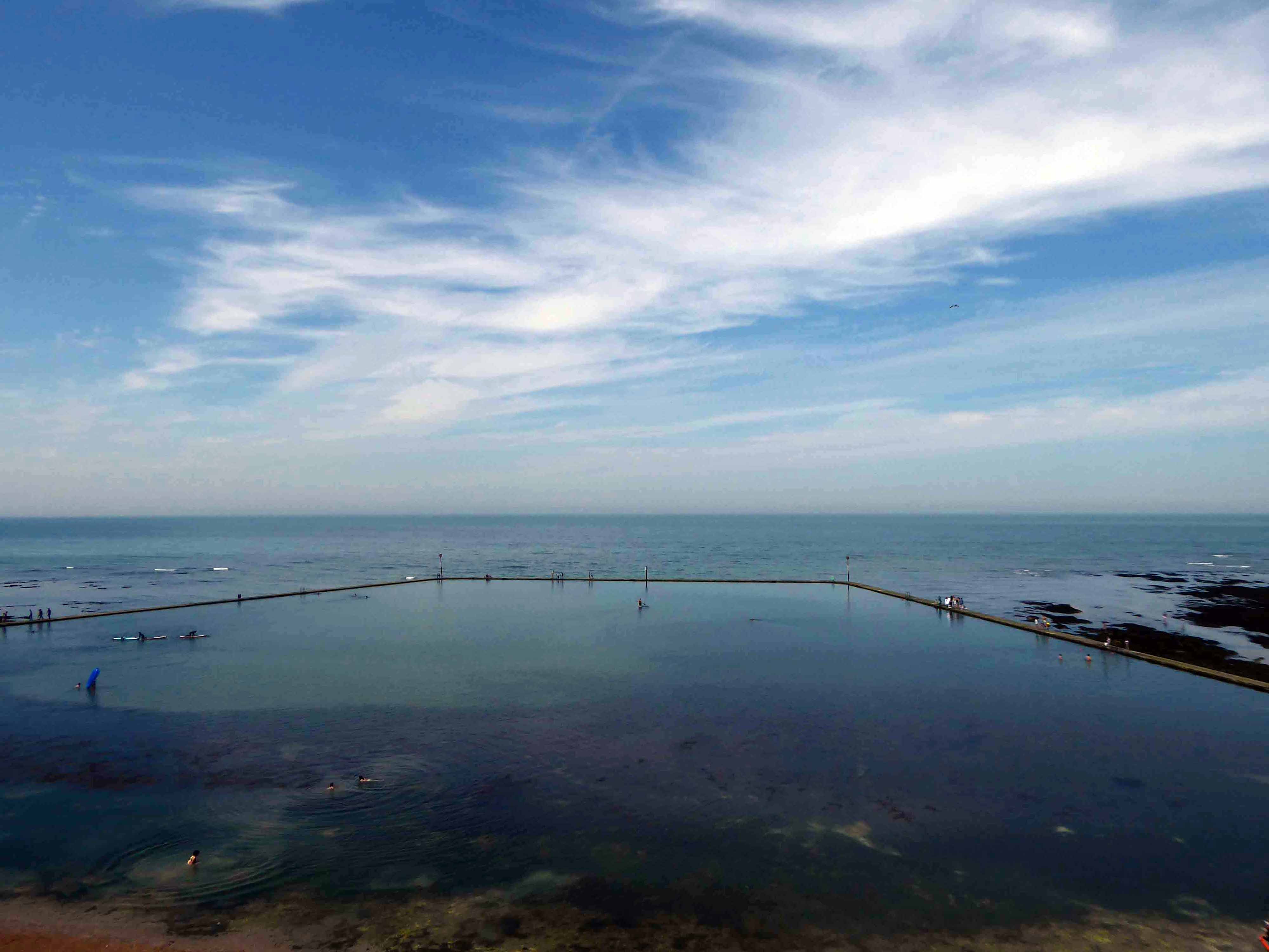
An all too familiar redundant Lido – opened in 1925 and closed in the mid 90’s – but a Friends Group aims to breathe new life into the site.
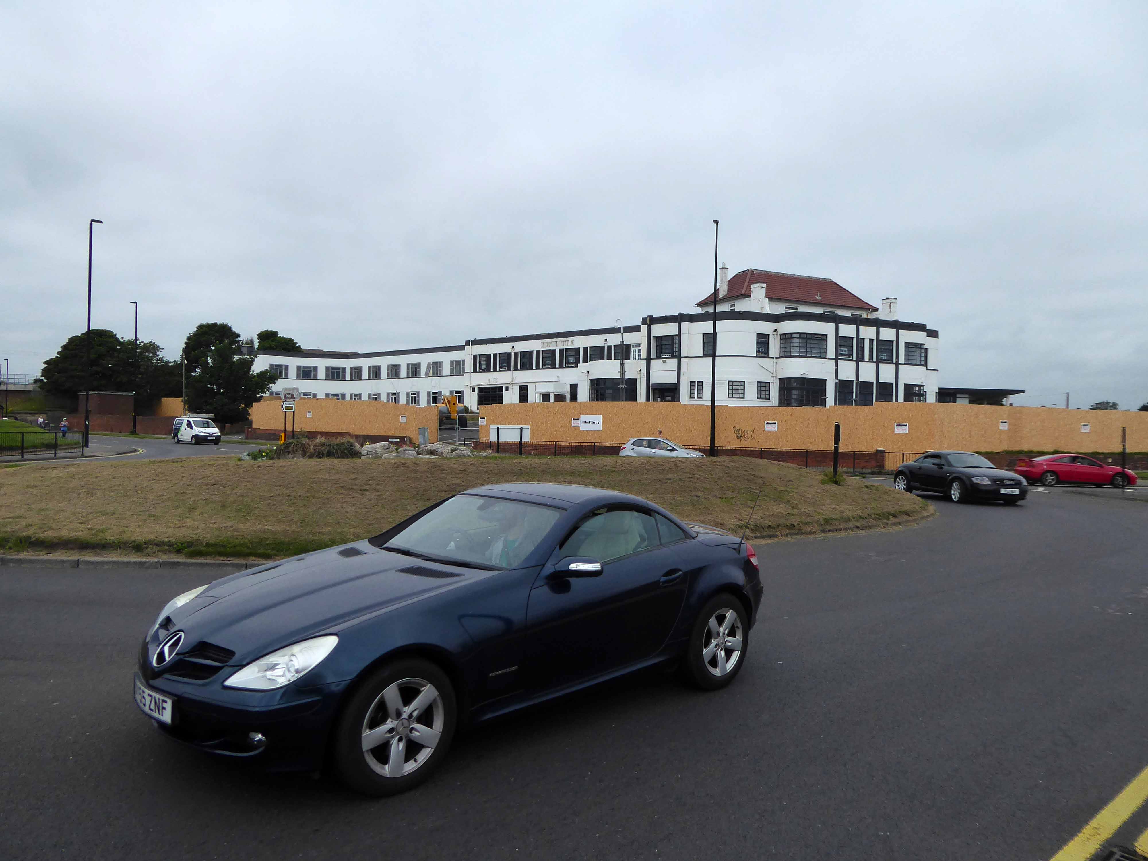
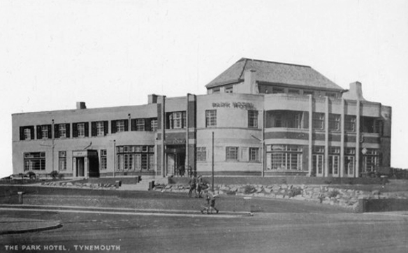
The Park Hotel built in the 1930’s and recently refurbished has been bought by The Inn Collection Group.
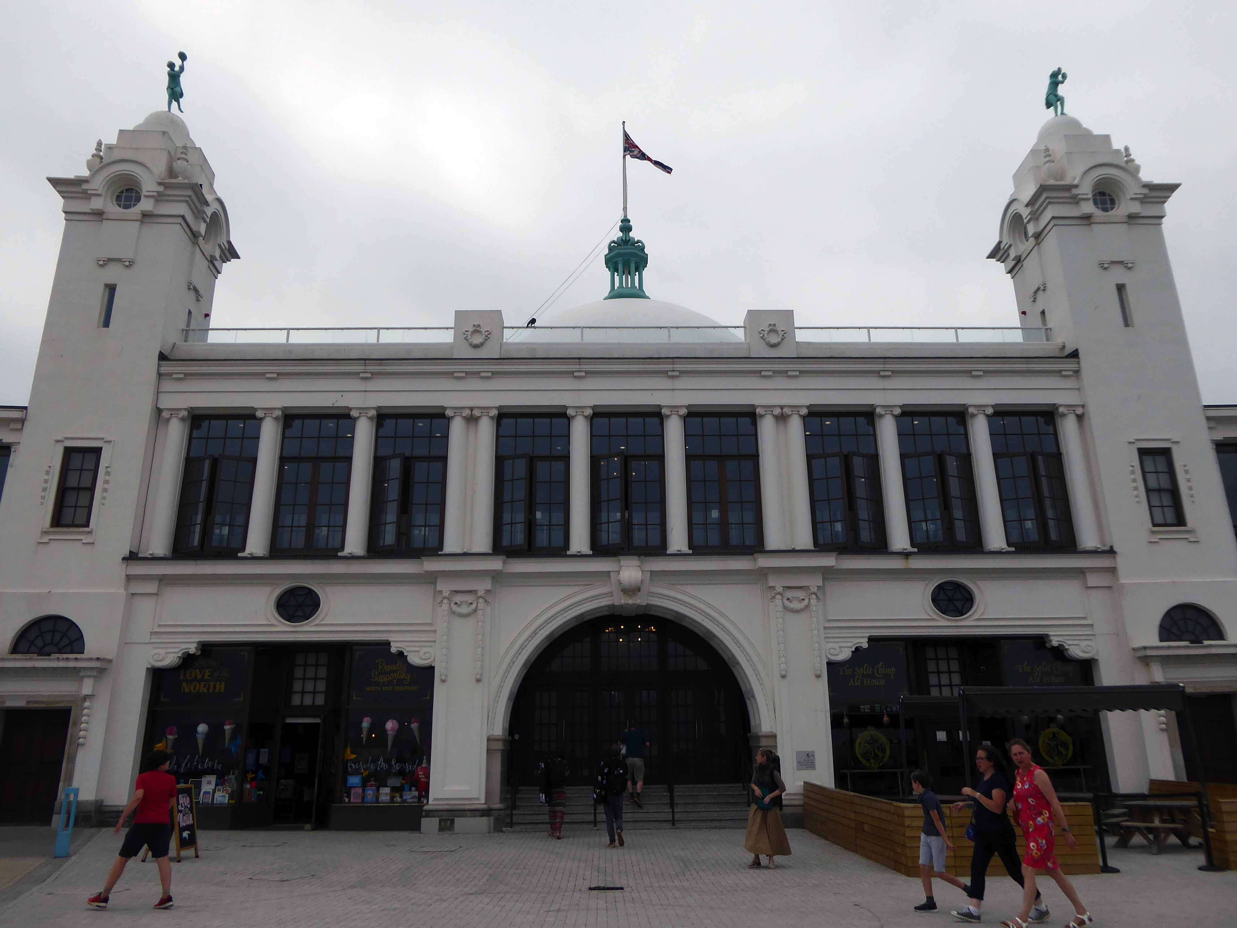
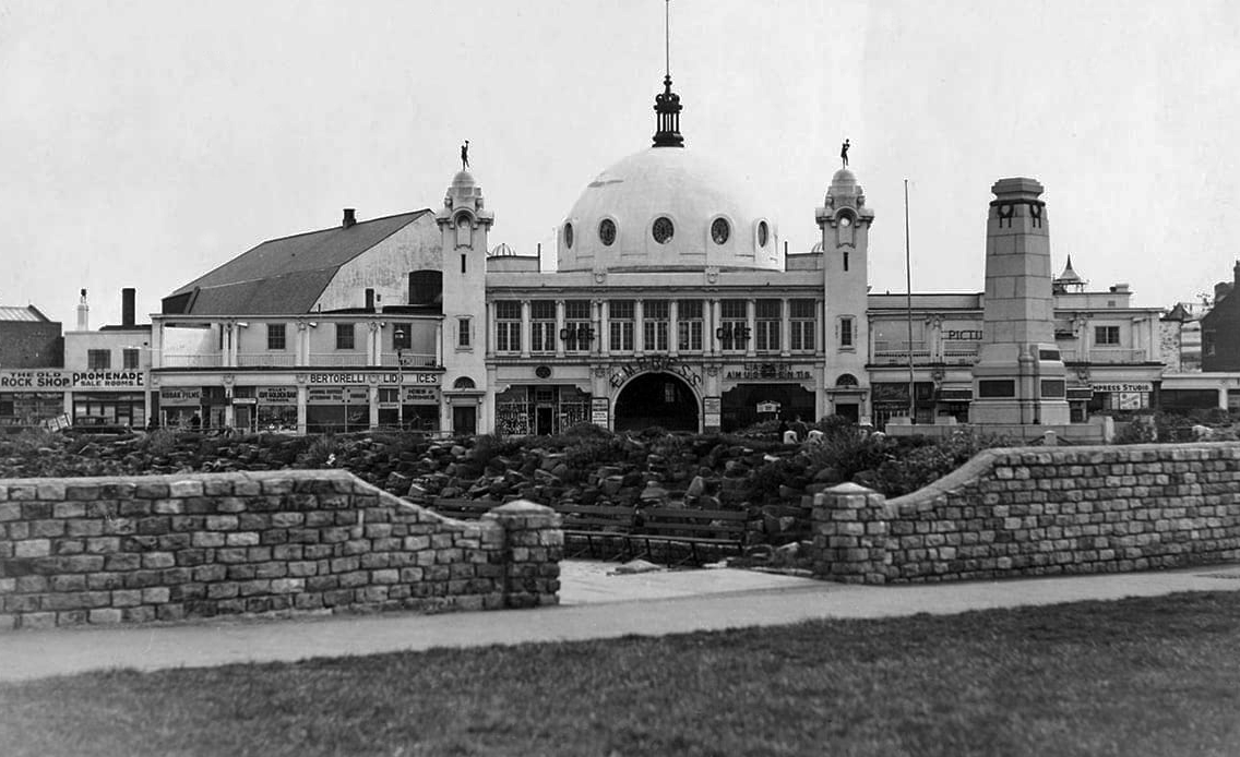
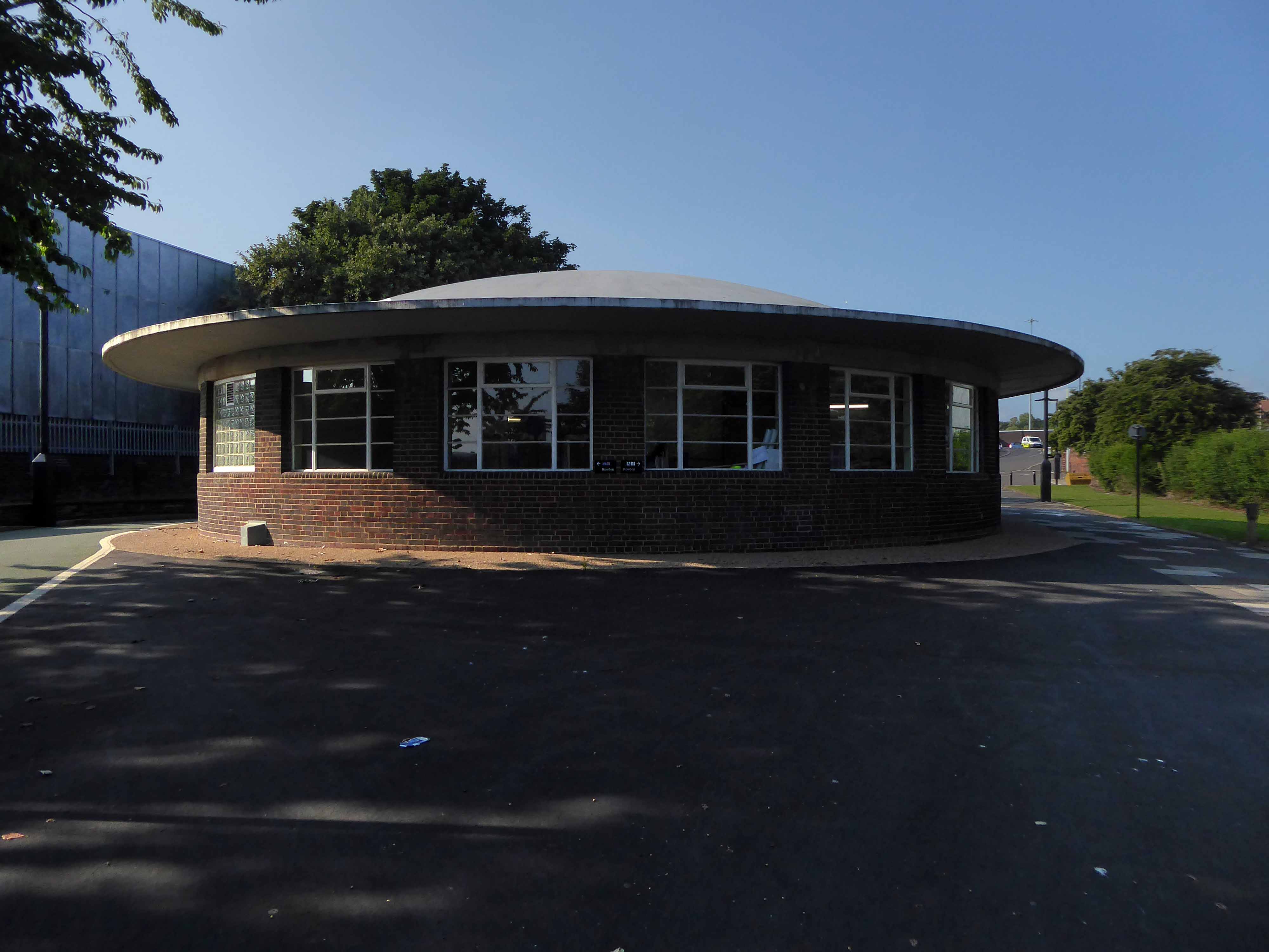
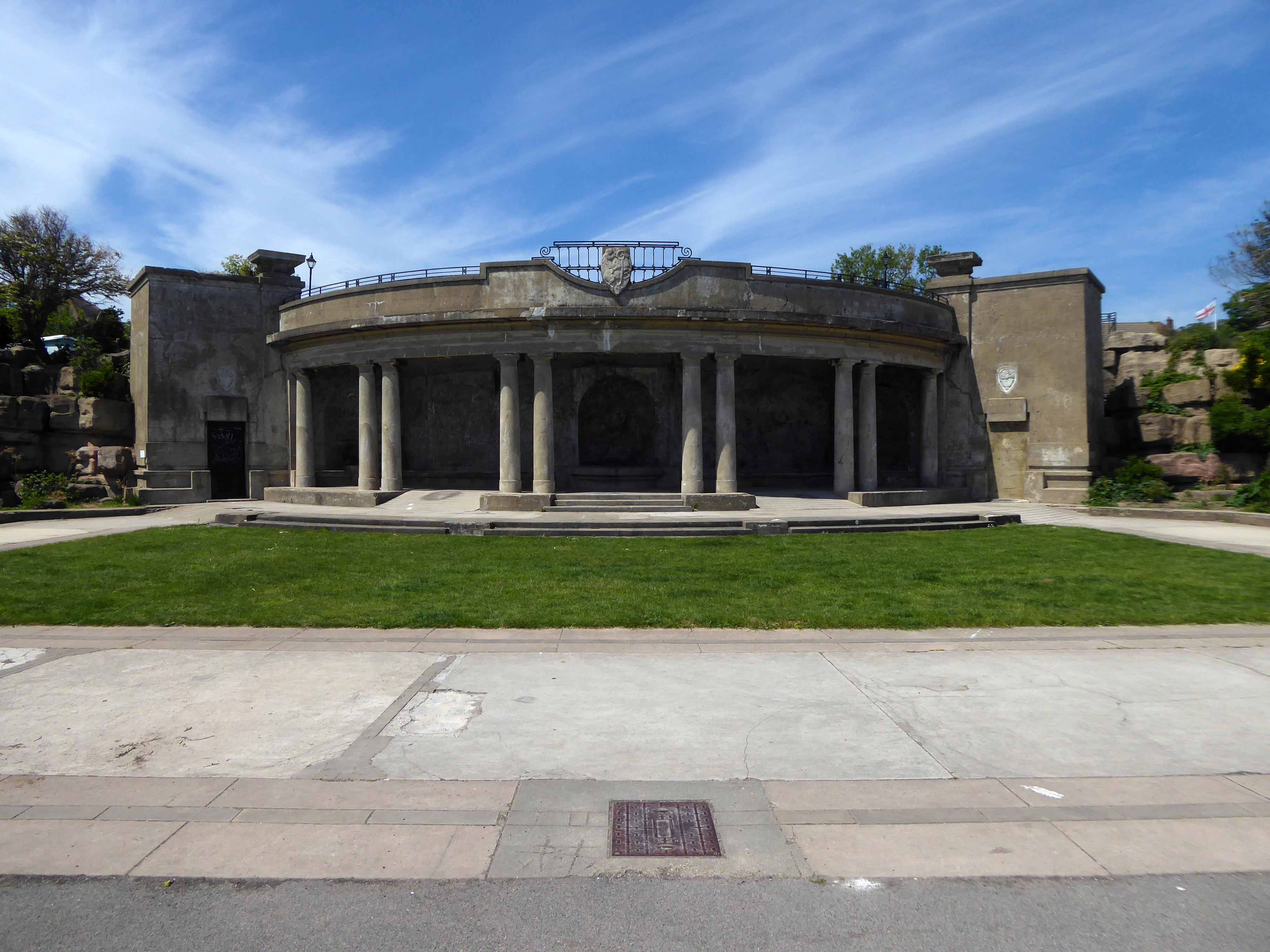
A simple three-arched entrance had been built facing the seafront and the area was now completely enclosed within a boundary. In 1909, large rides appeared, including a Figure Eight rollercoaster and a Water Chute. Elderton and Fail wanted to make a statement and create a new, grand entrance to the fairground. They hired the Newcastle architects Cackett& Burns Dick to survey the site and begin drawing up plans for new Pleasure Buildings.
Building began in February 1910 and the construction was completed by builders Davidson and Miller 60 days later. The use of the revolutionary reinforced concrete technique pioneered by Francois Hennebique was perfect for the job, being cheap and fast. The Dome and surrounding buildings – a theatre and two wings of shop units – opened on 14 May 1910 to great fanfare. Visitors marvelled at the great Spanish City Dome, the second largest in the country at the time after St. Paul’s Cathedral in London, which provided a spectacular meeting place with uninterrupted views from ground level to its ceiling, 75 feet above.
Telegraph-wire cyclists, acrobatic comedians, singing jockeys, mermaids, they all appeared at the Spanish City during its first decade. One of the wings hosted the menagerie, where visitors could see hyenas, antelopes and tigers! This was converted into the Picture House cinema in 1916.
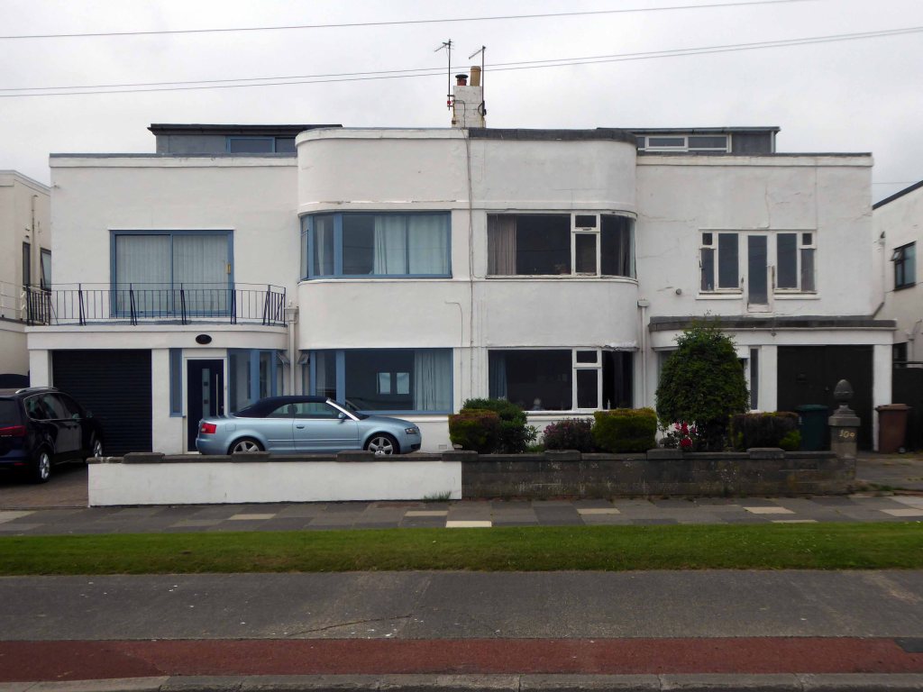
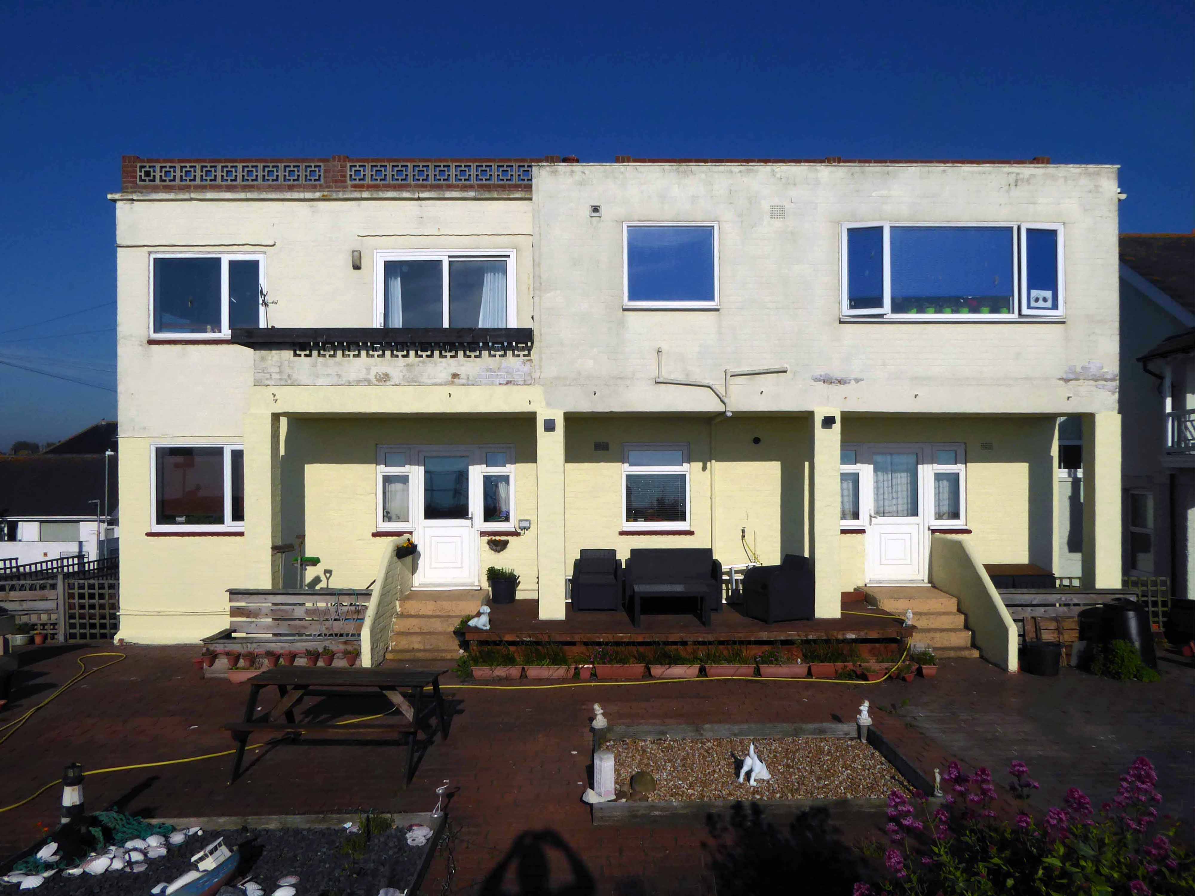
A little further along, a selection of Seaside Moderne semis in various states of amendment and alteration.
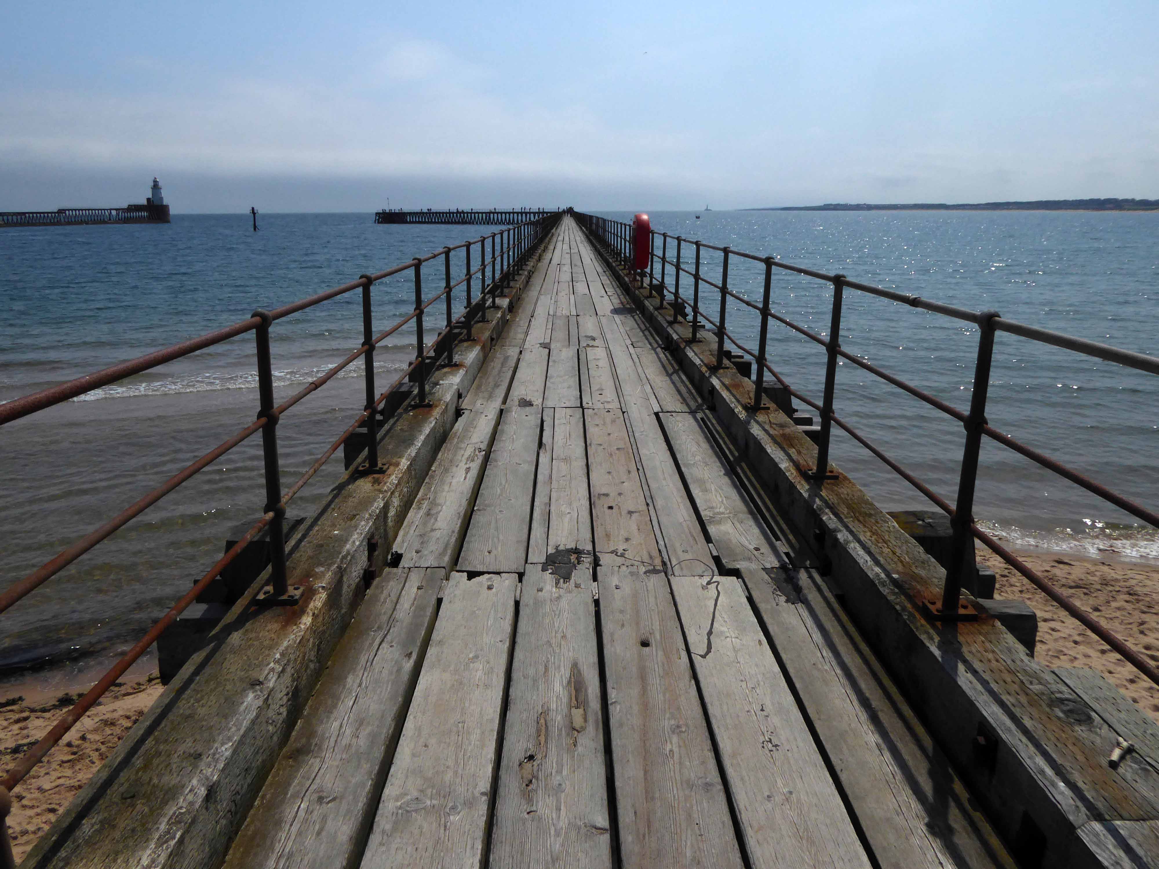
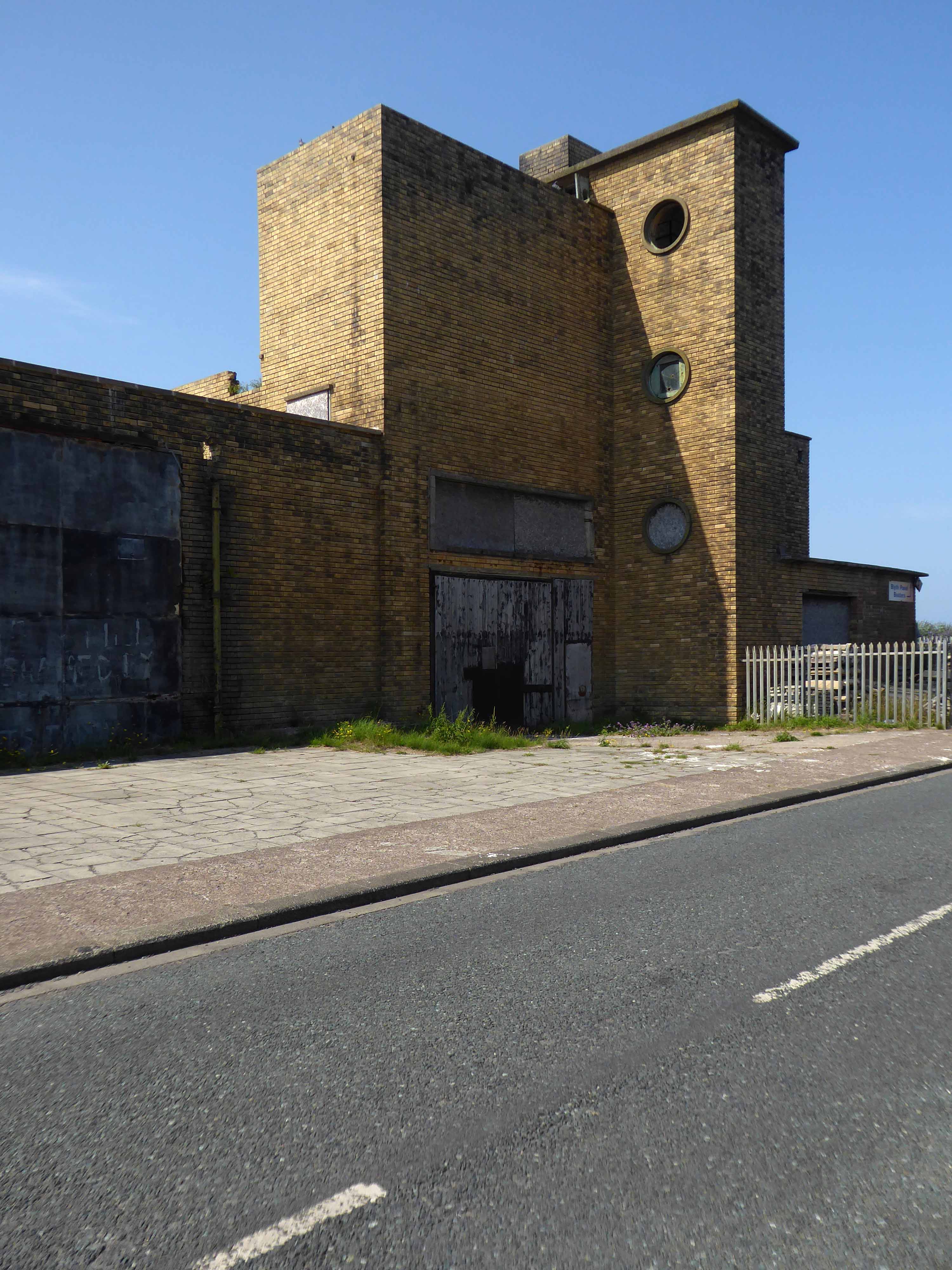
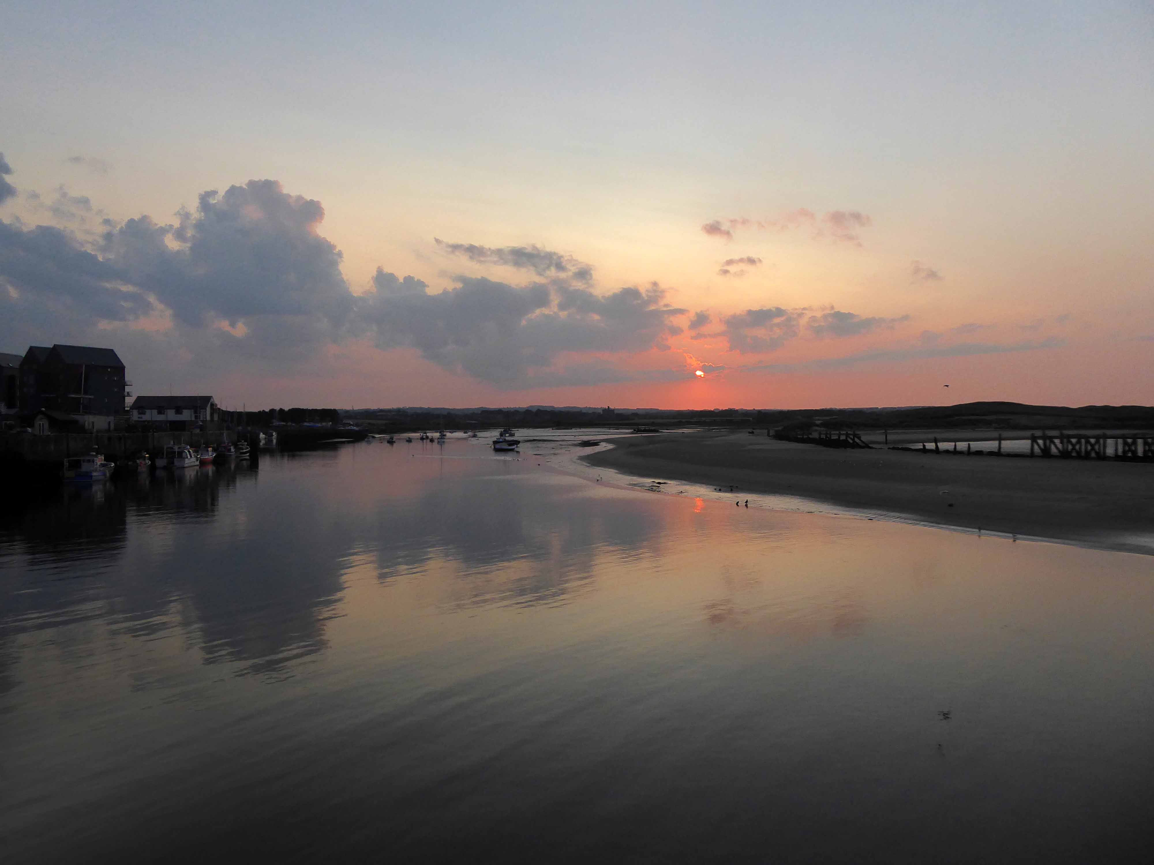
Before I knew it I was in Blyth.
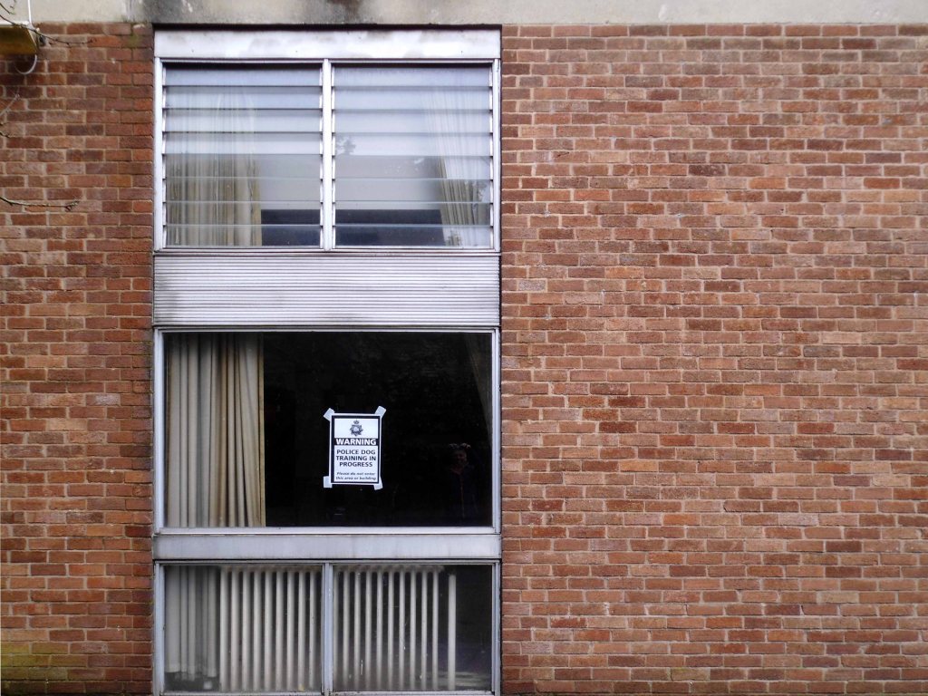
The town edged with military installations
Gloucester Lodge Battery includes the buried, earthwork and standing remains of a multi-phase Second World War heavy anti-aircraft gun battery and radar site, as well as a Cold War heavy anti-aircraft gun and radar site. The battery occupies a level pasture field retaining extensive rig and furrow cultivation.
During WW2 Blyth Harbour was used as a major submarine base and that combined with the heavy industry in the area it made a very good target for the Luftwaffe.
827 men of the 225th Antiaircraft Artillery Searchlight Battalion of the U.S. Army, arrived at this location in early March 1944 and were attached to the 30th British AAA Brigade. Here they sharpened their skills in the high-altitude tracking of aircraft.
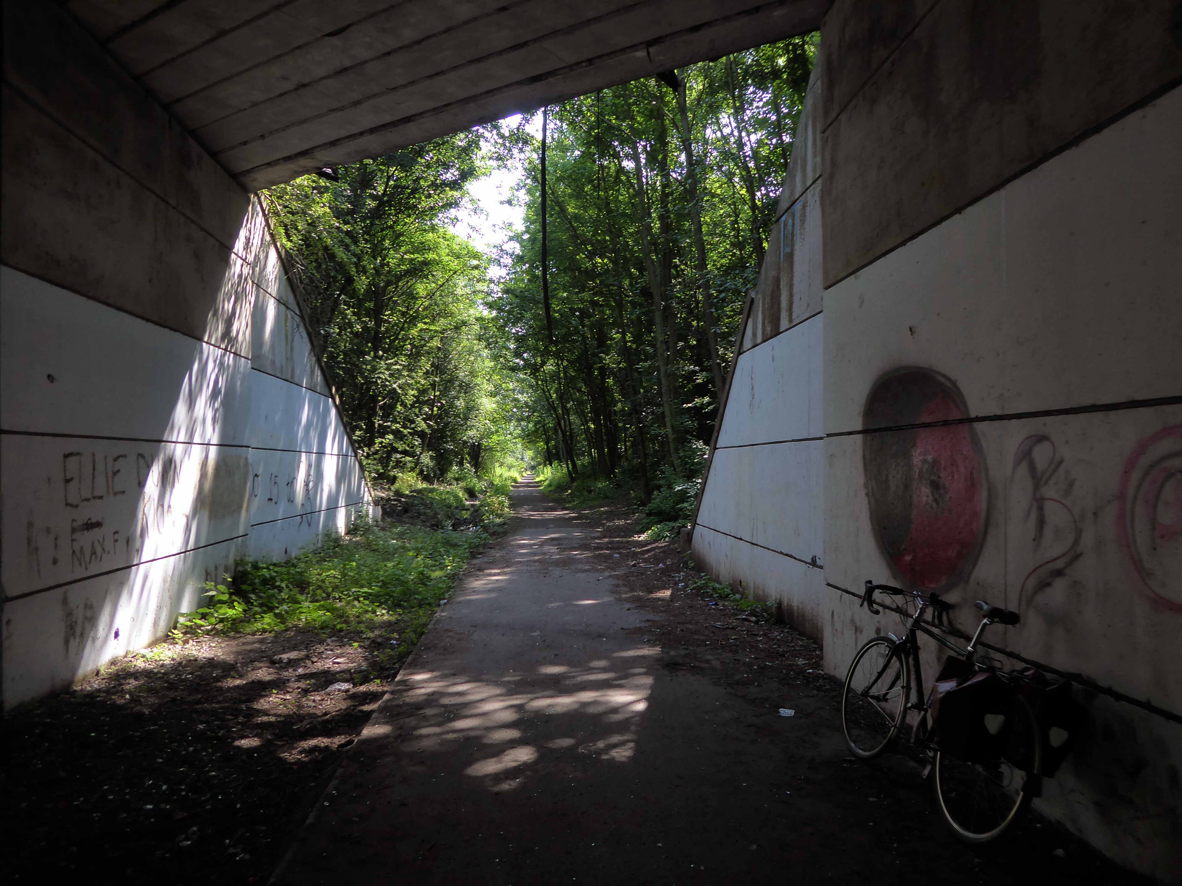
The cycle route took me off road along the estuary and under the flyover.
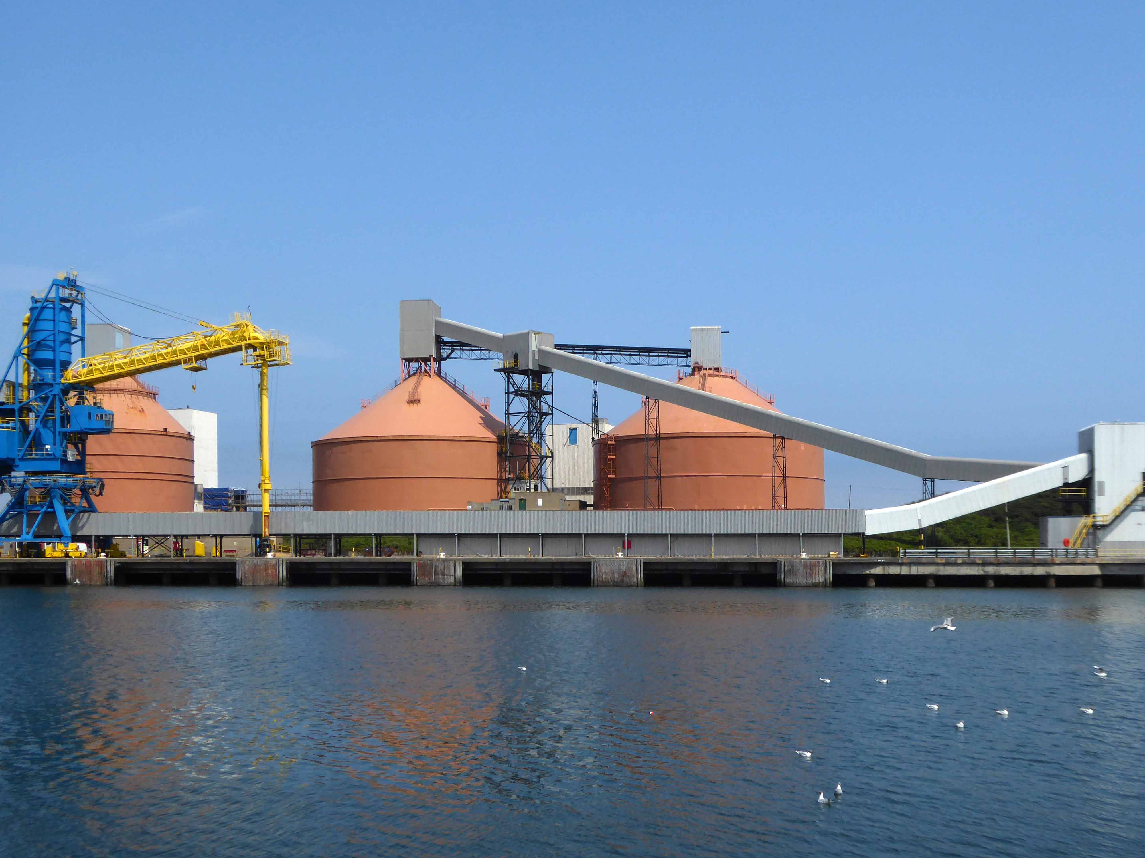
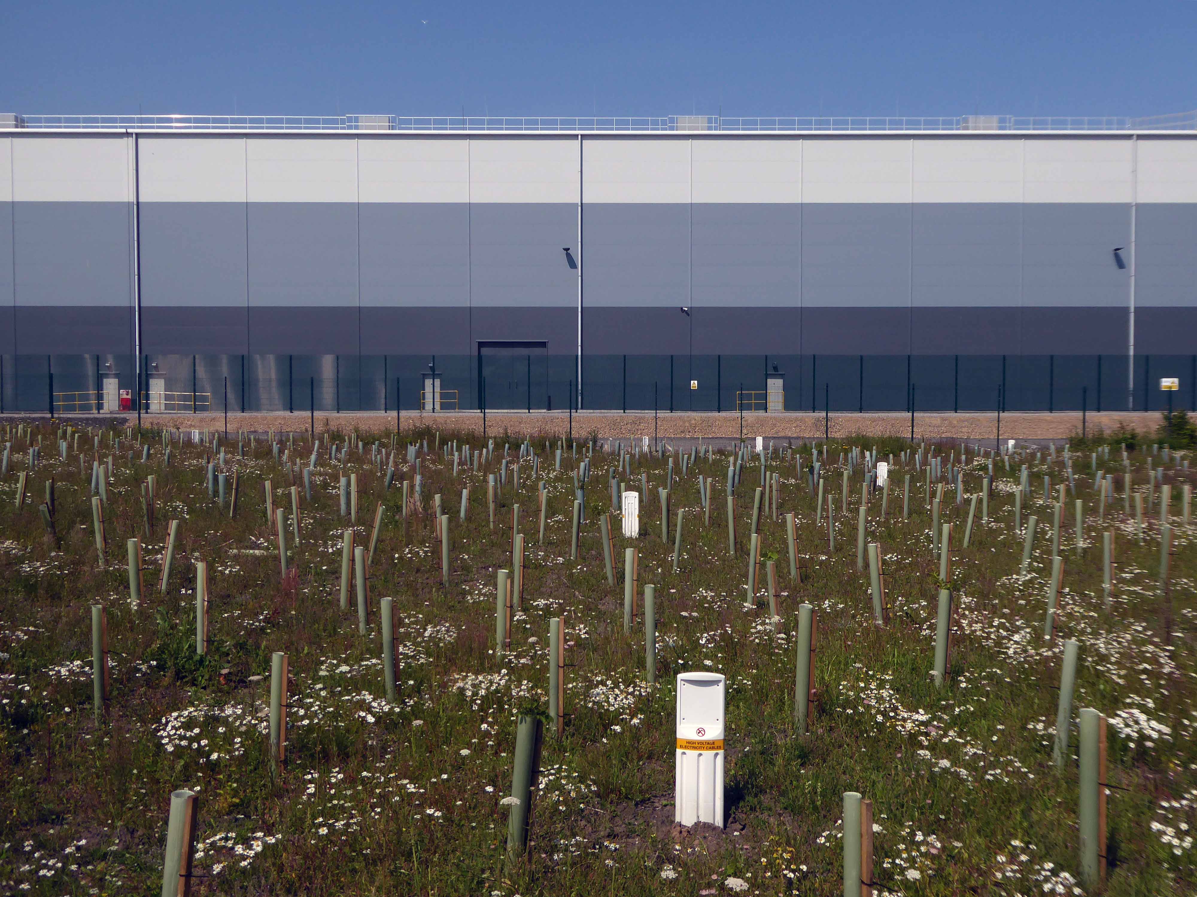
Encountering a brand new factory.
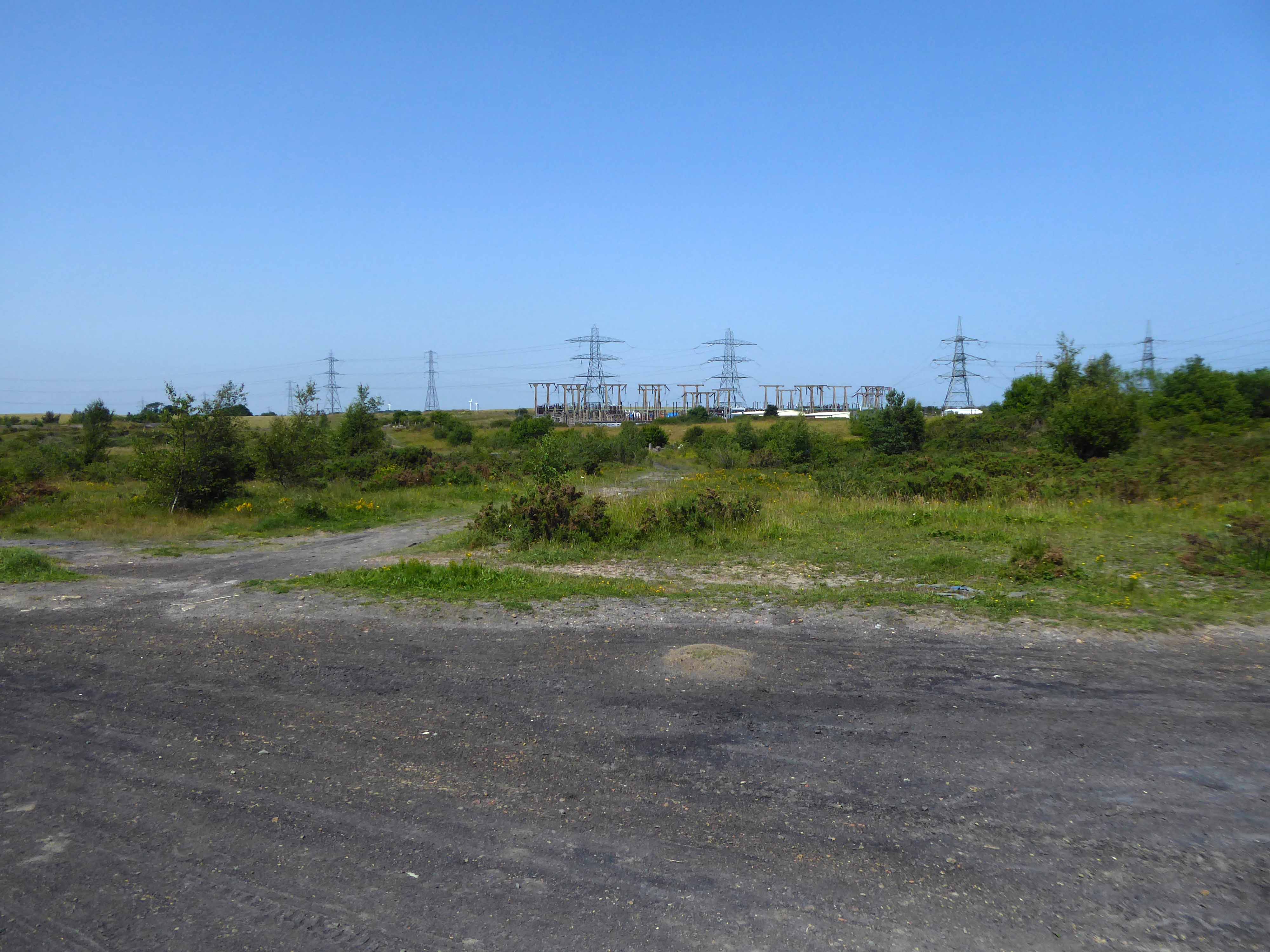
And the remnants of the old power station.
Blyth Power Station – also known as Cambois Power Station, refers to a pair of now demolished coal-fired power stationsThe two stations were built alongside each other on a site near Cambois in Northumberland, on the northern bank of the River Blyth, between its tidal estuary and the North Sea. The stations took their name from the town of Blyth on the opposite bank of the estuary. The power stations’ four large chimneys were a landmark of the Northumberland skyline for over 40 years.
After their closure in 2001, the stations were demolished over the course of two years, ending with the demolition of the stations’ chimneys on 7 December 2003.
UK battery tech investor Britishvolt has unveiled plans to build what is claimed to be Britain’s first gigaplant at the former coal-fired power station in Blyth in Northumberland.
The £2.6 billion project at the 95-hectare Blyth Power Station site will use renewable energy from the UK and possibly hydro-electric power generated in Norway and transmitted 447 miles under the North Sea through the ‘world’s longest inter-connector’ from the North Sea Link project.
By 2027, the firm estimates the gigaplant will be producing around 300,000 lithium-ion batteries a year.
The project is predicted to create 3,000 new jobs in the North East and another 5,000 in the wider supply chain.
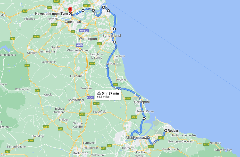
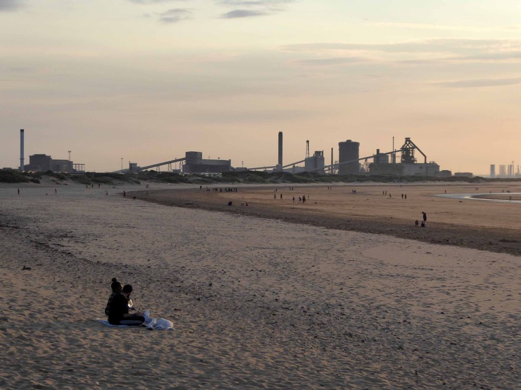
An early start on another sunny day, cycling along long straight roads out of town, towards Middlesborough.
Having previously visited Hull and Scarborough and all points in between.
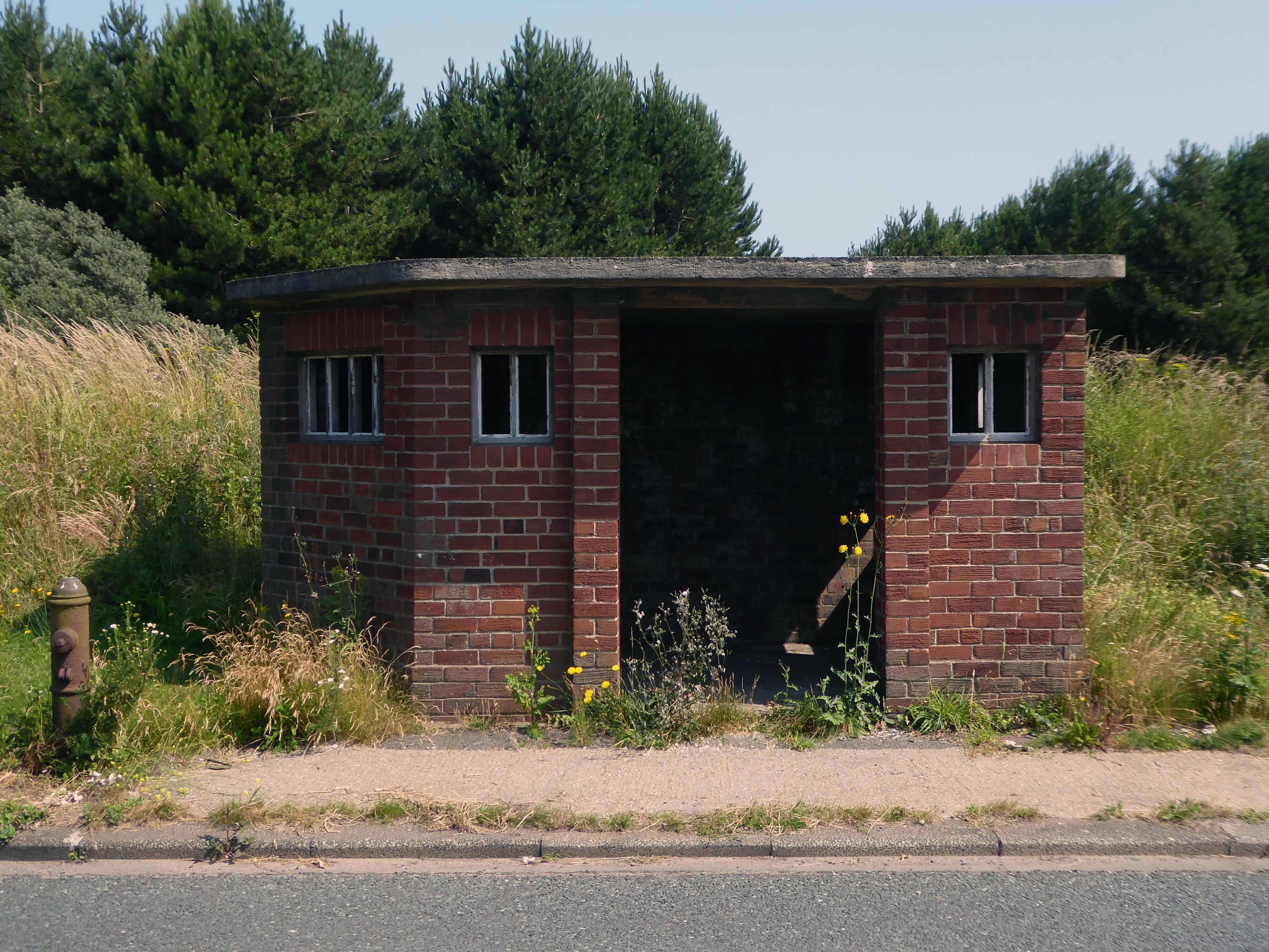
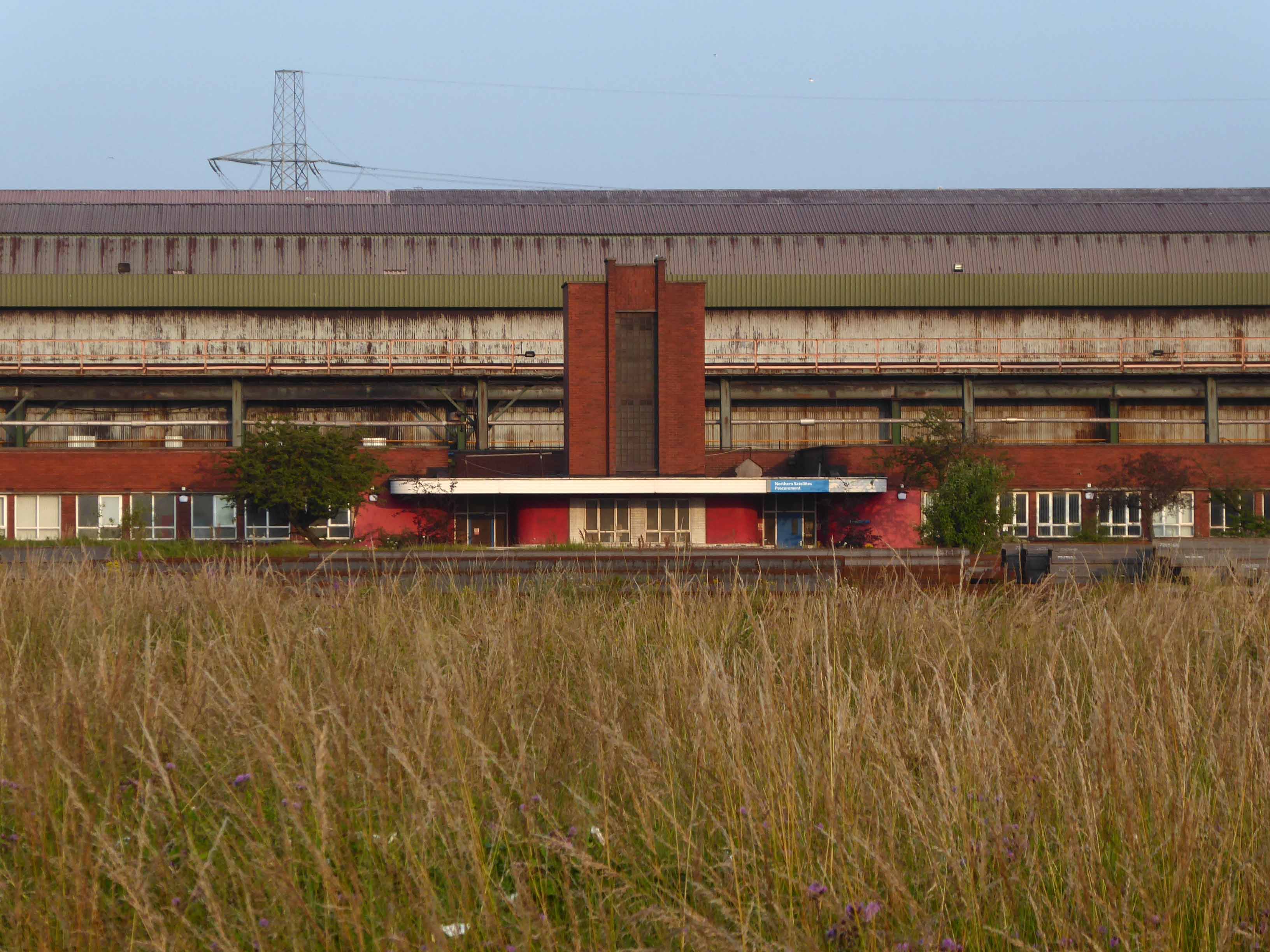
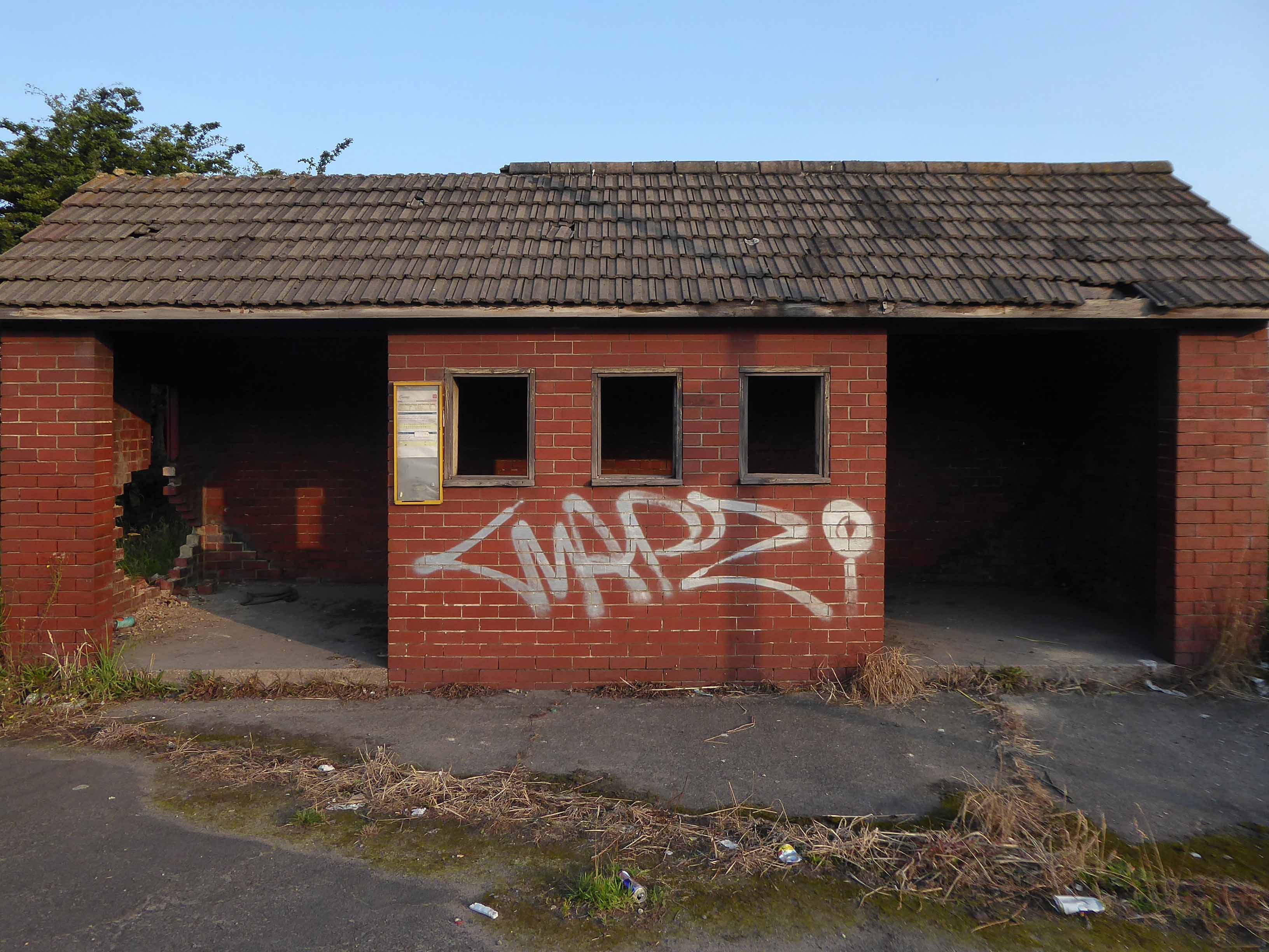
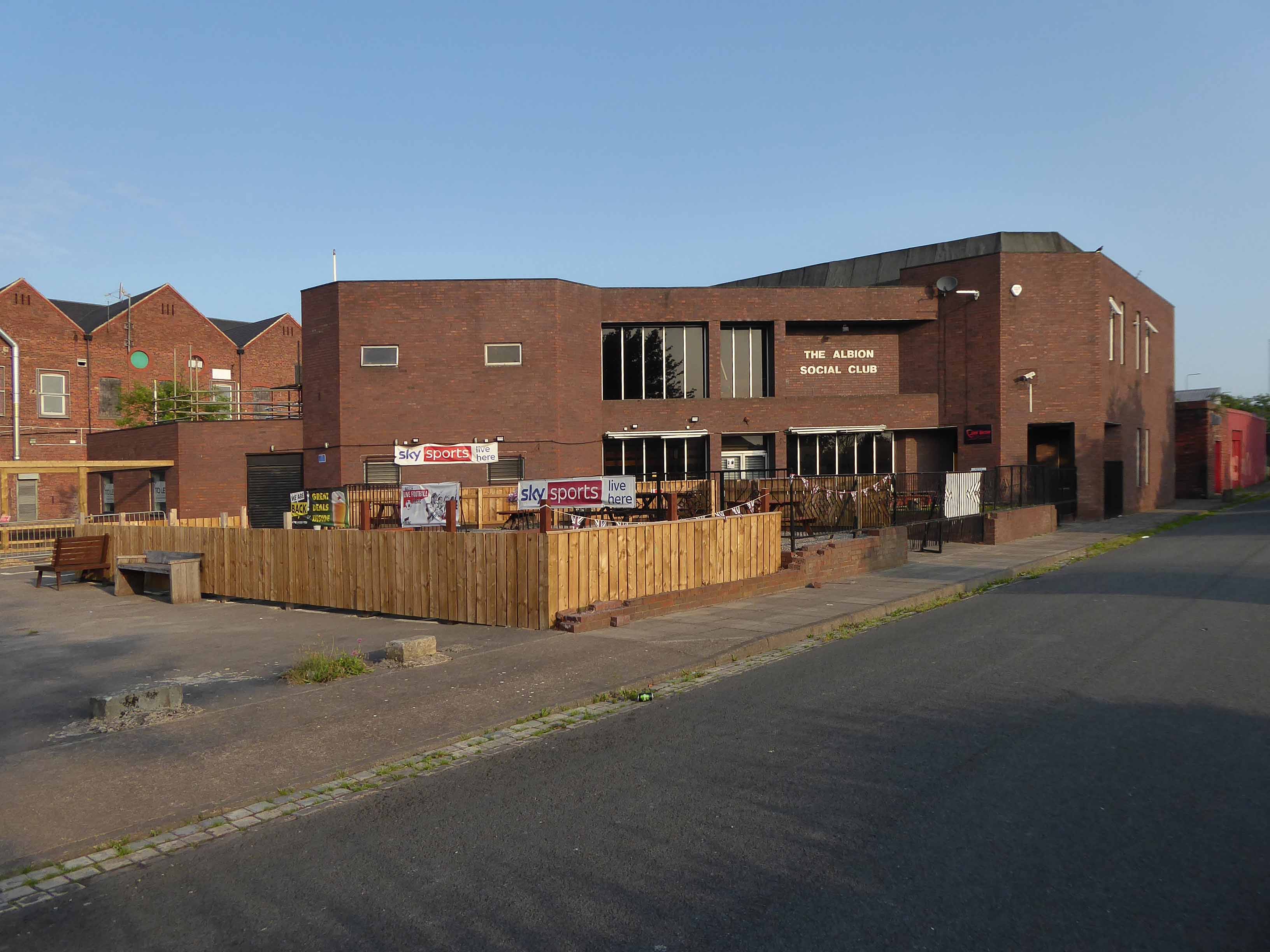
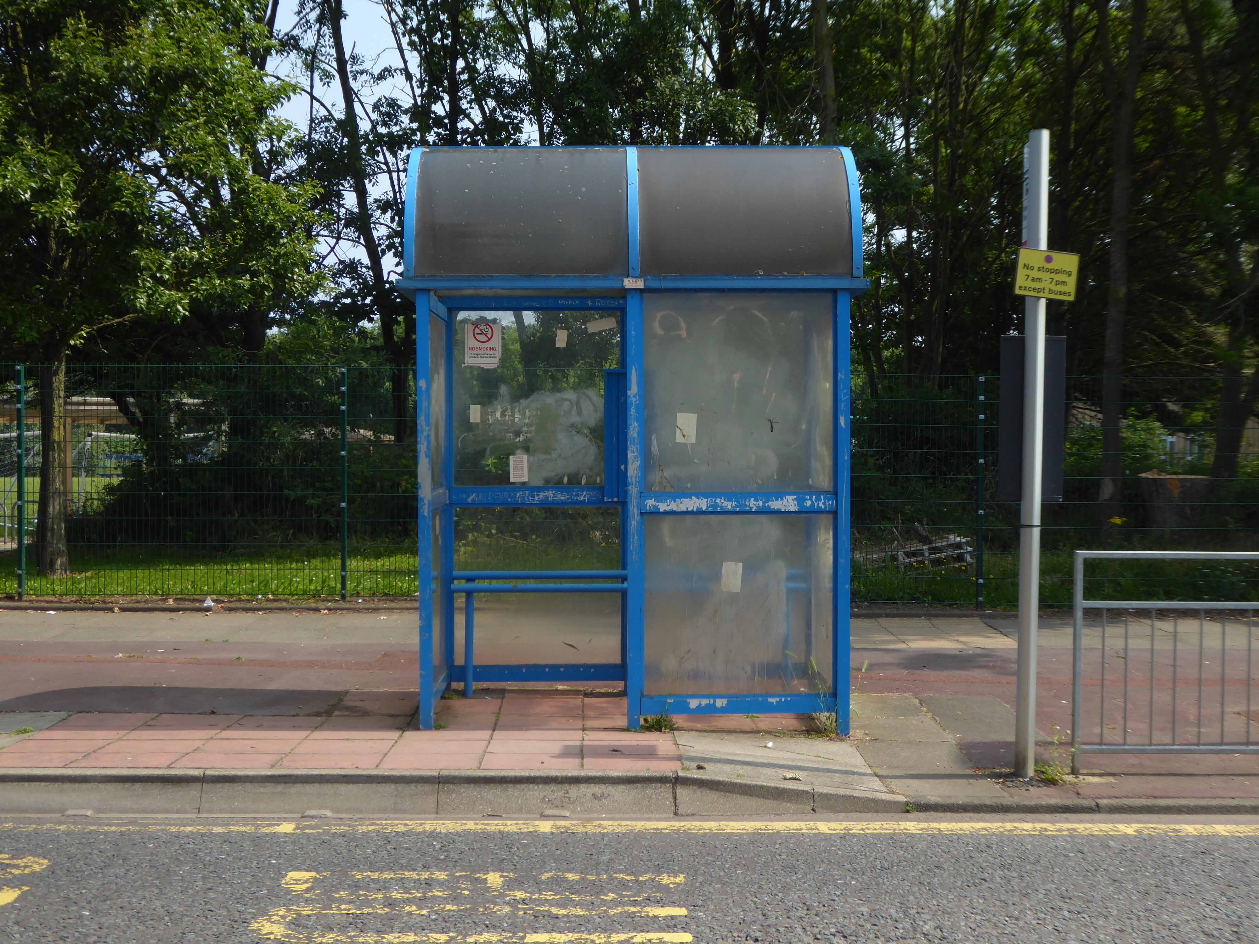
Slowly passing sleepy factories and desolate bus shelters.
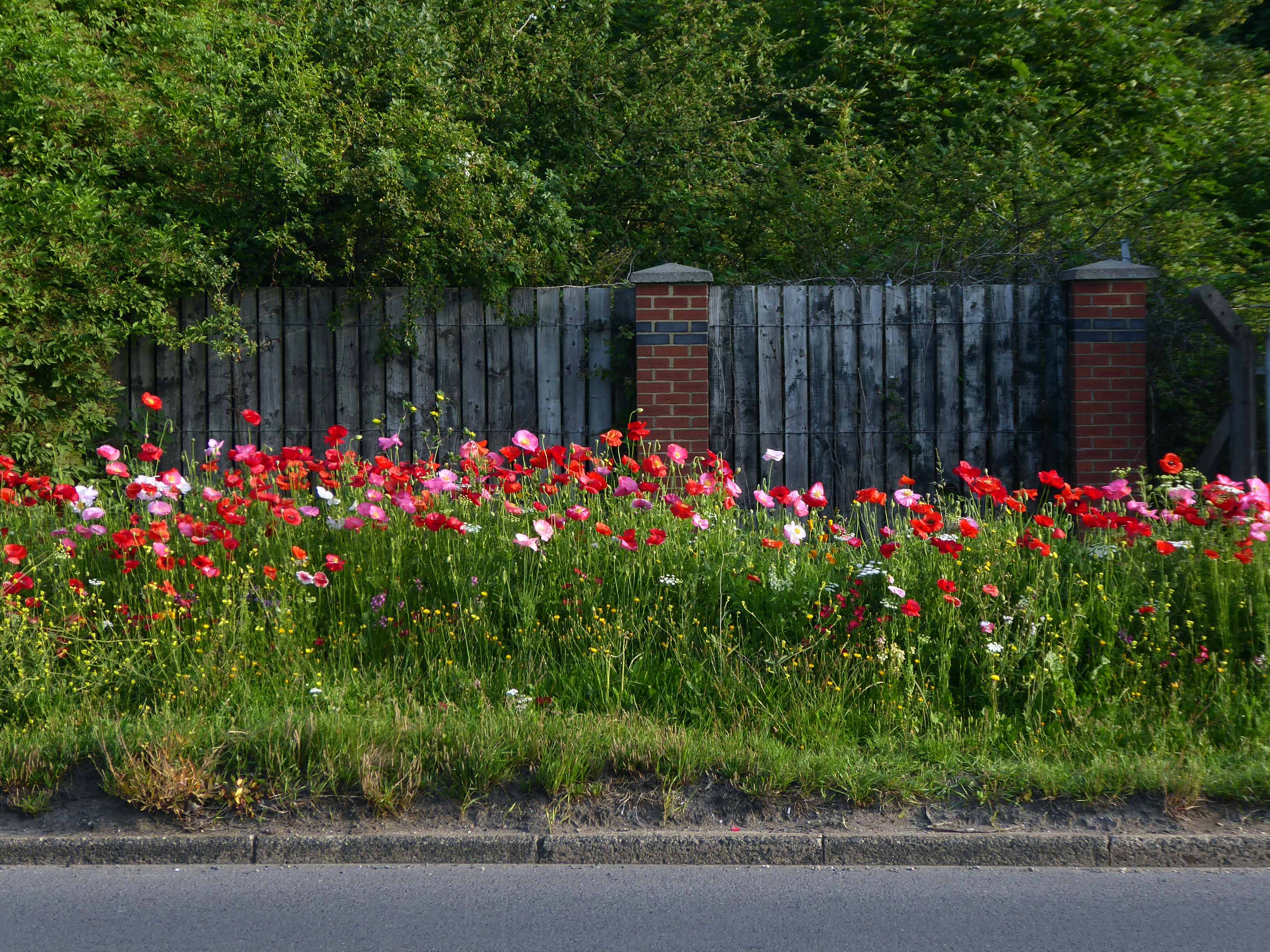
Bunker like social clubs and flower lined roads.
The Albion club in South Bank has stood empty for the last three years.
Now local lad Mark Trainor has the keys – and says opening the doors to the club his own family frequented for years will be a dream come true.
He’s planning to cater for everyone, he says, and it won’t just be all about drinking.
Parents will be able to call in for a coffee after dropping the kids at school, there will be pool nights and Mark’s personal favourite – Pie Day Fridays.
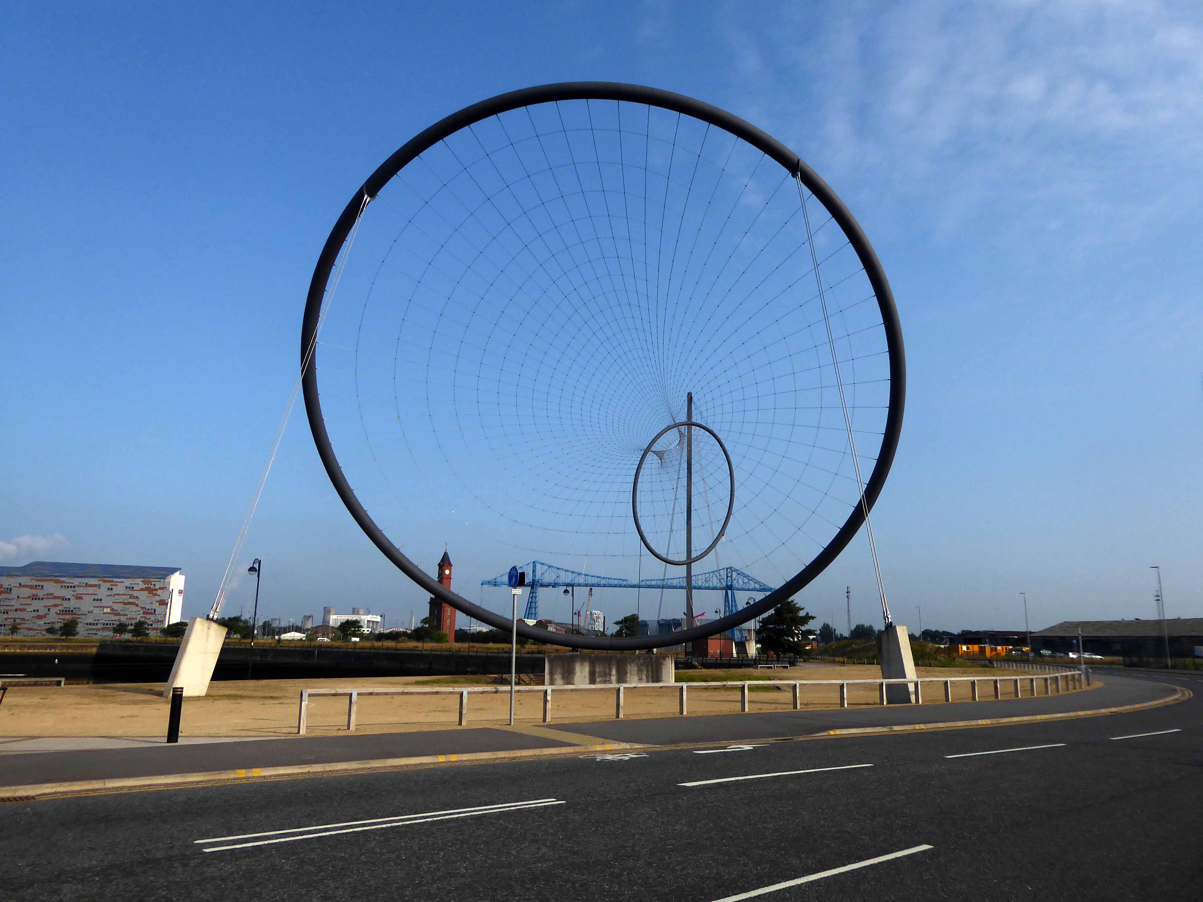
Temenos is a Greek word meaning land cut off and assigned as a sanctuary or holy area.
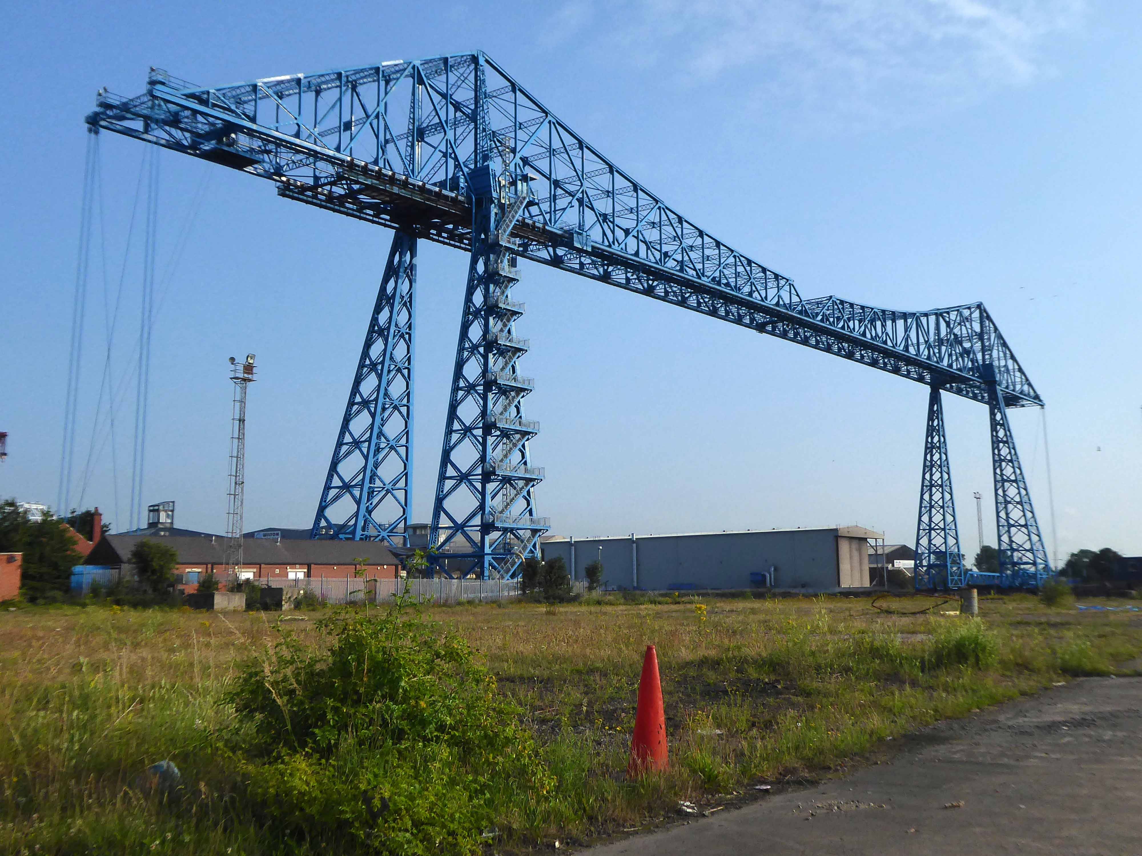
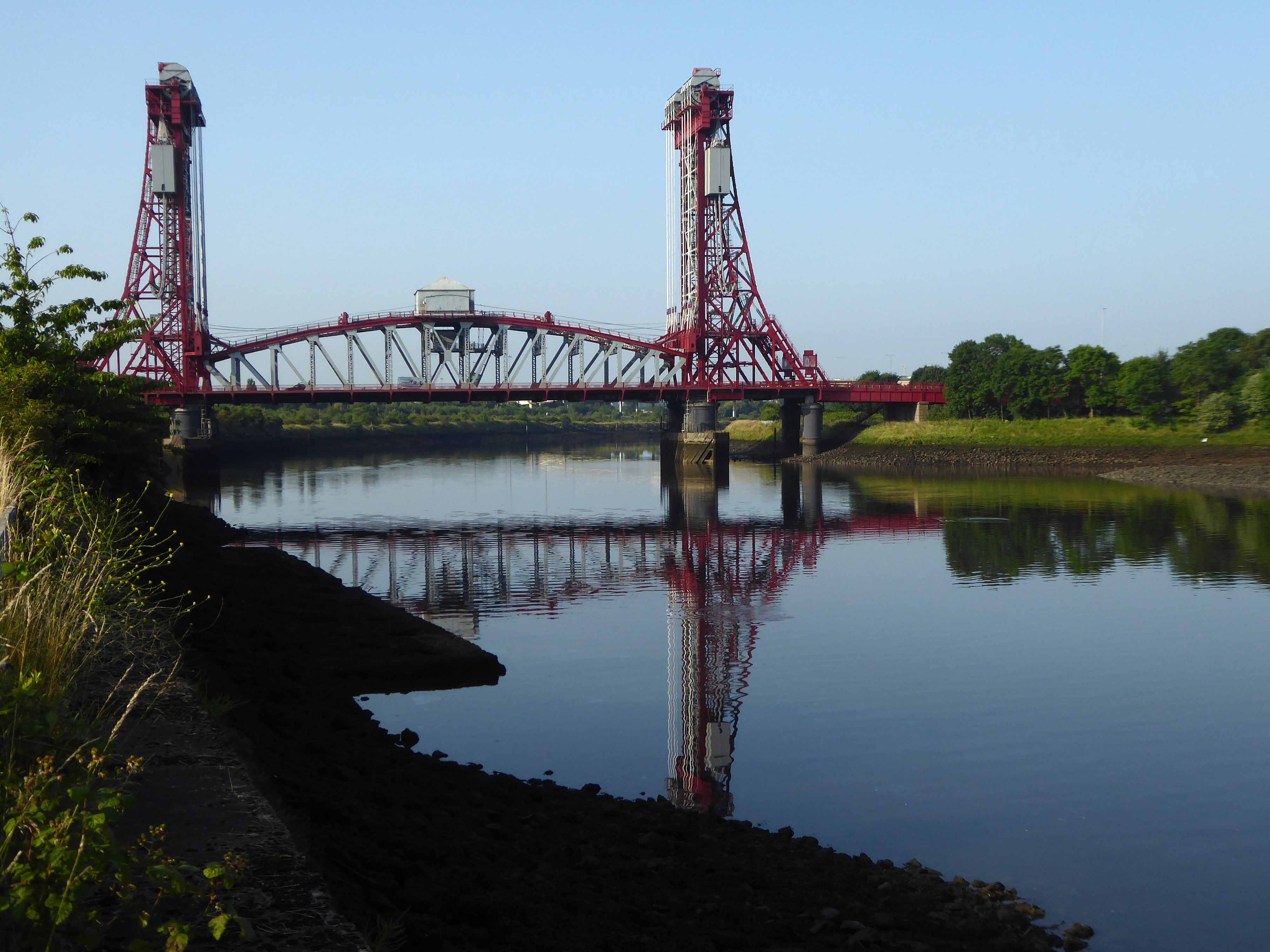
Following a 1907 Act of Parliament the bridge was built at a cost of £68,026 6s 8d by Sir William Arrol & Co. of Glasgow between 1910 and 1911 to replace the Hugh Bell and Erimus steam ferry services. A transporter bridge was chosen because Parliament ruled that the new scheme of crossing the river had to avoid affecting the river navigation.
The opening ceremony on 17 October 1911 was performed by Prince Arthur of Connaught, at its opening the bridge was painted red.
In 1961 the bridge was painted blue.
In 1974, the comedy actor Terry Scott, travelling between his hotel in Middlesbrough and a performance at the Billingham Forum, mistook the bridge for a regular toll crossing and drove his Jaguar off the end of the roadway, landing in the safety netting beneath.
The cycle track followed the river, which sports a fine array of industrial architecture.
Tees Newport Bridge designed by Mott, Hay and Anderson and built by local company Dorman Long who have also been responsible for such structures as the Tyne Bridge and Sydney Harbour Bridge, it was the first large vertical-lift bridge in Britain.
In a slightly more upbeat mode St James the Apostle Owton Manor.
I convinced myself that this building on Station Road Seaton Carew was a former pub, I discovered following consultation with the local studies offices, that it was in fact a former children’s home destined to become a doctors.
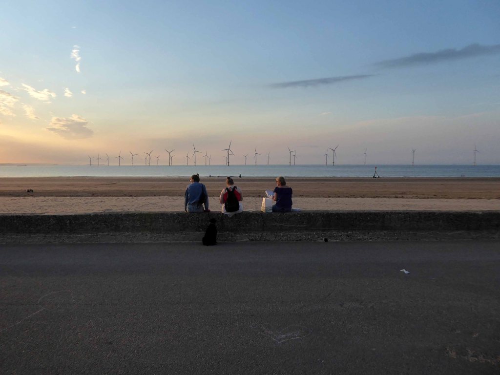
I found myself looking back across the estuary to Redcar.
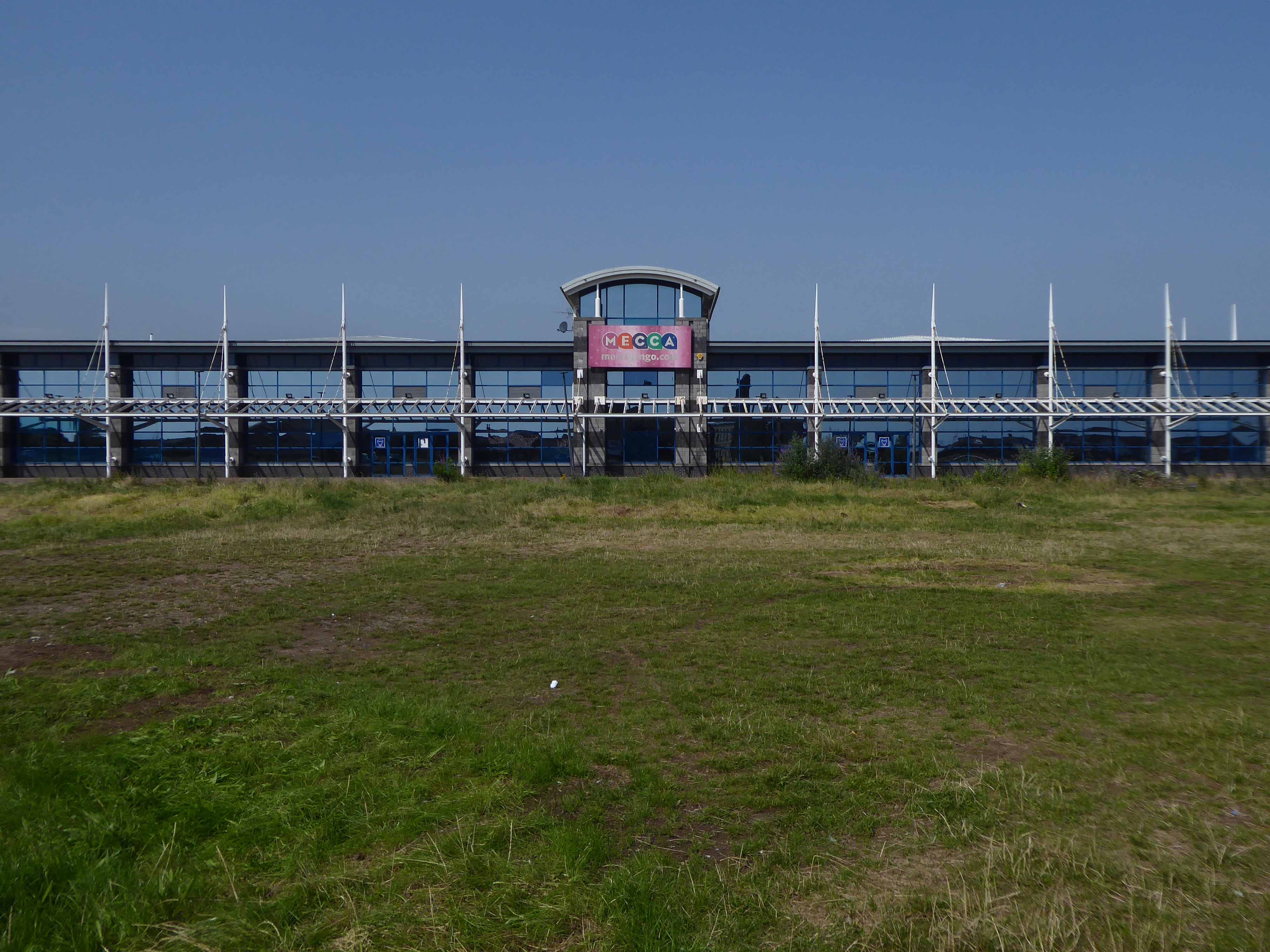
Northward toward Hartlepool.
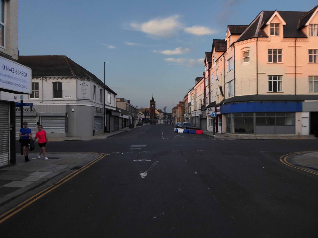
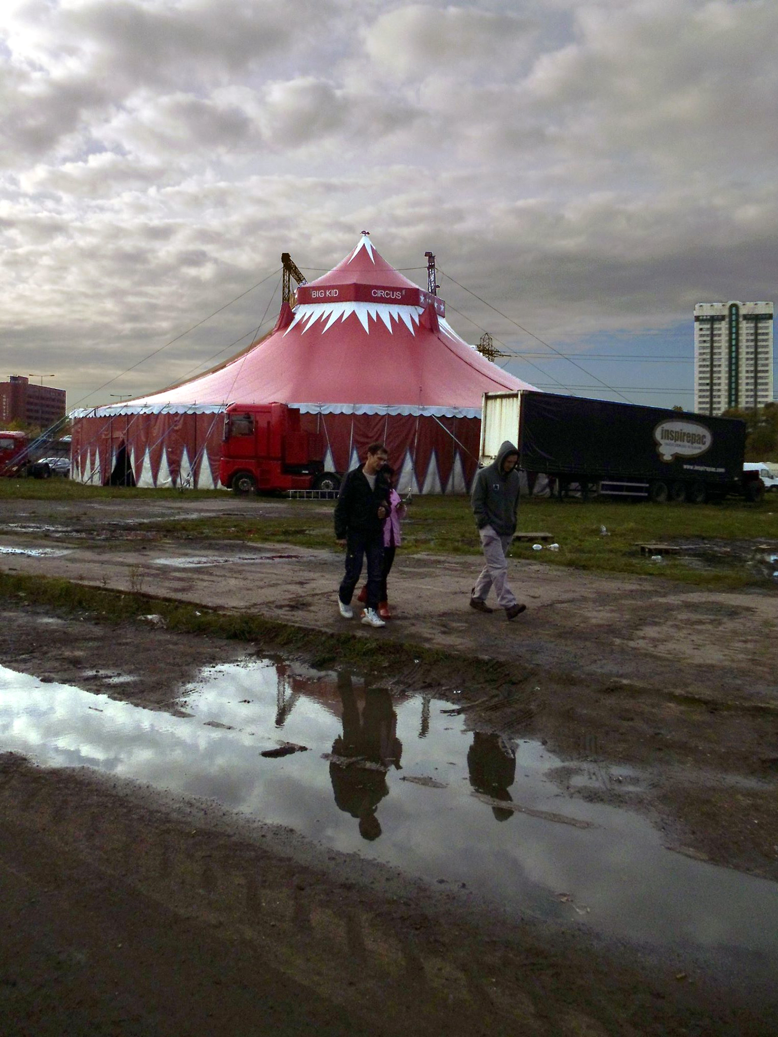
Where the bingo was closed and the circus had left town.
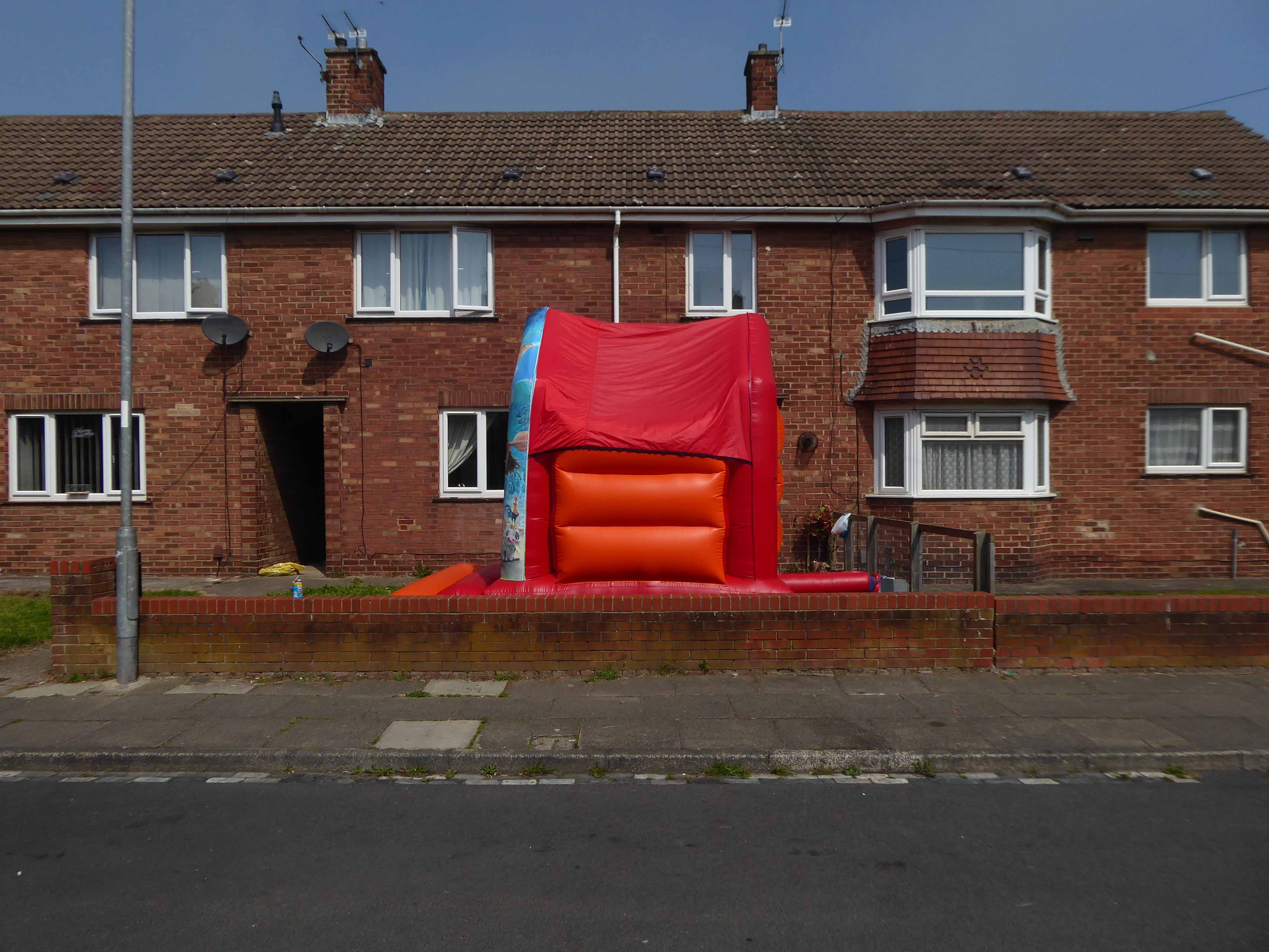
Every Englishman’s home is a bouncy castle.
St John Vianneylocated on King Oswy Drive West View Estate.
Architect: Crawford & Spencer Middlesbrough 1961.
A large post-war church built to serve a housing estate, economically built and with a functional interior. The campanile is a local landmark.
The parish of St John Vianney was created in 1959 to serve the growing West View Estate, on the north side of Hartlepool. The church was opened by Bishop Cunningham on 4 April 1961. The presbytery was built at the same time.
I found myself on yet another former railway line.
The Cycleway was once a railway line designed by George Stephenson to take coal from the Durham coal fields to the docks in Hartlepool, where the coal was then distributed throughout the world.
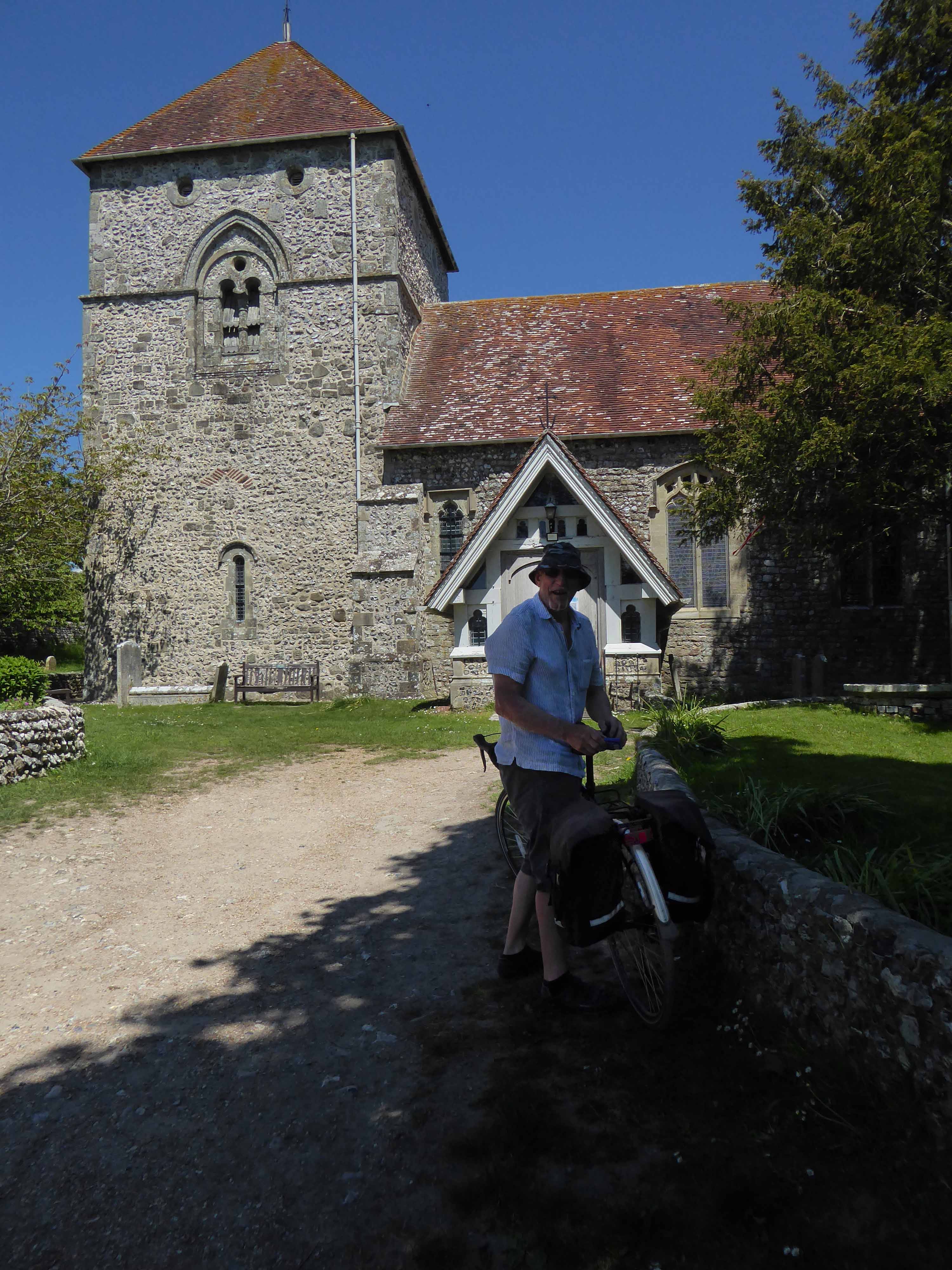
Seeking assistance from a passing cyclist I negotiated a safe passage to Sunderland.
The Sunderland Synagogue is a former synagogue building in Sunderland, England. The synagogue, on Ryhope Road, was designed by architect Marcus Kenneth Glass and completed in 1928. It is the last surviving synagogue to be designed by Glass.
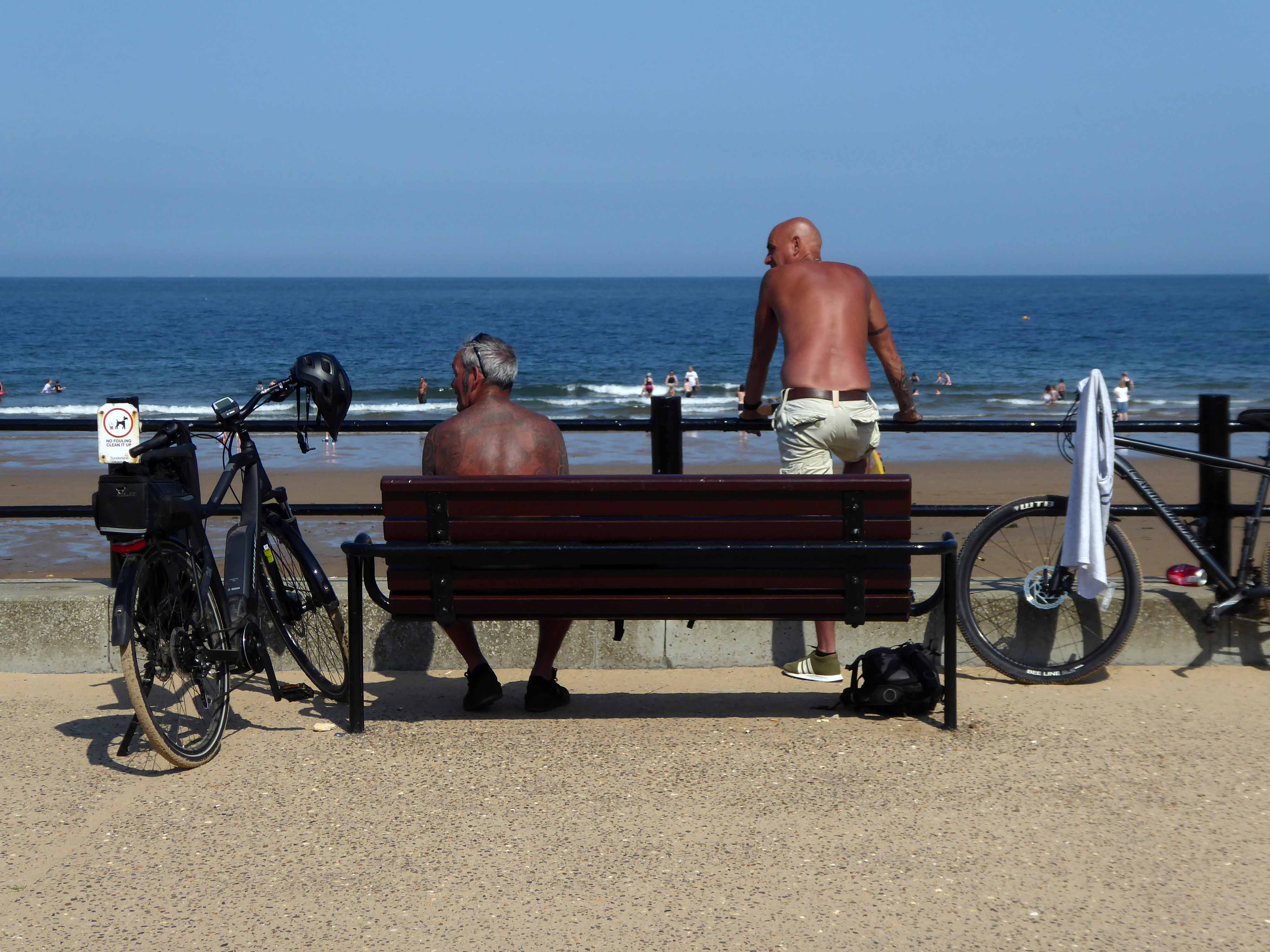
I took a right and arrived in Roker, where I saw these well tanned and tattooed cyclists taking a rest.
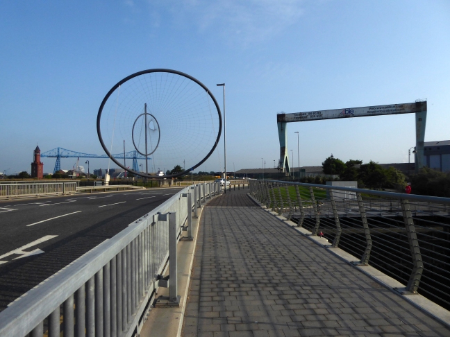
Pressed on, largely alongside the coast to South Shields.
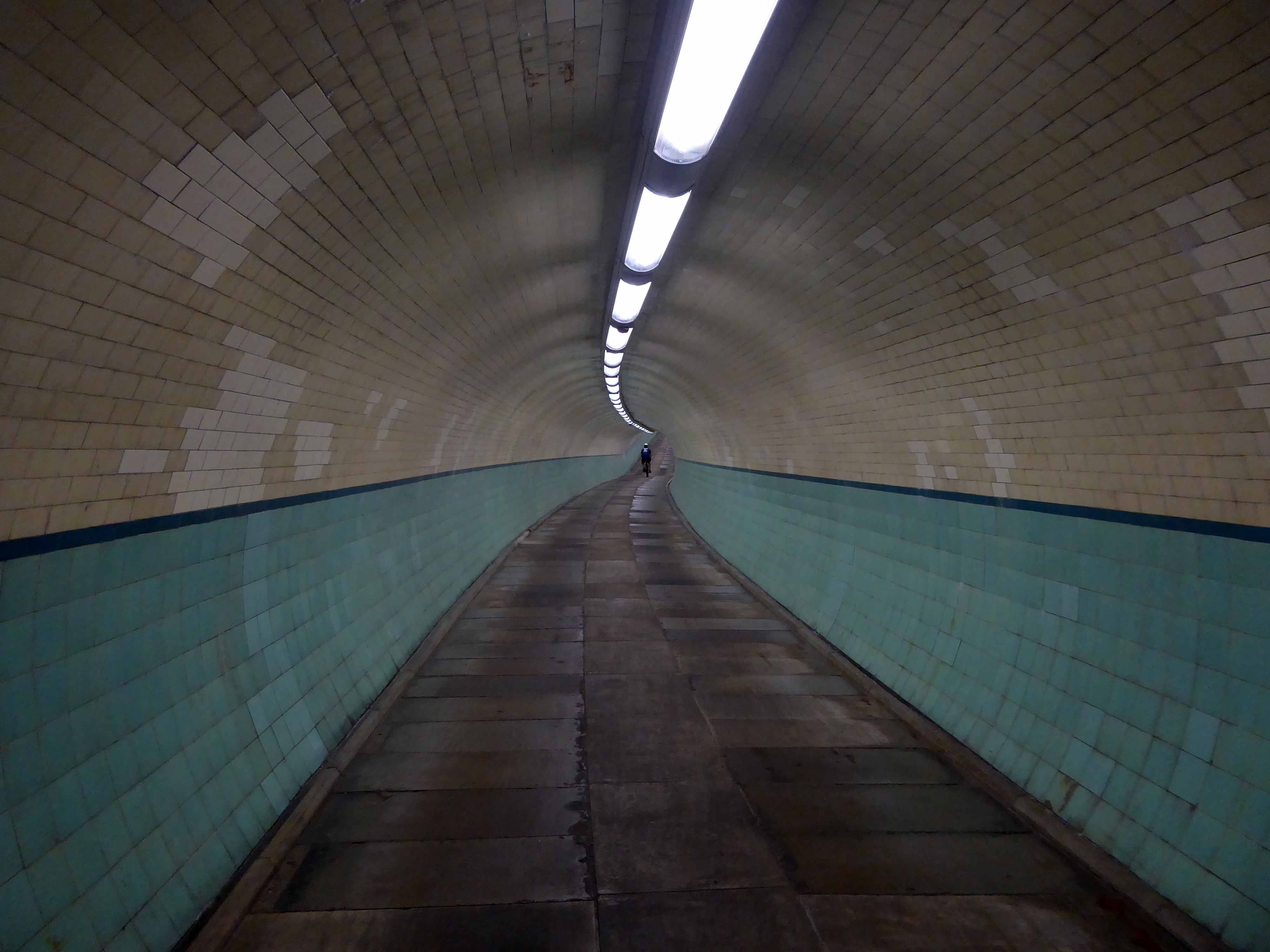
Under advisement from a jolly passing jogger I took the Tyne Pedestrian Tunnel.
Tyne Cyclist and Pedestrian Tunnel was Britain’s first purpose-built cycling tunnel. It runs under the River Tyne between Howdon and Jarrow, and was opened in 1951, heralded as a contribution to the Festival of Britain.
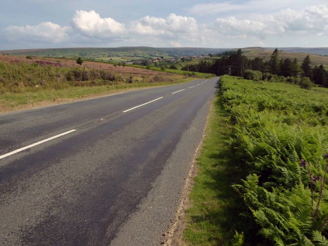
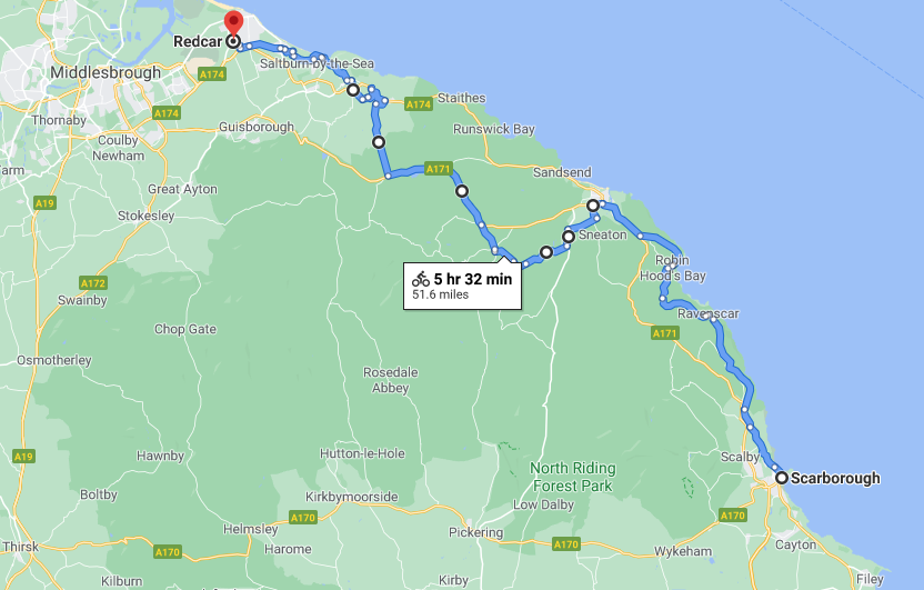
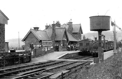
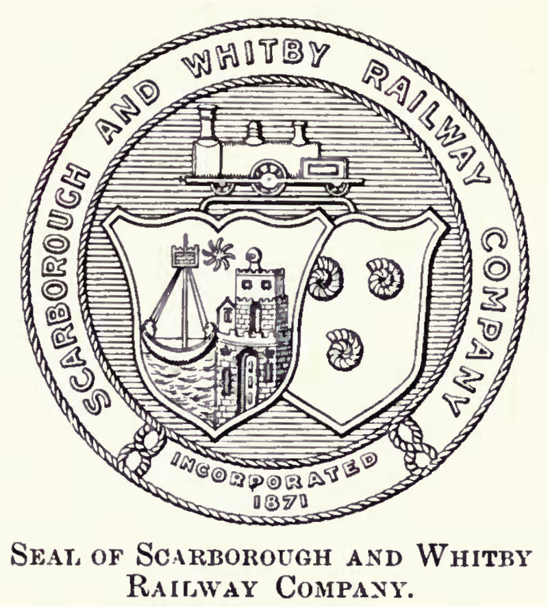
Formerly the Scarbough to Whitby Railway – the line opened in 1885 and closed in 1965 as part of the Beeching Axe.
Yet again I chance upon a delightful post-war home.
I parted company with the track dropping down to the Esk Valley from the Larpool Viaduct.
Construction began in October 1882 and was complete by October 1884.
Two men fell from the piers during construction, but recovered.
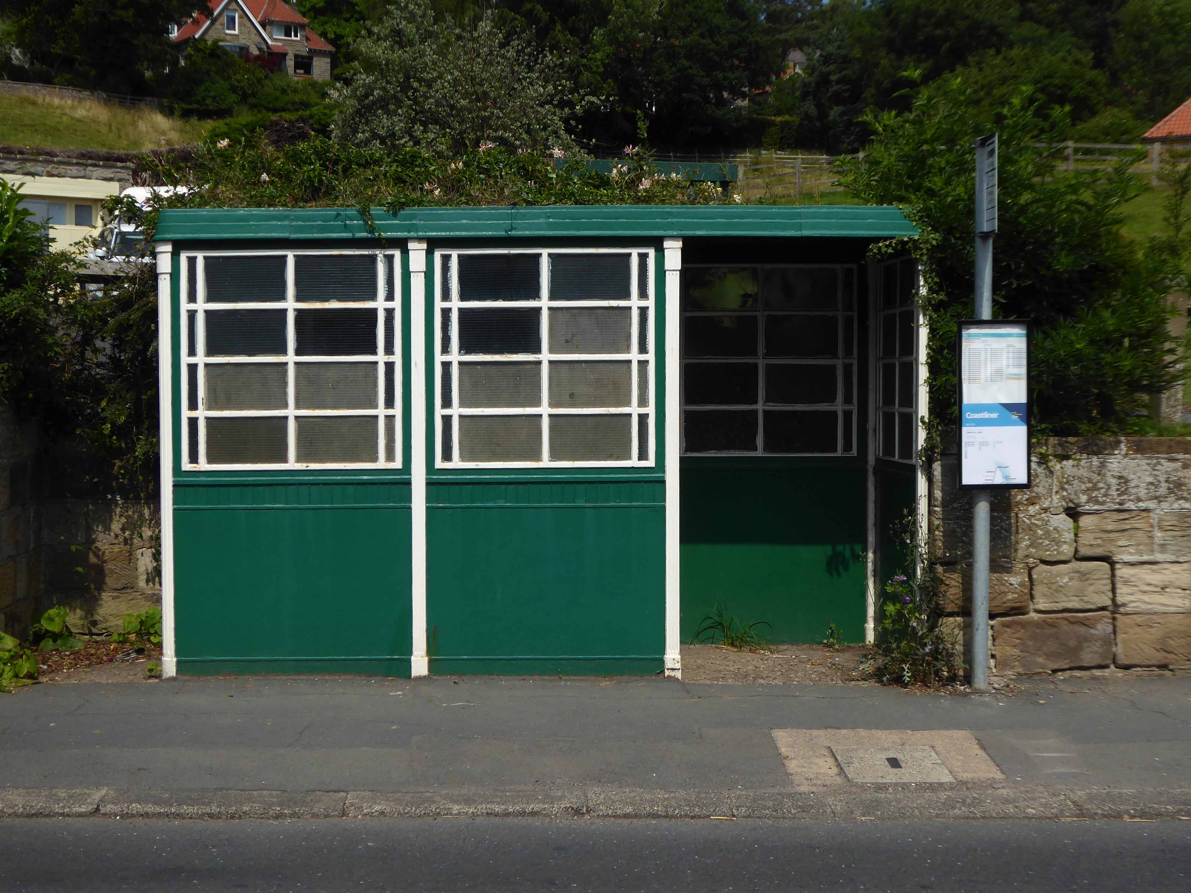
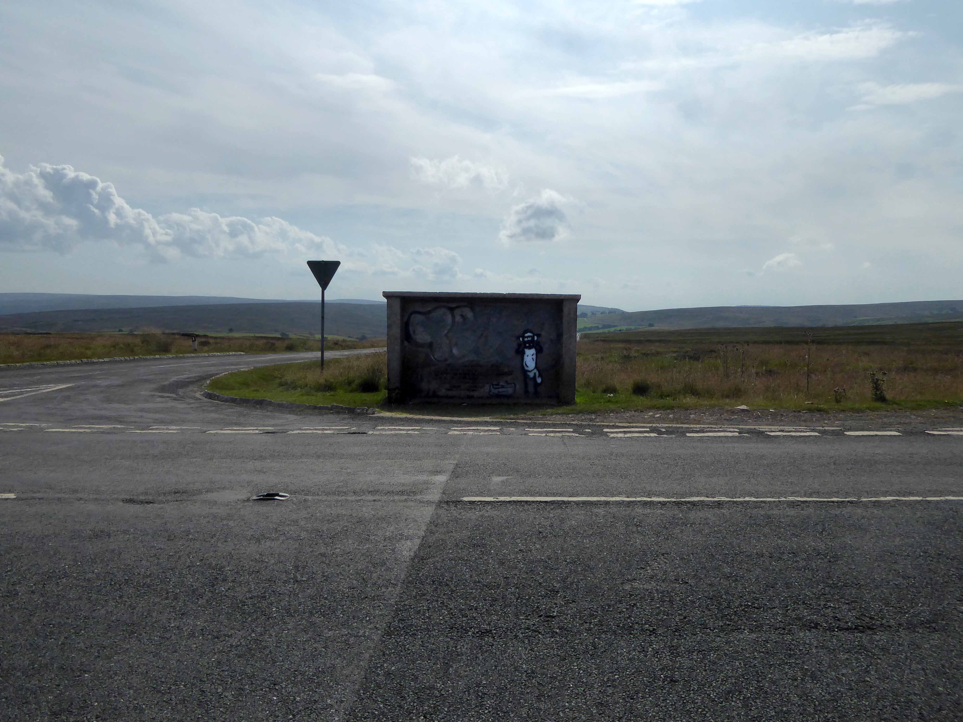
I found myself in Ruswarp, home to this enchanting bus shelter.
I bombed along the main road to Sleights.
There then followed a hesitant ascent, descent, ascent along a badly signed bridleway, fearing that I had climbed the hill in error I retraced, then retraced.
A difficult push ensued, a precipitous path, rough and untended, rising ever higher and higher.
Finally arriving at Aislaby, more than somewhat exhausted – the village is mentioned in the Domesday Book as Asuluesbi.
Pausing to catch my breath I took the wildly undulating road to Egton – along the way I was alerted to the presence of a tea stop by two touring cyclists from Nottingham.
The curious name Fryup probably derives from the Old English reconstruction Frige-hop: Frige was an Anglo-Saxon goddess equated with the Old Norse Frigg; hop denoted a small valley.
An old woman at Fryup was well known locally for keeping the Mark’s e’en watch – 24 April, as she lived alongside a corpse road known as Old Hell Road.
The practice involved a village seer holding vigil between 11pm and 1am to watch for the wraiths of those who would die in the following 12 months.
Castleton Moor ghost.
In the village I was given further directions by two elderly gents, who had been engaged in a discussion concerning their long term mapping of acid rain levels in the area.
One was wearing a Marshall Jefferson t-shirt.
I climbed Langburn Bank onto the flatish open moorland.
Taking a brief break to snap this concrete shelter.
There then followed a hair stirring series of hairpin descents to the coast at Saltburn.
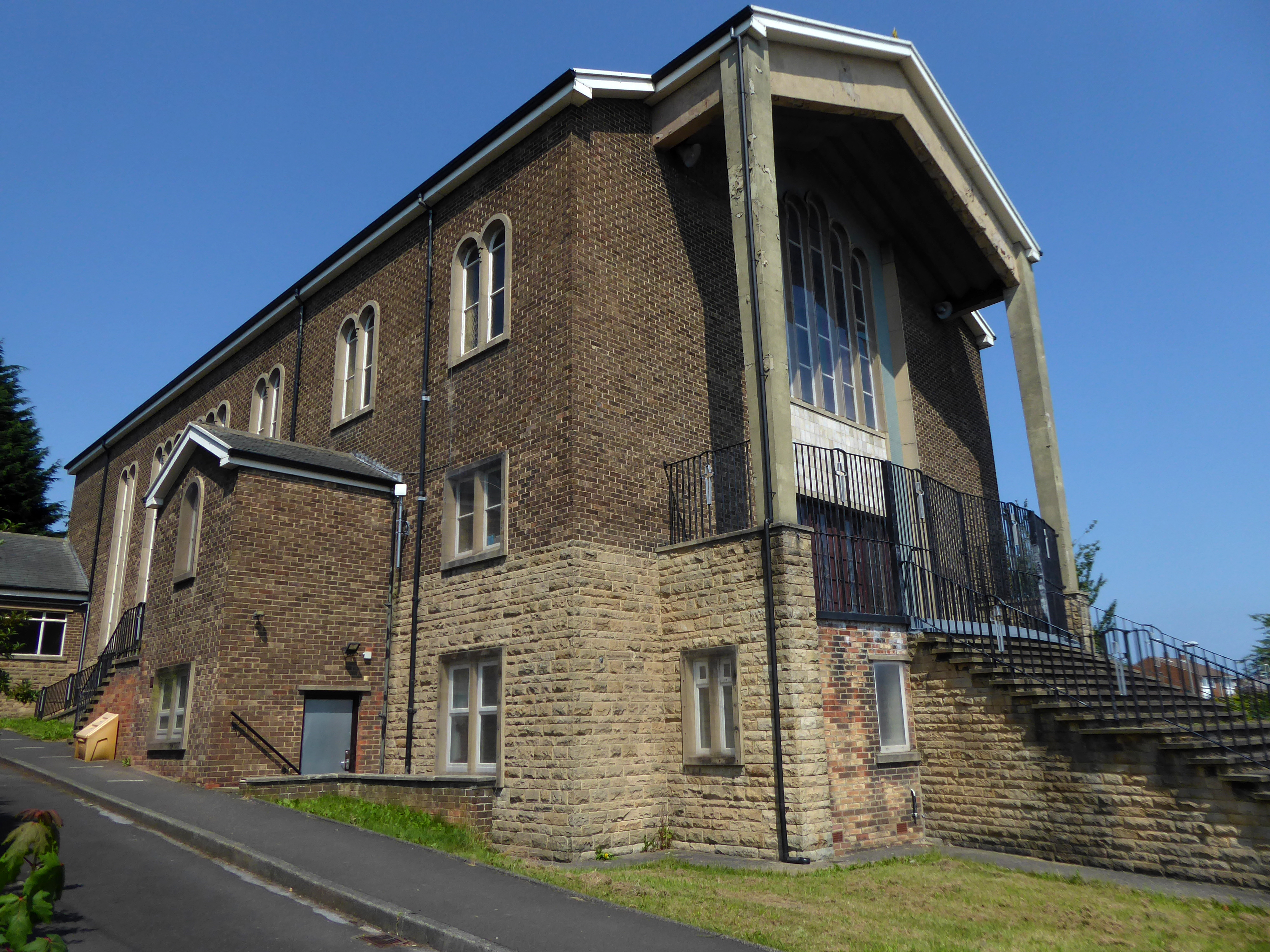
Built in 1928, this church was designed with some care and is an attractive, if fairly modest, Lombard Romanesque-style essay in brick. The use of a semi-circular apse, narrow brickwork and use of tile for decorative effect give it a pleasing appearance, typical of restrained but elegant work between the wars.
I arrived and took a look around, first time in town, here’s what I found.
Whilst cycling twixt Redcar and Newcastle one sunny Monday morn, I espied a tower on the distant horizon.
I pedalled hurriedly along and this is what I found.
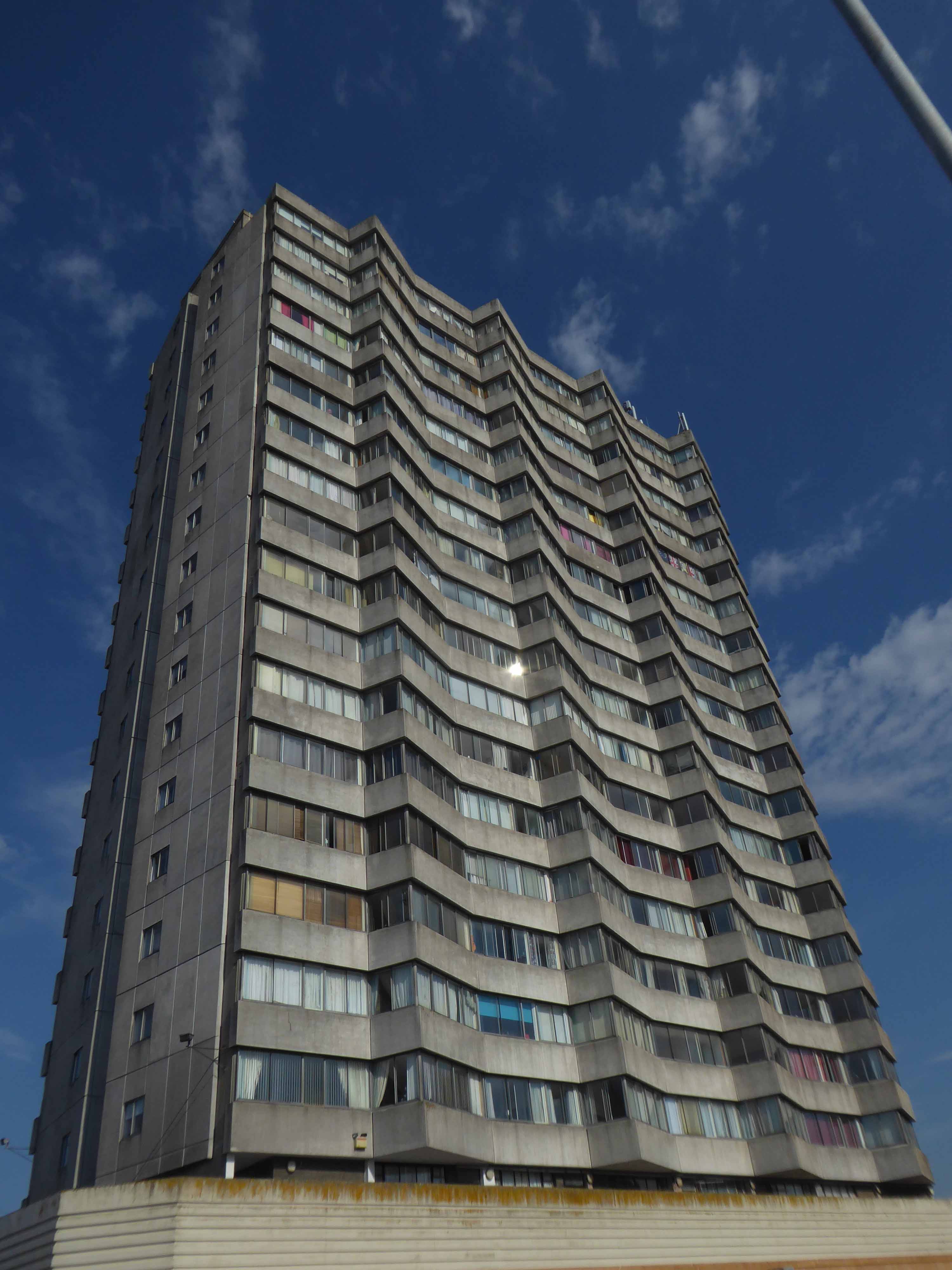
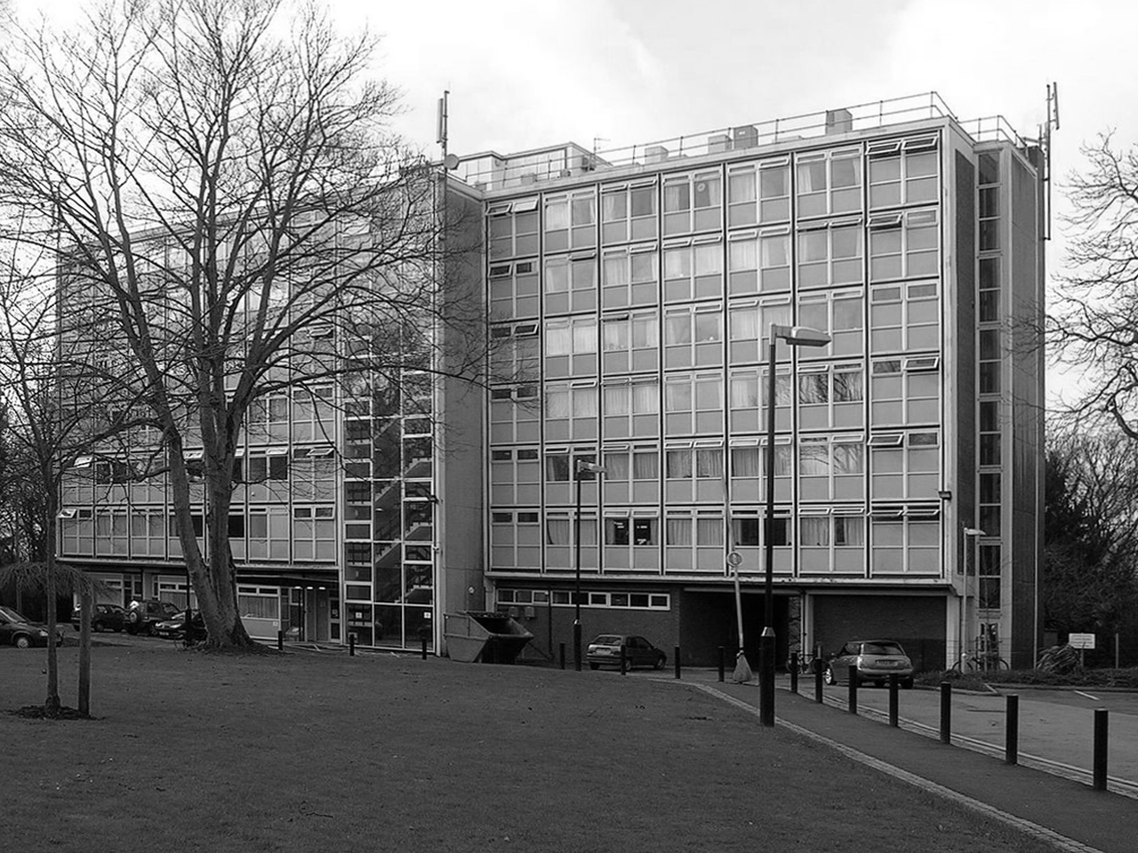
Dawson House aka Kingsway.
A fifteen-storey circular tower block of 60 one-bedroom flats and 29 two-bedroom flats, making 89 dwellings in total. The block was built as public housing at the western fringe of the Town Centre development that began in 1952. Approved in 1973, the block is of triangular concrete-beam construction.
The architects were Elder Lester Associates.
The block was built by Teeside County Borough Council.
Stanley Miller Ltd.’s tender for the contract was £778,850.
The tower block was opened on 3rd April 1975 by the Mayor of Stockton Borough Council, John Dyson.
The block is described as ‘gimmicky circular tower block’ in The Buildings of England: County Durham by N. Pevsner.
In November 2013, a time capsule was buried in front of The Family, under a stone with the inscription Forever Forward 30 11 2013.
The capsule is not to be unearthed until the year 2078.
Twenty million pound bid to take back control of the centre of Billingham.
The council says: Proposals include addressing the physical condition of Billingham town centre in support the Council’s ambition to take back control of the centre. Redevelopment would solve the challenges of changing retail trends that are contributing towards excess retail space and high vacancy rates.
This includes exploring options for mixed-use redevelopment and high-quality public spaces that improve accessibility within the town centre and a modern retail offering.
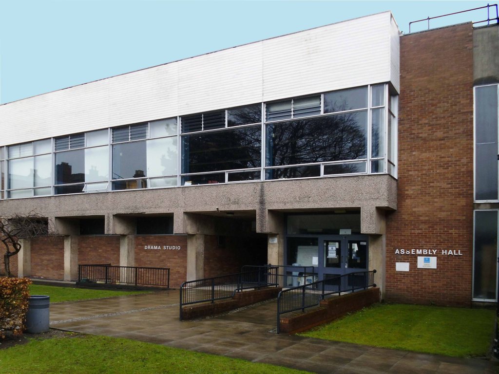
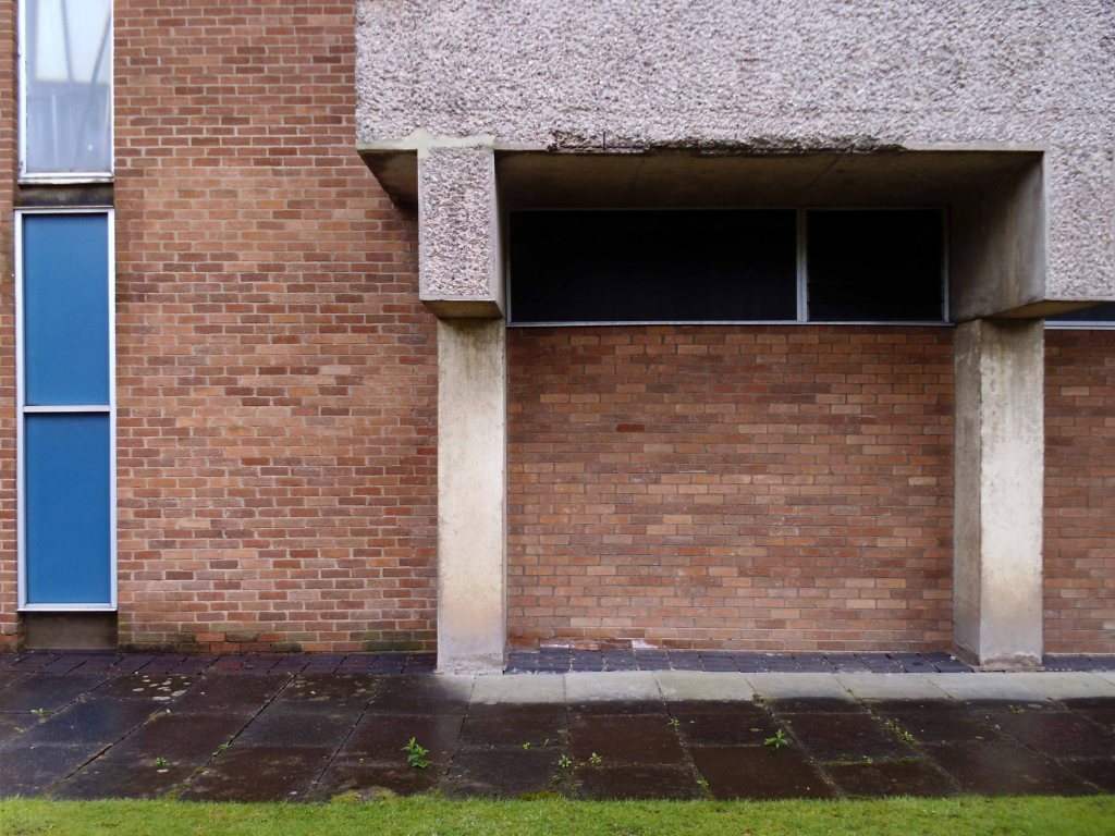
Built in 1968 by local architects Elder Lester and Partners as part of the expansive plans for the town centre along with the Forum, La Ronde nightclub was to form part of the expansive plans for Billingham focused on the pursuit of increased leisure time.
La Ronde’s distinct cylindrical form comes from the car park access ramp that winds around the stair core to the upper floors of the club. The elevated drum-like form inset with cross latticed concrete webs was cast entirely in-situ.
In 2006, the council demolished La Ronde and Forum House at the cost of £500,000 to make way for a supermarket.
The Forum
In 1960, Billingham Urban District Council, began one of the most ambitious new leisure centres in Europe. The Forum was funded by the district’s new-found wealth – a product of the local petrochemical industry. It was designed by local architects Elder Lester and Partners and brought together a variety of recreational activities including an ice rink, swimming pool, sports centre, theatre, and bar all under one roof. The Forum opened in July 1967 to great enthusiasm. Weekly attendance over the first six months was between 20 000 and 30 000 people, far exceeding all expectations.
The inclusion of the theatre alongside the sports facilities broke new ground in recreational planning and in the shift from sport to the broader notion of ‘leisure’, the Forum predated architectural thinking of the time by nearly a decade. The building’s form is derived from the functions within, expressed in a variety of bulbous elements. The most distinctive is the canopy of the ice rink roof which is hung using steel cables running the length of the roof and cross-braced to achieve a clear 73m span.
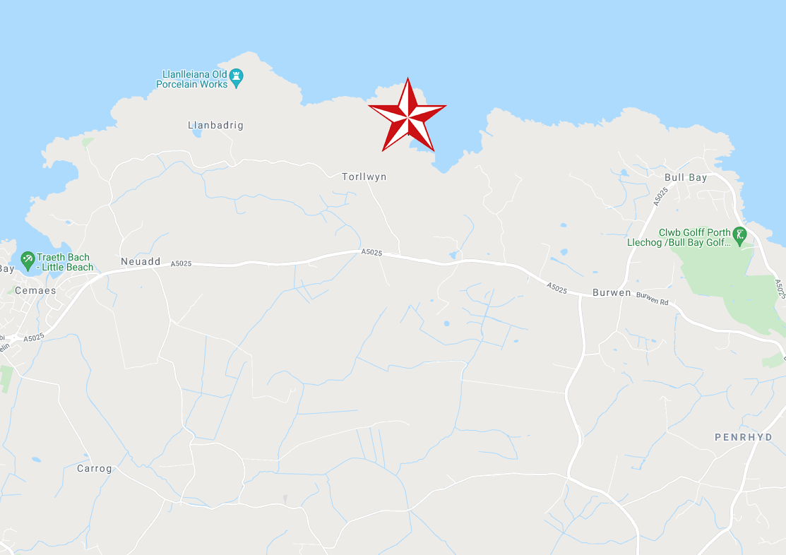
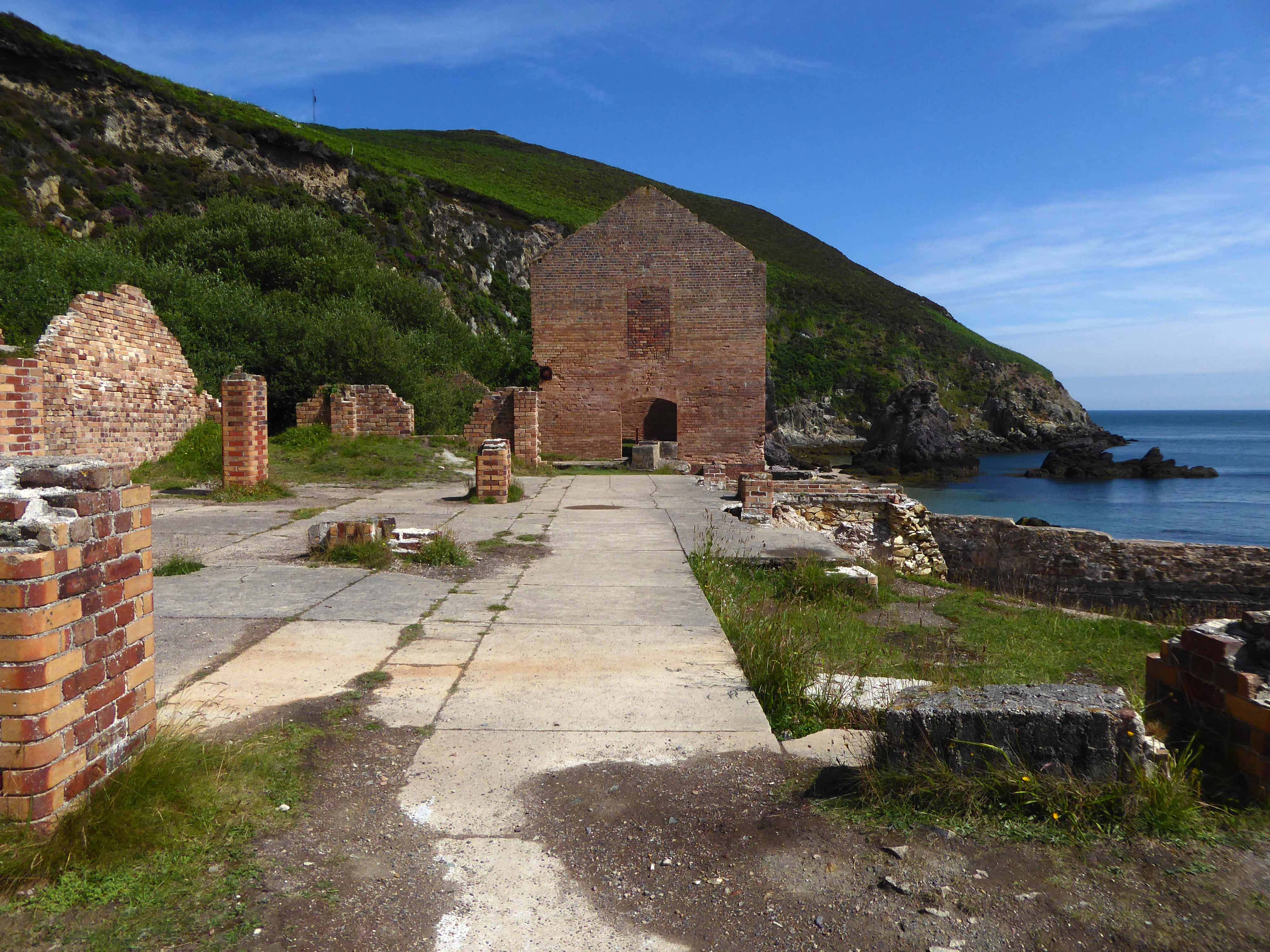
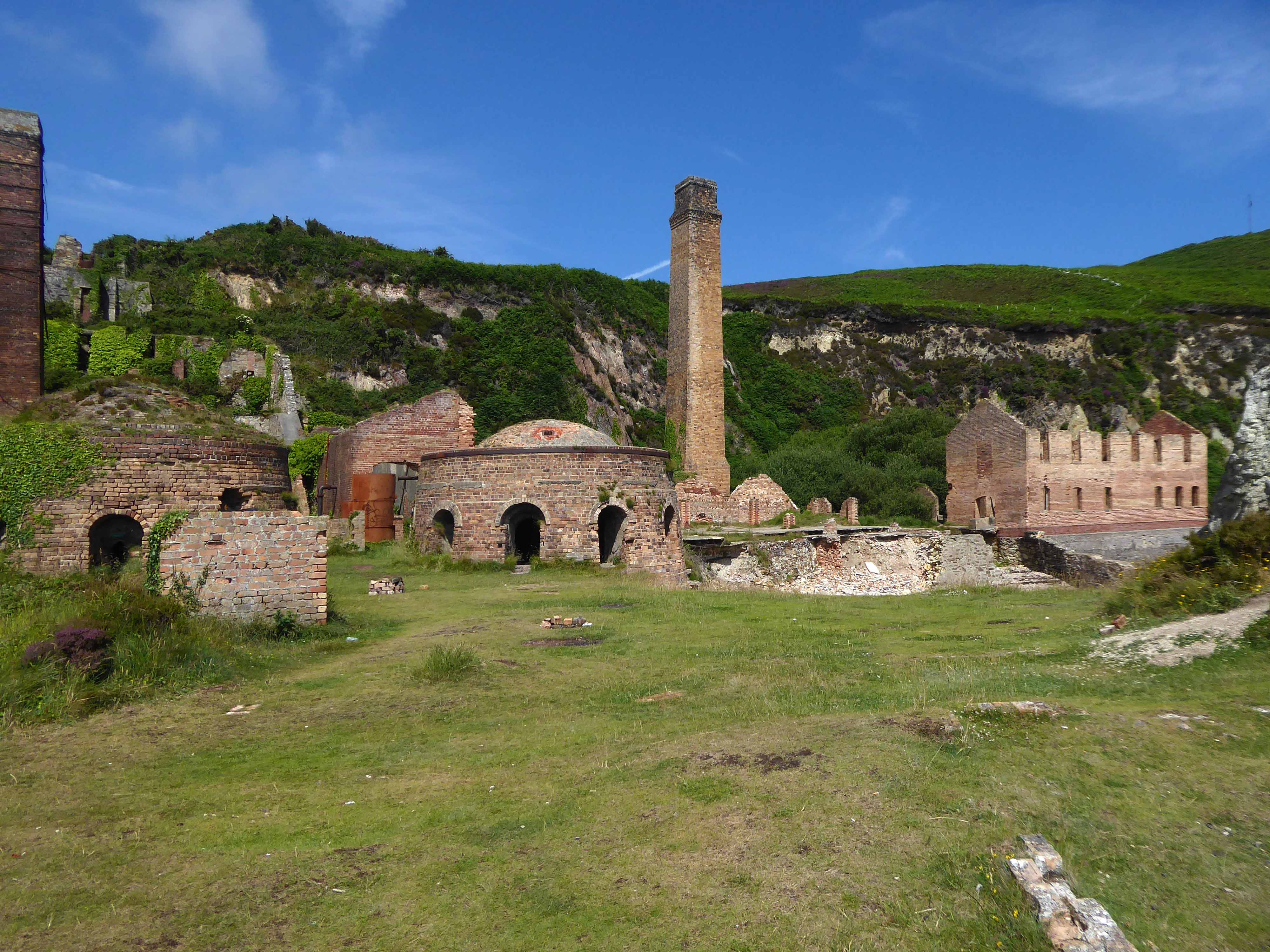
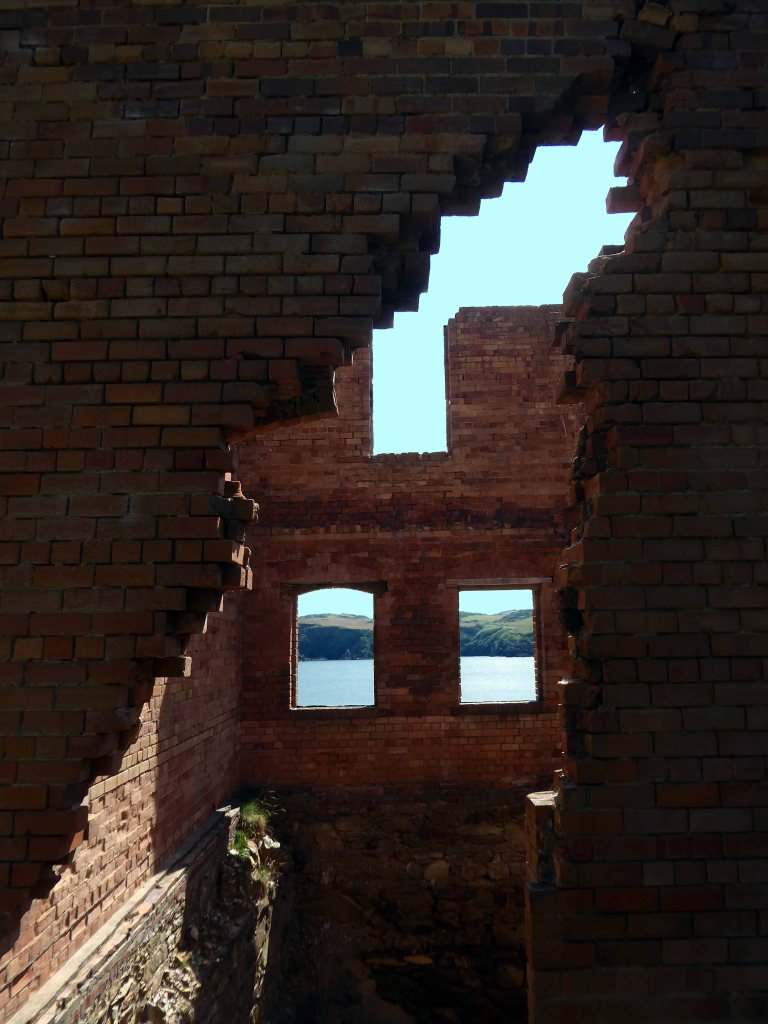
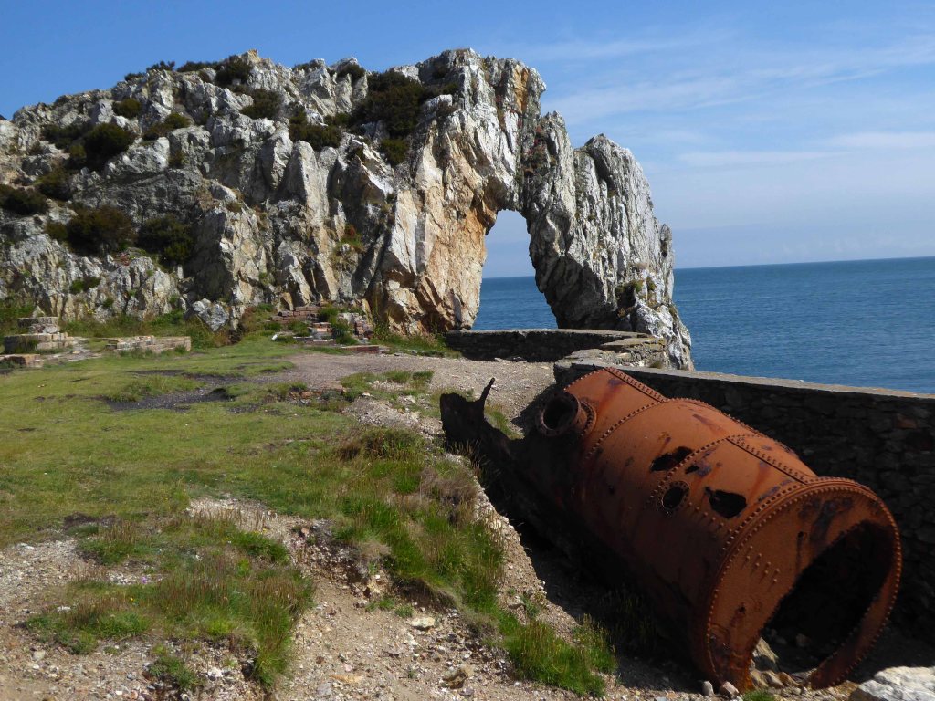
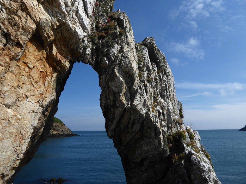
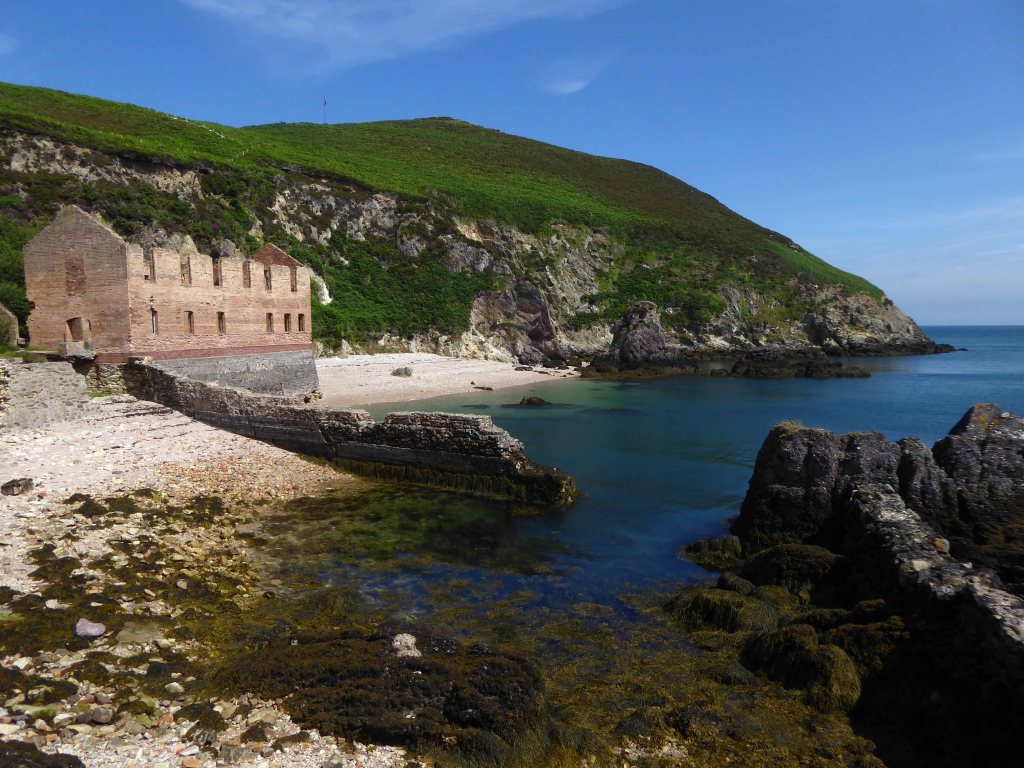
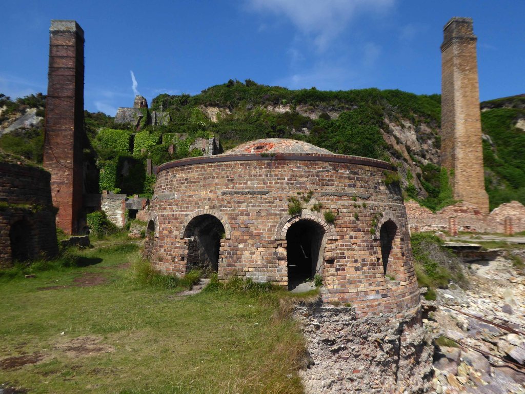
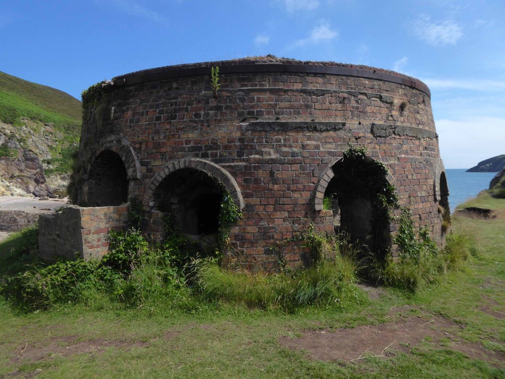
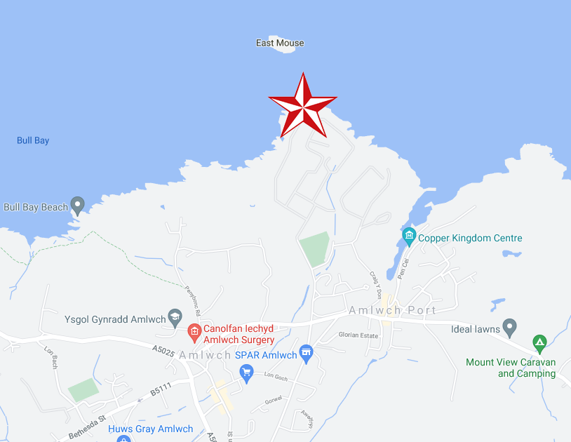
Located twixt Bull Bay and Cemaes Bay, accessed whilst walking the Anglesey Coastal Path.
The area is rich in Quartzite, central to the production of Silica Bricks, which are resistant to high temperatures, much in demand at the height of the Industrial Revolution for lining steel furnaces.
The ore on the headland was first mined around 1850, with the ore being hewn out the living rock by hand.
A little railway brought the ore to the cliff above the brick works, then lowered by gravity to the works below, where the rocks would be pummelled and rendered to a size that could be further processed.
Mining by manual endeavour lasted from around 1850 to 1914, the hazardous harbour and alleged poor quality products hastening the enterprises’s demise.
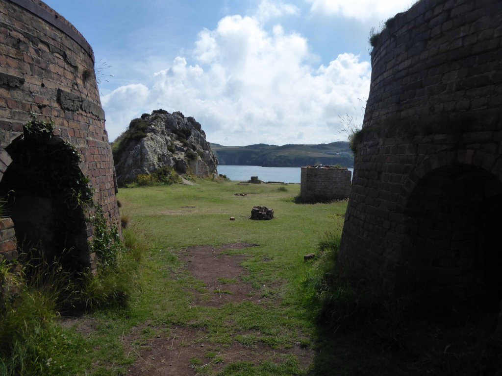
Porth Wen brickworks was designated as a scheduled monument by Cadw in 1986 and classified as a post-medieval industrial brickworks.
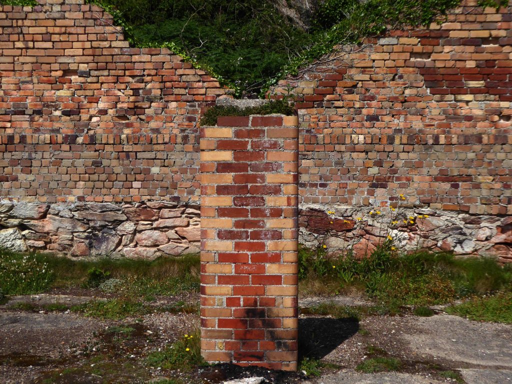
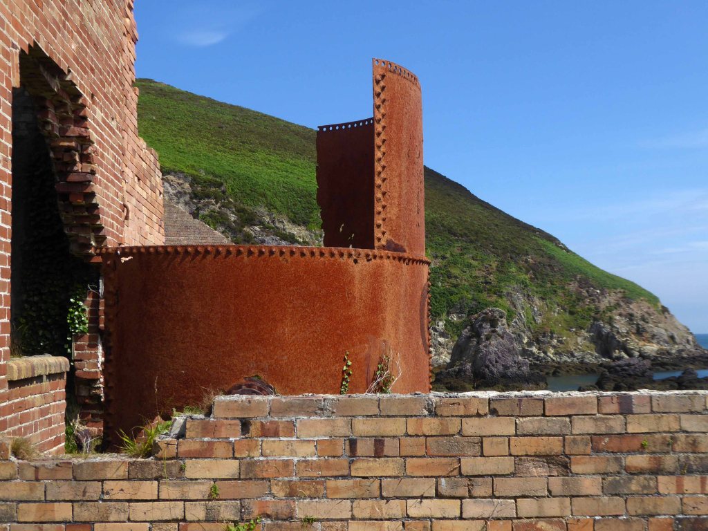
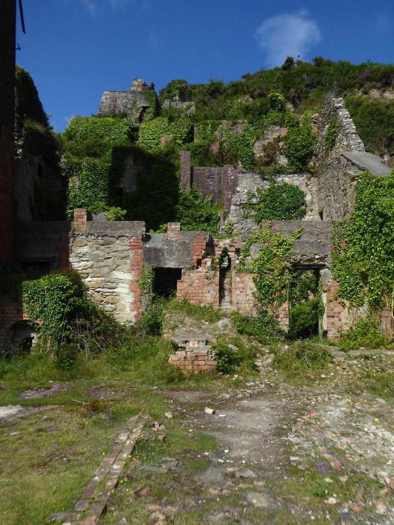
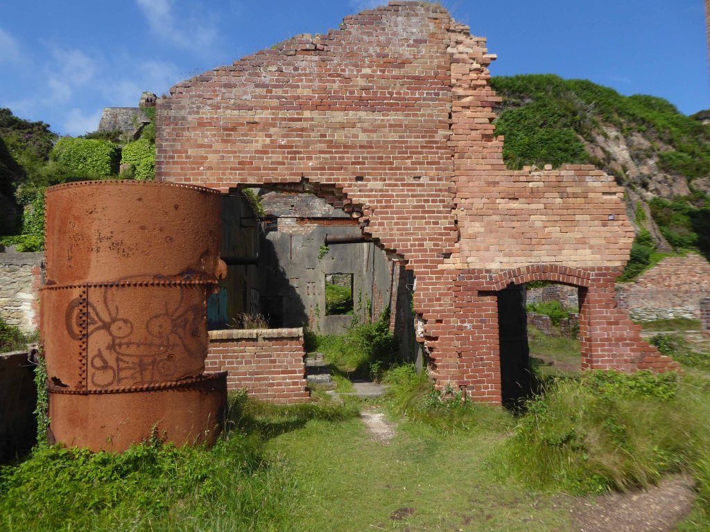
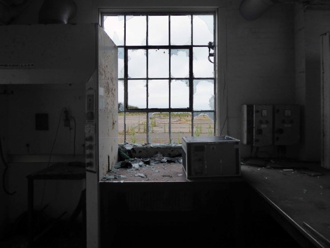
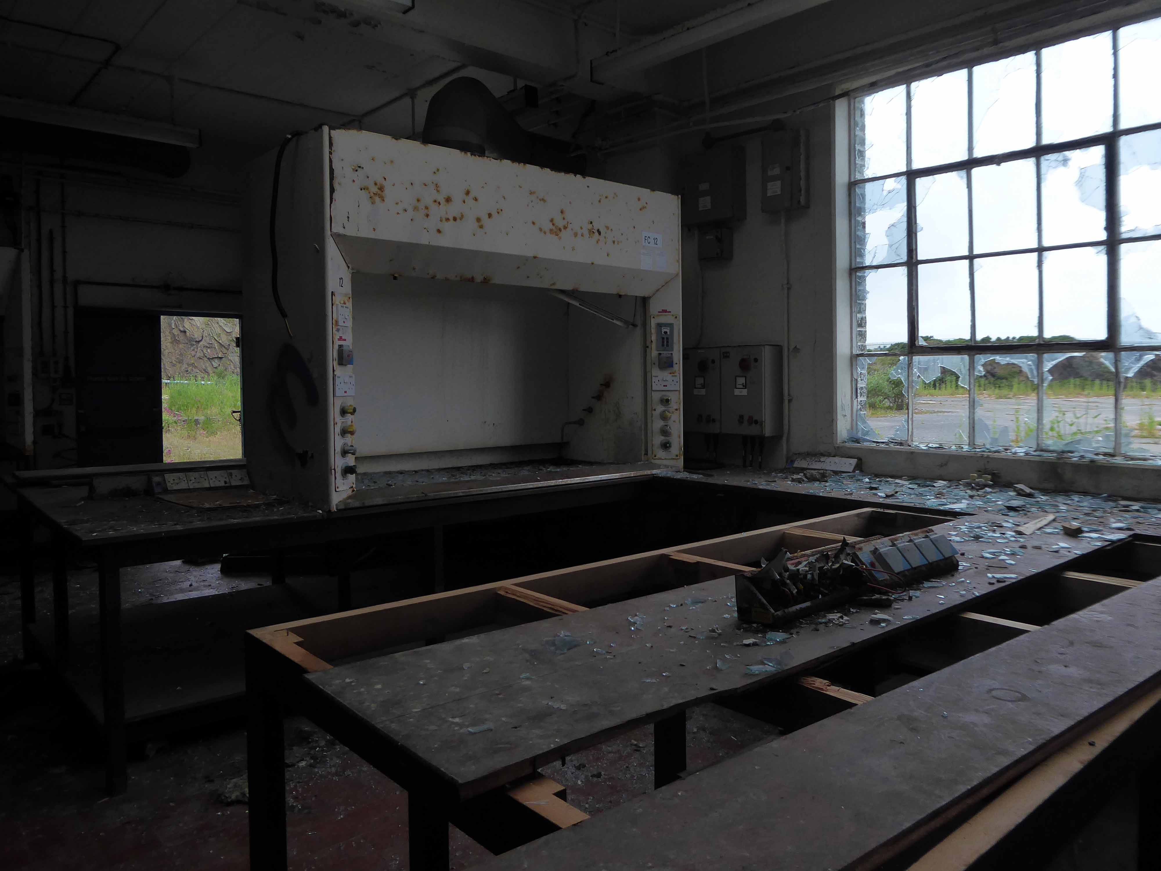
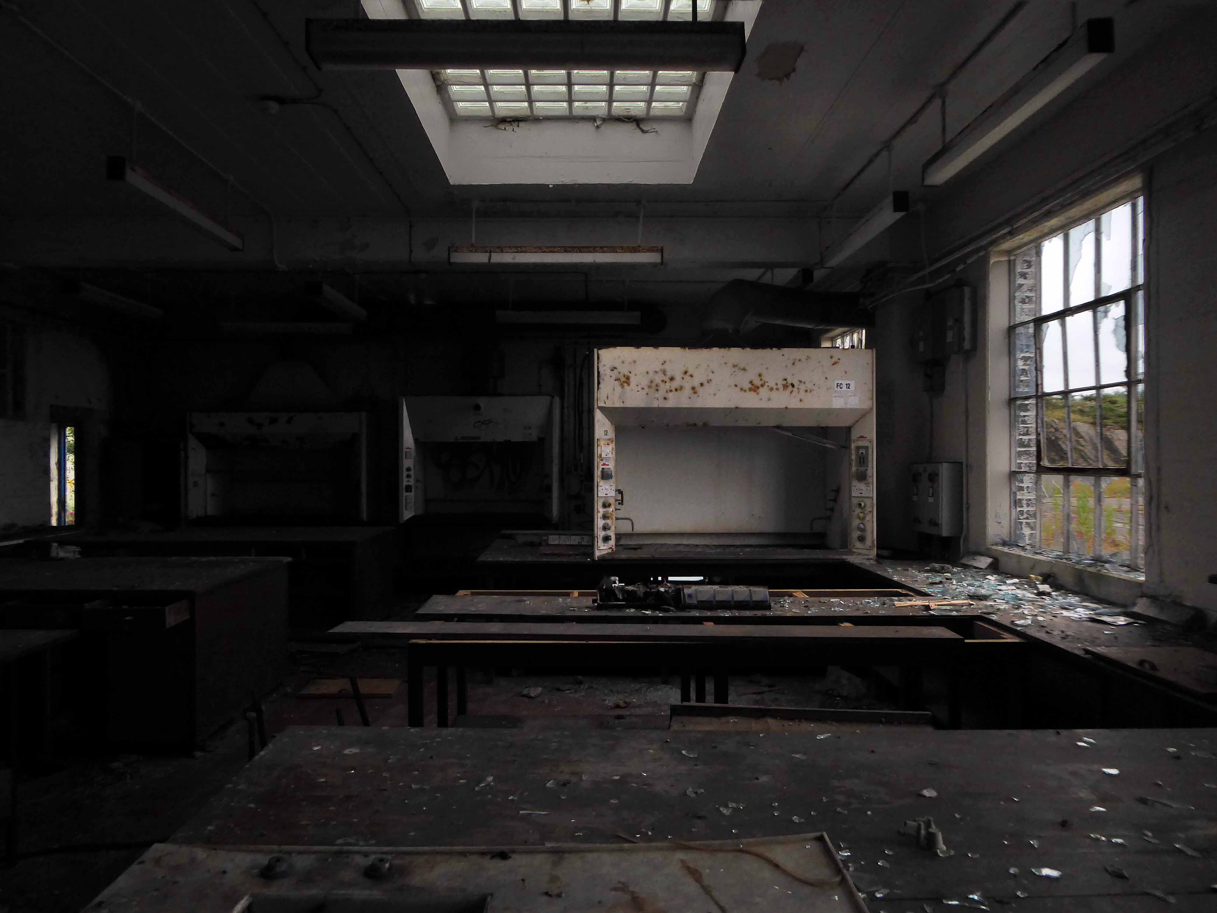
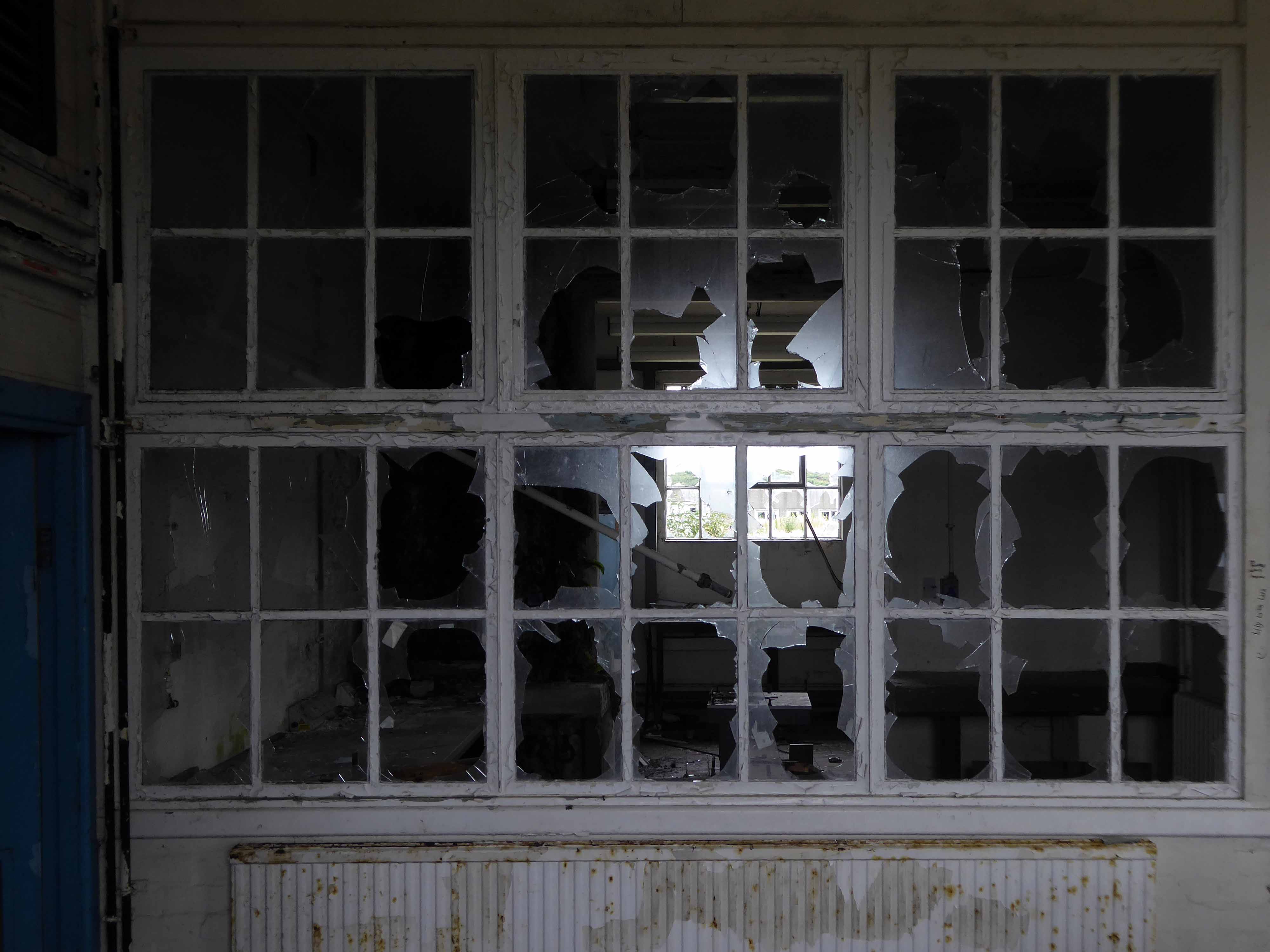
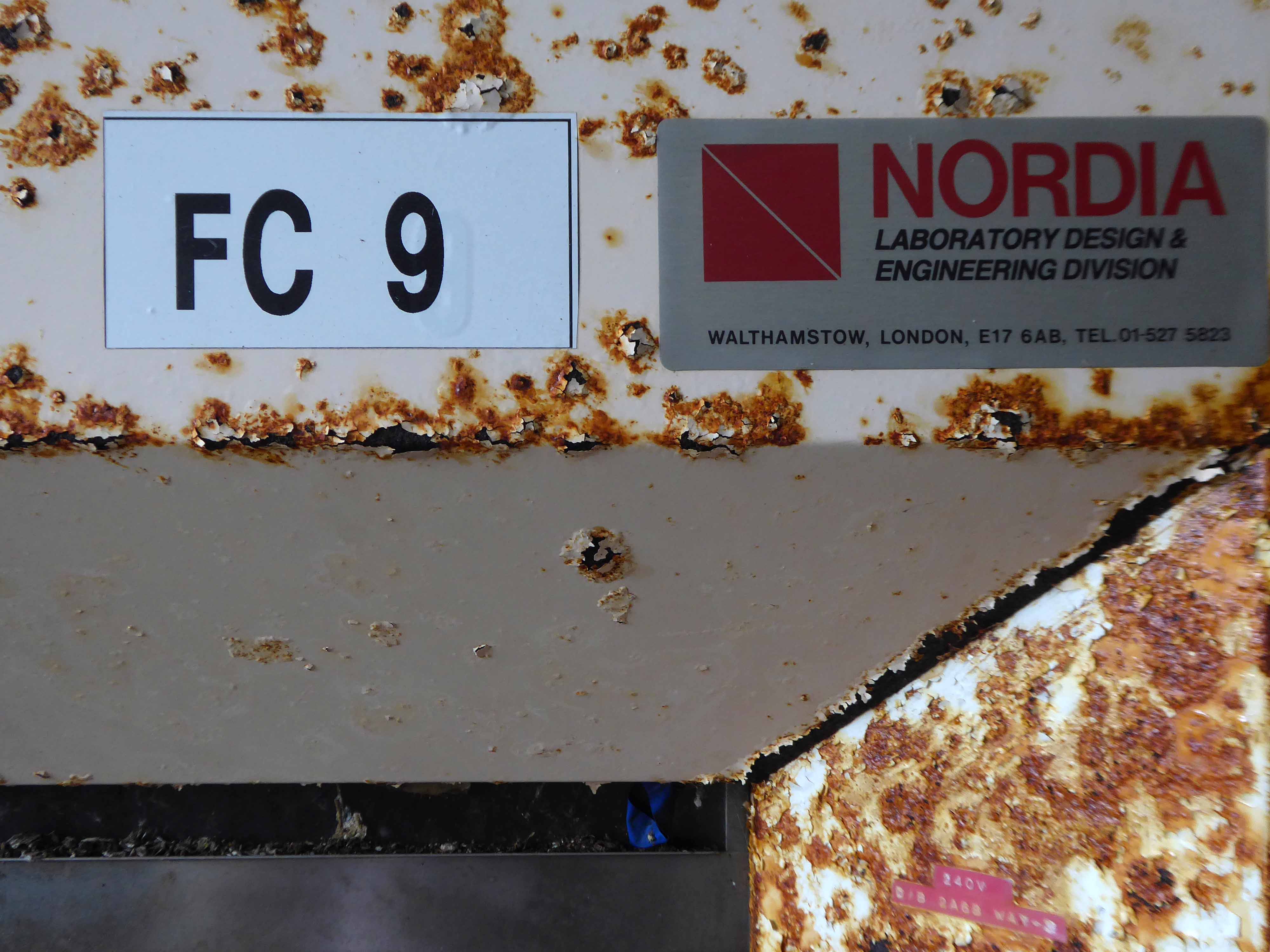
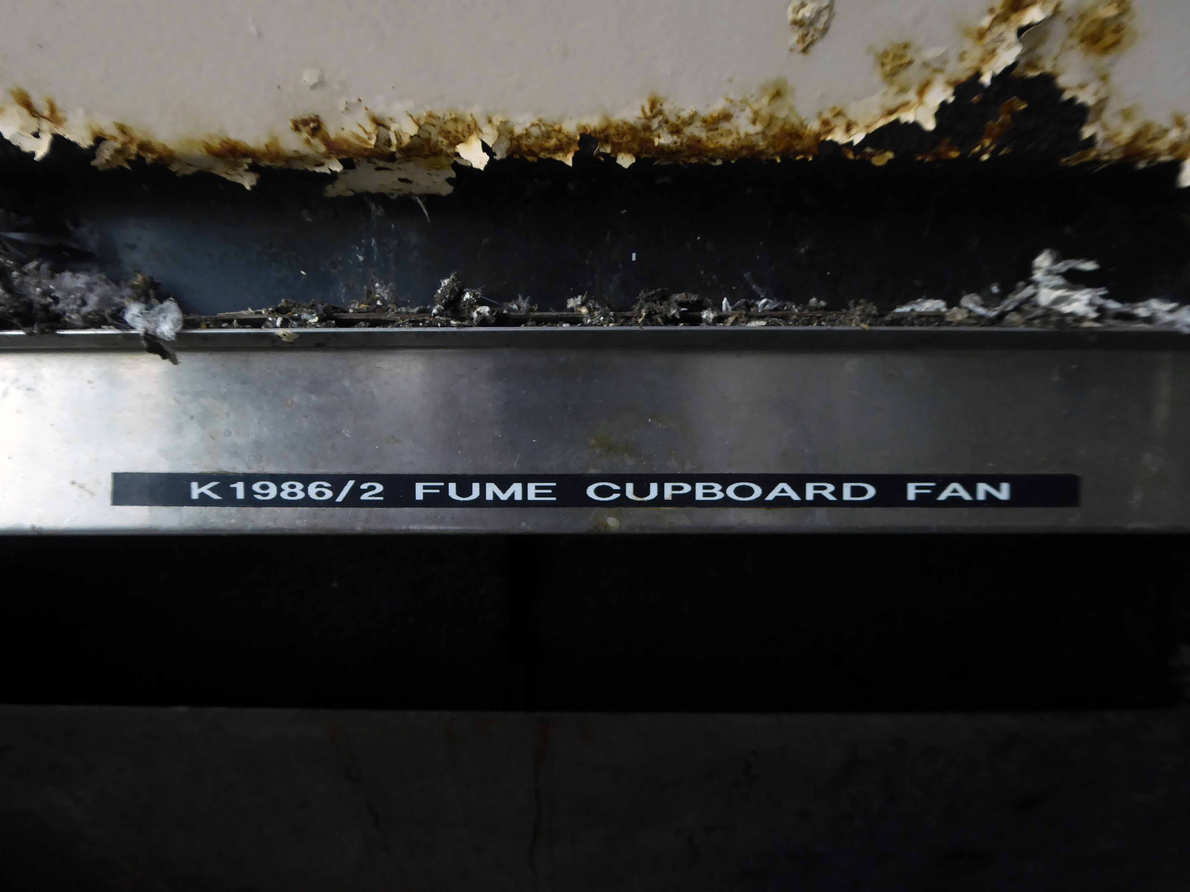
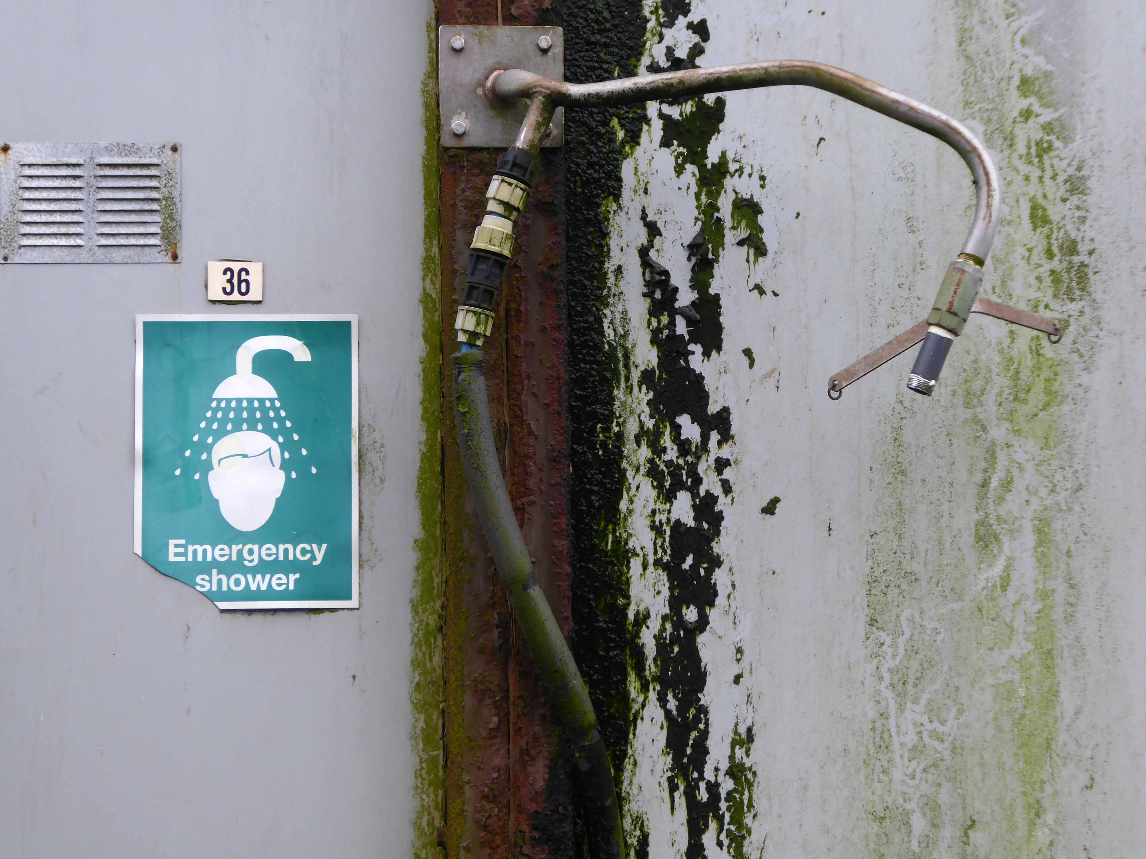
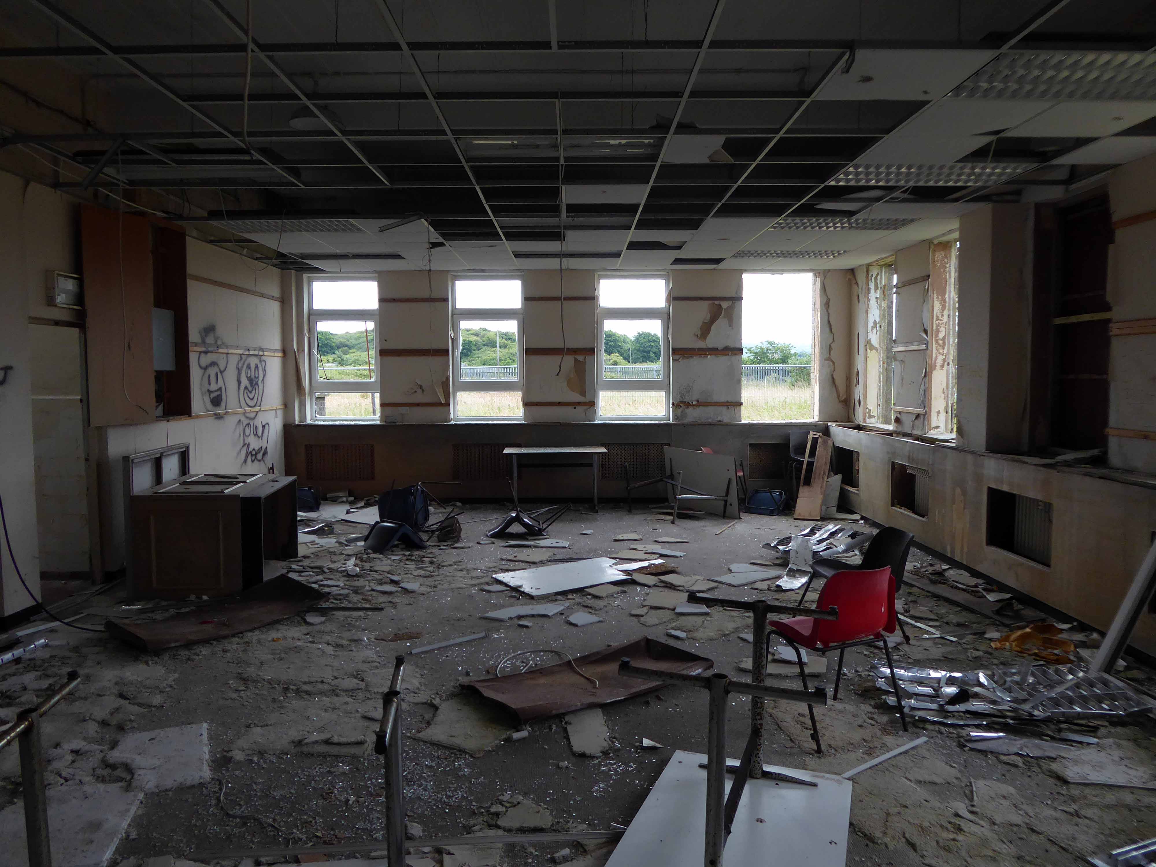
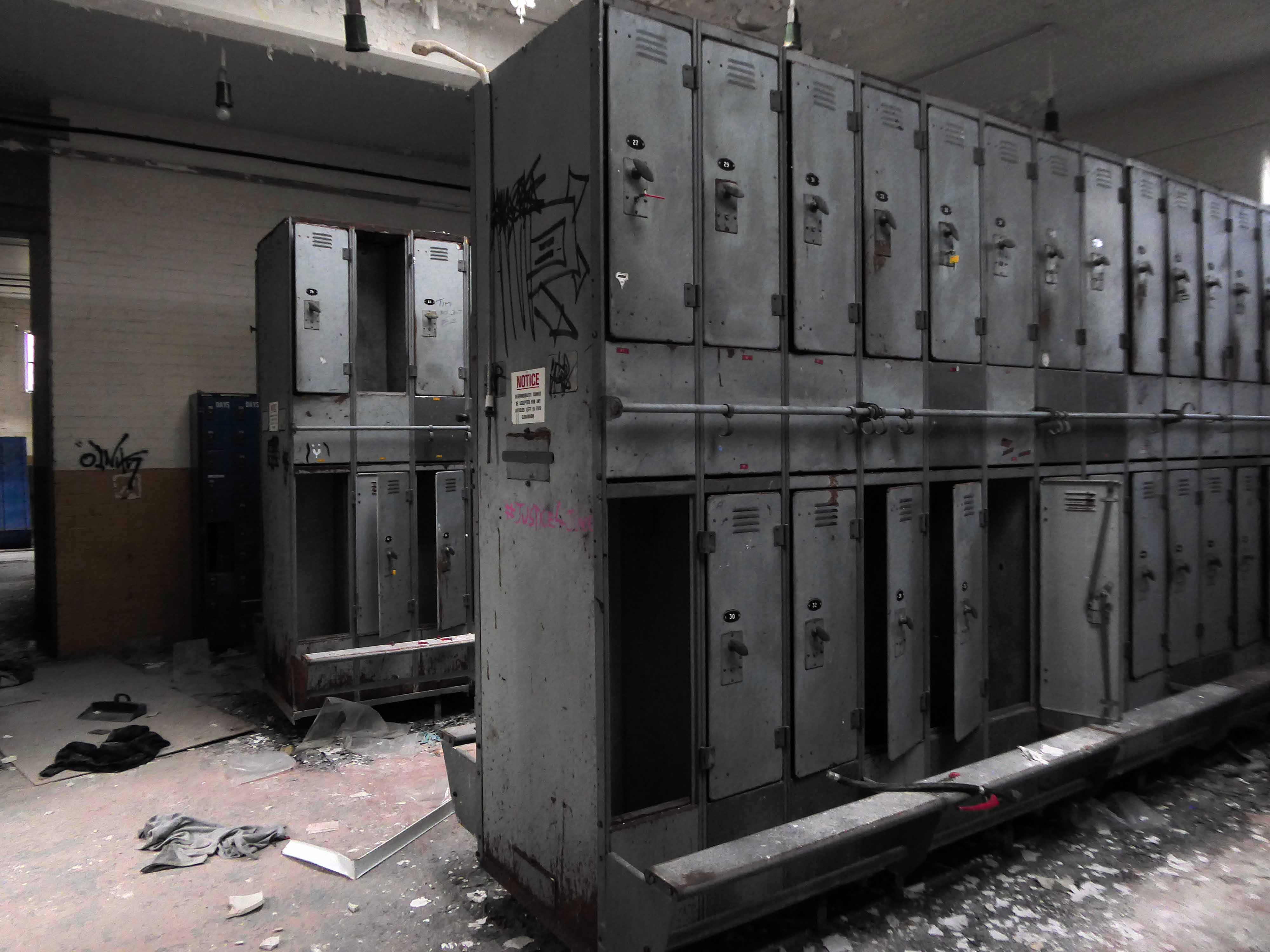
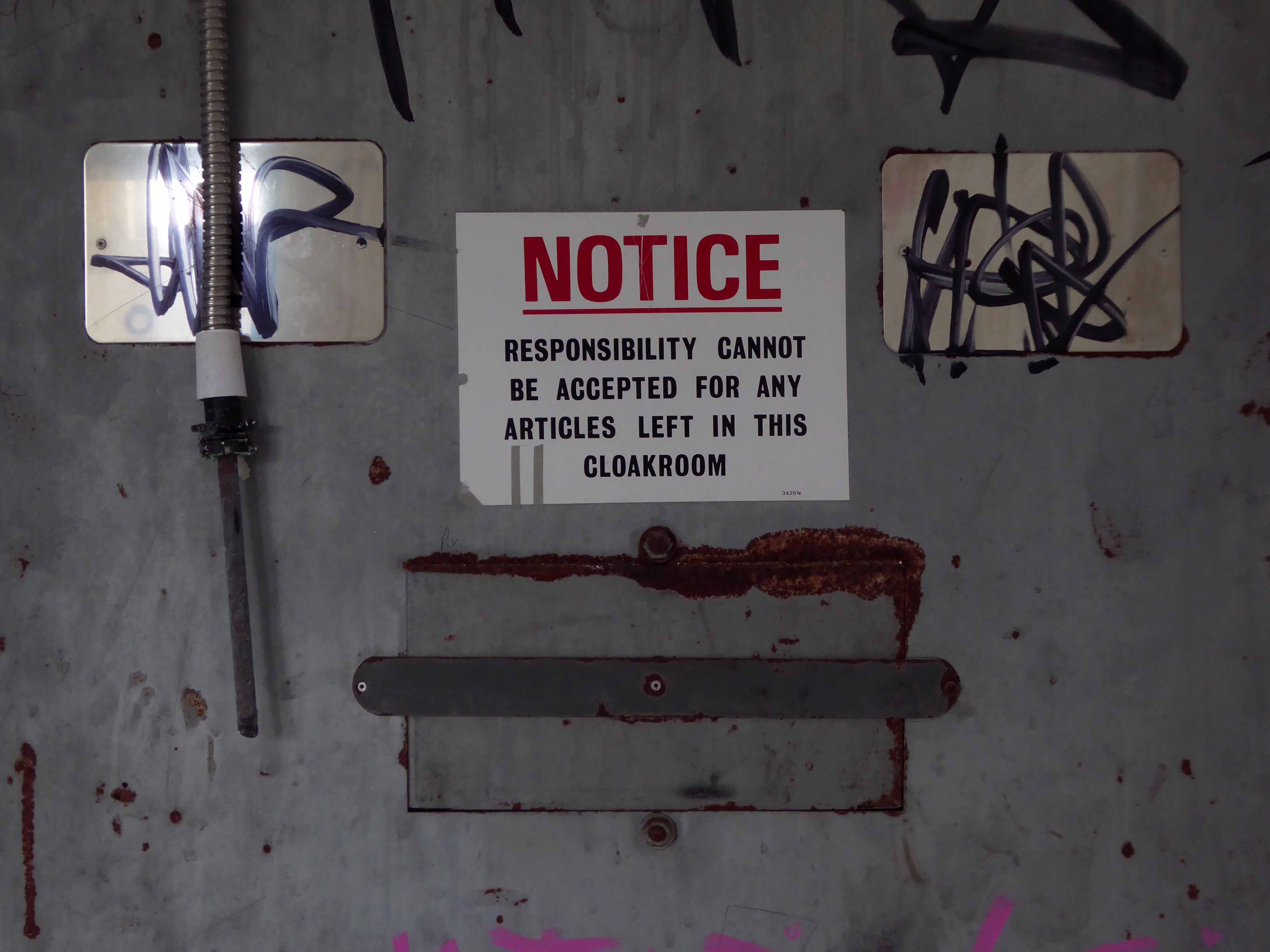
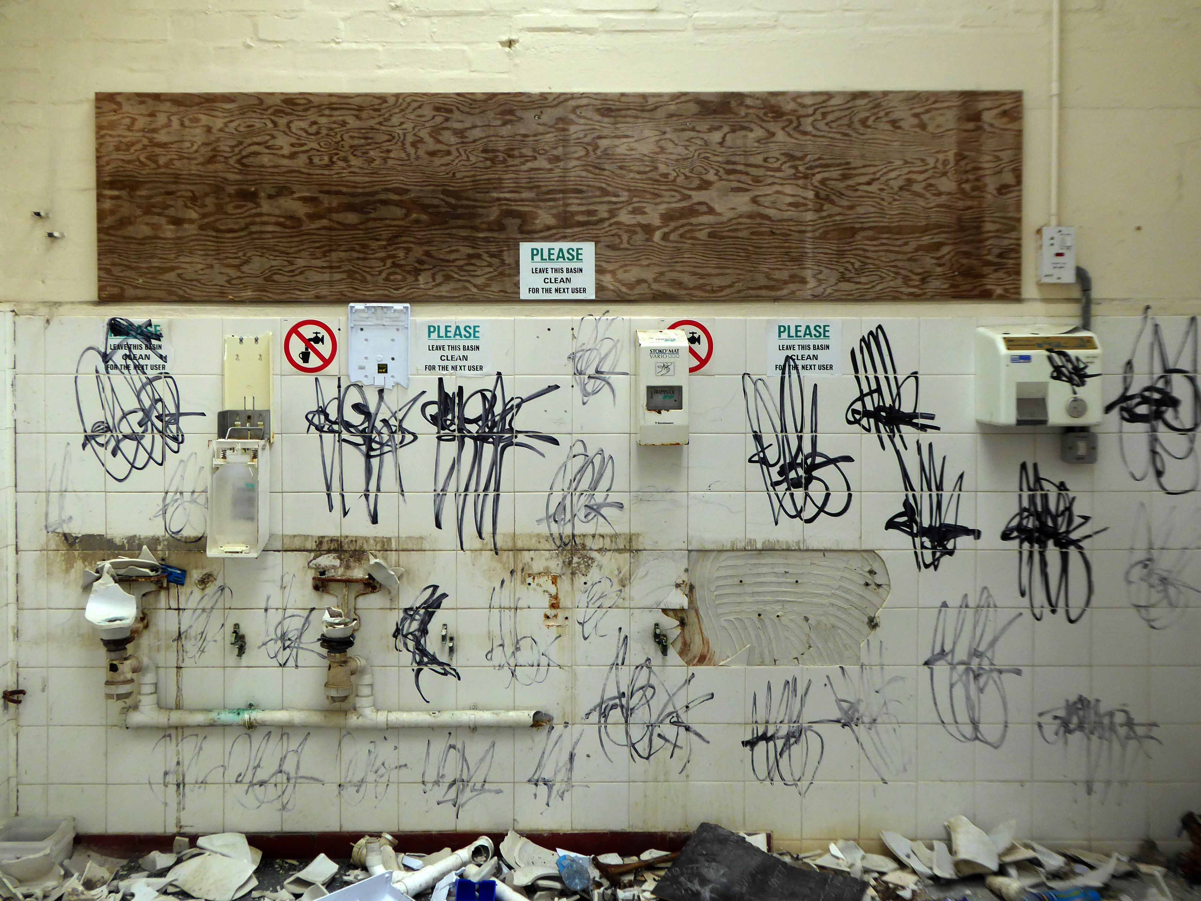
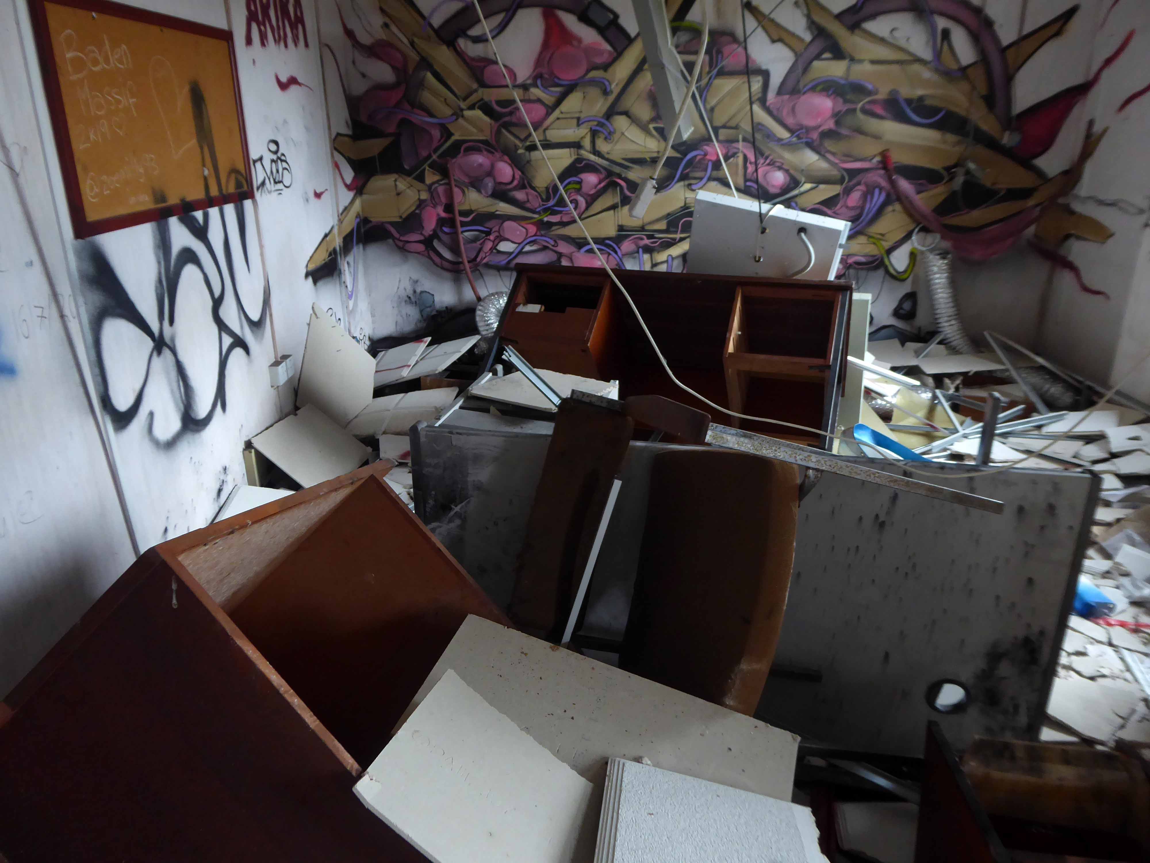
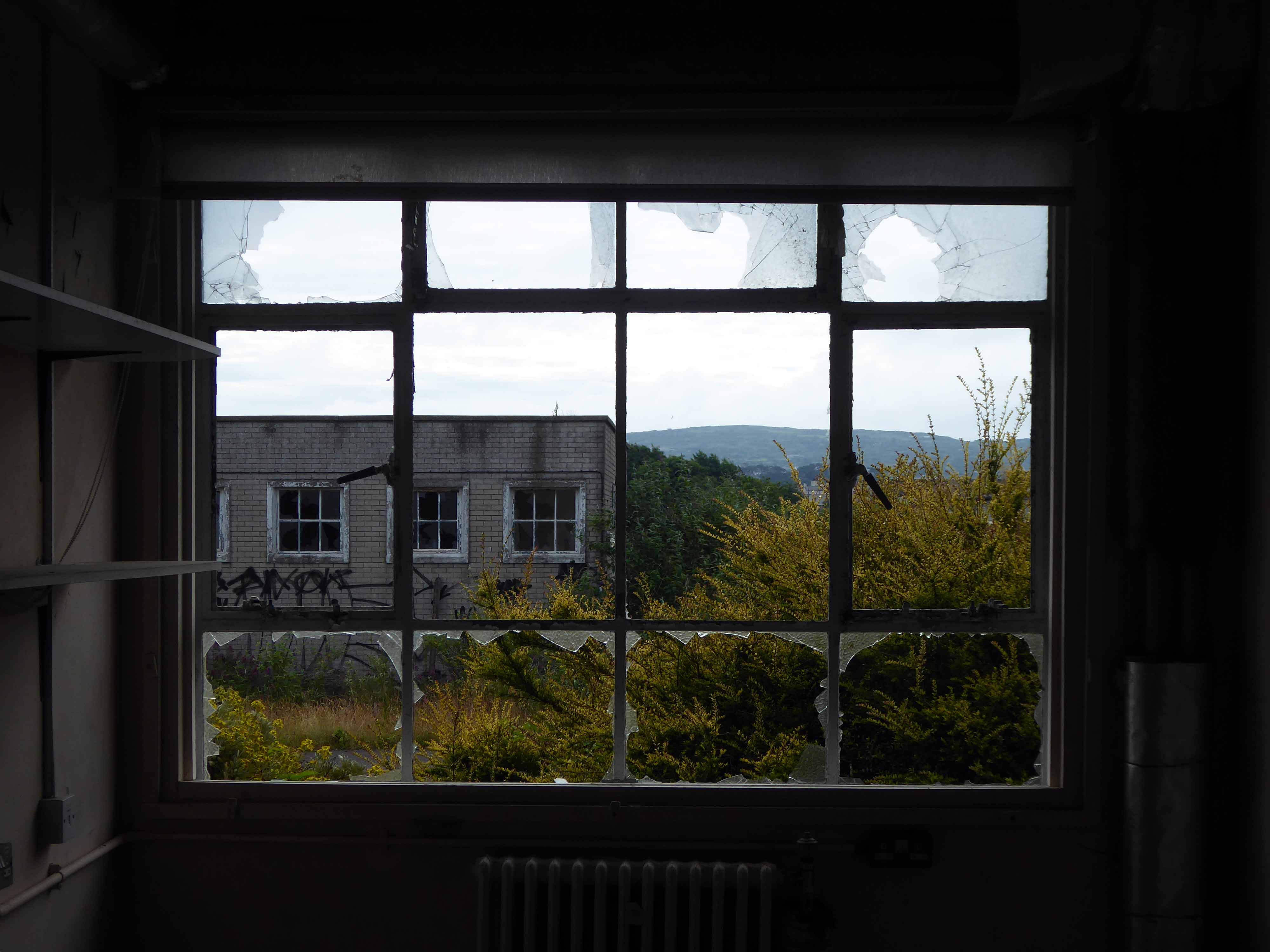
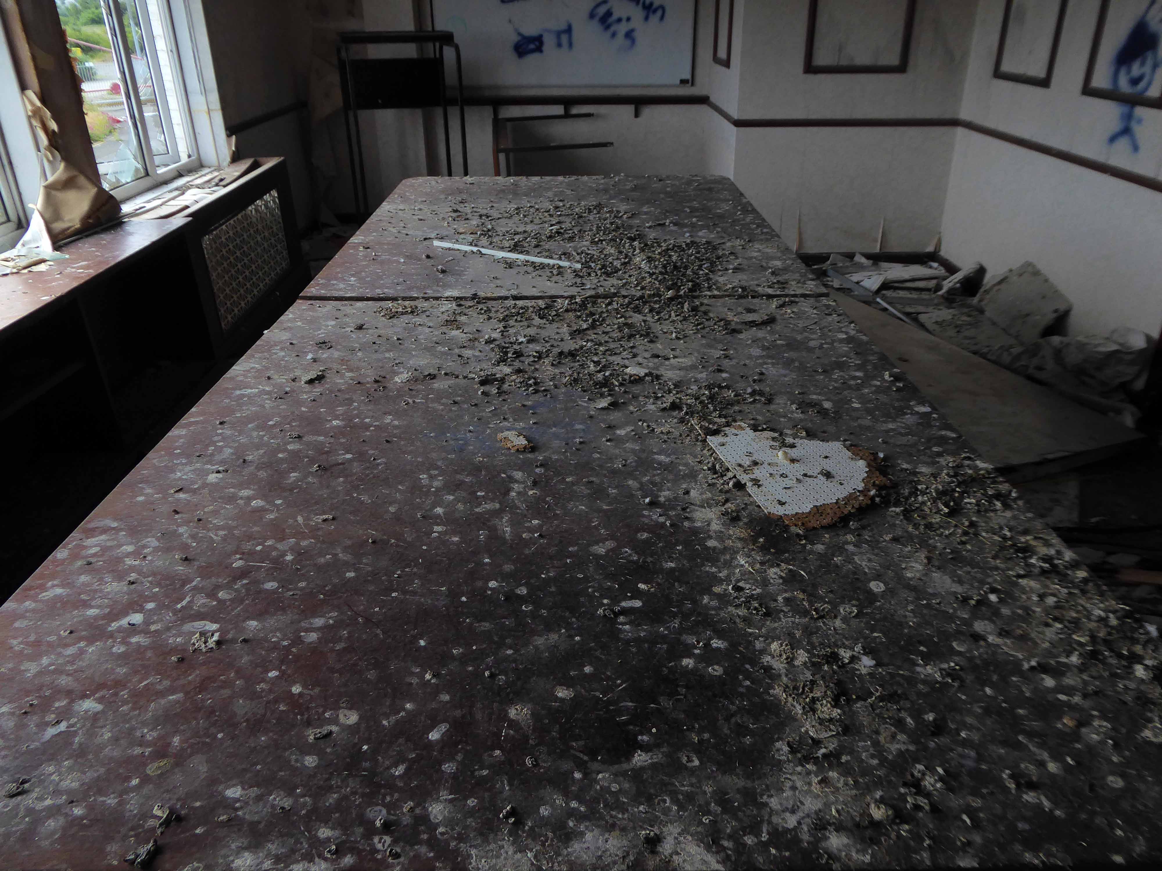
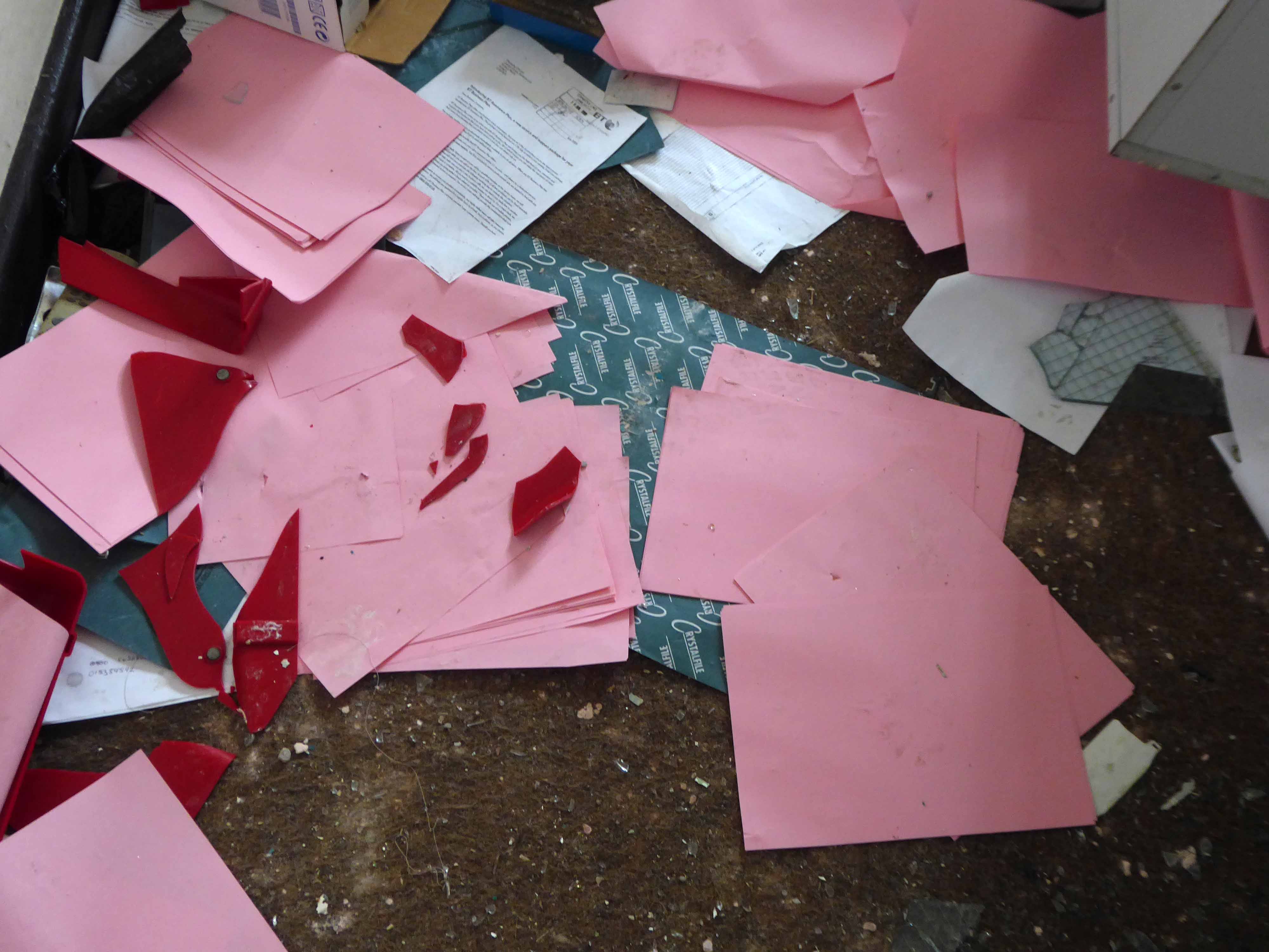
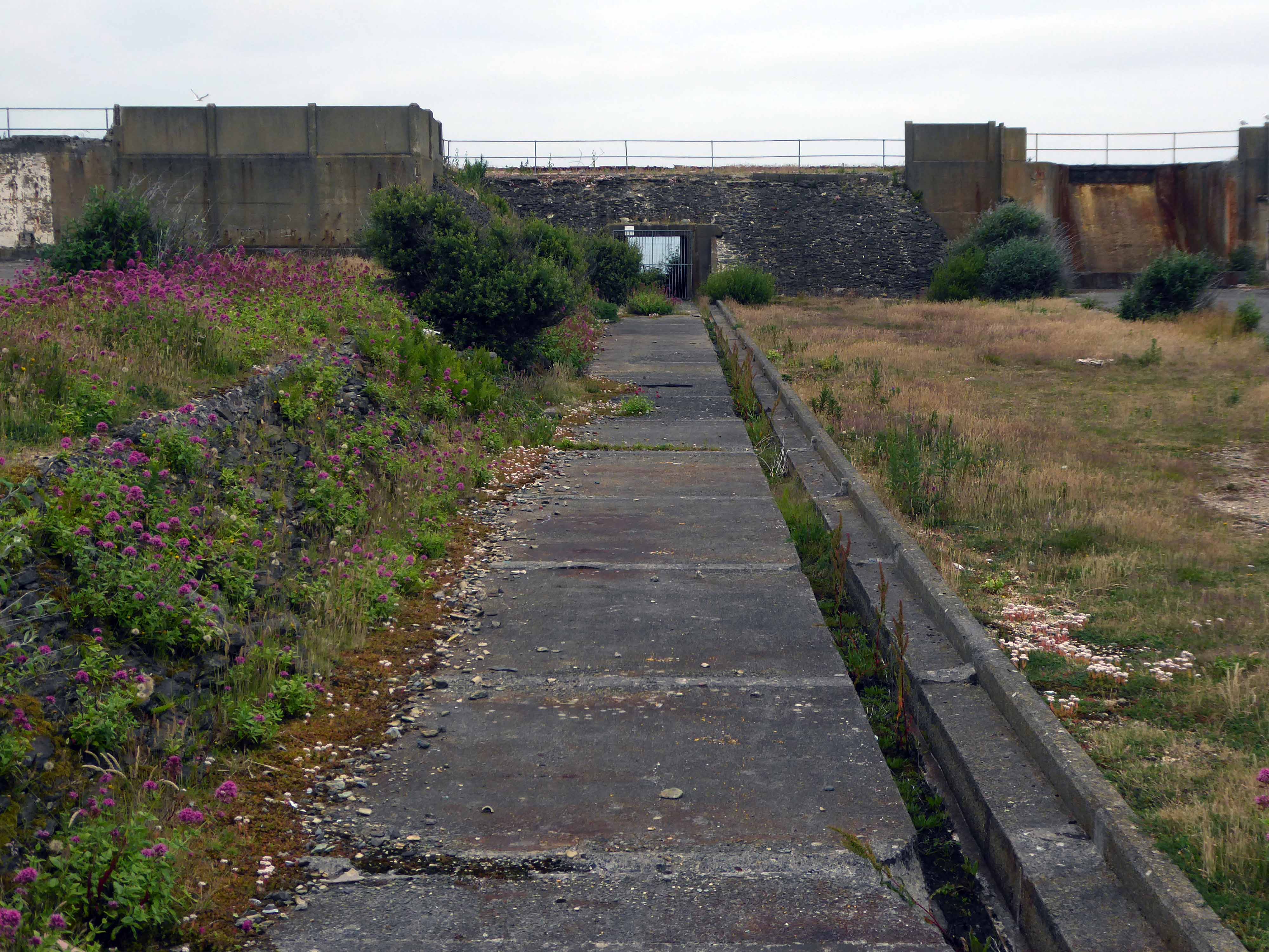
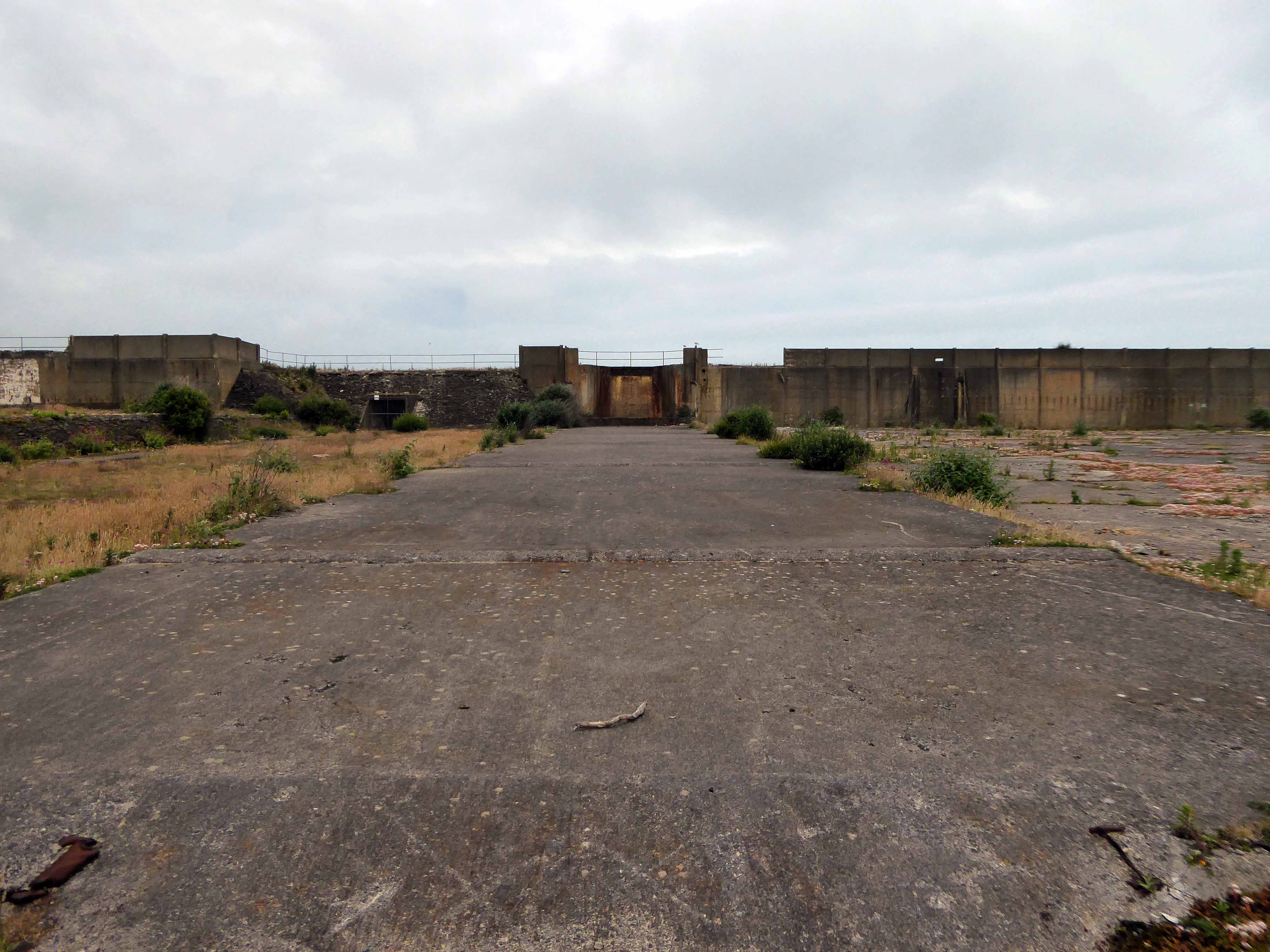
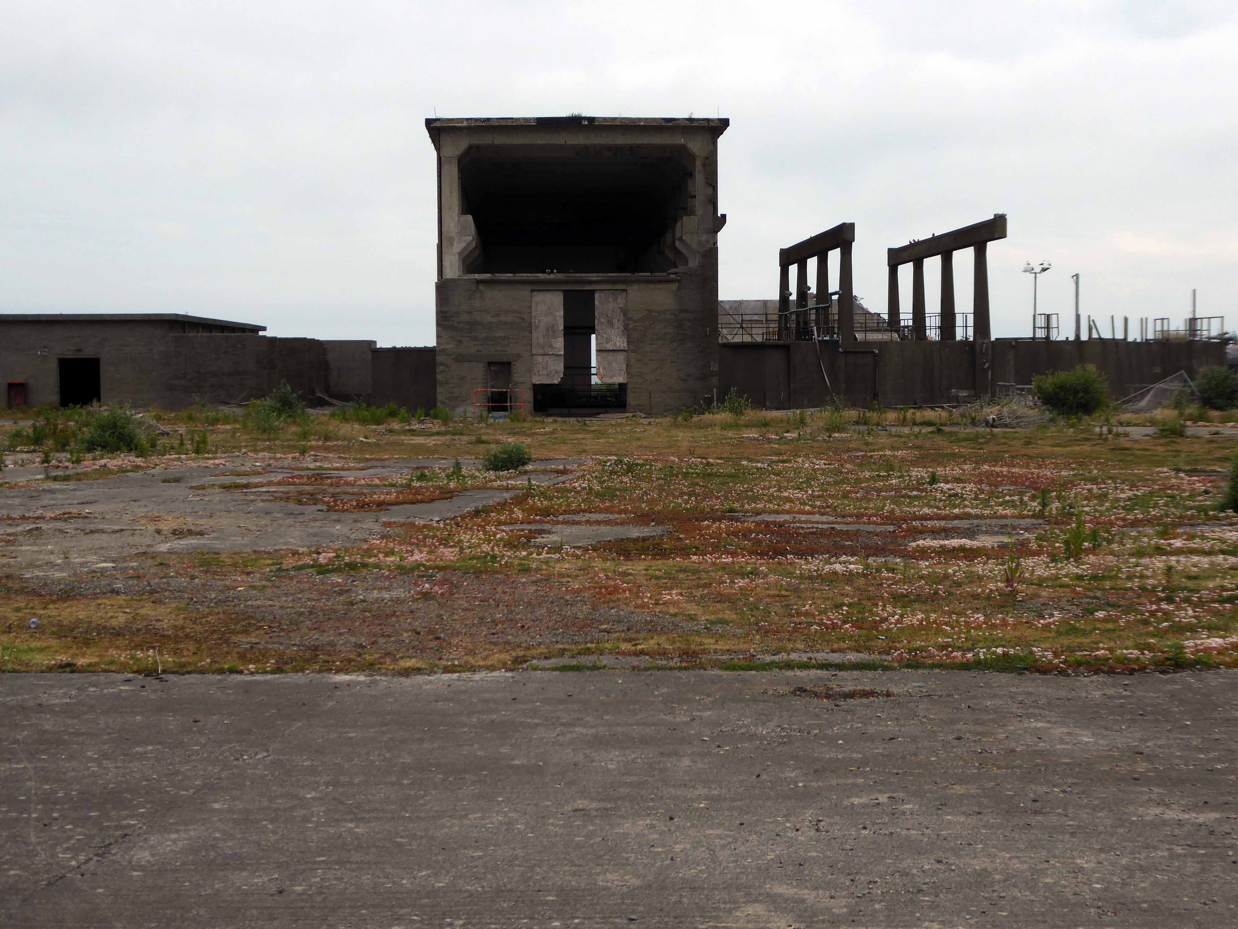
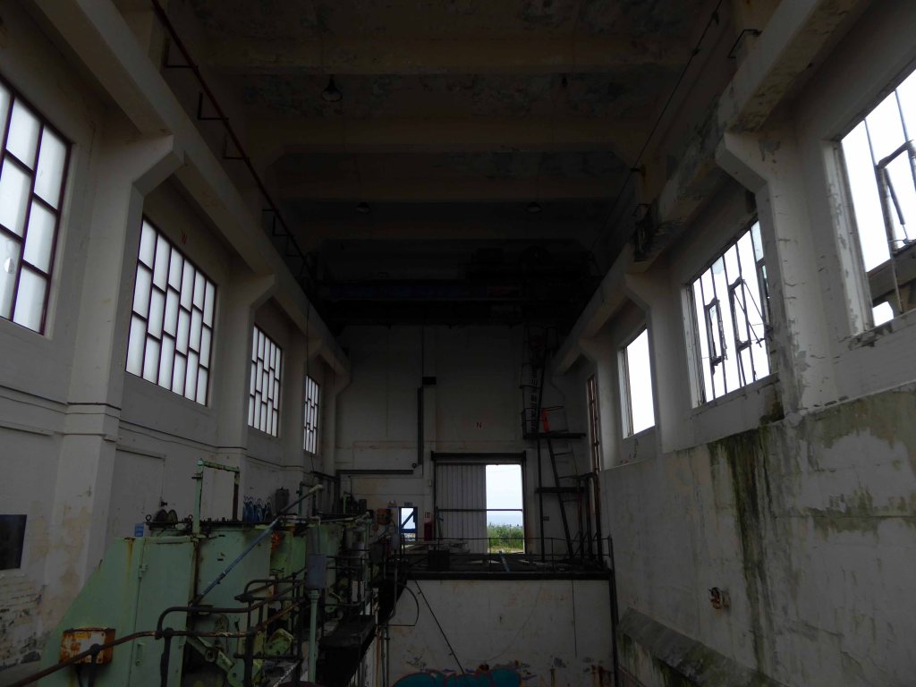
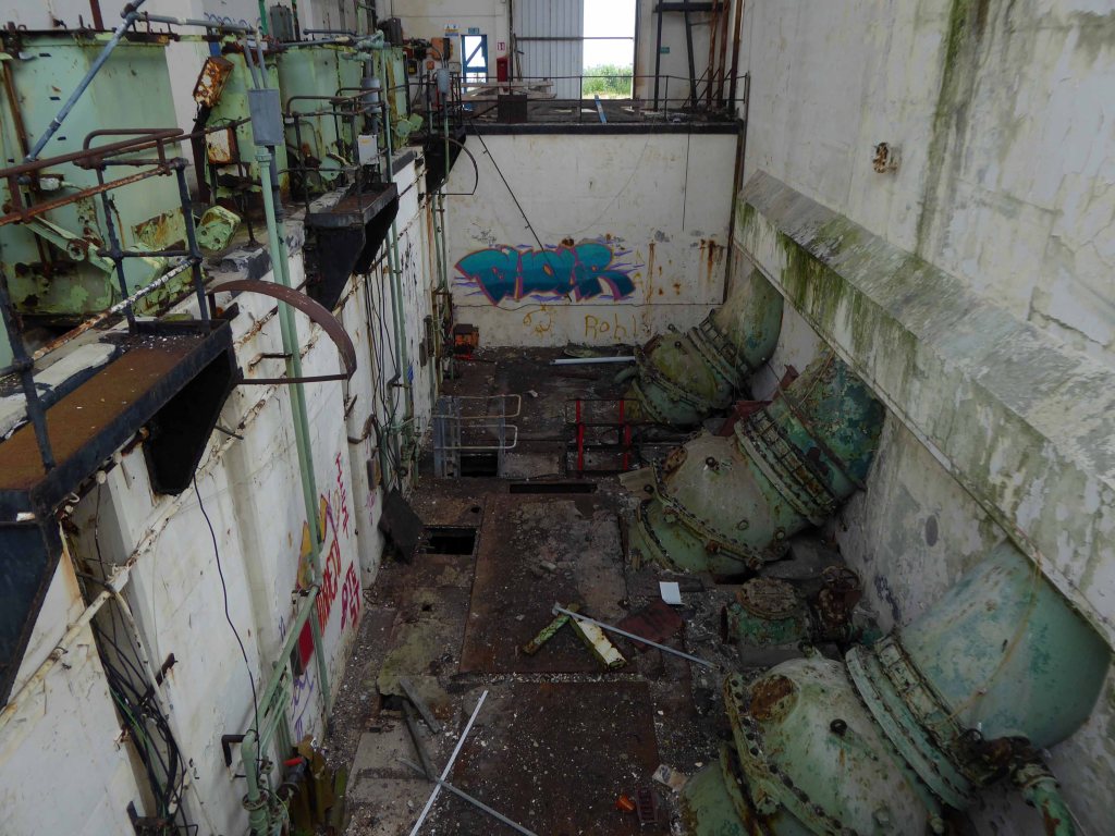
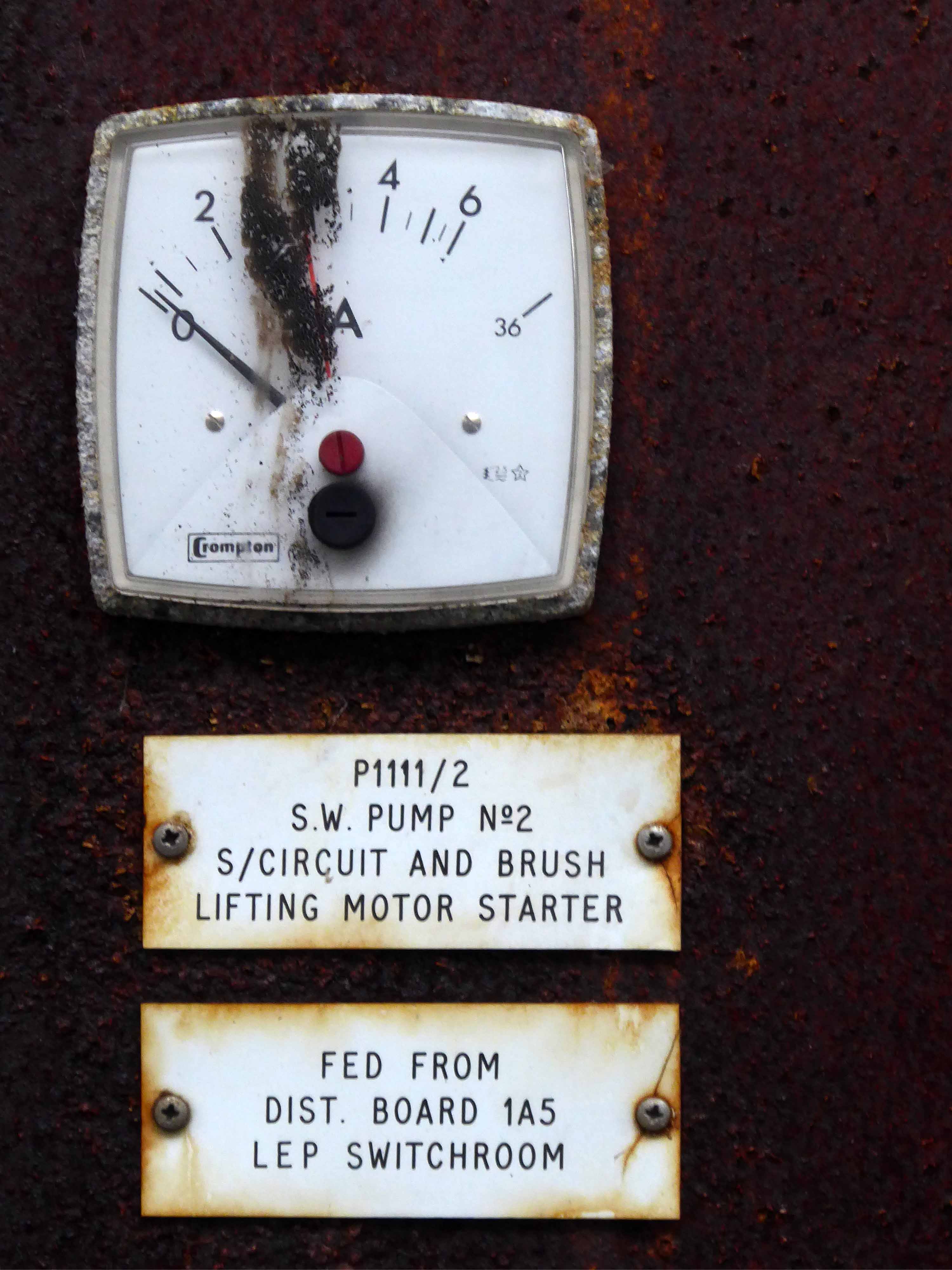
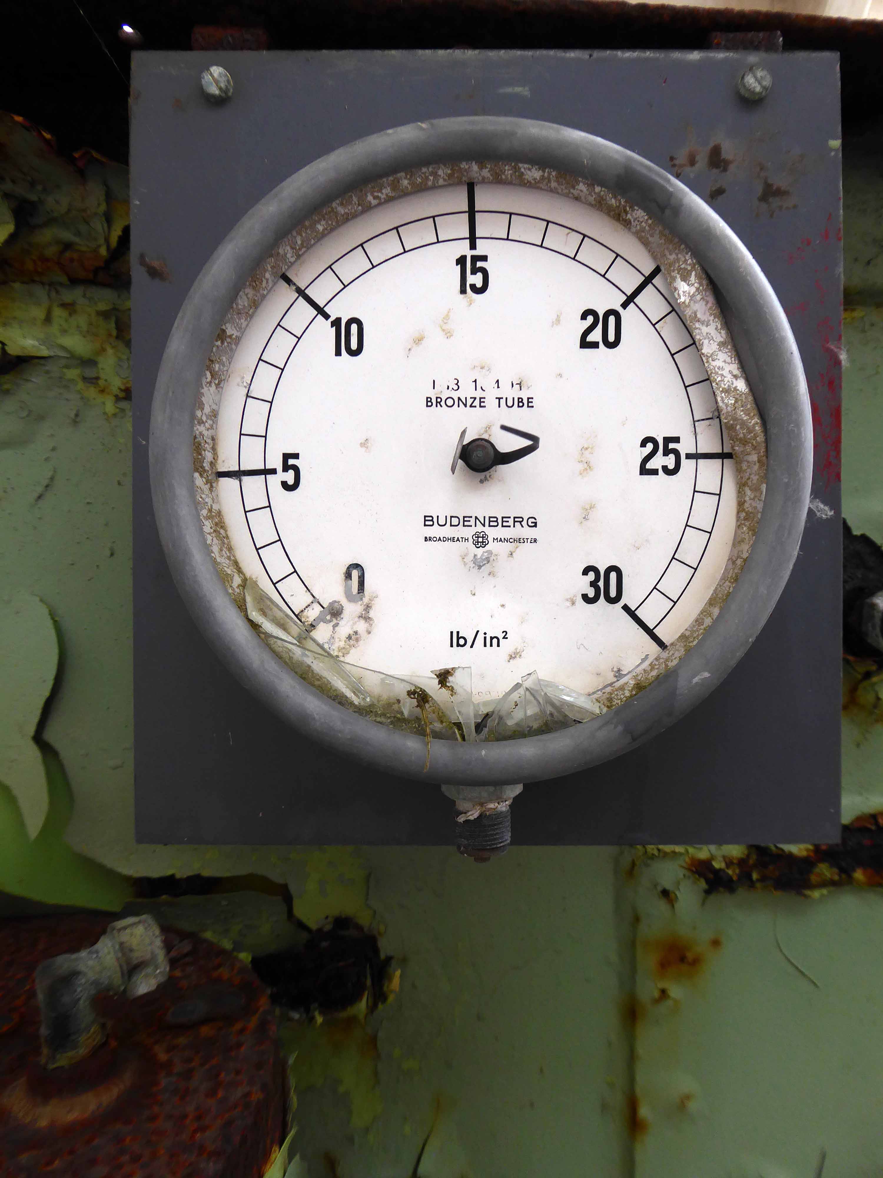
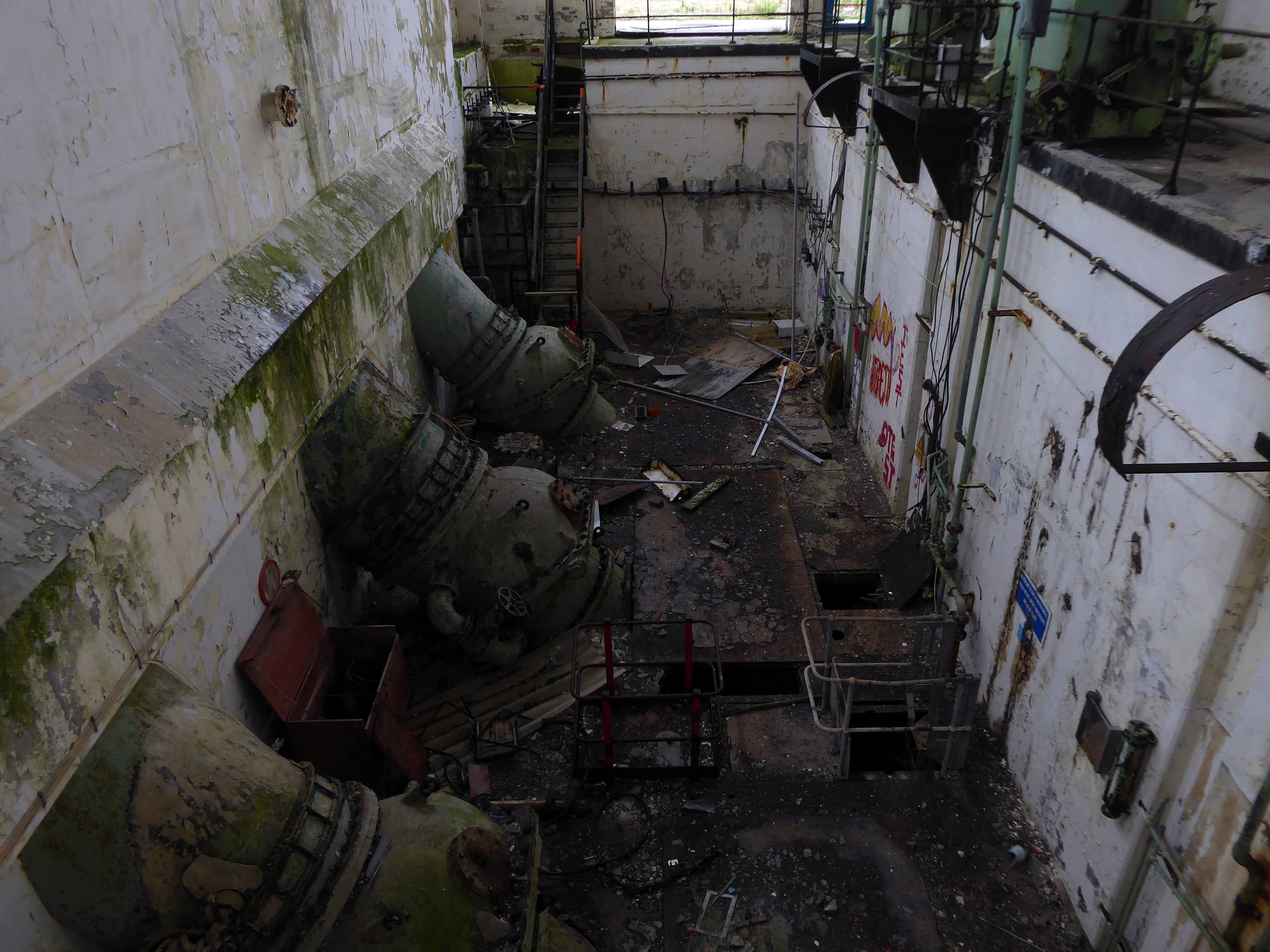
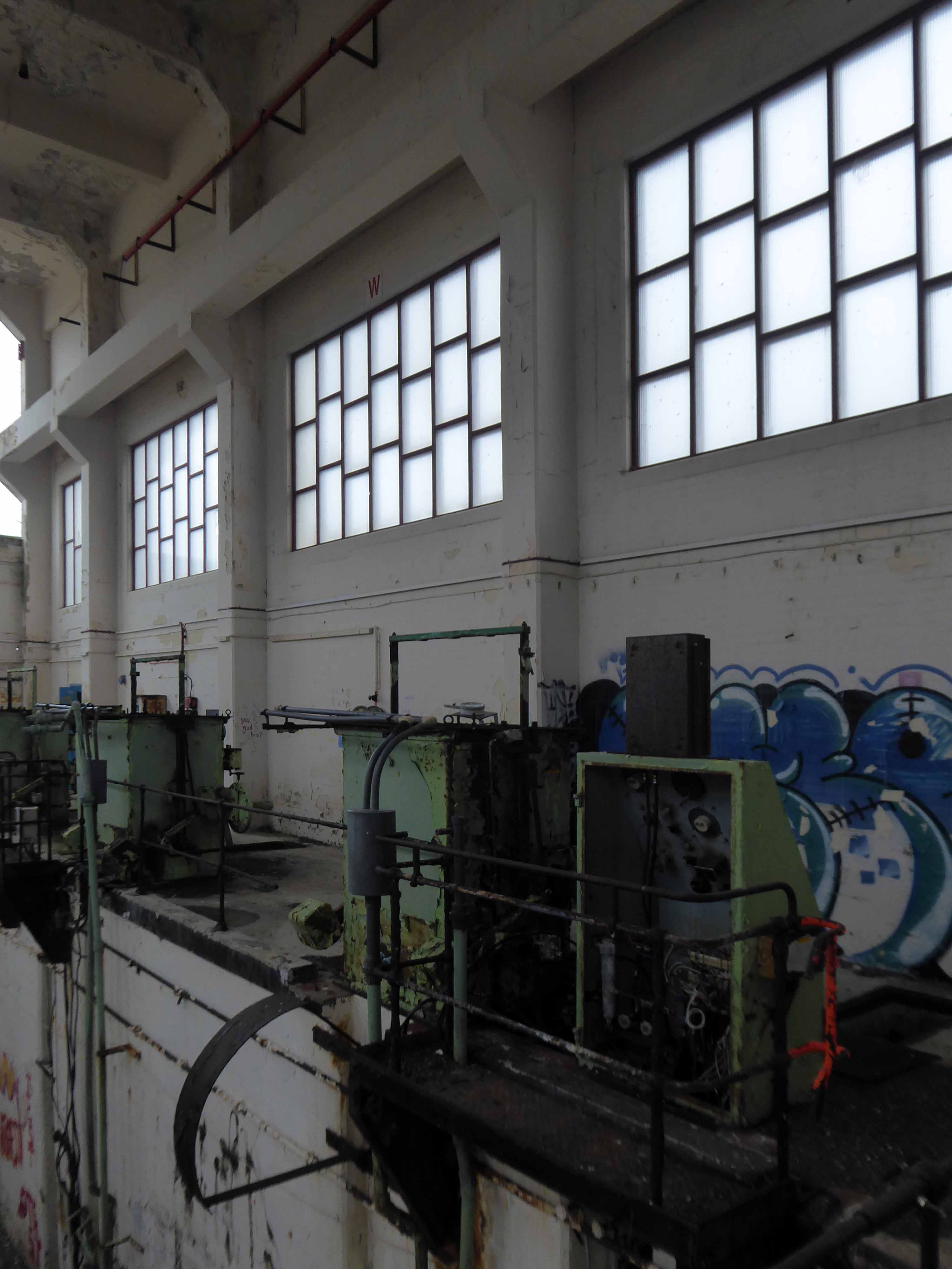
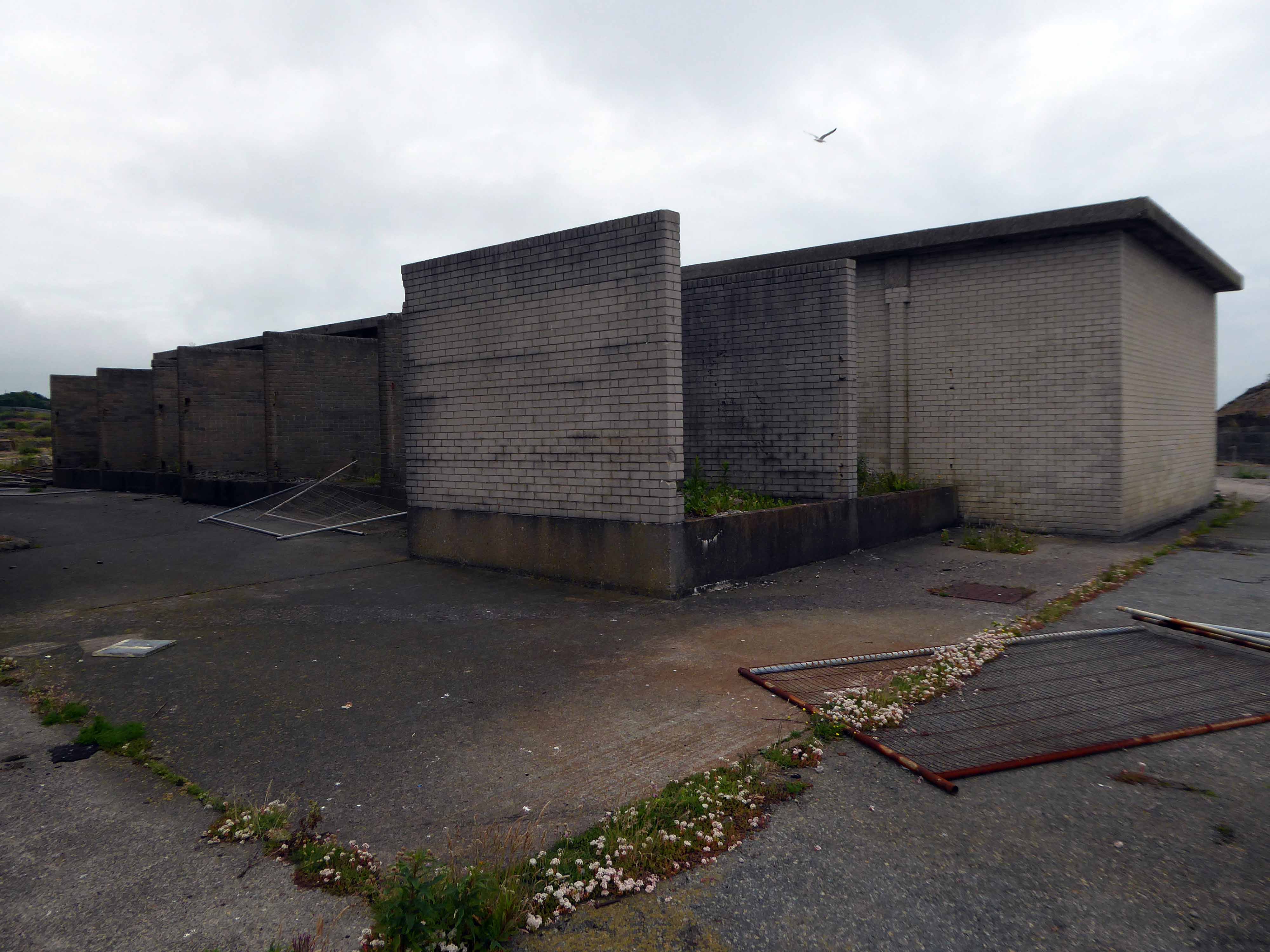
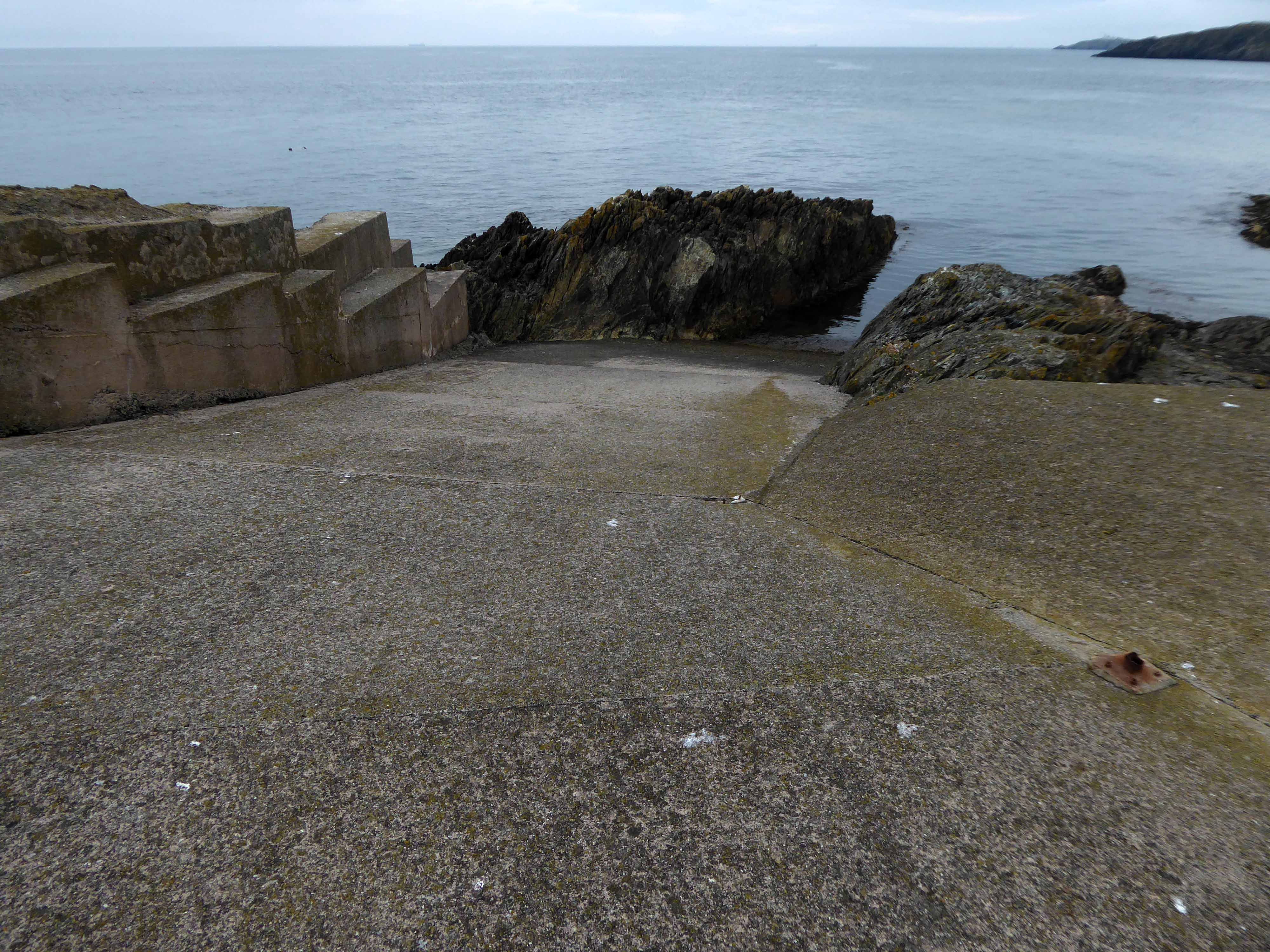
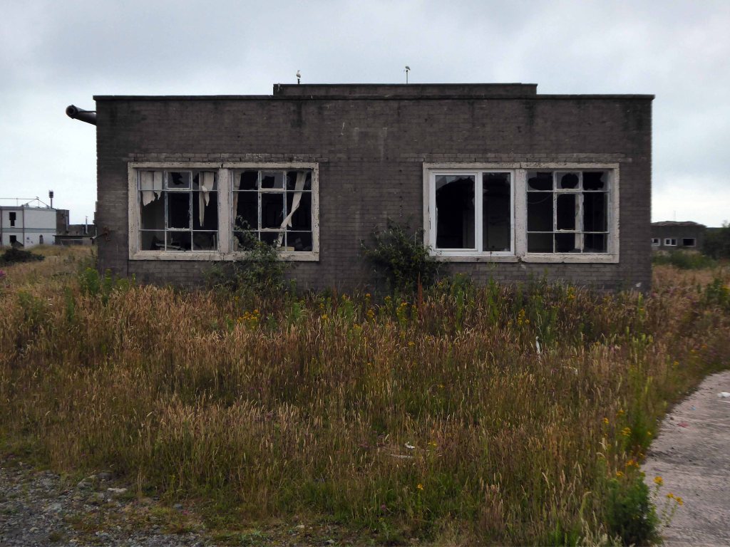
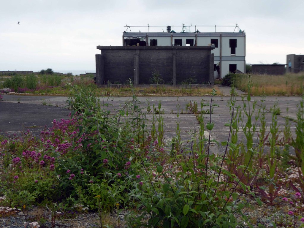
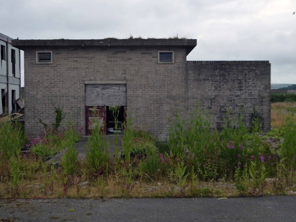
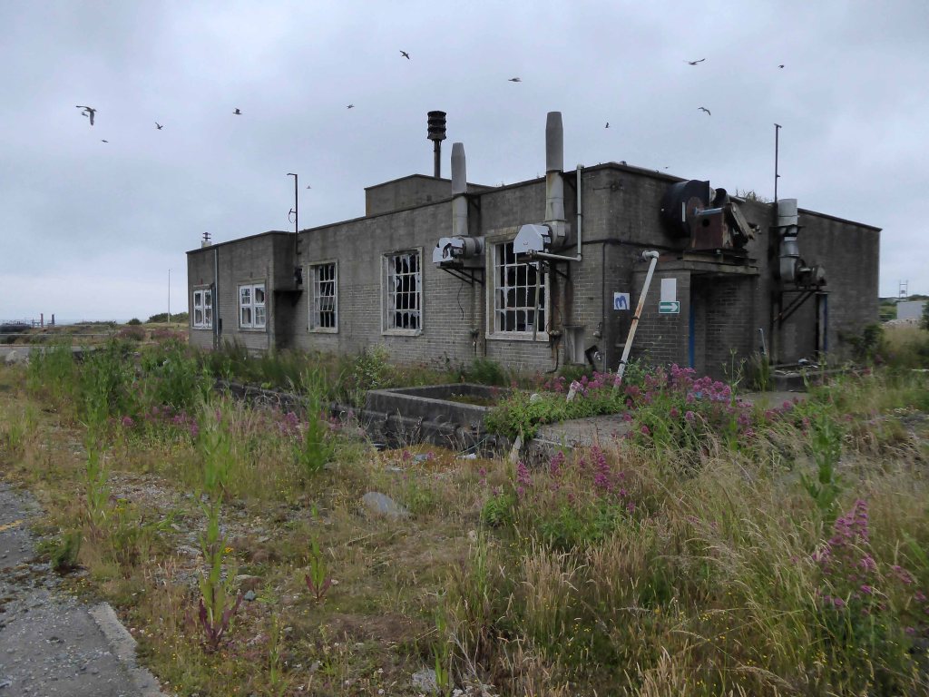
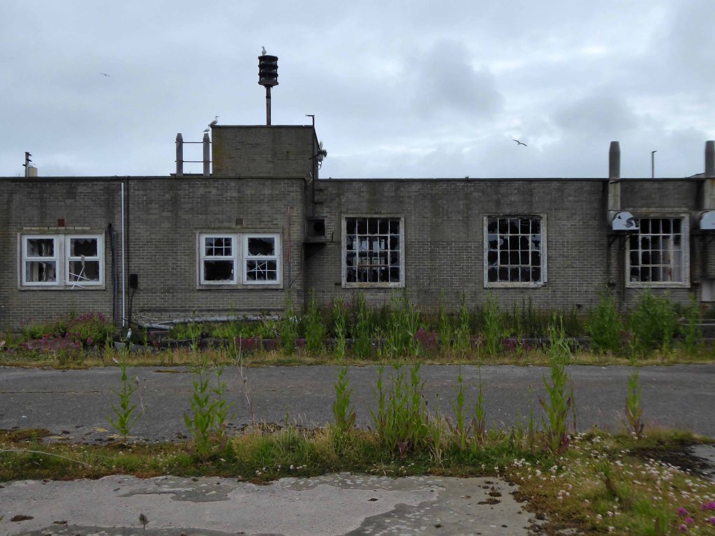
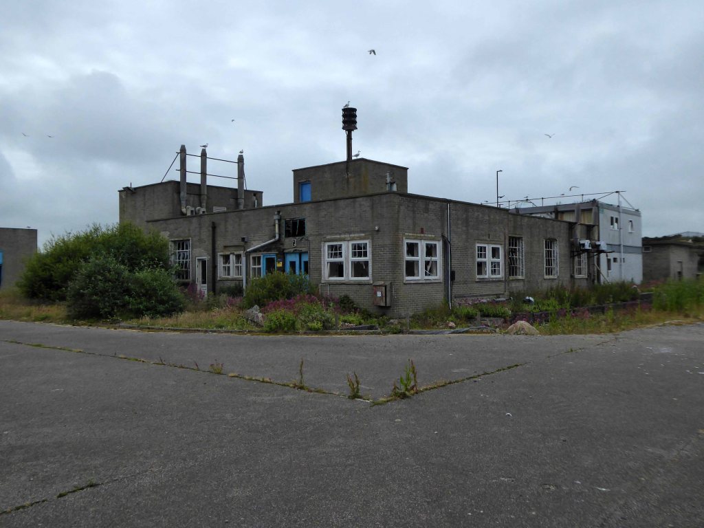
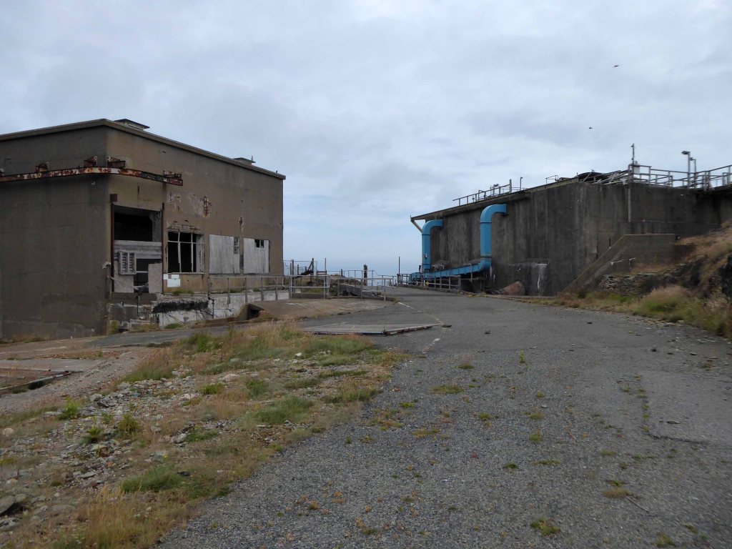
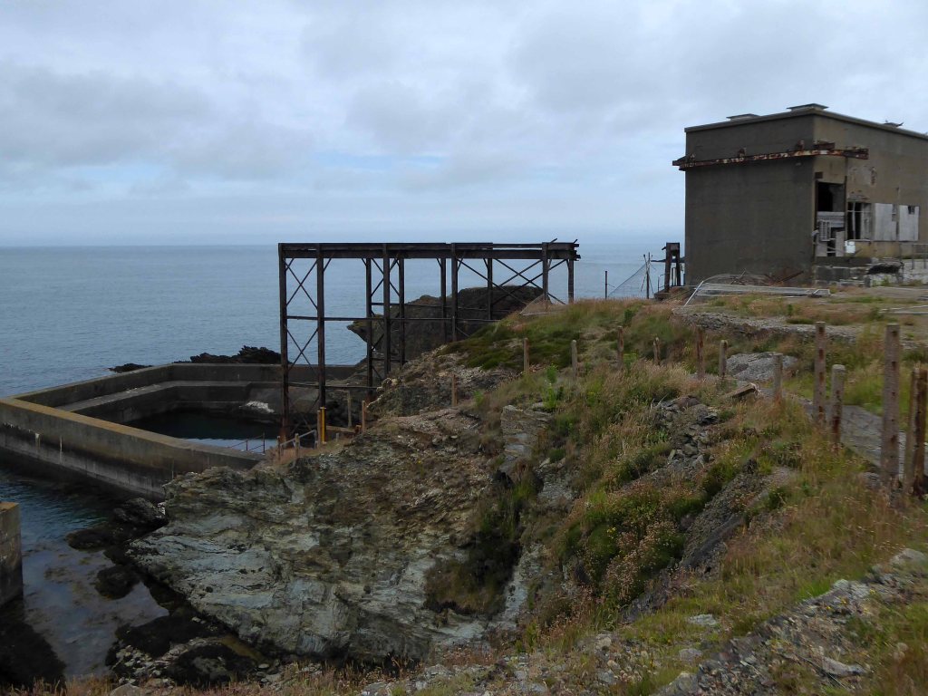
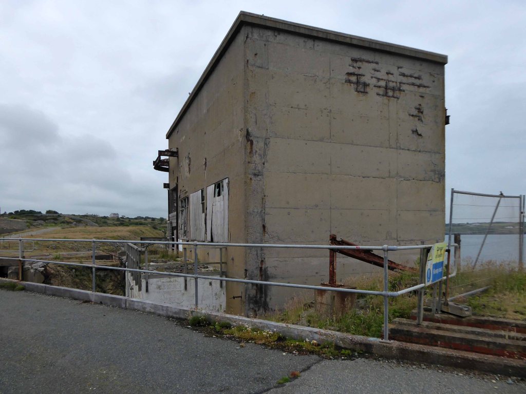
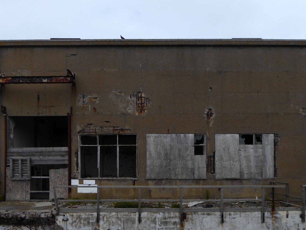
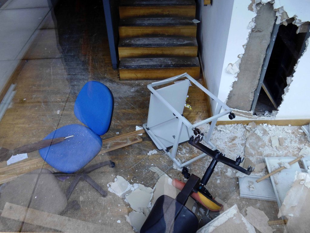
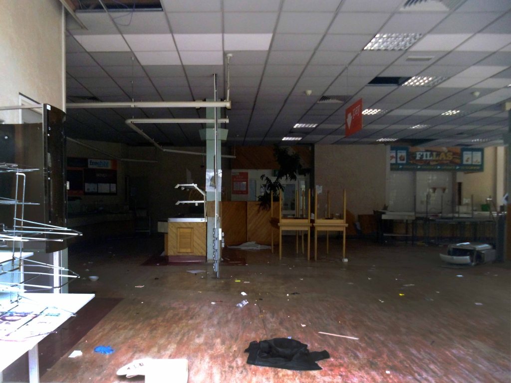
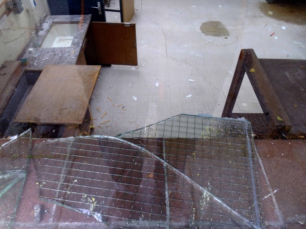
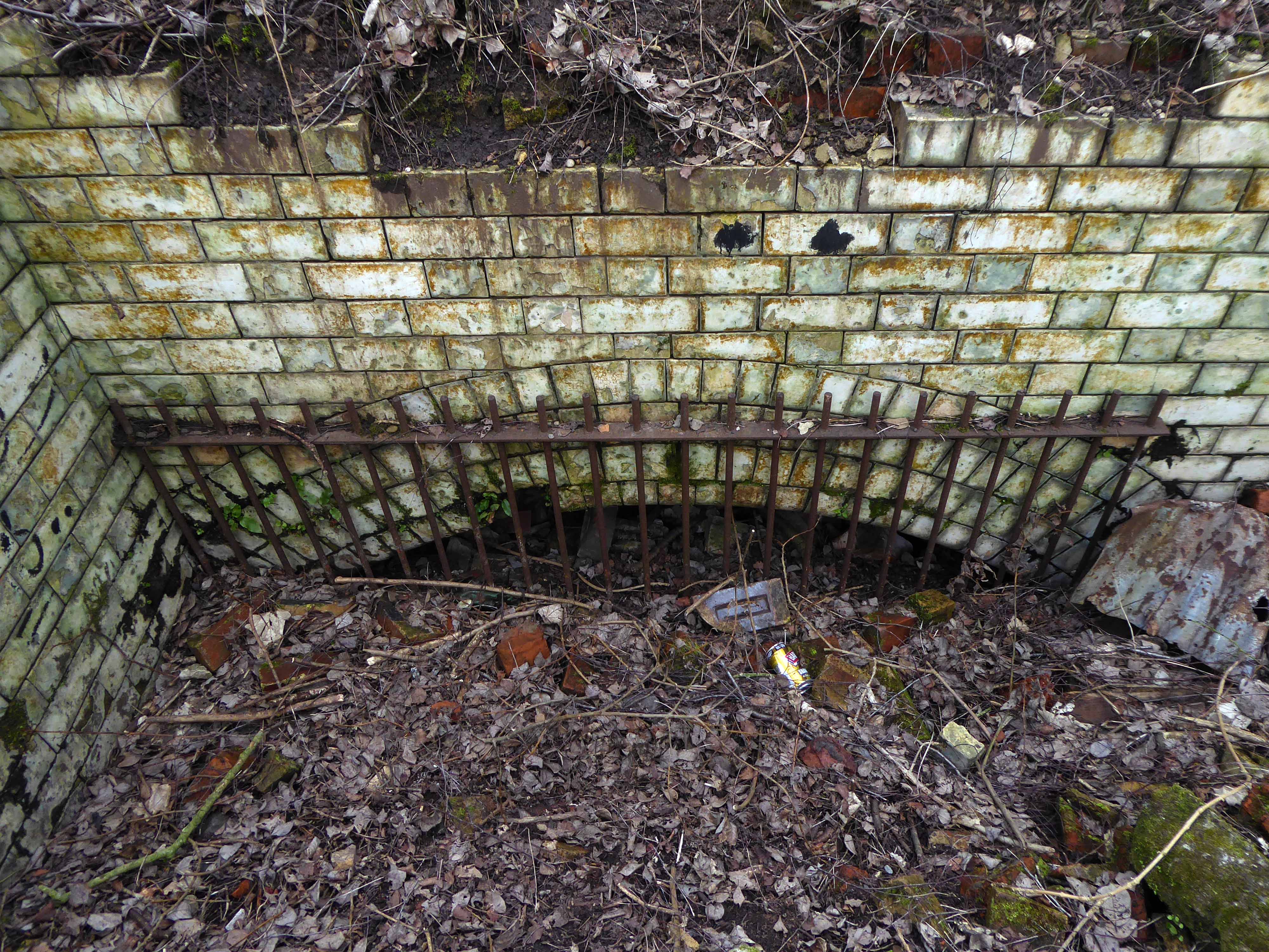
Having appraised the exteriors and pumping infrastructure, let us now consider the interior life of the site.
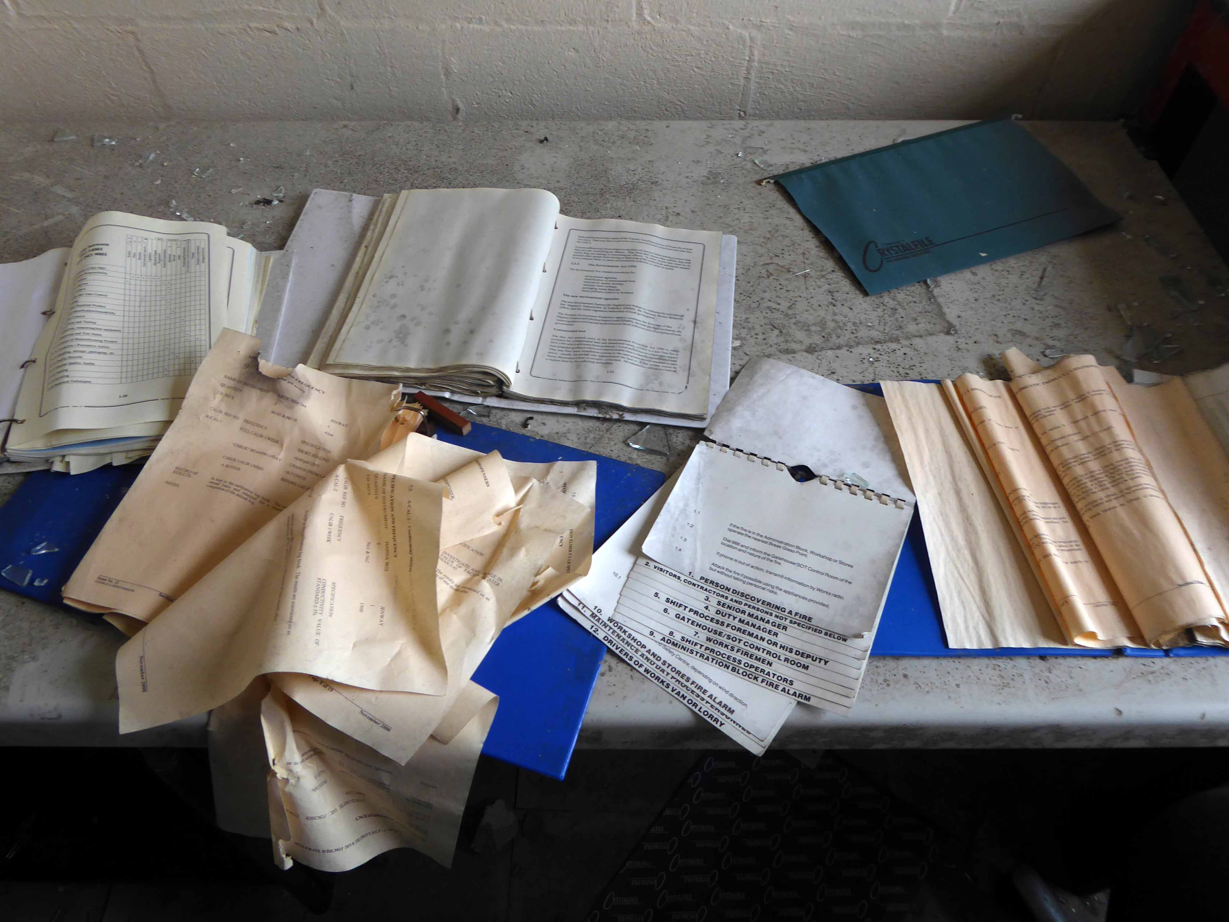
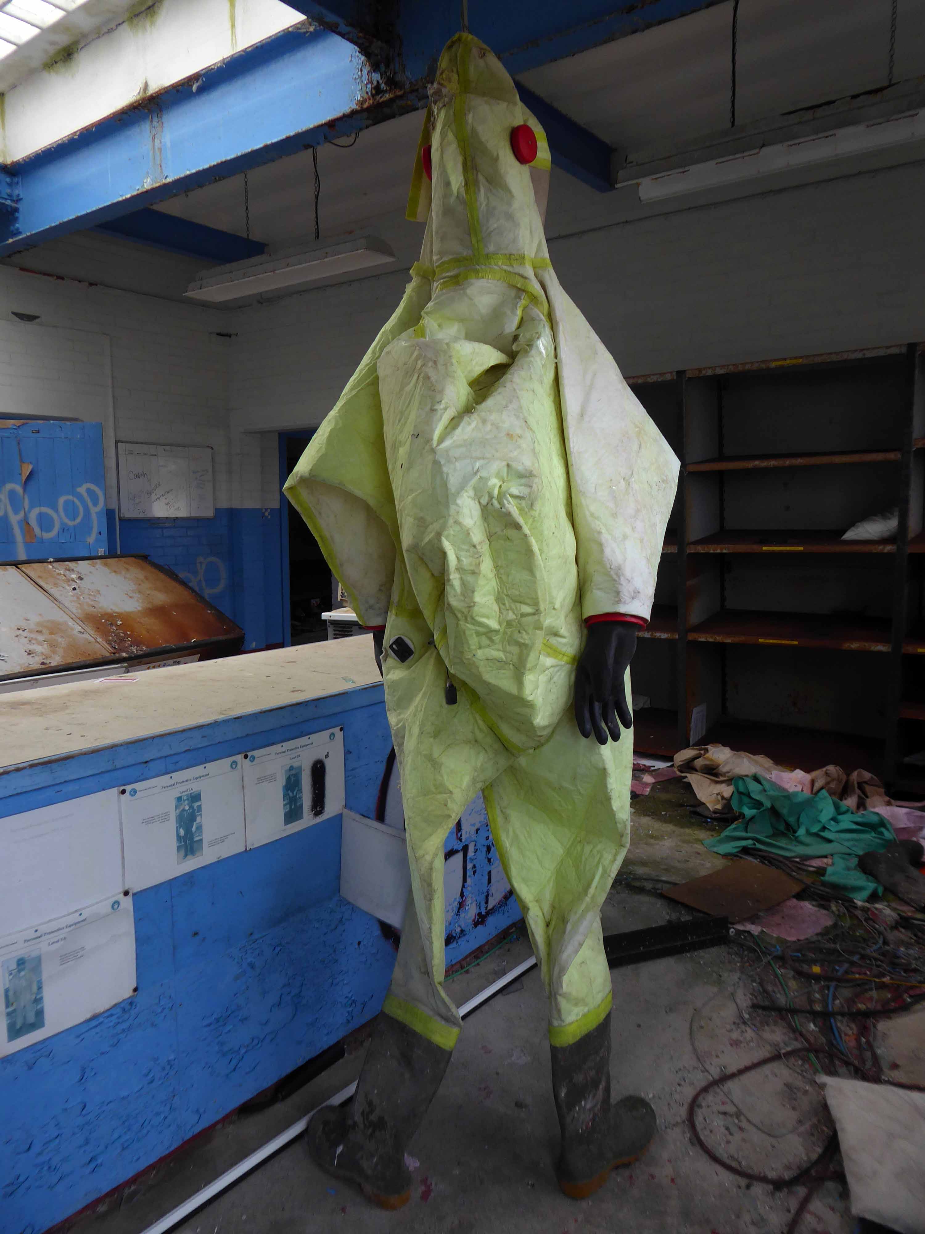
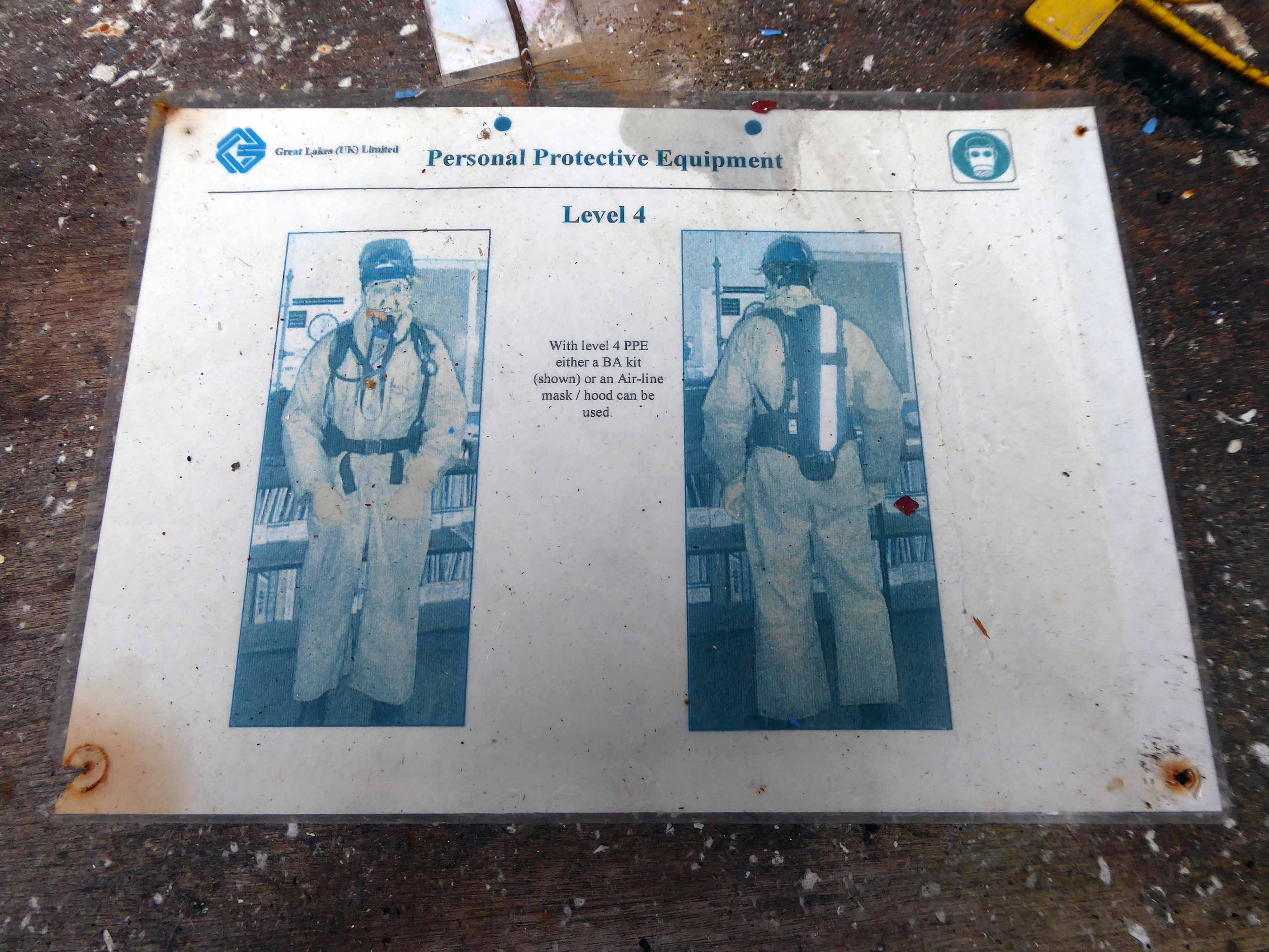
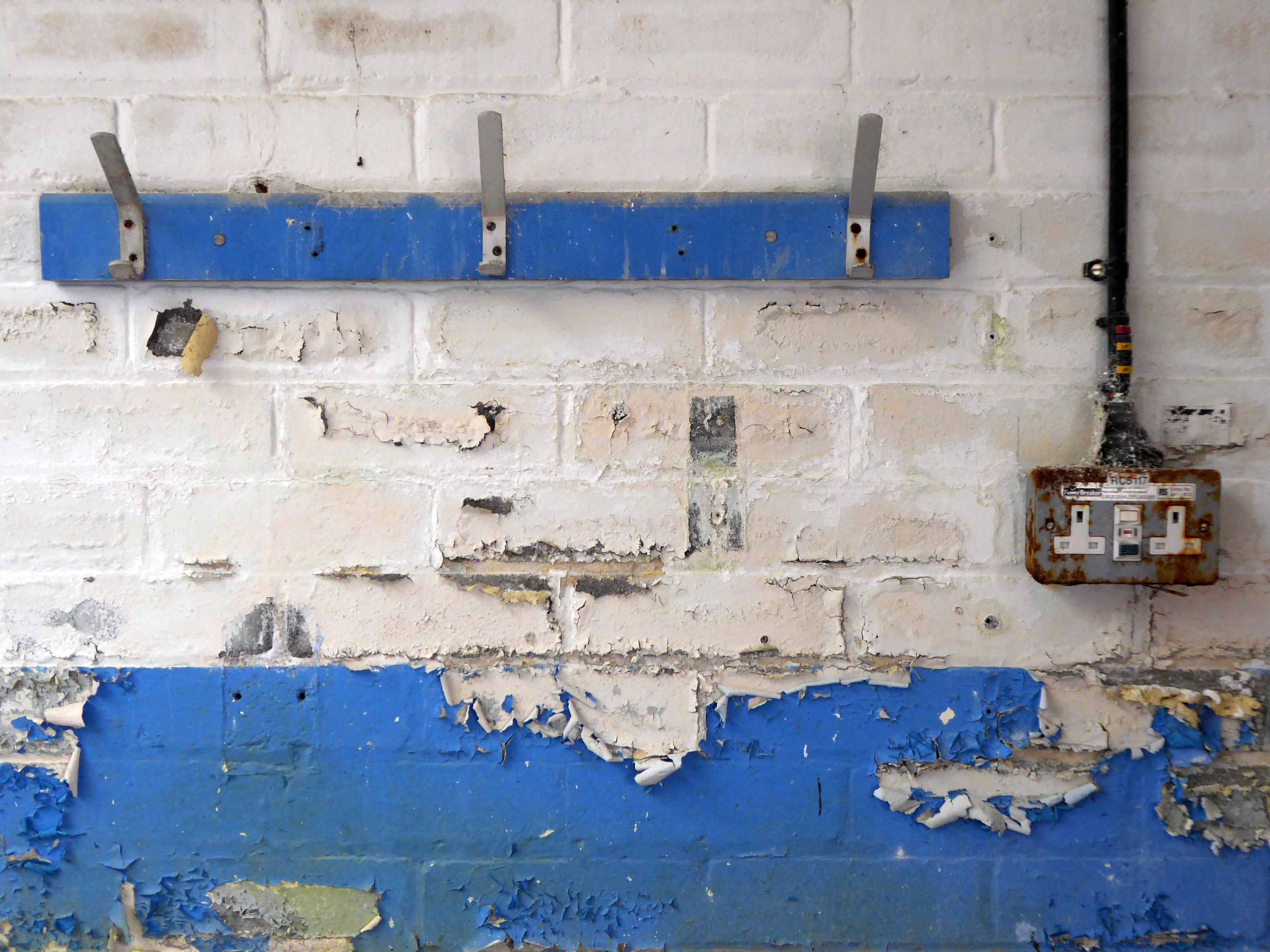
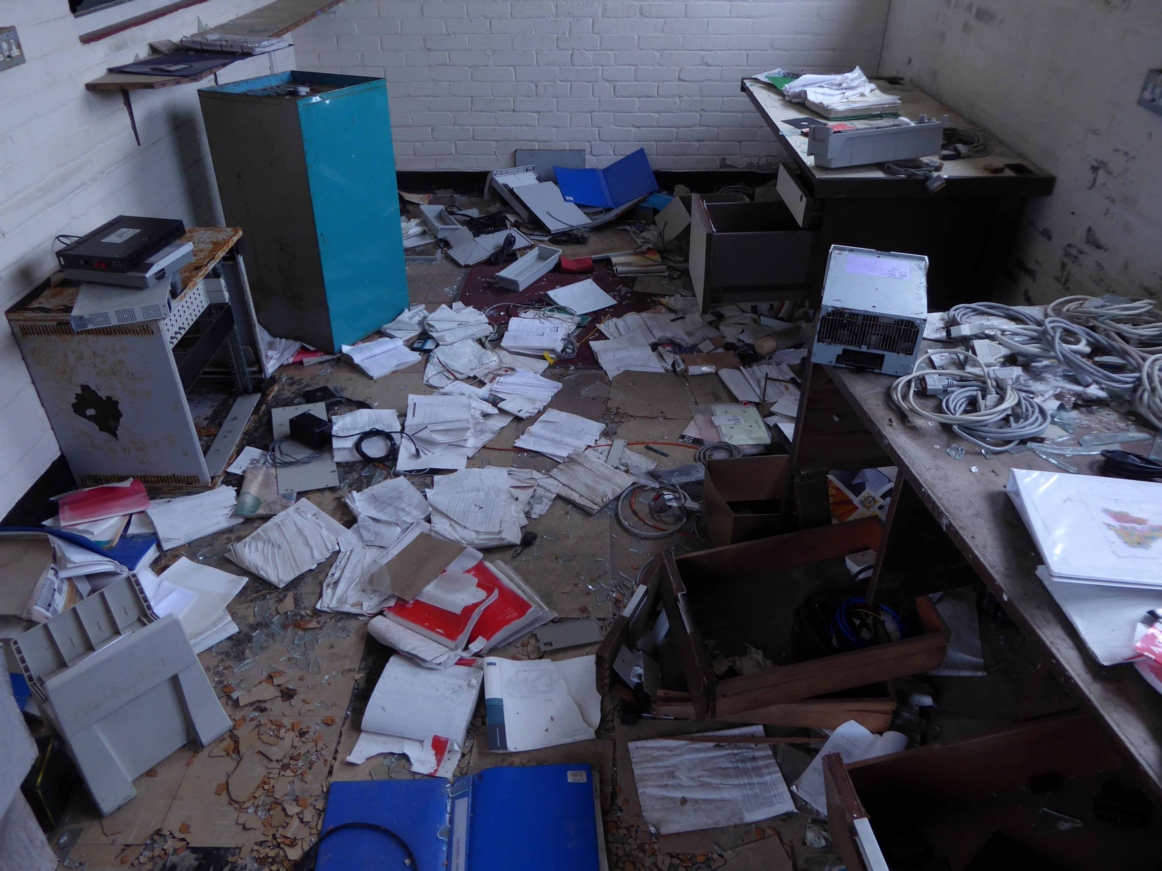
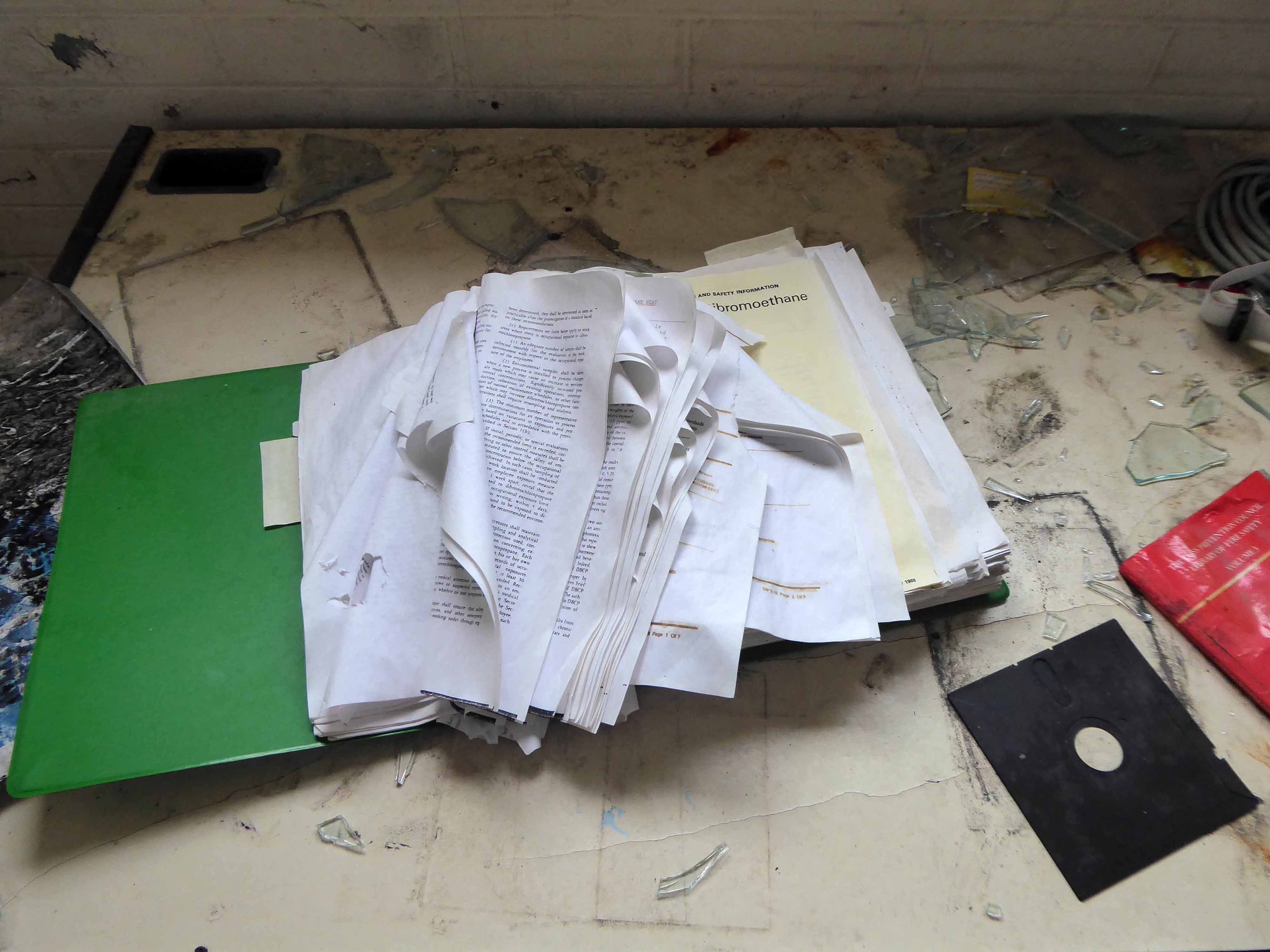
A site where a myriad working lives once unfolded – labourers, technicians, maintenance staff, administrators and managers.
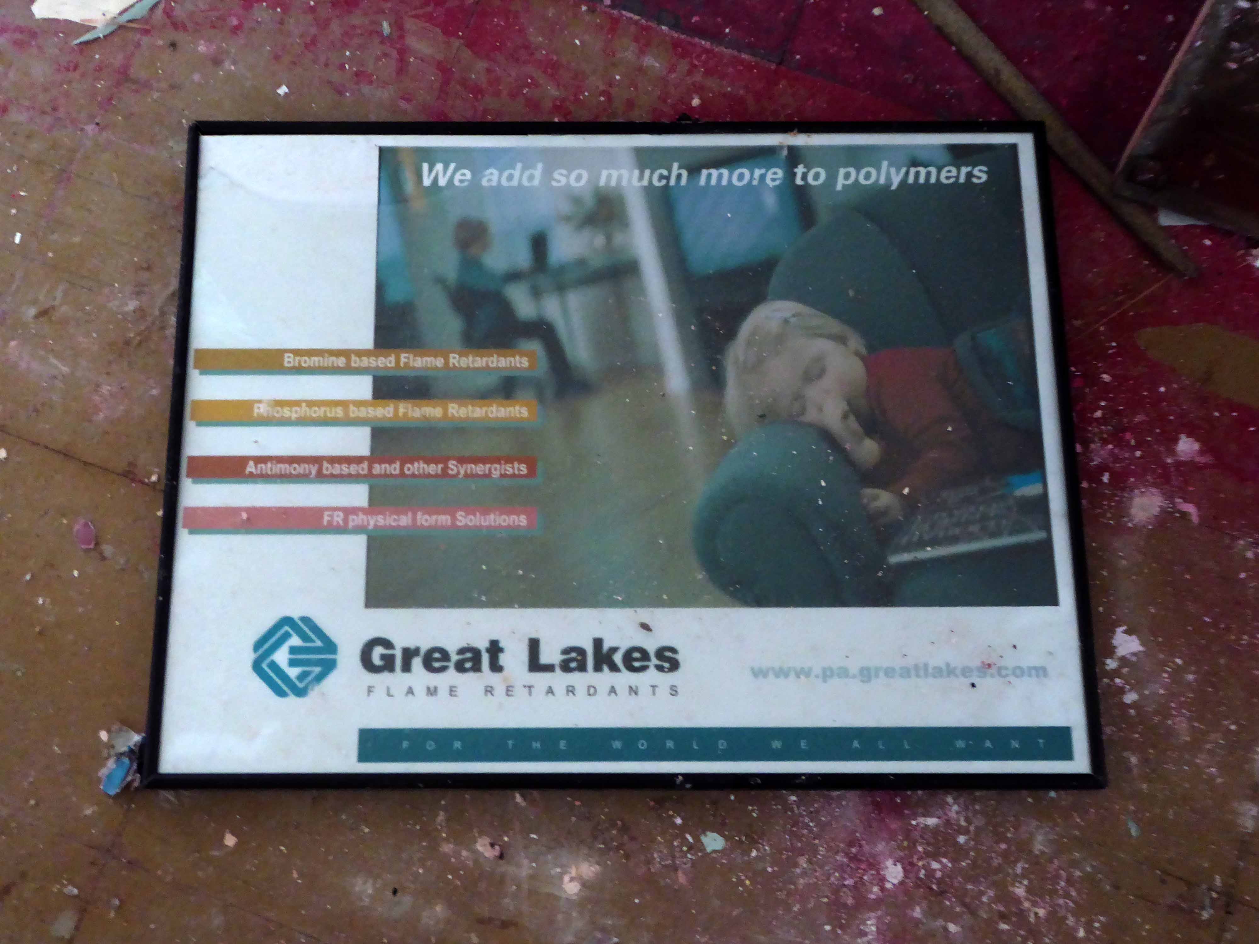
They are now but fleeting shadows, their documents strewn across upturned furniture, empty lockers their standing open and untended, laboratories whose processes have ceased. A chaotic canteen with no-one to cook for, unsafe safety suits and unwashed washrooms.
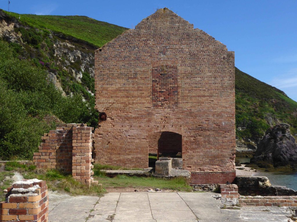
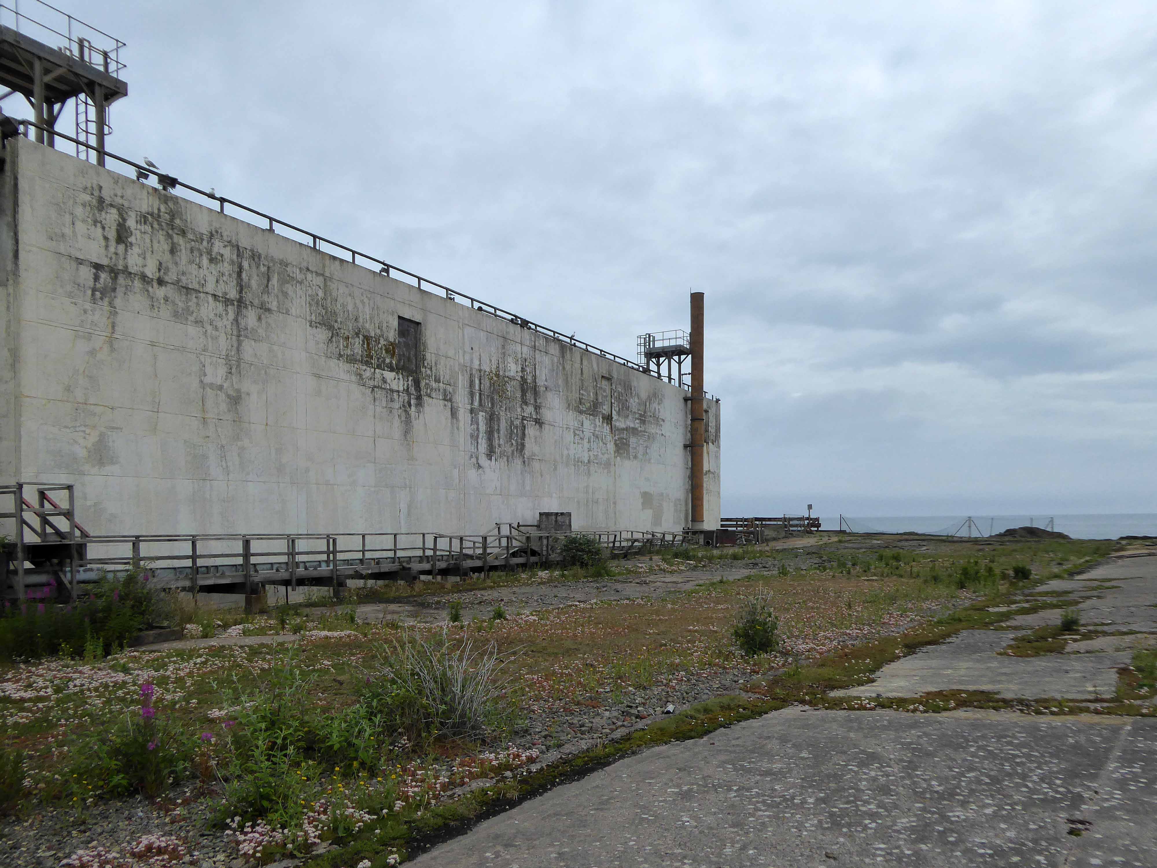
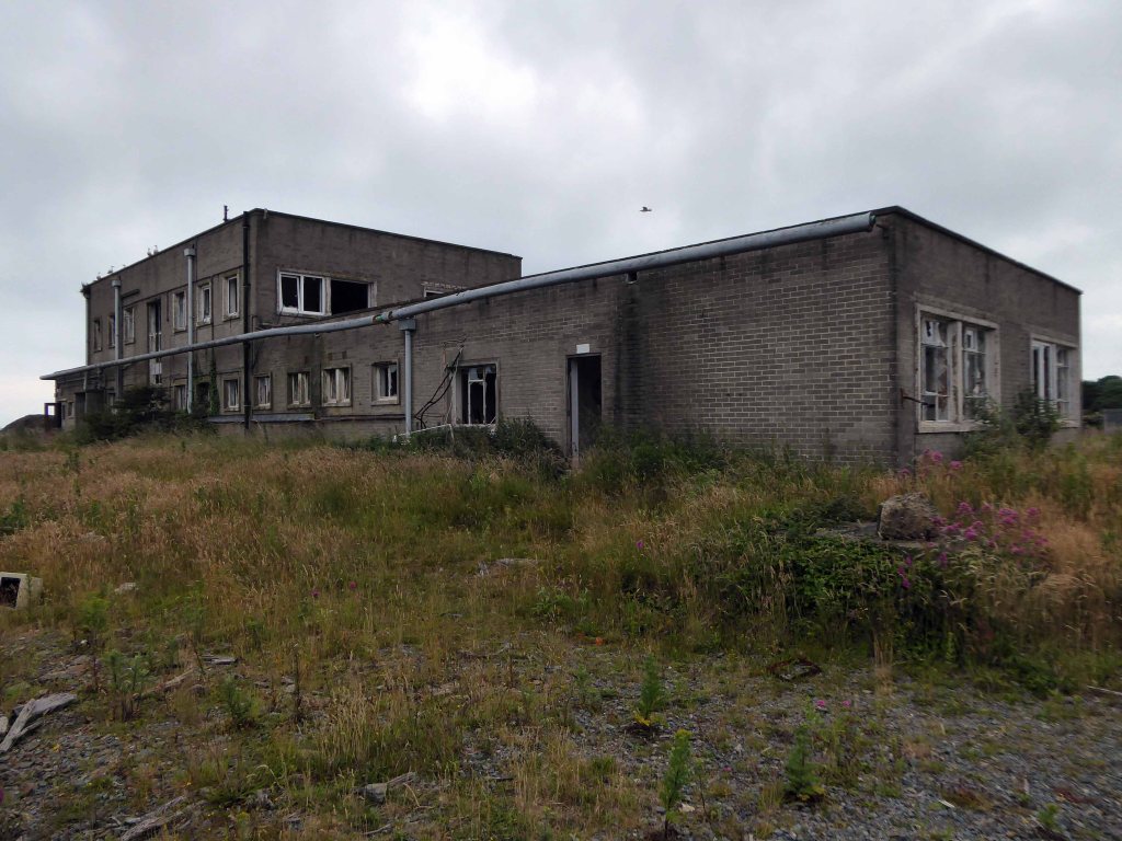
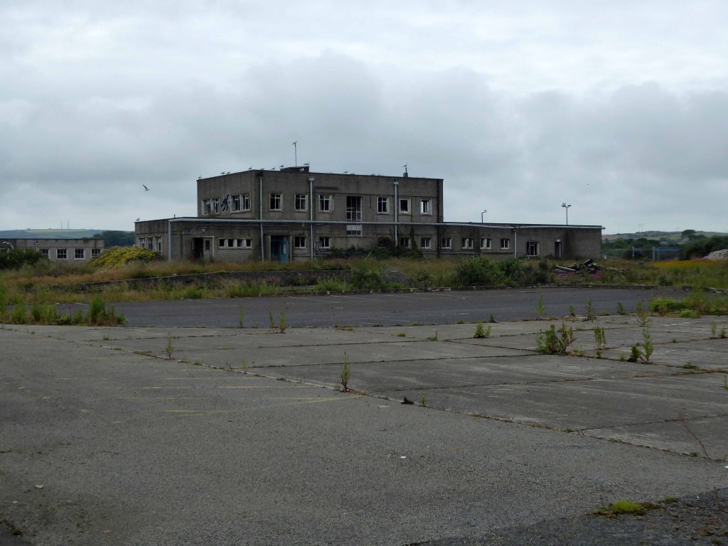
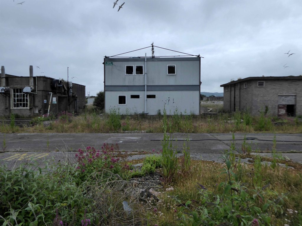
We have taken a trip around the extant exteriors of the processing plant.
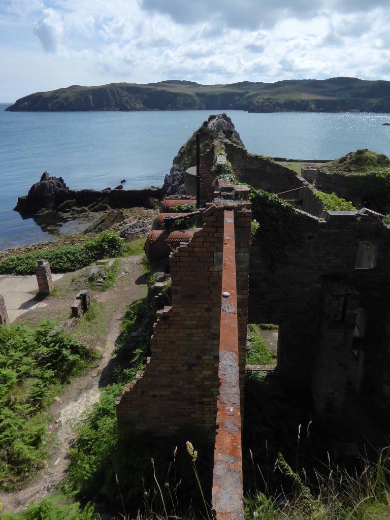
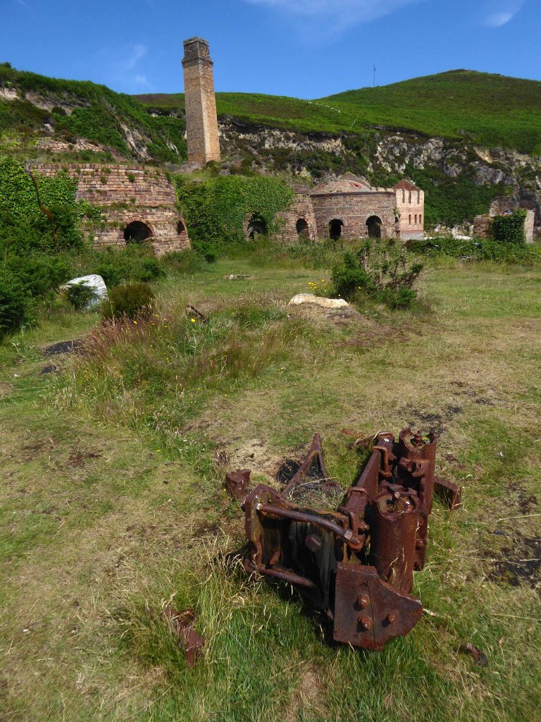
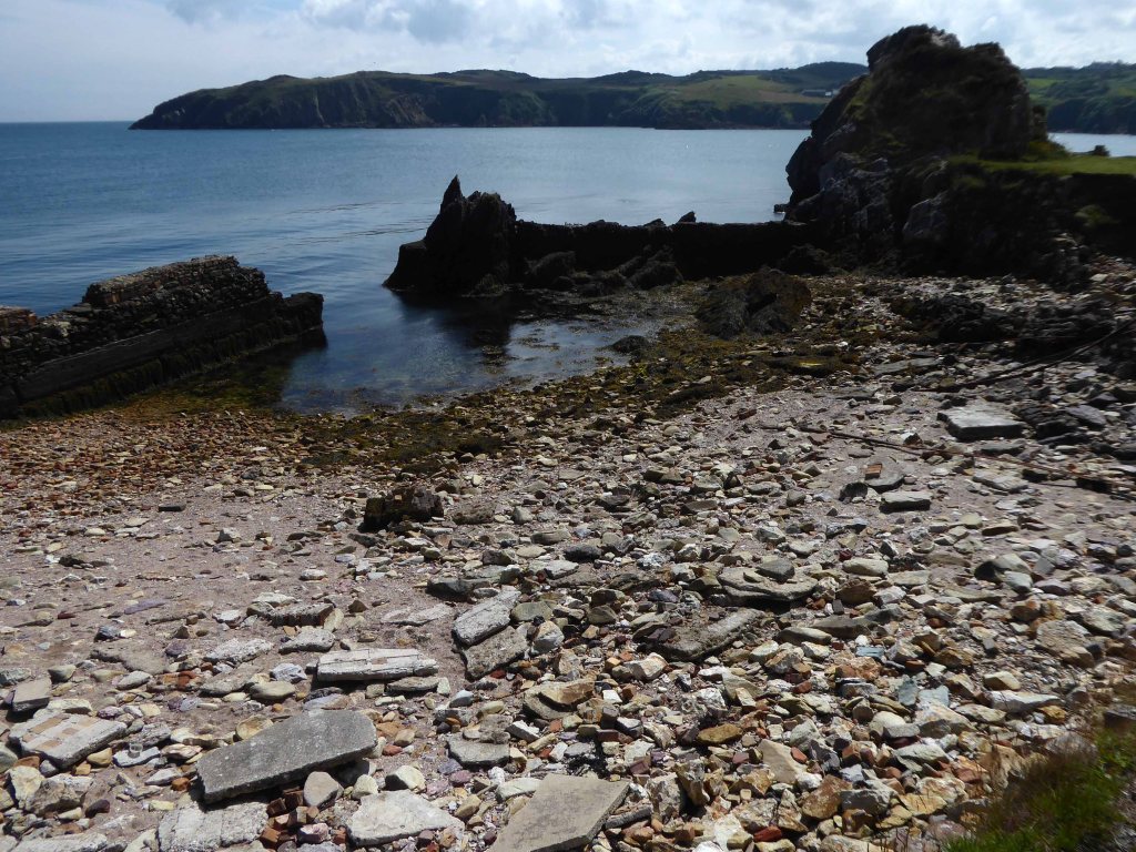
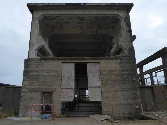
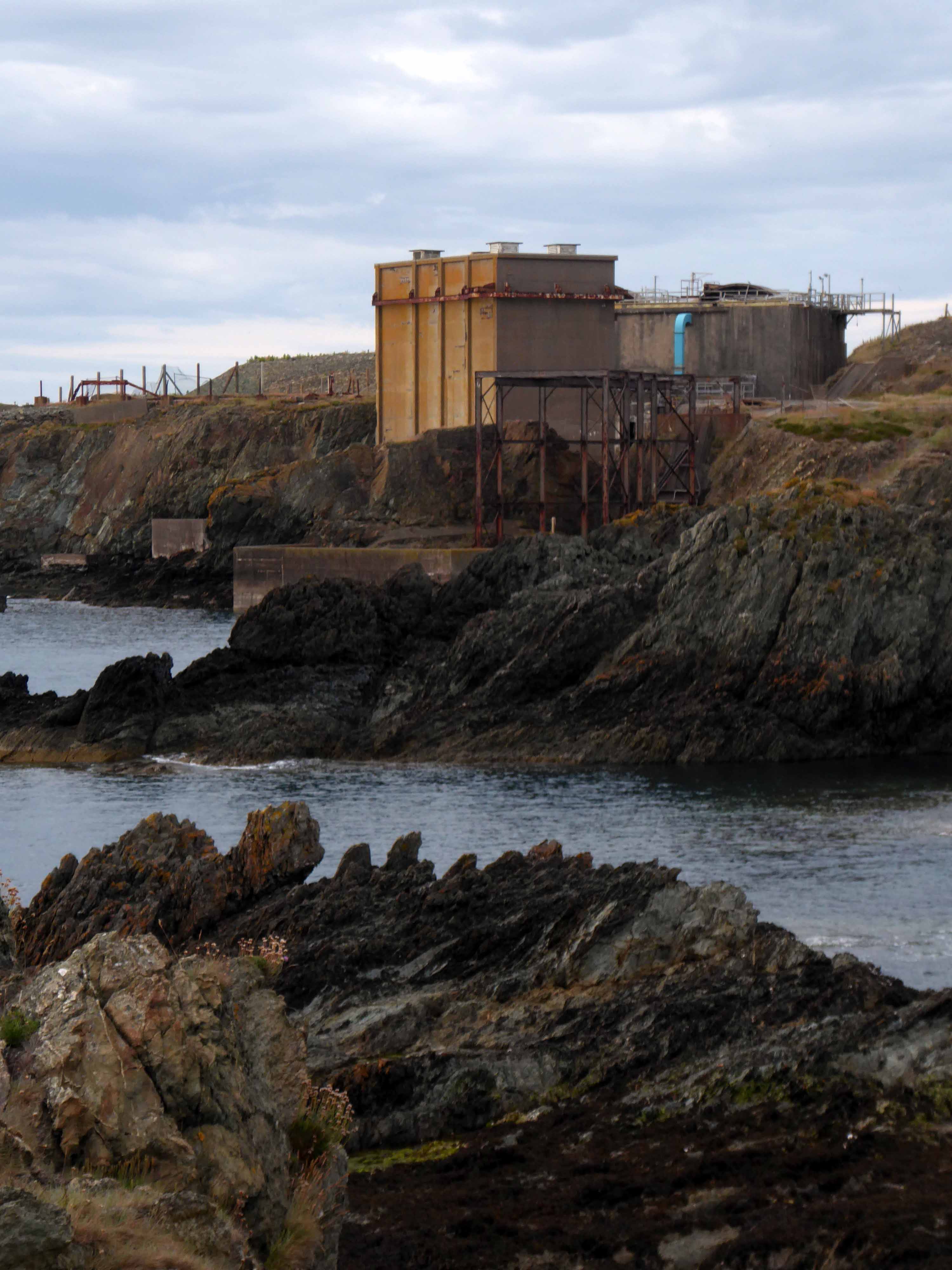
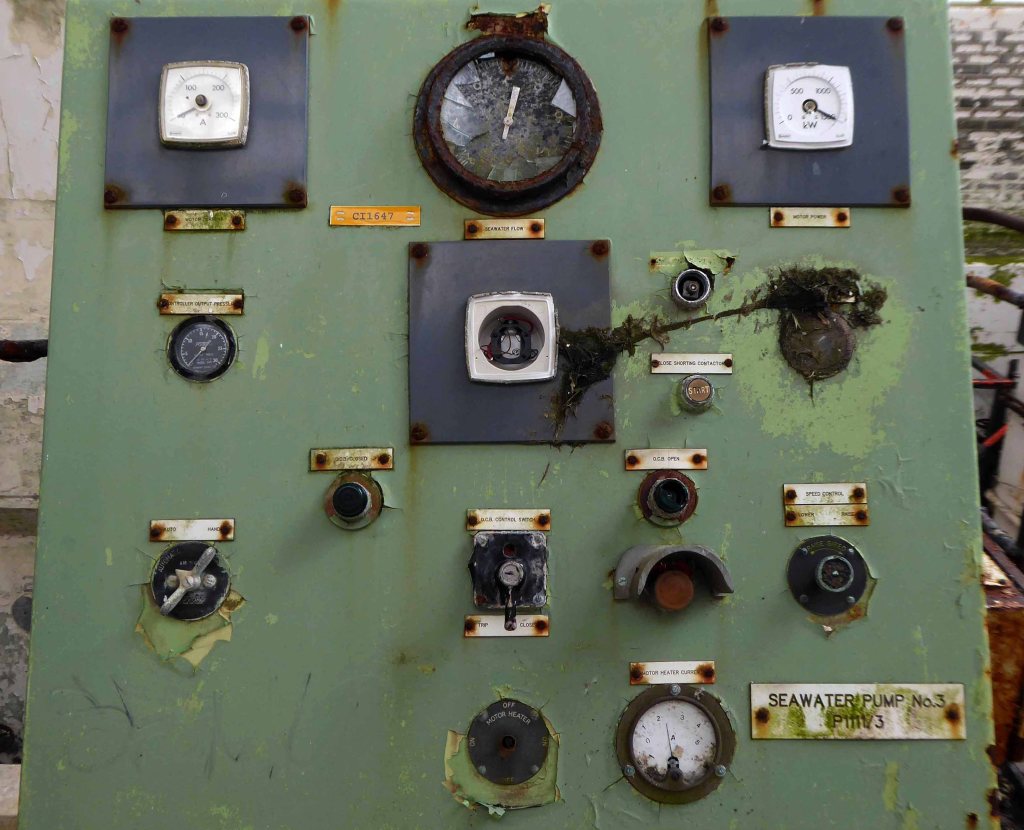
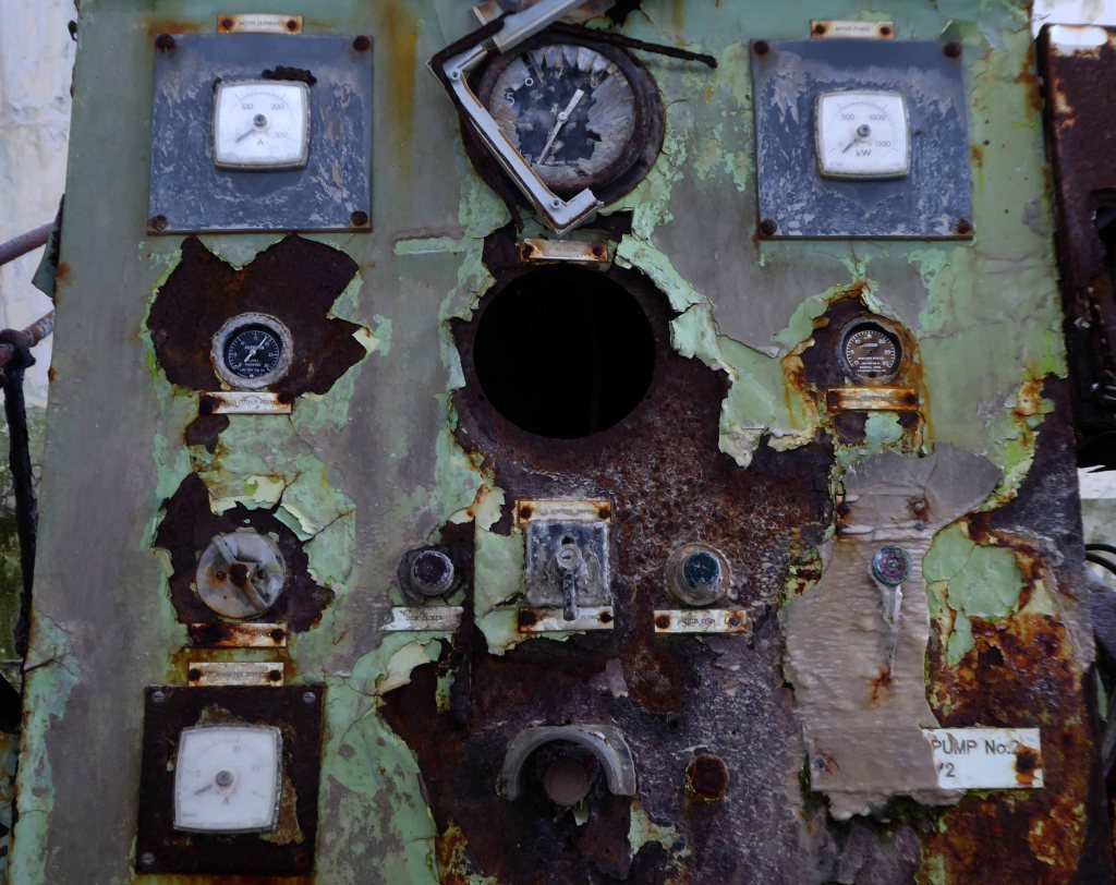
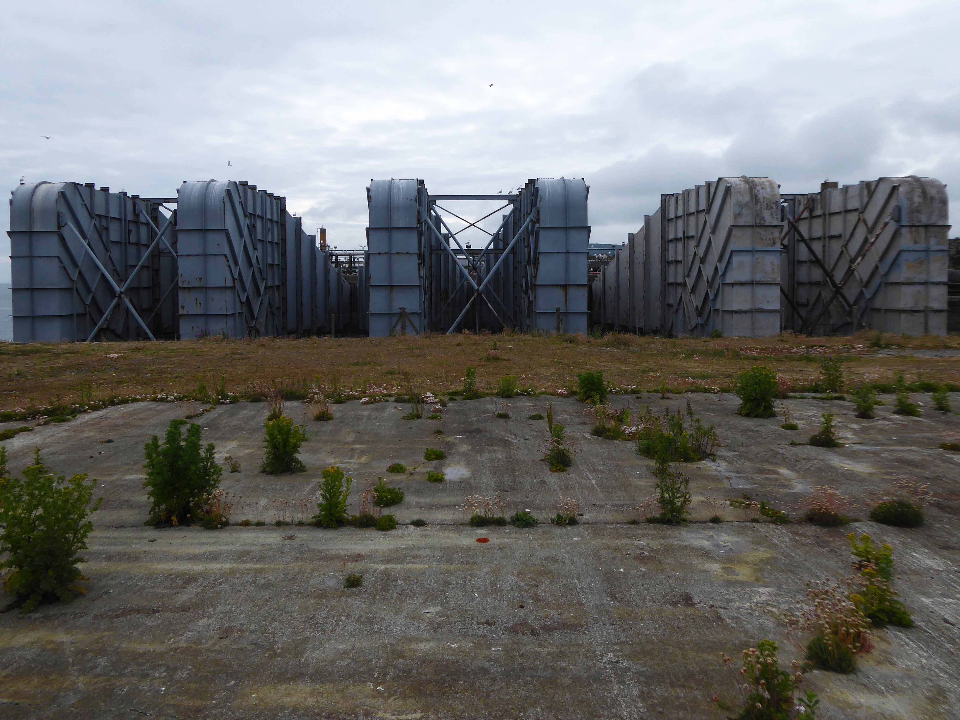
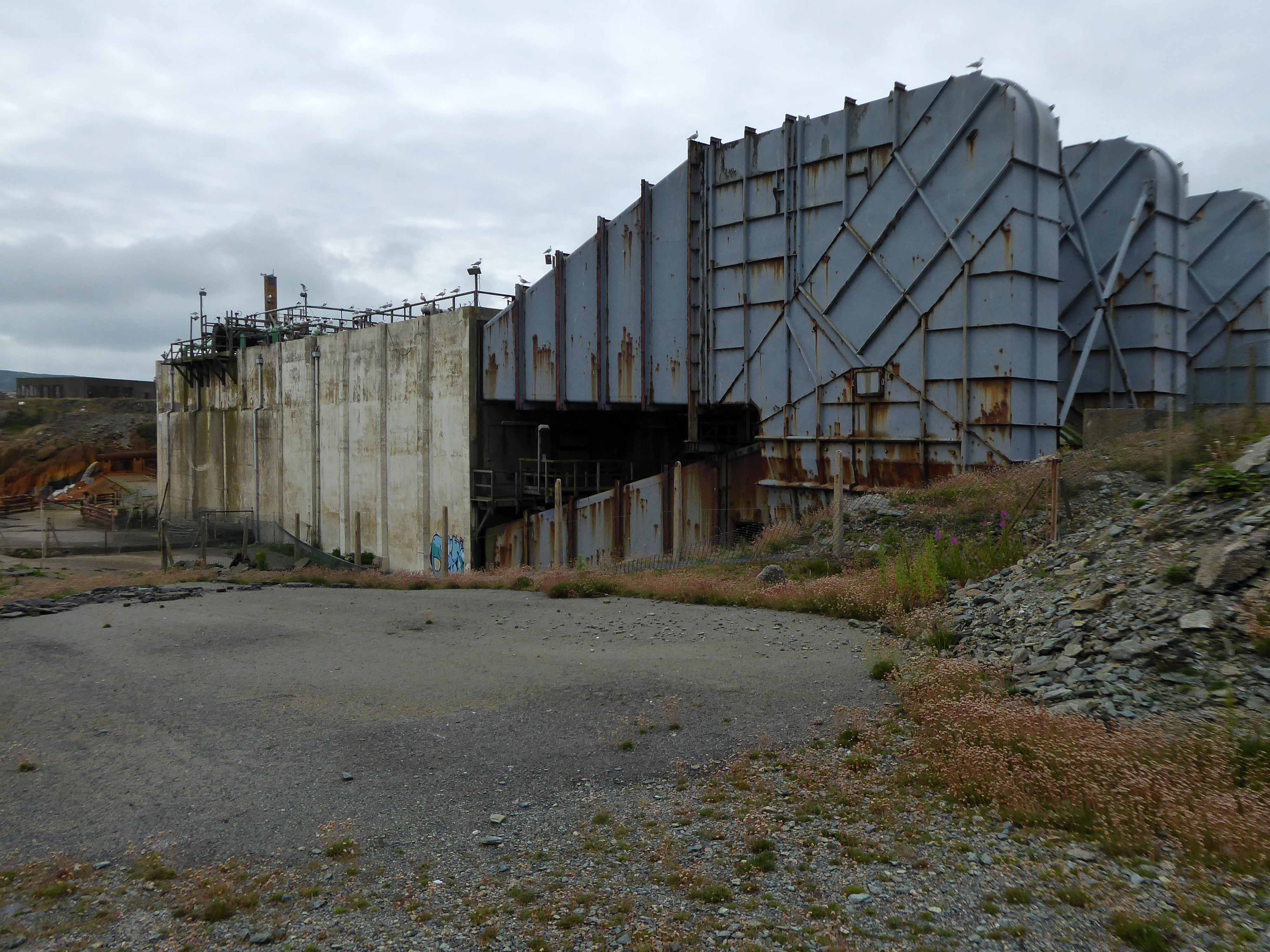
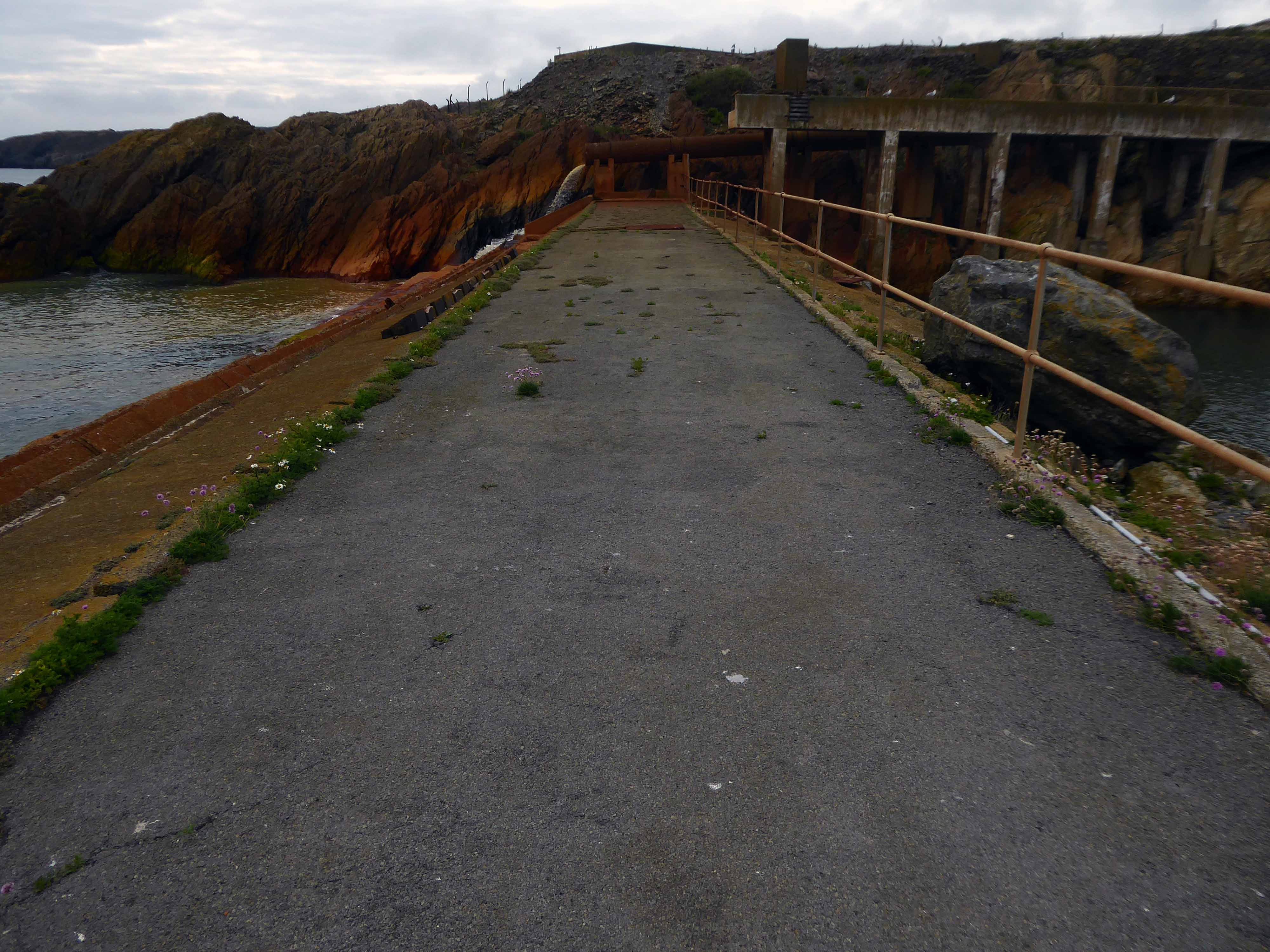
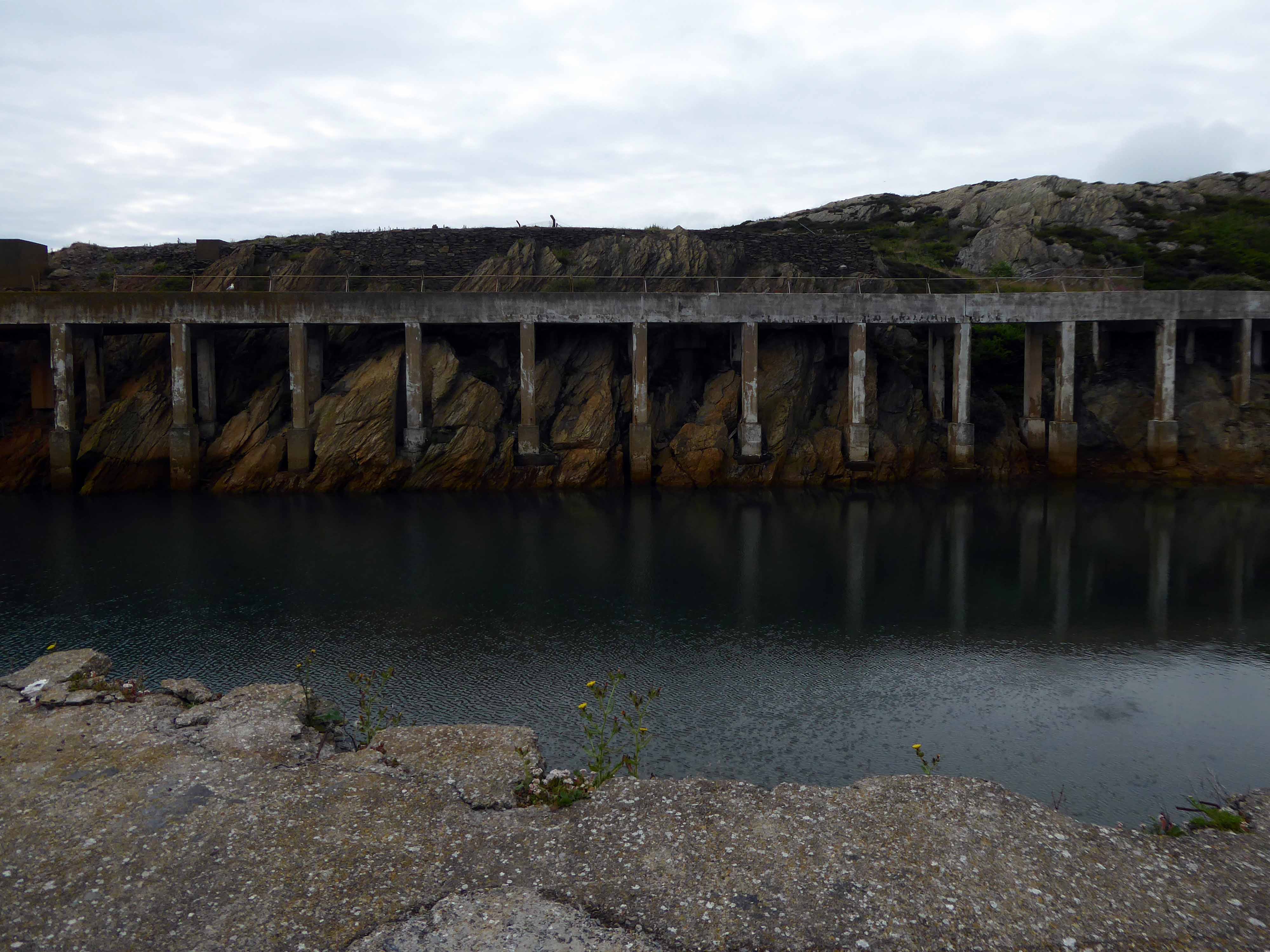
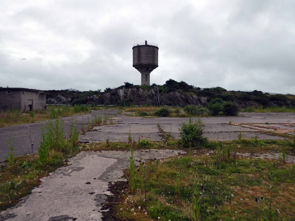
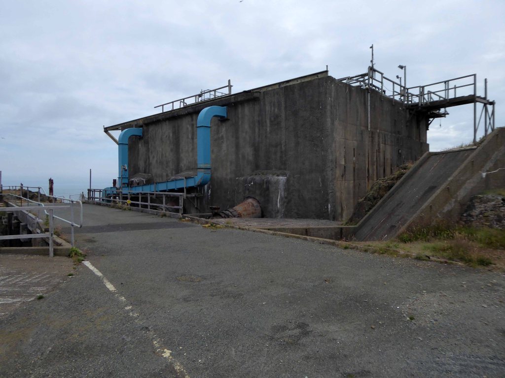
Now let’s turn our attention toward the epic infrastructure which extracted and pumped seawater.
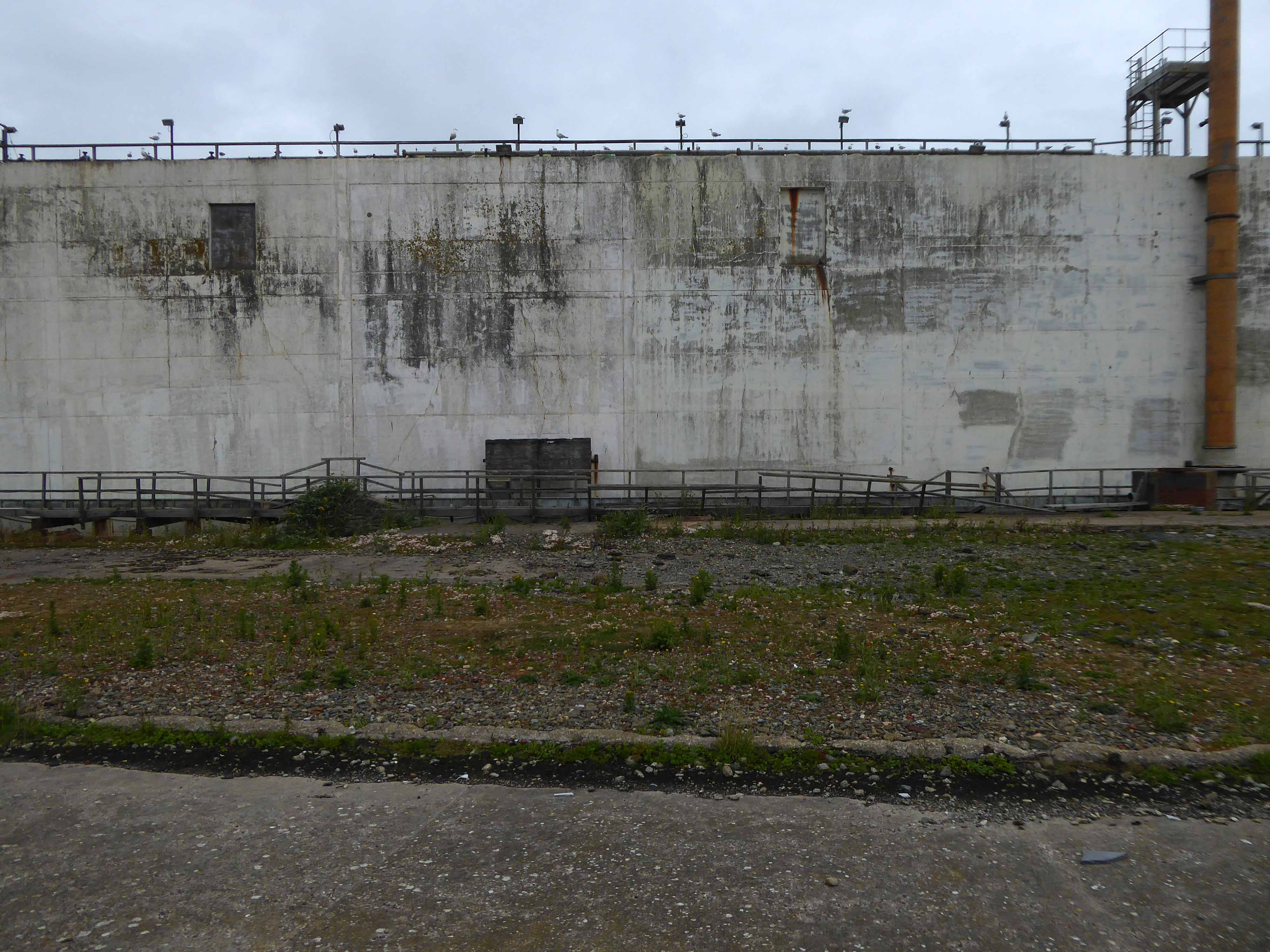
Sea water is sucked in and then lifted 50ft into sea water ponds by huge pumps where any debris is removed. It is then passed to the seawater main where chlorine and dilute sulphuric acid are added which releases the bromine. It is literally blown out of the water. This water is passed into the top of a tower where it drops over 20ft through the packed section of the tower. There it is met by currents of air travelling upwards. Where it meets these air currents the bromine gets stripped out the water, which is returned to the sea. Whilst the wet bromine laden air passes from the top of the tower to be treated with sulphur dioxide and water. This produces mists of hydrobromic and sulphuric acids.
This mist passes into an absorber, and the acid coalesces. From here, it blows to a collecting tank. The bromine free air returns to the blowing out tower and the cycle begins again. The acidic product is referred to as primary acid liquor. This is now pumped to the steaming out tower. It enters the top and is treated with chlorine and steam, which releases the bromine as vapour. It is then condensed to a liquid. The bulk of bromine goes to dibromoethane, whilst the remainder is sold or used to make other intermediates.
It takes about 22,000 tonnes of seawater to produce 1 tonne of bromine. Every minute 300,000 gallons of seawater are drawn in.
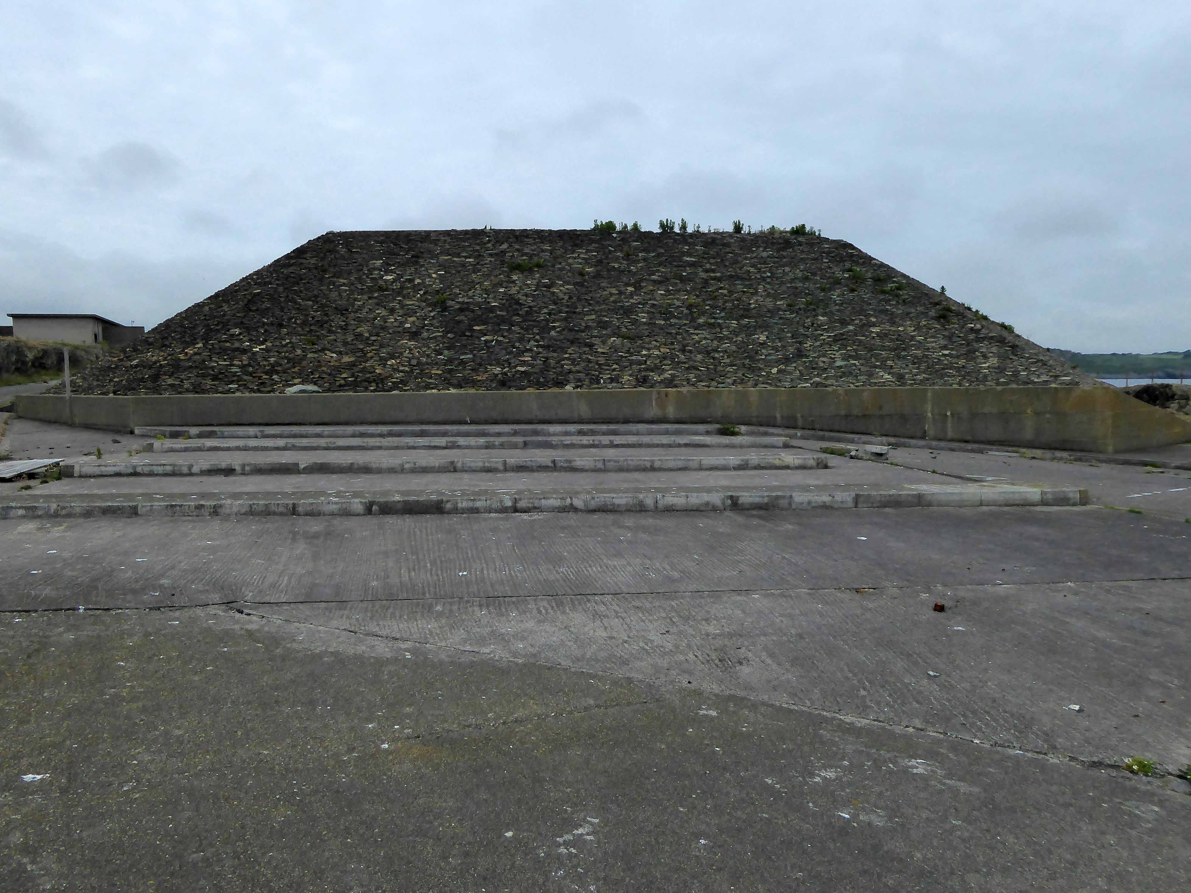
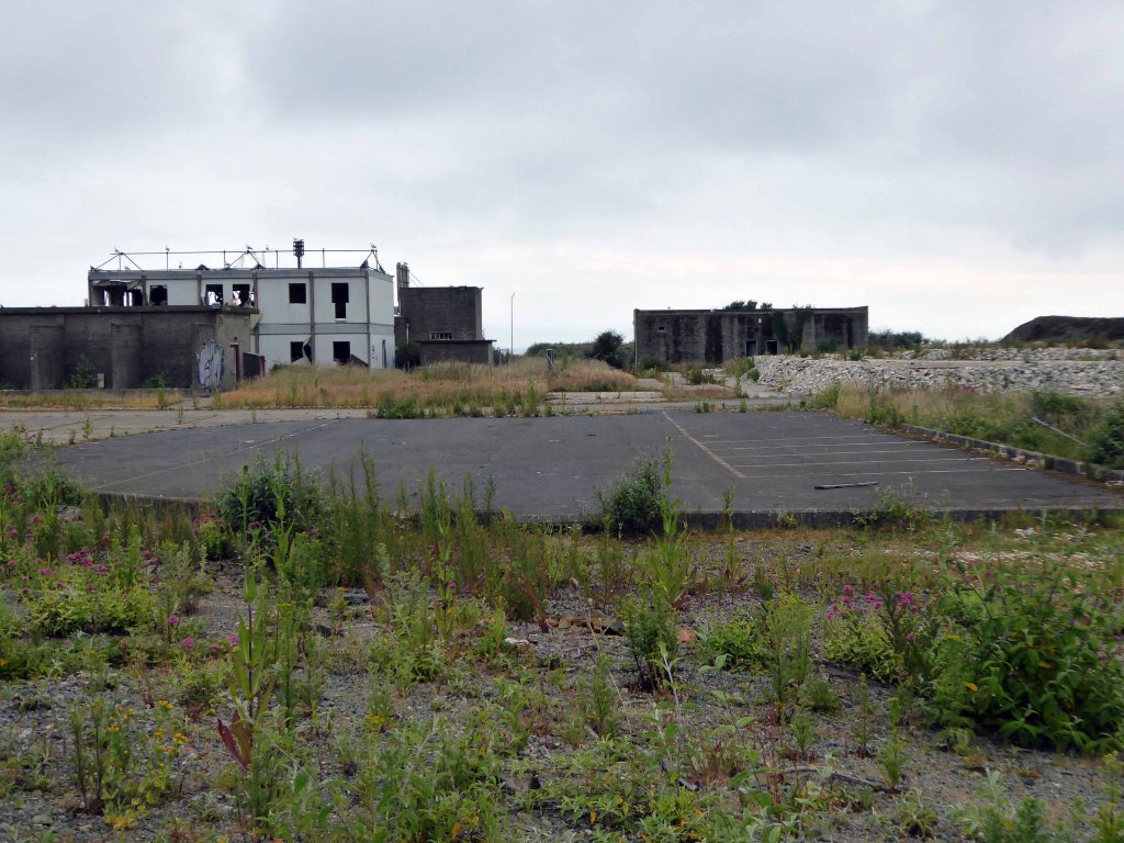
This now redundant technology has left a legacy of industrial dereliction amongst the ancient Pre-Cambrian rocks and sylvan seas of the Anglesey Coast.
This is a landscape which induces fear and fascination in equal measure.
Whatever is fitted in any sort to excite the ideas of pain, and danger, that is to say, whatever is in any sort terrible, or is conversant about terrible objects, or operates in a manner analogous to terror, is a source of the sublime; that is, it is productive of the strongest emotion which the mind is capable of feeling.
Amlwch has been the centre of the world’s copper industry, a coastal town on Anglesey with a long history of trade, the coming and going of goods.
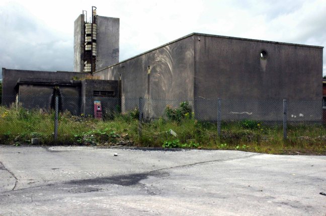
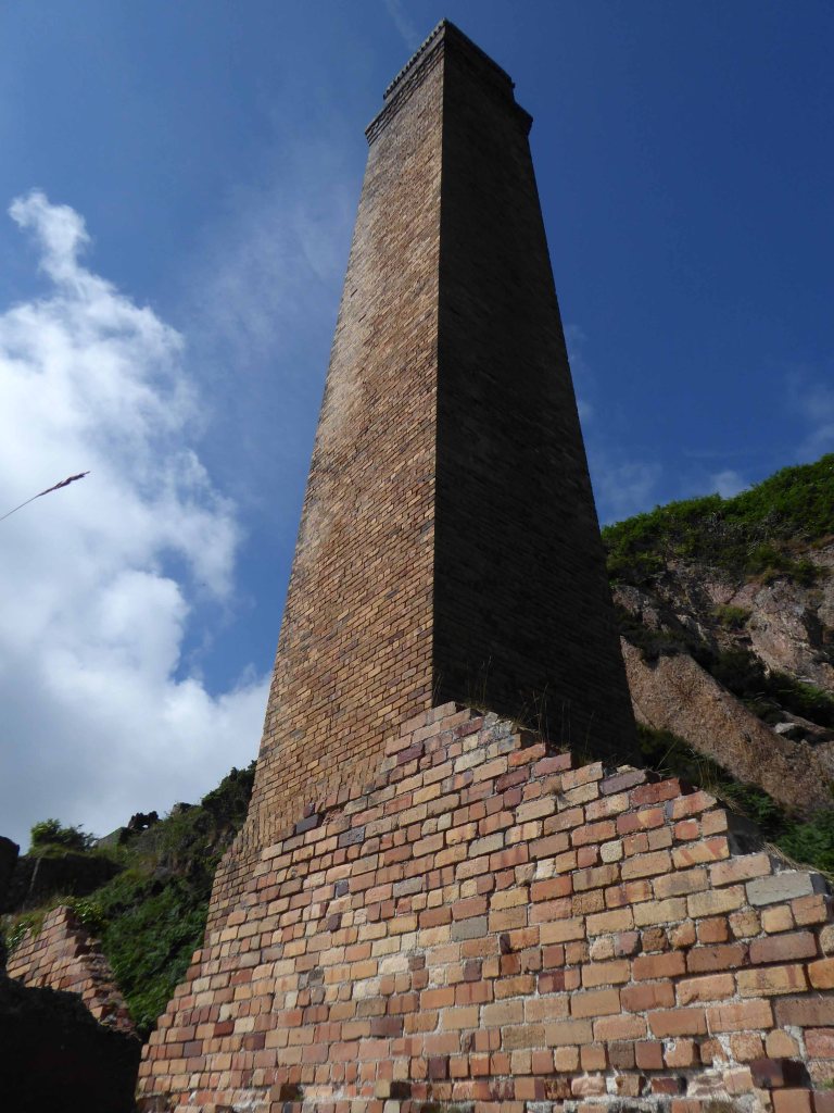
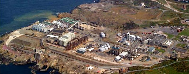
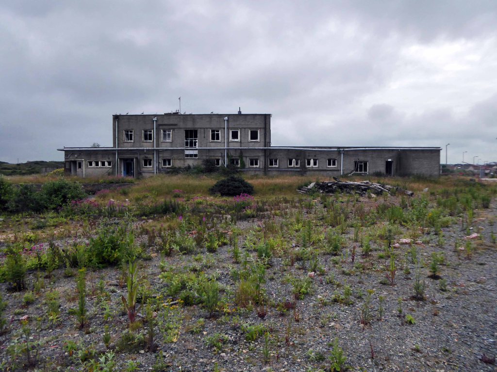
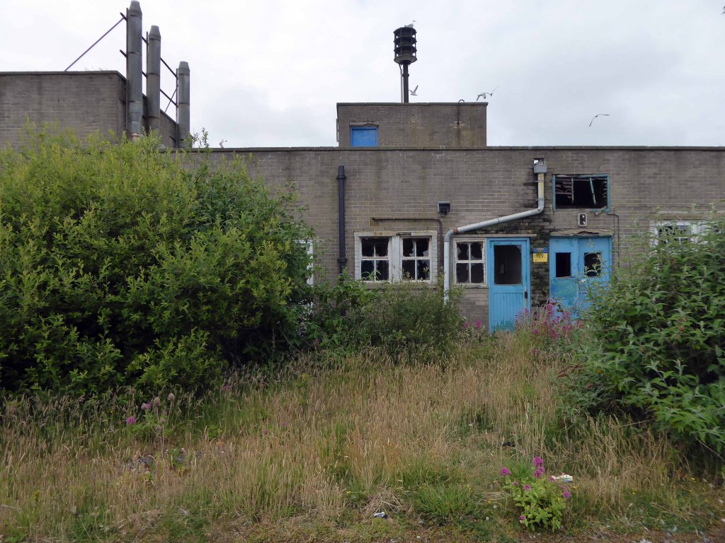
Once the site of a processing plant extracting bromine from sea water.
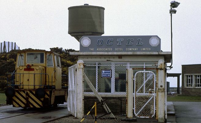
The Associated Octel factory was built to extract bromine from seawater and turn it into an additive for petrol engines. At the time, petrol used in road vehicles contained lead. Engine knocking was a common problem, when the mixture of air and fuel didn’t burn efficiently with each detonation. This could damage engine cylinders over time. The additive produced here reduced knocking and improved engine efficiency.
As the health effects of lead in vehicle exhaust gases became better understood, unleaded petrol was developed. It was introduced to UK filling stations in the 1980s, and leaded petrol was later phased out. As demand for anti-knock additive reduced, the Octel factory diversified into other bromine products and was taken over by Great Lakes Chemical Corporation. In 2003, the corporation decided to close the works with the loss of more than 100 jobs.
A detailed history of the site can be found here at Octel Amlwch.
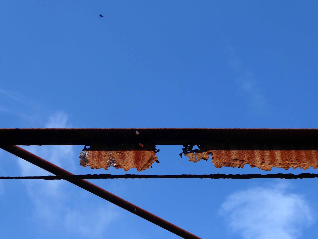
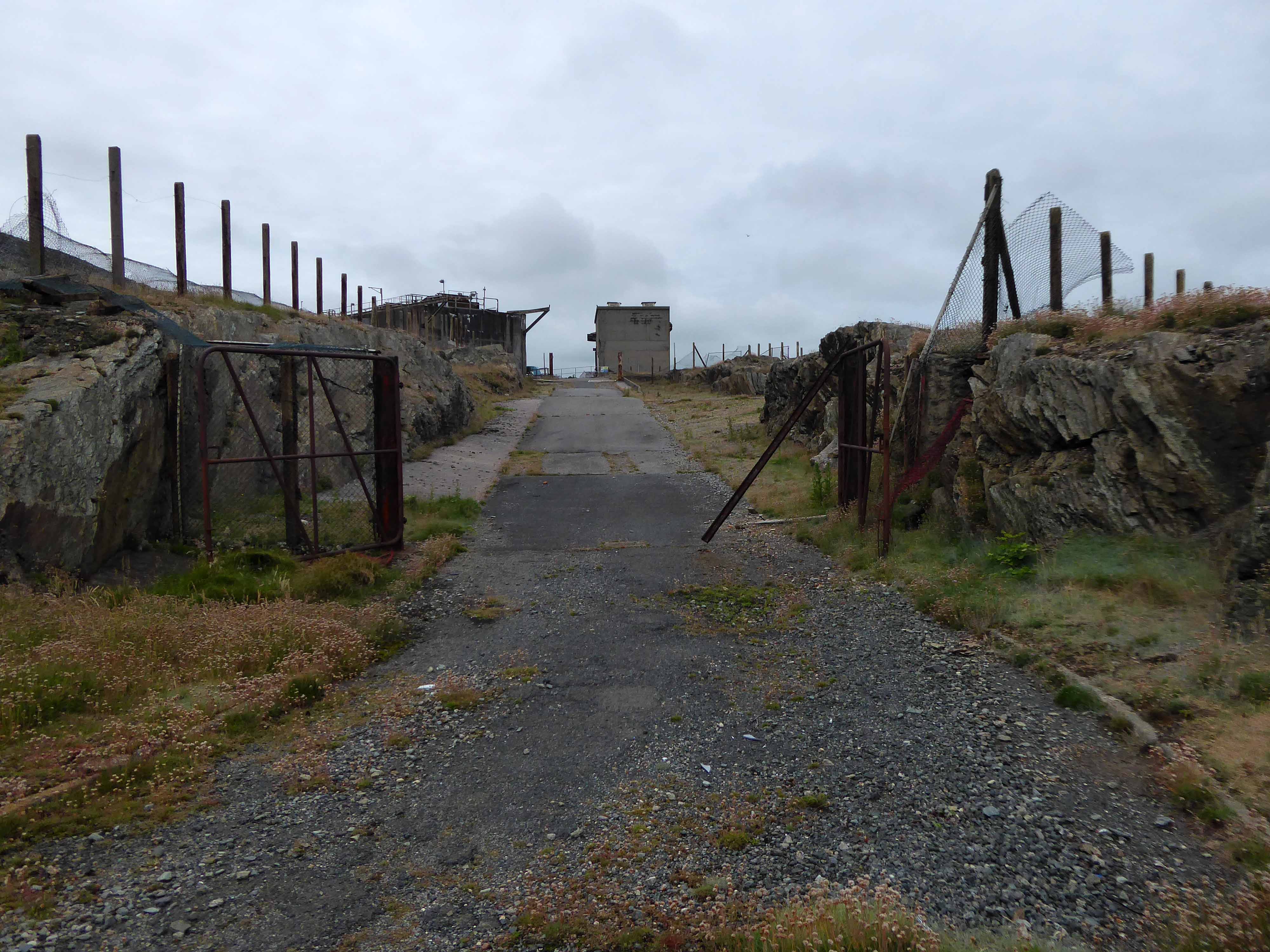
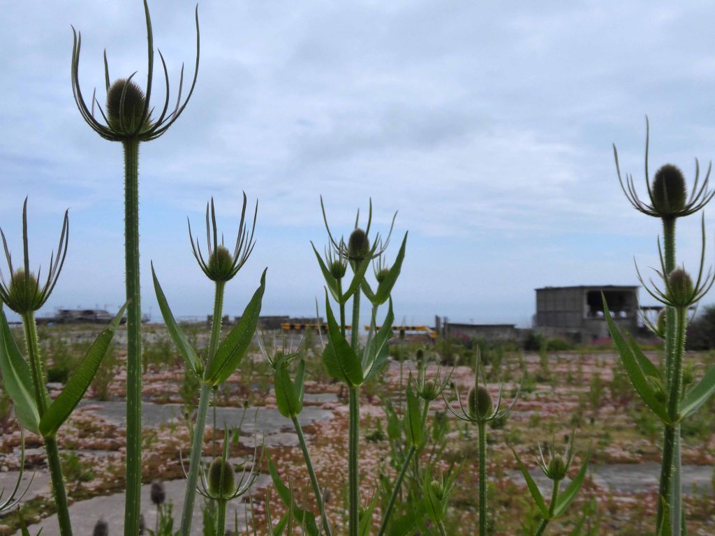
The site has been subject to arson attacks and partial demolition, the extant buildings tagged, tattered and torn.
Slowly but surely nature breaks through the tarmac and concrete.
The gate is open, the lights are out, there’s nobody home.
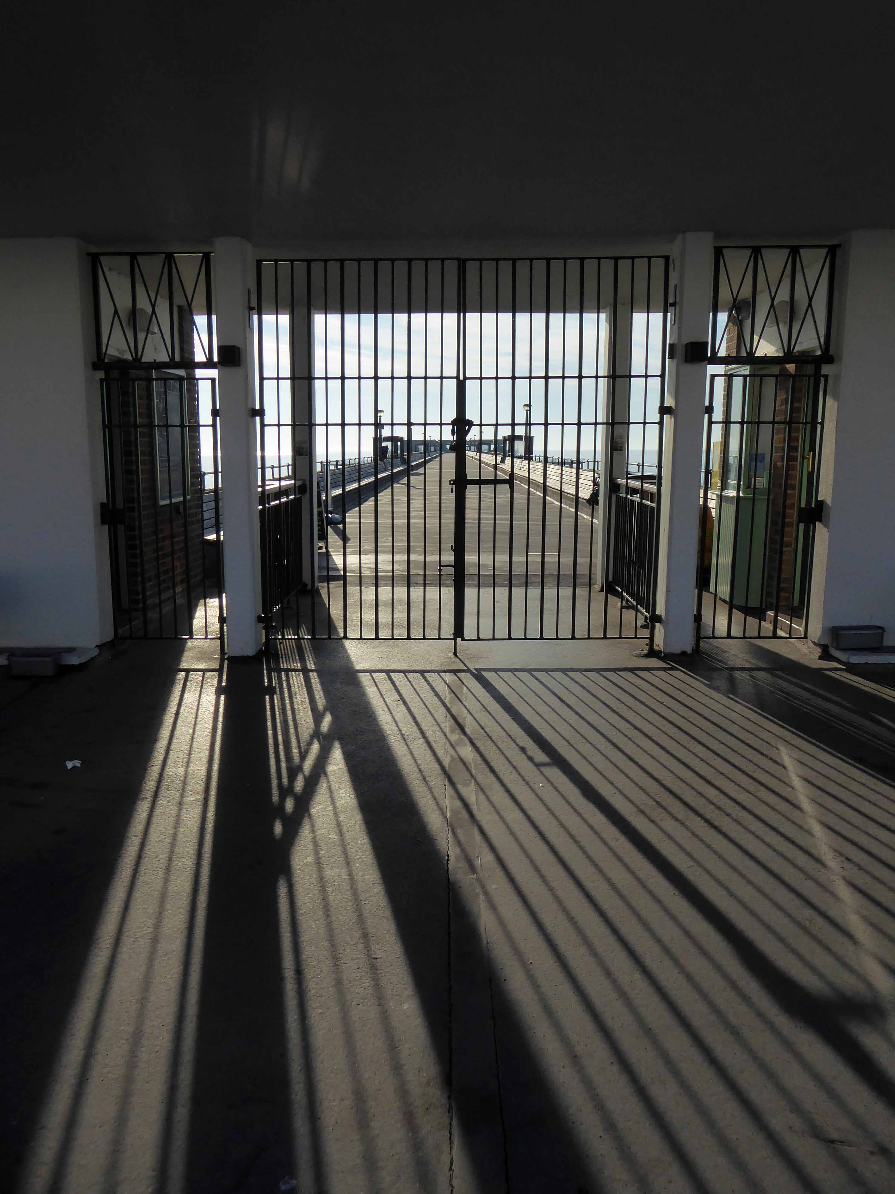
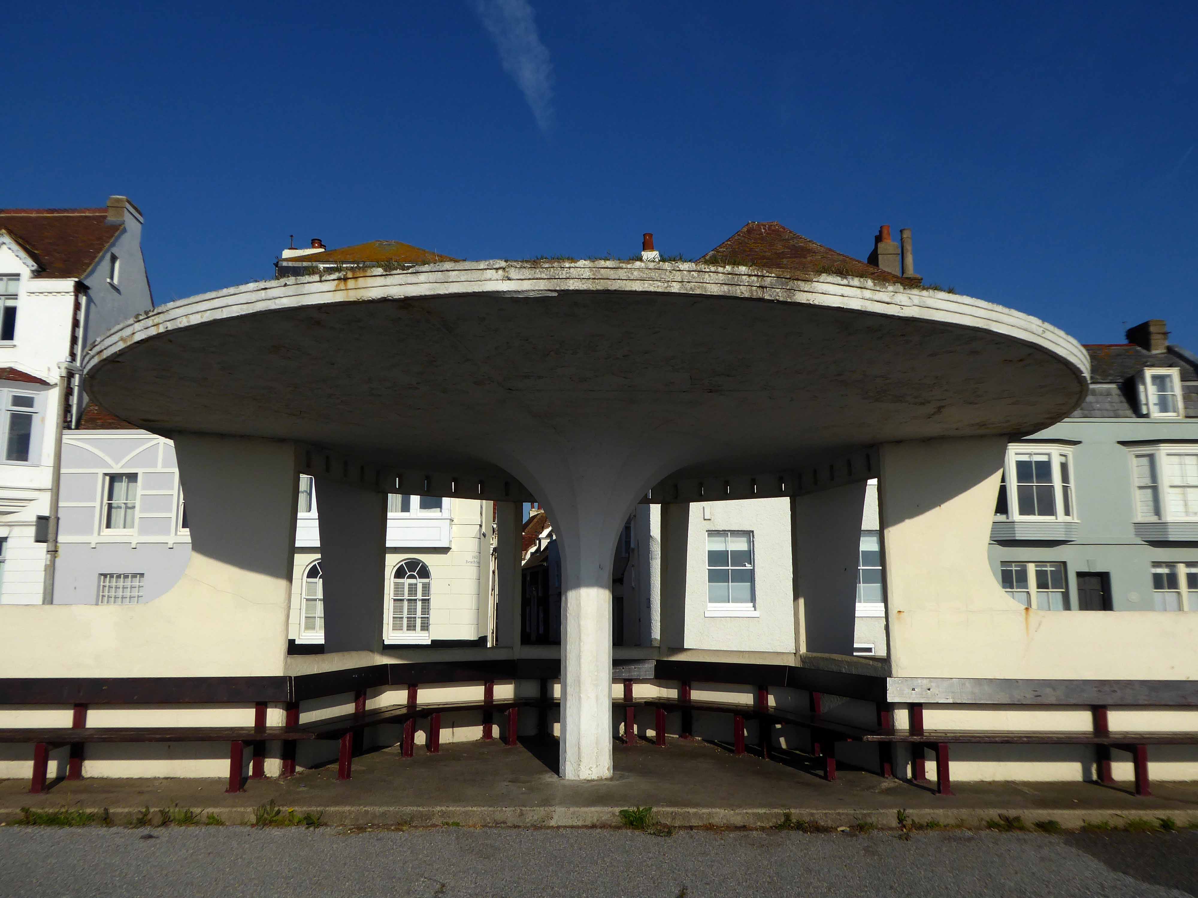
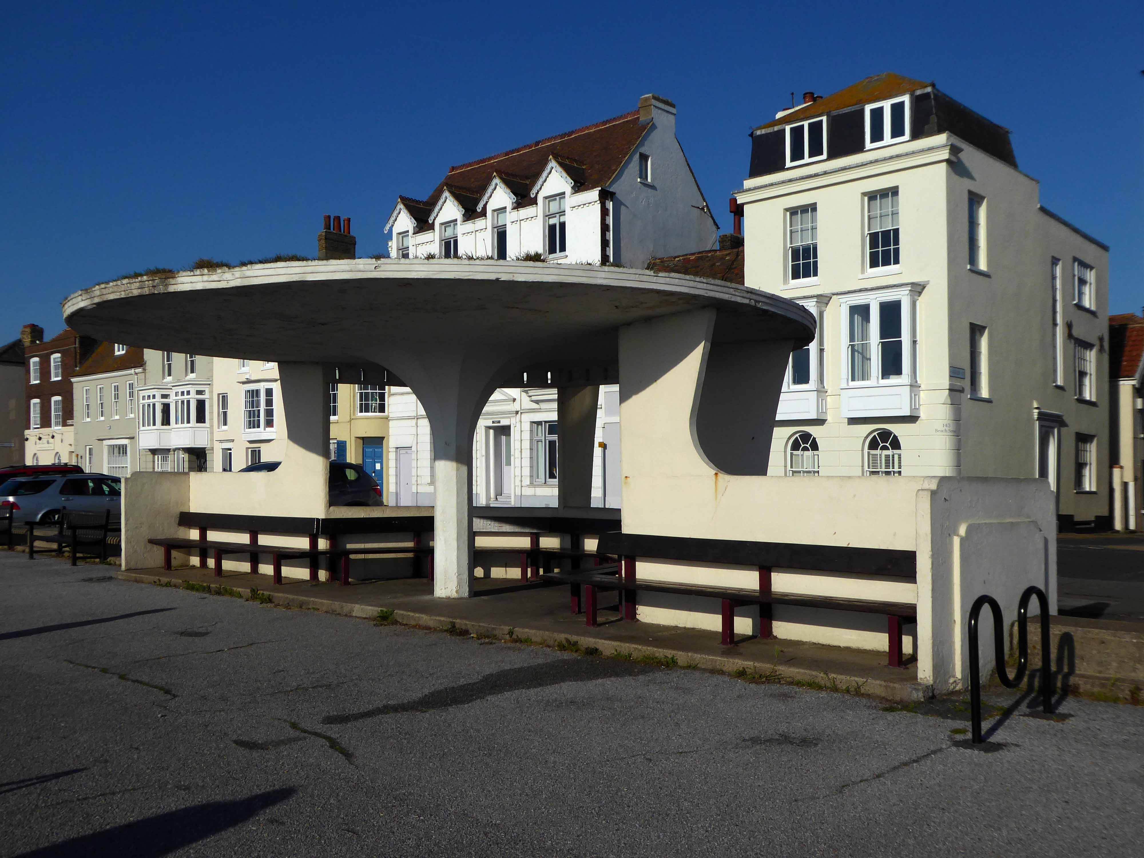
We awoke, we dawdled around Deal, prior to our delightful breakfast.
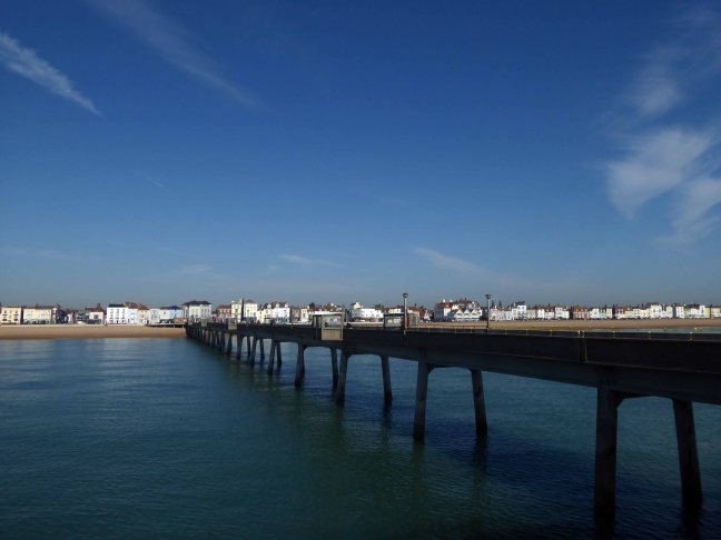
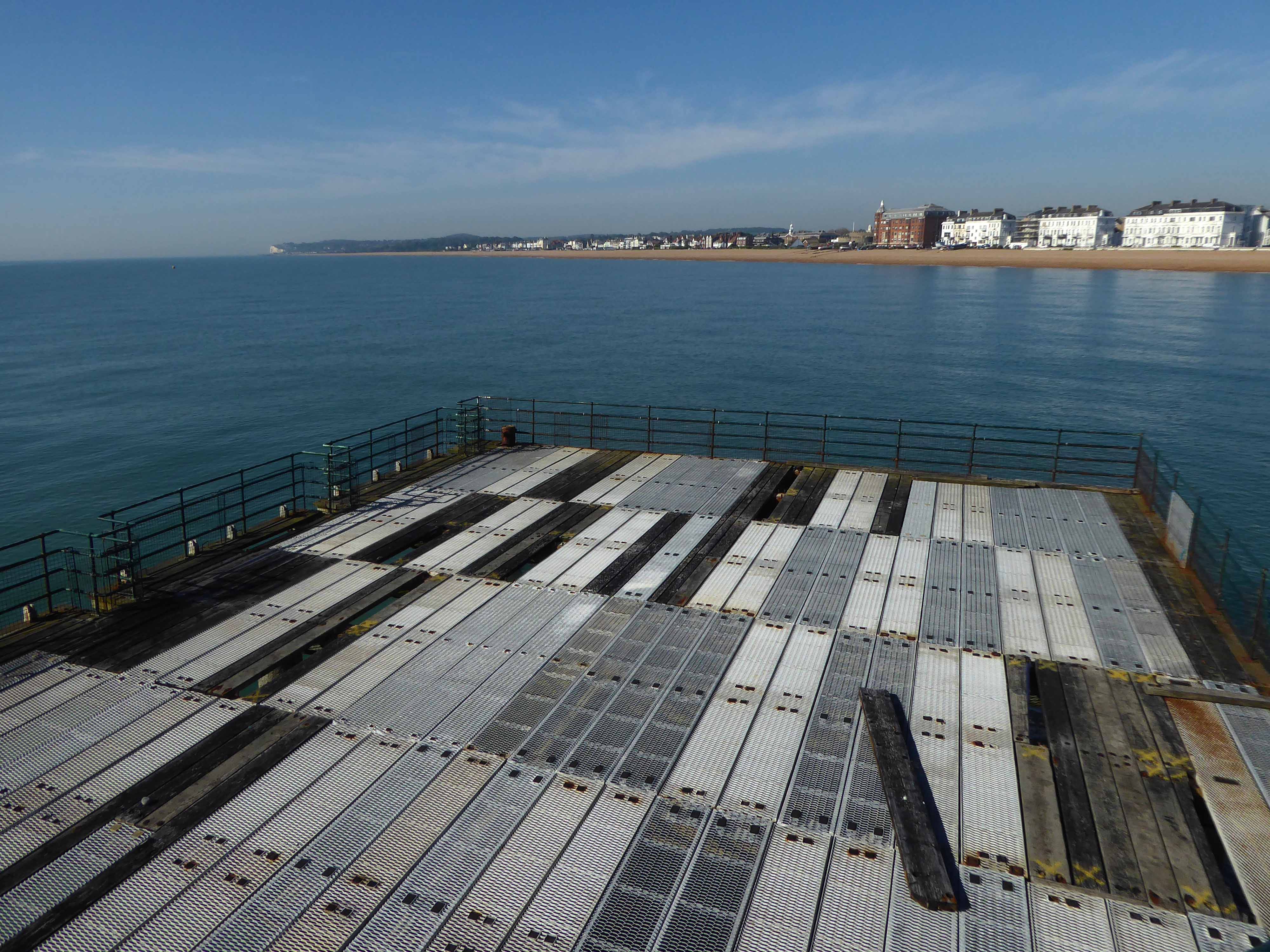
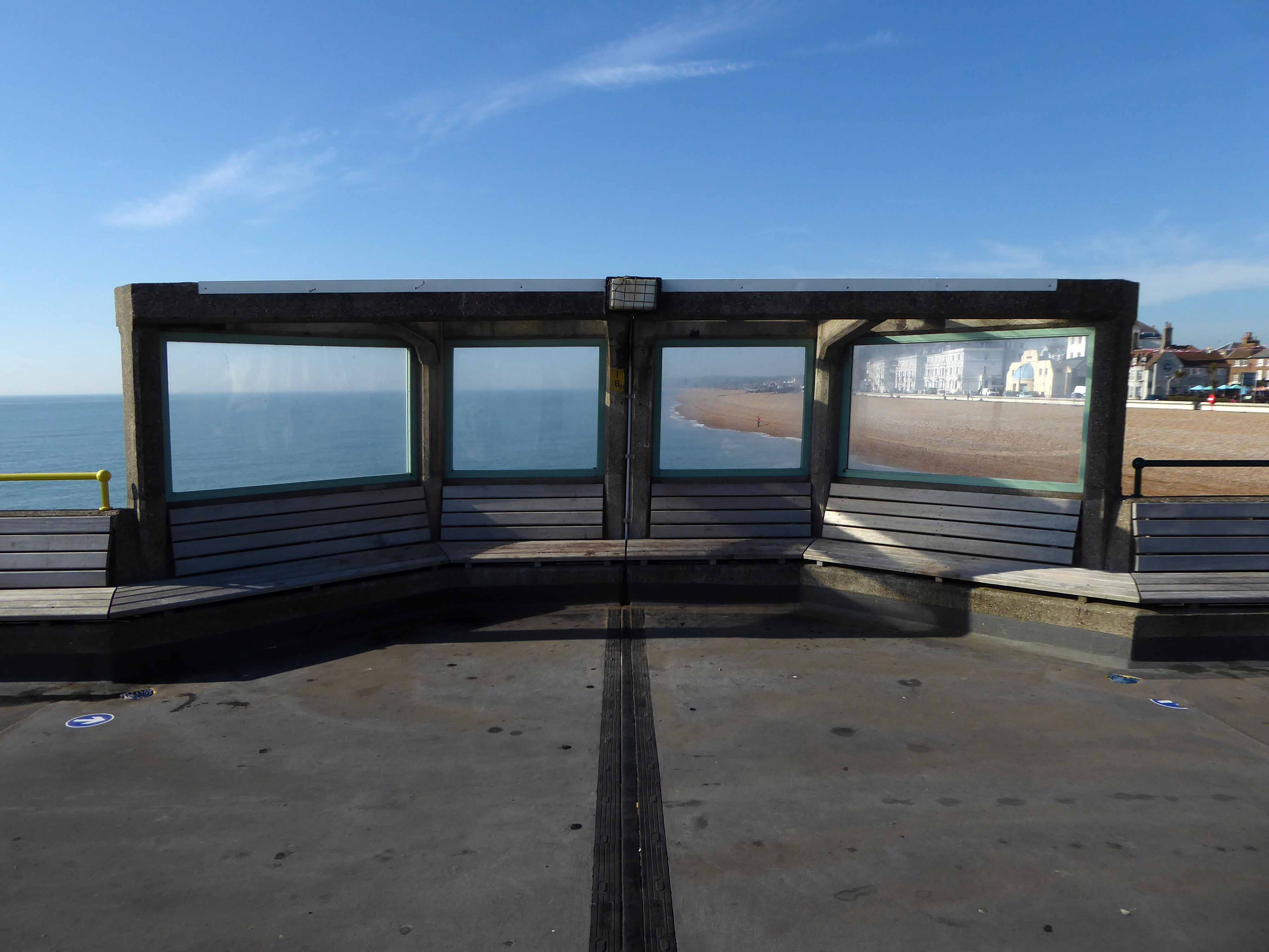
Though the pier appeared to be closed.
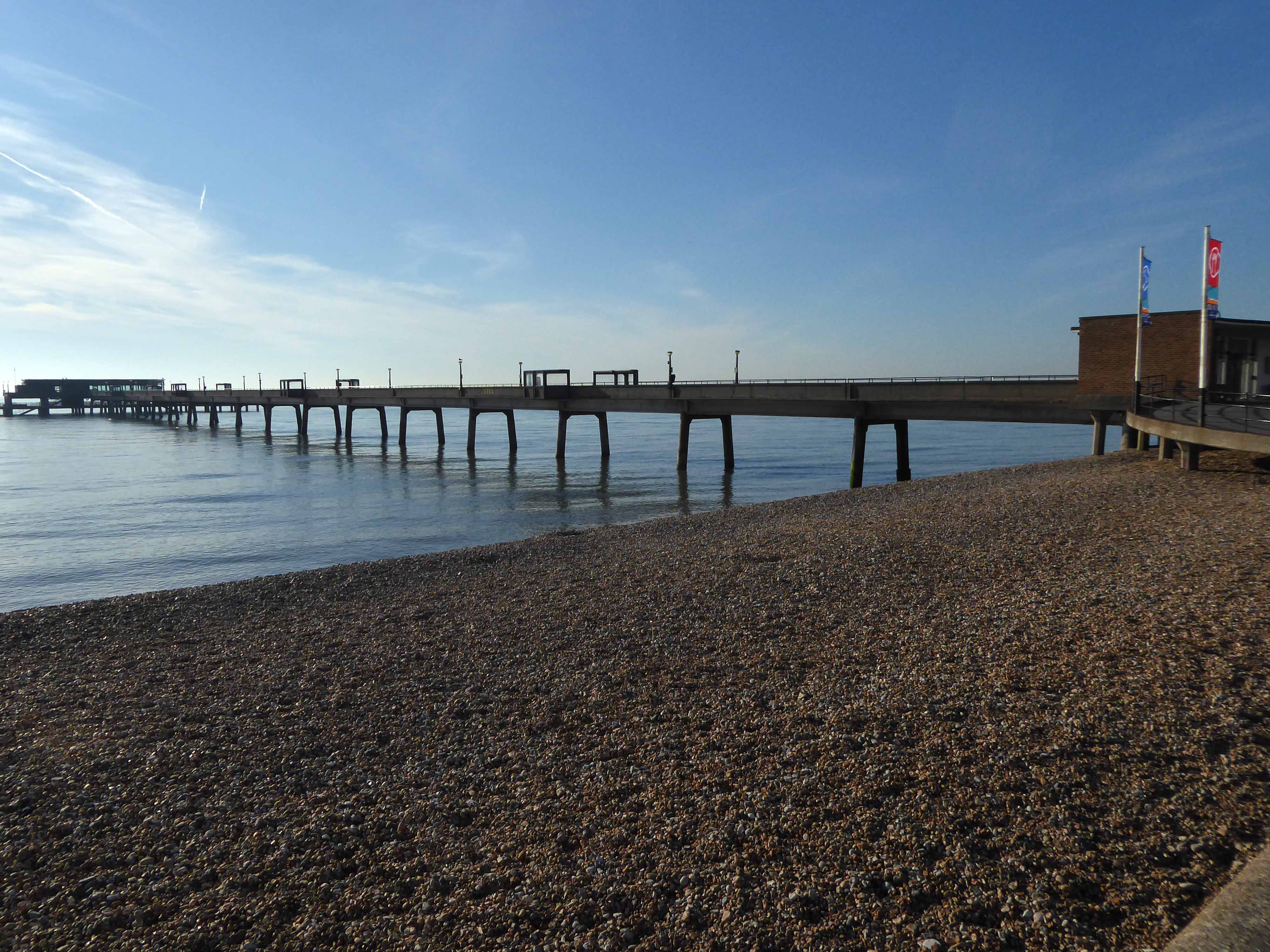
Extending elegantly over a still, still sea.
The present pier, designed by Sir W. Halcrow & Partners, was opened on 19 November 1957 by the Duke of Edinburgh. Constructed predominantly from concrete-clad steel, it is 1,026 ft in length – a notice announces that it is the same length as the RMS Titanic, but that ship was just 882 feet, and ends in a three-tiered pier-head, featuring a cafe, bar, lounge, and fishing decks.
The lowest of the three tiers is underwater at all but the lowest part of the tidal range, and has become disused.
Pausing in Ramsgate to admire Edward Welby Pugin’s Grade II Listed – Granville Hotel.
The Granville development, so named after George Leverson Gower, second Earl Granville (1815-1891), was a venture undertaken by Edward Welby Pugin, together with investors Robert Sankey, George Burgess and John Barnet Hodgson on land acquired from the Mount Albion Estate in 1867. The scheme was to be an important new building in the eastward expansion of the town and the emergence of a fashionable new suburb. At the outset, the intention was to build a relatively restrained speculative terrace of large townhouses with some additional facilities. However, as the scheme progressed and it became apparent that buyers could not be secured, revised plans for an enlarged hotel complex were adopted in 1868 and brought to completion in 1869. These plans, which added a series of grand rooms including a banqueting hall, receptions rooms and an entrance hall in addition to a tunnel to connect to the railway line on the seafront, gardens, a complex of Turkish baths and a vast landmark tower (originally 170ft high, although truncated at a relatively early date), were remarkably ambitious. Ultimately, as it would transpire, the scheme was rather too ambitious on Pugin’s part; with his increasing reliance on loans eventually culminating in bankruptcy in October 1872, an event which precipitated his demise as an architect, tragically followed by his death just three years later.
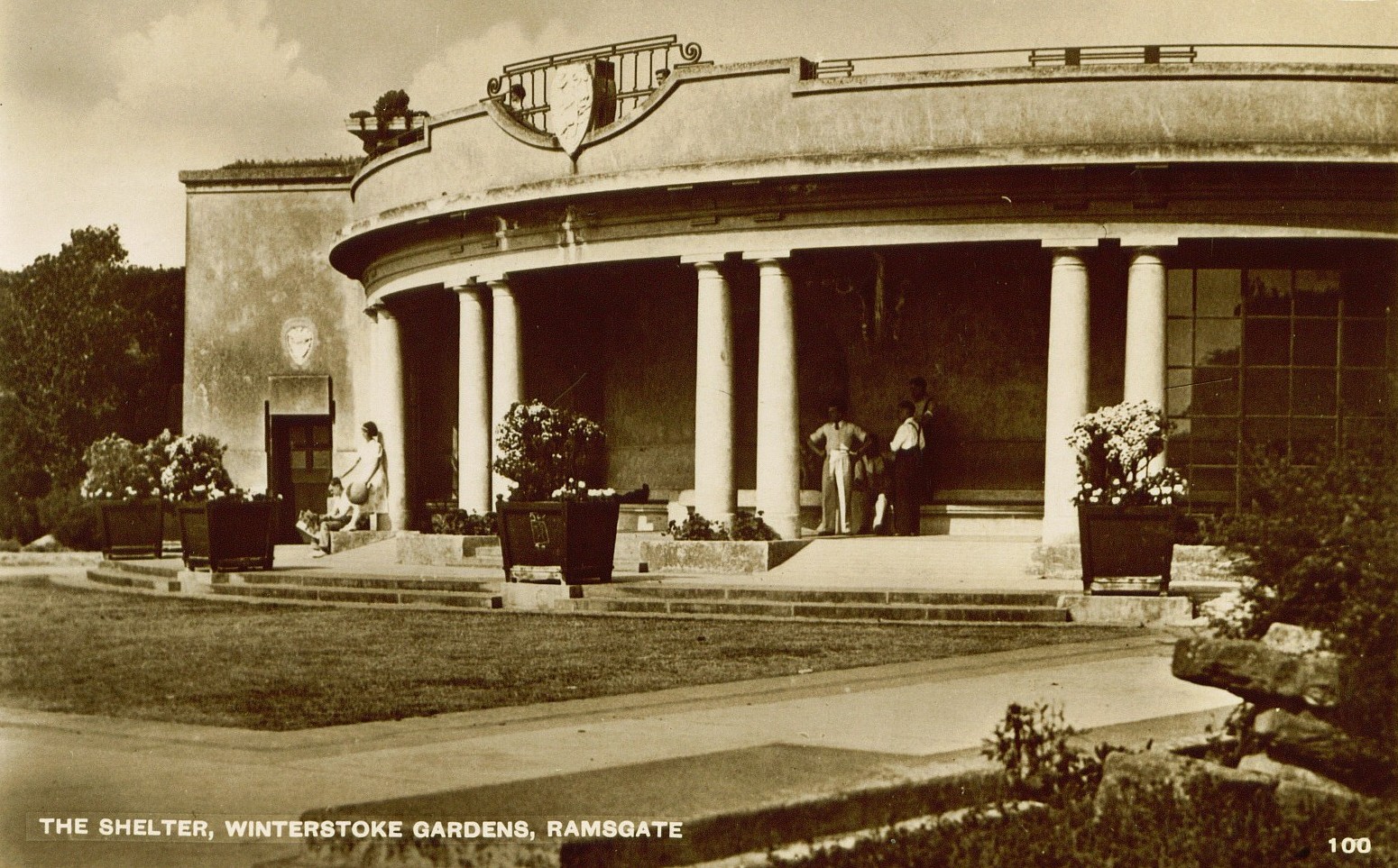
Overlooking the sea, the ornamental gardens were laid out and presented to the Borough of Ramsgate by Dame Janet Stancomb-Wills in 1920 and opened to the public in June 1923 by the Mayor of Ramsgate Alderman A. W. Larkin. They are maintained by Thanet District Council and were Grade II listed on 4 February 1988.
The gardens were designed by the architects Sir John Burnet & Partners, and constructed by Pulham and Son. The main feature of the gardens, is a semi-circular shaped colonnade carved into the pulhamite recess.
On the upper terrace, approached by broad flights of steps, the gardens proper are reached. In the centre, and immediately over the shelter, is a circular pool enclosed on the north side by a semi-circular Roman seat.
On leaving the town we encounter this engaging flint church – Holy Trinity
Erected 1829-1830. David Barnes Architect, extended 1925.
Built of flint and rubble.
One of the first visitors to this church was Charles Dickens who offered a very unflattering description in his work, Our English Watering Place:
We have a church, by the bye, of course – a hideous temple of flint, like a petrified haystack. Our chief clerical dignitary, who, to his honour, has done much for education, and has established excellent schools, is a sound, healthy gentleman, who has got into little local difficulties with the neighbouring farms, but has the pestilent trick of being right.
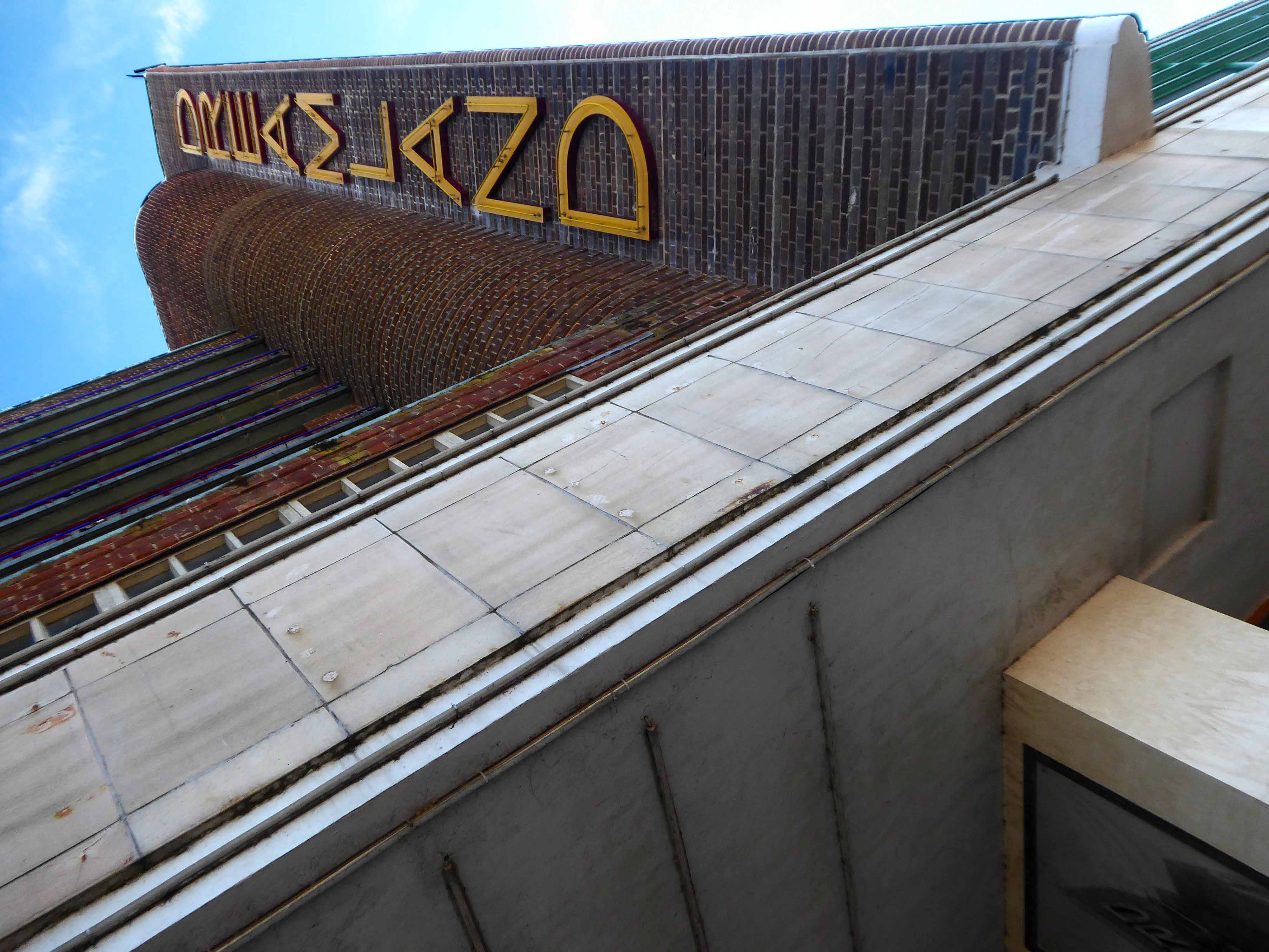
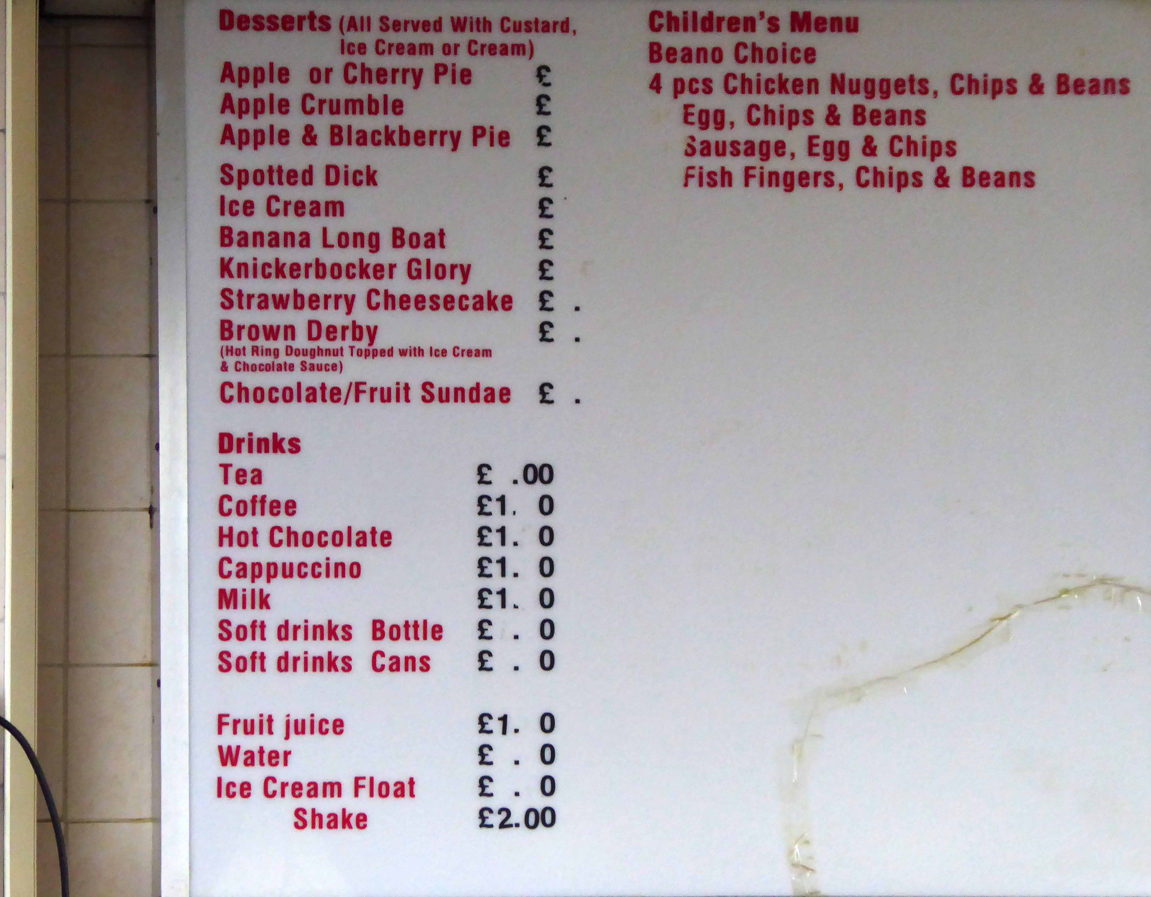
In Margate the tidal pools are full of waveless sea water and kiddy fun.
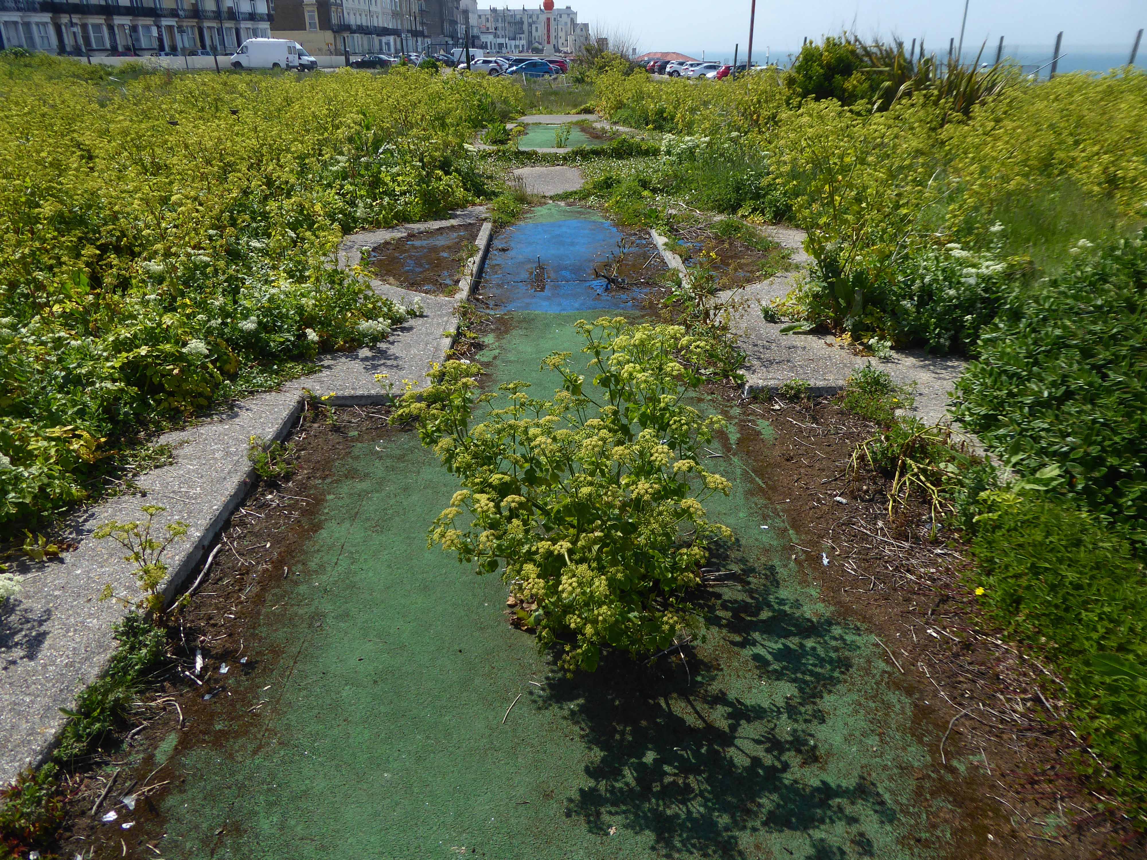
The former crazy golf course is undergoing an ongoing programme of involuntary rewilding.
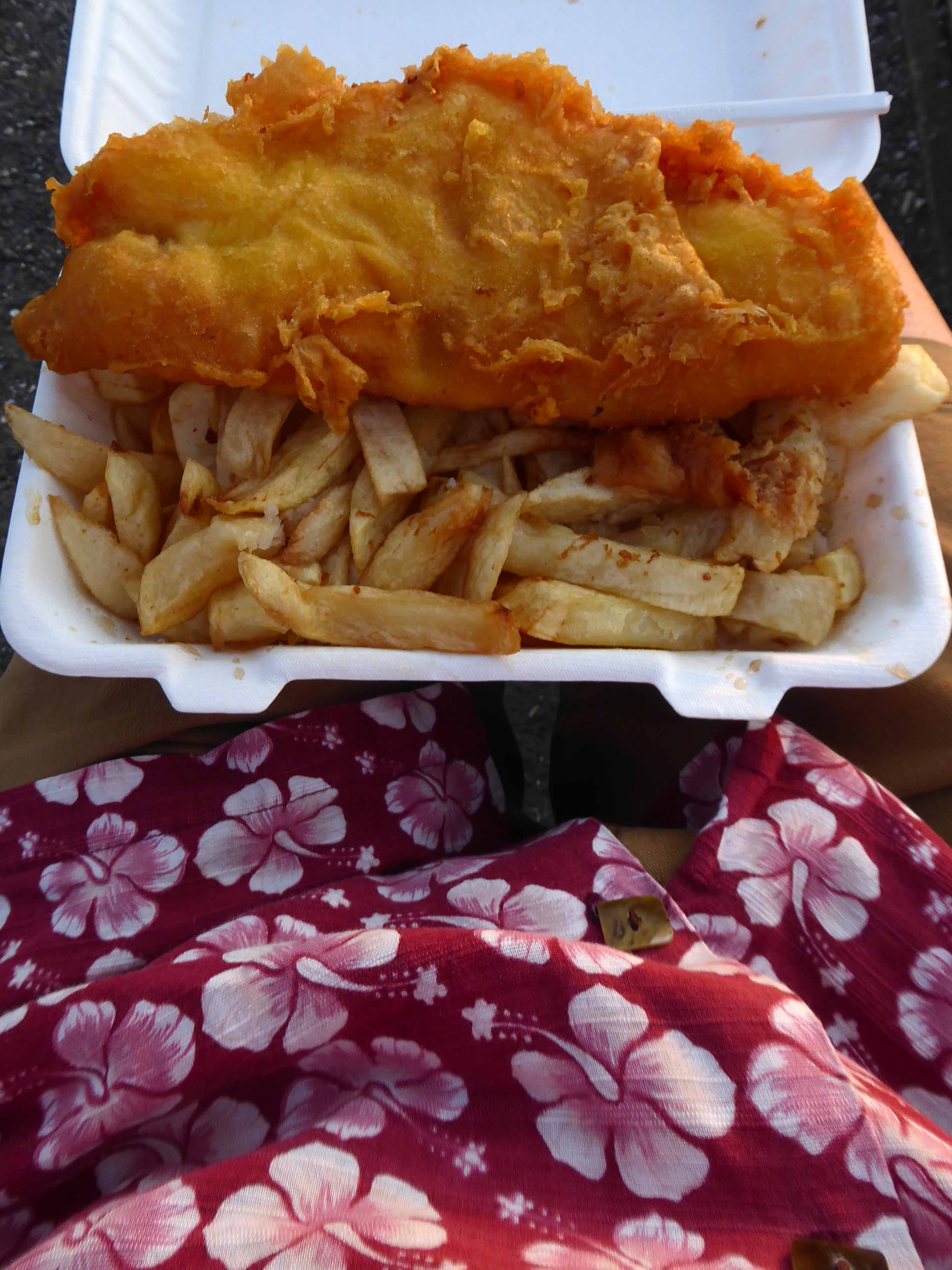
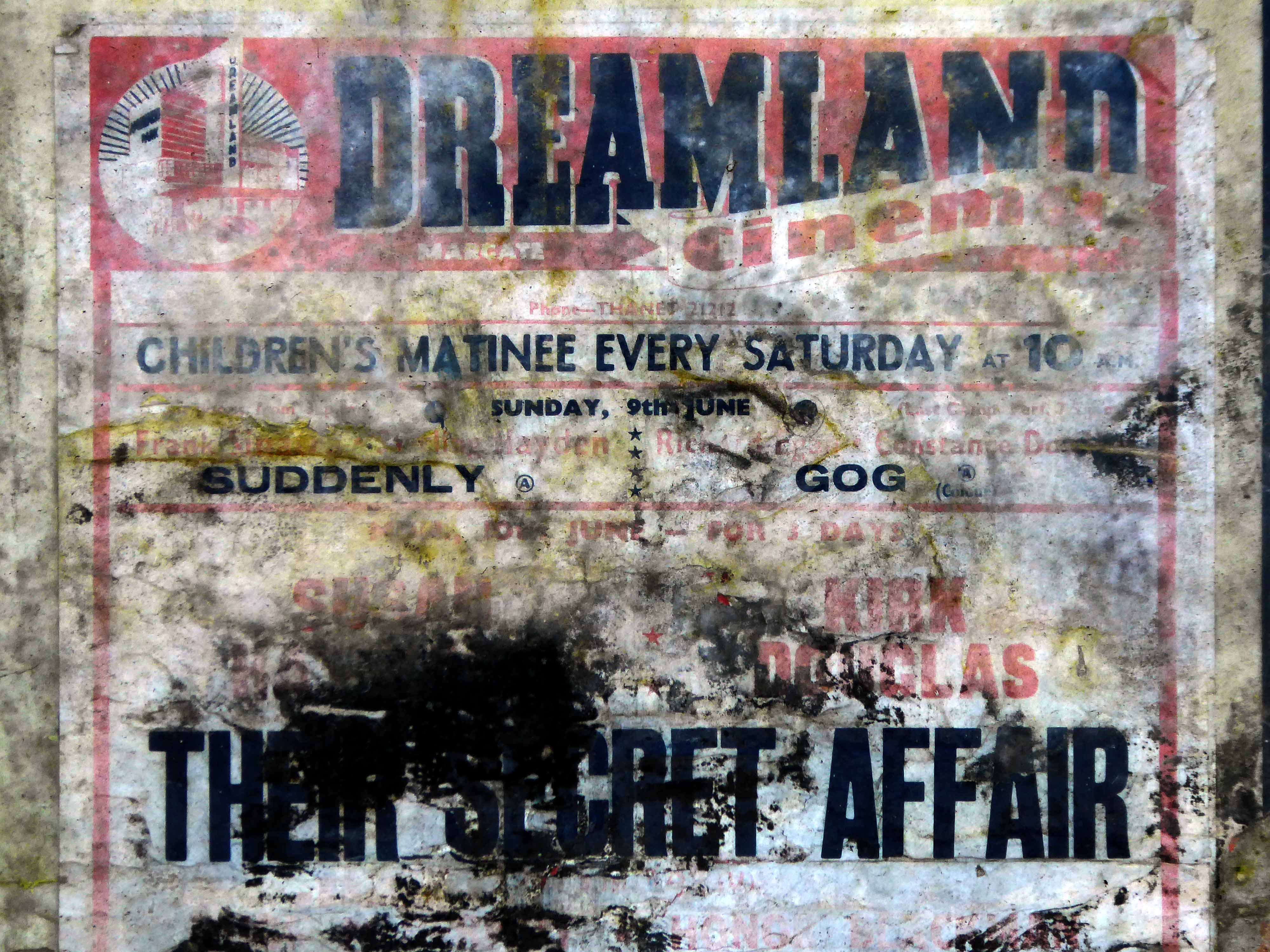
Time now for tea and a welcome plate of chish and fips at the Beano Cafe.
I miss my haddock and chips from Beano in Margate, brought to you with a smile and he remembers everyone.
Great customer service and friendly staff, see you soon.
The food is awful and the customer service is even worse: when we complained about the food the staff argued with us and wouldn’t do anything to change the food or refund, avoid at all costs!
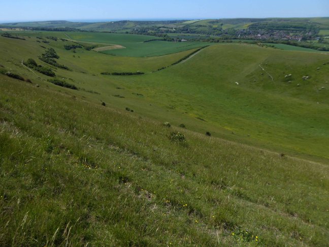
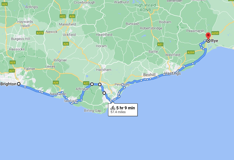
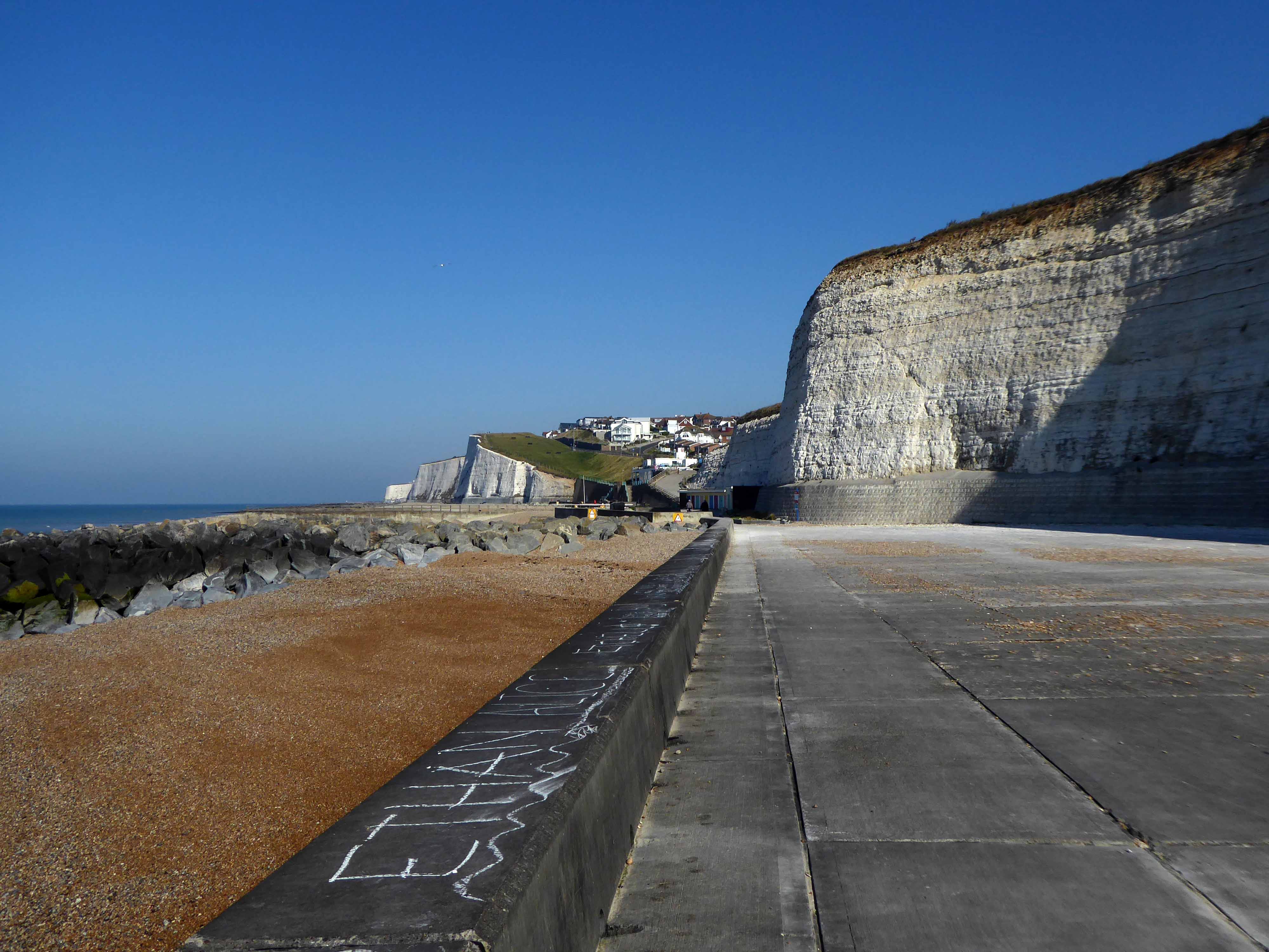
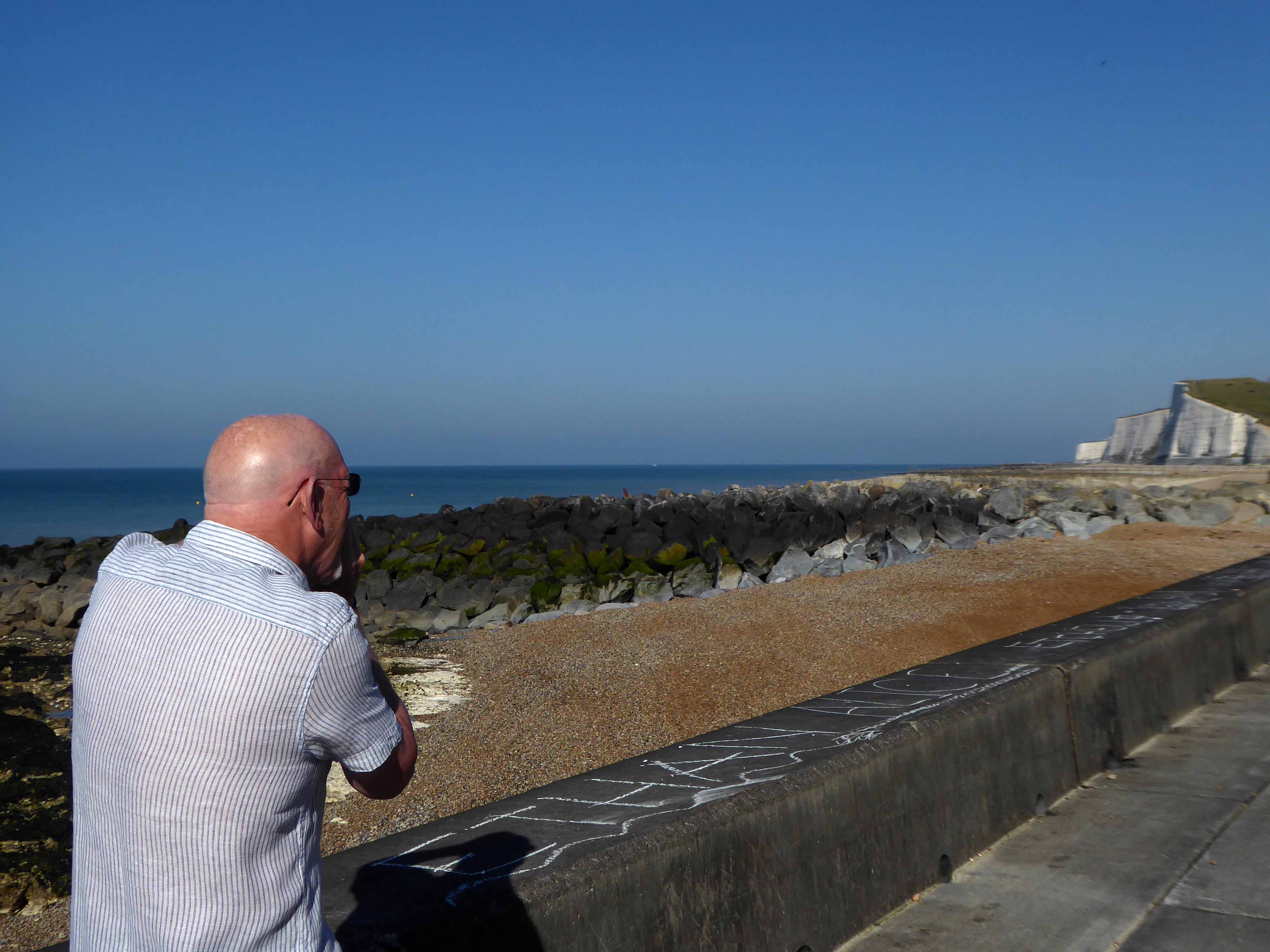
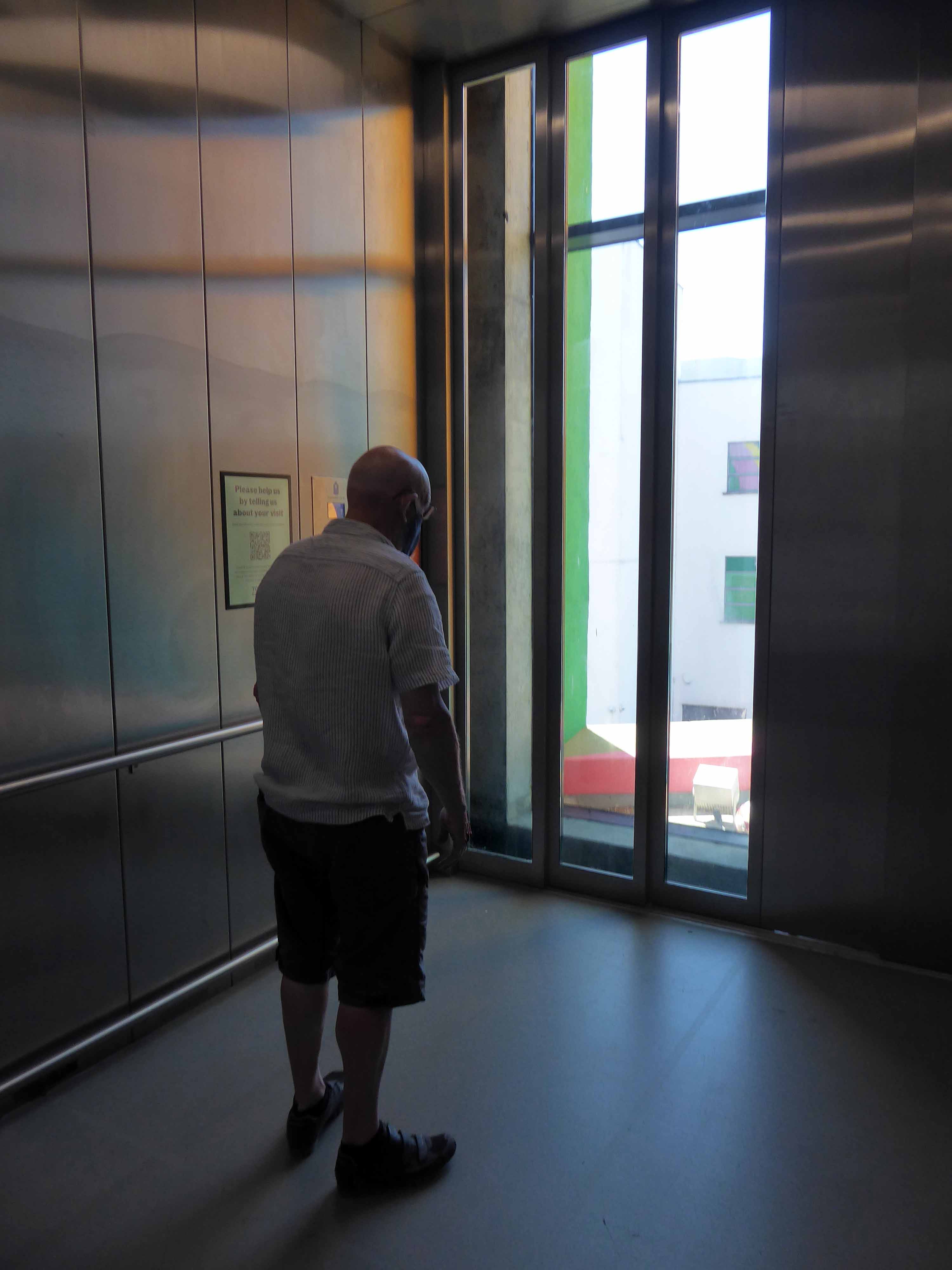
The longest day the least snaps – preoccupied with the avoidance of the main road over to Eastbourne, we took an arduous route over the South Downs Way.
Further preoccupied by and appointment with John Nash at the Towner at One PM.
Firstly however a leisurely ride along the Undercliff – designed by Borough Engineer David Edwards as a public amenity, was begun in 1928 and opened in July 1933.
Mr Tim Rushton apprehends the view.
Sustrans have the habit of heading away from the A roads and onto the backstreets of Britain.
To fill in the gaps on our snap-less journey, here’s my previous trip.
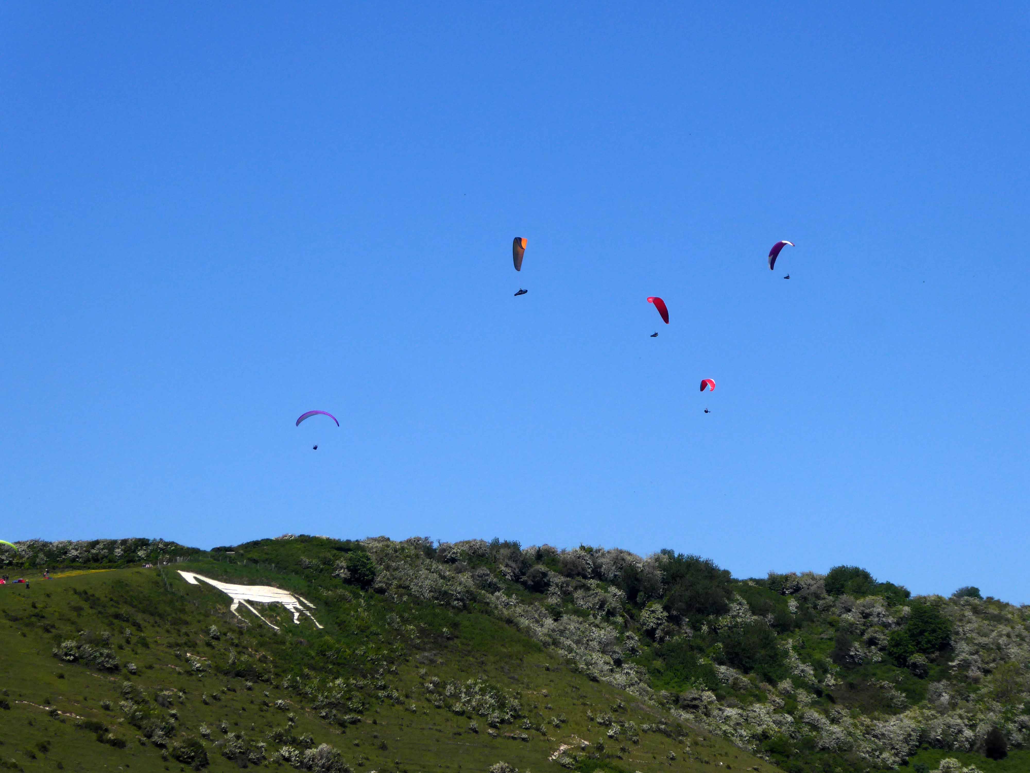
Leaving the coast for the soft rolling Sussex hills, where we encounter the Litlington White Horse.
The Litlington White Horse is a chalk hill figure depicting a horse, situated on Hindover Hill in the South Downs, looking over the River Cuckmere to the west of the village of Litlington and north of East Blatchington in East Sussex.
The current horse was cut in 1924 by John T, Ade, Mr Bovis and Eric Hobbis in a single night and stands at 93 feet long and 65 feet high. A previous horse was cut in either 1838 or 1860 on the same site. Since 1991, the horse has been owned by the National Trust, who regularly clean and maintain the horse along with local volunteers.
Local legend suggests that the horse was originally cut as a memorial to a local girl whose horse bolted when riding along the brow of Hindover Hill, throwing her down the hill which resulted in her death.
However, there is no evidence to suggest this to be true.
Viewing from the air – the lone pursuit of the paraglider.
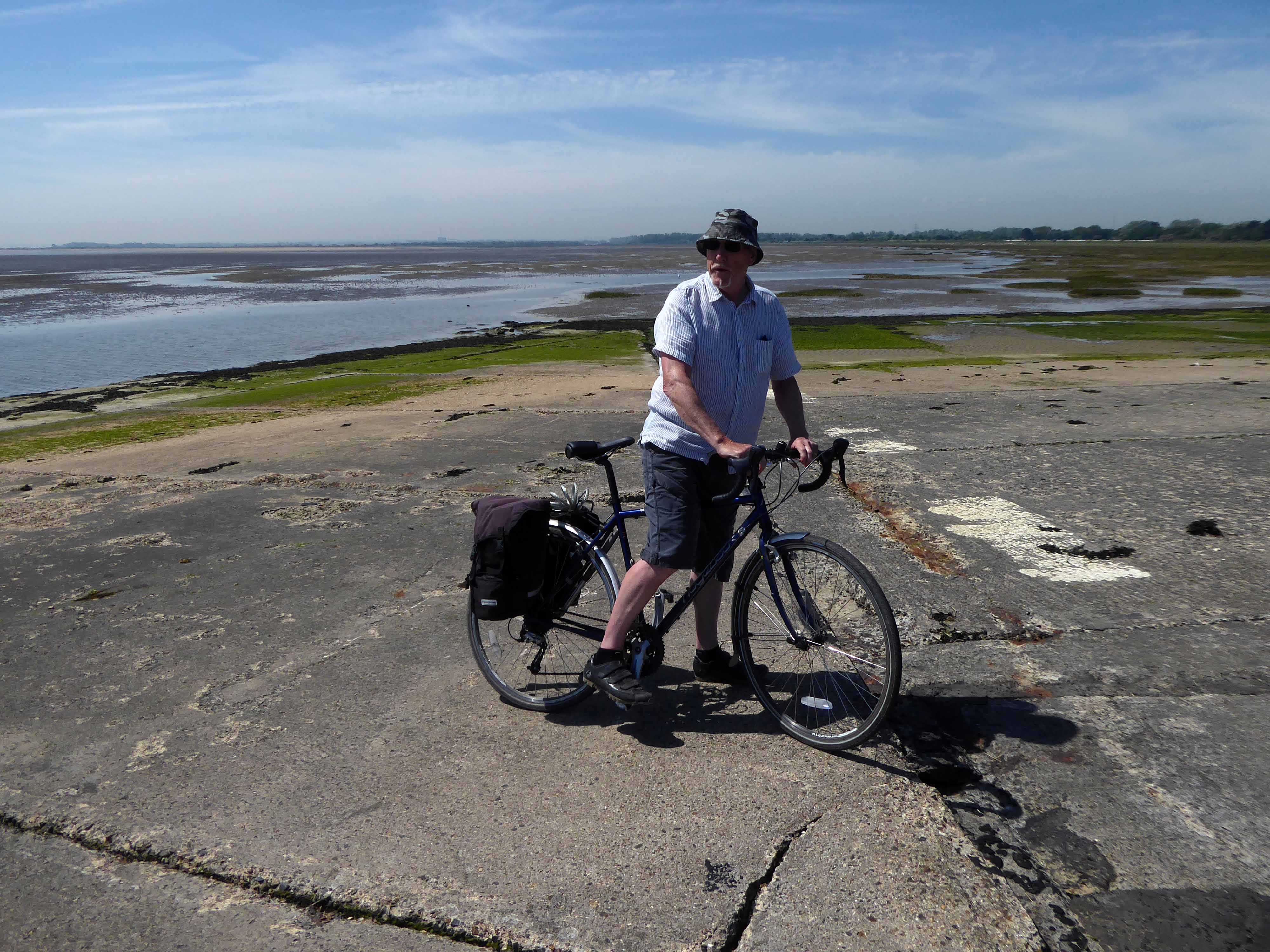
Viewing from Terra Firma the lone pursuit of the camo-bucket hatted cyclist.
Who subsequently discovers the heady heights of the Downs.
Which seem to have more in the way of ups than downs.
Though when the gradient eases, graced with the sweetest sweeping green bowls.
The nave is 12th Century, with a later 13th Century chancel and north aisle.
Most windows are 14th or 15th Century.
A C11 carving shows Viking influence.
Having descended, we are now faced with another lengthy ascent and the prospect of our late arrival in Eastbourne.
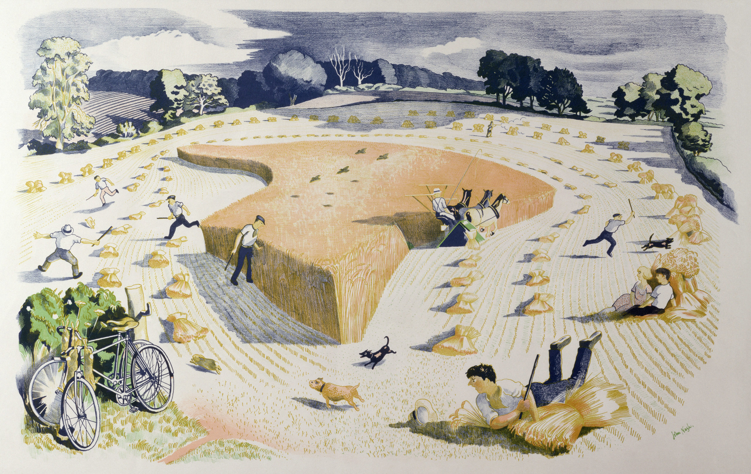
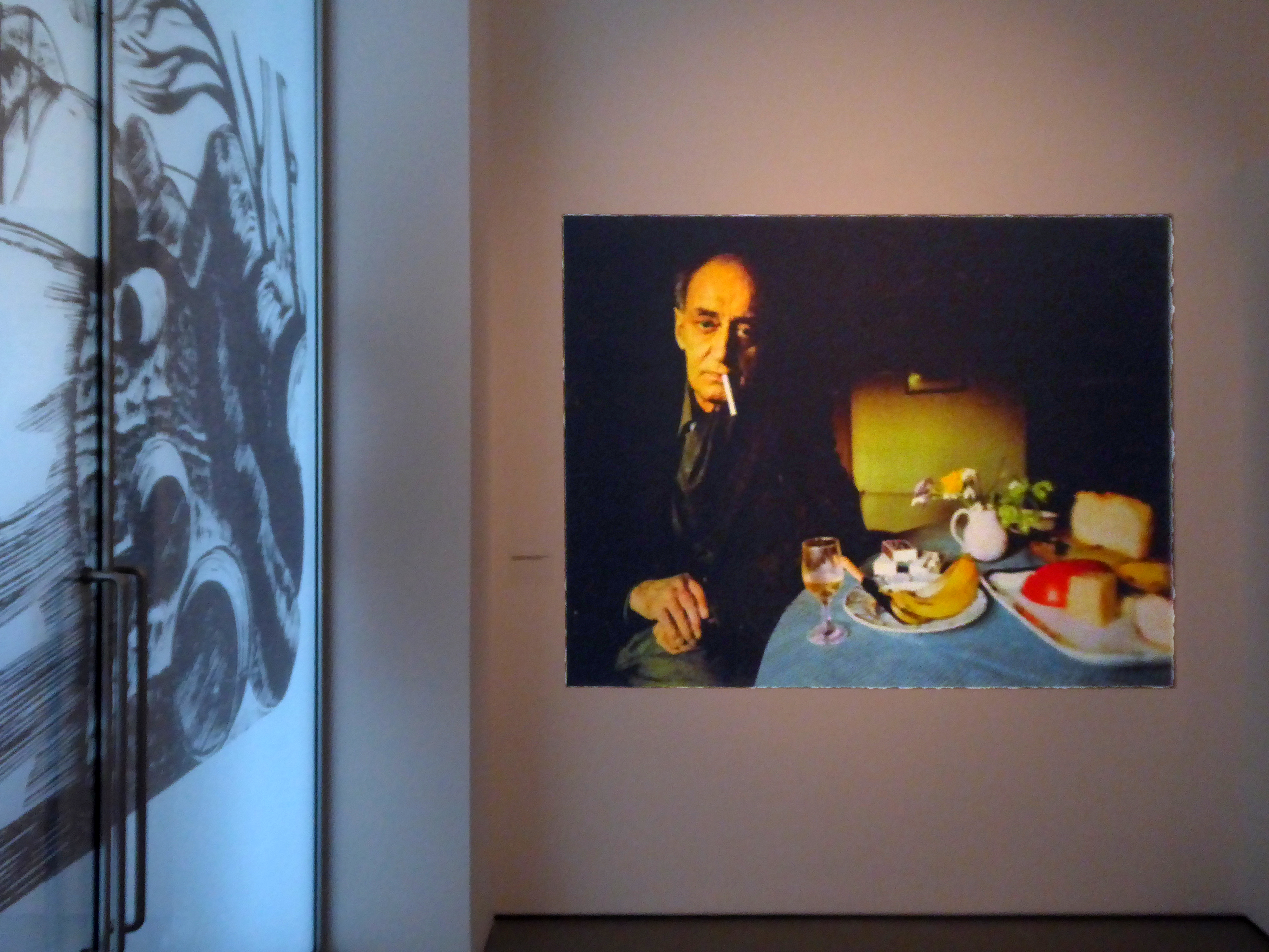
Against all odds we are almost on time and permitted entry to the John Nash Exhibition.
The Landscape of Love and Solace.
Harvesting printed at The Baynard Press for School Prints Ltd.
Ascending with ease in the capacious elevator.
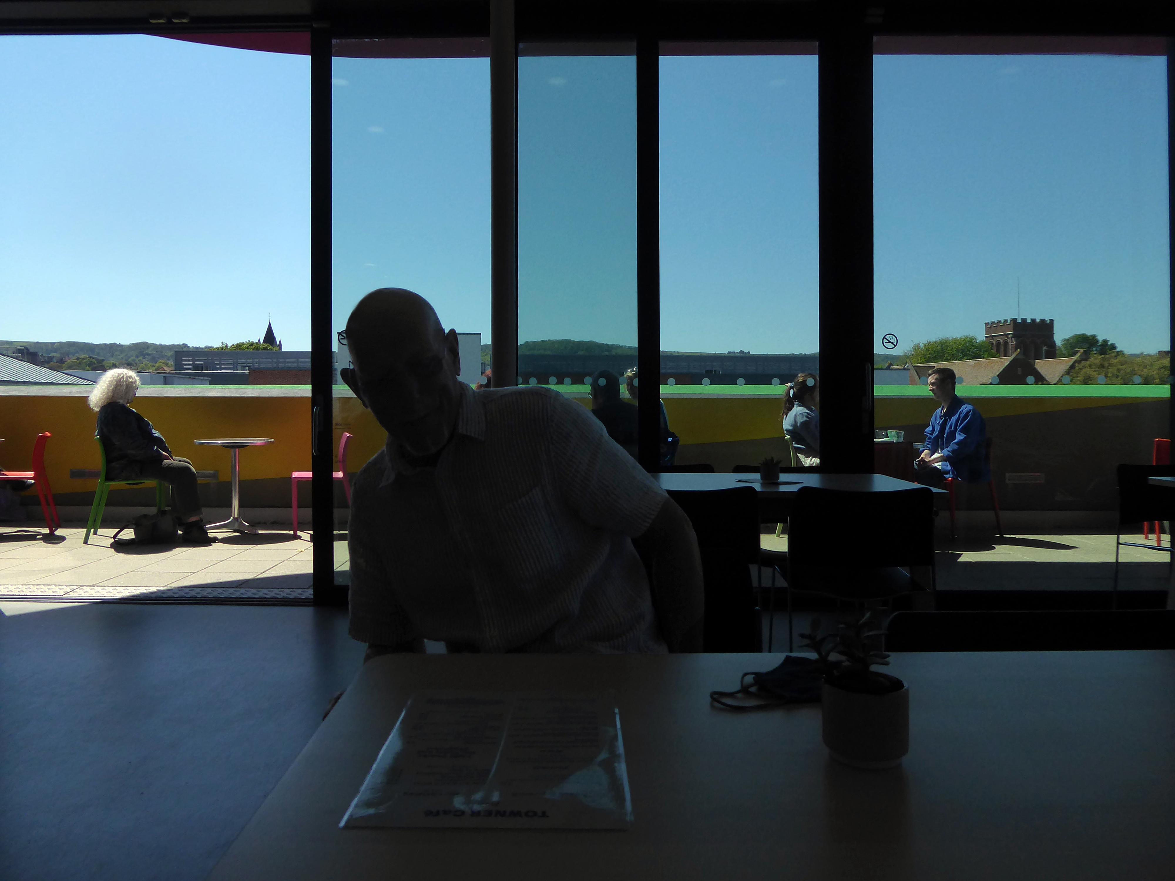
A wonderful show – so much to see, prints and watercolours in superabundance.
Followed by tea and a bun in the smart café.
We hastened to Hastings, pausing briefly to say hello to Pauline, then onward to Rye.
Once again walking the climbs, before dropping down to Winchelsea, where we were met by a relentless easterly headwind.
Our weary legs propelling us ever so slowly through an area of marsh and shingle, softly edged by the sea.
On 15th November 1928 at 6.45am the ‘Mary Stanford’ lifeboat with her crew of 17 was launched to save a stricken vessel. A south-westerly gale with winds in excess of 80 miles per hour was raging in the English Channel. Not one of these brave Rye Harbour men ever returned.
The impact of the disaster on the Rye Harbour community was devastating and deeply affected all who lived there. The disaster was also felt worldwide, and was front page news over the days that followed. The funeral was attended by hundreds including the Latvian Minister. An annual memorial service is held at Rye Harbour church to this day.
The Lifeboat House still stands, butwas never used again.
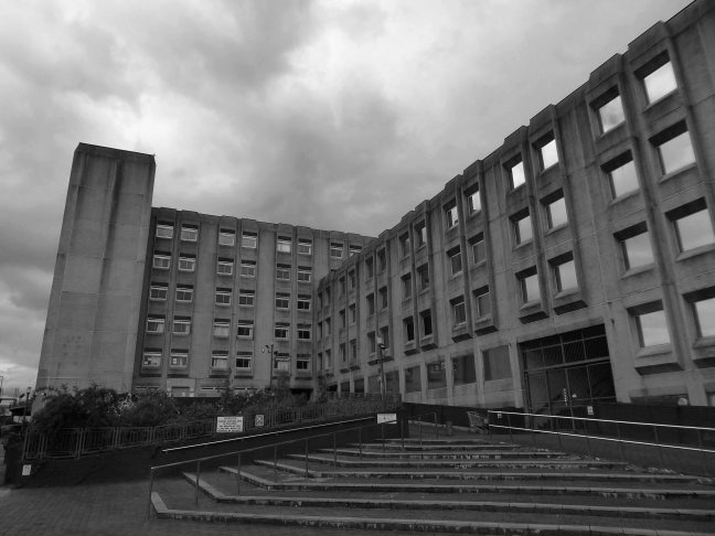
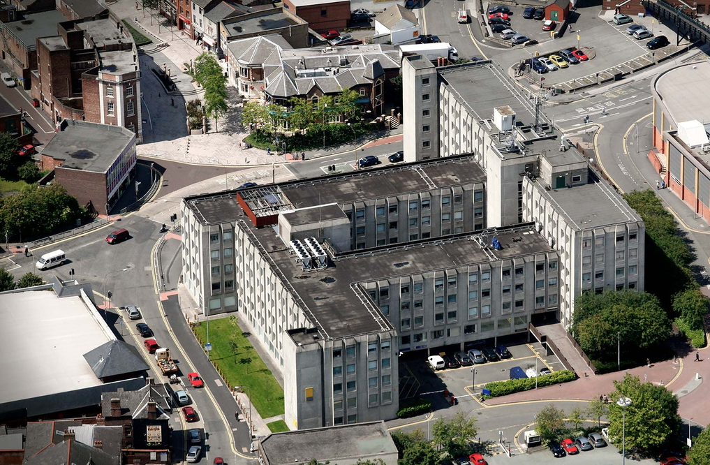
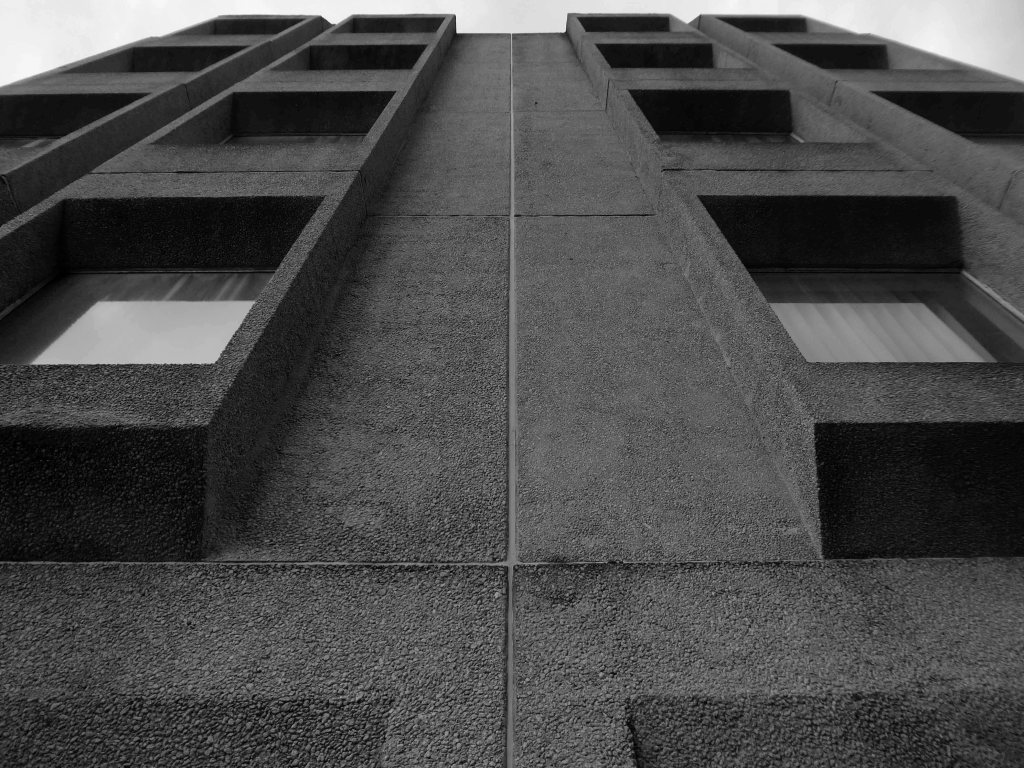
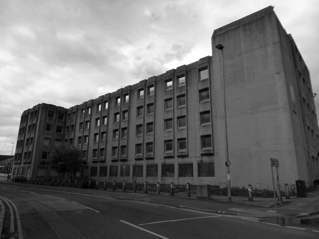
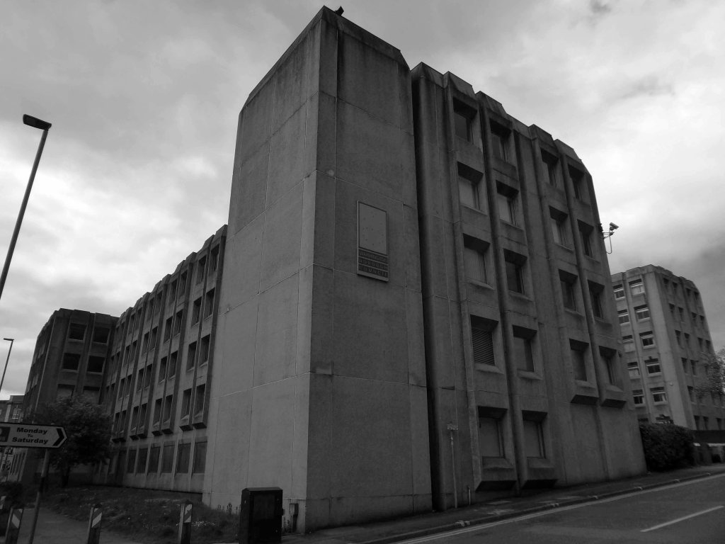
The weary workers are already rehoused in One Time Square.
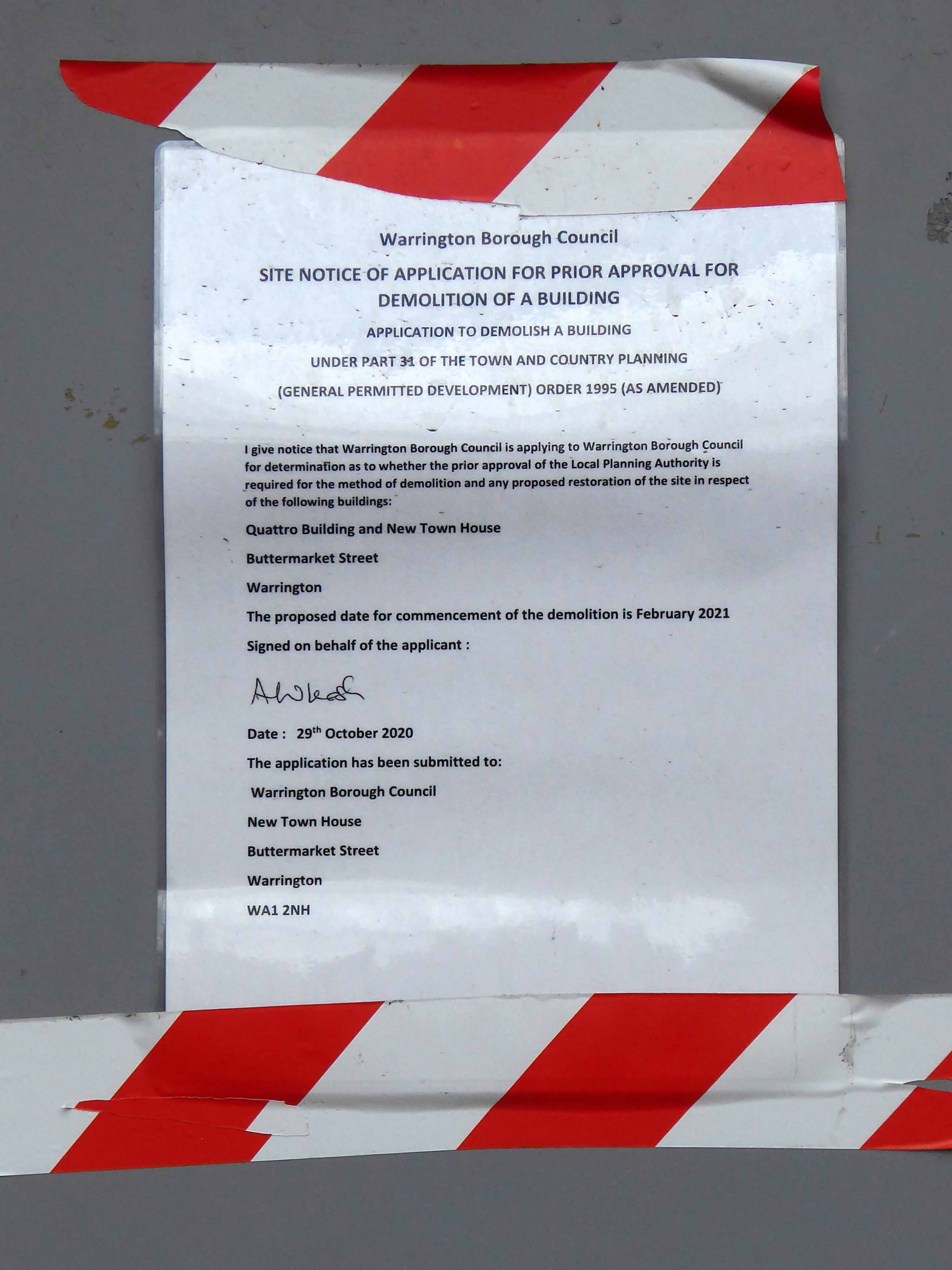
So I went to take a walk around, before the wrecking ball arrives.
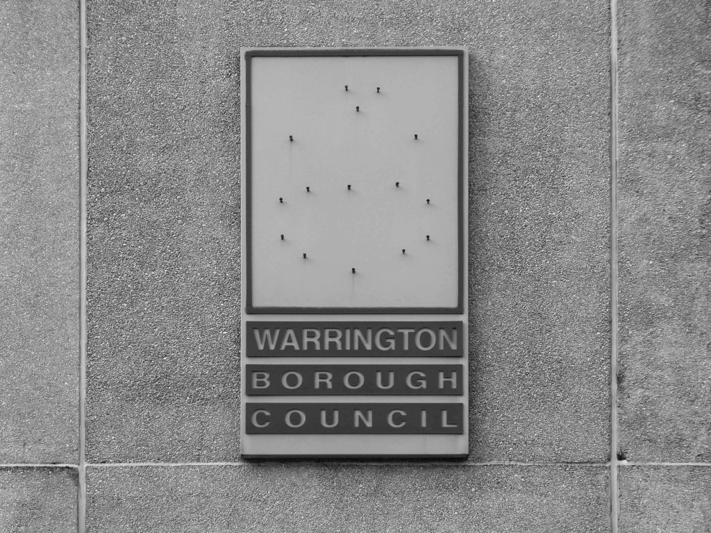
The council said there were:
No operational reasons to keep the building in council use or occupied beyond this point, allowing the site to be cleared for redevelopment.
Justifying the demolition, Warrington said the building has poor energy efficiency, high service costs, and is inflexible for modern office and business working
Cost estimates for refurbishment, M&E installation, and energy efficiency measures to keep the building in office use stand at £5m; even if this is actioned, the building would still have limitations for flexible modern working practices and energy efficiency.
The council had explored renting the building out but said: there was no demand for office space of this scale and quality; a sale was also considered but the council found market demand was not significant.
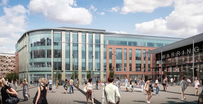
Residential is the most likely outcome for the site, and it will be built into a masterplan for an area including Scotland Road, Town Hill, and Cockhedge. The council said it would look to sell the site in future.
The rising cost of repairs, combined with ‘a desire to progress’ with the regeneration of Droylsden town centre and the inaccessibility of the library’s T shape, three-floor configuration means that a ‘solution for the future of the library’ is now needed, according to the town hall.
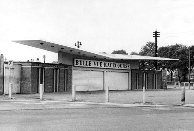
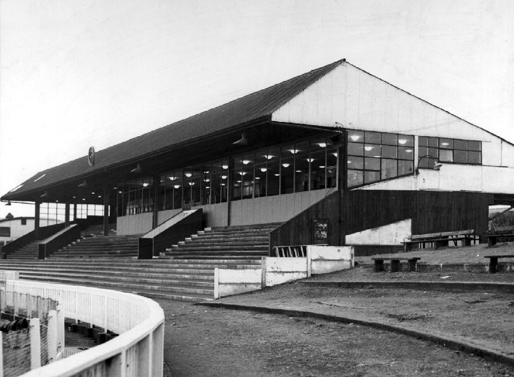
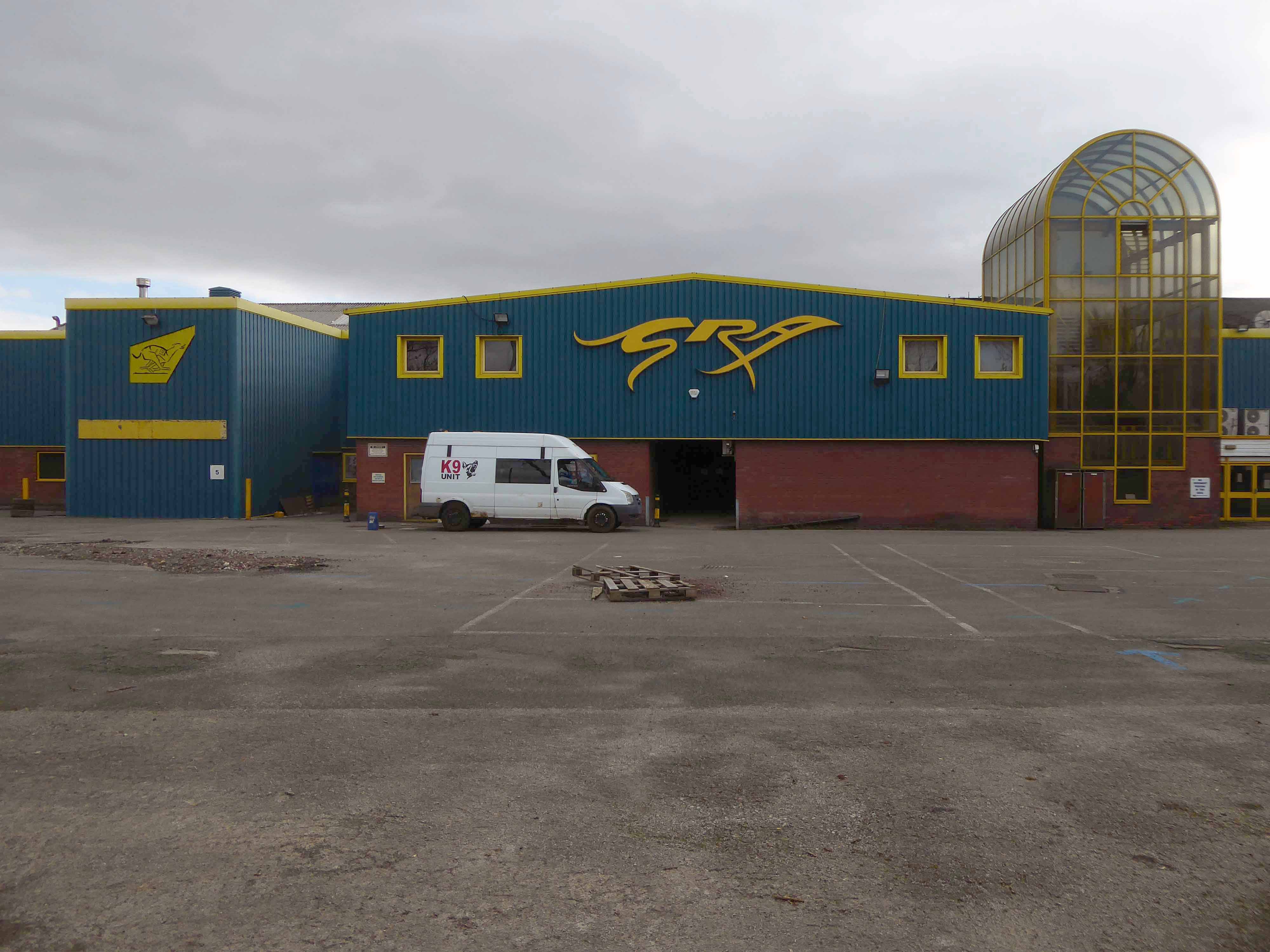
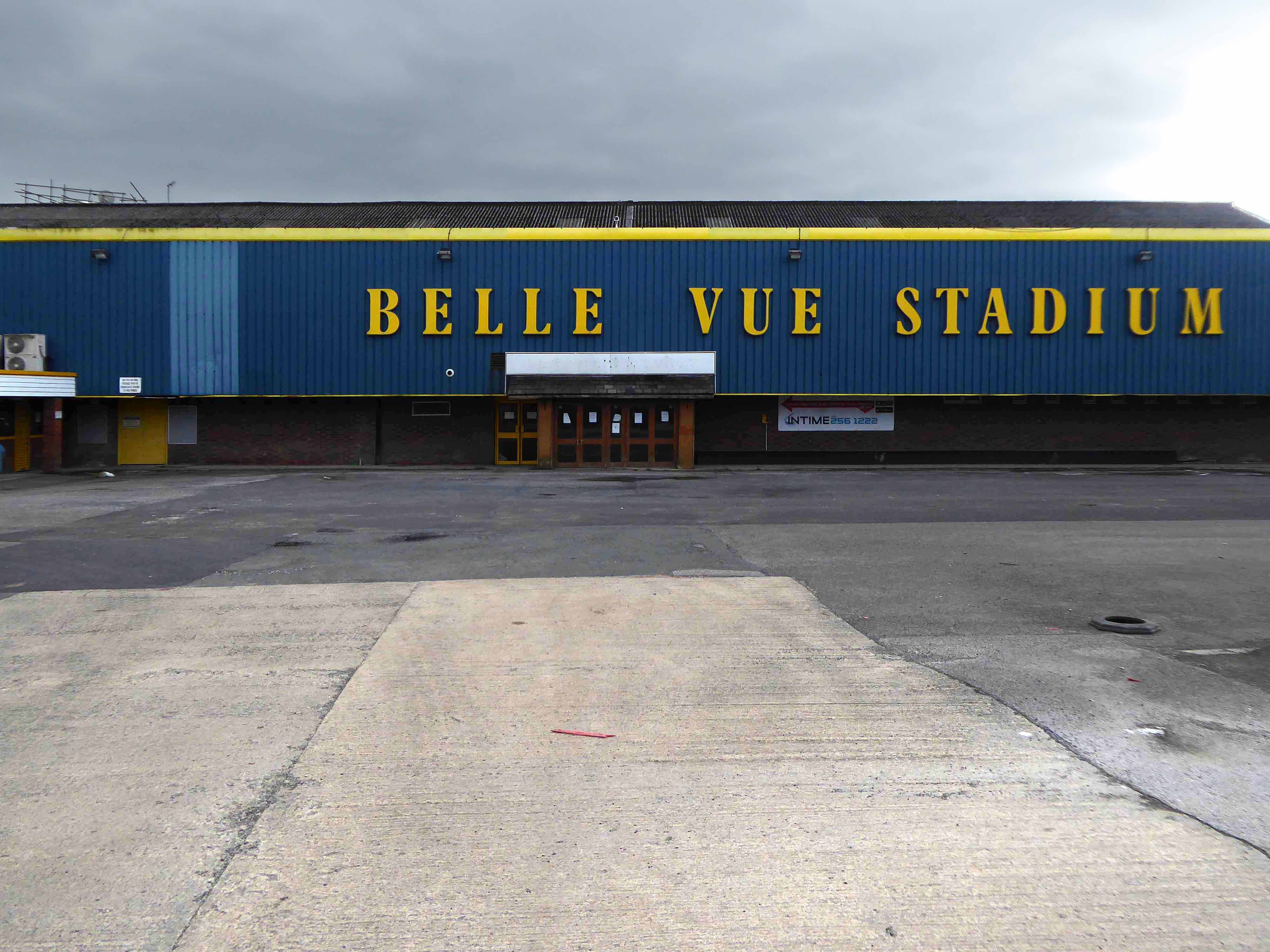
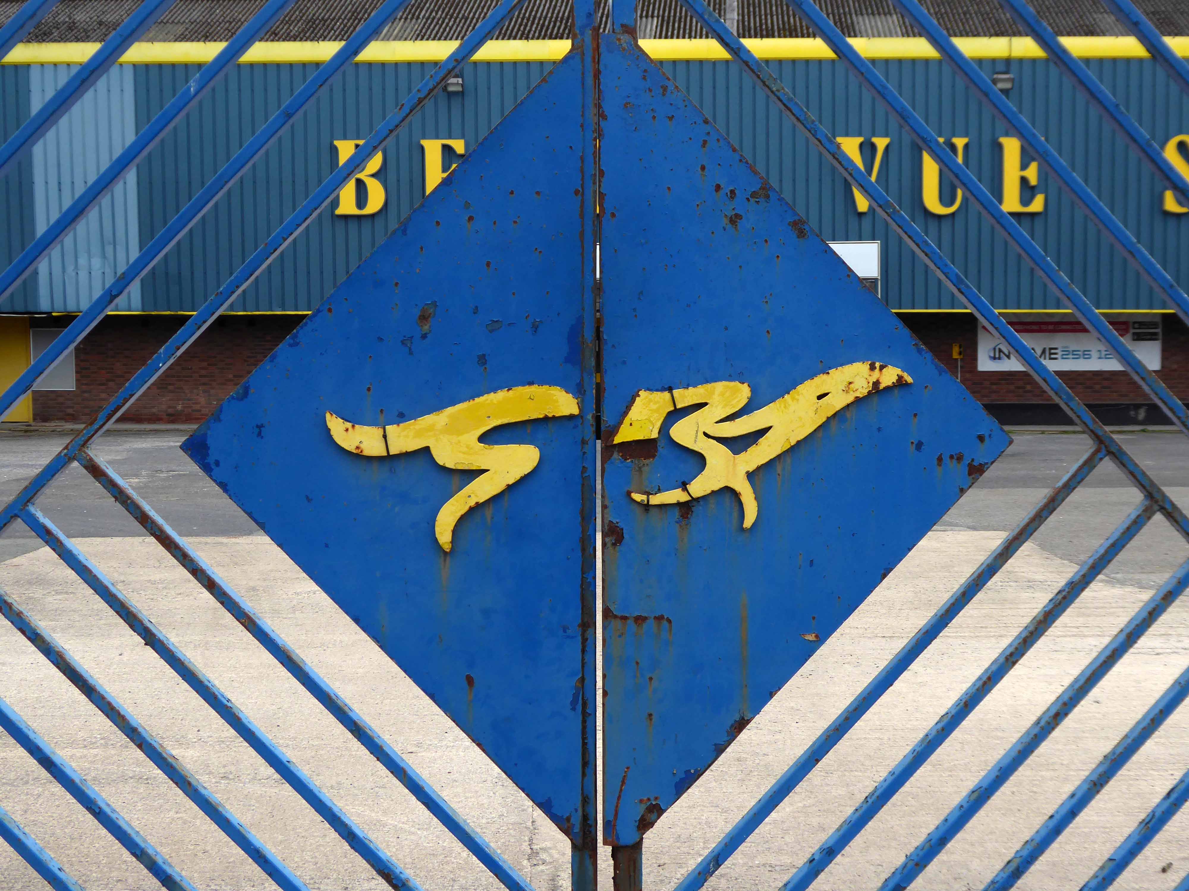
The stadium opened on July 24th 1926 – 7.30 prompt.
In 1925, Charles A. Munn, an American businessman, made a deal with Smith and Sawyer for the rights to promote the greyhound racing in Britain.
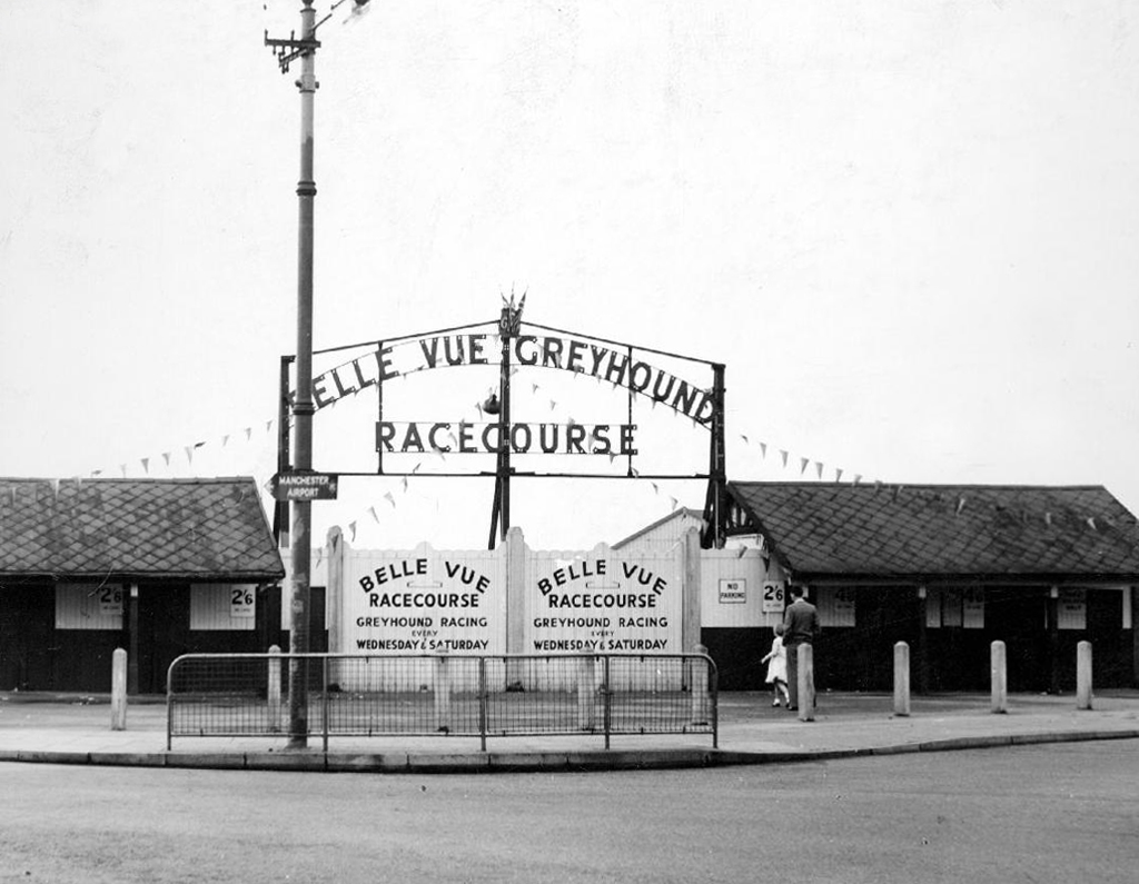
Smith and Sawyer met Brigadier-General Alfred Critchley, who in turn introduced them to Sir William Gentle JP. Between them they raised £22,000 and formed the Greyhound Racing Association Ltd. When deciding where to situate their new stadium, Manchester was considered to be the ideal place because of its sporting and gambling links. Close to the city centre, the consortium erected the first custom-built greyhound stadium and called it Belle Vue. The name of the stadium came from the nearby Belle Vue Zoological Gardens that had been built in 1836 and the land on which the stadium was to stand had been an area of farmland known as Higher Catsknowl and Lower Catsknowl.
By June 1927, the stadium was attracting almost 70,000 visitors a week.
1958
In October 2019 GRA Acquisition sold the lease to the Arena Racing Company and just two months later on 19 December housing planning permission was passed resulting in a probable closure in 2020.
The imminent closure came following an announcement on 1 August 2020, with the last race being run on 6 June, won by Rockmount Buster – trained by Gary Griffiths.
Going to the dogs was an institution for many, whole families enjoying the spectacle, possibly having a bet, bite and a pint.
Time changes everything social habits, views on animal welfare and gambling.
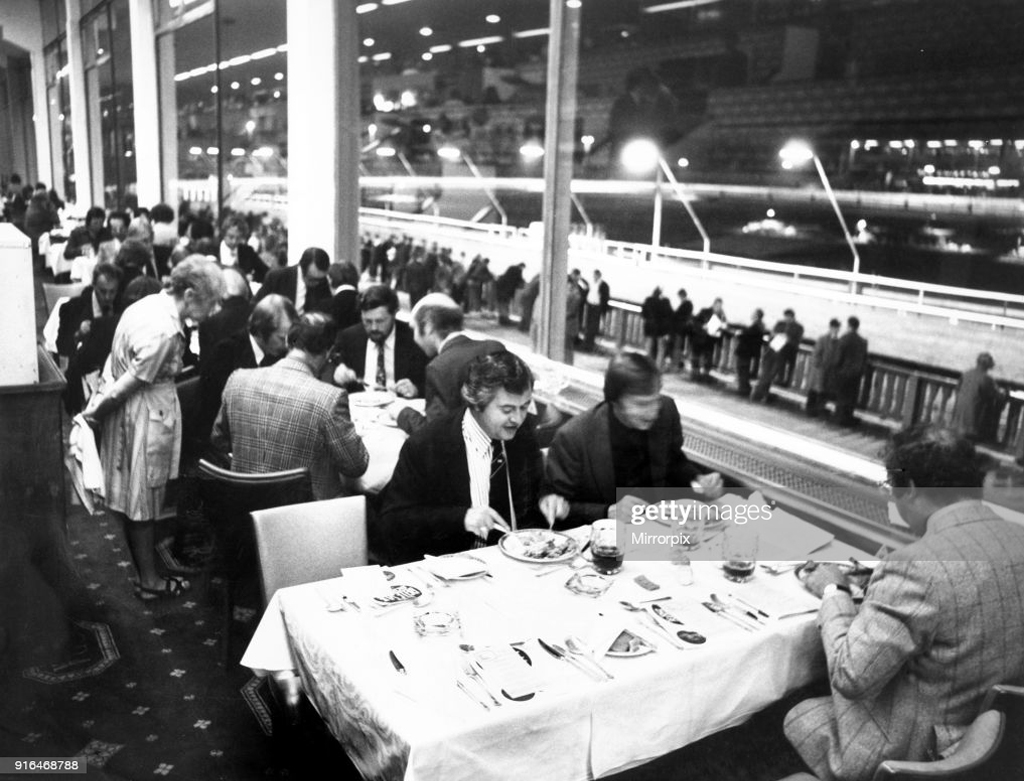
Diners enjoying their meal at Belle Vue Greyhound stadium while punters line trails outside waiting for the next race, 23rd September 1976.
The hare no longer courses electronically around the oval track, the traps no longer flap and the Tote has taken the last of your change, for the very last time.
Drink up and go home.
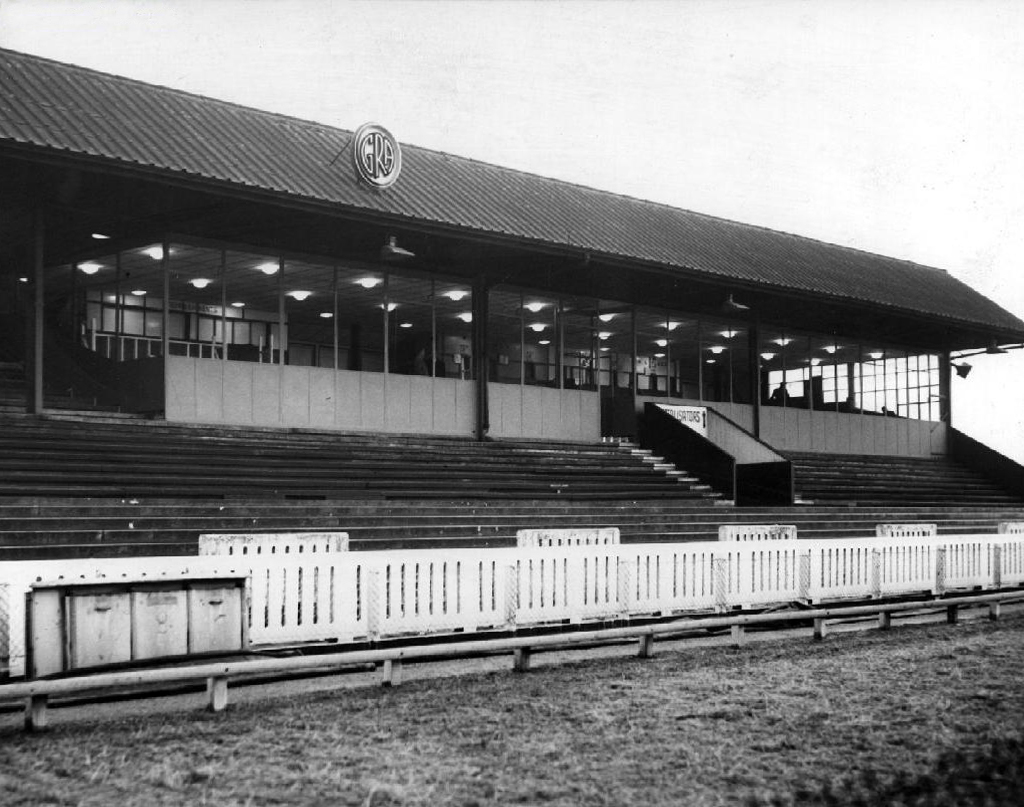
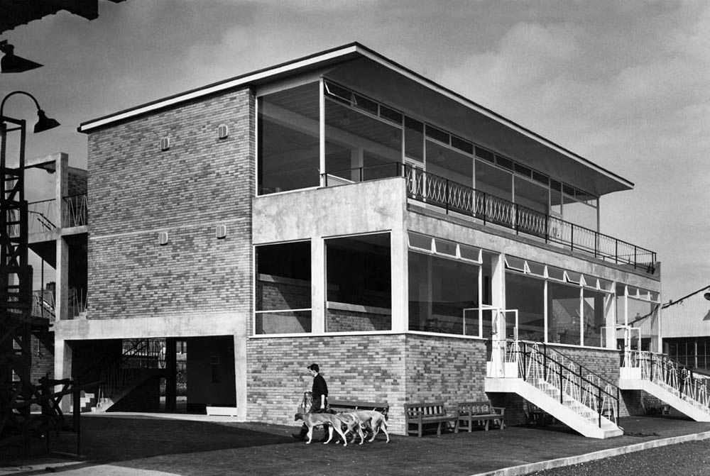
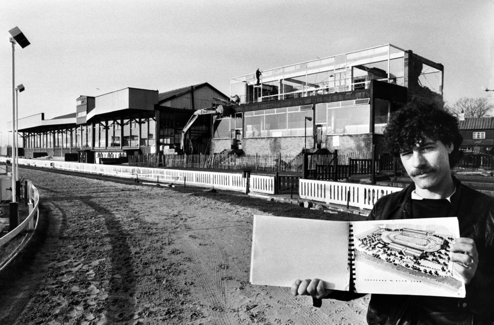
The new £30,000 stand that has just been completed 29th April 1960.The track’s Assistant General Manager Colin Delaney with the plans for the new stadium complex. 1989.
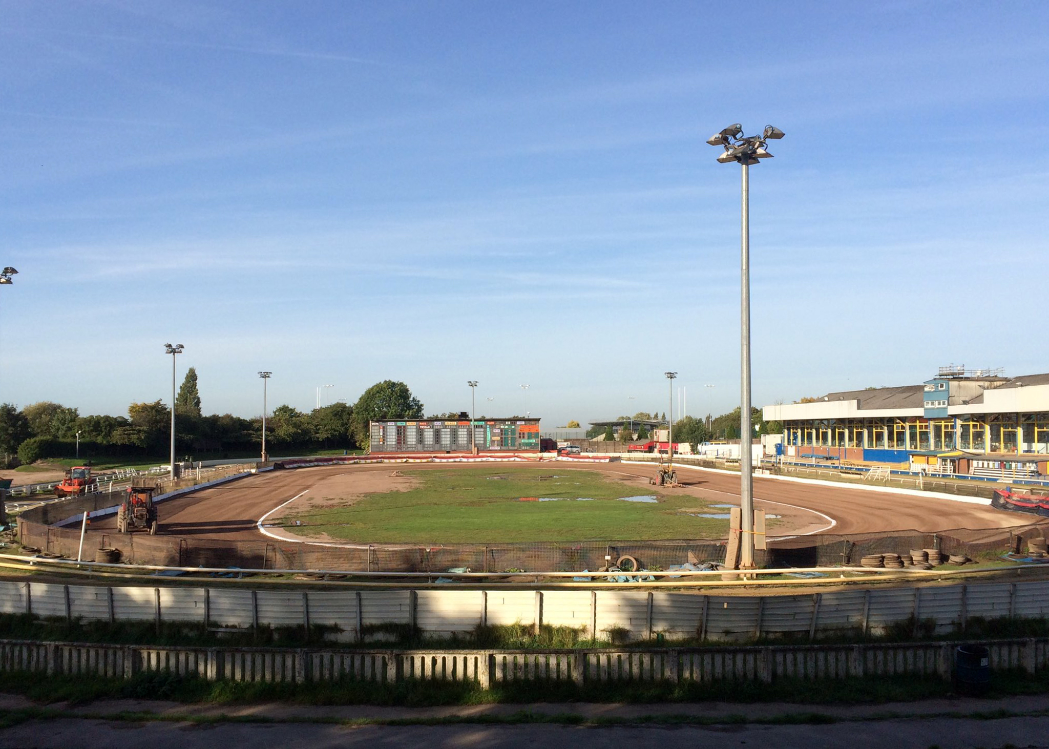
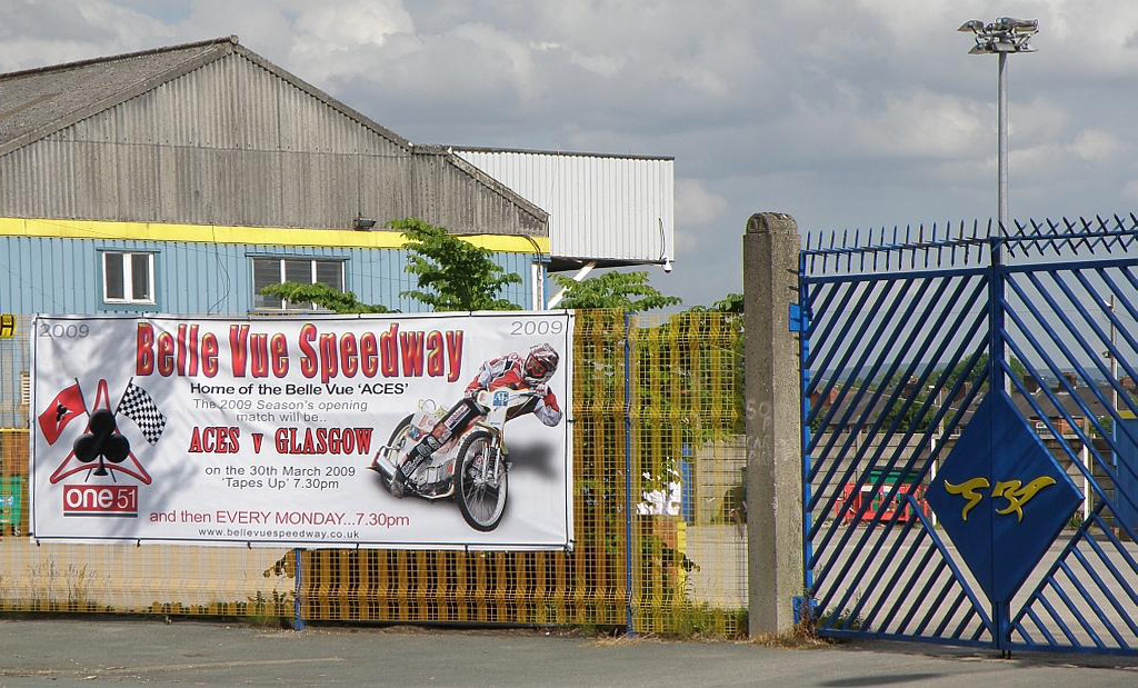
Speedway was first held at the stadium during 1928 but was not held again until 1 April 1988, when the Belle Vue Aces returned to the stadium. The team departed Kirkmanshulme Lane at the end of the 2015 season, prior to moving to the new National Speedway Stadium for the 2016 campaign.
The shale speedway track was 285 metres in length.
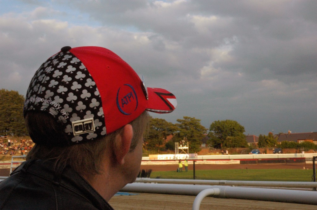
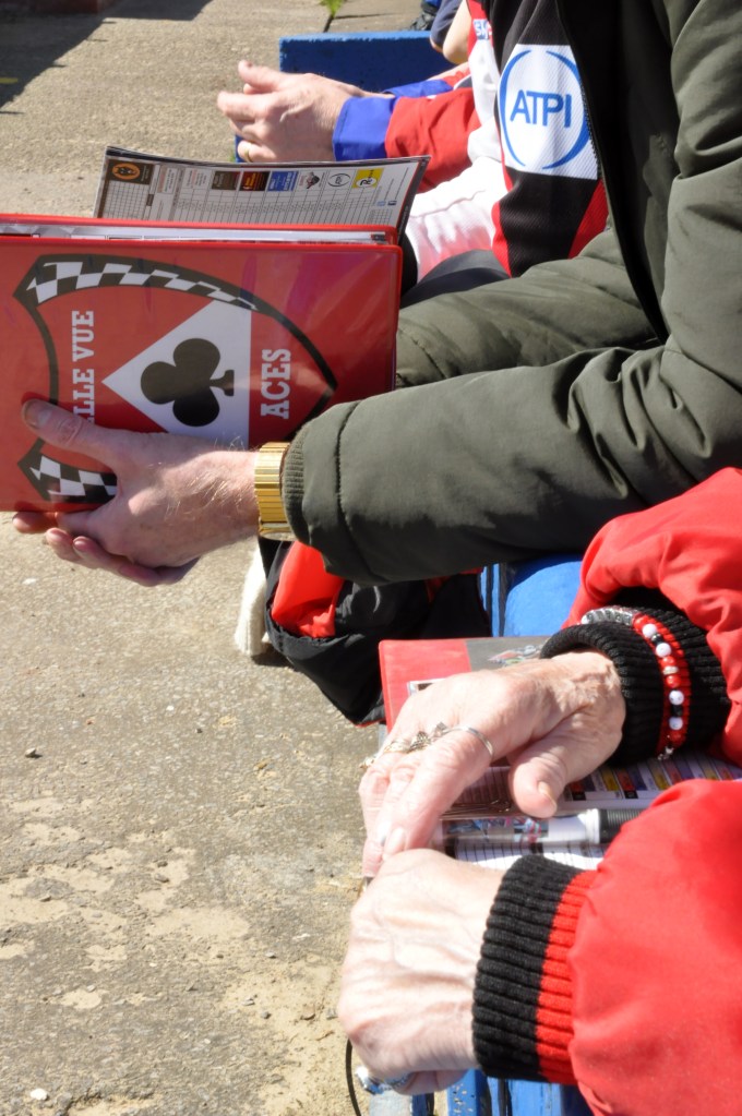
I was a regular of a Monday evening cheering on The Aces.
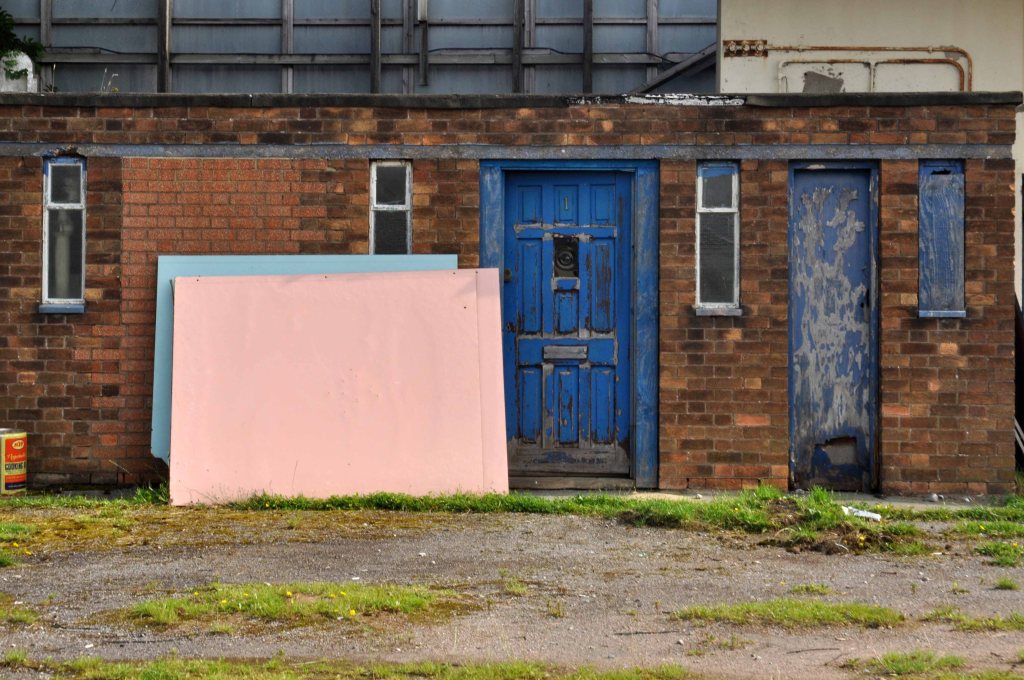
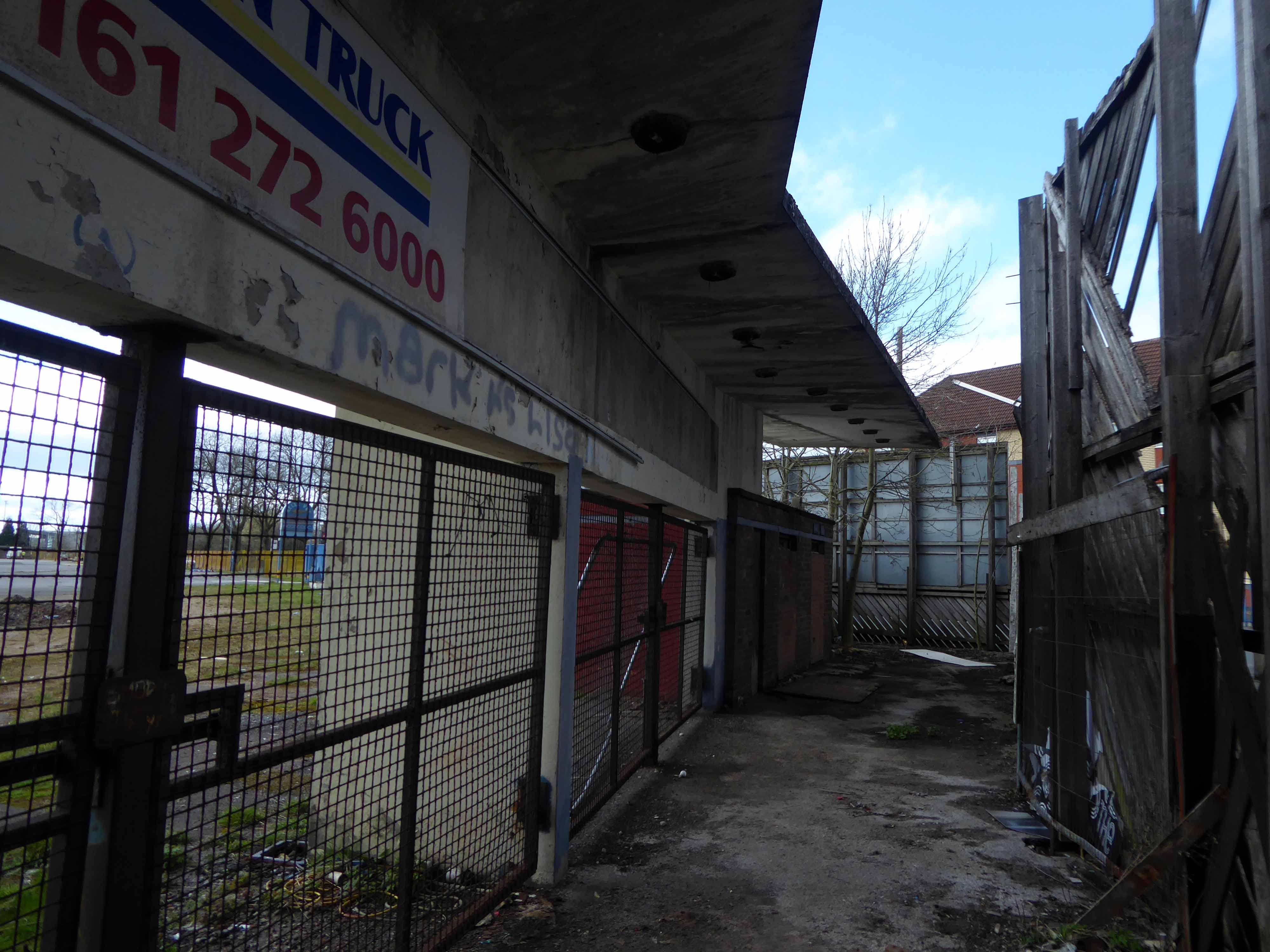
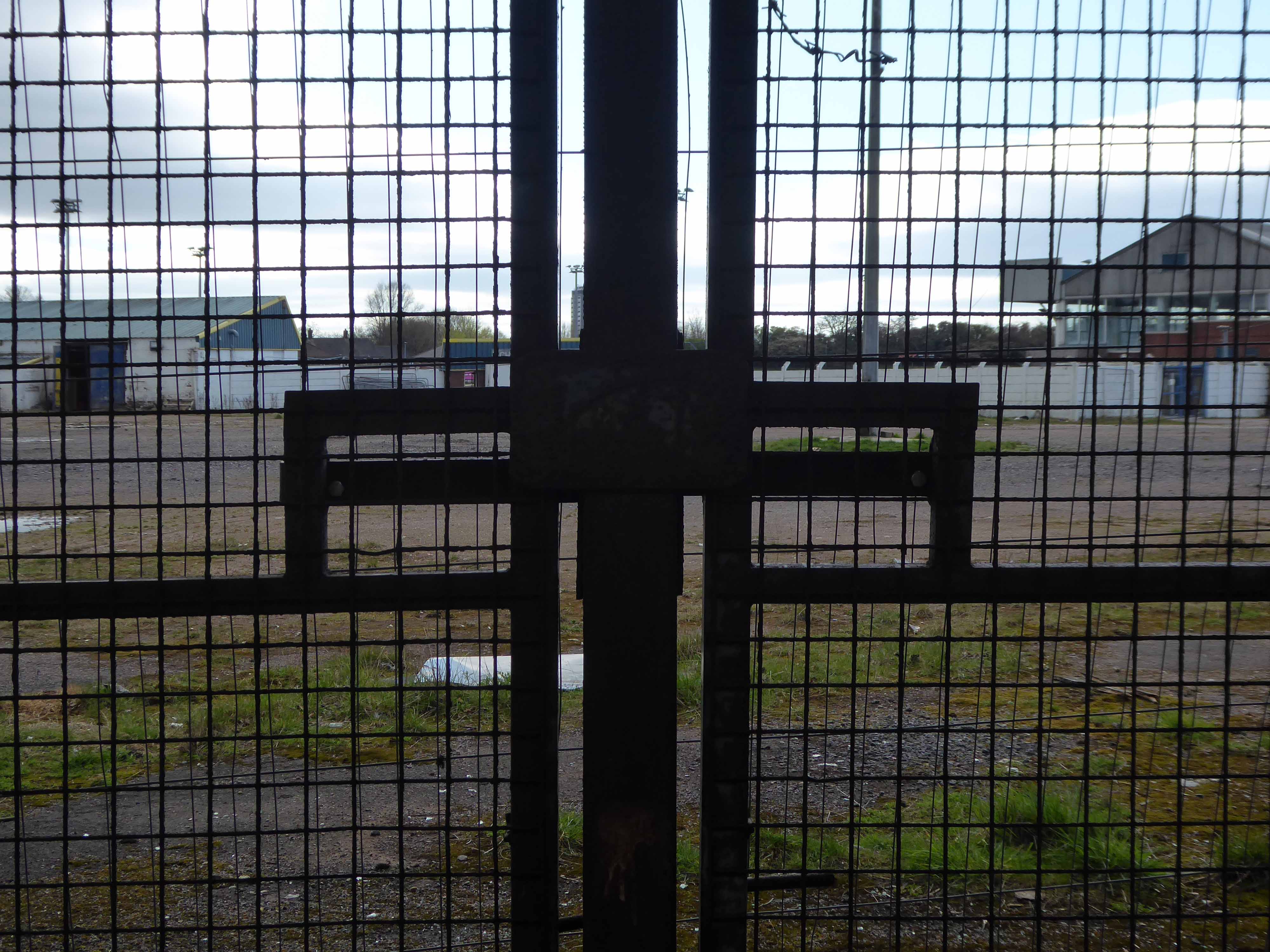
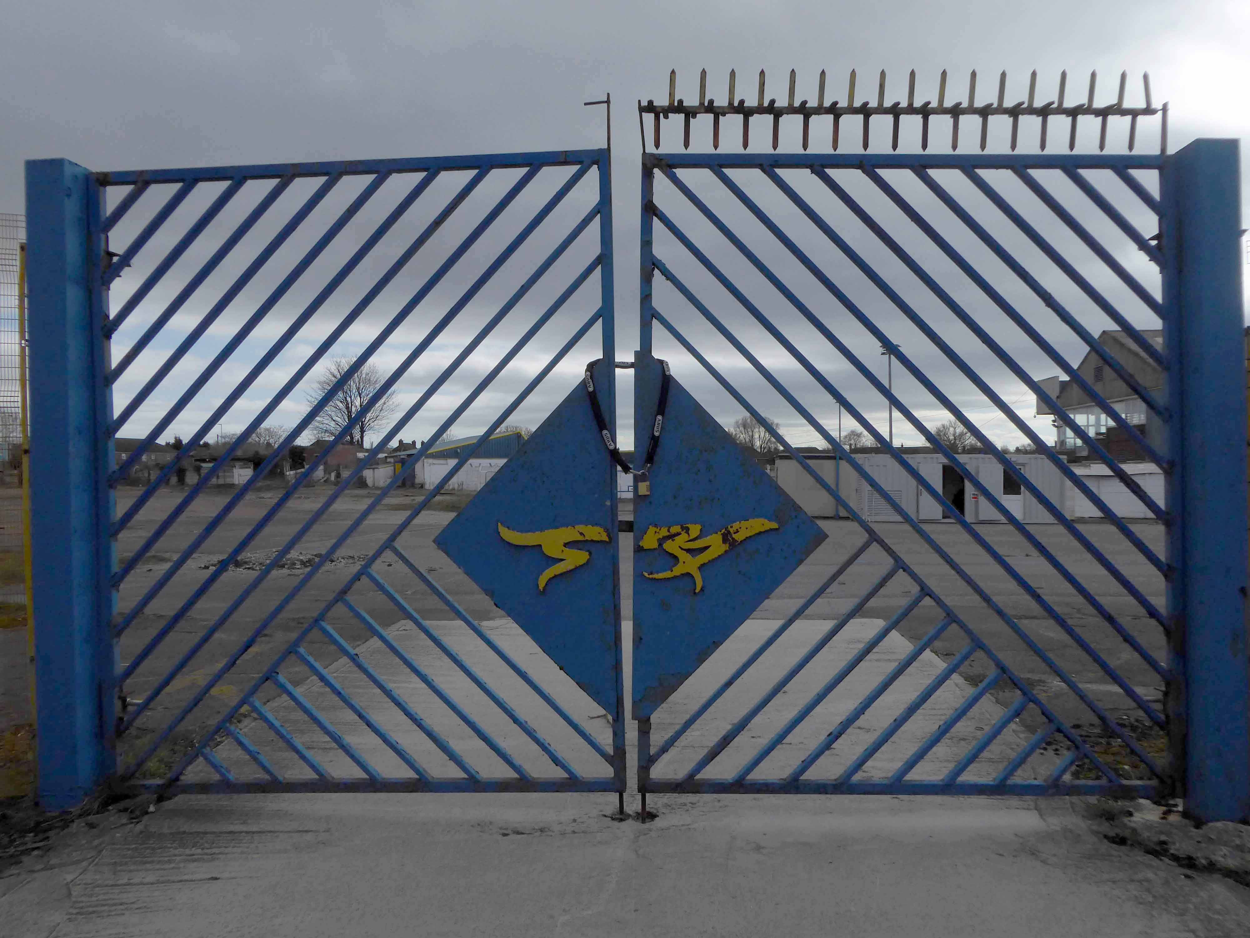
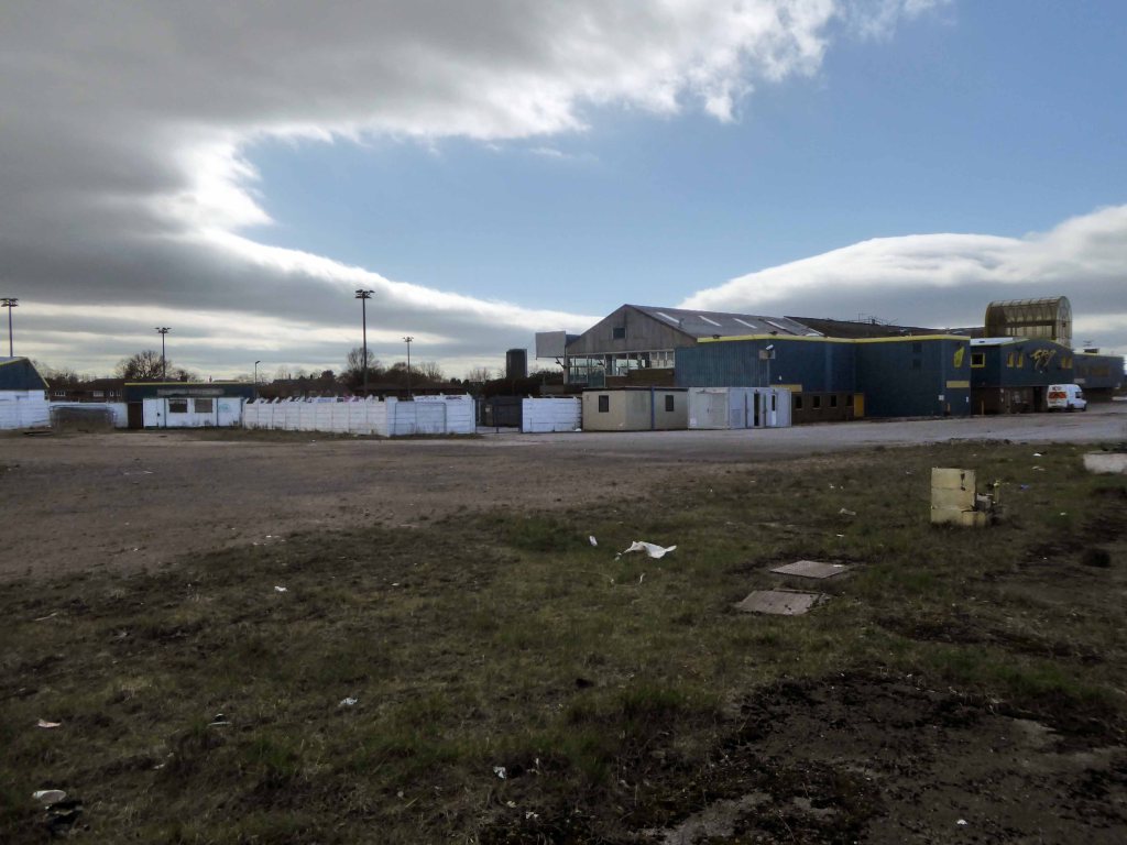
When I cycled by in 2015 the stadium was already looking tired – the dramatic concrete cantilevered gull-wing turnstiles a neglected storage area.
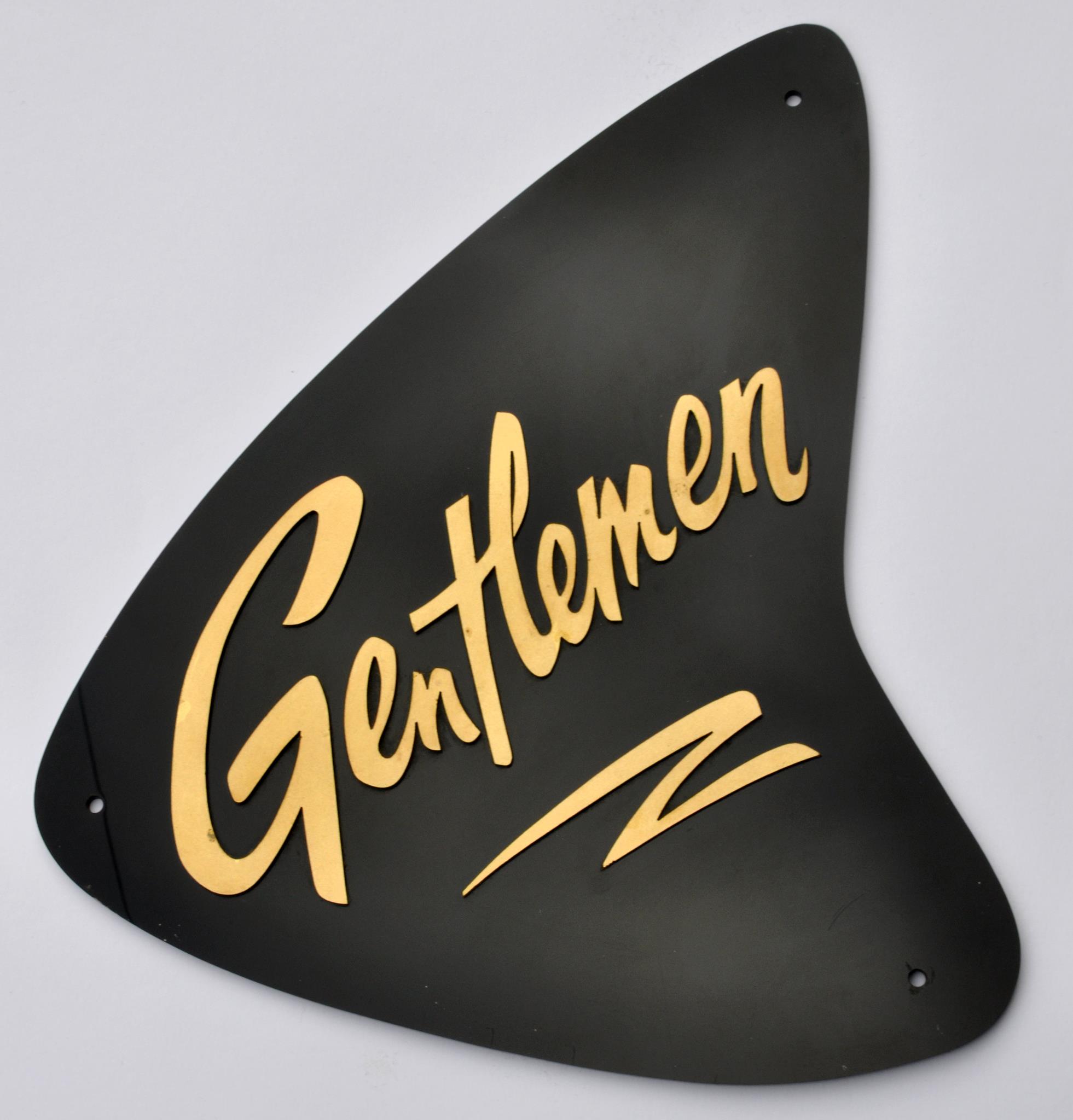
Last week I had to dodge behind the hoardings to take some snaps.The site is secured and demolition imminent.The stadium will soon be gone – as a footnote I have at home a 50s sign, appropriated on a work’s night out and later gifted to me by my dear departed pal – Dave Ballans.
I’ll always treasure the perspex shark’s fin, Dave’s memory and going to the dogs.
So what of the future?
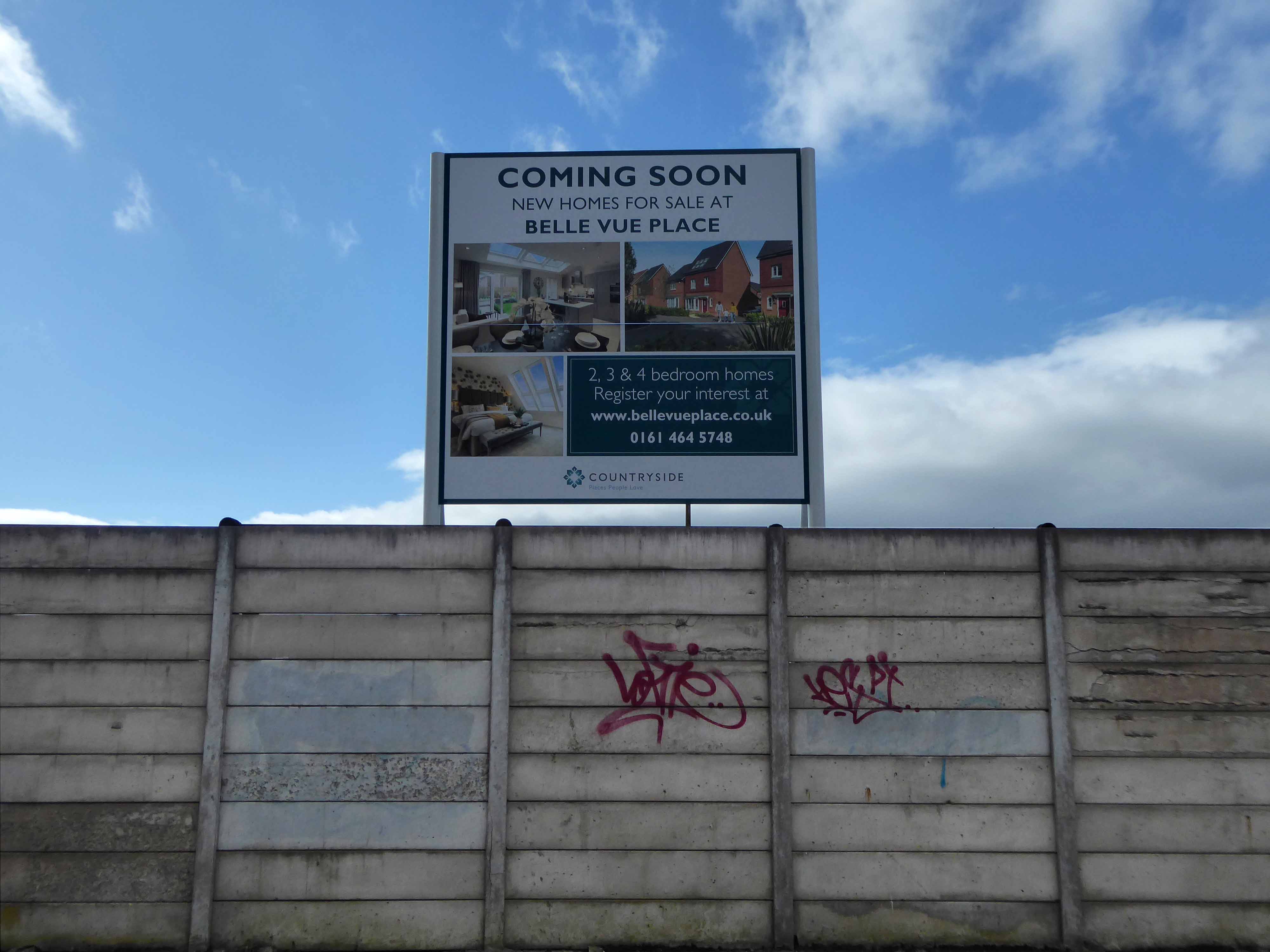
Belle Vue Place – the name lingers on long after the fun has gone.
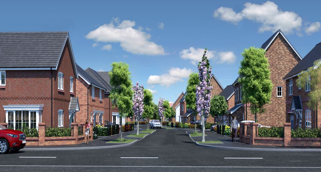
Countryside are proud to showcase our stunning collection of 114 new homes at Belle Vue Place, featuring a choice of stunning 3 & 4 bedroom homes all designed and finished to the highest standard.
And very handy for the speedway just up the road on Kirky Lane!
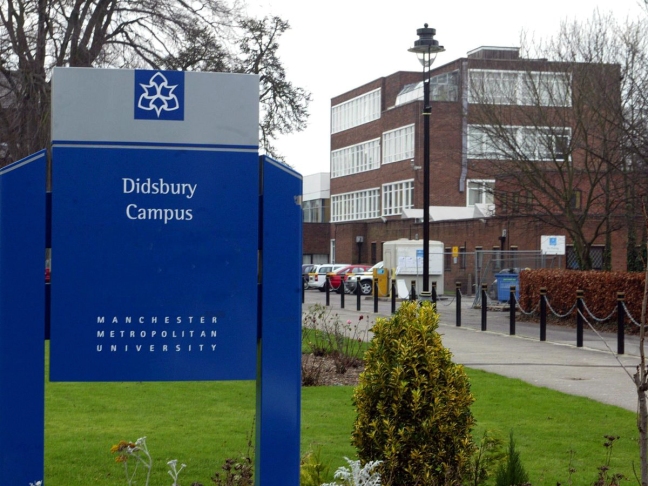
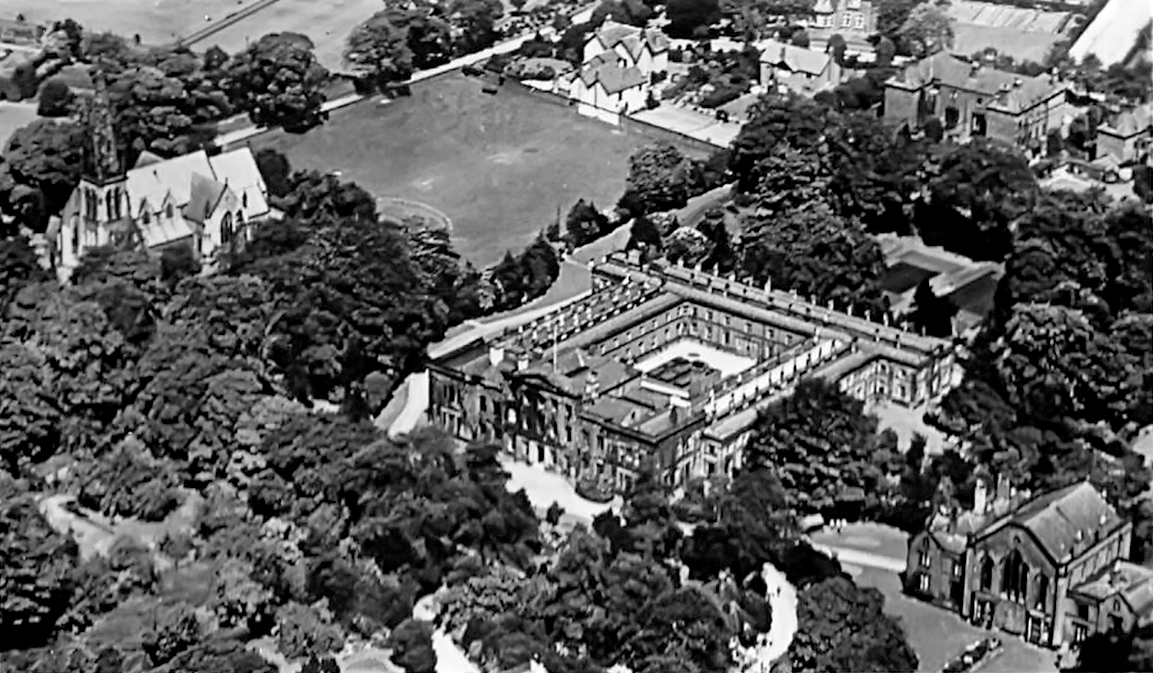
According to local historian Diana Leitch, the site has been in use since 1465; the first house was built in 1603 as part of a large estate with a deer park.
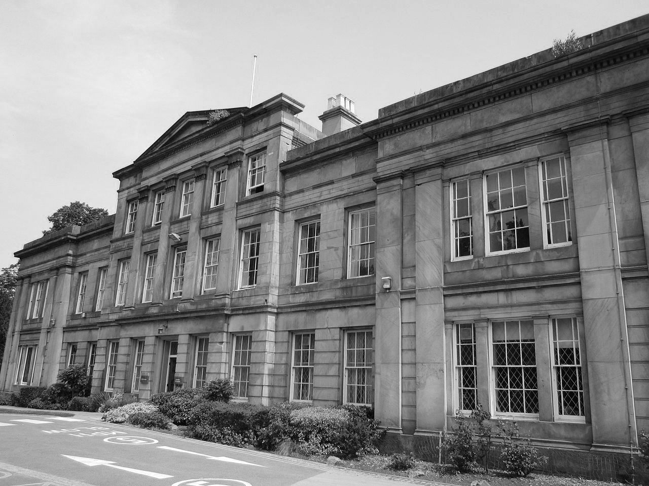
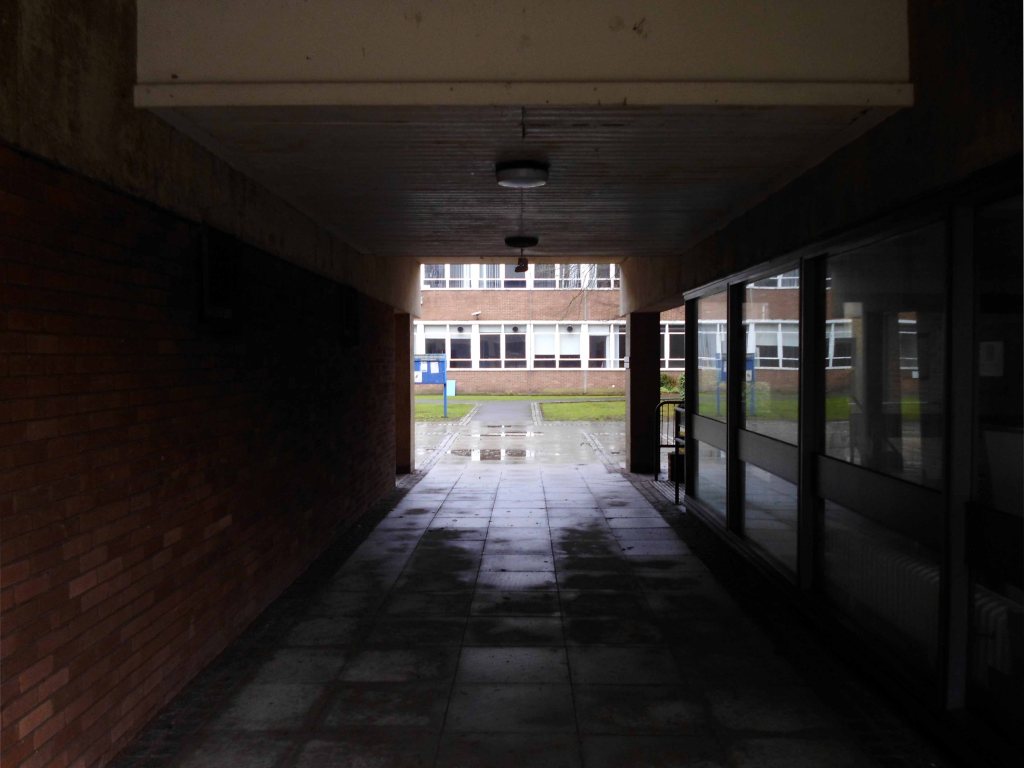
In 1740 the site was purchased by the Broome family, and a new house was constructed after 1785 by William Broome, extant today as the front part of the university’s former administration building, now known as Sandhurst House.
By 1812 the house was occupied by a Colonel Parker, and in the 1820s and ’30s it was a girls’ school.
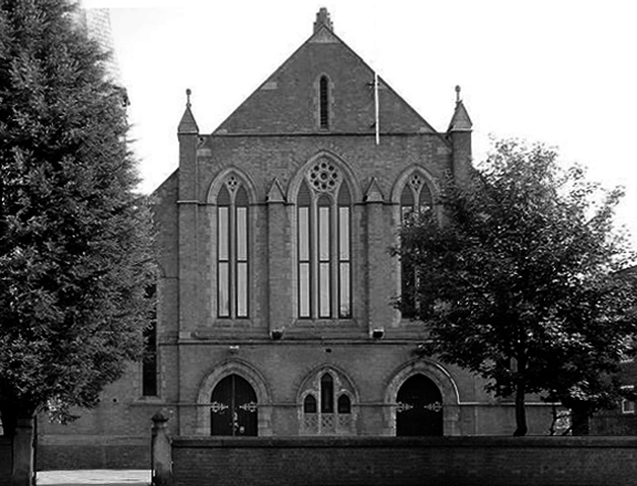
The site was purchased by the Wesleyan Methodist Church on 18 March 1841 for £2,000, and opened as a theological college on 22 September 1842.
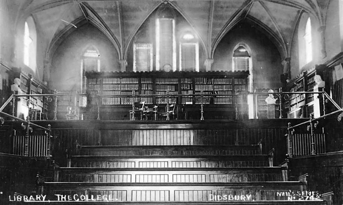
The Old Chapel building, originally the college chapel, is a two-storey building constructed in gothic style, with Flemish bond brickwork, built on a sandstone plinth in 1842.The structure consists of three wings, containing a central hall range, with two domestic wings on each side, initially used as tutor accommodation, forming a symmetrical appearance with the gable end of the upper hall. For many years it was used as a library and lecture theatre.
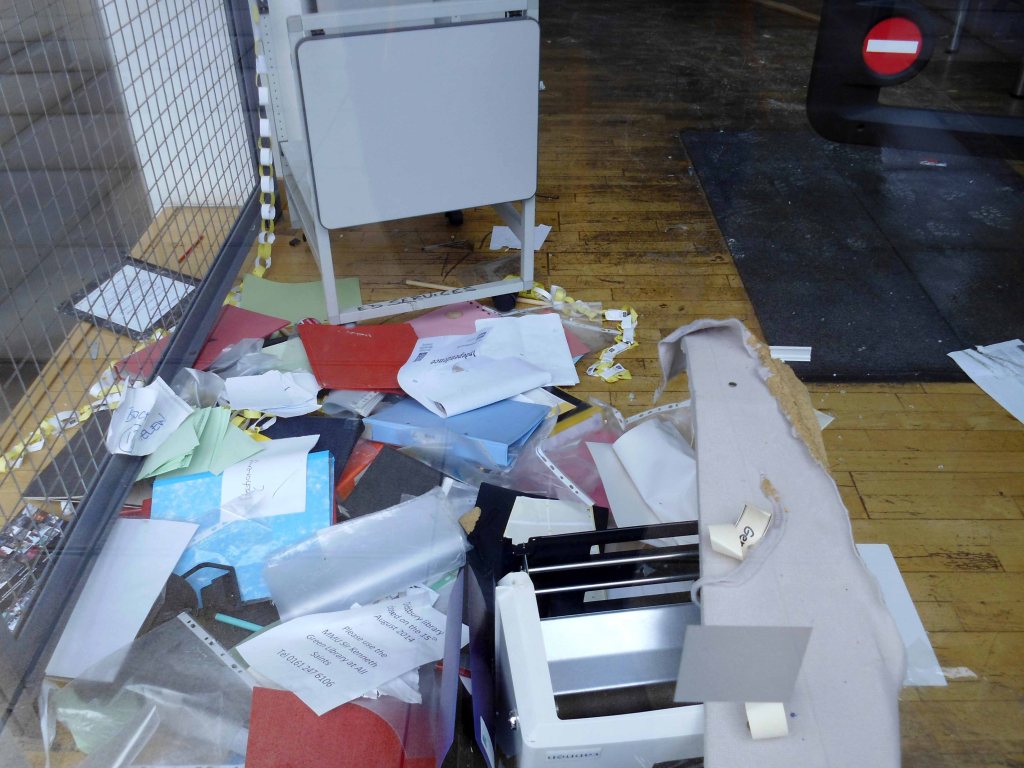
The ground floor eventually became the student union, and contained a bar and café.
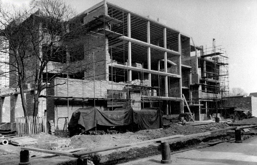
During both world wars the site was used as a military hospital. In 1943 the Board of Education had begun to consider the future of education, following reforms that would inevitably come after the war ended. It was estimated that with the raising of the school leaving age, following the 1944 Education Act, about 70,000 new teachers would be needed annually, almost ten times as many as before the war.
In 1944 a report was produced by the Board of Education on the emergency recruitment and training of teachers, and it was decided that there were to be several new training colleges set up. These colleges were to be staffed by lecturers seconded from local authorities, with mature students selected from National Service conscripts. In 1945 the theological college, which was no longer required by the Wesleyans, was leased to the Manchester Education Authority.The new emergency training college was officially opened on 31 January 1946, with Alfred Body as its first principal.
By 1950, the emergency college was purchased by the City of Manchester and made permanent as Didsbury Teacher Training College, with an initial enrolment of about 250 male and female students. As a result of becoming a permanent college, Didsbury became part of Manchester University’s School of Education.
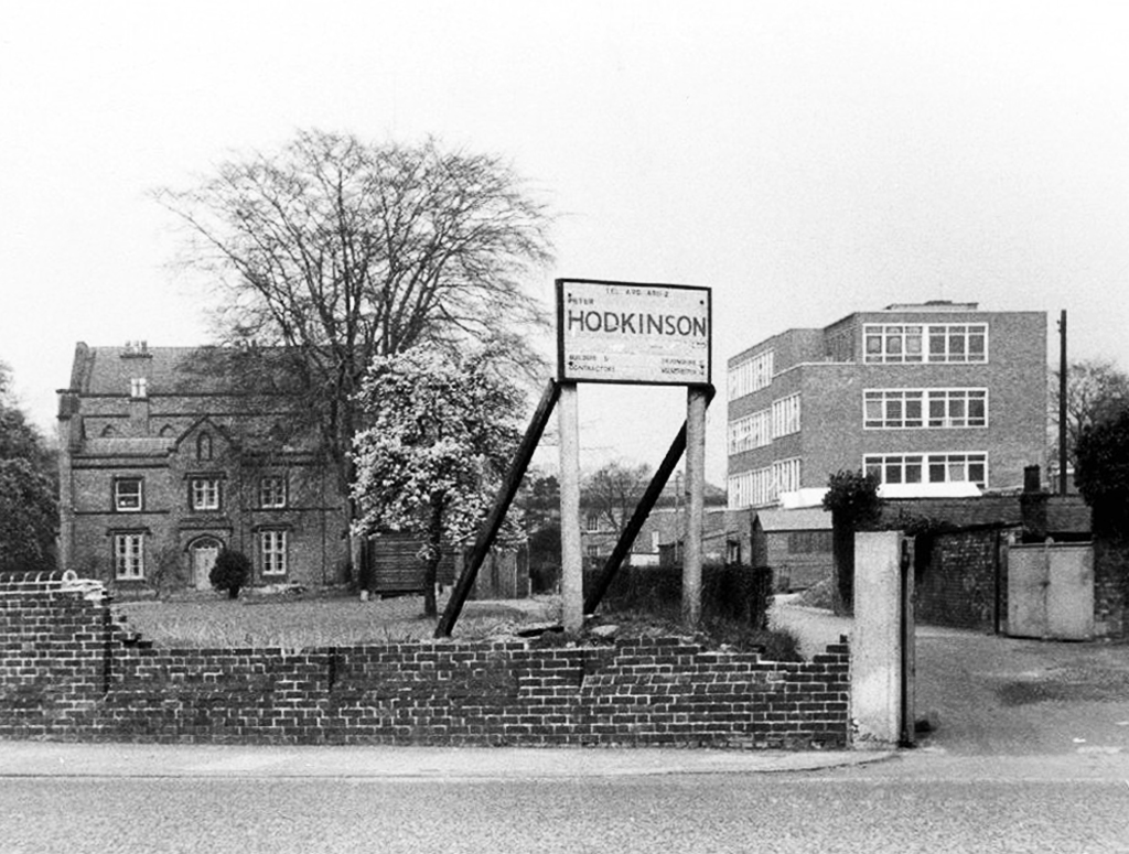
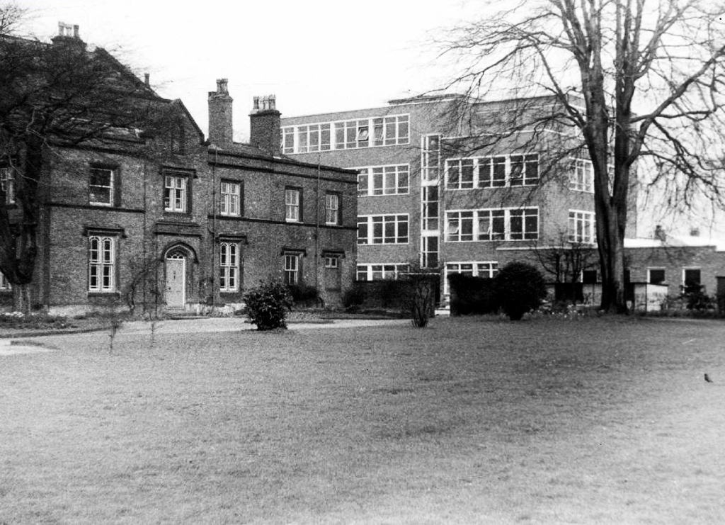
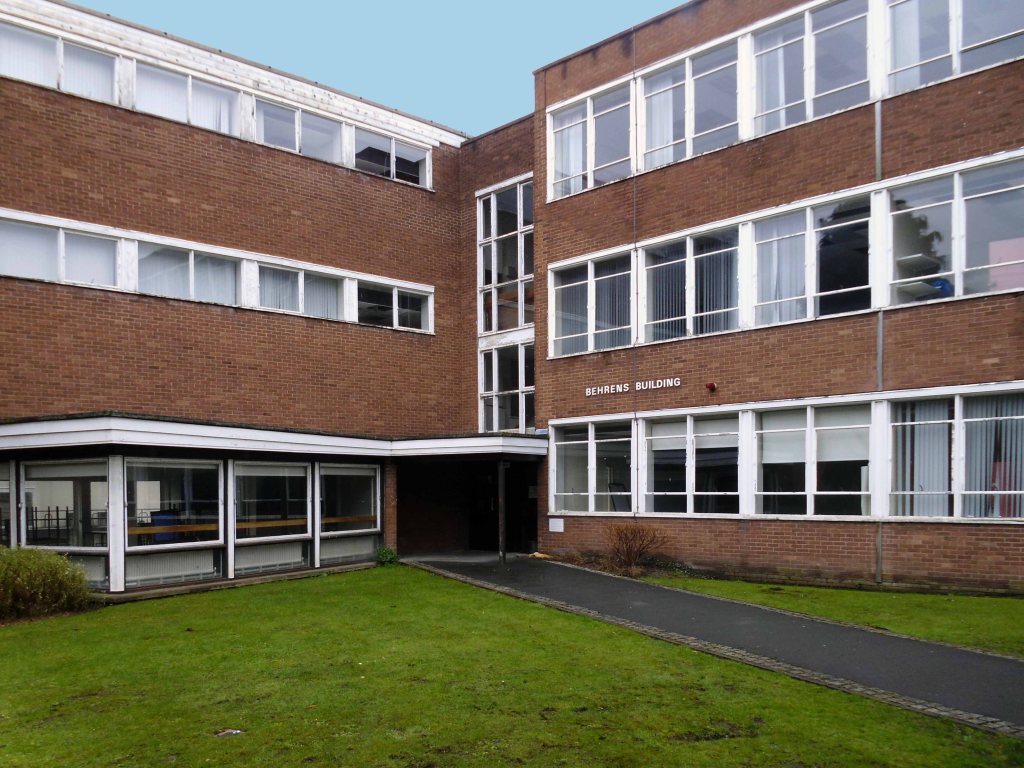
Over the next two decades, numerous buildings were constructed on the site; Behrens, Birley and Simon were all named after prominent local families with ties to the college.
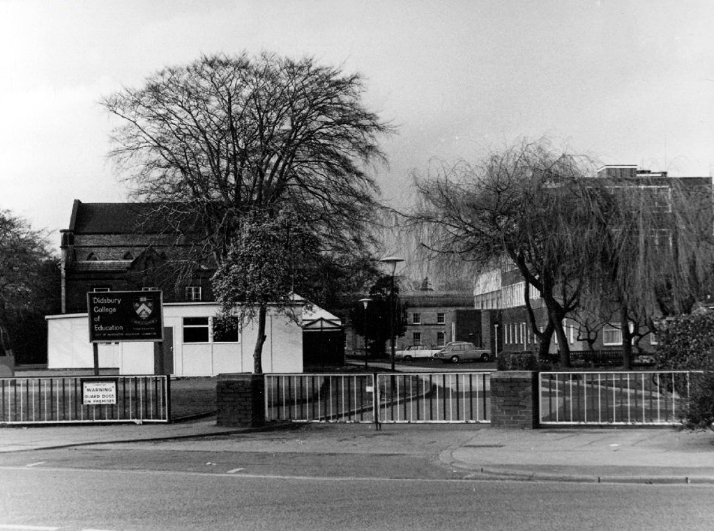
Didsbury became part of Manchester Polytechnic in 1977, renamed Didsbury School of Education.
The adjacent Broomhurst halls of residence have since been demolished.
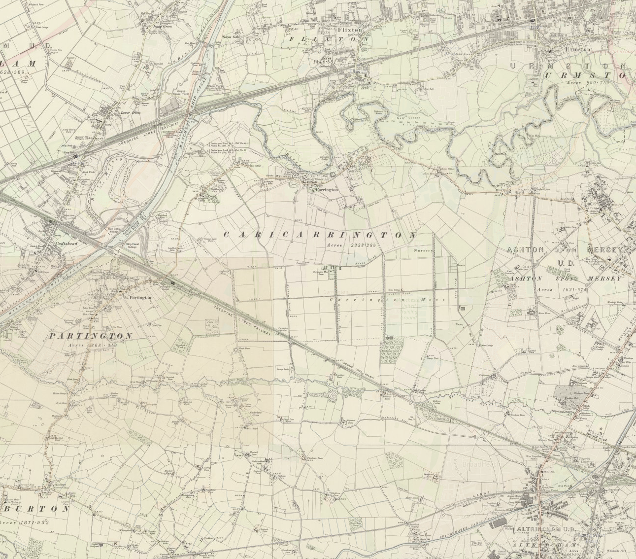
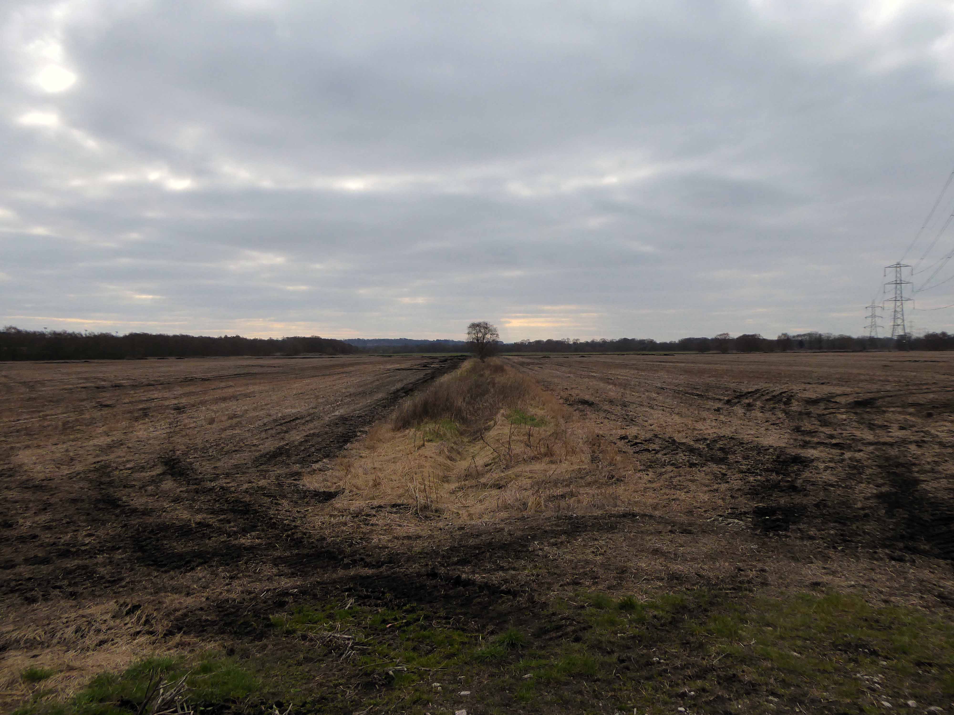
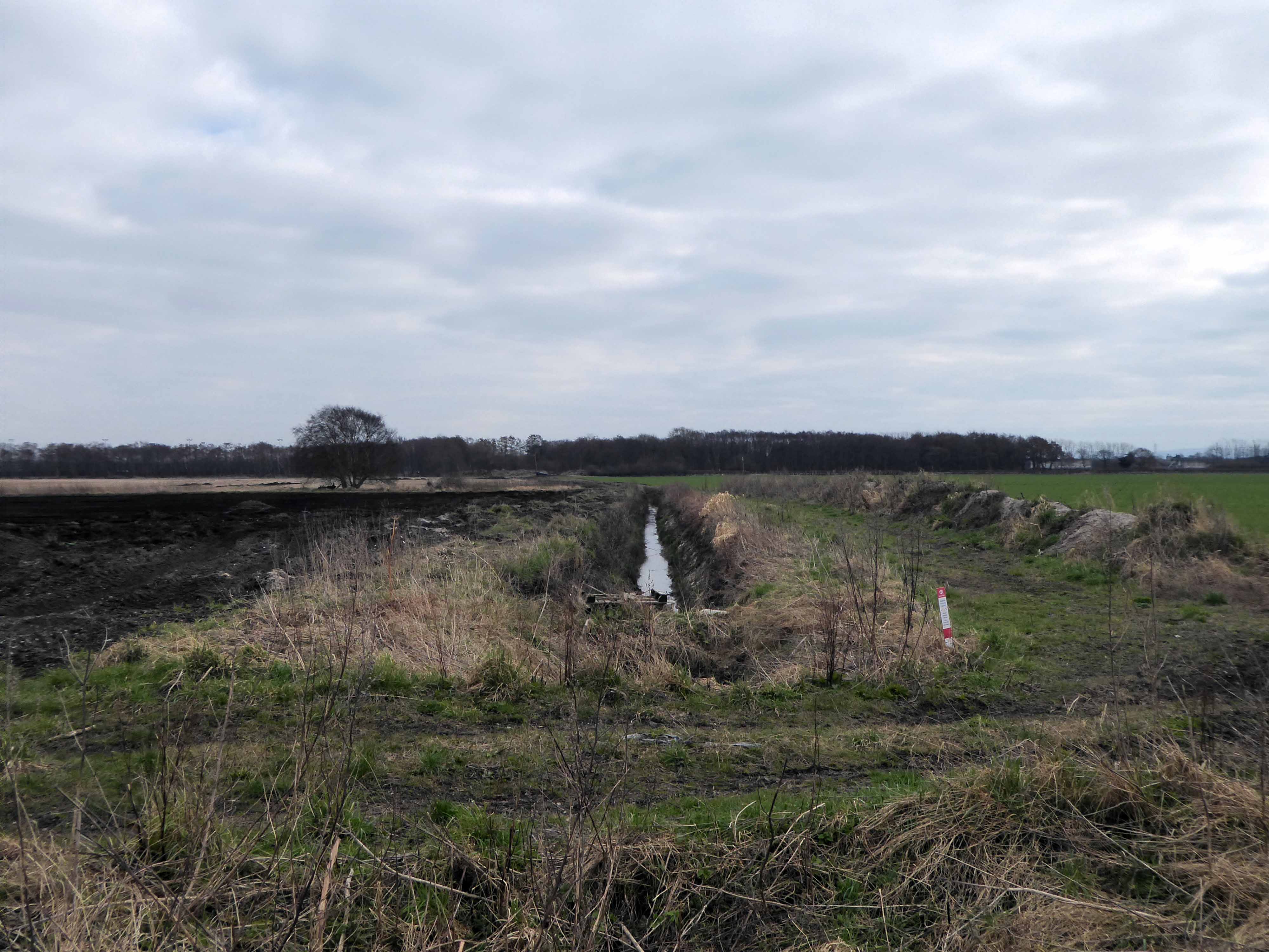
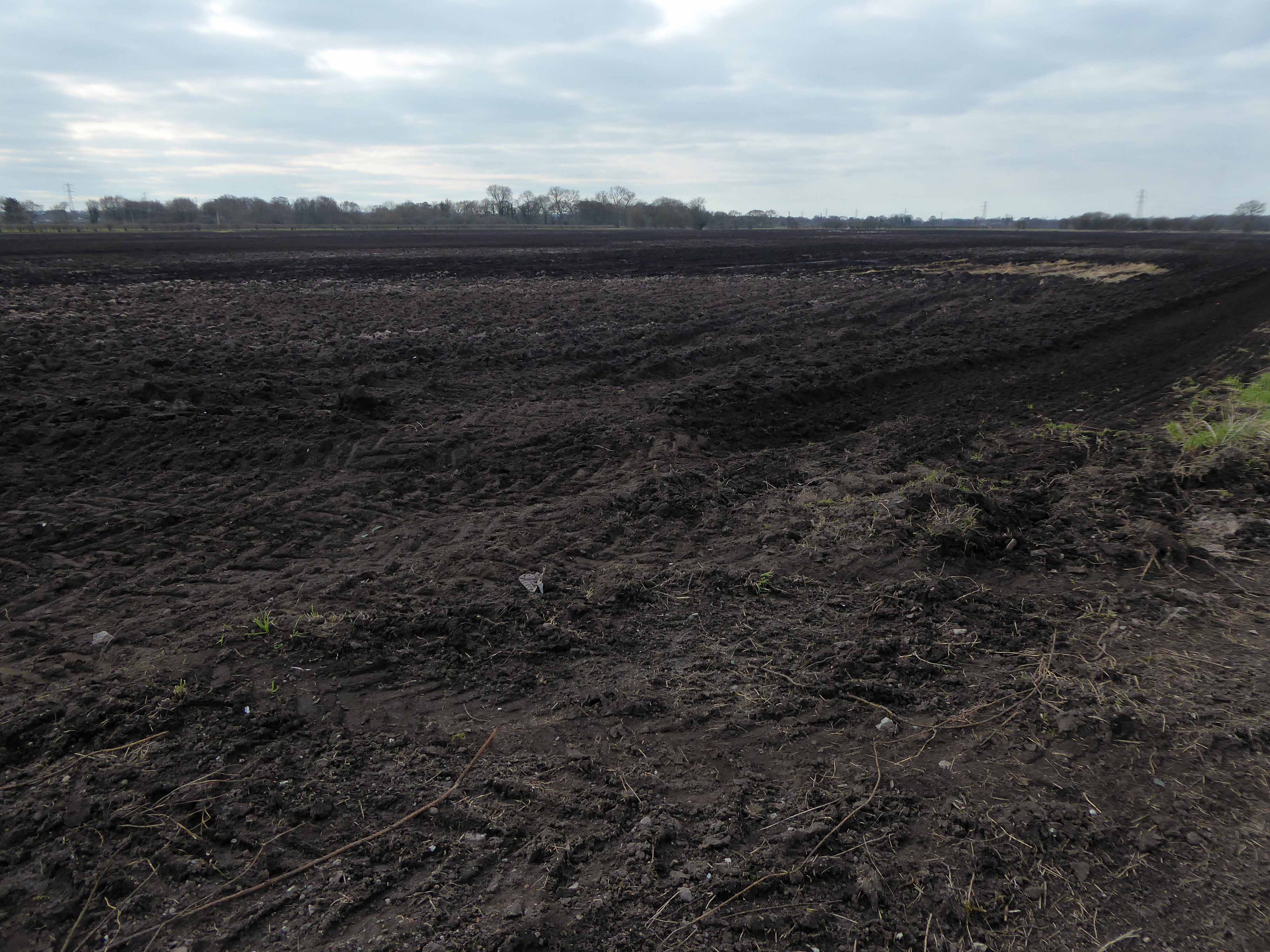
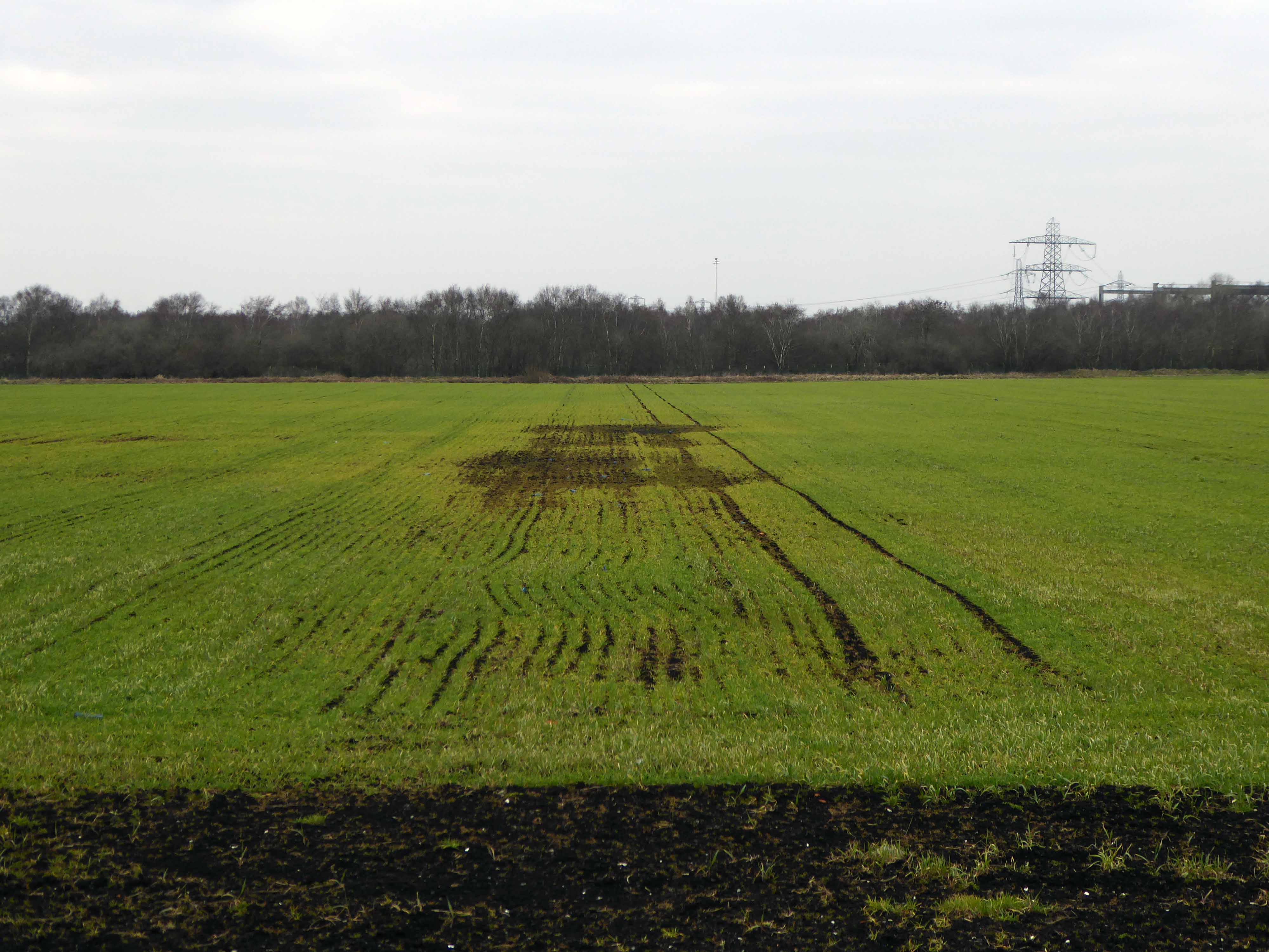
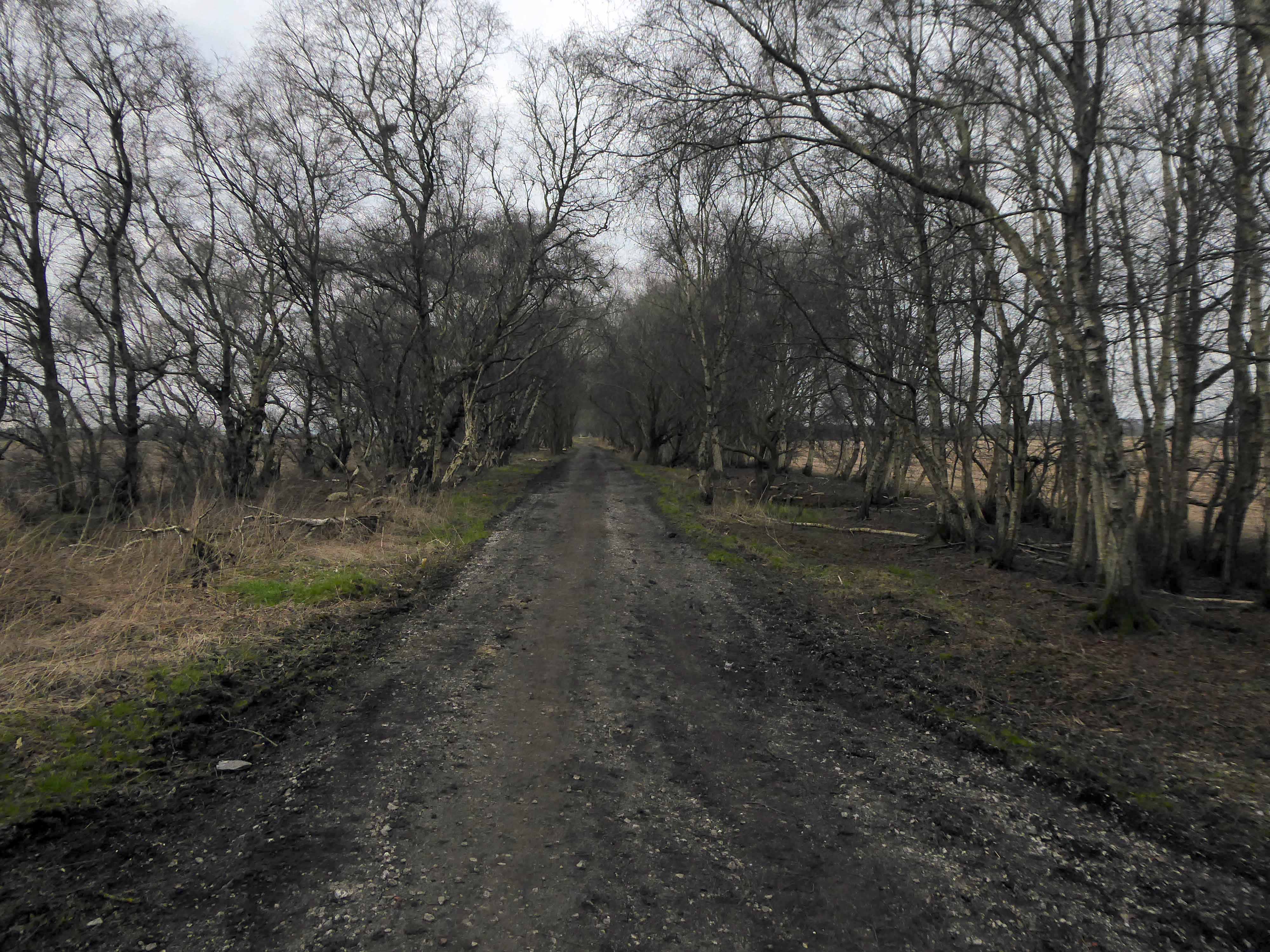
Carrington Moss is a large area of peat bog near Carrington in Greater Manchester, England. It lies south of the River Mersey, approximately ten miles south-west of Manchester, and occupies an area of about 1,100 acres..Originally an unused area of grouse moorland, the moss was reclaimed in the latter half of the 19th century for farming and the disposal of Manchester’s waste. A system of tramways was built to connect it with the Manchester Ship Canal and a nearby railway line. During the Second World War the land was used as a Starfish site and in the latter half of the 20th century, a large industrial complex was built along its northern edge. More recently, several sporting facilities have been built on Carrington Moss. Today, the land is still used for farming and several nature reserves have been established within its bounds.
Parts of Carrington Moss are accessible to the public over several rights of way.
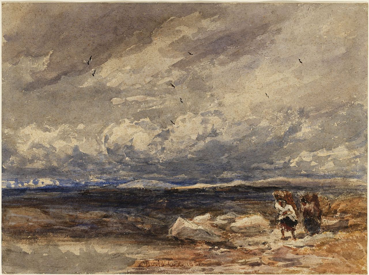
On Carrington Moss 1851 David Cox
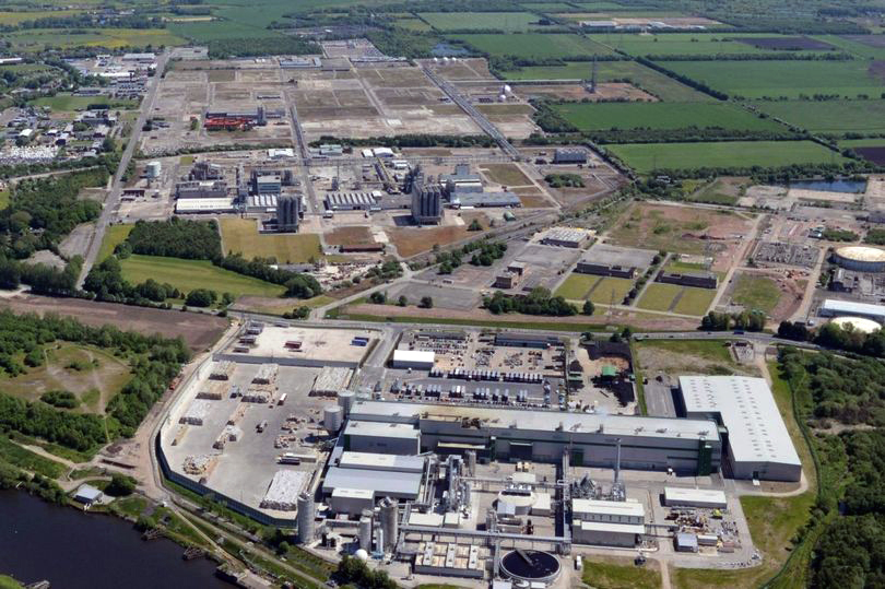
Industrialisation of the moss took place from 1947–1952 when Petro-Carbon ltd began to build what would later become known as the Shell Site. The estate was leased on 1 October 1968 to Shell Chemicals, who in 1957 had purchased a propylene oxide plant along the moss’s northern edge. Shell had built an ethylene oxide plant in 1958 and began to produce polyether polyols the following year. Council housing was built nearby, at Carrington and Partington, for workers and their families. By 1985 the Shell plant had a turnover of about £200M and employed 1,150 people, but a major restructuring of the business reduced the workforce to less than 500 by 1986. By 1994, four distinct plants operated on the 3,500-acre (14 km2) site, producing a range of chemicals, and materials including polystyrene, polyethylene and polypropylene.In 2005 it was reported that Shell would close their polyols and ethoxylates units, a decision which came into effect in 2007. The estate is currently managed by chartered surveyors Bell Ingram. Lyondell Basell operate the last remaining chemical plant on site.
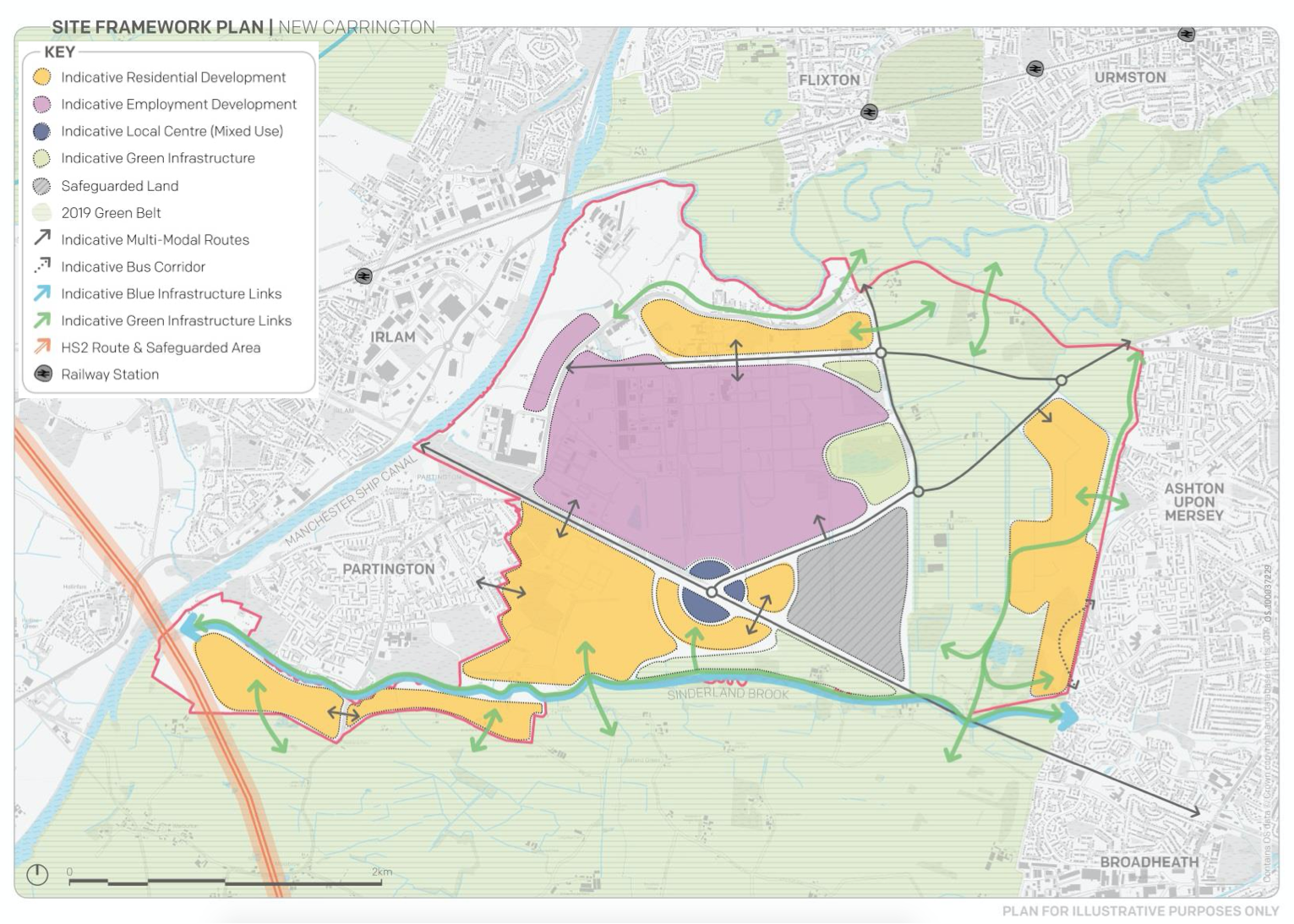
Storm Christoph showed that Manchester is susceptible to the adverse effects of extreme weather events, which are forecast to become more regular occurrences.
Greater Manchester Labour for a Green New Deal argue that we must abandon the idea of developing on greenbelt, and instead embrace bold alternatives which reflects the urgency of the climate crisis﹣starting with sites like Carrington Moss.
This is an area in liminal limbo, the pressures of the modern world leaning on its very being, as ash, alder, badger, field mouse, and kestrel give way to Wainhomes.
Where then will the wanderer wander, in search of solace?
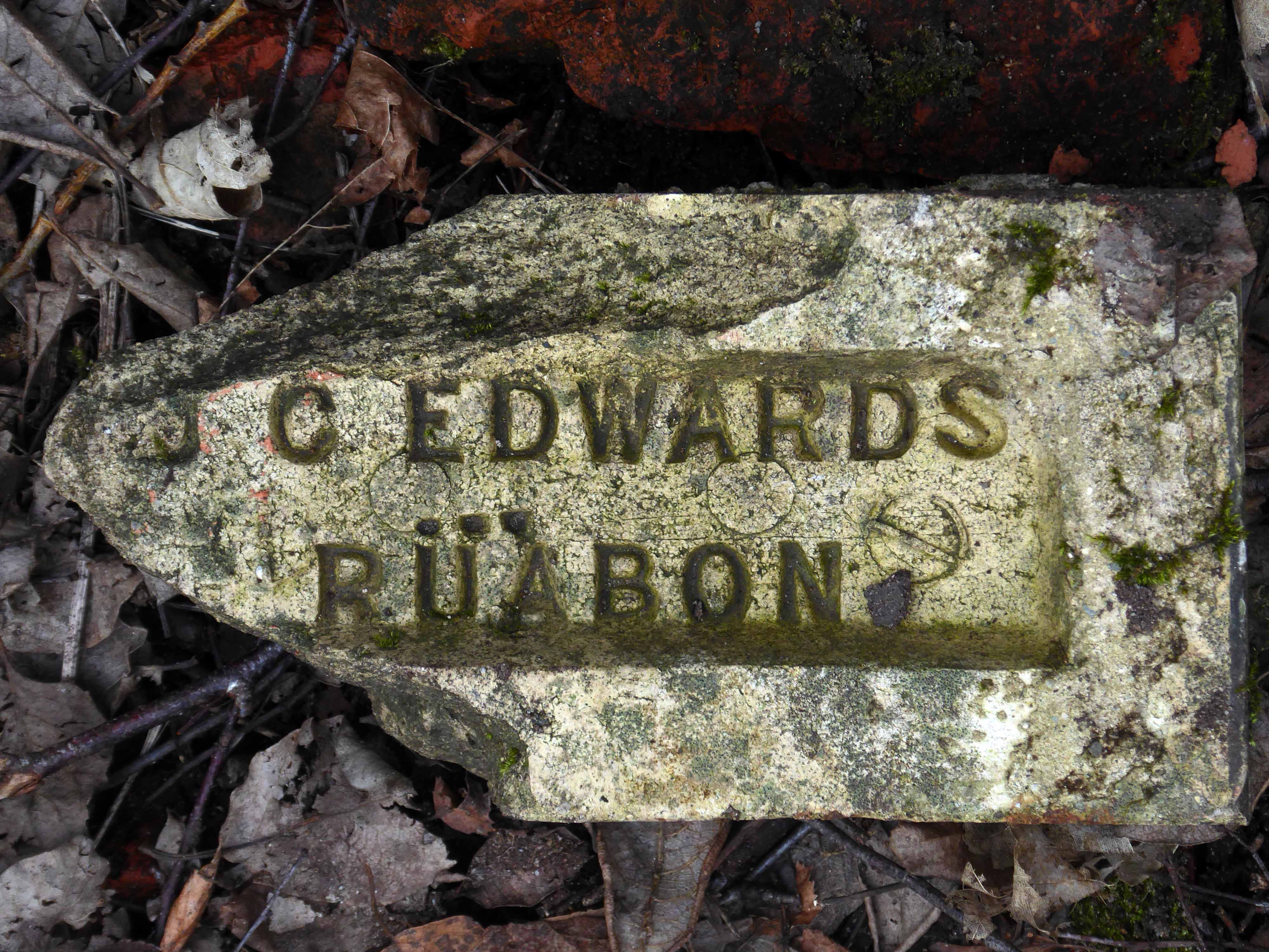
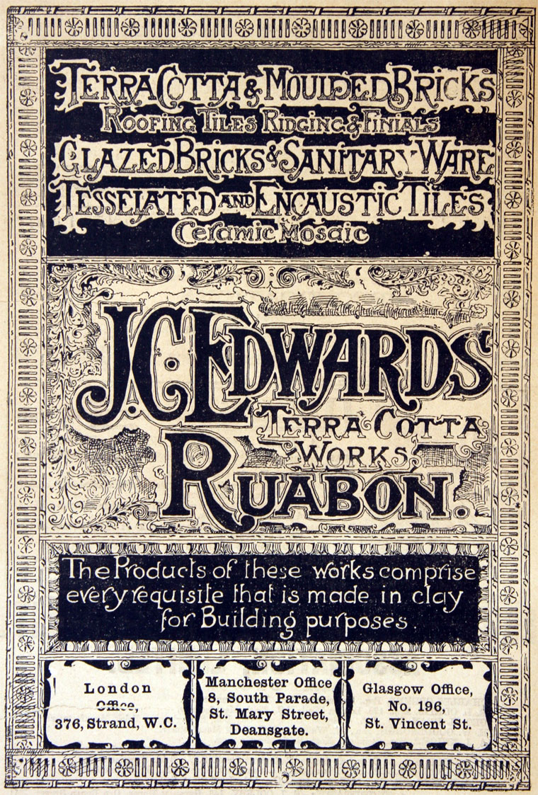
The company of J. C. Edwards Ruabon Ltd, was based in Ruabon, Denbighshire, and was active from 1903 to 1956 as a brick, tile and terracotta manufacturer from its works at Tref-y-Nant, Acrefair, Albert Works, Rhosllannerchrugog, and Pen-y-bont, Newbridge, Denbighshire.
James Coster Edwards (1828-1896) founded the company; it was sold in 1956.
We begin at the beginning of the end – fields full of fields
Dotted with farm buildings – then, along comes an Aerodrome.
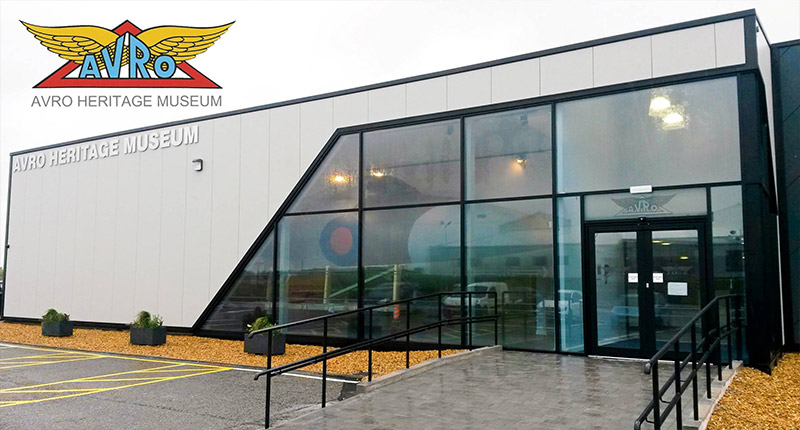
A serious problem arose in 1924 when Avro was notified that the current airfield used by the company at Alexandra Park would be closing. After a hurried search to find an alternative location, Avro settled on New Hall Farm at Woodford and completed the move later that year.
In 1999, Woodford became part of BAE Systems as a result of the merging of British Aerospace with Marconi Electronic Systems. Plans to build the Avro RJX airliner at Woodford were shelved in 2001 which left production of the Nimrod MRA4 as the only active project at the site. Woodford Aerodrome finally closed in 2011 when the Nimrod MRA4 project was cancelled, ending almost 80 years of almost continual aircraft manufacture at the site.
Redrow has started construction on the first phase of 950 homes at the 500-acre former Woodford Aerodrome site near Stockport, nearly two years after planning consent was granted.
Preparatory works are underway and sales of the houses are expected to launch in June with the opening of show homes on the site.
The redevelopment of the 500-acre site, which is being brought forward by a joint venture between Harrow Estates, part of Redrow, and Avro Heritage, will also feature a primary school, employment area, pub, shops, community facilities, and areas of open and recreational space.
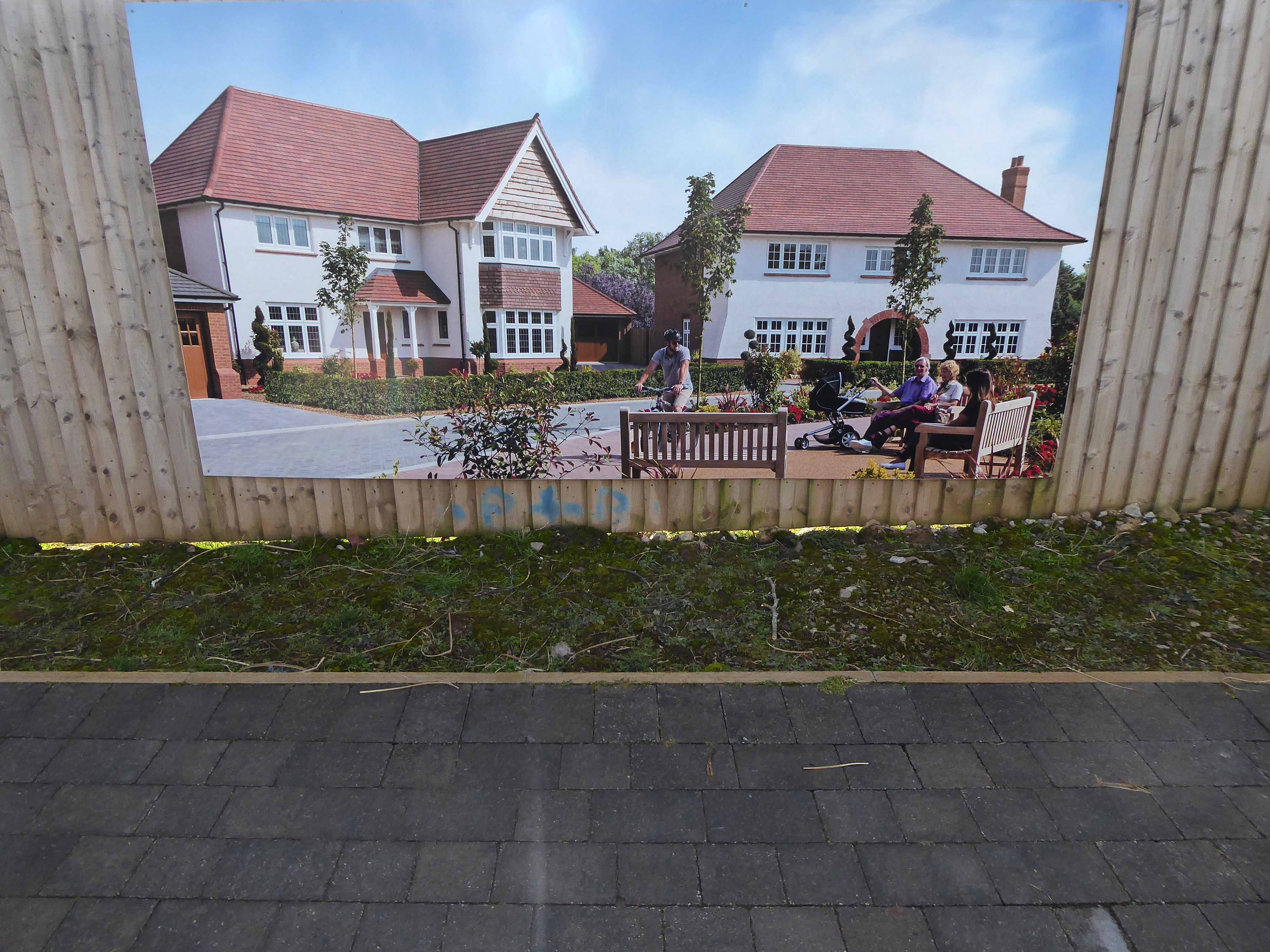
However, the architectural style owes more to Baron Hardup, than Flash Gordon.
The Tudor-Bethan style of Metro-Land, that oh so very, very English pantomime tradition of the village green, merry boys and girls dancing around Maypoles clutching wicker baskets, full of plastic daffodils.
For every raw obscenity Must have its small ‘amenity,’ Its patch of shaven green, And hoardings look a wonder In banks of floribunda With floodlights in between.
This is progress realised as regression, a pastiche of a pastiche, of a pastiche, of a pastiche.
Finding some small comfort in the imitation game, hurtling along radial roads, encased in the biggest, live now pay later motors, which borrowed money can buy.
Seeking succour in the certainty of an illusory past, whilst peering through the nets and blinds, at a seriously uncertain future.
You’re as pretty as a picture, a picture torn from a yellowing scrapbook, scanned and enhanced, to remove any unseemly rough edges and/or ruffians.
This was tomorrow calling, wishing you weren’t here.
Work is still underway and the surrounding landscape feels raw, windswept and wounded.
All of the plots on this phase are now reserved, but don’t miss out on the available homes on our other phases!
Just minutes from Wilmslow, Poynton and Bramhall, and within easy reach of Manchester for both work and leisure, Woodford is perfectly placed to offer the best of both the thriving city and the glorious Cheshire countryside. This makes it the perfect location for our high-quality Heritage Collection homes, which combine the very best of classic Arts & Crafts architecture with modern, family friendly interiors of the very highest specification.
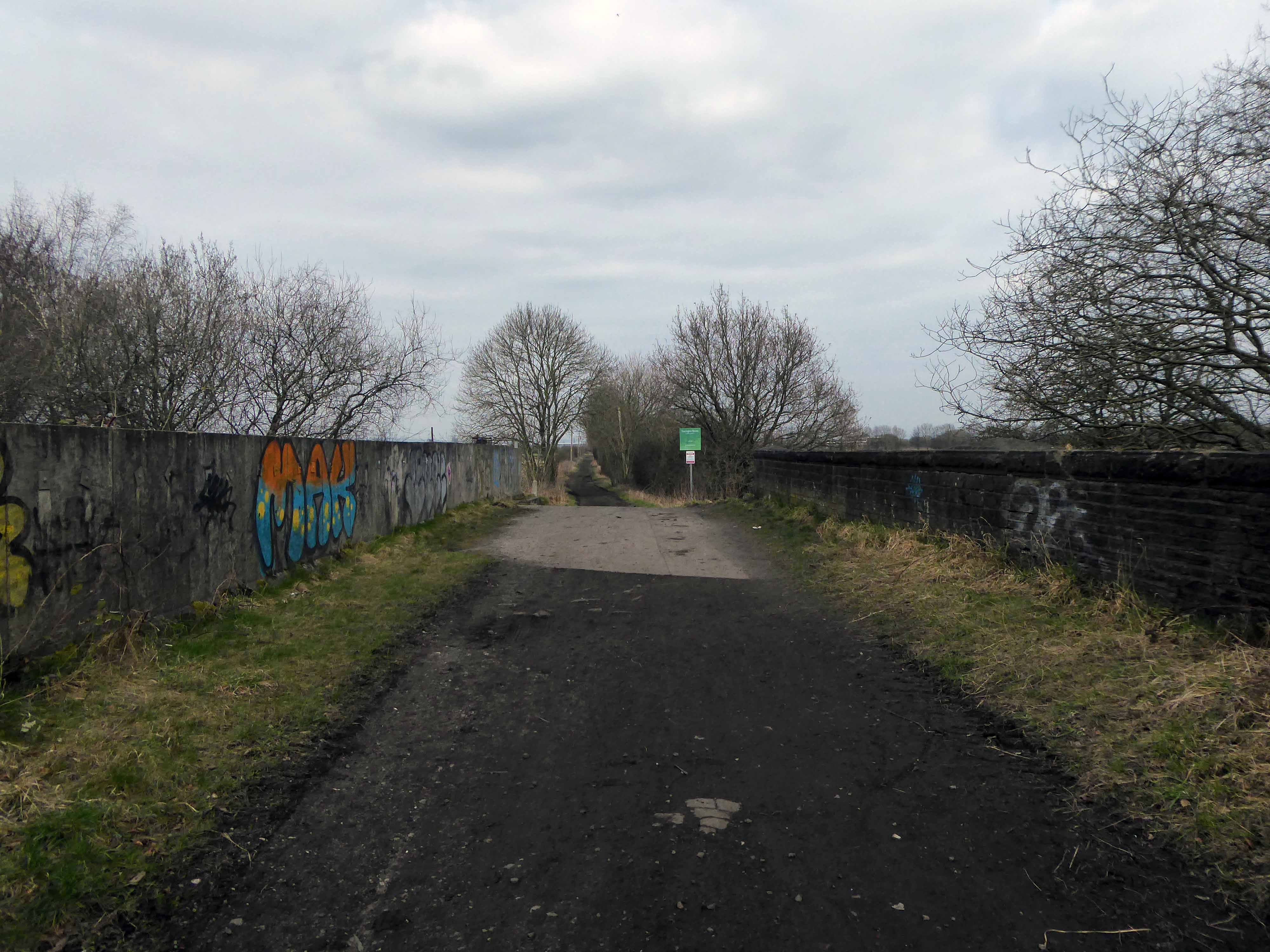
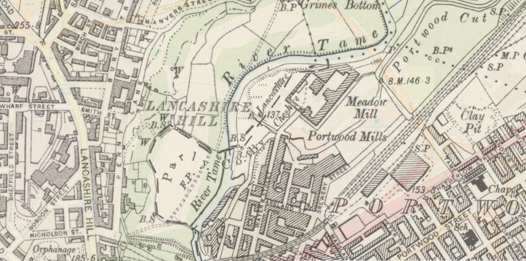
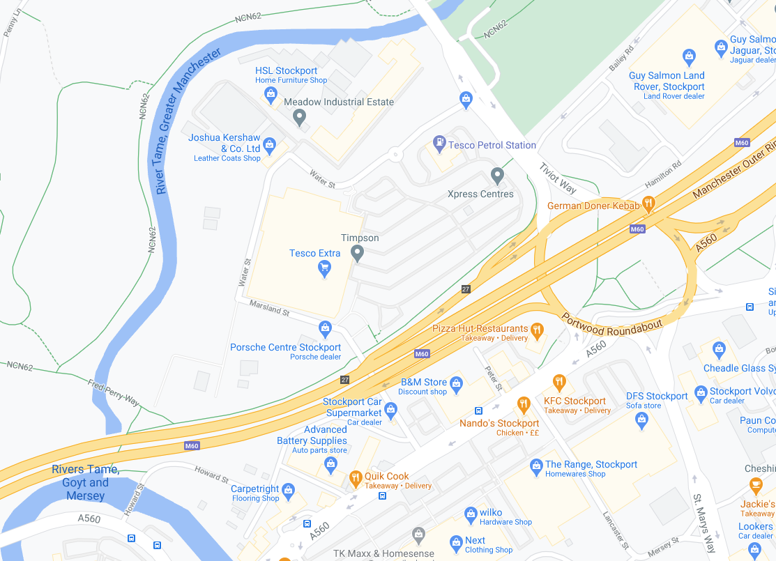
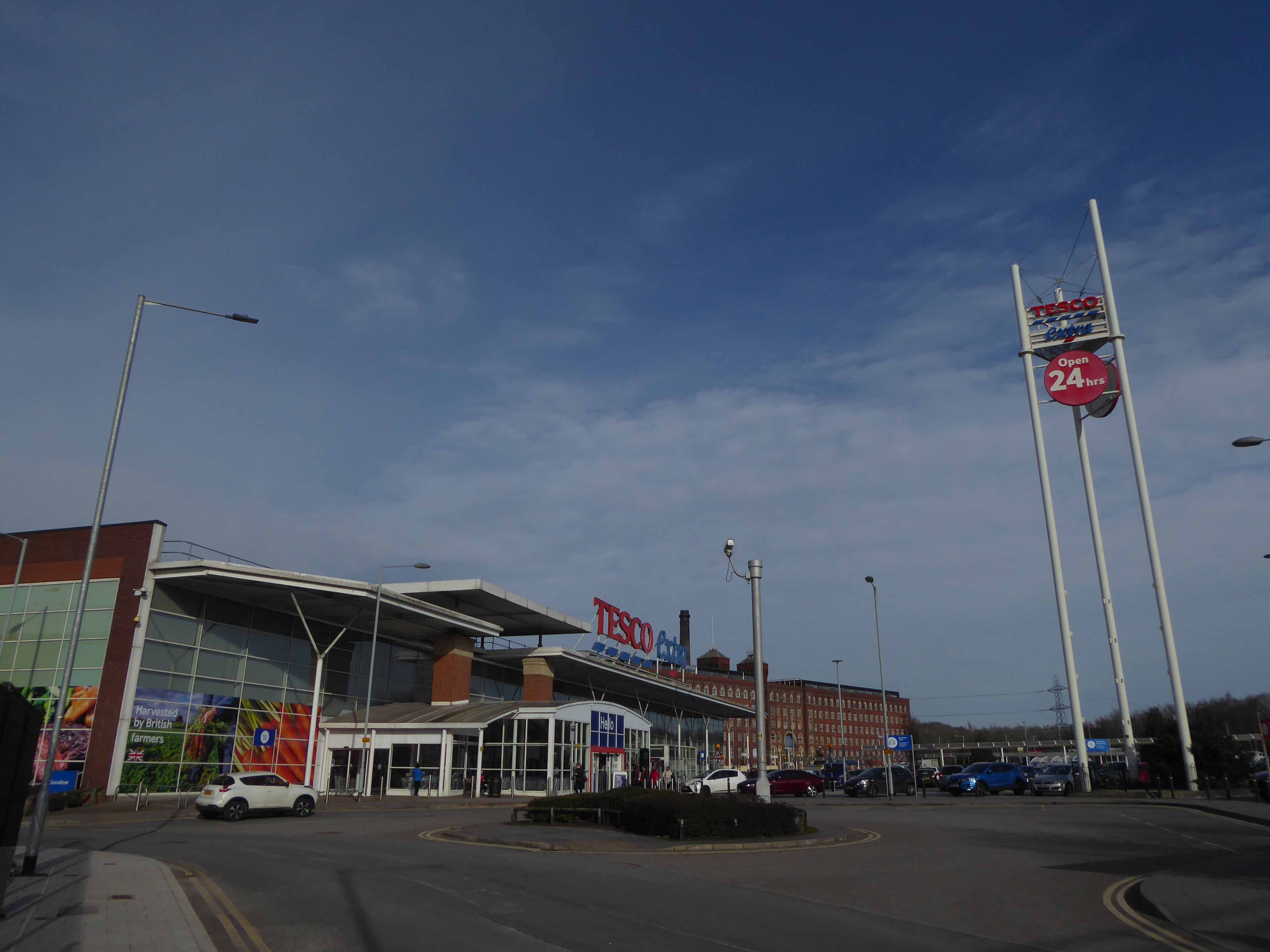
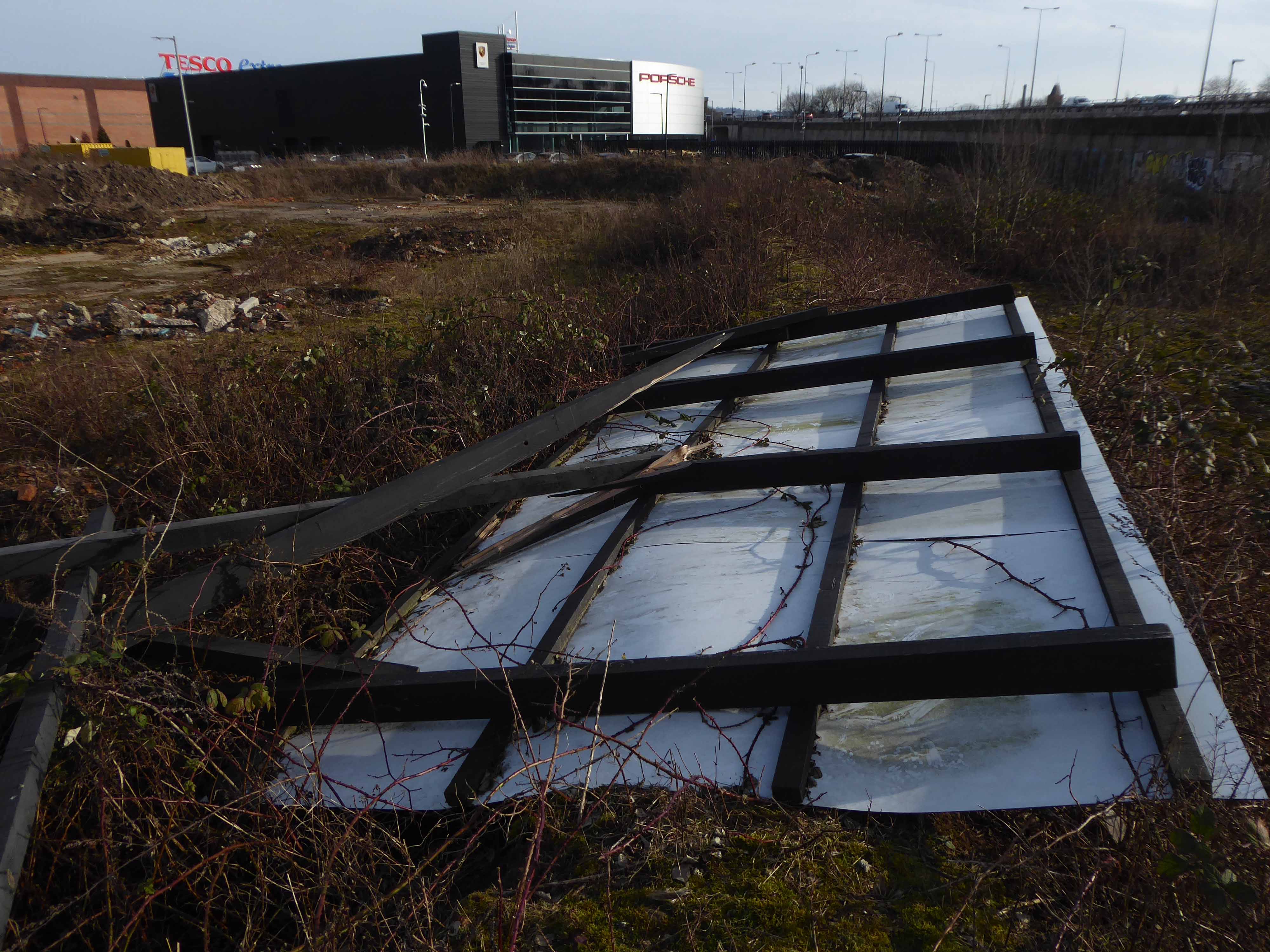
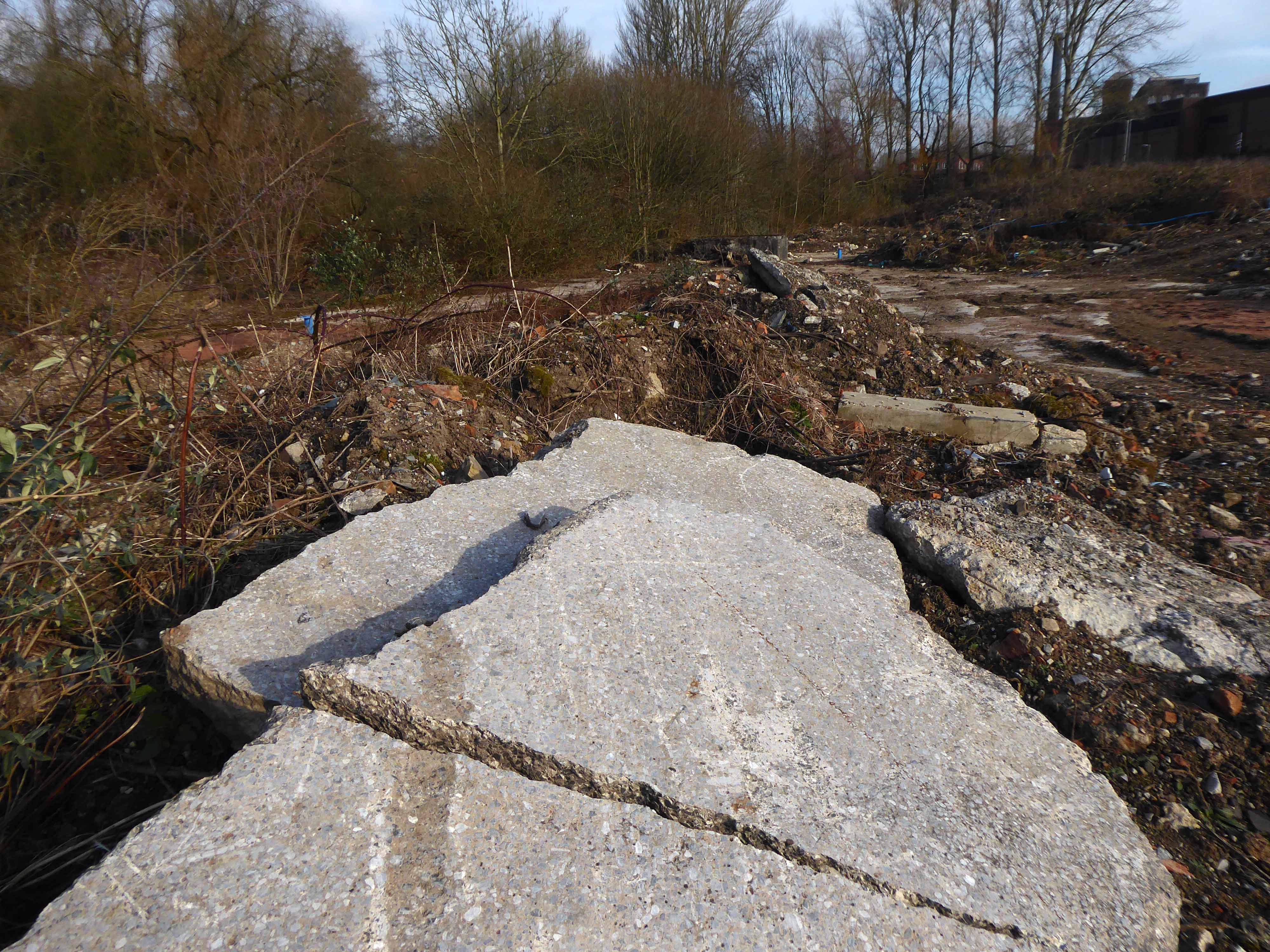
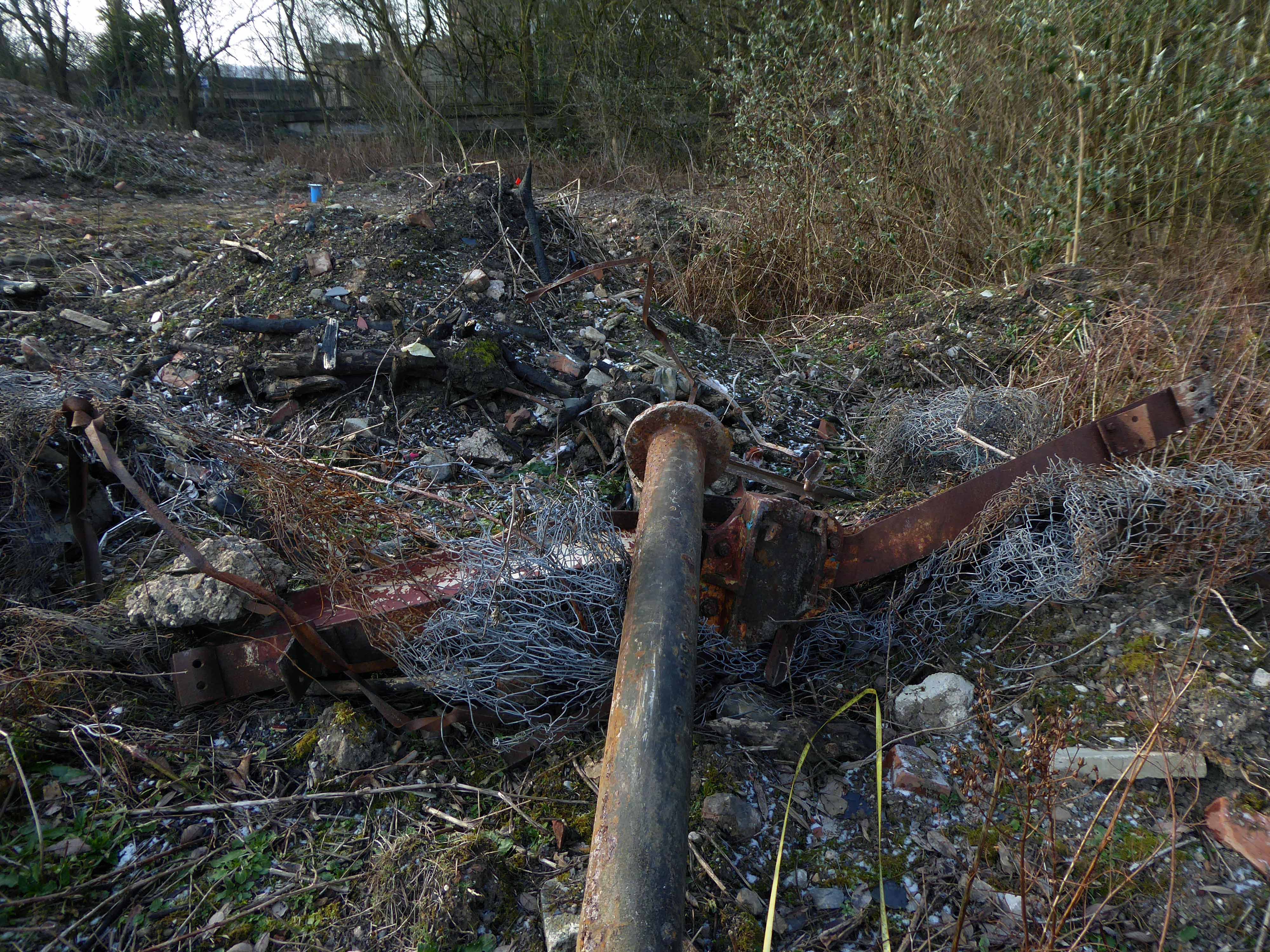
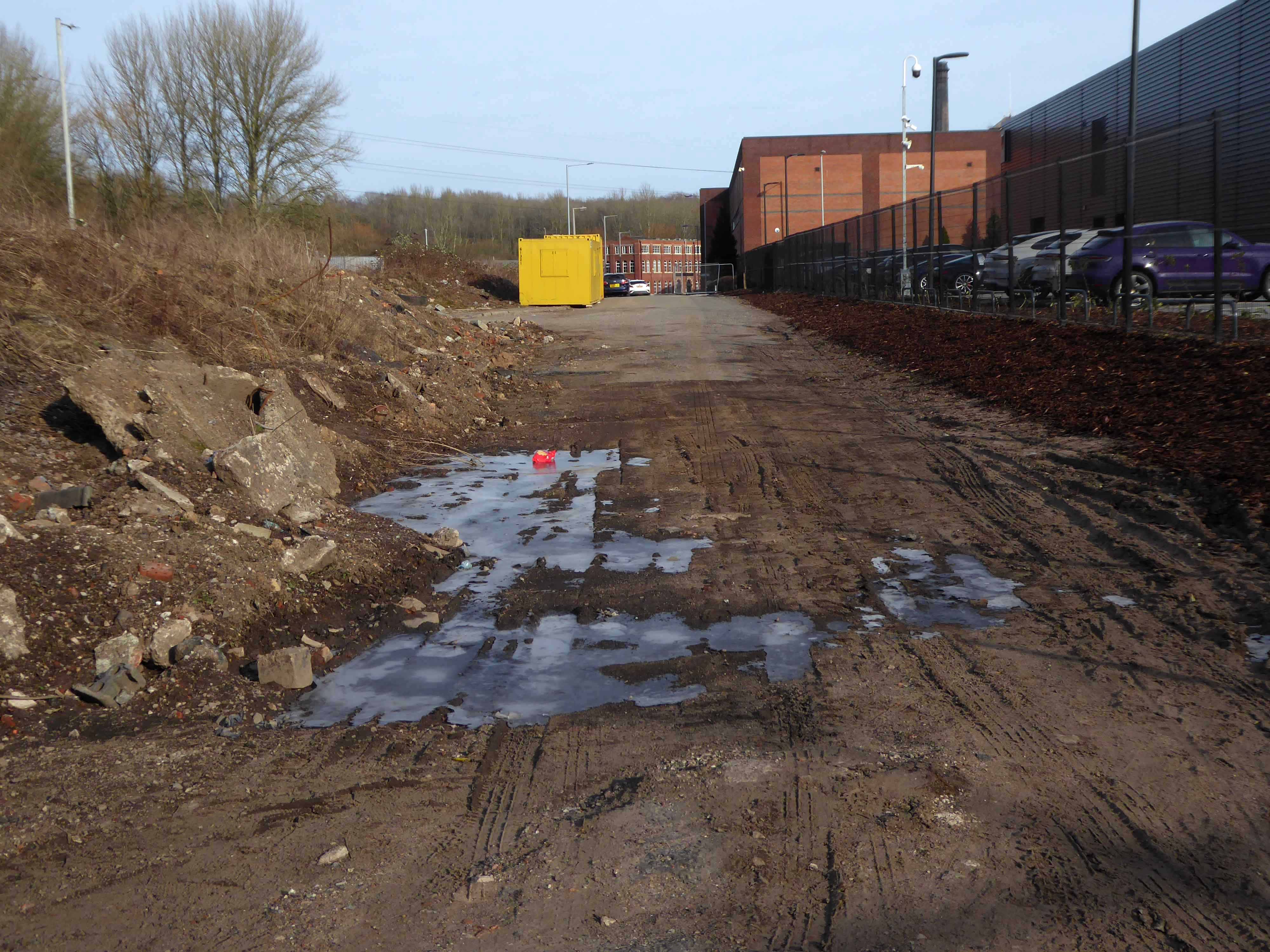
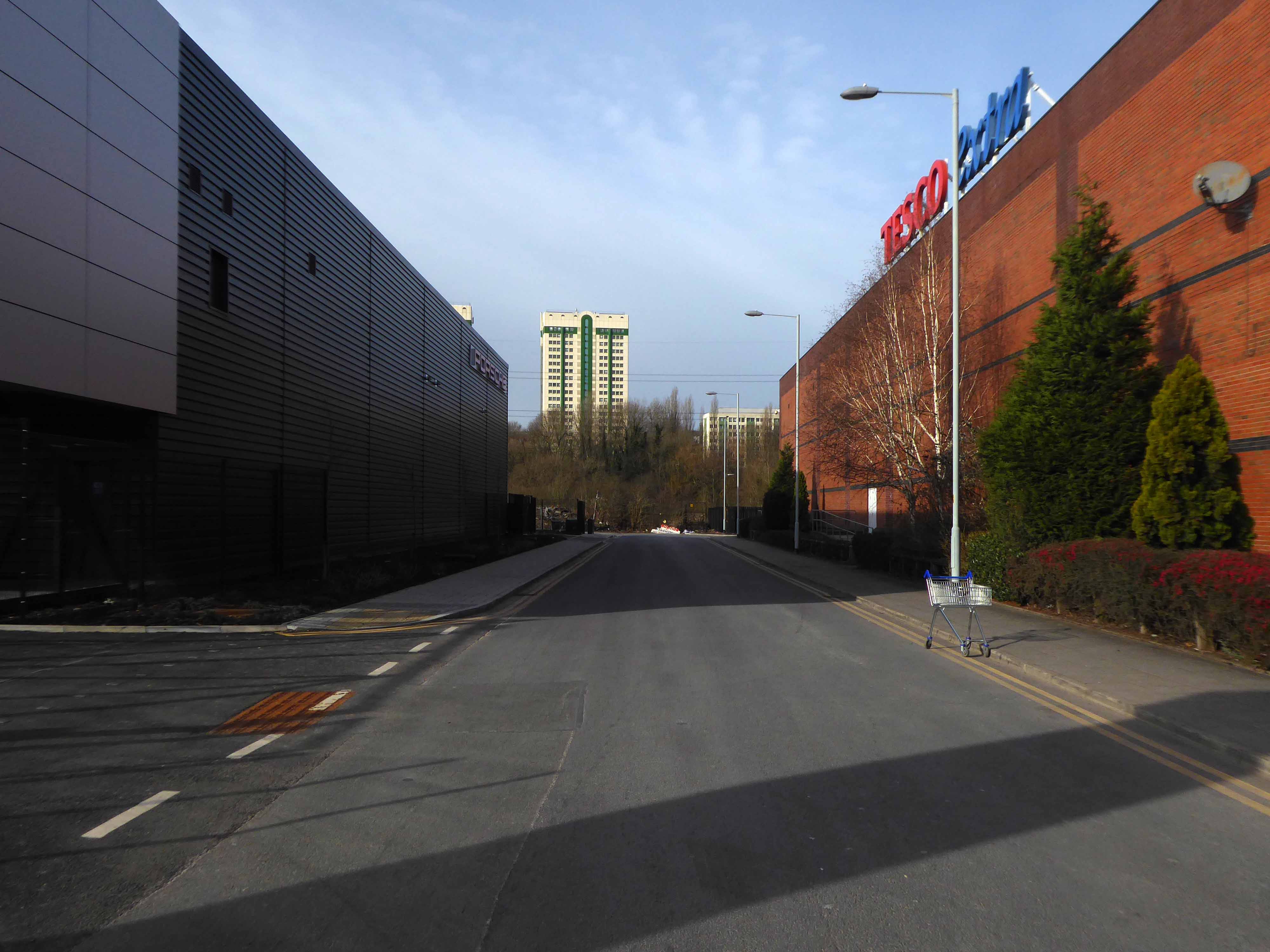
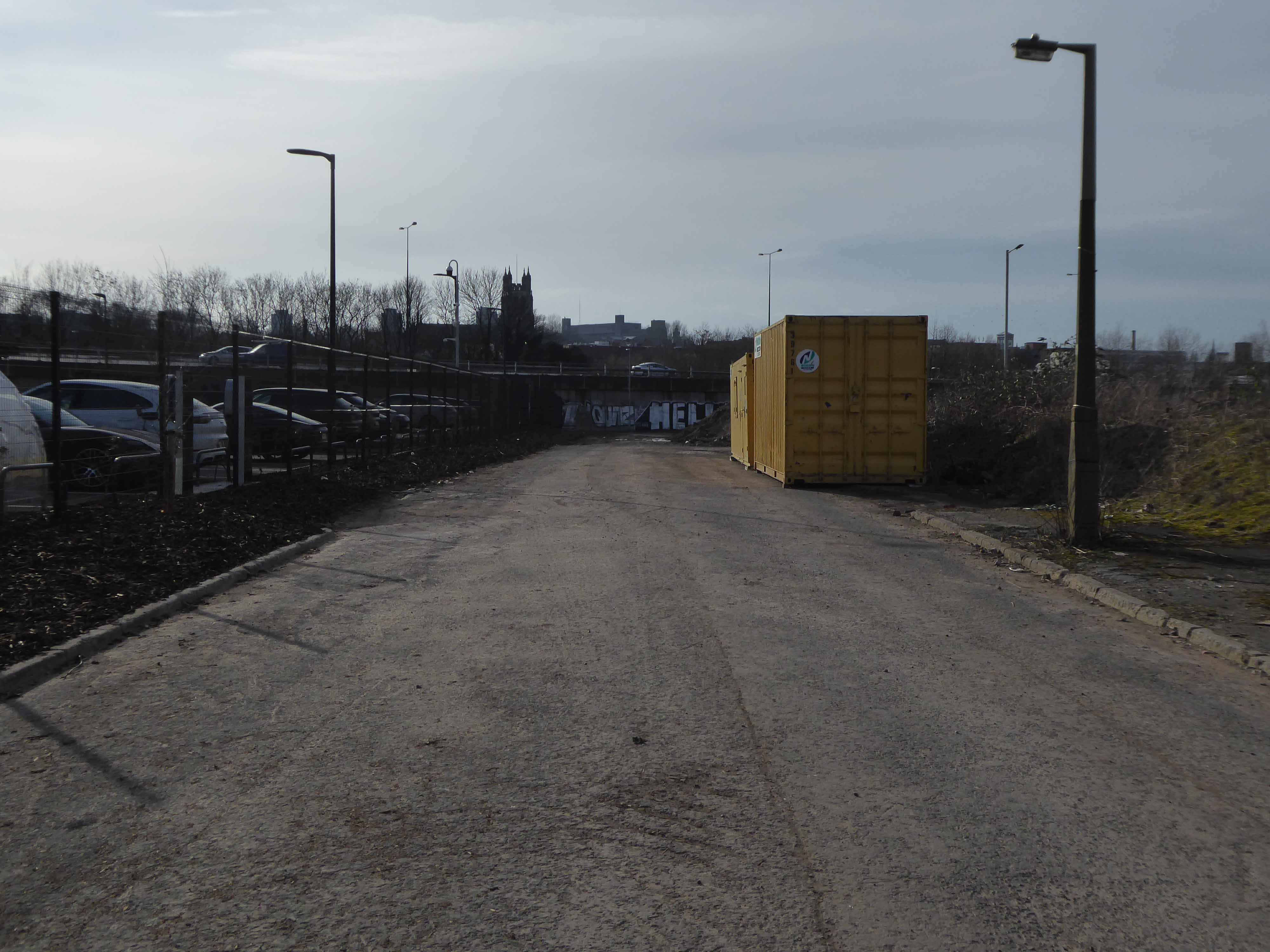
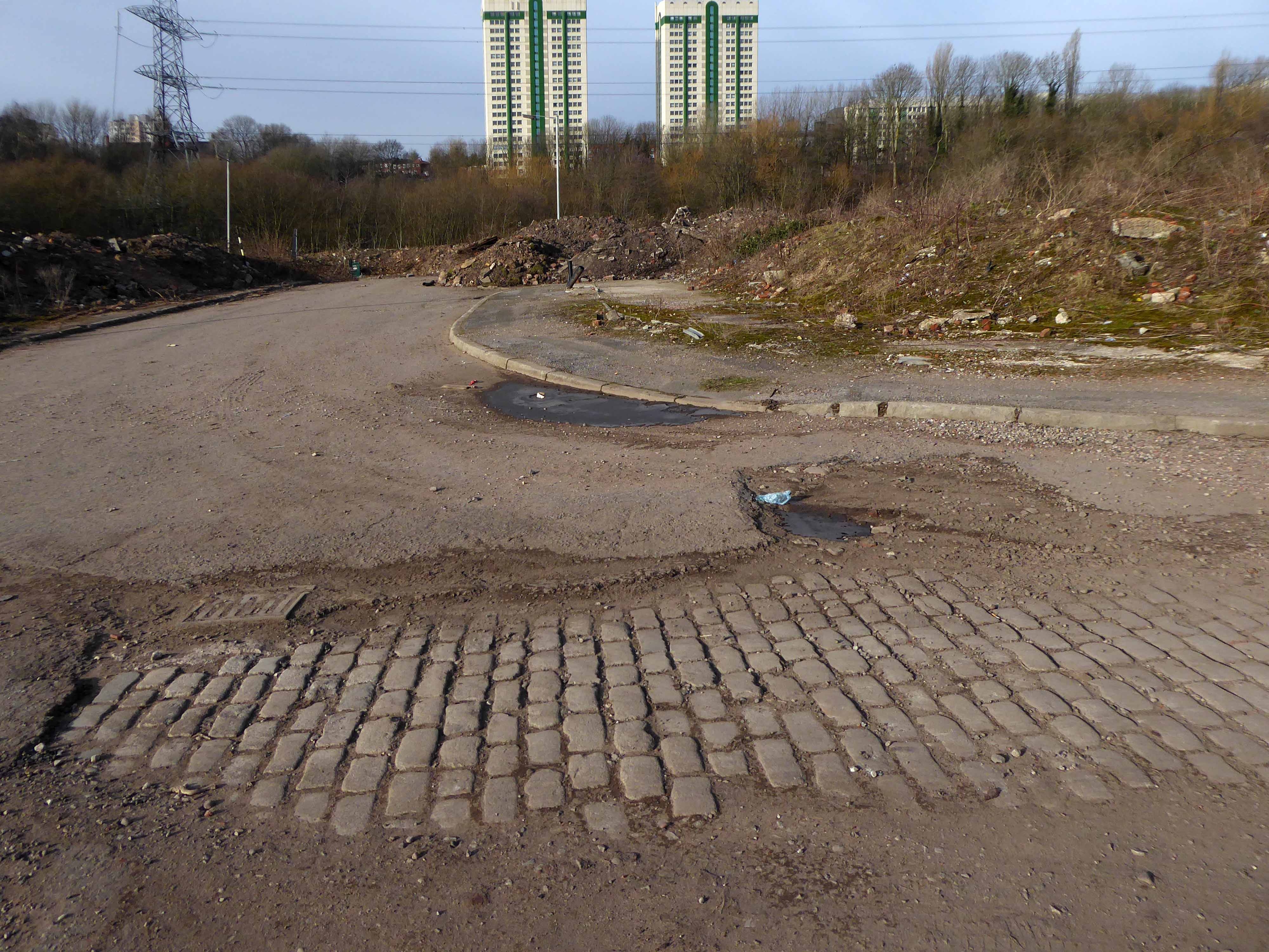
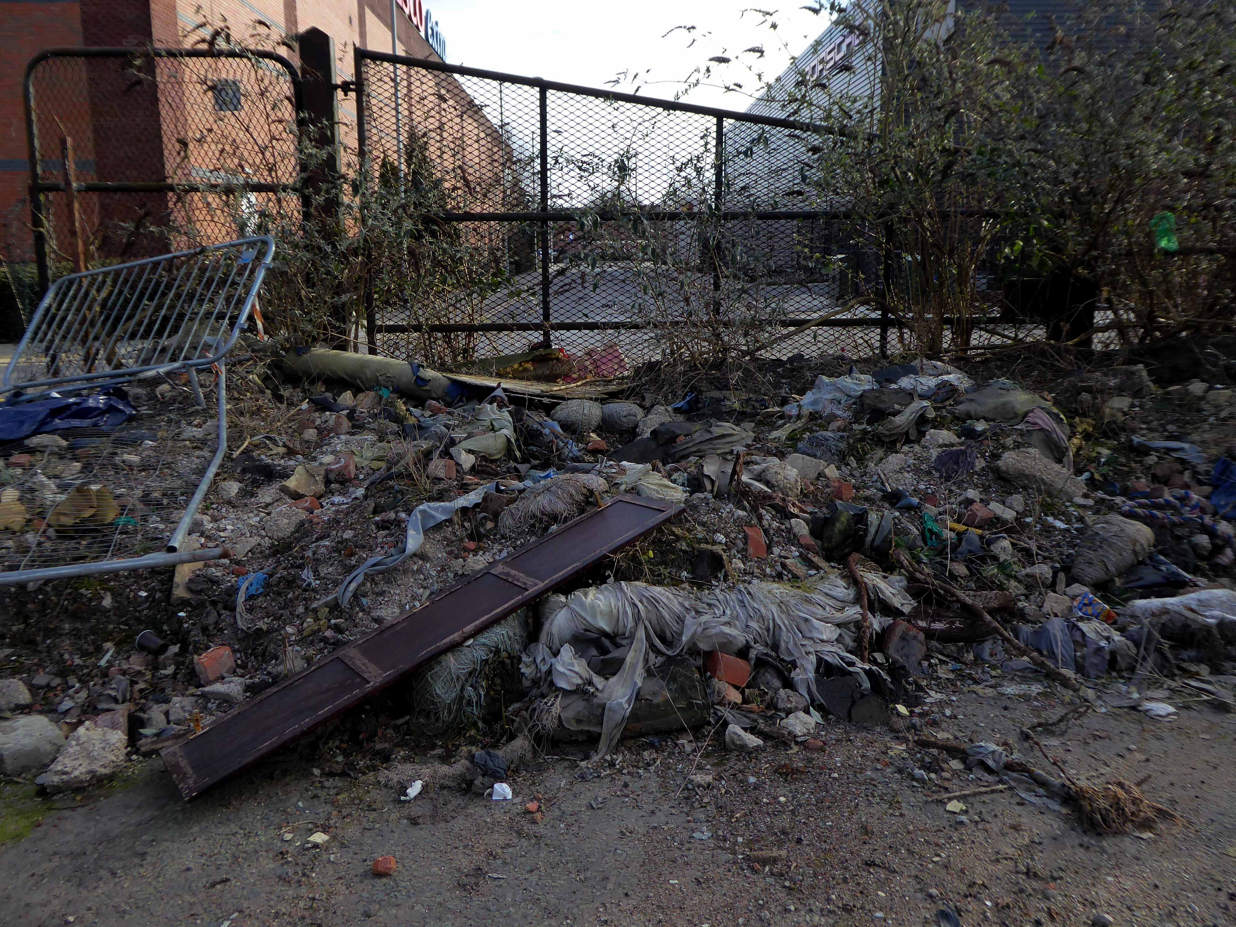
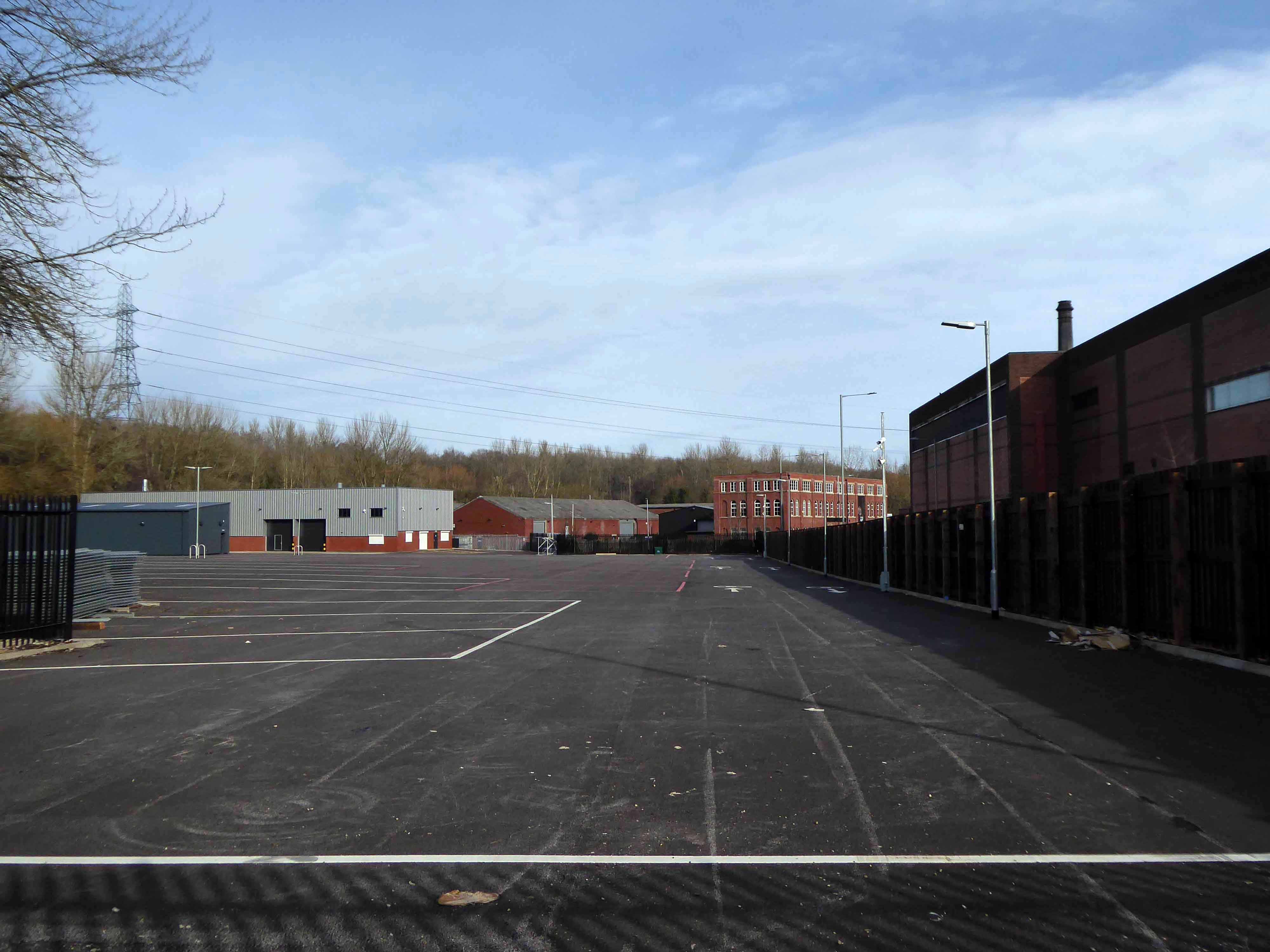
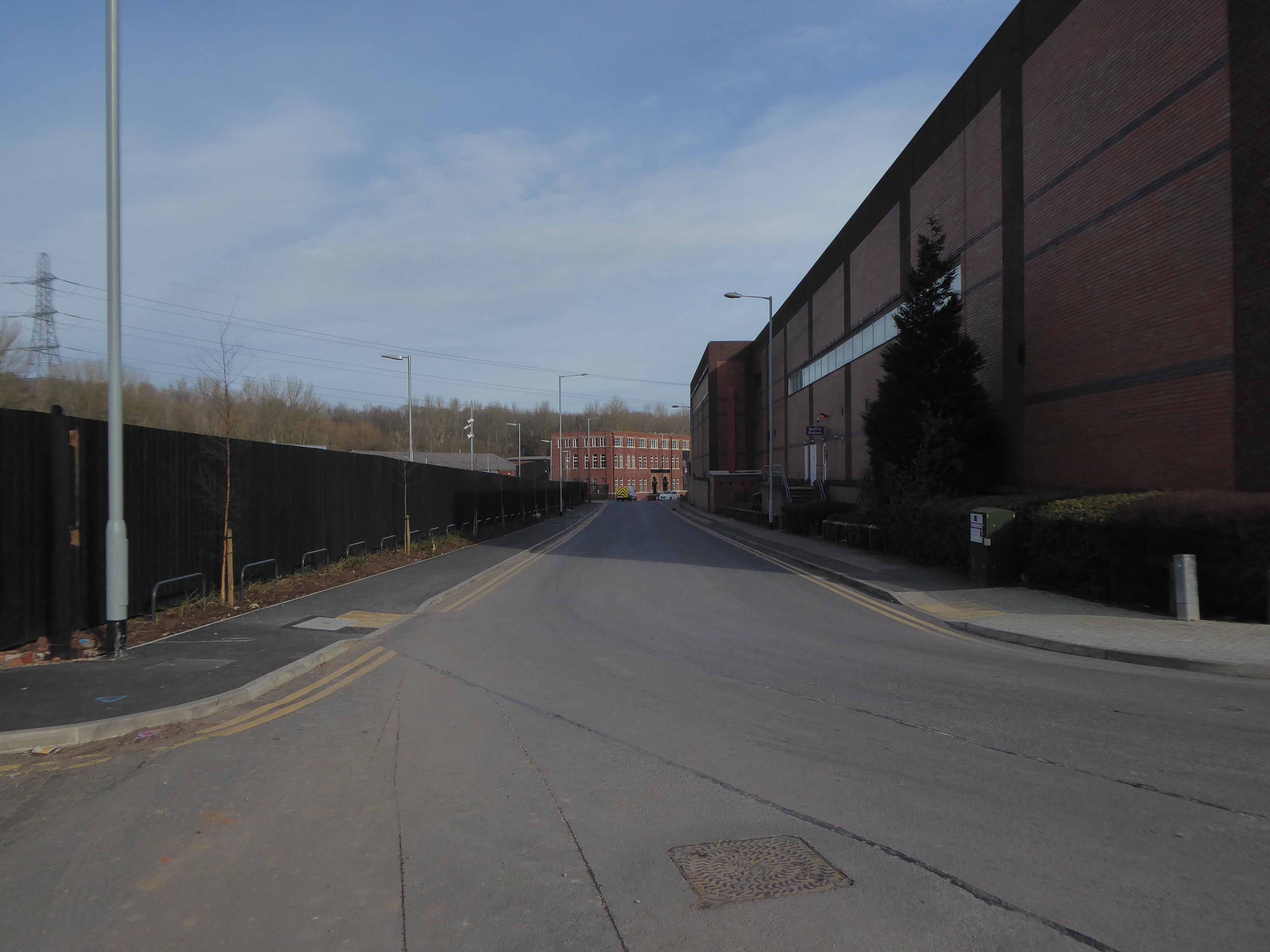
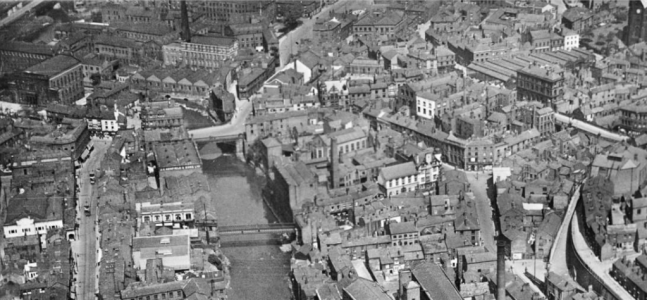
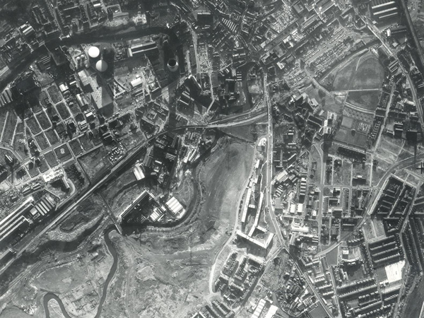
I often walk around here, the space enclosed by the River Tame and the M60, it was a maze of busy streets, home to peoples’ homes, industry, pubs, clubs and railways.
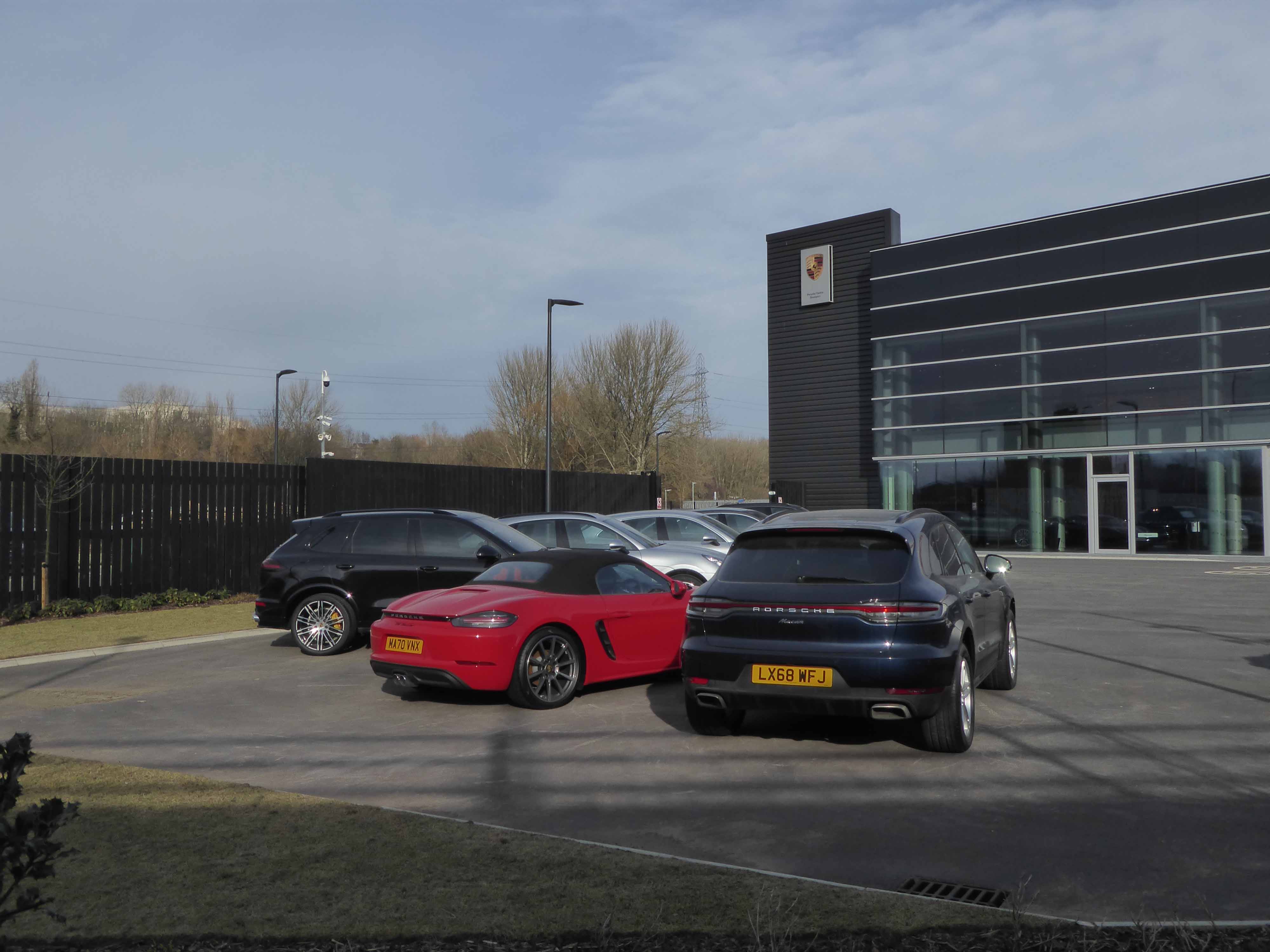
Much of that is now gone, either left to its own devices, untended rough empty ground, or overwritten by the newly built Tesco Extra and Porsche dealership.
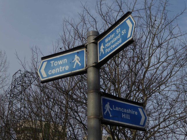
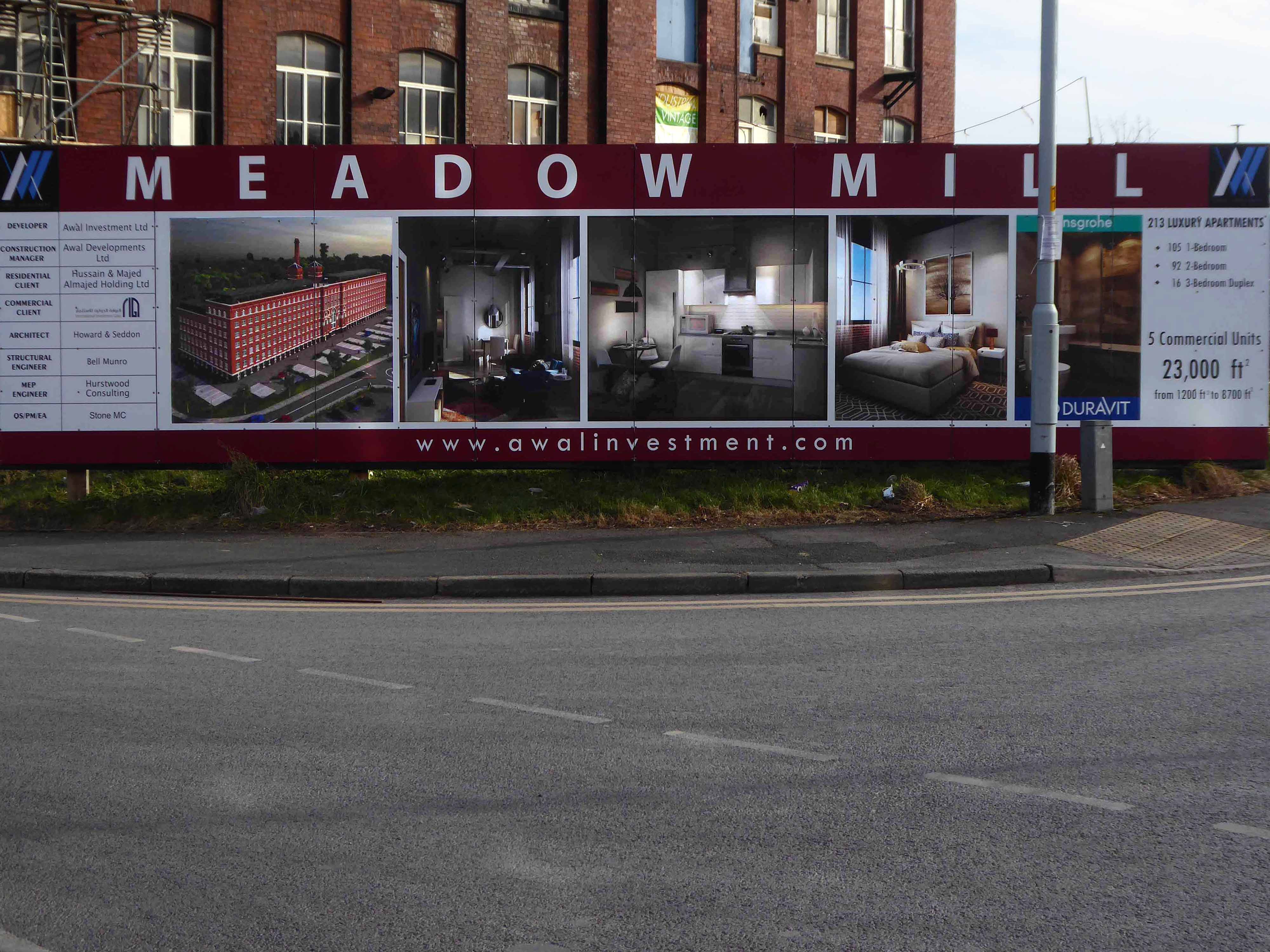
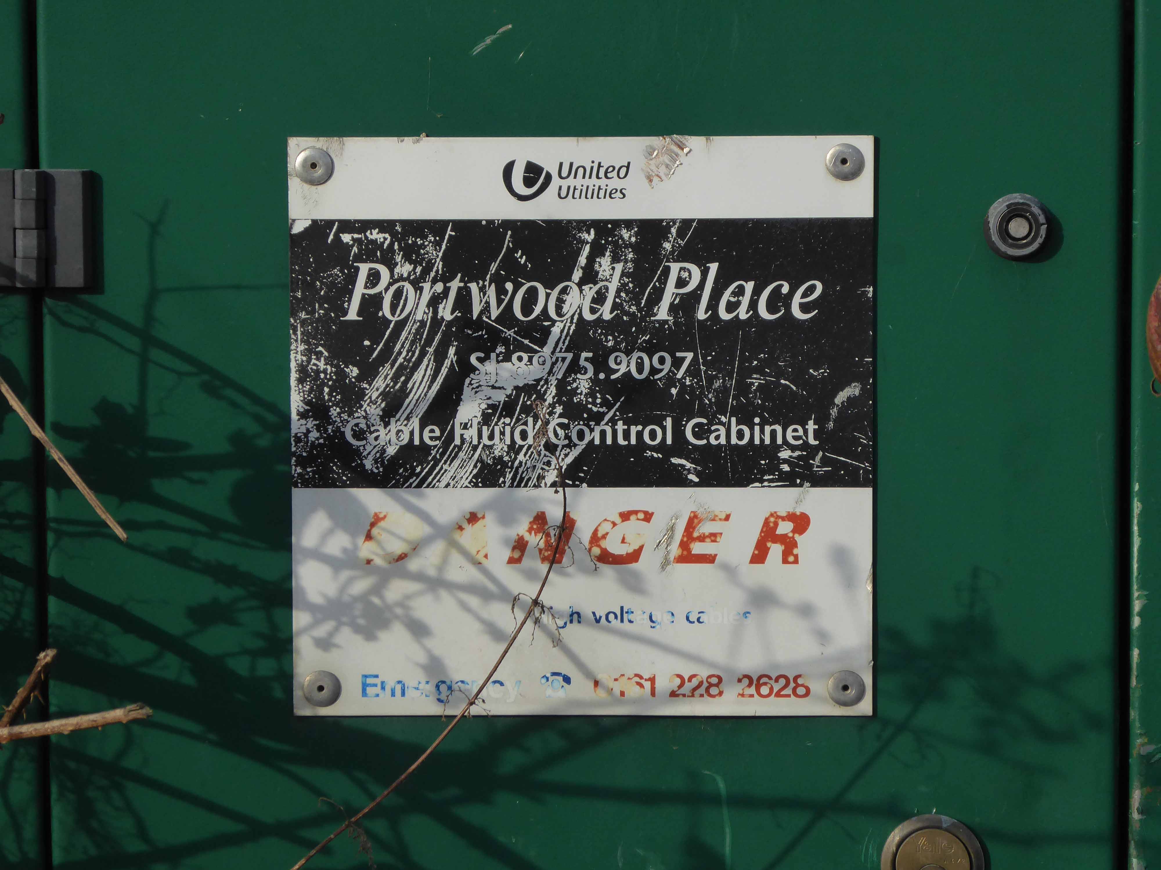
Water Street, Portwood looking north, taken from Avenue Street. Looking underneath the railway bridge, on the left hand side, the first building used to be a public house called ‘The Beehive’, further along was Kent & Swarbrick’s Tripeworks, now a precision engineers, then North West Concrete Works – Easymix. On the right is Coxson’s Brushworks, then the Portwood Mill, Kershaw’s Tannery and the Meadow Mill at the bottom of the street.
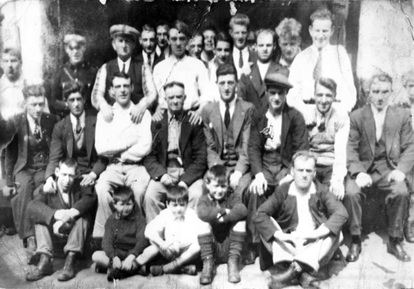
The area was also home to the Blood Tub boxing ring.
Outside the Blood Tub Back Water Street Portwood.
Centre row left to right Billy PittTaylor Micky PelhamJack HulmeJo Moran owner John MorryBobby RileyLaurie Glen a jockey
2nd row from the back – James Jimmy Rose.
Back row left to right – Charlie Dean An ambulance man Ike Irelands horse dealer – Team from Macclesfield.
Extreme right – Jo Mulrooney.
Front row left to right extreme left – Sidney Smith soft Sidney – a simpleton Jo Hulme.
Copied from a photograph lent by Eddie Pitt
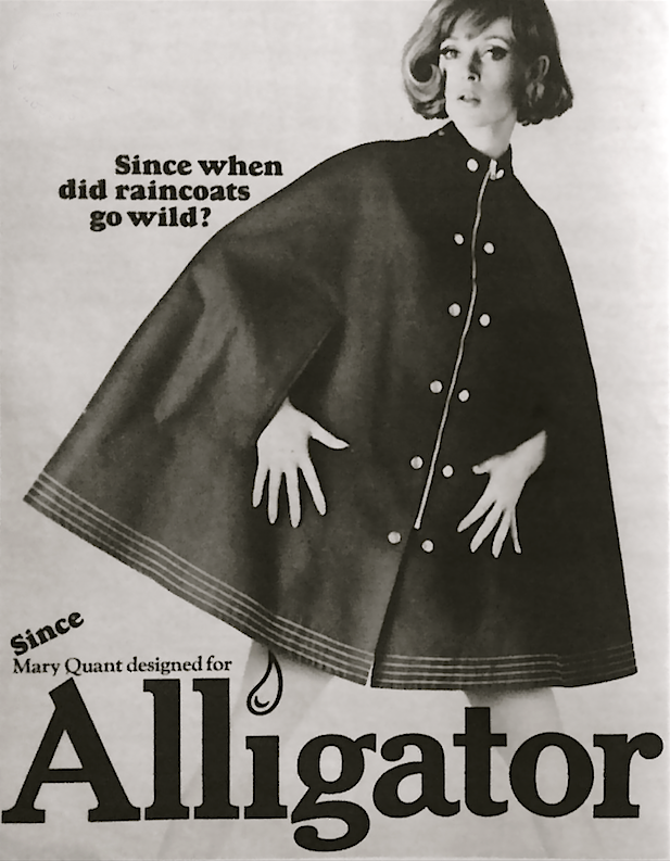
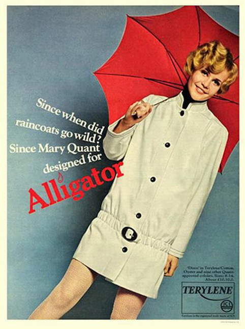
Alligator Rainwear – a British company, whose main factory was based in Beehive Mill. It was best known for its 1960s collaborations with Mary Quant in the design and production of her Wet Look collection of PVC raincoats.
The firm was started after the First World War by Reuben Satinoff, who had previously founded the London Waterproof Company – Silkimac. It was taken over by his sons after the Second World War. For decades, it manufactured traditional weatherproof raincoats in black, brown and beige, but the collaboration with Quant led to new fabrics including PVC and nylon, and a range of bright and vibrant colours.
At its peak in the 1960s and 1970s, Alligator had a turnover of £5 million per year and was exporting its products to Europe and North America. It was later owned by Baker Street Brands who describe it as one of their heritage brands.
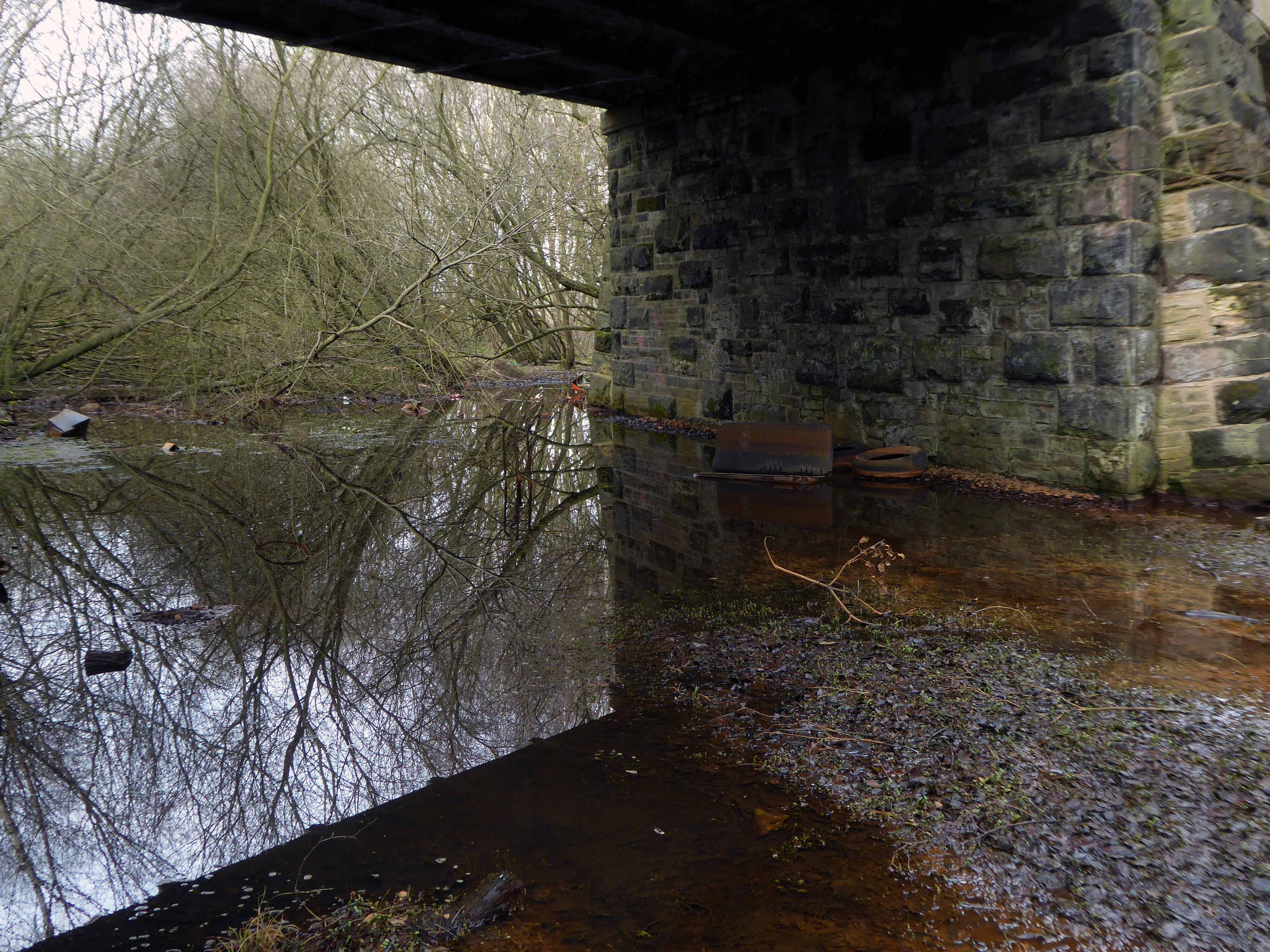
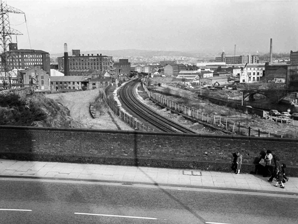
Viewed from Tiviot Dale Viaduct
Tiviot Dale station was located on the Cheshire Lines Committee (CLC) operated Stockport, Timperley and Altrincham Junction Railway line from Portwood to Skelton Junction, a section of what became the Woodley to Glazebrook line. It was situated at the bottom of Lancashire Hill, next to the present motorway bridge. It was opened on 1 December 1865 and was originally known as Stockport Teviot Dale. From 1880, Tiviot Dale was also served by long-distance trains running on the Manchester South District Railway to London St Pancras.
Tiviot Dale remained a part of the CLC, which was jointly owned from 1923 by the London and North Eastern Railway and the London Midland and Scottish Railway, until 1948 when it became part of the British Railways London Midland Region.
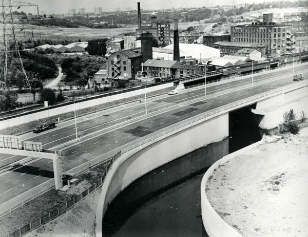
The lines through the station remained in heavy use by coal trains heading for Fiddlers Ferry power station near Warrington from the Woodhead Line. These, however, ceased in 1980 when damage was caused to the nearby Tiviot Dale tunnel during construction work on the M63 motorway – now M60 motorway and the line temporarily closed for safety reasons. The closure was made permanent west of Bredbury’s stone terminal in 1982, following the demise of the Woodhead route; the track was subsequently lifted in 1986 and the tunnel partially filled in. The area surrounding the station was further altered at the beginning of the 21st century to allow the construction of a supermarket and office buildings, which now block the old trackbed.
Portwood Railway Station was on the Stockport and Woodley Junction Railway – later becoming part of Cheshire Lines Committee – Glazebrook to Woodley line. According to Bolger it opened to passengers on 12 January 1863, along with the rest of the Stockport and Woodley Junction Railway, although Butt suggests it opened on 1 December 1865 when the Stockport, Timperley and Altrincham Junction Railway opened.
The station opened for goods traffic in 1865, closing to passengers on 1 September 1875, when it became a goods station. It remained in use until 25 April 1966 when it closed except for coal traffic which continued until 27 March 1972 when it closed entirely except for a private siding.
Today no trace of the station remains, the site being buried under a slip road of the M60 motorway.
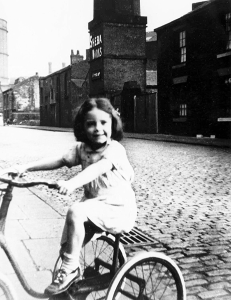
Monica Clarke on her tricycle in Marsland Street, behind her across the cobbled street is the Sheba Works – 1951.
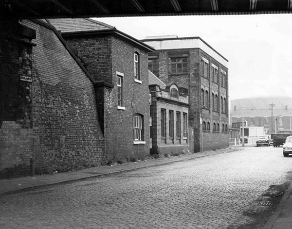
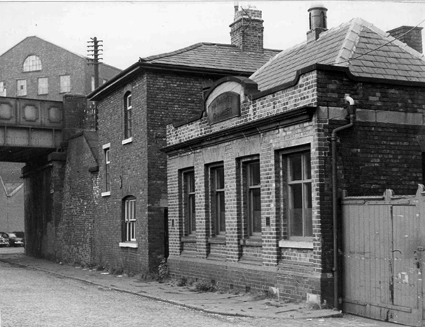
Marsland Street east, showing the Haymarket Chambers – 1967
The front of Haymarket Chambers Marsland Street.
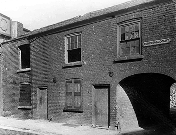
Boarded up dwellings on Compstall Court, off Marsland Street.
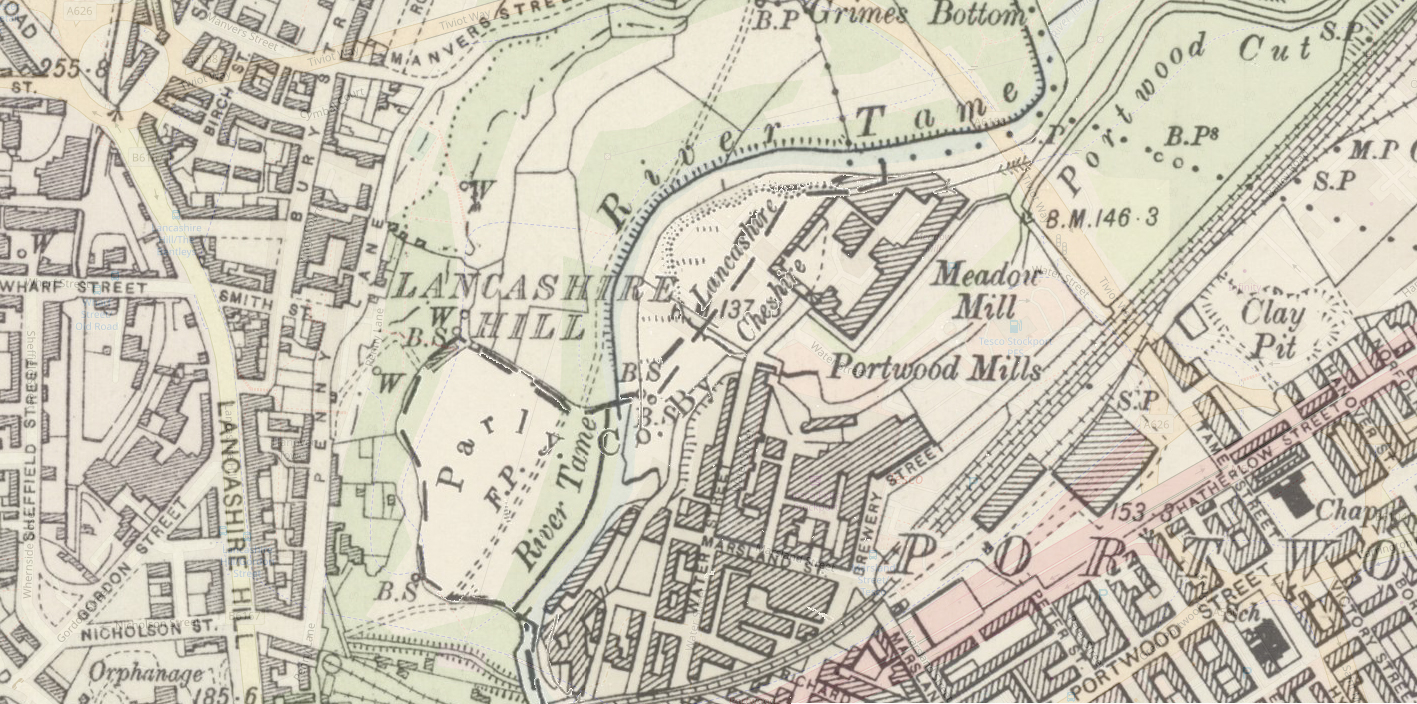
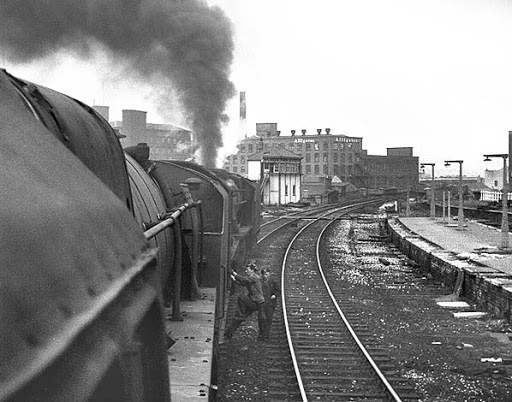
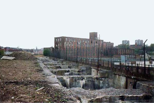
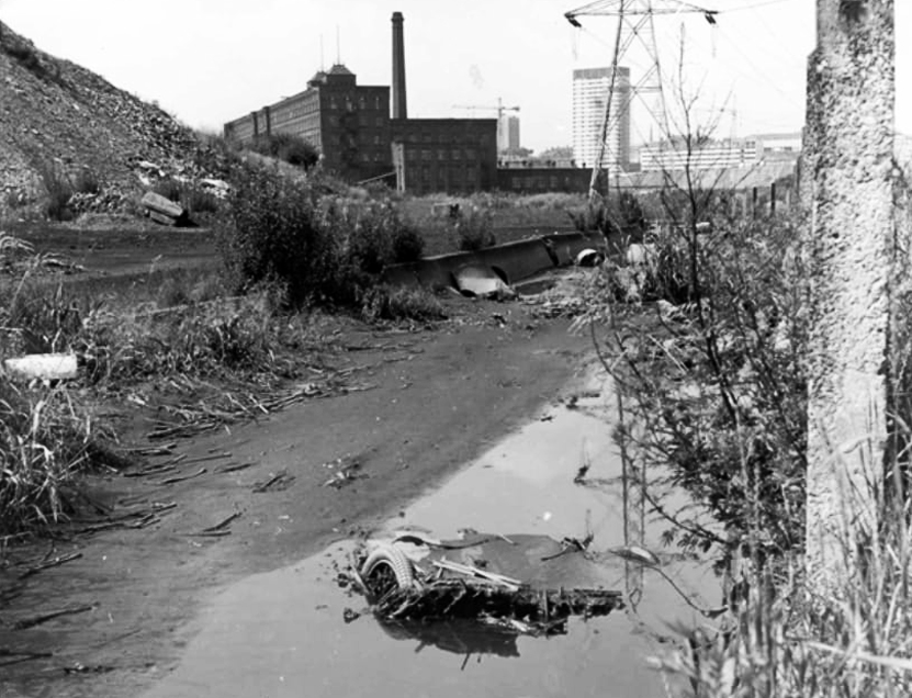
Portwood Cut 1968
James Harrison bought the manor of Brinnington in the early 1780’s – by 1790 Harrison had three factories in Portwood and others were to follow. In 1796, to provide sufficient water-power to this industrial zone he constructed a substancial millrace. Known as the Portwood Cut, it carried water across the Tame, between his Reddish and Brinnington estates. Harrison also planned the construction of factories at Wood Hall but that particular scheme was abandoned after his death in 1806.
Harrison’s Weir still survives on the river. To the south sections of the Portwood Cut also survive within Reddish Vale Country Park, both as a shallow depression and as water-filled, if somewhat silted and overgrown channel.
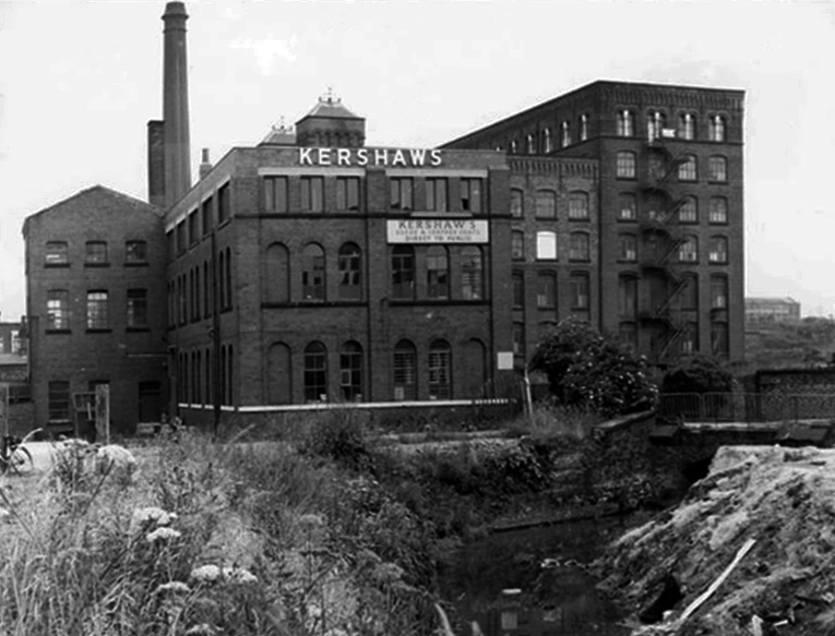
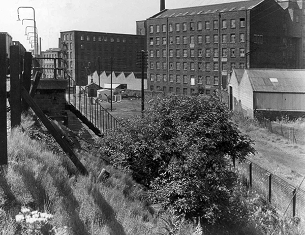
Kershaws is one of the only original businesses which still trades in the area.
Established back in 1855 by Joshua Kershaw, the company has gone from strength to strength.
Way back then, it was just a tannery. Today, seven generations on, Edward Kershaw heads a company that is known and respected for it’s quality leather in Europe, America and the Far East.
Kershaws also provide white leather for masonics and bagpipes.
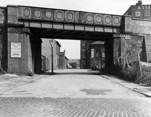
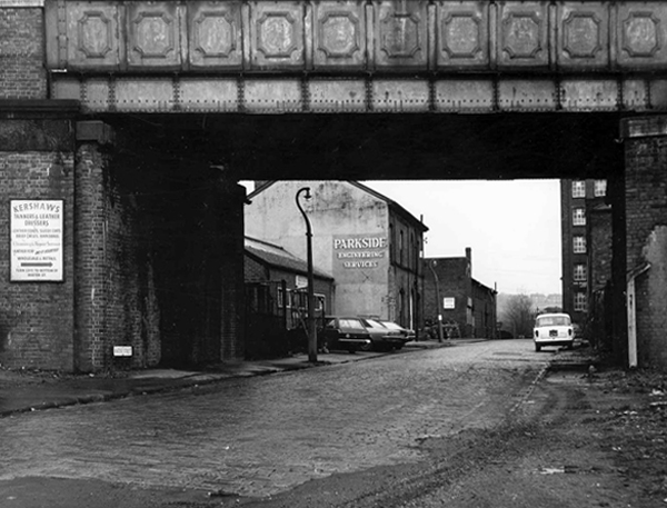
Brewery Street – a view of the steps leading to the railway footpath to Tame Street – 1967.
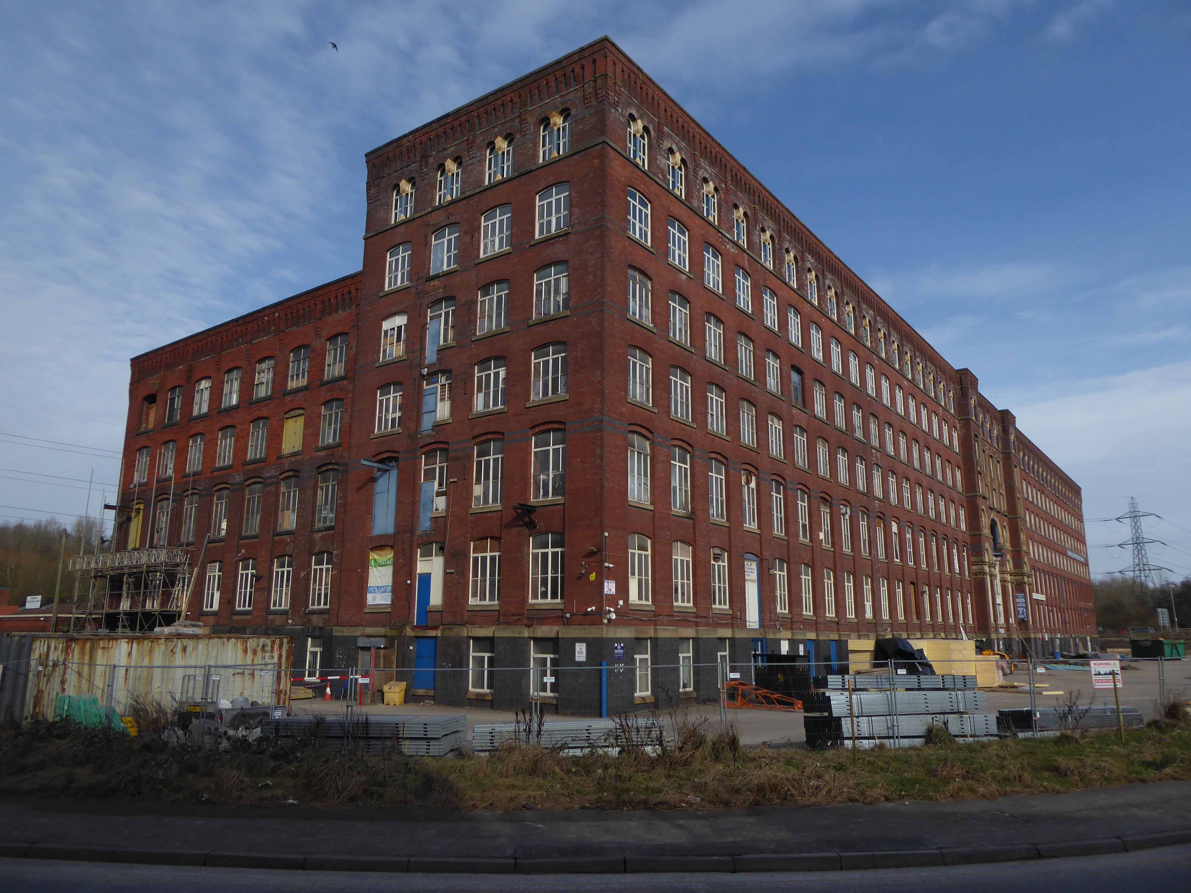
The mill in the foreground is the Portwood Spinning Mill now called Portwood Mill – on the front of the mill it states Sir Richard Arkwright Portwood Mill.
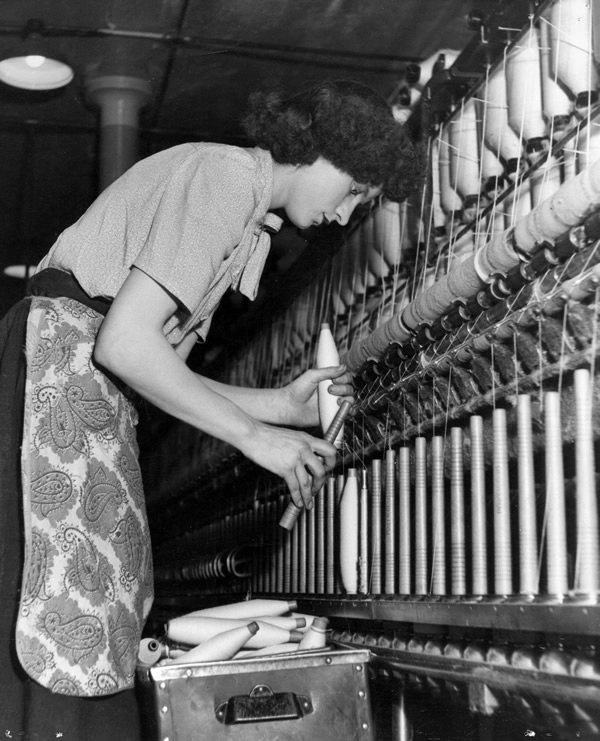
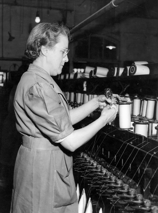
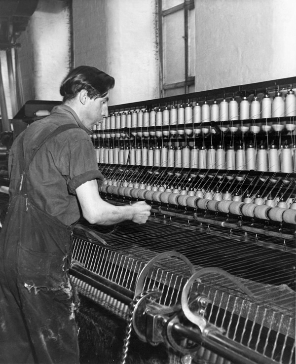
Employees – Portwood Spinning Company
Coal drops and yard at the rear of the Beehive Spinning Mill
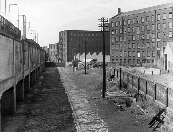
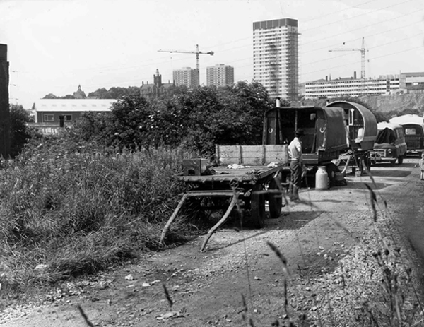
Tame Street gave motorized access to the Cut and here the caravans of travelling folk were parked several times a year, usually until the police ‘moved them on’. The men collected and sold scrap metal, the women sold clothes pegs and told fortunes from door to door. Many of the local people treated them with suspicion and some local pubs would not admit them.
Building work on Lancashire Hill can be seen in the background – 1968
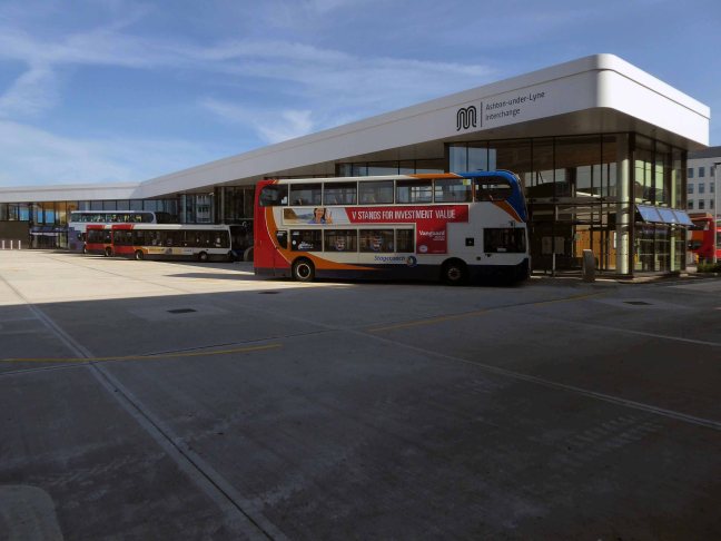
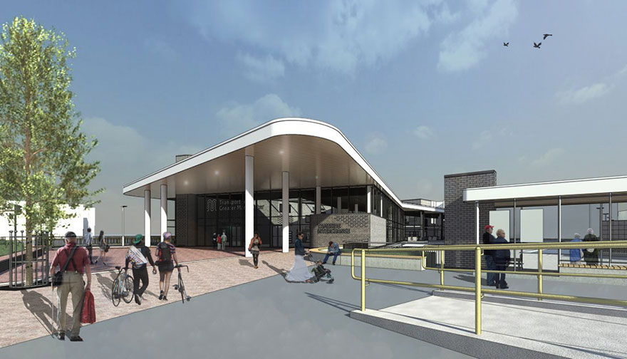
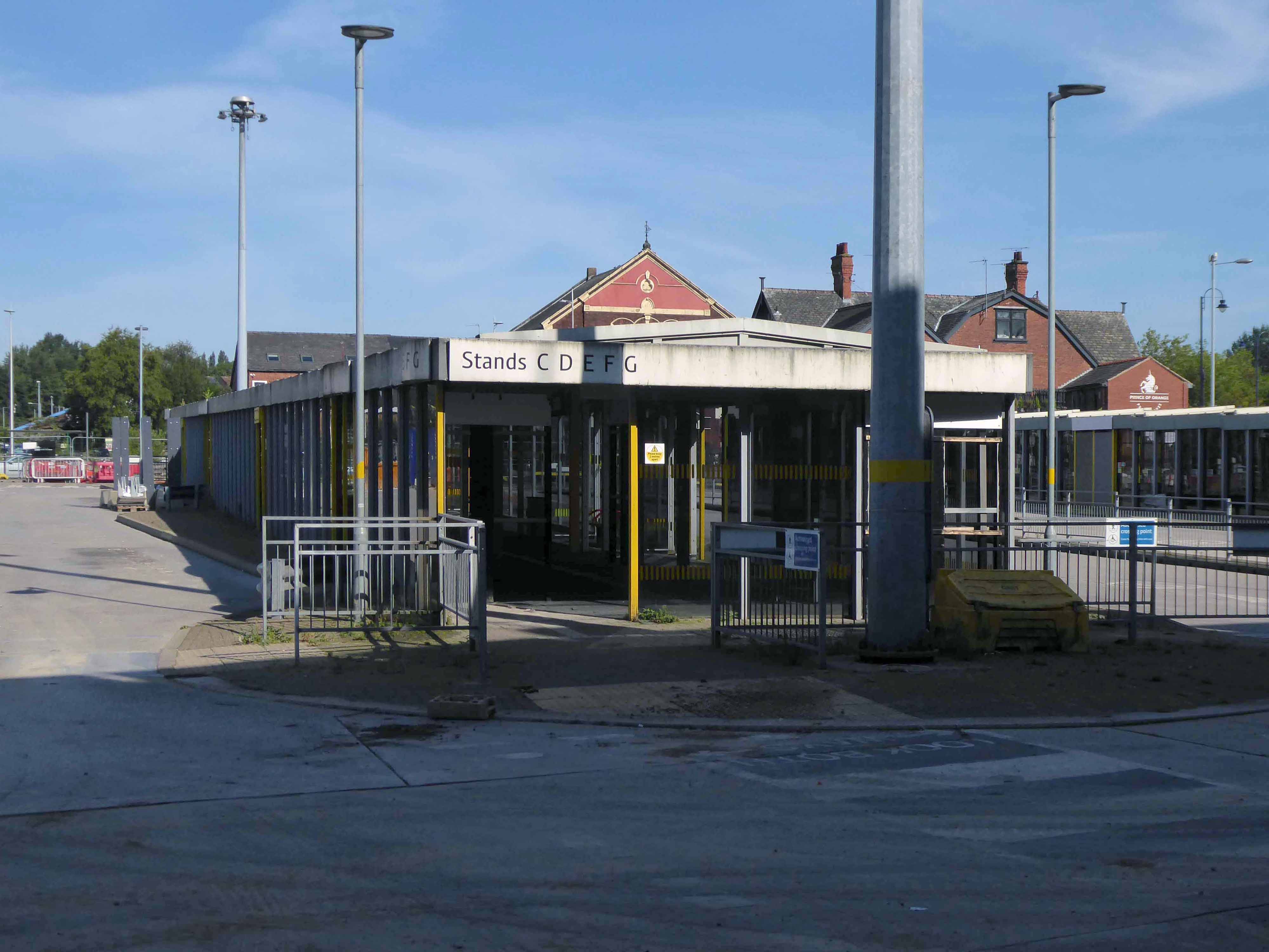
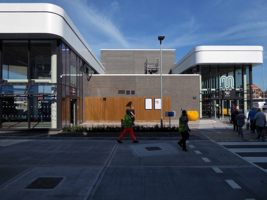
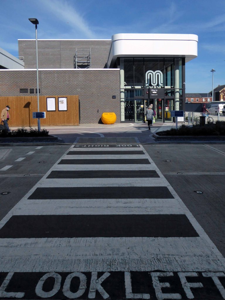
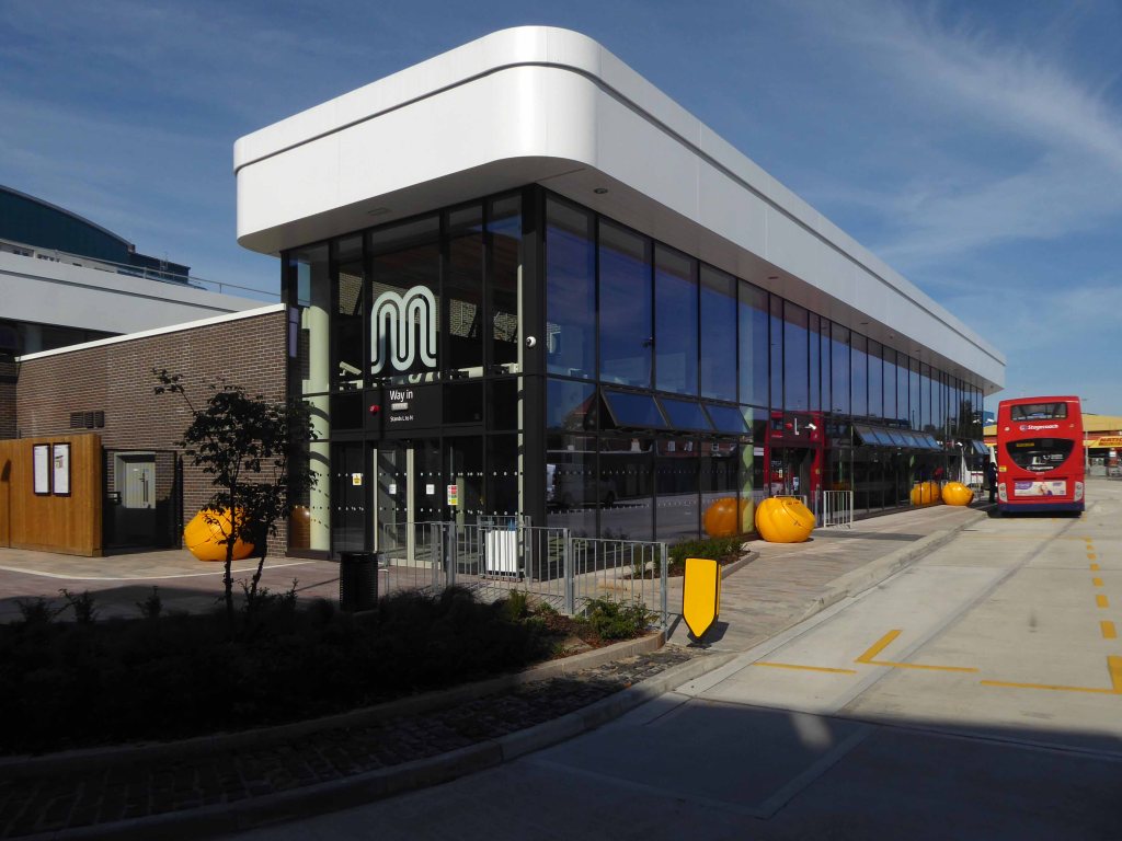
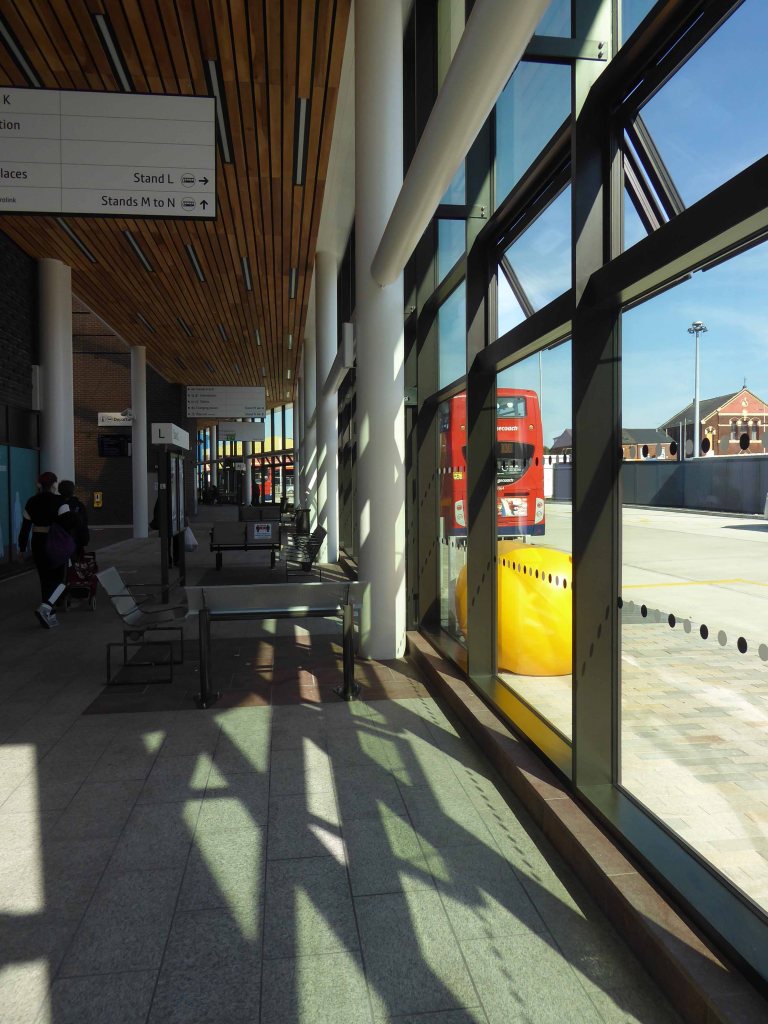
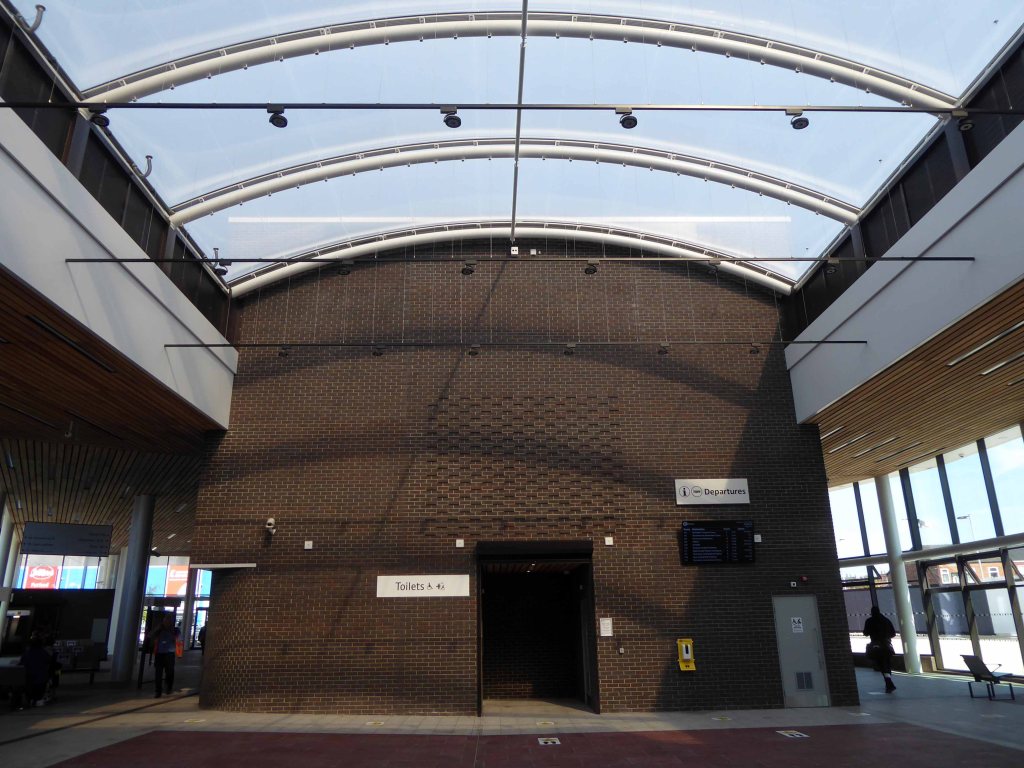
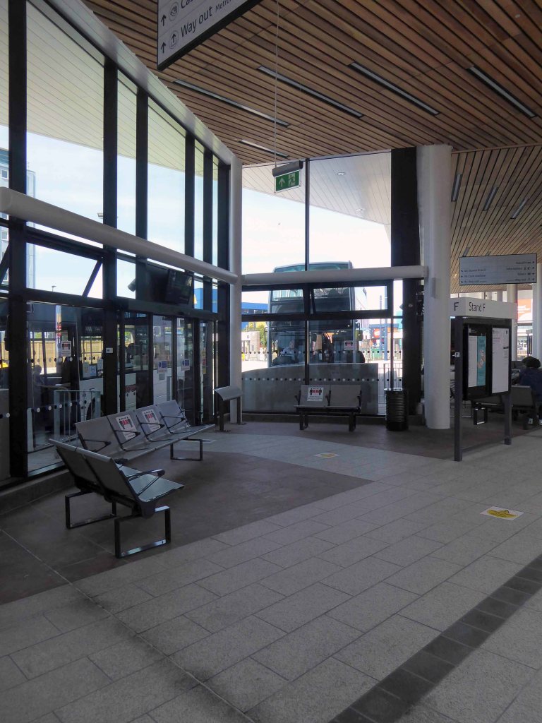
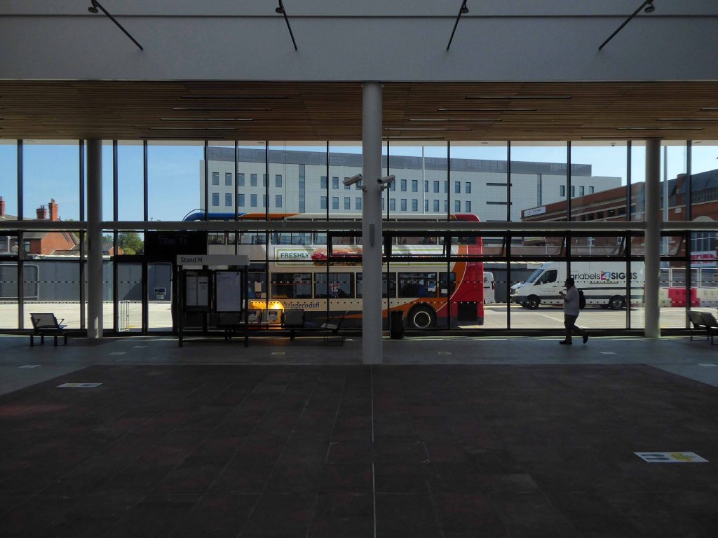
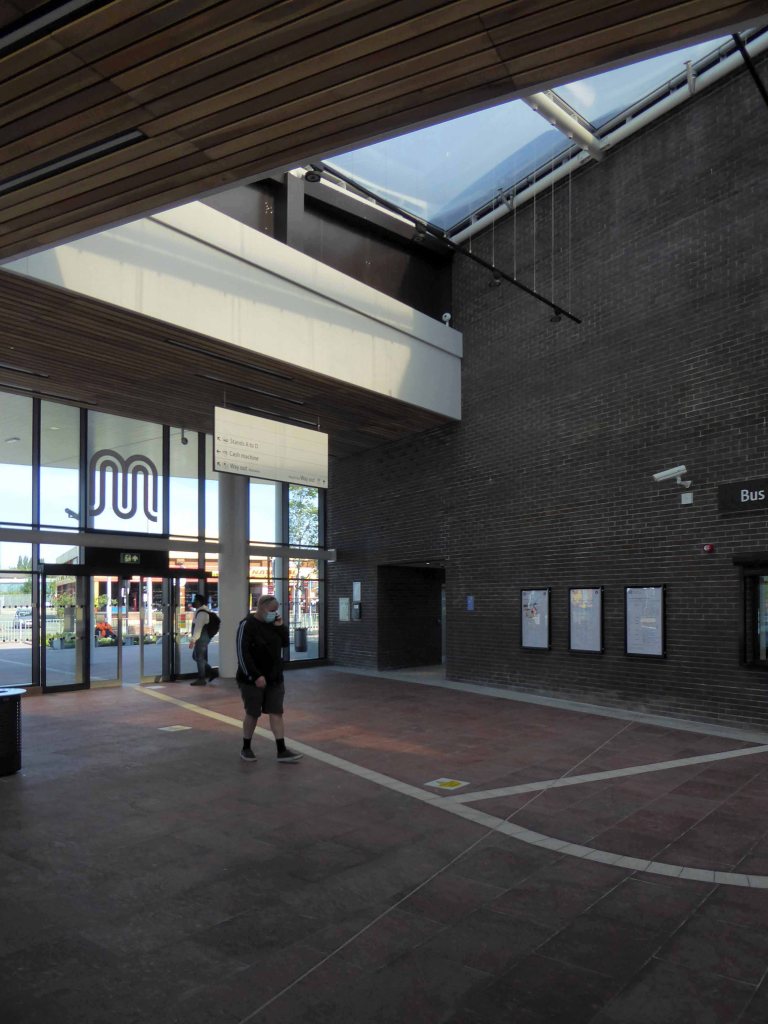
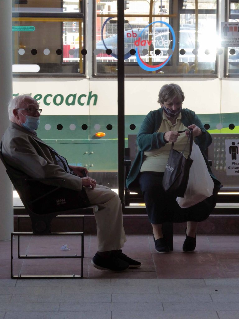
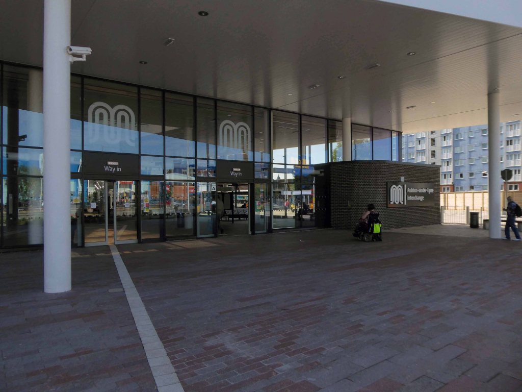
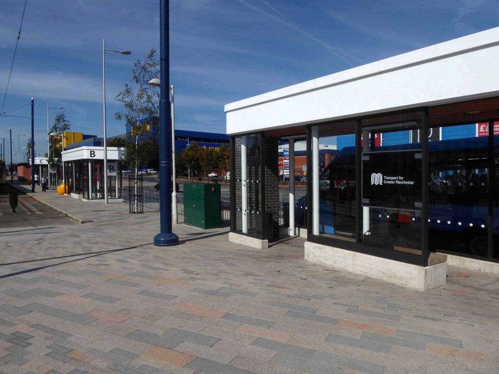
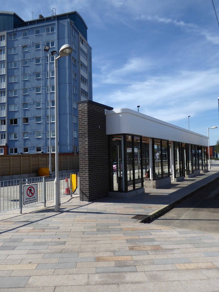
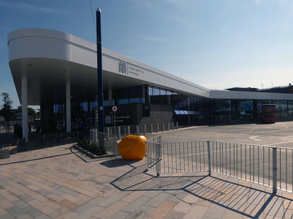
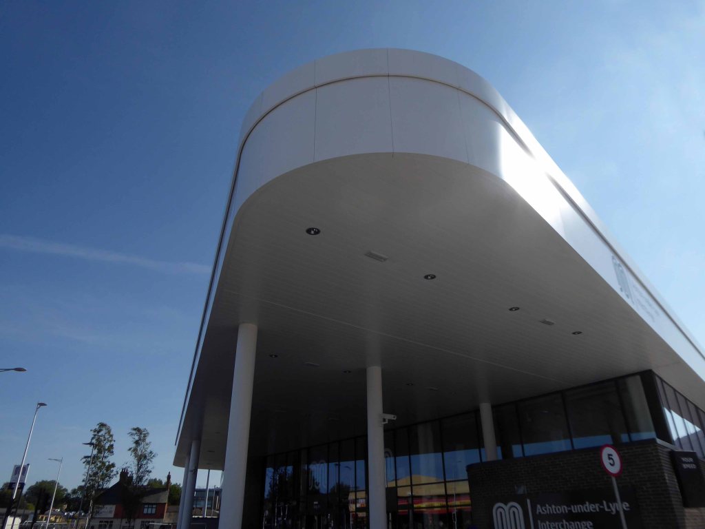
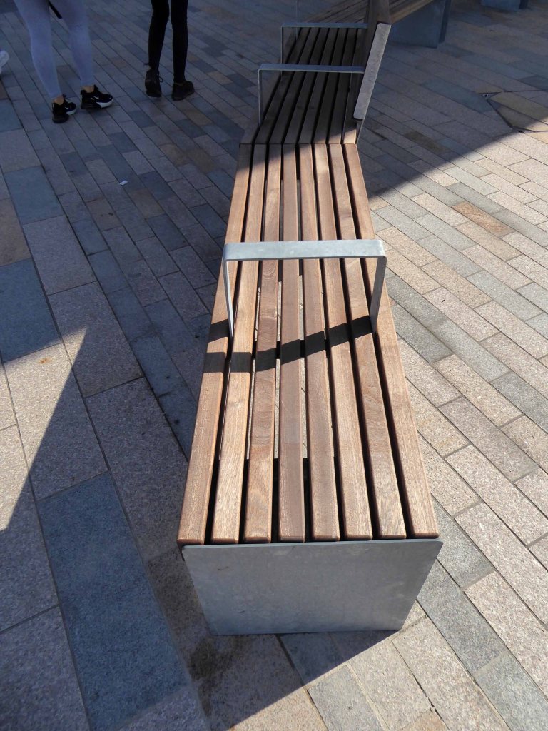
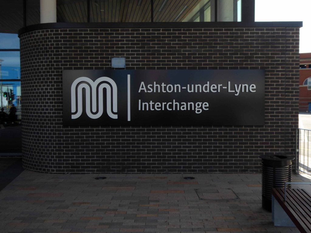
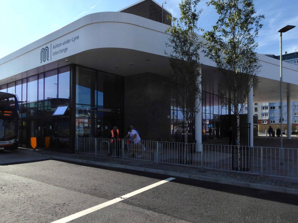
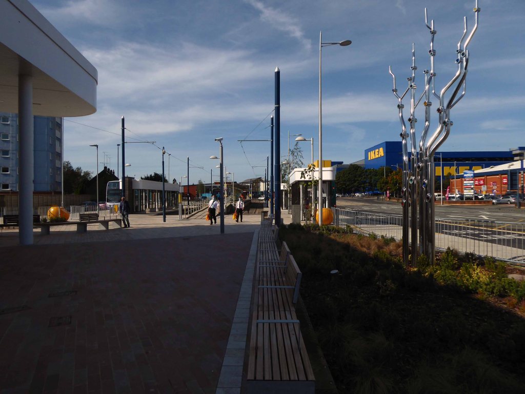
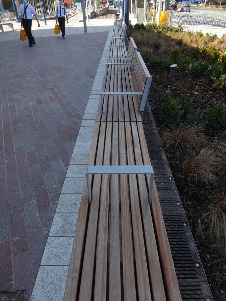
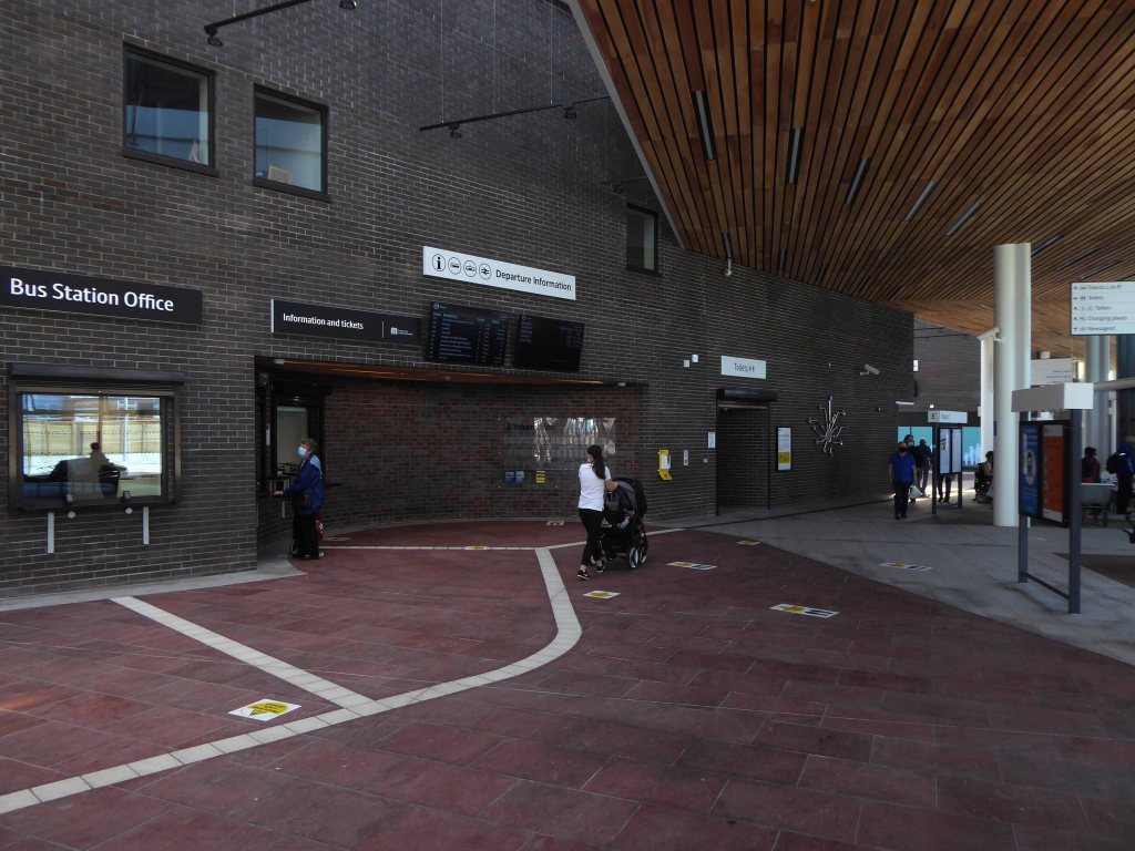
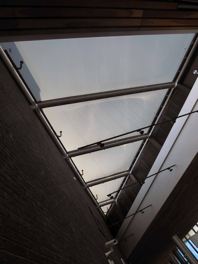
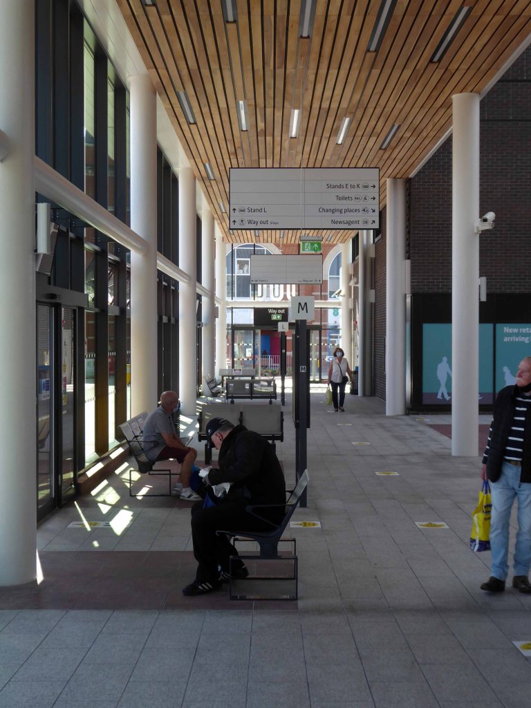
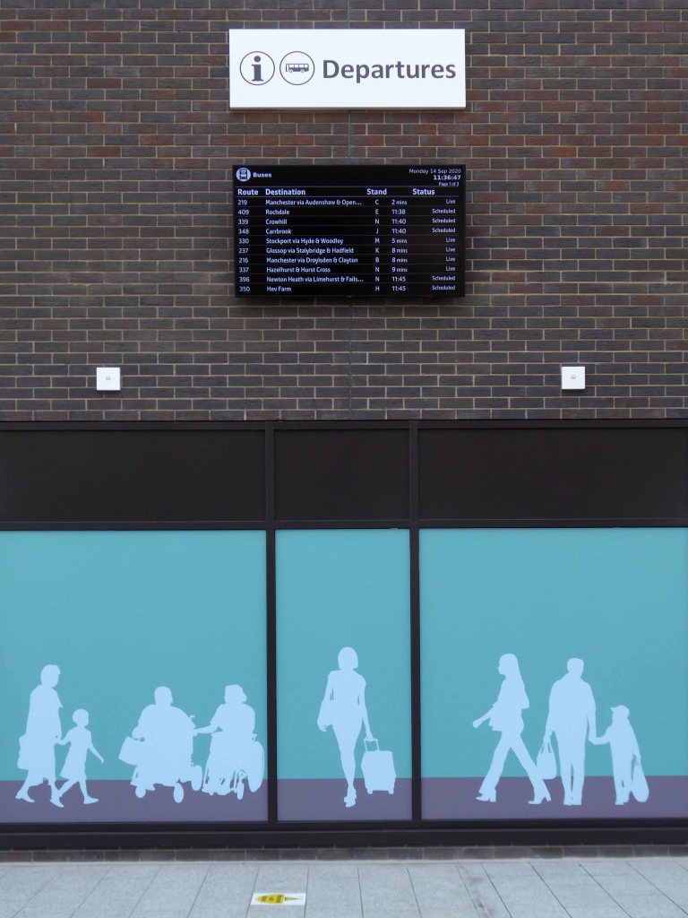
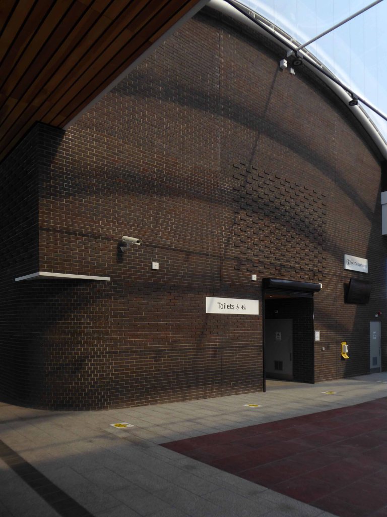
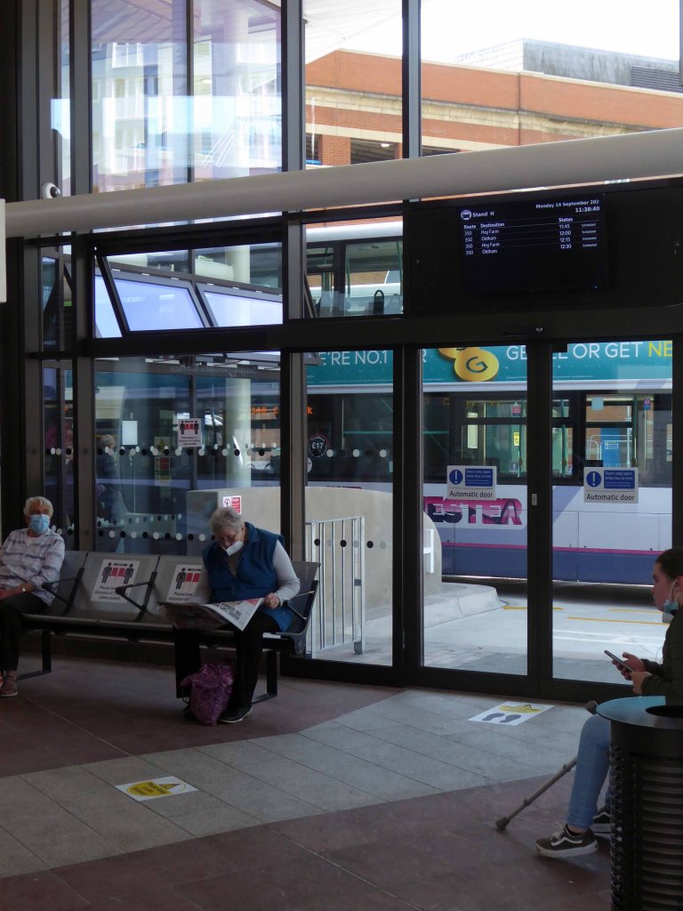
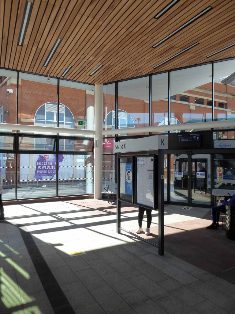
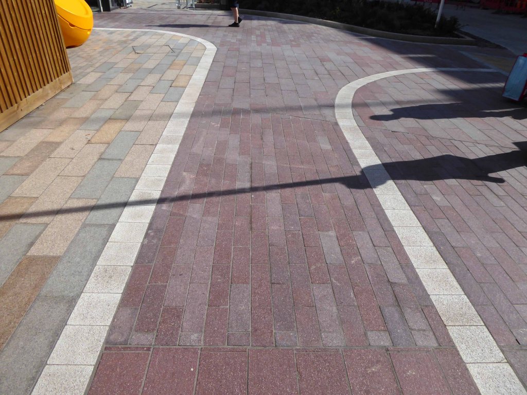
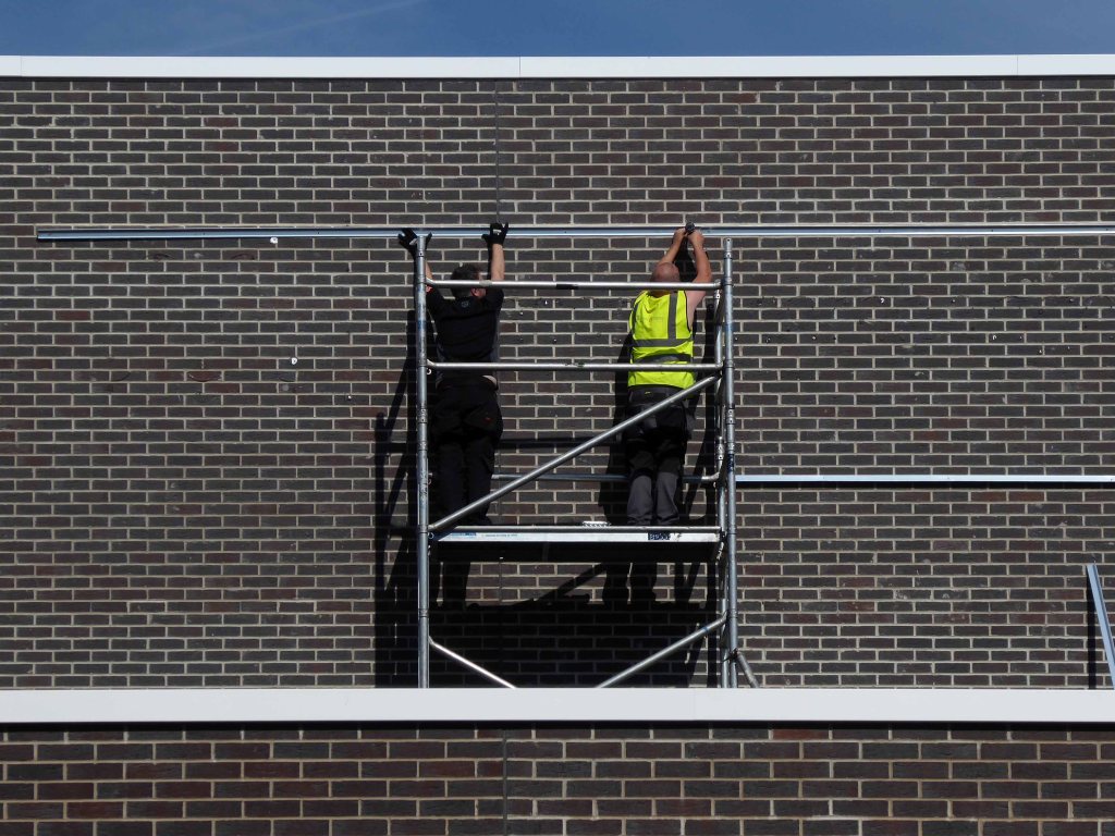
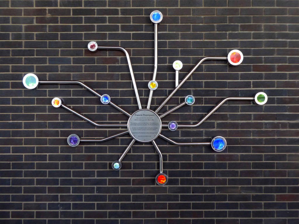
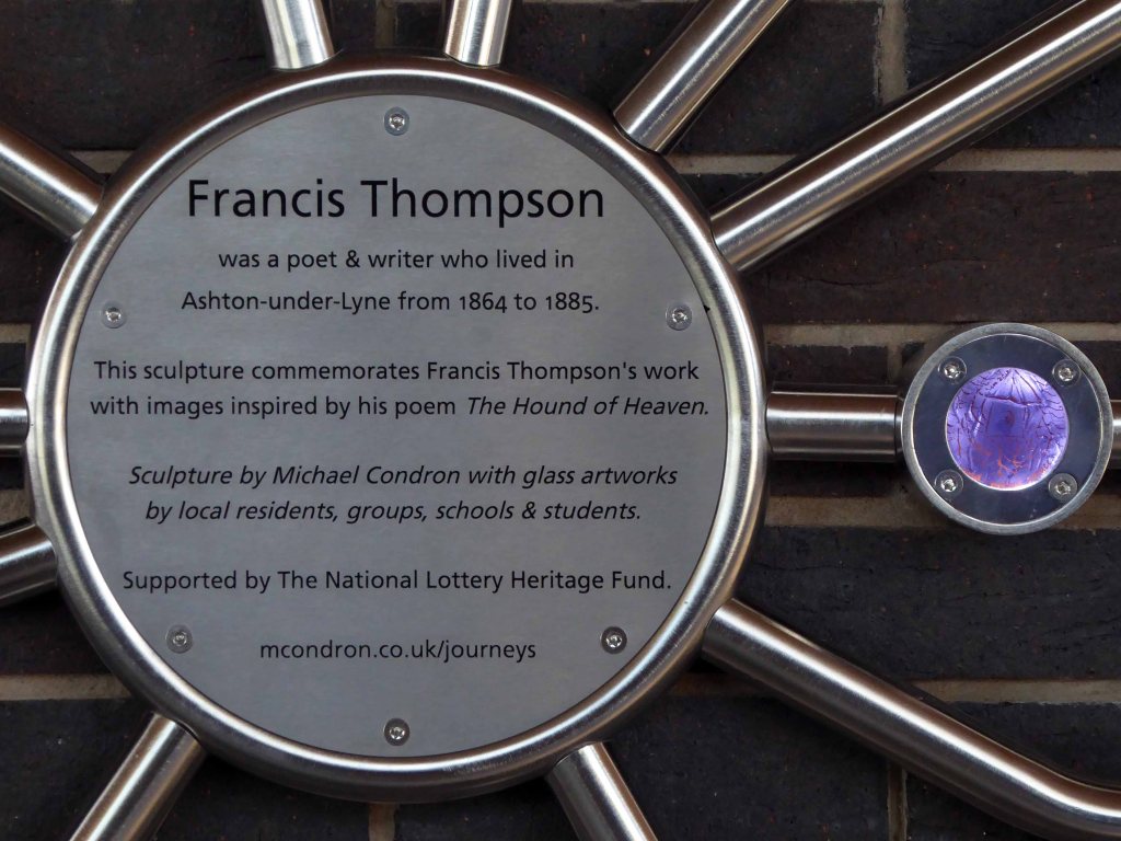
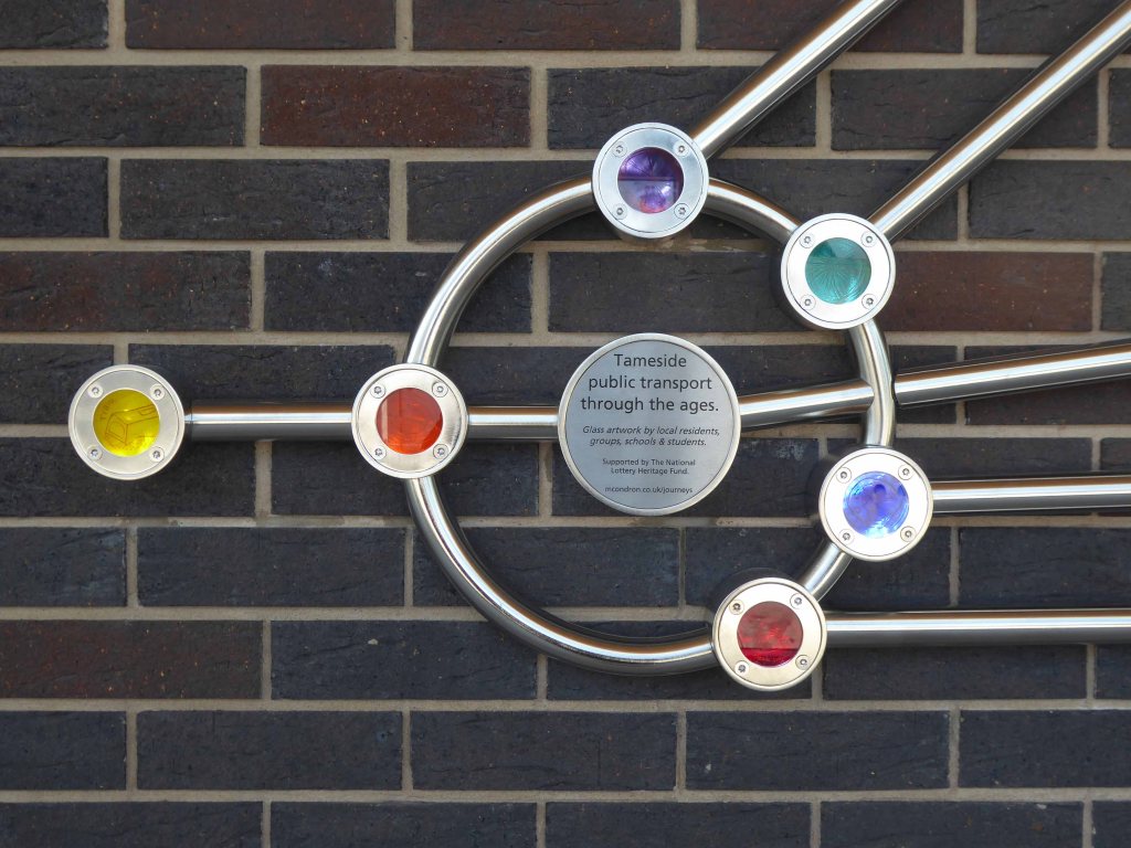
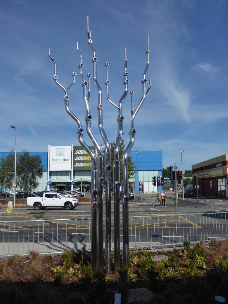
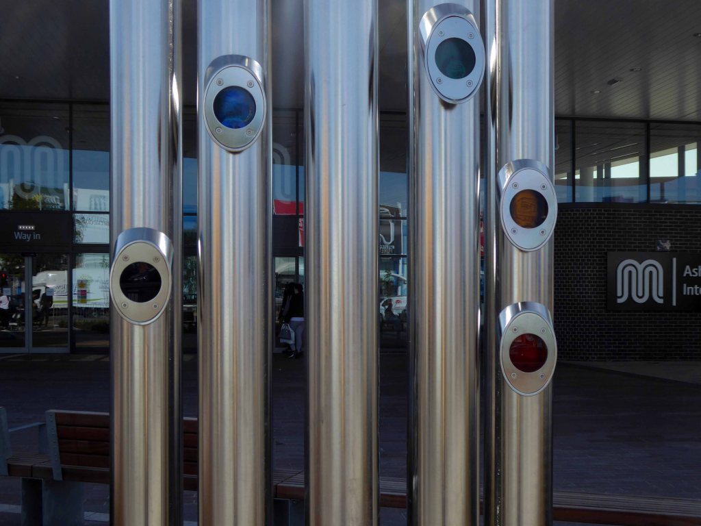
This time as an interchange, where bus, tram and train converge – the most modern of modern ideas.
The brand-new Ashton-under-Lyne Interchange is now open, providing passengers with much-improved facilities and a modern, accessible gateway to the town.
The Interchange supports the economic growth of the town and helps people to get to and from their places of work as well as Ashton’s great shops, markets, restaurants and bars in a modern, safe and welcoming environment.
The Interchange has been developed by Transport for Greater Manchester in partnership with Tameside Council and funded with support from central government’s Local Growth Deal programme.
The building contractor was VINCI Construction UK.