I was walking around town, with a view to updating my Ardwick Walk.
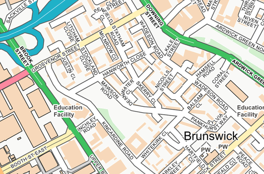
Idle curiosity took me toward the Brunswick Estate – that pocket of housing nestle twixt the Mancunian Way/River Medlock, Ardwick Green, Brunswick Street and Upper Brook Street.
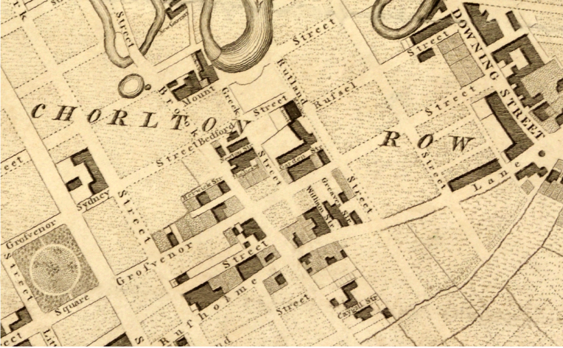
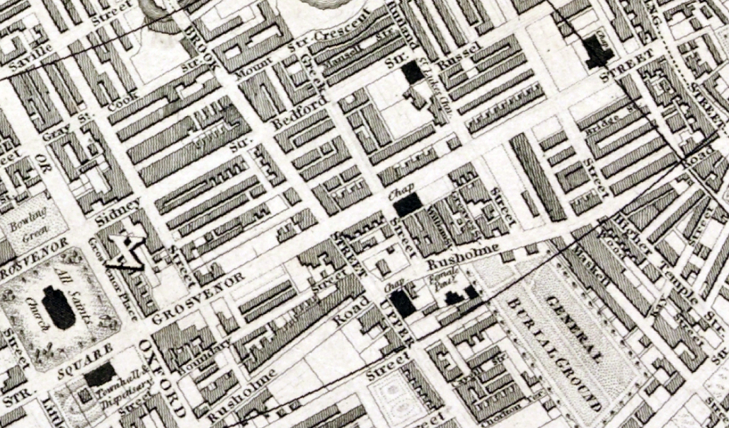
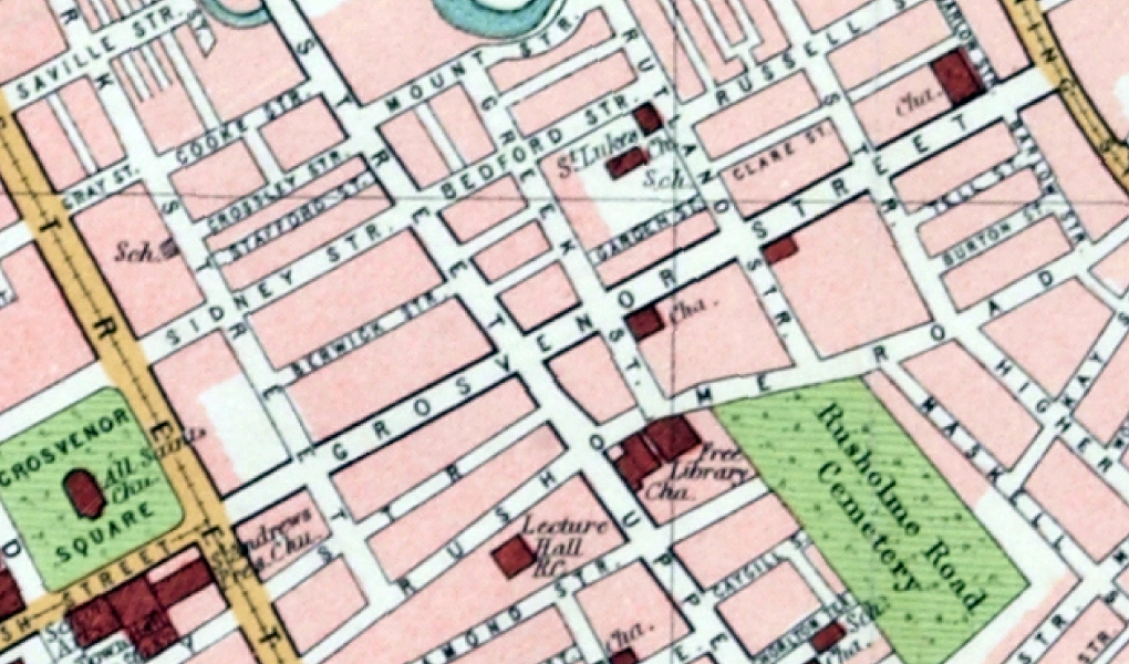
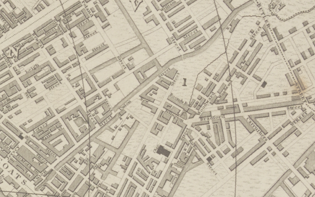
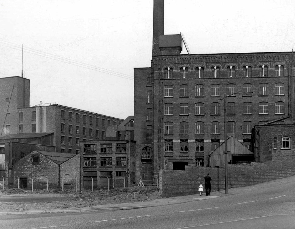
Back in 1813, a web of streets and enclosed fields, and more fields, along with small groups of higher status housing, but by the early 20th century it was very much a working class district, within which industry began to grow.
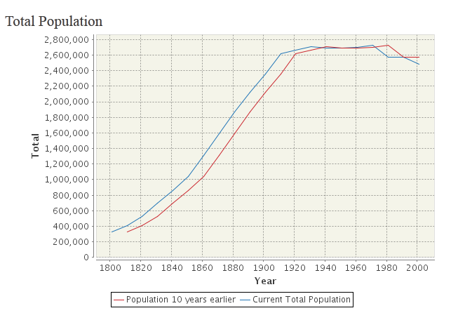
The population of Manchester expanded unstoppably throughout the nineteenth century.
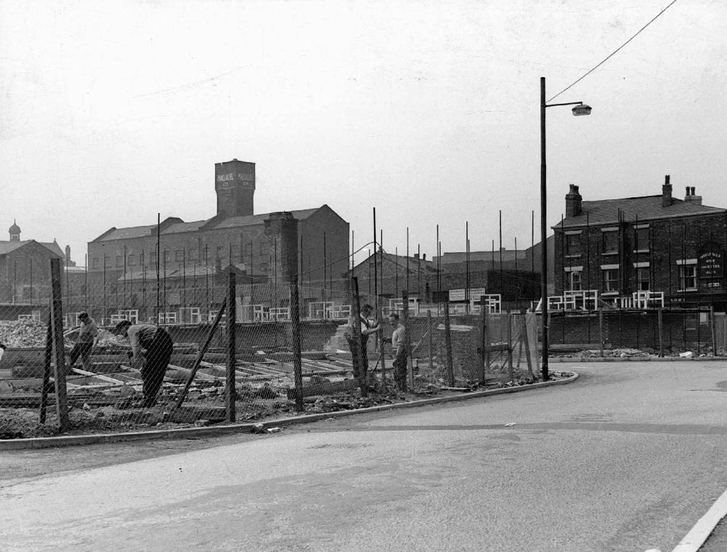
Extensive slum clearance in the nineteen sixties saw the area and its street names change, some erased forever in the new build.
In Manchester, in a vast belt immediately outside the central area of the city, there still exist all too many remnants of a planless, knotted chaos of dark, dismal and crumbling homes. Many of these crossed the verge of uninhabit-ableness long before their most elderly inhabitants were born.
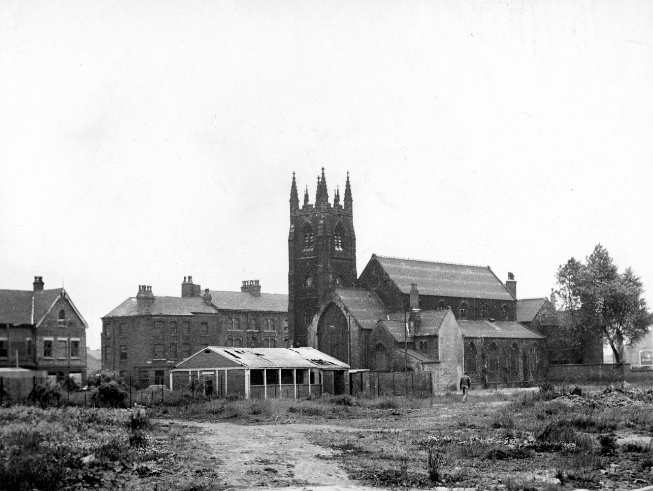
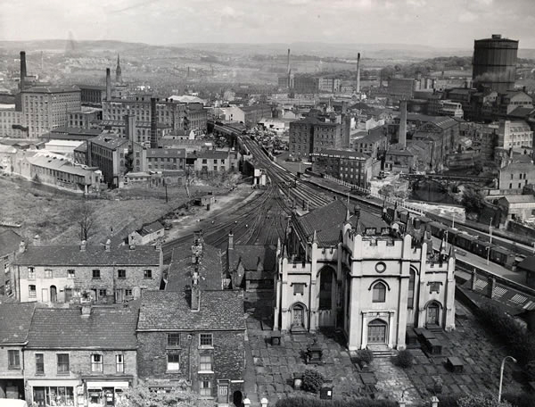
St Paul’s and St Luke’s Brunswick Street W Higham 1970
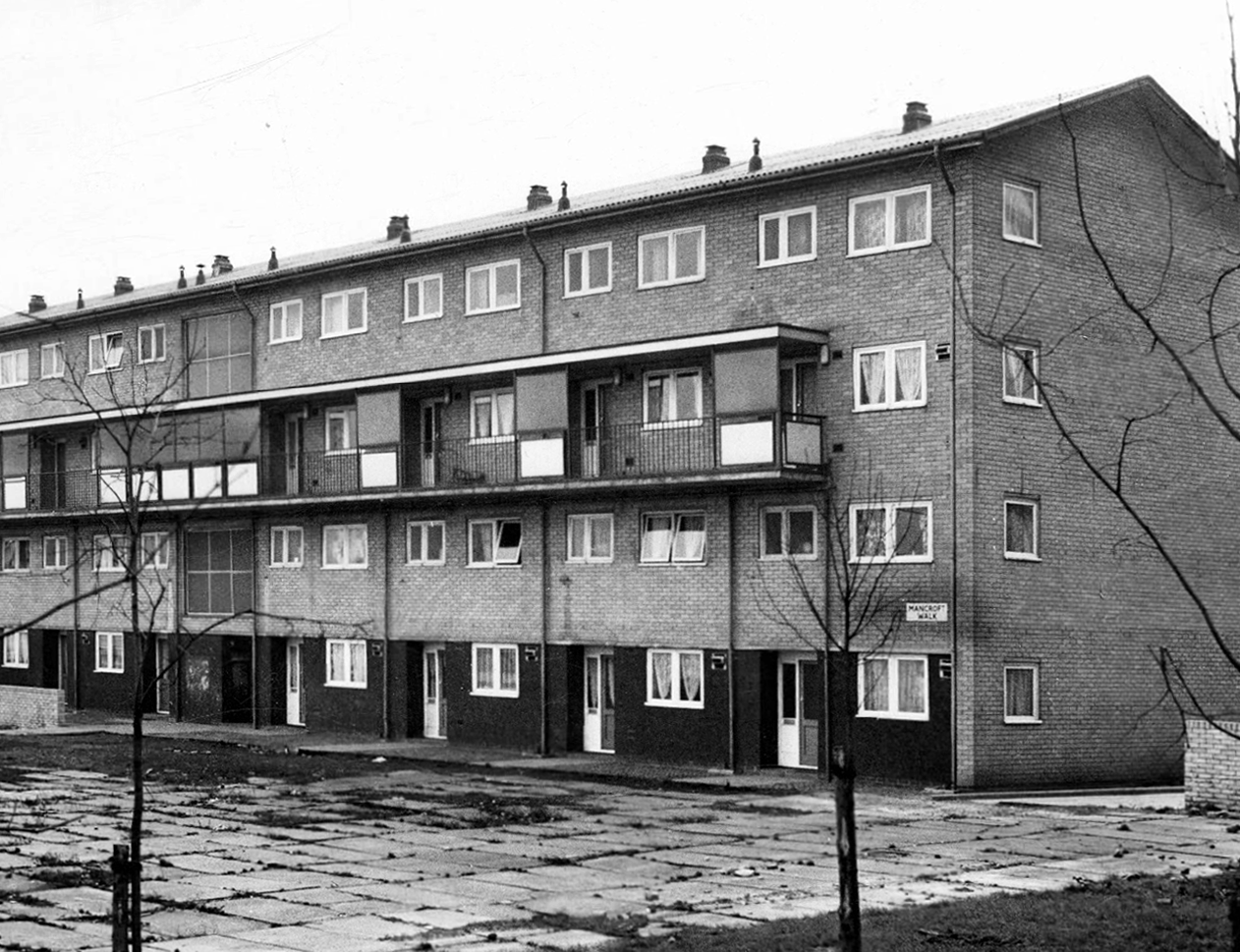
Lamport Court W Higham 1970
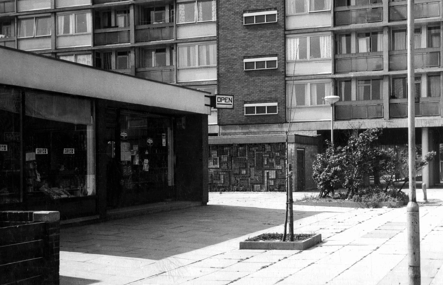
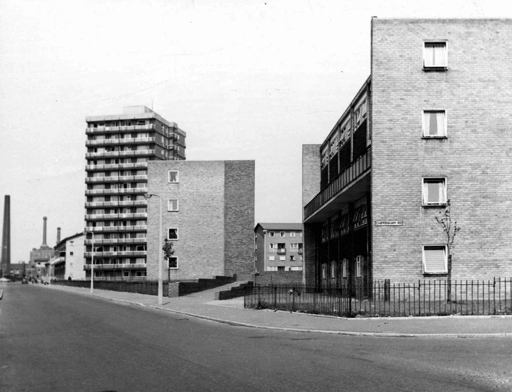
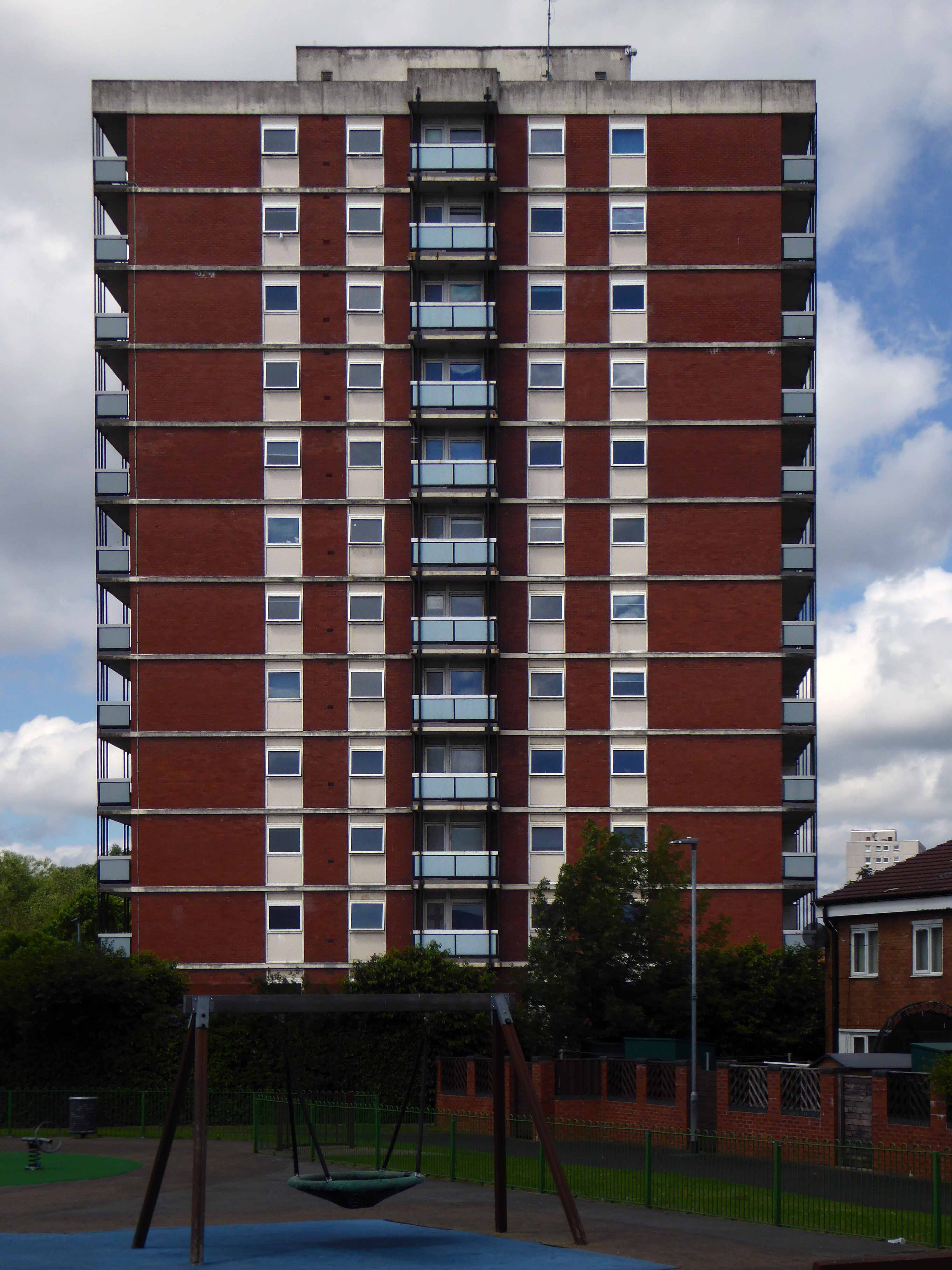
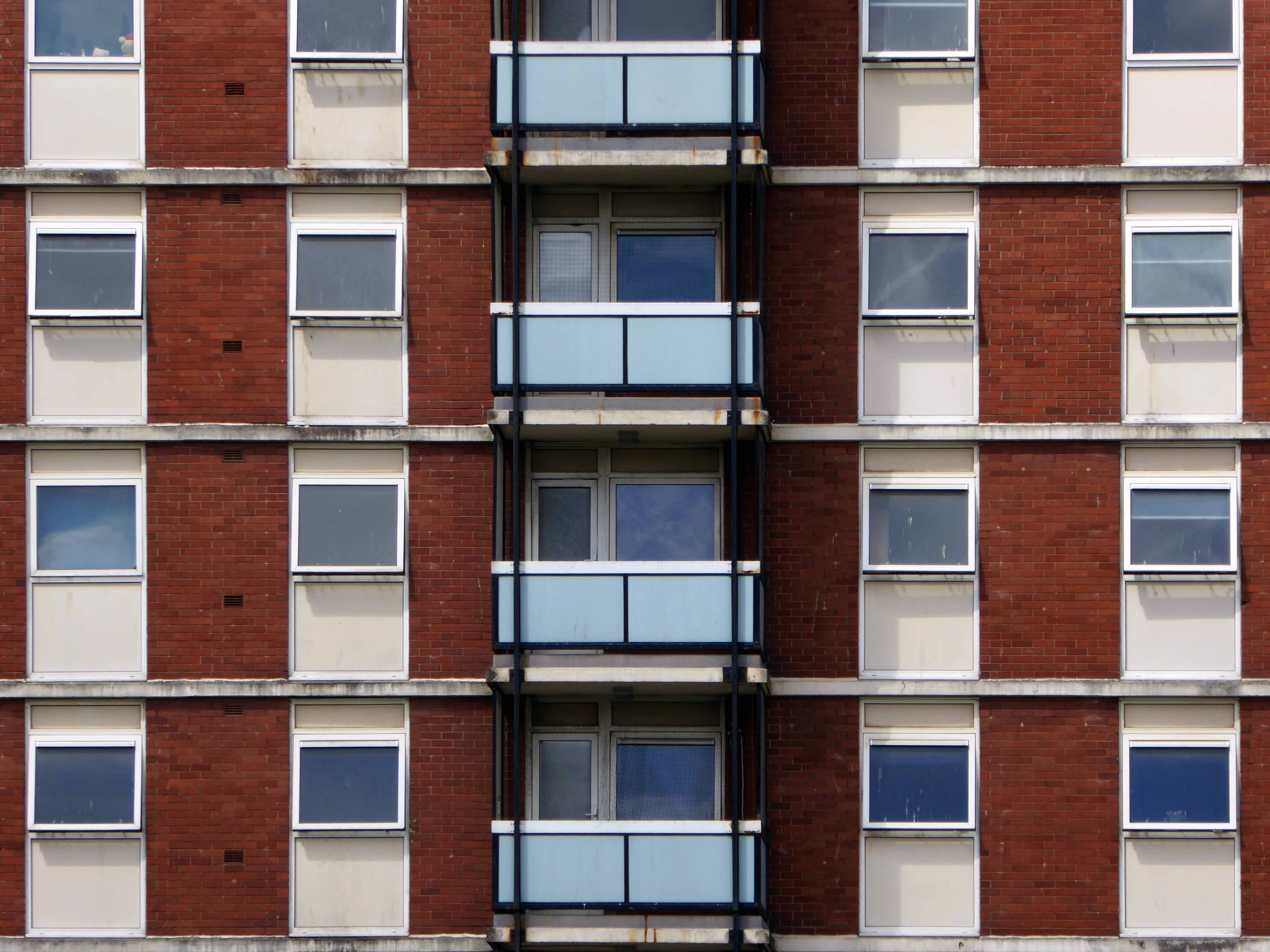
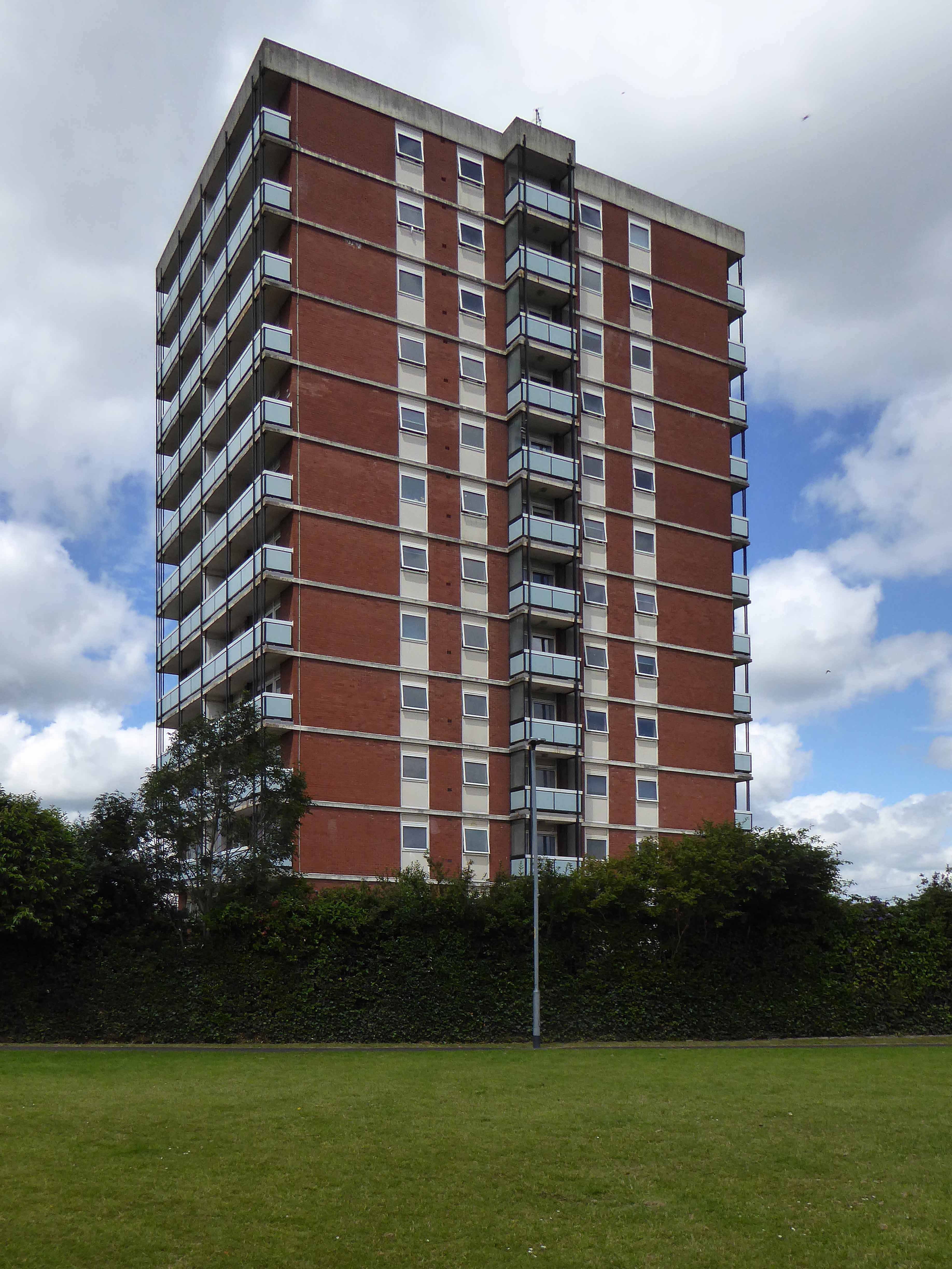
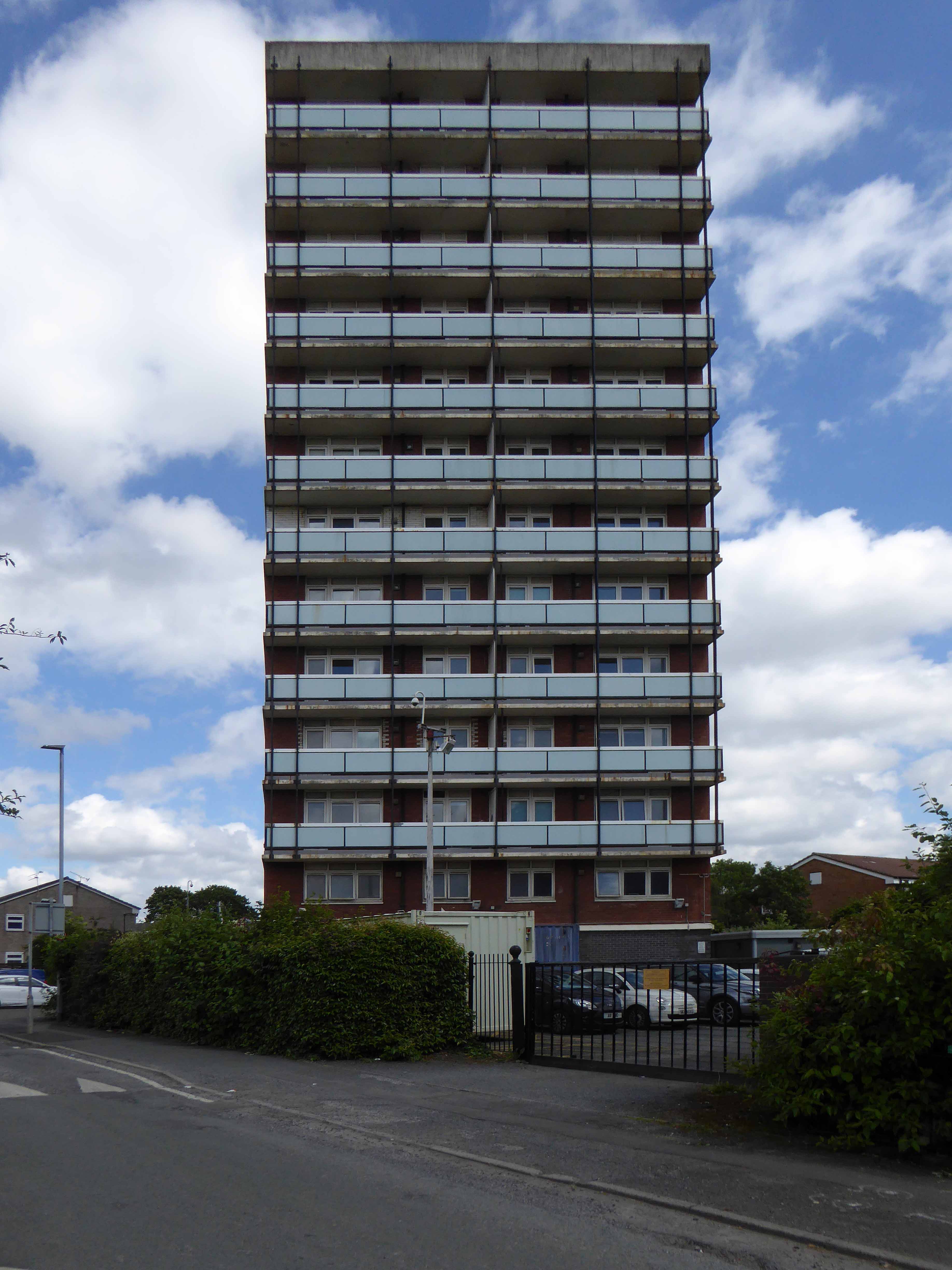
One of three nine-storey blocks, containing two hundred and nineteen dwellings; also including SilkinCourt and Lockton Court.
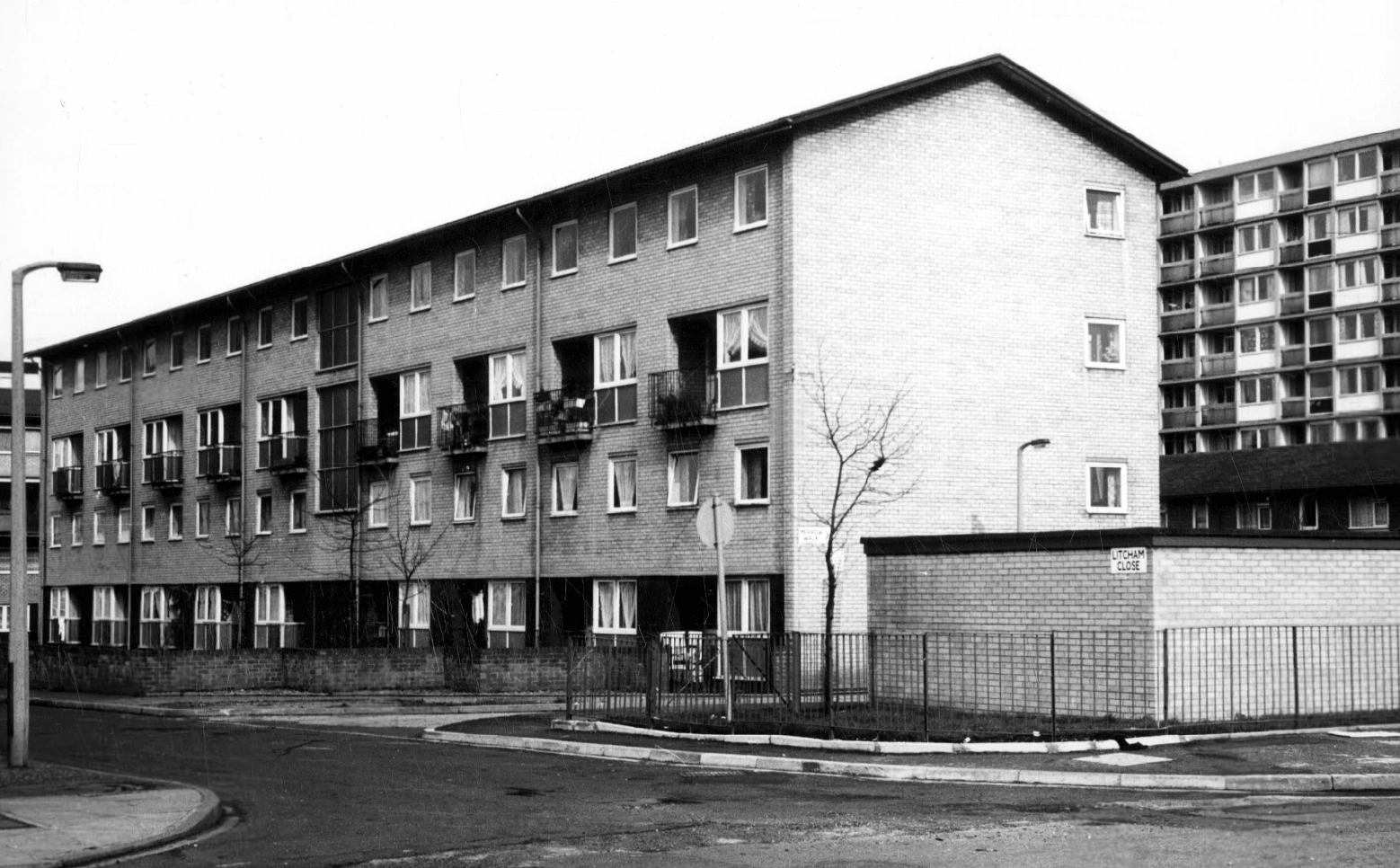
Litcham Close W Higham 1970
Harry Milligan 1903 – 1986 worked as the photographer at Manchester Central Library until his retirement in around 1968. He was instrumental in setting up the Manchester Region Industrial Archaeology Society in 1965. He volunteered at the North Western Museum of Science and Industry from 1968, assisting with reprographics requests. His knowledge of the history of photography in Manchester and the UK led to him taking on the role of Honorary Curator of Photography at the museum.
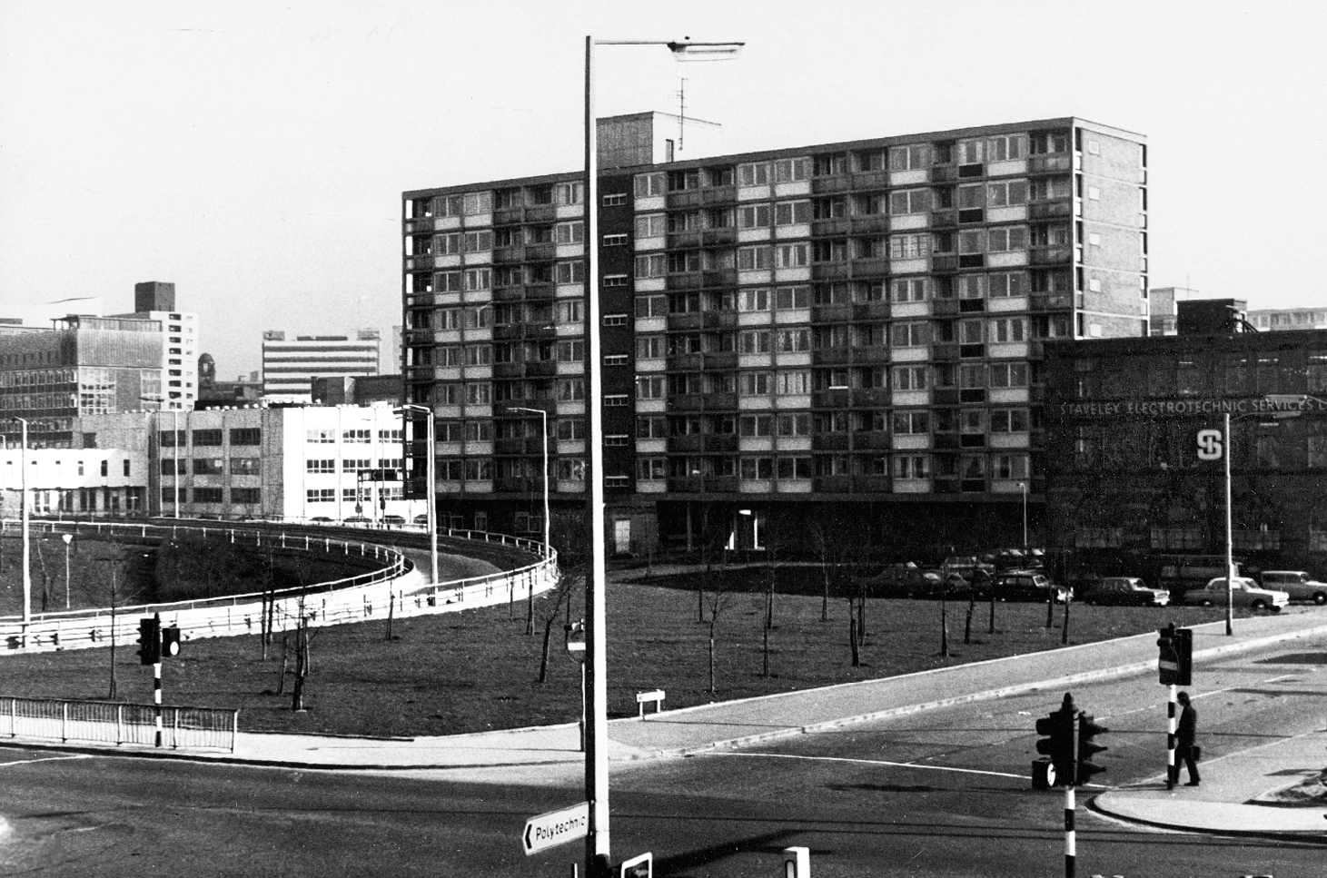
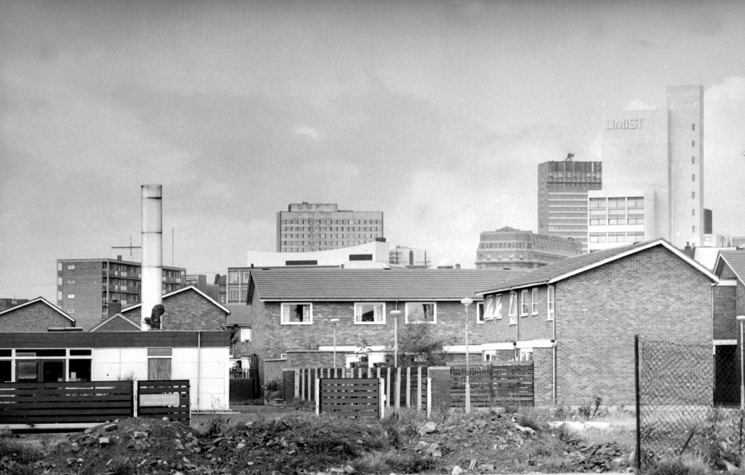
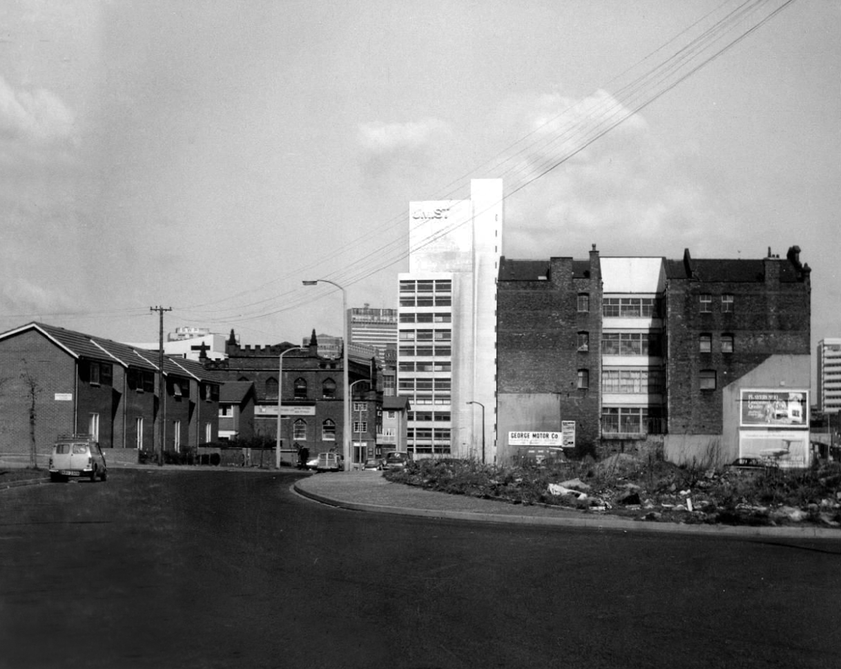
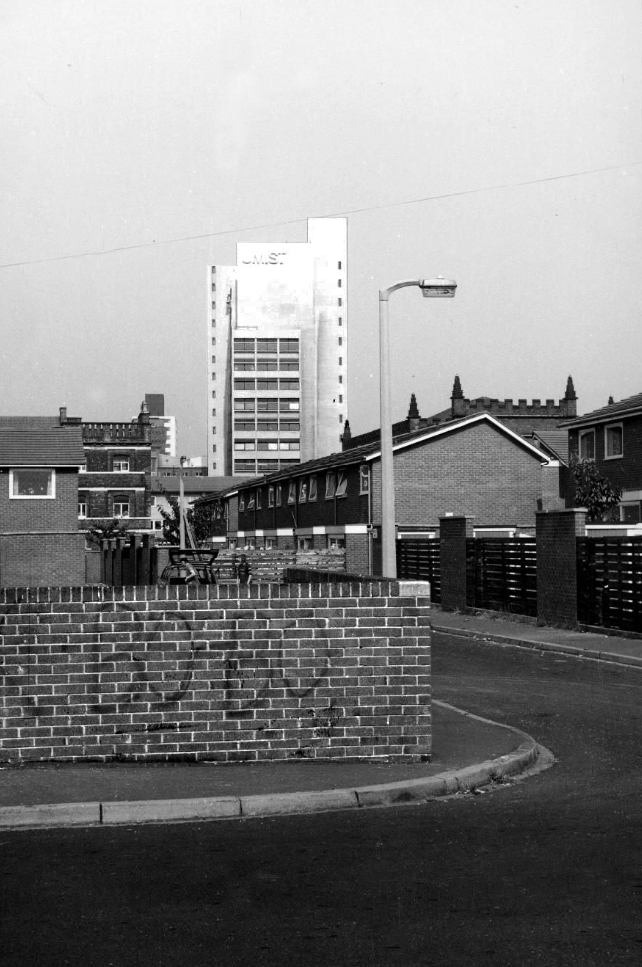
Panorama of Brunswick with UMIST in the background.
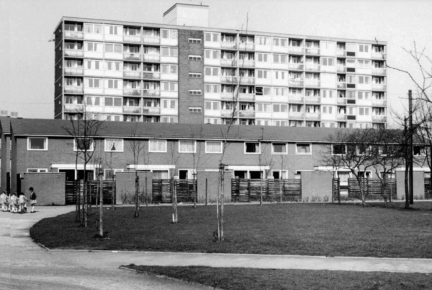
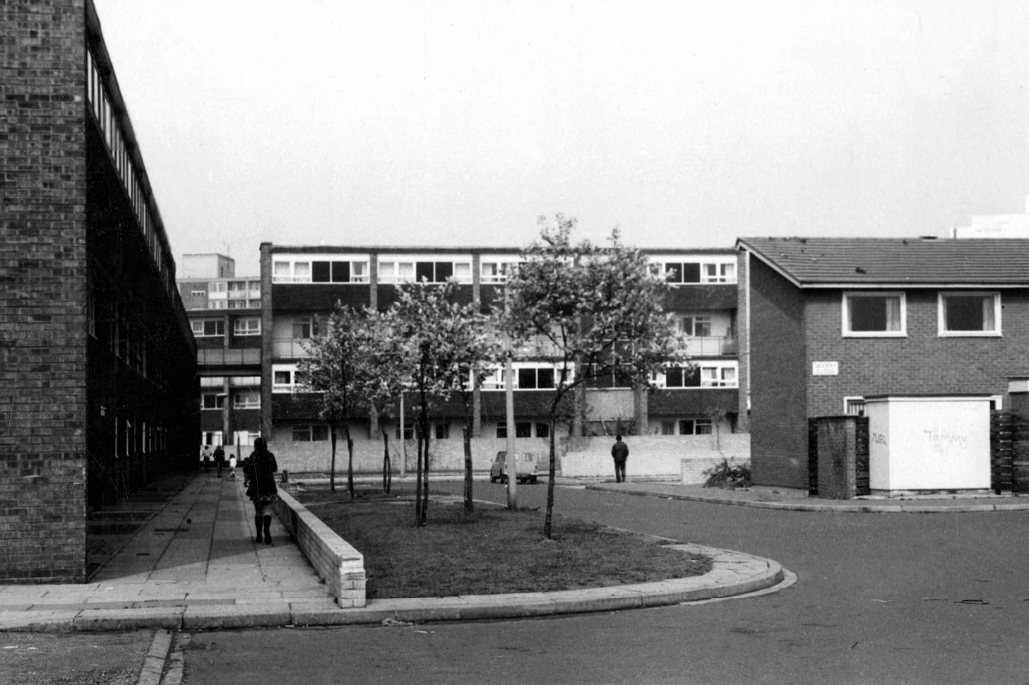
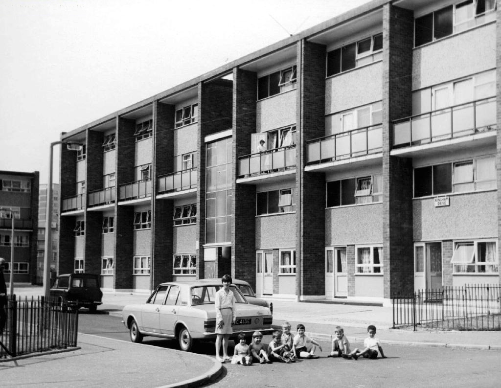
Hanworth Close area terraced housing and flats 1972.
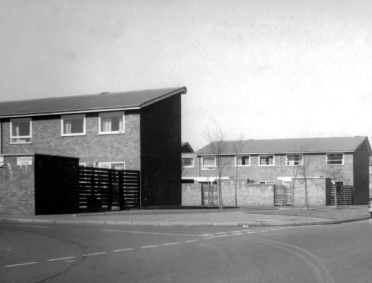
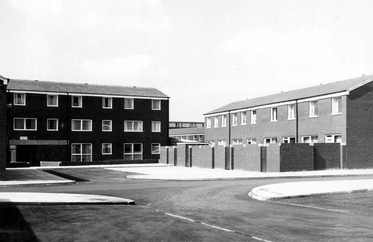
Staverton Close
Melcroft Close
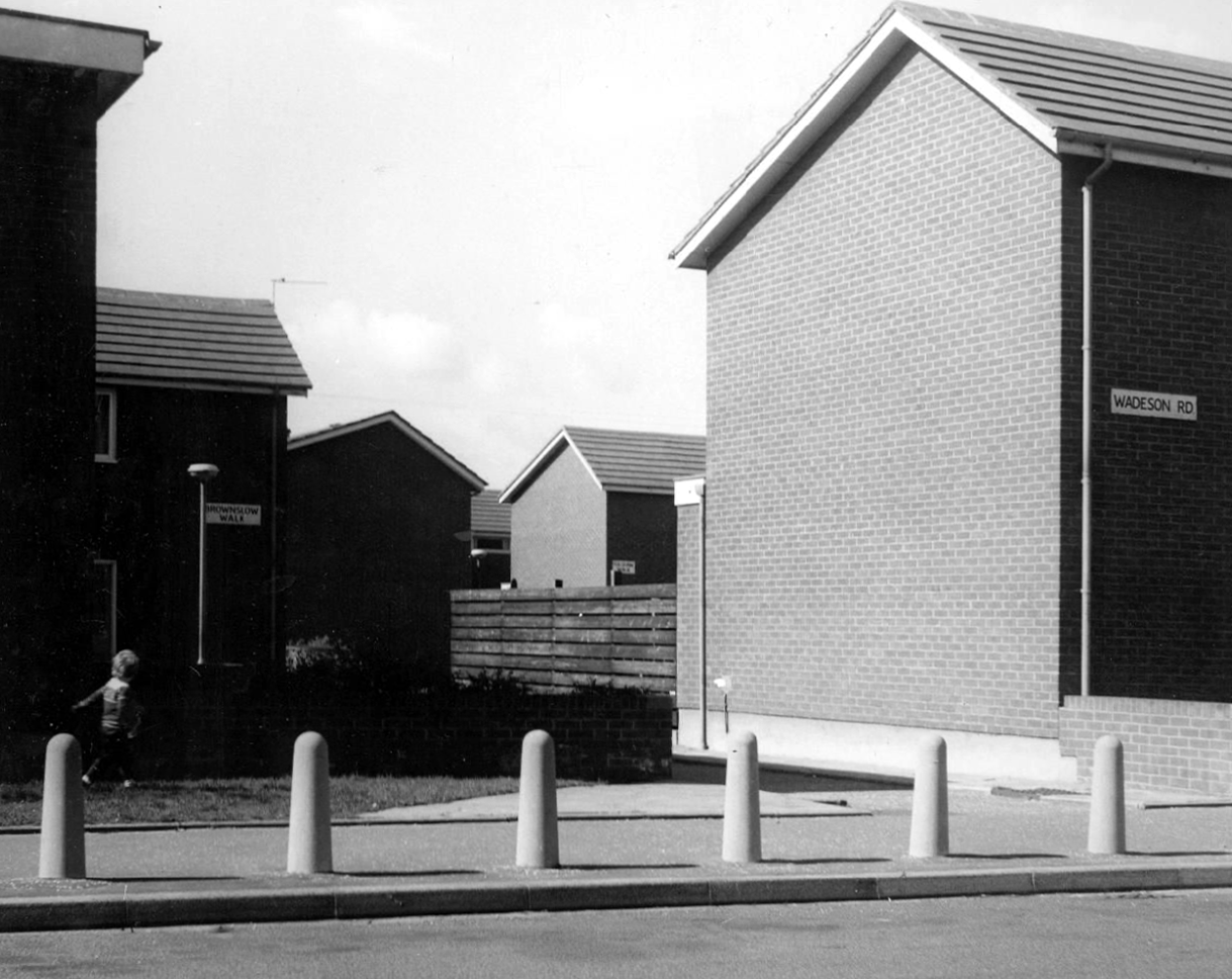
Wadeson Road
Helmshore Walk – Skerry Close
Cherryton Walk
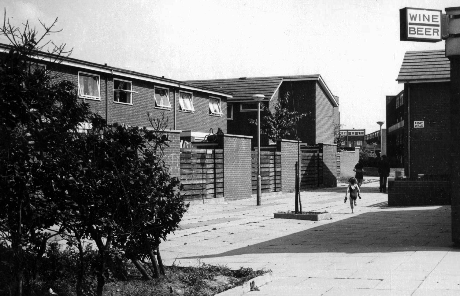
Cray Walk
Wadeson Road
Hanworth Close
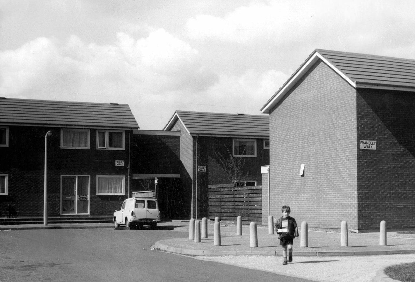
Pedley Walk
Cray Walk – note the decorative brick relief
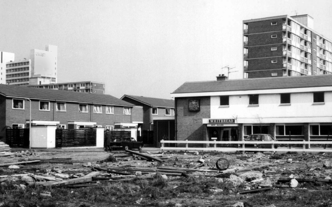
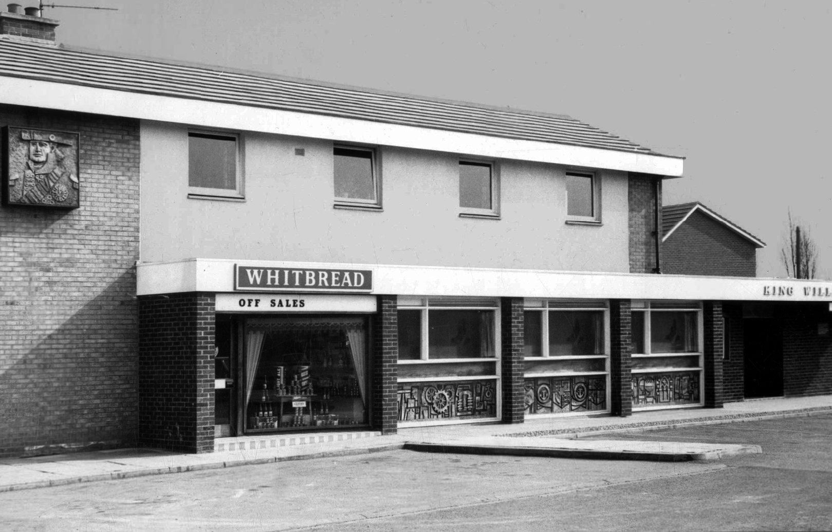
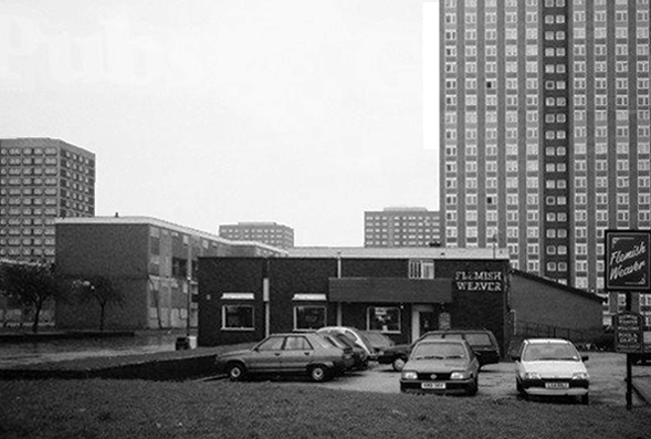
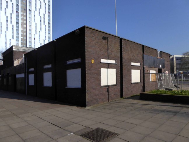
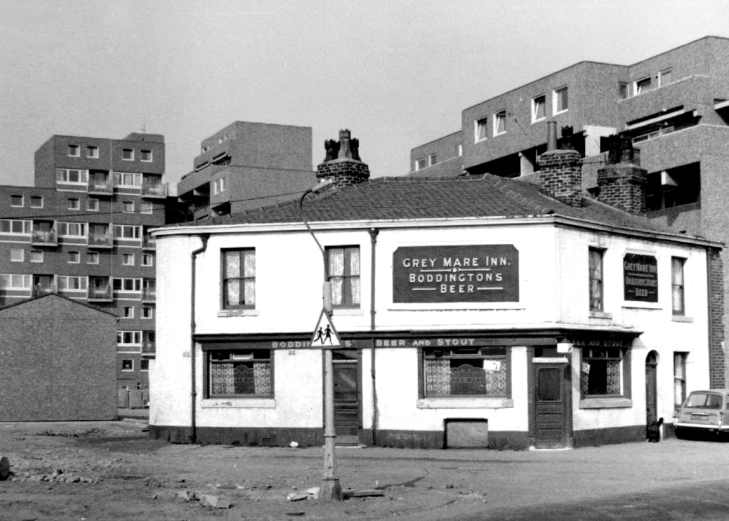
King William IV
Former Chesters then Whitbread estate pub was built in 1967. Closed in 1996 when it was converted to residential property. It had a brief spell 1991 to 1995 as brewery premises for the Dobbin’s West Coast Brewery, during this period the interior was stripped out to accommodate the brewery paraphernalia.
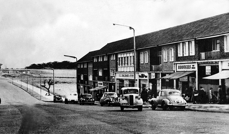
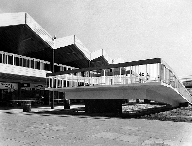
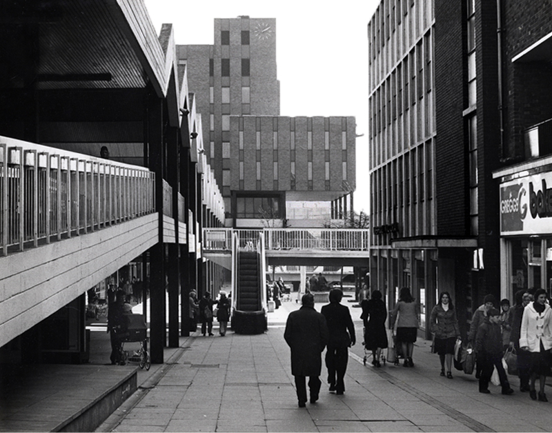
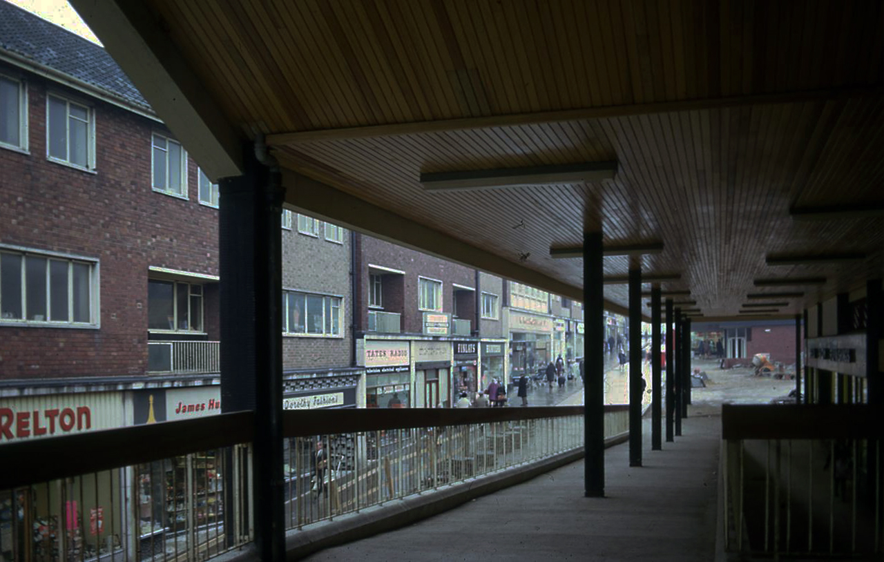
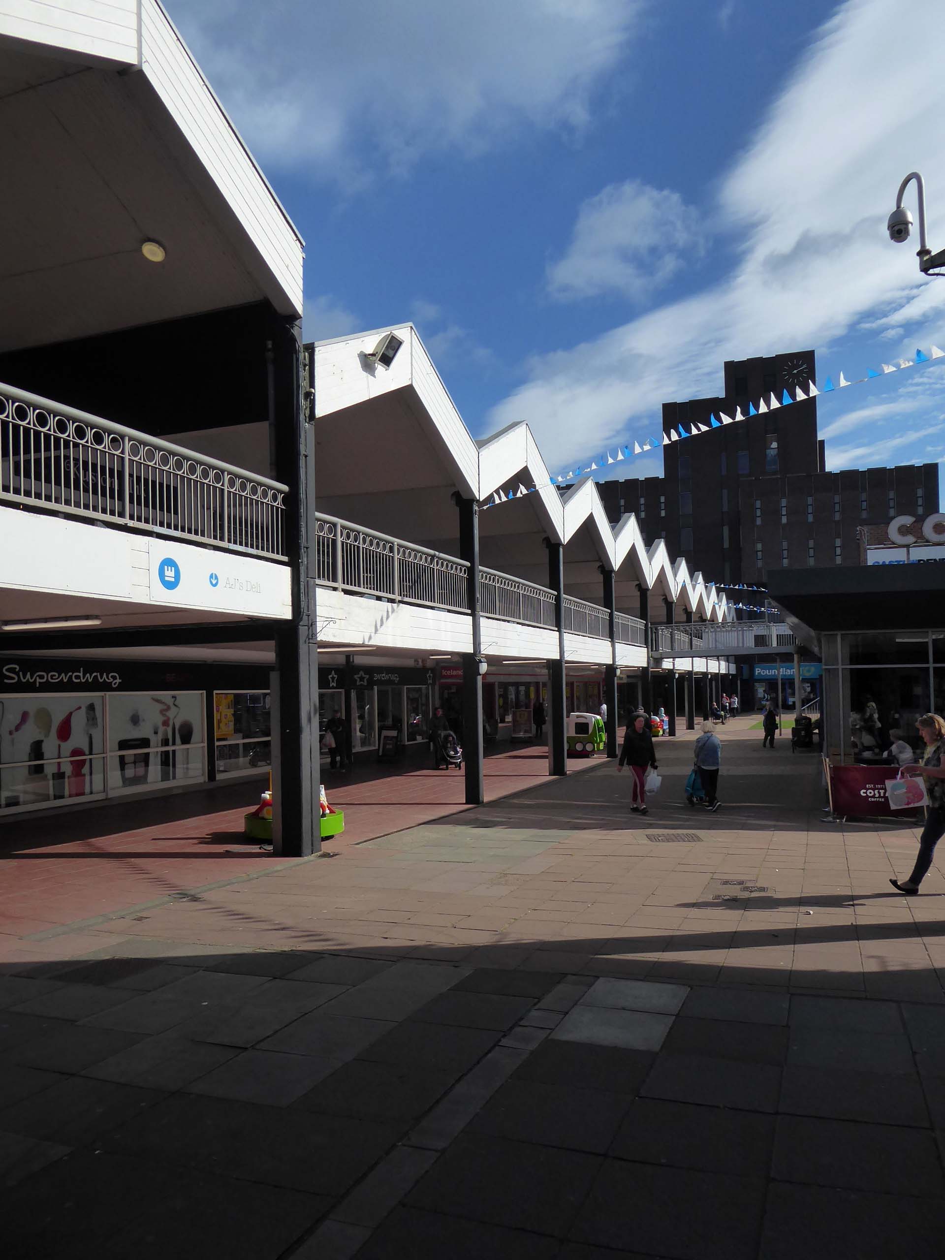
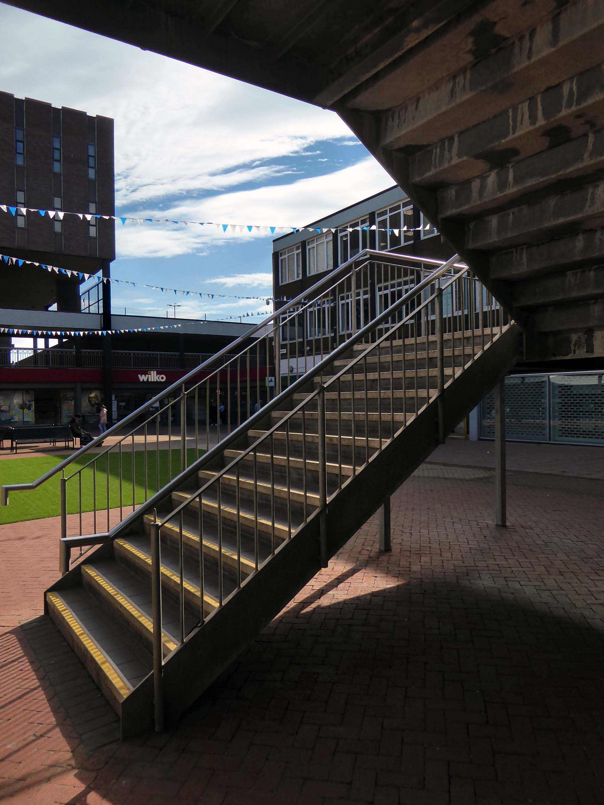
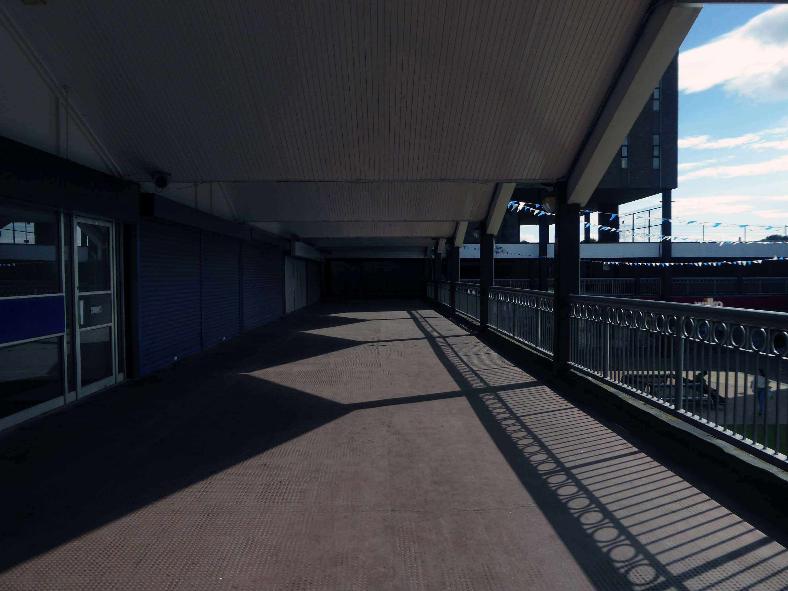
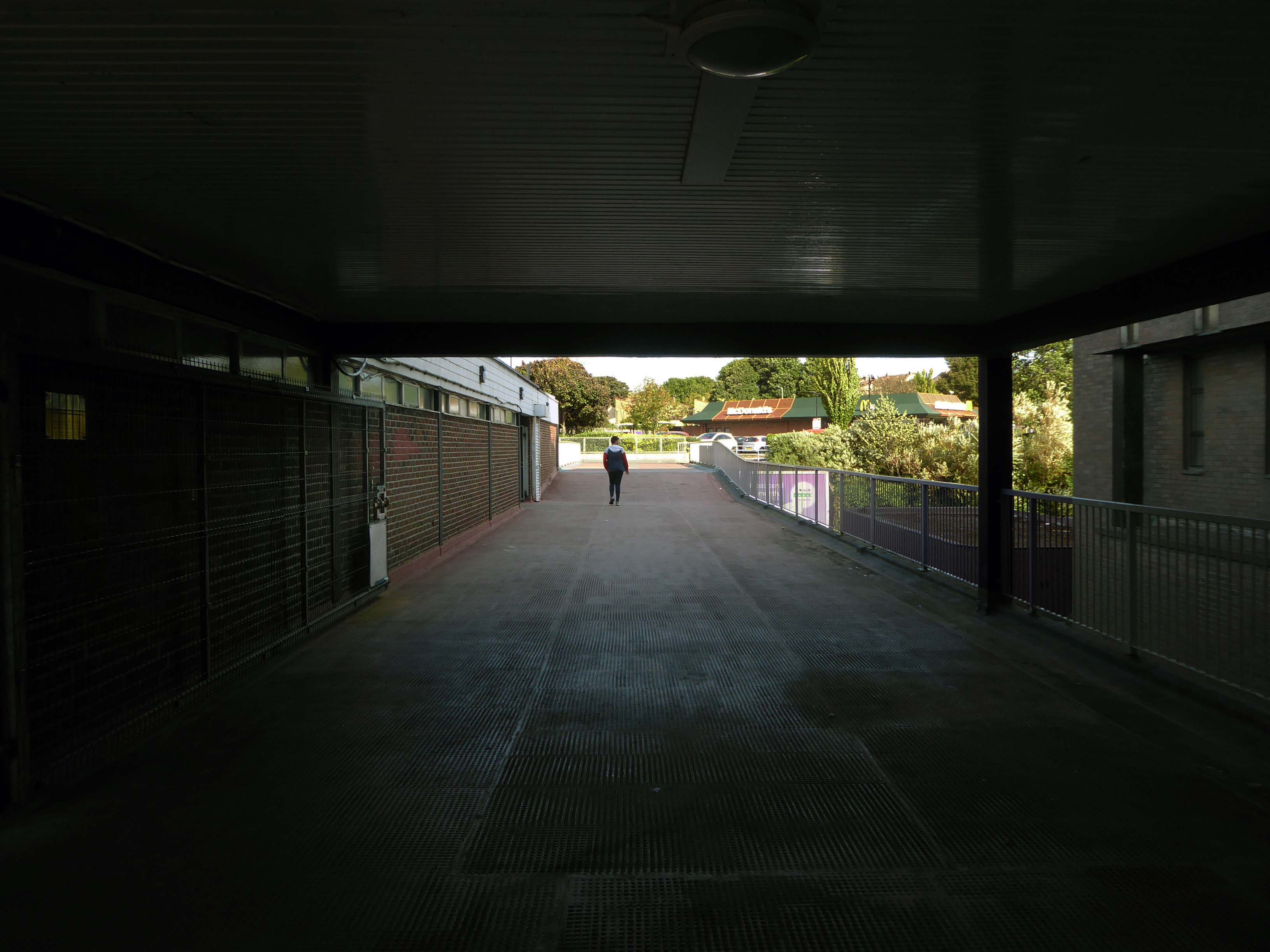
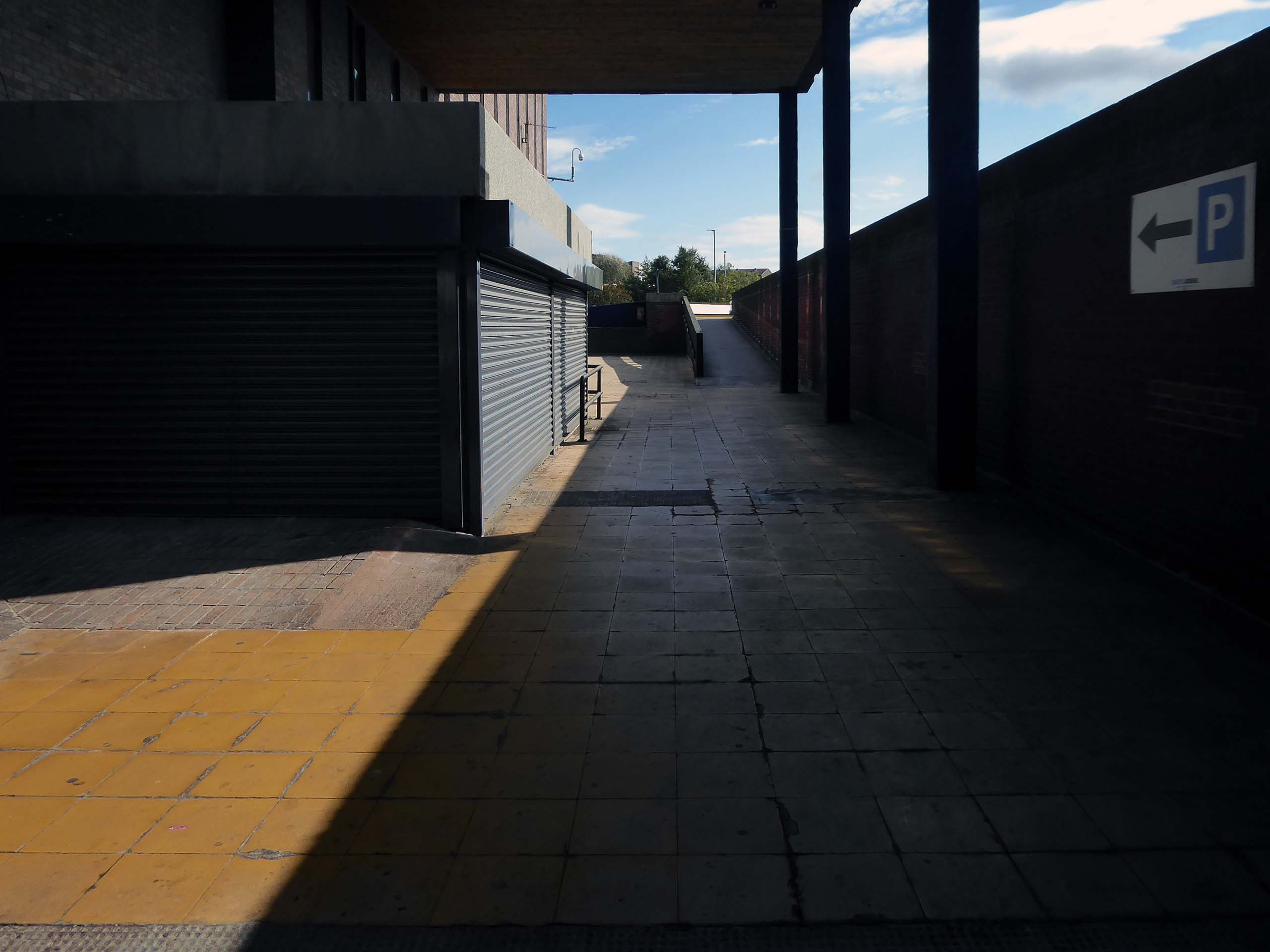
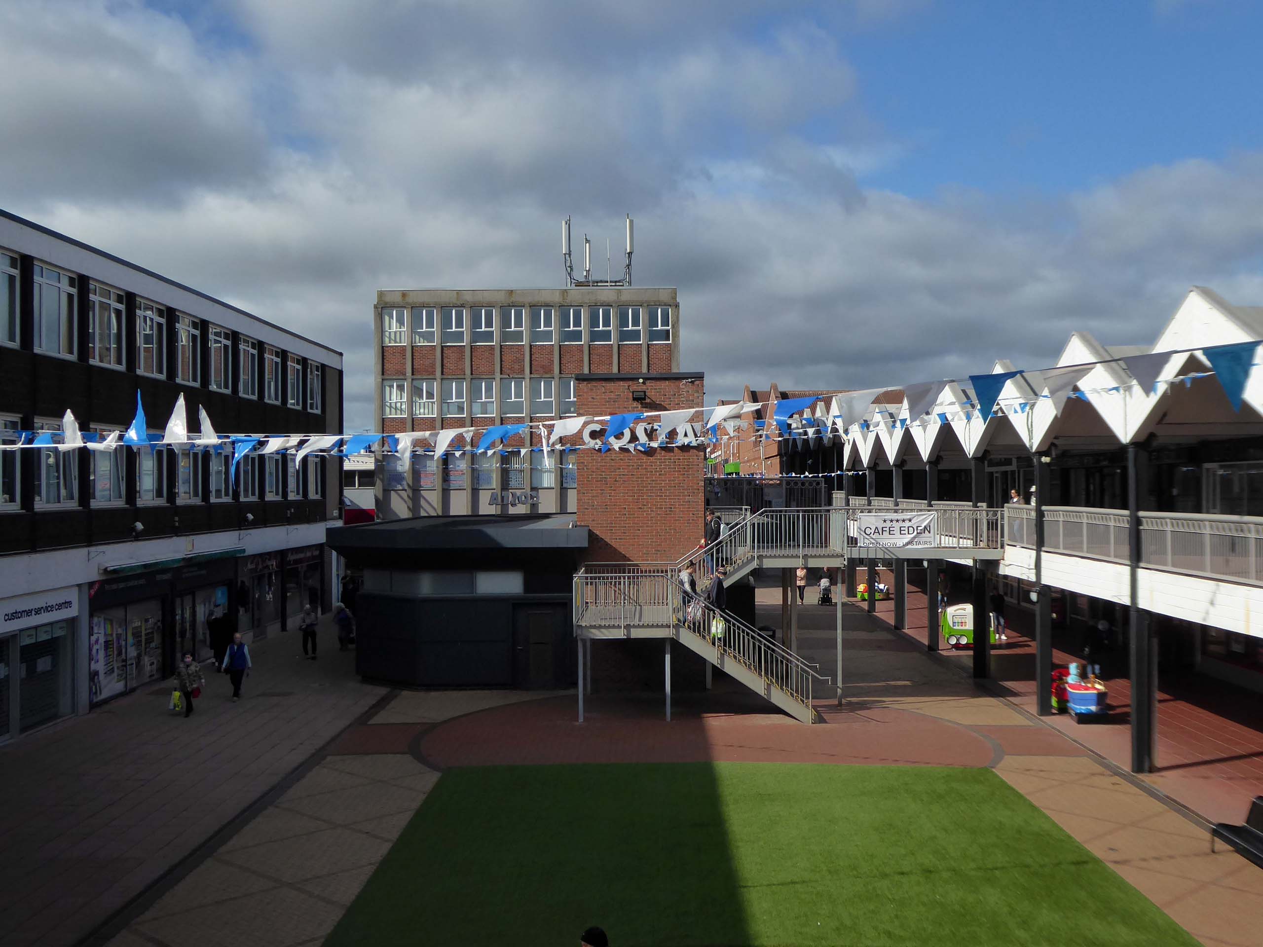
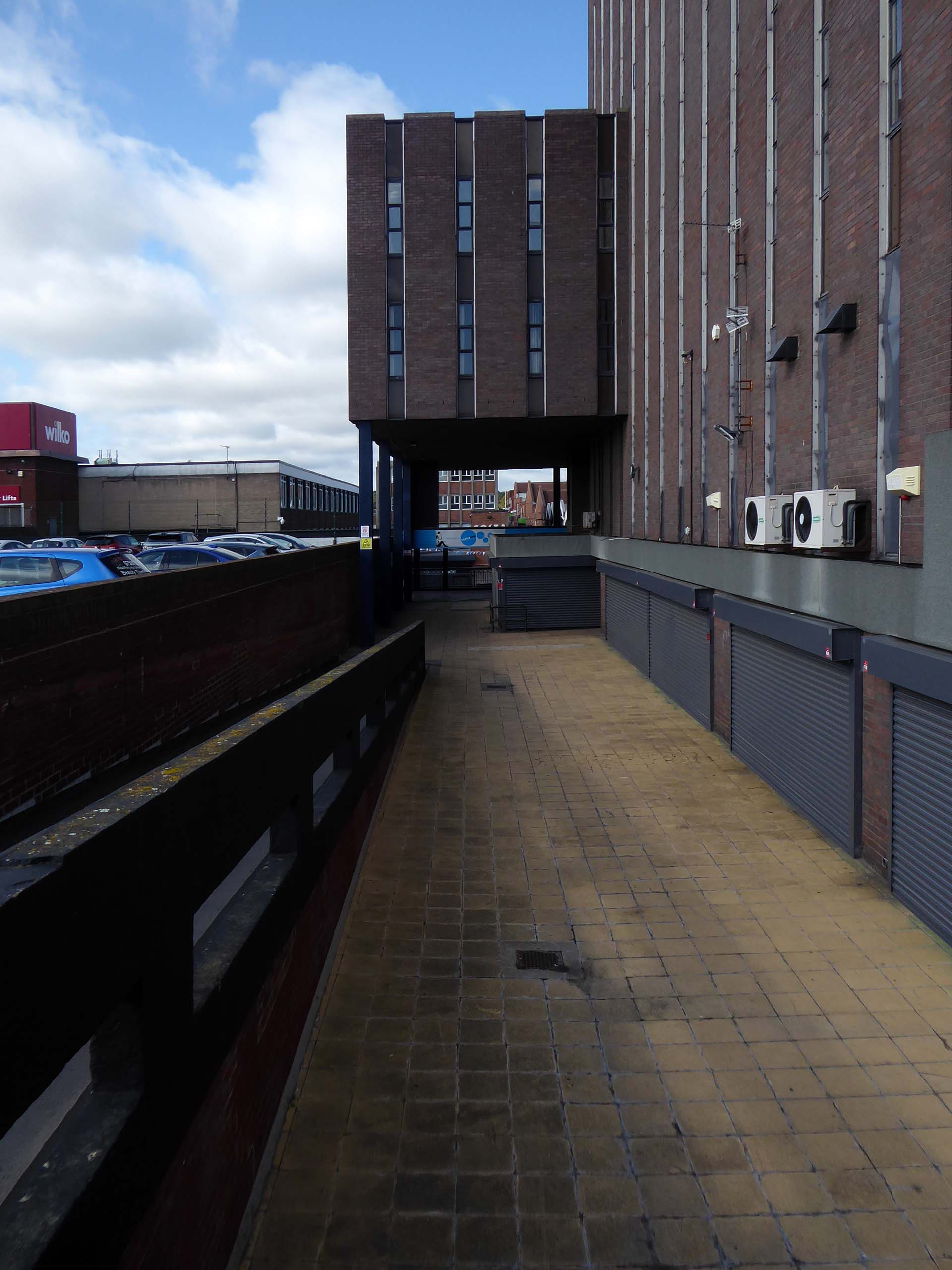
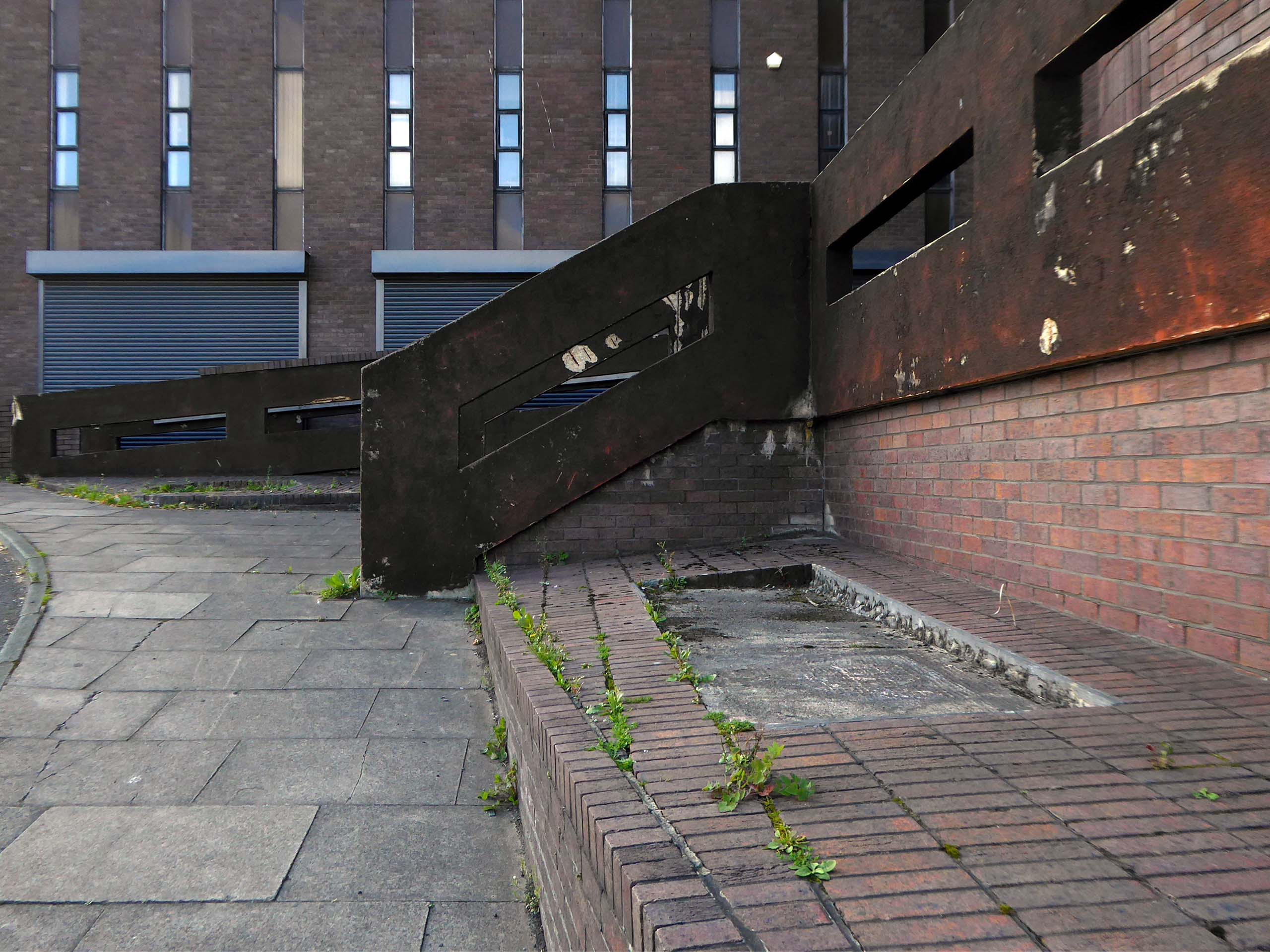
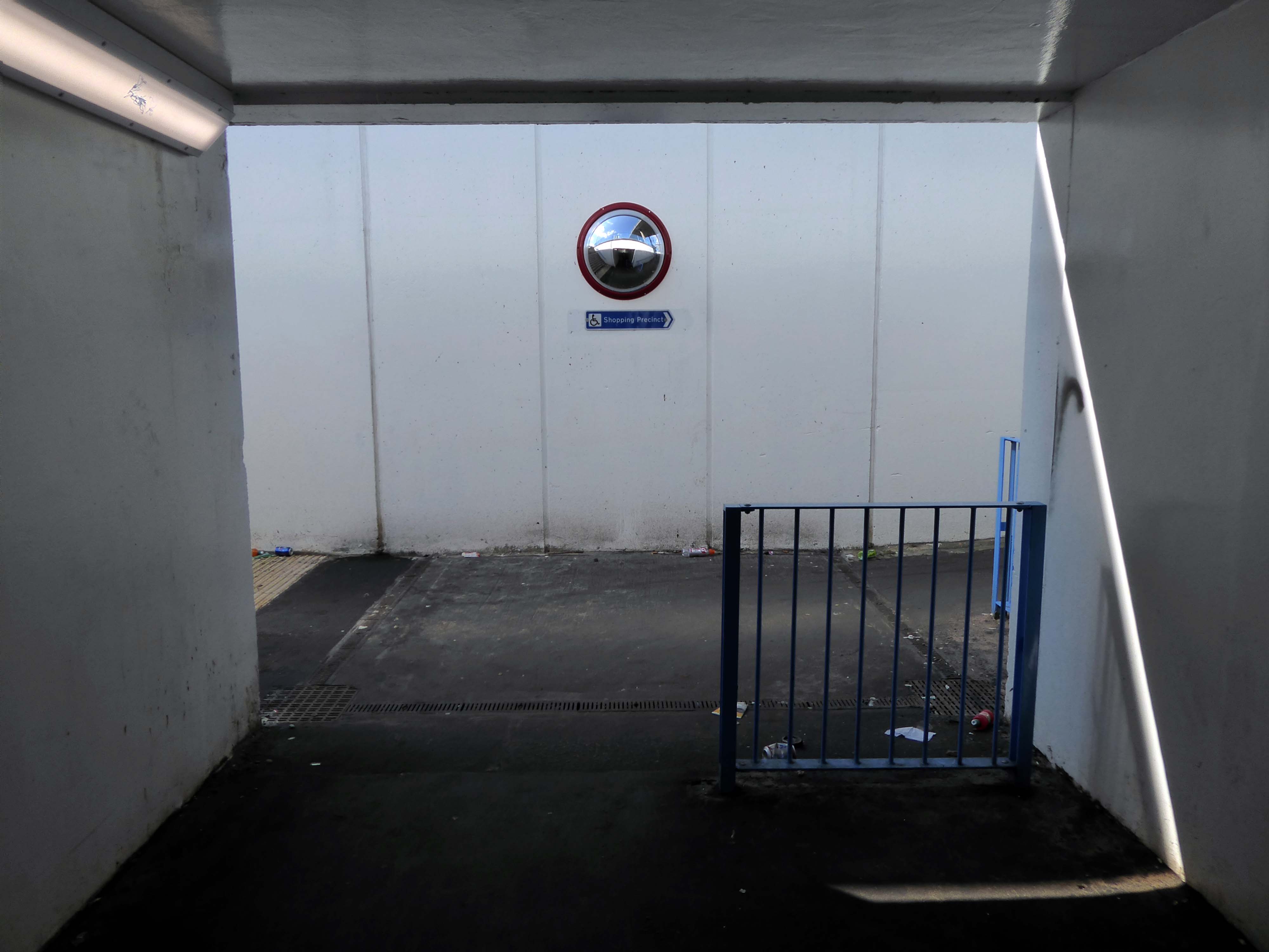
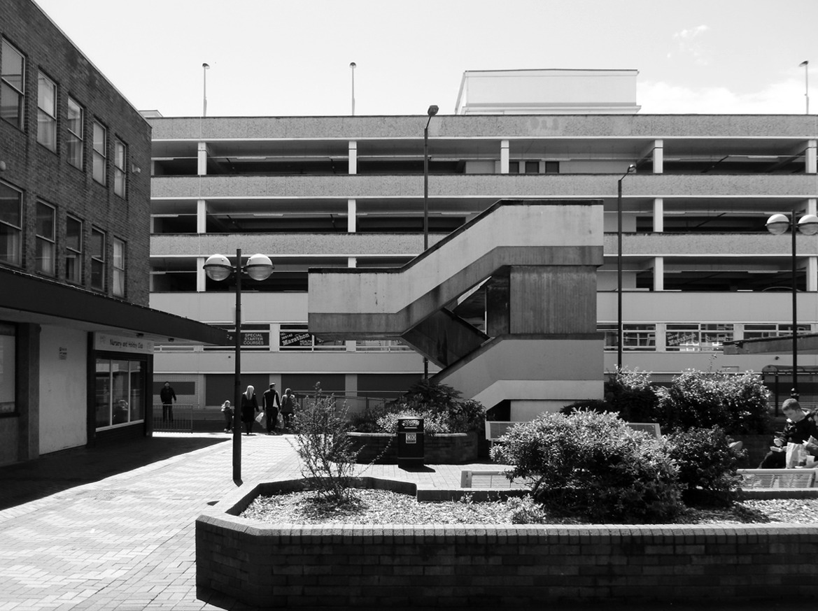
Plans for the new town centre started to be developed in 1960 by Chief Architect Roy Gazzard. The process would go through eight sets of revisions before they were finally approved in 1968. Yoden Way was then pedestrianised, and the small row of shops built in 1950’s was incorporated into the new shopping precinct, forming the north western end of Yoden Way. Like many other town centres across Britain undergoing modernisation, the high-street was split onto two levels, with ramps providing access to raised walkways.
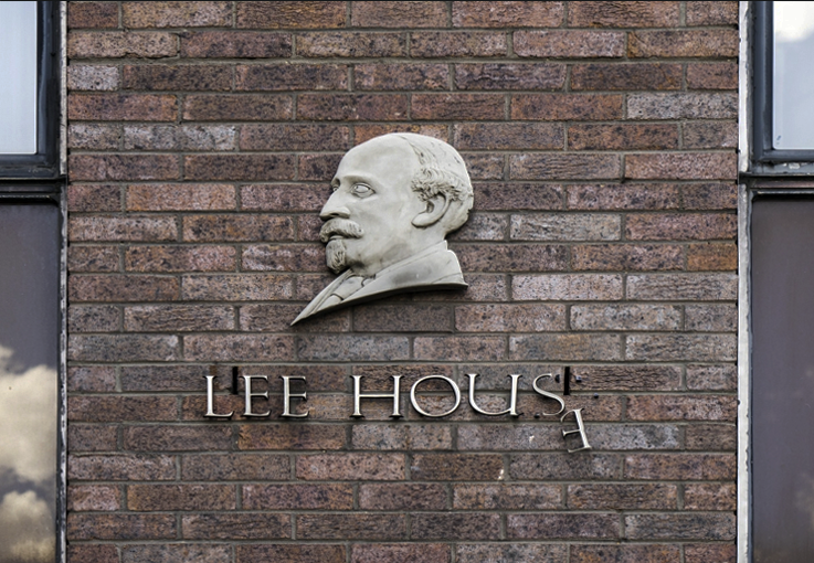
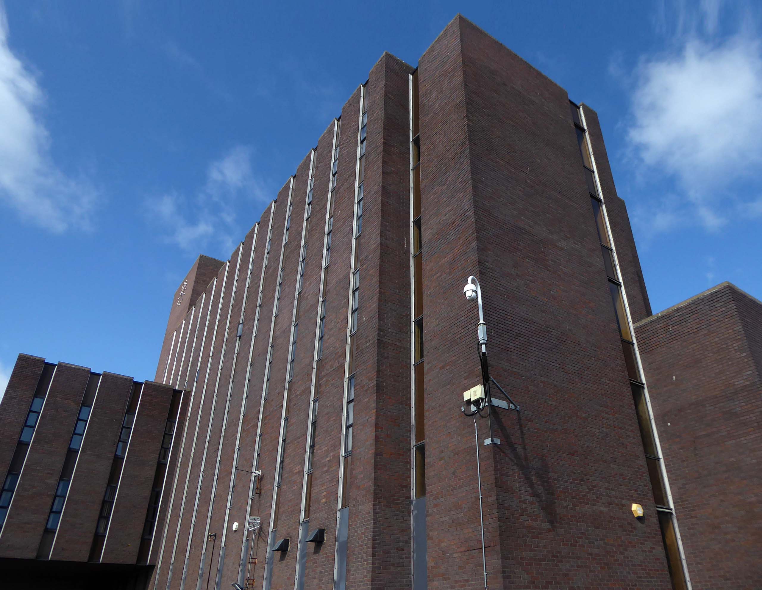
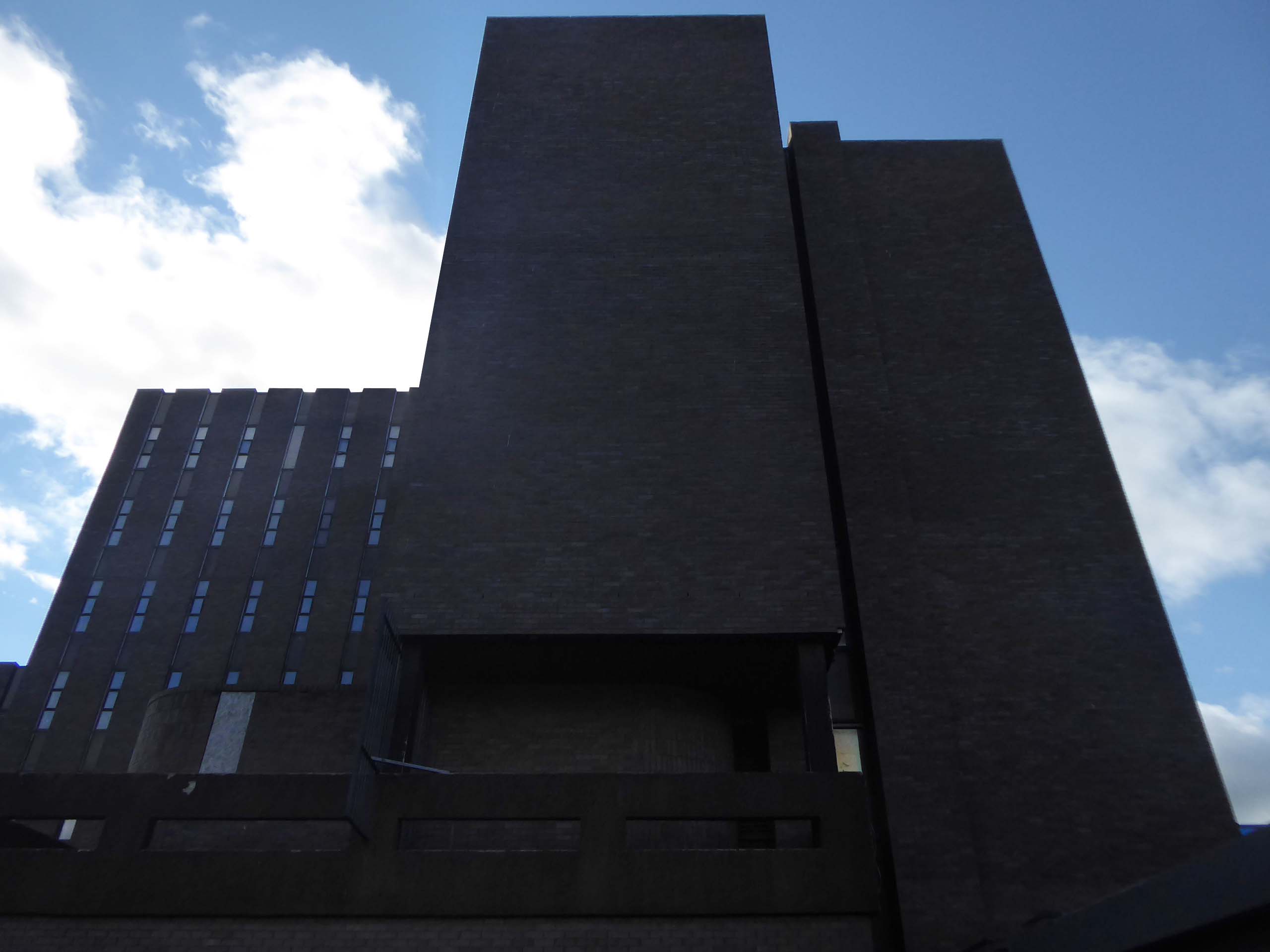
The construction of Lee House – named after Peter Lee, started in 1974. Once completed, the Development Corporation moved its Headquarters from Old Shotton Hall to Lee House in 1976, occupying the building until it was sold in 1984 and remaining staff relocated to Newton Aycliffe.
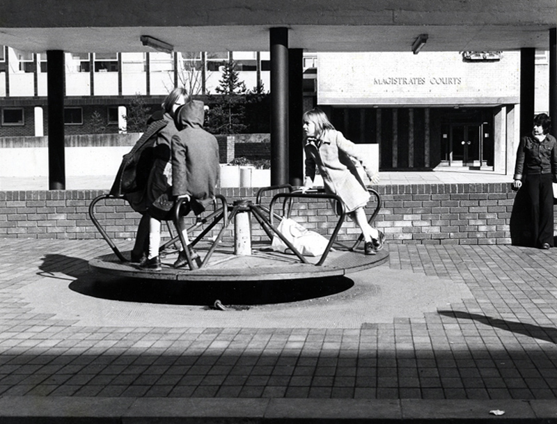
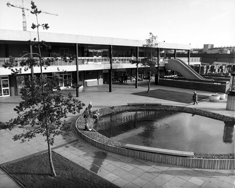
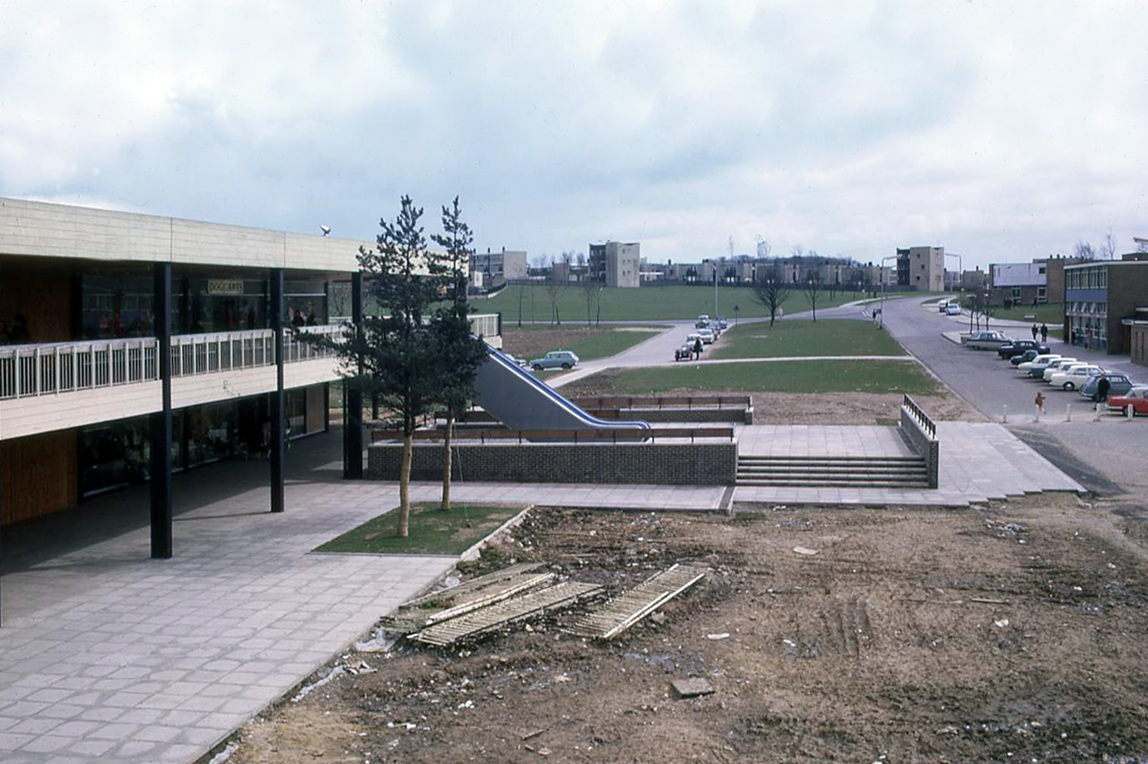
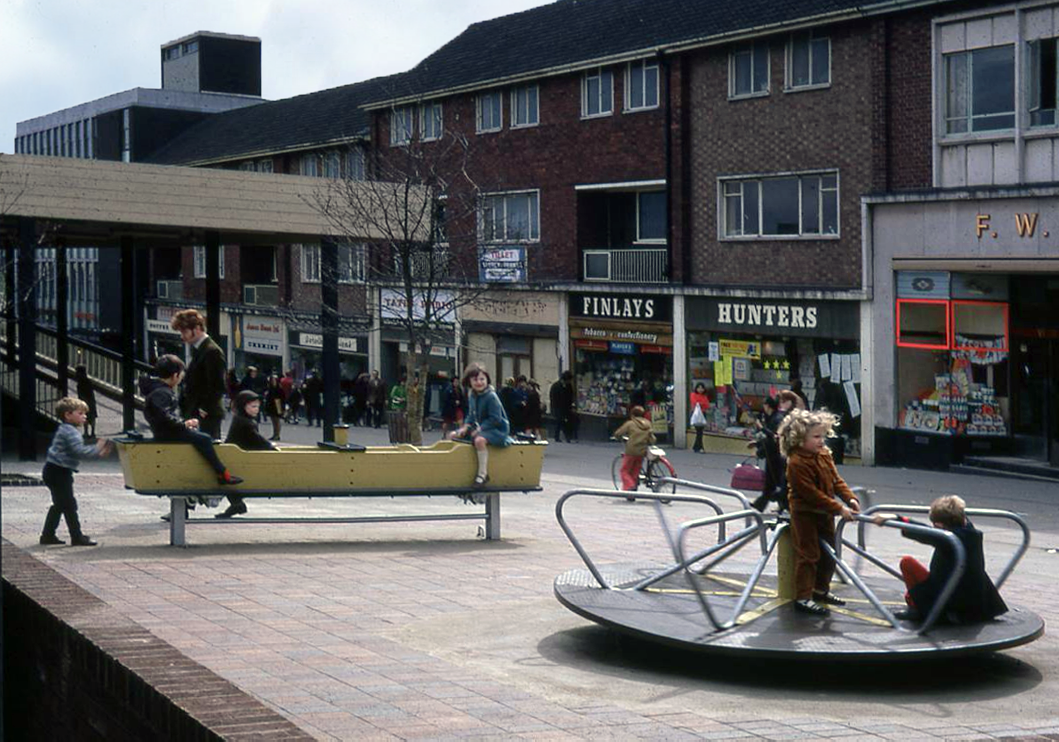
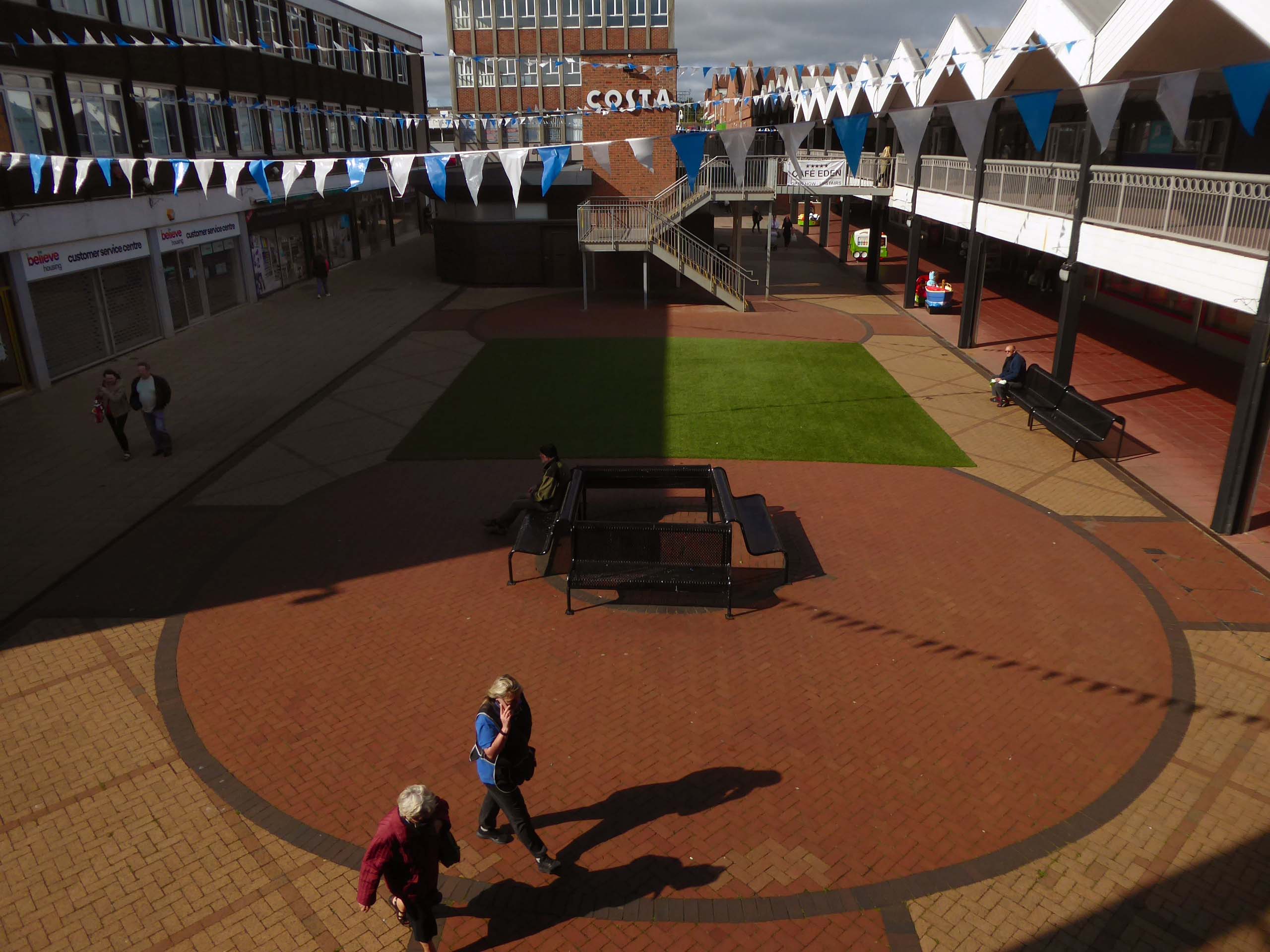
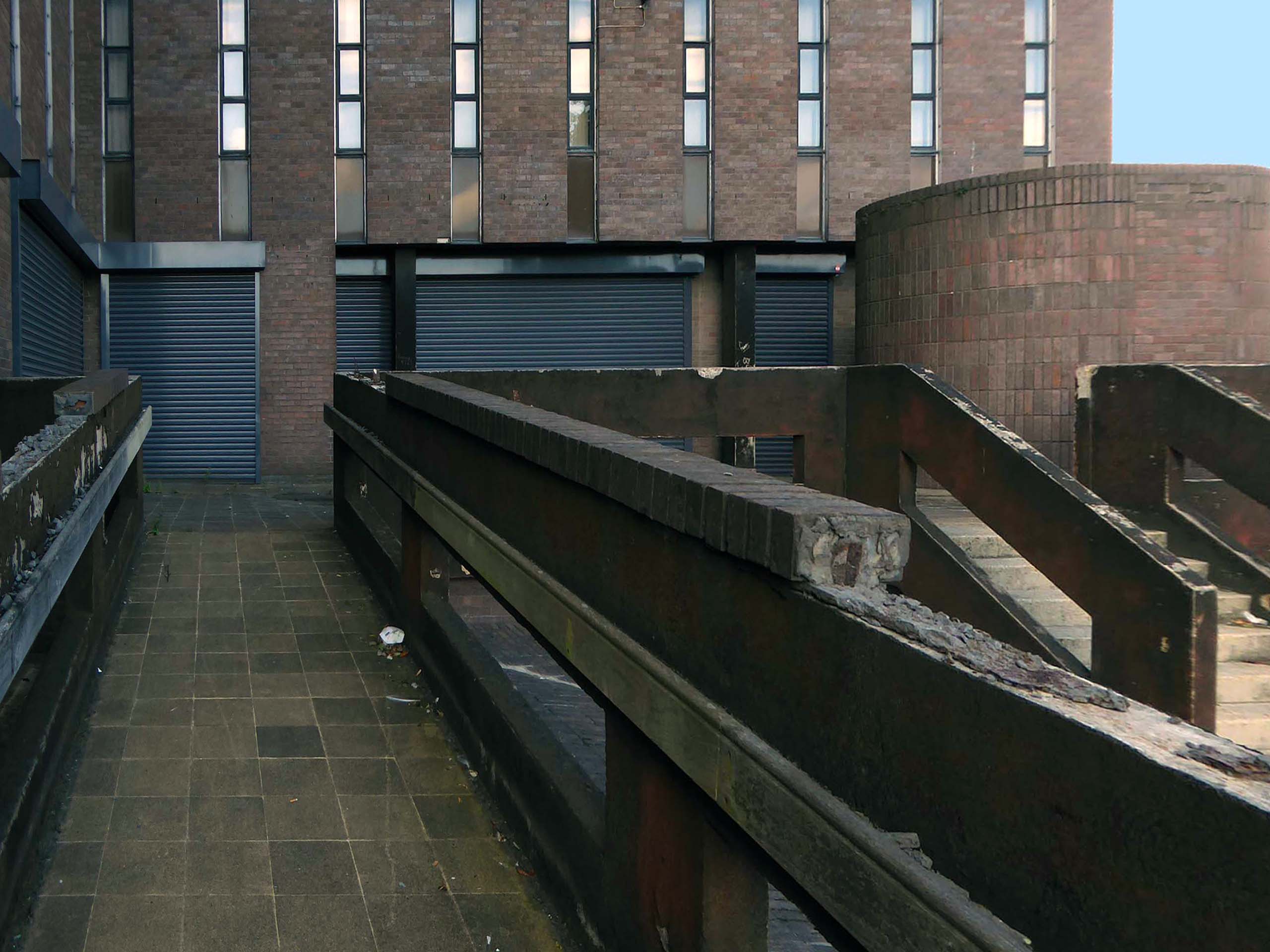
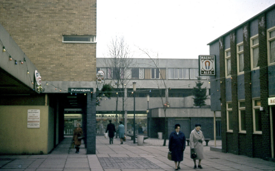
Enhancing the built environment, Peterlee Town Centre was furnished with play equipment, an ornamental pond, open air escalators, and a sculpture by John Pasmore – son of Victor.
These features were later removed after the town centre was sold to Teesdale Investments – Peterlee Limited in 1985.
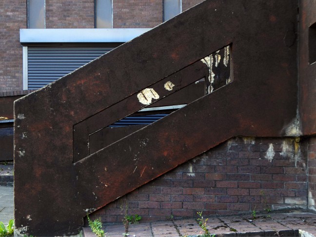
Access ramp at the bottom end of Yoden Way, prior to the construction of Lee House in 1973.
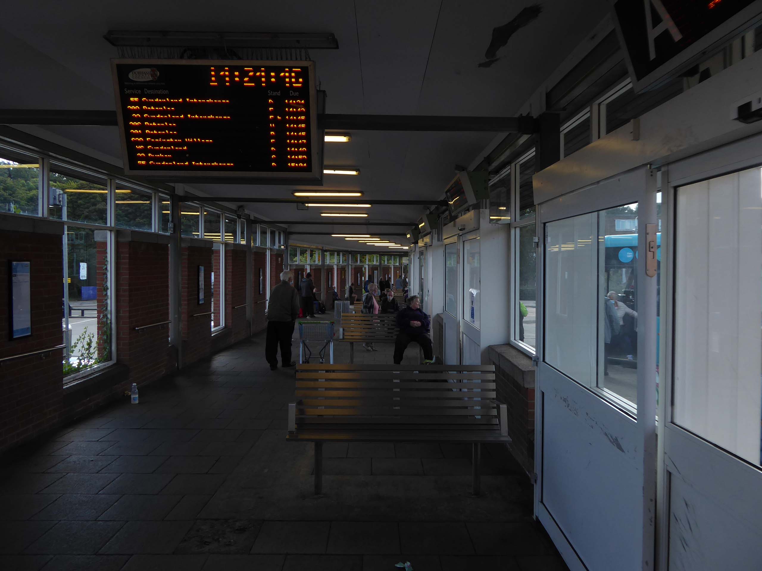
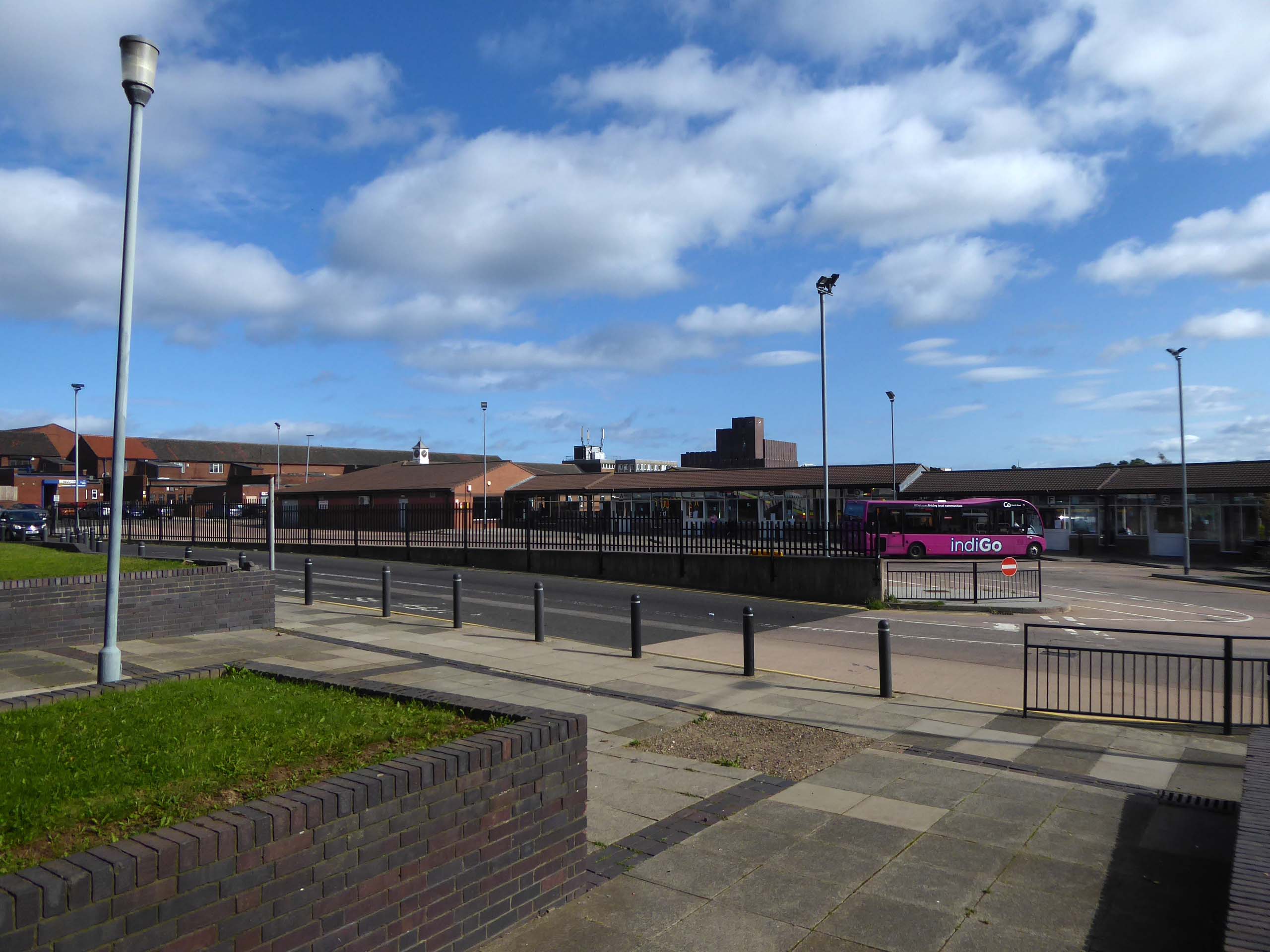
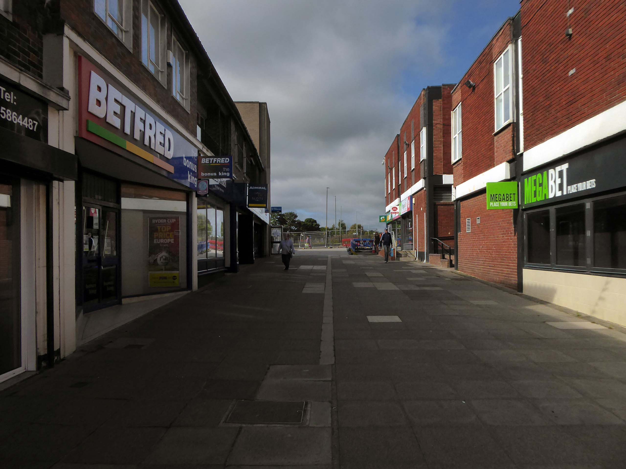
It’s 2021 and I arrive at the Bus Station.
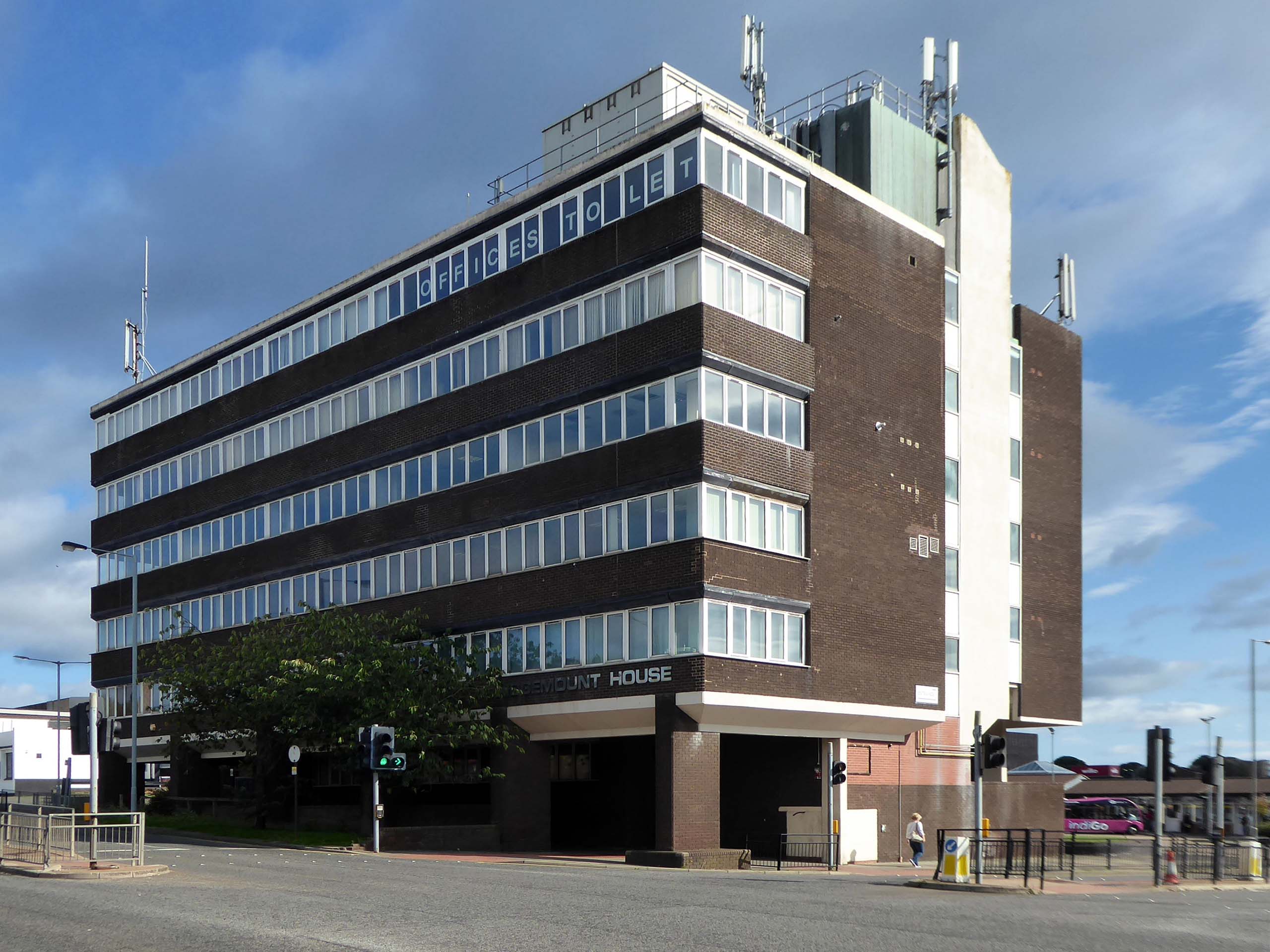
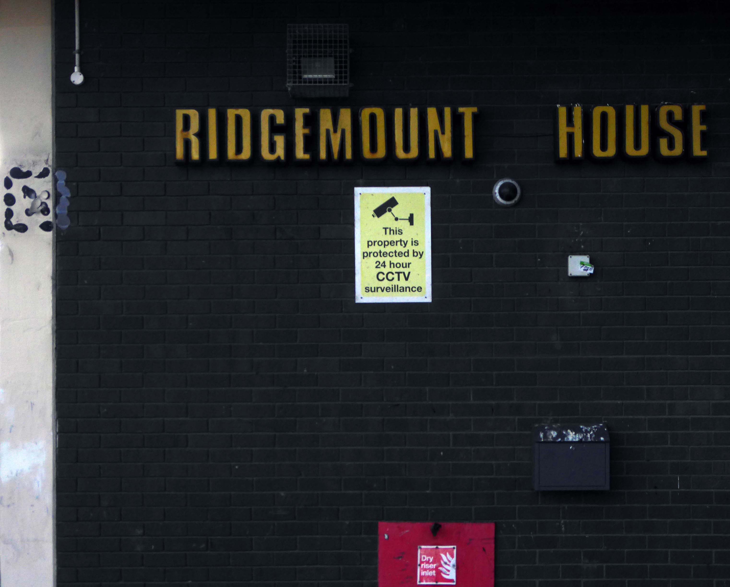
Immediately adjacent is Ridgemount House. – once home to the Job Centre.
Firefighters were called to the disused Ridgemount House on Bede Way in Peterlee on Wednesday August 16th 2023 at about 8.20pm after reports of a blaze.
Crews found a fire had broken out in the first floor of the building, which was found to be the home of thousands of pounds worth of cannabis plants back in 2020, after a man converted two floors for use as a drug farm.
Tarlochan Singh, owner of Ridgemount House, has been prosecuted following the discovery of several serious fire safety breaches at the property.
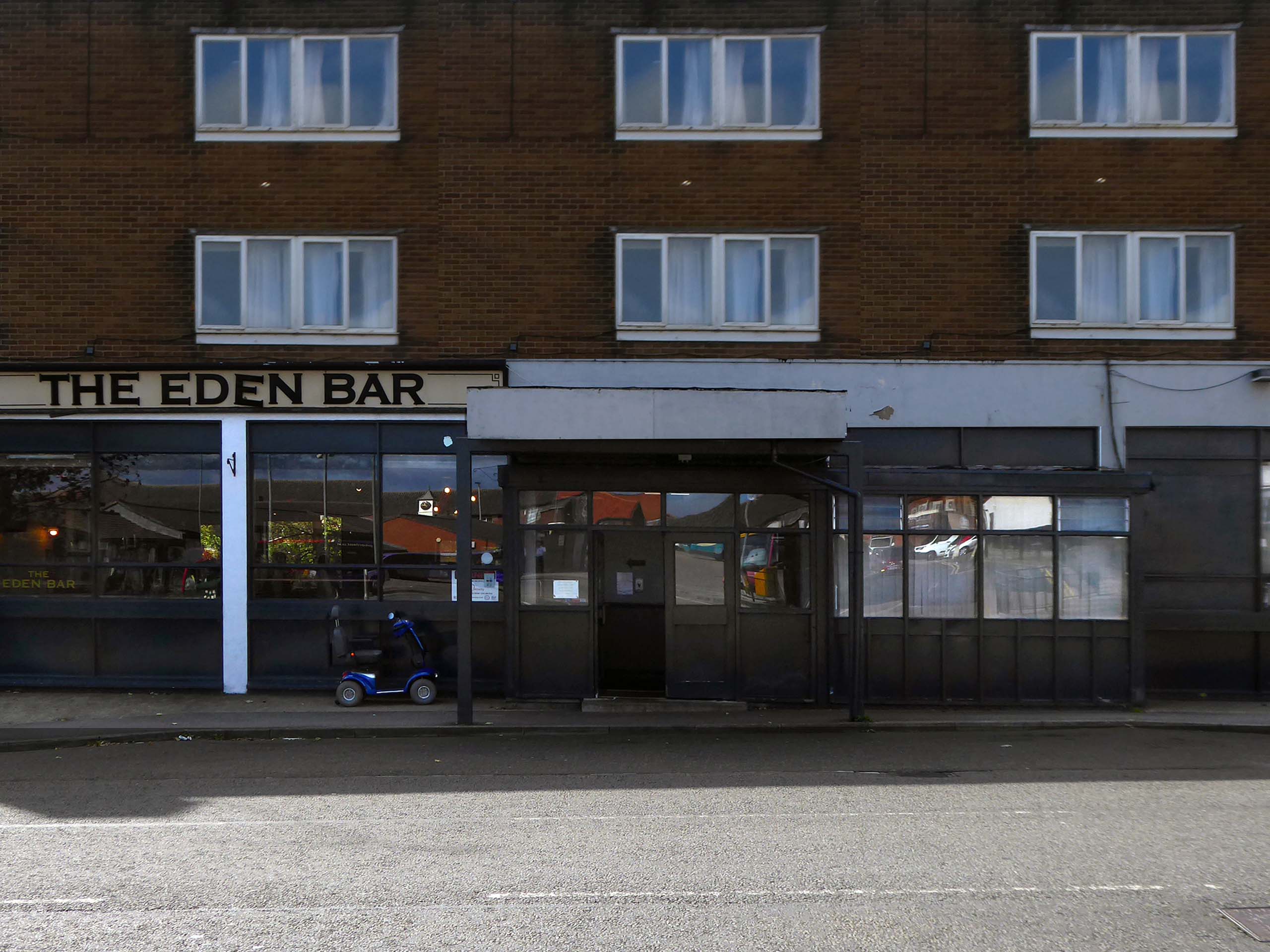
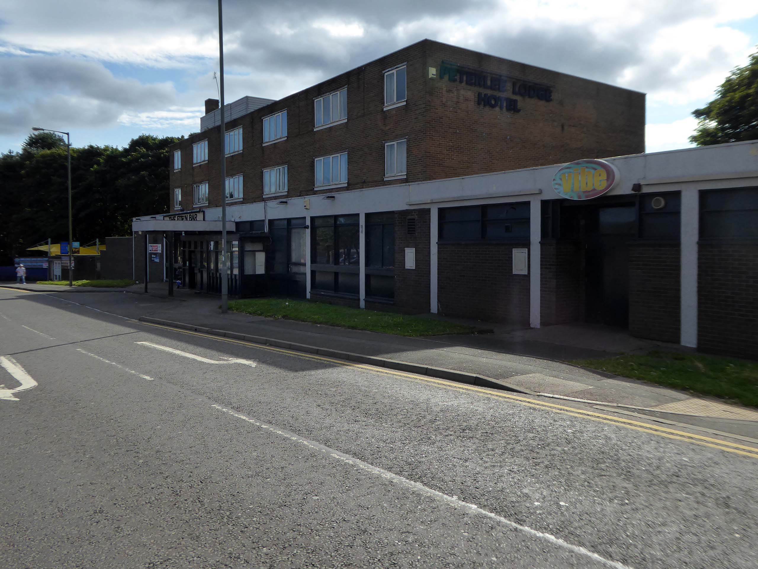
Readers have voted Peterlee nightspot Vibe as the ‘most tragic hometown club’ in the North East
Formerly known as The Dance Factory, Vibe, in Peterlee town centre, is a place famous for it’s almost impossible to get off ‘tramp stamp’ and next door neighbour The Lodge, where many locals will go for pre-drinks and some karaoke before heading to the club.
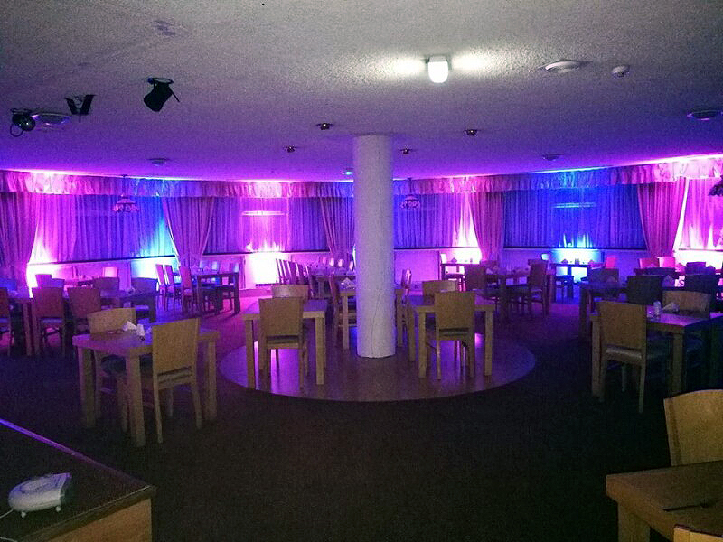
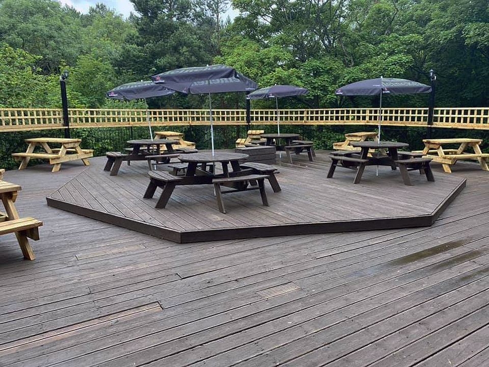
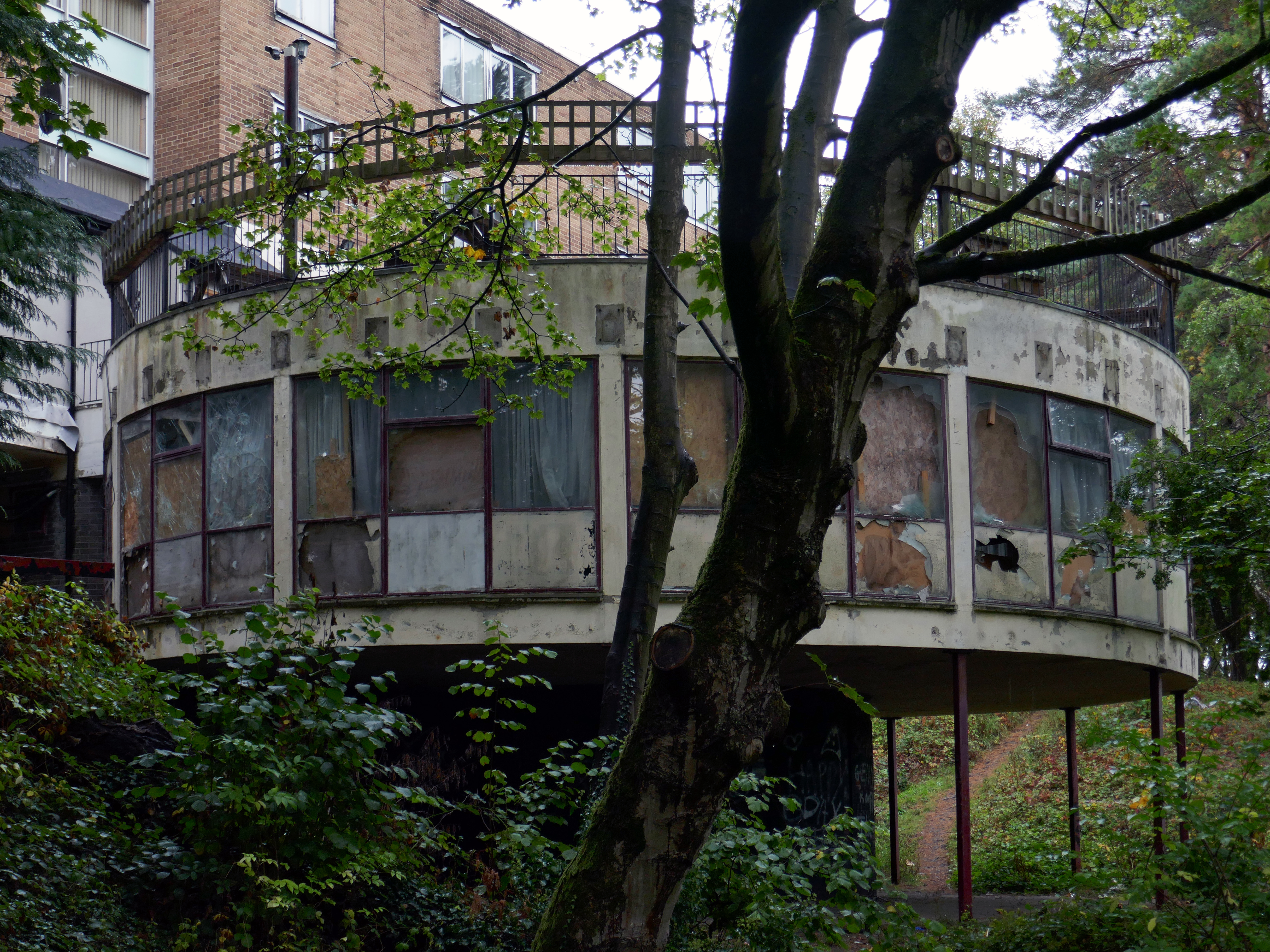
The bar which once boasted a bijou rotunda with an exclusive upper terrace, has now closed.
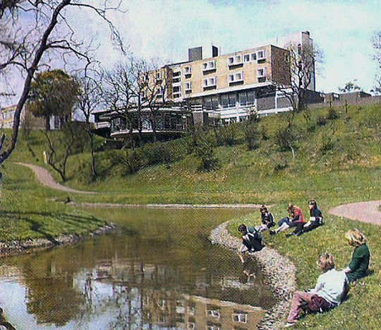
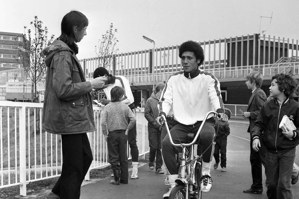
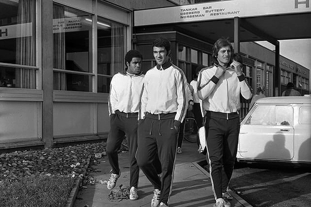
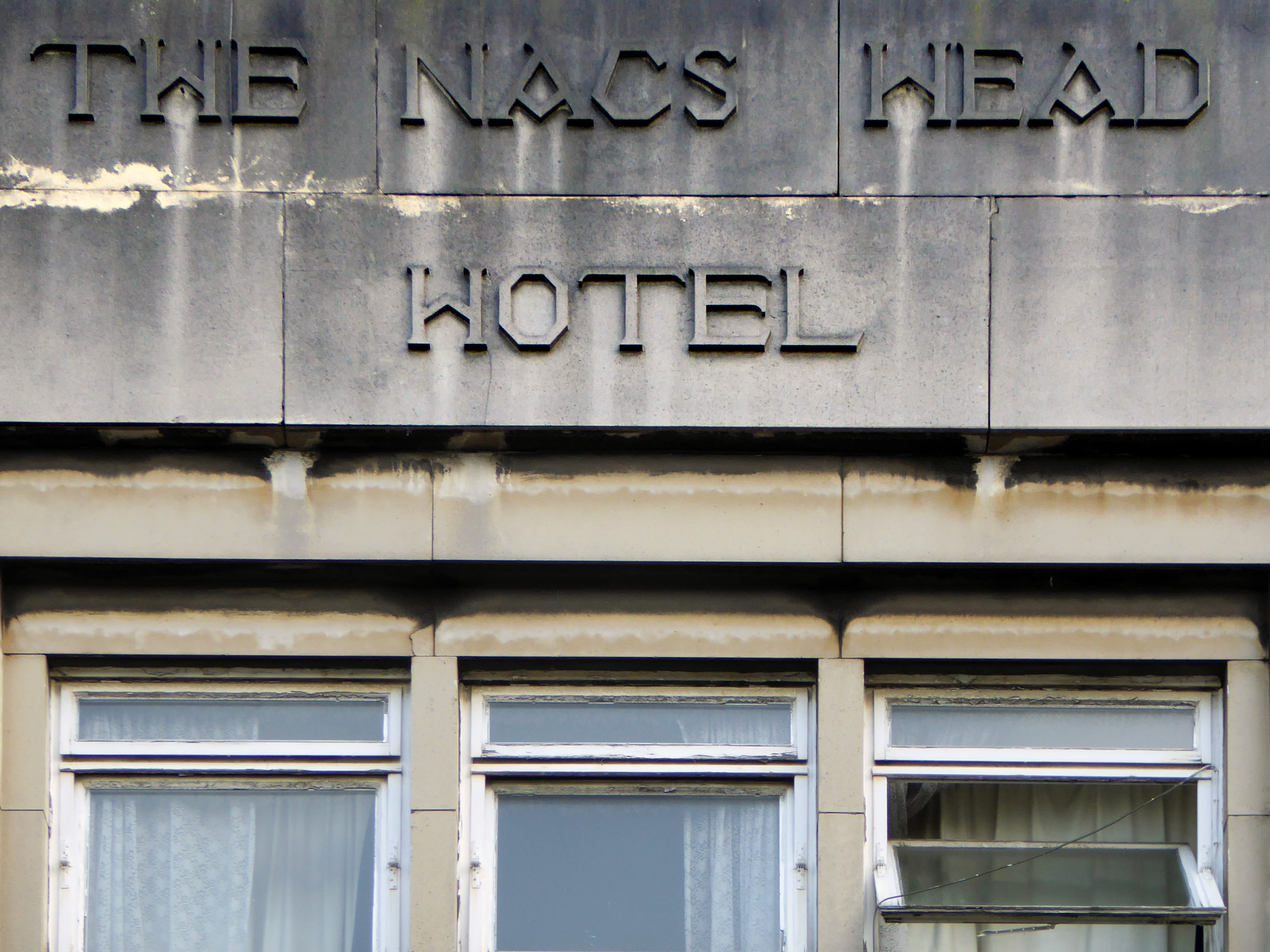
Back in 1973 the hotel was badged as the Norseman.
The giants of Sporting Lisbon faced Sunderland in the European Cup Winners Cup and they spent the build-up to the tie in the Norseman Hotel. They met local children, took a walk in the dene, signed autographs and even tried riding a Chopper bike. The side lost 2-1 at Roker Park to a talented Sunderland team before overcoming the Black Cats 2-0 back in Portugal.
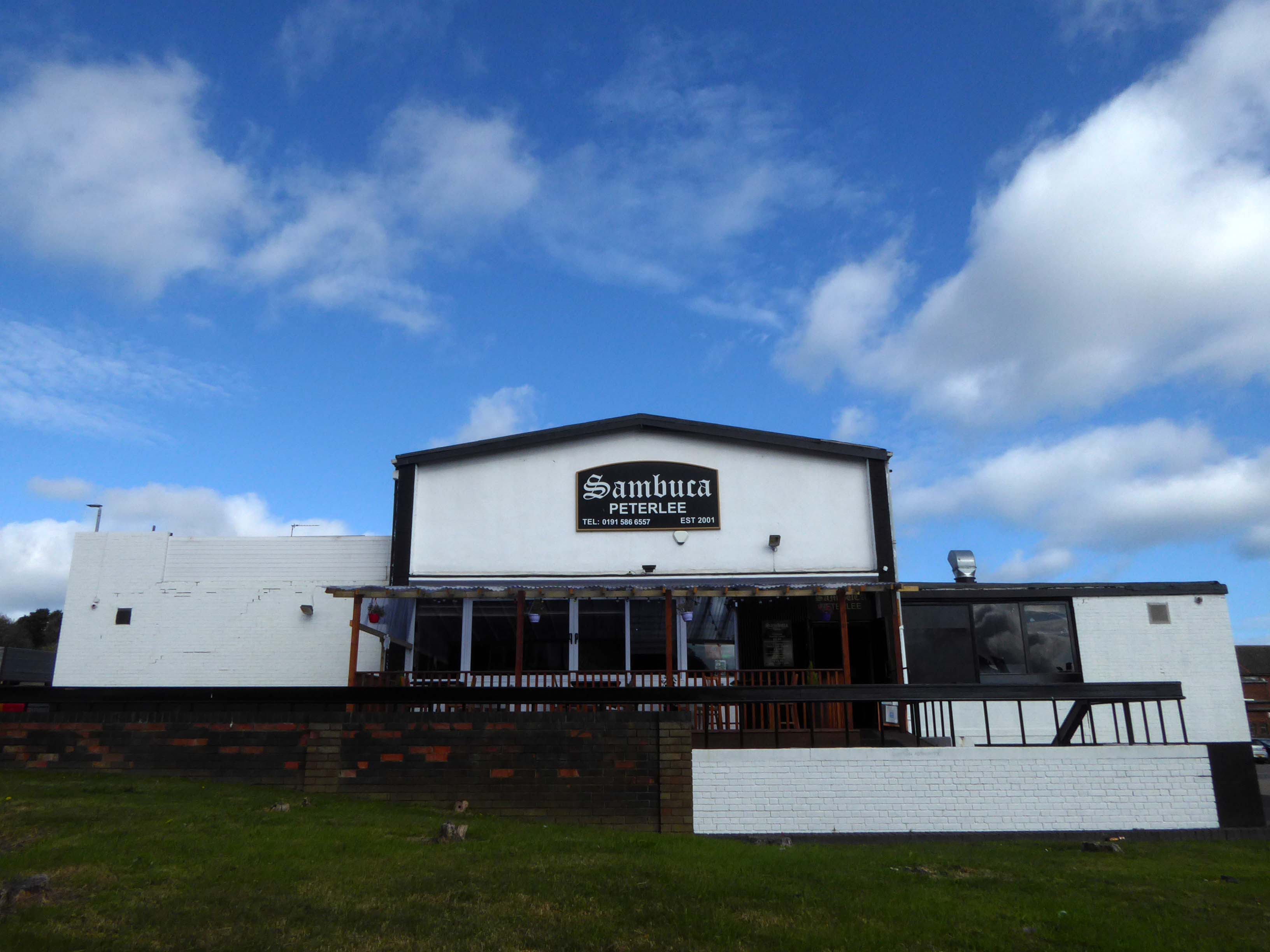
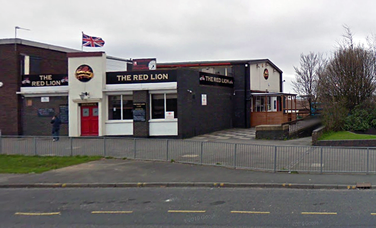
Back in 2021 Sambuca was the other town centre bar – badged with Olde English type.
Formerly the Red Lion a Cameron’s estate pub.
April 20th 2014 – Happy Easter everyone. We are open today all the way to 10pm – £2 bottles VHFs, house spirits only £3 double, buckets £4, Corona £2.50 selected shots 50p, cider cans £1 + £2 Karaoke – from now on everyone who sings gets a free shot Then we have the best in all your favourite dance ‘n’ house tunes to take you into Monday.
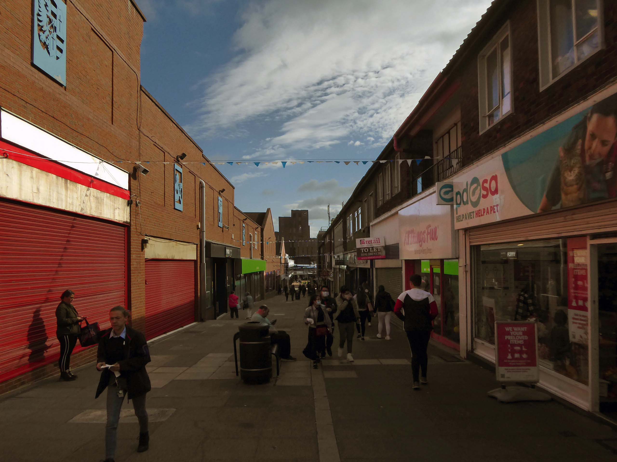
Onward to the Shopping Centre.
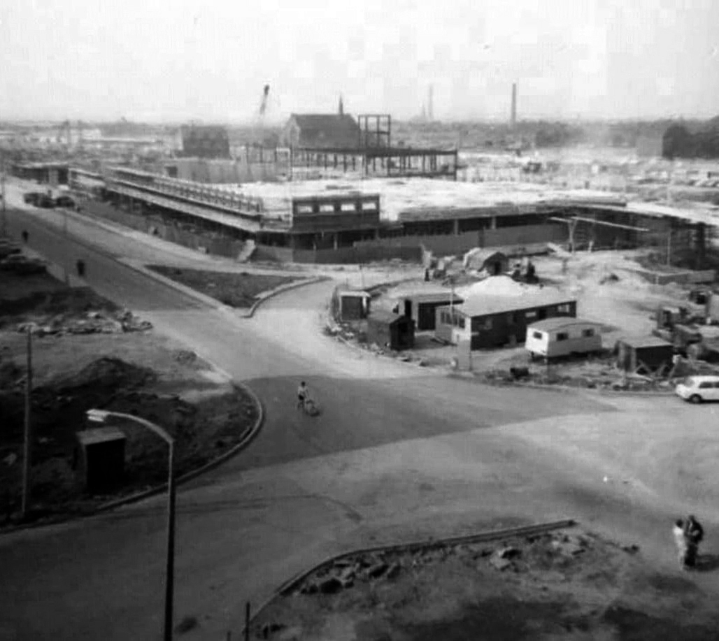
Yoden Way looking towards Lee House in 1977.
Photographs: JR James
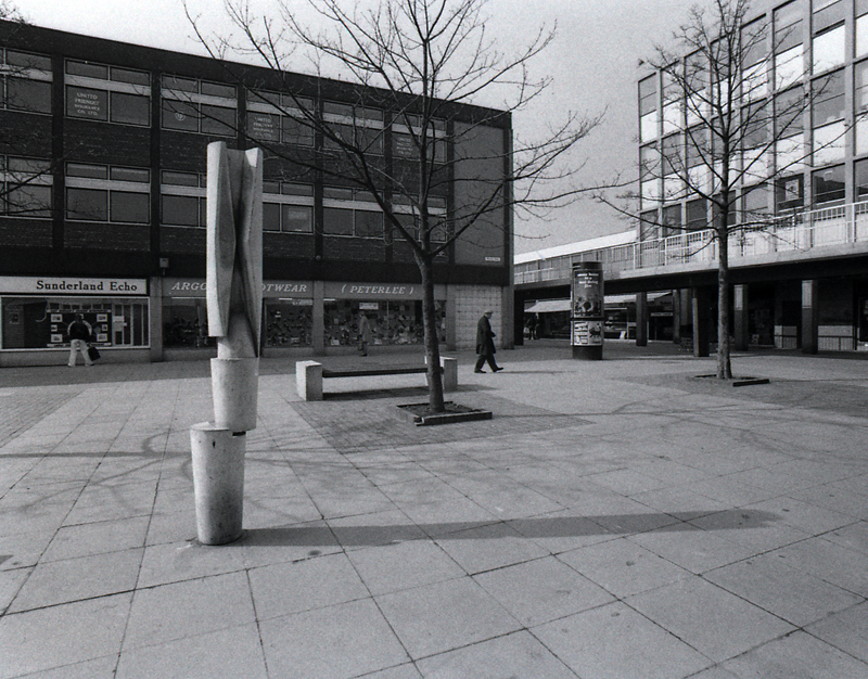
The 1950’s shops are still in situ.
Though some of the original architectural detailing and features are no more.
Lee House is still standing but vacant.
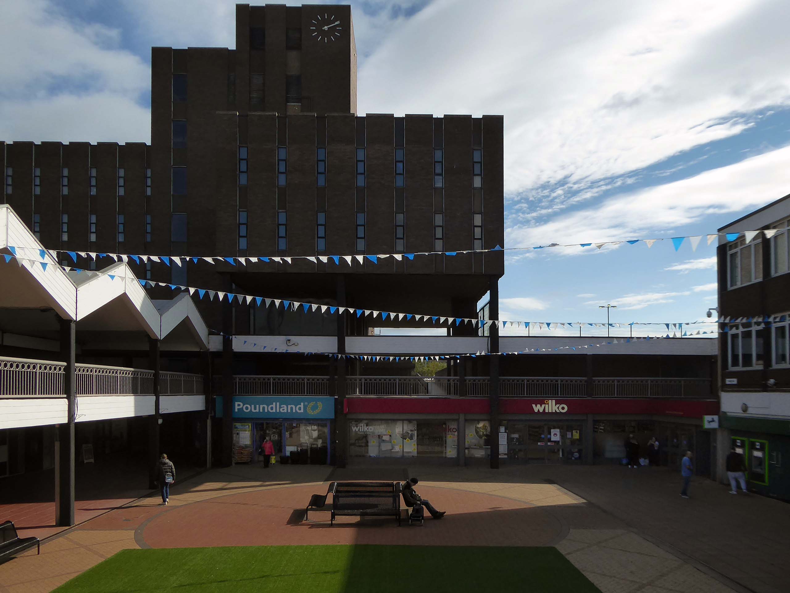
Lee House was once home to charity and community groups, but in 2015 the building owners ordered them to vacate the property.Even the building’s clock has stopped working and has been stuck on the same ten-past-two reading.
However, Durham County Council has now confirmed the building is in new hands. Economic development manager Graham Wood said: “We have worked with the previous owner to try to ensure the building is secured while we await proposals for its long-term future.
Four fire engines rushed to Lee House on Upper Yoden Way in Peterlee on Friday afternoon September 19th 2025 after a fire broke out on the first floor of the seven floor building.
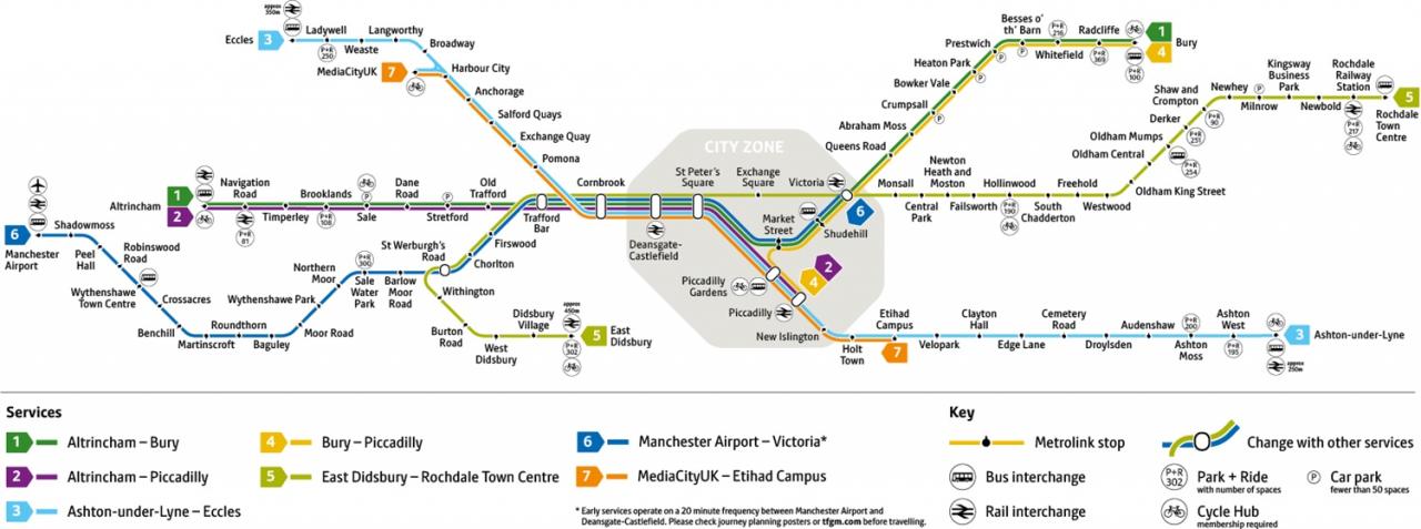
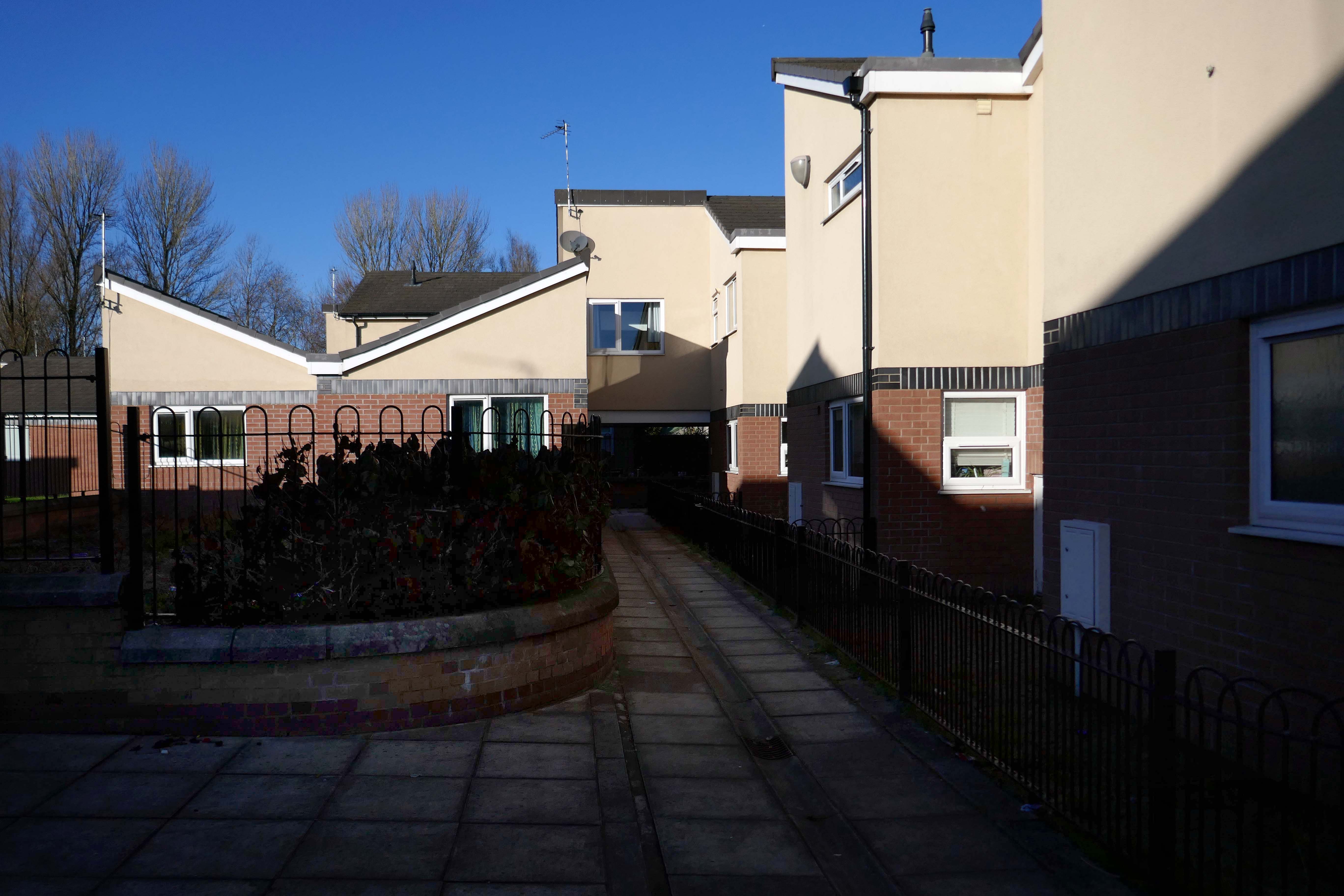
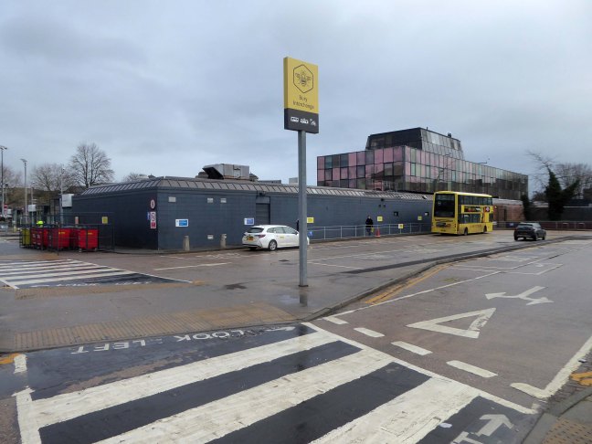
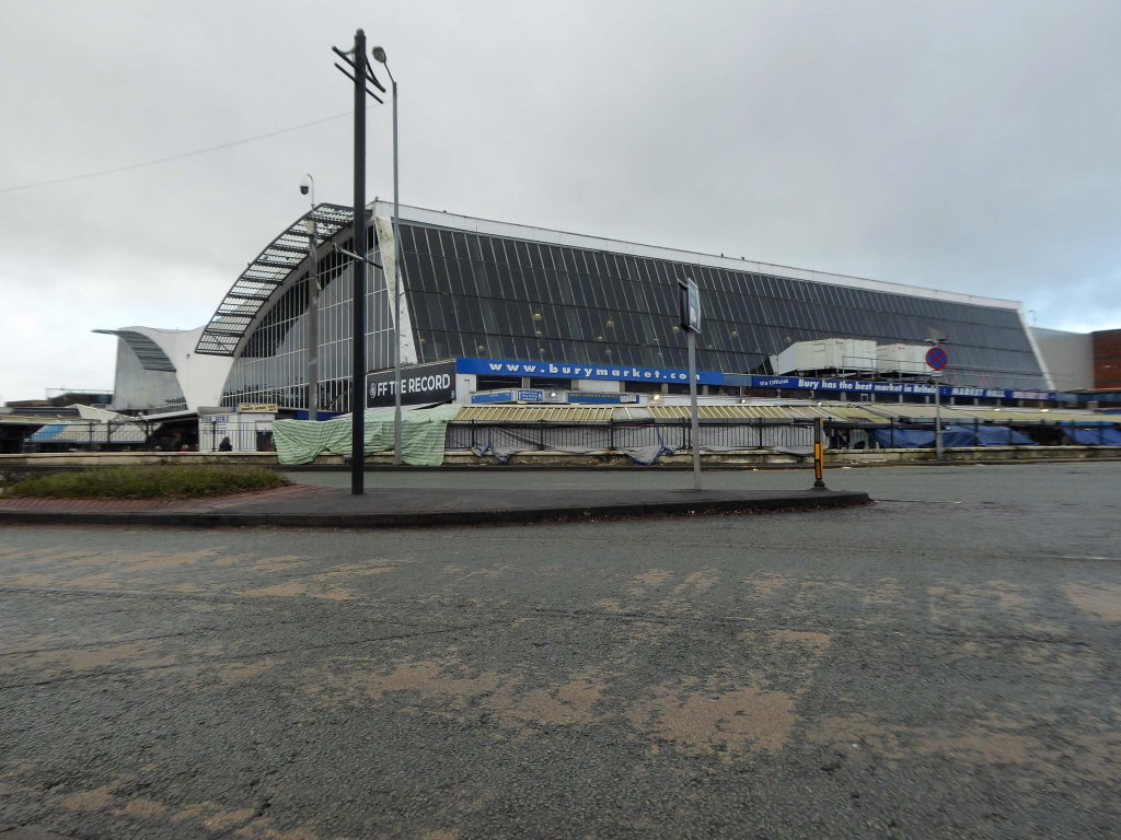
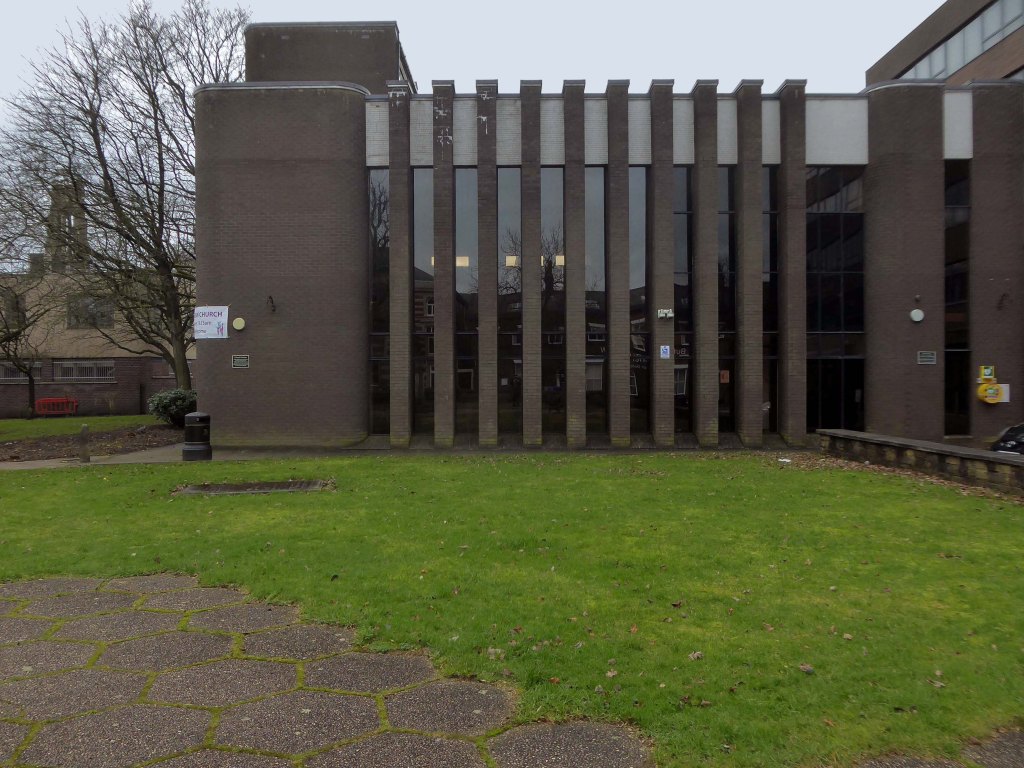
I was cordially requested to produce tram based walk, by the good folk at the modernist – travelling from Victoria Station to Bury. Alighting at each stop and seeing what could be seen, by way of modern buildings along the byways.
By the way, I do have previous experience, having undertaken a similar task travelling to Ashton.
So I set off as instructed, clutching my GMPTE senior concessionary travel pass.
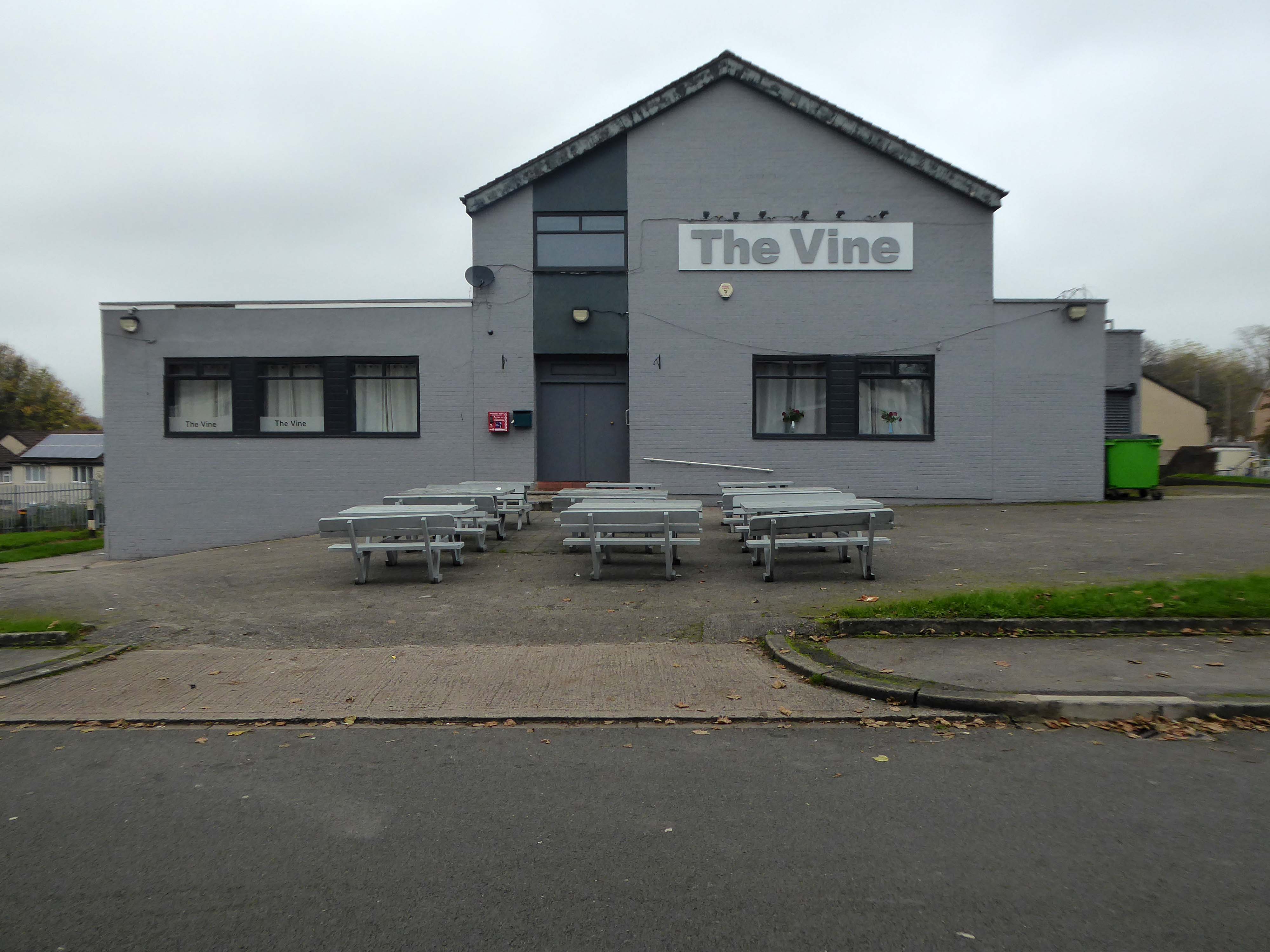
Queens Road
Turn right on leaving the station, right then left – you have reached The Vine.
Glendower Dr, Manchester, Greater Manchester M40 7TD.
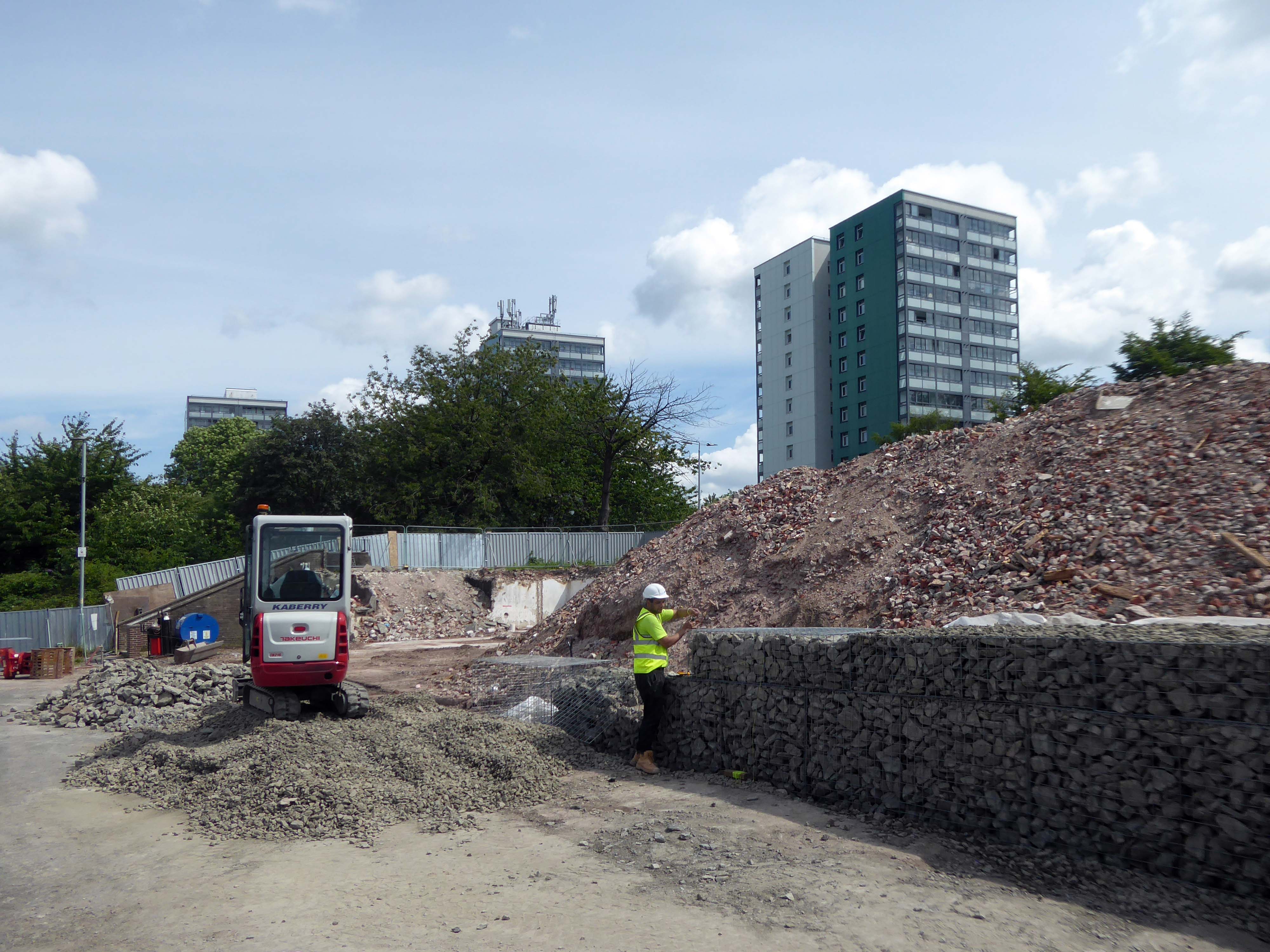
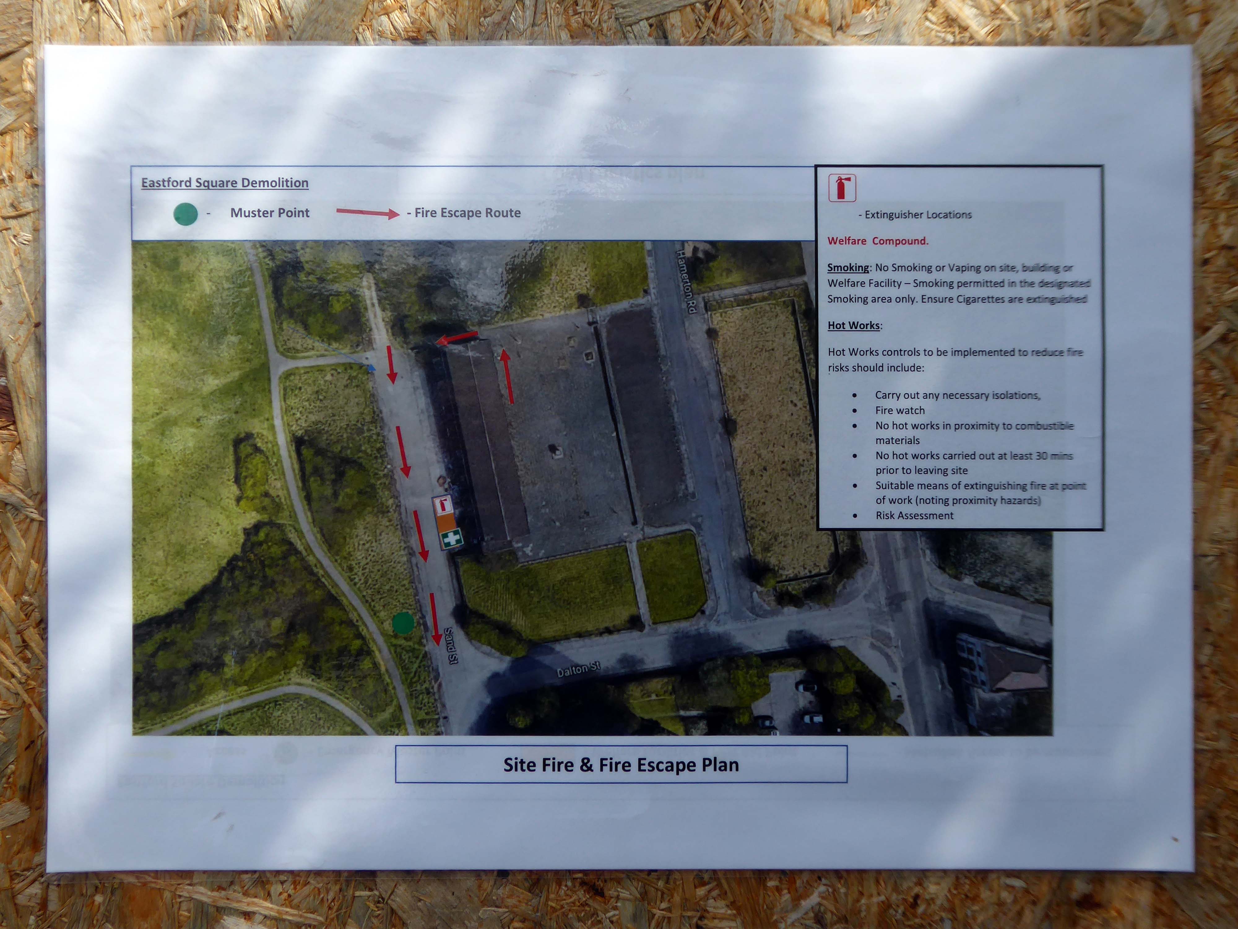
Head for Rochdale Road and turn right back toward the city centre, you have reached Eastford Square.
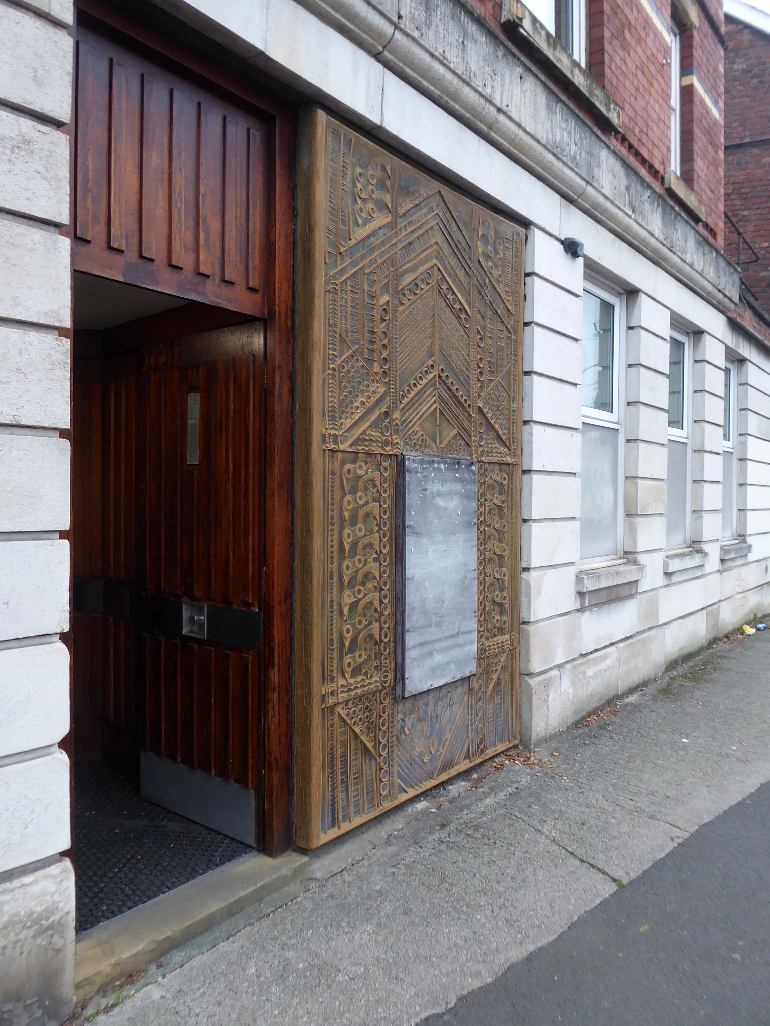
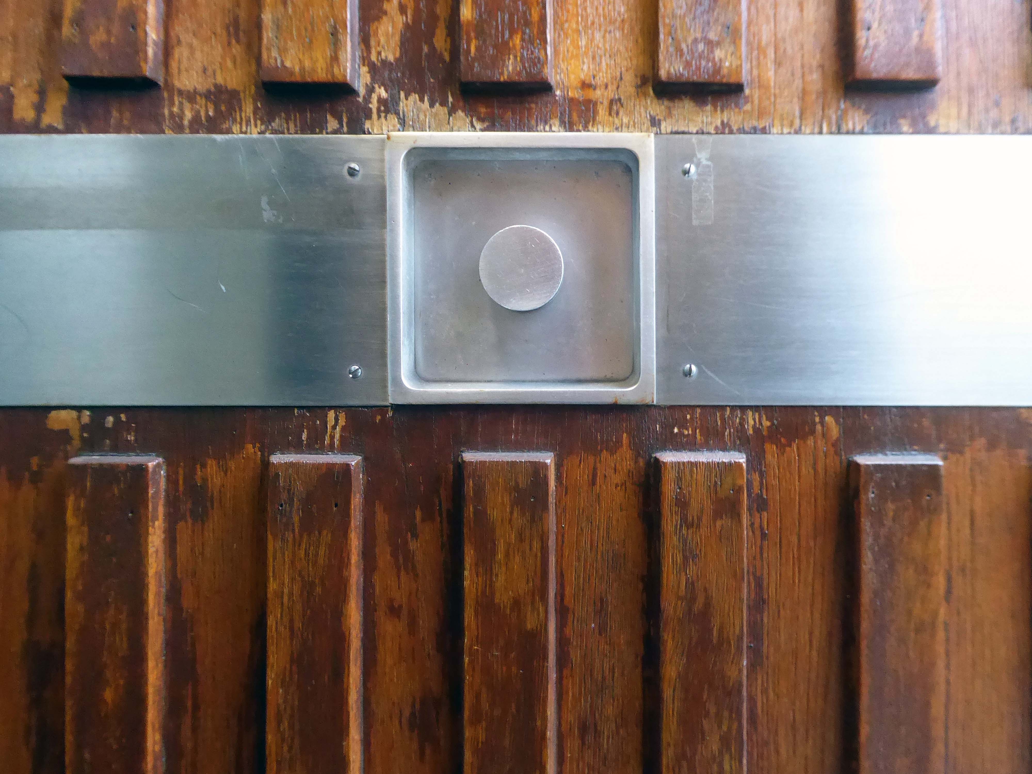
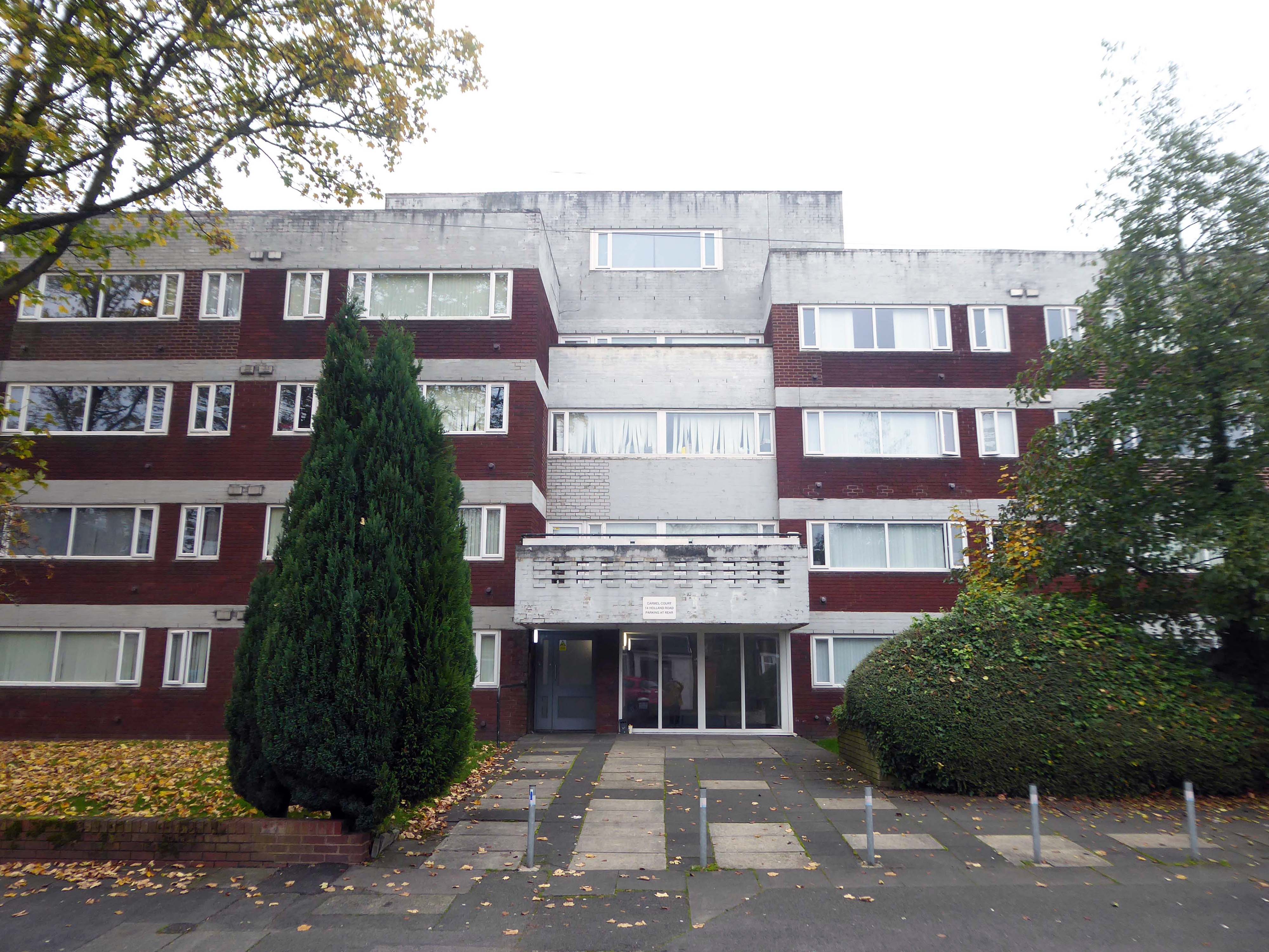
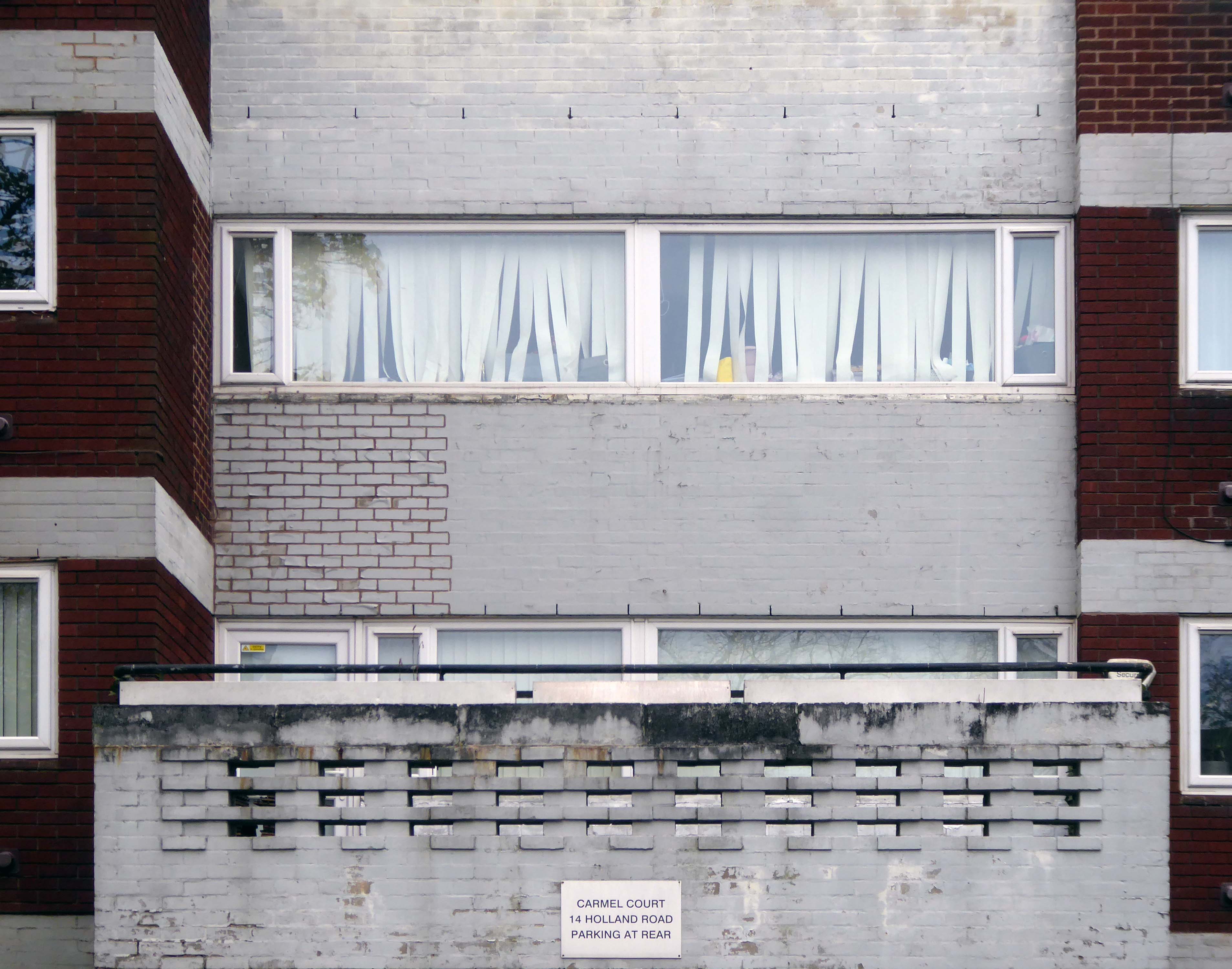
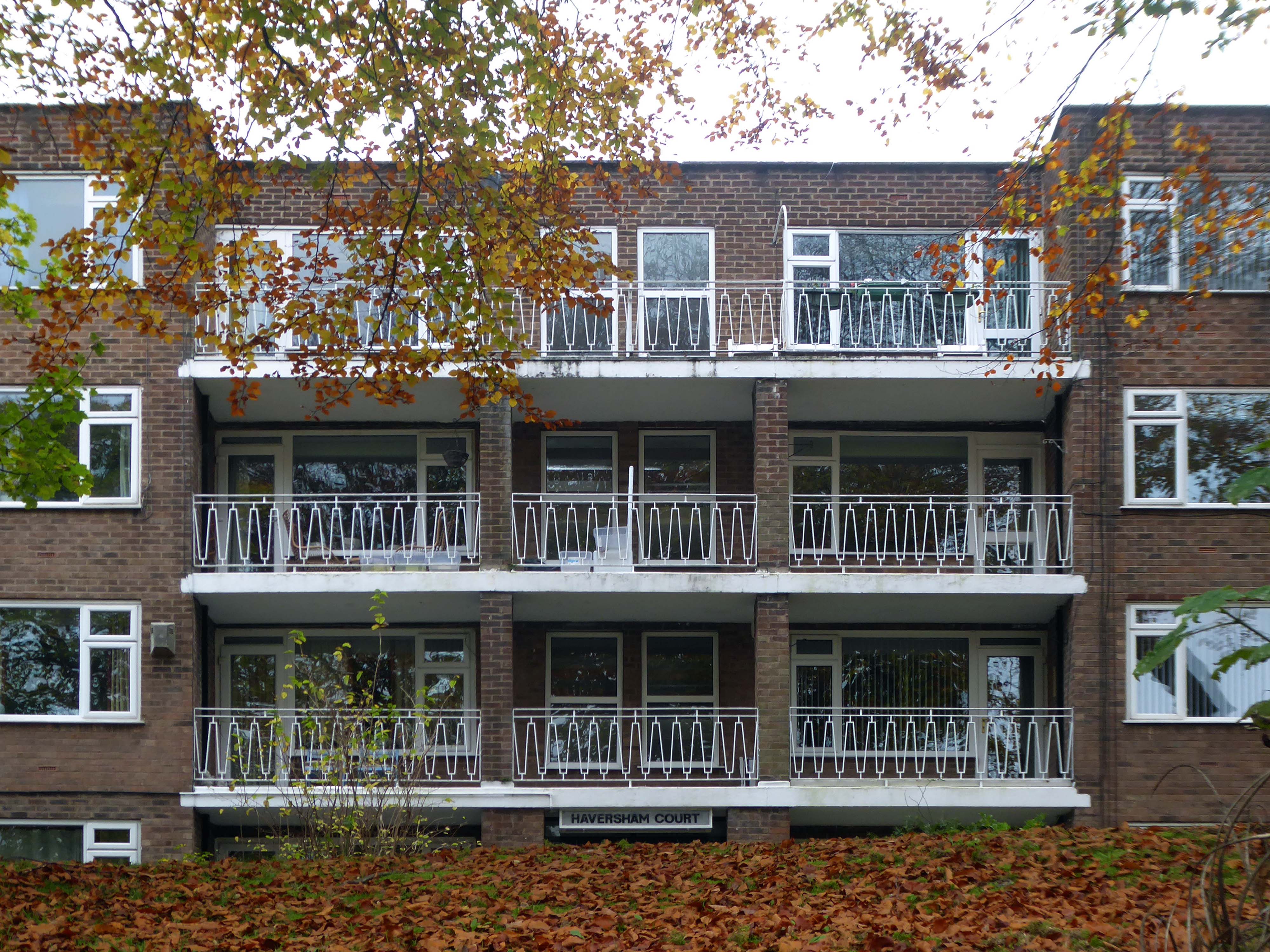
Turn left from the station along Bury Old Road until you reach Heywood Road on your right.
Heywood Road, Prestwich, Manchester M25 2GT
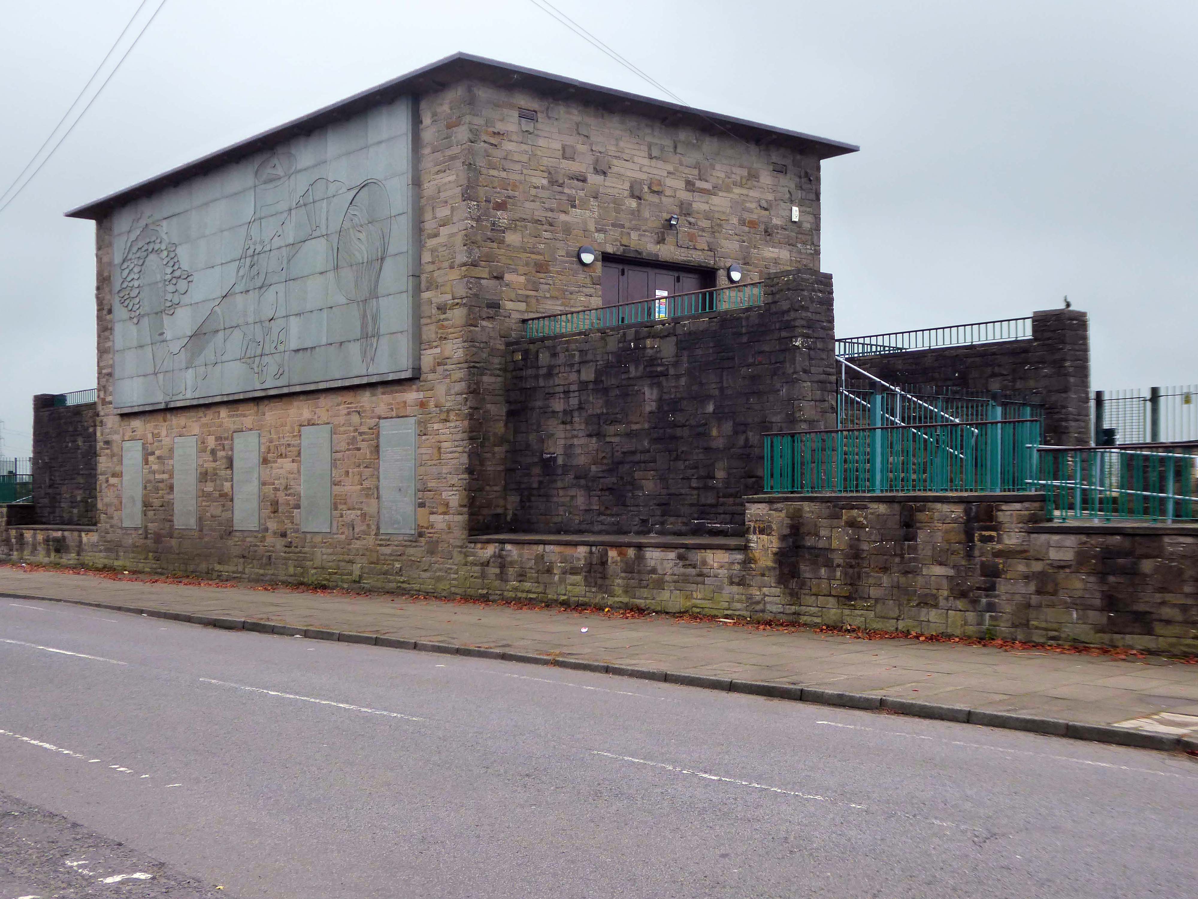
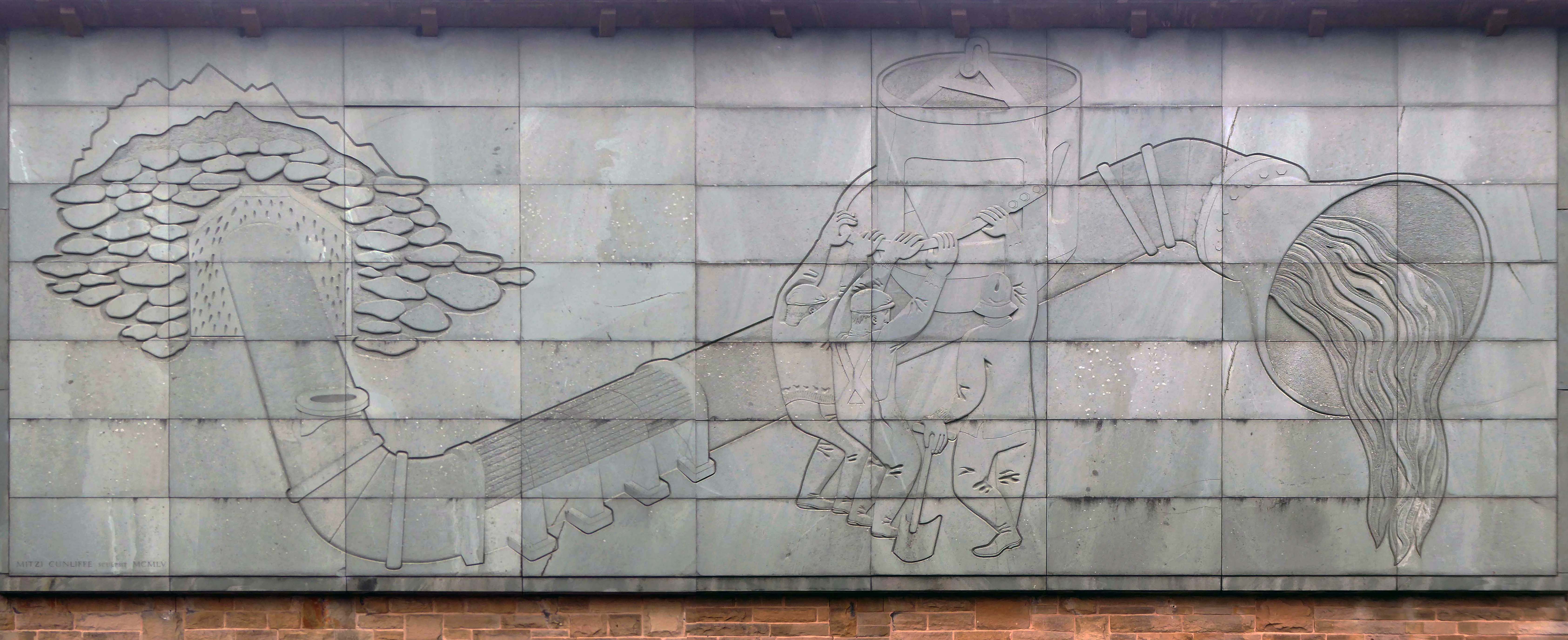
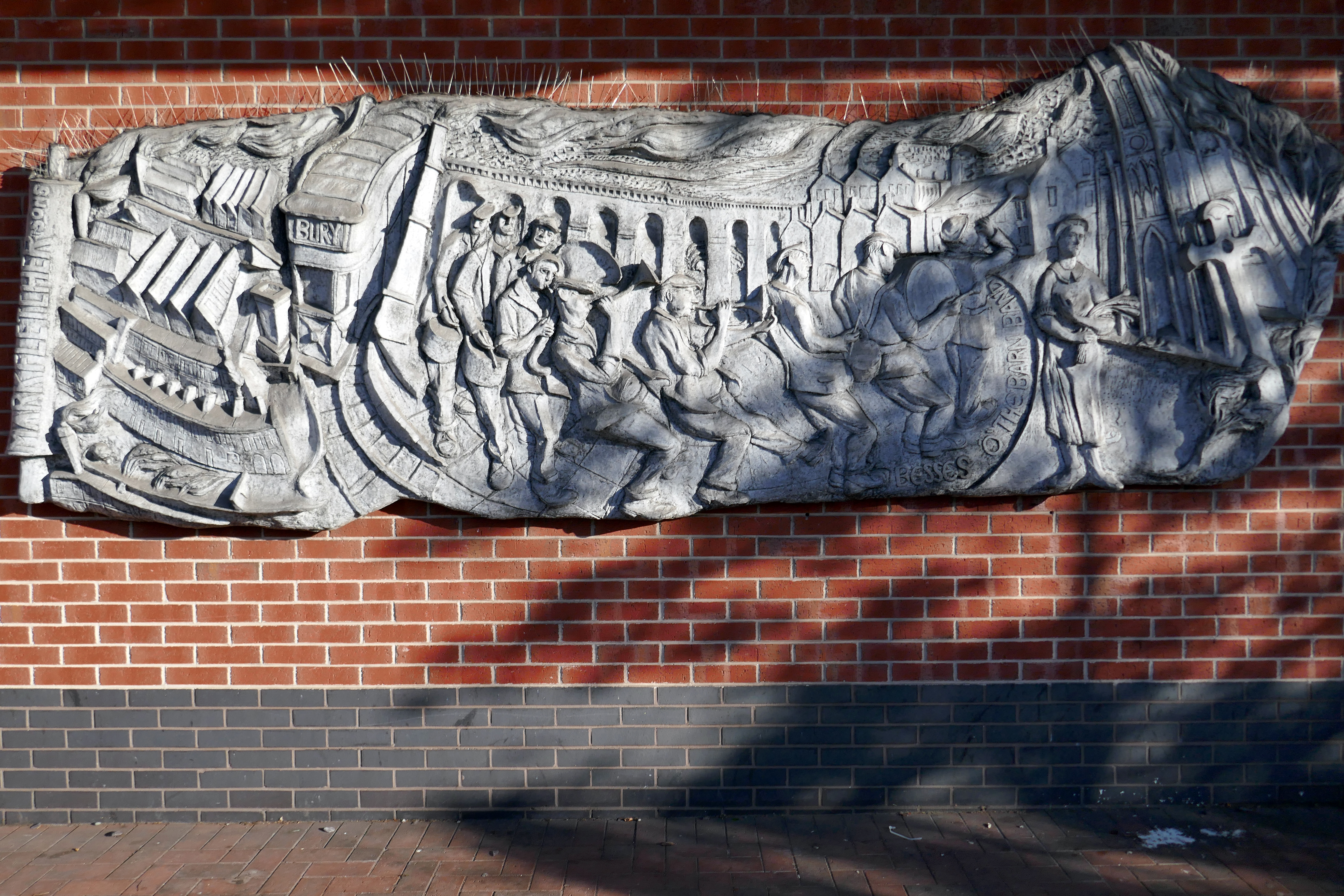
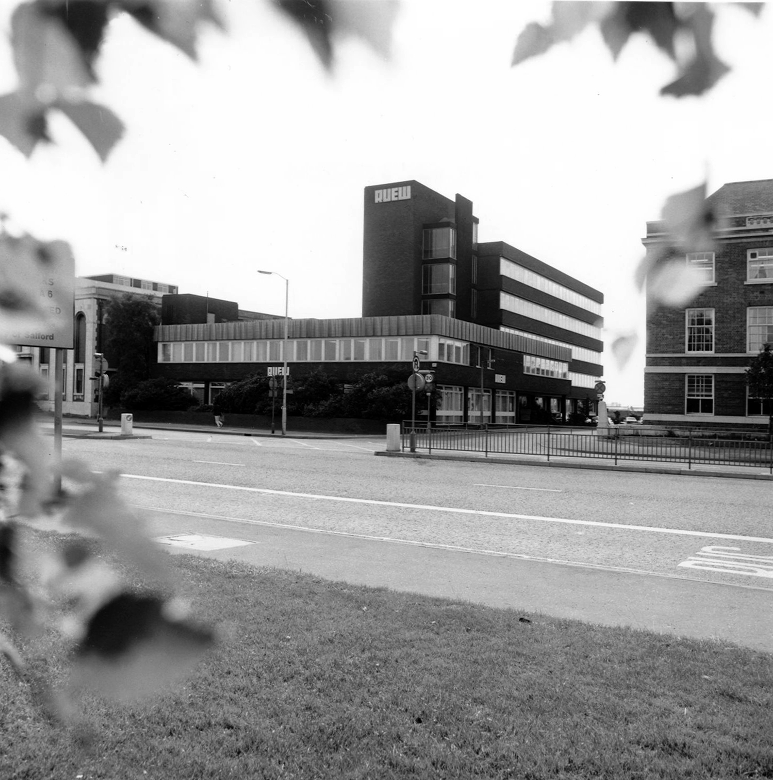
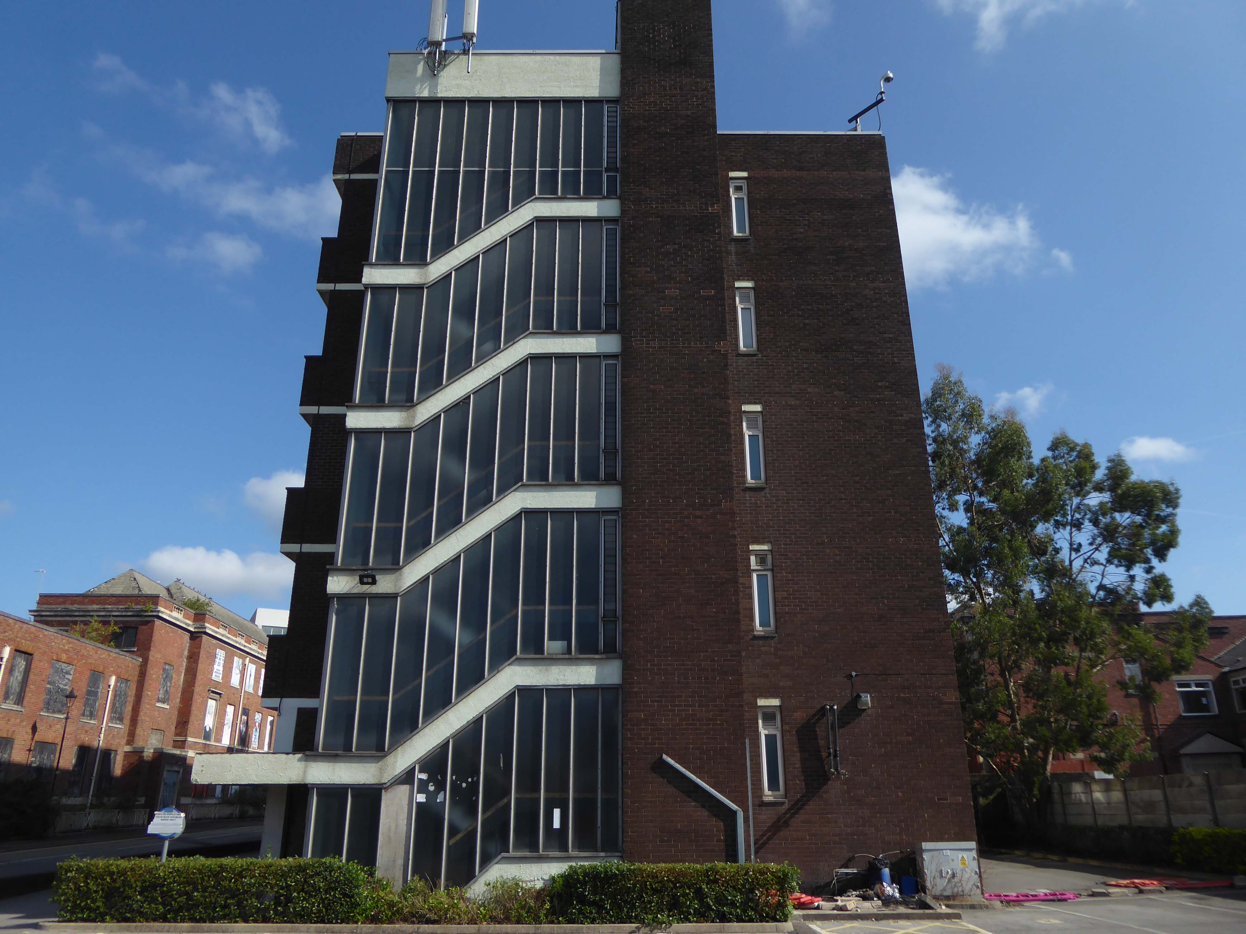
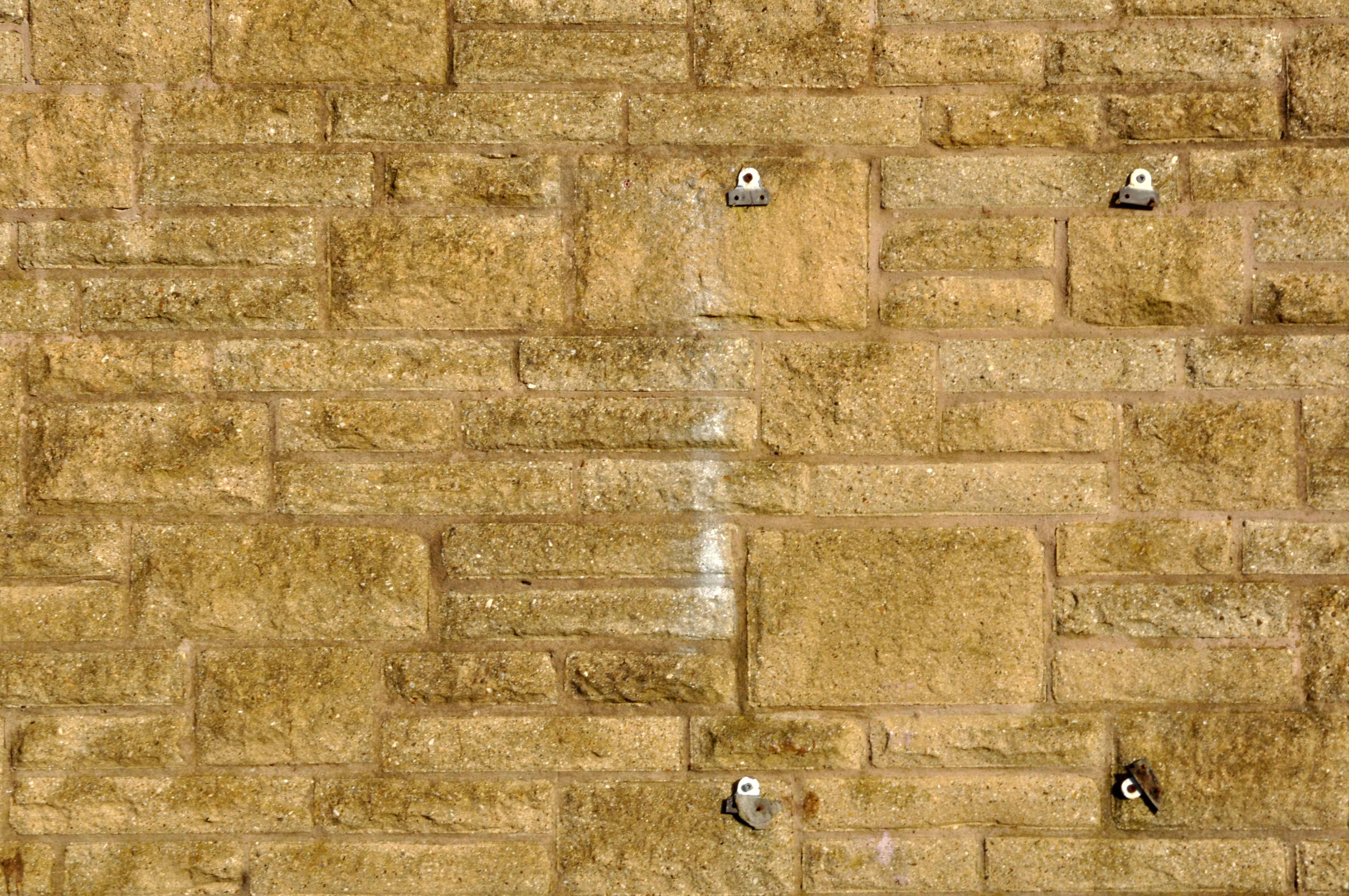
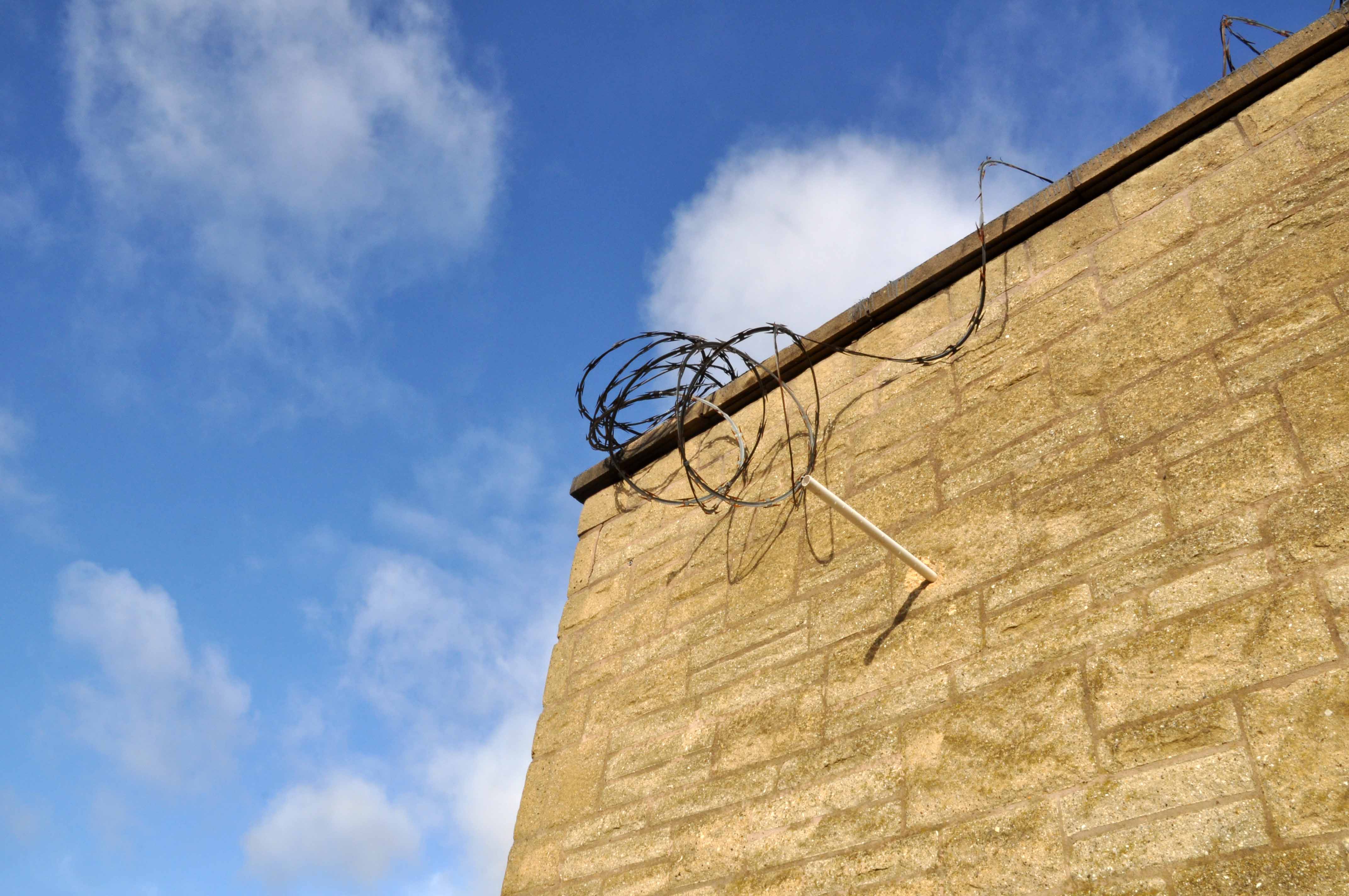
1954-5 by the Manchester City Architect’s Department, Chief Architect Leonard C Howitt, for the Manchester Corporation Waterworks. Alan Atkinson, engineer. Incorporates large relief by Mitzi Cunliffe, signed and dated 1955.
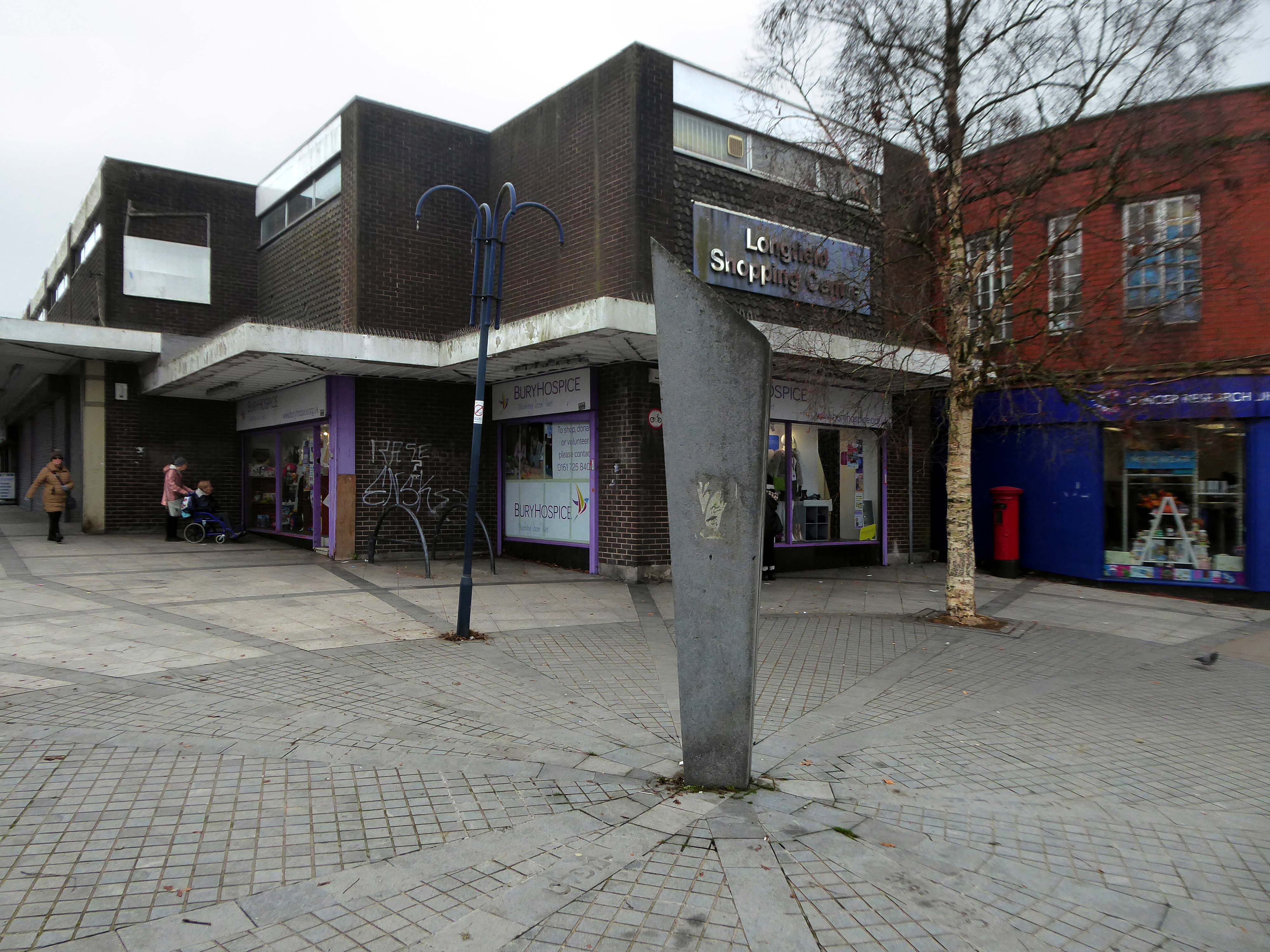
After months of public consultation, the joint venture has firmed up its proposals for the redevelopment of the Longfield Centre and is aiming to be on site before the end of the year.
Muse and Bury Council have submitted a hybrid application to transform six acres of Prestwich town centre.
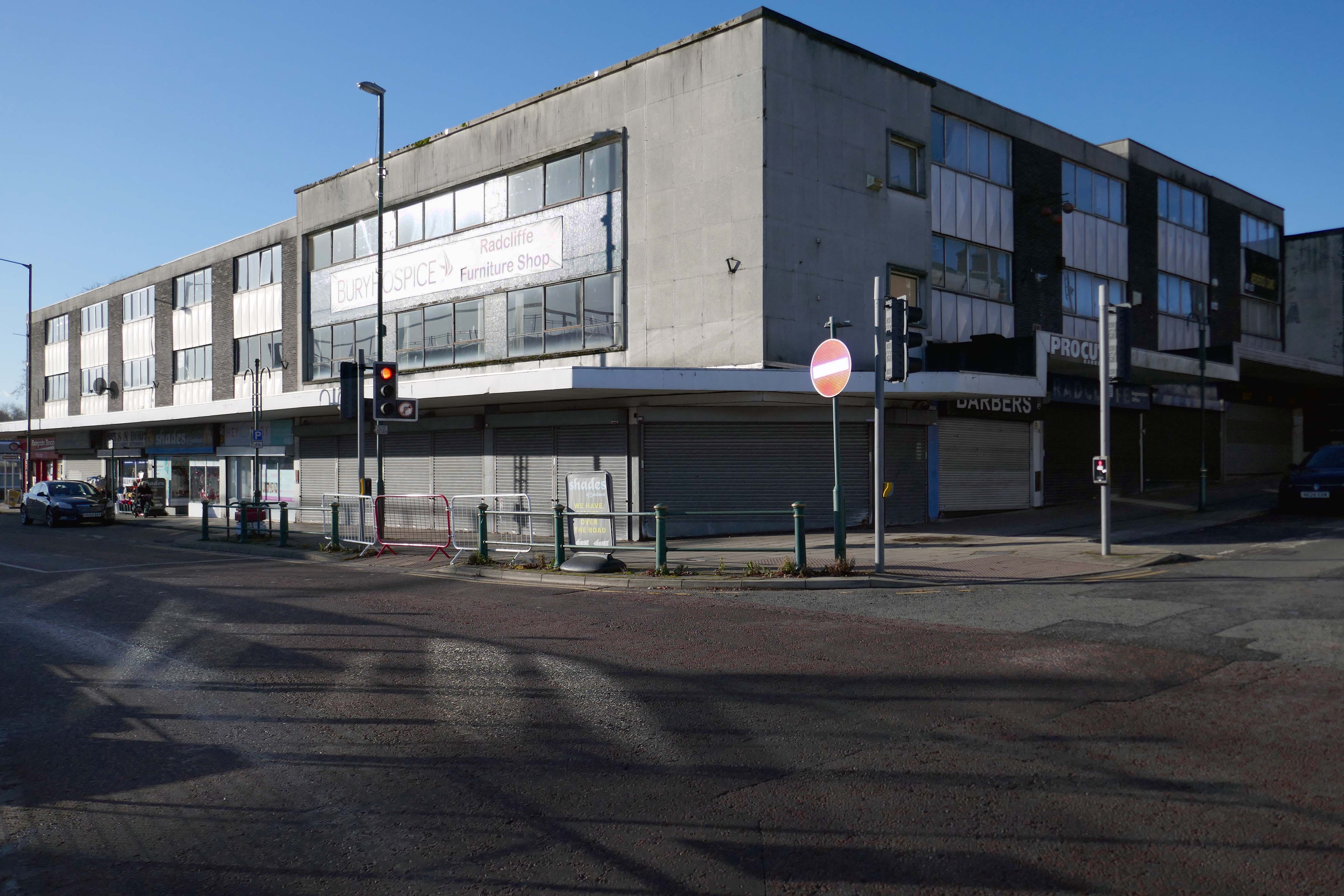
The Strategic Regeneration Framework is the guide that is shaping the direction of Radcliffe’s growth over the next 15 years with a series of realistic short, medium, and longer-term actions. It is also shaping the direction of future council investment, supporting bids for central governmental funding and providing certainty for third parties wanting to invest in town.
Work has begun on Strategic Regeneration Framework’s priority projects, these include:
A new civic hub in central Radcliffe, which will bring together a mix of functions at the heart of the town
Refurbishment of the market basement and the revamping of market chambers
New leisure facilities
A secondary school on the Coney Green site
A “whole town approach” to housing, bringing forward a comprehensive approach to residential development in Radcliffe
A transportation strategy, which will consider matters such as active travel and car parking
I began walking when quite young, then like Felix, I kept on walking, walking still.
The photograph was taking during the Whit Walks in 1958 – aged three, I was engaged in religious pilgrimage, as we know there are many reasons for walking, this is but one.
I was fortunate to grow up at a time when youngsters were permitted to roam freely, less traffic, less anxiety, gave me access to a wider axis of exploration.
The photograph would have been taken I assume, by my mam, on the Brownie 127. When aged nine I wandered alone through the local woods and exposed twelve frames of 44mm 127 film, the prints are long gone, yet I remember each of the photographs and locations clearly.
I went to school, then I didn’t, then I went to Art School, eventually becoming a teenage Constructivist, tutored by Jeffrey Steele, a leading light in the British Systems movement.
The rigidity of the grid, symmetry and orthogonal framing have stayed with me.
Then I went to work for a very long time indeed, then all of a sudden I didn’t. Taking early retirement aged 59 some ten years ago, subsequently taking to the roads, streets and hills of Britain in search of nothing in particular.
In recent years there has been a rapid development in the culture of walking, theories, films, guides, songs and literature. I am fully cognisant of such, yet believe at heart that walking can be free of such baggage, we can stride unhindered, atavistic and carefree/less.
Walk tall, walk straight and look the world right in the eye.
Getting lost is about the unfamiliar appearing.
In my own small way, I have become part of that baggage, having been asked to lead a walk around Stockport by the the modernist neé Manchester Modernist Society.
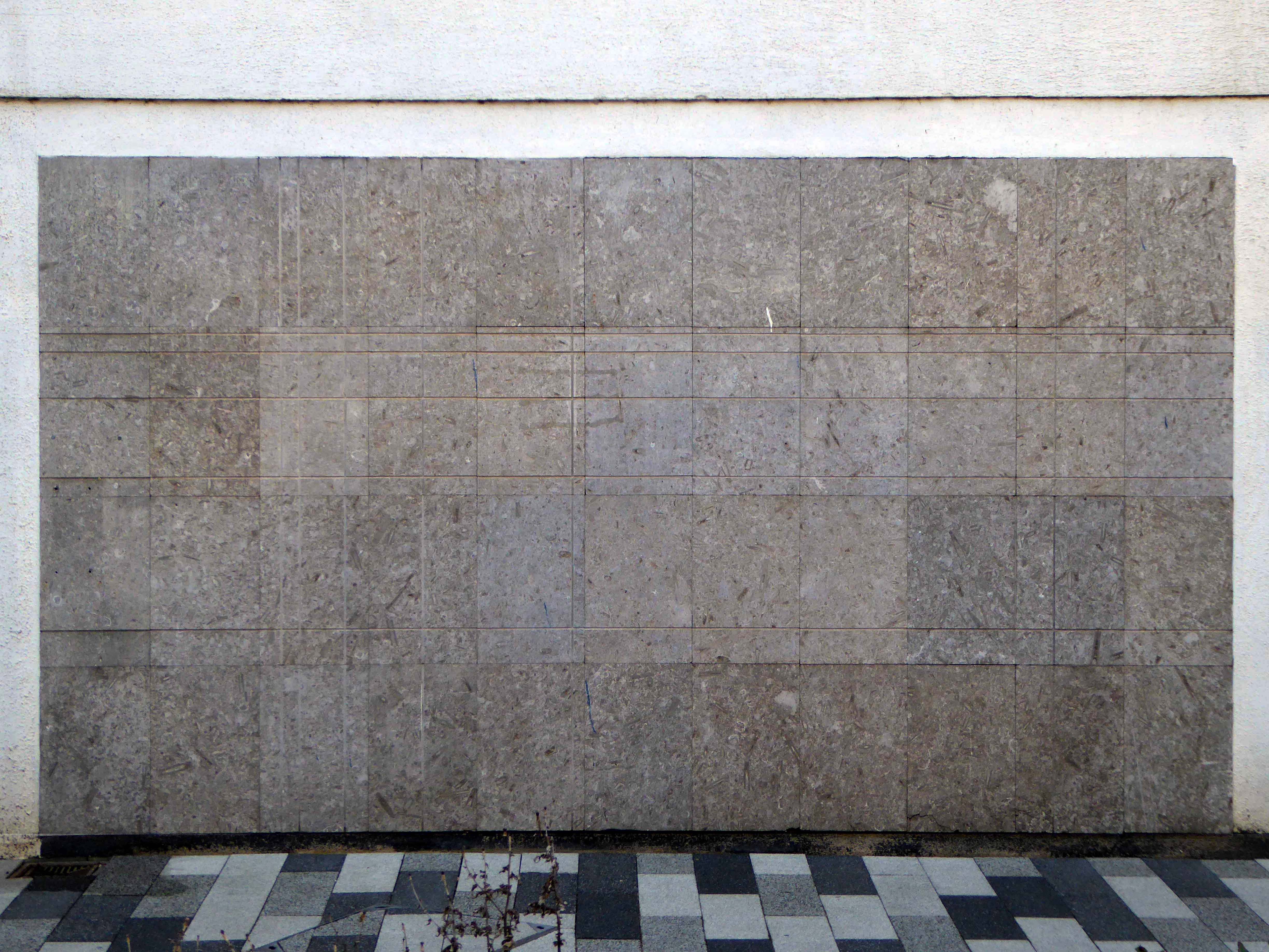
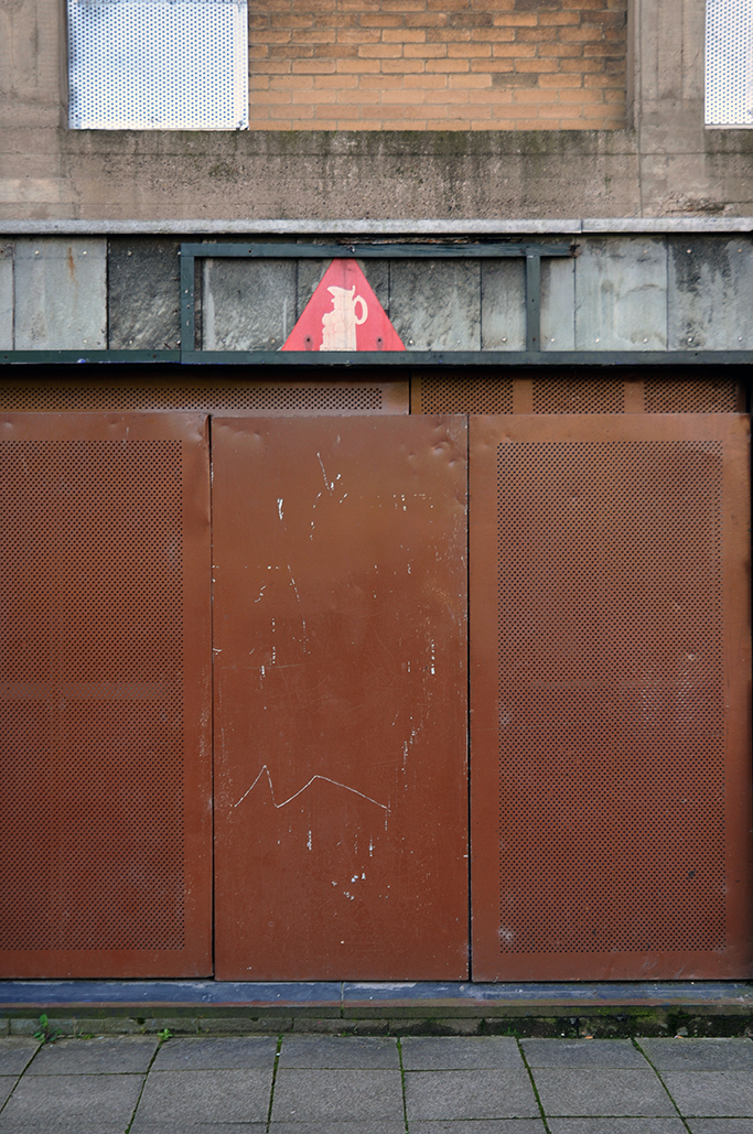
The photograph depicts Alan Boyson’s concrete screen wall, attached to the former Cooperative super store designed by Philip Andrew. The two worked to gather on the Hull Cooperative store, which is adorned by Alan’s huge Three Ships mosaic.
Philip was a childhood friend of Alan Boyson and it was Alan’s father, manager of the Marple Co-operative Society, that recommended Philip for an apprenticeship job in 1951 to the chief architect at the CWS in Manchester HQ.
In preparation for the tour, I visited the town’s Local Heritage Library and read extensively from serendipitous charity shop finds.
The two hour route was designed around an economy of distance and elevation, allowing time for others to take in, what may be for them unfamiliar surroundings. A group of around twenty or so folk became sociable and engaged, with a suitably concise and apposite contribution from myself. There are those who busied themselves taking snaps along the way, chatting amiably or simply gazing in amazement.
The service building above the former Debenham’s store.
Famed as an imaginary TV police station, this civic building is a civic building I simply can’t resist. I return on a regular basis to wander and snap. This is an open public space that seems little loved and has few visitors.
From then onwards I have been taking folks on Modernist Mooches on a regular basis, two or so a month, during the less inclement times of year.
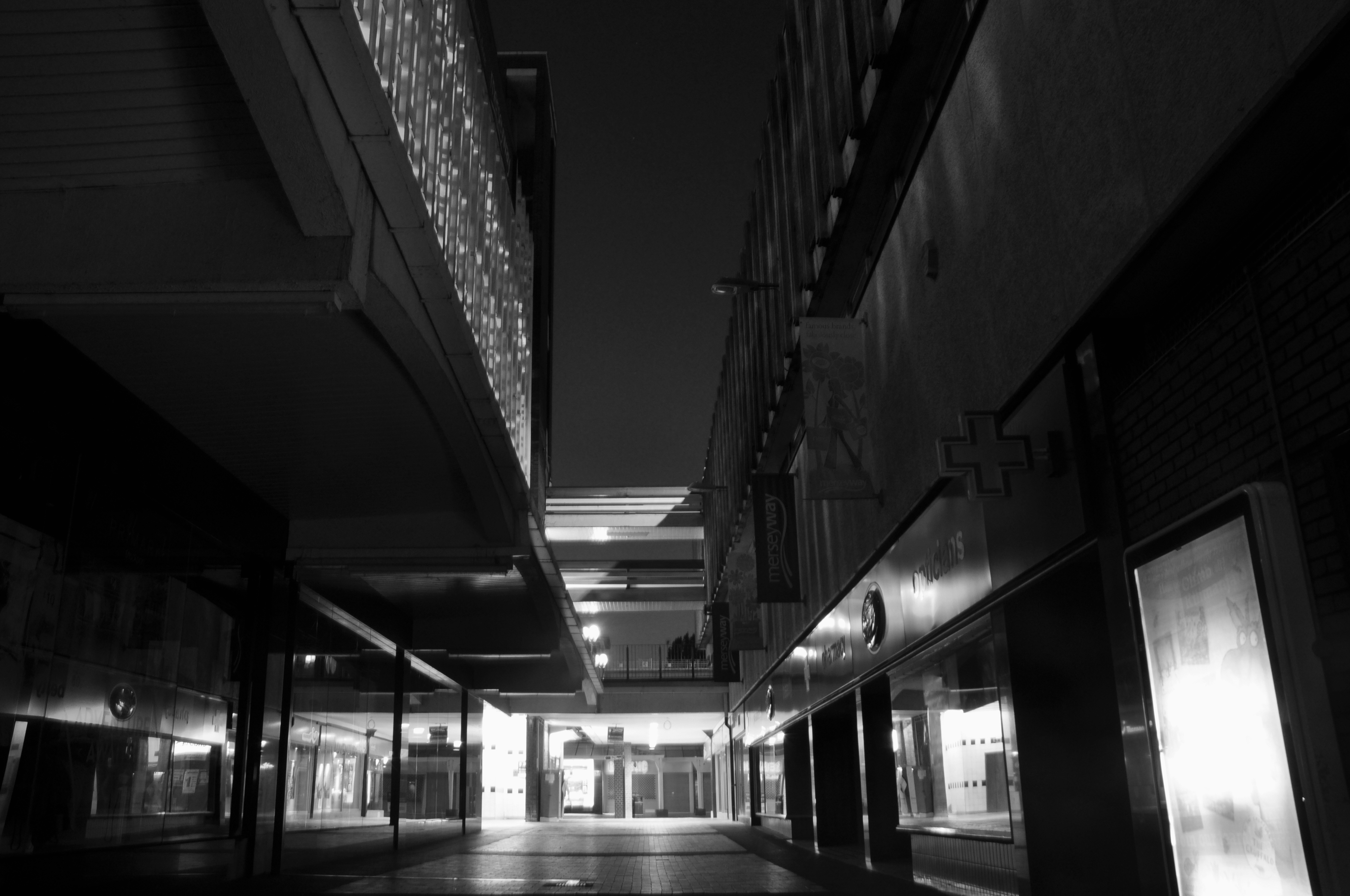
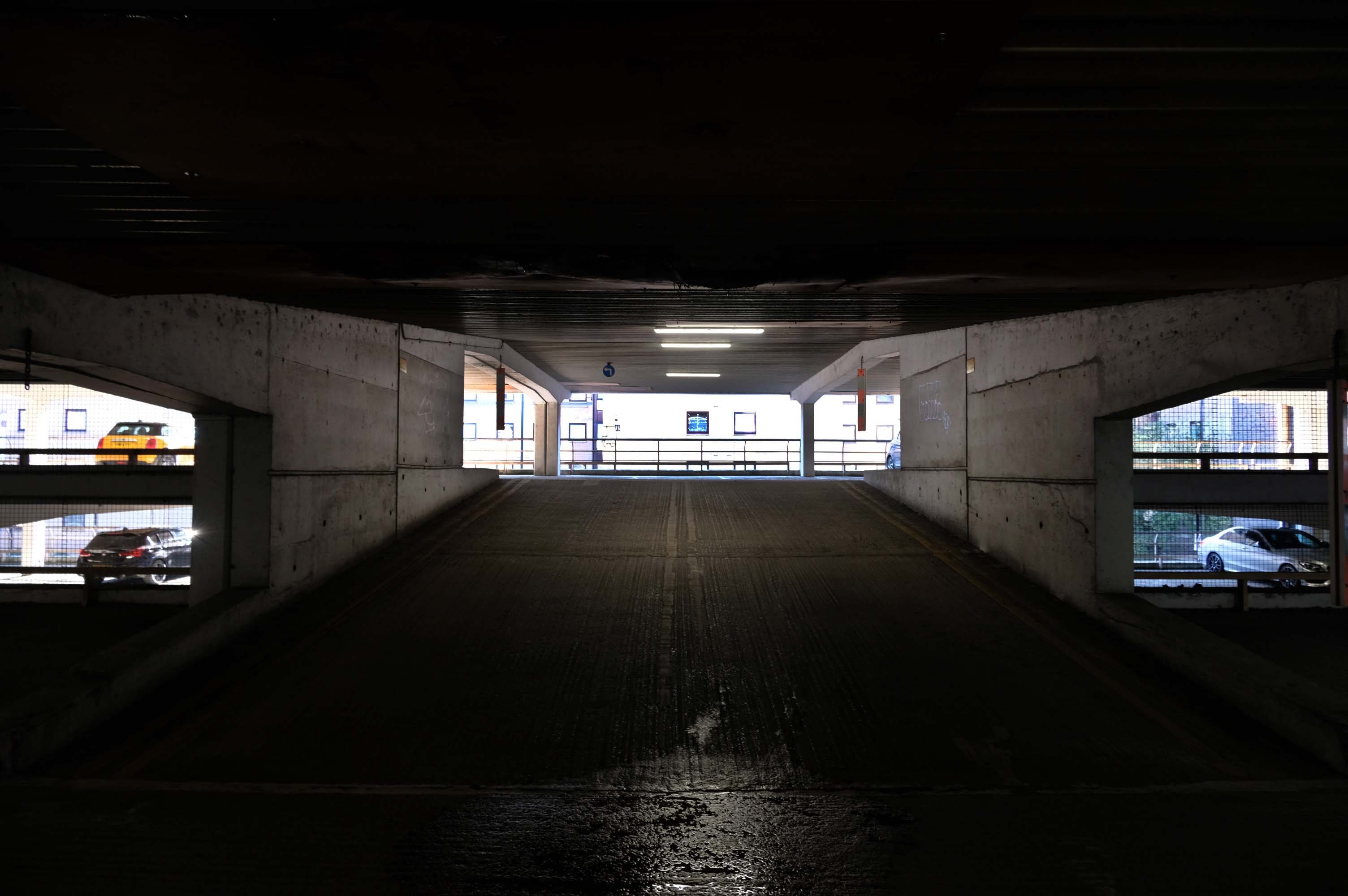
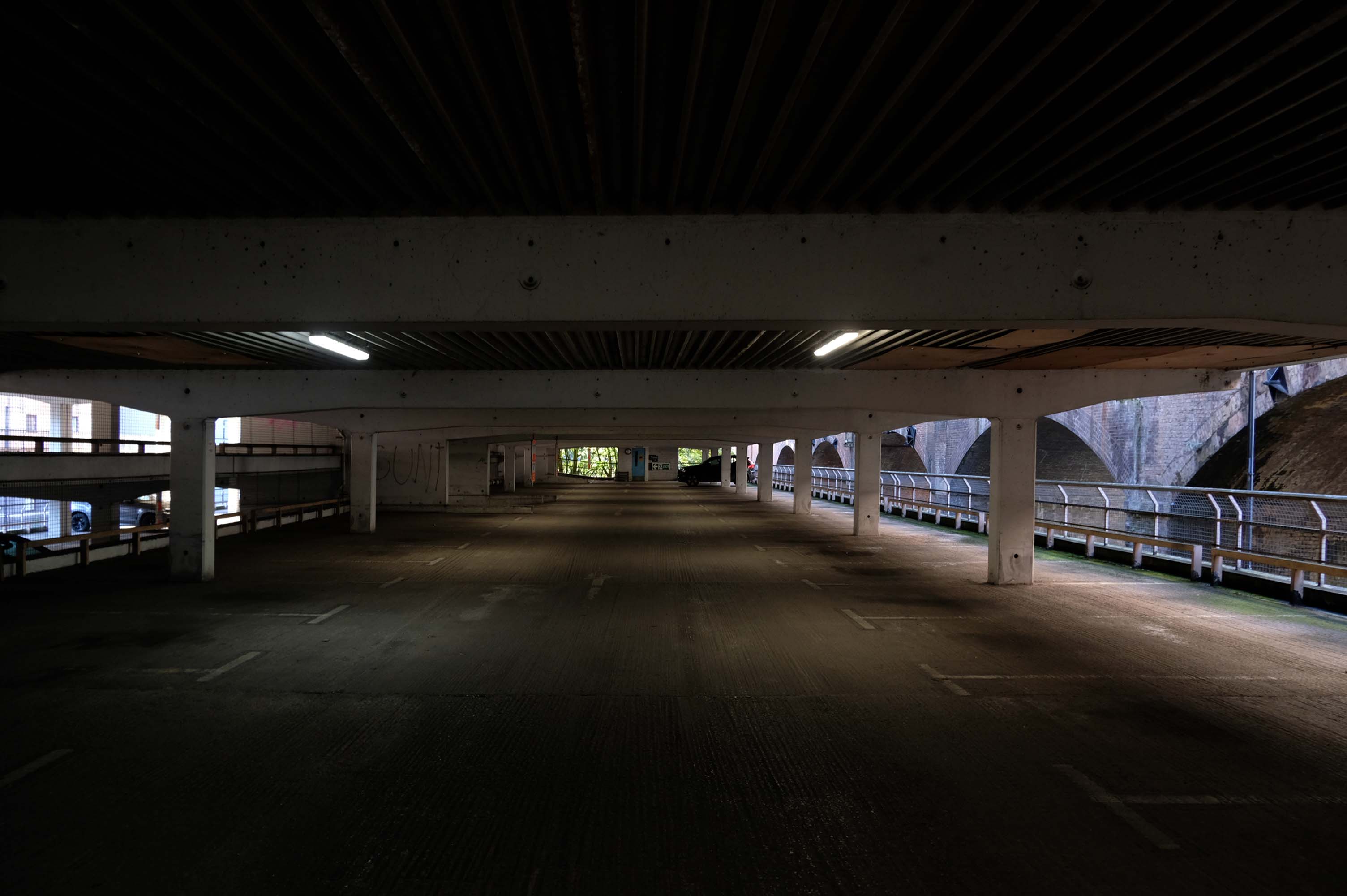
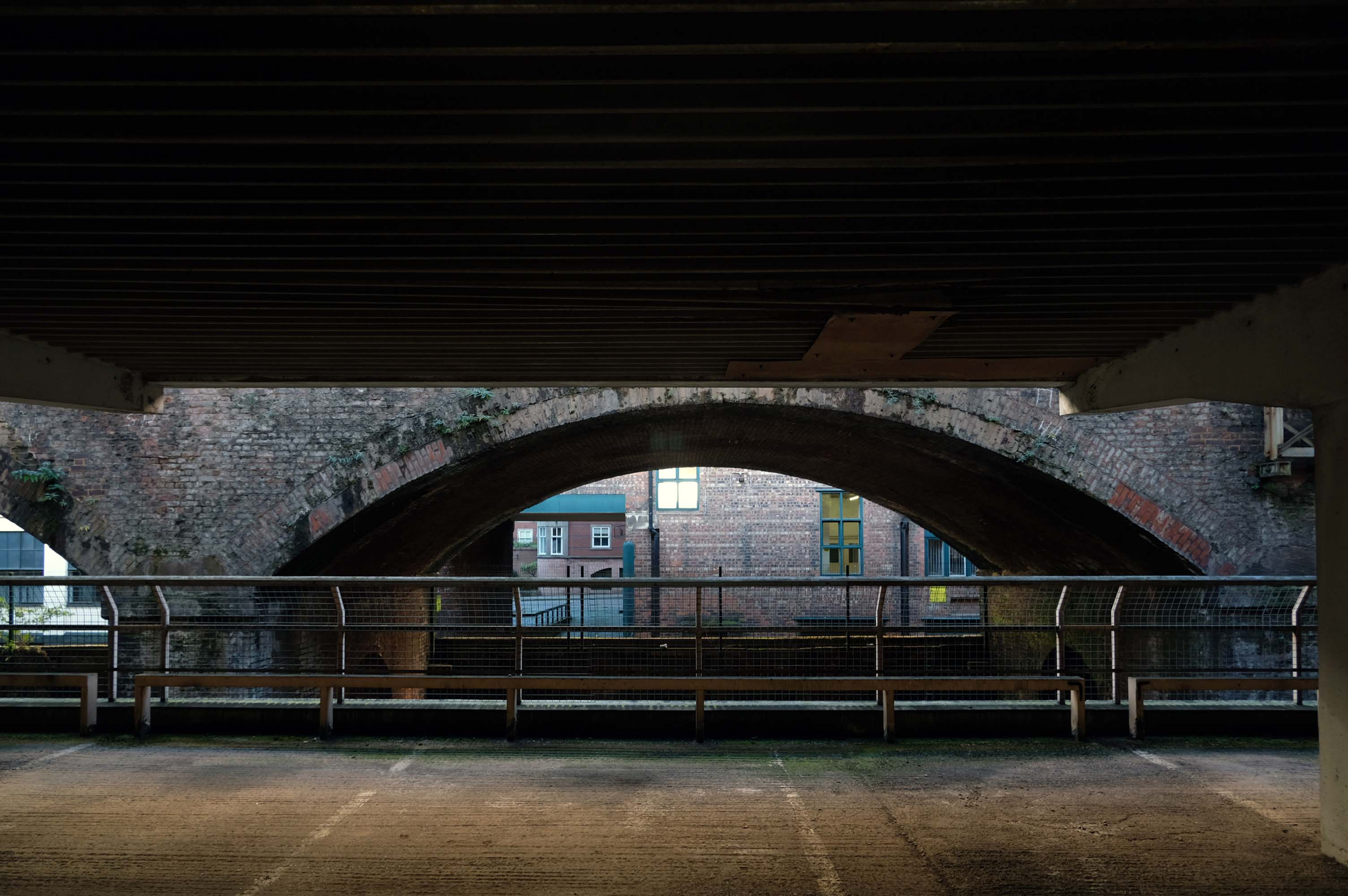
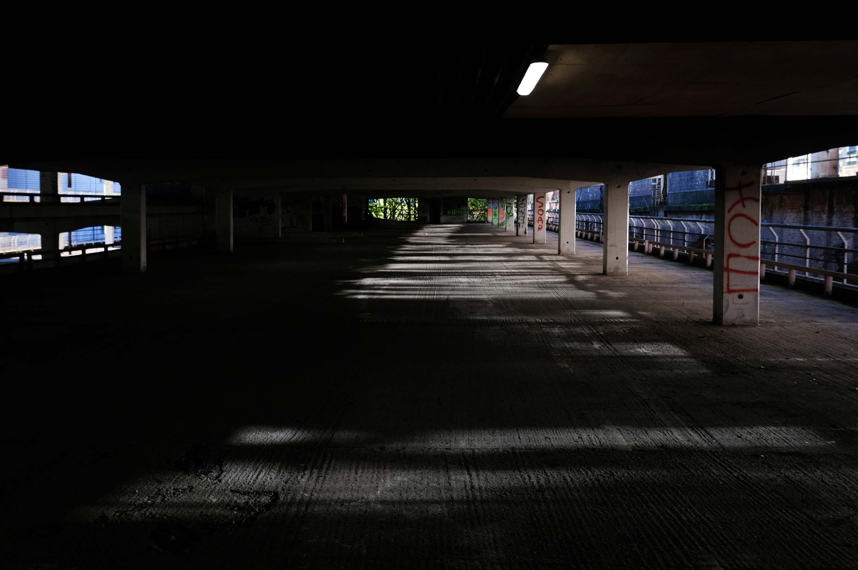
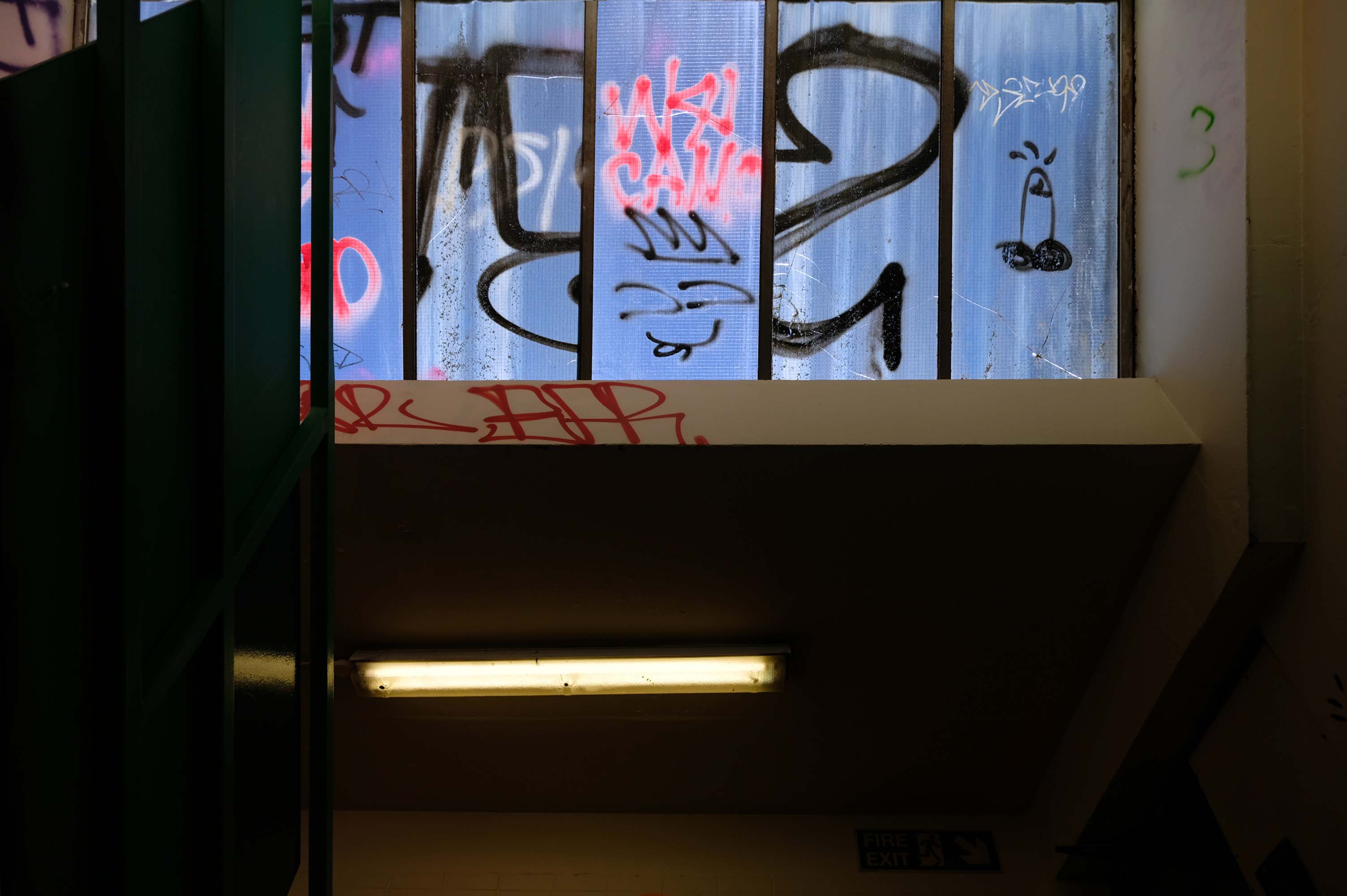
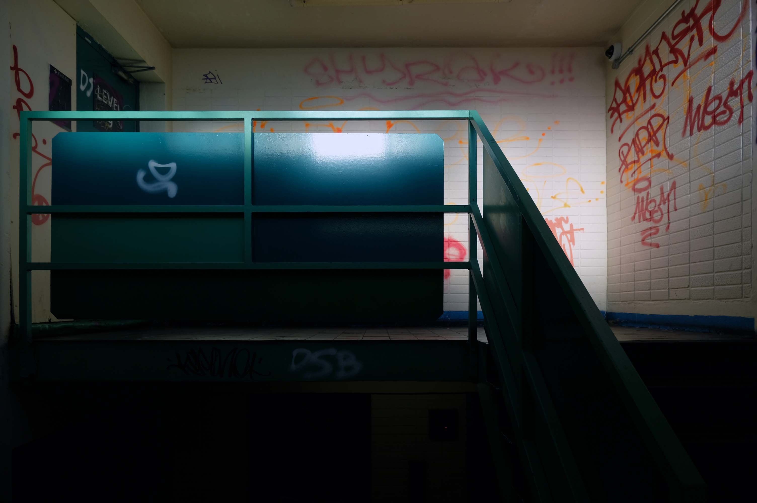
At about the same time I was asked to exhibit my photographs in Stockport, I chose to mooch about at night. Walking around an almost deserted town, avoiding the glare of streetlights, there is a mild frisson to be about when nobody else is about. The air feels different, exposures are longer, the almost waking world feels arrested, by the low available light.
My local shopping centre and as such part of my weekly walking and shopping life.
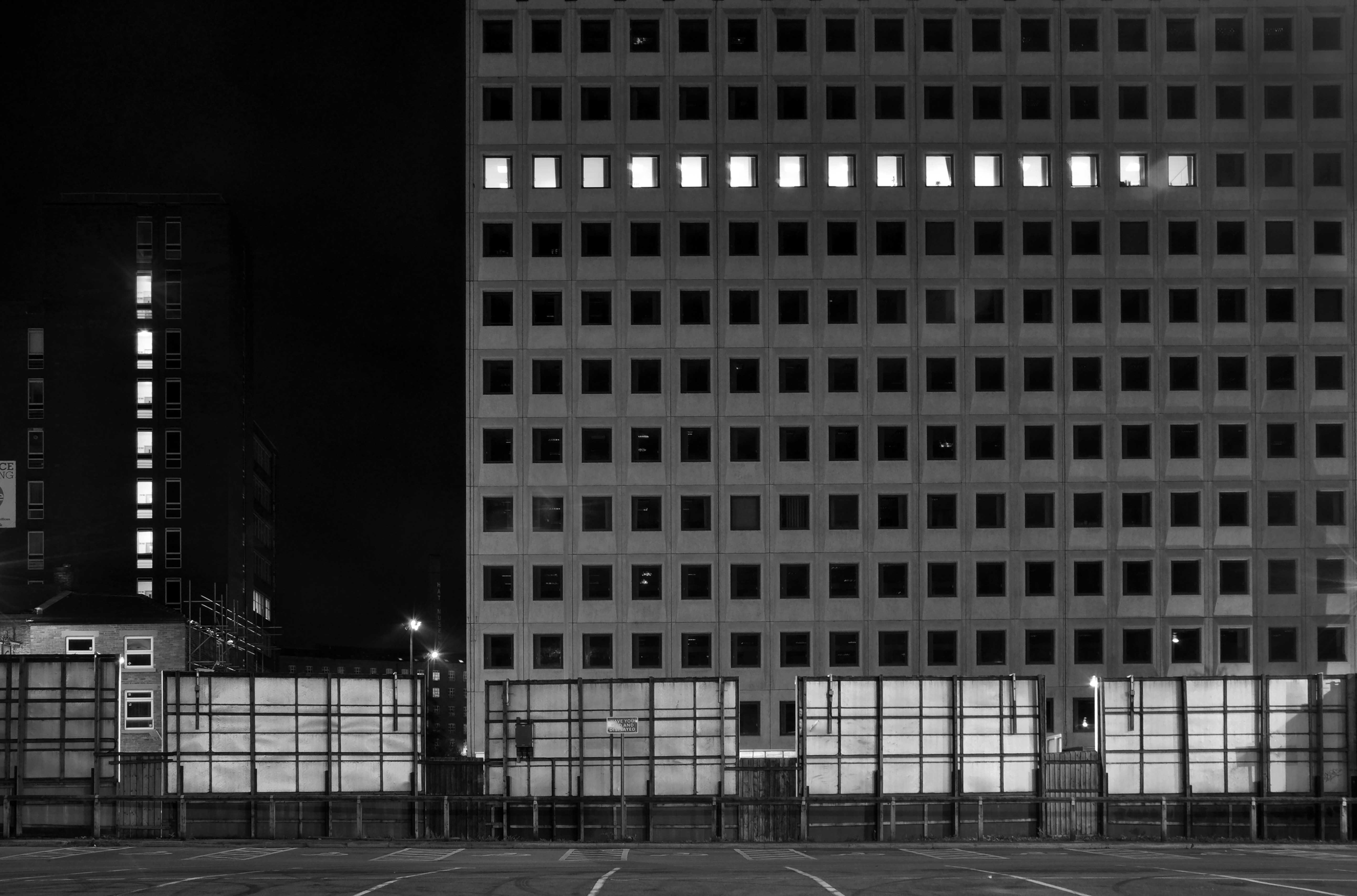
NCP Car Park located on Stockport Station approach.
Regent House
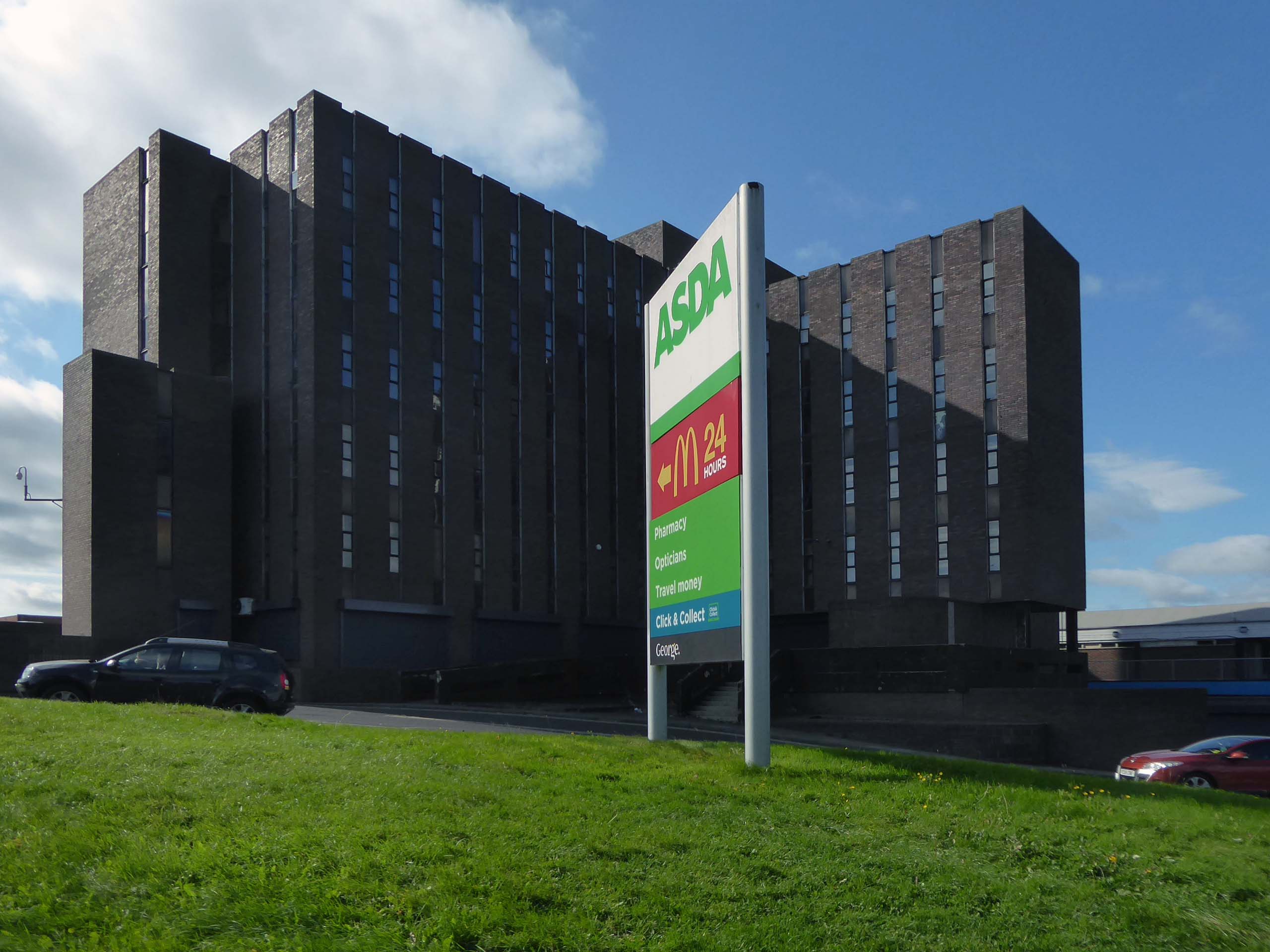
Asda superstore
I found a copy of Charlie Meecham’s book Oldham Road in a charity shop.
Inspiring me in 2014, to walk in mostly straight lines, though often as not zig zagging along the main arterial roads of Manchester.
Taking pictures on Sunday mornings, in order to avoid traffic, mildly amused to be ignoring the primary function of the routes.
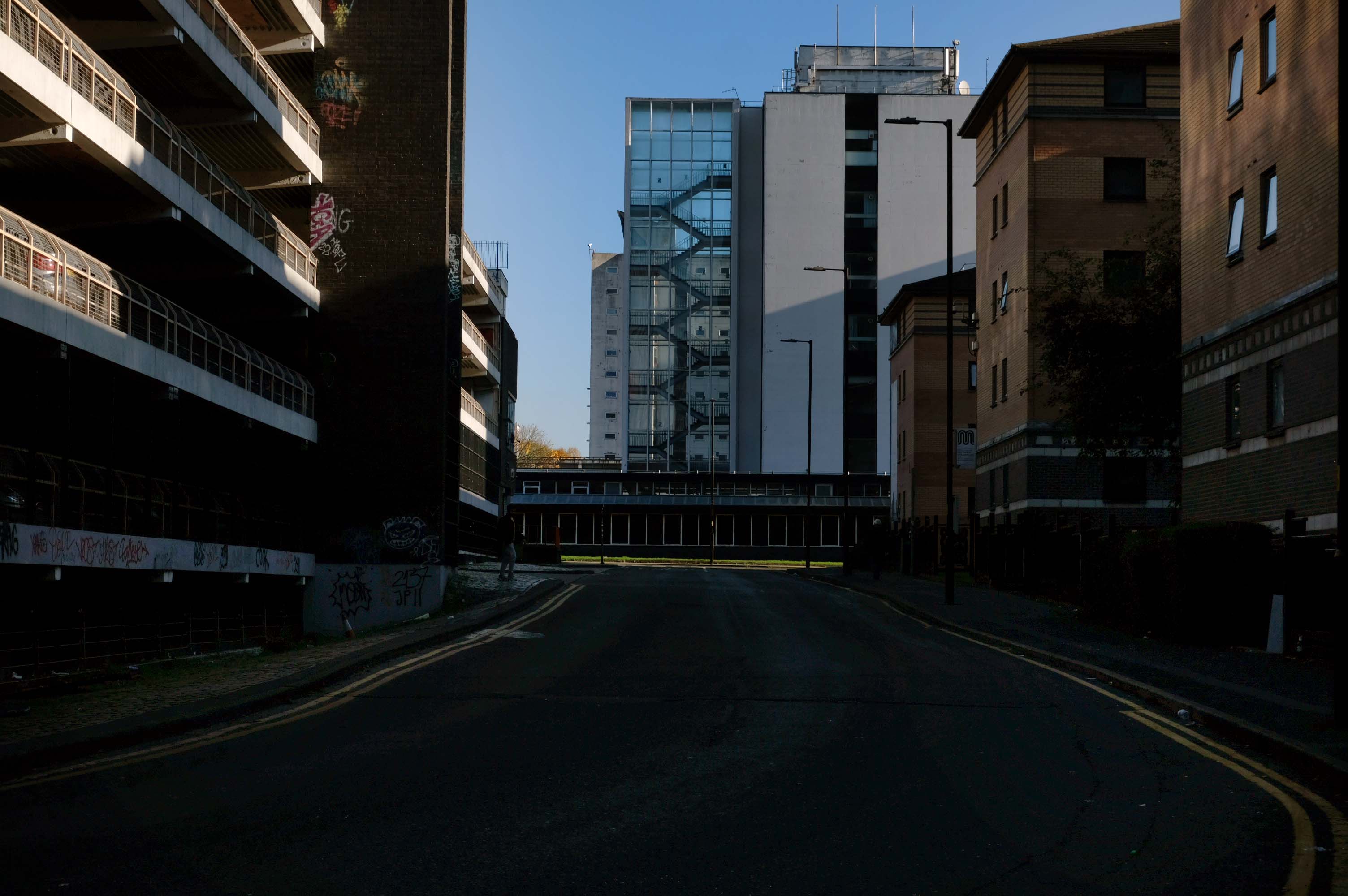
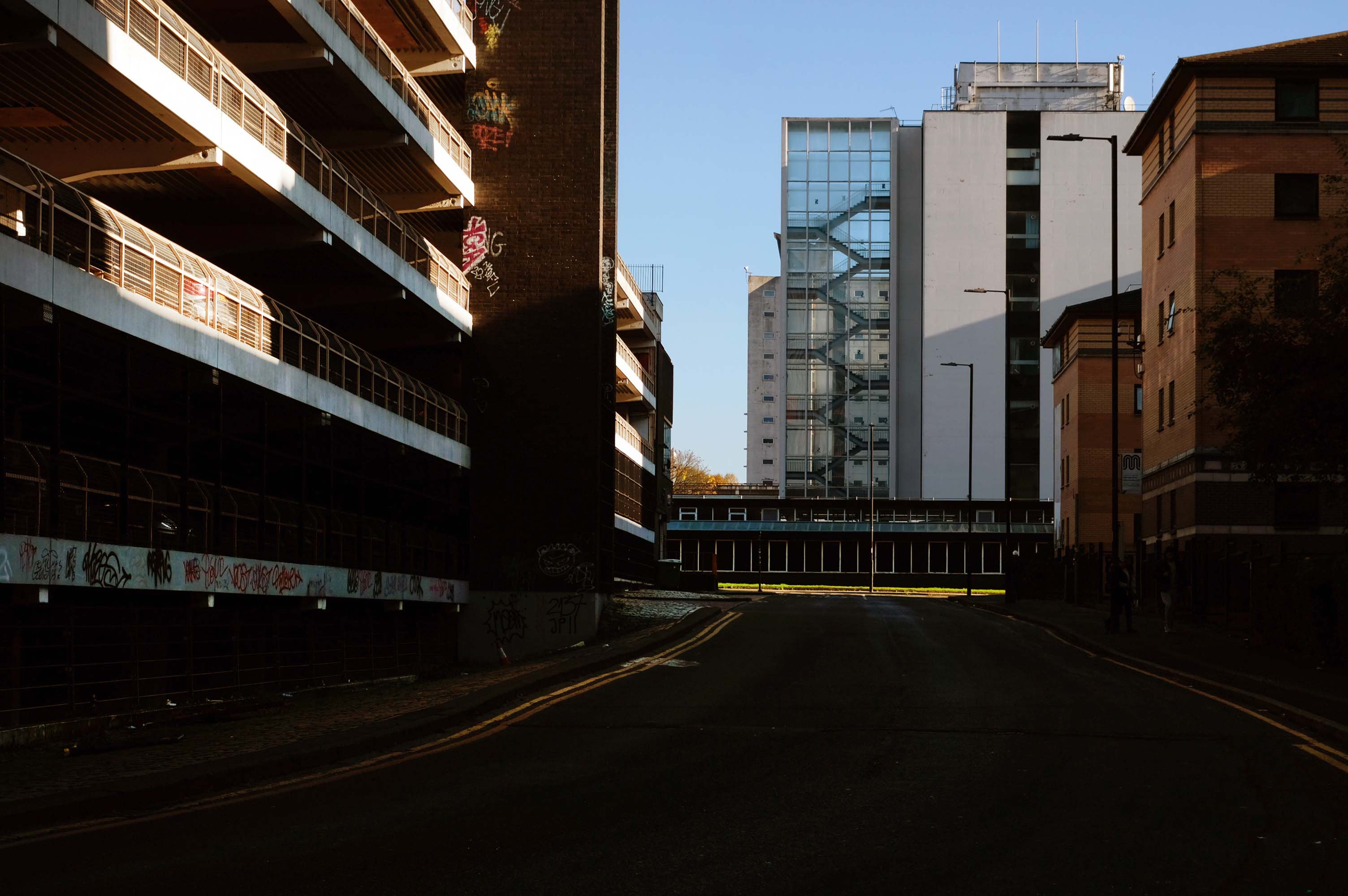
This is one of the more familiar roads, having walked up and down several times over several years. It was to have been an extension of the Mancunian Way, forming a trans-pennine motorway. Much of the property lining the route was cleared in preparation, it was never built, and for years a strange semi-deserted ambience hung over the A57.
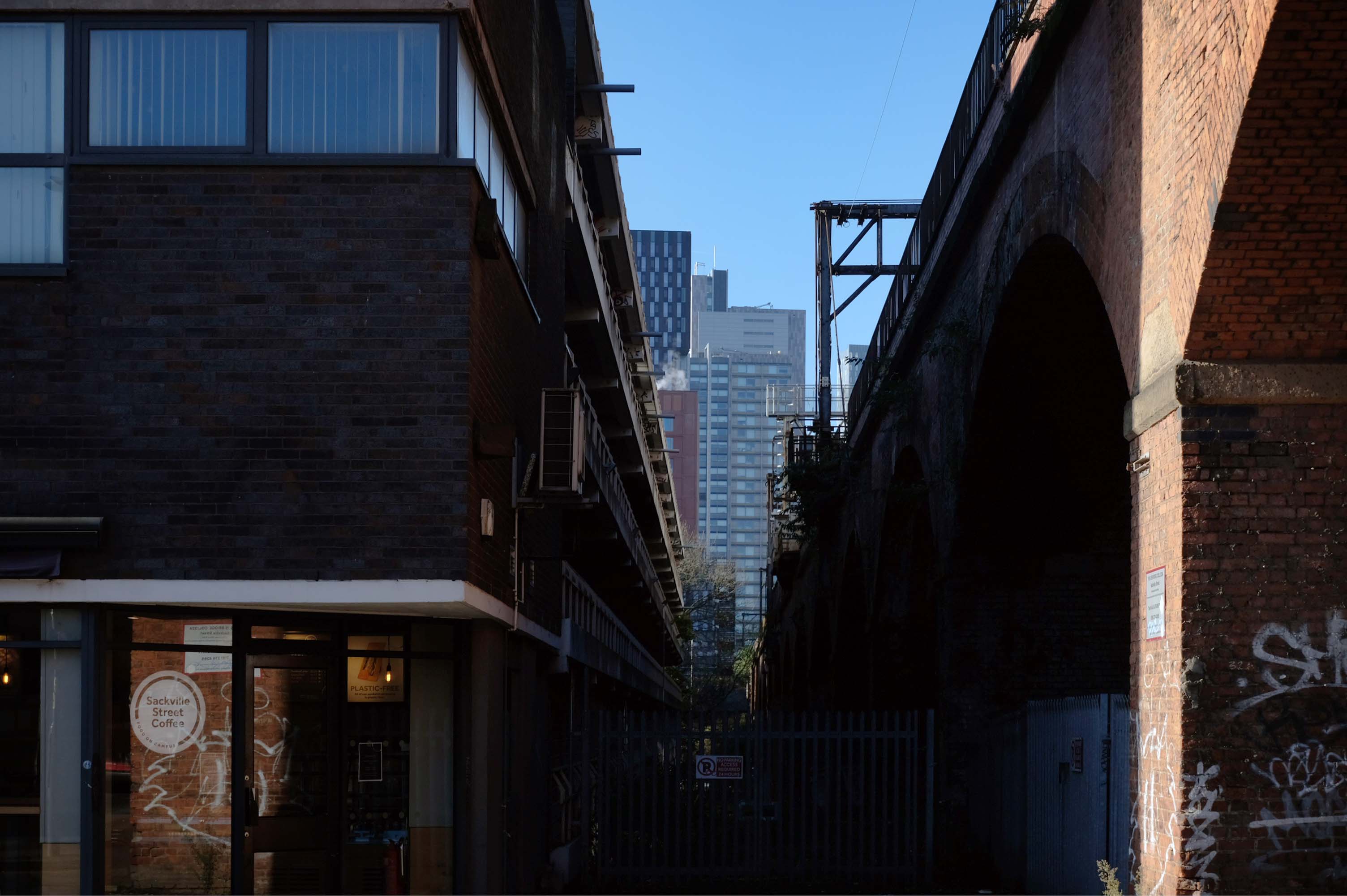
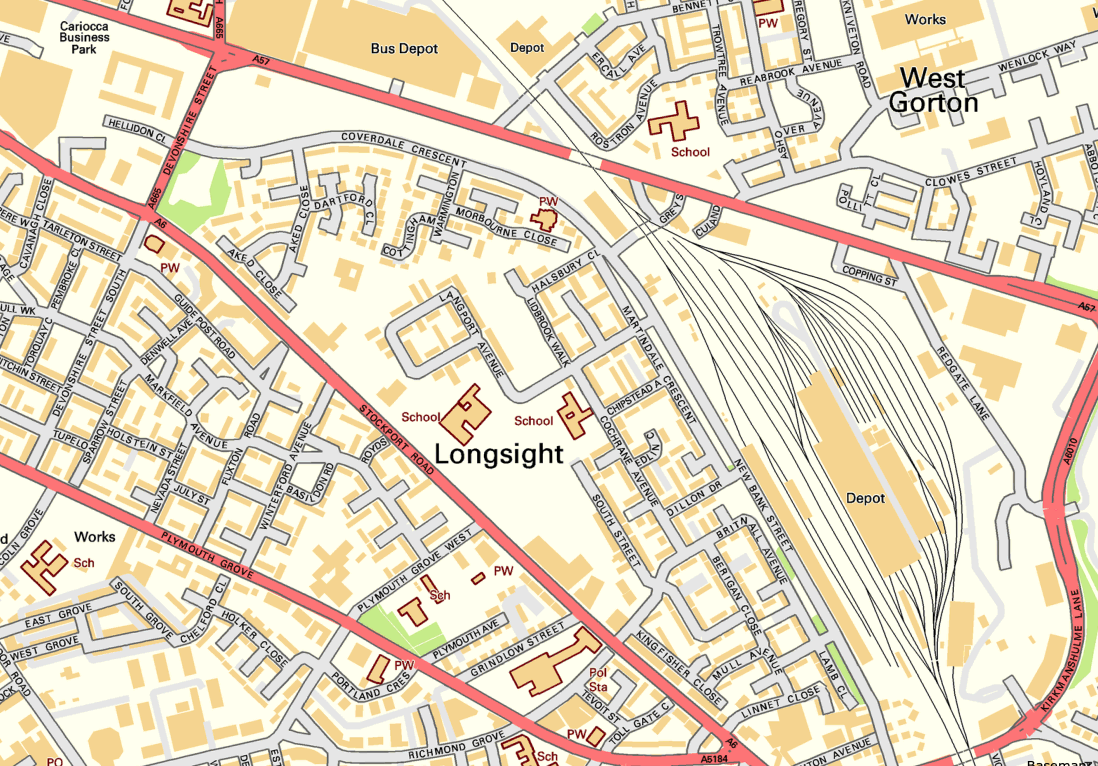
Bus Depot
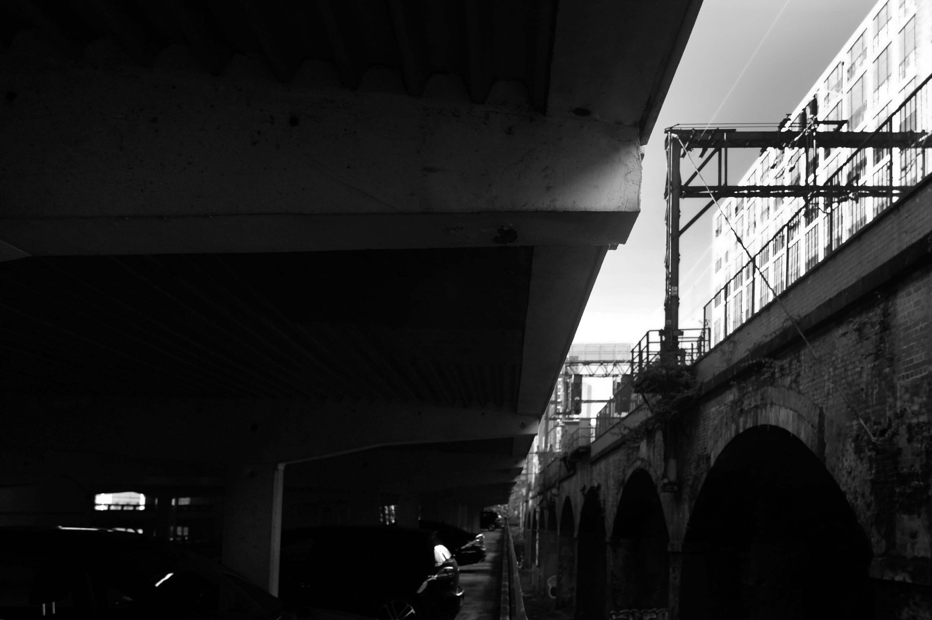
Railway Bridge
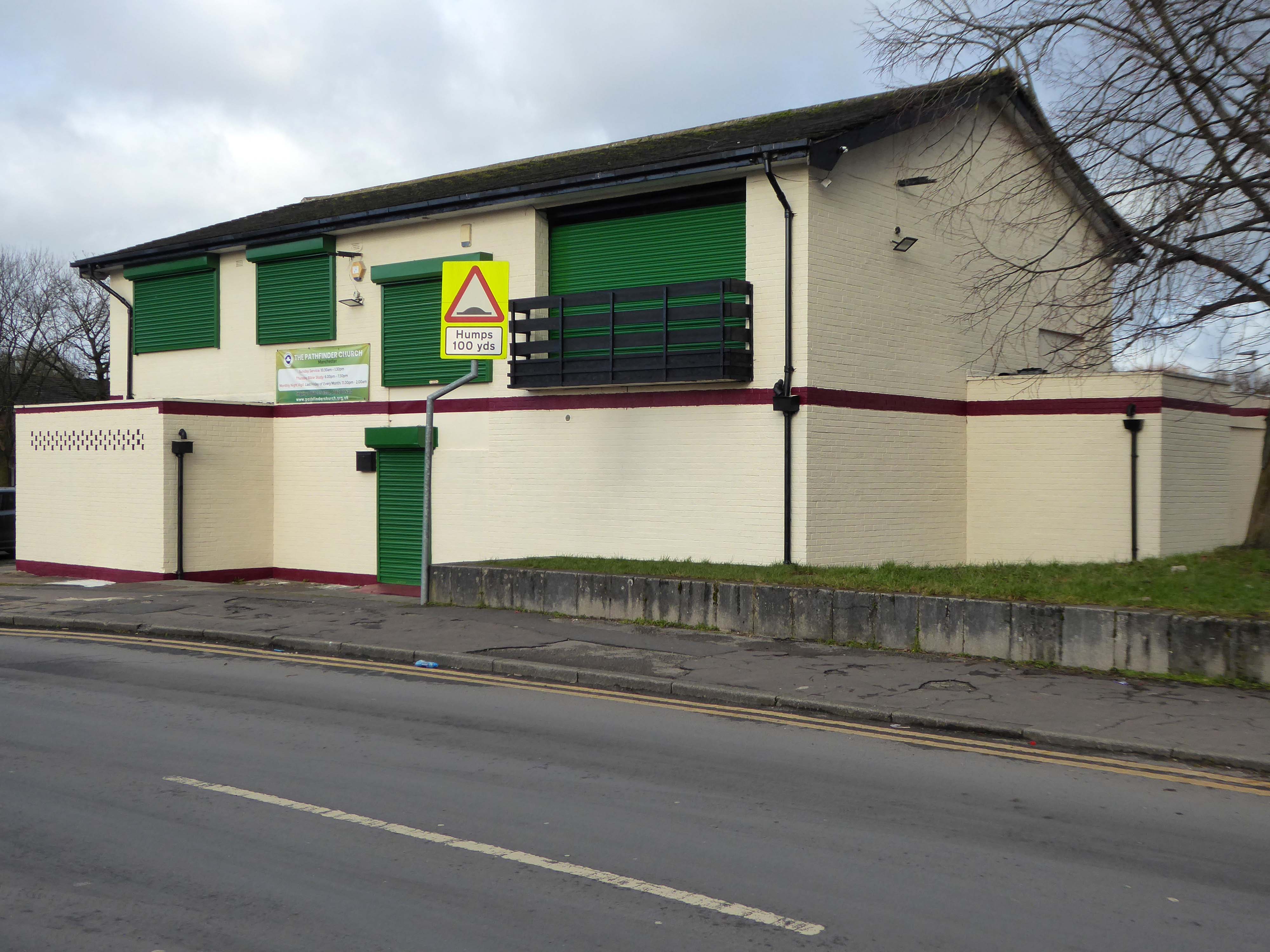
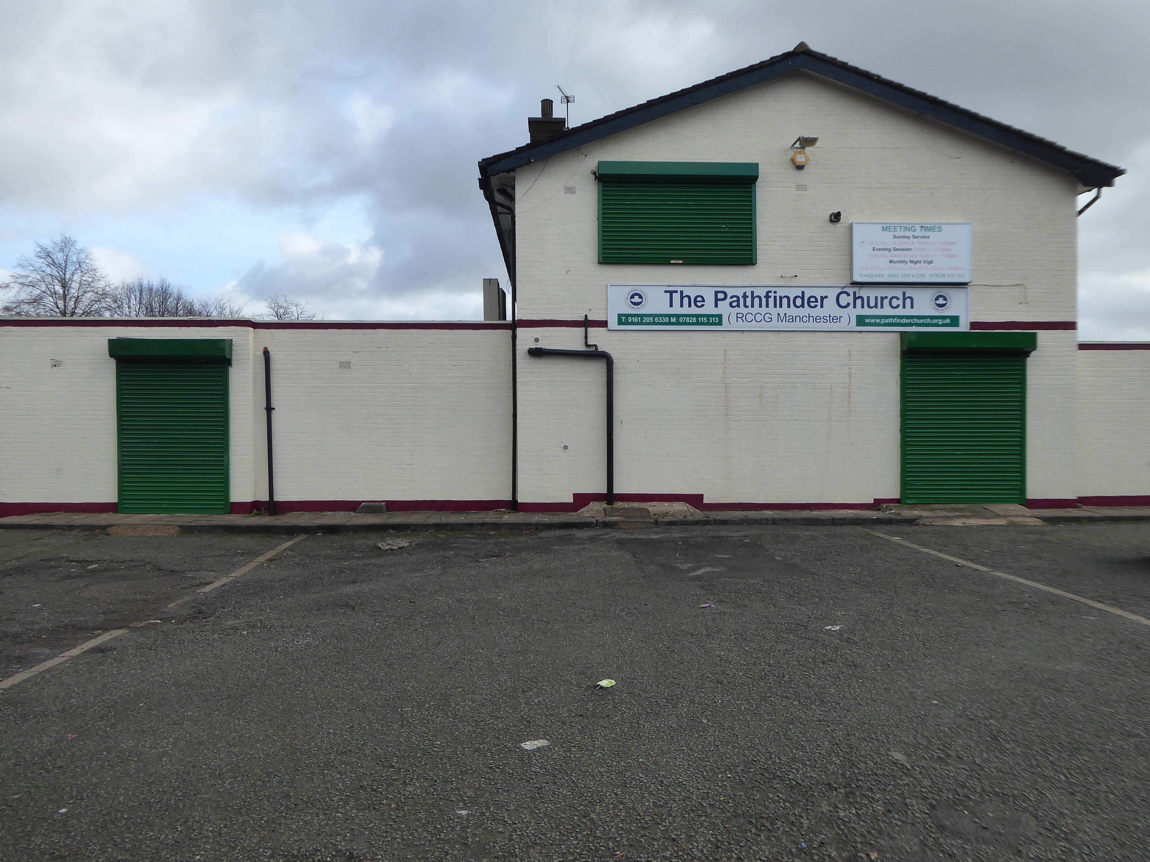
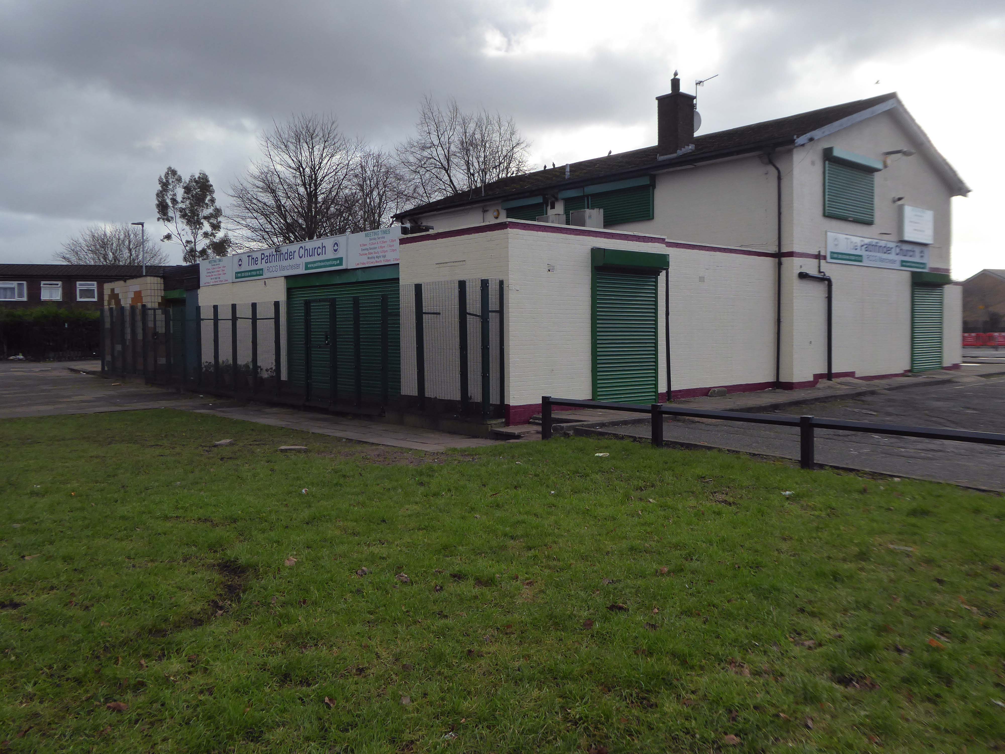
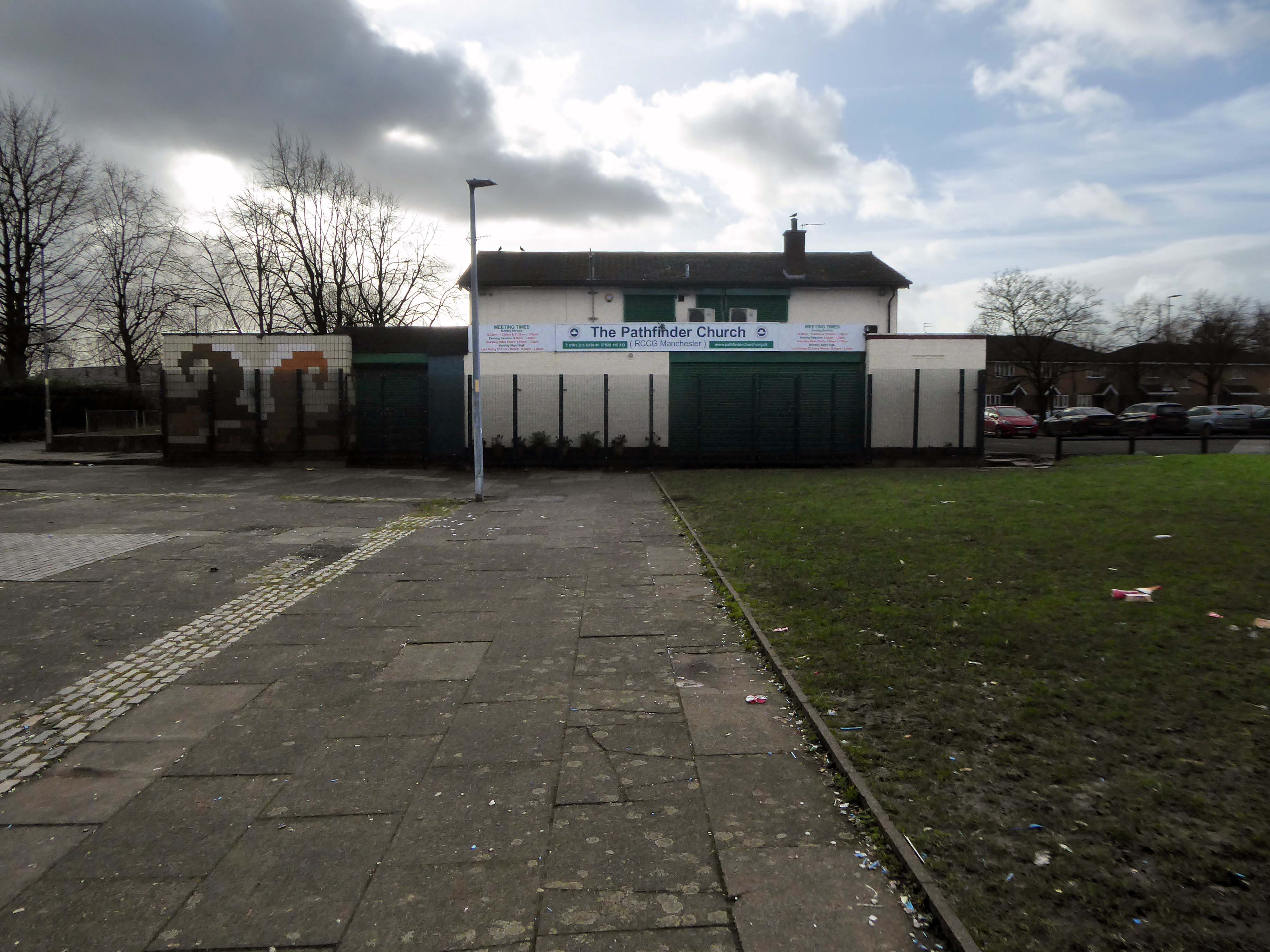
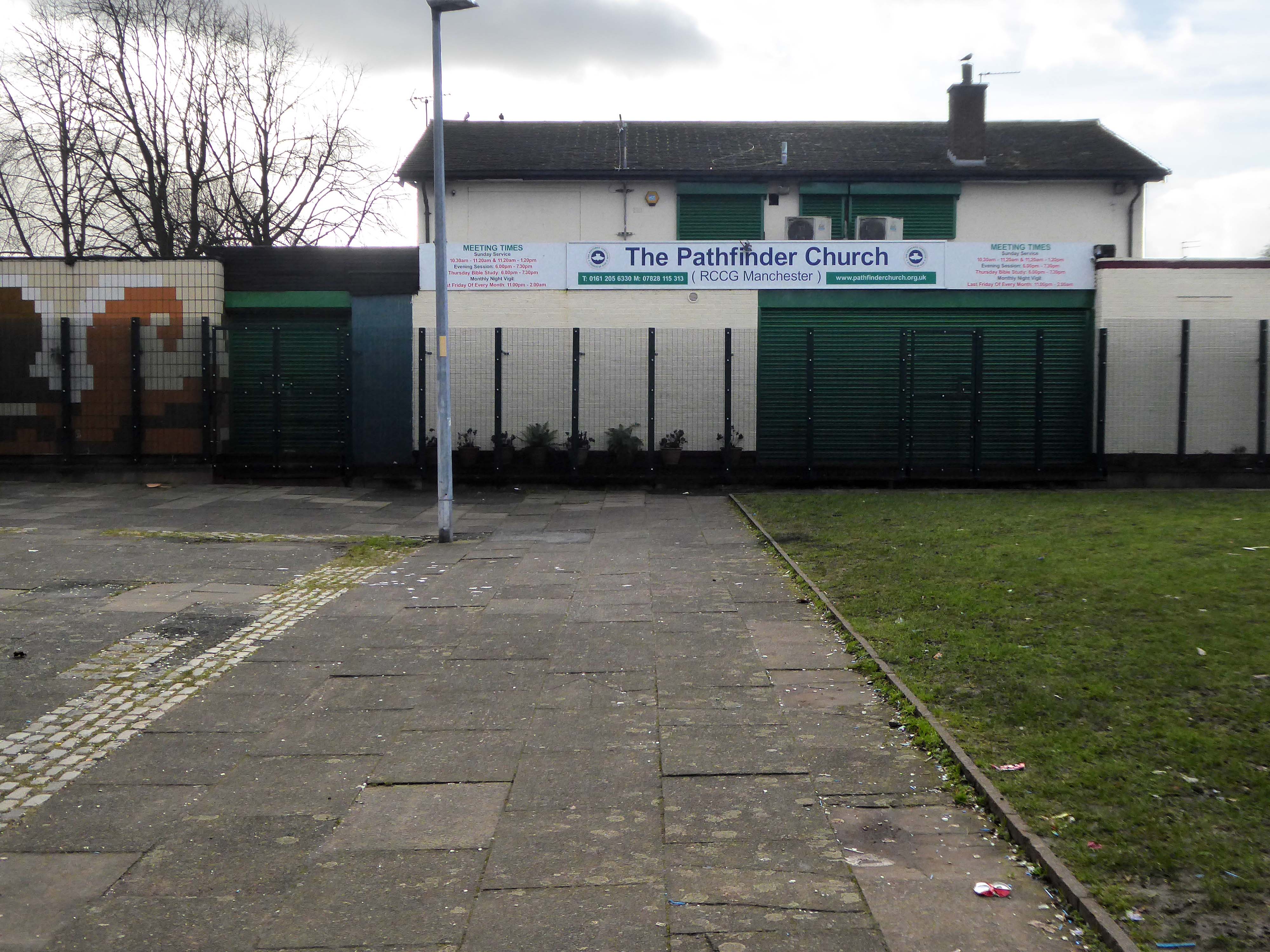
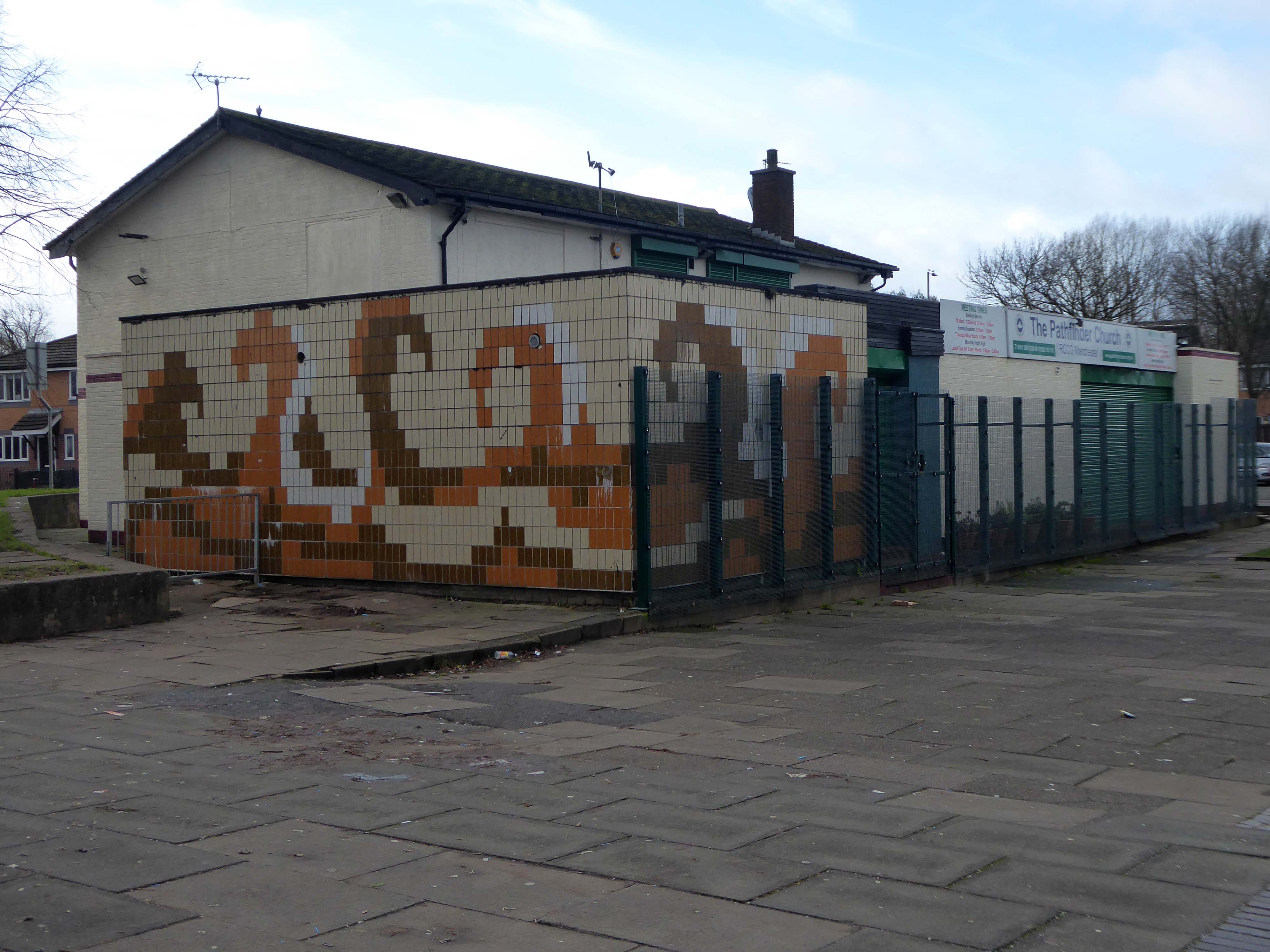
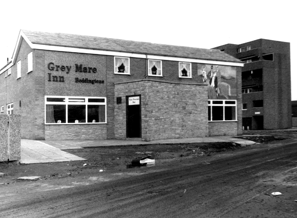
The car showrooms which later became an African Evangalist church.
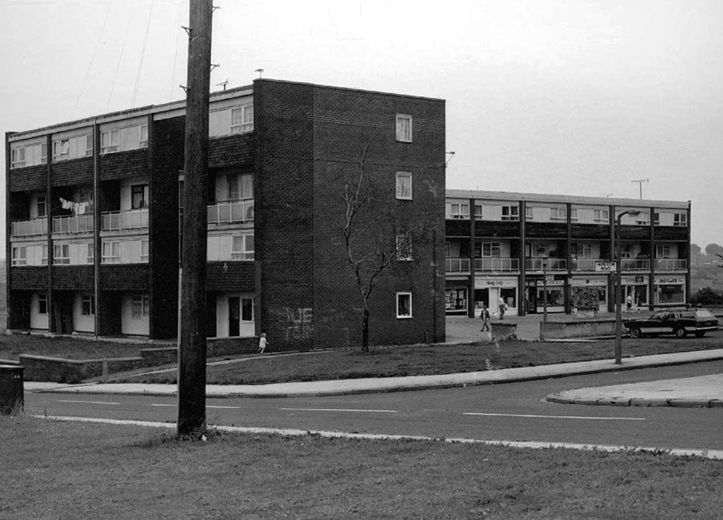
Having cleared away both Victorian and Sixties housing, new architectural forms arose in West Gorton.
Now, everywhere I go, I see launderettes – so arriving in Hanley with time on my hands, wandering around I found this exemplary example.
Having a blog entitled Manchester Estate Pubs, the national media became interested in my photographs. I had spent quite some time, wandering around in search of this endangered architectural typology.
This was Billy Greens in Collyhurst, named for a local boxer, now demolished.
Which in turn became the second modernist calendar.
Followed the following year by fish and chip shops.
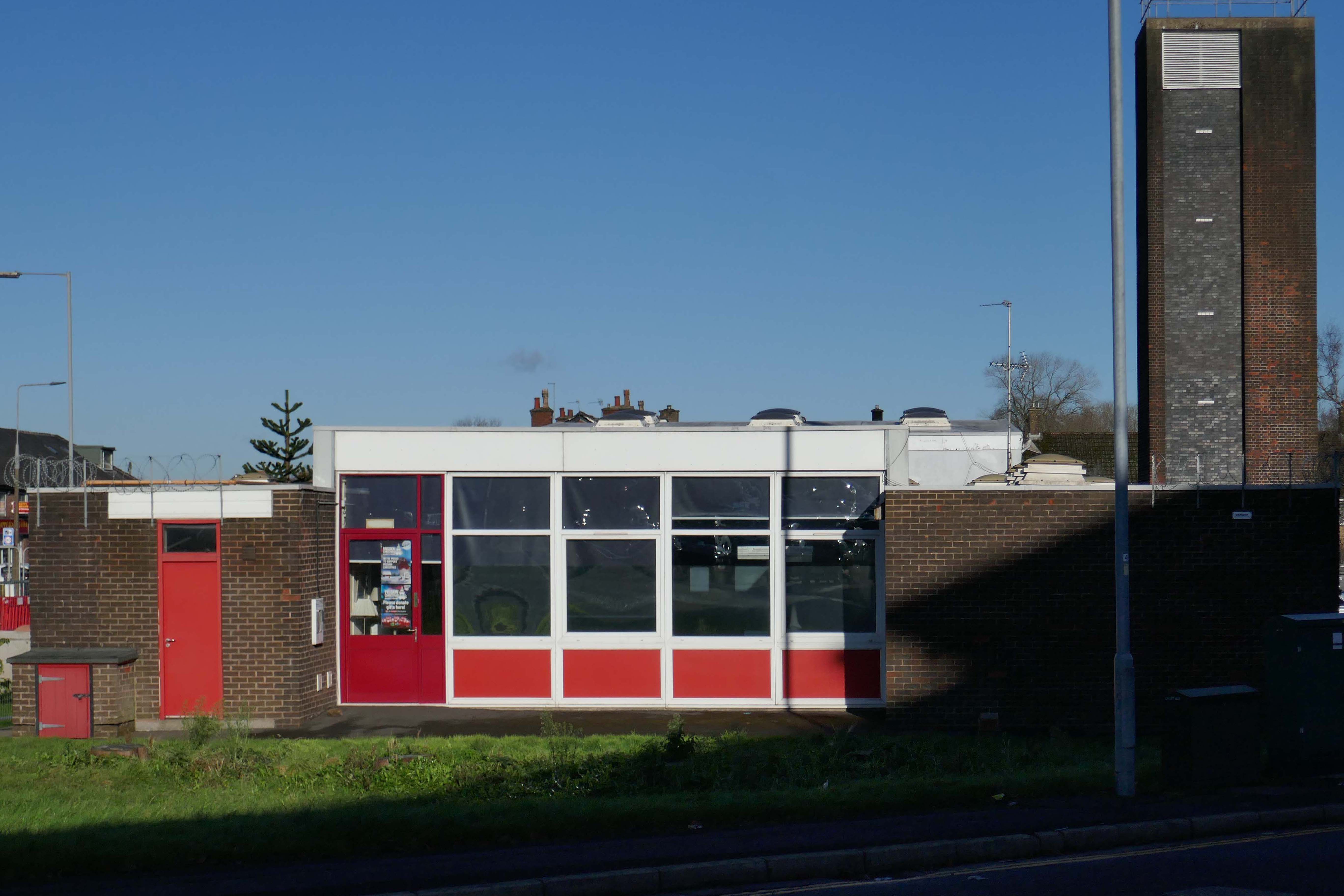
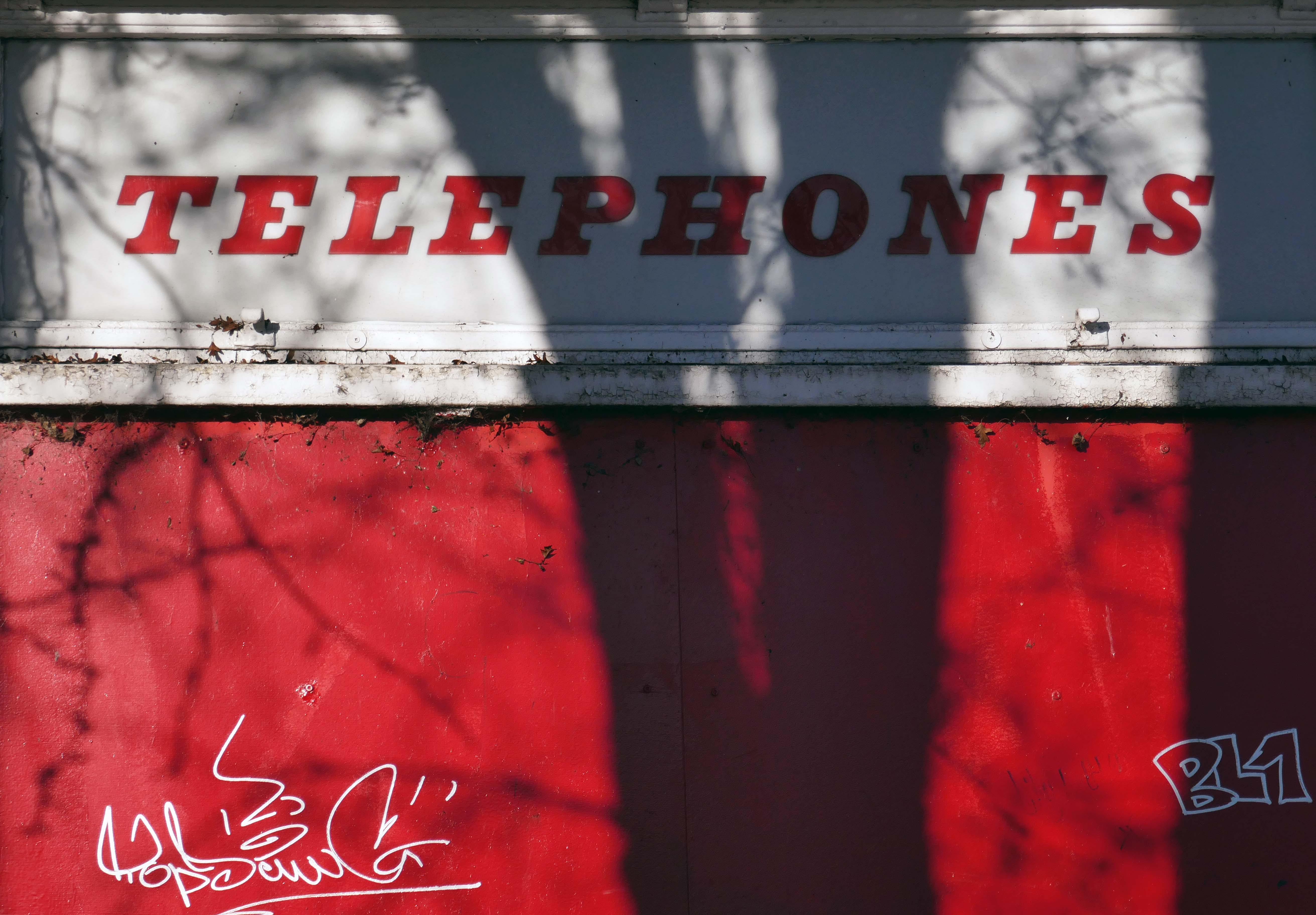
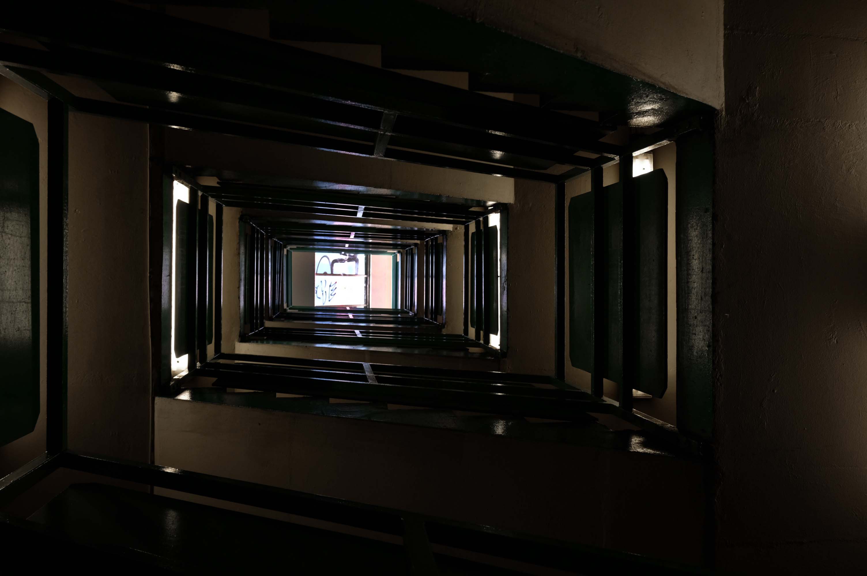
So building a vocabulary for my mooching, discovering yet another chippy, laundry, pub, Burton’s, telephone exchange, glazed stairway or underpass.
These things find you, yearning for some small amount of attention and affection.
The Trawl – my favourite peg board menu, my favourite Bridlington chippy.
We are now coming to the end of the car park year – seen here on the wall of my command centre.
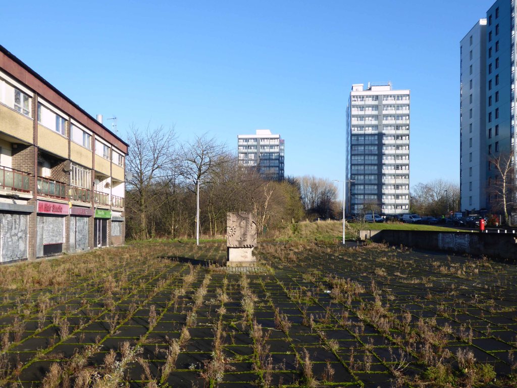
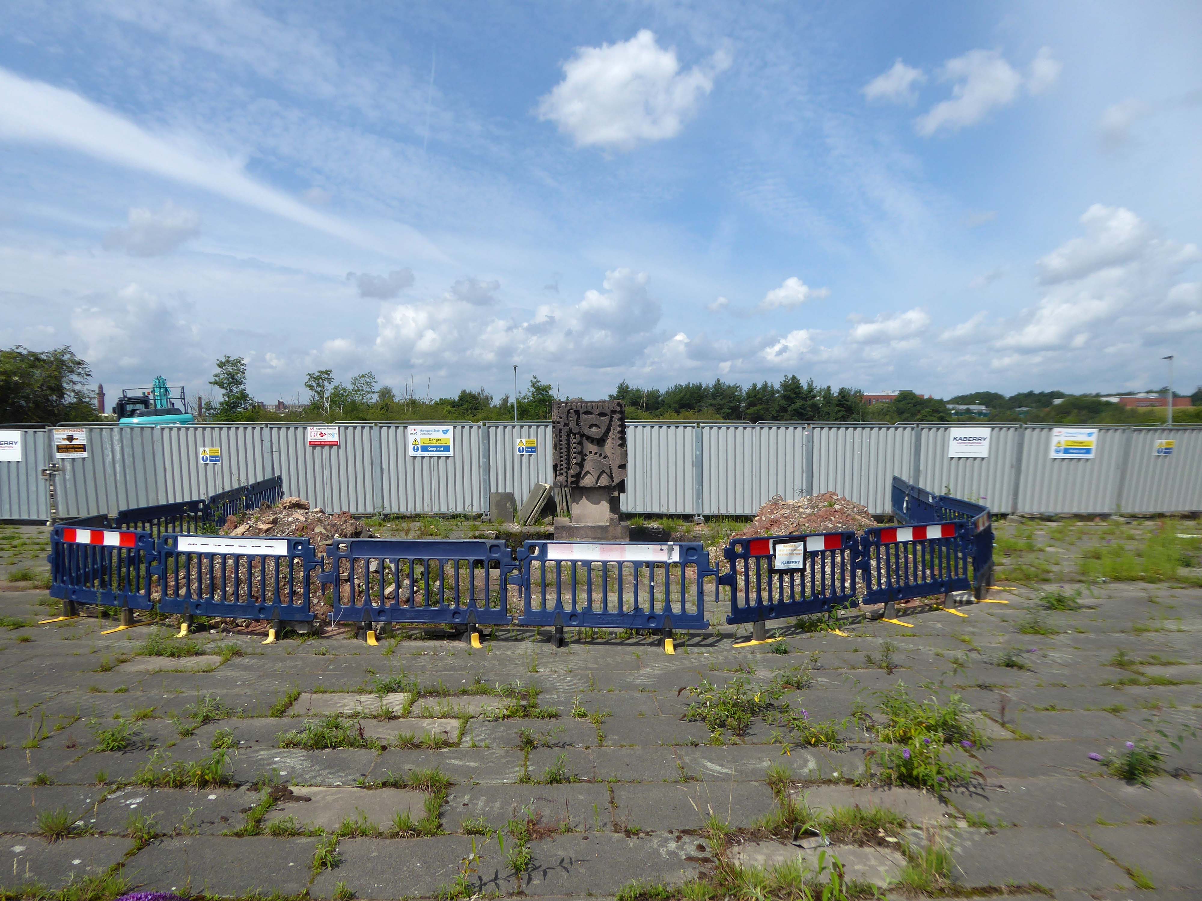
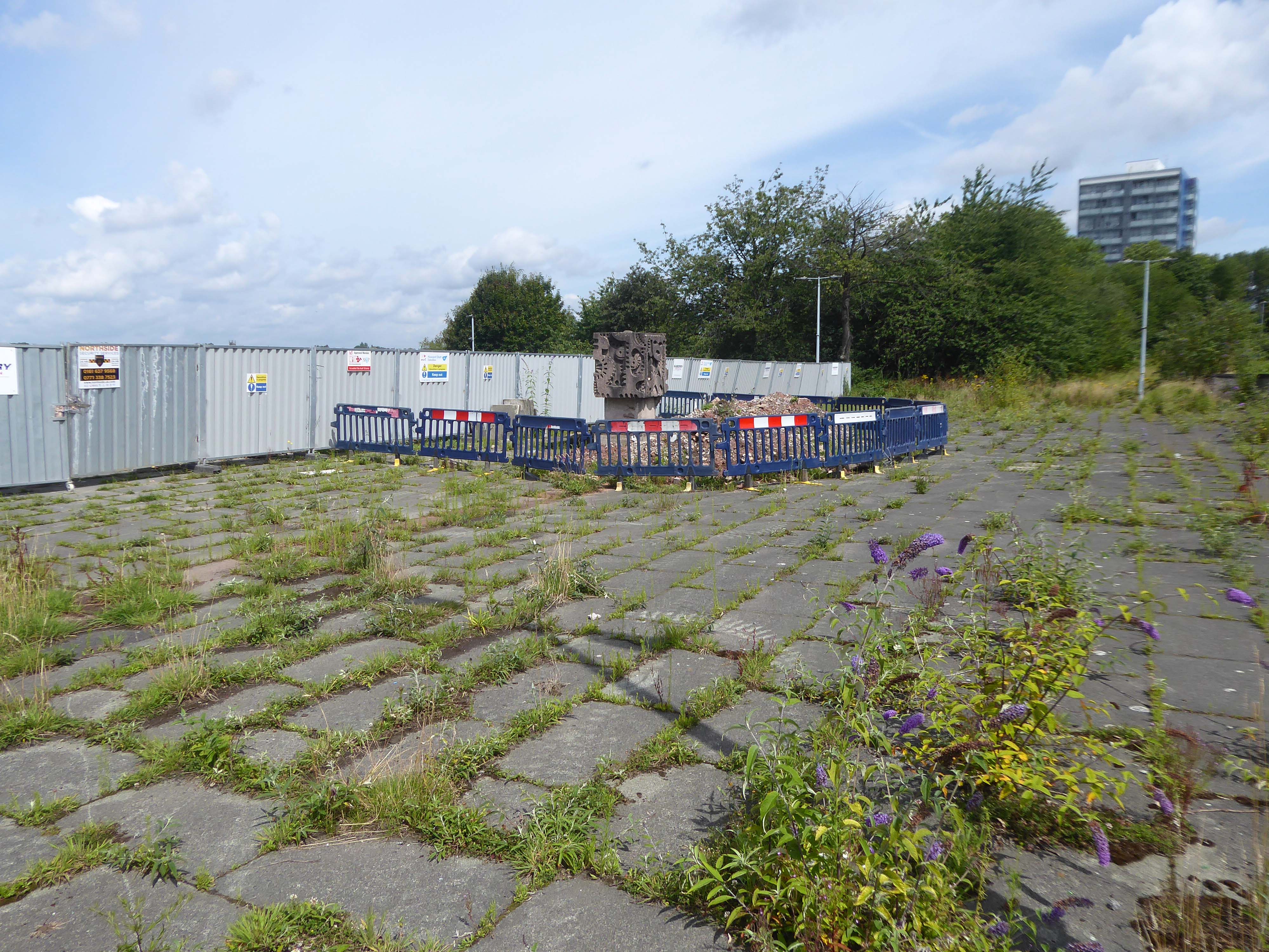
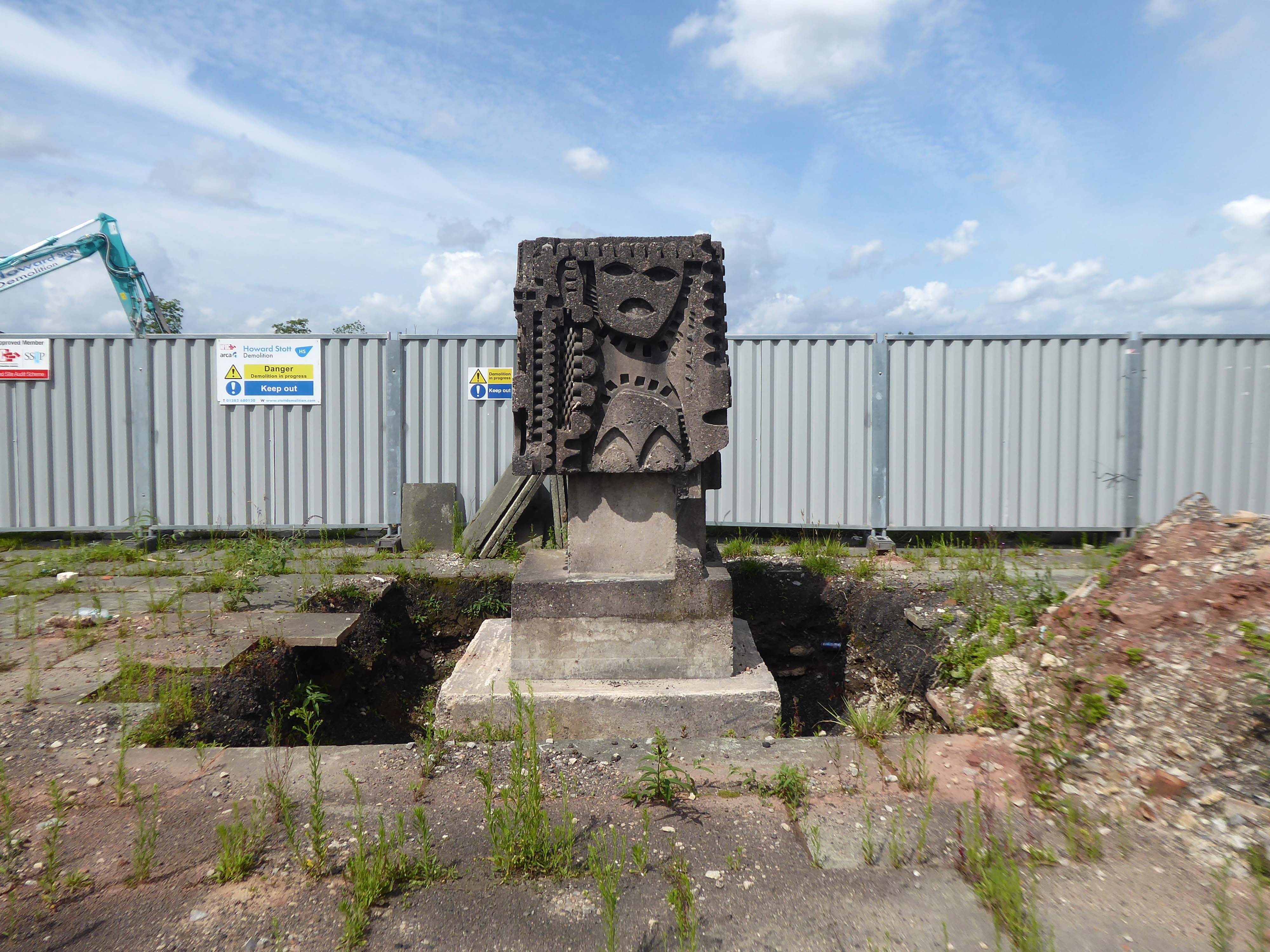
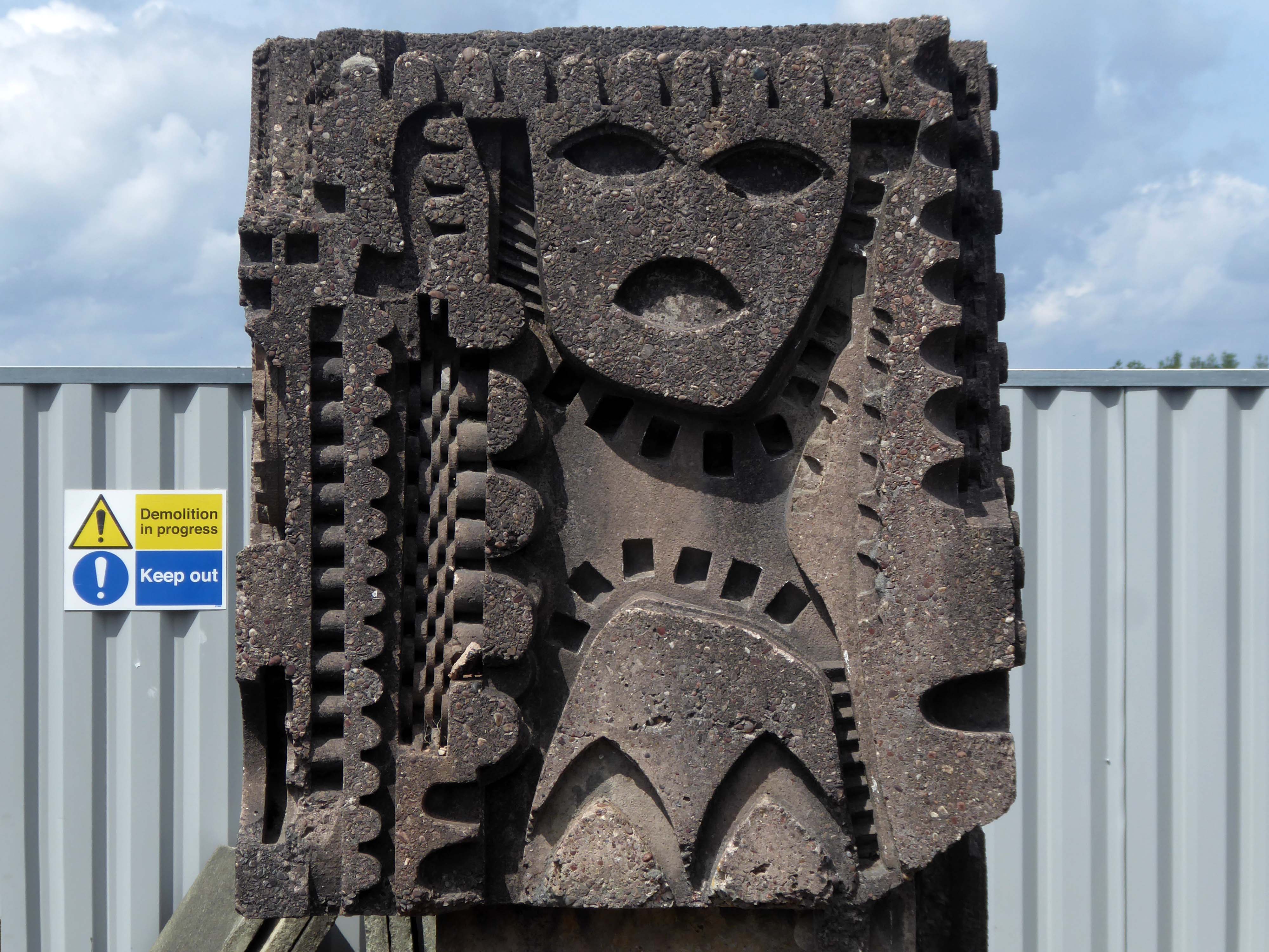
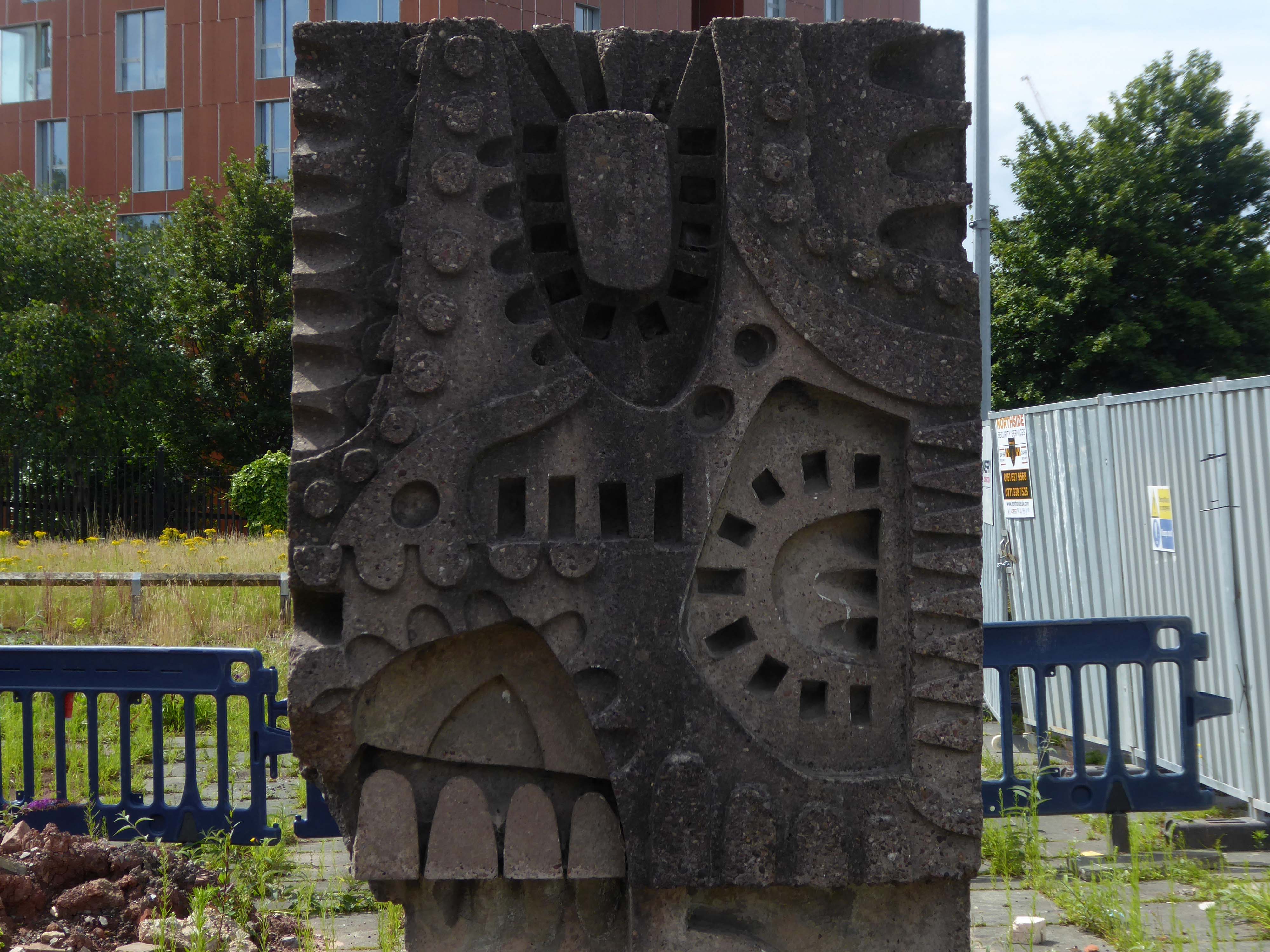
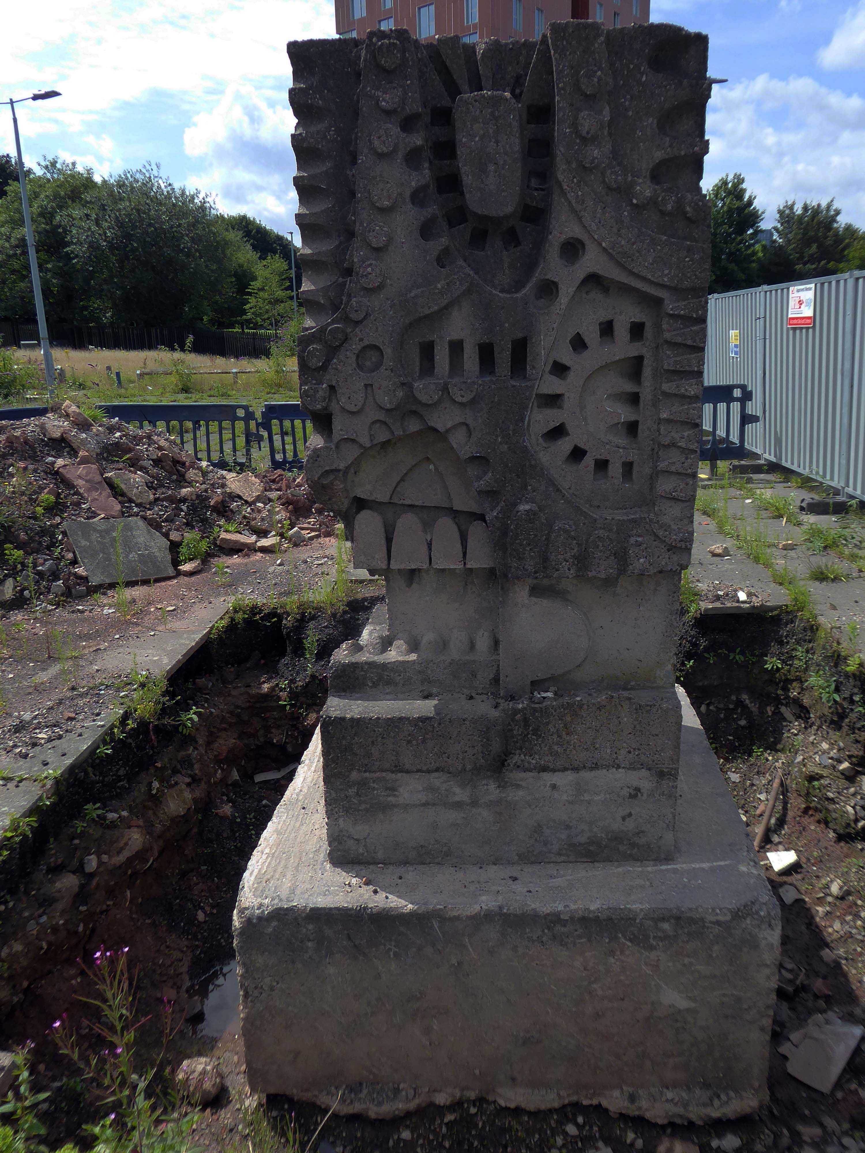
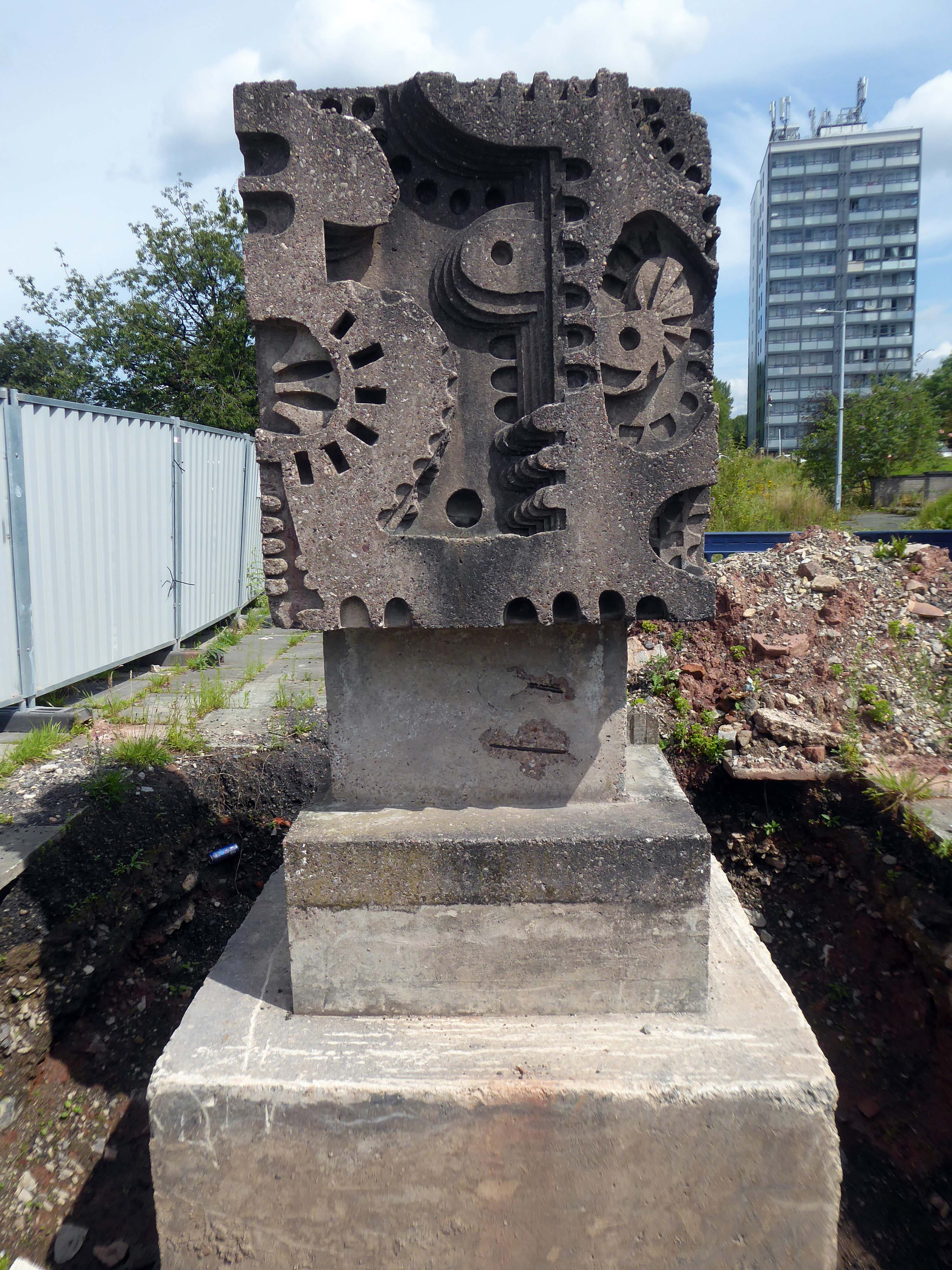
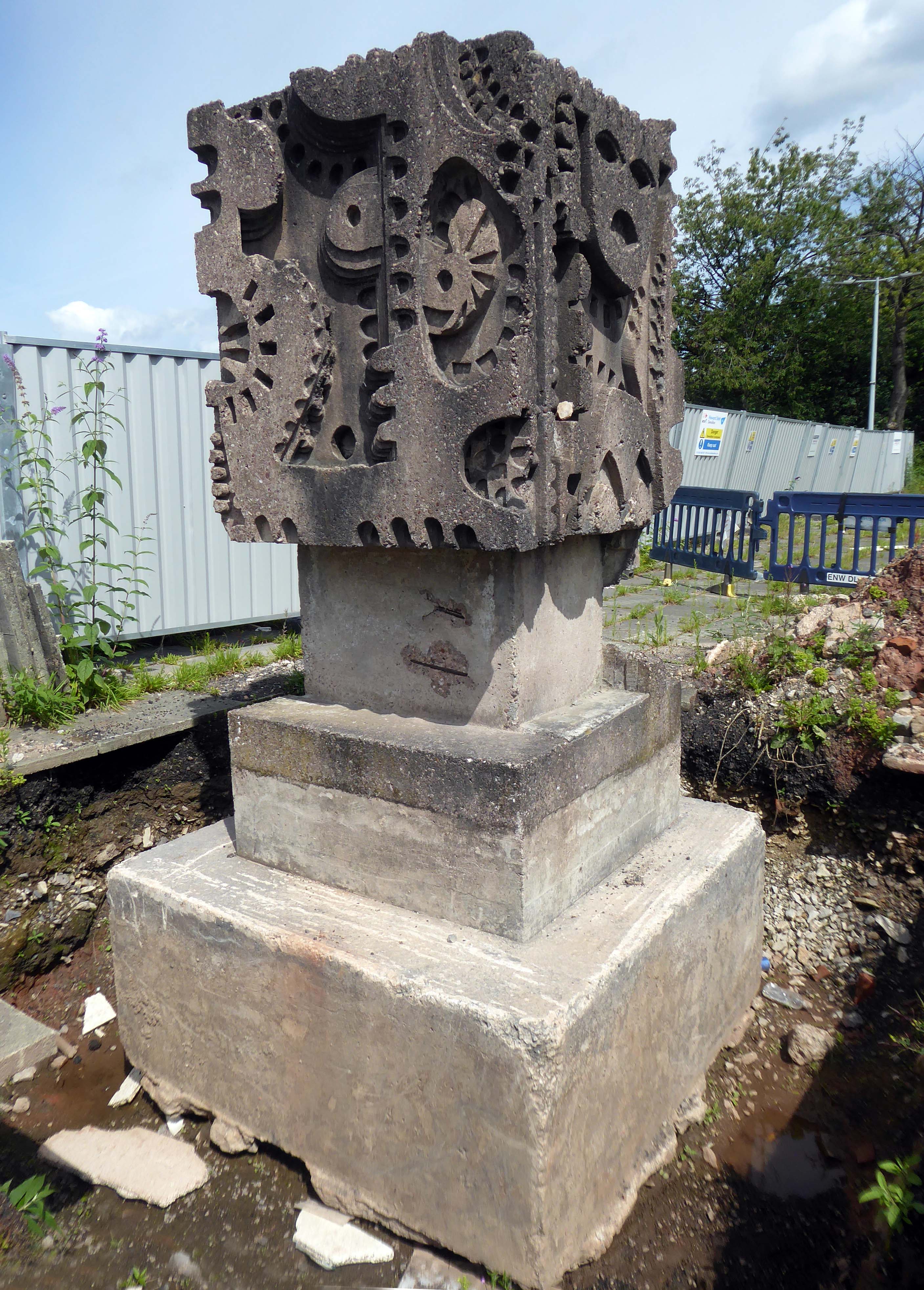
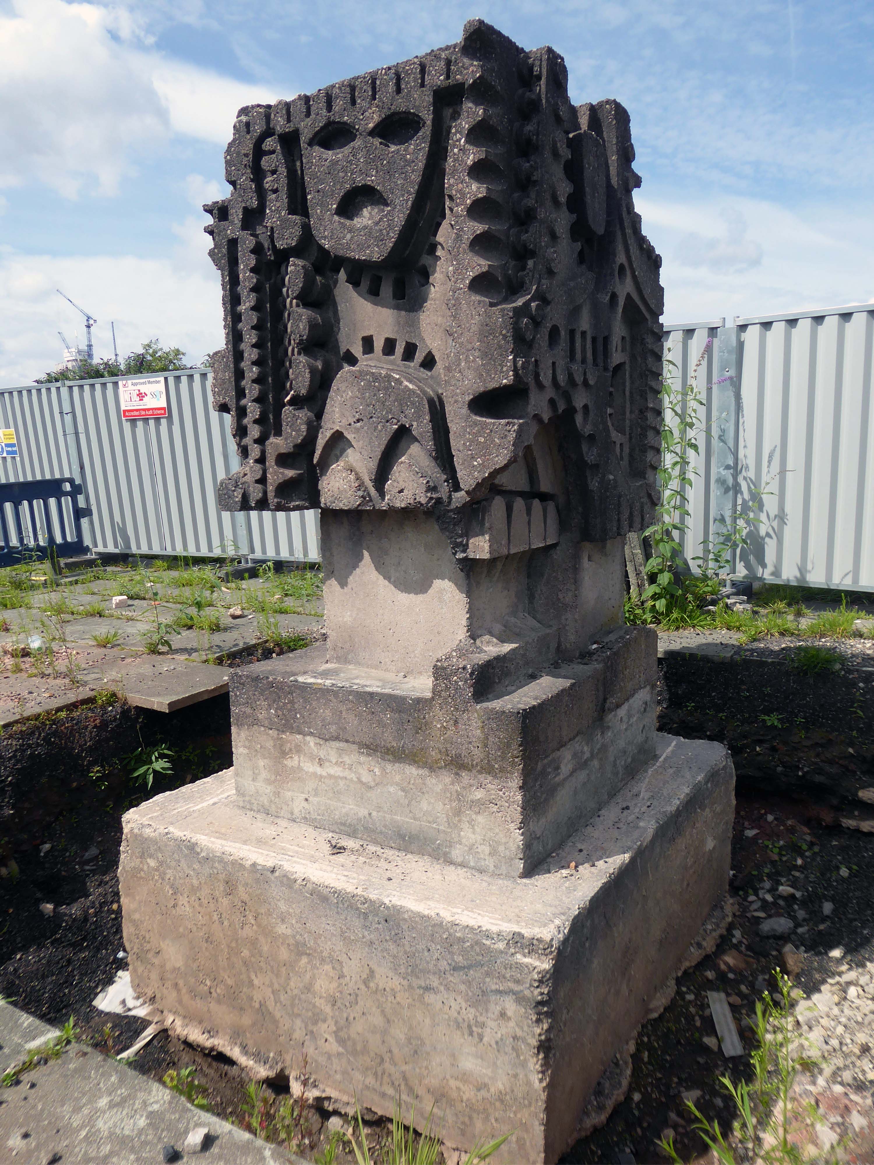
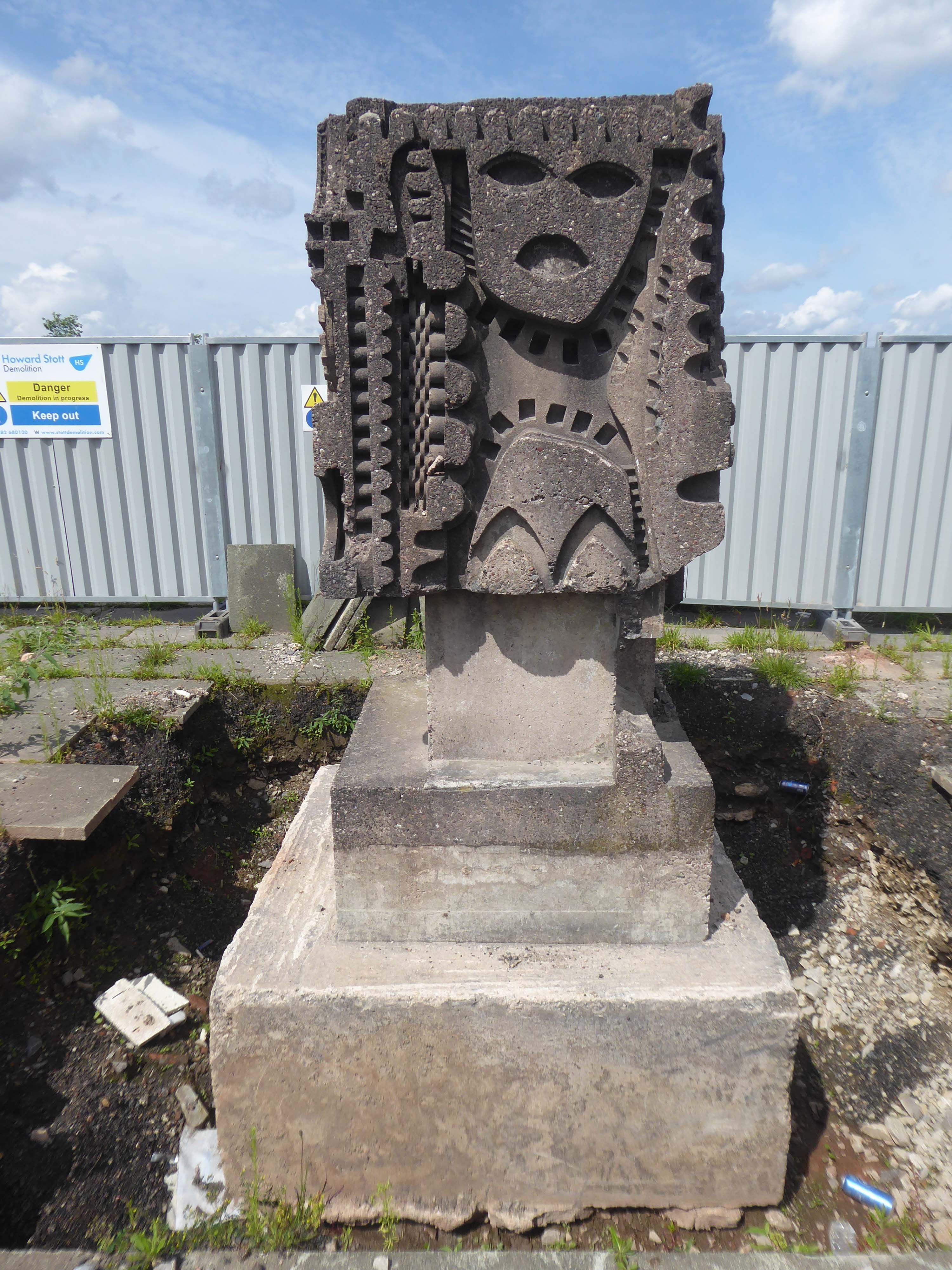
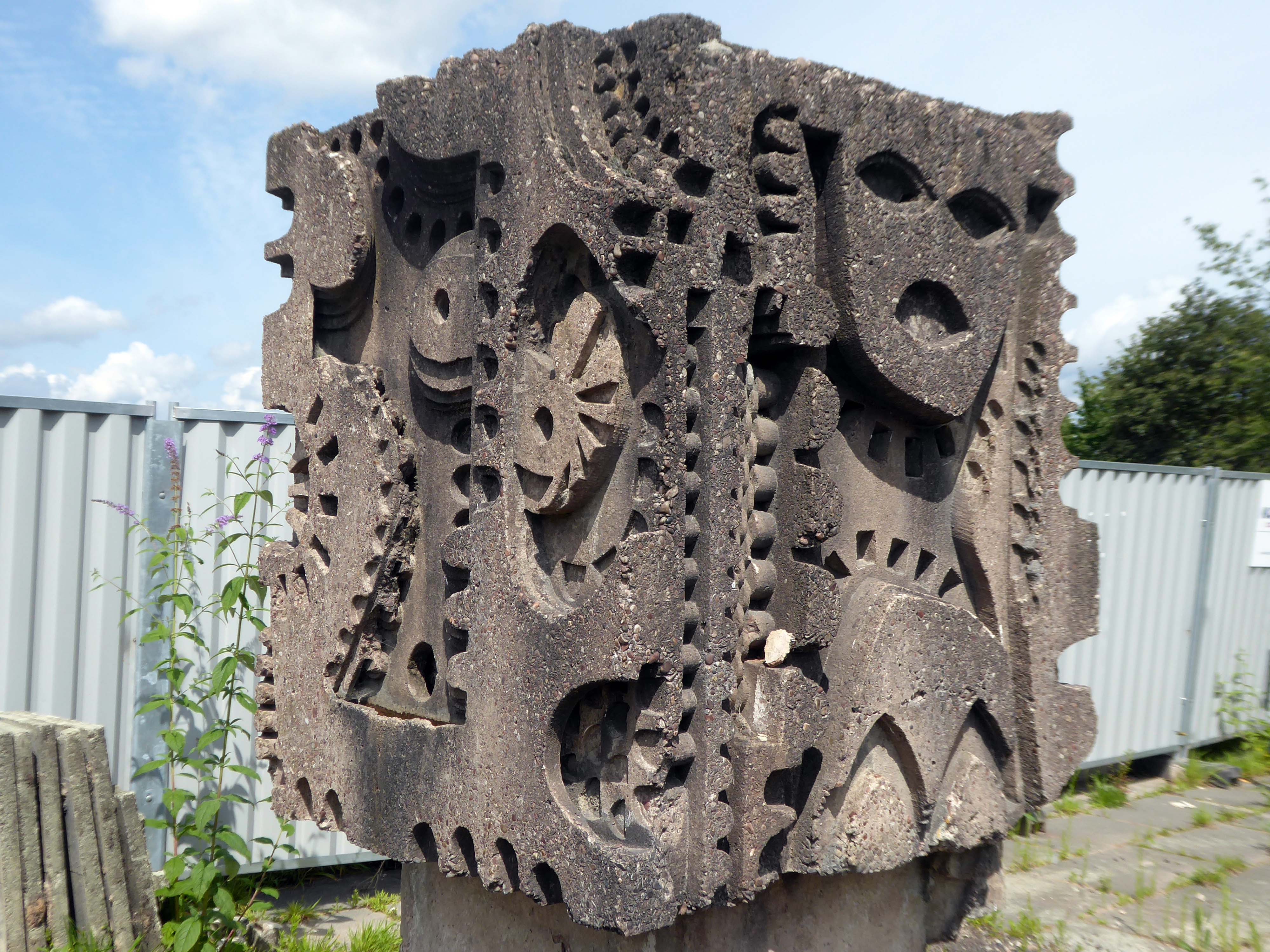
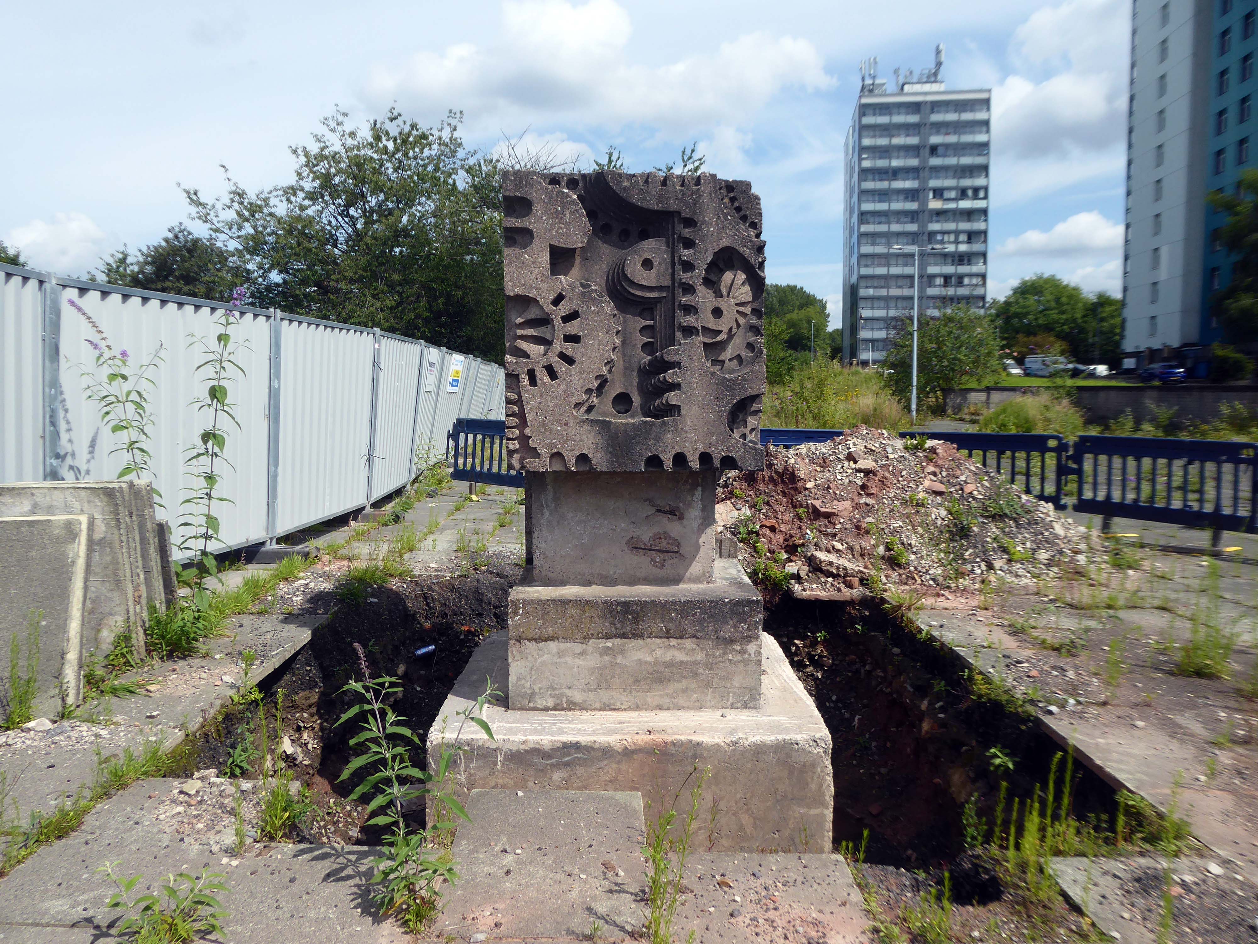
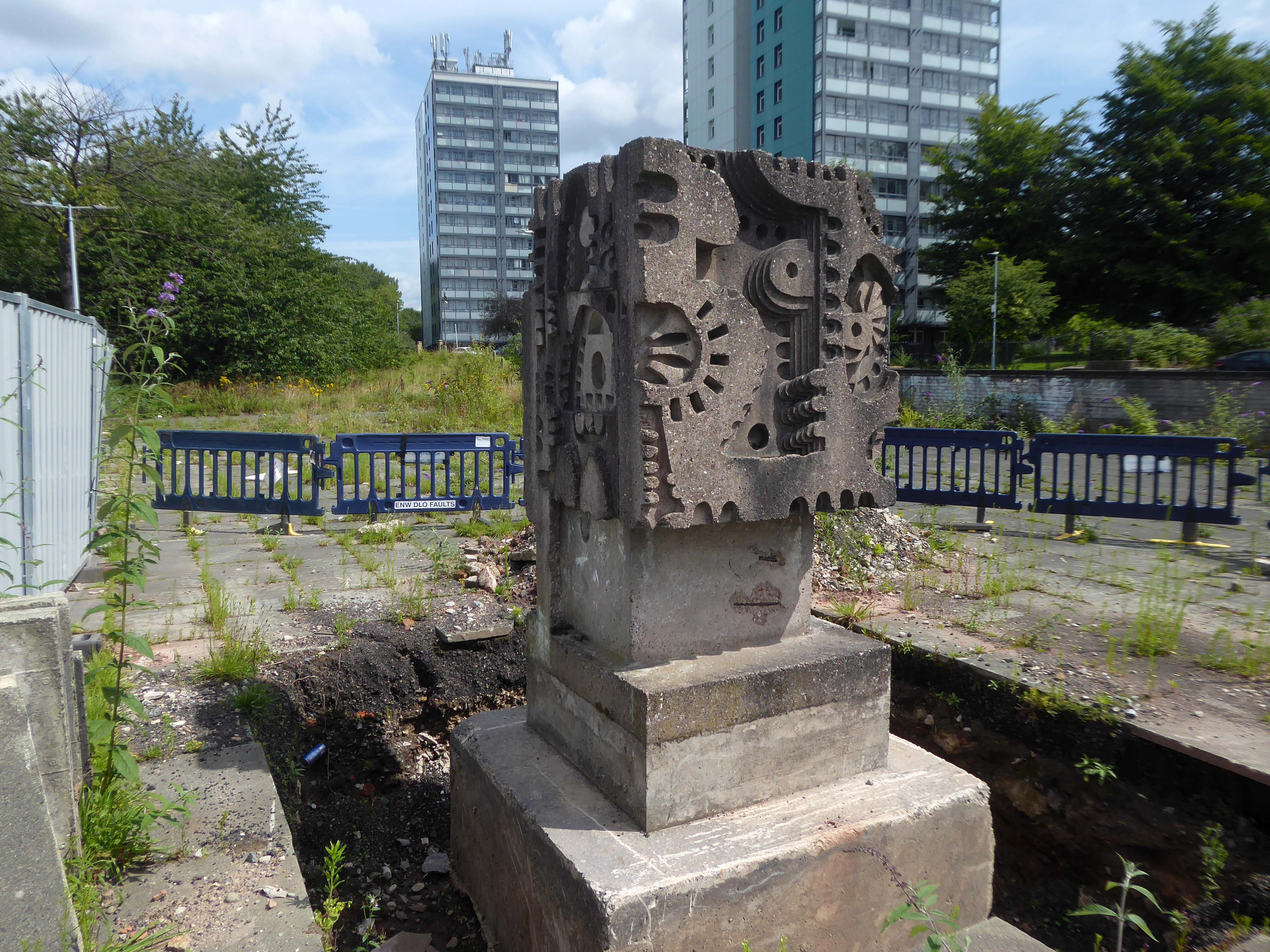
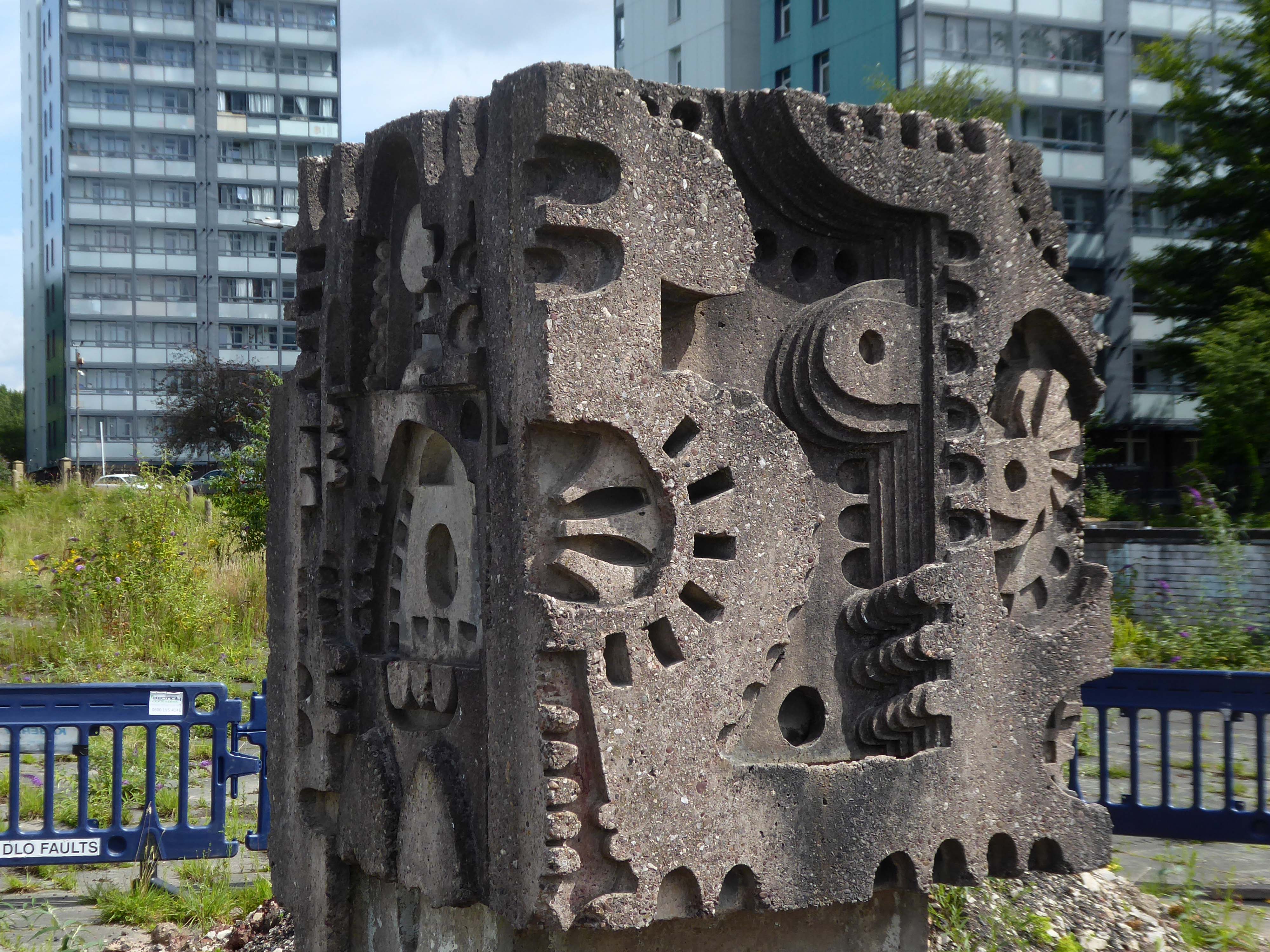
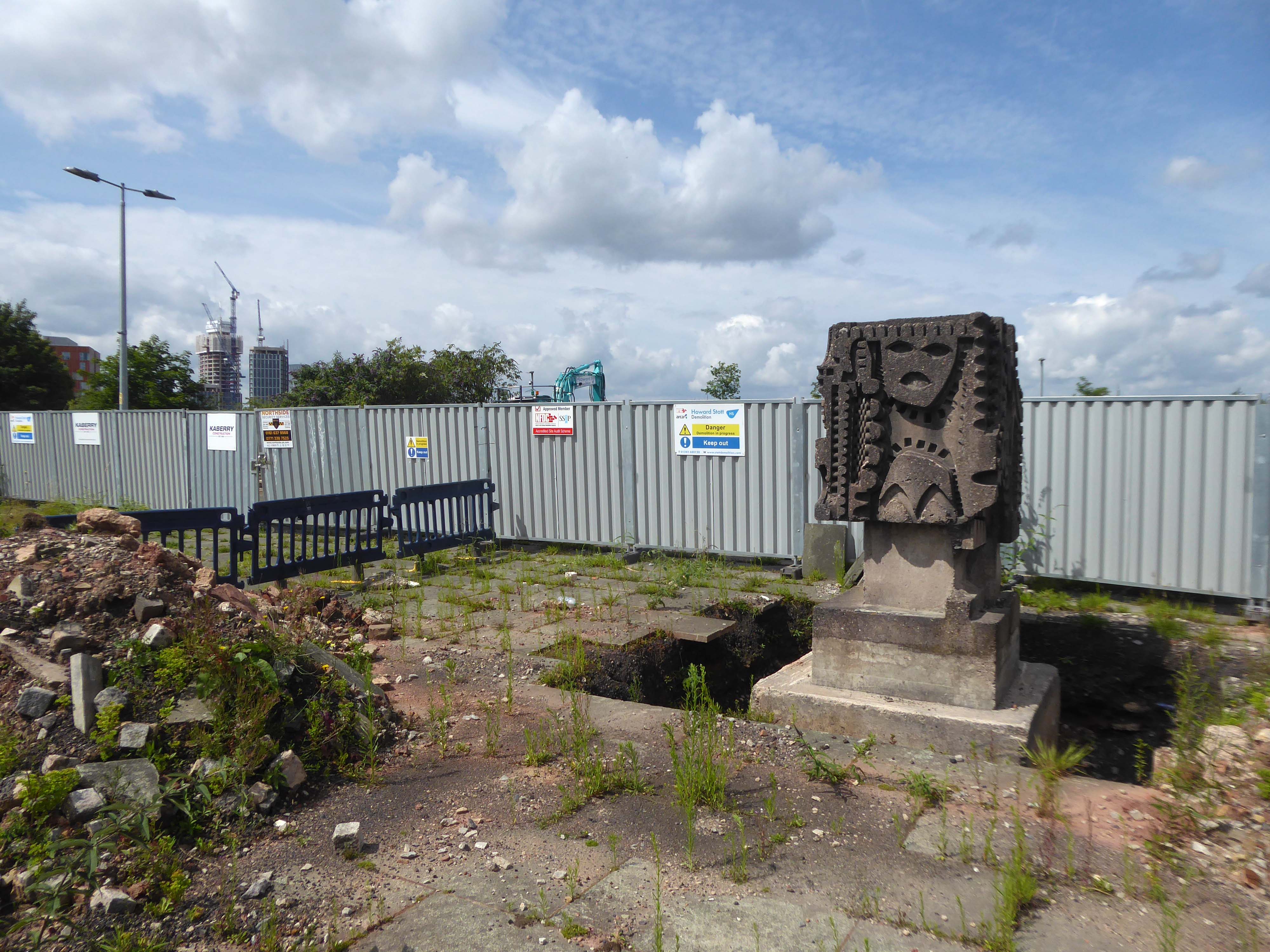
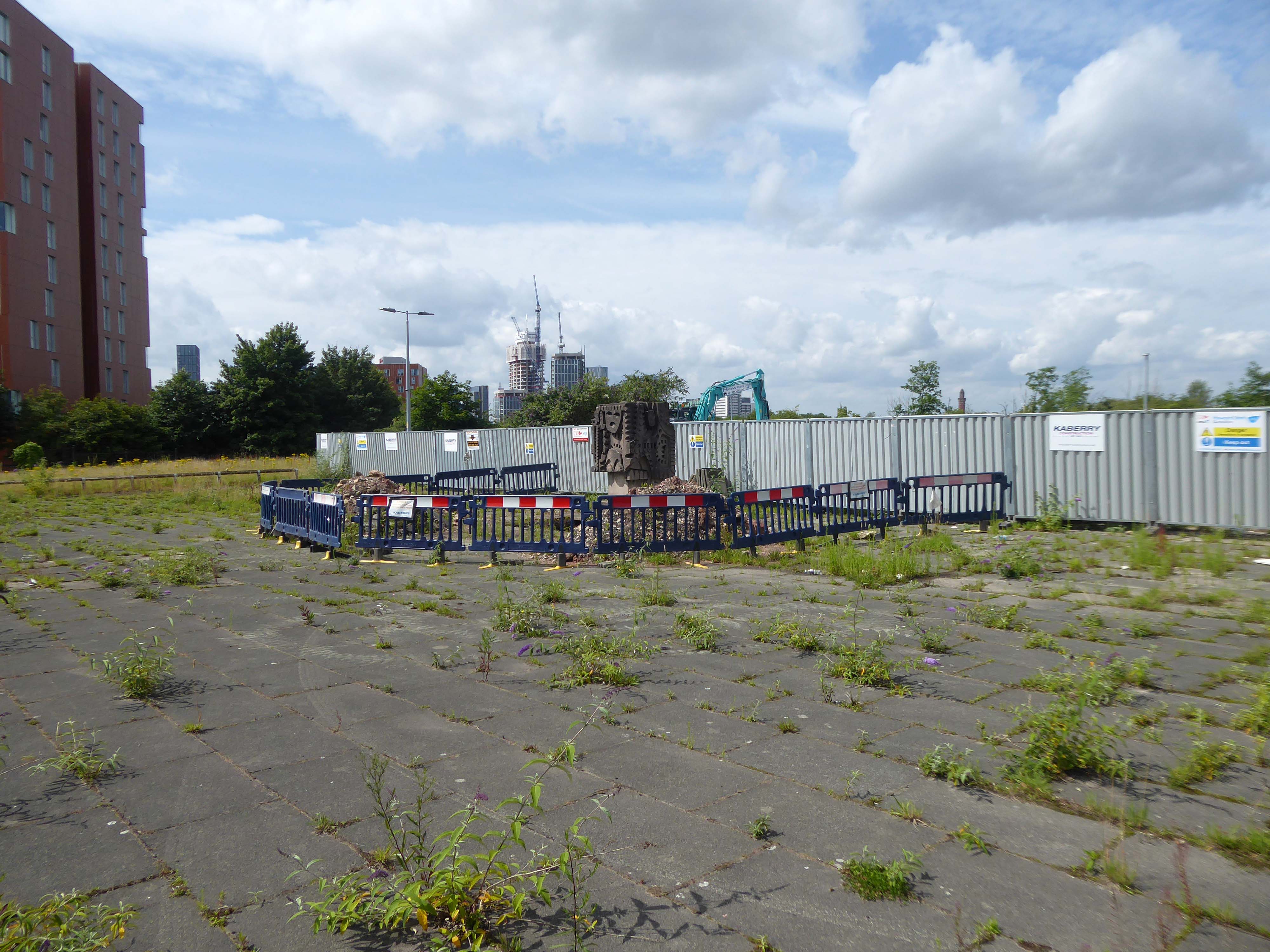
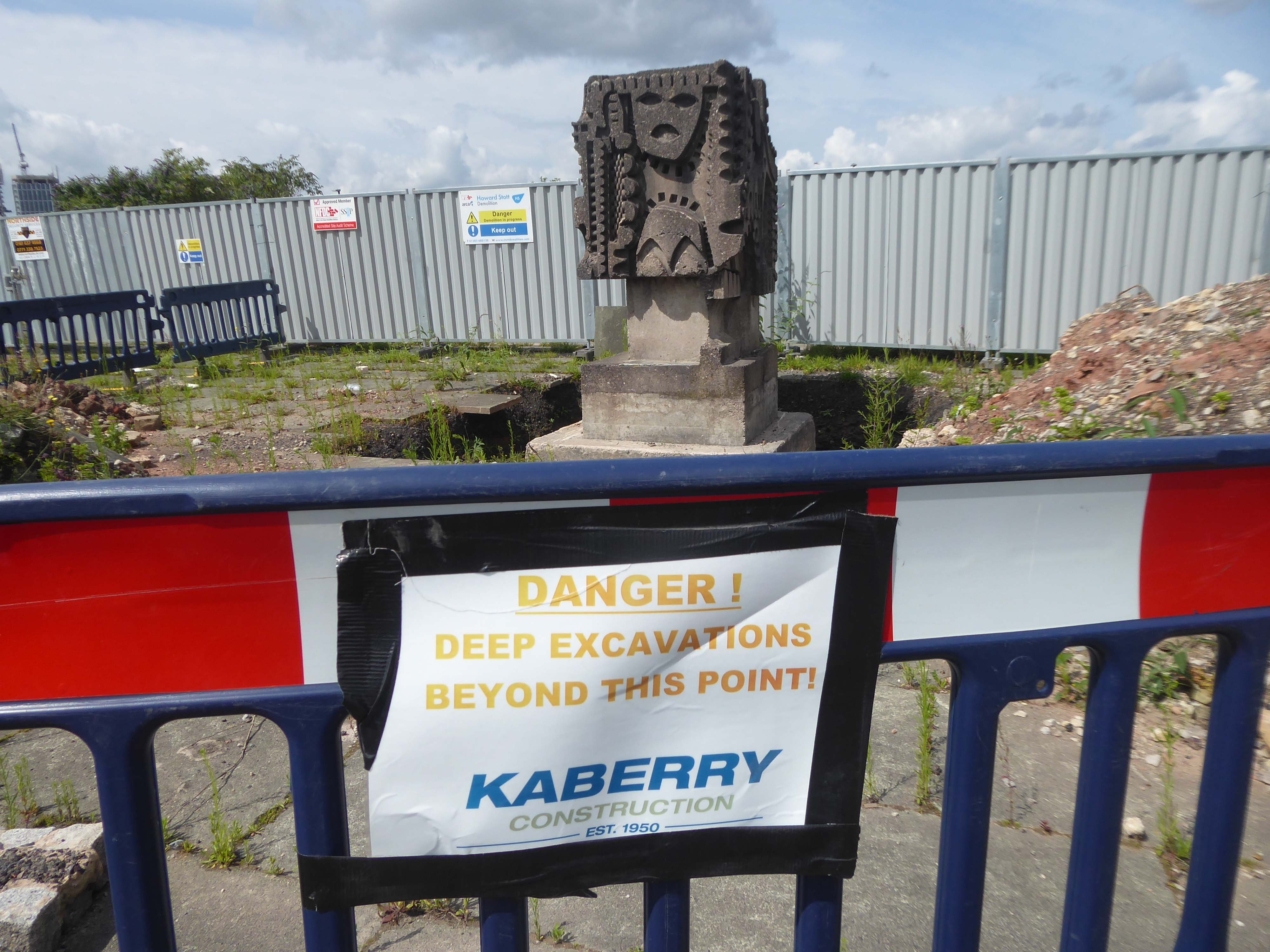
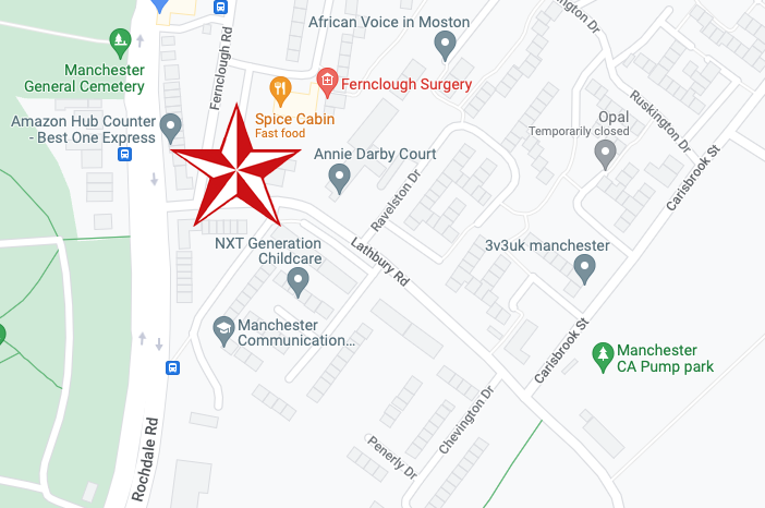
Home to William Mitchell’s Totem, the homes long gone and the Council pledged to move the totem too.
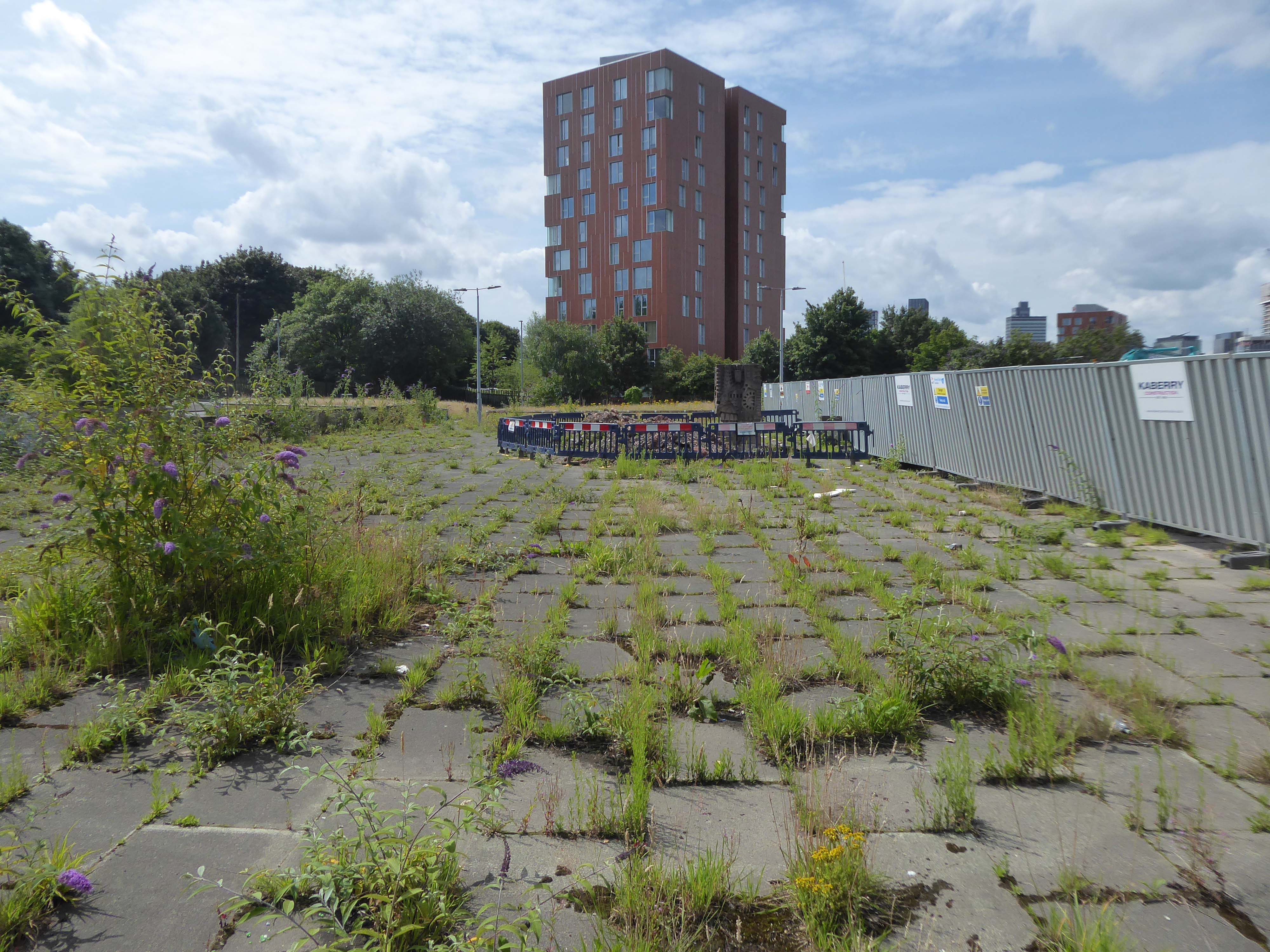
The state of play this week, the detritus removed and the base filled in, repaved and safe for a while.
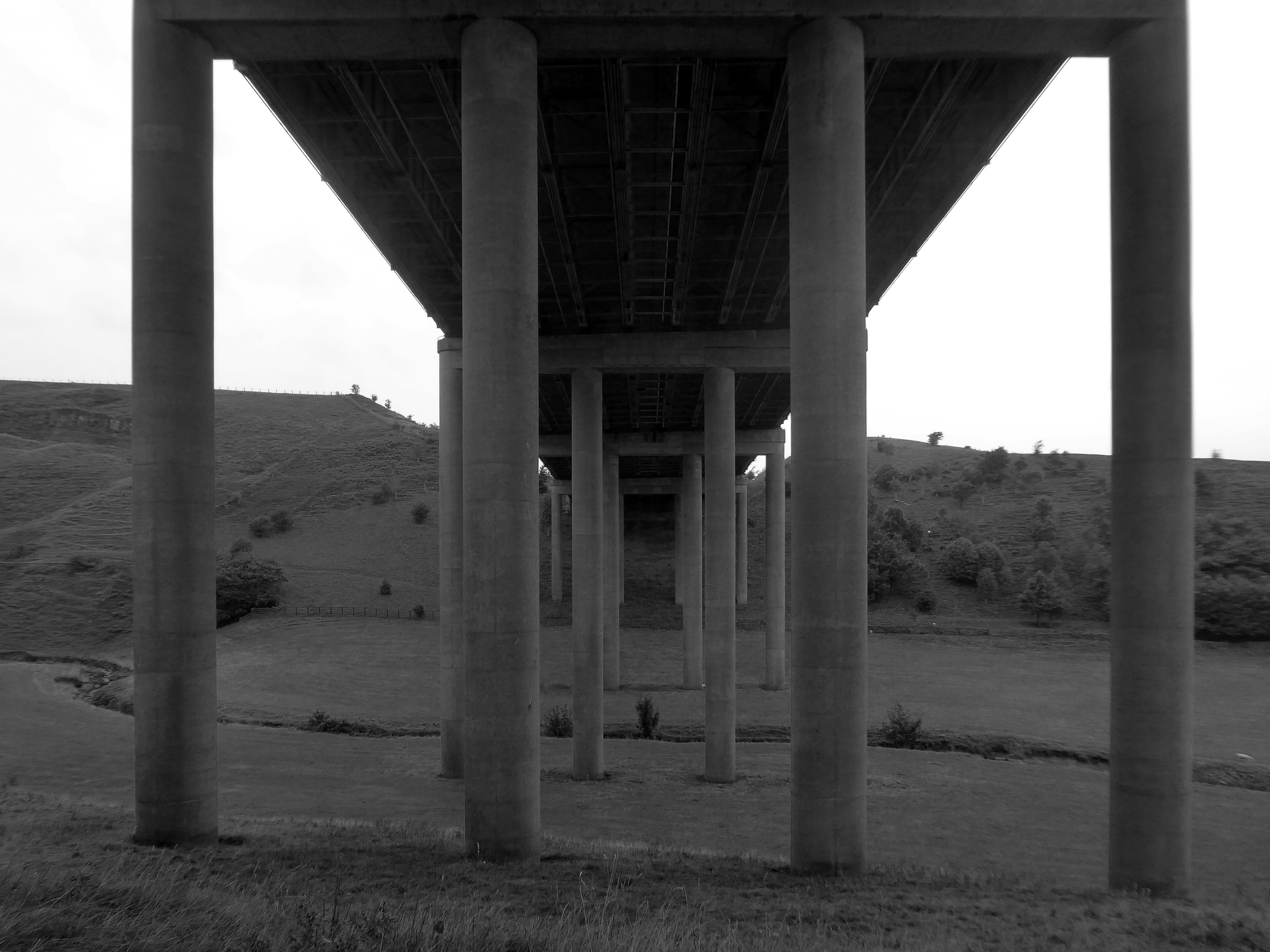
Off now to the Weaver Valley another day another river, passing under Weaver Viaduct
The looking toward KouraGlobal – leader in the development, manufacture, and supply of fluoro products and technologies, opened a new HFA 152a production facility at their Runcorn site in the UK.
Further rural Modernism as we pass under and traverse the M62, whilst walking around the Piethorn Valley
The newest of the Modernist Mooches was to Burnley where we visited the Keirby Hotel.
The former GUS Offices with a mural by Diane and William Morris.
Plus the Charles Anderson concrete relief at the Crow Wood Hotel.
Finally a little light relief – a visit to the Boots factory in Nottingham.
Having innocently board a bus outside the station with a Boots head code , I alighted within the factory gates. Then innocently walking around taking snaps, unheeded until the men in the van stopped me in my tracks.
Who are you, what are you doing?
I am the Modern Moocher going about my business – well it turns out this was not permitted and I was red carded by the earnest security guards and asked to leave forthwith. Suitably rebuked, I politely bade them farewell and headed for the gates.
The A6 is Britain’s fourth longest road. Its route varies greatly from the lower lands of the South East, though the Peak District, right though the heart of Manchester city centre, then onwards towards Preston. It then goes though the historic city of Lancaster before skirting the Eastern fringe of the Lake District before ending in Carlisle, bang on the start of the A7.
North from Stockport towards Manchester, the A6 was a wide, four lane road, but still 30 mph, which usually flowed pretty well. According to Mudge, it looks like it has now been massacred by bus lanes and red paint. Shame. We meet the A57 from the east, just south of the city centre, and multiplex until we reach Mancunian Way, the A57 heading off as a short urban motorway, the A6 heading into the city centre via London Road/Piccadily, where it loses its number and vanishes. It would have gone straight down Piccadily/Market Street to meet Deansgate, and then across the River Irwell into Salford, and up Chapel Street, where the number reappears. Market Street has been pedestrianised for years, so the A6 has long ceased to be a through route.
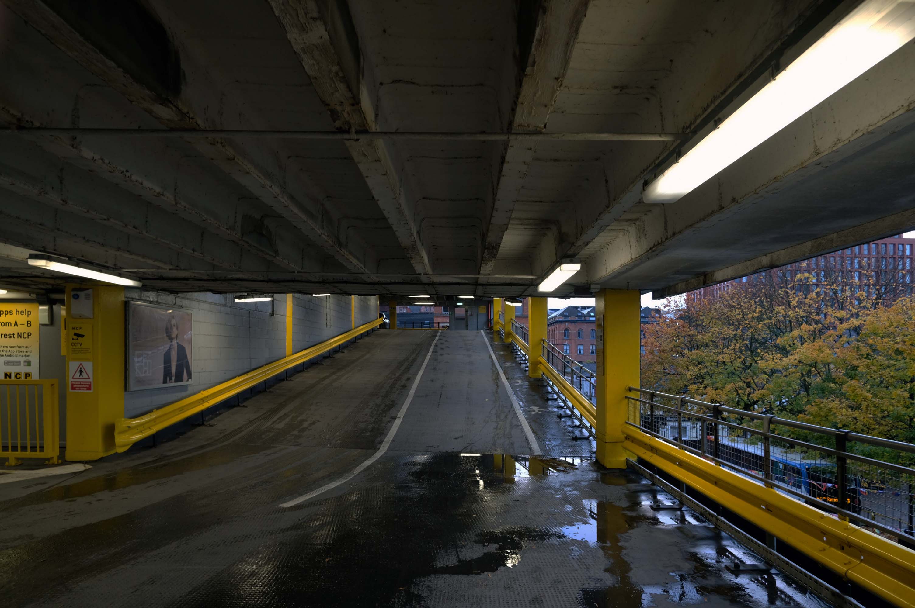
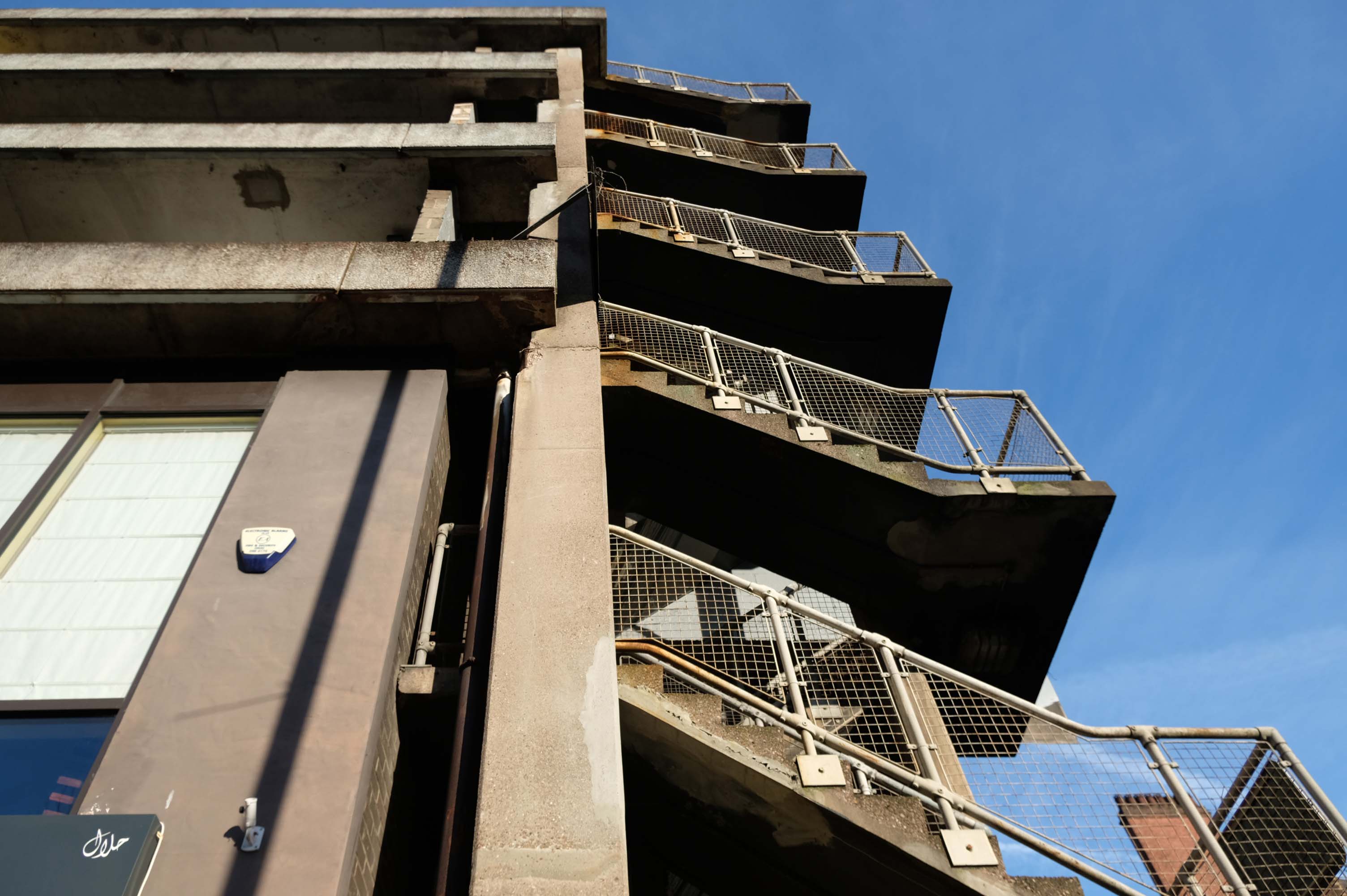
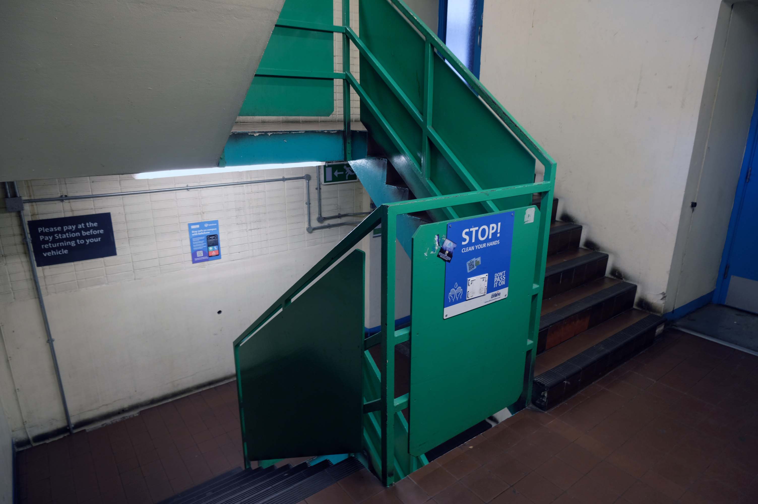
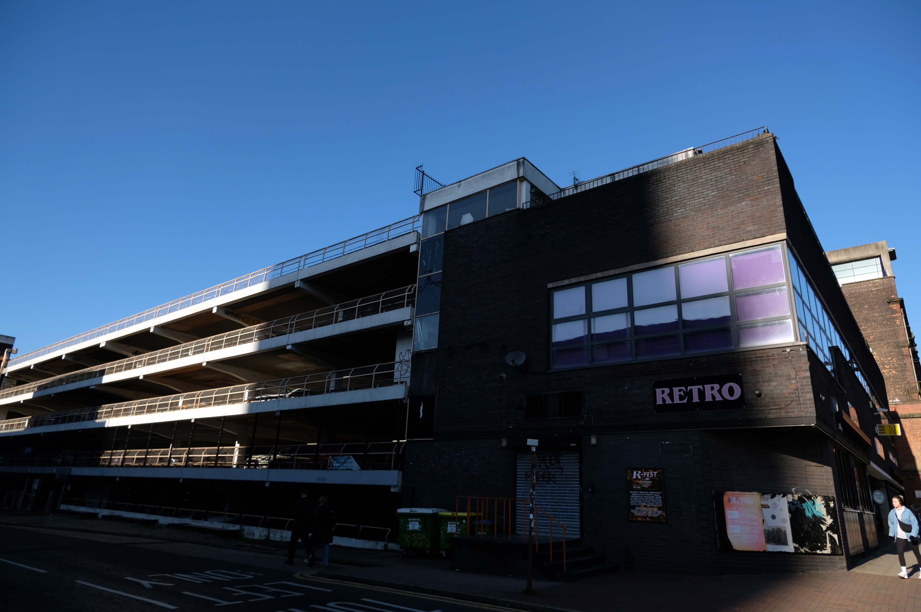
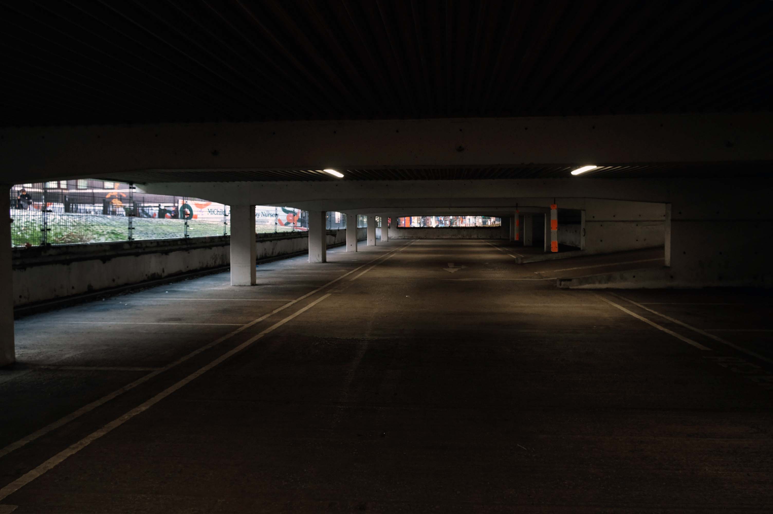
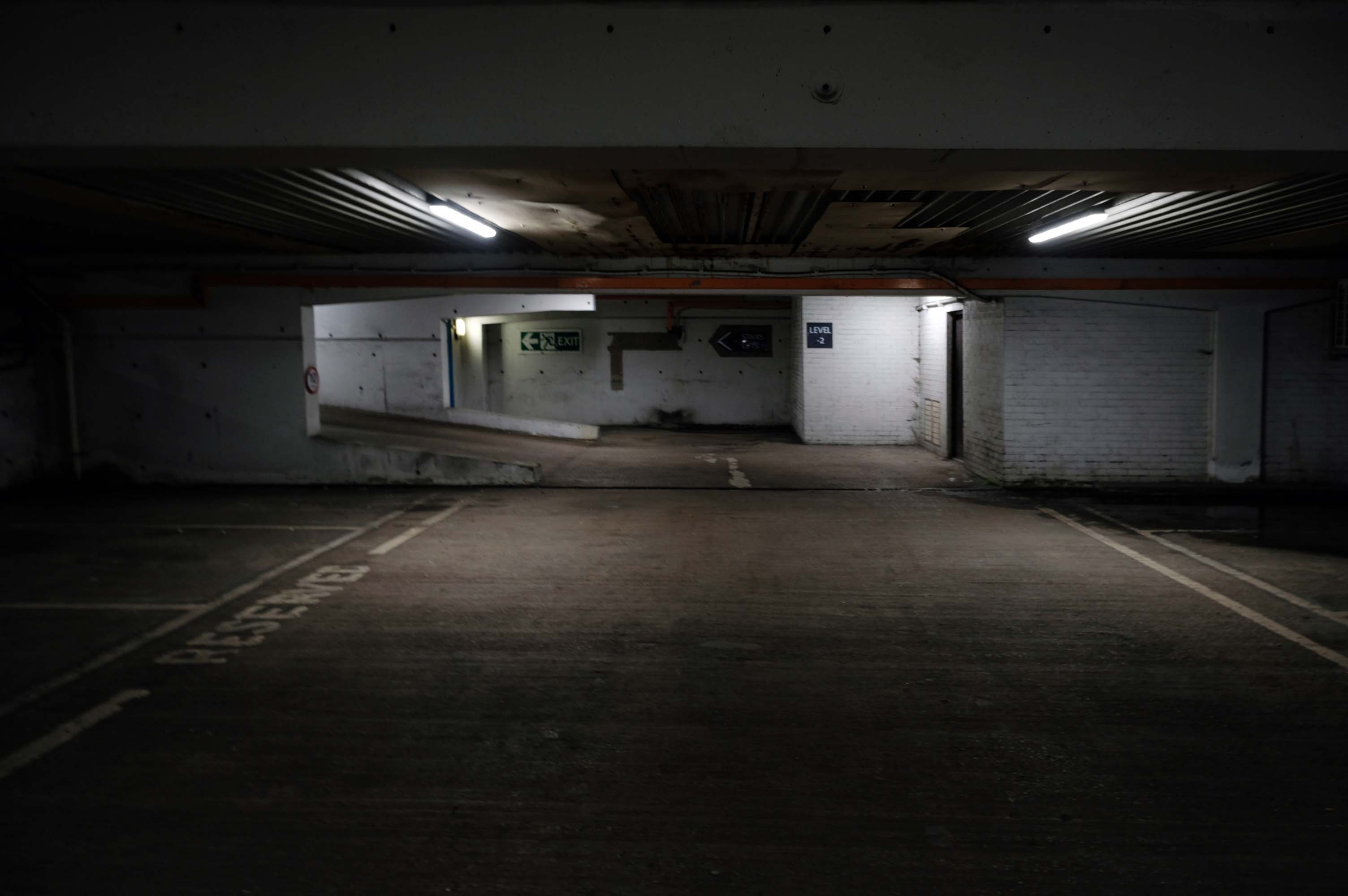
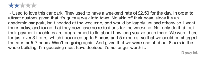
Secure and easy to find while driving, struggled to get back in through side door, had to walk up the ramp.
Expensive.
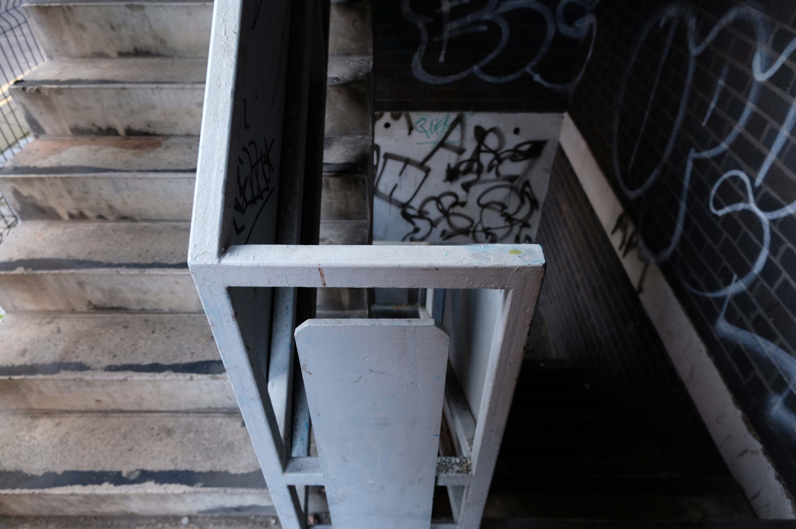
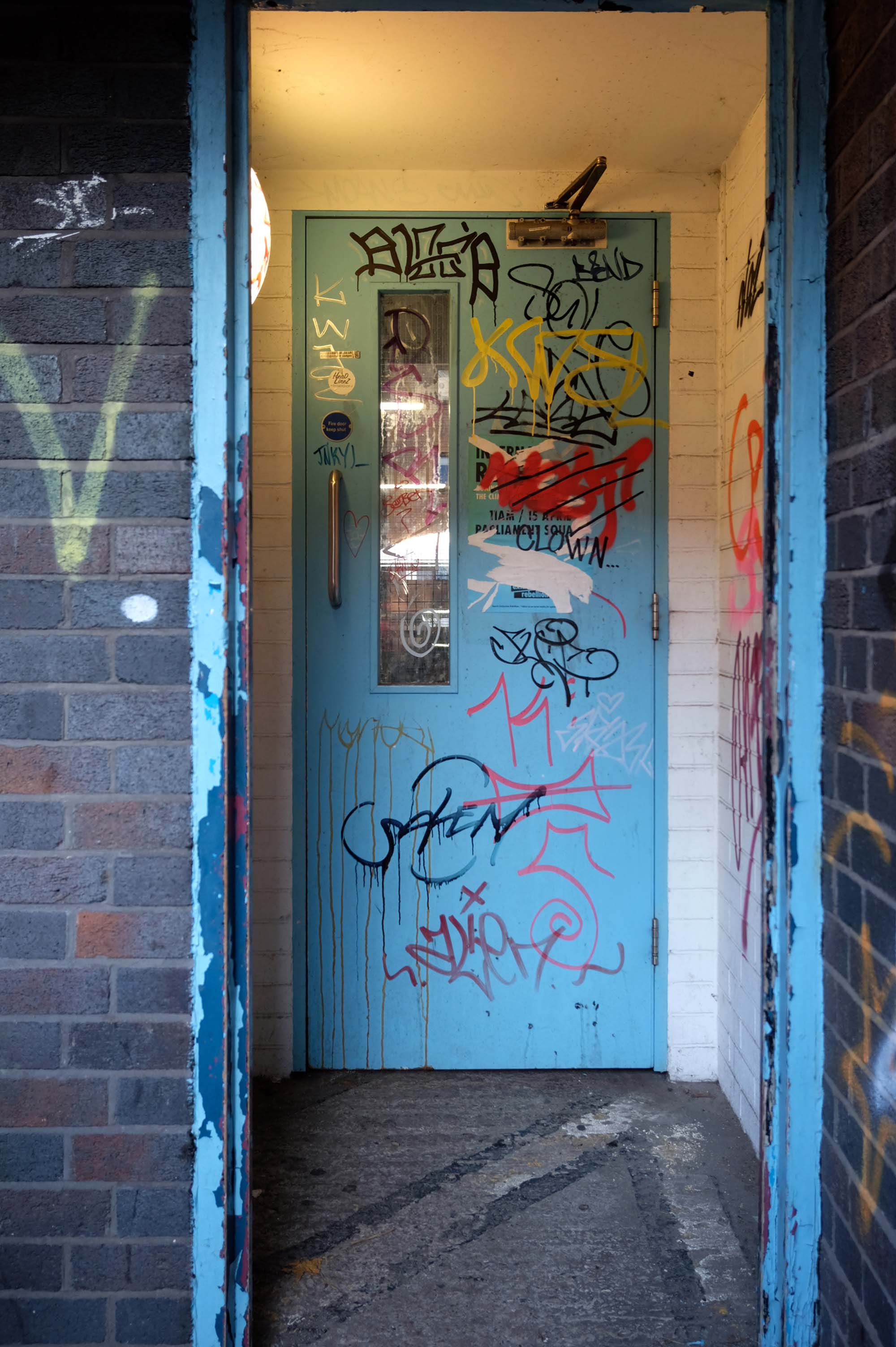
Stairwell stinks like piss and I’ve seen homeless people sitting in there, doesn’t feel safe.
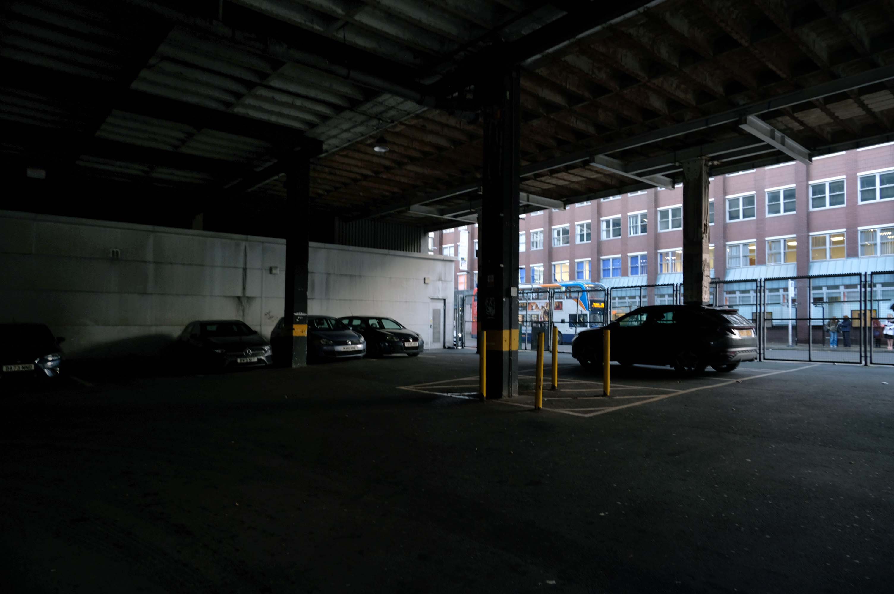
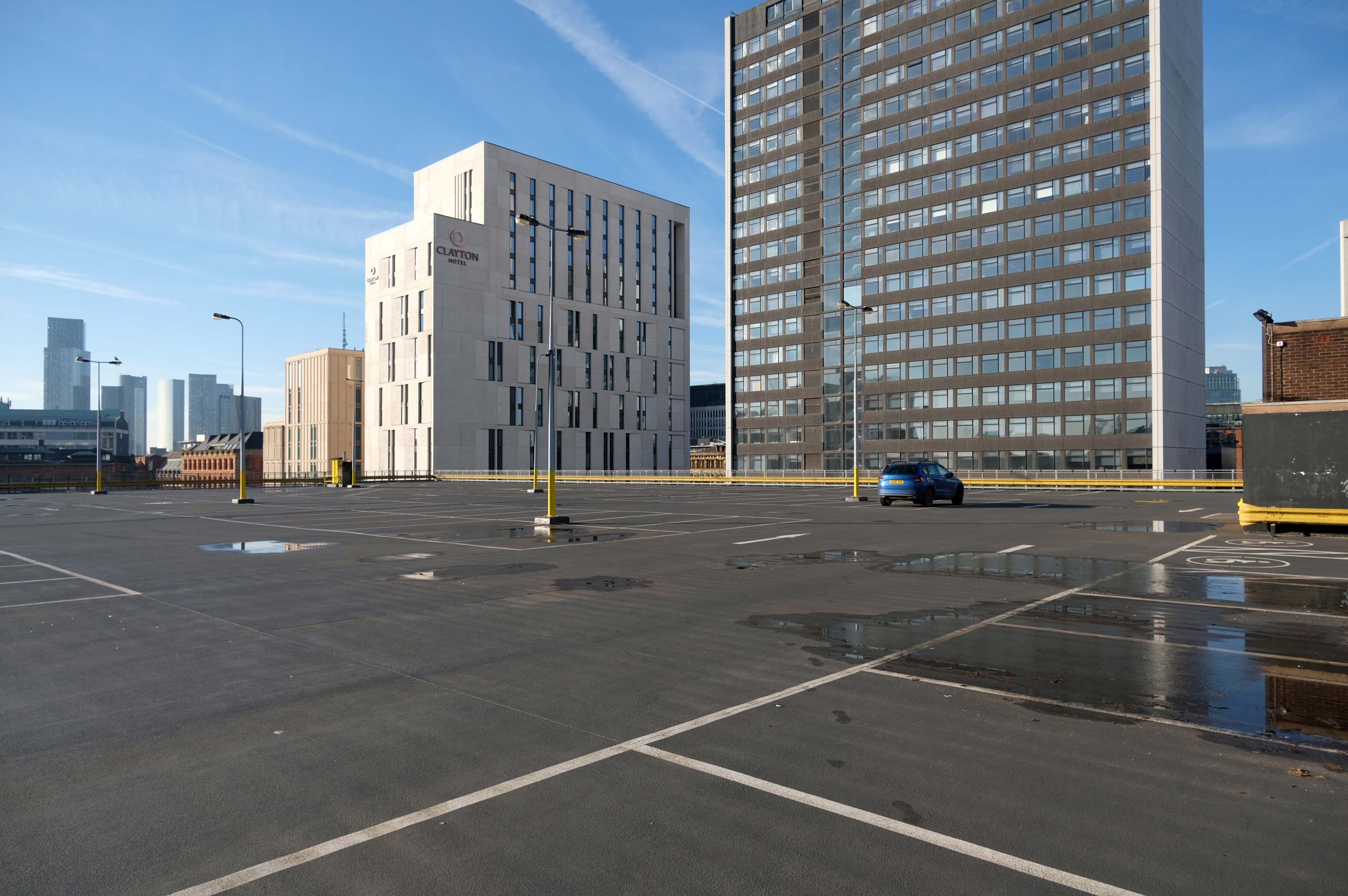
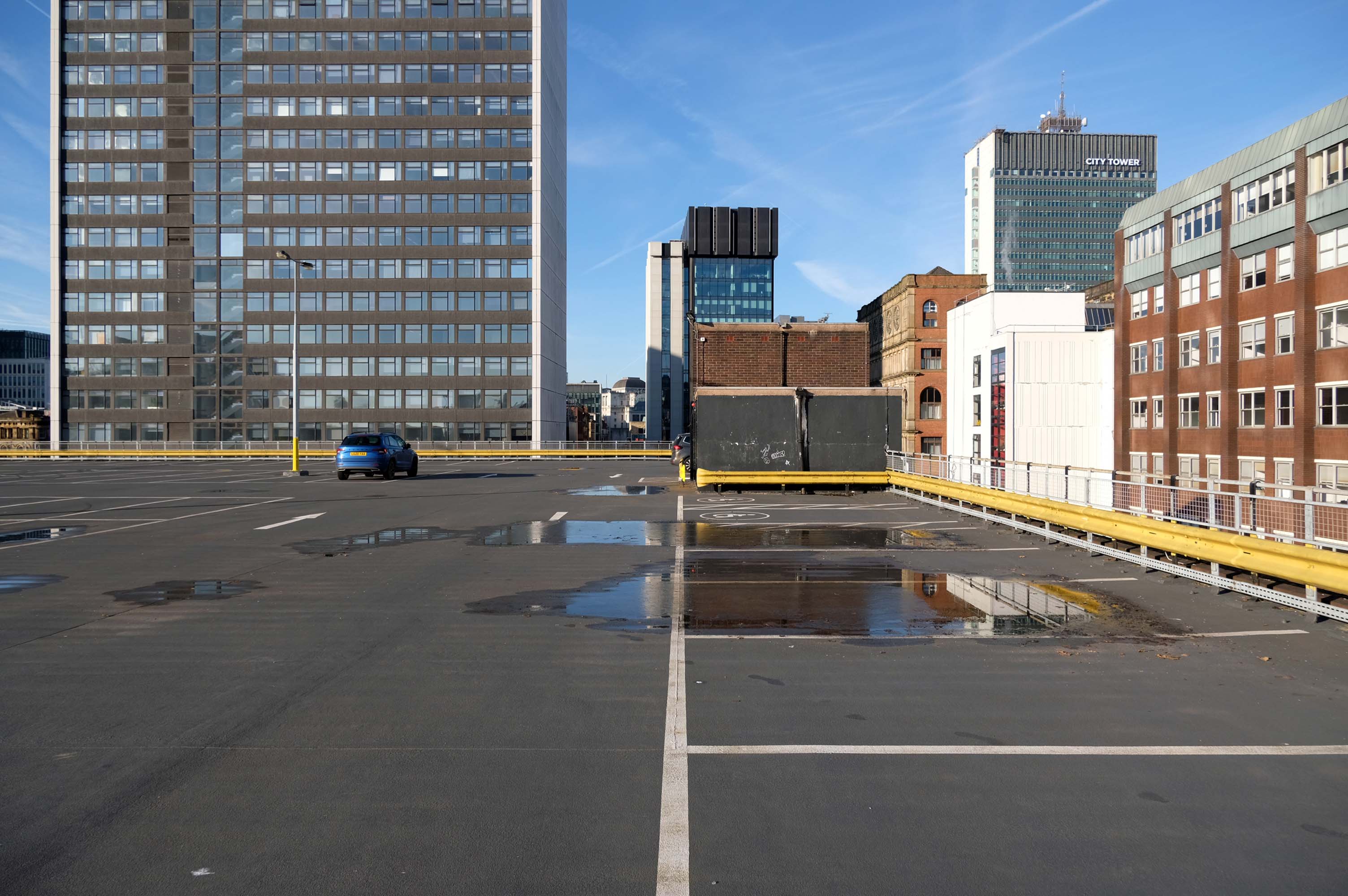
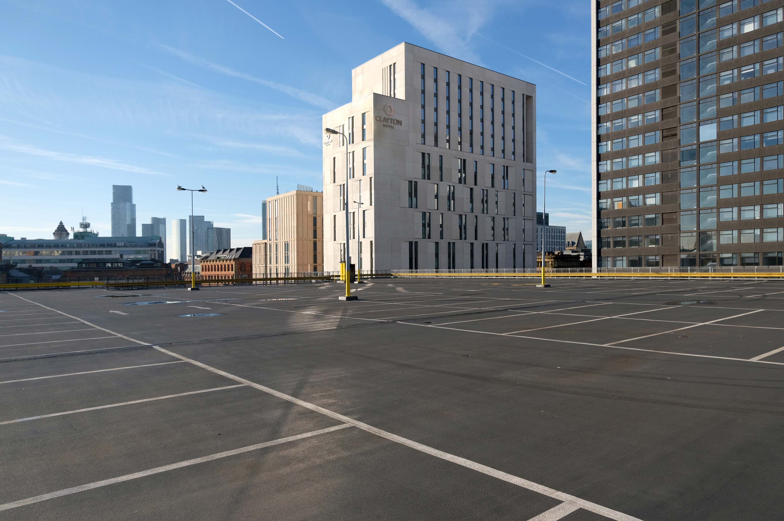
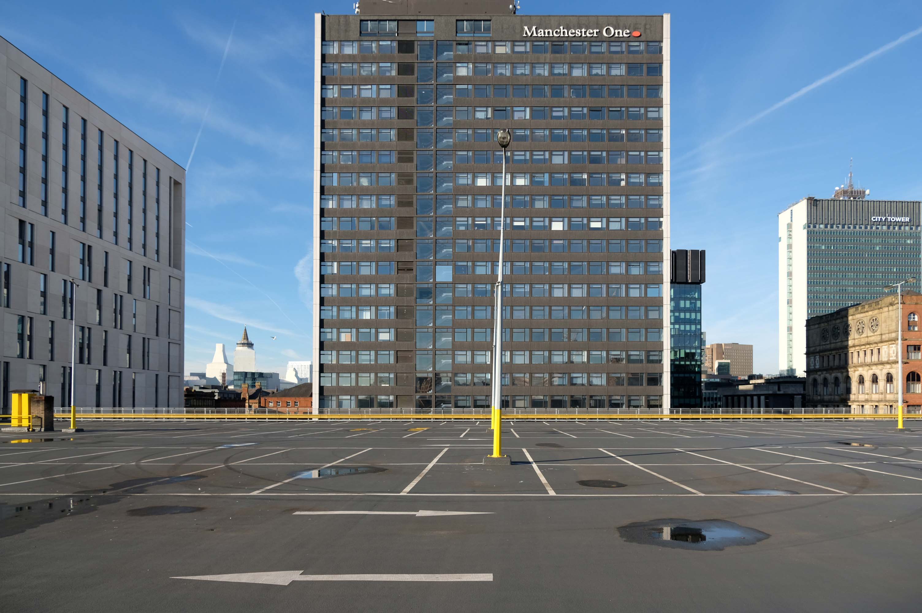
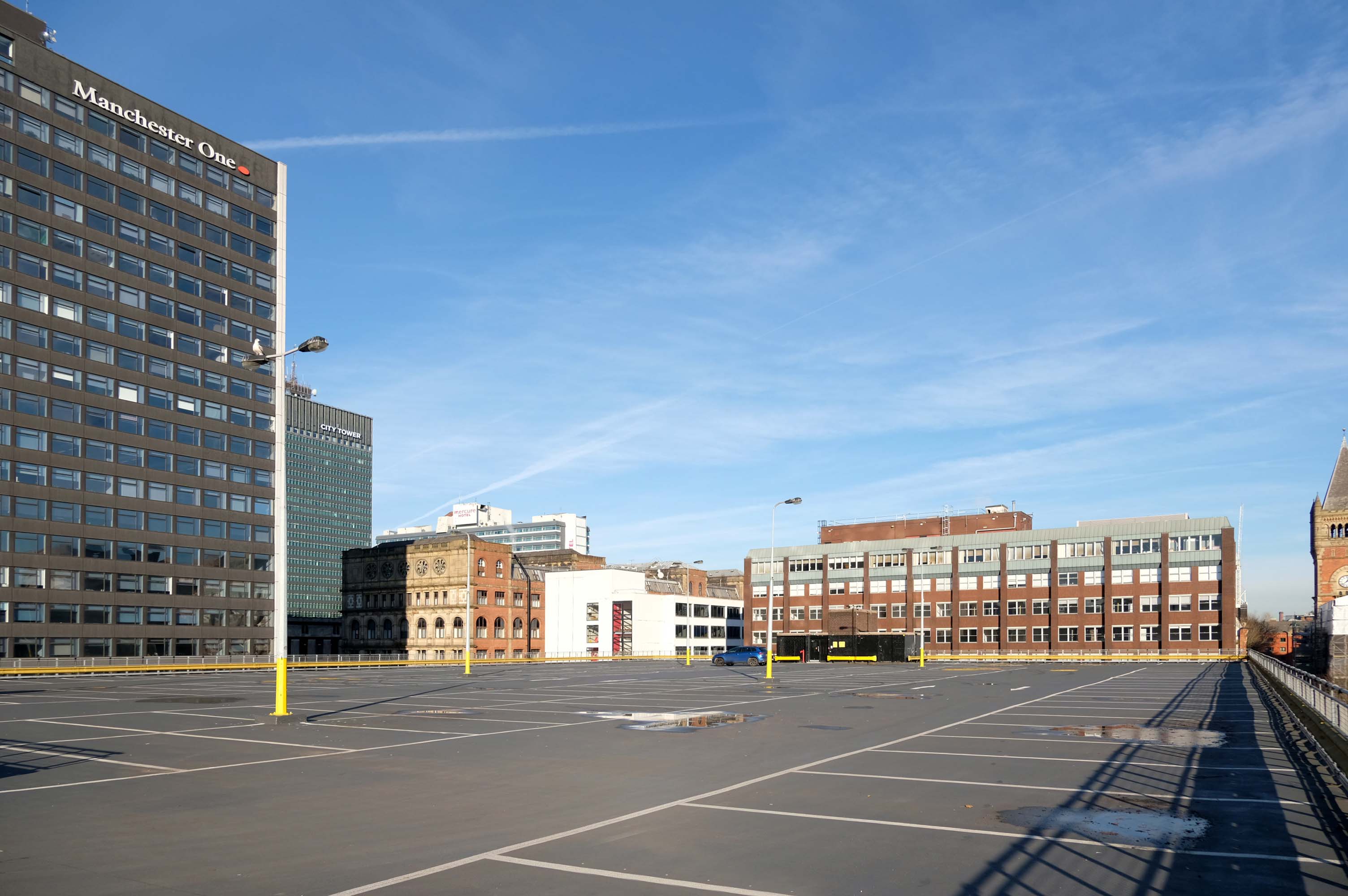
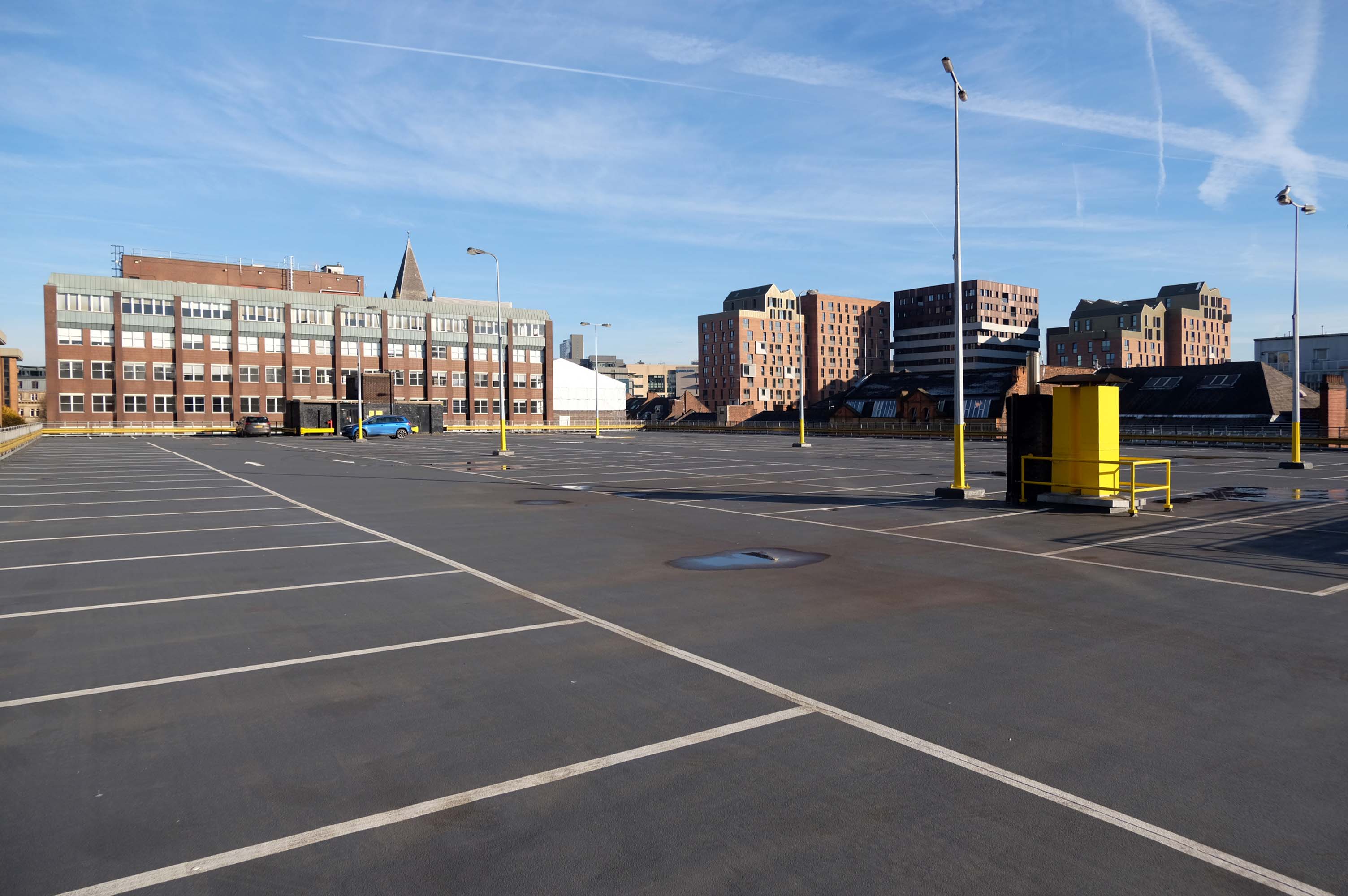
Great car park, security is great, right in the city centre, above the bus station that goes Scotland to Cornwall, Wales to Norwich and many more, Manchester city centre literally, with Piccadilly Gardens, around the corner.
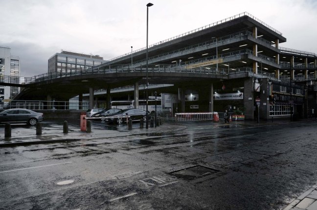
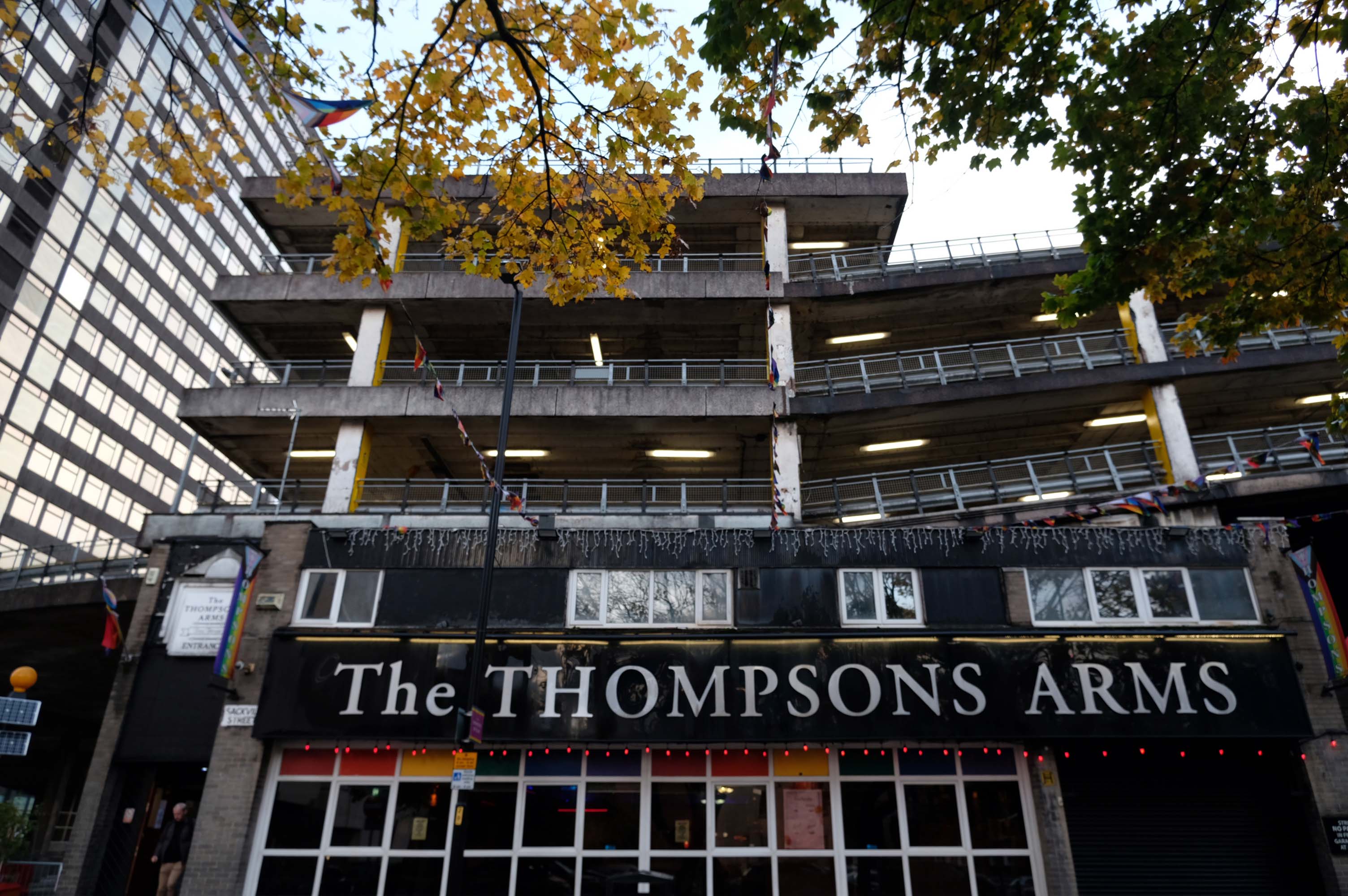
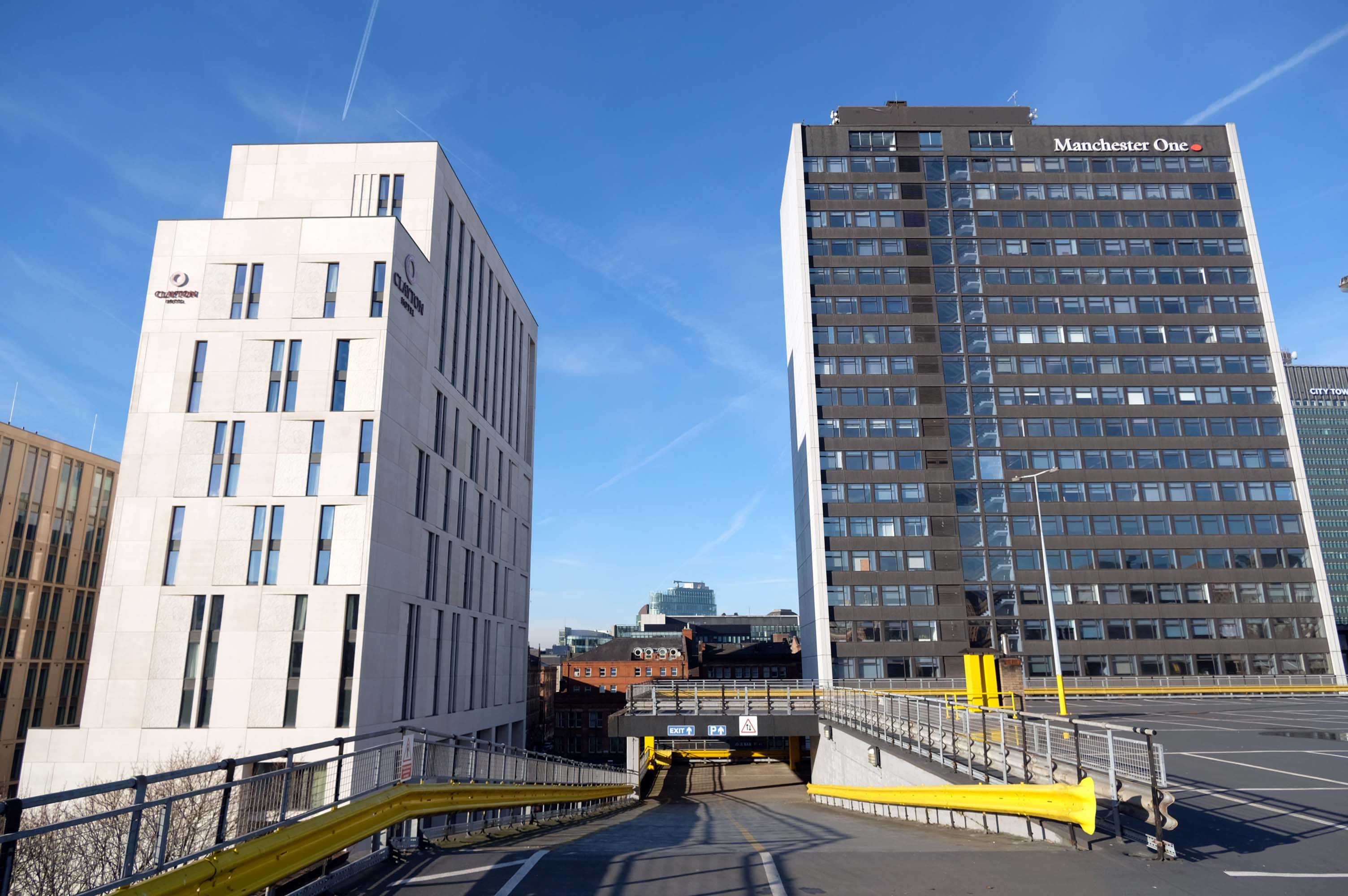
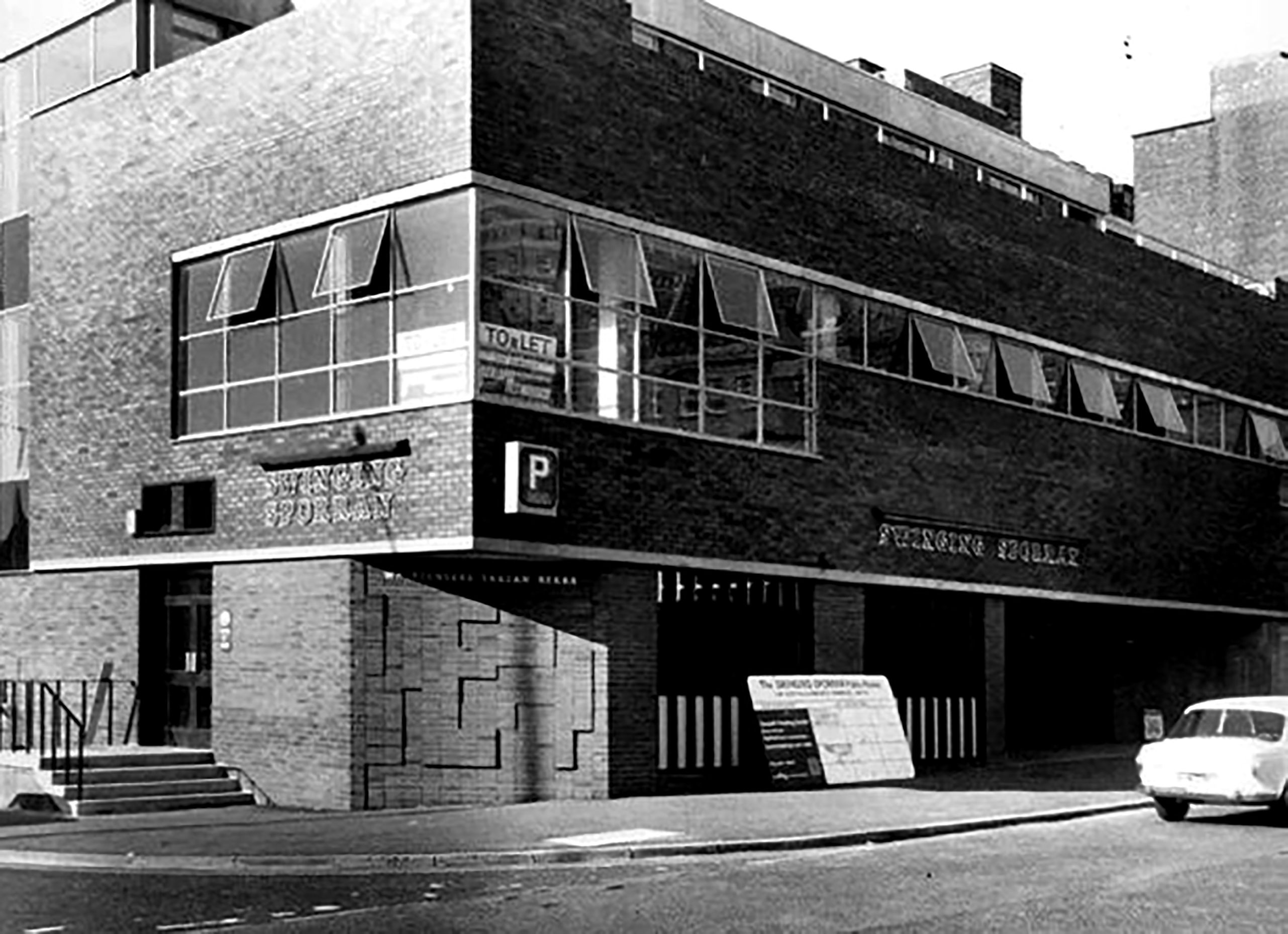
We have been snapping here afore in the guise of Mr Estate Pubs – checking out the Thompsons Arms.
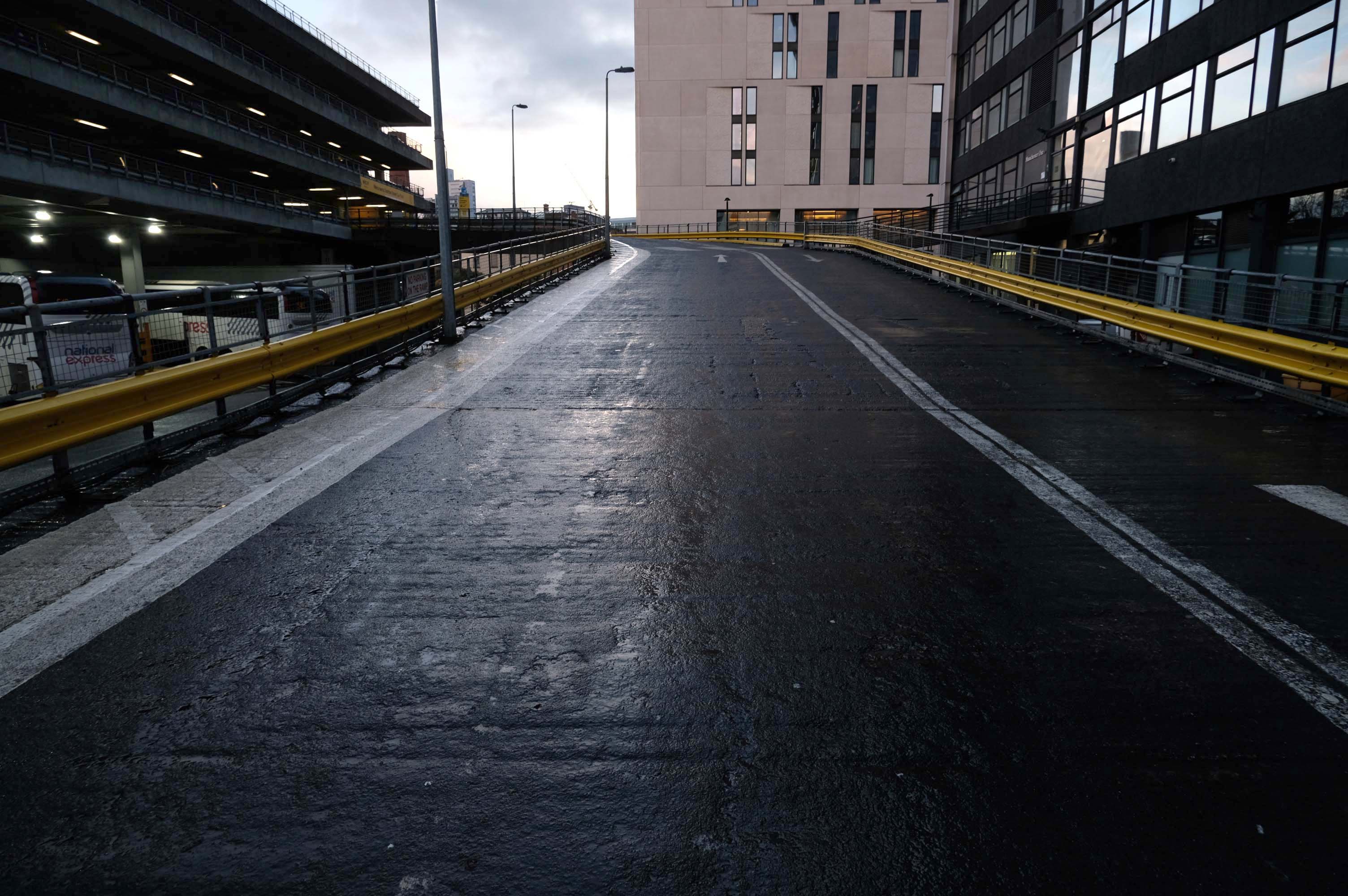
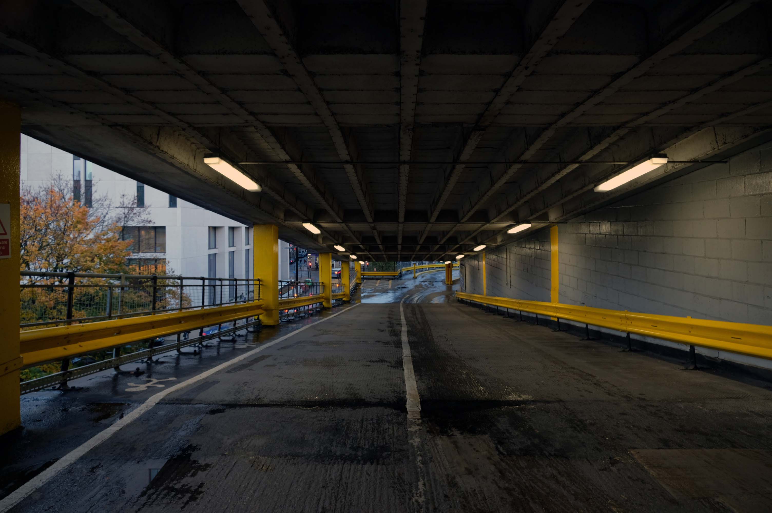
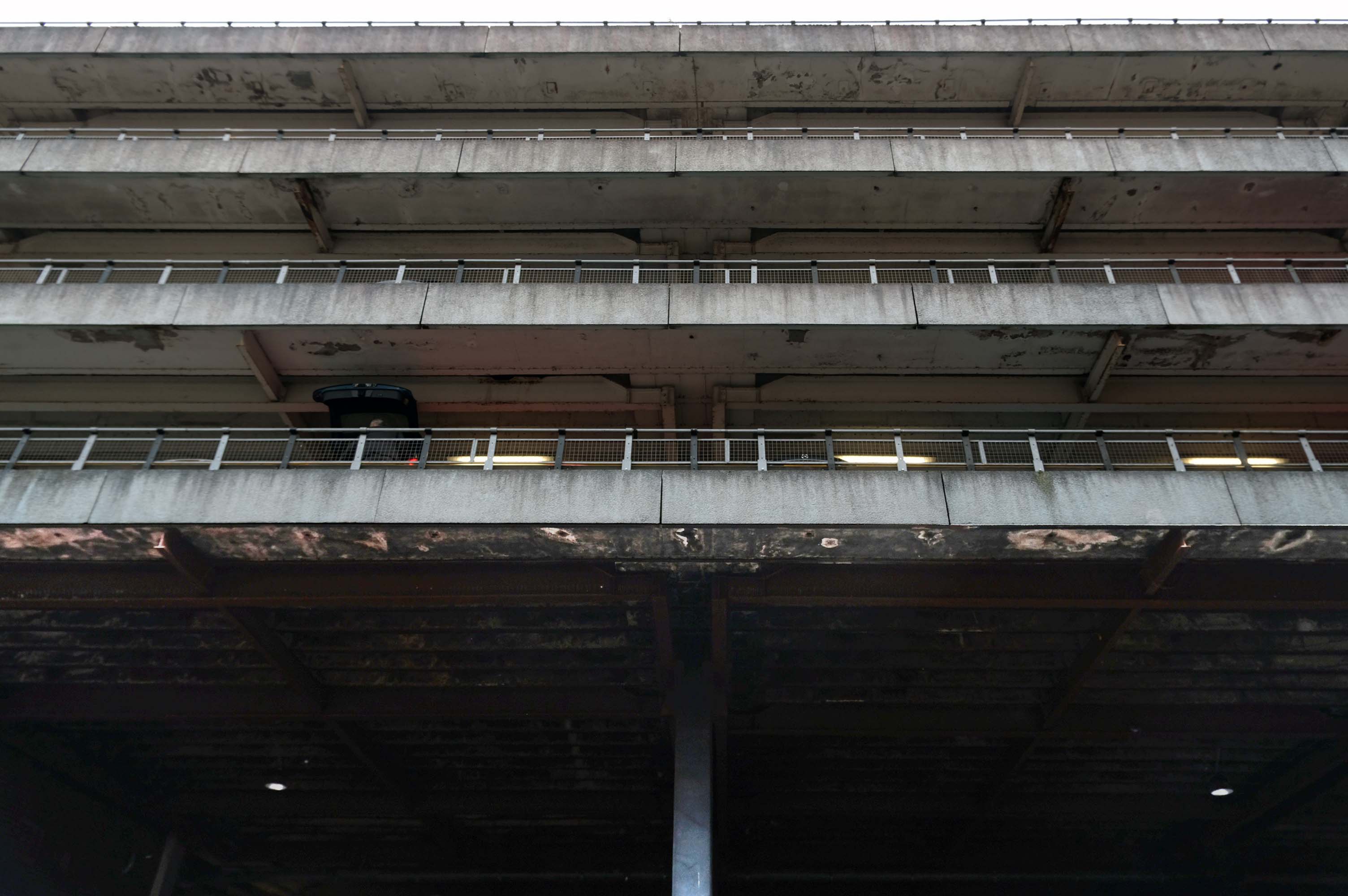
For this is a car park with coach station and boozer attached.
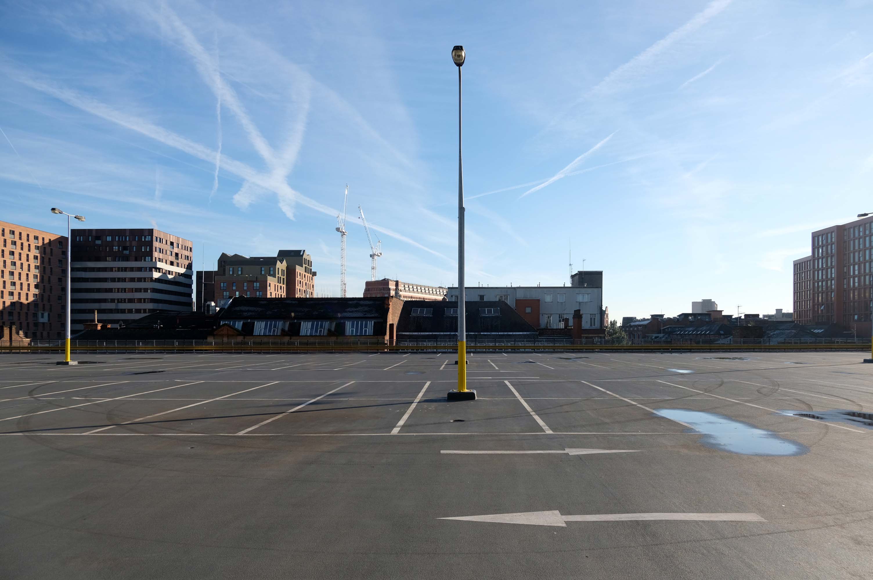
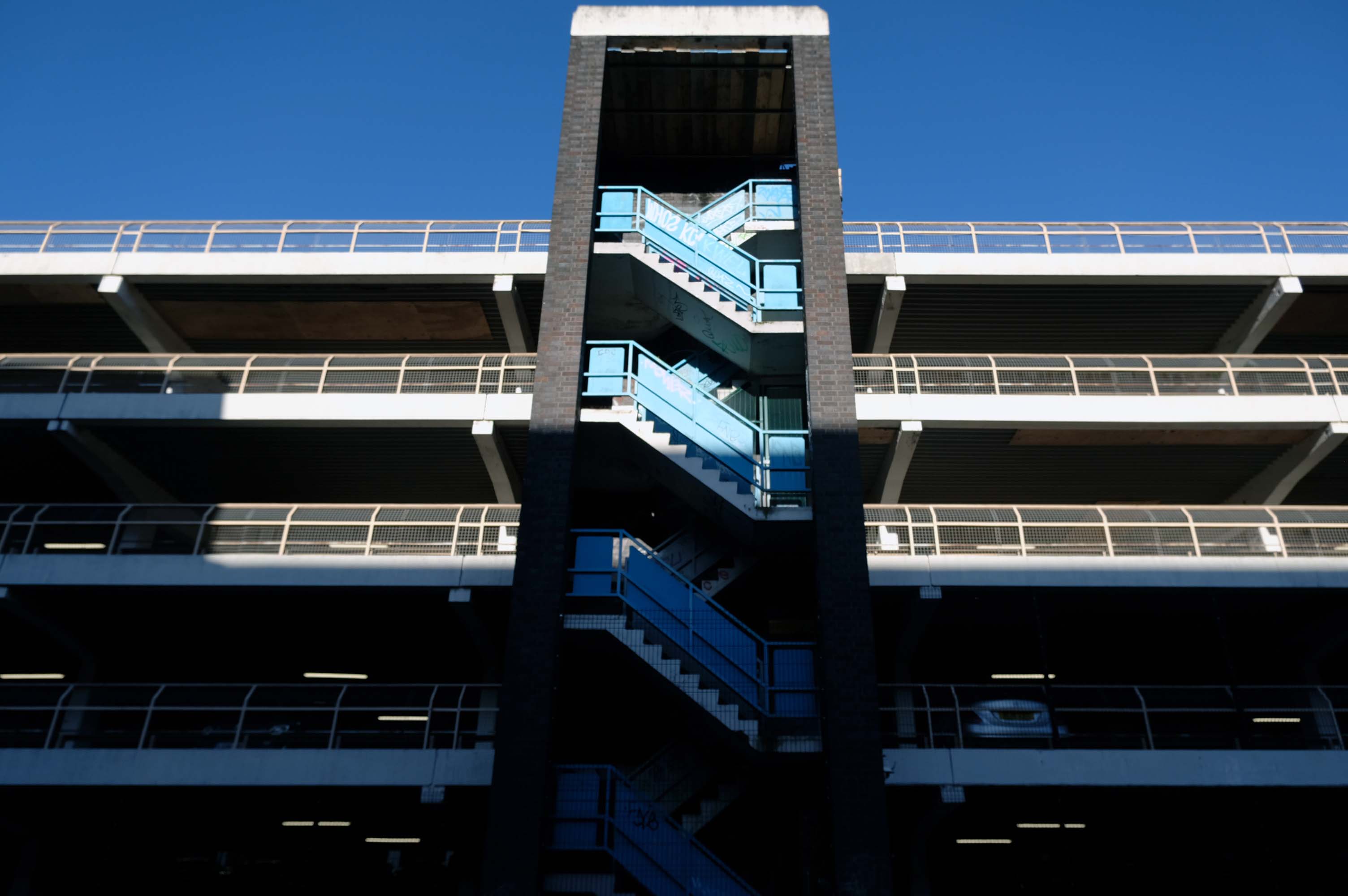
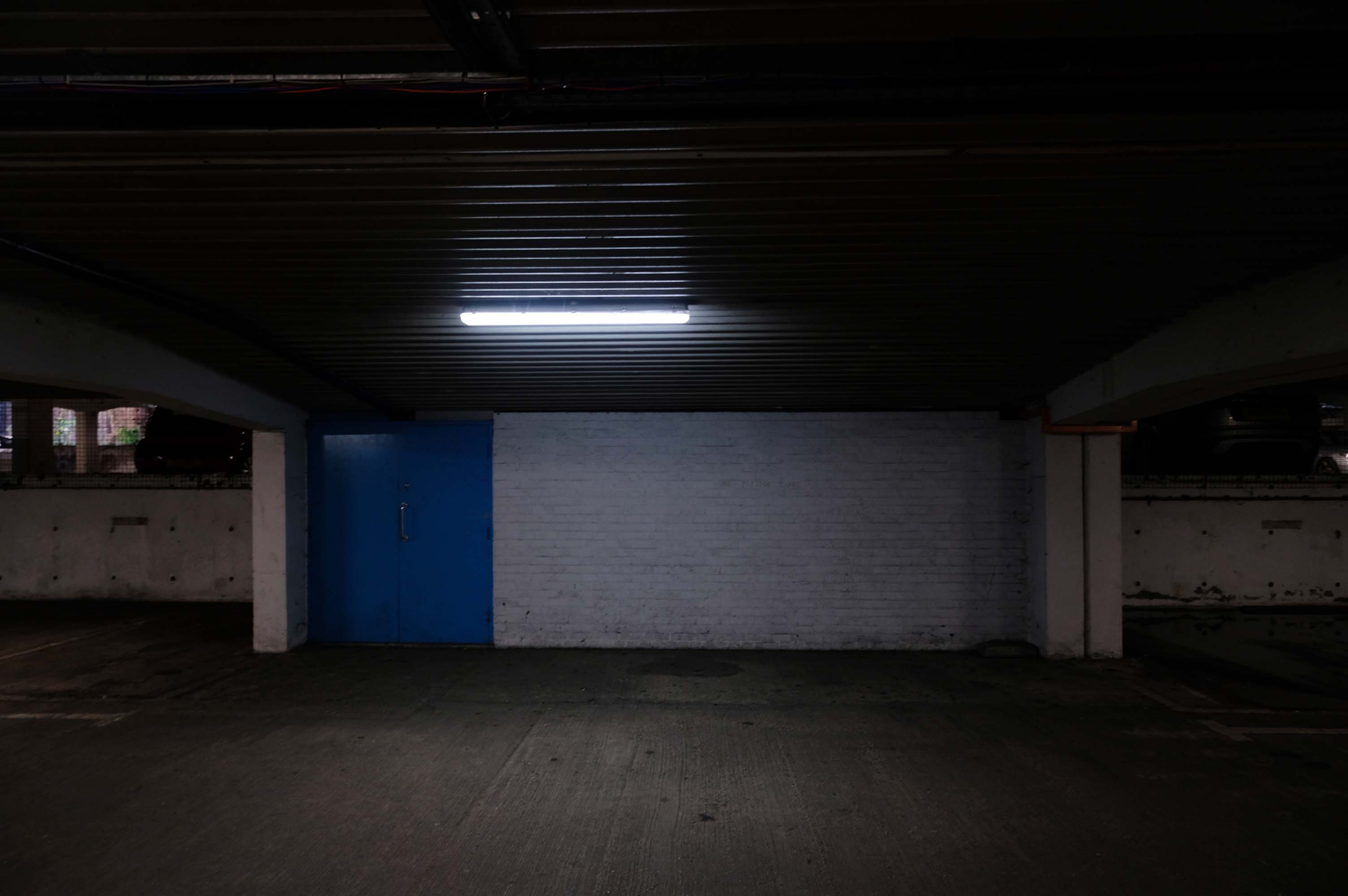
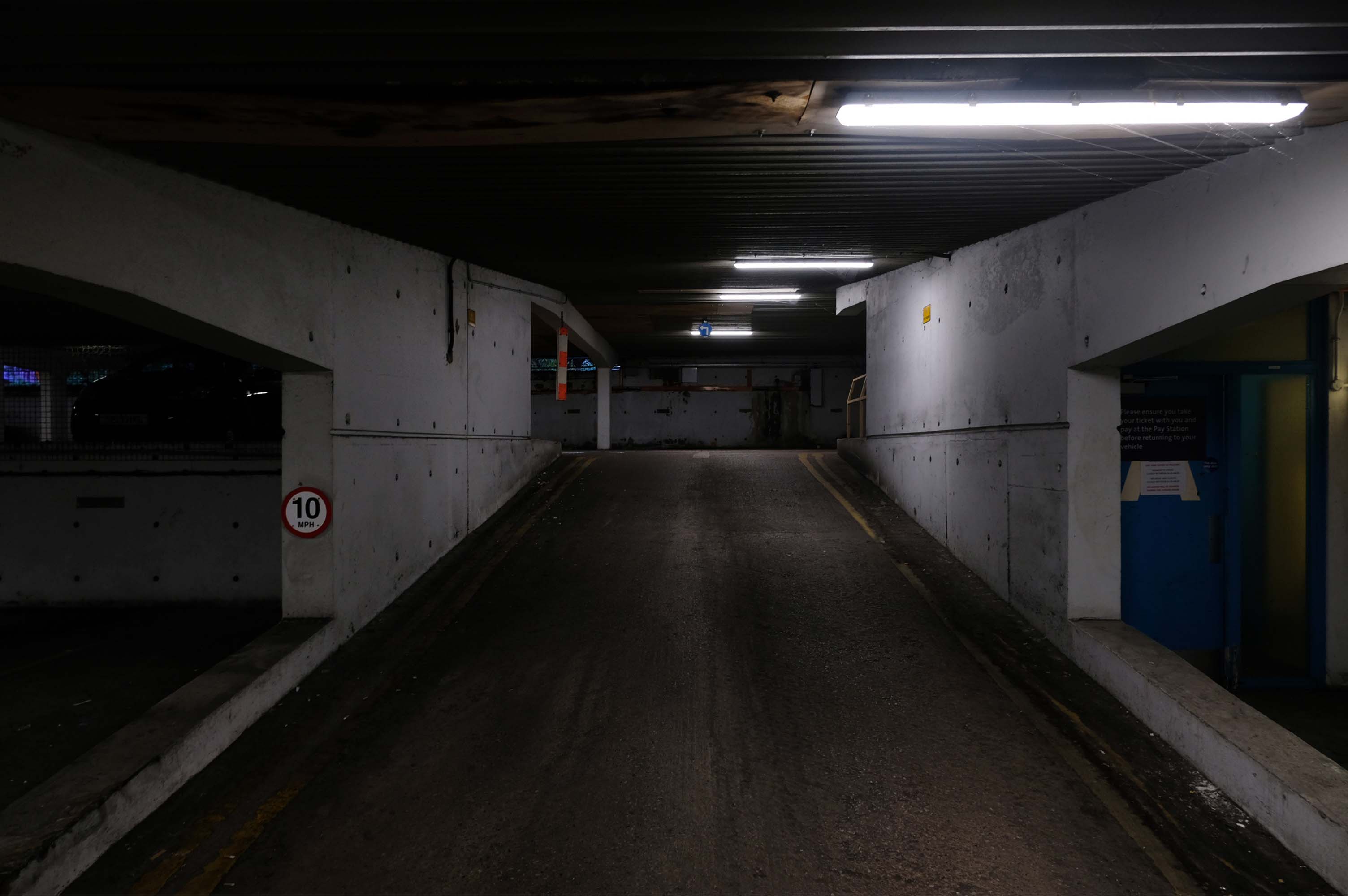
The pedestrian in a car park approaches cautiously – along the ramp.
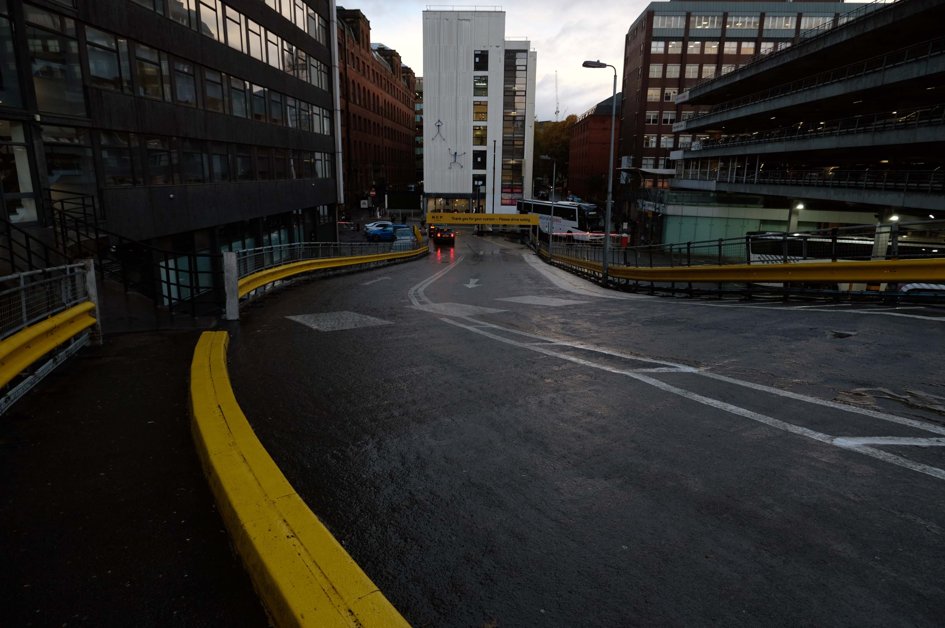
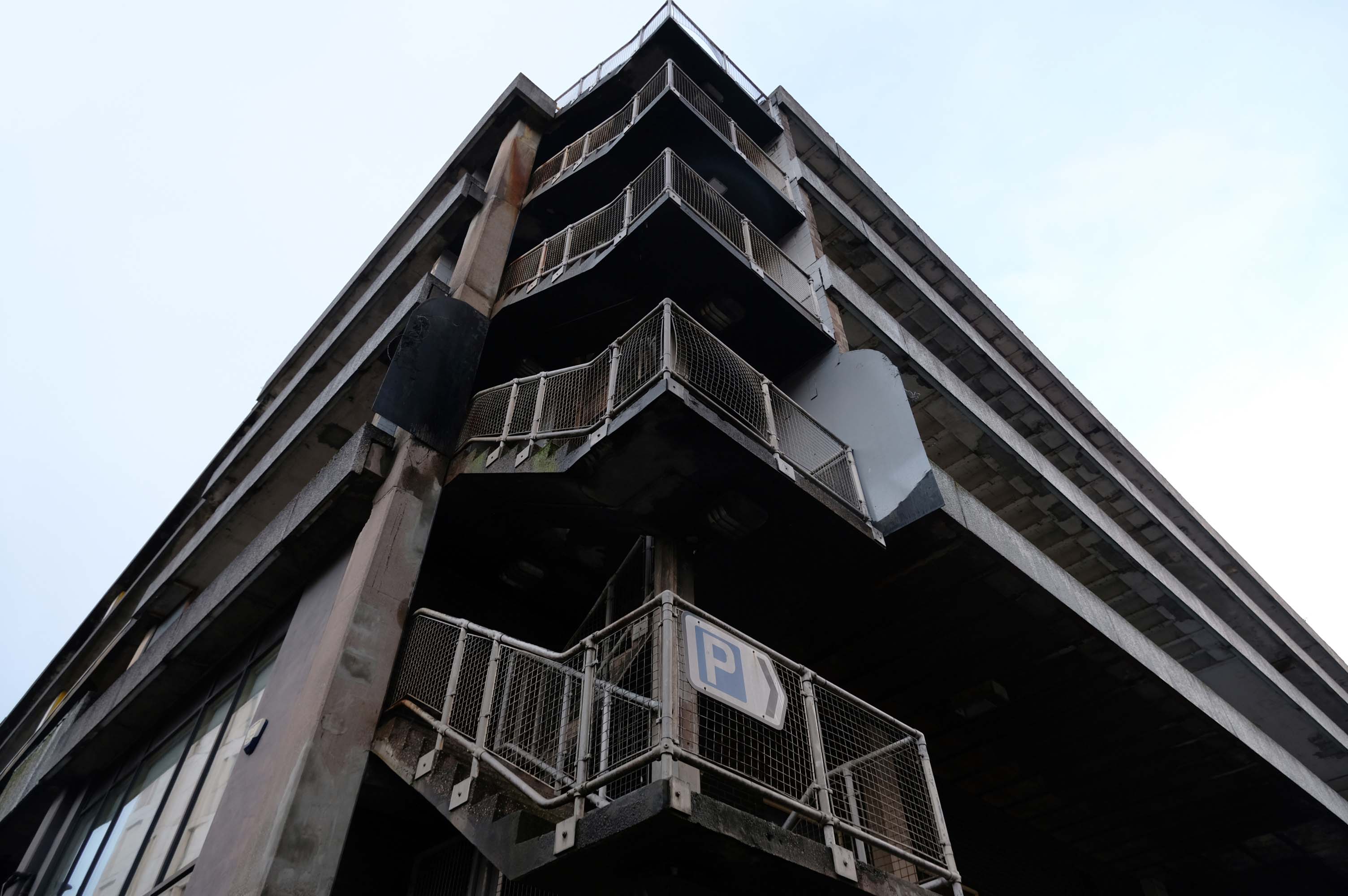
Retreating the better to circumnavigate the site.
I was quickly losing light – so I called it a day.
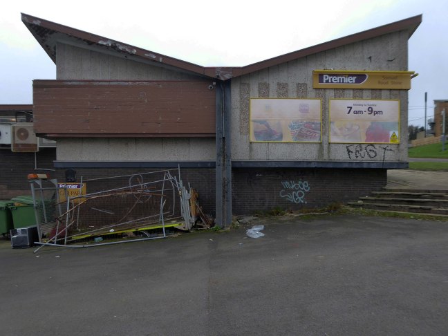
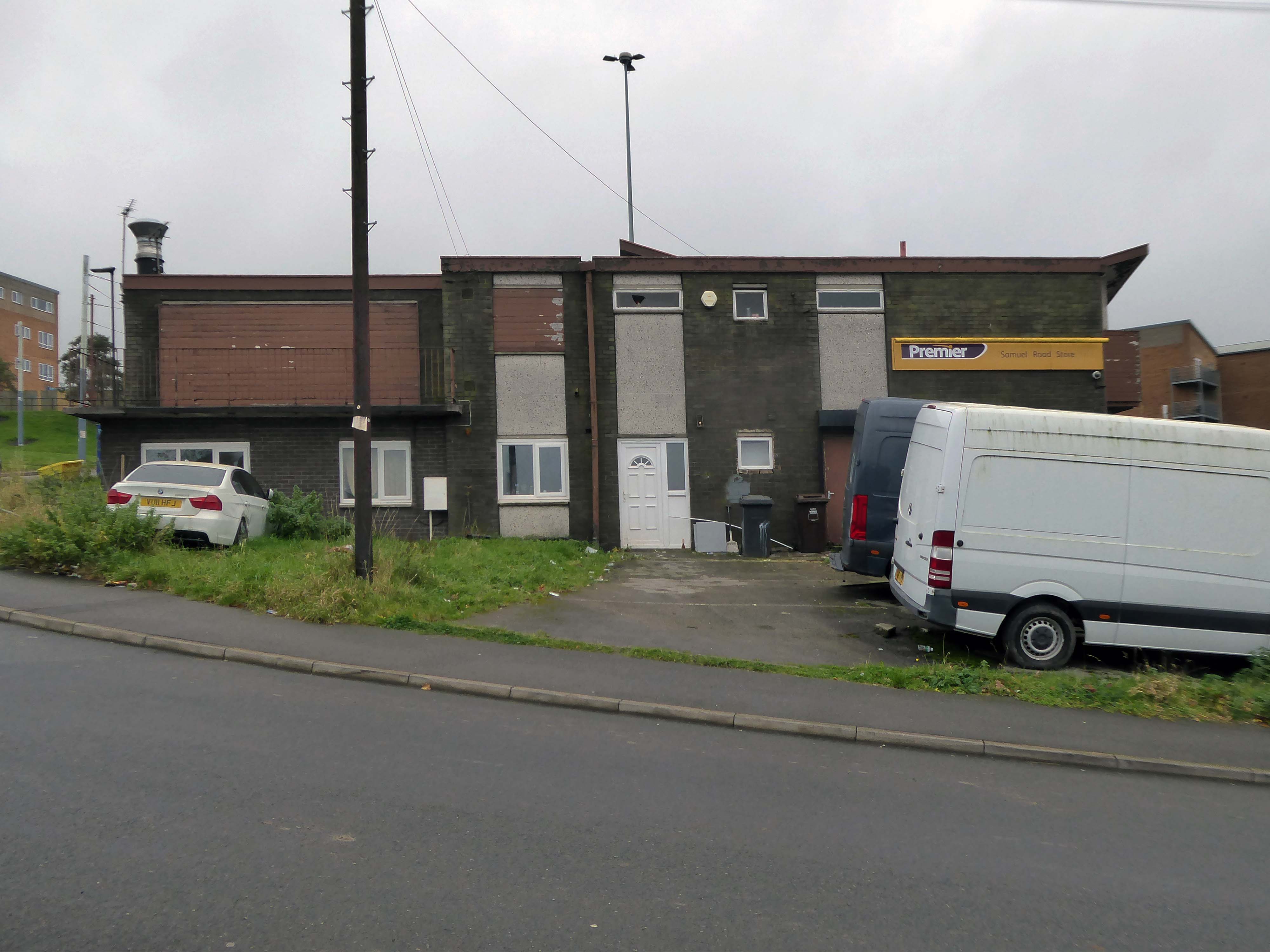
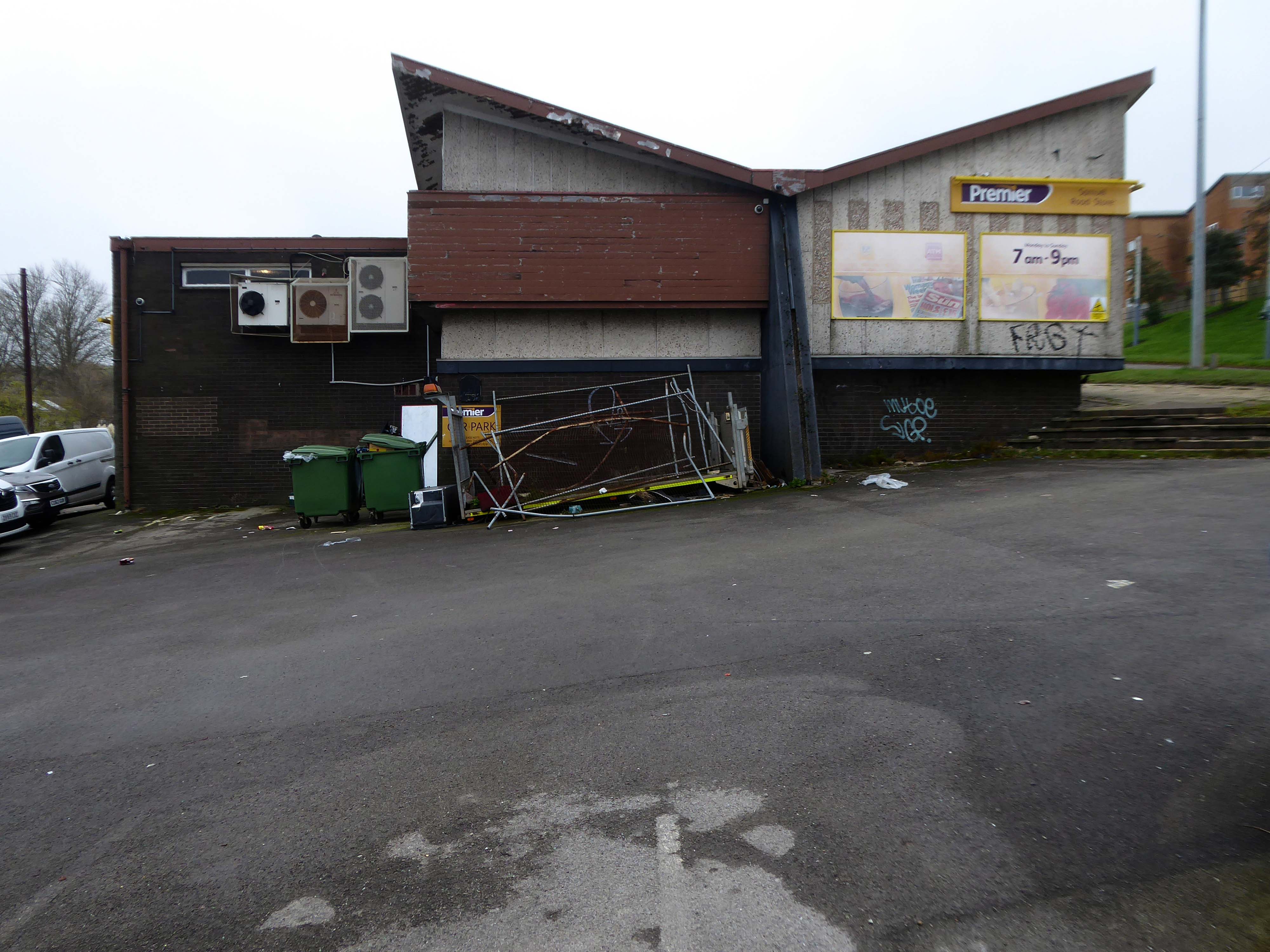
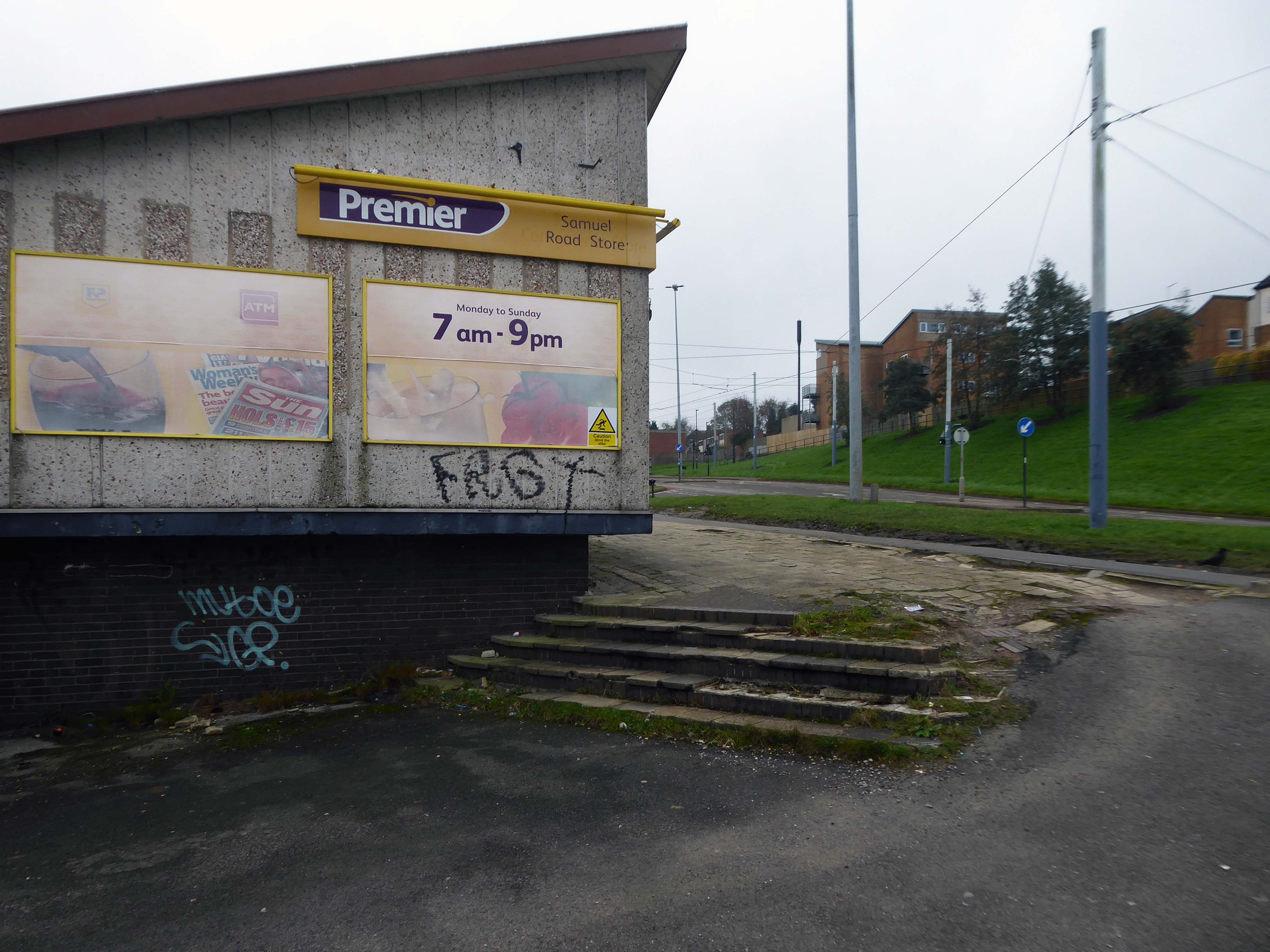
Oh how I loved this place my family drunk in here for years and years, I remember waiting outside on a weekend with a packet of crisps and a glass of coke, waiting for them to come out. I think it was the first place I had my first legal drink, loved the place hate to go past now and see it as a Premier. Anyone seen Dave and Ann lately once upon a time landlord and landlady, does anyone know how they are doing?
Sunday afternoons karaoke and everyone sat outside in the summer – oh the memories.
I used to Drink in there around 1975/76, it was OK in those days, a local wrestler used to drink in there, his name was Alan Kilby, I saw him fight on TV a few times.
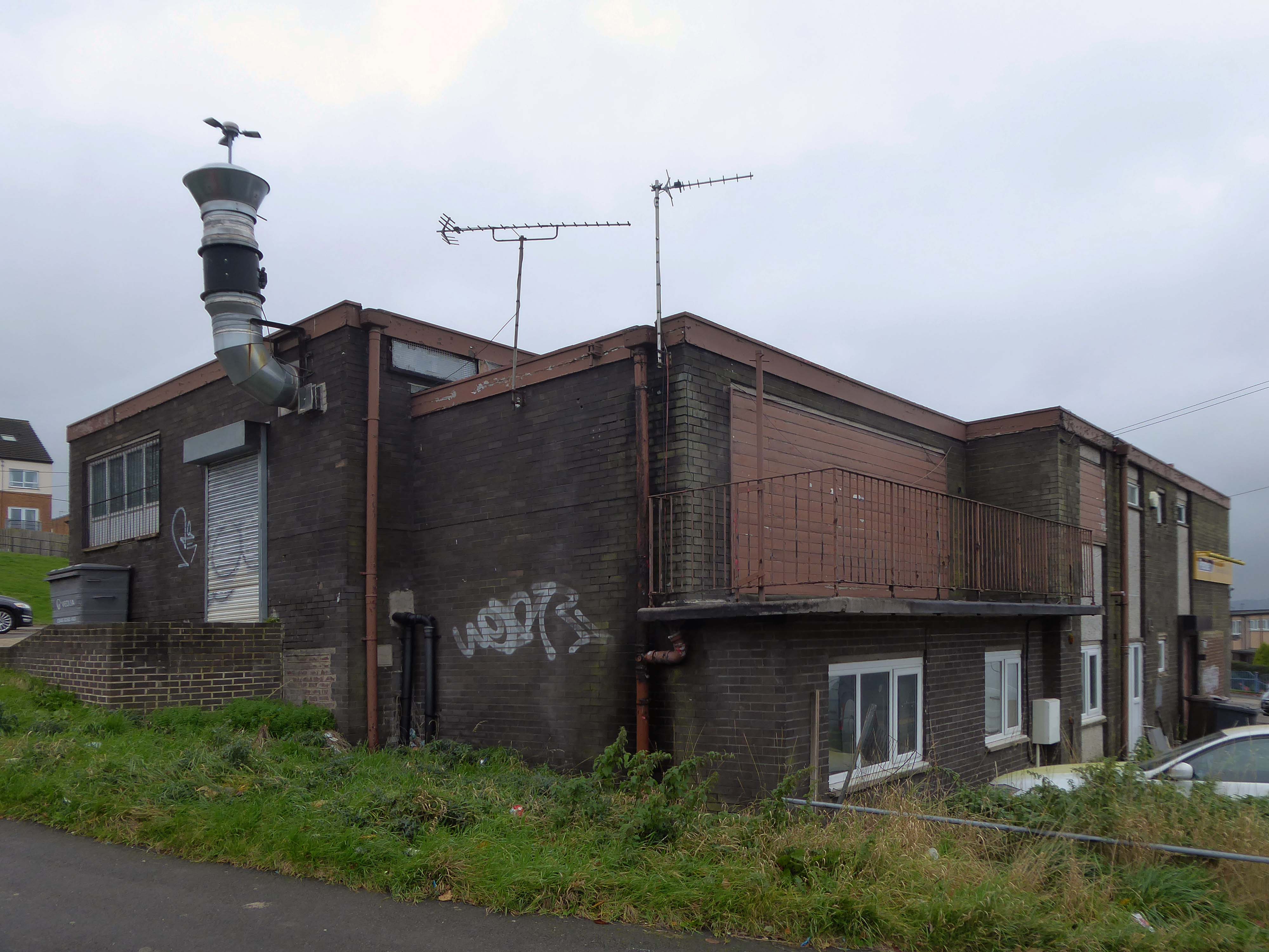
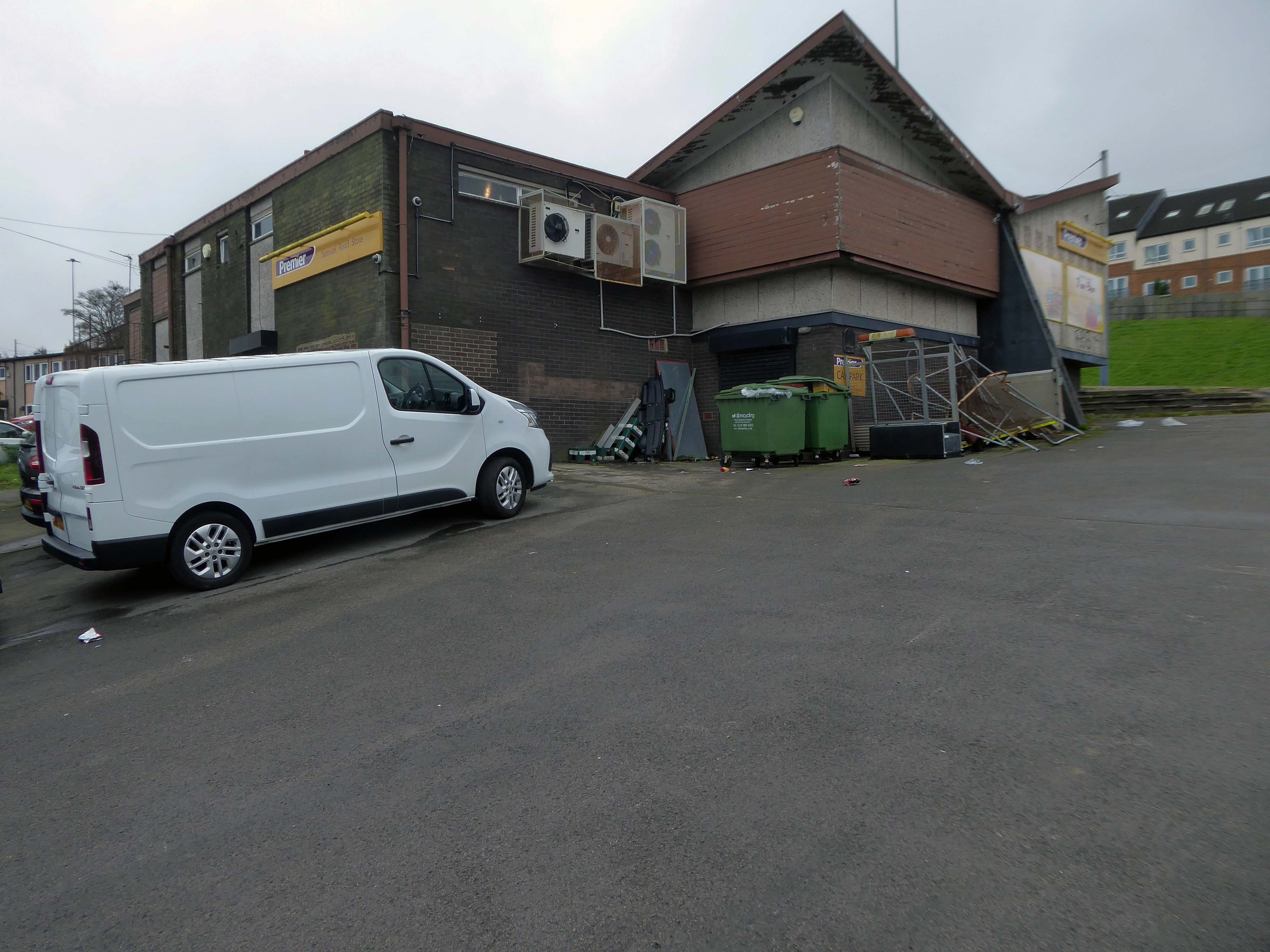
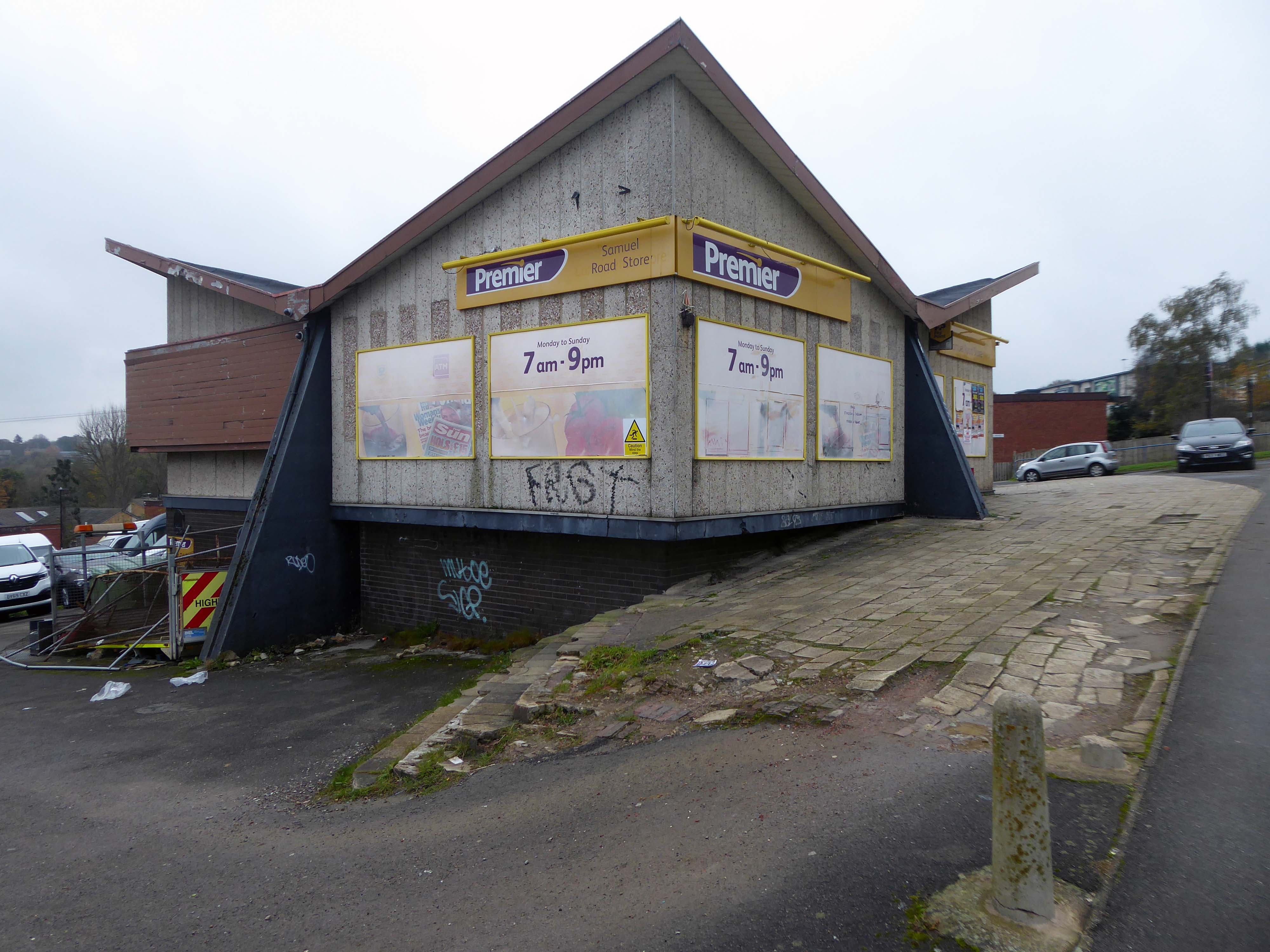
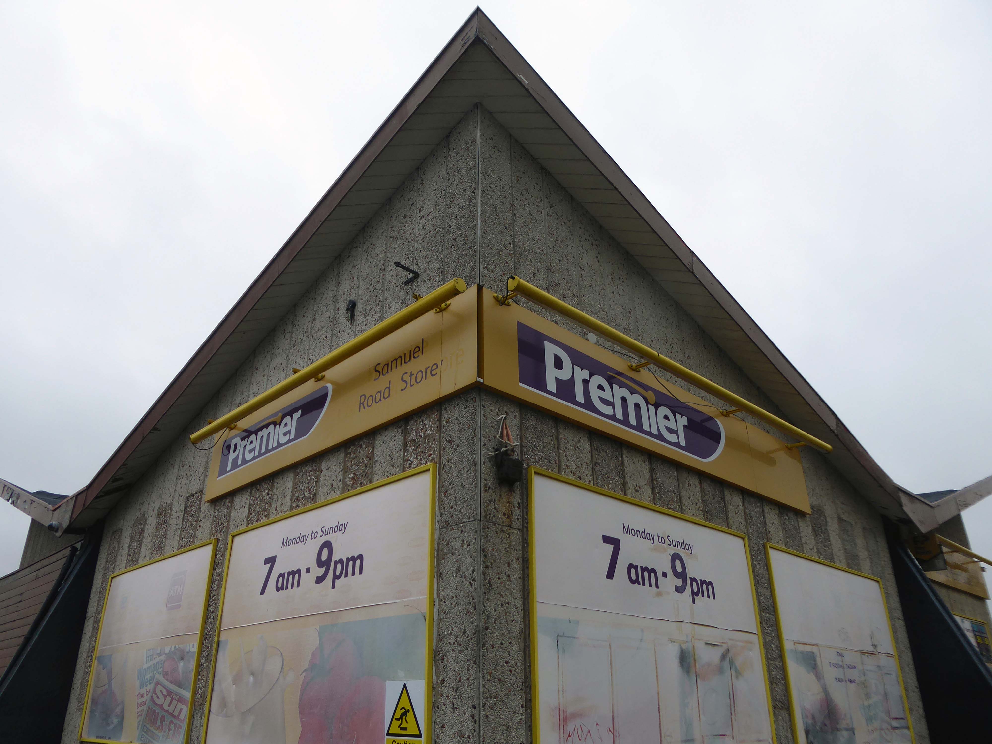
The former pub’s striking roof is still striking – sadly the last orders bell stopped striking long, long ago.
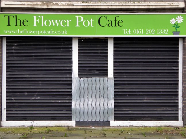
The shop was busy and the chips from the chippy were just the job on a cold damp November day.
Changes in the demographics of the area, social trends and the general economic malaise, have ensured that many estate pubs are no longer able to thrive and prosper.
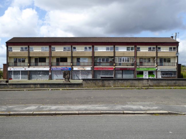
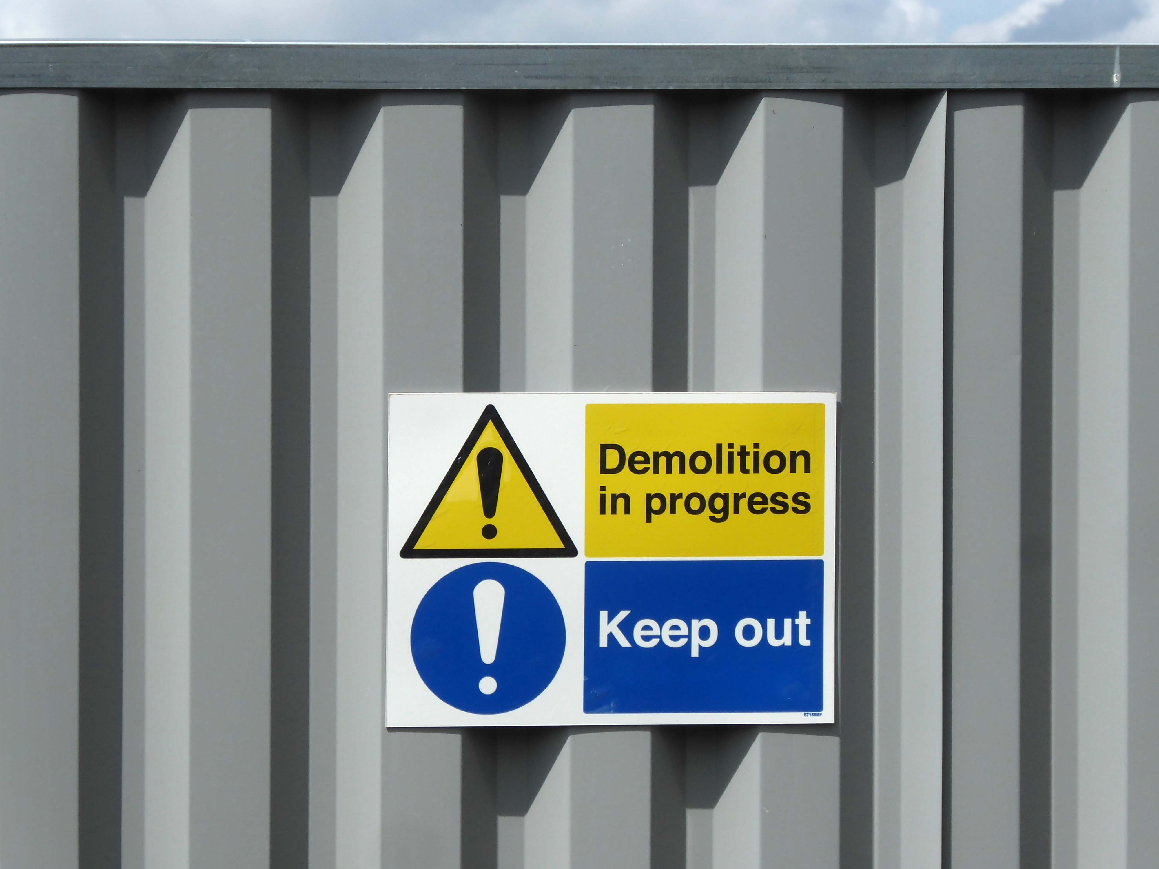
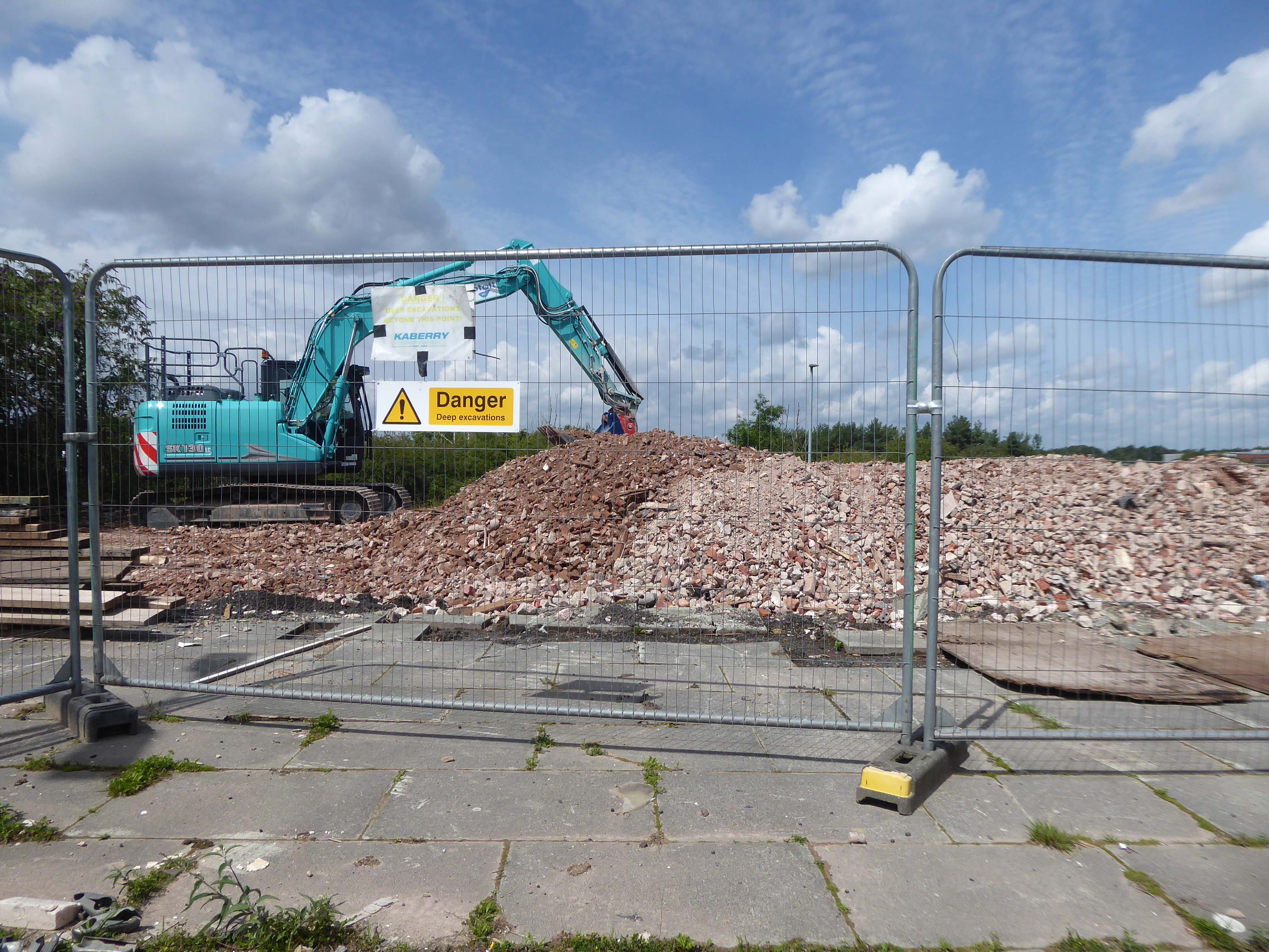
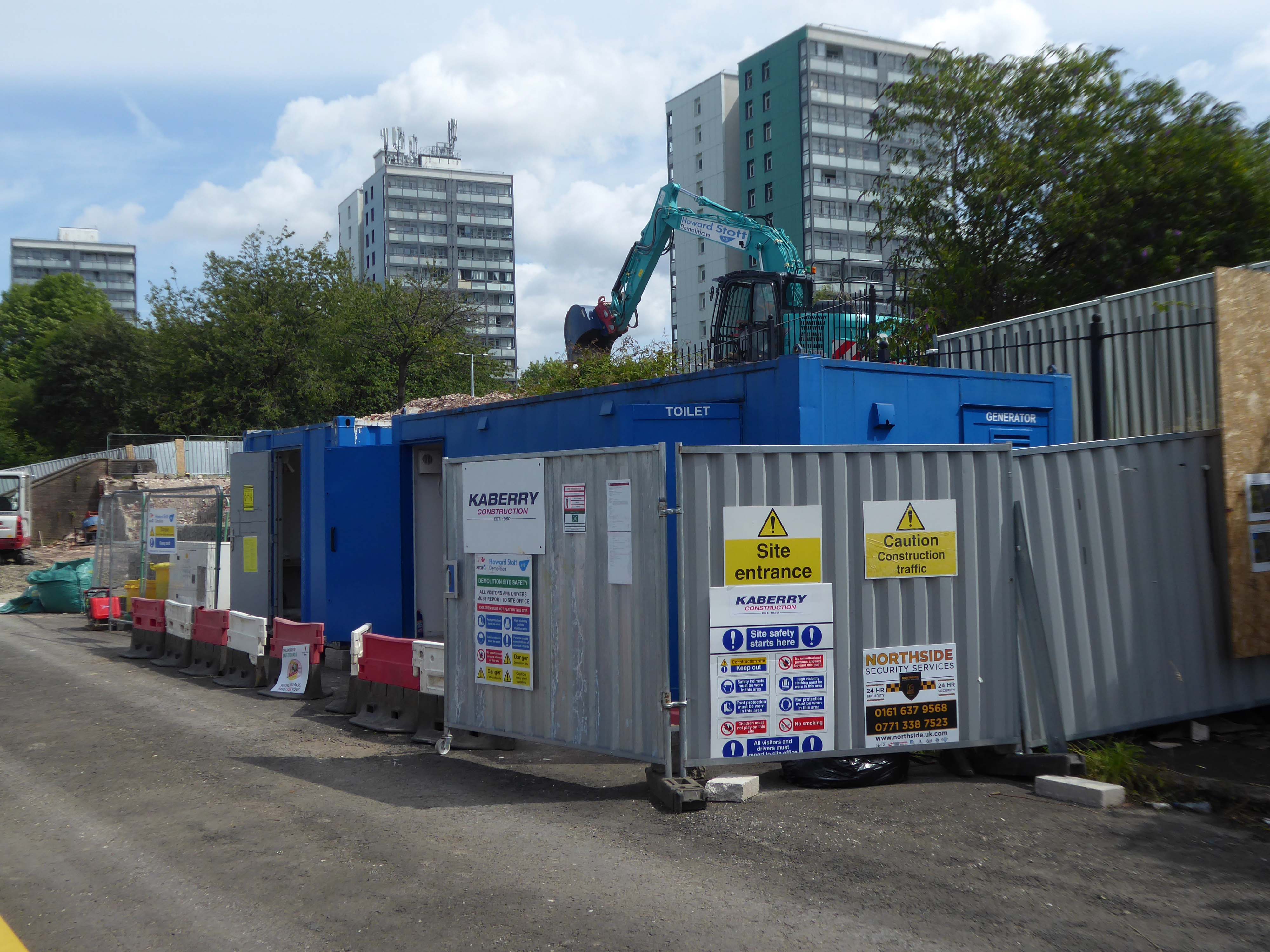
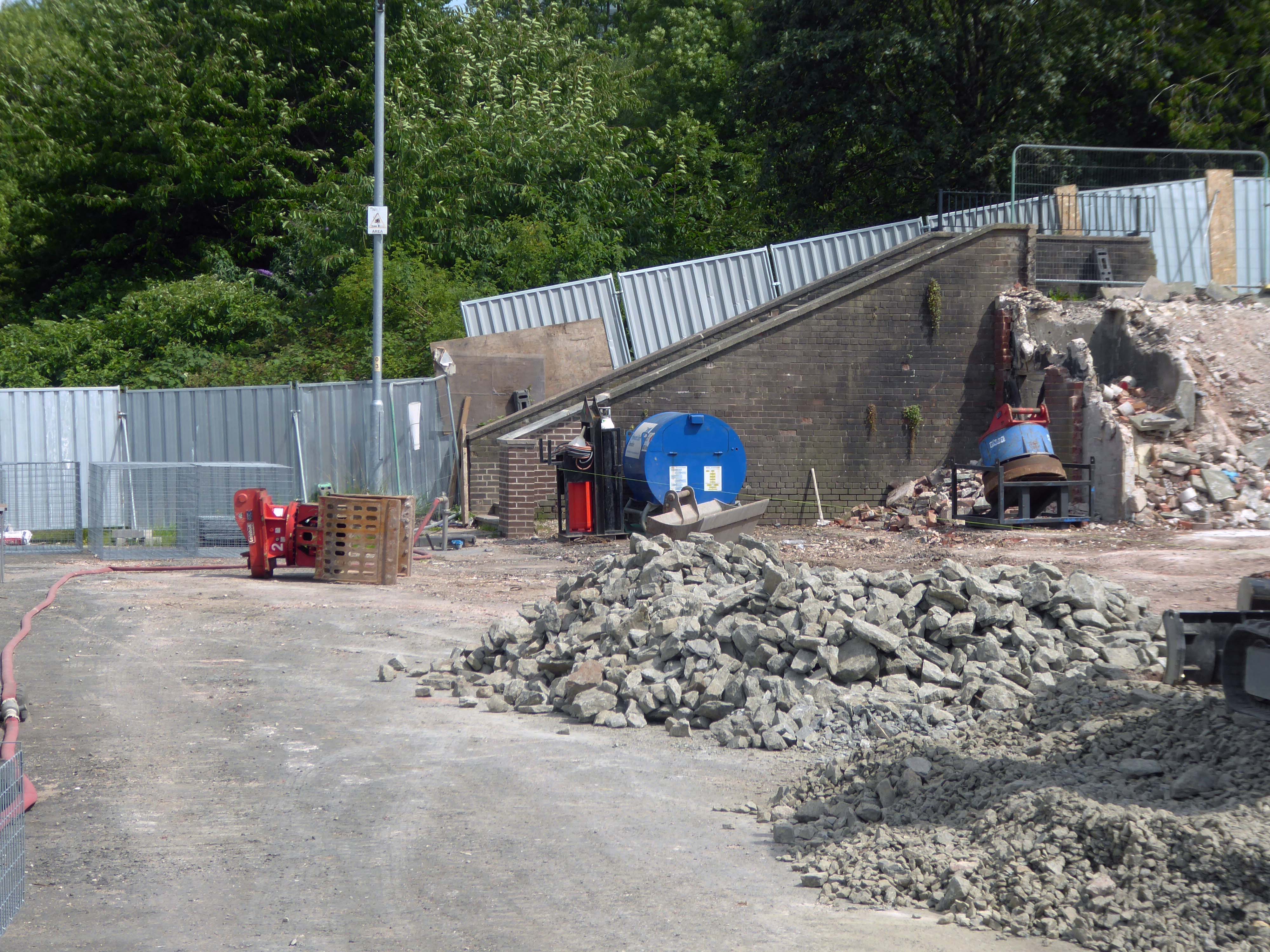
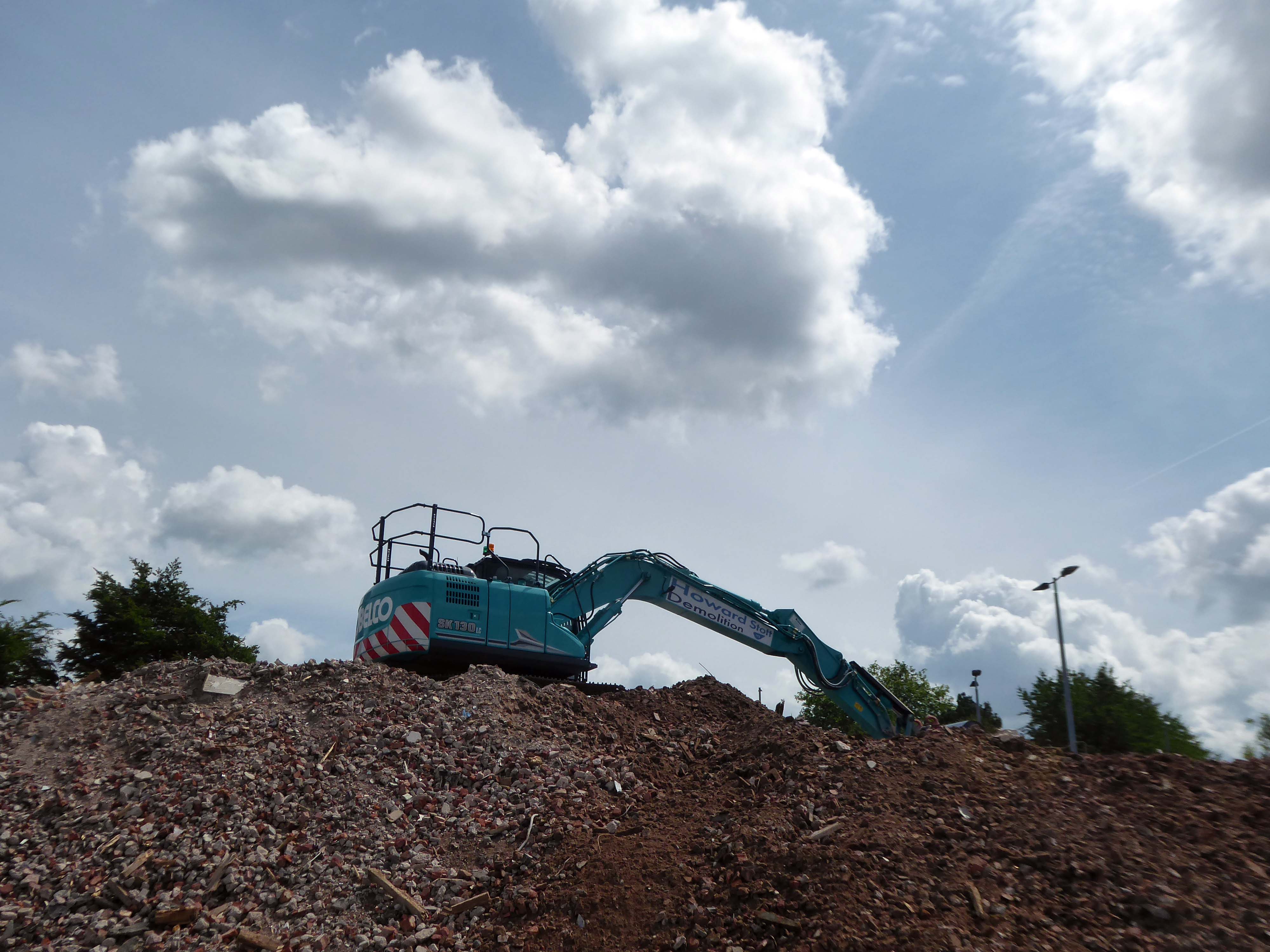
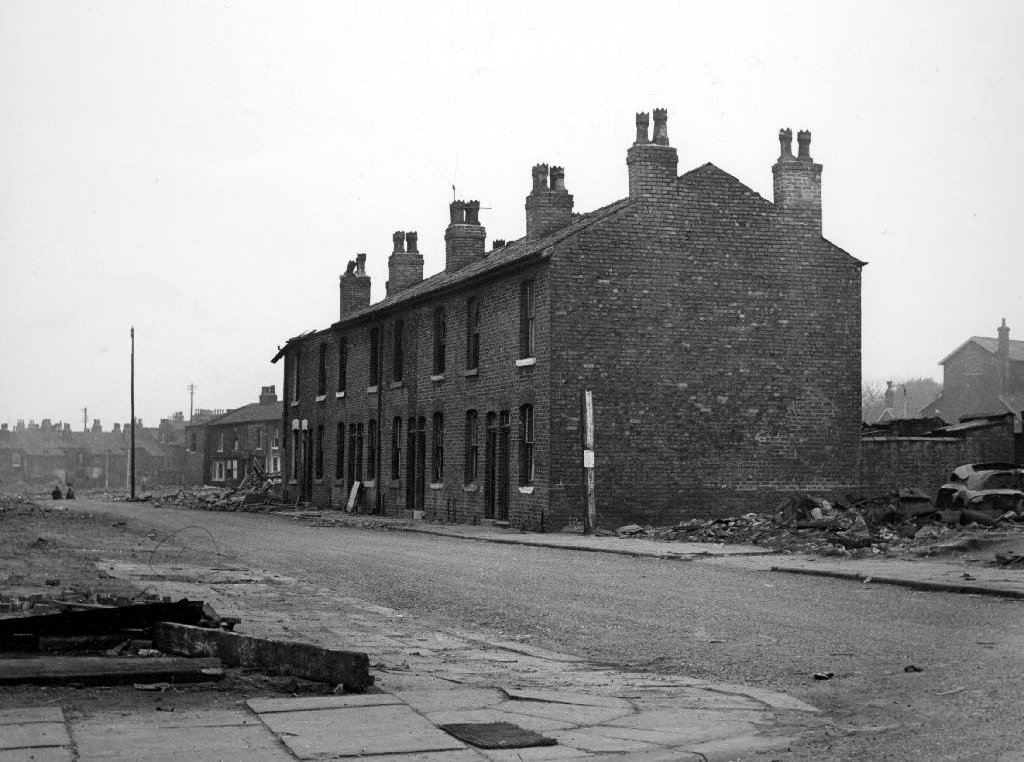
April 2023 and the shops and homes are being prepared for demolition.
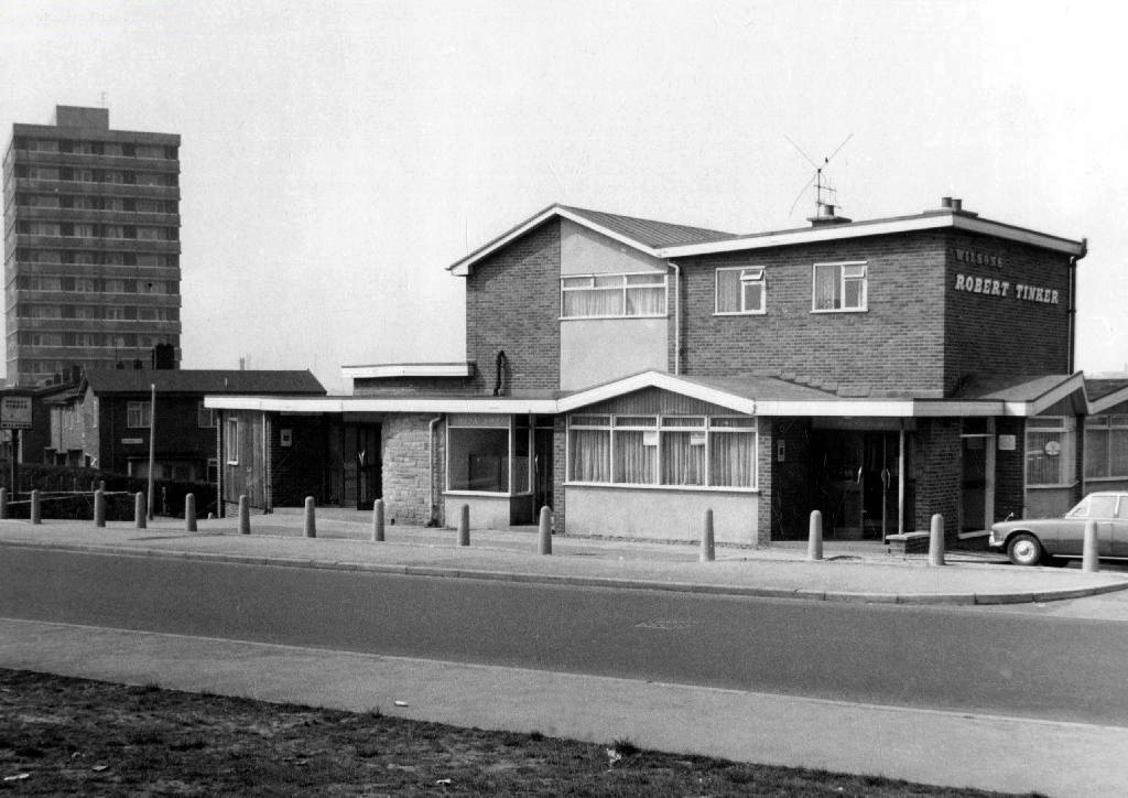
The company responsible for the demolition also dropped the Robert Tinker, on nearby Dalton Street.
While it is not yet clear exactly what will replace the shopping parade, work has already started nearby on other projects within the scheme. The first phase of development in Collyhurst will see 274 new homes built in the area.
The council has pledged to reinstate the William Mitchell totem nearby.
However the weight of the concrete sculpture and its base have presented unforeseen challenges.
Siting a crane above the Victorian rail tunnel is an issue, as is the cost, a quote for £100,000 was deemed excessive. So stasis is the order the day – the immovable object awaits an unstoppable force.
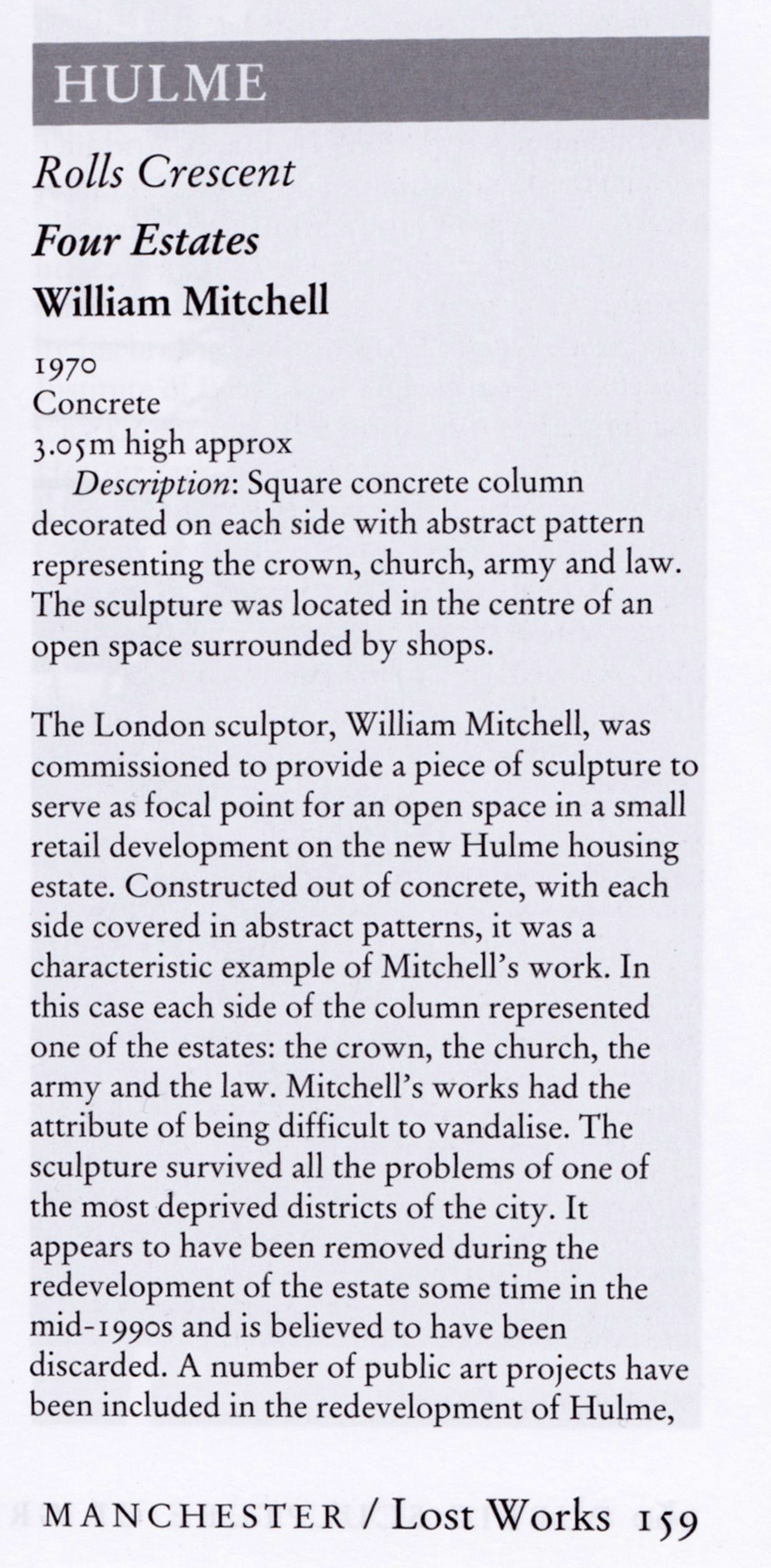
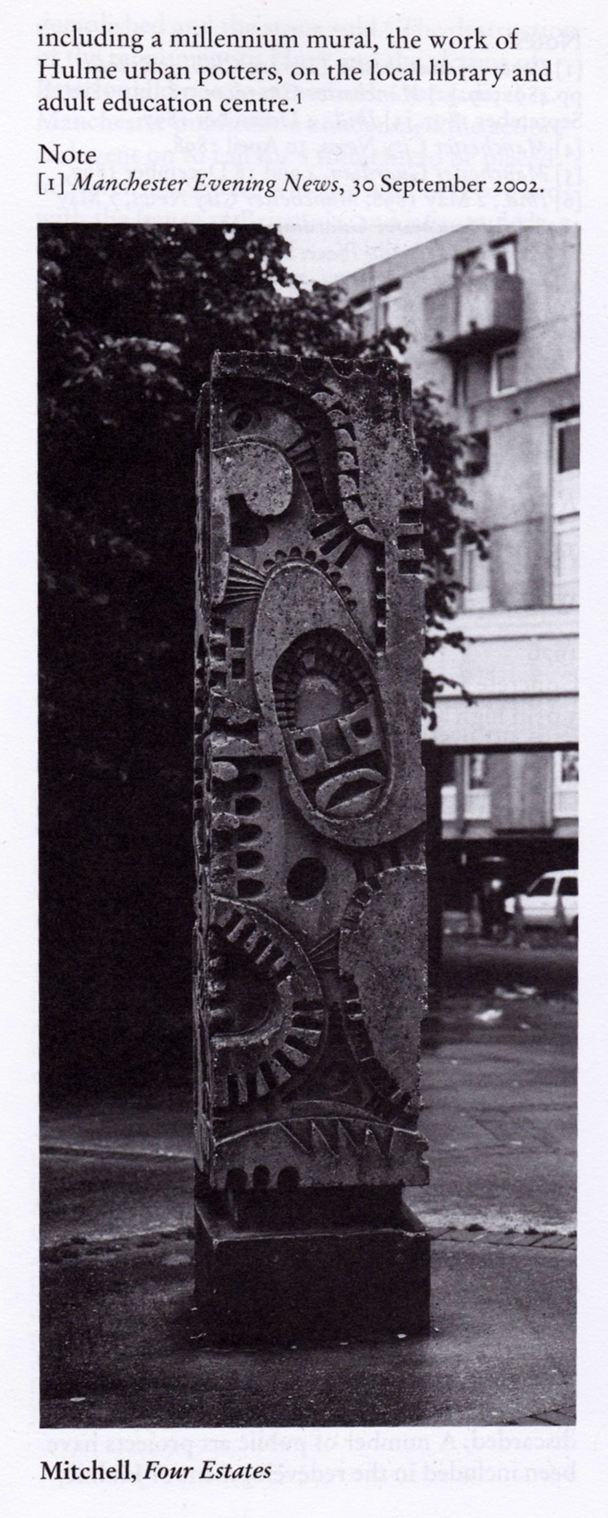
The sculpture is one of four around Manchester – the Hulme exemplar is long gone.
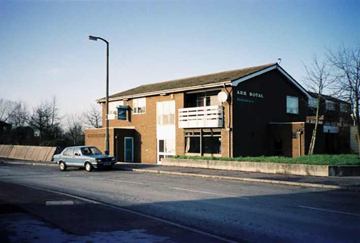
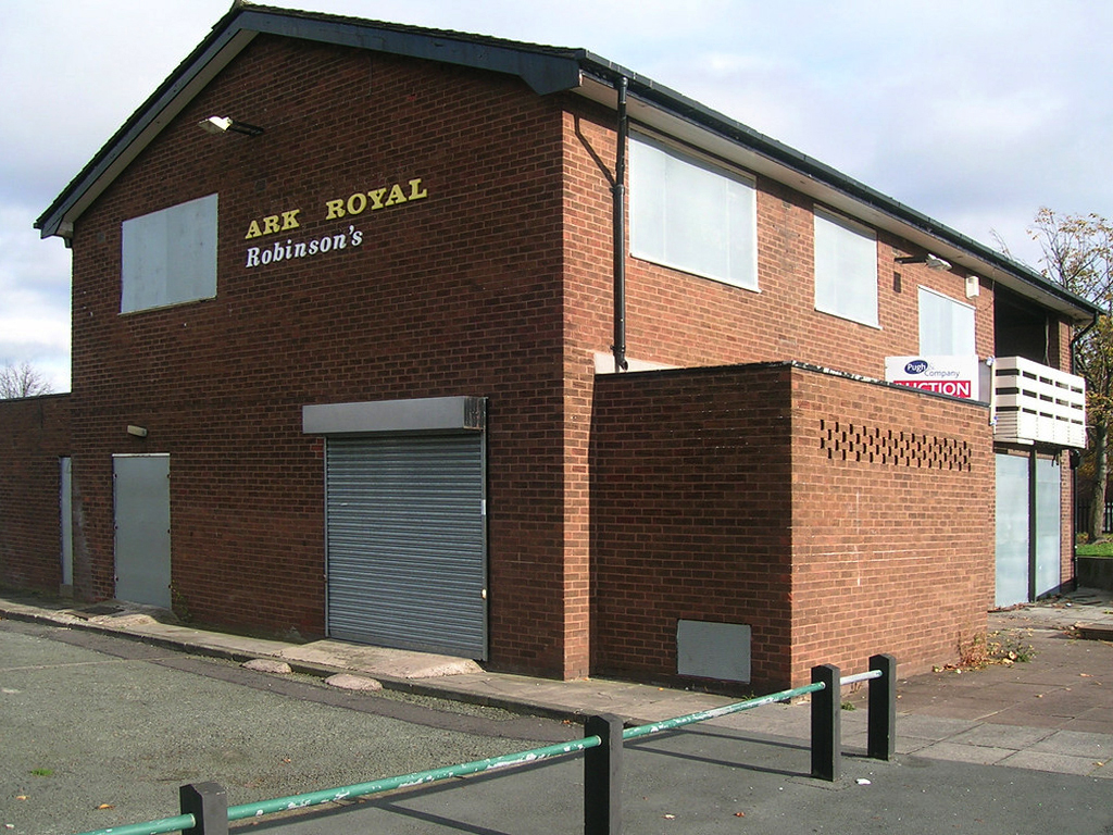
Another great looking estate pub that was on the same estate as the Hipp which it was also fairly close to.
There was the usual two rooms inside, I had a drink in the bar room which was quite busy on my Friday afternoon visit, there was also a more comfortable lounge.
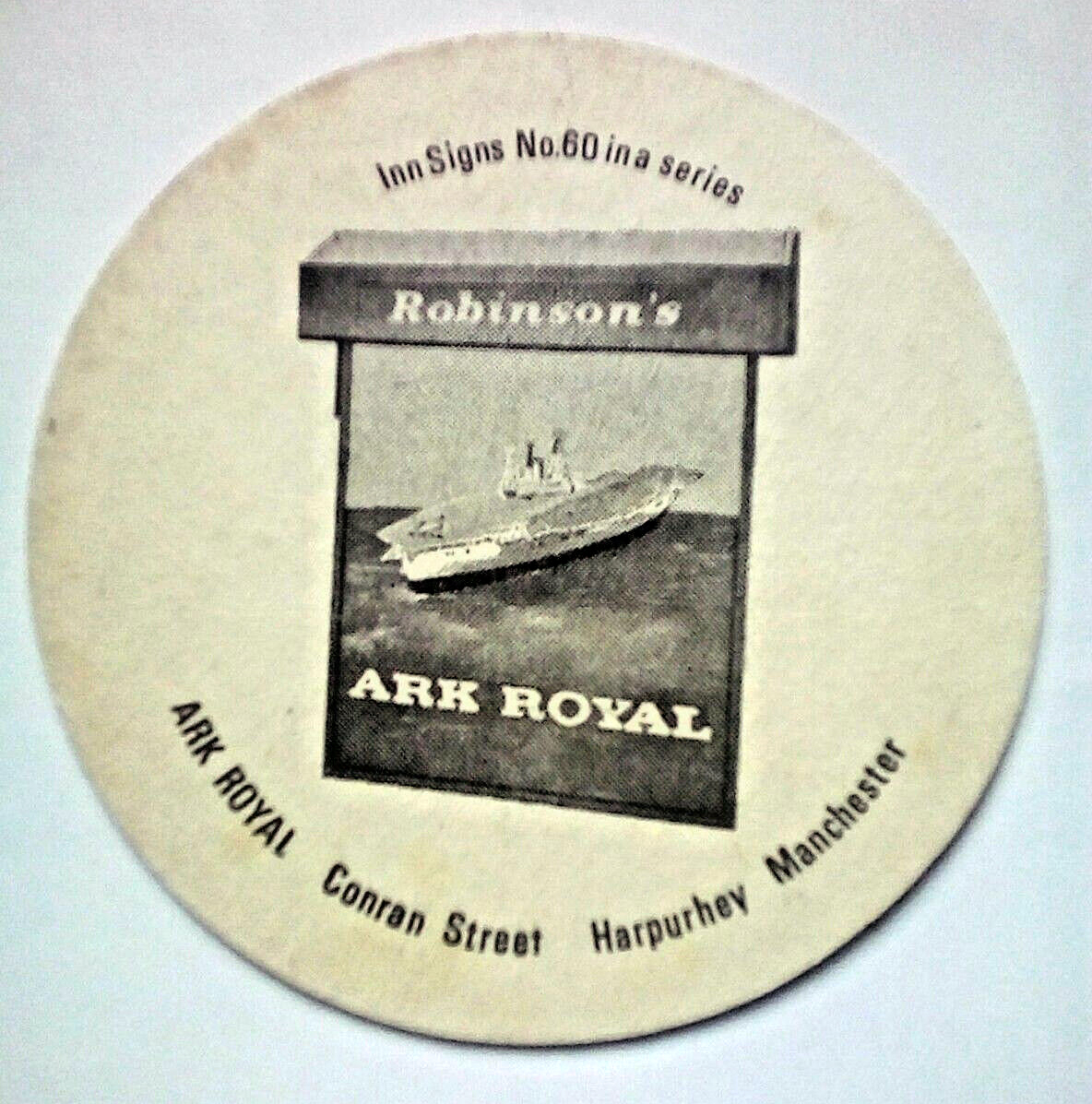
The pub was a Robinsons tied house, there were two real ales on, I had a drink of Robinsons Bitter which was a nice drink, there was also Robinsons Mild on.
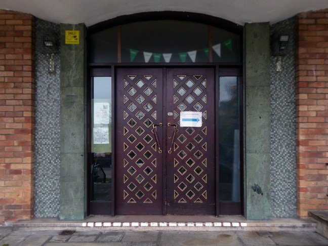
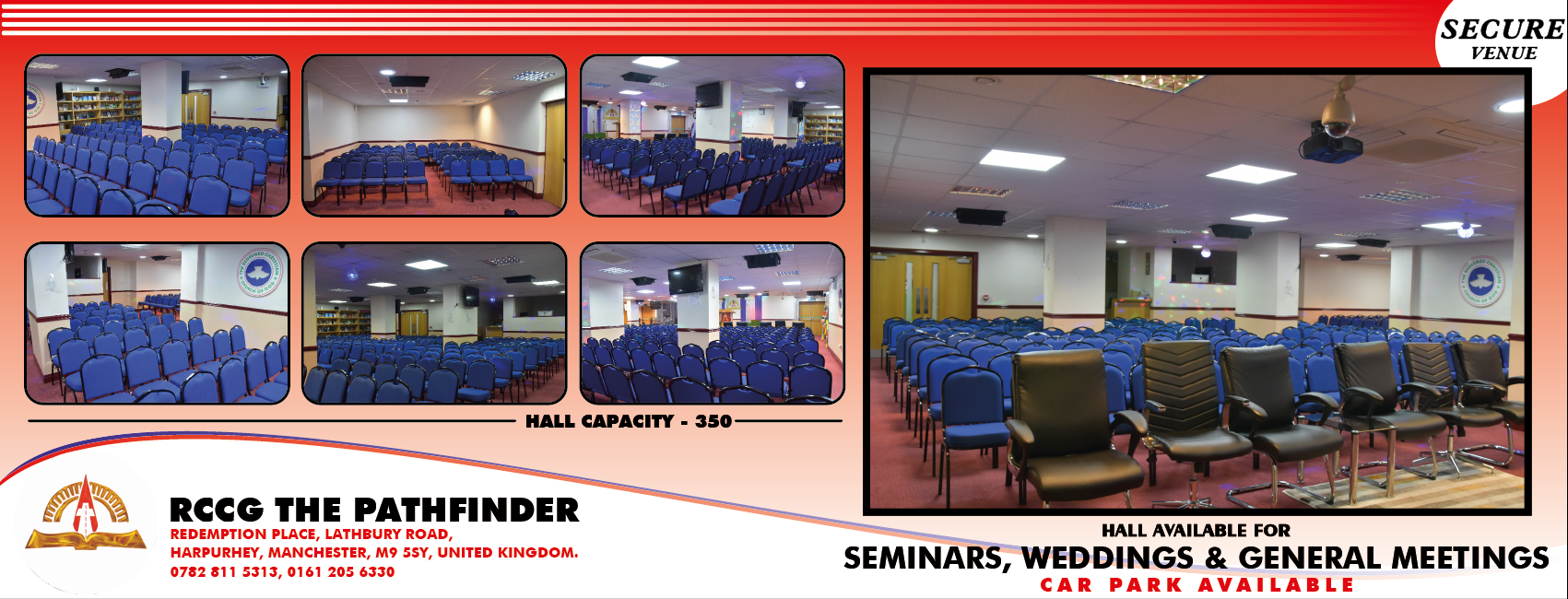
We are committed to the growth and development of individual, our local and international communities. In the interim may I use this medium to invite you to be part of the move of God in our church, the Pathfinder.
The Lord bless your richly as you navigate through in Jesus name.
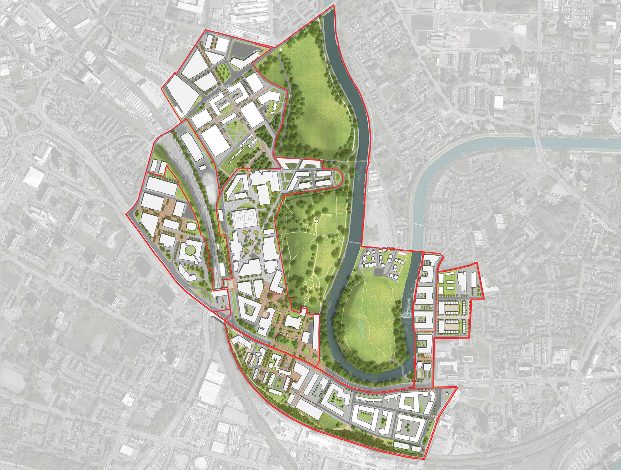
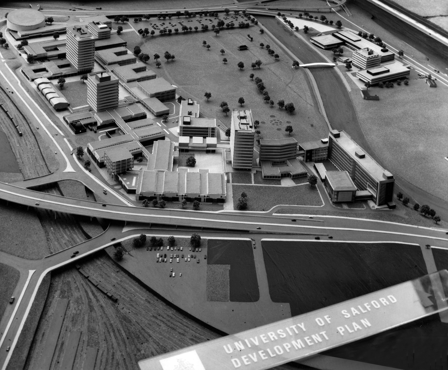
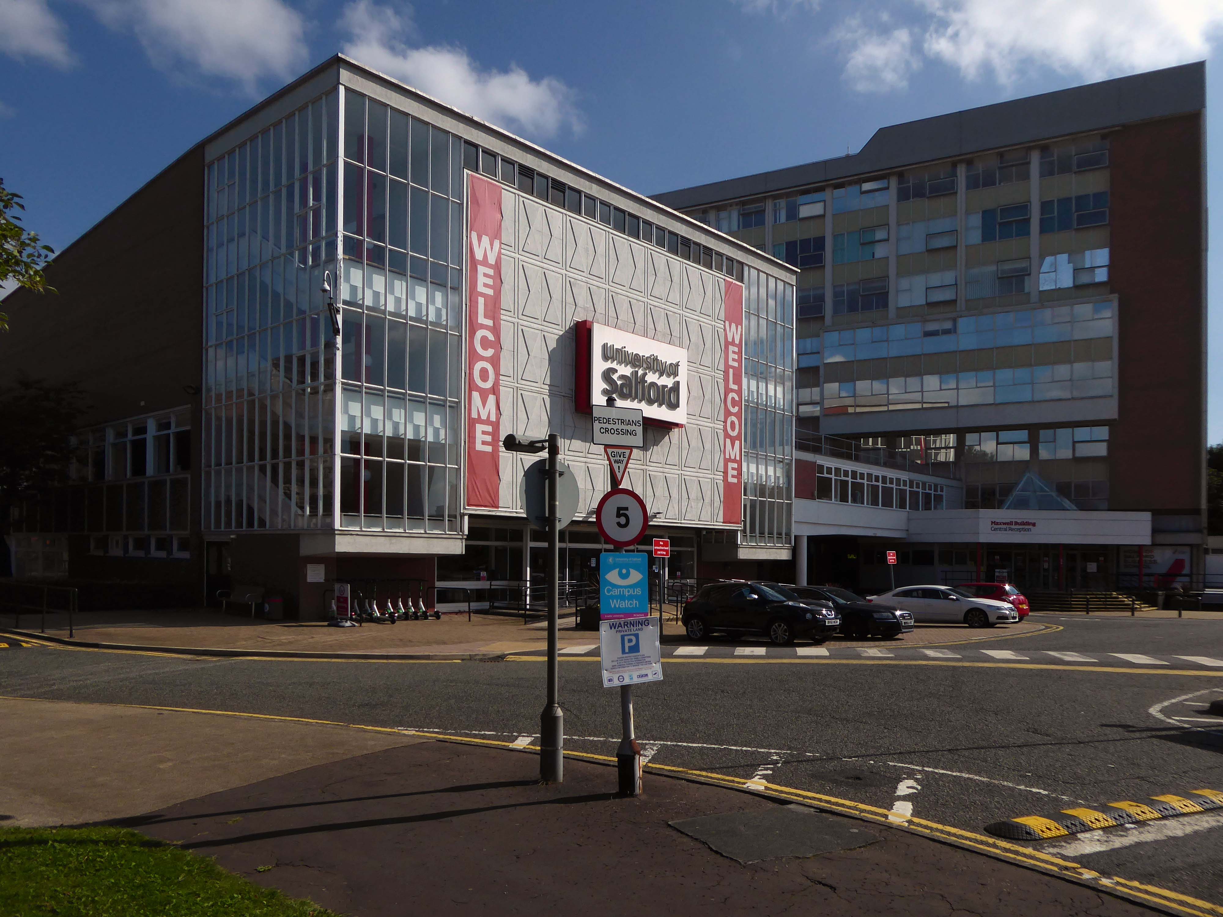
The original master plan would have swept away the Victorian Technical Institute and Salford Art Gallery.
Across the road are the Maxwell Buildings.
They were built between 1959 and 1960 to a design by the architect C H Simmons of the Lancashire County Architects Department.
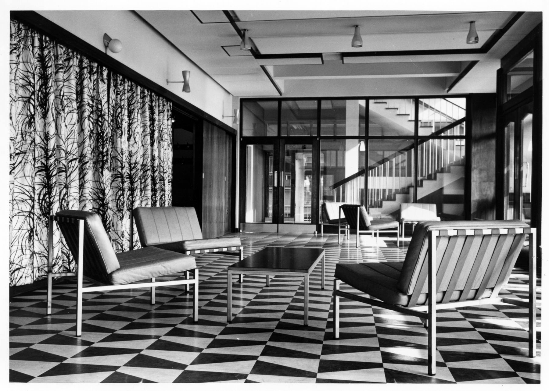
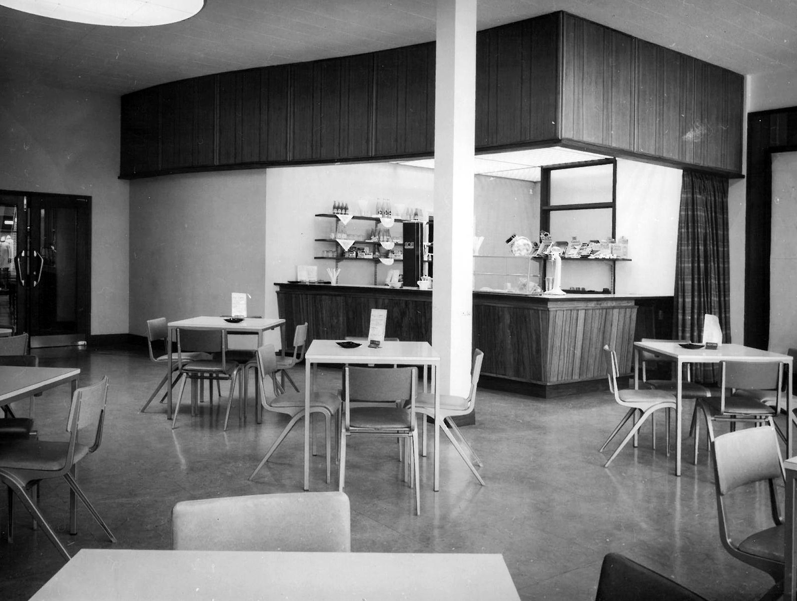
The interior decorative order of Sixties’ institutions was integral to the architectural design, sadly this is no longer so.
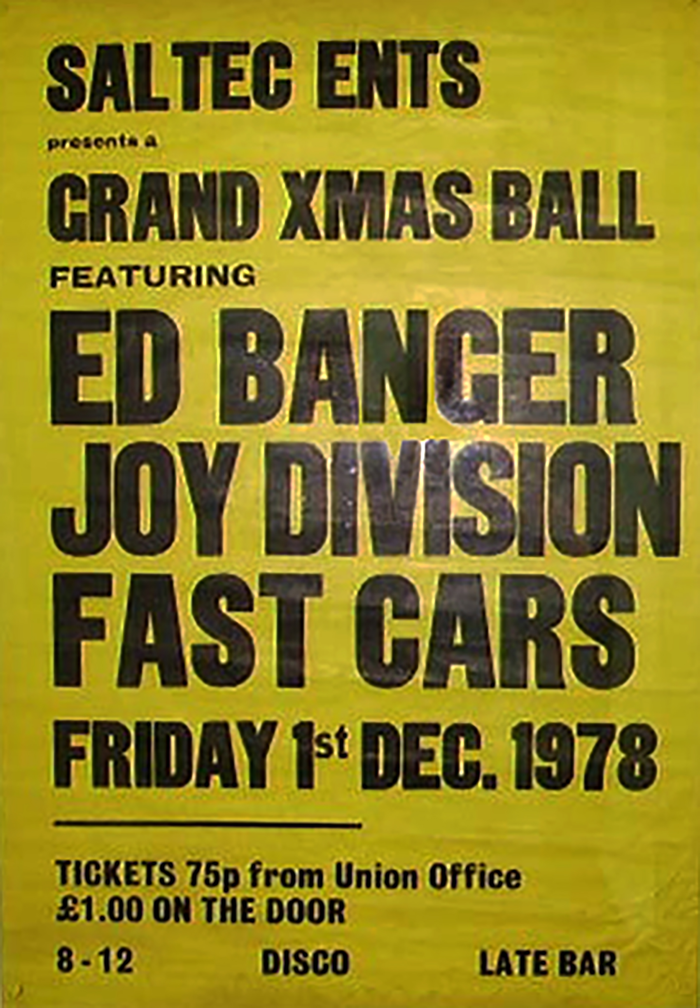
The hall has a great musical heritage.
Featuring the Fast Cars who we have previously encountered in Swinton at the Lancastrian Hall.
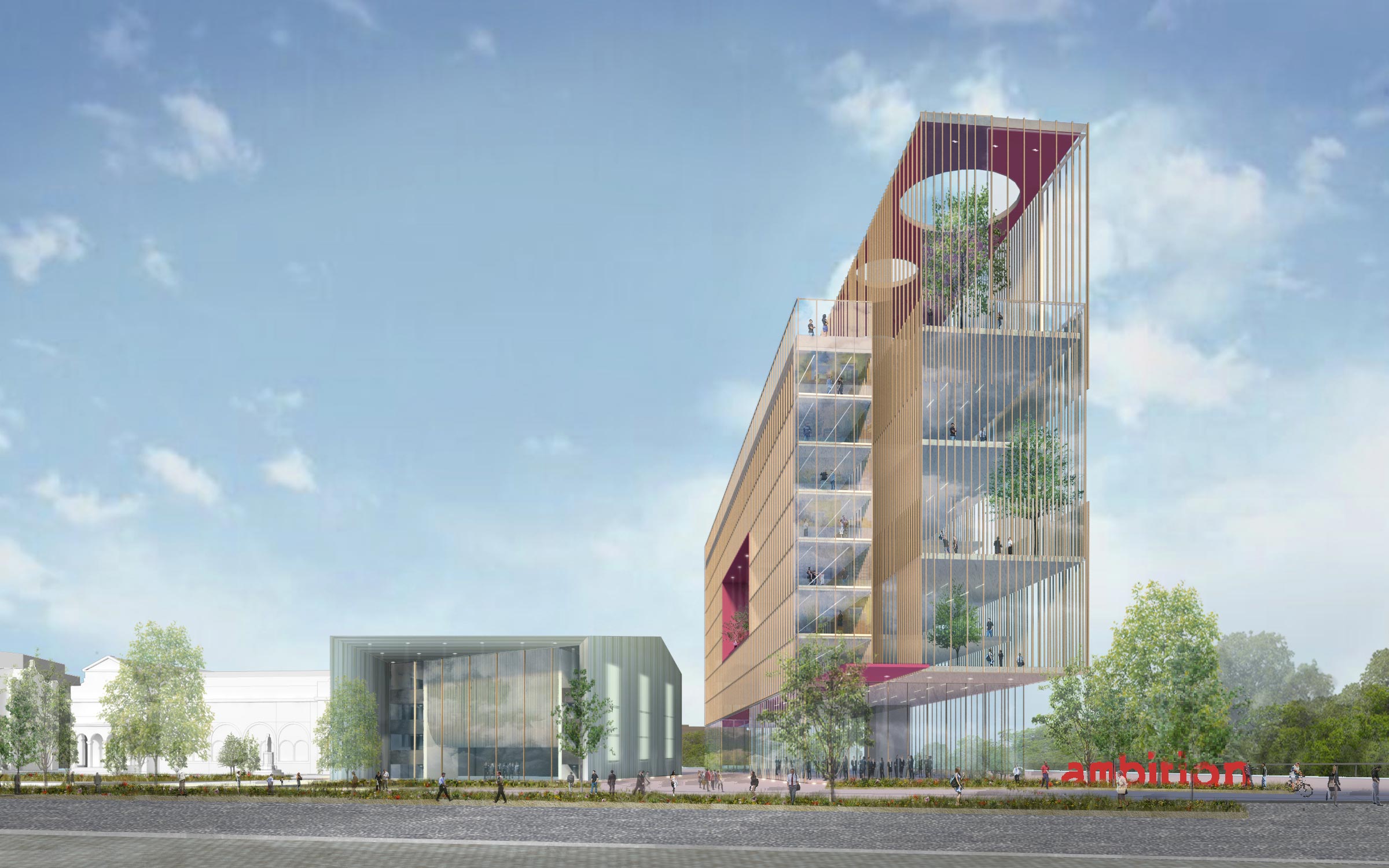
Which may be the subject of ambitious redevelopment.
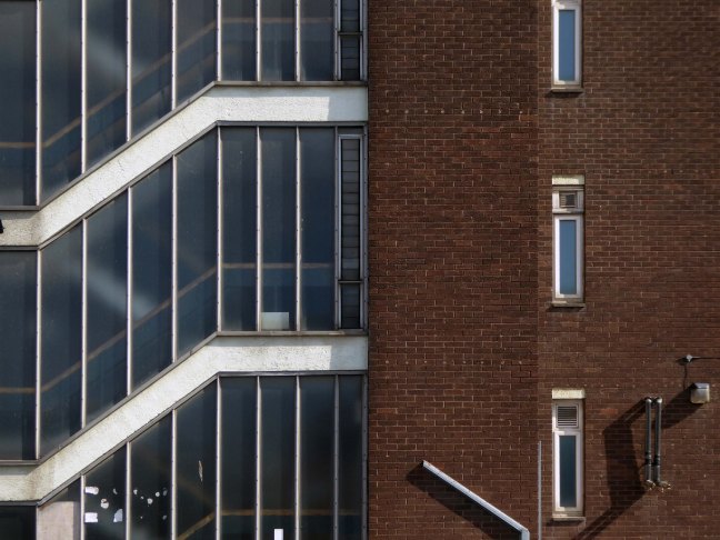
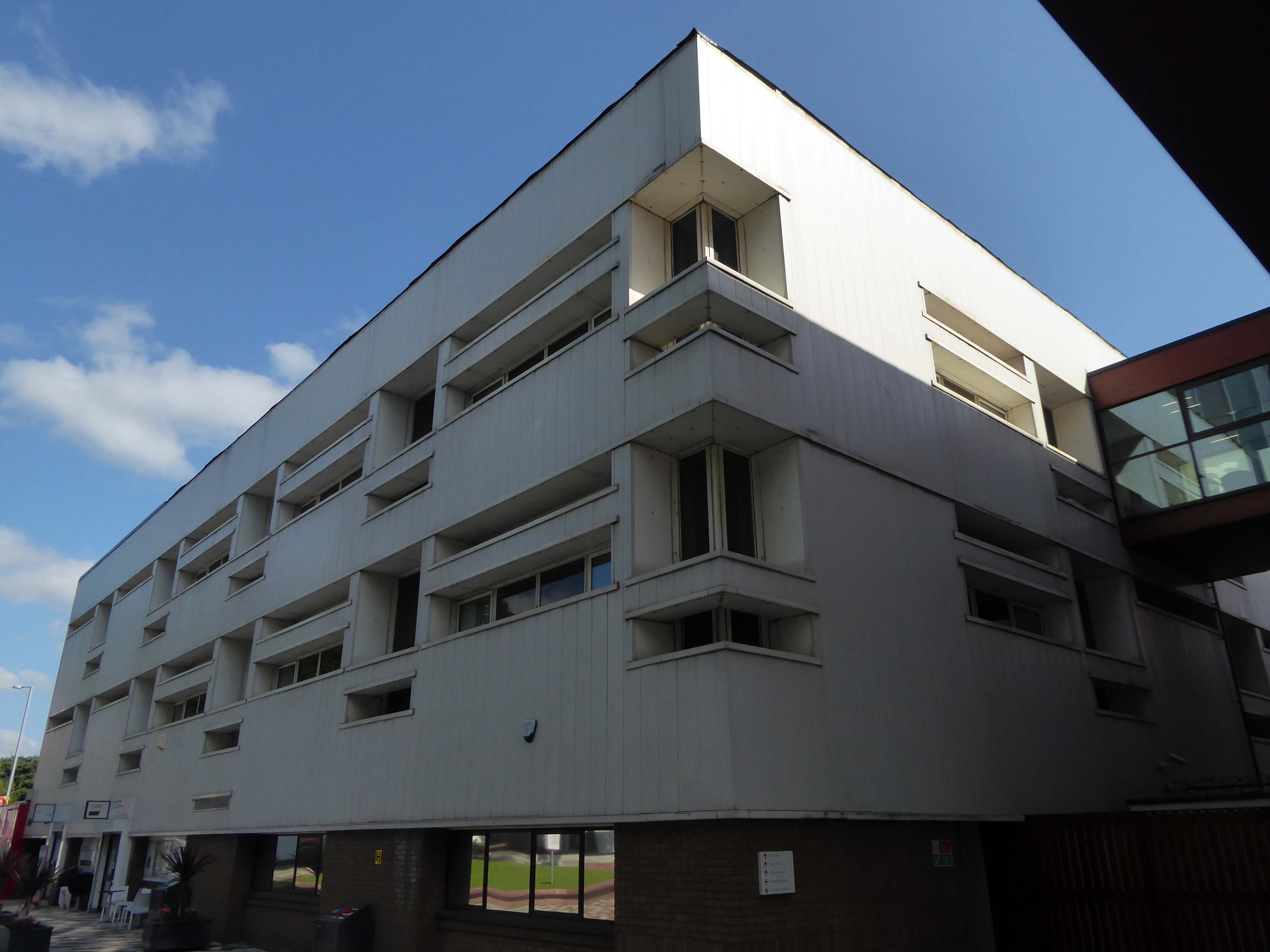
Take a turn around the corner to the Cockcroft Building.
The east facing mural painted out and obscured by retrofitted infrastructure.
These incised stone panels obscured by plants.
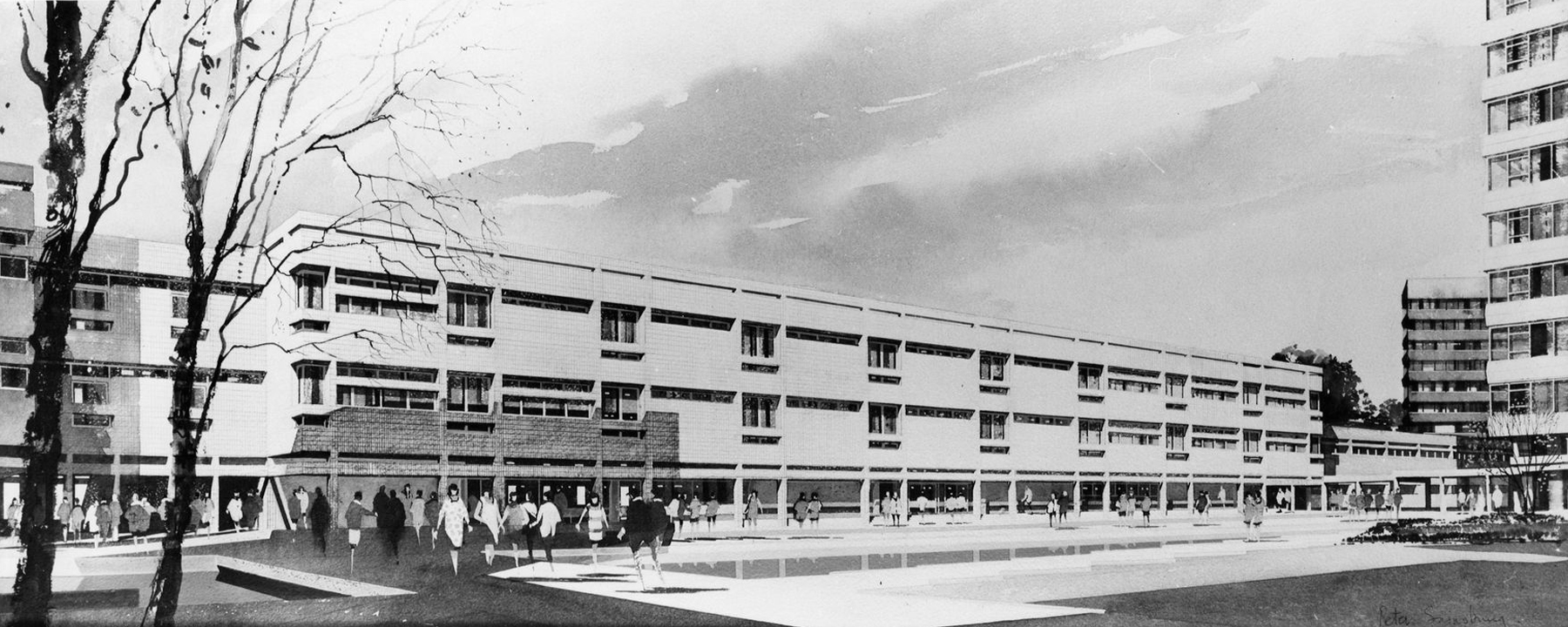
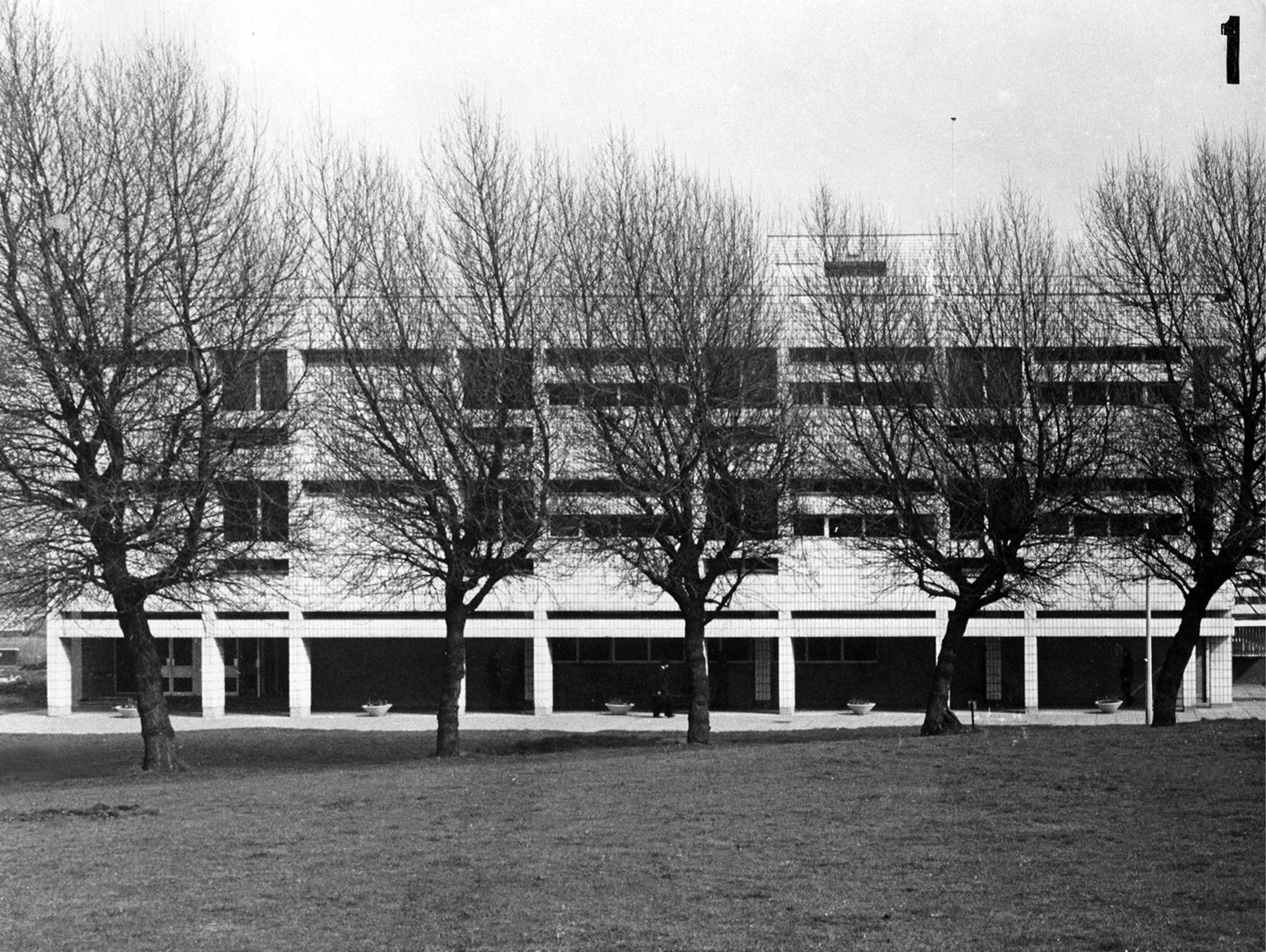
To the left is the Clifford Whitworth Library – this is the original architectural impression – signed Peter Sainsbury.
The original fascia was tile clad.
Subsequently replaced by uPVC boards.
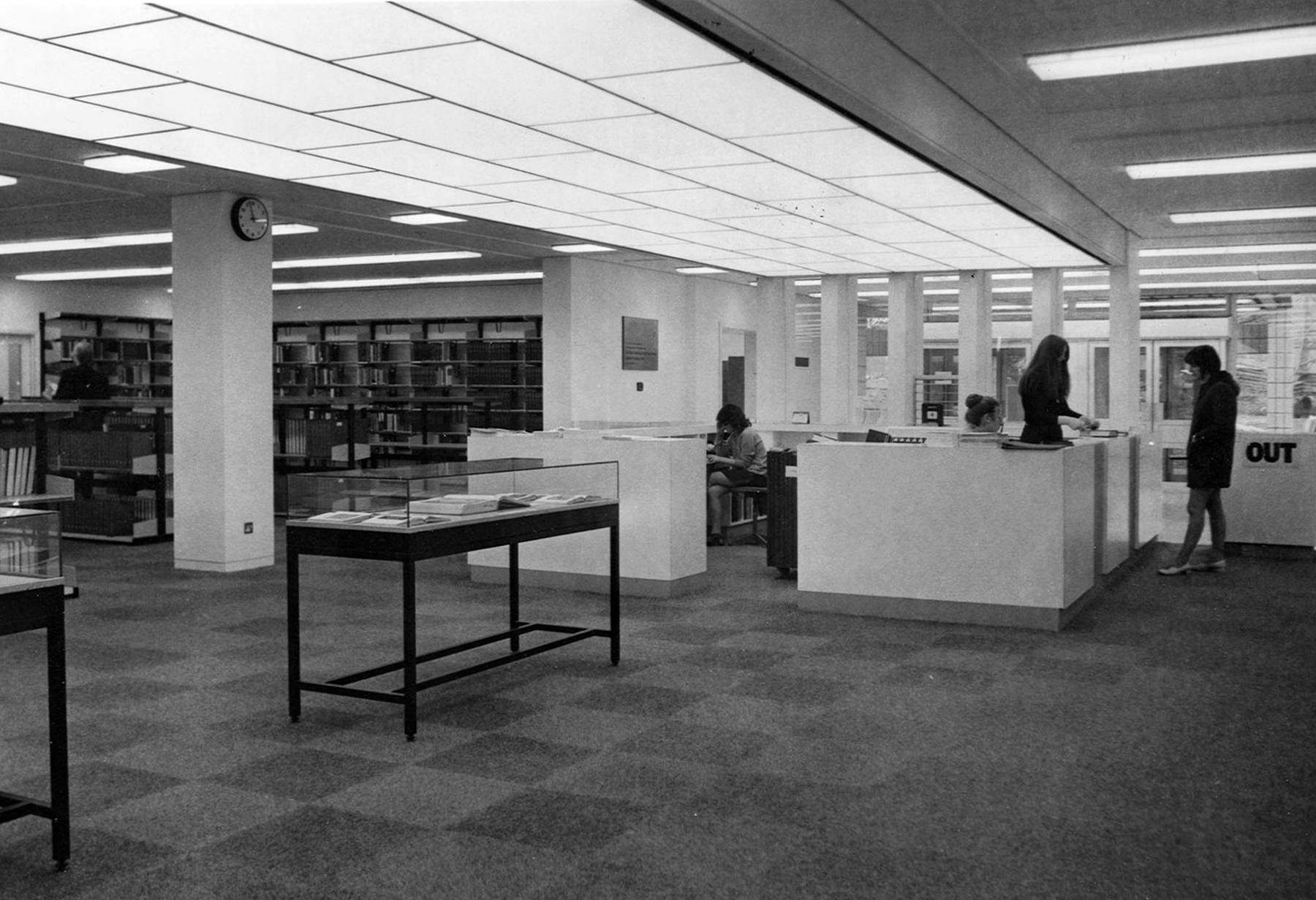
Yet again the original interior was integral too the architectural scheme and period.
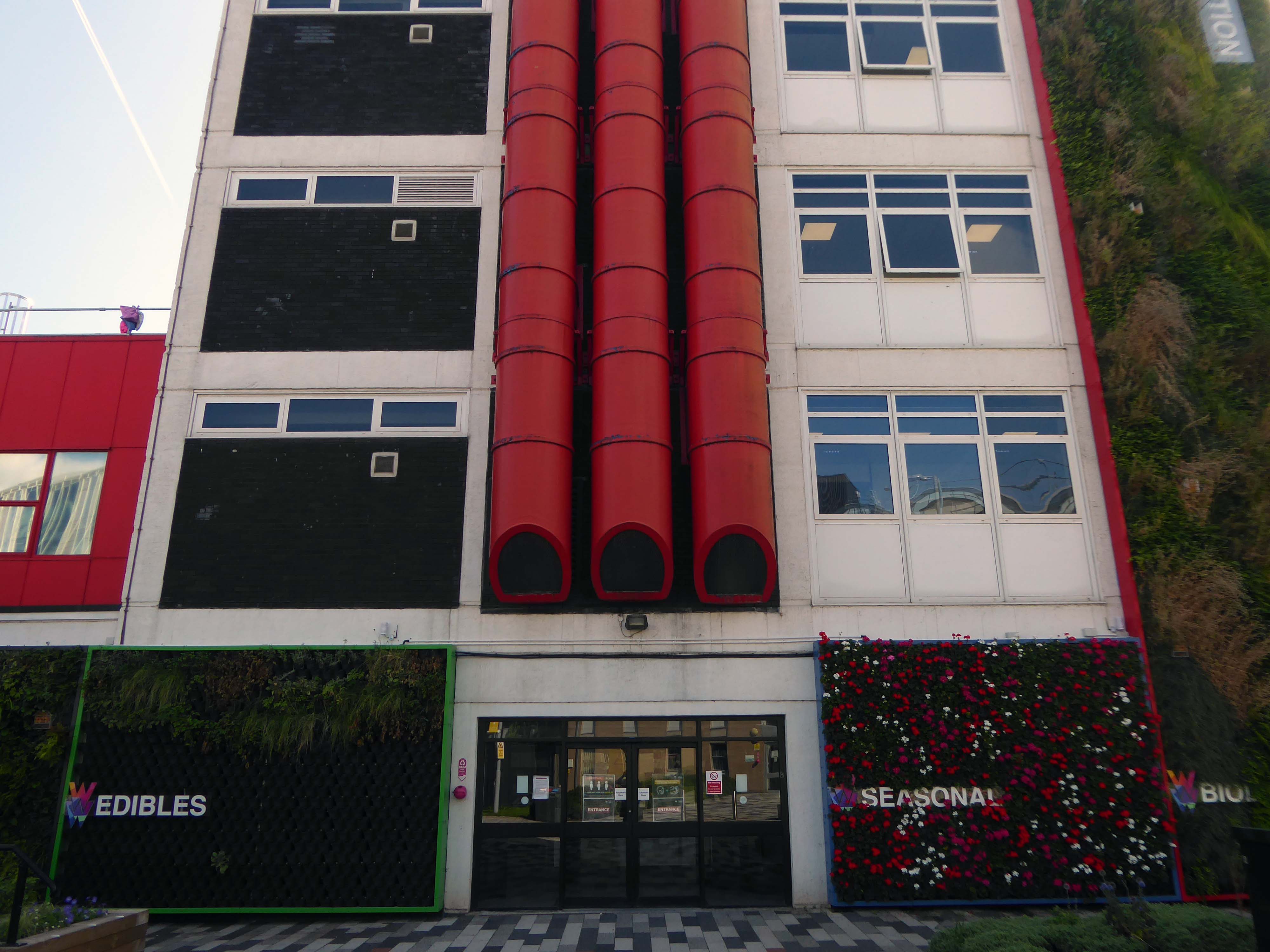
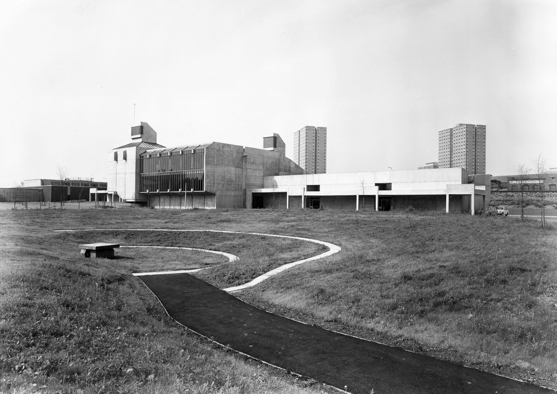
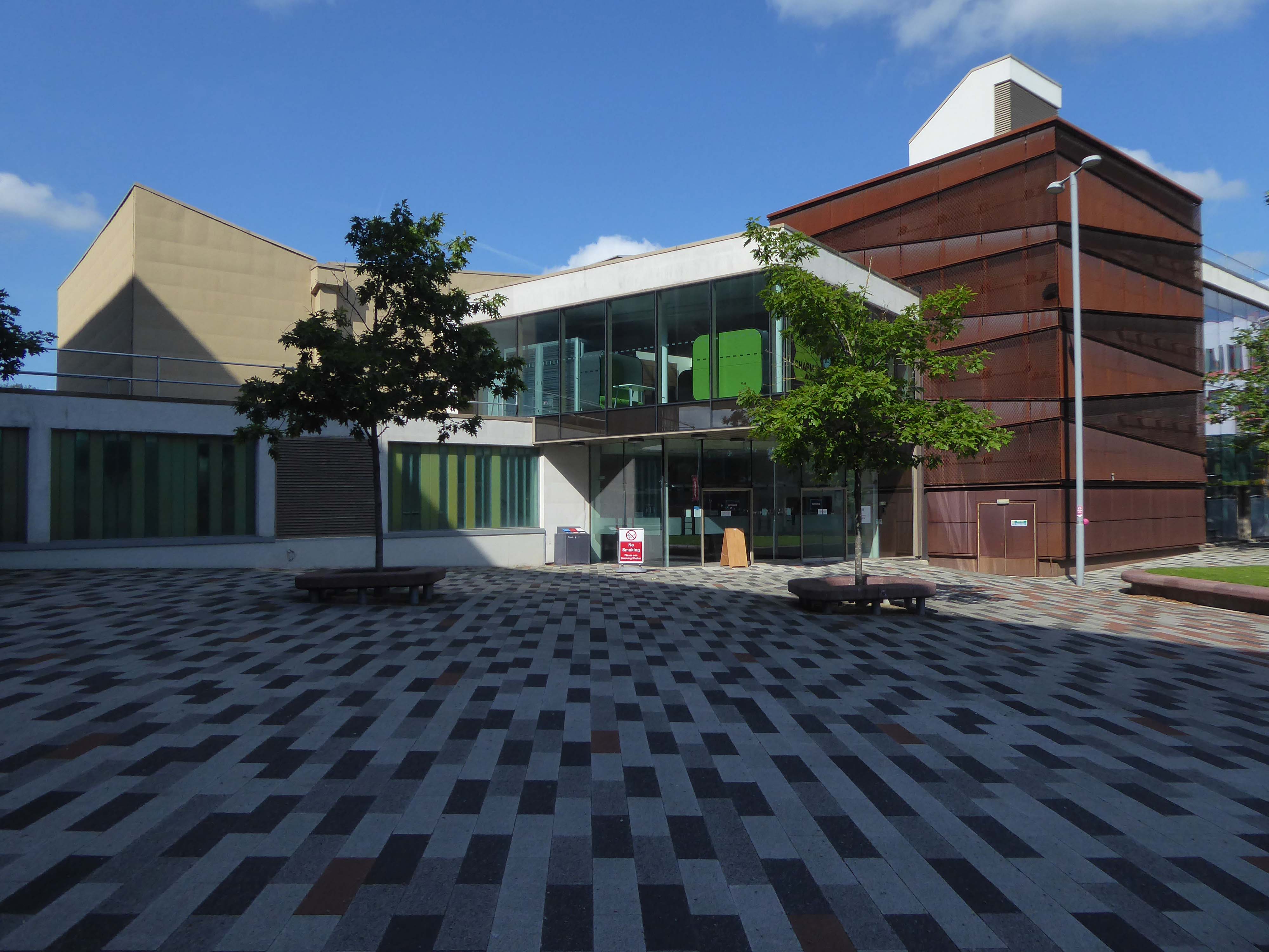
Across the way the Chapman Building.
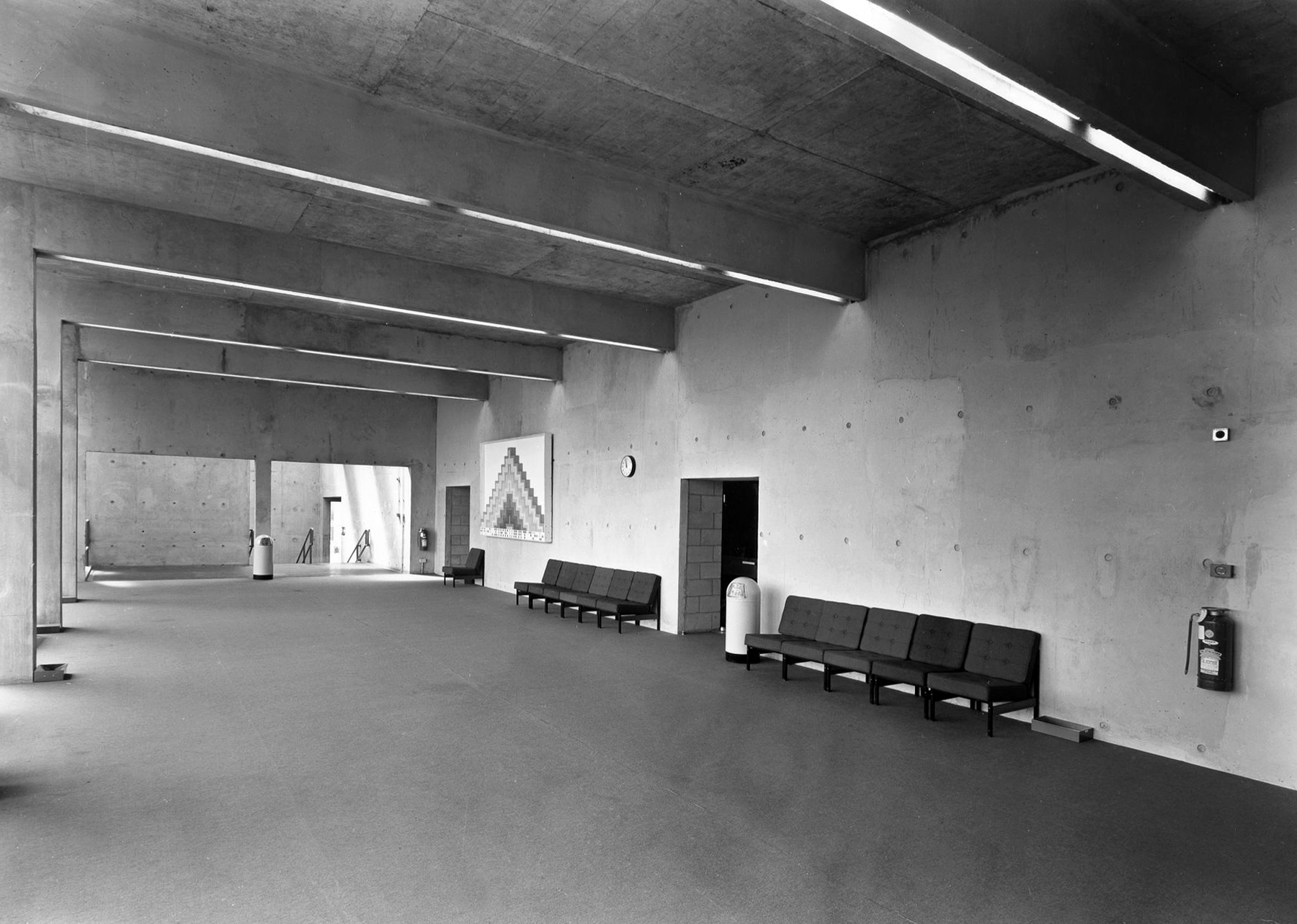
It was designed by WF Johnson and Partners of Leamington Spa, as a lecture theatre block and gallery. It sits with its long axis running parallel to the railway behind. The series of grey volumes, occasionally punctuated by colourful floods of red and green trailing ivy, hang together in a less than convincing composition. The orientation and access to the building seem confused and detached from any cohesive relationship to the rest of the campus, but there is something perversely attractive about the right essay in the wrong language. The reinforced concrete building contained five lecture theatres, communal spaces, an art gallery, AV support areas and basement plant rooms. Following a major refurbishment in 2012, several additions were made to the exterior and its total concrete presence somewhat diminished. It still houses lecture theatres and a number of other learning and social spaces.
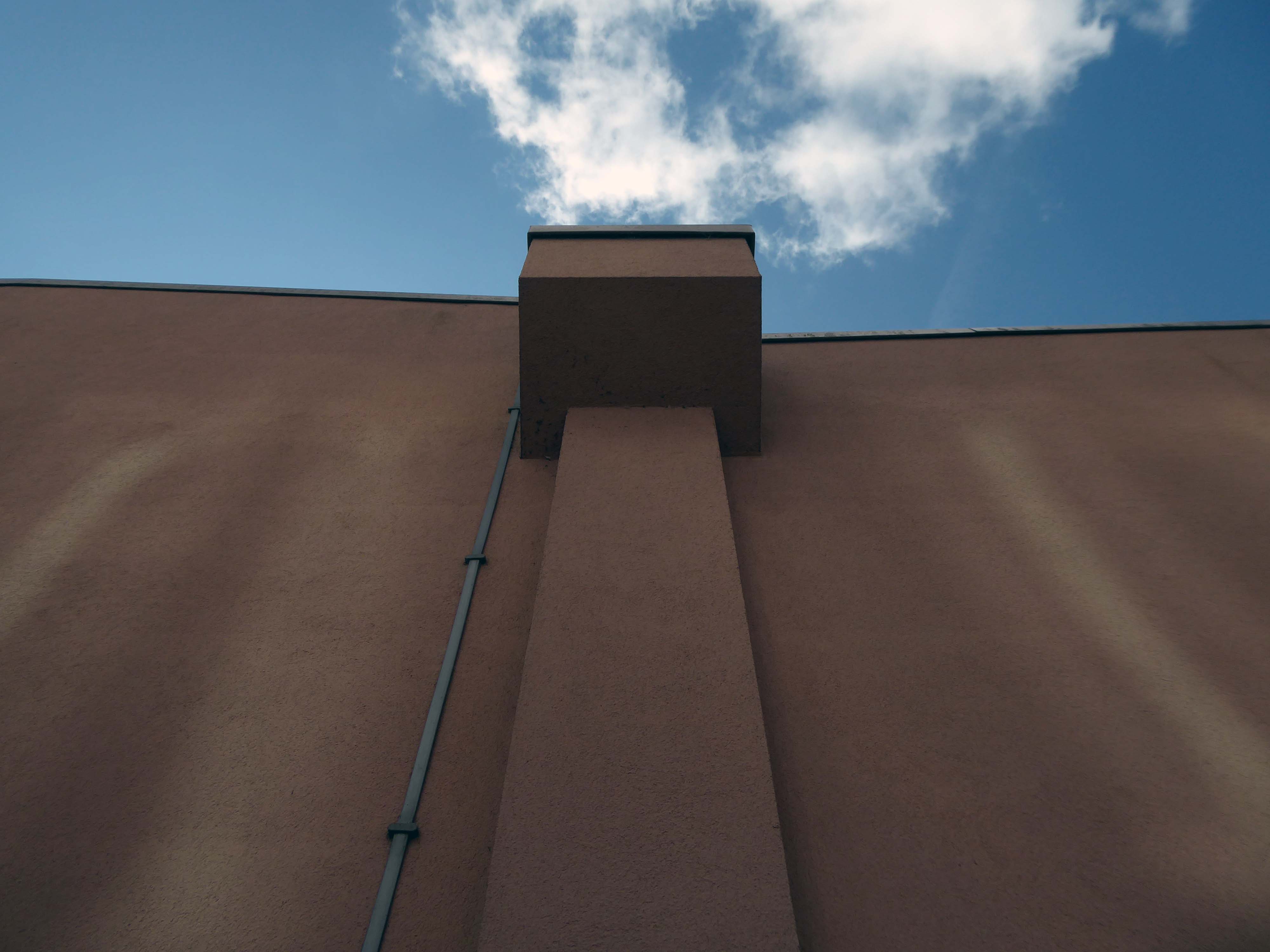
To the rear of the building there are some of the original details, now painted a series of funny colours.
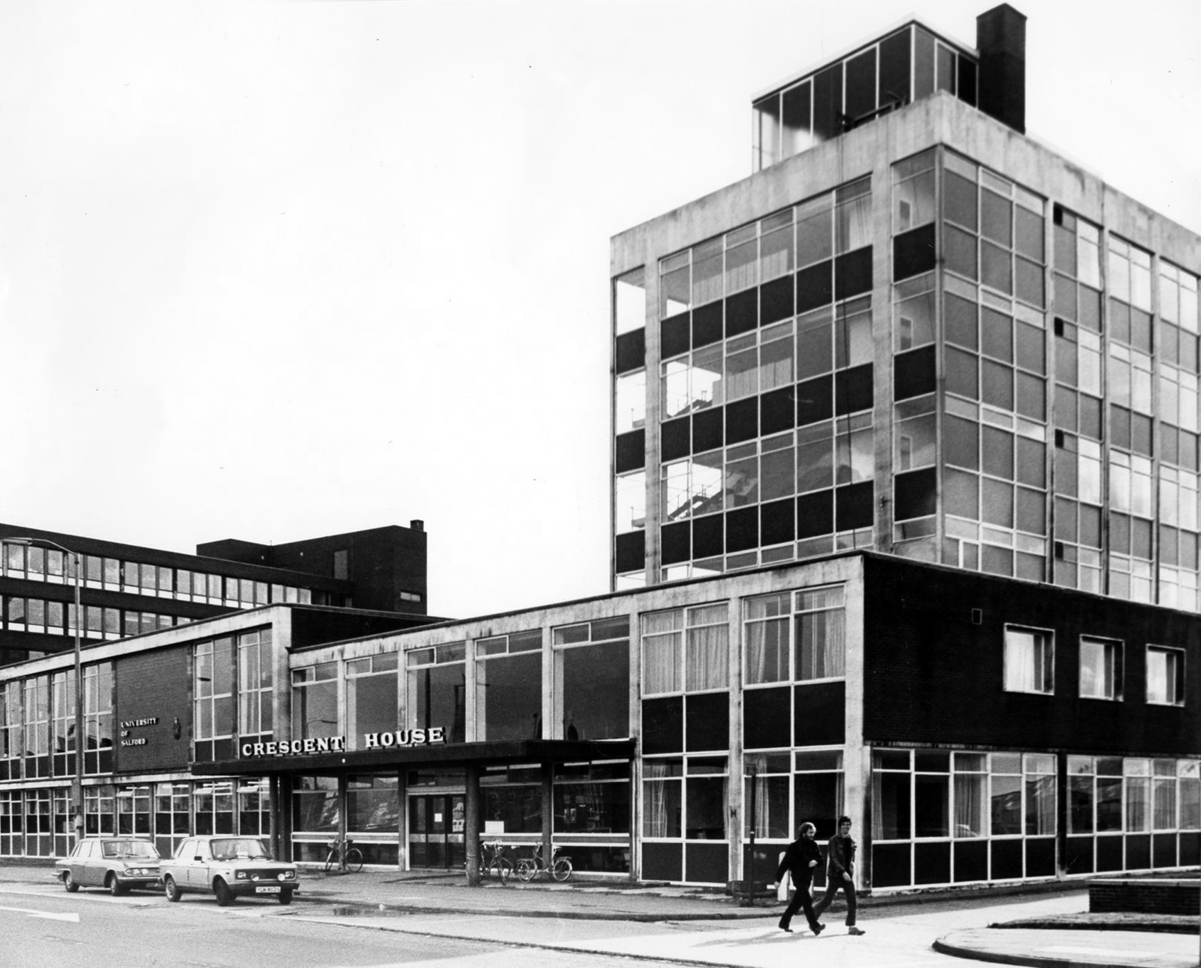
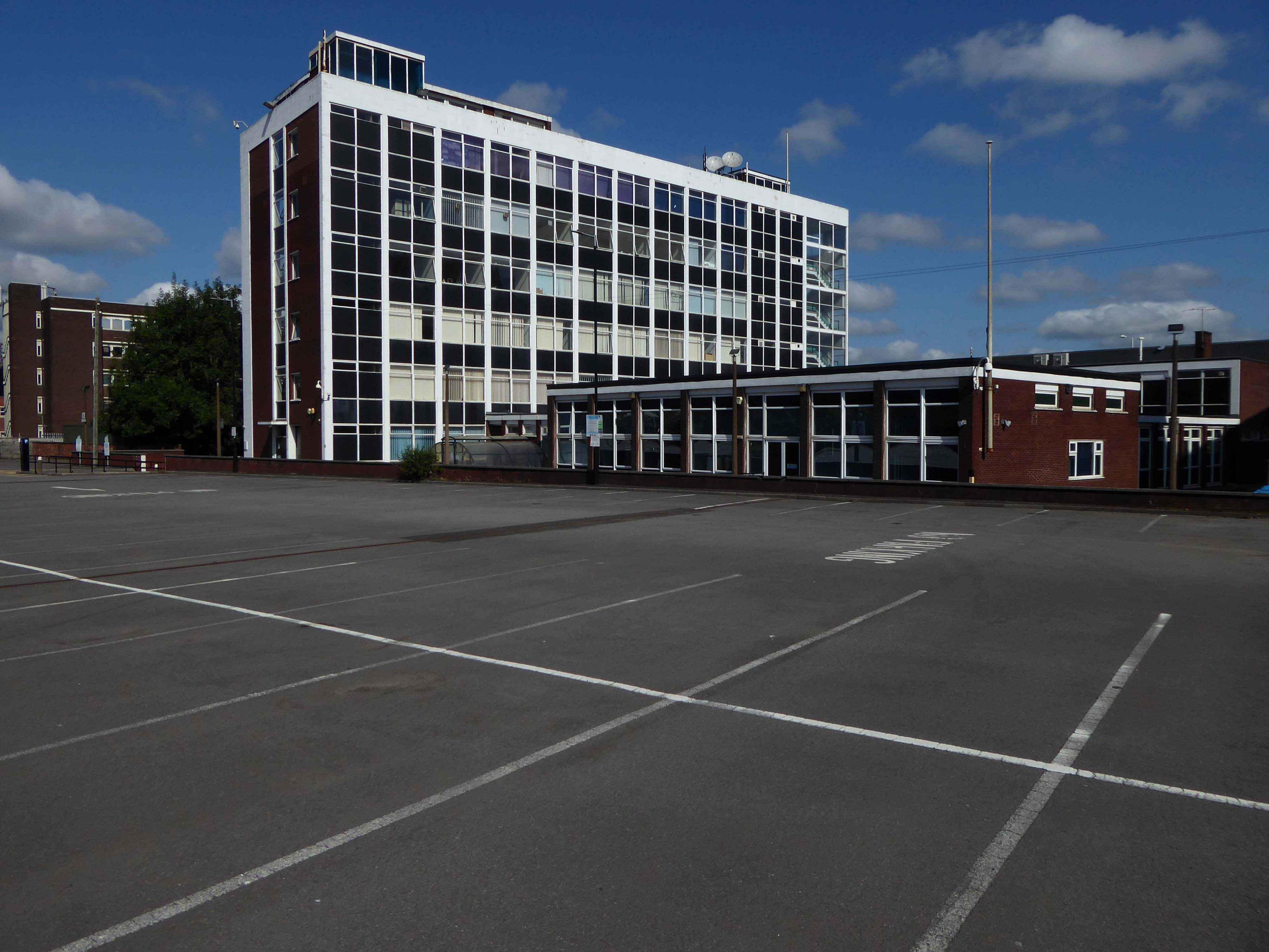
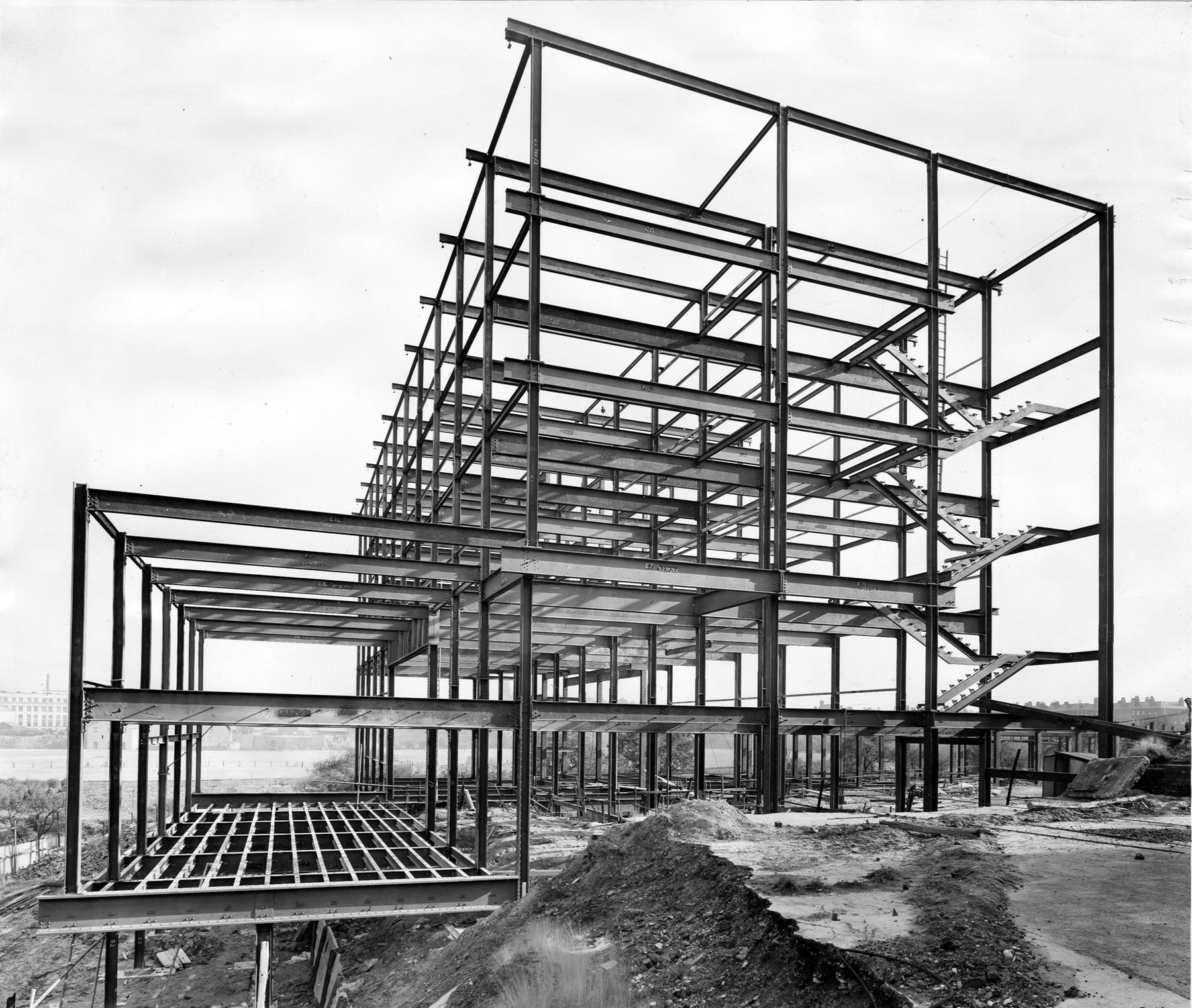
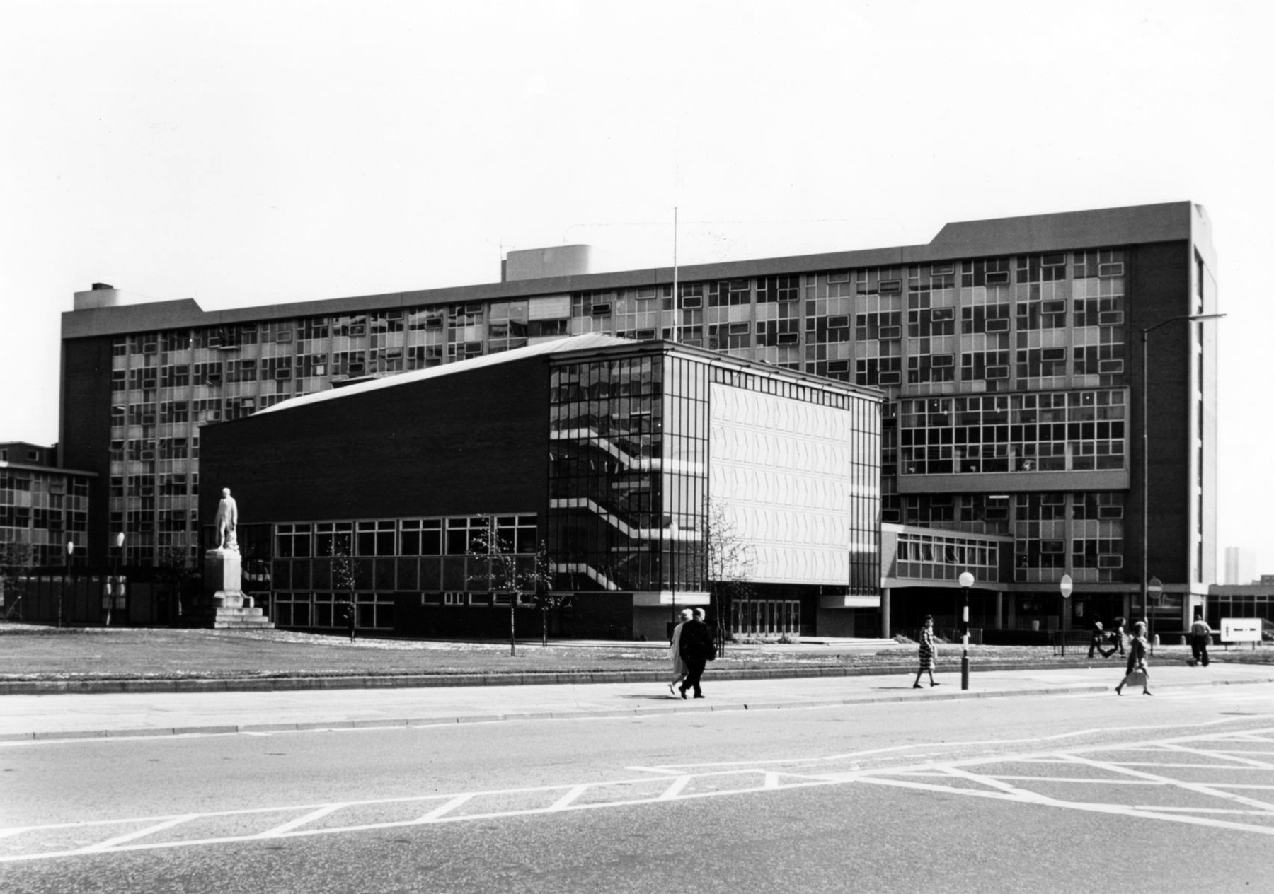
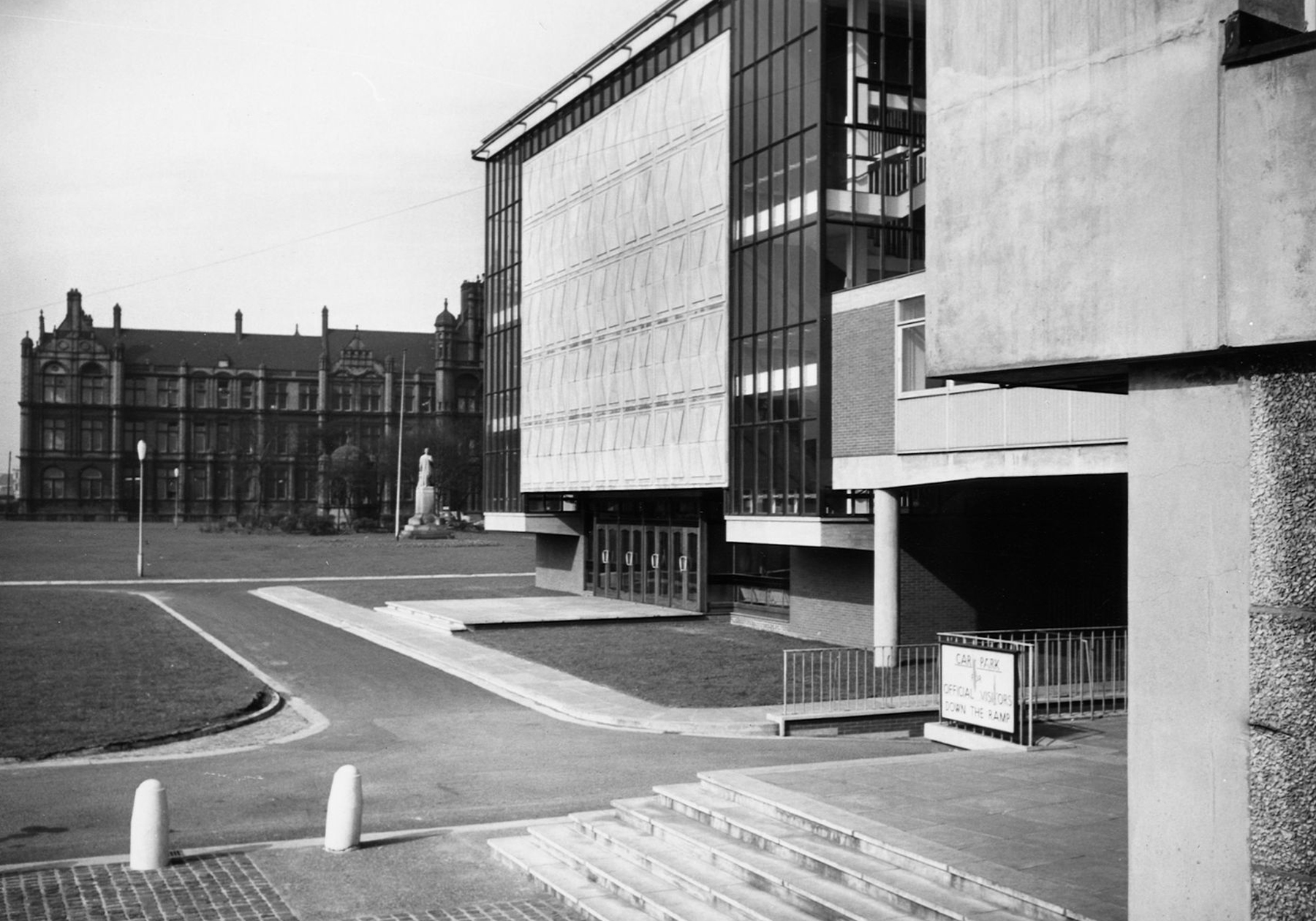
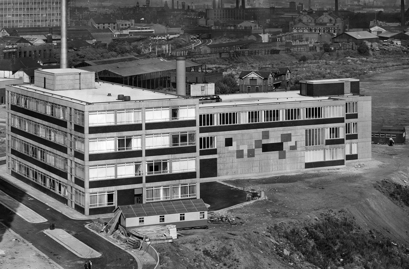
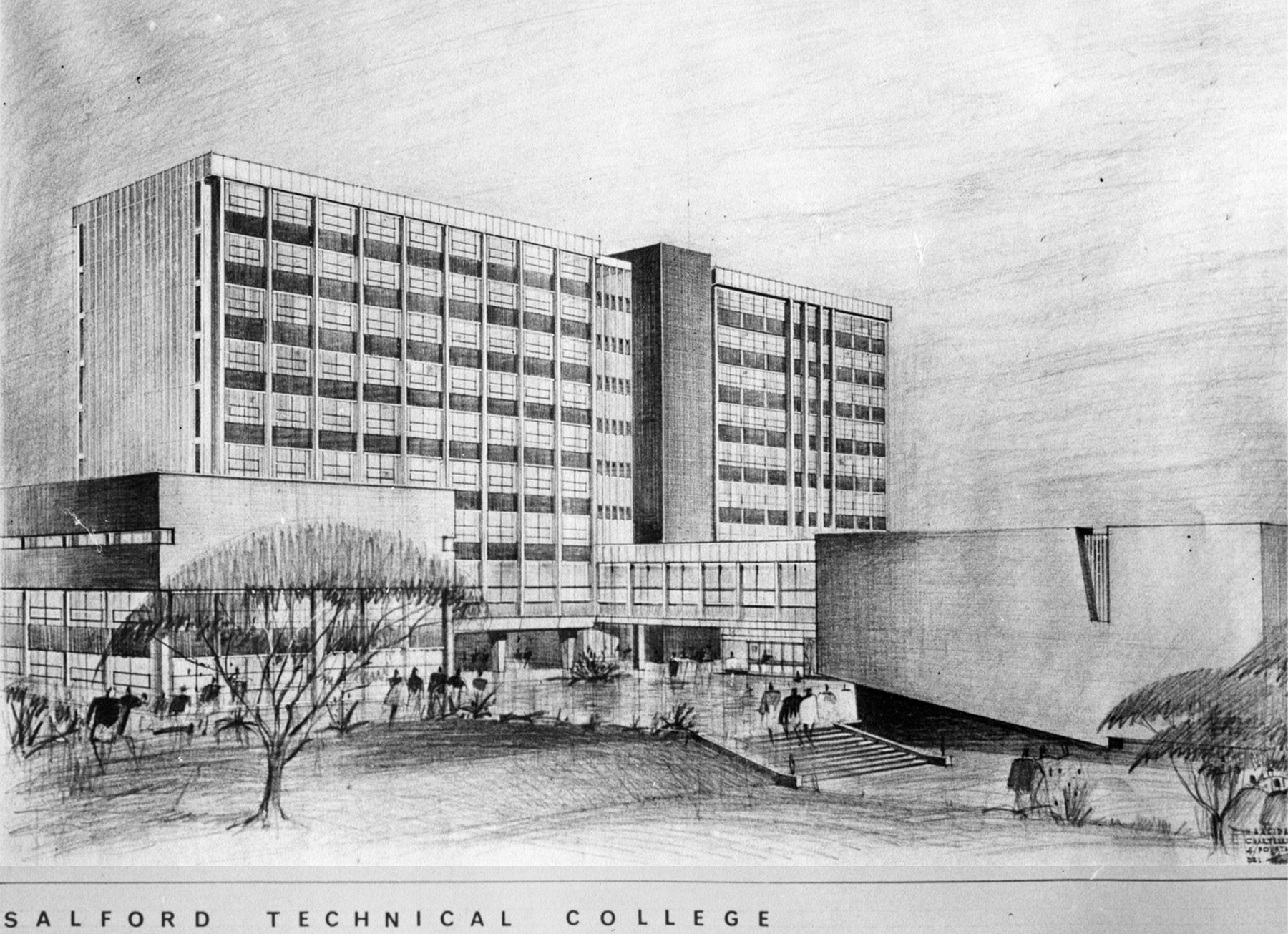
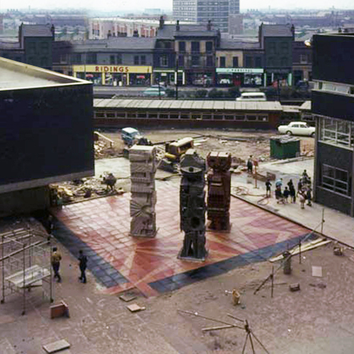
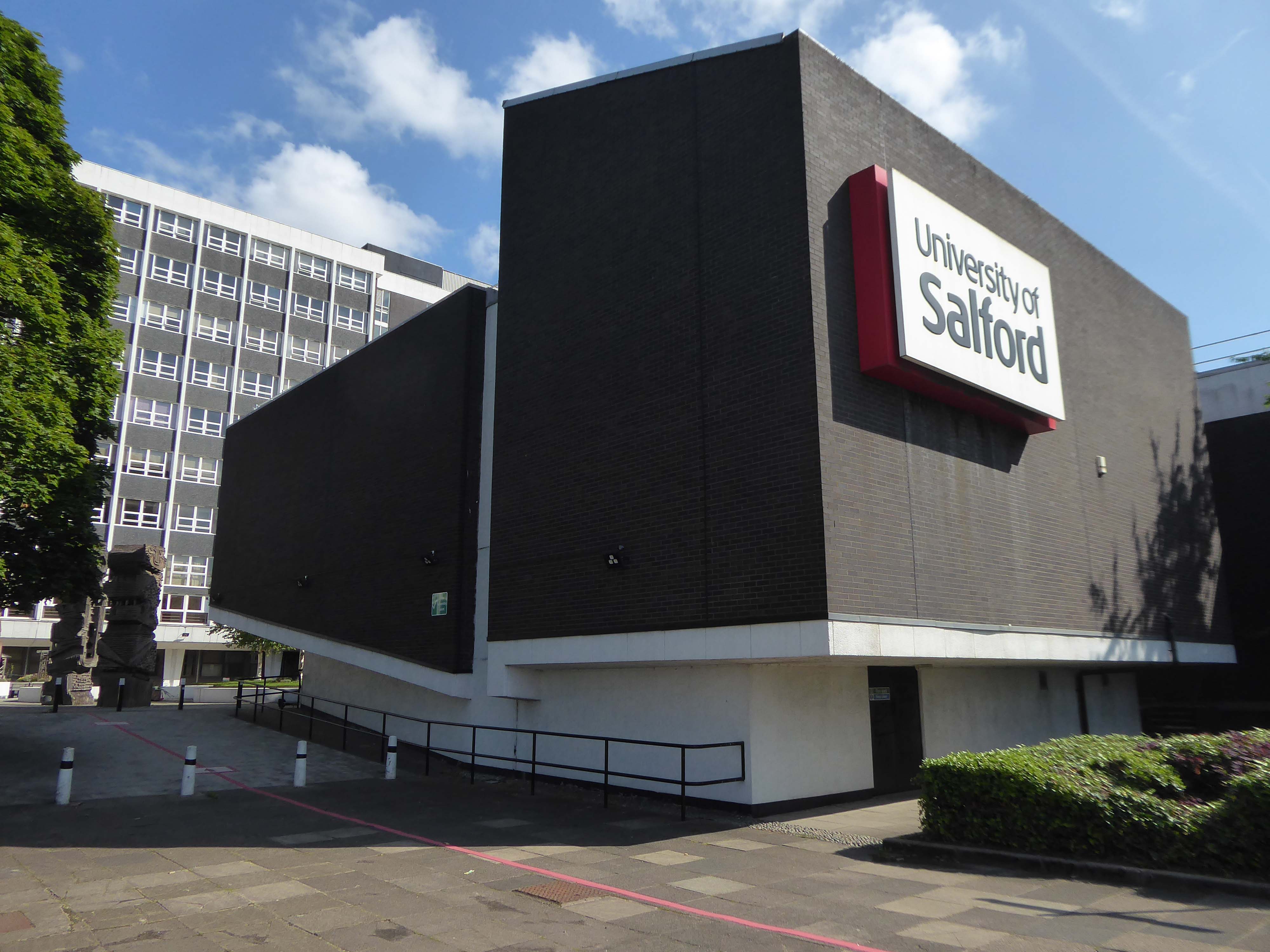
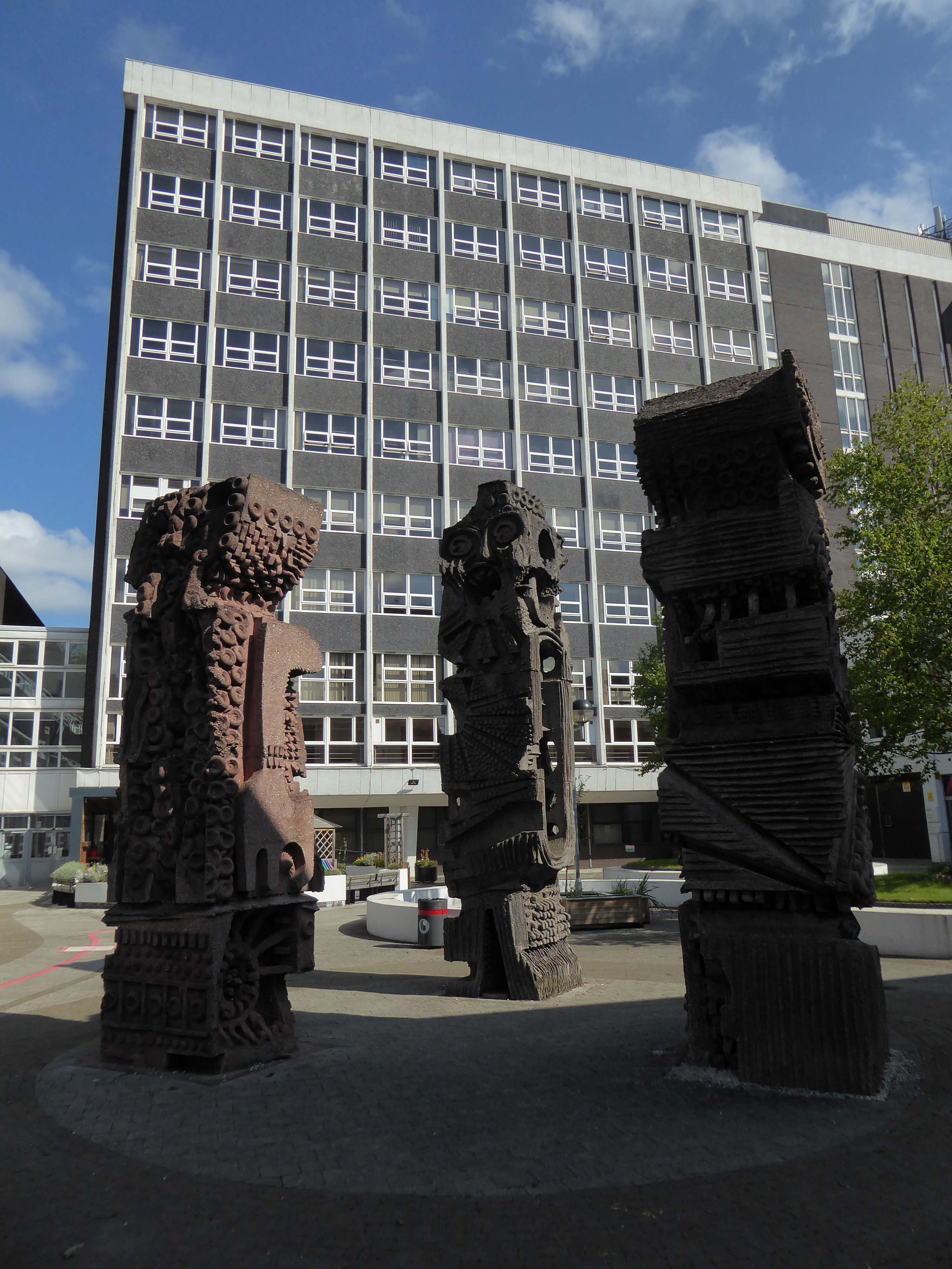
A ways down the road the former Salford Technical College.
Now the part of the University of Salford, this grouping is probably the most significant work by Halliday Meecham during this period. The blocks wrap to almost enclose a courtyard and they step up in height towards the rear of the site. To the front is a lecture theatre block in dark brick. The multi-storey elements are straightforward in their construction and appearance and have had their glazing replaced. Perhaps the richest elements here are the three totemic structures by artist William Mitchell, which were listed at Grade II in 2011. Mitchell was actively engaged with the experiments of the Cement and Concrete Associations during the 1960s and produced a wide variety of works for public and private clients; other works regionally include the majority of the external art and friezes at Liverpool Metropolitan Cathedral and the Humanities Building at Manchester University. These textured concrete monoliths appear to have an abstract representation of Mayan patterns and carry applied mosaic. They were made on site using polyurethane moulds. There is another Mitchell work hidden behind plasterboard in the inside of the building.
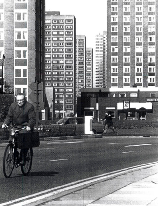
April 1965 saw the Salford City Reporter proudly boast in an article that
The Ellor Street dream begins to come true – complete with interviews with residents of the newly constructed Walter Greenwood, Eddie Colman and John Lester Courts all which towered some 120 feet above the Hanky Park skyline.
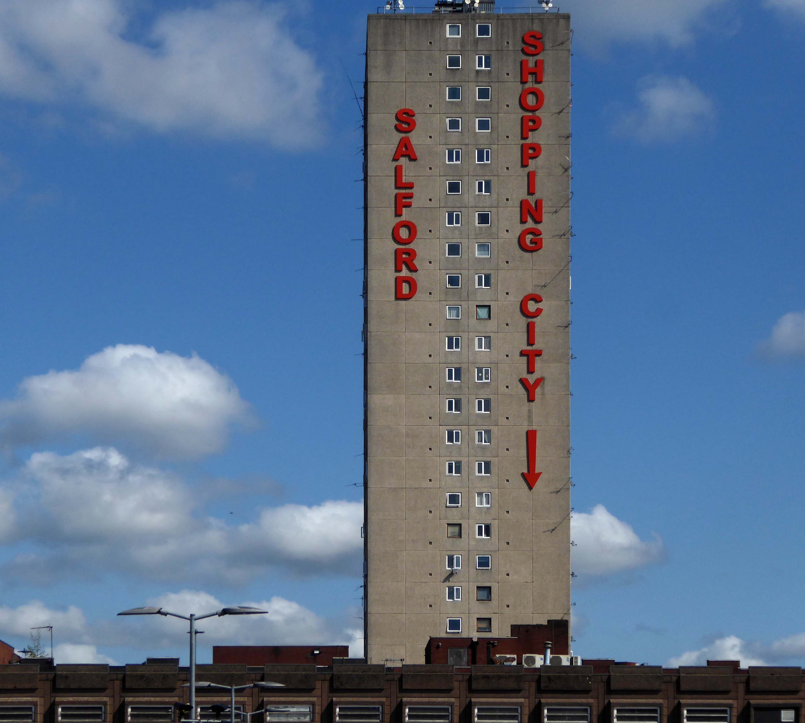
These particular blocks of flats were of special significance because their completion was the end of the first stage of the Ellor Street redevelopment scheme which was to provide 3,000 new homes, the £10 million pound Salford Shopping Precinct and a new civic centre – which never got built – making this A Salford of the Space Age.
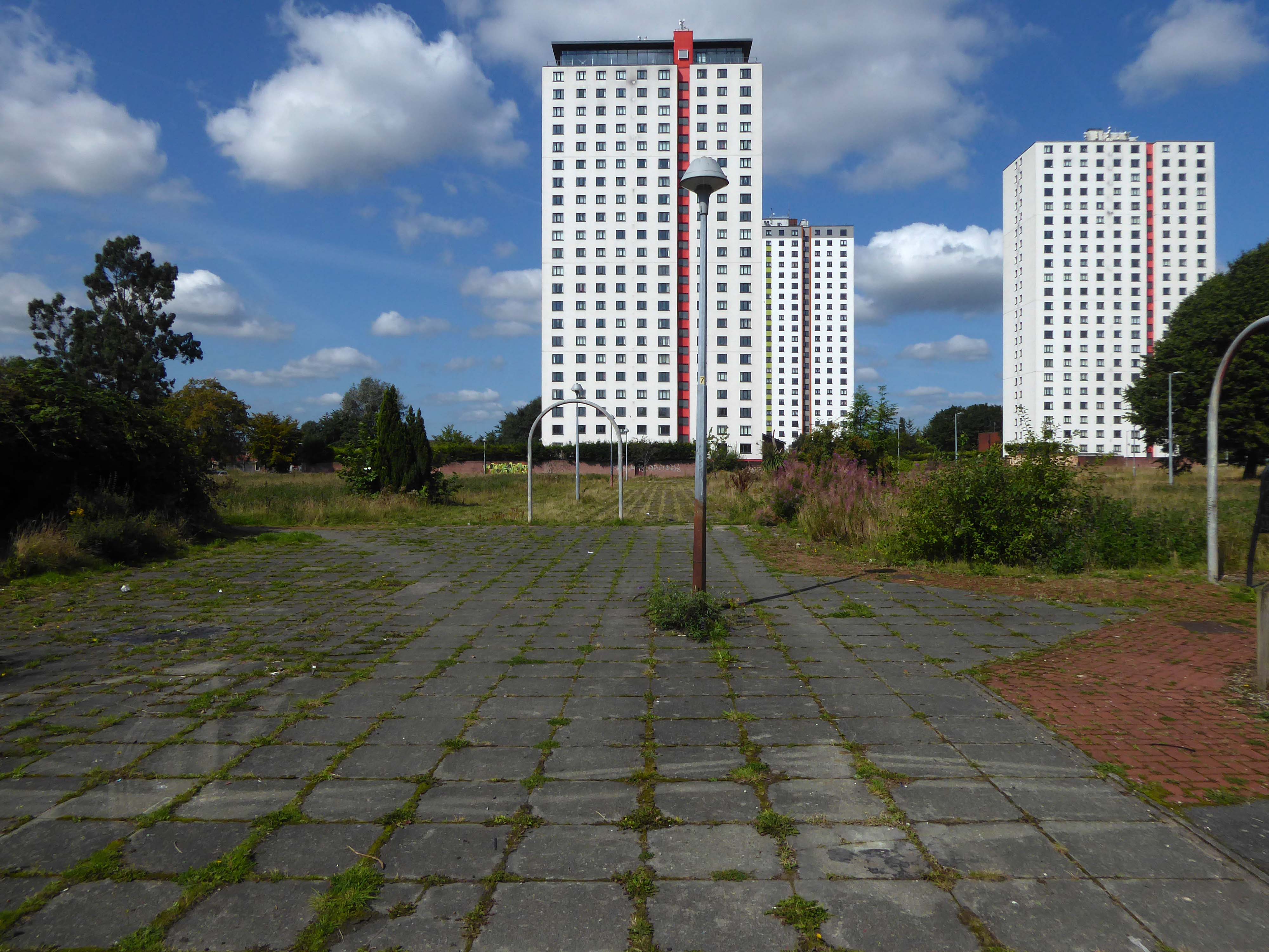
The tower blocks are now clad and the site a construction base for cladders.
Full details of Salford’s complex and extensive redevelopment can be found here at Tower Block.
Walter Greenwood Court was demolished in 2000/2001, whilst Eddie Colman and John Lester Court are now student accomodation for the nearby Salford University.
The construction of the shopping centre and surrounding areas continued and on 21 May 1970 the new Salford Market officially opened. From 1971 onwards new shops inside the precinct itself began to open.
However, due to a lack of funds and a political scandal which saw chairman Albert Jones jailed for eight months construction of Salford Precinct was halted. The site had only 95 shop units compared to the proposed 260, the hotel and two storey car park were never built.
The architectural core of the site has been retained, including the 23 storey Briar Court residential tower.
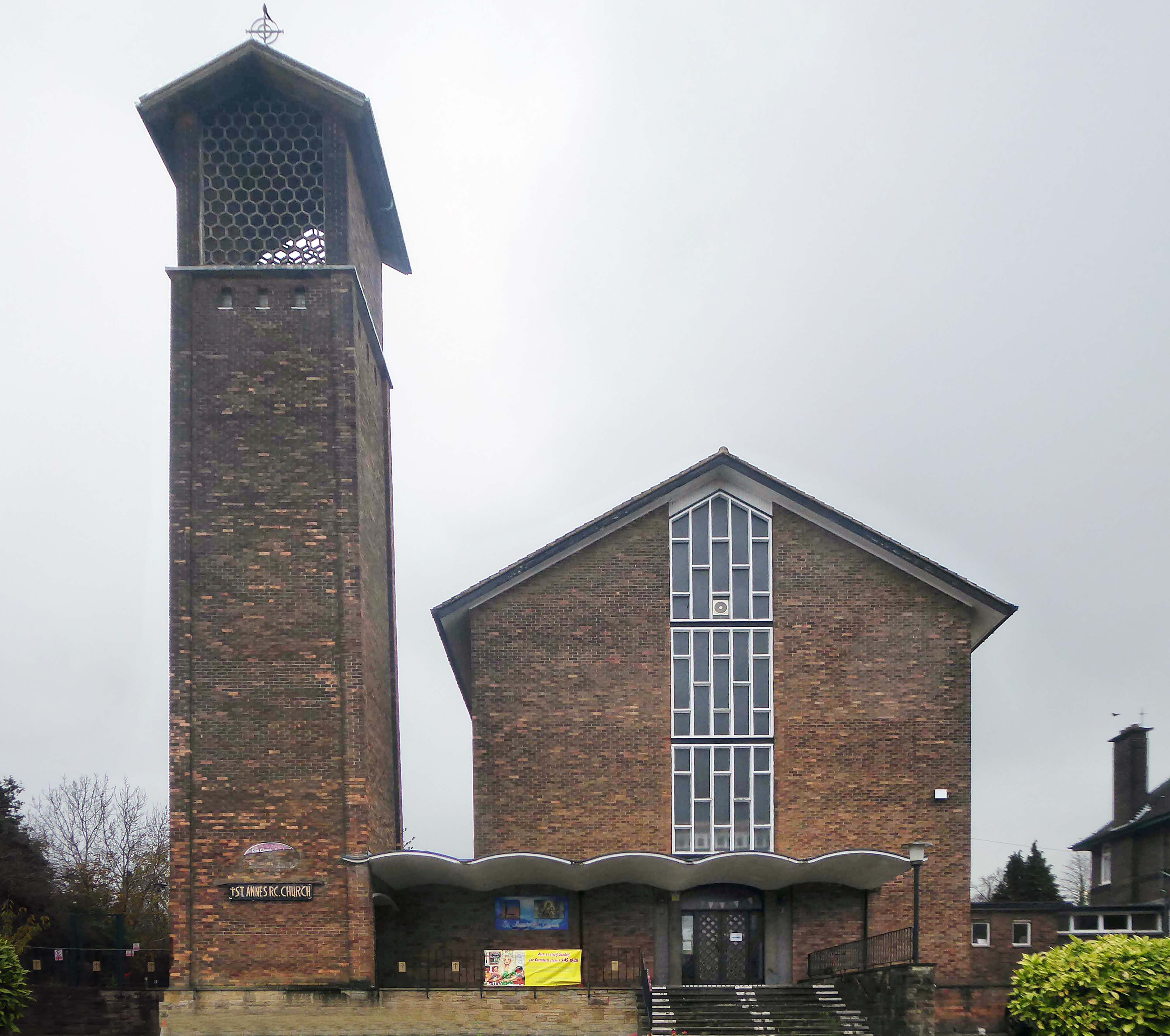
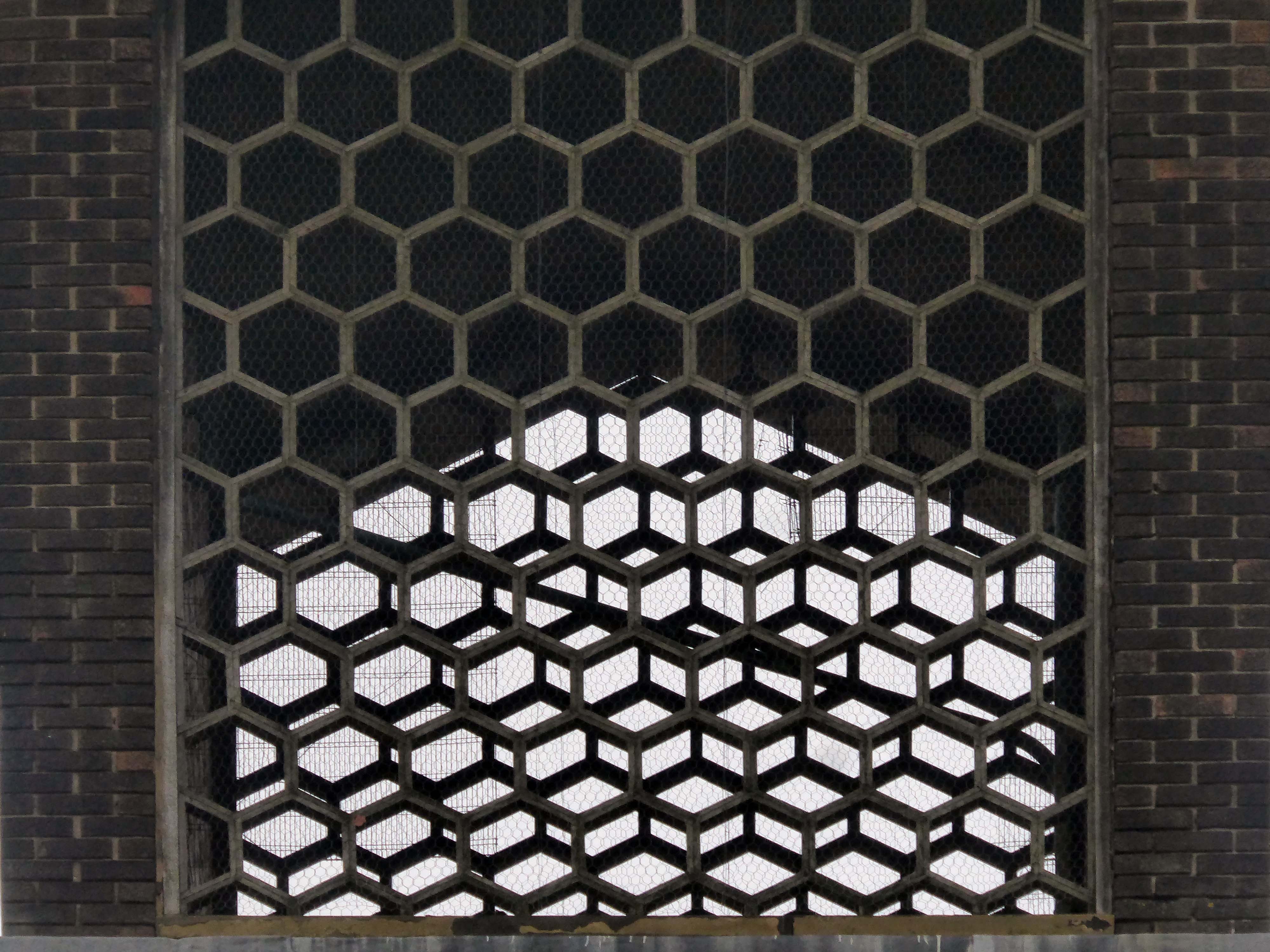
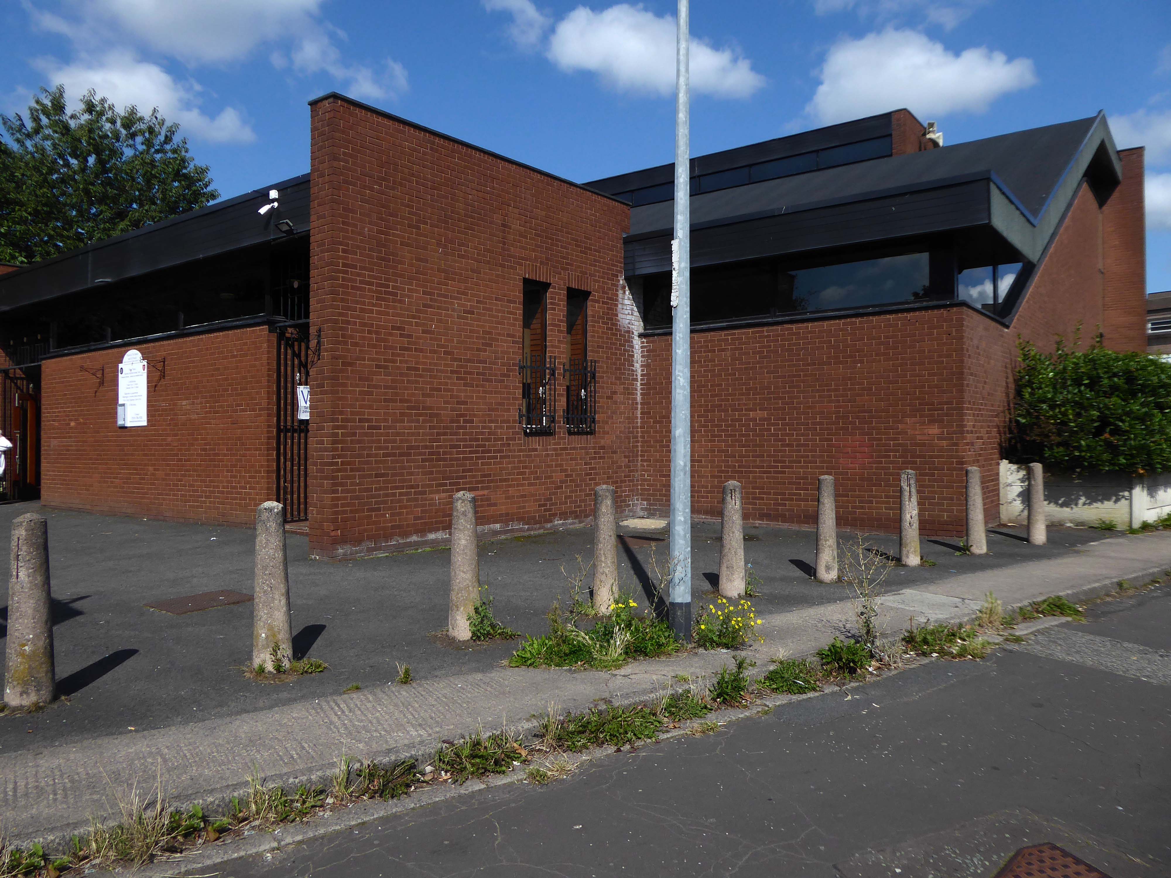
Tucked in behind is Mother of God and St James RC Church.
Clearances took place from the middle of the twentieth century and new high-rise housing blocks were built, as well as a shopping centre.
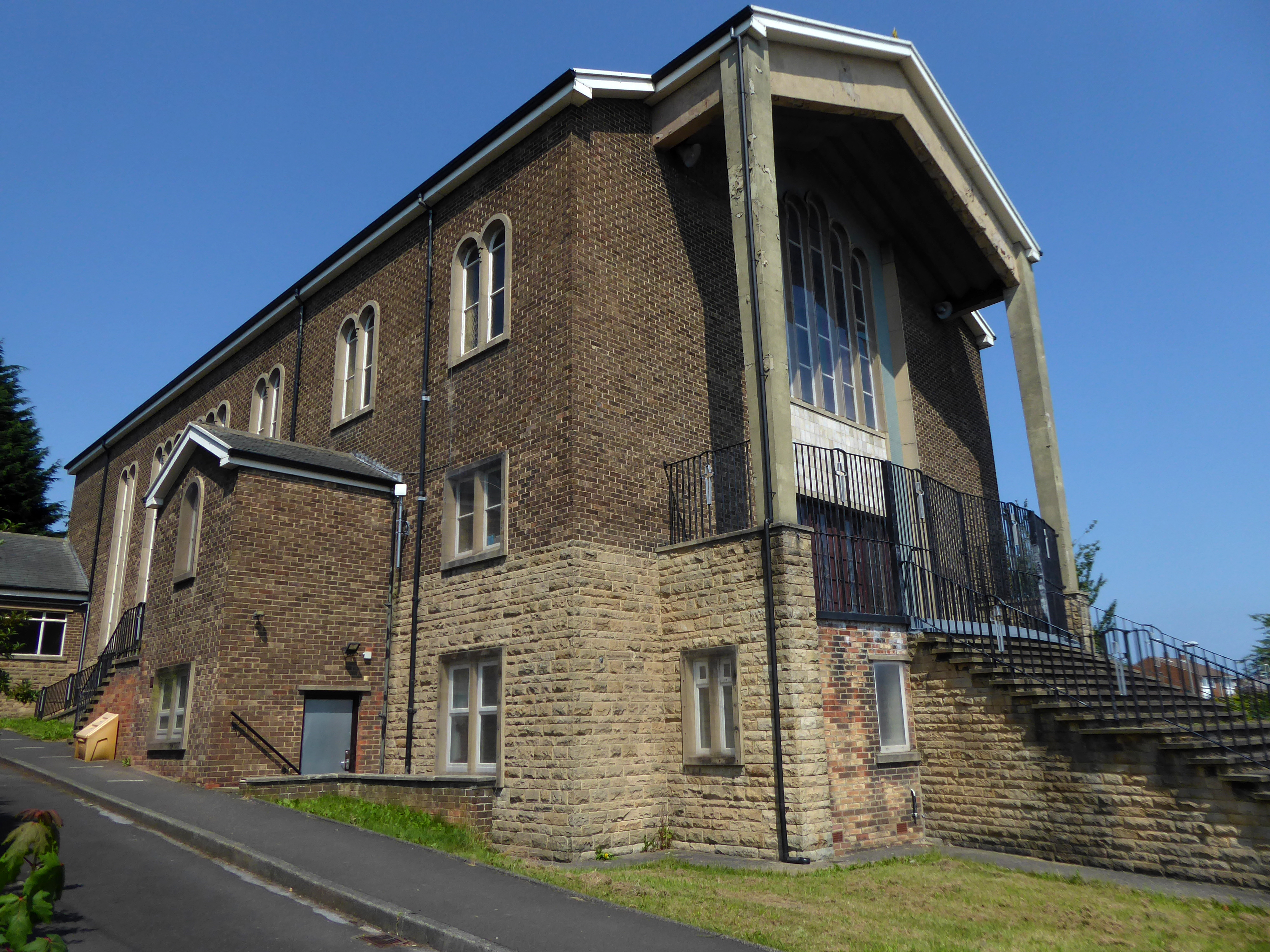
There was a Catholic presence in the area from 1854, when schools were built. What was described in The Tablet as a beautiful church, an Early English Gothic design by M. Tijou – presumably Herbert Tijou, architect of the chapel to Loreto College, Manchester, was opened by Cardinal Manning, Archbishop of Westminster in 1875.
One hundred years later this church was demolished and replaced by the present building.
The architects were Desmond Williams & Associates, the design bearing some similarity to their St Sebastian, Salford. In 2010 the church of All Souls, Weaste, was closed, and the marble sanctuary furnishings brought to the church.
Description
All orientations given are liturgical. The church is steel framed with brick walls and a monopitch roof (originally covered with copper, now with felt). Bold brick forms create a presence, and the design is somewhat defensive, with few windows. The building is entered from a lower porch which forms a narthex. The slope of the roof and the stepped clerestory lighting create a striking impression inside, and full-height windows towards the east end incorporate stained glass figures said to have originated in the previous church. Marble sanctuary furnishings are presumably those from the church in Weaste and appear to be of later twentieth century date, while the font is of traditional type with a clustered stem and may have come from the earlier church.
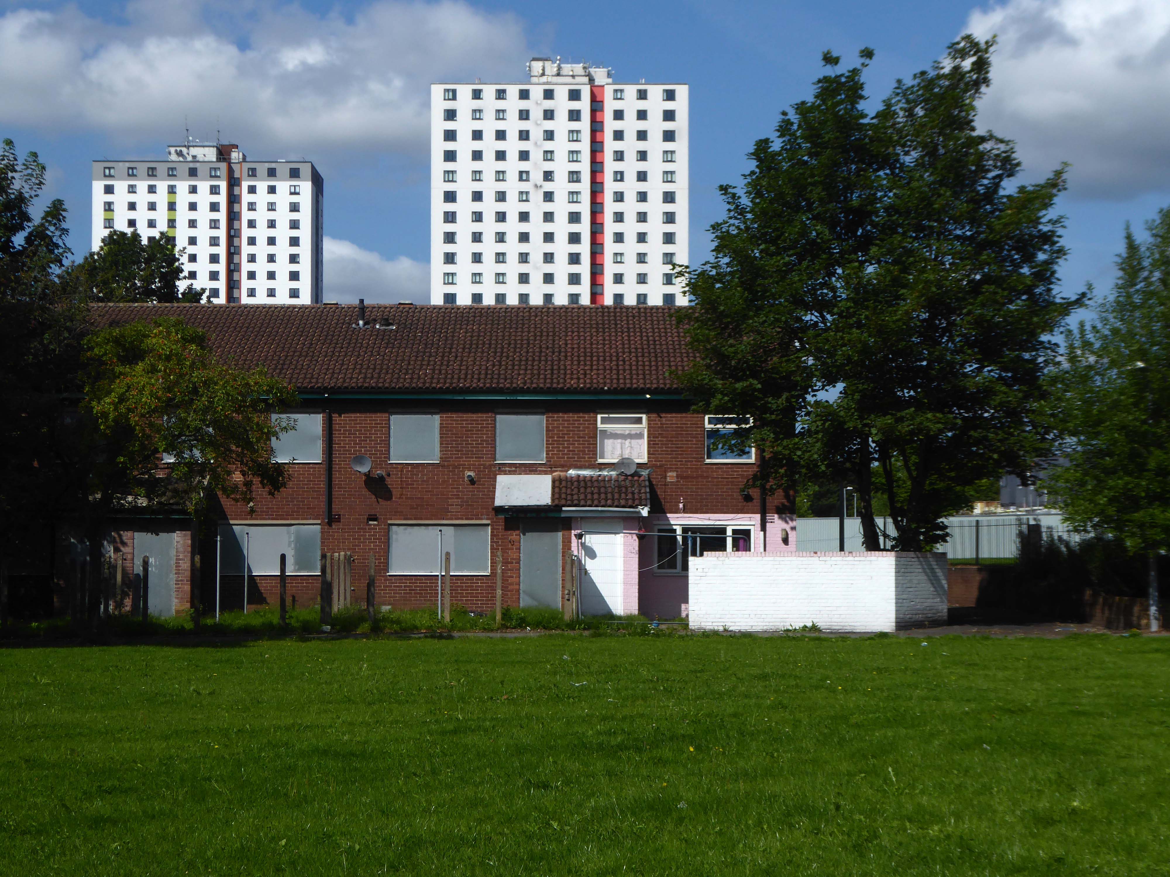
Returning to The Crescent the High Street Estateis all but demolished, save for one resident and their row.
This is an area which has seen a succession of clearances, redevelopment and shifts in demographics during a relatively short and intense period of change.
That process of change continues to hastily unfold.
An early start on another sunny day, cycling along long straight roads out of town, towards Middlesborough.
Having previously visited Hull and Scarborough and all points in between.
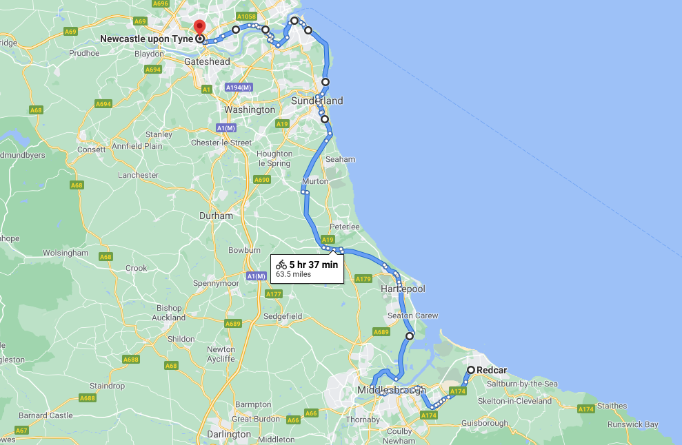
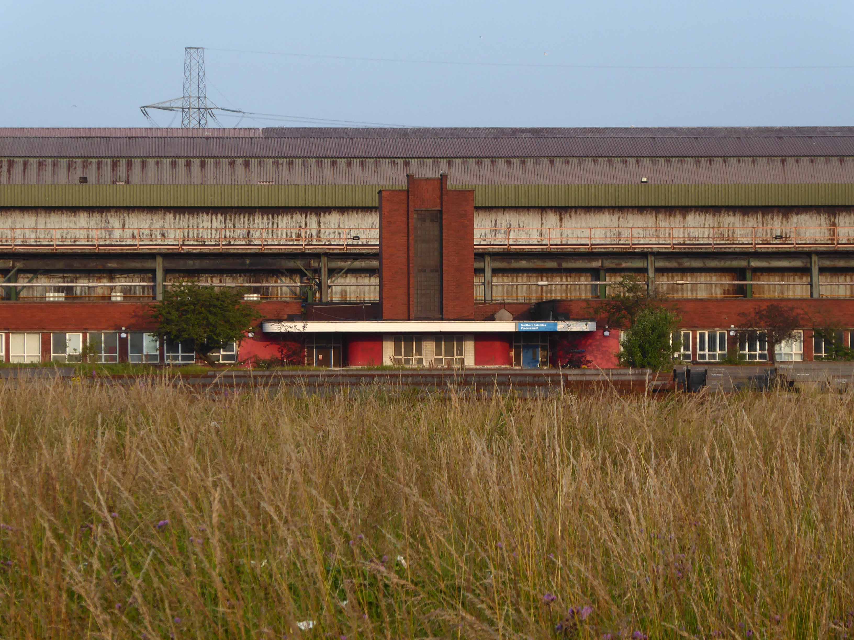
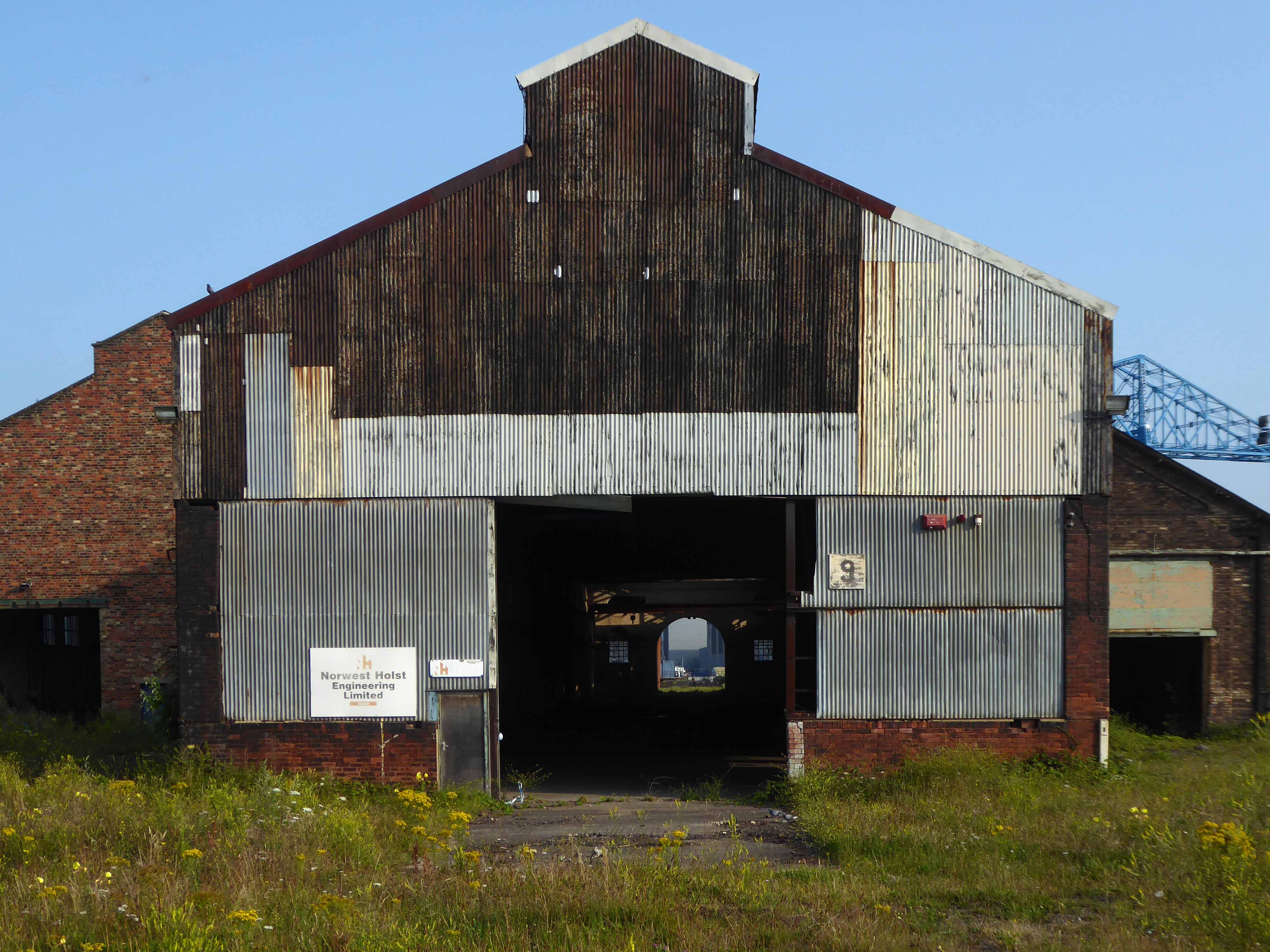
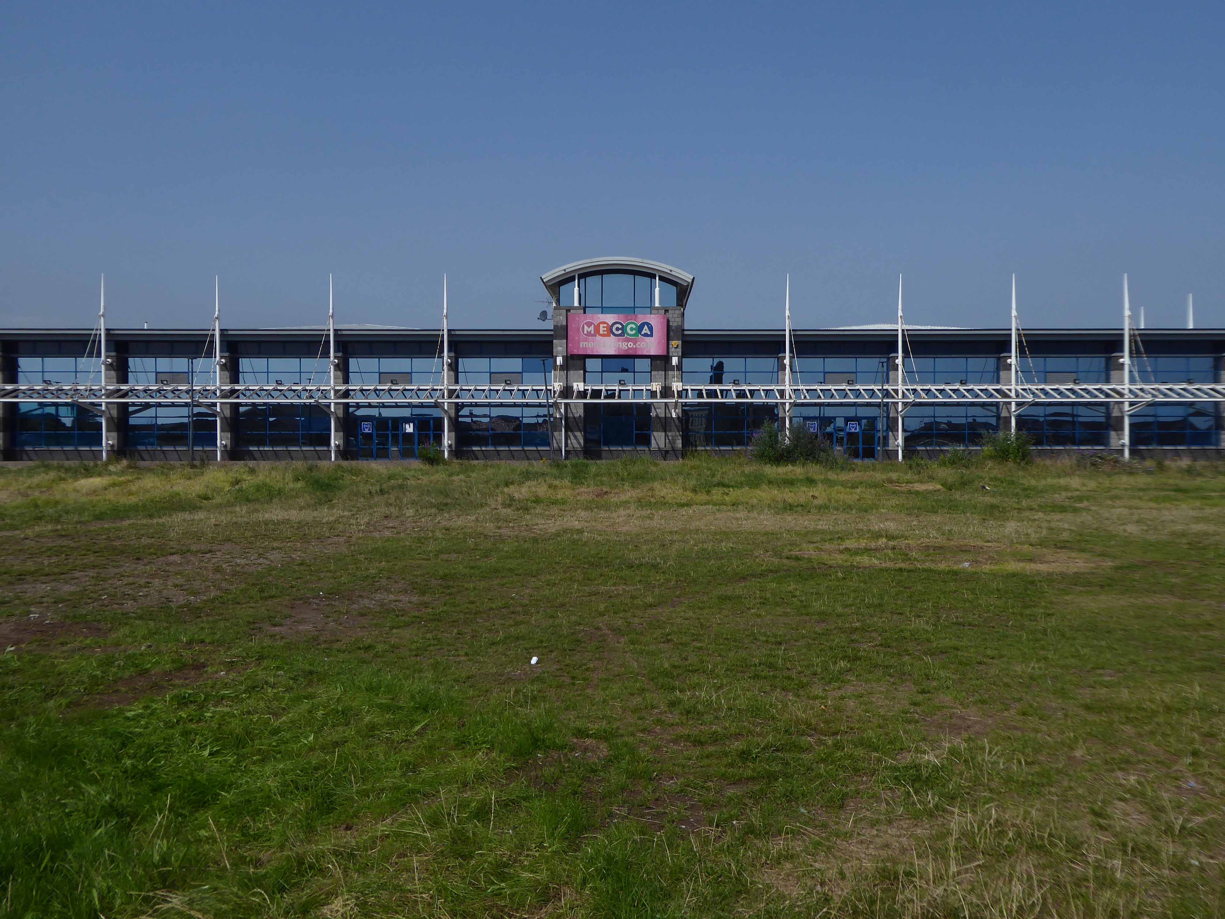
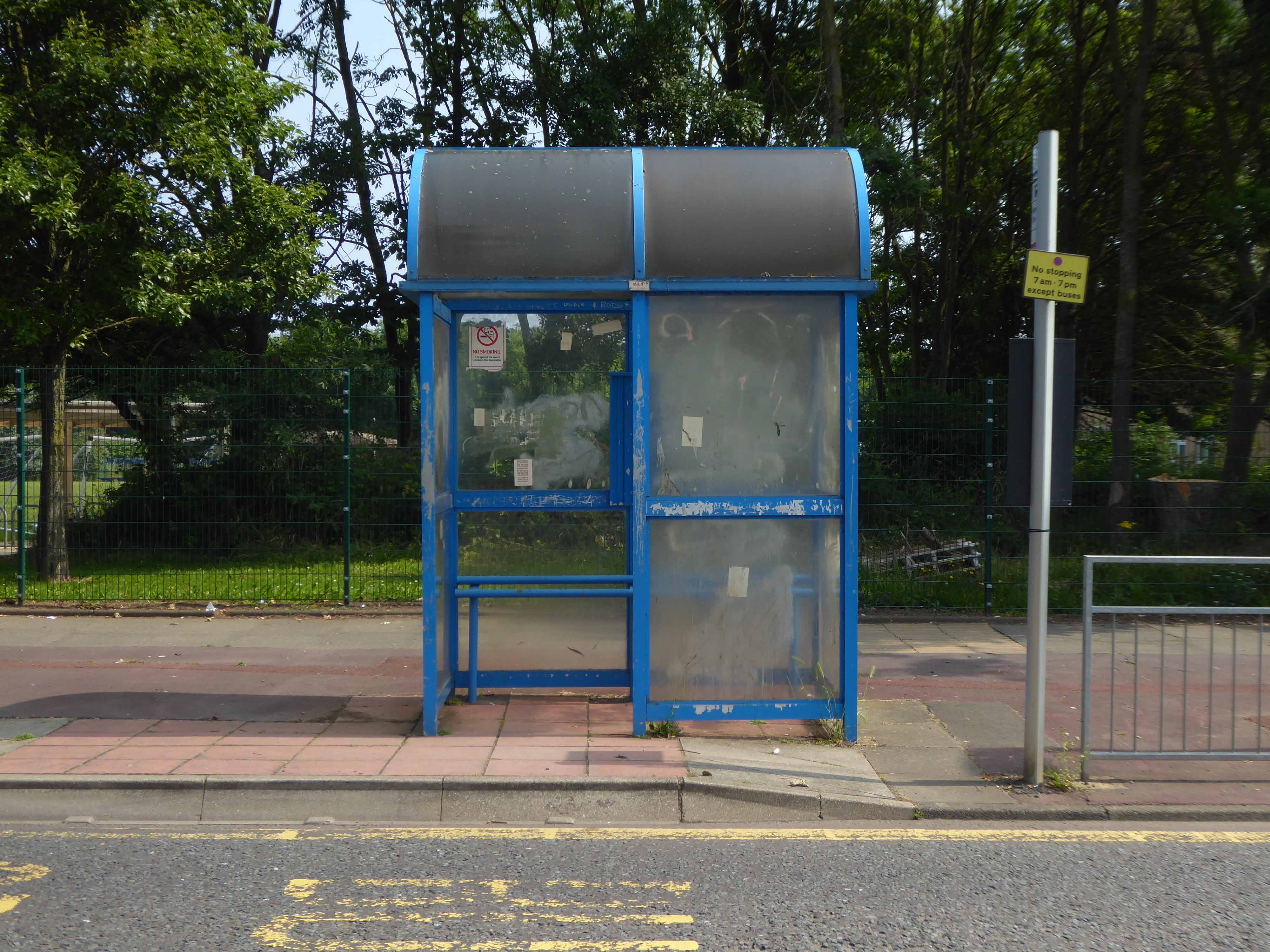
Slowly passing sleepy factories and desolate bus shelters.
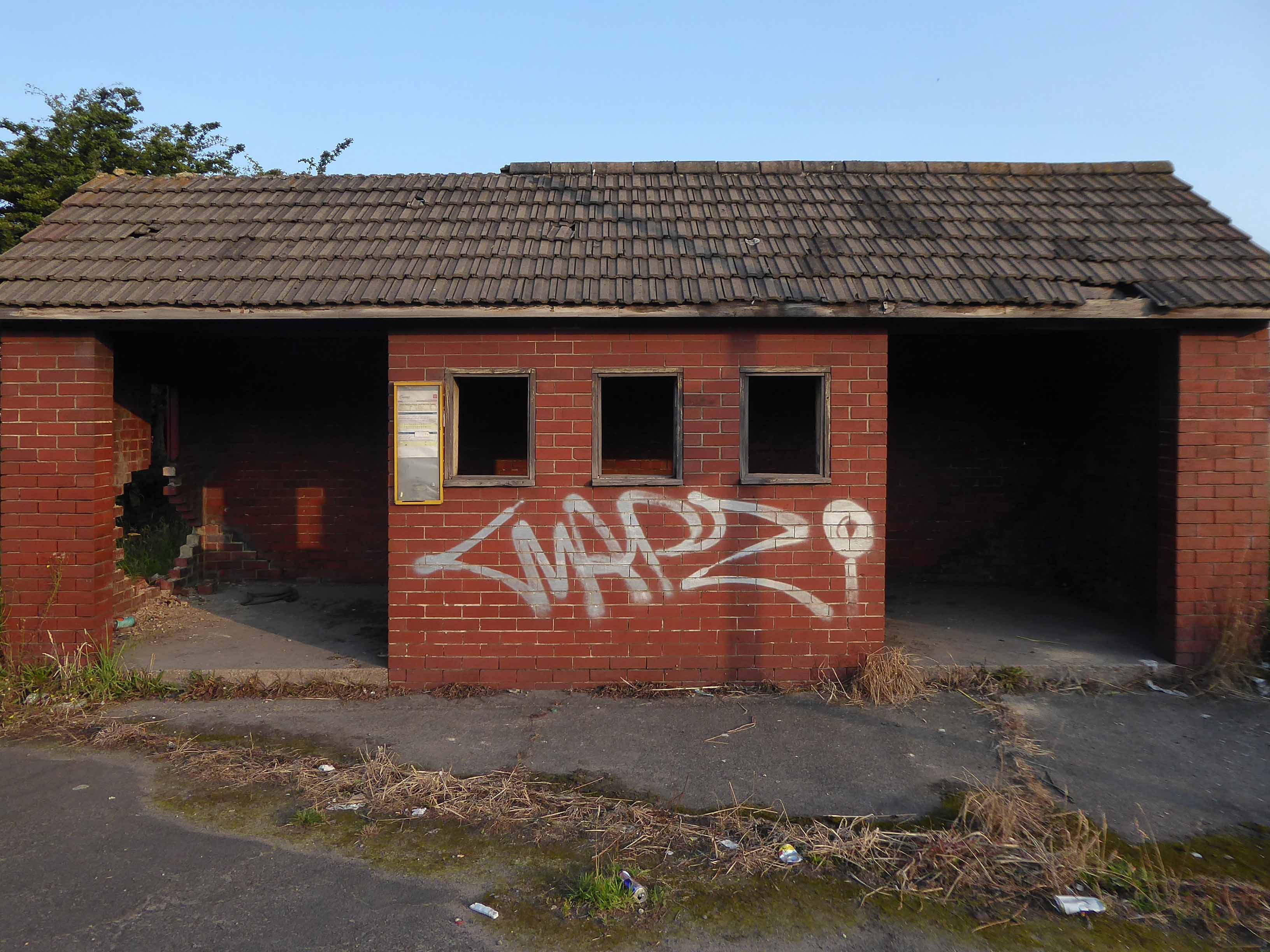
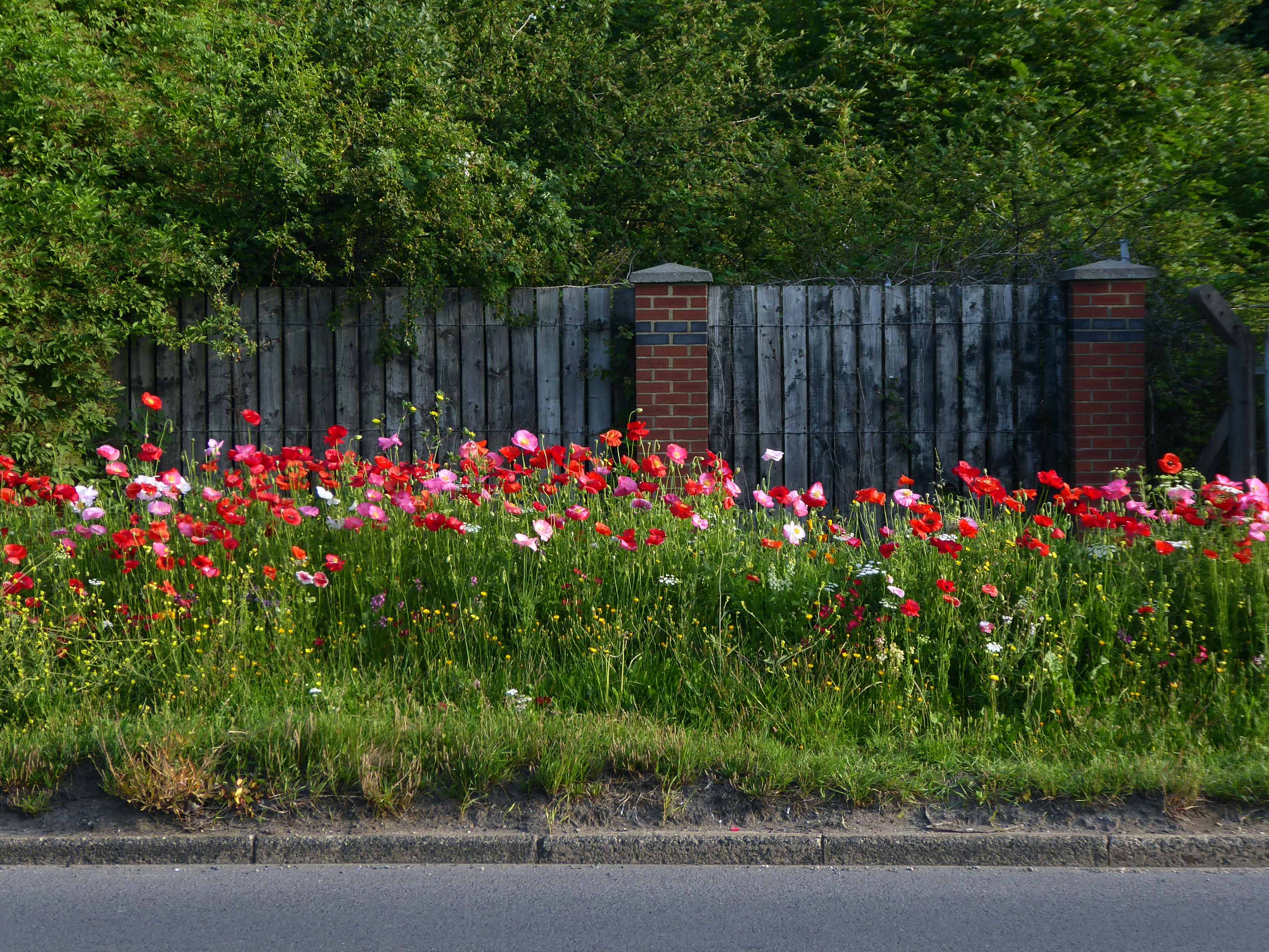
Bunker like social clubs and flower lined roads.
The Albion club in South Bank has stood empty for the last three years.
Now local lad Mark Trainor has the keys – and says opening the doors to the club his own family frequented for years will be a dream come true.
He’s planning to cater for everyone, he says, and it won’t just be all about drinking.
Parents will be able to call in for a coffee after dropping the kids at school, there will be pool nights and Mark’s personal favourite – Pie Day Fridays.
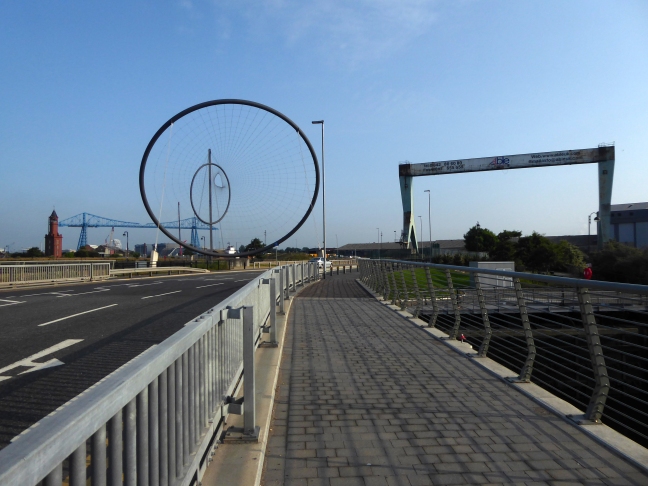
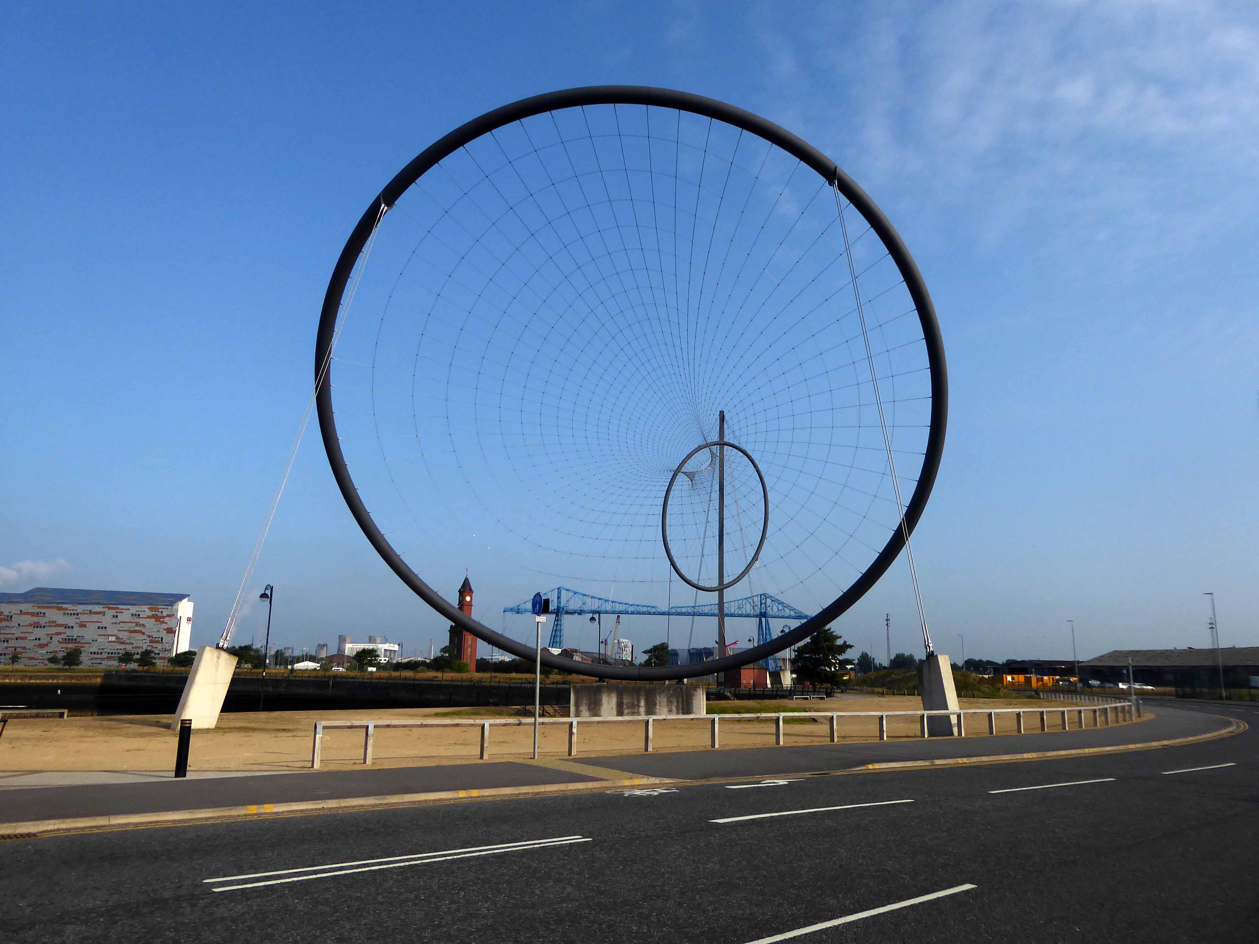
Temenos is a Greek word meaning land cut off and assigned as a sanctuary or holy area.
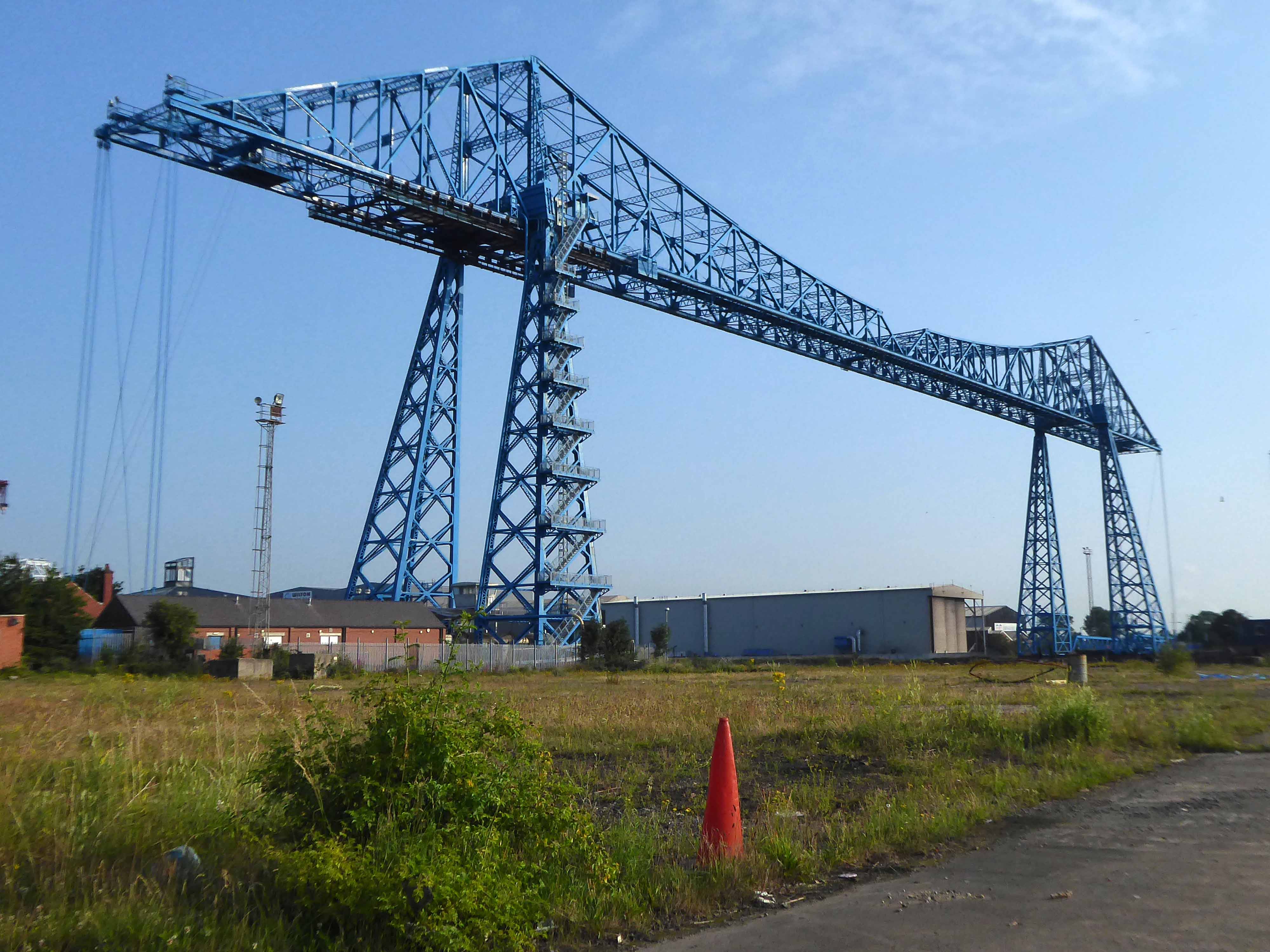
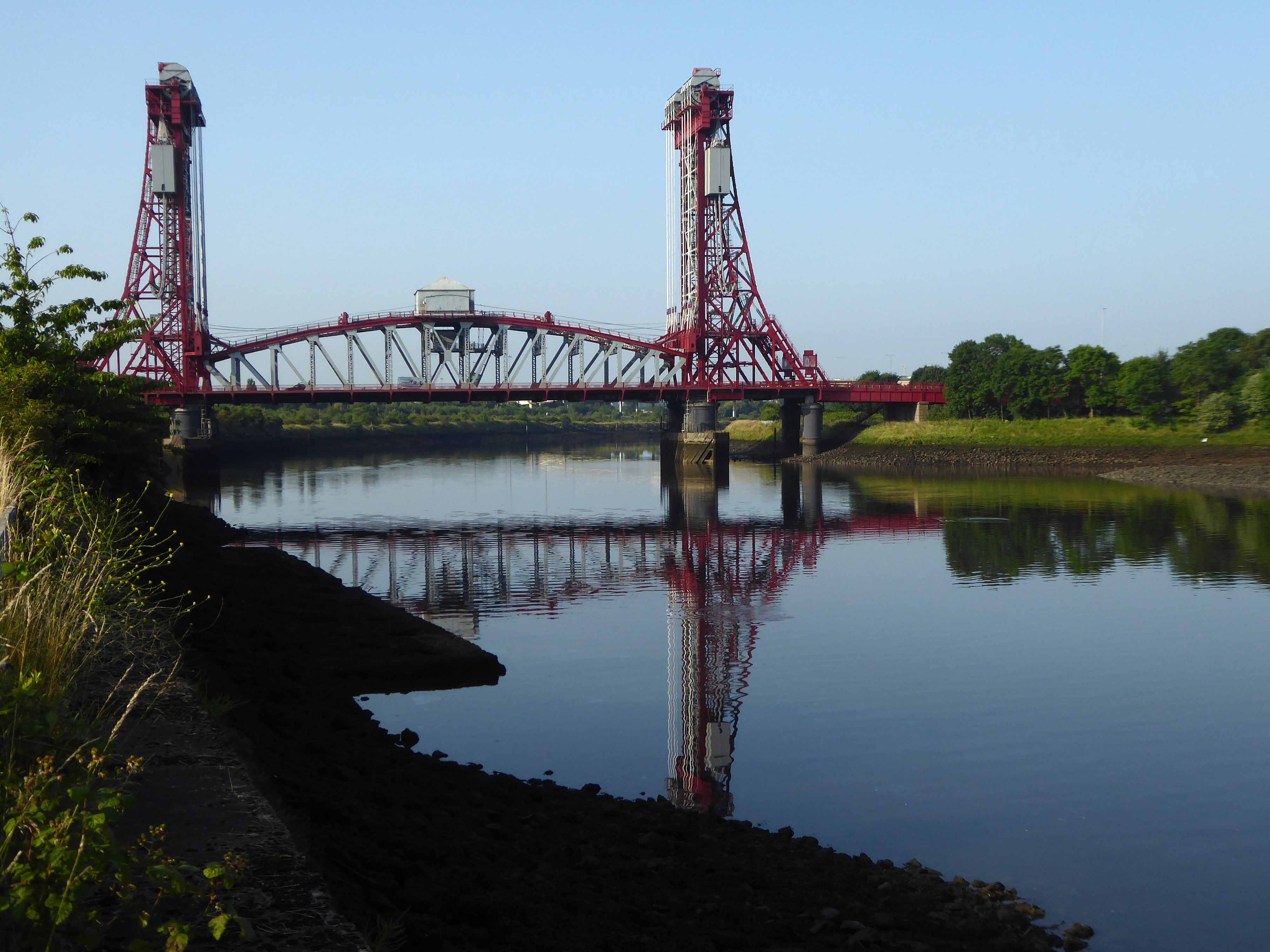
Following a 1907 Act of Parliament the bridge was built at a cost of £68,026 6s 8d by Sir William Arrol & Co. of Glasgow between 1910 and 1911 to replace the Hugh Bell and Erimus steam ferry services. A transporter bridge was chosen because Parliament ruled that the new scheme of crossing the river had to avoid affecting the river navigation.
The opening ceremony on 17 October 1911 was performed by Prince Arthur of Connaught, at its opening the bridge was painted red.
In 1961 the bridge was painted blue.
In 1974, the comedy actor Terry Scott, travelling between his hotel in Middlesbrough and a performance at the Billingham Forum, mistook the bridge for a regular toll crossing and drove his Jaguar off the end of the roadway, landing in the safety netting beneath.
The cycle track followed the river, which sports a fine array of industrial architecture.
Tees Newport Bridge designed by Mott, Hay and Anderson and built by local company Dorman Long who have also been responsible for such structures as the Tyne Bridge and Sydney Harbour Bridge, it was the first large vertical-lift bridge in Britain.
In a slightly more upbeat mode St James the Apostle Owton Manor.
I convinced myself that this building on Station Road Seaton Carew was a former pub, I discovered following consultation with the local studies offices, that it was in fact a former children’s home destined to become a doctors.
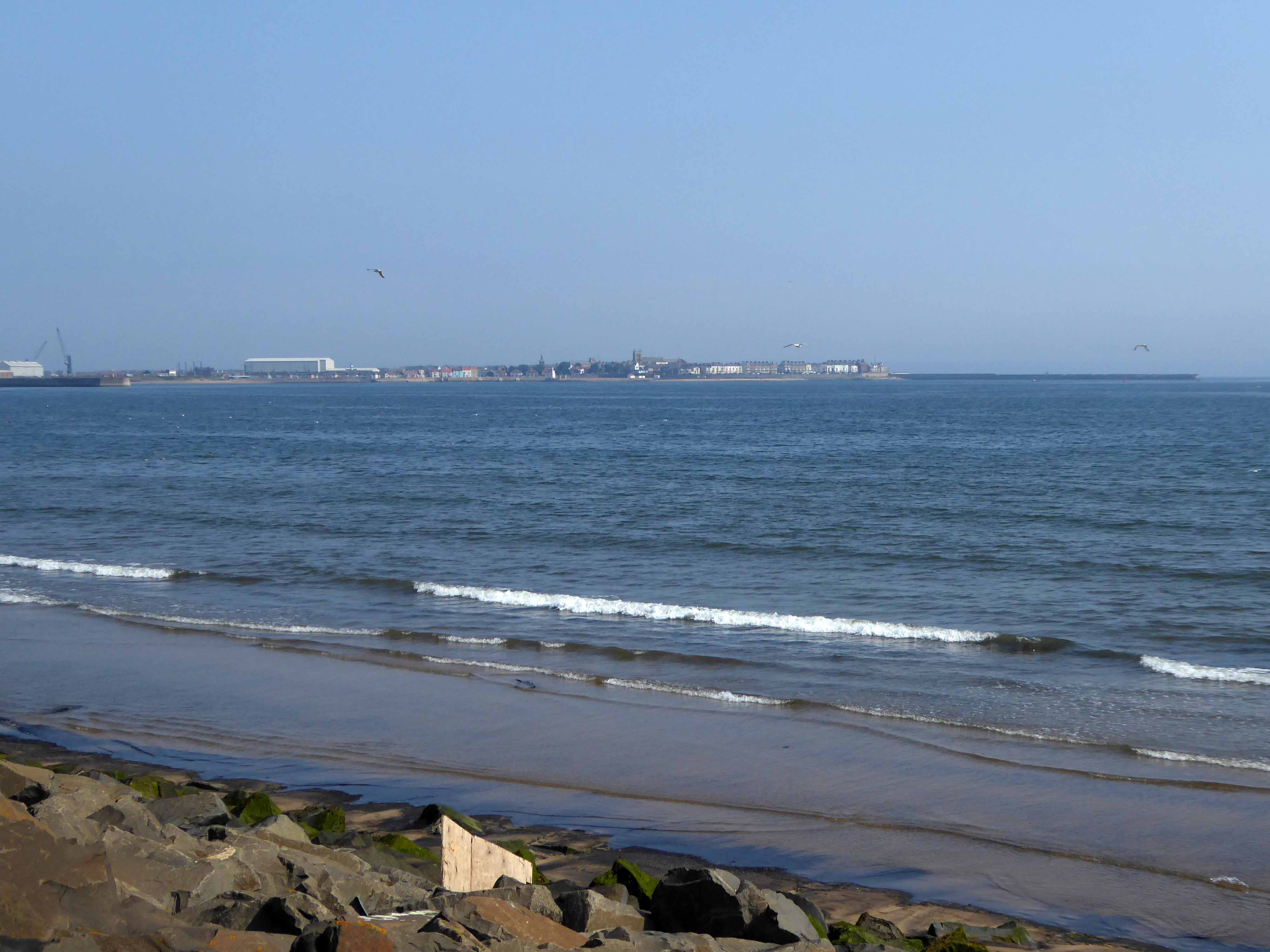
I found myself looking back across the estuary to Redcar.
Northward toward Hartlepool.
Where the bingo was closed and the circus had left town.
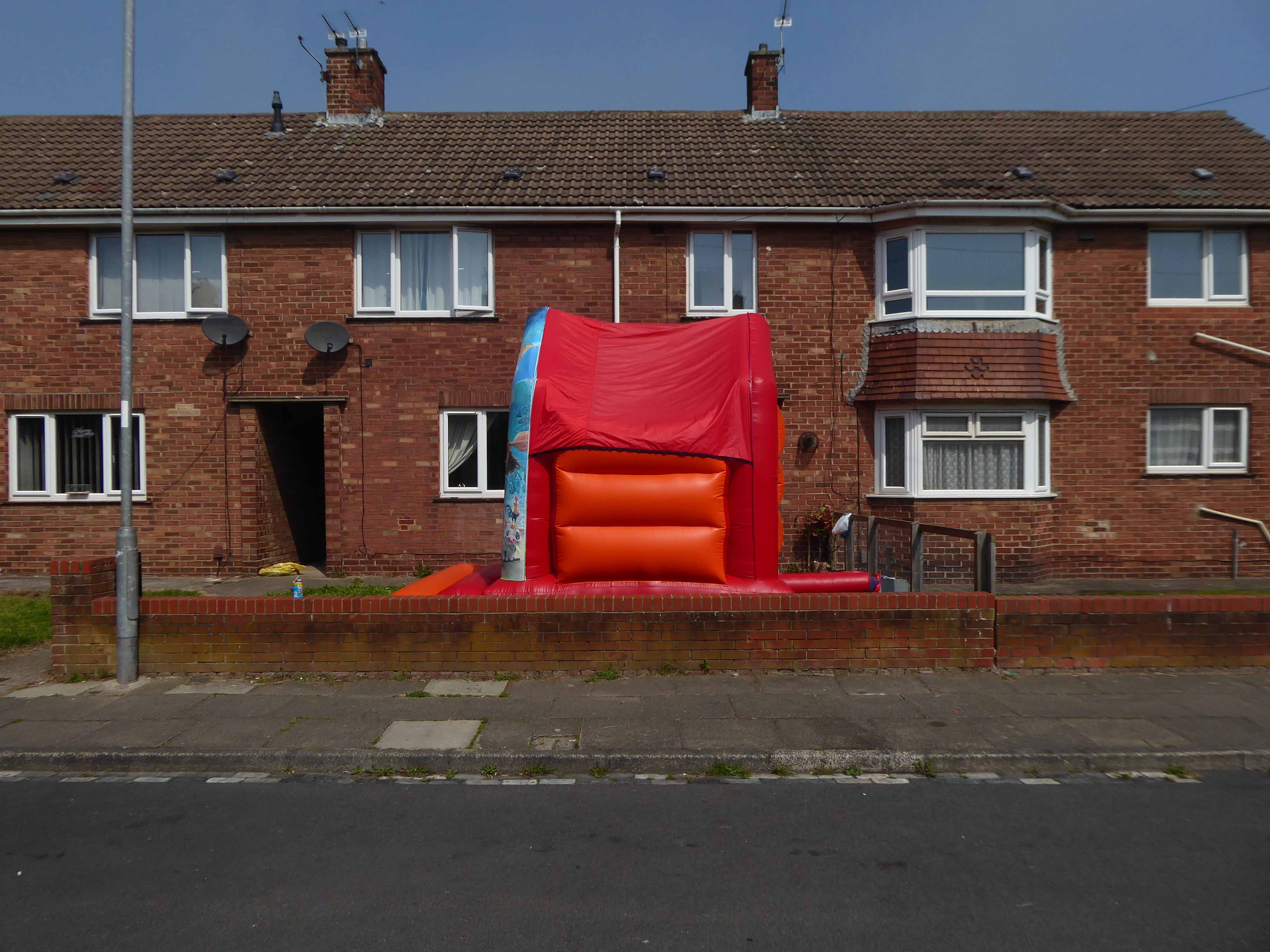
Every Englishman’s home is a bouncy castle.
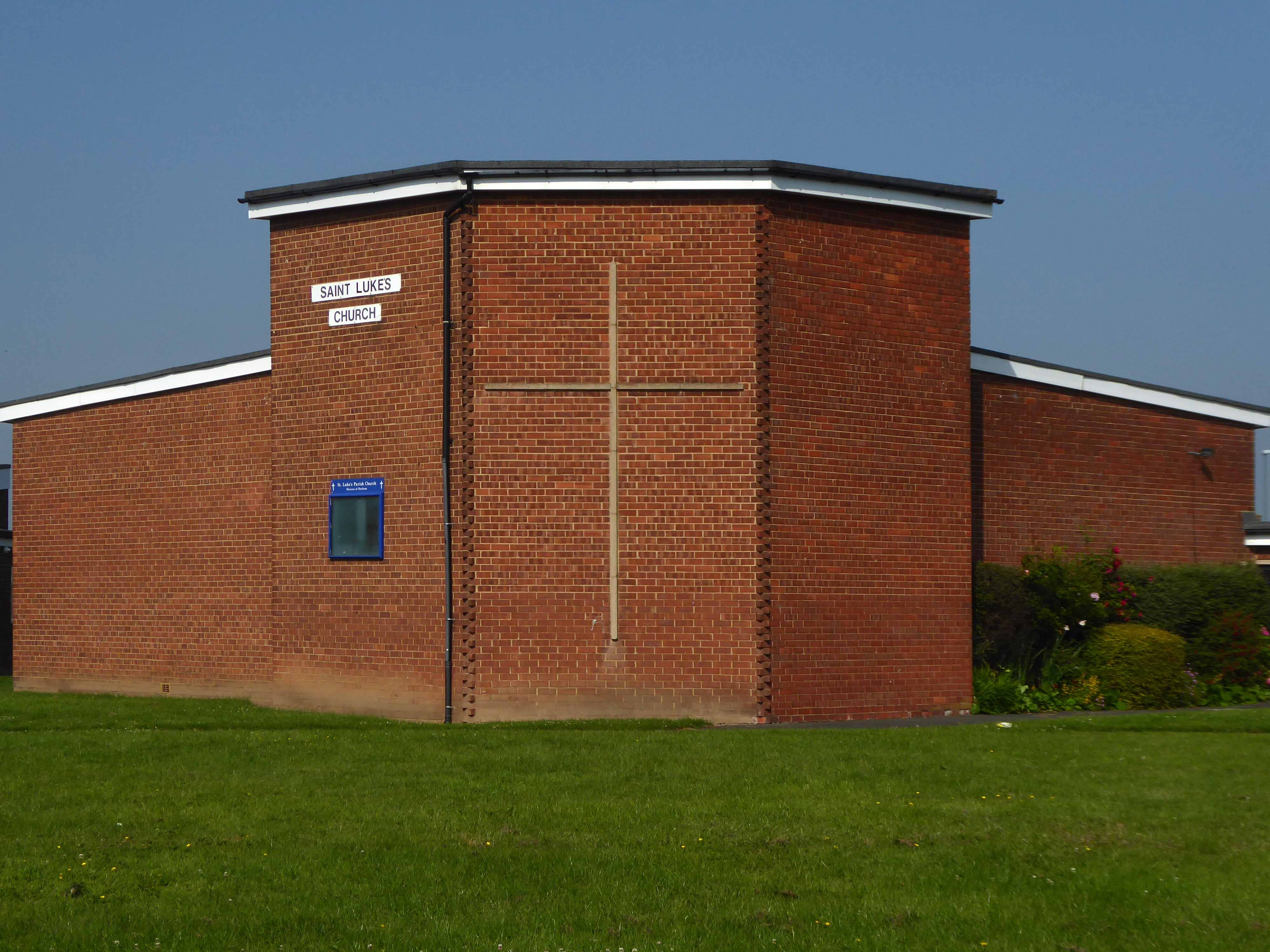
St John Vianneylocated on King Oswy Drive West View Estate.
Architect: Crawford & Spencer Middlesbrough 1961.
A large post-war church built to serve a housing estate, economically built and with a functional interior. The campanile is a local landmark.
The parish of St John Vianney was created in 1959 to serve the growing West View Estate, on the north side of Hartlepool. The church was opened by Bishop Cunningham on 4 April 1961. The presbytery was built at the same time.
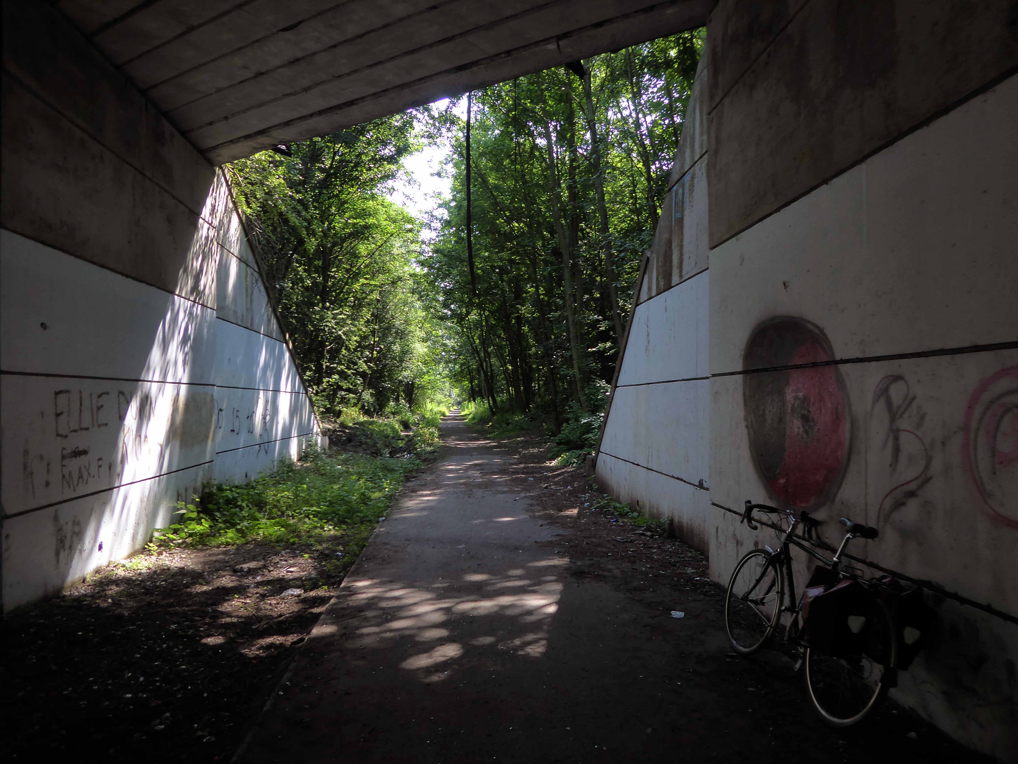
I found myself on yet another former railway line.
The Cycleway was once a railway line designed by George Stephenson to take coal from the Durham coal fields to the docks in Hartlepool, where the coal was then distributed throughout the world.
Seeking assistance from a passing cyclist I negotiated a safe passage to Sunderland.
The Sunderland Synagogue is a former synagogue building in Sunderland, England. The synagogue, on Ryhope Road, was designed by architect Marcus Kenneth Glass and completed in 1928. It is the last surviving synagogue to be designed by Glass.
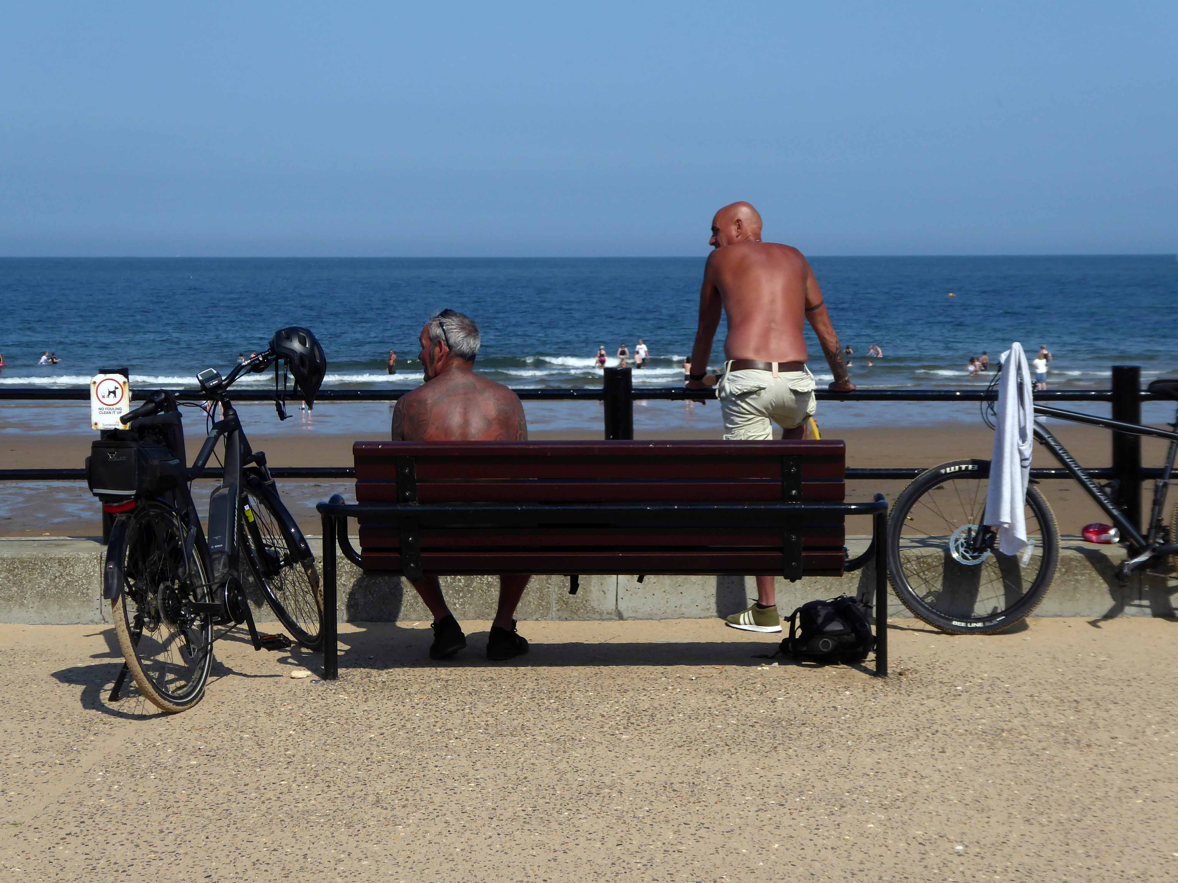
I took a right and arrived in Roker, where I saw these well tanned and tattooed cyclists taking a rest.
Pressed on, largely alongside the coast to South Shields.
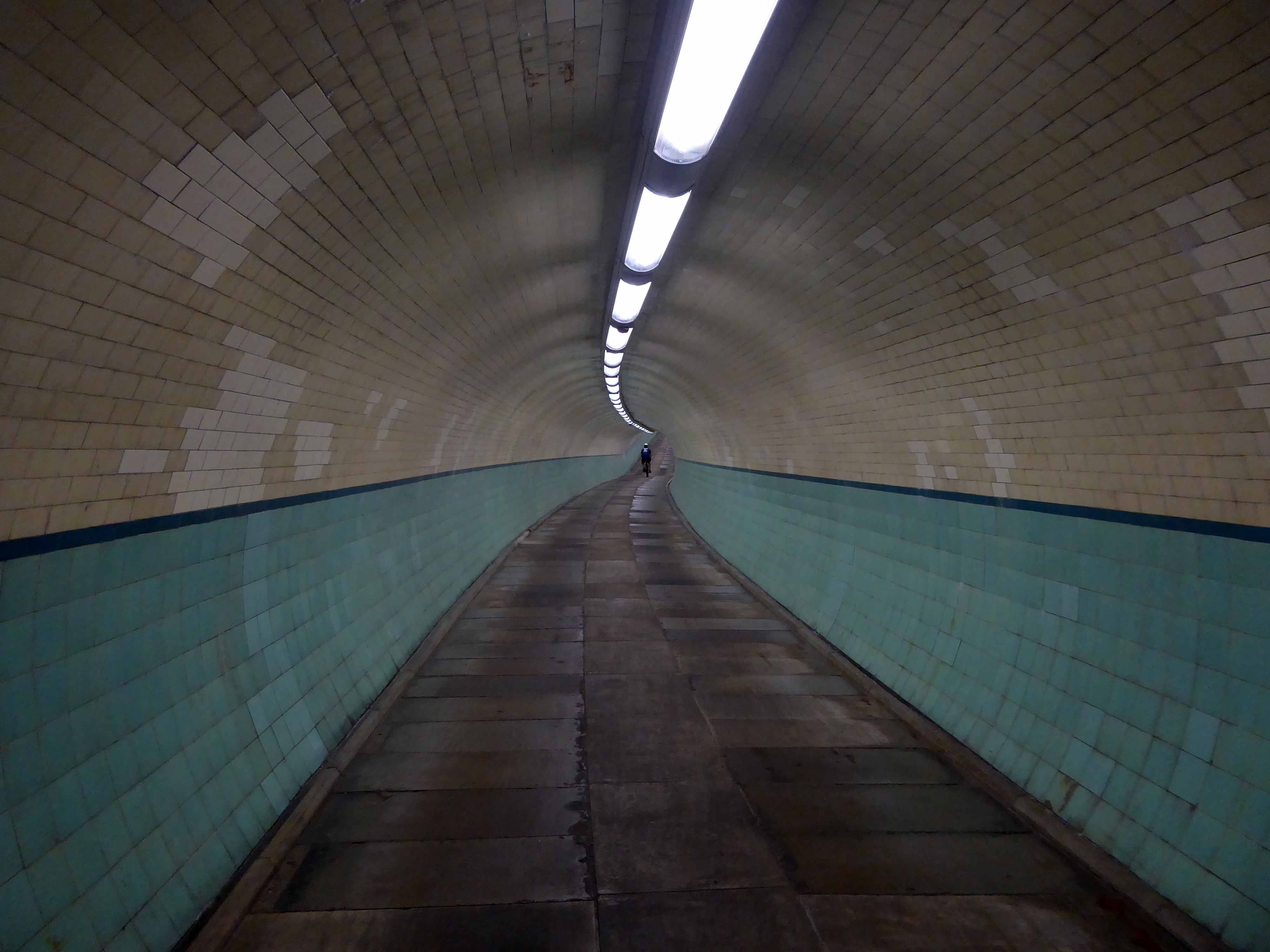
Under advisement from a jolly passing jogger I took the Tyne Pedestrian Tunnel.
Tyne Cyclist and Pedestrian Tunnel was Britain’s first purpose-built cycling tunnel. It runs under the River Tyne between Howdon and Jarrow, and was opened in 1951, heralded as a contribution to the Festival of Britain.
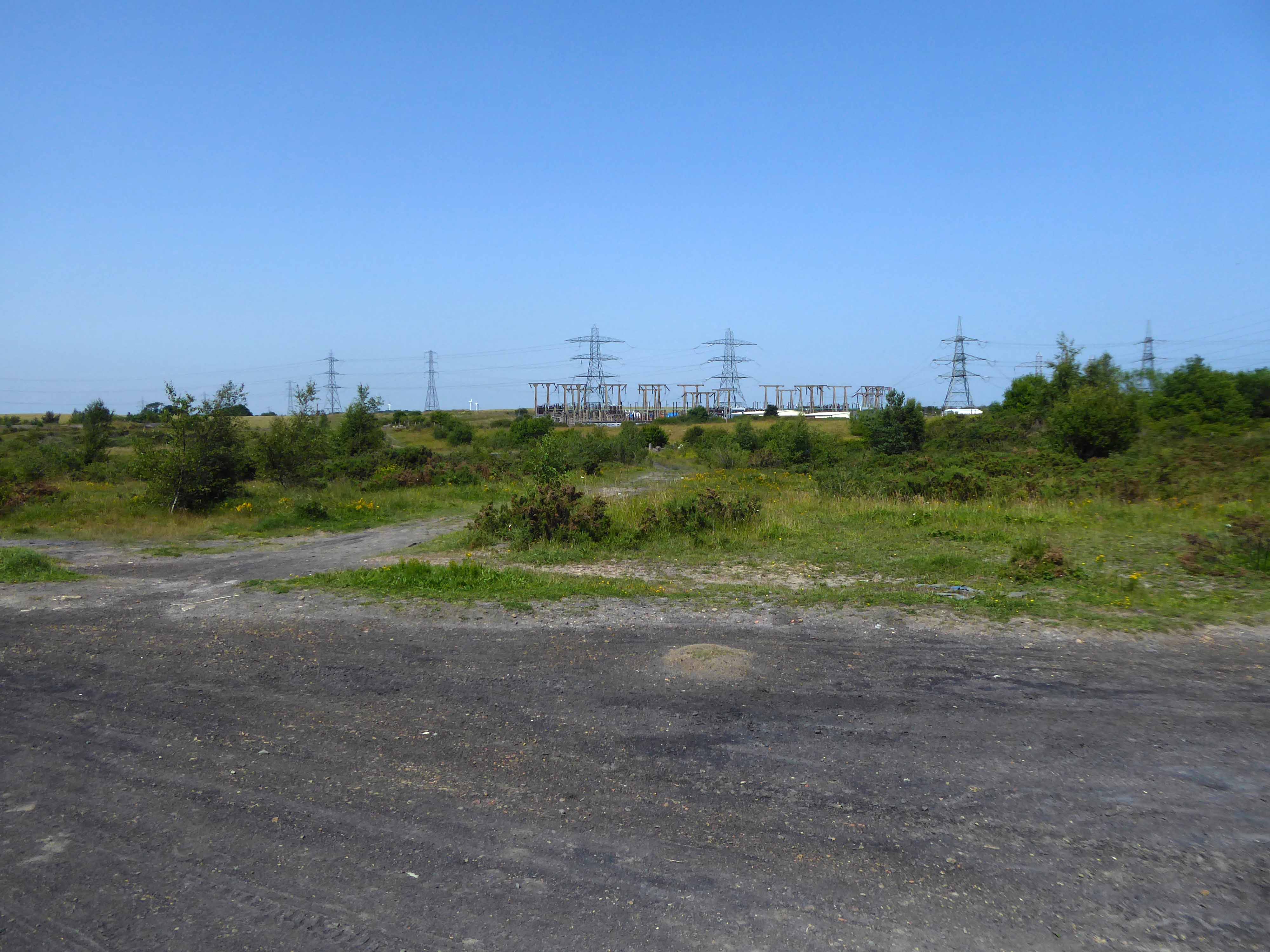
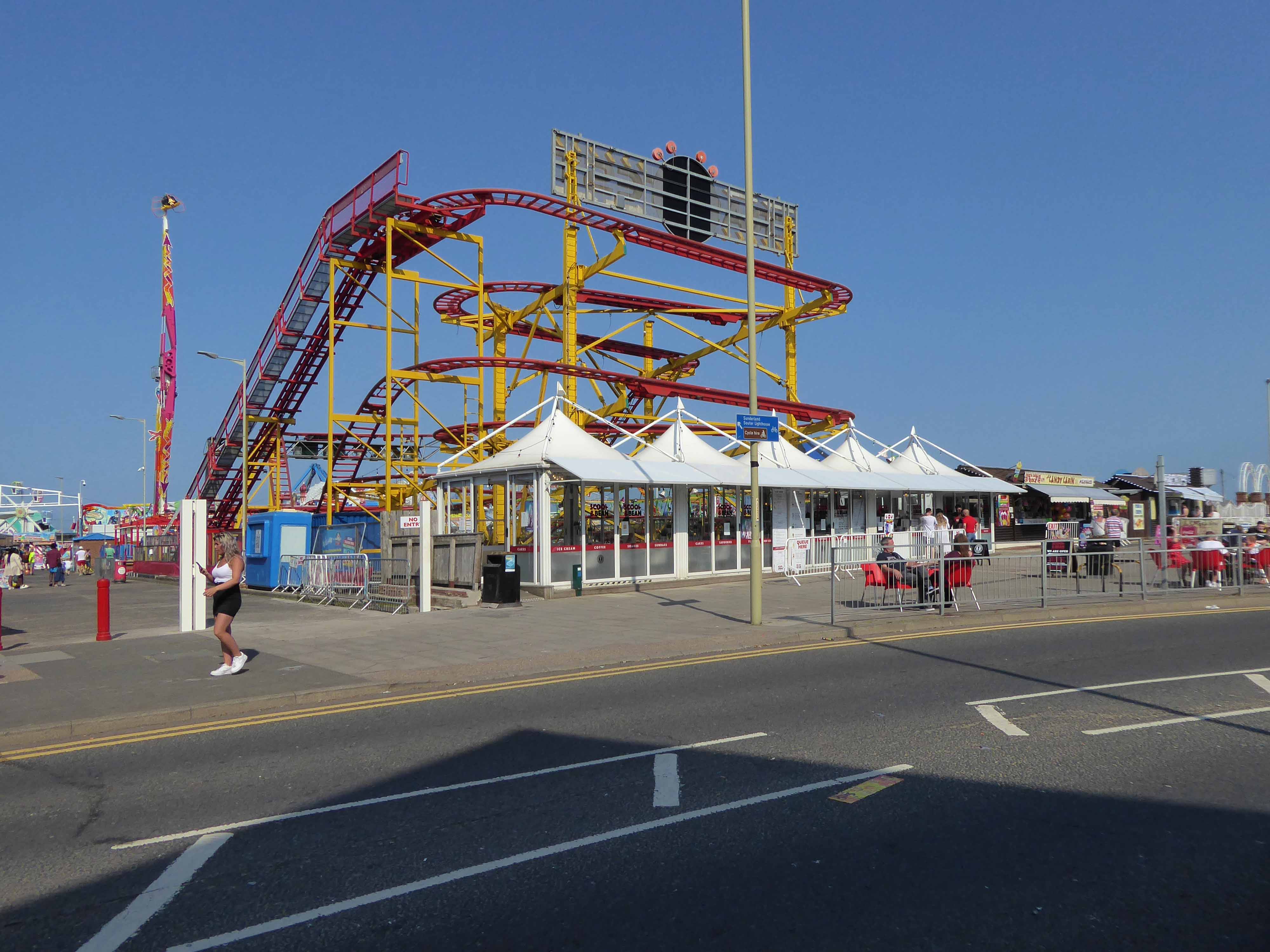
Whilst cycling twixt Redcar and Newcastle one sunny Monday morn, I espied a tower on the distant horizon.
I pedalled hurriedly along and this is what I found.
Dawson House aka Kingsway.
A fifteen-storey circular tower block of 60 one-bedroom flats and 29 two-bedroom flats, making 89 dwellings in total. The block was built as public housing at the western fringe of the Town Centre development that began in 1952. Approved in 1973, the block is of triangular concrete-beam construction.
The architects were Elder Lester Associates.
The block was built by Teeside County Borough Council.
Stanley Miller Ltd.’s tender for the contract was £778,850.
The tower block was opened on 3rd April 1975 by the Mayor of Stockton Borough Council, John Dyson.
The block is described as ‘gimmicky circular tower block’ in The Buildings of England: County Durham by N. Pevsner.
In November 2013, a time capsule was buried in front of The Family, under a stone with the inscription Forever Forward 30 11 2013.
The capsule is not to be unearthed until the year 2078.
Twenty million pound bid to take back control of the centre of Billingham.
The council says: Proposals include addressing the physical condition of Billingham town centre in support the Council’s ambition to take back control of the centre. Redevelopment would solve the challenges of changing retail trends that are contributing towards excess retail space and high vacancy rates.
This includes exploring options for mixed-use redevelopment and high-quality public spaces that improve accessibility within the town centre and a modern retail offering.
Built in 1968 by local architects Elder Lester and Partners as part of the expansive plans for the town centre along with the Forum, La Ronde nightclub was to form part of the expansive plans for Billingham focused on the pursuit of increased leisure time.
La Ronde’s distinct cylindrical form comes from the car park access ramp that winds around the stair core to the upper floors of the club. The elevated drum-like form inset with cross latticed concrete webs was cast entirely in-situ.
In 2006, the council demolished La Ronde and Forum House at the cost of £500,000 to make way for a supermarket.
The Forum
In 1960, Billingham Urban District Council, began one of the most ambitious new leisure centres in Europe. The Forum was funded by the district’s new-found wealth – a product of the local petrochemical industry. It was designed by local architects Elder Lester and Partners and brought together a variety of recreational activities including an ice rink, swimming pool, sports centre, theatre, and bar all under one roof. The Forum opened in July 1967 to great enthusiasm. Weekly attendance over the first six months was between 20 000 and 30 000 people, far exceeding all expectations.
The inclusion of the theatre alongside the sports facilities broke new ground in recreational planning and in the shift from sport to the broader notion of ‘leisure’, the Forum predated architectural thinking of the time by nearly a decade. The building’s form is derived from the functions within, expressed in a variety of bulbous elements. The most distinctive is the canopy of the ice rink roof which is hung using steel cables running the length of the roof and cross-braced to achieve a clear 73m span.
The city, however, does not tell its past, but contains it like the lines of a hand, written in the corners of the streets, the gratings of the windows, the banisters of the steps, the antennae of the lightning rods, the poles of the flags, every segment marked in turn with scratches, indentations, scrolls.
Italo Calvino – Invisible Cities
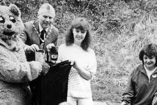
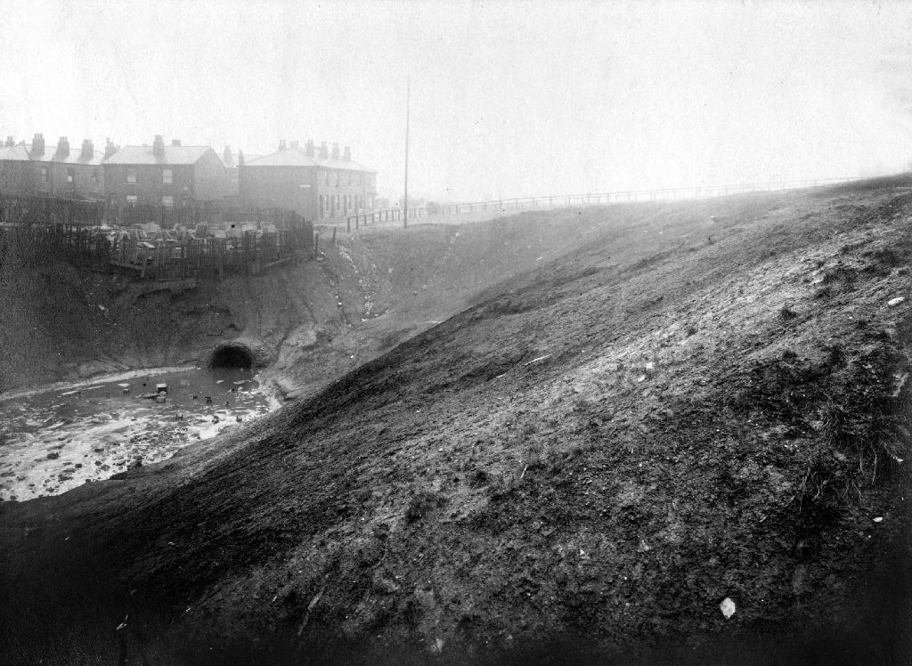
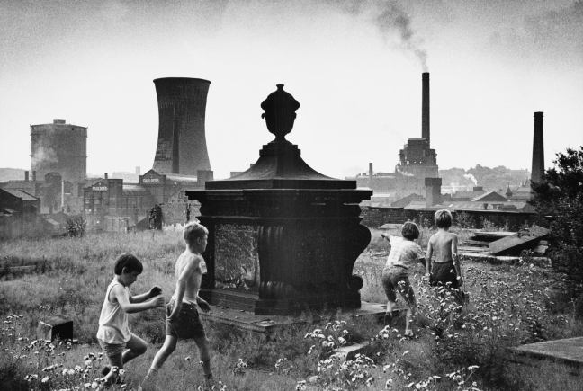
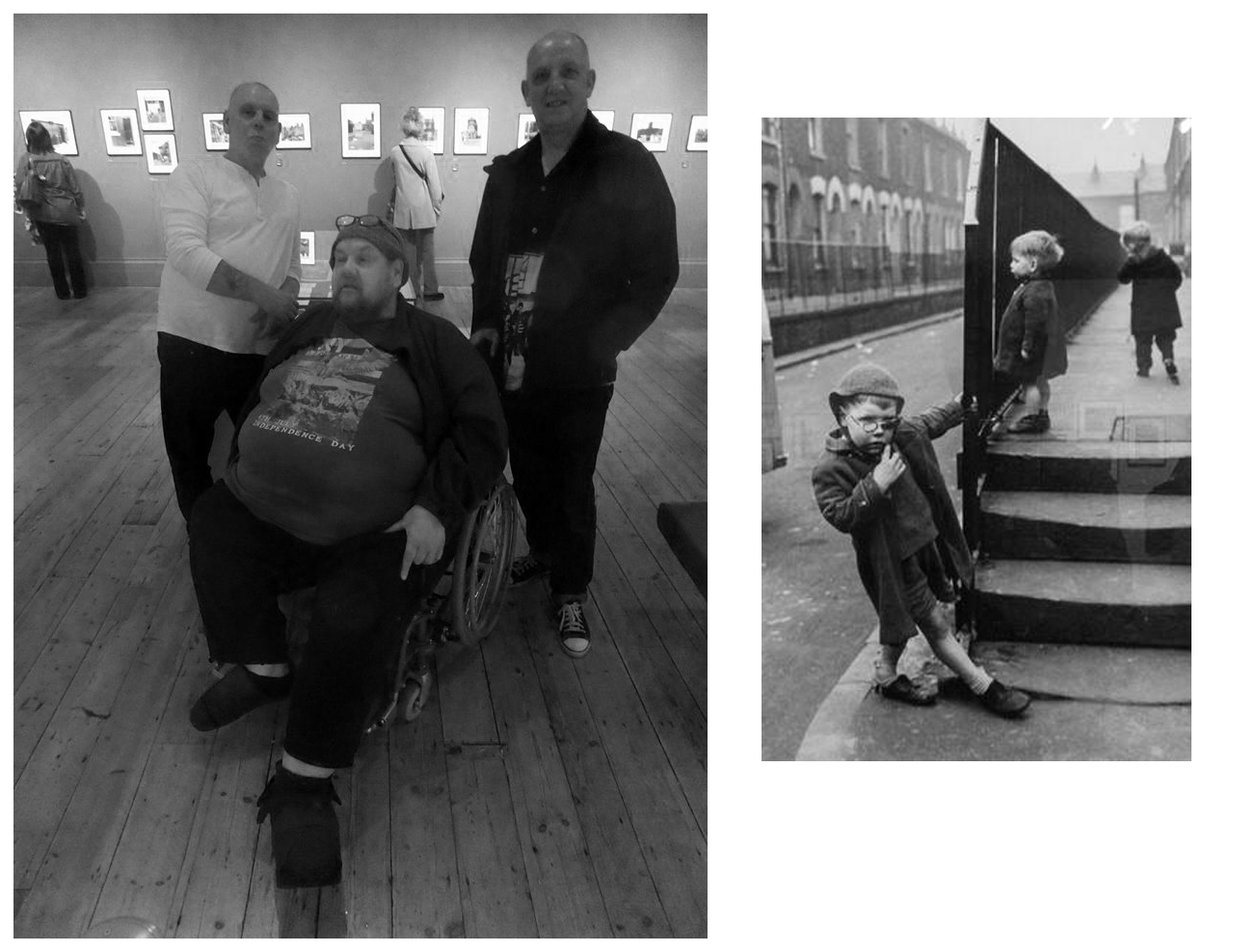
Paul Dobraszczyk posted this Shirley Baker photograph, he was puzzled by its exact location, it puzzled me too.
For nearly all that is depicted here, is now no longer extant, save one hopes, for the group of playmates.
All that is solid melts into air, all that is holy is profaned, and man is at last compelled to face with sober senses his real conditions of life, and his relations with his kind.
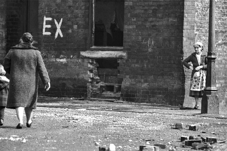
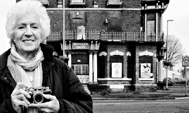
Shirley Baker was a renowned documentary photographer, who worked extensively in Greater Manchester.
I love the immediacy of unposed, spontaneous photographs and the ability of the camera to capture the serious, the funny, the sublime and the ridiculous. Despite the many wonderful pictures of the great and famous, I feel that less formal, quotidian images can often convey more of the life and spirit of the time.
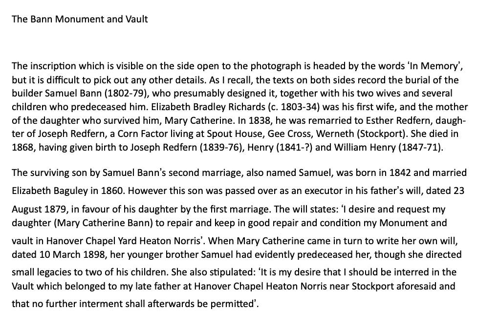
I am grateful to Stephen Bann who has identified the monument as the Bann Family vault:
Stephen Bann and his younger brother – many thanks for the text and photograph Stephen.
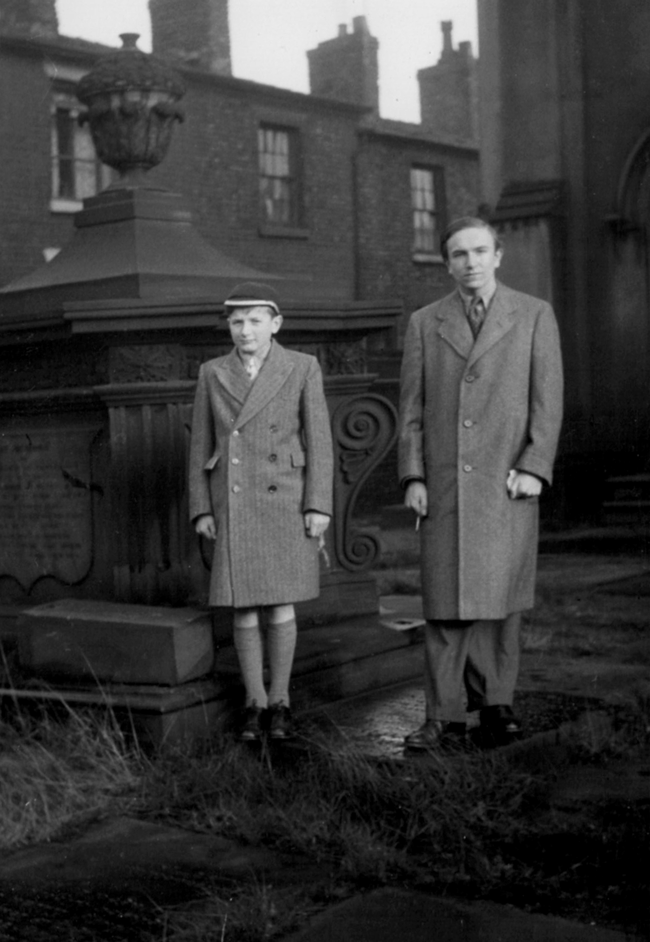
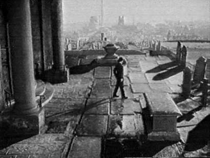
Her photograph was taken in Stockport 1967 – I first assumed it was taken from St Mary’s Church, looking toward the former power station.
I was mistaken.
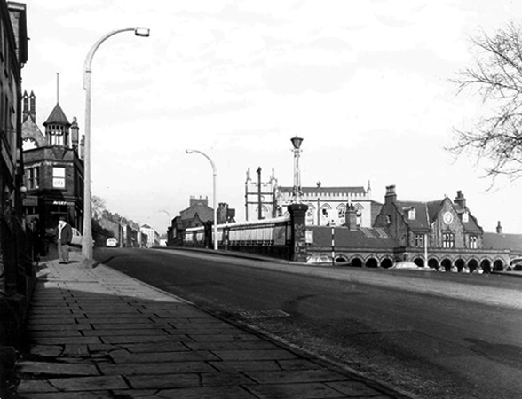
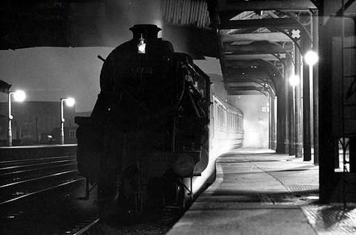
Using the Stockport Image Archive, I found the possible site, in this photograph of Tiviot Dale Station.
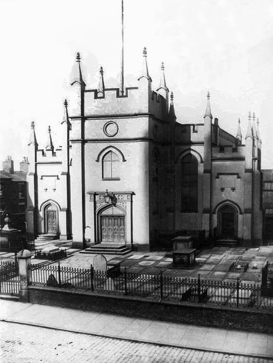
There on the eastern edge of Lancashire Hill – Hanover Chapel.
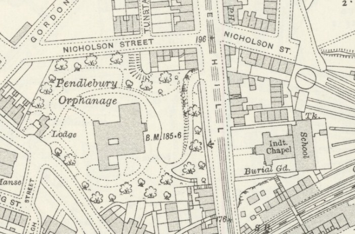
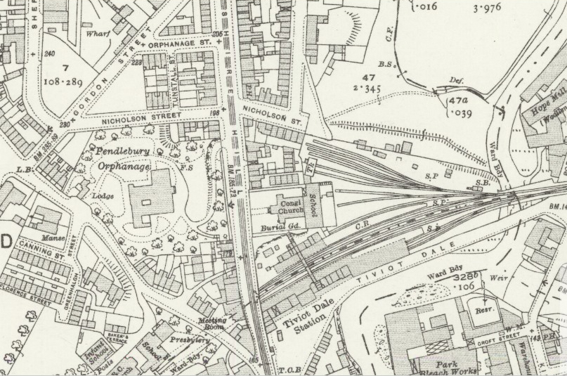
Seen here on the maps of 1917 and 1936.
An area of intense activity, road, rail, housing and infrastructure.
Hanover Chapel closed 1962 – though we may assume from Shirley Baker’s photograph, that following its demolition the graveyard remained intact but untended.
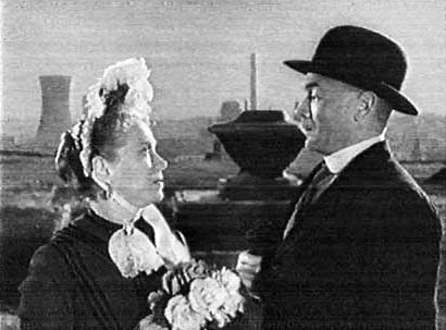
The chapel is thought be seen in the 1954 film Hobson’s Choice, directed by David Lean and starring John Mills, here awaiting his bride to be – the parish church of St Mary’s on the skyline.
Though closer examination reveals that this is not Hanover Chapel – where did those pillars come from?
Where are we, in a labyrinth of invention with a superimposed Stockport backdrop?
My thanks to Robert Collister for these observations.
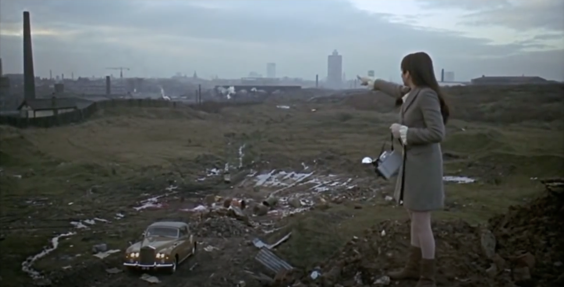
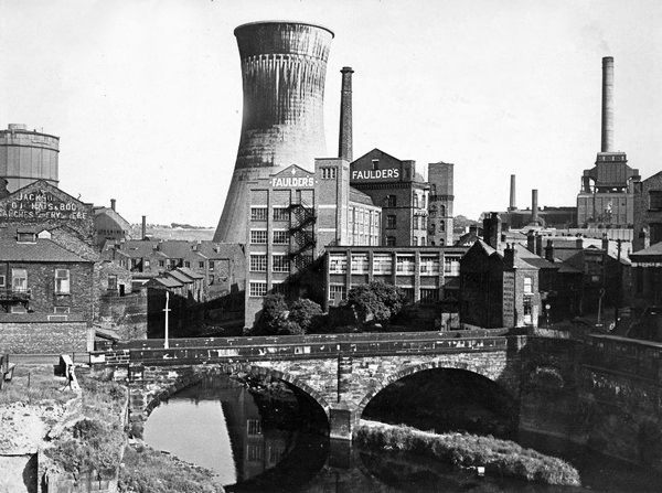
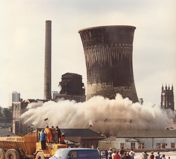
Improbably out of time, the cooling towers are yet to be built, or blown up.
Here John is joined by Salford born Brenda Doreen Mignon de Banzie, playing Maggie.
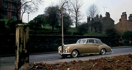
The demolished chapel rubble appears in the foreground of Albert Finney’s gold Roller CB 1E in Charlie Bubbles.
The film’s screenplay was the work of Shelagh Delaney, whose previous work A Taste of Honey also used local locations.
Where Finney has pulled up, feeling proper poorly.
As a serendipitous symmetry, Charlie Bubbles co-star Liza Minelli plays a photographer recording Salford’s disappearing streets.
Bit by bit everything disappears, Tiviot Dale Station closed completely on January 2nd 1967.
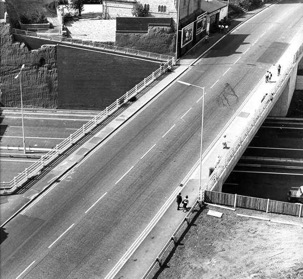
Where once there was a continuous run from the chapel to the town centre, the motorway has since intervened.
The Tiviot Dale pub on the right is no more, closed in 2013.
We had people from all parts of the country turn up on our final day,some of them brought their children who wanted to come because they remember the pub so fondly from their childhood. It was really humbling to see that our pub had touched so many lives.
I remember this pub as a Boddingtons house in the 1970’s. Excellent bitter served by handpump from small vault at the front and a larger “best room” behind, both very narrow given the width of the pub. The landlord employed an unusual method of ensuring everyone got a full pint; a half pint glass of beer was kept between the pumps and your pint was topped up from the half which was constantly replenished to keep it fresh. I have not seen this practice in any other pub.
Phil Moran
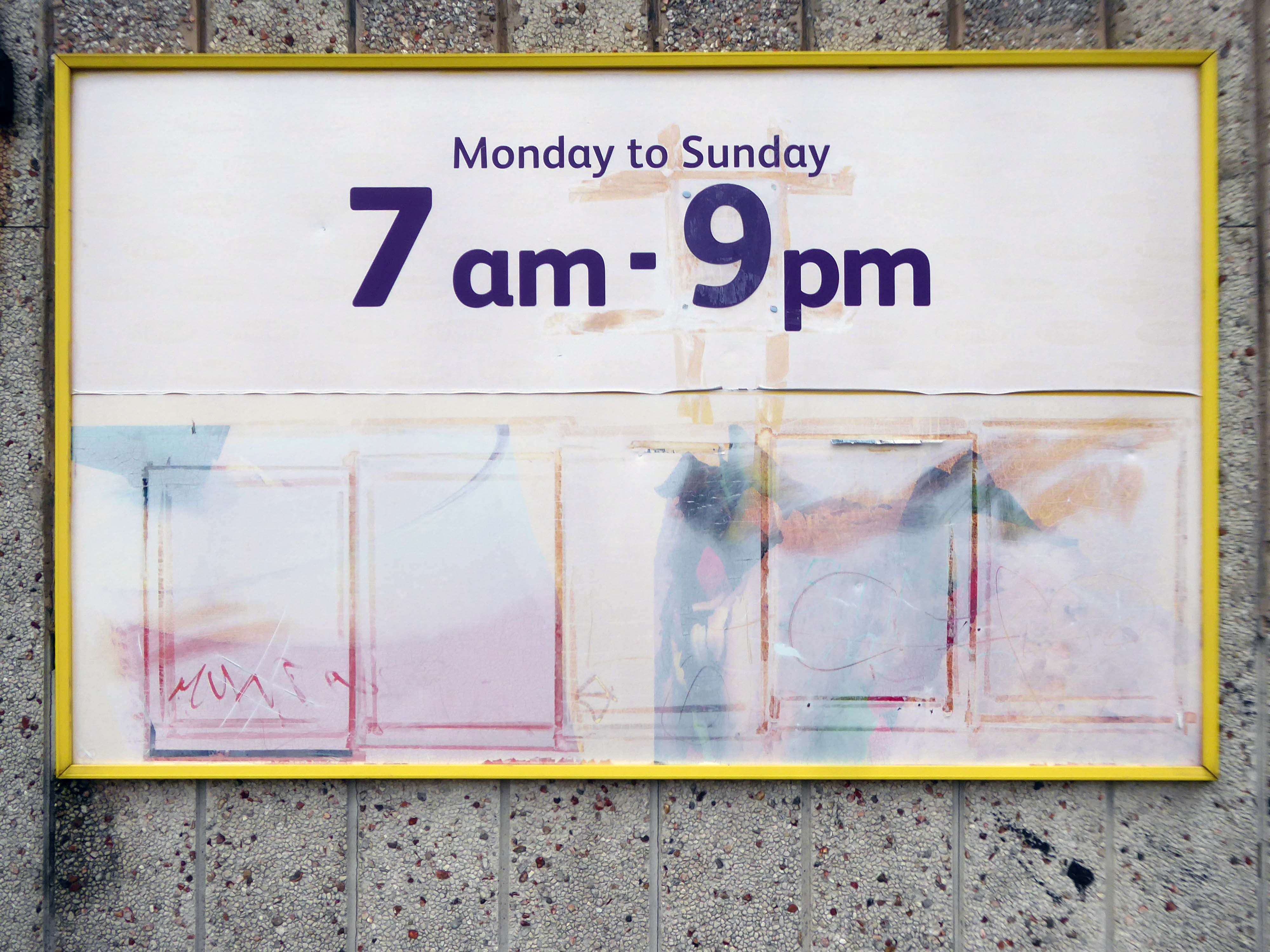
When’s the next tram due?
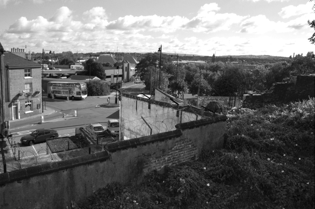
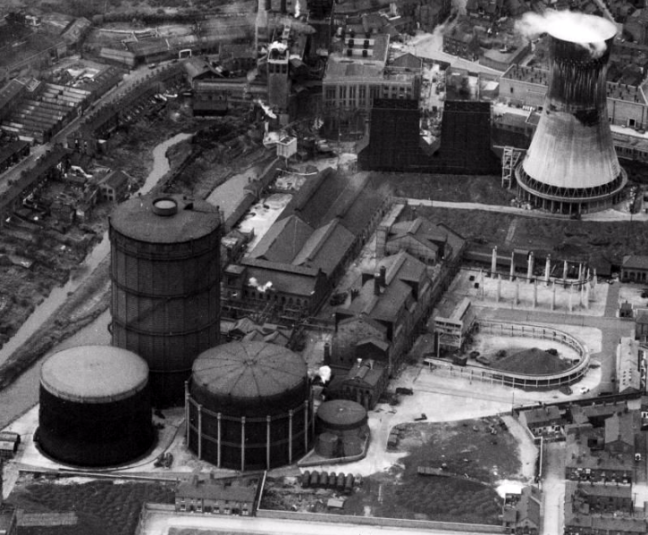
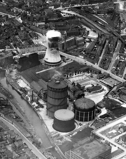
Millgate Power Station operated until 1976.
At the adjacent gas works – gas holder number three was dismantled in 1988, gas holders one and two were removed in 2019.
The nature of infrastructure, housing and industry has changed radically.
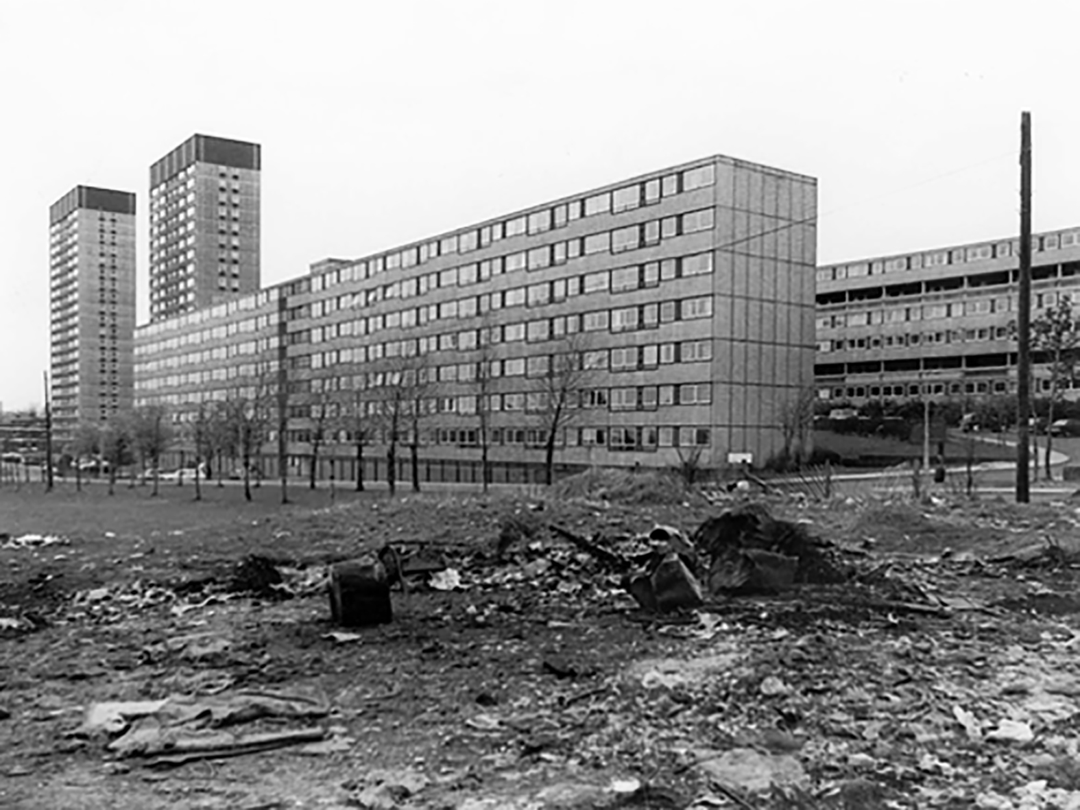
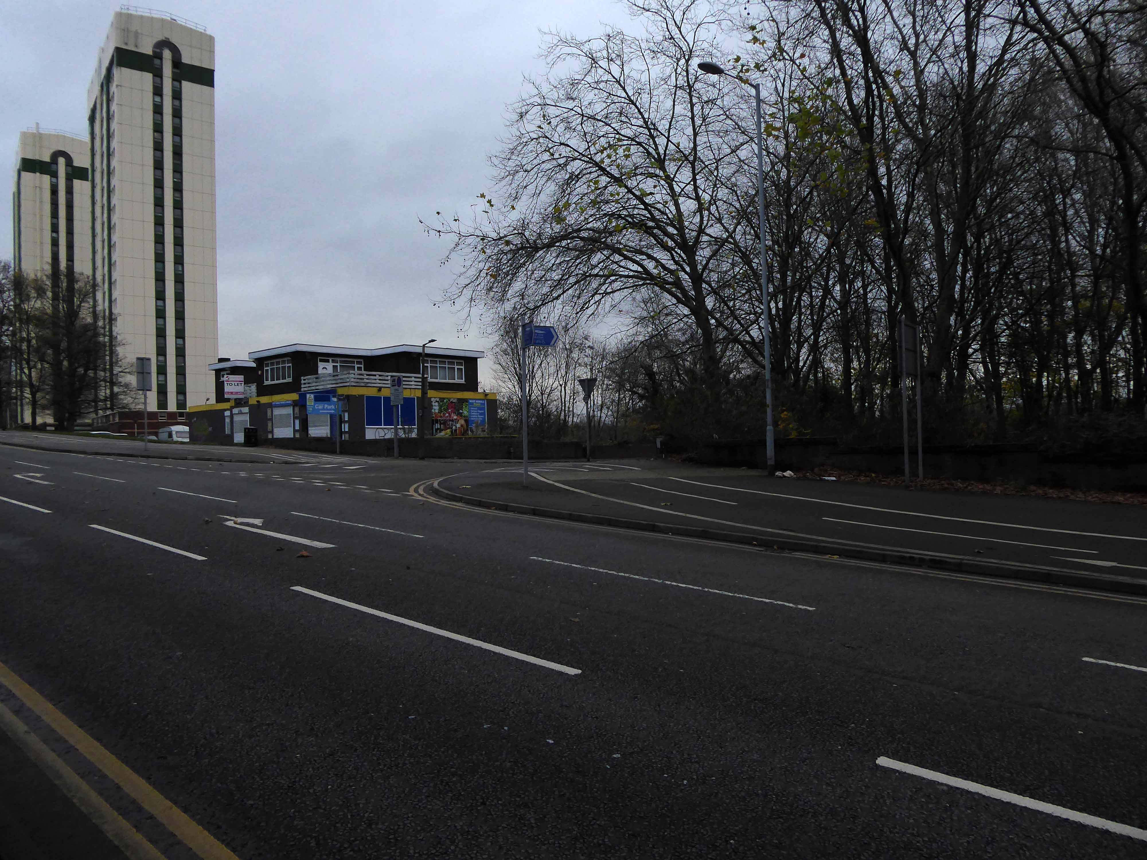
Lancashire Hill flats were built in the 60s, designed by City Architect JS Rank, two seven storey blocks containing 150 dwellings; two six storey blocks containing 120 dwellings.
Replacing tight rows of terraced housing.
They themselves clad and revamped.
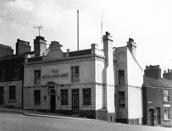
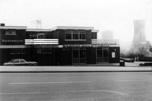
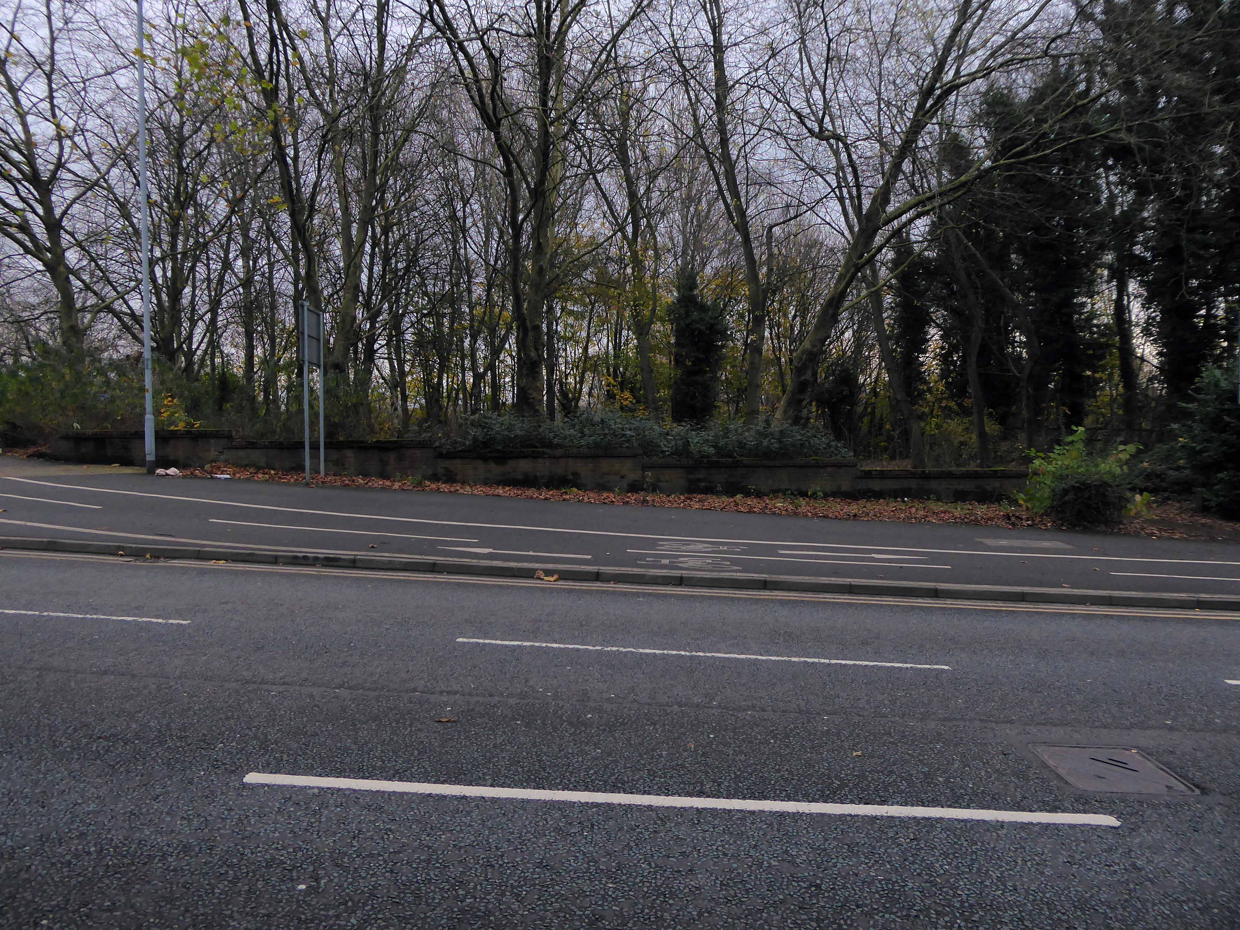
The Nicholson’s Arms built to serve the flats closed and currently empty, signs say to let – replaced an earlier pub, sited on the corner of long gone Nicholson Street.
Today from the road there’s simply no trace of the site’s past purpose.
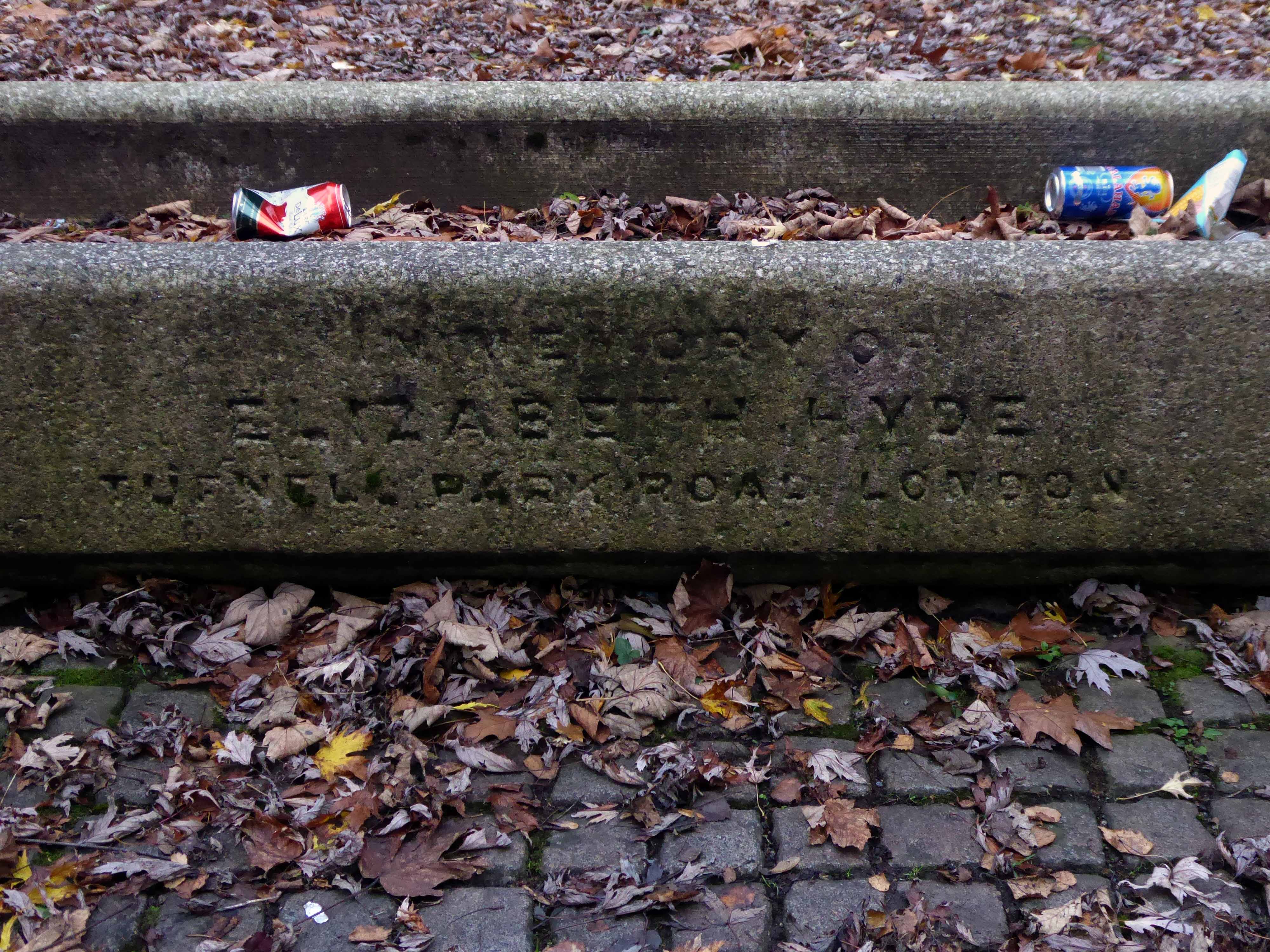
At the centre of what is now a compact civic grassed area – a trough.
Incongruously in memory of Elizabeth Hyde of Tufnell Park Road London.
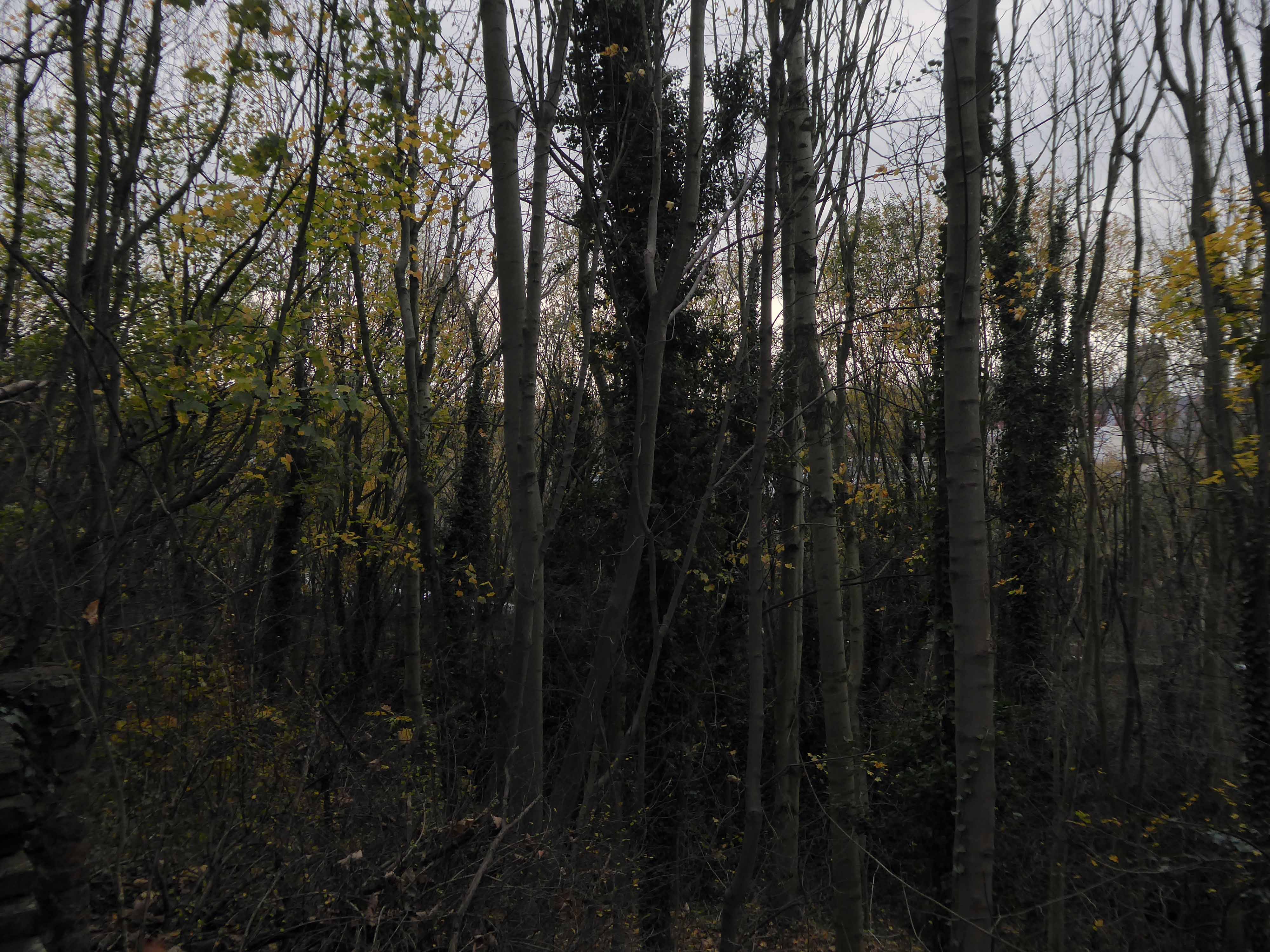
The dense stand of trees is impenetrable – no longer a view of the non existent power station and beyond.
And they that shall be of thee shall build the old waste places: thou shalt raise up the foundations of many generations; and thou shalt be called, the repairer of the breach, the restorer of paths to dwell in.
Isiah 58:12
As a footnote I did meet brothers Stephen, Derek and Peter who appeared in this Shirley Baker photograph 55 years ago – she promised them an ice cream each – they never ever received an ice cream.
They are seen in Sunnyside Street Ordsall – long since demolished.
A commemorative plaque from the Chapel still exists, sited now on the wall of Wycliffe Congregational Church Georges Road Stockport.
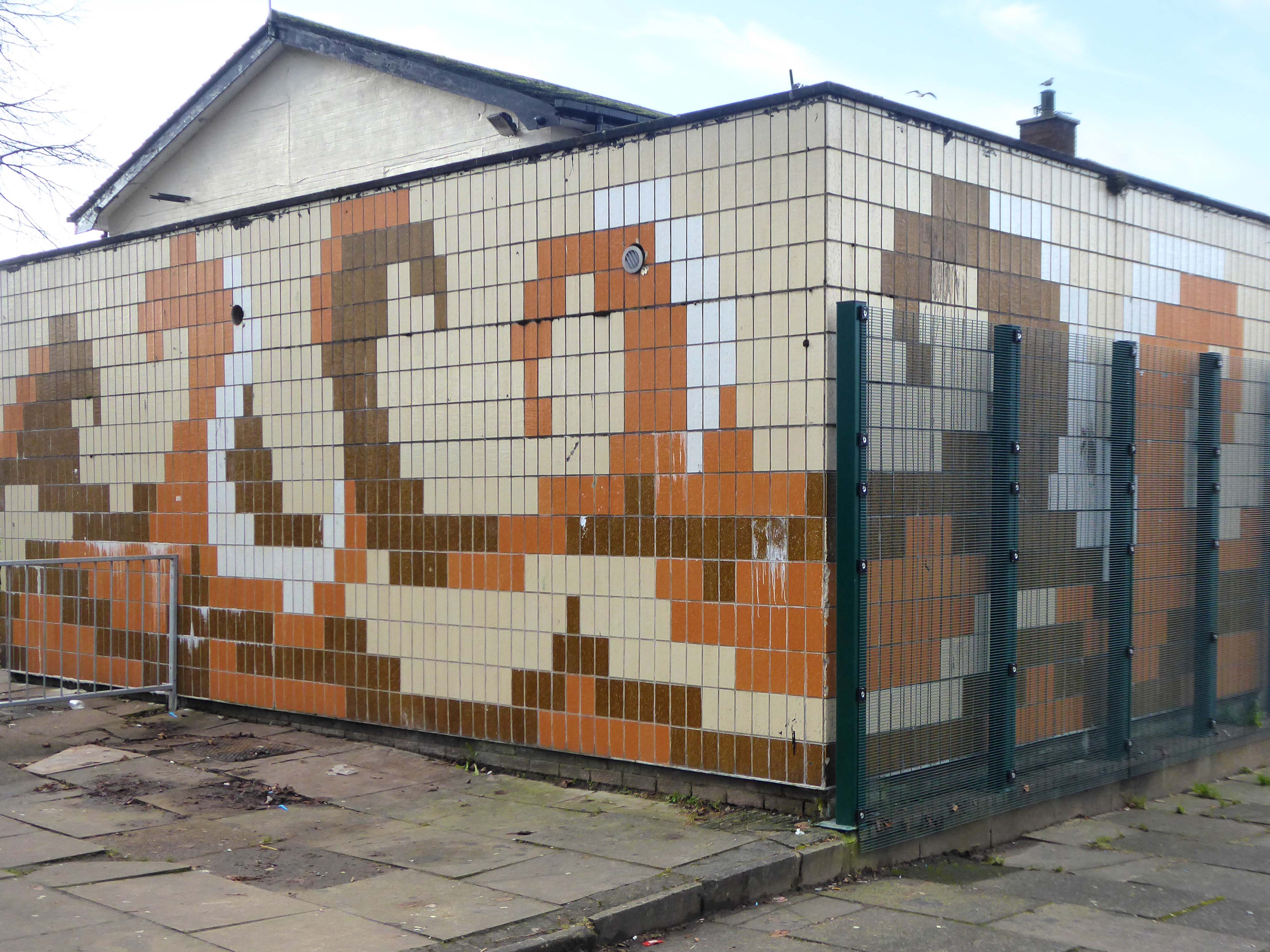
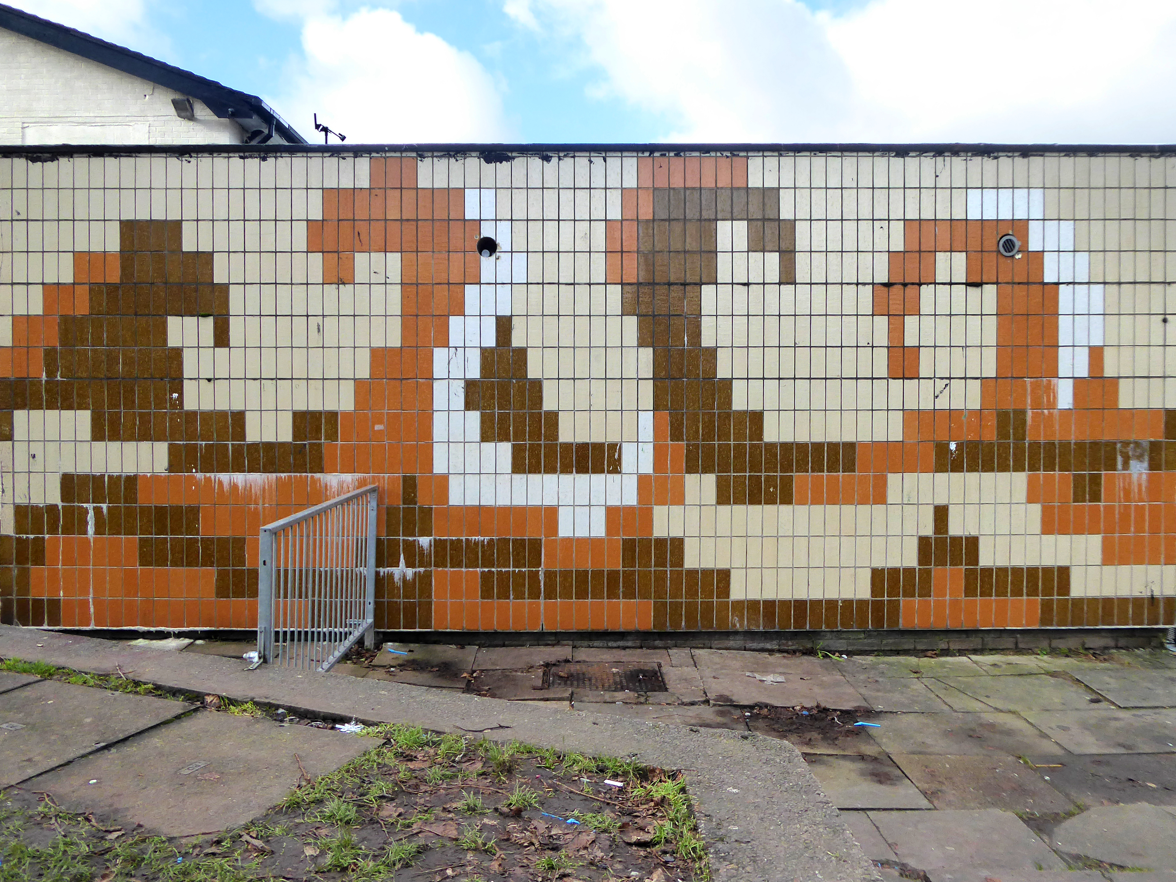
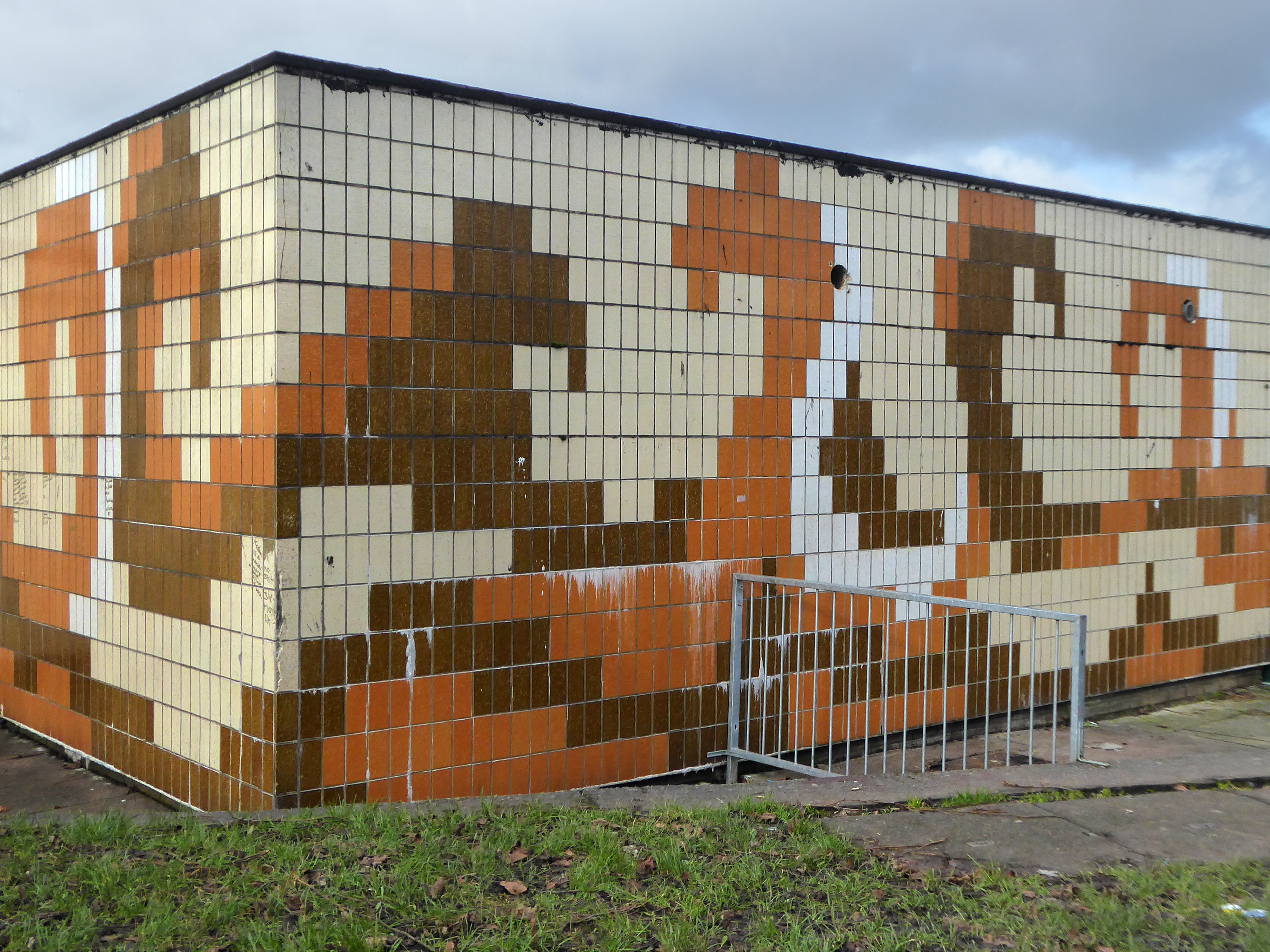
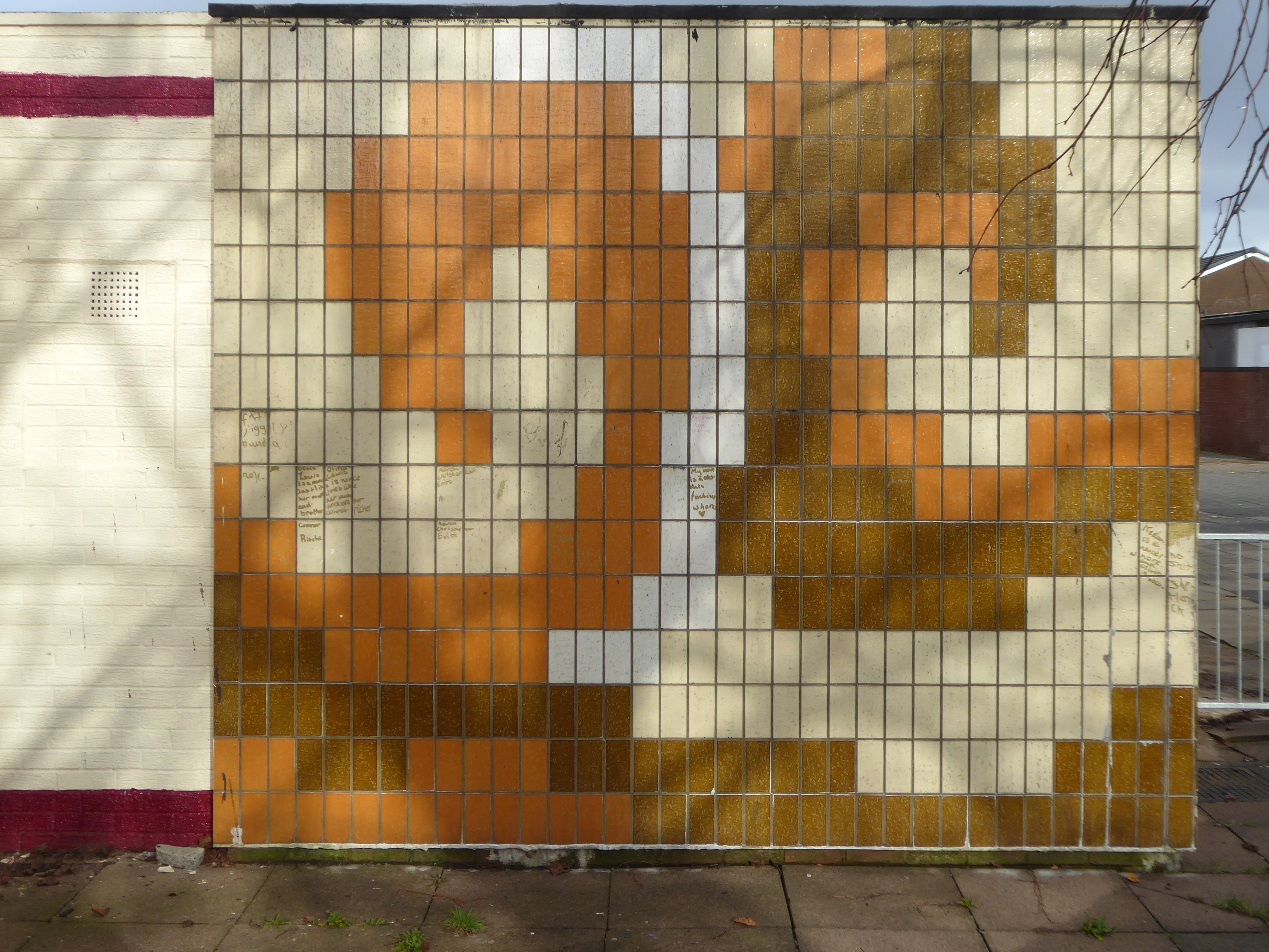
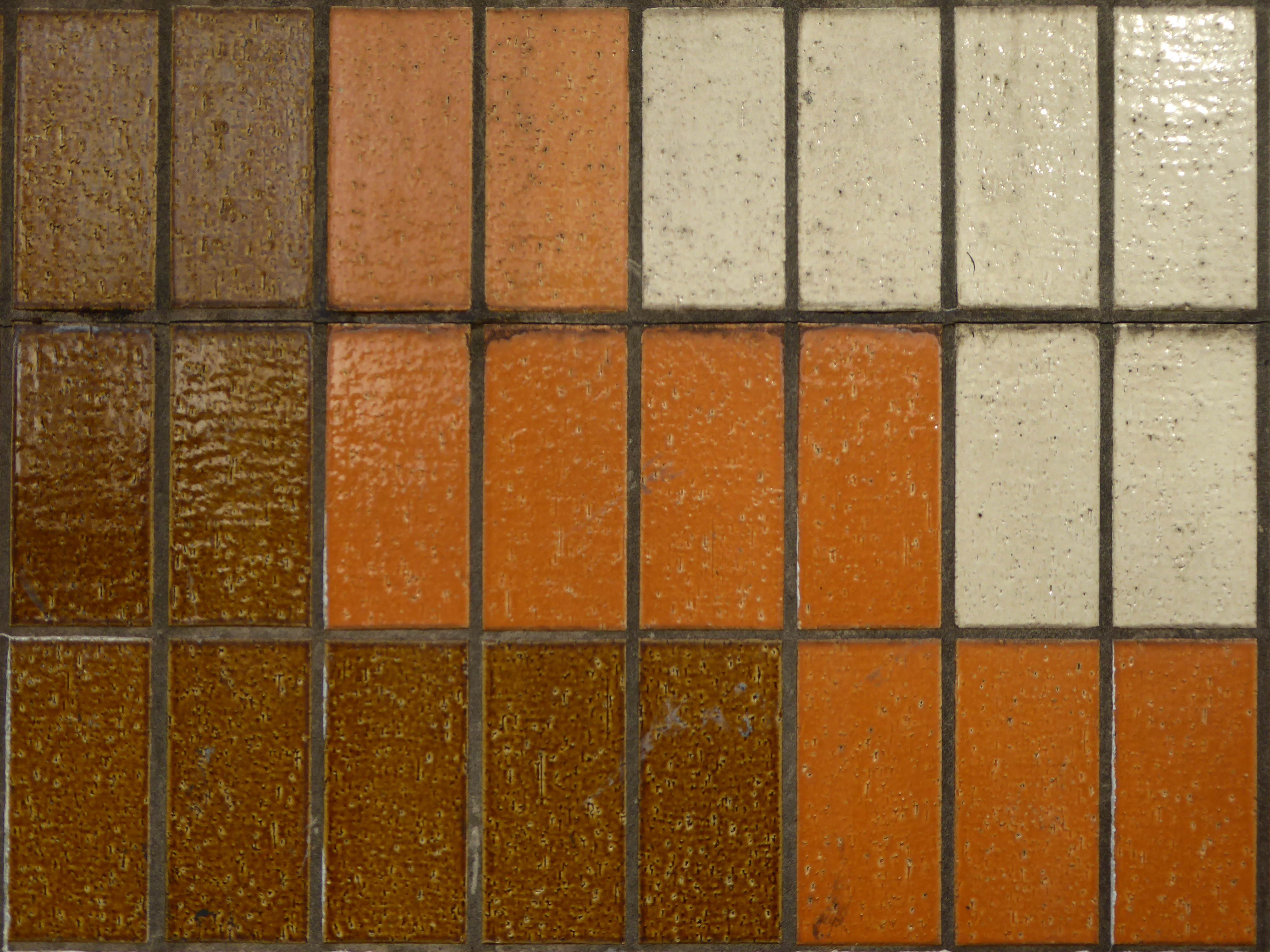
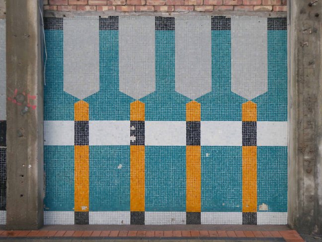
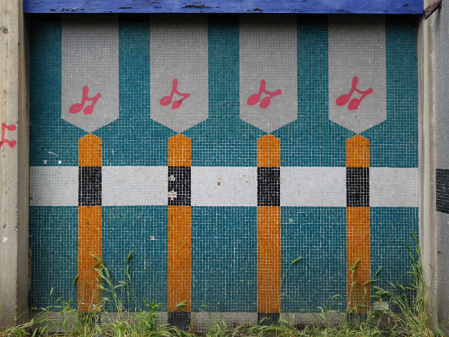
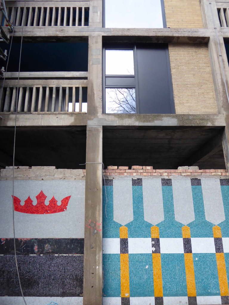
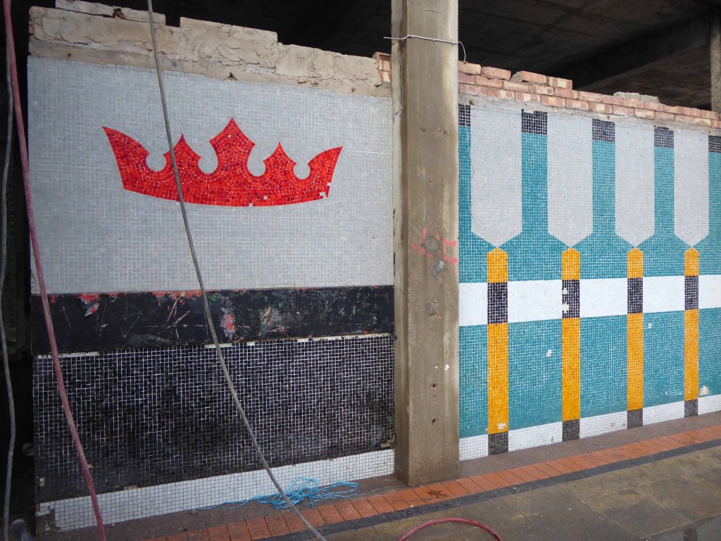
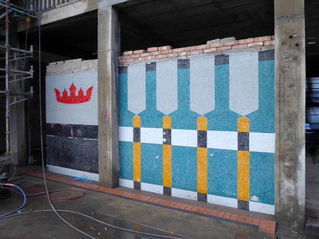
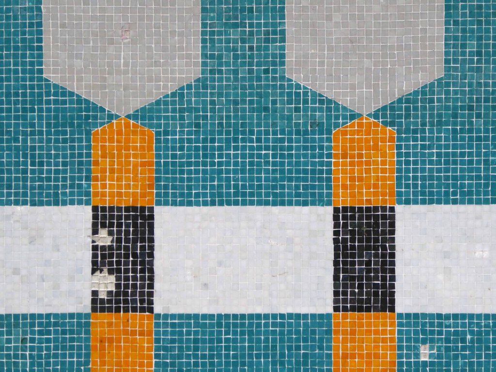
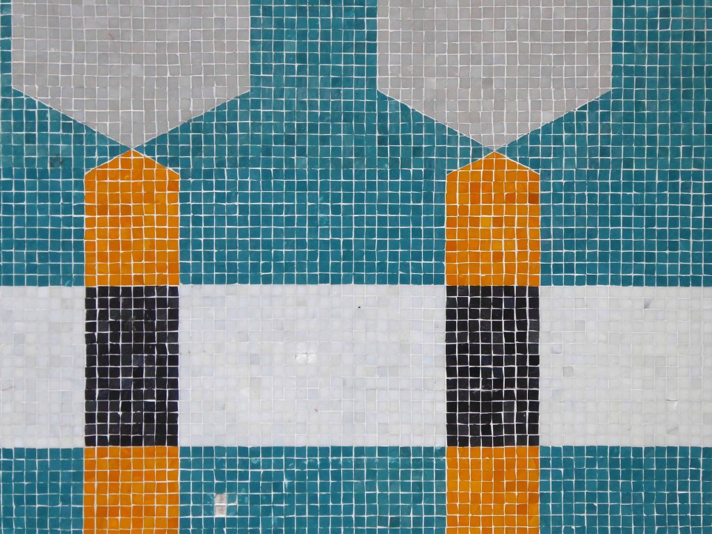
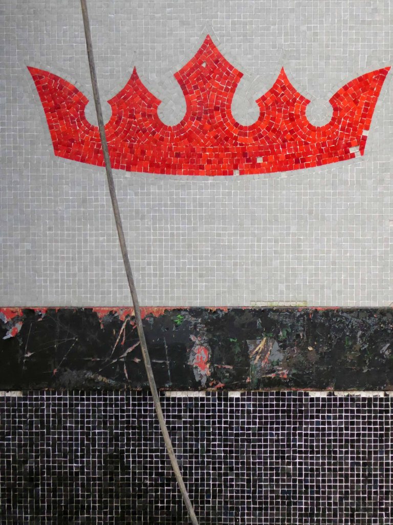
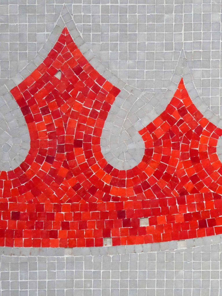
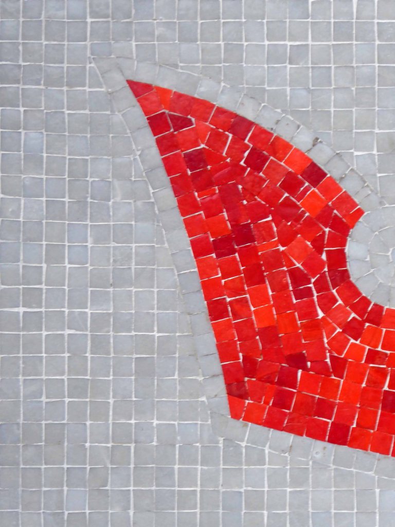
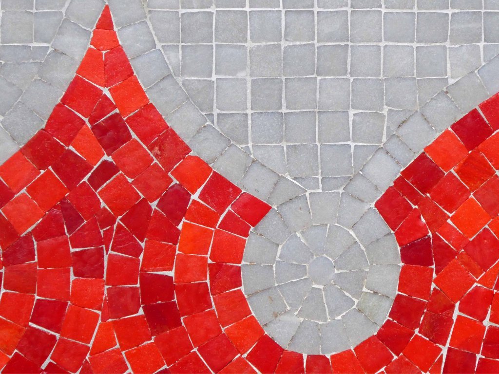
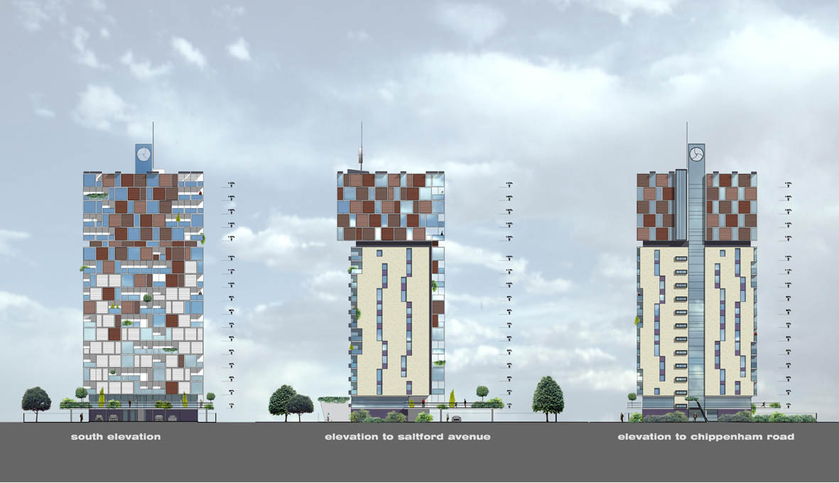
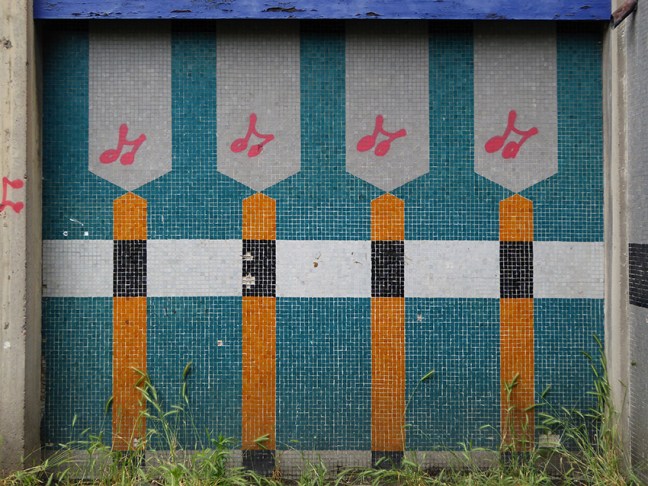
Your bold mosaic whilst once exposed, was sadly disabused, then unthinkingly covered.
Has subsequently been uncovered, steam cleaned and proudly on view, as a central part of the most recent of the estate’s phases of redevelopment.
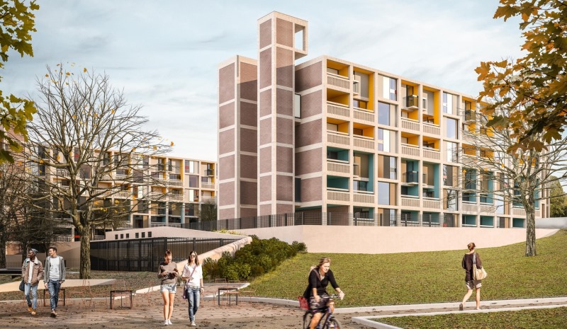
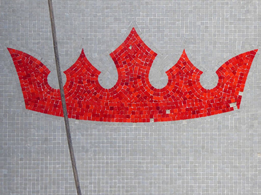
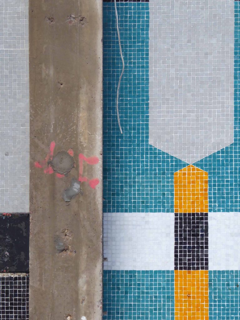
The block is to become student housing, the distinctive tan, turquoise blue and bold red colours of the mosaic, integrated into the banding of the newly refurbished building.
My face was a picture of delight, viewing the multicoloured tesserae – as we were privileged to be guided around the site by Kier Construction, Matthew Borland from Whittam Cox Architects, who are working with Alumno on Béton House and Urban Splash – my thanks to all and particularly PR Surriya Falconer.
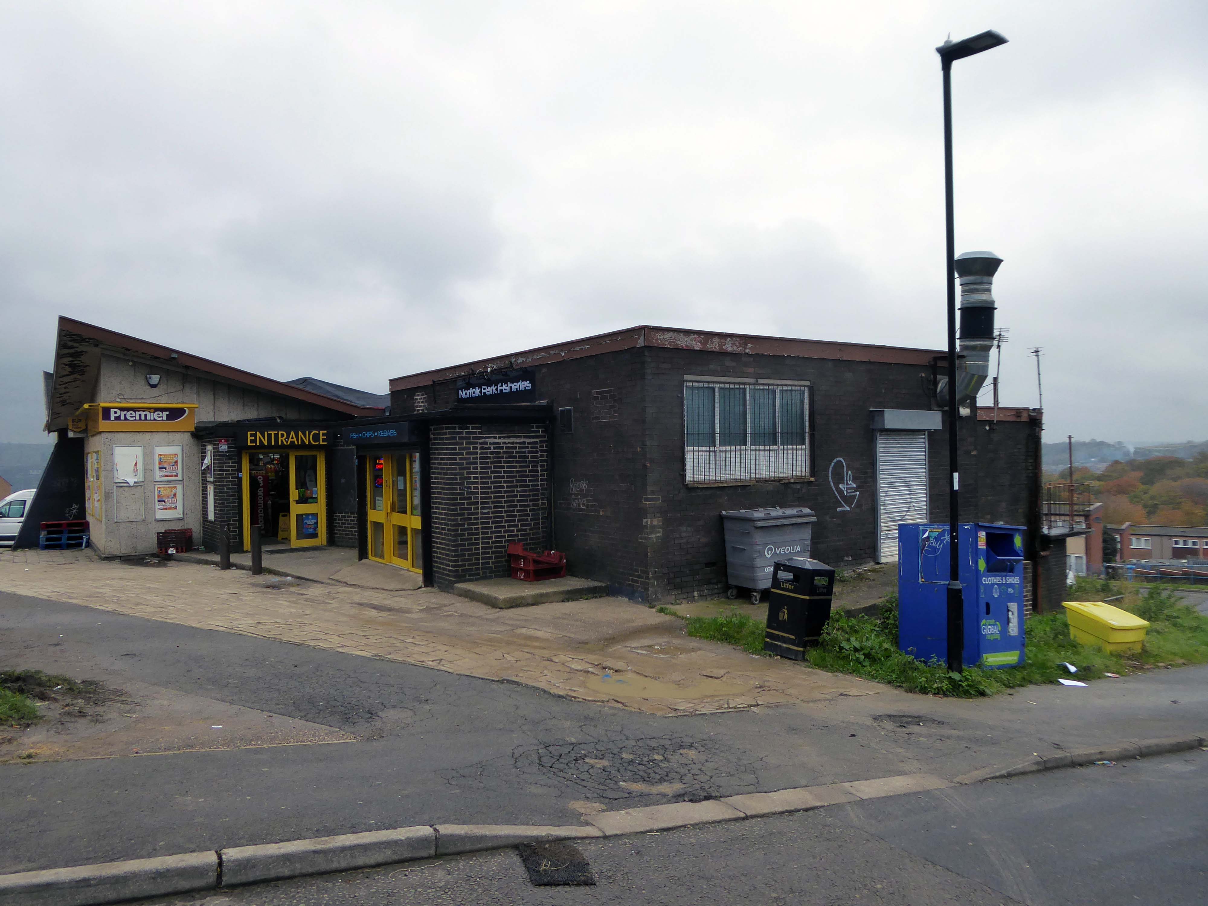
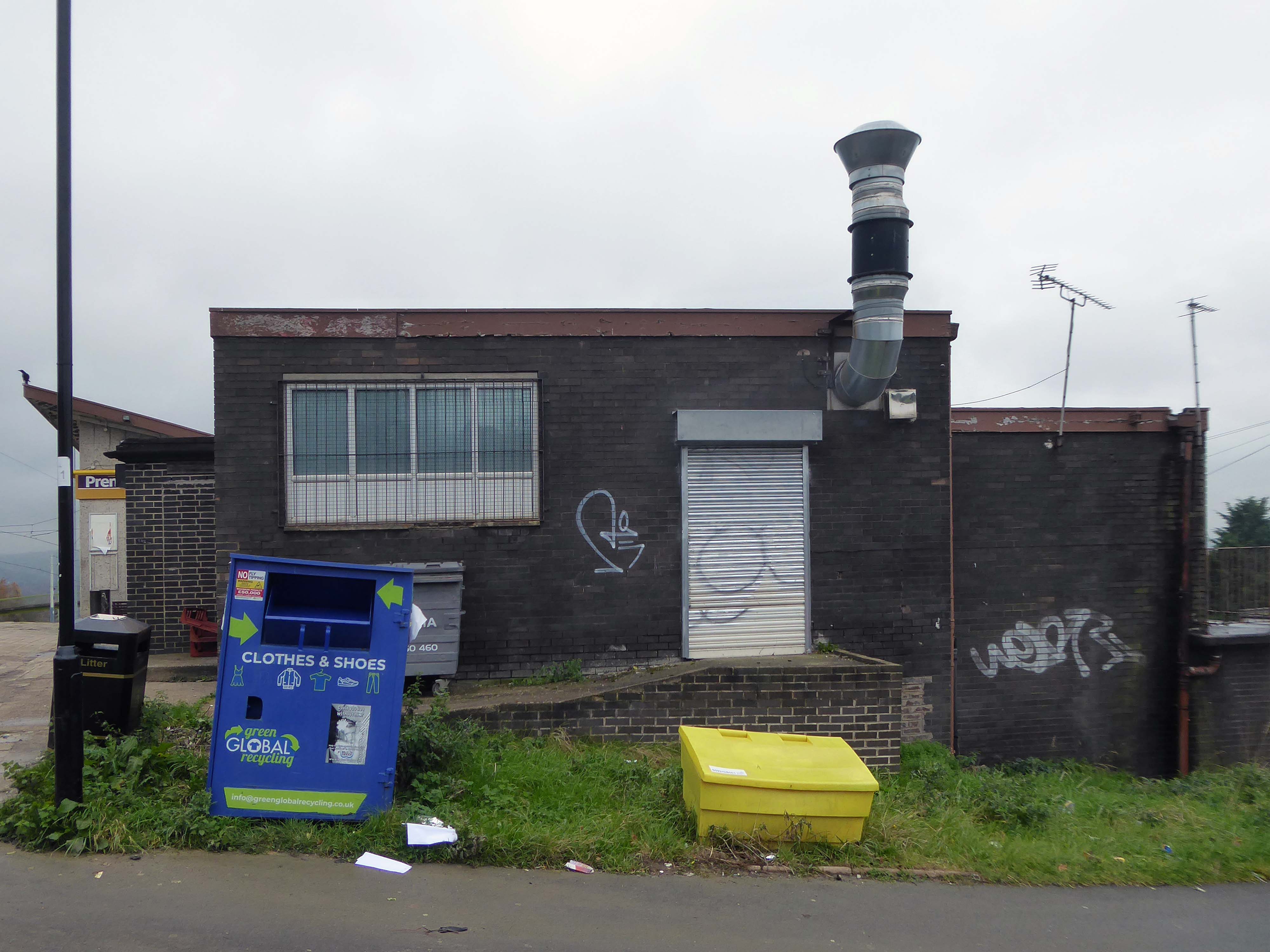
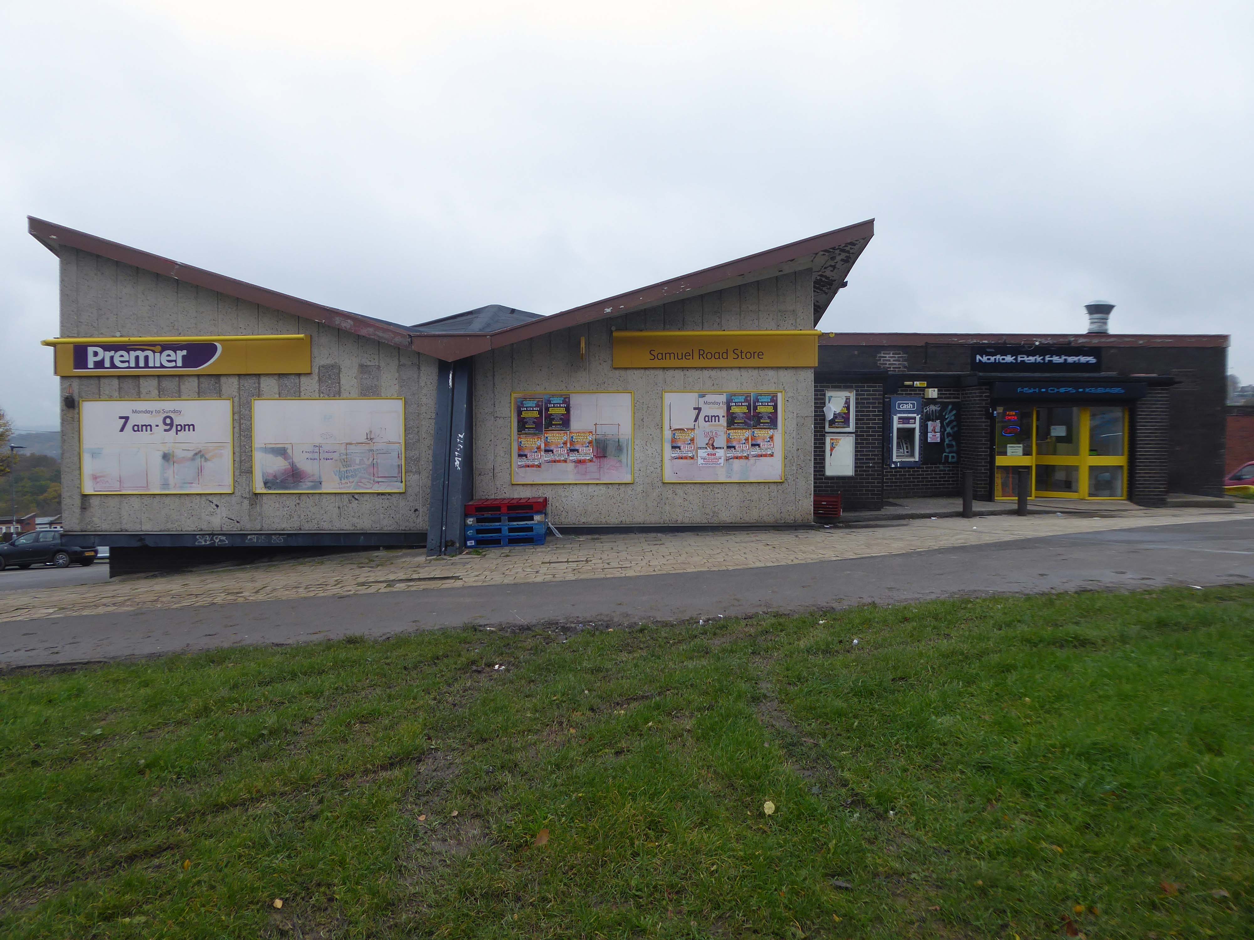
So here it is living and breathing the South Yorkshire air once more.
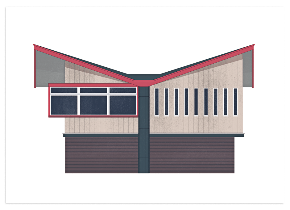
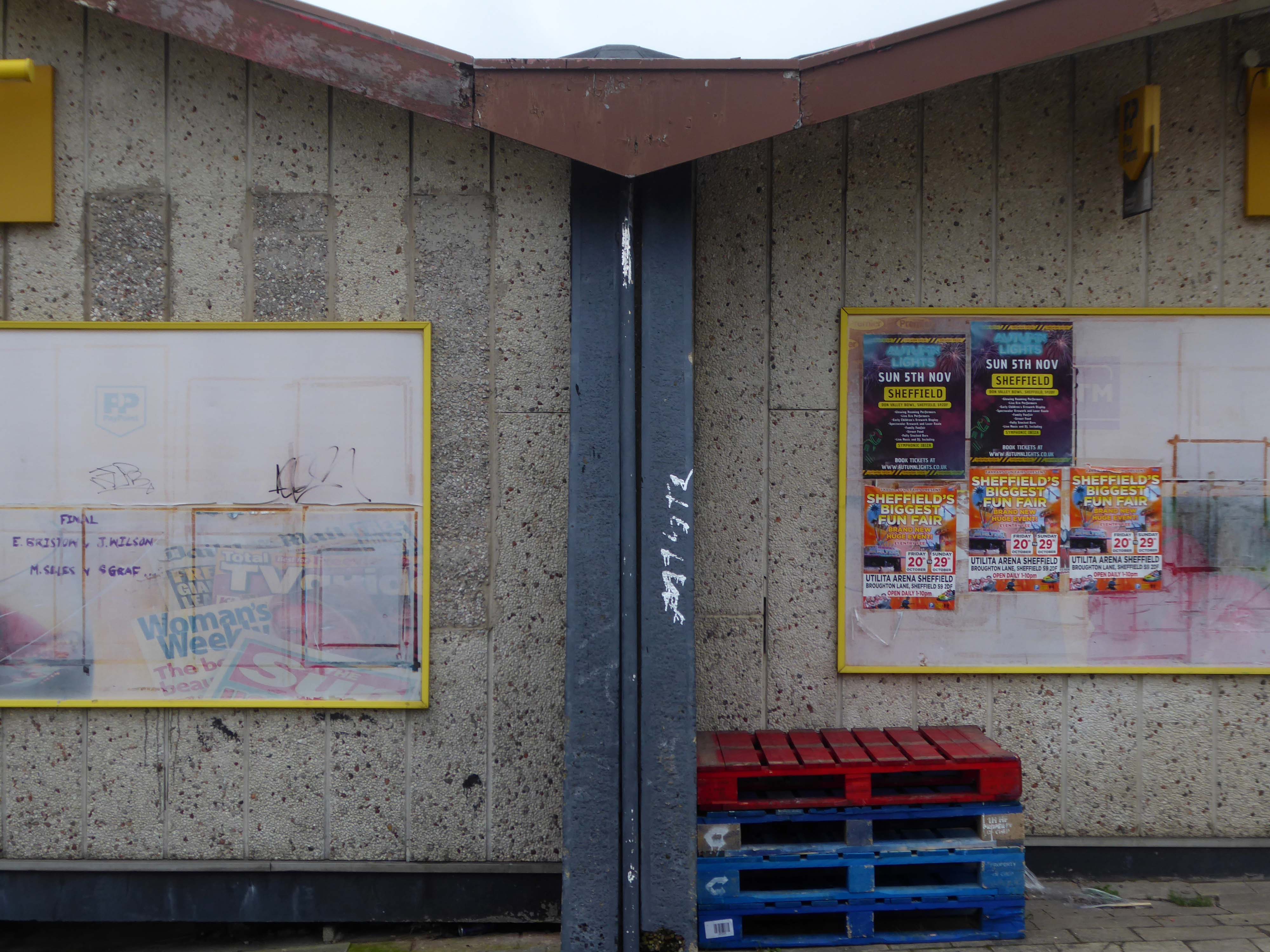
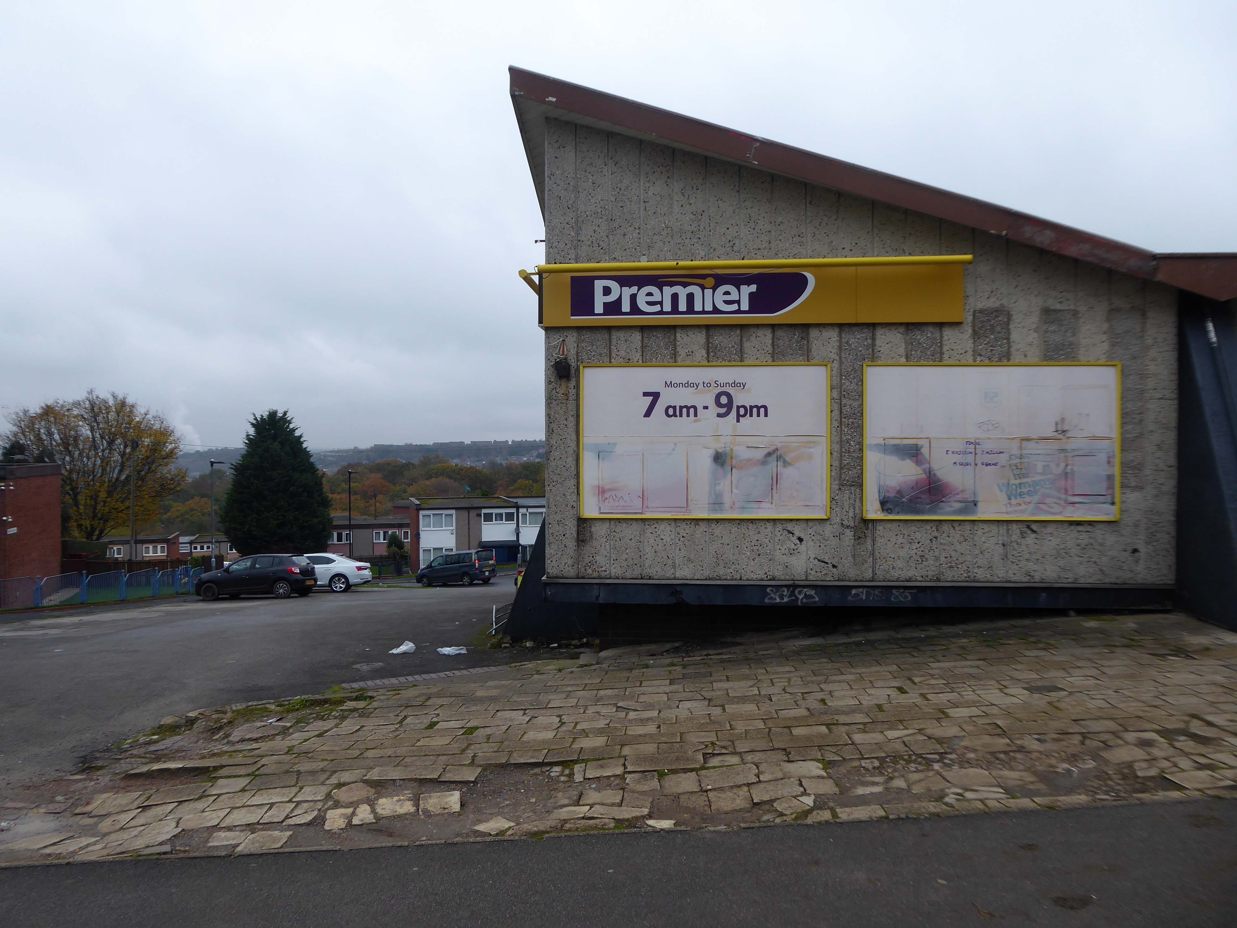
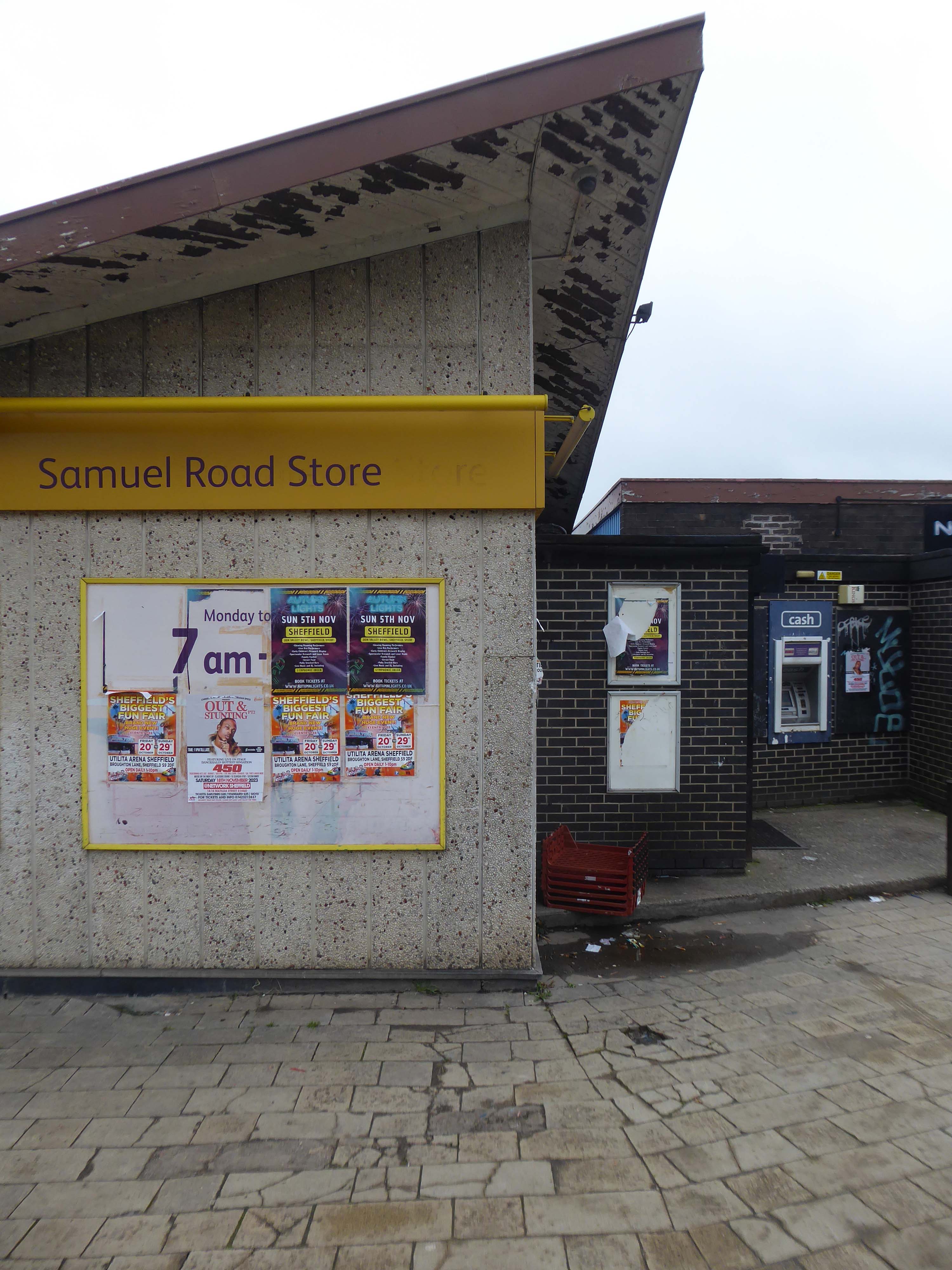
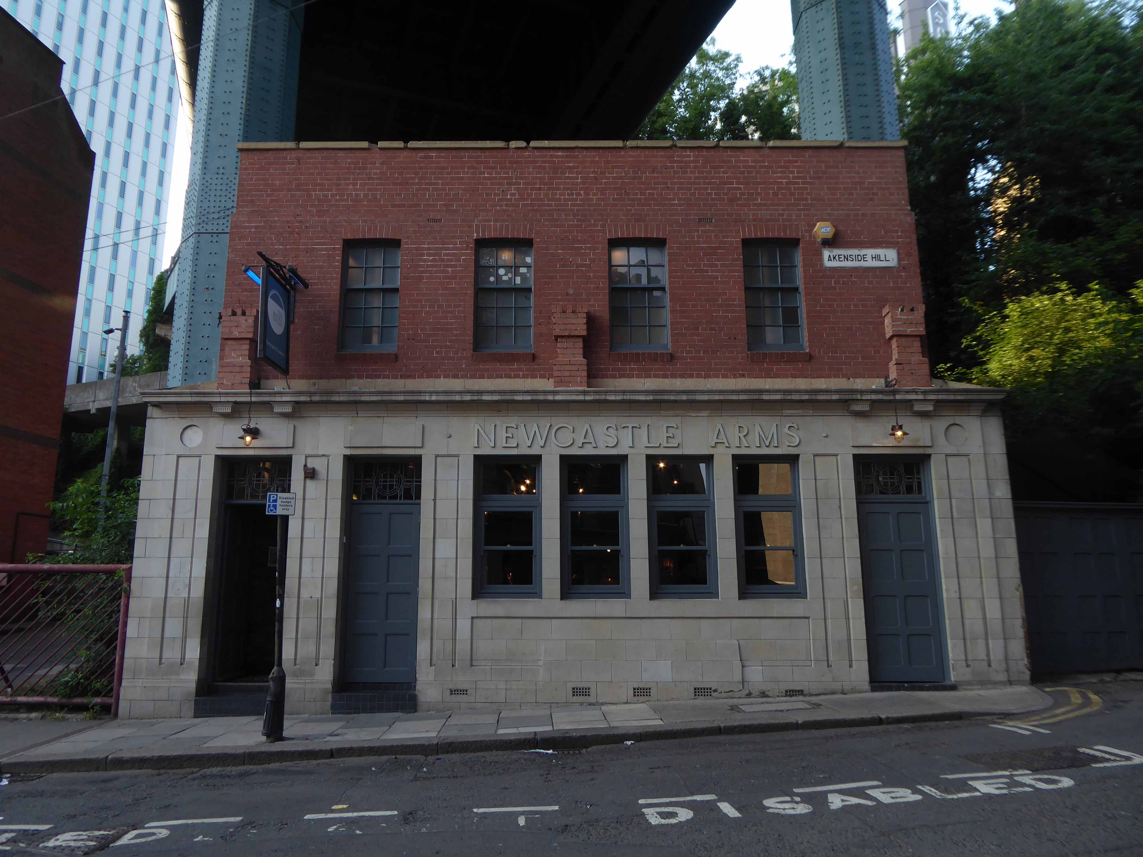
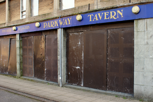
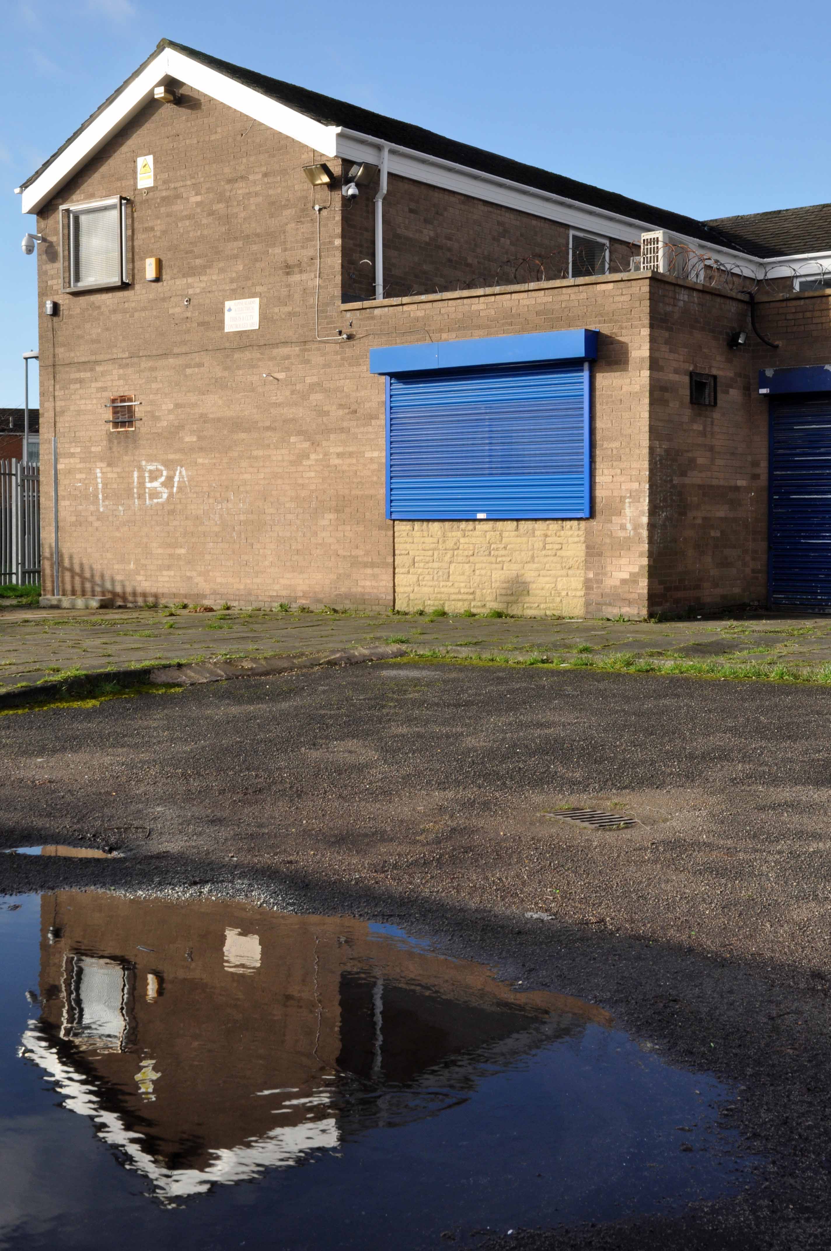
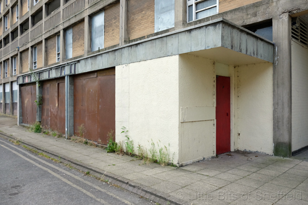
Alas the Parkway is a pub no more – simply an empty shell.
But hush – can you not catch the chink of pint pots and gales of merry laughter, carried gently on the passing breeze?
As with all things material and corporeal there was a time when you simply didn’t exist.
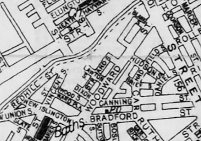
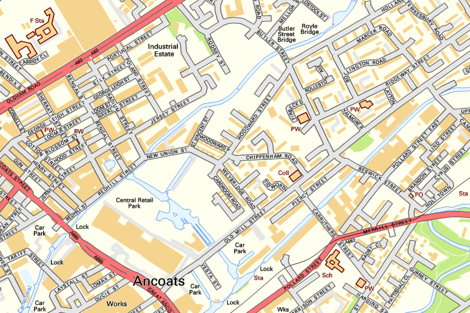
1860 adjacent to Woodward Street and the Rochdale Canal, a simple agglomeration of loose limbed industrial buildings and such – yet to be christened Blank.
adjective
Unrelieved by decorative or other features; bare, empty, or plain a blank wall.
Showing a lack of comprehension or reaction – we were met by blank looks – synonyms: expressionless, empty, vacant, deadpan, wooden, stony, impassive, inanimate, vacuous, glazed, fixed, lifeless, uninterested, emotionless, unresponsive, inscrutable.
noun
A space left to be filled in a document – leave blanks to type in the appropriate names – synonyms: space, gap, blank space, empty space.
A cartridge containing gunpowder but no bullet, used for training or as a signal.
verb
Make (something) blank or empty – electronic countermeasures blanked out the radar signals.
Informal North American defeat (a sports team) without allowing them to score – Baltimore blanked Toronto in a 7–0 victory.
Though contradictorily I have found reference to a bankrupt foundry in the London Gazette 1857.
You appear again during the Manchester Blitz.
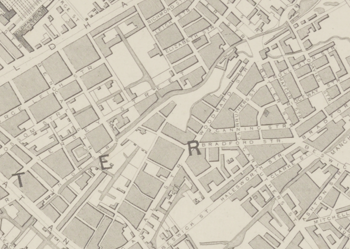
By 1960 you are on the map and the area is on the up and up.
Though I have to ask the question of the namers of streets – why so Blank, an off day at the office – we have whole blocks named for poets, painters, and far flung places, so why so Blank?
Hadn’t they heard of nominative determinism – born to be Blank.
Whilst in search of a Brown Cow I found a photograph on the Local Image Collection of 60’s maisonettes in the area alongside Woodward Street.
This Municipal Modernist development seems to have been short-lived and subject to yet more demolition in the area, to be replaced by late 70’s terraced housing.
Blank Street inexplicably became Fulmer Drive.
Which in turn had been tinned up and demolished around 2008.
How did that happen – seemingly viable homes previously changing hands for £100,000 deemed surplus to requirements – land banking, ahead of an as yet unseen masterplan?
Your life was short and sharp – shaped by economic shifts, world war and the local authorities ephemeral housing policies. There is little evidence of your existence, photographic or otherwise, so I want to set the record straight – draw a blank.
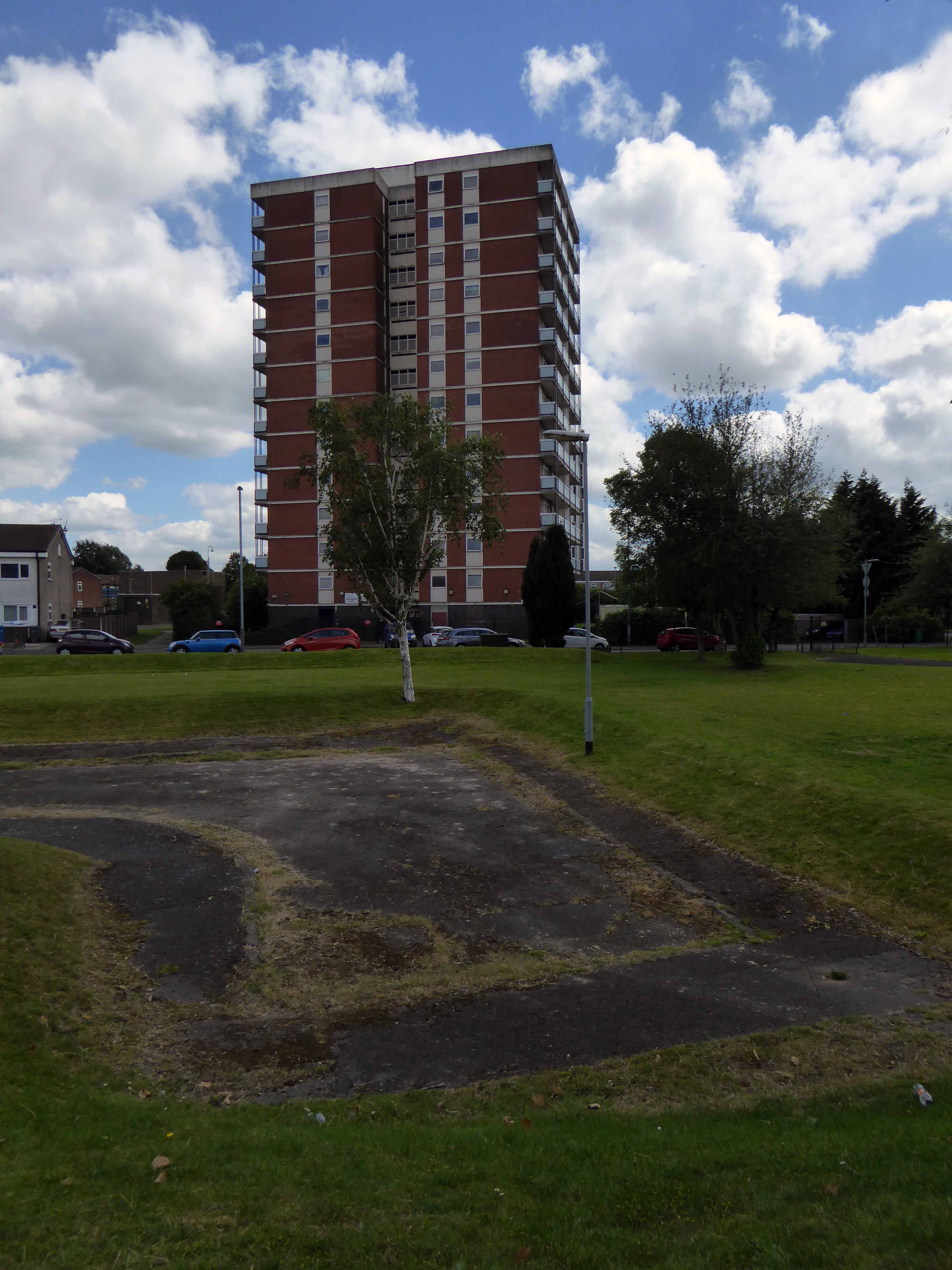
Here you are as of July 2019 – tarmac intact, drains fully functioning, pavements paved, awaiting orders. A circuitous run of grassy ridges resembling the remains of some Roman or Iron Age fortification.
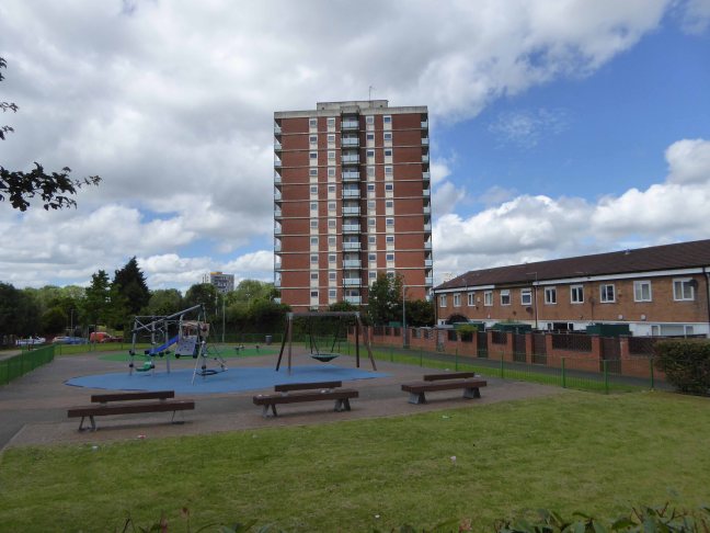
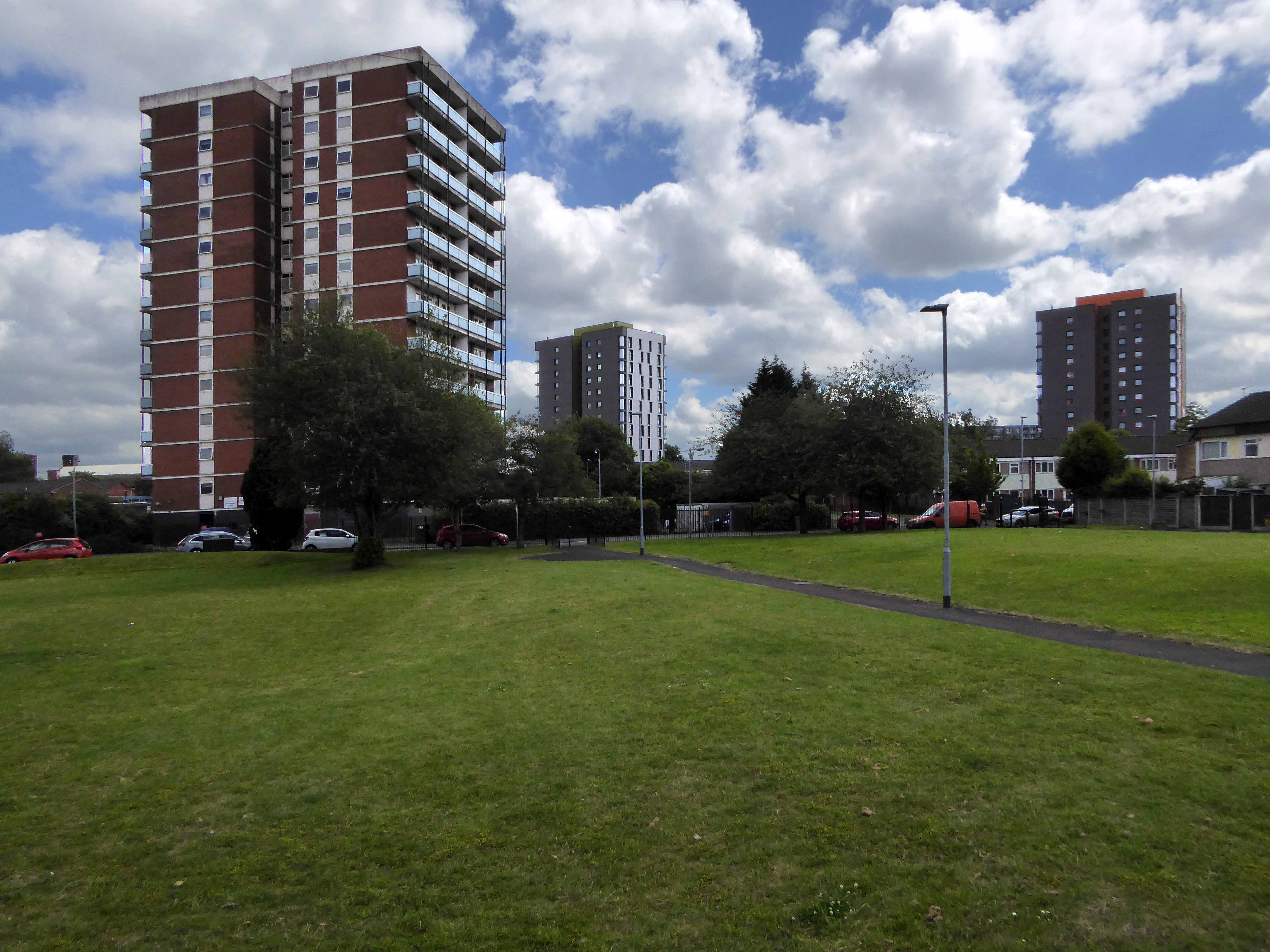
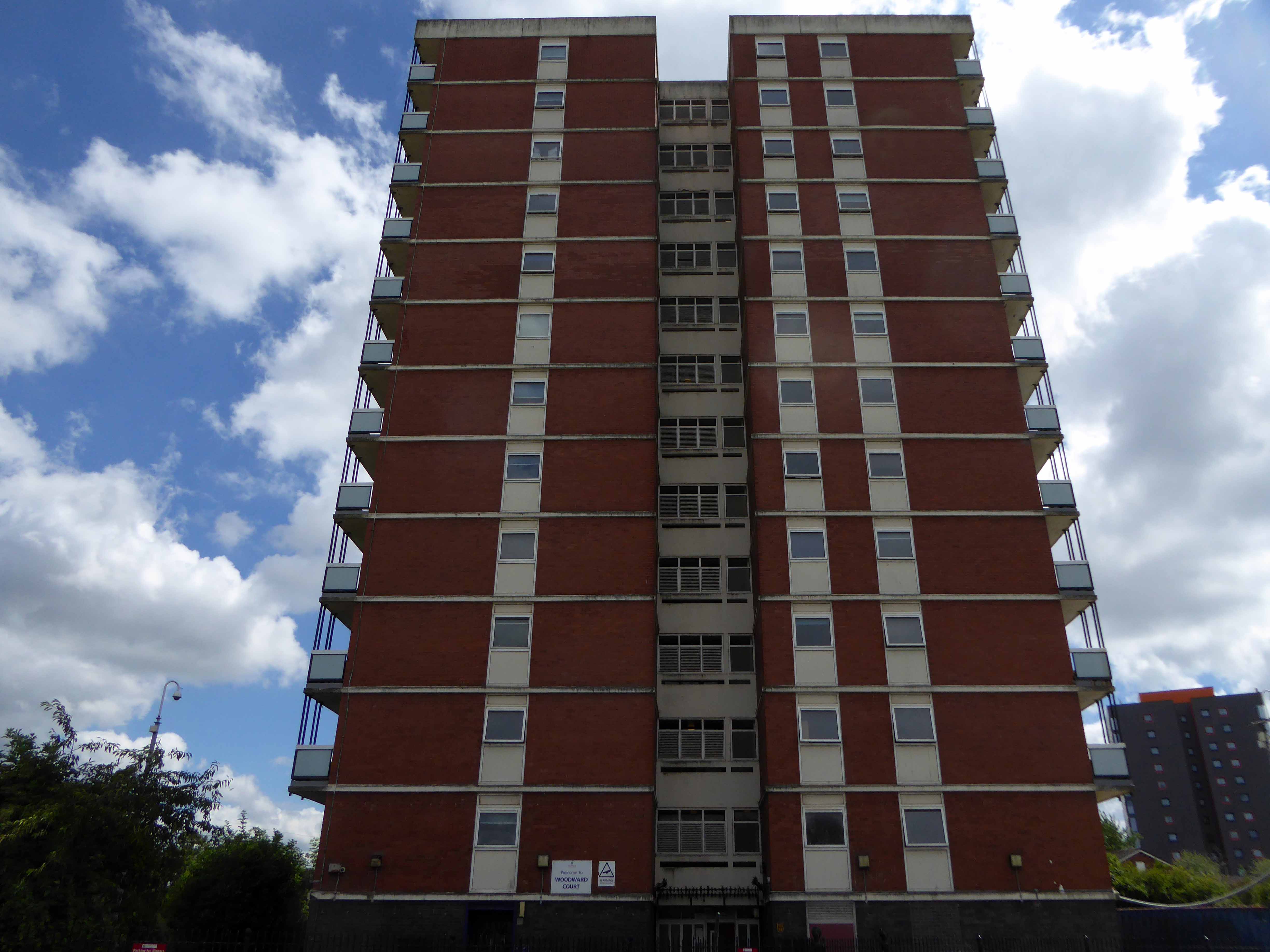
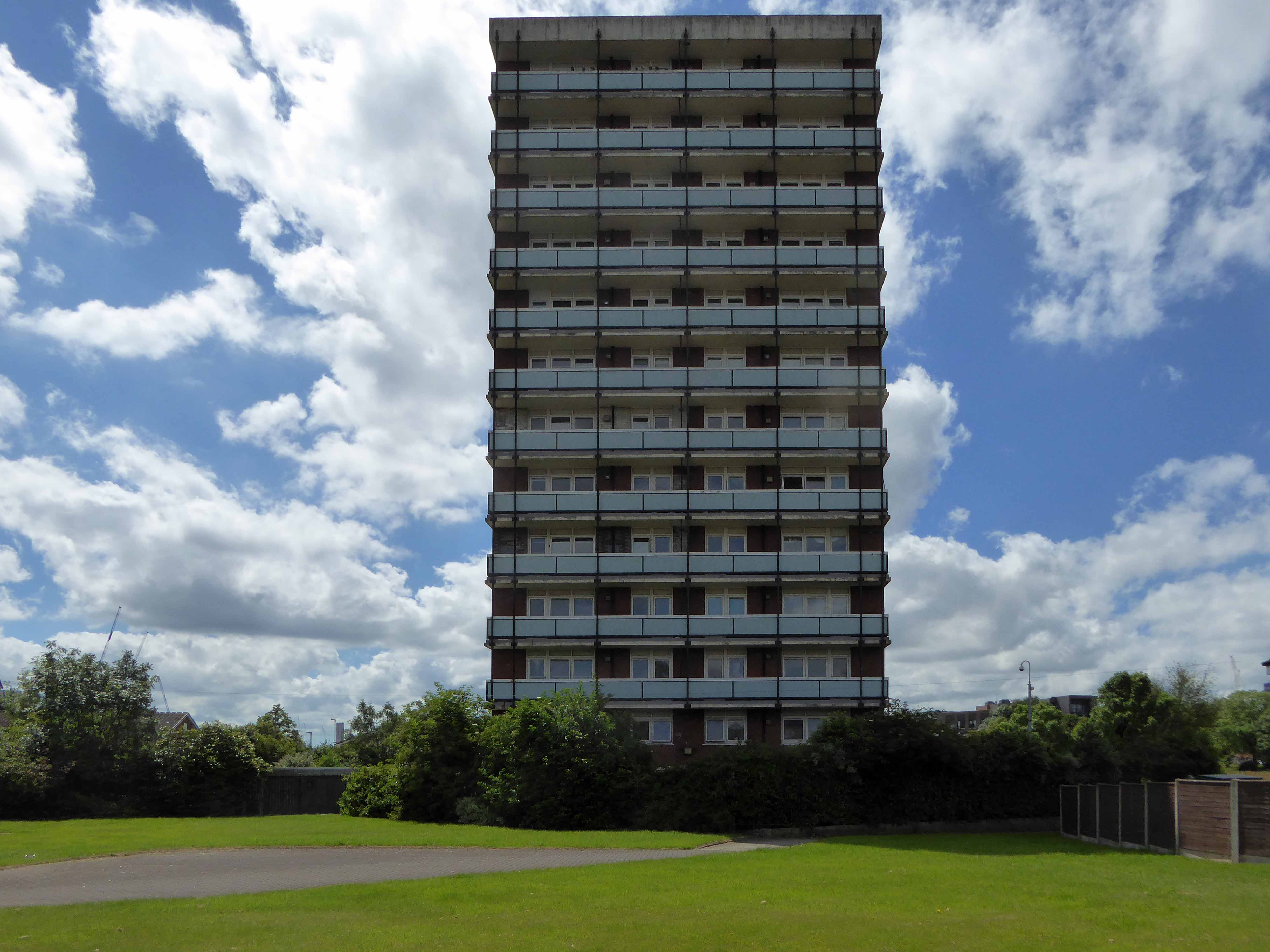
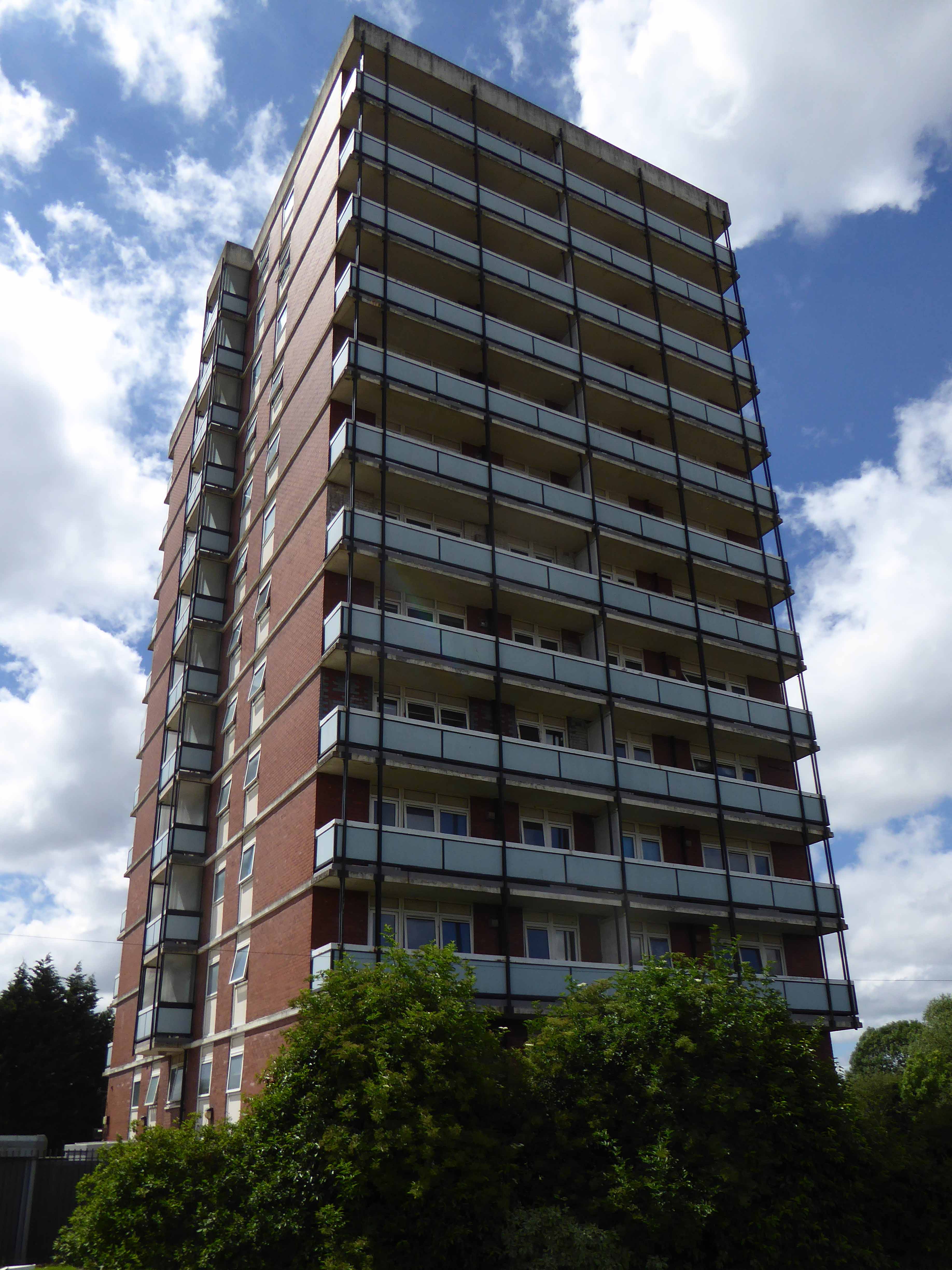
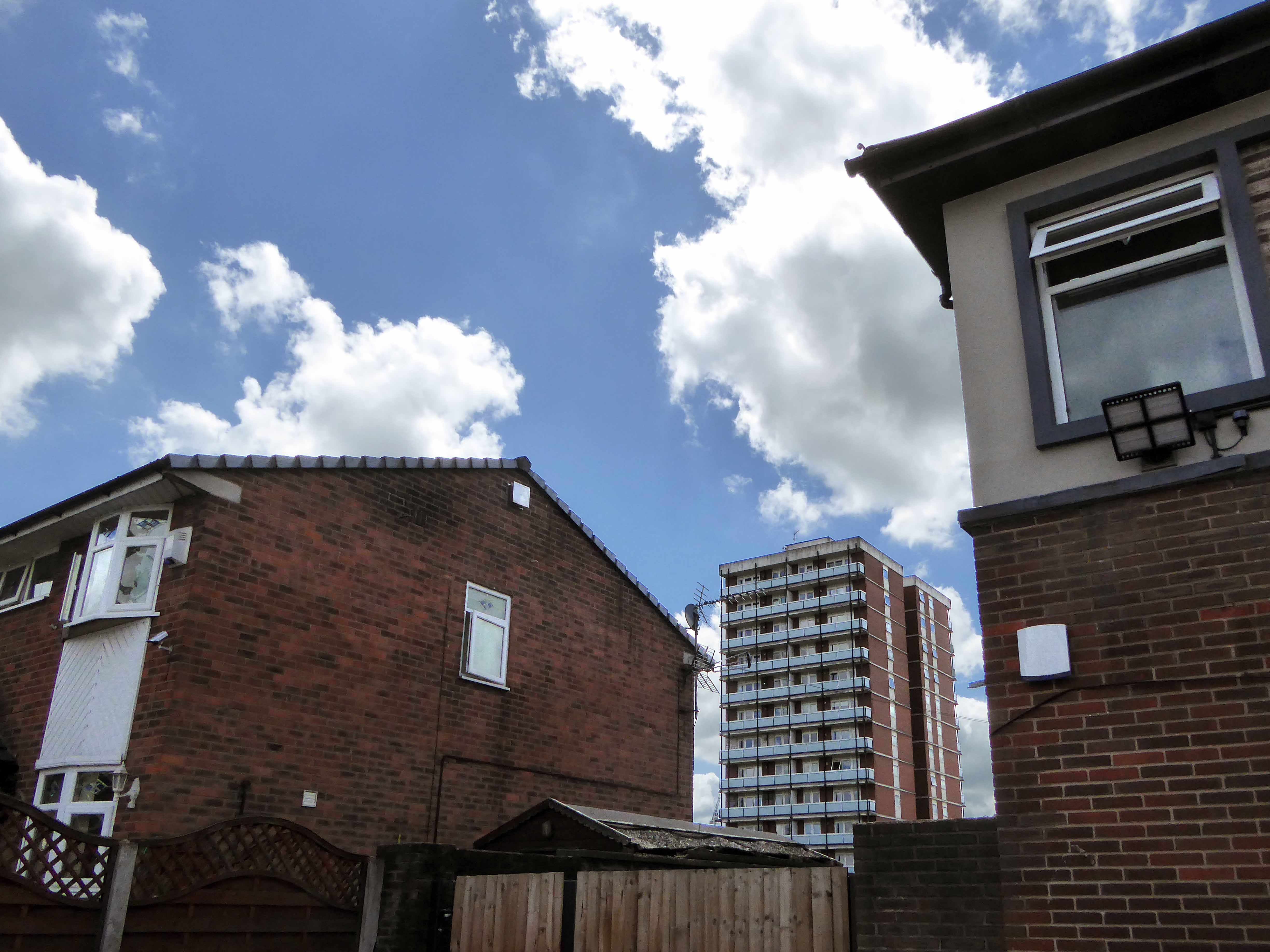
Why is there just one remaining tower block dancing unclad around Ancoats?
Let’s go back in time and see if we can find out – it seems that back in 1807 there wasn’t a Woodward Street to be found, the ever expanding industrial might of Manchester had not yet reached these particular green fields of Ancoats.
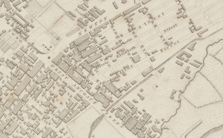
By 1824 it shows a fresh face to the world christened Woodworth Street, sparsely dotted with new development.
Almost fully formed in 1836 and renamed as Woodward Street, the area begins to accumulate the familiar domestic and industrial clutter of a burgeoning Victorian City.
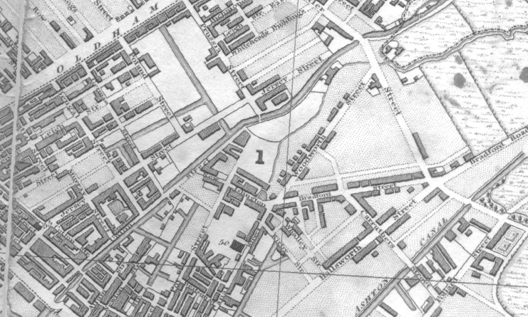
By 1860 the street is fully formed and open for business.
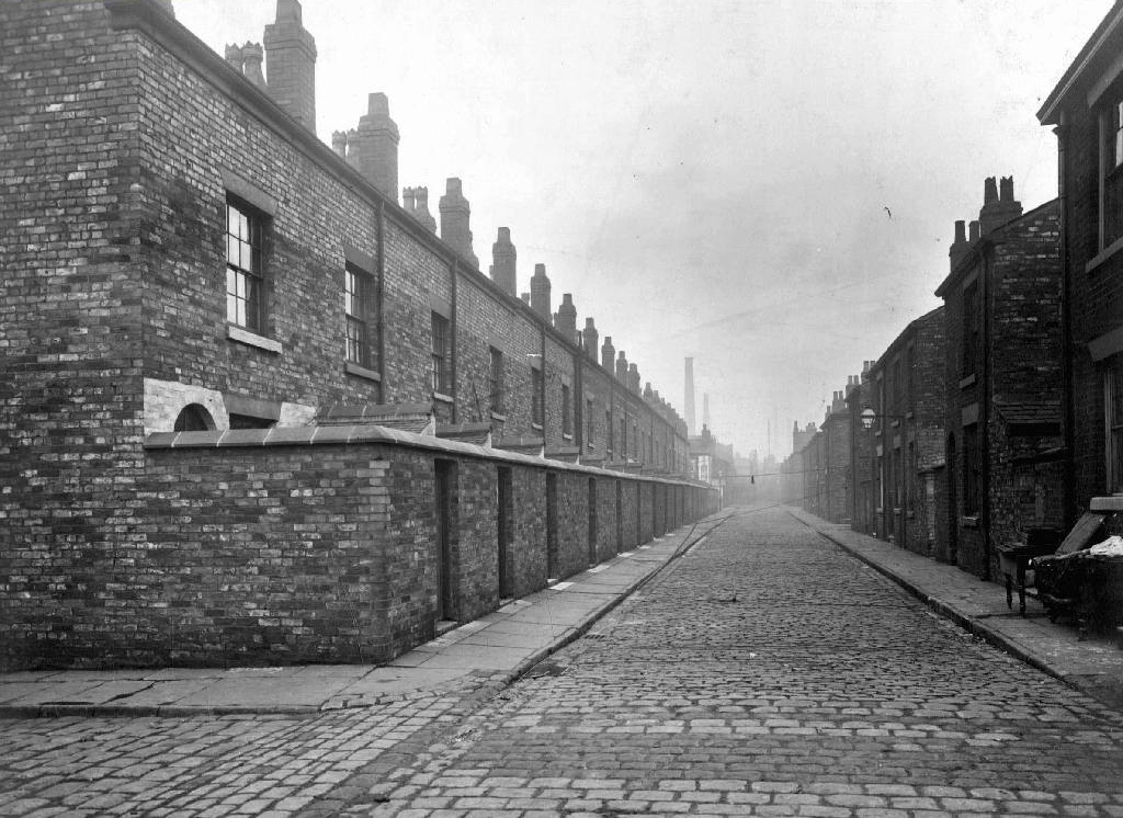
Workers finding homes in austere and functional brick back to backs, typical of the period’s housing.
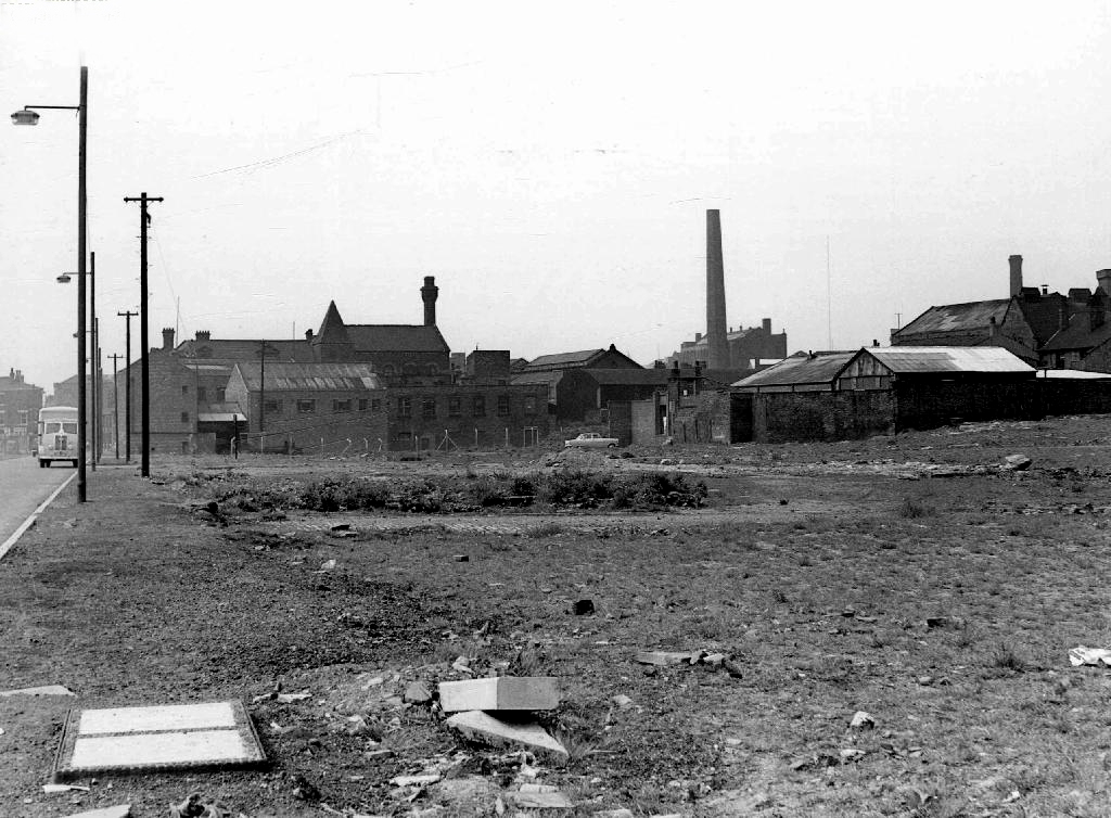
Fast forward to the early Sixties and the street is showing signs of age – the century old industries are already in decline, steady jobs, mills and factories gone west and east, well-worn housing looking terminally tired and in need of a little care and attention.
But wait what’s this coming around the bend?
The first wave of urban regeneration, post war optimism incarnate, a bright new shiny future – out with the old and in with the new, as Municipal Modernism stamps its big broad architectural feet all over Woodward Street.
Our story is far from over, this optimism is short-lived the homes, houses and industry are swept away yet again, replaced with two story modern terraced housing and an all too obvious absence of regular employment – yet the tower blocks prevailed.
Former streets were over written and remain as poignant vestigial marks in the landscape.
Though their future was built on more than somewhat shifting and uncertain sands.
A tower block has been left lying empty for a whopping 18 years. The 13-storey building at Saltford Court in Ancoats has been unoccupied since Manchester council closed it in the 1990s. It was bought by top developers Urban Splash six years ago but residents have now hit out about it still being empty. Neighbours of Saltford Court say it has become an ‘eyesore’ and magnet for vermin since the firm bought it.
A large group of blocks stood tinned up and unloved, yet owned, for a number of years, victims one supposes of land-bankers, developers speculating on an even better return, as the warm waves of gentrification washed slowly over them, from nearby New Islington.
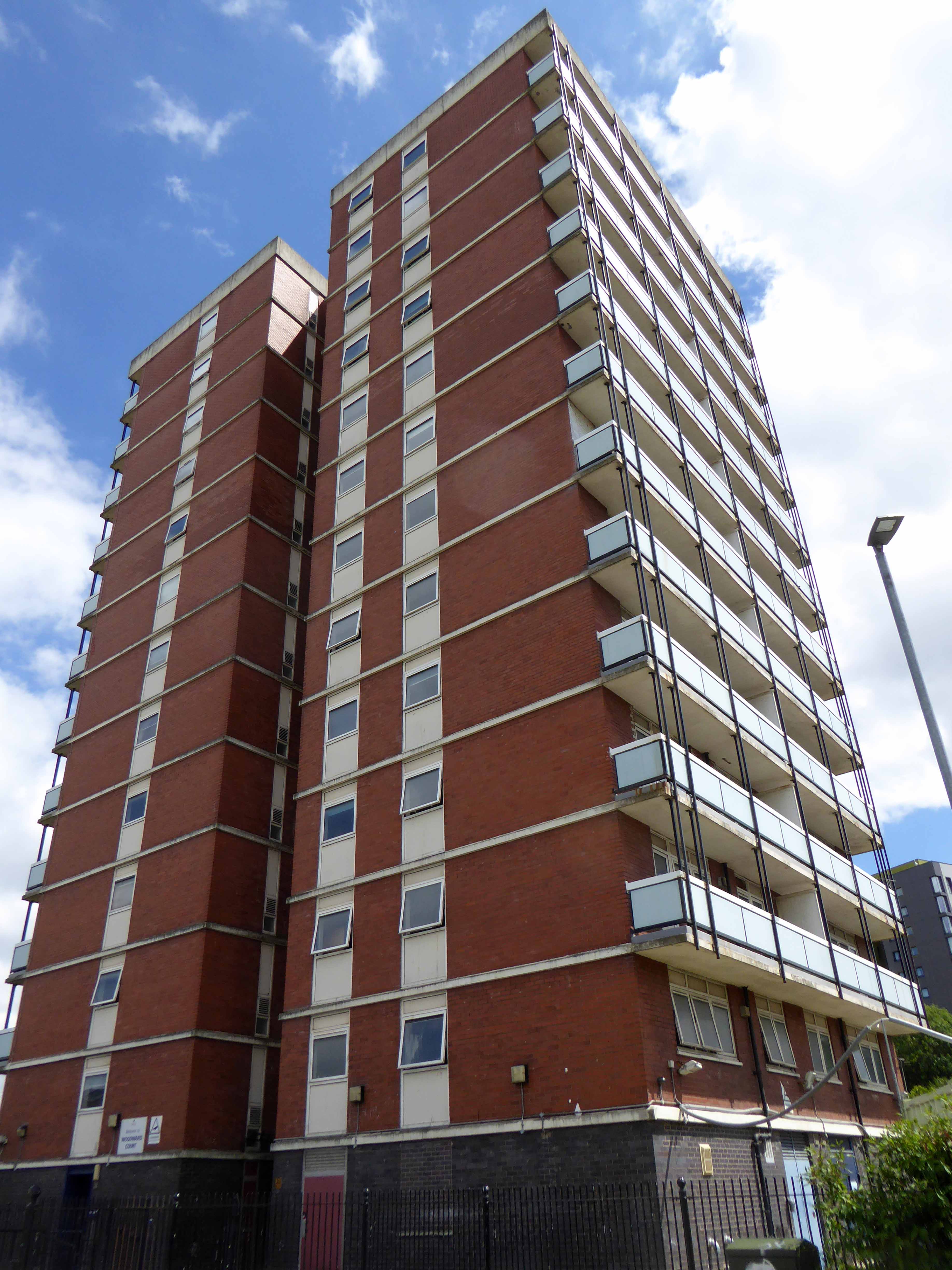
All but one was refurbished, clad and re-let.
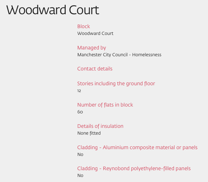
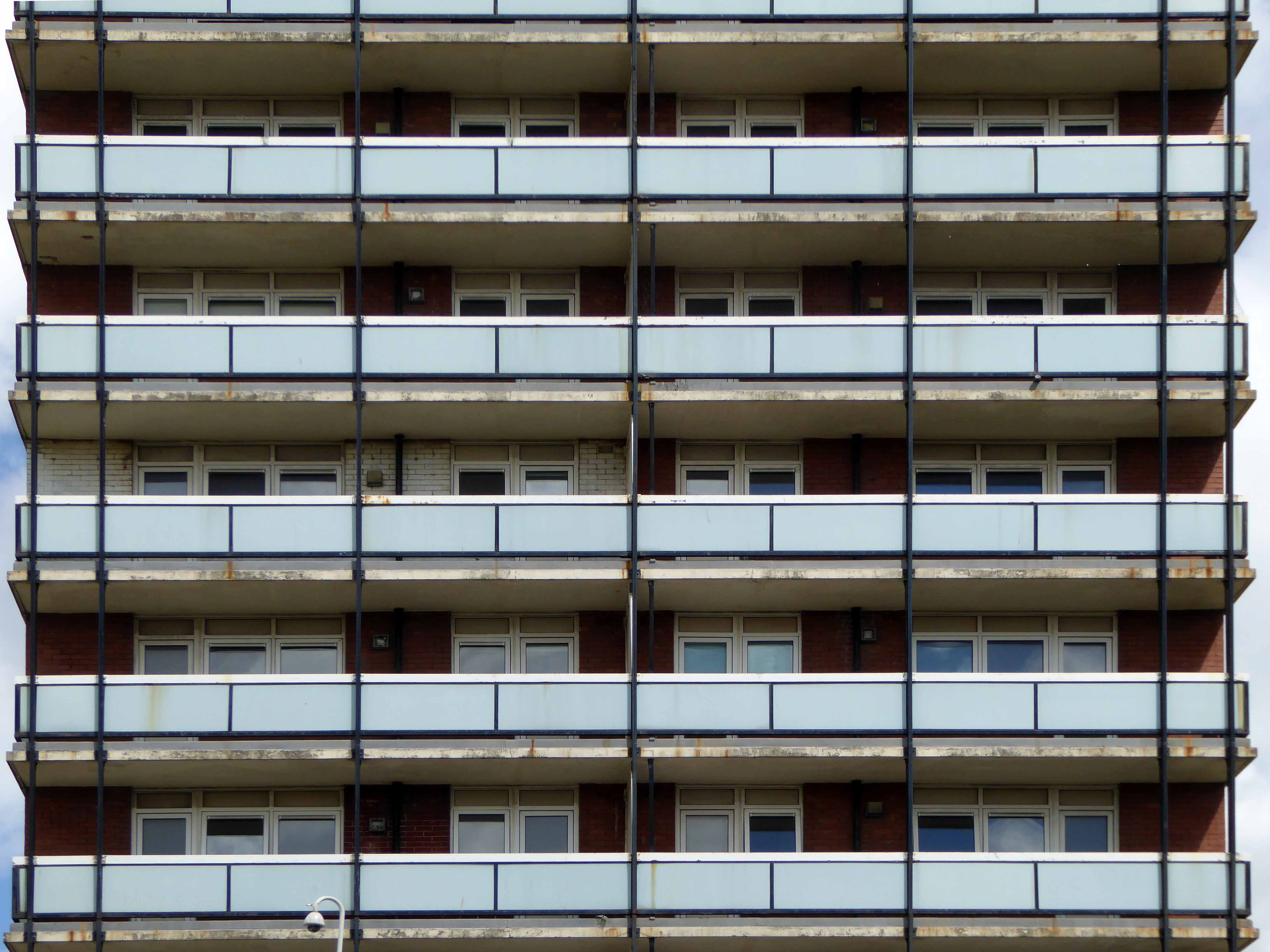
Woodward Court was spared – set aside for the homeless.
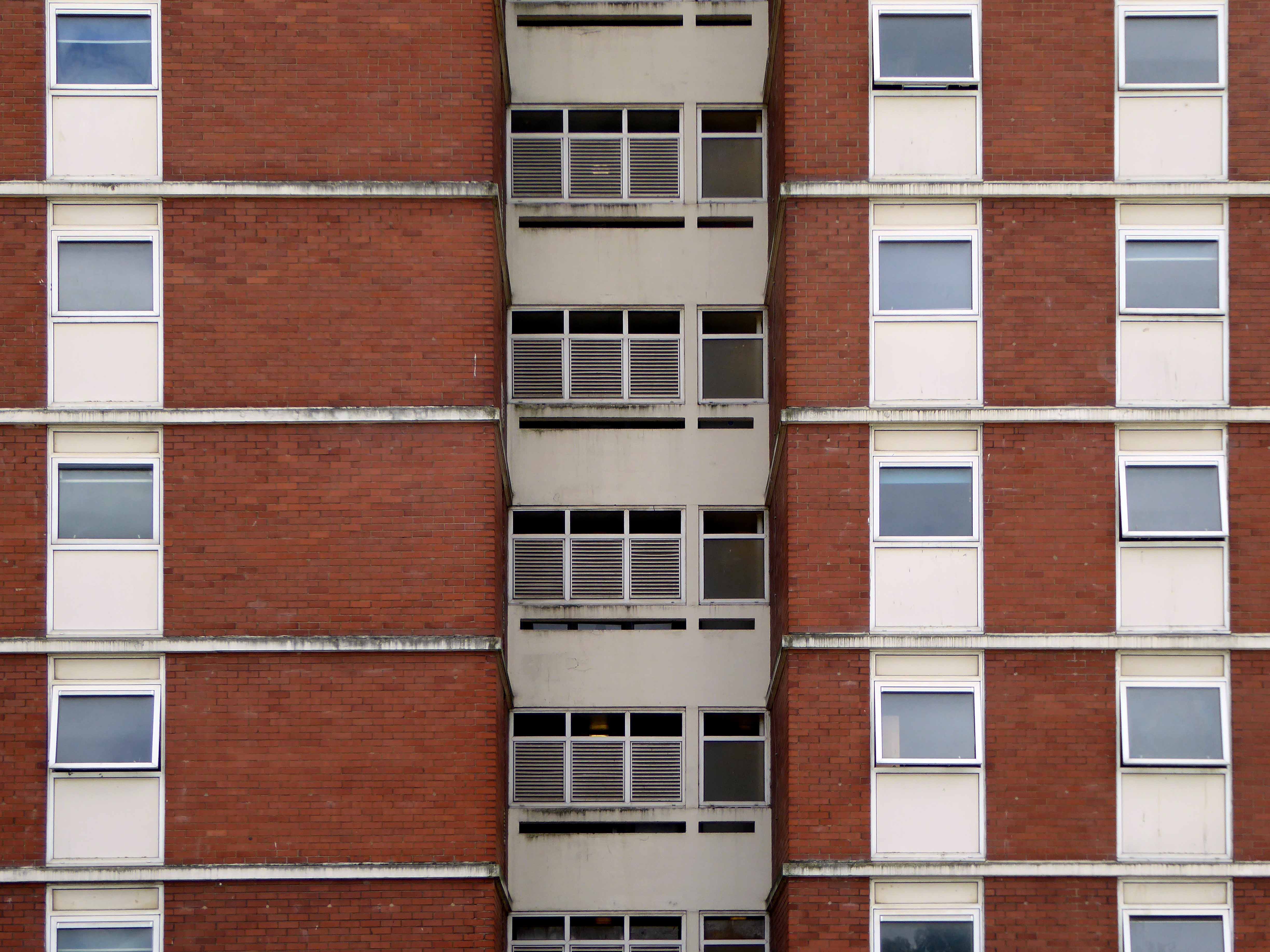
A period piece surrounded by Post Modern and Revivalist pretenders.
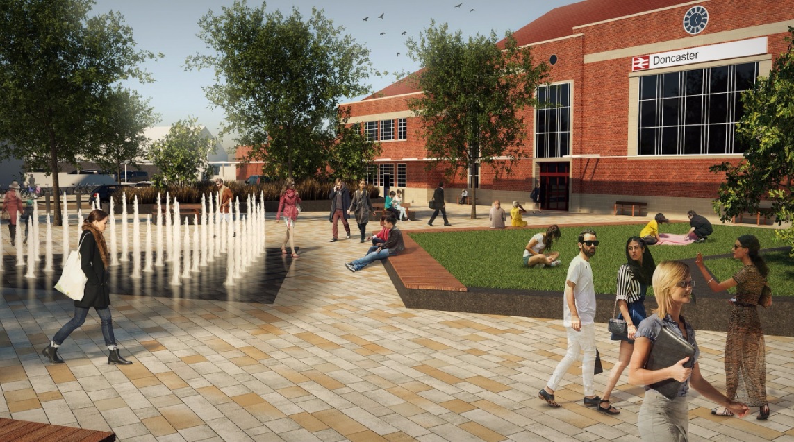
The railway station was built in 1849 replacing a temporary structure constructed a year earlier. It was rebuilt in its present form in 1933 and has had several slight modifications since that date, most notably in 2006, when the new interchange and connection to Frenchgate Centre opened.
The front elevation is realised in a typical inter-war brick functionalist style.
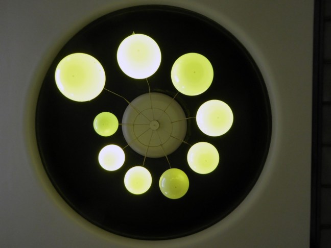
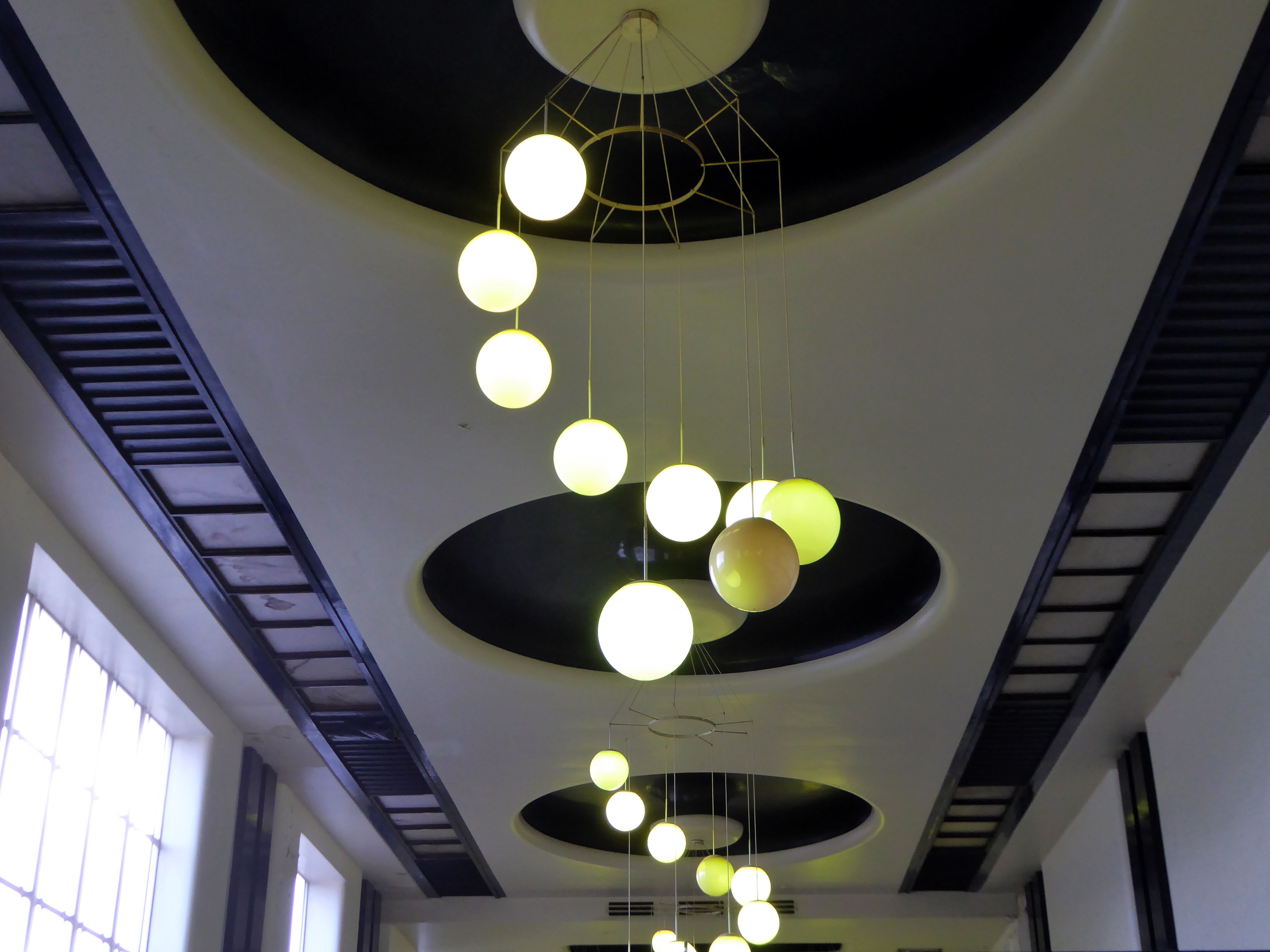
Of particular note are the lobby lighting fixtures and clock, the booking hall and offices are listed Grade II.
There are plans to redevelop the station approach replacing the current car parking with a pedestrianised piazza.
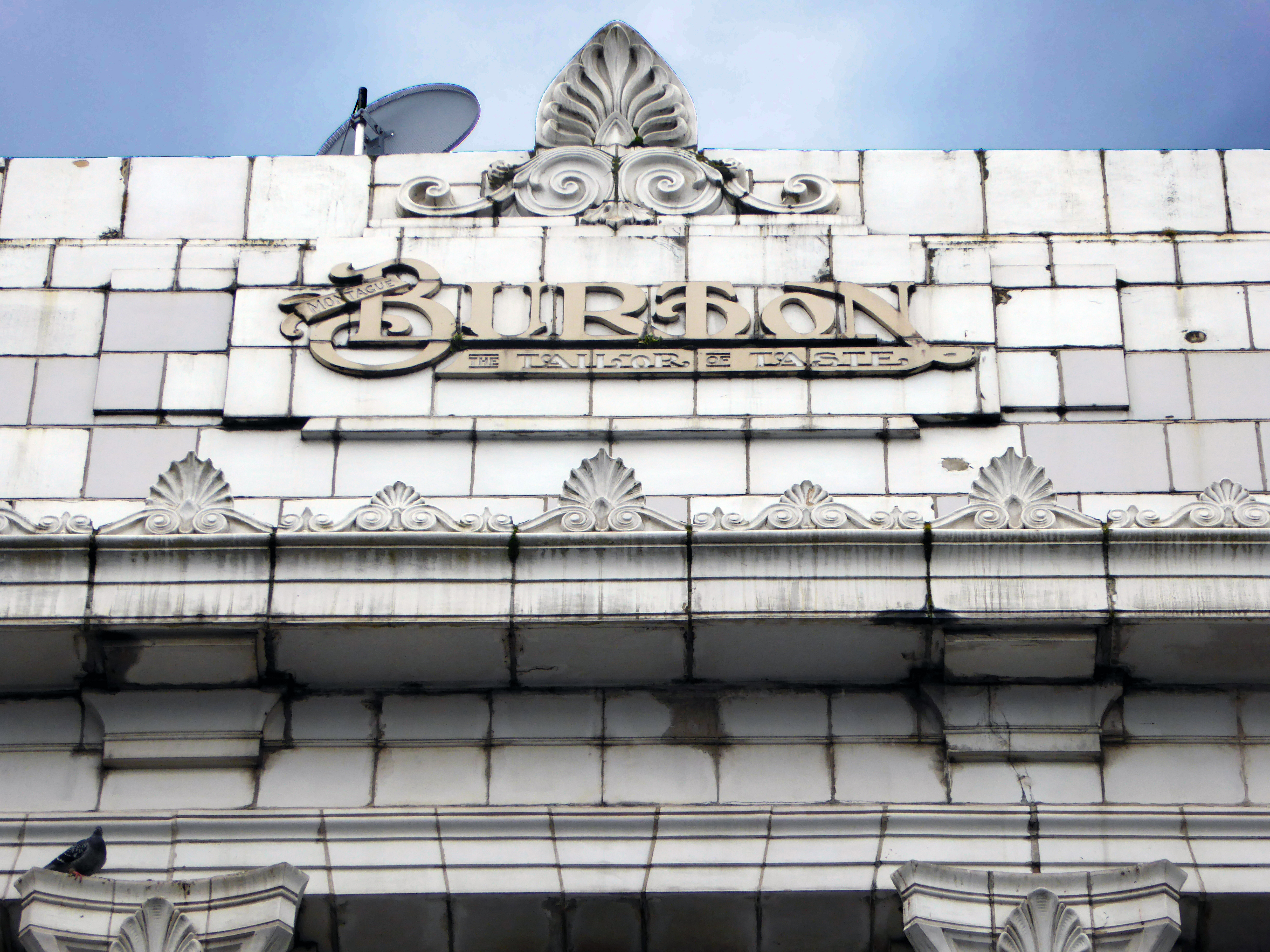
The High Street boast a former branch of Burton’s with its logo intact.
An intriguing Art Deco shop frontage – combining a menswear outlet with a pub.
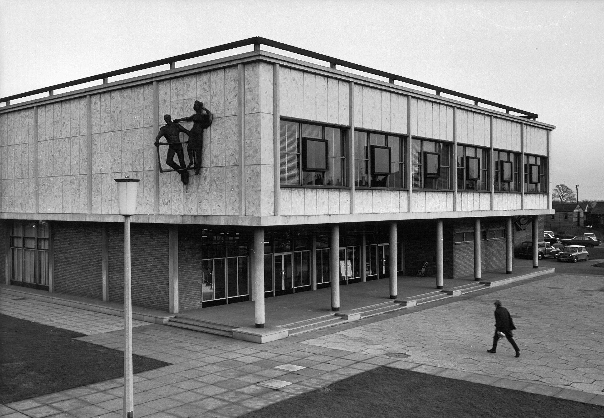
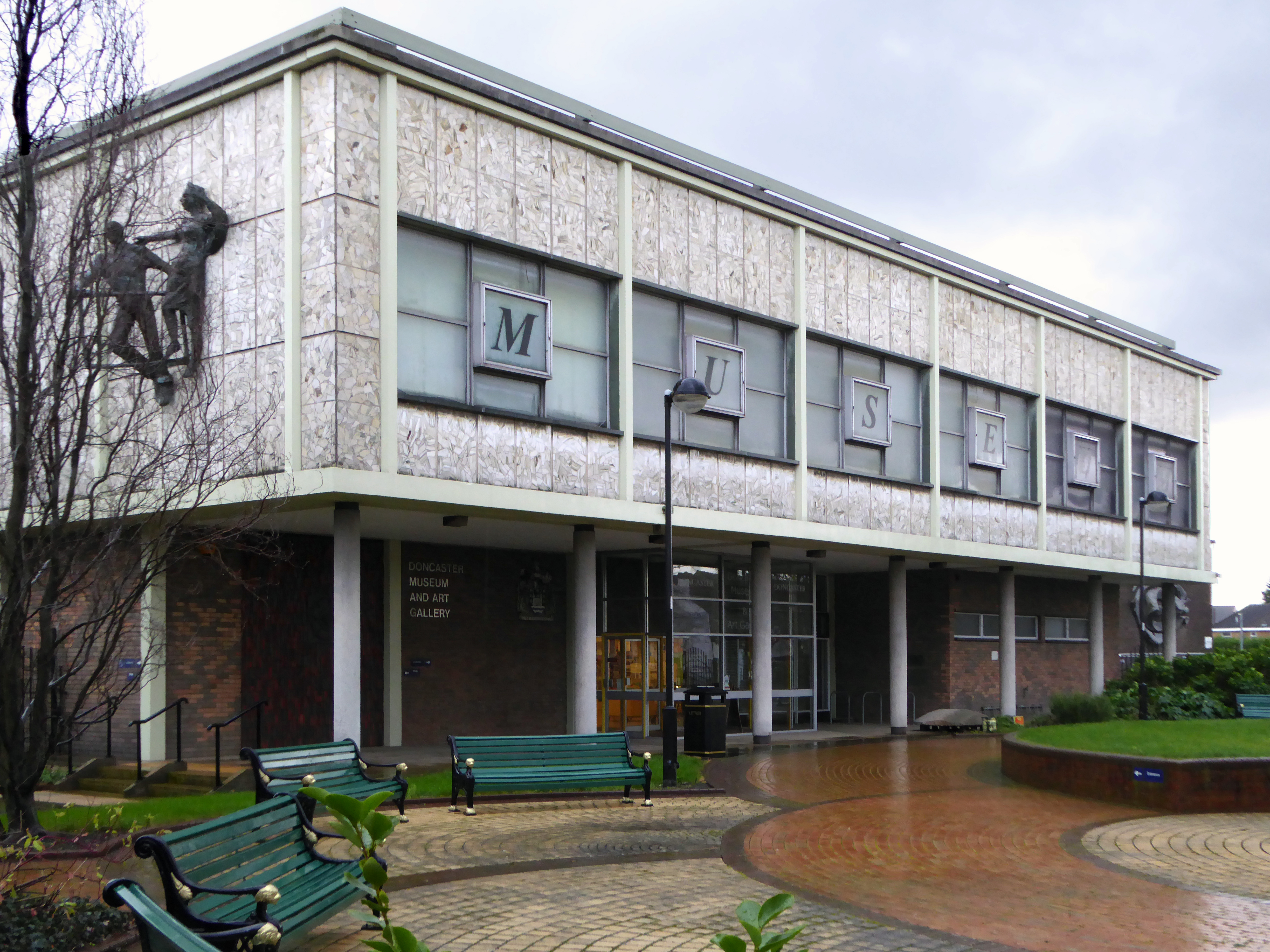
Further along an enormous Danum Co-operative Store in the grandest Deco manner – 1938-40. Designed by T H Johnson & Son for the Doncaster Co-operative Society Ltd.
Currently partially occupied with no access to the glass stairways.
Following the development of the Frenchgate Centre the Waterdale Centre sunk into a slow decline.
And the Staff of Life has lost a little of its estate pub period charm, following successive typographic makeovers and paint jobs.
From 1949 onwards plans were afoot to develop the Waterdale area of Doncaster – civic buildings, courts, educational provision and the like, WH Price the Borough Surveyor at the helm. In 1955 Frederick Gibberd was appointed to oversee the site, though many of his designs were unrealised, his Police Station and Law Courts opened in 1969.
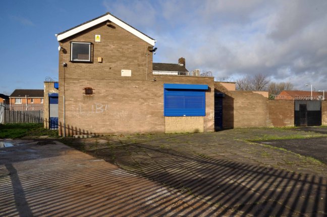
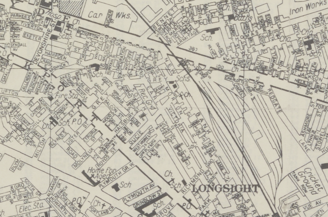
Exeter Close/Warmington Drive Manchester Longsight M12 4AT
Once there was this.
Once there was that.
Then there wasn’t.
That’s just the way of it.
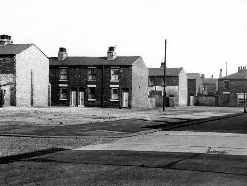
A dense web of streets awash with back to backs, jobs for all – in conditions perceived to be unfit for purpose.
Of a total of 201,627 present dwellings in Manchester, some 54,700, or 27.1 per cent., are estimated to be unfit. A comparison of slum clearance action taken by six major local authorities, Manchester, Leeds, Birmingham, Liverpool, Sheffield and Bristol, shows that for the five years ending 30th June, 1965, Manchester was top of the league, both in compulsory purchase orders confirmed and the number of houses demolished or closed.
Manchester’s figures -13,151 houses demolished or closed .
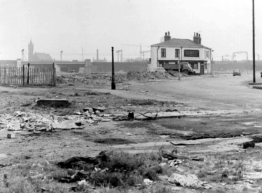
Whenever mass slum clearance was carried out, the pubs tended to remain, often for just a short time because – the story goes – demolition workers refused to touch them, as they wanted somewhere to drink during and after their shift.
This vision of municipal modernity was short lived, the estate was demolished in the 1980s and the new Coverdale Estate was constructed on the site in 1994.
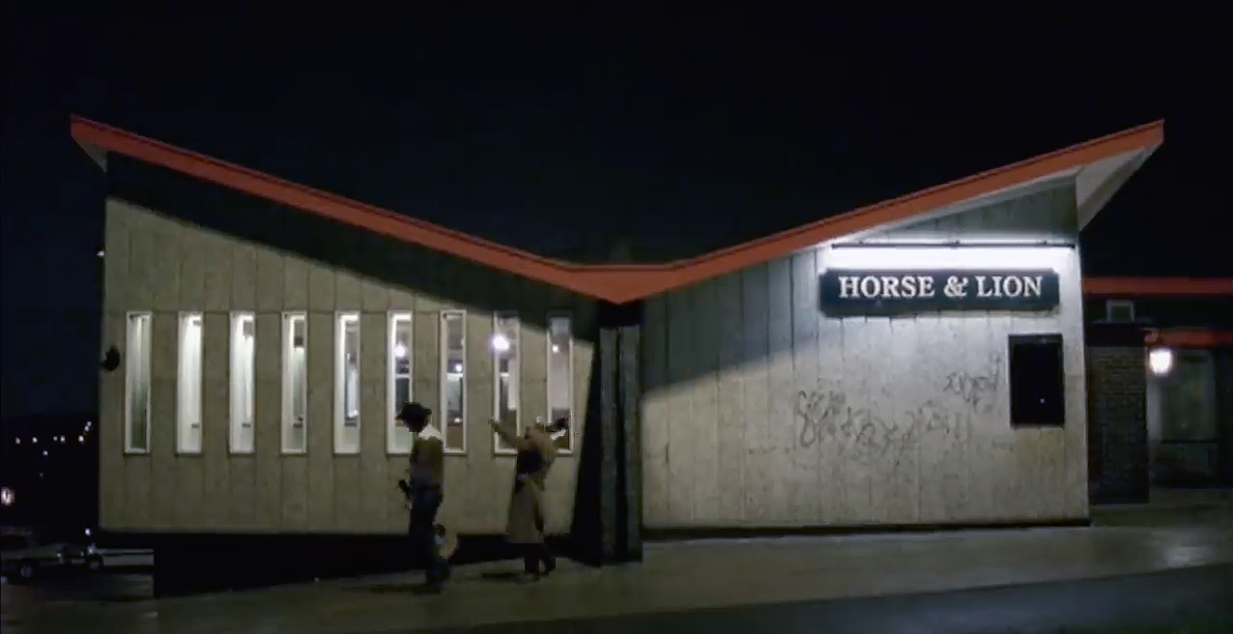
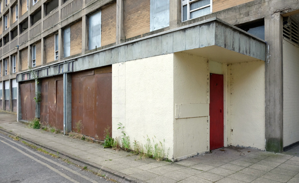
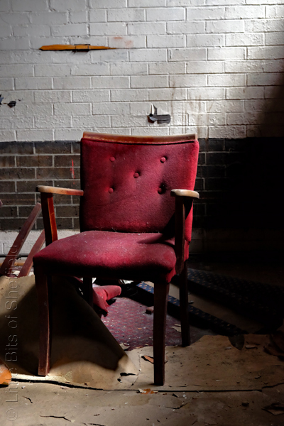
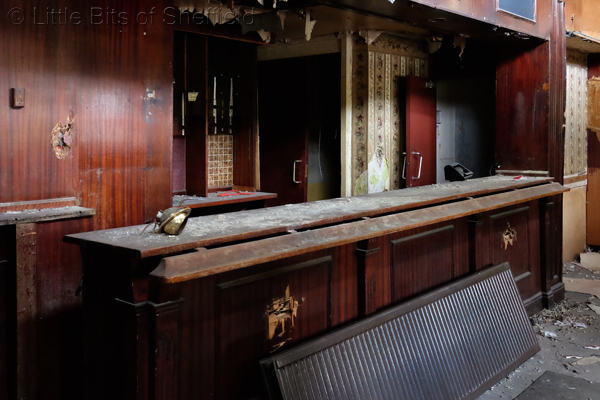
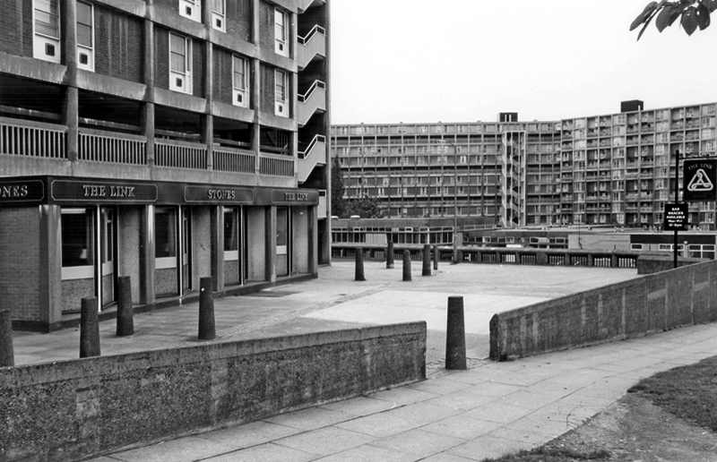
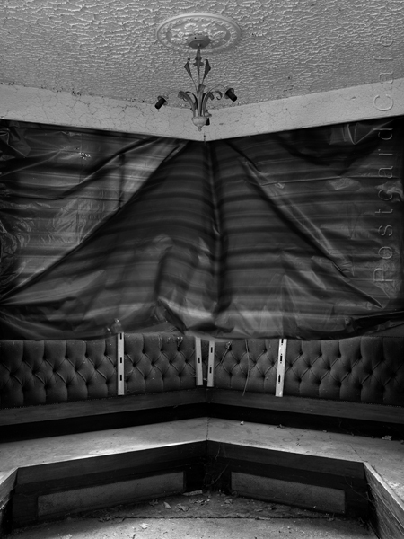
I’m a virtual visitor to the four pubs that served the population of Park Hill Estate.
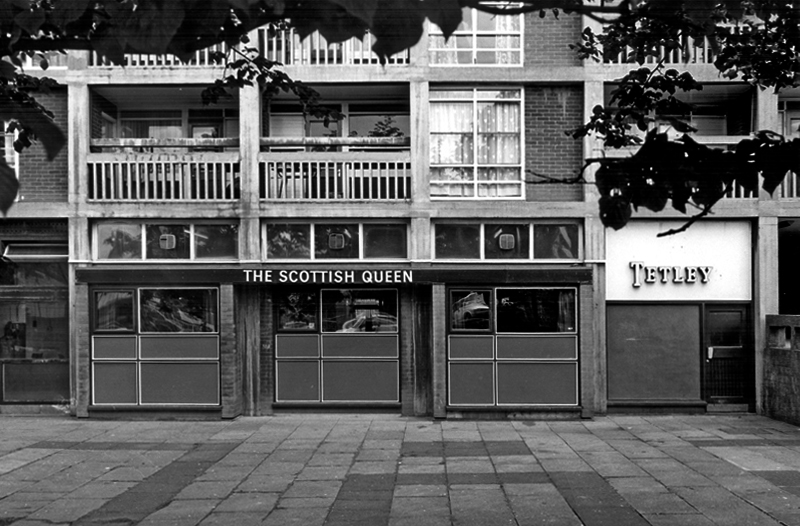
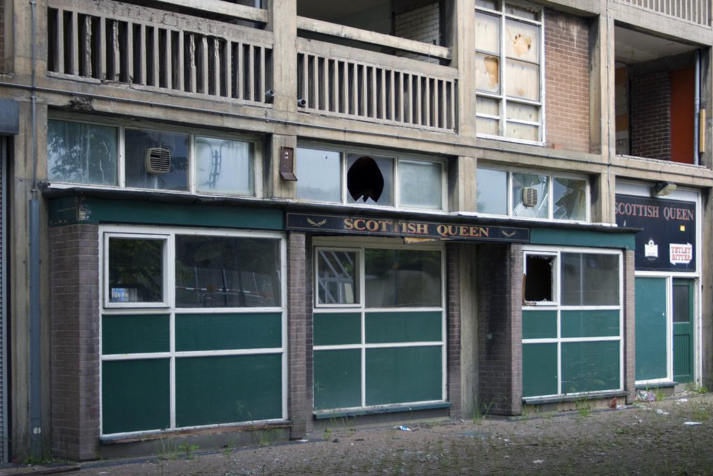
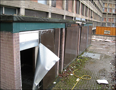
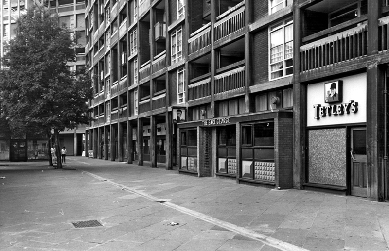
I arrived late on the scene from not too distant Manchester, sadly much too late to stop and have a pint in The Parkway, Scottish Queen, Link or Earl George.
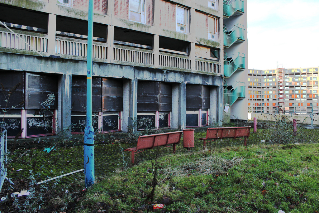
Built in the 1960s when municipal architecture spoke of optimism and innovation, the story of the estate is an oft told tale of decline and renovation.
Grade II* listed the building’s structure has prevailed, the original social structures, tenants and consequently their pubs have not.
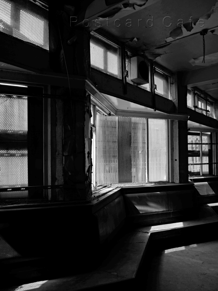
Piecing together photographs and the distant reminiscences of those that lived, breathed and drank in their pubs beneath the streets in the sky.
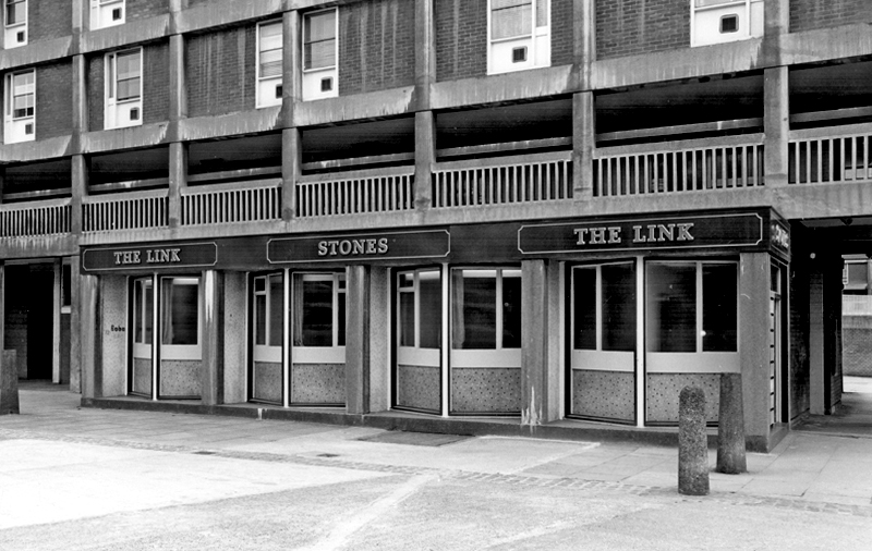
The Link on Park Hill had some colourful characters.
If you want any info on the Link next time you are in town see the man selling fishing tackle outside Castle Market ,he is called Chris Hardy his dad ran the link in the 60’s they used to have the Sun Inn on South St before Park Hill was built, tell Chris that Alan Betty’s cousin told you about him.
I once did a job outside the Scottish Queen and had a lump of concrete thrown at me! it landed about 2m away, that made me jump!
Joe Fox used to be the landlord in the George in the 70s, didn’t stand for any messing about.
Earl Francis! Of course! That was driving me mad; I was just going to ring my mum and ask her if she could remember what it was called. I think it closed in the early 90s, at the same time as the renovations of Hyde Park Walk and Terrace – 1990/1991, if I remember correctly.
The Earl Francis was still open in 1994 – the last time I went in there, but was dying on its feet.
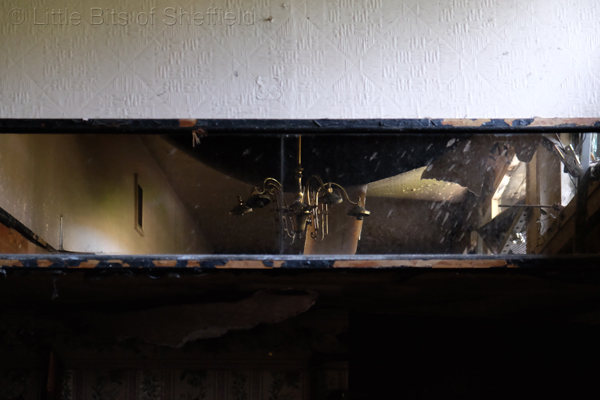
Park Hill is empty, and due to be refurbished.
It’s amazing to think that each complex had all these pubs and people actually went in them!Drove past Park Hill a few months ago at night and it didn’t look like a soul lived in them.
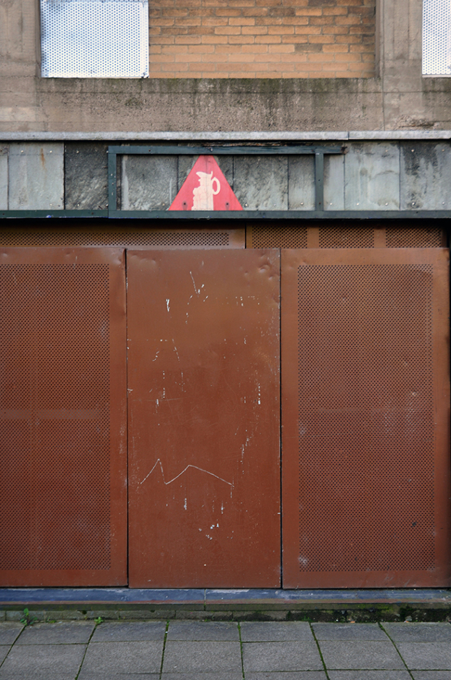
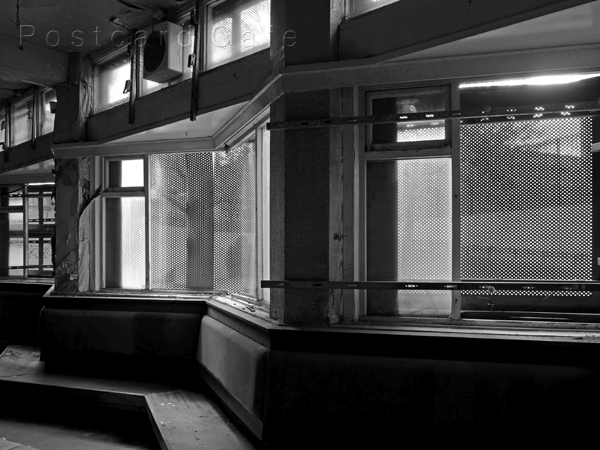
Not surprised the Tavern has closed down. Don’t know whether people are happy or sad about it…They looked like an absolute dive, but I’ve always wanted to go and have a look around them to see what they’re like close up!
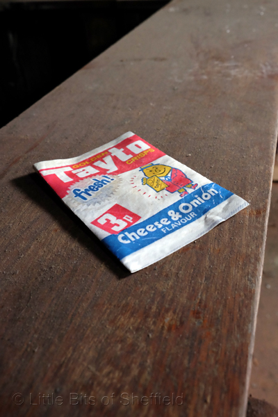
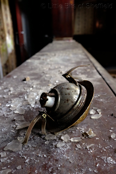
The flats and in particular the Parkway Tavern were used in the 2014 film ’71 – which was set in Northern Ireland. So this photograph showing the bar with a packet of crisps is actually slightly misleading because the crisp bag was only a printed film prop and what looks like broken glass on the bar is fake! – Mr C
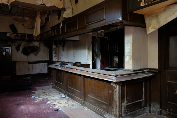
A new pub could open on the site of what was once voted Britain’s second most dangerous watering hole. The Scottish Queen at Park Hill was notorious for violence, with only the most hardy drinkers brave enough to cross its threshold.
April 2015 saw the launch of a new exhibition space in Sheffield, housed within the former Scottish Queen pub at the Brutalist icon that is the Park Hill estate. The Scottish Queen hosted a temporary programme of exhibitions, events and residencies in partnership with a range of artists and organisations from across Sheffield supported by S1 Artspace.
Possibly the second toughest art space in Britain.